Results for "Altea+|+9+>+206"
2021 results found.
Brésil: bons plans à Esperito Santo English translation pending
N'ayant pas trouvé bcp d'infos sur Esperito Santo et comptant nous y rendre en Novembre, y-a t-il quelqu'un qui pourrait nous fournir des détails sur cet état, et sur les choses à faire et à voir. (excursions en fôret, plages à ne pas louper, lieux historiques...etc)
Une autre question concerne l'ile d'ihla grande : est-elle vraiment agréable d'un point de vue fréquentation touristique en Novembre(pas un peu trop de monde ?) Peut-être y-a t-il des iles comparables mais un peu moins connue et un peu plus éloignée de Rio ?
Merci d'avance pour vos réponses que nous éspérons nombreuses.😉
Une autre question concerne l'ile d'ihla grande : est-elle vraiment agréable d'un point de vue fréquentation touristique en Novembre(pas un peu trop de monde ?) Peut-être y-a t-il des iles comparables mais un peu moins connue et un peu plus éloignée de Rio ?
Merci d'avance pour vos réponses que nous éspérons nombreuses.😉
Hikes in Santo Antão
Hello,
In mid-November, we’ll be in Mindelo and Santo Antão.
We’ve booked transportation with Kapverden Tours.
One trip is from Porto Novo to Ponta do Sol, including the hike from Corda to Coculi.
What’s the trail like?
Then we’ll be staying in Ponta do Sol,
Here’s what we’re planning: A hike to Fontainhas—what’s the best direction, considering we’re not great with climbs? No problem with flat terrain or descents. Take an aluguer to Ribeira Grande and continue along the coastal road.
With the agency: An excursion to Cruzinha with a short walk. Return to Porto Novo via the path from Cova to… I’m not sure where yet, to pick up the car for Porto Novo, since we’ll be taking the ferry that evening. We’ll have a guide for this hike.
We’d love to spend a day in Tarrafal, but getting back requires a boat or taxi, and it’s really expensive!
We’re a couple, 78 and 76 years old. What do you think of this itinerary?
Here’s what we’re planning: A hike to Fontainhas—what’s the best direction, considering we’re not great with climbs? No problem with flat terrain or descents. Take an aluguer to Ribeira Grande and continue along the coastal road.
With the agency: An excursion to Cruzinha with a short walk. Return to Porto Novo via the path from Cova to… I’m not sure where yet, to pick up the car for Porto Novo, since we’ll be taking the ferry that evening. We’ll have a guide for this hike.
We’d love to spend a day in Tarrafal, but getting back requires a boat or taxi, and it’s really expensive!
We’re a couple, 78 and 76 years old. What do you think of this itinerary?
Cape Verde island duo: which to choose based on my criteria?
Hi there,
I’ve been looking for a destination for a 2-week trip early next spring, and Cape Verde has been growing on me. (The flight isn’t too long, the temperatures are more than pleasant, and it’s an unknown country for me.)
The thing is, Cape Verde is pretty complicated when it comes to inter-island transfers, and I don’t want to spend my time in airports or on ferries—especially since those transfers aren’t exactly known for their reliability...
So, I’d like to limit internal flights to just 2, meaning the island I arrive on plus one other.
I’ve ruled out the all-inclusive islands: Sal and Boa Vista.
I’m torn between combining Santo Antão + São Vicente or Fogo + Santiago.
The goal of the trip is to see beautiful landscapes, go on day hikes (nothing multi-day), swim a little—though I prefer quiet spots—and enjoy 1 or 2 days in a city, but not much more than that!
In your opinion, which option would be the best, and why?
Thanks! :)
I’ve been looking for a destination for a 2-week trip early next spring, and Cape Verde has been growing on me. (The flight isn’t too long, the temperatures are more than pleasant, and it’s an unknown country for me.)
The thing is, Cape Verde is pretty complicated when it comes to inter-island transfers, and I don’t want to spend my time in airports or on ferries—especially since those transfers aren’t exactly known for their reliability...
So, I’d like to limit internal flights to just 2, meaning the island I arrive on plus one other.
I’ve ruled out the all-inclusive islands: Sal and Boa Vista.
I’m torn between combining Santo Antão + São Vicente or Fogo + Santiago.
The goal of the trip is to see beautiful landscapes, go on day hikes (nothing multi-day), swim a little—though I prefer quiet spots—and enjoy 1 or 2 days in a city, but not much more than that!
In your opinion, which option would be the best, and why?
Thanks! :)
Storm in the Canary Islands
15 days across Gran Canaria, El Hierro, and a dash of Tenerife under the storm Thérèse!
The planned itinerary will be slightly disrupted...
(The version without discussions is here)
The planned itinerary will be slightly disrupted...
(The version without discussions is here)
Gran Canaria... a trip that wasn't exactly thrilling
Okay, it wasn’t a total disaster either. Actually, I hesitated before starting this travel journal: is it even worth writing about a holiday that won’t leave an unforgettable memory?
In the end, I went for it (there aren’t many recent travel journals about this destination).
So, read on... or don’t .
Every time we’ve been to the Canary Islands, it’s been by default (basically: where can we go in winter or early spring when we only have a week—so not too far, not too much jet lag, but with decent weather?).
This time, we had two weeks, but the winter plan kept changing: first Thailand (dropped for personal reasons), then Martinique (dropped because of work leave dates that weren’t up to me), and finally, the Canary Islands.
We’ve already been to Tenerife (which we really liked) and Lanzarote (which we liked a little less). This year, two options: Gran Canaria or one of the smaller islands west of Tenerife (La Palma, or even La Gomera or El Hierro). We chose Gran Canaria... not sure it was the right call! Whose fault is it? Storm Thérèse’s! Yes, Storm Thérèse followed us on arrival, and its effects lasted quite a while. We had to adapt, cancel visits, change activities...
But even without Thérèse...
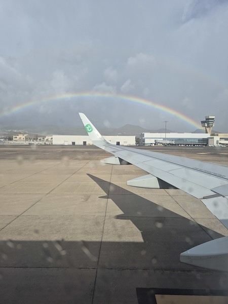
Saturday 21/03 Departure from Orly at 6:10 AM with Transavia. The plane took off on time and landed a little early, tossed around by strong winds before touching down. It had just rained, but it was (almost) no longer raining.
We quickly picked up our luggage and then the car at the Cicar counter. We got a Seat Arona instead of the Corsa we’d booked. Well, while the driving position didn’t feel great at first (I got used to it), the engine’s smoothness and power were much appreciated on the island’s winding and sometimes steep roads.
It was only 10 AM, and we couldn’t theoretically check into our accommodation until 3 PM (the owner promised to message me if it was ready earlier). So, we headed to the (big) *Jardín Botánico Viera y Clavijo*, where we planned to spend a few hours. We found a huge parking lot... empty. The passenger in the car in front of us (yes, we weren’t the only ones at the closed gate—there was a car in front and one behind) went to ask for info: it was closed due to the storm 😕. So, we calmly headed toward Puerto de las Nieves, on the northwest coast of the island.
The plan: go to a restaurant, visit the village, and do some shopping while waiting for early afternoon. As soon as we got out of the car, it started raining... we took shelter under the awning of a shop, waiting for it to pass. But the rain turned into a downpour, and within minutes, awning or not, Gore-Tex or not, we were soaked!
Since we were already wet, we might as well go to the restaurant—they weren’t far! But here’s the thing: contrary to what Google Maps said, they all opened at 1 PM, not noon! Back to the car, wading through 5 cm of water because all the village streets were flooded . The rain let up, we did some shopping, went to eat, and I got a message from the owner saying the accommodation was ready 🙂.
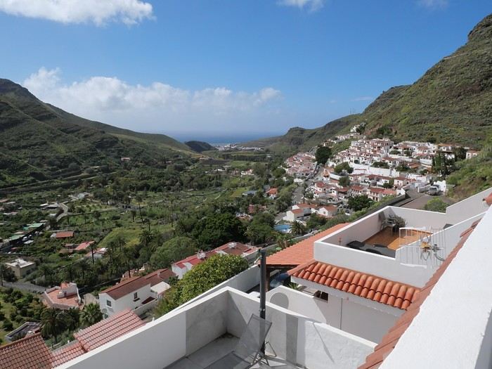
So, off we went to La Suerte, a few kilometers north of Agaete. The downside of the place, especially with luggage, is that you have to climb several flights of stairs via an outdoor staircase (after parking more or less far away on a steep street) to get there 😛). Of course, on the way from the car to the apartment, it started pouring again—the bags got soaked! Enough rain for today! We settled in quietly, and by late afternoon, we could (finally!) go admire the view from the terrace.
Every time we’ve been to the Canary Islands, it’s been by default (basically: where can we go in winter or early spring when we only have a week—so not too far, not too much jet lag, but with decent weather?).
This time, we had two weeks, but the winter plan kept changing: first Thailand (dropped for personal reasons), then Martinique (dropped because of work leave dates that weren’t up to me), and finally, the Canary Islands.
We’ve already been to Tenerife (which we really liked) and Lanzarote (which we liked a little less). This year, two options: Gran Canaria or one of the smaller islands west of Tenerife (La Palma, or even La Gomera or El Hierro). We chose Gran Canaria... not sure it was the right call! Whose fault is it? Storm Thérèse’s! Yes, Storm Thérèse followed us on arrival, and its effects lasted quite a while. We had to adapt, cancel visits, change activities...
But even without Thérèse...
Saturday 21/03 Departure from Orly at 6:10 AM with Transavia. The plane took off on time and landed a little early, tossed around by strong winds before touching down. It had just rained, but it was (almost) no longer raining.
We quickly picked up our luggage and then the car at the Cicar counter. We got a Seat Arona instead of the Corsa we’d booked. Well, while the driving position didn’t feel great at first (I got used to it), the engine’s smoothness and power were much appreciated on the island’s winding and sometimes steep roads.
It was only 10 AM, and we couldn’t theoretically check into our accommodation until 3 PM (the owner promised to message me if it was ready earlier). So, we headed to the (big) *Jardín Botánico Viera y Clavijo*, where we planned to spend a few hours. We found a huge parking lot... empty. The passenger in the car in front of us (yes, we weren’t the only ones at the closed gate—there was a car in front and one behind) went to ask for info: it was closed due to the storm 😕. So, we calmly headed toward Puerto de las Nieves, on the northwest coast of the island.
The plan: go to a restaurant, visit the village, and do some shopping while waiting for early afternoon. As soon as we got out of the car, it started raining... we took shelter under the awning of a shop, waiting for it to pass. But the rain turned into a downpour, and within minutes, awning or not, Gore-Tex or not, we were soaked!
Since we were already wet, we might as well go to the restaurant—they weren’t far! But here’s the thing: contrary to what Google Maps said, they all opened at 1 PM, not noon! Back to the car, wading through 5 cm of water because all the village streets were flooded . The rain let up, we did some shopping, went to eat, and I got a message from the owner saying the accommodation was ready 🙂.
So, off we went to La Suerte, a few kilometers north of Agaete. The downside of the place, especially with luggage, is that you have to climb several flights of stairs via an outdoor staircase (after parking more or less far away on a steep street) to get there 😛). Of course, on the way from the car to the apartment, it started pouring again—the bags got soaked! Enough rain for today! We settled in quietly, and by late afternoon, we could (finally!) go admire the view from the terrace.
Two weeks in Santo Antão and São Vicente – trip report
Hi everyone!
The forum has been a huge help during my moments of doubt, and since Cape Verde isn’t a destination with many discussions, I felt I had to share my trip report 🙂
First, the EASE: I could never validate it from my phone—I tried 50 times without success, and on the computer, it worked the first time. Then, Cabo Verde Airlines: forget online check-in. I went to the airport early to get my window seat (and in the end, the plane wasn’t full—I had three seats to myself, so I could finish my night peacefully). No in-flight entertainment for those who don’t sleep on planes.
Monday 9: Flight + arrival at Antonio’s (Oia Mindelo Guesthouse). Antonio’s apartment is up on the hill, but really, it’s only a 10-minute walk to the beach and 10 minutes to the city center (depending on where in the center). He picked me up at the airport (1000$). I continued relaxing by doing... nothing on the beach. Dinner in town at Café Mindelo: a pretty place, but otherwise meh—expensive and not necessarily good (2100$ for a beer and a fish that didn’t seem freshly caught as advertised). Tuesday 10: Antonio offered to do a tour of the island (for cheap), and we left with his other guests (a lovely English couple, 76 and 77 years old). Stops at Salamansa (I felt something special on that beach—I could’ve stayed there for an hour doing nothing), then another scenic spot, a restaurant, and Baias das Gatas (I took a quick dip, but to me, it had less charm than Salamansa). Then we crossed the island to return to São Pedro (beautiful but windy; the village looks cute). Exhausted, I went to bed early because of the ferry to Santo Antão the next day. Wednesday 11: Antonio took me to the ferry, and we’ll see each other again since he’s hosting me at his aunt’s place during Carnival. On the ferry, I had a Booking.com reservation for what I thought was in Ribeira Grande (the town), but it was actually *in* the ribeira—specifically in Manta Velha (aluguer to Cruzinha ~600$). I thought I’d fallen into a hole, but I ended up loving it—Casa Familiar Gilda. Gilda is a divine cook (dinner for 1000$—don’t eat lunch, or there won’t be room), the village has a typical rural Santo Antão vibe, the place has great energy, and you can get around easily by aluguer. Thursday 12: I left early by aluguer to Ribeira Grande (250$), then another aluguer to Ponta do Sol (100$)—a sleepy beauty at that hour—to do the Ponta do Sol-Cruzinha hike, finishing in Cha de Igreja. Departure at 8:22 AM from the cemetery in Ponta do Sol, passing through Fontainhas (those doing it the other way will have a fabulous climb at the end 😏), and let’s go! I loved this glimpse of rural life—past or present—the sea is stunning, and we were shaded most of the way (though it goes up and down, it’s manageable). The arrival at Cha de Mar is breathtaking, and Cruzinha is a charming little town (arrived at 12:30 PM). I’d brought my swimsuit after reading there was a beach, but I packed it back up—too many waves and big pebbles. I continued to Cha de Igreja (25 more minutes) after a short break (ask for the path that doesn’t go by the road). It’s adorable with its church square (you don’t see this layout much elsewhere). I might’ve stayed longer to enjoy the place, but a taxi driver asked if I wanted to return to Manta Velha (1000$), and like a fool, I said yes (it was 2:30 PM—I could’ve waited for the 4:30 PM aluguer for 100$, but oh well). But since I still had energy, I decided to see if I could find a grog distillery. I ran into a French guy arriving at Gilda’s, and we ended up talking to Rodrigo, who explained everything from A to Z about how they make grog (the simple cane juice is amazingly good—but the work is clearly tough). Friday 13: Transfer to Xoxo on Djalma’s advice 😉, where I’d booked a room at Casa Xoxo. I did the hike to Rabo Crusto... it’s tough, but I kept quiet when I saw a pregnant woman doing it with her two little ones 😄. There’s also a distillery I didn’t linger in, and I took a tea break with that wonderful landscape before heading back. I couldn’t find the path Jean-Michel had told me about (take a right at the village entrance), so I went back down to the water reservoir to turn off and take the waterfall path (anyone can point it out if needed). The bedding at Casa Xoxo was perfect, but the dinner atmosphere was less family-like. Saturday 14: No one at Casa Xoxo could tell me when the aluguer passed, so I scarfed down my breakfast and headed down a bit. I found one (not sure if he’d planned to work, but there were three of us, so he left). Arrived in Ribeira Grande, an aluguer driver told me the coastal road to Porto Novo was closed and we had to take the Corde road—but no one was leaving, so we’d have to charter... Sometimes, you just have to say it: aluguer drivers say there’s no ride just to make you pay the private price (3500$). But this time, it was true! With another French couple, we wanted to go to Tarrafal. Our driver called the Porto Novo-Tarrafal aluguer to wait for us. The Corde road is stunning—more different landscapes (thorny forest, misty peaks...). Changed aluguers in Porto Novo and headed to Tarrafal. Another world—lunar landscape on the way. Arrived in Tarrafal and relaxed. Sunday 15: Hike from Tarrafal to Monte Trigo, left at 8 AM, and I’m glad I did—I was in the shade until about 9:30 AM, then the sun got strong. Beautiful walk, arrived in Monte Trigo around 11:30 AM. The people weren’t particularly friendly, but oh well. Swam at the little beach in Monte Trigo (the water is *so* good). I waited for other French people who had “booked” a boat for the return. Came back with Javi (50 min—1000$ each), who lent us masks and snorkels for some snorkeling. Had grog with Ludo, Estelle’s husband, who was waiting at the bar, then filled my grog bottle at the *mercearia*. I admit, it’s delicious, but I don’t remember much of that evening 😇🤪. Except Javi put on a show saying he’d been robbed, had no money, and needed to pay the boat owner, etc. People paid again (apparently not me, since Ludo, Estelle, and I arrived at the restaurant after Javi’s drama). FYI, Javi does this often—my host had warned the couple renting the other room to watch out for him because he scams people for money. So Javi is 35 with hazel/special-colored eyes. But if you don’t repay the “service,” the day was still great. Monday 16: Several of us were taking the late-afternoon boat, so we chartered an aluguer (7000$) to avoid the 6 AM one—trip—boat to Mindelo. Antonio picked me up at the ferry, and boom—Carnival! I found a spot on Rua de Lisboa. My neighbor was from Santo Antão just for Carnival, spoke French, and explained that last year’s Carnival started 3 hours late because a float couldn’t fit under the power lines 😏 (like they don’t know the height by now hahaha). On Monday, it’s the teachers (nice—kind of a warm-up) and the Madingas. Once they passed my spot, I followed them along the route—I LOVED it! By midnight, they still hadn’t reached Praça Nova, and the police told them to speed up, but I loved that energy! Tuesday 17—Mardi Gras: Beach day, then Carnival! Antonio had bought me a seated ticket just in case (300$). Ended up in front of a punch stand, where I ran into two French women I’d met in Manta Velha. Two guys from Mindelo talked to us, and we did Carnival with them. And what was bound to happen, happened: a float couldn’t pass because... it was taller than the power lines 😏😏😏. The dancers kept dancing while the crowd tried to lift the cable. Finally, a guy in a tree climbed higher and used a pole to lift it... and the parade could continue 😉. Around 12:30–1:30 AM, when the concert was supposed to start, the power went out. I went home and later learned the concert started around 3 AM. Wednesday 18: I went home because I was taking the boat back to Santo Antão, heading to Casa Familiar Gilda. Walked the loop from Manta Velha. Thursday 19: Left early for Ribeira da Paul to do the loop to Sandra’s House. It’s truly breathtaking! Back at Gilda’s, I chilled. I wanted to go to Sinagoga’s natural pools, but the hike had worn me out. Friday 20: Return to Mindelo on the red company’s ferry—no comparison: way more comfortable than the blue company’s, especially for someone prone to seasickness. Beach. Exhausted, I struggled to sleep because the shop on the ground floor of my rental had a party until 3 AM (and the windows aren’t double-glazed—*hi*—but that’s common in Mindelo). Saturday 21: Ran into Estelle and Ludo by chance (the city’s small), and we arranged to share a taxi the next day since we had the same return flight. Beach (I tried Lazaretto Beach, but nope—not great—dead fish + weird smell = bad signs). So Laginhia was fine, and in the evening, a restaurant with singers, then Caravelle (the ground-floor shop didn’t bother me since I got home when they were saying goodbye 😏). Too bad—I dance salsa, bachata, kompa, zouk, but not kizomba hahaha, but it was still fun. Sunday 22: Took a taxi with Ludo and Estelle (1200$). Arrived *ages* before takeoff (no exchange office—get escudos in town if you have any left). Boom—CDG, boom—RER... home.
There you go—a super long trip report. Not sure if it’ll help, but the digital detox was amazing. These two islands are very different but so beautiful. I only got a glimpse, but they’re worth the trip. I was lucky to see Carnival (what joy in that city!) and happy the Cambodia ticket (my first idea) was way too expensive 😉
First, the EASE: I could never validate it from my phone—I tried 50 times without success, and on the computer, it worked the first time. Then, Cabo Verde Airlines: forget online check-in. I went to the airport early to get my window seat (and in the end, the plane wasn’t full—I had three seats to myself, so I could finish my night peacefully). No in-flight entertainment for those who don’t sleep on planes.
Monday 9: Flight + arrival at Antonio’s (Oia Mindelo Guesthouse). Antonio’s apartment is up on the hill, but really, it’s only a 10-minute walk to the beach and 10 minutes to the city center (depending on where in the center). He picked me up at the airport (1000$). I continued relaxing by doing... nothing on the beach. Dinner in town at Café Mindelo: a pretty place, but otherwise meh—expensive and not necessarily good (2100$ for a beer and a fish that didn’t seem freshly caught as advertised). Tuesday 10: Antonio offered to do a tour of the island (for cheap), and we left with his other guests (a lovely English couple, 76 and 77 years old). Stops at Salamansa (I felt something special on that beach—I could’ve stayed there for an hour doing nothing), then another scenic spot, a restaurant, and Baias das Gatas (I took a quick dip, but to me, it had less charm than Salamansa). Then we crossed the island to return to São Pedro (beautiful but windy; the village looks cute). Exhausted, I went to bed early because of the ferry to Santo Antão the next day. Wednesday 11: Antonio took me to the ferry, and we’ll see each other again since he’s hosting me at his aunt’s place during Carnival. On the ferry, I had a Booking.com reservation for what I thought was in Ribeira Grande (the town), but it was actually *in* the ribeira—specifically in Manta Velha (aluguer to Cruzinha ~600$). I thought I’d fallen into a hole, but I ended up loving it—Casa Familiar Gilda. Gilda is a divine cook (dinner for 1000$—don’t eat lunch, or there won’t be room), the village has a typical rural Santo Antão vibe, the place has great energy, and you can get around easily by aluguer. Thursday 12: I left early by aluguer to Ribeira Grande (250$), then another aluguer to Ponta do Sol (100$)—a sleepy beauty at that hour—to do the Ponta do Sol-Cruzinha hike, finishing in Cha de Igreja. Departure at 8:22 AM from the cemetery in Ponta do Sol, passing through Fontainhas (those doing it the other way will have a fabulous climb at the end 😏), and let’s go! I loved this glimpse of rural life—past or present—the sea is stunning, and we were shaded most of the way (though it goes up and down, it’s manageable). The arrival at Cha de Mar is breathtaking, and Cruzinha is a charming little town (arrived at 12:30 PM). I’d brought my swimsuit after reading there was a beach, but I packed it back up—too many waves and big pebbles. I continued to Cha de Igreja (25 more minutes) after a short break (ask for the path that doesn’t go by the road). It’s adorable with its church square (you don’t see this layout much elsewhere). I might’ve stayed longer to enjoy the place, but a taxi driver asked if I wanted to return to Manta Velha (1000$), and like a fool, I said yes (it was 2:30 PM—I could’ve waited for the 4:30 PM aluguer for 100$, but oh well). But since I still had energy, I decided to see if I could find a grog distillery. I ran into a French guy arriving at Gilda’s, and we ended up talking to Rodrigo, who explained everything from A to Z about how they make grog (the simple cane juice is amazingly good—but the work is clearly tough). Friday 13: Transfer to Xoxo on Djalma’s advice 😉, where I’d booked a room at Casa Xoxo. I did the hike to Rabo Crusto... it’s tough, but I kept quiet when I saw a pregnant woman doing it with her two little ones 😄. There’s also a distillery I didn’t linger in, and I took a tea break with that wonderful landscape before heading back. I couldn’t find the path Jean-Michel had told me about (take a right at the village entrance), so I went back down to the water reservoir to turn off and take the waterfall path (anyone can point it out if needed). The bedding at Casa Xoxo was perfect, but the dinner atmosphere was less family-like. Saturday 14: No one at Casa Xoxo could tell me when the aluguer passed, so I scarfed down my breakfast and headed down a bit. I found one (not sure if he’d planned to work, but there were three of us, so he left). Arrived in Ribeira Grande, an aluguer driver told me the coastal road to Porto Novo was closed and we had to take the Corde road—but no one was leaving, so we’d have to charter... Sometimes, you just have to say it: aluguer drivers say there’s no ride just to make you pay the private price (3500$). But this time, it was true! With another French couple, we wanted to go to Tarrafal. Our driver called the Porto Novo-Tarrafal aluguer to wait for us. The Corde road is stunning—more different landscapes (thorny forest, misty peaks...). Changed aluguers in Porto Novo and headed to Tarrafal. Another world—lunar landscape on the way. Arrived in Tarrafal and relaxed. Sunday 15: Hike from Tarrafal to Monte Trigo, left at 8 AM, and I’m glad I did—I was in the shade until about 9:30 AM, then the sun got strong. Beautiful walk, arrived in Monte Trigo around 11:30 AM. The people weren’t particularly friendly, but oh well. Swam at the little beach in Monte Trigo (the water is *so* good). I waited for other French people who had “booked” a boat for the return. Came back with Javi (50 min—1000$ each), who lent us masks and snorkels for some snorkeling. Had grog with Ludo, Estelle’s husband, who was waiting at the bar, then filled my grog bottle at the *mercearia*. I admit, it’s delicious, but I don’t remember much of that evening 😇🤪. Except Javi put on a show saying he’d been robbed, had no money, and needed to pay the boat owner, etc. People paid again (apparently not me, since Ludo, Estelle, and I arrived at the restaurant after Javi’s drama). FYI, Javi does this often—my host had warned the couple renting the other room to watch out for him because he scams people for money. So Javi is 35 with hazel/special-colored eyes. But if you don’t repay the “service,” the day was still great. Monday 16: Several of us were taking the late-afternoon boat, so we chartered an aluguer (7000$) to avoid the 6 AM one—trip—boat to Mindelo. Antonio picked me up at the ferry, and boom—Carnival! I found a spot on Rua de Lisboa. My neighbor was from Santo Antão just for Carnival, spoke French, and explained that last year’s Carnival started 3 hours late because a float couldn’t fit under the power lines 😏 (like they don’t know the height by now hahaha). On Monday, it’s the teachers (nice—kind of a warm-up) and the Madingas. Once they passed my spot, I followed them along the route—I LOVED it! By midnight, they still hadn’t reached Praça Nova, and the police told them to speed up, but I loved that energy! Tuesday 17—Mardi Gras: Beach day, then Carnival! Antonio had bought me a seated ticket just in case (300$). Ended up in front of a punch stand, where I ran into two French women I’d met in Manta Velha. Two guys from Mindelo talked to us, and we did Carnival with them. And what was bound to happen, happened: a float couldn’t pass because... it was taller than the power lines 😏😏😏. The dancers kept dancing while the crowd tried to lift the cable. Finally, a guy in a tree climbed higher and used a pole to lift it... and the parade could continue 😉. Around 12:30–1:30 AM, when the concert was supposed to start, the power went out. I went home and later learned the concert started around 3 AM. Wednesday 18: I went home because I was taking the boat back to Santo Antão, heading to Casa Familiar Gilda. Walked the loop from Manta Velha. Thursday 19: Left early for Ribeira da Paul to do the loop to Sandra’s House. It’s truly breathtaking! Back at Gilda’s, I chilled. I wanted to go to Sinagoga’s natural pools, but the hike had worn me out. Friday 20: Return to Mindelo on the red company’s ferry—no comparison: way more comfortable than the blue company’s, especially for someone prone to seasickness. Beach. Exhausted, I struggled to sleep because the shop on the ground floor of my rental had a party until 3 AM (and the windows aren’t double-glazed—*hi*—but that’s common in Mindelo). Saturday 21: Ran into Estelle and Ludo by chance (the city’s small), and we arranged to share a taxi the next day since we had the same return flight. Beach (I tried Lazaretto Beach, but nope—not great—dead fish + weird smell = bad signs). So Laginhia was fine, and in the evening, a restaurant with singers, then Caravelle (the ground-floor shop didn’t bother me since I got home when they were saying goodbye 😏). Too bad—I dance salsa, bachata, kompa, zouk, but not kizomba hahaha, but it was still fun. Sunday 22: Took a taxi with Ludo and Estelle (1200$). Arrived *ages* before takeoff (no exchange office—get escudos in town if you have any left). Boom—CDG, boom—RER... home.
There you go—a super long trip report. Not sure if it’ll help, but the digital detox was amazing. These two islands are very different but so beautiful. I only got a glimpse, but they’re worth the trip. I was lucky to see Carnival (what joy in that city!) and happy the Cambodia ticket (my first idea) was way too expensive 😉
From the Awakening to Travel to Morocco in the 90s
As I’ve mentioned elsewhere, I inherited my love of travel from my parents and some of my grandparents. A strong passion, but one that was unfortunately limited by our family’s modest resources. Back then, living in northern Alsace, a simple trip to the southern part of the region—with the Wine Route as our destination—felt like an extraordinary journey to a land of plenty for the little boy I was in the late 60s and early 70s.
Everything seemed so huge when you were still just a kid.
Back then, I was overwhelmed by countless sensations—I was already highly sensitive, with a keen mind and a nose and taste buds that were developing like a pro’s. Which, as I’d later realize, wasn’t always an advantage.
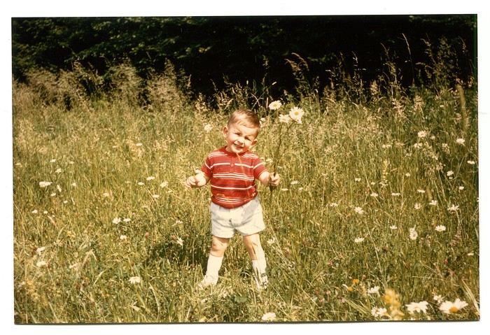
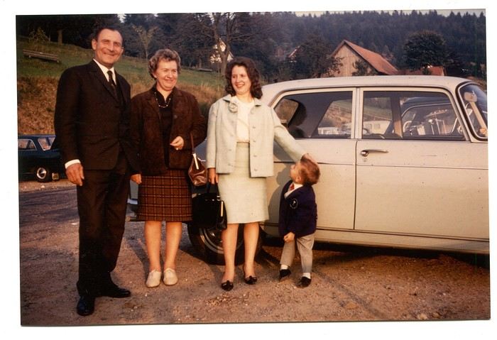
Those magical days always began with a gentle late-spring or midsummer morning. The interior of the white Peugeot 404, license plate 210 LZ 67, had already soaked up the sun before the engine purred to life, and the cabin gave off a scent I could still recognize today—a fragrance I found so pleasant. Back then, I had no idea it was just the smell of warm plastic from the car’s interior. Yes, the scents of the 404 on sunny days became my madeleine de Proust... What’s more, the whole family was unusually cheerful because those moments of relaxation and leisure were rare. Everyone worked, and no one had an easy job or was well paid. Without the *Trente Glorieuses*, these experiences might never have happened.
Once we crossed the canton’s borders, I felt like I was light-years away from my everyday surroundings, and every kilometer plunged me deeper into *terra incognita*. It was thrilling. Far from my so-called "medium-sized" town, wheat fields, cornfields, and cabbage patches stretched out, punctuated by tall poles connected by long wires and topped with vegetation—like giant clotheslines without laundry, where magical beanstalks might grow to touch the sky. Back then, I was still far from tasting their product, which was simply beer. At the time, there was still a significant local hop production. Fun fact: it wasn’t until 2002 that Anglo-Saxon scientists proved hops and cannabis belong to the same biological family.
After the fields, the landscape took another step up as it rolled past the little boy’s eyes, often glued to the windows. First came modest hills, then a succession of rolling slopes that soon formed an unbroken chain. Their 700 meters in altitude felt like Himalayan peaks to me—impressive, inert giants, a whole new world. Gazing at them, an intense emotion welled up somewhere between my stomach and lungs, nearly taking my breath away. What mysteries, what treasures did these heights hold? And then there were the cherries on top—the crowning touch that made the scene even more magical: proud, majestic castles perched on the summits like impassive sentinels. Monuments from the past, yet firmly rooted in the present on their rocky spurs. The little boy’s eyes sparkled—he’d been given a castle for Christmas, complete with battlements, towers, a drawbridge, and fully armed knights. He’d watched and lived *Ivanhoe* on the only French TV channel that existed back then.
Only once did my paternal grandfather join us on one of these trips. A tall, intelligent man with a face that could shift from stern to mischievous, clearly full of humor and charisma. Sadly, his relationship with alcohol had taken a toll on his life and, by extension, those of his loved ones. He had a strong personality—if his boss crossed the line, he wouldn’t hesitate to punch him, which meant he went through a lot of different jobs. Back then, you could quit one job and easily find another. It was quite something to see him in his final stages, hallucinating pink elephants and even drinking perfume when he had nothing else left. The last time I saw him, he’d slipped away from the doctors and nurses while hospitalized in pretty bad shape—at least, I assume his liver was the issue. We were sitting down for a family lunch when the door burst open, and there he stood in his pajamas, eyes twinkling with mischief, clearly pleased with the dramatic entrance. That theatrical moment didn’t spare us from burying him a few months later at the age of 71. One day, my mother told me the family doctor had quietly remarked that it was a shame—with his robust constitution, he could’ve lived to be a hundred. Yes, the family doctor—this was the man who’d come treat you any day, at almost any hour, just for a phone call. It really existed, it’s not a myth!
That day, his wife—my paternal grandmother—was also along for the ride. Everyone agreed that Jeannette was a good woman. She worked as a waitress at *Le Tigre*, the biggest brasserie in town, right in the center. Most customers preferred to be served by her, including local dignitaries and even the mayor. As a kid, I didn’t find her very fun, open, or warm—she seemed a bit stern. Back then, women in their fifties already had the face and build of grandmothers. Same went for men, don’t get me wrong. I had no idea about the struggles she faced because of her husband. I didn’t know that 30 years earlier, she’d had to flee Alsace while pregnant, under threat from Nazi fighter-bombers. I didn’t know she’d had several miscarriages, and that my father—her only surviving child, born prematurely in March 1940 at the other end of France—weighed less than a kilo at birth and was so tiny he could fit in a shoebox. Hard to imagine he’d grow into a strapping man nearly 1.80 meters tall, tipping the scales at 100 kilos. When you come back from summer camp in early August and ask why she didn’t pick you up with your parents, and they gently tell you she’s "in heaven," you don’t realize she passed away at 54 after suffering greatly from stomach cancer that had spread.
Back to that family outing, that enchanted parenthesis. I even remembered where we’d had lunch when I passed through Dambach-la-Ville decades later. One of those charming, flower-filled towns Alsace produces in abundance—and preserves so well. This one sits high on a hill, and I was a bit stunned on the parking lot because the view stretched far, revealing the Alsace plain below—its fields, villages, hills, and forests. The world seemed so vast and enticing that day, even though I was only glimpsing a tiny fraction of it.
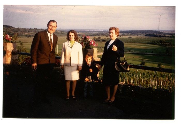
The region was already very touristy, but I wouldn’t notice the downsides until much later. That Sunday noon, I discovered a large restaurant filled with diners. I can still see the enormous piece of meat they served me, decorated with a little wooden skewer topped with a flag. I kept that one for a long time. Those were the golden days of rich, flowing, thick sauces—so flavorful—and the era of the world’s best fries, made on the spot with the best potatoes. To top it off, I was *exceptionally* allowed a small bottle of apple juice, Orangina, or—even better if possible—Sinalco. Yes, Sinalco—like Orangina, but better. A brand that must’ve disappeared in the 70s, but why, and what a shame! Since then, Orangina’s little bubbles have taken the brand to the other side of the planet—it’s now Japanese.
Year after year, I’d eagerly await that ecstatic moment when the most beautiful castle in Alsace, the Haut-Koenigsbourg, appeared in my field of vision. The perfect model, the archetype that blended into the landscape at the height of a child’s dreams. The trip home always felt like a reality check—less jarring than an alarm clock, but more diffuse and melancholic. From then on, there was only one wish: *When do we leave again?*
Those magical days always began with a gentle late-spring or midsummer morning. The interior of the white Peugeot 404, license plate 210 LZ 67, had already soaked up the sun before the engine purred to life, and the cabin gave off a scent I could still recognize today—a fragrance I found so pleasant. Back then, I had no idea it was just the smell of warm plastic from the car’s interior. Yes, the scents of the 404 on sunny days became my madeleine de Proust... What’s more, the whole family was unusually cheerful because those moments of relaxation and leisure were rare. Everyone worked, and no one had an easy job or was well paid. Without the *Trente Glorieuses*, these experiences might never have happened.
Once we crossed the canton’s borders, I felt like I was light-years away from my everyday surroundings, and every kilometer plunged me deeper into *terra incognita*. It was thrilling. Far from my so-called "medium-sized" town, wheat fields, cornfields, and cabbage patches stretched out, punctuated by tall poles connected by long wires and topped with vegetation—like giant clotheslines without laundry, where magical beanstalks might grow to touch the sky. Back then, I was still far from tasting their product, which was simply beer. At the time, there was still a significant local hop production. Fun fact: it wasn’t until 2002 that Anglo-Saxon scientists proved hops and cannabis belong to the same biological family.
After the fields, the landscape took another step up as it rolled past the little boy’s eyes, often glued to the windows. First came modest hills, then a succession of rolling slopes that soon formed an unbroken chain. Their 700 meters in altitude felt like Himalayan peaks to me—impressive, inert giants, a whole new world. Gazing at them, an intense emotion welled up somewhere between my stomach and lungs, nearly taking my breath away. What mysteries, what treasures did these heights hold? And then there were the cherries on top—the crowning touch that made the scene even more magical: proud, majestic castles perched on the summits like impassive sentinels. Monuments from the past, yet firmly rooted in the present on their rocky spurs. The little boy’s eyes sparkled—he’d been given a castle for Christmas, complete with battlements, towers, a drawbridge, and fully armed knights. He’d watched and lived *Ivanhoe* on the only French TV channel that existed back then.
Only once did my paternal grandfather join us on one of these trips. A tall, intelligent man with a face that could shift from stern to mischievous, clearly full of humor and charisma. Sadly, his relationship with alcohol had taken a toll on his life and, by extension, those of his loved ones. He had a strong personality—if his boss crossed the line, he wouldn’t hesitate to punch him, which meant he went through a lot of different jobs. Back then, you could quit one job and easily find another. It was quite something to see him in his final stages, hallucinating pink elephants and even drinking perfume when he had nothing else left. The last time I saw him, he’d slipped away from the doctors and nurses while hospitalized in pretty bad shape—at least, I assume his liver was the issue. We were sitting down for a family lunch when the door burst open, and there he stood in his pajamas, eyes twinkling with mischief, clearly pleased with the dramatic entrance. That theatrical moment didn’t spare us from burying him a few months later at the age of 71. One day, my mother told me the family doctor had quietly remarked that it was a shame—with his robust constitution, he could’ve lived to be a hundred. Yes, the family doctor—this was the man who’d come treat you any day, at almost any hour, just for a phone call. It really existed, it’s not a myth!
That day, his wife—my paternal grandmother—was also along for the ride. Everyone agreed that Jeannette was a good woman. She worked as a waitress at *Le Tigre*, the biggest brasserie in town, right in the center. Most customers preferred to be served by her, including local dignitaries and even the mayor. As a kid, I didn’t find her very fun, open, or warm—she seemed a bit stern. Back then, women in their fifties already had the face and build of grandmothers. Same went for men, don’t get me wrong. I had no idea about the struggles she faced because of her husband. I didn’t know that 30 years earlier, she’d had to flee Alsace while pregnant, under threat from Nazi fighter-bombers. I didn’t know she’d had several miscarriages, and that my father—her only surviving child, born prematurely in March 1940 at the other end of France—weighed less than a kilo at birth and was so tiny he could fit in a shoebox. Hard to imagine he’d grow into a strapping man nearly 1.80 meters tall, tipping the scales at 100 kilos. When you come back from summer camp in early August and ask why she didn’t pick you up with your parents, and they gently tell you she’s "in heaven," you don’t realize she passed away at 54 after suffering greatly from stomach cancer that had spread.
Back to that family outing, that enchanted parenthesis. I even remembered where we’d had lunch when I passed through Dambach-la-Ville decades later. One of those charming, flower-filled towns Alsace produces in abundance—and preserves so well. This one sits high on a hill, and I was a bit stunned on the parking lot because the view stretched far, revealing the Alsace plain below—its fields, villages, hills, and forests. The world seemed so vast and enticing that day, even though I was only glimpsing a tiny fraction of it.
The region was already very touristy, but I wouldn’t notice the downsides until much later. That Sunday noon, I discovered a large restaurant filled with diners. I can still see the enormous piece of meat they served me, decorated with a little wooden skewer topped with a flag. I kept that one for a long time. Those were the golden days of rich, flowing, thick sauces—so flavorful—and the era of the world’s best fries, made on the spot with the best potatoes. To top it off, I was *exceptionally* allowed a small bottle of apple juice, Orangina, or—even better if possible—Sinalco. Yes, Sinalco—like Orangina, but better. A brand that must’ve disappeared in the 70s, but why, and what a shame! Since then, Orangina’s little bubbles have taken the brand to the other side of the planet—it’s now Japanese.
Year after year, I’d eagerly await that ecstatic moment when the most beautiful castle in Alsace, the Haut-Koenigsbourg, appeared in my field of vision. The perfect model, the archetype that blended into the landscape at the height of a child’s dreams. The trip home always felt like a reality check—less jarring than an alarm clock, but more diffuse and melancholic. From then on, there was only one wish: *When do we leave again?*
Societal Evolution
Hello everyone,
It’s something we often notice in this forum—and many others—this behavioral shift.
A long-time member, or even a new one, asks a question. They get one or more answers, some brief, some detailed, and then... nothing???
Not even a simple thank you!!!
From what I’ve gathered, if the answers don’t align with what they wanted to hear, it seems natural for the asker to just disappear!! 😕 Unless—(and I fear this is the case)—basic politeness is no longer part of our society????
Please forgive my little rant.
Wishing everyone all the best. Cheers,
Puma2A

...
It’s something we often notice in this forum—and many others—this behavioral shift.
A long-time member, or even a new one, asks a question. They get one or more answers, some brief, some detailed, and then... nothing???
Not even a simple thank you!!!
From what I’ve gathered, if the answers don’t align with what they wanted to hear, it seems natural for the asker to just disappear!! 😕 Unless—(and I fear this is the case)—basic politeness is no longer part of our society????
Please forgive my little rant.
Wishing everyone all the best. Cheers,
Puma2A
...
Veneto: Dolomites and Opera
I'm starting a new travel journal in Italy.
It's about a month-long trip (from September 3, 2025, to October 4, 2025), or rather a part of it. This section matches the title: an opera festival in Verona (one evening) and the Dolomites in the Veneto region.
I'm posting the part of the trip I think will interest French-speaking readers the most (since this is where I saw the most French travelers).
Here’s a quick summary:
- Trip in September 2025
- Solo travel with camping (caravan)
- Small geographic area: besides Verona, the surroundings of the Marmolada massif and Cortina d'Ampezzo.
- Main but not exclusive activity: hiking.
Since I have limited internet access where I am now, I’ll be writing slowly. Here we go!
Day 1: Thursday, September 4, 2025
I arrived in Veneto under the sun and with warm weather. I drove to Verona and tried to find a spot at the campsite (Verona Village) located south of the city. Unfortunately, it was full. Booking on the website was mandatory, but when I tried to reserve a few days ago, the site never moved from the "reservation" step to the "payment" step (I don’t know why—it’s always like that in these cases). I found another solution over the phone; the drive from southern Verona to the northeast was a bit long, but I finally settled at the "Oro Verde" campsite. It’s an "agricampeggio" (farm camping or rural campsite) on the outskirts of the city, and its name (green gold) suggests they produce olives there. Since it wasn’t late, I biked to the Adige River, following the recommended route into the city.
Since I have limited internet access where I am now, I’ll be writing slowly. Here we go!
Day 1: Thursday, September 4, 2025
I arrived in Veneto under the sun and with warm weather. I drove to Verona and tried to find a spot at the campsite (Verona Village) located south of the city. Unfortunately, it was full. Booking on the website was mandatory, but when I tried to reserve a few days ago, the site never moved from the "reservation" step to the "payment" step (I don’t know why—it’s always like that in these cases). I found another solution over the phone; the drive from southern Verona to the northeast was a bit long, but I finally settled at the "Oro Verde" campsite. It’s an "agricampeggio" (farm camping or rural campsite) on the outskirts of the city, and its name (green gold) suggests they produce olives there. Since it wasn’t late, I biked to the Adige River, following the recommended route into the city.
Transfer time at Terminal 1 Frankfurt
Hi there,
I’m flying from Marseille to Bali this year and have a 1h30 layover in Frankfurt, from Terminal 1 to Terminal 1. Do you think that’s enough time, considering I don’t know the airport or the language? Thanks. »
Berlin impressions (live)
Hi there,
I arrived in Berlin last night. In another discussion, I shared how much of a "nightmare" the flights from Nice were.
I’ll be posting some impressions here—what I liked and what I didn’t like as much.
This is my first time in Berlin. I’m staying for two weeks. For now, I’m alone, but I’ll be joined by someone in a few days.
Just to clarify, I won’t be posting any photos because my camera gave up the ghost the day before I left. It refused to read memory cards, and I don’t have a smartphone—just a tablet that I leave at the hotel.
Speaking of photos, a few years ago, at the Ducasse d’Ath in Belgium, I met a retired teacher who wasn’t taking any pictures of the festival. I asked her, "You’re not taking any photos?" She told me that during a trip to Nicaragua, she’d photographed howler monkeys and only noticed when looking at the pictures later that the males had huge testicles—something she hadn’t realized in person. She said, "Since then, I don’t bother with photos anymore!" I’ve thought about that often and wonder if I should do the same and stop taking pictures. Still, I’ll probably get a smartphone since it’s hard to go without one these days.
I arrived in Berlin last night. In another discussion, I shared how much of a "nightmare" the flights from Nice were.
I’ll be posting some impressions here—what I liked and what I didn’t like as much.
This is my first time in Berlin. I’m staying for two weeks. For now, I’m alone, but I’ll be joined by someone in a few days.
Just to clarify, I won’t be posting any photos because my camera gave up the ghost the day before I left. It refused to read memory cards, and I don’t have a smartphone—just a tablet that I leave at the hotel.
Speaking of photos, a few years ago, at the Ducasse d’Ath in Belgium, I met a retired teacher who wasn’t taking any pictures of the festival. I asked her, "You’re not taking any photos?" She told me that during a trip to Nicaragua, she’d photographed howler monkeys and only noticed when looking at the pictures later that the males had huge testicles—something she hadn’t realized in person. She said, "Since then, I don’t bother with photos anymore!" I’ve thought about that often and wonder if I should do the same and stop taking pictures. Still, I’ll probably get a smartphone since it’s hard to go without one these days.
Old Burmese Adventures (oh, so many!)
Hey everyone,
Yesterday, I checked the Thailand forum to see if there were any questions to answer, but not much was happening—it was pretty quiet. Then I scrolled through the Southeast Asia section and realized that, even though Burma (Myanmar) was included, there weren’t many posts about it... I’ve only been there once, back in 1987, so it’s hard to create a photo thread about multiple trips like I sometimes do for Thailand. Still, that one trip was packed with unusual adventures, so I thought I’d share a few stories from it.
Since I didn’t take any notes at the time, this is all from memory—it’s not an exhaustive travel journal and isn’t meant to help plan a future trip to Myanmar.
Don’t expect photos; there won’t be any. I have some, but they’re slides that would need scanning and editing one by one to fix the wear and tear of time—way too much work.
The Context.
Back then (reminder: 1987), I was volunteering in Paris at the counter of a travel agency on Rue des Écoles. The agency was part of a well-known organization based in Mulhouse that mostly offered scheduled flights to Asia, charter flights to the Mediterranean, and flights to Mali with their own plane. They also had a few rare "roots"-style trips to certain destinations—trips where you didn’t bring your tennis racket but were ready to soak in everything, even if it meant tough conditions.
I’d already been to Thailand, Indonesia, and the Philippines in Asia. The director knew this, so he asked me to accompany a group to Burma. At the time, tours to Burma were already being sold by competitors, but they all had to go through the state-run agency, Touristburma (buses and hotels for tourists, and they only showed you what they wanted you to see—kind of like traveling in North Korea today). The service was only payable in dollars at the official exchange rate (which was six times worse than the black market rate, mind you...), and since it went through the state agency, all the money ended up with the junta.
My job was to do everything *without* going through Touristburma, which was completely illegal there. Nothing would be booked in advance. Back then, the Burmese visa was only valid for 8 days/7 nights, and since clients were paying for the experience, the itinerary was planned ahead. I’d have to find transport and a guide on the black market as soon as I arrived.
The clients weren’t misled—they knew from the start that the trip would be off the books, that officially we’d be a small group of friends (not an agency), unlike the truth (Touristburma wasn’t mandatory for individual travelers), and that it would be challenging. They also knew their trip would cost 3-4 times less while giving them a much better experience of Burma. As for pretending to be a group of friends, there were only six of us, so it worked out.
To cover all expenses (accommodation, transport, excursions), the agency gave me a sufficient budget. They also gave me the *same* budget a second time, which was strictly for bribing officials who might cause trouble, for backshish (tips), and, if needed, to "help" me get out of prison.
Before I left, I was thoroughly briefed by another guy who’d led the previous trip (he’d dealt with all the initial challenges). He explained everything I needed to know, what to watch out for, and advised me on what to bring as "gifts" (samples of well-known perfumes, specific cigarette and whisky brands, etc.). For the perfume samples, I rallied my family, friends, and even stores. For the rest, I’d pick things up at the duty-free shops in Don Muang (Bangkok’s only airport at the time)—I had the budget for it.
I couldn’t wait to leave...
Yesterday, I checked the Thailand forum to see if there were any questions to answer, but not much was happening—it was pretty quiet. Then I scrolled through the Southeast Asia section and realized that, even though Burma (Myanmar) was included, there weren’t many posts about it... I’ve only been there once, back in 1987, so it’s hard to create a photo thread about multiple trips like I sometimes do for Thailand. Still, that one trip was packed with unusual adventures, so I thought I’d share a few stories from it.
Since I didn’t take any notes at the time, this is all from memory—it’s not an exhaustive travel journal and isn’t meant to help plan a future trip to Myanmar.
Don’t expect photos; there won’t be any. I have some, but they’re slides that would need scanning and editing one by one to fix the wear and tear of time—way too much work.
The Context.
Back then (reminder: 1987), I was volunteering in Paris at the counter of a travel agency on Rue des Écoles. The agency was part of a well-known organization based in Mulhouse that mostly offered scheduled flights to Asia, charter flights to the Mediterranean, and flights to Mali with their own plane. They also had a few rare "roots"-style trips to certain destinations—trips where you didn’t bring your tennis racket but were ready to soak in everything, even if it meant tough conditions.
I’d already been to Thailand, Indonesia, and the Philippines in Asia. The director knew this, so he asked me to accompany a group to Burma. At the time, tours to Burma were already being sold by competitors, but they all had to go through the state-run agency, Touristburma (buses and hotels for tourists, and they only showed you what they wanted you to see—kind of like traveling in North Korea today). The service was only payable in dollars at the official exchange rate (which was six times worse than the black market rate, mind you...), and since it went through the state agency, all the money ended up with the junta.
My job was to do everything *without* going through Touristburma, which was completely illegal there. Nothing would be booked in advance. Back then, the Burmese visa was only valid for 8 days/7 nights, and since clients were paying for the experience, the itinerary was planned ahead. I’d have to find transport and a guide on the black market as soon as I arrived.
The clients weren’t misled—they knew from the start that the trip would be off the books, that officially we’d be a small group of friends (not an agency), unlike the truth (Touristburma wasn’t mandatory for individual travelers), and that it would be challenging. They also knew their trip would cost 3-4 times less while giving them a much better experience of Burma. As for pretending to be a group of friends, there were only six of us, so it worked out.
To cover all expenses (accommodation, transport, excursions), the agency gave me a sufficient budget. They also gave me the *same* budget a second time, which was strictly for bribing officials who might cause trouble, for backshish (tips), and, if needed, to "help" me get out of prison.
Before I left, I was thoroughly briefed by another guy who’d led the previous trip (he’d dealt with all the initial challenges). He explained everything I needed to know, what to watch out for, and advised me on what to bring as "gifts" (samples of well-known perfumes, specific cigarette and whisky brands, etc.). For the perfume samples, I rallied my family, friends, and even stores. For the rest, I’d pick things up at the duty-free shops in Don Muang (Bangkok’s only airport at the time)—I had the budget for it.
I couldn’t wait to leave...
CAPE VERDE 2025: 3 weeks, 4 islands.
And we still haven’t seen everything!
Before setting off for new horizons at the end of this year, it’s time for me to share my trip to Cape Verde this summer 2025.
I particularly love these spontaneous trips, and our stay in Cape Verde is one of those because it was only at the beginning of April that we decided on this getaway, which had been catching our eye for a while, given our love for the mountains.
As always—well, when it’s open—I turned to VF, and I want to immediately thank Marie, aka ptitortue, who helped me a lot in planning this trip through her travel journals and our exchanges!
Because Cape Verde is both small and vast! We decided not to rush from one airport to another, to enjoy the places and the people, but also to relax, since the work backlog from being stuck in May (see my previous travel journal 😅) had to be caught up on in June.
So, 4 islands will be our winners from 06/28 to 07/19:
Santiago first for logistical reasons, as round-trip flights from the capital Praia were the cheapest (650 €/person from Lyon via Lisbon with TAP, still!)
São Vicente, because it’s the gateway to the next one but ultimately more than that...
Santo Antão, pretty much the main goal of the trip since Marie (and the photos) had really sold it to me.
And finally, Sal Island, for some rest—a non-negotiable condition for my other half—and we’ll see that I should’ve listened to Marie...
That said, what a chatterbox I am—buckle up, flight attendants at the doors, off we go on new beautiful escapes! (Thanks to Sophie for the easy loan)
Last note for my eager fan club 😏: yes, there will be alcohol—how could there not be in the land of grogue!
It starts here:
https://voyageforum.com/v.f?post=10790234;a=10790234

I particularly love these spontaneous trips, and our stay in Cape Verde is one of those because it was only at the beginning of April that we decided on this getaway, which had been catching our eye for a while, given our love for the mountains.
As always—well, when it’s open—I turned to VF, and I want to immediately thank Marie, aka ptitortue, who helped me a lot in planning this trip through her travel journals and our exchanges!
Because Cape Verde is both small and vast! We decided not to rush from one airport to another, to enjoy the places and the people, but also to relax, since the work backlog from being stuck in May (see my previous travel journal 😅) had to be caught up on in June.
So, 4 islands will be our winners from 06/28 to 07/19:
Santiago first for logistical reasons, as round-trip flights from the capital Praia were the cheapest (650 €/person from Lyon via Lisbon with TAP, still!)
São Vicente, because it’s the gateway to the next one but ultimately more than that...
Santo Antão, pretty much the main goal of the trip since Marie (and the photos) had really sold it to me.
And finally, Sal Island, for some rest—a non-negotiable condition for my other half—and we’ll see that I should’ve listened to Marie...
That said, what a chatterbox I am—buckle up, flight attendants at the doors, off we go on new beautiful escapes! (Thanks to Sophie for the easy loan)
Last note for my eager fan club 😏: yes, there will be alcohol—how could there not be in the land of grogue!
It starts here:
https://voyageforum.com/v.f?post=10790234;a=10790234
15 days in La Palma, a hidden gem with a thousand contrasts
Hello,
First attempt at a travel journal for me and first post after 7 years away from this forum. 😮 I went to the island of La Palma for 15 days in September 2025. After visiting Lanzarote in February, I was looking for a different and greener island. Well, I wasn’t disappointed. 😎
We stayed in Breña Baja on the east coast of the island, 5 minutes from the airport. This choice was mainly motivated by the desire not to change accommodation during the stay and to be in a "central" location close to amenities. It worked out well, but if I were to do it again, I’d split the stay in two by getting another place in the north of the island to explore that area, which really appeals to me. Note that the island is "climatically divided in two": the west coast is sunnier and drier, while the east coast is often foggy or cloudy. It’s quite impressive when you come out of the LP-3 road tunnel connecting the two sides—you feel like you’ve changed regions even though it’s less than 3 km apart.
Flight options weren’t plentiful (no direct flights from France), so I went with Iberia, connecting in Madrid for 250 € round-trip per person excluding checked baggage (80 € round-trip for one 23 kg suitcase on this route). Make sure to buy the checked baggage at the same time as your flight, as it’ll cost about 15 € more if you add it later. I booked the tickets 5 months in advance directly on Iberia’s website. You could also take a low-cost airline to Tenerife or Gran Canaria and then a flight with a Canarian carrier, but in my opinion, that only makes sense if you’re visiting one of those islands first, as the connection isn’t "guaranteed." The ferry is an option from Tenerife (about 2.5 hours crossing).
Our departure from Lyon was initially scheduled for 6 AM but took off at 9 AM so the crew could rest after the late arrival of the previous flight. This let us grab breakfast on the airline’s dime—thanks, EU Regulation (EC) No 261/2004. 😉 Iberia took a week to reimburse me after I submitted my passport, receipts, and bank details via their online claim form.
Our small but spacious CRJ-1000 Air Nostrum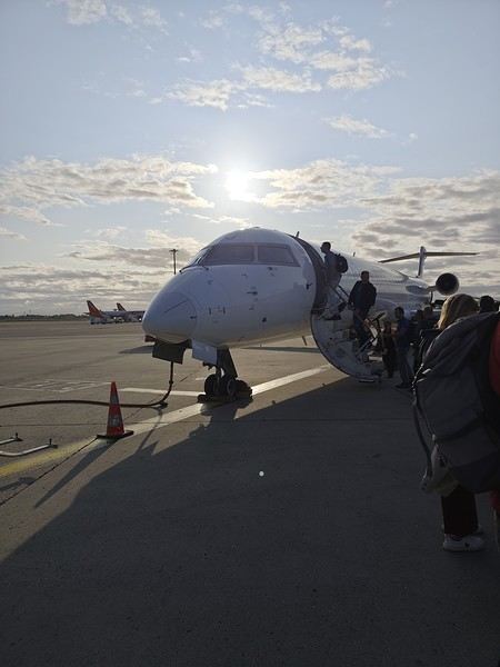 Bye-bye, Bugey nuclear plant
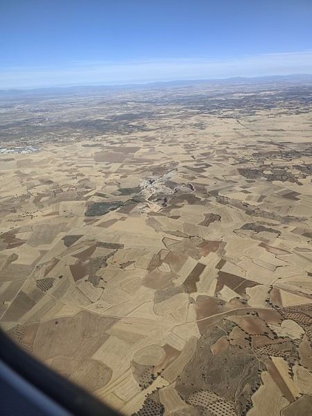
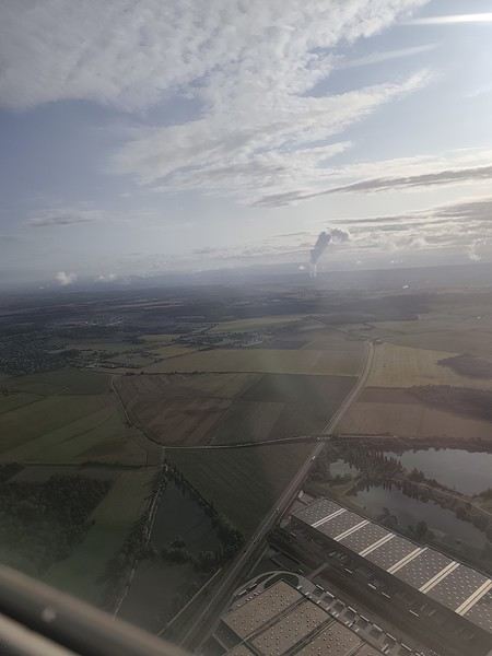 And hello, Madrid—or rather, its very dry region.
Our layover was initially 4 hours but shrank to 1 hour due to the previous flight’s delay. That worked out for us because Terminal 4 at Barajas is way less comfortable for resting than Lyon’s T1.
And hello, Madrid—or rather, its very dry region.
Our layover was initially 4 hours but shrank to 1 hour due to the previous flight’s delay. That worked out for us because Terminal 4 at Barajas is way less comfortable for resting than Lyon’s T1.
Landing with a view of Playa de la Cangrejera and del Pozo. When I say the east coast is often cloudy... 😇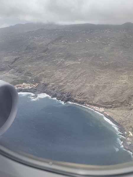 First sight of "plátano" plantations. Banana farming makes up 50% of the island’s GDP!
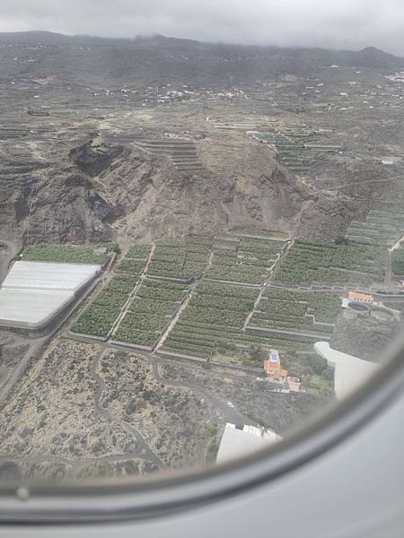
More to come soon. [;]
First attempt at a travel journal for me and first post after 7 years away from this forum. 😮 I went to the island of La Palma for 15 days in September 2025. After visiting Lanzarote in February, I was looking for a different and greener island. Well, I wasn’t disappointed. 😎
We stayed in Breña Baja on the east coast of the island, 5 minutes from the airport. This choice was mainly motivated by the desire not to change accommodation during the stay and to be in a "central" location close to amenities. It worked out well, but if I were to do it again, I’d split the stay in two by getting another place in the north of the island to explore that area, which really appeals to me. Note that the island is "climatically divided in two": the west coast is sunnier and drier, while the east coast is often foggy or cloudy. It’s quite impressive when you come out of the LP-3 road tunnel connecting the two sides—you feel like you’ve changed regions even though it’s less than 3 km apart.
Flight options weren’t plentiful (no direct flights from France), so I went with Iberia, connecting in Madrid for 250 € round-trip per person excluding checked baggage (80 € round-trip for one 23 kg suitcase on this route). Make sure to buy the checked baggage at the same time as your flight, as it’ll cost about 15 € more if you add it later. I booked the tickets 5 months in advance directly on Iberia’s website. You could also take a low-cost airline to Tenerife or Gran Canaria and then a flight with a Canarian carrier, but in my opinion, that only makes sense if you’re visiting one of those islands first, as the connection isn’t "guaranteed." The ferry is an option from Tenerife (about 2.5 hours crossing).
Our departure from Lyon was initially scheduled for 6 AM but took off at 9 AM so the crew could rest after the late arrival of the previous flight. This let us grab breakfast on the airline’s dime—thanks, EU Regulation (EC) No 261/2004. 😉 Iberia took a week to reimburse me after I submitted my passport, receipts, and bank details via their online claim form.
Our small but spacious CRJ-1000 Air Nostrum
Bye-bye, Bugey nuclear plant
And hello, Madrid—or rather, its very dry region.
Our layover was initially 4 hours but shrank to 1 hour due to the previous flight’s delay. That worked out for us because Terminal 4 at Barajas is way less comfortable for resting than Lyon’s T1.
Landing with a view of Playa de la Cangrejera and del Pozo. When I say the east coast is often cloudy... 😇
First sight of "plátano" plantations. Banana farming makes up 50% of the island’s GDP!
More to come soon. [;]
Where to stay on Gran Canaria to explore the island?
Hi there,
I’m planning a trip from Gran Canaria to El Hierro to Tenerife at the end of winter.
My current dilemma is where to book accommodations on Gran Canaria.
We’re planning to stay 7 nights on the island, and our goal is to hike, drive along small roads, discover a few villages, and admire some beaches (just for the views, not for swimming!).
Since the island is quite rugged, the journeys can be long even if the distances are short. I’d like to avoid driving 2 hours every morning and evening to reach the area we want to explore...
I’m thinking of splitting the 7 nights into 4 somewhere and 3 elsewhere.
But where? It seems the center and the northwest might be the best options.
Any advice, given that I’m mainly looking for peace and quiet, a beautiful view, a secluded spot, or a quiet village?
Thanks! :)
I’m planning a trip from Gran Canaria to El Hierro to Tenerife at the end of winter.
My current dilemma is where to book accommodations on Gran Canaria.
We’re planning to stay 7 nights on the island, and our goal is to hike, drive along small roads, discover a few villages, and admire some beaches (just for the views, not for swimming!).
Since the island is quite rugged, the journeys can be long even if the distances are short. I’d like to avoid driving 2 hours every morning and evening to reach the area we want to explore...
I’m thinking of splitting the 7 nights into 4 somewhere and 3 elsewhere.
But where? It seems the center and the northwest might be the best options.
Any advice, given that I’m mainly looking for peace and quiet, a beautiful view, a secluded spot, or a quiet village?
Thanks! :)
Join me in discovering Gran Canaria
Introduction
We stayed on the island of Gran Canaria during the first three months of 2024. It’s the third Canary Island we’ve visited, after Tenerife and Lanzarote.
We rented an apartment in Temisas. By staying in the same place for such a long period, the total price dropped by 50%.
We also rented a vehicle to make getting around the island easier.
Why the Canary Islands, and Gran Canaria in particular? For its pleasant climate, the nature and diversity of its landscapes, the charming villages, and especially the beauty of its many beaches.
In this travel journal, you’ll find a list of the many activities we did during our stay to explore the different attractions of this island.
These attractions are categorized to make it easier to find what interests you.
Videos are included throughout the summary. Click on the image to start the video.
To jump to a specific post, here are the relevant links:
HIKES:
Roque Nublo Maspalomas Dunes - Part 1 Maspalomas Dunes - Part 2 Los Azulejos de Veneguera Barranco de Las Vacas Ventana del Bentayga (Arco del Aserrador) Caves of the King Ventana de Morro (Ventana de la Ganifa) The Dog of Bentayga Cave of the Four Doors Ventana del Nublo Artenera - Caves of Acusa Seca Temisas - El Gigante Cave Fortress of Ansite Puerto de Las Nieves - Roque de Las Nieves Temisas - Cuevas de la Audiencia Roque Bentayga Guayadeque Ravine (Guayadeque Hermitage) Guayadeque Ravine (Cueva de Bartalo) El Zumacal - Barranco Tauco Casablanca Dam (Los Dolores Dam) Ayagaures - La Angostura Dam & Gambuesa Dam Santa Brígida - Alonso Ravine & Centennial Dragon Tree Pino Santo Hike in the Azuaje Ravine Gáldar - Red Lands of Samarrita Tejeda - Charco de La Paloma Bandama Boiler (Camino Borde de Caldera Bandama) Teror - Alamo Ravine Trail – SL-4 Telde - Calasio Caves Special Natural Reserve of Los Tilos de Moya Los Azulejos - Charco de Las Aneas Fataga Ravine Arinaga Military Battery Trail Maspalomas - Las Fuentes and del Canizo Ravines Mogán - Tauro Mountain Trail Tamabada - Llanos de La Mimbre & Sobre la Cueva Viewpoints Trail Hike to the Coronadero Arch via Barranco Hondo Barranco de Silva - Hike to the Jerez Caves Gáldar - Samson Cave - La Atalaya Peak Agaete - Roque Guayedra and Guayedra Ravine Artenara - Caballero Caves Arucas - Bufadero Salt Flats Barranco de Pino Gordo - Natural Pools Telde - Los Cernícalos Ravine Las Cruces - Toba Caves & Picón Puerto de Las Nieves - Moro Cave Agüimes - Morros de Ávila Caves Juncalillo del Sur - Laguna & Salinas de Abajo Caves of Camino de San Felipe Cruz de Tejeda, Cruz Chico and Degollada Viewpoint Hike on the Patalavaca Circuit Motor Grande - Puerto Rico Arch El Montañón - Los Hornos Dam Seafront Walk - Amadores Beach – Puerto Rico Beach Las Niñas Dam El Hornillo - Omega & Omicron Caves Arteara Necropolis Mogán - El Mulato Dam Las Garzas - El Regante Dam La Plata Route - Cho Flores Dam & El Charco Hondo Vega de Acusa - La Candelaria Dam Candelaria Hermitage – Acusa Seca Viewpoint Valsequillo de Gran Canaria – Roque La Vela Ayagaures Dam – GC-602 Lomo del Palo - Monte Pavón Trail Lugar La Laguna - Levada Fataga Dam & Ravine
BEACHES:
Mogán Beach Taurito Beach Tauro Beach Amadores Beach Puerto Rico Beach Anfi del Mar Beach Patalavaca Beach Meloneras Beach Maspalomas Beach English Beach (Playa del Inglés) Las Burras Beach San Agustin Beach Las Alcaravaneras Beach Las Canteras Beach (La Cicer) Las Canteras Beach (La Puntilla) Las Canteras Beach (Santa Catalina) Aquamarina Beach El Agujero - Bocabarranco Beach Hoya Del Pozo Beach Hoya Del Pozo Beach - Lizard with amputated tail El Cabron Beach Ojos de Garza Beach El Burrero Beach
NATURAL POOLS:
Charco Azul - El Risco Agaete Salt Flats Charco de Los Espejos - Sardina del Norte Natural Pools of Punta de Gáldar Snorkeling in the natural pool of Punta de Gáldar Natural Pool La Furnia o El Clavo - Gáldar Natural Pool of Los Dos Roques Emiliano Natural Pool - El Agujero Natural Pool of El Agujero Natural Pools of Roque Prieto Natural Pool El Altillo Los Charcones de Bañaderos – Arucas Natural Pools of El Charco de Las Palomas – Arucas Natural Pools of La Laja - Las Palmas de Gran Canaria Cueva de la Reina Mora - La Garita Natural Pools of Castillo del Romeral
TOWNS:
Center
Santa Brigida Vega de San Mateo Tejeda Artenara Vallesco Teror
Southwest
Santa Lucia de Tirajana Fataga San Bartolomé de Tirajana Puerto de Mogán La Aldea de San Nicolas
North
Arucas Firgas Moya Santa Maria de Guia Gáldar Agaete Puerto de Las Nieves
East
Vegueta - Las Palmas de Gran Canaria Triana - Las Palmas de Gran Canaria Ciudad Jardin - Las Palmas de Gran Canaria Canteras - Las Palmas de Gran Canaria Telde Valsequillo de Gran Canaria Ingenio Agüimes Temisas
VIEWPOINTS:
GC-60 Route (or nearby) GC-210 Route (or nearby) GC-210 Route between the tunnel and La Aldea de San Nicolás GC-215 & GC-65 Routes (or nearby) GC-200 Route (or nearby) GC-130 Route (or nearby) & GC-605 GC-70 Route (or nearby) & GC-21 Sheep herd on GC-70 Route GC-150, GC-240, GC-305, GC-350 & GC-301 Routes GC-606, GC-295, GC-231 and GC-41 Routes (or nearby) Viewpoints – GC-1 Route (or nearby) Viewpoints - Las Palmas de Gran Canaria Viewpoints - GC-2, GC-21, GC-15, GC-216 and GC-132 Routes (or nearby) Viewpoints - GC-503 & GC-217 Routes Viewpoints - GC-604, GC-505, GC-132, GC-42 and GC-802 Routes
MISCELLANEOUS:
San Rafael Aqueduct - Telde Abandoned San Rafael Estate - La Higuera Cenobio de Valerón La Cesta - Tejeda Puerto de la Aldea Scenic Route GC-671 to El Espinillo Scenic Route GC-607 to El Chorrillo The Galdar Cube (Santiago Quarry) Scenic Route GC-504 to Ayagaures Abandoned seaside resort in the Azuaje Ravine El Bufadero de La Garita – Telde GC-505 Route Abandoned Finca Las Haciendas (Los Mocanes) – Las Vegas de Valsequillo Ruins of San Juan Battery - Las Palmas de Gran Canaria Viera y Clavijo Canarian Botanical Garden - Las Palmas de Gran Canaria Tenefé Salt Flats Los Pérez, Lugarejos & Las Hoyas Dams Monte Pavón, Gran Canaria’s little Ireland Valleseco Lagoon Recreational Area Climbing - Fataga Ravine Surfing – El Agujero El Cairete Restaurant - Carrizal de Tejeda Paragliding flight observation - Los Giles La Cuevita Ayagaures Restaurant Statues and Murals - Cruce de Arinaga Aviation Monument (Las Majoreras) & Murals – Carrizal Artistic recycling by Antonio Peñita - Ojos de Garza Rainbows
We stayed on the island of Gran Canaria during the first three months of 2024. It’s the third Canary Island we’ve visited, after Tenerife and Lanzarote.
We rented an apartment in Temisas. By staying in the same place for such a long period, the total price dropped by 50%.
We also rented a vehicle to make getting around the island easier.
Why the Canary Islands, and Gran Canaria in particular? For its pleasant climate, the nature and diversity of its landscapes, the charming villages, and especially the beauty of its many beaches.
In this travel journal, you’ll find a list of the many activities we did during our stay to explore the different attractions of this island.
These attractions are categorized to make it easier to find what interests you.
Videos are included throughout the summary. Click on the image to start the video.
To jump to a specific post, here are the relevant links:
HIKES:
Roque Nublo Maspalomas Dunes - Part 1 Maspalomas Dunes - Part 2 Los Azulejos de Veneguera Barranco de Las Vacas Ventana del Bentayga (Arco del Aserrador) Caves of the King Ventana de Morro (Ventana de la Ganifa) The Dog of Bentayga Cave of the Four Doors Ventana del Nublo Artenera - Caves of Acusa Seca Temisas - El Gigante Cave Fortress of Ansite Puerto de Las Nieves - Roque de Las Nieves Temisas - Cuevas de la Audiencia Roque Bentayga Guayadeque Ravine (Guayadeque Hermitage) Guayadeque Ravine (Cueva de Bartalo) El Zumacal - Barranco Tauco Casablanca Dam (Los Dolores Dam) Ayagaures - La Angostura Dam & Gambuesa Dam Santa Brígida - Alonso Ravine & Centennial Dragon Tree Pino Santo Hike in the Azuaje Ravine Gáldar - Red Lands of Samarrita Tejeda - Charco de La Paloma Bandama Boiler (Camino Borde de Caldera Bandama) Teror - Alamo Ravine Trail – SL-4 Telde - Calasio Caves Special Natural Reserve of Los Tilos de Moya Los Azulejos - Charco de Las Aneas Fataga Ravine Arinaga Military Battery Trail Maspalomas - Las Fuentes and del Canizo Ravines Mogán - Tauro Mountain Trail Tamabada - Llanos de La Mimbre & Sobre la Cueva Viewpoints Trail Hike to the Coronadero Arch via Barranco Hondo Barranco de Silva - Hike to the Jerez Caves Gáldar - Samson Cave - La Atalaya Peak Agaete - Roque Guayedra and Guayedra Ravine Artenara - Caballero Caves Arucas - Bufadero Salt Flats Barranco de Pino Gordo - Natural Pools Telde - Los Cernícalos Ravine Las Cruces - Toba Caves & Picón Puerto de Las Nieves - Moro Cave Agüimes - Morros de Ávila Caves Juncalillo del Sur - Laguna & Salinas de Abajo Caves of Camino de San Felipe Cruz de Tejeda, Cruz Chico and Degollada Viewpoint Hike on the Patalavaca Circuit Motor Grande - Puerto Rico Arch El Montañón - Los Hornos Dam Seafront Walk - Amadores Beach – Puerto Rico Beach Las Niñas Dam El Hornillo - Omega & Omicron Caves Arteara Necropolis Mogán - El Mulato Dam Las Garzas - El Regante Dam La Plata Route - Cho Flores Dam & El Charco Hondo Vega de Acusa - La Candelaria Dam Candelaria Hermitage – Acusa Seca Viewpoint Valsequillo de Gran Canaria – Roque La Vela Ayagaures Dam – GC-602 Lomo del Palo - Monte Pavón Trail Lugar La Laguna - Levada Fataga Dam & Ravine
BEACHES:
Mogán Beach Taurito Beach Tauro Beach Amadores Beach Puerto Rico Beach Anfi del Mar Beach Patalavaca Beach Meloneras Beach Maspalomas Beach English Beach (Playa del Inglés) Las Burras Beach San Agustin Beach Las Alcaravaneras Beach Las Canteras Beach (La Cicer) Las Canteras Beach (La Puntilla) Las Canteras Beach (Santa Catalina) Aquamarina Beach El Agujero - Bocabarranco Beach Hoya Del Pozo Beach Hoya Del Pozo Beach - Lizard with amputated tail El Cabron Beach Ojos de Garza Beach El Burrero Beach
NATURAL POOLS:
Charco Azul - El Risco Agaete Salt Flats Charco de Los Espejos - Sardina del Norte Natural Pools of Punta de Gáldar Snorkeling in the natural pool of Punta de Gáldar Natural Pool La Furnia o El Clavo - Gáldar Natural Pool of Los Dos Roques Emiliano Natural Pool - El Agujero Natural Pool of El Agujero Natural Pools of Roque Prieto Natural Pool El Altillo Los Charcones de Bañaderos – Arucas Natural Pools of El Charco de Las Palomas – Arucas Natural Pools of La Laja - Las Palmas de Gran Canaria Cueva de la Reina Mora - La Garita Natural Pools of Castillo del Romeral
TOWNS:
Center
Santa Brigida Vega de San Mateo Tejeda Artenara Vallesco Teror
Southwest
Santa Lucia de Tirajana Fataga San Bartolomé de Tirajana Puerto de Mogán La Aldea de San Nicolas
North
Arucas Firgas Moya Santa Maria de Guia Gáldar Agaete Puerto de Las Nieves
East
Vegueta - Las Palmas de Gran Canaria Triana - Las Palmas de Gran Canaria Ciudad Jardin - Las Palmas de Gran Canaria Canteras - Las Palmas de Gran Canaria Telde Valsequillo de Gran Canaria Ingenio Agüimes Temisas
VIEWPOINTS:
GC-60 Route (or nearby) GC-210 Route (or nearby) GC-210 Route between the tunnel and La Aldea de San Nicolás GC-215 & GC-65 Routes (or nearby) GC-200 Route (or nearby) GC-130 Route (or nearby) & GC-605 GC-70 Route (or nearby) & GC-21 Sheep herd on GC-70 Route GC-150, GC-240, GC-305, GC-350 & GC-301 Routes GC-606, GC-295, GC-231 and GC-41 Routes (or nearby) Viewpoints – GC-1 Route (or nearby) Viewpoints - Las Palmas de Gran Canaria Viewpoints - GC-2, GC-21, GC-15, GC-216 and GC-132 Routes (or nearby) Viewpoints - GC-503 & GC-217 Routes Viewpoints - GC-604, GC-505, GC-132, GC-42 and GC-802 Routes
MISCELLANEOUS:
San Rafael Aqueduct - Telde Abandoned San Rafael Estate - La Higuera Cenobio de Valerón La Cesta - Tejeda Puerto de la Aldea Scenic Route GC-671 to El Espinillo Scenic Route GC-607 to El Chorrillo The Galdar Cube (Santiago Quarry) Scenic Route GC-504 to Ayagaures Abandoned seaside resort in the Azuaje Ravine El Bufadero de La Garita – Telde GC-505 Route Abandoned Finca Las Haciendas (Los Mocanes) – Las Vegas de Valsequillo Ruins of San Juan Battery - Las Palmas de Gran Canaria Viera y Clavijo Canarian Botanical Garden - Las Palmas de Gran Canaria Tenefé Salt Flats Los Pérez, Lugarejos & Las Hoyas Dams Monte Pavón, Gran Canaria’s little Ireland Valleseco Lagoon Recreational Area Climbing - Fataga Ravine Surfing – El Agujero El Cairete Restaurant - Carrizal de Tejeda Paragliding flight observation - Los Giles La Cuevita Ayagaures Restaurant Statues and Murals - Cruce de Arinaga Aviation Monument (Las Majoreras) & Murals – Carrizal Artistic recycling by Antonio Peñita - Ojos de Garza Rainbows
The North Cape by 4x4 in the Snow
Our trip lasted a month, from March 10 to April 10, 2024, and was done aboard our Land Rover Defender 110. For those interested, our 4x4 is equipped with mountain-approved 3PMFSF all-terrain tires (non-studded), a removable electric winch that can be attached to either the front or rear of the vehicle, two sand recovery boards, and we bring two pairs of snow chains. We sleep in our Land Rover, which is equipped with a diesel-powered independent heater, a small fridge, and has a layout that allows the dinette to be converted into a bed.
Starting from the Paris region, we crossed Belgium and Germany, took the ferry from Travemünde in northern Germany to Helsinki, followed the Russian border up to northern Finland, then headed into Norway all the way to the North Cape before returning via Norway, taking the ferry from Larvik in Norway to Hirtshals in Denmark, then passing through Germany and Belgium on our way back to France.
Tonight, March 10, 2024, we’ll be sleeping at our daughter’s place in the North.
Tuesday, March 11, we’ll cross Belgium and then enter Germany, where we’ll camp in Bremen.
Wednesday, March 12, we’ll have a quick visit to Bremen in the morning. We had planned to visit Lübeck, but some electrical issues with the car delayed us, so we head straight to the German port of Travemünde, where we’re set to embark at 11:30 PM to cross the Baltic Sea and arrive in Helsinki after 31 hours of sailing (one-way cabin ticket cost: 850 €—quite expensive since we booked last minute).
On the ferry, there are mostly semi-trucks and only a few campervans and passenger cars. The boat is quiet, and the Baltic Sea is calm.
About two hours before arriving in Helsinki, we hear noise along the hull. Surprise—looking out the porthole, we realize we’re sailing on frozen sea ice!
Thursday, March 14, we arrive at the port of Helsinki at 9:30 AM. Disembarking takes a while. As soon as we’re out, we head straight to Rastila Camping (cost: 27 €), about ten kilometers east of Helsinki. Then we go to a Land Rover garage to fix our headlight switch, which stopped working (a real hassle in Finland since you have to drive with low beams on at all times).
After the repair, we visit the stunning Temppeliaukio Church, which is built underground.
On our way back to the campsite, we stop at the supermarket for supplies. Prices are similar to France, except for imported products.
We settle into our snowy campsite spot.
Starting from the Paris region, we crossed Belgium and Germany, took the ferry from Travemünde in northern Germany to Helsinki, followed the Russian border up to northern Finland, then headed into Norway all the way to the North Cape before returning via Norway, taking the ferry from Larvik in Norway to Hirtshals in Denmark, then passing through Germany and Belgium on our way back to France.
Tonight, March 10, 2024, we’ll be sleeping at our daughter’s place in the North.
Tuesday, March 11, we’ll cross Belgium and then enter Germany, where we’ll camp in Bremen.
Wednesday, March 12, we’ll have a quick visit to Bremen in the morning. We had planned to visit Lübeck, but some electrical issues with the car delayed us, so we head straight to the German port of Travemünde, where we’re set to embark at 11:30 PM to cross the Baltic Sea and arrive in Helsinki after 31 hours of sailing (one-way cabin ticket cost: 850 €—quite expensive since we booked last minute).
On the ferry, there are mostly semi-trucks and only a few campervans and passenger cars. The boat is quiet, and the Baltic Sea is calm.
About two hours before arriving in Helsinki, we hear noise along the hull. Surprise—looking out the porthole, we realize we’re sailing on frozen sea ice!
Thursday, March 14, we arrive at the port of Helsinki at 9:30 AM. Disembarking takes a while. As soon as we’re out, we head straight to Rastila Camping (cost: 27 €), about ten kilometers east of Helsinki. Then we go to a Land Rover garage to fix our headlight switch, which stopped working (a real hassle in Finland since you have to drive with low beams on at all times).
After the repair, we visit the stunning Temppeliaukio Church, which is built underground.
On our way back to the campsite, we stop at the supermarket for supplies. Prices are similar to France, except for imported products.
We settle into our snowy campsite spot.
7-day mini road trip in Corsica: your thoughts?
Hi everyone, after a stay in the South and one in the North, I’m planning a mini road trip in Corsica (Bastia-Bastia) in June to explore places I haven’t seen yet. Since we’re heading to the mountains later this year, we’ve deliberately skipped the Corsican mountains. Could you share your thoughts and, most importantly, suggest things to see? We love nature, reasonable hikes, peaceful spots, and small villages. No cities. No boat excursions (yes, that includes Piana and Scandola). We already know the area between Bastia and Calvi.
June 7 Flight arrival in Bastia and night at the hotel
June 8 Drive to Calvi (beach and/or fortress) Meal at Les Boucaniers restaurant Night in Calvi
June 9 Walk from Calvi fortress to Alga beach Charcuterie platter at A Casetta Calvi Night in Calvi
June 10 Drive from Calvi to Piana Buvette du col de la Croix and visit the orientation table Chemin des muletiers (Muleteers’ Path) Or Sentier de la source des roches bleues (Blue Rocks Spring Trail) counterclockwise Or (less scenic) Tête du chien (Dog’s Head, starting at the parking lot) Dinner at Épicerie Castellani in Piana Night in Piana
June 11 Drive from Piana to Propriano Arone beach and meal at Le Café de la plage Drive along the coast, stopping wherever we like Night in Propriano
June 12 Hike starting from Campomoro in the Jardin du Vent (Wind Garden), and visit the Genoese tower of Campomoro Meal in Campomoro: restaurant Chez Pierre Paul U spuntinu Night in Propriano
June 13 Around Propriano (avoid Capu Laurosu beach—sewage treatment plant...) Night in Propriano
June 14 Drive from Propriano to Bastia airport Meal at L’Éternisula in Zonza Aiguilles de Bavella (Hole of the Bomb) Night at the same hotel as arrival
June 15 Departure
June 7 Flight arrival in Bastia and night at the hotel
June 8 Drive to Calvi (beach and/or fortress) Meal at Les Boucaniers restaurant Night in Calvi
June 9 Walk from Calvi fortress to Alga beach Charcuterie platter at A Casetta Calvi Night in Calvi
June 10 Drive from Calvi to Piana Buvette du col de la Croix and visit the orientation table Chemin des muletiers (Muleteers’ Path) Or Sentier de la source des roches bleues (Blue Rocks Spring Trail) counterclockwise Or (less scenic) Tête du chien (Dog’s Head, starting at the parking lot) Dinner at Épicerie Castellani in Piana Night in Piana
June 11 Drive from Piana to Propriano Arone beach and meal at Le Café de la plage Drive along the coast, stopping wherever we like Night in Propriano
June 12 Hike starting from Campomoro in the Jardin du Vent (Wind Garden), and visit the Genoese tower of Campomoro Meal in Campomoro: restaurant Chez Pierre Paul U spuntinu Night in Propriano
June 13 Around Propriano (avoid Capu Laurosu beach—sewage treatment plant...) Night in Propriano
June 14 Drive from Propriano to Bastia airport Meal at L’Éternisula in Zonza Aiguilles de Bavella (Hole of the Bomb) Night at the same hotel as arrival
June 15 Departure
Travel companion for a mountain-bike crossing of the Atacama (Chile, Bolivia, Argentina) in October 2025
I’m planning a journey of about 2500 km starting from San Pedro de Atacama (duration: max. 2 months). This trip, almost entirely on remote trails, promises to be an extraordinary adventure.
Highlights of the trip - Crossing the Florido Desert (during the blooming season: October 15–30) - Hiking ascents of legendary volcanoes: - Ojos del Salado (6879 m) - Llullaillaco (6739 m) - Uturuncu (6008 m, with 5820 m reachable by mountain bike!) - A 300 km stage through the heart of the desert, with no resupply or habitation: the ultimate experience of solitude and self-transcendence.
Practical details - Daily distance: max. 100 km and 1000 m elevation gain per day - Average altitude: 4000 m (between 3500 and 5000 m) - Temperatures: ~15 °C during the day, down to -25 °C at night (in a tent) - Accommodation: ~50% in villages (with locals or small hostels), ~50% camping
Estimated budget - 1400 € for the flight ticket (including bike supplement) - 1000 € for on-the-ground expenses
Required equipment - Fatbike (essential for deep sand) - -25 °C comfort sleeping bag - Single-wheel trailer (indispensable for these tough terrains)
My experience In 2022, I completed a similar 1200 km trip north of San Pedro de Atacama: - Full crossing of the Salar de Uyuni (170 km) - Ascents of the Ollague (5868 m) and Aucanquilcha (6176 m) volcanoes - Two 200 km stages with no resupply or human presence Videos available for a glimpse of the adventure: - Atacama Crossing 2022 - Part 1 - Atacama Crossing 2022 - Part 2
Next steps If this adventure interests you, I suggest: 1. A first phone call to get to know each other 2. A meet-up over a drink or a test ride in the Bardenas Reales (similar terrain, and I live 100 km away)
Don’t hesitate to contact me for more info or to discuss the details!
Highlights of the trip - Crossing the Florido Desert (during the blooming season: October 15–30) - Hiking ascents of legendary volcanoes: - Ojos del Salado (6879 m) - Llullaillaco (6739 m) - Uturuncu (6008 m, with 5820 m reachable by mountain bike!) - A 300 km stage through the heart of the desert, with no resupply or habitation: the ultimate experience of solitude and self-transcendence.
Practical details - Daily distance: max. 100 km and 1000 m elevation gain per day - Average altitude: 4000 m (between 3500 and 5000 m) - Temperatures: ~15 °C during the day, down to -25 °C at night (in a tent) - Accommodation: ~50% in villages (with locals or small hostels), ~50% camping
Estimated budget - 1400 € for the flight ticket (including bike supplement) - 1000 € for on-the-ground expenses
Required equipment - Fatbike (essential for deep sand) - -25 °C comfort sleeping bag - Single-wheel trailer (indispensable for these tough terrains)
My experience In 2022, I completed a similar 1200 km trip north of San Pedro de Atacama: - Full crossing of the Salar de Uyuni (170 km) - Ascents of the Ollague (5868 m) and Aucanquilcha (6176 m) volcanoes - Two 200 km stages with no resupply or human presence Videos available for a glimpse of the adventure: - Atacama Crossing 2022 - Part 1 - Atacama Crossing 2022 - Part 2
Next steps If this adventure interests you, I suggest: 1. A first phone call to get to know each other 2. A meet-up over a drink or a test ride in the Bardenas Reales (similar terrain, and I live 100 km away)
Don’t hesitate to contact me for more info or to discuss the details!
Family boat trip from Manaus (Brazil) to Yurimaguas (Peru)
Hello,
As part of a 10-month trip to explore and discover South America, we’d like to start our journey in northern Brazil since the timing is perfect for traveling up the Amazon. We’re traveling as a family of five with three kids aged 6, 9, and 18.
Our plan is to leave from Manaus and reach Yurimaguas in Peru via the Amazon, mostly by boat. Since we have plenty of time, we can take breaks to explore the different stops along the way that are worth it. The idea is to eventually head to Colombia via Ecuador later on.
So far, we’ve identified the following stops: - Manaus - Tabatinga - Iquitos - Sumiria Reserve (we’d like to stay there for a week) - Yurimaguas.
We’re thinking of traveling in a cabin/hammock for the longest leg (Manaus to Tabatinga) and just in hammocks for the shorter trips (max 3 days).
I have a few questions: 1. From a safety perspective, is the area we’re planning to cross safe, considering we’ll be with our three kids, the youngest being 6? 2. Isn’t this route a bit too ambitious for our kids? 3. We’re considering adding the Santarém/Manaus leg. Is Santarém a city worth adding to the itinerary? 4. Among the planned stops, which ones deserve a special visit? 5. Do the boat trips always include meals on board, or should we be careful when booking? 6. What would be a reasonable estimate for the duration of this trip to fully enjoy it?
I’ve read quite a bit—like trying to board early to get the best hammock spots, and that travel times can vary depending on currents, stops, and potential technical issues. But that’s not a problem since we have all the time in the world! :)
We’d love to hear from anyone who’s traveled in this area before!
Thanks so much in advance for your help in planning our trip.
Rémy, Céline, Antoine, Sacha, and Paul
As part of a 10-month trip to explore and discover South America, we’d like to start our journey in northern Brazil since the timing is perfect for traveling up the Amazon. We’re traveling as a family of five with three kids aged 6, 9, and 18.
Our plan is to leave from Manaus and reach Yurimaguas in Peru via the Amazon, mostly by boat. Since we have plenty of time, we can take breaks to explore the different stops along the way that are worth it. The idea is to eventually head to Colombia via Ecuador later on.
So far, we’ve identified the following stops: - Manaus - Tabatinga - Iquitos - Sumiria Reserve (we’d like to stay there for a week) - Yurimaguas.
We’re thinking of traveling in a cabin/hammock for the longest leg (Manaus to Tabatinga) and just in hammocks for the shorter trips (max 3 days).
I have a few questions: 1. From a safety perspective, is the area we’re planning to cross safe, considering we’ll be with our three kids, the youngest being 6? 2. Isn’t this route a bit too ambitious for our kids? 3. We’re considering adding the Santarém/Manaus leg. Is Santarém a city worth adding to the itinerary? 4. Among the planned stops, which ones deserve a special visit? 5. Do the boat trips always include meals on board, or should we be careful when booking? 6. What would be a reasonable estimate for the duration of this trip to fully enjoy it?
I’ve read quite a bit—like trying to board early to get the best hammock spots, and that travel times can vary depending on currents, stops, and potential technical issues. But that’s not a problem since we have all the time in the world! :)
We’d love to hear from anyone who’s traveled in this area before!
Thanks so much in advance for your help in planning our trip.
Rémy, Céline, Antoine, Sacha, and Paul
Back from 3 weeks in Guatemala – self-drive trip
Hi everyone.
I wanted to share a little feedback from our trip to Guatemala—we got back a month ago, and I really appreciated the well-commented posts here that helped us out. So, in turn, I wanted to share our own little recap.
We’ve traveled quite a bit together (we’re 38 and 42), and Guatemala had been on our radar for a while. But with so much info out there, it was hard to sort through it all—especially since we only had 3 weeks on the ground and didn’t want to waste time.
Here’s the itinerary we followed: Antigua, the Pacific coast, Lake Atitlán, a private coffee and bird reserve, Chichicastenango, Sayaxché, El Remate, Río Dulce, and Lake Izabal.
We rented a 4x4, which was essential given the state of some roads.
Our highlights: * **Pacific coast**: So authentic and preserved. We met sea turtles, cooked and baked coconut bread with a women’s community—such a meaningful exchange—and kayaked through a pristine mangrove full of birds. * **Lake Atitlán**: Even though we were worried it might feel too touristy, a private tour let us discover local crafts, hidden workshops (weaving, pottery), and the stunning views from the boat. * **Sayaxché**: The starting point for the Aguateca and Dos Pilas sites—one of our favorite outings. The site is breathtaking: walking through the canyon and jungle-covered ruins with almost no one around. We stayed in a little bungalow on an island, totally off the grid. * **In Petén**, we met an Itza Maya tribe—an unforgettable day sharing a meal and plant-based healing rituals. Wow. This tribe resisted the conquistadors and still lives traditionally. We also took a tour on Lake Petén and swam at hidden little beaches. Tikal was nice, but we preferred Yaxhá. * **Río Dulce**: A day at a private cocoa plantation—an adventure in a buggy with the owner himself. We harvested cocoa and ate the chocolate paste afterward, then swam in a waterfall on the property. Since it’s private, there was no one else around. A real privilege. * **Boat tour on the Río Dulce**: For us, the highlight. We visited a school where they’re committed to giving kids a solid education while blending Maya rituals. * **Lake Izabal**: A peaceful end to the trip in a magical setting. We visited Quiriguá.
We went through an organizer who knows the country really well. We weren’t initially planning on that, but thanks to her, we had experiences we never would’ve found on our own. On top of that, we actually paid less for the trip overall because of her local rates. I’m not getting anything out of this—I just think it could help other travelers. Her business is Secretplaceincostarica (she also does Costa Rica, which we’re now eager to explore).
On the ground, we felt completely safe. The people are lovely, the roads can be a little chaotic at times, but we loved every minute of it.
Happy travels to all! Marie
I wanted to share a little feedback from our trip to Guatemala—we got back a month ago, and I really appreciated the well-commented posts here that helped us out. So, in turn, I wanted to share our own little recap.
We’ve traveled quite a bit together (we’re 38 and 42), and Guatemala had been on our radar for a while. But with so much info out there, it was hard to sort through it all—especially since we only had 3 weeks on the ground and didn’t want to waste time.
Here’s the itinerary we followed: Antigua, the Pacific coast, Lake Atitlán, a private coffee and bird reserve, Chichicastenango, Sayaxché, El Remate, Río Dulce, and Lake Izabal.
We rented a 4x4, which was essential given the state of some roads.
Our highlights: * **Pacific coast**: So authentic and preserved. We met sea turtles, cooked and baked coconut bread with a women’s community—such a meaningful exchange—and kayaked through a pristine mangrove full of birds. * **Lake Atitlán**: Even though we were worried it might feel too touristy, a private tour let us discover local crafts, hidden workshops (weaving, pottery), and the stunning views from the boat. * **Sayaxché**: The starting point for the Aguateca and Dos Pilas sites—one of our favorite outings. The site is breathtaking: walking through the canyon and jungle-covered ruins with almost no one around. We stayed in a little bungalow on an island, totally off the grid. * **In Petén**, we met an Itza Maya tribe—an unforgettable day sharing a meal and plant-based healing rituals. Wow. This tribe resisted the conquistadors and still lives traditionally. We also took a tour on Lake Petén and swam at hidden little beaches. Tikal was nice, but we preferred Yaxhá. * **Río Dulce**: A day at a private cocoa plantation—an adventure in a buggy with the owner himself. We harvested cocoa and ate the chocolate paste afterward, then swam in a waterfall on the property. Since it’s private, there was no one else around. A real privilege. * **Boat tour on the Río Dulce**: For us, the highlight. We visited a school where they’re committed to giving kids a solid education while blending Maya rituals. * **Lake Izabal**: A peaceful end to the trip in a magical setting. We visited Quiriguá.
We went through an organizer who knows the country really well. We weren’t initially planning on that, but thanks to her, we had experiences we never would’ve found on our own. On top of that, we actually paid less for the trip overall because of her local rates. I’m not getting anything out of this—I just think it could help other travelers. Her business is Secretplaceincostarica (she also does Costa Rica, which we’re now eager to explore).
On the ground, we felt completely safe. The people are lovely, the roads can be a little chaotic at times, but we loved every minute of it.
Happy travels to all! Marie
21-Day Trip to La Gomera and La Palma
Travel Journal: 21 Days in La Gomera and La Palma
From February 6 to February 26, 2024
Tuesday, February 6 We left around 9 AM with our car, along with Pierre-Paul and Patricia, heading to the Bluepark parking lot in Bartenheim. As expected, we were awaited and left promptly for EuroAirport Basel. Took off at 12:25 PM for a 4-hour-15-minute flight under excellent conditions. Beautiful arrival in Tenerife with Teide in sight under a clear blue sky. Fifteen minutes later, we waited for bus No. 40 to Los Cristianos with quite a few other tourists, but we managed to find four seats. From the bus station, it was a 20-minute walk to our hotel. We checked into a lovely apartment for the four of us, complete with all the comforts. Outside, it was quite warm—at least 25°C! After dropping off our luggage, we went for a stroll. The immediate surroundings of the hotel held no interest for us: a modern, concrete area filled with hotels, bars, tourist agencies, and unappealing restaurants all offering the same bland international cuisine. Pat went to cool off at the pool, unfortunately overrun by loud, drunk English tourists. I took a walk to the paseo maritimo that leads to the port, skirting the seafront. The promenade was pleasant, but it could have been any seaside resort in the world—same old scene: a succession of bars with blaring music where many elderly people sipped cold beers waiting for the sunset, the backdrop a wall of resort-style hotels resembling rabbit hutches! Upon reaching the port, I scouted the route we’d take the next day to the Fred Olsen ferry. Back at the apartment, in the early evening, we looked for a non-touristy restaurant for dinner. Monique stopped a woman to ask her opinion! In this area, she told us, there’s no restaurant that serves Canarian or Spanish cuisine! The only place with decent restaurants is at the port. Off we went to the port, where we sat down at Al Bordo restaurant and ordered a seafood paella for four. Excellent, and at a very reasonable price (36 € for two). We returned to the hotel along the seafront.
Wednesday, February 7
Woke up at 6 AM. Had breakfast in the apartment with what we’d bought the day before at a supermarket. It was still dark when we left on foot toward the port, walking along the calm seafront at this early hour. Forty minutes later, we arrived and waited 10 minutes before the ferry docked. At 9:30 AM, we left the port of Los Cristianos for a 50-minute crossing on a calm sea under a beautiful blue sky. There were quite a few people on this large ferry, but many had no luggage, meaning they were visiting La Gomera for the day and would take the ferry back in the evening. Upon disembarking, we went straight to our rental car agency to pick up the car we’d booked online a few months earlier. It was a nice Peugeot 2008, spacious enough for the four of us and our luggage. We immediately took the beautiful road from San Sebastián that climbs directly into the mountains toward our rental in Vallehermoso. The road was in perfect condition—it seemed brand new, like all the others we’d take on this island later. This side of the island is very arid with little vegetation, and the terrain is particularly rugged, as it is throughout the island. We stopped at our first miradors, which would be followed by many more throughout our Canarian trip. Our first visit was to the small village of Agulo, perched on a promontory above the sea and at the foot of a high cliff. The village features typical Canarian houses with windows flush with the façade and black volcanic stone masonry on white or reddish-brown walls. The first recommended restaurant was already booked for a group, so we settled for the shaded terrace of the excellent El Alameda bar-restaurant. From Agulo, you can access the Abrante viewpoint via a winding road, where the view of Agulo, 600 meters below, is exceptional. A glass ledge over the void lets you test your fear of heights!
We drove to Vallehermoso to do our grocery shopping at the supermarket—a habit that would continue until the end of the trip. Our little house, "Casa rural El Encatadora," is located in a beautiful flower-filled valley a few kilometers west of Vallehermoso. Each of us had a bedroom with an en-suite bathroom, plus a living room, kitchen, and a small terrace overlooking the quiet street at the valley’s end, which didn’t bother us at all.
Thursday, February 8 The good weather seemed to follow us since our arrival in the Canary Islands. This morning, we took the road—still as beautiful and new—toward Arure, high up to the west. The landscape was magnificent, with breathtaking glimpses of the sea far below. In Arure, we parked in front of Conchita’s bar, where a hike (Rother No. 30) starts toward two viewpoints: Alojera, which we reached after 45 minutes on a lovely path. Monique, tired from the first steep climb, stopped at the first viewpoint and hitchhiked back to Arure. Meanwhile, we continued toward the second viewpoint, Los Barranquillos, where the view of the surroundings was partially hidden by misty clouds rising from the sea. The entire mountain is sculpted by ancient, endless terraces climbing until the slope becomes too steep for construction—visible traces of the hard work of past inhabitants trying to survive in a harsh environment. We had a decent lunch at La Conchita bar, then drove to the small seaside town of Puerto la Caleta, sheltered by an immense cliff plunging into the sea. Black sand beach, rough sea—despite our encouragement, Pat didn’t dare to swim! As for the old village of Caleta, it’s perched on the mountainside, and visiting it requires climbing steep, stair-filled alleys to discover a few traditional houses. Back at the casa, dinner in, and card games...
 Vallehermoso
Friday, February 9 This morning, the sky was overcast, and the peaks around us were shrouded in clouds. We took the same road as yesterday to hike Las Creces. Quickly gaining altitude, we entered a thick fog—visibility was very limited. We stopped at the Las Creces parking lot; visibility improved, and the sun wasn’t far off. The hike is entirely within a beautiful laurel forest, with the sun playing hide-and-seek, but it wasn’t cold despite the altitude. After finishing the loop trail, we decided to picnic—not there, as it was too chilly—but on Vallehermoso’s beach, where we found a nice picnic area sheltered by large black rocks. A short digestive walk on the surrounding hill to admire the little beach from above. Back in Vallehermoso, we did some grocery shopping, then tried to return to the casa—only to find ourselves locked out because we’d left the key in the lock inside! After several attempts and with the help of Yéli, a relative of the owner we called for help, we were finally able to get back in!
Saturday, February 10
It rained last night, and the sky remained overcast. Monique decided to rest this morning. PP, Pat, and I set off on the hike that starts from the house toward the Marichal reservoir. The sun wasn’t far off, and by 11 AM, it was fully out. The pleasant hike passed by many flower-filled gardens and orchards—orange, lemon, and mandarin trees in fruit. The path climbed gently toward the reservoir, where the view of the Cano rock dominating the landscape was magnificent. The last part of the climb was a bit tough, overgrown with lush vegetation, and the trail was slippery from last night’s rain. We descended via a different, much more pleasant path and returned to the casa just in time for lunch, prepared by Monique. This valley is rich with its many farmers and market gardeners who’ve cultivated the entire valley, taking advantage of the water flowing down from the mountain, captured upstream and redistributed through countless pipes snaking along the paths. Numerous tanks also store water during dry periods. The houses are scattered across both sides of the valley, and these colorful little homes add a beautiful touch to the landscape. The many palm trees give this valley a distinctly tropical feel—you could almost imagine yourself in the Caribbean. Add to that some salsa music drifting from a hut where farmers were working, and the picture is complete. A well-chilled beer apéro capped off a lovely morning. The afternoon was dedicated to rest, relaxation, reading, and games.
Sunday, February 11 The blue sky returned, though a few clouds still capped the highest peaks. Today, we visited Garajonay National Park, which covers the highest central mountains. Up there, we were above the clouds, and the panoramas from the various viewpoints were stunning: first, Cherelepin, accessible from the Laguna Grande parking lot, then Alto de Garajonay, offering an exceptional view of Teide—over 3,000 meters high—emerging from the clouds on Tenerife, far in the distance. We continued to the Los Roques viewpoints, then stopped for lunch at the Degollada de Peraza restaurant, where the view of the barranco was impressive. We descended toward San Sebastián and checked into our new lodging, La Cabezada, located in the countryside about 3 km above San Sebastián. It’s a small apartment adjacent to the owner’s, with a lovely terrace overlooking the surrounding mountains and surrounded by a beautiful garden. Apéro, then dinner on our beautiful terrace.
Monday, February 12 This morning, we went down to visit San Sebastián de La Gomera: its old tower, main street with some beautiful traditional houses, and the Church of the Assumption. Back at the casa for lunch. In the afternoon, Pat, PP, and I set off on the short hike from San Sebastián beach to La Guancha beach. We drove down and parked on the beach. The path climbs along the hill overlooking San Sebastián, passes by the tall Christ statue dominating the landscape, and roughly follows the coast down to the isolated Guancha beach. A beautiful hike under a hot sun, and a swim was welcome, even if the beach and sea access weren’t very comfortable due to large pebbles and quickly deepening water. Apart from two nudist bathers, there was no one on this beach. We returned the same way.
Tuesday, February 13 Rest day. We went down to town to stroll and do some shopping. I took the opportunity to visit the parador, beautifully situated above the city in a lovely garden overlooking the port and town. Together, we went for a cuba libre at the "Cuba Libre" bar, then had lunch at Breñusca (mediocre paella!). Back at the casa, then we went back down to town to see a carnival parade, a "passacalles," which actually passed an hour earlier than scheduled. Oh well.
Wednesday, February 14 Each to their own program this morning. Pat went swimming at San Sebastián beach, Monique rested at the casa, and PP and I set off on the hike from Playa de Avalos to the Ermita de Guadalupe on Playa del Cangrejo. It wasn’t easy to find the right road or the parking spot, but we managed. The path seemed to have suffered landslides, according to a sign at the trailhead! We decided to check it out, ready to turn back if it seemed too dangerous. In the end, apart from one or two slightly tricky spots where we had to climb a pile of rocks, the trail remained passable, though a bit vertigo-inducing in places. The narrow path clings to very vertical cliffs nearly 300 meters above sea level! But what a magnificent view. At one point, the trail runs alongside a wall of basaltic pipes. We returned via the drivable track that parallels the trail a bit lower. Back at the house for lunch. In the late afternoon, we returned to town to attend the "Entierro de las Sardinas" (Burial of the Sardine), which closes the Canarian carnival festivities. While waiting, we strolled through the parador’s gardens and had mojitos in town. Around 9 PM, we heard the noise and cries of the mourners. The procession advanced, led by a large papier-mâché sardine on a float, surrounded by wailing mourners. The procession headed toward the sea, where the sardine was burned, and a mini fireworks display ended the procession. It was all very good-natured, and everyone had fun. We ended the evening with dinner at a good fish restaurant, El Pajar.
 Entierro de la Sardina in San Sebastián de La Gomera
Thursday, February 15
Woke up at 5:15 AM. The only suitable ferry was at 7 AM, which would get us to La Palma by late morning rather than evening. We packed our bags, had breakfast, then headed to the port, left our rental car, and boarded the ferry to Tenerife, from where we’d continue to La Palma. Calm sea, beautiful sun—by 10:30 AM, we disembarked in La Palma. We picked up our car and immediately headed to our new apartment in Breña Alta. It’s a large apartment with a superb terrace facing the sea, fully equipped and very comfortable. The hosts recommended Casa Goyo restaurant, near the airport and close to us. It’s a restaurant with many small rooms, some of which can be reserved for families. The fish-based cuisine (chipirones, pulpo) was excellent, hearty, and reasonably priced. Since it’s in the airport’s flight path, we occasionally heard planes landing. Quick and efficient service. Afterward, we visited Santa Cruz de La Palma, which reminded us of the historic quarters of La Orotava in Tenerife or the capital of Gran Canaria.
Friday, February 16
Beautiful weather, blue sky. We headed to the San Bartolo viewpoint toward the northeast coast, then to the lovely village of San Andrés, which we explored. From there, we walked along the shore to the natural pools of Charco Azul, where we swam in the cool but "swimmable" sea. Back in San Andrés for lunch at the "San Andrés" restaurant on the beautiful church square. Very good fish-based meal. We got back in the car and continued along the north coast to the port of Espindola and the natural pools of Fajana near the Cumplida lighthouse. A fairly strong wind whipped up beautiful waves crashing onto the rocky coast in bursts of foam. Back in Santa Cruz, we stopped at the Mercadona supermarket to buy fresh shrimp for dinner. San Andrés
Saturday, February 17
Uniform blue sky, even on the heights. We took the beautiful road that winds up to the summit of the Caldera de Taburiente. Several viewpoints offer 360° views of the entire island and beyond: you can make out La Gomera, El Hierro, and, of course, Tenerife with the perfect triangle of Teide. We parked at the Los Andes viewpoint parking lot and started our hike to Pico de la Cruz along a trail following the ridge, offering superb views into the caldera. We got back in the car and passed by the Roque de los Muchachos astronomical complex, composed of numerous observatories, some with very aesthetic mirror telescopes. We hiked from the Roque de los Muchachos parking lot to the various viewpoints, always as impressive. Picnic on site, then back to Santa Cruz. We stopped by our car dealer because the oil warning light came on—better safe than sorry. The representative reassured us but preferred to give us a Fiat Cross SUV instead. The Caldera de Taburiente
Sunday, February 18 The weather was a bit mixed, with cloudy patches. We set off to hike the Barranco de la Cuba de Galga. Unfortunately, the Los Tilos trail had been closed for several months due to a major landslide. The parking lot by the road was already quite full, and indeed, we crossed paths with many hikers along the way—it’s an easy hike with little elevation gain, which is rare here in La Palma! The beautiful path winds through a very narrow, deep gorge covered in lush tropical vegetation—you’d think you were in a Southeast Asian forest, especially with the humidity in the gorge bringing out earthy and floral scents. Halfway through, Monique turned back while the rest of us continued to the Cuba de Galga. A light drizzle accompanied us on the return. For lunch, we went to Chipi Chipi restaurant in the heights of Santa Cruz. The cool air forced us to leave the lovely terrace for the slightly noisy dining room. The meal was very good and hearty. Afternoon spent resting at our house.
 La Cuba de la Galga
Monday, February 19 A few clouds still clung to the nearby mountain peaks. We headed south to Los Canarios. We stopped in front of the small San Antonio Abad church, where a path leads to the viewpoint in 15 minutes. Then we visited the San Antonio Volcano Interpretation Center and climbed to the viewpoint via the trail along the crater’s edge, offering a plunging view into the crater. Then PP, Pat, and I headed toward the Teneguía volcano but turned back given the remaining distance and the intense heat bearing down on us! Plus, the landscape was rather arid and not very interesting. We got back in the car and drove down to the salt flats at the island’s southern tip. The ocean crashes here in large waves, exploding against the volcanic rocks and feeding a "blowhole" carved into the rock. We stopped for drinks at the salt flats restaurant, then headed home. The salt flats in Fuencaliente
Tuesday, February 20 Beautiful weather with a few clouds clinging to the mountains, as usual. A relaxed morning since my parking reservation at La Cumbrecita didn’t start until 1 PM. It takes about 30 minutes from Santa Cruz to reach the valley floor via a beautiful but narrow road toward the end, though there’s very little traffic. Meanwhile, the clouds had disappeared, and the view from the La Cumbrecita viewpoint was superb. We recognized Pico de la Cruz in the distance, where we’d been a few days earlier. We then took the path leading to the Las Chozas viewpoint through a magnificent Canarian pine forest. We picnicked on site, then took the path to the Los Roques viewpoint. We returned the same way since the direct route was closed for construction. Back in Santa Cruz, we visited the Sanctuary of Las Nieves, with its beautiful golden Baroque altar. Hike from La Cumbrecita
Wednesday, February 21 After packing our things and loading the car, we left Santa Cruz under a very blue sky for Los Llanos de Aridane, where we stopped to visit this lovely town. The Church of Nuestra Señora de los Remedios has a beautiful coffered ceiling and an original papier-mâché Christ statue from the 16th century. Around it, colorful old Canarian houses brighten the streets of the town center. We took the opportunity to stroll, do some shopping, and finally sat down at La Pergola restaurant for a mediocre lunch. We got back in the car to check into our new house in Arecida. On the way, we stopped at the Mirador del Time, which once again offered an impressive panorama, allowing us—for the first time—to see the damage caused by the Tajogaite volcano eruption in 2021. You can clearly see the still-smoking crater and the large black lava flow covering the landscape down to the sea. We really liked our new accommodation: a local house that’s been renovated on the heights of Arecida, not far from the Canarian pine forest. From several terraces, we have a 360° view of the sea and mountains. We even have a private pool! There are two beautiful, brand-new bedrooms, each with its own bathroom—the best. Plus, we’re on the GR 131 trail that runs along the Barranco de las Angustias toward the northeast.
 Los Llanos de Aridane
Thursday, February 22 Once again, beautiful weather greeted us when we woke up. We started the GR 131 with the goal of reaching the Torre del Time viewpoint—about 400 meters of elevation gain. The path, quite steep at first, winds through a superb Canarian pine forest. A few viewpoints let you appreciate the sheer drop of the Barranco de las Angustias—watch out for vertigo! At the Torre del Time viewpoint, there’s a nearly 1,000-meter vertical drop. We returned via another path, the PLP1, which meanders first through this beautiful forest, then along lovely flower-filled gardens adjacent to beautiful properties that cascade from the forest down to the road serving these neighborhoods. This afternoon, we tried to get closer to the area devastated by the 2021 lava flows. Several roads are still closed or reserved for residents, while others—brand new—have been rebuilt to open up this densely populated and cultivated region. In some places, the lava flow slightly diverted, sparing some properties that logically should have disappeared. Now, they’re encircled by a massive cooled lava field. In other spots, twisted and charred metal scraps or greenhouse remains protrude from the lava—all that’s left of the former banana plantations. A little higher up, you can see the slightly smoking crater of Tajogaite, responsible for this disaster. Back to Casa Barreros.
 View of Los Llanos and, in the background, the 2021 lava flow
Friday, February 23
Though the sky was still blue, the temperature had dropped due to a chilly wind. By midday, it still rose to 22°C. Today, we headed north, specifically to the town of Tijarafe, where a very narrow road descends to the small port, Porís de Candelaria. The 3.7-kilometer road drops 700 meters in elevation, with gradients up to 30%—it was going to be intense! Indeed, the descent was scary, with the void right next to the very narrow road where passing was impossible except at a few rare spots. Everything went well—there was little traffic at this early hour. From the parking lot at the bottom, a path leads to Porís de Candelaria. It’s surprising to see this small fishing hamlet nestled in the shelter of an immense cave opening onto the sea, which was quite rough today. The sun, at this time of year, would appear late in the cave, which remained in shadow for much of the day. We returned via the same road, strolled through the small town of Puntagorda, and had lunch at El Jardín de los Naranjos restaurant—excellent meal. Fishing hamlet of Candelaria
Saturday, February 24 The air was still cool, but the sun was beautiful. While Monique stayed home to rest, the three of us headed to the village of Las Tricias to hike the Buracas Caves trail. We left the car parked on the LP1 road and took the small paved road down to the sign marking the trail’s start. The signage for all the trails we took here, as in La Gomera, was very well done. The path descended steadily, then more steeply toward the caves where the island’s first inhabitants lived—some petroglyphs are still visible in certain caves. The path then climbed back up, passing magnificent dragon trees and more or less elaborate huts occupied by Germans who’ve lived here for many years. Back at Casa Barreros for some rest.
Sunday, February 25 The weather once again blessed us with a beautiful day. This morning, we visited the local produce market held on weekends in Puntagorda. You’ll find agricultural products, crafts, and food to keep you going. A little further on, there’s a glass viewpoint overlooking the barranco plunging toward the sea, with a view of the thrill-seekers trying the zip line right next to it. Lunch at Naranjos—definitely a good spot—with their shrimp and spice tagliatelle. Back home for an afternoon of relaxation.
Monday, February 26 We left Arecida under a cloudy sky. Driving up from Los Llanos de Aridane toward the east, an enormous cascade of clouds poured from the mountain peaks into the Los Llanos plain—very impressive. Arriving in Santa Cruz, we went for a stroll, did some last-minute shopping, then had a final good-quality paella at La Chalana on the paseo maritimo. We left the car in the parking lot and took the 5 PM Olsen ferry to Tenerife on a slightly choppy sea, but the ferry didn’t rock too much. Arriving at 7:15 PM, we dropped off our things near the port in our reserved apartment and went for dinner at Abordo—rubbery chipirones. A digestive stroll among the ever-increasing number of tourists in Los Cristianos—restaurants were packed to the brim, the season is in full swing here. Gone is the calm of La Gomera and La Palma, and the laid-back tourism of German hikers among whom a few French were hiding!
Tuesday, February 27 To make our homemade breakfast more enjoyable, we went to buy pastries at the local bakery, then took one last walk on the paseo along the beaches, mingling with the many mobility scooters driven by elderly or disabled people, joggers, and tourists. Last apéro near the bus station, then off to the airport. After a smooth 4-hour-30-minute flight, we arrived in Basel-Mulhouse at 10:20 PM.
THE END
Conclusion A fantastic trip to two islands with magnificent and diverse nature, where landscapes range from desert-like to tropical depending on exposure to winds and clouds. Thanks to the many beautiful viewpoints, you can truly appreciate these exceptionally dynamic reliefs. A hiker’s paradise, the trails are all very well marked, though the choice of easy or moderate paths for "casual walkers" is quite limited. Another notable advantage, in our opinion, is that these islands are very lightly developed—you’ll hardly see any of those ugly hotel blocks that spoil the landscapes of some other Canary Islands. It’s true that the beaches on these two islands don’t meet traditional international tourism criteria: they’re small, with black sand, and often difficult to access. Special mention for the quality of the road network (except for a few small local roads), which seems brand new, well-paved, and well-signposted. We also enjoyed exceptional weather for February, with fewer than three days of gray or rainy weather out of 21.
Almost all the accommodations we chose met or exceeded our expectations, often at reasonable prices: an average of 98 € per night for an apartment or house with two bedrooms for four people.
All photos can be viewed by clicking this link: https://photos.app.goo.gl/G44pPk4g9PW1rNzg8
Tuesday, February 6 We left around 9 AM with our car, along with Pierre-Paul and Patricia, heading to the Bluepark parking lot in Bartenheim. As expected, we were awaited and left promptly for EuroAirport Basel. Took off at 12:25 PM for a 4-hour-15-minute flight under excellent conditions. Beautiful arrival in Tenerife with Teide in sight under a clear blue sky. Fifteen minutes later, we waited for bus No. 40 to Los Cristianos with quite a few other tourists, but we managed to find four seats. From the bus station, it was a 20-minute walk to our hotel. We checked into a lovely apartment for the four of us, complete with all the comforts. Outside, it was quite warm—at least 25°C! After dropping off our luggage, we went for a stroll. The immediate surroundings of the hotel held no interest for us: a modern, concrete area filled with hotels, bars, tourist agencies, and unappealing restaurants all offering the same bland international cuisine. Pat went to cool off at the pool, unfortunately overrun by loud, drunk English tourists. I took a walk to the paseo maritimo that leads to the port, skirting the seafront. The promenade was pleasant, but it could have been any seaside resort in the world—same old scene: a succession of bars with blaring music where many elderly people sipped cold beers waiting for the sunset, the backdrop a wall of resort-style hotels resembling rabbit hutches! Upon reaching the port, I scouted the route we’d take the next day to the Fred Olsen ferry. Back at the apartment, in the early evening, we looked for a non-touristy restaurant for dinner. Monique stopped a woman to ask her opinion! In this area, she told us, there’s no restaurant that serves Canarian or Spanish cuisine! The only place with decent restaurants is at the port. Off we went to the port, where we sat down at Al Bordo restaurant and ordered a seafood paella for four. Excellent, and at a very reasonable price (36 € for two). We returned to the hotel along the seafront.
Wednesday, February 7
Woke up at 6 AM. Had breakfast in the apartment with what we’d bought the day before at a supermarket. It was still dark when we left on foot toward the port, walking along the calm seafront at this early hour. Forty minutes later, we arrived and waited 10 minutes before the ferry docked. At 9:30 AM, we left the port of Los Cristianos for a 50-minute crossing on a calm sea under a beautiful blue sky. There were quite a few people on this large ferry, but many had no luggage, meaning they were visiting La Gomera for the day and would take the ferry back in the evening. Upon disembarking, we went straight to our rental car agency to pick up the car we’d booked online a few months earlier. It was a nice Peugeot 2008, spacious enough for the four of us and our luggage. We immediately took the beautiful road from San Sebastián that climbs directly into the mountains toward our rental in Vallehermoso. The road was in perfect condition—it seemed brand new, like all the others we’d take on this island later. This side of the island is very arid with little vegetation, and the terrain is particularly rugged, as it is throughout the island. We stopped at our first miradors, which would be followed by many more throughout our Canarian trip. Our first visit was to the small village of Agulo, perched on a promontory above the sea and at the foot of a high cliff. The village features typical Canarian houses with windows flush with the façade and black volcanic stone masonry on white or reddish-brown walls. The first recommended restaurant was already booked for a group, so we settled for the shaded terrace of the excellent El Alameda bar-restaurant. From Agulo, you can access the Abrante viewpoint via a winding road, where the view of Agulo, 600 meters below, is exceptional. A glass ledge over the void lets you test your fear of heights!
We drove to Vallehermoso to do our grocery shopping at the supermarket—a habit that would continue until the end of the trip. Our little house, "Casa rural El Encatadora," is located in a beautiful flower-filled valley a few kilometers west of Vallehermoso. Each of us had a bedroom with an en-suite bathroom, plus a living room, kitchen, and a small terrace overlooking the quiet street at the valley’s end, which didn’t bother us at all.
Thursday, February 8 The good weather seemed to follow us since our arrival in the Canary Islands. This morning, we took the road—still as beautiful and new—toward Arure, high up to the west. The landscape was magnificent, with breathtaking glimpses of the sea far below. In Arure, we parked in front of Conchita’s bar, where a hike (Rother No. 30) starts toward two viewpoints: Alojera, which we reached after 45 minutes on a lovely path. Monique, tired from the first steep climb, stopped at the first viewpoint and hitchhiked back to Arure. Meanwhile, we continued toward the second viewpoint, Los Barranquillos, where the view of the surroundings was partially hidden by misty clouds rising from the sea. The entire mountain is sculpted by ancient, endless terraces climbing until the slope becomes too steep for construction—visible traces of the hard work of past inhabitants trying to survive in a harsh environment. We had a decent lunch at La Conchita bar, then drove to the small seaside town of Puerto la Caleta, sheltered by an immense cliff plunging into the sea. Black sand beach, rough sea—despite our encouragement, Pat didn’t dare to swim! As for the old village of Caleta, it’s perched on the mountainside, and visiting it requires climbing steep, stair-filled alleys to discover a few traditional houses. Back at the casa, dinner in, and card games...
VallehermosoFriday, February 9 This morning, the sky was overcast, and the peaks around us were shrouded in clouds. We took the same road as yesterday to hike Las Creces. Quickly gaining altitude, we entered a thick fog—visibility was very limited. We stopped at the Las Creces parking lot; visibility improved, and the sun wasn’t far off. The hike is entirely within a beautiful laurel forest, with the sun playing hide-and-seek, but it wasn’t cold despite the altitude. After finishing the loop trail, we decided to picnic—not there, as it was too chilly—but on Vallehermoso’s beach, where we found a nice picnic area sheltered by large black rocks. A short digestive walk on the surrounding hill to admire the little beach from above. Back in Vallehermoso, we did some grocery shopping, then tried to return to the casa—only to find ourselves locked out because we’d left the key in the lock inside! After several attempts and with the help of Yéli, a relative of the owner we called for help, we were finally able to get back in!
Saturday, February 10
It rained last night, and the sky remained overcast. Monique decided to rest this morning. PP, Pat, and I set off on the hike that starts from the house toward the Marichal reservoir. The sun wasn’t far off, and by 11 AM, it was fully out. The pleasant hike passed by many flower-filled gardens and orchards—orange, lemon, and mandarin trees in fruit. The path climbed gently toward the reservoir, where the view of the Cano rock dominating the landscape was magnificent. The last part of the climb was a bit tough, overgrown with lush vegetation, and the trail was slippery from last night’s rain. We descended via a different, much more pleasant path and returned to the casa just in time for lunch, prepared by Monique. This valley is rich with its many farmers and market gardeners who’ve cultivated the entire valley, taking advantage of the water flowing down from the mountain, captured upstream and redistributed through countless pipes snaking along the paths. Numerous tanks also store water during dry periods. The houses are scattered across both sides of the valley, and these colorful little homes add a beautiful touch to the landscape. The many palm trees give this valley a distinctly tropical feel—you could almost imagine yourself in the Caribbean. Add to that some salsa music drifting from a hut where farmers were working, and the picture is complete. A well-chilled beer apéro capped off a lovely morning. The afternoon was dedicated to rest, relaxation, reading, and games.
Sunday, February 11 The blue sky returned, though a few clouds still capped the highest peaks. Today, we visited Garajonay National Park, which covers the highest central mountains. Up there, we were above the clouds, and the panoramas from the various viewpoints were stunning: first, Cherelepin, accessible from the Laguna Grande parking lot, then Alto de Garajonay, offering an exceptional view of Teide—over 3,000 meters high—emerging from the clouds on Tenerife, far in the distance. We continued to the Los Roques viewpoints, then stopped for lunch at the Degollada de Peraza restaurant, where the view of the barranco was impressive. We descended toward San Sebastián and checked into our new lodging, La Cabezada, located in the countryside about 3 km above San Sebastián. It’s a small apartment adjacent to the owner’s, with a lovely terrace overlooking the surrounding mountains and surrounded by a beautiful garden. Apéro, then dinner on our beautiful terrace.
Monday, February 12 This morning, we went down to visit San Sebastián de La Gomera: its old tower, main street with some beautiful traditional houses, and the Church of the Assumption. Back at the casa for lunch. In the afternoon, Pat, PP, and I set off on the short hike from San Sebastián beach to La Guancha beach. We drove down and parked on the beach. The path climbs along the hill overlooking San Sebastián, passes by the tall Christ statue dominating the landscape, and roughly follows the coast down to the isolated Guancha beach. A beautiful hike under a hot sun, and a swim was welcome, even if the beach and sea access weren’t very comfortable due to large pebbles and quickly deepening water. Apart from two nudist bathers, there was no one on this beach. We returned the same way.
Tuesday, February 13 Rest day. We went down to town to stroll and do some shopping. I took the opportunity to visit the parador, beautifully situated above the city in a lovely garden overlooking the port and town. Together, we went for a cuba libre at the "Cuba Libre" bar, then had lunch at Breñusca (mediocre paella!). Back at the casa, then we went back down to town to see a carnival parade, a "passacalles," which actually passed an hour earlier than scheduled. Oh well.
Wednesday, February 14 Each to their own program this morning. Pat went swimming at San Sebastián beach, Monique rested at the casa, and PP and I set off on the hike from Playa de Avalos to the Ermita de Guadalupe on Playa del Cangrejo. It wasn’t easy to find the right road or the parking spot, but we managed. The path seemed to have suffered landslides, according to a sign at the trailhead! We decided to check it out, ready to turn back if it seemed too dangerous. In the end, apart from one or two slightly tricky spots where we had to climb a pile of rocks, the trail remained passable, though a bit vertigo-inducing in places. The narrow path clings to very vertical cliffs nearly 300 meters above sea level! But what a magnificent view. At one point, the trail runs alongside a wall of basaltic pipes. We returned via the drivable track that parallels the trail a bit lower. Back at the house for lunch. In the late afternoon, we returned to town to attend the "Entierro de las Sardinas" (Burial of the Sardine), which closes the Canarian carnival festivities. While waiting, we strolled through the parador’s gardens and had mojitos in town. Around 9 PM, we heard the noise and cries of the mourners. The procession advanced, led by a large papier-mâché sardine on a float, surrounded by wailing mourners. The procession headed toward the sea, where the sardine was burned, and a mini fireworks display ended the procession. It was all very good-natured, and everyone had fun. We ended the evening with dinner at a good fish restaurant, El Pajar.
Entierro de la Sardina in San Sebastián de La GomeraThursday, February 15
Woke up at 5:15 AM. The only suitable ferry was at 7 AM, which would get us to La Palma by late morning rather than evening. We packed our bags, had breakfast, then headed to the port, left our rental car, and boarded the ferry to Tenerife, from where we’d continue to La Palma. Calm sea, beautiful sun—by 10:30 AM, we disembarked in La Palma. We picked up our car and immediately headed to our new apartment in Breña Alta. It’s a large apartment with a superb terrace facing the sea, fully equipped and very comfortable. The hosts recommended Casa Goyo restaurant, near the airport and close to us. It’s a restaurant with many small rooms, some of which can be reserved for families. The fish-based cuisine (chipirones, pulpo) was excellent, hearty, and reasonably priced. Since it’s in the airport’s flight path, we occasionally heard planes landing. Quick and efficient service. Afterward, we visited Santa Cruz de La Palma, which reminded us of the historic quarters of La Orotava in Tenerife or the capital of Gran Canaria.
Friday, February 16
Beautiful weather, blue sky. We headed to the San Bartolo viewpoint toward the northeast coast, then to the lovely village of San Andrés, which we explored. From there, we walked along the shore to the natural pools of Charco Azul, where we swam in the cool but "swimmable" sea. Back in San Andrés for lunch at the "San Andrés" restaurant on the beautiful church square. Very good fish-based meal. We got back in the car and continued along the north coast to the port of Espindola and the natural pools of Fajana near the Cumplida lighthouse. A fairly strong wind whipped up beautiful waves crashing onto the rocky coast in bursts of foam. Back in Santa Cruz, we stopped at the Mercadona supermarket to buy fresh shrimp for dinner.
San AndrésSaturday, February 17
Uniform blue sky, even on the heights. We took the beautiful road that winds up to the summit of the Caldera de Taburiente. Several viewpoints offer 360° views of the entire island and beyond: you can make out La Gomera, El Hierro, and, of course, Tenerife with the perfect triangle of Teide. We parked at the Los Andes viewpoint parking lot and started our hike to Pico de la Cruz along a trail following the ridge, offering superb views into the caldera. We got back in the car and passed by the Roque de los Muchachos astronomical complex, composed of numerous observatories, some with very aesthetic mirror telescopes. We hiked from the Roque de los Muchachos parking lot to the various viewpoints, always as impressive. Picnic on site, then back to Santa Cruz. We stopped by our car dealer because the oil warning light came on—better safe than sorry. The representative reassured us but preferred to give us a Fiat Cross SUV instead.
The Caldera de TaburienteSunday, February 18 The weather was a bit mixed, with cloudy patches. We set off to hike the Barranco de la Cuba de Galga. Unfortunately, the Los Tilos trail had been closed for several months due to a major landslide. The parking lot by the road was already quite full, and indeed, we crossed paths with many hikers along the way—it’s an easy hike with little elevation gain, which is rare here in La Palma! The beautiful path winds through a very narrow, deep gorge covered in lush tropical vegetation—you’d think you were in a Southeast Asian forest, especially with the humidity in the gorge bringing out earthy and floral scents. Halfway through, Monique turned back while the rest of us continued to the Cuba de Galga. A light drizzle accompanied us on the return. For lunch, we went to Chipi Chipi restaurant in the heights of Santa Cruz. The cool air forced us to leave the lovely terrace for the slightly noisy dining room. The meal was very good and hearty. Afternoon spent resting at our house.
La Cuba de la GalgaMonday, February 19 A few clouds still clung to the nearby mountain peaks. We headed south to Los Canarios. We stopped in front of the small San Antonio Abad church, where a path leads to the viewpoint in 15 minutes. Then we visited the San Antonio Volcano Interpretation Center and climbed to the viewpoint via the trail along the crater’s edge, offering a plunging view into the crater. Then PP, Pat, and I headed toward the Teneguía volcano but turned back given the remaining distance and the intense heat bearing down on us! Plus, the landscape was rather arid and not very interesting. We got back in the car and drove down to the salt flats at the island’s southern tip. The ocean crashes here in large waves, exploding against the volcanic rocks and feeding a "blowhole" carved into the rock. We stopped for drinks at the salt flats restaurant, then headed home.
The salt flats in FuencalienteTuesday, February 20 Beautiful weather with a few clouds clinging to the mountains, as usual. A relaxed morning since my parking reservation at La Cumbrecita didn’t start until 1 PM. It takes about 30 minutes from Santa Cruz to reach the valley floor via a beautiful but narrow road toward the end, though there’s very little traffic. Meanwhile, the clouds had disappeared, and the view from the La Cumbrecita viewpoint was superb. We recognized Pico de la Cruz in the distance, where we’d been a few days earlier. We then took the path leading to the Las Chozas viewpoint through a magnificent Canarian pine forest. We picnicked on site, then took the path to the Los Roques viewpoint. We returned the same way since the direct route was closed for construction. Back in Santa Cruz, we visited the Sanctuary of Las Nieves, with its beautiful golden Baroque altar.
Hike from La CumbrecitaWednesday, February 21 After packing our things and loading the car, we left Santa Cruz under a very blue sky for Los Llanos de Aridane, where we stopped to visit this lovely town. The Church of Nuestra Señora de los Remedios has a beautiful coffered ceiling and an original papier-mâché Christ statue from the 16th century. Around it, colorful old Canarian houses brighten the streets of the town center. We took the opportunity to stroll, do some shopping, and finally sat down at La Pergola restaurant for a mediocre lunch. We got back in the car to check into our new house in Arecida. On the way, we stopped at the Mirador del Time, which once again offered an impressive panorama, allowing us—for the first time—to see the damage caused by the Tajogaite volcano eruption in 2021. You can clearly see the still-smoking crater and the large black lava flow covering the landscape down to the sea. We really liked our new accommodation: a local house that’s been renovated on the heights of Arecida, not far from the Canarian pine forest. From several terraces, we have a 360° view of the sea and mountains. We even have a private pool! There are two beautiful, brand-new bedrooms, each with its own bathroom—the best. Plus, we’re on the GR 131 trail that runs along the Barranco de las Angustias toward the northeast.
Los Llanos de AridaneThursday, February 22 Once again, beautiful weather greeted us when we woke up. We started the GR 131 with the goal of reaching the Torre del Time viewpoint—about 400 meters of elevation gain. The path, quite steep at first, winds through a superb Canarian pine forest. A few viewpoints let you appreciate the sheer drop of the Barranco de las Angustias—watch out for vertigo! At the Torre del Time viewpoint, there’s a nearly 1,000-meter vertical drop. We returned via another path, the PLP1, which meanders first through this beautiful forest, then along lovely flower-filled gardens adjacent to beautiful properties that cascade from the forest down to the road serving these neighborhoods. This afternoon, we tried to get closer to the area devastated by the 2021 lava flows. Several roads are still closed or reserved for residents, while others—brand new—have been rebuilt to open up this densely populated and cultivated region. In some places, the lava flow slightly diverted, sparing some properties that logically should have disappeared. Now, they’re encircled by a massive cooled lava field. In other spots, twisted and charred metal scraps or greenhouse remains protrude from the lava—all that’s left of the former banana plantations. A little higher up, you can see the slightly smoking crater of Tajogaite, responsible for this disaster. Back to Casa Barreros.
View of Los Llanos and, in the background, the 2021 lava flowFriday, February 23
Though the sky was still blue, the temperature had dropped due to a chilly wind. By midday, it still rose to 22°C. Today, we headed north, specifically to the town of Tijarafe, where a very narrow road descends to the small port, Porís de Candelaria. The 3.7-kilometer road drops 700 meters in elevation, with gradients up to 30%—it was going to be intense! Indeed, the descent was scary, with the void right next to the very narrow road where passing was impossible except at a few rare spots. Everything went well—there was little traffic at this early hour. From the parking lot at the bottom, a path leads to Porís de Candelaria. It’s surprising to see this small fishing hamlet nestled in the shelter of an immense cave opening onto the sea, which was quite rough today. The sun, at this time of year, would appear late in the cave, which remained in shadow for much of the day. We returned via the same road, strolled through the small town of Puntagorda, and had lunch at El Jardín de los Naranjos restaurant—excellent meal.
Fishing hamlet of CandelariaSaturday, February 24 The air was still cool, but the sun was beautiful. While Monique stayed home to rest, the three of us headed to the village of Las Tricias to hike the Buracas Caves trail. We left the car parked on the LP1 road and took the small paved road down to the sign marking the trail’s start. The signage for all the trails we took here, as in La Gomera, was very well done. The path descended steadily, then more steeply toward the caves where the island’s first inhabitants lived—some petroglyphs are still visible in certain caves. The path then climbed back up, passing magnificent dragon trees and more or less elaborate huts occupied by Germans who’ve lived here for many years. Back at Casa Barreros for some rest.
Sunday, February 25 The weather once again blessed us with a beautiful day. This morning, we visited the local produce market held on weekends in Puntagorda. You’ll find agricultural products, crafts, and food to keep you going. A little further on, there’s a glass viewpoint overlooking the barranco plunging toward the sea, with a view of the thrill-seekers trying the zip line right next to it. Lunch at Naranjos—definitely a good spot—with their shrimp and spice tagliatelle. Back home for an afternoon of relaxation.
Monday, February 26 We left Arecida under a cloudy sky. Driving up from Los Llanos de Aridane toward the east, an enormous cascade of clouds poured from the mountain peaks into the Los Llanos plain—very impressive. Arriving in Santa Cruz, we went for a stroll, did some last-minute shopping, then had a final good-quality paella at La Chalana on the paseo maritimo. We left the car in the parking lot and took the 5 PM Olsen ferry to Tenerife on a slightly choppy sea, but the ferry didn’t rock too much. Arriving at 7:15 PM, we dropped off our things near the port in our reserved apartment and went for dinner at Abordo—rubbery chipirones. A digestive stroll among the ever-increasing number of tourists in Los Cristianos—restaurants were packed to the brim, the season is in full swing here. Gone is the calm of La Gomera and La Palma, and the laid-back tourism of German hikers among whom a few French were hiding!
Tuesday, February 27 To make our homemade breakfast more enjoyable, we went to buy pastries at the local bakery, then took one last walk on the paseo along the beaches, mingling with the many mobility scooters driven by elderly or disabled people, joggers, and tourists. Last apéro near the bus station, then off to the airport. After a smooth 4-hour-30-minute flight, we arrived in Basel-Mulhouse at 10:20 PM.
THE END
Conclusion A fantastic trip to two islands with magnificent and diverse nature, where landscapes range from desert-like to tropical depending on exposure to winds and clouds. Thanks to the many beautiful viewpoints, you can truly appreciate these exceptionally dynamic reliefs. A hiker’s paradise, the trails are all very well marked, though the choice of easy or moderate paths for "casual walkers" is quite limited. Another notable advantage, in our opinion, is that these islands are very lightly developed—you’ll hardly see any of those ugly hotel blocks that spoil the landscapes of some other Canary Islands. It’s true that the beaches on these two islands don’t meet traditional international tourism criteria: they’re small, with black sand, and often difficult to access. Special mention for the quality of the road network (except for a few small local roads), which seems brand new, well-paved, and well-signposted. We also enjoyed exceptional weather for February, with fewer than three days of gray or rainy weather out of 21.
Almost all the accommodations we chose met or exceeded our expectations, often at reasonable prices: an average of 98 € per night for an apartment or house with two bedrooms for four people.
All photos can be viewed by clicking this link: https://photos.app.goo.gl/G44pPk4g9PW1rNzg8
15-Day Family Road Trip: Rovaniemi - Swedish Lapland - Lofoten
Hello,
I’m starting to plan our summer 2025 trip. We’ll be traveling as a family (2 adults and 2 teens), most likely in mid-July. Here’s a first draft of our itinerary. I’d love to hear your thoughts on whether this 15-day route is doable. We’ll be renting a car in Rovaniemi.
- Rovaniemi (2 nights) - Jokkmokk (1 night) - Kiruna (1 or 2 nights???) - Narvik (1 night) - Lofoten Islands (3 or 4 nights???) - Bodø (2 nights) - Return through Sweden, but where to stay between Bodø and Luleå to break up the drive????? (1 night) - Luleå (1 or 2 nights???) - Return to Rovaniemi (1 night)
What do you think of this route? I’m open to all suggestions—whether there are places to add, remove, or adjust. Thanks in advance for your help!
I’m starting to plan our summer 2025 trip. We’ll be traveling as a family (2 adults and 2 teens), most likely in mid-July. Here’s a first draft of our itinerary. I’d love to hear your thoughts on whether this 15-day route is doable. We’ll be renting a car in Rovaniemi.
- Rovaniemi (2 nights) - Jokkmokk (1 night) - Kiruna (1 or 2 nights???) - Narvik (1 night) - Lofoten Islands (3 or 4 nights???) - Bodø (2 nights) - Return through Sweden, but where to stay between Bodø and Luleå to break up the drive????? (1 night) - Luleå (1 or 2 nights???) - Return to Rovaniemi (1 night)
What do you think of this route? I’m open to all suggestions—whether there are places to add, remove, or adjust. Thanks in advance for your help!
Petit tour à vélo dans des départements du bout du monde août 2020 English translation pending
Le voyage pourquoi ? Chacun sa définition en fonction de ses envies et de ses aspirations. Le plaisir, le bonheur de la découverte, aller regarder les grandes merveilles du monde, dont on nous dit qu’il faut les avoir vues dans sa vie au moins une fois, un peu à la manière de la Rolex de Séguéla. Certes, au cours d’une interview plusieurs années plus tard, il a répondu que ce jour-là, il avait dit la plus grosse connerie de sa vie !
Le cyclo-voyageur ajoute une dimension particulière au voyage. En quelque sorte son déplacement constitue son voyage. Il ne se rend pas en un lieu pour le visiter, il pérégrine en recherchant les routes, les chemins ou les pistes les moins courues, et il en fait son voyage. L’itinéraire, lorsqu’on le parcourt à la force de ses mollets, on change l’esprit du déplacement. Bien sûr l’idée de challenge est toujours, plus ou moins, sous-jacente.
Ce type de réflexion, tout naturellement m’a conduit à envisager de partir à la découverte de la France profonde à travers les départements suivants, la Haute-Marne, la Meuse et la Meurthe-et-Moselle. Bien évidemment, nous sommes nombreux à y être passés, mais en voiture dans nos traversées browniennes, où l’on ne souffre pas le moindre retard, les yeux rivés sur le compteur, en essayant d’être toujours un peu au-dessus de la limite, à l’orée de déclencher les radars. Entre le compteur optimiste et la petite tolérance, sur route 90 affiché au compteur et 140 sur autoroute, généralement tout se passe bien. Mais les grands axes sont devenus une jungle, où toute notre attention est absorbée. Donc, même si nous avons traversé ces départements 52, 55 ou 54 que connaissons nous des campagnes profondes qui s’y cachent ? C’est justement à leur découverte, hors des voies habituelles du tourisme, que je veux m’aventurer quelques jours. Certes, les départements agricoles j’en ai une petite idée, ayant habité en Haute-Saône et ayant beaucoup parcouru à pied tout le sud-ouest de la France, en particulier le département du Gers, très impressionnant par ses moutonnements de terres cultivées qui se succèdent jusqu’à l’infini. Mais voilà, tous les départements ne se ressemblant pas, c’est donc plein de curiosité et aussi d’attentes que je me lance dans un « petit tour » de 400 kilomètres à partir de chez moi.
Je vais renouer avec le bikepacking, terme barbare qui signifie que l’on part avec un matériel allégé, avec des sacoches au look futuriste qui n’ont pas besoin de porte-bagages pour être accrochées. Bien évidemment la contenance en est moindre. Mais on se déplace toujours avec beaucoup trop d’affaires, qu’il s’agisse d’habits ou d’appareils électroniques en tous genres, sans parler des matériels de bivouac trop volumineux. Evidemment, ces derniers il en existe de poids et volume réduits, mais il faut oser passer le pas et mettre au rebus un équipement que l’on considère toujours efficace. Et puis, il faut s’adapter aux saisons et aux lieux. Cela conduit à avoir une tente pour l’été en Europe, une pour l’hiver, éventuellement celle de l’été suffit, mais pour les voyages lointains dans des pays au climat très hostile, là pas le choix du très costaud s’impose. Le voyage à vélo, afin de s’équiper de façon optimale selon les différentes options demande des moyens financiers.
Comme à chaque fois, que je pars pour un voyage engagé de longue durée sur un autre continent ou pour un petit tour de côté de chez moi, alors l’appel de la route s’impose. J’ai perdu l’habitude (à vrai dire je ne l’ai jamais eue) d’organiser mes affaires en bikepacking, il s’agit seulement de ma deuxième expérience, et de plus je pars dans l’euphorie de la première. En effet, j’avais effectué le premier jour 230 kilomètres, alors j’envisage avec un esprit tranquille mon étape initiale de 130 kilomètres. Quelle erreur ! 6h30, je prends la piste cyclable direction Remiremont. Les 25 premiers kilomètres sont rapidement expédiés. Les bosses apparaissent dès la sortie ouest de la ville et elles vont être nombreuses. Je ne serai pas en mesure d’en faire la somme des dénivelés cumulés, mon compteur va me lâcher aux environs des 80 kilomètres. Je prends la direction de Bains-les -Bains. Tout va bien, la forme semble bonne, la circulation est peu dense. Je me fais doubler au moment où je m’arrête par un couple de voyageurs équipés de vélos électriques. Evidemment je ne les rattraperai pas.
Pause-café, plutôt capuccino à Bains-les -Bains. Sur la terrasse on est autorisé à s’installer sans porter le masque. Sur mon vélo au milieu de la campagne déserte j’oublie rapidement la présence de la pandémie, mais dès que je pénètre dans une agglomération, les visages masqués me rappellent la situation que nous subissons à l’échelle mondiale. Sur cette terrasse, un homme m’aborde et me pose quelques questions sur mon périple. Il me donne une information intéressante concernant la piste cyclable qui longe le canal de l’est et qui passe à proximité. Je ne le savais pas et ma carte Michelin au 1/150 000ème couvrant les départements Haute-Saône et Vosges ne la mentionne pas.
Je vais la suivre une dizaine de kilomètres, parcours très agréable où je croise plusieurs voyageurs à vélo, dont deux familles lourdement équipées. Je rencontre aussi plusieurs bateaux, certains dans mon sens donc je les dépasse. J’éprouve toujours un grand plaisir à suivre les berges d’un cours d’eau ou d’un canal. Ce dernier insuffle la sérénité. Parfois la piste est cernée par l’eau. Mais tout a une fin, je reprends la route au village de Selle. En traversant des villages du bout du monde ou presque, tels que Regnévelle, Godoncourt ou Ainville je me dirige vers mon point de chute la ville de Montigny-le-Roy.
A vélo on passe rapidement de tout va bien à rien ne va plus. Mais il y a une explication à toutes choses. Sans doute l’absence d’entraînement depuis 18 mois, mais je ne me suis jamais entraîné avant de partir en balade. Peut-être l’âge ? mais plus probablement un mixte entre grosse chaleur et une très mauvaise gestion boisson nourriture. Il faut dire que dans ces coins durant les cinq jours de mon périple je ne rencontrerai quasiment aucun commerce ni bistrot. On a beau avoir une longue expérience en matière de voyage à vélo, les conneries de base on les fait encore parfois. Eh oui, cette idée de faire « seulement » 130 kilomètres m’a mis dans un état d’imprévoyance, m’imaginant que cela serait facile, et boum le coup de barre.
Je m’arrête dans un village asphyxié sous une chappe de chaleur, et à l’abri d’un mur, installé sur un petit carré de pelouse grillée je mange les deux œufs durs que j’ai pris la précaution d’emmener, ainsi que l’une des deux bananes que je possède. Je remplis mes bidons au magnifique lavoir.
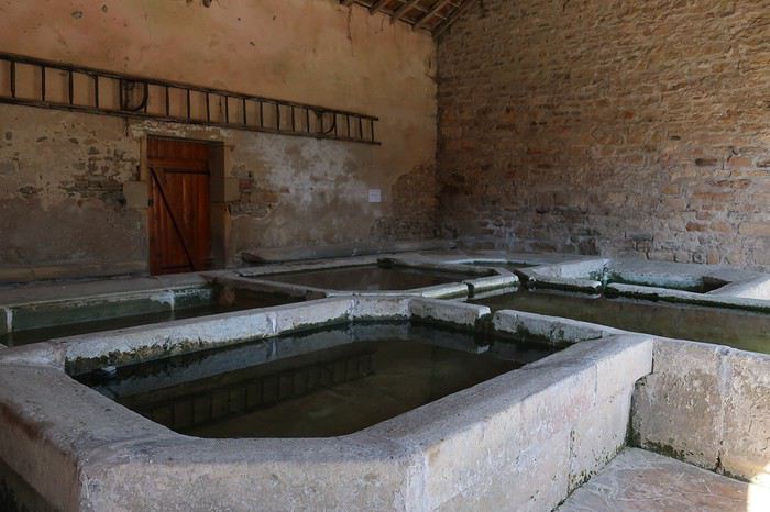
Je sens la déshydratation assécher mon corps. En France, je n’avais jamais ressenti cela. Je ne crains pas le soleil, sans doute du fait de mon atavisme du sud de la Méditerranée, mais aujourd’hui je me sentirais presque en danger. Il me reste une trentaine de kilomètres pour boucler mon étape prévue. Généralement, je ne suis pas à cheval quant au respect de la planification, je peux sortir ma tente et m’installer dans le premier bosquet un peu à l’abri des regards. Mais aujourd’hui j’ai l’impression de cuire et je crains que sous la tente ce soit l’enfer. Donc je vais m’astreindre à rejoindre la ville afin de chercher un hôtel, en quête d’un peu de fraîcheur. Les derniers kilomètres sont un calvaire comme je n’en avais jamais connu. Les ultimes côtes, même pas très raides, je suis dans l’obligation de pousser mon vélo, bien qu’il soit en carbone et hyper léger, et même de m’arrêter sur le bas-côté et me vautrer dans l’herbe du talus à l’abri de l’ombre d’un arbre.
Cette première journée me laisse un peu dubitatif. J’ai eu l’impression de pédaler dans quelque pays exotique. Les jours à venir ne seront pas plus cléments, les prévisions météorologiques annoncent des pics de chaleur encore plus importants. Bon, nous verrons bien. Première mesure essayer de continuer à rouler très tôt et puis limiter les étapes à 70 kilomètres. Voilà il faut s’adapter, le corps commande et surtout rester à son écoute, ce que je n’ai pas vraiment fait aujourd’hui.
J’ai plusieurs amis qui sont des spécialistes du déplacement à vélo de nuit, en particulier au moment de la pleine lune, ils en parlent avec des trémolos dans la voix. Ce serait bien le moment d’essayer, la configuration actuelle de notre satellite s’y prête. Mais dans un premier temps j’aspire à une bonne nuit et, surtout à réhydrater mon corps. Ma devise « toujours pisser blanc » est mise à mal, mes urines sont d’un jaune plus que prononcé malgré les 4 litres d’eau de la journée. Je ne me souviens pas avoir subi de telles difficultés à avancer, conjonction d’erreurs et de canicule. Toujours très intéressant d’aller assez prêt de ses limites physiques, je me rends compte qu’il ne faut pas grand-chose pour dérègler la machine.
De la terrasse de l’hôtel, je regarde vers le nord, tout est jaune, desséché. Cela est presque inquiétant, on pourrait se croire quelque part au sud de l’Espagne, mais non il s’agit bien de la Haute-Marne. Demain je vais me contenter d’une étape de 60 kilomètres en rejoignant Neufchâteau, qui se trouve dans le département des Vosges.

Après une nuit correcte, au réveil je constate que la journée d’hier a laissé quelques traces et, contrairement à mon habitude, je ne démarre pas au lever du jour mais vers les 9 heures du matin. Très vite, la ville située sur une bosse est quittée et devant moi s’ouvrent à l’infini des prairies et des terres agricoles grillées par la sécheresse et les rayons ardents du soleil. Prendre une carte IGN ou Michelin, qu’elle soit au 1/100 00, 1/150 000 ou 1/175 000 -ème et y tracer son itinéraire le long de départementales matérialisées par un trait blanc bordé de deux lignes noires, alors vous êtes certain du résultat. Vous vous lancez dans une belle aventure loin des voitures, mais proche d’une nature et d’une vie locale que l’on a tendance à ne plus voir. Cette incursion dans le département 52, va me conduire de minuscule village en minuscule village, qui s’égrènent, de bosses en creux, tout au long d’une terre ondulante. Je ne vais y voir pratiquement aucun des êtres vivants que l’on s’attend à rencontrer, ni homme, ni chien, ni chat. Si, une fois, dans l’un de ces hameaux apparemment abandonnés, je vais croiser un homme seul, et il me rappelle que nous sommes en pandémie car il porte le masque, le fameux masque qui fait couler tant d’encre et de salive chez les Gaulois récalcitrants.
A vrai dire je vais côtoyer de nombreuses vaches, qui lorsqu’elles le peuvent s’agglutinent à l’ombre d’un arbre de leur pâture. Elles sont comme de gros points blancs dans cet environnement couleur blond, couleur paille. Les ondulations permanentes de cette terre procurent des contrastes du plus bel effet entre le doré du sol et le bleu du ciel. L’une et l’autre des couleurs ne se mélangent pas comme sur une aquarelle, au contraire elles se maintiennent bien séparées par une ligne horizontale sans accroc. Cette matinée me fait une impression étrange. Ce décor de villages déserts alanguis dans un autre temps, de champs, de vaches, d’odeur de purin et de présence de traces de bouses un peu partout me remémore ma traversée de la Pologne par ses grandes plaines, il y a maintenant une dizaine d’années. Certes, en Pologne l’environnement, les habitations les matériels agricoles étaient plus vétustes, mais je m’y vois presque dans ces immenses plaines où les Allemands livrèrent de dures batailles avant de reculer devant le rouleau compresseur soviétique. D’ailleurs, ironie du sort dans ces hameaux de Haute-Marne, la présence humaine est surtout représentée par les monuments aux morts rappelant les soldats tombés au champ d’honneur pour la France.
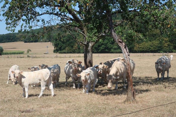
Au village de Pompierre je m’arrête vers midi, la température a déjà largement dépassé les 30 degrés, et cela va continuer à monter jusque vers 15 heures. Allongé au bout d’un pont à l’ombre d’un arbre je savoure la brise très ténue créée par le cours d’eau pas encore asséché, mais qui cependant a des airs de moribond qui ne devrait pas tarder à rendre les armes. Un coureur, plus très jeune, passe à trois reprises, suant et harassé sous le soleil vertical le dardant sans pitié. Au troisième passage je l’interroge. Il me répond qu’il vient d’effectuer par 3 fois un parcours de 2,5 kilomètres. Chapeau, car à part l’ombre de mon arbre son circuit se déroule en plein champ. Il me donnerait presque de la vaillance. Après trois quarts d’heure de station allongée, je prends à deux mains, sinon mon courage, du moins mon guidon et j’accomplis les 11 derniers kilomètres qui me séparent de Neufchâteau.
L’ambiance dans les villes est quand même un peu étrange, tout le monde ou presque est masqué. Dès que je descends de vélo je dégaine le mien. Il fait tellement chaud que je n’ai même pas faim. Je me force cependant à ingurgiter les différents éléments du menu que fort gentiment le propriétaire de l’hôtel me propose alors qu’il est déjà 14 heures. En ce troisième jour je compte rejoindre la ville de Commercy dans la Meuse, encore un département très agricole. Vu les conditions de forme pas au top et les conditions météorologiques par contre au top de la chaleur, ce sera le point le plus haut de mon parcours pour une sortie de 5 jours. Dans mon euphorie initiale je me serais bien vu monter au moins jusqu’à la frontière du Luxembourg. Mais voilà, entre ce que l’on désirerait et la réalité, cette dernière gagne généralement.
Comme hier, la même campagne assoiffée se déroule de part et d’autre de mon chemin. Je traverse le village natal de Jeanne-d ’Arc, Domremy-la -Pucelle. Il n’a pas de privilège particulier, lui aussi crie à boire. Puis je traverse une route plus importante et reprends mon itinérance au gré de départementales confidentielles. Je vais croiser quelques voyageurs à vélo, deux solitaires et un couple à vélo électrique. Généralement lorsque je croise d’autres adeptes du voyage à vélo je les intercepte pour discuter. Mais aujourd’hui non, d’ailleurs le bikepacker, bien qu’il se traîne, est-il considéré comme faisant partie de la même tribu ? Le deuxième solitaire rencontré est terriblement chargé, quatre énormes sacoches. Où va-t-il donc, quelle est la durée de son périple ? Tel que je suis équipé, je pourrais continuer beaucoup plus que les cinq jours prévus. J’ai tout pour être autonome, même 250 grammes de riz en cas de bivouac improvisé à la dernière extrémité. Apprendre à être minimaliste n’est pas facile. Je garde en mémoire les conseils d’un camarade spécialiste des grandes traversées en courant, du style Australie ou autre immenses étendues hostiles. Son slogan « si tu oublies quelque chose tu t’en passes ». Je me souviens aussi de ce Chamoniard rencontré au nord de la Thaïlande, qui roulait depuis 7 mois avec deux petites sacoches. Nous avions fait route ensemble quelques centaines de kilomètres et j’avais pu observer son fonctionnement. J’avais beaucoup appris en quelques jours.

En fin de parcours je traverse la Meuse à plusieurs reprises. Non seulement la végétation manque d’eau, mais la rivière aussi souffre de la sécheresse. Son débit est faible, partout affleurent de grands bancs d’algues aux couleurs diverses, mais son eau reste claire. Des différents ponts sur lesquels je m’arrête j’observe des multitudes de poissons. Je n’avais jamais vu une rivière aussi poissonneuse. A mon regard se dévoilent des chevennes, gardons et autres ablettes. Mais s’ils sont si nombreux, à n’en pas douter les carnassiers, comme brochets, sandres ou perches voire truites sont tapis quelque part en attente de les dévorer.

Avant d’atteindre mon but je me perds et fais des détours dans le village de Sorcy-Saint-Martin qui me permettent quelques contacts intéressants avec les rares personnes qui osent affronter le soleil de tout début d’après-midi. Commercy, petite ville avec un centre qui rappelle la place Stanislas de Nancy. Ce soir va s’y dérouler un concert en l’honneur de Johnny. Le chanteur est très bon, on s’y croirait tout à fait. Le contrôle de la police sera effectif en matière de distanciation. En ce quatrième jour je pars à huit heures du matin. Après un kilomètre je passe devant une pharmacie, déjà 28 degrés, il faut s’attendre encore une fois à une grosse attaque de la canicule. Pour le moment il est très agréable de pédaler. Aujourd’hui encore l’eau reste présente sur mon itinéraire. Entre le canal et la Meuse j’ai tout loisir d’observer l’eau et bien évidemment j’y vois des poissons de toutes tailles. Mes lunettes de soleil polarisantes m’aident grandement du fait qu’elles font disparaître les reflets. Je suis comme un intrus voyeur, j’adore ! Les trois premières heures sont un véritable plaisir. J’effectue une cinquantaine de kilomètres. Puis vers les 11 heures la chape de plomb comme les jours précédents s’abat. La moyenne tombe, les efforts deviennent pénibles. Je ne passe pas très loin de la colline de Sion « la colline inspirée » de Maurice Barrès. Le détour à vélo, agrémenté d’une belle côte par une température frisant les 40 degrés, me semble surhumain. Je vais rejoindre rapidement et au plus court la petite ville de Charmes et aller me planquer au frais dans un hôtel un peu au sud. Le soir, discussion sur la terrasse d’une pizzeria avec une Hollandaise qui parcourt à vélo l’itinéraire d’Achern aux Saintes-Maries-de-la Mer. Elle effectue de courtes étapes de l’ordre de 30 à 40 kilomètres, mais elle affronte le bivouac, ce que je n’ai pas le courage de faire.
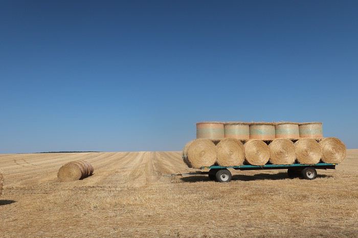
En ce cinquième et dernier jour, une matinée plus propice au vélo, car un ciel légèrement voilé protège un peu du soleil, par la route au plus court je rejoins Remiremont. De là par la piste cyclable empruntant l’ancienne voie ferrée en 25 kilomètres je remonte la vallée de la Moselotte. Au cours de ce périple qui avoisine les 400 kilomètres les bistrots auront pratiquement été absents du bord de la route. Pour me rattraper, alors que je ne suis plus qu’à 6 kilomètres de chez moi, je m’arrête à l’ancienne gare de Saulxures, transformée en bar-restaurant et je déguste deux panachés. Ce coin m’est particulièrement familier, car souvent j’y laisse ma voiture pour partir assouvir l’une de mes passions la pêche à la mouche.
 Belle brochette de vaches vosgiennes en remontant la vallée de la Moselotte, retour chez moi
Cinq jours sur la route, j’ai beaucoup apprécié de me déplacer sur ces routes hors des axes de circulation et aussi un peu hors du temps, ma curiosité toujours aiguisée par ces coins de France déserts. Mais malheureusement, je n’ai pratiquement jamais eu l’impression de me sentir à l’aise, le grand plaisir des kilomètres qui défilent comme si je volais. J’ai toujours ressenti cette impression de forcer excessivement comparativement aux distances accomplies. Espérons qu’il ne s’agisse que de l’effet de la canicule !
Le cyclo-voyageur ajoute une dimension particulière au voyage. En quelque sorte son déplacement constitue son voyage. Il ne se rend pas en un lieu pour le visiter, il pérégrine en recherchant les routes, les chemins ou les pistes les moins courues, et il en fait son voyage. L’itinéraire, lorsqu’on le parcourt à la force de ses mollets, on change l’esprit du déplacement. Bien sûr l’idée de challenge est toujours, plus ou moins, sous-jacente.
Ce type de réflexion, tout naturellement m’a conduit à envisager de partir à la découverte de la France profonde à travers les départements suivants, la Haute-Marne, la Meuse et la Meurthe-et-Moselle. Bien évidemment, nous sommes nombreux à y être passés, mais en voiture dans nos traversées browniennes, où l’on ne souffre pas le moindre retard, les yeux rivés sur le compteur, en essayant d’être toujours un peu au-dessus de la limite, à l’orée de déclencher les radars. Entre le compteur optimiste et la petite tolérance, sur route 90 affiché au compteur et 140 sur autoroute, généralement tout se passe bien. Mais les grands axes sont devenus une jungle, où toute notre attention est absorbée. Donc, même si nous avons traversé ces départements 52, 55 ou 54 que connaissons nous des campagnes profondes qui s’y cachent ? C’est justement à leur découverte, hors des voies habituelles du tourisme, que je veux m’aventurer quelques jours. Certes, les départements agricoles j’en ai une petite idée, ayant habité en Haute-Saône et ayant beaucoup parcouru à pied tout le sud-ouest de la France, en particulier le département du Gers, très impressionnant par ses moutonnements de terres cultivées qui se succèdent jusqu’à l’infini. Mais voilà, tous les départements ne se ressemblant pas, c’est donc plein de curiosité et aussi d’attentes que je me lance dans un « petit tour » de 400 kilomètres à partir de chez moi.
Je vais renouer avec le bikepacking, terme barbare qui signifie que l’on part avec un matériel allégé, avec des sacoches au look futuriste qui n’ont pas besoin de porte-bagages pour être accrochées. Bien évidemment la contenance en est moindre. Mais on se déplace toujours avec beaucoup trop d’affaires, qu’il s’agisse d’habits ou d’appareils électroniques en tous genres, sans parler des matériels de bivouac trop volumineux. Evidemment, ces derniers il en existe de poids et volume réduits, mais il faut oser passer le pas et mettre au rebus un équipement que l’on considère toujours efficace. Et puis, il faut s’adapter aux saisons et aux lieux. Cela conduit à avoir une tente pour l’été en Europe, une pour l’hiver, éventuellement celle de l’été suffit, mais pour les voyages lointains dans des pays au climat très hostile, là pas le choix du très costaud s’impose. Le voyage à vélo, afin de s’équiper de façon optimale selon les différentes options demande des moyens financiers.
Comme à chaque fois, que je pars pour un voyage engagé de longue durée sur un autre continent ou pour un petit tour de côté de chez moi, alors l’appel de la route s’impose. J’ai perdu l’habitude (à vrai dire je ne l’ai jamais eue) d’organiser mes affaires en bikepacking, il s’agit seulement de ma deuxième expérience, et de plus je pars dans l’euphorie de la première. En effet, j’avais effectué le premier jour 230 kilomètres, alors j’envisage avec un esprit tranquille mon étape initiale de 130 kilomètres. Quelle erreur ! 6h30, je prends la piste cyclable direction Remiremont. Les 25 premiers kilomètres sont rapidement expédiés. Les bosses apparaissent dès la sortie ouest de la ville et elles vont être nombreuses. Je ne serai pas en mesure d’en faire la somme des dénivelés cumulés, mon compteur va me lâcher aux environs des 80 kilomètres. Je prends la direction de Bains-les -Bains. Tout va bien, la forme semble bonne, la circulation est peu dense. Je me fais doubler au moment où je m’arrête par un couple de voyageurs équipés de vélos électriques. Evidemment je ne les rattraperai pas.
Pause-café, plutôt capuccino à Bains-les -Bains. Sur la terrasse on est autorisé à s’installer sans porter le masque. Sur mon vélo au milieu de la campagne déserte j’oublie rapidement la présence de la pandémie, mais dès que je pénètre dans une agglomération, les visages masqués me rappellent la situation que nous subissons à l’échelle mondiale. Sur cette terrasse, un homme m’aborde et me pose quelques questions sur mon périple. Il me donne une information intéressante concernant la piste cyclable qui longe le canal de l’est et qui passe à proximité. Je ne le savais pas et ma carte Michelin au 1/150 000ème couvrant les départements Haute-Saône et Vosges ne la mentionne pas.
Je vais la suivre une dizaine de kilomètres, parcours très agréable où je croise plusieurs voyageurs à vélo, dont deux familles lourdement équipées. Je rencontre aussi plusieurs bateaux, certains dans mon sens donc je les dépasse. J’éprouve toujours un grand plaisir à suivre les berges d’un cours d’eau ou d’un canal. Ce dernier insuffle la sérénité. Parfois la piste est cernée par l’eau. Mais tout a une fin, je reprends la route au village de Selle. En traversant des villages du bout du monde ou presque, tels que Regnévelle, Godoncourt ou Ainville je me dirige vers mon point de chute la ville de Montigny-le-Roy.
A vélo on passe rapidement de tout va bien à rien ne va plus. Mais il y a une explication à toutes choses. Sans doute l’absence d’entraînement depuis 18 mois, mais je ne me suis jamais entraîné avant de partir en balade. Peut-être l’âge ? mais plus probablement un mixte entre grosse chaleur et une très mauvaise gestion boisson nourriture. Il faut dire que dans ces coins durant les cinq jours de mon périple je ne rencontrerai quasiment aucun commerce ni bistrot. On a beau avoir une longue expérience en matière de voyage à vélo, les conneries de base on les fait encore parfois. Eh oui, cette idée de faire « seulement » 130 kilomètres m’a mis dans un état d’imprévoyance, m’imaginant que cela serait facile, et boum le coup de barre.
Je m’arrête dans un village asphyxié sous une chappe de chaleur, et à l’abri d’un mur, installé sur un petit carré de pelouse grillée je mange les deux œufs durs que j’ai pris la précaution d’emmener, ainsi que l’une des deux bananes que je possède. Je remplis mes bidons au magnifique lavoir.
Je sens la déshydratation assécher mon corps. En France, je n’avais jamais ressenti cela. Je ne crains pas le soleil, sans doute du fait de mon atavisme du sud de la Méditerranée, mais aujourd’hui je me sentirais presque en danger. Il me reste une trentaine de kilomètres pour boucler mon étape prévue. Généralement, je ne suis pas à cheval quant au respect de la planification, je peux sortir ma tente et m’installer dans le premier bosquet un peu à l’abri des regards. Mais aujourd’hui j’ai l’impression de cuire et je crains que sous la tente ce soit l’enfer. Donc je vais m’astreindre à rejoindre la ville afin de chercher un hôtel, en quête d’un peu de fraîcheur. Les derniers kilomètres sont un calvaire comme je n’en avais jamais connu. Les ultimes côtes, même pas très raides, je suis dans l’obligation de pousser mon vélo, bien qu’il soit en carbone et hyper léger, et même de m’arrêter sur le bas-côté et me vautrer dans l’herbe du talus à l’abri de l’ombre d’un arbre.
Cette première journée me laisse un peu dubitatif. J’ai eu l’impression de pédaler dans quelque pays exotique. Les jours à venir ne seront pas plus cléments, les prévisions météorologiques annoncent des pics de chaleur encore plus importants. Bon, nous verrons bien. Première mesure essayer de continuer à rouler très tôt et puis limiter les étapes à 70 kilomètres. Voilà il faut s’adapter, le corps commande et surtout rester à son écoute, ce que je n’ai pas vraiment fait aujourd’hui.
J’ai plusieurs amis qui sont des spécialistes du déplacement à vélo de nuit, en particulier au moment de la pleine lune, ils en parlent avec des trémolos dans la voix. Ce serait bien le moment d’essayer, la configuration actuelle de notre satellite s’y prête. Mais dans un premier temps j’aspire à une bonne nuit et, surtout à réhydrater mon corps. Ma devise « toujours pisser blanc » est mise à mal, mes urines sont d’un jaune plus que prononcé malgré les 4 litres d’eau de la journée. Je ne me souviens pas avoir subi de telles difficultés à avancer, conjonction d’erreurs et de canicule. Toujours très intéressant d’aller assez prêt de ses limites physiques, je me rends compte qu’il ne faut pas grand-chose pour dérègler la machine.
De la terrasse de l’hôtel, je regarde vers le nord, tout est jaune, desséché. Cela est presque inquiétant, on pourrait se croire quelque part au sud de l’Espagne, mais non il s’agit bien de la Haute-Marne. Demain je vais me contenter d’une étape de 60 kilomètres en rejoignant Neufchâteau, qui se trouve dans le département des Vosges.
Après une nuit correcte, au réveil je constate que la journée d’hier a laissé quelques traces et, contrairement à mon habitude, je ne démarre pas au lever du jour mais vers les 9 heures du matin. Très vite, la ville située sur une bosse est quittée et devant moi s’ouvrent à l’infini des prairies et des terres agricoles grillées par la sécheresse et les rayons ardents du soleil. Prendre une carte IGN ou Michelin, qu’elle soit au 1/100 00, 1/150 000 ou 1/175 000 -ème et y tracer son itinéraire le long de départementales matérialisées par un trait blanc bordé de deux lignes noires, alors vous êtes certain du résultat. Vous vous lancez dans une belle aventure loin des voitures, mais proche d’une nature et d’une vie locale que l’on a tendance à ne plus voir. Cette incursion dans le département 52, va me conduire de minuscule village en minuscule village, qui s’égrènent, de bosses en creux, tout au long d’une terre ondulante. Je ne vais y voir pratiquement aucun des êtres vivants que l’on s’attend à rencontrer, ni homme, ni chien, ni chat. Si, une fois, dans l’un de ces hameaux apparemment abandonnés, je vais croiser un homme seul, et il me rappelle que nous sommes en pandémie car il porte le masque, le fameux masque qui fait couler tant d’encre et de salive chez les Gaulois récalcitrants.
A vrai dire je vais côtoyer de nombreuses vaches, qui lorsqu’elles le peuvent s’agglutinent à l’ombre d’un arbre de leur pâture. Elles sont comme de gros points blancs dans cet environnement couleur blond, couleur paille. Les ondulations permanentes de cette terre procurent des contrastes du plus bel effet entre le doré du sol et le bleu du ciel. L’une et l’autre des couleurs ne se mélangent pas comme sur une aquarelle, au contraire elles se maintiennent bien séparées par une ligne horizontale sans accroc. Cette matinée me fait une impression étrange. Ce décor de villages déserts alanguis dans un autre temps, de champs, de vaches, d’odeur de purin et de présence de traces de bouses un peu partout me remémore ma traversée de la Pologne par ses grandes plaines, il y a maintenant une dizaine d’années. Certes, en Pologne l’environnement, les habitations les matériels agricoles étaient plus vétustes, mais je m’y vois presque dans ces immenses plaines où les Allemands livrèrent de dures batailles avant de reculer devant le rouleau compresseur soviétique. D’ailleurs, ironie du sort dans ces hameaux de Haute-Marne, la présence humaine est surtout représentée par les monuments aux morts rappelant les soldats tombés au champ d’honneur pour la France.
Au village de Pompierre je m’arrête vers midi, la température a déjà largement dépassé les 30 degrés, et cela va continuer à monter jusque vers 15 heures. Allongé au bout d’un pont à l’ombre d’un arbre je savoure la brise très ténue créée par le cours d’eau pas encore asséché, mais qui cependant a des airs de moribond qui ne devrait pas tarder à rendre les armes. Un coureur, plus très jeune, passe à trois reprises, suant et harassé sous le soleil vertical le dardant sans pitié. Au troisième passage je l’interroge. Il me répond qu’il vient d’effectuer par 3 fois un parcours de 2,5 kilomètres. Chapeau, car à part l’ombre de mon arbre son circuit se déroule en plein champ. Il me donnerait presque de la vaillance. Après trois quarts d’heure de station allongée, je prends à deux mains, sinon mon courage, du moins mon guidon et j’accomplis les 11 derniers kilomètres qui me séparent de Neufchâteau.
L’ambiance dans les villes est quand même un peu étrange, tout le monde ou presque est masqué. Dès que je descends de vélo je dégaine le mien. Il fait tellement chaud que je n’ai même pas faim. Je me force cependant à ingurgiter les différents éléments du menu que fort gentiment le propriétaire de l’hôtel me propose alors qu’il est déjà 14 heures. En ce troisième jour je compte rejoindre la ville de Commercy dans la Meuse, encore un département très agricole. Vu les conditions de forme pas au top et les conditions météorologiques par contre au top de la chaleur, ce sera le point le plus haut de mon parcours pour une sortie de 5 jours. Dans mon euphorie initiale je me serais bien vu monter au moins jusqu’à la frontière du Luxembourg. Mais voilà, entre ce que l’on désirerait et la réalité, cette dernière gagne généralement.
Comme hier, la même campagne assoiffée se déroule de part et d’autre de mon chemin. Je traverse le village natal de Jeanne-d ’Arc, Domremy-la -Pucelle. Il n’a pas de privilège particulier, lui aussi crie à boire. Puis je traverse une route plus importante et reprends mon itinérance au gré de départementales confidentielles. Je vais croiser quelques voyageurs à vélo, deux solitaires et un couple à vélo électrique. Généralement lorsque je croise d’autres adeptes du voyage à vélo je les intercepte pour discuter. Mais aujourd’hui non, d’ailleurs le bikepacker, bien qu’il se traîne, est-il considéré comme faisant partie de la même tribu ? Le deuxième solitaire rencontré est terriblement chargé, quatre énormes sacoches. Où va-t-il donc, quelle est la durée de son périple ? Tel que je suis équipé, je pourrais continuer beaucoup plus que les cinq jours prévus. J’ai tout pour être autonome, même 250 grammes de riz en cas de bivouac improvisé à la dernière extrémité. Apprendre à être minimaliste n’est pas facile. Je garde en mémoire les conseils d’un camarade spécialiste des grandes traversées en courant, du style Australie ou autre immenses étendues hostiles. Son slogan « si tu oublies quelque chose tu t’en passes ». Je me souviens aussi de ce Chamoniard rencontré au nord de la Thaïlande, qui roulait depuis 7 mois avec deux petites sacoches. Nous avions fait route ensemble quelques centaines de kilomètres et j’avais pu observer son fonctionnement. J’avais beaucoup appris en quelques jours.
En fin de parcours je traverse la Meuse à plusieurs reprises. Non seulement la végétation manque d’eau, mais la rivière aussi souffre de la sécheresse. Son débit est faible, partout affleurent de grands bancs d’algues aux couleurs diverses, mais son eau reste claire. Des différents ponts sur lesquels je m’arrête j’observe des multitudes de poissons. Je n’avais jamais vu une rivière aussi poissonneuse. A mon regard se dévoilent des chevennes, gardons et autres ablettes. Mais s’ils sont si nombreux, à n’en pas douter les carnassiers, comme brochets, sandres ou perches voire truites sont tapis quelque part en attente de les dévorer.
Avant d’atteindre mon but je me perds et fais des détours dans le village de Sorcy-Saint-Martin qui me permettent quelques contacts intéressants avec les rares personnes qui osent affronter le soleil de tout début d’après-midi. Commercy, petite ville avec un centre qui rappelle la place Stanislas de Nancy. Ce soir va s’y dérouler un concert en l’honneur de Johnny. Le chanteur est très bon, on s’y croirait tout à fait. Le contrôle de la police sera effectif en matière de distanciation. En ce quatrième jour je pars à huit heures du matin. Après un kilomètre je passe devant une pharmacie, déjà 28 degrés, il faut s’attendre encore une fois à une grosse attaque de la canicule. Pour le moment il est très agréable de pédaler. Aujourd’hui encore l’eau reste présente sur mon itinéraire. Entre le canal et la Meuse j’ai tout loisir d’observer l’eau et bien évidemment j’y vois des poissons de toutes tailles. Mes lunettes de soleil polarisantes m’aident grandement du fait qu’elles font disparaître les reflets. Je suis comme un intrus voyeur, j’adore ! Les trois premières heures sont un véritable plaisir. J’effectue une cinquantaine de kilomètres. Puis vers les 11 heures la chape de plomb comme les jours précédents s’abat. La moyenne tombe, les efforts deviennent pénibles. Je ne passe pas très loin de la colline de Sion « la colline inspirée » de Maurice Barrès. Le détour à vélo, agrémenté d’une belle côte par une température frisant les 40 degrés, me semble surhumain. Je vais rejoindre rapidement et au plus court la petite ville de Charmes et aller me planquer au frais dans un hôtel un peu au sud. Le soir, discussion sur la terrasse d’une pizzeria avec une Hollandaise qui parcourt à vélo l’itinéraire d’Achern aux Saintes-Maries-de-la Mer. Elle effectue de courtes étapes de l’ordre de 30 à 40 kilomètres, mais elle affronte le bivouac, ce que je n’ai pas le courage de faire.
En ce cinquième et dernier jour, une matinée plus propice au vélo, car un ciel légèrement voilé protège un peu du soleil, par la route au plus court je rejoins Remiremont. De là par la piste cyclable empruntant l’ancienne voie ferrée en 25 kilomètres je remonte la vallée de la Moselotte. Au cours de ce périple qui avoisine les 400 kilomètres les bistrots auront pratiquement été absents du bord de la route. Pour me rattraper, alors que je ne suis plus qu’à 6 kilomètres de chez moi, je m’arrête à l’ancienne gare de Saulxures, transformée en bar-restaurant et je déguste deux panachés. Ce coin m’est particulièrement familier, car souvent j’y laisse ma voiture pour partir assouvir l’une de mes passions la pêche à la mouche.
Belle brochette de vaches vosgiennes en remontant la vallée de la Moselotte, retour chez moiCinq jours sur la route, j’ai beaucoup apprécié de me déplacer sur ces routes hors des axes de circulation et aussi un peu hors du temps, ma curiosité toujours aiguisée par ces coins de France déserts. Mais malheureusement, je n’ai pratiquement jamais eu l’impression de me sentir à l’aise, le grand plaisir des kilomètres qui défilent comme si je volais. J’ai toujours ressenti cette impression de forcer excessivement comparativement aux distances accomplies. Espérons qu’il ne s’agisse que de l’effet de la canicule !
Redécouvrir la Corse, un vrai plaisir English translation pending
Après un départ manqué pour la Louisiane et deux mois de confinement, on avait comme beaucoup envie de changer d'air (encore que Hyères soit une ville extrêmement agréable, surtout quand la fréquentation reste modérée).
Début juin, il y avait peu d'opportunités d'évasion, sauf un tour en Corse qui paraissait une bonne solution. Mais c'était sans compter sur les atermoiements de l’exécutif Corse, avec la demande d'un passeport sanitaire (mais quel type de passeport, quels tests, quand, comment?) et le mutisme du gouvernement sur le même sujet.
Finalement, nous avons choisi de partir quand même le 22 juin, avec transport, hôtels, location tous annulables sans frais sous 48 h et, progressivement, les obstacles au départ ont été levés.
Malgré tout, petit suspense à l'embarquement à Toulon le 22 au soir : y aurait t'il un nouveau rebondissement dans la gestion Corse de l'épidémie ?
Finalement, tout se passe en douceur : accueil beaucoup moins stressé que d'habitude, que ce soit sur le port même, à l'embarquement, où souvent les garagistes de Corsica Ferries sont plutôt sur les dents, et également sur le bateau où le personnel est beaucoup plus aimable que d'habitude (facile diront les habitués de la traversée).
A bord, beaucoup moins de monde, port généralisé du masque, sauf quelques jeunes adultes qui s'estiment au dessus de ça.
On quitte le port de Toulon au soleil couchant, en saluant à tribord les fermes aquacoles des Tamaris
 , puis les deux vieux bateaux de la Marine qui finissent leur carrière comme brise lames à la Seyne
 et on admire le départ toujours acrobatique du pilote
 - Sommeil tranquille dans une cabine où personne n'a pris la peine de remplir les distributeurs de savon du lavabo et de la douche. Ce sera donc une toilette de chat.
On vire les Sanguinaires à 7 h du matin, par grand beau temps et mer plate,
- Sommeil tranquille dans une cabine où personne n'a pris la peine de remplir les distributeurs de savon du lavabo et de la douche. Ce sera donc une toilette de chat.
On vire les Sanguinaires à 7 h du matin, par grand beau temps et mer plate,
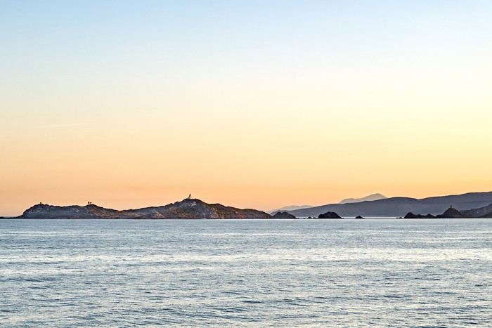 pour accoster comme prévu à Ajaccio à 7 h 30.
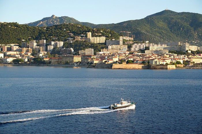 A 8 h, on met l'autoradio sur radio Corsica, ce qui nous met tout de suite dans l'ambiance (Non, rien de rien d'Edith Piaf chanté en Corse, ça vaut le déplacement!) et on roule tranquillement en direction de la Parata, avec très peu de trafic, pas de bus touristiques et sans l'affreux petit train sur pneus qui bloque habituellement la circulation.
Arrivé au parking de la Parata, les navettes électriques ne fonctionnent pas encore, on continue donc à pied vers la pointe, en admirant les Iles sanguinaires qui se reflètent dans l'eau lisse.
A 8 h, on met l'autoradio sur radio Corsica, ce qui nous met tout de suite dans l'ambiance (Non, rien de rien d'Edith Piaf chanté en Corse, ça vaut le déplacement!) et on roule tranquillement en direction de la Parata, avec très peu de trafic, pas de bus touristiques et sans l'affreux petit train sur pneus qui bloque habituellement la circulation.
Arrivé au parking de la Parata, les navettes électriques ne fonctionnent pas encore, on continue donc à pied vers la pointe, en admirant les Iles sanguinaires qui se reflètent dans l'eau lisse.
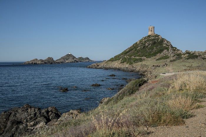
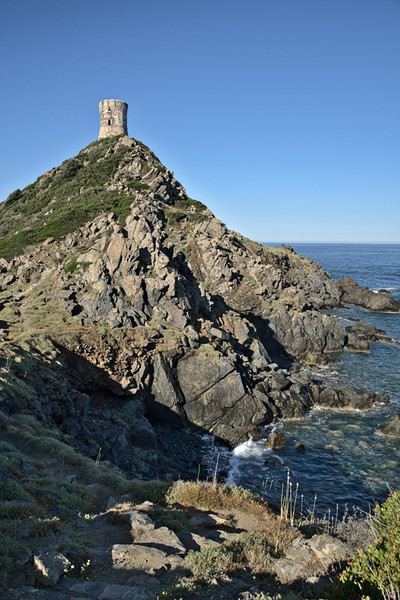
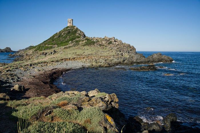
Après notre tour de la pointe, c'est l'heure du café, mais la brasserie est fermée, nous repartons vers Ajaccio et prenons notre café à Marinella, le petit bar de plage sympa à coté de l'ancienne propriété de Tino Rossi et de là embrayons direction Cargese avec quelques embouteillages pour quitter Ajaccio. A Cargese, nous saluons comme il se doit les deux églises jumelles, l'orthodoxe d'un coté, la catholique en face et nous descendons jusqu'au port qui visiblement tourne au ralenti. Nous déjeunons fort agréablement a U Rasaghiu.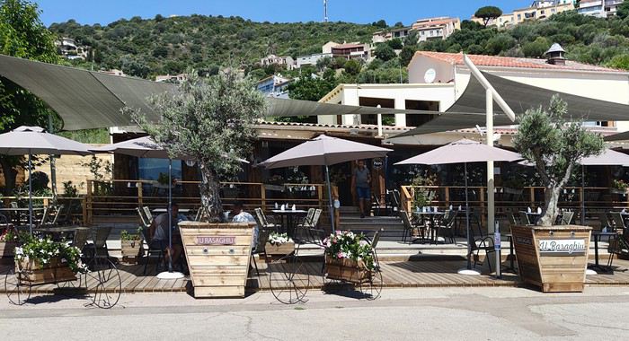 Dans le temps, nous avions l'habitude d'y aller souvent le soir, le patron laissait tomber le service pour pousser la chanson pour ses clients pinzutti, dont nous étions et nous ne nous lassions pas d'écouter la Boudeuse et la Vieille Guitare. L'établissement a été fort joliment modernisé, l'accueil et la cuisine y sont toujours excellents, mais la maison attend qu'il y ait plus de clients pour rentabiliser ses soirées Chansons Corses, ainsi va la vie.
Nous nous dirigeons ensuite vers Porto Ota en traversant au ralenti la zone des calanques de Piana, en profitant de la faible circulation pour nous arrêter sur les petites aires de stationnement et admirer le paysage, superbe sous le bel éclairage que nous avons la chance d'avoir aujourd'hui.
Dans le temps, nous avions l'habitude d'y aller souvent le soir, le patron laissait tomber le service pour pousser la chanson pour ses clients pinzutti, dont nous étions et nous ne nous lassions pas d'écouter la Boudeuse et la Vieille Guitare. L'établissement a été fort joliment modernisé, l'accueil et la cuisine y sont toujours excellents, mais la maison attend qu'il y ait plus de clients pour rentabiliser ses soirées Chansons Corses, ainsi va la vie.
Nous nous dirigeons ensuite vers Porto Ota en traversant au ralenti la zone des calanques de Piana, en profitant de la faible circulation pour nous arrêter sur les petites aires de stationnement et admirer le paysage, superbe sous le bel éclairage que nous avons la chance d'avoir aujourd'hui.
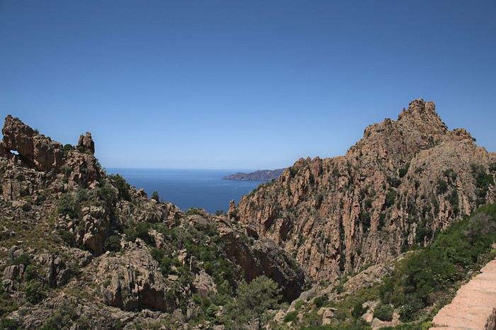
A suivre....
, puis les deux vieux bateaux de la Marine qui finissent leur carrière comme brise lames à la Seyne
et on admire le départ toujours acrobatique du pilote
- Sommeil tranquille dans une cabine où personne n'a pris la peine de remplir les distributeurs de savon du lavabo et de la douche. Ce sera donc une toilette de chat.
On vire les Sanguinaires à 7 h du matin, par grand beau temps et mer plate,
pour accoster comme prévu à Ajaccio à 7 h 30.
A 8 h, on met l'autoradio sur radio Corsica, ce qui nous met tout de suite dans l'ambiance (Non, rien de rien d'Edith Piaf chanté en Corse, ça vaut le déplacement!) et on roule tranquillement en direction de la Parata, avec très peu de trafic, pas de bus touristiques et sans l'affreux petit train sur pneus qui bloque habituellement la circulation.
Arrivé au parking de la Parata, les navettes électriques ne fonctionnent pas encore, on continue donc à pied vers la pointe, en admirant les Iles sanguinaires qui se reflètent dans l'eau lisse.
Après notre tour de la pointe, c'est l'heure du café, mais la brasserie est fermée, nous repartons vers Ajaccio et prenons notre café à Marinella, le petit bar de plage sympa à coté de l'ancienne propriété de Tino Rossi et de là embrayons direction Cargese avec quelques embouteillages pour quitter Ajaccio. A Cargese, nous saluons comme il se doit les deux églises jumelles, l'orthodoxe d'un coté, la catholique en face et nous descendons jusqu'au port qui visiblement tourne au ralenti. Nous déjeunons fort agréablement a U Rasaghiu.
Dans le temps, nous avions l'habitude d'y aller souvent le soir, le patron laissait tomber le service pour pousser la chanson pour ses clients pinzutti, dont nous étions et nous ne nous lassions pas d'écouter la Boudeuse et la Vieille Guitare. L'établissement a été fort joliment modernisé, l'accueil et la cuisine y sont toujours excellents, mais la maison attend qu'il y ait plus de clients pour rentabiliser ses soirées Chansons Corses, ainsi va la vie.
Nous nous dirigeons ensuite vers Porto Ota en traversant au ralenti la zone des calanques de Piana, en profitant de la faible circulation pour nous arrêter sur les petites aires de stationnement et admirer le paysage, superbe sous le bel éclairage que nous avons la chance d'avoir aujourd'hui.
A suivre....
Discussion autour du concours de juillet 2020: Verticale(s) English translation pending
Pour discuter autour du concours de juillet 2020, Verticale(s), ça se passe ici.
Brazil 2020: Amazon, Northeast, Chapada, and Boipeba – a winning combo!
Hello everyone.
Preamble:
Sooner or later, you’ve got to take the plunge! I thought lockdown would be the perfect time to start this travel journal, but between working from home and gardening, I just didn’t have the time (or the motivation). Plus, long-haul trips weren’t really on the cards back then... But then I stumbled upon my photos and thought, "I’ve got to share my latest adventure in Brazil—you guessed it!"
First, a little flashback: some of you (yes, really, in DMs!) pointed out the big gaps in my travel journals—India in 2019, Vietnam in 2018, so many missed opportunities!
Truth is, for India, I traveled with a private guide and honestly didn’t have much to add to the tons of well-documented journals already out there. Plus, I still haven’t decided if I love or hate India... So, how do you share your feelings when you’re not even sure yourself? As for Vietnam, I had plenty to say—even though the itinerary was pretty classic—but I’ll admit the vibe on this part of the forum at the time kinda put me off for a while... And time flies, and memories fade... Anyway, just wanted to clear that up for my (many or few) readers. *Tudo bem*, let’s get started!!
Preamble:
Sooner or later, you’ve got to take the plunge! I thought lockdown would be the perfect time to start this travel journal, but between working from home and gardening, I just didn’t have the time (or the motivation). Plus, long-haul trips weren’t really on the cards back then... But then I stumbled upon my photos and thought, "I’ve got to share my latest adventure in Brazil—you guessed it!"
First, a little flashback: some of you (yes, really, in DMs!) pointed out the big gaps in my travel journals—India in 2019, Vietnam in 2018, so many missed opportunities!
Truth is, for India, I traveled with a private guide and honestly didn’t have much to add to the tons of well-documented journals already out there. Plus, I still haven’t decided if I love or hate India... So, how do you share your feelings when you’re not even sure yourself? As for Vietnam, I had plenty to say—even though the itinerary was pretty classic—but I’ll admit the vibe on this part of the forum at the time kinda put me off for a while... And time flies, and memories fade... Anyway, just wanted to clear that up for my (many or few) readers. *Tudo bem*, let’s get started!!
Vers la fin des voyages internationaux? English translation pending
S'achemine t-on vers la fin des voyages internationaux ?
Les pays exigent une assurance qui prenne en charge le COVID et les assurances ne veulent pas couvrir ce risque ou alors, il est à craindre, une assurance d'un montant colossal.
Le covid n'a pas disparu et il peut réapparaître.
Je ne veux pas être l'oiseau de mauvais augure mais il me semble que nous allons devoir nous adapter.
Derniers jours, premiers pas English translation pending
https://youtu.be/NekmwOvguHQ
L'hôtel est réservé, 12, 13 juin, ghetto de Venise.
La saveur d'iode et de goémon se propage dans les papilles. L'ambre du très vieux Talisker miroite dans les rayons du soleil. Un pas si fréquent colloque intime avec sa conscience méritait bien la puissance subtile de ce rare nectar des grandes occasions. Il vient de se conclure sur une minuscule décision, limpide et étincelante comme une goutte de rosée qui ploie le brin d'herbe dans la lumière de l'aube : je ne rajouterai pas 21 grammes à la douleur du monde. C'est dérisoire et m'emplit de joie.
Les masques s'alignent sur la commode. L'azur assorti aux sandales à talons bobines, le couvert de dentelle crème harmonisé à l'imprimé du foulard rouge, le beige marié à merveille au pantalon de lin. Les bouteilles de gel sont glissées dans les lieux stratégiques, boite à gants et sacs à main. Affaires réglées, automatismes bientot intégrés, donc bientot oubliés. Jolie occasion en prime de trinquer au Bellavista le jour où ils seront éliminés.
15 jours, 15 jours à meubler avant Venise (ou 3 semaines si on nous enferme en Lombardie mais peu importe). Peut-etre écouter et observer avant de passer à la suite.
On nous annonce une crise sans précédent. Contraction du PIB autour de 10 % pour 2020, l'angoisse collective croit. Crampounette post grippounette. Ont-ils donc la mémoire si courte ? Les 45 % de contraction du PIB de la Grèce, objet des délicates attentions de la troïka penchée à son chevet, n'ont pas naguère ému grand monde. Appartiennent-ils donc à une espèce différente des Grecs pour ne pas survivre à un quart de leurs maux ? Allons...
Peut-être ma semaine milanaise intercalée me permettra-t-elle en outre de rencontrer et converser avec un affecté psychique du confinement. Parait qu'ils sont très nombreux. Ça se manifeste comment ? Les êtres qui sont passés sur une civière entre des cadavres assis sur des chaises parce qu'on n'arrivait pas à les évacuer, ont passé 40 jours à suffoquer en se demandant si chaque respiration ne serait pas la dernière et si on allait eux aussi les asseoir sur une chaise sont dans un état psychique d'hébétude émerveillée, ravis à n'en plus pouvoir d'être vivant, le sourire géant imprimé sur leur visage émacié bouffe le masque qui disparait. Mon homme lui ressemble à une mongolfière. Il a tellement serré les dents que les 67 morts en 5 semaines, ces feu hommes et femmes qui ont fait partie de sa vie quotidienne pendant 59 ans sont restés coincés à l'intérieur. Il lévite, impassible, mettant un soin maniaque à ne pas varier d'un millième de millimètre les rites du quotidien. Il flotte psychiquement dans des automatismes reconnaissables et protecteurs et grogne à la moindre proposition. Même Venise.
Il faut que je réussisse à le trainer à Venise. Il faut percer cette baudruche de souffrance avec la fine aiguille de la beauté.
Pensées mots, pensées images. Dans ces semaines stupéfiantes de cauchemar réel, de glas et de sirènes, les mots retentissaient au loin, très loin, insensés et blèmes. Sa propre voix posant la rituelle question du soir (Qui est mort aujourd'hui ?). Le rassurant blabla mécanique avec l'ailleurs. Le verbiage machinal de l'excroissance professionnelle. Dans la dislocation de la douleur qui fracasse seule restait, inaltérable, l'image Venise. Lente errance dans les ruelles désertes, jeux de reflets dans l'eau des canaux, échos de la musique de Vivaldi qui ouvrait tout doucement les vannes des larmes, empêchant l'eau intérieure d'engloutir les ruines.
Instinctivement, la beauté sauvait.
Elle apaisait. Elle pansait.
Elle appelle aujourd'hui puisqu'elle offre un doux cadre pour les adieux accumulés qui n'ont pu avoir lieu.
Venise ensevelit ce qui est presque déjà du passé et dèbloque la boussole brisée, ouvre l'avenir. L'orient. Marco Polo, Carpaccio, Bellini, Pamuk, saveurs, parfums, vent d'est, trépignations de désirs.
Renaissance du chemin. Demain, dans 6 mois, dans un an, ne change rien : le chemin est là, il commence là.
https://youtu.be/-jIxpXAk-HE
Les ressources instinctives de l'esprit humain sont fantastiques ! 🙂 (je n'ai pas cherché Venise, elle s'est juste imposée quand il ne restait rien. Si on m'avait demandé, en janvier, en pleine activité : D'où repartirais-tu après un cataclysme ? Il est très peu probable que ce soit la Serenissime qui me soit venu à l'esprit)
Catherine
L'hôtel est réservé, 12, 13 juin, ghetto de Venise.
La saveur d'iode et de goémon se propage dans les papilles. L'ambre du très vieux Talisker miroite dans les rayons du soleil. Un pas si fréquent colloque intime avec sa conscience méritait bien la puissance subtile de ce rare nectar des grandes occasions. Il vient de se conclure sur une minuscule décision, limpide et étincelante comme une goutte de rosée qui ploie le brin d'herbe dans la lumière de l'aube : je ne rajouterai pas 21 grammes à la douleur du monde. C'est dérisoire et m'emplit de joie.
Les masques s'alignent sur la commode. L'azur assorti aux sandales à talons bobines, le couvert de dentelle crème harmonisé à l'imprimé du foulard rouge, le beige marié à merveille au pantalon de lin. Les bouteilles de gel sont glissées dans les lieux stratégiques, boite à gants et sacs à main. Affaires réglées, automatismes bientot intégrés, donc bientot oubliés. Jolie occasion en prime de trinquer au Bellavista le jour où ils seront éliminés.
15 jours, 15 jours à meubler avant Venise (ou 3 semaines si on nous enferme en Lombardie mais peu importe). Peut-etre écouter et observer avant de passer à la suite.
On nous annonce une crise sans précédent. Contraction du PIB autour de 10 % pour 2020, l'angoisse collective croit. Crampounette post grippounette. Ont-ils donc la mémoire si courte ? Les 45 % de contraction du PIB de la Grèce, objet des délicates attentions de la troïka penchée à son chevet, n'ont pas naguère ému grand monde. Appartiennent-ils donc à une espèce différente des Grecs pour ne pas survivre à un quart de leurs maux ? Allons...
Peut-être ma semaine milanaise intercalée me permettra-t-elle en outre de rencontrer et converser avec un affecté psychique du confinement. Parait qu'ils sont très nombreux. Ça se manifeste comment ? Les êtres qui sont passés sur une civière entre des cadavres assis sur des chaises parce qu'on n'arrivait pas à les évacuer, ont passé 40 jours à suffoquer en se demandant si chaque respiration ne serait pas la dernière et si on allait eux aussi les asseoir sur une chaise sont dans un état psychique d'hébétude émerveillée, ravis à n'en plus pouvoir d'être vivant, le sourire géant imprimé sur leur visage émacié bouffe le masque qui disparait. Mon homme lui ressemble à une mongolfière. Il a tellement serré les dents que les 67 morts en 5 semaines, ces feu hommes et femmes qui ont fait partie de sa vie quotidienne pendant 59 ans sont restés coincés à l'intérieur. Il lévite, impassible, mettant un soin maniaque à ne pas varier d'un millième de millimètre les rites du quotidien. Il flotte psychiquement dans des automatismes reconnaissables et protecteurs et grogne à la moindre proposition. Même Venise.
Il faut que je réussisse à le trainer à Venise. Il faut percer cette baudruche de souffrance avec la fine aiguille de la beauté.
Pensées mots, pensées images. Dans ces semaines stupéfiantes de cauchemar réel, de glas et de sirènes, les mots retentissaient au loin, très loin, insensés et blèmes. Sa propre voix posant la rituelle question du soir (Qui est mort aujourd'hui ?). Le rassurant blabla mécanique avec l'ailleurs. Le verbiage machinal de l'excroissance professionnelle. Dans la dislocation de la douleur qui fracasse seule restait, inaltérable, l'image Venise. Lente errance dans les ruelles désertes, jeux de reflets dans l'eau des canaux, échos de la musique de Vivaldi qui ouvrait tout doucement les vannes des larmes, empêchant l'eau intérieure d'engloutir les ruines.
Instinctivement, la beauté sauvait.
Elle apaisait. Elle pansait.
Elle appelle aujourd'hui puisqu'elle offre un doux cadre pour les adieux accumulés qui n'ont pu avoir lieu.
Venise ensevelit ce qui est presque déjà du passé et dèbloque la boussole brisée, ouvre l'avenir. L'orient. Marco Polo, Carpaccio, Bellini, Pamuk, saveurs, parfums, vent d'est, trépignations de désirs.
Renaissance du chemin. Demain, dans 6 mois, dans un an, ne change rien : le chemin est là, il commence là.
https://youtu.be/-jIxpXAk-HE
Les ressources instinctives de l'esprit humain sont fantastiques ! 🙂 (je n'ai pas cherché Venise, elle s'est juste imposée quand il ne restait rien. Si on m'avait demandé, en janvier, en pleine activité : D'où repartirais-tu après un cataclysme ? Il est très peu probable que ce soit la Serenissime qui me soit venu à l'esprit)
Catherine
Dans quel pays aimeriez-vous vous expatrier? English translation pending
Je saisis au vol cette remarque d'Attila (que je partage!)
Franchement, je serais le gouvernement, je demanderais l'asile en ...?... et dirais aux français, démerdez vous.
et cette autre :
On fait le coucou dans les discussions mais jamais on n'en entame une...
pour proposer un nouveau post sur un mode très différent de voyager.
Où aimeriez-vous partir vivre?
Bien sûr vous choisissez votre pays ou région d'accueil, on part du principe que ce n'est pas une obligation que l'on vous fait.
Et vous avez besoin de vous éloigner momentanément de votre lieu de vie habituel, pour quelque raison que ce soit.
Quels seraient les atouts locaux importants pour vous de cette nouvelle installation : population, climat, paysages, archéologie, autres .... ?
Franchement, je serais le gouvernement, je demanderais l'asile en ...?... et dirais aux français, démerdez vous.
et cette autre :
On fait le coucou dans les discussions mais jamais on n'en entame une...
pour proposer un nouveau post sur un mode très différent de voyager.
Où aimeriez-vous partir vivre?
Bien sûr vous choisissez votre pays ou région d'accueil, on part du principe que ce n'est pas une obligation que l'on vous fait.
Et vous avez besoin de vous éloigner momentanément de votre lieu de vie habituel, pour quelque raison que ce soit.
Quels seraient les atouts locaux importants pour vous de cette nouvelle installation : population, climat, paysages, archéologie, autres .... ?