Results for "parc+Haut-Languedoc+|+127"
63700 results found.
Escalante Petrified Forest SP (Etats-Unis) English translation pending
Salut,
j'ai un peu de mal à me faire une opinion sur cet endroit, la plupart de ceux qui y sont allés restent sur un laconique " on va à EPForest, on voit du bois petrifié " ... Et ??????????? C'est bien ? 😮 C'est toupourri ?? 😉
j'ai un peu de mal à me faire une opinion sur cet endroit, la plupart de ceux qui y sont allés restent sur un laconique " on va à EPForest, on voit du bois petrifié " ... Et ??????????? C'est bien ? 😮 C'est toupourri ?? 😉
Avis sur itinéraire d trois semaines Nord/Sud Chili en septembre? English translation pending
Bonjour,
Suite à différentes recherches et réponses que vous m'avez apporté (je les remercie), voici l'itinéraire que je prévois faire avec mon amie pour les 3 premières semaines de Septembre :
1 Arrivée à Santiago 21 h 30 (on dort à l'aéroport) 2 Arrivée à Arica (par l'avion à 10h45) location voiture et on monte dormir sur Putre 3 Putre Parc Lauca 4 Putre Parc Lauca 5 Putre descente Arica 6 Arica visite ville (et repos) et Nuit en bus Arica-> Calama 7 Calama Nuit à Calama 8 Calama Nuit à Calama 9 Calama Nuit à Calama 10 Calama Nuit à Calama 11 Calama Départ Pour Punta Arenas par avion 12 Puntas Arenas 13 Puerto Natales 14 Puerto Natales 15 Puerto Natales 16 Puntas Arenas Départ pour SAntiago par avion 17 Santiago 18 Santiago 19 Valparaiso 20 Santiago 21 retour France
Mes question, est-ce que cela vous semble faisable et nous laisse le temps de profiter des lieux ? Peut-on dormir dans le parc de Lauca ? Arica vaut-elle la peine de rester une journée entière (même si elle permettra de se reposer) ? Si vous changiez quelques choses, qu'est ce que vous nous conseillerez ?
Merci pour toutes vos réponses et la porte est ouverte à tout avis
Saboli
Suite à différentes recherches et réponses que vous m'avez apporté (je les remercie), voici l'itinéraire que je prévois faire avec mon amie pour les 3 premières semaines de Septembre :
1 Arrivée à Santiago 21 h 30 (on dort à l'aéroport) 2 Arrivée à Arica (par l'avion à 10h45) location voiture et on monte dormir sur Putre 3 Putre Parc Lauca 4 Putre Parc Lauca 5 Putre descente Arica 6 Arica visite ville (et repos) et Nuit en bus Arica-> Calama 7 Calama Nuit à Calama 8 Calama Nuit à Calama 9 Calama Nuit à Calama 10 Calama Nuit à Calama 11 Calama Départ Pour Punta Arenas par avion 12 Puntas Arenas 13 Puerto Natales 14 Puerto Natales 15 Puerto Natales 16 Puntas Arenas Départ pour SAntiago par avion 17 Santiago 18 Santiago 19 Valparaiso 20 Santiago 21 retour France
Mes question, est-ce que cela vous semble faisable et nous laisse le temps de profiter des lieux ? Peut-on dormir dans le parc de Lauca ? Arica vaut-elle la peine de rester une journée entière (même si elle permettra de se reposer) ? Si vous changiez quelques choses, qu'est ce que vous nous conseillerez ?
Merci pour toutes vos réponses et la porte est ouverte à tout avis
Saboli
Quelles excursions à partir de l'hôtel Ocean Maya près de Playa del Carmen? English translation pending
Bonjour, nous allons partir à l'ocean maya (thomas cook) à coté de playa del carmen.Nous avons deux fils de 7 et 12 ans. Quelles sont les excursions à ne pas rater? Un peu de culture et un peu de loisirs....😎
merci de vos conseils!!
Camping dans l'Ouest américain: température fin septembre-début octobre? English translation pending
Bonjour,
Nous partons bientot pour l'ouest americain : Las Vegas, Zion, Bryce ... et nous souhaiterions avoir des infos sur le climat en cette saison. Quel température va t-il faire ? allons nous mourrir de froid à dormir en camping ?
Merci de partager vos experiences. A bientot Nicolas
Nous partons bientot pour l'ouest americain : Las Vegas, Zion, Bryce ... et nous souhaiterions avoir des infos sur le climat en cette saison. Quel température va t-il faire ? allons nous mourrir de froid à dormir en camping ?
Merci de partager vos experiences. A bientot Nicolas
Avis sur itinéraire en Californie à la Toussaint English translation pending
Bonjour,
Voici le trajet de mon voyage prévu pour les vacances de la Toussaint 2007 et merci de me donner votre avis.
samedi 27/10 arrivée San Francisco
dimanche 28/10 visite San Francisco
Lundi 29/10 visite San Francisco
Mardi 30/10 visite San Francisco
Mercredi 31/10 San Francisco-Monterey-Carmel
Jeudi 01/11 Carmel-San Luis Obispo
Vendredi 02/11 San Luis-Obispo-Visalia (Sequoia park)
samedi 03/11 Visalia-Furnace creek
dimanche 04/11 Furnace creek-Las vegas
Lundi 05/11 Las Vegas-Grand canyon
Mardi 06/11 Grand canyon le matin et Monument Valley en soirée
Mercredi 07/11 Monument Valley-Kanab (Page)
Jeudi 08/11 Kanab-Las vegas (Zion)
Vendredi 09/11 départ
Route pour le passage de la frontière Sénégal - Guinée Conakry English translation pending
Bonjour à tous, mon nom est Charlotte, je suis nouvelle sur le site. J'ai une question et je pense que comme bon nombre d'entre vous sont de grands voyageurs vous allez pouvoir me répondre.
Par quelle route je dois passer pour aller du Sénégal à la Guinée Conakry. Il me semble avoir lu Tambacounda direction Koundara puis Labé ? donc la frontière est à Labé ? comment se passe le passage à la frontière ?
Je dois travailler 8 mois en Guinée Conakry en Centre de Conservation des Chimpanzés du Parc National du Haut Niger et pour ça il faut que je me rendre de la frontière sénégalaise jusqu'à Faranah en Guinée, est ce quelqu'un connait la route à emprunter pour traverser le pays et comment ? (des 7 places comme au Sénégal ?)
merci à vous
Par quelle route je dois passer pour aller du Sénégal à la Guinée Conakry. Il me semble avoir lu Tambacounda direction Koundara puis Labé ? donc la frontière est à Labé ? comment se passe le passage à la frontière ?
Je dois travailler 8 mois en Guinée Conakry en Centre de Conservation des Chimpanzés du Parc National du Haut Niger et pour ça il faut que je me rendre de la frontière sénégalaise jusqu'à Faranah en Guinée, est ce quelqu'un connait la route à emprunter pour traverser le pays et comment ? (des 7 places comme au Sénégal ?)
merci à vous
Différentes possibilités d'itinéraires au Québec English translation pending
Bonjour,
Encore un post d'itinéraires .. mais ce n'est pas simple quand on ne connait pas le pays de se rendre compte du temps à passer dans les différents endroits :
J'ai 3 itinéraires ou j'hésite pour pouvoir réserver mes logements .. Tous vos conseils seront bienvenus :-)
Pour vous donner un peu plus d info sur notre voyage : arrivée a Toronto, départ de montreal le soir, et nous avons fait le choix de ne pas passer trop de temps à Toronto, ni à Montreal que l'on connait déjà. Nous louons une voiture du début à la fin et voyageons a 4 avec nos enfants de 11 et 14 ans.
Premier itinéraire :
11/07 : atterrissage 16:15 : balade dans Toronto nuit Toronto 12/07 : départ en début d aprem : chute du Niagara Nuit près des chutes (niagara on the lake) 13/07 : route pour le mont tremblant : 7:00 de route Nuit près du mont tremblant (pause sur la route) 14/07 : mont tremblant nuit près du mont tremblant 15/07 : route pour Québec : 3h30 de route Nuit Quebec 16/07 : Québec Nuit Quebec 17/07 : route pour tadoussac, les escourmin .sainte rose du nord.3-4 h de route 18/07 : saguenay sainte rose du nord nuit dans le coin de sainte rose 19/07 : saguenay et anse saint jean (2h de route) nuit vers l anse saint jean 20/07 : Parc national des hauts gorges de la malbaie (2h) 21/07 : baie de saint paul, et la cote (1h de route) 22/07 : reserve faunique des laurentides (1h37) 23/07 : route pour Montréal (3h de route) nuit montreal 24/07 : depart de montreal le soir
deuxième itinéraire : plus de route : 11/07 : atterrissage 16:15 : balade dans Toronto nuit Toronto 12/07 : départ en début d aprem : chute du Niagara Nuit près des chutes (niagara on the lake) 13/07 : route pour Quebec : 9h de route 14/07 : Québec Nuit Quebec 15/07 : Parc du bic 3h 1607 : Parc national de la Gaspésie (3h) 17/07 : Parc national de la Gaspésie 18/07 Retour vers Tadoussac 5H16 avec Ferry 19/09 Saguenay 1h vers sainte rose 20/09 : saguenay 2h vers anse saint jean 21/07 : Route pour parc national des hautes gorges de la malbaie (2h de route) 22/07 :Baie de saint paul 1h30 2307 : Retour montreal :3h34 24/07 : départ montreal le soir
Troisième itinéraire : 11/07 : atterrissage 16:15 : balade dans Toronto nuit Toronto 12/07 : départ en début d aprem : chute du Niagara Nuit près des chutes (niagara on the lake) 13/07 : route pour le mont tremblant : 7:00 de route Nuit près du mont tremblant (pause sur la route) 14/07 : mont tremblant nuit près du mont tremblant 15/07 : route pour Québec : 3h30 de route Nuit Quebec 16/07 : Québec et route le soir pour baie saint paul 1h de route 17/07 : baie de saint paul et les environs et route pour le parc national des haut gorges de la malbaie 18/07 parc des hautes gorges de la malbaie 19/07 : Saguenay cote anse saint jean 20/07 : Saguenay coté sainte rose 21/07 : route pour tadoussac, les escourmins et traversée vers parc du bic 22/07 : Parc du bic 23/07 : route pour Montréal (5h de route) nuit montreal 24/07 : depart montreal le soir
merci pour votre longue lecture et vos conseils avisés :-)
Elodie
Encore un post d'itinéraires .. mais ce n'est pas simple quand on ne connait pas le pays de se rendre compte du temps à passer dans les différents endroits :
J'ai 3 itinéraires ou j'hésite pour pouvoir réserver mes logements .. Tous vos conseils seront bienvenus :-)
Pour vous donner un peu plus d info sur notre voyage : arrivée a Toronto, départ de montreal le soir, et nous avons fait le choix de ne pas passer trop de temps à Toronto, ni à Montreal que l'on connait déjà. Nous louons une voiture du début à la fin et voyageons a 4 avec nos enfants de 11 et 14 ans.
Premier itinéraire :
11/07 : atterrissage 16:15 : balade dans Toronto nuit Toronto 12/07 : départ en début d aprem : chute du Niagara Nuit près des chutes (niagara on the lake) 13/07 : route pour le mont tremblant : 7:00 de route Nuit près du mont tremblant (pause sur la route) 14/07 : mont tremblant nuit près du mont tremblant 15/07 : route pour Québec : 3h30 de route Nuit Quebec 16/07 : Québec Nuit Quebec 17/07 : route pour tadoussac, les escourmin .sainte rose du nord.3-4 h de route 18/07 : saguenay sainte rose du nord nuit dans le coin de sainte rose 19/07 : saguenay et anse saint jean (2h de route) nuit vers l anse saint jean 20/07 : Parc national des hauts gorges de la malbaie (2h) 21/07 : baie de saint paul, et la cote (1h de route) 22/07 : reserve faunique des laurentides (1h37) 23/07 : route pour Montréal (3h de route) nuit montreal 24/07 : depart de montreal le soir
deuxième itinéraire : plus de route : 11/07 : atterrissage 16:15 : balade dans Toronto nuit Toronto 12/07 : départ en début d aprem : chute du Niagara Nuit près des chutes (niagara on the lake) 13/07 : route pour Quebec : 9h de route 14/07 : Québec Nuit Quebec 15/07 : Parc du bic 3h 1607 : Parc national de la Gaspésie (3h) 17/07 : Parc national de la Gaspésie 18/07 Retour vers Tadoussac 5H16 avec Ferry 19/09 Saguenay 1h vers sainte rose 20/09 : saguenay 2h vers anse saint jean 21/07 : Route pour parc national des hautes gorges de la malbaie (2h de route) 22/07 :Baie de saint paul 1h30 2307 : Retour montreal :3h34 24/07 : départ montreal le soir
Troisième itinéraire : 11/07 : atterrissage 16:15 : balade dans Toronto nuit Toronto 12/07 : départ en début d aprem : chute du Niagara Nuit près des chutes (niagara on the lake) 13/07 : route pour le mont tremblant : 7:00 de route Nuit près du mont tremblant (pause sur la route) 14/07 : mont tremblant nuit près du mont tremblant 15/07 : route pour Québec : 3h30 de route Nuit Quebec 16/07 : Québec et route le soir pour baie saint paul 1h de route 17/07 : baie de saint paul et les environs et route pour le parc national des haut gorges de la malbaie 18/07 parc des hautes gorges de la malbaie 19/07 : Saguenay cote anse saint jean 20/07 : Saguenay coté sainte rose 21/07 : route pour tadoussac, les escourmins et traversée vers parc du bic 22/07 : Parc du bic 23/07 : route pour Montréal (5h de route) nuit montreal 24/07 : depart montreal le soir
merci pour votre longue lecture et vos conseils avisés :-)
Elodie
Retour sur un road trip familial en Croatie en avril 2019 English translation pending
Bonjour à tous les voyageurs
Nous revoilà de retour après notre tout premier road trip en famille.
Tout c'est très bien passé. Une excellente expérience avec les enfants et nous avons été très bien accueillis par les croates.
Petit retour qui pourra peut être aider d'autres familles : 🙂🙂
voici la vidéo de notre voyage :
https://youtu.be/U1raoj7uSek
Croatie du 22 avril au 1er mai 2019
Arrivée le soir à Dubrovnik. Nous n'avons pas pu visiter la ville de nuit car les enfants étaient bien fatigués par le voyage. Donc (un peu à regret, mais chut) direction l'hotel tout près de la vielle ville.
Le lendemain matin, nous achetons la Dubrovnik card et direction les remparts. Magnifique ! les enfants ont bien apprécié ces 2h30 sur les remparts. Nous avons également visité le musée historique. Très interessant. les enfants ont aussi trouvé leur intérêt dans l'histoire du lieu.
petit coup de mou pour les loulous vers 13h dans les ruelles à la recherche d'un endroit pour manger.
ensuite nous avons récupéré notre voiture de location pour prendre de la hauteur vers le Mont Srd. Météo peu clémente donc nous ne nous sommes pas attardé et direction STON (route impeccable)
2 ème nuit à STON pour prendre le ferry à la première heure de lendemain direction Mljet. Réveil très matinal mais les enfants étaient ravis de voir le lever du soleil sur la mer. 🙂 Visite du parc national, ascension du Montokuc, (très apprécié par les enfants (5 et 8 ans)), pique nique au sommet avec une vue magnifique. nous avons fait l'impasse sur la grotte et direction la plage de sable Saplunara pour la baignade de fin d'après midi.
Excellente journée sur l'île.
Le soir coucher de soleil sur la petite baie et dodo 😉
le lendemain reprise du ferry à 10h puis route vers Solin.
(passage de la frontière de Neum: 10 minutes en avril !)
et route sans problème jusqu'à Solin. On a pris la Magistrale. Petit arrêt repas près d'un étang, 2 emissions "c'est pas sorcier pour les enfants ", quelques jeux, sieste... et nous y voila. Premier grand trajet de voiture sans encombres. La magistrale n'était pas à la hauteur de nos attente donc peut être que faire une partie par l'autoroute s'avérait être une option intéressante
visite de SPLIT en soirée de nuit! MAGNIFIQUE !!!!! l'ambiance est différente de la journée. très bons souvenirs et encore une fois, les enfants sont ravis.
Nuit à SOLIN.
nouvelle visite de SPLIT le matin. puis déjeuner à TROGIR. nous n'avons pas osé faire la route qui passe par Primosten de crainte que cela fasse trop long pour les enfants. dommage.
Arrivée trop rapide à SIBENIK
après prise de nos quartiers dans notre nouvelle location, direction Sibenik pour la visiter et manger une glace. Nous avons eu la merveilleuse chance d'assister à un mariage. Que d'emotion ! tout en musique ! les belles surprises du voyage. 🙂
Le lendemain direction KRKA pour une journée complete de balade. Supers moments loin de la foule (comparé à Plitvice) le bateau, l'air de jeux, les pontons, les poissons, les grenouilles, les bouts de bois, le moulin..... font que les enfants n'ont pas trouvé le temps long ! ils ont meme grimpé volontiers les 517 marches pour découvrir la grotte de Orglice !!!😎 Bien que trop tôt dans la saison pour la baignade, ce parc mérite amplement d'y passer la journée.
2eme nuit a Sibenik la météo annoncé étant affreuse pour le debut d'après midi suivant 🏴☠️, nous avons changé nos plans et réveil a 5h du mat !!! 😇 Direction PLITVICE.
pour raison météo, nous avons du faire l'impasse sur d'autres beautés de la Croatie afin de privilégier le parc de Plitvice, (la raison qui nous a décidé de venir découvrir ce beau pays)
Non sans un peu d'appréhension étant donné la grande journée de marche de la veille et le réveil plus que matinal, les enfants ont parcouru le circuit H haut les coeurs !
arrivée 8h à l'ouverture; queue pour prendre les billets. 9h on embarque dans le bus qui nous dépose en haut du parc et c'est partit. le début n'est pas très agréable du fait du nombre de touristes qui se suit à la que leu leu (ce que je déteste au plus haut point), mais petit à petit, cela se décante pour retrouver le calme et s'émerveiller devant les paysages grandioses qui font la renommée du parc.
comme annoncé, orage et pluie battante à 14h. heure où nous quittons le parc.
Sans cette contrainte météo, nous serions volontiers resté plus longtemps... mais c'est ca l'aventure, et cela fait parti du voyage. Le enfants, tout comme nous, gardent un super souvenir de ce parc.
Le soir nous dormions chez l'habitant. Nous avions prévu un coucher tot et encore une fois l'aventure en a décidé autrement. Mon mari s'est retrouvé à aider les propriétaires à monter une énorme armoire ikea, pendant que les enfants jouaient au trampoline (trempé 😕) puis avec les enfants de nos hôtes. Du coup repas croate, petit alcool local 😄 et les enfants couché à 21h, des rêves pleins la tete !!!! ma fille de 8 ans s'est meme mis a parler anglais !!!!! comme quoi le bonheur partagé donne confiance en soi ! 😛
le lendemain toujours pluie vent et froid 🏴☠️ du coup journée de route vers Pula, où la météo semblait plus clémente. visite de Pula en fin d'après midi. Cette ville ne m'a pas charmée autant que les autres malgré l'amphithéâtre.
Nuit proche de PERMENTURA
journée au parc national cap KAMENJAK. sympa mais quand on vient de Bretagne, on n'est pas trop dépaysé. Mon avis serait surement différent plus tard dans la saison si on avait pu profiter de la baignade.
Safari Bar: une vraie pause ludique pour les enfants.
fin d'après midi, j'avais réservé une surprise pour les enfants : un hotel avec une piscine intérieure chauffée et la.... Vacances de REVE ! 😄 les enfants et mon homme sont refaits !!!
Bref 8 jours magnifiques riches en rires, complicité, confidence, découverte, partage, émerveillement....
Nous avons du faire l'impasse sur beaucoup de chose, mais c'est le prix a payer pour un road trip. Choisir c'est aussi renoncer. Mais cela laisse aussi la possibilité de revenir 😛
Il est important de se faire confiance, car en tant que parents, nous connaissons le mieux nos enfants et savons ce qu'ils sont capable de faire.
J'avais préparé en amont les visites de Dubrovnik et de Split avec un petit livret racontant l'Histoire de ces vieilles pierres avec des détails photos à retrouver. Les enfants se sont pris au jeu et ont ainsi pu s'initier à l'architecture de manière ludique.
Les temps de voiture se sont avérés être des temps de pause, où ils retrouvaient un "écran parlant français " 😇 et où ils jouaient entre frère et soeur.
Bref, toute la famille a été charmée par ce pays aux multiples facettes. Le peuple croates n'a pas résisté au "Dober Dan " (bonjour) des enfants et nous a accueilli avec une profonde gentillesse.
Merci a toutes ces personnes rencontrées lors de ce périple et qui ont rendu ce voyage unique.
Pour rappel : nous avons voyagé hors saison mais pendant les vacances scolaires croates. ce qui a probablement oeuvré à notre satisfaction Les temps de trajet sont très dépendant du nombre de voiture et la vitesse autorisée est plus que surprenante sur des routes aussi belles. Plus mon mari râlait, plus la vitesse baissait! il existe même des panneaux de 5kmh!!🤪
si c'était a refaire :
on prendrait une partie de l'autoroute pour rejoindre Split on visiterait Primosten 😉
bon préparatifs pour vos futures vacances
Nous revoilà de retour après notre tout premier road trip en famille.
Tout c'est très bien passé. Une excellente expérience avec les enfants et nous avons été très bien accueillis par les croates.
Petit retour qui pourra peut être aider d'autres familles : 🙂🙂
voici la vidéo de notre voyage :
https://youtu.be/U1raoj7uSek
Croatie du 22 avril au 1er mai 2019
Arrivée le soir à Dubrovnik. Nous n'avons pas pu visiter la ville de nuit car les enfants étaient bien fatigués par le voyage. Donc (un peu à regret, mais chut) direction l'hotel tout près de la vielle ville.
Le lendemain matin, nous achetons la Dubrovnik card et direction les remparts. Magnifique ! les enfants ont bien apprécié ces 2h30 sur les remparts. Nous avons également visité le musée historique. Très interessant. les enfants ont aussi trouvé leur intérêt dans l'histoire du lieu.
petit coup de mou pour les loulous vers 13h dans les ruelles à la recherche d'un endroit pour manger.
ensuite nous avons récupéré notre voiture de location pour prendre de la hauteur vers le Mont Srd. Météo peu clémente donc nous ne nous sommes pas attardé et direction STON (route impeccable)
2 ème nuit à STON pour prendre le ferry à la première heure de lendemain direction Mljet. Réveil très matinal mais les enfants étaient ravis de voir le lever du soleil sur la mer. 🙂 Visite du parc national, ascension du Montokuc, (très apprécié par les enfants (5 et 8 ans)), pique nique au sommet avec une vue magnifique. nous avons fait l'impasse sur la grotte et direction la plage de sable Saplunara pour la baignade de fin d'après midi.
Excellente journée sur l'île.
Le soir coucher de soleil sur la petite baie et dodo 😉
le lendemain reprise du ferry à 10h puis route vers Solin.
(passage de la frontière de Neum: 10 minutes en avril !)
et route sans problème jusqu'à Solin. On a pris la Magistrale. Petit arrêt repas près d'un étang, 2 emissions "c'est pas sorcier pour les enfants ", quelques jeux, sieste... et nous y voila. Premier grand trajet de voiture sans encombres. La magistrale n'était pas à la hauteur de nos attente donc peut être que faire une partie par l'autoroute s'avérait être une option intéressante
visite de SPLIT en soirée de nuit! MAGNIFIQUE !!!!! l'ambiance est différente de la journée. très bons souvenirs et encore une fois, les enfants sont ravis.
Nuit à SOLIN.
nouvelle visite de SPLIT le matin. puis déjeuner à TROGIR. nous n'avons pas osé faire la route qui passe par Primosten de crainte que cela fasse trop long pour les enfants. dommage.
Arrivée trop rapide à SIBENIK
après prise de nos quartiers dans notre nouvelle location, direction Sibenik pour la visiter et manger une glace. Nous avons eu la merveilleuse chance d'assister à un mariage. Que d'emotion ! tout en musique ! les belles surprises du voyage. 🙂
Le lendemain direction KRKA pour une journée complete de balade. Supers moments loin de la foule (comparé à Plitvice) le bateau, l'air de jeux, les pontons, les poissons, les grenouilles, les bouts de bois, le moulin..... font que les enfants n'ont pas trouvé le temps long ! ils ont meme grimpé volontiers les 517 marches pour découvrir la grotte de Orglice !!!😎 Bien que trop tôt dans la saison pour la baignade, ce parc mérite amplement d'y passer la journée.
2eme nuit a Sibenik la météo annoncé étant affreuse pour le debut d'après midi suivant 🏴☠️, nous avons changé nos plans et réveil a 5h du mat !!! 😇 Direction PLITVICE.
pour raison météo, nous avons du faire l'impasse sur d'autres beautés de la Croatie afin de privilégier le parc de Plitvice, (la raison qui nous a décidé de venir découvrir ce beau pays)
Non sans un peu d'appréhension étant donné la grande journée de marche de la veille et le réveil plus que matinal, les enfants ont parcouru le circuit H haut les coeurs !
arrivée 8h à l'ouverture; queue pour prendre les billets. 9h on embarque dans le bus qui nous dépose en haut du parc et c'est partit. le début n'est pas très agréable du fait du nombre de touristes qui se suit à la que leu leu (ce que je déteste au plus haut point), mais petit à petit, cela se décante pour retrouver le calme et s'émerveiller devant les paysages grandioses qui font la renommée du parc.
comme annoncé, orage et pluie battante à 14h. heure où nous quittons le parc.
Sans cette contrainte météo, nous serions volontiers resté plus longtemps... mais c'est ca l'aventure, et cela fait parti du voyage. Le enfants, tout comme nous, gardent un super souvenir de ce parc.
Le soir nous dormions chez l'habitant. Nous avions prévu un coucher tot et encore une fois l'aventure en a décidé autrement. Mon mari s'est retrouvé à aider les propriétaires à monter une énorme armoire ikea, pendant que les enfants jouaient au trampoline (trempé 😕) puis avec les enfants de nos hôtes. Du coup repas croate, petit alcool local 😄 et les enfants couché à 21h, des rêves pleins la tete !!!! ma fille de 8 ans s'est meme mis a parler anglais !!!!! comme quoi le bonheur partagé donne confiance en soi ! 😛
le lendemain toujours pluie vent et froid 🏴☠️ du coup journée de route vers Pula, où la météo semblait plus clémente. visite de Pula en fin d'après midi. Cette ville ne m'a pas charmée autant que les autres malgré l'amphithéâtre.
Nuit proche de PERMENTURA
journée au parc national cap KAMENJAK. sympa mais quand on vient de Bretagne, on n'est pas trop dépaysé. Mon avis serait surement différent plus tard dans la saison si on avait pu profiter de la baignade.
Safari Bar: une vraie pause ludique pour les enfants.
fin d'après midi, j'avais réservé une surprise pour les enfants : un hotel avec une piscine intérieure chauffée et la.... Vacances de REVE ! 😄 les enfants et mon homme sont refaits !!!
Bref 8 jours magnifiques riches en rires, complicité, confidence, découverte, partage, émerveillement....
Nous avons du faire l'impasse sur beaucoup de chose, mais c'est le prix a payer pour un road trip. Choisir c'est aussi renoncer. Mais cela laisse aussi la possibilité de revenir 😛
Il est important de se faire confiance, car en tant que parents, nous connaissons le mieux nos enfants et savons ce qu'ils sont capable de faire.
J'avais préparé en amont les visites de Dubrovnik et de Split avec un petit livret racontant l'Histoire de ces vieilles pierres avec des détails photos à retrouver. Les enfants se sont pris au jeu et ont ainsi pu s'initier à l'architecture de manière ludique.
Les temps de voiture se sont avérés être des temps de pause, où ils retrouvaient un "écran parlant français " 😇 et où ils jouaient entre frère et soeur.
Bref, toute la famille a été charmée par ce pays aux multiples facettes. Le peuple croates n'a pas résisté au "Dober Dan " (bonjour) des enfants et nous a accueilli avec une profonde gentillesse.
Merci a toutes ces personnes rencontrées lors de ce périple et qui ont rendu ce voyage unique.
Pour rappel : nous avons voyagé hors saison mais pendant les vacances scolaires croates. ce qui a probablement oeuvré à notre satisfaction Les temps de trajet sont très dépendant du nombre de voiture et la vitesse autorisée est plus que surprenante sur des routes aussi belles. Plus mon mari râlait, plus la vitesse baissait! il existe même des panneaux de 5kmh!!🤪
si c'était a refaire :
on prendrait une partie de l'autoroute pour rejoindre Split on visiterait Primosten 😉
bon préparatifs pour vos futures vacances
Itinéraire 3 semaines en Afrique du Sud English translation pending
Bonjour,
Nous partons 3 semaines en Afrique du Sud au mois d'août (couple). Nous sommes en train de préparer l'itinéraire afin de déjà commencer à réserver les logements dans Kruger ainsi que les vols internes. J'aimerais avoir votre avis sur l'itinéraire que nous avons déjà préparé :
J1 : 8h arrivée à Johannesburg -> route en direction du Blyde River Canyon (nuit vers Graskop) J2 : journée au Blyde River Canyon J3 : départ pour Kruger - 1er jour de safari J4 : Kruger - 2ème jour de safari J5 : Kruger - 3ème jour de safari J6 : Kruger - Dernier jour de safari et dans l'après midi départ pour le Swaziland J7 : Swaziland (visite pays, parc ...) J8 : Swaziland (visite pays, parc ...) J9 : départ du Swaziland -> route jusqu'à Ithala (environ 3h) J10 : journée à Ithala Game Reserve, puis route jusqu'à Hluhluwe iMfolozi (2h20) J11 : journée à Hluhluwe iMfolozi, puis route jusqu'à St Lucia (1h) J12 : St Lucia et iSimangaliso Wetland Park J13 : Ste Lucia et iSimangaliso Wetland Park J14 : départ pour Durban (3h) J15 : vol dans la matinée Durban -> le Cap - Après midi au Cap J16 : Cap (Mountain table, manchots, Hermanus, requins, ville ...) J17 : Cap (Mountain table, manchots, Hermanus, requins, ville ...) J18 : Cap (Mountain table, manchots, Hermanus, requins, ville ...) J19 : retour Johanesburg (vol le matin seulement...) J20 : Johannesburg + retour en France le soir
=> Est ce que 3 nuits au Swaziland ce n'est pas trop ? Je ne sais pas exactement ce qu'on y fera, nous en sommes au début de nos recherches, mais j'avais repéré Hlane Royal National Park, Mkhaya Game Reserve, Phophonyame Falls Nature Reserve ... sachant que nous n'aurons évidemment pas le temps de les faire tous et que j'aimerais aussi découvrir le pays/la population ... que me conseillez vous ? Nous aurions aussi aimé faire une petite rando/safari à cheval, j'ai cru voir qu'au Swaziland ils en proposaient si vous avez des bons plans.
=> Pour la partie dans le Kwazulu Natal (J10-14) est ce faisable ? Pas trop chargé ? J'ai du mal à me rendre compte de ce qu'il y a à faire dans ce coin à part les hippopotames ... est ce que ça vaut le coup de faire 3 nutis là bas ou 2 nuits suffiraient...
=> 3 jours complets + 1/2 journée au Cap est ce suffisant ? Ou est ce qu'il faudrait rajouter 1 journée là bas et donc supprimer une journée ailleurs...?
Merci !! 🙂
Nous partons 3 semaines en Afrique du Sud au mois d'août (couple). Nous sommes en train de préparer l'itinéraire afin de déjà commencer à réserver les logements dans Kruger ainsi que les vols internes. J'aimerais avoir votre avis sur l'itinéraire que nous avons déjà préparé :
J1 : 8h arrivée à Johannesburg -> route en direction du Blyde River Canyon (nuit vers Graskop) J2 : journée au Blyde River Canyon J3 : départ pour Kruger - 1er jour de safari J4 : Kruger - 2ème jour de safari J5 : Kruger - 3ème jour de safari J6 : Kruger - Dernier jour de safari et dans l'après midi départ pour le Swaziland J7 : Swaziland (visite pays, parc ...) J8 : Swaziland (visite pays, parc ...) J9 : départ du Swaziland -> route jusqu'à Ithala (environ 3h) J10 : journée à Ithala Game Reserve, puis route jusqu'à Hluhluwe iMfolozi (2h20) J11 : journée à Hluhluwe iMfolozi, puis route jusqu'à St Lucia (1h) J12 : St Lucia et iSimangaliso Wetland Park J13 : Ste Lucia et iSimangaliso Wetland Park J14 : départ pour Durban (3h) J15 : vol dans la matinée Durban -> le Cap - Après midi au Cap J16 : Cap (Mountain table, manchots, Hermanus, requins, ville ...) J17 : Cap (Mountain table, manchots, Hermanus, requins, ville ...) J18 : Cap (Mountain table, manchots, Hermanus, requins, ville ...) J19 : retour Johanesburg (vol le matin seulement...) J20 : Johannesburg + retour en France le soir
=> Est ce que 3 nuits au Swaziland ce n'est pas trop ? Je ne sais pas exactement ce qu'on y fera, nous en sommes au début de nos recherches, mais j'avais repéré Hlane Royal National Park, Mkhaya Game Reserve, Phophonyame Falls Nature Reserve ... sachant que nous n'aurons évidemment pas le temps de les faire tous et que j'aimerais aussi découvrir le pays/la population ... que me conseillez vous ? Nous aurions aussi aimé faire une petite rando/safari à cheval, j'ai cru voir qu'au Swaziland ils en proposaient si vous avez des bons plans.
=> Pour la partie dans le Kwazulu Natal (J10-14) est ce faisable ? Pas trop chargé ? J'ai du mal à me rendre compte de ce qu'il y a à faire dans ce coin à part les hippopotames ... est ce que ça vaut le coup de faire 3 nutis là bas ou 2 nuits suffiraient...
=> 3 jours complets + 1/2 journée au Cap est ce suffisant ? Ou est ce qu'il faudrait rajouter 1 journée là bas et donc supprimer une journée ailleurs...?
Merci !! 🙂
Autotour de 9 jours en avril de Dubrovnik à Pula avec enfants English translation pending
bonjour à tous,
je souhaiterai obtenir des avis sur l'itinéraire suivant.
Les enfants ont 5 et 8 ans
Arrivée soir :
2 nuits à Dubrovnik 1 nuit Mljet 1 nuit Sibenik (visite du parc krka) 1 nuit Vrbnik ( visite de la presque ile Krk) 2 nuit Grabovac (plitvice 2j dimanche et lundi) 1 nuit Rovinji 1 nuit Kamenjak départ Pula
ma question concerne le temps de route avec les enfants.
J0 avion J1 0 J2 1h J3 4h de ston à Sibenik J4 4h de Sibenik à Vbrnik J5 3h de Vbrnik à Grabovac J6 0 J7 3H30 de Grabovac à Rovinj J8 1h de Rovinj à Kamenjak J9 avion
qu'en pensez vous ?
merci de votre aide
je souhaiterai obtenir des avis sur l'itinéraire suivant.
Les enfants ont 5 et 8 ans
Arrivée soir :
2 nuits à Dubrovnik 1 nuit Mljet 1 nuit Sibenik (visite du parc krka) 1 nuit Vrbnik ( visite de la presque ile Krk) 2 nuit Grabovac (plitvice 2j dimanche et lundi) 1 nuit Rovinji 1 nuit Kamenjak départ Pula
ma question concerne le temps de route avec les enfants.
J0 avion J1 0 J2 1h J3 4h de ston à Sibenik J4 4h de Sibenik à Vbrnik J5 3h de Vbrnik à Grabovac J6 0 J7 3H30 de Grabovac à Rovinj J8 1h de Rovinj à Kamenjak J9 avion
qu'en pensez vous ?
merci de votre aide
3 semaines pour découvrir la Somme et le Nord English translation pending
Bonjour, avons 3 semaines pour decouvrir la somme et peut être plus au nord bref!pas de programme bien défini.
Quelques conseils s v p!!
Bonne journée à tous,
Quelques conseils s v p!!
Bonne journée à tous,
Retour 15 jours Tanzanie, compte rendu détaillé English translation pending
De retour d'un voyage de 15 jours en Tanzanie (1ère quinzaine Juin) je me suis juré d'écrire un compte rendu avec pleins de petits détails pour plusieurs raisons :
1- Tellement je manquais de certaines précisions pendant les préparatifs de mon voyage malgré les guides papiers, forums et autre (en espérant que ces détails soient utiles pour d'autres)
2- En témoignage d'un Pays merveilleux (ne le sont ils pas tous ?) pas seulement pour ses animaux mais sa culture.
3- Partager certaines émotions et conseils (peut-être) utiles.
Style de voyageurs: - Axés sur la découverte culturelle. - Photographes : initiation à la photo animalière. - Sac à dos, aventure, bien étudier la question (offres, endroits à voir, conseils...etc) mais tout réserver sur place (sauf : vols + hotel zanzibar)
Je suis en cours d'écriture de mon compte rendu, il sera dispo d’ici peu, A plus !


Style de voyageurs: - Axés sur la découverte culturelle. - Photographes : initiation à la photo animalière. - Sac à dos, aventure, bien étudier la question (offres, endroits à voir, conseils...etc) mais tout réserver sur place (sauf : vols + hotel zanzibar)
Je suis en cours d'écriture de mon compte rendu, il sera dispo d’ici peu, A plus !
Plitvice et choix d'un autre lieu en Croatie en août English translation pending
Bonjour,
Nous prévoyons de partir en couple en août en Slovénie (9 ou 10 jours) et d'aller quelques jours en Croatie (5 ou 6 jours). Nous voulons faire le parc de Plitvice et on se demande si on y reste 1 ou 2 jours. J'ai lu que ça se faisait en 6 heures mais on voudrait éviter la foule et profiter de la nature (donc tôt le matin). Si vous avez des endroits sympas pour dormir dans le parc ou à côté, on est preneur. Cela mérite-il d'y rester 2 jours sans redondance?
Pour les jours restants, on pensait visiter un peu à Zagreb (car passage obligé de Ljubljana) mais on ne sait pas si cela vaut le coup d'y rester, selon nos quelques recherches il ne semble pas y avoir un grand intérêt... J'ai pensé à Pula qui m'attire pour la mer et le côté historique. Des avis sur cette ville? On voudrait éviter les grandes stations balnéaires avec des hôtels chers et plein de transats, on préfère les petites plages sympas avec quelques activités à faire autour. On hésite aussi à pousser jusqu'à Split ou Dubrovnik? Mais c'est touristique.
On va louer une voiture en Slovénie mais pour la Croatie on ne sait pas. Est-ce facile et pratique de se déplacer en bus ou est-ce plus judicieux de louer une voiture (voire même de passer la frontière avec la voiture louée en Slovénie)? A priori, le train n'est pas le meilleur plan. On aimerait bien des retours de ces deux moyens de transports pour nous décider et ainsi choisir les lieux.
Merci d'avance de m'avoir lue et pour vos réponses 😉
Nous prévoyons de partir en couple en août en Slovénie (9 ou 10 jours) et d'aller quelques jours en Croatie (5 ou 6 jours). Nous voulons faire le parc de Plitvice et on se demande si on y reste 1 ou 2 jours. J'ai lu que ça se faisait en 6 heures mais on voudrait éviter la foule et profiter de la nature (donc tôt le matin). Si vous avez des endroits sympas pour dormir dans le parc ou à côté, on est preneur. Cela mérite-il d'y rester 2 jours sans redondance?
Pour les jours restants, on pensait visiter un peu à Zagreb (car passage obligé de Ljubljana) mais on ne sait pas si cela vaut le coup d'y rester, selon nos quelques recherches il ne semble pas y avoir un grand intérêt... J'ai pensé à Pula qui m'attire pour la mer et le côté historique. Des avis sur cette ville? On voudrait éviter les grandes stations balnéaires avec des hôtels chers et plein de transats, on préfère les petites plages sympas avec quelques activités à faire autour. On hésite aussi à pousser jusqu'à Split ou Dubrovnik? Mais c'est touristique.
On va louer une voiture en Slovénie mais pour la Croatie on ne sait pas. Est-ce facile et pratique de se déplacer en bus ou est-ce plus judicieux de louer une voiture (voire même de passer la frontière avec la voiture louée en Slovénie)? A priori, le train n'est pas le meilleur plan. On aimerait bien des retours de ces deux moyens de transports pour nous décider et ainsi choisir les lieux.
Merci d'avance de m'avoir lue et pour vos réponses 😉
3 semaines de camping-car en Alaska English translation pending
Bonjour à tous
Nous voudrions mettre en place un circuit de 3 semaines aumois de juin en Alaska .Ce voyage a pour but de nous imprégner l’atmosphèreparticulière de cette région.
Nous envisageons de faire une boucle en prenant pour pointde départ Anchorage. Nous souhaiterions nous déplacer en camping-car (ou unvéhicule similaire de plus petite tailles) pour entreprendre ce périple afin depouvoir nous attardé sur les points de vues et les sites les plusextraordinaires !!
Notre Priorité est de faire le tour de l’ensemble des sites remarquables de cette région enfaisant de nombreuses excursions etexpériences inoubliables.
Est-ce que quelqu’un a déjà réalisé ce type de circuit dans cesconditions ?
Avez-vous des conseils particuliers à nous donner pour l’organisation ?
Auriez-vous des propositionsde circuit détaillé ?
Pourriez-vous nous indiquez les immanquables, et lesdifférentes options qui peuvent s’offrir à nous sites par sites.
D’avance un grand MERCI😉
D’avance un grand MERCI😉
Amazonie sur 4 jours: Bolivie ou Pérou English translation pending
Bonjour à tous !
Découverte de l'Amazonie sur 4 jours : Bolivie ou Pérou ?
Env 500$/p, voir plein d'animaux (mais pas que des oiseaux) : caïmans, dauphins roses, serpents, également pirogue... Rurrenabaque en Bolivie me paraît bien, car au Pérou, ça a l'air moins accessible, plutôt 1 semaine que 4 jours, et bcp plus cher !
Qu'en pensez vous ?
je n'ai aucune idée de ce qui vaudrait le + le coup, le meilleur rapport qualité prix, relativement accessible car 1 semaine est un peu long.
Merci encore !!
Découverte de l'Amazonie sur 4 jours : Bolivie ou Pérou ?
Env 500$/p, voir plein d'animaux (mais pas que des oiseaux) : caïmans, dauphins roses, serpents, également pirogue... Rurrenabaque en Bolivie me paraît bien, car au Pérou, ça a l'air moins accessible, plutôt 1 semaine que 4 jours, et bcp plus cher !
Qu'en pensez vous ?
je n'ai aucune idée de ce qui vaudrait le + le coup, le meilleur rapport qualité prix, relativement accessible car 1 semaine est un peu long.
Merci encore !!
Retour de trois semaines (Utah - Nouveau-Mexique - Colorado): court résumé et impressions English translation pending
Hello à tous!
Voilà le 6ème voyage dans l'Ouest se termine. Cette fois-ci il y aura un court résumé et pas de carnet car les photos ne s'affichent plus, vue le temps que ça prend de poster un carnet je m'abstiendrai donc vue le rendu... 😕
Alors mon voyage:
1. Arrivée Salt Lake - Nuit Orem
Voyage sur Delta pour le vol direct pour Salt Lake. Ecrans individuels, ça m'est arrivé rarement sur les vols Delta. Nourriture sans surprise, service à bord efficace mais sans surprises non plus. A noter, nous avons décollé de CDG avec 2h de retard à cause d'une panne dans le cockpit (panne mécanique dixit le commandant de bord...). L'attente fut longue car on était déjà dans l'avion. Finalement 1h de retard à l'arrivée. Immigration et douane passée en moins de 45 minutes. Voiture louée à un prix excellent chez Alamo 😎, aucun problème, je la rends tout à l'heure mais il y a bien écrit 0$ sur la feuille que j'ai signée.
2. Kodachrome Basin State Park
Rando de Panorama Trail. Superbe rando, un peu longue mais variée. La mise en jambes a été plutôt facile mis à part la chaleur. C'est LA rando à faire dans ce parc. Cheminées caractéristiques du parc, vues sur Bryce, secret passage, printed hands... Croisé juste un couple durant les 10km de cette rando...
3. Bryce Canyon
Réveil à 5h comme durant tout le voyage afin de marcher tôt le matin, en général je ressortais en fin d'après-midi. A la mi journée repos. Rando de Faryland Loop. Exceptionnel! Croisé personne sauf dans la remontée sur Sunrise Point. Après avoir fait Peek A Boo et Navajo Loop et Queen's Garden, je crois que c'est la rando de Bryce que je préfère car plus sauvage. Par contre c'est très montagnes russes et le dénivelé est important au final. Mais que du bonheur et des couleurs exceptionnelles au petit matin.
4. Capitol Reef
Plusieurs randos au programme:
Chimney Loop: on prend de la hauteur pour arriver à un point de vue qui domine la formation que l'on voit bien de la route. Belles vues sur Capitol Reef de là haut. Croisé personne.
Capitol Gorge: là j'ai un peu souffert de la chaleur, faut dire que c'était l'après-midi... Et puis dans ce "goulet d'étranglement" il faut dire que c'est "l'estouffade". Bon, on aboutit au niveau où il y a des inscriptions des pionniers sur les parois. J'ai continué jusqu'à l'endroit où il est sensé y avoir des "trous d'eau" dans le slickrock au-dessus de la gorge, mais tout était à sec. Pas une rando mémorable mais en général je préfère les vues en hauteur que me retrouver entre deux parois...
Cassidy Arch: faite tôt le matin. Que du bonheur! Seul durant TOUTE la rando. De belles vues sur les sommets de Capitol Reef, on aboutit ensuite sur du slickrock au-dessus de l'arche. Impressionnant. Une rando que j'ai beaucoup aimé.
A noter: lors de mon passage l'accès à Hickman Bridge et à toutes les balades qui partent de là était interdit car il y a eu un éboulement au tout début du sentier.
5. Natural Bridges National Monument
La route depuis Capitol Reef étant longue, malgré un départ matinal j'ai entrepris la rando qui passe par tous les ponts (il y en a 3) en milieu de matinée... J'ai donc eu très chaud. Les ponts sont impressionnants quand on y est dessous, au niveau des points de vue on ne se rend pas bien compte de leur dimension. Ah oui, malgré mes 25MPH (limitation de vitesse requise dans le parc), je n'ai pas pu éviter un écureuil qui a traversé juste devant ma voiture à l'entrée du parc. J'en ai eu mal au cœur et je n'ai pas arrêté d'y penser toute la matinée... Oui je suis sensible, pauvre bête 🙁. D'ailleurs, j'aurais vu beaucoup d'animaux écrasés sur les routes un peu partout, je ne me rappelle pas en avoir vu autant les autres années: écureuils, lapins et de nombreuses biches. Cela m'est arrivé souvent de voir des animaux traverser devant mes roues mais d'habitude j'arrivais toujours à les éviter, pas cette fois-ci. C'est bien pour ça aussi qu'il faut respecter les limitations de vitesse!!
Pour relier les 3 ponts on marche au fond d'un wash (asséché). Donc hormis la descente dans le canyon puis la remontée le sentier est plat mais la rando est assez longue, prévoir beaucoup d'eau en été! Croisé juste un couple de personnes.
La suite plus tard, j'essaierai une fois chez moi d'attacher quelques photos quand même en bas de message. 😉
Voilà le 6ème voyage dans l'Ouest se termine. Cette fois-ci il y aura un court résumé et pas de carnet car les photos ne s'affichent plus, vue le temps que ça prend de poster un carnet je m'abstiendrai donc vue le rendu... 😕
Alors mon voyage:
1. Arrivée Salt Lake - Nuit Orem
Voyage sur Delta pour le vol direct pour Salt Lake. Ecrans individuels, ça m'est arrivé rarement sur les vols Delta. Nourriture sans surprise, service à bord efficace mais sans surprises non plus. A noter, nous avons décollé de CDG avec 2h de retard à cause d'une panne dans le cockpit (panne mécanique dixit le commandant de bord...). L'attente fut longue car on était déjà dans l'avion. Finalement 1h de retard à l'arrivée. Immigration et douane passée en moins de 45 minutes. Voiture louée à un prix excellent chez Alamo 😎, aucun problème, je la rends tout à l'heure mais il y a bien écrit 0$ sur la feuille que j'ai signée.
2. Kodachrome Basin State Park
Rando de Panorama Trail. Superbe rando, un peu longue mais variée. La mise en jambes a été plutôt facile mis à part la chaleur. C'est LA rando à faire dans ce parc. Cheminées caractéristiques du parc, vues sur Bryce, secret passage, printed hands... Croisé juste un couple durant les 10km de cette rando...
3. Bryce Canyon
Réveil à 5h comme durant tout le voyage afin de marcher tôt le matin, en général je ressortais en fin d'après-midi. A la mi journée repos. Rando de Faryland Loop. Exceptionnel! Croisé personne sauf dans la remontée sur Sunrise Point. Après avoir fait Peek A Boo et Navajo Loop et Queen's Garden, je crois que c'est la rando de Bryce que je préfère car plus sauvage. Par contre c'est très montagnes russes et le dénivelé est important au final. Mais que du bonheur et des couleurs exceptionnelles au petit matin.
4. Capitol Reef
Plusieurs randos au programme:
Chimney Loop: on prend de la hauteur pour arriver à un point de vue qui domine la formation que l'on voit bien de la route. Belles vues sur Capitol Reef de là haut. Croisé personne.
Capitol Gorge: là j'ai un peu souffert de la chaleur, faut dire que c'était l'après-midi... Et puis dans ce "goulet d'étranglement" il faut dire que c'est "l'estouffade". Bon, on aboutit au niveau où il y a des inscriptions des pionniers sur les parois. J'ai continué jusqu'à l'endroit où il est sensé y avoir des "trous d'eau" dans le slickrock au-dessus de la gorge, mais tout était à sec. Pas une rando mémorable mais en général je préfère les vues en hauteur que me retrouver entre deux parois...
Cassidy Arch: faite tôt le matin. Que du bonheur! Seul durant TOUTE la rando. De belles vues sur les sommets de Capitol Reef, on aboutit ensuite sur du slickrock au-dessus de l'arche. Impressionnant. Une rando que j'ai beaucoup aimé.
A noter: lors de mon passage l'accès à Hickman Bridge et à toutes les balades qui partent de là était interdit car il y a eu un éboulement au tout début du sentier.
5. Natural Bridges National Monument
La route depuis Capitol Reef étant longue, malgré un départ matinal j'ai entrepris la rando qui passe par tous les ponts (il y en a 3) en milieu de matinée... J'ai donc eu très chaud. Les ponts sont impressionnants quand on y est dessous, au niveau des points de vue on ne se rend pas bien compte de leur dimension. Ah oui, malgré mes 25MPH (limitation de vitesse requise dans le parc), je n'ai pas pu éviter un écureuil qui a traversé juste devant ma voiture à l'entrée du parc. J'en ai eu mal au cœur et je n'ai pas arrêté d'y penser toute la matinée... Oui je suis sensible, pauvre bête 🙁. D'ailleurs, j'aurais vu beaucoup d'animaux écrasés sur les routes un peu partout, je ne me rappelle pas en avoir vu autant les autres années: écureuils, lapins et de nombreuses biches. Cela m'est arrivé souvent de voir des animaux traverser devant mes roues mais d'habitude j'arrivais toujours à les éviter, pas cette fois-ci. C'est bien pour ça aussi qu'il faut respecter les limitations de vitesse!!
Pour relier les 3 ponts on marche au fond d'un wash (asséché). Donc hormis la descente dans le canyon puis la remontée le sentier est plat mais la rando est assez longue, prévoir beaucoup d'eau en été! Croisé juste un couple de personnes.
La suite plus tard, j'essaierai une fois chez moi d'attacher quelques photos quand même en bas de message. 😉
Séjour de quatre jours à Barcelone English translation pending
bonjour, nous partons 4 jours visiter barcelone avec mon mari en octobre. Nous aimerions trouver un hotel correct pas loin du quartier barri gotic et nous ne savons pas comment organiser notre séjour. Existe t'il un pass barcelone ? faut til faire des reservations de visites sur internet avant notre départ pour éviter la queue à des sites ? et que nous conseillez vous en visite ? merci pour vos réponses
Les petits trésors cachés de Paris? English translation pending
Salut à vous, parisiens, parisiennes
Je vais visiter votre ville magnifique au printemps prochain. Il est certain que je vais faire le tour des grandes attractions mais dans chaque ville, il y a toujours ces petits trésors bien gardés connus de ces habitants; des parcs ombragés, des petites places pittoresques et des quartiers colorés. J'aime peindre et ces endroits m'inspirent beaucoup . Pourriez vous en partager quelques uns avec moi.
Merci
Je vais visiter votre ville magnifique au printemps prochain. Il est certain que je vais faire le tour des grandes attractions mais dans chaque ville, il y a toujours ces petits trésors bien gardés connus de ces habitants; des parcs ombragés, des petites places pittoresques et des quartiers colorés. J'aime peindre et ces endroits m'inspirent beaucoup . Pourriez vous en partager quelques uns avec moi.
Merci
Dix-douze jours en Gaspésie avec deux adolescents (14 et 15 ans) English translation pending
Bonjour,
Nous partons à 4 (2 adultes et 2 ados de 14 et 15 ans) pour 10-12 jours en Gaspésie.
J’envisage le parcours suivant :
Jour 1 : Arrivée à Montréal en fin d’après-midi et nuit à Montréal.
Jour 2 : Montréal-Québec puis visite de Québec et nuit à Québec
Jour 3 : Une journée de voiture pour aller à Ste Anne de Monts et nuit à Ste Anne de Monts
Jour 4 : Randonnée dans le parc de Gaspésie et nuit en refuge
Jour 5 : Retour vers Ste Anne de Monts puis voiture jusqu’à Percé et nuit à Percé
Jour 6 : Visite de l’île de Bonaventure le matin puis voiture jusqu’à Bonaventure et nuit à Bonaventure
Jour 7 et 8 : Kayac sur le Rivière de Bonaventure avec Cimeaventure
Jour 9 : Voiture jusqu’à Rivière du loup
Jour 10 : Balade en Zodiac pour voir les baleines le matin puis voiture jusqu’à Québec et nuit à Québec
Jour 11 : Voiture jusqu’à Montréal, visite de Montréal et nuit à Montréal
Jour 12 : Avion le matin pour New York (car le voyage continue là bas)
Pourriez-vous me donner votre avis sur ce parcours ?
Pouvez-vous me recommander un refuge pour dormir dans le parc de Gaspésie ?
Je n’ai pas prévu de passer du temps dans le parc Forillon. Est-ce une erreur ?
Connaissez-vous les descentes de Kayak organisées par Cimeaventure ? Qu’en pensez-vous ? J’ai une autre option Kayak sur les rivières autour de Matépédia avec Natureaventure ? Savez-vous si l’une des 2 options est mieux que l’autre ?
Avez-vous une recommandation pour voir des baleines sur mon parcours ? J’ai pensé à aller les voir en Zodiac à partir de Rivière du Loup mais il y a peut être un meilleur plan …
Merci.
Nous partons à 4 (2 adultes et 2 ados de 14 et 15 ans) pour 10-12 jours en Gaspésie.
J’envisage le parcours suivant :
Jour 1 : Arrivée à Montréal en fin d’après-midi et nuit à Montréal.
Jour 2 : Montréal-Québec puis visite de Québec et nuit à Québec
Jour 3 : Une journée de voiture pour aller à Ste Anne de Monts et nuit à Ste Anne de Monts
Jour 4 : Randonnée dans le parc de Gaspésie et nuit en refuge
Jour 5 : Retour vers Ste Anne de Monts puis voiture jusqu’à Percé et nuit à Percé
Jour 6 : Visite de l’île de Bonaventure le matin puis voiture jusqu’à Bonaventure et nuit à Bonaventure
Jour 7 et 8 : Kayac sur le Rivière de Bonaventure avec Cimeaventure
Jour 9 : Voiture jusqu’à Rivière du loup
Jour 10 : Balade en Zodiac pour voir les baleines le matin puis voiture jusqu’à Québec et nuit à Québec
Jour 11 : Voiture jusqu’à Montréal, visite de Montréal et nuit à Montréal
Jour 12 : Avion le matin pour New York (car le voyage continue là bas)
Pourriez-vous me donner votre avis sur ce parcours ?
Pouvez-vous me recommander un refuge pour dormir dans le parc de Gaspésie ?
Je n’ai pas prévu de passer du temps dans le parc Forillon. Est-ce une erreur ?
Connaissez-vous les descentes de Kayak organisées par Cimeaventure ? Qu’en pensez-vous ? J’ai une autre option Kayak sur les rivières autour de Matépédia avec Natureaventure ? Savez-vous si l’une des 2 options est mieux que l’autre ?
Avez-vous une recommandation pour voir des baleines sur mon parcours ? J’ai pensé à aller les voir en Zodiac à partir de Rivière du Loup mais il y a peut être un meilleur plan …
Merci.
Idées d'activités lors d'une attente de trois jours à Arusha? (Tanzanie) English translation pending
Bonjour à tous,
en février prochain, je serai à Arusha pendant 3 jours en attendant le départ de mon trek pour l'ascension du Kilimandjaro, suivi d'un safari au Serengeti et au Cratère Ngorongoro. Avez-vous des activités à me suggérer autour de Arusha pour combler ces 3 jours?
J'avais pensé à aller me promener au pied du mont Meru pour 1 journée. Est-ce possible?
Merci beaucoup
Merci beaucoup
États-Unis Dream 2009 suite et fin English translation pending
Pour la première partie, c'est ici
8/07
Arches au programme ! Il fait très beau, très chaud et nous avons intérêt à partir assez tôt. Après un arrêt au Visitor center où, comme d’habitude, j’achète quelques magnets pour le frigo, nous attaquons les points de vue. Je ne cesse d’observer les alentours dans l’espoir de voir quelques bighorns puisque la veille, nous en avions aperçu un qui faisait le curieux dans un endroit très escarpé en passant devant le parc. Nada.
Spectacle majestueux. La lumière du matin donne des ombres. Comme d’habitude, nous ne pouvons nous empêcher de donner des ressemblances à toutes ces roches. j’ai l’impression d’être devant des bas-reliefs égyptiens d’une hauteur démesurée.


Arrêt le long des points de vue.
Nous sommes à contre-jour pour Balanced rock. Nous ne restons pas longtemps car je souhaite débuter rapidement la rando au parking de Devils Garden. Nous nous munissons de nombreuses petites bouteille d’eau. Direction Landscape Arch : magnifique !

Nous y arrivons si vite que je propose de continuer jusqu’à Double O Arch.


Tout le monde est d’accord. Parfait ! La ballade est superbe même s’il y a beaucoup de monde. Je me sens si bien ! Tous les 4 réunis, décor magnifique, ciel bleu, , chaleur (pour moi toujours synonyme de vacances). Nous sommes à un peu plus de la moitié du voyage mais il reste encore 11 jours devant nous. Que demande le peuple ! Quelques français se reposent sur la Double O Arch et nous demandons poliment qu’ils se poussent pour prendre quelques photos. Nous buvons beaucoup. Arrêt ensuite à Sand Dunes Arch que nous effleurons seulement car la rando fait plusieurs miles.


Il fait trop chaud et il est vraiment tard. Nous allons donc faire 2 courses au City Market de Moab. Nous découvrons avec plaisir le bar à salades : nous remplissons des containers de plastique qui seront ensuite payés au poids. J’entends avec délice les enfants réclamer de faire leur propre salade ! Ah tiens ! Finis les poulets fris, panés et autres trucs bien gras ??? Pas possible ! On le leur rappellera !!! Du coup, idem pour le soir car nous prévoyons la rando de Delicate Arch et nous ne savons pas à quelle heure nous rentrerons.
Nous déjeunons sur notre si agréable terrasse ombragée. Pendant que d’aucuns se reposent, j’ai pris mon zoom et je furète dans le jardin. Des colibris se jouent de moi. Rien à faire ! La chaleur est intense. Second départ pour Arches. Arrêt à Park Avenue : splendide et démesuré !

The Windows
Je suis impatiente d’admirer la délicate ! Nous attaquons la rando. Au parking, il n’y a presque plus de places.
Nous sommes en forme et dépassons rapidement beaucoup de touristes.


Je sens qu’il va y avoir foule. Le vent souffle très fort. Quand nous arrivons enfin, beaucoup de monde est déjà installé sur le haut de cette sorte d’amphithéâtre. Personne sous l’arche et une magnifique lumière. Même après l’avoir vue en photo si souvent, je la trouve sublime. En réel, nous prenons mieux compte des immenses proportions. Nous nous installons aussi et je commence à mitrailler. Finalement, un premier pecnot ose aller se placer sous l’arche pour la traditionnelle photo souvenir. Evidemment, suivent les moutons de panurge. Bon heureusement, j’en ai bien profité avant ce défilé. Le vent souffle si fort que les personnes ont du mal à arriver dessous et prennent un maximum de précaution sous l’arche pour se relever. Le soleil baisse. Certains se font huer par les photographes. Les ombres montent.


Mais au moment de se coucher, le soleil passera derrière des nuages et nous n’aurons pas les couleurs de feu que j’imaginais. Nous en avons bien profité quand même ! Au retour nous croisons encore des personnes qui montent, certaines avec des lampes. un père et son jeune fils surexcité courent à l’assaut de l’arche. Ils n’ont pas de sac à dos et une seule mini bouteille d’eau à moitié vide. Le soleil est couché mais vu la longueur et le dénivelé, je me demande jusqu’où ils iront !
Retour au B&B et nous profitons du jacuzzi sous les étoiles après notre délicieuse salade.
9/07
Pour une fois, nous prenons notre temps et après un dernier café quittons notre B&B. Ce matin, nous faisons La Sal Moutain loop Road.
C’est agréable après cette chaleur de se retrouver de nouveau dans la verdure.
Nous trouvons une indication pour Oowah Lake et décidons d’y déjeuner. Des pêcheurs fréquentent le lieu. A peine sortis de la voiture, mon mari se retrouve nez à nez devant un serpent ce qui calme rapidement nos ardeurs. Nous utilisons donc tranquillement les tables de pique-nique et chassons tous les insectes qui pullulent.

Un incendie a dévasté nombre d’arbre sur la dernière partie du trajet. Après en avoir entendu moult merveilles, je ne suis pas super emballée par cette route : agréable oui, mais pas exceptionnelle pour notre goût. Nous avons réservé encore un B&B : le Castle Valley Inn. Le lieu est délicieux et l’Anasazi Cabin très mignonne. De belles pelouses vertes et une jolie terrasse ! Nous avons le « tort » de nous installer là. C’est comme si d’un seul coup toute la fatigue du voyage nous retombait sur les épaules. Pourtant j’ai prévu de bien jolies ballades pour l’après-midi. Des colibris viennent s’abreuver et je passe de longs moments à essayer de les photographier. Ils sont si rapide que j’ai bien du mal !


Nous cueillons de nombreuses cerises avec l’accord du sympathique propriétaire Un faon passe et repasse dans le jardin.


Nathan se passionne pour une famille de putois. Nous sommes scotchés, et… nous ne partons pas. Nous finirons ce qu’il reste dans la glacière pour le dîner et apprécions infiniment de ne rien faire. Après tout, nous sommes quand même en vacances ! Dès que l’ombre arrive au jacuzzi situé un peu plus loin dans le jardin, nous l’utilisons. L’eau est si chaude que nous sommes obligés régulièrement de sortir pour nous refroidir. Nous marinons jusqu’au coucher de soleil.
Le soir, nous referons une autre séance tellement les garçons adorent. Nous aussi d’ailleurs… Nous sommes seuls, sous les étoiles à en profiter !
10/07
Un excellent petit-déjeuner, un des meilleurs sans doute de notre périple, nous est proposé sur la terrasse. Le proprio nous raconte comment il y a 3 ans environ, un ours est venu contempler un client tétanisé dans le jacuzzi vers 10h00 du soir, posant ses pattes sur le rebord du jacuzzi. Sans doute l’eau était trop chaude à son goût, car il est reparti au bout d’un moment, laissant sûrement des souvenirs indélébiles au pauvre gars. Gloups ! dire que nous aussi y étions à la même heure !
Aujourd’hui, nous commençons la première journée de notre montée à Yellowstone.
Nous passons devant l’embranchement pour Fisher Towers. Encore des roches rouges ! Les enfants commencent à saturer des roches rouges. C’était pourtant la ballade prévue la veille. Exit donc. Cela restera à faire pour une autre fois…
De toute façon, la route est longue aujourd’hui. Nous déjeunons dans un Subway. Adrien connaît cette franchise mais pas nous. Il y a du monde. Et nous voilà ensuite dans une très longue discussion pour choisir entre 5 pains différents, 5 fromages différents, plusieurs sortes de charcuterie, diverses salades. Bref, pour un sandwich, il faut 10mn de parlotte. Nous sommes arrivés juste à temps car après nous, l’équipe féminine de handball locale vient passer commande... Nous nous arrêtons ensuite à Dinosaur National Monument car je compte faire Harper’s Corner trail histoire de nous dégourdir les jambes. Je suis en train de me disputer avec Adrien et je n’ai pas remarqué que j’avais accéléré. Moi si prudente et respectueuse des limites de vitesse ! Evidemment, un ranger croise ma route à ce moment là, et comme dans les films, effectue un tête à queue assez sec, toutes lumières clignotantes. Ouh là là : tout ça pour moi ??? Evidemment je m’arrête et j’attends, longtemps d’ailleurs, avant que le ranger ne daigne sortir. J’ouvre la fenêtre, pas sereine du tout, c’est le moins que l’on puisse dire. Vais-je finir menottée sur le capot de la voiture devant les yeux éperdus de mon mari qui ne parle pas anglais et larmoyants de mes fils qui se demandent déjà où acheter les oranges ? “How are you today ?” me demande-t-il, attendant poliment la réponse. J’en perds mon anglais et bafouille direct quelques excuses. Bon dûment que l’on ne m’y reprend pas, pour cette fois, ça ira. 58 au lieu de 45 mph tout de même ! Allez, tout va bien. Nous repartons doucement. Nous trouverons cela très long d’arriver en haut du parc pour le début de la ballade. Elle est très agréable et finit sur effectivement un très beau point de vue.


Mon mari qui devient difficile regrette qu’on ne puisse encore s’avancer pour avoir la vue à 360°, mais des rambardes sécurisent l’accès. Moi, je ne regrette vraiment pas la longueur du trajet voiture pour y accéder. Allez c’est reparti.
Etape suivant Flaming Gorges. En fait, j’ai un peu oublié d’imprimer la doc sur le coin. Je ne me fais guère de soucis, tout est si bien indiqué aux USA ! Finalement nous tombons d’abord sur notre logement pour la nuit. Le Flaming gorge Lodge où nous avons une suite car les chambres classiques n’étaient plus disponibles. Je n’avais pas réussi à réserver au Red Canyon Lodge bien plus joli et mieux situé : c’était complet alors que j’avais appelé le 7 janvier ! Et je le regrette. Si notre appartement est spacieux, l’ambiance est sombre, la moquette défraîchie, les chaises très sales, et c’est un peu l’usine à touristes. De plus nous sommes au 1er sans ascenseur et monter les bagages est assez pénible. Enfin, pour une nuit, ce n’est pas grave. Une fois de plus nous devons trouver la manip pour régler l’eau chaude, chaque robinet de chaque endroit ayant son propre système et fonctionnant plus ou moins bien. Celui-là n’est pas des plus simples. En fait, il est même complètement détraqué !
Les enfants fatigués restent sur place, mais nous, nous ressortons jusqu’au barrage en premier,


puis retour vers les points de vue qui donnent sur les gorges. Il fait gris, les photos ne rendent pas hommage à la beauté du site et ses falaises rouges tombant dans l’eau verte de Green River.
Nous devrons patienter très longtemps au restaurant mais nous mangeons correctement. Un immense fourrure d’ours est à l’entrée et nous demandons s’il s’agit d’une vraie car nous avons des doutes. L’employée ne nous répond pas mais nous sort une photo de son patron, fusil sous le bras et botte sur un ours qu’il vient de tuer la semaine dernière. La chasse est donc autorisée ? Oui, son patron a une licence spéciale qui donne droit à la chasse d’un ours par an !
11/07
Nous retournons bien entendu faire les points de vue de Flaming Gorges avant de reprendre une longue route..

A mi chemin, nous passons enfin devant un “lavomatic” américain. J’en cherchais un depuis un moment pour laver de nouveau le véhicule. Tout ceux vus précédemment étaient manuels. Vu la surface du 4x4, je n’y tiens guère. Histoire de faire plaisir à Adrien, nous prenons la version la plus chère. Vu le temps passé par le précédent véhicule, nous espérons bien avoir le “grand spectacle”. Dès que la machine a avalé goulument mes 12 dollars, un par un, (oui, nous n’avons peur de rien...), ça y est : c’est le grand jeu ! Débauche de machins tournant, avançant, reculant, une pression de folie, arc en ciel de mousse : une couleur différente par vitre... Finalement, c’est pas cher pour une séance pareille. 12mn plus tard. ne reste plus qu’à déjeuner sur le pouce. Mon mari déguste son premier hamburger. “L’effort du siècle !!” J’ai mémorisé cet instant exceptionnel sur mon portable...Nous arrivons finalement à Jackson Hole : bien jolie bourgade. Check-in au Rustic Inn. Une petite folie au niveau prix, déjà que la ville est réputée pour ses prix élevés. Le chalet est très mignon et luxueusement meublé. Normal vu les tarifs.. Dommage, il ne donne pas sur la petite rivière. La piscine est trop petite et pleine d’enfants surexcités. Nous l’ignorons donc. Ceci dit, nous sommes conquis. Seul le mitigeur de la douche nous donnera du souci. Une fois installés, nous sortons sur Jackson faire un peu les magasins. C’est très touristique et plutôt mignon. Mince, j’ai oublié l’appareil. Tant pis ! Je trouve enfin un magasin spécialisé photo ou je peux racheter le couvre-objectif que j’avais perdu à Coyottes Buttes Sud. Plusieurs photographes exposent et vendent. Le magasin de Thomas Mangelson attire plus particulièrement notre attention. Les photos sont si belles que nous entrons admirer. Je tombe en pamoison devant certaines éditions limitées, hors de prix pour nous bien sûr. Nous nous rattrapons tout de même avec quelques calendriers et cartes postales que nous ramènerons pour nous et nos proches.
Par contre l’hôtel ne fait pas restaurant. Le soir, nous sortons donc dîner en ville au Silver Dollar Bar&Grill. Très correct.
12/07
Enfin, j’ai du réseau ici ! Quelques coups de fils plus tard, et nous voilà prêts pour la séance de rafting sur la Snake River. Environ 13 miles sur la rivière, mais le truc cool juste pour observer la vie sauvage. Le lieu de rendez-vous est la porte à côté de l’hôtel. Tant mieux, cela nous laisse quelques minutes de sommeil en plus. Escortés en minibus après avoir signé la traditionnelle décharge, nous arrivons au point d’embarquement. De très longues explications dont cette fois, je ne comprends que le quart servent à nous détailler tout ce qu’il faut faire dans tel et tel cas. Je finis par demander vu les nombreux risques décrits, s’il est vraiment raisonnable de prendre mon appareil photo. Apparemment pas de problèmes ! Nous enfilons nos gilets de sauvetage et débutons la ballade. 2 rafts contiennent chacun une dizaine de personnes.

 Pélicans

Un grèbe

2 guides s’occupent de nous et pilotent l’engin. Jolies vues sur les montagnes. Nous observons de nombreux bald eagles, aigles pêcheurs à la tête blanche.
Le décor est très agréable et nous apprécions la ballade. Vu que l’on ne marche pas, les garçons sont ravis et la matinée passe vite ! Nous aurons ensuite bien du mal à trouver un supermarché pour alimenter la glacière. Départ pour la visite de Grand Téton.
Après le passage au Visitor Center particulièrement bien fait, nous déjeunons au String Lake.
Nous avons demandé où voir des Mooses (wapitis ou orignal en français), Adrien y tenant beaucoup. Je remarque beaucoup d’arbres aux couleurs rousses au milieu des dégradés de vert. Nous avons l’impression d’être à l’automne avec ces teintes.


Le guide hier nous avait expliqué qu’il s’agit en fait d’une maladie. Ce n’est donc pas pour un bon motif. Nous revenons ensuite au Jenny’s Lake, prenons le shuttle boat pour faire la traversée car il est trop tard pour le faire à pied. Arrivés sur place nous commençons la rando de Hidden Falls et Inspiration Point.


Adrien est motivé. Il a décidé de voir des mooses, mais le temps tourne à l’orage et nous prenons quelques gouttes en admirant au loin, une pluie soutenue sur le lac et le shuttle en train de le traverser. Tout le monde tourne les talons à toute vitesse. Nous imaginons la queue pour le prochain shuttle et prenons notre temps.


Un grand pic nourrit son petit dont la tête rouge sort du nid. Un peu loin pour mon zoom.

Une marmotte bien dodue s’enfuie devant nous.


Effectivement, longue attente à l’embarquement. Quand c’est enfin notre tour, il n’y a plus de place sur le second shuttle. Il n’y a plus qu’à attendre la nouvelle rotation ;


il nous reste encore beaucoup de route pour l’entrée de Yellowstone. Nous avons réservé à Grant Village. La chambre est correcte et nous dînons ensuite dans le restaurant avec une belle vue sur le Lake et le coucher de soleil. C’est le moment de goûter le steak de bison. Très bon ! Encore une longue journée !
13/07
1ère journée à Yellowstone ! Je suis impatiente de commencer les visites. Quelques cookies plus tard, nous partons à West Thumb Geyser Basin. Nous enfilons les kway pour nous protéger d’une pluie fine et pénétrante mais qui aura le bon goût de s’arrêter peu après. Voici nos premières sources chaudes. Les couleurs sont sublimes. Une lumière encore rase et un ciel par moment chargé donne une atmosphère particulière.


Par contre les rayons créent des ombres et nous devons suivre le chemin sans possibilité de tourner autour des sources pour avoir un meilleur angle. Nous apprécions toutefois de marcher sur les passerelles de bois, beaucoup plus jolies et mieux intégrées que si cela avait été goudronné. Le site n’est pas très grand. En repartant, petite pause à la cascade Kepler.

Nous arrivons ensuite à Old Faithful et apercevons enfin nos 2 premier bisons. Un gros malin avec un tee-shirt rouge prend des photos à quelques mètres devant un gros mâle nonchalamment allongé. Quand on pense aux nombreux avertissements concernant la sécurité des personnes vis à vis des animaux sauvages ! On est pas dans un zoo ! Nous décidons que nous en verrons sûrement d’autres et progressons vers le centre.
Cette fois, il s’agit presque d’un petit village avec beaucoup de bâtiments encerclant un immense parking. Il y a beaucoup de monde, surtout devant le Geyser le plus proche de l’hôtel. Nous pensons tout de suite qu’il va y avoir une éruption sous peu. Bingo ! Elle commence pile sous nos yeux.

Nous apprécions le spectacle puis, après un rapide déjeuner, nous parcourons le circuit qui passe entre les différents geyser et sources chaudes et qui nous conduit jusqu’au Morning Glory Pool.


Là encore, c’est un régal pour les yeux et l’apprentie photographe que je suis. Ce dernier et Chromatic Pool sont vraiment un must !


Par contre, je rencontre plus d’indifférence chez mes 2 ados qui renaclent à marcher. C’est plutôt énervant !
Nous décidons ensuite de faire le check-in pour le Old Faithull Inn. Et dire que nous pensions ce matin qu’il y avait du monde. J’essaie un premier bâtiment pour me faire indiquer le chemin de mon hôtel. On me donne un plan. Mais là, vers 15 :00, cela devient horriblement difficile de circuler. Le plan n’est pas clair et il n’y a aucune indications pour trouver ce fichu hôtel. Cela devient si galère que nous reposons la voiture et décidons de faire le trajet à pied. Bon, nous finissons par y arriver et comprenons qu’en fait, avec la voiture il faut prendre une contre-allée et faire tout le tour par l’extérieur pour y arriver. Je récupère les clefs et allons enfin nous garer sur le parking à l’arrière de notre hôtel. Nous décidons de visiter la chambre et de chercher le meilleur accès pour les bagages. Allez, maintenant c’est galère pour trouver le bon couloir, le bon escalier. Nous sommes dans la partie ancienne de l’hôtel. La chambre est assez petite et l’ambiance un peu vieillotte. Pour les valises, ce n’est pas terrible et nous demandons au service bagages de s’occuper de nous les apporter. Je préfère un bon pourboire plutôt qu’une grosse suée ! Bref 1:00 de perdue pour faire tout ça, et ce n’est pas fini ! Nous nous installons et cherchons de suite le moyen d’éteindre la clim horriblement bruyante. Bizarre, car il n’y a aucun bouton. Mon mari m’annonce qu’il préfère dormir dans la voiture que supporter cela ! On est tous d’accord, il faut faire quelque chose ! Au check-in, on nous annonce que quelqu’un viendra d’ici 1/2h. Ponctuelle, une jeune femme arrive avec un ventilo, mais n’a aucune idée sur la façon d’éteindre la clim. Elle va chercher quelqu’un de la maintenance. Encore une autre demi-heure s’écoule. Cette fois, le gars arrive avec une clef et vient fermer directement au niveau de l’espère de gouttière qui parcourt le sol de la chambre. Cette gouttière est d’ailleurs toute démontée. Enfin nous ressortons. Direction le Visitor center. Adrien, toujours têtu sur l’idée de trouver des mooses me refait poser la question. Non, il n’y en a que très peu à Yellowstone et pas dans cette zone de toute façon. Re spectacle du Old Faithful en passant. Et dire que je trouvais qu’il y avait du monde ce matin !! C’est plein à craquer. L’hôtel aussi, le parking aussi ! Fatigant tout cela. Nous avons adoré les trails mais vraiment pas le complexe hôtelier : une vraie usine à touristes ! Tant pis pour le resto ou la cafétéria : 2 courses à l’épicerie et vivement ce soir qu’on se couche. La clim des voisins est si bruyante qu’elle nous gène aussi ! Cela nous confirme qu’avec la notre, il aurait été impossible de fermer l’œil. Soudain, un bruit. J’imagine qu’un des garçons s’est levé pour aller grignoter dans le sac où restent crackers et autre cookies. Je pose la question mais non… 5mn plus tard, rebelote ! Cette fois je mets la lumière : quelque chose bouge dans le fameux sac ! Finalement il s’agit d’une mignonne petite souris passée par la goulotte de la clim. Nous la récupérons avec le seau à glace et partons dans le jardin lui rendre sa liberté avant de tomber enfin dans un sommeil entrecoupé comme d’hab…
14/07 : Vite partons de cette usine avant qu’il n’y ait trop de monde ! Re service bagages. Une petite jeune fille arrive et soulève d’un air convaincu 2 énormes valises et s’engage dans l’escalier. Le reste dégage aussi rapidement ! Quelle santé ! Un bon pourboire vient adoucir son effort. Je lui raconte la petite visite nocturne. Elle me confirme que l’hôtel est infesté de souris et chauve-souris. Charmant !
Nous nous arrêtons à Fountain Paint Pot. Petit circuit. C’est toujours aussi beau.


Mais ça ralouille dans la voiture. « Y’en a marre des sources et des geysers, nous on veut voir des animeaux ! » . Du coup j’élude Lower Geyser Basin. Je n’avais pas fait le rapprochement que là était situé le fameux Grand Prismatic. Quelle idiote ! Je n’y repenserai que le jour du départ donc trop tard ! Evidement, ce sera mon grand regret sur Yellowstone !
Donc inconscients du loupé, nous continuons sur Norris. Le temps s’assombrit. Les garçons sont tout de même ok pour visiter cette zone là, car nous leur promettons une visite rapide vu le temps ! Geysers et sources se succèdent. Il y a peu de monde. Et puis soudains, un coyotte ! Il passe, genre jeune cadre dynamique se rendant à son rendez-vous. Zut ! Je n’ai que le 16-50. Tant pis, je n’ai pas le temps de changer. Au pire je ferai un crop.

Apparemment il vient de prendre son déjeuner car au grossissement, nous verrons que son poil est couvert de sang par endroit. Nous en profitons pour entamer la conversation avec nos voisins de promenade. Nous apprendrons vite qu’ils ont observé des ours à 2 reprises. Evidemment, nous sommes jaloux ! Quelques femelle Mule Deer, 2 bisons et 1 coyote : la moisson est maigre. Soleil timide et nuages se disputent. Ces derniers gagnent !


Mais quand la pluie devient vraiment plus insistante, nous n’insistons pas et repartons en direction de Mammoth. C’est vrai que l’on circule vraiment lentement dans le parc ! Cette fois l’hôtel est facile à trouver ! Il est tôt mais j’obtiens quand même les clefs. Passée la réception, les couloirs sont d’une infinie tristesse. Les lieux sont plus que vieillots et lugubres. La chambre est spacieuse, nous sommes au RDC. C’est calme ! Toujours ça de gagné ! Sous les fenêtres quantité de chiens de prairie s’égaient sur la pelouse couverte de monticules. Direction, le resto parce qu’il y en a marre des sandwichs !
Nous mangeons correctement. Puis direction Upper Terraces area. Arrivés à un parking nous partons à pied. J’accélère le pas car je voudrais rejoindre la zone de Canary springs. Sauf que je n’ai pas de plan et du coup je me dirige dans la mauvaise direction ; ce qui nous permet toutefois d’arriver à une magnifique formation .


Ne reste plus qu’à attendre qu’un rayon de soleil passe à travers les nuages. Quelques photos plus tard, mes 3 hommes renaclent à avancer encore sans savoir où l’on va. En fait nous sommes sur le loop one way. Je retourne donc chercher la voiture. Ils ont bien fait car effectivement la route est longue. Je trouve enfin les sources que je cherchais, juste à côté de la bifurcation ! Grrrr… Je vais vraiment jusqu’au bout de la passerelle comme me l’avait indiqué une autre forumeuse, et là, c’est tout simplement splendide ! Tant de couleurs sur fond de ciel orageux !


Avec encore une bonne dose de patience, les rayons de soleil finissent par traverser et débute un long shooting qui finira au moment où débarquent 2 bus de japonais charmants mais plutôt envahissants. Nous en croisons deux qui soulèvent une mamie toute heureuse de pouvoir aller contempler ces merveilles. Leur solidarité envers le 3ème âge est vraiment un exemple !
Retour à l’hôtel. Les enfants décident de prendre un bain dans l’antique baignoire à pieds de lion. Que faire d’autre en l’absence de douchette et en présence de 2 robinets pour l’eau chaude et froide ! Francesco et moi repartons pour les Lower Terraces et faisons une partie du circuit. Là encore, j’apprécie ce décor incroyable !


Au retour, nous faisons 2 courses à l’épicerie du Gift Shop qui est encore plus mal achalandé que les précédents. Quand nous revenons, le soleil décline et quand nous allumons la lumière dans la chambre, nous constatons que l’éclairage fait pitié. Mon mari veut se laver les dents et là nous remarquons également qu’il n’y a encore que 2 robinets séparés, également pour le lavabo. Donc, pour se laver les mains, il suffit de les passer alternativement et très rapidement du jet glacé au jet bouillant ! De mieux en mieux ! Là, mon mari perd définitivement son sens de l’humour ! Nous nous doucherons avec le seau à glace qui nous servira de mitigeur et douchette et déciderons de quitter cette horrible chambre pour y passer le moins de temps possible. Adrien veut voir des animaux et vers 19 :00, c’est plutôt la bonne heure pour cela. Quelques miles en direction de Canyon Village et nous voilà servis : un mule deer mâle avec de magnifiques bois broute tranquillement sur le bas côté. Un attroupement se forme aussitôt. Toute excitée, je change d’objectif et m’extirpe de la voiture si vite que j’en appuie malencontreusement sur le klaxon. Tout le monde me lance un regard surpris voire courroucé ! Shame on me ! Heureusement, le cerf n’a pas bronché. Et nous reprenons la séance de dédicace !


Quelques miles plus loin, Adrien me demande d’emprunter une piste pour augmenter nos chances de voir d’autres animaux. Au soleil couchant, le paysage est ravissant.

Arrivés presque à la fin, nous voici enfin devant le spectacle tant attendu : un ours ! Bon, il est très loin et avec le manque de lumière, pour les photos ce n’est pas le top.

Mais nous apprécions à sa juste valeur cet aperçu de la faune ! Nous rentrons tout excités et en oublions même la vétusté de ce qui nous sert de chambre d’hôtel. Un sandwich vite avalé et au dodo !
15/07
Allez, nous dégageons vite fait. Vous savez pourquoi ! Nous passons à Tower Roosevelt et là nous apprécions enfin la vue de 2 bisons. Petite séance photo. Puis direction Lamar Valley.


Un peu plus loin : le spectacle ! Encore un ours au loin ! Et celui-là décide de prendre son bain dans une marre, devant nos yeux écarquillés. C’est génial ! Et, comme je n’arrête pas de le répéter aux garçons, nous ne sommes pas dans un zoo ! Quel bonheur !


La zone est connue car de nombreux véhicules portant chacun leur lot de touristes suréquipés photo et trépieds, sont garés tout le long de cette très belle vallée. Nous voyons également des Bald Eagles, des bisons… bref des ptites bêtes puis des grosses…


Il est encore tôt. Je n’ai rien prévu pour le déjeuner et comme nous avons bien avancé, pourquoi ne pas sortir du Park et s’arrêter juste après à Cooke City histoire de faire le plein d’essence, reprendre des glaçons et quelque chose pour le déjeuner ?
Grossière erreur : D’abord les travaux : nous passons rapidement à l’aller mais 1/2h d‘attente pour le trajet inverse. Cooke fait un peu pitié, du moins pour le peu que nous en voyons. L’essence est plus chère qu’à l’intérieur du parc. Une minuscule épicerie, sombre et hors de prix, sans guère de choix ne nous laisse que peu d’alternative. Bref, tout ce temps perdu pour ça ! Les nerfs !


Sur la route : un motard arrêté, look harley, fait des signes : Black Bear en vue ! Pas possible : cela porte à 3 le nombre d’ours observés ! Un ranger arrive rapidement et surveille la bête à la jumelle. L’attroupement est si important que cette fois, l’ours s’en rend compte et s’éloigne rapidement de lui-même.

Nous arrivons à Canyon Village. L’endroit est très sympathique et bien organisé. Autre chose que Old Faithfull !! J’essaie de nouveau de récupérer les clés avant l’heure de check-in, mais là sans succès. Il faudra repasser plus tard. Tant pis. Quelques courses et nous déjeunons sur une table du camping. Tout est calme et il fait très beau ! Nous repassons au gift shop et prenons un café, puis au Visitor Center très agréable. J’achète encore quelques magnets. Bon, cette fois est la bonne. Nous parcourons quelques miles pour arriver à notre unité « la Cascade ». J’avais choisi une chambre un peu plus haut de gamme. Effectivement, c’est plus cher, mais beaucoup mieux ! Muni d’un plan, direction Upper Falls : les chutes du canyon de Yellowstone. Dans un tournant, mon mari remarque une belette. Je descend et arrive à la prendre en photo car elle m’observe avec curiosité et j’en fait de même avec calme. Dès que d’autres touristes me rejoignent, elle s’éloigne. Jolie rencontre !

Arrivés au parking et après un point de vue magnifique et accessible à tous sur les Upper Falls, nous prenons le trail qui nous mènera à Artiste Point. Une belle ballade, sans plus personne, devant les rives à pic du canyon aux parois multicolores. Mon Pentax s’emballe.


Par contre il attendre demain matin pour les chutes elles-mêmes, car en cette fin d’après-midi, elles sont à contrejour. Artiste Point n’apporte pas un point de vue supplémentaire particulier. C’est la promenade en elle-même qui est à apprécier. Au retour, nous allons dîner. Sans réservation, il faut attendre au moins ¾ d’heures. Cependant, c’est très moderne vu que l’on nous munit d’un beeper qui vibrera dès qu’une place se libère. Ce qui arrivera beaucoup plus vite que prévu après de nouvelles petites courses au gift shop. Adrien me fait constamment dépenser pour obtenir de la monnaie et trouver des quarters des différents états. Nous avons commencé trop tard pour espérer en récolter de beaucoup d’états. Nous finirons quand même avec 14 quarters différents, ce qui en 4 jours est déjà pas mal ! 8 ou 9 autres supplémentaires lors de notre séjour à NYC seront encore récupérés (on avance !)
16/07
Dernier jour dans le parc ! Déjà ! Nous faisons le loop en voiture qui donne accès aux points de vue de la rive nord du Grand Canyon. Cette fois la lumière est bonne pour photographier les chutes.

Nous partons ensuite pour la Hayden Vallée, non sans oublier involontairement dans la chambre les cookies achetés pour mes collègues de travail, m’obligeant donc à en racheter d’autres en cours de route, et, volontairement, le fer à repasser à 10 $ dont nous ne ferons rien à notre retour en France. Magnifique ! Cette fois, le troupeau de bison est en partie en travers de notre route !


Un ranger essaie depuis sa voiture de faire dégager, à l’aide de sons enregistrés, un gros mâle qui ne s’en laisse pas compter et ne bouge pas d’un pouce. Je le contourne. La route est très belle.

A Fishing bridge, nous admirons 2 pélicans au loin et organisons un shooting pour une paire d’écureuils malicieux et véloces qui font la foire sur un vieux tronc !


Arrivés au Lake, nous trouvons de quoi grignoter.


Les moustiques commencent à être gênants. De nouveaux travaux nous immobilisent de très longs moments. La route est longue. Encore un stop à Mud volcano.


Un gros mâle prend son bain de vapeur :


Nous devons rejoindre Jackson Hole. Encore un arrêt pour quelques magnifiques chevaux.


Au Visitor Center de Grand Téton, nous redemandons une fois de plus où nous pouvons trouver des mooses, manquant à notre tableau de chasse photographique. Le ranger nous indique la route de Gros ventre, à Gros Ventre Junction, un peu après l’aéroport (en descendant), et de préférence en toute fin d’après-midi. Ok, c’est noté. Nous retournons au Rustic Inn et dînons de nouveau au Silver Dollar aussi agréablement que la première fois mais plus rapidement. Allez, c’est notre dernière chance ! La route de Gros Ventre ne s’approche pas tout le temps de la rivière, du moins suffisamment pour que l’on y accède facilement. Au premier point de vue, arrêt. Nous demandons à un couple sur place qui nous indique avoir vu des mooses 2:00 plus tôt. Mais, là rien. Nous poursuivons, toujours sans succès et abandonnons quand la route s’écarte trop de la rivière. Quand nous repassons au premier point de vue, plusieurs voitures sont garées ce qui nous donne de l’espoir. Yahoo !!!!! 1 superbe mâle moose broute, de l’autre côté de la rivière, inconscient de l’émoi qu’il provoque parmi les touristes.

Un autre le suivra peu après !

Nous avons pris place à un endroit stratégique, pile en face mais en pleine broussaille. Un sifflement que j’entends à peine : mon mari me prévient qu’il vaut mieux que je regarde à mes pieds que dans le viseur. Effectivement un serpent pas content du tout me prévient gentiment que si j’avance encore, c’est mauvais pour ma santé !

Bon un pas de côté pour moi, un glissement de l’autre pour lui et nous nous quittons en bons termes. Je reprends les photos en essayant de gérer au mieux la lumière du soleil couchant. Je remarque bien que Francesco, Adrien et Nathan se sont transformés en moulins à vent. Grands gestes et grosses claques se succèdent. Ben, qu’est ce qu’il y a ???? C’est là que je prends conscience que des moustiques voraces se sont occupés de moi pendant que je m’occupais des wapitis ! j’ai 8 piqures sur la joue gauche et, ne me demandez pas pourquoi : 0 sur la droite. Le soir, me voilà boursouflée ! Bon, dans l’énorme pharmacie que j’avais apportée et qui ne m’a heureusement servie à rien, je trouverai bien un truc pour ça.. Oui ! Mais au retour, tout le monde me demandera ce que j’ai à la joue gauche…
Retour à l’hôtel où des pelleteuses ont dévasé tout le jardin près de la petite piscine suite, apparemment, à une fuite des eaux usées. Mon mari va se réveiller en pleine nuit à cause de l’odeur nauséabonde malgré l’éloignement de notre petit chalet. Moi, pour une fois je dors ! Les enfants aussi…
17/07
Ouinnnnnn ! C’est la fin ! Petit déj copieux au Rustic Inn. Derniers morceaux de bacon grillés… La veille, j’ai appelé l’aéroport pour faire le point sur les vols de retour. J’avais bien fait puisque le décollage du premier vol était retardé d’une heure. A ce propos, l’hôtesse de l’aéroport s’était s'était payée une belle rigolade avec mon accent apparemment, me faisant répéter chaque fois et éclatant de rire quand elle comprenait quelque chose. Assez surprise car généralement, les américains apprécient plutôt l’effort fait pour s’exprimer dans leur langue et là, c'était assez désobligeant ! Bref… Nous abandonnons notre glacière rouge dans la chambre, refaisons les bagages pour faire tout rentrer dans les 4 valises et les 4 sacs à dos. Ayant utilisé un 5ème sac pour les chaussures, il a fallu faire des miracles pour recaler tout cela avec le linge sale qui n’est jamais plié comme il faut, bien sûr !
Départ pour l’aéroport. L’hôtesse de la veille m’avait avertie de venir rapidement pour rendre la voiture, le vendredi étant un jour chargé. Elle s’est encore fichue de moi vu qu’il n’y a personne. Nous rendons la voiture en 3mn chrono. (Alamo au retour nous facturera le surclassement en full size mais un coup de fil au service client de l’agence de Los Angeles et je serai remboursée 2 jours plus tard : heureusement vu le montant énorme du surcoût !). Quant aux rayures : je n'ai eu aucune suite.
Nous enregistrons les bagages (ouf : un bagage légèrement supérieur au poids réglementaire ne donnera pas lieu à dépassement). Premier vol pour Denver. Un très bel aéroport. Vol suivant pour Francfort. Impeccable ! Toujours le plein de films récents et en partie différents de l’aller. La pause suivante à Francfort est longue mais le temps est détestable et nous sommes cuits : après des km de couloirs parcourus, nous nous endormons dans la salle d’embarquement. Enfin, le départ pour Nice ! Il fait beau et chaud à notre arrivée. Pour les bagages, c’est si long que nous craignons le pire, mais non, ils arrivent ! Tout est allé comme sur des roulettes et nous passons la douane française sans nous faire contrôler. Mon père est là. Il a trouvé un véhicule assez grand pour nous ramener à bon port. J’ouvre donc la porte de chez moi, et voilà : je viens de me réveiller. Mon rêve vient de se terminer ! Un rêve de 4 semaines de pur bonheur mais parenthèse dans la dure réalité de tous les jours. Par contre, je me sens tellement plus zen …
Et puis, j’ai mes photos ! 8500 à trier donc beaucoup en double ou triple pour diverses raisons. Je vais sans doute réaliser un livre album. Et puis, ce carnet, histoire de garder tout cela en mémoire. Car chaque jour de ce périple est si intense, qu’on pense qu’on ne peut l’oublier mais le jour suivant tout aussi riche le relègue loin dans la mémoire !
Epilogue :
Un voyage largement à la hauteur de nos espérances
Quelques regrets ! (Grand Prismatic zappé, rando non faites à cause du temps)
Et l’envie de repartir ! Sauf que bien sûr, là, c’était une première fois. Et le goût de la première fois est toujours unique !
Mes fils ont particulièrement apprécié : les animaux vus à Yellowstone et Las Vegas.
Pour nous, les Coyotes Buttes nord et sud restent en tête de liste.
Un grand GRAND merci à Philippe pour son aide et son infinie patience !
Le site d’Ouestusa.fr de Thierry et du même Philippe ainsi que ce forum et certains de ses participants (ils se reconnaitront) ont vraiment aidé à rendre ce voyage réussi et inoubliable !
Ps : si vous m’avez lue jusque là sans vous endormir avant : Bravo !
Sinon, je vous aurai apporté au moins une heure de sommeil de bonne qualité ! 😉
8/07
Arches au programme ! Il fait très beau, très chaud et nous avons intérêt à partir assez tôt. Après un arrêt au Visitor center où, comme d’habitude, j’achète quelques magnets pour le frigo, nous attaquons les points de vue. Je ne cesse d’observer les alentours dans l’espoir de voir quelques bighorns puisque la veille, nous en avions aperçu un qui faisait le curieux dans un endroit très escarpé en passant devant le parc. Nada.
Spectacle majestueux. La lumière du matin donne des ombres. Comme d’habitude, nous ne pouvons nous empêcher de donner des ressemblances à toutes ces roches. j’ai l’impression d’être devant des bas-reliefs égyptiens d’une hauteur démesurée.
Arrêt le long des points de vue.
Nous sommes à contre-jour pour Balanced rock. Nous ne restons pas longtemps car je souhaite débuter rapidement la rando au parking de Devils Garden. Nous nous munissons de nombreuses petites bouteille d’eau. Direction Landscape Arch : magnifique !
Nous y arrivons si vite que je propose de continuer jusqu’à Double O Arch.
Tout le monde est d’accord. Parfait ! La ballade est superbe même s’il y a beaucoup de monde. Je me sens si bien ! Tous les 4 réunis, décor magnifique, ciel bleu, , chaleur (pour moi toujours synonyme de vacances). Nous sommes à un peu plus de la moitié du voyage mais il reste encore 11 jours devant nous. Que demande le peuple ! Quelques français se reposent sur la Double O Arch et nous demandons poliment qu’ils se poussent pour prendre quelques photos. Nous buvons beaucoup. Arrêt ensuite à Sand Dunes Arch que nous effleurons seulement car la rando fait plusieurs miles.
Il fait trop chaud et il est vraiment tard. Nous allons donc faire 2 courses au City Market de Moab. Nous découvrons avec plaisir le bar à salades : nous remplissons des containers de plastique qui seront ensuite payés au poids. J’entends avec délice les enfants réclamer de faire leur propre salade ! Ah tiens ! Finis les poulets fris, panés et autres trucs bien gras ??? Pas possible ! On le leur rappellera !!! Du coup, idem pour le soir car nous prévoyons la rando de Delicate Arch et nous ne savons pas à quelle heure nous rentrerons.
Nous déjeunons sur notre si agréable terrasse ombragée. Pendant que d’aucuns se reposent, j’ai pris mon zoom et je furète dans le jardin. Des colibris se jouent de moi. Rien à faire ! La chaleur est intense. Second départ pour Arches. Arrêt à Park Avenue : splendide et démesuré !
The Windows
Je suis impatiente d’admirer la délicate ! Nous attaquons la rando. Au parking, il n’y a presque plus de places.
Nous sommes en forme et dépassons rapidement beaucoup de touristes.
Je sens qu’il va y avoir foule. Le vent souffle très fort. Quand nous arrivons enfin, beaucoup de monde est déjà installé sur le haut de cette sorte d’amphithéâtre. Personne sous l’arche et une magnifique lumière. Même après l’avoir vue en photo si souvent, je la trouve sublime. En réel, nous prenons mieux compte des immenses proportions. Nous nous installons aussi et je commence à mitrailler. Finalement, un premier pecnot ose aller se placer sous l’arche pour la traditionnelle photo souvenir. Evidemment, suivent les moutons de panurge. Bon heureusement, j’en ai bien profité avant ce défilé. Le vent souffle si fort que les personnes ont du mal à arriver dessous et prennent un maximum de précaution sous l’arche pour se relever. Le soleil baisse. Certains se font huer par les photographes. Les ombres montent.
Mais au moment de se coucher, le soleil passera derrière des nuages et nous n’aurons pas les couleurs de feu que j’imaginais. Nous en avons bien profité quand même ! Au retour nous croisons encore des personnes qui montent, certaines avec des lampes. un père et son jeune fils surexcité courent à l’assaut de l’arche. Ils n’ont pas de sac à dos et une seule mini bouteille d’eau à moitié vide. Le soleil est couché mais vu la longueur et le dénivelé, je me demande jusqu’où ils iront !
Retour au B&B et nous profitons du jacuzzi sous les étoiles après notre délicieuse salade.
9/07
Pour une fois, nous prenons notre temps et après un dernier café quittons notre B&B. Ce matin, nous faisons La Sal Moutain loop Road.
C’est agréable après cette chaleur de se retrouver de nouveau dans la verdure.
Nous trouvons une indication pour Oowah Lake et décidons d’y déjeuner. Des pêcheurs fréquentent le lieu. A peine sortis de la voiture, mon mari se retrouve nez à nez devant un serpent ce qui calme rapidement nos ardeurs. Nous utilisons donc tranquillement les tables de pique-nique et chassons tous les insectes qui pullulent.
Un incendie a dévasté nombre d’arbre sur la dernière partie du trajet. Après en avoir entendu moult merveilles, je ne suis pas super emballée par cette route : agréable oui, mais pas exceptionnelle pour notre goût. Nous avons réservé encore un B&B : le Castle Valley Inn. Le lieu est délicieux et l’Anasazi Cabin très mignonne. De belles pelouses vertes et une jolie terrasse ! Nous avons le « tort » de nous installer là. C’est comme si d’un seul coup toute la fatigue du voyage nous retombait sur les épaules. Pourtant j’ai prévu de bien jolies ballades pour l’après-midi. Des colibris viennent s’abreuver et je passe de longs moments à essayer de les photographier. Ils sont si rapide que j’ai bien du mal !
Nous cueillons de nombreuses cerises avec l’accord du sympathique propriétaire Un faon passe et repasse dans le jardin.
Nathan se passionne pour une famille de putois. Nous sommes scotchés, et… nous ne partons pas. Nous finirons ce qu’il reste dans la glacière pour le dîner et apprécions infiniment de ne rien faire. Après tout, nous sommes quand même en vacances ! Dès que l’ombre arrive au jacuzzi situé un peu plus loin dans le jardin, nous l’utilisons. L’eau est si chaude que nous sommes obligés régulièrement de sortir pour nous refroidir. Nous marinons jusqu’au coucher de soleil.
Le soir, nous referons une autre séance tellement les garçons adorent. Nous aussi d’ailleurs… Nous sommes seuls, sous les étoiles à en profiter !
10/07
Un excellent petit-déjeuner, un des meilleurs sans doute de notre périple, nous est proposé sur la terrasse. Le proprio nous raconte comment il y a 3 ans environ, un ours est venu contempler un client tétanisé dans le jacuzzi vers 10h00 du soir, posant ses pattes sur le rebord du jacuzzi. Sans doute l’eau était trop chaude à son goût, car il est reparti au bout d’un moment, laissant sûrement des souvenirs indélébiles au pauvre gars. Gloups ! dire que nous aussi y étions à la même heure !
Aujourd’hui, nous commençons la première journée de notre montée à Yellowstone.
Nous passons devant l’embranchement pour Fisher Towers. Encore des roches rouges ! Les enfants commencent à saturer des roches rouges. C’était pourtant la ballade prévue la veille. Exit donc. Cela restera à faire pour une autre fois…
De toute façon, la route est longue aujourd’hui. Nous déjeunons dans un Subway. Adrien connaît cette franchise mais pas nous. Il y a du monde. Et nous voilà ensuite dans une très longue discussion pour choisir entre 5 pains différents, 5 fromages différents, plusieurs sortes de charcuterie, diverses salades. Bref, pour un sandwich, il faut 10mn de parlotte. Nous sommes arrivés juste à temps car après nous, l’équipe féminine de handball locale vient passer commande... Nous nous arrêtons ensuite à Dinosaur National Monument car je compte faire Harper’s Corner trail histoire de nous dégourdir les jambes. Je suis en train de me disputer avec Adrien et je n’ai pas remarqué que j’avais accéléré. Moi si prudente et respectueuse des limites de vitesse ! Evidemment, un ranger croise ma route à ce moment là, et comme dans les films, effectue un tête à queue assez sec, toutes lumières clignotantes. Ouh là là : tout ça pour moi ??? Evidemment je m’arrête et j’attends, longtemps d’ailleurs, avant que le ranger ne daigne sortir. J’ouvre la fenêtre, pas sereine du tout, c’est le moins que l’on puisse dire. Vais-je finir menottée sur le capot de la voiture devant les yeux éperdus de mon mari qui ne parle pas anglais et larmoyants de mes fils qui se demandent déjà où acheter les oranges ? “How are you today ?” me demande-t-il, attendant poliment la réponse. J’en perds mon anglais et bafouille direct quelques excuses. Bon dûment que l’on ne m’y reprend pas, pour cette fois, ça ira. 58 au lieu de 45 mph tout de même ! Allez, tout va bien. Nous repartons doucement. Nous trouverons cela très long d’arriver en haut du parc pour le début de la ballade. Elle est très agréable et finit sur effectivement un très beau point de vue.
Mon mari qui devient difficile regrette qu’on ne puisse encore s’avancer pour avoir la vue à 360°, mais des rambardes sécurisent l’accès. Moi, je ne regrette vraiment pas la longueur du trajet voiture pour y accéder. Allez c’est reparti.
Etape suivant Flaming Gorges. En fait, j’ai un peu oublié d’imprimer la doc sur le coin. Je ne me fais guère de soucis, tout est si bien indiqué aux USA ! Finalement nous tombons d’abord sur notre logement pour la nuit. Le Flaming gorge Lodge où nous avons une suite car les chambres classiques n’étaient plus disponibles. Je n’avais pas réussi à réserver au Red Canyon Lodge bien plus joli et mieux situé : c’était complet alors que j’avais appelé le 7 janvier ! Et je le regrette. Si notre appartement est spacieux, l’ambiance est sombre, la moquette défraîchie, les chaises très sales, et c’est un peu l’usine à touristes. De plus nous sommes au 1er sans ascenseur et monter les bagages est assez pénible. Enfin, pour une nuit, ce n’est pas grave. Une fois de plus nous devons trouver la manip pour régler l’eau chaude, chaque robinet de chaque endroit ayant son propre système et fonctionnant plus ou moins bien. Celui-là n’est pas des plus simples. En fait, il est même complètement détraqué !
Les enfants fatigués restent sur place, mais nous, nous ressortons jusqu’au barrage en premier,
puis retour vers les points de vue qui donnent sur les gorges. Il fait gris, les photos ne rendent pas hommage à la beauté du site et ses falaises rouges tombant dans l’eau verte de Green River.
Nous devrons patienter très longtemps au restaurant mais nous mangeons correctement. Un immense fourrure d’ours est à l’entrée et nous demandons s’il s’agit d’une vraie car nous avons des doutes. L’employée ne nous répond pas mais nous sort une photo de son patron, fusil sous le bras et botte sur un ours qu’il vient de tuer la semaine dernière. La chasse est donc autorisée ? Oui, son patron a une licence spéciale qui donne droit à la chasse d’un ours par an !
11/07
Nous retournons bien entendu faire les points de vue de Flaming Gorges avant de reprendre une longue route..
A mi chemin, nous passons enfin devant un “lavomatic” américain. J’en cherchais un depuis un moment pour laver de nouveau le véhicule. Tout ceux vus précédemment étaient manuels. Vu la surface du 4x4, je n’y tiens guère. Histoire de faire plaisir à Adrien, nous prenons la version la plus chère. Vu le temps passé par le précédent véhicule, nous espérons bien avoir le “grand spectacle”. Dès que la machine a avalé goulument mes 12 dollars, un par un, (oui, nous n’avons peur de rien...), ça y est : c’est le grand jeu ! Débauche de machins tournant, avançant, reculant, une pression de folie, arc en ciel de mousse : une couleur différente par vitre... Finalement, c’est pas cher pour une séance pareille. 12mn plus tard. ne reste plus qu’à déjeuner sur le pouce. Mon mari déguste son premier hamburger. “L’effort du siècle !!” J’ai mémorisé cet instant exceptionnel sur mon portable...Nous arrivons finalement à Jackson Hole : bien jolie bourgade. Check-in au Rustic Inn. Une petite folie au niveau prix, déjà que la ville est réputée pour ses prix élevés. Le chalet est très mignon et luxueusement meublé. Normal vu les tarifs.. Dommage, il ne donne pas sur la petite rivière. La piscine est trop petite et pleine d’enfants surexcités. Nous l’ignorons donc. Ceci dit, nous sommes conquis. Seul le mitigeur de la douche nous donnera du souci. Une fois installés, nous sortons sur Jackson faire un peu les magasins. C’est très touristique et plutôt mignon. Mince, j’ai oublié l’appareil. Tant pis ! Je trouve enfin un magasin spécialisé photo ou je peux racheter le couvre-objectif que j’avais perdu à Coyottes Buttes Sud. Plusieurs photographes exposent et vendent. Le magasin de Thomas Mangelson attire plus particulièrement notre attention. Les photos sont si belles que nous entrons admirer. Je tombe en pamoison devant certaines éditions limitées, hors de prix pour nous bien sûr. Nous nous rattrapons tout de même avec quelques calendriers et cartes postales que nous ramènerons pour nous et nos proches.
Par contre l’hôtel ne fait pas restaurant. Le soir, nous sortons donc dîner en ville au Silver Dollar Bar&Grill. Très correct.
12/07
Enfin, j’ai du réseau ici ! Quelques coups de fils plus tard, et nous voilà prêts pour la séance de rafting sur la Snake River. Environ 13 miles sur la rivière, mais le truc cool juste pour observer la vie sauvage. Le lieu de rendez-vous est la porte à côté de l’hôtel. Tant mieux, cela nous laisse quelques minutes de sommeil en plus. Escortés en minibus après avoir signé la traditionnelle décharge, nous arrivons au point d’embarquement. De très longues explications dont cette fois, je ne comprends que le quart servent à nous détailler tout ce qu’il faut faire dans tel et tel cas. Je finis par demander vu les nombreux risques décrits, s’il est vraiment raisonnable de prendre mon appareil photo. Apparemment pas de problèmes ! Nous enfilons nos gilets de sauvetage et débutons la ballade. 2 rafts contiennent chacun une dizaine de personnes.
Pélicans
Un grèbe
2 guides s’occupent de nous et pilotent l’engin. Jolies vues sur les montagnes. Nous observons de nombreux bald eagles, aigles pêcheurs à la tête blanche.
Le décor est très agréable et nous apprécions la ballade. Vu que l’on ne marche pas, les garçons sont ravis et la matinée passe vite ! Nous aurons ensuite bien du mal à trouver un supermarché pour alimenter la glacière. Départ pour la visite de Grand Téton.
Après le passage au Visitor Center particulièrement bien fait, nous déjeunons au String Lake.
Nous avons demandé où voir des Mooses (wapitis ou orignal en français), Adrien y tenant beaucoup. Je remarque beaucoup d’arbres aux couleurs rousses au milieu des dégradés de vert. Nous avons l’impression d’être à l’automne avec ces teintes.
Le guide hier nous avait expliqué qu’il s’agit en fait d’une maladie. Ce n’est donc pas pour un bon motif. Nous revenons ensuite au Jenny’s Lake, prenons le shuttle boat pour faire la traversée car il est trop tard pour le faire à pied. Arrivés sur place nous commençons la rando de Hidden Falls et Inspiration Point.
Adrien est motivé. Il a décidé de voir des mooses, mais le temps tourne à l’orage et nous prenons quelques gouttes en admirant au loin, une pluie soutenue sur le lac et le shuttle en train de le traverser. Tout le monde tourne les talons à toute vitesse. Nous imaginons la queue pour le prochain shuttle et prenons notre temps.
Un grand pic nourrit son petit dont la tête rouge sort du nid. Un peu loin pour mon zoom.
Une marmotte bien dodue s’enfuie devant nous.
Effectivement, longue attente à l’embarquement. Quand c’est enfin notre tour, il n’y a plus de place sur le second shuttle. Il n’y a plus qu’à attendre la nouvelle rotation ;
il nous reste encore beaucoup de route pour l’entrée de Yellowstone. Nous avons réservé à Grant Village. La chambre est correcte et nous dînons ensuite dans le restaurant avec une belle vue sur le Lake et le coucher de soleil. C’est le moment de goûter le steak de bison. Très bon ! Encore une longue journée !
13/07
1ère journée à Yellowstone ! Je suis impatiente de commencer les visites. Quelques cookies plus tard, nous partons à West Thumb Geyser Basin. Nous enfilons les kway pour nous protéger d’une pluie fine et pénétrante mais qui aura le bon goût de s’arrêter peu après. Voici nos premières sources chaudes. Les couleurs sont sublimes. Une lumière encore rase et un ciel par moment chargé donne une atmosphère particulière.
Par contre les rayons créent des ombres et nous devons suivre le chemin sans possibilité de tourner autour des sources pour avoir un meilleur angle. Nous apprécions toutefois de marcher sur les passerelles de bois, beaucoup plus jolies et mieux intégrées que si cela avait été goudronné. Le site n’est pas très grand. En repartant, petite pause à la cascade Kepler.
Nous arrivons ensuite à Old Faithful et apercevons enfin nos 2 premier bisons. Un gros malin avec un tee-shirt rouge prend des photos à quelques mètres devant un gros mâle nonchalamment allongé. Quand on pense aux nombreux avertissements concernant la sécurité des personnes vis à vis des animaux sauvages ! On est pas dans un zoo ! Nous décidons que nous en verrons sûrement d’autres et progressons vers le centre.
Cette fois, il s’agit presque d’un petit village avec beaucoup de bâtiments encerclant un immense parking. Il y a beaucoup de monde, surtout devant le Geyser le plus proche de l’hôtel. Nous pensons tout de suite qu’il va y avoir une éruption sous peu. Bingo ! Elle commence pile sous nos yeux.
Nous apprécions le spectacle puis, après un rapide déjeuner, nous parcourons le circuit qui passe entre les différents geyser et sources chaudes et qui nous conduit jusqu’au Morning Glory Pool.
Là encore, c’est un régal pour les yeux et l’apprentie photographe que je suis. Ce dernier et Chromatic Pool sont vraiment un must !
Par contre, je rencontre plus d’indifférence chez mes 2 ados qui renaclent à marcher. C’est plutôt énervant !
Nous décidons ensuite de faire le check-in pour le Old Faithull Inn. Et dire que nous pensions ce matin qu’il y avait du monde. J’essaie un premier bâtiment pour me faire indiquer le chemin de mon hôtel. On me donne un plan. Mais là, vers 15 :00, cela devient horriblement difficile de circuler. Le plan n’est pas clair et il n’y a aucune indications pour trouver ce fichu hôtel. Cela devient si galère que nous reposons la voiture et décidons de faire le trajet à pied. Bon, nous finissons par y arriver et comprenons qu’en fait, avec la voiture il faut prendre une contre-allée et faire tout le tour par l’extérieur pour y arriver. Je récupère les clefs et allons enfin nous garer sur le parking à l’arrière de notre hôtel. Nous décidons de visiter la chambre et de chercher le meilleur accès pour les bagages. Allez, maintenant c’est galère pour trouver le bon couloir, le bon escalier. Nous sommes dans la partie ancienne de l’hôtel. La chambre est assez petite et l’ambiance un peu vieillotte. Pour les valises, ce n’est pas terrible et nous demandons au service bagages de s’occuper de nous les apporter. Je préfère un bon pourboire plutôt qu’une grosse suée ! Bref 1:00 de perdue pour faire tout ça, et ce n’est pas fini ! Nous nous installons et cherchons de suite le moyen d’éteindre la clim horriblement bruyante. Bizarre, car il n’y a aucun bouton. Mon mari m’annonce qu’il préfère dormir dans la voiture que supporter cela ! On est tous d’accord, il faut faire quelque chose ! Au check-in, on nous annonce que quelqu’un viendra d’ici 1/2h. Ponctuelle, une jeune femme arrive avec un ventilo, mais n’a aucune idée sur la façon d’éteindre la clim. Elle va chercher quelqu’un de la maintenance. Encore une autre demi-heure s’écoule. Cette fois, le gars arrive avec une clef et vient fermer directement au niveau de l’espère de gouttière qui parcourt le sol de la chambre. Cette gouttière est d’ailleurs toute démontée. Enfin nous ressortons. Direction le Visitor center. Adrien, toujours têtu sur l’idée de trouver des mooses me refait poser la question. Non, il n’y en a que très peu à Yellowstone et pas dans cette zone de toute façon. Re spectacle du Old Faithful en passant. Et dire que je trouvais qu’il y avait du monde ce matin !! C’est plein à craquer. L’hôtel aussi, le parking aussi ! Fatigant tout cela. Nous avons adoré les trails mais vraiment pas le complexe hôtelier : une vraie usine à touristes ! Tant pis pour le resto ou la cafétéria : 2 courses à l’épicerie et vivement ce soir qu’on se couche. La clim des voisins est si bruyante qu’elle nous gène aussi ! Cela nous confirme qu’avec la notre, il aurait été impossible de fermer l’œil. Soudain, un bruit. J’imagine qu’un des garçons s’est levé pour aller grignoter dans le sac où restent crackers et autre cookies. Je pose la question mais non… 5mn plus tard, rebelote ! Cette fois je mets la lumière : quelque chose bouge dans le fameux sac ! Finalement il s’agit d’une mignonne petite souris passée par la goulotte de la clim. Nous la récupérons avec le seau à glace et partons dans le jardin lui rendre sa liberté avant de tomber enfin dans un sommeil entrecoupé comme d’hab…
14/07 : Vite partons de cette usine avant qu’il n’y ait trop de monde ! Re service bagages. Une petite jeune fille arrive et soulève d’un air convaincu 2 énormes valises et s’engage dans l’escalier. Le reste dégage aussi rapidement ! Quelle santé ! Un bon pourboire vient adoucir son effort. Je lui raconte la petite visite nocturne. Elle me confirme que l’hôtel est infesté de souris et chauve-souris. Charmant !
Nous nous arrêtons à Fountain Paint Pot. Petit circuit. C’est toujours aussi beau.
Mais ça ralouille dans la voiture. « Y’en a marre des sources et des geysers, nous on veut voir des animeaux ! » . Du coup j’élude Lower Geyser Basin. Je n’avais pas fait le rapprochement que là était situé le fameux Grand Prismatic. Quelle idiote ! Je n’y repenserai que le jour du départ donc trop tard ! Evidement, ce sera mon grand regret sur Yellowstone !
Donc inconscients du loupé, nous continuons sur Norris. Le temps s’assombrit. Les garçons sont tout de même ok pour visiter cette zone là, car nous leur promettons une visite rapide vu le temps ! Geysers et sources se succèdent. Il y a peu de monde. Et puis soudains, un coyotte ! Il passe, genre jeune cadre dynamique se rendant à son rendez-vous. Zut ! Je n’ai que le 16-50. Tant pis, je n’ai pas le temps de changer. Au pire je ferai un crop.
Apparemment il vient de prendre son déjeuner car au grossissement, nous verrons que son poil est couvert de sang par endroit. Nous en profitons pour entamer la conversation avec nos voisins de promenade. Nous apprendrons vite qu’ils ont observé des ours à 2 reprises. Evidemment, nous sommes jaloux ! Quelques femelle Mule Deer, 2 bisons et 1 coyote : la moisson est maigre. Soleil timide et nuages se disputent. Ces derniers gagnent !
Mais quand la pluie devient vraiment plus insistante, nous n’insistons pas et repartons en direction de Mammoth. C’est vrai que l’on circule vraiment lentement dans le parc ! Cette fois l’hôtel est facile à trouver ! Il est tôt mais j’obtiens quand même les clefs. Passée la réception, les couloirs sont d’une infinie tristesse. Les lieux sont plus que vieillots et lugubres. La chambre est spacieuse, nous sommes au RDC. C’est calme ! Toujours ça de gagné ! Sous les fenêtres quantité de chiens de prairie s’égaient sur la pelouse couverte de monticules. Direction, le resto parce qu’il y en a marre des sandwichs !
Nous mangeons correctement. Puis direction Upper Terraces area. Arrivés à un parking nous partons à pied. J’accélère le pas car je voudrais rejoindre la zone de Canary springs. Sauf que je n’ai pas de plan et du coup je me dirige dans la mauvaise direction ; ce qui nous permet toutefois d’arriver à une magnifique formation .
Ne reste plus qu’à attendre qu’un rayon de soleil passe à travers les nuages. Quelques photos plus tard, mes 3 hommes renaclent à avancer encore sans savoir où l’on va. En fait nous sommes sur le loop one way. Je retourne donc chercher la voiture. Ils ont bien fait car effectivement la route est longue. Je trouve enfin les sources que je cherchais, juste à côté de la bifurcation ! Grrrr… Je vais vraiment jusqu’au bout de la passerelle comme me l’avait indiqué une autre forumeuse, et là, c’est tout simplement splendide ! Tant de couleurs sur fond de ciel orageux !
Avec encore une bonne dose de patience, les rayons de soleil finissent par traverser et débute un long shooting qui finira au moment où débarquent 2 bus de japonais charmants mais plutôt envahissants. Nous en croisons deux qui soulèvent une mamie toute heureuse de pouvoir aller contempler ces merveilles. Leur solidarité envers le 3ème âge est vraiment un exemple !
Retour à l’hôtel. Les enfants décident de prendre un bain dans l’antique baignoire à pieds de lion. Que faire d’autre en l’absence de douchette et en présence de 2 robinets pour l’eau chaude et froide ! Francesco et moi repartons pour les Lower Terraces et faisons une partie du circuit. Là encore, j’apprécie ce décor incroyable !
Au retour, nous faisons 2 courses à l’épicerie du Gift Shop qui est encore plus mal achalandé que les précédents. Quand nous revenons, le soleil décline et quand nous allumons la lumière dans la chambre, nous constatons que l’éclairage fait pitié. Mon mari veut se laver les dents et là nous remarquons également qu’il n’y a encore que 2 robinets séparés, également pour le lavabo. Donc, pour se laver les mains, il suffit de les passer alternativement et très rapidement du jet glacé au jet bouillant ! De mieux en mieux ! Là, mon mari perd définitivement son sens de l’humour ! Nous nous doucherons avec le seau à glace qui nous servira de mitigeur et douchette et déciderons de quitter cette horrible chambre pour y passer le moins de temps possible. Adrien veut voir des animaux et vers 19 :00, c’est plutôt la bonne heure pour cela. Quelques miles en direction de Canyon Village et nous voilà servis : un mule deer mâle avec de magnifiques bois broute tranquillement sur le bas côté. Un attroupement se forme aussitôt. Toute excitée, je change d’objectif et m’extirpe de la voiture si vite que j’en appuie malencontreusement sur le klaxon. Tout le monde me lance un regard surpris voire courroucé ! Shame on me ! Heureusement, le cerf n’a pas bronché. Et nous reprenons la séance de dédicace !
Quelques miles plus loin, Adrien me demande d’emprunter une piste pour augmenter nos chances de voir d’autres animaux. Au soleil couchant, le paysage est ravissant.
Arrivés presque à la fin, nous voici enfin devant le spectacle tant attendu : un ours ! Bon, il est très loin et avec le manque de lumière, pour les photos ce n’est pas le top.
Mais nous apprécions à sa juste valeur cet aperçu de la faune ! Nous rentrons tout excités et en oublions même la vétusté de ce qui nous sert de chambre d’hôtel. Un sandwich vite avalé et au dodo !
15/07
Allez, nous dégageons vite fait. Vous savez pourquoi ! Nous passons à Tower Roosevelt et là nous apprécions enfin la vue de 2 bisons. Petite séance photo. Puis direction Lamar Valley.
Un peu plus loin : le spectacle ! Encore un ours au loin ! Et celui-là décide de prendre son bain dans une marre, devant nos yeux écarquillés. C’est génial ! Et, comme je n’arrête pas de le répéter aux garçons, nous ne sommes pas dans un zoo ! Quel bonheur !
La zone est connue car de nombreux véhicules portant chacun leur lot de touristes suréquipés photo et trépieds, sont garés tout le long de cette très belle vallée. Nous voyons également des Bald Eagles, des bisons… bref des ptites bêtes puis des grosses…
Il est encore tôt. Je n’ai rien prévu pour le déjeuner et comme nous avons bien avancé, pourquoi ne pas sortir du Park et s’arrêter juste après à Cooke City histoire de faire le plein d’essence, reprendre des glaçons et quelque chose pour le déjeuner ?
Grossière erreur : D’abord les travaux : nous passons rapidement à l’aller mais 1/2h d‘attente pour le trajet inverse. Cooke fait un peu pitié, du moins pour le peu que nous en voyons. L’essence est plus chère qu’à l’intérieur du parc. Une minuscule épicerie, sombre et hors de prix, sans guère de choix ne nous laisse que peu d’alternative. Bref, tout ce temps perdu pour ça ! Les nerfs !
Sur la route : un motard arrêté, look harley, fait des signes : Black Bear en vue ! Pas possible : cela porte à 3 le nombre d’ours observés ! Un ranger arrive rapidement et surveille la bête à la jumelle. L’attroupement est si important que cette fois, l’ours s’en rend compte et s’éloigne rapidement de lui-même.
Nous arrivons à Canyon Village. L’endroit est très sympathique et bien organisé. Autre chose que Old Faithfull !! J’essaie de nouveau de récupérer les clés avant l’heure de check-in, mais là sans succès. Il faudra repasser plus tard. Tant pis. Quelques courses et nous déjeunons sur une table du camping. Tout est calme et il fait très beau ! Nous repassons au gift shop et prenons un café, puis au Visitor Center très agréable. J’achète encore quelques magnets. Bon, cette fois est la bonne. Nous parcourons quelques miles pour arriver à notre unité « la Cascade ». J’avais choisi une chambre un peu plus haut de gamme. Effectivement, c’est plus cher, mais beaucoup mieux ! Muni d’un plan, direction Upper Falls : les chutes du canyon de Yellowstone. Dans un tournant, mon mari remarque une belette. Je descend et arrive à la prendre en photo car elle m’observe avec curiosité et j’en fait de même avec calme. Dès que d’autres touristes me rejoignent, elle s’éloigne. Jolie rencontre !
Arrivés au parking et après un point de vue magnifique et accessible à tous sur les Upper Falls, nous prenons le trail qui nous mènera à Artiste Point. Une belle ballade, sans plus personne, devant les rives à pic du canyon aux parois multicolores. Mon Pentax s’emballe.
Par contre il attendre demain matin pour les chutes elles-mêmes, car en cette fin d’après-midi, elles sont à contrejour. Artiste Point n’apporte pas un point de vue supplémentaire particulier. C’est la promenade en elle-même qui est à apprécier. Au retour, nous allons dîner. Sans réservation, il faut attendre au moins ¾ d’heures. Cependant, c’est très moderne vu que l’on nous munit d’un beeper qui vibrera dès qu’une place se libère. Ce qui arrivera beaucoup plus vite que prévu après de nouvelles petites courses au gift shop. Adrien me fait constamment dépenser pour obtenir de la monnaie et trouver des quarters des différents états. Nous avons commencé trop tard pour espérer en récolter de beaucoup d’états. Nous finirons quand même avec 14 quarters différents, ce qui en 4 jours est déjà pas mal ! 8 ou 9 autres supplémentaires lors de notre séjour à NYC seront encore récupérés (on avance !)
16/07
Dernier jour dans le parc ! Déjà ! Nous faisons le loop en voiture qui donne accès aux points de vue de la rive nord du Grand Canyon. Cette fois la lumière est bonne pour photographier les chutes.
Nous partons ensuite pour la Hayden Vallée, non sans oublier involontairement dans la chambre les cookies achetés pour mes collègues de travail, m’obligeant donc à en racheter d’autres en cours de route, et, volontairement, le fer à repasser à 10 $ dont nous ne ferons rien à notre retour en France. Magnifique ! Cette fois, le troupeau de bison est en partie en travers de notre route !
Un ranger essaie depuis sa voiture de faire dégager, à l’aide de sons enregistrés, un gros mâle qui ne s’en laisse pas compter et ne bouge pas d’un pouce. Je le contourne. La route est très belle.
A Fishing bridge, nous admirons 2 pélicans au loin et organisons un shooting pour une paire d’écureuils malicieux et véloces qui font la foire sur un vieux tronc !
Arrivés au Lake, nous trouvons de quoi grignoter.
Les moustiques commencent à être gênants. De nouveaux travaux nous immobilisent de très longs moments. La route est longue. Encore un stop à Mud volcano.
Un gros mâle prend son bain de vapeur :
Nous devons rejoindre Jackson Hole. Encore un arrêt pour quelques magnifiques chevaux.
Au Visitor Center de Grand Téton, nous redemandons une fois de plus où nous pouvons trouver des mooses, manquant à notre tableau de chasse photographique. Le ranger nous indique la route de Gros ventre, à Gros Ventre Junction, un peu après l’aéroport (en descendant), et de préférence en toute fin d’après-midi. Ok, c’est noté. Nous retournons au Rustic Inn et dînons de nouveau au Silver Dollar aussi agréablement que la première fois mais plus rapidement. Allez, c’est notre dernière chance ! La route de Gros Ventre ne s’approche pas tout le temps de la rivière, du moins suffisamment pour que l’on y accède facilement. Au premier point de vue, arrêt. Nous demandons à un couple sur place qui nous indique avoir vu des mooses 2:00 plus tôt. Mais, là rien. Nous poursuivons, toujours sans succès et abandonnons quand la route s’écarte trop de la rivière. Quand nous repassons au premier point de vue, plusieurs voitures sont garées ce qui nous donne de l’espoir. Yahoo !!!!! 1 superbe mâle moose broute, de l’autre côté de la rivière, inconscient de l’émoi qu’il provoque parmi les touristes.
Un autre le suivra peu après !
Nous avons pris place à un endroit stratégique, pile en face mais en pleine broussaille. Un sifflement que j’entends à peine : mon mari me prévient qu’il vaut mieux que je regarde à mes pieds que dans le viseur. Effectivement un serpent pas content du tout me prévient gentiment que si j’avance encore, c’est mauvais pour ma santé !
Bon un pas de côté pour moi, un glissement de l’autre pour lui et nous nous quittons en bons termes. Je reprends les photos en essayant de gérer au mieux la lumière du soleil couchant. Je remarque bien que Francesco, Adrien et Nathan se sont transformés en moulins à vent. Grands gestes et grosses claques se succèdent. Ben, qu’est ce qu’il y a ???? C’est là que je prends conscience que des moustiques voraces se sont occupés de moi pendant que je m’occupais des wapitis ! j’ai 8 piqures sur la joue gauche et, ne me demandez pas pourquoi : 0 sur la droite. Le soir, me voilà boursouflée ! Bon, dans l’énorme pharmacie que j’avais apportée et qui ne m’a heureusement servie à rien, je trouverai bien un truc pour ça.. Oui ! Mais au retour, tout le monde me demandera ce que j’ai à la joue gauche…
Retour à l’hôtel où des pelleteuses ont dévasé tout le jardin près de la petite piscine suite, apparemment, à une fuite des eaux usées. Mon mari va se réveiller en pleine nuit à cause de l’odeur nauséabonde malgré l’éloignement de notre petit chalet. Moi, pour une fois je dors ! Les enfants aussi…
17/07
Ouinnnnnn ! C’est la fin ! Petit déj copieux au Rustic Inn. Derniers morceaux de bacon grillés… La veille, j’ai appelé l’aéroport pour faire le point sur les vols de retour. J’avais bien fait puisque le décollage du premier vol était retardé d’une heure. A ce propos, l’hôtesse de l’aéroport s’était s'était payée une belle rigolade avec mon accent apparemment, me faisant répéter chaque fois et éclatant de rire quand elle comprenait quelque chose. Assez surprise car généralement, les américains apprécient plutôt l’effort fait pour s’exprimer dans leur langue et là, c'était assez désobligeant ! Bref… Nous abandonnons notre glacière rouge dans la chambre, refaisons les bagages pour faire tout rentrer dans les 4 valises et les 4 sacs à dos. Ayant utilisé un 5ème sac pour les chaussures, il a fallu faire des miracles pour recaler tout cela avec le linge sale qui n’est jamais plié comme il faut, bien sûr !
Départ pour l’aéroport. L’hôtesse de la veille m’avait avertie de venir rapidement pour rendre la voiture, le vendredi étant un jour chargé. Elle s’est encore fichue de moi vu qu’il n’y a personne. Nous rendons la voiture en 3mn chrono. (Alamo au retour nous facturera le surclassement en full size mais un coup de fil au service client de l’agence de Los Angeles et je serai remboursée 2 jours plus tard : heureusement vu le montant énorme du surcoût !). Quant aux rayures : je n'ai eu aucune suite.
Nous enregistrons les bagages (ouf : un bagage légèrement supérieur au poids réglementaire ne donnera pas lieu à dépassement). Premier vol pour Denver. Un très bel aéroport. Vol suivant pour Francfort. Impeccable ! Toujours le plein de films récents et en partie différents de l’aller. La pause suivante à Francfort est longue mais le temps est détestable et nous sommes cuits : après des km de couloirs parcourus, nous nous endormons dans la salle d’embarquement. Enfin, le départ pour Nice ! Il fait beau et chaud à notre arrivée. Pour les bagages, c’est si long que nous craignons le pire, mais non, ils arrivent ! Tout est allé comme sur des roulettes et nous passons la douane française sans nous faire contrôler. Mon père est là. Il a trouvé un véhicule assez grand pour nous ramener à bon port. J’ouvre donc la porte de chez moi, et voilà : je viens de me réveiller. Mon rêve vient de se terminer ! Un rêve de 4 semaines de pur bonheur mais parenthèse dans la dure réalité de tous les jours. Par contre, je me sens tellement plus zen …
Et puis, j’ai mes photos ! 8500 à trier donc beaucoup en double ou triple pour diverses raisons. Je vais sans doute réaliser un livre album. Et puis, ce carnet, histoire de garder tout cela en mémoire. Car chaque jour de ce périple est si intense, qu’on pense qu’on ne peut l’oublier mais le jour suivant tout aussi riche le relègue loin dans la mémoire !
Epilogue :
Un voyage largement à la hauteur de nos espérances
Quelques regrets ! (Grand Prismatic zappé, rando non faites à cause du temps)
Et l’envie de repartir ! Sauf que bien sûr, là, c’était une première fois. Et le goût de la première fois est toujours unique !
Mes fils ont particulièrement apprécié : les animaux vus à Yellowstone et Las Vegas.
Pour nous, les Coyotes Buttes nord et sud restent en tête de liste.
Un grand GRAND merci à Philippe pour son aide et son infinie patience !
Le site d’Ouestusa.fr de Thierry et du même Philippe ainsi que ce forum et certains de ses participants (ils se reconnaitront) ont vraiment aidé à rendre ce voyage réussi et inoubliable !
Ps : si vous m’avez lue jusque là sans vous endormir avant : Bravo !
Sinon, je vous aurai apporté au moins une heure de sommeil de bonne qualité ! 😉
Rocheuses américaines (2e partie) English translation pending
J 9. Mercredi 20/06
West Yellowstone > WYOMING > Madison (14 Mi) Deuxième jour de visite au Yellowstone.

- Artists Paints Pots Ici, la terre vit, respire, travaille en permanence, notamment dans ces marmites de boue à la surface desquelles des bulles éclatent en chuchotant. On dirait un vaste plat de Chantilly ! Nombreuses marmottes (voir photo de mon pseudo).

18 essais avant de réussir la photo suivante : une bulle de gaz avant son éclatement !

- Lower Geyser Basin (Paints Pots) Un peu semblable au précédent mais beaucoup plus de monde et pas d'animaux. Jolies gentianes.

- Middway Geyser Basin La source "Grand Prismatic" est l'une des merveilles du parc. Au centre, l'eau est d'un bleu profond car elle dissous la silice contenue dans les roches. Des algues vertes colonisent les parois. Enfin, des bactéries jaunes, oranges et brunes se développent dans les coulées, chaque couleur correspondant à une température précise. Les photos aériennes de ce site sont bien connues mais nous devons, hélas, nous contenter de l'immortaliser d'en bas (enfin presque, on a tout de même grimpé sur un banc !)


- Black Sand Basin D'autres sources (Opalescent, Emerald et Rainbow Pools) offrent tout un festival de couleurs irréelles.


- Upper Geyser Basin (Old Faithfull) et West Thumb Geyser Basin Le Yellowstone compte 200 geysers, tous différents. C'était mon deuxième voyage dans ce lieu mais la 1ère fois, je n'avais pas eu droit à un tel spectacle. Le hasard a fait que, cette fois, les plus grands geysers étaient en activité. "Great Fountain" jaillit toutes les 8 à 12 heures et monte à ± 30m.

"Grand Geyser" est le plus haut du parc. Il monte à ± 60 m toutes les 6 à 15 heures.

Vedette incontestée, l'Old Faithfull (le Vieux Fidèle) ne doit pas sa notoriété à sa taille (±30m) mais surtout à sa régularité. Pour connaître l'heure de l'éruption suivante, il suffit de consulter les panneaux du Visitor Center, des boutiques ou des restaurants.

Adieu Yellowstone ! Après 2 visites, je ne m'en lasse toujours pas. J'aimerais beaucoup venir le voir en hiver.
> South Entrance (22 Mi) > Grand Teton N.P North Entrance (8 Mi)
Les crêtes dentelées de la Teton Range s'élèvent brusquement dans la plaine et culminent à 4197m. Un chapelet de lacs glaciaires s'égrène au pied des pics bleutés.

> Jackson Lake Junction (16 Mi) > Teton Park Road (20 Mi) Moose Junction > HWY 26/89/191 S > Jackson Hole (8Mi) Le centre ville est entièrement bâti en bois, trottoirs compris. 4 arches, édifiées en bois de cerf, marquent chaque coin du square central. La statue du cow-boy, qui en orne le centre, figure sur toutes les plaques de voitures du Wyoming.

Total : 250 km
J 10. Jeudi 21/06
Jakson > SR 22 (très pentue - elle traverse les Tetons !) > IDAHO > SR 33 > Victor (23 Mi) > SR31 > Swan Valley (21 Mi) > HWY 26 W > Idaho Falls (46 Mi)> HWY 20/26 W (44 Mi) > HWY 20/26 W
Les plaines désertiques de l'Idaho ont constitué un lieu propice pour établir un centre d'essai atomique.
* Experimental Breeder Reactor Visite gratuite du premier réacteur ayant produit de l'électricité nucléaire et du musée attenant. A l'extérieur, on peut voir 2 autres énormes réacteurs expérimentaux, mis au point par l'Air Force en 1956, pour développer un avion à puissance nucléaire. Après 10 ans de recherches et 1 milliard de $ dépensés, le président Kennedy mit fin à cette expérimentation.

> Arco (30 M) > HWY 23/26/93 S (19 Mi)
* Craters of the Moon N.M. Sous un soleil torride, nous parcourons en voiture un circuit de 7 Mi dans un paysage noirâtre de toute beauté. De nombreuses promenades mènent aux lieux d'intérêt : cônes de cendres, champs de lave et grottes, où la glace s'accumule durant l’hiver (prévoir une lampe de poche car les parcours souterrains ne sont pas éclairés) Nous, on l’avait oubliée.

> Carey (25 Mi) > Shoshone (39 Mi) > Twin Falls (27 Mi)
* Shoshone Falls Au sud de l'Idaho, la Snake River coule au cœur d'un plateau de basalte, relique d'une éruption magmatique d'il y a 15 000 ans. A Twin Falls, les chutes franchissent en plusieurs bonds, une hauteur de 63 m. A proximité, un effondrement de la roche conserve les eaux de la fonte des neiges et forme une piscine naturelle, le lac Dierkes, où il fait bon se baigner.

Logement dans un motel de la grand rue commerciale de Twin Falls.
Total : 464 km
J 11.Vendredi 22/06
Twin Falls > HWY 93 S (43 Mi) > NEVADA > Jackpot Cette ville fait honneur à son nom. Des casinos s'alignent tout au long de la route n°93. > Wells (68 Mi) Avec Jackpot, Wells est la seule autre ville rencontrée au cours des 305 km de cette étape. > I 80 E > UTAH > West Wendover (58 Mi)
Vestige d'une mer préhistorique 13 fois plus étendue, le Grand Lac Salé nous offre aujourd'hui son immensité lumineuse et blanche, en contraste complet avec les cratères noirs d'hier . * Bonneville Speedway Sur cette étendue plate à l'infini, toutes sortes de bolides, dragsters monstrueux ou automobiles transformées en fusées, ont tenté de battre le record de vitesse sur terre. Nous n'avons pas failli à la tradition en poussant à fond sur l'accélérateur. Mais notre voiture s'en est sortie incroyablement encrassée par le sel. Il colle, s'accroche et s'incruste pour longtemps sur la carrosserie ! Le nettoyage de la voiture s'avère, par la suite, indispensable.


> Salt Lake City (123 Mi) > sortie 115 > HWY 186 E > City Center
Temple Square, au centre de la ville des Mormons, est un espace fleuri où se rassemblent les principaux monuments de la secte. Partout, des fontaines et des ruisseaux tentent vainement de rafraîchir l'atmosphère. C'est le jour des mariages et de nombreux couples, robe longue et costume cravate, transpirent beaucoup pour les poses photos, sous 40° à l'ombre ! - North Visitor Center : un christ géant accueille les visiteurs sous une voûte étoilée, c'est d'un kitch ! (comme d'ailleurs toutes les peintures naïves qui ornent les bâtiments) - Hall de l'Assemblée des Saints des Derniers Jours. - Tabernacle, vaste salle de concert de 6500 places et grandes orgues de 12 000 tuyaux. - Le Temple, imposant édifice de granit, n'est accessible qu'aux Mormons.

- Bibliothèque : entrée libre dans ce centre mondial de la recherche généalogique. Registres, microfilms, base de données et Internet sont à votre disposition pour connaître l'histoire de votre famille, pour autant qu'elle soit reliée à l'ancêtre d'un émigré mormon. > I 15 S > Lehi (banlieue de Salt Lake City, où nous logeons dans un motel à proximité d'un centre commercial)
Total : 557 km J 12. Samedi 23/06
Lehi > I 15 S > Provo (16 Mi) > Spanish Fork (13 Mi) > HWY 6 > Price (68 Mi) > HWY 6/191 (58 Mi) > I 70 E > Crescent Junction (25 Mi) (sortie 182) > HWY 191 S > Moab (29 Mi) Après le noir et le blanc, voici le rouge le plus flamboyant, que ce soit celui des roches ou celui de nos visages en sueur ! * Arches N.P. En effet, c'est une journée torride : 41° à l'ombre et il n'y en a pas, dans cet univers minéral. Sitôt l'entrée franchie, le spectacle commence. De superbes pitons de grès, vieux de 150 millions d'années, se dressent dans un désert rocailleux (Park Avenue).

A d'autres endroits, les dépôts de sel d'une mer antérieure furent dissous par la pluie, sous des roches plus résistantes. Elles constituèrent alors des dômes, alors que les versants plus fragiles, étaient érodés, formant des arches. Chaque site vaut un arrêt mais demande une petite randonnée pour être admiré (Balanced Rock, Windows Section, Devil's Garden et la plus pénible à atteindre : Delicate Arch ). C’est la formation qui figure sur les plaques des voitures de l'Utah. On est pas allé au bout du parc pour voir les autres. Il faisait vraiment trop chaud et mon fils ne voulait plus quitter la fraîcheur de la voiture.

> R128 (Colorado River Scenic Byway) (47 Mi) > I 70 E > COLORADO > Fruita Route encadrée de rochers rouges qui longe un serpent vert, la rivière Colorado. J'avais, en 1999, fait la descente en rafting de ce superbe parcours mais, pour cause d'éclaboussures, je n'avais pas pu prendre de photos. Une lacune réparée.

> Grand Junction (59 Mi) Logement dans un motel à proximité de l'aéroport local, heureusement peu actif la nuit. Total : 578 km
J 13. Dimanche 24/06
Grand Junction > R 50 Nous manquons de renverser un cerf qui traversait la route. Freinage en catastrophe pour l'éviter. > Delta (40 Mi) Les murs aveugles des maisons de cette petite ville sont couverts de fresques en trompe l'œil, évoquant les façades des boutiques d'autrefois ou les paysages du Colorado.

> Montrose (21 Mi)
* Black Canyon of the Gunnison N.P. Le Black Canyon est l'œuvre de la rivière Gunnison. Ce cours d'eau, qui descend d'une vingtaine de mètres par kilomètre, a creusé une faille de plus de 600 m de profondeur dans la roche noire. Petites balades à chaque site intéressant. A la sortie du parc, arrêt pique-nique au bord du lac de retenue Curecanti.


> R50 ( 7 Mi) > Gunnison ville (56 Mi) > Salida (61 Mi) Le passage du Monarch Pass (3770m), entre Gunnison et Salida, prend beaucoup de temps car les pentes sont très raides et on ne sait pas doubler les nombreux camping-cars et camions. Nous rejoignons directement Cañon City sans avoir le temps de visiter la Royal Gorge. Bref arrêt au "Pinacle Rock" (nombreux cactus en fleurs). > Cañon City (57 Mi) Logement dans un motel au centre de cette ville rue.
Total : 459 km
J 14. Lundi 25/06
Cañon City > HWY 50 > Penrose > R115.> Colorado Springs > HWY24
* Garden of the Gods Le jardin des Dieux rassemble de nombreux monolithes de grès rouge qui, selon une légende indienne, auraient été des envahisseurs pétrifiés par le grand Manitou. Autrefois, c’était une propriété privée appartenant à Charles Perkins. A sa mort, il la légua à la ville de Colorado Springs, en précisant que son accès devait rester gratuit pour le public. Ce parc est absolument splendide et fort bien aménagé. Il demande plusieurs heures de visite.

* Pikes Peak Nous continuons vers Manitou Springs pour rejoindre le funiculaire de Pikes Peak. Il y a un monde fou ! Heureusement, notre réservation par Internet a bien été enregistrée. Durant la montée d’1h15, commentaires en anglais par le conducteur. Beaucoup de marmottes. Au sommet (4301m), le temps est magnifique. Nous nous promenons parmi les amas de neige et les blocs de grès rose. Toutefois, dès que cela grimpe un peu, on ressent le manque d’oxygène. Possibilité de faire la montée en voiture par une route non revêtue, sur laquelle a lieu chaque année un rallye célèbre. On n'a pas osé s'y risquer !

Retour vers Manitou Springs et Colorado Springs par la HWY 24. Logement dans un motel à l'extérieur de la ville.
Total : 102 km
J 15.Mardi 26/06
Colorado Springs > I 25 N (USAF Academy vue de loin) > HWY 470 (54 Mi) > I 70 (17 Mi) > sortie 232 (29 Mi) > Empire > SR 40 > Granby (44 Mi) - Arrêt pique-nique au bord du lac > R 34 (15 Mi)

* Rocky Mountains N.P Le début du parcours est magnifique mais, bientôt, nous entrons dans les nuages et la visibilité devient quasi nulle : pas de superbes panoramas ! Il fait 6°, un sacré écart de température par rapport à samedi dernier ! Heureusement, le Visitor Center est chauffé et très intéressant à visiter. Je sors tout de même pour parcourir le sentier botanique, fort bien aménagé et tout étiqueté. Bien qu'on ne voit rien à plus de 2 m, c’est suffisant pour découvrir les petites fleurs printanières des Rocheuses, qui poussent dès que la neige fond.

Nous repartons vers Denver dans une purée de pois totale. De plus, des travaux encombrent la moitié de la route. Aux USA, on n'installe pas de feux alternatifs temporaires comme chez nous. Une personne vous barre le passage avec un panneau et il faut attendre qu’une voiture pilote vous emmène à travers le chantier. Par chance, il y en a une qui démarre juste devant nous et qui nous guide, non seulement dans les travaux, mais aussi dans l’épais brouillard. Sans elle, je crois que nous n’aurions peut-être pas évité les ravins ! (Pt culminant de la route : 3713 m - troupeau de wapitis) > Deer Ridge Junction > Estes Park (3 Mi)

> Boulder (38 Mi) > HWY 36 > après Louisville > sortie Indiana Street S > R72 > Denver (20 Mi) > Ralstor Road > Kipling Street > 49e ave. Nous logeons à l'ouest de Denver dans un motel différent du premier, car plus proche des centres commerciaux. C'est le moment de faire nos derniers achats.
Total : 448 km
J 16. Mercredi 27/06
> 49e Ave > Kipling Street > I 70 E > Peña Bld > Aéroport (47 km)
Total voyage : 5062 km
Nous partons tôt car c’est l’heure de pointe à Denver et les formalités de départ risquent d’être longues. Reprise du véhicule, rapide et sans discussion pour le problème de l'essence : on nous déduit le plein de notre facture. Une navette démarre immédiatement pour nous conduire à l'aéroport. Là, le compostage des billets et l'enregistrement des bagages se font par des bornes interactives et des écrans tactiles. Hélas, notre anglais est insuffisant pour comprendre toutes les subtilités de l'opération. Nous devons faire appel à une préposée qui, d'un air condescendant, accepte de s'occuper de ces ignares d'étrangers ! Au contrôle des passagers et des bagages à main, la file est tellement longue qu'elle déborde des innombrables zigzags prévus dans l'immense salle et se prolonge dans une autre partie de l'aérogare. 40 min d'attente ! Départ prévu à 11h30 mais l'avion part avec ¼ d'heure d'avance. Un mail m'avait été envoyé pour me prévenir 2 jours avant le départ. Hélas, mon ordinateur était, lui aussi, parti en vacances, pour réparation. Nous avions eu raison de quitter le motel très tôt ! Conséquence heureuse, l’escale à Washington, moins tardive, nous permet de ne pas courir pour le départ de la correspondance (on craignait vraiment de la rater).

J17. Jeudi 28/06
Arrivée tôt le matin à Bruxelles. Je retrouve le ciel gris et pluvieux de la Belgique mais j'ai encore dans les yeux toutes les lumières et les couleurs de ce merveilleux périple. Elles y resteront longtemps puisque, presque 2 ans plus tard, je pense encore à vous en livrer le récit. Ravie si cela peut vous aider pour vos prochaines vacances !
Cette année, j'ai rouvert l'atlas des USA. J'y prépare un circuit en Nouvelle-Angleterre pour fin septembre.
West Yellowstone > WYOMING > Madison (14 Mi) Deuxième jour de visite au Yellowstone.
- Artists Paints Pots Ici, la terre vit, respire, travaille en permanence, notamment dans ces marmites de boue à la surface desquelles des bulles éclatent en chuchotant. On dirait un vaste plat de Chantilly ! Nombreuses marmottes (voir photo de mon pseudo).
18 essais avant de réussir la photo suivante : une bulle de gaz avant son éclatement !
- Lower Geyser Basin (Paints Pots) Un peu semblable au précédent mais beaucoup plus de monde et pas d'animaux. Jolies gentianes.
- Middway Geyser Basin La source "Grand Prismatic" est l'une des merveilles du parc. Au centre, l'eau est d'un bleu profond car elle dissous la silice contenue dans les roches. Des algues vertes colonisent les parois. Enfin, des bactéries jaunes, oranges et brunes se développent dans les coulées, chaque couleur correspondant à une température précise. Les photos aériennes de ce site sont bien connues mais nous devons, hélas, nous contenter de l'immortaliser d'en bas (enfin presque, on a tout de même grimpé sur un banc !)
- Black Sand Basin D'autres sources (Opalescent, Emerald et Rainbow Pools) offrent tout un festival de couleurs irréelles.
- Upper Geyser Basin (Old Faithfull) et West Thumb Geyser Basin Le Yellowstone compte 200 geysers, tous différents. C'était mon deuxième voyage dans ce lieu mais la 1ère fois, je n'avais pas eu droit à un tel spectacle. Le hasard a fait que, cette fois, les plus grands geysers étaient en activité. "Great Fountain" jaillit toutes les 8 à 12 heures et monte à ± 30m.
"Grand Geyser" est le plus haut du parc. Il monte à ± 60 m toutes les 6 à 15 heures.
Vedette incontestée, l'Old Faithfull (le Vieux Fidèle) ne doit pas sa notoriété à sa taille (±30m) mais surtout à sa régularité. Pour connaître l'heure de l'éruption suivante, il suffit de consulter les panneaux du Visitor Center, des boutiques ou des restaurants.
Adieu Yellowstone ! Après 2 visites, je ne m'en lasse toujours pas. J'aimerais beaucoup venir le voir en hiver.
> South Entrance (22 Mi) > Grand Teton N.P North Entrance (8 Mi)
Les crêtes dentelées de la Teton Range s'élèvent brusquement dans la plaine et culminent à 4197m. Un chapelet de lacs glaciaires s'égrène au pied des pics bleutés.
> Jackson Lake Junction (16 Mi) > Teton Park Road (20 Mi) Moose Junction > HWY 26/89/191 S > Jackson Hole (8Mi) Le centre ville est entièrement bâti en bois, trottoirs compris. 4 arches, édifiées en bois de cerf, marquent chaque coin du square central. La statue du cow-boy, qui en orne le centre, figure sur toutes les plaques de voitures du Wyoming.
Total : 250 km
J 10. Jeudi 21/06
Jakson > SR 22 (très pentue - elle traverse les Tetons !) > IDAHO > SR 33 > Victor (23 Mi) > SR31 > Swan Valley (21 Mi) > HWY 26 W > Idaho Falls (46 Mi)> HWY 20/26 W (44 Mi) > HWY 20/26 W
Les plaines désertiques de l'Idaho ont constitué un lieu propice pour établir un centre d'essai atomique.
* Experimental Breeder Reactor Visite gratuite du premier réacteur ayant produit de l'électricité nucléaire et du musée attenant. A l'extérieur, on peut voir 2 autres énormes réacteurs expérimentaux, mis au point par l'Air Force en 1956, pour développer un avion à puissance nucléaire. Après 10 ans de recherches et 1 milliard de $ dépensés, le président Kennedy mit fin à cette expérimentation.
> Arco (30 M) > HWY 23/26/93 S (19 Mi)
* Craters of the Moon N.M. Sous un soleil torride, nous parcourons en voiture un circuit de 7 Mi dans un paysage noirâtre de toute beauté. De nombreuses promenades mènent aux lieux d'intérêt : cônes de cendres, champs de lave et grottes, où la glace s'accumule durant l’hiver (prévoir une lampe de poche car les parcours souterrains ne sont pas éclairés) Nous, on l’avait oubliée.
> Carey (25 Mi) > Shoshone (39 Mi) > Twin Falls (27 Mi)
* Shoshone Falls Au sud de l'Idaho, la Snake River coule au cœur d'un plateau de basalte, relique d'une éruption magmatique d'il y a 15 000 ans. A Twin Falls, les chutes franchissent en plusieurs bonds, une hauteur de 63 m. A proximité, un effondrement de la roche conserve les eaux de la fonte des neiges et forme une piscine naturelle, le lac Dierkes, où il fait bon se baigner.
Logement dans un motel de la grand rue commerciale de Twin Falls.
Total : 464 km
J 11.Vendredi 22/06
Twin Falls > HWY 93 S (43 Mi) > NEVADA > Jackpot Cette ville fait honneur à son nom. Des casinos s'alignent tout au long de la route n°93. > Wells (68 Mi) Avec Jackpot, Wells est la seule autre ville rencontrée au cours des 305 km de cette étape. > I 80 E > UTAH > West Wendover (58 Mi)
Vestige d'une mer préhistorique 13 fois plus étendue, le Grand Lac Salé nous offre aujourd'hui son immensité lumineuse et blanche, en contraste complet avec les cratères noirs d'hier . * Bonneville Speedway Sur cette étendue plate à l'infini, toutes sortes de bolides, dragsters monstrueux ou automobiles transformées en fusées, ont tenté de battre le record de vitesse sur terre. Nous n'avons pas failli à la tradition en poussant à fond sur l'accélérateur. Mais notre voiture s'en est sortie incroyablement encrassée par le sel. Il colle, s'accroche et s'incruste pour longtemps sur la carrosserie ! Le nettoyage de la voiture s'avère, par la suite, indispensable.
> Salt Lake City (123 Mi) > sortie 115 > HWY 186 E > City Center
Temple Square, au centre de la ville des Mormons, est un espace fleuri où se rassemblent les principaux monuments de la secte. Partout, des fontaines et des ruisseaux tentent vainement de rafraîchir l'atmosphère. C'est le jour des mariages et de nombreux couples, robe longue et costume cravate, transpirent beaucoup pour les poses photos, sous 40° à l'ombre ! - North Visitor Center : un christ géant accueille les visiteurs sous une voûte étoilée, c'est d'un kitch ! (comme d'ailleurs toutes les peintures naïves qui ornent les bâtiments) - Hall de l'Assemblée des Saints des Derniers Jours. - Tabernacle, vaste salle de concert de 6500 places et grandes orgues de 12 000 tuyaux. - Le Temple, imposant édifice de granit, n'est accessible qu'aux Mormons.
- Bibliothèque : entrée libre dans ce centre mondial de la recherche généalogique. Registres, microfilms, base de données et Internet sont à votre disposition pour connaître l'histoire de votre famille, pour autant qu'elle soit reliée à l'ancêtre d'un émigré mormon. > I 15 S > Lehi (banlieue de Salt Lake City, où nous logeons dans un motel à proximité d'un centre commercial)
Total : 557 km J 12. Samedi 23/06
Lehi > I 15 S > Provo (16 Mi) > Spanish Fork (13 Mi) > HWY 6 > Price (68 Mi) > HWY 6/191 (58 Mi) > I 70 E > Crescent Junction (25 Mi) (sortie 182) > HWY 191 S > Moab (29 Mi) Après le noir et le blanc, voici le rouge le plus flamboyant, que ce soit celui des roches ou celui de nos visages en sueur ! * Arches N.P. En effet, c'est une journée torride : 41° à l'ombre et il n'y en a pas, dans cet univers minéral. Sitôt l'entrée franchie, le spectacle commence. De superbes pitons de grès, vieux de 150 millions d'années, se dressent dans un désert rocailleux (Park Avenue).
A d'autres endroits, les dépôts de sel d'une mer antérieure furent dissous par la pluie, sous des roches plus résistantes. Elles constituèrent alors des dômes, alors que les versants plus fragiles, étaient érodés, formant des arches. Chaque site vaut un arrêt mais demande une petite randonnée pour être admiré (Balanced Rock, Windows Section, Devil's Garden et la plus pénible à atteindre : Delicate Arch ). C’est la formation qui figure sur les plaques des voitures de l'Utah. On est pas allé au bout du parc pour voir les autres. Il faisait vraiment trop chaud et mon fils ne voulait plus quitter la fraîcheur de la voiture.
> R128 (Colorado River Scenic Byway) (47 Mi) > I 70 E > COLORADO > Fruita Route encadrée de rochers rouges qui longe un serpent vert, la rivière Colorado. J'avais, en 1999, fait la descente en rafting de ce superbe parcours mais, pour cause d'éclaboussures, je n'avais pas pu prendre de photos. Une lacune réparée.
> Grand Junction (59 Mi) Logement dans un motel à proximité de l'aéroport local, heureusement peu actif la nuit. Total : 578 km
J 13. Dimanche 24/06
Grand Junction > R 50 Nous manquons de renverser un cerf qui traversait la route. Freinage en catastrophe pour l'éviter. > Delta (40 Mi) Les murs aveugles des maisons de cette petite ville sont couverts de fresques en trompe l'œil, évoquant les façades des boutiques d'autrefois ou les paysages du Colorado.
> Montrose (21 Mi)
* Black Canyon of the Gunnison N.P. Le Black Canyon est l'œuvre de la rivière Gunnison. Ce cours d'eau, qui descend d'une vingtaine de mètres par kilomètre, a creusé une faille de plus de 600 m de profondeur dans la roche noire. Petites balades à chaque site intéressant. A la sortie du parc, arrêt pique-nique au bord du lac de retenue Curecanti.
> R50 ( 7 Mi) > Gunnison ville (56 Mi) > Salida (61 Mi) Le passage du Monarch Pass (3770m), entre Gunnison et Salida, prend beaucoup de temps car les pentes sont très raides et on ne sait pas doubler les nombreux camping-cars et camions. Nous rejoignons directement Cañon City sans avoir le temps de visiter la Royal Gorge. Bref arrêt au "Pinacle Rock" (nombreux cactus en fleurs). > Cañon City (57 Mi) Logement dans un motel au centre de cette ville rue.
Total : 459 km
J 14. Lundi 25/06
Cañon City > HWY 50 > Penrose > R115.> Colorado Springs > HWY24
* Garden of the Gods Le jardin des Dieux rassemble de nombreux monolithes de grès rouge qui, selon une légende indienne, auraient été des envahisseurs pétrifiés par le grand Manitou. Autrefois, c’était une propriété privée appartenant à Charles Perkins. A sa mort, il la légua à la ville de Colorado Springs, en précisant que son accès devait rester gratuit pour le public. Ce parc est absolument splendide et fort bien aménagé. Il demande plusieurs heures de visite.
* Pikes Peak Nous continuons vers Manitou Springs pour rejoindre le funiculaire de Pikes Peak. Il y a un monde fou ! Heureusement, notre réservation par Internet a bien été enregistrée. Durant la montée d’1h15, commentaires en anglais par le conducteur. Beaucoup de marmottes. Au sommet (4301m), le temps est magnifique. Nous nous promenons parmi les amas de neige et les blocs de grès rose. Toutefois, dès que cela grimpe un peu, on ressent le manque d’oxygène. Possibilité de faire la montée en voiture par une route non revêtue, sur laquelle a lieu chaque année un rallye célèbre. On n'a pas osé s'y risquer !
Retour vers Manitou Springs et Colorado Springs par la HWY 24. Logement dans un motel à l'extérieur de la ville.
Total : 102 km
J 15.Mardi 26/06
Colorado Springs > I 25 N (USAF Academy vue de loin) > HWY 470 (54 Mi) > I 70 (17 Mi) > sortie 232 (29 Mi) > Empire > SR 40 > Granby (44 Mi) - Arrêt pique-nique au bord du lac > R 34 (15 Mi)
* Rocky Mountains N.P Le début du parcours est magnifique mais, bientôt, nous entrons dans les nuages et la visibilité devient quasi nulle : pas de superbes panoramas ! Il fait 6°, un sacré écart de température par rapport à samedi dernier ! Heureusement, le Visitor Center est chauffé et très intéressant à visiter. Je sors tout de même pour parcourir le sentier botanique, fort bien aménagé et tout étiqueté. Bien qu'on ne voit rien à plus de 2 m, c’est suffisant pour découvrir les petites fleurs printanières des Rocheuses, qui poussent dès que la neige fond.
Nous repartons vers Denver dans une purée de pois totale. De plus, des travaux encombrent la moitié de la route. Aux USA, on n'installe pas de feux alternatifs temporaires comme chez nous. Une personne vous barre le passage avec un panneau et il faut attendre qu’une voiture pilote vous emmène à travers le chantier. Par chance, il y en a une qui démarre juste devant nous et qui nous guide, non seulement dans les travaux, mais aussi dans l’épais brouillard. Sans elle, je crois que nous n’aurions peut-être pas évité les ravins ! (Pt culminant de la route : 3713 m - troupeau de wapitis) > Deer Ridge Junction > Estes Park (3 Mi)
> Boulder (38 Mi) > HWY 36 > après Louisville > sortie Indiana Street S > R72 > Denver (20 Mi) > Ralstor Road > Kipling Street > 49e ave. Nous logeons à l'ouest de Denver dans un motel différent du premier, car plus proche des centres commerciaux. C'est le moment de faire nos derniers achats.
Total : 448 km
J 16. Mercredi 27/06
> 49e Ave > Kipling Street > I 70 E > Peña Bld > Aéroport (47 km)
Total voyage : 5062 km
Nous partons tôt car c’est l’heure de pointe à Denver et les formalités de départ risquent d’être longues. Reprise du véhicule, rapide et sans discussion pour le problème de l'essence : on nous déduit le plein de notre facture. Une navette démarre immédiatement pour nous conduire à l'aéroport. Là, le compostage des billets et l'enregistrement des bagages se font par des bornes interactives et des écrans tactiles. Hélas, notre anglais est insuffisant pour comprendre toutes les subtilités de l'opération. Nous devons faire appel à une préposée qui, d'un air condescendant, accepte de s'occuper de ces ignares d'étrangers ! Au contrôle des passagers et des bagages à main, la file est tellement longue qu'elle déborde des innombrables zigzags prévus dans l'immense salle et se prolonge dans une autre partie de l'aérogare. 40 min d'attente ! Départ prévu à 11h30 mais l'avion part avec ¼ d'heure d'avance. Un mail m'avait été envoyé pour me prévenir 2 jours avant le départ. Hélas, mon ordinateur était, lui aussi, parti en vacances, pour réparation. Nous avions eu raison de quitter le motel très tôt ! Conséquence heureuse, l’escale à Washington, moins tardive, nous permet de ne pas courir pour le départ de la correspondance (on craignait vraiment de la rater).
J17. Jeudi 28/06
Arrivée tôt le matin à Bruxelles. Je retrouve le ciel gris et pluvieux de la Belgique mais j'ai encore dans les yeux toutes les lumières et les couleurs de ce merveilleux périple. Elles y resteront longtemps puisque, presque 2 ans plus tard, je pense encore à vous en livrer le récit. Ravie si cela peut vous aider pour vos prochaines vacances !
Cette année, j'ai rouvert l'atlas des USA. J'y prépare un circuit en Nouvelle-Angleterre pour fin septembre.
Moyens de transport et arrêts entre Kanchanaburi et Nakhon Sawan? (Thaïlande) English translation pending
bonjour,
je souhaiterais savoir quels sont les moyens de transport entre kanchanaburi et nakhon sawan sans passer par bangkok ni ayutthaya et s'il ya aussi des possibilités de s'arrêter à nong pru ou ban rai ? y'a-t'il des hébergements? est-ce que le tham than lot (chaloem rattanakosin) national park vaut le coup? y'a-t'il des hébergements à lat yao? y'a t'il des bus de nakhon sawan pour les parcs de khlong lan et mae wong???
pleins de questions.... tout ça pour passer de erawan à khlong... Que me conseillez-vous???
Merci
Escale au port de Barcelone English translation pending
en bus? en navette ?POUR escale de &" a 19 H que voir?
BATEAU COSTA SERENA °IDEM POUR CASABLANCA Y ATt'il DES BUS
pour sortir du port ?QUE VOIR DE 8 a22heurs
pour lanzarote et sanra cruz et malaga et funchal?
MERCI DE ME REPONDRE
SODADE
SODADE
Que visiter en trois jours à Vienne? English translation pending
Bonjour,
Je voudrais savoir ce que l'on peut visiter à Vienne en 3 jours sachant qu'il y a bcp de choses à voir
Je voudrais savoir ce que l'on peut visiter à Vienne en 3 jours sachant qu'il y a bcp de choses à voir
Retour du Sunset Beach Resort and Spa (Jamaïque) English translation pending
Bonjour, voici un compte rendu de notre séjour du 17 décembre 06 au 23 décembre 2006 au Sunset beach resort a Montego Bay. Avant de partir j'ai trouvé peu d'information sur cette hotel, donc nous sommes partis avec aucune attente et avec un peu d'inquiétude avec nos 2 garcons de 6 et 8 1/2.
Nous avons été charmé par le décor de noel a l'hotel. Le lobby est très vaste et beau. Le personnel sont d'une gentillesse incroyable.
Nous avons choisis la section de 2 étages qui se trouve face au parc aquatique et face a la mer ( donc toute la famille comblé 😉).
Le porteur de valise nous conduis a notre chambre. L'emplacement de la chambre m'a épaté, tout est près. La chambre n'est pas neuve, mais bon... porte patio qui ouvre mal, aussitôt le porteur communique avec la réception afin de nous suggérer de changer de chambre ou de nous envoyer immédiatement le concierge, je suis ébloui par la rapidité a vouloir nous comblé.
Le buffet Banana Walk est très bon, ainsi que les 2 resto a la carte L'Italien et Le chinois. Mais le préféré des enfants est le Beach grill pour le diner: frite, grille cheese, hamburger, hot dog, hamburger de poulet et pizza. Sans oublier la machine a crème glacé, et la slush au fraise ou pina colada.
Les enfants et les grands ont adorés le parc aquatique, très amusant.
La plage n'est pas celle de cuba, elle n`est pas grande et a 35 pieds de l'eau environ il y a de l'herbe dans le fond de l'eau, mais rien de gluant ou dégoutant.Donc nous étions satisfait quand même étant donné qu'avec des enfants nous ne pouvons prendre de grande marche et ils ne vont pas nager loin. Pas de vague.Lors de notre séjour l'eau était très chaude.
Nous avons fait beaucoup de plongé en apnée avec les enfants devant l'hotel a côté des récifs qui sépare la plage.Nous avons vus beaucoup de poisson de couleur. A côté se trouve une plage de nudisme, tout est discrèt.
Je tiens a préciser que le personnel est très gentil et chaleureux. Il s'assure en tout temps que nous sommes comblés. Peu importe ou l'on se trouve sur le site il y a toujours quelqu'un de souriant ou chantonnant qui nous demandent si tout est ok. Cela m'a ébloui, pas une seule fois notre famille a senti que l'on dérangeais. Alors cette facon d'être qu'ils ont avec les touristes, ca fait de notre semaine, une semaine magnifique.
Alors, no problème et ya mon, a comblé toute la famille......
Je dis a la prochaine a Sunset Beach Resort and spa.....
Céline
Nous avons été charmé par le décor de noel a l'hotel. Le lobby est très vaste et beau. Le personnel sont d'une gentillesse incroyable.
Nous avons choisis la section de 2 étages qui se trouve face au parc aquatique et face a la mer ( donc toute la famille comblé 😉).
Le porteur de valise nous conduis a notre chambre. L'emplacement de la chambre m'a épaté, tout est près. La chambre n'est pas neuve, mais bon... porte patio qui ouvre mal, aussitôt le porteur communique avec la réception afin de nous suggérer de changer de chambre ou de nous envoyer immédiatement le concierge, je suis ébloui par la rapidité a vouloir nous comblé.
Le buffet Banana Walk est très bon, ainsi que les 2 resto a la carte L'Italien et Le chinois. Mais le préféré des enfants est le Beach grill pour le diner: frite, grille cheese, hamburger, hot dog, hamburger de poulet et pizza. Sans oublier la machine a crème glacé, et la slush au fraise ou pina colada.
Les enfants et les grands ont adorés le parc aquatique, très amusant.
La plage n'est pas celle de cuba, elle n`est pas grande et a 35 pieds de l'eau environ il y a de l'herbe dans le fond de l'eau, mais rien de gluant ou dégoutant.Donc nous étions satisfait quand même étant donné qu'avec des enfants nous ne pouvons prendre de grande marche et ils ne vont pas nager loin. Pas de vague.Lors de notre séjour l'eau était très chaude.
Nous avons fait beaucoup de plongé en apnée avec les enfants devant l'hotel a côté des récifs qui sépare la plage.Nous avons vus beaucoup de poisson de couleur. A côté se trouve une plage de nudisme, tout est discrèt.
Je tiens a préciser que le personnel est très gentil et chaleureux. Il s'assure en tout temps que nous sommes comblés. Peu importe ou l'on se trouve sur le site il y a toujours quelqu'un de souriant ou chantonnant qui nous demandent si tout est ok. Cela m'a ébloui, pas une seule fois notre famille a senti que l'on dérangeais. Alors cette facon d'être qu'ils ont avec les touristes, ca fait de notre semaine, une semaine magnifique.
Alors, no problème et ya mon, a comblé toute la famille......
Je dis a la prochaine a Sunset Beach Resort and spa.....
Céline
From Mexico to the Wonderful Chiapas
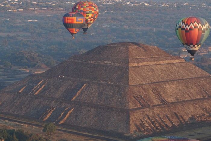
This one-month trip, from January 18 to February 17, 2026, allowed us to visit Mexico City and travel through the states of Puebla, Oaxaca, and Chiapas. We mainly used buses (ADO company) for medium and long distances and colectivos or taxis (or Uber) for shorter trips. Before leaving, I had contacted several people on the ground: Harry, a Vendéan settled in Oaxaca offering, among other things, discoveries of artisan villages or the Monte Albán site, and Oscar in Comitán de Domínguez. I’ll come back to our meeting with Oscar, who runs a local agency (CVL Travel Turismo Alternativo & Corre la voz) and owns a very pleasant hostel, a real highlight of our trip. Our journey took place in 8 stages on a loop starting from Mexico City. The connections between each were made by day or night buses depending on the trip duration. I had booked our seats in advance, either directly on the ADO company’s website or through booking platforms depending on the rates offered. Note that by planning ahead, I was able to benefit from very interesting "Early Booking" rates. There are several comfort classes. For all our trips, I had booked seats in Primera class buses, except for two in GL (Grand Luxe) class. The rates are very reasonable, and the buses turned out to be comfortable or even very comfortable (only the basic seat recline might surprise you).
Our itinerary and number of days per stage: Stage 1 – Mexico City: 4 days Stage 2 – Puebla: 2 days Stage 3 – Oaxaca: 4 days Stage 4 – San Agustinillo: 4 days Stage 5 – San Cristóbal de las Casas: 3 days Stage 6 – Comitán de Domínguez: 6 days Stage 7 – Palenque: 4 days Stage 8 – Mexico City: 2 days If I were to do it again, I’d remove one day from Palenque and add it either to Puebla or San Cristóbal to visit nearby sites or villages, or to San Agustinillo to enjoy one more day by the Pacific Ocean.
Stage 1: Mexico City (2,200 m / 9.2 million inhabitants) We arrived in the Mexican capital around 10:00 PM. The simplified customs process was very quick. After exchanging some money at the airport, we took a taxi to our youth hostel. We got around the capital on foot, of course, but also by metro. Signs are very rare, and we took the train in the wrong direction several times. After a few mistakes, we systematically asked on the platform if we were going the right way. The metro is very affordable. You need to get a rechargeable card (the Tarjeta de Movilidad Integrada) and top it up as needed. This card (less than 1 €) isn’t personal, so there’s no need to get one per person.
Mexico City: Day 1.
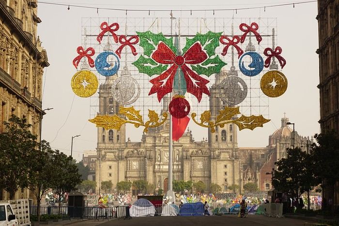
Visits and walks of the day (note: many museums are closed on Mondays): The Zócalo or Constitution Square: it’s one of the most beautiful, largest (195m x 240m), and oldest squares in the world. This is where Cortés decided to build the center of the new Spanish city on the site of the former Tenochtitlan market. Stones from the pyramids were used to pave the esplanade and build the surrounding colonial churches and buildings. During our visit, the huge square was covered with (resin) cacti, the theme of the temporary exhibition at the time. Indeed, temporary events or exhibitions take place here throughout the year. It’s also the endpoint for many protest marches.
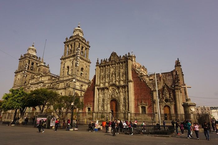
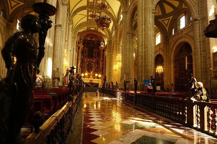


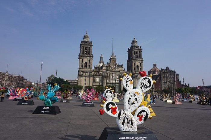
The cathedral: it’s sinking by one centimeter per year despite massive stabilization work (the collapse of many Mexican buildings—30 cm/year—is due to groundwater pumping). It was built starting in 1571 and completed in... 1813. The modest remains of the Templo Mayor (exterior view): they have high symbolic value, as this monument was the most important in the Mexica Empire.
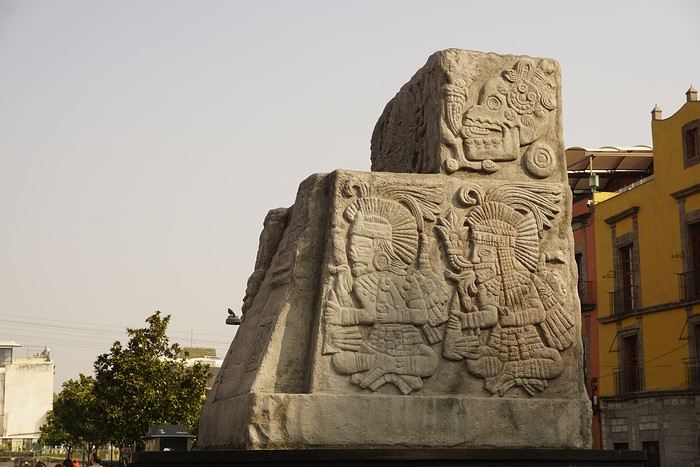 We then walked through the streets of the historic center to the Santísima Church, unfortunately closed for renovation work.
Next, we took the metro to visit one of Mexico’s most important pilgrimage sites: the Insigne y Nacional Basílicas de Santa María de Guadalupe, as well as the Capilla del Cerrito on the hill.
The first, dating from the colonial era, is really leaning a lot.
We then walked through the streets of the historic center to the Santísima Church, unfortunately closed for renovation work.
Next, we took the metro to visit one of Mexico’s most important pilgrimage sites: the Insigne y Nacional Basílicas de Santa María de Guadalupe, as well as the Capilla del Cerrito on the hill.
The first, dating from the colonial era, is really leaning a lot.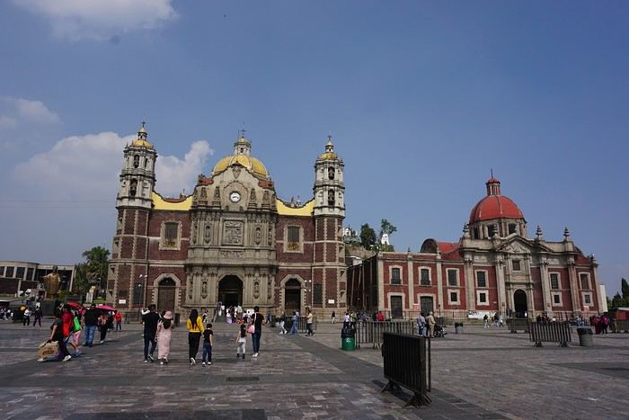
The second, shaped like a rotunda, is very impressive from the inside.
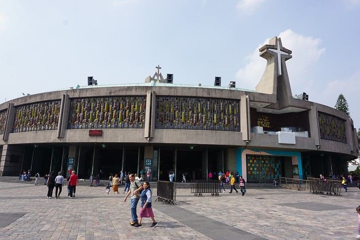
In the basement, there’s a sacred tunic where, in 1531, an image of the Virgin Mary is said to have appeared. A real mystery for scientists, the garment has never deteriorated since that date. Slow-moving conveyor belts allow pilgrims to admire it, preventing crowds from gathering in front of the image for hours. Well thought out!
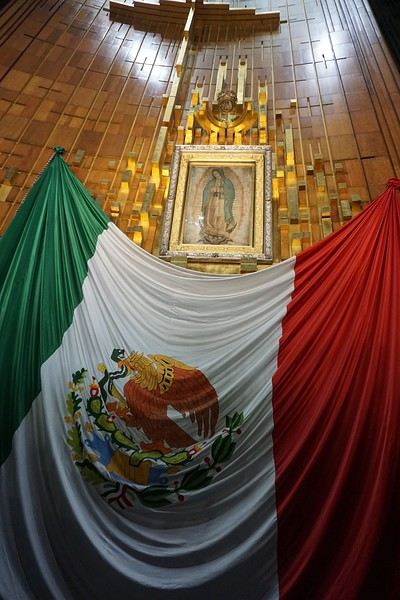 From the top of the Capilla del Cerrito, you get beautiful views of huge Mexico City.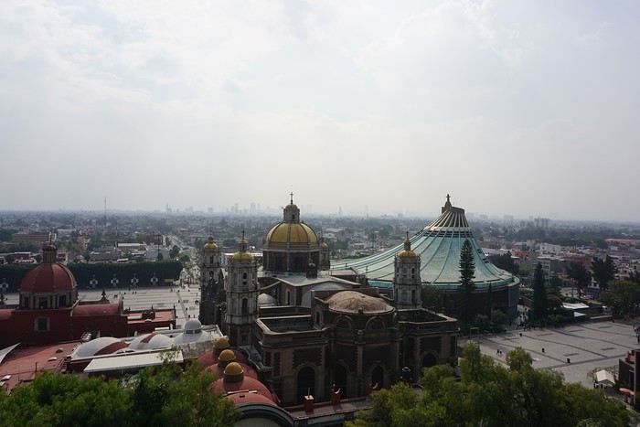
Road Trip USA 2023 - Part 2
HIGHWAY 1
Highway 1 runs along the Pacific coast of California from Leggett in the north to Dana Point in the south. It's the longest state route in California, stretching 1,050 km.
It's famous for its breathtaking ocean views. That’s actually why it’s become such a popular route for road trips, with tons of attractions and points of interest all along the way.
After crossing the U.S. interior on our way out (see Road Trip USA 2023 - Part 1), we’re starting our return trip along this route from Leggett.
Videos are embedded throughout the summary. Please click on the image to start the video. To jump to a specific post, here are the appropriate links:
CALIFORNIA:
Scenic Overlooks on Route 1 Between Leggett and Fort Bragg The Pudding Creek Trestle Bridge in Fort Bragg Glass Beach - Fort Bragg Jenner Lookout Point - Highway 1 Goat Rock Beach - Sonoma Coast State Park - Jenner Point Reyes National Seashore - White House Pool Trail Point Reyes National Seashore - Limantour Beach Point Reyes National Seashore - Point Reyes Shipwreck Point Reyes National Seashore - Kehoe Beach Trail Point Reyes National Seashore - McClures Beach Trail Point Reyes National Seashore - Cypress Tree Tunnel Point Reyes National Seashore - Point Reyes Beach North Point Reyes National Seashore - Elephant Seals on Drakes Beach Point Reyes National Seashore - Point Reyes Beach South Point Reyes National Seashore – Elephant Seals Overlooks Point Reyes National Seashore - Chimney Rock Trail Point Reyes National Seashore - Point Reyes Lighthouse Trail Point Reyes National Seashore – Tule Elk Observation Point Bonita Lighthouse Trail - Sausalito Hawk Hill - Sausalito Battery Spencer Trail - Sausalito Rodeo Beach - Sausalito Point Cavallo - Golden Gate View - Sausalito Exploring Downtown Sausalito Visiting Sausalito’s Houseboats Crossing the Golden Gate Bridge - San Francisco Golden Gate Bridge Viewpoints - San Francisco Cruise to Alcatraz Island - San Francisco Visiting Alcatraz Island - San Francisco Civic Center - Downtown San Francisco Market Street & Yerba Buena Gardens - Downtown San Francisco Union Square & Financial District - Downtown San Francisco Fisherman's Wharf, Pier 39 & Embarcadero - San Francisco Sea Lion Observation - Pier 39 - San Francisco Lombard Street & Cable Car - Russian Hill - San Francisco Macondray Lane Historic District - Russian Hill - San Francisco Grace Cathedral & Huntington Park - Nob Hill - San Francisco Telegraph Hill - San Francisco Chinatown - San Francisco Alamo Square & Painted Ladies - Western Addition - San Francisco Palace of Fine Arts - Marina District - San Francisco Presidio of San Francisco California Coastal Trail - Lincoln Park - San Francisco California Palace of the Legion of Honor - Lincoln Park - San Francisco Sutro Baths - Lincoln Park - San Francisco Queen Wilhelmina Garden - Golden Gate Park - San Francisco Bison Paddock - Golden Gate Park - San Francisco Portals of the Past - Golden Gate Park - San Francisco Strawberry Hill - Golden Gate Park – San Francisco Prayerbook Cross & Robin Williams Meadow - Golden Gate Park - San Francisco Hidden Garden Steps & 16th Avenue Tiled Steps - San Francisco Grandview Park - San Francisco Hike - Twin Peaks Three Summits - San Francisco Longboarding Down Twin Peaks Blvd in San Francisco Haight-Ashbury - San Francisco Corona Heights Park - San Francisco Mission Dolores - San Francisco Mural Frescoes (Part 1) - Mission District - San Francisco Mural Frescoes (Part 2) - Mission District - San Francisco Devil's Slide Bunker - Pacifica Mavericks Beach - Half Moon Bay Martins Beach - Half Moon Bay Pigeon Point Lighthouse State Historic Park - Pescadero What to See in Santa Cruz Visiting Capitola What to See in Monterey Carmel-by-the-Sea Lovers Point Park - Pacific Grove Castle Rock, Hurricane Point & Little Sur River Viewpoints Pfeiffer Falls Trail Julia Pfeiffer Burns State Park Vista Point & McWay Falls Highway 1 - Big Sur Viewpoints Salmon Creek Falls San Carpoforo Creek Trail Elephant Seal Vista Point - San Simeon San Simeon Pier Moonstone Beach Boardwalk Shipwreck - Estero Bluffs State Park Surfing Competition in Morro Bay Port San Luis Pier - San Luis Obispo Pismo Beach Monarch Butterfly Grove - Pismo State Beach Nojoqui Falls Park - Solvang Arroyo Hondo Vista Point Solvang, a Charming Danish Town in California Chumash Painted Cave - Santa Barbara Goleta San Marcos Rd & Cachuma Lake Vista Points - Santa Barbara Old Santa Barbara Mission Walking Tour of Santa Barbara’s Historic Downtown West Beach - Santa Barbara What to See in Ventura Paradise Falls - Wildwood Regional Park - Thousand Oaks Sandy Dune & El Matador State Beach - Malibu Point Dume Nature Reserve - Malibu Malibu Pier Road Trip in the Malibu Mountains Los Liones Trail - Santa Monica Santa Monica Pier Rodeo Drive - Beverly Hills Greystone Mansion - Beverly Hills Hollywood Walk of Fame - Los Angeles Griffith Observatory - Los Angeles Hollywood Forever Cemetery - Los Angeles What to See in Venice Beach Venice Beach Skatepark ShoreLine Aquatic Park - Long Beach Alamitos Beach - Long Beach Naples Island - Long Beach Crescent Bay Point Park & Helser Park Kiosk - Laguna Beach Shell Beach at Twin Points - Laguna Beach Prairie Dogs at Agra Vista Point Top Gun House & Oceanside Pier Annie's Canyon Trail - Solana Beach (Via North Rios Trailhead Loop) Old Town San Diego La Jolla Coastal Trail - San Diego Balboa Park - San Diego Pacific Beach - San Diego Mission Beach - San Diego Ocean Beach Tide Pools - San Diego Sunset Cliffs Natural Park - San Diego Tuna Harbor Park - San Diego Seaport Village & Embarcadero Marina Park - San Diego Gaslamp Quarter - Downtown San Diego Coronado Island - San Diego Dead Dolly Lane - Alpine Galleta Meadows Metal Sculptures - Borrego Springs What to See in Palm Springs Robolights - Palm Springs Andreas Canyon Trail - Indian Canyons - Palm Springs Palm Canyon Trail - Indian Canyons - Palm Springs West Fork Falls Trail - Indian Canyons - Palm Springs Tahquitz Canyon Loop Trail - Indian Canyons - Palm Springs Desert Christ Park - Yucca Valley Pioneertown Salvation Mountain - Niland Slab City - Niland
Highway 1 runs along the Pacific coast of California from Leggett in the north to Dana Point in the south. It's the longest state route in California, stretching 1,050 km.
It's famous for its breathtaking ocean views. That’s actually why it’s become such a popular route for road trips, with tons of attractions and points of interest all along the way.
After crossing the U.S. interior on our way out (see Road Trip USA 2023 - Part 1), we’re starting our return trip along this route from Leggett.
Videos are embedded throughout the summary. Please click on the image to start the video. To jump to a specific post, here are the appropriate links:
CALIFORNIA:
Scenic Overlooks on Route 1 Between Leggett and Fort Bragg The Pudding Creek Trestle Bridge in Fort Bragg Glass Beach - Fort Bragg Jenner Lookout Point - Highway 1 Goat Rock Beach - Sonoma Coast State Park - Jenner Point Reyes National Seashore - White House Pool Trail Point Reyes National Seashore - Limantour Beach Point Reyes National Seashore - Point Reyes Shipwreck Point Reyes National Seashore - Kehoe Beach Trail Point Reyes National Seashore - McClures Beach Trail Point Reyes National Seashore - Cypress Tree Tunnel Point Reyes National Seashore - Point Reyes Beach North Point Reyes National Seashore - Elephant Seals on Drakes Beach Point Reyes National Seashore - Point Reyes Beach South Point Reyes National Seashore – Elephant Seals Overlooks Point Reyes National Seashore - Chimney Rock Trail Point Reyes National Seashore - Point Reyes Lighthouse Trail Point Reyes National Seashore – Tule Elk Observation Point Bonita Lighthouse Trail - Sausalito Hawk Hill - Sausalito Battery Spencer Trail - Sausalito Rodeo Beach - Sausalito Point Cavallo - Golden Gate View - Sausalito Exploring Downtown Sausalito Visiting Sausalito’s Houseboats Crossing the Golden Gate Bridge - San Francisco Golden Gate Bridge Viewpoints - San Francisco Cruise to Alcatraz Island - San Francisco Visiting Alcatraz Island - San Francisco Civic Center - Downtown San Francisco Market Street & Yerba Buena Gardens - Downtown San Francisco Union Square & Financial District - Downtown San Francisco Fisherman's Wharf, Pier 39 & Embarcadero - San Francisco Sea Lion Observation - Pier 39 - San Francisco Lombard Street & Cable Car - Russian Hill - San Francisco Macondray Lane Historic District - Russian Hill - San Francisco Grace Cathedral & Huntington Park - Nob Hill - San Francisco Telegraph Hill - San Francisco Chinatown - San Francisco Alamo Square & Painted Ladies - Western Addition - San Francisco Palace of Fine Arts - Marina District - San Francisco Presidio of San Francisco California Coastal Trail - Lincoln Park - San Francisco California Palace of the Legion of Honor - Lincoln Park - San Francisco Sutro Baths - Lincoln Park - San Francisco Queen Wilhelmina Garden - Golden Gate Park - San Francisco Bison Paddock - Golden Gate Park - San Francisco Portals of the Past - Golden Gate Park - San Francisco Strawberry Hill - Golden Gate Park – San Francisco Prayerbook Cross & Robin Williams Meadow - Golden Gate Park - San Francisco Hidden Garden Steps & 16th Avenue Tiled Steps - San Francisco Grandview Park - San Francisco Hike - Twin Peaks Three Summits - San Francisco Longboarding Down Twin Peaks Blvd in San Francisco Haight-Ashbury - San Francisco Corona Heights Park - San Francisco Mission Dolores - San Francisco Mural Frescoes (Part 1) - Mission District - San Francisco Mural Frescoes (Part 2) - Mission District - San Francisco Devil's Slide Bunker - Pacifica Mavericks Beach - Half Moon Bay Martins Beach - Half Moon Bay Pigeon Point Lighthouse State Historic Park - Pescadero What to See in Santa Cruz Visiting Capitola What to See in Monterey Carmel-by-the-Sea Lovers Point Park - Pacific Grove Castle Rock, Hurricane Point & Little Sur River Viewpoints Pfeiffer Falls Trail Julia Pfeiffer Burns State Park Vista Point & McWay Falls Highway 1 - Big Sur Viewpoints Salmon Creek Falls San Carpoforo Creek Trail Elephant Seal Vista Point - San Simeon San Simeon Pier Moonstone Beach Boardwalk Shipwreck - Estero Bluffs State Park Surfing Competition in Morro Bay Port San Luis Pier - San Luis Obispo Pismo Beach Monarch Butterfly Grove - Pismo State Beach Nojoqui Falls Park - Solvang Arroyo Hondo Vista Point Solvang, a Charming Danish Town in California Chumash Painted Cave - Santa Barbara Goleta San Marcos Rd & Cachuma Lake Vista Points - Santa Barbara Old Santa Barbara Mission Walking Tour of Santa Barbara’s Historic Downtown West Beach - Santa Barbara What to See in Ventura Paradise Falls - Wildwood Regional Park - Thousand Oaks Sandy Dune & El Matador State Beach - Malibu Point Dume Nature Reserve - Malibu Malibu Pier Road Trip in the Malibu Mountains Los Liones Trail - Santa Monica Santa Monica Pier Rodeo Drive - Beverly Hills Greystone Mansion - Beverly Hills Hollywood Walk of Fame - Los Angeles Griffith Observatory - Los Angeles Hollywood Forever Cemetery - Los Angeles What to See in Venice Beach Venice Beach Skatepark ShoreLine Aquatic Park - Long Beach Alamitos Beach - Long Beach Naples Island - Long Beach Crescent Bay Point Park & Helser Park Kiosk - Laguna Beach Shell Beach at Twin Points - Laguna Beach Prairie Dogs at Agra Vista Point Top Gun House & Oceanside Pier Annie's Canyon Trail - Solana Beach (Via North Rios Trailhead Loop) Old Town San Diego La Jolla Coastal Trail - San Diego Balboa Park - San Diego Pacific Beach - San Diego Mission Beach - San Diego Ocean Beach Tide Pools - San Diego Sunset Cliffs Natural Park - San Diego Tuna Harbor Park - San Diego Seaport Village & Embarcadero Marina Park - San Diego Gaslamp Quarter - Downtown San Diego Coronado Island - San Diego Dead Dolly Lane - Alpine Galleta Meadows Metal Sculptures - Borrego Springs What to See in Palm Springs Robolights - Palm Springs Andreas Canyon Trail - Indian Canyons - Palm Springs Palm Canyon Trail - Indian Canyons - Palm Springs West Fork Falls Trail - Indian Canyons - Palm Springs Tahquitz Canyon Loop Trail - Indian Canyons - Palm Springs Desert Christ Park - Yucca Valley Pioneertown Salvation Mountain - Niland Slab City - Niland
Namibia Travel Journal: May 2025 - Trip Review
NAMIBIA TRIP 2025: April 24 to May 20: Feel free to comment or ask us any questions about this amazing journey.
>> Find all our photos and videos for each day on our website here: www.montagne-aventure.net
**DAY 1: Thursday, April 24, 2025: Outbound Flights from Lyon to Windhoek via Munich - Visit to Munich:**

Off we go on a new adventure. The alarm rings at 6:30 AM, the travel bags are packed, and we head to Lyon Airport. We booked our flight tickets with Lufthansa. The first leg to Munich, Germany, is operated by AirBaltic. Departure at 1:05 PM for a 1-hour and 20-minute flight. We arrive at 2:30 PM.
**We now have a 7-hour layover, so we take the opportunity to get some fresh air and explore Munich.** We quickly exit Terminal 2 of the airport and head towards the subway. We buy a group day ticket "Airport-city Day Zone M-5," valid for 2 to 5 people at a price of 30.50 € (instead of 16.30 € per person). We take the S8 line to **Marienplatz** in 35 minutes. **This is the heart of the city.** The weather is overcast, quite cool, but dry. Perfect for a little city trip between two flights while leaving our large luggage in transit at the airport. **Munich is the third-largest German city after Berlin and Hamburg, in the Bavaria region.** **The center has a lot of charm and brings together several religious buildings, easy to explore on foot.** We are impressed by the number of people enjoying these 100% pedestrian streets, which are very pleasant. After Marienplatz, the most famous square with the town hall, we head to the Cathedral of Our Lady, a Gothic church, then continue to **Karlsplatz** and move on to **the food market offering a wide selection of high-end food products in an atmosphere where a certain art of living prevails.** We also visit St. Peter's Church before grabbing a bite to eat. Two good hours were enough for this 10 km city walk. It's time to take the subway back: by 6:30 PM, we are back at the airport. Now, it's time for a bit of waiting and rest. Our second flight is scheduled for 9:35 PM for a 9-hour and 30-minute journey to our final destination in Namibia: **Windhoek.**
> Round-trip flight tickets with Lufthansa from Lyon: 2029 €, or 1,014.50 € per person.
> Lyon Airport parking: 120 €
> Today's expenses: 7 € for 2 pizzas in France / 14 € for the restaurant in Munich / 30.50 € for the daily subway ticket in Munich.
**DAY 2: Friday, April 25, 2024: Arrival in Windhoek, Visit to the Namibian Capital:**
After a 9-hour and 30-minute overnight flight with Discover Airlines, we finally land on Namibian soil just before 7:30 AM. The day is breaking, and the colors are already stunning. We are eager despite the usual fatigue from the flight. The airline was punctual, with friendly staff and good meals, though a bit light. We are the first flight of the day to land, with no more than 15 flights per day here, from 7 AM to 8 PM. We disembark on the tarmac at this airport located in the middle of nowhere, **I finally set foot on African soil for the first time.** We exit among the first from the aircraft to go through the long formalities at the front of the line, as the wait can quickly become endless. Allow at least 5 minutes per person for e-visas. We still wait 45 minutes despite only about twenty people ahead of us. Phew, it's done. We collect our luggage and then withdraw money from an ATM. We make 4 withdrawals of the maximum amount, 2000 NAD $ per withdrawal, for a total of 380 €, or 95.33 € per withdrawal.
Our driver arrives at the same time, perfect timing, we were quick.
We leave the airport at 8:45 AM. By 9:30 AM, we arrive at the **Gracious Whisp vehicle rental agency**, located at the entrance of Windhoek, small and human-sized with a fleet of recent vehicles. More formalities, then a short wait as our vehicle is not yet ready. Time to decompress, catch our breath, and enjoy the very pleasant morning temperature. Not a cloud in sight. Next, a briefing on the vehicle, always with a bit of apprehension due to our approximate English. Allow 45 minutes of explanations, including setting up the roof tent, camping equipment, technical information in case of a flat tire, driving tips in Namibia, and a tour of the 4x4. We have all the necessary equipment for camping: mattresses, sleeping bags, pillows, table, chairs, gas stove, BBQ grill... as well as 2 spare tires, a compressor, a dual tank, and accessories for removing wheels. Off we go, it's time to muster our courage and get behind the wheel. **Heading to SuperSpar Maerua**, fortunately located less than 10 minutes away. We park with the help of a parking attendant; it's very crowded, the space is narrow, but everything goes well despite the cursed right-hand drive. Today's new mission: stock up on groceries. The store is well-stocked with local and imported products, catering to all tastes. We spend 114 € on groceries, from pasta to meat, BBQ lighters to dishwashing products. Two people load our groceries into two carts and transfer them to our vehicle; we feel compelled to leave a tip, 50 NAD $, as we don't have change yet. Now, we head to the hotel, 15 minutes away. Traffic is difficult at a complicated intersection; this will likely be the only traffic jam in Namibia. **We arrive at Kate's Nest Guesthouse & Backpackers around 1:15 PM, quite tired.** We take some well-deserved rest at this recent establishment, quite calm with secure private parking. After a short nap, we enjoy the quiet by the hotel pool. Night falls between 6:30 PM and 7 PM. We eat quietly in our room tonight before starting this long 4x4 road trip in camping mode in the heart of Namibia.
> Today's grocery expenses: 114 € at Super Spar Marua (2395.21 NAD $).
> Round-trip flight tickets with Lufthansa from Lyon: 2029 €, or 1,014.50 € per person.
> Vehicle rental: 4x4 Toyota with roof tent for 24 days: Gracious Whisp Car Rentals: 2,638 € (N$50,640) or **1,319 €** per person - (https://gwcarrentals.com/)
> Distance driven today: 15 km.
> Accommodation: Kate's Nest Guesthouse & Backpackers - 4 Aristotles Street Academia, 9000 Windhoek - 36 € for two for one night.
> Windhoek International Airport website: (https://www.airports.com.na/)
**DAY 3: Saturday, April 26, 2025: Windhoek to Hardap: Mariental Region - Kalahari Desert:**
After a good, restful night, we wake up leisurely around 7 AM. We enjoy the comfort provided by this first and last hotel before 24 nights under the tent.
**We leave Kate's Nest Guesthouse at 8:30 AM to tackle the Namibian roads.** We quickly leave the capital; in just 30 minutes, we find ourselves almost alone in the world. The landscape is dotted with small domes. We leave the **paved B1** quickly to turn left onto the **C15**. **From there, we won't see more than 10 vehicles all day.** After passing through the few houses of **Lekkerwaterpoort**, we tackle our first gravel road. These road sections are limited to 100 km/h, but even at 70 km/h, I find it already challenging. However, I quickly get used to it and gradually pick up speed to reach my cruising speed of around 80 to 90 km/h. **We are on immense straight lines crossing wild expanses as far as the eye can see.** **We come across two baboons, a few ostriches, and numerous cattle and sheep farms.** We pass through the charming village of **Uhlenhorst** with its typical houses and children with broad smiles waving at us. Life here is already very different from Windhoek. **The thermometer rises quickly from 16°C at 8:30 AM to over 28°C in the early afternoon.**
**We arrive at the Hardap Dam reserve at 2 PM.** We stop at the toll booth at the park entrance to pay the entrance fee: 250 NAD $ for 2 people and 1 vehicle. We continue to the dam and then the camp entrance, located a bit further. We had booked in advance, but this place remains little frequented by foreigners.
We take advantage of the hottest hours to rest by the large pool overlooking the immense lake, a very enjoyable moment. Would this be a bit of a vacation?
Around 4:30 PM, we head to the campsite. We overlook this vast water reserve. We arrive first; we will be only 3 vehicles spending the night here. It's time to get to work and set up our equipment for the first time. It takes us a good 20 minutes to set everything up, with a slight apprehension about unfolding the tent. Once this task is done, which we will have to repeat for almost a month, we will become much more efficient over time. Time for rest and contemplation in total silence. The sun gradually sets, and the heat quickly becomes bearable again. Bliss! **This dam is located 20 km northwest of Mariental in an area dotted with conical hills topped with dolerite buttons (Hardap means "hillock" in Nama). It captures the Fish River, which flows south, creating a large lake in the middle of an arid environment. The contrast is striking.** We enjoy our first sunset facing this 360° otherworldly landscape.
Around 7 PM, we start our first BBQ, or "braai" as it's called here. The temperature is perfect. The sun sets, giving way to a star-filled sky of incredible beauty thanks to the absence of any light pollution. The Milky Way will lull us throughout the evening. After some good sausages and potatoes on the BBQ, we head to our roof tent around 9:30 PM with a complete change of scenery in just 24 hours. France already seems so far away...
This campsite has shared showers and toilets, quite clean and functional, as well as a central area with several BBQs and tables. The sites are arranged in a semicircle, each with an electrical outlet. The sites are close to each other but spacious, some slightly shaded. We are only three vehicles tonight, so it's perfectly comfortable and quiet. Not to mention the large pool near the restaurant. Our trip is off to a great start.
> Today's road itinerary: Windhoek > Head south on the B1 to Rehoboth > Turn left onto the C25 then C15 to Stampriet > C20 to Hardap > Full north on the B1 > Then turn left onto the M93 - 5 hours of driving.
> Distance driven today: 354 km.
> Accommodation: Hardap Recreation Resort - 23.3 € for two - Large pool - GR6W+3M2, Hardap Game Reserve, Mariental, Namibia - (http://www.nwr.com.na/resorts/hardap-resort/)
**DAY 4: Sunday, April 27, 2025: Hardap - Brukkaros Volcano - Keetmanshoop - Quivertree Forest Rest Camp**
Our first night under the tent was very pleasant; the little wind quickly calmed down, giving way to absolute silence. The mattress is decent, more comfortable than some nights in Nepal. The length and width give us enough space for maximum comfort, despite my height (1.91 m). We wake up a little before 7 AM as the sun rises, and the lights dazzle us from the start of the day. We pack up the equipment in 30 minutes, quite easily. Then we enjoy the sun, which warms up quickly while we keep our light fleece on.
At 8:30 AM, **we hit the road again, heading south** to our first stop in **Mariental**. We want to do some shopping at SuperSpar, but once we arrive in the parking lot, a young local is fighting with the supermarket security guards and then threatens to throw stones. We don't want to take any risks right at the start, so despite the baton blows he receives, he doesn't stop. We leave empty-handed but fill up with fuel at the Shell station 1 km further. The price per liter is 21.33 NAD $, we fill our 107-liter tank for 107 €. In Namibia, you get served, and they bring the card machine to the window to pay. It's then customary to leave a tip.
We then take the B1 heading due south on a recently renovated road. Around 11:30 AM, we leave it on our right to take **a wild gravel road, the M98**. Just before **Berseba**, we turn right onto a small track, the **D3904 towards Brukkaros Crater up to a camp at 1588 m altitude**. The track then becomes too bumpy. We stop on the counter-slopes where **a wide panorama unfolds over these immense plains as far as the eye can see**. It's 12:15 PM, time for us to eat a rice and tuna salad facing this landscape.
**We are alone in the world until a vehicle arrives and parks next to us.** A bit of apprehension, 4 men head towards us. It turns out to be 4 shepherds looking for a lost foal. The conversation is pleasant, lost in the middle of nowhere. We find ourselves alone again in this absolute silence. **The heat becomes stifling with a good 30°C**. We get back on the road around 1 PM. Back on the B1, **we continue due south to Keetmanshoop**, which we reach around 3 PM. We stop there to do some shopping for 262 NAD $ (12 eggs, a can of tuna, a can of corn, bread, a soda, and a 5-liter water container), or 12.48 €. Two quite insistent children ask us for money or candy at the store exit, yet we give them a small tip, but they continue to cling to the car. Locals parked next to us tell them to leave us alone. Anyway, we finish the trip to **Quivertree Forest**, 15 km away. We will spend the night in this **pleasant farm run by a German**. Upon arrival, as the day before, and as I suppose in the future, we dive straight into the cool pool to relax after all these kilometers. A bliss. Then we take our 4x4 and choose a spot near these famous trees. After the 33°C this afternoon, once 4 PM passed, the temperature drops again and becomes very pleasant. **We are in the middle of the Kokerboom, one of the most interesting and characteristic plants of hot and arid regions. It's not really a tree but a variant of the aloe plant whose botanical name is Aloe Dichotoma. This Kokerboom has a smooth and thick trunk reaching up to 1 m in thickness and 9 m in height. They bloom for the first time at the age of 20 to 30 years.** The flowers are yellow and reach about thirty centimeters during the season between June and July. **They grow mainly in an environment with a high concentration of black rocks absorbing a large amount of heat (38°C). The rocks also serve to anchor the tree with its tentacle-like roots. It also resists frost. Each is between 200 and 300 years old.**
Around 5 PM, we walk to the farm reception to watch the feeding of **two cheetahs**. Magnificent carnivores taking their time to savor their piece of meat. **Then we return near our campsite to enjoy the sunset among these trees. The colors are sublime, as every evening apparently. A magnificent spectacle with colors evolving from yellow to orange then to pink, before giving way once again to a sky filled with thousands of stars.** Our campsite at Quiver Tree Forest Camp is very comfortable; we have a water supply, a stone table, a small lamp, an electrical outlet, a small tree for shade, and a BBQ that we won't use tonight; we'll cook on gas. The sites are far apart, with some shared facilities scattered around, a very beautiful setting. No reservation possible, no need, just show up directly. **The campsite accommodation for 2 people costs 28 €, including the reserve entrance fee of 5 €**. We finish this second bivouac evening around 9:30 PM, time for some reading and sleep in peaceful silence without wind.
> Today's road itinerary: Mariental > B1 heading south to Brukkaros > At Tses turn right towards Berseba via the M98 > Turn right onto the D3904 > 8 km > Brukkaros Volcano (stop at the lower camp as the track is difficult for 1 hour) > Keetmanshoop > Turn left onto the M29 > Quivertree Forest - 4 hours of driving.
> Distance driven today: 371 km.
> Distance walked today: 6 km.
> Today's expenses: Groceries for 12.48 € (262 NAD $) / Fuel for 107 € (1 liter of diesel for 21.33 NAD $).
> Accommodation: Quivertree Forest Rest Camp, P.O. Box 262, Keetmanshoop, Namibia - BBQ, hot showers, toilets, and electricity - No reservation - Pool - 18 €/Person (N$ 340.00 with park entrance) - (http://www.quivertreeforest.com/)
**DAY 5: Monday, April 28, 2025: Quivertree Forest Rest Camp - Giant's Playground - Keetmanshoop - Fish River Canyon - Canyon Roadhouse:**
After an excellent start to the night, we are woken up by the wind shortly before 6 AM, but the sunrise is not far off. We get up at 6:30 AM to enjoy it. The atmosphere is a bit cooler this morning, but the reward is already here.
The adventure continues. At 7:45 AM, we head towards **Giant's Playground**, 4 km away. We take a 3-kilometer walk through this expanse of blocks and igneous rocks.
We continue south at 8:45 AM, passing through Keetmanshoop again where we do some shopping for 25 €, a big stock-up for a good part of the trip: meats, canned goods, pasta, fruits... At 9:30 AM, we take the B4 to Fish River Canyon.
At 11:30 AM, we arrive at the entrance to the NWR park (350 NAD $ entrance for 2 people and 1 vehicle). The track becomes bumpy immediately upon entering the park. After about ten kilometers, we come upon this landscape carved by nature. In the end, it's well worth the detour. We were at the Grand Canyon in the USA exactly (https://www.montagne-aventure.net/2024/04/29/j21-3-juin-2024-grand-canyon-et-lac-powell/) and can thus confirm that this Fish River Canyon is comparable. We make several stops along the southern flank. **Here, nothing is developed; nature is almost in the wild state.** **With 160 km in length, up to 27 km in width, and a depth of 150 m, it is indeed the second-largest canyon in the world.** The history of the canyon is apparent in its different earth layers and stratification: the antiquity of the place is tangible, and the absence of vegetation is surprising. **It consists of two nested canyons, formed at distinct periods. The first distinct layer of schist, sandstone, and eruptive material surrounding the canyon was formed a few two billion years ago, then transformed due to heat and pressure into more solid rock such as gneiss. The inner canyon, carved more recently by the Fish River, has a depth of 270 m.**
We have a picnic once again alone in the world facing this grand panorama at the **Sulphur Spring View Point**. This is where the hiking trail begins, plunging into this narrow canyon, but it is forbidden to venture there alone without a guide. It's 30°C, but a slight wind makes the atmosphere bearable. At 1 PM, we retrace our steps and continue to the **Main View Point** then to the **Hikers View Point**.
In the south of Namibia, the Fish River Canyon, 160 km long, is a true geological wonder: a canyon nested within another canyon, one of the largest in the world. The first sedimentary layers formed two billion years ago; 500 million years ago, a period of tectonic activity caused these layers to crack and tilt, opening a vast canyon in the Earth's crust. The second canyon, with a depth of 270 m, was carved over time by the passage of the Fish River in this new valley.
At 3 PM, we arrive at our very charming camp for the evening, the **Canyon Road House**. We fill up with fuel right away because tomorrow we have a long day of isolated driving: 55 liters for 1240 NAD $. Then we settle into the campsite we had previously reserved in France. We are assigned site 2, very well set up under a tree with its BBQ and stone table just steps from the pool. We quickly set up the tent and jump straight into the pool for the relaxation moment of the day. As usual, the water is quite cool, but it's a real pleasure. Then we stroll around this Canyon Road House, which recreates the atmosphere of the roadside inns of the 1950s with old car wrecks and vintage gas pumps in a bygone era. **Around 5:45 PM, we start a short walk leading us to the top of a hill overlooking the wide plateau where we are to watch the sunset.**
And finally, to end this beautiful day, it's time for the braai, with grilled sausages and white beans on the evening menu.
> Park entrance: 150 DN/person + 50 DN/vehicle (18 € for two). It is possible to enter at two access points: Hobas in the north and Ai-Ais in the south.
> Today's road itinerary: M29 > Keetmanshoop > B1 > B4 > C12 (track) > After Holoog turn right onto the D601 (C37 track) > Accommodation on our right (stop just to check in before 6 PM) > Continue 30 km (30 minutes of track) to the viewpoints after Hobas where you must pay the entrance fee. Sunset View Point to the left > Return before sunset as the park closes (best lights at sunrise). 3 hours.
> Distance driven today: 228 km.
> Distance walked today: 10 km.
> Today's expenses: 25 € for groceries / 17 € for the Fish River Canyon park entrance / 58 € for fuel.
> Accommodation: Canyon Roadhouse, Gondwana Collection Namibia – 34.4 € for two - Pool - Near Hobas - (http://www.gondwana-collection.com/fr/accommodation/canyon-road-campsite)
**DAY 6: Tuesday, April 29, 2025: Canyon Roadhouse - Orange River - South African Border - Vista Trail - Gondwana Sperrgebiet Park - Aus:**
The night was excellent in this very comfortable campsite. **We wake up to the sound of birds** before the alarm at 6:45 AM. Our little morning routine starts as the sun rises. **A big day of driving awaits us to the South African border. This will be the southernmost point of our journey.** We hit the road at 8 AM via the C37, pass through **Hobas**, then turn onto the D207 to **Aussenkehr.** **We cross a mountainous barrier with some high peaks and perfect cones. The rock varies from orange to pink to black.**
We then cross a lunar desert as far as the eye can see on a giant dome; the track winds through nowhere without meeting anyone for hours. The landscapes are surprising. **We spot several ostriches and a gemsbok.** In the middle of this endless expanse, we come to an improbable intersection and continue right onto the D278.
In the middle of these arid lands, we come across a green zone: a vast vineyard. At 10:30 AM, **we come across a "Road closed" sign, fortunately, a local resident waves us to continue; a bit stressed, we proceed.** We start to follow the beautiful Orange River. On the other side of the bank, just a few meters away, South Africa is there. It is the second-longest river in Southern Africa, after the Zambezi. It flows over 2,000 km to the Atlantic. After passing through narrow gorges, we regain altitude before starting the descent, gently heading back north.
**We now cross and follow the Fish River, which joins the Orange River further south** **along this gorge dating back millennia.** At exactly noon, we take a lunch break by the Fish River, still without meeting a soul in this landscape between greenery and aridity. The temperature here is cooler with a pleasant 23°C on the banks, the perfect spot. **We continue on the track to Rosh Pinah**, where we find a paved road again. **The section along the Orange River and the Fish River was officially closed, but we were able to pass without any issues, avoiding a detour of at least 3 hours.** Phew. We now drive at high speed (limited to 120 km/h) through these vast spaces. We come across many ostriches after the **dozens of monkeys along the Fish River**. Around 3 PM, 3 km after the very small town of **Aus**, we reach **our campsite for the evening at Klein Aus Vista**. A new **small peaceful haven very well set up**. As usual, after checking in at reception, we jump straight into the beautiful pool to get our well-deserved dose of coolness, another good thermal shock that our bodies appreciate. Once this moment of relaxation is over, we take our 4x4 to reach the campsite located a bit higher, set apart at the foot of a hill that overlooks us.
After setting up, **around 5 PM, we head to the Vista Trail to climb to the top of a mountain overlooking the vast plain that surrounds us at 360°**. It takes about 30 minutes to climb. The place is just magical, **the perfect viewpoint to admire the sunset**. **We fully savor the moment. We also spot one of the few wild horses in the world capable of living in the desert.** Their numbers have decreased in recent years due to predation and drought (around 100 to 150). At 7 PM, we return to the camp, time for the braai and preparing the meal in this peaceful little camp.
In the south of Namibia, the Fish River Canyon, 160 km long, is a true geological wonder: a canyon nested within another canyon, one of the largest in the world. The first sedimentary layers formed two billion years ago; 500 million years ago, a period of tectonic activity caused these layers to crack and tilt, opening a vast canyon in the Earth's crust. The second canyon, with a depth of 270 m, was carved over time by the passage of the Fish River in this new valley.
> Today's road itinerary: 5 hours of driving: D324 heading south (track) > turn right onto the C10 (track) > D316 heading south > turn right onto the C13 > In Aus turn left onto the B4 > Campsite via a track on the left.
> Fuel station: Solitaire or Aus.
> Distance driven today: 398 km.
> Distance walked today: 7 km.
> Accommodation: Klein-Aus Vista Desert Horse Campsite - Farm Klein-Aus No 8 on the B4 main road to Luederitz Aus 9000, Aus, Namibia - (http://www.klein-aus-vista.com/accommodation/desert-horse-campsite/) 17908 420 DN - Water + Shared shower (hot water). No electricity.
**DAY 7: Wednesday, April 30, 2025: Aus - Kolmanskop - Diaz Point - Luderitz - Kanaan Desert:**
We wake up around 6:45 AM, with partly cloudy weather for once; we feel the ocean's influence gradually. But the sun isn't far off. At 7 AM, we leave the campsite heading west towards Luderitz via the B4. **First stop of the day: Kolmanskop, the ghost town we reach at 8:30 AM**, entry costs 180 NAD $ per person. We discover this **timeless place** in 1.5 hours, moving from building to building amidst violent sand-laden gusts of wind. There's a lot of charm in these different living spaces. **The sand quickly reclaimed the place after this mining town was abandoned.** This was once the headquarters of Consolidated Diamond Mines. It's hard to believe that this former town, where the diamond industry once flourished, had a hospital, a bowling alley, and a theater. The decline in diamond sales after World War II and the discovery of richer deposits put an end to this golden age. By 1956, the town was already completely deserted, and the sand had reclaimed its rights. **These dilapidated buildings swallowed by shifting dunes have something surreal about them.**
At 10:15 AM, we hit the road again **heading to Luderitz, 22 km away**, and first to **Diaz Point** **facing the Atlantic Ocean**. It's a wind-swept peninsula with its characteristic red and white lighthouse. There's a campsite and a coffee shop on site, but the place doesn't inspire rest without shade or shelter from the wind. We return to the city via the D701 track that runs along the ocean, be careful at low tide. We come across **a few fishermen and a fox as well as flamingos.**
We walk through the few streets of the city, much smaller than I imagined, then climb to the **famous little Lutheran church that overlooks the city, the Felsenkirchr.** **The wind blows very strongly here, and the sand is omnipresent, surrounded by the Namib Desert and the southern Atlantic coast.** **A German colonial relic barely touched by the 21st century, Luderitz seems frozen in the past, giving it both a gloomy and a certain charm. In short, it's certainly one of the most incongruous places in Africa.**
At 1:15 PM, just before leaving Luderitz, we do some shopping for 20.50 € and fill up with fuel: 61.50 €, 1290 NAD $ for 61 liters (21.18 $ per liter).
**We return via the B4 to Aus** (paved), **then via rougher tracks**, the C13 then the D707, magnificent as it runs along a mountain range with multiple colors on our right and an endless flat desert on the other side.
To access our campsite for the evening, we must take a **narrow private track for 7 km** on our right to emerge, in this total vastness, at the **isolated Kanaan Desert Retreat on a small hill**. I don't have time today to jump into the pool near the reception; we arrive at 5 PM at 8 small, isolated, and unique sites with a small kitchen, a shower, and a private toilet under a small tarp shelter. **A crazy charm with a unique view...** **This will be my favorite accommodation of this trip. The photos speak for themselves.** We jump into the outdoor shower while savoring the landscape, then prepare our evening braai while enjoying the colors fading, facing this plateau with bushes turning a vivid orange. **A moment that will remain etched for life.** **Savanna atmosphere under a thin emerging moon. Every minute offers different colors. Facing our meal, we have a natural giant screen.**
We end this day contemplating the stars and admire this thin orange moon setting on the horizon (8:42 PM).
**Ghost town just before Luderitz: Kolmanskop** (open from 8 AM to 3 PM - N$ 180 p.p – 9 €). Once, Kolmanskoppe was organized around diamond mining. After finding new, more prolific spots, the town was abandoned and is now a ghost town. The sand and dunes have reclaimed their rights and buried everything humans had built. Houses, train station, bakery, everything has been covered by sand, which passes through the windows, even though they are 1 meter high.
> Today's road itinerary: 5h30: B4 to Luderitz (paved) > Round trip > Kolmanskop on the left > Return via the previous campsite > Then C13 (track) > Turn left D707 (track) > Then track to the right to the campsite.
> Distance driven today: 438 km.
> Distance walked today: 8 km.
> Today's expenses: Groceries at the Spar in Luderitz for 20.50 € / Fuel fill-up in Luderitz for 61.50 €.
> Official Kolmanskop website: (https://kolmanskuppe.com) (open from 8 AM to 1 PM - N$ 180 p.p – 9 €).
> Accommodation: Night at the south of the Namibrand Nature Reserve: Kanaan Desert Retreat – 26.5 € for two - (http://www.kanaannamibia.com/) - Farm 104 Karas 9000 - Sanitary facilities + BBQ + Water + Pool - No electricity - My favorite accommodation of this trip.
**DAY 8: Thursday, May 1, 2025: Kanaan Desert Retreat - Namib Desert - Crossing the Namibrand Nature Reserve – Sesriem Canyon - Elim Dune - Little Sossus Lodge**
After a cooler night than the previous ones with about 10°C, we wake up around 7 AM. We admire, as usual, the sunrise between the desert and the mountains. **The spot from last night was truly perfect, isolated from the world, in total serenity, with a wake-up call to the sound of birds.**
We hit the road a little after 8 AM, heading north via the D707 to Spes Bona, then the gravel road C27 via Betta to Sesriem. **The landscapes roll by and dazzle us.** **We are right in the heart of the Namibrand reserve**, coming across numerous **zebras**, **impalas**, **ruminants that reproduce in large numbers**, and **gemsboks**. At noon, we stop in the shade of a tree to eat. The spot is so romantic facing orange arid mountains and a vast green plateau. **A landscape full of contrasts, timeless and silent.**
**The Namib Desert is the oldest on the planet; its name means "vast arid plain," and it also gave its name to the entire country: Namibia.** The majority of these arid and semi-arid lands dotted with viewpoints are part of the Namib-Naukluft National Park, which covers 23,000 km².
At 1 PM, we enter the Sossusvlei park. We start with the **Sesriem Canyon**, which is 3 km long and 30 m deep. We enter it with a short 1-hour hike into its depths. **It was carved by the Tsauchab River in an agglomerate of sand and pebbles over 15 million years old.** We retrace our steps back to Sesriem, which means "six belts," referring to the number of leather belts (from ox wagons) needed to draw water from the canyon. This remote locality is mainly the gateway to Sossusvlei but offers a gas station and some accommodations. For our part, we sleep 40 km away tonight.
**We then move on to Elim Dune.** It takes about 45 minutes of walking to reach its summit, and the climb is very breath-taking as we progress in the sand where we almost slide back with each step. **A first grand 360° panorama unfolds. The ochre color of the sand contrasts completely with the yellow plain and the brown and black mountains in the distance.**
At 3:15 PM, we start the descent facing Sesriem. We were completely alone once again on this dune. **These Namib dunes are composed of colored quartzite sand, presenting hues ranging from cream to orange and from red to purple. Unlike the ancient dunes of the Kalahari, these move with the wind and adopt distinct, ever-changing shapes.** Star dunes resemble stars seen from above, while transverse dunes, like those on the coast south of Walvis Bay, stand perpendicular to the prevailing southwest wind. The most stable dunes, which thus have the most vegetation, are parabolic dunes, due to the variability of the winds. Longitudinal (seif) dunes measure up to 100 m in height, while barchan dunes, crescent-shaped and predominant at the extreme north of the Skeleton Coast and south of Luderitz, are the most mobile, created by unidirectional winds.
**We get back on the road for 45 minutes to our campsite for the evening, Little Sossus, which we reach at 5 PM**, via C27 then right onto C19. As often upon our arrival, I jump into the cool pool to relax after all this driving, then we proceed to set up the camp. As the day before, the campsite consists of 10 fairly distant sites, with private sanitary facilities and a small roof. We are delighted with this crazy charm. The hot water for our shower is wood-heated: a Namibian lights it every evening around 5 PM.
For a change, or not, the menu features a small BBQ with pork ribs and pasta, facing another sunset, this time with partial cloud cover giving equally splendid colors. Time for a well-deserved rest after long corrugated tracks covered in our 4x4 today.
> Today's road itinerary: 4h45 of driving: Find the D707 and head north (track) > At Spesbona turn left onto the C27 (track) > At Sesriem after entering the park, turn left following View Point Sesriem > Continue 4.5 km to the Sesriem Canyon Parking > Return then head towards Elim Dune > Exit the park then take the D826 > Turn right onto the C19 heading SE > Turn right facing the D854 to the campsite (campsite closes at 7 PM).
> Distance driven today: 272 km.
> Distance walked today: 8 km.
> Today's expenses: Entry to the Sossusvlei Namib-Naukluft Park: 17 € for two (with one car).
> Accommodation: Little Sossus Lodge – 35 € for two - At the junction of the C19 and D854 roads Maltahohe 9000, Maltahohe, Namibia - (http://www.littlesossus.net/) - Pool + Private bathroom + Hot water + Electricity + BBQ + Grocery store (bread to order the day before).
**DAY 9: Friday, May 2, 2025: Little Sossus Lodge - Namib-Naukluft National Park – Sesriem - Sossusvlei - Big Daddy – Deadvlei - Tsauchab River Camp**
Today we start the day early to tackle **the famous dunes of Sossusvlei at first light**. The alarm goes off at 6 AM to leave the camp at 6:45 AM. The wind is blowing quite strongly in gusts this morning, but it only woke us up a quarter of an hour before sunrise. The park opens at 7:15 AM. We start with a small encounter: a friendly **jackal lounging by the roadside.**
We first have to cover the 40 km of track to Sesriem, pay the entrance fee (350 NAD $), and drive 65 km on a paved road this time to reach the **vast salt pan (a lake whose sediments are made of salts) of Sossusvlei**. **It appears amidst the gigantic red dunes that rise on either side. The wind constantly changes the shape of the dunes, as well as their colors, which vary with the light. The setting is breathtaking, giving an impression of immensity and timeless grandeur.**
The paved road ends; the last 4 kilometers become technical and are reserved for 4x4s. Phew, I pass without any problems, though not without stress, switching to L4 mode. **We start the ascent to Big Daddy at 8:45 AM, 325 m of elevation gain in the sand nonetheless.** We climb at an excellent speed despite the strong wind, in exactly 1 hour. At 9:45 AM, we are at the summit of what will remain etched for a long time. The 360° view is simply unimaginable; you have to experience it to believe it. The wind blows violently up there, **it feels like being in the high mountains, on a snow ridge, with a strong transport of sand. The atmosphere is magical.** We start the descent running barefoot in the steep sand.
**We then move on to its neighbor, Deadvlei.** **Here, petrified trees stand in the "vlei" (basin) with their dried branches casting desolate shadows on the white ground. The juxtaposition of the deep blue sky and the towering dunes is captivating.**
We return to the 4x4 parking at 11 AM, the stress rises again for the sandy track passage. We retrace our steps and stop at **Dune 45**.
At noon, we take the opportunity to picnic at the foot of **the beautiful Dune 40**, where there is already no one left. We enjoy the quiet again, well, almost, as the wind remains omnipresent.
At 1 PM, we return to **Sesriem**, where we fill up with fuel (21.15 NAD $ per liter), totaling 1630 for 77 liters (78 €), and do some shopping for 245 NAD $ (two nice pieces of pork, 2 cans, 2 sandwiches for tomorrow, and 1 soda), which is 12.48 €. It's 27°C. We hit the road again, heading to a new destination at 2 PM. We take the C19 back to Little Sossus where we spent the night, then turn left onto the gravel road D854 for about 40 km to **Tsauchab River camp**. Finally, we won't be sleeping here; we are redirected 7 km downstream to **Naukluft View Camp**, which also belongs to Tsauchab River Camp.
We arrive at 4 PM, and thankfully, the fatigue was starting to set in. **Our campsite is located under a small forest, providing some protection from the wind that blew strongly all day. The calm does us a world of good. Once again, a lot of charm**, with very spaced-out sites without any visibility. We can't wait to take our shower. It will be possible from 5 PM with, as the day before, water heated by a wood fire. Time to prepare the campsite for the night. And on the menu, a braai with two superb pieces of pork bought in Sesriem and fries!!!!
**The Namib Desert**
An impressive coastal desert stretching from the Atlantic to a high plateau inland, the narrow Namib Desert runs along the southwest African coast for about 1,300 km. **Considered one of the oldest deserts in the world**, it is bordered to the north by the Kaokoland Desert, which extends into Angola, and to the south by South Africa's Karoo. The narrow Namib is mostly less than 160 km wide. Despite this, it is considered to consist of three sections: the coastal strip influenced by the Atlantic; the Outer Namib, occupying what remains of the western half; and the Inner Namib, comprising the eastern half of the desert. Generally called the Skeleton Coast, the coastal Namib receives almost no rain and depends on regular marine fogs for moisture. From sea level, the terrain rises to 900 m, where the desert meets the base of the Great Escarpment to the east. In the Inner Namib, average annual rainfall is only about 50 mm.
The dryness is such a characteristic of the Namib that it is thought to have been in this arid state for at least 55 million years. It is all the more surprising to learn that animals such as vipers, geckos, zebras, and elephants live in this desert. Some areas of the Namib are also rich in flora, including Welwitschia mirabilis, which grows near the ground with seemingly exhausted leaves, extracting moisture from marine fogs and can live over 1,000 years. In the southern Namib, some dunes are up to 32 km long and 240 m high.
**The frequent fog of the Skeleton Coast:** Driving north along the coast of Namibia, the cold Benguela Current in the Atlantic cools the moist air above the ocean, which, upon meeting the warm desert air, leads to the formation of thick fog banks that drift up to 100 km into the center of the Namib before evaporating under the sun.
> Today's road itinerary: 4 hours of driving: C19 towards Sesriem (track) > D826 (paved) > Foot of Big Daddy via a technical sandy track > Return via the same route > D854 to Tsauchab.
> Gas station: Sesriem.
> Distance driven today: 254 km.
> Distance walked today: 12 km.
> Today's expenses: Park entry at Sesriem for 2 people: 17 € / Fuel fill-up: 78 € / Groceries at Sesriem gas station: 12 € (245 NAD $).
> Accommodation: Tsauchab River Camp - Naukluft View Camp - D054 & D850 GPS: S24 26' 37" E16 10' 11" Sossusvlei 22007, Maltahohe, Namibia - BBQ + Private sanitary facilities + Water - www.tsauchab.com
**DAY 10: Saturday, May 3, 2025: Tsauchab River Camp - Naukluft National Park - Olive Trail Hike (10 km) - Ababis Guest Farm**
We pack up the camp at 8 AM and continue our road trip north via the D854, a bumpy track with many corrugated sections. It's cool this morning, 12°C.
**We enter the Naukluft massif, discovering landscapes with very different terrain than before.** We first need to check in at the campsite, 13 km from the entrance at the end of the track: 350 NAD $ for 2 people and 1 vehicle, then return 4 km back. **On the agenda is the lovely Olive Trail, a 10 km hiking loop that starts 4 km northwest of the park office**, along the D854 that we follow. At 9:45 AM, the hike begins with a fairly steep ascent (about 45 minutes) among the **wild olive trees** from which the trail gets its name. **At the summit, we enjoy a view that embraces the Naukluft Valley.** We then turn east and gradually descend into a deep valley, passing over sometimes slippery rocks. We have a snack around 11:30 AM in these small gorges. **Further on, to cross the wall of a canyon in front of us, some chains are fixed to the rock to help us pass.** We finish this superb loop clockwise at 1:15 PM, taking 3.5 hours including 30 minutes of breaks. We only crossed a small group of 3 people on this wild adventure far from everything. At 1:45 PM, we exit the park and take the **D854 track north to Bullsport**. From there, we turn left and take the C14, which **runs along the bed of the Tsondab River.**
**We arrive at our campsite for the evening, Ababis Guest Farm, at 3 PM.** Quite early for once, allowing us to rest a bit in this peaceful farm where many sheep wander around us. We also enjoy the pool under a magnificent sun, less hot than the previous days, it's 22°C. The camp has only 4 spaced-out sites around shared sanitary facilities. **We are in the middle of a vast plain facing the Naukluft massif mountains.** We will have another beautiful sunset on these mountains. For the first time on this trip, **we will be completely alone at this campsite.** **We haven't encountered many people today**, just 3 during the hike and fewer than 10 vehicles all day.
> Today's road itinerary: Head north on the D854 (track) > Turn left to enter the Naukfluft National Park > Continue on the track then turn right to the Olive Trail hike parking lot (1 hour for 45 km). Return to the D854 and continue north > At Bullsport turn left onto the C14 to Ababis (still a track) > The camp is located on the left facing the D1261 (1 hour for 60 km from Olive Trail). Total: 2 hours of driving for 100 km.
> Gas station: No gas station on the route, except in Solitaire.
> Distance driven today: 115 km.
> Distance walked today: 13 km.
> Accommodation: Ababis Gaestefarm - Night booked by email – payment on site: (https://www.ababis-gaestefarm.de/) - P.O.Box 1004, Maltahöhe - N$ 300.00 per person
**DAY 11: Sunday, May 4, 2025: Ababis Gaestefarm - Namib-Naukluft National Park – Solitaire - Gaub Pass - Kuiseb Canyon - Moon Landscape - Walvis Bay**
The night was, for the first time since the start of this road trip, quite difficult. A strong wind accompanied us all night, making the tent flap constantly. A racket that drove us crazy. We still managed to sleep a few hours. The morning sun brings back our smiles. We hit the road for this new stage a little before 7:45 AM.
We start the day with a first stop less than 15 km away **on the C14 in Solitaire** at 8:15 AM. **This town is lost in the middle of nowhere with its small gas station with a western atmosphere adorned with rusted and sand-covered car wrecks.** After a quick supply stop: 86 NAD $, or 4 € for 1 water container and a box of cookies, we continue north still on the C14, **crossing the Tropic of Capricorn** then devouring this **magnificent track up to Gaub Pass**. **A succession of narrow gorges, turns, climbs, and descents breaking the monotony of the previous long straight lines.** We are right in the heart of no man's land for 200 km. We then start the descent to the **Kuiseb Canyon. It houses the wide bed of the eponymous river, dry almost all year.** Even when it flows for 2 to 3 weeks during the rainy season, it doesn't go beyond Gobabeb and then seeps into the sand. **The drinking water that supplies Walvis Bay is pumped at Rooibank from this underground water table.** **We now cross the Kuiseb Desert where impressive dunes roll down.** We make a short stop at a **natural rock arch** reminding us of our (https://www.montagne-aventure.net/2024/04/29/j19-1-juin-2024-canyonlands-national-park-et-arches-national-park/). Then we gradually descend towards **Walvis Bay** where we will spend the night. At noon, we enter the **Dorob National Park**. The thermometer drops 10°C in 10 minutes as we get closer to the Atlantic Ocean.
At 12:45 PM, much earlier than initially planned, we arrive at the **Moon Landscape** (View Point 4, free) to have a snack, via a very recent surprising dual carriageway in the middle of nowhere, then via the C28. We are again in the hinterlands, the temperature has soared: 30°C without a bit of shade. Even if the colors and the panorama must be exceptional at sunrise or sunset, the detour for this 360° panorama is still worth it. Extreme aridity as far as the eye can see. The place lives up to its name; it really feels like being on the moon. We get back on the road at 1:30 PM via the D1991, C28, then again the A2, which is very new. The latter runs along the beautiful dunes up to the **Dune 7**, where we make another stop.
Then we head towards our final destination of the day, **Walvis Bay. Its port is sheltered by a sand spit, a natural breakwater that protects the city from the powerful assaults of the ocean. Its port was long a strategic place: claimed by the Cape Colony in 1795, it was officially annexed by the British in 1878 to counter Germany's ambitions in the region. A colony of fur seals, pelicans, flamingos, and whale terns have made it their home.**
We do a big grocery shopping at the Spar located in the center for 66 €; it's very easy to park there. Then we fill up with fuel at an Engen station right across for 1117 NAD $ for 54 liters (20.6 NAD $ per liter), which is 54 €. We then **enjoy the seaside in the Lagoon neighborhood**, where it's also easy to park. After kilometers in the desert, **this cool break is more than welcome. The outside temperature is 22°C. In the distance, we can clearly see the clouds lingering over Swakopmund.**
We take the 4x4 one last time to the **Lagoon Chalets where we will spend the night**. The spot is well set up and surprising in the heart of a residential neighborhood. The sites are quite large, separated by fences around very comfortable shared sanitary facilities. BBQ, electricity, and shaded area. We settle in quietly before going out on foot to watch the **sunset over the Pacific Ocean along Lagoon Promenade Road**. We can still see this impressive persistent mist in the distance. The neighborhood is very peaceful, certainly without much charm, but with a very well-developed seafront that inspires relaxation after kilometers without meeting anyone in inhospitable lands. We end the day with our traditional braai: grilled chicken thighs and sautéed potatoes in the coolness of a starry sky.
> Today's road itinerary: 5h30 of driving (or 3h30 of driving for 250 km without the Moon Landscape): Head north on the C14 > Cross the Tropic of Capricorn > Gaub Pass > Kuiseb Canyon on our left in a round trip > Continue to Green Valley and leave the C14 to the right on the D1984 > Turn right on the C28 > Then left D1991 to Moon Landscape D1991 View Point 4 > Return via the same road and stop at Dune 7 for sunset > Walvis Bay.
> Gas station: Solitaire or Walvis Bay.
> Distance driven today: 372 km.
> Distance walked today: 5 km.
> Today's expenses: Fuel fill-up for 54 € + Groceries for 66 € at Spar.
> Accommodation: Walvis Bay: Lagoon Chalets – 36.6 € for two - (http://www.lagoonchaletswb.com/) - 8th Road West, Meersig Meersig 9000, Walvis Bay, Namibia - BBQ – Electricity – Shared sanitary facilities.

**DAY 12: Monday, May 5, 2025: Walvis Bay - Swakopmund - Round Trip to Cape Cross (seals) - Wreck of the Zeila en route - Henties Bay - Spitzkoppe Tented Camp & Campsite**
After an excellent night, a bit cooler and more humid than usual, we wake up around 7 AM and leave the camp at 7:45 AM to **follow the Atlantic coast heading north**. We thus leave **Walvis Bay**, a very pleasant stopover town, and follow the ocean via the B2. **We enter the mist and Swakopmund** at 8:40 AM, parking **near the lighthouse**. The atmosphere is very quiet, the streets seem dead with large empty parking lots and very little traffic, but the few open shops are filled with expatriates enjoying their breakfasts, French bakeries, cafes, travel agencies... **We are in this Benguela Current, a fast cold ocean current that flows from South Africa, up the coasts of Namibia and Angola, towards the northwest to join a warm equatorial current. Hence the supply of very fish-rich waters and this tenacious mist depending on the seasons. In the northern part of the Namib Desert, fogs are frequent during the southern winter. It's almost the only source of moisture since the city of Swakopmund receives, on average, only 11 liters of water per m² in December and January.**
**Swakopmund is wedged between the dunes and the Atlantic rollers. It is the Namibian capital of adventure activities and has a ghostly colonial remnant. With its German architecture, its seaside promenade, it resembles a seaside town of the North Sea or the Baltic.** It is also a bustling African city. **Nearly two-thirds of Swakopmund's population live in Mondesa, a township created during apartheid, northeast of the city center, a legacy of the South African mandate.** The heart of the city is located in the area of the pier, at the foot of the lighthouse, better known as the Mole. During the South African occupation of Swakopmund, the port took a back seat to Walvis Bay.
Continuing on this C34, sometimes on salt, we come across the famous **wreck of the Zeila, stranded in 2008**, on our left. We can see it through the thick fog, being very close to the beach. It's 10:15 AM. Further on, Henties Bay is a bay that attracts many fishermen; it's teeming with vehicles equipped with fishing rods. Besides its fish-rich waters, it enjoys a relaxed atmosphere and a large beach suitable for walks.
We continue further north, heading to Cape Cross, this time a round trip because we will turn off later here in Henties Bay to reach Spitzkoppe via good gravel roads that are quiet alternatives to the very busy paved B2 further south. **Henties Bay is part of the Dorob National Park, a multi-purpose park protecting coastal ecosystems and hosting the many renowned recreational activities of the region. The part of the coast north of Swakopmund up to the Ugab is particularly popular with fishermen who come in droves to fish for saltwater fish.** The small concrete buildings spaced at regular intervals are actually toilets for fishermen and campers. The coastline is also dotted with world-renowned surf spots.
Even before arriving, we can already smell it before we come across thousands of seals (population in 2021: 1.5 million). **The Cape Cross Seal Reserve, the most renowned on the Namibian coast, is home to the most famous breeding colony of fur seals, which seems to take full advantage of the high concentrations of fish present in the icy waters of the Benguela Current. We are impressed by the sight of these 100,000 pinnipeds lounging on the beach and frolicking in the waves.** We have a picnic a little away from the smells facing the ocean in the sun.
At 12:45 PM, it's time to hit the road again. We retrace our steps back to Henties Bay. We stop there to do another big grocery run before not encountering any big cities for many days. We will only buy fresh items day by day until the end of the trip; we have 23 € worth. **In the space of 30 minutes, we go from 15 to 36°C. The thermal shock with an amplitude of more than 20°C.** At 1:45 PM, we hit the road again via the D1918, then we try a very small track on our left, the D1925. It becomes narrow and rough; I have a bit of apprehension. We arrive at a gate to open in the middle of nowhere, then young children run up to us asking for water or food... We then drive to **Spitzkoppe. The arrival right in front of the mountains is majestic, off the beaten path. This mountain appears in the distance like a mirage above the dusty plains of southern Damaraland.** We come across a second gate held by a guard. We enter the "Community Camp" campsite without realizing it through the west entrance. We are given a small paper, then we go to the reception passing **at the foot of these gigantic, magnificent rocks.** Once at the reception, we are informed that this is not the camp we had booked. Ours is located just a little further, and in the end, it's better because the latter was packed. We were able to cross the park very close to these rocks without paying. We exit through the main entrance; 5 Himba children cling to our doors and trunk asking for bread and food again. We continue despite them staying attached, worried about hurting them. Phew, more fear than harm. We cross the few houses and arrive at the right camp at 4:30 PM, the Spitzkoppe Tented & Campsite. The spot is much quieter and well set up. We have site C12, cozy to perfection with its sink, a private shower and toilet, as well as electricity, under the shade of a tree and facing the mountains. The sunset and sunrise will be perfect. We set up the tent and, without delay, head to the pool for a big dose of coolness. Then it's time to prepare the BBQ and **contemplate the fading lights on the Spitzkoppe massif.**
> Today's road itinerary: 5 hours of driving: Head north on the B2 (paved) along the ocean > Swakopmund > C34 (paved) still heading north > On the left, the wreck of the Zeila before Henties Bay > Cape Cross round trip > Henties Bay > D1916 heading east (track) > Turn left onto D3716 > Turn left to the campsite.
> Gas station: Swakopmund or Henties Bay.
> Distance driven today: 344 km.
> Distance walked today: 6 km.
> Today's expenses: Groceries in Henties Bay: 23 € + Cape Cross park entry: 17 €.
> Accommodation: Spitzkoppe Tented Camp & Campsite - Spitzkoppe River Valley 00000, Spitzkoppe river valley, Namibia - (http://spitzkoppemountaincamp.com/) - 26 € - Pool - BBQ - Shower and toilet.
**DAY 13: Tuesday, May 6, 2025: Spitzkoppe - Rock Pools - Uis**
It's 6:45 AM, **we wake up at the foot of one of the most emblematic landscapes of the country, Spitzkoppe, which towers over the valley at 1,728 m.** **The Spitzkoppe massif, "pointed hat" in Afrikaans, is actually a set of three rock formations: Big Spitzkoppe, the granite domes of the Pontok Mountains that surround it, and Little Spitzkoppe, to the southwest. It was first climbed in 1946 and has never stopped attracting experienced climbers; it remains one of the most challenging ascents in the country. The climate in the region is hot**, so try to visit during the cooler months, as it can quickly reach 36°C in the sun in the afternoon. **Spitzkoppe is particularly striking at dusk, as it was last night, and at dawn this morning when the low light sets the rocks ablaze with red and orange hues. The spectacle is unique.**
We re-enter the park managed by the local community (160 NAD $ per person), then start with the **arch sector**. We quietly enjoy all the viewpoints under perfect orange colors. We leave this magnificent spot, reminding us of (https://www.montagne-aventure.net/2024/04/29/j19-1-juin-2024-canyonlands-national-park-et-arches-national-park/), but with much less crowding here. Around 10 AM, we head closer to these mythical peaks, including the main one nicknamed the Matterhorn of Namibia. Then we finish with the **ascent of the rock above Rock Pool. The 360° view of the park is a must-see. Small natural pools carved into the rock bring a bit of water to this arid and rocky landscape.** The wind blows strongly up there, and during a photo shoot with a tripod, it falls forward right onto the lens glass, cracking it... Frustration and shouts, these will be the last quality photos of this trip, and a new bill to pay when we return to replace it... Disgusted.
We continue to **Bushmans Paradise**, have a lunch break in the shade of a rock before hitting the road again around 12:30 PM after thoroughly exploring the park, feeling weakened and sad about my passion: photography...
We fill up with fuel as soon as we arrive in Uis at the price of 21 NAD $ per liter, a total of 1021 NAD $ for 50 liters (52 € by card). **Uis is a former mining town. Tin mining ceased in the early 1990s, but the high white mountain where the ore was dumped is clearly visible. The region is rich in amethysts, Brandberg crystals, and other semi-precious stones; we come across many vendors on the roadside.**
We then head to our final destination of the day, the **Daureb Isib Restcamp**. We arrive quite early for once at 2:45 PM in the heat, but the camp is just perfectly set up, surely the most upscale we will have during this trip. We are in a fortunately shaded area under palm leaves, with a table, chairs with cushions, a sink, a hot shower, toilets, a beautiful pool, and of course our private BBQ. Perfect for regaining a bit of a smile after the fall of my DSLR camera. **We are facing the Brandberg massif, the "fire mountain" in Afrikaans, dominated by Königstein (2,573 m), the highest peak in Namibia.** **The Brandberg owes its name to the reddish-orange glow that forms on its slopes at dawn and dusk, when the sun's rays awaken its red granite faces studded with crystals. It also hides a real treasure inside, as it contains an exceptional concentration of prehistoric rock art**, mainly paintings and some petroglyphs, including the most famous of them, the **White Lady in the Tsisab Gorge**. There are over 43,000 in total, dating back 2,000 to 4,000 years, scattered in hundreds of crevices around the mountain.
Time for the usual swim, laundry, and evening cooking. On the braai menu, local sausages with cheese pasta and leftovers for a good salad the next day.
> Today's road itinerary: 1h45: Head north on the D3716 > Then D1930 (gravel and sand track) to Uis.
> Gas station: Uis.
> Distance driven today: 113 km.
> Distance walked today: 6 km.
> Today's expenses: Fuel fill-up in Uis for 52 € (1,021 NAD $).

> Accommodation: Daureb Isib Restcamp - Erf 672 C/O 3rd & 4th Avenue Uis 9000, Uis, Namibia - (http://www.daurebisib.com/) – 31 € - Pool. Comfort with private bathroom + electricity + Wi-Fi at the restaurant. Clear sky for a beautiful starry night.
**DAY 14: Wednesday, May 7, 2025: Brandberg (Namibia's Highest Mountain) - Damaraland:**
**The Brandberg massif is an isolated, dome-shaped mountain, an inselberg, that towers over the gravel plains scorched by the sun of the Namib Desert to the northwest. It measures 23 km long and 20 km wide. It is the highest point in Namibia at 2,573 meters.**
This massif formed about 130 million years ago when a gigantic viscous mass of magma from deep within the Earth's crust rose through the surrounding rock layers before solidifying. Later, the granite mass was exposed by the erosion of the surrounding rocks.
**The Brandberg is the highest mountain in Namibia, peaking at an altitude of 2,573 m. The indigenous San people call it the "burning mountain," as it appears to glow with a red light at sunset. With its considerable height and width, this massif influences the local climate, attracting more rain on its slopes than the desert below.** The rain seeps through the springs. Unique animal and plant species thrive in this high-altitude environment, and prehistoric paintings adorn the rock faces hidden in the ravines around the base of the mountain.
The first night was also hot since the start of this trip, the thermometer did not drop below 20°C. We wake up gently around 8 AM, a pleasant sleep-in, the sun is already out. After a quick morning cleanup of the 4x4, we have time today, we hit the road at 9:30 AM, getting lost in the Brandberg massif. We are now in the **Damaraland, which stretches from the majestic rock formations of the Brandberg in the south, where we are today, to the bushy expanses at the foot of the rugged mountains of Sesfontein in the north, where we will be tomorrow. It is the perfect destination for wildlife and flora observation.**
We take the track heading towards the **White Lady**, but we want an alternative to this guided visit only. So, just before arriving, we turn right towards a viewpoint named on Google Maps **Rastplatz**. We come across **small Himba villages, living in extreme poverty with no natural resources; the inhabitants ask for water with every passing vehicle...** A bit further, we encounter about ten **ostriches** in the middle of the track, magnificent, as we get closer to the mountains in the background, and a few meters further, **a herd of Oryx**. Then we approach the **bed of the Ugab River**. We then go back and have a snack in the middle of nowhere, under the shade of our 4x4, facing the mountainous massif. We get back on the road around noon, while the temperature is at its peak in this very hot region, 35°C on the gauge with very dry air. We go up the C35 slightly then turn left onto the small track D2319 until we reach the Ugab bed again. Back to Uis in the mid-afternoon.
We did not book the same campsite as the previous night; today we are at the Brandberg Rest Camp. Unfortunately, the camp is not at the same level as the previous one, which was perfect. But the price is also much lower. The sites are next to each other, separated by small fences behind the main building. But it will do just fine. We have our BBQ and electricity, the shared sanitary facilities are decent. We then lounge in the large pool. We will then buy some water for 10 € at the supermarket located right across.
> Gas station: Uis.
> Distance driven today: 118 km.
> Today's expenses: Groceries in Uis: 10 €.
> Accommodation: Brandberg Rest Camp Uis - No 3 Uis Street Namibia 9000, Damaraland, Namibia - (http://www.brandbergrestcamp.com/) - Large pool – Shower – Electricity
**DAY 15: Thursday, May 8, 2025: Damaraland: Petrified Forest - Ugab Valley - Palmwag**
The night was excellent and slightly cooler than the previous one. We wake up around 7 AM and hit the road just before 7:45 AM heading to a new destination as we continue this Namibian road trip. **We cross Damaraland today from south to north.** First via the C35 to **Khorixas**, then turning left onto the C39. **We come across some villagers walking kilometers under the scorching sun with only a small water container in their hand... What a tough life, light-years away from ours.** About 40 km west of this town, we arrive at the **Petrified Forest National Monument**. It is a vast expanse of veld (open vegetation area), dotted with petrified tree trunks that can reach 34 m in length and 6 m in circumference, estimated to be over 260 million years old. These trees belonged to the Gymnospermae family, conifers among which we find today's cycads and welwitschias. The absence of roots and branches suggests that the trunks were deposited here during a significant flood. The site has about fifty trees, some half-buried in sandstone, others perfectly petrified in silica with their bark and growth rings. A guide is mandatory at the entrance to visit the site.
We then continue on this C39 due west to the junction of the D2612. We make a round trip to the south to **Twyfelfontein, which means "uncertain spring" or "bubbling spring" in Damara**. The site is a UNESCO World Heritage site, located at the entrance of the grassy Aba Huab Valley and houses one of the largest collections of rock art on the continent. More than **2,500 petroglyphs** have been discovered on over 200 stones, as well as some rock paintings. They date back about 6,000 years and others 2,500 years. Many engravings depict species that have since disappeared from the region, such as elephants, rhinoceroses, giraffes, and lions. The presence of a seal attests to the existence of links with the coastline at the time, now over 100 km away. It is here, as well as at Brandberg, that the human history of Namibia began with these testimonies of ritual and economic practices among hunter-gatherer peoples.
We continue a bit further south on the D3214 then D3254 to visit the **Organ Pipes, "organ pipes"**. The entrance is also paid, much to our regret... 500 NAD $ for two. We take a well-marked trail leading to a small gorge containing dolerite (coarse-grained basalt) columns 4 m high and aligned on an astonishing 100 m long wall. We are in a volcanic chain stretching over a dozen kilometers, a pile of scoria that seems to have been exposed to fire, the Burnt Mountain "burnt mountain" stands in a bleak and desolate landscape where almost nothing grows.
We head back north and return to the C39 then the C43 to **Palmwag where we will spend the night**. **This concession, covering an area of 5,500 km², is a region of red hills and plains, remarkable for its rolling landscapes as well as its rich fauna and flora**. The region serves as a **buffer zone between Etosha and the Skeleton Coast**. We have a good chance of encountering black rhinos, desert elephants, and lions, as well as spotted hyenas, giraffes, gemsboks, and other antelopes.
We pass the sanitary control barrier at 4 PM, just before entering Palmwag. In our direction, from south to north, we are simply asked about our future destinations and to present my French driver's license. A few meters further, there is a small gas station, then on our left our final destination of the day: the Palmwag Lodge Campsites. We are happy to arrive after this long journey. The welcome is very pleasant, and the site is very comfortable with a real brick shelter housing our shower and toilet, as well as water and electricity. We always have a BBQ available, but today we unfortunately no longer have meat due to concerns about the sanitary control, but we were not sure if it was rather in the other direction that the transport of fresh meat and dairy products is prohibited. We now cross our fingers to be able to observe some different animals, as the place is renowned for elephants, giraffes, and rhinos. We first take some time to relax in the pool before going for a walk around the reserve, without encountering anything unfortunately this evening, but the wake-up will be up to par... Time for the sunset, which is always one of the highlights of the day.
> Today's road itinerary: 5h30 of driving: C35 heading north > Then turn left onto the C39 > Petrified Forest > Go down on the D3612 in a round trip to Twyfelfontain (rock paintings and Organ Pipes) > Go back up on the C39 then C43 to Palmwag > Round trip on the C40 to Mount Grootberg Pass.
For info on the C43, there is a sanitary control at the entrance and exit (transporting raw meat is prohibited).
Palmwag: black rhinos (guided or free visit? at sunrise or sunset).
> Gas station: Twyfelfontain or Palmwag (07:00 – 19:00) – Tire repair in Palmwag.
> Distance driven today: 349 km.
> Distance walked today: km.
> Accommodation: North of Palmwag Lodge Campsites - GPS Coordinates -19.88556°, 13.93694° - Pool – Water and electricity – 34 € - (https://gondwana-collection.com/accommodation/palmwag-campsite?LodgeName=PALMWAG%20CAMPSITE)
**DAY 16: Friday, May 9, 2025: Palmwag - Sesfontein - Entry into Kaokoland - Opuwo**
This morning, we take our time watching for wildlife. We can finally observe our first **kudus** as the sun begins to illuminate the plain in front of us (see video and time-lapse of the day). A few minutes later, we also spot **a couple of giraffes with their calf**, moving calmly and serenely.
**We leave Palmwag** at 9 AM, heading to the northernmost point of Damaraland via the C43 to Sesfontein.
A few kilometers on the track, and we come across **a herd of zebras**, 11 to be exact, in the middle of green hills. Even further, it's more than twenty that cross right in front of us, a treat for our eyes. Their gait is majestic; they are very sensitive to noise. Some are more curious than others and don't hesitate to stay close if we remain quiet. We then cross numerous rough riverbeds. We must always stay very attentive at the wheel because we can drive at over 80 km/h on straight lines and then suddenly have to brake to cross these small streams, usually already dry at this time of year. Many antelopes are still present by the side of the track; the heat is already rising, and they are often lying on the ground at this hour.
**We arrive in Sesfontein at 11:15 AM**, just as the children are leaving school. Transportation is done by donkey-drawn carts. The villagers spend their time in the shade of the trees and in front of the few small shops. The atmosphere of its streets is dusty with a laid-back pace; this town has the feel of an oasis located **by the Hoanib River**, the town of six springs from which it gets its name. Founded in 1896, it was a military outpost built after a cattle plague epidemic. This page of its history is reflected in Fort Sesfontein, erected in 1905 to fight cattle diseases, arms smuggling, and poaching.
We take a lunch break at the exit of the village around 11:30 AM in the shade of a tree, so peaceful, it's 32°C. We continue further north, away from the usual tourist routes, and **enter the Kunene region, also called Kaokoland**. The track becomes narrower and more winding. **These are now vast solitary spaces largely devoid of roads, simply crossed by sandy tracks opened by the South African army just a few decades ago.** The fauna and flora have managed to adapt to this harsh and dry environment, like the desert elephant, an endangered species whose slender legs are perfectly suited to the long journeys the animal must make to find water, a rare resource. This region is also the territory of the Himba people, emblematic of the country. Its name comes from the Kunene River, which marks a narrow belt of vegetation at the Angolan border.
**We arrive in Opuwo at 3 PM**, **this town is the capital of the Kunene region**. Its name means "the end" in the Herero language, a fitting term for this dusty collection of commercial buildings surrounded by traditional huts with round thatched roofs.
**Opuwo is a strong cultural moment of this trip in Himba territory, this semi-nomadic people traditionally settles in an onganda (small village), moving if necessary to find access to water. Himba women are known for their ochre-colored cream, otjize, a mixture of butterfat and ochre powder, applied to protect and moisturize the skin and hair. Fire and smoke play an important role in their culture.** Smoke, often scented with herbs, is used by women for purification. It can also convey prayers to the supreme being, Muluru. In traditional celebrations, there is always a sacred fire that remains lit between the main hut and the animal enclosure, to maintain ties with the ancestors.
Right upon arrival, we fill up with fuel at the Shell station at the price of 21.48 NAD $ per liter, or 67 liters for 1454 NAD $ (72 €) by card. We then quickly stock up on meat at the Spar **where Himba women with bare breasts mix with us, the only white people shopping in the aisles**. **Since the beginning of this trip, this is where life is most bustling**. There are many people on these dusty streets, after kilometers without seeing anyone, the shock is brutal. There are small markets, poverty but also wealth. The town is quite spread out. There are no white people left, **we finally discover the true, harsh African life.**
We arrive at the **Opuwo Country Lodge at 3:30 PM**, located slightly on the heights. We have site 9 at the end of the property for maximum isolation as we like. Once again, we have private sanitary facilities, a BBQ, and electricity. Once settled, we walk 10 minutes to the reception where the pool is located to cool off. An infinity pool that is just magnificent facing the vast landscape before us. But this contrast between this little comfort and the town below makes us uneasy. The employees walk back down. A guard is present at the entrance of the lodge to ensure security; the park where we are is fenced. We enjoy a good braai, then enjoy the few lights of the town gradually lighting up. The night will be quite noisy for once with very loud music rising from a party below until 2:30 AM... And yet it comes from far away... Maybe a bar? In any case, we rule out what we thought was just a party during our visit here on Friday.
> Today's road itinerary: 4 hours of track: Return via the C43 heading south to Opuwo.
> Gas station: Okangwati or Opuwo
> Distance driven today: 261 km.
> Today's expenses: Fuel fill-up in Opuwo for 72 € + Groceries in Opuwo for 21 €.
> Accommodation: Opuwo Country Hotel - Opuwo Hilltop Opuwo 9000, Opuwo, Namibia - -18.044682 / 13.833861 - (http://www.opuwolodge.com/) - N$600.00 - Pool / Water / Private sanitary facilities / Electricity / BBQ.
**DAY 17: Saturday, May 10, 2025: Opuwo to Epupa Falls:**
We take our time this morning by the **Kunene River**, then we hit the road at 8:45 AM. This is our return trip to Opuwo.
After 4 good hours of driving, **we return to the bustling life of Opuwo**. We refill with fuel at the Shell station (21.48 NAD $ per liter) 820 NAD $ (40 €) for 38 liters and do a quick grocery run at the Spar for 488 NAD $ (24 €). We don't take any meat because we have the **sanitary barrier** to cross tomorrow before entering Etosha Park. We pay for these two expenses in cash for the first time; until now, the credit card was always accepted, so we now have to use the cash we withdrew at the airport. Then we head back to the Opuwo Country Lodge, arriving at the campsite at 2 PM. We are the first to arrive, we rest for a moment before heading to the pool and then end the day around our traditional BBQ with sausages and sautéed potatoes. The full moon accompanies us, perfect for nighttime observations in Etosha starting tomorrow.
The campsite's location should be avoided because we again have infernal music that gets louder from 7 PM to 2:30 AM... And yet it comes from far away... Maybe a bar? In any case, we eliminate what we thought was just a party during our visit here on Friday.
> Today's road itinerary: 4 hours of track: Return via the C43 heading south to Opuwo.
> Gas station: Okangwati or Opuwo
> Distance driven today: 180 km.
> Accommodation: Opuwo Country Hotel - Opuwo Hilltop Opuwo 9000, Opuwo, Namibia - -18.044682 / 13.833861 - (http://www.opuwolodge.com/) - N$600.00 - Pool / Water / Electricity / BBQ
**DAY 18: Sunday, May 11, 2025: Epupa Falls:**
Time for a "vacation" day; we wake up leisurely at 8 AM and take our time this morning. Breakfast and even coffee. The night was good, lulled by the sound of the waterfalls.
In the late morning, we head out on the small path along the banks of the Kunene River, which offers magnificent landscapes. We have a beautiful view of Angola from the opposite bank. The falls extend over about 1.5 km and flow over a series of promontories, the highest of which reaches 37 m.
At noon, we return to our campsite to eat in the shade of the palm trees. On the menu: fried eggs and pasta. We take advantage of this afternoon to rest before the last part of this road trip, with reading, writing, and pool time on the agenda.
In the late afternoon, we return to one of the viewpoints overlooking Epupa Falls to once again enjoy the sunset colors from a different angle. We are over the moon; our thoughts wander in all directions. We discuss future trips, adventures, reminisce about our memories, and think about the world around us... We savor the luck of being here. On the way back, a Himba woman asks if we can give her a ride in our 4x4 to Opuwo tomorrow.
Tonight, we dine on our traditional braai with white beans by the Kunene River. We are lulled by the sound of this powerful river flowing under the song of insects. The coolness sets in, and we fall asleep under the stars.
> Distance driven today: 0 km.
> Distance walked today: 10 km.
> Accommodation: Omarunga Lodge Campsites - 68 € for two nights - Site by the river - (https://gondwana-collection.com/fr/accommodation/omarunga-epupa-falls-campsite?LodgeName=OMARUNGA%20EPUPA-FALLS%20CAMPSITE&hsLang=en)

**DAY 19: Monday, May 12, 2025: Epupa to Opuwo**
We enjoy the morning a bit more by the **Kunene River**, then we hit the road at 8:45 AM. This is our return trip to Opuwo.
After 4 good hours on the road, **we return to the bustling life of Opuwo**. We refill with fuel at the Shell station (21.48 NAD $ per liter) for 820 NAD $ (40 €) for 38 liters and do a quick grocery run at the Spar for 488 NAD $ (24 €). We don't take any meat because we have the **sanitary barrier** to cross tomorrow before entering Etosha Park. We pay in cash for these two expenses for the first time; until now, the credit card was always accepted, so we have to use the cash we withdrew at the airport. Then we head back to the Opuwo Country Lodge, arriving at the campsite at 2:30 PM. We are the first to arrive, rest for a moment before heading to the pool, and then end the day with our traditional BBQ: sausages and sautéed potatoes. The full moon accompanies us, perfect for nighttime observations in Etosha starting tomorrow.
The campsite's location should be avoided, as we again have loud music until 2:30 AM... And it comes from far away... Maybe a bar? In any case, we rule out what we thought was just a party during our visit here on Friday.
> Today's road itinerary: 4 hours of track: Return via the C43 heading south to Opuwo.
> Gas station: Okangwati or Opuwo
> Distance driven today: 180 km.
> Accommodation: Opuwo Country Hotel - Opuwo Hilltop Opuwo 9000, Opuwo, Namibia - -18.044682 / 13.833861 - (http://www.opuwolodge.com/) - N$600.00 - Pool / Water / Private sanitary facilities / Electricity / BBQ
**DAY 20: Tuesday, May 13, 2025: Opuwo – Etosha - Olifantsrus**
We wake up before dawn around 6:30 AM. We pack up the camp at 7:15 AM heading to a first waterhole to watch the sunrise and start our day of observations and discoveries. It's 11°C, and as soon as we leave the campsite, we come across numerous zebras, foxes, and springboks with the sun rising on the horizon. Magnificent images.
**At 8:30 AM, we are still alone**, we witness **one of the most beautiful scenes of this trip: 3 lionesses hunting springboks**. It's thanks to the latter, slowing down, that we manage to spot 4 lionesses' heads barely above the tall grass. They hide, stand up, move slowly... We wait without moving. This is their perfect terrain for camouflage. **We are on the lookout and try to be discreet during this hunting scene**. We leave the area to let them finish their remarkable work and continue the track towards the East. The terrain becomes completely flat. It's now been 3 hours since we left the campsite without noticing the time passing, and especially without meeting anyone. Around 10 AM, near a waterhole, we come across a solitary elephant mixed with zebras, buffaloes, and springboks.
Around 11 AM, we take a lunch break; here, it's us who are enclosed in enclosures. Whether in the campsites or the few small equipped areas, we are fenced in by a gate. The animals are free on their territory. The wind has picked up again, just like the sun. We eat alone in absolute calm in the heart of this incredible, unique park; there are no words to describe what nature offers us here, far from any human activity. We start to see some safari vehicles arriving, but the attendance remains much lower than I had imagined. At most, a total of fifteen throughout the day.
Etosha is also a wonderful reserve of vegetation; you can find multiple mopane groves. But also acacias and other trees appreciated by ruminants. The south and east of the park have the most waterholes, which is where most animals gather. In the West, the vegetation is denser, and the wildlife is harder to spot, but it is well present, especially the black-faced impala and Hartmann's mountain zebra, which are found almost nowhere else. The area being less frequented, the bush feeling is more pronounced.
30 minutes of track after eating, **we come across a solitary male lion. The build compared to the females this morning is noticeable from afar**, even though this one is quite far from us unfortunately, unlike this morning when they were right on top of us.
**Etosha is the preferred habitat of lions in Namibia, with about 330 individuals roaming the park's plains, nearly half of the country's wild lions.** The big cats rest under the trees near waterholes, especially the one at Okaukuejo where we arrive today, but it's also a good spot for elephants and rhinos.
We then enter the territory of buffaloes, which we come across by the dozens now. Wow, the encounters keep coming. Then around 2 PM, we follow this immense **Etosha Pan** for the first time, which we will follow for a good part of tomorrow's day.
We arrive at our campsite at 3:30 PM after more than 8 hours of self-safari filled with discoveries. We sleep tonight at the **Olifantsrus Camp**, which we had previously booked in France. We had to wait and click several times for a spot to open up, as the camp has very few sites, and that's a good thing. It is located in one of the wildest areas of Etosha and has a practical observation tower overlooking a waterhole, offering us great opportunities to spot wildlife after nightfall (see photos). **The sunset is once again memorable.** In the guestbook at the reception, where each visitor can note their observations, 3 lions were seen the day before just a few steps from here (1 male, 1 female, and their cub), on a part of the track we didn't cover today; it will be on tomorrow morning's program. We cross our fingers for these predators.
> Today's road itinerary: 6 hours of driving: Leave Opuwo via the C41 (paved road) > Turn right onto the C35 (paved road) to the Galton Gate > Enter Etosha Park.
> Gas station: Opuwo.
> Distance driven today: 369 km.
> Accommodation: Olifantsrus Camping site - 53.4 € for two – Shared sanitary facilities – Electricity – BBQ – No grocery store - (https://www.etoshanationalpark.org/fr/accommodation/olifantsrus-camp)

**DAY 21: Wednesday, May 14, 2025: Etosha National Park: From Olifantsrus to Okaukuejo:**
We wake up before dawn around 6:30 AM. We pack up the camp at 7:15 AM as the gates open, heading to a first waterhole to watch the sunrise and start our day of observations. It's 11°C, and just outside the campsite, we come across numerous zebras, foxes, and springboks with the sun rising on the horizon. Magnificent scenes.
**At 8:30 AM, we are still alone**, and we witness **one of the most beautiful moments of this trip: three lionesses hunting springboks**. Thanks to the springboks slowing down, we manage to spot four lionesses' heads barely above the tall grass. They hide, stand up, and move slowly... We wait without moving. This is their perfect terrain for camouflage. **We stay alert and try to be discreet during this hunting scene**. We leave the area to let them finish their remarkable work and continue the track towards the east. The terrain becomes completely flat. It's been 3 hours since we left the campsite without noticing the time, and especially without meeting anyone. Around 10 AM, near a waterhole, we come across a solitary elephant mixed with zebras, buffaloes, and springboks.
Around 11 AM, we take a lunch break; here, it's us who are enclosed in enclosures. Whether in the campsites or the few small equipped areas, we are fenced in by a gate. The animals are free on their territory. The wind has picked up again, just like the sun. We eat alone in absolute calm in the heart of this incredible, unique park; there are no words to describe what nature offers us here, far from any human activity. We start to see some safari vehicles arriving, but the attendance remains much lower than I had imagined. At most, a total of fifteen throughout the day.
Etosha is also a wonderful reserve of vegetation; you can find multiple mopane groves. But also acacias and other trees appreciated by ruminants. The south and east of the park have the most waterholes, which is where most animals gather. In the west, the vegetation is denser, and the wildlife is harder to spot, but it is well present, especially the black-faced impala and Hartmann's mountain zebra, which are found almost nowhere else. The area being less frequented, the bush feeling is more pronounced.
Thirty minutes of track after eating, **we come across a solitary male lion. The build compared to the females this morning is noticeable from afar**, even though this one is quite far from us unfortunately, unlike this morning when they were right on top of us.
**Etosha is the preferred habitat of lions in Namibia, with about 330 individuals roaming the park's plains, nearly half of the country's wild lions.** The big cats rest under the trees near waterholes, especially the one at Okaukuejo where we arrive today, but it's also a good spot for elephants and rhinos.
We then enter the territory of buffaloes, which we come across by the dozens now. Wow, the encounters keep coming. Then around 2 PM, we follow this immense **Etosha Pan** for the first time, which we will follow for a good part of tomorrow's day.
We arrive at our campsite at 3:30 PM after more than 8 hours of self-safari filled with discoveries. We sleep tonight at the **Okaukuejo Resort**. Upon arrival, this impression of a small town in the middle of hundreds of kilometers without infrastructure remains shocking. **The atmosphere is quite different from last night in our small wild campsite**. However, even though the attendance is higher, we are lucky to get a site in a corner (number 46). **The lit waterhole will also be a reward**. After checking in, we take advantage of the small grocery store to buy two meats for our next BBQs in the park, 3 pork chops and sausages, as well as a cold drink for 252 NAD $. This locality also offers a gas station, a restaurant, and a nice pool, but our goal during this park stay remains focused on the wildlife, so I won't give in this time. Time to set up, followed by a short rest, then our toilette before heading to the "waterhole" for the sunset around 6 PM. **A new grand spectacle unfolds before us, a hundred zebras come to hydrate right before our eyes at the water reserve facing the sunset in a cloud of dust. Then a couple of lions approach stealthily without managing to fill their stomachs. A third guest arrives, a second male lion also comes to drink. The waterhole now becomes the territory of the lions... We are speechless facing what nature offers us, we savor for over an hour scrutinizing the smallest details. What an intense day, images that will remain forever etched in our minds.** It's our turn to have our meal with three beautiful pork chops on the BBQ accompanied by curry vegetables.
At 9 PM, we decide to return to the waterhole, a wonderful idea because we find **an elephant and two black rhinos courting in the water. The male has a hard time seducing his sweetheart and eventually leaves, but a third rhino appears out of nowhere to join her. The scenes unfold under the spotlights** accompanied by a sky full of stars. We eventually go to bed. Looking forward to the rest of the story tomorrow.
> Today's road itinerary: Camp Olifantsrus > Camp Okaukuejo.
> Gas station: Okaukuejo camp.
> Distance driven today: 229 km. > Today's expenses: Groceries for 12 €.
> Accommodation: Okaukuejo Camping Site - 48.12 € for two - Pool - Gas station - Lit waterhole - Grocery store - (https://www.etoshanationalpark.org/fr/accommodation/okaukuejo)

**DAY 22: Thursday, May 15, 2025: Etosha National Park: From Okaukuejo to Halali:**
We wake up around 5:30 AM to a strange noise getting closer, a few thunderclaps, then heavy rain pours down on us! The first since the start of this trip, we had forgotten its sound and smell. We leave the campsite quickly at 7:13 AM as the gates open, the rain stops just in time!
We are right in the heart of the park today. We arrive at the Etosha Pan, an immense flat salt desert that, a few days a year, transforms into a shallow expanse teeming with flamingos and pelicans. At the end of the dry season, everything, from elephants to grasslands, is covered in the white, chalky dust of Etosha.
Around noon, at the Riedfontein waterhole, we spot two male lions in this picturesque savannah. As we've noticed, the females hunt while the males protect the territory. The males and cubs will benefit first.
The day was less emotional than the previous one. We encounter far fewer animals, often at a greater distance. Is it because of the stormy rain we had at dawn this morning, or is it the area? The tracks were also more exhausting, especially the Rhino Drive without meeting a soul. But the view over the immense salt pan as far as the eye can see is worth seeing. Maybe the waterhole at the campsite will surprise us tonight as it did yesterday?
We arrive at 4 PM at the Halali Resort for our last night in the park. We still have a lit waterhole, more intimate than yesterday's, and we can walk around the park thanks to a hiking trail. The sanitary facilities are shared and quite recent, with each site offering its own BBQ and electrical outlet. After setting up and a quick wash, we head on foot to the Halali waterhole for sunset. Tonight's menu features local sausages (beef and pork) with curry pasta.
> Today's road itinerary: Camp Okaukuejo > Camp Halali.
> Gas station: Halali Camp.
> Distance driven today: 242 km.
> Accommodation: Halali Camping Site - 48.12 € for two - Pool - Gas station - Lit waterhole - Grocery store - (https://www.nwr.com.na/resorts/halali-resort/)

**DAY 23: Friday, May 16, 2025: Etosha National Park: From Halali to Namutoni - Waterberg Park:**
We pack up the camp at 7:15 AM as the gates open. It's 17°C, and the sun is out as usual. **We follow the Etosha Pan, still quite wet at this time of year.** The small track offers different viewpoints under a sun gradually rising higher.
The further east we go, the more we encounter gnus, kudus, and impalas. **We are once again spoiled and delighted by everything we discover this morning.** A majestic **giraffe** appears before our eyes just before arriving at **Namutoni** around 9:45 AM, quickly followed by 4 other companions. From there, we change plans, do the **Fischer's Pan** loop, and then decide to exit through the northern gate, allowing us to cover the entire park. Our last encounters will be with these tallest animals, the giraffes, and what a spectacle to see them spread their legs to hydrate, followed by gnus.
Just before the exit, we take a lunch break at an equipped area at 11:30 AM.
**We leave Etosha National Park with a touch of nostalgia through the King Nehale Iya Mpingana gate** at 12:30 PM. We find the beautiful paved B1 road, which is a great relief. Cows and goats take over; driving at 120 km/h on these single-lane, two-way roads with these animals we brush past requires constant vigilance. We fill up with fuel at 1:30 PM in **Oshivelo** (21.33 $ per liter), 93 liters for 99 € by card. Since we hadn't planned to go so far north out of Etosha, we are surprised to go through a **sanitary check** at the exit of the town, but it turns out to be even quicker than the previous one, a simple glance in the fridge by very smiling women, much more pleasant than the staff at the Etosha entrances and exits.
We pass **near Lake Otjikoto** ("deep hole" in Herero), which is **one of the only two natural lakes in Namibia along with its neighbor Lake Guinas**. In 1851, explorers Charles Andersson and Francis Galton came across this karst lake occupying a limestone cauldron 100 m long, 150 m wide, and 55 m deep. Its steep walls, about 20 m high, are the result of the collapse of the rock roof of the sinkhole under water pressure. This lake is also known for the large quantity of weapons and ammunition found in its depths. Remnants of the region's violent past, they were dumped there in 1915 by the retreating German army, refusing to let South African troops get their hands on them. Unfortunately, it's paid entry, and given the late hour, we continue on our way. To our great surprise, there is a lot of traffic on this B1, including many trucks, the first time we've seen so many people in this country. The landscapes change; we even discover deciduous trees taking on their autumn colors.
We pass through **Tsumeb**, and the road continues to **Otjiwarongo**, which means "pleasant place" in the Herero language, and the town lives up to its name. Prosperous and peaceful, with wide avenues and a relaxed atmosphere, we stop there to do some shopping. We buy some local meat to treat ourselves during these last two remaining camping nights: skewers, pork, and sausages, as well as biscuits, a last water tank, and yogurt for Mimi; 388 NAD $ - 20 €. We get back on the road heading south via the B1 for 15 minutes, then turn left onto the C42, still paved, for 30 minutes and 41 km, then left again onto the D2512, a wavy sandy track for 15 minutes.
**We enter the Waterberg National Park this evening.** The arrival facing this mountainous massif in the middle of the plains under the end-of-day lights of a deep red makes us even more eager to discover it. **Composed of impressive sandstone cliffs, tangles of vines, a canopy teeming with birds, elusive wildlife, and improbable dinosaur footprints. The Waterberg occupies a large sandstone plateau 50 km long and 16 km wide, at an altitude of 150 m above the plain.** It is possible to encounter elands, black wildebeests, roan antelopes, buffaloes, and red hartebeests, and with luck, leopards, as well as 200 identified bird species.
We arrive at the NWR campsite at 6 PM, the first time we arrive so late, just before nightfall. It's from here that various hiking trails start for tomorrow's day, including the **Mountain View Trail** that climbs to the edge of the plateau. We quickly settle into this peaceful camp where calm reigns, no more than 5 vehicles tonight. The place is shaded, with fairly recent shared sanitary facilities, electricity, and a BBQ for each. We savor our second-to-last braai under the stars, hearing our plane that brought us to Frankfurt fly over, every day at the same time over the Waterberg then Etosha. Very rare, as there are very few flights that land or fly over Namibian skies.
> Today's road itinerary: 10 hours of driving: B1 then C42 then D2512.
> Gas station: Exit of Etosha Park, Tsumeb, Otavi, or Waterberg Park.
> Distance driven today: 616 km.
> Accommodation: NWR Waterberg Camping Site - Pool - Water - 45 € for two - (https://www.nwr.com.na/resorts/waterberg-resort/#1577510913112-8f243e49-35a647e7-1997)

**DAY 24: Saturday, May 17, 2025: Waterberg Park - Otjiwa:**
We wake up around 7 AM after a very cool night.
**At sunrise, the cliffs appear even redder, and the cries of baboons echo around us.** We come across about thirty of them. We start the hike around 8:15 AM. **The Mountain View Trail will take us to the Waterberg Plateau.** The temperature is pleasant for walking. **The trail starts in a thick forest where the song of birds resonates.** The path is little frequented, so progress is slow and irregular; we regularly have to duck, step over, and climb rocks. However, in 35 minutes, we reach the top of the plateau. We are once again alone in the world in this Namibian nature. **The 360° panorama extends over a wide plain of green shrubs below, then over these steep red cliffs** giving access to this suspended plateau of the Waterberg. To enter, unfortunately, a special permit is required, and you must be accompanied by a guide. We savor the moment under the already hot sun at 9 AM. After an hour reminiscing about our journey on our rocky promontory, we start the descent at 10 AM, completing a loop back to our starting point. **At 10:30 AM, we pass by the small cemetery of German fighters who died in 1904**, then we hit the road back to the B1. We take a lunch break at noon at one of the tables scattered regularly along the paved roads. We are watched by **baboons** perched in their tree. We then decide to make a **detour through the town of Otjiwarongo**, which we didn't have time to explore properly yesterday. **A quick visit to the train station is a must to see locomotive No. 41, built in 1912 by the German company Henschel. It was transported to Namibia to carry ore between the mines of Tsumeb and the port of Swakopmund before being decommissioned in 1960 when the tracks were modified.**
We return to do some shopping and bring back some souvenirs for 300 NAD $ (14 €). We then take the road south on the B1. I start to feel the end of this immense loop through Namibia. Morale is gradually dropping. But we still have plenty of beautiful things to discover. We arrive at 3 PM at the **Otjiwa Safari Lodge. This will be our last night camping after 22 nights sleeping in the wild to the sound of animals.** The nostalgia is palpable. We enter this high-end private park; we don't really feel at home upon arrival. The reception, the pool, the restaurant, everything is very upscale, unlike anything we've experienced during this road trip. However, the reserve has its charm; we come across our beautiful antelopes again. The 10 sites are very comfortable, spaced apart under some bushes. Each has, of course, its BBQ, electricity, lighting, and sink. Before enjoying our last evening, we need to do a thorough dusting of the 4x4 and a good cleaning and organizing of our belongings. Then it's time for our last perfect braai: chicken and pork skewers, as well as tomato-flavored white beans.
> Today's road itinerary: 1h30 of driving: Waterberg > Otjiwarongo > Okonjima wildlife reserve - D2512 then C22 then B1 then turn right onto a 3 km track.
> Gas station: Waterberg Park.
> Distance driven today: 135 km.
> Distance walked today: 6 km.
> Today's expenses: Souvenirs for 14 €.
> Accommodation: Otjiwa Safari Lodge - B1 main road, west side Otjiwarongo 12001, Otjiwarongo, Namibia - (http://www.otjiwa.com.na/) – 40 € for two – From 3 PM.
**DAY 25: Sunday, May 18, 2025: Otjiwa - Windhoek:**
For this last leg of our Namibian journey, we complete the loop back to our starting point, Windhoek. We leave our last campsite at Otjiwa, later than usual, at 10 AM. We head due south on the B1 in less than 3 hours to the country's capital, not without a touch of nostalgia after all these kilometers traveled through Namibia. The landscapes roll by with a lot of melancholy. We make a stop 60 km north, in Okahandja. We take the opportunity to fill up with fuel (21.10 $ per liter), 500 NAD $ for 23 liters; the card machine wasn't working, so we had to withdraw from an ATM at the next gas station. A local was quite insistent at my window, asking for food or money. Anyway, after 15 minutes, we get back on the road.
From here, we take the new A1, a 2x2 lane highway limited, like the previous roads, to 120 km/h. Then we gradually see some of the country's industries before entering the capital in the blink of an eye. We arrive at 1:45 PM at Chameleon Backpackers. It's a small hostel-style hotel with a central pool, a shared kitchen, secure indoor parking, and a restaurant. They also organize tours (3 Day Express, 3 Day Link, 4 Days Etosha, 7 Day Norbert Adventure), very different from everything we've encountered so far, a kind of atmosphere like in Thailand. There are dormitories, rooms with shared bathrooms, and our little cocoon, the Love Bird, a room located alone on the upper floor with its small balcony, a swing, its bathroom, and its large bed with a thatched roof. A lot of charm while overlooking the pool. We eat before setting off to explore the capital.
Windhoek is a modern and well-maintained city, contrasting completely with the rest of the country. It is heavily influenced by its German colonial heritage, still very present in some streets of the capital. The architecture is colorful and surprising. The skyline is shared between the spires of a neo-baroque cathedral, the unusual silhouette of three castles from the German colonial era, and glass and steel skyscrapers. Office workers head to Zoo Park at lunchtime.
We enjoy the smell of grills at some street corners lined with small single-story houses with zinc roofs.
We first head to Windhoek's emblematic monument, its unofficial symbol: Christuskirche, just a 10-minute walk away. This German Lutheran church rises above the traffic at the center of an intersection. Built in 1907 with local sandstone. The roof and other elements were imported from Europe. The result evokes a gingerbread house.
We then walk along the pedestrian shopping street of **Post Street Mall** to admire African crafts, but on this Sunday, most shops are closed; we'll come back tomorrow. We return via the Wernhil shopping center.
> Today's road itinerary: Return to Windhoek in 3 hours via the B1 then the A1. In the capital, turn left onto Florence Nightingale, then right onto Beethoven Street then C28 then B6, then Bismarck Street. Take Church Street and Trift Street towards Voight Street.
> Gas station: Okahandja or Windhoek.
> Distance driven today: 245 km.
> Accommodation: Chameleon Backpackers & Guesthouse – 49 € for two - 5-7 Voigt St, North Windhoek Central, 9000 Windhoek
**DAY 26: Monday, May 19, 2025: Windhoek, Visit to the Namibian Capital:**
Our last sleep in Namibia... The wake-up is a bit sad; we still enjoy this return to comfort in a real bed. After a hearty breakfast, we check out of our little cocoon at 10 AM. We leave our vehicle in the secure parking lot and return for a walk in the center of Windhoek. On this Monday, the center is immediately livelier while still remaining extremely calm for a capital. The pace of life is slow; employees move slowly without rushing, each task is performed with a slowness that is almost surprising. A few skyscrapers further on, we quickly leave the hyper-center. We retrace our steps to the shopping gallery where we linger for a while. We eat around noon with African music in the background, making us even more nostalgic. Then the trip will gradually come to an end, unfortunately, until the moment when we will have to, not without regret, return our rental vehicle around 3 PM... We stop by the hotel again and then head to the rental agency and then to the airport by shuttle, included in our contract.
At 4:20 PM, we are back at the airport. We see ourselves upon arrival as if it were yesterday... Tears are not far off; we wait, the formalities are much quicker than upon arrival. **We board by walking across the tarmac on foot, escorted by about fifteen Namibians, facing the sunset. It will be there until the end, beautifully drawn on the horizon, to say goodbye to Namibia...**
> Round-trip flight tickets with Lufthansa from Lyon: 2029 €, or **1,014.50 €** per person.
> Vehicle rental: 4x4 Toyota with roof tent for 24 days: Gracious Whisp Car Rentals: 2,638 € (N$50,640) or **1,319 €** per person - (https://gwcarrentals.com/)
**DAY 27: Tuesday, May 20, 2025:** Flight FRA 8:15 AM -> 9:35 AM LYS (Air Dolomite No. 1074)
Total expenses including flight tickets + vehicle rental + visa + Lyon parking + food + fuel:
Cost per person: 3467 € Cost for two: 6935 €
>> All our photos and videos for each day on our website here: (https://www.montagne-aventure.net/voyages-découvertes/namibie-2025/)
>> Find all our photos and videos for each day on our website here: www.montagne-aventure.net
**DAY 1: Thursday, April 24, 2025: Outbound Flights from Lyon to Windhoek via Munich - Visit to Munich:**
Off we go on a new adventure. The alarm rings at 6:30 AM, the travel bags are packed, and we head to Lyon Airport. We booked our flight tickets with Lufthansa. The first leg to Munich, Germany, is operated by AirBaltic. Departure at 1:05 PM for a 1-hour and 20-minute flight. We arrive at 2:30 PM.
**We now have a 7-hour layover, so we take the opportunity to get some fresh air and explore Munich.** We quickly exit Terminal 2 of the airport and head towards the subway. We buy a group day ticket "Airport-city Day Zone M-5," valid for 2 to 5 people at a price of 30.50 € (instead of 16.30 € per person). We take the S8 line to **Marienplatz** in 35 minutes. **This is the heart of the city.** The weather is overcast, quite cool, but dry. Perfect for a little city trip between two flights while leaving our large luggage in transit at the airport. **Munich is the third-largest German city after Berlin and Hamburg, in the Bavaria region.** **The center has a lot of charm and brings together several religious buildings, easy to explore on foot.** We are impressed by the number of people enjoying these 100% pedestrian streets, which are very pleasant. After Marienplatz, the most famous square with the town hall, we head to the Cathedral of Our Lady, a Gothic church, then continue to **Karlsplatz** and move on to **the food market offering a wide selection of high-end food products in an atmosphere where a certain art of living prevails.** We also visit St. Peter's Church before grabbing a bite to eat. Two good hours were enough for this 10 km city walk. It's time to take the subway back: by 6:30 PM, we are back at the airport. Now, it's time for a bit of waiting and rest. Our second flight is scheduled for 9:35 PM for a 9-hour and 30-minute journey to our final destination in Namibia: **Windhoek.**
> Round-trip flight tickets with Lufthansa from Lyon: 2029 €, or 1,014.50 € per person.
> Lyon Airport parking: 120 €
> Today's expenses: 7 € for 2 pizzas in France / 14 € for the restaurant in Munich / 30.50 € for the daily subway ticket in Munich.
**DAY 2: Friday, April 25, 2024: Arrival in Windhoek, Visit to the Namibian Capital:**
After a 9-hour and 30-minute overnight flight with Discover Airlines, we finally land on Namibian soil just before 7:30 AM. The day is breaking, and the colors are already stunning. We are eager despite the usual fatigue from the flight. The airline was punctual, with friendly staff and good meals, though a bit light. We are the first flight of the day to land, with no more than 15 flights per day here, from 7 AM to 8 PM. We disembark on the tarmac at this airport located in the middle of nowhere, **I finally set foot on African soil for the first time.** We exit among the first from the aircraft to go through the long formalities at the front of the line, as the wait can quickly become endless. Allow at least 5 minutes per person for e-visas. We still wait 45 minutes despite only about twenty people ahead of us. Phew, it's done. We collect our luggage and then withdraw money from an ATM. We make 4 withdrawals of the maximum amount, 2000 NAD $ per withdrawal, for a total of 380 €, or 95.33 € per withdrawal.
Our driver arrives at the same time, perfect timing, we were quick.
We leave the airport at 8:45 AM. By 9:30 AM, we arrive at the **Gracious Whisp vehicle rental agency**, located at the entrance of Windhoek, small and human-sized with a fleet of recent vehicles. More formalities, then a short wait as our vehicle is not yet ready. Time to decompress, catch our breath, and enjoy the very pleasant morning temperature. Not a cloud in sight. Next, a briefing on the vehicle, always with a bit of apprehension due to our approximate English. Allow 45 minutes of explanations, including setting up the roof tent, camping equipment, technical information in case of a flat tire, driving tips in Namibia, and a tour of the 4x4. We have all the necessary equipment for camping: mattresses, sleeping bags, pillows, table, chairs, gas stove, BBQ grill... as well as 2 spare tires, a compressor, a dual tank, and accessories for removing wheels. Off we go, it's time to muster our courage and get behind the wheel. **Heading to SuperSpar Maerua**, fortunately located less than 10 minutes away. We park with the help of a parking attendant; it's very crowded, the space is narrow, but everything goes well despite the cursed right-hand drive. Today's new mission: stock up on groceries. The store is well-stocked with local and imported products, catering to all tastes. We spend 114 € on groceries, from pasta to meat, BBQ lighters to dishwashing products. Two people load our groceries into two carts and transfer them to our vehicle; we feel compelled to leave a tip, 50 NAD $, as we don't have change yet. Now, we head to the hotel, 15 minutes away. Traffic is difficult at a complicated intersection; this will likely be the only traffic jam in Namibia. **We arrive at Kate's Nest Guesthouse & Backpackers around 1:15 PM, quite tired.** We take some well-deserved rest at this recent establishment, quite calm with secure private parking. After a short nap, we enjoy the quiet by the hotel pool. Night falls between 6:30 PM and 7 PM. We eat quietly in our room tonight before starting this long 4x4 road trip in camping mode in the heart of Namibia.
> Today's grocery expenses: 114 € at Super Spar Marua (2395.21 NAD $).
> Round-trip flight tickets with Lufthansa from Lyon: 2029 €, or 1,014.50 € per person.
> Vehicle rental: 4x4 Toyota with roof tent for 24 days: Gracious Whisp Car Rentals: 2,638 € (N$50,640) or **1,319 €** per person - (https://gwcarrentals.com/)
> Distance driven today: 15 km.
> Accommodation: Kate's Nest Guesthouse & Backpackers - 4 Aristotles Street Academia, 9000 Windhoek - 36 € for two for one night.
> Windhoek International Airport website: (https://www.airports.com.na/)
**DAY 3: Saturday, April 26, 2025: Windhoek to Hardap: Mariental Region - Kalahari Desert:**
After a good, restful night, we wake up leisurely around 7 AM. We enjoy the comfort provided by this first and last hotel before 24 nights under the tent.
**We leave Kate's Nest Guesthouse at 8:30 AM to tackle the Namibian roads.** We quickly leave the capital; in just 30 minutes, we find ourselves almost alone in the world. The landscape is dotted with small domes. We leave the **paved B1** quickly to turn left onto the **C15**. **From there, we won't see more than 10 vehicles all day.** After passing through the few houses of **Lekkerwaterpoort**, we tackle our first gravel road. These road sections are limited to 100 km/h, but even at 70 km/h, I find it already challenging. However, I quickly get used to it and gradually pick up speed to reach my cruising speed of around 80 to 90 km/h. **We are on immense straight lines crossing wild expanses as far as the eye can see.** **We come across two baboons, a few ostriches, and numerous cattle and sheep farms.** We pass through the charming village of **Uhlenhorst** with its typical houses and children with broad smiles waving at us. Life here is already very different from Windhoek. **The thermometer rises quickly from 16°C at 8:30 AM to over 28°C in the early afternoon.**
**We arrive at the Hardap Dam reserve at 2 PM.** We stop at the toll booth at the park entrance to pay the entrance fee: 250 NAD $ for 2 people and 1 vehicle. We continue to the dam and then the camp entrance, located a bit further. We had booked in advance, but this place remains little frequented by foreigners.
We take advantage of the hottest hours to rest by the large pool overlooking the immense lake, a very enjoyable moment. Would this be a bit of a vacation?
Around 4:30 PM, we head to the campsite. We overlook this vast water reserve. We arrive first; we will be only 3 vehicles spending the night here. It's time to get to work and set up our equipment for the first time. It takes us a good 20 minutes to set everything up, with a slight apprehension about unfolding the tent. Once this task is done, which we will have to repeat for almost a month, we will become much more efficient over time. Time for rest and contemplation in total silence. The sun gradually sets, and the heat quickly becomes bearable again. Bliss! **This dam is located 20 km northwest of Mariental in an area dotted with conical hills topped with dolerite buttons (Hardap means "hillock" in Nama). It captures the Fish River, which flows south, creating a large lake in the middle of an arid environment. The contrast is striking.** We enjoy our first sunset facing this 360° otherworldly landscape.
Around 7 PM, we start our first BBQ, or "braai" as it's called here. The temperature is perfect. The sun sets, giving way to a star-filled sky of incredible beauty thanks to the absence of any light pollution. The Milky Way will lull us throughout the evening. After some good sausages and potatoes on the BBQ, we head to our roof tent around 9:30 PM with a complete change of scenery in just 24 hours. France already seems so far away...
This campsite has shared showers and toilets, quite clean and functional, as well as a central area with several BBQs and tables. The sites are arranged in a semicircle, each with an electrical outlet. The sites are close to each other but spacious, some slightly shaded. We are only three vehicles tonight, so it's perfectly comfortable and quiet. Not to mention the large pool near the restaurant. Our trip is off to a great start.
> Today's road itinerary: Windhoek > Head south on the B1 to Rehoboth > Turn left onto the C25 then C15 to Stampriet > C20 to Hardap > Full north on the B1 > Then turn left onto the M93 - 5 hours of driving.
> Distance driven today: 354 km.
> Accommodation: Hardap Recreation Resort - 23.3 € for two - Large pool - GR6W+3M2, Hardap Game Reserve, Mariental, Namibia - (http://www.nwr.com.na/resorts/hardap-resort/)
**DAY 4: Sunday, April 27, 2025: Hardap - Brukkaros Volcano - Keetmanshoop - Quivertree Forest Rest Camp**
Our first night under the tent was very pleasant; the little wind quickly calmed down, giving way to absolute silence. The mattress is decent, more comfortable than some nights in Nepal. The length and width give us enough space for maximum comfort, despite my height (1.91 m). We wake up a little before 7 AM as the sun rises, and the lights dazzle us from the start of the day. We pack up the equipment in 30 minutes, quite easily. Then we enjoy the sun, which warms up quickly while we keep our light fleece on.
At 8:30 AM, **we hit the road again, heading south** to our first stop in **Mariental**. We want to do some shopping at SuperSpar, but once we arrive in the parking lot, a young local is fighting with the supermarket security guards and then threatens to throw stones. We don't want to take any risks right at the start, so despite the baton blows he receives, he doesn't stop. We leave empty-handed but fill up with fuel at the Shell station 1 km further. The price per liter is 21.33 NAD $, we fill our 107-liter tank for 107 €. In Namibia, you get served, and they bring the card machine to the window to pay. It's then customary to leave a tip.
We then take the B1 heading due south on a recently renovated road. Around 11:30 AM, we leave it on our right to take **a wild gravel road, the M98**. Just before **Berseba**, we turn right onto a small track, the **D3904 towards Brukkaros Crater up to a camp at 1588 m altitude**. The track then becomes too bumpy. We stop on the counter-slopes where **a wide panorama unfolds over these immense plains as far as the eye can see**. It's 12:15 PM, time for us to eat a rice and tuna salad facing this landscape.
**We are alone in the world until a vehicle arrives and parks next to us.** A bit of apprehension, 4 men head towards us. It turns out to be 4 shepherds looking for a lost foal. The conversation is pleasant, lost in the middle of nowhere. We find ourselves alone again in this absolute silence. **The heat becomes stifling with a good 30°C**. We get back on the road around 1 PM. Back on the B1, **we continue due south to Keetmanshoop**, which we reach around 3 PM. We stop there to do some shopping for 262 NAD $ (12 eggs, a can of tuna, a can of corn, bread, a soda, and a 5-liter water container), or 12.48 €. Two quite insistent children ask us for money or candy at the store exit, yet we give them a small tip, but they continue to cling to the car. Locals parked next to us tell them to leave us alone. Anyway, we finish the trip to **Quivertree Forest**, 15 km away. We will spend the night in this **pleasant farm run by a German**. Upon arrival, as the day before, and as I suppose in the future, we dive straight into the cool pool to relax after all these kilometers. A bliss. Then we take our 4x4 and choose a spot near these famous trees. After the 33°C this afternoon, once 4 PM passed, the temperature drops again and becomes very pleasant. **We are in the middle of the Kokerboom, one of the most interesting and characteristic plants of hot and arid regions. It's not really a tree but a variant of the aloe plant whose botanical name is Aloe Dichotoma. This Kokerboom has a smooth and thick trunk reaching up to 1 m in thickness and 9 m in height. They bloom for the first time at the age of 20 to 30 years.** The flowers are yellow and reach about thirty centimeters during the season between June and July. **They grow mainly in an environment with a high concentration of black rocks absorbing a large amount of heat (38°C). The rocks also serve to anchor the tree with its tentacle-like roots. It also resists frost. Each is between 200 and 300 years old.**
Around 5 PM, we walk to the farm reception to watch the feeding of **two cheetahs**. Magnificent carnivores taking their time to savor their piece of meat. **Then we return near our campsite to enjoy the sunset among these trees. The colors are sublime, as every evening apparently. A magnificent spectacle with colors evolving from yellow to orange then to pink, before giving way once again to a sky filled with thousands of stars.** Our campsite at Quiver Tree Forest Camp is very comfortable; we have a water supply, a stone table, a small lamp, an electrical outlet, a small tree for shade, and a BBQ that we won't use tonight; we'll cook on gas. The sites are far apart, with some shared facilities scattered around, a very beautiful setting. No reservation possible, no need, just show up directly. **The campsite accommodation for 2 people costs 28 €, including the reserve entrance fee of 5 €**. We finish this second bivouac evening around 9:30 PM, time for some reading and sleep in peaceful silence without wind.
> Today's road itinerary: Mariental > B1 heading south to Brukkaros > At Tses turn right towards Berseba via the M98 > Turn right onto the D3904 > 8 km > Brukkaros Volcano (stop at the lower camp as the track is difficult for 1 hour) > Keetmanshoop > Turn left onto the M29 > Quivertree Forest - 4 hours of driving.
> Distance driven today: 371 km.
> Distance walked today: 6 km.
> Today's expenses: Groceries for 12.48 € (262 NAD $) / Fuel for 107 € (1 liter of diesel for 21.33 NAD $).
> Accommodation: Quivertree Forest Rest Camp, P.O. Box 262, Keetmanshoop, Namibia - BBQ, hot showers, toilets, and electricity - No reservation - Pool - 18 €/Person (N$ 340.00 with park entrance) - (http://www.quivertreeforest.com/)
**DAY 5: Monday, April 28, 2025: Quivertree Forest Rest Camp - Giant's Playground - Keetmanshoop - Fish River Canyon - Canyon Roadhouse:**
After an excellent start to the night, we are woken up by the wind shortly before 6 AM, but the sunrise is not far off. We get up at 6:30 AM to enjoy it. The atmosphere is a bit cooler this morning, but the reward is already here.
The adventure continues. At 7:45 AM, we head towards **Giant's Playground**, 4 km away. We take a 3-kilometer walk through this expanse of blocks and igneous rocks.
We continue south at 8:45 AM, passing through Keetmanshoop again where we do some shopping for 25 €, a big stock-up for a good part of the trip: meats, canned goods, pasta, fruits... At 9:30 AM, we take the B4 to Fish River Canyon.
At 11:30 AM, we arrive at the entrance to the NWR park (350 NAD $ entrance for 2 people and 1 vehicle). The track becomes bumpy immediately upon entering the park. After about ten kilometers, we come upon this landscape carved by nature. In the end, it's well worth the detour. We were at the Grand Canyon in the USA exactly (https://www.montagne-aventure.net/2024/04/29/j21-3-juin-2024-grand-canyon-et-lac-powell/) and can thus confirm that this Fish River Canyon is comparable. We make several stops along the southern flank. **Here, nothing is developed; nature is almost in the wild state.** **With 160 km in length, up to 27 km in width, and a depth of 150 m, it is indeed the second-largest canyon in the world.** The history of the canyon is apparent in its different earth layers and stratification: the antiquity of the place is tangible, and the absence of vegetation is surprising. **It consists of two nested canyons, formed at distinct periods. The first distinct layer of schist, sandstone, and eruptive material surrounding the canyon was formed a few two billion years ago, then transformed due to heat and pressure into more solid rock such as gneiss. The inner canyon, carved more recently by the Fish River, has a depth of 270 m.**
We have a picnic once again alone in the world facing this grand panorama at the **Sulphur Spring View Point**. This is where the hiking trail begins, plunging into this narrow canyon, but it is forbidden to venture there alone without a guide. It's 30°C, but a slight wind makes the atmosphere bearable. At 1 PM, we retrace our steps and continue to the **Main View Point** then to the **Hikers View Point**.
In the south of Namibia, the Fish River Canyon, 160 km long, is a true geological wonder: a canyon nested within another canyon, one of the largest in the world. The first sedimentary layers formed two billion years ago; 500 million years ago, a period of tectonic activity caused these layers to crack and tilt, opening a vast canyon in the Earth's crust. The second canyon, with a depth of 270 m, was carved over time by the passage of the Fish River in this new valley.
At 3 PM, we arrive at our very charming camp for the evening, the **Canyon Road House**. We fill up with fuel right away because tomorrow we have a long day of isolated driving: 55 liters for 1240 NAD $. Then we settle into the campsite we had previously reserved in France. We are assigned site 2, very well set up under a tree with its BBQ and stone table just steps from the pool. We quickly set up the tent and jump straight into the pool for the relaxation moment of the day. As usual, the water is quite cool, but it's a real pleasure. Then we stroll around this Canyon Road House, which recreates the atmosphere of the roadside inns of the 1950s with old car wrecks and vintage gas pumps in a bygone era. **Around 5:45 PM, we start a short walk leading us to the top of a hill overlooking the wide plateau where we are to watch the sunset.**
And finally, to end this beautiful day, it's time for the braai, with grilled sausages and white beans on the evening menu.
> Park entrance: 150 DN/person + 50 DN/vehicle (18 € for two). It is possible to enter at two access points: Hobas in the north and Ai-Ais in the south.
> Today's road itinerary: M29 > Keetmanshoop > B1 > B4 > C12 (track) > After Holoog turn right onto the D601 (C37 track) > Accommodation on our right (stop just to check in before 6 PM) > Continue 30 km (30 minutes of track) to the viewpoints after Hobas where you must pay the entrance fee. Sunset View Point to the left > Return before sunset as the park closes (best lights at sunrise). 3 hours.
> Distance driven today: 228 km.
> Distance walked today: 10 km.
> Today's expenses: 25 € for groceries / 17 € for the Fish River Canyon park entrance / 58 € for fuel.
> Accommodation: Canyon Roadhouse, Gondwana Collection Namibia – 34.4 € for two - Pool - Near Hobas - (http://www.gondwana-collection.com/fr/accommodation/canyon-road-campsite)
**DAY 6: Tuesday, April 29, 2025: Canyon Roadhouse - Orange River - South African Border - Vista Trail - Gondwana Sperrgebiet Park - Aus:**
The night was excellent in this very comfortable campsite. **We wake up to the sound of birds** before the alarm at 6:45 AM. Our little morning routine starts as the sun rises. **A big day of driving awaits us to the South African border. This will be the southernmost point of our journey.** We hit the road at 8 AM via the C37, pass through **Hobas**, then turn onto the D207 to **Aussenkehr.** **We cross a mountainous barrier with some high peaks and perfect cones. The rock varies from orange to pink to black.**
We then cross a lunar desert as far as the eye can see on a giant dome; the track winds through nowhere without meeting anyone for hours. The landscapes are surprising. **We spot several ostriches and a gemsbok.** In the middle of this endless expanse, we come to an improbable intersection and continue right onto the D278.
In the middle of these arid lands, we come across a green zone: a vast vineyard. At 10:30 AM, **we come across a "Road closed" sign, fortunately, a local resident waves us to continue; a bit stressed, we proceed.** We start to follow the beautiful Orange River. On the other side of the bank, just a few meters away, South Africa is there. It is the second-longest river in Southern Africa, after the Zambezi. It flows over 2,000 km to the Atlantic. After passing through narrow gorges, we regain altitude before starting the descent, gently heading back north.
**We now cross and follow the Fish River, which joins the Orange River further south** **along this gorge dating back millennia.** At exactly noon, we take a lunch break by the Fish River, still without meeting a soul in this landscape between greenery and aridity. The temperature here is cooler with a pleasant 23°C on the banks, the perfect spot. **We continue on the track to Rosh Pinah**, where we find a paved road again. **The section along the Orange River and the Fish River was officially closed, but we were able to pass without any issues, avoiding a detour of at least 3 hours.** Phew. We now drive at high speed (limited to 120 km/h) through these vast spaces. We come across many ostriches after the **dozens of monkeys along the Fish River**. Around 3 PM, 3 km after the very small town of **Aus**, we reach **our campsite for the evening at Klein Aus Vista**. A new **small peaceful haven very well set up**. As usual, after checking in at reception, we jump straight into the beautiful pool to get our well-deserved dose of coolness, another good thermal shock that our bodies appreciate. Once this moment of relaxation is over, we take our 4x4 to reach the campsite located a bit higher, set apart at the foot of a hill that overlooks us.
After setting up, **around 5 PM, we head to the Vista Trail to climb to the top of a mountain overlooking the vast plain that surrounds us at 360°**. It takes about 30 minutes to climb. The place is just magical, **the perfect viewpoint to admire the sunset**. **We fully savor the moment. We also spot one of the few wild horses in the world capable of living in the desert.** Their numbers have decreased in recent years due to predation and drought (around 100 to 150). At 7 PM, we return to the camp, time for the braai and preparing the meal in this peaceful little camp.
In the south of Namibia, the Fish River Canyon, 160 km long, is a true geological wonder: a canyon nested within another canyon, one of the largest in the world. The first sedimentary layers formed two billion years ago; 500 million years ago, a period of tectonic activity caused these layers to crack and tilt, opening a vast canyon in the Earth's crust. The second canyon, with a depth of 270 m, was carved over time by the passage of the Fish River in this new valley.
> Today's road itinerary: 5 hours of driving: D324 heading south (track) > turn right onto the C10 (track) > D316 heading south > turn right onto the C13 > In Aus turn left onto the B4 > Campsite via a track on the left.
> Fuel station: Solitaire or Aus.
> Distance driven today: 398 km.
> Distance walked today: 7 km.
> Accommodation: Klein-Aus Vista Desert Horse Campsite - Farm Klein-Aus No 8 on the B4 main road to Luederitz Aus 9000, Aus, Namibia - (http://www.klein-aus-vista.com/accommodation/desert-horse-campsite/) 17908 420 DN - Water + Shared shower (hot water). No electricity.
**DAY 7: Wednesday, April 30, 2025: Aus - Kolmanskop - Diaz Point - Luderitz - Kanaan Desert:**
We wake up around 6:45 AM, with partly cloudy weather for once; we feel the ocean's influence gradually. But the sun isn't far off. At 7 AM, we leave the campsite heading west towards Luderitz via the B4. **First stop of the day: Kolmanskop, the ghost town we reach at 8:30 AM**, entry costs 180 NAD $ per person. We discover this **timeless place** in 1.5 hours, moving from building to building amidst violent sand-laden gusts of wind. There's a lot of charm in these different living spaces. **The sand quickly reclaimed the place after this mining town was abandoned.** This was once the headquarters of Consolidated Diamond Mines. It's hard to believe that this former town, where the diamond industry once flourished, had a hospital, a bowling alley, and a theater. The decline in diamond sales after World War II and the discovery of richer deposits put an end to this golden age. By 1956, the town was already completely deserted, and the sand had reclaimed its rights. **These dilapidated buildings swallowed by shifting dunes have something surreal about them.**
At 10:15 AM, we hit the road again **heading to Luderitz, 22 km away**, and first to **Diaz Point** **facing the Atlantic Ocean**. It's a wind-swept peninsula with its characteristic red and white lighthouse. There's a campsite and a coffee shop on site, but the place doesn't inspire rest without shade or shelter from the wind. We return to the city via the D701 track that runs along the ocean, be careful at low tide. We come across **a few fishermen and a fox as well as flamingos.**
We walk through the few streets of the city, much smaller than I imagined, then climb to the **famous little Lutheran church that overlooks the city, the Felsenkirchr.** **The wind blows very strongly here, and the sand is omnipresent, surrounded by the Namib Desert and the southern Atlantic coast.** **A German colonial relic barely touched by the 21st century, Luderitz seems frozen in the past, giving it both a gloomy and a certain charm. In short, it's certainly one of the most incongruous places in Africa.**
At 1:15 PM, just before leaving Luderitz, we do some shopping for 20.50 € and fill up with fuel: 61.50 €, 1290 NAD $ for 61 liters (21.18 $ per liter).
**We return via the B4 to Aus** (paved), **then via rougher tracks**, the C13 then the D707, magnificent as it runs along a mountain range with multiple colors on our right and an endless flat desert on the other side.
To access our campsite for the evening, we must take a **narrow private track for 7 km** on our right to emerge, in this total vastness, at the **isolated Kanaan Desert Retreat on a small hill**. I don't have time today to jump into the pool near the reception; we arrive at 5 PM at 8 small, isolated, and unique sites with a small kitchen, a shower, and a private toilet under a small tarp shelter. **A crazy charm with a unique view...** **This will be my favorite accommodation of this trip. The photos speak for themselves.** We jump into the outdoor shower while savoring the landscape, then prepare our evening braai while enjoying the colors fading, facing this plateau with bushes turning a vivid orange. **A moment that will remain etched for life.** **Savanna atmosphere under a thin emerging moon. Every minute offers different colors. Facing our meal, we have a natural giant screen.**
We end this day contemplating the stars and admire this thin orange moon setting on the horizon (8:42 PM).
**Ghost town just before Luderitz: Kolmanskop** (open from 8 AM to 3 PM - N$ 180 p.p – 9 €). Once, Kolmanskoppe was organized around diamond mining. After finding new, more prolific spots, the town was abandoned and is now a ghost town. The sand and dunes have reclaimed their rights and buried everything humans had built. Houses, train station, bakery, everything has been covered by sand, which passes through the windows, even though they are 1 meter high.
> Today's road itinerary: 5h30: B4 to Luderitz (paved) > Round trip > Kolmanskop on the left > Return via the previous campsite > Then C13 (track) > Turn left D707 (track) > Then track to the right to the campsite.
> Distance driven today: 438 km.
> Distance walked today: 8 km.
> Today's expenses: Groceries at the Spar in Luderitz for 20.50 € / Fuel fill-up in Luderitz for 61.50 €.
> Official Kolmanskop website: (https://kolmanskuppe.com) (open from 8 AM to 1 PM - N$ 180 p.p – 9 €).
> Accommodation: Night at the south of the Namibrand Nature Reserve: Kanaan Desert Retreat – 26.5 € for two - (http://www.kanaannamibia.com/) - Farm 104 Karas 9000 - Sanitary facilities + BBQ + Water + Pool - No electricity - My favorite accommodation of this trip.
**DAY 8: Thursday, May 1, 2025: Kanaan Desert Retreat - Namib Desert - Crossing the Namibrand Nature Reserve – Sesriem Canyon - Elim Dune - Little Sossus Lodge**
After a cooler night than the previous ones with about 10°C, we wake up around 7 AM. We admire, as usual, the sunrise between the desert and the mountains. **The spot from last night was truly perfect, isolated from the world, in total serenity, with a wake-up call to the sound of birds.**
We hit the road a little after 8 AM, heading north via the D707 to Spes Bona, then the gravel road C27 via Betta to Sesriem. **The landscapes roll by and dazzle us.** **We are right in the heart of the Namibrand reserve**, coming across numerous **zebras**, **impalas**, **ruminants that reproduce in large numbers**, and **gemsboks**. At noon, we stop in the shade of a tree to eat. The spot is so romantic facing orange arid mountains and a vast green plateau. **A landscape full of contrasts, timeless and silent.**
**The Namib Desert is the oldest on the planet; its name means "vast arid plain," and it also gave its name to the entire country: Namibia.** The majority of these arid and semi-arid lands dotted with viewpoints are part of the Namib-Naukluft National Park, which covers 23,000 km².
At 1 PM, we enter the Sossusvlei park. We start with the **Sesriem Canyon**, which is 3 km long and 30 m deep. We enter it with a short 1-hour hike into its depths. **It was carved by the Tsauchab River in an agglomerate of sand and pebbles over 15 million years old.** We retrace our steps back to Sesriem, which means "six belts," referring to the number of leather belts (from ox wagons) needed to draw water from the canyon. This remote locality is mainly the gateway to Sossusvlei but offers a gas station and some accommodations. For our part, we sleep 40 km away tonight.
**We then move on to Elim Dune.** It takes about 45 minutes of walking to reach its summit, and the climb is very breath-taking as we progress in the sand where we almost slide back with each step. **A first grand 360° panorama unfolds. The ochre color of the sand contrasts completely with the yellow plain and the brown and black mountains in the distance.**
At 3:15 PM, we start the descent facing Sesriem. We were completely alone once again on this dune. **These Namib dunes are composed of colored quartzite sand, presenting hues ranging from cream to orange and from red to purple. Unlike the ancient dunes of the Kalahari, these move with the wind and adopt distinct, ever-changing shapes.** Star dunes resemble stars seen from above, while transverse dunes, like those on the coast south of Walvis Bay, stand perpendicular to the prevailing southwest wind. The most stable dunes, which thus have the most vegetation, are parabolic dunes, due to the variability of the winds. Longitudinal (seif) dunes measure up to 100 m in height, while barchan dunes, crescent-shaped and predominant at the extreme north of the Skeleton Coast and south of Luderitz, are the most mobile, created by unidirectional winds.
**We get back on the road for 45 minutes to our campsite for the evening, Little Sossus, which we reach at 5 PM**, via C27 then right onto C19. As often upon our arrival, I jump into the cool pool to relax after all this driving, then we proceed to set up the camp. As the day before, the campsite consists of 10 fairly distant sites, with private sanitary facilities and a small roof. We are delighted with this crazy charm. The hot water for our shower is wood-heated: a Namibian lights it every evening around 5 PM.
For a change, or not, the menu features a small BBQ with pork ribs and pasta, facing another sunset, this time with partial cloud cover giving equally splendid colors. Time for a well-deserved rest after long corrugated tracks covered in our 4x4 today.
> Today's road itinerary: 4h45 of driving: Find the D707 and head north (track) > At Spesbona turn left onto the C27 (track) > At Sesriem after entering the park, turn left following View Point Sesriem > Continue 4.5 km to the Sesriem Canyon Parking > Return then head towards Elim Dune > Exit the park then take the D826 > Turn right onto the C19 heading SE > Turn right facing the D854 to the campsite (campsite closes at 7 PM).
> Distance driven today: 272 km.
> Distance walked today: 8 km.
> Today's expenses: Entry to the Sossusvlei Namib-Naukluft Park: 17 € for two (with one car).
> Accommodation: Little Sossus Lodge – 35 € for two - At the junction of the C19 and D854 roads Maltahohe 9000, Maltahohe, Namibia - (http://www.littlesossus.net/) - Pool + Private bathroom + Hot water + Electricity + BBQ + Grocery store (bread to order the day before).
**DAY 9: Friday, May 2, 2025: Little Sossus Lodge - Namib-Naukluft National Park – Sesriem - Sossusvlei - Big Daddy – Deadvlei - Tsauchab River Camp**
Today we start the day early to tackle **the famous dunes of Sossusvlei at first light**. The alarm goes off at 6 AM to leave the camp at 6:45 AM. The wind is blowing quite strongly in gusts this morning, but it only woke us up a quarter of an hour before sunrise. The park opens at 7:15 AM. We start with a small encounter: a friendly **jackal lounging by the roadside.**
We first have to cover the 40 km of track to Sesriem, pay the entrance fee (350 NAD $), and drive 65 km on a paved road this time to reach the **vast salt pan (a lake whose sediments are made of salts) of Sossusvlei**. **It appears amidst the gigantic red dunes that rise on either side. The wind constantly changes the shape of the dunes, as well as their colors, which vary with the light. The setting is breathtaking, giving an impression of immensity and timeless grandeur.**
The paved road ends; the last 4 kilometers become technical and are reserved for 4x4s. Phew, I pass without any problems, though not without stress, switching to L4 mode. **We start the ascent to Big Daddy at 8:45 AM, 325 m of elevation gain in the sand nonetheless.** We climb at an excellent speed despite the strong wind, in exactly 1 hour. At 9:45 AM, we are at the summit of what will remain etched for a long time. The 360° view is simply unimaginable; you have to experience it to believe it. The wind blows violently up there, **it feels like being in the high mountains, on a snow ridge, with a strong transport of sand. The atmosphere is magical.** We start the descent running barefoot in the steep sand.
**We then move on to its neighbor, Deadvlei.** **Here, petrified trees stand in the "vlei" (basin) with their dried branches casting desolate shadows on the white ground. The juxtaposition of the deep blue sky and the towering dunes is captivating.**
We return to the 4x4 parking at 11 AM, the stress rises again for the sandy track passage. We retrace our steps and stop at **Dune 45**.
At noon, we take the opportunity to picnic at the foot of **the beautiful Dune 40**, where there is already no one left. We enjoy the quiet again, well, almost, as the wind remains omnipresent.
At 1 PM, we return to **Sesriem**, where we fill up with fuel (21.15 NAD $ per liter), totaling 1630 for 77 liters (78 €), and do some shopping for 245 NAD $ (two nice pieces of pork, 2 cans, 2 sandwiches for tomorrow, and 1 soda), which is 12.48 €. It's 27°C. We hit the road again, heading to a new destination at 2 PM. We take the C19 back to Little Sossus where we spent the night, then turn left onto the gravel road D854 for about 40 km to **Tsauchab River camp**. Finally, we won't be sleeping here; we are redirected 7 km downstream to **Naukluft View Camp**, which also belongs to Tsauchab River Camp.
We arrive at 4 PM, and thankfully, the fatigue was starting to set in. **Our campsite is located under a small forest, providing some protection from the wind that blew strongly all day. The calm does us a world of good. Once again, a lot of charm**, with very spaced-out sites without any visibility. We can't wait to take our shower. It will be possible from 5 PM with, as the day before, water heated by a wood fire. Time to prepare the campsite for the night. And on the menu, a braai with two superb pieces of pork bought in Sesriem and fries!!!!
**The Namib Desert**
An impressive coastal desert stretching from the Atlantic to a high plateau inland, the narrow Namib Desert runs along the southwest African coast for about 1,300 km. **Considered one of the oldest deserts in the world**, it is bordered to the north by the Kaokoland Desert, which extends into Angola, and to the south by South Africa's Karoo. The narrow Namib is mostly less than 160 km wide. Despite this, it is considered to consist of three sections: the coastal strip influenced by the Atlantic; the Outer Namib, occupying what remains of the western half; and the Inner Namib, comprising the eastern half of the desert. Generally called the Skeleton Coast, the coastal Namib receives almost no rain and depends on regular marine fogs for moisture. From sea level, the terrain rises to 900 m, where the desert meets the base of the Great Escarpment to the east. In the Inner Namib, average annual rainfall is only about 50 mm.
The dryness is such a characteristic of the Namib that it is thought to have been in this arid state for at least 55 million years. It is all the more surprising to learn that animals such as vipers, geckos, zebras, and elephants live in this desert. Some areas of the Namib are also rich in flora, including Welwitschia mirabilis, which grows near the ground with seemingly exhausted leaves, extracting moisture from marine fogs and can live over 1,000 years. In the southern Namib, some dunes are up to 32 km long and 240 m high.
**The frequent fog of the Skeleton Coast:** Driving north along the coast of Namibia, the cold Benguela Current in the Atlantic cools the moist air above the ocean, which, upon meeting the warm desert air, leads to the formation of thick fog banks that drift up to 100 km into the center of the Namib before evaporating under the sun.
> Today's road itinerary: 4 hours of driving: C19 towards Sesriem (track) > D826 (paved) > Foot of Big Daddy via a technical sandy track > Return via the same route > D854 to Tsauchab.
> Gas station: Sesriem.
> Distance driven today: 254 km.
> Distance walked today: 12 km.
> Today's expenses: Park entry at Sesriem for 2 people: 17 € / Fuel fill-up: 78 € / Groceries at Sesriem gas station: 12 € (245 NAD $).
> Accommodation: Tsauchab River Camp - Naukluft View Camp - D054 & D850 GPS: S24 26' 37" E16 10' 11" Sossusvlei 22007, Maltahohe, Namibia - BBQ + Private sanitary facilities + Water - www.tsauchab.com
**DAY 10: Saturday, May 3, 2025: Tsauchab River Camp - Naukluft National Park - Olive Trail Hike (10 km) - Ababis Guest Farm**
We pack up the camp at 8 AM and continue our road trip north via the D854, a bumpy track with many corrugated sections. It's cool this morning, 12°C.
**We enter the Naukluft massif, discovering landscapes with very different terrain than before.** We first need to check in at the campsite, 13 km from the entrance at the end of the track: 350 NAD $ for 2 people and 1 vehicle, then return 4 km back. **On the agenda is the lovely Olive Trail, a 10 km hiking loop that starts 4 km northwest of the park office**, along the D854 that we follow. At 9:45 AM, the hike begins with a fairly steep ascent (about 45 minutes) among the **wild olive trees** from which the trail gets its name. **At the summit, we enjoy a view that embraces the Naukluft Valley.** We then turn east and gradually descend into a deep valley, passing over sometimes slippery rocks. We have a snack around 11:30 AM in these small gorges. **Further on, to cross the wall of a canyon in front of us, some chains are fixed to the rock to help us pass.** We finish this superb loop clockwise at 1:15 PM, taking 3.5 hours including 30 minutes of breaks. We only crossed a small group of 3 people on this wild adventure far from everything. At 1:45 PM, we exit the park and take the **D854 track north to Bullsport**. From there, we turn left and take the C14, which **runs along the bed of the Tsondab River.**
**We arrive at our campsite for the evening, Ababis Guest Farm, at 3 PM.** Quite early for once, allowing us to rest a bit in this peaceful farm where many sheep wander around us. We also enjoy the pool under a magnificent sun, less hot than the previous days, it's 22°C. The camp has only 4 spaced-out sites around shared sanitary facilities. **We are in the middle of a vast plain facing the Naukluft massif mountains.** We will have another beautiful sunset on these mountains. For the first time on this trip, **we will be completely alone at this campsite.** **We haven't encountered many people today**, just 3 during the hike and fewer than 10 vehicles all day.
> Today's road itinerary: Head north on the D854 (track) > Turn left to enter the Naukfluft National Park > Continue on the track then turn right to the Olive Trail hike parking lot (1 hour for 45 km). Return to the D854 and continue north > At Bullsport turn left onto the C14 to Ababis (still a track) > The camp is located on the left facing the D1261 (1 hour for 60 km from Olive Trail). Total: 2 hours of driving for 100 km.
> Gas station: No gas station on the route, except in Solitaire.
> Distance driven today: 115 km.
> Distance walked today: 13 km.
> Accommodation: Ababis Gaestefarm - Night booked by email – payment on site: (https://www.ababis-gaestefarm.de/) - P.O.Box 1004, Maltahöhe - N$ 300.00 per person
**DAY 11: Sunday, May 4, 2025: Ababis Gaestefarm - Namib-Naukluft National Park – Solitaire - Gaub Pass - Kuiseb Canyon - Moon Landscape - Walvis Bay**
The night was, for the first time since the start of this road trip, quite difficult. A strong wind accompanied us all night, making the tent flap constantly. A racket that drove us crazy. We still managed to sleep a few hours. The morning sun brings back our smiles. We hit the road for this new stage a little before 7:45 AM.
We start the day with a first stop less than 15 km away **on the C14 in Solitaire** at 8:15 AM. **This town is lost in the middle of nowhere with its small gas station with a western atmosphere adorned with rusted and sand-covered car wrecks.** After a quick supply stop: 86 NAD $, or 4 € for 1 water container and a box of cookies, we continue north still on the C14, **crossing the Tropic of Capricorn** then devouring this **magnificent track up to Gaub Pass**. **A succession of narrow gorges, turns, climbs, and descents breaking the monotony of the previous long straight lines.** We are right in the heart of no man's land for 200 km. We then start the descent to the **Kuiseb Canyon. It houses the wide bed of the eponymous river, dry almost all year.** Even when it flows for 2 to 3 weeks during the rainy season, it doesn't go beyond Gobabeb and then seeps into the sand. **The drinking water that supplies Walvis Bay is pumped at Rooibank from this underground water table.** **We now cross the Kuiseb Desert where impressive dunes roll down.** We make a short stop at a **natural rock arch** reminding us of our (https://www.montagne-aventure.net/2024/04/29/j19-1-juin-2024-canyonlands-national-park-et-arches-national-park/). Then we gradually descend towards **Walvis Bay** where we will spend the night. At noon, we enter the **Dorob National Park**. The thermometer drops 10°C in 10 minutes as we get closer to the Atlantic Ocean.
At 12:45 PM, much earlier than initially planned, we arrive at the **Moon Landscape** (View Point 4, free) to have a snack, via a very recent surprising dual carriageway in the middle of nowhere, then via the C28. We are again in the hinterlands, the temperature has soared: 30°C without a bit of shade. Even if the colors and the panorama must be exceptional at sunrise or sunset, the detour for this 360° panorama is still worth it. Extreme aridity as far as the eye can see. The place lives up to its name; it really feels like being on the moon. We get back on the road at 1:30 PM via the D1991, C28, then again the A2, which is very new. The latter runs along the beautiful dunes up to the **Dune 7**, where we make another stop.
Then we head towards our final destination of the day, **Walvis Bay. Its port is sheltered by a sand spit, a natural breakwater that protects the city from the powerful assaults of the ocean. Its port was long a strategic place: claimed by the Cape Colony in 1795, it was officially annexed by the British in 1878 to counter Germany's ambitions in the region. A colony of fur seals, pelicans, flamingos, and whale terns have made it their home.**
We do a big grocery shopping at the Spar located in the center for 66 €; it's very easy to park there. Then we fill up with fuel at an Engen station right across for 1117 NAD $ for 54 liters (20.6 NAD $ per liter), which is 54 €. We then **enjoy the seaside in the Lagoon neighborhood**, where it's also easy to park. After kilometers in the desert, **this cool break is more than welcome. The outside temperature is 22°C. In the distance, we can clearly see the clouds lingering over Swakopmund.**
We take the 4x4 one last time to the **Lagoon Chalets where we will spend the night**. The spot is well set up and surprising in the heart of a residential neighborhood. The sites are quite large, separated by fences around very comfortable shared sanitary facilities. BBQ, electricity, and shaded area. We settle in quietly before going out on foot to watch the **sunset over the Pacific Ocean along Lagoon Promenade Road**. We can still see this impressive persistent mist in the distance. The neighborhood is very peaceful, certainly without much charm, but with a very well-developed seafront that inspires relaxation after kilometers without meeting anyone in inhospitable lands. We end the day with our traditional braai: grilled chicken thighs and sautéed potatoes in the coolness of a starry sky.
> Today's road itinerary: 5h30 of driving (or 3h30 of driving for 250 km without the Moon Landscape): Head north on the C14 > Cross the Tropic of Capricorn > Gaub Pass > Kuiseb Canyon on our left in a round trip > Continue to Green Valley and leave the C14 to the right on the D1984 > Turn right on the C28 > Then left D1991 to Moon Landscape D1991 View Point 4 > Return via the same road and stop at Dune 7 for sunset > Walvis Bay.
> Gas station: Solitaire or Walvis Bay.
> Distance driven today: 372 km.
> Distance walked today: 5 km.
> Today's expenses: Fuel fill-up for 54 € + Groceries for 66 € at Spar.
> Accommodation: Walvis Bay: Lagoon Chalets – 36.6 € for two - (http://www.lagoonchaletswb.com/) - 8th Road West, Meersig Meersig 9000, Walvis Bay, Namibia - BBQ – Electricity – Shared sanitary facilities.
**DAY 12: Monday, May 5, 2025: Walvis Bay - Swakopmund - Round Trip to Cape Cross (seals) - Wreck of the Zeila en route - Henties Bay - Spitzkoppe Tented Camp & Campsite**
After an excellent night, a bit cooler and more humid than usual, we wake up around 7 AM and leave the camp at 7:45 AM to **follow the Atlantic coast heading north**. We thus leave **Walvis Bay**, a very pleasant stopover town, and follow the ocean via the B2. **We enter the mist and Swakopmund** at 8:40 AM, parking **near the lighthouse**. The atmosphere is very quiet, the streets seem dead with large empty parking lots and very little traffic, but the few open shops are filled with expatriates enjoying their breakfasts, French bakeries, cafes, travel agencies... **We are in this Benguela Current, a fast cold ocean current that flows from South Africa, up the coasts of Namibia and Angola, towards the northwest to join a warm equatorial current. Hence the supply of very fish-rich waters and this tenacious mist depending on the seasons. In the northern part of the Namib Desert, fogs are frequent during the southern winter. It's almost the only source of moisture since the city of Swakopmund receives, on average, only 11 liters of water per m² in December and January.**
**Swakopmund is wedged between the dunes and the Atlantic rollers. It is the Namibian capital of adventure activities and has a ghostly colonial remnant. With its German architecture, its seaside promenade, it resembles a seaside town of the North Sea or the Baltic.** It is also a bustling African city. **Nearly two-thirds of Swakopmund's population live in Mondesa, a township created during apartheid, northeast of the city center, a legacy of the South African mandate.** The heart of the city is located in the area of the pier, at the foot of the lighthouse, better known as the Mole. During the South African occupation of Swakopmund, the port took a back seat to Walvis Bay.
Continuing on this C34, sometimes on salt, we come across the famous **wreck of the Zeila, stranded in 2008**, on our left. We can see it through the thick fog, being very close to the beach. It's 10:15 AM. Further on, Henties Bay is a bay that attracts many fishermen; it's teeming with vehicles equipped with fishing rods. Besides its fish-rich waters, it enjoys a relaxed atmosphere and a large beach suitable for walks.
We continue further north, heading to Cape Cross, this time a round trip because we will turn off later here in Henties Bay to reach Spitzkoppe via good gravel roads that are quiet alternatives to the very busy paved B2 further south. **Henties Bay is part of the Dorob National Park, a multi-purpose park protecting coastal ecosystems and hosting the many renowned recreational activities of the region. The part of the coast north of Swakopmund up to the Ugab is particularly popular with fishermen who come in droves to fish for saltwater fish.** The small concrete buildings spaced at regular intervals are actually toilets for fishermen and campers. The coastline is also dotted with world-renowned surf spots.
Even before arriving, we can already smell it before we come across thousands of seals (population in 2021: 1.5 million). **The Cape Cross Seal Reserve, the most renowned on the Namibian coast, is home to the most famous breeding colony of fur seals, which seems to take full advantage of the high concentrations of fish present in the icy waters of the Benguela Current. We are impressed by the sight of these 100,000 pinnipeds lounging on the beach and frolicking in the waves.** We have a picnic a little away from the smells facing the ocean in the sun.
At 12:45 PM, it's time to hit the road again. We retrace our steps back to Henties Bay. We stop there to do another big grocery run before not encountering any big cities for many days. We will only buy fresh items day by day until the end of the trip; we have 23 € worth. **In the space of 30 minutes, we go from 15 to 36°C. The thermal shock with an amplitude of more than 20°C.** At 1:45 PM, we hit the road again via the D1918, then we try a very small track on our left, the D1925. It becomes narrow and rough; I have a bit of apprehension. We arrive at a gate to open in the middle of nowhere, then young children run up to us asking for water or food... We then drive to **Spitzkoppe. The arrival right in front of the mountains is majestic, off the beaten path. This mountain appears in the distance like a mirage above the dusty plains of southern Damaraland.** We come across a second gate held by a guard. We enter the "Community Camp" campsite without realizing it through the west entrance. We are given a small paper, then we go to the reception passing **at the foot of these gigantic, magnificent rocks.** Once at the reception, we are informed that this is not the camp we had booked. Ours is located just a little further, and in the end, it's better because the latter was packed. We were able to cross the park very close to these rocks without paying. We exit through the main entrance; 5 Himba children cling to our doors and trunk asking for bread and food again. We continue despite them staying attached, worried about hurting them. Phew, more fear than harm. We cross the few houses and arrive at the right camp at 4:30 PM, the Spitzkoppe Tented & Campsite. The spot is much quieter and well set up. We have site C12, cozy to perfection with its sink, a private shower and toilet, as well as electricity, under the shade of a tree and facing the mountains. The sunset and sunrise will be perfect. We set up the tent and, without delay, head to the pool for a big dose of coolness. Then it's time to prepare the BBQ and **contemplate the fading lights on the Spitzkoppe massif.**
> Today's road itinerary: 5 hours of driving: Head north on the B2 (paved) along the ocean > Swakopmund > C34 (paved) still heading north > On the left, the wreck of the Zeila before Henties Bay > Cape Cross round trip > Henties Bay > D1916 heading east (track) > Turn left onto D3716 > Turn left to the campsite.
> Gas station: Swakopmund or Henties Bay.
> Distance driven today: 344 km.
> Distance walked today: 6 km.
> Today's expenses: Groceries in Henties Bay: 23 € + Cape Cross park entry: 17 €.
> Accommodation: Spitzkoppe Tented Camp & Campsite - Spitzkoppe River Valley 00000, Spitzkoppe river valley, Namibia - (http://spitzkoppemountaincamp.com/) - 26 € - Pool - BBQ - Shower and toilet.
**DAY 13: Tuesday, May 6, 2025: Spitzkoppe - Rock Pools - Uis**
It's 6:45 AM, **we wake up at the foot of one of the most emblematic landscapes of the country, Spitzkoppe, which towers over the valley at 1,728 m.** **The Spitzkoppe massif, "pointed hat" in Afrikaans, is actually a set of three rock formations: Big Spitzkoppe, the granite domes of the Pontok Mountains that surround it, and Little Spitzkoppe, to the southwest. It was first climbed in 1946 and has never stopped attracting experienced climbers; it remains one of the most challenging ascents in the country. The climate in the region is hot**, so try to visit during the cooler months, as it can quickly reach 36°C in the sun in the afternoon. **Spitzkoppe is particularly striking at dusk, as it was last night, and at dawn this morning when the low light sets the rocks ablaze with red and orange hues. The spectacle is unique.**
We re-enter the park managed by the local community (160 NAD $ per person), then start with the **arch sector**. We quietly enjoy all the viewpoints under perfect orange colors. We leave this magnificent spot, reminding us of (https://www.montagne-aventure.net/2024/04/29/j19-1-juin-2024-canyonlands-national-park-et-arches-national-park/), but with much less crowding here. Around 10 AM, we head closer to these mythical peaks, including the main one nicknamed the Matterhorn of Namibia. Then we finish with the **ascent of the rock above Rock Pool. The 360° view of the park is a must-see. Small natural pools carved into the rock bring a bit of water to this arid and rocky landscape.** The wind blows strongly up there, and during a photo shoot with a tripod, it falls forward right onto the lens glass, cracking it... Frustration and shouts, these will be the last quality photos of this trip, and a new bill to pay when we return to replace it... Disgusted.
We continue to **Bushmans Paradise**, have a lunch break in the shade of a rock before hitting the road again around 12:30 PM after thoroughly exploring the park, feeling weakened and sad about my passion: photography...
We fill up with fuel as soon as we arrive in Uis at the price of 21 NAD $ per liter, a total of 1021 NAD $ for 50 liters (52 € by card). **Uis is a former mining town. Tin mining ceased in the early 1990s, but the high white mountain where the ore was dumped is clearly visible. The region is rich in amethysts, Brandberg crystals, and other semi-precious stones; we come across many vendors on the roadside.**
We then head to our final destination of the day, the **Daureb Isib Restcamp**. We arrive quite early for once at 2:45 PM in the heat, but the camp is just perfectly set up, surely the most upscale we will have during this trip. We are in a fortunately shaded area under palm leaves, with a table, chairs with cushions, a sink, a hot shower, toilets, a beautiful pool, and of course our private BBQ. Perfect for regaining a bit of a smile after the fall of my DSLR camera. **We are facing the Brandberg massif, the "fire mountain" in Afrikaans, dominated by Königstein (2,573 m), the highest peak in Namibia.** **The Brandberg owes its name to the reddish-orange glow that forms on its slopes at dawn and dusk, when the sun's rays awaken its red granite faces studded with crystals. It also hides a real treasure inside, as it contains an exceptional concentration of prehistoric rock art**, mainly paintings and some petroglyphs, including the most famous of them, the **White Lady in the Tsisab Gorge**. There are over 43,000 in total, dating back 2,000 to 4,000 years, scattered in hundreds of crevices around the mountain.
Time for the usual swim, laundry, and evening cooking. On the braai menu, local sausages with cheese pasta and leftovers for a good salad the next day.
> Today's road itinerary: 1h45: Head north on the D3716 > Then D1930 (gravel and sand track) to Uis.
> Gas station: Uis.
> Distance driven today: 113 km.
> Distance walked today: 6 km.
> Today's expenses: Fuel fill-up in Uis for 52 € (1,021 NAD $).
> Accommodation: Daureb Isib Restcamp - Erf 672 C/O 3rd & 4th Avenue Uis 9000, Uis, Namibia - (http://www.daurebisib.com/) – 31 € - Pool. Comfort with private bathroom + electricity + Wi-Fi at the restaurant. Clear sky for a beautiful starry night.
**DAY 14: Wednesday, May 7, 2025: Brandberg (Namibia's Highest Mountain) - Damaraland:**
**The Brandberg massif is an isolated, dome-shaped mountain, an inselberg, that towers over the gravel plains scorched by the sun of the Namib Desert to the northwest. It measures 23 km long and 20 km wide. It is the highest point in Namibia at 2,573 meters.**
This massif formed about 130 million years ago when a gigantic viscous mass of magma from deep within the Earth's crust rose through the surrounding rock layers before solidifying. Later, the granite mass was exposed by the erosion of the surrounding rocks.
**The Brandberg is the highest mountain in Namibia, peaking at an altitude of 2,573 m. The indigenous San people call it the "burning mountain," as it appears to glow with a red light at sunset. With its considerable height and width, this massif influences the local climate, attracting more rain on its slopes than the desert below.** The rain seeps through the springs. Unique animal and plant species thrive in this high-altitude environment, and prehistoric paintings adorn the rock faces hidden in the ravines around the base of the mountain.
The first night was also hot since the start of this trip, the thermometer did not drop below 20°C. We wake up gently around 8 AM, a pleasant sleep-in, the sun is already out. After a quick morning cleanup of the 4x4, we have time today, we hit the road at 9:30 AM, getting lost in the Brandberg massif. We are now in the **Damaraland, which stretches from the majestic rock formations of the Brandberg in the south, where we are today, to the bushy expanses at the foot of the rugged mountains of Sesfontein in the north, where we will be tomorrow. It is the perfect destination for wildlife and flora observation.**
We take the track heading towards the **White Lady**, but we want an alternative to this guided visit only. So, just before arriving, we turn right towards a viewpoint named on Google Maps **Rastplatz**. We come across **small Himba villages, living in extreme poverty with no natural resources; the inhabitants ask for water with every passing vehicle...** A bit further, we encounter about ten **ostriches** in the middle of the track, magnificent, as we get closer to the mountains in the background, and a few meters further, **a herd of Oryx**. Then we approach the **bed of the Ugab River**. We then go back and have a snack in the middle of nowhere, under the shade of our 4x4, facing the mountainous massif. We get back on the road around noon, while the temperature is at its peak in this very hot region, 35°C on the gauge with very dry air. We go up the C35 slightly then turn left onto the small track D2319 until we reach the Ugab bed again. Back to Uis in the mid-afternoon.
We did not book the same campsite as the previous night; today we are at the Brandberg Rest Camp. Unfortunately, the camp is not at the same level as the previous one, which was perfect. But the price is also much lower. The sites are next to each other, separated by small fences behind the main building. But it will do just fine. We have our BBQ and electricity, the shared sanitary facilities are decent. We then lounge in the large pool. We will then buy some water for 10 € at the supermarket located right across.
> Gas station: Uis.
> Distance driven today: 118 km.
> Today's expenses: Groceries in Uis: 10 €.
> Accommodation: Brandberg Rest Camp Uis - No 3 Uis Street Namibia 9000, Damaraland, Namibia - (http://www.brandbergrestcamp.com/) - Large pool – Shower – Electricity
**DAY 15: Thursday, May 8, 2025: Damaraland: Petrified Forest - Ugab Valley - Palmwag**
The night was excellent and slightly cooler than the previous one. We wake up around 7 AM and hit the road just before 7:45 AM heading to a new destination as we continue this Namibian road trip. **We cross Damaraland today from south to north.** First via the C35 to **Khorixas**, then turning left onto the C39. **We come across some villagers walking kilometers under the scorching sun with only a small water container in their hand... What a tough life, light-years away from ours.** About 40 km west of this town, we arrive at the **Petrified Forest National Monument**. It is a vast expanse of veld (open vegetation area), dotted with petrified tree trunks that can reach 34 m in length and 6 m in circumference, estimated to be over 260 million years old. These trees belonged to the Gymnospermae family, conifers among which we find today's cycads and welwitschias. The absence of roots and branches suggests that the trunks were deposited here during a significant flood. The site has about fifty trees, some half-buried in sandstone, others perfectly petrified in silica with their bark and growth rings. A guide is mandatory at the entrance to visit the site.
We then continue on this C39 due west to the junction of the D2612. We make a round trip to the south to **Twyfelfontein, which means "uncertain spring" or "bubbling spring" in Damara**. The site is a UNESCO World Heritage site, located at the entrance of the grassy Aba Huab Valley and houses one of the largest collections of rock art on the continent. More than **2,500 petroglyphs** have been discovered on over 200 stones, as well as some rock paintings. They date back about 6,000 years and others 2,500 years. Many engravings depict species that have since disappeared from the region, such as elephants, rhinoceroses, giraffes, and lions. The presence of a seal attests to the existence of links with the coastline at the time, now over 100 km away. It is here, as well as at Brandberg, that the human history of Namibia began with these testimonies of ritual and economic practices among hunter-gatherer peoples.
We continue a bit further south on the D3214 then D3254 to visit the **Organ Pipes, "organ pipes"**. The entrance is also paid, much to our regret... 500 NAD $ for two. We take a well-marked trail leading to a small gorge containing dolerite (coarse-grained basalt) columns 4 m high and aligned on an astonishing 100 m long wall. We are in a volcanic chain stretching over a dozen kilometers, a pile of scoria that seems to have been exposed to fire, the Burnt Mountain "burnt mountain" stands in a bleak and desolate landscape where almost nothing grows.
We head back north and return to the C39 then the C43 to **Palmwag where we will spend the night**. **This concession, covering an area of 5,500 km², is a region of red hills and plains, remarkable for its rolling landscapes as well as its rich fauna and flora**. The region serves as a **buffer zone between Etosha and the Skeleton Coast**. We have a good chance of encountering black rhinos, desert elephants, and lions, as well as spotted hyenas, giraffes, gemsboks, and other antelopes.
We pass the sanitary control barrier at 4 PM, just before entering Palmwag. In our direction, from south to north, we are simply asked about our future destinations and to present my French driver's license. A few meters further, there is a small gas station, then on our left our final destination of the day: the Palmwag Lodge Campsites. We are happy to arrive after this long journey. The welcome is very pleasant, and the site is very comfortable with a real brick shelter housing our shower and toilet, as well as water and electricity. We always have a BBQ available, but today we unfortunately no longer have meat due to concerns about the sanitary control, but we were not sure if it was rather in the other direction that the transport of fresh meat and dairy products is prohibited. We now cross our fingers to be able to observe some different animals, as the place is renowned for elephants, giraffes, and rhinos. We first take some time to relax in the pool before going for a walk around the reserve, without encountering anything unfortunately this evening, but the wake-up will be up to par... Time for the sunset, which is always one of the highlights of the day.
> Today's road itinerary: 5h30 of driving: C35 heading north > Then turn left onto the C39 > Petrified Forest > Go down on the D3612 in a round trip to Twyfelfontain (rock paintings and Organ Pipes) > Go back up on the C39 then C43 to Palmwag > Round trip on the C40 to Mount Grootberg Pass.
For info on the C43, there is a sanitary control at the entrance and exit (transporting raw meat is prohibited).
Palmwag: black rhinos (guided or free visit? at sunrise or sunset).
> Gas station: Twyfelfontain or Palmwag (07:00 – 19:00) – Tire repair in Palmwag.
> Distance driven today: 349 km.
> Distance walked today: km.
> Accommodation: North of Palmwag Lodge Campsites - GPS Coordinates -19.88556°, 13.93694° - Pool – Water and electricity – 34 € - (https://gondwana-collection.com/accommodation/palmwag-campsite?LodgeName=PALMWAG%20CAMPSITE)
**DAY 16: Friday, May 9, 2025: Palmwag - Sesfontein - Entry into Kaokoland - Opuwo**
This morning, we take our time watching for wildlife. We can finally observe our first **kudus** as the sun begins to illuminate the plain in front of us (see video and time-lapse of the day). A few minutes later, we also spot **a couple of giraffes with their calf**, moving calmly and serenely.
**We leave Palmwag** at 9 AM, heading to the northernmost point of Damaraland via the C43 to Sesfontein.
A few kilometers on the track, and we come across **a herd of zebras**, 11 to be exact, in the middle of green hills. Even further, it's more than twenty that cross right in front of us, a treat for our eyes. Their gait is majestic; they are very sensitive to noise. Some are more curious than others and don't hesitate to stay close if we remain quiet. We then cross numerous rough riverbeds. We must always stay very attentive at the wheel because we can drive at over 80 km/h on straight lines and then suddenly have to brake to cross these small streams, usually already dry at this time of year. Many antelopes are still present by the side of the track; the heat is already rising, and they are often lying on the ground at this hour.
**We arrive in Sesfontein at 11:15 AM**, just as the children are leaving school. Transportation is done by donkey-drawn carts. The villagers spend their time in the shade of the trees and in front of the few small shops. The atmosphere of its streets is dusty with a laid-back pace; this town has the feel of an oasis located **by the Hoanib River**, the town of six springs from which it gets its name. Founded in 1896, it was a military outpost built after a cattle plague epidemic. This page of its history is reflected in Fort Sesfontein, erected in 1905 to fight cattle diseases, arms smuggling, and poaching.
We take a lunch break at the exit of the village around 11:30 AM in the shade of a tree, so peaceful, it's 32°C. We continue further north, away from the usual tourist routes, and **enter the Kunene region, also called Kaokoland**. The track becomes narrower and more winding. **These are now vast solitary spaces largely devoid of roads, simply crossed by sandy tracks opened by the South African army just a few decades ago.** The fauna and flora have managed to adapt to this harsh and dry environment, like the desert elephant, an endangered species whose slender legs are perfectly suited to the long journeys the animal must make to find water, a rare resource. This region is also the territory of the Himba people, emblematic of the country. Its name comes from the Kunene River, which marks a narrow belt of vegetation at the Angolan border.
**We arrive in Opuwo at 3 PM**, **this town is the capital of the Kunene region**. Its name means "the end" in the Herero language, a fitting term for this dusty collection of commercial buildings surrounded by traditional huts with round thatched roofs.
**Opuwo is a strong cultural moment of this trip in Himba territory, this semi-nomadic people traditionally settles in an onganda (small village), moving if necessary to find access to water. Himba women are known for their ochre-colored cream, otjize, a mixture of butterfat and ochre powder, applied to protect and moisturize the skin and hair. Fire and smoke play an important role in their culture.** Smoke, often scented with herbs, is used by women for purification. It can also convey prayers to the supreme being, Muluru. In traditional celebrations, there is always a sacred fire that remains lit between the main hut and the animal enclosure, to maintain ties with the ancestors.
Right upon arrival, we fill up with fuel at the Shell station at the price of 21.48 NAD $ per liter, or 67 liters for 1454 NAD $ (72 €) by card. We then quickly stock up on meat at the Spar **where Himba women with bare breasts mix with us, the only white people shopping in the aisles**. **Since the beginning of this trip, this is where life is most bustling**. There are many people on these dusty streets, after kilometers without seeing anyone, the shock is brutal. There are small markets, poverty but also wealth. The town is quite spread out. There are no white people left, **we finally discover the true, harsh African life.**
We arrive at the **Opuwo Country Lodge at 3:30 PM**, located slightly on the heights. We have site 9 at the end of the property for maximum isolation as we like. Once again, we have private sanitary facilities, a BBQ, and electricity. Once settled, we walk 10 minutes to the reception where the pool is located to cool off. An infinity pool that is just magnificent facing the vast landscape before us. But this contrast between this little comfort and the town below makes us uneasy. The employees walk back down. A guard is present at the entrance of the lodge to ensure security; the park where we are is fenced. We enjoy a good braai, then enjoy the few lights of the town gradually lighting up. The night will be quite noisy for once with very loud music rising from a party below until 2:30 AM... And yet it comes from far away... Maybe a bar? In any case, we rule out what we thought was just a party during our visit here on Friday.
> Today's road itinerary: 4 hours of track: Return via the C43 heading south to Opuwo.
> Gas station: Okangwati or Opuwo
> Distance driven today: 261 km.
> Today's expenses: Fuel fill-up in Opuwo for 72 € + Groceries in Opuwo for 21 €.
> Accommodation: Opuwo Country Hotel - Opuwo Hilltop Opuwo 9000, Opuwo, Namibia - -18.044682 / 13.833861 - (http://www.opuwolodge.com/) - N$600.00 - Pool / Water / Private sanitary facilities / Electricity / BBQ.
**DAY 17: Saturday, May 10, 2025: Opuwo to Epupa Falls:**
We take our time this morning by the **Kunene River**, then we hit the road at 8:45 AM. This is our return trip to Opuwo.
After 4 good hours of driving, **we return to the bustling life of Opuwo**. We refill with fuel at the Shell station (21.48 NAD $ per liter) 820 NAD $ (40 €) for 38 liters and do a quick grocery run at the Spar for 488 NAD $ (24 €). We don't take any meat because we have the **sanitary barrier** to cross tomorrow before entering Etosha Park. We pay for these two expenses in cash for the first time; until now, the credit card was always accepted, so we now have to use the cash we withdrew at the airport. Then we head back to the Opuwo Country Lodge, arriving at the campsite at 2 PM. We are the first to arrive, we rest for a moment before heading to the pool and then end the day around our traditional BBQ with sausages and sautéed potatoes. The full moon accompanies us, perfect for nighttime observations in Etosha starting tomorrow.
The campsite's location should be avoided because we again have infernal music that gets louder from 7 PM to 2:30 AM... And yet it comes from far away... Maybe a bar? In any case, we eliminate what we thought was just a party during our visit here on Friday.
> Today's road itinerary: 4 hours of track: Return via the C43 heading south to Opuwo.
> Gas station: Okangwati or Opuwo
> Distance driven today: 180 km.
> Accommodation: Opuwo Country Hotel - Opuwo Hilltop Opuwo 9000, Opuwo, Namibia - -18.044682 / 13.833861 - (http://www.opuwolodge.com/) - N$600.00 - Pool / Water / Electricity / BBQ
**DAY 18: Sunday, May 11, 2025: Epupa Falls:**
Time for a "vacation" day; we wake up leisurely at 8 AM and take our time this morning. Breakfast and even coffee. The night was good, lulled by the sound of the waterfalls.
In the late morning, we head out on the small path along the banks of the Kunene River, which offers magnificent landscapes. We have a beautiful view of Angola from the opposite bank. The falls extend over about 1.5 km and flow over a series of promontories, the highest of which reaches 37 m.
At noon, we return to our campsite to eat in the shade of the palm trees. On the menu: fried eggs and pasta. We take advantage of this afternoon to rest before the last part of this road trip, with reading, writing, and pool time on the agenda.
In the late afternoon, we return to one of the viewpoints overlooking Epupa Falls to once again enjoy the sunset colors from a different angle. We are over the moon; our thoughts wander in all directions. We discuss future trips, adventures, reminisce about our memories, and think about the world around us... We savor the luck of being here. On the way back, a Himba woman asks if we can give her a ride in our 4x4 to Opuwo tomorrow.
Tonight, we dine on our traditional braai with white beans by the Kunene River. We are lulled by the sound of this powerful river flowing under the song of insects. The coolness sets in, and we fall asleep under the stars.
> Distance driven today: 0 km.
> Distance walked today: 10 km.
> Accommodation: Omarunga Lodge Campsites - 68 € for two nights - Site by the river - (https://gondwana-collection.com/fr/accommodation/omarunga-epupa-falls-campsite?LodgeName=OMARUNGA%20EPUPA-FALLS%20CAMPSITE&hsLang=en)
**DAY 19: Monday, May 12, 2025: Epupa to Opuwo**
We enjoy the morning a bit more by the **Kunene River**, then we hit the road at 8:45 AM. This is our return trip to Opuwo.
After 4 good hours on the road, **we return to the bustling life of Opuwo**. We refill with fuel at the Shell station (21.48 NAD $ per liter) for 820 NAD $ (40 €) for 38 liters and do a quick grocery run at the Spar for 488 NAD $ (24 €). We don't take any meat because we have the **sanitary barrier** to cross tomorrow before entering Etosha Park. We pay in cash for these two expenses for the first time; until now, the credit card was always accepted, so we have to use the cash we withdrew at the airport. Then we head back to the Opuwo Country Lodge, arriving at the campsite at 2:30 PM. We are the first to arrive, rest for a moment before heading to the pool, and then end the day with our traditional BBQ: sausages and sautéed potatoes. The full moon accompanies us, perfect for nighttime observations in Etosha starting tomorrow.
The campsite's location should be avoided, as we again have loud music until 2:30 AM... And it comes from far away... Maybe a bar? In any case, we rule out what we thought was just a party during our visit here on Friday.
> Today's road itinerary: 4 hours of track: Return via the C43 heading south to Opuwo.
> Gas station: Okangwati or Opuwo
> Distance driven today: 180 km.
> Accommodation: Opuwo Country Hotel - Opuwo Hilltop Opuwo 9000, Opuwo, Namibia - -18.044682 / 13.833861 - (http://www.opuwolodge.com/) - N$600.00 - Pool / Water / Private sanitary facilities / Electricity / BBQ
**DAY 20: Tuesday, May 13, 2025: Opuwo – Etosha - Olifantsrus**
We wake up before dawn around 6:30 AM. We pack up the camp at 7:15 AM heading to a first waterhole to watch the sunrise and start our day of observations and discoveries. It's 11°C, and as soon as we leave the campsite, we come across numerous zebras, foxes, and springboks with the sun rising on the horizon. Magnificent images.
**At 8:30 AM, we are still alone**, we witness **one of the most beautiful scenes of this trip: 3 lionesses hunting springboks**. It's thanks to the latter, slowing down, that we manage to spot 4 lionesses' heads barely above the tall grass. They hide, stand up, move slowly... We wait without moving. This is their perfect terrain for camouflage. **We are on the lookout and try to be discreet during this hunting scene**. We leave the area to let them finish their remarkable work and continue the track towards the East. The terrain becomes completely flat. It's now been 3 hours since we left the campsite without noticing the time passing, and especially without meeting anyone. Around 10 AM, near a waterhole, we come across a solitary elephant mixed with zebras, buffaloes, and springboks.
Around 11 AM, we take a lunch break; here, it's us who are enclosed in enclosures. Whether in the campsites or the few small equipped areas, we are fenced in by a gate. The animals are free on their territory. The wind has picked up again, just like the sun. We eat alone in absolute calm in the heart of this incredible, unique park; there are no words to describe what nature offers us here, far from any human activity. We start to see some safari vehicles arriving, but the attendance remains much lower than I had imagined. At most, a total of fifteen throughout the day.
Etosha is also a wonderful reserve of vegetation; you can find multiple mopane groves. But also acacias and other trees appreciated by ruminants. The south and east of the park have the most waterholes, which is where most animals gather. In the West, the vegetation is denser, and the wildlife is harder to spot, but it is well present, especially the black-faced impala and Hartmann's mountain zebra, which are found almost nowhere else. The area being less frequented, the bush feeling is more pronounced.
30 minutes of track after eating, **we come across a solitary male lion. The build compared to the females this morning is noticeable from afar**, even though this one is quite far from us unfortunately, unlike this morning when they were right on top of us.
**Etosha is the preferred habitat of lions in Namibia, with about 330 individuals roaming the park's plains, nearly half of the country's wild lions.** The big cats rest under the trees near waterholes, especially the one at Okaukuejo where we arrive today, but it's also a good spot for elephants and rhinos.
We then enter the territory of buffaloes, which we come across by the dozens now. Wow, the encounters keep coming. Then around 2 PM, we follow this immense **Etosha Pan** for the first time, which we will follow for a good part of tomorrow's day.
We arrive at our campsite at 3:30 PM after more than 8 hours of self-safari filled with discoveries. We sleep tonight at the **Olifantsrus Camp**, which we had previously booked in France. We had to wait and click several times for a spot to open up, as the camp has very few sites, and that's a good thing. It is located in one of the wildest areas of Etosha and has a practical observation tower overlooking a waterhole, offering us great opportunities to spot wildlife after nightfall (see photos). **The sunset is once again memorable.** In the guestbook at the reception, where each visitor can note their observations, 3 lions were seen the day before just a few steps from here (1 male, 1 female, and their cub), on a part of the track we didn't cover today; it will be on tomorrow morning's program. We cross our fingers for these predators.
> Today's road itinerary: 6 hours of driving: Leave Opuwo via the C41 (paved road) > Turn right onto the C35 (paved road) to the Galton Gate > Enter Etosha Park.
> Gas station: Opuwo.
> Distance driven today: 369 km.
> Accommodation: Olifantsrus Camping site - 53.4 € for two – Shared sanitary facilities – Electricity – BBQ – No grocery store - (https://www.etoshanationalpark.org/fr/accommodation/olifantsrus-camp)
**DAY 21: Wednesday, May 14, 2025: Etosha National Park: From Olifantsrus to Okaukuejo:**
We wake up before dawn around 6:30 AM. We pack up the camp at 7:15 AM as the gates open, heading to a first waterhole to watch the sunrise and start our day of observations. It's 11°C, and just outside the campsite, we come across numerous zebras, foxes, and springboks with the sun rising on the horizon. Magnificent scenes.
**At 8:30 AM, we are still alone**, and we witness **one of the most beautiful moments of this trip: three lionesses hunting springboks**. Thanks to the springboks slowing down, we manage to spot four lionesses' heads barely above the tall grass. They hide, stand up, and move slowly... We wait without moving. This is their perfect terrain for camouflage. **We stay alert and try to be discreet during this hunting scene**. We leave the area to let them finish their remarkable work and continue the track towards the east. The terrain becomes completely flat. It's been 3 hours since we left the campsite without noticing the time, and especially without meeting anyone. Around 10 AM, near a waterhole, we come across a solitary elephant mixed with zebras, buffaloes, and springboks.
Around 11 AM, we take a lunch break; here, it's us who are enclosed in enclosures. Whether in the campsites or the few small equipped areas, we are fenced in by a gate. The animals are free on their territory. The wind has picked up again, just like the sun. We eat alone in absolute calm in the heart of this incredible, unique park; there are no words to describe what nature offers us here, far from any human activity. We start to see some safari vehicles arriving, but the attendance remains much lower than I had imagined. At most, a total of fifteen throughout the day.
Etosha is also a wonderful reserve of vegetation; you can find multiple mopane groves. But also acacias and other trees appreciated by ruminants. The south and east of the park have the most waterholes, which is where most animals gather. In the west, the vegetation is denser, and the wildlife is harder to spot, but it is well present, especially the black-faced impala and Hartmann's mountain zebra, which are found almost nowhere else. The area being less frequented, the bush feeling is more pronounced.
Thirty minutes of track after eating, **we come across a solitary male lion. The build compared to the females this morning is noticeable from afar**, even though this one is quite far from us unfortunately, unlike this morning when they were right on top of us.
**Etosha is the preferred habitat of lions in Namibia, with about 330 individuals roaming the park's plains, nearly half of the country's wild lions.** The big cats rest under the trees near waterholes, especially the one at Okaukuejo where we arrive today, but it's also a good spot for elephants and rhinos.
We then enter the territory of buffaloes, which we come across by the dozens now. Wow, the encounters keep coming. Then around 2 PM, we follow this immense **Etosha Pan** for the first time, which we will follow for a good part of tomorrow's day.
We arrive at our campsite at 3:30 PM after more than 8 hours of self-safari filled with discoveries. We sleep tonight at the **Okaukuejo Resort**. Upon arrival, this impression of a small town in the middle of hundreds of kilometers without infrastructure remains shocking. **The atmosphere is quite different from last night in our small wild campsite**. However, even though the attendance is higher, we are lucky to get a site in a corner (number 46). **The lit waterhole will also be a reward**. After checking in, we take advantage of the small grocery store to buy two meats for our next BBQs in the park, 3 pork chops and sausages, as well as a cold drink for 252 NAD $. This locality also offers a gas station, a restaurant, and a nice pool, but our goal during this park stay remains focused on the wildlife, so I won't give in this time. Time to set up, followed by a short rest, then our toilette before heading to the "waterhole" for the sunset around 6 PM. **A new grand spectacle unfolds before us, a hundred zebras come to hydrate right before our eyes at the water reserve facing the sunset in a cloud of dust. Then a couple of lions approach stealthily without managing to fill their stomachs. A third guest arrives, a second male lion also comes to drink. The waterhole now becomes the territory of the lions... We are speechless facing what nature offers us, we savor for over an hour scrutinizing the smallest details. What an intense day, images that will remain forever etched in our minds.** It's our turn to have our meal with three beautiful pork chops on the BBQ accompanied by curry vegetables.
At 9 PM, we decide to return to the waterhole, a wonderful idea because we find **an elephant and two black rhinos courting in the water. The male has a hard time seducing his sweetheart and eventually leaves, but a third rhino appears out of nowhere to join her. The scenes unfold under the spotlights** accompanied by a sky full of stars. We eventually go to bed. Looking forward to the rest of the story tomorrow.
> Today's road itinerary: Camp Olifantsrus > Camp Okaukuejo.
> Gas station: Okaukuejo camp.
> Distance driven today: 229 km. > Today's expenses: Groceries for 12 €.
> Accommodation: Okaukuejo Camping Site - 48.12 € for two - Pool - Gas station - Lit waterhole - Grocery store - (https://www.etoshanationalpark.org/fr/accommodation/okaukuejo)
**DAY 22: Thursday, May 15, 2025: Etosha National Park: From Okaukuejo to Halali:**
We wake up around 5:30 AM to a strange noise getting closer, a few thunderclaps, then heavy rain pours down on us! The first since the start of this trip, we had forgotten its sound and smell. We leave the campsite quickly at 7:13 AM as the gates open, the rain stops just in time!
We are right in the heart of the park today. We arrive at the Etosha Pan, an immense flat salt desert that, a few days a year, transforms into a shallow expanse teeming with flamingos and pelicans. At the end of the dry season, everything, from elephants to grasslands, is covered in the white, chalky dust of Etosha.
Around noon, at the Riedfontein waterhole, we spot two male lions in this picturesque savannah. As we've noticed, the females hunt while the males protect the territory. The males and cubs will benefit first.
The day was less emotional than the previous one. We encounter far fewer animals, often at a greater distance. Is it because of the stormy rain we had at dawn this morning, or is it the area? The tracks were also more exhausting, especially the Rhino Drive without meeting a soul. But the view over the immense salt pan as far as the eye can see is worth seeing. Maybe the waterhole at the campsite will surprise us tonight as it did yesterday?
We arrive at 4 PM at the Halali Resort for our last night in the park. We still have a lit waterhole, more intimate than yesterday's, and we can walk around the park thanks to a hiking trail. The sanitary facilities are shared and quite recent, with each site offering its own BBQ and electrical outlet. After setting up and a quick wash, we head on foot to the Halali waterhole for sunset. Tonight's menu features local sausages (beef and pork) with curry pasta.
> Today's road itinerary: Camp Okaukuejo > Camp Halali.
> Gas station: Halali Camp.
> Distance driven today: 242 km.
> Accommodation: Halali Camping Site - 48.12 € for two - Pool - Gas station - Lit waterhole - Grocery store - (https://www.nwr.com.na/resorts/halali-resort/)
**DAY 23: Friday, May 16, 2025: Etosha National Park: From Halali to Namutoni - Waterberg Park:**
We pack up the camp at 7:15 AM as the gates open. It's 17°C, and the sun is out as usual. **We follow the Etosha Pan, still quite wet at this time of year.** The small track offers different viewpoints under a sun gradually rising higher.
The further east we go, the more we encounter gnus, kudus, and impalas. **We are once again spoiled and delighted by everything we discover this morning.** A majestic **giraffe** appears before our eyes just before arriving at **Namutoni** around 9:45 AM, quickly followed by 4 other companions. From there, we change plans, do the **Fischer's Pan** loop, and then decide to exit through the northern gate, allowing us to cover the entire park. Our last encounters will be with these tallest animals, the giraffes, and what a spectacle to see them spread their legs to hydrate, followed by gnus.
Just before the exit, we take a lunch break at an equipped area at 11:30 AM.
**We leave Etosha National Park with a touch of nostalgia through the King Nehale Iya Mpingana gate** at 12:30 PM. We find the beautiful paved B1 road, which is a great relief. Cows and goats take over; driving at 120 km/h on these single-lane, two-way roads with these animals we brush past requires constant vigilance. We fill up with fuel at 1:30 PM in **Oshivelo** (21.33 $ per liter), 93 liters for 99 € by card. Since we hadn't planned to go so far north out of Etosha, we are surprised to go through a **sanitary check** at the exit of the town, but it turns out to be even quicker than the previous one, a simple glance in the fridge by very smiling women, much more pleasant than the staff at the Etosha entrances and exits.
We pass **near Lake Otjikoto** ("deep hole" in Herero), which is **one of the only two natural lakes in Namibia along with its neighbor Lake Guinas**. In 1851, explorers Charles Andersson and Francis Galton came across this karst lake occupying a limestone cauldron 100 m long, 150 m wide, and 55 m deep. Its steep walls, about 20 m high, are the result of the collapse of the rock roof of the sinkhole under water pressure. This lake is also known for the large quantity of weapons and ammunition found in its depths. Remnants of the region's violent past, they were dumped there in 1915 by the retreating German army, refusing to let South African troops get their hands on them. Unfortunately, it's paid entry, and given the late hour, we continue on our way. To our great surprise, there is a lot of traffic on this B1, including many trucks, the first time we've seen so many people in this country. The landscapes change; we even discover deciduous trees taking on their autumn colors.
We pass through **Tsumeb**, and the road continues to **Otjiwarongo**, which means "pleasant place" in the Herero language, and the town lives up to its name. Prosperous and peaceful, with wide avenues and a relaxed atmosphere, we stop there to do some shopping. We buy some local meat to treat ourselves during these last two remaining camping nights: skewers, pork, and sausages, as well as biscuits, a last water tank, and yogurt for Mimi; 388 NAD $ - 20 €. We get back on the road heading south via the B1 for 15 minutes, then turn left onto the C42, still paved, for 30 minutes and 41 km, then left again onto the D2512, a wavy sandy track for 15 minutes.
**We enter the Waterberg National Park this evening.** The arrival facing this mountainous massif in the middle of the plains under the end-of-day lights of a deep red makes us even more eager to discover it. **Composed of impressive sandstone cliffs, tangles of vines, a canopy teeming with birds, elusive wildlife, and improbable dinosaur footprints. The Waterberg occupies a large sandstone plateau 50 km long and 16 km wide, at an altitude of 150 m above the plain.** It is possible to encounter elands, black wildebeests, roan antelopes, buffaloes, and red hartebeests, and with luck, leopards, as well as 200 identified bird species.
We arrive at the NWR campsite at 6 PM, the first time we arrive so late, just before nightfall. It's from here that various hiking trails start for tomorrow's day, including the **Mountain View Trail** that climbs to the edge of the plateau. We quickly settle into this peaceful camp where calm reigns, no more than 5 vehicles tonight. The place is shaded, with fairly recent shared sanitary facilities, electricity, and a BBQ for each. We savor our second-to-last braai under the stars, hearing our plane that brought us to Frankfurt fly over, every day at the same time over the Waterberg then Etosha. Very rare, as there are very few flights that land or fly over Namibian skies.
> Today's road itinerary: 10 hours of driving: B1 then C42 then D2512.
> Gas station: Exit of Etosha Park, Tsumeb, Otavi, or Waterberg Park.
> Distance driven today: 616 km.
> Accommodation: NWR Waterberg Camping Site - Pool - Water - 45 € for two - (https://www.nwr.com.na/resorts/waterberg-resort/#1577510913112-8f243e49-35a647e7-1997)
**DAY 24: Saturday, May 17, 2025: Waterberg Park - Otjiwa:**
We wake up around 7 AM after a very cool night.
**At sunrise, the cliffs appear even redder, and the cries of baboons echo around us.** We come across about thirty of them. We start the hike around 8:15 AM. **The Mountain View Trail will take us to the Waterberg Plateau.** The temperature is pleasant for walking. **The trail starts in a thick forest where the song of birds resonates.** The path is little frequented, so progress is slow and irregular; we regularly have to duck, step over, and climb rocks. However, in 35 minutes, we reach the top of the plateau. We are once again alone in the world in this Namibian nature. **The 360° panorama extends over a wide plain of green shrubs below, then over these steep red cliffs** giving access to this suspended plateau of the Waterberg. To enter, unfortunately, a special permit is required, and you must be accompanied by a guide. We savor the moment under the already hot sun at 9 AM. After an hour reminiscing about our journey on our rocky promontory, we start the descent at 10 AM, completing a loop back to our starting point. **At 10:30 AM, we pass by the small cemetery of German fighters who died in 1904**, then we hit the road back to the B1. We take a lunch break at noon at one of the tables scattered regularly along the paved roads. We are watched by **baboons** perched in their tree. We then decide to make a **detour through the town of Otjiwarongo**, which we didn't have time to explore properly yesterday. **A quick visit to the train station is a must to see locomotive No. 41, built in 1912 by the German company Henschel. It was transported to Namibia to carry ore between the mines of Tsumeb and the port of Swakopmund before being decommissioned in 1960 when the tracks were modified.**
We return to do some shopping and bring back some souvenirs for 300 NAD $ (14 €). We then take the road south on the B1. I start to feel the end of this immense loop through Namibia. Morale is gradually dropping. But we still have plenty of beautiful things to discover. We arrive at 3 PM at the **Otjiwa Safari Lodge. This will be our last night camping after 22 nights sleeping in the wild to the sound of animals.** The nostalgia is palpable. We enter this high-end private park; we don't really feel at home upon arrival. The reception, the pool, the restaurant, everything is very upscale, unlike anything we've experienced during this road trip. However, the reserve has its charm; we come across our beautiful antelopes again. The 10 sites are very comfortable, spaced apart under some bushes. Each has, of course, its BBQ, electricity, lighting, and sink. Before enjoying our last evening, we need to do a thorough dusting of the 4x4 and a good cleaning and organizing of our belongings. Then it's time for our last perfect braai: chicken and pork skewers, as well as tomato-flavored white beans.
> Today's road itinerary: 1h30 of driving: Waterberg > Otjiwarongo > Okonjima wildlife reserve - D2512 then C22 then B1 then turn right onto a 3 km track.
> Gas station: Waterberg Park.
> Distance driven today: 135 km.
> Distance walked today: 6 km.
> Today's expenses: Souvenirs for 14 €.
> Accommodation: Otjiwa Safari Lodge - B1 main road, west side Otjiwarongo 12001, Otjiwarongo, Namibia - (http://www.otjiwa.com.na/) – 40 € for two – From 3 PM.
**DAY 25: Sunday, May 18, 2025: Otjiwa - Windhoek:**
For this last leg of our Namibian journey, we complete the loop back to our starting point, Windhoek. We leave our last campsite at Otjiwa, later than usual, at 10 AM. We head due south on the B1 in less than 3 hours to the country's capital, not without a touch of nostalgia after all these kilometers traveled through Namibia. The landscapes roll by with a lot of melancholy. We make a stop 60 km north, in Okahandja. We take the opportunity to fill up with fuel (21.10 $ per liter), 500 NAD $ for 23 liters; the card machine wasn't working, so we had to withdraw from an ATM at the next gas station. A local was quite insistent at my window, asking for food or money. Anyway, after 15 minutes, we get back on the road.
From here, we take the new A1, a 2x2 lane highway limited, like the previous roads, to 120 km/h. Then we gradually see some of the country's industries before entering the capital in the blink of an eye. We arrive at 1:45 PM at Chameleon Backpackers. It's a small hostel-style hotel with a central pool, a shared kitchen, secure indoor parking, and a restaurant. They also organize tours (3 Day Express, 3 Day Link, 4 Days Etosha, 7 Day Norbert Adventure), very different from everything we've encountered so far, a kind of atmosphere like in Thailand. There are dormitories, rooms with shared bathrooms, and our little cocoon, the Love Bird, a room located alone on the upper floor with its small balcony, a swing, its bathroom, and its large bed with a thatched roof. A lot of charm while overlooking the pool. We eat before setting off to explore the capital.
Windhoek is a modern and well-maintained city, contrasting completely with the rest of the country. It is heavily influenced by its German colonial heritage, still very present in some streets of the capital. The architecture is colorful and surprising. The skyline is shared between the spires of a neo-baroque cathedral, the unusual silhouette of three castles from the German colonial era, and glass and steel skyscrapers. Office workers head to Zoo Park at lunchtime.
We enjoy the smell of grills at some street corners lined with small single-story houses with zinc roofs.
We first head to Windhoek's emblematic monument, its unofficial symbol: Christuskirche, just a 10-minute walk away. This German Lutheran church rises above the traffic at the center of an intersection. Built in 1907 with local sandstone. The roof and other elements were imported from Europe. The result evokes a gingerbread house.
We then walk along the pedestrian shopping street of **Post Street Mall** to admire African crafts, but on this Sunday, most shops are closed; we'll come back tomorrow. We return via the Wernhil shopping center.
> Today's road itinerary: Return to Windhoek in 3 hours via the B1 then the A1. In the capital, turn left onto Florence Nightingale, then right onto Beethoven Street then C28 then B6, then Bismarck Street. Take Church Street and Trift Street towards Voight Street.
> Gas station: Okahandja or Windhoek.
> Distance driven today: 245 km.
> Accommodation: Chameleon Backpackers & Guesthouse – 49 € for two - 5-7 Voigt St, North Windhoek Central, 9000 Windhoek
**DAY 26: Monday, May 19, 2025: Windhoek, Visit to the Namibian Capital:**
Our last sleep in Namibia... The wake-up is a bit sad; we still enjoy this return to comfort in a real bed. After a hearty breakfast, we check out of our little cocoon at 10 AM. We leave our vehicle in the secure parking lot and return for a walk in the center of Windhoek. On this Monday, the center is immediately livelier while still remaining extremely calm for a capital. The pace of life is slow; employees move slowly without rushing, each task is performed with a slowness that is almost surprising. A few skyscrapers further on, we quickly leave the hyper-center. We retrace our steps to the shopping gallery where we linger for a while. We eat around noon with African music in the background, making us even more nostalgic. Then the trip will gradually come to an end, unfortunately, until the moment when we will have to, not without regret, return our rental vehicle around 3 PM... We stop by the hotel again and then head to the rental agency and then to the airport by shuttle, included in our contract.
At 4:20 PM, we are back at the airport. We see ourselves upon arrival as if it were yesterday... Tears are not far off; we wait, the formalities are much quicker than upon arrival. **We board by walking across the tarmac on foot, escorted by about fifteen Namibians, facing the sunset. It will be there until the end, beautifully drawn on the horizon, to say goodbye to Namibia...**
> Round-trip flight tickets with Lufthansa from Lyon: 2029 €, or **1,014.50 €** per person.
> Vehicle rental: 4x4 Toyota with roof tent for 24 days: Gracious Whisp Car Rentals: 2,638 € (N$50,640) or **1,319 €** per person - (https://gwcarrentals.com/)
**DAY 27: Tuesday, May 20, 2025:** Flight FRA 8:15 AM -> 9:35 AM LYS (Air Dolomite No. 1074)
Total expenses including flight tickets + vehicle rental + visa + Lyon parking + food + fuel:
Cost per person: 3467 € Cost for two: 6935 €
>> All our photos and videos for each day on our website here: (https://www.montagne-aventure.net/voyages-découvertes/namibie-2025/)
South Africa in Three Trips
Hello,
In these post-COVID years, South Africa (SA) has drawn me back again... The long-time forum members will say I'm a bit obsessed (I've now surpassed 20 trips to this country, including 2 in Namibia)... But new readers can find my old travel journals and enjoy this new installment. So, three new trips... each lasting a month... always too short. I’ll try to be pragmatic.
Let’s start with the basics! You can plan your trip from your couch with complete peace of mind. Through any Booking site or directly (sometimes cheaper), I’ve never had any issues with my direct bookings—they’ve always matched what was promised. For national parks outside KwaZulu-Natal (where it’s KZN Wildlife), use the SANparks website, or Nature Reserve for that type of "accommodation." Air France, Lufthansa, or KLM... depending on the year and circumstances. Most flights are overnight, allowing you to arrive early in Joburg and... leave this city I don’t much like as quickly as possible. KLM offers a daytime flight to Cape Town... just arrange your first night’s stay. You drive on the left in SA (you knew that, right?)... you get used to it. Passport: must still be valid for 6 months with several blank pages... Car rental? A car is pretty much essential, whether for short or long trips. It’s safer too. Aside from the secure Gautrain in Joburg and Cape Town (CT from now on), I don’t take the train. Except for the red bus drop-off/pick-up in CT, I don’t take the bus. In this specific case, it’s practical because you can access all of CT’s spots—including the famous Lion’s Head—without worrying about parking or traffic. These past three years, I’ve chosen Around About Cars as my rental company. I’m very satisfied with them. What kind of car? It depends on what you’re doing and your budget. The vast majority of roads don’t require a special vehicle. In a park, the "high ground clearance" of SUVs lets you see animals better and helps avoid potholes (the SA version—ostrich-sized), speed bumps (our "sleeping policemen" with a big belly), and tackle the last few kilometers or 100 meters that can be a bit rough with complete peace of mind. Do your research. For me, it’s 4x2 or 4x4 depending on... South Africans drive fast... and I feel safer that way. International driver’s permit? Legally required! Never asked for by a rental company, only once by the police—but I stood my ground, confident, and it went smoothly. Road checks? Yes, often—at least two every time, but they’re relaxed... Note that if a police officer wants to give you a fine, it must be done at the police station—insist on going there... they’ll usually drop it. If they suggest paying on the spot in cash to "make things easier"... it’s just for their pocket. There’s a special "police alert" number—remind them of it! The rand is the South African currency. Nowadays, cards work in many places. But note: a car rental company will ask for a credit card, not a debit card. Be careful: cash is no longer accepted in SANparks camps and other places (entrances, etc.)! It’s card only! I always carry some cash. I order it from Yeschange (sounds dodgy, but it’s very reliable). Phew... What an introduction!
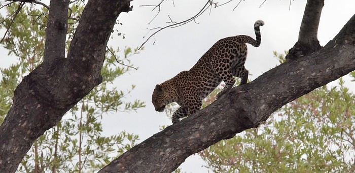
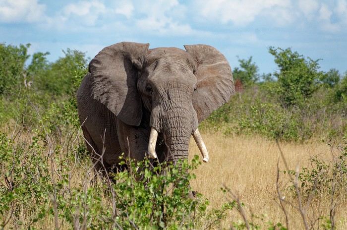
In these post-COVID years, South Africa (SA) has drawn me back again... The long-time forum members will say I'm a bit obsessed (I've now surpassed 20 trips to this country, including 2 in Namibia)... But new readers can find my old travel journals and enjoy this new installment. So, three new trips... each lasting a month... always too short. I’ll try to be pragmatic.
Let’s start with the basics! You can plan your trip from your couch with complete peace of mind. Through any Booking site or directly (sometimes cheaper), I’ve never had any issues with my direct bookings—they’ve always matched what was promised. For national parks outside KwaZulu-Natal (where it’s KZN Wildlife), use the SANparks website, or Nature Reserve for that type of "accommodation." Air France, Lufthansa, or KLM... depending on the year and circumstances. Most flights are overnight, allowing you to arrive early in Joburg and... leave this city I don’t much like as quickly as possible. KLM offers a daytime flight to Cape Town... just arrange your first night’s stay. You drive on the left in SA (you knew that, right?)... you get used to it. Passport: must still be valid for 6 months with several blank pages... Car rental? A car is pretty much essential, whether for short or long trips. It’s safer too. Aside from the secure Gautrain in Joburg and Cape Town (CT from now on), I don’t take the train. Except for the red bus drop-off/pick-up in CT, I don’t take the bus. In this specific case, it’s practical because you can access all of CT’s spots—including the famous Lion’s Head—without worrying about parking or traffic. These past three years, I’ve chosen Around About Cars as my rental company. I’m very satisfied with them. What kind of car? It depends on what you’re doing and your budget. The vast majority of roads don’t require a special vehicle. In a park, the "high ground clearance" of SUVs lets you see animals better and helps avoid potholes (the SA version—ostrich-sized), speed bumps (our "sleeping policemen" with a big belly), and tackle the last few kilometers or 100 meters that can be a bit rough with complete peace of mind. Do your research. For me, it’s 4x2 or 4x4 depending on... South Africans drive fast... and I feel safer that way. International driver’s permit? Legally required! Never asked for by a rental company, only once by the police—but I stood my ground, confident, and it went smoothly. Road checks? Yes, often—at least two every time, but they’re relaxed... Note that if a police officer wants to give you a fine, it must be done at the police station—insist on going there... they’ll usually drop it. If they suggest paying on the spot in cash to "make things easier"... it’s just for their pocket. There’s a special "police alert" number—remind them of it! The rand is the South African currency. Nowadays, cards work in many places. But note: a car rental company will ask for a credit card, not a debit card. Be careful: cash is no longer accepted in SANparks camps and other places (entrances, etc.)! It’s card only! I always carry some cash. I order it from Yeschange (sounds dodgy, but it’s very reliable). Phew... What an introduction!