Results for "Piana+|+127"
3573 results found.
Suggestions de films - puisque l'on ne peut pas voyager tout le temps... English translation pending
Voici quelques films qui permettent de voyager un peu alors que le budget se fait trop restreint
Baraka de R. Fricke, un incontournable
Kundun de scorsese, pour les amateurs du Tibet
Little Buddha de Bertoluci, conseillé par un boudhiste (Pettit Boudha)
Ulysse's Gaze de Theopoulos, pour ceux qui aiment les voyages intiatiques (Le Regard d'Ulysse)
A River Run's Throught it de Redford, pour les paysages et la simplicité (La Rivière du 6ème Jour)
3 Seasons de Bui, encore pour la beauté de la simplicité, mais version vietnamiène cette fois (Trois saisons)
la liste pourrait encore être longue, mais je dois vous laisser un peu de place pour me faire une suite...
Baraka de R. Fricke, un incontournable
Kundun de scorsese, pour les amateurs du Tibet
Little Buddha de Bertoluci, conseillé par un boudhiste (Pettit Boudha)
Ulysse's Gaze de Theopoulos, pour ceux qui aiment les voyages intiatiques (Le Regard d'Ulysse)
A River Run's Throught it de Redford, pour les paysages et la simplicité (La Rivière du 6ème Jour)
3 Seasons de Bui, encore pour la beauté de la simplicité, mais version vietnamiène cette fois (Trois saisons)
la liste pourrait encore être longue, mais je dois vous laisser un peu de place pour me faire une suite...
Guatemala et Belize English translation pending
Hello, nous serons 5 pour un voyage de trois semaines entre le Guatemala et le Belize. On décrit souvent le Guatemala comme une région à risque. Qu'en est-il exactement?
Nous sommes également à la recherche de la zone balnéaire idéale pour passer quelques jours de repos au Belize...nous n'avons pas encore trouvé notre bonheur. Une suggestion?
Nous sommes également à la recherche de la zone balnéaire idéale pour passer quelques jours de repos au Belize...nous n'avons pas encore trouvé notre bonheur. Une suggestion?
Hôtel Paraiso del Sol (Cabarete) English translation pending
je voudrais avoir des informations sur cette hotel.J ai reserver pour le mois de mars.
merci bye😎
merci bye😎
Discussion thread on the May 2026 theme: Staircases
If you’ve already posted your three photos in the contest thread Staircases: May 2026 Photo Contest Theme and a fourth one comes to mind, you can ease your staircase obsession here.
A few examples of staircases:
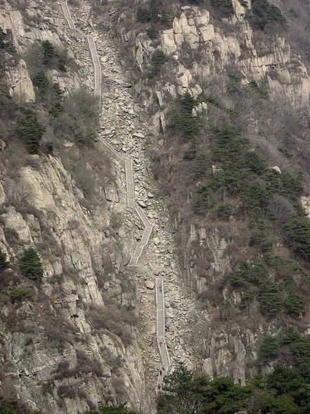
Some of the 6,600 steps on the staircase leading to the summit of Jade Emperor Peak at 1,545 meters.
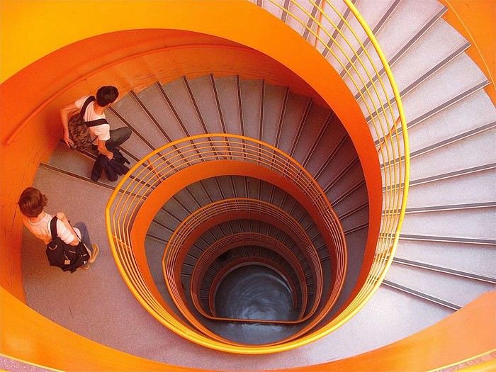
Emergency staircase at the Orléans library (France).
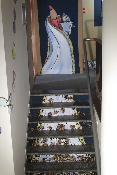
Brussels street artist Créons incorporates the staircase into the dress design of his character.
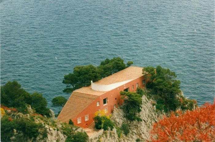
The staircase is part of the roof of Villa Malaparte (Adalberto Libera) on the island of Capri (Italy).
A few examples of staircases:
Some of the 6,600 steps on the staircase leading to the summit of Jade Emperor Peak at 1,545 meters.
Emergency staircase at the Orléans library (France).
Brussels street artist Créons incorporates the staircase into the dress design of his character.
The staircase is part of the roof of Villa Malaparte (Adalberto Libera) on the island of Capri (Italy).
Family Itinerary Feedback: Chiang Mai - Krabi/Railay - Bangkok
hi fellow travelers,
I'm "finalizing" a trip with my adventurous family (wife + 3 kids aged 16, 14, and 8) for this Easter break in Thailand (we'll be there from 04/19 to 05/01).
I'm going through the site and wanted to thank you all for the tips and insights you share on the forum. They're really valuable. But boy, it's tough to sketch out an itinerary
Of course, my backpacking route might be debatable, but I'm trying to target this path to get a first taste of the country's different "facets" and keep everyone in the family happy 😛
For this first trip, we're sticking to the classics and planning to explore a different side of the Land of Smiles in the future:
- arrival in BKK at 4 PM on 04/19 ==> leaving the same day at 7 PM for Chiang Mai (I "hesitated" with the 5:30 PM flight but was worried we wouldn't have enough time to switch from British AW to Thai Airways + airport fees + baggage + customs, etc. )
- from 04/20 to 04/23 ==> Chiang Mai with the main highlights (we've picked: Doi Suthep, Wat Pha Lat, elephant sanctuary, Doi Inthanon, the old city, Wat Chedi, Wat Phra Singh).
==> For the elephant sanctuary: any recommendations? Morning or afternoon visit?
==> It might seem ambitious, but we're considering a day trip to Chiang Rai—though it's not a must. Yes, we know it means ~6 hours of travel in one day.
- direct flight on the morning of 04/24 to Krabi ==> Railay - Phang Nga ==> this part isn't finalized yet (we won't stay in Krabi).
For those who've been there, which part of the south would be best weather-wise during this period?
We'd stay in the south until 04/28 and take a 8 PM flight to BKK.
- BKK on 04/29, 04/30, and part of 05/01 before our flight to London at 11 PM.
We'll hit the must-see/classic spots there.
If you have time to share some insights, I'd really appreciate it.
Thanks a million to everyone!
Hédi.
I'm "finalizing" a trip with my adventurous family (wife + 3 kids aged 16, 14, and 8) for this Easter break in Thailand (we'll be there from 04/19 to 05/01).
I'm going through the site and wanted to thank you all for the tips and insights you share on the forum. They're really valuable. But boy, it's tough to sketch out an itinerary
Of course, my backpacking route might be debatable, but I'm trying to target this path to get a first taste of the country's different "facets" and keep everyone in the family happy 😛
For this first trip, we're sticking to the classics and planning to explore a different side of the Land of Smiles in the future:
- arrival in BKK at 4 PM on 04/19 ==> leaving the same day at 7 PM for Chiang Mai (I "hesitated" with the 5:30 PM flight but was worried we wouldn't have enough time to switch from British AW to Thai Airways + airport fees + baggage + customs, etc. )
- from 04/20 to 04/23 ==> Chiang Mai with the main highlights (we've picked: Doi Suthep, Wat Pha Lat, elephant sanctuary, Doi Inthanon, the old city, Wat Chedi, Wat Phra Singh).
==> For the elephant sanctuary: any recommendations? Morning or afternoon visit?
==> It might seem ambitious, but we're considering a day trip to Chiang Rai—though it's not a must. Yes, we know it means ~6 hours of travel in one day.
- direct flight on the morning of 04/24 to Krabi ==> Railay - Phang Nga ==> this part isn't finalized yet (we won't stay in Krabi).
For those who've been there, which part of the south would be best weather-wise during this period?
We'd stay in the south until 04/28 and take a 8 PM flight to BKK.
- BKK on 04/29, 04/30, and part of 05/01 before our flight to London at 11 PM.
We'll hit the must-see/classic spots there.
If you have time to share some insights, I'd really appreciate it.
Thanks a million to everyone!
Hédi.
From Mexico to the Wonderful Chiapas
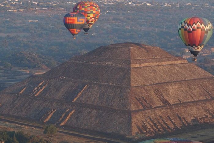
This one-month trip, from January 18 to February 17, 2026, allowed us to visit Mexico City and travel through the states of Puebla, Oaxaca, and Chiapas. We mainly used buses (ADO company) for medium and long distances and colectivos or taxis (or Uber) for shorter trips. Before leaving, I had contacted several people on the ground: Harry, a Vendéan settled in Oaxaca offering, among other things, discoveries of artisan villages or the Monte Albán site, and Oscar in Comitán de Domínguez. I’ll come back to our meeting with Oscar, who runs a local agency (CVL Travel Turismo Alternativo & Corre la voz) and owns a very pleasant hostel, a real highlight of our trip. Our journey took place in 8 stages on a loop starting from Mexico City. The connections between each were made by day or night buses depending on the trip duration. I had booked our seats in advance, either directly on the ADO company’s website or through booking platforms depending on the rates offered. Note that by planning ahead, I was able to benefit from very interesting "Early Booking" rates. There are several comfort classes. For all our trips, I had booked seats in Primera class buses, except for two in GL (Grand Luxe) class. The rates are very reasonable, and the buses turned out to be comfortable or even very comfortable (only the basic seat recline might surprise you).
Our itinerary and number of days per stage: Stage 1 – Mexico City: 4 days Stage 2 – Puebla: 2 days Stage 3 – Oaxaca: 4 days Stage 4 – San Agustinillo: 4 days Stage 5 – San Cristóbal de las Casas: 3 days Stage 6 – Comitán de Domínguez: 6 days Stage 7 – Palenque: 4 days Stage 8 – Mexico City: 2 days If I were to do it again, I’d remove one day from Palenque and add it either to Puebla or San Cristóbal to visit nearby sites or villages, or to San Agustinillo to enjoy one more day by the Pacific Ocean.
Stage 1: Mexico City (2,200 m / 9.2 million inhabitants) We arrived in the Mexican capital around 10:00 PM. The simplified customs process was very quick. After exchanging some money at the airport, we took a taxi to our youth hostel. We got around the capital on foot, of course, but also by metro. Signs are very rare, and we took the train in the wrong direction several times. After a few mistakes, we systematically asked on the platform if we were going the right way. The metro is very affordable. You need to get a rechargeable card (the Tarjeta de Movilidad Integrada) and top it up as needed. This card (less than 1 €) isn’t personal, so there’s no need to get one per person.
Mexico City: Day 1.
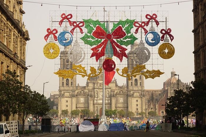
Visits and walks of the day (note: many museums are closed on Mondays): The Zócalo or Constitution Square: it’s one of the most beautiful, largest (195m x 240m), and oldest squares in the world. This is where Cortés decided to build the center of the new Spanish city on the site of the former Tenochtitlan market. Stones from the pyramids were used to pave the esplanade and build the surrounding colonial churches and buildings. During our visit, the huge square was covered with (resin) cacti, the theme of the temporary exhibition at the time. Indeed, temporary events or exhibitions take place here throughout the year. It’s also the endpoint for many protest marches.
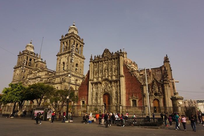
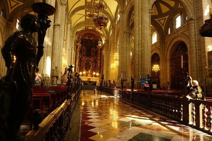


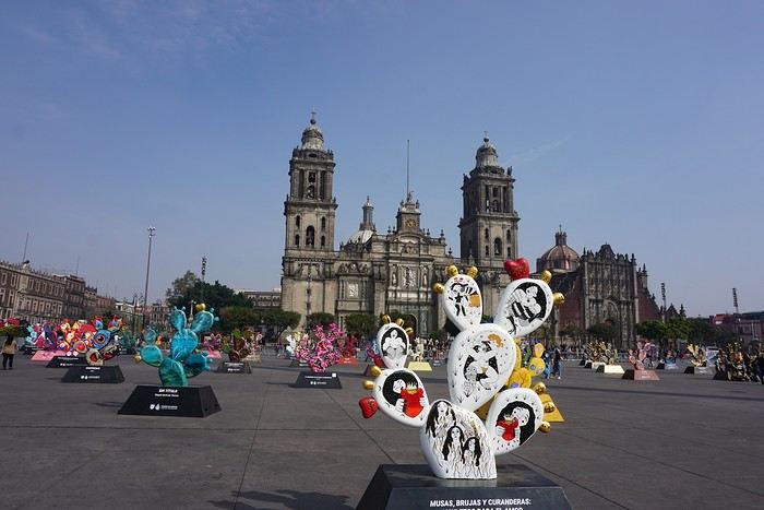
The cathedral: it’s sinking by one centimeter per year despite massive stabilization work (the collapse of many Mexican buildings—30 cm/year—is due to groundwater pumping). It was built starting in 1571 and completed in... 1813. The modest remains of the Templo Mayor (exterior view): they have high symbolic value, as this monument was the most important in the Mexica Empire.
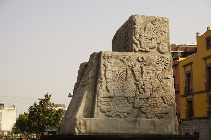 We then walked through the streets of the historic center to the Santísima Church, unfortunately closed for renovation work.
Next, we took the metro to visit one of Mexico’s most important pilgrimage sites: the Insigne y Nacional Basílicas de Santa María de Guadalupe, as well as the Capilla del Cerrito on the hill.
The first, dating from the colonial era, is really leaning a lot.
We then walked through the streets of the historic center to the Santísima Church, unfortunately closed for renovation work.
Next, we took the metro to visit one of Mexico’s most important pilgrimage sites: the Insigne y Nacional Basílicas de Santa María de Guadalupe, as well as the Capilla del Cerrito on the hill.
The first, dating from the colonial era, is really leaning a lot.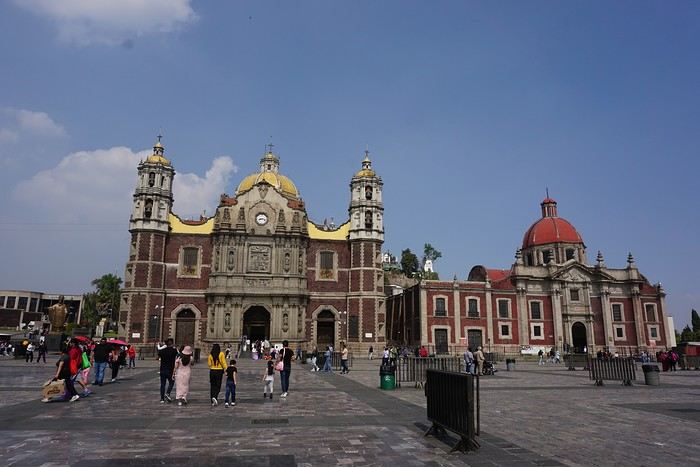
The second, shaped like a rotunda, is very impressive from the inside.
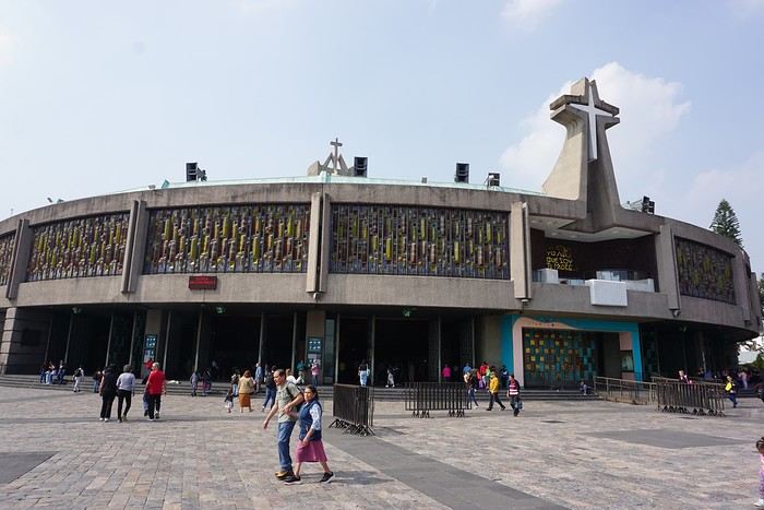
In the basement, there’s a sacred tunic where, in 1531, an image of the Virgin Mary is said to have appeared. A real mystery for scientists, the garment has never deteriorated since that date. Slow-moving conveyor belts allow pilgrims to admire it, preventing crowds from gathering in front of the image for hours. Well thought out!
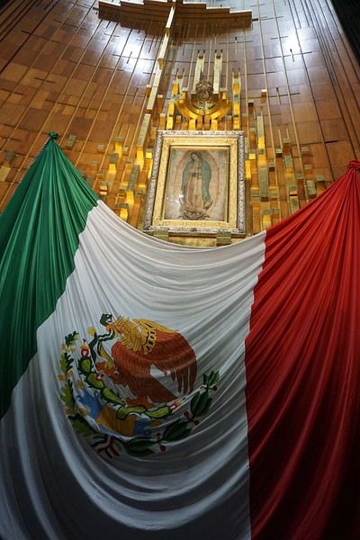 From the top of the Capilla del Cerrito, you get beautiful views of huge Mexico City.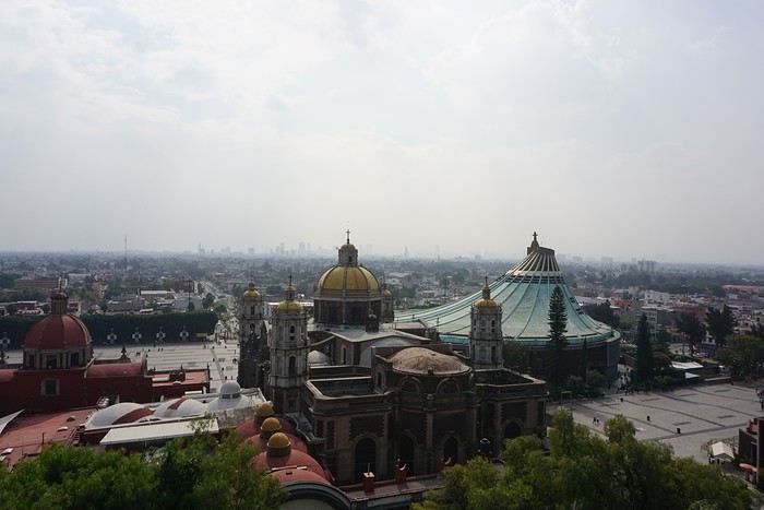
Review of an expedition cruise to the Seychelles with Ponant from January 25 to February 2, 2026
Hi everyone,
It was totally by chance that I found this cruise while chatting with Alfred in November 2024. It wasn’t planned, but the price was attractive—one of those "great deals" from Ponant that I love and that don’t exist anymore. Since everyone’s wondering, here’s the answer without waiting for the end of the story: after my various loyalty discounts, I paid **3,250 € per person** for 8 nights/9 days on the expedition cruise *The Essentials of the Seychelles*.
Expedition cruises are by far our favorites. The outings are done by Zodiac with the ship’s naturalist guides, everything’s included, and there’s no need to add any excursions or prepare anything.
We’re liking long flights less and less, so to break up the trip, we decided to stop over in Doha for four days on the way there and one day on the way back.
I’m happy to share the good and not-so-good moments, the great surprises, and the disappointments of this trip with you.
It was totally by chance that I found this cruise while chatting with Alfred in November 2024. It wasn’t planned, but the price was attractive—one of those "great deals" from Ponant that I love and that don’t exist anymore. Since everyone’s wondering, here’s the answer without waiting for the end of the story: after my various loyalty discounts, I paid **3,250 € per person** for 8 nights/9 days on the expedition cruise *The Essentials of the Seychelles*.
Expedition cruises are by far our favorites. The outings are done by Zodiac with the ship’s naturalist guides, everything’s included, and there’s no need to add any excursions or prepare anything.
We’re liking long flights less and less, so to break up the trip, we decided to stop over in Doha for four days on the way there and one day on the way back.
I’m happy to share the good and not-so-good moments, the great surprises, and the disappointments of this trip with you.
Tunisian Impressions (Live)
Hi there,
I arrived in Tunisia this afternoon for a full 14-day stay.
I took a direct Tunisair flight from Nice, which departed about thirty minutes late (that’s nothing compared to the "nightmares" I’ve had on some of my recent trips).
The flight lasts around 1 hour and 20 minutes, and a small snack was served on board (a sort of quiche with chickpea purée, a small bread roll, a portion of cheese like La Vache qui rit, and a small chocolate cake). It’s worth mentioning because it’s becoming increasingly rare on short flights. I was seated between two Tunisian gentlemen who gave me some great tips for my trip, especially about negotiating prices. One of them is a former cameraman for France Télévisions, very cultured and well-traveled—his daughter is a journalist at France Télévisions (I found some of her articles online). In short, the flight was very pleasant and quick.

I’m staying at the Hôtel Royal Victoria. I booked it yesterday afternoon by email without providing my credit card number. The room costs 241 TND (71 €) with breakfast included. It has heating, a small fridge, a safe, a hairdryer, Wi-Fi, and a TV with international channels. There’s a police van permanently parked in the square where the hotel is located.
This hotel is housed in the former British consulate and later embassy. It has a lot of charm with its painted wood ceilings and doors, and its bathroom covered in ceramic tiles. The tiny elevator is from another era. The main advantage of the hotel is its location between the medina and Avenue Bourguiba. Nearby, there’s the Magasin Général, where you can find groceries and some typical products like rose water, geranium water, and tons of halwa (a customer kindly explained how to eat it and which is the best).
After nightfall, I took a short stroll down Avenue Bourguiba. There weren’t many people around—it’s windy and cold.
I’ve already noticed the warm welcome from Tunisians. The supermarket cashier welcomed me to Tunisia, and a gentleman I asked for directions to the Magasin Général (I was about to climb stairs leading to a mosque!) insisted on inviting me for coffee, but I declined.
The rest of my itinerary will depend on the weather. If it doesn’t rain tomorrow, I might visit Carthage since the Bardo Museum is closed on Mondays, as are the museums in Sidi Bou Said.
TO BE CONTINUED...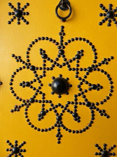


I arrived in Tunisia this afternoon for a full 14-day stay.
I took a direct Tunisair flight from Nice, which departed about thirty minutes late (that’s nothing compared to the "nightmares" I’ve had on some of my recent trips).
The flight lasts around 1 hour and 20 minutes, and a small snack was served on board (a sort of quiche with chickpea purée, a small bread roll, a portion of cheese like La Vache qui rit, and a small chocolate cake). It’s worth mentioning because it’s becoming increasingly rare on short flights. I was seated between two Tunisian gentlemen who gave me some great tips for my trip, especially about negotiating prices. One of them is a former cameraman for France Télévisions, very cultured and well-traveled—his daughter is a journalist at France Télévisions (I found some of her articles online). In short, the flight was very pleasant and quick.
I’m staying at the Hôtel Royal Victoria. I booked it yesterday afternoon by email without providing my credit card number. The room costs 241 TND (71 €) with breakfast included. It has heating, a small fridge, a safe, a hairdryer, Wi-Fi, and a TV with international channels. There’s a police van permanently parked in the square where the hotel is located.
This hotel is housed in the former British consulate and later embassy. It has a lot of charm with its painted wood ceilings and doors, and its bathroom covered in ceramic tiles. The tiny elevator is from another era. The main advantage of the hotel is its location between the medina and Avenue Bourguiba. Nearby, there’s the Magasin Général, where you can find groceries and some typical products like rose water, geranium water, and tons of halwa (a customer kindly explained how to eat it and which is the best).
After nightfall, I took a short stroll down Avenue Bourguiba. There weren’t many people around—it’s windy and cold.
I’ve already noticed the warm welcome from Tunisians. The supermarket cashier welcomed me to Tunisia, and a gentleman I asked for directions to the Magasin Général (I was about to climb stairs leading to a mosque!) insisted on inviting me for coffee, but I declined.
The rest of my itinerary will depend on the weather. If it doesn’t rain tomorrow, I might visit Carthage since the Bardo Museum is closed on Mondays, as are the museums in Sidi Bou Said.
TO BE CONTINUED...
Veneto: Dolomites and Opera
I'm starting a new travel journal in Italy.
It's about a month-long trip (from September 3, 2025, to October 4, 2025), or rather a part of it. This section matches the title: an opera festival in Verona (one evening) and the Dolomites in the Veneto region.
I'm posting the part of the trip I think will interest French-speaking readers the most (since this is where I saw the most French travelers).
Here’s a quick summary:
- Trip in September 2025
- Solo travel with camping (caravan)
- Small geographic area: besides Verona, the surroundings of the Marmolada massif and Cortina d'Ampezzo.
- Main but not exclusive activity: hiking.
Since I have limited internet access where I am now, I’ll be writing slowly. Here we go!
Day 1: Thursday, September 4, 2025
I arrived in Veneto under the sun and with warm weather. I drove to Verona and tried to find a spot at the campsite (Verona Village) located south of the city. Unfortunately, it was full. Booking on the website was mandatory, but when I tried to reserve a few days ago, the site never moved from the "reservation" step to the "payment" step (I don’t know why—it’s always like that in these cases). I found another solution over the phone; the drive from southern Verona to the northeast was a bit long, but I finally settled at the "Oro Verde" campsite. It’s an "agricampeggio" (farm camping or rural campsite) on the outskirts of the city, and its name (green gold) suggests they produce olives there. Since it wasn’t late, I biked to the Adige River, following the recommended route into the city.
Since I have limited internet access where I am now, I’ll be writing slowly. Here we go!
Day 1: Thursday, September 4, 2025
I arrived in Veneto under the sun and with warm weather. I drove to Verona and tried to find a spot at the campsite (Verona Village) located south of the city. Unfortunately, it was full. Booking on the website was mandatory, but when I tried to reserve a few days ago, the site never moved from the "reservation" step to the "payment" step (I don’t know why—it’s always like that in these cases). I found another solution over the phone; the drive from southern Verona to the northeast was a bit long, but I finally settled at the "Oro Verde" campsite. It’s an "agricampeggio" (farm camping or rural campsite) on the outskirts of the city, and its name (green gold) suggests they produce olives there. Since it wasn’t late, I biked to the Adige River, following the recommended route into the city.
Off we go on an adventure in Puglia!
Hey there, VF crew!
After wrapping up our travel journal on Java (link below), we’re now diving into our recent adventure in Puglia! Happy reading... Off we go on an adventure in Java (and a bit of Bali) | Travel journal > Indonesia | Voyage Forum
Day 1 - October 19
When you tell your friends and family you’re itching to escape to the other side of the planet to mingle with the Mongols, you can usually expect a barrage of questionable jokes and terrible puns. For this new adventure, it’s a different destination but the same old story—this time, we’re visiting the "pouilleux" (the "scruffy" ones). We’re taking off straight for Puglia! If you need a cheat sheet to remember where this oddly named place is on a world map, just think of it this way: Puglia is the maiden name on the ID card of the heel of the Italian boot! Personally, I prefer to remember it as the land of creamy burrata, the smell of focaccia fresh from the oven, orecchiette shaped by mamas, golden olive oil that shines like the sun (which beams down here 300 days a year), amaretto that makes you happy, and those famous trulli—those little hobbit-like dry-stone houses straight out of a movie set...
But I’ll stop spoiling the rest of our trip and focus on a factual rundown of this first Puglian day. So, are you joining us on this new adventure beyond our Gallic borders? Either way, Sasha (my youngest) and Luna (Flo’s daughter) didn’t need much convincing to stick with us and keep up the pace!
Our plane drops our little crew in Bari, the site of a famously tragic battle lost in 1991. But revenge is sweet! After renting a motorized carriage, we escape the landing zone and head to our military base of operations: Ostuni, a strategic little town where we’ll set up camp for the next four days. Why Ostuni? First, for its central location, which lets us explore a region packed with must-see gems. Second, for its vibe and beauty, which have earned it quite the reputation. Perched high on a hill, the *città bianca* (the "White City") lives up to its nickname. It literally dazzles visitors. The reason? The whitewashed facades of its houses, a testament to the region’s rich architectural heritage.
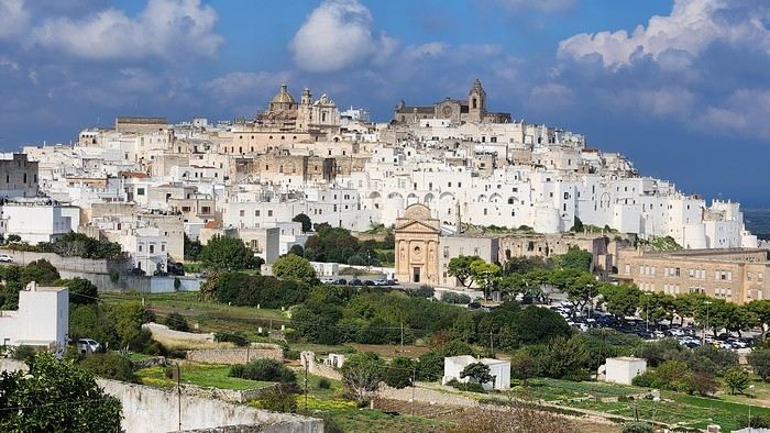
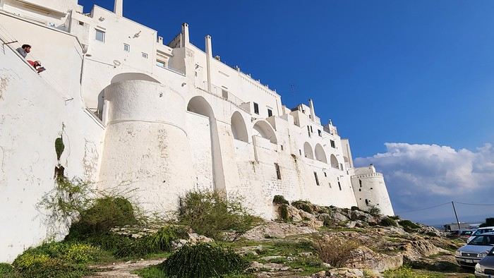
We arrived late last night, so only the two bravest soldiers volunteered to scout ahead at dawn, while the younger recruits stayed behind—for now. But not for long! After the first wave of streets and the next round of exploration, headquarters made the inevitable call to retreat. Reinforcements were needed! A few strategic errands, a breakfast ration, and our battalion marched in tight formation, flag held high, to conquer Ostuni the White! *Charge!* In my squadron leader’s memoirs, I’ll write that I didn’t expect Ostuni to put up such a fight. What I thought would take two hours to conquer turned into a humbling experience—we could only bow in respect to its beauty, its relentless charm. The alleys are whiter, more labyrinthine, narrower, and more photogenic than the last. *Veni, vidi, vici*—but what an entrance, my troops!
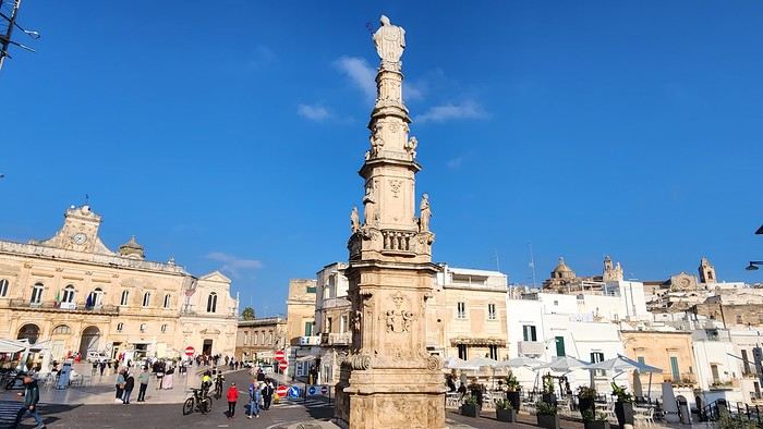
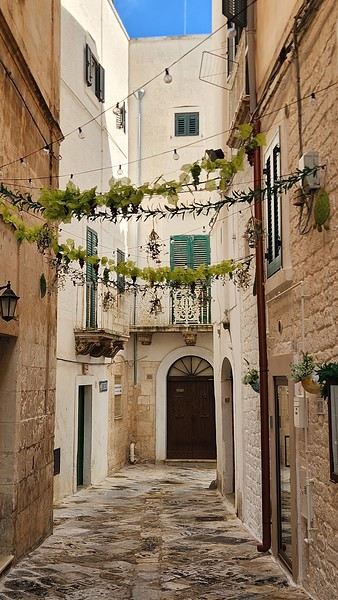
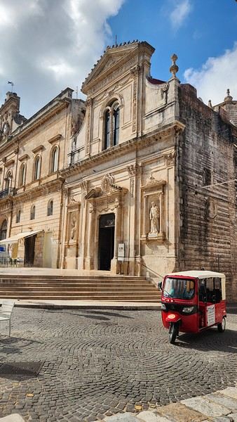
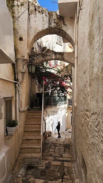
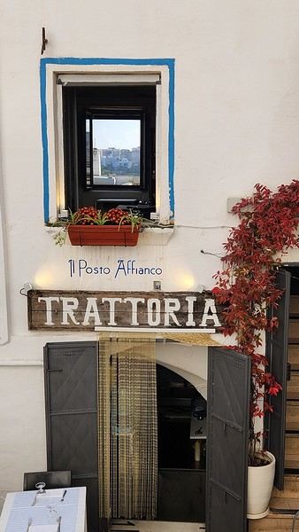
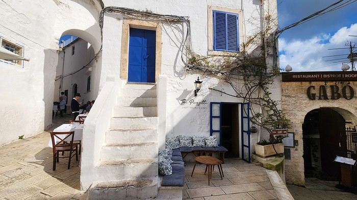
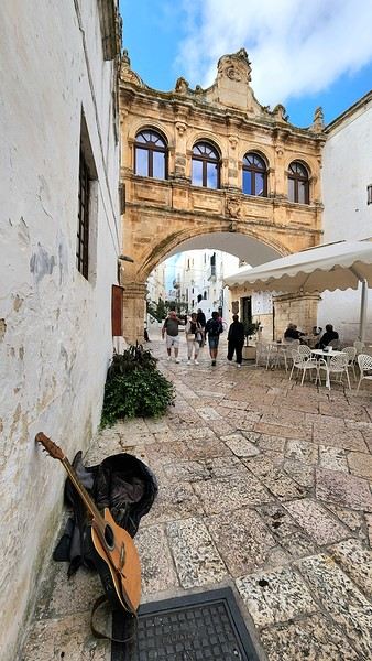
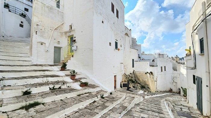
After wrapping up our travel journal on Java (link below), we’re now diving into our recent adventure in Puglia! Happy reading... Off we go on an adventure in Java (and a bit of Bali) | Travel journal > Indonesia | Voyage Forum
Day 1 - October 19
When you tell your friends and family you’re itching to escape to the other side of the planet to mingle with the Mongols, you can usually expect a barrage of questionable jokes and terrible puns. For this new adventure, it’s a different destination but the same old story—this time, we’re visiting the "pouilleux" (the "scruffy" ones). We’re taking off straight for Puglia! If you need a cheat sheet to remember where this oddly named place is on a world map, just think of it this way: Puglia is the maiden name on the ID card of the heel of the Italian boot! Personally, I prefer to remember it as the land of creamy burrata, the smell of focaccia fresh from the oven, orecchiette shaped by mamas, golden olive oil that shines like the sun (which beams down here 300 days a year), amaretto that makes you happy, and those famous trulli—those little hobbit-like dry-stone houses straight out of a movie set...
But I’ll stop spoiling the rest of our trip and focus on a factual rundown of this first Puglian day. So, are you joining us on this new adventure beyond our Gallic borders? Either way, Sasha (my youngest) and Luna (Flo’s daughter) didn’t need much convincing to stick with us and keep up the pace!
Our plane drops our little crew in Bari, the site of a famously tragic battle lost in 1991. But revenge is sweet! After renting a motorized carriage, we escape the landing zone and head to our military base of operations: Ostuni, a strategic little town where we’ll set up camp for the next four days. Why Ostuni? First, for its central location, which lets us explore a region packed with must-see gems. Second, for its vibe and beauty, which have earned it quite the reputation. Perched high on a hill, the *città bianca* (the "White City") lives up to its nickname. It literally dazzles visitors. The reason? The whitewashed facades of its houses, a testament to the region’s rich architectural heritage.
We arrived late last night, so only the two bravest soldiers volunteered to scout ahead at dawn, while the younger recruits stayed behind—for now. But not for long! After the first wave of streets and the next round of exploration, headquarters made the inevitable call to retreat. Reinforcements were needed! A few strategic errands, a breakfast ration, and our battalion marched in tight formation, flag held high, to conquer Ostuni the White! *Charge!* In my squadron leader’s memoirs, I’ll write that I didn’t expect Ostuni to put up such a fight. What I thought would take two hours to conquer turned into a humbling experience—we could only bow in respect to its beauty, its relentless charm. The alleys are whiter, more labyrinthine, narrower, and more photogenic than the last. *Veni, vidi, vici*—but what an entrance, my troops!
Review of Renaissance Cruise (Iberian Flavors) from October 18 to 29, 2025
Hi there,
Here’s a little review of our cruise on the Renaissance from October 18 to 29, 2025 (11 nights). It was our first experience with CFC.
Some other forum members were on board too, so we can probably compare notes and correct me if I’m wrong!
The stops were as follows: 10/18 departure from Marseille 10/19 at sea 10/20 Cartagena 10/21 Almería 10/22 Gibraltar 10/23 Cádiz 10/24 at sea 10/25 Leixões (Porto) 10/26 Vigo 10/27 at sea 10/28 at sea 10/29 Dunkirk
First, a quick intro. We’re a family of four with two kids, ages 8 and 11. We booked this cruise in January 2025, right when it went on sale. At the time, it was priced at 763 € per adult (+ 99 € in tips) and 114.45 € per child (under 12, no tips to pay) for an ocean-view cabin (all ocean-view categories were the same price). Since there was also a single-parent offer (meaning one paying adult in the cabin was enough to get the child rate for the accompanying kid), I asked if we could take advantage of this offer to get two double cabins at the same price as one quadruple cabin (to have more space), and yes, it was possible. So we booked two premium ocean-view double cabins side by side. It was the same price as a quadruple. We booked directly through CFC because my husband had a promotional code from his works council. In total, for the four of us, we paid 1830 €, tips included. It’s true we booked early, but the rate was good, and we had the constraint of traveling as a family of four, so cabin choices were more limited. It’s also worth noting that the single-parent offer is limited.
Now, about embarkation: 10/18 Marseille Coming from the north, we took the direct TGV that morning at 7:22 AM, scheduled to arrive in Marseille at 12:24 PM. The trip went smoothly, great weather, and we arrived just one minute late. I had planned to get to the port using the free 35T shuttle from Joliette. To get to the bus stop, there were two options: the metro or walking. Since the weather was beautiful and the kids needed to stretch their legs, we opted for the second option. The route is all downhill, so it was pretty easy even with the suitcases. But I wouldn’t do it the other way around! We arrived at Joliette around 12:50 PM, just in time for the 1:00 PM shuttle, which arrived a few minutes late. Other cruisers got on board too. That day, there were two Costa ships and one MSC ship at the port as well. Traffic was heavy, and the shuttle arrived at the port entrance at 1:30 PM. We were scheduled for 2:30 PM. We were lucky to be at the closest embarkation terminal. So we were among those who had the least walking to do. We dropped off our suitcases and headed to the check-in counter. There were plenty of desks and almost no passengers. So we quickly completed the embarkation formalities—in just a few minutes—and when we boarded, it wasn’t even 2:00 PM yet. We headed to the buffet, where there weren’t many people. As we finished lunch, it was around 3:00 PM when they announced the cabins were ready. We went down to drop off our luggage in the cabins and then went up to the top deck to take some photos. The ship’s daily program said the safety drill would be at 4:00 PM. So we went to deck 6 at the scheduled time. But later, they announced it would actually be at 4:30 PM! In short, we waited 30 minutes for nothing because of a difference between the scheduled and actual time! The drill itself was long. Gathering everyone took about 20 minutes, I think. Just as we finished, they announced the departure, originally scheduled for 5:00 PM, was delayed until 9:00 PM due to latecomers. We went to check out the library, which had tons of board games and books—more than we’d ever seen. What stood out on this first day was that, for the first time, we had a French-speaking embarkation, announcements only in French (except for the safety drill), French-speaking servers, a paper daily program in French, books in French (which we’d never find on another ship), and menus in French. To wrap up the day, we had dinner at Vatel. I had requested the first seating (6:30 PM) and a table for four, and we got it. We were seated upstairs near the window—a very pleasant table that we’d occupy every evening. What was a little surprising, but we got used to it, was that you had to order everything you wanted at once. The portions weren’t big, but you could choose what you wanted. The cheese was French and excellent.
To be continued...
The stops were as follows: 10/18 departure from Marseille 10/19 at sea 10/20 Cartagena 10/21 Almería 10/22 Gibraltar 10/23 Cádiz 10/24 at sea 10/25 Leixões (Porto) 10/26 Vigo 10/27 at sea 10/28 at sea 10/29 Dunkirk
First, a quick intro. We’re a family of four with two kids, ages 8 and 11. We booked this cruise in January 2025, right when it went on sale. At the time, it was priced at 763 € per adult (+ 99 € in tips) and 114.45 € per child (under 12, no tips to pay) for an ocean-view cabin (all ocean-view categories were the same price). Since there was also a single-parent offer (meaning one paying adult in the cabin was enough to get the child rate for the accompanying kid), I asked if we could take advantage of this offer to get two double cabins at the same price as one quadruple cabin (to have more space), and yes, it was possible. So we booked two premium ocean-view double cabins side by side. It was the same price as a quadruple. We booked directly through CFC because my husband had a promotional code from his works council. In total, for the four of us, we paid 1830 €, tips included. It’s true we booked early, but the rate was good, and we had the constraint of traveling as a family of four, so cabin choices were more limited. It’s also worth noting that the single-parent offer is limited.
Now, about embarkation: 10/18 Marseille Coming from the north, we took the direct TGV that morning at 7:22 AM, scheduled to arrive in Marseille at 12:24 PM. The trip went smoothly, great weather, and we arrived just one minute late. I had planned to get to the port using the free 35T shuttle from Joliette. To get to the bus stop, there were two options: the metro or walking. Since the weather was beautiful and the kids needed to stretch their legs, we opted for the second option. The route is all downhill, so it was pretty easy even with the suitcases. But I wouldn’t do it the other way around! We arrived at Joliette around 12:50 PM, just in time for the 1:00 PM shuttle, which arrived a few minutes late. Other cruisers got on board too. That day, there were two Costa ships and one MSC ship at the port as well. Traffic was heavy, and the shuttle arrived at the port entrance at 1:30 PM. We were scheduled for 2:30 PM. We were lucky to be at the closest embarkation terminal. So we were among those who had the least walking to do. We dropped off our suitcases and headed to the check-in counter. There were plenty of desks and almost no passengers. So we quickly completed the embarkation formalities—in just a few minutes—and when we boarded, it wasn’t even 2:00 PM yet. We headed to the buffet, where there weren’t many people. As we finished lunch, it was around 3:00 PM when they announced the cabins were ready. We went down to drop off our luggage in the cabins and then went up to the top deck to take some photos. The ship’s daily program said the safety drill would be at 4:00 PM. So we went to deck 6 at the scheduled time. But later, they announced it would actually be at 4:30 PM! In short, we waited 30 minutes for nothing because of a difference between the scheduled and actual time! The drill itself was long. Gathering everyone took about 20 minutes, I think. Just as we finished, they announced the departure, originally scheduled for 5:00 PM, was delayed until 9:00 PM due to latecomers. We went to check out the library, which had tons of board games and books—more than we’d ever seen. What stood out on this first day was that, for the first time, we had a French-speaking embarkation, announcements only in French (except for the safety drill), French-speaking servers, a paper daily program in French, books in French (which we’d never find on another ship), and menus in French. To wrap up the day, we had dinner at Vatel. I had requested the first seating (6:30 PM) and a table for four, and we got it. We were seated upstairs near the window—a very pleasant table that we’d occupy every evening. What was a little surprising, but we got used to it, was that you had to order everything you wanted at once. The portions weren’t big, but you could choose what you wanted. The cheese was French and excellent.
To be continued...
From Southern Shikoku, between land and sea, to the blue waters of Miyakojima and finally the Tokyo metropolis
From Southern Shikoku, between land and sea, to the blue waters of Miyakojima and finally Tokyo’s megacity
Hi everyone,
I have to admit, I really hesitated before deciding to write this travel journal... Writing one takes a lot of time and energy, and since this is my 4th trip, I wondered if it would actually interest anyone other than myself (both for the discovery and the writing). But after a few "Are you going to write a journal?" requests and especially the renewed pleasure from reading other travelers’ travel journals about Japan or elsewhere on this forum or elsewhere, I’ve decided to share this 4th installment in the Land of the Rising Sun here.
The itinerary: 27 full days, from late May to late June 2025, right in the middle of the rainy season, including:
-->13 days in Shikoku, from Kochi (Kochi Prefecture) to Matsuyama (Ehime Prefecture)

-->7 days in Miyakojima (Okinawa Prefecture)

-->7 days in Tokyo

The trip was decided on fairly last-minute this year, as usual.
I regularly check flight prices to track fluctuations for this destination, even without concrete plans. Finding a slightly cheaper direct flight (900 €) than what I’d seen in previous months (around 1,200–1,400 € on average) for a Paris-Tokyo route with Japanese airline ANA was too tempting to resist the urge to return to this enchanting country. After long hesitations between exploring the San’in region (Matsue, Tottori, Yamaguchi) and southern Shikoku, the decision was made—I took the plunge! The tickets are booked: Paris to Kochi with a layover in Tokyo, all with ANA, the airline I’d been dreaming of... for 1,120 € per person. Okay, it’s not cheap, but it’s still better than in 2023.
We leave in 2 weeks!! Now it’s just a matter of getting everything ready!
Intense work ahead in these 2 weeks to:
finalize a more precise itinerary and reach an agreement—yep, because even though we both love Japan, our preferences differ slightly, and we have to choose between exploring new places or taking time to revisit beloved spots... decide how much time to spend in each selected area without rushing while still exploring research places that might interest us and watch videos about Japan book accommodations: yes, it’s possible to do this on the spot as we go, but last year, we noticed that last-minute options were pretty expensive, so we’re booking ahead—even if it means keeping a few options open while we decide or see if better deals pop up later reserve rental cars order yen check the weather regularly and wonder if choosing the *tsuyu* (rainy season) was really a good idea—and whether we’ll be stuck in non-stop rain???
What a tough job, right? Traveling to Japan for a month—such a hard life! Despite this being my 4th trip, the excitement is just as intense as the first time.
The only small downside is that when we booked the flight tickets, there were only a few seats left, so we’re only sitting together on the international return flight. Plus, on the outbound flight, we’ve got the middle seats. Another lingering question: what French-language films will be available? According to the internet, the selection seems limited. Oh well, these are just minor details—it’s almost time to fly!
PS: I’ll be posting slowly and irregularly... so for those interested, be patient or maybe set an alert...
Hi everyone,
I have to admit, I really hesitated before deciding to write this travel journal... Writing one takes a lot of time and energy, and since this is my 4th trip, I wondered if it would actually interest anyone other than myself (both for the discovery and the writing). But after a few "Are you going to write a journal?" requests and especially the renewed pleasure from reading other travelers’ travel journals about Japan or elsewhere on this forum or elsewhere, I’ve decided to share this 4th installment in the Land of the Rising Sun here.
The itinerary: 27 full days, from late May to late June 2025, right in the middle of the rainy season, including:
-->13 days in Shikoku, from Kochi (Kochi Prefecture) to Matsuyama (Ehime Prefecture)
-->7 days in Miyakojima (Okinawa Prefecture)
-->7 days in Tokyo
The trip was decided on fairly last-minute this year, as usual.
I regularly check flight prices to track fluctuations for this destination, even without concrete plans. Finding a slightly cheaper direct flight (900 €) than what I’d seen in previous months (around 1,200–1,400 € on average) for a Paris-Tokyo route with Japanese airline ANA was too tempting to resist the urge to return to this enchanting country. After long hesitations between exploring the San’in region (Matsue, Tottori, Yamaguchi) and southern Shikoku, the decision was made—I took the plunge! The tickets are booked: Paris to Kochi with a layover in Tokyo, all with ANA, the airline I’d been dreaming of... for 1,120 € per person. Okay, it’s not cheap, but it’s still better than in 2023.
We leave in 2 weeks!! Now it’s just a matter of getting everything ready!
Intense work ahead in these 2 weeks to:
finalize a more precise itinerary and reach an agreement—yep, because even though we both love Japan, our preferences differ slightly, and we have to choose between exploring new places or taking time to revisit beloved spots... decide how much time to spend in each selected area without rushing while still exploring research places that might interest us and watch videos about Japan book accommodations: yes, it’s possible to do this on the spot as we go, but last year, we noticed that last-minute options were pretty expensive, so we’re booking ahead—even if it means keeping a few options open while we decide or see if better deals pop up later reserve rental cars order yen check the weather regularly and wonder if choosing the *tsuyu* (rainy season) was really a good idea—and whether we’ll be stuck in non-stop rain???
What a tough job, right? Traveling to Japan for a month—such a hard life! Despite this being my 4th trip, the excitement is just as intense as the first time.
The only small downside is that when we booked the flight tickets, there were only a few seats left, so we’re only sitting together on the international return flight. Plus, on the outbound flight, we’ve got the middle seats. Another lingering question: what French-language films will be available? According to the internet, the selection seems limited. Oh well, these are just minor details—it’s almost time to fly!
PS: I’ll be posting slowly and irregularly... so for those interested, be patient or maybe set an alert...
Slovak travel journal
Hello and welcome aboard this travel journal.
We’re heading to Slovakia together!
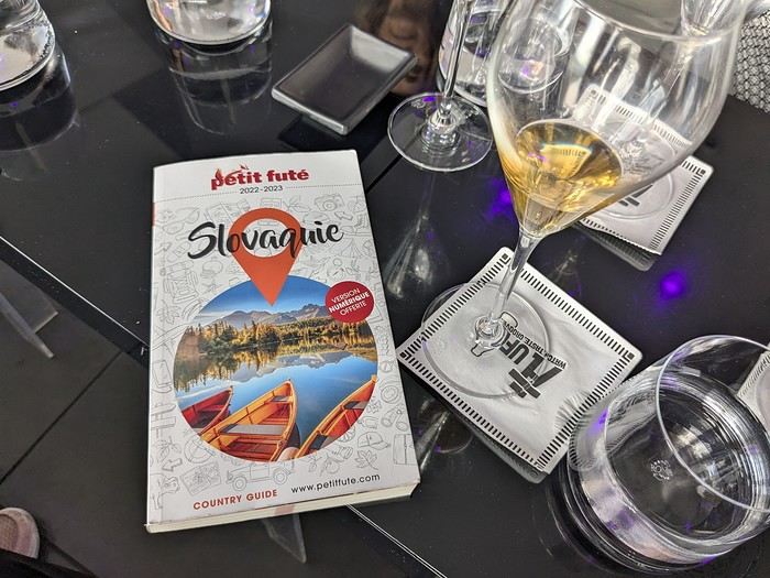 Why this country?
After visiting Hungary, Slovenia, Romania, and Poland in recent years, I’ve fallen in love with Eastern European countries. I adore the Slavic soul, its Austro-Hungarian villages, the gentle landscapes, the Carpathian Mountains, and that slightly mysterious atmosphere.
Slovakia evokes a certain imagination with its deep forests, medieval castles, and cobbled villages.
After seeing photos of the High Tatras—especially Lake Štrbské Pleso and Spiš Castle—I thought, "Let’s do it! We’re going!"
So, will Slovakia live up to what I imagine?
We’ll find out together.
We decided to travel as a group of six (five adults and a six-year-old child), by car (we needed two).
Here’s the day-by-day itinerary for this family trip, which started with a 3-day stay in Vienna (see the dedicated travel journal):
Why this country?
After visiting Hungary, Slovenia, Romania, and Poland in recent years, I’ve fallen in love with Eastern European countries. I adore the Slavic soul, its Austro-Hungarian villages, the gentle landscapes, the Carpathian Mountains, and that slightly mysterious atmosphere.
Slovakia evokes a certain imagination with its deep forests, medieval castles, and cobbled villages.
After seeing photos of the High Tatras—especially Lake Štrbské Pleso and Spiš Castle—I thought, "Let’s do it! We’re going!"
So, will Slovakia live up to what I imagine?
We’ll find out together.
We decided to travel as a group of six (five adults and a six-year-old child), by car (we needed two).
Here’s the day-by-day itinerary for this family trip, which started with a 3-day stay in Vienna (see the dedicated travel journal):
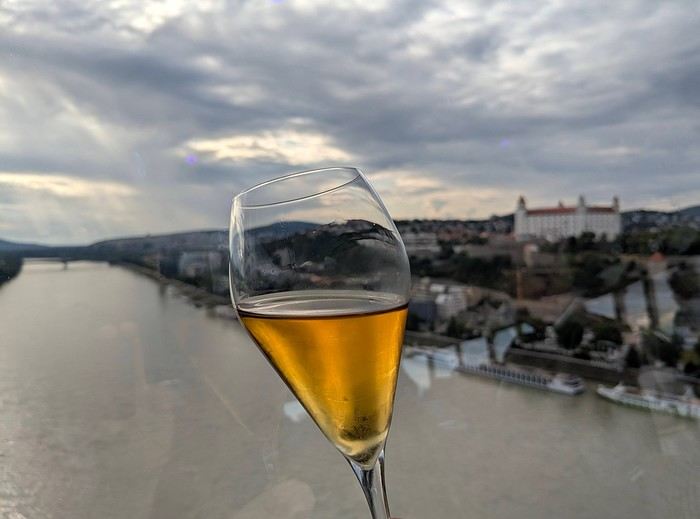
The itinerary: Day 1: Drive from Vienna to Banská Štiavnica and visit the town, then drive to Handlová Day 2: Bojnice Castle, the village of Čičmany, and a walk in the treetops at Bojnice, return to Handlová Day 3: Depart for Orava, visit Orava Castle and the Orava Skansen, drive to Veľký Slavkov Day 4: Visit Slovak Paradise—its gorges, lakes, and ice cave—overnight in Veľký Slavkov Day 5: Visit Bardejov, the "Death Road," wooden churches, and Ľubovňa Castle, overnight in Veľký Slavkov Day 6: Walks and hikes in the High Tatras, Lake Štrbské Pleso, Solisko summit, treetop walk in Ždiar, overnight in Veľký Slavkov Day 7: Drive to Košice, visit Spiš Castle, Tokaj wine route in Veľká Trňa, overnight in Košice Day 8: Visit Košice, overnight in Košice Day 9: Drive to Bratislava, stop at the Aragonite Cave in the Slovak Karst, overnight in Bratislava Day 10: Visit Bratislava, overnight stay Day 11 and 12: Return to France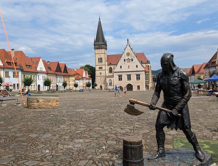
Budget: I’m giving prices for 2 adults / 1 child. Slovakia is more expensive than it seems, and some expenses shouldn’t be underestimated. Transportation: Tolls and gas from France: 500 € round trip Slovak vignette for one month: 17.10 € Gas is fixed at 1.49 € per liter (E10) Parking at sites (all paid by the day, even in the most remote villages, even if you stay for just an hour). Payment is often required in cash upon arrival: total 63 € We didn’t pay at Spiš (we arrived before the cashier) or Ľubovňa (we arrived after the cashier left). Parking at Orava Village was free. In Košice and Bratislava, we parked for free at our accommodations. Public transport in Bratislava and Košice: 1-1.2 € for a bus ticket. Vending machines are available at some stops; otherwise, buy via SMS (Slovak phones only) or official sales points.
Accommodation: We mostly chose houses so we could cook ourselves and save on food. I’ve rated our satisfaction with these accommodations from 1 to 5 stars. Padua: DC Hotel: 1 night, 77 € ***** Handlová: Chata Remata: 2 nights, 120 € ***** Veľký Slavkov: Aplend: 4 nights, 220 € ** Košice: Luxury Old Town Loft 320m²: 2 nights, 120 € ***** Bratislava: Hotel Viktor: 2 nights, 138 € *** Brescia: Hotel Antica Fonte: 1 night, 82 € ***** Total: 757 €
Food: Groceries at Lidl for 5 meals for 3: 100 € (really cheap) Restaurants: 10-15 € per dish, ice cream 1-2.4 € per scoop, crêpes 8-12 €, a glass of wine 6-10 €... total: 500 €
Visits: There are discounts for seniors and children, which is great. We spent nearly 600 € in total, which is a lot. However, it’s a cultural destination with many castles, museums, caves, wine cellars, and nature activities: cable cars, canopy walks, paid hikes (Slovak Paradise gorges)... In the end, this trip to Slovakia cost nearly 2500 € for 3. We also need to add the Vienna portion to that. Now, here’s the day-by-day account of this beautiful journey.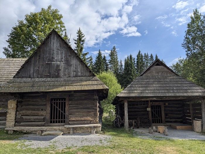
Why this country?
After visiting Hungary, Slovenia, Romania, and Poland in recent years, I’ve fallen in love with Eastern European countries. I adore the Slavic soul, its Austro-Hungarian villages, the gentle landscapes, the Carpathian Mountains, and that slightly mysterious atmosphere.
Slovakia evokes a certain imagination with its deep forests, medieval castles, and cobbled villages.
After seeing photos of the High Tatras—especially Lake Štrbské Pleso and Spiš Castle—I thought, "Let’s do it! We’re going!"
So, will Slovakia live up to what I imagine?
We’ll find out together.
We decided to travel as a group of six (five adults and a six-year-old child), by car (we needed two).
Here’s the day-by-day itinerary for this family trip, which started with a 3-day stay in Vienna (see the dedicated travel journal):
The itinerary: Day 1: Drive from Vienna to Banská Štiavnica and visit the town, then drive to Handlová Day 2: Bojnice Castle, the village of Čičmany, and a walk in the treetops at Bojnice, return to Handlová Day 3: Depart for Orava, visit Orava Castle and the Orava Skansen, drive to Veľký Slavkov Day 4: Visit Slovak Paradise—its gorges, lakes, and ice cave—overnight in Veľký Slavkov Day 5: Visit Bardejov, the "Death Road," wooden churches, and Ľubovňa Castle, overnight in Veľký Slavkov Day 6: Walks and hikes in the High Tatras, Lake Štrbské Pleso, Solisko summit, treetop walk in Ždiar, overnight in Veľký Slavkov Day 7: Drive to Košice, visit Spiš Castle, Tokaj wine route in Veľká Trňa, overnight in Košice Day 8: Visit Košice, overnight in Košice Day 9: Drive to Bratislava, stop at the Aragonite Cave in the Slovak Karst, overnight in Bratislava Day 10: Visit Bratislava, overnight stay Day 11 and 12: Return to France
Budget: I’m giving prices for 2 adults / 1 child. Slovakia is more expensive than it seems, and some expenses shouldn’t be underestimated. Transportation: Tolls and gas from France: 500 € round trip Slovak vignette for one month: 17.10 € Gas is fixed at 1.49 € per liter (E10) Parking at sites (all paid by the day, even in the most remote villages, even if you stay for just an hour). Payment is often required in cash upon arrival: total 63 € We didn’t pay at Spiš (we arrived before the cashier) or Ľubovňa (we arrived after the cashier left). Parking at Orava Village was free. In Košice and Bratislava, we parked for free at our accommodations. Public transport in Bratislava and Košice: 1-1.2 € for a bus ticket. Vending machines are available at some stops; otherwise, buy via SMS (Slovak phones only) or official sales points.
Accommodation: We mostly chose houses so we could cook ourselves and save on food. I’ve rated our satisfaction with these accommodations from 1 to 5 stars. Padua: DC Hotel: 1 night, 77 € ***** Handlová: Chata Remata: 2 nights, 120 € ***** Veľký Slavkov: Aplend: 4 nights, 220 € ** Košice: Luxury Old Town Loft 320m²: 2 nights, 120 € ***** Bratislava: Hotel Viktor: 2 nights, 138 € *** Brescia: Hotel Antica Fonte: 1 night, 82 € ***** Total: 757 €
Food: Groceries at Lidl for 5 meals for 3: 100 € (really cheap) Restaurants: 10-15 € per dish, ice cream 1-2.4 € per scoop, crêpes 8-12 €, a glass of wine 6-10 €... total: 500 €
Visits: There are discounts for seniors and children, which is great. We spent nearly 600 € in total, which is a lot. However, it’s a cultural destination with many castles, museums, caves, wine cellars, and nature activities: cable cars, canopy walks, paid hikes (Slovak Paradise gorges)... In the end, this trip to Slovakia cost nearly 2500 € for 3. We also need to add the Vienna portion to that. Now, here’s the day-by-day account of this beautiful journey.
Review of a Norway cruise on the Emerald Princess in June 2025 (1)
Hello everyone,
I’ve wanted to take this Norway cruise for a very long time. The first time I booked it was in July 2020 with Azamara. Unfortunately, it was canceled, as everyone remembers. When I tried to book it again, the prices (already a bit high with Azamara) had simply doubled. So, since then, I’ve been keeping an eye out every year for any opportunities...
The last time we sailed with Princess was eleven years ago, and things didn’t go very well. I came back pretty unhappy with their service and quite disappointed. Despite the $600 they gave me as credit for a future cruise, I’d never set foot on one of their ships again.
But this time, the opportunity arose—a fantastic itinerary with lots of stops, a reasonable price for 16 nights (I’ll share the details in the conclusion), and a ship that’s not too big, so to speak, with only 3,000 passengers. I’m not expecting much from the cruise line this time and am boarding the ship with low expectations beyond the itinerary.
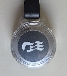
Princess has introduced an app to download before the cruise. It’s essential because online check-in is no longer available, and the agency doesn’t send a travel journal. Everything is done through the app. After completing the check-in on the app, we only know that we’ll need to pick up our key, the Medallion, at embarkation by following the blue line in the terminal and presenting our passport.
Up until our departure, the weather forecast for the coming week in Norway is disastrous—rain, rain, and more rain. It was pretty much the same two years ago before our Iceland cruise, and in the end, the weather turned out fine.
If you’re ready to embark on the Emerald Princess to discover this beautiful cruise and the stunning landscapes of Norway, let’s go!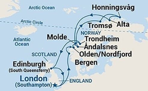
Southampton - Sea day - Bergen - Olden - Åndalsnes - Sea day - Tromsø - Honningsvåg (North Cape) - Alta - Sea day - Molde - Trondheim - Two sea days - Edinburgh - Sea day - Southampton
I’ve wanted to take this Norway cruise for a very long time. The first time I booked it was in July 2020 with Azamara. Unfortunately, it was canceled, as everyone remembers. When I tried to book it again, the prices (already a bit high with Azamara) had simply doubled. So, since then, I’ve been keeping an eye out every year for any opportunities...
The last time we sailed with Princess was eleven years ago, and things didn’t go very well. I came back pretty unhappy with their service and quite disappointed. Despite the $600 they gave me as credit for a future cruise, I’d never set foot on one of their ships again.
But this time, the opportunity arose—a fantastic itinerary with lots of stops, a reasonable price for 16 nights (I’ll share the details in the conclusion), and a ship that’s not too big, so to speak, with only 3,000 passengers. I’m not expecting much from the cruise line this time and am boarding the ship with low expectations beyond the itinerary.
Princess has introduced an app to download before the cruise. It’s essential because online check-in is no longer available, and the agency doesn’t send a travel journal. Everything is done through the app. After completing the check-in on the app, we only know that we’ll need to pick up our key, the Medallion, at embarkation by following the blue line in the terminal and presenting our passport.
Up until our departure, the weather forecast for the coming week in Norway is disastrous—rain, rain, and more rain. It was pretty much the same two years ago before our Iceland cruise, and in the end, the weather turned out fine.
If you’re ready to embark on the Emerald Princess to discover this beautiful cruise and the stunning landscapes of Norway, let’s go!
Southampton - Sea day - Bergen - Olden - Åndalsnes - Sea day - Tromsø - Honningsvåg (North Cape) - Alta - Sea day - Molde - Trondheim - Two sea days - Edinburgh - Sea day - Southampton
Madagascar - June 2025
Five years of an unintended break... The closure of VF, COVID... What a joy to rediscover the pleasure of sharing!
I’ve stayed true to my habits: the following account is a collection of practical tips rather than a travel journal...
Madagascar is as big as France and Belgium combined. In three weeks, choices have to be made! It was the Great Tsingy that inspired our trip. We decided to focus on the southwest and the RN7. We skipped the Deep South and the North. Oh well...
OUR ITINERARY IN 3 WEEKS:
Fri 6 June – Direct AF flight to Tana – Flight arrives at 10:30 PM – Tana Sat – Antsirabe Sun – Miandrivazo Mon – Drive to the Masiakampy pier – Descent of the Tsiribihina River by pirogue - Bivouac Tue – Descent of the Tsiribihina River by pirogue - Bivouac Wed – Descent of the Tsiribihina River by pirogue – Bekopaka Thu – Pirogue on the Manambolo River and Small Tsingy of Bemaraha – Bekopaka Fri – Great Tsingy of Bemaraha – Bekopaka Sat – Avenue of the Baobabs – Morondava Sun – Belo sur Mer Mon – Free day – Belo sur Mer Tue – Manja Wed – Andavadoaka Thu – Free day – Andavadoaka Fri – Salary Lagoon – Mangily Sat – Ranohira Sun – Isalo National Park - Ranohira Mon – Anja Reserve - Ambalavao - Fianarantsoa Tue – FCE train canceled – Visit to a Tanala village - Manakara Wed – Pirogue on the Pangalanes Canal – Ranomafana Thu – Ranomafana NP – Ranomafana Fri – Ambositra – Antsirabe Sat 28 June – AF flight to Paris – Flight departs at 11:55 PM
TRIP ORGANIZATION: I prepared my trip using the usual guides (LP and Rough Guide), the internet, and the Freytag & Berndt map (1:1,000,000). I’m old-school—I still love visualizing my route on a paper map, even though in Madagascar, it’s misleading because some National Roads are only national in name!...
The agency: Since we couldn’t deal directly with a driver-guide (we lacked reliable info to take the plunge), we went through an agency to organize the logistics of our trip. We didn’t feel like using bush taxis (not enough time) or driving a 4x4 ourselves (neither the skills nor the boldness). The French agency connected us with a local agency, to whom I sent my detailed itinerary by email. A few exchanges via email and WhatsApp calls allowed us to finalize everything quickly after some adjustments. As you’ve gathered... we multiplied the commissions, which inflated the budget. That said, in the end, we were thrilled with our decision and our choice. Our trip was booked by the end of 2024, and reservations were made immediately. No bad surprises: the bookings in the planned hotels were honored, often with one of the best rooms. On our last day in Tana, before departure, we were lucky enough to meet the director I’d been communicating with, who helped build and validate our circuit. A very warm debriefing.
The driver-guide: The agency assigned us Faly, 33, a driver-guide for over 10 years. He stayed with us from start to finish: he picked us up at the airport on arrival and dropped us off 23 days later. A very experienced driver (which is important here), an open and cultured guide, reliable, punctual, and a great companion. And a provider of good advice throughout the trip. We made the most of the long stretches on dirt roads or highways to listen to him talk about daily life, rituals, wildlife, and flora... No time wasted! With a great playlist in the background, we combined business with pleasure! Faly’s accommodation and meals were included (quite often, hotels offer free lodging and meals to driver-guides who bring clients), as was the fuel. That didn’t stop us from inviting Faly to share a beer or our evening meal sometimes. He didn’t always accept, wanting to let us "enjoy our romantic evenings," as he put it. Present without being intrusive! Faly is fully capable of organizing a tailor-made trip directly. I recommend him without any hesitation—we were delighted with his service. I’ll gladly share his contact details via PM to anyone who asks.
Local guides: It’s the national guide’s prerogative to choose the local guides (mandatory in the parks). Thanks to his experience, Faly always booked us amazing, competent, and interesting local guides.
Hotels: I told the agency I wanted charming, comfortable accommodations, without falling into flashy luxury. We loved all the hotels (except the Hôtel Kanto in Manja). The rooms, mostly bungalows, were always spacious and clean. Unfortunately, I can’t give the prices—I didn’t get the details. Breakfast is always included, usually fresh and hearty. Very often, a small bottle of water is provided in the room.
Tana Hôtel Les 3 Métis Power cuts are common (!) in Tana. Bring a headlamp.
Antsirabe Ecolodge – Les chambres du voyageur Maybe our favorite! A few bungalows, beautifully arranged in a splendid tropical garden. The dog Kodak welcomes us warmly.
Miandrivazo Hôtel Princesse Tsiribihina Magnificent view of the valley.
Bekopaka Hôtel Orchidée du Bemaraha 2 (yes, 2) beautiful pools, a large open common room.
Morondava Hôtel Baobab Café Brand new or at least, according to Faly, just renovated. Very comfortable but without much charm (international style).
Belo sur Mer Ecolodge du Menabe The bungalows, all made of wood, bamboo, and thatch, are set on the beach. Very spacious and fully equipped! Large open-air restaurant by the sea. No hot water from the tap—it’s available in plastic bottles heated by the sun in front of each bungalow. Actually, we never used it... Another very, very beautiful spot.
Manja Hôtel Kanto The only hotel on this leg of the journey, so no choice. The owner knows it and, as a result, doesn’t bother. It’s a real dive! Tiny, dark room, a sordid bathroom with only a trickle of water—we skipped the shower! Clean sheets, though. Obviously, no Wi-Fi. The only place where I didn’t leave a tip. We were well warned about the discomfort of this stop, both by the agency and Faly. We weren’t surprised, and it even became a running joke during the trip. On the other hand, we found a nice little market in town.
Andavadoaka Manga Lodge What bliss! Especially after the horrible Hôtel Kanto. A paradise-like spot, overlooking three beautiful deserted white-sand beaches. Meals are served on the terrace facing the sea. Stunning sunset. We loved spending a day lounging here! We were the only guests and were pampered.
Mangily (Ifaty) Mangily is the "suburb" of Ifaty. Hôtel Vovo Telo A large beachfront bungalow complex. More touristy but pleasant—we spent a lovely evening there with our feet in the sand.
Ranohira Le Relais de la Reine A splendid resort built by a Frenchman, at the foot of the rocks, very well integrated into the environment. Beautiful marked trail starting from the garden.
Fianarantsoa Villa Sylvestre Contrary to what its name suggests, it’s a hotel right in the city center. Quite decent, though.
Manakara Parthenay Club Pretty bungalows in a large garden by the sea, but swimming isn’t safe—the water is too dangerous and rough.
Ranomafana Hôtel Thermal Very spacious rooms.
Meals: Not all our meals were included. It’s really not expensive. 1 meat or fish dish: around 35,000 Ar 1 full menu (starter, main, dessert): around 70,000 Ar 1 large THB beer (65 cl): between 8,000 and 12,000 Ar 1 piña colada: 15,000 Ar 1 flavored rum: 6,000 Ar (sometimes free) 1 glass of baobab juice (!): 5,000 Ar
We always ate very well. Rice is everywhere, served in large quantities. Zebu meat is quite good if not overcooked. Personally, I prefer fish, and I feasted: grouper, captain, crab, small lobsters...
We happily discovered baobab juice (especially in Belo, on the west coast). And of course, flavored rums!
We bought 2 packs of 6 bottles of mineral water at Carrefour (!) (about 5,000 Ar per large bottle) at the start of our trip. That was enough, especially since we often got water in the bungalows.
We had a few picnics included in our trip. Instead of picking up the hotel’s lunchbox, Faly prepared delicious, fresh, and varied picnics for us: tuna pasta salad, fried rice with eggs, grilled vegetables, and avocado...
An exceptional address not to miss: Mad Zébu – Belo sur Tsiribihina A highly reputed restaurant, a favorite of LP and Rough Guide, and rightly so! Gourmet cuisine, refined and elegant. Barely more expensive than elsewhere, and it’s worth it. We stopped there on our way up to Bekopaka and the Tsingy NP. Fully booked! So Faly reserved for our return, three days later. We’re still thanking him! What a treat!
THE BUDGET: Ariary exchange rate: 5,000 Ar = 1 €
Pre-trip expenses: Direct Air France flights: 930 € per person round trip Cost of the circuit with the agency: 2,880 € per person
The visa: Issued on arrival, very quickly. 35 € per person for a stay under 30 days. Super simple. Super fast.
On-site expenses: As soon as we arrived at the airport (it was nearly midnight), Faly advised us to exchange our euros for all our needs. There are few opportunities on our route to find an ATM or an open bank with a good rate. To be more comfortable, he took us to a small office under military protection just outside the airport. I exchanged 1,200 € (I had asked the agency for advice on the amount to bring) at a rate of 4,750 Ar and became a millionaire. Faly recounted all the stacks. That covered all our expenses (meals, drinks, tips) without ever feeling deprived. Personal purchases were made at the end of the trip. Convenient—it served as an adjustment variable. We spent our last million (200 €) on marquetry and vanilla. Tip: We asked for 200,000 Ar in 5,000 Ar bills for tips. That wasn’t too much—I even ran short of small bills in the last two days.
Tips: Madagascar is a poor country where every service deserves a small reward. While not mandatory, it’s customary. But no one ever demanded or expected it openly. On the contrary, I sometimes had to remind a porter to give them my small bill. We never carried our luggage—porters were always present when the car arrived or waiting at our door to watch for our departure. I gave each of them 5,000 Ar. In restaurants, I rounded up to the nearest ten and left the change. Local guides also expect a tip: I gave around 20,000 Ar per day for the two of us. Finally, the national guide also expects a gratuity. I had read online to budget 5 € per day per person. I added more since we were so happy with his services. The tip was given at the end of the trip, in euros, outside the budget.
Total budget all included (excluding personal purchases): 8,690 € Clearly, Madagascar is a country where life isn’t expensive, but travel costs add up quickly due to the need to rent a 4x4 with a driver.
HIGHLIGHTS:
· The dirt roads Yes, I’m listing them among the highlights! We loved those long hours spent driving at 20 km/h on rocky, muddy, white, red, or gray sand tracks... surrounded by tropical vegetation, palm trees, pandanus, mango trees... The experiences were sometimes thrilling: crossing a river on a ferry (just planks of wood fixed on two motorized pirogues side by side) or crossing a river without a ferry, with just a kid running ahead of the 4x4 to show the way; soft sand where the 4x4 easily gets stuck... The tracks are quite narrow, and crossing paths with a bush taxi, a zebu cart, or a herd of goats is always epic. So many beautiful images, so many beautiful photos! Much more beautiful than on asphalt. So yes, we loved those long stretches on dirt roads. For us, it was clearly part of the journey. Faly was particularly careful, and the 4x4 was comfortable. No injuries, no fatigue, even after 7 or 8 hours on rough tracks. The national roads (including the famous RN7) are badly damaged by cyclones, huge trucks, and lack of maintenance. Potholes have turned into ostrich nests, and we didn’t drive much faster than on the dirt roads.
· The landscapes, villages, encounters... We crossed a variety of stunning landscapes: mountains with slopes covered in terraced crops, rice fields from apple green to emerald green, sugarcane fields, then tropical forests, baobab forests (they deserve a special paragraph below), traveler’s tree forests. And then coastlines with white sand dunes against a backdrop of blue hues!... Magical! We also passed through many villages with houses whose architecture varied by region. The Betsileo houses display beautiful decorative brick reliefs. On the west coast, the houses are more precarious, made of bamboo with palm-thatched roofs. In the Highlands region, we found solid houses with pastel plaster. Each region has its own landscape, crops, habitat, and clothing. Zebu carts are often the only means of transport in remote villages. We saw them very frequently. Again, the cart’s decoration depends on the region. And then, we met many villagers coming out of the bush and walking to the next market, carrying their crops on their heads or shoulders. More beautiful photos!
· The descent of the Tsiribihina River We boarded around 9 AM in a long pirogue with Gana, the local guide, and two pirogue men. So, five of us. The pirogue is long but narrow, about 65 cm wide. We sat one behind the other at the front on seats padded with what would become our mattresses during the bivouacs. We only took the bare essentials for two nights. A little goodbye to Faly, whom we’d see again in three days! Don’t forget us! The river is silty—meaning orange, opaque but clean. We glided along silently. Gana showed us the trees, birds, crocodiles (we saw five—apparently, we were lucky). The pirogue men rowed to get us as close as possible to these crocs sunbathing on the roots of big trees. Yeah, right!... as soon as we got too close, *splash*, they disappeared into the water. We marveled at the mini rice fields lining the river. Every tiny plot, no matter how small, is cultivated. Above them, banana fields. And on the water, a whole life of fishermen and villagers living with and from the river. Gana warned us we’d eat on the pirogue because the journey was long. So, I expected chips... But no—fried rice and zebu steak, cooked right in the pirogue!! Incredible! In the middle of the afternoon, we reached a small beach where we disembarked. Gana led us about a hundred meters to a sublime waterfall. We were alone there. We had time to swim. We’d brought our swimsuits and a towel (bought at the Carrefour in Antsirabe on Faly’s wise advice!). This swim in this paradise-like spot remains one of our best memories. We found our pirogue again and set off until our first bivouac. We’d sailed for 7 hours today. The tents were set up on a wide beach, without a single tree. A moment of solitude... Uh, where can we go to the bathroom?... Especially since it was a full moon, so we felt like we were in the spotlight. Anyway... we did as everyone else—walked away, dug a hole, and the others turned their backs. A hearty meal on the beach before a comfortable and silent night. The next day, same program, with slightly different landscapes. The gorges widened, the trees were different. But still many colorful birds. Again, we ate on the pirogue: grilled chicken and vegetables. 9 hours of sailing. A similar bivouac. This time, we got it. On the third day, we finished the descent with 5 hours of sailing. So, 7 hours, 9 hours, 5 hours... doing nothing. It might sound boring... but it wasn’t. Like the dirt roads, these were contemplative moments. It glides, it’s calm, relaxing, and there’s a lot of life on this river, animal and human. Contemplation. Suspended time. On arrival, we disembarked at a sort of joyful, bustling river port. Of course, Faly was already there to pick us up.
· The Tsingy de Bemaraha NP (Small and Great) I have vertigo. During my research, several agencies advised me against visiting the Great Tsingy. "Stick to the Small ones," they said. Grrr, no, not what I wanted—we’ve dreamed of this for years! The agency we chose also warned me but didn’t discourage me. So we started with the Small Tsingy, quite close to Bekopaka, guided by Alisha. This forest of sharp limestone rocks is impressive. No vertigo issues here. The day was completed with a short pirogue ride on the Manambolo River and a visit to two caves with pretty formations. The next day, Faly and Alisha drove us to the Great Tsingy (a good hour on a terrible track). Arriving at the park entrance, Alisha equipped us with harnesses, carabiners, and gave us some safety instructions. Faly was also equipped. Wait? He’s coming with us? I quickly understood he was there for me—if I got stuck, he could go back with me, and Philippe could continue with Alisha. A wise precaution that delighted and reassured me. In the end, it was unnecessary since the famous bridge crossing was fully secured by the harness and carabiners. 18 meters on planks, one by one, it didn’t sway too much—I walked looking straight ahead, not a glance down. I even managed to smile in the middle of the crossing—I have a photo to prove it! I was overjoyed! The circuit in the Great Tsingy is a loop, so we didn’t have to cross the bridge again. We climbed to viewpoints offering breathtaking panoramic views. It’s extraordinary, unique, incredible. All this to say that if you have vertigo, don’t hesitate! It’s doable! It’s completely safe and really worth pushing your limits a bit! For those who’ve done treetop adventure courses, it’s similar. Also, no need to be a great athlete—just a bit of agility to climb a few ladders and high steps. Don’t censor yourself! I even had a small regret—the loop was a bit short (about 2 hours). I would’ve liked to continue or even redo it, with less apprehension. Tip: Do the Small Tsingy before the Great ones, or not at all. And if you can only do one, do the Great ones without hesitation.
· Canoeing in the Belo mangrove The Belo sur Mer ecolodge lends small individual canoes for free to go to the mangrove. We left at high tide, paddled for about twenty minutes to reach a fairly sparse forest where we could easily venture in. Very shallow water, crystal clear—we could see the roots of all these trees, schools of tiny fish... It was quite surprising. Until then, I only knew impenetrable, tangled mangroves. Here, nothing like that—we walked through an aquatic forest. We loved this adventure so much we left a bit late. The tide had gone out, and we had to carry our canoes for the last few meters... Of course, the staff came to help (probably laughing silently!). The lodge owners gave all the necessary explanations and lent a waterproof bag for the phone (because yes, it’s worth taking photos!). A very useful precaution—the canoes are small, low in the water, and paddling quickly soaks you. Again, this isn’t just for Tony Estanguet! It didn’t cause us any problems, not even sore muscles the next day. A great experience. It’ll take about 2 hours.
· Isalo NP Big surprise when we saw this huge rocky massif appear on the RN7! A massif of colored sandstone, carved with crevasses giving it a ruined look. Le Relais de la Reine is a little gem cleverly nestled in the heart of these rocks. A small marked trail starts from the garden. We picked up the description at reception and set off. Without a guide, alone following the markers, it took us 2 hours to complete this magnificent little trail, giving us a first glimpse of the massif before the hike the next day. And we enjoyed being completely alone for this walk. It’s free, easy, and well-signposted. Don’t miss it. In the evening, Faly took us to the so-called Isalo Window site—a hole in a wall through which we could see the sunset. We met all the tourists in the area here. We weren’t blown away by the show... The next day, we left early to reach the start of the hike. We met Zozoly at the guides’ office in the small town of Ranohira. During this hike, we climbed through the rocks to a viewpoint offering stunning 360° views of the massif. Then we reached a site called the "natural pool," breathtakingly beautiful, especially since we were alone again. A sort of oasis, a cascading waterfall, palm trees and tree ferns, fine sand, all nestled at the bottom of a small canyon. Paradise-like. We resisted swimming, but it was really tempting. A long walk on the plateaus then led us to a well-equipped picnic site where a local team prepared grills. Concrete tables were tiered in a spacious, shady clearing where a whole family of ring-tailed lemurs frolicked. They knew the tourists’ habits and tried to snatch food. Playful and not very shy, they amused us with their antics! We had to resist not luring them with a piece of banana!! Thousands of photos!! After the meal, we set off again with Zozoly for another landscape. This time, we were by a small river at the bottom of a canyon with high walls covered in vegetation. The trail was narrow and slippery, on a ledge of the wall. We progressed carefully. No danger, though. We first reached the Blue Pool, which only turns blue in photos (surprise!), then the Black Pool fed by a shower of waterfalls. Two magnificent spots that showed us a completely different aspect of the massif.
· Anja Reserve This ficus forest is home to many groups of lemurs. Used to humans, whom they don’t fear, they move around us, ignoring us completely. It’s almost annoying... The best place on our trip to see lemurs.
· The FCE train To the great regret of Manakara’s inhabitants, the FCE train hasn’t reached here for over a year and a half. As a result, there are far fewer tourists—the train was part of the experience. We drove there and didn’t regret coming to this port on the east coast.
· Visit to a Tanala village This visit wasn’t part of our program—it was added by the agency to compensate for the train not running. Which was the case. Not big fans of this kind of visit, where we feel like we’re at a zoo, voyeuristic, lacking authenticity, we followed the local guide with some skepticism and exchanged dubious looks. And yet... the guide’s explanations about village life and the warm, smiling welcome from the villagers charmed us and dispelled all our concerns. We learned a lot, met smiling families, and were able to enter these beautiful bamboo houses. A very pleasant surprise, rich in lessons.
· The Pangalanes Canal Arriving in Manakara, we crossed a bridge overlooking the Pangalanes Canal. A cry of surprise: the water is turquoise! We took a short pirogue ride with a team of three pirogue men and Joël, a local guide who explained the drama caused by the train’s halt. We stopped in a fishing village where Joël bought fish for the barbecue. We ended up on a beach where the team prepared the meal while we went to watch the fishermen return on the nearby beach. We admired the fishermen’s dexterity in untangling their nets, sorting their fish, cleaning their gear. On our return, we found a small table set up on the beach, in the shade of palm trees and casuarinas. Lobsters, captain fish, grilled vegetables, sautéed potatoes. A real feast (included in the trip cost).
· Ranomafana NP A 4-5 hour hike (some climbing) in a dense secondary forest to look for lemurs. As usual, we were accompanied by a local guide who, while waiting to find our furry friends, gave us lots of info on the vegetation, birds, and Tanala ethnic rituals. In the forest, we met 4 or 5 trackers, armed with radios to alert guides of their findings. In the end, we saw several lemurs of different types. Quite far, quite high... A nice complement to our lemur encounters in Isalo. Here, it rains 200 days a year. We started the hike in thick fog, but the forest’s density protected us from the humidity. Be careful—it can be a bit frustrating to see the lemurs so far away, so high. Nothing like the Anja Reserve or Isalo NP. Here, what’s fun is the hunt.
· The baobabs We were captivated by these kings of the forest, noble, imposing, majestic. We spotted them from very far away, towering over the rest of the vegetation. Alone, in small groups, or in forests, our trip allowed us to see hundreds of them! Mainly on the west coast. All different—bald, hairy, shaggy, short and stout, tall and thin, like Laurel and Hardy. Philippe took to naming them. Respectfully!
OUR FAVORITES: · The variety of landscapes. · The Tsingy NP.
OUR DISAPPOINTMENTS: · The Avenue of the Baobabs, very overrated and the only place where we saw crowds. We saw many other "forests" of baobabs that were much more impressive. · It’s hard to approach the population calmly as swarms of children run up as soon as we arrive, asking for sweets. Without any aggression, their smiles and laughter quickly made us forget this small inconvenience. We never gave out candy, clothes, or money. We left pens at a school and clothes with Faly.
IF WE WERE TO DO IT AGAIN: · Same period, same duration, same pace, same itinerary, but if we were to do it again today, I’d go through Faly directly! · Maybe we should’ve stayed in Ambalavao instead of Fianarantsoa. · Plan a longer loop in the Great Tsingy—it felt a bit too short.
MISCELLANEOUS: The welcome: ‘Samala Vazaha,’ there are many, many kids, sometimes overwhelming, never aggressive. We were impressed by the villagers’ smiles and good humor, towards us or even among themselves—laughter was everywhere. Safety: No problems. Out of (excessive?) caution, we spread all our money across several bags that we padlocked whenever we left the hotel. Bribes: We were stopped several times on the road by police or gendarmes. They checked our papers, sometimes our passports. Faly was perfectly in order. No discussion, no bribes, a cordial greeting from the officers. However, several times we found ourselves at small "tolls" on the tracks for villagers who had leveled the road or filled a hole, or for the young guy who ran through the river to show the way... Faly complied without discussion: every service deserves a small bill. Language: French is still widely spoken. Credit card: Unused. Cash: You need it! The climate at this time: Ideal—blue skies, sunshine, and mild temperatures (20-25°C) throughout our trip. Temperatures started to drop by our departure—winter was setting in. Clothing: T-shirt or polo and a vest sometimes in the evening, sandals on our feet, hiking shoes for all the hikes. Tip: We left a bag in the car (completely safe) with things we didn’t need daily and dirty laundry. The two bags to take out at each stop were much lighter. Before leaving, we left several polos and T-shirts with Faly, which, once washed, will make a few people happy. Tourist crowds at this time: Low—we were sometimes the only guests at the hotel. Faly explained that at the Isalo picnic site, in high season, you have to queue for a table, whereas we had our pick. Photos: Lots! Too many! That’s the problem with digital—we take so many! Health issues: Nothing serious, just the usual mild traveler’s diarrhea. Mosquitoes: They’re voracious. We took anti-malaria treatment. I’m still not sure if it was the right thing to do... I’m always very skeptical about such precautions. Internet: Free Wi-Fi at the lodges’ reception (except at Hôtel Kanto!), sometimes (rarely) in the bungalows. Phone: We didn’t try to get a local SIM card—the evening Wi-Fi was enough for us to make calls and send messages via WhatsApp. Make sure to turn off mobile data and switch to airplane mode (I activated it a bit late—received calls, spam ones at that, were charged...). Electricity: French plugs. Personal purchases: Beautiful wooden objects (sculptures and marquetry) or zebu horn items in Ambositra. 1 kg of vanilla (400,000 Ar – 80 € per kg) in Tana.
IN CONCLUSION: A trip of contemplation. A pause for admiration, as our local guide in Isalo NP said. Nothing else to do but walk, look, and enjoy. Here, there are no old stones, no museums—it’s a trip where nature reigns supreme. And what nature!
I’ve stayed true to my habits: the following account is a collection of practical tips rather than a travel journal...
Madagascar is as big as France and Belgium combined. In three weeks, choices have to be made! It was the Great Tsingy that inspired our trip. We decided to focus on the southwest and the RN7. We skipped the Deep South and the North. Oh well...
OUR ITINERARY IN 3 WEEKS:
Fri 6 June – Direct AF flight to Tana – Flight arrives at 10:30 PM – Tana Sat – Antsirabe Sun – Miandrivazo Mon – Drive to the Masiakampy pier – Descent of the Tsiribihina River by pirogue - Bivouac Tue – Descent of the Tsiribihina River by pirogue - Bivouac Wed – Descent of the Tsiribihina River by pirogue – Bekopaka Thu – Pirogue on the Manambolo River and Small Tsingy of Bemaraha – Bekopaka Fri – Great Tsingy of Bemaraha – Bekopaka Sat – Avenue of the Baobabs – Morondava Sun – Belo sur Mer Mon – Free day – Belo sur Mer Tue – Manja Wed – Andavadoaka Thu – Free day – Andavadoaka Fri – Salary Lagoon – Mangily Sat – Ranohira Sun – Isalo National Park - Ranohira Mon – Anja Reserve - Ambalavao - Fianarantsoa Tue – FCE train canceled – Visit to a Tanala village - Manakara Wed – Pirogue on the Pangalanes Canal – Ranomafana Thu – Ranomafana NP – Ranomafana Fri – Ambositra – Antsirabe Sat 28 June – AF flight to Paris – Flight departs at 11:55 PM
TRIP ORGANIZATION: I prepared my trip using the usual guides (LP and Rough Guide), the internet, and the Freytag & Berndt map (1:1,000,000). I’m old-school—I still love visualizing my route on a paper map, even though in Madagascar, it’s misleading because some National Roads are only national in name!...
The agency: Since we couldn’t deal directly with a driver-guide (we lacked reliable info to take the plunge), we went through an agency to organize the logistics of our trip. We didn’t feel like using bush taxis (not enough time) or driving a 4x4 ourselves (neither the skills nor the boldness). The French agency connected us with a local agency, to whom I sent my detailed itinerary by email. A few exchanges via email and WhatsApp calls allowed us to finalize everything quickly after some adjustments. As you’ve gathered... we multiplied the commissions, which inflated the budget. That said, in the end, we were thrilled with our decision and our choice. Our trip was booked by the end of 2024, and reservations were made immediately. No bad surprises: the bookings in the planned hotels were honored, often with one of the best rooms. On our last day in Tana, before departure, we were lucky enough to meet the director I’d been communicating with, who helped build and validate our circuit. A very warm debriefing.
The driver-guide: The agency assigned us Faly, 33, a driver-guide for over 10 years. He stayed with us from start to finish: he picked us up at the airport on arrival and dropped us off 23 days later. A very experienced driver (which is important here), an open and cultured guide, reliable, punctual, and a great companion. And a provider of good advice throughout the trip. We made the most of the long stretches on dirt roads or highways to listen to him talk about daily life, rituals, wildlife, and flora... No time wasted! With a great playlist in the background, we combined business with pleasure! Faly’s accommodation and meals were included (quite often, hotels offer free lodging and meals to driver-guides who bring clients), as was the fuel. That didn’t stop us from inviting Faly to share a beer or our evening meal sometimes. He didn’t always accept, wanting to let us "enjoy our romantic evenings," as he put it. Present without being intrusive! Faly is fully capable of organizing a tailor-made trip directly. I recommend him without any hesitation—we were delighted with his service. I’ll gladly share his contact details via PM to anyone who asks.
Local guides: It’s the national guide’s prerogative to choose the local guides (mandatory in the parks). Thanks to his experience, Faly always booked us amazing, competent, and interesting local guides.
Hotels: I told the agency I wanted charming, comfortable accommodations, without falling into flashy luxury. We loved all the hotels (except the Hôtel Kanto in Manja). The rooms, mostly bungalows, were always spacious and clean. Unfortunately, I can’t give the prices—I didn’t get the details. Breakfast is always included, usually fresh and hearty. Very often, a small bottle of water is provided in the room.
Tana Hôtel Les 3 Métis Power cuts are common (!) in Tana. Bring a headlamp.
Antsirabe Ecolodge – Les chambres du voyageur Maybe our favorite! A few bungalows, beautifully arranged in a splendid tropical garden. The dog Kodak welcomes us warmly.
Miandrivazo Hôtel Princesse Tsiribihina Magnificent view of the valley.
Bekopaka Hôtel Orchidée du Bemaraha 2 (yes, 2) beautiful pools, a large open common room.
Morondava Hôtel Baobab Café Brand new or at least, according to Faly, just renovated. Very comfortable but without much charm (international style).
Belo sur Mer Ecolodge du Menabe The bungalows, all made of wood, bamboo, and thatch, are set on the beach. Very spacious and fully equipped! Large open-air restaurant by the sea. No hot water from the tap—it’s available in plastic bottles heated by the sun in front of each bungalow. Actually, we never used it... Another very, very beautiful spot.
Manja Hôtel Kanto The only hotel on this leg of the journey, so no choice. The owner knows it and, as a result, doesn’t bother. It’s a real dive! Tiny, dark room, a sordid bathroom with only a trickle of water—we skipped the shower! Clean sheets, though. Obviously, no Wi-Fi. The only place where I didn’t leave a tip. We were well warned about the discomfort of this stop, both by the agency and Faly. We weren’t surprised, and it even became a running joke during the trip. On the other hand, we found a nice little market in town.
Andavadoaka Manga Lodge What bliss! Especially after the horrible Hôtel Kanto. A paradise-like spot, overlooking three beautiful deserted white-sand beaches. Meals are served on the terrace facing the sea. Stunning sunset. We loved spending a day lounging here! We were the only guests and were pampered.
Mangily (Ifaty) Mangily is the "suburb" of Ifaty. Hôtel Vovo Telo A large beachfront bungalow complex. More touristy but pleasant—we spent a lovely evening there with our feet in the sand.
Ranohira Le Relais de la Reine A splendid resort built by a Frenchman, at the foot of the rocks, very well integrated into the environment. Beautiful marked trail starting from the garden.
Fianarantsoa Villa Sylvestre Contrary to what its name suggests, it’s a hotel right in the city center. Quite decent, though.
Manakara Parthenay Club Pretty bungalows in a large garden by the sea, but swimming isn’t safe—the water is too dangerous and rough.
Ranomafana Hôtel Thermal Very spacious rooms.
Meals: Not all our meals were included. It’s really not expensive. 1 meat or fish dish: around 35,000 Ar 1 full menu (starter, main, dessert): around 70,000 Ar 1 large THB beer (65 cl): between 8,000 and 12,000 Ar 1 piña colada: 15,000 Ar 1 flavored rum: 6,000 Ar (sometimes free) 1 glass of baobab juice (!): 5,000 Ar
We always ate very well. Rice is everywhere, served in large quantities. Zebu meat is quite good if not overcooked. Personally, I prefer fish, and I feasted: grouper, captain, crab, small lobsters...
We happily discovered baobab juice (especially in Belo, on the west coast). And of course, flavored rums!
We bought 2 packs of 6 bottles of mineral water at Carrefour (!) (about 5,000 Ar per large bottle) at the start of our trip. That was enough, especially since we often got water in the bungalows.
We had a few picnics included in our trip. Instead of picking up the hotel’s lunchbox, Faly prepared delicious, fresh, and varied picnics for us: tuna pasta salad, fried rice with eggs, grilled vegetables, and avocado...
An exceptional address not to miss: Mad Zébu – Belo sur Tsiribihina A highly reputed restaurant, a favorite of LP and Rough Guide, and rightly so! Gourmet cuisine, refined and elegant. Barely more expensive than elsewhere, and it’s worth it. We stopped there on our way up to Bekopaka and the Tsingy NP. Fully booked! So Faly reserved for our return, three days later. We’re still thanking him! What a treat!
THE BUDGET: Ariary exchange rate: 5,000 Ar = 1 €
Pre-trip expenses: Direct Air France flights: 930 € per person round trip Cost of the circuit with the agency: 2,880 € per person
The visa: Issued on arrival, very quickly. 35 € per person for a stay under 30 days. Super simple. Super fast.
On-site expenses: As soon as we arrived at the airport (it was nearly midnight), Faly advised us to exchange our euros for all our needs. There are few opportunities on our route to find an ATM or an open bank with a good rate. To be more comfortable, he took us to a small office under military protection just outside the airport. I exchanged 1,200 € (I had asked the agency for advice on the amount to bring) at a rate of 4,750 Ar and became a millionaire. Faly recounted all the stacks. That covered all our expenses (meals, drinks, tips) without ever feeling deprived. Personal purchases were made at the end of the trip. Convenient—it served as an adjustment variable. We spent our last million (200 €) on marquetry and vanilla. Tip: We asked for 200,000 Ar in 5,000 Ar bills for tips. That wasn’t too much—I even ran short of small bills in the last two days.
Tips: Madagascar is a poor country where every service deserves a small reward. While not mandatory, it’s customary. But no one ever demanded or expected it openly. On the contrary, I sometimes had to remind a porter to give them my small bill. We never carried our luggage—porters were always present when the car arrived or waiting at our door to watch for our departure. I gave each of them 5,000 Ar. In restaurants, I rounded up to the nearest ten and left the change. Local guides also expect a tip: I gave around 20,000 Ar per day for the two of us. Finally, the national guide also expects a gratuity. I had read online to budget 5 € per day per person. I added more since we were so happy with his services. The tip was given at the end of the trip, in euros, outside the budget.
Total budget all included (excluding personal purchases): 8,690 € Clearly, Madagascar is a country where life isn’t expensive, but travel costs add up quickly due to the need to rent a 4x4 with a driver.
HIGHLIGHTS:
· The dirt roads Yes, I’m listing them among the highlights! We loved those long hours spent driving at 20 km/h on rocky, muddy, white, red, or gray sand tracks... surrounded by tropical vegetation, palm trees, pandanus, mango trees... The experiences were sometimes thrilling: crossing a river on a ferry (just planks of wood fixed on two motorized pirogues side by side) or crossing a river without a ferry, with just a kid running ahead of the 4x4 to show the way; soft sand where the 4x4 easily gets stuck... The tracks are quite narrow, and crossing paths with a bush taxi, a zebu cart, or a herd of goats is always epic. So many beautiful images, so many beautiful photos! Much more beautiful than on asphalt. So yes, we loved those long stretches on dirt roads. For us, it was clearly part of the journey. Faly was particularly careful, and the 4x4 was comfortable. No injuries, no fatigue, even after 7 or 8 hours on rough tracks. The national roads (including the famous RN7) are badly damaged by cyclones, huge trucks, and lack of maintenance. Potholes have turned into ostrich nests, and we didn’t drive much faster than on the dirt roads.
· The landscapes, villages, encounters... We crossed a variety of stunning landscapes: mountains with slopes covered in terraced crops, rice fields from apple green to emerald green, sugarcane fields, then tropical forests, baobab forests (they deserve a special paragraph below), traveler’s tree forests. And then coastlines with white sand dunes against a backdrop of blue hues!... Magical! We also passed through many villages with houses whose architecture varied by region. The Betsileo houses display beautiful decorative brick reliefs. On the west coast, the houses are more precarious, made of bamboo with palm-thatched roofs. In the Highlands region, we found solid houses with pastel plaster. Each region has its own landscape, crops, habitat, and clothing. Zebu carts are often the only means of transport in remote villages. We saw them very frequently. Again, the cart’s decoration depends on the region. And then, we met many villagers coming out of the bush and walking to the next market, carrying their crops on their heads or shoulders. More beautiful photos!
· The descent of the Tsiribihina River We boarded around 9 AM in a long pirogue with Gana, the local guide, and two pirogue men. So, five of us. The pirogue is long but narrow, about 65 cm wide. We sat one behind the other at the front on seats padded with what would become our mattresses during the bivouacs. We only took the bare essentials for two nights. A little goodbye to Faly, whom we’d see again in three days! Don’t forget us! The river is silty—meaning orange, opaque but clean. We glided along silently. Gana showed us the trees, birds, crocodiles (we saw five—apparently, we were lucky). The pirogue men rowed to get us as close as possible to these crocs sunbathing on the roots of big trees. Yeah, right!... as soon as we got too close, *splash*, they disappeared into the water. We marveled at the mini rice fields lining the river. Every tiny plot, no matter how small, is cultivated. Above them, banana fields. And on the water, a whole life of fishermen and villagers living with and from the river. Gana warned us we’d eat on the pirogue because the journey was long. So, I expected chips... But no—fried rice and zebu steak, cooked right in the pirogue!! Incredible! In the middle of the afternoon, we reached a small beach where we disembarked. Gana led us about a hundred meters to a sublime waterfall. We were alone there. We had time to swim. We’d brought our swimsuits and a towel (bought at the Carrefour in Antsirabe on Faly’s wise advice!). This swim in this paradise-like spot remains one of our best memories. We found our pirogue again and set off until our first bivouac. We’d sailed for 7 hours today. The tents were set up on a wide beach, without a single tree. A moment of solitude... Uh, where can we go to the bathroom?... Especially since it was a full moon, so we felt like we were in the spotlight. Anyway... we did as everyone else—walked away, dug a hole, and the others turned their backs. A hearty meal on the beach before a comfortable and silent night. The next day, same program, with slightly different landscapes. The gorges widened, the trees were different. But still many colorful birds. Again, we ate on the pirogue: grilled chicken and vegetables. 9 hours of sailing. A similar bivouac. This time, we got it. On the third day, we finished the descent with 5 hours of sailing. So, 7 hours, 9 hours, 5 hours... doing nothing. It might sound boring... but it wasn’t. Like the dirt roads, these were contemplative moments. It glides, it’s calm, relaxing, and there’s a lot of life on this river, animal and human. Contemplation. Suspended time. On arrival, we disembarked at a sort of joyful, bustling river port. Of course, Faly was already there to pick us up.
· The Tsingy de Bemaraha NP (Small and Great) I have vertigo. During my research, several agencies advised me against visiting the Great Tsingy. "Stick to the Small ones," they said. Grrr, no, not what I wanted—we’ve dreamed of this for years! The agency we chose also warned me but didn’t discourage me. So we started with the Small Tsingy, quite close to Bekopaka, guided by Alisha. This forest of sharp limestone rocks is impressive. No vertigo issues here. The day was completed with a short pirogue ride on the Manambolo River and a visit to two caves with pretty formations. The next day, Faly and Alisha drove us to the Great Tsingy (a good hour on a terrible track). Arriving at the park entrance, Alisha equipped us with harnesses, carabiners, and gave us some safety instructions. Faly was also equipped. Wait? He’s coming with us? I quickly understood he was there for me—if I got stuck, he could go back with me, and Philippe could continue with Alisha. A wise precaution that delighted and reassured me. In the end, it was unnecessary since the famous bridge crossing was fully secured by the harness and carabiners. 18 meters on planks, one by one, it didn’t sway too much—I walked looking straight ahead, not a glance down. I even managed to smile in the middle of the crossing—I have a photo to prove it! I was overjoyed! The circuit in the Great Tsingy is a loop, so we didn’t have to cross the bridge again. We climbed to viewpoints offering breathtaking panoramic views. It’s extraordinary, unique, incredible. All this to say that if you have vertigo, don’t hesitate! It’s doable! It’s completely safe and really worth pushing your limits a bit! For those who’ve done treetop adventure courses, it’s similar. Also, no need to be a great athlete—just a bit of agility to climb a few ladders and high steps. Don’t censor yourself! I even had a small regret—the loop was a bit short (about 2 hours). I would’ve liked to continue or even redo it, with less apprehension. Tip: Do the Small Tsingy before the Great ones, or not at all. And if you can only do one, do the Great ones without hesitation.
· Canoeing in the Belo mangrove The Belo sur Mer ecolodge lends small individual canoes for free to go to the mangrove. We left at high tide, paddled for about twenty minutes to reach a fairly sparse forest where we could easily venture in. Very shallow water, crystal clear—we could see the roots of all these trees, schools of tiny fish... It was quite surprising. Until then, I only knew impenetrable, tangled mangroves. Here, nothing like that—we walked through an aquatic forest. We loved this adventure so much we left a bit late. The tide had gone out, and we had to carry our canoes for the last few meters... Of course, the staff came to help (probably laughing silently!). The lodge owners gave all the necessary explanations and lent a waterproof bag for the phone (because yes, it’s worth taking photos!). A very useful precaution—the canoes are small, low in the water, and paddling quickly soaks you. Again, this isn’t just for Tony Estanguet! It didn’t cause us any problems, not even sore muscles the next day. A great experience. It’ll take about 2 hours.
· Isalo NP Big surprise when we saw this huge rocky massif appear on the RN7! A massif of colored sandstone, carved with crevasses giving it a ruined look. Le Relais de la Reine is a little gem cleverly nestled in the heart of these rocks. A small marked trail starts from the garden. We picked up the description at reception and set off. Without a guide, alone following the markers, it took us 2 hours to complete this magnificent little trail, giving us a first glimpse of the massif before the hike the next day. And we enjoyed being completely alone for this walk. It’s free, easy, and well-signposted. Don’t miss it. In the evening, Faly took us to the so-called Isalo Window site—a hole in a wall through which we could see the sunset. We met all the tourists in the area here. We weren’t blown away by the show... The next day, we left early to reach the start of the hike. We met Zozoly at the guides’ office in the small town of Ranohira. During this hike, we climbed through the rocks to a viewpoint offering stunning 360° views of the massif. Then we reached a site called the "natural pool," breathtakingly beautiful, especially since we were alone again. A sort of oasis, a cascading waterfall, palm trees and tree ferns, fine sand, all nestled at the bottom of a small canyon. Paradise-like. We resisted swimming, but it was really tempting. A long walk on the plateaus then led us to a well-equipped picnic site where a local team prepared grills. Concrete tables were tiered in a spacious, shady clearing where a whole family of ring-tailed lemurs frolicked. They knew the tourists’ habits and tried to snatch food. Playful and not very shy, they amused us with their antics! We had to resist not luring them with a piece of banana!! Thousands of photos!! After the meal, we set off again with Zozoly for another landscape. This time, we were by a small river at the bottom of a canyon with high walls covered in vegetation. The trail was narrow and slippery, on a ledge of the wall. We progressed carefully. No danger, though. We first reached the Blue Pool, which only turns blue in photos (surprise!), then the Black Pool fed by a shower of waterfalls. Two magnificent spots that showed us a completely different aspect of the massif.
· Anja Reserve This ficus forest is home to many groups of lemurs. Used to humans, whom they don’t fear, they move around us, ignoring us completely. It’s almost annoying... The best place on our trip to see lemurs.
· The FCE train To the great regret of Manakara’s inhabitants, the FCE train hasn’t reached here for over a year and a half. As a result, there are far fewer tourists—the train was part of the experience. We drove there and didn’t regret coming to this port on the east coast.
· Visit to a Tanala village This visit wasn’t part of our program—it was added by the agency to compensate for the train not running. Which was the case. Not big fans of this kind of visit, where we feel like we’re at a zoo, voyeuristic, lacking authenticity, we followed the local guide with some skepticism and exchanged dubious looks. And yet... the guide’s explanations about village life and the warm, smiling welcome from the villagers charmed us and dispelled all our concerns. We learned a lot, met smiling families, and were able to enter these beautiful bamboo houses. A very pleasant surprise, rich in lessons.
· The Pangalanes Canal Arriving in Manakara, we crossed a bridge overlooking the Pangalanes Canal. A cry of surprise: the water is turquoise! We took a short pirogue ride with a team of three pirogue men and Joël, a local guide who explained the drama caused by the train’s halt. We stopped in a fishing village where Joël bought fish for the barbecue. We ended up on a beach where the team prepared the meal while we went to watch the fishermen return on the nearby beach. We admired the fishermen’s dexterity in untangling their nets, sorting their fish, cleaning their gear. On our return, we found a small table set up on the beach, in the shade of palm trees and casuarinas. Lobsters, captain fish, grilled vegetables, sautéed potatoes. A real feast (included in the trip cost).
· Ranomafana NP A 4-5 hour hike (some climbing) in a dense secondary forest to look for lemurs. As usual, we were accompanied by a local guide who, while waiting to find our furry friends, gave us lots of info on the vegetation, birds, and Tanala ethnic rituals. In the forest, we met 4 or 5 trackers, armed with radios to alert guides of their findings. In the end, we saw several lemurs of different types. Quite far, quite high... A nice complement to our lemur encounters in Isalo. Here, it rains 200 days a year. We started the hike in thick fog, but the forest’s density protected us from the humidity. Be careful—it can be a bit frustrating to see the lemurs so far away, so high. Nothing like the Anja Reserve or Isalo NP. Here, what’s fun is the hunt.
· The baobabs We were captivated by these kings of the forest, noble, imposing, majestic. We spotted them from very far away, towering over the rest of the vegetation. Alone, in small groups, or in forests, our trip allowed us to see hundreds of them! Mainly on the west coast. All different—bald, hairy, shaggy, short and stout, tall and thin, like Laurel and Hardy. Philippe took to naming them. Respectfully!
OUR FAVORITES: · The variety of landscapes. · The Tsingy NP.
OUR DISAPPOINTMENTS: · The Avenue of the Baobabs, very overrated and the only place where we saw crowds. We saw many other "forests" of baobabs that were much more impressive. · It’s hard to approach the population calmly as swarms of children run up as soon as we arrive, asking for sweets. Without any aggression, their smiles and laughter quickly made us forget this small inconvenience. We never gave out candy, clothes, or money. We left pens at a school and clothes with Faly.
IF WE WERE TO DO IT AGAIN: · Same period, same duration, same pace, same itinerary, but if we were to do it again today, I’d go through Faly directly! · Maybe we should’ve stayed in Ambalavao instead of Fianarantsoa. · Plan a longer loop in the Great Tsingy—it felt a bit too short.
MISCELLANEOUS: The welcome: ‘Samala Vazaha,’ there are many, many kids, sometimes overwhelming, never aggressive. We were impressed by the villagers’ smiles and good humor, towards us or even among themselves—laughter was everywhere. Safety: No problems. Out of (excessive?) caution, we spread all our money across several bags that we padlocked whenever we left the hotel. Bribes: We were stopped several times on the road by police or gendarmes. They checked our papers, sometimes our passports. Faly was perfectly in order. No discussion, no bribes, a cordial greeting from the officers. However, several times we found ourselves at small "tolls" on the tracks for villagers who had leveled the road or filled a hole, or for the young guy who ran through the river to show the way... Faly complied without discussion: every service deserves a small bill. Language: French is still widely spoken. Credit card: Unused. Cash: You need it! The climate at this time: Ideal—blue skies, sunshine, and mild temperatures (20-25°C) throughout our trip. Temperatures started to drop by our departure—winter was setting in. Clothing: T-shirt or polo and a vest sometimes in the evening, sandals on our feet, hiking shoes for all the hikes. Tip: We left a bag in the car (completely safe) with things we didn’t need daily and dirty laundry. The two bags to take out at each stop were much lighter. Before leaving, we left several polos and T-shirts with Faly, which, once washed, will make a few people happy. Tourist crowds at this time: Low—we were sometimes the only guests at the hotel. Faly explained that at the Isalo picnic site, in high season, you have to queue for a table, whereas we had our pick. Photos: Lots! Too many! That’s the problem with digital—we take so many! Health issues: Nothing serious, just the usual mild traveler’s diarrhea. Mosquitoes: They’re voracious. We took anti-malaria treatment. I’m still not sure if it was the right thing to do... I’m always very skeptical about such precautions. Internet: Free Wi-Fi at the lodges’ reception (except at Hôtel Kanto!), sometimes (rarely) in the bungalows. Phone: We didn’t try to get a local SIM card—the evening Wi-Fi was enough for us to make calls and send messages via WhatsApp. Make sure to turn off mobile data and switch to airplane mode (I activated it a bit late—received calls, spam ones at that, were charged...). Electricity: French plugs. Personal purchases: Beautiful wooden objects (sculptures and marquetry) or zebu horn items in Ambositra. 1 kg of vanilla (400,000 Ar – 80 € per kg) in Tana.
IN CONCLUSION: A trip of contemplation. A pause for admiration, as our local guide in Isalo NP said. Nothing else to do but walk, look, and enjoy. Here, there are no old stones, no museums—it’s a trip where nature reigns supreme. And what nature!
USA 2022 Road Trip
During our first road trip across the United States, we covered 23,000 km and crossed 28 states in 53 days.
Originally, we had planned to drive Route 66 all the way to Oatman in Arizona and visit various national parks in the American West over a two-month period.
This itinerary was planned before our departure, and all the relevant information had been gathered to stick to the schedule.
Everything went so smoothly that we finished visiting the national parks well ahead of our planned return date.
It helped that having a bed, a portable toilet, and a cooler in our vehicle gave us some autonomy since we didn’t have to worry about accommodation.
So, we decided to extend our road trip to the cities of Nashville and Memphis in Tennessee.
We then headed to Louisiana to visit Baton Rouge and New Orleans.
We crossed Mississippi and Alabama before driving along Florida’s west coast all the way to Key West.
We returned via Florida’s east coast and then crossed the eastern U.S. states to get back to Quebec through the Jackman border crossing in Maine.
So, I invite you to keep reading this long recap, which will let you discover the different attractions we visited throughout this amazing journey.
Videos are included throughout the recap. Click on the image to start the video.
To jump to a specific post, here are the relevant links:
Route 66 - Illinois & Missouri Route 66 - St. Louis (Missouri) - Gateway Arch National Park Route 66 - Cuba (Missouri) - City Murals Route 66 - Springfield (Missouri) - Fantastic Caverns Route 66 - Kansas & Oklahoma Route 66 - Texas & Arizona Route 66 - Texas - The Stations of the Cross in Groom Route 66 - Texas - Panhandle - VW Slug Bug Ranch Texas - Palo Duro Canyon State Park - Juniper Trails Texas - Palo Duro Canyon State Park - The Lighthouse Trail Route 66 - Texas - Amarillo - Cadillac Ranch Route 66 - New Mexico - Santa Rosa Blue Hole New Mexico - Bandelier National Monument - Alcove House Trail via Main Loop Trail New Mexico - Bandelier National Monument - Tsankawi Ruins Trail New Mexico - White Rock Overlook Route 66 - New Mexico - Albuquerque - Old Town New Mexico - White Sands National Park New Mexico - White Sands National Park - Dune Life Nature Trail New Mexico - White Sands National Park - Playa Trail New Mexico - White Sands National Park - Interdune Boardwalk New Mexico - Gila Cliff Dwellings National Monument New Mexico - Grants - Ice Cave & Bandera Volcano New Mexico - Gallup - Pyramide Rock Trail & Church Rock Trail Arizona - Holbrook - Painted Desert Arizona - Petrified Forest National Park - Puerco Pueblo & Newspaper Rock Viewpoint Arizona - Petrified Forest National Park - Blue Mesa Arizona - Petrified Forest National Park - The Teepees, Agate Bridge & Jasper Forest Overlook Arizona - Petrified Forest National Park - Crystal Forest Trail Arizona - Petrified Forest National Park - Giant Logs Trail Arizona - Winslow - Two Guns Ghost Town Arizona - Cameron - Little Colorado River Gorge Overlooks Arizona - Grand Canyon National Park - Shoshone Point Trail Arizona - Grand Canyon National Park - Desert View Drive Arizona - Grand Canyon National Park - Rim Route (Orange) & Village Route (Blue) Arizona - Grand Canyon National Park - Hermit Route (Red Line) Route 66 - Arizona - Historic Town of Oatman Arizona - Bullhead City Community Park Nevada - Red Rock Canyon - Calico I & II & Sandstone Quarry Nevada - Red Rock Canyon - Willow Springs Nevada - Red Rock Canyon Lookouts Nevada - Valley of Fire State Park - White Domes Trail Nevada - Valley of Fire State Park - Seven Wonders Trail, Pink Canyon, Fire Wave Nevada - Valley of Fire State Park - Rainbow Vista Trail Nevada - Valley of Fire State Park - Mouse's Tank Trail Nevada - Valley of Fire State Park - Rock Formations Nevada - Valley of Fire State Park - Scenic Routes Nevada - Cathedral Gorge State Park - Slot Canyons Nevada - Cathedral Gorge State Park - Eagle Point & Miller Point Utah - Bryce Canyon National Park - Mossy Cave & Tropic Ditch Waterfall Trail Utah - Bryce Canyon National Park - Scenic Drive Utah - Zion National Park - Pa'rus Trail Utah - Zion National Park - Sand Bench Trail Utah - Zion National Park - Emerald Pools Trail Utah - Zion National Park - West Rim Trail (Trail connecting to Angels Landing) Utah - Zion National Park - Riverside Walk Utah - Zion National Park - Court of The Patriarchs & Big Bend Utah - Zion National Park - Mount Carmel Highway Scenic Drive Utah - Kanab - Jackson Flat Reservoir Utah - Toadstools Trail in Grand Staircase-Escalante National Monument Arizona - Page - Glen Canyon Dam Overlook Arizona - Page - Glen Canyon National Recreation Area Arizona - Page - Horseshoe Bend Overlook Arizona - Page - Upper Antelope Canyon Arizona - Page - Navajo Canyon Boat Tour at Lake Powell Arizona - Page - Antelope Canyon X Arizona - Canyon de Chelly National Monument - Chelly Canyon Arizona - Canyon de Chelly National Monument - Canyon del Muerto Arizona - Monument Valley Navajo Tribal Park Utah - Mexican Hat Utah - Mexican Hat - Goosenecks State Park Utah - Mexican Hat - Valley of the Gods Utah - The Moki Dugway Scenic Backway Utah - Blanding - Natural Bridges National Monument Utah - Lake Powell - Hite Crossing Bridge Utah - Lake Powell - Glen Canyon National Recreation Area - Hite Overlook Utah - Capitol Reef National Park - Chimney Rock Loop Trail Utah - Capitol Reef National Park - Hickman Bridge Trail Utah - Capitol Reef National Park - Grand Wash Trail Utah - Capitol Reef National Park - Sunset Point Trail Utah - Capitol Reef National Park - Goosenecks Trail Utah - Capitol Reef National Park - Viewpoints - Fruita Area Utah - Capitol Reef National Park - Viewpoints - Scenic Drive Utah - Capitol Reef National Park - Cassidy Arch Trail Utah - Capitol Reef National Park - On the way to Capitol Gorge Trailhead Utah - Capitol Reef National Park - Capitol Gorge Trailhead Utah - Monroe - Mystic Hot Springs Utah - Scenic Overlooks on UT-24, UT-119 & I-70 Utah - Arches National Park - Park Avenue Trail Utah - Arches National Park - Courthouse Towers Section's Viewpoints Utah - Arches National Park - Balanced Rock, Pothole Arch, Ham Rock & Garden of Eden Utah - Arches National Park - Double Arch Trail, Cove Arch, Cove of Caves & Panorama Point Utah - Arches National Park - Windows Loop & Turret Arch Trail Utah - Arches National Park - Delicate Arch Trail Utah - Arches National Park - Upper Delicate Arch Viewpoint Trail Utah - Arches National Park - Fiery Furnace Section - Viewpoints Utah - Arches National Park - Sand Dune Arch Trail Utah - Arches National Park - Skyline Arch Trail Utah - Arches National Park - Devils Garden Trail Utah - Dead Horse Point State Park - West Rim Trail Utah - Dead Horse Point State Park - East Rim Trail Utah - Moab - Utah State Route 279 (Potash Road) Utah - Moab - Shafer Trail - Potash Evaporation Ponds Utah - Moab - Potash Road Dinosaur Tracks and Petroglyphs Utah - Moab - Potash Road - Corona, Bowtie & Pinto Arches Trail Utah - Moab - Potash Road - Wall Street Climbing Area Utah - Moab - Kane Springs Road Utah - Moab - Kane Springs Road - Side By Side Adventure Utah - Moab - Kane Springs Road to Moab Utah - Canyonlands National Park - Island in the Sky - Mesa Arch Trail Utah - Canyonlands National Park - Island in the Sky - Aztec Butte Trail Utah - Canyonlands National Park - Island in the Sky - Whale Rock Trail Utah - Canyonlands National Park - Island in the Sky - Upheaval Dome Trail Utah - Canyonlands National Park - Island in the Sky - Grand View Point Overlook Trail Utah - Canyonlands National Park - Island in the Sky - White Rim Overlook Trail Utah - Canyonlands National Park - Island in the Sky - Overlooks Utah - Moab - Wilson Arch Utah - Monticello - Newspaper Rock State Historical Monument Utah - Canyonlands National Park - The Needles - Road Side Ruin Trail Utah - Canyonlands National Park - The Needles - Cave Spring Trail Utah - Canyonlands National Park - The Needles - Pothole Point Trail Utah - Canyonlands National Park - The Needles - Big Spring Canyon Overlook Trail Utah - Canyonlands National Park - The Needles - Overlooks Colorado - Mesa Verde National Park - Mesa Top Ruins Road Colorado - Mesa Verde National Park - Chapin Mesa Road Colorado - Mesa Verde National Park - Mesa Top Loop Colorado - Mesa Verde National Park - Wetherill Mesa Road Colorado - Great Sand Dunes National Park Colorado - Mosca - Zapata Falls Colorado - Colorado Springs - Garden of the Gods Colorado - Black Canyon of the Gunnison National Park Colorado - Gunnison - Curecanti National Recreation Area Colorado - Gunnison - Blue Mesa Dam & Reservoir Colorado - Lake Pueblo State Park (Pueblo Reservoir) Kentucky - Mayfield, 5 months after an EF4 tornado Tennessee - Nashville - Downtown Walking Tour Tennessee - Graceland Mansion - Home of Elvis Presley Tennessee - Graceland - Lisa Marie & Hound Dog II Jets Tennessee - Graceland - Elvis Presley Automobile Museum & Exhibits Tennessee - Exploring Memphis Louisiana - Exploring Baton Rouge Louisiana - Exploring Lafayette Louisiana - Exploring Houma Louisiana - New Orleans - French Quarter Tour Louisiana - New Orleans - Garden District Tour Louisiana - New Orleans - Creole Queen Mississippi River Cruise Florida - Clearwater Beach Florida - Sanibel Island - Bowman's Beach Florida - Siesta Key Beach Florida - Captiva Island - Turner Beach Florida - Key Largo - Sunset Florida - Key West - Smathers Beach Florida - Miami Beach - Art Deco District Florida - Miami Beach South Carolina - Myrtle Beach Virginia - Virginia Beach Maine - Scarborough - Pine Point Beach
Originally, we had planned to drive Route 66 all the way to Oatman in Arizona and visit various national parks in the American West over a two-month period.
This itinerary was planned before our departure, and all the relevant information had been gathered to stick to the schedule.
Everything went so smoothly that we finished visiting the national parks well ahead of our planned return date.
It helped that having a bed, a portable toilet, and a cooler in our vehicle gave us some autonomy since we didn’t have to worry about accommodation.
So, we decided to extend our road trip to the cities of Nashville and Memphis in Tennessee.
We then headed to Louisiana to visit Baton Rouge and New Orleans.
We crossed Mississippi and Alabama before driving along Florida’s west coast all the way to Key West.
We returned via Florida’s east coast and then crossed the eastern U.S. states to get back to Quebec through the Jackman border crossing in Maine.
So, I invite you to keep reading this long recap, which will let you discover the different attractions we visited throughout this amazing journey.
Videos are included throughout the recap. Click on the image to start the video.
To jump to a specific post, here are the relevant links:
Route 66 - Illinois & Missouri Route 66 - St. Louis (Missouri) - Gateway Arch National Park Route 66 - Cuba (Missouri) - City Murals Route 66 - Springfield (Missouri) - Fantastic Caverns Route 66 - Kansas & Oklahoma Route 66 - Texas & Arizona Route 66 - Texas - The Stations of the Cross in Groom Route 66 - Texas - Panhandle - VW Slug Bug Ranch Texas - Palo Duro Canyon State Park - Juniper Trails Texas - Palo Duro Canyon State Park - The Lighthouse Trail Route 66 - Texas - Amarillo - Cadillac Ranch Route 66 - New Mexico - Santa Rosa Blue Hole New Mexico - Bandelier National Monument - Alcove House Trail via Main Loop Trail New Mexico - Bandelier National Monument - Tsankawi Ruins Trail New Mexico - White Rock Overlook Route 66 - New Mexico - Albuquerque - Old Town New Mexico - White Sands National Park New Mexico - White Sands National Park - Dune Life Nature Trail New Mexico - White Sands National Park - Playa Trail New Mexico - White Sands National Park - Interdune Boardwalk New Mexico - Gila Cliff Dwellings National Monument New Mexico - Grants - Ice Cave & Bandera Volcano New Mexico - Gallup - Pyramide Rock Trail & Church Rock Trail Arizona - Holbrook - Painted Desert Arizona - Petrified Forest National Park - Puerco Pueblo & Newspaper Rock Viewpoint Arizona - Petrified Forest National Park - Blue Mesa Arizona - Petrified Forest National Park - The Teepees, Agate Bridge & Jasper Forest Overlook Arizona - Petrified Forest National Park - Crystal Forest Trail Arizona - Petrified Forest National Park - Giant Logs Trail Arizona - Winslow - Two Guns Ghost Town Arizona - Cameron - Little Colorado River Gorge Overlooks Arizona - Grand Canyon National Park - Shoshone Point Trail Arizona - Grand Canyon National Park - Desert View Drive Arizona - Grand Canyon National Park - Rim Route (Orange) & Village Route (Blue) Arizona - Grand Canyon National Park - Hermit Route (Red Line) Route 66 - Arizona - Historic Town of Oatman Arizona - Bullhead City Community Park Nevada - Red Rock Canyon - Calico I & II & Sandstone Quarry Nevada - Red Rock Canyon - Willow Springs Nevada - Red Rock Canyon Lookouts Nevada - Valley of Fire State Park - White Domes Trail Nevada - Valley of Fire State Park - Seven Wonders Trail, Pink Canyon, Fire Wave Nevada - Valley of Fire State Park - Rainbow Vista Trail Nevada - Valley of Fire State Park - Mouse's Tank Trail Nevada - Valley of Fire State Park - Rock Formations Nevada - Valley of Fire State Park - Scenic Routes Nevada - Cathedral Gorge State Park - Slot Canyons Nevada - Cathedral Gorge State Park - Eagle Point & Miller Point Utah - Bryce Canyon National Park - Mossy Cave & Tropic Ditch Waterfall Trail Utah - Bryce Canyon National Park - Scenic Drive Utah - Zion National Park - Pa'rus Trail Utah - Zion National Park - Sand Bench Trail Utah - Zion National Park - Emerald Pools Trail Utah - Zion National Park - West Rim Trail (Trail connecting to Angels Landing) Utah - Zion National Park - Riverside Walk Utah - Zion National Park - Court of The Patriarchs & Big Bend Utah - Zion National Park - Mount Carmel Highway Scenic Drive Utah - Kanab - Jackson Flat Reservoir Utah - Toadstools Trail in Grand Staircase-Escalante National Monument Arizona - Page - Glen Canyon Dam Overlook Arizona - Page - Glen Canyon National Recreation Area Arizona - Page - Horseshoe Bend Overlook Arizona - Page - Upper Antelope Canyon Arizona - Page - Navajo Canyon Boat Tour at Lake Powell Arizona - Page - Antelope Canyon X Arizona - Canyon de Chelly National Monument - Chelly Canyon Arizona - Canyon de Chelly National Monument - Canyon del Muerto Arizona - Monument Valley Navajo Tribal Park Utah - Mexican Hat Utah - Mexican Hat - Goosenecks State Park Utah - Mexican Hat - Valley of the Gods Utah - The Moki Dugway Scenic Backway Utah - Blanding - Natural Bridges National Monument Utah - Lake Powell - Hite Crossing Bridge Utah - Lake Powell - Glen Canyon National Recreation Area - Hite Overlook Utah - Capitol Reef National Park - Chimney Rock Loop Trail Utah - Capitol Reef National Park - Hickman Bridge Trail Utah - Capitol Reef National Park - Grand Wash Trail Utah - Capitol Reef National Park - Sunset Point Trail Utah - Capitol Reef National Park - Goosenecks Trail Utah - Capitol Reef National Park - Viewpoints - Fruita Area Utah - Capitol Reef National Park - Viewpoints - Scenic Drive Utah - Capitol Reef National Park - Cassidy Arch Trail Utah - Capitol Reef National Park - On the way to Capitol Gorge Trailhead Utah - Capitol Reef National Park - Capitol Gorge Trailhead Utah - Monroe - Mystic Hot Springs Utah - Scenic Overlooks on UT-24, UT-119 & I-70 Utah - Arches National Park - Park Avenue Trail Utah - Arches National Park - Courthouse Towers Section's Viewpoints Utah - Arches National Park - Balanced Rock, Pothole Arch, Ham Rock & Garden of Eden Utah - Arches National Park - Double Arch Trail, Cove Arch, Cove of Caves & Panorama Point Utah - Arches National Park - Windows Loop & Turret Arch Trail Utah - Arches National Park - Delicate Arch Trail Utah - Arches National Park - Upper Delicate Arch Viewpoint Trail Utah - Arches National Park - Fiery Furnace Section - Viewpoints Utah - Arches National Park - Sand Dune Arch Trail Utah - Arches National Park - Skyline Arch Trail Utah - Arches National Park - Devils Garden Trail Utah - Dead Horse Point State Park - West Rim Trail Utah - Dead Horse Point State Park - East Rim Trail Utah - Moab - Utah State Route 279 (Potash Road) Utah - Moab - Shafer Trail - Potash Evaporation Ponds Utah - Moab - Potash Road Dinosaur Tracks and Petroglyphs Utah - Moab - Potash Road - Corona, Bowtie & Pinto Arches Trail Utah - Moab - Potash Road - Wall Street Climbing Area Utah - Moab - Kane Springs Road Utah - Moab - Kane Springs Road - Side By Side Adventure Utah - Moab - Kane Springs Road to Moab Utah - Canyonlands National Park - Island in the Sky - Mesa Arch Trail Utah - Canyonlands National Park - Island in the Sky - Aztec Butte Trail Utah - Canyonlands National Park - Island in the Sky - Whale Rock Trail Utah - Canyonlands National Park - Island in the Sky - Upheaval Dome Trail Utah - Canyonlands National Park - Island in the Sky - Grand View Point Overlook Trail Utah - Canyonlands National Park - Island in the Sky - White Rim Overlook Trail Utah - Canyonlands National Park - Island in the Sky - Overlooks Utah - Moab - Wilson Arch Utah - Monticello - Newspaper Rock State Historical Monument Utah - Canyonlands National Park - The Needles - Road Side Ruin Trail Utah - Canyonlands National Park - The Needles - Cave Spring Trail Utah - Canyonlands National Park - The Needles - Pothole Point Trail Utah - Canyonlands National Park - The Needles - Big Spring Canyon Overlook Trail Utah - Canyonlands National Park - The Needles - Overlooks Colorado - Mesa Verde National Park - Mesa Top Ruins Road Colorado - Mesa Verde National Park - Chapin Mesa Road Colorado - Mesa Verde National Park - Mesa Top Loop Colorado - Mesa Verde National Park - Wetherill Mesa Road Colorado - Great Sand Dunes National Park Colorado - Mosca - Zapata Falls Colorado - Colorado Springs - Garden of the Gods Colorado - Black Canyon of the Gunnison National Park Colorado - Gunnison - Curecanti National Recreation Area Colorado - Gunnison - Blue Mesa Dam & Reservoir Colorado - Lake Pueblo State Park (Pueblo Reservoir) Kentucky - Mayfield, 5 months after an EF4 tornado Tennessee - Nashville - Downtown Walking Tour Tennessee - Graceland Mansion - Home of Elvis Presley Tennessee - Graceland - Lisa Marie & Hound Dog II Jets Tennessee - Graceland - Elvis Presley Automobile Museum & Exhibits Tennessee - Exploring Memphis Louisiana - Exploring Baton Rouge Louisiana - Exploring Lafayette Louisiana - Exploring Houma Louisiana - New Orleans - French Quarter Tour Louisiana - New Orleans - Garden District Tour Louisiana - New Orleans - Creole Queen Mississippi River Cruise Florida - Clearwater Beach Florida - Sanibel Island - Bowman's Beach Florida - Siesta Key Beach Florida - Captiva Island - Turner Beach Florida - Key Largo - Sunset Florida - Key West - Smathers Beach Florida - Miami Beach - Art Deco District Florida - Miami Beach South Carolina - Myrtle Beach Virginia - Virginia Beach Maine - Scarborough - Pine Point Beach
A super classic trio: Praslin, La Digue, Mahé (Seychelles)
Since no travel journal has been posted about this destination since 2020, I’m giving it a go—maybe it’ll jog some memories for a few of you or give others a few ideas... even if, in the end, there isn’t much to tell 😎!
Even though the itinerary was as classic as can be, it still led to a few brain knots: in what order? How many nights on each island? Rent a car or not?
In short, plenty of existential questions to land on 4 nights per island, finishing with Mahé to avoid any nasty surprises before the return flight.
Saturday 03/22: Flight to Mahé with Qatar Airways (no—or rather, no more—direct flights from Paris 😕) A nice surprise at CDG with the discovery of a new lounge in Terminal 1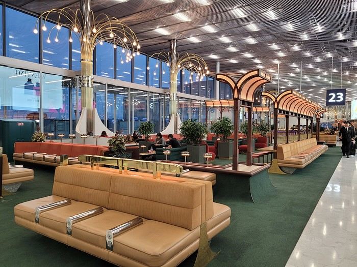
Then, an in-depth exploration of Doha Airport thanks to (or because of) a loooong layover:
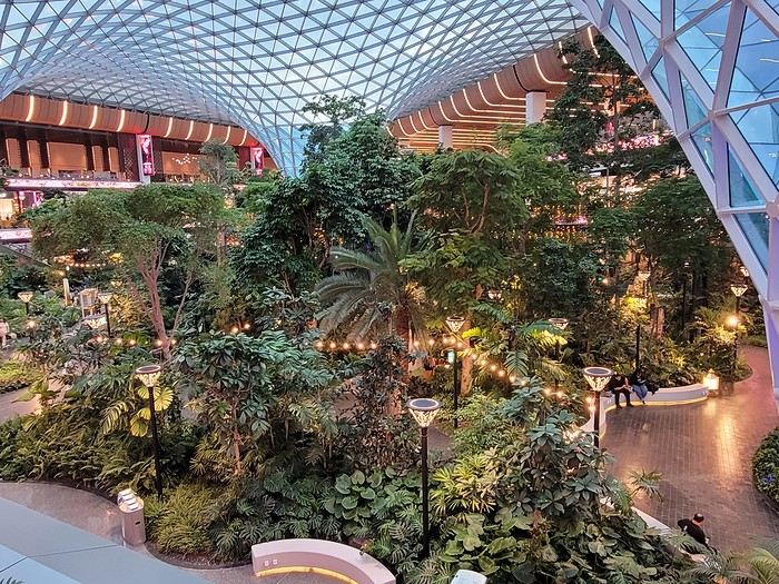
And finally, arrival at the tiny Mahé airport where we step onto the tarmac feeling like we’ve walked into a steam room
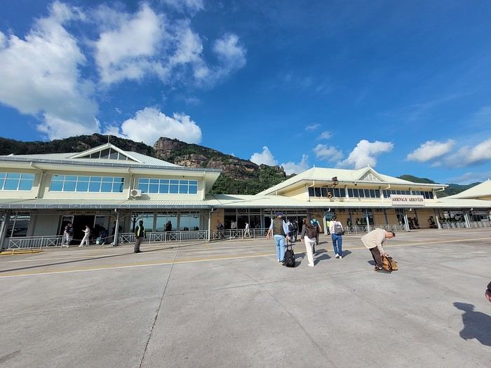 Baggage claim is quick, the shuttle to the port is on time, the ferry is punctual (we, on the other hand, are *very* early for it ), and there’s Praslin in sight:
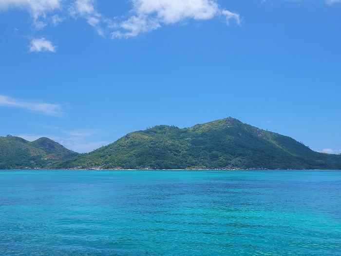
... with a sneak peek of the sea’s colors 🙂 Quick note on the photos: most were taken with a smartphone, and the colors are a bit more saturated than in real life (I did bring my hybrid camera, but in the end, I barely used it since it wasn’t very practical to lug around on the water or for snorkeling).
We pick up the car (a Grand i10 instead of a Picanto) from a muddy parking lot (it just rained) and off we go—of course, with a windshield wiper instead of the turn signal 😎, left-hand driving obliges. In just a few minutes, we arrive at our accommodation for these 4 nights on Praslin (Oh, and now the "lien" tab isn’t working! ) We’re blown away by the view from the terrace:
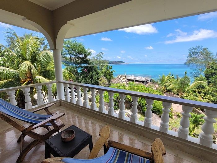
Then by the view from the little shared terrace on a promontory:
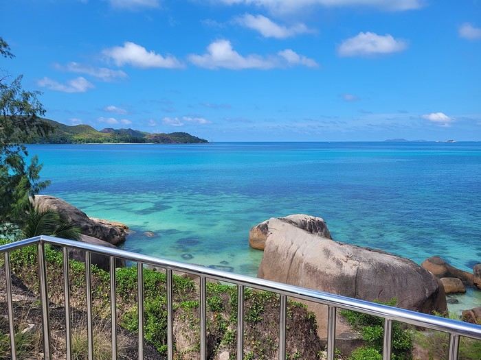 Before heading to test the water temperature on the other side of the road, at Anse Boudin, and spotting our first fish.
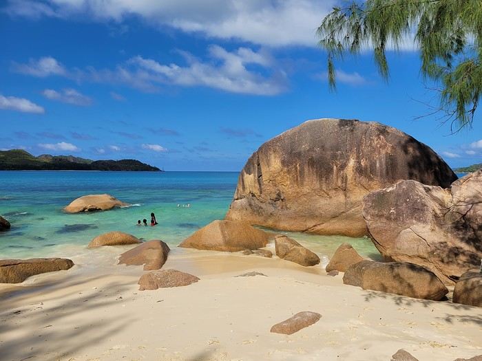
Saturday 03/22: Flight to Mahé with Qatar Airways (no—or rather, no more—direct flights from Paris 😕) A nice surprise at CDG with the discovery of a new lounge in Terminal 1
Then, an in-depth exploration of Doha Airport thanks to (or because of) a loooong layover:
And finally, arrival at the tiny Mahé airport where we step onto the tarmac feeling like we’ve walked into a steam room
Baggage claim is quick, the shuttle to the port is on time, the ferry is punctual (we, on the other hand, are *very* early for it ), and there’s Praslin in sight:... with a sneak peek of the sea’s colors 🙂 Quick note on the photos: most were taken with a smartphone, and the colors are a bit more saturated than in real life (I did bring my hybrid camera, but in the end, I barely used it since it wasn’t very practical to lug around on the water or for snorkeling).
We pick up the car (a Grand i10 instead of a Picanto) from a muddy parking lot (it just rained) and off we go—of course, with a windshield wiper instead of the turn signal 😎, left-hand driving obliges. In just a few minutes, we arrive at our accommodation for these 4 nights on Praslin (Oh, and now the "lien" tab isn’t working! ) We’re blown away by the view from the terrace:
Then by the view from the little shared terrace on a promontory:
Before heading to test the water temperature on the other side of the road, at Anse Boudin, and spotting our first fish.
So where are they and what are they doing?
This catchy and somewhat mysterious title comes from several questions I’ve been asking myself.
VF has been back open for a reasonable number of weeks and months now. The number of visitors overall matches past averages, but the number of members online in the last 24 hours seems relatively lower than what we used to see.
Yet, to my surprise, I’m seeing fewer travel journals, way fewer messages, and way fewer questions. I don’t see many new registered users online, and I notice a number of members who are logged in but either aren’t participating or have stopped participating.
Something’s not adding up for me because, in my opinion, VF is still appealing, and I don’t see which other sites could really compete.
Was there a real break between pre- and post-Covid? Does it just take more time for some people to discover the site or learn that it’s active again? Do people now prefer quick consumption on sites like FB or others I’m not familiar with? Where have the site’s old-timers gone, and what are they doing with their time now? What’s really going on here?
VF has been back open for a reasonable number of weeks and months now. The number of visitors overall matches past averages, but the number of members online in the last 24 hours seems relatively lower than what we used to see.
Yet, to my surprise, I’m seeing fewer travel journals, way fewer messages, and way fewer questions. I don’t see many new registered users online, and I notice a number of members who are logged in but either aren’t participating or have stopped participating.
Something’s not adding up for me because, in my opinion, VF is still appealing, and I don’t see which other sites could really compete.
Was there a real break between pre- and post-Covid? Does it just take more time for some people to discover the site or learn that it’s active again? Do people now prefer quick consumption on sites like FB or others I’m not familiar with? Where have the site’s old-timers gone, and what are they doing with their time now? What’s really going on here?
Tuscany: Arezzo province and the Siena area
So happy the forum reopened last October!!!
I’ve started reading again (posts, travel journals) and chiming in on a few discussions. Now I’m stepping it up by writing a new travel journal—I’ve already posted a few between 2018 and 2020.
My latest trip was to Italy from August 27 to September 26, 2024. As the title says, it was a wander through Tuscany in parts of the region that aren’t the most visited. No Firenze-Siena-Pisa trilogy, no San Gimignano; there’ll be a quick detour into Siena, but I’ll skip the best-known sights. That choice, plus traveling in September, should help dodge overtourism. It worked out—crowds were light, sometimes very light, the whole way. Here’s the practical rundown: - a long trip outside peak season (ah, retirees!) - solo camping (caravan) - a mix of activities (hiking, mountain biking, sightseeing) in places that aren’t always packed with tourists. Still, I don’t feel like I ended up in some hidden-away spots. Not sure if this will draw any readers.
DAY 1: Tuesday, August 27, 2024 The heat was intense on the drive in across the plain; two big storms—more rain and hail than lightning and thunder—threw the weather off, the first near Imola, the second on the four-lane road up the Savio valley. I left the Cesena-Roma four-lane at the Verghereto exit and climbed up to Balze (1,100 meters). The campsite is even higher (1,200 meters), in the forest near the source of the Tevere (Tiber). Staying up here will cut down on driving for the first part of the trip: a route through the Appennino (Apennines) on the border between Toscana and Emilia-Romagna. The temperature was surprisingly mild for the altitude, the air thick with moisture by late afternoon. I drove back down from the campsite to Balze (2 km on the road) to grab groceries (it’s doable) and scout tomorrow’s hike. .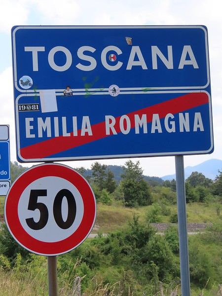
The endpoint of the planned hike is just a few meters from this sign (the trail crosses this road about 3 km from Balze). I realized Balze and the source of the Tevere (Tiber) are actually in Emilia-Romagna, not Toscana. I always thought the Tevere (Tiber), which flows toward Roma (Tyrrhenian side), started in Toscana! I’ll come back to this quirk in Day 3’s write-up.
My latest trip was to Italy from August 27 to September 26, 2024. As the title says, it was a wander through Tuscany in parts of the region that aren’t the most visited. No Firenze-Siena-Pisa trilogy, no San Gimignano; there’ll be a quick detour into Siena, but I’ll skip the best-known sights. That choice, plus traveling in September, should help dodge overtourism. It worked out—crowds were light, sometimes very light, the whole way. Here’s the practical rundown: - a long trip outside peak season (ah, retirees!) - solo camping (caravan) - a mix of activities (hiking, mountain biking, sightseeing) in places that aren’t always packed with tourists. Still, I don’t feel like I ended up in some hidden-away spots. Not sure if this will draw any readers.
DAY 1: Tuesday, August 27, 2024 The heat was intense on the drive in across the plain; two big storms—more rain and hail than lightning and thunder—threw the weather off, the first near Imola, the second on the four-lane road up the Savio valley. I left the Cesena-Roma four-lane at the Verghereto exit and climbed up to Balze (1,100 meters). The campsite is even higher (1,200 meters), in the forest near the source of the Tevere (Tiber). Staying up here will cut down on driving for the first part of the trip: a route through the Appennino (Apennines) on the border between Toscana and Emilia-Romagna. The temperature was surprisingly mild for the altitude, the air thick with moisture by late afternoon. I drove back down from the campsite to Balze (2 km on the road) to grab groceries (it’s doable) and scout tomorrow’s hike. .
The endpoint of the planned hike is just a few meters from this sign (the trail crosses this road about 3 km from Balze). I realized Balze and the source of the Tevere (Tiber) are actually in Emilia-Romagna, not Toscana. I always thought the Tevere (Tiber), which flows toward Roma (Tyrrhenian side), started in Toscana! I’ll come back to this quirk in Day 3’s write-up.
Martine and DD in Colorado and Utah
Hello everyone! 🙂
So many silent months, and now Voyage Forum is accessible again. That’s cool because we can pick up our discussions for our mutual enjoyment.
I hope everyone is doing well and that you’ve been able to take some great trips, whether to the USA or elsewhere.
In September 2020, we had planned a round trip to explore Colorado, but unfortunately, a nasty virus messed up our plans, closing borders and keeping us stuck at home. Luckily for us, canceling the car, flights, and accommodations didn’t cost us a thing—everything was refunded.
In 2023, a loop from Las Vegas let us revisit places we’d seen in 2017 and discover new ones, this time spending more time at each stop with some lovely hikes.
In 2024, we finally revisited the 2020 plan, and I’ll start with that.
However, unforeseen circumstances mean I have much less time than before, so I’ll keep my trip reports shorter (ha ha ha—you’ll have less of my prose to endure).
Another change: for those who remember the "Gang of Four crazy sixty-somethings," it was just DD and me this time. Our dear Mimi and Maumau left the Var to focus on raising horses and can’t leave their little green paradise to join us anymore. We were unfortunately much tamer without them.
We traveled from September 11 to October 3.
The itinerary
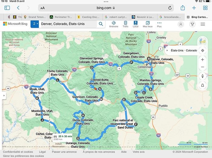
Day 1: Flight Marseille-Paris-Denver, then Manitou Springs (133 km) Day 2: Manitou Springs (49 km) Day 3: Cripple Creek (104 km) Day 4: Salida (254 km) Day 5: Great Sand Dunes (231 km) Day 6: Durango (283 km) Day 7: Durango (Durango-Silverton train) Day 8: Ouray (121 km) Day 9: Ouray (Perimeter Trail hike) Day 10: Cortez (213 km) Day 11: Cortez (Mesa Verde National Park, 134 km) Day 12: Monticello (268 km, detour to Chesler Park) Day 13: Moab (171 km, Delicate Arch) Day 14: Moab (98 km, Fisher Towers) Day 15: Moab (171 km, Canyonlands) Day 16: Fruita (210 km, Colorado National Monument) Day 17: Crested Butte (224 km via Kebler Pass) Day 18: Crested Butte (57 km) Day 19: Glenwood Springs (150 km) Day 20: Glenwood Springs (118 km, Rifle State Park) Day 21: Georgetown (258 km via Independence Pass) Day 22: Denver (123 km), then return flight
We speak very little English. We spent 21 nights there and covered a 3,400 km loop by car and 160 km on foot (we’re still trying to hike while we’re in shape) from Denver in September 2024. We wanted this road trip to help us explore Colorado a bit more—we’d only spent 6 nights there in 2019—and to see it during the fall foliage season. We also wanted to return to Utah (we love Moab) to enjoy its red rocks, which we adore.
In the prices you see (some in euros, others in dollars), I’ve included bank fees and exchange charges. The flights, car, and parking were paid by credit card when we booked in February. Usually, we book around November, but some obligations kept us from doing it earlier. We downloaded the MPC (Mobile Passport Control) app on our phone, which saved us time at immigration.
📊 **Budget: just under 8,500 € for both of us, all included**
📊 **Flights** Marseille-Paris (CDG)-Denver: 2,152 € for both of us, with one checked bag each
📊 **ESTA and America the Beautiful Pass** The ones from our 2023 road trip were still valid
📊 **Parking at Marseille airport: 122 €**
📊 **Car: Nissan Rogue (the French X-Trail) from Hertz: 1,165 €** By booking through Air France (and earning miles), we got a 15% discount. Hertz offers a free Hertz Gold Plus Rewards program, which gives us priority counter service.
📊 **Accommodation: 3,050 €** We stayed in motels and hotels of various ranges (from 100 € to 270 € per night, depending on the city), all booked through Hotels.com or Booking. Booking sometimes offers cheaper rates if you book via the "Booking mobile" app. We also got some preferential rates thanks to our Genius 2 status. Out of 21 nights, only one place didn’t include breakfast.
📊 **Other expenses (activities booked by credit card before leaving)** Durango-Silverton train: 210 € (we booked the enclosed vintage coach in March) Mesa Verde: Balcony House: 15.15 € (booked 14 days before the visit) Timed-entry passes for Arches National Park: 6 € for 3 days (booked June 1 for September entries via http://récreation.gov/). We booked three different days to play with the weather.
📊 **Supplementary insurance with AVA: 204 €** (due to our age 😅 and the high cost of medical consultations in the USA)
📊 **Cash: 1,540 €** We left with 1,000 € exchanged before departure and made two withdrawals (500 $ and 200 $). This cash was used to pay for: - Evening restaurants and tips (between 70 $ and 95 $ for two meals and two drinks) - Two state parks: Dead Horse State Park (20 $) and Rifle State Park (10 $) - The Monarch Pass gondola (24 $) - Midday picnics - Gas (slightly cheaper with cash): 204 $ for 3,400 km - Personal souvenirs and little treats.
Like in our previous road trips, we didn’t rent a GPS. We used the offline GPS app Here We Go, for which we’d downloaded maps of Colorado and Utah from France, as well as a new offline app called Organic Maps as a backup—though we didn’t end up needing it.
❤️❤️❤️ **Highlights (there are so many!)** 📍 The stunning landscapes of Colorado, especially with the fall colors 📍 A step back in time at the old farm in Florissant Fossil Beds National Monument 📍 The prairies of Cripple Creek and the mining remnants of the Vindicator Trail 📍 The cheeky chipmunks in the ghost town of St. Elmo 📍 Great Sand Dunes and its soft sand 📍 The steam train between Durango and Silverton: we’re glad we chose the round-trip because it rained heavily on the way there, but we got to enjoy the scenery on the way back when the sun came out 📍 The unexpected meet-up with Michèle from the group outside a restaurant in Durango 📍 The hot springs in Ouray 📍 Mesa Verde and its still-vibrant past 📍 The red rocks of Moab and Delicate Arch at sunset 📍 The lace-like Fisher Towers and the view from the end of the trail 📍 The gorgeous Route 128 leading to Colorado National Monument—small, easy to visit, and so beautiful 📍 The colors of the fabulous Kebler Pass, Crested Butte, and especially the hike through the golden aspens (Lower and Upper Loop) 📍 The waterfalls at Rifle State Park 📍 The tundra of Independence Pass 📍 The Halloween decorations in Georgetown and Idaho Springs
😞😞 **Flops (there are very few!)** 📍 The viewpoints we missed because they weren’t well-marked or we didn’t see the signs 📍 The closure of some hiking trails (Hanging Lake and parts of Canyonlands) and the Sal Mountain Loop road, which kept us from accessing it 📍😢 The Chesler Park hike we had to cut short due to poor time management—180 km between our stop in Cortez meant we didn’t arrive until 10:30 AM, way too late for a 17 km hike.
Hope this helps! Have a great evening, everyone, and see you soon! 😊
The itinerary
Day 1: Flight Marseille-Paris-Denver, then Manitou Springs (133 km) Day 2: Manitou Springs (49 km) Day 3: Cripple Creek (104 km) Day 4: Salida (254 km) Day 5: Great Sand Dunes (231 km) Day 6: Durango (283 km) Day 7: Durango (Durango-Silverton train) Day 8: Ouray (121 km) Day 9: Ouray (Perimeter Trail hike) Day 10: Cortez (213 km) Day 11: Cortez (Mesa Verde National Park, 134 km) Day 12: Monticello (268 km, detour to Chesler Park) Day 13: Moab (171 km, Delicate Arch) Day 14: Moab (98 km, Fisher Towers) Day 15: Moab (171 km, Canyonlands) Day 16: Fruita (210 km, Colorado National Monument) Day 17: Crested Butte (224 km via Kebler Pass) Day 18: Crested Butte (57 km) Day 19: Glenwood Springs (150 km) Day 20: Glenwood Springs (118 km, Rifle State Park) Day 21: Georgetown (258 km via Independence Pass) Day 22: Denver (123 km), then return flight
We speak very little English. We spent 21 nights there and covered a 3,400 km loop by car and 160 km on foot (we’re still trying to hike while we’re in shape) from Denver in September 2024. We wanted this road trip to help us explore Colorado a bit more—we’d only spent 6 nights there in 2019—and to see it during the fall foliage season. We also wanted to return to Utah (we love Moab) to enjoy its red rocks, which we adore.
In the prices you see (some in euros, others in dollars), I’ve included bank fees and exchange charges. The flights, car, and parking were paid by credit card when we booked in February. Usually, we book around November, but some obligations kept us from doing it earlier. We downloaded the MPC (Mobile Passport Control) app on our phone, which saved us time at immigration.
📊 **Budget: just under 8,500 € for both of us, all included**
📊 **Flights** Marseille-Paris (CDG)-Denver: 2,152 € for both of us, with one checked bag each
📊 **ESTA and America the Beautiful Pass** The ones from our 2023 road trip were still valid
📊 **Parking at Marseille airport: 122 €**
📊 **Car: Nissan Rogue (the French X-Trail) from Hertz: 1,165 €** By booking through Air France (and earning miles), we got a 15% discount. Hertz offers a free Hertz Gold Plus Rewards program, which gives us priority counter service.
📊 **Accommodation: 3,050 €** We stayed in motels and hotels of various ranges (from 100 € to 270 € per night, depending on the city), all booked through Hotels.com or Booking. Booking sometimes offers cheaper rates if you book via the "Booking mobile" app. We also got some preferential rates thanks to our Genius 2 status. Out of 21 nights, only one place didn’t include breakfast.
📊 **Other expenses (activities booked by credit card before leaving)** Durango-Silverton train: 210 € (we booked the enclosed vintage coach in March) Mesa Verde: Balcony House: 15.15 € (booked 14 days before the visit) Timed-entry passes for Arches National Park: 6 € for 3 days (booked June 1 for September entries via http://récreation.gov/). We booked three different days to play with the weather.
📊 **Supplementary insurance with AVA: 204 €** (due to our age 😅 and the high cost of medical consultations in the USA)
📊 **Cash: 1,540 €** We left with 1,000 € exchanged before departure and made two withdrawals (500 $ and 200 $). This cash was used to pay for: - Evening restaurants and tips (between 70 $ and 95 $ for two meals and two drinks) - Two state parks: Dead Horse State Park (20 $) and Rifle State Park (10 $) - The Monarch Pass gondola (24 $) - Midday picnics - Gas (slightly cheaper with cash): 204 $ for 3,400 km - Personal souvenirs and little treats.
Like in our previous road trips, we didn’t rent a GPS. We used the offline GPS app Here We Go, for which we’d downloaded maps of Colorado and Utah from France, as well as a new offline app called Organic Maps as a backup—though we didn’t end up needing it.
❤️❤️❤️ **Highlights (there are so many!)** 📍 The stunning landscapes of Colorado, especially with the fall colors 📍 A step back in time at the old farm in Florissant Fossil Beds National Monument 📍 The prairies of Cripple Creek and the mining remnants of the Vindicator Trail 📍 The cheeky chipmunks in the ghost town of St. Elmo 📍 Great Sand Dunes and its soft sand 📍 The steam train between Durango and Silverton: we’re glad we chose the round-trip because it rained heavily on the way there, but we got to enjoy the scenery on the way back when the sun came out 📍 The unexpected meet-up with Michèle from the group outside a restaurant in Durango 📍 The hot springs in Ouray 📍 Mesa Verde and its still-vibrant past 📍 The red rocks of Moab and Delicate Arch at sunset 📍 The lace-like Fisher Towers and the view from the end of the trail 📍 The gorgeous Route 128 leading to Colorado National Monument—small, easy to visit, and so beautiful 📍 The colors of the fabulous Kebler Pass, Crested Butte, and especially the hike through the golden aspens (Lower and Upper Loop) 📍 The waterfalls at Rifle State Park 📍 The tundra of Independence Pass 📍 The Halloween decorations in Georgetown and Idaho Springs
😞😞 **Flops (there are very few!)** 📍 The viewpoints we missed because they weren’t well-marked or we didn’t see the signs 📍 The closure of some hiking trails (Hanging Lake and parts of Canyonlands) and the Sal Mountain Loop road, which kept us from accessing it 📍😢 The Chesler Park hike we had to cut short due to poor time management—180 km between our stop in Cortez meant we didn’t arrive until 10:30 AM, way too late for a 17 km hike.
Hope this helps! Have a great evening, everyone, and see you soon! 😊
The 4000 Islands (Southern Laos)
PAKSE AND THE BOLAVENS PLATEAU
Bolavens (or "Bolovens" – "the region of the Lavens," an old tribe).
PAKSE
A sleepy town, but packed with backpackers in transit between Laos and Cambodia. The streets are numbered, but since there are no signs, you just have to figure it out (rumor has it the signs have been planned for years; luckily, the center isn’t big). Tons of small hotels, including the well-known Sabaidy 2 on Street 20, a big bazaar catering to all budgets, from dark dorms with shared bathrooms to real rooms with terraces or balconies. Since it’s so popular, booking ahead is recommended. My favorite: the Sala Champa, pricier but with two large terraces, one with a bar, and especially a terrace restaurant I consider the best in Pakse (try the divine steamed fish with lemongrass + Lao Gold beer, a rare delight; ask for room 100, with a big terrace). More upscale, the lovely Résidence Sisouk, run by the very classy and French-speaking Mme Sisouk, from the wealthy Lao Sisouk family, the country’s top coffee producer and one of those francophone families you encounter here and there around the world, where class and culture reign – and perfect French. Delicious pastries and, of course, extraordinary coffee tastings. Similar prices at the Pakse Hotel, run by French owners and famous for its rooftop bar-restaurant (great view!).
Tons of restaurants besides those at Sala Champa and Pakse Hotel: from Dao Lin and Sabaidee at the corner of Street 20 and 13, to a decent Indian place (Hassan) and a nice, cheap spot, the Lao Restaurant & Bar, where you can enjoy Lao cuisine for just a few kips, both also on Street 20. You can feast on grilled fish at the countless riverside stalls along the Mekong.
Pakse is home to the famous Yves, a Belgian married to a Lao woman, Noy, who opened the travel agency Miss Noy. He’ll go out of his way to help tourists; he’s incredible, the real tourism office for the region, with maps, endless advice, and every weekday at 6 PM, a full-blown lecture on the Bolavens and the 4000 Islands. A bunch of young travelers listen intently to his explanations about the whole area (he hands out a well-made photocopied map). He also rents bikes and has an internet café with computers that, miraculously, work perfectly. He’s so popular that in high season, you need to book a motorbike 2-3 days in advance (but if he’s out – and he has 40 – he’ll find one for you).
THE BOLAVENS PLATEAU
Plateaus just aren’t my thing – flat-lands! There are some relatively high peaks in the middle, but they’re only accessible by trekking. You can do a small loop from Pakse-Tad Lo-Thateng-Pakson-Pakse, or a big one from Tad Lo to Sekong, then head south to join the Paksong-Pakse road. Starting in the north, the Phu Xam waterfalls are okay (interesting local minority village-museum to the right of the parking lot, and a terrace restaurant above the small falls). Well, they’re on the way, so you might as well see them! After that, a boring road leads to the Tad Lo waterfalls, with tons of small hotels. I chose the big blue house by the river at the right corner of the bridge, the Sipaseth GH, with cute little bungalows in the garden, 4 rooms with balconies overlooking the river, and great food on the terrace facing the falls. **Avoid at all costs**: the Saisee GH, once nice with its little stilt houses by the falls, but now a monument to filth, indifference, and rudeness (confirmed by several people, unanimous on the issue). Luckily, the lovely Tad Lo Lodge, with its bungalows by the falls and gourmet restaurant right above them – not cheap at all – finally built small houses in the woods on the other side for $25.
The next morning, I’d had enough of plateaus, so I took a small loop heading south from Tad Lo to Thateng, and there, a wonder 5 km south of town: the Sinouk Resort. It’s like stepping into *Gone with the Wind* or the Chevalier de Leyritz’s Martinique. In the middle of the Sisouk family’s 34-hectare coffee plantation, a huge garden with three large colonial-style houses: one by the river and pond with a suite + 3 luxury rooms + a small, cozy one for $40 (that’s where I stayed), one with 4 superior rooms for $60, and a very large one overlooking everything with 6 luxury rooms ($60) + 2 huge suites for $90. Of course, it’s all decorated with antique furniture, local knick-knacks, and antiques; there’s a pool, a beautiful restaurant with two terraces, one overlooking a large pond and one by its edge. The food and service are impeccable, and the coffee: from espresso with whipped cream to green tea or wild honey cappuccino… too bad it keeps you up, or you’d sip it all evening (and morning, and afternoon, and in between). In short, a dream!
Back to Pakse via Paksong (what a dump!) and the Tad Fane waterfalls, those are spectacular – twin sisters plunging 200 meters. You can hike down to swim at the bottom (1-hour jungle trek round trip). Across the way, the nice Tad Fane Resort (small houses and a big terrace-restaurant facing the falls).
I think I missed the Katamkok waterfalls, but I don’t believe it – all these falls can’t compare to Ban Gioc Falls in northern Vietnam!!!
CHAMPASAK AND THE 4000 ISLANDS
CHAMPASAK
Even sleepier than Pakse! To avoid the ferry, cross the new Mekong bridge in Pakse, and after about 10 km, turn left at the big "Phaphinoy" sign (the first village in town). When you arrive, turn at the "River Resort" sign. A sumptuous resort on the Mekong, developed with American capital – pure luxury (they even have their own rice field and vegetable garden for the restaurant). Continuing on, you’ll come across the very pleasant Anouxa GH, where I had dinner and stayed. Small bungalows facing the river, garden rooms, and two large wooden houses with huge family rooms + a big terrace on the Mekong, and the food is great! They rent bikes and motorbikes. Further to the right, the pricey Inthira Hotel, which I found uninteresting since it’s on the road instead of by the Mekong. There’s also a Folie Lodge on Don Daeng Island, which I didn’t visit (the word "Folie" is justified: crazy prices, up to $200 and more).
A few nice wats and, of course, Wat Phou, Laos’ most important archaeological site, 10 km south of Champassak in the plains and on the mountainside (the stairs are a killer!). Watch out for the scorching heat, and it closes at 4:30 PM. It’s not Angkor Wat, but it’s still worth the detour. Plan for 2 hours. Entry is 50,000 kips + 5,000 to park your motorbike.
KHIET NGON
To continue south to the 4000 Islands, you have to take the "ferry" (actually fun little things – two canoes joined by a platform; better not mess up when loading your motorbike!). Once on the other side, turn left, and you’ll hit National Road 13 (Pakse-Siphandone, the 4000 Islands), the most boring road I’ve ever been on, like Phnom Penh-Siem Reap – flat and nothing to see. BUT there’s a real gem worth checking out: Kiet Ngon. At Km 48, take the laterite road toward Attapeu (big sign: "Attapeu 155 km") and eat red dust for 8 km (toll: 20,000 kips), then turn right (signposted) onto a good track. You enter the beautiful Xe Pian National Park, where you can still find wild elephants, leopards, and tigers. You arrive at the entrance of the small village of Ban Khiet Ngon. On your right, a small concrete building with 4 decent, cheap rooms (60,000 kips), facing an old wooden house that serves as the tourism office and its "elephant parking" garden. This village is where you can go on an elephant ride (20,000 kips) to the top of Phou Asa, one of the most unusual places I’ve ever seen. You climb through the jungle and emerge onto a flat slate summit, completely bare – it really feels like the Moon! In the distance, an astonishing site built to commemorate a victory by Lao nationalists over Siamese invaders in the 19th century (so the site isn’t 1,000 years old, as the locals claim). A vast archaeological site with an enclosure 180 m by 50 m, marked by 2-meter-high walls and columns made of slate stacked without mortar. At the back, a ruined temple and a tower. Beautiful views of the whole region. Popular with tourists arriving by minibus from Pakse. The elephant rides in a line aren’t my thing, so they tell you it’s forbidden to ride a motorbike, but I did it anyway without any issues – except for the unhappy looks from the mahouts (turn right at the village entrance, sign for "Phou Asa").
If you’ve got the funds, follow the signs for "Kingfisher Lodge" and arrive at Laos’ first ecolodge, developed by a Lao-Italian family. Lovely stilt houses (750,000 kips with breakfast) and 2 bungalows with just fans (250,000 kips). A small two-story wooden building with a restaurant and a terrace by a pond – the bonus: in the evening, wild elephants and buffalo come to drink with you. Booking ahead is recommended since it’s popular with groups from Pakse.
Paper guides also mention the more remote village of Ban Papho, deep in the jungle. There used to be elephant rides, but they’ve stopped. However, there are great treks in the national park (check with the Green Discovery agency in Pakse, which specializes in treks all over Laos).
THE 4000 ISLANDS
You continue on the mind-numbing Road 13 from Pakse and arrive at a brand-new bridge leading to Don Khong Island, where there’s nothing to see except two wats, so if you skip it, you’re not missing much. Next, the Nakasang sign, a small port with mini-ferries crossing the Mekong to Don Det Island. A celebrity, that one – one of those trashy spots for young people who think you can only have fun if you’re wasted on alcohol and drugs. A small street along the river, lined with guesthouses, restaurants, and bars – total chaos! Plus, there’s nothing to see on the island. So, take a tuk-tuk from the jetty, cross the dump, and arrive in a little paradise: Don Khone Island. I planned to stay 2 days but had to be dragged away after 6. A small main village with a dirt road, tons of guesthouses and great restaurants, and lots of beautiful things to see.
For lodging on Don Khone, it’s usually wooden bungalows with river-view terraces. Options range from the elegant and pricey Sala Done Hotel to Somphamit, Pan’s, Pakha GH, and many others. I found my haven away from everything: the little Phonvilay, 3 small bamboo buildings with 2 simple rooms each, terraces above a branch of the Mekong, and a big plus – a small path just to the right that goes down the riverbank, so 3-4 nice swims a day. All for 60,000 kips. To get there, turn right at the end of the bridge until you reach the wat, then take the small path to the river on the right of the wat’s wall.
For food, you’re spoiled for choice. I had all my dinners at the Cordon Bleu of the Fleur du Mékong. I don’t know how she does it, but even the simplest dishes have something extra. She’s famous for her curry (more like a mild stew) of duck or chicken with potatoes and sweet potatoes – a hearty treat. Go for the chicken; Asian ducks are all skin and bones. Her grilled fish is divine!
The island has quite a history: the Mekong upstream is over a kilometer wide (it’s said to reach 14 km during high water) and "falls" onto a rocky barrier. It splits into countless small branches, flowing wherever there’s a crack – hence the 4000 Islands and the impressive rapids. The French discovered this while trying to navigate the Mekong from Saigon to Luang Prabang and China – and bam, impassable! So they built a narrow-gauge railway starting from the south of the island, bypassing the rapids, and ending at the north of Don Det Island. You can see two rusted locomotives, discovered in the jungle in 1990 by a French explorer: one in the southern extension of the bridge and the other in Ban Hang Khone village at the southern tip of the island, both with large English signs and fascinating old photos explaining the whole history of the railway, abandoned when Road 13 was built along the 4000 Islands (the rails were removed, and the railway track is now an excellent trail).
Somphamit Rapids (Li Phi)
Locals call them Li Phi, meaning "the abyss of evil spirits" (the "phi" that Lao people still believe in), because they think the falls and rapids trap spirits, to the point that no one would ever swim there. It’s very dramatic. Entry fee: 35,000 kips. Small beach and a big restaurant with a terrace and thatched-roof tables.
Khon Pa Sai Rapids
A completely different kind, just as spectacular, and less crowded. Turn left at the bridge exit and go to the northern end of the island (Ban Khon Nua village), then continue south until you see a big yellow sign "Khon Pa Sai Waterfalls" pointing to a small path on the left. You arrive at a small suspension bridge with a corner restaurant and terrace where the food is great (I had most of my lunches there). Cross the bridge and follow the path to a spectacular site of falls and rapids. In the middle, you’ll see unique structures – gigantic fish traps over 10 meters long. During high water, each trap can catch up to 500 kg of fish (yes, five hundred) per day.
Ban Hang Khone
This is the "French port" at the southern tip of the island, where the Mekong, after its rapids, spreads out for kilometers – a real inland sea. This is where you can see the famous Irrawaddy dolphins in the morning or late afternoon (boat excursions). To get there, take the trail that was the old railway track, or continue south on the path past the Khon Pa Sai falls (but not by motorbike – the bridge is out). A huge concrete terrace, part of the old port facilities, with a magnificent panoramic view of the Mekong stretching into the distance. Just before, a small path leads to a big beach (with restaurants).
If you go back to Road 13 (or take a pirogue from Don Khone), further south are the Pha Peng Falls, Asia’s highest river falls (15 m). I didn’t go, but they’re said to be spectacular.
Bolavens (or "Bolovens" – "the region of the Lavens," an old tribe).
PAKSE
A sleepy town, but packed with backpackers in transit between Laos and Cambodia. The streets are numbered, but since there are no signs, you just have to figure it out (rumor has it the signs have been planned for years; luckily, the center isn’t big). Tons of small hotels, including the well-known Sabaidy 2 on Street 20, a big bazaar catering to all budgets, from dark dorms with shared bathrooms to real rooms with terraces or balconies. Since it’s so popular, booking ahead is recommended. My favorite: the Sala Champa, pricier but with two large terraces, one with a bar, and especially a terrace restaurant I consider the best in Pakse (try the divine steamed fish with lemongrass + Lao Gold beer, a rare delight; ask for room 100, with a big terrace). More upscale, the lovely Résidence Sisouk, run by the very classy and French-speaking Mme Sisouk, from the wealthy Lao Sisouk family, the country’s top coffee producer and one of those francophone families you encounter here and there around the world, where class and culture reign – and perfect French. Delicious pastries and, of course, extraordinary coffee tastings. Similar prices at the Pakse Hotel, run by French owners and famous for its rooftop bar-restaurant (great view!).
Tons of restaurants besides those at Sala Champa and Pakse Hotel: from Dao Lin and Sabaidee at the corner of Street 20 and 13, to a decent Indian place (Hassan) and a nice, cheap spot, the Lao Restaurant & Bar, where you can enjoy Lao cuisine for just a few kips, both also on Street 20. You can feast on grilled fish at the countless riverside stalls along the Mekong.
Pakse is home to the famous Yves, a Belgian married to a Lao woman, Noy, who opened the travel agency Miss Noy. He’ll go out of his way to help tourists; he’s incredible, the real tourism office for the region, with maps, endless advice, and every weekday at 6 PM, a full-blown lecture on the Bolavens and the 4000 Islands. A bunch of young travelers listen intently to his explanations about the whole area (he hands out a well-made photocopied map). He also rents bikes and has an internet café with computers that, miraculously, work perfectly. He’s so popular that in high season, you need to book a motorbike 2-3 days in advance (but if he’s out – and he has 40 – he’ll find one for you).
THE BOLAVENS PLATEAU
Plateaus just aren’t my thing – flat-lands! There are some relatively high peaks in the middle, but they’re only accessible by trekking. You can do a small loop from Pakse-Tad Lo-Thateng-Pakson-Pakse, or a big one from Tad Lo to Sekong, then head south to join the Paksong-Pakse road. Starting in the north, the Phu Xam waterfalls are okay (interesting local minority village-museum to the right of the parking lot, and a terrace restaurant above the small falls). Well, they’re on the way, so you might as well see them! After that, a boring road leads to the Tad Lo waterfalls, with tons of small hotels. I chose the big blue house by the river at the right corner of the bridge, the Sipaseth GH, with cute little bungalows in the garden, 4 rooms with balconies overlooking the river, and great food on the terrace facing the falls. **Avoid at all costs**: the Saisee GH, once nice with its little stilt houses by the falls, but now a monument to filth, indifference, and rudeness (confirmed by several people, unanimous on the issue). Luckily, the lovely Tad Lo Lodge, with its bungalows by the falls and gourmet restaurant right above them – not cheap at all – finally built small houses in the woods on the other side for $25.
The next morning, I’d had enough of plateaus, so I took a small loop heading south from Tad Lo to Thateng, and there, a wonder 5 km south of town: the Sinouk Resort. It’s like stepping into *Gone with the Wind* or the Chevalier de Leyritz’s Martinique. In the middle of the Sisouk family’s 34-hectare coffee plantation, a huge garden with three large colonial-style houses: one by the river and pond with a suite + 3 luxury rooms + a small, cozy one for $40 (that’s where I stayed), one with 4 superior rooms for $60, and a very large one overlooking everything with 6 luxury rooms ($60) + 2 huge suites for $90. Of course, it’s all decorated with antique furniture, local knick-knacks, and antiques; there’s a pool, a beautiful restaurant with two terraces, one overlooking a large pond and one by its edge. The food and service are impeccable, and the coffee: from espresso with whipped cream to green tea or wild honey cappuccino… too bad it keeps you up, or you’d sip it all evening (and morning, and afternoon, and in between). In short, a dream!
Back to Pakse via Paksong (what a dump!) and the Tad Fane waterfalls, those are spectacular – twin sisters plunging 200 meters. You can hike down to swim at the bottom (1-hour jungle trek round trip). Across the way, the nice Tad Fane Resort (small houses and a big terrace-restaurant facing the falls).
I think I missed the Katamkok waterfalls, but I don’t believe it – all these falls can’t compare to Ban Gioc Falls in northern Vietnam!!!
CHAMPASAK AND THE 4000 ISLANDS
CHAMPASAK
Even sleepier than Pakse! To avoid the ferry, cross the new Mekong bridge in Pakse, and after about 10 km, turn left at the big "Phaphinoy" sign (the first village in town). When you arrive, turn at the "River Resort" sign. A sumptuous resort on the Mekong, developed with American capital – pure luxury (they even have their own rice field and vegetable garden for the restaurant). Continuing on, you’ll come across the very pleasant Anouxa GH, where I had dinner and stayed. Small bungalows facing the river, garden rooms, and two large wooden houses with huge family rooms + a big terrace on the Mekong, and the food is great! They rent bikes and motorbikes. Further to the right, the pricey Inthira Hotel, which I found uninteresting since it’s on the road instead of by the Mekong. There’s also a Folie Lodge on Don Daeng Island, which I didn’t visit (the word "Folie" is justified: crazy prices, up to $200 and more).
A few nice wats and, of course, Wat Phou, Laos’ most important archaeological site, 10 km south of Champassak in the plains and on the mountainside (the stairs are a killer!). Watch out for the scorching heat, and it closes at 4:30 PM. It’s not Angkor Wat, but it’s still worth the detour. Plan for 2 hours. Entry is 50,000 kips + 5,000 to park your motorbike.
KHIET NGON
To continue south to the 4000 Islands, you have to take the "ferry" (actually fun little things – two canoes joined by a platform; better not mess up when loading your motorbike!). Once on the other side, turn left, and you’ll hit National Road 13 (Pakse-Siphandone, the 4000 Islands), the most boring road I’ve ever been on, like Phnom Penh-Siem Reap – flat and nothing to see. BUT there’s a real gem worth checking out: Kiet Ngon. At Km 48, take the laterite road toward Attapeu (big sign: "Attapeu 155 km") and eat red dust for 8 km (toll: 20,000 kips), then turn right (signposted) onto a good track. You enter the beautiful Xe Pian National Park, where you can still find wild elephants, leopards, and tigers. You arrive at the entrance of the small village of Ban Khiet Ngon. On your right, a small concrete building with 4 decent, cheap rooms (60,000 kips), facing an old wooden house that serves as the tourism office and its "elephant parking" garden. This village is where you can go on an elephant ride (20,000 kips) to the top of Phou Asa, one of the most unusual places I’ve ever seen. You climb through the jungle and emerge onto a flat slate summit, completely bare – it really feels like the Moon! In the distance, an astonishing site built to commemorate a victory by Lao nationalists over Siamese invaders in the 19th century (so the site isn’t 1,000 years old, as the locals claim). A vast archaeological site with an enclosure 180 m by 50 m, marked by 2-meter-high walls and columns made of slate stacked without mortar. At the back, a ruined temple and a tower. Beautiful views of the whole region. Popular with tourists arriving by minibus from Pakse. The elephant rides in a line aren’t my thing, so they tell you it’s forbidden to ride a motorbike, but I did it anyway without any issues – except for the unhappy looks from the mahouts (turn right at the village entrance, sign for "Phou Asa").
If you’ve got the funds, follow the signs for "Kingfisher Lodge" and arrive at Laos’ first ecolodge, developed by a Lao-Italian family. Lovely stilt houses (750,000 kips with breakfast) and 2 bungalows with just fans (250,000 kips). A small two-story wooden building with a restaurant and a terrace by a pond – the bonus: in the evening, wild elephants and buffalo come to drink with you. Booking ahead is recommended since it’s popular with groups from Pakse.
Paper guides also mention the more remote village of Ban Papho, deep in the jungle. There used to be elephant rides, but they’ve stopped. However, there are great treks in the national park (check with the Green Discovery agency in Pakse, which specializes in treks all over Laos).
THE 4000 ISLANDS
You continue on the mind-numbing Road 13 from Pakse and arrive at a brand-new bridge leading to Don Khong Island, where there’s nothing to see except two wats, so if you skip it, you’re not missing much. Next, the Nakasang sign, a small port with mini-ferries crossing the Mekong to Don Det Island. A celebrity, that one – one of those trashy spots for young people who think you can only have fun if you’re wasted on alcohol and drugs. A small street along the river, lined with guesthouses, restaurants, and bars – total chaos! Plus, there’s nothing to see on the island. So, take a tuk-tuk from the jetty, cross the dump, and arrive in a little paradise: Don Khone Island. I planned to stay 2 days but had to be dragged away after 6. A small main village with a dirt road, tons of guesthouses and great restaurants, and lots of beautiful things to see.
For lodging on Don Khone, it’s usually wooden bungalows with river-view terraces. Options range from the elegant and pricey Sala Done Hotel to Somphamit, Pan’s, Pakha GH, and many others. I found my haven away from everything: the little Phonvilay, 3 small bamboo buildings with 2 simple rooms each, terraces above a branch of the Mekong, and a big plus – a small path just to the right that goes down the riverbank, so 3-4 nice swims a day. All for 60,000 kips. To get there, turn right at the end of the bridge until you reach the wat, then take the small path to the river on the right of the wat’s wall.
For food, you’re spoiled for choice. I had all my dinners at the Cordon Bleu of the Fleur du Mékong. I don’t know how she does it, but even the simplest dishes have something extra. She’s famous for her curry (more like a mild stew) of duck or chicken with potatoes and sweet potatoes – a hearty treat. Go for the chicken; Asian ducks are all skin and bones. Her grilled fish is divine!
The island has quite a history: the Mekong upstream is over a kilometer wide (it’s said to reach 14 km during high water) and "falls" onto a rocky barrier. It splits into countless small branches, flowing wherever there’s a crack – hence the 4000 Islands and the impressive rapids. The French discovered this while trying to navigate the Mekong from Saigon to Luang Prabang and China – and bam, impassable! So they built a narrow-gauge railway starting from the south of the island, bypassing the rapids, and ending at the north of Don Det Island. You can see two rusted locomotives, discovered in the jungle in 1990 by a French explorer: one in the southern extension of the bridge and the other in Ban Hang Khone village at the southern tip of the island, both with large English signs and fascinating old photos explaining the whole history of the railway, abandoned when Road 13 was built along the 4000 Islands (the rails were removed, and the railway track is now an excellent trail).
Somphamit Rapids (Li Phi)
Locals call them Li Phi, meaning "the abyss of evil spirits" (the "phi" that Lao people still believe in), because they think the falls and rapids trap spirits, to the point that no one would ever swim there. It’s very dramatic. Entry fee: 35,000 kips. Small beach and a big restaurant with a terrace and thatched-roof tables.
Khon Pa Sai Rapids
A completely different kind, just as spectacular, and less crowded. Turn left at the bridge exit and go to the northern end of the island (Ban Khon Nua village), then continue south until you see a big yellow sign "Khon Pa Sai Waterfalls" pointing to a small path on the left. You arrive at a small suspension bridge with a corner restaurant and terrace where the food is great (I had most of my lunches there). Cross the bridge and follow the path to a spectacular site of falls and rapids. In the middle, you’ll see unique structures – gigantic fish traps over 10 meters long. During high water, each trap can catch up to 500 kg of fish (yes, five hundred) per day.
Ban Hang Khone
This is the "French port" at the southern tip of the island, where the Mekong, after its rapids, spreads out for kilometers – a real inland sea. This is where you can see the famous Irrawaddy dolphins in the morning or late afternoon (boat excursions). To get there, take the trail that was the old railway track, or continue south on the path past the Khon Pa Sai falls (but not by motorbike – the bridge is out). A huge concrete terrace, part of the old port facilities, with a magnificent panoramic view of the Mekong stretching into the distance. Just before, a small path leads to a big beach (with restaurants).
If you go back to Road 13 (or take a pirogue from Don Khone), further south are the Pha Peng Falls, Asia’s highest river falls (15 m). I didn’t go, but they’re said to be spectacular.
4x4 Expeditions in Southern Africa
Hi there,
Here’s a quick summary of six trips across Southern Africa, covering South Africa, Namibia, Botswana, Zimbabwe, and more. I traveled for a total of 23 months, over 100,000 km, and crossed 9 countries from South Africa to Tanzania. To do this, I bought an old Land Cruiser—a 1989 BJ 75 with a long chassis and a 3.4L turbo engine—which I converted into a bush camper set up for self-sufficiency in Africa: dual fuel tanks (235 L total) plus 2 x 20-liter jerry cans of diesel, 2 spare tires, a compressor, a toolbox with repair gear, a 50-liter water tank plus 2 x 30-liter and 2 x 10-liter jerry cans, a roof tent, multiple storage boxes, a sturdy roof rack, and even a paramotor. I also packed a first-aid kit and shipped the camper to South Africa by freight. My son joined me for part of the journey.
Key countries and highlights: South Africa in every direction, including its wildlife parks; in Namibia, the classics like Etosha, Fish River, Sossusvlei, Kaudum, but especially Damaraland and Kaokoland; in Botswana, a full loop of the Okavango, crossing the Makgadikgadi Pan, Moremi Park, the Linyanti River; and a tour of Zimbabwe with its national parks. During the last trip in 2020, due to COVID, we found refuge on a 250 km² Namibian farm with its own wildlife reserve. While crossing Damaraland and Kaokoland, we were completely self-sufficient, with supplies for over a month and 130 L of water.
In South Africa and Namibia, one issue that surprised us was the fences stretching for millions of kilometers along the tracks. Namibia is one and a half times the size of France but has a population of only about 2.5 million, mostly concentrated in a dozen small towns of 10,000 to 50,000 people—except for the capital, Windhoek (296,000). Paradoxically, compared to France, the space for freedom is extremely limited. Everything is private and requires payment. Even the Namib Desert is fenced... and you need a permit just to pick up a rock! For someone used to wild camping, it can get frustrating. Sometimes we ignored the rules, but the best solution is to ask a farmer (a real one, like a sheep or cattle rancher—not the ones with 3-meter electrified fences, which are lodges or private reserves) if you can camp on their land.
To truly enjoy freedom in Namibia, you need to venture into the northwest, along the Skeleton Coast, in Damaraland and Kaokoland. However, it’s essential to know your vehicle inside out, be a good mechanic, bring spare parts, and plan for potential breakdowns. Take care of your ride because a major issue out there can be a matter of survival. My motto: "Don’t break down, don’t break down, don’t break down..." Safari pros only venture into this region with two 4x4s. In Messum Crater, we met a couple waiting for rescue (thanks to a satellite device from their rental company) after their driveshaft broke. Keep in mind that in these areas, you’ll cover about 80 km in 8 hours.
Here are some of the issues we faced: a broken rear suspension leaf, several broken bolts on the front leaf springs, the spare tire mount breaking multiple times (replaced on the spot), a cracked water radiator in 1998 causing overheating and a seized valve stem in its guide, plus a bent rocker arm (field repair, valve adjustment, damaged head gasket, daily radiator refills, and a scratched cylinder—engine fully rebuilt upon return). Five roof rack mounts broke and were repaired at a technical high school in South Africa. The battery mount also broke (fixed with a steel plate found on the trail). The fuel filter clogged several times (changed or cleaned on the spot). A huge impact on the windshield from a piece of coal falling from a power plant supply truck (temporary repair with Araldite). The brake master cylinder failed in Marienfluss (repaired, seals replaced in Tsumeb). Multiple flat tires from acacia thorns. The rear door latch broke (homemade aluminum rod repair in Franschhoek). The voltmeter and ammeter failed (repaired on the spot). During the freight trip, despite locking the doors and having a partition between the front and back, someone managed to get in through the small side window, forced open the locks on two accessible storage boxes, and stole my tools (replaced later). A ball joint on the paramotor frame came loose mid-flight, damaging the wing and propeller (propeller shipped from France, homemade repair).
Health issues on the way to Tanzania: a painful sciatica and many sleepless nights (cortisone injection in Dodoma).
Kaokoland, Namibia—the northwest region: https://youtu.be/DzGepFsrnZs
Damaraland: https://youtu.be/DITQj8NvLZ4
Botswana: https://youtu.be/TEvDG0S62hg
Kaudom and Mohembo Parks: https://youtu.be/wq_Yf7jNLhw
Here’s a quick summary of six trips across Southern Africa, covering South Africa, Namibia, Botswana, Zimbabwe, and more. I traveled for a total of 23 months, over 100,000 km, and crossed 9 countries from South Africa to Tanzania. To do this, I bought an old Land Cruiser—a 1989 BJ 75 with a long chassis and a 3.4L turbo engine—which I converted into a bush camper set up for self-sufficiency in Africa: dual fuel tanks (235 L total) plus 2 x 20-liter jerry cans of diesel, 2 spare tires, a compressor, a toolbox with repair gear, a 50-liter water tank plus 2 x 30-liter and 2 x 10-liter jerry cans, a roof tent, multiple storage boxes, a sturdy roof rack, and even a paramotor. I also packed a first-aid kit and shipped the camper to South Africa by freight. My son joined me for part of the journey.
Key countries and highlights: South Africa in every direction, including its wildlife parks; in Namibia, the classics like Etosha, Fish River, Sossusvlei, Kaudum, but especially Damaraland and Kaokoland; in Botswana, a full loop of the Okavango, crossing the Makgadikgadi Pan, Moremi Park, the Linyanti River; and a tour of Zimbabwe with its national parks. During the last trip in 2020, due to COVID, we found refuge on a 250 km² Namibian farm with its own wildlife reserve. While crossing Damaraland and Kaokoland, we were completely self-sufficient, with supplies for over a month and 130 L of water.
In South Africa and Namibia, one issue that surprised us was the fences stretching for millions of kilometers along the tracks. Namibia is one and a half times the size of France but has a population of only about 2.5 million, mostly concentrated in a dozen small towns of 10,000 to 50,000 people—except for the capital, Windhoek (296,000). Paradoxically, compared to France, the space for freedom is extremely limited. Everything is private and requires payment. Even the Namib Desert is fenced... and you need a permit just to pick up a rock! For someone used to wild camping, it can get frustrating. Sometimes we ignored the rules, but the best solution is to ask a farmer (a real one, like a sheep or cattle rancher—not the ones with 3-meter electrified fences, which are lodges or private reserves) if you can camp on their land.
To truly enjoy freedom in Namibia, you need to venture into the northwest, along the Skeleton Coast, in Damaraland and Kaokoland. However, it’s essential to know your vehicle inside out, be a good mechanic, bring spare parts, and plan for potential breakdowns. Take care of your ride because a major issue out there can be a matter of survival. My motto: "Don’t break down, don’t break down, don’t break down..." Safari pros only venture into this region with two 4x4s. In Messum Crater, we met a couple waiting for rescue (thanks to a satellite device from their rental company) after their driveshaft broke. Keep in mind that in these areas, you’ll cover about 80 km in 8 hours.
Here are some of the issues we faced: a broken rear suspension leaf, several broken bolts on the front leaf springs, the spare tire mount breaking multiple times (replaced on the spot), a cracked water radiator in 1998 causing overheating and a seized valve stem in its guide, plus a bent rocker arm (field repair, valve adjustment, damaged head gasket, daily radiator refills, and a scratched cylinder—engine fully rebuilt upon return). Five roof rack mounts broke and were repaired at a technical high school in South Africa. The battery mount also broke (fixed with a steel plate found on the trail). The fuel filter clogged several times (changed or cleaned on the spot). A huge impact on the windshield from a piece of coal falling from a power plant supply truck (temporary repair with Araldite). The brake master cylinder failed in Marienfluss (repaired, seals replaced in Tsumeb). Multiple flat tires from acacia thorns. The rear door latch broke (homemade aluminum rod repair in Franschhoek). The voltmeter and ammeter failed (repaired on the spot). During the freight trip, despite locking the doors and having a partition between the front and back, someone managed to get in through the small side window, forced open the locks on two accessible storage boxes, and stole my tools (replaced later). A ball joint on the paramotor frame came loose mid-flight, damaging the wing and propeller (propeller shipped from France, homemade repair).
Health issues on the way to Tanzania: a painful sciatica and many sleepless nights (cortisone injection in Dodoma).
Kaokoland, Namibia—the northwest region: https://youtu.be/DzGepFsrnZs
Damaraland: https://youtu.be/DITQj8NvLZ4
Botswana: https://youtu.be/TEvDG0S62hg
Kaudom and Mohembo Parks: https://youtu.be/wq_Yf7jNLhw
The "Must-Sees" of the American West
This adventure began during Covid... Yep, Covid turned a lot of things upside down, but most of all, it kept us cooped up for a few months and stopped us from traveling for a while—even longer for a die-hard fan of the American West like me.
While borders were closed, I started imagining what an ideal itinerary might look like—one that would string together all the Southwest must-sees in just two weeks, during the best time of year: September and October. When the U.S. announced in September 2021 that borders would reopen in the coming weeks, I regained hope and began scouting flight tickets for a departure in September 2022.
But here’s the thing: tackling solo hikes, each one tougher than the last, right in the heart of the Wilderness, could be a risky—even reckless—endeavor for a father of three. After a quick chat with some virtual friends who are just as passionate about the Southwest as I am, with good physical condition and nearly the same list of must-visit spots, Franck and his brother Sullivan were in! 🙂
In November, we snagged flight tickets from Nice to San Francisco for the modest sum of 400 €, and a few days later, I booked a Toyota Tacoma pickup for 840 € !
It’s not cheap for just 15 days, and a pickup isn’t exactly ideal for luggage, but the prices for full-size 4x4s have become totally outrageous! Due to border closures, rental companies had to offload a lot of these big 4x4s, which tourists love. Then, supply and demand did the rest !
Franck and I spent the winter and spring trying to cram the equivalent of three weeks of hikes into two. But even with physical limits, we had to stay reasonable! Three to four months before departure, we entered the lotteries for different must-see spots: The Subway, Coyote Buttes North (home to the famous Wave), and Coyote Buttes South (CBS).
The Wave is the holy grail for any Southwest enthusiast. Since 2015, we’ve tried our luck with the online and on-site lotteries about ten times, but the spots are unfortunately limited: just 20 per day. A glimmer of hope, though—since early 2022, that number has increased to 64 people allowed per day, with 48 spots awarded via the online lottery.
After all three of us tried our luck for The Wave, on June 1st at exactly 5 PM, I got an email that started with, "Congratulations! You were successful in the Coyote Buttes North (The Wave) September 2022 Permit Lottery at Coyote Buttes North (The Wave)...". At 5:01 PM, I called Franck, whose dream it’s been for over 20 years—ever since the first photos were published in a travel magazine! He didn’t believe me when I told him, and I had to forward the email for him to finally accept the unbelievable: we were going to The Wave and all the incredible spots scattered across the protected area of Coyote Buttes North.
I’ve already been to Coyote Buttes South twice, but there are areas I couldn’t explore in the middle of summer because they were too remote. So, I had no trouble letting my buddies convince me to go back for a third time. Plus, given how hard it is to access, we had no trouble securing a permit online as long as we logged in at exactly 8 PM on the dot!
For The Subway, all three of us struck out. No big deal—we won at CBN and CBS!
Among the sites to visit, there are two that I’m particularly attached to because I know my chances of wanting to see them again are slim. The first is Angel Arch, one of the most legendary arches in the Southwest, due to its remoteness from any trace of civilization. To get there, the recommended hike is Upper Salt Creek, and you’re looking at a 50 km round-trip in an area with no water (in September) and populated by bears.
The second site is the Hopi Salt Trail, in Navajo land, which, after a very tough hike, lets you marvel at the turquoise-blue waters of the Little Colorado before it meets the Colorado River. The Hopi Salt Trail is, like The Wave, the holy grail for any Southwest enthusiast, and the windows of opportunity to see the water in that magical color are very short each year. For this, you have to monitor the Little Colorado’s gauges downstream from Cameron: if the level stays at its lowest for 10 consecutive days—meaning no rain—you can hope for turquoise water. The ideal period rarely exceeds 30 days a year, and it’s usually in June that all the stars align.
But unfortunately, one month before departure, while the flow rate at Cameron looked promising, several storms in September dashed our hopes of doing the Hopi Salt Trail, even at the end of the road trip.
We still had two consolation prizes, though:
After a last-minute cancellation, while keeping an eye out for available spots for The Subway, it turned out that three spots opened up exactly on the day we’d planned to go—so we rushed to grab them!! Regarding the 4x4 rental, the prices for full-size models dropped by several hundred dollars, and we ended up finding a Chevrolet Tahoe for less than $1000. A steal and a serious boost in comfort, so we could store all our gear and food without worry!
Here’s the initial plan in a perfect world: D1 The White Domes - Camping D2 Sunrise at The White Domes - The Subway D3 Coyote Buttes North D4 Coyote Buttes South - White Pocket D5 Wahweap Hoodoos - Sidestep Canyon - Colourful Canyon - White Rocks - Sunset at Yellow Rock D6 Broken Bow Arch - Reflection Canyon D7 Coyote Gulch D8 The Volcano (or The Oasis - Zebra Slot Canyon if the weather’s good) - North Caineville Mesa D9 The Needles: Squaw Canyon - Lost Canyon combo - Druid Arch - Chesler Park D10 Upper Salt Creek Day 1 - Camping D11 Upper Salt Creek Day 2 D12 Hopi-Navajo Territory: Ha Ho No Geh Canyon, Coal Mine Canyon, Bends of the Little Colorado D13 Grand Canyon: South Kaibab Trail and Bright Angel Trail D14 Upper East Zion: East Temple Loop, Jughandle Arch, Center of the Universe, and Checkerboard Mesa Summit And several backup options in case of bad weather, including Spencer Trail, West Cove, and Buffington Pockets.
Enough talking—time for action!
While borders were closed, I started imagining what an ideal itinerary might look like—one that would string together all the Southwest must-sees in just two weeks, during the best time of year: September and October. When the U.S. announced in September 2021 that borders would reopen in the coming weeks, I regained hope and began scouting flight tickets for a departure in September 2022.
But here’s the thing: tackling solo hikes, each one tougher than the last, right in the heart of the Wilderness, could be a risky—even reckless—endeavor for a father of three. After a quick chat with some virtual friends who are just as passionate about the Southwest as I am, with good physical condition and nearly the same list of must-visit spots, Franck and his brother Sullivan were in! 🙂
In November, we snagged flight tickets from Nice to San Francisco for the modest sum of 400 €, and a few days later, I booked a Toyota Tacoma pickup for 840 € !
It’s not cheap for just 15 days, and a pickup isn’t exactly ideal for luggage, but the prices for full-size 4x4s have become totally outrageous! Due to border closures, rental companies had to offload a lot of these big 4x4s, which tourists love. Then, supply and demand did the rest !
Franck and I spent the winter and spring trying to cram the equivalent of three weeks of hikes into two. But even with physical limits, we had to stay reasonable! Three to four months before departure, we entered the lotteries for different must-see spots: The Subway, Coyote Buttes North (home to the famous Wave), and Coyote Buttes South (CBS).
The Wave is the holy grail for any Southwest enthusiast. Since 2015, we’ve tried our luck with the online and on-site lotteries about ten times, but the spots are unfortunately limited: just 20 per day. A glimmer of hope, though—since early 2022, that number has increased to 64 people allowed per day, with 48 spots awarded via the online lottery.
After all three of us tried our luck for The Wave, on June 1st at exactly 5 PM, I got an email that started with, "Congratulations! You were successful in the Coyote Buttes North (The Wave) September 2022 Permit Lottery at Coyote Buttes North (The Wave)...". At 5:01 PM, I called Franck, whose dream it’s been for over 20 years—ever since the first photos were published in a travel magazine! He didn’t believe me when I told him, and I had to forward the email for him to finally accept the unbelievable: we were going to The Wave and all the incredible spots scattered across the protected area of Coyote Buttes North.
I’ve already been to Coyote Buttes South twice, but there are areas I couldn’t explore in the middle of summer because they were too remote. So, I had no trouble letting my buddies convince me to go back for a third time. Plus, given how hard it is to access, we had no trouble securing a permit online as long as we logged in at exactly 8 PM on the dot!
For The Subway, all three of us struck out. No big deal—we won at CBN and CBS!
Among the sites to visit, there are two that I’m particularly attached to because I know my chances of wanting to see them again are slim. The first is Angel Arch, one of the most legendary arches in the Southwest, due to its remoteness from any trace of civilization. To get there, the recommended hike is Upper Salt Creek, and you’re looking at a 50 km round-trip in an area with no water (in September) and populated by bears.
The second site is the Hopi Salt Trail, in Navajo land, which, after a very tough hike, lets you marvel at the turquoise-blue waters of the Little Colorado before it meets the Colorado River. The Hopi Salt Trail is, like The Wave, the holy grail for any Southwest enthusiast, and the windows of opportunity to see the water in that magical color are very short each year. For this, you have to monitor the Little Colorado’s gauges downstream from Cameron: if the level stays at its lowest for 10 consecutive days—meaning no rain—you can hope for turquoise water. The ideal period rarely exceeds 30 days a year, and it’s usually in June that all the stars align.
But unfortunately, one month before departure, while the flow rate at Cameron looked promising, several storms in September dashed our hopes of doing the Hopi Salt Trail, even at the end of the road trip.
We still had two consolation prizes, though:
After a last-minute cancellation, while keeping an eye out for available spots for The Subway, it turned out that three spots opened up exactly on the day we’d planned to go—so we rushed to grab them!! Regarding the 4x4 rental, the prices for full-size models dropped by several hundred dollars, and we ended up finding a Chevrolet Tahoe for less than $1000. A steal and a serious boost in comfort, so we could store all our gear and food without worry!
Here’s the initial plan in a perfect world: D1 The White Domes - Camping D2 Sunrise at The White Domes - The Subway D3 Coyote Buttes North D4 Coyote Buttes South - White Pocket D5 Wahweap Hoodoos - Sidestep Canyon - Colourful Canyon - White Rocks - Sunset at Yellow Rock D6 Broken Bow Arch - Reflection Canyon D7 Coyote Gulch D8 The Volcano (or The Oasis - Zebra Slot Canyon if the weather’s good) - North Caineville Mesa D9 The Needles: Squaw Canyon - Lost Canyon combo - Druid Arch - Chesler Park D10 Upper Salt Creek Day 1 - Camping D11 Upper Salt Creek Day 2 D12 Hopi-Navajo Territory: Ha Ho No Geh Canyon, Coal Mine Canyon, Bends of the Little Colorado D13 Grand Canyon: South Kaibab Trail and Bright Angel Trail D14 Upper East Zion: East Temple Loop, Jughandle Arch, Center of the Universe, and Checkerboard Mesa Summit And several backup options in case of bad weather, including Spencer Trail, West Cove, and Buffington Pockets.
Enough talking—time for action!
French company CFC
Hi
Has anyone sailed with the French company CFC? What do you think?
Haven’t seen many reviews about this company.
The Island of Pelops
October 7, 2023, is a sunny day in Milan. Since morning, in this light, I’m WhatsApping with Afrooz in Tehran, and I decide to call her. A lively, joyful conversation—French with that Farsi accent becomes a wonderful language. Suddenly, everything feels possible. Isfahan, Shiraz, Damavand, Yazd, Yazd, Yazd—a delicious word savored endlessly—become within reach. Iran, so longed for, is finally here. Pure joy, absolute enthusiasm. Six months to plan and relish a trip before living it.
Then I open *Le Monde*.
Aaaaaaaaaaaaaaaaaaaaaaaaaaaaaaaaaaaaaaaaaaaaaaaaaaaaaaaaaaaaaaaaaaaaaaaa
Frozen. Empty. No. We decide to wait, not to give up right away, pretending to believe—just a little, just to keep from collapsing—that with this wretched human race, the worst isn’t necessarily certain. It is.
So... meh, Madeira? The Azores? Uzbekistan (a pale substitute)? New Zealand? Greece. Again, always. Nestling into the only European promise we’ve been given. Indulging in illusions, for the pleasure of it.
So, train from Milan to Ancona (9 AM–12 PM), a typically Marchigiano lunch (Italy is paradise for food lovers), a stroll through the city, then at 4 PM boarding the *Olympic Champion*. Arrival in Patras the next afternoon, car rental, and off to Lepanto—Nafpaktos today—to reminisce about glorious victories and pay tribute to Cervantes, who lost a hand there before writing.
That’s the plan, anyway. The train is unusually on time. The ferry, replaced in the meantime by the *Hellenic Spirit* (why not? Even if it’s less suited to the season), is 3 hours late, then 4, no 5, then finally 6—oh wait, 7. And on top of that, it’s pouring rain in Ancona, and the port waiting room closes at 6 PM. Great...
At 11 PM, the ferry’s lights emerge in the pitch-black night. We jostle through the downpour, board, and sleep well in a cozy cabin with the white noise of the engines. Then:
 23 hours of rest. Of forgetting.
Then I open *Le Monde*.
Aaaaaaaaaaaaaaaaaaaaaaaaaaaaaaaaaaaaaaaaaaaaaaaaaaaaaaaaaaaaaaaaaaaaaaaa
Frozen. Empty. No. We decide to wait, not to give up right away, pretending to believe—just a little, just to keep from collapsing—that with this wretched human race, the worst isn’t necessarily certain. It is.
So... meh, Madeira? The Azores? Uzbekistan (a pale substitute)? New Zealand? Greece. Again, always. Nestling into the only European promise we’ve been given. Indulging in illusions, for the pleasure of it.
So, train from Milan to Ancona (9 AM–12 PM), a typically Marchigiano lunch (Italy is paradise for food lovers), a stroll through the city, then at 4 PM boarding the *Olympic Champion*. Arrival in Patras the next afternoon, car rental, and off to Lepanto—Nafpaktos today—to reminisce about glorious victories and pay tribute to Cervantes, who lost a hand there before writing.
That’s the plan, anyway. The train is unusually on time. The ferry, replaced in the meantime by the *Hellenic Spirit* (why not? Even if it’s less suited to the season), is 3 hours late, then 4, no 5, then finally 6—oh wait, 7. And on top of that, it’s pouring rain in Ancona, and the port waiting room closes at 6 PM. Great...
At 11 PM, the ferry’s lights emerge in the pitch-black night. We jostle through the downpour, board, and sleep well in a cozy cabin with the white noise of the engines. Then:
23 hours of rest. Of forgetting.
Retour d'une croisière Ponant sur les côtes bretonnes English translation pending
Bonjour à tous,
Bienvenue à tous si vous souhaitez embarquer une seconde fois cette saison* pour cette magnifique croisière sur les côtes françaises. Elle nous a conduit sur quelques-unes des très belles îles de la Bretagne et fait découvrir des paysages remarquables.
*CR de PapiJP35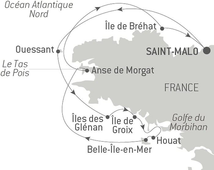
Samedi 29 août 2020, embarquement
Nous sommes depuis deux jours à Saint-Malo, et après qu’il ait plu toute la nuit, le ciel de ce matin est bas, lourd et noir. Nous nous y étions mentalement préparés. J’avais choisi cette semaine en prenant garde d’éviter celle des grandes marées (souvent propice au mauvais temps), mais la météo nous annonce tout de même une semaine catastrophique. Notre première préoccupation est d’aller vérifier que le bateau est bien arrivé. Rituel tellement plaisant, qui gonfle le cœur de joie.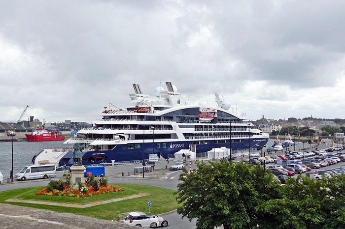 Nous marchons le long du port de plaisance sous ce lourd ciel breton, et oui, le Jacques Cartier est bien amarré au pied des remparts. La balade est très plaisante, le bateau est beau et parait imposant dans ce petit port à taille humaine, la ville est belle…. Et je monte sur mon petit nuage de bonheur pour ne plus en redescendre avant une semaine.
Pour la durée de la croisière Ponant nous a proposé de laisser la voiture sur un parking qui se situe à 2.7 km du port, le prix est de 3.30€ par jour et des navettes sont mises en place pour transférer les passagers jusqu’au bateau.
Nous avons cependant préféré laisser notre voiture au parking Qpark juste devant la porte d’entrée principale de la vieille ville parce que c’est un parking couvert, nous avons payé 55€ pour la semaine et nous sommes à 5 minutes à pieds du bateau (600m). Très bien, s’il ne pleut pas.
Après une très belle averse en début d’après-midi qui a vidé les rues de la ville en quelques minutes, nous embarquons à 16 h sous le soleil. Des tentes sont installées sur le port en guise de terminal de croisière, et dès notre arrivée nous sommes accueillis avec beaucoup de gentillesse et de prévenance.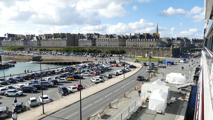 En dépit des mesures covid, nous arrivons à notre cabine en 20 minutes et nos bagages nous ont déjà précédés. Nous avons à ce moment le grand plaisir de découvrir que nous avons été surclassés au pont 4. Nous devons ce cadeau au Directeur des Départements Hôteliers de PONANT. En effet ce Monsieur était avec nous sur le LYRIAL en Corse, en télé travail 😉. Souvent mon mari a discuté avec lui et à la fin de la croisière il a dit qu’il nous réservait une surprise pour notre Croisière en Bretagne. Nous n’y pensions plus, et nous avons été contents et très touchés de cette généreuse surprise.
La différence entre les cabines du pont 3 et celles du pont 4 se porte au niveau du balcon. Au pont 3, la partie au-dessous de l’appui en bois est pleine et l’on ne voit pas la mer. Au pont 4 cette partie sous l’appui en bois est en verre et cela donne plus de lumière et une jolie vue lorsque l’on est assis.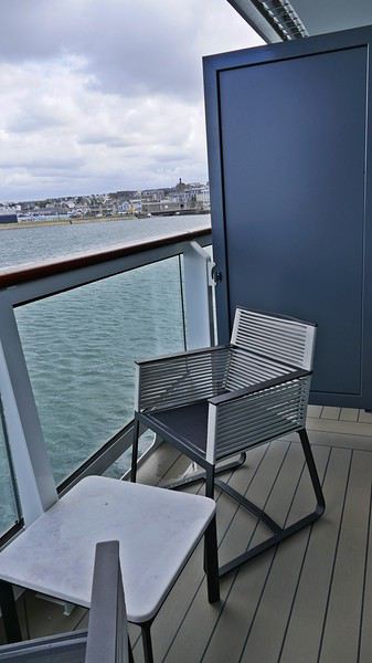 Le bateau est tout neuf, dans des tons très harmonieux, reposants, et clairs. La décoration est épurée dans des matières naturelles aux tons doux et confortables.
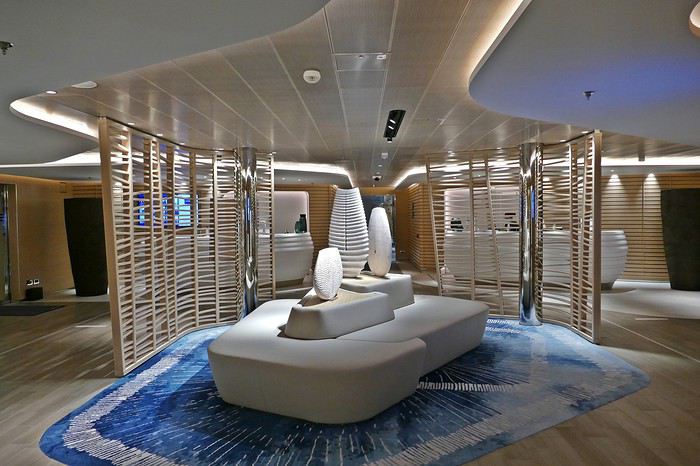 Très beau et original le plafond miroir du grand salon.
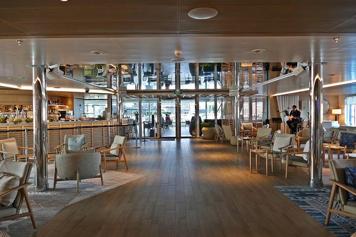 Et très lumineux le salon panoramique avec de larges baies vitrées qui permettent une vue très dégagée.
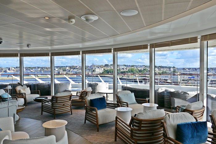 En juillet nous avions sur le LYRIAL des produits Hermès en petits flacons individuels, cette fois ce sont des produits Clarins en distributeurs, les marques françaises sont très présentes, dans tous les domaines, partout sur le bateau, y compris à table et dans la boutique.
Cette fois, nous sommes 68 passagers à embarquer sur cette croisière pour 107 membres d’équipage. Des naturalistes nous avons appris que la compagnie espérait 70 passagers par croisière pour être satisfaite de ces croisières dans les conditions hors normes et exceptionnelles de cet été 2020. Ils nous ont dit aussi que si cet objectif était atteint cette destination pourrait être reconduite l’année prochaine. Cette version est bien différente de ce que peuvent écrire certains journalistes et me semble plus cohérente. Qui a pu croire que des bateaux feraient le plein un été comme celui-ci ? Ces bateaux-là, eux, ne sont pas restés vides et à quai.
Ce programme sur les côtes françaises a été monté en trois mois, entre les contacts à prendre et les autorisations à obtenir, quand il faut deux ans habituellement pour établir un nouvel itinéraire. Ce qui est plutôt une belle prouesse.
*CR de PapiJP35
Samedi 29 août 2020, embarquement
Nous sommes depuis deux jours à Saint-Malo, et après qu’il ait plu toute la nuit, le ciel de ce matin est bas, lourd et noir. Nous nous y étions mentalement préparés. J’avais choisi cette semaine en prenant garde d’éviter celle des grandes marées (souvent propice au mauvais temps), mais la météo nous annonce tout de même une semaine catastrophique. Notre première préoccupation est d’aller vérifier que le bateau est bien arrivé. Rituel tellement plaisant, qui gonfle le cœur de joie.
Nous marchons le long du port de plaisance sous ce lourd ciel breton, et oui, le Jacques Cartier est bien amarré au pied des remparts. La balade est très plaisante, le bateau est beau et parait imposant dans ce petit port à taille humaine, la ville est belle…. Et je monte sur mon petit nuage de bonheur pour ne plus en redescendre avant une semaine.Pour la durée de la croisière Ponant nous a proposé de laisser la voiture sur un parking qui se situe à 2.7 km du port, le prix est de 3.30€ par jour et des navettes sont mises en place pour transférer les passagers jusqu’au bateau.
Nous avons cependant préféré laisser notre voiture au parking Qpark juste devant la porte d’entrée principale de la vieille ville parce que c’est un parking couvert, nous avons payé 55€ pour la semaine et nous sommes à 5 minutes à pieds du bateau (600m). Très bien, s’il ne pleut pas.
Après une très belle averse en début d’après-midi qui a vidé les rues de la ville en quelques minutes, nous embarquons à 16 h sous le soleil. Des tentes sont installées sur le port en guise de terminal de croisière, et dès notre arrivée nous sommes accueillis avec beaucoup de gentillesse et de prévenance.
En dépit des mesures covid, nous arrivons à notre cabine en 20 minutes et nos bagages nous ont déjà précédés. Nous avons à ce moment le grand plaisir de découvrir que nous avons été surclassés au pont 4. Nous devons ce cadeau au Directeur des Départements Hôteliers de PONANT. En effet ce Monsieur était avec nous sur le LYRIAL en Corse, en télé travail 😉. Souvent mon mari a discuté avec lui et à la fin de la croisière il a dit qu’il nous réservait une surprise pour notre Croisière en Bretagne. Nous n’y pensions plus, et nous avons été contents et très touchés de cette généreuse surprise.La différence entre les cabines du pont 3 et celles du pont 4 se porte au niveau du balcon. Au pont 3, la partie au-dessous de l’appui en bois est pleine et l’on ne voit pas la mer. Au pont 4 cette partie sous l’appui en bois est en verre et cela donne plus de lumière et une jolie vue lorsque l’on est assis.
Le bateau est tout neuf, dans des tons très harmonieux, reposants, et clairs. La décoration est épurée dans des matières naturelles aux tons doux et confortables.
Très beau et original le plafond miroir du grand salon.
Et très lumineux le salon panoramique avec de larges baies vitrées qui permettent une vue très dégagée.
En juillet nous avions sur le LYRIAL des produits Hermès en petits flacons individuels, cette fois ce sont des produits Clarins en distributeurs, les marques françaises sont très présentes, dans tous les domaines, partout sur le bateau, y compris à table et dans la boutique.Cette fois, nous sommes 68 passagers à embarquer sur cette croisière pour 107 membres d’équipage. Des naturalistes nous avons appris que la compagnie espérait 70 passagers par croisière pour être satisfaite de ces croisières dans les conditions hors normes et exceptionnelles de cet été 2020. Ils nous ont dit aussi que si cet objectif était atteint cette destination pourrait être reconduite l’année prochaine. Cette version est bien différente de ce que peuvent écrire certains journalistes et me semble plus cohérente. Qui a pu croire que des bateaux feraient le plein un été comme celui-ci ? Ces bateaux-là, eux, ne sont pas restés vides et à quai.
Ce programme sur les côtes françaises a été monté en trois mois, entre les contacts à prendre et les autorisations à obtenir, quand il faut deux ans habituellement pour établir un nouvel itinéraire. Ce qui est plutôt une belle prouesse.
Avis sur rando itinérante dans les Hautes-Pyrénées English translation pending
bonsoir
je prévois une randonnée itinérante dans les Hautes Pyrénées pendant 2 semaines fin juillet début août, avec mes jeunes garçons. Le Massif de Néouvielle et de Gavarnie semblent s'imposer à moi pour l'instant, mais je redoute la forte affluence. Nous allons bivouaquer, alors autant en profiter et trouver des coins tranquilles. (Si je plante la tente sur une autoroute de randonneurs, le dépaysement ne sera pas vraiment assuré !)
Est-ce possible en cette saison, ou illusoire, dans ces deux zones ? ou bien faut-il se rendre dans d'autres zones des Pyrénées moins fréquentées ? Pour faire plaisir à mes enfants, mon cahier des charges est le suivant : voir des glaciers (!), des marmottes, des ours (bon là, faut pas exagérer !), si possible des Isards, des sommets pointus (!), aller en Espagne, voir des lacs et des cascades. Et pas trop de monde, vous l'aurez compris.
auriez-vous des avis ? (je prévois environ 8 kms par jour)
merci !
On part en vadrouille dans les Balkans! English translation pending
Et bien le confinement a de beaux jours devant lui ! Chose promise, chose due (publier une journée de vadrouille par jour de confinement) ! Après le carnet sur un voyage aux Etats-Unis (voyageforum.com/...-americain-d9943984/), après le carnet sur une vadrouille en Jordanie (https://voyageforum.com/discussion/on-part-en-vadrouille-en-jordanie-d9991360/), voici maintenant un carnet dans les balkans, voyage réalisé il y a maintenant quelques années :
Et on garde les bonnes habitudes, publication d'une journée par jour, à chaque fois à 17h30 ! Bonne lecture et n'hésite pas à laisser un commentaire, une question, une remarque, ...
Franck
Et on garde les bonnes habitudes, publication d'une journée par jour, à chaque fois à 17h30 ! Bonne lecture et n'hésite pas à laisser un commentaire, une question, une remarque, ...
Franck
Porto Rico: 10 lieux à découvrir à San Juan English translation pending
Le temps d'une escale à San Juan de Porto Rico, j'ai récemment découvert quelques lieux parmi les plus intéressants à visiter dans la capitale de cette île du nord des Caraïbes.
Bienvenue à Puerto Rrrrrico ! A prononcer avec un accent chantant et en faisant rouler les « r » comme aiment tant le faire les habitants de l'île.
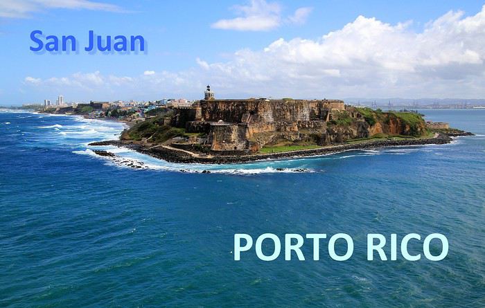
Abordées par la mer, les côtes portoricaines se dévoilent peu à peu … l'agglomération de San Juan est maintenant bien en vue. Des fortifications dominent la ville, sur un versant de falaise apparaît un quartier haut en couleurs, plus loin, on distingue dans la brume des plages et un alignement de buildings.

A mesure que l'on progresse dans la rade, c'est la vieille ville fondée par les conquistadors que l'on détaille du regard : une imbrication d'habitations et une imposante demeure blanche, celle des gouverneurs du territoire.

Voici 5 lieux au programme de nos visites, il en reste 5 autres à découvrir en suivant notre itinéraire d'une dizaine d'étapes dans cette agglomération de plus de deux millions d'habitants.
--
Viejo San Juan, le cœur historique de la ville
A placer en tête des visites à effectuer à San Juan de Porto Rico, celle de son Vieux quartier. Pour y apprécier notamment le charme de ses anciens monuments et de ses habitations au style colonial espagnol et pour y côtoyer également la décontraction de ses habitants au comportement très latino.
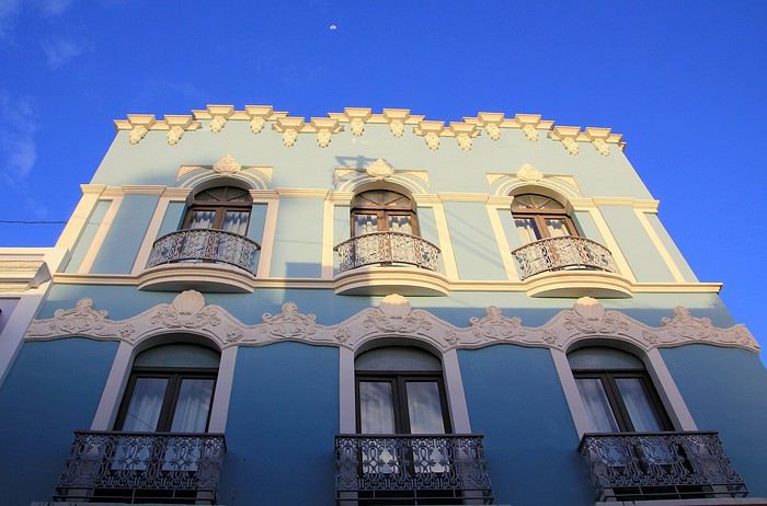
Il faut parcourir les rues de ce secteur historique, arpenter la rue SantoCristo ou Fortaleza, les plus fréquentées, les plus animées. Mais bien entendu, on ne doit pas hésiter à cheminer vers les petites rues de traverse, quitte à tomber sur une impasse ou à s'y égarer.

On y découvre des façades aux multiples couleurs, de belles décorations murales, des balcons et des ferronneries ouvragées. Un style inspiré par la lointaine Espagne, nous voilà plongés dans l'atmosphère coloniale du Nouveau Monde, celle des conquistadors des XVe au XVIe siècle.

Des maisons coloniales et des commerces longent les rues principales. Restaurants, bars, boutiques de souvenirs, galeries d'art et quelques magasins d'articles de luxe. Un exemple parmi d'autres avec au 202 de la RueSanto Cristo, une entrée par un porche qui dévoile une cour intérieure, un vrai patio qui ne détonnerait pas en Andalousie.

On continue la flânerie en battant le pavé du Viejo San Juan. Justement, au sujet de ces pavés, leur teinte bleutée étonne. On apprendra que ces pavés étaient utilisés comme ballast dans les cales des navires marchands à l'époque de la colonisation et que leurs reflets bleus satinés sont dus à l'usure du temps.

La façade inondée de lumière de la Cathédrale de San Juan domine de sa hauteur tout le quartier. Le premier édifice édifié ici date de 1521 mais il n'a pas résisté aux ouragans tropicaux fréquents sous ces latitudes. L'aspect actuel est plus récent, précisément de 1917.
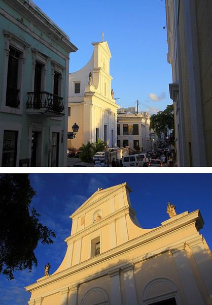
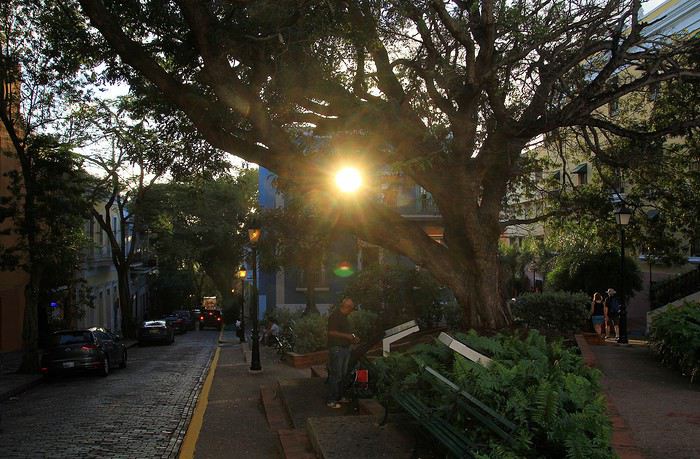
Plus loin, notre déambulation nous mène de rue en rue, de la place ombragée de l'édifice catholique à la Place de l'Hôtel de ville. Là encore, la plupart des bâtiments témoignent du passé colonial de la ville les bâtisses restaurées dans le pure style de l'époque, il n'en manque pas dans le Viejo San Juan, on en compterait près de quatre cents.

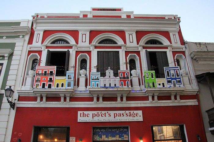
A l'extrémité de la rue Fortaleza, on parvient à cette imposante maison blanche appelée aussi « Fortaleza ». Perchée sur les falaises, elle domine toute la baie de San Juan. Sur la photo, on ne voit qu'une partie seulement du bâtiment construit à partir de 1533. L'édifice rénovée depuis son origine a été utilisé à certaines périodes d'arsenal et de prison.
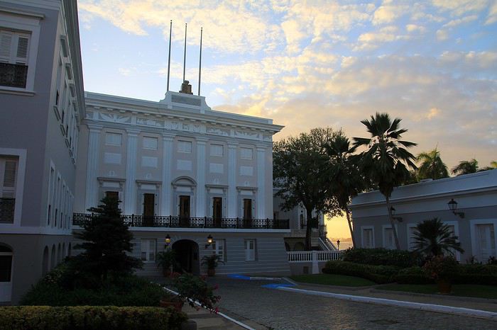
Une bâtisse où résident les Gouverneurs de l'île. Ainsi, ce sont quelques 170 Gouverneurs qui se sont succédé à la tête de cette colonie ultramarine.. L'île de Porto Rico s'honore d'être la première colonie espagnole du Nouveau Monde. Sur une des places de la ville trône la statue de l'illustre Ponce de Leon, un vaillant explorateur qui fut le premier Gouverneur de Porto Rico en 1509.

Après la guerre hispano-américaine, l'île est passée sous domination américaine, c'était en 1898. De nos jours Porto Rico a un statut particulier au sein des USA. Un État libre mais associé aux États-Unis. Les Porto Ricains ont la nationalité américaine mais ils ne votent pas pour les élections présidentielles des États-Unis. Le Gouverneur de l'île bénéficie d'une large autonomie de gestion de son territoire insulaire.
--
Les couleurs portoricaines
Là, il ne s'agit pas d'un lieu précis à voir mais plutôt d'une vision qui s'impose au regard lorsque l'on se balade dans les rues de San Juan. La ville est pavoisée presque à chaque coin de rue de drapeaux aux couleurs portoricaines.
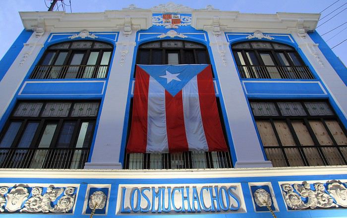
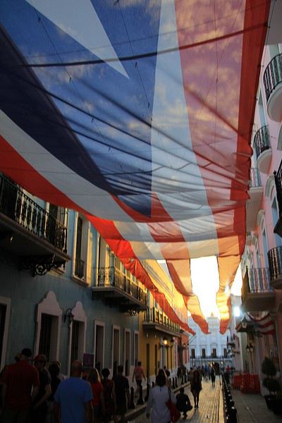
Dans une des rues passantes de la vieille ville il y a même un immense drapeau qui concurrence le bleu du ciel. Immense, ce voile fait office de décor et tamise les chauds rayons du soleil tropical. Ce drapeau local avec ses teintes bleues, blanches et rouges n'est pas sans en évoquer un autre, celui de l'île sœur, la proche Cuba. En effet, le graphisme est identique entre les deux étendards mais les couleurs sont inversées. Triangle bleu et alternance de bandes horizontales blanches et rouges pour Porto Rico et tout l'inverse pour celui de Cuba (triangle rouge et bandes blanches et bleues). Une certaine harmonie donc mais dans la différence, une idée inspirée à l'origine par le parti révolutionnaire cubain. La signification de ces teintes ? Le bleu pour le ciel et la mer, le blanc évoque la paix et le rouge le sang versé pour la patrie.
--
La Perla, un quartier populaire haut en couleur
Une vraie mosaïque aux teintes éclatantes, ce quartier de « La Perla » accroché aux falaises qui font face à l'océan. Il vaut assurément le coup d’œil et même un peu plus.
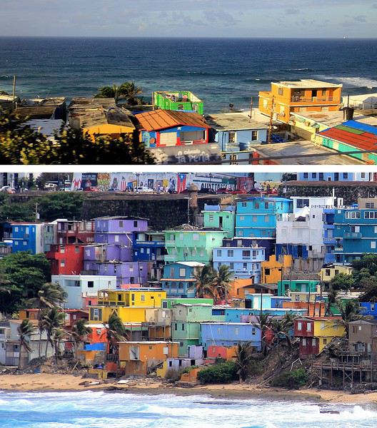
La meilleure vision est celle que l'on a depuis la mer, d'ailleurs on en avait bénéficié en arrivant depuis le large. A présent, nous longeons ce quartier ouvrier en parcourant la route de la corniche. Quel bric-à-brac avec ses modestes maisons dont certaines sont en piteux états … mais les couleurs sont là, tentant d'égayer à grand renfort de coups de pinceaux. La misère semble plus belle en technicolor. Tenez, là ! une façade est parée des couleurs de l'étendard portoricain, une tradition sur cette île.
Longtemps ce quartier populaire de San Juan a eu une mauvaise réputation : trafic de drogue et insécurité … autant dire que les visiteurs évitaient de s'y aventurer. Mais depuis 2017 la situation a changé, beaucoup de touristes vont y faire un tour et pas seulement pour sa palette de couleurs vives. Connaissez-vous Luis Fonsi ? Et la musique entêtante de son titre phare, « Despacito * » ? Ce chanteur portoricain a tourné son clip dans les ruelles de La Perla, aussi, des amateurs de ce morceau très « caliente », véritable hymne à la séduction latino, sont attirés ici. Ce clip de janvier 2017 a été un tube mondial et serait même le plus « streamé » de l'histoire !
--
Imposantes et dissuasives forteresses
Après la visite de la vielle ville, il faut en faire le tour, on pourrait presque parler de balade sur un long chemin de ronde tellement la périphérie du quartier est protégée de fortifications et de murailles. Les conquistadors savaient que leur colonie était convoitée, ils ont fait en sorte de bien la préserver. Quelques mots d'histoire à ce sujet. En 1595, ce sont les troupes de la marine anglaise qui attaquent, sans succès ! Puis c'est au tour des Hollandais en 1625 de tenter la prise de San Juan, ils réussirent à accéder à une partie de la cité mais furent repoussés par des Espagnols, ardents défenseurs de leur possession. En 1797, un nouvel assaut des Britanniques et un nouvel échec. Mais face aux bombardements américains de 1898, les militaires espagnols ont cette fois capitulés … San Juan et l'île de Porto Rico passèrent ainsi sous domination des États-Unis.
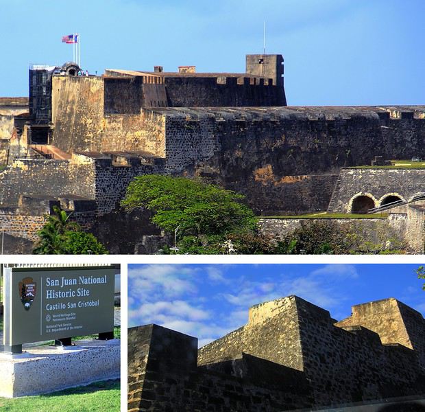
La route sur la corniche nord fait passer au pied d'imposantes murailles. Voici le Fort San Cristobal, une forteresse qui avait de bons atouts pour dissuader toutes attaques étrangères. Construit à partir de 1634, ce massif château fort fait honneur évidemment au célébrissime explorateur Christophe Colomb. Perché sur une colline, il domine l'ensemble de la ville, les falaises et surtout l'océan. Depuis le large, les éventuels assaillants l'apercevaient ainsi de très loin, aussi ils comprenaient vite ce a quoi il devaient s'attendre !
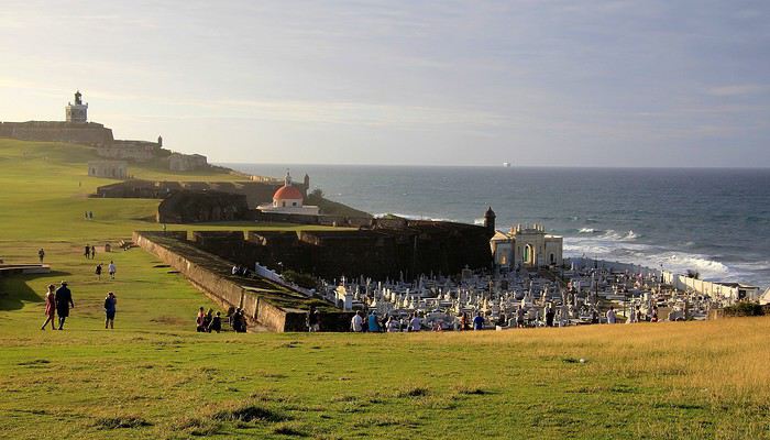
Tout au bout de la corniche, juché sur un promontoire rocheux on voit maintenant plein cadre le Fort San Felipe del Morro. Cette autre forteresse est idéalement située à l'entrée de la rade. Sa construction est antérieure à celle du Fort San Cristobal elle a débuté en 1539. A cette époque, il était facile de trouver de la main-d’œuvre … on parle de centaines d'esclaves enrôlés dans ces gigantesques travaux ! Un fort, un phare et à proximité une église et son cimetière au nom à rallonge : Santa Maria Magdalena de Pazzis. Un cimetière avec vue privilégié sur l'horizon marin, dommage que les morts qui y reposent en paix ne puissent en profiter ! L'impression de puissance que dégage le château amplement fortifié par ses murailles est contrebalancée par la douceur de la luminosité et par cette étendue verdoyante. La colline couverte d'herbe fait penser à un green de golf. On ne peut pas mieux dire … en effet, plus tard, lorsque ce lieu défensif a été investi par les troupes américaines, sur ces pelouses un terrain de golf a été aménagé pour les loisirs des soldats US !
Abordées par la mer, les côtes portoricaines se dévoilent peu à peu … l'agglomération de San Juan est maintenant bien en vue. Des fortifications dominent la ville, sur un versant de falaise apparaît un quartier haut en couleurs, plus loin, on distingue dans la brume des plages et un alignement de buildings.
A mesure que l'on progresse dans la rade, c'est la vieille ville fondée par les conquistadors que l'on détaille du regard : une imbrication d'habitations et une imposante demeure blanche, celle des gouverneurs du territoire.
Voici 5 lieux au programme de nos visites, il en reste 5 autres à découvrir en suivant notre itinéraire d'une dizaine d'étapes dans cette agglomération de plus de deux millions d'habitants.
--
Viejo San Juan, le cœur historique de la ville
A placer en tête des visites à effectuer à San Juan de Porto Rico, celle de son Vieux quartier. Pour y apprécier notamment le charme de ses anciens monuments et de ses habitations au style colonial espagnol et pour y côtoyer également la décontraction de ses habitants au comportement très latino.
Il faut parcourir les rues de ce secteur historique, arpenter la rue SantoCristo ou Fortaleza, les plus fréquentées, les plus animées. Mais bien entendu, on ne doit pas hésiter à cheminer vers les petites rues de traverse, quitte à tomber sur une impasse ou à s'y égarer.
On y découvre des façades aux multiples couleurs, de belles décorations murales, des balcons et des ferronneries ouvragées. Un style inspiré par la lointaine Espagne, nous voilà plongés dans l'atmosphère coloniale du Nouveau Monde, celle des conquistadors des XVe au XVIe siècle.
Des maisons coloniales et des commerces longent les rues principales. Restaurants, bars, boutiques de souvenirs, galeries d'art et quelques magasins d'articles de luxe. Un exemple parmi d'autres avec au 202 de la RueSanto Cristo, une entrée par un porche qui dévoile une cour intérieure, un vrai patio qui ne détonnerait pas en Andalousie.
On continue la flânerie en battant le pavé du Viejo San Juan. Justement, au sujet de ces pavés, leur teinte bleutée étonne. On apprendra que ces pavés étaient utilisés comme ballast dans les cales des navires marchands à l'époque de la colonisation et que leurs reflets bleus satinés sont dus à l'usure du temps.
La façade inondée de lumière de la Cathédrale de San Juan domine de sa hauteur tout le quartier. Le premier édifice édifié ici date de 1521 mais il n'a pas résisté aux ouragans tropicaux fréquents sous ces latitudes. L'aspect actuel est plus récent, précisément de 1917.
Plus loin, notre déambulation nous mène de rue en rue, de la place ombragée de l'édifice catholique à la Place de l'Hôtel de ville. Là encore, la plupart des bâtiments témoignent du passé colonial de la ville les bâtisses restaurées dans le pure style de l'époque, il n'en manque pas dans le Viejo San Juan, on en compterait près de quatre cents.
A l'extrémité de la rue Fortaleza, on parvient à cette imposante maison blanche appelée aussi « Fortaleza ». Perchée sur les falaises, elle domine toute la baie de San Juan. Sur la photo, on ne voit qu'une partie seulement du bâtiment construit à partir de 1533. L'édifice rénovée depuis son origine a été utilisé à certaines périodes d'arsenal et de prison.
Une bâtisse où résident les Gouverneurs de l'île. Ainsi, ce sont quelques 170 Gouverneurs qui se sont succédé à la tête de cette colonie ultramarine.. L'île de Porto Rico s'honore d'être la première colonie espagnole du Nouveau Monde. Sur une des places de la ville trône la statue de l'illustre Ponce de Leon, un vaillant explorateur qui fut le premier Gouverneur de Porto Rico en 1509.
Après la guerre hispano-américaine, l'île est passée sous domination américaine, c'était en 1898. De nos jours Porto Rico a un statut particulier au sein des USA. Un État libre mais associé aux États-Unis. Les Porto Ricains ont la nationalité américaine mais ils ne votent pas pour les élections présidentielles des États-Unis. Le Gouverneur de l'île bénéficie d'une large autonomie de gestion de son territoire insulaire.
--
Les couleurs portoricaines
Là, il ne s'agit pas d'un lieu précis à voir mais plutôt d'une vision qui s'impose au regard lorsque l'on se balade dans les rues de San Juan. La ville est pavoisée presque à chaque coin de rue de drapeaux aux couleurs portoricaines.
Dans une des rues passantes de la vieille ville il y a même un immense drapeau qui concurrence le bleu du ciel. Immense, ce voile fait office de décor et tamise les chauds rayons du soleil tropical. Ce drapeau local avec ses teintes bleues, blanches et rouges n'est pas sans en évoquer un autre, celui de l'île sœur, la proche Cuba. En effet, le graphisme est identique entre les deux étendards mais les couleurs sont inversées. Triangle bleu et alternance de bandes horizontales blanches et rouges pour Porto Rico et tout l'inverse pour celui de Cuba (triangle rouge et bandes blanches et bleues). Une certaine harmonie donc mais dans la différence, une idée inspirée à l'origine par le parti révolutionnaire cubain. La signification de ces teintes ? Le bleu pour le ciel et la mer, le blanc évoque la paix et le rouge le sang versé pour la patrie.
--
La Perla, un quartier populaire haut en couleur
Une vraie mosaïque aux teintes éclatantes, ce quartier de « La Perla » accroché aux falaises qui font face à l'océan. Il vaut assurément le coup d’œil et même un peu plus.
La meilleure vision est celle que l'on a depuis la mer, d'ailleurs on en avait bénéficié en arrivant depuis le large. A présent, nous longeons ce quartier ouvrier en parcourant la route de la corniche. Quel bric-à-brac avec ses modestes maisons dont certaines sont en piteux états … mais les couleurs sont là, tentant d'égayer à grand renfort de coups de pinceaux. La misère semble plus belle en technicolor. Tenez, là ! une façade est parée des couleurs de l'étendard portoricain, une tradition sur cette île.
Longtemps ce quartier populaire de San Juan a eu une mauvaise réputation : trafic de drogue et insécurité … autant dire que les visiteurs évitaient de s'y aventurer. Mais depuis 2017 la situation a changé, beaucoup de touristes vont y faire un tour et pas seulement pour sa palette de couleurs vives. Connaissez-vous Luis Fonsi ? Et la musique entêtante de son titre phare, « Despacito * » ? Ce chanteur portoricain a tourné son clip dans les ruelles de La Perla, aussi, des amateurs de ce morceau très « caliente », véritable hymne à la séduction latino, sont attirés ici. Ce clip de janvier 2017 a été un tube mondial et serait même le plus « streamé » de l'histoire !
--
Imposantes et dissuasives forteresses
Après la visite de la vielle ville, il faut en faire le tour, on pourrait presque parler de balade sur un long chemin de ronde tellement la périphérie du quartier est protégée de fortifications et de murailles. Les conquistadors savaient que leur colonie était convoitée, ils ont fait en sorte de bien la préserver. Quelques mots d'histoire à ce sujet. En 1595, ce sont les troupes de la marine anglaise qui attaquent, sans succès ! Puis c'est au tour des Hollandais en 1625 de tenter la prise de San Juan, ils réussirent à accéder à une partie de la cité mais furent repoussés par des Espagnols, ardents défenseurs de leur possession. En 1797, un nouvel assaut des Britanniques et un nouvel échec. Mais face aux bombardements américains de 1898, les militaires espagnols ont cette fois capitulés … San Juan et l'île de Porto Rico passèrent ainsi sous domination des États-Unis.
La route sur la corniche nord fait passer au pied d'imposantes murailles. Voici le Fort San Cristobal, une forteresse qui avait de bons atouts pour dissuader toutes attaques étrangères. Construit à partir de 1634, ce massif château fort fait honneur évidemment au célébrissime explorateur Christophe Colomb. Perché sur une colline, il domine l'ensemble de la ville, les falaises et surtout l'océan. Depuis le large, les éventuels assaillants l'apercevaient ainsi de très loin, aussi ils comprenaient vite ce a quoi il devaient s'attendre !
Tout au bout de la corniche, juché sur un promontoire rocheux on voit maintenant plein cadre le Fort San Felipe del Morro. Cette autre forteresse est idéalement située à l'entrée de la rade. Sa construction est antérieure à celle du Fort San Cristobal elle a débuté en 1539. A cette époque, il était facile de trouver de la main-d’œuvre … on parle de centaines d'esclaves enrôlés dans ces gigantesques travaux ! Un fort, un phare et à proximité une église et son cimetière au nom à rallonge : Santa Maria Magdalena de Pazzis. Un cimetière avec vue privilégié sur l'horizon marin, dommage que les morts qui y reposent en paix ne puissent en profiter ! L'impression de puissance que dégage le château amplement fortifié par ses murailles est contrebalancée par la douceur de la luminosité et par cette étendue verdoyante. La colline couverte d'herbe fait penser à un green de golf. On ne peut pas mieux dire … en effet, plus tard, lorsque ce lieu défensif a été investi par les troupes américaines, sur ces pelouses un terrain de golf a été aménagé pour les loisirs des soldats US !
Voyage 5 mois et 3 semaines en Amérique du Sud English translation pending
Bonjour,
Il n'est jamais trop tard pour rendre compte de son voyage. Le confinement me laisse enfin du temps pour le faire.
Je suis parti le 17 août 2017 et je suis rentré le 7 février 2018. Entre temps, je suis allé en Argentine par cargo puis une fois sur ce continent, j'ai visité l'Uruguay, l'Argentine et le Chili.
Durant tout ce voyage, j'ai tenu un carnet journalier.
Je me propose de vous le livrer.