Bonjour Jadorry,
Selon les liens internet que j'ai trouvés, il semble qu'il faille prendre l'avion ou l'hélicoptère entre Prudhoe Bay et Barrow. On dit que l'été il faut traverser la tundra boueuse et l'hiver c'est la glace sur fond de permafrost, voir le commentaire d'un internaute sur le sujet, malheureusement en anglais. Ce monsieur répondait à une demande d'un cycliste cross-country qui voulait faire le trajet entre Prudhoe Bay et Barrow:
"Not to put a damper on your thoughts for such an excursion but this seems like a very geographically challanging endaevor. I would say that nothing is impossible, but I would also say that in the above two cases(both summer and winter) there are some critical impediments that might need to be conquered.
In the case of the summer, the terrain to which the mountain biker would be traveling is tundra, basically mud on top of frozen ground. So if you try to bike on this terrain I would think that you would basically sink, as you would have no traction. Barrow is located on boggy terrain on the northernmost peninsula in the United States at 71N and 156W. As one were to travel Southeast the 300 miles towards Lake and Nuiqsit to Deadhorse, How would you cross continous kettles and bogs?hundreds of rivers/, and a few large rivers such as the Colville River?
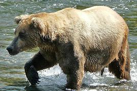
Now in the winter, the ice roads, although they may be hardened, are essentially that, snow as hard as ice. Even if your bike tires had spikes, you would think, well this would provide enhanced traction. Well unfortunately, the spikes would cause you to sink and yould be dealing with a similar issue experienced in the summer. In addition, temperatures in the -20s combined with nearly 24 hours of darkness combined with Polar Easterlies, producing 20 knots, would make it feel like 50 below or lower on average. Oh and yeah, Polar Bears might be asleep when its pitch dark, and wake up in February or March, when the sun comes back up".