Okay, it wasn’t a total disaster either. Actually, I hesitated before starting this travel journal: is it even worth writing about a holiday that won’t leave an unforgettable memory?
In the end, I went for it (there aren’t many recent travel journals about this destination).
So, read on... or don’t .
Every time we’ve been to the Canary Islands, it’s been by default (basically: where can we go in winter or early spring when we only have a week—so not too far, not too much jet lag, but with decent weather?).
This time, we had two weeks, but the winter plan kept changing: first Thailand (dropped for personal reasons), then Martinique (dropped because of work leave dates that weren’t up to me), and finally, the Canary Islands.
We’ve already been to Tenerife (which we really liked) and Lanzarote (which we liked a little less).
This year, two options: Gran Canaria or one of the smaller islands west of Tenerife (La Palma, or even La Gomera or El Hierro).
We chose Gran Canaria... not sure it was the right call!
Whose fault is it?
Storm Thérèse’s!
Yes, Storm Thérèse followed us on arrival, and its effects lasted quite a while. We had to adapt, cancel visits, change activities...
But even without Thérèse...
Saturday 21/03
Departure from Orly at 6:10 AM with Transavia.
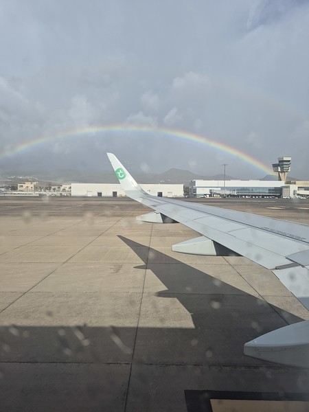
The plane took off on time and landed a little early, tossed around by strong winds before touching down.
It had just rained, but it was (almost) no longer raining.
We quickly picked up our luggage and then the car at the Cicar counter.
We got a Seat Arona instead of the Corsa we’d booked. Well, while the driving position didn’t feel great at first (I got used to it), the engine’s smoothness and power were much appreciated on the island’s winding and sometimes steep roads.
It was only 10 AM, and we couldn’t theoretically check into our accommodation until 3 PM (the owner promised to message me if it was ready earlier).
So, we headed to the (big) *Jardín Botánico Viera y Clavijo*, where we planned to spend a few hours.
We found a huge parking lot... empty.
The passenger in the car in front of us (yes, we weren’t the only ones at the closed gate—there was a car in front and one behind) went to ask for info: it was closed due to the storm 😕.
So, we calmly headed toward Puerto de las Nieves, on the northwest coast of the island.
The plan: go to a restaurant, visit the village, and do some shopping while waiting for early afternoon.
As soon as we got out of the car, it started raining... we took shelter under the awning of a shop, waiting for it to pass. But the rain turned into a downpour, and within minutes, awning or not, Gore-Tex or not, we were soaked!
Since we were already wet, we might as well go to the restaurant—they weren’t far! But here’s the thing: contrary to what Google Maps said, they all opened at 1 PM, not noon!
Back to the car, wading through 5 cm of water because all the village streets were flooded .
The rain let up, we did some shopping, went to eat, and I got a message from the owner saying the accommodation was ready 🙂.
So, off we went to La Suerte, a few kilometers north of Agaete.
The downside of the place, especially with luggage, is that you have to climb several flights of stairs via an outdoor staircase (after parking more or less far away on a steep street) to get there 😛).
Of course, on the way from the car to the apartment, it started pouring again—the bags got soaked!
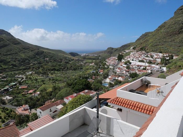
Enough rain for today! We settled in quietly, and by late afternoon, we could (finally!) go admire the view from the terrace.
Trip Planning
My partner and I are heading to the Canary Islands for a week at the end of September, specifically to Lanzarote. We chose this island over the more crowded ones for its volcanic landscape and the variety of hikes it offers.
I booked everything through Expedia: our hotel stay, car rental, and Ryanair flight tickets departing from Marseille. It was the only way to get a direct flight. To make getting around easier during our stay, I picked a hotel located in the center of the island from the wide selection available. It’s part of the Barceló chain, specifically the "Barceló Teguise Beach Adults Only" in Teguise Beach, which turned out to be an excellent choice.
The Trip
Sunday, September 21 - Monday, September 22
Departure
It’s 2:15 PM, and we’re at the Avignon TGV station. Danielle picked us up earlier due to the weather—thunderstorms and heavy rain all the way to the station. The TGV was on time, and it only took 30 minutes to reach Marseille Saint-Charles. The shuttle to the airport is quick and convenient, right behind the station.
The bus leaves for the airport in the middle of the storm, with flooded roads and cars stuck in some spots.
We get soaked making our way to the terminal. Two hours to wait before the flight. The plane finally takes off at midnight, but just before landing, the pilot announces that the destination airport is closed, and we’re being diverted to Tenerife. Ryanair will re-route us as soon as possible.
We end up waiting 2 hours, and Ryanair kindly gives us a 4 € voucher.
We re-board around 5:15 AM and take off at 6:00 AM. About 45 minutes to reach Lanzarote. After collecting our luggage, we head to the car rental desk. The counter in the terminal is closed, and we’re directed to parking lot P4—it takes us a while to find it.
I’m a bit worried about the rental company’s reaction since the car was supposed to be picked up 7 hours earlier, but it’s not a problem. A woman next to us is furious because she’s in the same situation, and her rental was canceled. Anne-Marie translates for her, but nothing changes.
We pick up a brand-new Toyota Aigo and head to the hotel.
After checking in, we cross the garden, walking alongside the large pool to reach our room.
A lovely first-floor room with a jacuzzi and a sea view.
It’s early, so we head to breakfast—a generously stocked and varied buffet with everything you could want.
Afterward, we drive to Cueva de los Verdes, but it’s packed with people and a long wait. We decide to come back another day.
Next, we visit Mirador Del Rio. This rocky viewpoint at the edge of the island has breathtaking cliffs plunging 500 meters into the ocean. The view is stunning and impressive.
A panoramic bar lets you cool off while enjoying the scenery.
We return to the hotel for a short walk around the neighborhood and enjoy the beautiful pool with its pleasant water temperature. Relaxing by the pool, sun loungers, and all.
In the evening, a very varied buffet at the restaurant. Then early to bed to recover from the sleepless night before.
Tuesday, September 23
After a restful night, we enjoy another varied and hearty breakfast. The terrace seating is very pleasant. We take an inland road leading to Timanfaya National Park.
The road near the park runs alongside vineyards where the vines are surrounded by lava stone walls to protect them from the prevailing winds.
Our first stop is at the visitor center, where the island’s volcanic activity is well-documented. Next, we stop at an area where you can take a short camel ride—two seats are installed on either side of the camel’s hump. This little ride offers a great view of the volcanic landscape from a higher vantage point. A fair price of 11 € per seat for a 20-minute ride.
We then head to the park entrance via the road leading to the parking lot, where only authorized buses can take the winding route inside the park.
It’s crowded, and we wait about 45 minutes with several stops before reaching the parking lot.
We board the bus, and the route offers beautiful views of this volcanic area and its many craters. The journey is very interesting, with several stops for photos.
At the parking lot, a guide shows us how the heat from the rocks beneath the surface can ignite dry vegetation. Water poured into holes in the ground immediately creates geysers and jets of steam.
The building next to the parking lot has a restaurant where meat is cooked using the heat from a well dug into the volcanic rock.
On our way back, we drive to Playa Blanca, a seaside town with a small sandy beach.
Back at the hotel in the late afternoon for dinner.
Wednesday, September 24
We wake up early and have a quick breakfast—few people are around at this hour. Two days ago, we booked a 10:00 AM visit to Los Verdes, lava tunnels created by eruptions and lava flows from the La Corona volcano, which extended all the way to the coast.
When the lava came into contact with the air, it solidified on the surface while continuing to flow underneath. The lava tunnels stretch for 8 kilometers to the volcano, but we only walk one kilometer.
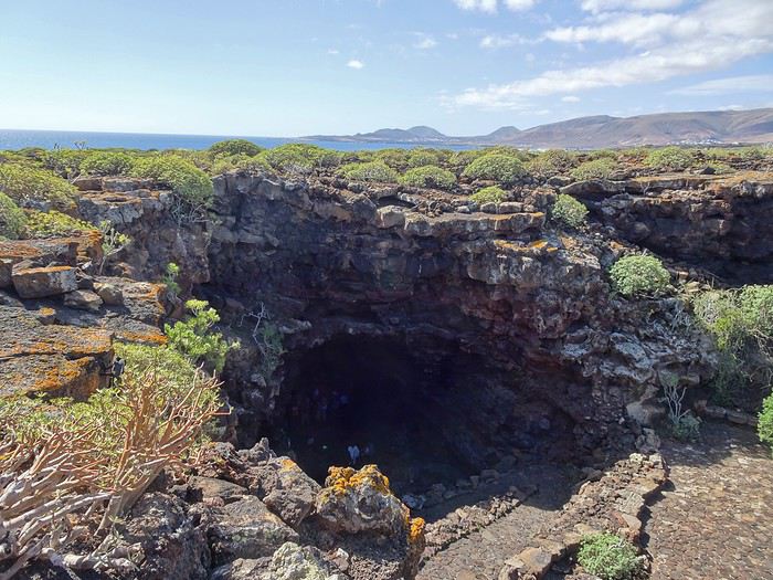
The inside of the tunnel is impressive, with narrow passages and larger chambers.
You can see traces left by the flowing liquid lava—varied colors and twisted shapes.
At the end of the path, a large chamber has been turned into a concert hall with perfect acoustics.
Next, we visit Jameo Del Agua.
This is a continuation of the lava tunnel, developed by Manrique.
There are beautifully designed bar and restaurant areas, as well as an underground lake where you can see small blind white crabs—a protected species in this very pure water.
Higher up, there’s a lovely space with a central pool that could double as a swimming area, surrounded by beautifully designed white pathways that contrast with the blue water.
Further on, you reach a large space inside the lava tunnel, set up as a performance hall with perfect acoustics.
Stairs let you view this beautiful space from above. A gap in the lava landscape reveals the ocean on the horizon.
We head back toward the village of Yé, at the foot of the La Corona volcano.
A 160-meter walk from the church, a path crosses vineyard plots and then climbs to the top of the volcano’s crater in about 30 minutes. It’s the island’s highest volcano.
When you reach the edge of the crater, you see how deep it is, with steep slopes inside forming a large circular opening. The place is breathtaking and awe-inspiring.
We drive back to the hotel via a road that climbs quickly, offering a beautiful view of the island’s northern part.
Thursday, September 25
After another enjoyable and varied breakfast, we head to the center of the island toward the volcano park and stop at a roadside parking lot where a path leads to the Montana Cuervo volcano.
This is a crater that opened on one side. During an eruption, an explosion created a breach in the crater.
Huge blocks of rock were thrown dozens of meters away. The path goes through the breach and descends into the crater, allowing you to walk around it. It’s impressive, and you really feel small and fragile in this environment.
The crater walls, with their different colors, highlight the rock formations. The crater is surrounded by a sea of lava with sharp, jagged rocks.
You can walk around the outside of the crater, but it’s not very interesting. We then head to the west coast, stopping at a spot with a small green lake next to a beautiful black sand beach.
Next, we stop at Salinas de Janubio, a lovely viewpoint overlooking the salt marshes with different water colors. A small shop sells various local products.
We then head to the famous Papagayo beach.
The road ends at a booth where they charge 3 € to continue.
From here, the land is private, and you have to pay to drive down a 3-kilometer rocky dirt road.
Quite a few cars are driving along it, kicking up clouds of dust. The car gets a dusty makeover.
We arrive at a large parking area, with several paths leading to different small beaches.
We go to Papagayo, a small blonde sand beach surrounded by red rocks.
The beach slopes gently into the water, which is a pleasant temperature. The setting is charming and peaceful.
We stay for a while before heading back to the hotel.
Friday, September 26
We start with a visit to the César Manrique Foundation in Tahiche. This was originally one of his homes. The modern construction spans several levels and is integrated into the lava flow, using the gaps to create living spaces. Large windows make the rooms bright and open to the scenery. The place is pleasant, with flower-filled gardens outside. It’s well worth a visit.
Next, we drive to Las Grietas, where a path leads to a narrow crack in the volcanic rock, forming a tight passage where only one person can walk at a time.
The passage isn’t very long, but progress is slow due to the endless selfies being taken here.
We then stop at Casa Del Camposino, a renovated farm that houses several artisan shops.
We taste a local wine recommended by a charming woman and buy two bottles of Lanzarote red wine on her advice.
Now, we head to Tamara beach, a beautiful and wide beach at the foot of high cliffs. There are always great waves here, making it a surfer’s paradise.
On the way back to the hotel, we stop at the cactus garden, César Manrique’s final creation. Designed with a great sense of aesthetics around an old windmill, it features 4,500 varieties of cacti in various shapes, all in a beautiful setting.
We return to the hotel in the late afternoon for the evening.
Saturday, September 27
After another hearty breakfast, we head north to Haria. We stumble upon another of César Manrique’s homes, where he lived for a long time. This house is more traditional than the previous one but still has large, modern, and very pleasant rooms. At the back of the garden is his large studio, where he created his works.
Next, we visit the craft market—this was our original plan. Various stalls offer local items, and it’s very crowded. No room at the café terraces to sit down.
We then return to Famara beach for a long stay. There are always great waves here, much to the surfers’ delight. The water temperature is pleasant, and we enjoy it.
On the way back to the hotel, we stop at a gas station to refill the car, which has been very fuel-efficient. Gas is also much cheaper here than in France—1.16 € per liter of SP95.
We also wash the car, which was very dusty after the long dirt road to Papagayo beach.
At the hotel, we enjoy a farewell cocktail before dinner.
Sunday, September 28
We spend the morning by the hotel pool before checking out at noon. For lunch, we go to a restaurant called "Dona Lola," near the hotel, with a terrace offering a view of the coast. We order tuna carpaccio, which is delicious.
We then head to the airport, just 15 minutes away.
We return the rental car and go to the airport.
A long line to check in our luggage.
The return flight is on time.
A shuttle bus takes us to Saint-Charles station.
We then head to our overnight rental. The boulevard slopes down, making it easier with the suitcases.
The rental is between the old port and the train station.
Once there, we pick up the keys and make one last effort to carry the luggage up to the third floor.
The studio is nice, clean, and simply equipped—perfect for one night.
Hi there,
I’m planning to go hiking on this island and would like to know the best time to do it. I visited for a few days in November 2018—not for hiking but just to explore—and the weather wasn’t great, especially in the mountains. So, is a star-shaped itinerary doable if I rent a car and maybe use two different accommodations?
I’m not planning to join an organized group—just traveling with one other person and organizing things ourselves—unless you’d recommend a local agency or guide. Finally, even though I’ll be getting maps, a topo guide, and a GPS, I’d really appreciate your top hiking recommendations.
Thanks so much for your tips!
After spending 15 days in Tenerife in February 2026, here are a few observations that might be useful for you:
- Choosing Puerto de la Cruz turned out to be an excellent decision (compared to Santa Cruz, which is Lonely Planet’s pick, for example). Puerto de la Cruz has two large beaches just a 10-minute walk from the center. The atmosphere around the small port is lovely. It’s a human-scale town. The bus station makes it easy to get anywhere on the island. Carnival season is an exceptional time to visit!
- Opting for the unlimited weekly bus pass for 50 € is economical (especially if you're traveling solo), eco-friendly, and practical (lots of departures and returns). The roads on major routes are often congested, and the bus network is improving—you can support this effort by traveling this way.
- For hikes, I tested Teide National Park (arrival and departure by bus). Starting from El Portillo at the park entrance, the Arenas Negra circuit (2.5 to 3 hours) is stunning toward the end. You can add a section of Route 1 on the other side of the road (maps and great info at the tourist office). At the other end of the park, "Roques de Garcia" is a spectacular route—crowded but a must-see...
- Tourist towns like La Orotava or La Laguna are worth the visit. Garachico has a certain charm too...
I’m planning a trip from Gran Canaria to El Hierro to Tenerife at the end of winter.
My current dilemma is where to book accommodations on Gran Canaria.
We’re planning to stay 7 nights on the island, and our goal is to hike, drive along small roads, discover a few villages, and admire some beaches (just for the views, not for swimming!).
Since the island is quite rugged, the journeys can be long even if the distances are short. I’d like to avoid driving 2 hours every morning and evening to reach the area we want to explore...
I’m thinking of splitting the 7 nights into 4 somewhere and 3 elsewhere.
But where? It seems the center and the northwest might be the best options.
Any advice, given that I’m mainly looking for peace and quiet, a beautiful view, a secluded spot, or a quiet village?
Hi there,
We’re heading to Tenerife for a week in January. I’m looking for a reliable car rental agency in La Laguna. Can anyone help me out?
Thanks in advance.
Hello everyone,
We’ll be on vacation in Costa Adeje from 12/28 to 01/09. We’ll be spending New Year’s Eve there, so we’re looking for a nice restaurant by the beach (Playa de la Pinta, Playa de Fanabe, or Playa de Torviscas) that hosts a New Year’s Eve celebration with a fun atmosphere (music). Why by the sea? Because we love counting down to midnight on the sand with all the fireworks. Any recommendations? Thanks in advance. Pascal & Co
We stayed on the island of Gran Canaria during the first three months of 2024. It’s the third Canary Island we’ve visited, after Tenerife and Lanzarote.
We rented an apartment in Temisas. By staying in the same place for such a long period, the total price dropped by 50%.
We also rented a vehicle to make getting around the island easier.
Why the Canary Islands, and Gran Canaria in particular? For its pleasant climate, the nature and diversity of its landscapes, the charming villages, and especially the beauty of its many beaches.
In this travel journal, you’ll find a list of the many activities we did during our stay to explore the different attractions of this island.
These attractions are categorized to make it easier to find what interests you.
Videos are included throughout the summary. Click on the image to start the video.
To jump to a specific post, here are the relevant links:
HIKES:
Roque Nublo
Maspalomas Dunes - Part 1
Maspalomas Dunes - Part 2
Los Azulejos de Veneguera
Barranco de Las Vacas
Ventana del Bentayga (Arco del Aserrador)
Caves of the King
Ventana de Morro (Ventana de la Ganifa)
The Dog of Bentayga
Cave of the Four Doors
Ventana del Nublo
Artenera - Caves of Acusa Seca
Temisas - El Gigante Cave
Fortress of Ansite
Puerto de Las Nieves - Roque de Las Nieves
Temisas - Cuevas de la Audiencia
Roque Bentayga
Guayadeque Ravine (Guayadeque Hermitage)
Guayadeque Ravine (Cueva de Bartalo)
El Zumacal - Barranco Tauco
Casablanca Dam (Los Dolores Dam)
Ayagaures - La Angostura Dam & Gambuesa Dam
Santa Brígida - Alonso Ravine & Centennial Dragon Tree Pino Santo
Hike in the Azuaje Ravine
Gáldar - Red Lands of Samarrita
Tejeda - Charco de La Paloma
Bandama Boiler (Camino Borde de Caldera Bandama)
Teror - Alamo Ravine Trail – SL-4
Telde - Calasio Caves
Special Natural Reserve of Los Tilos de Moya
Los Azulejos - Charco de Las Aneas
Fataga Ravine
Arinaga Military Battery Trail
Maspalomas - Las Fuentes and del Canizo Ravines
Mogán - Tauro Mountain Trail
Tamabada - Llanos de La Mimbre & Sobre la Cueva Viewpoints Trail
Hike to the Coronadero Arch via Barranco Hondo
Barranco de Silva - Hike to the Jerez Caves
Gáldar - Samson Cave - La Atalaya Peak
Agaete - Roque Guayedra and Guayedra Ravine
Artenara - Caballero Caves
Arucas - Bufadero Salt Flats
Barranco de Pino Gordo - Natural Pools
Telde - Los Cernícalos Ravine
Las Cruces - Toba Caves & Picón
Puerto de Las Nieves - Moro Cave
Agüimes - Morros de Ávila Caves
Juncalillo del Sur - Laguna & Salinas de Abajo
Caves of Camino de San Felipe
Cruz de Tejeda, Cruz Chico and Degollada Viewpoint
Hike on the Patalavaca Circuit
Motor Grande - Puerto Rico Arch
El Montañón - Los Hornos Dam
Seafront Walk - Amadores Beach – Puerto Rico Beach
Las Niñas Dam
El Hornillo - Omega & Omicron Caves
Arteara Necropolis
Mogán - El Mulato Dam
Las Garzas - El Regante Dam
La Plata Route - Cho Flores Dam & El Charco Hondo
Vega de Acusa - La Candelaria Dam
Candelaria Hermitage – Acusa Seca Viewpoint
Valsequillo de Gran Canaria – Roque La Vela
Ayagaures Dam – GC-602
Lomo del Palo - Monte Pavón Trail
Lugar La Laguna - Levada
Fataga Dam & Ravine
BEACHES:
Mogán Beach
Taurito Beach
Tauro Beach
Amadores Beach
Puerto Rico Beach
Anfi del Mar Beach
Patalavaca Beach
Meloneras Beach
Maspalomas Beach
English Beach (Playa del Inglés)
Las Burras Beach
San Agustin Beach
Las Alcaravaneras Beach
Las Canteras Beach (La Cicer)
Las Canteras Beach (La Puntilla)
Las Canteras Beach (Santa Catalina)
Aquamarina Beach
El Agujero - Bocabarranco Beach
Hoya Del Pozo Beach
Hoya Del Pozo Beach - Lizard with amputated tail
El Cabron Beach
Ojos de Garza Beach
El Burrero Beach
NATURAL POOLS:
Charco Azul - El Risco
Agaete Salt Flats
Charco de Los Espejos - Sardina del Norte
Natural Pools of Punta de Gáldar
Snorkeling in the natural pool of Punta de Gáldar
Natural Pool La Furnia o El Clavo - Gáldar
Natural Pool of Los Dos Roques
Emiliano Natural Pool - El Agujero
Natural Pool of El Agujero
Natural Pools of Roque Prieto
Natural Pool El Altillo
Los Charcones de Bañaderos – Arucas
Natural Pools of El Charco de Las Palomas – Arucas
Natural Pools of La Laja - Las Palmas de Gran Canaria
Cueva de la Reina Mora - La Garita
Natural Pools of Castillo del Romeral
TOWNS:
Center
Santa Brigida
Vega de San Mateo
Tejeda
Artenara
Vallesco
Teror
Southwest
Santa Lucia de Tirajana
Fataga
San Bartolomé de Tirajana
Puerto de Mogán
La Aldea de San Nicolas
North
Arucas
Firgas
Moya
Santa Maria de Guia
Gáldar
Agaete
Puerto de Las Nieves
East
Vegueta - Las Palmas de Gran Canaria
Triana - Las Palmas de Gran Canaria
Ciudad Jardin - Las Palmas de Gran Canaria
Canteras - Las Palmas de Gran Canaria
Telde
Valsequillo de Gran Canaria
Ingenio
Agüimes
Temisas
VIEWPOINTS:
GC-60 Route (or nearby)
GC-210 Route (or nearby)
GC-210 Route between the tunnel and La Aldea de San Nicolás
GC-215 & GC-65 Routes (or nearby)
GC-200 Route (or nearby)
GC-130 Route (or nearby) & GC-605
GC-70 Route (or nearby) & GC-21
Sheep herd on GC-70 Route
GC-150, GC-240, GC-305, GC-350 & GC-301 Routes
GC-606, GC-295, GC-231 and GC-41 Routes (or nearby)
Viewpoints – GC-1 Route (or nearby)
Viewpoints - Las Palmas de Gran Canaria
Viewpoints - GC-2, GC-21, GC-15, GC-216 and GC-132 Routes (or nearby)
Viewpoints - GC-503 & GC-217 Routes
Viewpoints - GC-604, GC-505, GC-132, GC-42 and GC-802 Routes
MISCELLANEOUS:
San Rafael Aqueduct - Telde
Abandoned San Rafael Estate - La Higuera
Cenobio de Valerón
La Cesta - Tejeda
Puerto de la Aldea
Scenic Route GC-671 to El Espinillo
Scenic Route GC-607 to El Chorrillo
The Galdar Cube (Santiago Quarry)
Scenic Route GC-504 to Ayagaures
Abandoned seaside resort in the Azuaje Ravine
El Bufadero de La Garita – Telde
GC-505 Route
Abandoned Finca Las Haciendas (Los Mocanes) – Las Vegas de Valsequillo
Ruins of San Juan Battery - Las Palmas de Gran Canaria
Viera y Clavijo Canarian Botanical Garden - Las Palmas de Gran Canaria
Tenefé Salt Flats
Los Pérez, Lugarejos & Las Hoyas Dams
Monte Pavón, Gran Canaria’s little Ireland
Valleseco Lagoon Recreational Area
Climbing - Fataga Ravine
Surfing – El Agujero
El Cairete Restaurant - Carrizal de Tejeda
Paragliding flight observation - Los Giles
La Cuevita Ayagaures Restaurant
Statues and Murals - Cruce de Arinaga
Aviation Monument (Las Majoreras) & Murals – Carrizal
Artistic recycling by Antonio Peñita - Ojos de Garza
Rainbows
First attempt at a travel journal for me and first post after 7 years away from this forum. 😮
I went to the island of La Palma for 15 days in September 2025. After visiting Lanzarote in February, I was looking for a different and greener island. Well, I wasn’t disappointed. 😎
We stayed in Breña Baja on the east coast of the island, 5 minutes from the airport. This choice was mainly motivated by the desire not to change accommodation during the stay and to be in a "central" location close to amenities. It worked out well, but if I were to do it again, I’d split the stay in two by getting another place in the north of the island to explore that area, which really appeals to me.
Note that the island is "climatically divided in two": the west coast is sunnier and drier, while the east coast is often foggy or cloudy. It’s quite impressive when you come out of the LP-3 road tunnel connecting the two sides—you feel like you’ve changed regions even though it’s less than 3 km apart.
Flight options weren’t plentiful (no direct flights from France), so I went with Iberia, connecting in Madrid for 250 € round-trip per person excluding checked baggage (80 € round-trip for one 23 kg suitcase on this route). Make sure to buy the checked baggage at the same time as your flight, as it’ll cost about 15 € more if you add it later.
I booked the tickets 5 months in advance directly on Iberia’s website. You could also take a low-cost airline to Tenerife or Gran Canaria and then a flight with a Canarian carrier, but in my opinion, that only makes sense if you’re visiting one of those islands first, as the connection isn’t "guaranteed." The ferry is an option from Tenerife (about 2.5 hours crossing).
Our departure from Lyon was initially scheduled for 6 AM but took off at 9 AM so the crew could rest after the late arrival of the previous flight. This let us grab breakfast on the airline’s dime—thanks, EU Regulation (EC) No 261/2004. 😉 Iberia took a week to reimburse me after I submitted my passport, receipts, and bank details via their online claim form.
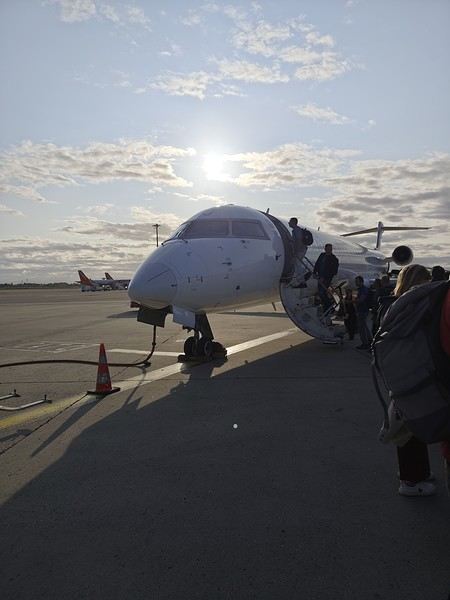
Our small but spacious CRJ-1000 Air Nostrum
Bye-bye, Bugey nuclear plant
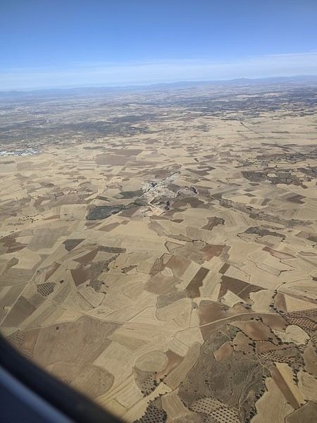
And hello, Madrid—or rather, its very dry region.
Our layover was initially 4 hours but shrank to 1 hour due to the previous flight’s delay. That worked out for us because Terminal 4 at Barajas is way less comfortable for resting than Lyon’s T1.
Landing with a view of Playa de la Cangrejera and del Pozo. When I say the east coast is often cloudy... 😇
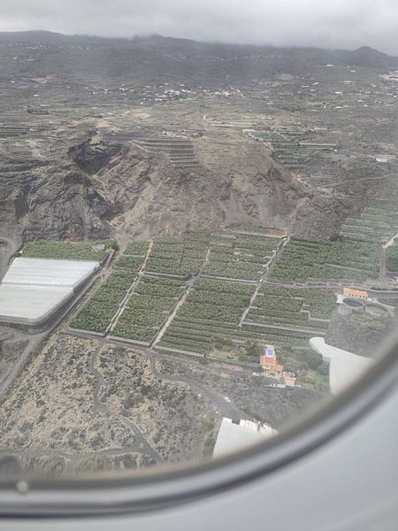
First sight of "plátano" plantations. Banana farming makes up 50% of the island’s GDP!
Hi there,
We’re planning to visit the Canary Islands for 10 days. We love hiking and nature in general, and beaches too, though they’re less of a priority.
I’m thinking of spending 5 days in Tenerife, then heading to another island—I’m torn between Lanzarote and Palma.
I just can’t decide.
Thanks for your advice!
Juliette
I’m planning a trip to Tenerife this winter and have already booked my flight. I’d love any tips to help me prepare.
My wife and I are into hiking and exploring all the interesting spots—countryside, villages, and towns. We usually get around by bus, but renting a car in Tenerife seems like a good idea to reach different sites.
I’d appreciate any info on car rentals and accommodations.
Thanks so much!
We'd like to go on a week-long trip next February with our two kids (13 and 4 years old) to either Madeira or the Canary Islands.
For this vacation, we're looking for a relaxing week with the option to go hiking, and where the kids can enjoy the pool... We were thinking of an all-inclusive package, even though it's not really our thing (we usually prefer road trips and organizing everything ourselves) just so we don’t have to do anything—especially not cooking! 😎
But I looked into it, and hotels with this package are just massive: 500, 800 rooms 😮, that’s not going to work at all!! And the price for four of us—yikes! So we thought about half-board instead, in a smaller resort. Really, we’d like to avoid concrete everywhere—we prefer nature!
Anyway, I’d love to hear your tips for planning our trip. If you have other destinations that might fit, I’m all ears. We don’t want to go too far, and temperatures around 15°C would be perfect. We want to relax, have a pool for the kids, but still have the chance to explore the area (hiking, etc.).
Hi there,
How do you get from Santa Cruz de Tenerife to Tenerife South Airport for an EZS flight? Are there buses, taxis, or other options? Thanks!
Mich74
After several trips to Tenerife, we’re finally discovering the beautiful island of Lanzarote this year!
We fell in love with this small island with its magnificent volcanoes and white villages without large hotel complexes!
I won’t be writing a day-by-day travel journal, but rather giving an overview of our experience!
For hiking, we chose trails that were about an hour long and accessible for my mom, but we noted some longer ones to do if we come back—I’ll talk about those later!
To visit the sites, depending on the places you choose, you can get BONOS for discounts: more details here: https://turismolanzarote.com/fr/cact-lanzarote-tarifs-et-abonnements/
We bought ours at the first site we visited (Montañas del Fuego), but you have to ask for them—otherwise, they won’t offer them. Make sure to plan ahead which places to include.
Our favorites were the volcanic discoveries and other landscapes of the island:
EL PARQUE TIMANFAYA: Las Montañas del Fuego ****
Stunning colors—it’s absolutely breathtaking! Our only regret is not being able to hike through these incredible landscapes!
GPS: 29°00'21.6"N 13°45'11.7"W
9 AM - 5:45 PM
We’d noted, “Best to go early in the morning or late in the evening.” We arrived 5 minutes before the park opened. We’d barely parked when we hopped on the first bus for the mandatory 14 km tour included in the ticket. Perfect—no waiting! We sat on the right side of the bus for the best views.
Afterward, we watched the geothermal demonstrations. It’s amazing how hot those little rocks picked up from the ground feel in your hand!
When we left, we saw how right the advice to arrive early was! Newcomers had to queue first to pay at the entrance, then again to access the parking (which was full, so they only let cars in when a spot opened up), and yet again to board the bus! We wouldn’t have wanted to deal with all that!
A small crater where wild geraniums grow! The hike is short, easy, and very pleasant. It follows a lava field covered in pale-green lichens before entering the crater. To avoid crowds, don’t go too late! We were lucky to have the parking lot almost to ourselves—lots of people were arriving later, even buses!
MONTANA COLORADA*** Hike: 1 hour – beautiful and easy, peaceful, no crowds.
GPS: 29°00'18.0"N 13°41'01.7"W
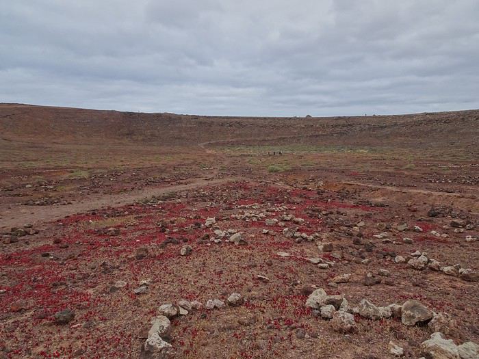
The trail loops around this stunning red mountain. Gorgeous colors, striking contrasts, and amazing volcanic rocks! Keep an eye on the ground—you’ll find little “green gems” in the small volcanic stones!
CUEVAS DE LOS VERDES***
We were more drawn to Las Cuevas, which felt more natural, than Los Jameos—though some might find the latter more beautiful, it’s more developed.
GPS: 29°09'38.9"N 13°26'19.2"W
10 AM - 6 PM. Guided tour lasts just under an hour. Avoid late morning or early afternoon visits—it gets crowded.
A tunnel and volcanic tube formed by an eruption of Monte Corona. The cave is named after the Verdes family, who once owned it. The space is often wide but sometimes narrow! The visit is very impressive, with a great surprise at the end!
VOLCANO MONTAÑA ROJA** in Playa Blanca
A hike you can do on foot from our hotel! Beautiful views from the top of the volcano. You can walk around it, see amazing rocks, and even descend into the crater (a different perspective with stunning colors).
Hi there,
Could you please let me know if there are any campgrounds on the islands of Tenerife, Gran Canaria, La Gomera, Lanzarote, and La Palma?
Thanks in advance!
We’re planning to spend 15 days in early May in La Gomera, solely for hiking and exploring the island. We like to take our time and not rush to see everything. We’ve booked small hostels or hotels, and our itinerary will be:
San Sebastian -> Playa Santiago -> Valle Gran Rey -> Vallehermoso -> back to San Sebastian
We’re hesitating about renting a car—it would certainly give us more flexibility compared to buses, but it also comes with a budget and responsibilities (parking, getting back to the car after a hike, driving fatigue, distances, etc.).
Since hiking is our main focus, the ROTHER guidebook shows mostly hikes that are accessible by bus.
Is the bus network reliable?
Is it restrictive to go without a car, with 2 or 3 nights in each location?
Hi there,
We're heading to Costa Adeje (more precisely Playa de la Arena) from April 6th to 13th.
Opinions on the weather vary a lot.
Some say it’s rainy and chilly... others claim it’s sunny with 25°C??
Could you share your experiences?
Hi everyone. I’m really torn between Tenerife and Rhodes for the week of April 12–19. I’m worried Rhodes might still be a bit chilly in mid-April, and I’m afraid there won’t be much to do in Tenerife?
I’d love to see beautiful sights—whether it’s towns or landscapes—but also lounge by the pool in shorts (or even a swimsuit if possible??). What do you recommend?
Will it be possible to swim in the pool at either (or both) of these destinations?
Hi,
Does anyone know if there are several car rental agencies at the port of La Estaca when the ferries arrive? The only one I can find is CICAR, but they're relatively expensive. All the others with reasonable prices are at the airport.
Thanks,
Gilles
I'm planning a 10-day trip to Tenerife to go hiking in February. Is the weather decent without too much fog at this time of year? Is an excursion to Teide National Park doable?
Thanks for your replies.
Hi,
I have a reservation for a solo stay at a club hotel on the island of Tenerife in the Canaries from 12/15/2024 to 12/22/2024.
I was supposed to go with a couple of friends who know the island well, but they canceled their trip.
Anyway, I’ve never traveled alone before, and I’m a bit nervous.
What do you recommend to help me not feel isolated, make the most of my stay, and connect with other people?
Thanks for your advice,
Happy holiday plans to everyone! !
Mise en garde habituelle pour éviter toute déconvenue : le récit qui suit est bien davantage un recueil d’infos pratiques qu’un carnet de voyage.
Nous avons été conquis par les Canaries. Pour notre 3ème voyage, après Ténérife, La Gomera et Lanzarote, nous découvrons cette année La Palma. Formule identique à l’an dernier : un seul point de chute, une voiture de location et on rayonne. Voyage axé sur la randonnée.
On rentre une fois de plus enchantés, prêts à poursuivre notre découverte de cet archipel magique, voire à revenir à La Palma qui, pour l’instant, est notre île préférée.
NOTRE SEJOUR DE 10 JOURS :
Ven 1er Nov – Vol Iberia Paris Orly/Santa Cruz de la Palma via Madrid – Arrivée à 13h50 - 10 nuits à Los Cancajos
Sam – Cubo de la Galga (rando) - Santa Cruz de la Palma
Dim – Fuencaliente : Volcan San Antonio & Teneguía (rando) – Le phare et les salines
Lun – La Route des Volcans (rando)
Mar – Puerto Naos – El Remo – El Paso – Eglise de la Virgen de Las Nieves - Santa Cruz
Mer – Los Tilos : la Cascada & le Mirador del Espigón Atravesado (rando) – Charco Azul – La Fajana - LP4 : Roque de los Muchachos & observatoires
Jeu – Zarza : Caldera de Agua (rando) – Tijarafe : baie des pêcheurs
Ven – Las Tricias (rando) – Puerto de Tazacorte – Mirador de la Cumbrecita (rando)
Sam – PN de la Caldera de Taburiente : de los Brecitos au Barranco de las Angustias (rando)
Dim – Los Llanos – Zarza : musée et parc – Playa Nogales
Lun 11 Nov – Vol Iberia – Départ à 14h30
BUDGET :
Dépenses préalables :
Vols Iberia : 356 € l’A/R
Dépenses sur place :
Location de voiture : 170 €
Essence : 108 €
Hébergement : 1 017 € + 66 € d’extra
Autres : 380 €
Budget total tout compris (pour nous 2, hors achats de souvenirs perso) : 2 450 €
GUIDES :
Lonely Planet – Canaries – 3è édition
Très décevant. Inutile.
Guide du Routard – Canaries 2020
Bien plus complet que le LP. Quelques infos intéressantes sur les plus belles randos.
La Palma – Rother Walking Guide
De Klaus & Annette Wolfsperger – En anglais
Le classement (intérêt et difficulté) des randos nous a permis de faire nos choix.
Walk ! La Palma – Discovery Walking Guide
De Charles Davis et Jan Kostura - En anglais
Guide associé à la carte, bien pratique. Description très précise des randos.
La Palma Tour & Trail Map
Carte associée au guide précédent (1/40 000)
Internet
www.salutilescanaries.com/la-palma/
VOLS :
Vols réguliers sur Iberia, avec escale à Madrid. Long et inconfortable.
LOCATION DE VOITURE :
www.cicar.com
Comme lors de nos 2 précédents voyages, nous passons par cette compagnie locale très réputée.
Réservation via internet d'une Opel Corsa pour 10 jours – 170 € tout inclus, km illimité.
Paiement au moment de la prise en charge à l’aéroport – Formalités réduites au minimum.
Permis de conduire national suffisant.
Excellente voiture – Aucun souci – Je recommande vivement cette compagnie tout à fait fiable.
Le réseau routier est excellent et la circulation réduite.
La LP1 est la route du Nord, la LP2, celle du Sud. La LP3 traverse l’île en passant par le Visitor Center du PN de la Caldera de Taburiente. Enfin, la LP4 est la route de montagne qui dessert les observatoires et Roque de Los Muchachos. En 10 jours, on a parcouru ces routes plusieurs fois, toujours avec bonheur. Rouler n’est pas une contrainte. Prévoyez une moyenne de 40-50 km/h.
L’essence est moins chère qu’en France (1,17€/l).
Pensez à télécharger la carte de La Palma dans l’application GoogleMaps pour pouvoir l’utiliser hors connexion.
HOTEL :
Réservé directement sur leur site.
Hôtel H10 Taburiente Playa à Breña Baja
www.h10hotels.com/...h10-taburiente-playa
10 nuits en ½ pension : 1070 € + 66 € d’extras (boissons lors du dîner)
Notre expérience l’an dernier à Lanzarote dans cette chaîne d’hôtels nous avait tant plu que nous avons réitéré ici. Celui-ci a moins de charme que celui de Lanzarote. Pour autant, il correspond à ce qu’on cherchait : bien situé entre l’aéroport et Santa Cruz sur la jolie côte de Los Cancajos, petit déj buffet, chambre confortable, belle vue sur la mer et sur Santa Cruz, parking.
Le surcoût pour la ½ pension est dérisoire. Et ça ne nous a pas empêchés de manger ailleurs, nous nous contentions alors de quelques fruits frais en toute fin de soirée.
La plage (sable noir) de Los Cancajos est à 10 minutes à pied.
Attention : à cette époque, la clientèle est composée principalement de retraités allemands.
En résumé : un grand complexe, sans aucune âme canarienne, mais très pratique dès lors qu’on a une voiture.
Il n’est pas idiot d’envisager 2 points de chute. L’île n’est pas très grande mais les routes de montagne sont longues à parcourir. Sur la côte Est, Santa Cruz ou Los Cancajos sont de bonnes options (on n’a pas regretté notre choix). Sur la côte Ouest, on a beaucoup aimé Puerto de Tazacorte. Los Llanos de Aridane, charmante petite ville, peut également être une bonne idée. Assurez-vous toujours d’avoir une place de parking, c’est parfois un peu galère.
Cela étant dit, pour 10 jours, on a bien apprécié de se poser. Et, certes, on a refait les mêmes routes plusieurs fois, mais, quel bonheur ! Rouler fait ici partie du voyage. Et si c’était à refaire (oui, oui, on l’envisage !), on referait tout pareil.
REPAS :
Quelques adresses sympa (GoogleMaps les connait) :
Chipi Chipi (à l’Ouest de Santa Cruz juste avant l’église de la Virgen de las Nieves)
Un petit restaurant original dans un cadre bien agréable.
Ancora (sur la LP1, au Sud de Puntagorda)
On est tombé dessus par hasard. Une carte originale. On choisit un curry (de langoustines pour l’un, de poulet pour l’autre) cuit dans une grosse boule de pain. Délicieux. Le vin est également très bon (1,80€ le verre !)
Kiosko Teneguia (Puerto de Tazacorte)
Plusieurs restaurants animent ce bord de mer. Cadre très agréable. Belle carte de poissons et de fruits de mer.
Partout, les prix sont très raisonnables. De quoi se faire plaisir sans compter !
LE SEJOUR :
Cette fois, nous étions partis pour randonner. On n’a pas été déçus. L’île est extraordinaire : des paysages variés, allant de la forêt luxuriante du Nord Est aux étendues lunaires des volcans du Sud, en passant par la caldera de Taburiente au centre avec ses parois verticales et ses pics acérés. Les sentiers de randonnées sillonnent l’île. Il y en a partout. Le balisage est très bien fait, les sentiers sont propres. Le seul problème qu’il reste à régler c’est de choisir lesquels parcourir.
En osant prendre parti, le guide Rother et le Guide du Routard nous ont bien aidés. On a suivi leurs conseils, sans regret.
Les randonnées :
Je ne vais pas les décrire, juste donner quelques impressions personnelles.
J’indique les références Rx pour le guide Rother Walking Guide et Dx pour le guide Discovery Walking Guide. Les durées que j’indique sont pauses comprises. On marche tranquillou et on fait souvent des photos.
· Cubo de la Galga (R10 et D26) – 2h45
Boucle - Belle forêt - Pour une bonne mise en jambe.
Quelques petites hésitations pour finir la boucle. Suivez les indications du guide Discovery.
· Volcan San Antonio & Teneguía (R51 et D10) – 0h30 + 2h30
5€/p pour accéder au Visitor Center et pouvoir faire le tour du volcan San Antonio (0h30 la boucle). Ensuite, l’accès au volcan Teneguia est un A/R (2h30) dans un paysage lunaire, à découvert de bout en bout.
· La Route des Volcans (R50 et D8) – 6h
Un must quidemande un tout petit peu d’organisation. C’est une longue descente de 17 kms, il faut donc organiser son transport.
Nous sommes descendus en voiture à Los Canarios, nous y avons garé notre voiture derrière l’église (petit parking et arrivée de la rando. Remarquez la jolie statue en bronze qui nous est dédiée, à nous randonneurs !). Ensuite, un taxi nous a montés jusqu’au Refuge d’El Pilar (point de départ). Il ne nous restait plus qu’à descendre pour retrouver notre voiture.
Réservation du taxi quelques jours plus tôt ici : www.taxilapalma.com/...alma-canary-islands/
38€ pour nous 2. 45 minutes de trajet. Nous avions réservé à 8h45. Rendez-vous nous était donné au Bar Parada (GoogleMaps le connait) à Los Canarios, à quelques dizaines de mètres de l’église où nous nous sommes garés.
Super pro, confirmation par email puis par WhatsApp.
La rando est très agréable. Les 5 premiers kms grimpent (500m) à couvert sur un tapis moelleux d’aiguilles de pin. Seules les 10 dernières minutes sont éprouvantes sur un sentier plus raide de pouzzolane qui roule sous les pieds. Ensuite, on descend dans un paysage minéral, très dégagé, à travers les volcans. Les pins canariens vert fluo se détachent merveilleusement sur le sol de poudre noire. Magnifique rando !
Pas de point d’eau sur le sentier. Bien peu de monde. Très bien fléchée.
· Los Tilos : la Cascada & le Mirador del Espigón Atravesado (hors guides) – 0h15 + 2h
Nous avions prévu de faire la grande rando de la Casa del Monte jusqu’au Visitor Center de Los Tilos (R12 et D25). Malheureusement, la rando était fermée en raison d’éboulement … Sur les conseils du gentil ranger aussi dépité que nous, nous nous sommes “rabattus” sur 2 petites randos, d’ailleurs décrites dans le GdR. Le plan affiché au VC est suffisant.
La Cascada (0h15) : petite balade, bien courte mais superbe avec tunnel, levada et jolie cascade au bout.
Le Mirador del Espigón Atravesado (2h) :c’est la fin de la grande rando qu’on a ratée. Donc, ici, juste un A/R. Un bon aperçu de la laurisylve et un joli point de vue pour finir.
Ces 2 randos ont suffi à effacer notre frustration.
· Roque de los Muchachos – 1h ou plus …
Pas vraiment une rando, plutôt une petite balade avec de superbes vues sur la caldera. Poussez jusqu’au bout du sentier de pierres.
En redescendant en voiture, ne manquez pas de vous approcher d’un observatoire. C’est très impressionnant.
· Zarza : Caldera de Agua (R24 et D20) – 2h30
Il pleuvait légèrement quand nous avons démarré. Qu’importe, nous étions quasiment toujours à couvert.
Je vous conseille de suivre cette boucle dans le sens contraire des aiguilles d’une montre, en allant d’abord vers Don Pedro (comme décrit dans le guide Discovery et non comme le Rother). Histoire de garder le plus beau pour la fin.
Attention, au point Wp.7 (toujours du guide Discovery), il faut entrer dans la forêt et 20 mètres plus bas, il faut poursuivre tout droit malgré la pierre qui porte une croix et qui aurait tendance à nous en dissuader. Sans doute, une farce de petits malins qui l’ont déplacée (et non, nous ne sommes pas revenus pour la remettre à sa place). On retrouve des marques jaunes et blanches un peu plus bas. Le reste est sans problème.
· Las Tricias (R30 et D15) – 2h30
Petite boucle qui permet d’admirer des dragonniers et des abris sous roche. Rando courte mais passionnante. Les dragos sur fond de mer bleue sont très photogéniques.
· Mirador de la Cumbrecita (R61 et D31) – 1h30
Il faut réserver sa place de parking (gratuit). Ici : www.reservasparquesnacionales.es/...&cen=4&...
Sans imprimante, il m’a suffi de montrer sur mon smartphone le numéro de résa à la barrière.
Nous avons fait la petite boucle qui passe par Lomo de las Chozas et Los Roques.
· PN de la Caldera de Taburiente : de los Brecitos au Barranco de las Angustias (R55 et D34+33) – 5h30
C’est une longue descente depuis le Mirador de los Brecitos jusqu’à la sortie du Barranco (gorges) de las Angustias.
On se gare au parking de la Calle la Viña (GoogleMaps connait “Salida excursion taburiente”) sur la LP214. Entre 8h et 13h, des taxis attendent pour monter les randonneurs à Los Brecitos. Réservation inutile. Nous avions néanmoins vérifié la veille au VC de la Caldera de Taburiente que le service était assuré. Nous arrivons donc vers 8h20, garons notre voiture et embarquons aussitôt dans un taxi avec un autre couple. 51€ à partager. 30 minutes de grimpette sur une route en lacets impressionnante pour arriver au Mirador de Los Brecitos.
À partir de là, on suit les panneaux verts “Acampada”, zone de camping qu’on atteint en 1h40. A la Playa de Taburiente, il faut traverser le ruisseau pour arriver au camping.
Montez vers les toilettes et le VC. Les panneaux verts indiquent maintenant “Barranco de las Angustias”. Il nous faudra 3h30 pour retrouver le parking, à sortie de ce barranco. Sur cette seconde partie, le sentier passe parfois dans le lit du ruisseau, parfois sur la rive droite, parfois sur la rive gauche. On s’y perd un peu mais sachez que si le niveau de l’eau le permet, vous pouvez rester dans le lit jusqu’au bout.
À noter : juste après Dos Aguas, la traversée du ruisseau sur les pierres peut être plus hasardeuse. N’hésitez pas à vous déchausser et à passer à gué, l’eau n’est pas froide !
Le petit détour jusqu’à le cascada colorada est incontournable mais un poil décevant … Le manque d’eau a fait perdre un peu d’intérêt à ce site.
Aucune de ces randos ne nous a déplu. Elles ont toutes de l’intérêt. Si je devais en éliminer une, ce serait Cubo de la Galga (qui n’apporte pas grand-chose de plus par rapport aux randos dans Los Tilos).
Le point de vue à Roque de Los Muchachos est beaucoup plus impressionnant que celui de la Cumbrecita. Mais l’un n’empêche pas l’autre.
D’un point de vue physique, aucune difficulté particulière. Les longues descentes peuvent être un peu éprouvantes pour les genoux.
Les petits villages :
Qu’ils sont beaux ces petits hameaux, ces petits villages, ces centres-villes, toujours colorés, alternant les couleurs vives et pastels. Les églises blanches avec des pierres d’angle volcaniques apparentes se détachent sur le ciel bleu. Il fait bon se promener dans ces bourgs, même si on les trouve parfois un peu endormis.
Tijarafe : nous sommes descendus jusqu’à l’ancien port. La route en voiture est vertigineuse, raide et étroite. Mais évidemment extraordinaire. Depuis le parking, 10-15 minutes de marche conduisent au petit port où une vingtaine de petites maisons ont été construites sous la roche, tout au bord de l’eau. Très impressionnant et très mignon.
El Paso : musée de la soie. Un petit intermède bien sympa entre 2 randos. Dans l’atelier, nous avons eu la chance d’avoir une dame qui nous a donné quelques explications en français.
Zarza : parc archéologique. Une petite vidéo en français explique la découverte des pétroglyphes. Le musée est un peu vieillot mais le parc nous permet de découvrir in situ quelques beaux pétroglyphes.
Los Llanos : le musée archéologique est fermé le dimanche, contrairement aux indications du GdR. Dommage ! Mais que le centre-ville est mignon.
Santa Cruz : une jolie petite ville accrochée à la montagne. De beaux balcons et comme partout, de belles façades colorées.
Les plages :
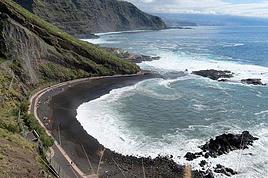
Elles sont toutes de sable noir, plus ou moins fin. La mer est souvent agitée de gros rouleaux qui viennent mourir sur la plage ou s’écraser contre des rochers aussi noirs que le sable. Écume blanche crémeuse, eaux aux reflets turquoise, sable et rochers noirs et parfois végétation verte. Tout est dit !
Playa Nogales : extraordinaire. Totalement sauvage. C’est un endroit qui se mérite. À partir d’un petit parking sur les hauteurs, la plage est desservie par un long sentier de marches, long mais splendide. Et l’arrivée sur la plage est incroyable. Ne ratez pas cet endroit magnifique (même sans vous y baigner car la mer y est dangereuse).
Charco Azul : l’homme a aidé la nature à créer de petits bassins qui invitent à la baignade. C’est fait avec goût et mesure, le résultat est vraiment sympa. Un petit restau dans la falaise permet d’apprécier le lieu autrement.
Fajana : là encore, des piscines naturelles mais, ici, c’est nettement moins réussi.
Puerto de Tazacorte : longue et belle plage même s’il y a du monde. Le paseo qui la borde est très agréable, animé et coloré. On attend impatiemment que la place soit restaurée. Malgré la difficulté pour se garer, on a adoré cet endroit où on est revenu 3 fois.
Puerto Naos : affreux ! Tout est factice. Et la falaise derrière n’est même pas belle.
Los Cancajos : 3 criques se succèdent desservies en partie par une promenade de bois.
Fuencaliente : ne manquez pas les salines, tout au Sud de l’île. Quelques panneaux explicatifs rendent la petite boucle très intéressante.
SI C’ÉTAIT À REFAIRE :
Il est loin d’être exclus que nous revenions à La Palma. Et dans ce cas, on ne changerait rien à l’organisation, on ferait juste d’autres randos. Vous l’avez compris : 10 jours complets, ce n’est pas de trop sur cette très belle île.
Quelques petits regrets : nous ne sommes pas remontés aux observatoires de nuit. Et pourtant, nous sommes des passionnés d’astronomie. Mais on n’a pas eu la témérité de conduire de nuit sur la bien tortueuse LP4. Sans doute aurions-nous dû envisager un tour organisé.
Nous avons également raté la Cueva de Belmaco au sud de Mazo. C’est fermé le dimanche et c’était bien noté. Notre faute, pas très fière … Raté aussi le musée de Los Llanos. Mais, là, ce n’était pas notre faute.
Aucun doute, il faut que nous revenions.
DIVERS :
L’accueil : très amical et très souriant.
La carte bancaire : bien acceptée.
Le climat à cette époque : agréable : 18-27°. Nous avons eu pas mal de pluie, surtout sur la côte Est. Nous avons toujours réussi à y échapper en changeant de région. L’île est petite et le permet facilement.
Vêtements : pour randonner, de bonnes chaussures de marche. Les sandales ne suffisent pas sur la pouzzolane. Prévoyez un petit gilet pour le soir.
L’affluence touristique à cette époque : peu de monde. Même sur les randos les plus courues.
Les problèmes de santé : aucun
Les moustiques : aucun
Photos : ràs
Électricité : pas besoin d’adaptateur
L'artisanat : encore un lézard pour ce qui devient une collection.
On a beaucoup aimé : 🙂
La variété des paysages
La quantité, la variété, la propreté et le balisage des randonnées
La beauté et la qualité des routes
Playa Nogales
Puerto de Tazacorte
La LP4 avec le mirador de Roque de los Muchachos et les observatoires : la nature et la science à leur paroxysme.
On a moins aimé : 🤪
Puerto Naos
En conclusion :
Cette île réunit toutes les conditions pour faire la joie des randonneurs : diversité du paysage, quantité, propreté et excellent balisage des sentiers et climat idéal.
Elle mérite au moins une semaine.
En janvier et février 2020, nous avons séjourné 4 semaines sur ces deux îles, départ depuis Bordeaux; nous étions deux couples.
Vol AR Bordeaux-Lanzarote par Volotea pour 144,78€ par couple, vol le samedi uniquement. Aller impeccable, arrivée en avance, durée 2h30, service minimum à bord, normal. Le retour sera plus compliqué, nous compterons plusieurs heures de retard.
Nous avions loué une C3 Citroen comme neuve auprès de Rentalcar, nous l 'avions assuré au max en rachetant la franchise pour éviter tout souci; on aurait pu faire à moindre coût. Conduite facile, carburant bon marché, excellentes routes, signalisation correcte, quelques virages difficiles parfois en montagne. Police curieusement peu, même très peu visible.
Nous avions opté pour la première semaine et la dernière sur Lanzarote. Et la semaine 2 et 3 sur Fuerteventura; Chaque semaine, nous avons changé de logement pour varier. Nous avions sélectionné des logements simples par Rb&b: 3 logements étaient parfaits, un logement n' était vraiment pas à la hauteur des espérances pour un prix trop élevé pour la prestation fournie. Les prix étaient attractifs pour 4 personnes. Nous avons évité de loger dans les lieux très touristiques en cherchant le calme et l 'isolement.
En Janvier- Février, le temps était plutôt frais, venteux: le vent était omniprésent, assez soutenu, fatiguant; ne pas oublier son coupe-vent et son polaire etc. Nous avons même eu froid certaines nuits car les maisons ne sont pas chauffés, en principe. Comptez 15-16° la nuit et 20-21° le jour, un peu plus à l 'abri du vent. Les dix premiers jours ont été frais; par la suite nous avons eu moins de nuages, plus de soleil et les températures ont remonté et nous avons pu nous découvrir enfin.
Entre les deux îles, nous avons prix bien sur le ferry au prix touristes (tarif moins cher pour les locaux), ferry Armas: soit AR pour 4 voyageurs +voiture pour 176€, traversée très sympa en 4Omn.
La nourriture est bon marché et nous avons souvent cuisiné; pour le reste, nous sommes allés aux restaurants, c' est le moment de manger du poisson frais et des produits de la mer, les quelques adresses du Routard que nous avons essayées étaient bonnes. Les boissons, les glaces sont données et on se régale de fruits locaux, bananes et oranges. Les vins de Lanzarote sur terroir volcanique ( malvoisie ) sont assez chers contrairement à ce que j 'avais lu, entre 8 et 16€. Mais généralement bons.... nous avons aimé les blanc.
Si Lanzarote semble le paradis des cyclistes ( impressionnant le nombre des cyclistes, les marcheurs, les coureurs ) Fuerteventura semble celui des surfeurs et autres sports de mer.
Sur Lanzarote, nous avons apprécié les champs de lave, le volcanisme exubérant, la découverte des cratères; sur Fuerteventura, le volcanisme est plus ancien, l 'aspect désertique est surprenant, belles plages de sable blanc. Sur les deux îles, on en prend plein les yeux. Dépaysement assuré. Nous avons adoré.
Un avant-gout en images.
- les palmiers de Haria
- roches, volcans et cactus, paysage habituel de Lanzarote.
- la Graciosa vue du Mirador del Rio, en fait à côté du Mirador pour être précis.
- square à Haria avec bougainvillier.
Bonjour,
Je recherche un transport entre l' aéroport sud Ténérife et le port de croisière à Santa cruz de Ténérife, que ce soit bus ou autre. je ne trouve pas grand chose sur le net. Si quelqu' un pourrait me renseigner😉
Merci d' avance
Des vidéos sont insérées tout au long du résumé. Veuillez cliquer sur l'image pour démarrer la vidéo.
En février dernier, nous avons séjourné 2 semaines sur l'île de Lanzarote afin d'en découvrir les différents attraits touristiques.
Comme la plupart de nos précédents voyages, plusieurs semaines ont été consacrées à la création de notre itinéraire afin de pouvoir être en mesure d'atteindre parfaitement nos objectifs.
Lors de notre séjour, nous avons utilisé l'application Maps.me, une application mobile qui fournit des cartes hors ligne. Cette application s'avère très précieuse lors de nos déplacements en voiture, en randonnée et même lors de nos circuits à pied dans les grandes villes.
J'avais préalablement téléchargé les coordonnées GPS de toutes les attractions prévues à notre itinéraire dans l'application Maps.me, ce qui a facilité grandement nos déplacements.
La réservation de l'hébergement ainsi que la location d'une voiture ont été effectuées sur le web avant notre départ.
Nous sommes partis de l'aéroport de Québec et avons eu une escale à Montréal ainsi qu'à Bruxelles en Belgique avant d'atteindre Lanzarote.
Lanzarote fait partie des Îles Canaries qui elles-mêmes sont situées dans l'océan Atlantique, à l'ouest du Maroc. Celles-ci font d'ailleurs partie de l'Espagne.
Nous avions déjà visité l'île de Tenerife et nous avions adoré notre séjour à cet endroit.
Nous avons donc décidé de poursuivre la découverte des Îles Canaries en nous rendant à Lanzarote car cette île offre un paysage volcanique spectaculaire, des plages à faire rêver ainsi que de magnifiques villages aux maisons typiques de l'île qui sont majoritairement blanches.
Les sentiers de randonnée sont nombreux et nous permettent de découvrir une grande diversité de paysages.
Les attraits touristiques sont également fort nombreux et facilement accessibles car les routes de Lanzarote se parcourent aisément en voiture car celles-ci sont dans un état impeccable.
D'ailleurs, c'est un pur plaisir que de se déplacer sur ces routes car les paysages qui défilent sous nos yeux sont sensationnels et présentent une perspective différente selon la lumière du jour.
Bonsoir, mes parents doivent nous rejoindre a Tenerife du 25 juillet au 4 août pour des vacances, le problème est .. que leurs cartes d'identités sont périmés (depuis 2016 et 2018).
ils étaient évidemment majeures quand ils ont fait leur cartes d'idientés en 2006 et 2008.
ils vont voyager avec easyjet, je les ai contacté par téléphone, et ils me disent clairement qu’il ne pourront pas embarquer malgré ce document :
ma question est la suivante, est ce du bluff ? Il y a t il eu un changement à cause du coronavirus ?
Je sais que beaucoup de personne passent avec un C.I périmé mais j’aimerai y voir plus claire si quelqu’un est au courant.
Il y a 2 ans, nous avons séjourné 6 semaines à Ténérife et nous avons adoré.
Si Covid19 le permet, nous projetons retourner aux Canaries pour y séjourner 5 mois ( de novembre à avril ), et nous voulons diviser notre séjour sur 3 îles: Lanzarote, Fuerteventura et Gran Canaria.
Selon votre expérience, en termes de mois, comment devrions-nous diviser notre séjour par île?





 Bye-bye, Bugey nuclear plant
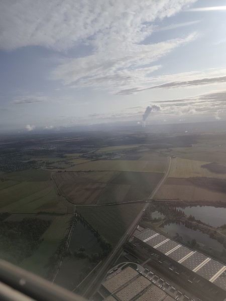 And hello, Madrid—or rather, its very dry region.
Our layover was initially 4 hours but shrank to 1 hour due to the previous flight’s delay. That worked out for us because Terminal 4 at Barajas is way less comfortable for resting than Lyon’s T1.
And hello, Madrid—or rather, its very dry region.
Our layover was initially 4 hours but shrank to 1 hour due to the previous flight’s delay. That worked out for us because Terminal 4 at Barajas is way less comfortable for resting than Lyon’s T1.
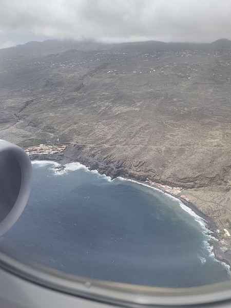 First sight of "plátano" plantations. Banana farming makes up 50% of the island’s GDP!



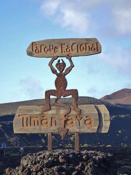
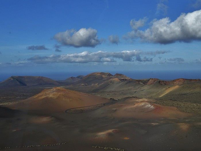
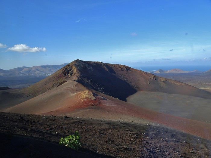 Afterward, we watched the geothermal demonstrations. It’s amazing how hot those little rocks picked up from the ground feel in your hand!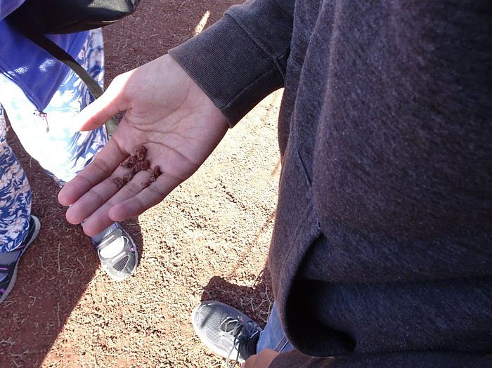


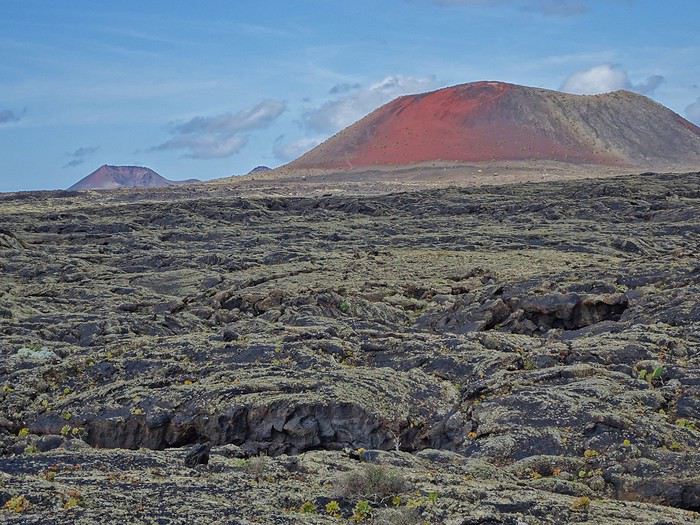 The trail loops around this stunning red mountain. Gorgeous colors, striking contrasts, and amazing volcanic rocks! Keep an eye on the ground—you’ll find little “green gems” in the small volcanic stones!

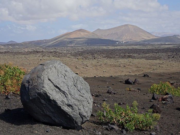






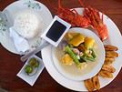

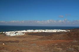 Je vous invite à découvrir l'île de LanzaroteFR
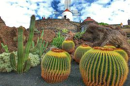 Lanzarote, novembre 2018FR
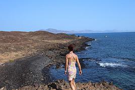 Îles Canaries: randonnée à FuerteventuraFR
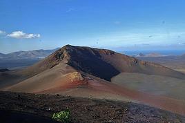 After Tenerife, a beautiful discovery of Lanzarote
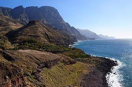 Retour de Grande CanarieFR
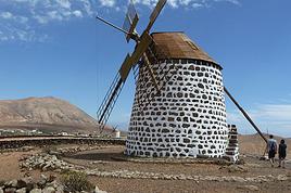 Fuerteventura pour une semaine de découverteFR
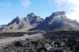 Ténérife... tu kiffes?FR
 Je vous invite à découvrir TenerifeFR