Je suis déja alle au Népal et aimerai mettre en place ma propre ascension sans passe par une agence.
A ce titre, j'aimerai savoir si vous conaissez le coût du "Permis d'ascension pour faire le Mera Peak et les trois cols?
Merci enormement pour tous vos precieux renseignements,
De mémoire, il y a qqs mois c'était 250 OU 350 US$ pour 4 personnes... Je ne sais pas si cela inclus les 3 cols dont tu parles, quels sont-ils d'ailleurs ?
Ces chiffres m'avaient été donné par l'agence avec qui j'avais fais l'ascension.
Si je réponds à ton post ce n'est pas à propos du prix du permis pour le Mera Peak mais parce que je suis assez intrigué (et inquiet) par le "sans passer par une agence"....
Est ce que tu veux dire en autonomie totale (ce qui serait de mon point de vue pas loin d'être entre un doux rêve et de la folie suicidaire) un ou as tu l'intention de recruter toi-même ton équipe de porteurs ?
Je n'ai pas fait le trek des 3 cols, mais je me suis pas mal renseigné car il me fait bien envie....et d'après ce que j'ai vu, ça rigole pas : 25 jours de marche dans des vallées parfois très isolées, 2 cols techniques (le East col (6180m) et le West col (6140m)), de la haute altitude, un sommet "pas hyper dur" (enfin...fo voir les conditions) mais qui reste qd même de l'alpinisme en relativement haute altitude.
Pour les passages des East col et West col, il faut installer des cordes fixes pour les porteurs....bref, il faut avoir une équipe locale équipée avec un sirdar/sherpa d'altitude version guide de haute montagne, caisson hyperbare et téléphone satellite me semblent pas loin d'être indispensables....ce n'est plus vraiment un trek mais pas loin d'être une petite expé. Alors mon (humble) conseil : ne prends pas ça à la légère !!
Renseigne toi bien bien sur le sujet ! (je sais qu'il y a au moins une personne sur ce forum qui a fait ce trek).
Le Mera Peak est coté F en alpinisme, parfois noté F+ ou PD-, mais peu importe: il n'y a vraiment aucune difficulté technique.
En revanche, il y'a au moins un des deux cols (me souvient jamais lequel 😉), qui est coté PD .. et cette cotation était justifié.
D'ailleurs, vu les rochers branlants et le bon petit passage en glace bleue, il était PD quand j'y suis passé...parce qu'il y'avait des cordes fixes 😛. Sans cordes fixes, ce n'est pas la même histoire (même s'il n'y a rien de phénoménal).
Pas de permis pour les cols, ce ne sont pas des sommets
Je ne me souviens plus des prix pour le Mera Peak... de l'ordre de 200 à 300$ par pers dans une expé de x personnes.....??
>>Est ce que tu veux dire en autonomie totale (ce qui serait de mon point de vue pas loin d'être entre un doux rêve et de la >>folie suicidaire
Oui et non: tout dépends des niveaux techniques, physiques et de l'expérience (je connais des personnes tout à fait sensées qui ont fait ce trip en autonomie il doit y'avoir 15-20 ans).
Si je réponds à ton post ce n'est pas à propos du prix du permis pour le Mera Peak mais parce que je suis assez intrigué (et inquiet) par le "sans passer par une agence"....
Est ce que tu veux dire en autonomie totale (ce qui serait de mon point de vue pas loin d'être entre un doux rêve et de la folie suicidaire) un ou as tu l'intention de recruter toi-même ton équipe de porteurs ?
😄 Tu vas donner des cheveux blanc à notre Pingos.
On ne répétera pas assez sur ce forum, le trekking/randonnée et l'alpinisme sont 2 disciplines complètement différente qui n'ont pour seul point commun, les paysages de montagne qu'elles offrent. Alpinisme, ce n'est pas du trekking dans la neige 🤪
Si c'est ton premier sommet, passe par une agence.
Si tu es déjà alpinisme, bonne grimpe ! Et les conseils du sage Sbecker (et d'autres qui pourraient suivre) te seront utile.
En revanche, il y'a au moins un des deux cols (me souvient jamais lequel 😉), qui est coté PD .. et cette cotation était justifié.
D'ailleurs, vu les rochers branlants et le bon petit passage en glace bleue, il était PD quand j'y suis passé...parce qu'il y'avait des cordes fixes 😛. Sans cordes fixes, ce n'est pas la même histoire (même s'il n'y a rien de phénoménal).
Tu pourrais au moins nous mettre des photos de ces 2 cols 😛 A nous faire envie comme ca...
Dans un premier temps, j'aimerai tous vous remercier pour vos renseignements et l'interêt que vous avez porte à mon post.😉
Quand je dis "sans passer par une agence", c'est dans le but de maximiser mon budget.
Je connais déja le Népal et pense qu'avec 500 ou 600€, je vais pouvoir mettre en place mon expe. Pour information, je vais recruter un cuisinier et un sherpa d'altitude sur place.
Le Mera Peak est consideré comme un Trekking d'altitude mais cela n'empeche que je reste tres prudent quant a la preparation. Je vais essaye de rien néglige car cela peut devenir vite un cauchemard une fois la haut.
La principal difficulté de ce Trekking est l'altitude, le comfort precaire et avoir un bon mental.
L'ascension au Mera Peak peut se faire en 9 jours en partant de Lukla. On note aussi une nuit au camp de base a 5800m avant l'ascension.
Deux jours apres, c'est l'ascension des 2 cols à plus de 6100m puis on commence la redescente doucement.
Concernant mon experience, j'ai déja fait le Toubkal en novembre (sur 2 jours). Une fois le Mont Blanc et ai déja dormi a plus de 5500m dans la région de Leh en Inde avec un record perso. d'altitude à 6000m Vers le Khardung La au Nord de la région.
Au niveau de ma preparation physique, je cours tous les jours sauf le week-end entre 5 et 10kms (au feeling).
Apres avoir rassemble suffiment d'infos, par la suite, j'ai dans le but de mettre en place une petite equipe de 2-3 personnes afin de faire l'ascension avec moi.
Eh pour juste vous mettre en appetit, voici je pense le meilleur site que j'ai trouvé jusqu'a present sur l'ascension des 3 cols et du Mera Peak http://www.moyut.fr/index.html .
Vous pourrez meme y voir une reconstitution du Trek via Google Earth (3D), c'est génial!
Merci encore à tous pour votre participation ou futur participation a ce post😇
Amitié,
David.
PS: Aidez nous à rassembler le plus d'infos possible sur cette ascension. Je vous invite a poster vos conseils concernant l'equipement, la meteo J-1 an ou J-2 ans sur la periode Mars (global), des sites qui y font reference, etc.
>>Tu pourrais au moins nous mettre des photos de ces 2 cols 😛 A nous faire envie comme ca...
En pièce jointe:
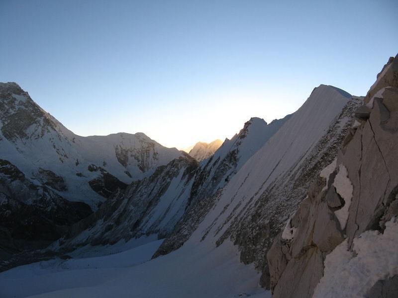
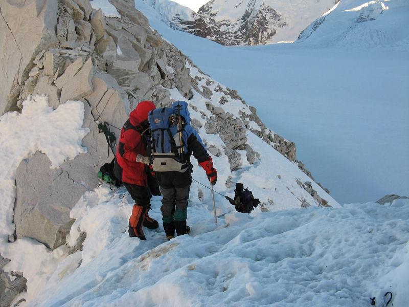
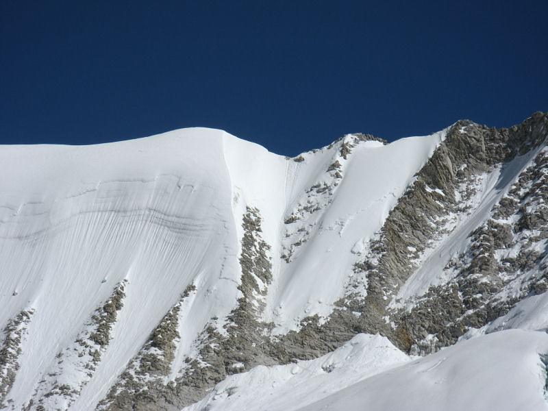
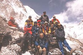
IMG_0277.jpg: photo en montant l'east col (sens Makalu->Khumbu). La photo ne montre donc pas la montée qui est en rocher, disons cotation III tout au plus (ce n'est pas là que sont les difficultés, c'est de l'autre coté).
http://www.paulo-grobel.com/...T_topo_3cols.htm#top: il y'a une photo de la descente de l'autre coté (en légende de la photo: (La montée du Est Col, versant Ouest, qu'il faut donc remonter dans le sens Khumbu Makalu.
La descente est donc forcement plus simple".) Sur la photo, c'est très enneigé ce qui doit faciliter le passage. Lors du mien, beaucoup de rocher installable et glace bleue sur la fin (merci la corde fixe 😎).
IMG_0281.jpg: au "sommet" de l'east col.
IMG_0317.jpg : descente du west col (sens Makalu->Khumbu). Deux traces évidentes au centre de la photo.
Pente à 45° en neige, avec un petit passage rocher en "II+" sur la fin.
Et puisque ces photos ne sont pas super belles, un petit "rappel" de la vue du Makalu entre les 2 cols (.... 🙂🙂 enjoy 🙂🙂...):
Le permis d'ascension est verifier par qui? car c'est 250$ pour 3pers. mais qui le verifie. De plus, on paye a chaque poste maoiste...a combien cela revient a force?
Il me semble qu'il fallait compter autour de 350$ pour le Mera. Mais je ne me rappelle plus s'il fallait pas egalement payer un acces au parc national de Sagharmata...
Pour les peages maoistes, j'en avais pas vu un seul sur la boucle Lukla, Mera, Amphu Lapsa Namche, Lukla.
Coté organisation, je parle de maniere generale car je ne peux pas juger du niveaux, ce trek est tout de meme long et longtemps en haute altitude. Une bonne orga est vraiment necessaire pour pas que ca se transforme en grosse galere. Lors de mon séjour on a grimpé le Mera Peak puis l'Amphu Lapsa. Le méra, en bonne condition est tres facile techniquement (peu de crevasses, pas d'expo sous les seracs). Pas de bol, on avait eu une grosse chute de neige la veille qui nous a bien ralenti et fatigué. Pour l'Amphu Lapsa, le coté technique n'a rien a voir avec le Mera, surtout pour les porteurs et cooks: grimpe de séracs et rappel + descente gazeuse dans la neige.
Donc partir avec une equipe reduite OK mais a condition d'avoir une tres grosse marge pour assurer la securité des porteurs / équipe car les conditions peuvent tres vite devenir épouvantables...
En tous cas, ca reste une tres belle expérience dans des payasages grandioses !!
Je suis nouveau sur ce forum. J'ai déjà posé des questions sur un autre forum mais n'ai pour l'instant pas obtenu de réponses à tout mes questions. je me…
Une question, à laquelle j'ai du mal à trouver une réponse récente sur le site (j'avoue, je ne me suis pas foulé beaucoup non plus)..Je pense faire à deux le…
J'étais intervenue dans une discussion existante mais comme je n'ai pas de réponse et que je pars très bientôt, j'en lance une nouvelle Nous partons pour un…
Ma question va peut être paraître un peu simplette pour tous les pros du voyage qui échangent ici, mais bon, je pars au Népal pour la première fois et pour moi…
Auriez vous une idée du tarifs que coute l'ascension du Mera Peak (Nepal- 6461m). J'aimerai savoir combien cela peut couter a savoir que je veus egalement…
Hi everyone,
I’m leaving on Monday, August 3rd for my very first long-distance trek: the GR223 from Coutances to Mont Saint-Michel, over 6-7 days (~11-14 miles/day), solo.
I’m looking for tips from people who know this section well (Coutances → Regnéville-sur-Mer → Hauteville-sur-Mer → Bréhal → Granville → Genêts → bay crossing):
Budget-friendly accommodations: I’m struggling to find affordable stopover lodgings (a lot of what I find online are expensive vacation rentals, not really suited for a solo hiker). If you have any great spots (hostels, hiker-friendly B&Bs, nice campgrounds), I’d love to hear them!
Bay crossing: Any feedback on guides/providers leaving from Genêts for the final crossing?
General tips for a first long-distance trek: What you wish you’d known before your first time, pitfalls to avoid, etc.
Hi,
We’re planning to do the 4-day trek from Mestia to Ushguli without an agency. The descriptions mention that there are accommodations at each stop, but we can’t find any details about them. Has anyone got info or feedback on this route?
I'm developing a free and open-source web app for planning walking and cycling trips (and even car trips). You can create a route by clicking directly on the map to add waypoints, and it can consist of multiple stages. The app provides tools to edit the stages and the overall route, and to display useful information (distances, altitudes, and elevation changes). A relief profile can be shown as a graph for a specific stage or the entire route.
Once the route is ready, it can be exported as a GPX file, which can then be used with a GPS or a mobile navigation app.
The app is built in JavaScript and runs entirely in the web browser. It uses the Leaflet library and several OpenStreetMap-based services. Initially developed for my personal needs (I enjoy hiking and cycle touring), I’d be happy to share it with anyone who might find it useful. It’s free to use, doesn’t require an account, and the source code is available.
New to this forum, I’m planning a pretty big project for 2028.
I’m heading to Nepal to do a trek from Kathmandu all the way to Everest Base Camp (a cool 5,300 m 😄).
This trek is a bit special because even though I’ll be part of a group, I’m going solo (so far, no problem—I’m used to it). But it’s my first real trek, and it’s also a humanitarian one: once I reach base camp, I’ll stay an extra week to help clean up the waste left by tens of thousands of climbers! Since I’m originally from South America, from two countries that share the Andes, I have a deep respect for mountains—they fascinate me. So Everest… it’s kind of the trip of a lifetime!
So, a little question for those who’ve done treks to Everest before… any tips for good mental preparation (I’m already working on the physical side)?
We're planning to trek in Peru and Bolivia and would love to find some local agencies.
If you know any, could you share details on prices and, of course, the names of the agencies?
Which trek would you recommend?
Elocine
I'm heading out on a fully self-sufficient trek in Morocco (10 days) from Imilchil to Aghbalou.
Can I find screw-on gas canisters (Coleman, Primus) in Marrakech (any addresses?) or in villages between Imilchil and Aghbalou?
If not, are Butagaz canisters for camping gas (small 230g size) available?
Thanks in advance for your tips!
Hello, I’d like to embark on a little trip in my home country, Switzerland. I’ll start walking from La Cure, heading toward Le Noirmont first, then I’ll improvise my route—but it’ll probably follow the French border... at least as far as Lac de Joux.
I’ll decide day by day how much farther to go after that. My goal is to stay in nature as much as possible, wander around for as long as I can, and restock food in villages or towns along the way.
I’m thinking of mostly camping, but we’ll see if I end up in a hotel or another campsite depending on my route.
I’d love to reach La Chaux-de-Fonds on foot... maybe even Delémont.
The whole thing should take about a week, give or take.
I’ll be bringing my dog, and I’m preparing for this as soon as I’m ready.
Any tips to make sure everything goes smoothly for us? Things I should know—or avoid? What about shepherds with their flocks of sheep? And isn’t hunting season open right now?
I’m not sure if what I’m planning is even doable, which is why I’m asking around.
This’ll be my first time doing something like this—wandering in nature *and* with a dog. I’m really excited for this adventure... and I need it. Thanks!
We’re really keen on ecosystems and want to hike in "natural" ancient forests—not planted woods or areas heavily degraded by human activity. Travel guides (like Lonely Planet) don’t provide much info on this. Could you point us to the most interesting spots?
Thanks in advance for your tips.
We wish you happy holidays and a fantastic 2026, full of discoveries!
Claire and Albert
Hi, this might not be the right section, but I’d like to know if it’s possible to start mountaineering with another person without necessarily hiring a guide. We’ve done quite a bit of hiking but not mountaineering—we’ll just do a half-day glacier course. After that, we were thinking of starting with La Grande Motte and the Pointe de la Traversière, which were recommended to us. Honestly, for things like roping up and knots, I’ll learn at home with lots of videos and a book.
I’d love to know if anyone has done treks in the Rwenzori Mountains and how much it costs on average, what the infrastructure is like, the landscapes, and safety in the area. Thanks so much! I’m really looking forward to your replies.
We’re leaving in 9 days for a two-week trip to Madeira, mainly to hike.
From my research, I’ve found that since last year, access to most trails—and systematically for the most popular ones—is now paid. You have to pay an access fee of 4.50 € per person per classified hike in 2026, and even 10.50 € for the most iconic hike: Pico Arieiro to Pico Ruivo. When paying, you also have to choose a day and a 30-minute time slot for your start time. Of course, this reservation is neither changeable nor refundable, even if the weather that day is terrible.
Personally, given the massive influx of tourists to the island in recent years, I don’t mind paying a fee to help maintain the trails. Similarly, setting a limit on the number of people who can hike them per day is certainly preferable to preserve this priceless heritage.
However, what’s much less fair is that in reality, most of the available spots are reserved: 1/ for Madeira residents (which is normal); 2/ for "economic operators" (meaning local tour operators). For example, if you’re a non-resident (independent tourist), no booking is possible for the Pico Arieiro hike for an early morning start before September! So, unfortunately, we’ll have to skip this hike.
It’s the same issue for Ponta de São Lourenço, the 25 Fontes, Pico Ruivo... in short, all the most popular hikes. Oh well, we’ll skip those too!
So my question is: which hikes do you recommend where we won’t face the huge crowds that the others get? And where we can book the day before for the next day, taking the weather into account?
Finally, a quick accommodation question: we’ve booked the first week in Funchal, but I haven’t decided yet for the second week. Do you have any advice on where to stay in the south or north, preferably avoiding overly concrete-heavy and touristy spots?
I’m reposting about the logistics for Samaria Gorge.
I’d love to get recent info, especially about whether it’s possible to park my car in Omalos, do the hike, and then catch a bus back to my vehicle.
In theory, it’s doable, but when you check the KTEL website, there aren’t any feasible schedules listed. If anyone has recently organized this with reliable, verified details, I’d really appreciate it. Thanks in advance!
Hi there,
We’re flying from Montreal to Lyon this August to go hiking in the French Alps. We’ve rented a car and will be staying at campgrounds. We’re planning to do day hikes and want to stay a few days in one spot, do a few hikes, then move on to our next camping spot. Could you share your favorite spots or any recommendations for places to spend a few days with great hikes?
A few details:
We arrive in early August and leave in early September.
We’re looking for day hikes (or shorter), moderate difficulty, with a cumulative elevation gain of no more than 1000m, and of course, beautiful scenery!
We’d prefer not to drive too much—maybe it’s best not to head too far south and deal with unnecessary heat?
Along the same lines, if you know of any great campgrounds where we can start our hike directly without needing the car, we’d love to hear your suggestions!
Hi there,
I’m planning to go hiking on this island and would like to know the best time to do it. I visited for a few days in November 2018—not for hiking but just to explore—and the weather wasn’t great, especially in the mountains. So, is a star-shaped itinerary doable if I rent a car and maybe use two different accommodations?
I’m not planning to join an organized group—just traveling with one other person and organizing things ourselves—unless you’d recommend a local agency or guide. Finally, even though I’ll be getting maps, a topo guide, and a GPS, I’d really appreciate your top hiking recommendations.
Thanks so much for your tips!
I’m planning to do the Mercantour crossing following the Randoxygène route in mid-July.
I’m used to hiking in the mountains, but I sometimes get vertigo, for example on ridges with drops on both sides. I wanted to check if there are any T4 or T3-T4 sections and find out if there are any very exposed passages—and if so, where—so I can plan an alternative route.
Can anyone give me some info on this?
Thanks!
I’m planning a trip around Cap Corse and the AGRIATES in 2026, from May 8th to 15th (there are still 2 spots left, by the way! Just DM me if you're interested).
I’d love to know which hikes are worth prioritizing in the AGRIATES. We’ll be staying in SALECCIA for two days as our base—what should we focus on from there?
A round trip to IGNHU beach? Any other suggestions?
For Ostricano, I think it’s too far for a round trip...
Thanks for your tips!
Have a great day,
Anie, Toulouse
I’d like to get some info about the GR10 Pyrenees traverse. I need help planning the daily stages and accommodations—my wife isn’t an experienced hiker but walks a lot, so I’d like to schedule shorter walking days and thus a longer overall trip in terms of number of days.
Could anyone give me some help and advice?
Best regards,
Hi there, I’m planning the Annapurna Circuit for March 2027 and I’m looking for a local agency with a local guide—preferably French-speaking—to arrange this trek for us. Any suggestions? Thanks
Hello!
We’re spending a few days in Toraja country at the end of May. We’d love to do a day trek—taking our time—on a route that’s stunning in terms of scenery, but not a level 5 in difficulty!
Any suggestions you can share, please?
Thanks in advance
I’d like to do the Mare a Mare Sud in May over 4 days. I’ve found quite a few places to stay along the route, but I’m stuck on the start and finish.
I’ll be arriving by plane on Sunday evening and would like to start pretty early on Monday morning. Ideally, accommodation right at the trailhead (Alzu di Gallina) would be amazing, but I can’t find anything. Any tips?
Also, for the transfer from Figari Airport to Porto Vecchio or Alzu di Gallina?
At the end, I’d like to pick up a rental car—any advice on that too?
I’m traveling solo by plane to Catania in May and plan to hike the northern side of Etna, starting from Linguaglossa where I’ll arrive by bus. After that, I’d love some info on how to get up to Piano Provenzana (shuttles or hitchhiking), since it seems there’s no public transport except in the summer. Can you sleep there in a free or cheap refuge, or camp? And how far up can you go without having to hire a guide? Thanks in advance. Bernard.
Hi everyone,
I’m heading to Morocco in August and we’ll start with a stop in Chefchaouen (we’re driving).
My question: can anyone suggest a 5-to-7-day loop hiking route from Chefchaouen in Talassemtane Park, ideally passing by the God’s Bridge? Or a paper guidebook that covers a few options?
We prefer wild camping and guesthouses.
Thanks in advance
Hi there, for those who’ve been recently—is it possible to find other solo travelers in March on the island to share transport or room costs? It doesn’t seem easy to travel on a budget.
If you have any recommendations for simple lodgings or places with dorms, I’d love to hear them.
For those who’ve done multi-day treks while moving around: do you need to bring your own sleeping bag? I’d love to hear about itineraries you’ve done without a guide, just with a map and GPS.
Thanks, and have a great day!
Hi everyone!
We’re planning a 15-day road trip to Scotland this summer, specifically to explore and hike on Lewis and Harris—places we’ve never been before. We’ve visited other islands on previous road trips in Scotland (we usually go in April for a week). This would be our first time in Scotland in the summer and for 15 days. We’re looking at late August to early September.
I’m currently drafting the itinerary. We’d be crossing from Ullapool and were thinking of spending 3 nights on Harris and 4 nights on Lewis.
Does that sound balanced to you? Is it better to keep the same accommodation on Harris and the same on Lewis to explore the area? I’d love to hear about any past experiences you’ve had on these islands.
Thanks!
Hi there, I’m trying to leave for 15 days very soon to São Vicente. I’m either looking to join an agency or figure things out on my own to go hiking on one of these islands or both. From what I’ve seen, it’s not easy to organize with local transport, so it gets expensive. Can I use the services of a small local agency? I’m looking for the simplest way to hike for several days. Also, how do you get from São Vicente to São Nicolau? Thanks in advance and have a great day!
Aichatou
I’ve been wanting to do this for several years, and this year’s the one. Next September, I’ll be trekking in Tusheti (Georgia), from Omalo to Shatili.
Of course, I won’t be renting a vehicle that’d just sit unused. No problem getting to Pshaveli, but from there to Omalo, it’s a dirt road (still the case?)
There must be some form of public transport since there are so many guesthouses, and not all travelers come in a 4x4.
If any of you have been to Omalo, could you confirm that these shared transports exist and how often they run?
we’re planning a trip to Yellowstone and hoping to do a three-day backcountry hike if we get a permit.
if any of you have done this before, could you let me know if it’s possible to find water along the way? And if we can transport it, are we allowed to use a stove?