Bonjour,
J'ai comme projet de partir faire un long voyage en vélo d'ici 1 an 1/2 - 2ans. Je compte commencer dès maintenant à préparer ce périple (vers l'Asie certainement) et m'informer sur les pays que je traverserai. D'où ma question : quel guide me conseillez-vous, Le Routard ou le Lonely Planet? Je compte en acheter pas mal donc c'est quand même un question importante.
Merci d'avance pour vos réponses.
"Fais de ta vie un rêve, et de ce rêve une réalité."
Depuis quelques années je suis plutôt lonely planet. Si tu utilises les carnets d'adresses tu rencontras plus de français avec le routard et plus d'anglo-saxons avec le lonely. A par cela je trouve les lonely plus documentés. Quand nous étions allez en Turquie en 2001 j'avais essayé un nouvel éditeur de guide de voyage..."MICHELIN"!!! je l'avais trouvé interressant.
Pierre
Je te fais un copié collé d'un message que j'ai posté il y a qq temps dans une autre rubrique :
Le routard, c'est du grand n'importe quoi.......
Exemple : cet été j'ai voyagé un mois en vélo en bretagne, je suis passé par environ 20 campings. J'ai eu l'occasion de feuilleter en cours de route un guide du routard qui s'appele "nos 1100 meilleurs campings en france". Et la j'ai vraiment compris que c'etait un guide archi nul.
Par exemple le camping municipal de quimper, qui est vraiment pourri, figure dans la guide. Pour eux dans le guide ce camping est "assez simple". Moi je ne suis pas trop difficile en camping mais c'est la 1ere fois ou je ne reste pas dans un camping.... Des gens sont dans ce camping à l'année et c'est vraiment dégueulasse, sans parler du terrain qui est pourri...... et l'ambiance etait malsaine....
Et inversement d'autres campings de bretagne qui sont vraiment formidables et pas cher ne sont pas dans le guide.... Le pire c'est que 2 très bons campings m'ont dit avoir écrit au routard plusieurs fois pour figurer dans le guide et ils n'ont jamais été contacté!!!!!
On pourrait se dire que le routard n'a peut etre pas le temps de voir tous les campings, admettons.... Sauf dans le guide il y a des campings pas terribles et ceux qui sont juste a côté et mieux, ils n'y sont pas.... Sans doutes que le routard aurait une bonne explication mais il me semble que lorsque on prétend faire un guide sur les meilleurs campings de france, on essaye de faire tous les campings qui sont 2km à la ronde.......
Faudrait peut etre qu'ils changent le titre du guide et qu'ils l'appelent : notre selection de campings en France.... Parce que c'est loin d'etre les meilleurs campings comme ils le prétendent.......
Autre exemple : un ami qui etait en turquie est tombé dans un hotel dont le gérant lui a dit que le routard etait passé les voir.... Et il lui demandait carrement de l'argent pour figurer dans le guide, lui argumentant qu'apres il aurait plein de clients....... Sans commentaires.....
Et d'un point de vue marketing, tous les guides des pays sont réedités chaque année et le routard prétend que dans chaque guide 30% des informations sont nouvelles.... Or c'est mathématiquement IMPOSSIBLE de changer 30% des infos de tous les guides tous les ans, c'est du pur marketing, un attrape nigaud. Ils nous prennent vraiment pour des cons.
Je ne dis pas que tous les guides du routard sont mauvais et bourrés de coneries, ca dépend du gars qui a sillonné le pays pour faire le guide et de la frequence a laquelle les infos sont renouvelées en allant reellement dans le pays pour voir ce qu'il en est. Mais globalement, le lonely planet est LARGEMENT meilleur, y a pas photos.....
Si le routard se vend aussi bien, c'est en parti parce que le titre est vendeur selon moi.... Quand on voyage, bcp de personnes se veulent un peu routarde dans l'ame.... Et avoir un "guide du routard", ca donne l'impression au voyageur d'etre un vrai routard!!!!! Plus qu'avec le guide "national geographic" par exemple!!!!!! Ca peut paraitre con mais j'ai travaillé 8 ans dans le commerce, je sais un peu comment ca fonctionne.....
merci pour ta réponse, au moins c'est clair;
j'ai utilisé le routard, le lonely, le michelin, le petit fûté et chacun a des avantages ou inconvénients;
encore merci de ces info;
Le problème du Routard, c'est qu'ils changent la couverture tous les ans sans changer le contenu (et bien évidemment sans retourner sur place vérifier leurs infos). Et donc parfois, c'est du grand n'importe quoi. Un exemple : dans le guide sur le Tibet édition 2007-2008, ils disent que le train pour Lhasa devrait être en circulation d'ici la fin 2007. Or il circule depuis juin 2006 et c'est maintenant le moyen le plus populaire pour se rendre au Tibet !!!
Lonely Planet a l'honnêteté intellectuelle de mettre une date d'édition qui correspond à la mise à jour effective. Donc si le guide est ancien, on le sait en l'achetant (et on sait de quand datent les renseignements).
Le mieux est de pouvoir les emprunter tous les 2 dans une bibliothèque et de prendre qqs notes, puis comparer avec les infos récentes des forums avant d'investir. Après, ça dépend aussi des destinations (certains Routards sont mieux que d'autres. Par exemple en Inde, on l'a trouvé pas trop mauvais). Perso, je n'aime pas le Petit Futé (jugement totalement subjectif, aucun argument !!!). En anglais, il y a les Footprints et Rough Guides qui sont souvent très bons. Et puis à une époque, il y avait "Let's Go". Je me demande s'ils existent toujours ?
Perso j'aime pas du tout le Routard, même si c'est vrai que du coup comme j'aime pas ces guides je les ai peu utilisés.
Du temps où il n'y avait que peu de traductions en Français des différents Lonely Planet, on pouvait identifier un endroit à l'étranger référencé par le Routard juste par le nombre de Français/francophones sur place. Maintenant que beaucoup de guides sont traduits, peut-être que ça se sent moins.
Sinon il faut aussi noter qu'il n'y a pas que le Routard et le Lonely Planet dans la vie. Je recommande vivement les guides Footprint.
Pour moi les guides Footprint sont les meilleurs, et puis je trouve l'alternative intéressante par rapport aux Lonely Planet qui accaparent le marché.
En plus ils sont recommandés par le très pythonesque aventurier Michael Palin, ça peut pas être mauvais 😉
Par contre je ne suis pas sûr qu'ils soient traduits en Français.
Merci à tous pour vos réponses.
Donc la conclusion est que chaque guide à des avantages et des inconvénients et qu'ils varient en fonction de la région du monde qu'il présente...
Je ne pense pas que je me pencherai vers un guide en anglais "My english isn't very well...". Dans ce cas je vais les empunter en bibliothèque comme conseillé par l'un d'entre vous et faire mon choix...
Encore merci.
PS : je prépare mon voyage seul pour le moment mais si quelqu'un est Réellement intéréssé pour envisager de m'accompagner...n'hésitez pas à prendre contact avec moi (r.desmitt@gmail.com). Le dpart se ferai (au conditionnel !!!) début 2009.
"Fais de ta vie un rêve, et de ce rêve une réalité."
bonjour
en introduction pour ce qui est des gars du routard qui se ferais payer pour mettre les adresse dans leur guide, vous pouvez oublier c est totelemnt faux !!!
Apres que des malin (escro !!!) se fassent passer pour l inspecteur du routard pour avoir repas, piaule, etc, etc
c est une combien vieille comme le monde !!!pour ma part j ai tj voyager avec des fausse cartes d etudiants alors se faire imprimer des carte de visite guide du routard ca dois etre courrant !!
Quand a la rivalite entre les 2, lonely sans probleme.
Apres on ne crache pas sur ses premier amours et je me revoie il y a 17 an avec mon routard ou chaque phrase etit prise pour argent comptant !!!
pour en finir en velo tu aura plus de map sur le lonely
la vie est comme un livre, celui qui n'a pas voyagé n'en connais que la 1ere page.
Juste pour rebondir sur la question de la traduction des LP, je n'ai pas franchement l'impression que la version française de ce guide soit une simple traduction de la version anglaise. J'ai voyagé en Amérique du sud avec le LP "South america on a shoestring" et quand j'en avais l'occasion, je feuilletais les guides français édités par le LP pour des pays tels que le Pérou ou la Bolivie: les références en termes d'hébergement ou même de restos n'étaient pas juste traduites d'une langue à l'autre: c'était carrément différent parfois. De même, les "hightligths" n'étaient pas les mêmes qu'on lise le guide français ou l'anglais.
De là mon idée, peut-être naïve, que le LP envoie des informateurs particuliers pour les versions francophones...
Toutefois, pour avoir essayé (parfois aux mêmes endroits) le Guide du Routard, le LP et le Petit futé, je les classerais dans l'ordre suivant:LP, avec une très nette préférence pour la version anglaise que je trouve malgré tout plus complète que la version française...le Guide du r. le petit rigolo
A noter que le "frootsprint" m'a parfois fait regretter d'avoir juste mon LP (pour les destination "Guatemala" et "central america", le reste, je sais pas!).
Voilà mon humble avis!
Mon chat fait des cauchemars où il voyage sur un rafiot...
J'ai voyagé en Amérique du sud avec le LP "South america on a shoestring" et quand j'en avais l'occasion, je feuilletais les guides français édités par le LP pour des pays tels que le Pérou ou la Bolivie: les références en termes d'hébergement ou même de restos n'étaient pas juste traduites d'une langue à l'autre: c'était carrément différent parfois.
Ils sont différents tout simplement parce que tu parles de guides qui sont différents.
J'ai voyagé moi aussi avec un South America on a Shoestring, c'est un guide multipays sur l'Amérique du Sud qui comprend des infos (plus ou moins superficielles) sur tous les pays d'Amérique du Sud. Je ne crois pas qu'il y ait de traduction Française. Tu ne peux pas comparer ce guide à des éditions "standalone" qui traitent d'un seul pays uniquement, comme l'édition Pérou ou Bolivie, et qui contiennent plus d'infos que dans le South America Shoestring. Ou alors il faudrait que tu compares ces éditions à leurs équivalents en Anglais (Peru, Bolivia), qui existent aussi pour chaque pays et qui auraient certainement les mêmes détails que les éditions françaises correspondantes.
Ca m'étonnerait qu'ils envoient des gens pour récupérer des infos pour les francophones uniquement.
LP contre GR...ce n est qu une guerre de clocher.rien de plus. etant donne que tu vas pas les acheter a l avance tu prendras ce que tu trouveras en route dans le pays precedent. ayant ete longtemps un utilisateur du LP j aime bien revenir de + en + GR. ilest + incisif. quand c est a chier le GR le dit....😉en ca il est tres francais!!!!!et c est souvent fait avec humour. c est souvent assez drole. le LP est plus politiquement correct.
cote bouffe tu as les gouts francais pour le GR.....et lesgouts anglosaxons pour le LP🤪
enfinle Lp a l avantage de proposer un shoestring si tu ne veux pas acheter un guide par pays.
pour info j ai eu l occasion de tester 3 fois les guides bradt...qui sont vraiment une mine d info. en anglais uniquement et restreint a peu de pays.
les guidesmichelin je n ai teste qu une fois mais j avais bien aime l presentation agreable.
alors concernant ton choix comme dirait le LP........it s up to you!😛
"Allons-y, puisque le jour se leve encore...!"
Surly LHT Deluxe...je l'aurai un jour, je l'aurai!!!
Depuis qqs temps, Lonely Planet "offre" la possibilité de télécharger les guides par chapitre : http://shop.lonelyplanet.com/index.jsp?lpaffil=lphp-index. Ca permet de n'acheter que les chapitres qui nous intéressent. En plus, possibilité de mettre le tout sur une clé usb et d'imprimer au fur et à mesure seulement les pages indispensables; gros gain de poids et de place dans le sac. Inconvénient : uniquement en anglais... et toutes les destinations ne sont pas encore en ligne.
Merci pour l'info! C'est vrai qu'acheter tout le guide quand on a juste besoin de qq infos revient parfois cher et effectivement encombrant! Et arracher les pages c'est pas le top 😛
Sur la page suivante: https://www.routard... Le Rouard affirme que le transport des vélos est possible en Suède en bus Swebus (Flixbus et Nettbus) et en…
Je me prend à rêver d'un tour d'un mois en Russie cet été dans le coin de l'Oural. En routard, a velo pour une partie a pied pour une autre. Je me renseigne…
Voyager à vélo › France › Rhône-Alpes / Provence-Côte d'Azur / Centre · 5 replies
Nous sommes 2 solides quinquagénaires qui souhaitent se rendre à un festival de musique proche de Béziers. Nous partons de Mâcon avec nos vélos et nos…
Je suis en train de développer une application Web gratuite et open source permettant de planifier des voyages à pied et à vélo (voire en voiture). Un itinéraire peut être créé en cliquant directement sur la carte pour ajouter des points de passage et il peut être composé de plusieurs étapes. L'application fournit des outils pour modifier les étapes et l'itinéraire global, pour afficher des informations utiles (distances, altitudes et dénivelés). Un profil de relief peut être affiché sous forme de graphique pour une étapes particulière ou pour l'ensemble de l'itinéraire.
Quand l'itinéraire est prêt, il peut être exporté sous forme de fichier GPX, qui peut enseuite être utilisé avec un GPS ou une application mobile de navigation.
L'application est implémentée en JavaScript et exécutée entièrement dans le navigateur Web. Elle utilise la bibliothèque Leaflet et plusieurs services basés sur OpenStreetMap. Initialement développé pour mes besoins personnels (je pratique la randonnées pédestre et le cyclo-tourisme), je serais heureux de la partager avec tous ceux qui peuvent la trouver utile. Elle est libre d'utilisation, ne nécessite pas de création de compte et le code source est disponible.
Hi there, I’m planning a cross-Canada bike trip, and I’ve got a question that might seem silly, but could someone tell me how to pack a bike (in a box, with a fragile sticker... I don’t know) for a flight? Thanks in advance!
This summer, we’re planning to cycle along the EV 19 that follows the Meuse River from Langres all the way to Rotterdam.
My question is about getting back to Nantes.
Do any of you know what the best return option might be? I’d love to hear about your experiences.
I saw that FlixBus doesn’t take bikes.
By train, I think it’s possible but would involve multiple local trains.
We were also wondering if there’s a boat from Rotterdam to Saint-Nazaire that could take passengers with bikes.
Any tips or experiences you can share would be really helpful—thanks in advance!
Have a great evening
I’ve got my flight ticket sorted—departing in mid-November and returning in mid-March. I’ll arrive in Santiago and leave from Buenos Aires.
I’ve already been to southern Argentina, specifically Torres del Paine National Park, and I’d love to go back to do the full W trek (I only did the shorter version last time).
I also want to do some hiking and maybe even tackle a summit. I climb and occasionally do some mountaineering, so I’ll definitely be going with a guide.
I plan to start around Temuco in Chile, with the idea of heading toward the lakes, then taking the Carretera Austral.
I’m not sure if I’ll go all the way to Ushuaia—it’s supposed to not be *that* worth it, except for the bragging rights of saying you’ve been to the end of the world.
I saw there are lakes in Argentina too.
I don’t have a precise itinerary, but what I’d love is, once I reach the southernmost point of my trip, to take a mini-cruise to see some wildlife. Any tips for that?
What kind of sleeping bag did you take? Is a 0°C (32°F) one enough?
And one last question: white gas stove or can I get by with my gas stove?
I’ve gotten used to crossing Europe by bus to return by bike.
It was really convenient to take the bike without having to disassemble it.
But FlixBus no longer accepts bikes...
What alternatives do you know about?
Thanks.
Hi there,
I’m planning to ride the Dutch section of the EuroVelo 19, from Maastricht to Rotterdam.
Since it’s too complicated to bring my bike on the train, I’m looking to rent one locally.
I’d love any tips or bike rental shop recommendations—I’m struggling to find options even in Rotterdam.
The plan is to rent in Rotterdam, take the train to Maastricht with the bike, then cycle back to Rotterdam.
Thanks in advance for any advice or suggestions!
Nath
I’m planning to cycle from Morlaix to Brest (via Roscoff and the V45 coastal route). We’ll start riding on August 16th for 13 days (with stops for island visits, surfing, etc.). Is there a lot of traffic at this time of year? I’ve got two kids, 11 and 13, and we don’t like riding in the middle of cars (we’ve already done the Vélomaritime—Caen to Cherbourg—the Loire route from Orléans to Saumur, the Vélodyssée from Nantes to Royans, and the canals like the Nivernais and Bourgogne, where there were plenty of bike-only lanes, which isn’t the case on this route).
Thanks for your help if you’ve already done this route in late August!
Virginie
Hi there,
I’ve been road cycling for several years, and I’m about to switch to gravel in the next few days—I’m waiting for my bike, which should arrive this week.
I’m planning a bikepacking trip in a few weeks along the Véloroute V81, also known as the Vélosud, from Biarritz to Le Barcarès.
Has anyone here already done this route? Any info is welcome, whether it’s about the route itself, gear, or accommodation. I’ll prioritize staying with locals as much as possible. On that note, I just signed up for the brand-new site *Guidon et Couette* ((www.guidon-et-couette.fr)), which offers free accommodation between cyclists across the country, but there’s almost no one listed along my route!
Thanks in advance.
Laurent.
I’m planning to build a new touring bike.
I want to prioritize lightness.
That said, I’m tempted by a suspension fork that could offer some comfort on rougher roads.
The recent appearance of gravel suspension forks on the market might meet my needs—at least on paper.
I’m particularly considering the RockShox Rudy Ultimate XPLR fork.
Unlike MTB forks, its travel is short: either 30 mm or 40 mm.
It weighs 1400 g, which is 400/500 g more than a steel fork.
Any thoughts or real-world feedback on this?
I’m also wondering about the durability of magnesium (lower leg) for long-distance bike touring.
And what’s the impact of skipping the manufacturer-recommended maintenance every 50 and 200 hours? That’s bound to happen on a long trip unless you carry extra gear.
More generally, how reliable are these kinds of forks?
Hi everyone,
I wanted to share with you the incredible feat my friend José, who’s 72 years old, is currently undertaking. He left Auterive near Toulouse on Monday, May 18, 2026, on his non-electric bike, heading for the North Cape in Norway!
You can follow his route on the link below—he’s currently in Sweden:
https://thierry-thomas.travelmap.net/jose-de-toulouse-a-nord-cap-2026
You can zoom in on the map and click on each stopover town to see the photos
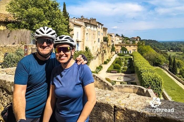
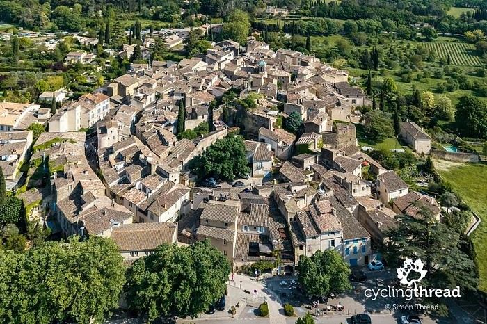
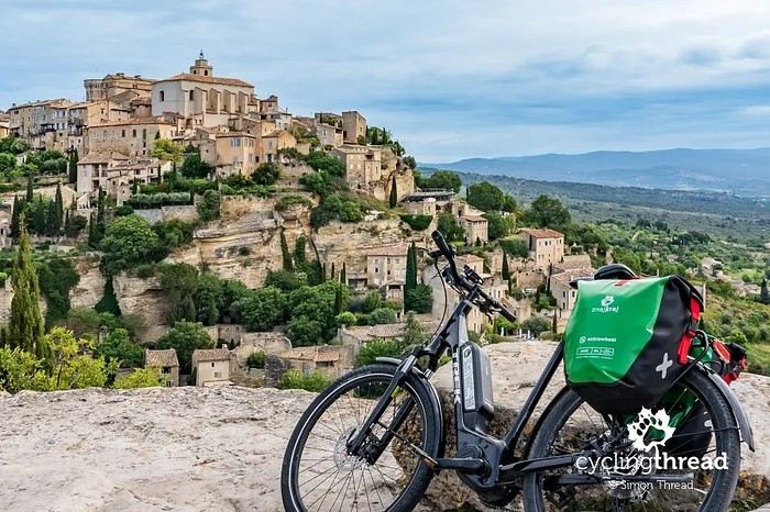
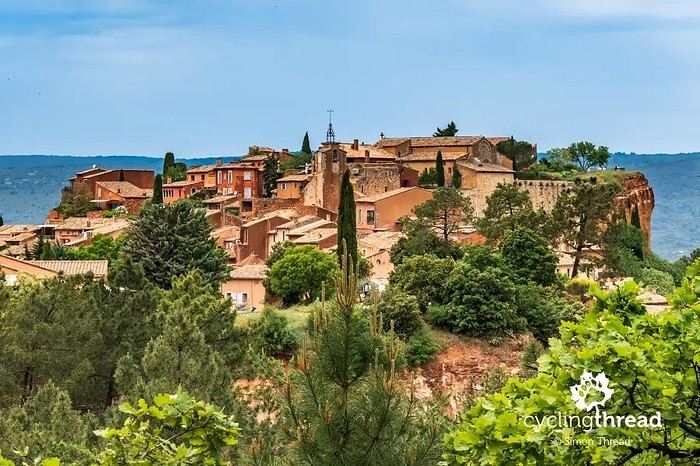
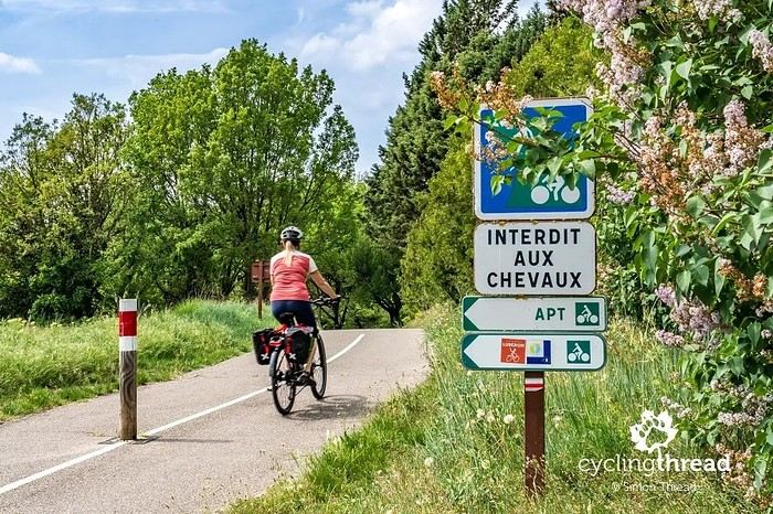
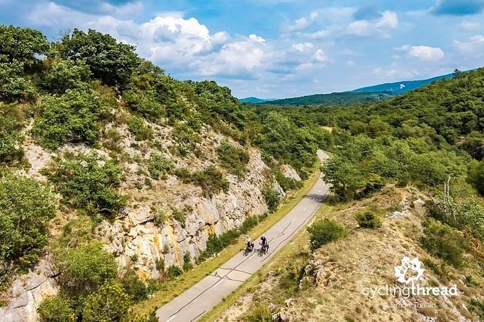
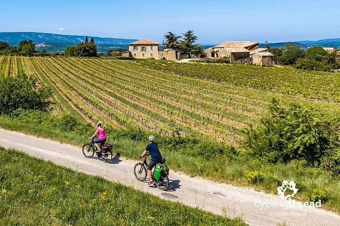
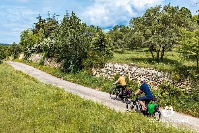
I’m making an exception and creating a separate post this time, since it’s all about France. In May, we spent a week in Provence, specifically in the Luberon, exploring the cycling routes *Autour du Luberon à Vélo*, the *Véloroute du Calavon* (part of EuroVelo 8), and the shorter *Les Ocres à Vélo* route. Together, they gave us an amazing journey through rolling hills, vineyards, lavender fields still green in spring, and some of the most stunning landscapes in southern France.
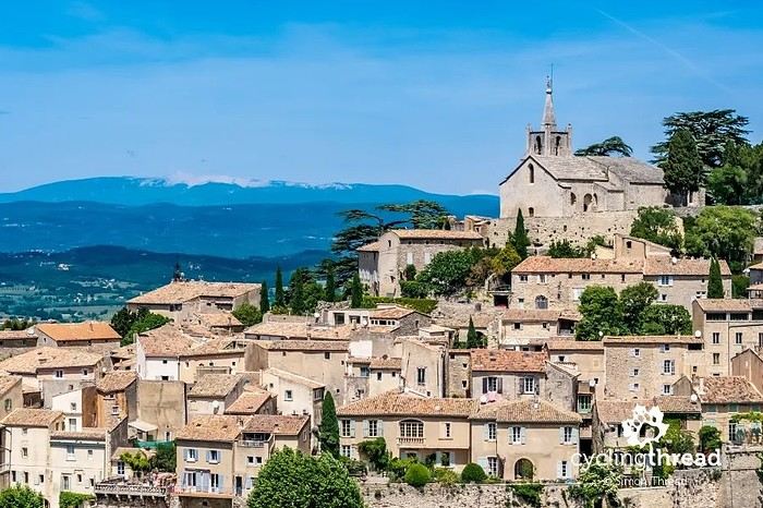
It was, of course, the perched villages that impressed us the most. We visited Gordes, Roussillon, Bonnieux, Lacoste, Lourmarin, Ménerbes, Oppède-le-Vieux, Cucuron, and Lauris. Many of them are among the most beautiful villages in Provence, and it’s hard not to agree with that reputation.
One interesting point is the route of EuroVelo 8 in this part of the region. The official path mainly follows the old railway line of the *Véloroute du Calavon*, which is very comfortable and safe. But in our opinion, cyclists traveling EuroVelo 8 around the Mediterranean would discover even more treasures if the route passed through villages like Bonnieux, Lacoste, or Oppède-le-Vieux.
We were also pleasantly surprised by how safe cycling felt. Most of the route takes small local roads, but traffic is light, drivers are respectful, and road design really takes cyclists into account. It’s one of those places where you can ride peacefully even without separated bike lanes.
Our full story:
Around Luberon by bicycle - the most beautiful villages of Provence
You can also find all our cycling travel stories on the forum:
Cycling Thread - Europe’s most beautiful bike routes
Hi there, we’re a group of 4 cyclists looking to get from Treviso in Italy to Munich with our 4 non-folding bikes. It seems complicated! Are there any solutions? Thanks so much.
hello fellow cycling enthusiasts
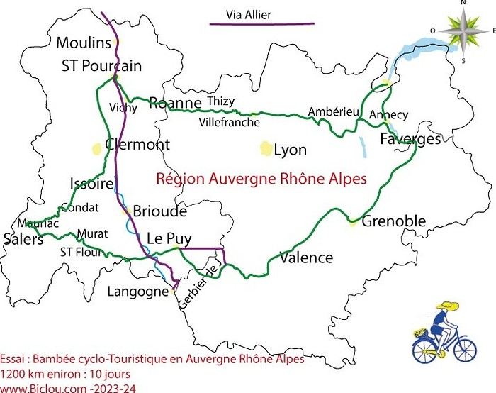
here’s a travel journal of the cycling tour through the Rhône-Alpes Auvergne region by Claudio
zouli
it was the plan
http://cbandiera.free.fr/parcours/auvergne-Ralpes/
the trip was completed
story being posted online soon
1100 km in 11 days
beautiful and varied regions
Hi there, we’re planning a Munich to Venice bike trip at the end of June 2026. Getting back from Venice to Toulouse by train with 4 bikes isn’t straightforward. What return options have others who’ve done this trip chosen? Any tips or great deals would be much appreciated. Thanks a bunch! !
Hi everyone,
Happy owner of a Pegasus Estremo bike with a Rohloff hub, which is giving me trouble with the SF11-NCX-FT-E-LITE 700C TS 300/0 fork (serial number TD01329060). It’s starting to show its age, and I’d like to repair it to extend the life of my beloved bike.
The suspension is gone, and there’s an oil leak from the seals.
Does anyone know how to repair it? Where can I find parts that are about fifteen years old? Or where to find an identical replacement fork? Just to clarify, the Magura HS11 brakes are mounted using Firm Tech, meaning they’re on pivots behind the fork, facing the frame.
Hi, I'd like to know if anyone has done this route recently or has reliable info.
Does the track exist, and most importantly, is there sand (for biking)?
Any info is welcome.
Cheers,
diego ambilobe: mangaoka, manondro, ramena
vohemar sambava: masondrono, tanambao
Hi there,
New to bike touring,
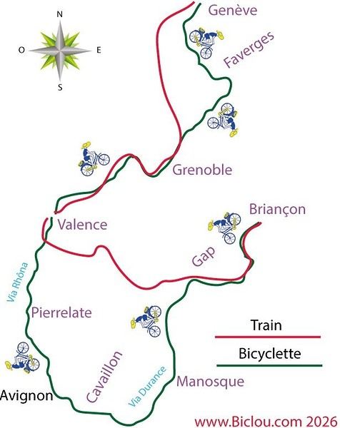
I’d love to start with a section of the Via Rhona to explore and share (route to be decided).
Looking forward to exchanging tips!
I’m landing in Madagascar with a buddy before the end of April 2026. We’re planning to bike around for about twenty days or so. We don’t have a specific goal other than exploring the country and meeting the locals.
Ideally, we’d prefer a loop route starting from Antananarivo with a good chunk of it along the coast. On the bike side, we’re used to riding 6 to 8 hours a day, depending on the needs, encounters, and mood 😉 Any feedback or tips from trips around this length?
A big thank you to Lazarou for all the info you share in this forum!
I'm passionate about Morocco, which I cycled through back in 2009.
Last year, my wife and I explored the High Atlas by tandem. Completely smitten, we're heading back in April (Anti Atlas) and May (High and Middle Atlas), still on our tandem.
Do you have any info on the track between Amezri and Ali Ait Nito? Are the river crossings in the Tessaout still there? It's not easy to navigate with a loaded tandem... especially if the river level is high due to this year's heavy snowmelt!
Thanks in advance for any tips you might have, and best wishes for health in this new year!
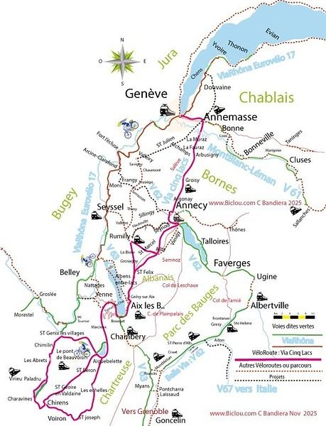
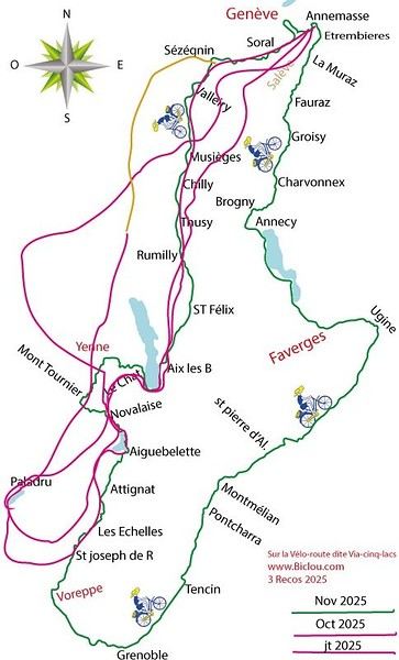
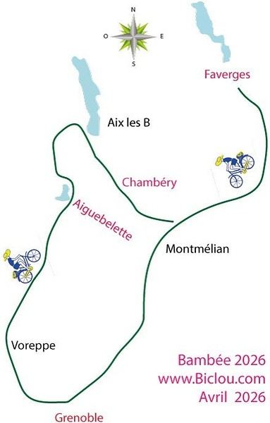
Claudio specializes in the route of the Savoie lakes
Here are his travels
Between Bornes, Chartreuse, the Savoie foothills, and Dauphiné
Five lakes: Léman, Annecy, Paladru, Aiguebelette, Bourget, not to mention a few ponds along the way
Plenty of accommodation options: camping, hotels, and more...
A lovely route not far from his place
Rural and quite peaceful
A road cycling route created by Serge B...
First of all... happy New Year! Wishing you great roads in 2017!
I’ve been traveling for a few years now with a high-quality mountain bike, but it’s equipped with hydraulic disc brakes. I live (pedal) with the constant worry of a breakdown (leak, air bubble, heat causing the fluid to...). My bike mechanic tells me it’s impossible to switch them out for V-brakes.
What do you all think? Am I taking a big risk continuing (alone) with these brakes? Thanks in advance for your great tips!
First post here to share a quick recap of our west-to-east bike trip along Algeria’s coast in January 2025.
It was just the two of us—my partner and I—with French passports and not a word of Arabic. No friends or welcoming hosts in the country.
Under those conditions, we’d strongly advise against going.
Our original plan was to follow the coast from Algiers to Tunis. We ended up cycling from Algiers to Béjaia, then took the train from Béjaia to Annaba (with a stop in Constantine), and finally biked to the border.
We were tailed by police the whole way—whether on our bikes, on the train, or even on foot while exploring towns. On top of that, we couldn’t wild camp and were limited to the few state-approved hotels that accept foreigners. Under those circumstances, connecting with locals was especially tough.
With such an omnipresent and intrusive police presence, we’d definitely recommend against this destination for bike touring. A really sad situation that completely cuts you off from the local population...
We’d been warned, we went to check it out, and we weren’t disappointed!
Hi there,
I’m planning the route to cycle from Lille to Nordkapp with my partner.
Duration: 3 months, from May 1st to July 31st, 2026.
In the attached details below, I need to add some "non-riding" days (rest days, basically).
So I’m looking to "shorten" the trip by taking ferries or trains for some stretches. Which areas could I skip?
Thanks in advance for your great tips.
Have a good evening.
https://www.komoot.com/fr-fr/collection/4023980/-lille-cap-nord-1er-mai-au-31-juillet-2026?ref=collection
I’m planning to bike back from Poland this summer. Does anyone know a way to ship it there without having to take it apart? Otherwise, it’s a real hassle to fine-tune all the settings before departure!
Thanks in advance.
Hi, has anyone recently bought Primus or Butagaz gas, possibly puncture-style, in Dubrovnik or the surrounding area? Same question for Albania... thanks. aichatou
Just a few words about the loop I did by bike in Yunnan.
Entry and exit
I entered China through the Sino-Vietnamese border crossing at Lào Cai / Hekou under the 30-day visa exemption currently available to French nationals and others.
The process was simple and quick. A Chinese police officer even helped me complete my electronic pre-registration at a computer kiosk. I wasn’t aware this formality was required—it’s similar to Thailand’s TM6.
No issues with the bike.
I left the country via the Sino-Laotian border crossing at Mohan / Boten.
The atmosphere was a bit chaotic there, but again, no problems with the bike.
The timing
I visited Yunnan in February 2026.
Weather-wise, at higher altitudes (between 1,500 and 2,000 meters), it was around ten degrees at night and in the mornings, and around twenty degrees at the hottest part of the day.
I had two days of rain, so I took the bus to keep moving. Otherwise, clear blue skies.
Culturally, Chinese New Year fell on February 17th (and the 15 days following), right in the middle of my trip. Because of this, my take on the traffic might be off.
Accommodation and food
I always found a hotel to stay in for prices ranging from 8 to 15 €. Except in Kunming (the capital), where many hotels were fully booked (Chinese New Year). I ended up at a 100 € hotel with great value for money.
A bowl of noodles costs about 1.5 € on average.
Onboard electronics
Since my smartphone doesn’t support eSIMs, I subscribed to a China plan with my carrier. Otherwise, for much cheaper, Alipay offers eSIMs for foreigners that allow access to services usually blocked for Chinese users (WhatsApp, Facebook, etc.).
An internet connection is essential for paying with Alipay or WeChat, as this payment method is widespread.
I only managed to use Alipay.
Either way, always carry cash because sometimes there’s no signal, or the merchant only accepts WeChat.
Also, it’s best to bring a power adapter when you arrive rather than struggling to find one.
Traffic and roads
The Chinese aren’t reckless drivers. They follow traffic rules and watch out for cyclists. This is slightly less true in Xishuangbanna (the region bordering Myanmar and Laos).
In urban areas, there are almost always wide bike lanes, separated from other roads, where bikes, electric mini-scooters, and scooters share the space pretty harmoniously.
The roads are in great condition, and traffic is generally manageable—even light—except for one stretch (Eshan -> Yangwu).
Most traffic is absorbed by expressways, China’s equivalent of highways: toll roads that are off-limits to slow vehicles.
You’re never far from these expressways; sometimes you even ride alongside them, which can be noisy at times.
The climbs are usually reasonable, around 5% to 6%. From what I remember, the steepest section was between Menglun and Mengla, with gradients of 8% to 10%, sometimes more.
Riding at these altitudes—though modest—took a bit of getting used to.
The route
I didn’t plan anything in advance. My only goal was to reach Kunming. I don’t know why, but just hearing the name of that city, like Yunnan, always felt dreamy to me.
Hi! I’m planning to visit the Stockholm Archipelago by bike in early April.
Do you know if the boats will be running between the different islands at that time of year? For those who’ve already been, all your tips and recommendations are welcome—accommodation, etc. Also, do you know where I can rent a bike in Stockholm? Thanks so much in advance for your help!