Bonjour
Nous sommes actuellement a Sucre en Bolivie avec notre 4x4. Nous pensons descendre vers Tajira puis le sud Lipez et le salar d Uyuni. Existe t il un moyen d eviter Uyuni et d aller directememt aux lagunas par Tupiza puis de remonter vers le salar sans trouver trop de galeres sur les pistes. Nous avons le GPS et les cartes aux 50 000eme. Si oui, en combien de temps.
Amis aventuriers merci pour vos conseils.
Moskito
Si je comprends bien l'itinéraire que tu veux emprunter, je te répondrai oui, il y a moyen de partir de Tupiza, traverser le SUd Lipez et les lagunas, et remonter ensuite vers Uyuni en terminant par le Salar.
C'est même un très bon plan, qui se fait généralement en 4 jours en roulant bien.
Quant à savoir s'il y a moyen de le faire sans guide, remplacé par un GPS et des cartes, je n'en ai pas fait l'expérience ... ça doit être faisable (?).
Pour la qualité de la route, à part le risque de crevaison (nous avons crevé deux fois), no problem avec un 4x4.
Je vous encourage à le faire ! Avec un GPS, si vous avez les bonnes coordonnées et beaucoup d'essence, le Sud Lipez et le Salar sont à vous ! Un seul bémol : ne vous y aventurez pas si vous apprenez qu'il y neige ou qu'il y a des congères. Il y a un mois, le Sud du Sud Lipez (vers le Licancabur) était impraticable et nombreux sont les 4x4 des tours locaux qui y ont galéré. Pour ce qui est du Salar en lui même, aucun souci pour s'y aventurer soi même, sauf s'il a plu (mais ce n'est pas encore la saison)... Je l'ai traversé à pieds il y a un mois avec un GPS. Une prière : ne sortez pas des pistes déjà existantes (traces de pneus) sur le salar... tâchez de le préserver aussi blanc que possible !
Bon voyage !
"Old travellers never die, they just smell that way"
Merci pour le message. Nous sommes a Tarija jusque ce jour. Demain nous partons pour Tupiza (dernier camp de base) puis le sud-lipez. Nous nous renseignerons effectivement des risques de neige. Il y a 10 jours une famille de Quebecquois l on fait sana pb, alors...
Moskito
oui, quand j etais a tupiza, je me rappelle que des agences organisaient des expeditions cers les lagunes, les pistes existent; c est tout ce que je peux dire.
Autre chose: vous etes passés a camargo? Il y a des hotels? C est sympa?
Finalement ns sommes remontes a Uyuni pour faire le salar puis le sud lipez. Le tour classique quoi. Comme nous etions souffrant tout les 2 on a pas voulu prendre de risque...Pour Camargo: Ns y sommes passe effectivement mais je ne pourrais te repondre concernant les hotels; nous sommes autonomes et on ne cherche pas tous les jours les hotels desole.
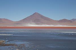
LES LAGUNAS C EST MAGNIFIQUE!!!!!!
un périple qui donne envie.
comment faîttes vous sans hôtels, camping ou directement dans votre 4 x 4
pour notre part, nous cherchons à connaître l'état de la piste de San Pedro de Atacama (chili) à Uyuni via le col Hito Cajon, car nous souhaitons faire le salar les 17 et 18 nov. prochains (la semaien prochaine.
auriez vous des infos sur cette piste ?
en vous remerciant
christelle et mathieu
farwell(arobase)club-internet.fr
merci; effectivement les lagunas c est magnifique, je suis allé plusieurs fois en bolivie; mais j ai en tete cet ete de remonter de tarija a sucre, par camargo, sans faire le trajet de nuit et d'une traite. Elle est belle cette route? ca donne envie? Ou il y a mieux entre tarija et sucre, comme route alternative?
Le col est bitume cote chilien: Heureusement. Il y 2000 m de denivele (2500 a 4500) en 30 kms! Arrive en Bolive ce n est pas le m confort. Ce n est plus que de la piste plus ou moins bonne. Beaucoup de tole ondulee assez mechante (on y a laisse un amortisseur) Mais ca vaut vraiment la peine. Attention prevoir 800kms d autonomie en GO au moins. Prochaine station Uyuni.
Un truc pour ceux qui font comme nous: Laguna verde (Bolivie)-San Pedro d Atacama (Chili)- Salta (Argentine) via Paso Sico: Pas de poste douanier chilien au Paso de Sico. Il faut absolument faire vos demarche d entree et de sortie a San Pedro. Ca vous evitera de faire comme nous de redescendre a San Pedro et deremonter au Paso: 500kms de piste en plus et le tout avec 3 amortisseurs!
Tchao
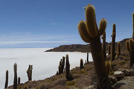
A san pedro, trouve une bonne carte, ou fais une photo numerique d'une carte detaillée dans une agence, que tu pourras consulter sur ton ecran. Je te conseille de remonter par la laguna verde, laguna colorada, puis plein nord en suivant grosso-modo la frontiere chilienne, par les 5 ou 6 lagunes en enfilade (l une d elles s appelle canapa, me semble-t-il) jusqu au poste militaire pres de la voie ferrée ( salar de chiguana, puis san juan, ou tu pourras trouver du carburant en demandant à l epicerie ou meme aux habitants qui connaissent un vieux camionneur, il a des bidons). Puis tu remontes sur le salar, tu dors a l ile des pecheurs ( on y est meme resté 2 nuits), et enfin uyuni. Quand tu t engages dans le salar et que tu as un doute, attends une voiture pour demander ta route, et etre sur le bon chemin, car ca peut etre dangereux. C est le plus beau voyage du monde. Couper le sud lipez pour foncer vers uyuni n est pas plus confortable pour les vertebres, mais plus court, et moins fantastique. J ai fait ce trajet avec un camion non-4x4, en mars, sans soucis, mais tranquille, pas trop vite, avec pleins d arrets.
Dernier truc: a cause de l altitude, essaie de dormir le premier soir avant la frontiere, disons à 3000 metres, pour t acclimater. De san pedro au hito cajon, ca fait beaucoup.
Bonjour, Je pars prochainement pour la Bolivie et je recherche une carte détaillée du salar d uyuni. Sauriez vous où je peux m en procurer une? Merci d avance François
Salut
Tu peux acheter des cartes aux 1:250000 à l'Instituto Geografico Militar (IGM) à Potosi ou Orure pour le Salar (et La Paz je crois). Elles sont tres fiables mais plus ou moins lisible car se sont des photocopies. Ca nous avait paru cher à l'époque (70 bol piece je crois, il en faut au moins 4) mais c'est l'assurance de pas trop se perdre... Essaie d'avoir un petit GPS ou boussole pour les directions ca aide... Sinon j'ai trouve de super cartes routiere pour la bolivie sur un site allemand: 1/1 300 000, waterproof et indechirable, super precises et claires. Ca s'appelle http://www.reise-know-how.de/start-frames.php
Bon voyage et profite...
Sylvain
Je souhaite ( sais pas encore quand) effectuer un long voyage en amerique latine à vélo et aimerais beaucoup traverser le salar, pourriez vous me dire quelle est le période de l'année ou celui-ci est sec?
merci Cyril
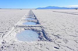
Normalement sec de fin mai à début octobre, parfois de début mai à fin octobre.
Attention à avoir de bonnes cartes ou mieux GPS et points associés, + reserve d'eau.
Pense dans ce cas aux lunettes de soleil et à une bonne crème de protection, notamment pour les lèvres : la réflexion du soleil sur le sel, alliée à la sécheresse de l'air, brûle énormément. Nous avons croisé à la sortie du salar (lui en sortait, nous y entrions) un cycliste qui avait les lèvres en sang, couvertes de gerçures.
J'aimerai louer un 4x4 cet été en Bolivie afin d'être indépendant.
Est-ce qu'il existe des cartes numérisées ? Où trouve-t-on les cartes au 50000 dont tu parles ?
Au niveau de l'essence, peut-on compter sur les stations, ou faut-il envisager que l'une d'entre elle soit à sec (pour l'autonomie) ?
As-tu des noms de loueur intéressant sur la Paz ?
Bonjour, actuellement sur le meme chemin j aimerais savoir si vous l avez fait et si ce n est pas trop perilleux seul, car j aimerais le faire aussi dans les meme dates environ sauf cette annee 2012, si possible avec un autre cc pour le cas de pb etre a plusieurs sera pluas facile je pense, avis aux amateurs, notre site cigognesenvadrouille.com, merci
Salut Natacha, je viens de voir votre site et votre véhicule. Mon avis:
- Double essieu, c'est bien, mais le châssis est bas et le porte-à-faux à l'arrière est important.
- Hymer sur de la bonne rocaille bolivienne, moyen moyen pour la fiabilité, mais ça devrait passer, encore que j'en connais certains pour qui ça s'est pas très bien fini, sans vouloir vous faire flipper.
- Personnelement, je n'ai pas eu de gros problème, mais le véhicule était différent et plus adapté(fourgon Mercedes 309 ancienne génération).
- A titre personnel, je vous le déconseillerais. Mais vous irez quand même, c'est probable, auquel cas engagez-vous sur un itinéraire "praticable" (Tout au nord des lagunas pour rejoindre le salar de chiguana, j'ai des gros doutes sur la faisabilité !). Et à 2 c'est mieux, évidemment. A voir avec ceux qui l'ont fait en Fiat Ducato (si, si, ça existe!).
- En ce qui conseille ces derniers, ils vous enverront au casse-pipe avec une sincérité déconcertante. Prenez tout ce qui est bon pour le moral, du genre "s'il l'a fait moi aussi je peux le faire", mais soyez très prudents...
Bonjour,
Un conseil: N'y allez pas!! Ton vehicule n'est pas adapté au Sud Lipez! Trop bas, trop long, trop lourd et trop haut dans les devers. Tu risques de tout perdre. Je l'ai fait en land Rover bien équipé, j'ai cassé un amortisseur. Heureusement que cette mécanique est rustique et prévu pour ce genre de déconvenues, on a sanglé le pont sur le chassis et roulé 1000kms avant de pouvoir réparer...Avec ton Hymer tu ne pourras pas, par exemple.....De plus tu consommes deux fois plus de carburant. Bref, Je te le déconseille fortement.
Sylvain
Je viens de regarder votre intéressant site web. Comme Vincent je vous déconseille le sud Lipez avec votre engin : trop lourd, trop de porte à faux, traction avant.... C'est vrais que certains Ducato l'ont fait (les tsagalos de Ccar autour du monde notamment mais d'autres aussi) mais dans des configurations plus "légères".
Investissez plutôt dans un bon tour personnalisé sur 5 jours ou plus, vous vous régalerez sans stress et sans casser la monture!
Merci, a tous pour vos réponses, notre problème étant notre chien, mais heureusement nous avons trouvé une agence avec qui nous avons pu l emmener et heureusement ça nous as permis de garder notre cc pour pouvoir finir le voyage, ce site nous est très précieux pour ce genre de voyage.
Hi there,
I’m planning a trip to Russia and Mongolia, starting from France.
Crossing the border at Poland/Belarus or Georgia/Russia—other borders seem either closed or complicated.
Tourist visas for 3 months with multiple entries.
Do you have any info on Russian companies that cover a 4x4 vehicle for 3 months, and what prices in rubles or euros you’ve paid?
Which bank did you use for expenses? (EuroMastercard and Visa cards no longer work.)
Regarding Russian SIM cards, a new system called "Gosuslugi" has been introduced. How long did it take you to get one, and what steps did you follow?
Hi,
we’re planning to visit a park again.
Could you point us toward the camps in Gonarezhou Park?
>We’re traveling completely self-sufficiently.
We love wildlife.
Thanks for any tips you can share!
JP
Hi there, we’ll be in Mozambique in early December 2026 and we’d like to travel from Vilanculos to Beira by car or bus to reach Beira airport. After that, we’re planning to visit Gorongosa National Park before flying back to France from Beira. From what we’ve heard, the road to Beira is tricky, especially at this time of year (start of the rainy season). Could anyone share their thoughts or suggest a solution? Thanks so much for your help!
Anne
Hi there,
I’m heading to Lesotho in a few days and I’m struggling to find info on the best route between Katse Dam and Sehlathebe National Park. There’s a fairly "direct" route from Thaba Tseka, but the roads seem rough, and we’re not exactly 4x4 pros. Anyone have any tips to share? Thanks!
Hi everyone,
We’re heading to Mozambique in October and are looking for either a 4x4 or 4x2 rental in Maputo, or a driver transfer option to reach:
- Ponta Do Ouro
- Tofo
- Vilankulos
The idea is to be self-sufficient for sightseeing and stops while still being able to access certain lodges or beaches that require a 4x2.
Do you have any contacts, addresses, or ideas to share?
Thanks in advance,
Hello,
We're hitting the road again in 2027 to discover new countries and cultures.
Could anyone give me some tips on driving from Ulaanbaatar to Lake Baikal and the route to take?
Thanks, and safe travels to those who are setting off!
We’re planning a 4x4 trip from Belgium to Central Asia, passing through Georgia, Russia, Uzbekistan, Kazakhstan, and Kyrgyzstan.
For these countries, our national insurance obviously doesn’t cover the vehicle, so we’ll need to get local insurance.
Will it be a problem if the vehicle is registered under person A and the national insurance is under person B? Both A and B will be in the vehicle, and both will be listed as drivers on the insurance.
When we get the local insurance, if we again list A and B as drivers, does the order matter? Could we get stuck at the border for this reason?
Hi,
For those who’ve driven on Iceland’s gravel roads in their own or a rented Duster, could you tell me what tires were fitted on the vehicle?
Were they All Terrain tires or more "standard" ones like all-season tires, for example?
Follow-up question: if they were "standard" tires, did that cause any issues on the gravel roads and rough terrain?
Thanks so much for any info you can share.
Best,
Marc
Hi there,
I'm planning a 4x4 road trip from Darwin to Broome with a rooftop tent in July 2026.
I'd like to know if I need to book overnight stops in advance or if I can just wing it and stop wherever I feel like it?
Some evenings, we'd like to stop and make use of campsite facilities (restaurant, shop, showers, toilets).
What do you recommend?
Do I need a permit?
My rough itinerary looks like this:
Darwin - Kakadu
Kakadu - Nitmiluk
Nitmiluk - Kununurra
Kununurra - Purnululu
Purnululu - El Questro
El Questro - Mt Elizabeth - Bell Gorge - Broome
I’m planning a trip to Iceland for next July-August, with a car and tent, and I’m wondering about booking campsites.
From your experience, is it necessary or even essential to book campsites in advance, or do you always manage to find a spot to pitch your tent?
We’ll also have the option to sleep in the car without pitching the tent.
Does that give us the flexibility to stay outside a campsite for a night here and there?
Hi,
I’m planning a road trip in the Middle Atlas, starting and ending in Fez and heading down to the south of Midelt, the Assoul Massif.... We’ll be traveling with two small 4x4s.
I’m looking for detailed maps of this region that include small roads and tracks.
Last year, we had a fantastic road trip in the Anti-Atlas and High Atlas using Erfahren maps, but unfortunately, they don’t cover the area we’re interested in this year.
Thanks for your suggestions!
Dominique
We’re planning a 13-day family road trip in Morocco this July, with six people in a Toyota Prado 4x4 (renting in Marrakech).
We’ll alternate between bivouacking and small hotels/riads depending on the stops.
Here’s the planned route (in this order):
Marrakech
→ Ouarzazate
→ Draa Valley
→ Zagora
→ Erg Chegaga
→ Lake Iriki
→ Foum Zguid
→ Tata
→ Tafraoute
→ Aït Mansour
→ Tiznit
→ Mirleft
→ Taroudant
→ Back to Marrakech
Our goal:
Atlas Mountains + desert + dunes + plateaus + valleys + a bit of coastline.
We’ll cover about 1,700 km in total.
We’re planning:
Bivouacking in the Chegaga/Iriki area
Flexible for the rest (booking the day before or same day)
Sand gear: traction plates, compressor, tow strap, roof rack
Questions:
Is the Zagora → Chegaga → Iriki → Foum Zguid crossing in July doable on our own (single vehicle, no guide)?
Are there any truly technical or risky sections between Chegaga and Iriki?
Does the overall itinerary seem manageable in 13 days without rushing?
Any suggestions for great bivouac spots or particularly interesting stops along this route?
The points on the route are provisional overnight stops. Some spots will include two nights in the same area.
We’re used to off-road driving, but not yet in the Moroccan desert.
Thanks in advance for your feedback and tips! 😊
Good evening
I could use some advice 🙂
Our trip to Namibia is planned for June/July 2026.
We’re struggling a bit with timing and choosing activities for the part of the trip between Sesriem and Brandberg.
Day 1: Sesriem to Mirabib
Day 2: Mirabib to Swakopmund – visit Swakopmund, overnight in Swakopmund
Day 3: Sandwich Harbour – overnight in Swakopmund
Day 4: Kayaking with the seals + the living dunes – overnight in Swakopmund
Day 5: Moon Landscape, Henties Bay + Cape Cross – overnight at White Lady Lodge in Brandberg
Does this itinerary seem realistic to you? Is Cape Cross really worth the trip? If I had to choose between Cape Cross and kayaking with the seals, which would you recommend?
Thanks in advance for your help!
Hélix
My son and I are heading to Georgia this summer to explore the High Caucasus (Svaneti, Kazbek, and Tusheti regions). For this, we’re planning to rent a 4x4.
However, the rental agencies we’ve found prohibit driving on the tracks to Omalo (Tusheti) and/or Ushguli (Svaneti).
Do you know of any agencies in Tbilisi (local and reliable) that allow rented 4x4s to drive on these tracks? If so, which ones?
Hi everyone,
I’m starting to plan an itinerary for September 2027 focused on Zimbabwe and Zambia. I’d love to visit Gonarezhou National Park—I see there are two sectors: the Mwenezi Region in the south and the area around the Runde River in the north. Should I cover both sectors or just focus on the northern region?
For the parks along the Zambezi River, is it better to visit Mana Pools on the Zimbabwe side or Lower Zambezi on the Zambia side?
Thanks in advance for any tips on the parks in these two countries.
Have a great day, everyone.
We’re spending 18 days in New Zealand from 05/04 to 05/21, arriving in QUEENSTOWN and leaving from AUCKLAND.
Any ideas for a road trip that covers the highlights of both islands but only changes hotels every 3–4 nights?
Thanks.
For our trip to Georgia in July, I’d like to rent a 4x4 starting from Tbilisi.
Do you have any rental companies to recommend?
The traditional rentals like Hertz, Avis, etc. seem way overpriced compared to local companies—what do you think? Are they properly insured?
Has anyone here tried Geo Rent Car, Auto 4 Rental, or Sur Price?
Also, I’m looking for info on the condition of the Ushguli–Lentekhi track—is it passable?
Hi everyone,
A well-prepped 4x4, a travel plan across Africa in stages since I’ve got kids to see regularly and work to earn a living.
I’m leaving in November for about a month with the goal of reaching Senegal via Mauritania. I’d love to share this trip with someone who wants to discover Mauritania and a bit of Senegal... and also experience life on board a 4x4 in the desert or bush, sometimes sleeping in the vehicle or in hostels/small hotels for comfort. I want to share this rediscovery because two’s better than one!
Just traveling, exploring, and living! !
I’m planning to explore Argentine and Chilean Patagonia for a month in December 2019.
I’m looking for a rental company (or several) that offers single-cab 4x4 pick-ups with a fitted camper cell for two people. I’m specifically after a vehicle with an indoor shower for extra comfort ;)
So, no vans—at least not from the rental companies I’ve seen so far.
While browsing the forum, I came across the Chilean rental company Holiday Rent. But do you have any recommendations for Argentine rentals?
Because, if I can’t return the vehicle in the same city as pickup, I’d prefer—and it’d likely be cheaper—to at least return it in the same country.
I’m traveling through Argentina and Chile (as well as Paraguay and Uruguay) with a 2019 Toyota Hilux Euro 6. Could anyone tell me if the local diesel is suitable for its engine, or if I need to take any special precautions (like adding an additive, for example) for these countries?
I’d also like to know if driving at high altitudes is possible, and up to what elevation—or if I should worry about the vehicle going into limp mode?
If that happens, what should I do?
Hi there,
Can you tell me if the road between Zagora and M'Gouna is easy or difficult for a 4x4? How much time and how many kilometers should I plan for? I’m traveling in May.
Thanks!
Hi there,
My trip to South Africa is starting to take shape.
However, I'm struggling to figure out the route through Kruger Park. I can't seem to find the information I need about getting around.
Coming from the south, I plan to arrive on Day 1 in the early afternoon at Malelane or Crocodile Bridge.
Do some shopping in Malelane (or Crocodile Bridge main area) and stay overnight outside the park.
Leave on Day 2 at 5 AM for the park. Explore the southern part of the park.
Stay overnight around Skukuza or Lower Sabie. (We don’t want to stay in one of the park’s big camps. We’re looking for a lodge around 200 €.
Head out on Day 3 for a self-drive safari, maybe as far as Orpen.
We’d like to stay in a private reserve on nights 4 and 5.
We’re not sure which one or how to get into a private reserve. Do we need to exit Kruger Park?
On Day 5, we’d like to leave to visit Blyde Canyon (on Day 6).
I’m planning to leave Morocco for the summer but want to leave my 4x4 there to avoid exceeding the famous 6-month limit. I’d like to park it in one of the two Spanish enclaves (Ceuta or Melilla).
Does anyone know of people or companies that handle long-term parking (preferably secure) in either place?
Once the car is parked, what’s the best way to get back to France using public transport?
Is the nearest airport Tanger from Ceuta?...
How do I get there easily, etc. etc.
hello! I’d like to go to Kazakhstan and rent a fitted 4x4 locally so I can drive off-road trails and sleep inside the vehicle... could anyone share some local rental company addresses, please? Thanks! !
I'm about to rent a self-drive 4x4 in Mongolia. Has anyone heard of GOBI.RENT?
Otherwise, do you have any tips for checking this company since there's no info on their website (e.g., registration number on the RCS)?
I’m finalizing my trip starting from Namibia.
When I arrive in Divundu, I’d like to head straight to the Khwai area early in the morning to one of the campsites in the Khwai Development Trust. Is the drive doable with a good 4x4 in a day?
We’ll spend 2 nights in Khwai, then 2 or maybe 3 nights in the Moremi area (Third Bridge/Xakanaxa/Mboma) before heading back to Maun to wrap up our journey.
Is that too much time to spend in each place?
We’d also like to do one or two boat excursions in the delta. Any suggestions for the best options and operators?
Thanks in advance for your tips and advice!
Best,
Patrick
Hi everyone,
I’m planning to explore the western part of Madagascar from May 1st to 5th, specifically to visit the Tsingy. I’ve heard different versions about the road conditions and access to the Tsingy during this time, so I’d love to hear from people who’ve actually made this trip during this time of year.
Have you traveled from Morondava → Tsingy between May 1st and 5th?
Was the journey doable and safe?
Did you have access to the Grands Tsingy, or just the Petits Tsingy?
Thanks so much for your feedback—it’ll really help me get a clearer picture! 😊
Also, if you have any recommendations for reliable and experienced driver-guides, I’d love to hear them.
Thanks again!