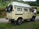
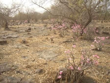
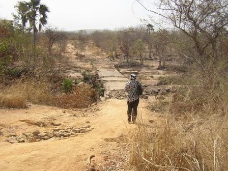
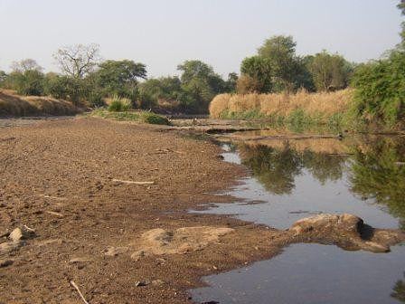
Avec mon mari nous allons voyager au Mali avec notre 4x4 personnel (nous vivons actuellement en Mauritanie). Arrivant par le Sénégal, nous commencerons par la région de Kayes et souhaitons notamment visiter le parc du Bafing. J'ai malheureusement trouvé peu d'informations sur Internet et dans les guides touristiques concernant les visites dans cette région.
Voici le trajet que l'on envisage de faire : Kayes > le fort de Médine > les rapides de Félou > Saboussiré > Chutes de Gouina > Bafoulabé > Manantali > Parc national du Bafing > Kita > Bamako.
Ceux qui auraient déjà voyagé dans cette région pourraient-ils me confirmer si ce parcours est faisable (difficultés des pistes, orientation avec une simple carte et GPS) ou faut-il nécessairement partir avec un guide depuis Kayes ? Avez-vous des conseils à nous donner ?
Par où faut-il entrer pour visiter le parc du Bafing ? Où peut-on trouver un guide qui nous accompagne dans le parc ?
Est-il possible de se ravitailler à Bafoulabé ?
Merci par avance pour ces précieuses infos !
Bonnes fêtes
Ha "lapirogue" toujours plus rapide , tu as les meilleurs voeux de nous tous ..
<<< Revenons à nos moutons !! il n'y a pas de "PARC" du Bafing a proprement parler ..
Le parc du Bafing c'est une zone , une région, un coin, un truc !! pas un parc où on visite pour voir des animaux ...
Pour le début du parcour il te faut un bon 4X4 bien équipé pour te sortir de la m.... tout seul au cas ou , car il ne passe pas grand monde dans le coin , et la piste est plutôt cassante j'y ai cassé mes lames, et chopé le palu
Pas possible de faire le tour du plan d'eau du Bafing , il y a bien des pistes sur la carte , mais pas sur le terrain !! renseignement demandé aux gendarmes (???) encore plus perdu que nous (c'est l'Afrique)
A Kita tu retrouve le goudron (neuf) pour rejoindre Bamako
Bien sur tout ça ce fait avec carte (ou GPS) "SANS GUIDE" prévoir de quoi manger et boire + bivouac
PS = pour entrer au Sénégal (pour un véhicule étranger) il faut un carnet de douane ou carnet ATA tout pays
Merci pour les infos ! Effectivement, j'avais déjà jeté un bon coup d'oeil sur le site de papy et mamy !
Cela confirme donc que l'on peut faire cette région sans recourir à un guide (comme me le conseillerait l'office de tourisme de Kayes) ?
Il faut compter combien de jours, depuis Kayes, jusqu'à Kita, pour faire le trajet en prenant le temps de profiter de la nature et des paysages ?
Suivant l'état des pistes il faut compter deux jours avec une nuit aux chutes , si ce n'est que pour faire Kayes/Kita , il faut en profiter !!!!
Si en plus vous allez faire un tour au sud en suivant le Bafing pour aller a Manantali ou essayer de faire les rives du lac (parc national du Bafing) comptez un jour de plus, c'est joli comme coin
Salut vous deux
Si j'ai bien compris ton trajet, tu veux te le faire par la piste de brousse. C'est marrant comme tout à faire. Je l'ai fait en 2007. Je te conseille d'avoir ton engin réhaussé au maximum si tu veux arriver au bout.
Emmène aussi 2 pneus de rechange. Quand tu en éclates un et qu'il te reste encore 400 km à faire... tu serres les fesses et t'es pas fière.
J'avais mis un post de ce trajet sur ce site. Mais c'était avant que cette rubrique existe. Tu devrais pouvoir le retrouver. Sinon, je te le renverrai. C'est un parcours que j'ai fait sans GPS, ni boussole en me fiant uniquement au soleil. Ne fait pas ça. Déjà tu vas le faire après la saison des pluies et c'est pas mal car tu pourras franchir les gués. Sinon... tu attends la décrue car tu ne vois pas le fond. Emporte aussi un max de carburant. Pour faire les 450 km, cela m'a bouffé 200 l de mazout. Te dire que tu ne vas pas pêcher par excès de vitesse. Fais-toi aussi blinder le dessous. Tu verras que cela te sera utile.
Pour le carburant faut pas paniquer , il y en a à Kayes à Diamou (70 km de Kayes)
Bafoulabé (130 km de Kayes) Kita est à 200 km de Bafoulabé
Pour circuler le long du Bafing compter 250 à 300 km (aller/R) de Bafoulabé ou de Kita
Pas possible de se perdre = il faut suivre la voie ferrée d'un côté et le fleuve de l'autre de Kayes à Kita ..
OUI il faut faire attention pour traverser le (les ?) gué , ce n'est pas toujours en ligne droite , il y en a un a faire à pied si pas de visibilité du parcours ou de la profondeur , il est pas loin des chutes ..
Et change ton 120 , il consomme plus de 50 litres au 100/km (200 litres pour 450 kms ?) Bof avec mon bon vieux 61 je fait du 11 litres/100 km (14 litres dans le sable)
Bon, et bien, apparemment, c'est une vraie aventure que cette partie du Mali !! Je ne sais pas quoi en penser : ça me parait faisable (puisque vous l'avez fait), mais en même temps ce que décrit Christian me donne un peu d'appréhension ! Mais le message de papy me rassure plus !!
Pour avoir encore plus d'infos, je veux bien que Christian, tu m'envoies le post de 2007 ... si tu remets la souris dessus ! Te souviens-tu du trajet exact que tu avais fait ?
Bonsoir
Beaux coins en effet et effectivement parc de Bafing largement théorique. Pour voir des animaux il faut aller a la frontiere de la Guinée, ou on trouve meme des chimpanzes.
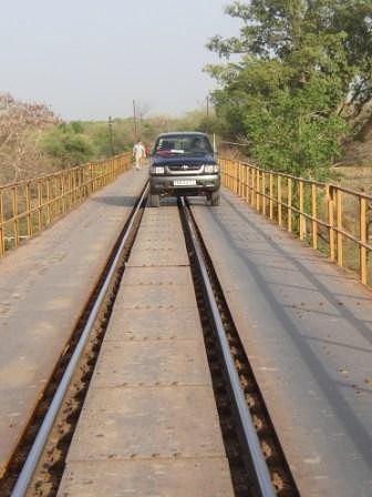
Piste de Bafoulabe a Kita tres cassante et usante pour les pneus, prevoir effectivement au moins 2 pneus de rechange. Peu de vulcanisateurs sur cette portion si ce n est a Toukoto (peut etre Oualia aussi). A partir de decembre, pas trop d eau donc passages de gué aisés si ce n est les cailloux. Avant Toukoto, possible de passer sur le pont voie ferrée au lieu de passer par les gués.
Apres Badumbe, avant Toukoto, tres belle foret de baobabs.
Apres Toukoto, 2 pistes possibles, 1 qui va vers Badougou et qui est rehabilitée, jolie, 1 qui suit le fleuve, mal retouchée par les chinois, beaux passages pres du fleuve et jolis paysages de foret. Perso je la prefere.
La piste est assez visible dans le sens Bafoulabe/Kita, dans l autre sens, plusieurs passages ou il est possible de se tromper, mais normalement jamais trop longtemps (en particulier apres le gue de Fangala).
Bref c est beau, il faut etre assez autonome car tres peu habité et tres tres peu de passage (quasi jamais pour tt dire) si ce n est le train pas loin.
Une petite précision pour ceux que ça intéresse. Je suis parti de Bamako pour aller à Kayes . Donc dans l'autre sens. Faites gaffe... Quand vous aurez passé la trentaine de ralentisseurs-casseur-de-suspension à la sortie de Bamako, vous allez trouver 3 (trois) bleds qui s'appellent Kita. Et oui, c'est comme ça là-bas, faut s'y habituer. Mois j'ai prit la piste au troisième kita.
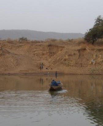
Quand je suis arrivé au bord du fleuve machin (j'ai oublié le nom), Bafoulabé était sur la rive opposée. Je suis passé par l'ancienne usine de marbre faite par les Russes.
Il y a aussi une autre solution qui consiste à aller jusqu'au bled qui s'appelle Mehinda (je crois, parce que c'était en 2007 et que le temps passant j'ai oublié pas mal de nom) et de prendre l'ancienne voie ferrée des russes faite pour sortir le marbre. Mais bon... rouler sur la voie ferrée ne m'a pas trop enthousiasmé (Hé oui, les vibrations répétées des traverses de chemin de fer te font vibrer le Toy à répétition et ça... c'est pas bon, pas bon du tout) alors j'ai opté pour une traversée en bac qui se trouve un peu avant ce bled.
Je préviens ceux que ça tentent, c'est cassant! ça m'a ruiné mes 4 amortisseurs Bilstein, dont 2 à bonbonne d'air séparées. Je ne suis revenu en France qu'avec mes 4 autres amortisseurs Eiback.
Mais si vous avez un 4 x 4, je suppose que ce n'est pas seulement pour faire du franchissement de trottoir, hein?
Have a good trip and enjoy it.😉
J'ai oublié de dire un truc; si vous voulez "faire du 4 x 4", faites ce parcours pendant qu'il en vaut encore la peine. Je suis arrivé au cul des bulldozers qui abattent les arbres pour faire une belle route reliant Bamako à Kayes. Si ça se trouve... elle est déjà terminée. Alors après... finie la rigolade. Moi c'était en 2007.
Bonsoir
En sortant de Bamako, je pense que le nom du bled, c est plutot Kati que Kita.
Pour trouver la route vers Kita en sortant de Bamako au final c est simple, il suffit de sortir de Bamako en visant Kayes, le Senegal, Kolokani, Didieni et de passer par Kati. Juste apres la barriere de peage, bifurcation immediate a gauche direction Kita a 170 bornes de la.
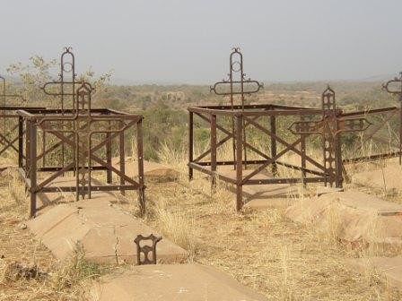
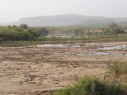
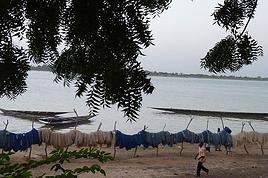
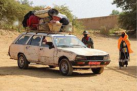
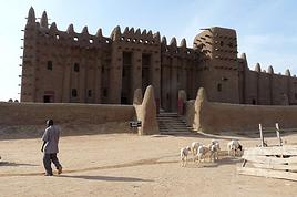
QQ photos de la piste Kita-Bafoulabe ci jointes.
ciao
Tu as parfaitement raison: d'abord il y a un bled qui s'appelle Kati (failli me gourrer, mais sans GPS...) puis après les 3 bleds qui s'appellent KITA. Comment se fait la distribution du courrier dans ces 3 bleds?😄 me le suis toujours demandé. Au fait... il y a peut-être un 4ième bled qui s'appelle Kita, j'en sais rien, j'ai pris la piste de brousse au 3 ième.
Faisez gaffe quand même...
Dommage que vous n'ayez pas croisé Papy et Mamy lors d'un de leurs passages à Nouakchott.
A mon avis, y a moyen que vous vous voyiez en France (dans le sud-ouest) un peu plus tard sinon...
Ce serait une belle rencontre, pour sûr !!
Hi there,
We’ll be traveling in January 2027 in a 4x4 with a rooftop tent with our three kids, from Johannesburg to Cape Town. We’ve already booked several campsites in national parks (Golden Gate / Mountain Zebra / Addo Elephant / Garden Route).
We still need to reserve the stretch between De Hoop Nature Reserve and Cape Town. Any suggestions?
We’d love to stay around Cape Town for 5 days to explore the wine route, the peninsula, and do some hikes in Table Mountain.
Any camping recommendations? Or, on the contrary, places to avoid?
Also, we have 2 nights left near Wilderness National Park / Knysna. Any recommendations?
Thanks so much for your help!
For my 60th birthday (yes, I’m jumping the gun a bit!), I’m starting to plan a self-drive trip to Tanzania (in June).
I also considered Zimbabwe but I’m worried it might be a bit chilly at night in June.
I’ve revisited an itinerary I’d thought about before, tweaking it since I’ll have more days to dedicate to this trip. Still no big northern classics for the same reasons as before (too expensive, too crowded, too many tour operators).
Here’s what I’ve got so far:
(Arrival/departure from Kilimanjaro Airport)
Night 1: Arusha
Night 2: Arusha
Night 3: Lake Manyara
Night 4: On the way to Iringa (any ideas???)
Night 5: Iringa
Nights 6–8: Ruaha NP
Nights 9–10: Mikumi NP
Night 11: Bagamoyo
Nights 12–15: Beach
Nights 16–17: Lushoto
Nights 18–19: Mkomazi NP
Night 20: Toward Marangu – eastern Kilimanjaro
Night 21: Western Kilimanjaro
End of trip
All your ideas, tweaks, info, and suggestions on this route are welcome!
I could move one beach night somewhere else if needed.
Also, if you have a car rental company to recommend or thoughts on the bandas rented in the parks, I’m all ears!
Finally, what are the roads like in Ruaha in June? The rental company I’m looking at seems to allow this park with a small 4x4. (Off-limits: Serengeti and Natron)
We’re planning a long-term trip starting in April with our 4x4, beginning in the USA.
We’re still looking for car insurance that covers Canada and the USA.
We’ve read quite a few forums, but we’re hoping for some help (from fellow travelers).
Hi there,
I’m planning a trip to Russia and Mongolia, starting from France.
Crossing the border at Poland/Belarus or Georgia/Russia—other borders seem either closed or complicated.
Tourist visas for 3 months with multiple entries.
Do you have any info on Russian companies that cover a 4x4 vehicle for 3 months, and what prices in rubles or euros you’ve paid?
Which bank did you use for expenses? (EuroMastercard and Visa cards no longer work.)
Regarding Russian SIM cards, a new system called "Gosuslugi" has been introduced. How long did it take you to get one, and what steps did you follow?
Hi,
we’re planning to visit a park again.
Could you point us toward the camps in Gonarezhou Park?
>We’re traveling completely self-sufficiently.
We love wildlife.
Thanks for any tips you can share!
JP
Hi there, we’ll be in Mozambique in early December 2026 and we’d like to travel from Vilanculos to Beira by car or bus to reach Beira airport. After that, we’re planning to visit Gorongosa National Park before flying back to France from Beira. From what we’ve heard, the road to Beira is tricky, especially at this time of year (start of the rainy season). Could anyone share their thoughts or suggest a solution? Thanks so much for your help!
Anne
Hi there,
I’m heading to Lesotho in a few days and I’m struggling to find info on the best route between Katse Dam and Sehlathebe National Park. There’s a fairly "direct" route from Thaba Tseka, but the roads seem rough, and we’re not exactly 4x4 pros. Anyone have any tips to share? Thanks!
Hi everyone,
We’re heading to Mozambique in October and are looking for either a 4x4 or 4x2 rental in Maputo, or a driver transfer option to reach:
- Ponta Do Ouro
- Tofo
- Vilankulos
The idea is to be self-sufficient for sightseeing and stops while still being able to access certain lodges or beaches that require a 4x2.
Do you have any contacts, addresses, or ideas to share?
Thanks in advance,
Hello,
We're hitting the road again in 2027 to discover new countries and cultures.
Could anyone give me some tips on driving from Ulaanbaatar to Lake Baikal and the route to take?
Thanks, and safe travels to those who are setting off!
We’re planning a 4x4 trip from Belgium to Central Asia, passing through Georgia, Russia, Uzbekistan, Kazakhstan, and Kyrgyzstan.
For these countries, our national insurance obviously doesn’t cover the vehicle, so we’ll need to get local insurance.
Will it be a problem if the vehicle is registered under person A and the national insurance is under person B? Both A and B will be in the vehicle, and both will be listed as drivers on the insurance.
When we get the local insurance, if we again list A and B as drivers, does the order matter? Could we get stuck at the border for this reason?
Hi,
For those who’ve driven on Iceland’s gravel roads in their own or a rented Duster, could you tell me what tires were fitted on the vehicle?
Were they All Terrain tires or more "standard" ones like all-season tires, for example?
Follow-up question: if they were "standard" tires, did that cause any issues on the gravel roads and rough terrain?
Thanks so much for any info you can share.
Best,
Marc
Hi there,
I'm planning a 4x4 road trip from Darwin to Broome with a rooftop tent in July 2026.
I'd like to know if I need to book overnight stops in advance or if I can just wing it and stop wherever I feel like it?
Some evenings, we'd like to stop and make use of campsite facilities (restaurant, shop, showers, toilets).
What do you recommend?
Do I need a permit?
My rough itinerary looks like this:
Darwin - Kakadu
Kakadu - Nitmiluk
Nitmiluk - Kununurra
Kununurra - Purnululu
Purnululu - El Questro
El Questro - Mt Elizabeth - Bell Gorge - Broome
I’m planning a trip to Iceland for next July-August, with a car and tent, and I’m wondering about booking campsites.
From your experience, is it necessary or even essential to book campsites in advance, or do you always manage to find a spot to pitch your tent?
We’ll also have the option to sleep in the car without pitching the tent.
Does that give us the flexibility to stay outside a campsite for a night here and there?
Hi,
I’m planning a road trip in the Middle Atlas, starting and ending in Fez and heading down to the south of Midelt, the Assoul Massif.... We’ll be traveling with two small 4x4s.
I’m looking for detailed maps of this region that include small roads and tracks.
Last year, we had a fantastic road trip in the Anti-Atlas and High Atlas using Erfahren maps, but unfortunately, they don’t cover the area we’re interested in this year.
Thanks for your suggestions!
Dominique
We’re planning a 13-day family road trip in Morocco this July, with six people in a Toyota Prado 4x4 (renting in Marrakech).
We’ll alternate between bivouacking and small hotels/riads depending on the stops.
Here’s the planned route (in this order):
Marrakech
→ Ouarzazate
→ Draa Valley
→ Zagora
→ Erg Chegaga
→ Lake Iriki
→ Foum Zguid
→ Tata
→ Tafraoute
→ Aït Mansour
→ Tiznit
→ Mirleft
→ Taroudant
→ Back to Marrakech
Our goal:
Atlas Mountains + desert + dunes + plateaus + valleys + a bit of coastline.
We’ll cover about 1,700 km in total.
We’re planning:
Bivouacking in the Chegaga/Iriki area
Flexible for the rest (booking the day before or same day)
Sand gear: traction plates, compressor, tow strap, roof rack
Questions:
Is the Zagora → Chegaga → Iriki → Foum Zguid crossing in July doable on our own (single vehicle, no guide)?
Are there any truly technical or risky sections between Chegaga and Iriki?
Does the overall itinerary seem manageable in 13 days without rushing?
Any suggestions for great bivouac spots or particularly interesting stops along this route?
The points on the route are provisional overnight stops. Some spots will include two nights in the same area.
We’re used to off-road driving, but not yet in the Moroccan desert.
Thanks in advance for your feedback and tips! 😊
Good evening
I could use some advice 🙂
Our trip to Namibia is planned for June/July 2026.
We’re struggling a bit with timing and choosing activities for the part of the trip between Sesriem and Brandberg.
Day 1: Sesriem to Mirabib
Day 2: Mirabib to Swakopmund – visit Swakopmund, overnight in Swakopmund
Day 3: Sandwich Harbour – overnight in Swakopmund
Day 4: Kayaking with the seals + the living dunes – overnight in Swakopmund
Day 5: Moon Landscape, Henties Bay + Cape Cross – overnight at White Lady Lodge in Brandberg
Does this itinerary seem realistic to you? Is Cape Cross really worth the trip? If I had to choose between Cape Cross and kayaking with the seals, which would you recommend?
Thanks in advance for your help!
Hélix
My son and I are heading to Georgia this summer to explore the High Caucasus (Svaneti, Kazbek, and Tusheti regions). For this, we’re planning to rent a 4x4.
However, the rental agencies we’ve found prohibit driving on the tracks to Omalo (Tusheti) and/or Ushguli (Svaneti).
Do you know of any agencies in Tbilisi (local and reliable) that allow rented 4x4s to drive on these tracks? If so, which ones?
Hi everyone,
I’m starting to plan an itinerary for September 2027 focused on Zimbabwe and Zambia. I’d love to visit Gonarezhou National Park—I see there are two sectors: the Mwenezi Region in the south and the area around the Runde River in the north. Should I cover both sectors or just focus on the northern region?
For the parks along the Zambezi River, is it better to visit Mana Pools on the Zimbabwe side or Lower Zambezi on the Zambia side?
Thanks in advance for any tips on the parks in these two countries.
Have a great day, everyone.
We’re spending 18 days in New Zealand from 05/04 to 05/21, arriving in QUEENSTOWN and leaving from AUCKLAND.
Any ideas for a road trip that covers the highlights of both islands but only changes hotels every 3–4 nights?
Thanks.
For our trip to Georgia in July, I’d like to rent a 4x4 starting from Tbilisi.
Do you have any rental companies to recommend?
The traditional rentals like Hertz, Avis, etc. seem way overpriced compared to local companies—what do you think? Are they properly insured?
Has anyone here tried Geo Rent Car, Auto 4 Rental, or Sur Price?
Also, I’m looking for info on the condition of the Ushguli–Lentekhi track—is it passable?
Hi everyone,
A well-prepped 4x4, a travel plan across Africa in stages since I’ve got kids to see regularly and work to earn a living.
I’m leaving in November for about a month with the goal of reaching Senegal via Mauritania. I’d love to share this trip with someone who wants to discover Mauritania and a bit of Senegal... and also experience life on board a 4x4 in the desert or bush, sometimes sleeping in the vehicle or in hostels/small hotels for comfort. I want to share this rediscovery because two’s better than one!
Just traveling, exploring, and living! !
I’m planning to explore Argentine and Chilean Patagonia for a month in December 2019.
I’m looking for a rental company (or several) that offers single-cab 4x4 pick-ups with a fitted camper cell for two people. I’m specifically after a vehicle with an indoor shower for extra comfort ;)
So, no vans—at least not from the rental companies I’ve seen so far.
While browsing the forum, I came across the Chilean rental company Holiday Rent. But do you have any recommendations for Argentine rentals?
Because, if I can’t return the vehicle in the same city as pickup, I’d prefer—and it’d likely be cheaper—to at least return it in the same country.
I’m traveling through Argentina and Chile (as well as Paraguay and Uruguay) with a 2019 Toyota Hilux Euro 6. Could anyone tell me if the local diesel is suitable for its engine, or if I need to take any special precautions (like adding an additive, for example) for these countries?
I’d also like to know if driving at high altitudes is possible, and up to what elevation—or if I should worry about the vehicle going into limp mode?
If that happens, what should I do?
Hi there,
Can you tell me if the road between Zagora and M'Gouna is easy or difficult for a 4x4? How much time and how many kilometers should I plan for? I’m traveling in May.
Thanks!
Hi there,
My trip to South Africa is starting to take shape.
However, I'm struggling to figure out the route through Kruger Park. I can't seem to find the information I need about getting around.
Coming from the south, I plan to arrive on Day 1 in the early afternoon at Malelane or Crocodile Bridge.
Do some shopping in Malelane (or Crocodile Bridge main area) and stay overnight outside the park.
Leave on Day 2 at 5 AM for the park. Explore the southern part of the park.
Stay overnight around Skukuza or Lower Sabie. (We don’t want to stay in one of the park’s big camps. We’re looking for a lodge around 200 €.
Head out on Day 3 for a self-drive safari, maybe as far as Orpen.
We’d like to stay in a private reserve on nights 4 and 5.
We’re not sure which one or how to get into a private reserve. Do we need to exit Kruger Park?
On Day 5, we’d like to leave to visit Blyde Canyon (on Day 6).
I’m planning to leave Morocco for the summer but want to leave my 4x4 there to avoid exceeding the famous 6-month limit. I’d like to park it in one of the two Spanish enclaves (Ceuta or Melilla).
Does anyone know of people or companies that handle long-term parking (preferably secure) in either place?
Once the car is parked, what’s the best way to get back to France using public transport?
Is the nearest airport Tanger from Ceuta?...
How do I get there easily, etc. etc.
hello! I’d like to go to Kazakhstan and rent a fitted 4x4 locally so I can drive off-road trails and sleep inside the vehicle... could anyone share some local rental company addresses, please? Thanks! !