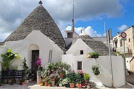
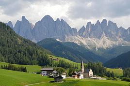
I'm starting a new travel journal in Italy.
It's about a month-long trip (from September 3, 2025, to October 4, 2025), or rather a part of it. This section matches the title: an opera festival in Verona (one evening) and the Dolomites in the Veneto region.
I'm posting the part of the trip I think will interest French-speaking readers the most (since this is where I saw the most French travelers).
Here’s a quick summary:
- Trip in September 2025
- Solo travel with camping (caravan)
- Small geographic area: besides Verona, the surroundings of the Marmolada massif and Cortina d'Ampezzo.
- Main but not exclusive activity: hiking.
Since I have limited internet access where I am now, I’ll be writing slowly.
Here we go!
Day 1: Thursday, September 4, 2025
I arrived in Veneto under the sun and with warm weather. I drove to Verona and tried to find a spot at the campsite (Verona Village) located south of the city. Unfortunately, it was full. Booking on the website was mandatory, but when I tried to reserve a few days ago, the site never moved from the "reservation" step to the "payment" step (I don’t know why—it’s always like that in these cases).
I found another solution over the phone; the drive from southern Verona to the northeast was a bit long, but I finally settled at the "Oro Verde" campsite. It’s an "agricampeggio" (farm camping or rural campsite) on the outskirts of the city, and its name (green gold) suggests they produce olives there.
Since it wasn’t late, I biked to the Adige River, following the recommended route into the city.
We did the Langtang trek (hike) from September 10th to 17th, with the first and last days being the trip from Kathmandu and back—so 6 days of actual walking. It’s a fairly well-known trek but certainly not as famous or crowded as those in the Annapurna or Everest regions, which is why we chose it.
In theory, it’s mandatory to have a guide for this trek. In reality, it seems there are ways to bypass the regulations: we met at least two people hiking without a guide—a South Korean, a New Zealander, and possibly also a couple of English women and an American couple, though we’re not sure if they had a guide.
The agency we booked with had told us it was an affordable trek for relatively older people in good shape—which is our case (I’m 72 myself). I have to say upfront that we found it quite challenging, maybe because we didn’t have good weather—it was the end of the monsoon season. To be clear, no matter your fitness level, I’d say doing this trek in the middle of the monsoon season would be suicidal.
Day 1 – Journey from Kathmandu to Syapru Besi
On Monday, September 8th, there had been violent protests in Kathmandu against the government, which had, among other things, blocked access to social media and been accused of nepotism and corruption. There were 19 deaths. The situation was very tense on the day of our departure, Wednesday the 10th. The agency warned us that public transport was very unreliable. So, we decided to take a jeep, at an additional cost of $100 ($160 minus what was already budgeted for the bus).
We left a little before 7 a.m. and it took us a good hour just to reach the outskirts of Kathmandu. Along the way, we saw several houses and vehicles set on fire by protesters.
The road to Syapru Besi is only 120 km, but it’s frankly awful. It’s always narrow, winds through endless mountains, and the shoulders range from bad to confusing to nonexistent. Several sections are just dirt tracks. We didn’t regret opting for the jeep, as we could stop several times at our convenience—if only to let Y (my Thai partner) throw up everything she had. She’d taken her usual motion sickness medication, but the constant turns, accelerations, and braking eventually made her terribly carsick.
In Nuwakot, we stopped for breakfast at a nice little restaurant, Jimbu. It was around 8:30 a.m., and we’d barely covered 60 km. The restaurant has a lovely garden overlooking the Trishuli Ganga, the river flowing down from Syapru Besi. First photo: the river in the bottom right corner, mist and clouds over the mountain on the other side.
An hour later, my second photo: the hills along the Trishuli Ganga. You can see the different crops—lush green rice paddies in the lower right and corn, already yellowed and likely harvested, in the foreground on the left. And of course, the mist and clouds through which you can glimpse the mountain on the other side of the river.
In theory, it’s mandatory to have a guide for this trek. In reality, it seems there are ways to bypass the regulations: we met at least two people hiking without a guide—a South Korean, a New Zealander, and possibly also a couple of English women and an American couple, though we’re not sure if they had a guide.
The agency we booked with had told us it was an affordable trek for relatively older people in good shape—which is our case (I’m 72 myself). I have to say upfront that we found it quite challenging, maybe because we didn’t have good weather—it was the end of the monsoon season. To be clear, no matter your fitness level, I’d say doing this trek in the middle of the monsoon season would be suicidal.
Day 1 – Journey from Kathmandu to Syapru Besi
On Monday, September 8th, there had been violent protests in Kathmandu against the government, which had, among other things, blocked access to social media and been accused of nepotism and corruption. There were 19 deaths. The situation was very tense on the day of our departure, Wednesday the 10th. The agency warned us that public transport was very unreliable. So, we decided to take a jeep, at an additional cost of $100 ($160 minus what was already budgeted for the bus).
We left a little before 7 a.m. and it took us a good hour just to reach the outskirts of Kathmandu. Along the way, we saw several houses and vehicles set on fire by protesters.
The road to Syapru Besi is only 120 km, but it’s frankly awful. It’s always narrow, winds through endless mountains, and the shoulders range from bad to confusing to nonexistent. Several sections are just dirt tracks. We didn’t regret opting for the jeep, as we could stop several times at our convenience—if only to let Y (my Thai partner) throw up everything she had. She’d taken her usual motion sickness medication, but the constant turns, accelerations, and braking eventually made her terribly carsick.
In Nuwakot, we stopped for breakfast at a nice little restaurant, Jimbu. It was around 8:30 a.m., and we’d barely covered 60 km. The restaurant has a lovely garden overlooking the Trishuli Ganga, the river flowing down from Syapru Besi. First photo: the river in the bottom right corner, mist and clouds over the mountain on the other side.
An hour later, my second photo: the hills along the Trishuli Ganga. You can see the different crops—lush green rice paddies in the lower right and corn, already yellowed and likely harvested, in the foreground on the left. And of course, the mist and clouds through which you can glimpse the mountain on the other side of the river.
15 days across Gran Canaria, El Hierro, and a dash of Tenerife under the storm Thérèse!
The planned itinerary will be slightly disrupted...
(The version without discussions is here)
The planned itinerary will be slightly disrupted...
(The version without discussions is here)
Monday, August 21, 2023 - Rochefort - Marans
No journal for the first two days. Day 1 - CARCANS-ROYAN Day 2 - ROYAN - ROCHEFORT Tonight I'm in MARANS in the "dry marsh" according to the campsite manager—it’s the first time I’ve heard of a "dry marsh"?!
Photos from the first two days
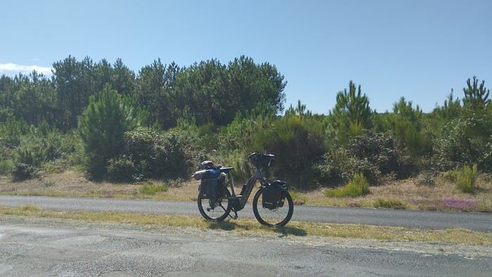 My gear
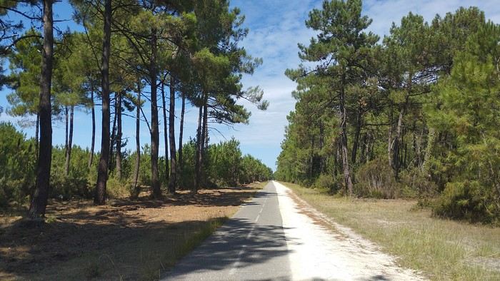
The Landes region—nothing extraordinary, but the calm and serenity are nice.

Le Verdon
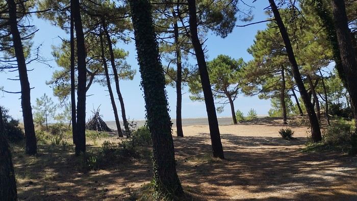
The wild coast
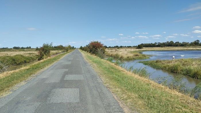
This marsh isn’t dry, though.
Today is the third day of my trip, and I’m writing to you from a campsite in Marans. I’ve set out to bike from Carcans Maubuisson back to Plaisir. Why Carcans? Because we spent a week there as a family—a great week that lets everyone reconnect for a long stretch. Also, on Saturday, we all headed home—some by car, and me by bike. This journey is about 850 km via bike paths and small cycling roads. It’s not a sporting feat, just a nice long ride for fun. As the old Chinese sage says, "The destination doesn’t matter—it’s the journey that counts." But he also told me, "Traveling is great, but what’s the point if you don’t share it?" You see, this old sage has told me a lot of things—he often keeps me company when I’m biking. Of course, he doesn’t pedal, but we travel in harmony. Sure, he can be a bit annoying sometimes, but we still get along. All this to say I’ve created a group to share my story. I’d be happy to share this experience with you—it’s an adventure for me. On Saturday, I wasn’t sure I’d even leave because I’d been dealing with sciatica for days. Luckily, Juliette, a friend of the old Chinese sage, recommended a lifesaving remedy: Alternately stretching your legs with an elastic band under your foot. Obviously, a jam jar rubber band won’t cut it.
From Marans - The mosquitoes are attacking; time to head back to shelter.
The first two legs took me to Royan and then Rochefort. The Sèvre Niortaise flows nearby, and I followed a canal from La Rochelle. You could say the area is as dry as the marsh, judging by the state of the crops.
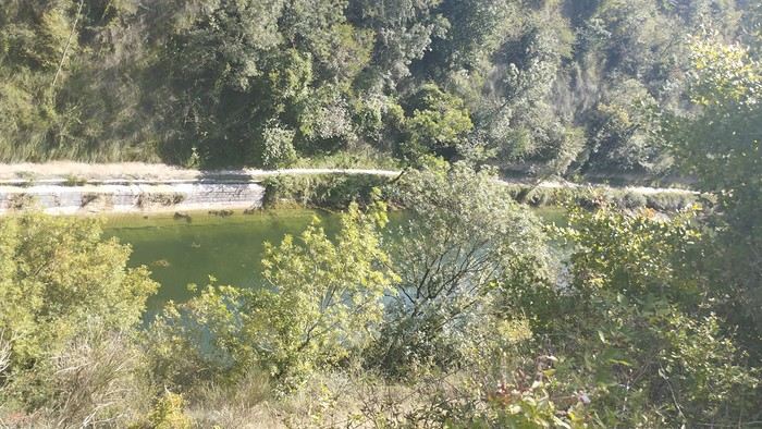
As I mentioned, it’s the third day, and if Jesus rose again on this day, for me it was more like the crucifixion. The scorching heat—only bearable when you’re moving—combined with rough trail conditions, and the old Chinese sage says, "Terrible roads, slow speed, and watch your limbs." I set out to do 60 km but ended up doing 80, and the last 20 were tough. I kept checking the GPS to see how much farther until the campsite. Today: Rochefort to Marans, sticking to the coast until La Rochelle, then no notable towns after that—just a constant canal. But since the sky isn’t too low, it hasn’t gotten lost. I’ve still got plenty of anecdotes to share, but it’s pitch black out, and the mosquitoes are still around. This morning, I counted ten in my tent, all full of my blood. Yesterday, at the end of the leg to Rochefort, I was really looking forward to crossing the Charente using the transporter bridge, but a sneaky GPS conspiracy led me far from it. I ended up crossing the Charente on a completely ordinary bridge, watching the transporter bridge in the distance with disappointment.
End of the first episode. Until tomorrow, if you’d like!
No journal for the first two days. Day 1 - CARCANS-ROYAN Day 2 - ROYAN - ROCHEFORT Tonight I'm in MARANS in the "dry marsh" according to the campsite manager—it’s the first time I’ve heard of a "dry marsh"?!
Photos from the first two days
My gearThe Landes region—nothing extraordinary, but the calm and serenity are nice.
Le Verdon
The wild coast
This marsh isn’t dry, though.
Today is the third day of my trip, and I’m writing to you from a campsite in Marans. I’ve set out to bike from Carcans Maubuisson back to Plaisir. Why Carcans? Because we spent a week there as a family—a great week that lets everyone reconnect for a long stretch. Also, on Saturday, we all headed home—some by car, and me by bike. This journey is about 850 km via bike paths and small cycling roads. It’s not a sporting feat, just a nice long ride for fun. As the old Chinese sage says, "The destination doesn’t matter—it’s the journey that counts." But he also told me, "Traveling is great, but what’s the point if you don’t share it?" You see, this old sage has told me a lot of things—he often keeps me company when I’m biking. Of course, he doesn’t pedal, but we travel in harmony. Sure, he can be a bit annoying sometimes, but we still get along. All this to say I’ve created a group to share my story. I’d be happy to share this experience with you—it’s an adventure for me. On Saturday, I wasn’t sure I’d even leave because I’d been dealing with sciatica for days. Luckily, Juliette, a friend of the old Chinese sage, recommended a lifesaving remedy: Alternately stretching your legs with an elastic band under your foot. Obviously, a jam jar rubber band won’t cut it.
From Marans - The mosquitoes are attacking; time to head back to shelter.
The first two legs took me to Royan and then Rochefort. The Sèvre Niortaise flows nearby, and I followed a canal from La Rochelle. You could say the area is as dry as the marsh, judging by the state of the crops.
As I mentioned, it’s the third day, and if Jesus rose again on this day, for me it was more like the crucifixion. The scorching heat—only bearable when you’re moving—combined with rough trail conditions, and the old Chinese sage says, "Terrible roads, slow speed, and watch your limbs." I set out to do 60 km but ended up doing 80, and the last 20 were tough. I kept checking the GPS to see how much farther until the campsite. Today: Rochefort to Marans, sticking to the coast until La Rochelle, then no notable towns after that—just a constant canal. But since the sky isn’t too low, it hasn’t gotten lost. I’ve still got plenty of anecdotes to share, but it’s pitch black out, and the mosquitoes are still around. This morning, I counted ten in my tent, all full of my blood. Yesterday, at the end of the leg to Rochefort, I was really looking forward to crossing the Charente using the transporter bridge, but a sneaky GPS conspiracy led me far from it. I ended up crossing the Charente on a completely ordinary bridge, watching the transporter bridge in the distance with disappointment.
End of the first episode. Until tomorrow, if you’d like!
Back from a week in the Algarve.
The goal was to get some fresh air, walk at a relaxed pace (80 km in 6 days), and visit friends.
Transavia flight: No issues YorCar rental: No issues (and cheap) B&B 1: Quinta do Mocho Turismo Rural in Estoy: Good, even if a bit remote B&B 2: Casa Luma B&B in Lagos: Disappointed (and really disappointed with room #3)
Day 1: Flight, rental car, stop at São Lourenço in Almancil, and visit to Loulé Day 2: Olhão, walk at Praia do Barril, Tavira, and evening in Faro’s old town (park at São Francisco parking lot) Day 3: Walk on the boardwalks at Quinto do Ludo, Falesia beaches, Carvoeiro Day 4: The boardwalks in Alvor, Praia da Rocha in Portimão, Ferragudo, and the boardwalks around Algar Seco Day 5: Ponta da Piedade in Lagos, walk to Praia de Luz from Praia Camilho Day 6: Burgau, Cape Sagres, Cape St. Vincent, Carrapateira, and Praia da Bordeira Day 7: "Sete Vales Suspensos" hike from Marinha Beach
Our highlights: - The Vincentine Coast (Carrapateira), much nicer than the concrete of the southern coast - The fish restaurants and Cataplana (A Barrigada in Lagos, Ribeira do Poço in Vila do Bispo...) - The boardwalks everywhere (Quinto do Ludo, Alvor, Algar Seco...) - The sun on the cliffs and Falesia Beach (it’s the local Bryce Canyon) - Chatting with the fishermen perched on the cliffs of Carrapateira - The weather (we were lucky for early March)
Our disappointments: - The towns and villages (Tavira and Lagos stand out) - The traffic off the highway - The English, the English, and more English everywhere

The goal was to get some fresh air, walk at a relaxed pace (80 km in 6 days), and visit friends.
Transavia flight: No issues YorCar rental: No issues (and cheap) B&B 1: Quinta do Mocho Turismo Rural in Estoy: Good, even if a bit remote B&B 2: Casa Luma B&B in Lagos: Disappointed (and really disappointed with room #3)
Day 1: Flight, rental car, stop at São Lourenço in Almancil, and visit to Loulé Day 2: Olhão, walk at Praia do Barril, Tavira, and evening in Faro’s old town (park at São Francisco parking lot) Day 3: Walk on the boardwalks at Quinto do Ludo, Falesia beaches, Carvoeiro Day 4: The boardwalks in Alvor, Praia da Rocha in Portimão, Ferragudo, and the boardwalks around Algar Seco Day 5: Ponta da Piedade in Lagos, walk to Praia de Luz from Praia Camilho Day 6: Burgau, Cape Sagres, Cape St. Vincent, Carrapateira, and Praia da Bordeira Day 7: "Sete Vales Suspensos" hike from Marinha Beach
Our highlights: - The Vincentine Coast (Carrapateira), much nicer than the concrete of the southern coast - The fish restaurants and Cataplana (A Barrigada in Lagos, Ribeira do Poço in Vila do Bispo...) - The boardwalks everywhere (Quinto do Ludo, Alvor, Algar Seco...) - The sun on the cliffs and Falesia Beach (it’s the local Bryce Canyon) - Chatting with the fishermen perched on the cliffs of Carrapateira - The weather (we were lucky for early March)
Our disappointments: - The towns and villages (Tavira and Lagos stand out) - The traffic off the highway - The English, the English, and more English everywhere
So happy the forum reopened last October!!!
I’ve started reading again (posts, travel journals) and chiming in on a few discussions. Now I’m stepping it up by writing a new travel journal—I’ve already posted a few between 2018 and 2020.
My latest trip was to Italy from August 27 to September 26, 2024. As the title says, it was a wander through Tuscany in parts of the region that aren’t the most visited. No Firenze-Siena-Pisa trilogy, no San Gimignano; there’ll be a quick detour into Siena, but I’ll skip the best-known sights. That choice, plus traveling in September, should help dodge overtourism. It worked out—crowds were light, sometimes very light, the whole way. Here’s the practical rundown: - a long trip outside peak season (ah, retirees!) - solo camping (caravan) - a mix of activities (hiking, mountain biking, sightseeing) in places that aren’t always packed with tourists. Still, I don’t feel like I ended up in some hidden-away spots. Not sure if this will draw any readers.
DAY 1: Tuesday, August 27, 2024 The heat was intense on the drive in across the plain; two big storms—more rain and hail than lightning and thunder—threw the weather off, the first near Imola, the second on the four-lane road up the Savio valley. I left the Cesena-Roma four-lane at the Verghereto exit and climbed up to Balze (1,100 meters). The campsite is even higher (1,200 meters), in the forest near the source of the Tevere (Tiber). Staying up here will cut down on driving for the first part of the trip: a route through the Appennino (Apennines) on the border between Toscana and Emilia-Romagna. The temperature was surprisingly mild for the altitude, the air thick with moisture by late afternoon. I drove back down from the campsite to Balze (2 km on the road) to grab groceries (it’s doable) and scout tomorrow’s hike. .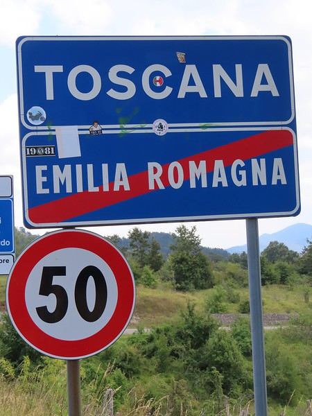
The endpoint of the planned hike is just a few meters from this sign (the trail crosses this road about 3 km from Balze). I realized Balze and the source of the Tevere (Tiber) are actually in Emilia-Romagna, not Toscana. I always thought the Tevere (Tiber), which flows toward Roma (Tyrrhenian side), started in Toscana! I’ll come back to this quirk in Day 3’s write-up.
My latest trip was to Italy from August 27 to September 26, 2024. As the title says, it was a wander through Tuscany in parts of the region that aren’t the most visited. No Firenze-Siena-Pisa trilogy, no San Gimignano; there’ll be a quick detour into Siena, but I’ll skip the best-known sights. That choice, plus traveling in September, should help dodge overtourism. It worked out—crowds were light, sometimes very light, the whole way. Here’s the practical rundown: - a long trip outside peak season (ah, retirees!) - solo camping (caravan) - a mix of activities (hiking, mountain biking, sightseeing) in places that aren’t always packed with tourists. Still, I don’t feel like I ended up in some hidden-away spots. Not sure if this will draw any readers.
DAY 1: Tuesday, August 27, 2024 The heat was intense on the drive in across the plain; two big storms—more rain and hail than lightning and thunder—threw the weather off, the first near Imola, the second on the four-lane road up the Savio valley. I left the Cesena-Roma four-lane at the Verghereto exit and climbed up to Balze (1,100 meters). The campsite is even higher (1,200 meters), in the forest near the source of the Tevere (Tiber). Staying up here will cut down on driving for the first part of the trip: a route through the Appennino (Apennines) on the border between Toscana and Emilia-Romagna. The temperature was surprisingly mild for the altitude, the air thick with moisture by late afternoon. I drove back down from the campsite to Balze (2 km on the road) to grab groceries (it’s doable) and scout tomorrow’s hike. .
The endpoint of the planned hike is just a few meters from this sign (the trail crosses this road about 3 km from Balze). I realized Balze and the source of the Tevere (Tiber) are actually in Emilia-Romagna, not Toscana. I always thought the Tevere (Tiber), which flows toward Roma (Tyrrhenian side), started in Toscana! I’ll come back to this quirk in Day 3’s write-up.
Hello everyone,
For our latest 3-week family trip (yes, the kids are growing up, and two of them are about to enter the working world), we’re heading to South America! For our first time on this continent, I had planned a classic 3-week loop in Peru.
But since we won’t be returning to this part of the world anytime soon, I thought: why not follow in the footsteps of Franck, aka Bibouns51, who, in 18 days, didn’t just stick to Peru but also added two of the planet’s most stunning landscapes to his itinerary... the Salar de Uyuni in Bolivia and its neighbor, the fabulous Atacama Desert in northern Chile !!
So, I set about the tricky task of limiting the regions we’d visit in Peru to those we considered must-sees, to avoid rushing too much. The visit schedules were optimized, including several comfortable overnight buses that have the huge advantage of letting us hop between regions.
So, we’re off on a somewhat adventurous trip with three domestic flights (two on the first day and one on the last), two overnight buses for quick hops, several car rentals, the services of a few drivers to make the trip more comfortable, and even a tour operator for crossing the Salar...
Our main concern is altitude sickness, and we’re bringing Diamox, aspirin, etc., just in case.
Our second worry before departure was not even getting off the ground... Yes, for once, we’re leaving from France—Marseille, to be exact. The week before our departure, with the surprise air traffic controllers’ strike, I remembered why we usually prefer to leave from abroad, like Turin or Barcelona... In the end, it wasn’t the air traffic controllers who made us nervous but the early July wildfires that paralyzed the airport a few days before our departure. Fortunately, the fires were quickly brought under control, and on the big day, everything was smooth sailing!
Detailed itinerary (which changed on Day 1 due to departure hiccups): Day 0: Flight Marseille - Madrid - Lima PERU Theoretical and abandoned Day 1: Flight Lima - Cuzco and visit Cuzco (Puka Pukara, Tambomachay, Cristo Blanco Observatory, Sacsayhuaman sunset) - Night in Cuzco Day 2: Taxi -> Chinchero - Moray - Maras Salt Mines - Ollantaytambo - Train to Aguas Calientes Day 3: Machu Picchu - Return train to Ollantaytambo Day 4: 2-day taxi -> Pisac - Tipon - Andahuaylillas - Huaro - Night in San Pedro Day 5: Palcoyo - Checacupe - Vinicunca - Return and night in Cuzco Day 6: Day in Cuzco (catch-up on Sacsayhuaman, San Blas district, Temple of the Sun) - Overnight bus to Arequipa Day 7: Rental car -> On the road to Colca Canyon, night in Cabanaconde Day 8: Descent to the bottom of Colca Canyon, night at Oasis Sangalle Day 9: Ascent from the canyon - Maca - Chivay - Return and night in Arequipa Day 10: Visit Arequipa (Santa Catalina Convent, La Recoleta Church and Monastery, La Compañía Church, Cathedral) - Overnight bus to Puno Day 11: Lake Titicaca - Night in Puno BOLIVIA Day 12: Shared taxi -> Road to La Paz, visit downtown La Paz - Night 1 in La Paz Day 13: Moon Valley and Las Animas Valley - Night 2 in La Paz Day 14: Day in La Paz - Night 3 in La Paz Day 15: Flight to Uyuni - Day 1 of Salar de Uyuni tour - Night at the edge of the Salar Day 16: Crossing the Lipez region and lagoons - Night near Laguna Colorada Day 17: Sol de Mañana CHILE Day 17 cont.: Pre-booked transfer to SPDA - 4x4 rental - Pukara de Quitor - Stargazing tour - Night 1 in SPDA Day 18: Death Valley and Moon Valley - Night 2 in SPDA Day 19: Miscanti and Miniques Lagoons, Salar de Aguas Calientes and its Piedra Roja, Tebenquiche Lagoon and Quebrada del Diablo - Night 3 in SPDA Day 20: Rainbow Valley and swim in the Puritama River - Night 4 in SPDA Day 21: Tebenquiche Lagoon - Bus to Calama - Flight to Santiago Day 22: Return Santiago - Madrid - Marseille
Day 0 - 11/07: Destination Lima
Our first flight from Marseille went smoothly to our Iberia layover in Madrid.
In Madrid, just after getting off the plane around 8 PM, and as we were walking through the terminal, we got a rude awakening!!
We saw the word "Cancelled" next to our flight number on the display boards. Thinking it must be a glitch, we checked another screen, but the system was stubborn, and the same dreaded word appeared !
So, we headed to the Iberia counter, where an agent confirmed that our Friday evening flight was canceled and rescheduled for the next morning. The reason? A breakdown and no replacement plane, even though we were in Madrid, Iberia’s home base!
To make matters worse, I remembered our super-tight schedule, planned to the minute, with no buffer day in Lima. Since I’m a bit phobic of megacities and hadn’t found anything appealing in the Peruvian capital in our guidebooks, we’d planned to leave Lima as soon as possible for Cusco, the heart of the Sacred Valley, to spend our first day there.
Bad idea, because we already knew the 4-hour buffer wouldn’t be enough, and we’d miss the domestic flight, which was, of course, non-refundable and non-changeable. So, we had to call LATAM from Madrid to find another flight for Saturday evening and negotiate a rate to recover some of our initial outlay.
After an hour on the phone with customer service, several endless holds, and three failed attempts to dictate our credit card number over the phone to a Spaniard speaking English with a thick accent, we finally managed to confirm the transaction, securing our new flight tickets for a moderate extra cost of just 150 € total.
At first, we were pretty bummed about losing a day and incurring extra fees to reschedule the domestic flight, but then, when we learned from an Iberia customer service rep that we’d receive the max compensation of 600 € per traveler, we even ended up grinning... because 3000 € in refunds for only losing the first day in Cusco? We’d sign up for that 10 times over!!
Iberia then took care of us, putting us up in a hotel where we had dinner before a short 5-hour night and an early morning departure. I took the opportunity to improvise a quick day of sightseeing in Lima, focusing on the Barranco and Miraflores districts.
For our latest 3-week family trip (yes, the kids are growing up, and two of them are about to enter the working world), we’re heading to South America! For our first time on this continent, I had planned a classic 3-week loop in Peru.
But since we won’t be returning to this part of the world anytime soon, I thought: why not follow in the footsteps of Franck, aka Bibouns51, who, in 18 days, didn’t just stick to Peru but also added two of the planet’s most stunning landscapes to his itinerary... the Salar de Uyuni in Bolivia and its neighbor, the fabulous Atacama Desert in northern Chile !!
So, I set about the tricky task of limiting the regions we’d visit in Peru to those we considered must-sees, to avoid rushing too much. The visit schedules were optimized, including several comfortable overnight buses that have the huge advantage of letting us hop between regions.
So, we’re off on a somewhat adventurous trip with three domestic flights (two on the first day and one on the last), two overnight buses for quick hops, several car rentals, the services of a few drivers to make the trip more comfortable, and even a tour operator for crossing the Salar...
Our main concern is altitude sickness, and we’re bringing Diamox, aspirin, etc., just in case.
Our second worry before departure was not even getting off the ground... Yes, for once, we’re leaving from France—Marseille, to be exact. The week before our departure, with the surprise air traffic controllers’ strike, I remembered why we usually prefer to leave from abroad, like Turin or Barcelona... In the end, it wasn’t the air traffic controllers who made us nervous but the early July wildfires that paralyzed the airport a few days before our departure. Fortunately, the fires were quickly brought under control, and on the big day, everything was smooth sailing!
Detailed itinerary (which changed on Day 1 due to departure hiccups): Day 0: Flight Marseille - Madrid - Lima PERU Theoretical and abandoned Day 1: Flight Lima - Cuzco and visit Cuzco (Puka Pukara, Tambomachay, Cristo Blanco Observatory, Sacsayhuaman sunset) - Night in Cuzco Day 2: Taxi -> Chinchero - Moray - Maras Salt Mines - Ollantaytambo - Train to Aguas Calientes Day 3: Machu Picchu - Return train to Ollantaytambo Day 4: 2-day taxi -> Pisac - Tipon - Andahuaylillas - Huaro - Night in San Pedro Day 5: Palcoyo - Checacupe - Vinicunca - Return and night in Cuzco Day 6: Day in Cuzco (catch-up on Sacsayhuaman, San Blas district, Temple of the Sun) - Overnight bus to Arequipa Day 7: Rental car -> On the road to Colca Canyon, night in Cabanaconde Day 8: Descent to the bottom of Colca Canyon, night at Oasis Sangalle Day 9: Ascent from the canyon - Maca - Chivay - Return and night in Arequipa Day 10: Visit Arequipa (Santa Catalina Convent, La Recoleta Church and Monastery, La Compañía Church, Cathedral) - Overnight bus to Puno Day 11: Lake Titicaca - Night in Puno BOLIVIA Day 12: Shared taxi -> Road to La Paz, visit downtown La Paz - Night 1 in La Paz Day 13: Moon Valley and Las Animas Valley - Night 2 in La Paz Day 14: Day in La Paz - Night 3 in La Paz Day 15: Flight to Uyuni - Day 1 of Salar de Uyuni tour - Night at the edge of the Salar Day 16: Crossing the Lipez region and lagoons - Night near Laguna Colorada Day 17: Sol de Mañana CHILE Day 17 cont.: Pre-booked transfer to SPDA - 4x4 rental - Pukara de Quitor - Stargazing tour - Night 1 in SPDA Day 18: Death Valley and Moon Valley - Night 2 in SPDA Day 19: Miscanti and Miniques Lagoons, Salar de Aguas Calientes and its Piedra Roja, Tebenquiche Lagoon and Quebrada del Diablo - Night 3 in SPDA Day 20: Rainbow Valley and swim in the Puritama River - Night 4 in SPDA Day 21: Tebenquiche Lagoon - Bus to Calama - Flight to Santiago Day 22: Return Santiago - Madrid - Marseille
Day 0 - 11/07: Destination Lima
Our first flight from Marseille went smoothly to our Iberia layover in Madrid.
In Madrid, just after getting off the plane around 8 PM, and as we were walking through the terminal, we got a rude awakening!!
We saw the word "Cancelled" next to our flight number on the display boards. Thinking it must be a glitch, we checked another screen, but the system was stubborn, and the same dreaded word appeared !
So, we headed to the Iberia counter, where an agent confirmed that our Friday evening flight was canceled and rescheduled for the next morning. The reason? A breakdown and no replacement plane, even though we were in Madrid, Iberia’s home base!
To make matters worse, I remembered our super-tight schedule, planned to the minute, with no buffer day in Lima. Since I’m a bit phobic of megacities and hadn’t found anything appealing in the Peruvian capital in our guidebooks, we’d planned to leave Lima as soon as possible for Cusco, the heart of the Sacred Valley, to spend our first day there.
Bad idea, because we already knew the 4-hour buffer wouldn’t be enough, and we’d miss the domestic flight, which was, of course, non-refundable and non-changeable. So, we had to call LATAM from Madrid to find another flight for Saturday evening and negotiate a rate to recover some of our initial outlay.
After an hour on the phone with customer service, several endless holds, and three failed attempts to dictate our credit card number over the phone to a Spaniard speaking English with a thick accent, we finally managed to confirm the transaction, securing our new flight tickets for a moderate extra cost of just 150 € total.
At first, we were pretty bummed about losing a day and incurring extra fees to reschedule the domestic flight, but then, when we learned from an Iberia customer service rep that we’d receive the max compensation of 600 € per traveler, we even ended up grinning... because 3000 € in refunds for only losing the first day in Cusco? We’d sign up for that 10 times over!!
Iberia then took care of us, putting us up in a hotel where we had dinner before a short 5-hour night and an early morning departure. I took the opportunity to improvise a quick day of sightseeing in Lima, focusing on the Barranco and Miraflores districts.
Travel journal in Eastern Crete from September 8th to 29th, 2024
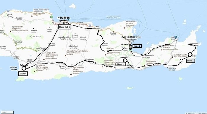 Our 21-day itinerary
Sunday, 08/09: Once again—and this is the eighth time—we’re setting off, the four of us: Patrick, Michelle, Jacques, and Monique, for the Greek islands. This time, we’ve chosen Crete. No need to wake up at 3 or 4 a.m. to reach Basel-Mulhouse Airport at dawn to catch the first flight to Greece at 6 a.m.! Given the prohibitive prices charged by EasyJet, we found flights that were half the price from Zurich Airport, which is accessible in 3 hours by train from Colmar. Pierre-Paul drives all four of us to Colmar train station, where we take the train to Basel and then, 20 minutes later, the direct train to Zurich Airport. After wandering around the airport, we go for a coffee at 6 € each! We’re in Switzerland, after all. The other dining areas all have vending machines for selecting and paying for meals—soon, there won’t be anyone left to serve you! After a short wait, we take off at 7:45 p.m. (20 minutes late) in an Aegean Airbus A321. Free in-flight meal service isn’t bad either! We land in Heraklion around 11:15 p.m. We pick up our rental car (a red Seat Ibiza) at the airport and head straight to our apartment, located 2 km from the city center. Thanks to the GPS, we find it quickly. It’s a beautiful, fully renovated apartment with all the comforts and well-equipped. On the table, there’s wine, bottles of water, jam, coffee, etc. Given the late hour, we won’t stay up long.
Monday, 09/09: To enhance our breakfast, Michelle and Monique set off to find a bakery nearby. They return with croissants and donuts—yum... Then we head to the west coast. The highway follows the coastline, but we prefer taking the old road to Malia, our first stop. We visit the major archaeological site of this Minoan city under the hot sun. The site covers a vast area, but the ruins aren’t very evocative except for a few beautiful amphorae scattered around. The explanations in a small house at the entrance are interesting and help us better understand the organization of the ancient city with its different districts. From there, we head toward the nearby mountains to see the thousand-year-old plane tree in the village of Krasi. We take the opportunity to enjoy an excellent lunch of moussaka and delicious gemista at the Krassopsychia taverna in the village center. Pleasant surprise: the prices are still reasonable, with a bill of 70 € for four, including wine and water. The friendly tradition of complimentary dessert and glasses of raki continues—great! We’ve set the bar high right away! Let’s hope the rest lives up to it! On the way back toward the Lassithi Plateau, we stop at the Kardiotisa Monastery perched high on the mountain to enjoy a magnificent view of the entire region. Just a little further, we arrive at the Lassithi Plateau: the presence of small windmills used to pump water from the ground is the typical feature of this plateau. We complete a full loop around the plateau, passing by numerous orchards and vegetable gardens that occupy the entire space. At the end of the plateau, we once again cross mountain passes via winding roads that bring us near Agios Nikolaos. Our apartment is located about ten kilometers further south in Amoudhara. The owner, who was notified, waits for us and shows us her superb apartment, whose large terrace overlooks the entire Mirabello Bay. She then gives us valuable information about the different beaches in the area. Dinner will be frugal, given our hearty lunch in Krasi!
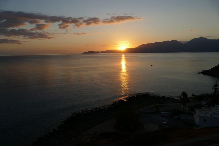 Sunset over Mirabello Bay
Tuesday, 10/09: A bit of a gray sky when we wake up around 8 a.m., but the sun will soon triumph over the scattered clouds. For our first swim, we opt for Voulisma Beach, even though our host warned us it was a bit “crowdy.” That’s understandable given the beautiful emerald color of the sea and the lovely curve of the beach. To avoid the big crowds, we move toward the eastern part of the beach, accessible via a steep staircase. The water is very warm, and this first dip is very pleasant. Before returning to the apartment, we stop at the bakery to buy spinach pies, essential ingredients to accompany our Greek salad for lunch. Of course, everything will be washed down with ouzo, which will remain our favorite drink for the next three weeks—but in moderation!!! A nap is in order after all that effort. In the late afternoon, we drive to Agios Nikolaos, the main seaside resort in Crete. We’re not too enthusiastic about visiting this mass-tourism resort, but the center of Agios, concentrated around the small inner harbor, is pleasant to see despite the plethora of shops and restaurants. We dine a little outside the harbor in the shaded courtyard of the Avli taverna: the oven-baked lamb, squid with spinach, and cuttlefish ink orzo pasta are all highly appreciated. We still stay under a 75 € bill for four.
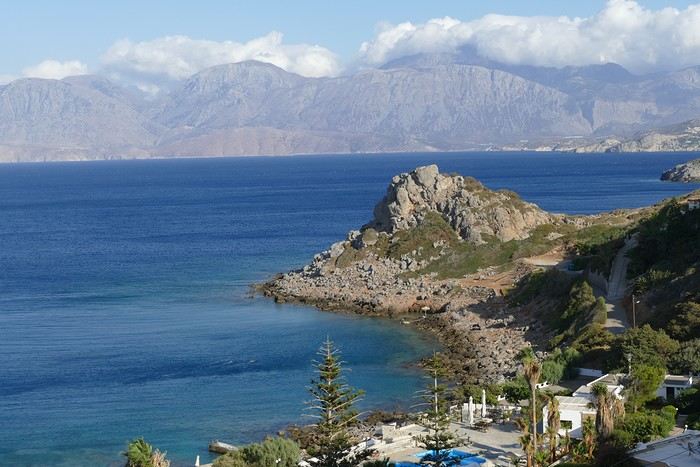 Mirabello Bay seen from our terrace
Wednesday, 11/09: At 8 a.m., the terrace is already bathed in sunlight, and it’s already quite hot. The small parasol barely gives us enough shade, but we’re not complaining! For our second swim, we head to a tiny beach recommended by our host, just 3 minutes by car from our place. The path leading to it is very discreet, and we don’t find it right away! It’s a small sandy cove with a few welcome tamarisk trees for shade. When we arrive, there are two swimmers, and there won’t be more than five or six in the morning. After lunch and a nap, we head to the beautiful village of Kritsa, just a few kilometers away. It’s too late to visit the beautiful church of Kera Panagia, which is already closed. We settle for the exterior, which is worth a look. The weather is clouding over, and big clouds are gathering. Upon arriving in Kritsa, a heavy shower forces us to take shelter in the Platanos taverna in the village center, and since it’s nearly 7 p.m., we decide to stay and dine there. Good choice—excellent meze: croquettes and stuffed zucchini flowers, gigantes beans, grilled tomatoes and feta, and pancetta as the main dish. The rain stops just as we decide to head back.
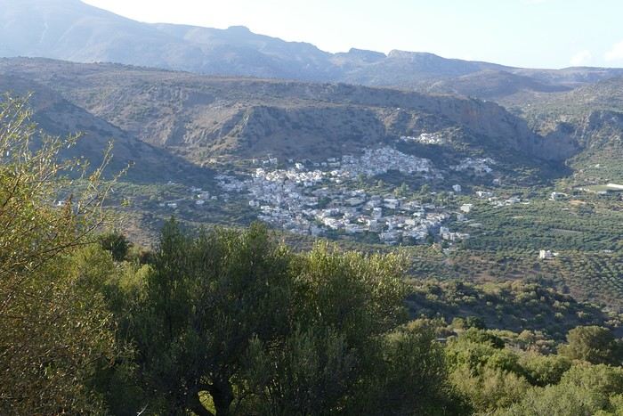 Village of Kritsa
Thursday, 12/09: Our terrace faces east, so we get to watch the sunrise around 7 a.m.—it’s truly a beautiful sight we never tire of. Around 9 a.m., we head to the village of Plaka, where boats depart for the island of Spinalonga, located north of Agios Nikolaos. We board the first boat, which sets sail at 10 a.m., and we’re not alone—the boat is practically full. After 10 minutes, we land on the island at the same time as several other boats from Elounda or Agios. Needless to say, there are already quite a few people walking through the streets of the leper village. The visit remains interesting and moving as we read the explanatory panels recounting the island’s history under Byzantine and then Turkish rule, followed by its transformation into a leper colony. As soon as we climb toward the top of the island via more or less maintained paths, there’s almost no one left. The 360° view from up there is stunning.
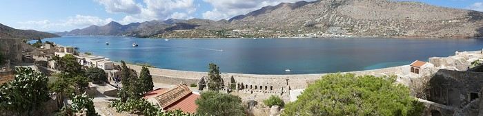
Spinalonga Island
The heat is now unbearable, and we can’t wait to get back home to have lunch on our terrace and rest. In the late afternoon, we go grocery shopping at the AB supermarket at the entrance of Agios. We had spotted another nice restaurant in our guide, but unfortunately, there’s a different one at the indicated location that doesn’t inspire us. So, we return to the Avli taverna for another dinner just as good as the first.
Friday, 13/09: We repeat yesterday’s successful program: a swim in our little cove, lunch on the terrace, a nap, and then, in the late afternoon, we discover another nearby village, Kroustas, nestled in the olive groves near Kritsa. Much less touristy than Kritsa, it’s mostly inhabited by locals, especially the elderly who are enjoying the cool air on their chairs—if you can call it cool given the still-high temperatures in the late afternoon! We then return to visit Kritsa, which we hadn’t been able to explore due to the rain. Dinner at a taverna in the village center at a very reasonable price.
Saturday, 14/09: Today, we move to our new base further east. We start with a high viewpoint at the Faneromeni Monastery, which overlooks Mirabello Bay. The monastery itself is of little interest as it’s under renovation with excessive concrete work. We continue to the village of Kavoussi to see another exceptional tree after a few kilometers on a dusty, bumpy track. It’s an olive tree said to be about 3,200 years old—impressive, and the countryside is very beautiful. It’s time to find a place for lunch. We find one in the charming little port of Mohlos, where a few tavernas surround a very nice small beach. Our choice falls on the Bogazzi taverna, where we enjoy fried fish. To reach our new base in Zakros, we still have to drive through the mountains before reaching Sitia, Paleokastro, and finally Zakros. The region is beautiful, with olive groves and rows of wind turbines taking advantage of the strong wind near the northern tip of the island. In Zakros, we’re greeted by our very friendly host. Here too, we have all the comforts and a beautiful terrace overlooking the village. The apartment has reversible air conditioners, but the overly simple instructions leave us puzzled. Thinking we’ve set it correctly, we realize a little too late that it’s blowing hot air over 30°C! After numerous attempts and testing several confusing programs, we finally succeed! Dinner on our new terrace.
Sunday, 15/09: This morning, we get up early to hike in the “Gorge of the Dead” while it’s still cool. The sky is blue as usual! We park in the nearest parking lot and start our descent via a beautiful path winding through the olive groves. A little further on, the landscape opens up, and the path, now a stony trail, begins the descent to the dry riverbed. On either side of the riverbed rise beautiful reddish cliffs.
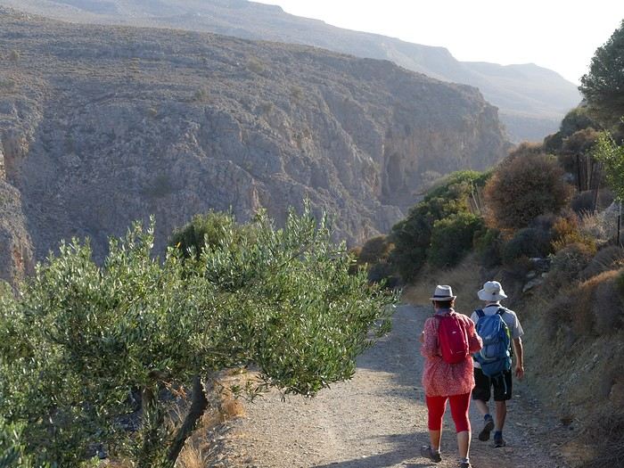
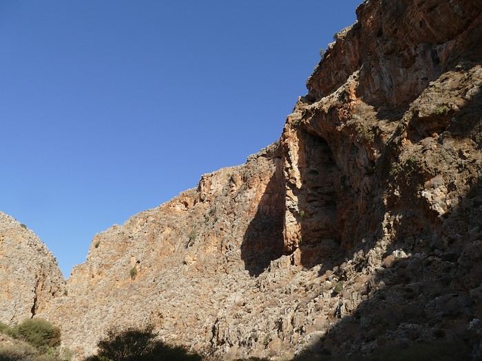
Gorge of the Dead
The trail winds its way through this narrow gorge with difficulty. It was in the many caves visible halfway up the slope that the Minoans buried their dead, hence the name “Gorge of the Dead.” The gorge opens onto a beautiful small pebble beach. A swim is welcome after this hike that made us sweat. The hike took us 1 hour and 25 minutes, and a little less on the way back. Meanwhile, Monique did some shopping and prepared an excellent lunch. In the late afternoon, we go down to dine at Platanakis, a taverna in the small village of Kato Zakros.
Monday, 16/09: This morning, we explore the northern part of the east coast near Palekastro. We start with a dip at the beautiful Hionia Beach near Palekastro. The water is still just as nice, but a light breeze is blowing—not enough to spoil our fun! Seeing all the wind turbines lining the ridges, it’s no surprise.
 Grocery shopping in Palekastro and return to Zakros. A little rain in the late afternoon and an excellent dinner at Iannis Mitsakakis’ Taverna in Adravastis. These are the kind of small tavernas we love—unpretentious, a few tables on a terrace, a warm welcome, a short menu guaranteeing freshness, tasty dishes prepared by the server’s mom, and a light bill. What more could you ask for!
Tuesday, 17/09: We head back toward Palekastro to do some shopping, but it’s also the road to the Toplou Monastery. There, we see a collection of magnificent icons dating from the 15th to the 20th century. We can also admire drawings of Orthodox religious architecture. We continue toward the Mavros Akrotiri headland to enjoy the view of the sea and rocky capes. On the way back to our place, we make a small detour to see the famous Vai palm grove. Meh... As for Vai Beach, it’s filled with paid umbrellas and sunbeds, and there are so many people that we flee. Plus, having to pay for parking is another reason to snub this trendy beach. We prefer our Hionia Beach, which we already appreciated the other day. In the late afternoon, Pat and I start the trail that begins at Kato Zakros Beach heading south. The poorly marked path crosses a plateau of sharp limestone. The paint and cairn markings are no longer very visible, and with dusk approaching, we turn back toward Kato Zakros. Dinner at the Platanakis taverna—less good than last time.
Wednesday, 18/09: To avoid the scorching sun, Pat, Mimi, and I get up earlier than usual to hike the Hohlakies Gorge. At this early hour, the sky is quite cloudy, and it’s drizzling. When we arrive in the village of Hohlakies, we park in front of a small chapel, the start of the hike. The sky is now completely clear. The trail starts among the olive groves, then after passing through a gate, we descend into the gorge filled with large rocks. We’re alone in the world, and the landscape is magnificent. A few wild goats clinging to the cliff watch us from above. After 1 hour and 15 minutes, we emerge onto the wonderful Karoumès Beach. A pleasant swim, then back to civilization! A walk in the late afternoon in Zakros to discover the beautiful springs route. Dinner in Adravastis.
Thursday, 19/09: Another move: Before heading to our next stop, we make a detour to see the beautiful Keratokampos Beach and can’t resist a swim in the still-warm, clear water. We continue our journey via Ziros, then reach the south coast and have lunch at the Stephi taverna in Ferma—excellent meal! The south coast is quite urbanized and has much less charm than the east coast we’ve just left! The numerous plastic greenhouses are partly to blame. We stop for groceries in Ierapetra. Around 3 p.m., we arrive at our destination in the small perched village of Anatoli. Our lodging is at the top of the village, and from the path leading to it, we have a magnificent view of the coastal plain, unfortunately overloaded with plastic greenhouses. It reminds us of the landscapes of El Ejido in Andalusia.
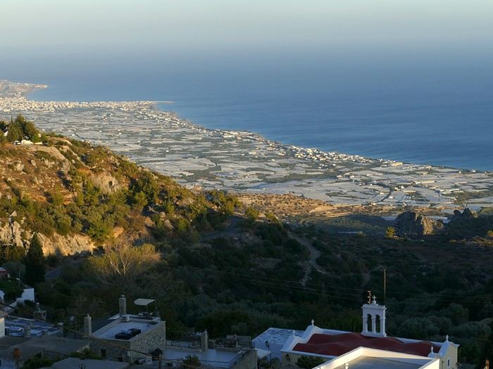 View of the Ierapetra coast from Anatoli
Friday, 20/09: A walk and discovery of the hamlet of Anatoli. There are few services—a tiny grocery store, a taverna, and that’s it. Fortunately, the traveling baker arrives and honks. We take the opportunity to buy fresh bread. Leaving the village, we take a path that should lead us to the hamlet of Drygies. The landscape is beautiful. We walk through a lovely pine forest before arriving at the hamlet. The path continues to a taverna that’s closed today, with a superb terrace overlooking the coast. Luckily, the owner arrives and informs us that the taverna will be open next Sunday and that we can enjoy barbecued meat. Noted! We head back to Anatoli via the small paved road with, fortunately, very limited traffic. Lunch on our terrace, then a dip in our private pool! The water is noticeably cooler than at the beach. Dinner at the village taverna: there’s only one menu—meze starters, souvlaki, water, wine, and bread—all for 35 €! We think we’re dreaming—was there a mistake? No.
Saturday, 21/09: We discover the beach of the village of Myrtos, a small seaside resort that’s quite touristy but on a human scale. We swim in the western part of the beach, and once again, we’re alone in the water. The best part: warm water and tamarisk trees for welcome shade. There’s even a shower to rinse off! In the late afternoon, Pat and I decide to go for a hike in the Selakano pine forest. To get there, we take a narrow, winding, and poorly paved road after the village of Christos. Plus, at this altitude, we encounter clouds clinging to the mountain, so it’s drizzling, and visibility is reduced. We decide to turn back and return to Anatoli. As compensation, we take the path that passes in front of the lodging and leads us to the Timios Stavros chapel, which crowns the summit of the nearby mountain. We arrive at the summit just in time for the sunset at 7 p.m. Breathtaking 360° panorama and magnificent colors!
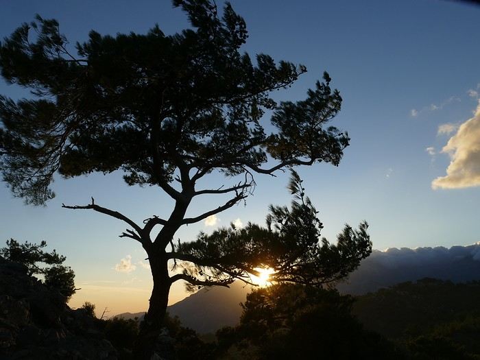 Sunset from Anatoli
Sunday, 22/09: This morning, Pat, Mimi, and I go for a hike in the Sarakina Gorge, located about 12 km from Anatoli via a beautiful road winding through irrigated olive groves. We park in the small parking lot before the trail. At the start, the path follows a levada (small irrigation canal) and quickly enters a very narrow gorge flanked by high cliffs. The riverbed is cluttered with huge rocks blocking the passage. No matter—in the technical sections, ropes or ladders allow us to overcome these obstacles with a bit of skill. You can imagine how quickly the riverbed must rise during a storm, given the narrowness of the gorge!
We progress slowly through this magnificent and impressive rocky chaos. At the exit of the gorge, we take another return path that partly follows the paved road. Back in Anatoli, we go to lunch at the Drygies taverna. We sit at the edge of the terrace under a huge tree that covers almost the entire terrace and order grilled lamb dishes prepared according to the ancient “antikristo” method.
Monday, 23/09: Departure for our last stop before Heraklion. We thought about swimming at Tertsa Beach, but it turns out to be less pleasant than expected, with pebbles and an uneven rocky plateau. So, we return to Myrtos Beach, which we know well and suits us perfectly. We head west, leaving the coast a bit. Around 3:30 p.m., we arrive at our destination in the village of Kamilari, near the famous Matala spot. We’ve rented a beautiful, modern, well-equipped apartment with a lovely shaded terrace. The owner is very friendly and explains everything necessary for a good stay. We explore the quite touristy village with its few tavernas, all full of tourists, mostly Germans.
Tuesday, 24/09: Visit to the village of Sivas, well restored thanks to the Germans, who have invested a lot here. We take the opportunity to scout out “friendly” tavernas, then go for a swim at Kalamaki Beach. Apart from a small sandy access, you have to enter the water via a chaotic limestone plateau—proof of this is that Monique trips slightly when entering the water. A group of very unfriendly German women blocks the sandy passage and doesn’t hesitate to push swimmers they deem too close. Back home, lunch, and a nap. In the late afternoon, we drive to visit the nearby Phaistos site. We benefit from very beautiful lighting. From the elevated site, we overlook the Messara Plain with a beautiful view of the olive grove checkerboards highlighted by the late afternoon sun. The site itself is quite vast, but to appreciate it, it’s better to read the explanatory panels placed throughout the different quarters. At this hour, the site is almost empty, and the beautiful light adds charm to the visit.
Wednesday, 25/09: Departure for the village of Matala, which doesn’t interest us in itself, having been there during the “hippie” era in 1976. However, going to Red Beach, only accessible by taking a path overlooking this area, appeals to us much more. We park in the large parking lot just outside the village and start our climb, which brings us to a pass from where we can admire this beautiful red-sand beach framed by beautiful cliffs plunging into the sea. The weather is magnificent, and at this early hour, there aren’t many people yet. We swim in the free part located near the cliff on the right when arriving at the beach. The sea is like glass, warm, and without a single ripple—a real treat! After half an hour, we turn back, and now there are many people rushing on this path, not at all made for feet in sandals or flip-flops, yet many vacationers venture out like this! Matala lives up to its image—a trendy place, full of shops, bars, and restaurants. You could be in any seaside resort with a standard global urbanism, lacking particular charm. Back home. In the late afternoon, a walk through the olive groves surrounding Kamilari, then dinner at Evangelina’s, who runs the Minoan Parassies taverna in the middle of the olive groves. Evangelina is quite a character: we came to reserve a table for 8 p.m. when it was only 7 p.m., but since we lingered near her restaurant, she prepares a table for us and urges us to sit down! And there she takes our order, and a little later, the meze arrive, followed by the main dishes. We finish this good dinner with several generous glasses of raki, accompanied by Evangelina’s encouragements, repeating “poya poya bravo bravo” in a loop. We’re in great shape too, by the way! We return in the middle of the night, on foot, fortunately, with the path vaguely lit by our phones...
Thursday, 26/09: This morning, we discover a new beach, Kommos Beach, not far from Kamilari either. It’s a long sandy beach, a small part of which is dedicated to paid umbrellas and sunbeds, and the rest is free. We spot a tamarisk tree to take shelter from the still-hot sun, and once again, we enjoy clear, warm water. The few swimmers spread out easily over nearly 500 meters of beach. In the late afternoon, Pat and I go to admire the sunset from the hill near our lodging. The hill, covered with olive trees, is threatened by a planned housing development of large cubic villas—trends dictate. Concrete never stops...
Friday, 27/09: We thought about leaving the car at the Odiyitria Monastery, the end of the paved road, but since the track descending to the cave remains drivable, we park 3 km further at the junction of the track leading to Kali Limenes Beach. We still have to walk for half an hour on a less drivable track, and then we’re at the entrance of the Farango Gorge. It’s a beautiful, easy hike since we follow the dry pebble riverbed. Before arriving at the beach, there’s a very beautiful small chapel sheltered under a large cliff, beautifully lit at this early hour.
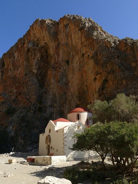
Agio Farango Chapel
A few climbers are scaling the cliff, and about ten swimmers are enjoying the sea. Return to the car under the hot sun. In the late afternoon, we all return to visit the interesting Odiyitria Monastery. Last swim at Kommos Beach and an excellent dinner at the Sigelakis taverna in Sivas.
Saturday, 28/09: There’s an end-of-vacation atmosphere... We pack our bags and head north. A short stop to see the village of Vorri, and a little over an hour later, we arrive in the big city of Heraklion. Since it’s too early to check into the apartment, we park in the city center to visit the famous archaeological museum. It’s indeed a must-see highlight of our stay in Crete. All four of us are amazed by the quantity and quality of the objects presented from the Minoan civilization. After more than 2 hours, we come out without having seen everything, but we’re a bit overwhelmed by all these wonders. Lunch at a nice little taverna very close to the Titus Church. We go to take possession of our apartment—the same as on the way there, still just as satisfying. In the late afternoon, I go alone for a walk in the historic district of the city, passing by the Morosini Fountain, which is bustling with people—some seated at café terraces, others standing and chatting. There’s a lively atmosphere here. A little further on are the Venetian loggia and the Agios Titos Church. I walk down to the old Venetian port to stroll along the jetty and admire the fortifications under beautiful late-afternoon lighting, then return to the apartment. Dinner near our place at Kiriakis, a “chic” restaurant but with very reasonable prices and excellent cuisine.
Sunday, 29/09: Wake-up at 3:30 a.m., quick coffee, and drive to the nearby airport. We leave the car in the parking lot. Already a lot of people at this early hour. Since we don’t have checked luggage, we go straight to security, which goes fairly quickly, then it’s waiting time and takeoff on time in an Airbus A321 for a 45-minute flight to Athens. We take off again in another Airbus A321 with a 50-minute delay to arrive in Zurich at 11:10 a.m. local time. Then we have to take the train to Basel and then the one to Colmar. With fewer Sunday services, we won’t arrive in Colmar until around 4 p.m.
Conclusion All four of us returned very satisfied with this stay in Crete for several reasons: - We found superb beaches with clear, warm water and often very few vacationers. - The few hikes we did were magnificent, especially those where the trails went through gorges leading to deserted beaches. - We greatly appreciated Cretan gastronomy—there were so few disappointments that we can count them on one hand. - All the accommodations we booked turned out to be superb, with the icing on the cake being the very friendly welcome from our hosts. - Generally, contacts with Cretans were always very warm despite the language barrier—we speak a little Greek. - We also appreciated the diversity of landscapes in this eastern part of Crete, with plateaus and mountains with splendid rugged reliefs.
Note: The photo album is available by clicking on this link: https://photos.app.goo.gl/hfdjQndA5eXkL5k7 Captions are only visible per photo by clicking on the circled “i” in the top right. Budget: approximately 3,300 € per couple for 21 days, including train and flights Budget details per couple: - Flight Zurich-Heraklion: 440 € - Trains Colmar-Basel-Zurich round trip for 4: 442.40 € (221 € per couple) - Accommodation: 2,431 € / 21 = 115.80 € per night for 4 (1,216 € per couple) - Car rental for 21 days: 684 € + 145 € fuel (1,150 km) (414 € per couple) - Restaurants, food, etc.: 1,009 €
Our 21-day itinerarySunday, 08/09: Once again—and this is the eighth time—we’re setting off, the four of us: Patrick, Michelle, Jacques, and Monique, for the Greek islands. This time, we’ve chosen Crete. No need to wake up at 3 or 4 a.m. to reach Basel-Mulhouse Airport at dawn to catch the first flight to Greece at 6 a.m.! Given the prohibitive prices charged by EasyJet, we found flights that were half the price from Zurich Airport, which is accessible in 3 hours by train from Colmar. Pierre-Paul drives all four of us to Colmar train station, where we take the train to Basel and then, 20 minutes later, the direct train to Zurich Airport. After wandering around the airport, we go for a coffee at 6 € each! We’re in Switzerland, after all. The other dining areas all have vending machines for selecting and paying for meals—soon, there won’t be anyone left to serve you! After a short wait, we take off at 7:45 p.m. (20 minutes late) in an Aegean Airbus A321. Free in-flight meal service isn’t bad either! We land in Heraklion around 11:15 p.m. We pick up our rental car (a red Seat Ibiza) at the airport and head straight to our apartment, located 2 km from the city center. Thanks to the GPS, we find it quickly. It’s a beautiful, fully renovated apartment with all the comforts and well-equipped. On the table, there’s wine, bottles of water, jam, coffee, etc. Given the late hour, we won’t stay up long.
Monday, 09/09: To enhance our breakfast, Michelle and Monique set off to find a bakery nearby. They return with croissants and donuts—yum... Then we head to the west coast. The highway follows the coastline, but we prefer taking the old road to Malia, our first stop. We visit the major archaeological site of this Minoan city under the hot sun. The site covers a vast area, but the ruins aren’t very evocative except for a few beautiful amphorae scattered around. The explanations in a small house at the entrance are interesting and help us better understand the organization of the ancient city with its different districts. From there, we head toward the nearby mountains to see the thousand-year-old plane tree in the village of Krasi. We take the opportunity to enjoy an excellent lunch of moussaka and delicious gemista at the Krassopsychia taverna in the village center. Pleasant surprise: the prices are still reasonable, with a bill of 70 € for four, including wine and water. The friendly tradition of complimentary dessert and glasses of raki continues—great! We’ve set the bar high right away! Let’s hope the rest lives up to it! On the way back toward the Lassithi Plateau, we stop at the Kardiotisa Monastery perched high on the mountain to enjoy a magnificent view of the entire region. Just a little further, we arrive at the Lassithi Plateau: the presence of small windmills used to pump water from the ground is the typical feature of this plateau. We complete a full loop around the plateau, passing by numerous orchards and vegetable gardens that occupy the entire space. At the end of the plateau, we once again cross mountain passes via winding roads that bring us near Agios Nikolaos. Our apartment is located about ten kilometers further south in Amoudhara. The owner, who was notified, waits for us and shows us her superb apartment, whose large terrace overlooks the entire Mirabello Bay. She then gives us valuable information about the different beaches in the area. Dinner will be frugal, given our hearty lunch in Krasi!
Sunset over Mirabello BayTuesday, 10/09: A bit of a gray sky when we wake up around 8 a.m., but the sun will soon triumph over the scattered clouds. For our first swim, we opt for Voulisma Beach, even though our host warned us it was a bit “crowdy.” That’s understandable given the beautiful emerald color of the sea and the lovely curve of the beach. To avoid the big crowds, we move toward the eastern part of the beach, accessible via a steep staircase. The water is very warm, and this first dip is very pleasant. Before returning to the apartment, we stop at the bakery to buy spinach pies, essential ingredients to accompany our Greek salad for lunch. Of course, everything will be washed down with ouzo, which will remain our favorite drink for the next three weeks—but in moderation!!! A nap is in order after all that effort. In the late afternoon, we drive to Agios Nikolaos, the main seaside resort in Crete. We’re not too enthusiastic about visiting this mass-tourism resort, but the center of Agios, concentrated around the small inner harbor, is pleasant to see despite the plethora of shops and restaurants. We dine a little outside the harbor in the shaded courtyard of the Avli taverna: the oven-baked lamb, squid with spinach, and cuttlefish ink orzo pasta are all highly appreciated. We still stay under a 75 € bill for four.
Mirabello Bay seen from our terraceWednesday, 11/09: At 8 a.m., the terrace is already bathed in sunlight, and it’s already quite hot. The small parasol barely gives us enough shade, but we’re not complaining! For our second swim, we head to a tiny beach recommended by our host, just 3 minutes by car from our place. The path leading to it is very discreet, and we don’t find it right away! It’s a small sandy cove with a few welcome tamarisk trees for shade. When we arrive, there are two swimmers, and there won’t be more than five or six in the morning. After lunch and a nap, we head to the beautiful village of Kritsa, just a few kilometers away. It’s too late to visit the beautiful church of Kera Panagia, which is already closed. We settle for the exterior, which is worth a look. The weather is clouding over, and big clouds are gathering. Upon arriving in Kritsa, a heavy shower forces us to take shelter in the Platanos taverna in the village center, and since it’s nearly 7 p.m., we decide to stay and dine there. Good choice—excellent meze: croquettes and stuffed zucchini flowers, gigantes beans, grilled tomatoes and feta, and pancetta as the main dish. The rain stops just as we decide to head back.
Village of KritsaThursday, 12/09: Our terrace faces east, so we get to watch the sunrise around 7 a.m.—it’s truly a beautiful sight we never tire of. Around 9 a.m., we head to the village of Plaka, where boats depart for the island of Spinalonga, located north of Agios Nikolaos. We board the first boat, which sets sail at 10 a.m., and we’re not alone—the boat is practically full. After 10 minutes, we land on the island at the same time as several other boats from Elounda or Agios. Needless to say, there are already quite a few people walking through the streets of the leper village. The visit remains interesting and moving as we read the explanatory panels recounting the island’s history under Byzantine and then Turkish rule, followed by its transformation into a leper colony. As soon as we climb toward the top of the island via more or less maintained paths, there’s almost no one left. The 360° view from up there is stunning.
Spinalonga Island
The heat is now unbearable, and we can’t wait to get back home to have lunch on our terrace and rest. In the late afternoon, we go grocery shopping at the AB supermarket at the entrance of Agios. We had spotted another nice restaurant in our guide, but unfortunately, there’s a different one at the indicated location that doesn’t inspire us. So, we return to the Avli taverna for another dinner just as good as the first.
Friday, 13/09: We repeat yesterday’s successful program: a swim in our little cove, lunch on the terrace, a nap, and then, in the late afternoon, we discover another nearby village, Kroustas, nestled in the olive groves near Kritsa. Much less touristy than Kritsa, it’s mostly inhabited by locals, especially the elderly who are enjoying the cool air on their chairs—if you can call it cool given the still-high temperatures in the late afternoon! We then return to visit Kritsa, which we hadn’t been able to explore due to the rain. Dinner at a taverna in the village center at a very reasonable price.
Saturday, 14/09: Today, we move to our new base further east. We start with a high viewpoint at the Faneromeni Monastery, which overlooks Mirabello Bay. The monastery itself is of little interest as it’s under renovation with excessive concrete work. We continue to the village of Kavoussi to see another exceptional tree after a few kilometers on a dusty, bumpy track. It’s an olive tree said to be about 3,200 years old—impressive, and the countryside is very beautiful. It’s time to find a place for lunch. We find one in the charming little port of Mohlos, where a few tavernas surround a very nice small beach. Our choice falls on the Bogazzi taverna, where we enjoy fried fish. To reach our new base in Zakros, we still have to drive through the mountains before reaching Sitia, Paleokastro, and finally Zakros. The region is beautiful, with olive groves and rows of wind turbines taking advantage of the strong wind near the northern tip of the island. In Zakros, we’re greeted by our very friendly host. Here too, we have all the comforts and a beautiful terrace overlooking the village. The apartment has reversible air conditioners, but the overly simple instructions leave us puzzled. Thinking we’ve set it correctly, we realize a little too late that it’s blowing hot air over 30°C! After numerous attempts and testing several confusing programs, we finally succeed! Dinner on our new terrace.
Sunday, 15/09: This morning, we get up early to hike in the “Gorge of the Dead” while it’s still cool. The sky is blue as usual! We park in the nearest parking lot and start our descent via a beautiful path winding through the olive groves. A little further on, the landscape opens up, and the path, now a stony trail, begins the descent to the dry riverbed. On either side of the riverbed rise beautiful reddish cliffs.
Gorge of the Dead
The trail winds its way through this narrow gorge with difficulty. It was in the many caves visible halfway up the slope that the Minoans buried their dead, hence the name “Gorge of the Dead.” The gorge opens onto a beautiful small pebble beach. A swim is welcome after this hike that made us sweat. The hike took us 1 hour and 25 minutes, and a little less on the way back. Meanwhile, Monique did some shopping and prepared an excellent lunch. In the late afternoon, we go down to dine at Platanakis, a taverna in the small village of Kato Zakros.
Monday, 16/09: This morning, we explore the northern part of the east coast near Palekastro. We start with a dip at the beautiful Hionia Beach near Palekastro. The water is still just as nice, but a light breeze is blowing—not enough to spoil our fun! Seeing all the wind turbines lining the ridges, it’s no surprise.
Grocery shopping in Palekastro and return to Zakros. A little rain in the late afternoon and an excellent dinner at Iannis Mitsakakis’ Taverna in Adravastis. These are the kind of small tavernas we love—unpretentious, a few tables on a terrace, a warm welcome, a short menu guaranteeing freshness, tasty dishes prepared by the server’s mom, and a light bill. What more could you ask for!Tuesday, 17/09: We head back toward Palekastro to do some shopping, but it’s also the road to the Toplou Monastery. There, we see a collection of magnificent icons dating from the 15th to the 20th century. We can also admire drawings of Orthodox religious architecture. We continue toward the Mavros Akrotiri headland to enjoy the view of the sea and rocky capes. On the way back to our place, we make a small detour to see the famous Vai palm grove. Meh... As for Vai Beach, it’s filled with paid umbrellas and sunbeds, and there are so many people that we flee. Plus, having to pay for parking is another reason to snub this trendy beach. We prefer our Hionia Beach, which we already appreciated the other day. In the late afternoon, Pat and I start the trail that begins at Kato Zakros Beach heading south. The poorly marked path crosses a plateau of sharp limestone. The paint and cairn markings are no longer very visible, and with dusk approaching, we turn back toward Kato Zakros. Dinner at the Platanakis taverna—less good than last time.
Wednesday, 18/09: To avoid the scorching sun, Pat, Mimi, and I get up earlier than usual to hike the Hohlakies Gorge. At this early hour, the sky is quite cloudy, and it’s drizzling. When we arrive in the village of Hohlakies, we park in front of a small chapel, the start of the hike. The sky is now completely clear. The trail starts among the olive groves, then after passing through a gate, we descend into the gorge filled with large rocks. We’re alone in the world, and the landscape is magnificent. A few wild goats clinging to the cliff watch us from above. After 1 hour and 15 minutes, we emerge onto the wonderful Karoumès Beach. A pleasant swim, then back to civilization! A walk in the late afternoon in Zakros to discover the beautiful springs route. Dinner in Adravastis.
Thursday, 19/09: Another move: Before heading to our next stop, we make a detour to see the beautiful Keratokampos Beach and can’t resist a swim in the still-warm, clear water. We continue our journey via Ziros, then reach the south coast and have lunch at the Stephi taverna in Ferma—excellent meal! The south coast is quite urbanized and has much less charm than the east coast we’ve just left! The numerous plastic greenhouses are partly to blame. We stop for groceries in Ierapetra. Around 3 p.m., we arrive at our destination in the small perched village of Anatoli. Our lodging is at the top of the village, and from the path leading to it, we have a magnificent view of the coastal plain, unfortunately overloaded with plastic greenhouses. It reminds us of the landscapes of El Ejido in Andalusia.
View of the Ierapetra coast from AnatoliFriday, 20/09: A walk and discovery of the hamlet of Anatoli. There are few services—a tiny grocery store, a taverna, and that’s it. Fortunately, the traveling baker arrives and honks. We take the opportunity to buy fresh bread. Leaving the village, we take a path that should lead us to the hamlet of Drygies. The landscape is beautiful. We walk through a lovely pine forest before arriving at the hamlet. The path continues to a taverna that’s closed today, with a superb terrace overlooking the coast. Luckily, the owner arrives and informs us that the taverna will be open next Sunday and that we can enjoy barbecued meat. Noted! We head back to Anatoli via the small paved road with, fortunately, very limited traffic. Lunch on our terrace, then a dip in our private pool! The water is noticeably cooler than at the beach. Dinner at the village taverna: there’s only one menu—meze starters, souvlaki, water, wine, and bread—all for 35 €! We think we’re dreaming—was there a mistake? No.
Saturday, 21/09: We discover the beach of the village of Myrtos, a small seaside resort that’s quite touristy but on a human scale. We swim in the western part of the beach, and once again, we’re alone in the water. The best part: warm water and tamarisk trees for welcome shade. There’s even a shower to rinse off! In the late afternoon, Pat and I decide to go for a hike in the Selakano pine forest. To get there, we take a narrow, winding, and poorly paved road after the village of Christos. Plus, at this altitude, we encounter clouds clinging to the mountain, so it’s drizzling, and visibility is reduced. We decide to turn back and return to Anatoli. As compensation, we take the path that passes in front of the lodging and leads us to the Timios Stavros chapel, which crowns the summit of the nearby mountain. We arrive at the summit just in time for the sunset at 7 p.m. Breathtaking 360° panorama and magnificent colors!
Sunset from AnatoliSunday, 22/09: This morning, Pat, Mimi, and I go for a hike in the Sarakina Gorge, located about 12 km from Anatoli via a beautiful road winding through irrigated olive groves. We park in the small parking lot before the trail. At the start, the path follows a levada (small irrigation canal) and quickly enters a very narrow gorge flanked by high cliffs. The riverbed is cluttered with huge rocks blocking the passage. No matter—in the technical sections, ropes or ladders allow us to overcome these obstacles with a bit of skill. You can imagine how quickly the riverbed must rise during a storm, given the narrowness of the gorge!
We progress slowly through this magnificent and impressive rocky chaos. At the exit of the gorge, we take another return path that partly follows the paved road. Back in Anatoli, we go to lunch at the Drygies taverna. We sit at the edge of the terrace under a huge tree that covers almost the entire terrace and order grilled lamb dishes prepared according to the ancient “antikristo” method.
Monday, 23/09: Departure for our last stop before Heraklion. We thought about swimming at Tertsa Beach, but it turns out to be less pleasant than expected, with pebbles and an uneven rocky plateau. So, we return to Myrtos Beach, which we know well and suits us perfectly. We head west, leaving the coast a bit. Around 3:30 p.m., we arrive at our destination in the village of Kamilari, near the famous Matala spot. We’ve rented a beautiful, modern, well-equipped apartment with a lovely shaded terrace. The owner is very friendly and explains everything necessary for a good stay. We explore the quite touristy village with its few tavernas, all full of tourists, mostly Germans.
Tuesday, 24/09: Visit to the village of Sivas, well restored thanks to the Germans, who have invested a lot here. We take the opportunity to scout out “friendly” tavernas, then go for a swim at Kalamaki Beach. Apart from a small sandy access, you have to enter the water via a chaotic limestone plateau—proof of this is that Monique trips slightly when entering the water. A group of very unfriendly German women blocks the sandy passage and doesn’t hesitate to push swimmers they deem too close. Back home, lunch, and a nap. In the late afternoon, we drive to visit the nearby Phaistos site. We benefit from very beautiful lighting. From the elevated site, we overlook the Messara Plain with a beautiful view of the olive grove checkerboards highlighted by the late afternoon sun. The site itself is quite vast, but to appreciate it, it’s better to read the explanatory panels placed throughout the different quarters. At this hour, the site is almost empty, and the beautiful light adds charm to the visit.
Wednesday, 25/09: Departure for the village of Matala, which doesn’t interest us in itself, having been there during the “hippie” era in 1976. However, going to Red Beach, only accessible by taking a path overlooking this area, appeals to us much more. We park in the large parking lot just outside the village and start our climb, which brings us to a pass from where we can admire this beautiful red-sand beach framed by beautiful cliffs plunging into the sea. The weather is magnificent, and at this early hour, there aren’t many people yet. We swim in the free part located near the cliff on the right when arriving at the beach. The sea is like glass, warm, and without a single ripple—a real treat! After half an hour, we turn back, and now there are many people rushing on this path, not at all made for feet in sandals or flip-flops, yet many vacationers venture out like this! Matala lives up to its image—a trendy place, full of shops, bars, and restaurants. You could be in any seaside resort with a standard global urbanism, lacking particular charm. Back home. In the late afternoon, a walk through the olive groves surrounding Kamilari, then dinner at Evangelina’s, who runs the Minoan Parassies taverna in the middle of the olive groves. Evangelina is quite a character: we came to reserve a table for 8 p.m. when it was only 7 p.m., but since we lingered near her restaurant, she prepares a table for us and urges us to sit down! And there she takes our order, and a little later, the meze arrive, followed by the main dishes. We finish this good dinner with several generous glasses of raki, accompanied by Evangelina’s encouragements, repeating “poya poya bravo bravo” in a loop. We’re in great shape too, by the way! We return in the middle of the night, on foot, fortunately, with the path vaguely lit by our phones...
Thursday, 26/09: This morning, we discover a new beach, Kommos Beach, not far from Kamilari either. It’s a long sandy beach, a small part of which is dedicated to paid umbrellas and sunbeds, and the rest is free. We spot a tamarisk tree to take shelter from the still-hot sun, and once again, we enjoy clear, warm water. The few swimmers spread out easily over nearly 500 meters of beach. In the late afternoon, Pat and I go to admire the sunset from the hill near our lodging. The hill, covered with olive trees, is threatened by a planned housing development of large cubic villas—trends dictate. Concrete never stops...
Friday, 27/09: We thought about leaving the car at the Odiyitria Monastery, the end of the paved road, but since the track descending to the cave remains drivable, we park 3 km further at the junction of the track leading to Kali Limenes Beach. We still have to walk for half an hour on a less drivable track, and then we’re at the entrance of the Farango Gorge. It’s a beautiful, easy hike since we follow the dry pebble riverbed. Before arriving at the beach, there’s a very beautiful small chapel sheltered under a large cliff, beautifully lit at this early hour.
Agio Farango Chapel
A few climbers are scaling the cliff, and about ten swimmers are enjoying the sea. Return to the car under the hot sun. In the late afternoon, we all return to visit the interesting Odiyitria Monastery. Last swim at Kommos Beach and an excellent dinner at the Sigelakis taverna in Sivas.
Saturday, 28/09: There’s an end-of-vacation atmosphere... We pack our bags and head north. A short stop to see the village of Vorri, and a little over an hour later, we arrive in the big city of Heraklion. Since it’s too early to check into the apartment, we park in the city center to visit the famous archaeological museum. It’s indeed a must-see highlight of our stay in Crete. All four of us are amazed by the quantity and quality of the objects presented from the Minoan civilization. After more than 2 hours, we come out without having seen everything, but we’re a bit overwhelmed by all these wonders. Lunch at a nice little taverna very close to the Titus Church. We go to take possession of our apartment—the same as on the way there, still just as satisfying. In the late afternoon, I go alone for a walk in the historic district of the city, passing by the Morosini Fountain, which is bustling with people—some seated at café terraces, others standing and chatting. There’s a lively atmosphere here. A little further on are the Venetian loggia and the Agios Titos Church. I walk down to the old Venetian port to stroll along the jetty and admire the fortifications under beautiful late-afternoon lighting, then return to the apartment. Dinner near our place at Kiriakis, a “chic” restaurant but with very reasonable prices and excellent cuisine.
Sunday, 29/09: Wake-up at 3:30 a.m., quick coffee, and drive to the nearby airport. We leave the car in the parking lot. Already a lot of people at this early hour. Since we don’t have checked luggage, we go straight to security, which goes fairly quickly, then it’s waiting time and takeoff on time in an Airbus A321 for a 45-minute flight to Athens. We take off again in another Airbus A321 with a 50-minute delay to arrive in Zurich at 11:10 a.m. local time. Then we have to take the train to Basel and then the one to Colmar. With fewer Sunday services, we won’t arrive in Colmar until around 4 p.m.
Conclusion All four of us returned very satisfied with this stay in Crete for several reasons: - We found superb beaches with clear, warm water and often very few vacationers. - The few hikes we did were magnificent, especially those where the trails went through gorges leading to deserted beaches. - We greatly appreciated Cretan gastronomy—there were so few disappointments that we can count them on one hand. - All the accommodations we booked turned out to be superb, with the icing on the cake being the very friendly welcome from our hosts. - Generally, contacts with Cretans were always very warm despite the language barrier—we speak a little Greek. - We also appreciated the diversity of landscapes in this eastern part of Crete, with plateaus and mountains with splendid rugged reliefs.
Note: The photo album is available by clicking on this link: https://photos.app.goo.gl/hfdjQndA5eXkL5k7 Captions are only visible per photo by clicking on the circled “i” in the top right. Budget: approximately 3,300 € per couple for 21 days, including train and flights Budget details per couple: - Flight Zurich-Heraklion: 440 € - Trains Colmar-Basel-Zurich round trip for 4: 442.40 € (221 € per couple) - Accommodation: 2,431 € / 21 = 115.80 € per night for 4 (1,216 € per couple) - Car rental for 21 days: 684 € + 145 € fuel (1,150 km) (414 € per couple) - Restaurants, food, etc.: 1,009 €
During our first road trip across the United States, we covered 23,000 km and crossed 28 states in 53 days.
Originally, we had planned to drive Route 66 all the way to Oatman in Arizona and visit various national parks in the American West over a two-month period.
This itinerary was planned before our departure, and all the relevant information had been gathered to stick to the schedule.
Everything went so smoothly that we finished visiting the national parks well ahead of our planned return date.
It helped that having a bed, a portable toilet, and a cooler in our vehicle gave us some autonomy since we didn’t have to worry about accommodation.
So, we decided to extend our road trip to the cities of Nashville and Memphis in Tennessee.
We then headed to Louisiana to visit Baton Rouge and New Orleans.
We crossed Mississippi and Alabama before driving along Florida’s west coast all the way to Key West.
We returned via Florida’s east coast and then crossed the eastern U.S. states to get back to Quebec through the Jackman border crossing in Maine.
So, I invite you to keep reading this long recap, which will let you discover the different attractions we visited throughout this amazing journey.
Videos are included throughout the recap. Click on the image to start the video.
To jump to a specific post, here are the relevant links:
Route 66 - Illinois & Missouri Route 66 - St. Louis (Missouri) - Gateway Arch National Park Route 66 - Cuba (Missouri) - City Murals Route 66 - Springfield (Missouri) - Fantastic Caverns Route 66 - Kansas & Oklahoma Route 66 - Texas & Arizona Route 66 - Texas - The Stations of the Cross in Groom Route 66 - Texas - Panhandle - VW Slug Bug Ranch Texas - Palo Duro Canyon State Park - Juniper Trails Texas - Palo Duro Canyon State Park - The Lighthouse Trail Route 66 - Texas - Amarillo - Cadillac Ranch Route 66 - New Mexico - Santa Rosa Blue Hole New Mexico - Bandelier National Monument - Alcove House Trail via Main Loop Trail New Mexico - Bandelier National Monument - Tsankawi Ruins Trail New Mexico - White Rock Overlook Route 66 - New Mexico - Albuquerque - Old Town New Mexico - White Sands National Park New Mexico - White Sands National Park - Dune Life Nature Trail New Mexico - White Sands National Park - Playa Trail New Mexico - White Sands National Park - Interdune Boardwalk New Mexico - Gila Cliff Dwellings National Monument New Mexico - Grants - Ice Cave & Bandera Volcano New Mexico - Gallup - Pyramide Rock Trail & Church Rock Trail Arizona - Holbrook - Painted Desert Arizona - Petrified Forest National Park - Puerco Pueblo & Newspaper Rock Viewpoint Arizona - Petrified Forest National Park - Blue Mesa Arizona - Petrified Forest National Park - The Teepees, Agate Bridge & Jasper Forest Overlook Arizona - Petrified Forest National Park - Crystal Forest Trail Arizona - Petrified Forest National Park - Giant Logs Trail Arizona - Winslow - Two Guns Ghost Town Arizona - Cameron - Little Colorado River Gorge Overlooks Arizona - Grand Canyon National Park - Shoshone Point Trail Arizona - Grand Canyon National Park - Desert View Drive Arizona - Grand Canyon National Park - Rim Route (Orange) & Village Route (Blue) Arizona - Grand Canyon National Park - Hermit Route (Red Line) Route 66 - Arizona - Historic Town of Oatman Arizona - Bullhead City Community Park Nevada - Red Rock Canyon - Calico I & II & Sandstone Quarry Nevada - Red Rock Canyon - Willow Springs Nevada - Red Rock Canyon Lookouts Nevada - Valley of Fire State Park - White Domes Trail Nevada - Valley of Fire State Park - Seven Wonders Trail, Pink Canyon, Fire Wave Nevada - Valley of Fire State Park - Rainbow Vista Trail Nevada - Valley of Fire State Park - Mouse's Tank Trail Nevada - Valley of Fire State Park - Rock Formations Nevada - Valley of Fire State Park - Scenic Routes Nevada - Cathedral Gorge State Park - Slot Canyons Nevada - Cathedral Gorge State Park - Eagle Point & Miller Point Utah - Bryce Canyon National Park - Mossy Cave & Tropic Ditch Waterfall Trail Utah - Bryce Canyon National Park - Scenic Drive Utah - Zion National Park - Pa'rus Trail Utah - Zion National Park - Sand Bench Trail Utah - Zion National Park - Emerald Pools Trail Utah - Zion National Park - West Rim Trail (Trail connecting to Angels Landing) Utah - Zion National Park - Riverside Walk Utah - Zion National Park - Court of The Patriarchs & Big Bend Utah - Zion National Park - Mount Carmel Highway Scenic Drive Utah - Kanab - Jackson Flat Reservoir Utah - Toadstools Trail in Grand Staircase-Escalante National Monument Arizona - Page - Glen Canyon Dam Overlook Arizona - Page - Glen Canyon National Recreation Area Arizona - Page - Horseshoe Bend Overlook Arizona - Page - Upper Antelope Canyon Arizona - Page - Navajo Canyon Boat Tour at Lake Powell Arizona - Page - Antelope Canyon X Arizona - Canyon de Chelly National Monument - Chelly Canyon Arizona - Canyon de Chelly National Monument - Canyon del Muerto Arizona - Monument Valley Navajo Tribal Park Utah - Mexican Hat Utah - Mexican Hat - Goosenecks State Park Utah - Mexican Hat - Valley of the Gods Utah - The Moki Dugway Scenic Backway Utah - Blanding - Natural Bridges National Monument Utah - Lake Powell - Hite Crossing Bridge Utah - Lake Powell - Glen Canyon National Recreation Area - Hite Overlook Utah - Capitol Reef National Park - Chimney Rock Loop Trail Utah - Capitol Reef National Park - Hickman Bridge Trail Utah - Capitol Reef National Park - Grand Wash Trail Utah - Capitol Reef National Park - Sunset Point Trail Utah - Capitol Reef National Park - Goosenecks Trail Utah - Capitol Reef National Park - Viewpoints - Fruita Area Utah - Capitol Reef National Park - Viewpoints - Scenic Drive Utah - Capitol Reef National Park - Cassidy Arch Trail Utah - Capitol Reef National Park - On the way to Capitol Gorge Trailhead Utah - Capitol Reef National Park - Capitol Gorge Trailhead Utah - Monroe - Mystic Hot Springs Utah - Scenic Overlooks on UT-24, UT-119 & I-70 Utah - Arches National Park - Park Avenue Trail Utah - Arches National Park - Courthouse Towers Section's Viewpoints Utah - Arches National Park - Balanced Rock, Pothole Arch, Ham Rock & Garden of Eden Utah - Arches National Park - Double Arch Trail, Cove Arch, Cove of Caves & Panorama Point Utah - Arches National Park - Windows Loop & Turret Arch Trail Utah - Arches National Park - Delicate Arch Trail Utah - Arches National Park - Upper Delicate Arch Viewpoint Trail Utah - Arches National Park - Fiery Furnace Section - Viewpoints Utah - Arches National Park - Sand Dune Arch Trail Utah - Arches National Park - Skyline Arch Trail Utah - Arches National Park - Devils Garden Trail Utah - Dead Horse Point State Park - West Rim Trail Utah - Dead Horse Point State Park - East Rim Trail Utah - Moab - Utah State Route 279 (Potash Road) Utah - Moab - Shafer Trail - Potash Evaporation Ponds Utah - Moab - Potash Road Dinosaur Tracks and Petroglyphs Utah - Moab - Potash Road - Corona, Bowtie & Pinto Arches Trail Utah - Moab - Potash Road - Wall Street Climbing Area Utah - Moab - Kane Springs Road Utah - Moab - Kane Springs Road - Side By Side Adventure Utah - Moab - Kane Springs Road to Moab Utah - Canyonlands National Park - Island in the Sky - Mesa Arch Trail Utah - Canyonlands National Park - Island in the Sky - Aztec Butte Trail Utah - Canyonlands National Park - Island in the Sky - Whale Rock Trail Utah - Canyonlands National Park - Island in the Sky - Upheaval Dome Trail Utah - Canyonlands National Park - Island in the Sky - Grand View Point Overlook Trail Utah - Canyonlands National Park - Island in the Sky - White Rim Overlook Trail Utah - Canyonlands National Park - Island in the Sky - Overlooks Utah - Moab - Wilson Arch Utah - Monticello - Newspaper Rock State Historical Monument Utah - Canyonlands National Park - The Needles - Road Side Ruin Trail Utah - Canyonlands National Park - The Needles - Cave Spring Trail Utah - Canyonlands National Park - The Needles - Pothole Point Trail Utah - Canyonlands National Park - The Needles - Big Spring Canyon Overlook Trail Utah - Canyonlands National Park - The Needles - Overlooks Colorado - Mesa Verde National Park - Mesa Top Ruins Road Colorado - Mesa Verde National Park - Chapin Mesa Road Colorado - Mesa Verde National Park - Mesa Top Loop Colorado - Mesa Verde National Park - Wetherill Mesa Road Colorado - Great Sand Dunes National Park Colorado - Mosca - Zapata Falls Colorado - Colorado Springs - Garden of the Gods Colorado - Black Canyon of the Gunnison National Park Colorado - Gunnison - Curecanti National Recreation Area Colorado - Gunnison - Blue Mesa Dam & Reservoir Colorado - Lake Pueblo State Park (Pueblo Reservoir) Kentucky - Mayfield, 5 months after an EF4 tornado Tennessee - Nashville - Downtown Walking Tour Tennessee - Graceland Mansion - Home of Elvis Presley Tennessee - Graceland - Lisa Marie & Hound Dog II Jets Tennessee - Graceland - Elvis Presley Automobile Museum & Exhibits Tennessee - Exploring Memphis Louisiana - Exploring Baton Rouge Louisiana - Exploring Lafayette Louisiana - Exploring Houma Louisiana - New Orleans - French Quarter Tour Louisiana - New Orleans - Garden District Tour Louisiana - New Orleans - Creole Queen Mississippi River Cruise Florida - Clearwater Beach Florida - Sanibel Island - Bowman's Beach Florida - Siesta Key Beach Florida - Captiva Island - Turner Beach Florida - Key Largo - Sunset Florida - Key West - Smathers Beach Florida - Miami Beach - Art Deco District Florida - Miami Beach South Carolina - Myrtle Beach Virginia - Virginia Beach Maine - Scarborough - Pine Point Beach
Originally, we had planned to drive Route 66 all the way to Oatman in Arizona and visit various national parks in the American West over a two-month period.
This itinerary was planned before our departure, and all the relevant information had been gathered to stick to the schedule.
Everything went so smoothly that we finished visiting the national parks well ahead of our planned return date.
It helped that having a bed, a portable toilet, and a cooler in our vehicle gave us some autonomy since we didn’t have to worry about accommodation.
So, we decided to extend our road trip to the cities of Nashville and Memphis in Tennessee.
We then headed to Louisiana to visit Baton Rouge and New Orleans.
We crossed Mississippi and Alabama before driving along Florida’s west coast all the way to Key West.
We returned via Florida’s east coast and then crossed the eastern U.S. states to get back to Quebec through the Jackman border crossing in Maine.
So, I invite you to keep reading this long recap, which will let you discover the different attractions we visited throughout this amazing journey.
Videos are included throughout the recap. Click on the image to start the video.
To jump to a specific post, here are the relevant links:
Route 66 - Illinois & Missouri Route 66 - St. Louis (Missouri) - Gateway Arch National Park Route 66 - Cuba (Missouri) - City Murals Route 66 - Springfield (Missouri) - Fantastic Caverns Route 66 - Kansas & Oklahoma Route 66 - Texas & Arizona Route 66 - Texas - The Stations of the Cross in Groom Route 66 - Texas - Panhandle - VW Slug Bug Ranch Texas - Palo Duro Canyon State Park - Juniper Trails Texas - Palo Duro Canyon State Park - The Lighthouse Trail Route 66 - Texas - Amarillo - Cadillac Ranch Route 66 - New Mexico - Santa Rosa Blue Hole New Mexico - Bandelier National Monument - Alcove House Trail via Main Loop Trail New Mexico - Bandelier National Monument - Tsankawi Ruins Trail New Mexico - White Rock Overlook Route 66 - New Mexico - Albuquerque - Old Town New Mexico - White Sands National Park New Mexico - White Sands National Park - Dune Life Nature Trail New Mexico - White Sands National Park - Playa Trail New Mexico - White Sands National Park - Interdune Boardwalk New Mexico - Gila Cliff Dwellings National Monument New Mexico - Grants - Ice Cave & Bandera Volcano New Mexico - Gallup - Pyramide Rock Trail & Church Rock Trail Arizona - Holbrook - Painted Desert Arizona - Petrified Forest National Park - Puerco Pueblo & Newspaper Rock Viewpoint Arizona - Petrified Forest National Park - Blue Mesa Arizona - Petrified Forest National Park - The Teepees, Agate Bridge & Jasper Forest Overlook Arizona - Petrified Forest National Park - Crystal Forest Trail Arizona - Petrified Forest National Park - Giant Logs Trail Arizona - Winslow - Two Guns Ghost Town Arizona - Cameron - Little Colorado River Gorge Overlooks Arizona - Grand Canyon National Park - Shoshone Point Trail Arizona - Grand Canyon National Park - Desert View Drive Arizona - Grand Canyon National Park - Rim Route (Orange) & Village Route (Blue) Arizona - Grand Canyon National Park - Hermit Route (Red Line) Route 66 - Arizona - Historic Town of Oatman Arizona - Bullhead City Community Park Nevada - Red Rock Canyon - Calico I & II & Sandstone Quarry Nevada - Red Rock Canyon - Willow Springs Nevada - Red Rock Canyon Lookouts Nevada - Valley of Fire State Park - White Domes Trail Nevada - Valley of Fire State Park - Seven Wonders Trail, Pink Canyon, Fire Wave Nevada - Valley of Fire State Park - Rainbow Vista Trail Nevada - Valley of Fire State Park - Mouse's Tank Trail Nevada - Valley of Fire State Park - Rock Formations Nevada - Valley of Fire State Park - Scenic Routes Nevada - Cathedral Gorge State Park - Slot Canyons Nevada - Cathedral Gorge State Park - Eagle Point & Miller Point Utah - Bryce Canyon National Park - Mossy Cave & Tropic Ditch Waterfall Trail Utah - Bryce Canyon National Park - Scenic Drive Utah - Zion National Park - Pa'rus Trail Utah - Zion National Park - Sand Bench Trail Utah - Zion National Park - Emerald Pools Trail Utah - Zion National Park - West Rim Trail (Trail connecting to Angels Landing) Utah - Zion National Park - Riverside Walk Utah - Zion National Park - Court of The Patriarchs & Big Bend Utah - Zion National Park - Mount Carmel Highway Scenic Drive Utah - Kanab - Jackson Flat Reservoir Utah - Toadstools Trail in Grand Staircase-Escalante National Monument Arizona - Page - Glen Canyon Dam Overlook Arizona - Page - Glen Canyon National Recreation Area Arizona - Page - Horseshoe Bend Overlook Arizona - Page - Upper Antelope Canyon Arizona - Page - Navajo Canyon Boat Tour at Lake Powell Arizona - Page - Antelope Canyon X Arizona - Canyon de Chelly National Monument - Chelly Canyon Arizona - Canyon de Chelly National Monument - Canyon del Muerto Arizona - Monument Valley Navajo Tribal Park Utah - Mexican Hat Utah - Mexican Hat - Goosenecks State Park Utah - Mexican Hat - Valley of the Gods Utah - The Moki Dugway Scenic Backway Utah - Blanding - Natural Bridges National Monument Utah - Lake Powell - Hite Crossing Bridge Utah - Lake Powell - Glen Canyon National Recreation Area - Hite Overlook Utah - Capitol Reef National Park - Chimney Rock Loop Trail Utah - Capitol Reef National Park - Hickman Bridge Trail Utah - Capitol Reef National Park - Grand Wash Trail Utah - Capitol Reef National Park - Sunset Point Trail Utah - Capitol Reef National Park - Goosenecks Trail Utah - Capitol Reef National Park - Viewpoints - Fruita Area Utah - Capitol Reef National Park - Viewpoints - Scenic Drive Utah - Capitol Reef National Park - Cassidy Arch Trail Utah - Capitol Reef National Park - On the way to Capitol Gorge Trailhead Utah - Capitol Reef National Park - Capitol Gorge Trailhead Utah - Monroe - Mystic Hot Springs Utah - Scenic Overlooks on UT-24, UT-119 & I-70 Utah - Arches National Park - Park Avenue Trail Utah - Arches National Park - Courthouse Towers Section's Viewpoints Utah - Arches National Park - Balanced Rock, Pothole Arch, Ham Rock & Garden of Eden Utah - Arches National Park - Double Arch Trail, Cove Arch, Cove of Caves & Panorama Point Utah - Arches National Park - Windows Loop & Turret Arch Trail Utah - Arches National Park - Delicate Arch Trail Utah - Arches National Park - Upper Delicate Arch Viewpoint Trail Utah - Arches National Park - Fiery Furnace Section - Viewpoints Utah - Arches National Park - Sand Dune Arch Trail Utah - Arches National Park - Skyline Arch Trail Utah - Arches National Park - Devils Garden Trail Utah - Dead Horse Point State Park - West Rim Trail Utah - Dead Horse Point State Park - East Rim Trail Utah - Moab - Utah State Route 279 (Potash Road) Utah - Moab - Shafer Trail - Potash Evaporation Ponds Utah - Moab - Potash Road Dinosaur Tracks and Petroglyphs Utah - Moab - Potash Road - Corona, Bowtie & Pinto Arches Trail Utah - Moab - Potash Road - Wall Street Climbing Area Utah - Moab - Kane Springs Road Utah - Moab - Kane Springs Road - Side By Side Adventure Utah - Moab - Kane Springs Road to Moab Utah - Canyonlands National Park - Island in the Sky - Mesa Arch Trail Utah - Canyonlands National Park - Island in the Sky - Aztec Butte Trail Utah - Canyonlands National Park - Island in the Sky - Whale Rock Trail Utah - Canyonlands National Park - Island in the Sky - Upheaval Dome Trail Utah - Canyonlands National Park - Island in the Sky - Grand View Point Overlook Trail Utah - Canyonlands National Park - Island in the Sky - White Rim Overlook Trail Utah - Canyonlands National Park - Island in the Sky - Overlooks Utah - Moab - Wilson Arch Utah - Monticello - Newspaper Rock State Historical Monument Utah - Canyonlands National Park - The Needles - Road Side Ruin Trail Utah - Canyonlands National Park - The Needles - Cave Spring Trail Utah - Canyonlands National Park - The Needles - Pothole Point Trail Utah - Canyonlands National Park - The Needles - Big Spring Canyon Overlook Trail Utah - Canyonlands National Park - The Needles - Overlooks Colorado - Mesa Verde National Park - Mesa Top Ruins Road Colorado - Mesa Verde National Park - Chapin Mesa Road Colorado - Mesa Verde National Park - Mesa Top Loop Colorado - Mesa Verde National Park - Wetherill Mesa Road Colorado - Great Sand Dunes National Park Colorado - Mosca - Zapata Falls Colorado - Colorado Springs - Garden of the Gods Colorado - Black Canyon of the Gunnison National Park Colorado - Gunnison - Curecanti National Recreation Area Colorado - Gunnison - Blue Mesa Dam & Reservoir Colorado - Lake Pueblo State Park (Pueblo Reservoir) Kentucky - Mayfield, 5 months after an EF4 tornado Tennessee - Nashville - Downtown Walking Tour Tennessee - Graceland Mansion - Home of Elvis Presley Tennessee - Graceland - Lisa Marie & Hound Dog II Jets Tennessee - Graceland - Elvis Presley Automobile Museum & Exhibits Tennessee - Exploring Memphis Louisiana - Exploring Baton Rouge Louisiana - Exploring Lafayette Louisiana - Exploring Houma Louisiana - New Orleans - French Quarter Tour Louisiana - New Orleans - Garden District Tour Louisiana - New Orleans - Creole Queen Mississippi River Cruise Florida - Clearwater Beach Florida - Sanibel Island - Bowman's Beach Florida - Siesta Key Beach Florida - Captiva Island - Turner Beach Florida - Key Largo - Sunset Florida - Key West - Smathers Beach Florida - Miami Beach - Art Deco District Florida - Miami Beach South Carolina - Myrtle Beach Virginia - Virginia Beach Maine - Scarborough - Pine Point Beach
Hello everyone! 🙂
So many silent months, and now Voyage Forum is accessible again. That’s cool because we can pick up our discussions for our mutual enjoyment.
I hope everyone is doing well and that you’ve been able to take some great trips, whether to the USA or elsewhere.
In September 2020, we had planned a round trip to explore Colorado, but unfortunately, a nasty virus messed up our plans, closing borders and keeping us stuck at home. Luckily for us, canceling the car, flights, and accommodations didn’t cost us a thing—everything was refunded.
In 2023, a loop from Las Vegas let us revisit places we’d seen in 2017 and discover new ones, this time spending more time at each stop with some lovely hikes.
In 2024, we finally revisited the 2020 plan, and I’ll start with that.
However, unforeseen circumstances mean I have much less time than before, so I’ll keep my trip reports shorter (ha ha ha—you’ll have less of my prose to endure).
Another change: for those who remember the "Gang of Four crazy sixty-somethings," it was just DD and me this time. Our dear Mimi and Maumau left the Var to focus on raising horses and can’t leave their little green paradise to join us anymore. We were unfortunately much tamer without them.
We traveled from September 11 to October 3.
The itinerary
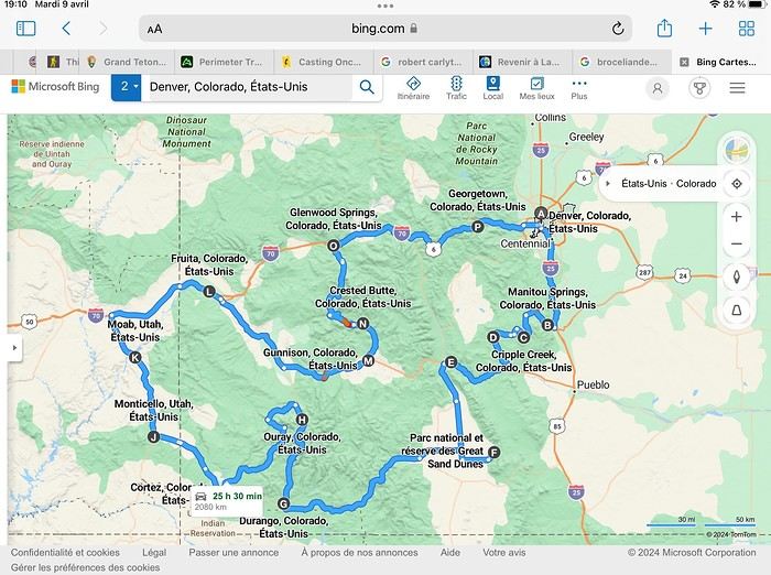
Day 1: Flight Marseille-Paris-Denver, then Manitou Springs (133 km) Day 2: Manitou Springs (49 km) Day 3: Cripple Creek (104 km) Day 4: Salida (254 km) Day 5: Great Sand Dunes (231 km) Day 6: Durango (283 km) Day 7: Durango (Durango-Silverton train) Day 8: Ouray (121 km) Day 9: Ouray (Perimeter Trail hike) Day 10: Cortez (213 km) Day 11: Cortez (Mesa Verde National Park, 134 km) Day 12: Monticello (268 km, detour to Chesler Park) Day 13: Moab (171 km, Delicate Arch) Day 14: Moab (98 km, Fisher Towers) Day 15: Moab (171 km, Canyonlands) Day 16: Fruita (210 km, Colorado National Monument) Day 17: Crested Butte (224 km via Kebler Pass) Day 18: Crested Butte (57 km) Day 19: Glenwood Springs (150 km) Day 20: Glenwood Springs (118 km, Rifle State Park) Day 21: Georgetown (258 km via Independence Pass) Day 22: Denver (123 km), then return flight
We speak very little English. We spent 21 nights there and covered a 3,400 km loop by car and 160 km on foot (we’re still trying to hike while we’re in shape) from Denver in September 2024. We wanted this road trip to help us explore Colorado a bit more—we’d only spent 6 nights there in 2019—and to see it during the fall foliage season. We also wanted to return to Utah (we love Moab) to enjoy its red rocks, which we adore.
In the prices you see (some in euros, others in dollars), I’ve included bank fees and exchange charges. The flights, car, and parking were paid by credit card when we booked in February. Usually, we book around November, but some obligations kept us from doing it earlier. We downloaded the MPC (Mobile Passport Control) app on our phone, which saved us time at immigration.
📊 **Budget: just under 8,500 € for both of us, all included**
📊 **Flights** Marseille-Paris (CDG)-Denver: 2,152 € for both of us, with one checked bag each
📊 **ESTA and America the Beautiful Pass** The ones from our 2023 road trip were still valid
📊 **Parking at Marseille airport: 122 €**
📊 **Car: Nissan Rogue (the French X-Trail) from Hertz: 1,165 €** By booking through Air France (and earning miles), we got a 15% discount. Hertz offers a free Hertz Gold Plus Rewards program, which gives us priority counter service.
📊 **Accommodation: 3,050 €** We stayed in motels and hotels of various ranges (from 100 € to 270 € per night, depending on the city), all booked through Hotels.com or Booking. Booking sometimes offers cheaper rates if you book via the "Booking mobile" app. We also got some preferential rates thanks to our Genius 2 status. Out of 21 nights, only one place didn’t include breakfast.
📊 **Other expenses (activities booked by credit card before leaving)** Durango-Silverton train: 210 € (we booked the enclosed vintage coach in March) Mesa Verde: Balcony House: 15.15 € (booked 14 days before the visit) Timed-entry passes for Arches National Park: 6 € for 3 days (booked June 1 for September entries via http://récreation.gov/). We booked three different days to play with the weather.
📊 **Supplementary insurance with AVA: 204 €** (due to our age 😅 and the high cost of medical consultations in the USA)
📊 **Cash: 1,540 €** We left with 1,000 € exchanged before departure and made two withdrawals (500 $ and 200 $). This cash was used to pay for: - Evening restaurants and tips (between 70 $ and 95 $ for two meals and two drinks) - Two state parks: Dead Horse State Park (20 $) and Rifle State Park (10 $) - The Monarch Pass gondola (24 $) - Midday picnics - Gas (slightly cheaper with cash): 204 $ for 3,400 km - Personal souvenirs and little treats.
Like in our previous road trips, we didn’t rent a GPS. We used the offline GPS app Here We Go, for which we’d downloaded maps of Colorado and Utah from France, as well as a new offline app called Organic Maps as a backup—though we didn’t end up needing it.
❤️❤️❤️ **Highlights (there are so many!)** 📍 The stunning landscapes of Colorado, especially with the fall colors 📍 A step back in time at the old farm in Florissant Fossil Beds National Monument 📍 The prairies of Cripple Creek and the mining remnants of the Vindicator Trail 📍 The cheeky chipmunks in the ghost town of St. Elmo 📍 Great Sand Dunes and its soft sand 📍 The steam train between Durango and Silverton: we’re glad we chose the round-trip because it rained heavily on the way there, but we got to enjoy the scenery on the way back when the sun came out 📍 The unexpected meet-up with Michèle from the group outside a restaurant in Durango 📍 The hot springs in Ouray 📍 Mesa Verde and its still-vibrant past 📍 The red rocks of Moab and Delicate Arch at sunset 📍 The lace-like Fisher Towers and the view from the end of the trail 📍 The gorgeous Route 128 leading to Colorado National Monument—small, easy to visit, and so beautiful 📍 The colors of the fabulous Kebler Pass, Crested Butte, and especially the hike through the golden aspens (Lower and Upper Loop) 📍 The waterfalls at Rifle State Park 📍 The tundra of Independence Pass 📍 The Halloween decorations in Georgetown and Idaho Springs
😞😞 **Flops (there are very few!)** 📍 The viewpoints we missed because they weren’t well-marked or we didn’t see the signs 📍 The closure of some hiking trails (Hanging Lake and parts of Canyonlands) and the Sal Mountain Loop road, which kept us from accessing it 📍😢 The Chesler Park hike we had to cut short due to poor time management—180 km between our stop in Cortez meant we didn’t arrive until 10:30 AM, way too late for a 17 km hike.
Hope this helps! Have a great evening, everyone, and see you soon! 😊
The itinerary
Day 1: Flight Marseille-Paris-Denver, then Manitou Springs (133 km) Day 2: Manitou Springs (49 km) Day 3: Cripple Creek (104 km) Day 4: Salida (254 km) Day 5: Great Sand Dunes (231 km) Day 6: Durango (283 km) Day 7: Durango (Durango-Silverton train) Day 8: Ouray (121 km) Day 9: Ouray (Perimeter Trail hike) Day 10: Cortez (213 km) Day 11: Cortez (Mesa Verde National Park, 134 km) Day 12: Monticello (268 km, detour to Chesler Park) Day 13: Moab (171 km, Delicate Arch) Day 14: Moab (98 km, Fisher Towers) Day 15: Moab (171 km, Canyonlands) Day 16: Fruita (210 km, Colorado National Monument) Day 17: Crested Butte (224 km via Kebler Pass) Day 18: Crested Butte (57 km) Day 19: Glenwood Springs (150 km) Day 20: Glenwood Springs (118 km, Rifle State Park) Day 21: Georgetown (258 km via Independence Pass) Day 22: Denver (123 km), then return flight
We speak very little English. We spent 21 nights there and covered a 3,400 km loop by car and 160 km on foot (we’re still trying to hike while we’re in shape) from Denver in September 2024. We wanted this road trip to help us explore Colorado a bit more—we’d only spent 6 nights there in 2019—and to see it during the fall foliage season. We also wanted to return to Utah (we love Moab) to enjoy its red rocks, which we adore.
In the prices you see (some in euros, others in dollars), I’ve included bank fees and exchange charges. The flights, car, and parking were paid by credit card when we booked in February. Usually, we book around November, but some obligations kept us from doing it earlier. We downloaded the MPC (Mobile Passport Control) app on our phone, which saved us time at immigration.
📊 **Budget: just under 8,500 € for both of us, all included**
📊 **Flights** Marseille-Paris (CDG)-Denver: 2,152 € for both of us, with one checked bag each
📊 **ESTA and America the Beautiful Pass** The ones from our 2023 road trip were still valid
📊 **Parking at Marseille airport: 122 €**
📊 **Car: Nissan Rogue (the French X-Trail) from Hertz: 1,165 €** By booking through Air France (and earning miles), we got a 15% discount. Hertz offers a free Hertz Gold Plus Rewards program, which gives us priority counter service.
📊 **Accommodation: 3,050 €** We stayed in motels and hotels of various ranges (from 100 € to 270 € per night, depending on the city), all booked through Hotels.com or Booking. Booking sometimes offers cheaper rates if you book via the "Booking mobile" app. We also got some preferential rates thanks to our Genius 2 status. Out of 21 nights, only one place didn’t include breakfast.
📊 **Other expenses (activities booked by credit card before leaving)** Durango-Silverton train: 210 € (we booked the enclosed vintage coach in March) Mesa Verde: Balcony House: 15.15 € (booked 14 days before the visit) Timed-entry passes for Arches National Park: 6 € for 3 days (booked June 1 for September entries via http://récreation.gov/). We booked three different days to play with the weather.
📊 **Supplementary insurance with AVA: 204 €** (due to our age 😅 and the high cost of medical consultations in the USA)
📊 **Cash: 1,540 €** We left with 1,000 € exchanged before departure and made two withdrawals (500 $ and 200 $). This cash was used to pay for: - Evening restaurants and tips (between 70 $ and 95 $ for two meals and two drinks) - Two state parks: Dead Horse State Park (20 $) and Rifle State Park (10 $) - The Monarch Pass gondola (24 $) - Midday picnics - Gas (slightly cheaper with cash): 204 $ for 3,400 km - Personal souvenirs and little treats.
Like in our previous road trips, we didn’t rent a GPS. We used the offline GPS app Here We Go, for which we’d downloaded maps of Colorado and Utah from France, as well as a new offline app called Organic Maps as a backup—though we didn’t end up needing it.
❤️❤️❤️ **Highlights (there are so many!)** 📍 The stunning landscapes of Colorado, especially with the fall colors 📍 A step back in time at the old farm in Florissant Fossil Beds National Monument 📍 The prairies of Cripple Creek and the mining remnants of the Vindicator Trail 📍 The cheeky chipmunks in the ghost town of St. Elmo 📍 Great Sand Dunes and its soft sand 📍 The steam train between Durango and Silverton: we’re glad we chose the round-trip because it rained heavily on the way there, but we got to enjoy the scenery on the way back when the sun came out 📍 The unexpected meet-up with Michèle from the group outside a restaurant in Durango 📍 The hot springs in Ouray 📍 Mesa Verde and its still-vibrant past 📍 The red rocks of Moab and Delicate Arch at sunset 📍 The lace-like Fisher Towers and the view from the end of the trail 📍 The gorgeous Route 128 leading to Colorado National Monument—small, easy to visit, and so beautiful 📍 The colors of the fabulous Kebler Pass, Crested Butte, and especially the hike through the golden aspens (Lower and Upper Loop) 📍 The waterfalls at Rifle State Park 📍 The tundra of Independence Pass 📍 The Halloween decorations in Georgetown and Idaho Springs
😞😞 **Flops (there are very few!)** 📍 The viewpoints we missed because they weren’t well-marked or we didn’t see the signs 📍 The closure of some hiking trails (Hanging Lake and parts of Canyonlands) and the Sal Mountain Loop road, which kept us from accessing it 📍😢 The Chesler Park hike we had to cut short due to poor time management—180 km between our stop in Cortez meant we didn’t arrive until 10:30 AM, way too late for a 17 km hike.
Hope this helps! Have a great evening, everyone, and see you soon! 😊
Hello everyone,
I’m not really a regular contributor to VoyageForum, but every time Kate and I travel, she encourages me to write a travel journal and publish it. And I must admit, it’s a very enjoyable intellectual exercise, though not always easy. As a VF contributor whose journals I’ve read once said, this retrospective work not only helps preserve memories but also provides a fruitful moment of introspection by bringing back emotions and feelings.
Kate and I spent a week in Istanbul. For her, who had already visited, it was a return; for me, it was a discovery.
As we’ve now made a habit of, I write the texts, and she posts her photos. We hope this illustrated story, crafted together, will revive beautiful sensations for those who know the city and inspire others to discover it. Here we go!
I’m not really a regular contributor to VoyageForum, but every time Kate and I travel, she encourages me to write a travel journal and publish it. And I must admit, it’s a very enjoyable intellectual exercise, though not always easy. As a VF contributor whose journals I’ve read once said, this retrospective work not only helps preserve memories but also provides a fruitful moment of introspection by bringing back emotions and feelings.
Kate and I spent a week in Istanbul. For her, who had already visited, it was a return; for me, it was a discovery.
As we’ve now made a habit of, I write the texts, and she posts her photos. We hope this illustrated story, crafted together, will revive beautiful sensations for those who know the city and inspire others to discover it. Here we go!
Our trip lasted a month, from March 10 to April 10, 2024, and was done aboard our Land Rover Defender 110. For those interested, our 4x4 is equipped with mountain-approved 3PMFSF all-terrain tires (non-studded), a removable electric winch that can be attached to either the front or rear of the vehicle, two sand recovery boards, and we bring two pairs of snow chains. We sleep in our Land Rover, which is equipped with a diesel-powered independent heater, a small fridge, and has a layout that allows the dinette to be converted into a bed.
Starting from the Paris region, we crossed Belgium and Germany, took the ferry from Travemünde in northern Germany to Helsinki, followed the Russian border up to northern Finland, then headed into Norway all the way to the North Cape before returning via Norway, taking the ferry from Larvik in Norway to Hirtshals in Denmark, then passing through Germany and Belgium on our way back to France.
Tonight, March 10, 2024, we’ll be sleeping at our daughter’s place in the North.
Tuesday, March 11, we’ll cross Belgium and then enter Germany, where we’ll camp in Bremen.
Wednesday, March 12, we’ll have a quick visit to Bremen in the morning. We had planned to visit Lübeck, but some electrical issues with the car delayed us, so we head straight to the German port of Travemünde, where we’re set to embark at 11:30 PM to cross the Baltic Sea and arrive in Helsinki after 31 hours of sailing (one-way cabin ticket cost: 850 €—quite expensive since we booked last minute).
On the ferry, there are mostly semi-trucks and only a few campervans and passenger cars. The boat is quiet, and the Baltic Sea is calm.
About two hours before arriving in Helsinki, we hear noise along the hull. Surprise—looking out the porthole, we realize we’re sailing on frozen sea ice!
Thursday, March 14, we arrive at the port of Helsinki at 9:30 AM. Disembarking takes a while. As soon as we’re out, we head straight to Rastila Camping (cost: 27 €), about ten kilometers east of Helsinki. Then we go to a Land Rover garage to fix our headlight switch, which stopped working (a real hassle in Finland since you have to drive with low beams on at all times).
After the repair, we visit the stunning Temppeliaukio Church, which is built underground.
On our way back to the campsite, we stop at the supermarket for supplies. Prices are similar to France, except for imported products.
We settle into our snowy campsite spot.
Starting from the Paris region, we crossed Belgium and Germany, took the ferry from Travemünde in northern Germany to Helsinki, followed the Russian border up to northern Finland, then headed into Norway all the way to the North Cape before returning via Norway, taking the ferry from Larvik in Norway to Hirtshals in Denmark, then passing through Germany and Belgium on our way back to France.
Tonight, March 10, 2024, we’ll be sleeping at our daughter’s place in the North.
Tuesday, March 11, we’ll cross Belgium and then enter Germany, where we’ll camp in Bremen.
Wednesday, March 12, we’ll have a quick visit to Bremen in the morning. We had planned to visit Lübeck, but some electrical issues with the car delayed us, so we head straight to the German port of Travemünde, where we’re set to embark at 11:30 PM to cross the Baltic Sea and arrive in Helsinki after 31 hours of sailing (one-way cabin ticket cost: 850 €—quite expensive since we booked last minute).
On the ferry, there are mostly semi-trucks and only a few campervans and passenger cars. The boat is quiet, and the Baltic Sea is calm.
About two hours before arriving in Helsinki, we hear noise along the hull. Surprise—looking out the porthole, we realize we’re sailing on frozen sea ice!
Thursday, March 14, we arrive at the port of Helsinki at 9:30 AM. Disembarking takes a while. As soon as we’re out, we head straight to Rastila Camping (cost: 27 €), about ten kilometers east of Helsinki. Then we go to a Land Rover garage to fix our headlight switch, which stopped working (a real hassle in Finland since you have to drive with low beams on at all times).
After the repair, we visit the stunning Temppeliaukio Church, which is built underground.
On our way back to the campsite, we stop at the supermarket for supplies. Prices are similar to France, except for imported products.
We settle into our snowy campsite spot.
Hi everyone,
First off, 12 days of great weather at the end of summer—my husband’s fleece jackets were totally unnecessary. We visited Vilnius, Riga, and Tallinn in that order, and it was a great tip. Vilnius is peaceful, very colorful, the food is delicious, street art is everywhere, and strolling through the historic center is really enjoyable. We stayed there for 2 nights. A 4-hour Lux Express bus ride was perfect for getting to Riga, where we spent 3 days. The city is a mix of medieval, Gothic, and Baroque art, with Orthodox churches and synagogues in the old town, plus an Art Nouveau district featuring the Rosenthal House. The central market looks austere and huge, facing the colorful walls of the tourist center—it’s a real pleasure to wander the cobblestone streets and taste the local cuisine, with its Germanic and Uzbek influences. In Tallinn, the highlight of the trip, we found Art Nouveau again, colorful walls, and a fitting reminder of the past at the Museum of Occupations. There’s a hipster district, a trendy area, stunning originality, and an unexpected maritime museum in its design. The city is at the cutting edge of technology, and the youth are everywhere. The welcome was friendly everywhere, and we’ll keep great memories of it.
First off, 12 days of great weather at the end of summer—my husband’s fleece jackets were totally unnecessary. We visited Vilnius, Riga, and Tallinn in that order, and it was a great tip. Vilnius is peaceful, very colorful, the food is delicious, street art is everywhere, and strolling through the historic center is really enjoyable. We stayed there for 2 nights. A 4-hour Lux Express bus ride was perfect for getting to Riga, where we spent 3 days. The city is a mix of medieval, Gothic, and Baroque art, with Orthodox churches and synagogues in the old town, plus an Art Nouveau district featuring the Rosenthal House. The central market looks austere and huge, facing the colorful walls of the tourist center—it’s a real pleasure to wander the cobblestone streets and taste the local cuisine, with its Germanic and Uzbek influences. In Tallinn, the highlight of the trip, we found Art Nouveau again, colorful walls, and a fitting reminder of the past at the Museum of Occupations. There’s a hipster district, a trendy area, stunning originality, and an unexpected maritime museum in its design. The city is at the cutting edge of technology, and the youth are everywhere. The welcome was friendly everywhere, and we’ll keep great memories of it.
In the summer of 2022, we spent 14 nights in Greece with an itinerary built around three hubs:
- Skopelos (Sporades Islands): 5 nights at the Aperitton Hotel on Skopelos
- Meteora: 2 nights at the Doupiani House Hotel in Kastraki
- Pelion: 2 nights at Karavia Lux Inn in Afissos + 5 nights at Akro Rooms Hotel in Agios Ioannis and 1 night in Volos before taking the boat back
We traveled with Transavia (Paris/Skiathos). From there, we took a boat to Skopelos, then another to Volos, and a return boat to Skiathos.
Thoughts on our hotels: Aperitton: Not bad, well-located but a bit "dated" Doupiani: Amazing, top-notch staff, dreamy breakfasts with a view of Meteora Karavia: Luxury, peace, and bliss (plus a great-value dinner option on-site) Akro: Simple and nice, breakfast on the terrace just above the beach
Our highlights: - The magic of Meteora - Exploring Skopelos by scooter, beach to beach - Karavia - The villages of Pelion (Pinakates, Milies, Tsagkarada, Portaria, and Makrinitsa...) - The beaches around Agios Ioannis - Octopus and fish at the local fishermen’s restaurants
Car rental in Volos from Aegean Car Rent: a beat-up 207—avoid! For accommodation prices and restaurant picks, we followed the *Routard* guide’s advice.
And since a picture’s worth a thousand words, here’s Skopelos to start:
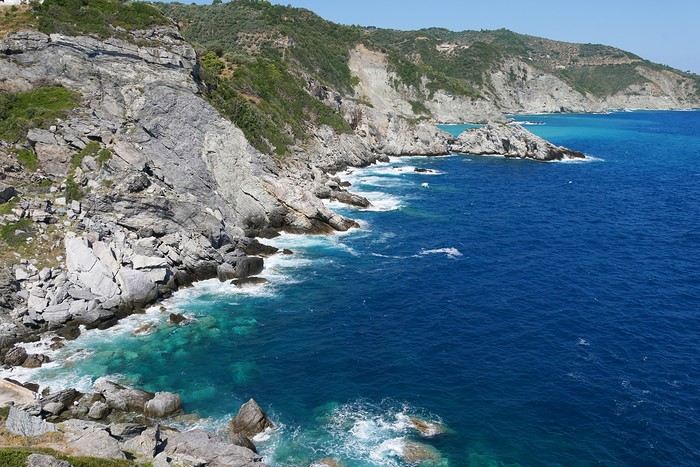
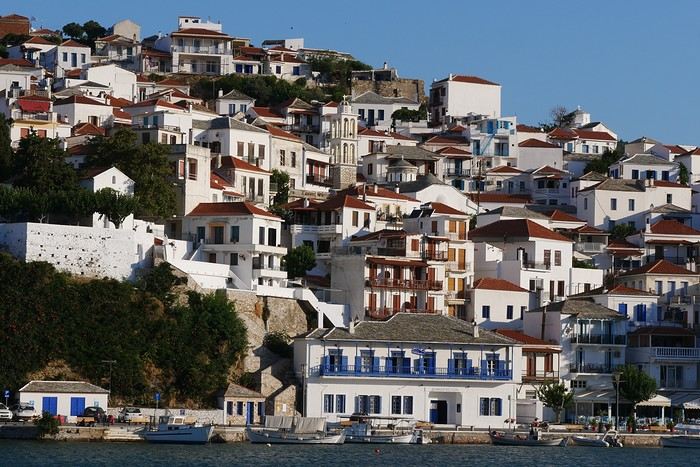
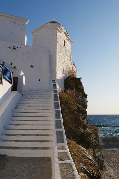
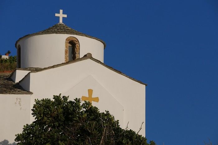
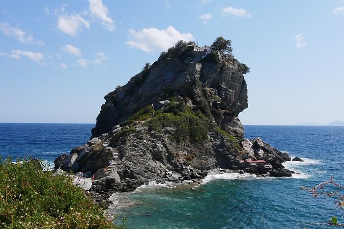
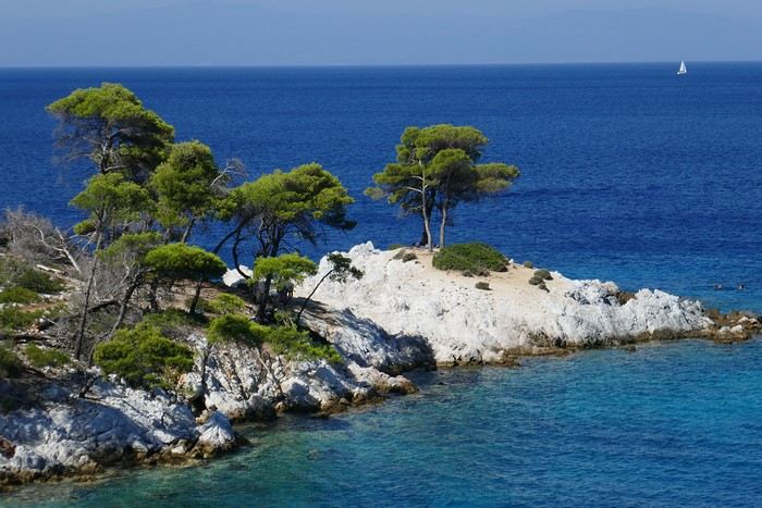
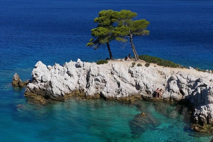
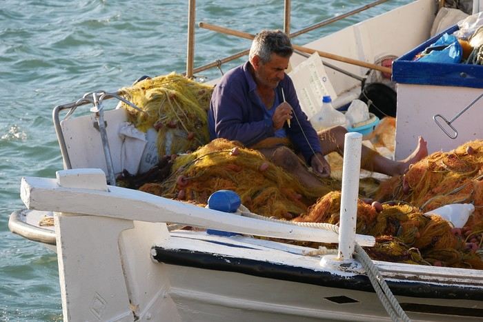
We traveled with Transavia (Paris/Skiathos). From there, we took a boat to Skopelos, then another to Volos, and a return boat to Skiathos.
Thoughts on our hotels: Aperitton: Not bad, well-located but a bit "dated" Doupiani: Amazing, top-notch staff, dreamy breakfasts with a view of Meteora Karavia: Luxury, peace, and bliss (plus a great-value dinner option on-site) Akro: Simple and nice, breakfast on the terrace just above the beach
Our highlights: - The magic of Meteora - Exploring Skopelos by scooter, beach to beach - Karavia - The villages of Pelion (Pinakates, Milies, Tsagkarada, Portaria, and Makrinitsa...) - The beaches around Agios Ioannis - Octopus and fish at the local fishermen’s restaurants
Car rental in Volos from Aegean Car Rent: a beat-up 207—avoid! For accommodation prices and restaurant picks, we followed the *Routard* guide’s advice.
And since a picture’s worth a thousand words, here’s Skopelos to start:
PAKSE AND THE BOLAVENS PLATEAU
Bolavens (or "Bolovens" – "the region of the Lavens," an old tribe).
PAKSE
A sleepy town, but packed with backpackers in transit between Laos and Cambodia. The streets are numbered, but since there are no signs, you just have to figure it out (rumor has it the signs have been planned for years; luckily, the center isn’t big). Tons of small hotels, including the well-known Sabaidy 2 on Street 20, a big bazaar catering to all budgets, from dark dorms with shared bathrooms to real rooms with terraces or balconies. Since it’s so popular, booking ahead is recommended. My favorite: the Sala Champa, pricier but with two large terraces, one with a bar, and especially a terrace restaurant I consider the best in Pakse (try the divine steamed fish with lemongrass + Lao Gold beer, a rare delight; ask for room 100, with a big terrace). More upscale, the lovely Résidence Sisouk, run by the very classy and French-speaking Mme Sisouk, from the wealthy Lao Sisouk family, the country’s top coffee producer and one of those francophone families you encounter here and there around the world, where class and culture reign – and perfect French. Delicious pastries and, of course, extraordinary coffee tastings. Similar prices at the Pakse Hotel, run by French owners and famous for its rooftop bar-restaurant (great view!).
Tons of restaurants besides those at Sala Champa and Pakse Hotel: from Dao Lin and Sabaidee at the corner of Street 20 and 13, to a decent Indian place (Hassan) and a nice, cheap spot, the Lao Restaurant & Bar, where you can enjoy Lao cuisine for just a few kips, both also on Street 20. You can feast on grilled fish at the countless riverside stalls along the Mekong.
Pakse is home to the famous Yves, a Belgian married to a Lao woman, Noy, who opened the travel agency Miss Noy. He’ll go out of his way to help tourists; he’s incredible, the real tourism office for the region, with maps, endless advice, and every weekday at 6 PM, a full-blown lecture on the Bolavens and the 4000 Islands. A bunch of young travelers listen intently to his explanations about the whole area (he hands out a well-made photocopied map). He also rents bikes and has an internet café with computers that, miraculously, work perfectly. He’s so popular that in high season, you need to book a motorbike 2-3 days in advance (but if he’s out – and he has 40 – he’ll find one for you).
THE BOLAVENS PLATEAU
Plateaus just aren’t my thing – flat-lands! There are some relatively high peaks in the middle, but they’re only accessible by trekking. You can do a small loop from Pakse-Tad Lo-Thateng-Pakson-Pakse, or a big one from Tad Lo to Sekong, then head south to join the Paksong-Pakse road. Starting in the north, the Phu Xam waterfalls are okay (interesting local minority village-museum to the right of the parking lot, and a terrace restaurant above the small falls). Well, they’re on the way, so you might as well see them! After that, a boring road leads to the Tad Lo waterfalls, with tons of small hotels. I chose the big blue house by the river at the right corner of the bridge, the Sipaseth GH, with cute little bungalows in the garden, 4 rooms with balconies overlooking the river, and great food on the terrace facing the falls. **Avoid at all costs**: the Saisee GH, once nice with its little stilt houses by the falls, but now a monument to filth, indifference, and rudeness (confirmed by several people, unanimous on the issue). Luckily, the lovely Tad Lo Lodge, with its bungalows by the falls and gourmet restaurant right above them – not cheap at all – finally built small houses in the woods on the other side for $25.
The next morning, I’d had enough of plateaus, so I took a small loop heading south from Tad Lo to Thateng, and there, a wonder 5 km south of town: the Sinouk Resort. It’s like stepping into *Gone with the Wind* or the Chevalier de Leyritz’s Martinique. In the middle of the Sisouk family’s 34-hectare coffee plantation, a huge garden with three large colonial-style houses: one by the river and pond with a suite + 3 luxury rooms + a small, cozy one for $40 (that’s where I stayed), one with 4 superior rooms for $60, and a very large one overlooking everything with 6 luxury rooms ($60) + 2 huge suites for $90. Of course, it’s all decorated with antique furniture, local knick-knacks, and antiques; there’s a pool, a beautiful restaurant with two terraces, one overlooking a large pond and one by its edge. The food and service are impeccable, and the coffee: from espresso with whipped cream to green tea or wild honey cappuccino… too bad it keeps you up, or you’d sip it all evening (and morning, and afternoon, and in between). In short, a dream!
Back to Pakse via Paksong (what a dump!) and the Tad Fane waterfalls, those are spectacular – twin sisters plunging 200 meters. You can hike down to swim at the bottom (1-hour jungle trek round trip). Across the way, the nice Tad Fane Resort (small houses and a big terrace-restaurant facing the falls).
I think I missed the Katamkok waterfalls, but I don’t believe it – all these falls can’t compare to Ban Gioc Falls in northern Vietnam!!!
CHAMPASAK AND THE 4000 ISLANDS
CHAMPASAK
Even sleepier than Pakse! To avoid the ferry, cross the new Mekong bridge in Pakse, and after about 10 km, turn left at the big "Phaphinoy" sign (the first village in town). When you arrive, turn at the "River Resort" sign. A sumptuous resort on the Mekong, developed with American capital – pure luxury (they even have their own rice field and vegetable garden for the restaurant). Continuing on, you’ll come across the very pleasant Anouxa GH, where I had dinner and stayed. Small bungalows facing the river, garden rooms, and two large wooden houses with huge family rooms + a big terrace on the Mekong, and the food is great! They rent bikes and motorbikes. Further to the right, the pricey Inthira Hotel, which I found uninteresting since it’s on the road instead of by the Mekong. There’s also a Folie Lodge on Don Daeng Island, which I didn’t visit (the word "Folie" is justified: crazy prices, up to $200 and more).
A few nice wats and, of course, Wat Phou, Laos’ most important archaeological site, 10 km south of Champassak in the plains and on the mountainside (the stairs are a killer!). Watch out for the scorching heat, and it closes at 4:30 PM. It’s not Angkor Wat, but it’s still worth the detour. Plan for 2 hours. Entry is 50,000 kips + 5,000 to park your motorbike.
KHIET NGON
To continue south to the 4000 Islands, you have to take the "ferry" (actually fun little things – two canoes joined by a platform; better not mess up when loading your motorbike!). Once on the other side, turn left, and you’ll hit National Road 13 (Pakse-Siphandone, the 4000 Islands), the most boring road I’ve ever been on, like Phnom Penh-Siem Reap – flat and nothing to see. BUT there’s a real gem worth checking out: Kiet Ngon. At Km 48, take the laterite road toward Attapeu (big sign: "Attapeu 155 km") and eat red dust for 8 km (toll: 20,000 kips), then turn right (signposted) onto a good track. You enter the beautiful Xe Pian National Park, where you can still find wild elephants, leopards, and tigers. You arrive at the entrance of the small village of Ban Khiet Ngon. On your right, a small concrete building with 4 decent, cheap rooms (60,000 kips), facing an old wooden house that serves as the tourism office and its "elephant parking" garden. This village is where you can go on an elephant ride (20,000 kips) to the top of Phou Asa, one of the most unusual places I’ve ever seen. You climb through the jungle and emerge onto a flat slate summit, completely bare – it really feels like the Moon! In the distance, an astonishing site built to commemorate a victory by Lao nationalists over Siamese invaders in the 19th century (so the site isn’t 1,000 years old, as the locals claim). A vast archaeological site with an enclosure 180 m by 50 m, marked by 2-meter-high walls and columns made of slate stacked without mortar. At the back, a ruined temple and a tower. Beautiful views of the whole region. Popular with tourists arriving by minibus from Pakse. The elephant rides in a line aren’t my thing, so they tell you it’s forbidden to ride a motorbike, but I did it anyway without any issues – except for the unhappy looks from the mahouts (turn right at the village entrance, sign for "Phou Asa").
If you’ve got the funds, follow the signs for "Kingfisher Lodge" and arrive at Laos’ first ecolodge, developed by a Lao-Italian family. Lovely stilt houses (750,000 kips with breakfast) and 2 bungalows with just fans (250,000 kips). A small two-story wooden building with a restaurant and a terrace by a pond – the bonus: in the evening, wild elephants and buffalo come to drink with you. Booking ahead is recommended since it’s popular with groups from Pakse.
Paper guides also mention the more remote village of Ban Papho, deep in the jungle. There used to be elephant rides, but they’ve stopped. However, there are great treks in the national park (check with the Green Discovery agency in Pakse, which specializes in treks all over Laos).
THE 4000 ISLANDS
You continue on the mind-numbing Road 13 from Pakse and arrive at a brand-new bridge leading to Don Khong Island, where there’s nothing to see except two wats, so if you skip it, you’re not missing much. Next, the Nakasang sign, a small port with mini-ferries crossing the Mekong to Don Det Island. A celebrity, that one – one of those trashy spots for young people who think you can only have fun if you’re wasted on alcohol and drugs. A small street along the river, lined with guesthouses, restaurants, and bars – total chaos! Plus, there’s nothing to see on the island. So, take a tuk-tuk from the jetty, cross the dump, and arrive in a little paradise: Don Khone Island. I planned to stay 2 days but had to be dragged away after 6. A small main village with a dirt road, tons of guesthouses and great restaurants, and lots of beautiful things to see.
For lodging on Don Khone, it’s usually wooden bungalows with river-view terraces. Options range from the elegant and pricey Sala Done Hotel to Somphamit, Pan’s, Pakha GH, and many others. I found my haven away from everything: the little Phonvilay, 3 small bamboo buildings with 2 simple rooms each, terraces above a branch of the Mekong, and a big plus – a small path just to the right that goes down the riverbank, so 3-4 nice swims a day. All for 60,000 kips. To get there, turn right at the end of the bridge until you reach the wat, then take the small path to the river on the right of the wat’s wall.
For food, you’re spoiled for choice. I had all my dinners at the Cordon Bleu of the Fleur du Mékong. I don’t know how she does it, but even the simplest dishes have something extra. She’s famous for her curry (more like a mild stew) of duck or chicken with potatoes and sweet potatoes – a hearty treat. Go for the chicken; Asian ducks are all skin and bones. Her grilled fish is divine!
The island has quite a history: the Mekong upstream is over a kilometer wide (it’s said to reach 14 km during high water) and "falls" onto a rocky barrier. It splits into countless small branches, flowing wherever there’s a crack – hence the 4000 Islands and the impressive rapids. The French discovered this while trying to navigate the Mekong from Saigon to Luang Prabang and China – and bam, impassable! So they built a narrow-gauge railway starting from the south of the island, bypassing the rapids, and ending at the north of Don Det Island. You can see two rusted locomotives, discovered in the jungle in 1990 by a French explorer: one in the southern extension of the bridge and the other in Ban Hang Khone village at the southern tip of the island, both with large English signs and fascinating old photos explaining the whole history of the railway, abandoned when Road 13 was built along the 4000 Islands (the rails were removed, and the railway track is now an excellent trail).
Somphamit Rapids (Li Phi)
Locals call them Li Phi, meaning "the abyss of evil spirits" (the "phi" that Lao people still believe in), because they think the falls and rapids trap spirits, to the point that no one would ever swim there. It’s very dramatic. Entry fee: 35,000 kips. Small beach and a big restaurant with a terrace and thatched-roof tables.
Khon Pa Sai Rapids
A completely different kind, just as spectacular, and less crowded. Turn left at the bridge exit and go to the northern end of the island (Ban Khon Nua village), then continue south until you see a big yellow sign "Khon Pa Sai Waterfalls" pointing to a small path on the left. You arrive at a small suspension bridge with a corner restaurant and terrace where the food is great (I had most of my lunches there). Cross the bridge and follow the path to a spectacular site of falls and rapids. In the middle, you’ll see unique structures – gigantic fish traps over 10 meters long. During high water, each trap can catch up to 500 kg of fish (yes, five hundred) per day.
Ban Hang Khone
This is the "French port" at the southern tip of the island, where the Mekong, after its rapids, spreads out for kilometers – a real inland sea. This is where you can see the famous Irrawaddy dolphins in the morning or late afternoon (boat excursions). To get there, take the trail that was the old railway track, or continue south on the path past the Khon Pa Sai falls (but not by motorbike – the bridge is out). A huge concrete terrace, part of the old port facilities, with a magnificent panoramic view of the Mekong stretching into the distance. Just before, a small path leads to a big beach (with restaurants).
If you go back to Road 13 (or take a pirogue from Don Khone), further south are the Pha Peng Falls, Asia’s highest river falls (15 m). I didn’t go, but they’re said to be spectacular.
Bolavens (or "Bolovens" – "the region of the Lavens," an old tribe).
PAKSE
A sleepy town, but packed with backpackers in transit between Laos and Cambodia. The streets are numbered, but since there are no signs, you just have to figure it out (rumor has it the signs have been planned for years; luckily, the center isn’t big). Tons of small hotels, including the well-known Sabaidy 2 on Street 20, a big bazaar catering to all budgets, from dark dorms with shared bathrooms to real rooms with terraces or balconies. Since it’s so popular, booking ahead is recommended. My favorite: the Sala Champa, pricier but with two large terraces, one with a bar, and especially a terrace restaurant I consider the best in Pakse (try the divine steamed fish with lemongrass + Lao Gold beer, a rare delight; ask for room 100, with a big terrace). More upscale, the lovely Résidence Sisouk, run by the very classy and French-speaking Mme Sisouk, from the wealthy Lao Sisouk family, the country’s top coffee producer and one of those francophone families you encounter here and there around the world, where class and culture reign – and perfect French. Delicious pastries and, of course, extraordinary coffee tastings. Similar prices at the Pakse Hotel, run by French owners and famous for its rooftop bar-restaurant (great view!).
Tons of restaurants besides those at Sala Champa and Pakse Hotel: from Dao Lin and Sabaidee at the corner of Street 20 and 13, to a decent Indian place (Hassan) and a nice, cheap spot, the Lao Restaurant & Bar, where you can enjoy Lao cuisine for just a few kips, both also on Street 20. You can feast on grilled fish at the countless riverside stalls along the Mekong.
Pakse is home to the famous Yves, a Belgian married to a Lao woman, Noy, who opened the travel agency Miss Noy. He’ll go out of his way to help tourists; he’s incredible, the real tourism office for the region, with maps, endless advice, and every weekday at 6 PM, a full-blown lecture on the Bolavens and the 4000 Islands. A bunch of young travelers listen intently to his explanations about the whole area (he hands out a well-made photocopied map). He also rents bikes and has an internet café with computers that, miraculously, work perfectly. He’s so popular that in high season, you need to book a motorbike 2-3 days in advance (but if he’s out – and he has 40 – he’ll find one for you).
THE BOLAVENS PLATEAU
Plateaus just aren’t my thing – flat-lands! There are some relatively high peaks in the middle, but they’re only accessible by trekking. You can do a small loop from Pakse-Tad Lo-Thateng-Pakson-Pakse, or a big one from Tad Lo to Sekong, then head south to join the Paksong-Pakse road. Starting in the north, the Phu Xam waterfalls are okay (interesting local minority village-museum to the right of the parking lot, and a terrace restaurant above the small falls). Well, they’re on the way, so you might as well see them! After that, a boring road leads to the Tad Lo waterfalls, with tons of small hotels. I chose the big blue house by the river at the right corner of the bridge, the Sipaseth GH, with cute little bungalows in the garden, 4 rooms with balconies overlooking the river, and great food on the terrace facing the falls. **Avoid at all costs**: the Saisee GH, once nice with its little stilt houses by the falls, but now a monument to filth, indifference, and rudeness (confirmed by several people, unanimous on the issue). Luckily, the lovely Tad Lo Lodge, with its bungalows by the falls and gourmet restaurant right above them – not cheap at all – finally built small houses in the woods on the other side for $25.
The next morning, I’d had enough of plateaus, so I took a small loop heading south from Tad Lo to Thateng, and there, a wonder 5 km south of town: the Sinouk Resort. It’s like stepping into *Gone with the Wind* or the Chevalier de Leyritz’s Martinique. In the middle of the Sisouk family’s 34-hectare coffee plantation, a huge garden with three large colonial-style houses: one by the river and pond with a suite + 3 luxury rooms + a small, cozy one for $40 (that’s where I stayed), one with 4 superior rooms for $60, and a very large one overlooking everything with 6 luxury rooms ($60) + 2 huge suites for $90. Of course, it’s all decorated with antique furniture, local knick-knacks, and antiques; there’s a pool, a beautiful restaurant with two terraces, one overlooking a large pond and one by its edge. The food and service are impeccable, and the coffee: from espresso with whipped cream to green tea or wild honey cappuccino… too bad it keeps you up, or you’d sip it all evening (and morning, and afternoon, and in between). In short, a dream!
Back to Pakse via Paksong (what a dump!) and the Tad Fane waterfalls, those are spectacular – twin sisters plunging 200 meters. You can hike down to swim at the bottom (1-hour jungle trek round trip). Across the way, the nice Tad Fane Resort (small houses and a big terrace-restaurant facing the falls).
I think I missed the Katamkok waterfalls, but I don’t believe it – all these falls can’t compare to Ban Gioc Falls in northern Vietnam!!!
CHAMPASAK AND THE 4000 ISLANDS
CHAMPASAK
Even sleepier than Pakse! To avoid the ferry, cross the new Mekong bridge in Pakse, and after about 10 km, turn left at the big "Phaphinoy" sign (the first village in town). When you arrive, turn at the "River Resort" sign. A sumptuous resort on the Mekong, developed with American capital – pure luxury (they even have their own rice field and vegetable garden for the restaurant). Continuing on, you’ll come across the very pleasant Anouxa GH, where I had dinner and stayed. Small bungalows facing the river, garden rooms, and two large wooden houses with huge family rooms + a big terrace on the Mekong, and the food is great! They rent bikes and motorbikes. Further to the right, the pricey Inthira Hotel, which I found uninteresting since it’s on the road instead of by the Mekong. There’s also a Folie Lodge on Don Daeng Island, which I didn’t visit (the word "Folie" is justified: crazy prices, up to $200 and more).
A few nice wats and, of course, Wat Phou, Laos’ most important archaeological site, 10 km south of Champassak in the plains and on the mountainside (the stairs are a killer!). Watch out for the scorching heat, and it closes at 4:30 PM. It’s not Angkor Wat, but it’s still worth the detour. Plan for 2 hours. Entry is 50,000 kips + 5,000 to park your motorbike.
KHIET NGON
To continue south to the 4000 Islands, you have to take the "ferry" (actually fun little things – two canoes joined by a platform; better not mess up when loading your motorbike!). Once on the other side, turn left, and you’ll hit National Road 13 (Pakse-Siphandone, the 4000 Islands), the most boring road I’ve ever been on, like Phnom Penh-Siem Reap – flat and nothing to see. BUT there’s a real gem worth checking out: Kiet Ngon. At Km 48, take the laterite road toward Attapeu (big sign: "Attapeu 155 km") and eat red dust for 8 km (toll: 20,000 kips), then turn right (signposted) onto a good track. You enter the beautiful Xe Pian National Park, where you can still find wild elephants, leopards, and tigers. You arrive at the entrance of the small village of Ban Khiet Ngon. On your right, a small concrete building with 4 decent, cheap rooms (60,000 kips), facing an old wooden house that serves as the tourism office and its "elephant parking" garden. This village is where you can go on an elephant ride (20,000 kips) to the top of Phou Asa, one of the most unusual places I’ve ever seen. You climb through the jungle and emerge onto a flat slate summit, completely bare – it really feels like the Moon! In the distance, an astonishing site built to commemorate a victory by Lao nationalists over Siamese invaders in the 19th century (so the site isn’t 1,000 years old, as the locals claim). A vast archaeological site with an enclosure 180 m by 50 m, marked by 2-meter-high walls and columns made of slate stacked without mortar. At the back, a ruined temple and a tower. Beautiful views of the whole region. Popular with tourists arriving by minibus from Pakse. The elephant rides in a line aren’t my thing, so they tell you it’s forbidden to ride a motorbike, but I did it anyway without any issues – except for the unhappy looks from the mahouts (turn right at the village entrance, sign for "Phou Asa").
If you’ve got the funds, follow the signs for "Kingfisher Lodge" and arrive at Laos’ first ecolodge, developed by a Lao-Italian family. Lovely stilt houses (750,000 kips with breakfast) and 2 bungalows with just fans (250,000 kips). A small two-story wooden building with a restaurant and a terrace by a pond – the bonus: in the evening, wild elephants and buffalo come to drink with you. Booking ahead is recommended since it’s popular with groups from Pakse.
Paper guides also mention the more remote village of Ban Papho, deep in the jungle. There used to be elephant rides, but they’ve stopped. However, there are great treks in the national park (check with the Green Discovery agency in Pakse, which specializes in treks all over Laos).
THE 4000 ISLANDS
You continue on the mind-numbing Road 13 from Pakse and arrive at a brand-new bridge leading to Don Khong Island, where there’s nothing to see except two wats, so if you skip it, you’re not missing much. Next, the Nakasang sign, a small port with mini-ferries crossing the Mekong to Don Det Island. A celebrity, that one – one of those trashy spots for young people who think you can only have fun if you’re wasted on alcohol and drugs. A small street along the river, lined with guesthouses, restaurants, and bars – total chaos! Plus, there’s nothing to see on the island. So, take a tuk-tuk from the jetty, cross the dump, and arrive in a little paradise: Don Khone Island. I planned to stay 2 days but had to be dragged away after 6. A small main village with a dirt road, tons of guesthouses and great restaurants, and lots of beautiful things to see.
For lodging on Don Khone, it’s usually wooden bungalows with river-view terraces. Options range from the elegant and pricey Sala Done Hotel to Somphamit, Pan’s, Pakha GH, and many others. I found my haven away from everything: the little Phonvilay, 3 small bamboo buildings with 2 simple rooms each, terraces above a branch of the Mekong, and a big plus – a small path just to the right that goes down the riverbank, so 3-4 nice swims a day. All for 60,000 kips. To get there, turn right at the end of the bridge until you reach the wat, then take the small path to the river on the right of the wat’s wall.
For food, you’re spoiled for choice. I had all my dinners at the Cordon Bleu of the Fleur du Mékong. I don’t know how she does it, but even the simplest dishes have something extra. She’s famous for her curry (more like a mild stew) of duck or chicken with potatoes and sweet potatoes – a hearty treat. Go for the chicken; Asian ducks are all skin and bones. Her grilled fish is divine!
The island has quite a history: the Mekong upstream is over a kilometer wide (it’s said to reach 14 km during high water) and "falls" onto a rocky barrier. It splits into countless small branches, flowing wherever there’s a crack – hence the 4000 Islands and the impressive rapids. The French discovered this while trying to navigate the Mekong from Saigon to Luang Prabang and China – and bam, impassable! So they built a narrow-gauge railway starting from the south of the island, bypassing the rapids, and ending at the north of Don Det Island. You can see two rusted locomotives, discovered in the jungle in 1990 by a French explorer: one in the southern extension of the bridge and the other in Ban Hang Khone village at the southern tip of the island, both with large English signs and fascinating old photos explaining the whole history of the railway, abandoned when Road 13 was built along the 4000 Islands (the rails were removed, and the railway track is now an excellent trail).
Somphamit Rapids (Li Phi)
Locals call them Li Phi, meaning "the abyss of evil spirits" (the "phi" that Lao people still believe in), because they think the falls and rapids trap spirits, to the point that no one would ever swim there. It’s very dramatic. Entry fee: 35,000 kips. Small beach and a big restaurant with a terrace and thatched-roof tables.
Khon Pa Sai Rapids
A completely different kind, just as spectacular, and less crowded. Turn left at the bridge exit and go to the northern end of the island (Ban Khon Nua village), then continue south until you see a big yellow sign "Khon Pa Sai Waterfalls" pointing to a small path on the left. You arrive at a small suspension bridge with a corner restaurant and terrace where the food is great (I had most of my lunches there). Cross the bridge and follow the path to a spectacular site of falls and rapids. In the middle, you’ll see unique structures – gigantic fish traps over 10 meters long. During high water, each trap can catch up to 500 kg of fish (yes, five hundred) per day.
Ban Hang Khone
This is the "French port" at the southern tip of the island, where the Mekong, after its rapids, spreads out for kilometers – a real inland sea. This is where you can see the famous Irrawaddy dolphins in the morning or late afternoon (boat excursions). To get there, take the trail that was the old railway track, or continue south on the path past the Khon Pa Sai falls (but not by motorbike – the bridge is out). A huge concrete terrace, part of the old port facilities, with a magnificent panoramic view of the Mekong stretching into the distance. Just before, a small path leads to a big beach (with restaurants).
If you go back to Road 13 (or take a pirogue from Don Khone), further south are the Pha Peng Falls, Asia’s highest river falls (15 m). I didn’t go, but they’re said to be spectacular.
This adventure began during Covid... Yep, Covid turned a lot of things upside down, but most of all, it kept us cooped up for a few months and stopped us from traveling for a while—even longer for a die-hard fan of the American West like me.
While borders were closed, I started imagining what an ideal itinerary might look like—one that would string together all the Southwest must-sees in just two weeks, during the best time of year: September and October. When the U.S. announced in September 2021 that borders would reopen in the coming weeks, I regained hope and began scouting flight tickets for a departure in September 2022.
But here’s the thing: tackling solo hikes, each one tougher than the last, right in the heart of the Wilderness, could be a risky—even reckless—endeavor for a father of three. After a quick chat with some virtual friends who are just as passionate about the Southwest as I am, with good physical condition and nearly the same list of must-visit spots, Franck and his brother Sullivan were in! 🙂
In November, we snagged flight tickets from Nice to San Francisco for the modest sum of 400 €, and a few days later, I booked a Toyota Tacoma pickup for 840 € !
It’s not cheap for just 15 days, and a pickup isn’t exactly ideal for luggage, but the prices for full-size 4x4s have become totally outrageous! Due to border closures, rental companies had to offload a lot of these big 4x4s, which tourists love. Then, supply and demand did the rest !
Franck and I spent the winter and spring trying to cram the equivalent of three weeks of hikes into two. But even with physical limits, we had to stay reasonable! Three to four months before departure, we entered the lotteries for different must-see spots: The Subway, Coyote Buttes North (home to the famous Wave), and Coyote Buttes South (CBS).
The Wave is the holy grail for any Southwest enthusiast. Since 2015, we’ve tried our luck with the online and on-site lotteries about ten times, but the spots are unfortunately limited: just 20 per day. A glimmer of hope, though—since early 2022, that number has increased to 64 people allowed per day, with 48 spots awarded via the online lottery.
After all three of us tried our luck for The Wave, on June 1st at exactly 5 PM, I got an email that started with, "Congratulations! You were successful in the Coyote Buttes North (The Wave) September 2022 Permit Lottery at Coyote Buttes North (The Wave)...". At 5:01 PM, I called Franck, whose dream it’s been for over 20 years—ever since the first photos were published in a travel magazine! He didn’t believe me when I told him, and I had to forward the email for him to finally accept the unbelievable: we were going to The Wave and all the incredible spots scattered across the protected area of Coyote Buttes North.
I’ve already been to Coyote Buttes South twice, but there are areas I couldn’t explore in the middle of summer because they were too remote. So, I had no trouble letting my buddies convince me to go back for a third time. Plus, given how hard it is to access, we had no trouble securing a permit online as long as we logged in at exactly 8 PM on the dot!
For The Subway, all three of us struck out. No big deal—we won at CBN and CBS!
Among the sites to visit, there are two that I’m particularly attached to because I know my chances of wanting to see them again are slim. The first is Angel Arch, one of the most legendary arches in the Southwest, due to its remoteness from any trace of civilization. To get there, the recommended hike is Upper Salt Creek, and you’re looking at a 50 km round-trip in an area with no water (in September) and populated by bears.
The second site is the Hopi Salt Trail, in Navajo land, which, after a very tough hike, lets you marvel at the turquoise-blue waters of the Little Colorado before it meets the Colorado River. The Hopi Salt Trail is, like The Wave, the holy grail for any Southwest enthusiast, and the windows of opportunity to see the water in that magical color are very short each year. For this, you have to monitor the Little Colorado’s gauges downstream from Cameron: if the level stays at its lowest for 10 consecutive days—meaning no rain—you can hope for turquoise water. The ideal period rarely exceeds 30 days a year, and it’s usually in June that all the stars align.
But unfortunately, one month before departure, while the flow rate at Cameron looked promising, several storms in September dashed our hopes of doing the Hopi Salt Trail, even at the end of the road trip.
We still had two consolation prizes, though:
After a last-minute cancellation, while keeping an eye out for available spots for The Subway, it turned out that three spots opened up exactly on the day we’d planned to go—so we rushed to grab them!! Regarding the 4x4 rental, the prices for full-size models dropped by several hundred dollars, and we ended up finding a Chevrolet Tahoe for less than $1000. A steal and a serious boost in comfort, so we could store all our gear and food without worry!
Here’s the initial plan in a perfect world: D1 The White Domes - Camping D2 Sunrise at The White Domes - The Subway D3 Coyote Buttes North D4 Coyote Buttes South - White Pocket D5 Wahweap Hoodoos - Sidestep Canyon - Colourful Canyon - White Rocks - Sunset at Yellow Rock D6 Broken Bow Arch - Reflection Canyon D7 Coyote Gulch D8 The Volcano (or The Oasis - Zebra Slot Canyon if the weather’s good) - North Caineville Mesa D9 The Needles: Squaw Canyon - Lost Canyon combo - Druid Arch - Chesler Park D10 Upper Salt Creek Day 1 - Camping D11 Upper Salt Creek Day 2 D12 Hopi-Navajo Territory: Ha Ho No Geh Canyon, Coal Mine Canyon, Bends of the Little Colorado D13 Grand Canyon: South Kaibab Trail and Bright Angel Trail D14 Upper East Zion: East Temple Loop, Jughandle Arch, Center of the Universe, and Checkerboard Mesa Summit And several backup options in case of bad weather, including Spencer Trail, West Cove, and Buffington Pockets.
Enough talking—time for action!
While borders were closed, I started imagining what an ideal itinerary might look like—one that would string together all the Southwest must-sees in just two weeks, during the best time of year: September and October. When the U.S. announced in September 2021 that borders would reopen in the coming weeks, I regained hope and began scouting flight tickets for a departure in September 2022.
But here’s the thing: tackling solo hikes, each one tougher than the last, right in the heart of the Wilderness, could be a risky—even reckless—endeavor for a father of three. After a quick chat with some virtual friends who are just as passionate about the Southwest as I am, with good physical condition and nearly the same list of must-visit spots, Franck and his brother Sullivan were in! 🙂
In November, we snagged flight tickets from Nice to San Francisco for the modest sum of 400 €, and a few days later, I booked a Toyota Tacoma pickup for 840 € !
It’s not cheap for just 15 days, and a pickup isn’t exactly ideal for luggage, but the prices for full-size 4x4s have become totally outrageous! Due to border closures, rental companies had to offload a lot of these big 4x4s, which tourists love. Then, supply and demand did the rest !
Franck and I spent the winter and spring trying to cram the equivalent of three weeks of hikes into two. But even with physical limits, we had to stay reasonable! Three to four months before departure, we entered the lotteries for different must-see spots: The Subway, Coyote Buttes North (home to the famous Wave), and Coyote Buttes South (CBS).
The Wave is the holy grail for any Southwest enthusiast. Since 2015, we’ve tried our luck with the online and on-site lotteries about ten times, but the spots are unfortunately limited: just 20 per day. A glimmer of hope, though—since early 2022, that number has increased to 64 people allowed per day, with 48 spots awarded via the online lottery.
After all three of us tried our luck for The Wave, on June 1st at exactly 5 PM, I got an email that started with, "Congratulations! You were successful in the Coyote Buttes North (The Wave) September 2022 Permit Lottery at Coyote Buttes North (The Wave)...". At 5:01 PM, I called Franck, whose dream it’s been for over 20 years—ever since the first photos were published in a travel magazine! He didn’t believe me when I told him, and I had to forward the email for him to finally accept the unbelievable: we were going to The Wave and all the incredible spots scattered across the protected area of Coyote Buttes North.
I’ve already been to Coyote Buttes South twice, but there are areas I couldn’t explore in the middle of summer because they were too remote. So, I had no trouble letting my buddies convince me to go back for a third time. Plus, given how hard it is to access, we had no trouble securing a permit online as long as we logged in at exactly 8 PM on the dot!
For The Subway, all three of us struck out. No big deal—we won at CBN and CBS!
Among the sites to visit, there are two that I’m particularly attached to because I know my chances of wanting to see them again are slim. The first is Angel Arch, one of the most legendary arches in the Southwest, due to its remoteness from any trace of civilization. To get there, the recommended hike is Upper Salt Creek, and you’re looking at a 50 km round-trip in an area with no water (in September) and populated by bears.
The second site is the Hopi Salt Trail, in Navajo land, which, after a very tough hike, lets you marvel at the turquoise-blue waters of the Little Colorado before it meets the Colorado River. The Hopi Salt Trail is, like The Wave, the holy grail for any Southwest enthusiast, and the windows of opportunity to see the water in that magical color are very short each year. For this, you have to monitor the Little Colorado’s gauges downstream from Cameron: if the level stays at its lowest for 10 consecutive days—meaning no rain—you can hope for turquoise water. The ideal period rarely exceeds 30 days a year, and it’s usually in June that all the stars align.
But unfortunately, one month before departure, while the flow rate at Cameron looked promising, several storms in September dashed our hopes of doing the Hopi Salt Trail, even at the end of the road trip.
We still had two consolation prizes, though:
After a last-minute cancellation, while keeping an eye out for available spots for The Subway, it turned out that three spots opened up exactly on the day we’d planned to go—so we rushed to grab them!! Regarding the 4x4 rental, the prices for full-size models dropped by several hundred dollars, and we ended up finding a Chevrolet Tahoe for less than $1000. A steal and a serious boost in comfort, so we could store all our gear and food without worry!
Here’s the initial plan in a perfect world: D1 The White Domes - Camping D2 Sunrise at The White Domes - The Subway D3 Coyote Buttes North D4 Coyote Buttes South - White Pocket D5 Wahweap Hoodoos - Sidestep Canyon - Colourful Canyon - White Rocks - Sunset at Yellow Rock D6 Broken Bow Arch - Reflection Canyon D7 Coyote Gulch D8 The Volcano (or The Oasis - Zebra Slot Canyon if the weather’s good) - North Caineville Mesa D9 The Needles: Squaw Canyon - Lost Canyon combo - Druid Arch - Chesler Park D10 Upper Salt Creek Day 1 - Camping D11 Upper Salt Creek Day 2 D12 Hopi-Navajo Territory: Ha Ho No Geh Canyon, Coal Mine Canyon, Bends of the Little Colorado D13 Grand Canyon: South Kaibab Trail and Bright Angel Trail D14 Upper East Zion: East Temple Loop, Jughandle Arch, Center of the Universe, and Checkerboard Mesa Summit And several backup options in case of bad weather, including Spencer Trail, West Cove, and Buffington Pockets.
Enough talking—time for action!
Hello everyone, I’m happy to welcome you to this new travel journal.
We’re heading to Costa Rica together—a Central American destination that dreams are made of for many French travelers and attracts crowds from France.
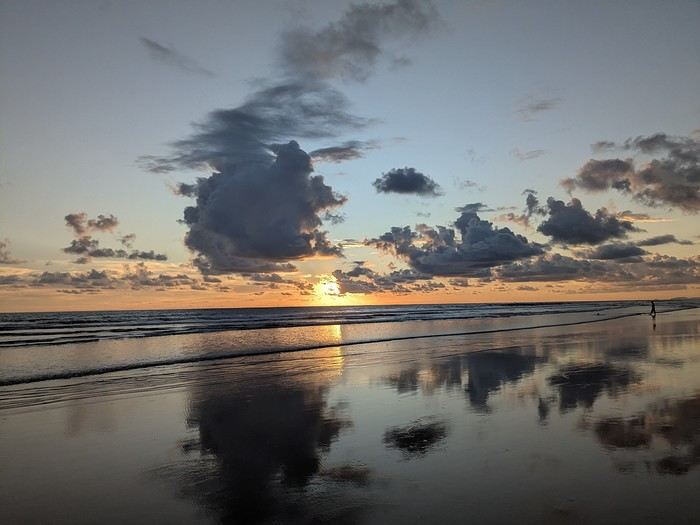
It was the country’s wild nature and safety that convinced us to go, since we’re traveling with our 7-year-old little one. We didn’t have much vacation time in February 2026 (only 12 days), so we optimized as much as possible.
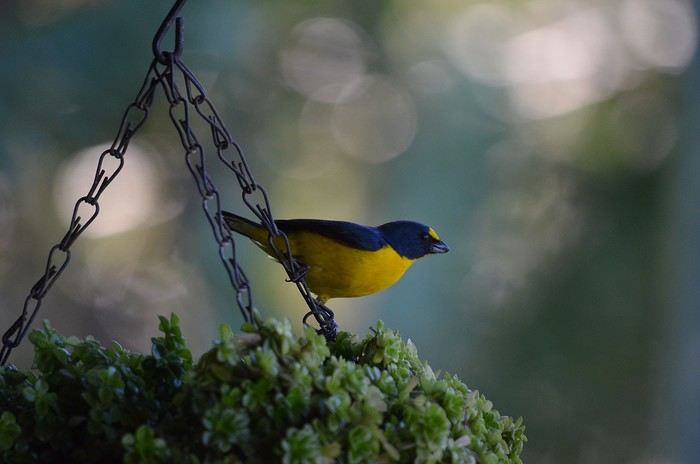
Here’s the itinerary: Wednesday, February 11: Flight from Marseille to San Jose via Paris and Atlanta Thursday, February 12: Pick up the car, drive to Poas Volcano, visit La Paz Waterfall Gardens Friday, February 13: Poas Volcano and drive to Manuel Antonio Saturday, February 14: Manuel Antonio National Park Sunday, February 15: Nauyaca Waterfall and Playa Linda Monday, February 16: Drive to Monte Verde and Santa Elena Reserve Tuesday, February 17: El Tigre Waterfall Reserve and Treetopia Park Wednesday, February 18: Monte Verde Reserve with a guide and drive to La Fortuna Thursday, February 19: Sloth guided tour, Observatory Lodge Park Friday, February 20: Arenal Volcano National Park, Termalistas del Arenal hot springs, and night tour Saturday, February 21: Return to San Jose, flight to Paris via Atlanta Sunday, February 22: Arrival in Paris and flight to Marseille. That gives us a solid 9 days in the country.
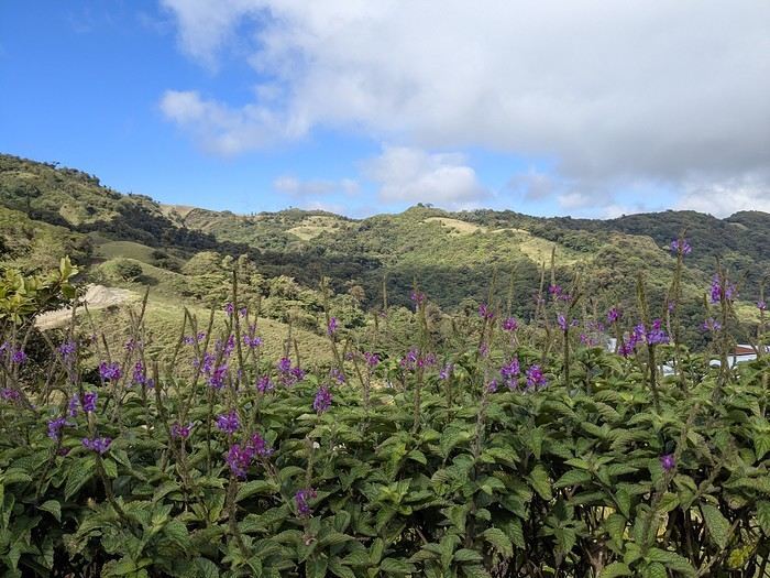
Budget breakdown: Costa Rica is an expensive country, but no more so than France. However, almost all hikes and waterfalls are paid entry, which can really add up. For meals, sodas (6–10 €) are cheaper than restaurants (10–20 € per dish).
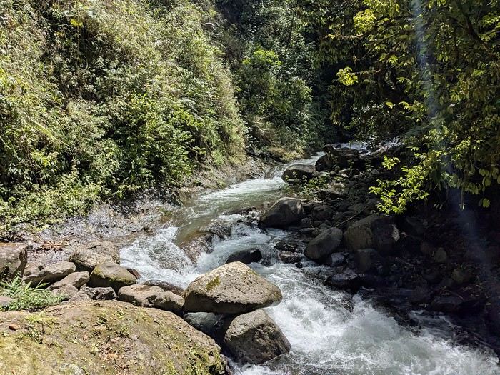
Flights: We chose Delta Airlines for the price: Marseille to San Jose was 740 € per person (modifiable, with checked baggage and seat selection included). Other direct flights from Europe were priced between 1200 € and 1600 € with more restrictive conditions. That’s 2220 € for the family.
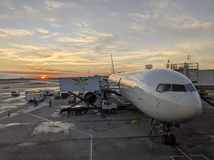
Accommodations: Alajuela, first night: 139 € (1 night) at Rodeo Estancia Boutique Hotel, with personalized airport pickup, transfer to the hotel, and a briefing from Vert Costa Rica agency the next day. Poas: 66 € (1 night) at Cabañas Tierra Fértil (entire apartment). Manuel Antonio: 394 € (3 nights) at La Palapa Ecolodge (hotel in the jungle). Monte Verde: Chalet Aloha Monteverde Cloud Forest (2 bedrooms): 125 € (2 nights). La Fortuna: Arenal Dream Garden (1 bedroom): 217 € (3 nights). Total: 941 €.
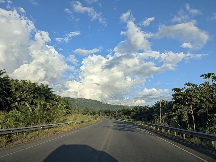
Car rental: I went through Vert Costa Rica agency (Vincent is a French expat who set up the agency in Costa Rica and makes great YouTube videos with useful tips). I rented a 4x4 that was delivered to the hotel the day after arrival and returned at the airport before the flight. The total was 772 €, including full insurance (zero deductible), a child seat, and a phone with a Costa Rican SIM and WhatsApp. The rental company was Poas Rent a Car. The vehicle was well-maintained—no complaints. Gas: 100 € for the whole trip (3 fill-ups).
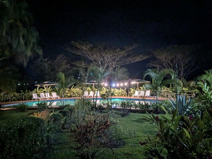
Activities: To get discounts, I bought the pass offered by Vincent, which paid for itself after just one activity. It cost me 30 € (promo since I rented the car through him). Prices are for 3 people. I’ve added stars to rate them: La Paz Waterfall Gardens ****: 112 € Poas Volcano National Park *: 33 € Manuel Antonio National Park ****: 35 € Nauyaca Waterfall ***: 25 € Santa Elena Reserve **: 45 € El Tigre Waterfall Reserve ****: 141 € (with meal) Treetopia (ziplining, suspension bridges) **: 250 € Guided tour of Monte Verde Reserve ***: 113 € Sloth guided tour (with breakfast) ***: 115 € Arenal Observatory Lodge (with meal) ****: 102 € Arenal Volcano National Park *: 34 € Termalistas del Arenal ****: 20 € Night tour ***: 116 € Total: 1171 €.
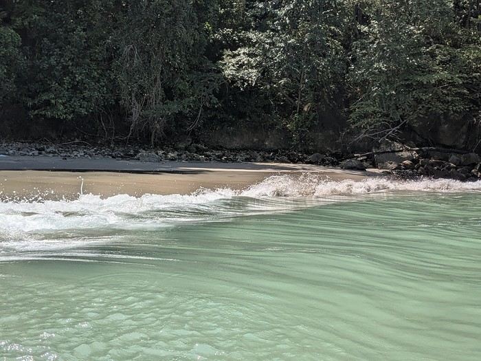
Meals: 600 € My favorite restaurants: Poas: Food court Mercaditas in Fraijanes Manuel Antonio (near La Palapa): La Langosta and also El Patio Near Nauyaca Waterfall: Ricar2 el Avión Between Manuel Antonio and Monte Verde: Soda D’Calle Santa Elena: HG’s Food Guadalupe (between Monte Verde and La Fortuna): Soda Río Piedras Arenal Observatory Lodge restaurant Arenal Oasis Ecolodge restaurant
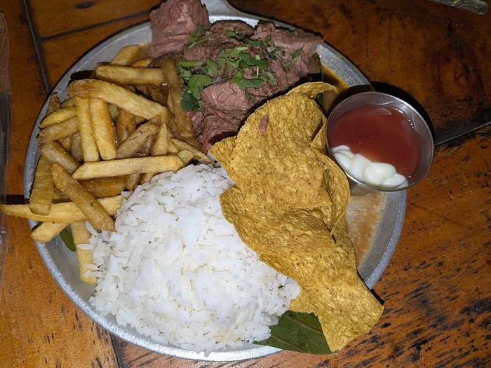
Other expenses: 300 € (groceries for breakfast, drinks, ice cream, souvenirs, etc.) Total overall: 6065 € (about 2020 € per person).
Now, here’s the day-by-day account of this beautiful trip.
https://voyageforum.com/images/posts/small/1772295011-z8mILBEUXHU8Ajz.jpg
It was the country’s wild nature and safety that convinced us to go, since we’re traveling with our 7-year-old little one. We didn’t have much vacation time in February 2026 (only 12 days), so we optimized as much as possible.
Here’s the itinerary: Wednesday, February 11: Flight from Marseille to San Jose via Paris and Atlanta Thursday, February 12: Pick up the car, drive to Poas Volcano, visit La Paz Waterfall Gardens Friday, February 13: Poas Volcano and drive to Manuel Antonio Saturday, February 14: Manuel Antonio National Park Sunday, February 15: Nauyaca Waterfall and Playa Linda Monday, February 16: Drive to Monte Verde and Santa Elena Reserve Tuesday, February 17: El Tigre Waterfall Reserve and Treetopia Park Wednesday, February 18: Monte Verde Reserve with a guide and drive to La Fortuna Thursday, February 19: Sloth guided tour, Observatory Lodge Park Friday, February 20: Arenal Volcano National Park, Termalistas del Arenal hot springs, and night tour Saturday, February 21: Return to San Jose, flight to Paris via Atlanta Sunday, February 22: Arrival in Paris and flight to Marseille. That gives us a solid 9 days in the country.
Budget breakdown: Costa Rica is an expensive country, but no more so than France. However, almost all hikes and waterfalls are paid entry, which can really add up. For meals, sodas (6–10 €) are cheaper than restaurants (10–20 € per dish).
Flights: We chose Delta Airlines for the price: Marseille to San Jose was 740 € per person (modifiable, with checked baggage and seat selection included). Other direct flights from Europe were priced between 1200 € and 1600 € with more restrictive conditions. That’s 2220 € for the family.
Accommodations: Alajuela, first night: 139 € (1 night) at Rodeo Estancia Boutique Hotel, with personalized airport pickup, transfer to the hotel, and a briefing from Vert Costa Rica agency the next day. Poas: 66 € (1 night) at Cabañas Tierra Fértil (entire apartment). Manuel Antonio: 394 € (3 nights) at La Palapa Ecolodge (hotel in the jungle). Monte Verde: Chalet Aloha Monteverde Cloud Forest (2 bedrooms): 125 € (2 nights). La Fortuna: Arenal Dream Garden (1 bedroom): 217 € (3 nights). Total: 941 €.
Car rental: I went through Vert Costa Rica agency (Vincent is a French expat who set up the agency in Costa Rica and makes great YouTube videos with useful tips). I rented a 4x4 that was delivered to the hotel the day after arrival and returned at the airport before the flight. The total was 772 €, including full insurance (zero deductible), a child seat, and a phone with a Costa Rican SIM and WhatsApp. The rental company was Poas Rent a Car. The vehicle was well-maintained—no complaints. Gas: 100 € for the whole trip (3 fill-ups).
Activities: To get discounts, I bought the pass offered by Vincent, which paid for itself after just one activity. It cost me 30 € (promo since I rented the car through him). Prices are for 3 people. I’ve added stars to rate them: La Paz Waterfall Gardens ****: 112 € Poas Volcano National Park *: 33 € Manuel Antonio National Park ****: 35 € Nauyaca Waterfall ***: 25 € Santa Elena Reserve **: 45 € El Tigre Waterfall Reserve ****: 141 € (with meal) Treetopia (ziplining, suspension bridges) **: 250 € Guided tour of Monte Verde Reserve ***: 113 € Sloth guided tour (with breakfast) ***: 115 € Arenal Observatory Lodge (with meal) ****: 102 € Arenal Volcano National Park *: 34 € Termalistas del Arenal ****: 20 € Night tour ***: 116 € Total: 1171 €.
Meals: 600 € My favorite restaurants: Poas: Food court Mercaditas in Fraijanes Manuel Antonio (near La Palapa): La Langosta and also El Patio Near Nauyaca Waterfall: Ricar2 el Avión Between Manuel Antonio and Monte Verde: Soda D’Calle Santa Elena: HG’s Food Guadalupe (between Monte Verde and La Fortuna): Soda Río Piedras Arenal Observatory Lodge restaurant Arenal Oasis Ecolodge restaurant
Other expenses: 300 € (groceries for breakfast, drinks, ice cream, souvenirs, etc.) Total overall: 6065 € (about 2020 € per person).
Now, here’s the day-by-day account of this beautiful trip.
https://voyageforum.com/images/posts/small/1772295011-z8mILBEUXHU8Ajz.jpg
5-day cruise around Komodo
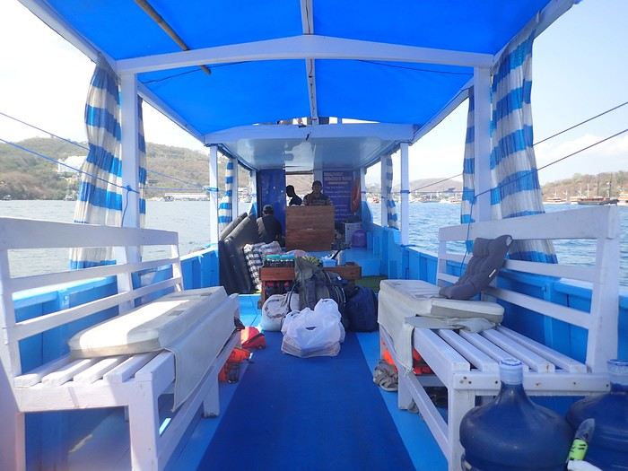 Not usually a fan of organized trips, during my stay in Labuan Bajo on Flores in May 2024, I started looking for a fisherman who could show me the islands around Komodo. At the port, I met Ari, a former freediver who knows the islands well, especially the best spots for fish and coral.
At the Bohême guest house, I proposed this outing, and one of the activity leaders was happy to join. We headed to Angel Island, where Ari took us snorkeling around the island. During this beautiful day, we appreciated his professionalism, and I suggested coming back the following year for a 5-day cruise. We had to agree on a budget and the period to consider.
Over the next year, we kept in touch via WhatsApp.
However, a month before departure, Ari told me he had lent his boat to a friend, who ran it aground on a rock, causing it to sink. No boat, no cruise! Since we had an agreement, I asked him to find another solution. His searches in the port, where everyone knows each other, turned out to be fruitful.
A certain "Captain" Kambar agreed to take us. He sometimes charters his boat for local travel agencies and could free up the requested period.
Not usually a fan of organized trips, during my stay in Labuan Bajo on Flores in May 2024, I started looking for a fisherman who could show me the islands around Komodo. At the port, I met Ari, a former freediver who knows the islands well, especially the best spots for fish and coral.
At the Bohême guest house, I proposed this outing, and one of the activity leaders was happy to join. We headed to Angel Island, where Ari took us snorkeling around the island. During this beautiful day, we appreciated his professionalism, and I suggested coming back the following year for a 5-day cruise. We had to agree on a budget and the period to consider.
Over the next year, we kept in touch via WhatsApp.
However, a month before departure, Ari told me he had lent his boat to a friend, who ran it aground on a rock, causing it to sink. No boat, no cruise! Since we had an agreement, I asked him to find another solution. His searches in the port, where everyone knows each other, turned out to be fruitful.
A certain "Captain" Kambar agreed to take us. He sometimes charters his boat for local travel agencies and could free up the requested period.
There will be six of us on board, as in the meantime, my daughter’s friend, Amandine, could join us for the cruise. Ari will act as a guide, and a mechanic will also be present. To reserve the boat for September 4th, Ari asked me to transfer a deposit of 5 million IDR to his account. After some hesitation, I decided to trust him and made the transfer. A few days later, he confirmed receipt of the amount.
In early September, we arrived in Labuan Bajo. Our first mission was to check the boat’s condition, the presence of life jackets, what we would eat, and if there were any restrictions on drinks. Everything was in order and met our expectations.
The day before departure, we met a 26-year-old Czech woman traveling alone after a stay in New Zealand. The description of our cruise excited her, and she got Ari’s number. That evening, at the restaurant, while we discussed the final preparations, Thérèsa joined us and asked if she could come along for the five-day cruise. Since she seemed like good company, I gladly accepted. However, following Indonesian custom, I negotiated firmly with Ari for a discount, and he agreed to lower the price by 2 million.
On September 4th, we set sail to explore the islands of Komodo and, above all, the seabeds, equipped with fins, masks, and snorkels. We had brought a board game for the trips between islands or for the evenings. In the end, it wasn’t used: the crossings rarely lasted more than an hour, except for two two-hour trips, and the conditions on board weren’t suitable for playing.
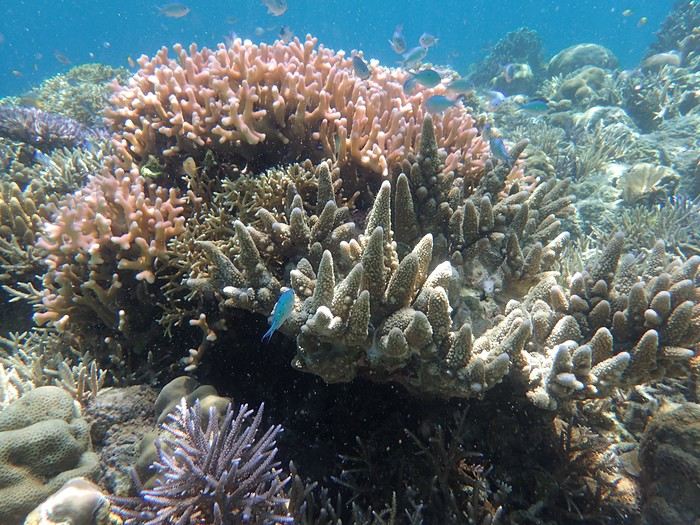
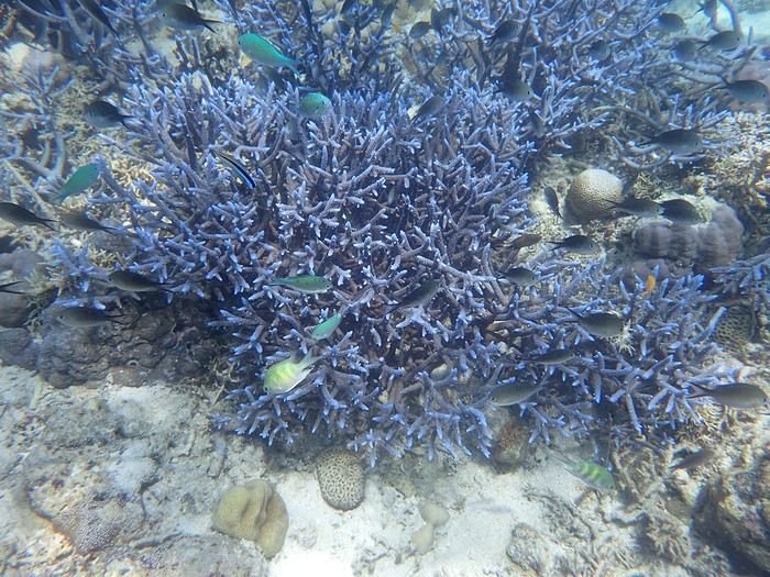 The first island we visited is north of Labuan Bajo: Seraya Small.
We didn’t disembark but anchored a short distance away. The coral reef, between 5 and 10 meters deep, offered visibility of 8 to 10 meters. We started with a few dives from the boat, as the water was so inviting. As with most of the upcoming sites, we were the only ones enjoying this little paradise.
Over about a kilometer along the drop-off, colorful corals and fish abound. As long as you don’t go past the rocky point on the right, the currents remain very weak, and the spot is accessible to beginners. After enjoying the sea enough, we returned to the boat, where Ari had prepared a good meal of rice, chicken, and vegetables. It was simple but excellent after all that effort.
The first island we visited is north of Labuan Bajo: Seraya Small.
We didn’t disembark but anchored a short distance away. The coral reef, between 5 and 10 meters deep, offered visibility of 8 to 10 meters. We started with a few dives from the boat, as the water was so inviting. As with most of the upcoming sites, we were the only ones enjoying this little paradise.
Over about a kilometer along the drop-off, colorful corals and fish abound. As long as you don’t go past the rocky point on the right, the currents remain very weak, and the spot is accessible to beginners. After enjoying the sea enough, we returned to the boat, where Ari had prepared a good meal of rice, chicken, and vegetables. It was simple but excellent after all that effort.
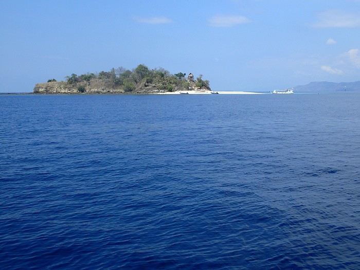 In the afternoon, we discovered Bero Island, where it was very hot. There were fewer fish and corals than at Seraya, but the corals were on white sand, allowing for beautiful, bright photos.
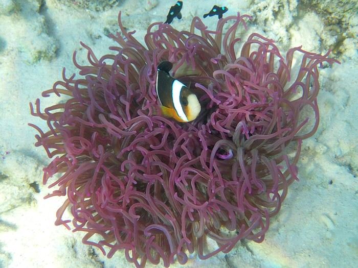 In the evening, we visited Hatamin, a fishing village. The population is very young and curious about our visit. At our request, we could have watched a local dance, but it would have taken some time to organize, and we didn’t plan to return. Ari asked if we wanted to take a shower, as on the boat, we could only rinse off with a little water from a basin.
On the second day, snorkeling near Hatamin, a small paradise island with white sand like in a travel brochure. A small temple is located in the middle of the island. In the water, we saw our first small reef sharks, some clownfish, and a sergeant major fish that followed us throughout our swim. The most beautiful part to explore is opposite the beach. Many corals and fish of all colors. A sailboat was anchored a short distance away, but we didn’t see anyone except an old man who apparently lived in the temple above.
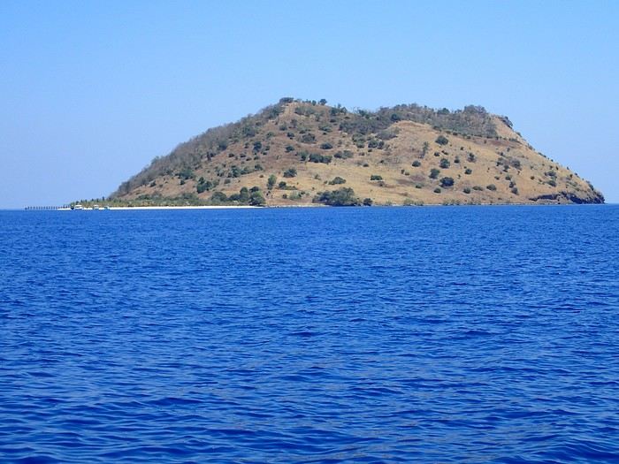
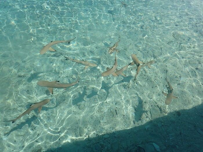
In the afternoon, we headed to the nearby island of Sabolong Besar. It’s a pretty little island with a harmonious resort made up of luxury huts that don’t spoil the landscape. In some places, the water is very clear with good visibility, and some schools of very young blacktip reef sharks swirl near the boat. There are beautiful corals on the left side of the resort and a bit of current when you approach the drop-off. Since the area to explore wasn’t very large, we had time to head to Sabolong Kecil. Then we went to the fishing village of Messah, where a Muslim celebration was taking place. There were people everywhere with many food offerings—what activity! It was like an anthill.
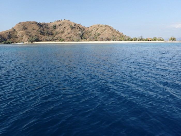
And at the end of the day, we anchored near Kanawa with a beautiful sunset.
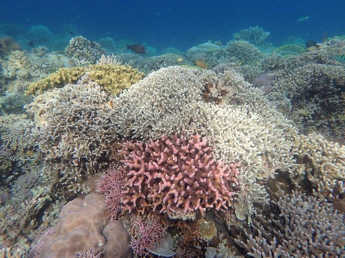 On the third day, we discovered Kanawa and some hawksbill turtles. There were many colorful corals, but we didn’t stay long. During this day, the stops were close together, making it intense with four visits.
Then we arrived at Sebayur Besar with a different snorkeling approach: Ari dropped us in the current, and we drifted for over a kilometer before he came to pick us up. At first, it seemed a bit worrying to see the boat move away while we were offshore, but we were quickly carried by the current and passed almost too quickly by so many corals and fish to see. What a pleasure to drift and freedive with little effort.
On the third day, we discovered Kanawa and some hawksbill turtles. There were many colorful corals, but we didn’t stay long. During this day, the stops were close together, making it intense with four visits.
Then we arrived at Sebayur Besar with a different snorkeling approach: Ari dropped us in the current, and we drifted for over a kilometer before he came to pick us up. At first, it seemed a bit worrying to see the boat move away while we were offshore, but we were quickly carried by the current and passed almost too quickly by so many corals and fish to see. What a pleasure to drift and freedive with little effort.
The drift lasted a good hour, and we reached Siaba Island, where the water was colder. There were many boats, and we had quickly lost the habit of seeing other tourists. Visibility was average—it was a nice spot, but after the drift at Sebayur, we liked it less. Around 1 p.m., we anchored with other boats because Ari met up with some friends, and we ate heartily since the cool water had whetted our appetites.
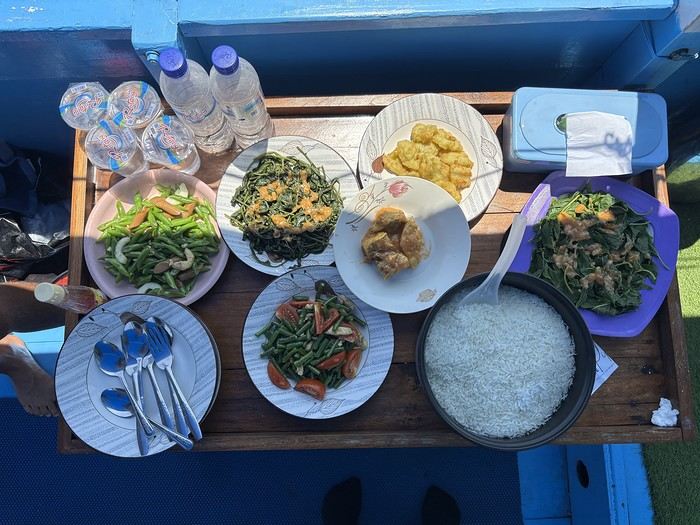
In the afternoon, we were at Manta Point. The water was cool, and there was a lot of excitement trying to follow the giant manta rays. We managed to dive down and get close to them, but it took a lot of effort and breath because, despite their leisurely appearance, they move quite fast for us little swimmers. Here, they come to feed and then return to the depths, and it’s not always certain you’ll encounter them. We ended the day at Makassar with a two-hour sail. There was a lot of wind and swell, the boat rocked, and we hoped there wouldn’t be an engine breakdown. We had to take down the tent on the boat’s roof, which had also been used for sleeping. Makassar’s beach is pink, caused by microorganisms called foraminifera. There are many beach huts along the shore, and we were alone, though it must get busy here during the day. On the fourth day, we visited Padar Island for its viewpoint amid hordes of tourists, then headed to Rinca and its Komodo dragons. Rinca is much less crowded than Komodo, which is why we chose this visit. We saw a few and took the usual photos. In the late afternoon, we snorkeled at Pempend Island, where the sea was choppy and the water a bit murky. And on the last day, we visited Strawberry Rock, named after the reddish rock overlooking the sea. There were many corals, but the water was rough with reduced visibility, and then we went to Kelor with its tourist "bars" and the pretty viewpoint.
In conclusion, we shared amazing moments and managed to complete our program. Luckily, the weather was very kind, and not a drop of rain fell in early September, except just upon returning to the port. It’s worth noting that after five intense days in the water from morning to night, we were glad to return to dry land because we were exhausted.
My daughter and her friend were so thrilled that, in return, they developed a website for Ari to help him get known, and I can share the link if you’d like. I visit Voyage Forum from time to time, so if you have any questions, don’t hesitate—I’ll answer them.
Not usually a fan of organized trips, during my stay in Labuan Bajo on Flores in May 2024, I started looking for a fisherman who could show me the islands around Komodo. At the port, I met Ari, a former freediver who knows the islands well, especially the best spots for fish and coral.
At the Bohême guest house, I proposed this outing, and one of the activity leaders was happy to join. We headed to Angel Island, where Ari took us snorkeling around the island. During this beautiful day, we appreciated his professionalism, and I suggested coming back the following year for a 5-day cruise. We had to agree on a budget and the period to consider.
Over the next year, we kept in touch via WhatsApp.
However, a month before departure, Ari told me he had lent his boat to a friend, who ran it aground on a rock, causing it to sink. No boat, no cruise! Since we had an agreement, I asked him to find another solution. His searches in the port, where everyone knows each other, turned out to be fruitful.
A certain "Captain" Kambar agreed to take us. He sometimes charters his boat for local travel agencies and could free up the requested period.There will be six of us on board, as in the meantime, my daughter’s friend, Amandine, could join us for the cruise. Ari will act as a guide, and a mechanic will also be present. To reserve the boat for September 4th, Ari asked me to transfer a deposit of 5 million IDR to his account. After some hesitation, I decided to trust him and made the transfer. A few days later, he confirmed receipt of the amount.
In early September, we arrived in Labuan Bajo. Our first mission was to check the boat’s condition, the presence of life jackets, what we would eat, and if there were any restrictions on drinks. Everything was in order and met our expectations.
The day before departure, we met a 26-year-old Czech woman traveling alone after a stay in New Zealand. The description of our cruise excited her, and she got Ari’s number. That evening, at the restaurant, while we discussed the final preparations, Thérèsa joined us and asked if she could come along for the five-day cruise. Since she seemed like good company, I gladly accepted. However, following Indonesian custom, I negotiated firmly with Ari for a discount, and he agreed to lower the price by 2 million.
On September 4th, we set sail to explore the islands of Komodo and, above all, the seabeds, equipped with fins, masks, and snorkels. We had brought a board game for the trips between islands or for the evenings. In the end, it wasn’t used: the crossings rarely lasted more than an hour, except for two two-hour trips, and the conditions on board weren’t suitable for playing.
The first island we visited is north of Labuan Bajo: Seraya Small.
We didn’t disembark but anchored a short distance away. The coral reef, between 5 and 10 meters deep, offered visibility of 8 to 10 meters. We started with a few dives from the boat, as the water was so inviting. As with most of the upcoming sites, we were the only ones enjoying this little paradise.
Over about a kilometer along the drop-off, colorful corals and fish abound. As long as you don’t go past the rocky point on the right, the currents remain very weak, and the spot is accessible to beginners. After enjoying the sea enough, we returned to the boat, where Ari had prepared a good meal of rice, chicken, and vegetables. It was simple but excellent after all that effort.
In the afternoon, we discovered Bero Island, where it was very hot. There were fewer fish and corals than at Seraya, but the corals were on white sand, allowing for beautiful, bright photos.
In the evening, we visited Hatamin, a fishing village. The population is very young and curious about our visit. At our request, we could have watched a local dance, but it would have taken some time to organize, and we didn’t plan to return. Ari asked if we wanted to take a shower, as on the boat, we could only rinse off with a little water from a basin.On the second day, snorkeling near Hatamin, a small paradise island with white sand like in a travel brochure. A small temple is located in the middle of the island. In the water, we saw our first small reef sharks, some clownfish, and a sergeant major fish that followed us throughout our swim. The most beautiful part to explore is opposite the beach. Many corals and fish of all colors. A sailboat was anchored a short distance away, but we didn’t see anyone except an old man who apparently lived in the temple above.
In the afternoon, we headed to the nearby island of Sabolong Besar. It’s a pretty little island with a harmonious resort made up of luxury huts that don’t spoil the landscape. In some places, the water is very clear with good visibility, and some schools of very young blacktip reef sharks swirl near the boat. There are beautiful corals on the left side of the resort and a bit of current when you approach the drop-off. Since the area to explore wasn’t very large, we had time to head to Sabolong Kecil. Then we went to the fishing village of Messah, where a Muslim celebration was taking place. There were people everywhere with many food offerings—what activity! It was like an anthill.
And at the end of the day, we anchored near Kanawa with a beautiful sunset.
On the third day, we discovered Kanawa and some hawksbill turtles. There were many colorful corals, but we didn’t stay long. During this day, the stops were close together, making it intense with four visits.
Then we arrived at Sebayur Besar with a different snorkeling approach: Ari dropped us in the current, and we drifted for over a kilometer before he came to pick us up. At first, it seemed a bit worrying to see the boat move away while we were offshore, but we were quickly carried by the current and passed almost too quickly by so many corals and fish to see. What a pleasure to drift and freedive with little effort.The drift lasted a good hour, and we reached Siaba Island, where the water was colder. There were many boats, and we had quickly lost the habit of seeing other tourists. Visibility was average—it was a nice spot, but after the drift at Sebayur, we liked it less. Around 1 p.m., we anchored with other boats because Ari met up with some friends, and we ate heartily since the cool water had whetted our appetites.
In the afternoon, we were at Manta Point. The water was cool, and there was a lot of excitement trying to follow the giant manta rays. We managed to dive down and get close to them, but it took a lot of effort and breath because, despite their leisurely appearance, they move quite fast for us little swimmers. Here, they come to feed and then return to the depths, and it’s not always certain you’ll encounter them. We ended the day at Makassar with a two-hour sail. There was a lot of wind and swell, the boat rocked, and we hoped there wouldn’t be an engine breakdown. We had to take down the tent on the boat’s roof, which had also been used for sleeping. Makassar’s beach is pink, caused by microorganisms called foraminifera. There are many beach huts along the shore, and we were alone, though it must get busy here during the day. On the fourth day, we visited Padar Island for its viewpoint amid hordes of tourists, then headed to Rinca and its Komodo dragons. Rinca is much less crowded than Komodo, which is why we chose this visit. We saw a few and took the usual photos. In the late afternoon, we snorkeled at Pempend Island, where the sea was choppy and the water a bit murky. And on the last day, we visited Strawberry Rock, named after the reddish rock overlooking the sea. There were many corals, but the water was rough with reduced visibility, and then we went to Kelor with its tourist "bars" and the pretty viewpoint.
In conclusion, we shared amazing moments and managed to complete our program. Luckily, the weather was very kind, and not a drop of rain fell in early September, except just upon returning to the port. It’s worth noting that after five intense days in the water from morning to night, we were glad to return to dry land because we were exhausted.
My daughter and her friend were so thrilled that, in return, they developed a website for Ari to help him get known, and I can share the link if you’d like. I visit Voyage Forum from time to time, so if you have any questions, don’t hesitate—I’ll answer them.
The Cyclades attract a lot (a LOT) of people in the summer, and it's not always clear how to visit them.
For our first family trip to the Cyclades (in 2016), we took a route that seems great for discovering the islands: - Flight Paris / Santorini (Transavia) - 3 nights in Santorini - Ferry Santorini / Milos - 4 nights in Milos - Ferry Milos / Sifnos - 4 nights in Sifnos - Ferry Sifnos / Athens - 3 nights in Athens - Flight Athens / Paris
Santorini is the postcard image of the Cyclades... but not really any beaches for kids. My tip: you should stay in Oia because it's really "the spot" on the island. We chose the Pension "The Flower": simple but very well located and with a pool for the kids. Another tip: rent a car as soon as you arrive at the airport because the island is vast.
Our favorite moment: Oia around 6:00 AM, a paradise for photographers. It’s nothing like the daytime, or especially the evening when all the crowds rush in for the famous "sunset." Another favorite, the hike between Fira and Oia, 10 km, 4 hours of walking with extraordinary views (especially around Imerovigli). For the rest, we toured the island—it’s nice but nothing to marvel at.
After a 2.5-hour ferry ride, we arrived in Milos, home of the famous Venus de Milo. This is our favorite island in the Cyclades (though we haven’t seen them all!). In the port of Adamantas, we stayed at the Liogerma Hotel (very well located near the port).
Our favorite experience: the boat tour around the island (and swimming at Kleftiko). Absolutely a must-do, but book it as soon as you arrive because it’s often fully booked for the next two days.
I also recommend renting a car to explore this island. Other favorites: the incredible fishing village of Klima with its colorful boat houses, the rocks of Sarakiniko (best in the morning sun), the beach at Tsigrado (with its ladder access through the rocks), Plaka, the caves of Papafragas, the waters of Firopotamos, and Fyriplaka...
Just a 1-hour ferry ride, and you’re already in Sifnos. A small island with a bus network that means you don’t need to rent a vehicle. We stayed in Kamares (Hotel Afroditi).
Sifnos has charming villages typical of the Cyclades (Kastro, Apollonia), beautiful chapels (Chrisopigi, the Church of the Seven Martyrs...), and lovely beaches (Cherronissos, Platis Galios...). Our favorite: hiking around Faros and the Chrisopigi Monastery.
A 3-hour ferry ride takes you back to the port of Piraeus to visit Athens: the Acropolis, its museums, and the Plaka district. A little favorite of ours: the Archaeological Museum, slightly off the tourist trail... With this route, you’ll see the diversity of the Cyclades and Athens without wasting too much time on ferries.
PS: We also did the loop Mykonos / Paros / Amorgos / Mykonos, but that’s a good idea... for a second trip ;)
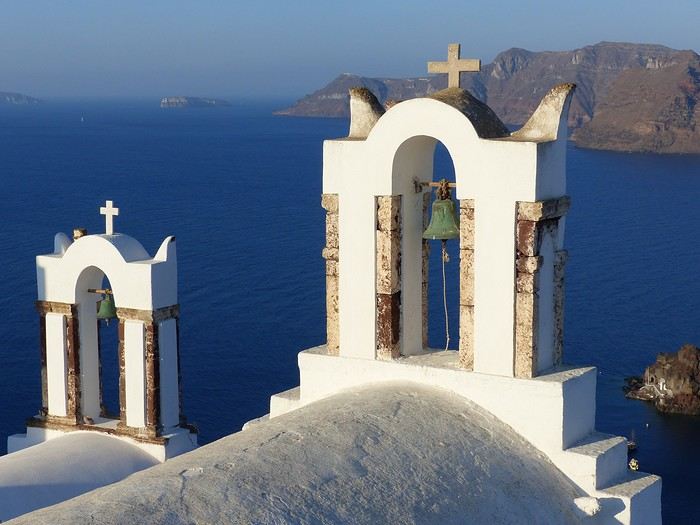
For our first family trip to the Cyclades (in 2016), we took a route that seems great for discovering the islands: - Flight Paris / Santorini (Transavia) - 3 nights in Santorini - Ferry Santorini / Milos - 4 nights in Milos - Ferry Milos / Sifnos - 4 nights in Sifnos - Ferry Sifnos / Athens - 3 nights in Athens - Flight Athens / Paris
Santorini is the postcard image of the Cyclades... but not really any beaches for kids. My tip: you should stay in Oia because it's really "the spot" on the island. We chose the Pension "The Flower": simple but very well located and with a pool for the kids. Another tip: rent a car as soon as you arrive at the airport because the island is vast.
Our favorite moment: Oia around 6:00 AM, a paradise for photographers. It’s nothing like the daytime, or especially the evening when all the crowds rush in for the famous "sunset." Another favorite, the hike between Fira and Oia, 10 km, 4 hours of walking with extraordinary views (especially around Imerovigli). For the rest, we toured the island—it’s nice but nothing to marvel at.
After a 2.5-hour ferry ride, we arrived in Milos, home of the famous Venus de Milo. This is our favorite island in the Cyclades (though we haven’t seen them all!). In the port of Adamantas, we stayed at the Liogerma Hotel (very well located near the port).
Our favorite experience: the boat tour around the island (and swimming at Kleftiko). Absolutely a must-do, but book it as soon as you arrive because it’s often fully booked for the next two days.
I also recommend renting a car to explore this island. Other favorites: the incredible fishing village of Klima with its colorful boat houses, the rocks of Sarakiniko (best in the morning sun), the beach at Tsigrado (with its ladder access through the rocks), Plaka, the caves of Papafragas, the waters of Firopotamos, and Fyriplaka...
Just a 1-hour ferry ride, and you’re already in Sifnos. A small island with a bus network that means you don’t need to rent a vehicle. We stayed in Kamares (Hotel Afroditi).
Sifnos has charming villages typical of the Cyclades (Kastro, Apollonia), beautiful chapels (Chrisopigi, the Church of the Seven Martyrs...), and lovely beaches (Cherronissos, Platis Galios...). Our favorite: hiking around Faros and the Chrisopigi Monastery.
A 3-hour ferry ride takes you back to the port of Piraeus to visit Athens: the Acropolis, its museums, and the Plaka district. A little favorite of ours: the Archaeological Museum, slightly off the tourist trail... With this route, you’ll see the diversity of the Cyclades and Athens without wasting too much time on ferries.
PS: We also did the loop Mykonos / Paros / Amorgos / Mykonos, but that’s a good idea... for a second trip ;)
Spitsbergen, 80° North latitude. A lost archipelago on the edge of the world, northeast of Greenland, the last lands before the pole. I’m aboard the *Grigoriy Mikheev*, a Russian ship from the Murmansk Polar Research Institute. Russian flag, Russian crew. Chartered by OceanWide Expeditions.
Last night, we were stuck in drifting pack ice in the long Hinlopen Strait. This incident led to an unforgettable barbecue and party on the ship’s foredeck, but we had to abandon our plan to head south and circle Spitsbergen. This summer, there’s too much ice in the strait, and it’s too thick. At dawn, the tide turned, allowing us to break free and head north again. The ship is now moving slowly through sea ice density that satellite maps estimate at around five-tenths. Our progress is punctuated by dull thuds: the ship’s bow constantly shoves and fractures enormous ice floes.
At breakfast, Tarik, our expedition leader, informs us that our program will be significantly altered. Since we can’t cross the strait, we’ll turn back and head north. To kick off our Plan B, Tarik plans a landing tonight on the small island of Låg (Lågøya), at 80°10' North. Last summer, he saw a large walrus colony there and hopes we’ll find them again. The weather is perfect—glorious sunshine—and walruses are truly addicted to sunbathing on the beaches.
We’ve now exited the strait and are sailing far from the coast. In case the walrus colony is there, we don’t want the ship’s approach to scare them into the water before we even see them. So, we scan the shore methodically with binoculars. We pass several bays, round a cape, and examine several shorelines littered with driftwood, but no walruses in sight. Several times, clusters of large rounded rocks trigger false alarms… but no, they’re just rocks…
Suddenly, Tarik spots them through his binoculars! On an isolated peninsula, our expedition leader’s highly trained eye has picked out, among those brown masses, the shape and white color of the enormous tusks of what he calls "the heavyweights of the Arctic!" Now, fifteen or twenty pairs of binoculars are pointed in the indicated direction… Sure enough, I see them now! They’re there, huge, sprawled in the sun on the beach. Without Tarik’s sharp eye, we might have missed them. They’re so tightly packed together that they really look like a mass of brown rocks. Only the white, saber-shaped tusks and the occasional furtive movements hint that they’re animals.
It’s 11 PM, and on the deck of the *Grigoriy Mikheev*, as you can imagine, excitement has ramped up several notches. Several of us have already rushed to our cabins to gear up, pulling on boots and life jackets in anticipation of a landing that promises to be absolutely amazing. Tarik reins in our enthusiasm a bit: Okay, so we were lucky to find them, but now we need to think about how to approach them. Not that they’re dangerous—at least not on land… Their enormous bulk and their pseudo-feet (flippers) only allow for very limited mobility. But when they feel threatened, their first instinct is to head for the water, where their perfect ease keeps them safe. So, the challenge will be not to scare them off, to avoid them bolting into the water in the first few seconds! That’s exactly what would happen if we arrived by Zodiac right in front of them.
So, Tarik decides we’ll make a wide detour to land on the other side of the peninsula where they are. From there, we’ll leave the Zodiacs on the beach and cross the peninsula on foot, about a kilometer and a half. That way, we’ll approach the herd from behind. This approach will also keep us downwind of them. There you go—with a few precautions, they shouldn’t hear us coming or catch our scent.
Everyone is geared up now and practically bursting with impatience… While the Zodiacs are being lowered into the water, Tarik and Delphine recap the approach rules: absolute silence, communication only by signs, no dragging feet on the rocks, watch your step, and strict coordination with slow movements.
Here we go… we’re off now! Spray flying from the Zodiac’s bow, icy air whipping our faces, gloves gripping the side ropes, freezing splashes, pure emotion… Ahh, I love this! We describe a wide curve offshore to round the peninsula. Ahead of us, the magnificent landscape of this intensely blue sea unfolds, with the hills of Lågøya and, in the distance, the ice-covered mountains of Nordaustlandet under the sun. It’s midnight now. In July, at 80 degrees North, the sun is just like midday.
This navigation takes us far from the walruses, on the other side of the cape. Easy landing on a shoreline of large pebbles covered in giant seaweed brought in by the currents. They look like long strips of plastic—sometimes translucent, sometimes white, beige, or orange. In places, there are huge tangled layers of it. Our boots sink into this material, which gives off a strong iodine smell. Unfortunately, there’s also some plastic waste—fishing floats and net debris. Seeing this here is crazy… A little farther on, in a cove, tides and storms have piled up numerous tree trunks from Siberia.
We begin crossing the peninsula on foot, staying close together. We’re walking on a nearly deserted polar tundra. We’re only ten degrees of latitude from the North Pole here. The violent winds and extreme temperatures that dominate this island for nine months of the year allow only a few rare plants to grow, close to the ground, between the rocks. In places, rocks are covered with large patches of black lichen.
Gérard, rifle slung over his shoulder, constantly scans the terrain. Tarik and Delphine are also very vigilant. We know no one ever lands here, and although this environment isn’t ideal for bears, you never know—better to be cautious. The terrain is mostly flat, but whenever a small rise blocks our view, Gérard moves ahead and only signals us to proceed when he’s sure there’s no "big man in fur" (tradition dictates we don’t name the polar bear).
After a few hundred meters, we find an enormous whale vertebra. Judging by the state of the bone, it’s likely a relic from the whaling era that ravaged this area in the 17th century and all over northern Spitsbergen. A little farther on, the remains of a grave catch our attention. The only human trace on this remote island, this burial is surely very old, also likely dating from the whalers’ time. But this whaler’s final resting place didn’t shelter him for long—there’s not much left, just a piece of skull and a few broken bones. Due to the permafrost, the body could only be buried a few dozen centimeters deep, between some planks held in place by large stones. This makeshift grave was probably ravaged by a bear shortly after the burial. Several stone blocks are overturned, the planks are broken open. We only linger for a minute to pay our respects to this whaler, whose poor remains now merge with the mineral landscape.
A slight rise bulges in the center of the peninsula, and here we are at the highest point. If our orientation is correct, we’re heading straight for the walrus colony. A moment of emotion… my heart’s pounding. Yes, they’re there, about three hundred meters ahead of us! They haven’t moved since we spotted them from the *Grigoriy Mikheev*’s deck. They’re sprawled in a heap, packed tightly together in the sun, on the shingle beach. The light breeze blowing in our faces confirms we’re on the right track—not to be sniffed out from afar by the big beasts.
By signs, Tarik tells us we’ll approach slowly, in stages, moving about thirty meters at a time, making as little noise as possible with our boots, then freezing completely for a minute or two, crouching down to let them forget us. This strategy proves excellent. We’re now less than a hundred meters away, and it doesn’t seem like our presence is perceived as a threat by the "heavyweights of the Arctic." At this distance, let’s not kid ourselves: we’re certainly spotted, but our way of approaching must seem reassuring—or at least manageable—since they’re only a few meters from the water and know they could dash into it in seconds if they felt the need.
We now advance in shorter stages—twenty meters at a time, then just ten, crouching, then freezing like statues, our breathing nearly held from emotion and concentration. We’re now thirty meters from the mastodons. Our presence must be starting to stress them because they’re moving more. While still sprawled against each other, some suddenly rear up on their flipper-feet, grunting and snorting like monstrous pigs. Their head shakes make their two enormous ivory sabers sway. They jab them into the fat of their neighbors, who in turn stir and emit irritated snorts.
At Tarik’s signal, we move a few more meters, "on velvet paws"… We’re right there now. I hold my breath, throat tight… Intense emotion, a fantastic spectacle—these enormous Arctic animals sprawled in the sun, with the magnificent backdrop of snow-covered mountains across the sound. I think to myself: *I’m here… this can’t be real!* It’s nearly 2 AM now, the air is crystal clear, and the Arctic sun bathes this scene in what might be the most beautiful light I’ve ever seen. We’re about fifteen meters away now. Tarik signals that we won’t go any closer. The walruses are still lying down, but occasionally, our close presence and the clicking of cameras trigger bouts of agitation that ripple through the herd, causing some jostling. They’re so tightly packed and tangled that it’s a bit hard to count them. In the end, we tally sixteen, plus one "little one," half-crushed in the general mass.
Seen from here, they’re truly impressive! The "sumo wrestlers of the Arctic!" According to Tarik, they must weigh about a ton—slightly more for the males than the females—and the "little one" must already be around 200 kg. When the weather’s nice like today, they love sprawling on the beaches to soak up the sun.
Walruses are marvels of Arctic adaptation. They can modify their blood circulation depending on thermal conditions. They withstand extreme cold by directing most of their circulation to vital organs (heart, lungs) and minimizing peripheral blood flow (skin and limbs) to prevent heat loss. Conversely, when they sunbathe, they direct most of their blood flow to the skin, turning themselves into true solar collectors.
At this latitude, there’s practically no difference in sunlight between day and night. Noon or midnight, the sun’s angle barely changes. Walruses make the most of these fair-weather phases by sprawling in the sun 23 hours out of 24… Enough to make siesta lovers dream, right? Twenty-three hours of lounging… and the twenty-fourth for eating!
And when we say "eating," what a feast! The proverb *"Who sleeps dines"* is fully justified here: when a walrus decides to feed, it gulps down between 50 and 60 kg of shellfish in an hour! Its food consists of large bivalve mollusks, which it tears from the seabed with its tusks and sucks up nonstop! A 50 kg meal certainly justifies a 23-hour nap for digestion, right? And speaking of digestion—it’s what the "big guys" in front of us are doing right now! You might wonder how we know this… Well, I’ll tell you: if you were here, downwind (or should I say *down the winds!*) of these marine giants, you’d have no doubt! Pfft… what flatulence! I can confirm that today’s scent is called *"Morsanus, from the North"* (*"Because I’m worth it!"*). Mmm, yeah… Tarik, you had a great idea putting us upwind… at least *they* can’t smell us, but we sure can!
But… heepp! Delphine discreetly signals to get our attention—she’s just spotted something: in the smooth water of the bay, a small V-shaped ripple runs along the beach, then turns toward the shore… So the colony wasn’t complete on the beach… Here’s an 800 kg bather stepping ashore now, right before our astonished eyes! She lifts her head and stays like that for a long moment, her enormous tusks half out of the water. She looks exhausted, resting a bit before coming out. Or more likely, she’s hesitating to climb onto the beach because she’s seen us… The shapeless head stays still for a moment, then violently snorts like a clogged drain! A misshapen head where you can’t make out anything that usually makes a head! No eyes, no ears, no mouth… A sort of monstrous cabbage! But the temptation to join the warmth of the "sunbathers" is too strong! Here’s our pachyderm bather climbing the few meters of the shore and sprawling right in the middle of her companions, who greet her with jostling, grunts, and tusk jabs! Then everything settles back into order—800 kg of fat and flesh added to the fifteen or so tons of local biomass. Welcome to the club!
It seems the walruses have gotten a bit used to us now. They’re moving and grunting much less. I realize it wasn’t obvious to approach them like this without scaring them into the water… It’s thanks to Tarik and Delphine’s advice that we managed it. It’s also, let’s be honest, because we’re all passionate here, and there’s been total discipline and cohesion from the start of this approach.
It’s past 2 AM now—time to head back… We’ll leave them to their wild world, to their life at the beginning of the world. We’re happy to have disturbed them as little as possible and not to have disrupted their nap too much. We leave stealthily, first backing up a few meters, then turning around and crossing the peninsula again, walking slowly, avoiding making noise with our boots as long as we’re still close.
We find the Zodiacs on the shoreline with the giant kelp. The sea is like a lake—easy boarding. We make another wide loop to round the cape, passing offshore. The sharp cold stings my cheeks and ears again—I put my hat back on. The cold—I hadn’t thought about it at all during our encounter with the walruses. In the Zodiac, with the engine noise, no one speaks. The faces and smiles are those of men and women who’ve just crossed an inner frontier—the one that separates dream from reality. But tonight, that frontier was porous, and the dream entered reality.
We return to the *Grigoriy Mikheev*, waiting at anchor. It’s past 3 AM, but I don’t feel any fatigue. A few minutes later, I’m in my bunk, rocked by a gentle swell and the hum of the engines. In the soft warmth of the blanket, a strange sleep overtakes me… A sleep filled with luminous, icy landscapes, with large beasts bearing saber-like tusks. Large beasts that sleep, snore, snort, grunt, and jostle in their sleep… in *my* sleep. An unforgettable memory. It was July 2004, in Spitsbergen.
Chris51.
Last night, we were stuck in drifting pack ice in the long Hinlopen Strait. This incident led to an unforgettable barbecue and party on the ship’s foredeck, but we had to abandon our plan to head south and circle Spitsbergen. This summer, there’s too much ice in the strait, and it’s too thick. At dawn, the tide turned, allowing us to break free and head north again. The ship is now moving slowly through sea ice density that satellite maps estimate at around five-tenths. Our progress is punctuated by dull thuds: the ship’s bow constantly shoves and fractures enormous ice floes.
At breakfast, Tarik, our expedition leader, informs us that our program will be significantly altered. Since we can’t cross the strait, we’ll turn back and head north. To kick off our Plan B, Tarik plans a landing tonight on the small island of Låg (Lågøya), at 80°10' North. Last summer, he saw a large walrus colony there and hopes we’ll find them again. The weather is perfect—glorious sunshine—and walruses are truly addicted to sunbathing on the beaches.
We’ve now exited the strait and are sailing far from the coast. In case the walrus colony is there, we don’t want the ship’s approach to scare them into the water before we even see them. So, we scan the shore methodically with binoculars. We pass several bays, round a cape, and examine several shorelines littered with driftwood, but no walruses in sight. Several times, clusters of large rounded rocks trigger false alarms… but no, they’re just rocks…
Suddenly, Tarik spots them through his binoculars! On an isolated peninsula, our expedition leader’s highly trained eye has picked out, among those brown masses, the shape and white color of the enormous tusks of what he calls "the heavyweights of the Arctic!" Now, fifteen or twenty pairs of binoculars are pointed in the indicated direction… Sure enough, I see them now! They’re there, huge, sprawled in the sun on the beach. Without Tarik’s sharp eye, we might have missed them. They’re so tightly packed together that they really look like a mass of brown rocks. Only the white, saber-shaped tusks and the occasional furtive movements hint that they’re animals.
It’s 11 PM, and on the deck of the *Grigoriy Mikheev*, as you can imagine, excitement has ramped up several notches. Several of us have already rushed to our cabins to gear up, pulling on boots and life jackets in anticipation of a landing that promises to be absolutely amazing. Tarik reins in our enthusiasm a bit: Okay, so we were lucky to find them, but now we need to think about how to approach them. Not that they’re dangerous—at least not on land… Their enormous bulk and their pseudo-feet (flippers) only allow for very limited mobility. But when they feel threatened, their first instinct is to head for the water, where their perfect ease keeps them safe. So, the challenge will be not to scare them off, to avoid them bolting into the water in the first few seconds! That’s exactly what would happen if we arrived by Zodiac right in front of them.
So, Tarik decides we’ll make a wide detour to land on the other side of the peninsula where they are. From there, we’ll leave the Zodiacs on the beach and cross the peninsula on foot, about a kilometer and a half. That way, we’ll approach the herd from behind. This approach will also keep us downwind of them. There you go—with a few precautions, they shouldn’t hear us coming or catch our scent.
Everyone is geared up now and practically bursting with impatience… While the Zodiacs are being lowered into the water, Tarik and Delphine recap the approach rules: absolute silence, communication only by signs, no dragging feet on the rocks, watch your step, and strict coordination with slow movements.
Here we go… we’re off now! Spray flying from the Zodiac’s bow, icy air whipping our faces, gloves gripping the side ropes, freezing splashes, pure emotion… Ahh, I love this! We describe a wide curve offshore to round the peninsula. Ahead of us, the magnificent landscape of this intensely blue sea unfolds, with the hills of Lågøya and, in the distance, the ice-covered mountains of Nordaustlandet under the sun. It’s midnight now. In July, at 80 degrees North, the sun is just like midday.
This navigation takes us far from the walruses, on the other side of the cape. Easy landing on a shoreline of large pebbles covered in giant seaweed brought in by the currents. They look like long strips of plastic—sometimes translucent, sometimes white, beige, or orange. In places, there are huge tangled layers of it. Our boots sink into this material, which gives off a strong iodine smell. Unfortunately, there’s also some plastic waste—fishing floats and net debris. Seeing this here is crazy… A little farther on, in a cove, tides and storms have piled up numerous tree trunks from Siberia.
We begin crossing the peninsula on foot, staying close together. We’re walking on a nearly deserted polar tundra. We’re only ten degrees of latitude from the North Pole here. The violent winds and extreme temperatures that dominate this island for nine months of the year allow only a few rare plants to grow, close to the ground, between the rocks. In places, rocks are covered with large patches of black lichen.
Gérard, rifle slung over his shoulder, constantly scans the terrain. Tarik and Delphine are also very vigilant. We know no one ever lands here, and although this environment isn’t ideal for bears, you never know—better to be cautious. The terrain is mostly flat, but whenever a small rise blocks our view, Gérard moves ahead and only signals us to proceed when he’s sure there’s no "big man in fur" (tradition dictates we don’t name the polar bear).
After a few hundred meters, we find an enormous whale vertebra. Judging by the state of the bone, it’s likely a relic from the whaling era that ravaged this area in the 17th century and all over northern Spitsbergen. A little farther on, the remains of a grave catch our attention. The only human trace on this remote island, this burial is surely very old, also likely dating from the whalers’ time. But this whaler’s final resting place didn’t shelter him for long—there’s not much left, just a piece of skull and a few broken bones. Due to the permafrost, the body could only be buried a few dozen centimeters deep, between some planks held in place by large stones. This makeshift grave was probably ravaged by a bear shortly after the burial. Several stone blocks are overturned, the planks are broken open. We only linger for a minute to pay our respects to this whaler, whose poor remains now merge with the mineral landscape.
A slight rise bulges in the center of the peninsula, and here we are at the highest point. If our orientation is correct, we’re heading straight for the walrus colony. A moment of emotion… my heart’s pounding. Yes, they’re there, about three hundred meters ahead of us! They haven’t moved since we spotted them from the *Grigoriy Mikheev*’s deck. They’re sprawled in a heap, packed tightly together in the sun, on the shingle beach. The light breeze blowing in our faces confirms we’re on the right track—not to be sniffed out from afar by the big beasts.
By signs, Tarik tells us we’ll approach slowly, in stages, moving about thirty meters at a time, making as little noise as possible with our boots, then freezing completely for a minute or two, crouching down to let them forget us. This strategy proves excellent. We’re now less than a hundred meters away, and it doesn’t seem like our presence is perceived as a threat by the "heavyweights of the Arctic." At this distance, let’s not kid ourselves: we’re certainly spotted, but our way of approaching must seem reassuring—or at least manageable—since they’re only a few meters from the water and know they could dash into it in seconds if they felt the need.
We now advance in shorter stages—twenty meters at a time, then just ten, crouching, then freezing like statues, our breathing nearly held from emotion and concentration. We’re now thirty meters from the mastodons. Our presence must be starting to stress them because they’re moving more. While still sprawled against each other, some suddenly rear up on their flipper-feet, grunting and snorting like monstrous pigs. Their head shakes make their two enormous ivory sabers sway. They jab them into the fat of their neighbors, who in turn stir and emit irritated snorts.
At Tarik’s signal, we move a few more meters, "on velvet paws"… We’re right there now. I hold my breath, throat tight… Intense emotion, a fantastic spectacle—these enormous Arctic animals sprawled in the sun, with the magnificent backdrop of snow-covered mountains across the sound. I think to myself: *I’m here… this can’t be real!* It’s nearly 2 AM now, the air is crystal clear, and the Arctic sun bathes this scene in what might be the most beautiful light I’ve ever seen. We’re about fifteen meters away now. Tarik signals that we won’t go any closer. The walruses are still lying down, but occasionally, our close presence and the clicking of cameras trigger bouts of agitation that ripple through the herd, causing some jostling. They’re so tightly packed and tangled that it’s a bit hard to count them. In the end, we tally sixteen, plus one "little one," half-crushed in the general mass.
Seen from here, they’re truly impressive! The "sumo wrestlers of the Arctic!" According to Tarik, they must weigh about a ton—slightly more for the males than the females—and the "little one" must already be around 200 kg. When the weather’s nice like today, they love sprawling on the beaches to soak up the sun.
Walruses are marvels of Arctic adaptation. They can modify their blood circulation depending on thermal conditions. They withstand extreme cold by directing most of their circulation to vital organs (heart, lungs) and minimizing peripheral blood flow (skin and limbs) to prevent heat loss. Conversely, when they sunbathe, they direct most of their blood flow to the skin, turning themselves into true solar collectors.
At this latitude, there’s practically no difference in sunlight between day and night. Noon or midnight, the sun’s angle barely changes. Walruses make the most of these fair-weather phases by sprawling in the sun 23 hours out of 24… Enough to make siesta lovers dream, right? Twenty-three hours of lounging… and the twenty-fourth for eating!
And when we say "eating," what a feast! The proverb *"Who sleeps dines"* is fully justified here: when a walrus decides to feed, it gulps down between 50 and 60 kg of shellfish in an hour! Its food consists of large bivalve mollusks, which it tears from the seabed with its tusks and sucks up nonstop! A 50 kg meal certainly justifies a 23-hour nap for digestion, right? And speaking of digestion—it’s what the "big guys" in front of us are doing right now! You might wonder how we know this… Well, I’ll tell you: if you were here, downwind (or should I say *down the winds!*) of these marine giants, you’d have no doubt! Pfft… what flatulence! I can confirm that today’s scent is called *"Morsanus, from the North"* (*"Because I’m worth it!"*). Mmm, yeah… Tarik, you had a great idea putting us upwind… at least *they* can’t smell us, but we sure can!
But… heepp! Delphine discreetly signals to get our attention—she’s just spotted something: in the smooth water of the bay, a small V-shaped ripple runs along the beach, then turns toward the shore… So the colony wasn’t complete on the beach… Here’s an 800 kg bather stepping ashore now, right before our astonished eyes! She lifts her head and stays like that for a long moment, her enormous tusks half out of the water. She looks exhausted, resting a bit before coming out. Or more likely, she’s hesitating to climb onto the beach because she’s seen us… The shapeless head stays still for a moment, then violently snorts like a clogged drain! A misshapen head where you can’t make out anything that usually makes a head! No eyes, no ears, no mouth… A sort of monstrous cabbage! But the temptation to join the warmth of the "sunbathers" is too strong! Here’s our pachyderm bather climbing the few meters of the shore and sprawling right in the middle of her companions, who greet her with jostling, grunts, and tusk jabs! Then everything settles back into order—800 kg of fat and flesh added to the fifteen or so tons of local biomass. Welcome to the club!
It seems the walruses have gotten a bit used to us now. They’re moving and grunting much less. I realize it wasn’t obvious to approach them like this without scaring them into the water… It’s thanks to Tarik and Delphine’s advice that we managed it. It’s also, let’s be honest, because we’re all passionate here, and there’s been total discipline and cohesion from the start of this approach.
It’s past 2 AM now—time to head back… We’ll leave them to their wild world, to their life at the beginning of the world. We’re happy to have disturbed them as little as possible and not to have disrupted their nap too much. We leave stealthily, first backing up a few meters, then turning around and crossing the peninsula again, walking slowly, avoiding making noise with our boots as long as we’re still close.
We find the Zodiacs on the shoreline with the giant kelp. The sea is like a lake—easy boarding. We make another wide loop to round the cape, passing offshore. The sharp cold stings my cheeks and ears again—I put my hat back on. The cold—I hadn’t thought about it at all during our encounter with the walruses. In the Zodiac, with the engine noise, no one speaks. The faces and smiles are those of men and women who’ve just crossed an inner frontier—the one that separates dream from reality. But tonight, that frontier was porous, and the dream entered reality.
We return to the *Grigoriy Mikheev*, waiting at anchor. It’s past 3 AM, but I don’t feel any fatigue. A few minutes later, I’m in my bunk, rocked by a gentle swell and the hum of the engines. In the soft warmth of the blanket, a strange sleep overtakes me… A sleep filled with luminous, icy landscapes, with large beasts bearing saber-like tusks. Large beasts that sleep, snore, snort, grunt, and jostle in their sleep… in *my* sleep. An unforgettable memory. It was July 2004, in Spitsbergen.
Chris51.
Hey there, VF crew!
After wrapping up our travel journal on Java (link below), we’re now diving into our recent adventure in Puglia! Happy reading... Off we go on an adventure in Java (and a bit of Bali) | Travel journal > Indonesia | Voyage Forum
Day 1 - October 19
When you tell your friends and family you’re itching to escape to the other side of the planet to mingle with the Mongols, you can usually expect a barrage of questionable jokes and terrible puns. For this new adventure, it’s a different destination but the same old story—this time, we’re visiting the "pouilleux" (the "scruffy" ones). We’re taking off straight for Puglia! If you need a cheat sheet to remember where this oddly named place is on a world map, just think of it this way: Puglia is the maiden name on the ID card of the heel of the Italian boot! Personally, I prefer to remember it as the land of creamy burrata, the smell of focaccia fresh from the oven, orecchiette shaped by mamas, golden olive oil that shines like the sun (which beams down here 300 days a year), amaretto that makes you happy, and those famous trulli—those little hobbit-like dry-stone houses straight out of a movie set...
But I’ll stop spoiling the rest of our trip and focus on a factual rundown of this first Puglian day. So, are you joining us on this new adventure beyond our Gallic borders? Either way, Sasha (my youngest) and Luna (Flo’s daughter) didn’t need much convincing to stick with us and keep up the pace!
Our plane drops our little crew in Bari, the site of a famously tragic battle lost in 1991. But revenge is sweet! After renting a motorized carriage, we escape the landing zone and head to our military base of operations: Ostuni, a strategic little town where we’ll set up camp for the next four days. Why Ostuni? First, for its central location, which lets us explore a region packed with must-see gems. Second, for its vibe and beauty, which have earned it quite the reputation. Perched high on a hill, the *città bianca* (the "White City") lives up to its nickname. It literally dazzles visitors. The reason? The whitewashed facades of its houses, a testament to the region’s rich architectural heritage.
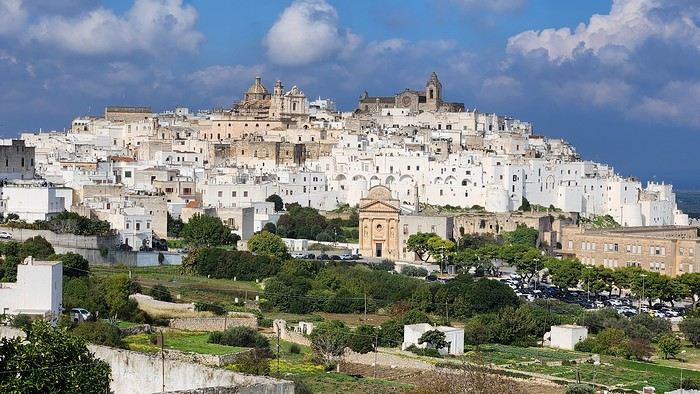
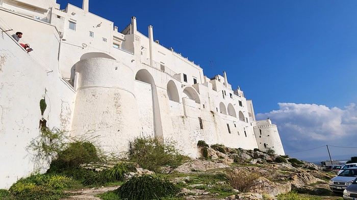
We arrived late last night, so only the two bravest soldiers volunteered to scout ahead at dawn, while the younger recruits stayed behind—for now. But not for long! After the first wave of streets and the next round of exploration, headquarters made the inevitable call to retreat. Reinforcements were needed! A few strategic errands, a breakfast ration, and our battalion marched in tight formation, flag held high, to conquer Ostuni the White! *Charge!* In my squadron leader’s memoirs, I’ll write that I didn’t expect Ostuni to put up such a fight. What I thought would take two hours to conquer turned into a humbling experience—we could only bow in respect to its beauty, its relentless charm. The alleys are whiter, more labyrinthine, narrower, and more photogenic than the last. *Veni, vidi, vici*—but what an entrance, my troops!
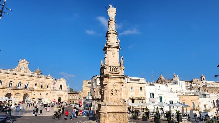
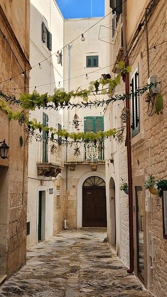
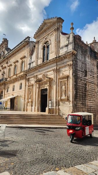
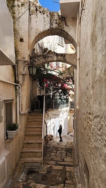
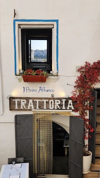
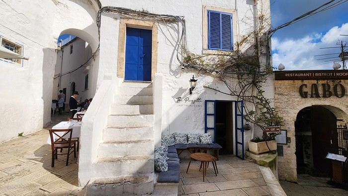
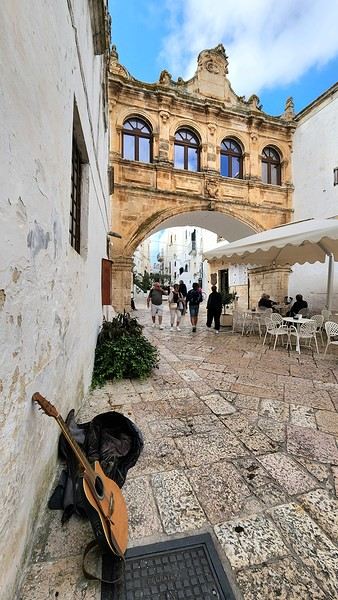
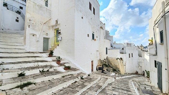
After wrapping up our travel journal on Java (link below), we’re now diving into our recent adventure in Puglia! Happy reading... Off we go on an adventure in Java (and a bit of Bali) | Travel journal > Indonesia | Voyage Forum
Day 1 - October 19
When you tell your friends and family you’re itching to escape to the other side of the planet to mingle with the Mongols, you can usually expect a barrage of questionable jokes and terrible puns. For this new adventure, it’s a different destination but the same old story—this time, we’re visiting the "pouilleux" (the "scruffy" ones). We’re taking off straight for Puglia! If you need a cheat sheet to remember where this oddly named place is on a world map, just think of it this way: Puglia is the maiden name on the ID card of the heel of the Italian boot! Personally, I prefer to remember it as the land of creamy burrata, the smell of focaccia fresh from the oven, orecchiette shaped by mamas, golden olive oil that shines like the sun (which beams down here 300 days a year), amaretto that makes you happy, and those famous trulli—those little hobbit-like dry-stone houses straight out of a movie set...
But I’ll stop spoiling the rest of our trip and focus on a factual rundown of this first Puglian day. So, are you joining us on this new adventure beyond our Gallic borders? Either way, Sasha (my youngest) and Luna (Flo’s daughter) didn’t need much convincing to stick with us and keep up the pace!
Our plane drops our little crew in Bari, the site of a famously tragic battle lost in 1991. But revenge is sweet! After renting a motorized carriage, we escape the landing zone and head to our military base of operations: Ostuni, a strategic little town where we’ll set up camp for the next four days. Why Ostuni? First, for its central location, which lets us explore a region packed with must-see gems. Second, for its vibe and beauty, which have earned it quite the reputation. Perched high on a hill, the *città bianca* (the "White City") lives up to its nickname. It literally dazzles visitors. The reason? The whitewashed facades of its houses, a testament to the region’s rich architectural heritage.
We arrived late last night, so only the two bravest soldiers volunteered to scout ahead at dawn, while the younger recruits stayed behind—for now. But not for long! After the first wave of streets and the next round of exploration, headquarters made the inevitable call to retreat. Reinforcements were needed! A few strategic errands, a breakfast ration, and our battalion marched in tight formation, flag held high, to conquer Ostuni the White! *Charge!* In my squadron leader’s memoirs, I’ll write that I didn’t expect Ostuni to put up such a fight. What I thought would take two hours to conquer turned into a humbling experience—we could only bow in respect to its beauty, its relentless charm. The alleys are whiter, more labyrinthine, narrower, and more photogenic than the last. *Veni, vidi, vici*—but what an entrance, my troops!
While planning a trip to the LOFOTEN for summer 2023 using the excellent guide *Hiking in the Lofoten*, we discovered this trek.
Sure, it’s rated as difficult, but it lets you cross the LOFOTEN on foot from north to south in 11 stages, covering 160 km and 9,193 m of elevation gain (or the reverse, of course).
So, it’s a multi-day hike, with wild camping, and no need to rent a car. Perfect...
What’s making us hesitate a bit are the island transfers (okay, I’ll admit, the difficulty is also a factor for me). These transfers require taking public transport and/or hitchhiking. But the stages are designed with this in mind, and the transfers are well explained. Plus, water isn’t an issue, and you can resupply several times, which helps keep the pack weight down.
For Jean Marie, my partner, this will be his first multi-day trek, but he’s an experienced and hardy hiker. As for me, even though I’m not as tough, I’ve already done some multi-day hikes. So, we should complement each other well.
So, are we going for it? Sold!!
Here’s the trek map: HERE
03/08 – Day 1 - Delp – Sandsletta 04/08 - Day 2 – Sandsletta – Svolvaer 05/08 - Day 3 – Svolvaer – Kleppstad + transfer to the start of Day 4 06/08 – Day 4 – Vikjorda hamlet – Store Lake 07/08 – Day 5 – Store Lake – Leknes - Transfer to Napp on Flakstadøya Island 08/08 – Day 6 – Napp – Nusfjord 09/08 – Day 7 – Nusfjord – Ramberg 10/08 – Day 8 – Ramberg – Selfjord Bay (Moskenesøya Island) 11/08 – Day 9 - Selfjord – Bunes Beach 12/08 – Day 10 - Bunes Beach - Krokvatnet Lake 13/08 – Day 11 - Krokvatnet Lake – Moskenes (campsite) and round trip to Å by bus 14/08 – Day 12 – Hike up Reinebringen – Reine – Tour of Agvatnet Lake 15/08 – Return to Bodø - flight back to France on 16/08 And here’s the inevitable recap
Sure, it’s rated as difficult, but it lets you cross the LOFOTEN on foot from north to south in 11 stages, covering 160 km and 9,193 m of elevation gain (or the reverse, of course).
So, it’s a multi-day hike, with wild camping, and no need to rent a car. Perfect...
What’s making us hesitate a bit are the island transfers (okay, I’ll admit, the difficulty is also a factor for me). These transfers require taking public transport and/or hitchhiking. But the stages are designed with this in mind, and the transfers are well explained. Plus, water isn’t an issue, and you can resupply several times, which helps keep the pack weight down.
For Jean Marie, my partner, this will be his first multi-day trek, but he’s an experienced and hardy hiker. As for me, even though I’m not as tough, I’ve already done some multi-day hikes. So, we should complement each other well.
So, are we going for it? Sold!!
Here’s the trek map: HERE
03/08 – Day 1 - Delp – Sandsletta 04/08 - Day 2 – Sandsletta – Svolvaer 05/08 - Day 3 – Svolvaer – Kleppstad + transfer to the start of Day 4 06/08 – Day 4 – Vikjorda hamlet – Store Lake 07/08 – Day 5 – Store Lake – Leknes - Transfer to Napp on Flakstadøya Island 08/08 – Day 6 – Napp – Nusfjord 09/08 – Day 7 – Nusfjord – Ramberg 10/08 – Day 8 – Ramberg – Selfjord Bay (Moskenesøya Island) 11/08 – Day 9 - Selfjord – Bunes Beach 12/08 – Day 10 - Bunes Beach - Krokvatnet Lake 13/08 – Day 11 - Krokvatnet Lake – Moskenes (campsite) and round trip to Å by bus 14/08 – Day 12 – Hike up Reinebringen – Reine – Tour of Agvatnet Lake 15/08 – Return to Bodø - flight back to France on 16/08 And here’s the inevitable recap
Hi everyone!
Blue skies (lots of them), whitewashed villages with steep alleyways, hundreds of churches, and... thousands of stairs? Welcome to the Cyclades! 🙂
We’d been dreaming about this for a while, but in July-August—with the crowds—no way! Now that I can travel outside school holidays, the Cyclades are back on the agenda. And so begins a loooong period of planning and second-guessing, with countless itinerary changes: the Cyclades, yes, but which ones? I was fixated on Folegandros (we won’t be going after all) and really wanted to visit Delos. So, for this first trip, it’ll be: Mykonos (and Delos)-Naxos-Amorgos-Santorini.
Saturday 24/05: Departure from Orly on a Transavia flight, arriving in Mykonos in the late afternoon. We found a hotel that offers free transfers (pretty rare and not insignificant—it’s 25 € each way for just a few kilometers 😠) and at a reasonable price (83 € per night for B&B). Time for dinner already: Greek salad and souvlaki (we’re in Greece, right?)
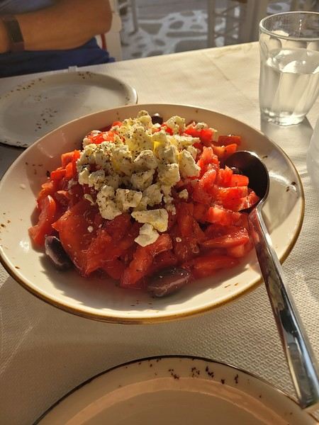 (Okay, this is actually a dakos with Naxos cheese, but I don’t have a photo of a Greek salad 😏).
Blue skies (lots of them), whitewashed villages with steep alleyways, hundreds of churches, and... thousands of stairs? Welcome to the Cyclades! 🙂
We’d been dreaming about this for a while, but in July-August—with the crowds—no way! Now that I can travel outside school holidays, the Cyclades are back on the agenda. And so begins a loooong period of planning and second-guessing, with countless itinerary changes: the Cyclades, yes, but which ones? I was fixated on Folegandros (we won’t be going after all) and really wanted to visit Delos. So, for this first trip, it’ll be: Mykonos (and Delos)-Naxos-Amorgos-Santorini.
Saturday 24/05: Departure from Orly on a Transavia flight, arriving in Mykonos in the late afternoon. We found a hotel that offers free transfers (pretty rare and not insignificant—it’s 25 € each way for just a few kilometers 😠) and at a reasonable price (83 € per night for B&B). Time for dinner already: Greek salad and souvlaki (we’re in Greece, right?)
(Okay, this is actually a dakos with Naxos cheese, but I don’t have a photo of a Greek salad 😏).Hi there,
I'm starting a new travel journal with my itinerary and memories in mind, and maybe a few photos if I can find some.
The context:
April 2020, I was supposed to go to Uzbekistan, and October 2020 to Texas: both canceled due to COVID. Summer vacations in 2020 weren’t gonna be fun. Optimistic, I’d rescheduled both trips for roughly the same dates in 2021: the first was canceled again because of COVID, the second due to U.S. entry conditions (still COVID-related!). Summer vacations in 2021 *had* to be more fun, or I was gonna lose it!!! Plus, our parents are dealing with health issues, which is weighing us down—we really need to get away!
So I looked into where we could go, somewhere we could live almost normally. I saw that Madeira had implemented strict COVID measures but that life on the island was pretty chill afterward. For me, Madeira = sun + hiking + landscapes. BINGO.
Day 1: The flight and arrival on the island
Flight with TAP via Lisbon, departing around noon. We wore our masks properly on the plane. (My last flight was to Portugal, and I told myself I’d break the jinx and leave COVID behind us.) Layover in Lisbon, then an afternoon flight to Madeira. The landing went smoothly, no wind. Cristiano Ronaldo Airport in Funchal is known for being one of the trickiest in the world due to crosswinds. The checks were standard, except COVID added an extra step. Before the trip, I had to fill out a questionnaire (Madeira Safe). Once there, a group of young people—probably students—greeted us, each with a tablet. The health questionnaire and vaccine check were super quick. Then we saw a doctor, and just like that, we were wished a great stay. Honestly, it was so well organized that it only took 10 minutes. We wouldn’t put our masks back on until we returned!
A taxi took us to our hotel in the hills above Funchal—a pretty upscale place, which isn’t our usual style, but we needed it this time! Dinner on the hotel terrace with the city at our feet. Amazing!
HOTEL: Quinta da Bela Vista
The +: We’re traveling!!! The -: Nothing.
The context:
April 2020, I was supposed to go to Uzbekistan, and October 2020 to Texas: both canceled due to COVID. Summer vacations in 2020 weren’t gonna be fun. Optimistic, I’d rescheduled both trips for roughly the same dates in 2021: the first was canceled again because of COVID, the second due to U.S. entry conditions (still COVID-related!). Summer vacations in 2021 *had* to be more fun, or I was gonna lose it!!! Plus, our parents are dealing with health issues, which is weighing us down—we really need to get away!
So I looked into where we could go, somewhere we could live almost normally. I saw that Madeira had implemented strict COVID measures but that life on the island was pretty chill afterward. For me, Madeira = sun + hiking + landscapes. BINGO.
Day 1: The flight and arrival on the island
Flight with TAP via Lisbon, departing around noon. We wore our masks properly on the plane. (My last flight was to Portugal, and I told myself I’d break the jinx and leave COVID behind us.) Layover in Lisbon, then an afternoon flight to Madeira. The landing went smoothly, no wind. Cristiano Ronaldo Airport in Funchal is known for being one of the trickiest in the world due to crosswinds. The checks were standard, except COVID added an extra step. Before the trip, I had to fill out a questionnaire (Madeira Safe). Once there, a group of young people—probably students—greeted us, each with a tablet. The health questionnaire and vaccine check were super quick. Then we saw a doctor, and just like that, we were wished a great stay. Honestly, it was so well organized that it only took 10 minutes. We wouldn’t put our masks back on until we returned!
A taxi took us to our hotel in the hills above Funchal—a pretty upscale place, which isn’t our usual style, but we needed it this time! Dinner on the hotel terrace with the city at our feet. Amazing!
HOTEL: Quinta da Bela Vista
The +: We’re traveling!!! The -: Nothing.
Hi everyone,
There haven’t been many recent stories about Norway in winter, and since I had trouble finding info on winter hikes, I thought I’d share a little travel journal.
Back in September 2024, while planning our summer 2025 trip to Norway, I joined some Facebook groups dedicated to travel in Scandinavia and started reading travel blogs. Since winter trips were being planned at the time, I came across posts with stunning photos of northern Norway in winter. I’d always pictured monotonous landscapes of pine forests and frozen lakes, so I was pleasantly surprised to see fjords, mountain ranges, and charming colorful cabins—just like in the Lofoten Islands. Turns out, the vast pine forests are more typical of Finnish Lapland. Norway, north of the Arctic Circle, is actually much more diverse. That was all it took to suggest this destination to my three guys for our winter vacation. After some research, early March seemed ideal—good weather, long enough daylight, and great chances for northern lights. A direct flight from Paris to Tromsø sealed the deal. The only downside? The cost of cars, accommodations, and activities nearly made us back out! Everything except flights is really expensive.
Since our oldest son had an important school deadline in June, he decided to skip the trip, so we ended up going as a trio. We took a Transavia round-trip flight from Orly to Tromsø for an amazing trip from March 1st to 8th.
Want to come along?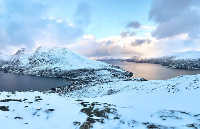
There haven’t been many recent stories about Norway in winter, and since I had trouble finding info on winter hikes, I thought I’d share a little travel journal.
Back in September 2024, while planning our summer 2025 trip to Norway, I joined some Facebook groups dedicated to travel in Scandinavia and started reading travel blogs. Since winter trips were being planned at the time, I came across posts with stunning photos of northern Norway in winter. I’d always pictured monotonous landscapes of pine forests and frozen lakes, so I was pleasantly surprised to see fjords, mountain ranges, and charming colorful cabins—just like in the Lofoten Islands. Turns out, the vast pine forests are more typical of Finnish Lapland. Norway, north of the Arctic Circle, is actually much more diverse. That was all it took to suggest this destination to my three guys for our winter vacation. After some research, early March seemed ideal—good weather, long enough daylight, and great chances for northern lights. A direct flight from Paris to Tromsø sealed the deal. The only downside? The cost of cars, accommodations, and activities nearly made us back out! Everything except flights is really expensive.
Since our oldest son had an important school deadline in June, he decided to skip the trip, so we ended up going as a trio. We took a Transavia round-trip flight from Orly to Tromsø for an amazing trip from March 1st to 8th.
Want to come along?
Hi there,
It’s not always easy to pick where to stay in national parks... like Kruger, for example.
Below is an attempt to decode the different types and options...
Remember, to book in a national park, you do it through the Sanparks website, except in KwaZulu-Natal (KZN Wildlife).
Choosing the type of camp that suits you: · Main Rest Camps, Satellite Camps, Bushveld Camps, Overnight Hides, Bush Lodges, Camp Site, Luxury Lodges Main Rest Camps These camps are usually quite large, even very large, like Skukuza. They have a fence! You can move around freely inside these camps at night with a torch. Staff are available, and there are security guards. Shops are more or less well-stocked but have the basics. You’ll find souvenir shops, restaurants, bars, and most often a pool. Depending on your choice, there are camping spots, chalets, huts, etc., with varying levels of comfort. Shared kitchens, shared bathrooms, or private facilities in each accommodation (see below). This isn’t the "wild" version but rather the more luxurious and secure option. Bushveld Camps Smaller and more intimate, with some amenities, but no restaurants or shops. Check if there’s a fence. Satellite Camps Always close to the main camps (more or less). As a rule, you check in at the main camp. Comfort level is lower than the options above. Check if there’s a fence. Camp Site + Overnight Hide The wildest level. That says it all. Bush Lodges + Luxury Lodges Bush lodges: exclusive environment. Since I haven’t tried them, I can’t give any tips. Luxury lodges: well, the name says it all. This is Kruger’s version of a private game reserve lodge. Game drives with a ranger in an open vehicle. Accommodation ranges from luxurious to very luxurious. Meals and lodging are of the same standard. But even so, the game drive rules are the same. Sure, you get exclusive access to a small area, but you can’t leave the marked trails, and normally, the return time to camp is exactly the same. The rule actually says that exceptionally, if there’s a great opportunity within x meters, they *might* go off-trail. First case in the far south: a very flexible ranger and an amazing game drive. Second case: a mediocre ranger and a boring game drive. Note that some may only offer lodging. Personally, I think the added value can be excessively expensive. Choosing your accommodation within a camp. This depends on the camp. Below is an attempt to decode. Camp site: just a spot, that’s it. Access to facilities like toilets, shared kitchen, etc. Huts: basic amenities, usually just a fan. Safari tent: the name says it all. It’s already set up. Bungalow: well, it’s a bungalow, and a guest house is a bungalow for a group. Decoding: AC = air conditioning. Fan = fan. Private or shared toilets. Private or shared bathroom. Equipped kitchen or shared. Terrace. Perimeter or not. View or not. First 2–5 letters — the type of accommodation.
CK = Campsite EH/EA/EB = Hut (AC, so air-conditioned) ES = Hut (fan only) CTT/ST= Safari Tent LBVST = Safari Tent with bush view LRVST = Safari Tent with river view BD/BA = Bungalow with private (and equipped) kitchen BG/BE = Bungalow with shared kitchen F, G or CO = Guesthouse or Cottages (more than one bedroom)
Number after the letters — number of beds 2, 3, 4, or 6 beds. The base price is for 2 people. There’s an extra charge for each additional person. The last letter, if present, indicates a particular feature.
U = Perimeter — close to the camp’s edge V = Perimeter + view (e.g., river) Z = For disabled access L = Large spot (camping) D = DSTV (television) E = Enclosed veranda
Example: BD3U = 3 people, private kitchen (and bathroom/toilet), perimeter with view.
Choosing the type of camp that suits you: · Main Rest Camps, Satellite Camps, Bushveld Camps, Overnight Hides, Bush Lodges, Camp Site, Luxury Lodges Main Rest Camps These camps are usually quite large, even very large, like Skukuza. They have a fence! You can move around freely inside these camps at night with a torch. Staff are available, and there are security guards. Shops are more or less well-stocked but have the basics. You’ll find souvenir shops, restaurants, bars, and most often a pool. Depending on your choice, there are camping spots, chalets, huts, etc., with varying levels of comfort. Shared kitchens, shared bathrooms, or private facilities in each accommodation (see below). This isn’t the "wild" version but rather the more luxurious and secure option. Bushveld Camps Smaller and more intimate, with some amenities, but no restaurants or shops. Check if there’s a fence. Satellite Camps Always close to the main camps (more or less). As a rule, you check in at the main camp. Comfort level is lower than the options above. Check if there’s a fence. Camp Site + Overnight Hide The wildest level. That says it all. Bush Lodges + Luxury Lodges Bush lodges: exclusive environment. Since I haven’t tried them, I can’t give any tips. Luxury lodges: well, the name says it all. This is Kruger’s version of a private game reserve lodge. Game drives with a ranger in an open vehicle. Accommodation ranges from luxurious to very luxurious. Meals and lodging are of the same standard. But even so, the game drive rules are the same. Sure, you get exclusive access to a small area, but you can’t leave the marked trails, and normally, the return time to camp is exactly the same. The rule actually says that exceptionally, if there’s a great opportunity within x meters, they *might* go off-trail. First case in the far south: a very flexible ranger and an amazing game drive. Second case: a mediocre ranger and a boring game drive. Note that some may only offer lodging. Personally, I think the added value can be excessively expensive. Choosing your accommodation within a camp. This depends on the camp. Below is an attempt to decode. Camp site: just a spot, that’s it. Access to facilities like toilets, shared kitchen, etc. Huts: basic amenities, usually just a fan. Safari tent: the name says it all. It’s already set up. Bungalow: well, it’s a bungalow, and a guest house is a bungalow for a group. Decoding: AC = air conditioning. Fan = fan. Private or shared toilets. Private or shared bathroom. Equipped kitchen or shared. Terrace. Perimeter or not. View or not. First 2–5 letters — the type of accommodation.
CK = Campsite EH/EA/EB = Hut (AC, so air-conditioned) ES = Hut (fan only) CTT/ST= Safari Tent LBVST = Safari Tent with bush view LRVST = Safari Tent with river view BD/BA = Bungalow with private (and equipped) kitchen BG/BE = Bungalow with shared kitchen F, G or CO = Guesthouse or Cottages (more than one bedroom)
Number after the letters — number of beds 2, 3, 4, or 6 beds. The base price is for 2 people. There’s an extra charge for each additional person. The last letter, if present, indicates a particular feature.
U = Perimeter — close to the camp’s edge V = Perimeter + view (e.g., river) Z = For disabled access L = Large spot (camping) D = DSTV (television) E = Enclosed veranda
Example: BD3U = 3 people, private kitchen (and bathroom/toilet), perimeter with view.
Croatia
October 2024
Hi everyone, I wanted to share our family week in Croatia. Alex and I, with Apolline (6), Olympe (4), and Artémis (18 months).
Itinerary
Planning the itinerary was complicated, but in the end, I wouldn’t change a thing. Since we had a round-trip flight from Dubrovnik, I preferred to prioritize proximity, so we skipped Plitvice, which I’d really love to visit—but that’ll be for next time. We had time to... take our time, and it was really nice.
Day 1: Marseille-Dubrovnik flight. Night in Ston.
Day 2: Visit to Ston and Mali Ston. Ferry to Mljet. Night in Pomena (3 nights total).
Days 3 & 4: Walks in Mljet National Park and swimming.
Day 5: Return ferry. Visit to the Trsteno Arboretum. Night in Dubrovnik (3 nights total).
Day 6: Visit to Dubrovnik’s city walls and Old Town.
Day 7: Lokrum.
Day 8: Morning in Dubrovnik, then Cavtat and overnight flight back to Marseille.
Our visits
Ston area:
Ston village, small but charming. We walked the walls from Ston to Mali Ston. It’s a steep climb, but the views over Ston and then Mali Ston are stunning. Easy return by road, and we visited the fort. Stroller impossible on the walls.
Pratpano Beach before taking the ferry. A beautiful beach and our first swim!
Mljet
Everything is beautiful on Mljet—the villages, landscapes, beaches... There are plenty of hiking and biking trails of varying difficulty. We saw lots of bike rental shops (Pomena, Polače, at the dock for St. Mary’s...), with some bikes equipped with child seats (though no baby trailers). In Pomena, there’s a small national park office that provides maps, sells entry tickets, and gives info on possible routes. The trails are well-marked. The boat to St. Mary’s Island is included in the park entry fee.
On the first day, from Pomena, we were 20 minutes’ walk from the small saltwater lake and the dock for St. Mary’s Monastery. We visited the little island, but the monastery interior was closed. We swam in Malo Jezero Lake (but there are plenty of spots to swim in both lakes).
The next day, we did a big loop starting from Pomena, walking through the forest (with beautiful sea views) to Janik (across from the monastery), then returning along the shore paths for a swim. An easy hike with little elevation—Olympe did it without any problems. The route is clearly marked on the bike trail map from the park office.
On our last day before the 3 PM ferry, we swam and had a picnic on one of Saplunara’s gorgeous sandy beaches—we had the whole place to ourselves!
Trsteno Arboretum (30 minutes from Dubrovnik). A stunning botanical garden overlooking the sea, which we visited in the late afternoon. Stroller accessible.
Dubrovnik:
City walls. Very expensive, but worth it! Lets you see the whole Old Town and the port from above. Stroller impossible.
Old Town: lots of beautiful, narrow alleys where laundry dries between buildings. Stroller possible but not practical. We visited the two monasteries and the cathedral inside but skipped the Rector’s Palace and St. Lawrence Fort.
Lokrum: deserves a full day. A beautiful walk circles the island, alternating between coves, historic buildings, and botanical gardens. We were short on time before the last boat left, but there are plenty of great spots to swim. You can’t do the full loop with a stroller, but I think the main sights near the dock are accessible.
Cavtat: a great surprise—I’d recommend it if, like us, you have a late flight. Just 15 minutes from the airport, it’s a charming seaside village with a lovely waterfront promenade (stroller-friendly), several swimming coves, and a cute center with things to see if you have extra time (museum, mausoleum, church...), plus restaurants, gelato shops, and boutiques...
Even though the girls walked a lot and enjoyed the walks, they *loved* swimming almost every day.
Transportation
Flight with Volotea. 1-hour delay on the way back.
Rental car with Goldcar. Office 100m outside the airport (it’s small, so about a 10-minute walk from arrivals). We were first in line, and luckily so—the employee was alone, and the queue behind us got really long, so budget extra time.
Don’t plan on driving in central Dubrovnik—the parking is outrageously expensive (over 5 €/hour near the walls), so book accommodation with parking and be ready for some walking.
Ferry: punctual. This time of year, we didn’t need to be at the dock more than 30 minutes before departure. Booked online.
Accommodation
I won’t talk about our place in Ston—it wasn’t very comfortable—or the one in Pomena, where we were really poorly received. But both locations were great for sightseeing. In Dubrovnik, we spent 3 nights at Natasa’s Airbnb (Apt Kalea), which was well-equipped, comfortable, and well-located—20 minutes’ walk from the center, with parking, a garden, and... a washing machine. All right across from a supermarket and a great bakery. For those with bigger budgets, the Art Deco Hilton in the center had me dreaming for 3 days!
Food
We didn’t eat out much because of the prices, but when we did, the food was great. The cuisine blends Italian and Slavic influences, so expect amazing seafood dishes, cuttlefish ink risotto, and big mixed grilled meats, not to mention pepper sauce. Despite the price, I’d recommend the restaurant in Mali Ston, *Kapetanova Kuća*. The food was great, and the service was friendly. If you have a late flight like we did, don’t hesitate to eat at the bistro almost across from the airport, *Pod Dubom*—good, affordable menu and a smiling waiter!
A great local picnic specialty: *burek*, a delicious savory pie (meat or cheese) you’ll find in bakeries or supermarkets. Also, good dry sheep’s cheese.
For picnics in Dubrovnik, I’d recommend the pine grove at St. Lawrence Fort or the benches above the port (at the end of Dominika Street). Both have amazing views.
Weather
We had beautiful weather—perfect for swimming *and* hiking. A light sweater for mornings and late afternoons, T-shirt and swimsuit during the day. In this part of Croatia, I’d say it’s comparable to southeastern France, so ideal for a fall break.
Gear
We like taking our stroller (Yoyo) for airport trips, but it wasn’t much use otherwise. If you have to choose, a baby carrier is better—between the cobblestones and hiking trails, it’s often the only way to carry a little one. We have the Deuter Pro hiking carrier, and Artémis loves it. We had high chairs in the few restaurants we went to, but not in our accommodations, so I brought a foldable fabric seat that fits on any chair. We had a crib in Ston and Pomena but not in Dubrovnik—Artémis slept on the floor on a folded duvet.
I invested in a Minimax *cabin-sized* suitcase for Apolline for this trip—she was so proud to have her first rolling suitcase! It turned out to be practical and seems sturdy. It let us take just one checked bag for all five of us for the first time.
Good and bad impressions
The swims in Mljet’s stunning, nearly empty nature.
Unfortunately, we felt unwelcome. The guidebook mentioned that Croatians can be standoffish at first, but we never got past that first impression. The constant feeling of being in the way—even though we weren’t there in peak season—was a bit unsettling. On the way back, I found out everyone I talked to (with or without kids) felt the same. Of course, it’s not universal—some people were polite, even warm (yes, really!).
No major issues, but a few things to note:
The car rental company only accepted debit cards, not credit cards. It was clearly stated in the contract, but I didn’t take it seriously. Luckily, Alexandre had a professional debit card, but *double-check yours before you go*.
For the car, despite the super-low rental price, you’ll have to add fees if you plan to take a ferry (50 to 80 € depending on the agency).
On Mljet, the only supermarket in Pomena was closed. We had to drive 10 minutes to Polače for basics. For diapers, we had to go even farther. I only saw formula for newborns in small supermarkets—maybe you can find more in Dubrovnik or at a pharmacy. I ended up using regular milk for Artémis.
Health
No issues, and no one got sick. We swam in very accessible spots given the girls’ ages, but if you’re eyeing a gorgeous little cove, watch out for sea urchins—we saw a lot!
Portable DVD players for the plane and car, but we barely used them. The girls watched cartoons in English on TV.
Kidizoom cameras.
A few toys for Artémis.
Budget
We found Croatia expensive, and I imagine it’s even worse in summer. For restaurants, sightseeing, and groceries, expect to pay the same as—or more than—in France. On the other hand, flights were low-cost, and accommodations were reasonable. The rental car was almost a steal, even with the extra ferry fees.
Round-trip flight from Marseille: 583 €
Car for 8 days: 56 € (+50 € for ferry fees)
Accommodations (7 nights): 509 €
Sightseeing:
Mljet National Park entry: 15 €/adult for 2 days (boat to St. Mary’s included)
Arboretum: 10 €/adult
Dubrovnik walls: 35 €/adult
Ferry Pratpano-Mljet: 60 € round-trip
October 2024
Hi everyone, I wanted to share our family week in Croatia. Alex and I, with Apolline (6), Olympe (4), and Artémis (18 months).
Itinerary
Planning the itinerary was complicated, but in the end, I wouldn’t change a thing. Since we had a round-trip flight from Dubrovnik, I preferred to prioritize proximity, so we skipped Plitvice, which I’d really love to visit—but that’ll be for next time. We had time to... take our time, and it was really nice.
Day 1: Marseille-Dubrovnik flight. Night in Ston.
Day 2: Visit to Ston and Mali Ston. Ferry to Mljet. Night in Pomena (3 nights total).
Days 3 & 4: Walks in Mljet National Park and swimming.
Day 5: Return ferry. Visit to the Trsteno Arboretum. Night in Dubrovnik (3 nights total).
Day 6: Visit to Dubrovnik’s city walls and Old Town.
Day 7: Lokrum.
Day 8: Morning in Dubrovnik, then Cavtat and overnight flight back to Marseille.
Our visits
Ston area:
Ston village, small but charming. We walked the walls from Ston to Mali Ston. It’s a steep climb, but the views over Ston and then Mali Ston are stunning. Easy return by road, and we visited the fort. Stroller impossible on the walls.
Pratpano Beach before taking the ferry. A beautiful beach and our first swim!
Mljet
Everything is beautiful on Mljet—the villages, landscapes, beaches... There are plenty of hiking and biking trails of varying difficulty. We saw lots of bike rental shops (Pomena, Polače, at the dock for St. Mary’s...), with some bikes equipped with child seats (though no baby trailers). In Pomena, there’s a small national park office that provides maps, sells entry tickets, and gives info on possible routes. The trails are well-marked. The boat to St. Mary’s Island is included in the park entry fee.
On the first day, from Pomena, we were 20 minutes’ walk from the small saltwater lake and the dock for St. Mary’s Monastery. We visited the little island, but the monastery interior was closed. We swam in Malo Jezero Lake (but there are plenty of spots to swim in both lakes).
The next day, we did a big loop starting from Pomena, walking through the forest (with beautiful sea views) to Janik (across from the monastery), then returning along the shore paths for a swim. An easy hike with little elevation—Olympe did it without any problems. The route is clearly marked on the bike trail map from the park office.
On our last day before the 3 PM ferry, we swam and had a picnic on one of Saplunara’s gorgeous sandy beaches—we had the whole place to ourselves!
Trsteno Arboretum (30 minutes from Dubrovnik). A stunning botanical garden overlooking the sea, which we visited in the late afternoon. Stroller accessible.
Dubrovnik:
City walls. Very expensive, but worth it! Lets you see the whole Old Town and the port from above. Stroller impossible.
Old Town: lots of beautiful, narrow alleys where laundry dries between buildings. Stroller possible but not practical. We visited the two monasteries and the cathedral inside but skipped the Rector’s Palace and St. Lawrence Fort.
Lokrum: deserves a full day. A beautiful walk circles the island, alternating between coves, historic buildings, and botanical gardens. We were short on time before the last boat left, but there are plenty of great spots to swim. You can’t do the full loop with a stroller, but I think the main sights near the dock are accessible.
Cavtat: a great surprise—I’d recommend it if, like us, you have a late flight. Just 15 minutes from the airport, it’s a charming seaside village with a lovely waterfront promenade (stroller-friendly), several swimming coves, and a cute center with things to see if you have extra time (museum, mausoleum, church...), plus restaurants, gelato shops, and boutiques...
Even though the girls walked a lot and enjoyed the walks, they *loved* swimming almost every day.
Transportation
Flight with Volotea. 1-hour delay on the way back.
Rental car with Goldcar. Office 100m outside the airport (it’s small, so about a 10-minute walk from arrivals). We were first in line, and luckily so—the employee was alone, and the queue behind us got really long, so budget extra time.
Don’t plan on driving in central Dubrovnik—the parking is outrageously expensive (over 5 €/hour near the walls), so book accommodation with parking and be ready for some walking.
Ferry: punctual. This time of year, we didn’t need to be at the dock more than 30 minutes before departure. Booked online.
Accommodation
I won’t talk about our place in Ston—it wasn’t very comfortable—or the one in Pomena, where we were really poorly received. But both locations were great for sightseeing. In Dubrovnik, we spent 3 nights at Natasa’s Airbnb (Apt Kalea), which was well-equipped, comfortable, and well-located—20 minutes’ walk from the center, with parking, a garden, and... a washing machine. All right across from a supermarket and a great bakery. For those with bigger budgets, the Art Deco Hilton in the center had me dreaming for 3 days!
Food
We didn’t eat out much because of the prices, but when we did, the food was great. The cuisine blends Italian and Slavic influences, so expect amazing seafood dishes, cuttlefish ink risotto, and big mixed grilled meats, not to mention pepper sauce. Despite the price, I’d recommend the restaurant in Mali Ston, *Kapetanova Kuća*. The food was great, and the service was friendly. If you have a late flight like we did, don’t hesitate to eat at the bistro almost across from the airport, *Pod Dubom*—good, affordable menu and a smiling waiter!
A great local picnic specialty: *burek*, a delicious savory pie (meat or cheese) you’ll find in bakeries or supermarkets. Also, good dry sheep’s cheese.
For picnics in Dubrovnik, I’d recommend the pine grove at St. Lawrence Fort or the benches above the port (at the end of Dominika Street). Both have amazing views.
Weather
We had beautiful weather—perfect for swimming *and* hiking. A light sweater for mornings and late afternoons, T-shirt and swimsuit during the day. In this part of Croatia, I’d say it’s comparable to southeastern France, so ideal for a fall break.
Gear
We like taking our stroller (Yoyo) for airport trips, but it wasn’t much use otherwise. If you have to choose, a baby carrier is better—between the cobblestones and hiking trails, it’s often the only way to carry a little one. We have the Deuter Pro hiking carrier, and Artémis loves it. We had high chairs in the few restaurants we went to, but not in our accommodations, so I brought a foldable fabric seat that fits on any chair. We had a crib in Ston and Pomena but not in Dubrovnik—Artémis slept on the floor on a folded duvet.
I invested in a Minimax *cabin-sized* suitcase for Apolline for this trip—she was so proud to have her first rolling suitcase! It turned out to be practical and seems sturdy. It let us take just one checked bag for all five of us for the first time.
Good and bad impressions
The swims in Mljet’s stunning, nearly empty nature.
Unfortunately, we felt unwelcome. The guidebook mentioned that Croatians can be standoffish at first, but we never got past that first impression. The constant feeling of being in the way—even though we weren’t there in peak season—was a bit unsettling. On the way back, I found out everyone I talked to (with or without kids) felt the same. Of course, it’s not universal—some people were polite, even warm (yes, really!).
No major issues, but a few things to note:
The car rental company only accepted debit cards, not credit cards. It was clearly stated in the contract, but I didn’t take it seriously. Luckily, Alexandre had a professional debit card, but *double-check yours before you go*.
For the car, despite the super-low rental price, you’ll have to add fees if you plan to take a ferry (50 to 80 € depending on the agency).
On Mljet, the only supermarket in Pomena was closed. We had to drive 10 minutes to Polače for basics. For diapers, we had to go even farther. I only saw formula for newborns in small supermarkets—maybe you can find more in Dubrovnik or at a pharmacy. I ended up using regular milk for Artémis.
Health
No issues, and no one got sick. We swam in very accessible spots given the girls’ ages, but if you’re eyeing a gorgeous little cove, watch out for sea urchins—we saw a lot!
Portable DVD players for the plane and car, but we barely used them. The girls watched cartoons in English on TV.
Kidizoom cameras.
A few toys for Artémis.
Budget
We found Croatia expensive, and I imagine it’s even worse in summer. For restaurants, sightseeing, and groceries, expect to pay the same as—or more than—in France. On the other hand, flights were low-cost, and accommodations were reasonable. The rental car was almost a steal, even with the extra ferry fees.
Round-trip flight from Marseille: 583 €
Car for 8 days: 56 € (+50 € for ferry fees)
Accommodations (7 nights): 509 €
Sightseeing:
Mljet National Park entry: 15 €/adult for 2 days (boat to St. Mary’s included)
Arboretum: 10 €/adult
Dubrovnik walls: 35 €/adult
Ferry Pratpano-Mljet: 60 € round-trip
Hi there,
Here’s a recap of a trek through the Balkans covering three countries: Albania, Montenegro, and Kosovo. I was with a friend, and we didn’t do the full route (only one day in Kosovo).
It was a wonderful trek through snow-capped mountains and vast flower-filled meadows, meeting incredibly welcoming people.
At the end of the travel journal, I’ll share what I loved and what I liked less.
Day 1: Flight from Paris-Beauvais to Tirana with Wizz Air.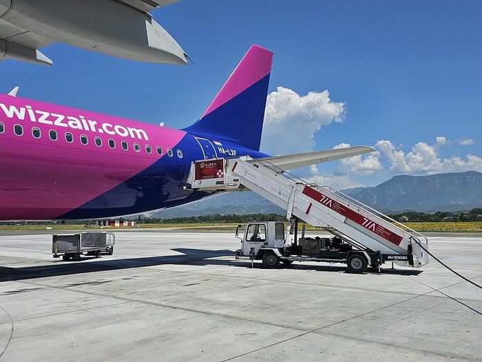 Since Albania isn’t part of Europe when it comes to phone service (at least not yet! :-)), we had to buy a physical SIM card—otherwise, the bill would’ve been sky-high if we’d used our French plan! We got one from Vodafone AL at the airport. You can buy online before leaving with a virtual SIM (e-SIM) for compatible phones, so you don’t have to swap cards. But given the uncertainty about choosing a plan online, we preferred buying one directly at Tirana Airport. Cost: 31 € for 100 GB. That’s way too much—100 GB is overkill. For 40 GB, it’s 27 €, and the plan lasts 21 days. The price difference isn’t huge, and it was cheaper than online. This plan covers all the countries along the Balkan range.
Money tip: All guesthouses and accommodations accept euros. The local currency in Albania is the LEK. In Montenegro, it’s the euro. Bank fees for withdrawing money from an ATM in Albania are pretty steep: 8 € for a withdrawal of 600–700 LEK (about 200 €)! So it’s better to withdraw cash (euros) in France. Oh, and we booked all our accommodations before leaving, but payment is always in cash. Budget around 400–500 € for 9 days of trekking.
Since Albania isn’t part of Europe when it comes to phone service (at least not yet! :-)), we had to buy a physical SIM card—otherwise, the bill would’ve been sky-high if we’d used our French plan! We got one from Vodafone AL at the airport. You can buy online before leaving with a virtual SIM (e-SIM) for compatible phones, so you don’t have to swap cards. But given the uncertainty about choosing a plan online, we preferred buying one directly at Tirana Airport. Cost: 31 € for 100 GB. That’s way too much—100 GB is overkill. For 40 GB, it’s 27 €, and the plan lasts 21 days. The price difference isn’t huge, and it was cheaper than online. This plan covers all the countries along the Balkan range.
Money tip: All guesthouses and accommodations accept euros. The local currency in Albania is the LEK. In Montenegro, it’s the euro. Bank fees for withdrawing money from an ATM in Albania are pretty steep: 8 € for a withdrawal of 600–700 LEK (about 200 €)! So it’s better to withdraw cash (euros) in France. Oh, and we booked all our accommodations before leaving, but payment is always in cash. Budget around 400–500 € for 9 days of trekking.
Then, a transfer the same day to Shköder, about a 2-hour bus ride. Cost: 10 € per person. Tickets bought directly on the bus. We spent the night in Shköder at a very clean guesthouse, Open Doors B&B. It had a small balcony overlooking the city.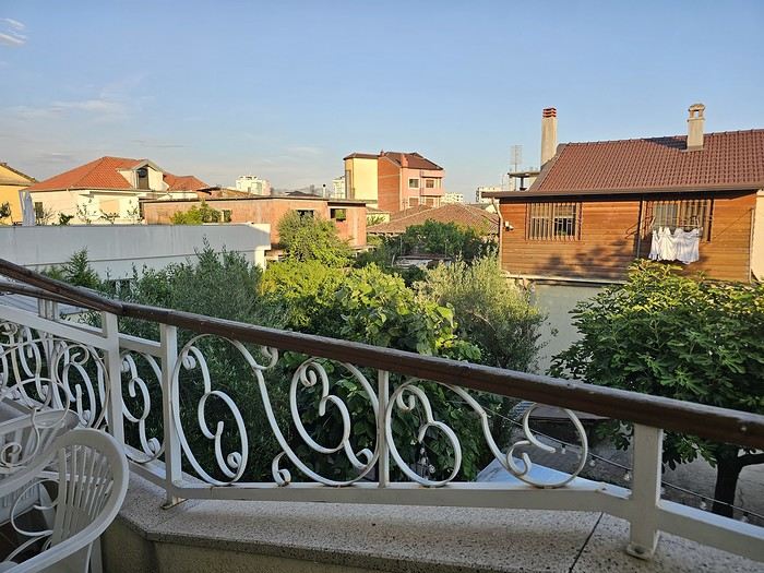 I really liked Shköder, especially its pedestrian street lined with restaurants and lit up at night. It’s a great place to stroll and eat. The food isn’t expensive—two big salads and two beers: 14 € :-) . Fruit prices are also very reasonable: 3 € for a kilo of cherries, compared to 9–10 € in France.
Religions coexist peacefully in these countries—Catholics and Muslims. From our balcony, my friend heard the call to prayer for the first time, coming from one of the city’s mosques.
I really liked Shköder, especially its pedestrian street lined with restaurants and lit up at night. It’s a great place to stroll and eat. The food isn’t expensive—two big salads and two beers: 14 € :-) . Fruit prices are also very reasonable: 3 € for a kilo of cherries, compared to 9–10 € in France.
Religions coexist peacefully in these countries—Catholics and Muslims. From our balcony, my friend heard the call to prayer for the first time, coming from one of the city’s mosques.
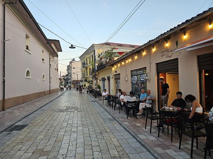
Day 2: Bus ride to Theth, about 1,100 meters in elevation gain, the starting point for our hike the next day.
The trip took 2 hours and 40 minutes with a break in the middle. The bus was affordable, but taxis also make the trip—though they’re very expensive.
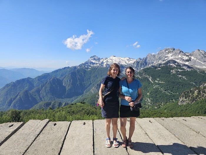
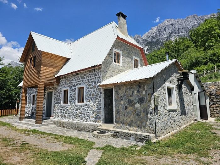 We slept in the heights of Theth at a new guesthouse, "Mountain Vista Shkafi," with an amazing view.
The family was adorable. The husband is a handyman and built almost everything himself. Their baby is named "Sky"—such a cute name, right? :-) Throughout the trek, I found the guesthouses very clean, and the hosts think of everything—no need to bring soap or shampoo; they provide it. Lunch in Theth at a traditional restaurant on the main road. We tried "Tave Dheu," an Albanian dish with beef, cabbage (very common), and cottage cheese. Delicious but not quite filling enough. For dessert, a honey cake that was perfectly moist—such a treat! Desserts like this are rare; sometimes they serve watermelon instead. We took a small private bus for 5 € to the "Blue Eye" parking lot, then walked for about 45 minutes to reach a stunning natural site—a kind of lagoon with incredibly blue water. The bravest can swim, but the water’s freezing!
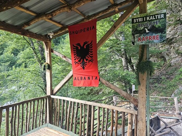
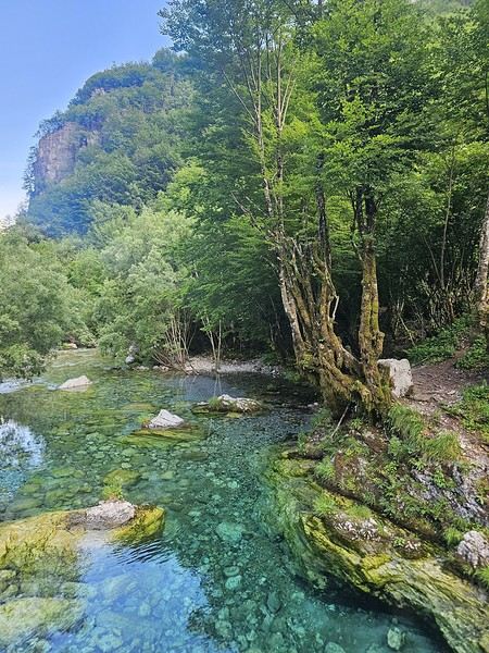
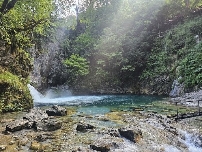
That evening, we dined at "La Montagne Blanche"—excellent! A delightful mix of grilled meats with potatoes and grilled peppers. Some watermelon slices (which I’m not a fan of) and the famous Raki, a brandy served in Turkey and the Balkans! It was my first time drinking brandy "bottoms up." 😉
To be continued... 😉
Day 1: Flight from Paris-Beauvais to Tirana with Wizz Air.
Since Albania isn’t part of Europe when it comes to phone service (at least not yet! :-)), we had to buy a physical SIM card—otherwise, the bill would’ve been sky-high if we’d used our French plan! We got one from Vodafone AL at the airport. You can buy online before leaving with a virtual SIM (e-SIM) for compatible phones, so you don’t have to swap cards. But given the uncertainty about choosing a plan online, we preferred buying one directly at Tirana Airport. Cost: 31 € for 100 GB. That’s way too much—100 GB is overkill. For 40 GB, it’s 27 €, and the plan lasts 21 days. The price difference isn’t huge, and it was cheaper than online. This plan covers all the countries along the Balkan range.
Money tip: All guesthouses and accommodations accept euros. The local currency in Albania is the LEK. In Montenegro, it’s the euro. Bank fees for withdrawing money from an ATM in Albania are pretty steep: 8 € for a withdrawal of 600–700 LEK (about 200 €)! So it’s better to withdraw cash (euros) in France. Oh, and we booked all our accommodations before leaving, but payment is always in cash. Budget around 400–500 € for 9 days of trekking.Then, a transfer the same day to Shköder, about a 2-hour bus ride. Cost: 10 € per person. Tickets bought directly on the bus. We spent the night in Shköder at a very clean guesthouse, Open Doors B&B. It had a small balcony overlooking the city.
I really liked Shköder, especially its pedestrian street lined with restaurants and lit up at night. It’s a great place to stroll and eat. The food isn’t expensive—two big salads and two beers: 14 € :-) . Fruit prices are also very reasonable: 3 € for a kilo of cherries, compared to 9–10 € in France.
Religions coexist peacefully in these countries—Catholics and Muslims. From our balcony, my friend heard the call to prayer for the first time, coming from one of the city’s mosques.
Day 2: Bus ride to Theth, about 1,100 meters in elevation gain, the starting point for our hike the next day.
The trip took 2 hours and 40 minutes with a break in the middle. The bus was affordable, but taxis also make the trip—though they’re very expensive.
We slept in the heights of Theth at a new guesthouse, "Mountain Vista Shkafi," with an amazing view.
The family was adorable. The husband is a handyman and built almost everything himself. Their baby is named "Sky"—such a cute name, right? :-) Throughout the trek, I found the guesthouses very clean, and the hosts think of everything—no need to bring soap or shampoo; they provide it. Lunch in Theth at a traditional restaurant on the main road. We tried "Tave Dheu," an Albanian dish with beef, cabbage (very common), and cottage cheese. Delicious but not quite filling enough. For dessert, a honey cake that was perfectly moist—such a treat! Desserts like this are rare; sometimes they serve watermelon instead. We took a small private bus for 5 € to the "Blue Eye" parking lot, then walked for about 45 minutes to reach a stunning natural site—a kind of lagoon with incredibly blue water. The bravest can swim, but the water’s freezing!
That evening, we dined at "La Montagne Blanche"—excellent! A delightful mix of grilled meats with potatoes and grilled peppers. Some watermelon slices (which I’m not a fan of) and the famous Raki, a brandy served in Turkey and the Balkans! It was my first time drinking brandy "bottoms up." 😉
To be continued... 😉
Aruba is a small island in the Dutch Caribbean located off the coast of Venezuela. It’s part of the ABC islands (Aruba, Bonaire, Curaçao).
After visiting the island of Curaçao a few years earlier, we decided to explore Aruba in November 2023.
We stayed for three weeks in an Airbnb-style accommodation and rented a vehicle for the entire period to visit the various tourist attractions on the island.
These are listed below.
You’ll find several supermarkets (Carrefour, Super Food, Jumbo, etc.) as well as a wide variety of restaurants.
*****
Note:
Please be aware that since July 2024, Aruba has implemented a $20 sustainable development tax for visitors arriving by air.
This tax is payable via the online ED Card platform during the ED card application process to enter Aruba.
I invite you to continue reading this travel journal and watch the videos that will help you discover this sunny destination.
*****
Videos are embedded throughout the summary. Click on the image to start the video.
To jump to a specific post, here are the relevant links:
Noord - California Lighthouse Noord - Bubali Bird Sanctuary Paradera - Casibari Rock Formations Santa Cruz - Ayo Rock Formations Bushiribana - New Natural Pool (Cave Pool) Noord - Bushiribana Gold Mill Ruins Santa Cruz - Natural Bridge Oranjestad - Hooiberg San Nicolas - Seroe Colorado Natural Bridge Spanish Lagoon Mangrove Trail Shoco Habitat - Spanish Lagoon Oranjestad - Balashi Gold Mill Ruins San Nicolas - Lourdes Grotto Arikok National Park - Daimari Beach, Boka Keto Beach (Moro), Conchi Natural Pool Arikok National Park - Boca Prins Beach Arikok National Park - Fontein Cave Arikok National Park – Quadirikiri Cave Arikok National Park – Hike to Sero Arikok Oranjestad & Noord - Walking tour San Nicolas and its murals San Nicolas and its mosaic street benches The famous seafood restaurant Zeerover Noord - Snorkeling around the Baboo shipwreck Noord - Arashi Beach Noord - Boca Catalina Beach Noord - Boca Catalina Beach - Snorkeling Noord - Snorkeling at Tres Tapi - Turtle and Ray Noord - Snorkeling at Malmok Beach - Flying gurnards Noord - Hadicurari Beach (Fishermen's Huts) Noord - Palm Beach Noord - Eagle Beach Noord – Manchebo Beach Oranjestad - Divi Beach Oranjestad - Druif Beach Oranjestad - Surfside Beach Pos Chiquito - Mangel Halto Beach Savaneta - Santo Largo Beach Savaneta - Battata Beach San Nicolas - Rodgers Beach San Nicolas - Baby Beach San Nicolas - Baby Beach - Snorkeling San Nicolas - Bachelor’s Beach (Boca Tabla) San Nicolas - Boca Grandi Beach San Nicolas - Colorado Point - Snorkeling at Bachelors Beach San Nicolas - Grapefield Beach Hike - Blackstone Beach via Natural Bridge Noord - Wariruri Beach
After visiting the island of Curaçao a few years earlier, we decided to explore Aruba in November 2023.
We stayed for three weeks in an Airbnb-style accommodation and rented a vehicle for the entire period to visit the various tourist attractions on the island.
These are listed below.
You’ll find several supermarkets (Carrefour, Super Food, Jumbo, etc.) as well as a wide variety of restaurants.
*****
Note:
Please be aware that since July 2024, Aruba has implemented a $20 sustainable development tax for visitors arriving by air.
This tax is payable via the online ED Card platform during the ED card application process to enter Aruba.
I invite you to continue reading this travel journal and watch the videos that will help you discover this sunny destination.
*****
Videos are embedded throughout the summary. Click on the image to start the video.
To jump to a specific post, here are the relevant links:
Noord - California Lighthouse Noord - Bubali Bird Sanctuary Paradera - Casibari Rock Formations Santa Cruz - Ayo Rock Formations Bushiribana - New Natural Pool (Cave Pool) Noord - Bushiribana Gold Mill Ruins Santa Cruz - Natural Bridge Oranjestad - Hooiberg San Nicolas - Seroe Colorado Natural Bridge Spanish Lagoon Mangrove Trail Shoco Habitat - Spanish Lagoon Oranjestad - Balashi Gold Mill Ruins San Nicolas - Lourdes Grotto Arikok National Park - Daimari Beach, Boka Keto Beach (Moro), Conchi Natural Pool Arikok National Park - Boca Prins Beach Arikok National Park - Fontein Cave Arikok National Park – Quadirikiri Cave Arikok National Park – Hike to Sero Arikok Oranjestad & Noord - Walking tour San Nicolas and its murals San Nicolas and its mosaic street benches The famous seafood restaurant Zeerover Noord - Snorkeling around the Baboo shipwreck Noord - Arashi Beach Noord - Boca Catalina Beach Noord - Boca Catalina Beach - Snorkeling Noord - Snorkeling at Tres Tapi - Turtle and Ray Noord - Snorkeling at Malmok Beach - Flying gurnards Noord - Hadicurari Beach (Fishermen's Huts) Noord - Palm Beach Noord - Eagle Beach Noord – Manchebo Beach Oranjestad - Divi Beach Oranjestad - Druif Beach Oranjestad - Surfside Beach Pos Chiquito - Mangel Halto Beach Savaneta - Santo Largo Beach Savaneta - Battata Beach San Nicolas - Rodgers Beach San Nicolas - Baby Beach San Nicolas - Baby Beach - Snorkeling San Nicolas - Bachelor’s Beach (Boca Tabla) San Nicolas - Boca Grandi Beach San Nicolas - Colorado Point - Snorkeling at Bachelors Beach San Nicolas - Grapefield Beach Hike - Blackstone Beach via Natural Bridge Noord - Wariruri Beach
Hey fellow travelers!
So, a new year has begun. It’s time to reconnect with the VF buddies and wish you all my best for 2026—a year I hope is obviously full of travel, since, as I just made up: "If travel’s good, everything’s good" 😄.
To celebrate, I’m inviting you into my new "travel journal," the one from our latest trip in November 2025, a little two-week adventure.
This time, we headed to The Gambia, a tiny country tucked right in the middle of Senegal, before making our way to Casamance.
The Gambia is English-speaking, Senegal is French-speaking, but the locals? They couldn’t care less—because in this part of the world, they mostly speak Wolof, Fula, Jola, or Mandinka. Hence the title: Senegambia 😉.
As usual, I’m sharing the live updates I sent to friends and family—super casual, of course.
I know this isn’t the kind of destination that draws crowds, but if you love adventure, laughter, and emotion, it might just be your thing 😊.
Hugs 😘
So, a new year has begun. It’s time to reconnect with the VF buddies and wish you all my best for 2026—a year I hope is obviously full of travel, since, as I just made up: "If travel’s good, everything’s good" 😄.
To celebrate, I’m inviting you into my new "travel journal," the one from our latest trip in November 2025, a little two-week adventure.
This time, we headed to The Gambia, a tiny country tucked right in the middle of Senegal, before making our way to Casamance.
The Gambia is English-speaking, Senegal is French-speaking, but the locals? They couldn’t care less—because in this part of the world, they mostly speak Wolof, Fula, Jola, or Mandinka. Hence the title: Senegambia 😉.
As usual, I’m sharing the live updates I sent to friends and family—super casual, of course.
I know this isn’t the kind of destination that draws crowds, but if you love adventure, laughter, and emotion, it might just be your thing 😊.
Hugs 😘