From Beijing to Khiva: China, Kyrgyzstan, Tajikistan, Uzbekistan
Chronicle of anecdotes, highlights, and other adventures that marked this eight-week journey in 2018.
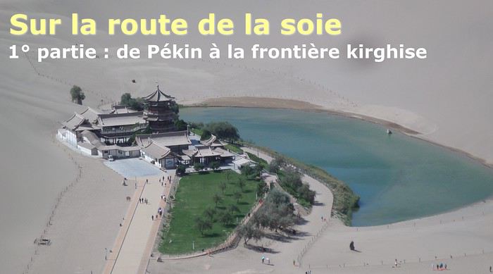
The Chinese Far West
More than 30 years after my first trip to eastern China, I finally fulfilled an old dream: traveling solo from Beijing to the far west, discovering Xinjiang, the Uyghur people and the oppression they endure, the oases of Turpan and Kashgar, the Taklamakan Desert, the end of the Great Wall... The route was covered by train.
MENU PART 1: CHINA
1- Beijing (Jiankou) : the authentic Great Wall, without tourists
2- Cycling in Beijing, the best way to get around
3- Beijing : departure for the far west
4- Jiayuguan : getting by without English
5- Jiayuguan : scams and heritage
6- Dunhuang : abundance in the middle of the desert
7- Turpan : the Uyghurs under heavy surveillance
8- Kashgar : love at first sight for the old city
9- Kashgar : China’s recipe for controlling the populace
10- Tashkurgan : what on earth was I thinking going there!
Kyrgyz border: a surreal epic
Photo album from the 80s, contributions from other travelers (page 2)
1- JIANKOU
Finding the authentic Great Wall, without tourists or a guide
Friday, August 24, 2018
Thirty years later, I didn’t feel like revisiting the Great Wall at Badaling or any other overcrowded site. I chose to explore it at Jiankou, in its wildest, most authentic, and unrestored section, starting from a lost village deep in a valley—though it wasn’t *that* lost, since it had everything for communication.
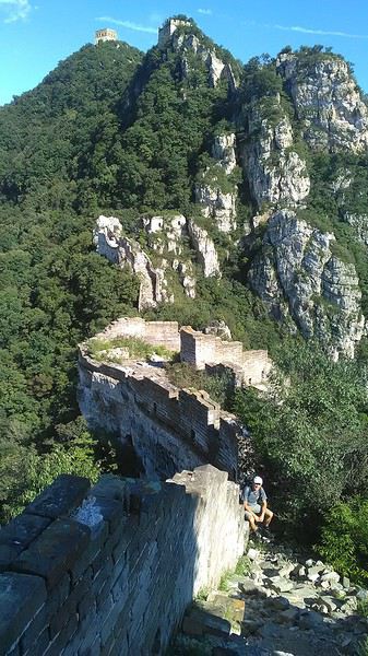
No need to pay for a taxi to get there—by timing it right, you can take the bus for just a few yuan. You have to get off at Xizhazi, the bus terminus. Be careful, there are only two buses a day in each direction. At the Xizhazi bus stop, I met a young couple who’d arrived with zero information about what to expect. We hiked the three of us toward the restored section of Mutianyu.
Still, be cautious
With GPS and a topographic map (OpenTopoMap), you can set off without a problem or guide. The trail up to Jiankou is easy and well-marked. The trails down are too. But be careful—once you’re on the Wall, it’s real mountain hiking, with easy but dangerous climbing sections (over sheer drops). Not for amateurs or those afraid of heights! But what a reward. The Wall all to yourself, where it’s at its most daring. Truly mesmerizing.
More photos...
2- BEIJING
The best way to get around the capital
Sunday, August 26
The best way to explore the city is still by bike. Most are in a bike-share system, but you need to use an app—WeChat, the app that does everything, like monitoring your every move. No way I was installing that.
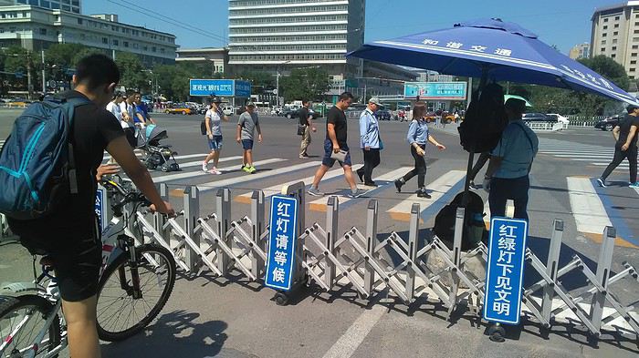
I found one at a rental shop near the hostel. The key is to quickly learn local traffic customs to minimize risks. Bike lanes are wide along the avenues.
But you still have to:
- Watch out for anything parked on the bike paths—the most annoying are people napping or talking on the phone in their cars
- Keep an eye on everything coming the wrong way—the list is long
- The worst is right turns on red, which in Chinese traffic rules seem to have priority
Once you get the hang of it, it’s fine. The city is huge but flat, so you can just wing it.
3- BEIJING
By train to the far west
Sunday, August 26
Beijing West Station is the size and operates like an airport. With your e-ticket from the agency, you first have to pick up your ticket at the special "English" counter, after passing through security. With your ticket in hand, you have to exit and enter through the boarding waiting area—not the platform—after a second security check.
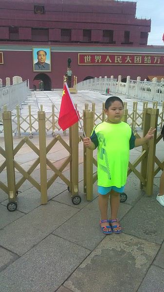
Then you find the right hall and wait for the sign to finally access the platform. In the end, it works pretty well given the incredible number of passengers to manage. Everywhere in Beijing, I saw that the Chinese have mastered crowd flow management.
Nice surprise: second-class carriages are clean, air-conditioned, and bright.
Perfect, since I was in for 20 hours. One uniformed attendant per carriage, mobile meal service—luxury! Small downside: no luggage space. Hauling your suitcase up to the top bunk is quite a workout. I was in the middle, so it wasn’t too bad. The landscape, though, whether rural or urban, is pretty bleak. That should change once we leave the eastern plains.
Of course, I got my first police visit, with a thorough passport check and bag search. I was warned—going to the Chinese far west exposes you to this kind of hassle. But they were polite and respectful.
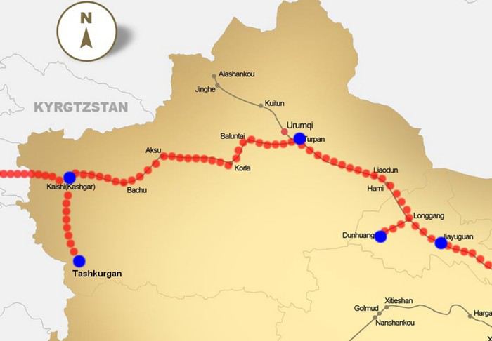
The Chinese Far West
4- JIAYUGUAN
Getting by without English
Monday, August 27
At the gates of two deserts (Gobi and Taklamakan) and at the foot of the Tibetan highlands, the Great Wall ends at Jiayuguan. Here, I found the deeper China I’d somewhat rediscovered during my bike ride, even if now everyone gets around on electric bikes and I’m no longer stared at like an alien.
Prices are nothing like Beijing: you can find a full meal for 2 €, and my bike cost 7 € for two days. Plus, few people speak English—neither the owner of the HI hostel where I stayed, nor the ticket sellers at the sites, let alone the servers at the small eateries where I ate. Everything is written in Chinese. So I had to use the little Chinese I know to communicate about essentials. It makes the locals laugh to see a European trying to speak their language, but it earns respect. With Google Translate’s help, I managed.
Rant: With their avenues blocked for construction for kilometers without warning, and new roads not yet on maps, I must’ve taken 15 km of detours.
More photos...
5- JIAYUGUAN
Scams and heritage
Tuesday, August 28
The Great Wall doesn’t exactly end at the fort I visited yesterday but 10 km further, at the entrance to a river gorge at the foot of the mountains. All that’s left is a badly damaged tower (more like a mound of earth) and a section of clay wall, similar to the one I biked yesterday.
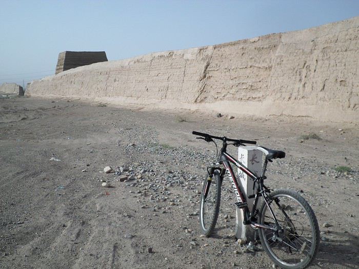
This morning, I hopped on my bike, determined to venture into the desert to see this highly symbolic site. First, you access it via a wide, brand-new road with not a soul in sight. Just before the site, I came across a grand welcome gate, very period-style, but it’s actually the inevitable toll booth.
Behind the gate, the road continues straight to the site, which you can see in the distance—at least 2 km away—the remains of the tower and wall. I had to leave my bike here. Fine. I went to the ticket counter and asked the price: 120 yuan! I couldn’t believe it—over 15 € for a simple mound of earth.
I showed my displeasure to the attendant, who couldn’t care less, and immediately turned back. 120 yuan—that’s the price for a new road, a fancy gate planted 2 km before the site just to force you to take a shuttle, and employees with nothing to do all day... Now I understand why I didn’t meet anyone!
Heritage China is a bit pricey
Generally, sites are expensive for the country’s standard of living, but travelers are supposed to have money, so why hold back? I even gave up on the Forbidden City—reservations required days in advance (or on the black market at an impossible price). I prefer to keep the memory of my first visit, when entry must’ve cost a few dozen cents, and there were only a handful of visitors.
This morning, I took a taxi to see remarkable tombs of common people from the 3rd to 6th centuries. They’re small vaulted caves made of painted bricks, depicting scenes of daily life. Very pretty and moving. But even here, though the price was more reasonable, I was left wanting—only one of the 16 tombs is open to visitors, and it’s apparently not the most beautiful.
The authentic China—at least what’s left of it...
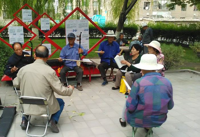
Wandering the impersonal avenues of the city, you stumble upon a market. There, you still find traditional China—small shops with questionable hygiene, Go players, musicians, and even a dental prosthetist. The last refuge for those untouched by modernity.
More photos...
6- DUNHUANG
Abundance in the middle of the desert
Wednesday, August 29
Well, I thought the landscape would be less bleak as I headed west. Nope. The only distraction in this expanse of dark, clayey sand is the forests of pylons and wind turbines, plus wild camels racing each other.
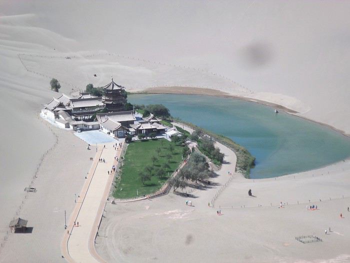
However, Dunhuang, the gateway to the Taklamakan, is by far the most pleasant Chinese city I know. There’s a real city center you can explore on foot. It’s hot but not unbearable, with a light, dry breeze. Much nicer than Beijing. The Han Chinese are still the majority, but the Muslim Uyghurs are more numerous, and the muezzin’s call to prayer echoes around the mosque.
The most surprising thing is the abundance and diversity of fruits and vegetables. You wonder how it all grows here. Well-irrigated, the desert sands are very fertile. Here, raisins have subtle, mysterious flavors, and the lamb really tastes like lamb.
Today, I visited the must-see Mingshashan, a dune complex next to which Pila is a molehill. The Basque Country, but covered in sand...
More photos...
7- TURPAN
The Uyghurs under heavy surveillance
Friday, August 31
Surveillance cameras everywhere in the city, armed police stationed at intersections, in front of public buildings, at the entrance and inside tourist sites, police stations on every corner, patrols on foot or by car, khaki uniforms even for middle schoolers... here, the Han Chinese are in the minority, and you can feel it. Turpan feels like a city under siege.
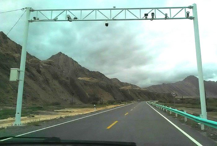
To enter the youth hostel where I stayed, there’s even a security gate, and the receptionist (a Han, like everyone in tourism) wears a bulletproof vest! Reassuring. Still, you don’t feel particularly threatened here, especially as a European. The troublemakers are the Chinese, not the Uyghurs. Generally, China is a very safe country for visitors.
Smile, you’re on camera!
I was biking on an avenue when the car in front of me got flashed for driving slowly. I quickly understood why when I got flashed too.
Here, the official time is Beijing time, but it gets dark two hours later. It’ll be even worse in Kashgar. Trickier to manage: everything is displayed in Chinese and Arabic. Nothing in English. Choosing a menu is a shot in the dark. Apart from a few young Chinese, no one here speaks English, and my Chinese doesn’t seem very understandable...
Mogao, the end of the road for the Han
Yesterday, near Dunhuang, I went to Mogao, a complex of decorated caves with Buddha sculptures and paintings. Stunning, but so crowded! Luckily, here in Turpan, Chinese tourists barely venture out. So I visited a Silk Road ghost town with only a handful of other visitors and under a howling wind.
The modern Chinese city is swallowing up the old Uyghur neighborhoods—only a museum-like district remains in the center, and pockets of resistance on the outskirts are doomed to disappear soon.
More photos...
8- KASHGAR
A (relative) love at first sight for the old city
Sunday, September 2
After three overnight trains, here I am in the far west of China, nearly 4,000 km from the capital. Despite the omnipresent police and an old city preserved UNESCO-style, Kashgar is my Chinese love at first sight.
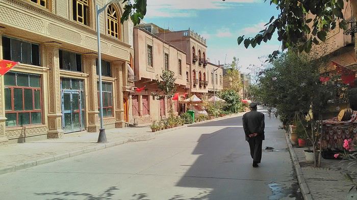
Finally, Chinese... well, sort of, because we’re in Uyghur territory here—a Turkic people with nothing culturally in common with the Han, the eastern Chinese.
It started badly yesterday at Turfan station, where after three security gate passes, at least five passport checks, and a bag search, three adorable policewomen confiscated my antibacterial lotion because it had a flammable logo...
Then came the welcoming committee of armed cops at Kashgar station.
Once all that was over, they left me alone—except you still have to go through security checks like everyone else to enter the old city, the bazaar, the livestock market... The further west you go, the more the siege mentality is evident. Luckily, the border isn’t far...
Despite the inevitable destruction-reconstruction, the city center has been well preserved. Thankfully, because it’s a very original style, a mix of local and colonial. I love it, even if it’s a bit too artificial, sanitized, and watered-down, and rather empty of residents. On the Silk Road, the city was famous for its great food. And it still is—rarely have I seen such richness and abundance of food! And not just scorpions or snakes.
More photos...
9- KASHGAR
China’s recipe for controlling the populace
Saturday, September 1
Xinjiang, along with Tibet, is a "sensitive" area of rebellion in the eyes of Chinese authorities. As a result, the state has these regions and their populations under total control. Tourists also feel the consequences, even if they’re not at risk of re-education camps.
- Putting barbed wire and anti-ramming barriers around sensitive sites (schools, big hotels, government buildings...)
- Installing traffic surveillance gates with cameras and photo flashes (for all vehicles passing, including bikes) throughout the city and even in the countryside
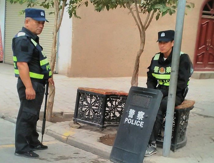
- Posting uniformed guards with tasers, batons, or huge baseball bats every 100 meters
- Training the Han population (ethnic Chinese) in self-defense with sticks, preferably in the morning on the street. Men and women of all ages
- Starting school with the national anthem, doing military exercises, and receiving political indoctrination, all neatly lined up in the courtyard. (The dream school for any teacher)
- Placing a snitch in uniform (a pseudo-guard) in public gathering places, like youth hostels. Mine spends the day loafing around the courtyard
- Putting Chinese flags everywhere on the streets to remind everyone who’s in charge
- Installing security gates at every entrance to areas frequented by tourists (thanks for that) but not just there
- Never photographing cops, or else! I tried, but it’s not easy...
With all that, you can stroll around safely
Not much crime! As for the amount the Chinese state spends to maintain such a system, it’s staggering! A third of the Han living in Xinjiang work in security. Today, I wandered freely around old Kashgar, which is quite large after all.
More photos...
10- TASHKURGAN
What on earth was I thinking going there!
Wednesday, September 5
First, there’s the taxi—pretty crappy, with a driver who doesn’t speak a word of English and won’t stop smoking. Over six hours in that... shared with a completely out-of-it American.
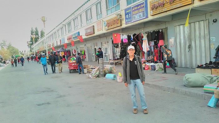
Then there are all the checkpoints along the way. I won’t go on—you know the drill by now.
After that, there’s Tashkurgan—a town with nothing to see, nothing to do. Deserted as soon as night falls.
There’s this huge youth hostel and a few lost Chinese tapping away on their smartphones, chain-smoking. This lost American-European crowd, swapping tips on how to enter Pakistan or Tajikistan.
Luckily, there’s the Chinese Pamir Highway, lined with peaks over 7,000m.
There’s the feeling of no longer being in China, with a population whose features are Middle Eastern. And these Tajik women with their stunning hairstyles and vibrant costumes.
There’s the fact of having reached the westernmost Chinese city, far from crowds and tourist sites. A sort of end of the world.
More photos...
11- KYRGYZ BORDER
A surreal epic
Thursday, September 6
The road from Kashgar to the Kyrgyzstan border is a little over 200 km and passes through beautiful landscapes of colorful, desert-like mountains with acrobatic folds. That’s the bucolic part of the trip.
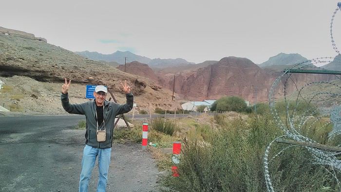
Yesterday, I managed to gather four people to rent a minibus to reach the border more easily: a Spaniard and an Argentine I’d already met in Turpan, and two New Zealanders who responded to the ad left at the hostel.
Absurdity and paranoia of Chinese authorities
The highlight was crossing the town of Wuqia, 50 km past Kashgar. After tallying up with my fellow sufferers, we must’ve passed about ten checkpoints with:
- Passport checks: 14 times, sometimes by two cops side by side
- Bag checks: 4 times
- Smartphone checks: 2 times, with deletion of "non-compliant" photos, and registration of your IMEI in the exit log!...
Absurd and surreal at the same time, since my camera stayed in my bag, my apps are in French, and my photos have been online for ages...
With all that, we arrived just as the last checkpoint before the no man’s land marking the border between the two countries was on lunch break. And bam! Another 1.5-hour wait, alongside truckers who were much more used to this than we were.
What to think?
The cops themselves aren’t fooled. They play the role they’re asked to, but sometimes you can coax a smile out of them—they realize how ridiculous the situation is.
What’s the point?
That’s the big question my companions and I were tempted to answer with "to piss people off." To show you your place isn’t here, but with the other tourists, over there in the east, in Shanghai, Xi’an, or Guangzhou.
As for you, a traveler from a democratic country, you really experience this as aggression, humiliation, a violation of your private space. And yet, I’m respected, they speak to me properly. Today, I better understand what a Palestinian or a citizen of an occupied country might feel daily. A unique experience! Thanks, China.
And to top it off, the cherry on the cake!
It’s still this glowing button you press to rate your passage after clearing the last obstacle before the exit stamp. I was so surprised it turned off before I could react. The Spaniard, with great humor and irony, had time to vote "excellent." In the end, he wasn’t wrong—you can hardly do better!
PS: I ditched my buddies at the border. They didn’t want to pay for a taxi to continue. So I took a direct taxi to Osh. The first 100 km are fabulous. I couldn’t take many photos, but I’ll be back on Monday to go to Tajikistan.
More photos...
The rest of the Silk Road, Part 2, in these travel journals: Kyrgyzstan, Tajikistan, Uzbekistan.