Discussions similar to: Province Hainaut été indien
FR
Tuscany: Arezzo province and the Siena area
So happy the forum reopened last October!!! I’ve started reading again (posts, travel journals) and chiming in on a few discussions. Now I’m stepping it up by writing a new travel journal—I’ve already posted a few between 2018 and 2020.

My latest trip was to Italy from August 27 to September 26, 2024. As the title says, it was a wander through Tuscany in parts of the region that aren’t the most visited. No Firenze-Siena-Pisa trilogy, no San Gimignano; there’ll be a quick detour into Siena, but I’ll skip the best-known sights. That choice, plus traveling in September, should help dodge overtourism. It worked out—crowds were light, sometimes very light, the whole way. Here’s the practical rundown: - a long trip outside peak season (ah, retirees!) - solo camping (caravan) - a mix of activities (hiking, mountain biking, sightseeing) in places that aren’t always packed with tourists. Still, I don’t feel like I ended up in some hidden-away spots. Not sure if this will draw any readers.

DAY 1: Tuesday, August 27, 2024 The heat was intense on the drive in across the plain; two big storms—more rain and hail than lightning and thunder—threw the weather off, the first near Imola, the second on the four-lane road up the Savio valley. I left the Cesena-Roma four-lane at the Verghereto exit and climbed up to Balze (1,100 meters). The campsite is even higher (1,200 meters), in the forest near the source of the Tevere (Tiber). Staying up here will cut down on driving for the first part of the trip: a route through the Appennino (Apennines) on the border between Toscana and Emilia-Romagna. The temperature was surprisingly mild for the altitude, the air thick with moisture by late afternoon. I drove back down from the campsite to Balze (2 km on the road) to grab groceries (it’s doable) and scout tomorrow’s hike. .

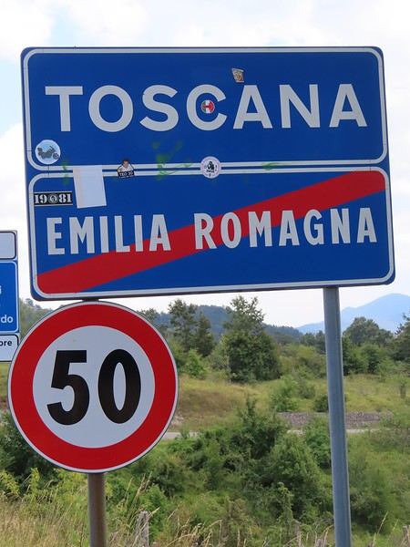
The endpoint of the planned hike is just a few meters from this sign (the trail crosses this road about 3 km from Balze). I realized Balze and the source of the Tevere (Tiber) are actually in Emilia-Romagna, not Toscana. I always thought the Tevere (Tiber), which flows toward Roma (Tyrrhenian side), started in Toscana! I’ll come back to this quirk in Day 3’s write-up.
Open
Exploring the Lower North Shore and Labrador – Come Join the Adventure!
After visiting Newfoundland Island, we took the ferry to Blanc-Sablon, a municipality located on the Lower North Shore in Quebec, Canada.

Instead of heading back to Quebec via Sydney in Nova Scotia, we decided to explore the Lower North Shore—the least-known region of Quebec—as well as Labrador, which is part of the province of Newfoundland and Labrador.

From Blanc-Sablon, we drove to the municipality of Vieux-Fort via Route 138. This road ends in that municipality.

Afterward, we crossed Labrador to return to the Old Capital. Only one road allows this route. It wasn’t fully paved during our trip, but it is now.

We made stops in different areas to go on hikes that let us discover some incredible landscapes.

I hope this travel journal inspires you to venture into these stunning regions.

Videos are embedded throughout the summary. Click on the image to start the video.

Lower North Shore:

Lower North Shore - Blanc-Sablon - Brador Falls Lookout Lower North Shore - Blanc-Sablon - Astragalus Trail (Milk-Vetch Trail) Lower North Shore - Bonne-Espérance - Granny Hill Trail

Labrador:

Red Bay - Tracey Hill Trail Mary's Harbour - White Water Falls Trail Mary's Harbour - Gin Cove Hiking Trail Mary's Harbour - Dr. Moret Hiking Trail Happy Valley-Goose Bay - Birch Island Walk North West River - Sunday Hill Lookout Trail Churchill Falls - Bowdoin Canyon Nature Trail Labrador City - Tanya Lake Loop Trail Labrador City - Crystal Falls Hiking Trail

North Shore

North Shore - Manic 2, 3, 5 Hydroelectric Plants and Daniel-Johnson Dam Baie-Comeau - Pioneers Park Tadoussac Village

**********

More landscapes of the Lower North Shore, Labrador, and the North Shore
Open
Newfoundland - Hikes in the Avalon Peninsula
The Avalon Peninsula, located in the southeast of Newfoundland Island, isn't just a picturesque place—it's also teeming with natural wonders: icebergs, whales, migratory seabirds, and wild caribou.

It was the first region of the province to be settled. Moreover, it's rich in legends, traditions, and the history of the early adventurers who conquered the New World.

St. John's, the capital, is one of the oldest and easternmost cities in North America. With its colorful houses nestled in the heart of steep rocky hills, it has the traditional charm of a small port town.

Below are the hikes we did in this region. A link is attached to each hike to give you quicker access to the relevant information.

Videos are embedded throughout the summary. Please click on the image to start the video.

Chance Cove Coastal Hiking Trail Cape St. Mary's Ecological Reserve Holyrood - Salmonier Nature Park La Manche Provincial Park - Suspension Bridge Trail Cape Spear - Lighthouse Trail St. John's - Deadman's Bay Trail Quidi Vidi - Sugarloaf Trail St. John's - Signal Hill National Historic Site St. John's - North Head Trail Loop - Signal Hill Salmon Cove - Salmon Cove Sands Provincial Park
Open
Newfoundland - Hikes in the Western Part of the Island
INTRODUCTION

Trip taken in 2021, but still relevant for exploring the island of Newfoundland.

We went on multiple hikes in this Canadian province, which offers a unique and breathtaking landscape.

GPS coordinates: 46.20884, -60.24498 Marine Atlantic Ferry

To do this, we traveled to North Sydney, Nova Scotia, to board a Marine Atlantic ferry that took us to Port aux Basques in Newfoundland. The crossing takes about 7 hours.

The ferry *Highlanders* features spacious cabins for two or four people, a restaurant, a retail store, and a play area for kids.

The reclining seats are comfortable and include a headphone jack and a USB charging port.

We went out on the open-air panoramic observation deck several times to admire the Atlantic Ocean, hoping to spot some marine wildlife. Unfortunately, we didn’t see any.

This short video gives you an overview of the facilities. For more details, I invite you to check out Marine Atlantic’s website at the following address: https://www.marineatlantique.ca/.

https://youtu.be/oV9_7AcJnEQ
Open
Hitchhiking in Thailand
Is hitchhiking in Thailand a good idea? A bad one? Safe or not?

Instead of sharing my thoughts on the subject, I’ll tell you about my four short hitchhiking "adventures" over 40 years of traveling there. Hopefully, this will help you form your own opinion.

First, a general rule I always follow in Southeast Asia: whether you're a woman or a man, in the city or the countryside, if you're a foreigner—even in a small group—never let yourself get completely isolated once night falls.

Okay, here we go.

My first time:

This happened in the late 80s in Kanchanaburi province, on route 3272/4088, somewhere between the charming Thong Pha Phum and that spot on the Burmese border where a gas pipeline—owned at the time by a major French company—crosses. I don’t remember why or how I ended up on that remote road, but since I love getting lost, it was fine. Except that it was already mid-afternoon, no songthaew had shown up after an hour of waiting, and I wanted to get back to T.P. Phum before dark. So I started walking, keeping an ear out for any approaching engine to flag down (hand flat, palm down, waving as if saying goodbye). Soon after, a slightly upscale car stopped—a high-end Japanese model. Inside was a couple in their thirties. "You guys headin’ to Thong Pha Phum?" "Sure, no problem, my good farang, hop in." I was saved. We drove for 20-30 kilometers, then the guy pulled over: "Come on, let’s grab a drink..." Later, I’d learn we were near the spot where they were spending a short vacation, south of the reservoir stretching from T.P.P. to Sangkhlaburi—a place (that part of the lake) known for its waterfront resorts for couples, families (next stop...), and other Thais out for a good time (I’d stay there myself a weekend a few years later, in a dorm room with about thirty Thai friends). We had a drink. The woman barely sipped hers. We had a second. She didn’t say anything, but I could read in her eyes what she was thinking (no language barrier for that kind of communication). Then he ordered a third. She shot her husband a disapproving, embarrassed look. As for me, aware I was still far from "home" and that night was falling, I started pretending to drink too. You can guess the rest: the guy kept ordering, got drunker and drunker, and his wife didn’t dare scold him in front of me, but the looks she gave him—and her discomfort around the other people in the roadside joint—spoke volumes.

After a (very) long while, the woman couldn’t take it anymore and finally reminded him, I assume, that they still had to take me to T.P.P. But given his state, it was unanimously decided—by both of us—that there was no way he was driving. I felt stuck, especially since I don’t drive. And her? Oh, she could. I helped the guy as best I could, and the joint’s owner, taking pity on me, lent a hand. We got him into the back seat, where he fell asleep almost immediately. It was around 8 PM when, with her husband still snoring in the back, she dropped me off at the entrance of the guesthouse in Thong Pha Phum, near the market square. I thanked her, feeling a pang of sympathy for the moment she’d have to haul her husband from the car to their room. They drove off. I was hungry. At the far end of the market square was a great restaurant with a direct view of the Mae Nam Khwae. I headed that way.
Open
The Extraordinary Painted Houses Village of Tam Thanh near Hoi An
Not sure if I’ve already posted this, so here it is again!

https://hiddenhoian.com/travel/tam-thanh-mural-village/

Imagine a peaceful coastal fishing village completely transformed by artists who worked their magic on the walls of 100 residential houses. That’s the remarkable story of the Tam Thanh mural village in Quang Nam province. Once similar to many other coastal villages in the area, it now firmly stands out on the tourist map for day trips from Hoi An. In the summer of 2016, Tam Thanh was selected by a joint Korean-Vietnamese project called “Art For A Better Community.” The village was chosen to be their blank canvas, inspired by the success of mural villages in Korea. The project aimed to make Tam Thanh the first painted village of its kind in Vietnam. The team included five Korean artists and seven Vietnamese artists, along with local volunteers. Their goal was to show Vietnamese people that art could be part of everyday life, no matter their place in society. The effort began with about three weeks of wall washing, followed by painting the walls of over 100 residents’ homes. The project was a success, and the village came alive with the paintings. The entire village is now a breathtaking gallery just waiting to be explored. The murals capture the life and soul of the village, from young children playing to fishermen in the ocean. A mix of fantastic pieces offers stunning backdrops for photos. The painted art around the town hasn’t just had a visual impact—it’s also had a social one. The village was chosen not only for the layout of the houses but also to contribute to economic development opportunities in Tam Thanh. Tourists now visit the once-overlooked village, creating more income for locals and making it a successful “art for a cause” project. For example, one entrepreneurial resident who owned a small local café invested 000,000 VND (390 USD) in a sugarcane press a week before the paintings were completed. Sugarcane juice vendors then multiplied with the growth of tourism (5,000 VND - 0.20 USD). Walking down the village’s single street, it’s common to find locals selling refreshments and handmade crafts. In one house in particular, a tailor and his family are painted on an outer wall with incredible detail. The family started selling tote bags decorated by their young daughter. The price for the bags is 100,000 VND (4 USD). If you’re looking for a way to support the village’s economy, this is it. Since there’s no middleman here, you can be sure your money goes directly to the community. You can have lunch at a house with a terrace right by the beach at the edge of the village.

How to Get There Route No. 1: Cross the large Cua Đai bridge. Once you’ve crossed it, continue toward Duong 129/Duong Ven Bien. Stay on this road for 33 kilometers. Upside: this route has light traffic, no traffic lights, and no trucks or buses. It’s a great direct route to the village but offers little to see along the way. You’ll eventually reach a crossroads. Turn right toward Tam Ky town, while the left will take you toward the Tam Thanh mural village. Stay on Route 608 as it turns twice before reaching a bridge. Cross the bridge, and you’ll arrive at Thanh Nien Road. Finally, turn right to reach the village. This route takes about an hour. Use your best judgment. For reference, it costs about 5,000 VND (0.20 USD) to park a motorbike.

Route #2: Cross the large Cua Đai bridge. Once you’ve crossed it, continue toward Duong 129/Duong Ven Bien. Stay on this road for 12 kilometers, then turn left onto Route 613, where you’ll continue for 1.5 kilometers until you reach Thanh Nien Road. Finally, turn right and drive 23 kilometers to the painted village. For most of the trip, taking Thanh Nien Road will take you through a much more local part of the region. The journey takes about an hour and a half.
Open
Newfoundland - Hikes in the Eastern Part of the Island
The Eastern region is a landscape of protected coasts and bays, charming little fishing villages, exceptional scenic routes, and hiking trails in the heart of preserved habitats where many migratory bird species live, including puffins.

Stretching from Cape Bonavista in the north, where John Cabot landed in 1497, to Fortune and Grand Bank in the south, this part of Newfoundland was the first to be discovered and settled.

Visiting this region is like stepping back in time and discovering the cultural and artistic richness of this province, all at a more relaxed pace.

Source: https://www.exploretnl.ca/region-est

Videos are embedded throughout the summary. Please click on the image to start the video.

Bonavista Peninsula - Trinity - Gun Hill Trail Bonavista Peninsula - Trinity East - Skerwink Trail Bonavista Peninsula - Elliston - Puffin viewing site Bonavista Peninsula - Elliston - Spillars Cove (Cable John Cove) Bonavista - Dungeon Provincial Park Bonavista - John Cabot Municipal Park Bonavista Peninsula - Cape Bonavista Lighthouse St. Lawrence - Cape Chapeau Rouge Trail
Open
Newfoundland - Hikes in the Central Region of the Island
A land of adventure, the central region of Newfoundland is a vast area of dense forests and rugged coastlines.

To the north, between April and June, icebergs from Greenland drift along the famous "Iceberg Alley."

Inland, forests, lakes, and rivers dominate—once precious resources for Indigenous peoples and European settlers.

To the east lies Terra-Nova National Park and its typical habitat, made up of islands, ponds, bogs, and forests.

Finally, the southern coast, dotted with spectacular fjords, is home to several isolated fishing villages as well as the Miawpukek First Nation of Conne River, the province’s only recognized reserve.

Source: https://www.exploretnl.ca/region-centre

Below is a list of the hikes we did in this region. Each hike has a link attached so you can quickly access more information about it.

Videos are embedded throughout the summary. Click on the image to start the video.

King's Point - Alexander Murray Trail Grand Falls-Windsor - Thunder Brook Falls Trail King's Point - Rattling Brook Falls Trail Harbour Breton - Gun Hill Lookout Trail Harbour Breton - Deadman's Cove Trail Harbour Breton - Rocky Point Lighthouse Trail Harbour Breton Community Dildo Run Provincial Park - Black Head Trail Twillingate - Lower Little Harbour Trail Twillingate - Rockcut Twillingate Trails Twillingate - Lower Head Loop Trail Twillingate - Cuckhold's Point Trail Twillingate - Top of Twillingate Trail Terra-Nova National Park - Mill Cove Lookout Trail Eastport - Sandy Cove Lookout Trail
Open
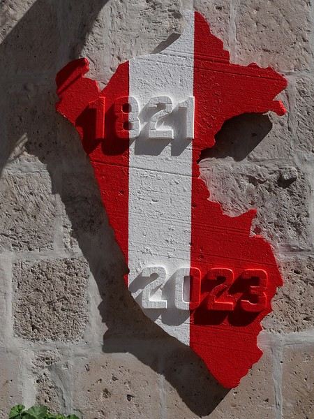
16 days in Peru in August 2023
Hi everyone, The years go by and Machu Picchu has been on our "to-do list" for a few decades now... But Peru is, fortunately, so much more than this legendary site...

We went as a couple for a 15-day trip. For the first time, we delegated the logistics to a local agency (Paprika in Arequipa). This agency offers "classic" small-group tours and the option to do it privately, which we chose.

No complaints—they were perfect for organizing transportation, hotels, and French-speaking guides.

The "classic" southern Peru loop is: Lima, Paracas, Nazca, Arequipa, Colca, Titicaca, Cusco, Sacred Valley, Cusco. Nothing very original... but why get creative when there’s already so much beauty to discover?

We opted for a shorter loop, skipping Paracas/Nazca because the small planes in Nazca weren’t a unanimous hit, and it saved us dozens of hours on the bus. But we added a stop at Palccoyo (the rainbow mountains) between Titicaca and Cusco.

It might seem like a shame, but we don’t regret it at all.
Open
A Brief A to Z of Peru
Foreword This text has been proofread many times. Sorry if some points in this A to Z have already been covered on this forum. Text and drawings by the author.

Peru is still a very vast country, with so much to see, and obviously this text can't list all the attractions of the country.

*Abiseo (River) A national park that's very hard to access and doesn’t seem open to visitors. Includes the Gran Pajaten site (see below). Personally, it really sparks my imagination (not visited personally)

*Aguas Calientes the town next to Machu Picchu, more precisely below the archaeological site. As far as I know, you can only get there by train. Reminds me of the market where stalls line both sides of the tracks near Bangkok. I love it

*Altiplano: somewhere the "heart" of the Andes. I was able to trek across it on foot, starting from Caracollo in Bolivia, and of course, it’s vast plains to explore. This is where people live in a very rural way. Andean populations are quite austere compared to those in the lowlands or on the coast. You really have to appreciate the harshness of life to live there. Life is anything but superficial. I set a compass heading and found myself walking west toward the expanse of water near a place called La Joya. For pitching the tent, the nights were still chilly

*Canyon del Colca One of the deepest canyons in the world. Personally, I hiked down and back up on foot. The toughest stretch I’ve ever covered in my life.

*Ceviche More or less the national dish. A marinade of fish, shellfish, and lime. But you can find it in some restaurants in Europe, France, and certainly in Belgium or Switzerland. In the small restaurants of Pisco, you can eat excellent ceviche

*Cerro Sechín: Mostly bas-reliefs. A site little known to travelers in the Casma province. The first vestiges of a pre-Inca civilization with iconography similar to that of Chavín (not visited personally)

*Chan Chan A large city of the Chimú civilization and relatively vast to visit. You can see adobe walls with bas-reliefs. Visit from Trujillo, take a colectivo. Plan for the whole day

*Charango: a small guitar widely used in Andean music

*Chauchilla A necropolis near Nazca where you can see mummies exposed on the ground. YouTubers can do paranormal experiments there. And for anyone wondering about the fate of the soul and body after death, here’s the answer: the body remains after death. You can imagine your own flesh and body exposed to the winds of the Pampa and before eternity... (not visited personally)
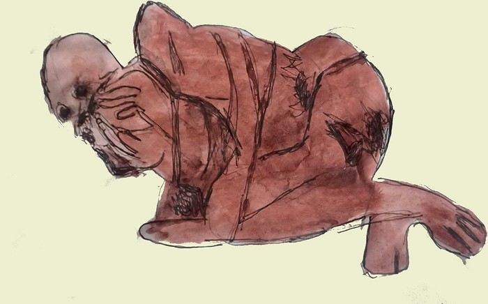


*Chavín de Huántar (Lanzón) The site’s appeal lies in its mountainous surroundings, the Lanzón stela, and the sculpted heads on the façades. What few people know is that the Chavín civilization began its expansion centuries before the Incas. Unfortunately, you can’t get too close to see the Lanzón—the day I was there, it was protected by grilles. To get there: minibus from Huaraz or trek from Olleros. Then cross a high pass (over 5,000m). If you do it solo on foot, be careful—the path isn’t obvious from Olleros

*Chullpa: funerary tower, notably at Sillustani in the Lake Titicaca region

*Chimú: pre-Inca civilization whose center was Chan Chan.

*Chola/Cholitas (Bolivia): typical clothing style of women from the Andean plateaus
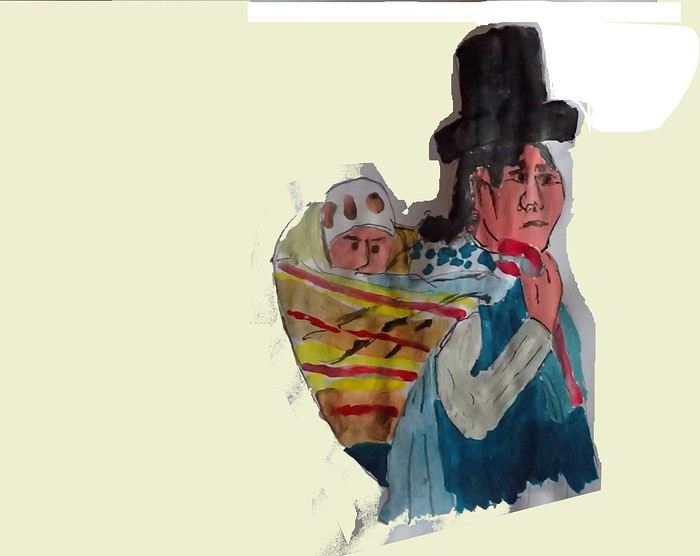


*Chompa: pronounce it *Chompaaa!* A common term for a wool sweater with vicuña patterns, often knitted from alpaca wool. If you dress like this, it’s a bit kitschy around the edges

*Cuy That one isn’t a guinea pig like in Guyana but an actual guinea pig. During a trip to Peru, I was hiking near a village north of Quillabamba (the terminus of the train line that passes through Aguas Calientes), and I was invited to stay in a house. The family raised a few of these pets. Apparently, the locals eat them. Since I’m not much of a meat-eater, it doesn’t really tempt me. How about you?

*Pacific Coast or how to talk about a place you haven’t visited? Except for the coast near Pisco and San Andrés, I haven’t visited any coastal cities. But that doesn’t mean these places lack interest or poetry. For fans of clichéd images, pelicans, seabirds, and fishing boats appear by the sea.

*Gran Pajaten: also closed to the public. Features anthropomorphic bas-reliefs. (not visited personally)

*Huaca. Visit the Huaca del Sol and Huaca de la Luna, especially near Trujillo. However, you can skip them—Chan Chan is still more interesting. Don’t forget to spend time visiting Chan Chan

*Huacachina A small oasis in the desert near Ica. Yes, we’re talking about an oasis because for those who’ve never traveled to Peru, the coastal strip along the Pacific is almost entirely desert, from north to south. Peru is territorially made up of three different regions: the desert coast, the Altiplano stretching north to south with mountain ranges (the Cordilleras), and the Amazon basin to the east. (not visited personally)

*Inca Kola It’s neither Coca-Cola nor Pepsi but a unique cola with a slightly orange color. Tastes like bubble gum

*Intiwatana: a carved rock shaped like a parallelepiped. Is it a sundial?

*Ballestas Islands: a highlight in Peru, though very touristy. You can only get there by boat from the port of San Andrés, a few kilometers from Pisco. It’s a surreal place to me—actually islets with cavities where sea lions and fur seals live. Since it’s a protected area, you’re not allowed to disembark. Guano is harvested there, which can be used as fertilizer.

*Kuelap: a fortress built by the Chachapoyas people. Rarely visited by travelers. (not visited personally)

*Larco Museum: an iconic museum in Lima with a large collection of pieces from archaeological and pre-Columbian sites. From what I remember, it has many pieces from the Moche civilization. As for the Moche statuettes, the prudish might look away. Probably a veneration of the god Priapus without knowing it.

*Nazca Lines Discovered by German archaeologist Maria Reiche, they stretch for kilometers. The designs in the desert around Nazca depict animals and cabalistic signs. The question I ask myself is why the creators of these lines represented a monkey and a hummingbird—species endemic to the tropical forest, not the desert plains around Nazca.

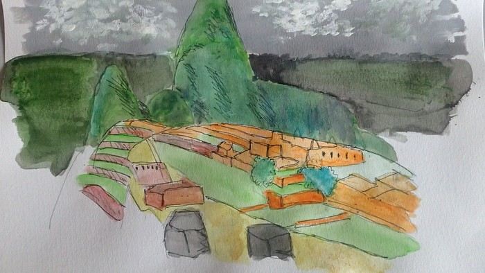
*Machu Picchu: means "old mountain" in Quechua. There’s also Wayna Picchu. The ruins of the site emerge from a sort of small plateau above Aguas Calientes. When the mist rises above the site and the bend of the Urubamba River, it’s truly magical... Also the starting point of the Inca Trail.


*Coca tea A decoction/infusion of the coca plant, meant to ease altitude sickness or *soroche*

*Chullo A rough translation would be a Peruvian wool hat.

*Moche: a civilization established in the Moche Valley, hence the term *Mochica*. What characterizes this civilization are the distinctive clay pieces representing faces and erotic statuettes

*Papa a la Huancaína A local potato dish

*Pisac: a typical market near Cusco

*Pisco Sour: perhaps the Peruvian equivalent of the *caipirinha* you drink in Brazil.

*Puya Raimondii A Bromeliaceae that still looks like a cactus, endemic to the Altiplano

*Quechua The language spoken by the indigenous people of the high plateaus (as well as Aymara in Bolivia)

*Quipu A knotted string used for counting. Widely used by the Inca administration.

*Sacsayhuamán (Q’enqo, Inca Bath) From Cusco’s Plaza de Armas, take the streets that climb above the city. Sacsayhuamán is called a fortress and is made up of large stone blocks. You wonder how the Incas could cut such huge blocks to assemble them—just like some streets in Cusco. The Q’enqo block is enigmatic; no one really knows what it represents.

*Savia Andina An Andean folk group.

*Tambo (=> Ollantaytambo) The Inca emperor (Atahualpa, Manco Capac) had the mission of controlling a vast empire. An empire that was still very extensive. Hence the importance of these *tambos* or relay stations. Napoleon created the civil code; the Incas invented the *tambos* and *quipus*.

*Tawantinsuyu: the Inca Empire

*Tinku: a warrior dance practiced mainly in Bolivia

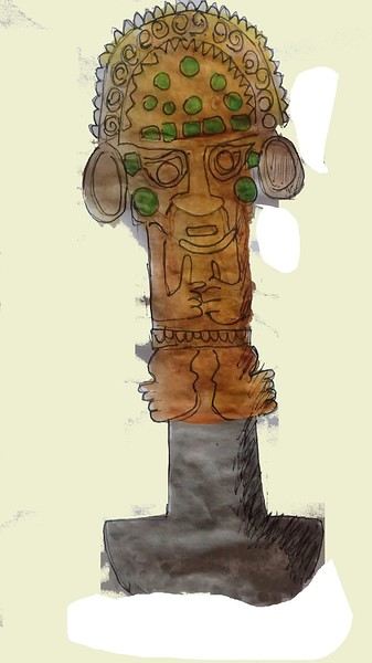
*Golden Tumi: a sacrificial weapon. Often featured in Peru travel guides. See illustration


*Terra X: a documentary series from the German TV channel that aired on Arte. Some episodes focused on pre-Inca and Inca Peru. I must have some old recording tapes. In memory of Gottfried Kirchner as a source of inspiration.

*Uros: I checked—it actually refers to the people who live on these floating islands. Even if it’s touristy, it’s a must-visit because it’s incredible how people can live on islets made from nothing. Take the boat from Puno

*Vicuña, llama, guanaco: camelids characteristic of the Altiplano
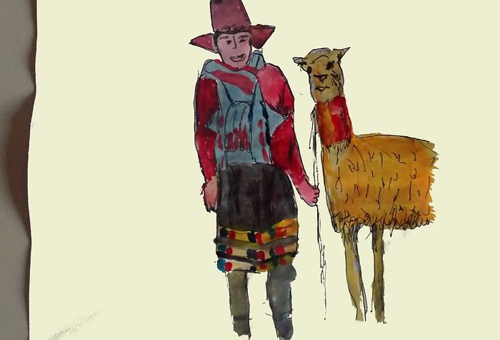


*Wayna Picchu The young Picchu mountain. In the first minutes of *Aguirre, the Wrath of God*, you see Klaus Kinski—well, Aguirre—making his way along the Inca Trail. Werner Herzog must have broken his back filming those sequences.

*Zampoña: pan flute
Open
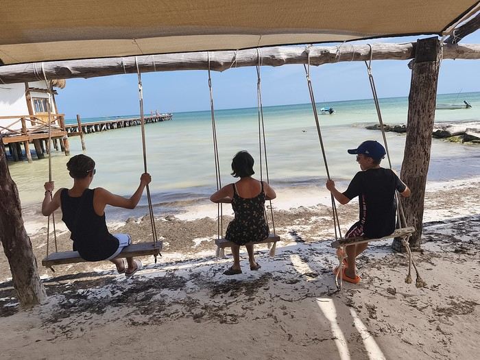
55 days with the family in the Yucatán, including a side trip to Belize...


Hi everyone!

That was about all the Spanish I could speak before we left... Luckily, Tom, 15 and in high school, gets by just fine! And Caroline did a year of Duolingo before we took off... Anyway, after 55 days in the American West three years ago, it’s Mexico’s turn for this second long adventure.

A quick intro to the crew:


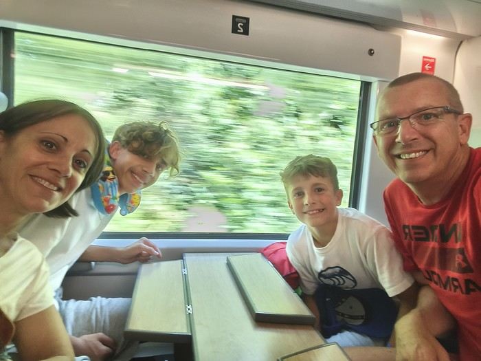
- Oscar, 10, a sporty and lively little boy who loves swimming and basketball, - Tom, 15, a high schooler, sporty and tall, who loves swimming and American football, - Caroline, 47, a PE teacher, sporty , loves hiking and snorkeling, - and me, Sylvain, 50, a science teacher, sporty, loves traveling and always has a possible next trip in mind

We mostly travel by swapping our house to discover beautiful France and the world: 135 swaps over the last 13 years.....

Our itinerary is pretty classic since it’s our first time in the Yucatán, and we’ll make a little 10-day detour to Belize...

See you soon...
Open
From Avignon to Casamance Without Flying
Hi there,

Last February, I made a trip using "public transport" from France to southern Senegal via Spain, Morocco, Western Sahara, and Mauritania.

It’s a journey of about 5,000 km, where I took trains (as far as Marrakech), ferries (to cross Gibraltar and then to reach Casamance from Dakar), and mostly buses on the long desert straightaways. I hadn’t planned any stops in advance or booked any hotels, except for the very first train to Spain, which left plenty of room for the unexpected. Why travel by land and sea? In recent years, flight-free travel has been gaining popularity. On social media, posts explaining how to cross Europe by train as quickly as possible go viral. Traveling without flying—and making sure people know about it—has become a great way to earn a badge of eco-responsibility: an essential totem for anyone wanting to prove both their dedication to the ecological cause and the wisdom of slow travel. I haven’t flown in years, and this journey to West Africa could easily be filed under "responsible travel." But it wouldn’t be honest to say that: in reality, it wasn’t really my aversion to flying that motivated this long trek. I see overland travel primarily as a way to experience the world’s geography at a grounded, earthly pace—the pace of the locals. Besides, I’ll be flying back, which disqualifies any claim to being a model of sustainability. So no eco-badge, and no adventurer’s badge either: you won’t find any heroic tales of camel rides in lost lands or mineral train wagons in this account (popular with influencers, the Mauritania iron ore train now attracts tourists from all over the world, turning "the experience" into something you "have to do at least once in your life"). This five-part story, written on the road, has no other ambition than to recount a journey through places and people, and to share the thoughts they inspire in me. As simply and, I hope, as humbly as possible.

I’m posting the episodes here, which you can also find on my blog (with more photos) at the following links:

Episode 1: Spain, from Avignon to Algeciras

Episode 2: Morocco, from Tangier to Tarfaya

Episode 3: Western Sahara, from Tarfaya to Guerguerat

Episode 4: Mauritania, from Guerguerat to Nouakchott

Episode 5: Senegal, from Rosso to Saloulou

To help those who might want to make the same trip, I’ve also put together a summary of the route with recommendations—you can read it at the end of the story and on the blog: From France to Senegal Without Flying: Route and Itinerary Recommendations

Happy reading, and safe travels!
Open
Veneto: Dolomites and Opera
I'm starting a new travel journal in Italy. It's about a month-long trip (from September 3, 2025, to October 4, 2025), or rather a part of it. This section matches the title: an opera festival in Verona (one evening) and the Dolomites in the Veneto region. I'm posting the part of the trip I think will interest French-speaking readers the most (since this is where I saw the most French travelers). Here’s a quick summary: - Trip in September 2025 - Solo travel with camping (caravan) - Small geographic area: besides Verona, the surroundings of the Marmolada massif and Cortina d'Ampezzo. - Main but not exclusive activity: hiking.

Since I have limited internet access where I am now, I’ll be writing slowly. Here we go!

Day 1: Thursday, September 4, 2025

I arrived in Veneto under the sun and with warm weather. I drove to Verona and tried to find a spot at the campsite (Verona Village) located south of the city. Unfortunately, it was full. Booking on the website was mandatory, but when I tried to reserve a few days ago, the site never moved from the "reservation" step to the "payment" step (I don’t know why—it’s always like that in these cases). I found another solution over the phone; the drive from southern Verona to the northeast was a bit long, but I finally settled at the "Oro Verde" campsite. It’s an "agricampeggio" (farm camping or rural campsite) on the outskirts of the city, and its name (green gold) suggests they produce olives there. Since it wasn’t late, I biked to the Adige River, following the recommended route into the city.
Open
11-Day Trip to Jordan in Late October 2025 – Recap
Let’s be clear—it was a fantastic time to visit, and Jordan is an amazing country! 100% sunshine and temperatures between 25 and 35°C, depending on the altitude. No stress at all: Jordanians live up to their reputation as a charming, helpful, and fun-loving people. No hassles, no pushy sales—just pure joy sharing time and laughter with them. Over 11 days, we intentionally skipped the north to spend more time in Petra, Wadi Rum, Dana, and diving in Aqaba. No regrets whatsoever 😄 Practical tips at the end of the travel journal.

Road trip: Arrived at 10 PM (Nantes-Frankfurt/Amman in under 9 hours). Spent the night near the airport.

Day 1: Left at 8 AM for Mount Nebo and the Dead Sea Center—picnic in the middle of the lovely Wadi Himara (great spot, 2-hour round trip—thanks to the GPS coordinates from the agency. It takes guts to leave your car parked alone with all the luggage inside, but honestly, no stress at all). Afternoon at the Movenpick (pricey but nice) to enjoy the Dead Sea. Dinner on-site. Perfect relaxation for a first day.


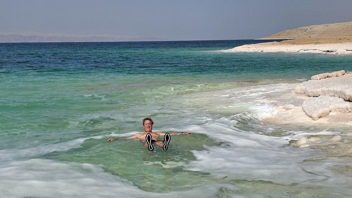
Day 2: Drove south along the Dead Sea. First stop at Wadi Mujib (great, fun, and full of water—max 2-hour round trip). Then a second swim in the Dead Sea, 10 km past the Wadi Mujib Center, which we preferred over the Movenpick spot because it felt wilder. Just pull over when you see tents along the road where you can take a shower after swimming (a must! Cost: 3 JOD per shower). The scenery is stunning, and the swim feels more natural than at the hotels. A really cool experience.

Around 3 PM, took the scenic route after the Dead Sea toward Little Petra (1.5 hours). Don’t take the King’s Highway directly—instead, continue on the Wadi Arabia road, then turn left (Route 60) after the town of Feifa and the ‘Jo Petrol’ gas station. Worth it! Visited Little Petra in the late afternoon and had dinner + stayed overnight at the Seven Wonder Luxury Camp. TOP: warm welcome and great advice on the best order for hikes in Petra based on sunlight and avoiding backtracking. We regretted not staying two nights…

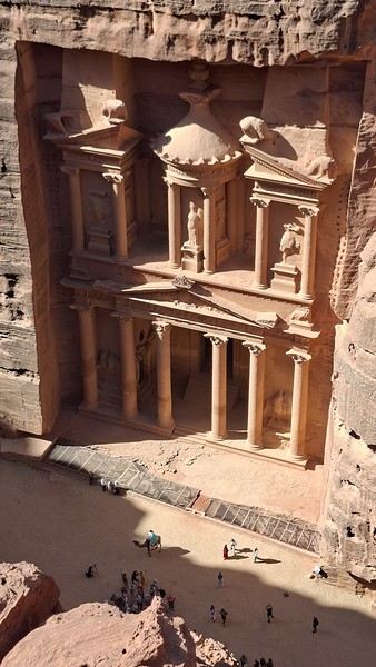
Day 3: PETRA Petra info: Not many people around, so we really enjoyed it (thanks to the geopolitical situation). We’ll share the times of our circuits since we were able to catch the sun on the key sites (9:30 AM for the Treasury). As amateur photographers, we took our time on all the visits and circuits—you can shave off about 25% of the suggested times. But rushing can ruin Petra’s magic! For us, two full days is the minimum.


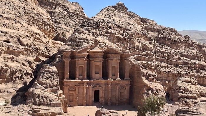
First day in Petra with arrival at 7:30 AM. Free parking in front of the visitor center… Program: Siq, Khazneh (40 min), then the amazing “High Place of Sacrifice” circuit between 9:30 AM and 12:30 PM, starting directly to the left before the theater. This avoids climbing in the sun (great tip from our camp host the night before!).

Arrived at the Great Temple, lunch at the ‘The Bassin’ self-service (17 JOD per person!). Expensive, but it’s a good place to rest 😉 Then visited the churches with viewpoints over the temples, accompanied by two friends 🙂, the Colonnaded Street, and the tombs (in the sun at 4 PM), the Theater… then back via the Khazneh and the Siq (another 40 min!).

Arrived at the Seven Wonder Hotel in Petra at 5 PM, exhausted!! Good hotel, simple room, but an amazing rooftop with a pool—perfect for relaxing after Petra. A car is necessary to reach the visitor center and possibly downtown for dinner (the hotel dining room isn’t cozy at all). Two great places to eat: Mr. Falafel for lunch or dinner (also makes takeaway meals for 4 JOD)—simple but delicious! My Mom's Recipe Restaurant—great decor on the terrace and really tasty food. Day 4: Little Petra to the Monastery circuit. You need a special ticket issued on the road to Little Petra (you can get there by taxi from the visitor center for 10 JOD or by shuttle), where they take you in a 4x4 to the start of the trail. This saves an hour of walking in the sun but costs 5 JOD per person. Started the trail around 8:30 AM. Count 3 hours to get all the way down. Great circuit that avoids climbing the 800 steps (just descending them!).

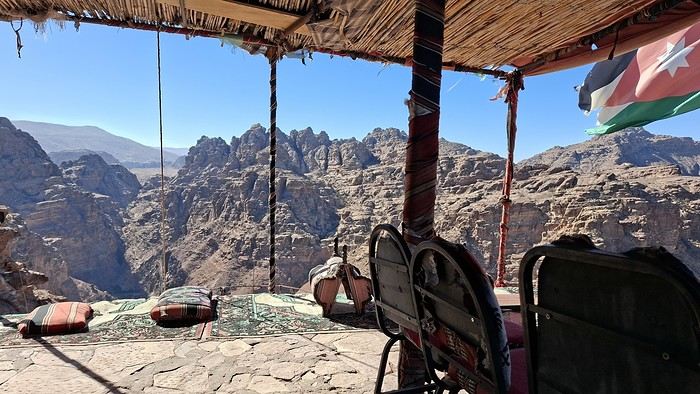
Before reaching the Monastery, tea break at the “End of the World Coffee” following the “best view” sign—the name isn’t exaggerated!!!! Breathtaking desert views in a charming setting. We could’ve stayed forever!

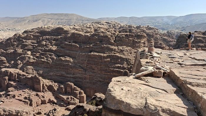
Great tip: Picnic at Petra (free tables available next to the BASIN restaurant, and sandwiches for sale—though not great—if you didn’t bring your own). Then we wandered around the site: a small circuit behind the Nabatean Restaurant with a view of the entire site, returning via the path that runs above Qasr al-Bint, the Great Temple, and the Colonnaded Street to reach the Street of Facades. This path offers another stunning view overlooking the temples and tombs. We took our time, and it was amazing… Back to Seven Wonder by 3:30 PM… The call of the pool, and we were exhausted!

Day 5: Last day in Petra with the Al Khubtha Trail circuit to see the Khazneh from above. Really fun to do (2.5-hour round trip, including 30 minutes of contemplation 😊. Best in the morning to see the Khazneh in the sun 👉 9:15 AM). Return via the tombs, and we recommend going straight up while staying left of the main path (amazing circuit with the best view of the theater—gorgeous).


Back to the car at 1 PM, lunch at Mr. Falafel, and headed to Aqaba via Little Petra and the Dead Sea (the Wadi Arabia road we loved!) to take the “Rift Valley—West Route” to Aqaba. The scenery loses its charm once you hit Route 65—we ended up regretting not taking the shorter route… but if you haven’t taken the Wadi Arabia road before, don’t miss it! Arrived at the Bedouin Garden Village at 5 PM (Aqaba, South Beach), and diving briefing 😊! Simple hotel with a great vibe and a nice little pool. However, not the cleanest (rooms and common areas)—you can tell there’s been a lack of guests lately, which is a shame because the location, decor, and atmosphere are all great. On the other hand, disappointed by the southern beaches—dirty and almost deserted, with nothing open for dinner in the evening.

Day 6-7: Morning dives (great marine life, easy shore dives with unique wrecks—cargo ship, tank, plane sunk near the shore). Lots of colorful fish, though small. Afternoons and evenings in Aqaba, which turned out to be a lively and pleasant city. Sunset drinks by the embankment near the giant flag—a great mix of local life, loud racing boats, music… we loved it. Dinner at Al Shami Restaurant—delicious, affordable, and a really nice terrace with a view of the beautiful Sharif Hussein bin Ali Mosque. Perfect lemon-mint juice!

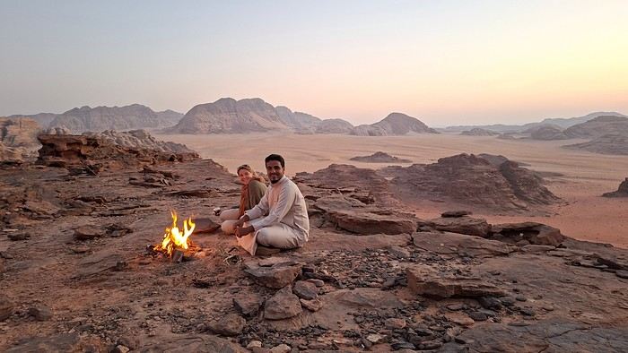
Day 8: Two final dives in the morning, then drove to Wadi Rum (1 hour). Welcomed by Khaled and Claire from Mars on Earth (a top agency we highly recommend—they put together a “semi-custom” stay based on our schedule and desire to avoid crowds. Claire is French, which makes booking and planning ahead via email much easier). Afternoon in a private 4x4 in northern Wadi Rum to see the most famous and visited sites (lots of improbable selfies 😠!). Gorgeous sunset with Bedouin tea over the fire. Khaled is amazing, with a beautiful smile… Arrived at the tent camp for the night. Great location, unique dinner, and a fun evening around the fire with Khaled leading cool games that got everyone chatting. Beautiful tent with a view of the stars…

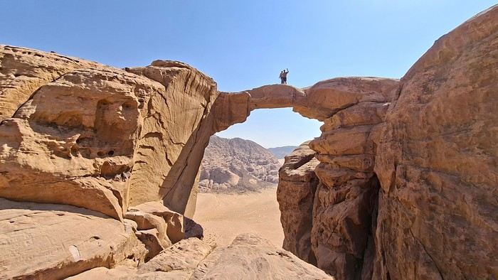
Day 9: Trek to Burdah Rock Bridge (3 hours)—for sporty types only, as it’s a tough climb and descent with no protection or pitons… basically climbing with just a 3-meter rope held by our guide to help us! But what an amazing memory, incredible views, and a real adventure for my 57 years! Would do it again in a heartbeat 😊!

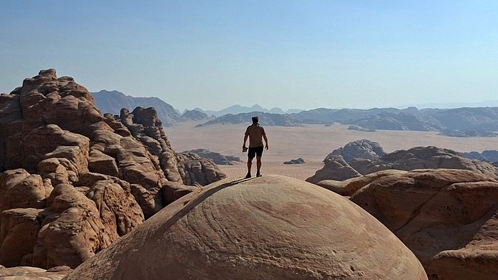
Then headed south in Wadi Rum. Let’s just say it was our favorite area… we strongly recommend spending a full day there… Wild, red, and empty—another planet! Salem, our climbing guide, took us to wonderful spots with breathtaking views. We wished the day could’ve lasted 48 hours!


End of the day: sunset, Bedouin tea, beautiful views… Just the classics 😉, but we loved it! Then spent the night under the stars. Salem set up comfortable mattresses and thick blankets, prepared tea and dinner over the wood fire. An amazing experience—like being a kid again, with a sky so stunning we fought sleep just to keep our eyes open.

Day 10: Woke up around 7 AM after a great night under the stars! Breakfast… and then it was time to head back to Claire and Khaled’s to pick up our car. Drove to Wadi Ghuweir (2.5 hours from the King’s Highway). A truly magnificent wadi reached after a steep descent (don’t take a Fiat 500 for the climb back up!). Make sure to hike 2 hours in to reach a lush oasis with water where you can swim in the middle of the wadi… We didn’t know and stopped 15 minutes too early… I still regret it!! If there’s no water at the start of the hike, it’s because it’s flowing underground—don’t give up thinking the wadi is dry! That’s why it’s Claire’s and Family in Jordan’s favorite wadi. A must-do! Picnic in the wadi. Around 4 PM, headed to Dana—visited this tiny, unique village, half in ruins and half restored while keeping its old-world charm. Stayed overnight and had dinner at Dana Luxury Huts (amazing view with a private balcony, great triangular rooms—though the bathroom is tiny). Run by a family. Delicious food cooked by the mom. Bedouin tea after dinner around the fire—such a nice moment.

Day 11: “Sheq Al Reesh” trek in Dana Valley booked through the Luxury Huts hotel. Four hours in a totally different landscape from the desert—unique and guided by a fantastic guide who prepared a memorable lunch over a fire on the cliffside. We really loved this hike and the peacefulness of Dana. A great stop to break up the long drive back to the airport. Left Dana at 2 PM for Kerak Castle (2.5-hour drive). Nice visit, especially the underground passages. Then drove to Madaba (1.5 hours) to explore the city by night, do some last-minute shopping, and wait for our 3:30 AM flight… not fun!

Good to know:

Late October was a perfect time—temperatures between 25 and 35°C depending on location (mountains or sea), with lows of 13°C at night in Wadi Rum 👉 A fleece is enough; it’s not that cold in the desert, and the blankets are amazing. Eleven days is the perfect amount of time to take it slow, stop for "Bedouin tea" invitations in unexpected places, and soak in the colors! We don’t regret doing the trip "backwards"—starting with the Dead Sea and ending with Wadi Rum and Dana (usually, people start with the King’s Highway). We recommend the ‘Family In Jordan’ guide for those who want an easy way to find trailheads and routes. Don’t hesitate to explore multiple wadis—not just Wadi Mujib! We highly recommend Mars on Earth for organizing your Wadi Rum stay. Very professional, with great bivouac and camp locations. No pushy salespeople. Jordanians are very respectful (especially toward women), super smiley, and helpful. We felt completely at ease—almost too much so 😉 Renting a car is a great option, but if possible, choose a mid-size category with a "real" engine and check the tires. The hills are tough, and some roads turn into semi-off-road for 500 meters… No issues driving—roads are in good condition. The only problem is the aggressive speed bumps everywhere. The Dana-Madaba King’s Highway is long (4 hours). Budget varies a lot depending on your choices: from a simple lunch for 4 JOD to a dinner for 30 JOD, depending on how touristy the restaurant is… On average, 8–10 JOD for a good local or seafood dish + drink, and 30–40 JOD for a night in a hotel (except the Movenpick, unfortunately ☹). Watch out for Fridays—it’s really hard to find picnic supplies! If you’re still hesitant, the Jordan Pass is a must and very cost-effective since it includes your visa. Get it online. Consider hubs like Madrid or Frankfurt—often faster and cheaper than flying via Paris and Air France if you live in the provinces!
Open
Langtang – Trekking in the Rain
We did the Langtang trek (hike) from September 10th to 17th, with the first and last days being the trip from Kathmandu and back—so 6 days of actual walking. It’s a fairly well-known trek but certainly not as famous or crowded as those in the Annapurna or Everest regions, which is why we chose it.

In theory, it’s mandatory to have a guide for this trek. In reality, it seems there are ways to bypass the regulations: we met at least two people hiking without a guide—a South Korean, a New Zealander, and possibly also a couple of English women and an American couple, though we’re not sure if they had a guide.

The agency we booked with had told us it was an affordable trek for relatively older people in good shape—which is our case (I’m 72 myself). I have to say upfront that we found it quite challenging, maybe because we didn’t have good weather—it was the end of the monsoon season. To be clear, no matter your fitness level, I’d say doing this trek in the middle of the monsoon season would be suicidal.

Day 1 – Journey from Kathmandu to Syapru Besi

On Monday, September 8th, there had been violent protests in Kathmandu against the government, which had, among other things, blocked access to social media and been accused of nepotism and corruption. There were 19 deaths. The situation was very tense on the day of our departure, Wednesday the 10th. The agency warned us that public transport was very unreliable. So, we decided to take a jeep, at an additional cost of $100 ($160 minus what was already budgeted for the bus).

We left a little before 7 a.m. and it took us a good hour just to reach the outskirts of Kathmandu. Along the way, we saw several houses and vehicles set on fire by protesters.

The road to Syapru Besi is only 120 km, but it’s frankly awful. It’s always narrow, winds through endless mountains, and the shoulders range from bad to confusing to nonexistent. Several sections are just dirt tracks. We didn’t regret opting for the jeep, as we could stop several times at our convenience—if only to let Y (my Thai partner) throw up everything she had. She’d taken her usual motion sickness medication, but the constant turns, accelerations, and braking eventually made her terribly carsick.

In Nuwakot, we stopped for breakfast at a nice little restaurant, Jimbu. It was around 8:30 a.m., and we’d barely covered 60 km. The restaurant has a lovely garden overlooking the Trishuli Ganga, the river flowing down from Syapru Besi. First photo: the river in the bottom right corner, mist and clouds over the mountain on the other side.

An hour later, my second photo: the hills along the Trishuli Ganga. You can see the different crops—lush green rice paddies in the lower right and corn, already yellowed and likely harvested, in the foreground on the left. And of course, the mist and clouds through which you can glimpse the mountain on the other side of the river.
Open
Travel Journal - 28 Days in China in August 2025
Hi everyone! I’m sharing a modest travel journal from my trip to China in August 2025.

There wasn’t much room for improvisation on this trip—everything was planned in advance. Since August is peak season, I decided to book train tickets early, and once that was set, I reserved all the accommodations too. I got everything on Trip.com.

I bought the flight tickets back in March from Hainan Airlines. They were super expensive, but with these travel dates, I couldn’t exactly dream of a bargain!

I picked up e-SIMs valid for a month from Free just before departure: 10 € for the e-SIM + 19.90 € for a one-month plan with 35 GB of data abroad.

No need for a VPN with these e-SIMs, but D. still got one—a multi-device plan for 5 € with a discount from Let’s VPN, valid for a month. It was for evenings at the hotel on Wi-Fi to avoid burning through the 35 GB with video.

I downloaded Alipay, WeChat, Amap (Baidu Maps), and Trip.com. We also have Google Translate and Maps.me—absolute must-haves.
We’re ready to go!

I’ve been waiting for this day for nearly 15 years!! I travel a lot, but this one—this is MY TRIP 🙂 It’s been postponed so many times: because I wanted to do it with the right person, because I have a Turkish stamp in my passport and heard they don’t issue visas with that, because of COVID... and then China introduced a 30-day visa exemption, and that was the green light! Ugh, they forced us to take our vacation in August this year—far from ideal—but no more delays. Saturday, August 2, 2025: it’s finally the big day!

Days 1 and 2: We got dropped off at Charles de Gaulle at 9:30 AM. I supposedly checked in online, but only for the first flight and without getting the boarding pass... Might as well scrap online check-in in that case. So, we spent over an hour in line at the counter to get them. We didn’t have any checked luggage—just our backpacks as carry-ons—so this was a step we’d never had to deal with before, but whatever, it’s done. No wait at passport control, 5 minutes through security, a quick walk around the terminal, 10 minutes in the boarding area, and it was already time to board. Departure around 12:45 PM, arrival in Chongqing at 4:50 AM. We had a few hours of layover before our next flight. Went through immigration, connecting flight control, and security. Pro tip: check your next flight’s boarding gate right after immigration. We never saw it displayed again anywhere in the terminal.

The Free e-SIMs work—phew!

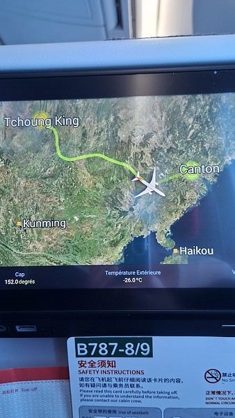
Took off at 9:30 AM, arrived in Guangzhou (Canton) at 11:20 AM in the rain. I love how Chongqing is translated as "Tchoung King" on the screens in the plane—very French!


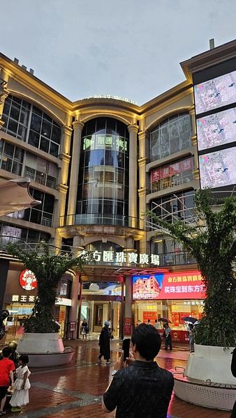
During my first two trips to China, we paid for everything in cash, but this time, we’re going all-in on Alipay and WeChat. I still brought the leftover change from previous trips—it might come in handy. At the metro station, they showed us a QR code to buy tickets via WeChat. There were probably machines and even a ticket counter, but we didn’t see them, and buying via WeChat was pretty simple. 8 yuan to Changshu Lu, which is 22 stops. So far, so good. Then, we had to find the hotel, which wasn’t on Google Maps, Maps.me, or Amap... Easy 😎! We found it without too much hassle, though. Dropped off our stuff and went out to eat. 55 yuan for two claypots with fish/eel, rice, cabbage, and purple eggplant. When we left, it was pouring. We grabbed our umbrellas and set off to explore the neighborhood: Enning Road (we’ll come back later to check out a specific spot), Shangxiajiu (the pedestrian shopping street), Baohua Road... The area is pretty diverse—one street to the next, it’s like stepping into a different world.


There weren’t many people around, probably because of the rain. We grabbed a quick street food dinner and went to bed—we were exhausted. We struggled to stay awake until 11 PM to adjust to the time change as quickly as possible. There’s a 6-hour time difference.
Open
Another side of my trip to Thailand: Villages, nature, countryside, mountains...
February 9th is a pivotal day during my trip to Thailand. Up until this date, my focus had been on cities, temples, and other urban landmarks. Starting February 10th, I’ll finally leave the city behind for the outskirts—one town, one life, farther from tourism, more real, more authentic... Then comes the bucolic surroundings of Chiang Mai, nature, the countryside, the mountains.

This morning, I head to visit the ethnographic museum. I’d been told about another one, but it’s permanently closed. I wonder if it’s the same one that might have changed its name and location.

I thoroughly enjoy visiting this museum. At first, I’m a bit annoyed because the place is packed with noisy school groups blocking the display cases without even showing the slightest interest. But soon, their chaperones manage to lead them into another room, giving me some peace. They maintain this distance throughout the tour, allowing me to explore the museum in complete tranquility. I really appreciate their tact.

I’m amazed by the absolutely stunning fabric displays and the countless everyday objects, especially the very old pottery. There’s so much beautiful basketry and intricately carved wood. The statues are also incredible... After seeing all of them, I no longer feel like buying any from the shops.

On my way back, not far from my hotel, I discover a rather unique place that only serves one drink, which they’ve made their specialty: egg coffee! A pretty surprising novelty. I have to try it.


At the bottom of the cup, they pour a layer of milk, topped with a layer of liquid coffee, followed by a layer of egg yolk, and finally a top layer that turns out to be a mix of coffee and cocoa powder. It’s a cold drink that, in the end, doesn’t have much flavor, and the price is pretty steep for such a small cup. You’re paying for the exclusivity!

Later in the day, I venture once again into small alleys, something I love doing when exploring a new city—no specific goal, just wandering east of the city, outside the walls.


I encounter very few tourists there and discover unsuspected little shops overflowing with lovely items, much cheaper than what you find in the heart of the tourist district. Then I wander through the floors of Warorot Market. I discover another kind of temple there: the temple of good deals. I love finding clothes that are really original for locals, not the flood of shirts and pants that tourists love but no Thai would ever buy, which invade the shops in the "Historic Square." I stop in my tracks in front of a stall with beautiful shirts featuring stunning geometric patterns in elegant color combinations and very short sleeves. Hmm, these would be perfect for showing off my biceps, one of which is adorned with the magnificent Ganesh tattoo I got last year in Bali. "When you’ve got nice things, you’ve got to show them off!" he said. 😜🙏💪 I pick out two for 380 baht and negotiate them down to 300. But the seller won’t go any lower. I understand I’ve reached the limit of her commercial possibilities. Just as I’m leaving the shop, happy with my purchase, my ever-helpful inner voice, Petite Voix, suggests: - You didn’t try them on because you were too lazy to take off the one you’re wearing and also because of the sweat, but you could just put one on over the one you’re wearing. It’s light enough that it won’t bother you.

I go back to the two sellers, who burst out laughing when I ask to try them on. - Oh no, it’s way too small for you! It’s a women’s shirt! - But they don’t look particularly feminine in style! And I chose XXL... I put the shirt on, and of course, it won’t close. Then I notice the buttons are on the wrong side. That’s why the sleeves seemed so short!!! They put the shirts back on the rack and refund me without any fuss, commenting amid total hilarity: - Well, thank goodness you tried it on just as you were leaving the shop!

Since I don’t want to walk too much before tomorrow’s first Big Outing with the driver, I end my stroll with a visit to two very pretty temples recommended by Joël.


I’d rather not post more temple photos. But these ones smell like village and countryside...


I’ve never seen anything like Wat Ket Karam, so extravagant...


And I end my day with two other lesser-known temples: Wat Noung Kham, simple and finally free of gold and glitter,


and Wat Dap Phai, where an intimate ceremony is taking place at the end of the day.
Open
Join me in discovering Gran Canaria
Introduction

We stayed on the island of Gran Canaria during the first three months of 2024. It’s the third Canary Island we’ve visited, after Tenerife and Lanzarote.

We rented an apartment in Temisas. By staying in the same place for such a long period, the total price dropped by 50%.

We also rented a vehicle to make getting around the island easier.

Why the Canary Islands, and Gran Canaria in particular? For its pleasant climate, the nature and diversity of its landscapes, the charming villages, and especially the beauty of its many beaches.

In this travel journal, you’ll find a list of the many activities we did during our stay to explore the different attractions of this island.

These attractions are categorized to make it easier to find what interests you.

Videos are included throughout the summary. Click on the image to start the video.

To jump to a specific post, here are the relevant links:

HIKES:

Roque Nublo Maspalomas Dunes - Part 1 Maspalomas Dunes - Part 2 Los Azulejos de Veneguera Barranco de Las Vacas Ventana del Bentayga (Arco del Aserrador) Caves of the King Ventana de Morro (Ventana de la Ganifa) The Dog of Bentayga Cave of the Four Doors Ventana del Nublo Artenera - Caves of Acusa Seca Temisas - El Gigante Cave Fortress of Ansite Puerto de Las Nieves - Roque de Las Nieves Temisas - Cuevas de la Audiencia Roque Bentayga Guayadeque Ravine (Guayadeque Hermitage) Guayadeque Ravine (Cueva de Bartalo) El Zumacal - Barranco Tauco Casablanca Dam (Los Dolores Dam) Ayagaures - La Angostura Dam & Gambuesa Dam Santa Brígida - Alonso Ravine & Centennial Dragon Tree Pino Santo Hike in the Azuaje Ravine Gáldar - Red Lands of Samarrita Tejeda - Charco de La Paloma Bandama Boiler (Camino Borde de Caldera Bandama) Teror - Alamo Ravine Trail – SL-4 Telde - Calasio Caves Special Natural Reserve of Los Tilos de Moya Los Azulejos - Charco de Las Aneas Fataga Ravine Arinaga Military Battery Trail Maspalomas - Las Fuentes and del Canizo Ravines Mogán - Tauro Mountain Trail Tamabada - Llanos de La Mimbre & Sobre la Cueva Viewpoints Trail Hike to the Coronadero Arch via Barranco Hondo Barranco de Silva - Hike to the Jerez Caves Gáldar - Samson Cave - La Atalaya Peak Agaete - Roque Guayedra and Guayedra Ravine Artenara - Caballero Caves Arucas - Bufadero Salt Flats Barranco de Pino Gordo - Natural Pools Telde - Los Cernícalos Ravine Las Cruces - Toba Caves & Picón Puerto de Las Nieves - Moro Cave Agüimes - Morros de Ávila Caves Juncalillo del Sur - Laguna & Salinas de Abajo Caves of Camino de San Felipe Cruz de Tejeda, Cruz Chico and Degollada Viewpoint Hike on the Patalavaca Circuit Motor Grande - Puerto Rico Arch El Montañón - Los Hornos Dam Seafront Walk - Amadores Beach – Puerto Rico Beach Las Niñas Dam El Hornillo - Omega & Omicron Caves Arteara Necropolis Mogán - El Mulato Dam Las Garzas - El Regante Dam La Plata Route - Cho Flores Dam & El Charco Hondo Vega de Acusa - La Candelaria Dam Candelaria Hermitage – Acusa Seca Viewpoint Valsequillo de Gran Canaria – Roque La Vela Ayagaures Dam – GC-602 Lomo del Palo - Monte Pavón Trail Lugar La Laguna - Levada Fataga Dam & Ravine
BEACHES:

Mogán Beach Taurito Beach Tauro Beach Amadores Beach Puerto Rico Beach Anfi del Mar Beach Patalavaca Beach Meloneras Beach Maspalomas Beach English Beach (Playa del Inglés) Las Burras Beach San Agustin Beach Las Alcaravaneras Beach Las Canteras Beach (La Cicer) Las Canteras Beach (La Puntilla) Las Canteras Beach (Santa Catalina) Aquamarina Beach El Agujero - Bocabarranco Beach Hoya Del Pozo Beach Hoya Del Pozo Beach - Lizard with amputated tail El Cabron Beach Ojos de Garza Beach El Burrero Beach

NATURAL POOLS:

Charco Azul - El Risco Agaete Salt Flats Charco de Los Espejos - Sardina del Norte Natural Pools of Punta de Gáldar Snorkeling in the natural pool of Punta de Gáldar Natural Pool La Furnia o El Clavo - Gáldar Natural Pool of Los Dos Roques Emiliano Natural Pool - El Agujero Natural Pool of El Agujero Natural Pools of Roque Prieto Natural Pool El Altillo Los Charcones de Bañaderos – Arucas Natural Pools of El Charco de Las Palomas – Arucas Natural Pools of La Laja - Las Palmas de Gran Canaria Cueva de la Reina Mora - La Garita Natural Pools of Castillo del Romeral

TOWNS:

Center

Santa Brigida Vega de San Mateo Tejeda Artenara Vallesco Teror

Southwest

Santa Lucia de Tirajana Fataga San Bartolomé de Tirajana Puerto de Mogán La Aldea de San Nicolas

North

Arucas Firgas Moya Santa Maria de Guia Gáldar Agaete Puerto de Las Nieves

East

Vegueta - Las Palmas de Gran Canaria Triana - Las Palmas de Gran Canaria Ciudad Jardin - Las Palmas de Gran Canaria Canteras - Las Palmas de Gran Canaria Telde Valsequillo de Gran Canaria Ingenio Agüimes Temisas

VIEWPOINTS:

GC-60 Route (or nearby) GC-210 Route (or nearby) GC-210 Route between the tunnel and La Aldea de San Nicolás GC-215 & GC-65 Routes (or nearby) GC-200 Route (or nearby) GC-130 Route (or nearby) & GC-605 GC-70 Route (or nearby) & GC-21 Sheep herd on GC-70 Route GC-150, GC-240, GC-305, GC-350 & GC-301 Routes GC-606, GC-295, GC-231 and GC-41 Routes (or nearby) Viewpoints – GC-1 Route (or nearby) Viewpoints - Las Palmas de Gran Canaria Viewpoints - GC-2, GC-21, GC-15, GC-216 and GC-132 Routes (or nearby) Viewpoints - GC-503 & GC-217 Routes Viewpoints - GC-604, GC-505, GC-132, GC-42 and GC-802 Routes

MISCELLANEOUS:

San Rafael Aqueduct - Telde Abandoned San Rafael Estate - La Higuera Cenobio de Valerón La Cesta - Tejeda Puerto de la Aldea Scenic Route GC-671 to El Espinillo Scenic Route GC-607 to El Chorrillo The Galdar Cube (Santiago Quarry) Scenic Route GC-504 to Ayagaures Abandoned seaside resort in the Azuaje Ravine El Bufadero de La Garita – Telde GC-505 Route Abandoned Finca Las Haciendas (Los Mocanes) – Las Vegas de Valsequillo Ruins of San Juan Battery - Las Palmas de Gran Canaria Viera y Clavijo Canarian Botanical Garden - Las Palmas de Gran Canaria Tenefé Salt Flats Los Pérez, Lugarejos & Las Hoyas Dams Monte Pavón, Gran Canaria’s little Ireland Valleseco Lagoon Recreational Area Climbing - Fataga Ravine Surfing – El Agujero El Cairete Restaurant - Carrizal de Tejeda Paragliding flight observation - Los Giles La Cuevita Ayagaures Restaurant Statues and Murals - Cruce de Arinaga Aviation Monument (Las Majoreras) & Murals – Carrizal Artistic recycling by Antonio Peñita - Ojos de Garza Rainbows
Open
Kattegat Tour and Norway’s Majestic Fjords – 32 Days (Denmark, Sweden, Norway)
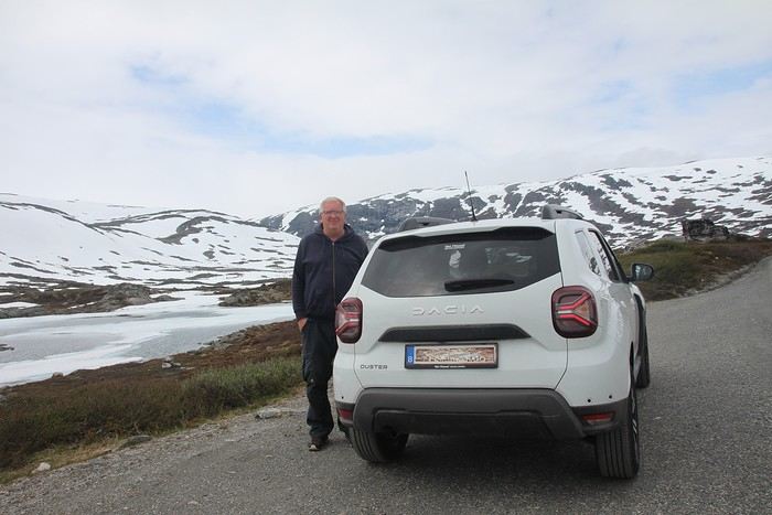
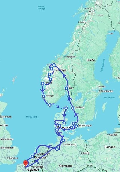
Kattegat isn’t just the name of the village in the TV series *Vikings*—it’s also the stretch of water separating Denmark from Sweden... the sea, basically! And further north, you’ve got Norway and its fjords! Originally, I’d planned to just do a loop around Kattegat, with the *Under* restaurant in Lindesnes as our anniversary treat... but along the way, we thought, why not "push" a little further north, keeping an eye on the budget since we’d chosen to travel by car in June 2025 through Scandinavia.

Why by car when most travelers opt for a camper van, while others prefer the comfort of cruises? Well, because we don’t own a camper van, renting one is pricey, and then you’ve got to add fuel costs (those things guzzle gas!), ferry fees, and other "tolls." All things considered, we went for mostly rentals—especially since there were four of us at the start of the trip. We spent the first week in Denmark with our daughter and son-in-law. Then they flew back to Belgium, and we continued our adventure as a couple. For accommodation, we mainly booked Airbnb apartments, which helped keep costs down and, most importantly, let us prepare our own meals (diet, diet!). In this travel journal, you’ll discover (or rediscover, for those who followed my older ones) our unbridled love for theme parks, museums, unique experiences, and—especially in Denmark—Legos! Unfortunately, we didn’t do any hikes this year because the unpredictable weather had made the trails slippery, and since I’d already taken three tumbles during the trip, I didn’t want to risk another! In the end, we traveled for 32 days, covered 6,200 km, and most importantly, discovered the charming country of Denmark, marveled at Norway’s breathtaking fjords—all without suffering the heatwave that hit France and Belgium that June! If you’ve got any questions, don’t hesitate to ask!
Open
Newfoundland: Hikes in Gros Morne National Park
INTRODUCTION

Creating a masterpiece like Gros Morne National Park wasn’t done overnight. So, when you first discover this extraordinary place, it’s easy to understand why Mother Nature took over 485 million years to bring it to life.

Here, glacial valleys, forests, rugged coastline, beaches, and peat bogs follow one another and intertwine to form a unique ecosystem, one that’s rare in the world. After all, this is where geologists found tangible evidence of the theory of continental drift, and it’s one of the few places on Earth where you can see—and even walk on—the Earth’s mantle. This site is a true celebration of the raw, enigmatic power and beauty of the physical world.

Designated a national park in 1973 and later a UNESCO World Heritage Site in 1987, it’s an 1,805 km² playground just waiting for the adventurer in you. Whether you’re traveling solo, with family, or with friends, for a few days or several weeks, you won’t run out of things to do here.

Source: https://www.exploretnl.ca/parc-national-gros-morne

The hikes we did in this region are listed below. Each hike has a link so you can quickly access more information about it.

Videos are embedded throughout the summary. Click on the image to start the video.

Stanleyville Trail Trout River Pond Trail Trout River Pond Trail (Return) Green Gardens Trail Tablelands Trail Scenic Route 431 Lookout Hills Trail Southeast Brook Falls Trail Gros Morne Mountain Trail (James Callaghan Trail) Berry Hill Trail Baker's Brook Falls Trail Berry Hill Pond Trail Western Brook Pond Trail Boat Tour on Western Brook Pond Steve’s Trail Shallow Bay Beach
Open
Discovering Assam and Nagaland 2025
Before I begin, I’d like to thank Michèle Buisson and her "Misha’s travel journals," which really helped me plan this trip. It’s tough to find information about this part of India, which is quite different from the "more traditional India." I’m so grateful to her for introducing me to a family who hosted me for 4 nights and 3 days. I can’t wait to return the favor and welcome you all to my place in early July!

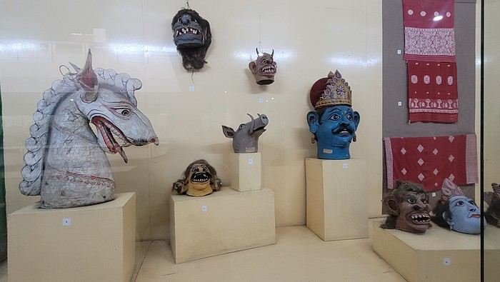
Thursday, March 20th. The alarm goes off super early, but I’m already awake—I was too worried I’d sleep through it. I leave the house at 4:00 AM. The rain has stopped, and at this hour, there aren’t many trucks on the road. I arrive at Barcelona Airport easily by 6:20 AM, let the valet know I’m there, and he quickly picks up my car. This time, I’m flying with Etihad Airways again. I booked the ticket during my trip to Cambodia: Barcelona/Kolkata, Delhi/Barcelona for 567 €. At that price, I didn’t hesitate for long—I knew I had to take it. And I’m glad I did because, by the time I returned, the price had gone up to 700 €. I can already hear the reactions: "Wow, how’d you get a ticket for that price? What site did you use? You’re amazing, MarieJo!" One thing’s for sure—I’m really happy with this deal. The flights from Barcelona to Abu Dhabi and Abu Dhabi to Kolkata go smoothly, and we arrive on time at 2:55 AM. There aren’t many people at immigration, so I get through quickly. My luggage isn’t on the carousel yet. After collecting my bag, I check in for my next flight with IndiGo, a 5:40 AM flight to Guwahati, arriving at 7:00 AM. I’m starting to feel pretty tired, so I take a taxi from the airport to Gruham Sojourn Homestay. The house is upstairs, and the neighborhood seems quiet, with restaurants lining the street. The room won’t be ready until 10:00 AM, so I rest on the bench in the meantime. Once in the room, I take a shower—it really helps me feel refreshed. I need to exchange some euros, so I look up a nearby exchange bureau on Google and head out to find it. I locate it easily, and the staff are super friendly. I get a great rate (1 € = 90 INR). I wander around the neighborhood. The train station isn’t far, and small markets line the streets. I head back to my area, walking along the main avenue. About 500 meters from my street, I discover a museum. The visit is fascinating—I see the famous Majuli masks, among other things.


I’m not far from the Brahmaputra River, and the temptation to visit is too strong to resist. I’d hoped to find a promenade along the river, but that doesn’t exist here. I walk back calmly and notice several restaurants in my street. On the doorstep of my accommodation, I spot a pastry shop with cakes that look more like the ones we have in France than the typical ones here in India. A visit is a must, and I’m not disappointed!


Tonight, I’m dining at a restaurant in the street. The menu is a bit disappointing—burgers, pizzas, pasta—nothing very Indian. So, I’ll go with tomato pasta.
Open
From Bangkok to Krabi, Thailand by Car!
This first trip of 2025 will have the taste of Asia.

More precisely, Thailand!

It’s not my first time—I’ve often traveled across Southeast Asia between 2000 and 2015. (This travel journal, for example...)

But it’ll be my partner’s first steps in this part of the world.

The itinerary we’ve chosen will alternate between familiar sights for me and new discoveries for both of us.

I’ll get to see how the country has changed in 20 years—and what’s stayed the same!

We were torn between the north and the south of the kingdom. Fears of smoke from slash-and-burn farming and a desire to relax on the sand tipped the scales toward the south...

What if we rented a car?

I think driving in sprawling Bangkok would be a bit ambitious, so we’ll only book our vehicle from Hua Hin to return it in Surat Thani.

Other transportation will range from tuk-tuks to overnight trains and ride-hailing services.

And of course, the plane!

I’d love to travel from Auvergne to Bangkok by road, but 15 days wouldn’t be enough...

Plus, the current geopolitical situation isn’t exactly favorable...

So, once again, we’ll be stuck for hours in the less-than-comfortable economy class of Qatar Airways.

The arrival time was on schedule, entry formalities were quick, and all our luggage made it.

We left Lyon in wind and cold—now we’re breathing in the warm, humid air of กรุงเทพมหานคร.

To reach our hotel, we first took the metro, which dropped us off in the city center in about 30 minutes for the incredible price of 1.18 €.

A few taps on the GRAB app, and we booked a ride-hailing service for the last few kilometers.

We waited a while for our driver due to insane traffic in the area, but once in the 4x4, we were at our lodging in no time.

We chose this small hotel for its riverside location, tranquility, and price.

It’ll do the job perfectly—the only downside is the weak breakfast.

The room is inviting, and we collapse onto the bed for a well-deserved short nap.

Wake-up call in an hour for our first visits!

See you soon...

Open
From Delhi to Agra and the extraordinary stay in Chhattisgarh
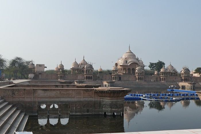
My train to Mathura is at 2 PM, and we’ll arrive an hour late—all good. I booked a hotel on booking, but unfortunately, it’s really far from the ghats. Walking there is out of the question—what a shame. The hotel itself is fine, and there are several restaurants right across the street, which will be handy for dinner. This won’t be an exception, though—starting at 10 PM, they must wake up because I can hear them talking loudly, and music is playing along. My room faces the entrance, so it’s going to be tough. At midnight, I ask them to lower the volume, but they don’t listen. By 1 AM, I lose my temper, and this time, everything stops. Finally, I can get some sleep—until 4 AM, when they start up again for a little while before quiet returns until 6 AM. But when do they sleep? The noise never seems to bother them—it’s unbelievable, and I’m finding it harder and harder to tolerate. It makes a huge difference. The next morning, as I leave, they tell me they’ll give me another room for the following night. Oh, two nights like that wouldn’t be possible—I’m exhausted. I head out to explore the ghats and take a rickshaw, which I share with a family, to Vrindavan, a city of temples dedicated to Krishna. I visit several while wandering through the lively streets, surrounded by a crowd of devotees. By 1 PM, I’m near the Bankey Bihari Temple, but I can’t go in—it just closed. Nearby, there are restaurants, so I take the opportunity to grab my usual aloo paratha with a lassi.


The work women do here is incredibly hard, and their pay must be miserable.


I want to leave Vrindavan for Govardhan. Two young guys on a motorcycle in front of the temple approach me, and the driver offers to take me part of the way. I’m pretty skeptical, but he insists, and I eventually agree. I didn’t fully understand what was happening. Once on the bike, his friend hops on too, and suddenly I’m sandwiched between them for a multi-kilometer ride—*travel Indian-style*. We quickly drop off the friend, and I breathe easier for the rest of the trip. At an intersection, he stops—Govardhan is straight ahead, but to get to his village, he needs to turn right. We wait for the bus for a few minutes, and he flags it down so I can hop on and continue my journey. What an adventure.


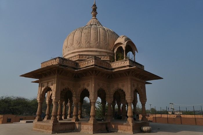
the neighbor with its beautiful dome.

Open
Climbing Haut-Folin via the southern route, in stages
Hello everyone,

I’m so happy to share my climb with you, and if it inspires you to take it on, then it’ll be a success. Sometimes I’ll use the local language because I think it’s essential to connect with the people we meet along the way.

This adventure took place last year, just before winter, right after summer, and smack in the middle of autumn. That really sets the time of year. After climbing Mont-Beuvray—a story I shared here ages ago—I decided to tackle a much more adventurous peak: the summit of Haut-Folin, which rises to 901 m, and that’s no small feat, let’s be honest. It’s located in the Bois du Roi massif. Up there, you often brush against the clouds, which seem to take a mischievous pleasure in wrapping around you.

I’m going fully self-sufficient—no porters, no guide, no cook. I’m just treating myself to a very short approach flight. The flight is early in the morning on a small plane, the *Spirit of St Bernadette*, and it’s perfect. I’ll enjoy watching it deliver mail in the mountains. The pilot will drop me off at the hamlet of *La Pierre en Eau*, near Anost, a small village at the foot of this forest-covered giant.

Physical condition I’m now really seasoned for such an expedition because I’ve trained every day by walking to the village grocery store—round trip, in all weather, that’s 2.1 km. The 451 m elevation gain won’t be a problem for me. .../...

Open
A month in Cambodia in November 2024
Here we go!!! I left home at 4 AM on October 31st and headed to Barcelona. Driving through Barcelona on the ring road stresses me out a bit, but at 6 AM the traffic is smooth, and I arrive at the airport without any issues. I call the valet, who quickly comes to pick up my car. He takes photos of it from all angles before letting me go.

Baggage check-in hasn’t started yet, and there are already several of us waiting.

Once free, everything happens very quickly. The flight to Abu Dhabi is on time and goes smoothly. I’ve never had any problems with this airline, which I’ve been using for several years.

The flight to Bangkok arrives at 7 AM as scheduled. This is my first time in Thailand and Bangkok. I’m used to traveling in India, and I notice that everything here is well organized—the customs process is quick, and the luggage is already on the carousel.

I booked a taxi on Booking. All I have to do is find the right exit and door based on the agency’s instructions. A large sign with the names of people who booked is posted on a wall. A hostess greets me and calls the taxi, which arrives 5 minutes later. I booked one night at the Lost Inn BKK hotel in the Phra Nakhon district, and we arrive at 9 AM. The welcome isn’t warm, and I have to wait until noon, sitting on a chair, before I can check into my room. I’m exhausted, and sleeping sitting up isn’t ideal. Noon finally arrives—the room is small but clean, which is fine for one night. I quickly take a shower to wake up because I plan to spend the afternoon visiting the Grand Palace. First, I need to exchange some money, and the banks are all close together on the same street, which is very convenient. When I enter one, a hostess gives me a ticket and invites me to sit down. There are about twenty counters, and I wait quietly until my number is called. The exchange is quick, so I can head out to find the Royal Palace. It’s actually very easy, and the walk is pleasant.

Entry to the Royal Palace (500 baht).


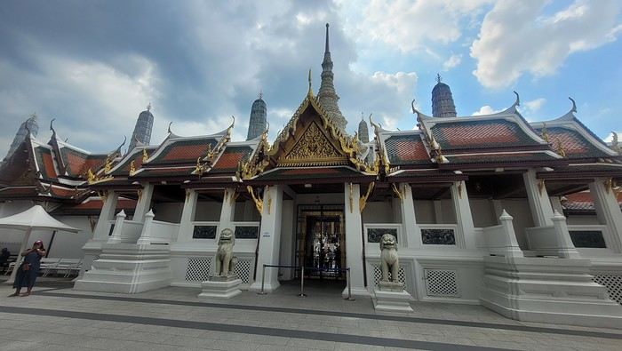
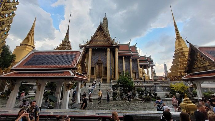
It’s magnificent and grand, and there are quite a few of us visiting. The sky is gray, it’s very humid, and a shower interrupts the visit. It’s a vast complex of temples and palaces. The buildings are colorful and sparkling, with a great sense of serenity (without the tourists, of course). I quietly enjoy the place and try to take photos without tourists, which isn’t easy.


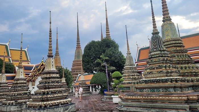
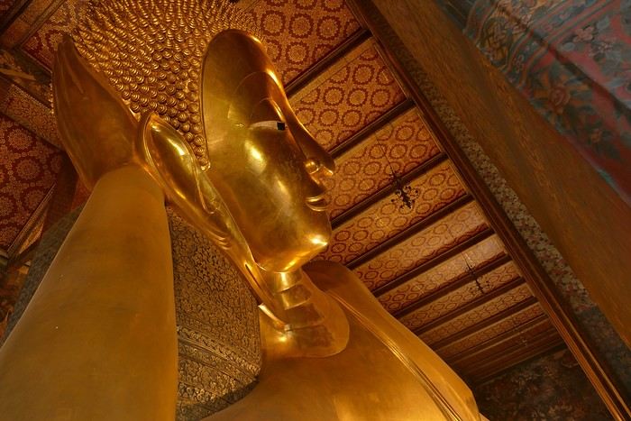
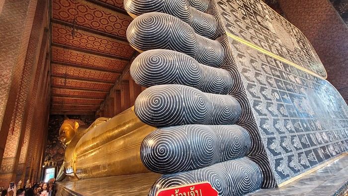
Very close to the Grand Palace is Wat Pho, one of the oldest Buddhist temples in the capital.


It’s very famous for its 46-meter-long reclining Buddha statue.


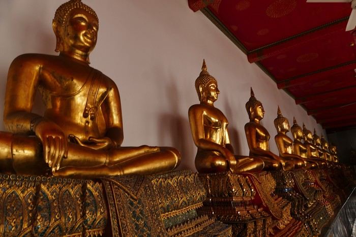
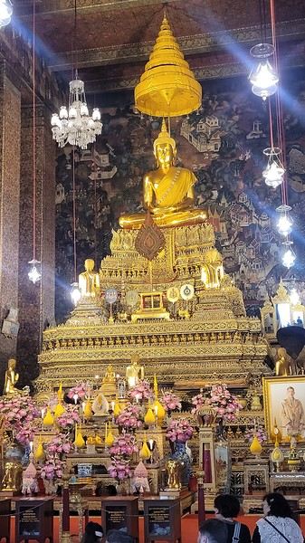
Walking around the temple, you can see different representations of Buddha, all covered in gold leaf.


Inside the temple, on one side, monks recite their prayers, while the other side is reserved for tourists who come to meditate in silence.


Before returning to the hotel, I have dinner at an Indian restaurant. I go to bed early because tomorrow’s wake-up call will be very early again.

Saturday, November 2nd Wake-up at 4 AM, departure from the hotel at 4:30 AM. The taxi I booked via Booking is waiting for me and takes me to the airport. The trip is fairly quick—he takes small roads, and at this hour, there’s no traffic.

The flight to Phnom Penh is on time. Before boarding, I realize I left my fleece jacket on the carousel, but it’s too late to go back for it.

The flight goes well, and customs is quick.

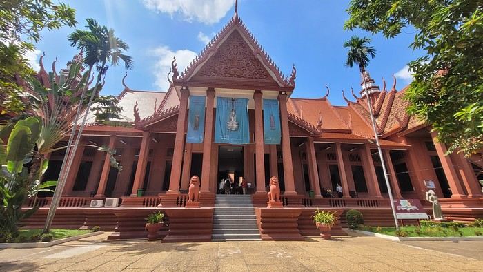
At the exit, I take a tuk-tuk to Julieka’s GH near the museum. The welcome is friendly. I won’t be able to check into my room until noon, so I take the opportunity to exchange some euros on the market street. The street is lined with restaurants, and I’ll have my first meal there.

The museum is right across the street, so I don’t waste any time visiting it.


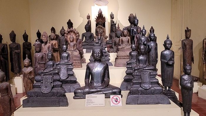
The representations of Hindu deities are very different from those in India, and I don’t recognize them. Many beautiful Buddhas are on display.


The museum is very pleasant, and there aren’t too many people, which is a plus.

At the exit, I return to the GH, settle into my room—which is decent and clean.

The Royal Palace is 1 km away. I walk along a garden, and at the end of the street is the Tonlé Sap, but I turn right. I arrive at a large esplanade and see the buildings with tiered roofs and glazed tiles. The entrance to the palace is a little further away.

At the entrance, I notice there isn’t the same crowd as at the one in BKK.

Khmer architecture is magnificent. The complex consists of gardens, palaces, pagodas with golden roofs, and slender spires.


The Silver Pagoda houses the small Emerald Buddha, which is actually made of jade. The silver flooring is covered with carpets. Photos are not allowed.

The walls surrounding the pagoda are covered with frescoes depicting scenes from the Ramayana.
Open
Around Cape Town in 15 days in May
Hi there,

I’ve got a bit of time to share my latest Cape Town – Cape Town trip... A fairly short itinerary, but it was just before heading to Kruger for an extension. In May... Honestly, I’d usually recommend a different time to visit CT—I’ve been there in August, September, and October before. But as they say, "Do as I say, not as I do" or "Only fools never change their minds." Why? Whale season peaks from August to October... and seeing whales right by the shore or breaching out of the water is absolutely spectacular. The end-of-year holiday period—take this year, for example—can get absolutely packed, with beaches closed due to overcrowding, etc. June and July are freezing (for me)... early August isn’t always great either. That said, 2024 saw a September-October with rain, cold, and fog like never before. The Postberg section of West Coast National Park (WCNP) is only open in August and September. Flower season is roughly from mid-August to mid-September.

So, May... The weather? Gorgeous (lucky me!). The route... Not super original (I’ve done it before, though it’s been a while). I didn’t go too far from CT because I prefer slow travel. Cape Town – Langebaan (for WCNP, again) – Cederberg (at Mountain Ceder, again) – Bontebok NP (new to me, and on the way) – De Hoop NR (at De Hoop) – Agulhas NP – Boulders (for Boulders Beach and the peninsula, again and again).

The trip started off badly due to storms in Frankfurt... My overnight flight was delayed until the next day, but via Amsterdam, so a daytime flight instead. A bit stressful, but Lufthansa and KLM handled it well. Now it was my turn to sort things out... "Well, I need you to keep the car for me... I’m arriving tonight!" (aroundaboutcars, a Chinese Haval, blue and 4x4—though I didn’t actually need the 4x4... which waited for me).


"Well, I need you to keep my room for me... I’m arriving *very* late tonight." A hotel perfectly located by the lagoon, right by the gates of WCNP, but still close to Langebaan and its restaurants. I spotted it myself and booked it during Black Friday...


Yep, what was normally a short 1.5-hour drive *in daylight* from the Mother City to Langebaan... was now *at night*. And here I am, usually the one telling people, "Don’t drive at night, folks!" Well, I know the route, and Google won’t let me get lost... until Langebaan, that is. The last few kilometers were rough—"Don’t they put up signs? Don’t they have streetlights?"

Alright, it’s late, the day’s been long—time for bed! !
Open
All Over Thailand
You can post your personal photos in the following thread: https://voyageforum.com/forum/quelque-part-en-thailande-d10655574/

This travel journal is therefore intended solely for my photos, to present a consistent style. All the shots were taken with a simple Samsung Galaxy smartphone and with whatever was at hand.

All stays combined, I’ve spent the equivalent of a year at most in Thailand, and I’m no great expert. However, after many trips, lots of reading on VoyageForum and other sites, and conversations with many locals as well as expats, my view of the country is becoming clearer, though it’s constantly evolving. You never stop discovering and learning.

I guess I wanted to deliver a puzzle, mainly for those who want to get an idea of the country here and for those who feel nostalgic about it. I don’t know if this minimalist sharing will interest anyone, but it’ll do me good to put it together. After so many months without traveling and then these other long months with VF closed, there’s plenty of material available.

There’ll be a mix of places, periods, and subjects, but it might well be intentional.


I suspect many Thais have dogs because they make excellent guardians for the home. Nothing better to deter burglars or to signal the presence of a snake. You’ll often see Thais tapping the top of their dog’s head, but don’t be fooled: it’s a sign of affection from them. Judging by the dogs’ reactions, they’re used to it.

Thailand is one of the countries on the planet where rabies is still present, so keep that in mind. It’s not just bites that can be dangerous, so don’t let just any dog lick you. Especially on a wound, of course. Even though dogs often fear humans—this dangerous and unpredictable predator—we still need to stay cautious. Be careful when walking into alleys because the dog will defend its master’s big yard. Be careful at night, and be careful when they’re in packs. It sometimes crosses our minds that Thailand isn’t all that made for walking around, and dogs are one of the reasons. That said, it’s not uncommon to see them chasing bikes or scooters. Cars, though? Much rarer—they’re too big.

It seems Thais prefer to give their dogs freedom by not locking them behind gates. Though sometimes the gate is closed, the little side door is wide open. Oh, and sometimes there’s no gate in front of the property, or it’s been full of holes for years.

You’ll often see dogs sleeping on the roadside, sometimes right on the road. When you approach, they move aside nonchalantly—or not at all. It’s less funny when they suddenly appear from thick vegetation, reminding visitors not to drive too fast. As a result, you’ll notice that dogs with injuries or missing legs aren’t that rare.

Since they believe in reincarnation and respect for all forms of life, they don’t chase dog packs away too much, and they don’t sterilize them enough. When you see a small pack roaming freely in the countryside, you think twice about running into them at the edge of a field. A darker side of this is that euthanasia isn’t often practiced. Twice, we saw dogs at death’s door in temples, enduring terrible suffering with no one to help. The image (and the smell) of one of them, agonizing and exuding the stench of death, still comes back to me sometimes.

Some of you may have seen the YouTube vlog of a French woman living in Phuket who was given a little pig by her Thai friends. The animal, well-fed, quickly became a happy and enormous beast with its own garden. Yet it didn’t take long for it to fall seriously ill and become incurable. In her video, the French woman described how difficult it was to find a vet willing to perform euthanasia.

You’ll often see bowls by the side of the road. Thais leave food and water there for stray cats and dogs. Overall, they have a big heart for animals.

If you ever pop into a shopping mall, you might see people pushing their small dogs in strollers. It’s not just for fun—these strollers are provided for customers to put their pets in, otherwise you can’t bring them inside. It looks a bit odd when you expect to see a baby.
Open
Slovenia, a nature destination
Slovenia was the originally planned destination for summer 2022, as a complement to a road trip through Croatia and Montenegro. Plans changed on a whim in February of that year. Our Balkans road trip would ultimately be limited to Slovenia and take place over 10 days during the Easter school holidays. Flight tickets and car rental were booked right away; all that was left was to finalize our itinerary, already sketched out, and the accommodation reservations.

I decided to add Plitvice Lakes in Croatia to our program. I really wanted to discover them, and for my husband, it was a chance to revisit them several years after a trip to Yugoslavia when he was a teenager.

I’m happy to contribute to the reopening of our forum by posting this travel journal (originally posted in 2022 on another forum, the text has been partially revised and photos added). As usual, a few photos to start with—maybe they’ll inspire you to join in!


Open
Review of my visit to Angkor
SIEM REAP You can now rent scooters just about everywhere in Siem Reap, but at rip-off prices—$15–18 a day instead of $5–10 like everywhere else in Indochina. The best options are tuk-tuks or, even better, electric bikes ($12, but with a 50 km range, so they won’t let you go to Banteay Srei or the River of a Thousand Lingas in the Kulen Massif, which are too far). **WARNING:** Wear a helmet, or they *will* catch you. Scooters are banned from going from SR to the stunning temple of Koh Ker in the northeast and continuing to Battambang; no idea why!

My favorite little hotel in Siem Reap? The Neth Socheata, tucked in an alley off Thnou St near the market—lovely rooms, and the owner speaks great English. Then there’s the Ivy Guesthouse with its little garden, but it’s “always full,” according to the owner. For something upscale but still affordable, a fantastic spot is the Pavillon Indochine, tucked away on a quiet side street on the way to the airport—elegant, with incredible attention to decor, a terrace restaurant, garden, pool, etc. Everything you’d want for $70 including breakfast. I also spotted a hostel for backpackers, the Angkor Thom Hostel, with small 6-bed dorms for $4 with a fan or $6 with AC (18 Wat Bo St).

Food-wise, it’s all amazing! Pub Street has turned into a noise nightmare, with speakers blasting what’s supposed to be music but is just *boom, boom, boom, boom, boom*—run away, even though the pizzas at the Italian place Il Forno are really good. The famous and excellent Tigre de Papier has changed its name to Paper Tiger and is still just as good (lunch only, though, because across the street there’s a huge bar blasting *boom boom boom*, so you won’t be able to hear each other during dinner). On the other hand, the Italian-Cambodian El Toro on Pub Street is perfect, with fantastic pizzas and divine lasagna (go to the first-floor dining room—there’s a big bar across the street blasting *boom boom boom*, but at least you can still talk). Due to the lack of customers during COVID, all the French restaurants—Barrio (three times alas!), Les Deux Sœurs, Le Bel Air, and Le Mozart—have closed. The only one left is L’Olivier, which is pricey. I also discovered a great Moroccan restaurant (though run by a Sudanese man and his French wife), Le Tajine, on Strung Thmei St, 09 68 89 78 27. **WARNING:** For tagines and couscous, you need to order at least in the morning; wine and beer are fine. To get there, turn at the corner of the Cineplex behind the big market at the start of Sivatha Boulevard.

I finally went to the Khmer dance show. Beautiful dancers and dances, but **EAT BEFORE OR AFTER**—the meal is so awful that most Westerners leave it on their plates.

THE ANGKOR TEMPLES Use the excellent *Routard Cambodia* guide. Just a few tips: - Start with the pre-Angkorian Roluos group, 15 km before Siem Reap on the road to PP—it’s the “ancestor” of the temples.

- To avoid the big crowds at Angkor Wat, Bayon, and Ta Prohm, go between noon and 2 PM when everyone’s having lunch. - Speaking of lunch, the crowds flock to the hundred or so mediocre food stalls on the left side of Angkor Wat. Instead, head to Angkor Thom after the stunning Pre Rup temples, all the way to the small Sras Srang basin. Along the basin, there are several restaurants with terraces offering first-floor views of the water, and no crowds. Afterward, cross to the other side of the basin—you’ll end up in the countryside with charming villages where locals seem to live as they did during the temples’ golden age (at its peak, the population was estimated at 600,000–800,000, making it the largest city in the world. The theory for the abandonment is water shortages caused by overpopulation).

- I climbed Phnom Bakheng for the famous sunset, but the crowd was so ridiculous that instead of seeing the temple at sunset, you just see the heads and shoulders around you.

- There are tons of small temples that most people skip, and they’re missing out. My favorites: Thommanon, Neak Pean, Ta Som, and especially Pre Rup, an amazing brick complex with 14 towers.

**Big disappointment:** You can no longer climb to the first floor of Bayon, where you used to stand magically among the giant head statues. So, admire the beautiful bas-reliefs on the outside, but there’s no point going inside—you’ll just see a dark, square corridor with nothing interesting.

ANGKOR FURTHER AFIELD The wonderful Banteay Srei temple. A gem! I couldn’t find the bas-relief stolen by Malraux in the 1920s (fun fact: what he was doing in Indochina—stealing a bas-relief to sell for a fortune in France to cover his massive gambling debts on the stock market, where he ruined his very wealthy American wife—was an open secret. But the French authorities in Saigon, who hated him for his leftist views, decided to let him do it and catch him red-handed, which worked perfectly. He avoided jail only because all the leftist intellectuals in Saint-Germain, Sartre, Beauvoir, and co. cried scandal—though the real scandal was the looting).

30 km of excellent paved road further north, a great spot: the Kulen Massif and the River of a Thousand Lingas (at one point, you’ll come to a T-junction—turn left). Along the road at the foot of the massif, on your right, there’s a great restaurant, Bourey Sovann (where the food is excellent). The trail to the river starts just before it on the left. **Warning:** There are two sites for the River of a Thousand Lingas. One is accessible via a private road, so there’s a $20 toll, and you need to arrive before 11 AM because the road is narrow and traffic flows downhill after that. You’ll end up in a site full of shops, snack stalls, and two good restaurants, including one by a beautiful waterfall. However, the thousand lingas aren’t as spectacular there.

Banteay Srei + the River of a Thousand Lingas makes for a fantastic day. **WARNING:** You used to be able to go to the river and waterfall by scooter or tuk-tuk, but it’s now forbidden. So **go by taxi**—otherwise, you’ll be hiking 12 km round trip up a steep trail.

If you leave Siem Reap early, you can even add Beng Mealea temple on the way back, making a triangular route: SR-BS-Khulen-BM-SR (or the reverse).

If you have time, visit Banteay Samré temple, 10 km west of the Angkor Thom complex. A lovely site with very few visitors.

I’ve never been to the famous Preah Khan on a hill overlooking Thailand. There’s a big dispute between the two countries—the Thais insist the temple belongs to them because the entrance is in their country. There have been serious clashes in the recent past, and landmines are still abundant off the marked paths. They even claim the entire Siem Reap province is theirs and should be returned, arguing it was Thai in the past. It takes two days (6–7 hours each way), with an overnight stay in the nearby village (small hotels and one luxury option with a garden and pool, but it’s expensive).

TONLE SAP People talk about “floating villages,” but that’s a big mistake—these are actually villages of astonishing stilt houses, 4 meters high or more, due to the lake’s major floods. The most famous is Chong Khneas, which I skipped because it’s packed with tourists. Instead, I really liked Kampong Phluk, which is much quieter. To get there, continue on the road past the Roluos group until you reach a parking lot with pirogues lined up. They’ll take you down the river, stop at this amazing village for a walk, and then take you to the Tonle Sap, a true inland sea. At one point, you’ll pass through a flooded forest that you can explore by small boat. At the junction of the river and the Tonle Sap, and on the lake itself, there are floating restaurants where the food is great. Note that in the dry season, you can reach the village by scooter.

BACK TO PHNOM PENH AND ON TO SOUTHERN VIETNAM Since I’d planned at least 15 days in the Mekong Delta between Chau Doc and Saigon, I skipped Battambang, etc. With no desire to endure the dusty road from SR to PP again, I simply loaded my bike onto a bus with the great company Rith Monty (book at their office in SR on the small square at the start of Sivatha Boulevard—$10 for the bike and $6 for me), also known as Paramount. Their buses stop on 136 St right in the middle of PP. I’ll also mention the excellent Giant Ibis, with big modern buses that always leave on time—unlike the others.

I spent the night in PP, and the next morning took the fast boat from PP to Chau Doc with Hang Chau Tourist (buying the ticket the day before is recommended—$25—either at your hotel or the port, and they’ll pick you up at your hotel by tuk-tuk to take you to the port). Departure from PP at noon, arrival in Chau Doc around 4 PM. The boat is great—comfortable and fast. A crew member takes your passports for Cambodian exit formalities, and you handle Vietnamese immigration yourself—it all takes 15–20 minutes. The route isn’t on the Mekong but on the Bassac River to the border, then a wide north-south canal to Chau Doc (the arrival is really nice). In the Chau Doc-PP direction, the boat leaves Chau Doc at 7:30 AM.
Open
Bike trip: from Carcans Maubuisson to Plaisir (Yvelines)
Monday, August 21, 2023 - Rochefort - Marans

No journal for the first two days. Day 1 - CARCANS-ROYAN Day 2 - ROYAN - ROCHEFORT Tonight I'm in MARANS in the "dry marsh" according to the campsite manager—it’s the first time I’ve heard of a "dry marsh"?!

Photos from the first two days

My gear


The Landes region—nothing extraordinary, but the calm and serenity are nice.


Le Verdon


The wild coast


This marsh isn’t dry, though.

Today is the third day of my trip, and I’m writing to you from a campsite in Marans. I’ve set out to bike from Carcans Maubuisson back to Plaisir. Why Carcans? Because we spent a week there as a family—a great week that lets everyone reconnect for a long stretch. Also, on Saturday, we all headed home—some by car, and me by bike. This journey is about 850 km via bike paths and small cycling roads. It’s not a sporting feat, just a nice long ride for fun. As the old Chinese sage says, "The destination doesn’t matter—it’s the journey that counts." But he also told me, "Traveling is great, but what’s the point if you don’t share it?" You see, this old sage has told me a lot of things—he often keeps me company when I’m biking. Of course, he doesn’t pedal, but we travel in harmony. Sure, he can be a bit annoying sometimes, but we still get along. All this to say I’ve created a group to share my story. I’d be happy to share this experience with you—it’s an adventure for me. On Saturday, I wasn’t sure I’d even leave because I’d been dealing with sciatica for days. Luckily, Juliette, a friend of the old Chinese sage, recommended a lifesaving remedy: Alternately stretching your legs with an elastic band under your foot. Obviously, a jam jar rubber band won’t cut it.

From Marans - The mosquitoes are attacking; time to head back to shelter.

The first two legs took me to Royan and then Rochefort. The Sèvre Niortaise flows nearby, and I followed a canal from La Rochelle. You could say the area is as dry as the marsh, judging by the state of the crops.


As I mentioned, it’s the third day, and if Jesus rose again on this day, for me it was more like the crucifixion. The scorching heat—only bearable when you’re moving—combined with rough trail conditions, and the old Chinese sage says, "Terrible roads, slow speed, and watch your limbs." I set out to do 60 km but ended up doing 80, and the last 20 were tough. I kept checking the GPS to see how much farther until the campsite. Today: Rochefort to Marans, sticking to the coast until La Rochelle, then no notable towns after that—just a constant canal. But since the sky isn’t too low, it hasn’t gotten lost. I’ve still got plenty of anecdotes to share, but it’s pitch black out, and the mosquitoes are still around. This morning, I counted ten in my tent, all full of my blood. Yesterday, at the end of the leg to Rochefort, I was really looking forward to crossing the Charente using the transporter bridge, but a sneaky GPS conspiracy led me far from it. I ended up crossing the Charente on a completely ordinary bridge, watching the transporter bridge in the distance with disappointment.

End of the first episode. Until tomorrow, if you’d like!
Open

You might also like