Nous partons très prochainement pour un trek au Ladakh, de Likir à Lamayuru puis Alchi. Je cherche à savoir quel type de cadeaux utiles les enfants peuvent ils offrir aux enfants/ familles que nous rencontrerons.
De plus, en fin de trek, sous quelle forme faut il laisser un pourboire aux accompagnateurs: argent ou biens matériels, et lesquels ?
C'est marrant, j'ai fait une partie de ce trek l'année dernière ! Je l'ai abandonné à mi-chemin, un peu déçue car il suit une route qui était en train d'être goudronnée à cette époque et il était parfois difficile de cheminer ailleurs que sur ladite route.
Mais tu ne me demandais pas de conseils sur le trek, donc je vais m'arrêter là !!!
Alors pour tes questions :
1) cadeaux d'enfants à enfants : je ne sais pas... peut-être les polaires lorsque vous aurez fini de trekker ? Pour les bonbons, les goûts européens et ladakhis sont très différents, aussi mieux vaut-il éviter ! Après, en ce qui concerne les jouets, j'avoue que je n'en ai vu chez aucune des familles ladakhies dans lesquelles j'ai pu aller. Dans tous les cas, si vous prenez des jouets, choisissez des choses très très simples style petites voitures ou cerceaux (un peu encombrants) mais pas de jeux, certains (comme les cartes) étant considérés comme des activités de débauchés ! Pour ce qui est des crayons etc... les adultes apprécient beaucoup les stylos à pointe fine (type pil*t) mais les écoles fournissent généralement le matériel scolaire alors à moins d'offrir des crayons de couleur et du papier, c'est pas très fun.
2) pour les guides : nous n'en avions pas, mais je crois que la coutume est de laisser un pourboire en argent. Si tu investis dans un guide papier, du style "trekking in Ladakh" (vraiment bien) ou "trekking in the Indian Himalaya" de LP, je crois que le montant du pourboire y est donné. Sinon, tu peux demander à d'autres trekkeurs sur place combien ils ont donné.
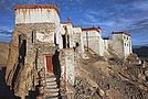
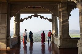
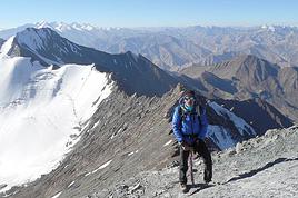
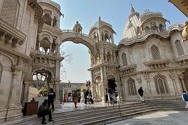
Ci joint deux petites photos prises près de Likhir
Bonjour,
Au sujet des cadeaux pour les enfants, je suis devenu tres reserve.
Cette semaine, au cours des arrets dans les villages de la vallee de la Suru, les enfants ne demandaient plus des stylos ou du chocolat, mais ... des roupies.
Que les distributeurs ambulants de stylos et de bonbons changent leurs produits et se remplissent les poches de roupies.
N.B.: pour l instant la demande est de 10 roupies.
Julley, me voilà revenu de ce trek au Ladakh. J'avais emmené des boites de 25 stylos de différentes couleurs à 1€ pièce, et des savons et shampoings que je récupère dans les hotels au fil de mes déplacements. D'autres familles avaient amené des trousses remplies de stylos et crayons, voire des jouets comme des billes.
Nous avons fait plein d'heureux. Les enfants étaient très contents. Les filles avaient des étoiles plein le regard à toucher et sentir ces échantillons. Nous avons organisé une partie de billes à Hemis Shukpachen, mémorable !... jusqu'à ce qu'un enfant arrive et nous montre comment il avait l'habitude de jouer, à priori avec des cailloux.
Bien sûr, certaines personnes demandent de l'argent pour se faire photographier, pourquoi pas ?... mais à côté de cela, combien proposent de se faire photographier avec nos enfants, et éprouvent beaucoup de plaisir à se voir sur l'écran de l'appareil numérique, bien sûr !
Effectivement, il existe une route qui relie Leh à Lamayuru, c'est une highway pouvant s'avérer dangereuse par endroits. Elle permet d'atteindre Likir également. Nous l'avons fait en 4*4, en fin de trek, ça décoiffe.
Notre itinéraire de trek nous a mené de Likir à Tingmosgam, en passant par Yangthang, Hemis Shuckpachen, et Ang. Là, tu empruntes le chemin à mulets. Effectivement, de temps en temps, voyant passer un camion un peu plus haut, tu te rends compte qu'il y a une route. Elle est toute neuve, juste assez large pour le camion ou le bus, qui ne peuvent pas se croiser ! D'après notre guide, elle est en cours de construction à la demande de l'armée qui protège les frontières !
Alors, ne crains rien, tu ne seras pas dérangée. En plus, prends ton temps pour déguster les merveilleux et grandioses paysages, et pour apprécier les gens que tu rencontreras, ils sont tous hyper sympas.
N'hésites pas si tu veux d'autres renseignements. Djulley !
> Effectivement, il existe une route qui relie Leh à Lamayuru
Ah désolée, je pensais à la piste de trek en fait, pas la route principale 😄
> Alors, ne crains rien, tu ne seras pas dérangée.
Merci pour ces infos, c'est rassurant :) Je ne connais pas encore la région de l'Himalaya, et en lisant des articles ici où là, on dirait que les routes poussent un peu comme des champignons... (tour des Annapurna raccourci, trek de la rivière gelée bientot remplacé par une route)
>En plus, prends ton temps pour déguster les merveilleux et grandioses paysages, et pour apprécier les gens que tu rencontreras, ils sont tous hyper sympas.
Ca semble vraiment génial comme région, en tous cas ca rassemble deux choses qui me tiennent à coeur : les paysages de désert minéraux et la culture tibétaine...
Pour le moment, l'itinéraire que je vais peut-etre prendre irra de Alchi à Tar par le Mangyu La et Hibti La, puis de Tingmosgam à Taru ou Phyang (avec halte à Basgo et Ridzong).
Ca semble être quelque chose d'ultra classique (je n'ai jamais fait de trek), mais en regardant les photos de ceux qui sont passé par là, c'est loin d'être moche... et en partant à la mi-juin j'espère éviter un peu le gros de la masse touristique (tout en gardant à l'esprit que j'en fais partie 🤪 )
Pour ce qui concerne la masse touristique, je m'étais fait peur en lisant divers témoignages. En fait, durant le trek nous avons croisé de rares touristes ou trekkeurs sur les chemins que nous avons empruntés. Par contre, oui, dans les monastères ou à Leh, là, il y avait un peu de monde. Mais, à la limite, tu seras contente de retrouver un peu de foule, d'autant que ce sont tous des trekkeurs, donc courageux et à la recherche de bonheur.
Pour le plan, bien vu. J'en ai acheté un là-bas, conseillé par l'hotelier. C'est quasiment le même. Si tu veux plus précis, il faut chercher les guides de trekking. Un beau site:
http://www.himalayaventures.com/
C'est ton premier trek ?... Tu vas te lancer seule, ou par une agence ?...Tu veux des tuyaux ? N'hésites pas.
Effectivement la "masse" touristique n'a pas l'air si énorme que ca quand meme... quand on compare à d'autres destinations. J'ai lu que le Ladakh attendait env 30'000 visiteurs cette année. Avant de me fixer sur cette région, j'hésitais avec l'Amdo. Récement j'ai appris que là bas ils attendaient 8 millions (!) de touristes chinois. Et meme s'ils restent essentiellement sur les hauts lieux touristiques, c'est énorme.
Oui c'est mon premier trek. La première fois en Asie aussi. Et je vais passer par une agence, étant complètement novice et n'ayant que 3-4 semaines de vacances (oui je sais, ca fait grincer des dents, c'est plus cher, etc mais pour cette première fois je ne changerai pas d'avis, pour la fois suivante j'oserai certainement y aller sans ce genre d'infrastructure... 😉 ).
Tu as bien raison. Nous aussi pour un premier trek nous sommes passés par une agence. Tout s'est très bien passé, et chacun repartirait bien pour un prochain trek. Je n'ai donc aucun regret d'avoir mis le prix.
Aller, bon voyage. N'oublies pas les petits cadeaux pour les gens que tu rencontreras là-haut. Pour info, les enfants ont apprécié les jeux simples: billes, voitures miniatures, ... les stylos ont fait le bonheur à la fois des enfants et des instituteurs, et les filles étaient très émues qu'on leur offre des produits de soin du corps ( savons, crème, shampoings, ... tous les échantillons que je récupère dans les hotels au fil de mes déplacements).
... puisque tu es chuissesse, la maison d'édition Olizane (Genève) a dans son catalogue un excellent guide qui t'apprendra beaucoup de choses sur le Ladakh : http://www.olizane.ch/article.php?IDrecord=76
LeNepalais : je note tes conseils pour les cadeaux, j'oublierai pas d'en prendre avec moi !
Maitairoa : sympa, je l'avais vu chez Payot mais ils n'avaient que la version 2002... contente de voir qu'il y a une version 2006.
Sinon, celui ci semble bien aussi Trekking in Ladakh, de chez Trailblazer.
Bonjour,
Pour info, ma fille est allée voir l'expo de photos sur le Ladakh chez Terdav à Lille.
Elle a ramené les coordoonnées de Sylvain LENGLART, dont le blog est très riche:
www.indeetnepal.blogspot.com
Si par la suite tu souhaites d'autres infos, n'hésites pas, je pourrais t'orienter.
Troisième retour de trek, cette fois pour Likir -Khaltse. A nouveau, ce sont des détails pratiques. Pour un texte plus romancé (et avec photos), voir sur notre…
On part le WE prochain en Inde (Ladakh), enfin les vacances approchent! On envisage de faire le trek de Sham, entre Likir et Khalsi par exemple. Savez-vous si…
Avec deux amis, nous avons passé douze jour sur le fleuve gelé nous avons quitté le fleuve par deux fois: pour aller à Lingshed et à Nierak Une belle aventure…
Est ce que quelqu'un connait un bon endroit avec un bon taux de change à munnar est ce que vous connaissez aussi une adresse pour faire un trek à munnar…
I’m planning to do the Mercantour crossing following the Randoxygène route in mid-July.
I’m used to hiking in the mountains, but I sometimes get vertigo, for example on ridges with drops on both sides. I wanted to check if there are any T4 or T3-T4 sections and find out if there are any very exposed passages—and if so, where—so I can plan an alternative route.
Can anyone give me some info on this?
Thanks!
hi how can I get internet when I arrive at Haneda? I mean in areas without free wifi. Is it more interesting to buy a SIM card? If so, at the airport? thanks for your help
We're planning to go at the end of November/beginning of December to visit (with a rental car) and hike on La Palma and El Hierro for 15 full days, including 1 day for inter-island ferry transfers. What’s the best split between the two islands—8 days on La Palma and 6 on El Hierro, or even more time for La Palma? Should we have one or two home bases on La Palma? Thanks for your tips!
Annie
Hi there,
I’m planning to cross the Gourgs Blancs Pass at the end of the month, from La Soula Refuge to Portillon Refuge. On this section near the pass, I don’t have any trail marked on my IGN map. Is the path well signposted, or should I use a compass?
Also, beyond the physical effort, are there any technical, exposed, or vertigo-inducing sections on this part?
Since I’m finding very little info, I’m being thorough with my questions.
I'm developing a free and open-source web app for planning walking and cycling trips (and even car trips). You can create a route by clicking directly on the map to add waypoints, and it can consist of multiple stages. The app provides tools to edit the stages and the overall route, and to display useful information (distances, altitudes, and elevation changes). A relief profile can be shown as a graph for a specific stage or the entire route.
Once the route is ready, it can be exported as a GPX file, which can then be used with a GPS or a mobile navigation app.
The app is built in JavaScript and runs entirely in the web browser. It uses the Leaflet library and several OpenStreetMap-based services. Initially developed for my personal needs (I enjoy hiking and cycle touring), I’d be happy to share it with anyone who might find it useful. It’s free to use, doesn’t require an account, and the source code is available.
hi there
I’m heading to Uzbekistan for three weeks from mid-September to mid-October 2026—a country I haven’t visited yet.
I’d love to do a few multi-day hikes in the mountains without going through a tour operator or hiring a guide. Has anyone here done this?
It doesn’t have to be all trekking; day hikes are great too.
I’m open to any tips!
Also, I see there are lots of train options if you book well in advance—does that only apply to the "fast" trains? Are there buses as well?
Hello,
In mid-November, we’ll be in Mindelo and Santo Antão.
We’ve booked transportation with Kapverden Tours.
One trip is from Porto Novo to Ponta do Sol, including the hike from Corda to Coculi.
What’s the trail like?
Then we’ll be staying in Ponta do Sol,
Here’s what we’re planning:
A hike to Fontainhas—what’s the best direction, considering we’re not great with climbs? No problem with flat terrain or descents.
Take an aluguer to Ribeira Grande and continue along the coastal road.
With the agency:
An excursion to Cruzinha with a short walk.
Return to Porto Novo via the path from Cova to… I’m not sure where yet, to pick up the car for Porto Novo, since we’ll be taking the ferry that evening.
We’ll have a guide for this hike.
We’d love to spend a day in Tarrafal, but getting back requires a boat or taxi, and it’s really expensive!
We’re a couple, 78 and 76 years old.
What do you think of this itinerary?
Not very well known: Hokkaido Island has national parks that rival those in North America. Hiking there is free (even many mountain huts) and requires no formalities. These treks are described in the LP *Hiking in Japan* guide—you can just buy the Hokkaido PDF. It’s way better than Mount Fuji. Of course, everything depends on the weather, which is very unstable in the Japanese mountains (frequent strong winds). The trails are often obstacle courses.
The Daisetsu Zan traverse is a stunning hike through volcanic terrain with a remote section in the middle that requires at least one night of camping (there are basic huts for the rest, which is popular with Japanese hikers): 4 to 6 days.
The Shiretoko traverse takes 2 days with views including an island in Russia, but the ridge is brown bear territory—there are even more here than in Denali National Park in Alaska (brown bears and grizzlies are the same). I ran into 7 in just 6 hours of hiking!
Hi everyone,
I’m leaving on Monday, August 3rd for my very first long-distance trek: the GR223 from Coutances to Mont Saint-Michel, over 6-7 days (~11-14 miles/day), solo.
I’m looking for tips from people who know this section well (Coutances → Regnéville-sur-Mer → Hauteville-sur-Mer → Bréhal → Granville → Genêts → bay crossing):
Budget-friendly accommodations: I’m struggling to find affordable stopover lodgings (a lot of what I find online are expensive vacation rentals, not really suited for a solo hiker). If you have any great spots (hostels, hiker-friendly B&Bs, nice campgrounds), I’d love to hear them!
Bay crossing: Any feedback on guides/providers leaving from Genêts for the final crossing?
General tips for a first long-distance trek: What you wish you’d known before your first time, pitfalls to avoid, etc.
Hi,
We’re planning to do the 4-day trek from Mestia to Ushguli without an agency. The descriptions mention that there are accommodations at each stop, but we can’t find any details about them. Has anyone got info or feedback on this route?
New to this forum, I’m planning a pretty big project for 2028.
I’m heading to Nepal to do a trek from Kathmandu all the way to Everest Base Camp (a cool 5,300 m 😄).
This trek is a bit special because even though I’ll be part of a group, I’m going solo (so far, no problem—I’m used to it). But it’s my first real trek, and it’s also a humanitarian one: once I reach base camp, I’ll stay an extra week to help clean up the waste left by tens of thousands of climbers! Since I’m originally from South America, from two countries that share the Andes, I have a deep respect for mountains—they fascinate me. So Everest… it’s kind of the trip of a lifetime!
So, a little question for those who’ve done treks to Everest before… any tips for good mental preparation (I’m already working on the physical side)?
We're planning to trek in Peru and Bolivia and would love to find some local agencies.
If you know any, could you share details on prices and, of course, the names of the agencies?
Which trek would you recommend?
Elocine
I'm heading out on a fully self-sufficient trek in Morocco (10 days) from Imilchil to Aghbalou.
Can I find screw-on gas canisters (Coleman, Primus) in Marrakech (any addresses?) or in villages between Imilchil and Aghbalou?
If not, are Butagaz canisters for camping gas (small 230g size) available?
Thanks in advance for your tips!
Hello, I’d like to embark on a little trip in my home country, Switzerland. I’ll start walking from La Cure, heading toward Le Noirmont first, then I’ll improvise my route—but it’ll probably follow the French border... at least as far as Lac de Joux.
I’ll decide day by day how much farther to go after that. My goal is to stay in nature as much as possible, wander around for as long as I can, and restock food in villages or towns along the way.
I’m thinking of mostly camping, but we’ll see if I end up in a hotel or another campsite depending on my route.
I’d love to reach La Chaux-de-Fonds on foot... maybe even Delémont.
The whole thing should take about a week, give or take.
I’ll be bringing my dog, and I’m preparing for this as soon as I’m ready.
Any tips to make sure everything goes smoothly for us? Things I should know—or avoid? What about shepherds with their flocks of sheep? And isn’t hunting season open right now?
I’m not sure if what I’m planning is even doable, which is why I’m asking around.
This’ll be my first time doing something like this—wandering in nature *and* with a dog. I’m really excited for this adventure... and I need it. Thanks!
We’re really keen on ecosystems and want to hike in "natural" ancient forests—not planted woods or areas heavily degraded by human activity. Travel guides (like Lonely Planet) don’t provide much info on this. Could you point us to the most interesting spots?
Thanks in advance for your tips.
We wish you happy holidays and a fantastic 2026, full of discoveries!
Claire and Albert
Hi, this might not be the right section, but I’d like to know if it’s possible to start mountaineering with another person without necessarily hiring a guide. We’ve done quite a bit of hiking but not mountaineering—we’ll just do a half-day glacier course. After that, we were thinking of starting with La Grande Motte and the Pointe de la Traversière, which were recommended to us. Honestly, for things like roping up and knots, I’ll learn at home with lots of videos and a book.
I’d love to know if anyone has done treks in the Rwenzori Mountains and how much it costs on average, what the infrastructure is like, the landscapes, and safety in the area. Thanks so much! I’m really looking forward to your replies.
We’re leaving in 9 days for a two-week trip to Madeira, mainly to hike.
From my research, I’ve found that since last year, access to most trails—and systematically for the most popular ones—is now paid. You have to pay an access fee of 4.50 € per person per classified hike in 2026, and even 10.50 € for the most iconic hike: Pico Arieiro to Pico Ruivo. When paying, you also have to choose a day and a 30-minute time slot for your start time. Of course, this reservation is neither changeable nor refundable, even if the weather that day is terrible.
Personally, given the massive influx of tourists to the island in recent years, I don’t mind paying a fee to help maintain the trails. Similarly, setting a limit on the number of people who can hike them per day is certainly preferable to preserve this priceless heritage.
However, what’s much less fair is that in reality, most of the available spots are reserved: 1/ for Madeira residents (which is normal); 2/ for "economic operators" (meaning local tour operators). For example, if you’re a non-resident (independent tourist), no booking is possible for the Pico Arieiro hike for an early morning start before September! So, unfortunately, we’ll have to skip this hike.
It’s the same issue for Ponta de São Lourenço, the 25 Fontes, Pico Ruivo... in short, all the most popular hikes. Oh well, we’ll skip those too!
So my question is: which hikes do you recommend where we won’t face the huge crowds that the others get? And where we can book the day before for the next day, taking the weather into account?
Finally, a quick accommodation question: we’ve booked the first week in Funchal, but I haven’t decided yet for the second week. Do you have any advice on where to stay in the south or north, preferably avoiding overly concrete-heavy and touristy spots?
I’m reposting about the logistics for Samaria Gorge.
I’d love to get recent info, especially about whether it’s possible to park my car in Omalos, do the hike, and then catch a bus back to my vehicle.
In theory, it’s doable, but when you check the KTEL website, there aren’t any feasible schedules listed. If anyone has recently organized this with reliable, verified details, I’d really appreciate it. Thanks in advance!
Hi there,
We’re flying from Montreal to Lyon this August to go hiking in the French Alps. We’ve rented a car and will be staying at campgrounds. We’re planning to do day hikes and want to stay a few days in one spot, do a few hikes, then move on to our next camping spot. Could you share your favorite spots or any recommendations for places to spend a few days with great hikes?
A few details:
We arrive in early August and leave in early September.
We’re looking for day hikes (or shorter), moderate difficulty, with a cumulative elevation gain of no more than 1000m, and of course, beautiful scenery!
We’d prefer not to drive too much—maybe it’s best not to head too far south and deal with unnecessary heat?
Along the same lines, if you know of any great campgrounds where we can start our hike directly without needing the car, we’d love to hear your suggestions!
Hi there,
I’m planning to go hiking on this island and would like to know the best time to do it. I visited for a few days in November 2018—not for hiking but just to explore—and the weather wasn’t great, especially in the mountains. So, is a star-shaped itinerary doable if I rent a car and maybe use two different accommodations?
I’m not planning to join an organized group—just traveling with one other person and organizing things ourselves—unless you’d recommend a local agency or guide. Finally, even though I’ll be getting maps, a topo guide, and a GPS, I’d really appreciate your top hiking recommendations.
Thanks so much for your tips!
I’m planning a trip around Cap Corse and the AGRIATES in 2026, from May 8th to 15th (there are still 2 spots left, by the way! Just DM me if you're interested).
I’d love to know which hikes are worth prioritizing in the AGRIATES. We’ll be staying in SALECCIA for two days as our base—what should we focus on from there?
A round trip to IGNHU beach? Any other suggestions?
For Ostricano, I think it’s too far for a round trip...
Thanks for your tips!
Have a great day,
Anie, Toulouse
I’d like to get some info about the GR10 Pyrenees traverse. I need help planning the daily stages and accommodations—my wife isn’t an experienced hiker but walks a lot, so I’d like to schedule shorter walking days and thus a longer overall trip in terms of number of days.
Could anyone give me some help and advice?
Best regards,
Hi there, I’m planning the Annapurna Circuit for March 2027 and I’m looking for a local agency with a local guide—preferably French-speaking—to arrange this trek for us. Any suggestions? Thanks
Hello!
We’re spending a few days in Toraja country at the end of May. We’d love to do a day trek—taking our time—on a route that’s stunning in terms of scenery, but not a level 5 in difficulty!
Any suggestions you can share, please?
Thanks in advance
I’d like to do the Mare a Mare Sud in May over 4 days. I’ve found quite a few places to stay along the route, but I’m stuck on the start and finish.
I’ll be arriving by plane on Sunday evening and would like to start pretty early on Monday morning. Ideally, accommodation right at the trailhead (Alzu di Gallina) would be amazing, but I can’t find anything. Any tips?
Also, for the transfer from Figari Airport to Porto Vecchio or Alzu di Gallina?
At the end, I’d like to pick up a rental car—any advice on that too?
I’m traveling solo by plane to Catania in May and plan to hike the northern side of Etna, starting from Linguaglossa where I’ll arrive by bus. After that, I’d love some info on how to get up to Piano Provenzana (shuttles or hitchhiking), since it seems there’s no public transport except in the summer. Can you sleep there in a free or cheap refuge, or camp? And how far up can you go without having to hire a guide? Thanks in advance. Bernard.