Plus concret:
The Cross Borneo trip is a special trekking programs which have been admitted by our past guests who did this trip before, as the most challenging and the most enjoyable trekking trip they ever had: Trekking cross Borneo Island from West to East.
The ultimate challenge - crossing one of the most rugged islands on earth from East to West. Using roads, rivers and feet we traverse the jungle of Kalimantan (Indonesian Borneo). You must have a good level of fitness and adventurous spirit and a strong sense of determination, as conditions and accommodations are challenging.
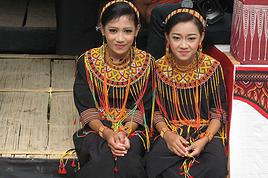
We will use busses, public house boat, chartered motorized canoes to access the jungle for a rugged days of trekking. We sleep in the simple houses of the villager with basic facilities and on the house boats. The trekking is tough and often wet, the only way to appreciate the primeveral jungle of Kalimantan and the most traditional Dayak Tribes settlements as well as the wildlife.
The rough and uncharted terrain and has made this Borneo traverse trip is one of the toughest and the most challenging trekking programs in the world.. The unpredictable weather and river conditions made this trip an exploratory adventures "
To enjoy this trip, you need to be prepared to accept whatever the jungles and rivers serve up! A good fitness level, a strong sense of determination and a flexible attitude are essential. The rewards are the romance of the journey itself, the mix of river travel including long stretches of rapids, the experience of jungle trekking and contact with the local Dayak peoples.
Descriptive day to day itinerary:
DAY 01. JAKARTA ARRIVAL
Upon arrival in Jakarta Soekarno Hatta Internatinal Airport, we will transfer you to hotel at down town in Jakarta. Free program all meals on your personal leisure.
DAY 02. JAKARTA PONTIANAK
Transfer to Cengkareng Airport to catch your flight to Pontianak. Upon arrival in Pontianak . Accomodation at hotel Santika Pontianak. There are a lot of things to do while we are there. We can explore the riverbank area of Pontianak by the wooden boat, from where we can observe the old and the new Pontianak from the different perspective. We can do Pontianak sight seeing with this way. Among the highlights of the sightseeing trip is Pontianak harbor, Beting Permai water village, and the huge Kapuas bridge. We can do this for about 2 or 3 hours.
DAY 03. PONTIANAK - PUTUSSIBAU (AVAILABLE ON Monday, Tuesday, Wednesday, Thursday, Saturday. )
Departure by DAS (Dirgantara Air Service) at 09.00 arrival Putussibau at 11.00 (please recheck again the flight schedule). This flight use small plane with capassity of 24 passenger but only possible for 22 seat only as they have to refill the gasoline. This flight use propeller and little bit noisy. Ear plugs is recommended. They allow extra luggage for 10 kg maximum so please only bring the very important things when you start this expedition . They provide a glass of mineral water with snack. They have no luggage cabin and all the stuffs will put on the back. Stay at simple hotel in Putussibau.
DAY 04. PUTUSSIBAU - KAPUAS RIVER
You will start your adventure expedition from here. After breakfast at hotel in Putussibau towards to the headwaters of the Kapuas by long boat. The long boat is about 1 ½ - 2 meter wide and 6 - 8 meter long with capacity for 4 - 5 passengers. The long boat without any roofs so it will be hot and also little noisy. Needed all necessary supplies, estimate day, as far upstream as possible. It is recommended to wear your water sport sandals (TeVa) or rubber shoes and bring ear plugs, hat, long sleeve, short pants, extra snacks & drinks and dry bags. You will take this journey with our porters as well as our guide's team. On the way may be the boat will be stop for toilet, cleaning the propeller, refill gasoline or fix the engine. You will pass some Dayak Village in the river side and their unique daily river life as well as some birds such as Eagle, King Fisher, Long Tailed Parakeet etc. Lunch on the way. Dinner and overnight at the riverside at tents or local house (B, L, D).
DAY 05. KAPUAS RIVER - BUNGAN RIVER
After breakfast, continue our journey by long boats as far as up stream. On the way we may stop at the Dayak village to see the long house . We will also pass some rapids, slash and burn agriculture (shifting cultivation) as well as the local people looking for gold, some by traditional way and some by machine along the river side. In certain places we have to go down to the river to push the boat as the level of the water in the dry season s is too shallow. Here you will experience how amazing the boat man and what we call "the Stone Man" the boat crew who knows exactly where is the rock and how to get away from the rapids. It's a great challenge of adventure you will experience. If the rapids too challenging we have to walk along the rock, slash and burns trash barrier in the river side and the boat will pick us up. It's tough here. Lunch on the way. Dinner and overnight in the river side at tents or temporary house or local house. (B, L, D).
DAY 06. BUNGAN RIVER - TANJUNG LOKANG
Continue our journey after breakfast. It's more and more challenging here with rapids. Go down boat, push the boat, walk on the rocks, or slash and burn trash barrier in the river side while the boat passing the rapids will give you more challenging experience. On the way you will see the tropical rain forest of Kalimantan, shifting cultivation, traditional gold mining in the river, temporary huts, till you reach Tanjung Lokan. Tanjung Lokan is small villages located inside Betung Kerihun National Park. If you are a handy craft collector you may find some nice basket, "Mandau" traditional machete, "Sumpit" blow gun, "Tangguy" traditional farmer hat etc. Lunch on the way, dinner and overnight at the local house. The guide teams will packing the stuffs to bring alng the expedition and divided between them so they will have the same weight to carry (B, L, D)
PS :
The duration of the long boat journey is depend on what happen in the fields. Normally the journey started after breakfast till in the mid day for lunch. Then the long boat will stop before dark to set the tents and prepare meals. Sometimes we have to continue the journey longer to catch the best places to stay overnight. Here we need your flexibility so you will enjoy the journey more.
DAY 07. TANJUNG LOKAN - BOBO/SEI BULIT (SUNGAI BULET)
After breakfast, start the trek across up Land Ladang "slash and burn, long fellow dry rice field through the forest. The first 2 hours we will high up the hill then another about 2 ½ hours passing the jungle and dry small river. After lunch on the way close to the river side, the trek will be high up and down again crossing the dry small river, and Nyinyit Cave (the local people collect the swallow nest that cost so expensive and very good to support their life inside the cave). Before dark we set the tent in the river side of Sei Bulit for dinner and overnight. The guides team will cook for you. Ultimate/rubber shoes is recommended. (B, L, D)
DAY 08. SEI BULIT - BUNGAN RIVER
After breakfast, crossing the river, up and down passing the jungle, crossing small rivers, and cave. You may see exotic flora and fauna of Borneo. After lunch on the way in the river side, then crossing jungle, up and down passing the dry river, cave and temporary huts that the local people using it while they do shifting cultivation or hunting deer, wild pig, birds, and even sometimes clouded leopard. Before dark, set the tent close to Bungan River for dinner and overnight. (B, L, D)

DAY 09. BUNGAN RIVER - BUNGAN LEA RIVER
Now you need to prepare for the challenging trek. The trek is also varied but tougher. After breakfast crossing the big river about ½ - 1 meter deep. Wee will have lots of deal with water, walk on the cliff of the river side and rock. After lunch on the way in the river side, continue the trek up and down the cliff of the river. Overnight and dinner in the river side of Bungan Lea River. (B, L, D)
DAY 10. BUNGAN LEA RIVER - PIANG LO'ONG
This is the longest and the toughest trek. After breakfast, crossing up and down passing the rivers, cliff of the rivers and the river side. After lunch continue the trek then started to trek almost the same like before lunch. The trek is so challenging and need more of adventure spirit and energy. Set a campsite close to the river for dinner and overnight. (B, L, D)
DAY 11. PIANG LO'ONG - MULLER RANGE
This is what the traveler will feel so different crossing the border of West & Esat Kalimantan! After breakfast, walked about two hours up and down river till reach the foot of Muller Range. It started from the altitude of 500 M ASL till reach the border of West and East Kalimantan at 1000 M ASL. The path is not so difficult only high up hill passing the jungle. It takes about 1 - 1 ½ hours depend on your ability. No need to rush as the jungle view is fantastic. After reaching the"TUGU PERBATASAN" (BORDER MONUMENT), you need to put one of some your belonging you wear for this expedition such as shocks, cloth or else in the stick around the border for offering to the spirit. After lunch on the way, the trek is easier down the hill until you reach the campsite in the river side. Dinner and overnight at the Muller Range. (B, L, D)
DAY 12. MULLER RANGE - MUARA CUTING.
After breakfast the trek is almost the same before and after lunch passing the rivers - jungle - and rivers. On the way the Dayak will show you how to survive the jungle, collecting the rotan, hunting, catching the fish, set a trap and you may involved with them. Lunch on the way, overnight at tent in the river side of Muara Cuting. (B, L, D)
DAY 13. MUARA CUTING - SAITE
This is the shortest trek. You will trek about only 3 hours to reach Saite so you will have lots of time for relaxing, swimming, take a break or else after hard trek. The trek passing the jungle and river. Breakfast, lunch and dinner at the river side. Overnight at Saite. (B, L, D)
DAY 14. MUARA SAITE - TIONG OHANG
After breakfast then trek crossing the river and jungle to reach the mouth of the Mahakam River for 3 hours walk. You will pass slash and burn agriculture before reaching the river side. Upon arrival, the long boat or locally call Cest then take you to Tiong Ohang Village for about 6 - 7 hours journey. Lunch on the way. You will pass some temporary hut as well as slash and burn agriculture and jungle. Dinner at the local simple restaurant and overnight at the local simple house at Tiong Ohang. This is the first village you encounter after long days in the jungles. You may also find more handy craft from Kalimantan with the best quality. (B, L, D)
DAY 15. TIONG OHANG - LONG BAGUN
After breakfast at the local restaurant, continue the journey by long boat for 8 - 10 hours. On the way stop at the local restaurant for lunch. You will pass some big rapids, so you need to walk on the rock but it's not so difficult and the boat will pick you up. The views along the rivers so fantastic and you can walk around to see the long house and their unique daily life. Dinner and overnight at the local simple house. (B, L, D)
DAY 16. LONG BAGUN FOR CULTURAL PERFORMENCES/BOARDING THE BOAT
As the Mahakam River has a unique characteristic river so you have to be aware about the tide of the river. In the dry season the level of the water could be so shallow so sometimes you have to leave Long Bagun earlier or otherwise you could not get the house boat when the level of the water is not reliable. Breakfast, Lunch and Dinner at the boat or Long Bagun. Overnight on boat or Long Bagun (B, L, D)
DAY 17. LONG BAGUN - SAIL ON THE HOUSE BOAT
The boat will start normally at 10.00 but could be change without prior notice. Am. Both sail one day before or this day you will arrive at the same day as the boat has to stay overnight. But better leave earlier if the water is not reliable. The house boat is public traditional wooden boat with two deck, the first deck for carry the stuffs and economy class with capacity more about 100 passengers and the second deck is for executive with capacity 75 passengers. The economy room is more open both sides and no mattress while the others served mattress, luggage room below the bed but all is open no private room and no AC. There is Indonesia style toilet and simple restaurant that provide Indonesian meals, tea, coffee, and snacks in the first deck. The boat will stop sometimes for passengers and loading the stuffs. During the sailing trip you will explore and learn the local way of life "river side civilization" which is much different from what we have normally in the dry land area. Breakfast, Lunch, Dinner and overnight on the house boat (B, L, D)
DAY 18. HOUSE BOAT - SAMARINDA
Arrival at the house boat I the afternoon about 10.00 Am - 12.00 Pm depend on the schedule. Upon arrival transfer by car to your hotel in Samarinda that takes about 20 - 30 minutes away. The rest of the day is free for your own activity and dinner will be served on your personal account. (B, L)
DAY 19. ONE EXTRA DAY
This is an extra day. We shall use it at place during the trek where we may need it or just because we want to spend the time there. But it will be during the trek only.
DAY 20. SAMARINDA - BALIKPAPAN
Breakfast at hotel then transfer to the appropriate time drive to Balikapapan Airport to catch your flight to the next destination. It takes about 3 hours from Samarinda to Balikpapan Airport (120 km ) depend on the traffic. Tours End. (B)
Ce qui fait 9 jours sur 20 dans la forêt...
Et sinon, je te parle de ce parc là:
BETUNG KERIHUN Description Physical features
Betung Kerihun National Park located in Sub district of Embaloh Hulu, Embaloh Hilir and Putussibau, District of Kapuas Hulu, Province of West Kalimantan. BKNP covers an area of 800, 000 Ha. The Park is approximately 27.60% of the total area of Kapuas Hulu District,
around 40% of the total protected area in the district, or 5.5% of the total area of Kalimantan Barat Province (14, 807, 700 Ha).
In general, the climate in BKNP exhibits a very high rainfall, being the typical of wet inland Kalimantan. The average annual rainfall is around 2, 863 to 5, 517 mm, and the number of rainy days is between 120 and 309 per year. Drier months occur between June and September with approximately 100 mm rainfall per month. The driest year happened in 1976 with annual rainfall of 2, 863 mm and 120 rainy days during the year, while the wettest year occurred in 1988 with up to 5, 517 mm rainfall and 184 rainy days during the year. On the whole, the Park belongs to type A (wet) in Schmidt and Ferguson classification, with Q=2.6%.
The topography of BKNP is mainly hilly and mountainous, with altitude ranging from 150 to 2, 000 m asl. The largest part of the Park is located at altitude between 200 and 500 m asl (38%). followed by altitude between 500 and 700 m asl (28.14%), between 700 and 1, 000 m asl (15.90), between 1, 000 and 1, 500 m (11.19%), less than 200 m asl (5.34%), and up than
1, 500 m asl (0.92%). With its mountains and hills, the Park is characterized by steep slopes (45% and up) in up to 61.15% of its area. Moderate slopes (25-45%) occur in around 33.08% of the Park area, while slopes of less than 25% occur in 5.77% of the Park area.
BKNP area has at least 179 peaks, consisting of 65 peaks in the Embaloh watershed, 36 in the Sibau-Menjakan watershed, 26 in the Mendalam watershed, and 52 in the Hulu Kapuas/Koheng/Bungan watershed. Prominent peaks in the Embaloh watershed are Mt. Betting (1, 150 m asl) and Mt. Condong (1, 240 m asl); in the Sibau-Menjakan watershed, Mt. Lawit (1, 770 m asl); in the Kapuas/Koheng, Mt. Jemuki (1, 375 m asl) and Mt. Cemaru (1, 118 m asl); in the Bungan watershed, Mt. Kerihun (1, 790 m asl) and Mt. Dayang (1, 645 m asl).
The hydrology of BKNP is characterized by hundreds of streams and big rivers which form the Kapuas watersheds. Kapuas watersheds cover 9, 874, 910 Ha or around 67% of Kalimantan Barat Province area (14, 680, 700 Ha). On the whole, Kapuas watershed can be divided into five smaller sub-watersheds, namely Embaloh in the west area of the Park, Sibau-Menjakan and Mendalarn in the middle area, and Hulu Kapuas/Koheng and Bungan in the eastern area. Key rivers are Embaloh River (95 km long), Sibau River (25 km), Menjakan River (65 km), Mendalam River (30 Km), Hulu Kapuas/Koheng (100 km), and Bungan River (50 km)
The soil types of BKNP are varied. Organosol and decomposed Glei soils are dispersed in the Embaloh upriver sub-district. Alluvial soils occur in the Mendalam River areas, Sibau and Embaloh Rivers, while podzolic yellow-red, and complex podzolic yellow-red and latosol, which dominate the Park areas are identified are found in Puttusibau and in the Embaloh upriver sub-district.
b. Biological features b.1. Flora
Borneo, the richest of the Sunda islands floristically both in terms of total species richness and diversity (MacKinnon et al., 1996), has a flora richness which includes both Asian and Australian elements. In BKNP, the Asian element is generally seen in the lowland forest up to the lower montane forest. Meanwhile, the upper montane is generally inhabited by species of Australasian families, such as Leptospermum, Phyllocladus and Styphelia (Steenis, 1972).
The vegetation and floristic composition in BKNP can generally be divided into the following types:
1) Lowland dipterocarp forest
2) Alluvial forest
3) Swamp forest.
4) Old secondary forest
5) Hill dipterocarp forest
6) Limestone forest
7) Sub-montane forest 8) Montane forest
On the whole, the 8 forest ecosystems of BKNP harbor at least 1, 254 flora species. The family of Dipterocarpaceae has the most species of all flora families of BKNP (120 of a total 267 dipterocarp species found in Borneo). Other families having many species in BKNP include Euphorbiaceae (99 species), Myrtaceae (66), Annonaceae (38), Myristicaceae (31), and Burseraceae (21). Flora richness of BKNP also includes a large variety of orchid species. At ]least 97 species have been identified in the Park. Another flora richness of BKNP is its palm species. At least 49 species of palm have been identified in the Park area. Meanwhile, 133 species of bryophyte under 3 classes have been identified in BKNP (Sujadmiko, 1999). Nineteen families and 65 species of bryophyte belong to Hepaticopsidae, 1 family and 2 species belong to Anthocerotopsidae, whereas 19 families and 66 species belong to Bryopsidae.
2. Fauna
Like Borneo' fauna in general, BKNP's rich fauna is characteristically Asian in origin. It shares most of its fauna with the Asian mainland and the other Sunda islands, but shares few species with Sulawesi and the eastern islands which have a somewhat different faunal composition.
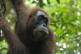
The Park harbors not least than 652 fauna species. Of them, at least 54 are mammal species. Mammal species of BKNP also includes 8 primate species, namely Pongo pygmaeus, Hylobates muelleri, Presbytis frontata, P. rubicunda, Macaca nemestrina, M. fascicularis, Nycticebus coucang and Tarsius bancanus. The distribution of Pongo pygmaeus, one of the two species of orangutan found in Indonesia is interestingly concentrated in the western part of BKNP area, especially in Embaloh Watershed, which border Lanjak Entimau Wildlife Sanctuary (LEWS) of Sarawak, Malaysia. Therefore, the establishment of BKNP-LEWS Biodiversity Conservation Area is considered very relevant for the conservation of Orangutan. Seventeen species of bats and 17 species of rodent, including Cheiromeles torquatus, which has been declared extinct in Java, are also members of the mammal diversity of the Park.
The Park harbors high herpetofauna diversity. At least 112 species, comprising 59 species of amphibian, 25 species of reptilia, 24 species of squamata, and 4 species of testudinata, have been identified in BKNP. Meanwhile, the Park provides habitats for 300 species of bird. The dominant species belong to family names of Muscicapidae, Pycnonotidae, and Timaliidae. Twenty five species are Bornean endemics and 6 species are newly found species to Indonesia. The fish diversity of BKNP is also high. At least 186 species of fresh¬water fish have been identified. Thirteen fish species have been identified endemic to Borneo. Finally, insect diversity of BKNP is interesting. At least 170 insects have been identified in the Park.
Justification of Outstanding Universal Values
Betung Kerihun National Park (BKNP) is located at the headwaters of the Kapuas River in the far interior of Kalimantan Barat (;Western Kalimantan) Province. The site covers an area of 800, 000 Ha and borders the 200, 000 Ha Lanjak Entimau Wildlife Sanctuary (LEWS) in Sarawak, Malaysia. Together the two protected areas form one of the first trans-border parks in Southeast Asia.
The topography of BKNP area ranges from lowland elevations at about 200 m asl to mountains almost 2, 000 m asl high. At such the site serves as an important water catchments area. Three out of Borneo's great rivers, the Rejang and Lupar River in Sarawak, Malaysia, and the Kapuas River in Kalimantan, Indonesia, have their origins here. Meanwhile, the Park's eight types of forest ecosystems, ranging from lowland dipterocarp forest, alluvial forest, swamp forest, old secondary forest, hill dipterocarp forest, limestone forest, sub-montane forest, to montane forest, provide habitats for the valuable Bornean biodiversity.
Initial surveys have discovered thousands of species of flora and fauna, including 67 threatened flora species and 81 threatened fauna species under the 2000 IUCN Red List of Threatened Species. Threatened flora species under the list include Dipterocarpus cornutus (CR), Dipterocarpus gracilis (CR), and Dipterocarpus grandiflorus (CR), and threatened fauna species include the orangutan Pongo pygmaeus (EN) and False Gavial Tomistoma schlegelii (EN). The surveys also reveal Bornean endemic species, such as Muntiacus atherodes, Presbytis frontata, Presbytis rubicunda and Reithrosciurus macrotis.
Forests of BKNP are also important for indigenous inhabitants of the region, a variety of Dayak tribes who live from hunting, collecting non-timber forest products and subsistence farming based on a pattern of shifting cultivation.