Hi there,
Could you recommend any reputable local agencies for a driver with a vehicle to travel along the RN7 from Tana to Tulear with stops?
Or alternatively, a driver you’ve personally "hired" for your trip?
Thanks!
Xavier
African Indian Ocean · Madagascar
Showing 61–90 of 100 discussions in English.

Hi everyone, I’m heading to Madagascar in December 2025 and I’d like to know the one-way fare without checked baggage—just cabin luggage—from Tamatave/Toamasina to Saint-Denis on Réunion Island, please. Also, how many days a week are there connections, and how long does the trip take? Thanks!
I’d also like to know about the route between Réunion Island and Mauritius: where does it depart from, how much does it cost, and on which days are there connections? Thanks in advance!
Best regards,
I’d also like to know about the route between Réunion Island and Mauritius: where does it depart from, how much does it cost, and on which days are there connections? Thanks in advance!
Best regards,
Hello,
I’m an agronomy student specializing in tropical regions, and I need to do my 4-month internship near Tuléar. However, I only found out about it yesterday, and I’m supposed to leave on September 16th. I’ve never done this kind of trip before—neither alone nor with someone else. So, I’m a little lost and, um… panicking! I also need to transport valuable equipment that doesn’t take up too much space!
I’m not sure how to get between the two cities, Antananarivo and Tuléar. I plan to carry my luggage in an 80L hiking backpack to avoid drawing attention in Antananarivo.
Has anyone taken a *taxi-brousse* on this route before? How much time should I allow between the two cities, and what budget should I plan for this trip? Where can I find *taxis-brousses* (TB) in Antananarivo?
Any info will be helpful and reassuring! Thanks!
PS: What do you think about safety in Tuléar?
I’m an agronomy student specializing in tropical regions, and I need to do my 4-month internship near Tuléar. However, I only found out about it yesterday, and I’m supposed to leave on September 16th. I’ve never done this kind of trip before—neither alone nor with someone else. So, I’m a little lost and, um… panicking! I also need to transport valuable equipment that doesn’t take up too much space!
I’m not sure how to get between the two cities, Antananarivo and Tuléar. I plan to carry my luggage in an 80L hiking backpack to avoid drawing attention in Antananarivo.
Has anyone taken a *taxi-brousse* on this route before? How much time should I allow between the two cities, and what budget should I plan for this trip? Where can I find *taxis-brousses* (TB) in Antananarivo?
Any info will be helpful and reassuring! Thanks!
PS: What do you think about safety in Tuléar?
Hi everyone,
I’m planning a third trip to Madagascar in 2026. This time, heading north and then part of the west coast before going back up.
The question I’m asking myself—same as during our first visits—is Nosy Be or not?
Of course, the photos show stunning beaches, and when you mention Madagascar, almost everyone says Nosy Be or at least has heard of it. That’s actually why we didn’t include it in our itineraries before, especially since we’d already seen paradise-like beaches in the south, and we had them all to ourselves because they were hard to reach.
On the other hand, I’ve always been drawn to Île Sainte-Marie, but from the north, you have to go back down to Tana, which I’m okay with in principle.
So, what’s your take? Nosy Be and its surroundings—what do you think? Just tourists looking to party?
Thanks
Hi there,
I spent 25 days in October 2023 in Madagascar on a motorcycle, solo. Covered 3,000 km with no prior planning. And with no real motorcycle experience. However, it’s crucial to find a reliable person for motorcycle rental. Mine wasn’t extremely well-maintained, and I had quite a few issues.
Here’s an overview of the itinerary, including descending the Tsiribihina River by pirogue, the Tsingy, heading down to Tuléar, and back up the RN7 (Isalo, Tsarasoa Valley, Lake Sahambavy, etc.).
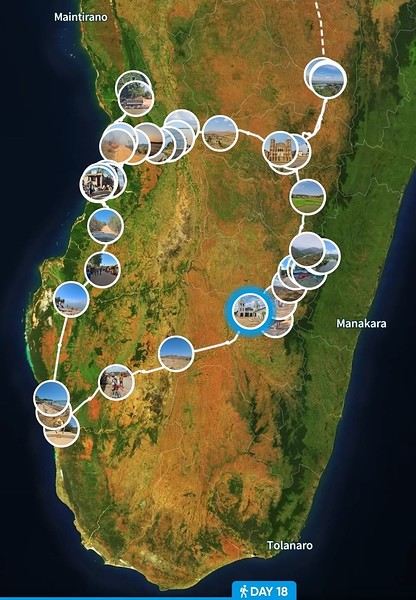
It was an incredible life and travel experience. A fabulous country, breathtaking landscapes, and a smiling population despite the hardships of life.
If I can answer any questions, don’t hesitate!
It was an incredible life and travel experience. A fabulous country, breathtaking landscapes, and a smiling population despite the hardships of life.
If I can answer any questions, don’t hesitate!
Hi,
Can you tell me if it's possible to exchange money in cities other than the capital or some domestic airports, and should I prioritize banks or exchange shops?
Thanks in advance

Please, "HELP ME".
Hello everyone, and especially to the regulars of the MADA forum that I read every day. This time, I’m asking you not to argue and to try to help me with my problem.
A week ago, I submitted a visa application for France where I was supposed to meet a family who was going to help me with medical exams and host me on a short-stay tourist visa. My application was put together with the help of my friends over the past two months, and we checked everything multiple times—nothing was missing, and everything was in order. Last Friday, I picked up a visa refusal from the embassy in Tana with the reason: your intention to leave the territory of the member states before the visa expires could not be established. Yet, I had handwritten a letter committing to return to my country.
I went to the embassy twice because the first time they couldn’t find my file, and the second time I still wasn’t registered in their computer. After a while, the person came back from another room with my passport and this refusal slip. I’m starting to wonder if my application was even reviewed. I’m completely desperate, and even though my friends in France have filed an appeal in Nantes, I’m forced to leave Tana because my savings are running out fast. We have very little hope for the appeal in France since there must be hundreds of applications. So I’m open to any information or advice, but please "HELP ME".
Hello everyone, and especially to the regulars of the MADA forum that I read every day. This time, I’m asking you not to argue and to try to help me with my problem.
A week ago, I submitted a visa application for France where I was supposed to meet a family who was going to help me with medical exams and host me on a short-stay tourist visa. My application was put together with the help of my friends over the past two months, and we checked everything multiple times—nothing was missing, and everything was in order. Last Friday, I picked up a visa refusal from the embassy in Tana with the reason: your intention to leave the territory of the member states before the visa expires could not be established. Yet, I had handwritten a letter committing to return to my country.
I went to the embassy twice because the first time they couldn’t find my file, and the second time I still wasn’t registered in their computer. After a while, the person came back from another room with my passport and this refusal slip. I’m starting to wonder if my application was even reviewed. I’m completely desperate, and even though my friends in France have filed an appeal in Nantes, I’m forced to leave Tana because my savings are running out fast. We have very little hope for the appeal in France since there must be hundreds of applications. So I’m open to any information or advice, but please "HELP ME".
First trip to Madagascar (couple + 2 older teens). We’ve read quite a few posts and watched traveler videos, which helped us figure out what we could do in 3 weeks. We’d like to travel with a driver-guide. You’ll probably be able to help us with the overall duration... Are we being too ambitious, or is this reasonable? In this itinerary, are there any must-see places we shouldn’t miss?
Here’s our first draft:
Departure from Tana to the east via the RN2. Stop at the Analamazoatra Reserve RN11 to reach the Pangalanes Canal 3 or 4 days to travel south along the canal (taxi boat) The train from Manakara to Fiana RN7 toward Tulear Time for a short trek in Andringitra? I’m not sure... Isalo Park From Tulear, head north or south by pirogue to relax somewhere To get back to Tana and stay within our vacation time, I think we’ll need to fly... Will we have time left for Ampefy?
What do you think?
Departure from Tana to the east via the RN2. Stop at the Analamazoatra Reserve RN11 to reach the Pangalanes Canal 3 or 4 days to travel south along the canal (taxi boat) The train from Manakara to Fiana RN7 toward Tulear Time for a short trek in Andringitra? I’m not sure... Isalo Park From Tulear, head north or south by pirogue to relax somewhere To get back to Tana and stay within our vacation time, I think we’ll need to fly... Will we have time left for Ampefy?
What do you think?
Hi
Could you tell me how often the bush taxis run from Ampefy to Tana?
It’s been 15 years since I last went to Sainte-Marie. I used to stay at the Hôtel Les Baleines—it was pretty basic, but I get the feeling things have improved since then.
If anyone has good recommendations for hotels, rentals, scooters, or tuk-tuks, I’m all ears!
Hi there,
Apart from the few short hikes I’ve ticked off around Ampefy (Lily Falls to the Third Falls, geysers), do you have any must-do recommendations for a day hike between Ampefy and Antsirabe or around Antsirabe itself? I’m looking for a big, full-day trek, even if there’s a lot of elevation gain.
P.S.: I’ll have a private driver.
Thanks in advance! !
Hi there, following a work trip, I’ll have 4.5 days left to get a quick overview of Madagascar during the last week of February. I’ll already have had a good look around Tana (3 days of work and 1.5 days beforehand to see 1 or 2 points of interest 2-3 hours from Tana).
Is it feasible to spend the remaining 4.5 days like this:
- Day 1 & 2 (and maybe the morning of Day 3): relaxing on a coast with a pleasant climate, for example, a one-way flight to Tuléar (there’s a flight on Day 1 at 3 AM) and heading to a nice beach. Ideally, I’d have liked to go toward Morondava (baobabs, beautiful beaches near Belo), but the flight schedules don’t really work, and it wouldn’t let me visit Isalo.
- Then 2 days to head back up via the RN7, ideally with a stop in Isalo, which really appeals to me (I’m an experienced hiker in France), and/or Ranomafana. But do the weather conditions allow for long hikes in that area? Ideally, I’d like to do Tuléar–Tana by public transport up to my first road stop (shared bus? To Isalo?), then find a local hiking guide for the day. And take another transport to another point of interest before returning to Tana, where I have my return flight to France on Day 5 at noon.
My questions: - How to travel from Day 3 to Day 5 from the west coast (Tuléar? Morondava?) back to Tana? I’d prefer not to depend on a guide the whole way, but if I have to 🤷🏽♂️) If I choose Morondava, will I miss out on really interesting spots I could’ve seen along the RN7?
I’m open to any suggestions or ideas to make the most of these 4.5 days, like another beach destination I might not have considered (I ruled out Nosy Bé because of the February weather—maybe I was wrong?)
Is it feasible to spend the remaining 4.5 days like this:
- Day 1 & 2 (and maybe the morning of Day 3): relaxing on a coast with a pleasant climate, for example, a one-way flight to Tuléar (there’s a flight on Day 1 at 3 AM) and heading to a nice beach. Ideally, I’d have liked to go toward Morondava (baobabs, beautiful beaches near Belo), but the flight schedules don’t really work, and it wouldn’t let me visit Isalo.
- Then 2 days to head back up via the RN7, ideally with a stop in Isalo, which really appeals to me (I’m an experienced hiker in France), and/or Ranomafana. But do the weather conditions allow for long hikes in that area? Ideally, I’d like to do Tuléar–Tana by public transport up to my first road stop (shared bus? To Isalo?), then find a local hiking guide for the day. And take another transport to another point of interest before returning to Tana, where I have my return flight to France on Day 5 at noon.
My questions: - How to travel from Day 3 to Day 5 from the west coast (Tuléar? Morondava?) back to Tana? I’d prefer not to depend on a guide the whole way, but if I have to 🤷🏽♂️) If I choose Morondava, will I miss out on really interesting spots I could’ve seen along the RN7?
I’m open to any suggestions or ideas to make the most of these 4.5 days, like another beach destination I might not have considered (I ruled out Nosy Bé because of the February weather—maybe I was wrong?)

Hi there,
Just a quick post to let travelers heading to Madagascar know not to apply for an eVisa online—the platform isn’t working. We actually submitted an application last Sunday on their official site (provided by the Madagascar embassy in Paris) http://evisamada-mg.com/. The 35 € payment for a 30-day visa was debited from our account, but no document was issued. After emailing back and forth, they admitted there’s a flaw in their system, and we’ll now have to apply for an AD visa on arrival! We thought we’d save time at the airport—nope, that backfired. They claim we won’t have to repay for the visa, but I’ll believe it when I see it…
Luckily, we only applied for my husband’s visa, so we’ll only lose 35 € if that’s not the case! I’ll apply for mine directly on arrival and skip the eVisa altogether!
Luckily, we only applied for my husband’s visa, so we’ll only lose 35 € if that’s not the case! I’ll apply for mine directly on arrival and skip the eVisa altogether!

Things may have changed... 10 years ago, we were advised not to exchange money at Ivato Airport when arriving, but rather in shops like electronics stores.
We’ll be arriving on a Friday early afternoon—I’m wondering if Malagasy banks in Tana are open on Friday afternoons and Saturdays?
Do you have any tips for exchanging euros to ariary?

Planning for retirement! Where? How? Why there? Current home: Réunion Island > it's great. Though a bit too crowded on this island... And the future looks way too expensive to live reasonably without spending too much. So, exploring the Indian Ocean. Your ideas are welcome! ;-) A bit of Bali, a touch of Rodrigues, a few weeks in Mauritius, summers in Nosy Be, and winters in Réunion. In a camper van... maybe.
Hi there,
I’m heading to Madagascar for 15 days next March, specifically to Nosy Be, and I’d like to buy some vanilla. Where can I buy it in Nosy Be, and what’s the current price of vanilla? I’ve heard that the price of vanilla has skyrocketed (like everything else, to be honest). If anyone has bought some recently, that would be a huge help.
Thanks in advance!
Hi,
We're heading to Madagascar in just over a month. Our flight arrives at Nosy Be, and I was wondering if there are any currency exchange offices at that airport since it doesn’t seem very big?
I’d like to exchange 500 € for incidentals (souvenirs, vanilla purchases, etc.). Our hotel is already paid for (half-board) as well as the excursions. What do you think? Thanks for your help!
If you had 5 days available in your road trip on this gorgeous island,
which would you choose between the two options below and why?
1/ Diego Suarez with a visit to Ankarana, the "Montagne des Français", the Three Bays, the Emerald Sea, etc.
Or
2/ a trio starting from Morondava all the way to Anakao, passing through Belo sur Mer, Manja, Salary, and Anakao.
Thanks for your help
It’s been over 10 years since I last went to Madagascar. Back then, I flew Corsair from Paris.
I’m planning to go back in September 2025.
I’ve heard about Air Austral...
Air France: the issue is the flight arrives in the evening at Ivato.
What do you recommend?
Which airlines fly from Paris to Tana?
Thanks for the help!
Hi,
We’re planning a trip to Nosy Be from March 14th to 29th. I saw on the "Where and When to Go" site that the weather isn’t great then—has anyone been to this part of Madagascar during this period? Does it rain a lot? Thanks so much for your help!
Hi there,
My wife is from Madagascar (we currently live in France), and she wants to move back permanently. Can we buy a one-way ticket for her flight?
Looking forward to your reply, Eric
My wife is from Madagascar (we currently live in France), and she wants to move back permanently. Can we buy a one-way ticket for her flight?
Looking forward to your reply, Eric

Hi there
I’m heading to Madagascar soon and I’m looking for two pieces of info:
- Is there a passenger train between Tananarive and Tamatave?
- Are there maritime connections again between Madagascar and the Comoros from Majunga? If so, can you buy ferry tickets online?
Thanks
Laurent
It's all in the title! What are the options and fares for getting from the airport to downtown?
My last reference there is 10 years old...
Hi there,
I’m planning a 22-day trip to Madagascar this July.
And I could really use some advice 😊
Here’s what I’m sure about: Spending a few days in Nosy Be so my daughter can complete her Open Water certification—so I’m thinking 4 or 5 days there. I think Diego Suarez, Montagne d’Ambre, and Ankarana would suit what we like to do and have the advantage of being close to Nosy Be.
Now, the parts I’m unsure about, especially because of travel times:
My daughters really want to see whales. Is it possible around Nosy Be, or is Sainte Marie *the* must-visit spot? And what’s the weather like at that time of year? If we choose Sainte Marie, maybe do the Pangalanes Canal? Or is the route from Diego to Sainte Marie via the Vanilla Road a must-do?
Another option could be exploring the east with the Tsiribihina River and the Avenue of the Baobabs in Morondava.
Thanks in advance for your tips!
And I could really use some advice 😊
Here’s what I’m sure about: Spending a few days in Nosy Be so my daughter can complete her Open Water certification—so I’m thinking 4 or 5 days there. I think Diego Suarez, Montagne d’Ambre, and Ankarana would suit what we like to do and have the advantage of being close to Nosy Be.
Now, the parts I’m unsure about, especially because of travel times:
My daughters really want to see whales. Is it possible around Nosy Be, or is Sainte Marie *the* must-visit spot? And what’s the weather like at that time of year? If we choose Sainte Marie, maybe do the Pangalanes Canal? Or is the route from Diego to Sainte Marie via the Vanilla Road a must-do?
Another option could be exploring the east with the Tsiribihina River and the Avenue of the Baobabs in Morondava.
Thanks in advance for your tips!
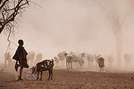
During these three big weeks in Madagascar, one week in Sainte Marie, a few days for a little loop in the west/south, and the rest in Tana.
This loop I’m talking about covers an area I’d never taken the time to visit before. A recent road in good condition, the chance to pass through beautiful highland landscapes, and a few free days made it the perfect opportunity. Destination: Ampefy, west of Tana via the RN1, then a turn south onto the recently rehabilitated RN43 to reach Antsirabe before heading back to Tana. Four days planned—perfect, since an extra day wouldn’t have been a problem given all the activities in Ampefy.
First day: a relaxed and fairly late departure for Ampefy. We weren’t in a rush and took our time. Traffic leaving Tana to get back on the RN1 cost us the head start we had on our original schedule. An hour and a half bumper-to-bumper with the *buxis*, inching painfully toward the roundabout and then the bridge that acts as a bottleneck—we dove in like all our fellow sufferers. It’s not our everyday reality, and we were early, so no big deal, but man, it’s long and slow. Once past that obstacle, traffic flowed smoothly, and the road was good (all the way to Ampefy). We moved through highland landscapes, bustling villages full of activity, and countless agricultural supply shops—clear proof, if any were needed, that we were crossing a prime farming region. Around Arivonimamo, we passed through a forest with a Mediterranean vibe: a single-species forest of stout little trees with glossy, elongated light-green leaves—these are *tapia*. An endemic tree in Madagascar, and a pretty unique forest as a result (you can see them elsewhere, like between Antsirabe and Ambositra). There are efforts to protect it from illegal logging because the wood is fire-resistant, which helps shield the forest from wildfires. Beyond its biodiversity value, the *tapia* hosts silkworms, giving it economic and cultural importance.
As we kept going, we started spotting a lake and mountains with the rounded shapes typical of extinct volcanoes worn down by time and the elements. We were approaching Lake Itasy and, by extension, Ampefy. We stopped at a *hotely* for a plate of *tongon’kisoa*—pig’s trotters caramelized by cooking, with thick, flavorful skin—along with the obligatory portion of rice, which we took the time to drizzle with cooking juices to make it a bit more appetizing. Full, we turned left to reach Ampefy and our hotel. The landscape was dotted with collapsed, dormant volcanic cones, and suddenly, the view opened up onto the lake. Shallow and expansive, we followed it, losing sight of it now and then before finding it again in Ampefy itself, which we entered after crossing the Lily, a beautiful river that drains the lake. Lots of hotels and restaurants, with plenty of options at all price points. We chose the *Farihy*, about 5 km past Ampefy. A gorgeous spot by the lake, with a pool and lovely bungalows—some with picture windows overlooking the lake. Really nice. In the evening, a drink and some *sak sak* for aperitif on the terrace. It wasn’t warm, there was a lot of wind, and a storm was brewing. Off to bed quickly to start the next day’s visits.
After buying some lychees—we hadn’t seen many this year, and these were fresh from the field, picked in Ampefy—we headed to the Lily Falls. Well signposted, with a paved road in great condition, we stopped at the kiosk for the entrance fee and parking (1 euro for one *vahiny* and 10 cents for one Malagasy). We set off down the path and quickly reached the first waterfall, then continued for maybe 1 km on a well-marked trail to the second. A guide led us to the third, which is harder to spot and isn’t actually on the Lily itself. Beautiful countryside scenery: fishermen straight out of *Tom Sawyer*, straw hats on their heads, lying down with one foot hooked to a fragile bamboo rod, their line dipping into the calm river. Men preparing rice paddies with their *angady*, women transplanting rice, bent over the water. At some points, we walked along the dikes between paddies almost ready for harvest. It’s peaceful and beautiful when you’re strolling or fishing, but working the paddies is grueling, especially under that beating sun. A really nice walk—2 hours and a bit, going at a leisurely pace. A guide isn’t mandatory; only the entrance fee is. We took one because it provides a bit of work and puts money in the hands of locals, giving them more incentive to protect the site. But you can easily skip it, like most people do. Lots of visitors since it was the weekend—Tananarivians with family or groups of young people, scout groups organized under their chaperones’ direction. Very few foreign tourists, though—that’s a general observation. It’s great to see this growth in domestic tourism, giving Malagasy people the chance to discover their own country and allowing those in the sector to rely less on foreign visitors, who’ve been scarce for years.
Next, we headed to the "geysers" (which aren’t actually geysers, but whatever). We had to go back to the RN1, head toward Tsiroanomandidy, and a few kilometers later, a well-marked sign and a newly paved track led us to a pretty site. Again, lots of people, another kiosk, more fees to pay, and guides available. This time, we skipped the guide. A downpour caught us in front of the "geysers," so we took shelter under a little shop, grabbing an ice cream and some drinks. We didn’t stay long—we weren’t interested in a massage or a dip in the thermal water. The countryside and barren mountain landscapes were stunning on the way back to the hotel. We noticed you could go paragliding right in front of the bungalow, so we booked a session for the next morning. After eating at the *Auberge* in the town center (it was good), we headed back to the hotel to turn in early. Once again, a storm rolled in during the afternoon, and the temperature dropped significantly.
The next morning, around 8 a.m., we walked to the takeoff zone near the hotel. Towed by a small boat, we took off for a flight over the lake and the volcanic domes before landing back at the same spot. Two companies handle this. I’m no expert, but it seemed safe and well-organized.
To be continued...
First day: a relaxed and fairly late departure for Ampefy. We weren’t in a rush and took our time. Traffic leaving Tana to get back on the RN1 cost us the head start we had on our original schedule. An hour and a half bumper-to-bumper with the *buxis*, inching painfully toward the roundabout and then the bridge that acts as a bottleneck—we dove in like all our fellow sufferers. It’s not our everyday reality, and we were early, so no big deal, but man, it’s long and slow. Once past that obstacle, traffic flowed smoothly, and the road was good (all the way to Ampefy). We moved through highland landscapes, bustling villages full of activity, and countless agricultural supply shops—clear proof, if any were needed, that we were crossing a prime farming region. Around Arivonimamo, we passed through a forest with a Mediterranean vibe: a single-species forest of stout little trees with glossy, elongated light-green leaves—these are *tapia*. An endemic tree in Madagascar, and a pretty unique forest as a result (you can see them elsewhere, like between Antsirabe and Ambositra). There are efforts to protect it from illegal logging because the wood is fire-resistant, which helps shield the forest from wildfires. Beyond its biodiversity value, the *tapia* hosts silkworms, giving it economic and cultural importance.
As we kept going, we started spotting a lake and mountains with the rounded shapes typical of extinct volcanoes worn down by time and the elements. We were approaching Lake Itasy and, by extension, Ampefy. We stopped at a *hotely* for a plate of *tongon’kisoa*—pig’s trotters caramelized by cooking, with thick, flavorful skin—along with the obligatory portion of rice, which we took the time to drizzle with cooking juices to make it a bit more appetizing. Full, we turned left to reach Ampefy and our hotel. The landscape was dotted with collapsed, dormant volcanic cones, and suddenly, the view opened up onto the lake. Shallow and expansive, we followed it, losing sight of it now and then before finding it again in Ampefy itself, which we entered after crossing the Lily, a beautiful river that drains the lake. Lots of hotels and restaurants, with plenty of options at all price points. We chose the *Farihy*, about 5 km past Ampefy. A gorgeous spot by the lake, with a pool and lovely bungalows—some with picture windows overlooking the lake. Really nice. In the evening, a drink and some *sak sak* for aperitif on the terrace. It wasn’t warm, there was a lot of wind, and a storm was brewing. Off to bed quickly to start the next day’s visits.
After buying some lychees—we hadn’t seen many this year, and these were fresh from the field, picked in Ampefy—we headed to the Lily Falls. Well signposted, with a paved road in great condition, we stopped at the kiosk for the entrance fee and parking (1 euro for one *vahiny* and 10 cents for one Malagasy). We set off down the path and quickly reached the first waterfall, then continued for maybe 1 km on a well-marked trail to the second. A guide led us to the third, which is harder to spot and isn’t actually on the Lily itself. Beautiful countryside scenery: fishermen straight out of *Tom Sawyer*, straw hats on their heads, lying down with one foot hooked to a fragile bamboo rod, their line dipping into the calm river. Men preparing rice paddies with their *angady*, women transplanting rice, bent over the water. At some points, we walked along the dikes between paddies almost ready for harvest. It’s peaceful and beautiful when you’re strolling or fishing, but working the paddies is grueling, especially under that beating sun. A really nice walk—2 hours and a bit, going at a leisurely pace. A guide isn’t mandatory; only the entrance fee is. We took one because it provides a bit of work and puts money in the hands of locals, giving them more incentive to protect the site. But you can easily skip it, like most people do. Lots of visitors since it was the weekend—Tananarivians with family or groups of young people, scout groups organized under their chaperones’ direction. Very few foreign tourists, though—that’s a general observation. It’s great to see this growth in domestic tourism, giving Malagasy people the chance to discover their own country and allowing those in the sector to rely less on foreign visitors, who’ve been scarce for years.
Next, we headed to the "geysers" (which aren’t actually geysers, but whatever). We had to go back to the RN1, head toward Tsiroanomandidy, and a few kilometers later, a well-marked sign and a newly paved track led us to a pretty site. Again, lots of people, another kiosk, more fees to pay, and guides available. This time, we skipped the guide. A downpour caught us in front of the "geysers," so we took shelter under a little shop, grabbing an ice cream and some drinks. We didn’t stay long—we weren’t interested in a massage or a dip in the thermal water. The countryside and barren mountain landscapes were stunning on the way back to the hotel. We noticed you could go paragliding right in front of the bungalow, so we booked a session for the next morning. After eating at the *Auberge* in the town center (it was good), we headed back to the hotel to turn in early. Once again, a storm rolled in during the afternoon, and the temperature dropped significantly.
The next morning, around 8 a.m., we walked to the takeoff zone near the hotel. Towed by a small boat, we took off for a flight over the lake and the volcanic domes before landing back at the same spot. Two companies handle this. I’m no expert, but it seemed safe and well-organized.
To be continued...

Hi everyone, I’m stopping just giving advice on new topics to others and leading by example.
Here’s a quick recap of my Manakara–Fort Dauphin route via the ferry + 10 track (RN12). The road is changing: bridges are being built, some sections are being paved.
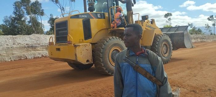 By bike, it’s doable, though some sandy stretches are still pretty tough if you’re as overloaded as I was... Left Manakara’s Hôtel Les Délices on the 11th with my pretty beat-up blue bike...
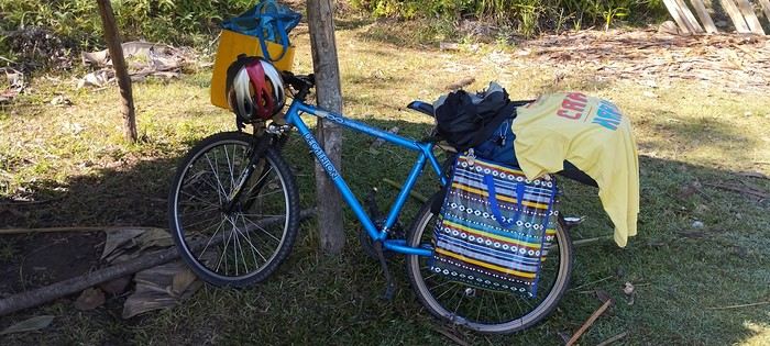
Evening of the 11th: Ivohipeno Hôtel La Source.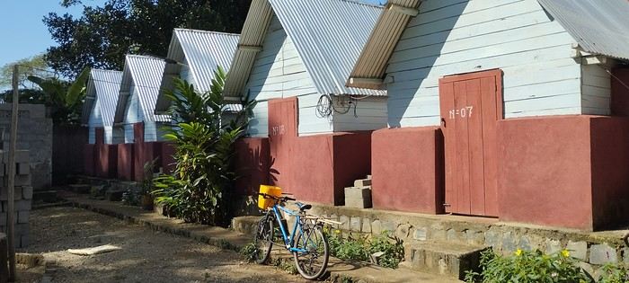
12th–15th: Farafangana’s must-visit Hôtel Concombre Masqué, bike prep. 16th: Vangaindrano—Hôtel Chez Huguette was full, so I went to Tropic Hôtel, which is nice even with plumbing issues. Did my shopping since it’s the last real town. 17th: Chez Flavienne—her real job is singer/dancer, and she has cute little bungalows before the village of... I never found it on GPS or maps. A bit basic but welcoming, with Flavienne taking great care of me. 18th: Manombondro—the "friends’ spot," yikes, avoid! The restaurant’s okay, but the room is really rough: sketchy shower, the room opens right onto the main road where all the 4x4s gather. Good for tips, but better to sleep elsewhere...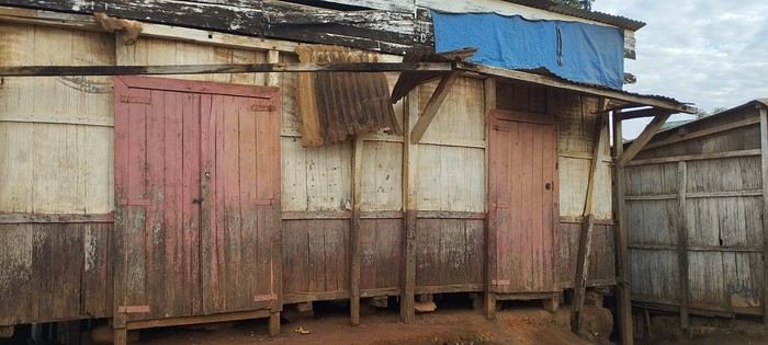
20th: Taking one of the many alternative tracks, I got lost and camped under my tent less than 5 km from Sandravinany. 21st: Sandravinany—first day at Mamie Louise’s, average hotel. Vesslasse, the manager, is great. 22nd: The next day, I went back to the fisherman’s cabin I’d thought was closed the day before—awesome! Perfect location with a lagoon view.
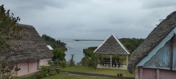
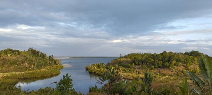
Vesslasse stops by regularly to offer his services—he knows everyone, is efficient, and super friendly. I treated myself to a few days of contemplative relaxation before taking a pirogue toward the coastal track on the morning of the 25th—big mistake! Hardly anyone around to ask for directions, so I got lost multiple times, did a bunch of backtracking, and dealt with a lot of sand... Check out this YouTube video: From Sandravinany to the Sand Track 25th: Maroroy—chez Louisette, can’t miss it: right after the ferry, by the water, super relaxing. By the water, super relaxing. 26th: Manantenina—the very nice (and for me, too expensive) bungalows of Jean-Philippe were full, so I stayed at Hôtel Le Bleu, small bungalows with a restaurant on the main road. 27th: Sainte Luce—I got a ride from a UNICEF 4x4, so I *had* to stay at Hôtel Vah’inn—expensive but right on the water, with a pool table and good food. 28th: Fort Dauphin—Hôtel Nepenthes: central (steep climb to get there!) but nice bungalows.
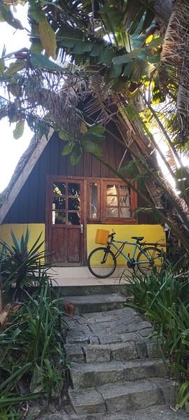
Fort Dauphin has plenty of very affordable hotels. After that, I headed back to Tulear in a shared 4x4 (Godzilla)—two pretty grueling days, but the driver was really nice.
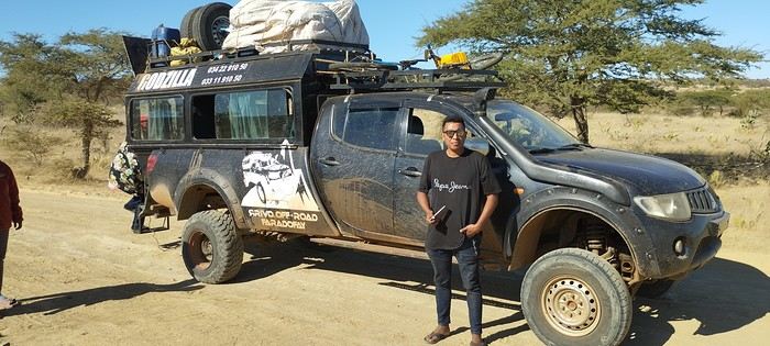
You can find all the details of this adventure and many others in my book, but I’m not allowed to talk about it on the forum... Too bad. A video of this route That’s it—I’ll post about other tracks I did that same year in other threads. Have a great day!
By bike, it’s doable, though some sandy stretches are still pretty tough if you’re as overloaded as I was... Left Manakara’s Hôtel Les Délices on the 11th with my pretty beat-up blue bike...
Evening of the 11th: Ivohipeno Hôtel La Source.
12th–15th: Farafangana’s must-visit Hôtel Concombre Masqué, bike prep. 16th: Vangaindrano—Hôtel Chez Huguette was full, so I went to Tropic Hôtel, which is nice even with plumbing issues. Did my shopping since it’s the last real town. 17th: Chez Flavienne—her real job is singer/dancer, and she has cute little bungalows before the village of... I never found it on GPS or maps. A bit basic but welcoming, with Flavienne taking great care of me. 18th: Manombondro—the "friends’ spot," yikes, avoid! The restaurant’s okay, but the room is really rough: sketchy shower, the room opens right onto the main road where all the 4x4s gather. Good for tips, but better to sleep elsewhere...
20th: Taking one of the many alternative tracks, I got lost and camped under my tent less than 5 km from Sandravinany. 21st: Sandravinany—first day at Mamie Louise’s, average hotel. Vesslasse, the manager, is great. 22nd: The next day, I went back to the fisherman’s cabin I’d thought was closed the day before—awesome! Perfect location with a lagoon view.
Vesslasse stops by regularly to offer his services—he knows everyone, is efficient, and super friendly. I treated myself to a few days of contemplative relaxation before taking a pirogue toward the coastal track on the morning of the 25th—big mistake! Hardly anyone around to ask for directions, so I got lost multiple times, did a bunch of backtracking, and dealt with a lot of sand... Check out this YouTube video: From Sandravinany to the Sand Track 25th: Maroroy—chez Louisette, can’t miss it: right after the ferry, by the water, super relaxing. By the water, super relaxing. 26th: Manantenina—the very nice (and for me, too expensive) bungalows of Jean-Philippe were full, so I stayed at Hôtel Le Bleu, small bungalows with a restaurant on the main road. 27th: Sainte Luce—I got a ride from a UNICEF 4x4, so I *had* to stay at Hôtel Vah’inn—expensive but right on the water, with a pool table and good food. 28th: Fort Dauphin—Hôtel Nepenthes: central (steep climb to get there!) but nice bungalows.
Fort Dauphin has plenty of very affordable hotels. After that, I headed back to Tulear in a shared 4x4 (Godzilla)—two pretty grueling days, but the driver was really nice.
You can find all the details of this adventure and many others in my book, but I’m not allowed to talk about it on the forum... Too bad. A video of this route That’s it—I’ll post about other tracks I did that same year in other threads. Have a great day!
TRAVEL JOURNAL MADAGASCAR OCTOBER 2019
First of all, a big thank you to all the VoyageForum contributors who helped us plan our itinerary.
Introduction: There are three of us—a couple and a friend—all retired, aged 70. We spent four weeks in Madagascar, our first trip there, accompanied by a guide and a 4x4 driver-mechanic. We decided on the trip in June, and the process of requesting quotes, planning the itinerary, buying flight tickets, and applying for visas was quick. We finalized everything by the end of June.
Vehicle: The car was a Nissan Patrol, not new but well-maintained, and it served us perfectly. We had a few minor repairs—wheel bearings to change, a broken bull bar, and two flat tires throughout the trip. There was no air conditioning, so we drove with the windows open, which meant a bit of dust. In full sun, temperatures could reach 37/38°C.
Itinerary: The route started in Antananarivo upon arrival from the Air France flight from Roissy to Ivato and ended four weeks later at the same airport, passing through Antsirabe, Miandrivazo, the Tsiribihina River descent, Belo sur Tsiribihina, the Tsingy de Bemahara, the Avenue of the Baobabs, Morondava, Belo sur Mer, Morombe, Salary, Ifaty–Tulear, Ranohira, Fianarantsoa, the FCE train, Manakara, the Pangalanes Canal, Ranomafana, the Anja Reserve, and Ambositra.
Our local agency: The trip was organized with the help and logistical support of a local agency based in Antsirabe—a small, efficient, and enthusiastic team run by Élodie and her guide Manantsoa. If you'd like their contact details, feel free to message me directly. We have nothing but praise for them!
The roads: Travel was by 4x4 on rough, uneven tracks. We didn’t plan long stages to spare our backs, averaging a maximum of 5 to 6 hours per day. As for the RN7, the island’s most touristy road, there were no major issues. The Fianarantsoa Côte Est (FCE) train: This is the only train connecting Fianarantsoa to Manakara on the east coast. Taking it is an epic adventure—it takes an average of 17/18 hours to cover the 165 km between the two cities, passing through 17 stations, countless tunnels, and bridges. We left at 7 AM and arrived around 1:30 AM, but it was a direct way to connect with the local population at every stop. Even though we were comfortably seated in first class, we got a small glimpse of the harsh living conditions of the locals. One striking detail: on the last 80 km before Manakara, there wasn’t a single light—it was pitch black!
The Tsiribihina River descent: You can choose between a motorized barge or a rowed pirogue, depending on your comfort level. We opted for the motorized barge with a crew that included our guide, the captain, two sailors, and a cook. There was an upper deck for sunbathing and relaxing, and we slept in tents set up by the crew. The toilets were dry, and we showered with cold water from a waterfall—no complaints! The pirogue is more basic. It’s a slow, timeless journey along the river, with stunning landscapes, friendly locals, and diverse wildlife—lemurs, herons, birds of prey, kingfishers, and more.
Safety: The main safety concern on the roads is classic prevention—no flashy jewelry or visible valuables. In high-risk areas, vehicles travel in convoys escorted by the army, police, or gendarmerie. Elsewhere, our guide and driver handled "difficulties" like local "tolls," river crossings, and ferries with resourcefulness and calm. We never felt in danger during the four weeks, though we avoided driving or walking at night.
Accommodation: We chose mid-range hotels, always with private bathrooms and showers in the room. Sometimes there was no hot water, and water pressure was inconsistent, but that was city-wide, so we understood. In more touristy areas, the hotels were slightly better, though there’s still a long way to go to meet our standards! For the Tsiribihina descent, the crew set up a protected area for toilets and cold showers. We could even shower under the waterfall in the morning—cold and invigorating, but amazing!
Food: We ate well, whether it was European or Malagasy cuisine. The food was tasty and plentiful. The staple is rice—when imported from China or Myanmar, the quality isn’t always consistent. It’s served with everything. Zebu (beef) is good, and pork is less common but decent. Poultry isn’t raised in battery farms like at home; it’s free-range, tasty, but a bit tough. There’s a variety of vegetables, though we missed fresh fruit—it wasn’t the right season. Bananas and pineapples were abundant, with a few mangoes and oranges. On the coast, seafood was a treat—fish, shellfish, crabs, lobsters, sea cicadas, oysters, and more. Near Antananarivo, there’s a town called Behenjy specializing in foie gras, though in the heat, it’s not ideal for tasting. For local "hotely" restaurants (serving Malagasy food), it’s best to ask your guide to pick the best ones. As for tap water and raw vegetables, forget about them during your stay! We preferred to dine at the hotel to avoid nighttime outings, except in rare cases where a quality restaurant was nearby.
The people: It’s an understatement to say that Madagascar suffers from endemic poverty. In the cities, homeless people—men, women, children, even newborns—sleep on the streets or in makeshift shelters. The villages we passed through weren’t much better, and the remote ones we didn’t see are likely even worse. People lack everything—running water, electricity, schools, infrastructure—especially in the southern villages. Yet the land and rice fields seem to yield abundant harvests, and in desert areas, zebu farming is a way of life. The sea provides its riches—fish, lobsters, octopus, crabs, and more. Given the lack of education and income, begging is everywhere, a bit persistent but never aggressive. Bring as many things to give away as you can, and leave with empty hands—or rather, suitcases full of souvenirs! Let’s pay tribute to NGOs and religious institutions doing incredible work. On a personal level, we can only reflect, feel a bit of outrage, and act against this injustice. The Malagasy people don’t deserve this level of poverty. They’re also very religious—Catholic, Protestant, Adventist, Seventh-day Adventist, Jehovah’s Witness churches, and more, flourish across the island. In short, the people are welcoming, resigned, but so endearing and friendly!
Landscapes: The Tsingy, baobabs of all shapes and sizes—big, small, round, slender—the pristine beaches and Polynesian-like lagoons with deep blue waters between Tulear and Morombe, the rocks of the Isalo Massif reminiscent of the Wild West, the primary forests of Ranomafana, the red laterite landscapes of the Highlands dotted with villages, terraced rice fields, sunrises and sunsets on the east and west coasts, the views from the FCE train, the tranquility of the Pangalanes Canal (a bit like Kerala), the Vezo villages (nomads of the sea), the lagoon dotted with colorful square sails of Vezo fishermen—it’s all fantastic and varied!
Local transport: Overloaded bush taxis or trucks, zebu carts, rickshaws, tuk-tuks, and even carts pulled by people—it’s even more shocking!
Wildlife: The stars: - Lemurs—diurnal and nocturnal—there are so many to see, and you can spend hours watching them! - Chameleons—all shapes, sizes, and colors!
Climate: During our four weeks in September and October 2019 (we’d only been back for three days), we had just one day of rain. It was warm and pleasant everywhere during the trip. A light sweater for the evenings and waterproof clothing for rainy days are a good idea. Don’t forget sunglasses, swimsuits, sunscreen, mosquito repellent, malaria prophylaxis, flip-flops, hiking shoes for the parks, and all the usual essentials—nothing out of the ordinary!
Expenses: For half-board (breakfast and dinner), including transport (fuel), guide and driver, park entry fees, and local park guides, the cost was 2300 € per person for the four weeks. On top of that, you’ll need to add flight tickets, drinks, and lunch (around 5–10 € depending on your choices), as well as tips and personal expenses.
In short, we came back CHARMED.
Our thanks to ÉLODIE and MANANTSOA, as well as the drivers PAPOOSE and ROBERT.
First of all, a big thank you to all the VoyageForum contributors who helped us plan our itinerary.
Introduction: There are three of us—a couple and a friend—all retired, aged 70. We spent four weeks in Madagascar, our first trip there, accompanied by a guide and a 4x4 driver-mechanic. We decided on the trip in June, and the process of requesting quotes, planning the itinerary, buying flight tickets, and applying for visas was quick. We finalized everything by the end of June.
Vehicle: The car was a Nissan Patrol, not new but well-maintained, and it served us perfectly. We had a few minor repairs—wheel bearings to change, a broken bull bar, and two flat tires throughout the trip. There was no air conditioning, so we drove with the windows open, which meant a bit of dust. In full sun, temperatures could reach 37/38°C.
Itinerary: The route started in Antananarivo upon arrival from the Air France flight from Roissy to Ivato and ended four weeks later at the same airport, passing through Antsirabe, Miandrivazo, the Tsiribihina River descent, Belo sur Tsiribihina, the Tsingy de Bemahara, the Avenue of the Baobabs, Morondava, Belo sur Mer, Morombe, Salary, Ifaty–Tulear, Ranohira, Fianarantsoa, the FCE train, Manakara, the Pangalanes Canal, Ranomafana, the Anja Reserve, and Ambositra.
Our local agency: The trip was organized with the help and logistical support of a local agency based in Antsirabe—a small, efficient, and enthusiastic team run by Élodie and her guide Manantsoa. If you'd like their contact details, feel free to message me directly. We have nothing but praise for them!
The roads: Travel was by 4x4 on rough, uneven tracks. We didn’t plan long stages to spare our backs, averaging a maximum of 5 to 6 hours per day. As for the RN7, the island’s most touristy road, there were no major issues. The Fianarantsoa Côte Est (FCE) train: This is the only train connecting Fianarantsoa to Manakara on the east coast. Taking it is an epic adventure—it takes an average of 17/18 hours to cover the 165 km between the two cities, passing through 17 stations, countless tunnels, and bridges. We left at 7 AM and arrived around 1:30 AM, but it was a direct way to connect with the local population at every stop. Even though we were comfortably seated in first class, we got a small glimpse of the harsh living conditions of the locals. One striking detail: on the last 80 km before Manakara, there wasn’t a single light—it was pitch black!
The Tsiribihina River descent: You can choose between a motorized barge or a rowed pirogue, depending on your comfort level. We opted for the motorized barge with a crew that included our guide, the captain, two sailors, and a cook. There was an upper deck for sunbathing and relaxing, and we slept in tents set up by the crew. The toilets were dry, and we showered with cold water from a waterfall—no complaints! The pirogue is more basic. It’s a slow, timeless journey along the river, with stunning landscapes, friendly locals, and diverse wildlife—lemurs, herons, birds of prey, kingfishers, and more.
Safety: The main safety concern on the roads is classic prevention—no flashy jewelry or visible valuables. In high-risk areas, vehicles travel in convoys escorted by the army, police, or gendarmerie. Elsewhere, our guide and driver handled "difficulties" like local "tolls," river crossings, and ferries with resourcefulness and calm. We never felt in danger during the four weeks, though we avoided driving or walking at night.
Accommodation: We chose mid-range hotels, always with private bathrooms and showers in the room. Sometimes there was no hot water, and water pressure was inconsistent, but that was city-wide, so we understood. In more touristy areas, the hotels were slightly better, though there’s still a long way to go to meet our standards! For the Tsiribihina descent, the crew set up a protected area for toilets and cold showers. We could even shower under the waterfall in the morning—cold and invigorating, but amazing!
Food: We ate well, whether it was European or Malagasy cuisine. The food was tasty and plentiful. The staple is rice—when imported from China or Myanmar, the quality isn’t always consistent. It’s served with everything. Zebu (beef) is good, and pork is less common but decent. Poultry isn’t raised in battery farms like at home; it’s free-range, tasty, but a bit tough. There’s a variety of vegetables, though we missed fresh fruit—it wasn’t the right season. Bananas and pineapples were abundant, with a few mangoes and oranges. On the coast, seafood was a treat—fish, shellfish, crabs, lobsters, sea cicadas, oysters, and more. Near Antananarivo, there’s a town called Behenjy specializing in foie gras, though in the heat, it’s not ideal for tasting. For local "hotely" restaurants (serving Malagasy food), it’s best to ask your guide to pick the best ones. As for tap water and raw vegetables, forget about them during your stay! We preferred to dine at the hotel to avoid nighttime outings, except in rare cases where a quality restaurant was nearby.
The people: It’s an understatement to say that Madagascar suffers from endemic poverty. In the cities, homeless people—men, women, children, even newborns—sleep on the streets or in makeshift shelters. The villages we passed through weren’t much better, and the remote ones we didn’t see are likely even worse. People lack everything—running water, electricity, schools, infrastructure—especially in the southern villages. Yet the land and rice fields seem to yield abundant harvests, and in desert areas, zebu farming is a way of life. The sea provides its riches—fish, lobsters, octopus, crabs, and more. Given the lack of education and income, begging is everywhere, a bit persistent but never aggressive. Bring as many things to give away as you can, and leave with empty hands—or rather, suitcases full of souvenirs! Let’s pay tribute to NGOs and religious institutions doing incredible work. On a personal level, we can only reflect, feel a bit of outrage, and act against this injustice. The Malagasy people don’t deserve this level of poverty. They’re also very religious—Catholic, Protestant, Adventist, Seventh-day Adventist, Jehovah’s Witness churches, and more, flourish across the island. In short, the people are welcoming, resigned, but so endearing and friendly!
Landscapes: The Tsingy, baobabs of all shapes and sizes—big, small, round, slender—the pristine beaches and Polynesian-like lagoons with deep blue waters between Tulear and Morombe, the rocks of the Isalo Massif reminiscent of the Wild West, the primary forests of Ranomafana, the red laterite landscapes of the Highlands dotted with villages, terraced rice fields, sunrises and sunsets on the east and west coasts, the views from the FCE train, the tranquility of the Pangalanes Canal (a bit like Kerala), the Vezo villages (nomads of the sea), the lagoon dotted with colorful square sails of Vezo fishermen—it’s all fantastic and varied!
Local transport: Overloaded bush taxis or trucks, zebu carts, rickshaws, tuk-tuks, and even carts pulled by people—it’s even more shocking!
Wildlife: The stars: - Lemurs—diurnal and nocturnal—there are so many to see, and you can spend hours watching them! - Chameleons—all shapes, sizes, and colors!
Climate: During our four weeks in September and October 2019 (we’d only been back for three days), we had just one day of rain. It was warm and pleasant everywhere during the trip. A light sweater for the evenings and waterproof clothing for rainy days are a good idea. Don’t forget sunglasses, swimsuits, sunscreen, mosquito repellent, malaria prophylaxis, flip-flops, hiking shoes for the parks, and all the usual essentials—nothing out of the ordinary!
Expenses: For half-board (breakfast and dinner), including transport (fuel), guide and driver, park entry fees, and local park guides, the cost was 2300 € per person for the four weeks. On top of that, you’ll need to add flight tickets, drinks, and lunch (around 5–10 € depending on your choices), as well as tips and personal expenses.
In short, we came back CHARMED.
Our thanks to ÉLODIE and MANANTSOA, as well as the drivers PAPOOSE and ROBERT.
After several months of delay, Madagascar has just launched an electronic entry visa for the island, available online. It allows tourists to stay for 30 (35 €), 60 (40 €), or 90 days (50 €).
Read more...
Hello,
We’re arriving in Tana, the capital, by plane on the morning of May 22nd after an overnight flight.
Does any forum member know this Malagasy driver-guide: Haja Rasolondraibe?
The itinerary below might change or evolve—23 days might not be enough.
We’ll visit the central region (the highlands: Antsirabe, Atoetra and a Zafimaniry village, Lake Andrianina) and the unmissable west (Kirindy, the Avenue of the Baobabs, the Tsingy de Bamaraha, and a fishing village). Then back to Tana.
After that, we’ll head east of Tana to Ambohimanga, Andasibe, near Tamatave, Ankanin'ny, Mahambo, and Île Sainte-Marie if time allows. Not sure yet. Then back to Tana.
This driver-guide with a 4x4 charges 70 € per day, including food and accommodation. Excluding fuel.
If any members can recommend other driver-guides with a 4x4 and more reliable vehicles in good condition (since we don’t want to travel at night), I’d be interested.
Thanks in advance.
evad.tebo
Oh, the good news—the site is back up after such a long closure. I think many of us were really missing it, though some have moved on to other forums like Routard.
Hopefully, activity will pick up little by little. Travel habits have probably changed post-Covid, and some regulars won’t be coming back for all sorts of reasons.
But for the rest of us, the forum is here for travel journals and pre-trip questions. Anyway…
Back to the main point: my last trip to Madagascar was a while ago now—about a year—on the High Plateaus during the austral winter. It was really chilly, and to be honest, my feelings were mixed between the joy of returning to Madagascar and the sadness of seeing the state of the country. The infrastructure is crumbling, and the population is sinking into poverty at unprecedented levels. The country’s closure likely had immeasurable consequences, compounded by destructive cyclones. Even secondary cities have seen large numbers of rural people arriving in search of work, while some rural areas barely allow survival. I’ve never felt such despair over the situation in 20 years.
From Tana to Fianar, it was nothing but heartbreaking observations. Probably made worse by the drizzle and cold typical of that season in the region.
In a few weeks, I’m planning to return to the High Plateaus and also Sainte Marie. On that note, a few questions: has anyone stayed at Samaria Cosy Lodge, and what did you think of it? On Île aux Nattes, which hotel would you recommend for a few peaceful days, ideally on the coast best suited for snorkeling?
Thanks in advance
Back to the main point: my last trip to Madagascar was a while ago now—about a year—on the High Plateaus during the austral winter. It was really chilly, and to be honest, my feelings were mixed between the joy of returning to Madagascar and the sadness of seeing the state of the country. The infrastructure is crumbling, and the population is sinking into poverty at unprecedented levels. The country’s closure likely had immeasurable consequences, compounded by destructive cyclones. Even secondary cities have seen large numbers of rural people arriving in search of work, while some rural areas barely allow survival. I’ve never felt such despair over the situation in 20 years.
From Tana to Fianar, it was nothing but heartbreaking observations. Probably made worse by the drizzle and cold typical of that season in the region.
In a few weeks, I’m planning to return to the High Plateaus and also Sainte Marie. On that note, a few questions: has anyone stayed at Samaria Cosy Lodge, and what did you think of it? On Île aux Nattes, which hotel would you recommend for a few peaceful days, ideally on the coast best suited for snorkeling?
Thanks in advance
Recommended for you
 Between Réunion and Nosy Bé
 The Pearl of Africa - July-August 2026
 A little piece of Sulawesi with the family: Rantepao and Selayar
 Tanzania Classics (Safari & Zanzibar)
 Getting Away to Ireland
 On the Roads of Costa Rica
 Storm in the Canary Islands
 New adventures from Perpignan to Ranchi (Jharkhand)
5,167 more discussions in this forum are in French. Browse them on the French forum