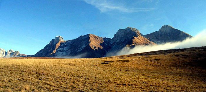
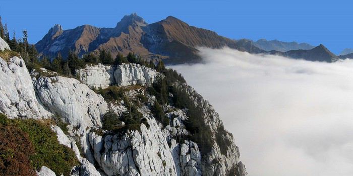
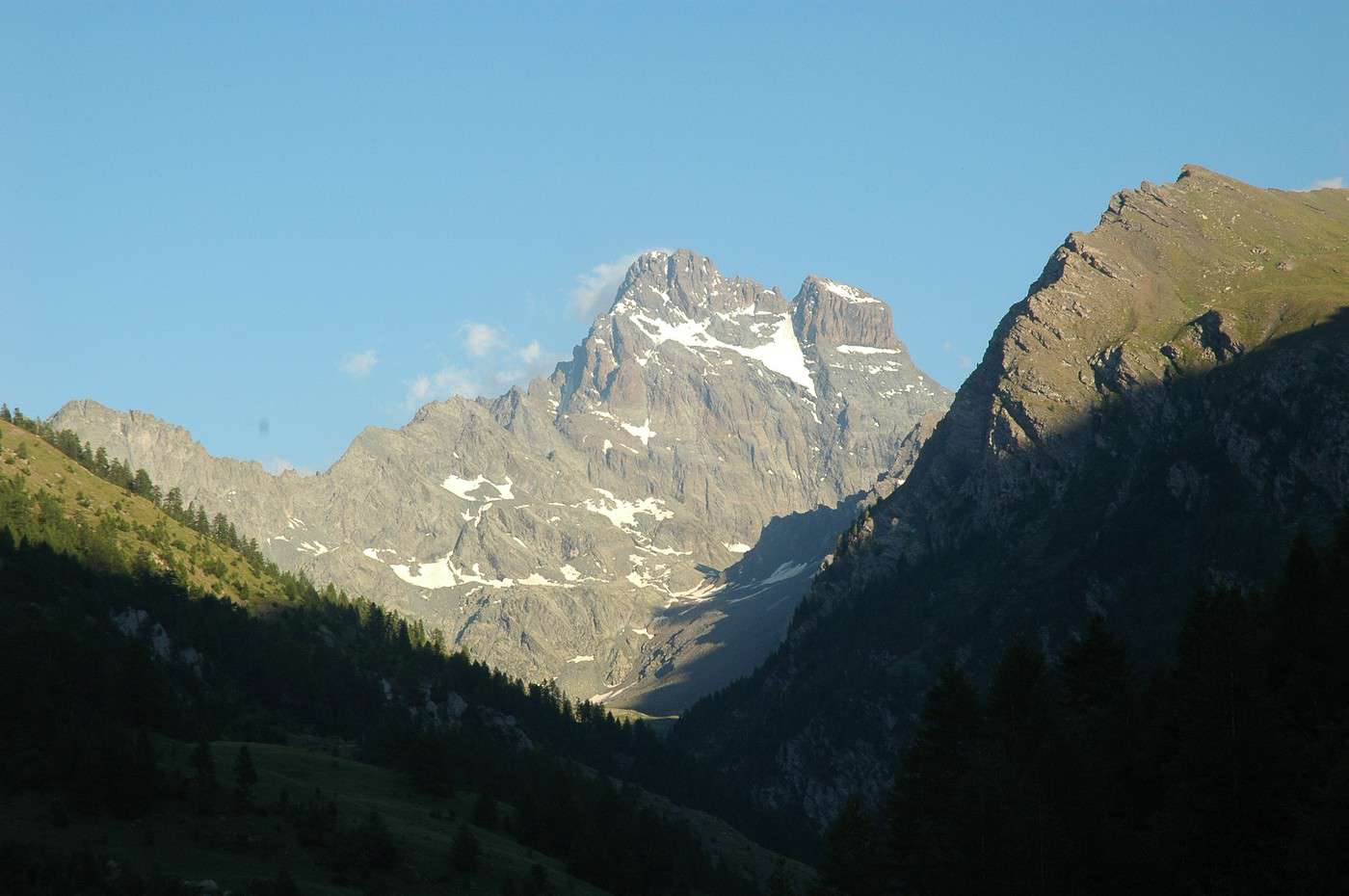
I usually travel abroad in the summer, but given the circumstances, I think this year I’ll be staying in France.
I’d love to know which places you’d recommend for the most stunning mountain landscapes and the best hikes.
Are you talking about multi-day trekking routes? In my opinion, the Pyrenees are better suited for that. I prefer the Spanish side, especially Ordesa National Park. That’s under normal circumstances, though. The vibe might not be as good in Spain this year (check out the other discussions on this topic).
Good evening,
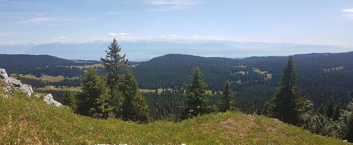
A day trip around the upper Jura: Les Rousses (lake), Prémanon, Lajoux... Crêts and Combes with landscapes of meadows, flowers, cows, and Comté cheese.
... Etc.
Happy hiking!
« On parle toujours de la violence du fleuve qui déborde ses berges - jamais de la violence des berges qui enserrent le fleuve... » disait Berthold Brecht
I'd love to know which spots you recommend for seeing the most stunning mountain landscapes and doing the best hikes?
Hey!
I’d suggest places where you’re most likely to have good weather while still enjoying pleasant temperatures (not too hot during heatwaves).
The entire Pyrenees range works well. The western part (Atlantic Pyrenees) gets more rain (more rainy days), while the eastern part (Eastern Pyrenees; Canigou massif, for example) is drier.
I know the Alps better. One region I particularly recommend is the Valgaudemar (for its landscapes), as well as the entire Écrins National Park. There are plenty of day hikes to do in the Valgaudemar.
https://www.champsaur-valgaudemar.com/ete/rando-et-velo/balades-et-randonnees/
I like the Vercors and the Trièves (I live there), but in summer, it gets too hot in most areas except on the summits (Grande Moucherolle, Grand Veymont, Montagne de l’Obiou).
PS: One of my favorite multi-day loop hikes is the Tour du Mont Thabor, which takes 3, 4, or 5 days depending on the route.
Hi there,
It’d be great to specify the kind of hikes you’re thinking of. How long, the possible elevation gain, trails only or some rocky sections, how many hours you can walk in a day, the max altitude, etc....
Qui boit l'eau d'une terre étrangère doit en suivre les coutumes (proverbe Mongol)
As you asked, we're mostly looking for hikes around 5-6 hours long, with good elevation gain, rocky sections that aren't too tricky or dangerous, and no extreme altitudes.
Above all, we're after stunning landscapes—I take photos!
Hello,
If hiking conditions aren’t an obstacle, all the suggestions already mentioned are great.
The Haut Jura offers superb day hikes, with either a forested atmosphere, pastures, and typical valleys of the region, or routes along the highest peaks, with stunning views of the Mont Blanc massif and Lake Geneva. The area is characterized by mid-mountain terrain, making it more "relaxing" and lush in terms of landscapes.
Haute-Savoie, with quick access to high altitudes (via cable cars), allows for day hikes with a more high-mountain feel. There are plenty of hikes starting from Chamonix for those focused on high-mountain routes, and many other options from resorts like La Clusaz, Le Grand Bornand, Samoëns, and Châtel (just to name a few), offering breathtaking scenery with alpine lakes, waterfalls, and very "alpine" summits.
Qui boit l'eau d'une terre étrangère doit en suivre les coutumes (proverbe Mongol)
Thanks for your tips.
I'm really into the Mont Blanc massif.
As for La Clusaz, I've been there quite a few times in winter, and there are a lot of ski lifts—I'm afraid they might ruin the scenery.
We have three weeks, so we won’t be staying in the same place the whole time.
Otherwise, if we decide to do a multi-day hike with nights in mountain huts, do you know if we need to book way in advance, or can we sort it out a few days before?
As for La Clusaz, I’ve been there quite a few times in winter, and there are a lot of ski lifts—I’m afraid they really spoil the landscape.
For this resort, there are tons of hiking options, far away from the ski lifts.
Some start from Les Confins (toward the resort’s cross-country trails) and allow for long hikes in the Aravis valleys and toward Pointe Percée (the Aravis’ highest peak). Others start from the Col de la Colombière (toward Le Grand-Bornand, just a few km from La Clusaz), and there are even more with starting points just a few km from La Clusaz in the direction of the Plateau des Glières.
As for refuge bookings, it’s really hard to give an opinion right now—sanitary conditions mean attendance is pretty unpredictable....
Qui boit l'eau d'une terre étrangère doit en suivre les coutumes (proverbe Mongol)
Hey,
Every VFer who replies will "preach for their own parish" 😛, so naturally I’m going to suggest the Queyras Regional Park, which I have a particular fondness for.
I’d actually planned to go back there this summer, but COVID had other plans 😕
"Homme libre, toujours tu chériras la mer" (Baudelaire)
Hi,
You're right, the Queyras is beautiful, but for a three-week stay, you might start feeling like you're going in circles with the same type of landscapes.
Haute-Savoie has the huge advantage of offering a great diversity of landscapes (from forested areas with pastures to glacial regions) over short distances.
Neighboring Switzerland and the Haut-Jura massif are accessible for day trips and offer a wide variety of hikes, from easy to challenging.
You could also mention the Haute-Maurienne area in Savoie, with access to the Vanoise Park, and plenty of walks to do while being "based" in Aussois or Lanslebourg.
Qui boit l'eau d'une terre étrangère doit en suivre les coutumes (proverbe Mongol)
The issue compared to mountains outside Europe is:
- the crowds in summer
- and especially the development—roads everywhere (and traffic noise even at high altitudes), those awful ski resorts, EDF too, ...
The issue with mountains outside Europe is:
- the summer crowds
- and especially the development—roads everywhere (and traffic noise even at high altitudes), those awful ski resorts, EDF too, ...
I have to admit I don’t quite get the comment... you’re talking about mountains outside Europe and you mention a nuisance from EDF...😕
Qui boit l'eau d'une terre étrangère doit en suivre les coutumes (proverbe Mongol)
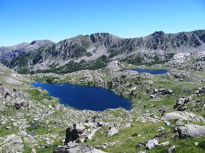
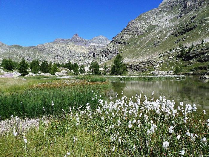
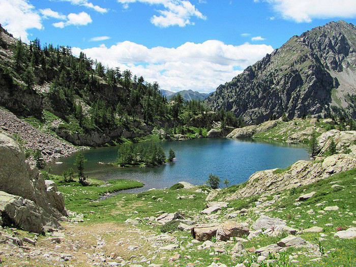
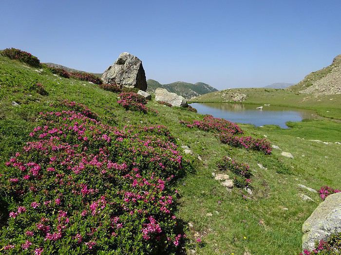
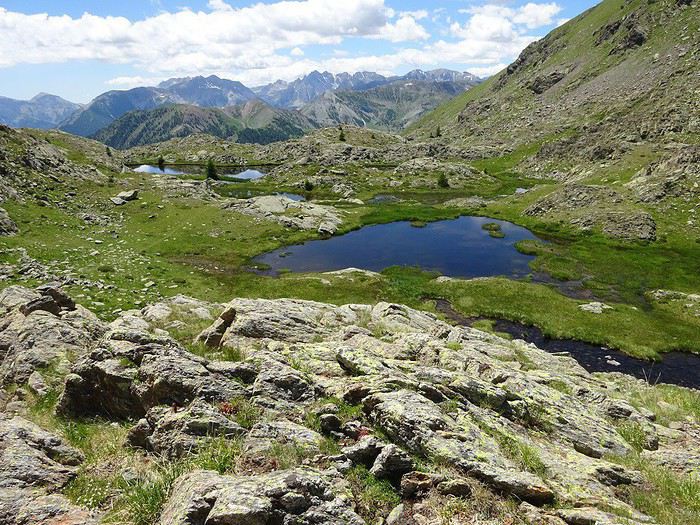
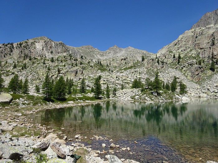
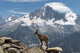
In the Mercantour area, there are some stunning spots with great chances to see ibex and chamois. The Vallée des Merveilles (Valley of Wonders) with its prehistoric rock carvings really lives up to its name too.
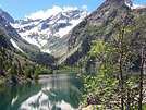
Some ideas for day hikes and a few photos of lakes:
You’ll run into way fewer people in the Pyrénées, especially if you head to Ariège (but shhh… don’t spread the word too much…).
Avoid the Gavarnie area, for example, between July 14 and August 15…
Avoid the Gavarnie region, for example, between July 14th and August 15th.....
And the Pic du Midi d'Aussau area too! (Laruns)
For me, it’s been a long time, but I’ve never seen so many people in the mountains! I don’t think it’s getting any better....
I must admit I don’t quite understand the comment... you’re talking about mountains outside Europe and you mention a nuisance by EDF...😕
Hi, Willemspie meant to say that unfortunately, the French Alps have been somewhat spoiled by ski resorts and there’s a lot of crowds on the trails in the summer.
That’s why I prefer the Southern Alps—they’re less crowded and have fewer ski resorts.
Otherwise, to answer the question, there are the Rochers Rouges in Vanoise on the way down to Landry and the Entre le Lac refuge.
Hi there,
Yeah, regarding the previous post, I realized it was comparing "our" mountains to others outside Europe.
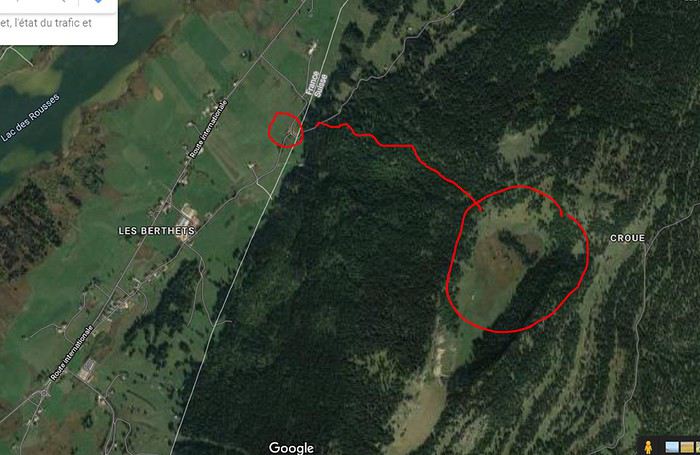
As for the "doline" above Noirmont, I must’ve gone there at least fifty times... I know the Haut-Jura like the back of my hiking boots—if not my skis—and the climb to Creux du Craoux (the famous Doline) used to be my training ground back in the day.
Last year, I made a little video to "test" my drone (which, by the way, is banned at Creux du Craoux...). It’s not amazing since it was just a test run, but I just uploaded it to YouTube. As soon as it’s live, I’ll share the link on VF. 😉
Hi there, yes, I think this is the place we're talking about.
Is it easy to get from Saint-Cergue to Les Rousses?
I’ve got the IGN 1:25,000 topo map, but it doesn’t seem like there are many marked trails.
There are several possible access points.
Starting from St-Cergue, yes, but it's very long. If you go that way, it's better to leave your car at the Col de la Givrine. Then there's a trail that leads up.
Starting from the border (La Cure) is also possible, via a large combe that climbs toward the summit of Noirmont, then continuing along the ridges to reach the top of the doline.
Otherwise, the most direct route is a pretty steep trail starting from a parking lot a few kilometers past Les Berthets on the road to Bois d'Amont. See below.
Qui boit l'eau d'une terre étrangère doit en suivre les coutumes (proverbe Mongol)
Further up in the Verdon, there’s obviously the Imbut trail, which has recently been made much safer, so don’t pay too much attention to the sometimes alarmist comments from before mid-2018.
In the 84 and 04 departments, there are tons of gorgeous hikes:
In the 84 and 04 departments, there are tons of amazing hikes:
The Gorges d'Oppedette, which are really great, especially the variant that goes down into the Calavon (though there probably won’t be any water left by September)
www.visorando.com/...carte-diagramme.html
The Véroncle mills near Gordes are also a must in the region:
www.visorando.com/...moulins-de-veroncle/
You’ve gotta love the heat... I’ve explored the Luberon and the Vaucluse plateau for a good twenty years, but no way in summer—it’s way too hot. Further south, even if you like roasting in the sun, most areas are off-limits due to wildfire risks. In the Luberon, it’s a bit less restrictive depending on the route, but you still have to call ahead...
Are the Calanques open in July/August?
And honestly, none of this is really mountain hiking... Not at all, actually.
Haha! 🙂 You're right about the mountains, but almost everything I know has already been mentioned. Actually, the Calanques and Verdon can be considered small mountains! And who knows, maybe it’ll give you some ideas? We’ll let you decide...
On the other hand, you didn’t read carefully: it’s September, not July or August—days are shorter and often cooler.
For fire-access areas, the Calanques, for example, are open today (green status, access possible 😇). You should check the day before: http://www.calanques13.com/acces-massifs-forestiers.html
Just like when you head into the mountains!
A bit more mountain-like (and closer to your place), I did this during the 2019 heatwave, and it was really pleasant!
The Combeau Valley: https://www.visorando.com/randonnee-vallon-de-combeau/
(FYI, at Col du Rousset on the morning of July 14th: 7°C 😎)
But in my opinion, September isn’t the best season for mountains: more storms and kind of dreary vegetation. Aim for May-June instead (though there’s a risk of snow patches).
If you're looking for a secluded spot just for the mountains, Ariège is pretty great. But there are also plenty of other spots in the Alps where you can find both stunning hikes and other activities and events, all within a few dozen kilometers. In Oisans, for example, you can hike in the Écrins massif (Venéon valley) or the Taillefer, as well as the wild Belledonne massif. Based in Bourg-d'Oisans, you can easily explore different massifs with varied characteristics—think high-altitude lakes, charming mountain villages, and spectacular little roads.
Tout ce qui a été perdu dans la plaine, tu le retrouveras dans les montagnes. Proverbe géorgien.
The issue with mountains outside Europe is
- the summer crowds
- and especially the development—roads everywhere (and traffic noise even at high altitudes), those awful ski resorts, EDF too, ...
Is it the same in the Pyrenees?
Yes, there are summer crowds, especially in the most famous spots: Gavarnie, Lac de Gaube, Pic du Midi, Lac des Bouillouses, etc. But some areas are spared. Ariège has stayed truly wild outside the Foix-Ax les Thermes corridor. The Basque Country also hides some well-kept secrets.
Ski resorts also disfigure some areas, but once again, Ariège and the Basque Country are relatively untouched.
As for traffic noise, the Pyrenees are spared compared to the Alps. No highway crosses the range; all truck traffic stays on the "edges" at Irun and Le Perthus.
As for EDF, yes, there are dams like everywhere, but I don’t think they have as much visual impact as ski resorts. Some are even beautiful and impressive. And you just have to move a little away from the valley axis to no longer see a dam, whereas a ski resort usually sprawls across several slopes. The worst isn’t the lift pylons but the bulldozed mountains to carve out the pistes. In winter, everything’s white so you don’t notice, but in summer, it’s just hideous.
« Ne soyons plus anglais ni français ni allemands. Soyons européens. Ne soyons plus européens, soyons hommes. - Soyons l'humanité. Il nous reste à abdiquer un dernier égoïsme : la patrie. » Victor Hugo
Avoid Neouvielle in the middle of summer too. It’s way too crowded. And given the crowds, I think a lot of parking lots in some parts of the Pyrenees have become paid. So with all the people, it’s actually less interesting than heading up to a resort where there are still great hikes to do once you’re outside the ski areas.
Tout ce qui a été perdu dans la plaine, tu le retrouveras dans les montagnes. Proverbe géorgien.
I’m taking advantage of having a few knowledgeable folks gathered here. 😉
In early September, we’ll be spending a week in Les Rousses.
I’ve already picked out some day hikes, including Mont Sala via the Creux du Croue (mentioned by Perju), as well as Petit and Grand Montrond and Colomby de Gex, Crêt de la Neige and Reculet, Pic de l’Aigle and the Belvédère des 4 Lacs, and the Gorges du Flumen...
Hardly anyone on the GR10 in Ariège. Obviously, it's really tough... But even near ultra-touristy spots, like Luchon, some trails, lakes, and bivouac spots that are less accessible or less popular are deserted—Lac de la Montagnette, for example. Basically, everyone goes to the same places.
hi there,
for a stay in Les Rousses, it's a great choice.
Just a heads-up: it's possible to do a day hike starting from the Col de la Faucille, reaching the summit of Mont-Rond, Colomby de Gex, Crêt de la Neige, and Reculet before heading back—but this requires good physical condition, and it’s a bit of a shame to rush it. The loop is still 35 km round trip...
So, I’d recommend splitting it into two sections: Faucille, Mont-Rond, Colomby, and back.
Then, Reculet and Crêt de la Neige, starting from the hamlet La Rivière on the D991 after Lelex.
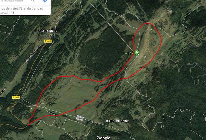
Another great hike idea: the Tour de la Dôle, starting from Tabagnoz, for example. You go up to the summit, descend on the Swiss side, and come back up the other way. There’s a hostel on the Swiss side, the Chalet de la Dôle, where you can try a local specialty—the Tomme vaudoise (a small warm tomme cheese on a bed of salad...)
Qui boit l'eau d'une terre étrangère doit en suivre les coutumes (proverbe Mongol)
So do it in two sections: Faucille, Mont-Rond, Colomby, and back.
That’s exactly what I was planning to do, since 35 km is too much for us! 😉
Another hike idea: the tour of La Dôle, starting from Tabagnoz, for example,
I’d also found that option, but I thought it might be redundant with Mont Sala (same views?), more crowded (based on the webcam), and that Mont Sala seemed to go through wilder spots.
Am I wrong? Is it worth doing both, or if I had to choose, which one would you prefer?
When you say "we go up to the summit and descend on the Swiss side, then come back up the other side," does that match this route:
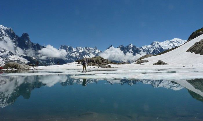
A classic and very well-known spot, but so beautiful: in the Mont Blanc massif, the "Lac Blanc" hike can be done from different starting points. We set off from the Col des Montets for a round trip. We were there in early July, with the lake still quite frozen and a few snow patches around it as challenges (my wife actually fractured her radius on the way down one of the snow patches 😕)... but what a view!
When you say "we go up to the summit and come down on the Swiss side via one side and go back up via the other," does that match this route here:
it’s a shame to skip the Risoux Forest on the other side—I went through it 3 weeks ago and even spent the night at the Bonnefoy chalet. The night was freezing.
On the other side, you can get a really nice view from Roche Bernard over Chapelle-des-Bois, Bellefontaine...
the Risoux Forest is truly stunning.
That said, if you want to reach Roche Bernard, you’ll need to leave Les Rousses very early because it’s about 15 km one way and the same back 😏
Otherwise, there’s the Gaillard chalet right in the forest.
To wrap up, I’ve heard there are lynxes in this forest, but I’ve never seen one
Indeed, the Croue-Salat hike is wilder, shadier, and less crowded (except at Mont Salat)... but in September and on weekdays, there are very few people.
Personally, I prefer this hike when starting from the border village of La Cure. That way, you arrive at the top of the Creux du Croue, which is much more spectacular because you discover the "crater" at the last moment. It’s a bit longer than starting from the end of the lake at Les Rousses, but it’s no problem for a day trip. A path allows you to descend into the bottom and climb back up on the other side to rejoin the Salat trail.
For La Dôle, once again, in September, there’s little risk of crowds, but it’s also very beautiful, and both are worth the trip.
For a wilder itinerary, see below—there’s a chance to spot chamois on the descent behind La Dôle.
Otherwise, yours is the "classic" route.
As for the views from all these routes, they’re always on the southern side, with Lake Geneva and the Alps in the background (a bit farther from the lake on the Salat side). However, toward Colomby, you’re really above Geneva. Either way, even if the panoramas are somewhat similar, they’re still breathtaking!
Qui boit l'eau d'une terre étrangère doit en suivre les coutumes (proverbe Mongol)
Hi there.
EDF’s high-voltage power lines have been around in the Pyrenees for a very long time.
So where’s the nuisance problem? Pierre the Belgian.
I’ve been hiking the Pyrenees solo or with a group (CAF) for 40 years now.
Best regards,
Je suis à la recherche des plus belles randonnées de France Type de rando: de 2 à 6 jours en autonomie complète Étape: Si possible en tente pour ne pas avoir à…
Je pars deux semaines en Bretagne...le temps de faire pas mal de randonnées...mais pas les 1800 km du sentier douanier...je souhaiterais avoir des avis sur les…
Voici ma sélection des 15 plus beaux sentiers de grande randonnée en France (en terme de distance et de beauté) besoindaventure.fr/... Et vous quel est votre…
Voyager à pied › France › Rhône-Alpes · 11 replies
Je souhaite passer 5 à 7 jours en autonomie dans le Vercors et j'aurais voulu savoir quels sont les plus beaux itinéraires dans la région, dans le sens nord…
Voyager à pied › France › Rhône-Alpes / Provence-Côte d'Azur · 22 replies
Puisque l' on va rester en France ces prochains mois, pourquoi pas se balader dans cette région? mais comme l' on va éviter les refuges, connaissez vous de…
Bonjour
Nous avons comme projet de séjourner 8 jours sur l'ile de Sao Nicolau, sac à dos. Nous hésitons de prendre le bateau de Sao Vicente ou un vol inter iles. On me dit que les bateaux ne partent pas toujours?
Nous souhaitons faire trois haltes chez l'habitant afin de voyager en étoile de chacun des 3 points.
Première escale dans les environ de Juncalinho, deuxième escale du coté de Cachaco et enfin une troisième étape du coté de Tarrafal. Nous recherchons des pensions simple mais authentiques (pas d'hôtels). Avez-vous des suggestions?
Merci
Bonjour.. Nous partons à 2 faire le chemin Porto Fisterra le 15 septembre...Nous hésitons entre voie côtière ou chemin intérieur.. sur celui-ci il semble beaucoup de passages routiers... Nous aimerions avoir quelques retours d expérience...Merci..
Hello,
In mid-November, we’ll be in Mindelo and Santo Antão.
We’ve booked transportation with Kapverden Tours.
One trip is from Porto Novo to Ponta do Sol, including the hike from Corda to Coculi.
What’s the trail like?
Then we’ll be staying in Ponta do Sol,
Here’s what we’re planning:
A hike to Fontainhas—what’s the best direction, considering we’re not great with climbs? No problem with flat terrain or descents.
Take an aluguer to Ribeira Grande and continue along the coastal road.
With the agency:
An excursion to Cruzinha with a short walk.
Return to Porto Novo via the path from Cova to… I’m not sure where yet, to pick up the car for Porto Novo, since we’ll be taking the ferry that evening.
We’ll have a guide for this hike.
We’d love to spend a day in Tarrafal, but getting back requires a boat or taxi, and it’s really expensive!
We’re a couple, 78 and 76 years old.
What do you think of this itinerary?
I’m planning to do the Mercantour crossing following the Randoxygène route in mid-July.
I’m used to hiking in the mountains, but I sometimes get vertigo, for example on ridges with drops on both sides. I wanted to check if there are any T4 or T3-T4 sections and find out if there are any very exposed passages—and if so, where—so I can plan an alternative route.
Can anyone give me some info on this?
Thanks!
hi how can I get internet when I arrive at Haneda? I mean in areas without free wifi. Is it more interesting to buy a SIM card? If so, at the airport? thanks for your help
We're planning to go at the end of November/beginning of December to visit (with a rental car) and hike on La Palma and El Hierro for 15 full days, including 1 day for inter-island ferry transfers. What’s the best split between the two islands—8 days on La Palma and 6 on El Hierro, or even more time for La Palma? Should we have one or two home bases on La Palma? Thanks for your tips!
Annie
Hi there,
I’m planning to cross the Gourgs Blancs Pass at the end of the month, from La Soula Refuge to Portillon Refuge. On this section near the pass, I don’t have any trail marked on my IGN map. Is the path well signposted, or should I use a compass?
Also, beyond the physical effort, are there any technical, exposed, or vertigo-inducing sections on this part?
Since I’m finding very little info, I’m being thorough with my questions.
I'm developing a free and open-source web app for planning walking and cycling trips (and even car trips). You can create a route by clicking directly on the map to add waypoints, and it can consist of multiple stages. The app provides tools to edit the stages and the overall route, and to display useful information (distances, altitudes, and elevation changes). A relief profile can be shown as a graph for a specific stage or the entire route.
Once the route is ready, it can be exported as a GPX file, which can then be used with a GPS or a mobile navigation app.
The app is built in JavaScript and runs entirely in the web browser. It uses the Leaflet library and several OpenStreetMap-based services. Initially developed for my personal needs (I enjoy hiking and cycle touring), I’d be happy to share it with anyone who might find it useful. It’s free to use, doesn’t require an account, and the source code is available.
Not very well known: Hokkaido Island has national parks that rival those in North America. Hiking there is free (even many mountain huts) and requires no formalities. These treks are described in the LP *Hiking in Japan* guide—you can just buy the Hokkaido PDF. It’s way better than Mount Fuji. Of course, everything depends on the weather, which is very unstable in the Japanese mountains (frequent strong winds). The trails are often obstacle courses.
The Daisetsu Zan traverse is a stunning hike through volcanic terrain with a remote section in the middle that requires at least one night of camping (there are basic huts for the rest, which is popular with Japanese hikers): 4 to 6 days.
The Shiretoko traverse takes 2 days with views including an island in Russia, but the ridge is brown bear territory—there are even more here than in Denali National Park in Alaska (brown bears and grizzlies are the same). I ran into 7 in just 6 hours of hiking!
Hi everyone,
I’m leaving on Monday, August 3rd for my very first long-distance trek: the GR223 from Coutances to Mont Saint-Michel, over 6-7 days (~11-14 miles/day), solo.
I’m looking for tips from people who know this section well (Coutances → Regnéville-sur-Mer → Hauteville-sur-Mer → Bréhal → Granville → Genêts → bay crossing):
Budget-friendly accommodations: I’m struggling to find affordable stopover lodgings (a lot of what I find online are expensive vacation rentals, not really suited for a solo hiker). If you have any great spots (hostels, hiker-friendly B&Bs, nice campgrounds), I’d love to hear them!
Bay crossing: Any feedback on guides/providers leaving from Genêts for the final crossing?
General tips for a first long-distance trek: What you wish you’d known before your first time, pitfalls to avoid, etc.
Hi,
We’re planning to do the 4-day trek from Mestia to Ushguli without an agency. The descriptions mention that there are accommodations at each stop, but we can’t find any details about them. Has anyone got info or feedback on this route?
New to this forum, I’m planning a pretty big project for 2028.
I’m heading to Nepal to do a trek from Kathmandu all the way to Everest Base Camp (a cool 5,300 m 😄).
This trek is a bit special because even though I’ll be part of a group, I’m going solo (so far, no problem—I’m used to it). But it’s my first real trek, and it’s also a humanitarian one: once I reach base camp, I’ll stay an extra week to help clean up the waste left by tens of thousands of climbers! Since I’m originally from South America, from two countries that share the Andes, I have a deep respect for mountains—they fascinate me. So Everest… it’s kind of the trip of a lifetime!
So, a little question for those who’ve done treks to Everest before… any tips for good mental preparation (I’m already working on the physical side)?
We're planning to trek in Peru and Bolivia and would love to find some local agencies.
If you know any, could you share details on prices and, of course, the names of the agencies?
Which trek would you recommend?
Elocine
I'm heading out on a fully self-sufficient trek in Morocco (10 days) from Imilchil to Aghbalou.
Can I find screw-on gas canisters (Coleman, Primus) in Marrakech (any addresses?) or in villages between Imilchil and Aghbalou?
If not, are Butagaz canisters for camping gas (small 230g size) available?
Thanks in advance for your tips!
Hello, I’d like to embark on a little trip in my home country, Switzerland. I’ll start walking from La Cure, heading toward Le Noirmont first, then I’ll improvise my route—but it’ll probably follow the French border... at least as far as Lac de Joux.
I’ll decide day by day how much farther to go after that. My goal is to stay in nature as much as possible, wander around for as long as I can, and restock food in villages or towns along the way.
I’m thinking of mostly camping, but we’ll see if I end up in a hotel or another campsite depending on my route.
I’d love to reach La Chaux-de-Fonds on foot... maybe even Delémont.
The whole thing should take about a week, give or take.
I’ll be bringing my dog, and I’m preparing for this as soon as I’m ready.
Any tips to make sure everything goes smoothly for us? Things I should know—or avoid? What about shepherds with their flocks of sheep? And isn’t hunting season open right now?
I’m not sure if what I’m planning is even doable, which is why I’m asking around.
This’ll be my first time doing something like this—wandering in nature *and* with a dog. I’m really excited for this adventure... and I need it. Thanks!
We’re really keen on ecosystems and want to hike in "natural" ancient forests—not planted woods or areas heavily degraded by human activity. Travel guides (like Lonely Planet) don’t provide much info on this. Could you point us to the most interesting spots?
Thanks in advance for your tips.
We wish you happy holidays and a fantastic 2026, full of discoveries!
Claire and Albert
Hi, this might not be the right section, but I’d like to know if it’s possible to start mountaineering with another person without necessarily hiring a guide. We’ve done quite a bit of hiking but not mountaineering—we’ll just do a half-day glacier course. After that, we were thinking of starting with La Grande Motte and the Pointe de la Traversière, which were recommended to us. Honestly, for things like roping up and knots, I’ll learn at home with lots of videos and a book.
I’d love to know if anyone has done treks in the Rwenzori Mountains and how much it costs on average, what the infrastructure is like, the landscapes, and safety in the area. Thanks so much! I’m really looking forward to your replies.
We’re leaving in 9 days for a two-week trip to Madeira, mainly to hike.
From my research, I’ve found that since last year, access to most trails—and systematically for the most popular ones—is now paid. You have to pay an access fee of 4.50 € per person per classified hike in 2026, and even 10.50 € for the most iconic hike: Pico Arieiro to Pico Ruivo. When paying, you also have to choose a day and a 30-minute time slot for your start time. Of course, this reservation is neither changeable nor refundable, even if the weather that day is terrible.
Personally, given the massive influx of tourists to the island in recent years, I don’t mind paying a fee to help maintain the trails. Similarly, setting a limit on the number of people who can hike them per day is certainly preferable to preserve this priceless heritage.
However, what’s much less fair is that in reality, most of the available spots are reserved: 1/ for Madeira residents (which is normal); 2/ for "economic operators" (meaning local tour operators). For example, if you’re a non-resident (independent tourist), no booking is possible for the Pico Arieiro hike for an early morning start before September! So, unfortunately, we’ll have to skip this hike.
It’s the same issue for Ponta de São Lourenço, the 25 Fontes, Pico Ruivo... in short, all the most popular hikes. Oh well, we’ll skip those too!
So my question is: which hikes do you recommend where we won’t face the huge crowds that the others get? And where we can book the day before for the next day, taking the weather into account?
Finally, a quick accommodation question: we’ve booked the first week in Funchal, but I haven’t decided yet for the second week. Do you have any advice on where to stay in the south or north, preferably avoiding overly concrete-heavy and touristy spots?
I’m reposting about the logistics for Samaria Gorge.
I’d love to get recent info, especially about whether it’s possible to park my car in Omalos, do the hike, and then catch a bus back to my vehicle.
In theory, it’s doable, but when you check the KTEL website, there aren’t any feasible schedules listed. If anyone has recently organized this with reliable, verified details, I’d really appreciate it. Thanks in advance!
Hi there,
We’re flying from Montreal to Lyon this August to go hiking in the French Alps. We’ve rented a car and will be staying at campgrounds. We’re planning to do day hikes and want to stay a few days in one spot, do a few hikes, then move on to our next camping spot. Could you share your favorite spots or any recommendations for places to spend a few days with great hikes?
A few details:
We arrive in early August and leave in early September.
We’re looking for day hikes (or shorter), moderate difficulty, with a cumulative elevation gain of no more than 1000m, and of course, beautiful scenery!
We’d prefer not to drive too much—maybe it’s best not to head too far south and deal with unnecessary heat?
Along the same lines, if you know of any great campgrounds where we can start our hike directly without needing the car, we’d love to hear your suggestions!
Hi there,
I’m planning to go hiking on this island and would like to know the best time to do it. I visited for a few days in November 2018—not for hiking but just to explore—and the weather wasn’t great, especially in the mountains. So, is a star-shaped itinerary doable if I rent a car and maybe use two different accommodations?
I’m not planning to join an organized group—just traveling with one other person and organizing things ourselves—unless you’d recommend a local agency or guide. Finally, even though I’ll be getting maps, a topo guide, and a GPS, I’d really appreciate your top hiking recommendations.
Thanks so much for your tips!
I’m planning a trip around Cap Corse and the AGRIATES in 2026, from May 8th to 15th (there are still 2 spots left, by the way! Just DM me if you're interested).
I’d love to know which hikes are worth prioritizing in the AGRIATES. We’ll be staying in SALECCIA for two days as our base—what should we focus on from there?
A round trip to IGNHU beach? Any other suggestions?
For Ostricano, I think it’s too far for a round trip...
Thanks for your tips!
Have a great day,
Anie, Toulouse
I’d like to get some info about the GR10 Pyrenees traverse. I need help planning the daily stages and accommodations—my wife isn’t an experienced hiker but walks a lot, so I’d like to schedule shorter walking days and thus a longer overall trip in terms of number of days.
Could anyone give me some help and advice?
Best regards,
Hi there, I’m planning the Annapurna Circuit for March 2027 and I’m looking for a local agency with a local guide—preferably French-speaking—to arrange this trek for us. Any suggestions? Thanks
Hello!
We’re spending a few days in Toraja country at the end of May. We’d love to do a day trek—taking our time—on a route that’s stunning in terms of scenery, but not a level 5 in difficulty!
Any suggestions you can share, please?
Thanks in advance
I’d like to do the Mare a Mare Sud in May over 4 days. I’ve found quite a few places to stay along the route, but I’m stuck on the start and finish.
I’ll be arriving by plane on Sunday evening and would like to start pretty early on Monday morning. Ideally, accommodation right at the trailhead (Alzu di Gallina) would be amazing, but I can’t find anything. Any tips?
Also, for the transfer from Figari Airport to Porto Vecchio or Alzu di Gallina?
At the end, I’d like to pick up a rental car—any advice on that too?