Travel journals · Europe de l'Ouest
FR
MI
MirandaMouse 2 days ago
Mice in Switzerland, the Other Cheese Country!
I'm starting my first travel journal since VF reopened!

This will mostly be to share my impressions and some photos, with a few days' delay, but I'm starting this journal while I'm still here.

First, I'd like to thank those who helped me prepare for this trip.

I was able to organize this stay in one of the most expensive countries in the world thanks to the home-exchange principle. Not necessarily a direct swap, but through a points system, which is more practical for choosing where you want to go without it having to be a reciprocal exchange.

For this trip, there will already be two different accommodations. We'll see how it goes after that.

The first place is near Yverdon-les-Bains, close to Lake Neuchâtel.

So, we're going to explore this area!

We arrived under capricious weather that won’t leave us for the next few days!

We had dinner at a pizzeria recommended by *Le Routard* in Yverdon, then took a little nighttime stroll through the town center before heading inland to settle into our accommodation.

We discovered a very large, quiet house—and especially the cat that stayed behind! Funny for a couple of mice! He’ll be sleeping with us 😹
Open
CA
Calisson94 7 days ago
Back to Swedish Lapland: Trekking the Kungsleden and Crossing Sarek
Summer 2022 left me with a sense of unfinished business, so here I am back in Swedish Lapland for summer 2024, ready to attempt the Sarek crossing again—and this time, tackle part of the Kungsleden too.

After much hesitation, my partner Jean Marie and I decided to start with the Kungsleden, which is, from what we’ve read, stunning but very busy (and it really is!!), and finish with the wilder option: SAREK! This park is known as Europe’s last true wilderness—sounds like a dream, right?! The downside of this plan is that there’s no way to resupply in Sarek, and the Kungsleden isn’t exactly set up for long-distance trekking either, so we’ll have to carry a lot of food for the first part of the trip with Sarek in mind. Oh well, we’re motivated!

Our plan is to start in Abisko (the classic route), head to Vakkotavare (also classic, but with some variations to avoid the official trail and the crowds), then continue the Kungsleden from Saltoluokta. Before reaching Aktse, we’ll set off on an east-to-west crossing of Sarek (weather-dependent, since aside from the Skarja hut in the center of the park, there’s no shelter if conditions turn bad). At least we’ll be on the right side of the park to climb Skierfe and enjoy the jaw-dropping view of Rappaladen if we have to bail on Sarek.

All in all, that’s 17 days of trekking, including 1 rest day and 1 buffer day for weather delays.

So if you’re interested, I invite you to follow our fully packed backpacks!

08/03 - Abisko – 5km before Abiskojaure Some info (guides we used for prep, SFT map, sending food to Saltoluokta) 08/04 – 5km before Abiskojaure - on the east shore of Lake Alisjavri 08/05 – East shore of Lake Alisjavri – just before Tjaktja 08/06 – Just before Tjaktja – above the Salka hut via Nallo 08/07 - Salka – just past Singi + side trip to Djalson Lake 08/08 - Singi – Teusajaure 08/09 - Teusajaure - Vakkotavare (end of the first section of the Kungsleden) 08/10 – rest day in Saltoluokta + round trip to the Sámi village of Pietjaure 08/11 – Saltoluokta – Sitojaure 08/12 - Sitojaure - Skierfe - Sarek or no Sarek? 08/13 – Skierfe – somewhere above Rapadalen 08/14 – Somewhere above Rapadalen – above the Skarki hut 08/15 – Above the Skarki hut - Skarja 08/16 – Camping at Skarja 08/17 – Ruohtesvagge 08/18 – Ruohtesvagge - Padjelantaleden 08/19 – Padjelantaleden - Ritsem – End of the trek 08/20–24 - End of the trip (Lullea - Stockholm) And of course, the recap
Open
RI
RichardXI 7 days ago
Page by Page on the Assisi Way – 1,200 km on Foot
Preamble

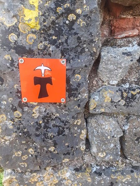
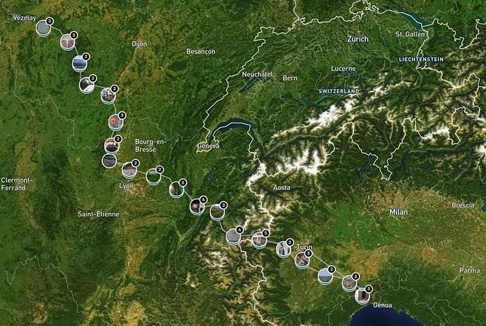
June 2024. While hiking with my brother on the GR 36 Tour du Morvan, I catch sight now and then of strange rectangular markers fixed to tree trunks. Against a bright orange background, a deep black Greek tau topped with a white dove. My first encounter with the Assisi Way. The Way of St. Francis: a pilgrimage route linking Vézelay in Burgundy to Assisi in Italy, covering nearly 1,800 km. It felt like an obvious next step—I immediately knew I’d take it on, attempt the adventure solo.


In the months that followed, I talked about my project to everyone—family, friends, my partner. An avalanche of comments, more or less the same but varying depending on each person’s character and life experiences. But deep down, it all boiled down to one legitimate question: why?

And the answers? Hesitant, awkward, partial, even confused. I quickly realized they weren’t so easy to find. It was as if my project seemed more like a whim, a kind of intimate caprice, rather than a well-thought-out plan. Of course, I knew the reasons that pushed me to leave—you always have to give some. Loved ones need to understand to feel reassured, and that’s understandable. But I fear that when I list them, they’ll sound like the same old checklist anyone embarking on this kind of journey might give. Of all the reasons I could mention, I’ll highlight just one here: the call of the road, the solo adventure that brings a powerful sense of freedom. A bit like Monsieur Seguin’s goat, who from her comfortable pen gazes longingly at the unconstrained horizon of the mountain. But if I’m being honest, I think I didn’t really know what I was looking for—or, more importantly, what I’d find. Deep down, when I reflect on it, one word keeps coming up that explains nothing and everything at once: desire.

Now well past sixty, I know that when I ask myself who I am or where I’m going, two things bring me fully back to myself: hiking and writing. And my intention was also to anchor this adventure through words, day by day. Writing down my feelings, emotions, discoveries, and reflections each evening. The famous travel journal that grounds the daily experience in reality. When I discovered the app "Polarstep," which was initially just meant to keep my loved ones updated and reassured, inform them of my progress, and maintain a connection, I found an opportunity to do it a little differently than usual. No retrospective notes polished up after returning, but spontaneous writing—recounting everything that crossed my mind during the day and publishing it immediately. A journey lived in real time.

This text is the exact transcription of my daily writings. Rereading them, I didn’t change a thing—just corrected a few mistakes and tweaked some awkward phrasing here and there. Short texts, fitting the format imposed by this kind of app. Writing as if addressing others.

Now, all that was left was to walk. April 18, 2026 – Vézelay.

Open
CE
Cendryon 2 weeks ago · Eole34
Kattegat Tour and Norway’s Majestic Fjords – 32 Days (Denmark, Sweden, Norway)
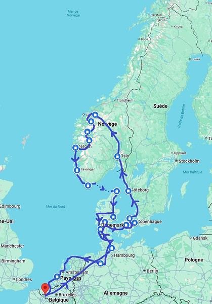
Kattegat isn’t just the name of the village in the TV series *Vikings*—it’s also the stretch of water separating Denmark from Sweden... the sea, basically! And further north, you’ve got Norway and its fjords! Originally, I’d planned to just do a loop around Kattegat, with the *Under* restaurant in Lindesnes as our anniversary treat... but along the way, we thought, why not "push" a little further north, keeping an eye on the budget since we’d chosen to travel by car in June 2025 through Scandinavia.

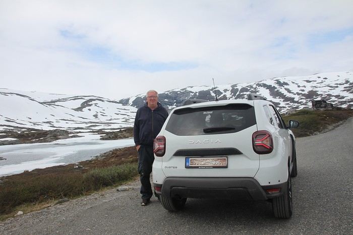
Why by car when most travelers opt for a camper van, while others prefer the comfort of cruises? Well, because we don’t own a camper van, renting one is pricey, and then you’ve got to add fuel costs (those things guzzle gas!), ferry fees, and other "tolls." All things considered, we went for mostly rentals—especially since there were four of us at the start of the trip. We spent the first week in Denmark with our daughter and son-in-law. Then they flew back to Belgium, and we continued our adventure as a couple. For accommodation, we mainly booked Airbnb apartments, which helped keep costs down and, most importantly, let us prepare our own meals (diet, diet!). In this travel journal, you’ll discover (or rediscover, for those who followed my older ones) our unbridled love for theme parks, museums, unique experiences, and—especially in Denmark—Legos! Unfortunately, we didn’t do any hikes this year because the unpredictable weather had made the trails slippery, and since I’d already taken three tumbles during the trip, I didn’t want to risk another! In the end, we traveled for 32 days, covered 6,200 km, and most importantly, discovered the charming country of Denmark, marveled at Norway’s breathtaking fjords—all without suffering the heatwave that hit France and Belgium that June! If you’ve got any questions, don’t hesitate to ask!
Open
MU
Muriel18 3 weeks ago · Puma2A
Two weeks under the Puglia sun
After a pretty disastrous weather-wise trip to Gran Canaria, we’re hoping this time the sun will shine in Puglia. It’s not a sure thing, though—the weather’s been awful all over Europe in early May.

For those who’d like to (re)read the story without the digressions, it’s here.

Saturday, May 16: This time we’re flying out of Charleroi (Brussels South): the ticket prices, flight times, and proximity all worked for us. The airport (Ryanair) was recently renovated... but it’s still not very well organized. There are hardly any seats in the boarding areas, and... the restrooms cost money!!! The flight goes smoothly, though, and we land in Bari a little late.

We quickly pick up our rental car, a very local-looking Pandina (even more so than the Fiat 500 in this region), and hit the Italian roads... and their unique driving quirks (like the fact that the countless road signs along the streets and in towns are purely decorative 😏, and that Italian cars don’t have turn signals 😮... except for rental cars).

About an hour later, we arrive at our first accommodation, right in the middle of the countryside near Monopoli. The owner isn’t there, but they’ve left us a ton of info via messages and even turned on the space heater, which is a nice touch. We explore the property:


And the next morning before breakfast, its immediate surroundings:


Sunday, May 17: After our "seaside" experience in Gran Canaria last weekend (packed with people and locals), we decide to start inland. After a hearty breakfast,


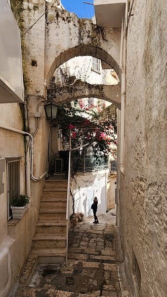
we head toward Alberobello, a super touristy village famous for its trulli—those stone houses with conical roofs. We easily find a free parking spot on a street near the Aia Piccola district, where some trulli are still lived in year-round.


We almost immediately come across the Trullo Sovrano (the only two-story one), which you can visit (but we skip it—it’s opening time, and there’s already a line).


From there, we head down toward the Basilica of Cosma e Damiano... but we don’t go in because there’s a mass.


Now we’re on the main Piazza del Popolo, which connects the two districts of Alberobello: Rione Aia Piccola and Rione Monti, the more touristy one.
Open
AT
Attila 4 weeks ago
Storm in the Canary Islands
15 days across Gran Canaria, El Hierro, and a dash of Tenerife under the storm Thérèse!

The planned itinerary will be slightly disrupted...

(The version without discussions is here)
Open
GA
Gaura last month · Fabhyène
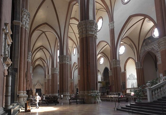
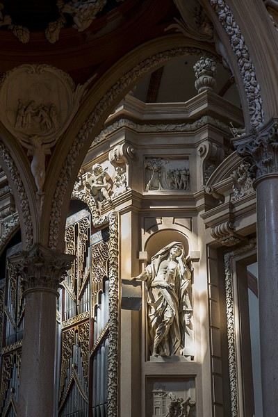
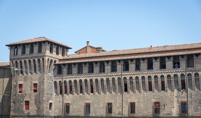
Visiting Bologna in Photos
Since I didn’t have time to write a proper travel journal, I thought I’d share a few photos of Bologna—a really lovely city I discovered in 2017 while stopping on my way to Tuscany. Around Piazza Maggiore, which was packed with a stage and chairs for a show, stands the Basilica of San Petronio, massive and Gothic in style, with an unfinished façade (a common sight in Italy).


Another building near the square:

But Bologna’s real charm lies in its porticoes, which were added to the UNESCO World Heritage list in 2021: 62 km of arcades running along buildings, letting you walk sheltered from the sun or rain. Back in 1288, the city required houses to include private arcades for public use. In the city center, you can stroll under 32 km of porticoes in all sorts of styles—some plain, some ornate—with a strong presence of red tones.
Open
MU
Muriel18 last month
Gran Canaria... a trip that wasn't exactly thrilling
Okay, it wasn’t a total disaster either. Actually, I hesitated before starting this travel journal: is it even worth writing about a holiday that won’t leave an unforgettable memory? In the end, I went for it (there aren’t many recent travel journals about this destination). So, read on... or don’t .

Every time we’ve been to the Canary Islands, it’s been by default (basically: where can we go in winter or early spring when we only have a week—so not too far, not too much jet lag, but with decent weather?).

This time, we had two weeks, but the winter plan kept changing: first Thailand (dropped for personal reasons), then Martinique (dropped because of work leave dates that weren’t up to me), and finally, the Canary Islands.

We’ve already been to Tenerife (which we really liked) and Lanzarote (which we liked a little less). This year, two options: Gran Canaria or one of the smaller islands west of Tenerife (La Palma, or even La Gomera or El Hierro). We chose Gran Canaria... not sure it was the right call! Whose fault is it? Storm Thérèse’s! Yes, Storm Thérèse followed us on arrival, and its effects lasted quite a while. We had to adapt, cancel visits, change activities...

But even without Thérèse...

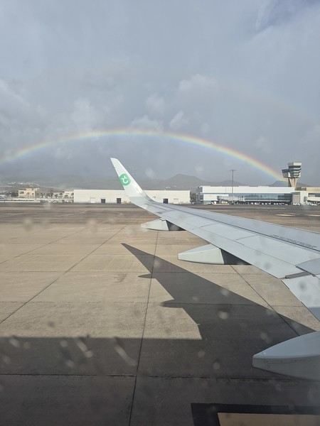
Saturday 21/03 Departure from Orly at 6:10 AM with Transavia. The plane took off on time and landed a little early, tossed around by strong winds before touching down. It had just rained, but it was (almost) no longer raining.


We quickly picked up our luggage and then the car at the Cicar counter. We got a Seat Arona instead of the Corsa we’d booked. Well, while the driving position didn’t feel great at first (I got used to it), the engine’s smoothness and power were much appreciated on the island’s winding and sometimes steep roads.

It was only 10 AM, and we couldn’t theoretically check into our accommodation until 3 PM (the owner promised to message me if it was ready earlier). So, we headed to the (big) *Jardín Botánico Viera y Clavijo*, where we planned to spend a few hours. We found a huge parking lot... empty. The passenger in the car in front of us (yes, we weren’t the only ones at the closed gate—there was a car in front and one behind) went to ask for info: it was closed due to the storm 😕. So, we calmly headed toward Puerto de las Nieves, on the northwest coast of the island.

The plan: go to a restaurant, visit the village, and do some shopping while waiting for early afternoon. As soon as we got out of the car, it started raining... we took shelter under the awning of a shop, waiting for it to pass. But the rain turned into a downpour, and within minutes, awning or not, Gore-Tex or not, we were soaked!

Since we were already wet, we might as well go to the restaurant—they weren’t far! But here’s the thing: contrary to what Google Maps said, they all opened at 1 PM, not noon! Back to the car, wading through 5 cm of water because all the village streets were flooded . The rain let up, we did some shopping, went to eat, and I got a message from the owner saying the accommodation was ready 🙂.

So, off we went to La Suerte, a few kilometers north of Agaete. The downside of the place, especially with luggage, is that you have to climb several flights of stairs via an outdoor staircase (after parking more or less far away on a steep street) to get there 😛). Of course, on the way from the car to the apartment, it started pouring again—the bags got soaked! Enough rain for today! We settled in quietly, and by late afternoon, we could (finally!) go admire the view from the terrace.

Open
JC
Jcpo last month · AlineP
A Week in Lanzarote in Late September
Lanzarote Travel Journal

Trip Planning My partner and I are heading to the Canary Islands for a week at the end of September, specifically to Lanzarote. We chose this island over the more crowded ones for its volcanic landscape and the variety of hikes it offers. I booked everything through Expedia: our hotel stay, car rental, and Ryanair flight tickets departing from Marseille. It was the only way to get a direct flight. To make getting around easier during our stay, I picked a hotel located in the center of the island from the wide selection available. It’s part of the Barceló chain, specifically the "Barceló Teguise Beach Adults Only" in Teguise Beach, which turned out to be an excellent choice.

The Trip

Sunday, September 21 - Monday, September 22 Departure It’s 2:15 PM, and we’re at the Avignon TGV station. Danielle picked us up earlier due to the weather—thunderstorms and heavy rain all the way to the station. The TGV was on time, and it only took 30 minutes to reach Marseille Saint-Charles. The shuttle to the airport is quick and convenient, right behind the station. The bus leaves for the airport in the middle of the storm, with flooded roads and cars stuck in some spots. We get soaked making our way to the terminal. Two hours to wait before the flight. The plane finally takes off at midnight, but just before landing, the pilot announces that the destination airport is closed, and we’re being diverted to Tenerife. Ryanair will re-route us as soon as possible. We end up waiting 2 hours, and Ryanair kindly gives us a 4 € voucher. We re-board around 5:15 AM and take off at 6:00 AM. About 45 minutes to reach Lanzarote. After collecting our luggage, we head to the car rental desk. The counter in the terminal is closed, and we’re directed to parking lot P4—it takes us a while to find it. I’m a bit worried about the rental company’s reaction since the car was supposed to be picked up 7 hours earlier, but it’s not a problem. A woman next to us is furious because she’s in the same situation, and her rental was canceled. Anne-Marie translates for her, but nothing changes. We pick up a brand-new Toyota Aigo and head to the hotel. After checking in, we cross the garden, walking alongside the large pool to reach our room. A lovely first-floor room with a jacuzzi and a sea view. It’s early, so we head to breakfast—a generously stocked and varied buffet with everything you could want. Afterward, we drive to Cueva de los Verdes, but it’s packed with people and a long wait. We decide to come back another day. Next, we visit Mirador Del Rio. This rocky viewpoint at the edge of the island has breathtaking cliffs plunging 500 meters into the ocean. The view is stunning and impressive. A panoramic bar lets you cool off while enjoying the scenery. We return to the hotel for a short walk around the neighborhood and enjoy the beautiful pool with its pleasant water temperature. Relaxing by the pool, sun loungers, and all. In the evening, a very varied buffet at the restaurant. Then early to bed to recover from the sleepless night before.

Tuesday, September 23 After a restful night, we enjoy another varied and hearty breakfast. The terrace seating is very pleasant. We take an inland road leading to Timanfaya National Park. The road near the park runs alongside vineyards where the vines are surrounded by lava stone walls to protect them from the prevailing winds. Our first stop is at the visitor center, where the island’s volcanic activity is well-documented. Next, we stop at an area where you can take a short camel ride—two seats are installed on either side of the camel’s hump. This little ride offers a great view of the volcanic landscape from a higher vantage point. A fair price of 11 € per seat for a 20-minute ride. We then head to the park entrance via the road leading to the parking lot, where only authorized buses can take the winding route inside the park. It’s crowded, and we wait about 45 minutes with several stops before reaching the parking lot. We board the bus, and the route offers beautiful views of this volcanic area and its many craters. The journey is very interesting, with several stops for photos. At the parking lot, a guide shows us how the heat from the rocks beneath the surface can ignite dry vegetation. Water poured into holes in the ground immediately creates geysers and jets of steam. The building next to the parking lot has a restaurant where meat is cooked using the heat from a well dug into the volcanic rock. On our way back, we drive to Playa Blanca, a seaside town with a small sandy beach.

Back at the hotel in the late afternoon for dinner.

Wednesday, September 24 We wake up early and have a quick breakfast—few people are around at this hour. Two days ago, we booked a 10:00 AM visit to Los Verdes, lava tunnels created by eruptions and lava flows from the La Corona volcano, which extended all the way to the coast. When the lava came into contact with the air, it solidified on the surface while continuing to flow underneath. The lava tunnels stretch for 8 kilometers to the volcano, but we only walk one kilometer. The inside of the tunnel is impressive, with narrow passages and larger chambers. You can see traces left by the flowing liquid lava—varied colors and twisted shapes. At the end of the path, a large chamber has been turned into a concert hall with perfect acoustics. Next, we visit Jameo Del Agua. This is a continuation of the lava tunnel, developed by Manrique. There are beautifully designed bar and restaurant areas, as well as an underground lake where you can see small blind white crabs—a protected species in this very pure water. Higher up, there’s a lovely space with a central pool that could double as a swimming area, surrounded by beautifully designed white pathways that contrast with the blue water. Further on, you reach a large space inside the lava tunnel, set up as a performance hall with perfect acoustics. Stairs let you view this beautiful space from above. A gap in the lava landscape reveals the ocean on the horizon. We head back toward the village of Yé, at the foot of the La Corona volcano. A 160-meter walk from the church, a path crosses vineyard plots and then climbs to the top of the volcano’s crater in about 30 minutes. It’s the island’s highest volcano. When you reach the edge of the crater, you see how deep it is, with steep slopes inside forming a large circular opening. The place is breathtaking and awe-inspiring. We drive back to the hotel via a road that climbs quickly, offering a beautiful view of the island’s northern part.

Thursday, September 25 After another enjoyable and varied breakfast, we head to the center of the island toward the volcano park and stop at a roadside parking lot where a path leads to the Montana Cuervo volcano. This is a crater that opened on one side. During an eruption, an explosion created a breach in the crater. Huge blocks of rock were thrown dozens of meters away. The path goes through the breach and descends into the crater, allowing you to walk around it. It’s impressive, and you really feel small and fragile in this environment. The crater walls, with their different colors, highlight the rock formations. The crater is surrounded by a sea of lava with sharp, jagged rocks. You can walk around the outside of the crater, but it’s not very interesting. We then head to the west coast, stopping at a spot with a small green lake next to a beautiful black sand beach. Next, we stop at Salinas de Janubio, a lovely viewpoint overlooking the salt marshes with different water colors. A small shop sells various local products. We then head to the famous Papagayo beach. The road ends at a booth where they charge 3 € to continue. From here, the land is private, and you have to pay to drive down a 3-kilometer rocky dirt road. Quite a few cars are driving along it, kicking up clouds of dust. The car gets a dusty makeover. We arrive at a large parking area, with several paths leading to different small beaches. We go to Papagayo, a small blonde sand beach surrounded by red rocks. The beach slopes gently into the water, which is a pleasant temperature. The setting is charming and peaceful. We stay for a while before heading back to the hotel.

Friday, September 26 We start with a visit to the César Manrique Foundation in Tahiche. This was originally one of his homes. The modern construction spans several levels and is integrated into the lava flow, using the gaps to create living spaces. Large windows make the rooms bright and open to the scenery. The place is pleasant, with flower-filled gardens outside. It’s well worth a visit. Next, we drive to Las Grietas, where a path leads to a narrow crack in the volcanic rock, forming a tight passage where only one person can walk at a time. The passage isn’t very long, but progress is slow due to the endless selfies being taken here. We then stop at Casa Del Camposino, a renovated farm that houses several artisan shops. We taste a local wine recommended by a charming woman and buy two bottles of Lanzarote red wine on her advice. Now, we head to Tamara beach, a beautiful and wide beach at the foot of high cliffs. There are always great waves here, making it a surfer’s paradise. On the way back to the hotel, we stop at the cactus garden, César Manrique’s final creation. Designed with a great sense of aesthetics around an old windmill, it features 4,500 varieties of cacti in various shapes, all in a beautiful setting. We return to the hotel in the late afternoon for the evening.

Saturday, September 27 After another hearty breakfast, we head north to Haria. We stumble upon another of César Manrique’s homes, where he lived for a long time. This house is more traditional than the previous one but still has large, modern, and very pleasant rooms. At the back of the garden is his large studio, where he created his works. Next, we visit the craft market—this was our original plan. Various stalls offer local items, and it’s very crowded. No room at the café terraces to sit down. We then return to Famara beach for a long stay. There are always great waves here, much to the surfers’ delight. The water temperature is pleasant, and we enjoy it. On the way back to the hotel, we stop at a gas station to refill the car, which has been very fuel-efficient. Gas is also much cheaper here than in France—1.16 € per liter of SP95. We also wash the car, which was very dusty after the long dirt road to Papagayo beach. At the hotel, we enjoy a farewell cocktail before dinner.

Sunday, September 28 We spend the morning by the hotel pool before checking out at noon. For lunch, we go to a restaurant called "Dona Lola," near the hotel, with a terrace offering a view of the coast. We order tuna carpaccio, which is delicious. We then head to the airport, just 15 minutes away. We return the rental car and go to the airport. A long line to check in our luggage. The return flight is on time. A shuttle bus takes us to Saint-Charles station. We then head to our overnight rental. The boulevard slopes down, making it easier with the suitcases. The rental is between the old port and the train station. Once there, we pick up the keys and make one last effort to carry the luggage up to the third floor. The studio is nice, clean, and simply equipped—perfect for one night.
Open
AM
Amnesix77 last month · Sandrita24
Andalusia with family (and two families) by car, late April 2019
Hi everyone,

Just back from two weeks in Andalusia, and I wanted to share this experience with you—maybe it’ll help with planning a trip. I’ll start with a quick recap in this post and try to add photos and day-by-day details later (still sorting through them). Hope I don’t bore you too much! 😎

Trip details:

April 20 to May 4, 2019:

7 days on the Costa de la Luz (El Puerto de Santa María) in an Airbnb,

4 days at the junction of the Costa del Sol and Costa Tropical (Salobreña) in an Airbnb,

3 days at Cabo de Gata for some rest at a campsite in Los Escullos.

Two families of four, each with our own car: three 9-year-old boys and a 6-year-old girl. One family was more into city exploration (not us, but we’re working on it), and the other preferred relaxation and nature (that’s us). We speak a little Spanish.

Over 5,000 km, including 2,500 km for the round trip from Carcassonne.

The weather: Variable, but we expected better for this region in late April. The first week on the Costa de la Luz was sometimes chilly (< 20°C), and the second week was warmer but not excessive (< 25°C). At least we didn’t get much rain!

Our budget: Around 2600 € per family:

700 € for accommodations, about 50 € per night,

1000 € for meals and restaurants. We usually spent around 50 € per family at restaurants—we ate out for lunch (except for 2–3 picnics) and cooked at home in the evenings, trying to be back by 6 PM.

600 € for activities: Río Tinto, a flamenco show, visits to the Alhambra, Giralda, and Alcázar, Oasis Park with meals, and a kayaking trip.

300 € for gas and tolls.

Preparation: A few months ahead with bookings for accommodations and tickets for the Alhambra, Giralda, and Alcázar. We used a few travel guides—I like the *Évasion* guide for initial planning. *Géoguide* was okay, but our friends’ *Routard* was the most useful. We also spent three months brushing up on Spanish with Mosalingua (a great spaced-repetition method, max 10 minutes a day). Downloaded Maps.me and the Andalusia map in advance—essential. And we used Tricount to track shared expenses with friends—super handy.

What we did/saw:

3 city visits (Seville, Granada, and Cádiz) + Málaga for our friends (we vetoed Córdoba—too many cities for us).

4 white villages (Vejer de la Frontera, Arcos de la Frontera, Grazalema, Ronda) + Tarifa for our friends.

Beaches (Tarifa and Bolonia, Matalascañas, Nerja, Cabo de Gata).

Nature and fun moments: Doñana National Park, a kayaking trip along the rocky coast near Nerja, and the Wild West/animal park in the Tabernas Desert.

A little culture: Río Tinto mines, the archaeological site of Itálica, Columbus’s caravels, Nerja Cave for us, and the Picasso Museum in Málaga for our friends. Plus, seeing the ham-drying process in the Alpujarras (for our friends).

Our highlights

Nerja and the surrounding villages: The rocky coast was amazing, and we loved the kayaking trip, even if the water was freezing for snorkeling. The beaches are sheltered from the wind, the town is charming, and the cave is incredible.

El Rocío and Doñana National Park. El Rocío has a timeless, almost Wild West vibe—we could’ve stayed a day or two. The quiet and pine scents reminded us of the Landes region.

What we didn’t love as much:

Río Tinto mines: Not super exciting, and the guides’ nonstop chatter kind of ruined the "nature" experience.

Our little regrets (for next time):

Forgetting our passports and missing a day trip to Tangier from Tarifa.

Not having an extra day around Nerja to go snowboarding in the Sierra Nevada—just 1.5 hours away (the kayak guide suggested it).

Not spending at least one night in El Rocío to explore Doñana National Park at dawn.

Antequera with the Guadalhorce reservoir and the Caminito del Rey (but it would’ve meant 2 more hours of driving, and we didn’t have the energy).

My general impressions of Andalusia and Spain

Landscapes: A feeling of extreme concentration of a single activity in some areas—endless olive groves, wind farms on the Costa de la Luz (which I thought were well-integrated), rows of buildings along the Costa del Sol (yikes, glad we didn’t stop there), greenhouses around Almería (a shame to have frozen the coast for so many kilometers), and the massive industrial port of Huelva.

What surprised us compared to France was the lack of small hamlets—villages are clearly defined, and people cluster there, leaving vast landscapes without human presence. In France, you find houses scattered everywhere.

Roads: Relatively few tolls. Sure, rest areas aren’t as nice as in France, but the roads are in good condition, and our wallet was happy. The roads are pretty straight with countless bridges and tunnels—the upside (besides fast travel) is that there aren’t many secondary roads disrupting the scenery.

Tourism and activities: A huge variety and richness. Feels like everyone can find something they like, and 15 days barely scratched the surface. It’s amazing how quickly you go from the coast to snow-capped peaks (Sierra Nevada) or from farmland to desert (Tabernas). And the mix of European and Arabic architecture in the same city is really special.

One small regret: Not interacting more with locals. We didn’t luck out with our Airbnbs. But shopkeepers were great—very patient with my broken Spanish! :-)

Overall, I think our choice to stay on the Costa de la Luz and then near Nerja worked well. We could explore pretty easily (even if we logged a lot of kilometers), and the settings were fantastic. The 3 days of total relaxation at Cabo de Gata were perfect.

If you prefer shorter stops, you could try staying in El Rocío (easy access to Seville and great for an early visit to Doñana National Park) or maybe Grazalema for a hike in the mountains (weather-dependent). And of course, Tarifa for a day trip to Tangier or Gibraltar.

More details and photos to come soon!

Laurent
Open
FA
Fabhyène 2 months ago · Sinforosa
She Sees Giants Everywhere! (Ducasse of Ath, Belgium, August 2018)
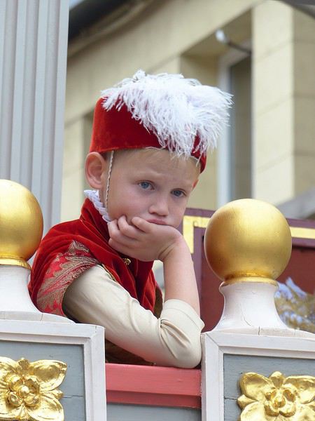
Sometimes fantasy and a change of scenery are right near home! I love exploring the four corners of the planet, but there can also be a whole world just a little farther than the end of your street—or even the tip of your nose! So I’ll share with you in pictures the beautiful kermesse of Ath, which we only discovered last August, even though we’re neighbors (we live in Lille).

I could have subtitled this travel journal: "Ferme eut’bouc tin nez va quer eud’dans"; it’s an expression in Picard language, literally “Close your mouth or your nose will fall in,” said to someone who’s amazed—and amazed I was!!! Ooooooooh, giants! Oh, how I love them! In the North, we have lots of these giants, like Reuze Papa and Reuze Maman in Cassel, or Gayant, Marie, and their children Binbin, Jacquot, and Fillon in Douai, and many more.

Huh? What? You don’t know what a Géant du Nord is?

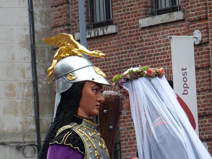
Well, it’s a benevolent hero, a legendary figure, a protector, a symbol tied to a city that parades through it, walking and dancing during carnival or the local festival. The tradition is said to have originated in Portugal in the 13th century (at least that’s where we have the first records), then we see them in the Netherlands starting in the 15th century. In the North, the oldest are Gayant and Marie of Douai (16th century), but many new ones have appeared since the 1980s with the revival of carnivals. In practice, it’s a large character (or animal figure) several meters tall; the structure is made of wicker, the body is often papier-mâché, but the head can be wood, as in Ath (lime wood), and the clothes and accessories are made of fabric, leather, and wood. The flared robe (for both male and female giants) allows one or more carriers to slip underneath to move it using only their arms, shoulders, and legs—and even make it dance! There are over 1,500 giants in Belgium and 450 in Hauts-de-France, mostly in the Nord and Pas-de-Calais departments.

In Ath, there are giants—LOTS of them! I’ve never seen so many at once. And each one is carried by only one man at a time (except for Bayard, you’ll see why later), even though the structure weighs over 100 kilos—so the carriers take turns quickly! The Ducasse of Ath and its giants have been inscribed on the UNESCO Intangible Cultural Heritage list since 2008, as part of the "Processional Giants and Dragons of Belgium and France." What’s more, the Ducasse of Ath is remarkable for its age and local roots; a procession was first mentioned in 1399, and today the many musical groups are still local (Ath and surrounding towns). The event is extremely popular: a good part of the population is there, all generations mixed together. Everyone knows the groups, floats, and giants, and each has their favorite! Originally, religious groups paraded, illustrating episodes from the Bible or the Golden Legend. Gradually, the parade became secular and kept evolving by adding new giants, historical figures, or allegories linked to local history (Ath, Belgian Hainaut, Belgium).


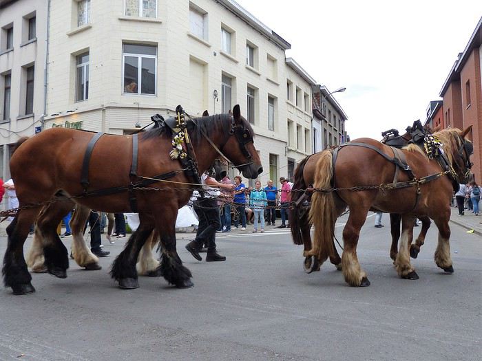
Finally, the beautiful floats are all pulled by magnificent draft horses, and that’s extraordinary! The town council itself rides in fine carriages that close the parade.

To wrap up this long introduction, know that the Ducasse of Ath lasts several days, but the highlight is the highly codified procession that takes place on the 4th Sunday of August (actually, the procession passes twice, once in the morning and once in the afternoon).

So, let’s go!

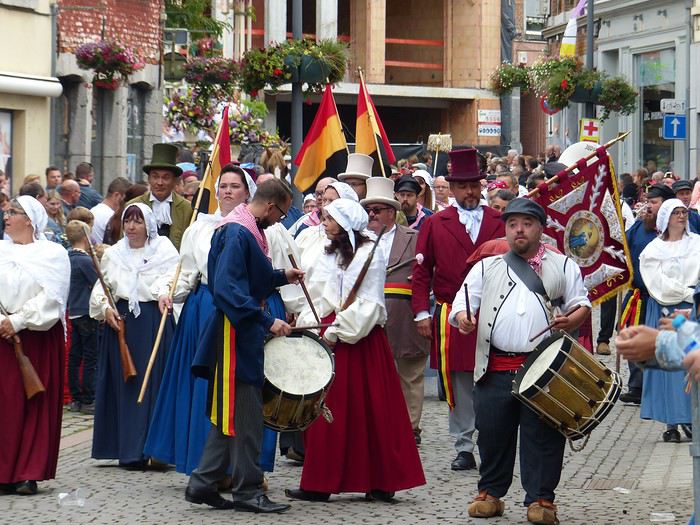
On this Sunday, August 26th, we’re in Ath in the early afternoon to see the procession. What a popular enthusiasm! Everyone is wearing the city’s colors (purple, yellow, and white), often with a twisted fabric necklace. Everyone is happy, smiling, from the giggling toddler to the sprightly centenarian sipping beer with her rosy-cheeked cousin and the pretty freckled blonde niece. People call out to each other, laugh, hum, and congratulate each other all around.

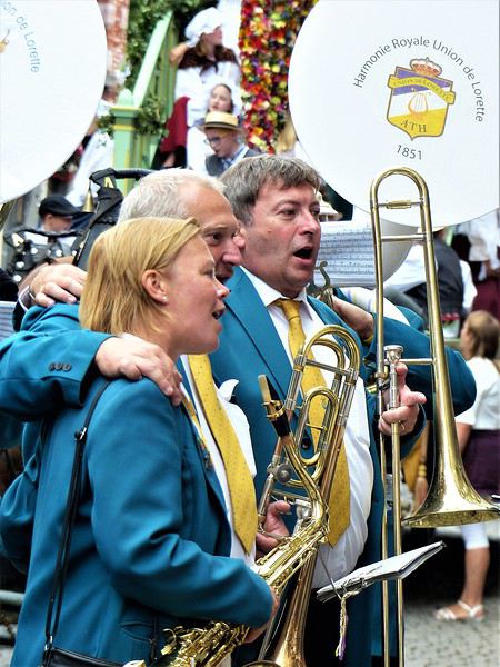
People start positioning themselves at strategic spots along the route—wider areas where the giants stop to perform a dance to the tunes of the brass bands accompanying them. And there are brass bands—at least one per giant and float!

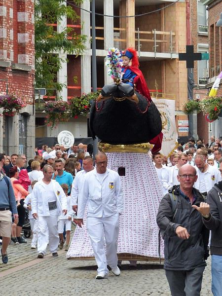
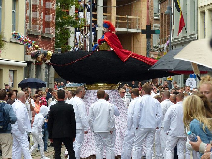
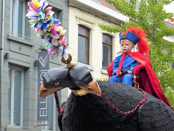
The wait passes quickly in this joyful atmosphere. Suddenly, the music grows louder, and here comes the first giant at last! It’s the "two-headed eagle," with a child (a real one) sitting safely on a little chair.

Present in the procession since the late 17th century, it originally had only one head (normal, right?) and accompanied the tailors’ guild. It gained a second head during the royal visit of 1854 (go figure why!). It’s 3.30 meters tall and weighs 115 kilos (without the child). All the men you see in white are carriers taking turns. Its dance consists of spinning the bird around—you’d think that little kid up there must be getting dizzy!


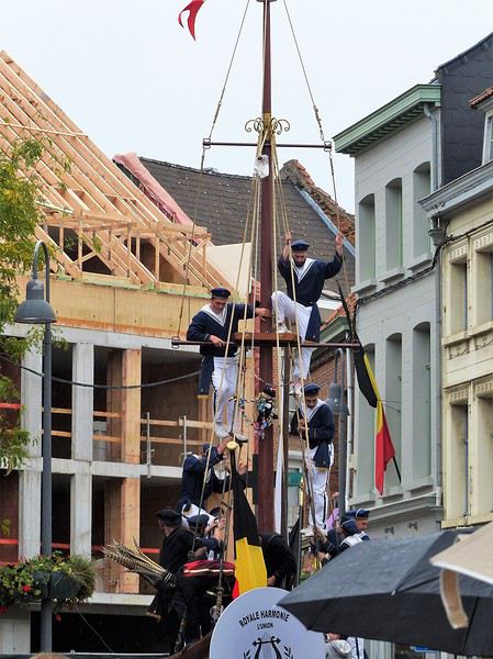
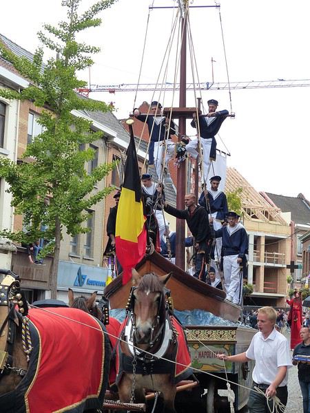
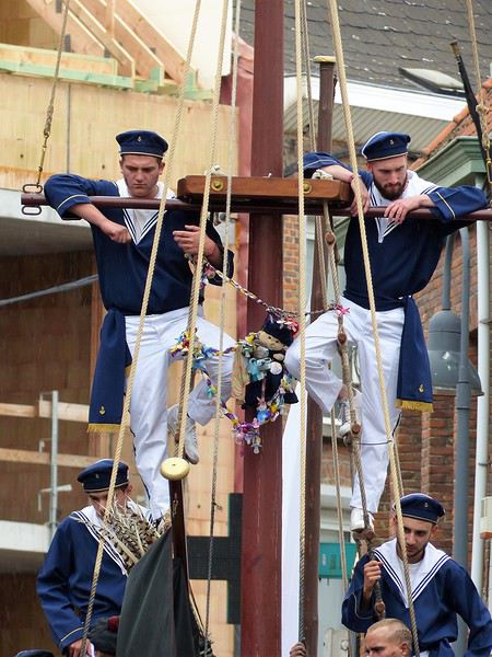
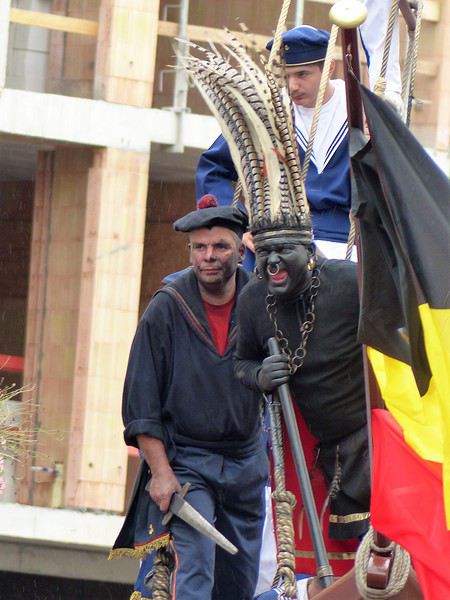
Next is the "Neapolitan fishermen’s boat." It’s a magnificent float representing a ship, with handsome sailors clinging to its rigging. This float first appeared in the parade in 1856.

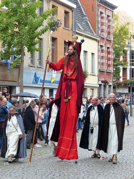
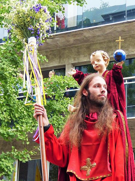
It’s followed by a human giant on stilts: "Saint Christopher of Flobecq," holding a flowered staff and carrying Christ on his shoulders (this time, not a real child!). It appeared in the 19th century, then disappeared from the procession before being reintroduced in 1976.


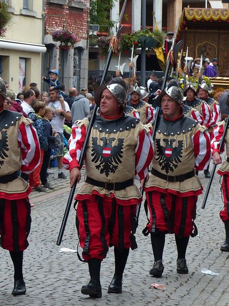
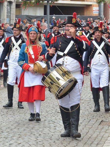
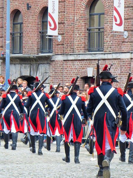
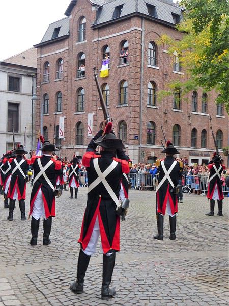
Now here come the "Blues," dressed in French uniforms. This group is the heir of the former cannon-arquebusier company, and they punctuate their parade with gun salutes!


To be continued: the giant Samson!
Open
OL
Olap 2 months ago · Ylangylang
9 days in Sardinia by bike
Leaving on Sunday, September 28, 2025, from Montpellier: I’m taking the train with my bike and panniers to Nice for the evening ferry departure to Porto Torres in Sardinia. Nice is gorgeous.
Open
LE
Lewinch 2 months ago
Slovenia and Northern Italy without a car
Here’s the itinerary for a ten-day trip through Slovenia and Northern Italy using local transport.

Saturday, May 2: Arrival

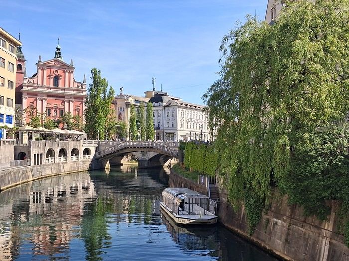
Arrived in Ljubljana on a Transavia flight from Paris. I’d spotted a bus connection to the city center, but it’s worth noting there’s no dedicated line—most buses stopping at the airport come from Bled. On a sunny Saturday afternoon, the bus was already packed with people who’d headed to the lake for some fresh air. I ended up taking a shared van, with drivers actively offering transfers to travelers. I paid 12 € for the ride to the train station, then walked 15 minutes to Hotel Celica. It lives up to its description as a former prison turned hotel—close to the city center, clean, with a hearty breakfast. The rooms are basic, with beds 3 meters off the ground, accessible by a wooden ladder. For dinner, I opted for an Indian restaurant.

Sunday, May 3: Urban marathon


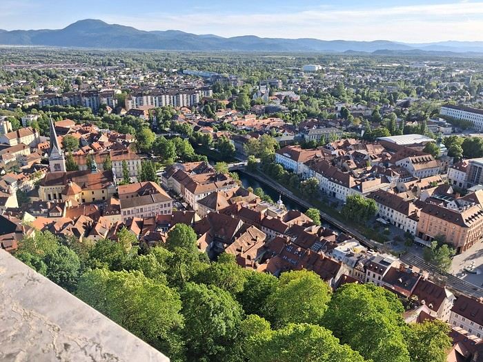
Good news: museums are free on the first Sunday of the month. I started with the National Gallery, then took a stroll through Tivoli Park, enjoying the outdoors. I tried grilling in the park before heading to the Museum of Modern Art and the eclectic National Museum of Slovenia, which was interesting for its architecture. Next up was the castle—you can enter the grounds for free; the only reason to pay is to access the keep for the city views.

Monday, May 4: Bled


I spent the morning exploring Ljubljana’s architecture but was disappointed by the Krakovo district, which guidebooks had hyped up.

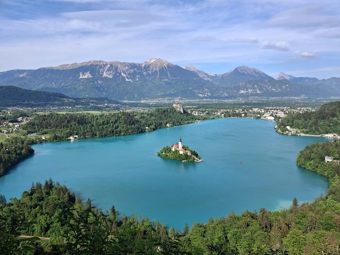
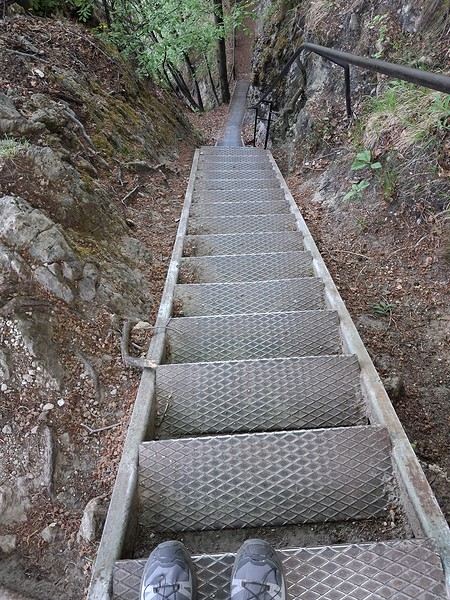
In the afternoon, I took the bus to Bled. The hostel was right at the bus station, and I soon realized I’d be the only guest—the owner was struggling to attract visitors. I walked around the lake and searched for the viewpoint access. It’s a steep climb with a staircase, but worth it.


Tuesday, May 5: Vintgar Gorge


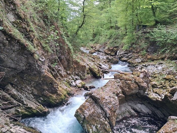
I headed to the gorges early in the morning via a shuttle, then walked back to Bled. It was stunning—it reminded me a bit of the Samaria Gorge I’d visited last year.

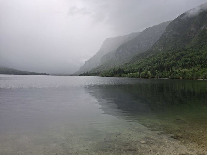
The bus took me straight to Stara Fužina near Lake Bohinj, where I stayed in a homestay. I loved it, even though there wasn’t much interaction with the hosts.

The weather was overcast and misty, giving the lake a Scottish vibe.


Wednesday, May 6: Bohinj

Rainy day, so I took the bus to Ukanc at the far end of the lake and walked back.

Thursday, May 7: Mostnica Gorge and the auto-train

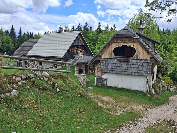
I set off on foot for the gorges from Stara Fužina, taking a detour up to Planina Uskovnica, a steep and rarely used trail. The views of Triglav and the traditional alpine huts were incredible.


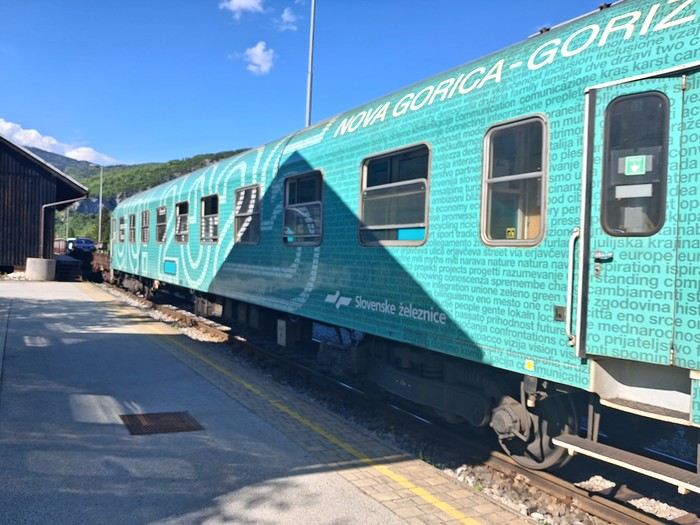
I then took the auto-train to Most na Soči. The passenger section has compartments, and the windows can be opened. The ride through the gorges was breathtaking. I stayed at a family-run guesthouse near the Most na Soči station—authentic and cozy.


Friday, May 8: Tolmin Gorge and Nova Gorica

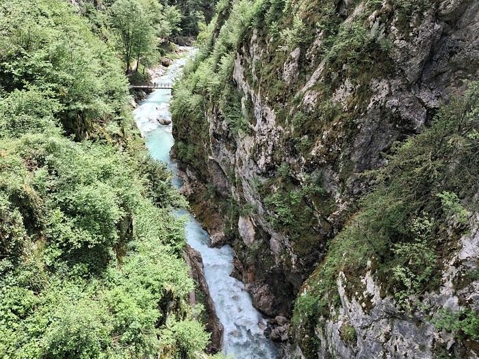
I took the bus to Tolmin, then walked 30 minutes to the gorges. The trail is well-maintained but short, so I extended my hike with a scenic loop through the gorges and nearby villages.


A quick train ride later, I was in Nova Gorica for the night, positioning myself to reach the Adriatic coast the next day. I explored at a fast pace—Villa Raffut on the Slovenian side, then crossed the border to visit Palazzo Attems-Petzenstein and grab an aperitivo in the main square. You could tell I was in Italy just by the vibe. The old border checkpoint is still there.

Saturday, May 9: Piran

Three trains and a bus later, I arrived. The journey was scenic, and it was worth it.

Piran is touristy but manageable. It feels like a mix of Croatia and Italy, with both influences evident. The maritime museum was fascinating, with its detailed ship models. There’s still a local feel—there was even a great blues concert by the harbor that evening.

Sunday, May 10: Piran

I walked to Izola along the coast—a beautiful route with paths, roads, and lakes. It was Sunday, and the tip of the village was lively with families picnicking. I decided to take the bus to Koper. The regional museum was quiet, but the garden was stunning.

Monday, May 11: Trieste

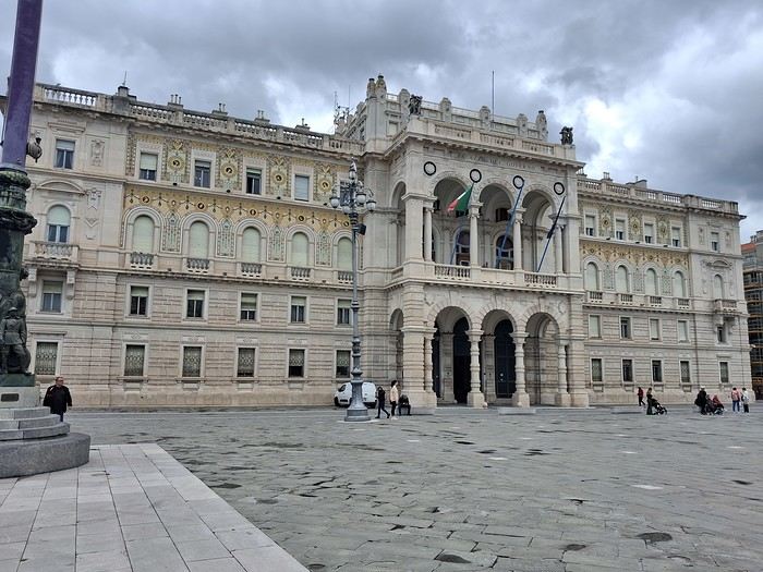
The bus connection from Koper was frequent and easy. Trieste is very open to the sea. I visited the castle and the massive Revoltella Museum—good timing, since it was raining. The collection spans everything from classical to contemporary art.


I missed my connection to Stresa later that day, so I had to improvise a night in a dorm near Milan’s train station.

Tuesday, May 12: Stresa

I came mainly for the Borromean Islands. First impressions weren’t great—crowded at the dock and windy. I didn’t like Isola Bella—too many people and too flashy. I much preferred Isola Madre, with its peaceful gardens where you can find solitude. On the way back, I stopped at Isola dei Pescatori after some hesitation, and it was worth it. Finally, I explored Stresa, with its colorful houses and grand palaces.

Wednesday, May 13: Heading to the Jura

I wrapped up my trip by taking the EuroCity train from Milan to Geneva via the Simplon Pass. From there, I headed to my vacation spot, taking the train from Nyon to La Cure (on the border). The rest of the journey was private.
Open
VO
Voyageur1990 2 months ago · Yemen
Visiting Cork City
Hello everyone,

We’ve just returned from a few days in Cork with my partner, and we really wanted to share our experience with you. We loved the vibe of the city and its surroundings!

What we loved:

The highlight of our visit was definitely our guided walking tour of Cork City. We booked it through GetYourGuide with Dorren, and honestly, it was amazing. If you're looking for a guide in French, go for it—he’s the only one we found offering this service, and he does a remarkable job. He knows the city like the back of his hand and shared anecdotes we’d never have found in regular guidebooks.

We also spent ages at the English Market, a must-visit for food lovers. The atmosphere is authentic, the local products are excellent—it’s really the heart of the city.

A little stop in Cobh:

We also took the time to head down to Cobh. It’s a gorgeous town with its colorful houses climbing up the hill and its majestic cathedral overlooking the harbor. The maritime history is very present—it’s an emotional and very photogenic visit.

A few extra tips:

Must-see: St. Peter and Paul Church. It’s truly stunning, much more impressive and rich in detail than we expected.

Avoid: To be honest, we were a bit disappointed by St. Finbarr’s Cathedral. We’d heard so much about it, but inside, we felt the decor wasn’t really worth the entry fee. In my opinion, you can skip it or just admire it from the outside.

Food:

If you’re looking for somewhere to eat, we tried Market Lane. It was a real favorite! The ingredients are super fresh (they often use produce from the English Market), the menu is great, and the service is top-notch. Just remember to book ahead—it’s a popular spot, and now we understand why!

In short, Cork is a perfect destination for a city break. If you have any questions about the itinerary or the tour with Dorren, don’t hesitate!

Happy travels to those planning their trip! !
Open
BI
Bibouns51 2 months ago
Off we go on an adventure in Puglia!
Hey there, VF crew!

After wrapping up our travel journal on Java (link below), we’re now diving into our recent adventure in Puglia! Happy reading... Off we go on an adventure in Java (and a bit of Bali) | Travel journal > Indonesia | Voyage Forum

Day 1 - October 19

When you tell your friends and family you’re itching to escape to the other side of the planet to mingle with the Mongols, you can usually expect a barrage of questionable jokes and terrible puns. For this new adventure, it’s a different destination but the same old story—this time, we’re visiting the "pouilleux" (the "scruffy" ones). We’re taking off straight for Puglia! If you need a cheat sheet to remember where this oddly named place is on a world map, just think of it this way: Puglia is the maiden name on the ID card of the heel of the Italian boot! Personally, I prefer to remember it as the land of creamy burrata, the smell of focaccia fresh from the oven, orecchiette shaped by mamas, golden olive oil that shines like the sun (which beams down here 300 days a year), amaretto that makes you happy, and those famous trulli—those little hobbit-like dry-stone houses straight out of a movie set...

But I’ll stop spoiling the rest of our trip and focus on a factual rundown of this first Puglian day. So, are you joining us on this new adventure beyond our Gallic borders? Either way, Sasha (my youngest) and Luna (Flo’s daughter) didn’t need much convincing to stick with us and keep up the pace!

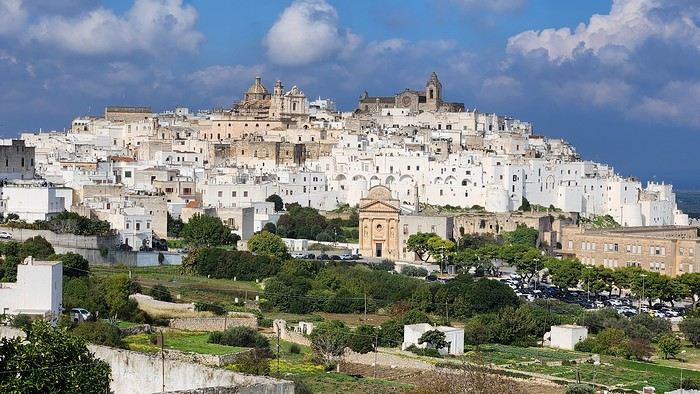
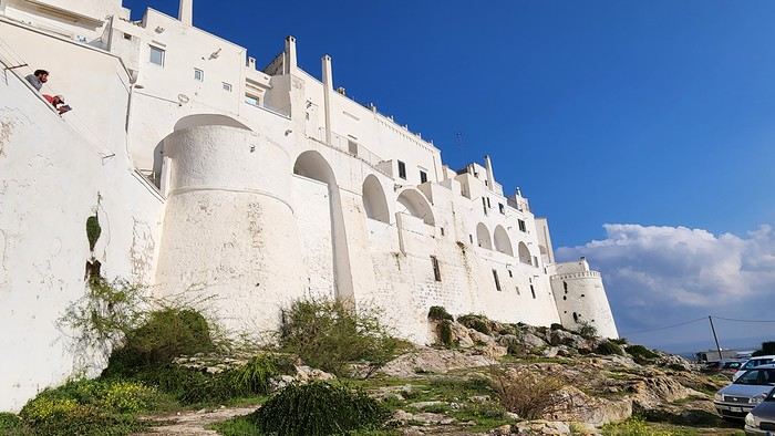
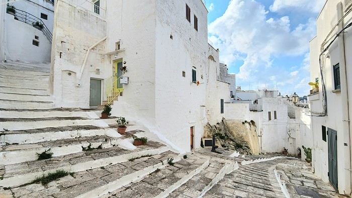
Our plane drops our little crew in Bari, the site of a famously tragic battle lost in 1991. But revenge is sweet! After renting a motorized carriage, we escape the landing zone and head to our military base of operations: Ostuni, a strategic little town where we’ll set up camp for the next four days. Why Ostuni? First, for its central location, which lets us explore a region packed with must-see gems. Second, for its vibe and beauty, which have earned it quite the reputation. Perched high on a hill, the *città bianca* (the "White City") lives up to its nickname. It literally dazzles visitors. The reason? The whitewashed facades of its houses, a testament to the region’s rich architectural heritage.


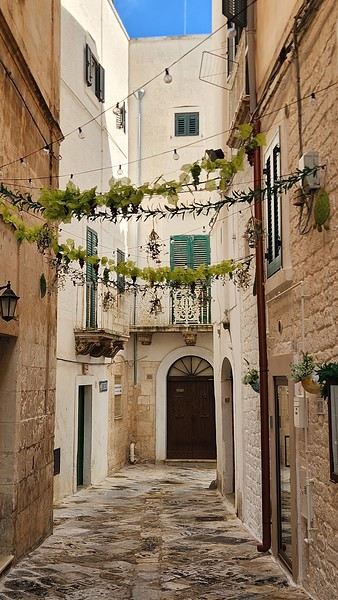
We arrived late last night, so only the two bravest soldiers volunteered to scout ahead at dawn, while the younger recruits stayed behind—for now. But not for long! After the first wave of streets and the next round of exploration, headquarters made the inevitable call to retreat. Reinforcements were needed! A few strategic errands, a breakfast ration, and our battalion marched in tight formation, flag held high, to conquer Ostuni the White! *Charge!* In my squadron leader’s memoirs, I’ll write that I didn’t expect Ostuni to put up such a fight. What I thought would take two hours to conquer turned into a humbling experience—we could only bow in respect to its beauty, its relentless charm. The alleys are whiter, more labyrinthine, narrower, and more photogenic than the last. *Veni, vidi, vici*—but what an entrance, my troops!


Open
LO
Lol64 2 months ago · Escaladin
Madeira: Between Disappointment and Enchantment
Bom dia, travelers, A little feedback from our discovery of Madeira—there aren’t many out there! Hoping it might be useful to some of you 🙂

We stayed 7 days in Madeira between May 18th and 25th.

Base: Funchal, the Lido hotel area. A practical neighborhood (lots of restaurants, shops, buses, etc.) but lacking charm. While getting back to Funchal is quick thanks to the road infrastructure, the outskirts of the city are particularly congested in the morning and evening, often due to tourist buses blocking traffic. Plus, even though Funchal enjoys milder weather compared to the rest of the island, you won’t see any sunrises or sunsets there! In short, if I were to do it again, I wouldn’t stay in Funchal for 7 days, even if it’s convenient to unpack once and for all.

Car rental for the week with Avis through locationdevoiture.fr (now Carigami). Zero-excess insurance, two drivers included, full tank on pickup, return with a full tank. After everything I’d read, I was dreading it. No issues at pickup or return. A Citroën C3 with 4,000 km on the clock, which served us perfectly. We brought our own GPS and map, which came in handy. There are signs, of course, but not always where you need them 😛.

Guides & maps: The Rother for hikes, the *Évasion* guide (quite general but very complete), and the Sunflower (borrowed), which I liked less—I found the explanations less clear and a bit messy, but maybe it was just me being unclear 😇. We also had the Freytag & Berndt map at 1:40,000, very useful when exploring the tiniest roads.

Day 1: In the morning, we head to CURRAL DAS FREIRAS. The viewpoint is pretty, very well developed (too much?). We take a short walk down the path as recommended in the Sunflower guide. The environment is wild but doesn’t offer much in terms of views.


We then head east via the expressway. Destination: PONTA DE SÃO LOURENÇO. The sky is overcast there, while just earlier, we were under the sun 😕! We’ll have to deal with the weather’s whims—a constant in Madeira! Off we go for a 3.5-hour round-trip hike, including photo stops, a picnic, and the climb to Ponta do Furado at the very end.


It’s nice, very open, and unlike anywhere else on the island. But it’s also *very* crowded. Mass tourism where everyone’s staring at their feet, barely a smile, hardly a hello 😠. The vibe kind of kills the charm. We were there at lunchtime but didn’t escape the crowds.


Practical detail that matters: no restrooms at the parking lot, none at the Casa do Sardinha, and an environment with no trees or bushes where you can see for miles. Ladies, plan ahead... A hike you should do regardless, with no major difficulty aside from the final climb, though it "undulates" constantly. The trail is perfectly safe.


Back at the parking lot, we take the road to PORTO DA CRUZ, a small village nestled at the foot of the mountain. The natural pools, being cleaned, are empty, and the seaside promenade, splashed by waves, feels a bit gloomy. The charm isn’t there. Return to Funchal via PORTELA and the MIRADOURO DOS INGLESES, which is tricky to find—hidden at the back of a lovely park, tended like an old lady from the 19th century, maybe the former owner of the place...


To be continued... 😉
Open
CA
Cagiva 3 months ago · Alfo79
The North Cape by 4x4 in the Snow
Our trip lasted a month, from March 10 to April 10, 2024, and was done aboard our Land Rover Defender 110. For those interested, our 4x4 is equipped with mountain-approved 3PMFSF all-terrain tires (non-studded), a removable electric winch that can be attached to either the front or rear of the vehicle, two sand recovery boards, and we bring two pairs of snow chains. We sleep in our Land Rover, which is equipped with a diesel-powered independent heater, a small fridge, and has a layout that allows the dinette to be converted into a bed.

Starting from the Paris region, we crossed Belgium and Germany, took the ferry from Travemünde in northern Germany to Helsinki, followed the Russian border up to northern Finland, then headed into Norway all the way to the North Cape before returning via Norway, taking the ferry from Larvik in Norway to Hirtshals in Denmark, then passing through Germany and Belgium on our way back to France.

Tonight, March 10, 2024, we’ll be sleeping at our daughter’s place in the North.

Tuesday, March 11, we’ll cross Belgium and then enter Germany, where we’ll camp in Bremen.

Wednesday, March 12, we’ll have a quick visit to Bremen in the morning. We had planned to visit Lübeck, but some electrical issues with the car delayed us, so we head straight to the German port of Travemünde, where we’re set to embark at 11:30 PM to cross the Baltic Sea and arrive in Helsinki after 31 hours of sailing (one-way cabin ticket cost: 850 €—quite expensive since we booked last minute).

On the ferry, there are mostly semi-trucks and only a few campervans and passenger cars. The boat is quiet, and the Baltic Sea is calm.

About two hours before arriving in Helsinki, we hear noise along the hull. Surprise—looking out the porthole, we realize we’re sailing on frozen sea ice!

Thursday, March 14, we arrive at the port of Helsinki at 9:30 AM. Disembarking takes a while. As soon as we’re out, we head straight to Rastila Camping (cost: 27 €), about ten kilometers east of Helsinki. Then we go to a Land Rover garage to fix our headlight switch, which stopped working (a real hassle in Finland since you have to drive with low beams on at all times).

After the repair, we visit the stunning Temppeliaukio Church, which is built underground.

On our way back to the campsite, we stop at the supermarket for supplies. Prices are similar to France, except for imported products.

We settle into our snowy campsite spot.
Open
CU
Cupda 4 months ago · Dominikue
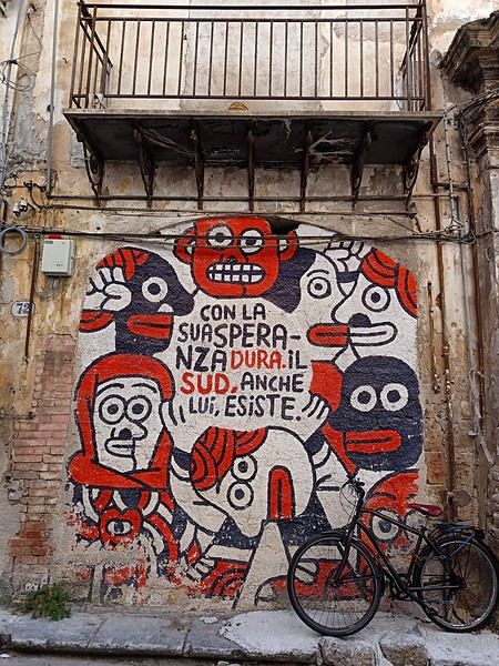
Palermo street art
Okay, Palermo—we know it. We go there to marvel at the architectural wonders born from the Arab-Norman-Byzantine-Gothic mix. And rightly so. We also go to treat our taste buds to all kinds of delights, both savory and sweet. Again, rightly so. We go to succumb to the charms of Palermo’s women, their sun-kissed skin glowing with golden highlights. Still, rightly so. And all while fantasizing about a mafia we’ll never actually see. Anyway.

But you’ll also find street art everywhere, even in the historic center. Sometimes, you just need to step a few meters away from the main tourist highways like Cassaro, Via Maqueda, or the main arteries of the Ballarò, Capo, or Vucciria markets to stumble upon some amazing murals. Duck into one or two slightly grimy alleys, weaving past trash and crumbling walls, and you’ll find real gems.

For example, just 50 meters south of the main artery of the Mercato del Capo, there’s a great spot with dozens of murals in a tiny neighborhood of run-down mini-houses. You’ll find plenty more south of the Mercato di Ballarò, in the Albergheria (the grittier side, not the one near Cassaro). There’s some in Ballarò itself too, but it’s hard to spot when the market’s in full swing with stalls everywhere. La Kalsa isn’t left out either, nor is Vucciria—just step away from the restaurant-packed streets.

Here are a few examples that really caught my eye.

(In the heart of Albergheria, on a street every visitor walks down—lovely message from an unidentified artist)
Open
FA
FamilleUS 4 months ago
Off to find Andalusian spring (Granada, Ronda, Seville)
It's been 39 years since we last came back to Andalusia...

For this last week of March, we waited until the end of the "votes" in France to go soak up some sun in southern Spain. And spring is the ideal season.

Our itinerary was a very (very) classic loop: Seville / Granada / Ronda and the white villages / Seville (with the start of Holy Week as a bonus gift!).

We flew from Lyon with Transavia (no issues) and landed in Seville on Monday. We rented a car (Goldcar), drove for 3 hours, and there we were in Granada, charmed by its ZTL (limited traffic zone) that Waze made us discover in detail (a nightmare!). Our hotel: Hotel Monjas del Carmen (perfectly located and with parking).

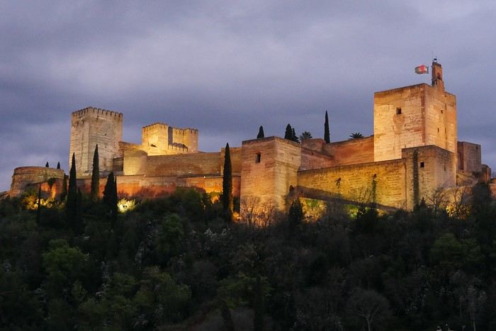
The weather was overcast, but a little stroll through the Albaicín district was a must. In the evening, we had dinner at "Restaurant Arabe Ambar" to get into the Nasrid atmosphere—we recommend it!


Open
SI
Sinforosa 4 months ago
Berlin impressions (live)
Hi there,

I arrived in Berlin last night. In another discussion, I shared how much of a "nightmare" the flights from Nice were.

I’ll be posting some impressions here—what I liked and what I didn’t like as much.

This is my first time in Berlin. I’m staying for two weeks. For now, I’m alone, but I’ll be joined by someone in a few days.

Just to clarify, I won’t be posting any photos because my camera gave up the ghost the day before I left. It refused to read memory cards, and I don’t have a smartphone—just a tablet that I leave at the hotel.

Speaking of photos, a few years ago, at the Ducasse d’Ath in Belgium, I met a retired teacher who wasn’t taking any pictures of the festival. I asked her, "You’re not taking any photos?" She told me that during a trip to Nicaragua, she’d photographed howler monkeys and only noticed when looking at the pictures later that the males had huge testicles—something she hadn’t realized in person. She said, "Since then, I don’t bother with photos anymore!" I’ve thought about that often and wonder if I should do the same and stop taking pictures. Still, I’ll probably get a smartphone since it’s hard to go without one these days.
Open
EL
Elise47 5 months ago
A Week in Malta in Spring 2025
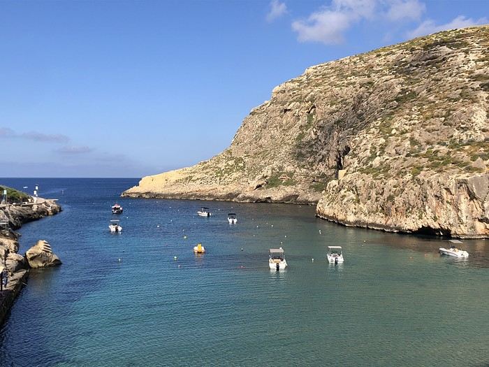
Why not Malta? We thought it was an original, off-the-beaten-path destination... The advantage is there’s a direct flight from Toulouse, our departure city. That’s what convinced us to take a week-long couple’s trip to Malta. I had booked the accommodations (breakfast included) + an airport/hotel transfer on Booking. First stop: VILLA DEL PORTO, a very pleasant guest house in a great location. We were welcomed by the owner, who gave us all the info we needed to get around. How to get to Valletta? By ferry shuttle. Valletta Ferry Service - Cospicua. And for everything else, a brilliant app for the buses that crisscross the island: TALLINJA. I highly recommend this app. We traveled by bus all week without any issues. The next day, we spent the day in Valletta, the capital. That’s when we realized this destination is actually very popular—streets packed with thousands of tourists! Luckily, we managed to navigate through parallel alleys and find small hostels or bars to eat or grab a drink. The city is stunning and steeped in history. On the third day, we took the bus to the south of the island: MARSAXLOKK. A charming, authentic fishing port with plenty of waterfront restaurants and souvenir shops. We ate at CAFÉ DE PARIS—a delicious fresh fish, perfectly prepared. On the way back, we wandered through the beautiful town of Senglea. Then we ordered takeout from D VIRI'S TAKE AWAY near the guest house via email. It was delicious! On the fourth day, we left Villa del Porto and headed to Valletta by ferry to catch the GOZO FAST FERRY—a 45-minute catamaran ride to the island of Gozo. After a good lunch by the port, we took the bus to our destination: XLENDI. A village at the end of a gorgeous bay. We stayed at the San Andrea Hotel—a small room with a balcony and sea view. Fifth day: Bus to Victoria. A magnificent citadel, a meal at a small bar in Piazza San Frangisk, then we continued by bus to the north, stopping in Marsalforn for coffee by the sea and a short walk to the natural salt pans carved into the rock. Back to the hotel by bus. Sixth day: A short walk to Xlendi Tower, a watchtower at the entrance of the bay, beautifully restored. Then we set off on a sea excursion in a small boat for six passengers. Honestly, I recommend it! Two hours cruising along the breathtaking coastline and turquoise sea—20 € per person. www.gozoboathire.com Delicious lunch on the terrace at "The Boathouse Restaurant." Seventh day: We packed our bags again and returned to Malta by ferry to Cirkewwa. The terminal isn’t very welcoming—you have to take a bus to find a town. We had lunch in Mellieha, then continued our journey, still using local buses, to RABAT, next to the ancient fortified city of MDINA. Another stunning city we explored at our own pace once the tourists had left. Eighth day: Bus to the airport. In conclusion, we’re thrilled with our trip. Of course, we didn’t see all the sites recommended by guidebooks, but we wandered at our own rhythm and came back with a head full of memories, images, and great moments spent in Malta and Gozo.

Villa Del Porto Address: Marina Street 1, KKR 1521 Kalkara, Malta Phone: +356 2166 8420 GPS Coordinates: N 035° 53.399, E 14° 31.557

Xlendi Bay

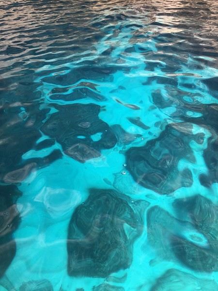
the seabeds in the coves
Open
VA
Valmichel86 5 months ago
Veneto: Dolomites and Opera
I'm starting a new travel journal in Italy. It's about a month-long trip (from September 3, 2025, to October 4, 2025), or rather a part of it. This section matches the title: an opera festival in Verona (one evening) and the Dolomites in the Veneto region. I'm posting the part of the trip I think will interest French-speaking readers the most (since this is where I saw the most French travelers). Here’s a quick summary: - Trip in September 2025 - Solo travel with camping (caravan) - Small geographic area: besides Verona, the surroundings of the Marmolada massif and Cortina d'Ampezzo. - Main but not exclusive activity: hiking.

Since I have limited internet access where I am now, I’ll be writing slowly. Here we go!

Day 1: Thursday, September 4, 2025

I arrived in Veneto under the sun and with warm weather. I drove to Verona and tried to find a spot at the campsite (Verona Village) located south of the city. Unfortunately, it was full. Booking on the website was mandatory, but when I tried to reserve a few days ago, the site never moved from the "reservation" step to the "payment" step (I don’t know why—it’s always like that in these cases). I found another solution over the phone; the drive from southern Verona to the northeast was a bit long, but I finally settled at the "Oro Verde" campsite. It’s an "agricampeggio" (farm camping or rural campsite) on the outskirts of the city, and its name (green gold) suggests they produce olives there. Since it wasn’t late, I biked to the Adige River, following the recommended route into the city.
Open
RE
Rero55 5 months ago
First trip to Sardinia from 04/12/24 to 04/21/24
I just got back from Sardinia 2 and wanted to share my little recap with you. It’s a stunning country, and the people are so welcoming. We were lucky to see it at the end of April—I wouldn’t go in July or August because it gets overcrowded and loses its charm!!! SARDINIA 2: 10 days

-Departure from Geneva to Olbia on Friday, 04/12/24 with EasyJet: 1h30 flight -Return from Cagliari to Geneva on Sunday, 04/21/24 with EasyJet: 1h40 flight (Round-trip price: 314 €) -Car rental with Locauto: 250 €, including 51 € for "full" insurance + 87 € (drop-off at a different airport) -Accommodation every night via Booking 13: room + kitchen *OLBIA: Arrival at the airport… wasted time at Locauto because there was only one person at the desk (you can check in online and send the driver’s license and ID, but it was impossible to do!) Headed to our lodging. *COSTA SMERALDA: The part we liked the least… everything feels artificial since the billionaires moved in (Porto Rotondo, Porto Cervo, Baia di Sardinia). We regret not stopping at Golfo Aranci to see its underwater art museum, Mumart. *ARZACHENA and its archaeological park (Tomba dei Giganti: Coddu Ecchju, Li Muri, Nuraghe la Prisgiona) to see in beautiful nature. Coastal road toward Palau (lagoons with lots of birds). *PALAU: Ferries to La Maddalena Island every 15/30 minutes (37 € for 2 people + 1 car). *** La Maddalena is part of an archipelago with 7 large islands and small islets… absolutely stunning… views of Corsica! *** -La Maddalena: A charming little town with narrow streets. -Follow the scenic coastal road that loops around the island for 21 km (gorgeous). -On the east side of the island, take a 600m bridge to Caprera Island (lots of great hiking trails). -Lots of beaches with granite rocks and wild coves. -Return by ferry to Palau. *SANTA TERESA GALLURA: Departure for Bonifacio 2, 4 km to Capo Testa (cape with a lighthouse… granite rocks). Here, there were Roman quarries. *Drive down a beautiful road along the Costa Paradiso (red trachyte). *CASTELSARDO: A fortified hilltop town worth seeing. *PORTO TORRES: Visit the Basilica San Gavino. *STINTINO and its beaches, including La Pelosa with its Genoese tower… too crowded for us! *Viewpoint at Capo Falcone with a view of Parco dell’Asinara (we didn’t have time to go, but it’s a must). *Drive down to Argentiera via small coastal roads (old lead, zinc, and silver mines). A "ghost town" with a museum that’s apparently only open on weekends at this time of year. *Small road (with stunning sea views) toward Grotta di Nettuno (you get there by a long staircase, but it was too windy and closed!). Capo Caccia. *Drive down (along lagoons with birds, including pink flamingos) toward Alghero (historic center: ramparts, bell tower, churches). The city of coral and lobsters! *Drive along the sea to Bosa, a colorful little town (Malvasia vineyards) between the Temo River and the sea. *Road to Montiferru Castle on a volcanic massif—ruins of the castle with a beautiful panorama of rolling hills (cork oak forests, chestnut trees, oaks) and cultivated plots. *** Cuglieri: Olive oil museum *** *Santa Caterina di Pittinuri, S’Archittu (many beaches with limestone cliffs) (many archaeological sites). *SINIS PENINSULA: Cabras and its lagoons with lots of pink flamingos. Archaeological museum with its Nuragic giants. *Archaeological site of Tharros. *ORISTANO: Not much visited, but it has some beautiful buildings. A traditional Sardinian pastry shop—an absolute delight (DELIGIA, Via Figoli 61). *Road surrounded by marshes, along the coast with beautiful little beaches. *Arrival at Costa Verde: The Piscinas dunes and beaches are stunning. Miniera Montevecchio and the surrounding old mines (Iglesiente road) (Naracauli, Ingurtosu). *** Near Guspini, in the mountains, visit the village of Arbus, where many Sardinian knife makers are based. But make the detour to meet Paolo Pusceddu, the master knife maker who opens his workshop and created the *Museo del Coltello Sardo* Via Roma, 15 · +39 349 053 7765. Absolutely fascinating and super interesting… he also sells his knives at very reasonable prices. *Masua (mines) then Pan di Zucchero. *Porto Flavia: Transport of minerals from a port carved into the cliff with two 600m tunnels… the visit is a must. *IGLESIAS: Worth visiting. *ISOLA DI SANT’ANTIOCO: A bridge connects it to Sardinia 2. Drive around the island via small roads. Calasetta (white and blue houses), Nido del Passeri, Cala Lunga, Capo Sperone, Turri. Beautiful beaches and stunning views. *Road to Teulada, then Chia (see the small road from Chia to Tuerredda). *PULA: Archaeological site of Nora. *CAPOTERRA: We ended our trip with a night at an agriturismo in the middle of olive groves, "Azienda Agricola Corte degli Ulivi" (Pixina Sa Murta, Marco: +39 347 246 2361). Unforgettable welcome, eco-friendly place (wooden house with water and electricity self-sufficiency). *Cagliari airport. In total, 1000 km, and we still didn’t finish exploring (the area south of Olbia and the interior are still on the list). The Sardinians are very welcoming. Sardinia 2 is diverse (beaches, countryside, towns, archaeological sites…). We were lucky to visit at the end of April—summer must be awful with the heat and tourist crowds! Easy to visit with kids.
Open
MA
Marati 6 months ago
A summer in the sun in... Iceland!!
Ah, Iceland and us—it’s quite the story, or rather, a long wait... The first time we considered going was already 7-8 years ago, after reading travel journals describing breathtaking landscapes, countless active and dormant volcanoes, glaciers, and waterfalls with extraordinary flows. In short, this island, made of fire and ice, right at Europe’s doorstep with its own unique culture, had nothing but advantages, and it was urgent to visit without delay 😇

My *Routard* guidebook is actually from 2016. So why did Iceland make us wait so long before we finally gave in to its charms? Yes, why indeed?

Simply because reading other travel journals revealed the cost of living there—and especially the harsh climate, even in the middle of July 🤪! Some journals described entire weeks of rain and foggy weather, making it tricky to explore the island. The budget wasn’t spared either, because in the most touristy areas, especially in the south and around Myvatn, accommodation prices are downright indecent—even outright robbery. 😕

Plus, in the Highlands, there’s literally no permanent lodging, and the only way to spend several nights there is to camp. And camping in winter conditions wasn’t exactly part of our plans... 😄

So, year after year, this trip kept getting postponed...

until August 2023, when prices for Southern Africa, North or South America, or even Asia were all way too high for summer 2024!

That’s when I turned my attention back to the Land of Fire and Ice and scoured all the comparison sites for the best accommodation deals across the country. Planning for 20 nights, I found 13 nights in "proper" lodging for 5 people at an average cost of under 200 €! A miracle, considering that in the southern glacier region, around Vik or Myvatn, prices range from 300 to 1000 € per night 😮 😮!

Still, that means we’ll have to camp for 7 nights, mostly in the Highlands, near Askja or Landmannalaugar. 😎

For once, I built the daily itinerary entirely around the decently priced lodgings I found 11 months in advance! The shortage of places to stay in some areas forced me to plan a few long transition days and make some tough choices. No big deal, though—there’s so much to do on this island 🙂!

Once the main itinerary was set, everyone agreed to the plan: 2/3 in proper lodging and 1/3 camping, even the most camping-averse among us! *Follow my gaze...*

By the time we bought the flight tickets, I had to tweak the itinerary a bit because one or two places were already booked! Plus, it was impossible to wait for a more refined plan to adjust reservations, since almost all bookings are non-refundable!! The harsh law of supply and demand...

For the car rental, we booked a Hyundai Tucson, approved for the Highlands, from Lava Car Rental—a company I’d read good reviews about in a Facebook group—for a cool 2500 € with full insurance. A real 4x4, like a Defender, would’ve been more than double...! Welcome to Iceland 😕...

Activities and excursions also required some tough choices. We had two must-dos: whale watching in Húsavík (60 € pp on Getyourguide) and a Glacier and Summer Treasure Glacier Walk with BlueIceland (165 € pp with discount codes on Getyourguide).

For the baths, we skipped the Blue Lagoon—too expensive—in favor of the Secret Lagoon and the Myvatn Baths, the Blue Lagoon’s equivalent but half the price.

Two baths for the price of one... and even more, since I spotted several free hot-water swimming spots.

Itinerary: Day 1: Arrival in Reykjavik - Hraunfossar Waterfall - Surtshellir Cave Day 2: Grábrók Crater - Snæfellsnes Peninsula Day 3: Stykkishólmur - Sturlungalaug Hot Springs Day 4: Northwest Coast - Akureyri - Goðafoss Day 5: Myvatn Day 6: Myvatn - Dettifoss - Selfoss - Rauðhólar Day 7: Húsavík Whale Watching - Dettifoss - Selfoss Day 8: Stuðlagil Canyon - Seyðisfjörður Day 9: Puffin colony - Störurð Hike Day 10: Hengifoss - East Fjords, Mjóifjörður Day 11: Viking Village - Jökulsárlón - Fjallsárlón Day 12: Glacier Excursion - Svartifoss Day 13: Fjaðrárgljúfur Canyon - Vík Day 14: Þakgil - Lava Show Vík Day 15: Southern Waterfalls Day Day 16: Landmannalaugar - Skalli Hike Day 17: Landmannalaugar - Bláhnjúkur - Brennisteinsalda Day 18: Secret Lagoon, Kerlingarfjöll, and Gullfoss Day 19: Geysir - Reykjavik Day 20: Bruarfoss - Þingvellir - Kerid Crater - Krýsuvík Geothermal Area Day 21: Reykjanes Peninsula

Friday, July 5, 2024, is our last workday before driving up to Alsace overnight to leave the cockers at Grandpa’s for boarding. Then, at 1:30 AM, we’ll head to Frankfurt, where a direct flight to Iceland awaits.

We arrive at 4 AM. Since we leave at 7 AM, the "night" will only last the equivalent of a 30-minute nap 🤪... just enough to get us in the road-trip mood 😏!!
Open
CA
Calisson94 6 months ago
Scotland - Skye Trail and a little extra
After our amazing experience in the Lofoten Islands in summer 2023, I suggested to Jean Marie another trek I’d been wanting to do for a long time: the Skye Trail in Scotland.

A few photos of this stunning island and he was sold and ready to go.

The route is available on the excellent WalkHighlands site HERE (there’s also a Cicerone guide on the subject). And since I thought it was a shame it avoided the Black Cuillins, I added a 3-day detour in that area.

We took advantage of the May bank holidays in 2024, partly to avoid the peak tourist season and also the midge period—because for some reason, mosquitoes love me 😠!!

27/04 – Day 1 – Transfer to Skye and start of the trek: Rubha Hunish - Flodigarry 28/04 – Day 2 – Flodigarry – just before the Old Man of Storr 29/04 – Day 3 – Old Man of Storr – Portree, then bus to Sligachan 30/04 - Day 4 - Sligachan - Glenbrittle campsite via the Fairy Pools 01/05 – Day 5 – Round trip to Sgùrr na Banachdich from Glenbrittle campsite 02/05 – Day 6 – Round trip to Coire Lagan and walk on the Rubh an Dùnain peninsula 03/05 – Day 7 – Return (hitchhiking) to Sligachan campsite and hike in the Red Cuillins 04/05 – Day 8 – Resuming the Skye Trail – Sligachan – Elgol 05/05 – Day 9 – Elgol – Somewhere on the climb to Bla Bheinn 06/05 – Day 10 – Somewhere on the climb to Bla Bheinn - Broadford 07/05 – Day 11 – Visit to the Armadale Castle and park 08 & 09/05 – Return to Glasgow, visit the city, and return flight And here’s the summary
Open
JA
Jacou0109 6 months ago · Pagaljavab
21-Day Trip to La Gomera and La Palma
Travel Journal: 21 Days in La Gomera and La Palma From February 6 to February 26, 2024

Tuesday, February 6 We left around 9 AM with our car, along with Pierre-Paul and Patricia, heading to the Bluepark parking lot in Bartenheim. As expected, we were awaited and left promptly for EuroAirport Basel. Took off at 12:25 PM for a 4-hour-15-minute flight under excellent conditions. Beautiful arrival in Tenerife with Teide in sight under a clear blue sky. Fifteen minutes later, we waited for bus No. 40 to Los Cristianos with quite a few other tourists, but we managed to find four seats. From the bus station, it was a 20-minute walk to our hotel. We checked into a lovely apartment for the four of us, complete with all the comforts. Outside, it was quite warm—at least 25°C! After dropping off our luggage, we went for a stroll. The immediate surroundings of the hotel held no interest for us: a modern, concrete area filled with hotels, bars, tourist agencies, and unappealing restaurants all offering the same bland international cuisine. Pat went to cool off at the pool, unfortunately overrun by loud, drunk English tourists. I took a walk to the paseo maritimo that leads to the port, skirting the seafront. The promenade was pleasant, but it could have been any seaside resort in the world—same old scene: a succession of bars with blaring music where many elderly people sipped cold beers waiting for the sunset, the backdrop a wall of resort-style hotels resembling rabbit hutches! Upon reaching the port, I scouted the route we’d take the next day to the Fred Olsen ferry. Back at the apartment, in the early evening, we looked for a non-touristy restaurant for dinner. Monique stopped a woman to ask her opinion! In this area, she told us, there’s no restaurant that serves Canarian or Spanish cuisine! The only place with decent restaurants is at the port. Off we went to the port, where we sat down at Al Bordo restaurant and ordered a seafood paella for four. Excellent, and at a very reasonable price (36 € for two). We returned to the hotel along the seafront.

Wednesday, February 7

Woke up at 6 AM. Had breakfast in the apartment with what we’d bought the day before at a supermarket. It was still dark when we left on foot toward the port, walking along the calm seafront at this early hour. Forty minutes later, we arrived and waited 10 minutes before the ferry docked. At 9:30 AM, we left the port of Los Cristianos for a 50-minute crossing on a calm sea under a beautiful blue sky. There were quite a few people on this large ferry, but many had no luggage, meaning they were visiting La Gomera for the day and would take the ferry back in the evening. Upon disembarking, we went straight to our rental car agency to pick up the car we’d booked online a few months earlier. It was a nice Peugeot 2008, spacious enough for the four of us and our luggage. We immediately took the beautiful road from San Sebastián that climbs directly into the mountains toward our rental in Vallehermoso. The road was in perfect condition—it seemed brand new, like all the others we’d take on this island later. This side of the island is very arid with little vegetation, and the terrain is particularly rugged, as it is throughout the island. We stopped at our first miradors, which would be followed by many more throughout our Canarian trip. Our first visit was to the small village of Agulo, perched on a promontory above the sea and at the foot of a high cliff. The village features typical Canarian houses with windows flush with the façade and black volcanic stone masonry on white or reddish-brown walls. The first recommended restaurant was already booked for a group, so we settled for the shaded terrace of the excellent El Alameda bar-restaurant. From Agulo, you can access the Abrante viewpoint via a winding road, where the view of Agulo, 600 meters below, is exceptional. A glass ledge over the void lets you test your fear of heights!

We drove to Vallehermoso to do our grocery shopping at the supermarket—a habit that would continue until the end of the trip. Our little house, "Casa rural El Encatadora," is located in a beautiful flower-filled valley a few kilometers west of Vallehermoso. Each of us had a bedroom with an en-suite bathroom, plus a living room, kitchen, and a small terrace overlooking the quiet street at the valley’s end, which didn’t bother us at all.

Thursday, February 8 The good weather seemed to follow us since our arrival in the Canary Islands. This morning, we took the road—still as beautiful and new—toward Arure, high up to the west. The landscape was magnificent, with breathtaking glimpses of the sea far below. In Arure, we parked in front of Conchita’s bar, where a hike (Rother No. 30) starts toward two viewpoints: Alojera, which we reached after 45 minutes on a lovely path. Monique, tired from the first steep climb, stopped at the first viewpoint and hitchhiked back to Arure. Meanwhile, we continued toward the second viewpoint, Los Barranquillos, where the view of the surroundings was partially hidden by misty clouds rising from the sea. The entire mountain is sculpted by ancient, endless terraces climbing until the slope becomes too steep for construction—visible traces of the hard work of past inhabitants trying to survive in a harsh environment. We had a decent lunch at La Conchita bar, then drove to the small seaside town of Puerto la Caleta, sheltered by an immense cliff plunging into the sea. Black sand beach, rough sea—despite our encouragement, Pat didn’t dare to swim! As for the old village of Caleta, it’s perched on the mountainside, and visiting it requires climbing steep, stair-filled alleys to discover a few traditional houses. Back at the casa, dinner in, and card games...

Vallehermoso

Friday, February 9 This morning, the sky was overcast, and the peaks around us were shrouded in clouds. We took the same road as yesterday to hike Las Creces. Quickly gaining altitude, we entered a thick fog—visibility was very limited. We stopped at the Las Creces parking lot; visibility improved, and the sun wasn’t far off. The hike is entirely within a beautiful laurel forest, with the sun playing hide-and-seek, but it wasn’t cold despite the altitude. After finishing the loop trail, we decided to picnic—not there, as it was too chilly—but on Vallehermoso’s beach, where we found a nice picnic area sheltered by large black rocks. A short digestive walk on the surrounding hill to admire the little beach from above. Back in Vallehermoso, we did some grocery shopping, then tried to return to the casa—only to find ourselves locked out because we’d left the key in the lock inside! After several attempts and with the help of Yéli, a relative of the owner we called for help, we were finally able to get back in!

Saturday, February 10

It rained last night, and the sky remained overcast. Monique decided to rest this morning. PP, Pat, and I set off on the hike that starts from the house toward the Marichal reservoir. The sun wasn’t far off, and by 11 AM, it was fully out. The pleasant hike passed by many flower-filled gardens and orchards—orange, lemon, and mandarin trees in fruit. The path climbed gently toward the reservoir, where the view of the Cano rock dominating the landscape was magnificent. The last part of the climb was a bit tough, overgrown with lush vegetation, and the trail was slippery from last night’s rain. We descended via a different, much more pleasant path and returned to the casa just in time for lunch, prepared by Monique. This valley is rich with its many farmers and market gardeners who’ve cultivated the entire valley, taking advantage of the water flowing down from the mountain, captured upstream and redistributed through countless pipes snaking along the paths. Numerous tanks also store water during dry periods. The houses are scattered across both sides of the valley, and these colorful little homes add a beautiful touch to the landscape. The many palm trees give this valley a distinctly tropical feel—you could almost imagine yourself in the Caribbean. Add to that some salsa music drifting from a hut where farmers were working, and the picture is complete. A well-chilled beer apéro capped off a lovely morning. The afternoon was dedicated to rest, relaxation, reading, and games.

Sunday, February 11 The blue sky returned, though a few clouds still capped the highest peaks. Today, we visited Garajonay National Park, which covers the highest central mountains. Up there, we were above the clouds, and the panoramas from the various viewpoints were stunning: first, Cherelepin, accessible from the Laguna Grande parking lot, then Alto de Garajonay, offering an exceptional view of Teide—over 3,000 meters high—emerging from the clouds on Tenerife, far in the distance. We continued to the Los Roques viewpoints, then stopped for lunch at the Degollada de Peraza restaurant, where the view of the barranco was impressive. We descended toward San Sebastián and checked into our new lodging, La Cabezada, located in the countryside about 3 km above San Sebastián. It’s a small apartment adjacent to the owner’s, with a lovely terrace overlooking the surrounding mountains and surrounded by a beautiful garden. Apéro, then dinner on our beautiful terrace.

Monday, February 12 This morning, we went down to visit San Sebastián de La Gomera: its old tower, main street with some beautiful traditional houses, and the Church of the Assumption. Back at the casa for lunch. In the afternoon, Pat, PP, and I set off on the short hike from San Sebastián beach to La Guancha beach. We drove down and parked on the beach. The path climbs along the hill overlooking San Sebastián, passes by the tall Christ statue dominating the landscape, and roughly follows the coast down to the isolated Guancha beach. A beautiful hike under a hot sun, and a swim was welcome, even if the beach and sea access weren’t very comfortable due to large pebbles and quickly deepening water. Apart from two nudist bathers, there was no one on this beach. We returned the same way.

Tuesday, February 13 Rest day. We went down to town to stroll and do some shopping. I took the opportunity to visit the parador, beautifully situated above the city in a lovely garden overlooking the port and town. Together, we went for a cuba libre at the "Cuba Libre" bar, then had lunch at Breñusca (mediocre paella!). Back at the casa, then we went back down to town to see a carnival parade, a "passacalles," which actually passed an hour earlier than scheduled. Oh well.

Wednesday, February 14 Each to their own program this morning. Pat went swimming at San Sebastián beach, Monique rested at the casa, and PP and I set off on the hike from Playa de Avalos to the Ermita de Guadalupe on Playa del Cangrejo. It wasn’t easy to find the right road or the parking spot, but we managed. The path seemed to have suffered landslides, according to a sign at the trailhead! We decided to check it out, ready to turn back if it seemed too dangerous. In the end, apart from one or two slightly tricky spots where we had to climb a pile of rocks, the trail remained passable, though a bit vertigo-inducing in places. The narrow path clings to very vertical cliffs nearly 300 meters above sea level! But what a magnificent view. At one point, the trail runs alongside a wall of basaltic pipes. We returned via the drivable track that parallels the trail a bit lower. Back at the house for lunch. In the late afternoon, we returned to town to attend the "Entierro de las Sardinas" (Burial of the Sardine), which closes the Canarian carnival festivities. While waiting, we strolled through the parador’s gardens and had mojitos in town. Around 9 PM, we heard the noise and cries of the mourners. The procession advanced, led by a large papier-mâché sardine on a float, surrounded by wailing mourners. The procession headed toward the sea, where the sardine was burned, and a mini fireworks display ended the procession. It was all very good-natured, and everyone had fun. We ended the evening with dinner at a good fish restaurant, El Pajar.

Entierro de la Sardina in San Sebastián de La Gomera

Thursday, February 15

Woke up at 5:15 AM. The only suitable ferry was at 7 AM, which would get us to La Palma by late morning rather than evening. We packed our bags, had breakfast, then headed to the port, left our rental car, and boarded the ferry to Tenerife, from where we’d continue to La Palma. Calm sea, beautiful sun—by 10:30 AM, we disembarked in La Palma. We picked up our car and immediately headed to our new apartment in Breña Alta. It’s a large apartment with a superb terrace facing the sea, fully equipped and very comfortable. The hosts recommended Casa Goyo restaurant, near the airport and close to us. It’s a restaurant with many small rooms, some of which can be reserved for families. The fish-based cuisine (chipirones, pulpo) was excellent, hearty, and reasonably priced. Since it’s in the airport’s flight path, we occasionally heard planes landing. Quick and efficient service. Afterward, we visited Santa Cruz de La Palma, which reminded us of the historic quarters of La Orotava in Tenerife or the capital of Gran Canaria.

Friday, February 16

Beautiful weather, blue sky. We headed to the San Bartolo viewpoint toward the northeast coast, then to the lovely village of San Andrés, which we explored. From there, we walked along the shore to the natural pools of Charco Azul, where we swam in the cool but "swimmable" sea. Back in San Andrés for lunch at the "San Andrés" restaurant on the beautiful church square. Very good fish-based meal. We got back in the car and continued along the north coast to the port of Espindola and the natural pools of Fajana near the Cumplida lighthouse. A fairly strong wind whipped up beautiful waves crashing onto the rocky coast in bursts of foam. Back in Santa Cruz, we stopped at the Mercadona supermarket to buy fresh shrimp for dinner. San Andrés

Saturday, February 17

Uniform blue sky, even on the heights. We took the beautiful road that winds up to the summit of the Caldera de Taburiente. Several viewpoints offer 360° views of the entire island and beyond: you can make out La Gomera, El Hierro, and, of course, Tenerife with the perfect triangle of Teide. We parked at the Los Andes viewpoint parking lot and started our hike to Pico de la Cruz along a trail following the ridge, offering superb views into the caldera. We got back in the car and passed by the Roque de los Muchachos astronomical complex, composed of numerous observatories, some with very aesthetic mirror telescopes. We hiked from the Roque de los Muchachos parking lot to the various viewpoints, always as impressive. Picnic on site, then back to Santa Cruz. We stopped by our car dealer because the oil warning light came on—better safe than sorry. The representative reassured us but preferred to give us a Fiat Cross SUV instead. The Caldera de Taburiente

Sunday, February 18 The weather was a bit mixed, with cloudy patches. We set off to hike the Barranco de la Cuba de Galga. Unfortunately, the Los Tilos trail had been closed for several months due to a major landslide. The parking lot by the road was already quite full, and indeed, we crossed paths with many hikers along the way—it’s an easy hike with little elevation gain, which is rare here in La Palma! The beautiful path winds through a very narrow, deep gorge covered in lush tropical vegetation—you’d think you were in a Southeast Asian forest, especially with the humidity in the gorge bringing out earthy and floral scents. Halfway through, Monique turned back while the rest of us continued to the Cuba de Galga. A light drizzle accompanied us on the return. For lunch, we went to Chipi Chipi restaurant in the heights of Santa Cruz. The cool air forced us to leave the lovely terrace for the slightly noisy dining room. The meal was very good and hearty. Afternoon spent resting at our house.

La Cuba de la Galga

Monday, February 19 A few clouds still clung to the nearby mountain peaks. We headed south to Los Canarios. We stopped in front of the small San Antonio Abad church, where a path leads to the viewpoint in 15 minutes. Then we visited the San Antonio Volcano Interpretation Center and climbed to the viewpoint via the trail along the crater’s edge, offering a plunging view into the crater. Then PP, Pat, and I headed toward the Teneguía volcano but turned back given the remaining distance and the intense heat bearing down on us! Plus, the landscape was rather arid and not very interesting. We got back in the car and drove down to the salt flats at the island’s southern tip. The ocean crashes here in large waves, exploding against the volcanic rocks and feeding a "blowhole" carved into the rock. We stopped for drinks at the salt flats restaurant, then headed home. The salt flats in Fuencaliente

Tuesday, February 20 Beautiful weather with a few clouds clinging to the mountains, as usual. A relaxed morning since my parking reservation at La Cumbrecita didn’t start until 1 PM. It takes about 30 minutes from Santa Cruz to reach the valley floor via a beautiful but narrow road toward the end, though there’s very little traffic. Meanwhile, the clouds had disappeared, and the view from the La Cumbrecita viewpoint was superb. We recognized Pico de la Cruz in the distance, where we’d been a few days earlier. We then took the path leading to the Las Chozas viewpoint through a magnificent Canarian pine forest. We picnicked on site, then took the path to the Los Roques viewpoint. We returned the same way since the direct route was closed for construction. Back in Santa Cruz, we visited the Sanctuary of Las Nieves, with its beautiful golden Baroque altar. Hike from La Cumbrecita

Wednesday, February 21 After packing our things and loading the car, we left Santa Cruz under a very blue sky for Los Llanos de Aridane, where we stopped to visit this lovely town. The Church of Nuestra Señora de los Remedios has a beautiful coffered ceiling and an original papier-mâché Christ statue from the 16th century. Around it, colorful old Canarian houses brighten the streets of the town center. We took the opportunity to stroll, do some shopping, and finally sat down at La Pergola restaurant for a mediocre lunch. We got back in the car to check into our new house in Arecida. On the way, we stopped at the Mirador del Time, which once again offered an impressive panorama, allowing us—for the first time—to see the damage caused by the Tajogaite volcano eruption in 2021. You can clearly see the still-smoking crater and the large black lava flow covering the landscape down to the sea. We really liked our new accommodation: a local house that’s been renovated on the heights of Arecida, not far from the Canarian pine forest. From several terraces, we have a 360° view of the sea and mountains. We even have a private pool! There are two beautiful, brand-new bedrooms, each with its own bathroom—the best. Plus, we’re on the GR 131 trail that runs along the Barranco de las Angustias toward the northeast.

Los Llanos de Aridane

Thursday, February 22 Once again, beautiful weather greeted us when we woke up. We started the GR 131 with the goal of reaching the Torre del Time viewpoint—about 400 meters of elevation gain. The path, quite steep at first, winds through a superb Canarian pine forest. A few viewpoints let you appreciate the sheer drop of the Barranco de las Angustias—watch out for vertigo! At the Torre del Time viewpoint, there’s a nearly 1,000-meter vertical drop. We returned via another path, the PLP1, which meanders first through this beautiful forest, then along lovely flower-filled gardens adjacent to beautiful properties that cascade from the forest down to the road serving these neighborhoods. This afternoon, we tried to get closer to the area devastated by the 2021 lava flows. Several roads are still closed or reserved for residents, while others—brand new—have been rebuilt to open up this densely populated and cultivated region. In some places, the lava flow slightly diverted, sparing some properties that logically should have disappeared. Now, they’re encircled by a massive cooled lava field. In other spots, twisted and charred metal scraps or greenhouse remains protrude from the lava—all that’s left of the former banana plantations. A little higher up, you can see the slightly smoking crater of Tajogaite, responsible for this disaster. Back to Casa Barreros.

View of Los Llanos and, in the background, the 2021 lava flow

Friday, February 23

Though the sky was still blue, the temperature had dropped due to a chilly wind. By midday, it still rose to 22°C. Today, we headed north, specifically to the town of Tijarafe, where a very narrow road descends to the small port, Porís de Candelaria. The 3.7-kilometer road drops 700 meters in elevation, with gradients up to 30%—it was going to be intense! Indeed, the descent was scary, with the void right next to the very narrow road where passing was impossible except at a few rare spots. Everything went well—there was little traffic at this early hour. From the parking lot at the bottom, a path leads to Porís de Candelaria. It’s surprising to see this small fishing hamlet nestled in the shelter of an immense cave opening onto the sea, which was quite rough today. The sun, at this time of year, would appear late in the cave, which remained in shadow for much of the day. We returned via the same road, strolled through the small town of Puntagorda, and had lunch at El Jardín de los Naranjos restaurant—excellent meal. Fishing hamlet of Candelaria

Saturday, February 24 The air was still cool, but the sun was beautiful. While Monique stayed home to rest, the three of us headed to the village of Las Tricias to hike the Buracas Caves trail. We left the car parked on the LP1 road and took the small paved road down to the sign marking the trail’s start. The signage for all the trails we took here, as in La Gomera, was very well done. The path descended steadily, then more steeply toward the caves where the island’s first inhabitants lived—some petroglyphs are still visible in certain caves. The path then climbed back up, passing magnificent dragon trees and more or less elaborate huts occupied by Germans who’ve lived here for many years. Back at Casa Barreros for some rest.

Sunday, February 25 The weather once again blessed us with a beautiful day. This morning, we visited the local produce market held on weekends in Puntagorda. You’ll find agricultural products, crafts, and food to keep you going. A little further on, there’s a glass viewpoint overlooking the barranco plunging toward the sea, with a view of the thrill-seekers trying the zip line right next to it. Lunch at Naranjos—definitely a good spot—with their shrimp and spice tagliatelle. Back home for an afternoon of relaxation.

Monday, February 26 We left Arecida under a cloudy sky. Driving up from Los Llanos de Aridane toward the east, an enormous cascade of clouds poured from the mountain peaks into the Los Llanos plain—very impressive. Arriving in Santa Cruz, we went for a stroll, did some last-minute shopping, then had a final good-quality paella at La Chalana on the paseo maritimo. We left the car in the parking lot and took the 5 PM Olsen ferry to Tenerife on a slightly choppy sea, but the ferry didn’t rock too much. Arriving at 7:15 PM, we dropped off our things near the port in our reserved apartment and went for dinner at Abordo—rubbery chipirones. A digestive stroll among the ever-increasing number of tourists in Los Cristianos—restaurants were packed to the brim, the season is in full swing here. Gone is the calm of La Gomera and La Palma, and the laid-back tourism of German hikers among whom a few French were hiding!

Tuesday, February 27 To make our homemade breakfast more enjoyable, we went to buy pastries at the local bakery, then took one last walk on the paseo along the beaches, mingling with the many mobility scooters driven by elderly or disabled people, joggers, and tourists. Last apéro near the bus station, then off to the airport. After a smooth 4-hour-30-minute flight, we arrived in Basel-Mulhouse at 10:20 PM.

THE END

Conclusion A fantastic trip to two islands with magnificent and diverse nature, where landscapes range from desert-like to tropical depending on exposure to winds and clouds. Thanks to the many beautiful viewpoints, you can truly appreciate these exceptionally dynamic reliefs. A hiker’s paradise, the trails are all very well marked, though the choice of easy or moderate paths for "casual walkers" is quite limited. Another notable advantage, in our opinion, is that these islands are very lightly developed—you’ll hardly see any of those ugly hotel blocks that spoil the landscapes of some other Canary Islands. It’s true that the beaches on these two islands don’t meet traditional international tourism criteria: they’re small, with black sand, and often difficult to access. Special mention for the quality of the road network (except for a few small local roads), which seems brand new, well-paved, and well-signposted. We also enjoyed exceptional weather for February, with fewer than three days of gray or rainy weather out of 21.

Almost all the accommodations we chose met or exceeded our expectations, often at reasonable prices: an average of 98 € per night for an apartment or house with two bedrooms for four people.

All photos can be viewed by clicking this link: https://photos.app.goo.gl/G44pPk4g9PW1rNzg8
Open
EU
Euphroozine 6 months ago · Castorbreton
Norway: Nomadic holidays between fjords and northern islands
Hi everyone,

Well, the time to head back has come, so it’s time to share the 3 weeks we spent in Norway this year 🙂


Right, here are a few details before we dive in!

Who: My husband, me, and our daughter, who turned 8 during the trip

When: From July 5 to 28, 2019—three full weeks there

What: A one-way trip from Oslo to Tromsø, with fjords, the Lofoten Islands, and so much more on the itinerary! Since you have to make choices—and because the country is huge—we decided to skip the south around Stavanger (we thought the hikes there might be too tough for us). We also chose not to go all the way to Bergen. Our goal was to spend time in the northern islands.

The route to Bodø:


The route from Lofoten to Tromsø


How: By camper van. Even though it’s not exactly budget-friendly, it’s really the ideal way to explore this country—especially for wild camping and adapting your route based on the weather and your mood. I’d recommend it 200%. It was our first time, and we loved it. Being able to wait out a downpour in warmth or shower after a long hike was super practical!! That said, we did have a few hiccups. The auxiliary battery (which powers the back) died, so we had to find a garage to replace it. And the biggest issue: on a narrow road, I smashed the mirror while passing another camper van 🏴‍☠️

Budget: Oh boy, that’s a big topic! To be honest, I didn’t tally it all up… because I didn’t want to! Everything is more expensive there, obviously. At the supermarket, for example. So I didn’t keep track—this was a vacation, we weren’t there to count every cent, even if we’re not exactly rolling in money! Ferries are pretty pricey, especially with a camper van, but there’s not much choice. Lots of toll roads too. Basically, when you go there, be prepared to open your wallet!!!

The weather: We weren’t sure what to expect before leaving—or rather, we were expecting bad weather. We were pleasantly surprised: we had almost nothing but great weather, with just a bit of rain toward the end. So the hiking trails weren’t muddy (at all?). Otherwise, it would’ve been a real pain and super slippery! Temperature-wise, we were lucky. It hovered between 15 and 21°C. Sounds chilly, but honestly, with the sun, it warms up nicely, and it was enough to wear shorts and a T-shirt almost the whole time—something I didn’t expect before we left. That said, the water temperature is freezing. The Arctic Ocean lives up to its name!! We could barely keep our feet in the water, even though those turquoise beaches were so tempting!!!

A few tips for preparation:

For wild camping: Use Park4Night—the app is amazing for finding spots and sharing our discoveries. We never would’ve dared to venture down some of those roads or trails without it.

For hikes: It’s not always easy to find hikes in the fjords that are manageable in terms of elevation, difficulty, and time. We still found some through blogs and tourist office websites. But we mostly focused on hikes in the Lofoten Islands, thanks to sites like rando-lofoten, 68north, and outt. Unsurprisingly, the level is pretty challenging. But by sticking to the “easy” ones, we managed just fine without being super trained, and we saw some incredible views!

Alright, no more waiting—let’s go! Follow me!

For those who want the "moving version," check out the video here, on page 3: https://voyageforum.com/v.f?post=9817074;live=1;#9817074
Open
OR
Orionide 6 months ago · Calisson94
Exploring Senja Island and the Lofoten Archipelago
Hi everyone,

We traveled to Norway in the summer of 2025, from July 17 to 29, to visit Senja Island and the Lofoten archipelago with a rental car. The common thread of these twelve days was clearly hiking, along with a few visits and experiences, and nights spent in a tent or in the car (which made it possible). We chose Narvik Airport for both arrival and departure for several complementary reasons: the desire to visit nearby Senja Island, slightly more affordable airfare, and finally, the rental price of the vehicle—especially the car model we were looking for. We only made one reservation, for the first campsite, as sleeping in a tent made things much easier. But we had the whole structure of the trip planned, a flexible outline that could adapt to the weather conditions we’d encounter. Senja Island isn’t part of the Lofoten archipelago, and during the early stages of planning this trip, we hadn’t planned to visit it. But its relative proximity to Narvik Airport and, above all, its unique geography definitely made us change our minds. We arrived in Evenes, where Narvik Airport is located, nearly 60 km from the city itself. Our first stop was 40 km further in Bjerkvik on the way to Senja, where there’s a Rema 1000 (a very common supermarket chain in Norway). We needed to buy some food and a gas cartridge for our stove. I’d emailed the store manager beforehand, who told me they didn’t sell them but that the two gas stations in the village were likely to have some in stock.

It was only at the Esso station that I found what I needed, but unfortunately, only one cartridge. Luckily, we quickly realized that most campsites (like in Iceland) have a shared kitchen with hotplates. That single small cartridge was just enough for the few nights we spent outside of campsites... We got our first taste of Norway’s characteristic landscapes:

When we arrived at the Senja campsite, it was already 9:30 PM. A sign announced it was full, but luckily, I’d booked it 10 days earlier. By 10:30 PM, as we settled in to eat, it was still broad daylight, and the thermometer read 25°C—despite being at a latitude of 69° North! We went to bed around midnight, exhausted but under the light of a sun that was still very much present. Thanks to Earth’s tilted axis. We’d anticipated this by buying opaque sleep masks because, yes, at this time of year, it’s daylight all the time.

Friday, July 18:

Today, we planned two hikes on the island and a few stops along the way. The map clearly shows that the deepest fjords are in the north and west. Due to time and accessibility, we focused on the northern part of the island. Our first stop was at the viewing platform in Bergbotn:


Then we headed toward Skaland, the starting point for our first hike. Along the way, we found plenty of reasons to stop—especially since, on this first day of travel, our thirst for Nordic landscapes was far from quenched.


The town of Skaland is very practical: free parking, picnic tables for after the hike, and a Joker convenience store right next door. Our goal was the summit of Husfjellet: 670 m of elevation gain, between 8 and 9 km in length, and an estimated 4 hours and 30 minutes.

This hike offers two major viewpoints. The first overlooks the Bergsoyan islands to the west:


At the summit, the view shifts to the Steinfjorden fjord:


You can even clearly see the "Devil’s Teeth," which we’d see from below later:


In total, the hike took us 4 hours and 30 minutes, including all the breaks. We treated ourselves to an ice cream in Skaland to recharge for the next hike. We hit the road again and stopped at Tungeneset to get a closer look at the Devil’s Teeth:


We continued to Fjordgard, the starting point for our second hike. Fjordgard isn’t very welcoming. There was a time when you could park right at the start of the hike up Mount Segla. Now, everything’s blocked off, and locals have even taken to blocking all possible parking spots nearby. You now have to park outside the town at a paid parking lot (90 NOK for 3 hours), adding an extra 2 km (round trip) of walking. Still, that was just a minor inconvenience because the hike that followed quickly made us forget all about it. The hike is fairly short (2 hours) but still has 520 m of elevation gain. This hike was a stark contrast to the first. This morning, we had sweeping views of the vast landscape. Here, Mount Segla, perched on the edge of the cliff, dominates the foreground:


For those prone to vertigo, it might be best to stay at the foot of the mountain, as the trail climbs right along the cliff edge. And from that point on, you quickly understand what verticality really means...


In total, we took 2 hours and 50 minutes, including breaks and the extra walk to the parking lot. The day was already well underway, and with 1,200 m of cumulative elevation gain, it was time to find a spot to eat and sleep. Since we hadn’t made any reservations, we’d planned to bivouac for the night. We weren’t too picky—just practical—so we decided to sleep in the car at the parking lot for tomorrow morning’s hike, just 5 km from Fjordgard.
Open
VA
VallM17 7 months ago · Rouquine38
Iceland: A Week on the Land of Ice and Fire in April
4 years... it’s been so long!!! What a pleasure to be back on VF and, most of all, to see all the forum members again 🙂

And what a joy to read the travel journals of those travel addicts who were quicker than their own shadow to share their discoveries. Their keyboards and mice must’ve been itching

I’ll admit I’m feeling a bit of that itch too, but I’m way too lazy to dive into the story of our latest trip—last summer in the northwest USA. I’ll probably get to it later, but it might take a while! So, I’m jumping into the short recap of our *way* too short trip to Iceland at the end of April 2024. And even though it’s not the done thing, I’m going to spoil it and start with the conclusion: it was *amazing*!!!

Back in February, on the eve of leaving for a few days’ holiday in Alsace, we started wondering what we could do for Easter break. Scotland and Iceland were the top contenders. The boys are growing up, but they still travel with us often, and they tipped the scales in favor of Iceland. Since we decided a bit late, before booking the flights, I took a quick look at available accommodations. There wasn’t much left, and some were at crazy prices, but I managed to line up a decent itinerary with places that seemed like good value for money. I read travel journals on VF and blogs I could find, picked up bits of info from Facebook groups, and the route quickly took shape—even if I struggled with the place names, mixing them up and forgetting them. The dream could begin...


Bookings

Flight tickets bought directly from Fly Play’s website: 1520 € for the four of us (adult fare), with just two checked bags and one carry-on each. It was the compromise we found to keep costs down while still fitting all the bulky clothes we’d need. Late April isn’t quite winter anymore, but it’s not quite spring either, so we packed for chilly weather. Fly Play is Icelandair’s low-cost airline. No complaints: check-in was quick, service was efficient, and the flights were on time.

The car. Booked with Golden Circle car rental, a small family-run business with offices just 5 minutes from the airport. I’d read good things about them, and I can confirm everything went smoothly with our Dacia Duster—it wasn’t brand new, but it was reliable and spacious. We paid 463 € for the week, with full insurance included. The manager picked us up at the airport 10 minutes after I messaged him on WhatsApp to say we’d arrived. For the return trip, since our flight was super early and the agency wasn’t open yet, we agreed to leave the car in the airport parking lot and sent him a photo of the spot so he could find it. Super convenient! I read *so* many questions on Facebook groups about insurance: *Should I get the max coverage or not? I’ve got a Visa Premier, I’ve never had an accident, it adds 100 €...* Between sandstorms that can damage the bodywork and skidding off the road due to bad weather (we saw a few cars in ditches!), we decided to go for the rental company’s max insurance to be safe. It was also a requirement for leaving the car in the airport parking lot on our way back, since we couldn’t do the final inspection.

Accommodations were all booked on Booking.com and Hotels.com: - 2 nights in a cottage at Fossatun Country Hotel, near Borgarnes (we rented the sunset cottage—great spot, with a nice view and separate from the other lodgings) - 1 night in an apartment at Bakki Hostel and Apartments, in Eyrarbakki (top-notch) - 1 night in a gorgeous (and pricey!) apartment at Vik Apartments - 2 nights in a family room at Adventure Hof Hotel (perfect location) - 1 night at Blue Viking Studio near the airport (meh, but fine for a few hours’ sleep before an early flight) Total: 1234 €, averaging 176 € per night for 4-person accommodations.

The itinerary Day 1: Arrival around noon at the airport - Hraunfossar / Night at Fossatun Country Hotel Day 2: Snæfellsnes Peninsula / Night at Fossatun Country Hotel Day 3: Bruarfoss - Geysir - Gullfoss - Reykjadalur hot springs / Night in Eyrarbakki Day 4: Seljalandsfoss and Gljúfrafoss - DC-3 wreck (the one near Seljalandsfoss) - Skógafoss - Kvernufoss - Sólheimajökull (hike to the foot of the glacier) - Dyrhólaey - Reynisfjara Beach / Night in Vík Day 5: Fjaðrárgljúfur Canyon - Vatnajökull (3-hour hike to Svartifoss and Skaftafell) / Night in Hof Day 6: Múlagljúfur Canyon (2h45 hike) - Fjallsárlón - Jökulsárlón and Diamond Beach - Svínafellsjökull / Night in Hof Day 7: Drive back - Reykjavik - Sky Lagoon / Night in Keflavík Day 8: Flight back at 6 AM

That’s the practical side covered. I’ll leave you with a photo of our trusty steed.

Open
CH
Chris51 7 months ago · Xrctn
My first trip to Iceland, over 50 years ago.
My first trip to Iceland, in 1974.

Yes, you might be surprised: my first trip to Iceland dates back to July 1974. It’s been a little over 50 years since I first set foot on Icelandic soil. I was 23 years old. At the time, I was a geography student. I had just earned my bachelor’s degree and was finishing my master’s (what we’d now call a "master’s 2") in physical geography, with two specialties: glaciology and volcanology. In both fields, professors showed us slides of Iceland—glaciers and volcanoes—and in tutorials, we worked on maps and documents related to the physical geography of Iceland. So there you have it: ice and fire, in Icelandic « ís og eldur », I learned that year that it was Iceland’s national motto, and that’s what drew me there for my first big trip.

Iceland in 1974 was very different from today. It wasn’t a common destination. There were practically no tourists or tourist infrastructure. Some sites now famous and overcrowded were only accessible after hours of hiking on rough, unmarked trails. GPS didn’t exist, but I had managed to get local 1:100,000 maps that were pretty well done. I took my time to circle the entire island, camping in the wild. Most of my meager budget went toward the flight ticket and renting a Volkswagen "Beetle."

There were no paved roads in the country except in central Reykjavík and the main street of Akureyri. What’s now called Route 1 was everywhere dirt and gravel, pretty bumpy in places. According to my maps, this road didn’t allow for a full loop around Iceland: a section of about a hundred kilometers was missing on the south coast. But when I arrived in that area, I learned at a gas station that the last missing section had just been completed, finally allowing a full loop without backtracking. It was the section crossing the vast Skeiðarársandur, southwest of Vatnajökull. The new road was just a bulldozer track through this black ash desert. We crossed the multiple channels of the sandur on long single-lane wooden bridges. On these long pilings, the road was made of roughly nailed thick planks that made an awful racket when the car drove over them.

A nasty surprise: the cost of living. The difference with France seemed huge—everything was two to three times more expensive than back home. Prices were way beyond my tiny budget, and I wondered how I’d manage to get by.

The Icelanders back then were very different from today. From the start, I felt like a real outsider, ostracized, even outright rejected. Several times, when I asked for permission to pitch my small tent near a farm, the door would slam shut as soon as I asked (in English). Without a word… *Bam!*

So I struggled to feed myself, lacking money. I mostly bought loaves of sliced bread and corn flakes (unknown in France at the time), which I ate with cold, sugary milk. It was the cheapest and most filling thing I could find.

In Reykjavík, my only luxury was daring to enter a snack bar. There, I’d treat myself to a coffee or tea, having quickly learned that after paying for a cup once, you could go back to the counter and have it refilled as much as you wanted. I dreaded being asked if I wanted something to eat because I couldn’t afford it. Luckily, no one asked. So, alone in my corner, I’d pull out my loaf of sliced bread from my backpack and make sandwiches with the contents of the two plastic bottles on every table—one red, one yellow: ketchup and sweet mustard. I avoided the sideways glances from other customers. I’d eat my sandwiches and leave, both full and warmed up.

One time, near Selfoss, I saw a truck stop by the road and pick up two large aluminum cans left at the end of a farm track. A little further down the road, two more similar cans. I realized these cans were there to be collected by… well, I didn’t know who. No one in sight for miles. So, I’ll admit it: I stopped and opened one of those large cans, which contained a dairy product—a kind of very dense, compact white cheese (I later learned it was skyr). I scooped a nice layer from the top, smoothed the surface with my spoon, and carefully closed the can again. Yes, I know it wasn’t right, but that was over fifty years ago, and I can admit it now since the statute of limitations has surely passed, right? Another time, I boiled a piece of dried fish, hard as wood, for a long time on my camping stove—fish I’d taken from huge outdoor drying racks by the side of the road. On the road heading north from Reykjavík, the Akranes underwater tunnel didn’t exist yet. To get to Borgarnes and Snæfellsnes, you had to go around Hvalfjörður. Following the shore of this long fjord, I stumbled upon a whaling station in full operation. Intrigued by the plumes of steam and the sounds of machinery from the road, I stopped, and surprisingly, no one stopped me from entering the vast platform where workers were butchering a large whale. I’ll never forget the acrid smell of those huge piles of meat and bones, fat and guts, the screams of saws and winches, the steam from the boilers… A monstrous, hallucinatory sight that would shape a major interest for the rest of my life: whales.

At the end of my journey, I spent three days in the Westman Islands. The famous eruption of the Eldfell volcano had happened just months earlier, in 1973, and was barely over. Visiting Heimaey was one of the goals of my trip to Iceland, given my volcanology studies. Part of the fishing port was filled in by lava flows, and the entrance channel was reduced to just a few meters wide. Most of the village was covered by a layer of black, hot ash eight to ten meters thick. I walked on the roofs of houses—every now and then, a chimney or skylight would stick out. In the rain, this hot ash released intense steam; you couldn’t see twenty meters ahead. It felt like being in a giant outdoor sauna. The entire population had been evacuated during the eruption, but some residents were starting to return. Bulldozers and excavators were gradually clearing this gigantic mass of ash, street by street, layer by layer, avoiding demolishing the buried houses. A constant stream of trucks dumped these millions of tons of ash into the sea from a cliff. To finish clearing the houses, it was done with shovels and wheelbarrows, and this task was left to the homeowners. One day, I had the chance to lend a hand (or rather, a shovel) to a couple finishing clearing their house. They offered to let me pitch my tent near their place, on a thick layer of warm ash (I’d never experienced such comfort through my sleeping mat), and I’ll never forget that they gave me a big bowl of delicious soup they’d just made. The best meal I had during that trip. The next day, climbing the volcano, which was still smoking and spewing furiously, I nearly suffocated from sulfur dioxide and almost melted the soles of my shoes. So it was during this initiatory trip, 50 years ago, that my addiction to Iceland was born. The following year in Paris, by sheer chance—and perhaps helped by the magic of my amazing Kodachrome slides—I met a young woman who would become my wife. Very quickly, she became as hooked as I was on "the island of the world’s creation" (as I called it back then), and later, it was often her who’d say, "So… how about going back to Iceland this year?" We went back many times, in every season, summer and winter, and in every region of the country. And every time, when the plane starts its descent toward Keflavík Airport, we look at each other like kids invited to a birthday party, discovering the cake buffet… "Here we are… we’re back!"

Our travel conditions changed a lot afterward. With a better budget but still traveling independently, renting well-equipped 4x4s that let us go almost anywhere, at our own pace, including the highlands of the country’s interior. But always taking our time, dedicating each trip to fully exploring one region rather than rushing through kilometers. And leaving time for beautiful hikes or simply doing nothing—sitting at a viewpoint and just watching, observing the wild nature, in contemplative mode… Always staying with locals in the countryside, preferably on real farms with animals, thanks to an association of farmers offering accommodations. We speak fluent English and have learned a few common Icelandic phrases and expressions over time. With a bit of experience, we developed our little techniques for starting interesting conversations with Icelanders… who, thankfully, are no longer as distant as they were in 1974! We even made friends there.

We particularly loved the rugged, wild Iceland—not necessarily the desolate highlands of the interior, but rather the isolated regions where a few very old families still cling to their land and roots. With a soft spot for the Snæfellsnes Peninsula and especially the Westfjords, the "Vestfirðir," as the Icelanders call them. But we also love the Northeast, and even the far Northeast, so remote and where almost no one goes. Over time, we’ve done a lot of reading. We’ve learned a great deal about Iceland—its painful history, its tormented geography, its economy, its incredible medieval literature (the Sagas), and some quirks of its culture. And we greatly appreciate its contemporary authors, whose books fill several shelves in our library.

In 2008, on a return trip to Iceland, we went to the Westman Islands, to Heimaey. I hadn’t been back since my first trip in 1974, right after the Eldfell eruption. It was a pilgrimage for me, so many years later! An emotional moment seeing the huge frozen lava flow again. On the trails now set up to explore this vast chaos, people have put up signs indicating the names of the streets buried under the lava and the nature of the crushed buildings fifteen meters below. Plaques mark the locations of public buildings—here was the school, down there was the hospital… The part of the town that was under ash has been cleared, but not entirely—two streets were left partially buried, probably to show tourists. The volcano is still hot at the top. We climbed it, but this time I didn’t melt my soles.

We often talk about Iceland. We still call it "the island of the world’s creation" and tell our traveler friends how much this country fascinated and enchanted us. Those who’ve never been find it a bit odd, but everyone who’s been there understands.

You may have noticed I’m talking about it in the past tense… Indeed, I’ll admit that for several years now, we haven’t been back to Iceland, and I don’t think we’ll return. What we see on social media and in the news puts us off a bit. Mass tourism has arrived, and many developments have been made—not always for the best. Now, with two and a half million visitors a year, Iceland welcomes nearly six times its population. Tourism has become a key source of income for Icelanders. Good for them, maybe, but we don’t like it at all. We’re a bit wild, perhaps. And besides… the world is vast… We loved Iceland passionately, but we’ve always been inveterate travelers in general. So over the past fifty years, we’ve certainly explored all of Iceland’s regions, but also in the North Atlantic—the beautiful Norway, the stunning Lofoten Islands, the Shetland archipelago, the rugged and grand Faroe Islands, and then further north in the Arctic—the icy Greenland, Svalbard at the edge of the world, and even the Sjuøyane, the last islands before the North Pole, with small groups of enthusiasts and scientists on expedition ships. And many other regions of the world, but always with a taste for slightly offbeat places, both in terms of landscapes and nature and ways of life. Central Asia, the Azores, Peru, Bolivia, the Andes, Chile, Argentina, the vast Patagonia, Tierra del Fuego… and other little secret gems we won’t reveal. Not even on Voyage Forum.

But everywhere—yes, I mean everywhere—wherever you are, wherever you go, there’s always a moment when you think of Iceland…

Chris 51 - November 2025.
Open

Recommended for you

Previous Page 1 of 25 Next