Skip to content
Ecuadorian Andes

Travel guide · Ecuador

Ecuadorian Andes

★ 4 · last edited Dec 11, 2019

The Sierra is the central part of the country, a high-altitude region with numerous volcanoes exceeding 5,000 m, arranged in two parallel cordilleras between which lies a high plateau at around 2,500 m. This is where Quito and other cities like Cuenca were built. Rich in heritage, nature, landscapes, and all kinds of activities, the Andean part of Ecuador remains the most visited region.

Overview

Chimborazo, Équateur
Chimborazo, Équateur · © VoyageForum

The sierra is the central part of the country, a high-altitude region with numerous volcanoes exceeding 5,000 m, arranged in two parallel cordilleras between which lies a high plateau at around 2,500 m. This is where Quito and other cities like Cuenca were built. Rich in heritage, nature, landscapes, and all kinds of activities, the Andean part of Ecuador remains the most visited region.

Main Cities

Besides the capital and its two million inhabitants, the sierra is home to several major cities such as Cuenca, Loja, Latacunga, Riobamba, and others. Traditionally the most populated region of Ecuador, it has now been overtaken by the coastal zone led by the Guayaquil metropolitan area.

Tourist Attractions

Cities and Their Heritage

With Quito and Cuenca, the Ecuadorian Andes boast two colonial architectural gems classified as UNESCO World Heritage sites. This is also where you can find the country’s main—and almost only—pre-Columbian site, Ingapirca. Beyond this heritage, it is above all the life and traditions of the various local populations that hold the greatest cultural interest for many visitors.

Nature and Activities

Between majestic peaks and high plateaus, this part of the country is exceptional. It is home to several parks and nature reserves, including the UNESCO-listed Sangay National Park, and especially what is known as the Avenue of Volcanoes, which runs from Quito to Riobamba, surrounded by numerous volcanoes such as Cotopaxi, Chimborazo, and Sangay. In this stunning setting, everyone can enjoy the many outdoor sports the region offers, from climbing the highest peaks to high-altitude or more moderate hikes, as well as a full range of outdoor activities (rafting, canoeing, canopy tours, etc.). Most opportunities are concentrated around the town of Baños, considered the capital of adventure sports in Ecuador—and even in Latin America, according to some.

Climate

In the cordillera, the climate is temperate year-round, with temperatures decreasing with altitude. In Quito, for example (2,800 m), daytime temperatures hover around 20°C, while nighttime temperatures range from 8 to 10°C. In terms of precipitation, the sierra experiences rain from October to May. Conversely, June to August/September is the sunniest and most pleasant period. For those aiming to tackle Andean summits, the turn of the year is generally the most favorable time.

Best Climate Period for the Sierra

Jan.Feb.Mar.Apr.MayJun.Jul.Aug.Sep.Oct.Nov.Dec.
Cordillera climate

: very favorable | : favorable | : moderately favorable | : unfavorable.
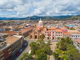
Cuenca

Perched at 2,500 m above sea level, this stunning city boasts beautiful colonial architecture and a UNESCO-listed centre. It is also the country's third-largest urban area. Overview of Cuenca Climate and Weather in Cuenca What to See in Cuenca Things to Do in Cuenca Flying to Cuenca Getting to Cuenca by Land Getting Around Cuenca Sleeping and Eating in Cuenca Living in Cuenca

Further information

View guide page: Cuenca

Overview of Cuenca

Overview of Cuenca

Perched at 2,500 m above sea level, this stunning city with its beautiful colonial architecture has its centre listed as a UNESCO World Heritage site. It is also the third-largest city in Ecuador.

Key Facts

  • Type of place: large city.
  • Tourist interest: (recommended).
  • Location:
  • Distances:
  • Local time: Heure : 3643.
  • Population: 329,928 inhabitants (2010).
  • Area: 70.59 km².
  • Altitude: 2,560 m.

History of Cuenca

Precautions

Useful Addresses

  • Tourist Office:

Services

  • Local agencies:
  • Banks:
  • Hospital:
  • Internet:
  • Laundries:
  • Vehicle rental:
  • Post office:
View guide page: Overview of Cuenca

Climate and Weather in Cuenca

Climate Overview

Best Time to Visit Cuenca

Jan.Feb.Mar.Apr.MayJun.Jul.Aug.Sep.Oct.Nov.Dec.
Climate

Climate and Forecast

Additional Information

View guide page: Climate and Weather in Cuenca

What to See in Cuenca

Overview

UNESCO World Heritage

Centre historique de Cuenca, Cuenca, Équateur
Historic Centre of Cuenca
Founded in the 16th century and later embellished in the 18th, the old town of Cuenca is a remarkable example of Spanish colonial architecture. This is what earned it a place on the UNESCO World Heritage list.

Neighborhoods

Sites, Monuments, and Architectural Ensembles

Religious Buildings

Museums

Parks and Gardens

In the Surrounding Area

  1. == En complément
View guide page: What to See in Cuenca

Historic Centre of Cuenca

Founded in the 16th century and later embellished in the 18th, the old town of Cuenca is a remarkable example of Spanish colonial architecture. This is what earned it a place on the UNESCO World Heritage list.

Overview of the historic centre

Founded in the 16th century and later embellished in the 18th, the old town of Cuenca is a remarkable example of Spanish colonial architecture. This is what earned it a place on the UNESCO World Heritage list.

  • Tourist interest: (recommended).

History of Cuenca’s centre

What to see

What to do

Events and entertainment

Practical information

  • Location:
  • How to get there:
  • How to get around:

Eating

Sleeping

What to see nearby

  1. == For further information
View guide page: Historic Centre of Cuenca

Flying to Cuenca

Cuenca Airport

Airport details

  • Name: Aeropuerto Internacional Mariscal Lamar.
  • IATA code: CUE
  • Hub: No.
  • Number of terminals: 1.
  • Passenger capacity/year:
  • Passenger traffic:
  • Distance from city centre:

Services

Sleeping at the airport

Transport to the city centre

Other nearby airports

From the rest of the country

From elsewhere

Apart from domestic connections to/from Quito or Guayaquil, there are no other routes.

Additional information

View guide page: Flying to Cuenca

Sangay National Park

A UNESCO-listed Andean park with volcanoes (including Sangay) and stunning landscapes, it's a prime hiking destination.

Overview of Sangay National Park

A UNESCO-listed Andean park with volcanoes (including Sangay) and stunning landscapes, it's a prime hiking destination.

Key facts

  • Type of place: national park.
  • Tourist interest: (recommended).
  • Features:
  • Local time: Heure : 3644
  • Annual visitors:
  • Area: 5,177.65 km².
  • Altitude:

Environment

Landscape of the park

Wildlife and flora

Climate

Precautions

What to see and do

Practical information

  • Location:
  • Distances:
  • Opening period:
  • Rates:

Getting there

Getting around

Sleeping and eating

Nearby attractions

  1. == In addition
View guide page: Sangay National Park

Quito

Ecuador’s capital boasts stunning colonial architecture, earning it a place on the UNESCO World Heritage list. It’s one of the most beautiful capitals in Latin America. Overview of Quito History, Culture and Society of Quito Quito's Cuisine Climate and Weather in Quito What to See in Quito Things to Do in Quito Tips for Quito Flying to Quito Getting to Quito by Land Getting Around Quito Accommodation in Quito Other practical info for Quito Living in Quito

Further Information

View guide page: Quito

Overview of Quito

Overview of Quito

The capital of Ecuador boasts stunning colonial architecture, earning it a place on the UNESCO World Heritage list. It is one of the most beautiful capitals in Latin America.

Key Facts

  • Type of place: main city.
  • Tourist interest: (recommended).
  • Location:
  • Latitude/longitude:
  • Distances:
  • Local time: Heure : 3645.
  • Population: 2,007,734 inhabitants and around 2.5 million for the metropolitan area (2015).
  • Area: 290 km².
  • Density: 6,923 inhabitants/km².
  • Altitude: 2,850 m.

Tourism

Travel Essentials

  • Tourist interest: (recommended).
  • By air:
  • Backpacker daily budget:
  • Best for accommodation:
  • Best for getting around:
  • Best time for climate/crowds/prices:

Additional Information

View guide page: Overview of Quito

Climate and Weather in Quito

Climate Overview

Best Time to Visit Quito

Jan.Feb.Mar.Apr.MayJun.Jul.Aug.Sep.Oct.Nov.Dec.
Climate

Climate and Forecast

Additional Information

View guide page: Climate and Weather in Quito

Flying to Quito

Quito Airport

Airport details

  • Name: Mariscal Sucre International Airport.
  • IATA code: UIO
  • Hub:
  • Number of terminals:
  • Passenger capacity/year:
  • Passenger traffic: 5,800,000 (2015).
  • Distance from city centre: 18 km east of the city.

Services

Sleeping at the airport

Transport to the city centre

  • Public transport:
  • Taxis:

Other nearby airports

From the rest of the country

From the rest of the Americas

From Europe

Additional information

View guide page: Flying to Quito

Getting to Quito by Land

By Land

By Bus

By Train

There are no train lines in or around Quito.

Distances

Further Information

View guide page: Getting to Quito by Land

Baños

This pleasant small town south of Cuenca is a major hub for outdoor activities. You can hike, mountain bike, raft, or even rappel down waterfalls, among other things.

Overview of Baños

This pleasant small town south of Cuenca is a major hub for outdoor activities. You can hike, mountain bike, raft, or even rappel down waterfalls, among other things.

Key Facts

  • Type of place: small town.
  • Tourist interest: (worth seeing).
  • Location:
  • Distances:
  • Local time: Heure : 3659.
  • Population: 14,653 inhabitants (2010).
  • Area:
  • Altitude: 1,826 m.

History of Baños

What to See and Do in Baños

In the Surrounding Area

Climate and Weather in Baños

Transportation

Getting There

Getting Around

Accommodation

Food

Useful Addresses

Additional Information

View guide page: Baños

Ibarra

A high-altitude colonial city with a rich heritage, located between Otavalo and the Colombian border.

Overview of Ibarra

It's a high-altitude colonial city with a rich heritage, located between Otavalo and the Colombian border.

Key Facts

  • Type of place: city.
  • Tourist interest: (worth a stop if you are in the area).
  • Location:
  • Distances:
  • Local time: Heure : 3660.
  • Population: 139,721 inhabitants (2010).
  • Area: 242.02 km².
  • Altitude: 2,225 m.

History of Ibarra

What to See and Do in Ibarra

In the Surrounding Area

Climate and Weather in Ibarra

Transportation

Getting There

Getting Around

Where to Stay

Where to Eat

Useful Addresses

Further Information

View guide page: Ibarra

Ingapirca

This is the most important (and one of the few) pre-Columbian sites in all of Ecuador.

Overview of Ingapirca

This is the most important (and one of the few) pre-Columbian sites in all of Ecuador.

  • Type of site: archaeological site.
  • Tourist interest: (worth a stop if you are in the area).
  • Features:
  • Area:
  • Altitude:

History of Ingapirca

What to see and do

Practical information

  • Location:
  • Opening hours:
  • Price:
  • How to get there:

Nearby attractions

Additional information

View guide page: Ingapirca

Latacunga

The town typically serves as a base for exploring the Cotopaxi volcano, Quilotoa Lagoon, and other nearby hiking spots.

Overview of Latacunga

The town typically serves as a base for exploring the Cotopaxi volcano, the Quilotoa Lagoon, and other nearby hiking spots.

Key details

  • Type of place: city.
  • Tourist interest: (worth a stop if you are in the area).
  • Location:
  • Distances:
  • Local time: Heure : 3662.
  • Population: 98,355 inhabitants (2010).
  • Area: 264.86 km².
  • Altitude: 2,750 m.

History of Latacunga

What to see and do in Latacunga

In the surrounding area

Climate and weather in Latacunga

Transportation

Getting there

Getting around

Accommodation

Food

Useful addresses

Further information

View guide page: Latacunga

Loja

In the south of the country, Loja has several beautiful monuments and religious buildings.

Overview of Loja

In the south of Ecuador, Loja has several beautiful monuments and religious buildings.

Key Facts

  • Type of place: city.
  • Tourist interest: (worth a stop if you are in the area).
  • Location:
  • Distances:
  • Local time: Heure : 3663.
  • Population: 170,280 inhabitants (2010).
  • Area: 285.70 km².
  • Altitude: 2,060 m.

History of Loja

What to See and Do in Loja

In the Surrounding Area

Climate and Weather in Loja

Transportation

Getting There

Getting Around

Where to Stay

Where to Eat

Useful Addresses

Further Information

View guide page: Loja

Mindo

This small town northwest of Quito is, with its protected forest, a true paradise for birdwatching and trekking enthusiasts.

Overview of Mindo

This small town northwest of Quito is, with its protected forest, a true paradise for birdwatching and trekking enthusiasts.

Key facts

  • Type of place: village.
  • Tourist interest: (worth seeing).
  • Location:
  • Distances:
  • Local time: Heure : 3664.
  • Population: 2,500 inhabitants (2011)
  • Area: 268 km².
  • Altitude: 1,300 m.

History of Mindo

What to see and do in Mindo

In the surrounding area

Climate and weather in Mindo

Transport

Getting there

Getting around

Accommodation

Food

Useful addresses

Further information

View guide page: Mindo

Devil's Nose

This famous steam tourist train travels the Riobamba - Alausi route through stunning landscapes.

Overview of Devil's Nose

This famous steam tourist train travels the Riobamba - Alausi route through stunning landscapes. Depending on the season, it may sometimes be out of service for a shorter or longer period.

Key Details

  • Type of place: tourist train.
  • Tourist interest: (recommended).
  • Theme:
  • Location:
  • Local time: Heure : 3665
  • Main towns:
  • Length: 12 km.
  • Altitude:

The Line

Route

What to See and Do

Nearby

Climate and Weather

Sleep and Eat

Additional Information

View guide page: Devil's Nose

Otavalo

The town north of Quito is renowned for its Indigenous market. The surrounding area also offers beautiful landscapes (volcanoes, lakes, waterfalls) and many small Indigenous villages to discover.

Overview of Otavalo

The small town north of Quito is renowned for its Indigenous market. The surrounding area also offers beautiful landscapes (volcanoes, lakes, waterfalls) and many small Indigenous villages to discover.

Key Facts

  • Type of place: small town.
  • Tourist interest: (worth seeing).
  • Location:
  • Distances:
  • Local time: Heure : 3666.
  • Population: 39,354 inhabitants (2010).
  • Area: 82 km².
  • Altitude: 2,532 m.

History of Otavalo

What to See and Do in Otavalo

In the Surrounding Area

Climate and Weather in Otavalo

Transportation

Getting There

Getting Around

Where to Stay

Where to Eat

Useful Addresses

Further Information

View guide page: Otavalo

Riobamba

Nestled in a beautiful valley surrounded by volcanoes, perfect for hiking, the city is also the starting point for the famous Nariz del Diablo tourist train.

Overview of Riobamba

In the heart of a beautiful valley surrounded by volcanoes, perfect for hiking, the city is also the starting point for the famous tourist train Devil's Nose.

Key Facts

  • Type of place: city.
  • Tourist interest: (worth seeing).
  • Location:
  • Distances:
  • Local time: Heure : 3667.
  • Population: 146,324 inhabitants (2010).
  • Area: 59.05 km².
  • Altitude: 2,750 m.

History of Riobamba

What to See and Do in Riobamba

In the Surrounding Area

Climate and Weather in Riobamba

Transportation

Getting There

Getting Around

Where to Stay

Where to Eat

Useful Addresses

Further Information

View guide page: Riobamba

Saquisilí

A small town south of Quito known for its Indigenous market.

Overview of Saquisilí

A small town south of Quito known for its Indigenous market.

Key details

  • Type of place: small town.
  • Tourist interest: (worth a stop if you are in the area).
  • Location:
  • Distances:
  • Local time: Heure : 3668.
  • Population: 13,404 inhabitants (2010).
  • Area: 39.89 km².
  • Altitude:

History of Saquisilí

What to see and do in Saquisilí

In the surrounding area

Climate and weather in Saquisilí

Transportation

Getting there

Getting around

Where to stay

Where to eat

Useful addresses

Further information

View guide page: Saquisilí

Vilcabamba

A peaceful small town nestled in its beautiful valley and the starting point for various excursions in the surrounding area, first and foremost Podocarpus Park.

Overview of Vilcabamba

A peaceful small town nestled in its beautiful valley and the starting point for various excursions in the surrounding area, first and foremost the Podocarpus Park.

Key details

  • Type of place: small town.
  • Tourist interest: (worth seeing).
  • Location:
  • Distances:
  • Local time: Heure : 3669.
  • Population: 4,478 inhabitants (2012).
  • Area:
  • Altitude: 1,565 m.

History of Vilcabamba

What to see and do in Vilcabamba

In the surrounding area

Climate and weather in Vilcabamba

Transport

Getting there

Getting around

Accommodation

Eating

Useful addresses

Further reading

View guide page: Vilcabamba

Avenue of Volcanoes

This is the name by which the magnificent region stretching from Quito to Riobamba is known. It is home to numerous volcanoes, including Cotopaxi, Chimborazo, Sangay, and others.

Overview of the Avenue of Volcanoes

This is the name by which the magnificent tourist region stretching from Quito to Riobamba is known. It is home to numerous volcanoes, including Cotopaxi, Chimborazo, Sangay, and others.

Key Facts

  • Type of place: secondary tourist region.
  • Tourist interest: (must-see or highly recommended).
  • Location:
  • Local time: Heure : 3670
  • Main city:
  • Population:
  • Area:
  • Highest point:
  • Lowest point:
  • Website:

Climate and Weather

Main Towns

Tourist Attractions

Towns and Heritage

Nature and Activities

Transportation

Getting There

Getting Around

Accommodation

Food

Additional Information

View guide page: Avenue of Volcanoes

Chimborazo

This volcano is the country's highest peak. You can climb it—or simply hike it—through stunning high-altitude landscapes.

Overview of Chimborazo

This volcano is the highest peak in Ecuador. You can climb it—or simply hike it—through stunning high-altitude landscapes.

Key facts

  • Type of place: volcano.
  • Tourist interest: (recommended).
  • Characteristics: dormant volcano.
  • Mountain range: Western Cordillera of the Andes
  • Summit: 6,263 m.

Chimborazo's environment

Wildlife and flora

Climate

Precautions

What to see and do

Practical information

  • Location:
  • Distances:

Getting there

Sleeping and eating

What to see nearby

Further reading

View guide page: Chimborazo

Laguna Cuicocha

You can hike around this volcanic lake, located about fifteen kilometres northwest of Otavalo.

Overview of Laguna Cuicocha

You can hike around this volcanic lake, located about fifteen kilometres northwest of Otavalo.

Key details

  • Type of place: lake.
  • Tourist interest: (worth seeing).
  • Features:
  • Area:
  • Altitude: 3,246 m.

Lake environment

Wildlife and flora

Climate and weather

Precautions

What to see and do

Practical information

  • Location:
  • Distances:
  • Website:

Getting there

Sleeping and eating

What to see nearby

Further information

View guide page: Laguna Cuicocha

Quilotoa Lagoon

A stunning volcanic lake at the summit of its namesake volcano. Hiking is possible here.

Overview of Quilotoa Lagoon

A stunning volcanic lake at the summit of its namesake volcano. Hiking is possible here.

Key Details

  • Type of place: lake.
  • Tourist interest: (worth seeing).
  • Features:
  • Area:
  • Altitude: 3,914 m.

Lake Environment

Wildlife and Flora

Climate

Precautions

What to See and Do

Practical Information

  • Location:
  • Distances:
  • Website:

Getting There

Sleeping and Eating

Nearby Attractions

Additional Information

View guide page: Quilotoa Lagoon

Cotopaxi National Park

With its active volcano of the same name, this park is a must-visit for trekking and nature lovers. Introducing Cotopaxi National Park Climate and Weather in Cotopaxi National Park Sights and activities in Cotopaxi National Park Practical information for Cotopaxi National Park

Additional Information

View guide page: Cotopaxi National Park

Introducing Cotopaxi National Park

Overview

With its active volcano of the same name, this park located in "the Avenue of Volcanoes" has become a must-visit for trekking and nature lovers.

Key Facts

  • Type of place: national park.
  • Tourist interest: (recommended).
  • Features:
  • Location:
  • Distances:
  • Local time: Heure : 3674
  • Annual visitors:
  • Area: 322.55 km².
  • Summit: 5,897 m.

Environment

Park Landscape

Wildlife and Flora

Precautions

View guide page: Introducing Cotopaxi National Park

Climate and Weather in Cotopaxi National Park

Climate Overview

Best Time to Visit

Jan.Feb.Mar.Apr.MayJun.Jul.Aug.Sep.Oct.Nov.Dec.
Climate

: highly favorable | : favorable | : moderately favorable | : unfavorable.

Climate and Forecasts

Additional Information

View guide page: Climate and Weather in Cotopaxi National Park

Practical information for Cotopaxi National Park

Practical info

  • Opening period:
  • Rates:

Getting there

Distances

Getting around

Sleeping

Eating

View guide page: Practical information for Cotopaxi National Park

Podocarpus National Park

It’s a lovely park not far from Vilcabamba where you can go trekking.

Overview of Podocarpus National Park

It’s a lovely park not far from Vilcabamba where you can go trekking.

Key details

  • Type of place: national park.
  • Tourist interest: (worth seeing).
  • Features:
  • Local time: Heure : 3675
  • Annual visitors:
  • Area: 1,462.8 km².
  • Altitude:

Environment

Landscape of the park

Wildlife and flora

Climate

Precautions

What to see and do

Practical information

  • Location:
  • Distances:
  • Opening period:
  • Rates:

Getting there

Getting around

Sleeping and eating

What to see nearby

Further reading

View guide page: Podocarpus National Park

Cayambe Coca Reserve

This reserve, not far from Quito, offers beautiful landscapes and hiking opportunities.

Overview of the Cayambe Coca Reserve

This reserve, not far from Quito, offers beautiful landscapes and hiking opportunities.

Key Details

  • Type of place: nature reserve.
  • Tourist interest: (worth seeing).
  • Features:
  • Local time: Heure : 3676
  • Annual visitors:
  • Area: 4,031.03 km².
  • Altitude:

Environment

Landscape of the Reserve

Wildlife and Flora

Climate

Precautions

What to See and Do

Practical Information

  • Location:
  • Distances:
  • Opening period:
  • Rates:

Getting There

Getting Around

Sleeping and Eating

Nearby Attractions

  1. == In Addition
View guide page: Cayambe Coca Reserve

Cotacachi Cayapas Ecological Reserve

A beautiful park with waterfalls and rivers where you can hike or climb the Cotacachi volcano.

Overview of the Cotacachi Cayapas Reserve

This is a beautiful park with waterfalls and rivers where you can hike or climb the Cotacachi volcano. The Laguna Cuicocha is also located within this reserve.

Key Details

  • Type of place: nature reserve.
  • Tourist interest: (worth seeing).
  • Features:
  • Local time: Heure : 3677
  • Annual visitors:
  • Area: 2,044 km².
  • Altitude:

Environment

Landscape of the Reserve

Wildlife and Flora

Climate

Precautions

What to See and Do

Practical Information

  • Location:
  • Distances:
  • Opening period:
  • Rates:

Getting There

Getting Around

Sleeping and Eating

Nearby Attractions

  1. == In Addition
View guide page: Cotacachi Cayapas Ecological Reserve

Pululahua Reserve

North of Quito, you can hike, cycle, or horseback ride in this beautiful nature reserve.

Overview of Pululahua Reserve

North of Quito, you can hike, cycle, or horseback ride in this beautiful nature reserve.

Key Details

  • Type of place: nature reserve.
  • Tourist interest: (worth a stop if you are in the area).
  • Features:
  • Local time: Heure : 3678
  • Annual visitors:
  • Area: 33.83 km².
  • Altitude:

Environment

Landscape of the Reserve

Wildlife and Flora

Climate and Weather

Precautions

What to See and Do

Practical Information

  • Location:
  • Distances:
  • Opening period:
  • Rates:

Getting There

Getting Around

Sleeping and Eating

Nearby Attractions

  1. == In Addition
View guide page: Pululahua Reserve

Something wrong or out of date? Report this page