Skip to content
Philippines

Travel guide · Philippines

Philippines

★ 3 · last edited Dec 11, 2019

Once largely overlooked by European tourists, the archipelago is now gaining popularity for its colonial heritage, local cultures, lush nature, and above all, stunning beaches and world-class diving spots.
Banaue, Philippines
Banaue, Philippines · © VoyageForum

Further reading on VoyageForum

Overview of the Philippines

The Philippines consists of over 7,000 often forested, mountainous (under 2,954 m) and volcanic islands stretching over 1,700 kilometres towards the equator. Out of these, eleven islands account for 95% of the territory, only 2,000 are inhabited, and 2,500…

Read the full guide: Overview of the Philippines

Regions of the Philippines

Luzon Island Group

Banaue, Philippines
Banaue, Philippines

This is the northernmost group of islands in the Philippines, with the large island of Luzon hosting the capital Manila. For travellers, this part of the country offers a wide range of activities and sights, from historical landmarks (Spanish era, World War II), to vibrant local cultures and traditions (especially around Sagada), and stunning landscapes—Banaue and its famous UNESCO-listed terraced rice fields are the highlight. There’s also a great selection of outdoor activities, as well as beautiful beaches and numerous diving spots, much like the rest of the archipelago.

    Visayas Island Group

    Boracay, Philippines
    Boracay, Philippines

    These are the central islands of the Philippine archipelago. While they boast cultural heritage and natural beauty, they’re best known for their stunning tropical beaches and excellent diving and snorkelling opportunities, such as at El Nido and Boracay, to name just the most famous spots.

      Mindanao Island Group

      Camiguin, Philippines
      Camiguin, Philippines

      This is the southernmost region of the Philippines. Home to a large Muslim minority, it enjoys a degree of autonomy, though an independence guerrilla movement has been active here for decades. As a result, much of the area is considered unsafe, which has severely limited tourism.

        View guide page: Regions of the Philippines

        Luzon

        This is the northernmost group of islands in the Philippines, with the large island of Luzon hosting the capital, Manila. For travelers, this part of the country offers a wide range of things to do and see, including historical landmarks (Spanish era, World War II), vibrant local cultures and traditions (especially around Sagada), stunning landscapes—with Banaue and its famous UNESCO-listed terraced rice fields as the highlight—as well as plenty of outdoor activities. Of course, there are also beautiful beaches and numerous diving spots, much like elsewhere in the archipelago.

        Overview

        Banaue, Philippines
        Banaue, Philippines · © VoyageForum

        This is the northernmost group of islands in the Philippines, with the large island of Luzon hosting the capital Manila. For travelers, this part of the country offers a wide range of things to do and see, including historical landmarks (Spanish era, World War II), vibrant local cultures and traditions (especially around Sagada), stunning landscapes—with Banaue and its famous UNESCO-listed terraced rice fields as the highlight—as well as plenty of outdoor activities. Of course, there are also beautiful beaches and numerous diving spots, much like elsewhere in the archipelago.

        Key Facts

        • Type of place: tourist region.
        • Location:
        • Local time: Heure : 20768
        • Main islands:
        • Population:
        • Area:
        • Highest point:
        • Lowest point: sea level.
        • Coastline:
        • Highlights (out of ): Nature ; Adventure ; Culture ; Relaxation/Holidays
        • Website:

        Major Cities

        Tourist Attractions

        Cities and Heritage

        Beaches and Coastal Areas

        Nature and Outdoor Activities

        Climate and Weather in the Region

        Luzon Island (Manila)

        View guide page: Luzon

        Baroque Churches of the Philippines

        These are four beautiful colonial churches from the Spanish era located on the islands of Luzon (3) and Panay (1), UNESCO World Heritage sites. Around thirty others, not listed, can also be seen across the archipelago.

        Overview of the Baroque Churches

        These are four beautiful colonial churches from the Spanish era located on the islands of Luzon (3) and Panay (1), designated as UNESCO World Heritage sites. Around thirty others, not listed, can also be seen in various parts of the Philippine archipelago.

        • San Agustin Church (Manila)
        • Nuestra Señora de la Asunción Church (Santa María)
        • San Agustin Church (Paoay)
        • Santo Tomás de Villanueva Church (Miag-ao)

        History of the Baroque Churches

        What to See and Do

        Practical Information

        • Tourist interest: (worth seeing).
        • Location:
        • Opening hours:
        • Admission fee:
        • How to get there:

        Nearby Attractions

        1. == En complément
        View guide page: Baroque Churches of the Philippines

        Baguio

        A high-altitude city prized for its climate, Baguio has become a popular holiday destination over time. Visitors can see several beautiful religious buildings and the Philippine presidential summer residence.

        Overview of Baguio

        A high-altitude city prized for its climate, Baguio has become a popular holiday destination over time. Visitors can see several beautiful religious buildings and the Philippine presidential summer residence.

        Key facts

        • Type of place: city.
        • Tourist interest: (worth a stop if you are in the area).
        • Location:
        • Distances:
        • Local time: Heure : 20693.
        • Population: 345,366 inhabitants (2015).
        • Area: 57.51 km².
        • Altitude: 1,540 m.

        History of Baguio

        What to see and do in Baguio

        In the surrounding area

        Climate and weather in Baguio

        Transport

        Getting there

        Getting around

        Accommodation

        Food

        Useful addresses

        Further information

        View guide page: Baguio

        Banaue

        In the mountains of the northern part of the island, this small town is renowned for its stunning UNESCO-listed terraced rice fields, like all those in the region (Batad, Hungduan, Mayayao). It’s also a place where culture and traditions remain very much alive, which you can discover on a trek.

        Overview of Banaue

        In the mountains of the northern part of Luzon Island, this small town is renowned for its stunning UNESCO-listed terraced rice fields, like all those in the region (Batad, Hungduan, Mayayao). It’s also a place where culture and traditions remain very much alive, which you can discover on a trek.

        Key facts

        • Type of place: small town.
        • Tourist interest: (recommended).
        • Location:
        • Distances:
        • Local time: Heure : 20694.
        • Population: 21,837 inhabitants (2015).
        • Area: 191.20 km².
        • Altitude:

        History of Banaue

        What to see and do in Banaue

        Rizières en terrasses de Banaue, Banaue, Philippines
        Terraced rice fields
        In the mountains of the northern part of Luzon Island. These are the magnificent UNESCO-listed terraced rice fields, like those in the region (Batad, Hungduan, Mayayao).

        In the surrounding area

        Treks

        Climate and weather in Banaue

        Transport

        Getting there

        Getting around

        Accommodation

        Food

        Useful addresses

        Additional information

        View guide page: Banaue

        Banaue Rice Terraces

        Preview temporarily unavailable.

        Batangas

        South of Luzon, Batangas is a popular destination for residents of the capital, offering beaches and diving opportunities in the surrounding area. Ferries to Mindoro also depart from here.

        Overview of Batangas

        South of the island of Luzon, Batangas is a popular destination for residents of the capital, thanks to its beaches and diving opportunities in the surrounding area. Ferries to Mindoro also depart from Batangas.

        Key Facts

        • Type of place: city.
        • Tourist interest: (worth seeing).
        • Location:
        • Distances:
        • Local time: Heure : 20695.
        • Population: 329,874 inhabitants (2015).
        • Area: 282.96 km².
        • Altitude: from sea level to 477 m.

        History of Batangas

        What to See and Do in Batangas

        In the Surrounding Area

        Climate and Weather in Batangas

        Transportation

        Getting There

        Getting Around

        Accommodation

        Food

        Useful Addresses

        Further Information

        View guide page: Batangas

        Corregidor

        At the entrance to Manila Bay, this small island played a significant role during World War II in the region. Several wartime remnants can be visited here (tunnels, military installations, memorials).

        Overview of Corregidor

        At the entrance to Manila Bay, this small island played a significant role during World War II in the region. Several wartime remnants can be visited here (tunnels, military installations, memorials).

        Key Facts

        • Type of place: island.
        • Tourist interest: (worth a stop if you are in the area).
        • Location:
        • Local time: Heure : 20697
        • Main locality: San Jose.
        • Population:
        • Area: 5.49 km².
        • Highest point: Topside (179.5 m).
        • Coastline:

        History of Corregidor

        Island Environment

        Wildlife and Flora

        Precautions

        What to See and Do in Corregidor

        In the Surrounding Area

        Climate and Weather in Corregidor

        Transportation

        Getting There

        Getting Around

        Accommodation

        Food

        Useful Addresses

        Further Information

        View guide page: Corregidor

        Magalawa

        It's a small island near the west coast of Luzon with some quite beautiful beaches and diving opportunities.

        Overview of Magalawa

        It's a small island near the west coast of Luzon with some quite beautiful beaches and diving opportunities.

        Key facts

        • Type of place: island.
        • Tourist interest: (worth a stop if you are in the area).
        • Location:
        • Local time: Heure : 20698
        • Main locality:
        • Population: 370 inhabitants (2015).
        • Area:
        • Highest point:
        • Coastline:
        • Website:

        History of Magalawa

        Island environment

        Wildlife and flora

        Precautions

        What to see and do in Magalawa

        In the surrounding area

        Climate and weather in Magalawa

        Transport

        Getting there

        Getting around

        Accommodation

        Food

        Useful addresses

        1. == Additional information
        View guide page: Magalawa

        Mandaluyong

        On the outskirts of Manila, this sprawling city is the country’s largest commercial hub due to its number of shopping malls.

        Overview of Mandaluyong

        On the outskirts of Manila, this sprawling city is the largest commercial hub in the Philippines due to its number of shopping malls.

        Key Facts

        • Type of place: city.
        • Tourist interest: (worth a stop if you are in the area).
        • Location:
        • Distances:
        • Local time: Heure : 20699.
        • Population: 386,276 inhabitants (2015).
        • Area: 11.06 km².
        • Altitude:

        History of Mandaluyong

        What to See and Do in Mandaluyong

        Nearby

        Climate and Weather

        Transportation

        Getting There

        Getting Around

        Accommodation

        Dining

        Useful Addresses

        1. == Additional Information
        View guide page: Mandaluyong

        Manila

        The vast Philippine capital boasts diverse traces of its Spanish era, a huge Chinatown, and several museums. Overview of Manila Climate and Weather in Manila What to See in Manila Things to Do in Manila Flying to Manila Getting to Manila by Land or Sea Getting Around Manila Sleeping and Eating in Manila Living in Manila

        Further reading

        View guide page: Manila

        Overview of Manila

        Preview temporarily unavailable.

        Climate and Weather in Manila

        Preview temporarily unavailable.

        What to See in Manila

        Preview temporarily unavailable.

        Things to Do in Manila

        Preview temporarily unavailable.

        Flying to Manila

        Preview temporarily unavailable.

        Getting to Manila by Land or Sea

        Preview temporarily unavailable.

        Getting Around Manila

        Preview temporarily unavailable.

        Sleeping and Eating in Manila

        Preview temporarily unavailable.

        Living in Manila

        Preview temporarily unavailable.

        Pagudpud

        A popular beach resort surrounded by mountains and valleys at the northern tip of Luzon Island. Visitors come for the beautiful beaches, but also for the caves, waterfalls, and river activities offered in the surrounding area.

        Overview of Pagudpud

        A popular beach resort surrounded by mountains and valleys at the northern tip of Luzon Island. Visitors come for the beautiful beaches, but also for the caves, waterfalls, and river activities offered in the surrounding area.

        Key Facts

        • Type of place: small town.
        • Tourist interest: (worth a stop if you are in the area).
        • Location:
        • Distances:
        • Local time: Heure : 20701.
        • Population: 23,770 inhabitants (2015).
        • Area: 194.90 km².
        • Altitude:

        History of Pagudpud

        What to See and Do in Pagudpud

        In the Surrounding Area

        Climate and Weather in Pagudpud

        Transportation

        Getting There

        Getting Around

        Where to Stay

        Where to Eat

        Useful Addresses

        Further Information

        View guide page: Pagudpud

        Quezon City

        This former capital, bordering Manila, is the most populous city in the Philippines. It is well-known for shopping.

        Overview of Quezon City

        This former capital, bordering Manila, is the most populous city in the Philippines. It is well-known for shopping.

        Key Facts

        • Type of place: large city.
        • Tourist interest: (worth a stop if you are in the area).
        • Location:
        • Distances:
        • Local time: Heure : 20702.
        • Population: 2,936,116 inhabitants (2015).
        • Area: 165.33 km².
        • Altitude: 92 m.

        History of Quezon City

        What to See and Do in Quezon City

        In the Surrounding Area

        Climate and Weather

        Transportation

        Getting There

        Getting Around

        Accommodation

        Food

        Useful Addresses

        Additional Information

        View guide page: Quezon City

        Sagada

        This large village in northern Luzon is a great base for trekking, caving, rafting, climbing, and discovering the local cultures and traditions of the surrounding area (including the "hanging coffins"). It is also home to the famous UNESCO-listed terraced rice fields.

        Overview of Sagada

        This large village in northern Luzon is a great base for trekking, caving, rafting, climbing, and discovering the local cultures and traditions of the surrounding area (including the "hanging coffins"). It is also home to the famous UNESCO-listed terraced rice fields.

        Key Facts

        • Type of place: small town.
        • Tourist interest: (recommended).
        • Location:
        • Distances:
        • Local time: Heure : 20703.
        • Population: 11,127 inhabitants (2015).
        • Area: 83.32 km².
        • Altitude:

        History of Sagada

        What to see and do in Sagada

        In the surrounding area

        Climate and weather in Sagada

        Transportation

        Getting there

        Getting around

        Accommodation

        Food

        Useful addresses

        Further reading

        View guide page: Sagada

        Subic

        A former US military base now turned into a beach resort. It is located on the west coast with beautiful beaches and wreck diving.

        Overview of Subic

        A former US military base now turned into a beach resort. It is located on the west coast of Luzon Island with beautiful beaches and wreck diving.

        Key Facts

        • Type of place: city.
        • Tourist interest: (worth a stop if you are in the area).
        • Location:
        • Distances:
        • Local time: Heure : 20704.
        • Population: 104,771 inhabitants (2015).
        • Area: 287.16 km².
        • Altitude: sea level.

        History of Subic

        What to See and Do in Subic

        Nearby

        Climate and Weather in Subic

        Transportation

        Getting There

        Getting Around

        Accommodation

        Food

        Useful Addresses

        Further Information

        View guide page: Subic

        Vigan

        This stunning city has beautifully preserved its colonial architecture. It is also a UNESCO World Heritage site for this reason.

        Overview of Vigan

        This stunning city has beautifully preserved its colonial architecture. It is also a UNESCO World Heritage site for this reason.

        Key Facts

        • Type of place: city.
        • Tourist interest: (recommended).
        • Location:
        • Distances:
        • Local time: Heure : 20705.
        • Population: 53,879 inhabitants (2015).
        • Area: 25.12 km².
        • Altitude: sea level.

        History of Vigan

        What to See and Do in Vigan

        In the Surrounding Area

        Climate and Weather in Vigan

        Transportation

        Getting There

        Getting Around

        Accommodation

        Dining

        Useful Addresses

        Additional Information

        View guide page: Vigan

        Babuyan Islands

        This is a very little-visited group of islands between the Batanes and Luzon.

        Overview of the Babuyan Islands

        This is a very little-visited group of islands between the Batanes and Luzon.

        Key Facts

        • Type of place: archipelago.
        • Tourist interest: (worth a stop if you are in the area).
        • Location:
        • Local time: Heure : 20706
        • Number of islands: 24 islands.
        • Main island: Calayan.
        • Population: 18,717 inhabitants (2015).
        • Area: 600 km².
        • Highest point: 1,108 m on Babuyan Claro Island.
        • Coastline:
        • Website:

        History of the Babuyan Islands

        Environment of the Archipelago

        Wildlife and Flora

        Precautions

        What to See and Do in the Babuyan Islands

        In the Surrounding Area

        Climate and Weather in the Babuyan Islands

        Transportation

        Getting There

        Getting Around

        Accommodation

        Food

        Useful Addresses

        1. == Additional Information
        View guide page: Babuyan Islands

        Batanes

        This archipelago, the northernmost in the country, is close to Taiwan. You can see some beautiful landscapes, a few colonial remnants, and discover the culture and traditions of the local populations.

        Overview of Batanes

        This archipelago, the northernmost in the Philippines, is close to Taiwan. You can see some beautiful landscapes, a few colonial remnants, and discover the culture and traditions of the local populations.

        Key Facts

        • Type of place: archipelago.
        • Tourist interest: (worth seeing).
        • Location:
        • Local time: Heure : 20707
        • Number of islands: 10 islands.
        • Main island: Basco (8,500 inhabitants) on Batan Island.
        • Population: 17,246 inhabitants (2015).
        • Area: 219.01 km².
        • Highest point: Mount Iraya (1,009 m) on Batan Island.
        • Coastline:

        History of Batanes

        Environment of the Archipelago

        Wildlife and Flora

        Precautions

        What to See and Do in Batanes

        In the Surroundings

        Climate and Weather in Batanes

        Transportation

        Getting There

        Getting Around

        Accommodation

        Food

        Useful Addresses

        Further Information

        View guide page: Batanes

        Catanduanes

        A large island near the Bicol Peninsula. You can enjoy its beaches and see some beautiful Spanish churches.

        Overview of Catanduanes

        It's a large island near the Bicol Peninsula. You can enjoy its beaches and see some beautiful Spanish churches.

        Key Facts

        • Type of place: island.
        • Tourist interest: (worth seeing).
        • Location:
        • Local time: Heure : 20708
        • Main locality: Virac (73,500 inhabitants).
        • Population: 260,964 inhabitants (2015).
        • Area: 1,492.16 km².
        • Highest point: Mount Cagmasoso (803 m).
        • Coastline:

        History of Catanduanes

        Island Environment

        Wildlife and Flora

        Precautions

        What to See and Do in Catanduanes

        In the Surrounding Area

        Climate and Weather in Catanduanes

        Transportation

        Getting There

        Getting Around

        Accommodation

        Food

        Useful Addresses

        Further Information

        View guide page: Catanduanes

        Masbate

        Three quiet, rural islands (Masbate, Ticao, and Burias) south of Bicol with beautiful beaches. They form the Masbate archipelago/province.

        Overview of Masbate

        Three quiet, rural main islands (Masbate, Ticao, and Burias) south of Bicol Peninsula with beautiful beaches. They form the Masbate archipelago/province.

        Key facts

        • Type of place: archipelago.
        • Tourist interest: (worth seeing).
        • Location:
        • Local time: Heure : 20709
        • Main city: Masbate City (95,000 inhabitants) on Masbate Island.
        • Population: 892,393 inhabitants (2015).
        • Area: 4,151.78 km².
        • Highest point: Mount Uac (576 m) on Masbate.
        • Coastline:
        • Website:

        History of Masbate

        Environment of the archipelago

        Wildlife and flora

        Precautions

        What to see and do

        In the surrounding area

        Climate and weather

        Transportation

        Getting there

        Getting around

        Accommodation

        Food

        Additional information

        View guide page: Masbate

        Mindoro

        South of Luzon. The island is quite touristy, especially in its eastern part and around Puerto Galera. You can enjoy the beaches, go diving, hiking, caving, or birdwatching.

        Overview of Mindoro

        South of Luzon, the island is quite touristy, especially in its eastern part and around Puerto Galera. You can enjoy the beaches, go diving, hiking, caving, or even birdwatching.

        Key facts

        • Type of place: island.
        • Tourist interest: (worth seeing).
        • Location:
        • Local time: Heure : 20710
        • Main town: San Jose.
        • Population: 1,331,473 (2015).
        • Area: 10,571.8 km².
        • Highest point: Mount Halcon (2,586 m).
        • Coastline:

        History of Mindoro

        Island environment

        Wildlife and flora

        Precautions

        What to see and do in Mindoro

        In the surrounding area

        Climate and weather in Mindoro

        Transportation

        Getting there

        Getting around

        Accommodation

        Food

        Useful addresses

        Further reading

        View guide page: Mindoro

        Puerto Galera

        Preview temporarily unavailable.

        Hundred Islands National Park

        Around a hundred small islands near the coast turned into a national park. Visitors come for the beaches, boat trips, and marine wildlife.

        Overview of Hundred Islands National Park

        Around a hundred small islands near the coast of Luzon have been turned into a national park. Visitors come for the beaches, boat trips, and marine wildlife.

        Key details

        • Type of place: national park.
        • Tourist interest: (worth seeing).
        • Features:
        • Local time: Heure : 20749
        • Annual visitors:
        • Area: 18.44 km².
        • Altitude: sea level.

        Environment

        Landscape of the park

        Wildlife and flora

        Climate and weather

        Precautions

        What to see and do

        Practical information

        • Location:
        • Distances:
        • Opening period:
        • Rates:

        Getting there

        Getting around

        Accommodation and dining

        Nearby attractions

        Additional information

        View guide page: Hundred Islands National Park

        Lake Taal

        A large crater lake in the Batangas region with another volcanic crater (Taal) at its center. The site is quite touristy.

        Overview of Lake Taal

        A large crater lake in the Batangas region with another volcanic crater (Taal) at its center. The site is quite touristy.

        Key details

        • Type of place: lake.
        • Tourist interest: (worth seeing).
        • Features:
        • Area: 234.2 km².
        • Altitude: 5 m.

        Lake environment

        Wildlife and vegetation

        Climate and weather

        Precautions

        What to see and do

        Practical information

        • Location:
        • Distances:

        Getting there

        Accommodation and dining

        Nearby attractions

        Additional information

        View guide page: Lake Taal

        Mount Pulag

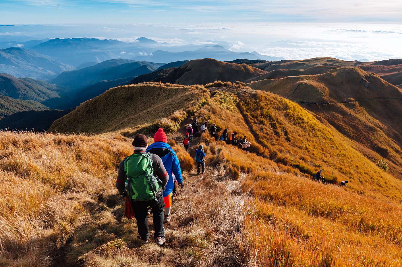
        You can trek to the summit of this national park-mountain in the Cordillera range.

        Overview of Mount Pulag

        You can trek to the summit of this national park-mountain located in the Cordillera range on the island of Luzon.

        Key details

        • Type of place: mountain.
        • Tourist interest: (worth seeing).
        • Features:
        • Massif:
        • Summit: 2,926 m.

        Mount Pulag’s environment

        Wildlife and flora

        Climate and weather

        Precautions

        What to see and do

        Practical information

        • Location:
        • Distances:
        • Website:

        Getting there

        Sleeping and eating

        What to see nearby

        1. == En complément
        View guide page: Mount Pulag

        Mount Tapulao

        Preview temporarily unavailable.

        Bicol Peninsula

        Preview temporarily unavailable.

        Mount Pinatubo Volcano

        Preview temporarily unavailable.

        Visayas

        These are the islands in the central part of the Philippine archipelago. While they boast some cultural heritage and natural landscapes, they are best known for their stunning tropical beaches and excellent opportunities for diving and snorkeling, such as in El Nido and Boracay—just to name the most famous spots.

        Overview

        Boracay, Philippines
        Boracay, Philippines · © VoyageForum

        The Visayas are the islands in the central part of the Philippine archipelago. While they boast some cultural heritage and natural landscapes, they are best known for their stunning tropical beaches and excellent opportunities for diving and snorkeling, such as in El Nido and Boracay—just to name the most famous spots.

        Key Facts

        • Type of place: tourist region.
        • Location:
        • Local time: Heure : 20769
        • Main islands:
        • Population:
        • Area:
        • Highest point:
        • Lowest point: sea level.
        • Coastline:
        • Highlights (out of ): Nature ; Adventure ; Culture ; Relaxation-holidays
        • Website:

        Major Cities

        Tourist Attractions

        Cities and Heritage

        Beaches and Coastline

        Nature and Activities

        Climate and Weather in the Visayas

        Palawan Island (Puerto Princesa)

        View guide page: Visayas

        Baclayon

        A colonial-era town with various architectural remnants still standing. In addition to beaches, mountain biking, and short hikes, Baclayon is also a starting point for whale and dolphin watching offshore via Pamilacan Island.

        Overview of Baclayon

        This is a colonial-era town with various architectural remnants still standing. In addition to beaches, mountain biking, and short hikes, Baclayon serves as a starting point for whale and dolphin watching offshore via Pamilacan Island.

        Key Facts

        • Type of place: small town.
        • Tourist interest: (worth a stop if you are in the area).
        • Location:
        • Distances:
        • Local time: Heure : 20721.
        • Population: 20,591 inhabitants (2015).
        • Area: 34.43 km².
        • Altitude: sea level.

        History of Baclayon

        What to See and Do in Baclayon

        In the Surrounding Area

        Climate and Weather in Baclayon

        Transportation

        Getting There

        Getting Around

        Accommodation

        Food

        Useful Addresses

        Further Information

        View guide page: Baclayon

        Loboc

        A small town in the south of the island, Loboc’s main tourist attractions are its river and scenic "cruises", one of the oldest churches in the country, and the nearby waterfalls.

        Overview of Loboc

        A small town in the south of Bohol Island, Loboc’s main tourist attractions are its river and scenic "cruises", one of the oldest churches in the country, and the nearby waterfalls.

        Key Facts

        • Type of place: small town.
        • Tourist interest: (worth seeing).
        • Location:
        • Distances:
        • Local time: Heure : 20722.
        • Population: 15,993 inhabitants (2015).
        • Area: 57.65 km².
        • Altitude:

        History of Loboc

        What to See and Do in Loboc

        In the Surrounding Area

        Climate and Weather in Loboc

        Transportation

        Getting There

        Getting Around

        Where to Stay

        Where to Eat

        Useful Addresses

        Further Reading

        View guide page: Loboc

        Panglao Island

        Connected to Bohol by a bridge, this southern island is renowned for its stunning beaches and diving.

        Overview of Panglao Island

        Connected to Bohol by a bridge, this southern island is renowned for its stunning beaches and diving.

        Key Facts

        • Type of place: island.
        • Tourist interest: (worth seeing).
        • Location:
        • Local time: Heure : 20723
        • Main locality: Panglao City (33,500 inhabitants)
        • Population: 79,216 inhabitants (2015).
        • Area: 91.12 km².
        • Highest point:
        • Coastline:

        History of Panglao Island

        Environment of the Island

        Wildlife and Flora

        Precautions

        What to See and Do on Panglao Island

        In the Surrounding Area

        Climate and Weather

        Transportation

        Getting There

        Getting Around

        Accommodation

        Dining

        Useful Addresses

        Additional Information

        View guide page: Panglao Island

        Cebu City

        The island's capital, it is the second-largest urban area in the Philippines and the first established by the Spanish, who left many visible buildings. You can dive off Mactan Island, part of the urban area and dedicated to tourism.

        Overview of Cebu City

        The capital of Cebu Island, it is the second-largest urban area in the Philippines and the first established by the Spanish, who left many visible buildings. You can dive off Mactan Island, part of the urban area and dedicated to tourism.

        Key Facts

        • Type of place: large city.
        • Tourist interest: (worth a stop if you are in the area).
        • Location:
        • Distances:
        • Local time: Heure : 20724.
        • Population: 922,611 inhabitants and nearly 3 million for the urban area (2015).
        • Area: 315 km².
        • Altitude: sea level.
        • Website:

        History of Cebu City

        What to See and Do in Cebu City

        In the Surrounding Area

        Climate and Weather in Cebu City

        Transportation

        Getting There

        Getting Around

        Accommodation

        Food

        Useful Addresses

        Additional Information

        View guide page: Cebu City

        Moalboal

        In the southwest of Cebu, this is a small town that thrives on its beaches and diving. Nearby, you can explore waterfalls, caves, and canyons perfect for canyoning.

        Overview of Moalboal

        In the southwest of Cebu Island, this is a small town that thrives on its beaches and diving. Nearby, you can explore waterfalls, caves, and canyons perfect for canyoning.

        Key Facts

        • Type of place: small town.
        • Tourist interest: (worth seeing).
        • Location:
        • Distances:
        • Local time: Heure : 20725.
        • Population: 31,130 inhabitants (2015).
        • Area: 124.86 km².
        • Altitude: sea level.

        History of Moalboal

        What to See and Do in Moalboal

        In the Surrounding Area

        Climate and Weather in Moalboal

        Transportation

        Getting There

        Getting Around

        Accommodation

        Dining

        Useful Addresses

        Additional Information

        View guide page: Moalboal

        Apo Island

        A tiny island 7 km off the southern coast of Negros. It's one of the best diving spots in the Philippines, if not in Southeast Asia.

        Overview of Apo Island

        It's a tiny island 7 km off the southern coast of Negros. It's one of the best diving spots in the Philippines, if not in Southeast Asia.

        Key details

        • Type of place: island.
        • Tourist interest: (worth seeing).
        • Location:
        • Local time: Heure : 20726
        • Main locality: Apo Village.
        • Population: 918 inhabitants (2012).
        • Area: 0.74 km².
        • Highest point:
        • Coastline:

        History of Apo Island

        Environment of the island

        Wildlife and flora

        Precautions

        What to see and do

        In the area

        Climate and weather on Apo Island

        Transport

        Getting there

        Getting around

        Sleep

        Eat

        Useful addresses

        Further information

        View guide page: Apo Island

        Bacolod

        The largest city in Negros is primarily known for its carnival and economic dynamism. You can also see some remnants of the Spanish era.

        Overview of Bacolod

        The largest city on the island of Negros is primarily known for its carnival and economic dynamism. It also features some remnants of the Spanish era.

        Key Facts

        • Type of place: large city.
        • Tourist interest: (worth a stop if you are in the area).
        • Location:
        • Distances:
        • Local time: Heure : 20727.
        • Population: 561,875 inhabitants (2015).
        • Area: 162.67 km².
        • Altitude: 10 m.

        History of Bacolod

        What to See and Do in Bacolod

        In the Surrounding Area

        Climate and Weather in Bacolod

        Transportation

        Getting There

        Getting Around

        Accommodation

        Food

        Useful Addresses

        Additional Information

        View guide page: Bacolod

        Bais

        In the southeast of Negros, this city is surrounded by mangroves and boasts a magnificent coral reef. Scuba diving is available here.

        Overview of Bais

        In the southeast of Negros Island, this city is surrounded by mangroves and boasts a magnificent coral reef. Scuba diving is available here.

        Key Facts

        • Type of place: city.
        • Tourist interest: (worth a stop if you are in the area).
        • Location:
        • Distances:
        • Local time: Heure : 20728.
        • Population: 76,291 inhabitants (2015).
        • Area: 319.64 km².
        • Altitude: sea level.

        History of Bais

        What to See and Do in Bais

        In the Surrounding Area

        Climate and Weather in Bais

        Transportation

        Getting There

        Getting Around

        Accommodation

        Food

        Useful Addresses

        Additional Information

        View guide page: Bais

        Silay

        In the north of Negros, the city has preserved charming villas and monuments from the colonial era.

        Overview of Silay

        In the north of Negros Island, the city has preserved charming villas and monuments from the colonial era.

        Key Facts

        • Type of place: city.
        • Tourist interest: (worth a stop if you are in the area).
        • Location:
        • Distances:
        • Local time: Heure : 20729.
        • Population: 126,930 inhabitants (2015).
        • Area: 214.80 km².
        • Altitude:

        History of Silay

        What to See and Do in Silay

        Nearby

        Climate and Weather in Silay

        Transportation

        Getting There

        Getting Around

        Accommodation

        Food

        Useful Addresses

        Further Information

        View guide page: Silay

        Sipalay

        A city with stunning beaches, diving, and nearby caves and waterfalls.

        Overview of Sipalay

        A city with stunning beaches, diving, and nearby caves and waterfalls.

        Key Details

        • Type of place: city.
        • Tourist interest: (worth seeing).
        • Location:
        • Distances:
        • Local time: Heure : 20730.
        • Population: 70,070 inhabitants (2015).
        • Area: 379.78 km².
        • Altitude: sea level.

        History of Sipalay

        What to See and Do in Sipalay

        In the Surrounding Area

        Climate and Weather in Sipalay

        Transportation

        Getting There

        Getting Around

        Accommodation

        Food

        Useful Addresses

        Additional Information

        View guide page: Sipalay

        Sipaway

        A small island just off the coast of Negros, facing San Carlos, known for its beautiful beaches.

        Overview of Sipaway

        A small island just off the coast of Negros, facing San Carlos, known for its beautiful beaches.

        Key Details

        • Type of place: island.
        • Tourist interest: (worth a stop if you are in the area).
        • Location:
        • Local time: Heure : 20731
        • Main locality:
        • Population: 2,215 inhabitants (2007).
        • Area: 4.9 km².
        • Highest point:
        • Coastline:

        History of Sipaway

        Island Environment

        Wildlife and Flora

        Precautions

        What to See and Do in Sipaway

        In the Surrounding Area

        Climate and Weather in Sipaway

        Transportation

        Getting There

        Getting Around

        Accommodation

        Dining

        Useful Addresses

        Additional Information

        View guide page: Sipaway

        El Nido

        A small town at the northern tip of Palawan with several surrounding islands. The area offers stunning beaches, cliffs, jungle, and opportunities for diving, kayaking, climbing, and trekking—all in an exceptional setting. Overview of El Nido Climate and Weather in El Nido What to See in El Nido Things to Do in El Nido Getting to El Nido Getting Around El Nido Sleeping and Eating in El Nido Living in El Nido

        Further Information

        View guide page: El Nido

        Overview of El Nido

        Preview temporarily unavailable.

        Climate and Weather in El Nido

        Preview temporarily unavailable.

        What to See in El Nido

        Preview temporarily unavailable.

        Things to Do in El Nido

        Preview temporarily unavailable.

        Getting to El Nido

        Preview temporarily unavailable.

        Getting Around El Nido

        Preview temporarily unavailable.

        Sleeping and Eating in El Nido

        Preview temporarily unavailable.

        Living in El Nido

        Preview temporarily unavailable.

        Puerto Princesa

        The capital of Palawan, known for its beaches, diving, and especially its UNESCO-listed "Puerto Princesa Subterranean River National Park".

        Overview of Puerto Princesa

        It’s the capital of Palawan Island, known for its beaches, diving, and especially its "Puerto Princesa Subterranean River National Park", a UNESCO World Heritage Site.

        Key facts

        • Type of place: city.
        • Tourist interest: (worth a stop if you are in the area).
        • Location:
        • Distances:
        • Local time: Heure : 20733.
        • Population: 255,116 inhabitants (2015).
        • Area: 2,381.02 km².
        • Altitude: sea level.

        History of Puerto Princesa

        What to see and do in Puerto Princesa

        In the surrounding area

        Climate and weather

        Transport

        Getting there

        Getting around

        Where to stay

        Where to eat

        Useful addresses

        Further information

        View guide page: Puerto Princesa

        Antique

        The western region of the island, featuring stunning beaches, great diving spots, and a beautiful volcano surrounded by lakes and waterfalls to explore on hikes.

        Overview of Antique

        This is the western region of Panay Island, featuring stunning beaches, great diving spots, and a beautiful volcano surrounded by lakes and waterfalls to explore on hikes.

        Key Facts

        • Type of place: secondary tourist region.
        • Tourist interest: (worth seeing).
        • Location:
        • Local time: Heure : 20735
        • Main city: San Jose de Buenavista (62,500 inhabitants).
        • Population: 582,012 inhabitants (2015).
        • Area: 2,729.17 km².
        • Highest point: Mount Madia-as (2,117 m).
        • Lowest point: sea level.
        • Coastline:

        Climate and Weather

        Main Cities

        Tourist Attractions

        Towns and Heritage

        Beaches and Coastline

        Nature and Activities

        Transportation

        Getting There

        Getting Around

        Accommodation

        Food

        1. == Additional Information
        View guide page: Antique

        Batan

        A historic town on the northern coast with numerous traces of the Spanish era.

        Overview of Batan

        A historic town on the northern coast of Panay Island, known for its various traces of the Spanish era.

        Key Facts

        • Type of place: small town.
        • Tourist interest: (worth a stop if you are in the area).
        • Location:
        • Distances:
        • Local time: Heure : 20736.
        • Population: 32,032 inhabitants (2015).
        • Area: 79.22 km².
        • Altitude: sea level.

        History of Batan

        What to See and Do in Batan

        In the Surrounding Area

        Climate and Weather in Batan

        Transportation

        Getting There

        Getting Around

        Accommodation

        Food

        Useful Addresses

        1. == Additional Information
        View guide page: Batan

        Iloilo City

        In the south of the island, this is a city where Spanish and American colonial-era styles blend, resulting in many beautiful historic buildings.

        Overview of Iloilo City

        In the south of Panay Island, this is a city where Spanish and American colonial-era styles blend, resulting in many beautiful historic buildings.

        Key Facts

        • Type of place: city.
        • Tourist interest: (worth a stop if you are in the area).
        • Location:
        • Distances:
        • Local time: Heure : 20738.
        • Population: 447,992 inhabitants (2015).
        • Area: 78.34 km².
        • Altitude: sea level.

        History of Iloilo City

        What to See and Do in Iloilo City

        In the Surrounding Area

        Climate and Weather in Iloilo City

        Transportation

        Getting There

        Getting Around

        Accommodation

        Dining

        Useful Addresses

        Further Information

        View guide page: Iloilo City

        Biliran

        Located in the eastern part of the Visayas, this mountainous island with numerous waterfalls also has beautiful beaches.

        Overview of Biliran

        Located in the eastern part of the Visayas, this mountainous island with numerous waterfalls also boasts beautiful beaches.

        Key Facts

        • Type of place: island.
        • Tourist interest: (worth seeing).
        • Location:
        • Local time: Heure : 20740
        • Main locality: Biliran city.
        • Population: 171,612 inhabitants (2015).
        • Area: 536.01 km².
        • Highest point: Mount Biliran (1,340 m).
        • Coastline:

        History of Biliran

        Island Environment

        Wildlife and Flora

        Precautions

        What to See and Do in Biliran

        In the Surrounding Area

        Climate and Weather in Biliran

        Transportation

        Getting There

        Getting Around

        Accommodation

        Food

        Useful Addresses

        Further Information

        View guide page: Biliran

        Busuanga

        Between Mindoro and Palawan, a fairly large island with its "dependencies" (Coron, Culion) renowned for its beaches and wreck diving. You can also go hiking and kayaking in the mangroves or between the islands.

        Overview of Busuanga

        Between Mindoro and Palawan, this is a fairly large island with its "dependencies" (Coron, Culion) renowned for its beaches and wreck diving. You can also go hiking and kayaking in the mangroves or between the islands.

        Key Facts

        • Type de lieu: island.
        • Intérêt touristique: (worth seeing).
        • Localisation:
        • Heure locale: Heure : 20741
        • Localité principale: Busuanga.
        • Population: 73,849 inhabitants (2015).
        • Superficie: 890 km².
        • Point le plus haut: Mount Darala (600 m).
        • Littoral:

        History of Busuanga

        Island Environment

        Wildlife and Flora

        Precautions

        What to See and Do in Busuanga

        In the Surrounding Area

        Climate and Weather in Busuanga

        Transportation

        Getting There

        Getting Around

        Accommodation

        Food

        Useful Addresses

        Additional Information

        View guide page: Busuanga

        Calicoan

        South of Samar, connected by a bridge, the small island of Calicoan is a surfing hotspot.

        Overview of Calicoan

        South of Samar and connected to it by a bridge, the small island of Calicoan is a surfing hotspot.

        Key Facts

        • Type of place: island.
        • Tourist interest: (worth a stop if you are in the area).
        • Location:
        • Local time: Heure : 20742
        • Main locality:
        • Population:
        • Area: 4 km².
        • Highest point: 700 m.
        • Coastline:
        • Website:

        History of Calicoan

        Island Environment

        Wildlife and Flora

        Precautions

        What to See and Do in Calicoan

        In the Surrounding Area

        Climate and Weather in Calicoan

        Transportation

        Getting There

        Getting Around

        Accommodation

        Food

        Useful Addresses

        1. == Additional Information
        View guide page: Calicoan

        Guimaras

        Beaches and a large production of exotic fruits for this island between Panay and Negros.

        Overview of Guimaras

        Beaches and a large production of exotic fruits for this island between Panay and Negros.

        Key Facts

        • Type of place: island.
        • Tourist interest: (worth a stop if you are in the area).
        • Location:
        • Local time: Heure : 20743
        • Main town: Jordan.
        • Population: 174,613 inhabitants (2015).
        • Area: 604.57 km².
        • Highest point: Mount Dinulman (267 m).
        • Coastline:

        History of Guimaras

        Island Environment

        Wildlife and Flora

        Precautions

        What to See and Do in Guimaras

        In the Surrounding Area

        Climate and Weather in Guimaras

        Transportation

        Getting There

        Getting Around

        Accommodation

        Food

        Useful Addresses

        Further Information

        View guide page: Guimaras

        Leyte

        This large island offers beautiful beaches and diving opportunities, especially in its southern and northwestern parts. You can also see remnants of the Pacific War (Palo), as well as a small tourist lake surrounded by forests, Lake Danao, where visitors come to hunt, fish, and take boat rides.

        Overview of Leyte

        This large island offers beautiful beaches and diving opportunities, especially in its southern and northwestern parts. You can also see remnants of the Pacific War (Palo), as well as a small tourist lake surrounded by forests, Lake Danao, where visitors come to hunt, fish, and take boat rides.

        Key Facts

        • Type of place: island.
        • Tourist interest: (worth seeing).
        • Location:
        • Local time: Heure : 20744
        • Main locality: Tacloban City (220,000 inhabitants).
        • Population: 2,388,518 inhabitants (2015).
        • Area: 7,367.6 km².
        • Highest point: Mount Lobi (1,346 m).
        • Coastline:

        History of Leyte

        Island Environment

        Wildlife and Flora

        Precautions

        What to See and Do in Leyte

        In the Surrounding Area

        Climate and Weather in Leyte

        Transportation

        Getting There

        Getting Around

        Accommodation

        Dining

        Useful Addresses

        Further Reading

        View guide page: Leyte

        Malapascua

        North of Cebu, it's an island with beaches and excellent diving opportunities, especially for encountering sharks.

        Overview of Malapascua

        North of Cebu, it's an island with beaches and excellent diving opportunities, especially for encountering sharks.

        Key Facts

        • Type of place: island.
        • Tourist interest: (worth a stop if you are in the area).
        • Location:
        • Local time: Heure : 20745
        • Main locality:
        • Population: 5,000 inhabitants (2012).
        • Area: 2.5 km².
        • Highest point:
        • Coastline:

        History of Malapascua

        Island Environment

        Wildlife and Flora

        Precautions

        What to See and Do in Malapascua

        In the Surrounding Area

        Climate and Weather in Malapascua

        Transportation

        Getting There

        Getting Around

        Accommodation

        Dining

        Useful Addresses

        Additional Information

        View guide page: Malapascua

        Samar

        Connected to the island of Leyte by the San Juanico Bridge, this large mountainous island offers beautiful beaches along its coast and countless diving spots. Inland, you can explore numerous waterfalls, trekking routes, and especially caves and underground rivers.

        Overview of Samar

        Connected to the island of Leyte by the San Juanico Bridge, this large mountainous island offers beautiful beaches along its coast and countless diving spots. As for the interior, you can discover numerous waterfalls, trekking routes, and especially caves and underground rivers.

        Key Facts

        • Type of place: island.
        • Tourist interest: (worth seeing).
        • Location:
        • Local time: Heure : 20746
        • Main locality:
        • Population: 1,751,267 inhabitants (2012).
        • Area: 13,428.8 km².
        • Highest point: Mount Huraw (850 m).
        • Coastline:

        History of Samar

        Island Environment

        Wildlife and Flora

        Precautions

        What to See and Do in Samar

        In the Surroundings

        Climate and Weather in Samar

        Transportation

        Getting There

        Getting Around

        Accommodation

        Food

        Useful Addresses

        Further Information

        View guide page: Samar

        Siquijor

        South of the Visayas, this slightly mountainous island attracts visitors with its beaches, diving, caves, waterfalls, and the traditions of its people. Introduction to Siquijor Climate and Weather in Siquijor What to See in Siquijor Things to Do in Siquijor Getting to Siquijor by Air and Sea Getting Around Siquijor Where to Stay and Eat in Siquijor Living in Siquijor

        Further Information

        Introduction to Siquijor

        South of the Visayas, this slightly mountainous island draws visitors with its beaches, diving, caves, waterfalls, and, incidentally, the traditions of its people.

        Highlights

        View guide page: Siquijor

        Introduction to Siquijor

        Preview temporarily unavailable.

        Climate and Weather in Siquijor

        Preview temporarily unavailable.

        What to See in Siquijor

        Preview temporarily unavailable.

        Things to Do in Siquijor

        Preview temporarily unavailable.

        Getting to Siquijor by Air and Sea

        Preview temporarily unavailable.

        Getting Around Siquijor

        Preview temporarily unavailable.

        Where to Stay and Eat in Siquijor

        Preview temporarily unavailable.

        Living in Siquijor

        Preview temporarily unavailable.

        Chocolate Hills

        In the center of Bohol Island, this is a collection of over a thousand small conical hills of identical shapes and sizes.

        Overview of the Chocolate Hills

        In the center of Bohol Island, this is a collection of over a thousand small conical hills (1,260) of identical shapes and sizes.

        Key Details

        • Type of place: massif.
        • Tourist interest: (worth a stop if you are in the area).
        • Features:
        • Area: 50 km².

        Site Environment

        Wildlife and Flora

        Climate and Weather

        Precautions

        What to See and Do

        Practical Information

        • Location:
        • Distances:

        Getting There

        Getting Around

        Accommodation and Dining

        Nearby Attractions

        Additional Information

        View guide page: Chocolate Hills

        Mt. Kanlaon National Park

        In the centre of Negros, not far from Bacolod, this active volcano can be climbed on a hike.

        Overview of Mt. Kanlaon Park

        In the centre of Negros Island, not far from Bacolod, this active volcano can be climbed on a hike.

        Key Facts

        • Type of place: national park.
        • Tourist interest: (worth seeing).
        • Features:
        • Local time: Heure : 20756
        • Annual visitors:
        • Area: 245.58 km².
        • Summit: 2,435 m.

        Environment

        Park Landscape

        Wildlife and Flora

        Climate and Weather

        Precautions

        What to See and Do

        Practical Information

        • Location:
        • Distances:
        • Opening period:
        • Rates:

        Getting There

        Getting Around

        Accommodation and Food

        Nearby Attractions

        Further Information

        View guide page: Mt. Kanlaon National Park

        Calauit

        This small island is home to giraffes, zebras, gazelles, and other African animals brought here by former dictator Marcos in the 1970s.

        Overview of Calauit

        This small island is home to giraffes, zebras, gazelles, and other African animals brought here by former dictator Marcos in the 1970s.

        Key Facts

        • Type of place: island.
        • Tourist interest: (worth a stop if you are in the area).
        • Location:
        • Local time: Heure : 20757
        • Main locality:
        • Population: 943 inhabitants (2012).
        • Area:
        • Highest point:
        • Coastline:

        History of Calauit

        Island Environment

        Wildlife and Flora

        Precautions

        What to See and Do in Calauit

        In the Surroundings

        Climate and Weather in Calauit

        Transportation

        Getting There

        Getting Around

        Accommodation

        Food

        Useful Addresses

        Further Information

        View guide page: Calauit

        Tabon Caves

        A collection of over 200 caves in the southwest of the island, near Quezon, some of which are open to the public. The site also holds archaeological significance.

        Overview of Tabon Caves

        This is a collection of over 200 caves in the southwest of Palawan Island, near Quezon, some of which are open to the public. The site also holds archaeological significance.

        Key Details

        • Type de lieu: cave.
        • Intérêt touristique: (worth seeing).
        • Caractéristiques: collection of 215 caves.
        • Superficie:

        Site Layout

        What to See and Do

        Practical Information

        • Localisation:
        • Heures d'ouverture:
        • Tarif:

        Getting There

        Accommodation and Dining

        Nearby Attractions

        1. == En complément
        View guide page: Tabon Caves

        Tubbataha Reefs Natural Park

        This is a coral reef east of Palawan. It boasts extraordinary marine life and numerous bird species, earning it UNESCO World Heritage status and making it a favorite among divers between April and June.

        Overview of Tubbataha Reefs Natural Park

        This is a coral reef east of Palawan. It boasts extraordinary marine life and numerous bird species, earning it UNESCO World Heritage status and making it a favorite among divers between April and June.

        Key Facts

        • Type of place: coral reef.
        • Tourist interest: (worth seeing).
        • Features:
        • Local time: Heure : 20760
        • Annual visitors:
        • Area: 970.30 km².
        • Altitude: sea level.

        Environment

        Site Physiognomy

        Wildlife and Flora

        Climate and Weather

        Precautions

        What to See and Do

        Practical Information

        • Location:
        • Distances:
        • Opening period:
        • Rates:

        Getting There

        Getting Around

        Accommodation and Dining

        Nearby Attractions

        Further Reading

        View guide page: Tubbataha Reefs Natural Park

        Rajah Sikatuna

        This nature reserve is recognised for its ornithological significance.

        Overview of Rajah Sikatuna

        This nature reserve on the island of Bohol is recognised for its ornithological significance.

        Key Facts

        • Type of place: birdwatching site.
        • Tourist interest: (worth a stop if you are in the area).
        • Features:
        • Local time: Heure : 20764
        • Annual visitors:
        • Area: 104.53 km².
        • Altitude:

        Environment

        Landscape

        Wildlife and flora

        Climate and weather

        Precautions

        What to see and do

        Practical information

        • Location:
        • Distances:
        • Opening period:
        • Rates:

        Getting there

        Getting around

        Accommodation and dining

        Nearby attractions

        1. == En complément
        View guide page: Rajah Sikatuna

        Quezon (Palawan)

        Do not confuse it with its namesake on Luzon. This small town is mainly interesting for its surroundings, which offer great opportunities for beaches, diving, fishing, treks, and birdwatching. Nearby are the Tabon Caves.

        Overview of Quezon

        Do not confuse it with its namesake in Luzon. This small town is mainly interesting for its surroundings, which offer great opportunities for beaches, diving, fishing, treks, and birdwatching. Nearby are the caves of Tabon Caves.

        Key Facts

        • Type of place: village.
        • Tourist interest: (worth a stop if you are in the area).
        • Location:
        • Distances:
        • Local time: Heure : 20765.
        • Population: 60,980 inhabitants (2015).
        • Area: 943.19 km².
        • Altitude:

        History of Quezon

        What to See and Do in Quezon

        In the Surroundings

        Climate and Weather

        Transportation

        Getting There

        Getting Around

        Accommodation

        Food

        Useful Addresses

        Further Reading

        View guide page: Quezon (Palawan)

        Puerto Princesa Subterranean River

        This site, a national park, is a UNESCO World Heritage Site and is visited by boat. The river, one of the longest underground rivers in the world, flows inside a cavern before emptying into the South China Sea.

        Overview of the Underground River

        This site, a national park, is a UNESCO World Heritage Site and is visited by boat. The river, one of the longest underground rivers in the world, flows inside a cavern before emptying into the South China Sea.

        Key Facts

        • Type de lieu: national park.
        • Intérêt touristique: (recommended).
        • Caractéristiques:
        • Heure locale: Heure : 20766
        • Fréquentation annuelle:
        • Superficie: 222.02 km².
        • Altitude: sea level.

        Environment

        Site Physiognomy

        Wildlife and Flora

        Climate and Weather

        Precautions

        What to See and Do

        Practical Information

        • Localisation:
        • Distances:
        • Période d'ouverture:
        • Tarifs:

        Getting There

        Getting Around

        Accommodation and Dining

        Nearby Attractions

        Further Reading

        View guide page: Puerto Princesa Subterranean River

        Bantayan

        Beautiful beaches and local tourism on this island northwest of Cebu.

        Overview of Bantayan

        Beautiful beaches and local tourism on this island northwest of Cebu.

        Key facts

        • Type of place: island.
        • Tourist interest: (worth seeing).
        • Location:
        • Local time: Heure : 26116
        • Main locality: Bantayan city (79,500 inhabitants)
        • Population: 120,447 inhabitants (2015).
        • Area: 108.77 km².
        • Highest point: 26 m.
        • Coastline:

        History of Bantayan

        Island environment

        Wildlife and flora

        Precautions

        What to see and do in Bantayan

        In the surrounding area

        Climate and weather in Bantayan

        Transportation

        Getting there

        Getting around

        Accommodation

        Food

        Useful addresses

        Additional information

        View guide page: Bantayan

        Boracay

        Less than a kilometre off the northwest coast of Panay, Boracay has built an international reputation as a beach resort. Stunning beaches, diving, and other water activities on offer, along with a recently introduced limit on the number of tourists allowed daily. Introducing Boracay Climate and Weather in Boracay What to See in Boracay Things to Do in Boracay Getting to Boracay by Air or Sea Getting Around Boracay Sleeping and Eating in Boracay Living in Boracay

        Further information

        View guide page: Boracay

        Introducing Boracay

        Preview temporarily unavailable.

        Climate and Weather in Boracay

        Preview temporarily unavailable.

        What to See in Boracay

        Preview temporarily unavailable.

        Things to Do in Boracay

        Preview temporarily unavailable.

        Getting to Boracay by Air or Sea

        Preview temporarily unavailable.

        Getting Around Boracay

        Preview temporarily unavailable.

        Sleeping and Eating in Boracay

        Preview temporarily unavailable.

        Living in Boracay

        Preview temporarily unavailable.

        Mindanao

        This is the southernmost region of the Philippines. Home to a large Muslim minority, it enjoys a degree of autonomy, though an independence guerrilla movement has been active there for decades. As a result, much of the area is not considered safe, which severely limits tourism.

        Overview

        Camiguin, Philippines
        Camiguin, Philippines · © VoyageForum

        This is the southernmost region of the Philippines. Home to a large Muslim minority, it enjoys a degree of autonomy, though an independence guerrilla movement has been active there for decades. As a result, much of the area is not considered safe, which severely limits tourism.

        Key facts

        • Type of place: tourist region.
        • Location:
        • Local time: Heure : 20770
        • Main islands:
        • Population:
        • Area:
        • Density:
        • Highest point:
        • Lowest point: sea level.
        • Coastline:
        • Highlights (out of ): Nature ; Adventure ; Culture ; Relaxation-holidays
        • Website:

        Main cities

        Tourist attractions

        Cities and heritage

        Beaches and coastline

        Nature and activities

        Climate and weather in Mindanao

        Mindanao Island (Davao)

        View guide page: Mindanao

        Cagayan de Oro

        Preview temporarily unavailable.

        Davao

        Preview temporarily unavailable.

        General Santos

        Preview temporarily unavailable.

        Lanao

        Preview temporarily unavailable.

        Zamboanga Peninsula

        Preview temporarily unavailable.

        Zamboanga City

        Preview temporarily unavailable.

        Basilan

        Preview temporarily unavailable.

        Camiguin

        Preview temporarily unavailable.

        Sulu

        Preview temporarily unavailable.

        Mount Apo

        Preview temporarily unavailable.

        Mount Kitanglad Natural Park

        Preview temporarily unavailable.

        Mount Hamiguitan

        Preview temporarily unavailable.

        Geography and Environment of the Philippines

        Country Overview

        Natural Regions

        Banaue, Philippines
        Banaue, Philippines · © VoyageForum

        Wildlife and Flora

        View guide page: Geography and Environment of the Philippines

        Climate and Weather in the Philippines

        Climate Overview

        Best Time to Visit the Philippines

        Jan.Feb.Mar.Apr.MayJun.Jul.Aug.Sep.Oct.Nov.Dec.
        Climate

        : very favorable | : favorable | : moderately favorable | : unfavorable.

        Sea Temperature Throughout the Year

        The water temperature in the Philippines is pleasant year-round, regardless of the archipelago.

        Jan.Feb.Mar.Apr.MayJun.Jul.Aug.Sep.Oct.Nov.Dec.
        Luzon262526272829292928282726

        Climate and Weather by Region

        Luzon (Manila)

        Visayas (Puerto Princesa)

        Mindanao (Davao)

        Additional Information

        View guide page: Climate and Weather in the Philippines

        History of the Philippines

        History of the Philippines

        Églises baroques des Philippines, Philippines
        Églises baroques des Philippines, Philippines · © VoyageForum

        Key Dates

        View guide page: History of the Philippines

        Culture and Customs of the Philippines

        Arts, Crafts, and Architecture

        Arts

        Crafts

        Architecture

        Museums

        Customs and Traditions

        Local Traditions

        Etiquette

        Dress and Behavior

        Sensitive or Taboo Topics

        Languages

        Glossary

        A few local words or expressions useful to know when traveling:

        Festivals and Celebrations

        Major Events and Public Holidays

        Books, Films, and Music

        View guide page: Culture and Customs of the Philippines

        What to See in the Philippines

        The Philippines has 6 sites inscribed on the UNESCO World Heritage list: Luzon: Baroque Churches of the Philippines ★★ (1993) These are four beautiful colonial churches from the Spanish era located on the islands of Luzon (3) and Panay (1), UNESCO World…

        Read the full guide: What to See in the Philippines

        Things to Do in the Philippines

        Beaches and Beach Resorts

        Bantayan, Philippines
        Bantayan, Philippines · © VoyageForum

        Diving

        Other Water Activities

        Whale and dolphin watching:

        Fishing:

        Surfing and water sports:

        Sailing:

        Thalasso and Wellness

        Hiking

        Mont Pulag, Philippines
        Mont Pulag, Philippines · © VoyageForum

        Hiking

        Cycling

        Horseback Riding

        Outdoor and Adventure Sports

        Golf

        Whitewater Activities

        Climbing and Mountain Sports

        Paragliding and Aerial Sports

        Caving

        Cultural Life and Activities

        Nightlife and Going Out

        View guide page: Things to Do in the Philippines

        Types of Travel in the Philippines

        Travel Themes

        • Interests (rated ): Nature ; Adventure ; Culture / ; Relaxation-holidays

        Nature-Adventure

        Culture

        Relaxation-Holidays

        Independent Travel

        While it’s important not to overstate the risks, the Philippines is one of those destinations where a few basic precautions are essential for safety. Beyond the areas that are strongly advised against (the Mindanao region), the rest of the country still requires vigilance. The Philippines is therefore better suited to travellers with some experience.

        Organised Travel

        All-Inclusive

        Family Travel

        To Do

        To Avoid

        Senior Travel

        Solo Female Travel

        LGBTQ+ Travel

        Travel with Disabilities

        View guide page: Types of Travel in the Philippines

        When and Where to Go in the Philippines

        Best Times to Visit the Philippines

        Finding the best time to visit means balancing climate conditions with crowd levels and the most attractive prices for travel and on-site expenses.

        Jan.Feb.Mar.Apr.MayJun.Jul.Aug.Sep.Oct.Nov.Dec.
        Climate
        Avoid crowds
        Low prices

        : very favorable | : favorable | : moderately favorable | : unfavorable.

        Where to Go by Travel Style and Interest

        View guide page: When and Where to Go in the Philippines

        Getting Around the Philippines

        Road Network, Traffic

        Car, Camper Van

        Rental

        Buses and Shared Vehicles

        Buses

        "Jeepneys"

        Two Wheels

        Motorcycle

        Bike

        Hitchhiking

        Trains

        Boats

        Domestic Flights

        In Town

        Taxis

        Other Options

        What to Choose for Getting Around?

        For the Main Islands

        Bohol:

        Cebu:

        Luzon:

        Mindanao:

        Negros:

        Palawan:

        View guide page: Getting Around the Philippines

        Entry Requirements and Visa for the Philippines

        People

        For tourist travel purposes.

        For French Citizens

        A passport valid for at least 6 months beyond the planned arrival date is required, but no visa is needed for stays of less than 30 days. Additionally, you must have a return or onward ticket. Note that once there, it’s possible to extend your stay by an extra 29 days at Immigration Offices for roughly 50 €.

        While not strictly an "entry requirement," be aware that for environmental protection reasons, Boracay Island (in the Western Visayas) now has a visitor quota. Access is granted only with a reservation at a hotel approved by the Department of Tourism.

        Other Nationalities

        Long Stays

        In Case of Offense

        Vehicles

        Consulates

        In France

        Consulate General: 45 rue du Ranelagh, 75016 Paris. Tel.: 01 44 14 57 00.

        Consulates in the Provinces:

        • Consulate in Bordeaux: 62 Cours de l'Intendance, 33000 Bordeaux. Tel.: 05 57 88 34 04.
        • Consulate in Marseille: 3 place Charles de Gaulle, 13001 Marseille. Tel.: 06 73 25 37 73.
        • Consulate in Strasbourg: 11A rue du Fossé des Treize, 67000 Strasbourg. Tel.: 03 88 15 14 20.
        • Consulate in Toulouse: 5 rue Ella Maillart, 31300 Toulouse. Tel.: 06 62 71 24 45.

        Other Countries

        Belgium:

        Canada:

        Switzerland:

        View guide page: Entry Requirements and Visa for the Philippines

        Money, Budget, and Shopping in the Philippines

        Money

        Currency

        • Currency: Philippine peso, also called piso (100 centavos or sentimos).
        • Banknotes: 20, 50, 100, 200, 500, and 1,000 pesos.
        • Coins: 1, 5, 10, 25 centavos + 1, 5, and 10 pesos.
        • Exchange:

        Exchange

        Which currency to bring

        Payment methods

        Returning home

        Budget

        What can be expensive

        What can be inexpensive

        Price range

        • Budget double room:
        • Mid-range double room:
        • Snacks, local restaurant meal:
        • Tourist restaurant meal:
        • Budget car rental:
        • 100 km by local bus:
        • 10 km by jeepney:
        • Urban taxi:

        Bargaining and tipping

        Shopping and souvenirs

        What to bring back

        View guide page: Money, Budget, and Shopping in the Philippines

        Health and Safety in the Philippines

        Official Recommendations

        In France, both for individuals and professionals, the "travel advice" from the Ministry of Foreign Affairs regarding precautions for each country has legal value. A similar online travel advice system exists in several countries:

        Health

        While no vaccinations are mandatory for staying in the country, it is still best to be up to date with your "basic vaccinations."

        Diseases

        Hygiene

        Local Healthcare Facilities

        Safety

        Crime and Delinquency

        Crime and delinquency are high across the archipelago, sometimes taking (very) violent forms, including in law enforcement. Therefore, staying vigilant and using common sense is essential to minimize risks.

        Scams and "Tourist" Harassment

        Socio-Political Risks and Terrorism

        Political unrest and tensions have long been a constant in the Philippines. In Mindanao, armed Islamist groups have been responsible for decades of violence, piracy, and kidnappings, which have occasionally targeted tourists. Elsewhere, remnants of communist guerrilla activity persist, such as on the island of Luzon. In short, always stay informed about the current situation in the areas you plan to visit.

        Areas to Avoid

        The Sulu Archipelago and the western part of Mindanao, including maritime areas, are strongly advised against. The rest of Mindanao, as well as Palawan, should ideally be avoided. The presence of the armed group Abu Sayyaf is the reason for this situation.

        Climate, Nature, and Wildlife

        Foreign Consulates on Site

        If you encounter problems while traveling abroad, your country’s consular services can assist you. It’s also worth noting that if you are a citizen of the European Union and your country is not represented, you can contact any other EU member state’s representation.

        France

        Other Countries

        Belgium:

        Canada:

        Switzerland:

        View guide page: Health and Safety in the Philippines

        Other practical information for the Philippines

        Luggage and equipment to bring

        Communications

        Phone

        Internet

        Mail

        Time difference

        Local time: Heure : 12827.

        Electricity

        Opening hours

        Laundromats

        Local tourist offices

        Weights and measures

        Using French

        Press and media

        View guide page: Other practical information for the Philippines

        Something wrong or out of date? Report this page