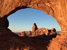
Là.. maintenant, il va y avoir un monde fou😕 (un peu comme le Horseshoe Bend qui n'était pas encore renseigné en 2009 et où il n'y avait donc pas grand monde😎... mais où , maintenant, plusieurs cars débarquent des centaines de touristes chaque jour en été🏴☠️)
Le fait que l'US 89 soit écroulé a peut être une influence sur ce type de tourisme, non ? Bon, sinon en 2011 au sunrise on y était seuls ...
Oui... évidemment c'est un HS, mais aussi très intéressant....
Certains topics de VF sortent du lot... et celui-ci en est un... Autrement dit, vlà un topic à garder qq part ds la mémoire de ton ordi😛😉
Ouest USA 2009 https://voyageforum.com/v.f?post=2800143#2800143
5ème trip USA, 09/2013 https://voyageforum.com/v.f?post=6186946#6186946
Je vais me rendre en août à Valley of Fire et j'aimerais beaucoup visiter différents spots dont:
-Thunderstrom Arch
-Pink Canyon
-Fire Wave
-Fire Cave
-Crazy Hill
-Piano Rock
-Windstone Arch
A part Fire Wave qui est apparemment désormais bien indiqué, j'ai cru comprendre qu'un GPS de randonnée est nécessaire.
Vu que je n'en ai jamais utilisé, je me demandais si vous aviez une marque particulière à recommander ou si par hasard, un belge parmi vous en avait éventuellement un à me louer du 24/7 au 25/8.
je me demandais si vous aviez une marque particulière à recommander
après quelques recherches sur le Net,
je me suis décidé pour le Etrex 20
(commandé aux US, livré chez des amis là-bas)
je n'ai pas réussi à inclure les cartes*,
mais une fois les points GPS entrés,
c'est assez basique d'usage (il faut s'en approcher petit à petit !) 😉
Le point faible : protéger la façade avant, (avec une pellicule plastique comme sur les smartphones),
elle se raye très facilement, au point de gêner la lecture ! 🤪
J'espère que tu trouveras quelqu'un près de chez toi pour t'en louer un...
Bons préparatifs ! 😎
* du coup l'Etrex 10 aurait été suffisant pour mon usage ! 😇
Et puisqu'on a un topic " complet " sur VoF : y'a des restos dans le coin ? ( Overton ?? )
ça, c'est le truc pas cool d'Overton 😕...
finalement, rigole pas, c'est encore le McDo le moins "pire" 😛...
on a testé dernièrement le seul "resto" : le Sugar's Home Plate... ben bof bof... un très vieux "diner", des fanions partout, des télés qui retransmettent le sport, un service pas des plus attentifs (t'as le temps de mourir de soif si tu ne réclames pas alors que partout ailleurs on te remplit ton verre même pas fini !), nourriture très quelconque (burger pas inoubliable) ... on s'est achevé par une glace à Inside Scoop juste avant la fermeture (vers 20h30 ?)...
@+
Vnoa
"A la liberté de provocation, répond la liberté d'objection"
"Les cons, ça ose tout. C'est même à ça qu'on les reconnaît"
"Le con ne perd jamais son temps, il perd celui des autres"
Carnet de Voyage: De Mile High City à Sin City (Colorado, Utah, Arizona, Nevada) -> voir mon profil
"A la liberté de provocation, répond la liberté d'objection"
"Les cons, ça ose tout. C'est même à ça qu'on les reconnaît"
"Le con ne perd jamais son temps, il perd celui des autres"
Carnet de Voyage: De Mile High City à Sin City (Colorado, Utah, Arizona, Nevada) -> voir mon profil
avec l'etrex 10, si je comprend bien, on ne sait pas charger de carte. Si on l'achète aux EU, elle sera chargée de la carte EU et on devra acheter un autre GPS pour l'Europe par exemple? J'hésite aussi à acheter un GPS de rando mais c'est pas donné et on n'en aura pas très souvent l'utilité mais c'est aussi fun pour les enfants! J'hésite entre un gps de rando et une montre GPS que mon mari pourra utiliser pour ses joggings.
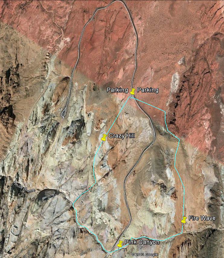
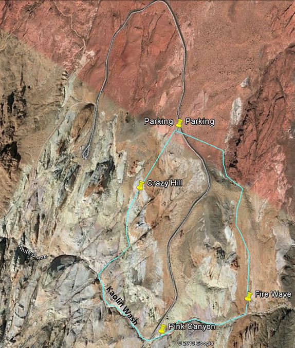
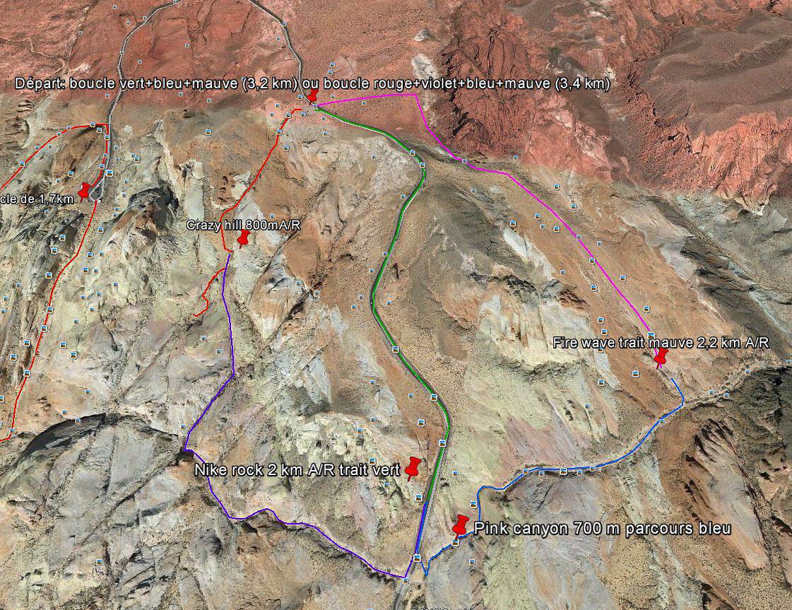
Qui peut me dire combien de temps prendrait la boucle: Depart et retour au Parking White Dome et passage par Fire Wave + Pink Canyon + Crazy Hill + White Dome?
Je t'avoue que je ne suis un expert ni de l'un, ni de l'autre ! 😊
Ce qui est sûr, c'est que c'est différent d'un GPS de voiture,
dans la mesure où ce dernier est "perdu" si il n'a pas la bonne carte chargée !
Pour un GPS de rando, et tel que je l'ai utilisé,
ce qui compte c'est plutôt d'entrer les poins GPS (les "waypoints") de la rando prévue,
voir même seulement le point d'intérêt final,
et ensuite, une fois sur place, ça permet de se repérer (mais sans carte affichée), où on se situe,
par rapport aux points entrés (à vol d'oiseau pour les distances notamment) :
C'est assez basique, mais assez efficace tout de même,
notamment à VofF où les points sont assez rapprochés,
du coup où les situent assez vite les uns par rapport aux autres...
Personnellement je tenterais plutôt la boucle dans le sens suivant :
Parking Fire Wave
+ Crazy Hill+
Pink Canyon +
Fire Wave+
Parking Fire Wave
en effet, si elle est programmée en fin d'après-midi, les rayons seront plus bas pour Fire Wave,
(les courbes de la FireWave apparaissent d'avantage en fin de journée)
et à l'inverse, il ne faut pas trop tarder pour Crazy Hill, car l'ombre de la "colline" arrive plus tôt,
et je suppose que Pink Canyon ne doit pas non plus être trop dans l'ombre pour être appréciée...
Pour relier chaque point de vue, je compterais en gros 1/4 d'h, 20 min, entre chaque site,
ce qui ferait une heure de marche (de liaison) en tout (?),
(les distances ne sont pas bien grandes...)
mais c'est sans compter le temps pour les photos, qui lui est très variable ! 😇
et c'est également avec le GPS qui permet de trouver "tout de suite" les sites en question... 😊
(je mets "tout de suite" entre guillemets, car c'était mes débuts avec mon GPS,
et du coup, j'ai pris un peu plus de temps...🤪 😏)
Auparavant, j'aurais fait la boucle White Dome qui est plutôt "de l'autre coté" (coté Ouest)... (je ne l'ai pas faite...)
Je ferais d'abord : White Dome Trail loop 1,2 Mi/2Km/1H, facile , au départ du parking ad hoc
Et puis j'irais me garer au parking dédié à Fire Wave (voir carte de Pong), et je ferais la boucle ds le sens Crazy Hill> Kaolin Wash > Pink Canyon > Fire Wave
Comme j'ai prévu exactement ces mêmes randos pour mon prochain voyage, j'ai passé mon temps à calculer les distances sur google earth.. et ça donne +/- 3km ... exactement les mêmes prévisions que celles annoncées par Pong😉
Ouest USA 2009 https://voyageforum.com/v.f?post=2800143#2800143
5ème trip USA, 09/2013 https://voyageforum.com/v.f?post=6186946#6186946
C'est tentant de couper "au plus court", certainement, 🙂
mais comme tu en as fait déjà l'expérience dans d'autres parcs,
ils te font le coup du " restez sur les sentiers balisés pour que la végétation puisse se développer correctement..."
et c'est vrai que dans la "Vallée de Feu" les pauvres plantes ont un peu de mal !!! 😎
Du coup, j'ai suivi le sentier, (qui remonte inexplicablement au N-E) même si l'envie me démangeait de couper
(surtout qu'on ne voit pas très bien la logique du tracé...🤪)
Heureusement, ce n'est pas bien long... 😇
(et en plus, dans le cas de la boucle proposé, on ne le fait qu'une seule fois !) 😉
" ils te font le coup du " restez sur les sentiers balisés pour que la végétation puisse se développer correctement..." "
Je me doutais que tu allais me répondre ça🤪
C'était bien plus simple du temps où j'y suis allée en 2011 et où le chemin n'était pas encore balisé
En même temps, vu le nombre grandissant de touristes, c'est compréhensible que chacun marche sur les traces des précédents
Ouest USA 2009 https://voyageforum.com/v.f?post=2800143#2800143
5ème trip USA, 09/2013 https://voyageforum.com/v.f?post=6186946#6186946
OK, vu ! Merci bcp ! 😉
D'autre part, as-tu également repéré "Striped rock" ? 😮
à quoi ça ressemble ?... (mon exemplaire du eguide est resté sur mon ancien ordi ! 🏴☠️)
donné par sbrcoach précédemment (Striped Rock : 36°28'50.5''N,114°31'35.5')
http://goo.gl/maps/kJprK
ce serait dommage de passer à coté ! 😇
(mais comme le disais le Tigre, plus on cherche, plus on trouve de choses à explorer ! 🤪)
After we plan was outlined Pink Canyon - it is located at the southern base of the wave, it is necessary to go down and go to the right, that is, to the west, to the highway. Canyon was some incredible miracle - at this time of the morning, he radiated a rosy glow. Pink Canyon ended access to the highway and immediately had to find Striped Rock. According to the description he was on the opposite side of the highway - it is necessary to cross the road, climb a little higher in the direction of our parking lot and look in both left. With surprising ease, we found it and once again died with delight. Classical panorama Striped Rock. Details about other perspectives. Striped Rock Once we got back on the highway downhill back to the parking lot # 3.
Pour compléter ma réponse concernant Kaolin Wash:
En fait Kaolin Wash est le wash qui fait la jonction entre Pink Canyon et le White Dome Trail... donc, la boucle suggérée par Titouc semble possible... sauf que comme tu l'as si bien dit, en faisant cette boucle , on louperait la partie ouest du White Dome Loop Trail.... Ne l'ayant pas encore fait, je ne sais si on raterait qq chose🤪
" D'autre part, as-tu également repéré "Striped rock" ? "
Je suis en plein ds ma préparation de Valley of Fire... que j'avais momentanément laissée tombée qd mon regard a été attiré par les photos de Anniversary Narrows😏...
Maintenant que j'ai fini d'explorer le lac Mead, je retourne plus au nord, sur Valley of Fire😏
J'avais déjà noté ce nom de Striped rock ... je vais aller approfondir la chose😄
Ouest USA 2009 https://voyageforum.com/v.f?post=2800143#2800143
5ème trip USA, 09/2013 https://voyageforum.com/v.f?post=6186946#6186946
Bonne idée ! 😉
Nous pouvons d'ors et déjà rajouter "The Fire Cave" à cette boucle "magique" ! 😎
Incroyable !!! 😮
(36°29'11.6''N,114°31'47.5''W) http://goo.gl/maps/dmRK6
Elle se situe apparemment juste entre le Parking de Fire Wave et Crazy Hill !
Bon, nous en sommes déjà à 6 points à explorer sur une boucle de 3 km...🤪
Bon, et ensuite ?...😇
(Fire Cave, Crazy Hill, Kaolin Wash, Striped Rock, Pink Canyon, Fire Wave, ...)
Bonjour à tous
Je suis content de voir que je ne serais pas le seul à faire cette boucle en septembre.
j'avais pourtant des doutes sur la faisabilité mais j'y avais songé en découvrant la rareté des parkings.
Pour moi, j'y inclus aussi striped rock, appelé aussi Nike Rock en raison du croissant bien visible sur les photos.
Par contre je découvre fire cave et ce qui m'oblige à me replonger dans les recherches😉. Pourtant je croyais bien en avoir fini avec VoF.
hum, je crois qu'il y a confusion à propos de la photo de Fire cave, cet endroit est appelé aussi Windstone arch et se situerait à l'ouest du parc, en faisant la scénic loop. Approxivement aux coordonnées: 36°24'45.01"N 114°33'14.34"O.
Ce site est plutôt très difficile à trouver parce que très petit, l'arche est à peine plus haute qu'un enfant de trois ans.
Non... il ne me semble pas y avoir confusion (voir http://voyageforum.com/v.f?post=6024404#6024404, extrait de l'e-guide qu'on peut se procurer là http://www.synnatschke.de/e-guides/store.php pour seulement 4 €)
Mais perso, je n'ai pas encore eu le temps de tout repérer
Ouest USA 2009 https://voyageforum.com/v.f?post=2800143#2800143
5ème trip USA, 09/2013 https://voyageforum.com/v.f?post=6186946#6186946
Je ne doute pas qu'il y est d'autres merveilles à découvrir sur cette boucle😎
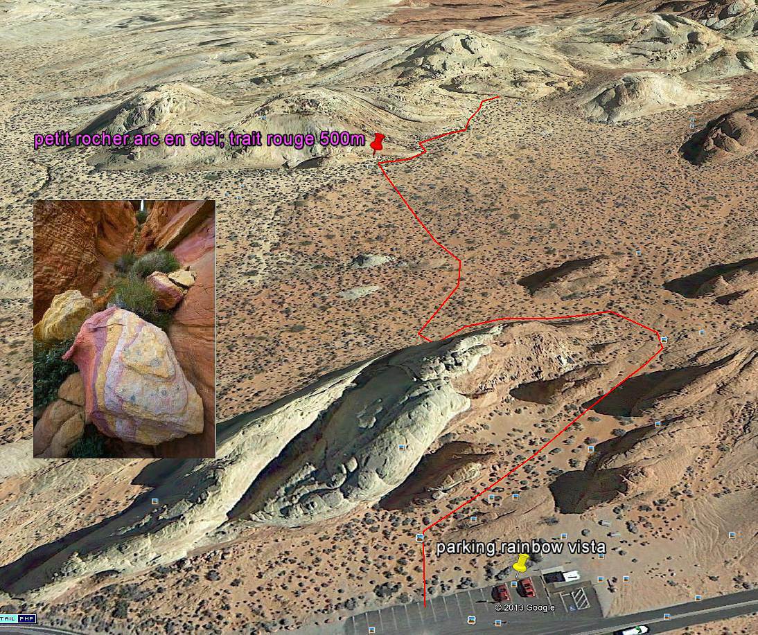
Mais en plus, moi ce que j'aimerai trouver, c'est cette petite faille très photogénique. Je n'ai trouver qu'une photo géocalisée sur internet, alors je croise les doigts pour qu'il n'y est pas d'erreur.
Cela se situerait sur raimbow vista, pas très loing du parking. Quelqu'un peut il confirmer ?
D'autres photos de lui sont bien géocalisés, alors j'espère que celle la aussi. Bon c'est juste un petit site à explorer, je vous direz ça au retour, si personne n'a piqué le petit rocher d'ici là.😐
Si j'essaye de géolocaliser FireWave avec l'option "Photos" de Googlemap,
Il n'y en qu'une seule qui soit bien positionnée !...🤪 🏴☠️
Du coup, ça me paraît plutôt approximatif...😕
Mais peut-être l'option sur Google Earth est-elle plus fiable ? 😮
Si tu trouvais une info sur la possibilité de rejoindre White Dome depuis Kaolin wash, je suis intéressée, de même sur l'intérêt de ne faire qu'un côté de White Dome. Dans ce cas lequel faire? Faire la boucle proposée (7 merveilles) par Pong en y ajoutant une partie de White Dome, nous permettrait de ne pas faire une trop grande balade avec nos enfants!
Je pense que seules les photos géolocalisées par le GPS de l'appareil photo sont fiables, c'est vrai que l'on trouve de tout et n'importe quoi sur maps ou earth. Il faut faire de multiples recoupements et pour ma photo, le problème c'est que je ne connais que celle la.
Je crois que je vais essayer de contacter le gars pour avoir plus de renseignements mais les derniers commentaires datent de 2011 et il dit clairement qu'il ne répond pas forcément aux commentaires.
Sinon j'irai jeter un coup d’œil prochainement, ça sera ma course au trésor😎 en espérant qu'il n'y ait que quelques secondes d'erreur sur la position.
Hello
La photo a été prise avec un Nikon D70 qui ne possède pas de GPS intégré, donc un ptit doute persiste. Ce qui est sûr, c'est que ce jour là, il était bien à VOF, le champ de recherche se rétrécit😄.
Ce que je trouve bizarre, c'est la rareté de cette photo, pas vue sur un forum mais je suis loin de les avoir tous fait.😕
je suis cette discussion avec attention depuis quelques jours et c'est d'ailleurs la plus intéressante du moment.
N'ayant pas encore été à VOF, mais y allant dans quelques semaines, je suis évidemment intéressé par toutes ces infos.
Alors une petite question technique car je suis en train de rentrer les points GPS dans mon Etrex en suivant le parcours proposé par Pong.
Si Kaolin Wash et Pink Canyon ne sont pas au même endroit, avez-vous les coordonnées de l'un et l'autre car Jojo tu les places avec les mêmes coordonnées. Alors lequel des 2 a ces coordonnées-là ? 36°28'48''N,114°31'34''W
Bonjour
Je n'ai pas acces aux coordonnées sur ma tablette, mais pour ta recherche sur google earth, sache que pink canyon est le prolongement de kaolin wash, c'est juste la route celle qui conduit à white dôme, qui les sépare. Il suffit donc de suivre ce wash, apparemment praticable mais qui peut aussi être barré par de belles flaques.
Cet été, au mois de juillet, nous partons en famille avec des enfants de 7 et 8ans voir une tante à mon épouse Nous allons en profiter pour voir les parcs de…
Pendant cette période de froid polaire, je suis en train de m'interroger sur mon passage à Las Vegas au mois d'Août. Je situe le truc: nous allons rester 4…
Je prépare mon roadbook et j'aurai besoin de votre aide por moi programme entre Zion et valley of fire puis LV J1 MATIN: BRYCE lever de soleil puis queens…
Hello! The itinerary is pretty much set for August 2026. Yeah, I know it’s gonna be *super* hot. But it’s the only time we can get away.
So, here’s the plan: Montpellier-CDG-Dallas.
Stay from July 31 to August 26, 2026:
Car rental – check,
Hotels – check,
Itinerary – almost check,
Photo gear – check,
Budget – check, 🤪
Meal planning – meh, we’ll see...
Walmart, of course, for the cooler when we arrive.
And now, without too much detail...
Fort Worth:
The Longhorns and the Stockyards;
JR’s ranch (for the missus);
Medal of Honor Museum – Arlington.
Houston and NASA Space Center:
See the Gulf of Mexico/America.
San Antonio and the missions.
Fort Stockton for an overnight stop.
El Paso via Guadalupe Mountains:
El Paso and White Sands.
Tucson and the Pima Air & Space Museum:
Tombstone, Bisbee.
Phoenix:
Still working on the program.
Sedona:
Round trip around the area via Flagstaff and Williams, or the Grand Canyon (already done) – we’ll decide on the spot.
Albuquerque:
Santa Fe,
Turquoise Trail,
Los Alamos.
Amarillo via Route 66:
Old Route 66 in the city;
Big Texas Ranch Steak 😏.
Dallas:
JFK Museum;
Perot Museum;
West End district.
And through it all – the road, the road, and more road!!!
We’ll adapt day by day based on our mental and physical state (we’re not exactly spring chickens).
Hello everyone! Really damaged due to flooding caused by runoff after forest fires (a total mess!), does anyone in this friendly forum have any updates on the Apache Trail between Apache Junction and Roosevelt Dam? Is there still a section of the road that’s tough to navigate?
We're leaving at the end of June and will be driving the route between Buffalo and Cody. We’ve already booked our accommodations and a rodeo in Cody, but during the day, we’ll be driving between the two and I’m unsure about the itinerary.
Which route do you think is the most pleasant, interesting, or scenic between:
- The northern route via Highway 14 with Sheridan, Lowell, etc.
- The southern route with Highways 16/20/14, passing by Loaf Mountain Overlook, Powder River Pass, Ten Sleep Canyon...
We’ll be in a car, so we should be able to drive on any road.
Thanks for your input!
I’m almost done planning our September road trip. After our 3-night visit to Sequoia, we’ll have a stopover night in Coalinga (to break up the drive). We’ll be staying two nights in Monterey and would like to stop along the way to visit one side of Pinnacles National Park. We’re torn between the West entrance and the East entrance, and we’d like to do a short hike of no more than 2 hours since we don’t want to arrive too late in Monterey.
This park is split into two distinct zones with no connection between them, and the mileage from Coalinga to Monterey is pretty much the same for both. Which area do you recommend visiting—east or west? And which route is the most scenic?
I’ve spotted two short hikes:
- East: Moses Spring to Rim Trail Loop
- West: Balconies Cliffs Cave Loop
Has anyone been there, or do you have another hike to suggest?
Thanks in advance, and have a great afternoon!
Marcalamar 🙂
After our first trip as a young couple to the West in 2007 (yes, that doesn’t make us any younger!), we’re planning to go back in 2028, but this time as a family of four! (We have two boys who’ll be 5½ and 13 years old in the summer of 2028.)
Our plan is to combine a few big cities (SF and LA, maybe San Diego) with national parks and state parks, mostly!
Ideally, we’d like to leave at the end of June and head back to France around July 19–20, so we can enjoy the first week of the Olympic Games in Los Angeles.
Since we already did the "loop" in 2007, there are must-see places we absolutely want to revisit—and especially share with our kids: Bryce Canyon, Yosemite, and above all, the Grand Canyon, which is still the most incredible thing I’ve ever seen on Earth!
On the other hand, some places didn’t leave a big impression on us for various reasons, so we’re not making them a priority: Antelope Canyon, Monument Valley, for example.
We’re planning ahead, but might as well be smart about it😏
Do you have any tips for a fun and doable itinerary over about 20–25 days with kids, without rushing?
Hi everyone! 🙂
Just a quick question about King Canyon and Sequoia National Park.
Before our night in Miramonte, we plan to visit King Canyon. The next stop will be two nights in Three Rivers to explore Sequoia National Park. I wanted to go all the way to Roaring River Falls on the King Canyon Scenic Byway and then turn back to head to Miramonte. Since we’re coming from Oakhurst, Google Maps says it’s 300 km and 5 hours of driving. Since we also want to hike to see the sequoias (Big Stump Area and Grand Grove) before tackling the King Canyon Scenic Byway, the timing’s going to be tight. How far do you recommend going before turning back to miss as few points of interest as possible on the King Canyon Scenic Byway? Thanks for your advice, and have a great evening!
Marcalamar 🙂
Hi everyone!
After years of hoping, waiting, planning, then changing, saving, and searching for the best possible route... we're FINALLY off this summer for a 5-week road trip in the West.
I had planned a trip to Colorado in 2021 but canceled due to COVID, so with time passing and my eldest’s high school graduation approaching fast, I figured it was now or never!
Anyway, the itinerary has been modified and extended to please everyone (I’m no longer the only one making decisions!!)
Here’s our final route:
Day 1 - 7/12/2026 - Brussels / Los Angeles
Day 2 - 7/13/2026 - Los Angeles
Day 3 - 7/14/2026 - Los Angeles
Day 4 - 7/15/2026 - Los Angeles
Day 5 - 7/16/2026 - Los Angeles
Day 6 - 7/17/2026 - Los Angeles / Kingman
Day 7 - 7/18/2026 - Kingman / Grand Canyon
Day 8 - 7/19/2026 - Grand Canyon / Page
Day 9 - 7/20/2026 - Page
Day 10 - 7/21/2026 - Page / Monument Valley
Day 11 - 7/22/2026 - Monument Valley / Durango
Day 12 - 7/23/2026 - Durango
Day 13 - 7/24/2026 - Durango
Day 14 - 7/25/2026 - Durango
Day 15 - 7/26/2026 - Durango / Glenwood Springs
Day 16 - 7/27/2026 - Glenwood Springs
Day 17 - 7/28/2026 - Glenwood Springs / Moab
Day 18 - 7/29/2026 - Moab
Day 19 - 7/30/2026 - Moab
Day 20 - 7/31/2026 - Moab
Day 21 - 8/1/2026 - Moab
Day 22 - 8/2/2026 - Moab / Vernal
Day 23 - 8/3/2026 - Vernal / Grand Teton
Day 24 - 8/4/2026 - Grand Teton
Day 25 - 8/5/2026 - Grand Teton / Cody
Day 26 - 8/6/2026 - Cody / Yellowstone
Day 27 - 8/7/2026 - Yellowstone
Day 28 - 8/8/2026 - Yellowstone
Day 29 - 8/9/2026 - Yellowstone
Day 30 - 8/10/2026 - Yellowstone / Salt Lake City
Day 31 - 8/11/2026 - Salt Lake City / Bryce Canyon
Day 32 - 8/12/2026 - Bryce Canyon / Zion
Day 33 - 8/13/2026 - Zion
Day 34 - 8/14/2026 - Zion
Day 35 - 8/15/2026 - Zion / Las Vegas
Day 36 - 8/16/2026 - Las Vegas
Day 37 - 8/17/2026 - Las Vegas / Los Angeles
Day 38 - 8/18/2026 - Los Angeles
Day 39 - 8/19/2026 - Los Angeles / Brussels
Day 40 - 8/20/2026 - Brussels / Home
We’ll be alternating between house swaps, motels, and campgrounds. I’ve booked all the accommodations (except the campground at Bryce since sunset bookings open only 14 days in advance) and the first activities, as well as the most touristy ones.
I’m currently putting together my day-by-day roadbook and having some trouble planning certain days, like in LA or Las Vegas. Choosing hikes isn’t easy either—it’s tough to decide!
We’re really excited but could definitely use your help with choices and optimizations!!
Hello.
I’d like to travel along I-15N from San Diego to Las Vegas with my mom, who’s 67. We’ve explored Northern California and the California Coast over the past two years and now want to continue through the desert.
There are several attractions along the way:
- Mormon Rocks
- Desert Discovery Center and visit the Old Woman meteorite
- Joshua Tree National Park
- Mojave Desert
- Mojave National Preserve
- Anza-Borrego Desert State Park
- Silverwood Lake
My mom has back issues that prevent her from hiking or walking on trails with elevation changes. Is it possible to visit these places by car, or are the routes flat enough?
I’d love for her to experience the desert with an itinerary adapted to her condition. I’m also open to other points of interest that aren’t mentioned. We have 3-4 days for the trip, so we’re not in a rush—just want to explore.
I’d love to take a road trip and visit Nova Scotia. I’d appreciate some info on the best cities to see and the most interesting spots. The trip should last about 10 to 15 days, staying in hotels or motels. Thanks in advance!
We’re being relocated to Saint Pierre and Miquelon.
We’ll be taking the flight from Nantes to Montreal and then from Montreal to Saint Pierre.
Could you recommend a hotel near the departure terminal that allows dogs?
Hi,
My 16-year-old son is flying to Grand Rapids with other kids his age. There’s a layover in Detroit. There’s no unaccompanied minor service available. Is it pretty easy to navigate Detroit Airport to catch the connecting flight to Grand Rapids (domestic flight)? There are several of them who speak English well.
Thanks for your replies,
Good evening, everyone! 🙂
Just a few last questions to wrap up our Lake Tahoe visit plans.
**Parking:**
We’d like to walk to Eagle Falls and then Eagle Lake. I’ve spotted two parking lots that seem close to each other and give access to the trailhead. Where and how do we pay for entry to Emerald Bay State Park and Inspiration Point?
**Viewpoints on the East Side:**
Are most of the viewpoints (Balancing Rock, Granite Cave, Bonsai Rock, etc.) right by the road, or do you have to hike to reach them?
**Donner Memorial State Park:**
Is it worth making a detour to Truckee to visit this park and the Truckee historic downtown?
Hi there. I'm shocked by the price of the Upper Antelope Canyon tour—$175 for less than an hour… You might say, "if you can’t afford it…" But the real question is whether it’s really worth it, because $350 for two makes me feel like I’m getting ripped off. For those who’ve done both Lower and Upper, can you tell me if the price difference is really justified? Thanks
Hi everyone! 🙂
As you can see, we're heading back from September 6th to the 27th.
Everything’s booked for September—flights, accommodations, and the car. As I plan, I’ll be asking the experts for help. This is our second trip to California, but most of the stops are new to us.
We’ll start directly from San Francisco to our first overnight stop, Davis, before heading to Lassen Volcanic Park for 4 nights. Our flight lands at 12:50 PM.
Here’s our itinerary:
Day 1: Davis – overnight stop
Day 2: Red Bluff – exploring Lassen Volcanic Park (scenic drive to Lake Helen)
Day 3: Susanville – scenic drive through the park via the South Entrance, points of interest, and hikes
Day 4: Susanville – Cinder Cone and Painted Dunes hike
Day 5: Susanville – Warner Valley (hikes)
Day 6: South Lake Tahoe
Day 7: South Lake Tahoe
Day 8: Mammoth Lake
Day 9: Mammoth Lake
Day 10: El Portal via Tioga Road
Day 11: El Portal
Day 12: El Portal
Day 13: Oakhurst
Day 14: Miramonte
Day 15: Three Rivers
Day 16: Three Rivers
Day 17: Coalinga
Day 18: Monterey
Day 19: Monterey
Day 20: San Francisco
Day 21: San Francisco
Day 22: Departure
For hikes in Lassen Volcanic Park, I’ve planned:
Bumpass Hell, Cold Boiling Lake (Day 2)
Paradise Meadow (maybe not going all the way), Devastated Area, and the loop around Reflection and Manzanita Lakes (Day 3)
Cinder Cone and Painted Dunes (Day 4)
Devil’s Kitchen and Boiling Spring Lake (Day 5)
I’ve read there are trails to access the trailheads for Cinder Cone (11 km) and Warner Valley. Are these easy trails for an SUV?
Are there any other must-see spots or things we shouldn’t miss?
That’s where I’m at for now. Thanks for your replies, and have a great evening!
Marcalamar 🙂
I’m a total USA addict. I’ve already done several road trips, including the East Coast and West Coast.
I’m here today because I’m planning to go back for another road trip on the West Coast. Possibly with one of my sisters and a couple of friends. It’s still just a plan for now, but I’m working on an itinerary in the meantime. Ideally, I’d leave in 2026, but I don’t have the exact dates yet—maybe April-May or September-October.
My last trip to the West Coast was in September 2014. We went for 2 weeks, but this time it’d be 3 weeks. What made me want to go back was simply a colleague who just left today. As I’m writing this, he’s on the plane. I’m so happy for him, but now all I can think about is going back.
Since I recently went to NY, I noticed that prices have really gone up. I assume the same is true for the West Coast? For 2 people over 3 weeks, what budget should I expect? We’re the type to watch our spending and find great tips.
I think we’ll arrive in San Francisco like the first time and leave from either Los Angeles or Las Vegas.
Thanks for advising me on the booking—should I reserve a room in the hotel or go for a cabin for the best view?
Should I get breakfast or not?
What do you think of the restaurant?
Hello, if the off-the-beaten-path enthusiasts are still around 😉, I’d love some info on tackling these trails. I’m not super familiar with the rules, risks, or what to expect—I’m looking for firsthand experience from folks who’ve done it on their own once or multiple times.
Hi everyone!
I’m planning a week-long family trip to NYC in October 2026. The focus is on museums and soaking up the New York vibe. I’ve been checking Airbnb, but the prices in Manhattan are through the roof. Since I don’t know NYC well, is it "wise" to look outside Manhattan? Any neighborhoods you’d recommend?
After our first trip to the West, we’d love to go back to see other must-see spots!
The stay would be from May 11 to 20, 2026—it’s short, but hey...
M11: Lyon to Las Vegas (overnight in Vegas)
T12: Route 66 – overnight in Grand Canyon (GC)
W13: Visit GC – overnight in Page
Th14: Visit Antelope Canyon / Horseshoe Bend – overnight in Monument Valley (MV)
F15: Visit MV – overnight in Moab
Sa16: Visit Arches / Dead Horse Point – overnight in Bryce
Su17: Visit Bryce – overnight in Zion
M18: Visit Zion / Valley of Fire – overnight in Vegas
Tu19: Return flight
What do you think? Could we add one more night somewhere? We’re not big hikers, so we’ll mostly explore the parks using shuttles.
Also, we’re all set—passports are good. Do you think one classic Visa card and one premium Visa card will be enough for coverage?
Thanks so much for your feedback, and happy holidays!
Hi North America forum crew,
Just a little post that might interest some of you:
Travelers to the United States | Photo Now Mandatory Upon Entry and Exit | La Presse
I assume many of you already know, but the America the Beautiful annual pass, which was $80, will increase to $250 starting January 1, 2026.
So if you're planning to travel before the end of December 2026, it's in your best interest to buy your pass in December 2025, since it will still cost $80 and be valid until the end of December 2026 if you purchase it in December 2025.
This price increase only applies to non-U.S. residents.
Additionally, for those who planned to visit just one park, a $100 surcharge per person will apply to access a list of 11 national parks...
For example, if there are 4 of you in a car, you’ll have to pay $35 + $400,
which comes to $435 to visit one of the 11 parks on the list (I don’t have all of them... Bryce, Zion, Grand Canyon, Yellowstone, Grand Teton, etc.).
Total madness.
The goal is to push people who only visit one park into buying the annual pass.
Last point: free entry days are over for non-residents!
Hi everyone, I’m traveling to Los Angeles and would like to rent a vehicle at the airport. However, I have a Boursobank Ultim deferred debit card, so I’d love to know if it’s possible for those who’ve experienced this recently. Thanks for the info!
I’m planning a week in S.F. in April 2026 and I can’t figure out how to tell the cable cars—of which I understand there are three lines—apart from the trams, which I think number seven. I can’t find their individual numbers or routes anywhere.
Could someone shed some light on this for me? Thanks in advance.
Wishing you all a Merry Christmas and a wonderful 2026 full of amazing travels.
Cheers,
Régine
Hi,
I’m planning a road trip through the American national parks starting from Denver in June 2026.
The price of the pass is jumping from 80 € to 250 € on January 1st, 2026!!!
Is it possible to buy the pass online before the end of the year to lock in the 80 € rate? If so, where and how do I go about it?
Thanks for your tips.
Arnale
I’m planning a road trip for July 2026 in northern Florida. Could you let me know if my itinerary makes sense?
Day 1: Orlando
Day 2: Amelia Island
Day 3: Amelia Island
Day 4: Tallahassee
Day 5: Panama City Beach
Day 6: Panama City Beach (visit to Destin)
Day 7: Crystal River (stop in Cedar Key on the way)
Day 8: Crystal River
Day 9: Anna Maria (stop in Clearwater)
Day 10: Anna Maria (St. Pete)
Day 11: Anna Maria
Day 12: Orlando
Day 13: Orlando
Day 14: Orlando
Day 15: Departure
We just finished 9 days in the American West and wanted to share our experience because we had an amazing time.
I know some of you might ask, why use an agency? Honestly, we didn’t really feel like doing all the driving and planning, especially since we didn’t know the area at all. And since our English isn’t great, having French-speaking guides was a big comfort.
We found Emmanuelle and Isabelle, and wow, they were fantastic. It was just the two of us with them, so it was a truly VIP, ultra-personalized experience. They treated us like royalty from start to finish. These two live in Las Vegas and know the region like the back of their hand. They told us they’ve spent over 15 years exploring every corner of the American West, and it really shows. Their knowledge of geology, park history, and local anecdotes is just impressive. It’s nothing like someone reciting a memorized script. They answer all your questions and really adapt to what you want to see or do.
What we really loved: the vehicle was super comfortable, and the little details made a difference—like snacks and even a homemade cake! Though, to be fair, we devoured the cake right away, so that counts.
Since they know the sites inside out, they took us at the right times to avoid crowds. So we could enjoy peaceful picnics at Grand Canyon viewpoints without being packed in with 200 people. Plus, on top of the must-see spots, they showed us some hidden gems that were absolutely stunning—places we never would’ve found on our own. They’re true locals who know all the best tips.
The service was really personalized. They adapted to our pace and preferences, and we could stop whenever we wanted to take photos. It’s the luxury of being in a small private group—you’re not just a number on a big bus.
In short, we really felt like we were traveling with friends rather than professional guides. Everything’s included in the price (hotel pickup, meals, park entries, etc.), so the value for money is fair.
We loved it so much that we’re already planning to come back next year to explore other areas with them. I think we’ve caught the American West bug—it’s all we can think about, and we can’t wait to return.
If you’re looking for a French-speaking tour with real personalized service and guides who know the region like no one else, we highly recommend them. We had unforgettable moments. They also design road trips for those who don’t want a guide. And they handled our hotel reservations in Las Vegas too. If you want genuine advice from friendly locals, we’re giving them a 200% recommendation!
I’m currently looking for well-located hotels near points of interest in the cities below. I’ve found a few, but the prices are really high.
Could any of you share some great addresses in the following cities?
- Los Angeles
- Las Vegas
- San Francisco
Also, do you have a preferred airline for domestic flights? If so, which one?



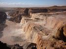



 C'est assez basique, mais assez efficace tout de même,
notamment à VofF où les points sont assez rapprochés,
du coup où les situent assez vite les uns par rapport aux autres...
Personnellement je tenterais plutôt la boucle dans le sens suivant :
C'est assez basique, mais assez efficace tout de même,
notamment à VofF où les points sont assez rapprochés,
du coup où les situent assez vite les uns par rapport aux autres...
Personnellement je tenterais plutôt la boucle dans le sens suivant :