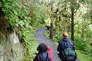
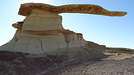
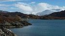
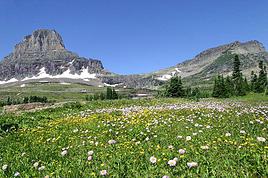
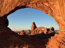
Bah oui! Mais, la-bas, l'hiver est gentillet. 18°C la journée! J'ai connu bien plus froid que cela.
Je n'aurai aucun endroit avec neige, ce qui me chagrine!
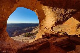
Pour cela, il faudrait qu'il fasse un stage de rando avec moi 😛 après cela, False Kiva et les Cracked Eggs auraient été d'une facilité déconcertante pour ITATstone
Tu parles, à False Kiva j'aurais été obligé de te porter sur mon dos à cause de ta cheville foulée 🏴☠️
Ouarf... Je me suis débrouillé seul, de toute façon j'étais seul 😏 et la rando pas encore trop connue à l'époque.
C'était ma première rando et je n'ai pas fait preuve d'humilité et la nature m'a gentiment rappelé à l'ordre.
La 2ième rando sur False Kiva : impec et sans GPS
Allez plus d'excuses bidons 😛
@+ le spartiate
Tout ce qui ne vous tue pas , vous rend plus fort !!
Viens en France métropolitaine, de la neige tu en auras
Mmmmouais, pourquoi pas? De beaux paysages enneigés garantis à Noël, je suppose. Faut voir!
Annecy doit être magnifique avec plein de neige partout, non?
J'avoue que je pensais plus à aller dans le Colorado. Mais la france pourquoi pas?
j'aime bien la rando dans les Pyrénées, mais en été 😎 il y a encore de beaux coins assez préservés, mais il faut marcher. L'hiver je ne sais pas, je reste au coin du feu 😛
Cette balade, située entre Gunnison et Montrose, au bord du Blue Mesa Reservoir permet non seulement d'avoir de belles vues sur une partie du Lac mais aussi sur de belles formations d'origine volcanique.
Le trailhead est au niveau du pont routier
On aperçoit déjà les pinacles
Blue Mesa Reservoir :
2. Points de vue - Black Canyon
L'après-midi sera consacrée aux points de vue le long de la Scenic Drive de Black Canyon. Les marches, dont la descente dans le canyon via Gunnison Route, sont prévues pour demain.
Le canyon porte bien son nom, les parois sont noires, c'est vertigineux, très escarpé. Au fond coule la Gunnison River visible seulement de certains points de vue.
Painted Wall, un des plus beaux points de vue
3. Inner Canyon - Gunnison Route
Le Visitor Center afin d'obtenir son permis, indispensable, pour descendre au fond du canyon n'ouvrant qu'à 8h, et étant sur place à 7h, il est obligatoire de s'inscrire soi-même. Il faut remplir un papier en deux parties détachables où l'on demande tout un tas de renseignements et glisser l'une des deux parties dans une petite urne à l'entrée du Visitor Center. Il conviendra ensuite de rapporter l'autre partie au Visitor Center lorsqu'on aura fini la randonnée.
Alors que dire... C'est une randonnée à la Spartiate 😛, très casse gueule! Mais qui permet de se rendre un peu plus compte des dimensions verticales du canyon. La plupart du temps il n'y a pas vraiment de sentier mais des éboulis... A un moment il y a une chaîne pour nous aider, mais non seulement j'ai trouvé que la chaîne n'aidait pas du tout, mais en plus je ne l'aurais pas mise à ce niveau où il y a de toute façon des grosses pierres et des branchages pour se tenir... Je l'aurais plutôt mise dans la dernière partie où là il n'y a rien pour se tenir et où ça glisse vraiment et c'est très pentu!
Bref, je m'en sortirai sans casse... 😛 Aucune personne croisée que ce soit à l'aller ou au retour. J'ai trouvé la montée plus facile que la descente, car lorsqu'on monte on ne glisse pas 😛
Au retour, une belle frayeur quand même, j'entends un gros bruit et je me rends vite compte que ce sont des gros rochers qui dévalent de la falaise à quelques mètres de moi... Heureusement ils n'iront pas sur le sentier mais resteront "sagement" dans la forêt. Mais pendant quelques mètres j'ai grimpé beaucoup plus vite 😛
La fameuse chaîne qui sert à rien et dont les 3 quarts sont au niveau du sol, je pense qu'elle sert plutôt à s'embroncher 😏
Le soleil se lève dans le canyon
Les falaises du fond du canyon
Le reste de la journée sera consacrée à se dégourdir les jambes en arpentant les autres sentiers que l'on peut faire au bord de la falaise et menant à des points de vue. La suite dans un prochain post.
j'entends un gros bruit
et je me rends vite compte que ce sont des gros rochers qui dévalent de la falaise à quelques mètres de moi...
Mais tu nous la joues Indiana Jones !!! 😮
(Au début de l'Arche Perdue) 😉
Je t'aurais volontiers mis le smiley qui court (et qui correspond justement à cette scène)
mais puisque ce n'est plus possible...Tant pis !
Bravo de nous rapporter ces images (et récits) de lieux inconnus (pour moi) 🙂
Bonjour Itat. Je ne m'étais pas connectée depuis un certain temps sur le forum Etats-Unis et je n'avais pas vu le début de ton carnet. Merci de partager les photos et de raconter. Ca permet de découvrir des endroits que je ne connais pas et de rêver en attendant le prochain voyage puisque celui de cette année a été annulé...
Je mets ce carnet dans mes favoris pour la préparation du prochain voyage, dans pas trop longtemps j'espère...
Merci
Alasombra
Je suis désolé que ton voyage aie dû être annulé 🙁. J'espère que ce n'est que partie remise dans pas trop longtemps 😉.
Et si je peux te donner des idées, tant mieux 🙂
L'après-midi, pas de marche, je me ménage un peu, en plus le temps s'est bien couvert et l'orage menace mais finalement n'éclatera pas sur Montrose et sa proche région. Je décide de m'approcher en voiture au plus près de la Gunnison River: c'est possible en empruntant dans le parc de Black Canyon la route "El Portal", cette route est goudronnée mais avec de beaux nids de poules par endroit mais très étroite et avec un fort dénivelé.
La route est ensuite bloquée par une barrière "no trespassing" à quelques centaines de mètres du barrage. Dommage qu'il n'y ait pas de chemin longeant la rivière.
Fin d'après-midi repos à Montrose!
le pont est a 9km de ma maison , tu aurai du venir prendre l'apero😉
Oui mais je suis timide 😛. Mais c'est gentil. Je pensais que tu habitais Gunnison même, j'ai pensé à toi quand j'ai traversé cette ville, non loin du 4 juillet 😉
et merci pour l'info sur la balade des Pinnacles 😉
Photo de la Highway 50 East avec l entree du Western State College ( la fac ) sur la gauche juste avant l'hotel Days Inn !!! ( tu as passer a 400m d ou j habite 🤪)
Photo de la Highway 50 East avec l entree du Western State College ( la fac ) sur la gauche juste avant l'hotel Days Inn !!! ( tu as passer a 400m d ou j habite 🤪)
je me suis arrêté à la station essence pour faire le plein et puis je suis parti, il me tardait de voir les Pinnacles 😉
Content que tu me lises et que tu ne sois pas totalement parti 😛 😉. Sur les 12 pages il y a quand même beaucoup de blabla, c'est vraiment un carnet light où je ne rentre vraiment pas dans les détails! 😉
Je ne te conseille pas de faire la Gunnison Route à Black Canyon en vélo 😛
Bravo ! t'as osé braver Inner canyon, rando sympa et fun 😉
@+ le spartiate
Salut Spartiate
Ah, tu oses appeler ça une rando sympa et fun? 😏
Pour ceux qui ne te connaissent pas: attention cette rando est compliquée! 😛
Mais merci de m'avoir encouragé à la faire 😉, c'est sportif et impressionnant, beaucoup plus que le South Kaibab Trail à Grand Canyon par exemple où c'est une balade pour pépère et mémère et le chien Youki à côté 😛. Je ne te cache pas que j'ai pris 1000 et une précautions pour ne pas me tordre une cheville (j'aurais eu l'air fin tout seul) comme par exemple m'accrocher à tout ce qui est à porter de mains (merci les arbres!) ou même descendre sur le cul parfois 😏
Ben oui, c'est fun ... T'as pas trouvé cette balade fun ?😇
Je ne te cache pas que j'ai pris 1000 et une précautions pour ne pas me tordre une cheville (j'aurais eu l'air fin tout seul) comme par exemple m'accrocher à tout ce qui est à porter de mains (merci les arbres!) ou même descendre sur le cul parfois 😏
Nous en sommes tous passés par là.... Ce n'est pas glorieux mais efficace😏
Avec les chaines, il y avait la technique "Rappel" ...Dos à la pente et tu tenais la chaine... Mais c'est plus rapide sur le cul😛
Sur Vasey's Paradise , ce sont des éboulis mais sans chaines😏
Bravo encore...
@+ les spartiate
Tout ce qui ne vous tue pas , vous rend plus fort !!
Étape courte aujourd'hui donc je ne prends pas le chemin le plus direct reliant Montrose à Fruita mais je décide de passer par Grand Mesa National Forest.
On passe rapidement à une zone boisée puis des lacs, il fait très frais!
C'est vert, bucolique, ça fait du bien après ces semaines passées dans des endroits plutôt secs.
Et très fleuri.
De nombreux endroits permettent de s'arrêter pour profiter des paysages. Il y a aussi pas mal de chemins de randonnée mais je n'en ai pas prévu ici. Cette année n'est pas consacrée au vert 😉.
Je suis toujours subjugué de la diversité des paysages que l'on peut trouver sur quelques miles dans l'Ouest américain, en voici un exemple:
Je retrouve donc bien vite mon désert et la chaleur, renforcée aujourd'hui par un temps très lourd et orageux. Le soleil pointera son nez que très rarement.
Je file tout de même vers Colorado National Monument que je visiterai d'Est en Ouest.
Premier arrêt, de suite après l'entrée, le sentier de Devil's Kitchen. Cela fait plaisir de retrouver ses chères roches rouges 😛.
Un habitant des lieux, pas farouche du tout
C'est sympa mais on sent néanmoins la civilisation toute proche (Grand Junction est une ville assez importante) et pour moi ça enlève un peu de magie.
J'enchaîne aussi les points de vue très nombreux le long de la Scenic Drive, mais les plus beaux selon moi sont ceux situés près du Visitor Center à l'Ouest du Parc.
Quelques photos d'Est en Ouest:
Je fais ensuite le sentier de Coke's Oven qui permet de s'approcher au plus près de formations rocheuses particulières
J'approche du Visitor Center et du fameux Independence Monument, en plus aujourd'hui c'est le 4 juillet, ça tombe bien. Au fond le Colorado.
Un drapeau américain a été planté au sommet (pour l'occasion?)
Les plus beaux points de vue sont selon moi, derrière le Visitor Center, à proximité du Campground. Une petite marche permet de s'éloigner du monde qui reste cantonné du Visitor Center.
Finalement un parc sympa mais le ciel gris n'aura pas mis en valeur selon moi la beauté des lieux. J'aurais préféré un ciel bleu avec de gros cumulus mais on ne peut pas tout le temps tout avoir 😛.
Néanmoins, si on connait déjà des paysages aux roches rouges plus spectaculaires (Moab ou autres 😛) c'est à faire seulement si on y passe devant. A mon avis un détour pour voir ce parc n'est pas une nécessité. 😉
Finalement un parc sympa mais le ciel gris n'aura pas mis en valeur selon moi la beauté des lieux. J'aurais préféré un ciel bleu avec de gros cumulus mais on ne peut pas tout le temps tout avoir 😛.
Le ciel bleu et la belle luminosité sont présents en hiver, mais il est certain qu'on n'a pas la chaleur. C'est certain, on ne peut pas avoir le beurre, l'argent du beurre, la monnaie de l'argent du beurre et ........
Colorado National Monument
Étape courte aujourd'hui donc je ne prends pas le chemin le plus direct reliant Montrose à Fruita mais je décide de passer par Grand Mesa National Forest.
On passe rapidement à une zone boisée puis des lacs, il fait très frais!
C'est vert, bucolique, ça fait du bien après ces semaines passées dans des endroits plutôt secs.
Je sens monter la nostalgie du Spartiate de n'être pas venu avec toi! la fleufleur bleue est juste ce qu'il aime:
Je file tout de même vers Colorado National Monument que je visiterai d'Est en Ouest.
Il est très beau ce site, même s'il manque quelques traces blanches deci delà!!
Je fais ensuite le sentier de Coke's Oven qui permet de s'approcher au plus près de formations rocheuses particulières
Ah, j'imagine tout cela avec quelque saupoudrage blanc, cela doit être féérique, un peu comme Bryce en février!!!!
Et l'arbre mort photographié est exactement comme celui que j'avais immortalisé à bryce en février.
Quant au dernier massif isolé (avant dernière photo), il est absolument splendide!
Néanmoins, si on connait déjà des paysages aux roches rouges plus spectaculaires (Moab ou autres 😛) c'est à faire seulement si on y passe devant. A mon avis un détour pour voir ce parc n'est pas une nécessité. 😉
Moi je suis d accord avec Le Spartiate 😉 😛 😎 cette descente est tres fun .....(mais il y a bien d autres endroits pour descendre qui , je dirai , sont bcp plus rigolos , les rangers ne vous parleront pas de ces autres trails de descente )
Moi je suis d accord avec Le Spartiate 😉 😛 😎 cette descente est tres fun .....(mais il y a bien d autres endroits pour descendre qui , je dirai , sont bcp plus rigolos , les rangers ne vous parleront pas de ces autres trails de descente )
Pour une fois que nous sommes d'accord.. Je vais entourer la date en rouge sur le calendrier et le mettre dans un coffre😛
Je peux comprendre les Rangers. Ils n'ont pas envie de voir les touristes débarquer, qui ne connaissent pas les lieux et les voir s'éparpiller un peu partout dans des endroits assez difficiles d'accès.
Organiser les secours dans cet endroit, ne doit pas être évident.
Au moins pour Inner Canyon, ils savent où chercher.
@+ le spartiate
Tout ce qui ne vous tue pas , vous rend plus fort !!
On peut aussi avoir du blanc en été! Il suffit d'aller dans le Nord Ouest et tu auras assurément de la neige à Crater Lake (Oregon, voir mon avatar de juin 2011), Mount Rainier ou Glacier. Et l'avantage c'est qu'il ne fait pas trop froid, comme en hiver 😛. Mais ce n'est pas rouge là-haut! 😉
Promis un jour j'irai dans l'Ouest en hiver. Un jour.... 😉
Loin de moi, l'idée de te convaincre d'aller dans l'ouest en hiver!
Honni soit qui mal y pense!!!!!
Et l'avantage c'est qu'il ne fait pas trop froid, comme en hiver
Comme en hiver en France!!!!!!
Ayant déjà vécu les 2, je t'assure que cela n'a rien de comparable. Il suffit de choisir le bon coin.
Pas le colorado, c'est sur.(N'est-ce pas Bluemesa?)
Mais ce n'est pas rouge là-haut! 😉
ça c'est la couleur du grand guerrier grec, moi ma couleur c'est le rouge saupoudré de blanc, ou le coloré (comme coyotte butte south ou white pocket) saupoudré de blanc, ou alors la couleur bleutée translucide qui émane des glaciers, comme le périto moreno en argentine, qui lui est accessible sans trop se fatiguer, contrairement au glacier du mount rainier. (Euh, n'y vois là, aucune incitation d'aucune sorte, je t'assure.)
Mais je me dis que si je vivais en France ou au Colorado et que j'en avais marre des longs hivers interminables, je ferais un break en allant ailleurs en février par exemple, pour des destinations plus australes.................. comme l'Afrique du sud où c'est l'été, (c'est juste un exemple, c'est tout!), ou ailleurs au Chili baigné par l'océan pacifique (n'est-ce pas Bluemesa?)
Toute ressemblance avec des personnes ayant existé serait purement fortuite!
a+
c'est sportif et impressionnant, beaucoup plus que le South Kaibab Trail à Grand Canyon par exemple où c'est une balade pour pépère et mémère et le chien Youki à côté
Serait ce une attaque perso ? (humour) sauf que si mon chien s'appelait bien Youki, pépère et mémère étaient seulement accompagnés du grand fils pour les surveiller !!!!
Effectivement South Kaibab demande simplement à y démarrer tôt, être calme, marcheur normal, et pas pressé pour remonter.
Non, c'était un clin d’œil au Spartiate qui hante ce forum et qui me taquine car je n'ai pas trouvé les œufs à Bisti et que je ne suis pas descendu jusqu'à False Kiva 😛
Et puis de toute façon, je pense que pépère et mémère ont le droit aussi de balader sur des sentiers à leur niveau et qu'ils ont le droit d'emmener leur chien Youki si ça leur chante 😛, je ne fais pas de discrimination. 😉
Tu as raison sur le fait qu'il faut démarrer tôt, 3 morts en Juillet à The Wave 🤪... Il ne faut pas se surestimer et partir la fleur au fusil!
Itat , pour avoir du blanc a la periode ou tu es passer a Gunnison il suffisait d aller a Crested Butte ( 31 miles Nord par highway 135) et la ya encore de la neige....
Itat , pour avoir du blanc a la periode ou tu es passer a Gunnison il suffisait d aller a Crested Butte ( 31 miles Nord par highway 135) et la ya encore de la neige....
cette année je cherchais la chaleur plutôt 😎. Mon itinéraire 2012 était plus orienté neige et verdure.
Effectivement 3ème décès (en 1 mois) pour The Wave ! 😮 😕
Entre ça, les orages, et les accidents de randos, ... Mieux vaut être averti !...
http://www.thewave.info/
July 23, 2013 - Another fatality at The Wave
In yet another tragedy Elisabeth Ann Bervel died on her way back from the Wave on Monday July 22nd. She was hiking with her husband and collapsed shortly before 2 PM, probably due to heat exhaustion. Elisabeth is the mother of two and was 27 years old. The couple was hiking on their fifth wedding anniversary.
This is the third fatality this month at The Wave. As a result, the BLM is currently considering adding additional signs marking the way to The Wave, and making changes to the permit process so that people do not feel compelled to hike in on questionable days.
Our heartfelt condolences go out to Elisabeth's family for their sad loss.
Ben non quand il fait tres froid ( enfin je veux dire tres tres tres froid , suis mon regard Diamina 😉 🤪 ) il n y pas de tempete de neige .....les tempetes de neige c est pendant les vagues de chaleur quand il fait entre zero et -20 c 😎 😛
Ben non quand il fait tres froid ( enfin je veux dire tres tres tres froid , suis mon regard Diamina 😉 🤪 ) il n y pas de tempete de neige .....les tempetes de neige c est pendant les vagues de chaleur quand il fait entre zero et -20 c 😎 😛
Ah, ben voilà, quelqu'un qui s'y connaît! Enfin! 😏😏😏😏
Tu es décidément sur la même longueur d'onde que le spartiate et que moi!
Nous sommes une famille de 2 adultes et 2 enfants (12 et 10 ans). Nous sommes revenu hier de 3 semaines de vacances sur la côte Est: nous avons fait le choix…
Voici mon retour retour après 3 semaines passées en famille (2 adultes, 2 enfants 14 et 10 ans) dans l'ouest. J1, J2 et J3: LOS ANGELES Arrivé à 20h à Los…
Alors à mon tour, je vais tenter de faire un petit retour sur mon troisième voyage aux USA. Participants: Moi même Olivier 30 ans et ma nièce 17 ans. Ceci…
On est revenus depuis plus d’un mois, je n’ai pas encore pris le temps de venir sur le forum pour vous raconter un petit peu notre superbe voyage qui s’est…
Voilà donc avec un peu de retard, du aux péripéties (bonnes et mauvaises) de la vie, mon retour sur un voyage de 23 jours dans l’ouest américain. Voyage…
Hello! The itinerary is pretty much set for August 2026. Yeah, I know it’s gonna be *super* hot. But it’s the only time we can get away.
So, here’s the plan: Montpellier-CDG-Dallas.
Stay from July 31 to August 26, 2026:
Car rental – check,
Hotels – check,
Itinerary – almost check,
Photo gear – check,
Budget – check, 🤪
Meal planning – meh, we’ll see...
Walmart, of course, for the cooler when we arrive.
And now, without too much detail...
Fort Worth:
The Longhorns and the Stockyards;
JR’s ranch (for the missus);
Medal of Honor Museum – Arlington.
Houston and NASA Space Center:
See the Gulf of Mexico/America.
San Antonio and the missions.
Fort Stockton for an overnight stop.
El Paso via Guadalupe Mountains:
El Paso and White Sands.
Tucson and the Pima Air & Space Museum:
Tombstone, Bisbee.
Phoenix:
Still working on the program.
Sedona:
Round trip around the area via Flagstaff and Williams, or the Grand Canyon (already done) – we’ll decide on the spot.
Albuquerque:
Santa Fe,
Turquoise Trail,
Los Alamos.
Amarillo via Route 66:
Old Route 66 in the city;
Big Texas Ranch Steak 😏.
Dallas:
JFK Museum;
Perot Museum;
West End district.
And through it all – the road, the road, and more road!!!
We’ll adapt day by day based on our mental and physical state (we’re not exactly spring chickens).
hi everyone
I’m planning a world trip and I’m looking for great tips on accommodation in the United States.
Do you have any good deals to share, please?
thanks
Hello everyone! Really damaged due to flooding caused by runoff after forest fires (a total mess!), does anyone in this friendly forum have any updates on the Apache Trail between Apache Junction and Roosevelt Dam? Is there still a section of the road that’s tough to navigate?
We're leaving at the end of June and will be driving the route between Buffalo and Cody. We’ve already booked our accommodations and a rodeo in Cody, but during the day, we’ll be driving between the two and I’m unsure about the itinerary.
Which route do you think is the most pleasant, interesting, or scenic between:
- The northern route via Highway 14 with Sheridan, Lowell, etc.
- The southern route with Highways 16/20/14, passing by Loaf Mountain Overlook, Powder River Pass, Ten Sleep Canyon...
We’ll be in a car, so we should be able to drive on any road.
Thanks for your input!
I’m almost done planning our September road trip. After our 3-night visit to Sequoia, we’ll have a stopover night in Coalinga (to break up the drive). We’ll be staying two nights in Monterey and would like to stop along the way to visit one side of Pinnacles National Park. We’re torn between the West entrance and the East entrance, and we’d like to do a short hike of no more than 2 hours since we don’t want to arrive too late in Monterey.
This park is split into two distinct zones with no connection between them, and the mileage from Coalinga to Monterey is pretty much the same for both. Which area do you recommend visiting—east or west? And which route is the most scenic?
I’ve spotted two short hikes:
- East: Moses Spring to Rim Trail Loop
- West: Balconies Cliffs Cave Loop
Has anyone been there, or do you have another hike to suggest?
Thanks in advance, and have a great afternoon!
Marcalamar 🙂
After our first trip as a young couple to the West in 2007 (yes, that doesn’t make us any younger!), we’re planning to go back in 2028, but this time as a family of four! (We have two boys who’ll be 5½ and 13 years old in the summer of 2028.)
Our plan is to combine a few big cities (SF and LA, maybe San Diego) with national parks and state parks, mostly!
Ideally, we’d like to leave at the end of June and head back to France around July 19–20, so we can enjoy the first week of the Olympic Games in Los Angeles.
Since we already did the "loop" in 2007, there are must-see places we absolutely want to revisit—and especially share with our kids: Bryce Canyon, Yosemite, and above all, the Grand Canyon, which is still the most incredible thing I’ve ever seen on Earth!
On the other hand, some places didn’t leave a big impression on us for various reasons, so we’re not making them a priority: Antelope Canyon, Monument Valley, for example.
We’re planning ahead, but might as well be smart about it😏
Do you have any tips for a fun and doable itinerary over about 20–25 days with kids, without rushing?
Hi everyone! 🙂
Just a quick question about King Canyon and Sequoia National Park.
Before our night in Miramonte, we plan to visit King Canyon. The next stop will be two nights in Three Rivers to explore Sequoia National Park. I wanted to go all the way to Roaring River Falls on the King Canyon Scenic Byway and then turn back to head to Miramonte. Since we’re coming from Oakhurst, Google Maps says it’s 300 km and 5 hours of driving. Since we also want to hike to see the sequoias (Big Stump Area and Grand Grove) before tackling the King Canyon Scenic Byway, the timing’s going to be tight. How far do you recommend going before turning back to miss as few points of interest as possible on the King Canyon Scenic Byway? Thanks for your advice, and have a great evening!
Marcalamar 🙂
Hi everyone!
After years of hoping, waiting, planning, then changing, saving, and searching for the best possible route... we're FINALLY off this summer for a 5-week road trip in the West.
I had planned a trip to Colorado in 2021 but canceled due to COVID, so with time passing and my eldest’s high school graduation approaching fast, I figured it was now or never!
Anyway, the itinerary has been modified and extended to please everyone (I’m no longer the only one making decisions!!)
Here’s our final route:
Day 1 - 7/12/2026 - Brussels / Los Angeles
Day 2 - 7/13/2026 - Los Angeles
Day 3 - 7/14/2026 - Los Angeles
Day 4 - 7/15/2026 - Los Angeles
Day 5 - 7/16/2026 - Los Angeles
Day 6 - 7/17/2026 - Los Angeles / Kingman
Day 7 - 7/18/2026 - Kingman / Grand Canyon
Day 8 - 7/19/2026 - Grand Canyon / Page
Day 9 - 7/20/2026 - Page
Day 10 - 7/21/2026 - Page / Monument Valley
Day 11 - 7/22/2026 - Monument Valley / Durango
Day 12 - 7/23/2026 - Durango
Day 13 - 7/24/2026 - Durango
Day 14 - 7/25/2026 - Durango
Day 15 - 7/26/2026 - Durango / Glenwood Springs
Day 16 - 7/27/2026 - Glenwood Springs
Day 17 - 7/28/2026 - Glenwood Springs / Moab
Day 18 - 7/29/2026 - Moab
Day 19 - 7/30/2026 - Moab
Day 20 - 7/31/2026 - Moab
Day 21 - 8/1/2026 - Moab
Day 22 - 8/2/2026 - Moab / Vernal
Day 23 - 8/3/2026 - Vernal / Grand Teton
Day 24 - 8/4/2026 - Grand Teton
Day 25 - 8/5/2026 - Grand Teton / Cody
Day 26 - 8/6/2026 - Cody / Yellowstone
Day 27 - 8/7/2026 - Yellowstone
Day 28 - 8/8/2026 - Yellowstone
Day 29 - 8/9/2026 - Yellowstone
Day 30 - 8/10/2026 - Yellowstone / Salt Lake City
Day 31 - 8/11/2026 - Salt Lake City / Bryce Canyon
Day 32 - 8/12/2026 - Bryce Canyon / Zion
Day 33 - 8/13/2026 - Zion
Day 34 - 8/14/2026 - Zion
Day 35 - 8/15/2026 - Zion / Las Vegas
Day 36 - 8/16/2026 - Las Vegas
Day 37 - 8/17/2026 - Las Vegas / Los Angeles
Day 38 - 8/18/2026 - Los Angeles
Day 39 - 8/19/2026 - Los Angeles / Brussels
Day 40 - 8/20/2026 - Brussels / Home
We’ll be alternating between house swaps, motels, and campgrounds. I’ve booked all the accommodations (except the campground at Bryce since sunset bookings open only 14 days in advance) and the first activities, as well as the most touristy ones.
I’m currently putting together my day-by-day roadbook and having some trouble planning certain days, like in LA or Las Vegas. Choosing hikes isn’t easy either—it’s tough to decide!
We’re really excited but could definitely use your help with choices and optimizations!!
Hello.
I’d like to travel along I-15N from San Diego to Las Vegas with my mom, who’s 67. We’ve explored Northern California and the California Coast over the past two years and now want to continue through the desert.
There are several attractions along the way:
- Mormon Rocks
- Desert Discovery Center and visit the Old Woman meteorite
- Joshua Tree National Park
- Mojave Desert
- Mojave National Preserve
- Anza-Borrego Desert State Park
- Silverwood Lake
My mom has back issues that prevent her from hiking or walking on trails with elevation changes. Is it possible to visit these places by car, or are the routes flat enough?
I’d love for her to experience the desert with an itinerary adapted to her condition. I’m also open to other points of interest that aren’t mentioned. We have 3-4 days for the trip, so we’re not in a rush—just want to explore.
I’d love to take a road trip and visit Nova Scotia. I’d appreciate some info on the best cities to see and the most interesting spots. The trip should last about 10 to 15 days, staying in hotels or motels. Thanks in advance!
We’re being relocated to Saint Pierre and Miquelon.
We’ll be taking the flight from Nantes to Montreal and then from Montreal to Saint Pierre.
Could you recommend a hotel near the departure terminal that allows dogs?
Hi,
My 16-year-old son is flying to Grand Rapids with other kids his age. There’s a layover in Detroit. There’s no unaccompanied minor service available. Is it pretty easy to navigate Detroit Airport to catch the connecting flight to Grand Rapids (domestic flight)? There are several of them who speak English well.
Thanks for your replies,
Good evening, everyone! 🙂
Just a few last questions to wrap up our Lake Tahoe visit plans.
**Parking:**
We’d like to walk to Eagle Falls and then Eagle Lake. I’ve spotted two parking lots that seem close to each other and give access to the trailhead. Where and how do we pay for entry to Emerald Bay State Park and Inspiration Point?
**Viewpoints on the East Side:**
Are most of the viewpoints (Balancing Rock, Granite Cave, Bonsai Rock, etc.) right by the road, or do you have to hike to reach them?
**Donner Memorial State Park:**
Is it worth making a detour to Truckee to visit this park and the Truckee historic downtown?
Hi there. I'm shocked by the price of the Upper Antelope Canyon tour—$175 for less than an hour… You might say, "if you can’t afford it…" But the real question is whether it’s really worth it, because $350 for two makes me feel like I’m getting ripped off. For those who’ve done both Lower and Upper, can you tell me if the price difference is really justified? Thanks
Hi everyone! 🙂
As you can see, we're heading back from September 6th to the 27th.
Everything’s booked for September—flights, accommodations, and the car. As I plan, I’ll be asking the experts for help. This is our second trip to California, but most of the stops are new to us.
We’ll start directly from San Francisco to our first overnight stop, Davis, before heading to Lassen Volcanic Park for 4 nights. Our flight lands at 12:50 PM.
Here’s our itinerary:
Day 1: Davis – overnight stop
Day 2: Red Bluff – exploring Lassen Volcanic Park (scenic drive to Lake Helen)
Day 3: Susanville – scenic drive through the park via the South Entrance, points of interest, and hikes
Day 4: Susanville – Cinder Cone and Painted Dunes hike
Day 5: Susanville – Warner Valley (hikes)
Day 6: South Lake Tahoe
Day 7: South Lake Tahoe
Day 8: Mammoth Lake
Day 9: Mammoth Lake
Day 10: El Portal via Tioga Road
Day 11: El Portal
Day 12: El Portal
Day 13: Oakhurst
Day 14: Miramonte
Day 15: Three Rivers
Day 16: Three Rivers
Day 17: Coalinga
Day 18: Monterey
Day 19: Monterey
Day 20: San Francisco
Day 21: San Francisco
Day 22: Departure
For hikes in Lassen Volcanic Park, I’ve planned:
Bumpass Hell, Cold Boiling Lake (Day 2)
Paradise Meadow (maybe not going all the way), Devastated Area, and the loop around Reflection and Manzanita Lakes (Day 3)
Cinder Cone and Painted Dunes (Day 4)
Devil’s Kitchen and Boiling Spring Lake (Day 5)
I’ve read there are trails to access the trailheads for Cinder Cone (11 km) and Warner Valley. Are these easy trails for an SUV?
Are there any other must-see spots or things we shouldn’t miss?
That’s where I’m at for now. Thanks for your replies, and have a great evening!
Marcalamar 🙂
I’m a total USA addict. I’ve already done several road trips, including the East Coast and West Coast.
I’m here today because I’m planning to go back for another road trip on the West Coast. Possibly with one of my sisters and a couple of friends. It’s still just a plan for now, but I’m working on an itinerary in the meantime. Ideally, I’d leave in 2026, but I don’t have the exact dates yet—maybe April-May or September-October.
My last trip to the West Coast was in September 2014. We went for 2 weeks, but this time it’d be 3 weeks. What made me want to go back was simply a colleague who just left today. As I’m writing this, he’s on the plane. I’m so happy for him, but now all I can think about is going back.
Since I recently went to NY, I noticed that prices have really gone up. I assume the same is true for the West Coast? For 2 people over 3 weeks, what budget should I expect? We’re the type to watch our spending and find great tips.
I think we’ll arrive in San Francisco like the first time and leave from either Los Angeles or Las Vegas.
Thanks for advising me on the booking—should I reserve a room in the hotel or go for a cabin for the best view?
Should I get breakfast or not?
What do you think of the restaurant?
Hello, if the off-the-beaten-path enthusiasts are still around 😉, I’d love some info on tackling these trails. I’m not super familiar with the rules, risks, or what to expect—I’m looking for firsthand experience from folks who’ve done it on their own once or multiple times.
Hi everyone!
I’m planning a week-long family trip to NYC in October 2026. The focus is on museums and soaking up the New York vibe. I’ve been checking Airbnb, but the prices in Manhattan are through the roof. Since I don’t know NYC well, is it "wise" to look outside Manhattan? Any neighborhoods you’d recommend?
After our first trip to the West, we’d love to go back to see other must-see spots!
The stay would be from May 11 to 20, 2026—it’s short, but hey...
M11: Lyon to Las Vegas (overnight in Vegas)
T12: Route 66 – overnight in Grand Canyon (GC)
W13: Visit GC – overnight in Page
Th14: Visit Antelope Canyon / Horseshoe Bend – overnight in Monument Valley (MV)
F15: Visit MV – overnight in Moab
Sa16: Visit Arches / Dead Horse Point – overnight in Bryce
Su17: Visit Bryce – overnight in Zion
M18: Visit Zion / Valley of Fire – overnight in Vegas
Tu19: Return flight
What do you think? Could we add one more night somewhere? We’re not big hikers, so we’ll mostly explore the parks using shuttles.
Also, we’re all set—passports are good. Do you think one classic Visa card and one premium Visa card will be enough for coverage?
Thanks so much for your feedback, and happy holidays!
Hi North America forum crew,
Just a little post that might interest some of you:
Travelers to the United States | Photo Now Mandatory Upon Entry and Exit | La Presse
I assume many of you already know, but the America the Beautiful annual pass, which was $80, will increase to $250 starting January 1, 2026.
So if you're planning to travel before the end of December 2026, it's in your best interest to buy your pass in December 2025, since it will still cost $80 and be valid until the end of December 2026 if you purchase it in December 2025.
This price increase only applies to non-U.S. residents.
Additionally, for those who planned to visit just one park, a $100 surcharge per person will apply to access a list of 11 national parks...
For example, if there are 4 of you in a car, you’ll have to pay $35 + $400,
which comes to $435 to visit one of the 11 parks on the list (I don’t have all of them... Bryce, Zion, Grand Canyon, Yellowstone, Grand Teton, etc.).
Total madness.
The goal is to push people who only visit one park into buying the annual pass.
Last point: free entry days are over for non-residents!
Hi everyone, I’m traveling to Los Angeles and would like to rent a vehicle at the airport. However, I have a Boursobank Ultim deferred debit card, so I’d love to know if it’s possible for those who’ve experienced this recently. Thanks for the info!
I’m planning a week in S.F. in April 2026 and I can’t figure out how to tell the cable cars—of which I understand there are three lines—apart from the trams, which I think number seven. I can’t find their individual numbers or routes anywhere.
Could someone shed some light on this for me? Thanks in advance.
Wishing you all a Merry Christmas and a wonderful 2026 full of amazing travels.
Cheers,
Régine
Hi,
I’m planning a road trip through the American national parks starting from Denver in June 2026.
The price of the pass is jumping from 80 € to 250 € on January 1st, 2026!!!
Is it possible to buy the pass online before the end of the year to lock in the 80 € rate? If so, where and how do I go about it?
Thanks for your tips.
Arnale
I’m planning a road trip for July 2026 in northern Florida. Could you let me know if my itinerary makes sense?
Day 1: Orlando
Day 2: Amelia Island
Day 3: Amelia Island
Day 4: Tallahassee
Day 5: Panama City Beach
Day 6: Panama City Beach (visit to Destin)
Day 7: Crystal River (stop in Cedar Key on the way)
Day 8: Crystal River
Day 9: Anna Maria (stop in Clearwater)
Day 10: Anna Maria (St. Pete)
Day 11: Anna Maria
Day 12: Orlando
Day 13: Orlando
Day 14: Orlando
Day 15: Departure
We just finished 9 days in the American West and wanted to share our experience because we had an amazing time.
I know some of you might ask, why use an agency? Honestly, we didn’t really feel like doing all the driving and planning, especially since we didn’t know the area at all. And since our English isn’t great, having French-speaking guides was a big comfort.
We found Emmanuelle and Isabelle, and wow, they were fantastic. It was just the two of us with them, so it was a truly VIP, ultra-personalized experience. They treated us like royalty from start to finish. These two live in Las Vegas and know the region like the back of their hand. They told us they’ve spent over 15 years exploring every corner of the American West, and it really shows. Their knowledge of geology, park history, and local anecdotes is just impressive. It’s nothing like someone reciting a memorized script. They answer all your questions and really adapt to what you want to see or do.
What we really loved: the vehicle was super comfortable, and the little details made a difference—like snacks and even a homemade cake! Though, to be fair, we devoured the cake right away, so that counts.
Since they know the sites inside out, they took us at the right times to avoid crowds. So we could enjoy peaceful picnics at Grand Canyon viewpoints without being packed in with 200 people. Plus, on top of the must-see spots, they showed us some hidden gems that were absolutely stunning—places we never would’ve found on our own. They’re true locals who know all the best tips.
The service was really personalized. They adapted to our pace and preferences, and we could stop whenever we wanted to take photos. It’s the luxury of being in a small private group—you’re not just a number on a big bus.
In short, we really felt like we were traveling with friends rather than professional guides. Everything’s included in the price (hotel pickup, meals, park entries, etc.), so the value for money is fair.
We loved it so much that we’re already planning to come back next year to explore other areas with them. I think we’ve caught the American West bug—it’s all we can think about, and we can’t wait to return.
If you’re looking for a French-speaking tour with real personalized service and guides who know the region like no one else, we highly recommend them. We had unforgettable moments. They also design road trips for those who don’t want a guide. And they handled our hotel reservations in Las Vegas too. If you want genuine advice from friendly locals, we’re giving them a 200% recommendation!