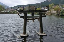
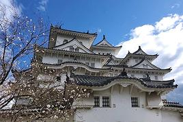
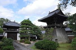
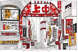
We're a family of five: one dad, one mom, and three kids aged 10, 15, and 18.
Before diving into each stop in more detail, here are a few general thoughts:
We wanted to sample a bit of everything Japan has to offer in terms of landscapes, accommodation, and transport. We were after walks, temples, restaurants, shopping, and some downtime—but no "all-inclusive experiences" or museums for this first visit.
Three medium-sized (60x42x25) canvas suitcases, plus a duffel bag and a few small backpacks. 23 kg in the hold on the way out, 60 kg on the way back. 36 kg of shopping, without even trying. I think this is the maximum suitcase size if you don’t want to stress on the Shinkansen: they fit easily in the overhead racks.
Round-trip with Cathay Pacific, layover in Hong Kong: no need to collect luggage in Hong Kong—we checked it in at departure and picked it up in Tokyo, and the same on the way back (checked in Osaka, picked up at our final destination). This let us explore Hong Kong without worrying about our bags. Food and entertainment were pretty good—meals included a little Häagen-Dazs on each flight, and the entertainment had way more Asian cinema than you’d find on a Western airline, which was a nice way to see how much weight Western culture carries in Asia.
Initial itinerary:
Tokyo (3 nights)
Hakone (2 nights)
Takayama (1 night)
Kanazawa (2 nights)
Kyoto (4 nights)
Osaka (1 night)
Ishigaki (3 nights)
The original plan was to fly directly from Ishigaki to Hong Kong, but due to Typhoon Dolphin, we had to cancel the Ishigaki leg. Cathay didn’t bat an eye about swapping the Ishigaki-HK flight for an Osaka-HK one, even though it was twice as long.
We were a bit too attached to the idea of ending the trip with some beach time and replaced Ishigaki with Shirahama. It was a mistake—we should’ve visited Hiroshima or spent a little more time in Tokyo instead.
278 similar discussions in English
Here’s the itinerary for a ten-day trip through Slovenia and Northern Italy using local transport.
Saturday, May 2: Arrival
Arrived in Ljubljana on a Transavia flight from Paris. I’d spotted a bus connection to the city center, but it’s worth noting there’s no dedicated line—most buses stopping at the airport come from Bled. On a sunny Saturday afternoon, the bus was already packed with people who’d headed to the lake for some fresh air. I ended up taking a shared van, with drivers actively offering transfers to travelers. I paid 12 € for the ride to the train station, then walked 15 minutes to Hotel Celica. It lives up to its description as a former prison turned hotel—close to the city center, clean, with a hearty breakfast. The rooms are basic, with beds 3 meters off the ground, accessible by a wooden ladder. For dinner, I opted for an Indian restaurant.
Sunday, May 3: Urban marathon
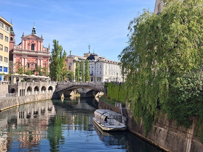
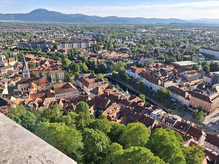
Good news: museums are free on the first Sunday of the month. I started with the National Gallery, then took a stroll through Tivoli Park, enjoying the outdoors. I tried grilling in the park before heading to the Museum of Modern Art and the eclectic National Museum of Slovenia, which was interesting for its architecture. Next up was the castle—you can enter the grounds for free; the only reason to pay is to access the keep for the city views.
Monday, May 4: Bled
I spent the morning exploring Ljubljana’s architecture but was disappointed by the Krakovo district, which guidebooks had hyped up.
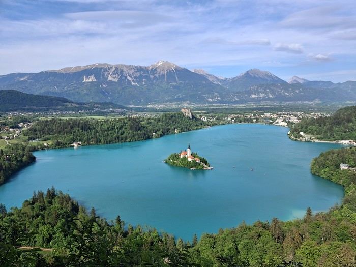
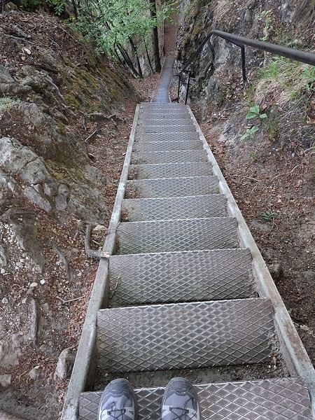
In the afternoon, I took the bus to Bled. The hostel was right at the bus station, and I soon realized I’d be the only guest—the owner was struggling to attract visitors. I walked around the lake and searched for the viewpoint access. It’s a steep climb with a staircase, but worth it.
Tuesday, May 5: Vintgar Gorge
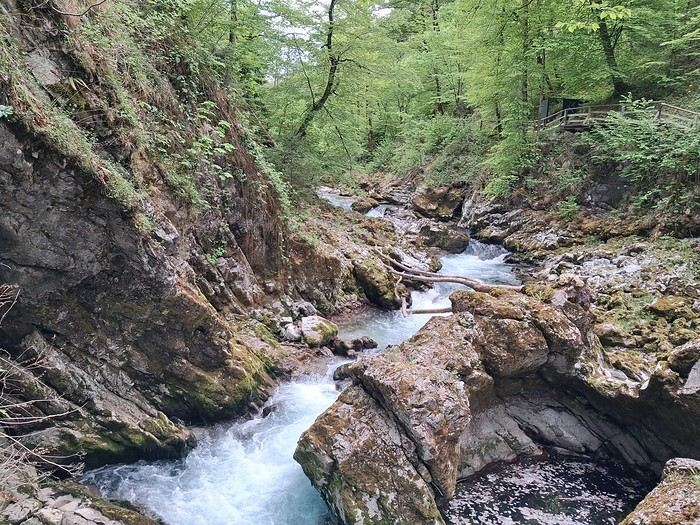
I headed to the gorges early in the morning via a shuttle, then walked back to Bled. It was stunning—it reminded me a bit of the Samaria Gorge I’d visited last year.
The bus took me straight to Stara Fužina near Lake Bohinj, where I stayed in a homestay. I loved it, even though there wasn’t much interaction with the hosts.
The weather was overcast and misty, giving the lake a Scottish vibe.
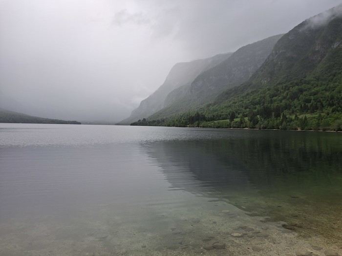
Wednesday, May 6: Bohinj
Rainy day, so I took the bus to Ukanc at the far end of the lake and walked back.
Thursday, May 7: Mostnica Gorge and the auto-train
I set off on foot for the gorges from Stara Fužina, taking a detour up to Planina Uskovnica, a steep and rarely used trail. The views of Triglav and the traditional alpine huts were incredible.
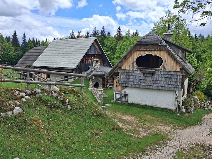
I then took the auto-train to Most na Soči. The passenger section has compartments, and the windows can be opened. The ride through the gorges was breathtaking. I stayed at a family-run guesthouse near the Most na Soči station—authentic and cozy.
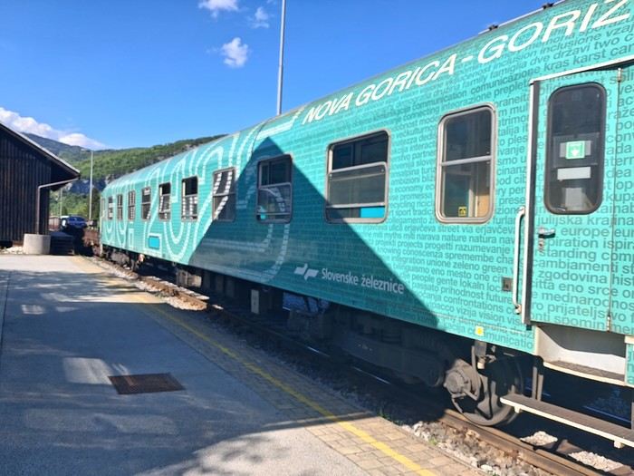
Friday, May 8: Tolmin Gorge and Nova Gorica
I took the bus to Tolmin, then walked 30 minutes to the gorges. The trail is well-maintained but short, so I extended my hike with a scenic loop through the gorges and nearby villages.
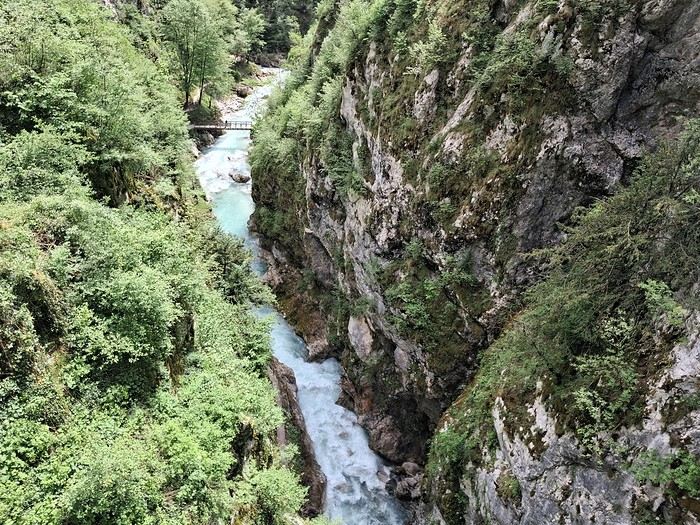
A quick train ride later, I was in Nova Gorica for the night, positioning myself to reach the Adriatic coast the next day. I explored at a fast pace—Villa Raffut on the Slovenian side, then crossed the border to visit Palazzo Attems-Petzenstein and grab an aperitivo in the main square. You could tell I was in Italy just by the vibe. The old border checkpoint is still there.
Saturday, May 9: Piran
Three trains and a bus later, I arrived. The journey was scenic, and it was worth it.
Piran is touristy but manageable. It feels like a mix of Croatia and Italy, with both influences evident. The maritime museum was fascinating, with its detailed ship models. There’s still a local feel—there was even a great blues concert by the harbor that evening.
Sunday, May 10: Piran
I walked to Izola along the coast—a beautiful route with paths, roads, and lakes. It was Sunday, and the tip of the village was lively with families picnicking. I decided to take the bus to Koper. The regional museum was quiet, but the garden was stunning.
Monday, May 11: Trieste
The bus connection from Koper was frequent and easy. Trieste is very open to the sea. I visited the castle and the massive Revoltella Museum—good timing, since it was raining. The collection spans everything from classical to contemporary art.
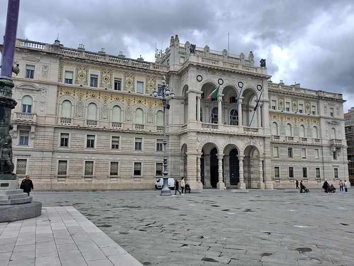
I missed my connection to Stresa later that day, so I had to improvise a night in a dorm near Milan’s train station.
Tuesday, May 12: Stresa
I came mainly for the Borromean Islands. First impressions weren’t great—crowded at the dock and windy. I didn’t like Isola Bella—too many people and too flashy. I much preferred Isola Madre, with its peaceful gardens where you can find solitude. On the way back, I stopped at Isola dei Pescatori after some hesitation, and it was worth it. Finally, I explored Stresa, with its colorful houses and grand palaces.
Wednesday, May 13: Heading to the Jura
I wrapped up my trip by taking the EuroCity train from Milan to Geneva via the Simplon Pass. From there, I headed to my vacation spot, taking the train from Nyon to La Cure (on the border). The rest of the journey was private.
Saturday, May 2: Arrival
Arrived in Ljubljana on a Transavia flight from Paris. I’d spotted a bus connection to the city center, but it’s worth noting there’s no dedicated line—most buses stopping at the airport come from Bled. On a sunny Saturday afternoon, the bus was already packed with people who’d headed to the lake for some fresh air. I ended up taking a shared van, with drivers actively offering transfers to travelers. I paid 12 € for the ride to the train station, then walked 15 minutes to Hotel Celica. It lives up to its description as a former prison turned hotel—close to the city center, clean, with a hearty breakfast. The rooms are basic, with beds 3 meters off the ground, accessible by a wooden ladder. For dinner, I opted for an Indian restaurant.
Sunday, May 3: Urban marathon
Good news: museums are free on the first Sunday of the month. I started with the National Gallery, then took a stroll through Tivoli Park, enjoying the outdoors. I tried grilling in the park before heading to the Museum of Modern Art and the eclectic National Museum of Slovenia, which was interesting for its architecture. Next up was the castle—you can enter the grounds for free; the only reason to pay is to access the keep for the city views.
Monday, May 4: Bled
I spent the morning exploring Ljubljana’s architecture but was disappointed by the Krakovo district, which guidebooks had hyped up.
In the afternoon, I took the bus to Bled. The hostel was right at the bus station, and I soon realized I’d be the only guest—the owner was struggling to attract visitors. I walked around the lake and searched for the viewpoint access. It’s a steep climb with a staircase, but worth it.
Tuesday, May 5: Vintgar Gorge
I headed to the gorges early in the morning via a shuttle, then walked back to Bled. It was stunning—it reminded me a bit of the Samaria Gorge I’d visited last year.
The bus took me straight to Stara Fužina near Lake Bohinj, where I stayed in a homestay. I loved it, even though there wasn’t much interaction with the hosts.
The weather was overcast and misty, giving the lake a Scottish vibe.
Wednesday, May 6: Bohinj
Rainy day, so I took the bus to Ukanc at the far end of the lake and walked back.
Thursday, May 7: Mostnica Gorge and the auto-train
I set off on foot for the gorges from Stara Fužina, taking a detour up to Planina Uskovnica, a steep and rarely used trail. The views of Triglav and the traditional alpine huts were incredible.
I then took the auto-train to Most na Soči. The passenger section has compartments, and the windows can be opened. The ride through the gorges was breathtaking. I stayed at a family-run guesthouse near the Most na Soči station—authentic and cozy.
Friday, May 8: Tolmin Gorge and Nova Gorica
I took the bus to Tolmin, then walked 30 minutes to the gorges. The trail is well-maintained but short, so I extended my hike with a scenic loop through the gorges and nearby villages.
A quick train ride later, I was in Nova Gorica for the night, positioning myself to reach the Adriatic coast the next day. I explored at a fast pace—Villa Raffut on the Slovenian side, then crossed the border to visit Palazzo Attems-Petzenstein and grab an aperitivo in the main square. You could tell I was in Italy just by the vibe. The old border checkpoint is still there.
Saturday, May 9: Piran
Three trains and a bus later, I arrived. The journey was scenic, and it was worth it.
Piran is touristy but manageable. It feels like a mix of Croatia and Italy, with both influences evident. The maritime museum was fascinating, with its detailed ship models. There’s still a local feel—there was even a great blues concert by the harbor that evening.
Sunday, May 10: Piran
I walked to Izola along the coast—a beautiful route with paths, roads, and lakes. It was Sunday, and the tip of the village was lively with families picnicking. I decided to take the bus to Koper. The regional museum was quiet, but the garden was stunning.
Monday, May 11: Trieste
The bus connection from Koper was frequent and easy. Trieste is very open to the sea. I visited the castle and the massive Revoltella Museum—good timing, since it was raining. The collection spans everything from classical to contemporary art.
I missed my connection to Stresa later that day, so I had to improvise a night in a dorm near Milan’s train station.
Tuesday, May 12: Stresa
I came mainly for the Borromean Islands. First impressions weren’t great—crowded at the dock and windy. I didn’t like Isola Bella—too many people and too flashy. I much preferred Isola Madre, with its peaceful gardens where you can find solitude. On the way back, I stopped at Isola dei Pescatori after some hesitation, and it was worth it. Finally, I explored Stresa, with its colorful houses and grand palaces.
Wednesday, May 13: Heading to the Jura
I wrapped up my trip by taking the EuroCity train from Milan to Geneva via the Simplon Pass. From there, I headed to my vacation spot, taking the train from Nyon to La Cure (on the border). The rest of the journey was private.
Is hitchhiking in Thailand a good idea? A bad one? Safe or not?
Instead of sharing my thoughts on the subject, I’ll tell you about my four short hitchhiking "adventures" over 40 years of traveling there. Hopefully, this will help you form your own opinion.
First, a general rule I always follow in Southeast Asia: whether you're a woman or a man, in the city or the countryside, if you're a foreigner—even in a small group—never let yourself get completely isolated once night falls.
Okay, here we go.
My first time:
This happened in the late 80s in Kanchanaburi province, on route 3272/4088, somewhere between the charming Thong Pha Phum and that spot on the Burmese border where a gas pipeline—owned at the time by a major French company—crosses. I don’t remember why or how I ended up on that remote road, but since I love getting lost, it was fine. Except that it was already mid-afternoon, no songthaew had shown up after an hour of waiting, and I wanted to get back to T.P. Phum before dark. So I started walking, keeping an ear out for any approaching engine to flag down (hand flat, palm down, waving as if saying goodbye). Soon after, a slightly upscale car stopped—a high-end Japanese model. Inside was a couple in their thirties. "You guys headin’ to Thong Pha Phum?" "Sure, no problem, my good farang, hop in." I was saved. We drove for 20-30 kilometers, then the guy pulled over: "Come on, let’s grab a drink..." Later, I’d learn we were near the spot where they were spending a short vacation, south of the reservoir stretching from T.P.P. to Sangkhlaburi—a place (that part of the lake) known for its waterfront resorts for couples, families (next stop...), and other Thais out for a good time (I’d stay there myself a weekend a few years later, in a dorm room with about thirty Thai friends). We had a drink. The woman barely sipped hers. We had a second. She didn’t say anything, but I could read in her eyes what she was thinking (no language barrier for that kind of communication). Then he ordered a third. She shot her husband a disapproving, embarrassed look. As for me, aware I was still far from "home" and that night was falling, I started pretending to drink too. You can guess the rest: the guy kept ordering, got drunker and drunker, and his wife didn’t dare scold him in front of me, but the looks she gave him—and her discomfort around the other people in the roadside joint—spoke volumes.
After a (very) long while, the woman couldn’t take it anymore and finally reminded him, I assume, that they still had to take me to T.P.P. But given his state, it was unanimously decided—by both of us—that there was no way he was driving. I felt stuck, especially since I don’t drive. And her? Oh, she could. I helped the guy as best I could, and the joint’s owner, taking pity on me, lent a hand. We got him into the back seat, where he fell asleep almost immediately. It was around 8 PM when, with her husband still snoring in the back, she dropped me off at the entrance of the guesthouse in Thong Pha Phum, near the market square. I thanked her, feeling a pang of sympathy for the moment she’d have to haul her husband from the car to their room. They drove off. I was hungry. At the far end of the market square was a great restaurant with a direct view of the Mae Nam Khwae. I headed that way.
Instead of sharing my thoughts on the subject, I’ll tell you about my four short hitchhiking "adventures" over 40 years of traveling there. Hopefully, this will help you form your own opinion.
First, a general rule I always follow in Southeast Asia: whether you're a woman or a man, in the city or the countryside, if you're a foreigner—even in a small group—never let yourself get completely isolated once night falls.
Okay, here we go.
My first time:
This happened in the late 80s in Kanchanaburi province, on route 3272/4088, somewhere between the charming Thong Pha Phum and that spot on the Burmese border where a gas pipeline—owned at the time by a major French company—crosses. I don’t remember why or how I ended up on that remote road, but since I love getting lost, it was fine. Except that it was already mid-afternoon, no songthaew had shown up after an hour of waiting, and I wanted to get back to T.P. Phum before dark. So I started walking, keeping an ear out for any approaching engine to flag down (hand flat, palm down, waving as if saying goodbye). Soon after, a slightly upscale car stopped—a high-end Japanese model. Inside was a couple in their thirties. "You guys headin’ to Thong Pha Phum?" "Sure, no problem, my good farang, hop in." I was saved. We drove for 20-30 kilometers, then the guy pulled over: "Come on, let’s grab a drink..." Later, I’d learn we were near the spot where they were spending a short vacation, south of the reservoir stretching from T.P.P. to Sangkhlaburi—a place (that part of the lake) known for its waterfront resorts for couples, families (next stop...), and other Thais out for a good time (I’d stay there myself a weekend a few years later, in a dorm room with about thirty Thai friends). We had a drink. The woman barely sipped hers. We had a second. She didn’t say anything, but I could read in her eyes what she was thinking (no language barrier for that kind of communication). Then he ordered a third. She shot her husband a disapproving, embarrassed look. As for me, aware I was still far from "home" and that night was falling, I started pretending to drink too. You can guess the rest: the guy kept ordering, got drunker and drunker, and his wife didn’t dare scold him in front of me, but the looks she gave him—and her discomfort around the other people in the roadside joint—spoke volumes.
After a (very) long while, the woman couldn’t take it anymore and finally reminded him, I assume, that they still had to take me to T.P.P. But given his state, it was unanimously decided—by both of us—that there was no way he was driving. I felt stuck, especially since I don’t drive. And her? Oh, she could. I helped the guy as best I could, and the joint’s owner, taking pity on me, lent a hand. We got him into the back seat, where he fell asleep almost immediately. It was around 8 PM when, with her husband still snoring in the back, she dropped me off at the entrance of the guesthouse in Thong Pha Phum, near the market square. I thanked her, feeling a pang of sympathy for the moment she’d have to haul her husband from the car to their room. They drove off. I was hungry. At the far end of the market square was a great restaurant with a direct view of the Mae Nam Khwae. I headed that way.
Following my first trip from May 1st to 11th, 2025:
-Flight: easyJet Geneva-Olbia 11:50 AM-1:20 PM (306 € for 2) + 102 € for checked baggage (408 € total)
-Flight: easyJet Cagliari-Geneva 12:45 PM-2:25 PM (308 € for 2)
-Car rental: Olbia-Cagliari (rental: 338.31 € + 120 € for one-way drop-off) + 320 € mandatory insurance imposed by Centauro) 778.31 € total
*May 1st: ***OLBIA: arrived at the airport at 3:15 PM: 1-hour delay with EasyJet! 😕 Car rental issue** Big scam with B Rent (hard to find their counter because of poor signage—they demanded an extra 320 €! But after 5.5 hours, Centauro also charged 320 € for insurance!!!) On top of that, we only got the car at 6:30 PM. Due to the delay, we went straight to our accommodation after grocery shopping. -Bandi House via Mastru Giogliu, San Teodoro 0039 338 852 8569 70 € (very nice apartment, spacious, great welcome from Paola but hard to find) -Nearby: San Teodoro: stagno (birds) Lonely Planet p.159
*May 2nd: -Heading to Isola Tavolara: boat from San Paolo. It was a holiday weekend, and all the Sardinians plus tourists were heading to the island. Everyone wanted to visit the cave and all the beaches—so crowded we gave up. Plus, we had to wait for the first departure at 11 AM with a return no earlier than 2 PM, and all boats left at the same time, so everyone ended up at the cave simultaneously! GUIDES: Green Guide p.140 and Lonely Planet p.158 -Capo Coda Cavallo: beautiful spot with a stunning beach (reserve) -EAST COAST: Budoni, Posada, La Caletta (port) with many white sand beaches
*Orosei (Green Guide p.102, Lonely Planet p.201) and Galtelli (lovely medieval village) *Dorgali (Green Guide p.96, Lonely Planet p.205): don’t skip Pasticceria Mulas (exceptional pastries at very reasonable prices) -Agriturismo Nennelle in Loculi: great welcome at this fairly new site—a farm with sheep. Large room with private bathroom and outdoor tables/chairs. Small fridge, kettle, and coffee machine. 54 0039 3495343765 €
***May 3rd:*** -Hike to Gola Su Gorropu: magnificent 4-hour trek (Lonely Planet p.205, Green Guide p.96)
-Arbatax: Rocce Rosse: stunning red porphyry rocks at the end of the port (Green Guide p.87, Lonely Planet p.210) -Aer Sana in Arzana: a remote village with a very narrow, picturesque road (there’s actually a second one). Via Don Bosco No. 12. 68.60 € 0039 347 9601599 Great welcome from Bruna/message—decorated with lots of taste and care. One room with private bathroom and a super well-equipped shared kitchen.
***May 4th:*** -Supramonte National Park and Gulf of Orosei (Green Guide p.98, Lonely Planet p.201) -Arzana-Ussassai-Seui-Sadali-Goldoni -Aritzo: small village on a slope—very friendly locals -Antonio Mura Museum: Sardinian expressionist painter -Ethnographic Museum: quite comprehensive -Spanish Prison "Sa Bovida" (prison under Spanish rule where people were imprisoned for witchcraft) -Antico Restauro: Via Umberto 38, Fonni. Small Sardinian house in the village with little light but tastefully decorated. Warm welcome from Mario Loddo. 65.02 €
*May 5th: Gennargentu Massif and Supramonte -Orgosolo: Lonely Planet p.190, Green Guide p.123 -Nuraghe di Tiscali (Green Guide p.122, Lonely Planet p.207): allow over 1 hour of hiking to reach a slope with a cave (good shoes required) -Arrival in Nuoro: large city. Via Salvatore Manniri 39 (0039 33118617847). French expat living in Sardinia—very large, well-designed apartment on the 5th floor. 73 €
*May 6th: -NUORO (Lonely Planet p.186, Green Guide p.112) .Museum of Sardinian writer Grazia Deledda (1871-1936), Nobel Prize in Literature 1927 .Sardinian Ethnographic Museum -Ulassai: Stazione dell’Arte Maria Lai (1919-2013) (Lonely Planet p.212, Green Guide p.85). Major climbing spot in a charming little village -Jerzu: "La Finestra sulla Volla" Via Umberto I 551 0039 3403754751 72 € apartment with 1 bedroom, 1 bathroom, and 1 kitchen
*May 7th: OGLIASTRA: -Jerzu to Tortolì via Barisardo: quite difficult route through narrow streets in various villages! Return to Porto Corallo, Capo Ferrato (Green Guide p.64) -Hotel in San Vito: "Su Furriadroxiu" Via Lamarmora 35/37 0039 3501041432 61.20 € (Green Guide p.65)
*May 8th: -San Vito -Armungia (Green Guide p.65): small village at 566 m with nuraghe and museum + fresco "Homage to the Sassari Brigade" -Goni: cork oak forests and Nuraghe di Pranu Muteddu (60 aligned menhirs and tombs) (Green Guide p.66, Lonely Planet p.197) -San Vito: restaurant "La Capinera" Via Nazionale 80, 09040: very good -From Villasimius to Costa Rei: Lonely Planet p.65, Green Guide p.60 .Punta Molentis: white sand, rocks, but very touristy -Capo Carbonara: military zone, not much to see -Accommodation in Cagliari: Villa Volta 18, Monserrato 0039 3480640592: 74.70 € Well-equipped studio, city center, quiet
*May 9th: -Visit to Cagliari with underground tunnels Regina at the foot of the citadel (elevator) (Lonely Planet p.48, Green Guide p.32) .Castello, prefecture, San Maria church .Charming and picturesque Villanova district -Barumini (Green Guide p.70, Lonely Planet p.90): Nuraghe di Su Nuraxi, 1500 BC with its tower and fortifications—the largest Sardinian site (UNESCO) Entry: 15 € with mandatory guided tour -Parco della Giara di Gesturi (basaltic plateau): great for hiking Presence of the Sardinian pony: small Sardinian horse -Accommodation in Sanluri: 2 Via Giacomo Mozart 0039 3495343765: 80 €
*May 10th: -Beautiful Isola di San Pietro: ferry from Portovesme to Carloforte (round trip) 33.50 € with car (Green Guide p.318, Lonely Planet p.81) 15 km long and 15 km wide .Carloforte: peaceful little town with its palazzi and colorful houses .Tonnara della Punta: former tuna cannery—can be visited by reservation .Capo Sandalo: with its lighthouse (nice little trail to hike) .La Caletta: beaches and cliffs .Punta delle Colonne: 2 trachyte formations—very pretty
-TOTAL: 2432 € for 2 -1400 km by car: 160 € for gas (between 1.60 and 1.76 €/L) -Food, including 2 restaurants: 265 € -Accommodation via Booking: 685 € -Flights: 614 € for 2 -Car: 708.50 € + one-way drop-off: 120 € + mandatory insurance of 320 € (not planned!)
*May 1st: ***OLBIA: arrived at the airport at 3:15 PM: 1-hour delay with EasyJet! 😕 Car rental issue** Big scam with B Rent (hard to find their counter because of poor signage—they demanded an extra 320 €! But after 5.5 hours, Centauro also charged 320 € for insurance!!!) On top of that, we only got the car at 6:30 PM. Due to the delay, we went straight to our accommodation after grocery shopping. -Bandi House via Mastru Giogliu, San Teodoro 0039 338 852 8569 70 € (very nice apartment, spacious, great welcome from Paola but hard to find) -Nearby: San Teodoro: stagno (birds) Lonely Planet p.159
*May 2nd: -Heading to Isola Tavolara: boat from San Paolo. It was a holiday weekend, and all the Sardinians plus tourists were heading to the island. Everyone wanted to visit the cave and all the beaches—so crowded we gave up. Plus, we had to wait for the first departure at 11 AM with a return no earlier than 2 PM, and all boats left at the same time, so everyone ended up at the cave simultaneously! GUIDES: Green Guide p.140 and Lonely Planet p.158 -Capo Coda Cavallo: beautiful spot with a stunning beach (reserve) -EAST COAST: Budoni, Posada, La Caletta (port) with many white sand beaches
*Orosei (Green Guide p.102, Lonely Planet p.201) and Galtelli (lovely medieval village) *Dorgali (Green Guide p.96, Lonely Planet p.205): don’t skip Pasticceria Mulas (exceptional pastries at very reasonable prices) -Agriturismo Nennelle in Loculi: great welcome at this fairly new site—a farm with sheep. Large room with private bathroom and outdoor tables/chairs. Small fridge, kettle, and coffee machine. 54 0039 3495343765 €
***May 3rd:*** -Hike to Gola Su Gorropu: magnificent 4-hour trek (Lonely Planet p.205, Green Guide p.96)
-Arbatax: Rocce Rosse: stunning red porphyry rocks at the end of the port (Green Guide p.87, Lonely Planet p.210) -Aer Sana in Arzana: a remote village with a very narrow, picturesque road (there’s actually a second one). Via Don Bosco No. 12. 68.60 € 0039 347 9601599 Great welcome from Bruna/message—decorated with lots of taste and care. One room with private bathroom and a super well-equipped shared kitchen.
***May 4th:*** -Supramonte National Park and Gulf of Orosei (Green Guide p.98, Lonely Planet p.201) -Arzana-Ussassai-Seui-Sadali-Goldoni -Aritzo: small village on a slope—very friendly locals -Antonio Mura Museum: Sardinian expressionist painter -Ethnographic Museum: quite comprehensive -Spanish Prison "Sa Bovida" (prison under Spanish rule where people were imprisoned for witchcraft) -Antico Restauro: Via Umberto 38, Fonni. Small Sardinian house in the village with little light but tastefully decorated. Warm welcome from Mario Loddo. 65.02 €
*May 5th: Gennargentu Massif and Supramonte -Orgosolo: Lonely Planet p.190, Green Guide p.123 -Nuraghe di Tiscali (Green Guide p.122, Lonely Planet p.207): allow over 1 hour of hiking to reach a slope with a cave (good shoes required) -Arrival in Nuoro: large city. Via Salvatore Manniri 39 (0039 33118617847). French expat living in Sardinia—very large, well-designed apartment on the 5th floor. 73 €
*May 6th: -NUORO (Lonely Planet p.186, Green Guide p.112) .Museum of Sardinian writer Grazia Deledda (1871-1936), Nobel Prize in Literature 1927 .Sardinian Ethnographic Museum -Ulassai: Stazione dell’Arte Maria Lai (1919-2013) (Lonely Planet p.212, Green Guide p.85). Major climbing spot in a charming little village -Jerzu: "La Finestra sulla Volla" Via Umberto I 551 0039 3403754751 72 € apartment with 1 bedroom, 1 bathroom, and 1 kitchen
*May 7th: OGLIASTRA: -Jerzu to Tortolì via Barisardo: quite difficult route through narrow streets in various villages! Return to Porto Corallo, Capo Ferrato (Green Guide p.64) -Hotel in San Vito: "Su Furriadroxiu" Via Lamarmora 35/37 0039 3501041432 61.20 € (Green Guide p.65)
*May 8th: -San Vito -Armungia (Green Guide p.65): small village at 566 m with nuraghe and museum + fresco "Homage to the Sassari Brigade" -Goni: cork oak forests and Nuraghe di Pranu Muteddu (60 aligned menhirs and tombs) (Green Guide p.66, Lonely Planet p.197) -San Vito: restaurant "La Capinera" Via Nazionale 80, 09040: very good -From Villasimius to Costa Rei: Lonely Planet p.65, Green Guide p.60 .Punta Molentis: white sand, rocks, but very touristy -Capo Carbonara: military zone, not much to see -Accommodation in Cagliari: Villa Volta 18, Monserrato 0039 3480640592: 74.70 € Well-equipped studio, city center, quiet
*May 9th: -Visit to Cagliari with underground tunnels Regina at the foot of the citadel (elevator) (Lonely Planet p.48, Green Guide p.32) .Castello, prefecture, San Maria church .Charming and picturesque Villanova district -Barumini (Green Guide p.70, Lonely Planet p.90): Nuraghe di Su Nuraxi, 1500 BC with its tower and fortifications—the largest Sardinian site (UNESCO) Entry: 15 € with mandatory guided tour -Parco della Giara di Gesturi (basaltic plateau): great for hiking Presence of the Sardinian pony: small Sardinian horse -Accommodation in Sanluri: 2 Via Giacomo Mozart 0039 3495343765: 80 €
*May 10th: -Beautiful Isola di San Pietro: ferry from Portovesme to Carloforte (round trip) 33.50 € with car (Green Guide p.318, Lonely Planet p.81) 15 km long and 15 km wide .Carloforte: peaceful little town with its palazzi and colorful houses .Tonnara della Punta: former tuna cannery—can be visited by reservation .Capo Sandalo: with its lighthouse (nice little trail to hike) .La Caletta: beaches and cliffs .Punta delle Colonne: 2 trachyte formations—very pretty
-TOTAL: 2432 € for 2 -1400 km by car: 160 € for gas (between 1.60 and 1.76 €/L) -Food, including 2 restaurants: 265 € -Accommodation via Booking: 685 € -Flights: 614 € for 2 -Car: 708.50 € + one-way drop-off: 120 € + mandatory insurance of 320 € (not planned!)
Our trip lasted a month, from March 10 to April 10, 2024, and was done aboard our Land Rover Defender 110. For those interested, our 4x4 is equipped with mountain-approved 3PMFSF all-terrain tires (non-studded), a removable electric winch that can be attached to either the front or rear of the vehicle, two sand recovery boards, and we bring two pairs of snow chains. We sleep in our Land Rover, which is equipped with a diesel-powered independent heater, a small fridge, and has a layout that allows the dinette to be converted into a bed.
Starting from the Paris region, we crossed Belgium and Germany, took the ferry from Travemünde in northern Germany to Helsinki, followed the Russian border up to northern Finland, then headed into Norway all the way to the North Cape before returning via Norway, taking the ferry from Larvik in Norway to Hirtshals in Denmark, then passing through Germany and Belgium on our way back to France.
Tonight, March 10, 2024, we’ll be sleeping at our daughter’s place in the North.
Tuesday, March 11, we’ll cross Belgium and then enter Germany, where we’ll camp in Bremen.
Wednesday, March 12, we’ll have a quick visit to Bremen in the morning. We had planned to visit Lübeck, but some electrical issues with the car delayed us, so we head straight to the German port of Travemünde, where we’re set to embark at 11:30 PM to cross the Baltic Sea and arrive in Helsinki after 31 hours of sailing (one-way cabin ticket cost: 850 €—quite expensive since we booked last minute).
On the ferry, there are mostly semi-trucks and only a few campervans and passenger cars. The boat is quiet, and the Baltic Sea is calm.
About two hours before arriving in Helsinki, we hear noise along the hull. Surprise—looking out the porthole, we realize we’re sailing on frozen sea ice!
Thursday, March 14, we arrive at the port of Helsinki at 9:30 AM. Disembarking takes a while. As soon as we’re out, we head straight to Rastila Camping (cost: 27 €), about ten kilometers east of Helsinki. Then we go to a Land Rover garage to fix our headlight switch, which stopped working (a real hassle in Finland since you have to drive with low beams on at all times).
After the repair, we visit the stunning Temppeliaukio Church, which is built underground.
On our way back to the campsite, we stop at the supermarket for supplies. Prices are similar to France, except for imported products.
We settle into our snowy campsite spot.
Starting from the Paris region, we crossed Belgium and Germany, took the ferry from Travemünde in northern Germany to Helsinki, followed the Russian border up to northern Finland, then headed into Norway all the way to the North Cape before returning via Norway, taking the ferry from Larvik in Norway to Hirtshals in Denmark, then passing through Germany and Belgium on our way back to France.
Tonight, March 10, 2024, we’ll be sleeping at our daughter’s place in the North.
Tuesday, March 11, we’ll cross Belgium and then enter Germany, where we’ll camp in Bremen.
Wednesday, March 12, we’ll have a quick visit to Bremen in the morning. We had planned to visit Lübeck, but some electrical issues with the car delayed us, so we head straight to the German port of Travemünde, where we’re set to embark at 11:30 PM to cross the Baltic Sea and arrive in Helsinki after 31 hours of sailing (one-way cabin ticket cost: 850 €—quite expensive since we booked last minute).
On the ferry, there are mostly semi-trucks and only a few campervans and passenger cars. The boat is quiet, and the Baltic Sea is calm.
About two hours before arriving in Helsinki, we hear noise along the hull. Surprise—looking out the porthole, we realize we’re sailing on frozen sea ice!
Thursday, March 14, we arrive at the port of Helsinki at 9:30 AM. Disembarking takes a while. As soon as we’re out, we head straight to Rastila Camping (cost: 27 €), about ten kilometers east of Helsinki. Then we go to a Land Rover garage to fix our headlight switch, which stopped working (a real hassle in Finland since you have to drive with low beams on at all times).
After the repair, we visit the stunning Temppeliaukio Church, which is built underground.
On our way back to the campsite, we stop at the supermarket for supplies. Prices are similar to France, except for imported products.
We settle into our snowy campsite spot.
A little recap of my 28-day solo trip from mid-November to mid-December 2024.
CDG to Santiago with Air France, first night near the airport at City Express by Marriott Airport. No shuttle as planned, but I expected it, so on the advice of a kind Chilean, I took Trans Vip at the airport counter. It was great—I’ll download the app—easy, cheap, and on time. The hotel arranged the return trip to the airport the next morning for my flight to Easter Island. I booked my flight with Latam via Booking, as well as my accommodation: Hare o Koro (formerly Vai Kapua, French spoken). Warm welcome with a flower lei and a quick city tour with Marieta and her husband. The place was clean, well-located, and included breakfast. All the tours were done with the family for a very reasonable price (personalized service with fun anecdotes!!). They even gave me souvenirs for the trip back—a great place to recommend! 🙂.
Back to Santiago for a night at Quinta by Wyndham. Again, no shuttle, the room was very comfortable, but no hot water or breakfast due to an early departure. The airport shuttle was fine, but I won’t stay here again. Off to Ushuaia with Aerolíneas Argentinas—I booked the flight directly on their site with a longer layover due to a plane change (tip from a fellow traveler). Took a taxi to Isla Bella, which included lunch. The place was clean, heated, and a nice surprise—Monica speaks French! It’s 15 minutes from the center, but the way back is a steep climb. I booked 3 excursions with the agency Brasileiros em—great experience! Next door, there’s a clothing store where I rented waterproof shoes for the Laguna Esmeralda trek, and I’m glad I did!! After 4 nights, back to Santiago for 1 night at Happy Hostel (breakfast included).
For the experience, I took the Bus Ciktur to Calama—a 22h30 semi-cama ride with a toilet, movies, and TV in the evening, then a 1h30 bus to San Pedro de Atacama. Stayed at Hotel Sonchek, well-located, no breakfast but a shared kitchen with coffee and tea available. Moïssa speaks French and recommended the agency Gato Andino for my excursions—great choice! I ended with the Geysers del Tatio without taking altitude meds, just coca leaf tea! Spent 4 nights there, then back to Santiago with Sky Airlines. Returned to Happy Hostel since it’s well-located in the historic center.
Took the Turistik bus for 2 days (48 €), including the teleferico for Cerro San Cristóbal (the funicular wasn’t working). Valparaíso and Viña del Mar with the same agency—Valparaíso is stunning, but the guide wasn’t great. SKY COSTANERA had an impressive view (18 €). Near the hotel in the Brazil neighborhood, you can eat local and cheap at Foxtim Burger.
All in all, great encounters—the Chileans are friendly and helpful!!!!
Back to Santiago for a night at Quinta by Wyndham. Again, no shuttle, the room was very comfortable, but no hot water or breakfast due to an early departure. The airport shuttle was fine, but I won’t stay here again. Off to Ushuaia with Aerolíneas Argentinas—I booked the flight directly on their site with a longer layover due to a plane change (tip from a fellow traveler). Took a taxi to Isla Bella, which included lunch. The place was clean, heated, and a nice surprise—Monica speaks French! It’s 15 minutes from the center, but the way back is a steep climb. I booked 3 excursions with the agency Brasileiros em—great experience! Next door, there’s a clothing store where I rented waterproof shoes for the Laguna Esmeralda trek, and I’m glad I did!! After 4 nights, back to Santiago for 1 night at Happy Hostel (breakfast included).
For the experience, I took the Bus Ciktur to Calama—a 22h30 semi-cama ride with a toilet, movies, and TV in the evening, then a 1h30 bus to San Pedro de Atacama. Stayed at Hotel Sonchek, well-located, no breakfast but a shared kitchen with coffee and tea available. Moïssa speaks French and recommended the agency Gato Andino for my excursions—great choice! I ended with the Geysers del Tatio without taking altitude meds, just coca leaf tea! Spent 4 nights there, then back to Santiago with Sky Airlines. Returned to Happy Hostel since it’s well-located in the historic center.
Took the Turistik bus for 2 days (48 €), including the teleferico for Cerro San Cristóbal (the funicular wasn’t working). Valparaíso and Viña del Mar with the same agency—Valparaíso is stunning, but the guide wasn’t great. SKY COSTANERA had an impressive view (18 €). Near the hotel in the Brazil neighborhood, you can eat local and cheap at Foxtim Burger.
All in all, great encounters—the Chileans are friendly and helpful!!!!
From Buffalo to New York City, the Empire State Trail is a 900 km route specifically designed for biking, with 75% on dedicated bike paths.
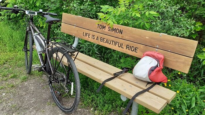
A special train with bike spaces runs almost the entire route. First along the Erie Canal to Albany, then through the Hudson Valley all the way to the tip of Manhattan. This lets you skip sections and also return to your starting point without having to take a flight. Just be aware that bike spaces need to be reserved and can fill up during peak times. In June, no problem though.
This aspect really appealed to me, since my last trip had kinda put me off biking in the US. But here, 75% on dedicated paths, plus that legendary finish in NYC with your bike—I couldn’t resist celebrating my 70th birthday this way.
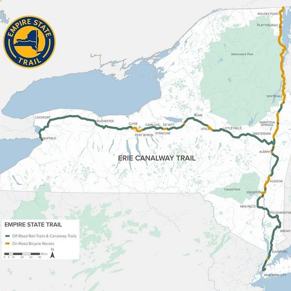 https://empiretrail.ny.gov/map
Two branches to reach NYC: from Buffalo (mostly on dedicated paths) or from Montreal (mostly on roads)
The route was developed in just three years. While it’s popular with cyclists on certain stretches near cities, those who bike the whole thing are still pretty rare.
It’s true that the scenery isn’t exactly breathtaking, and some sections—especially along the Erie Canal—can feel a bit tedious, though they’re very easy since there’s no elevation.
The trail starts in Buffalo, but since my bus from Toronto goes straight to Niagara, I’ll be starting at the falls instead. Plus, that’s where the direct train to NYC departs from (and arrives at).
A special train with bike spaces runs almost the entire route. First along the Erie Canal to Albany, then through the Hudson Valley all the way to the tip of Manhattan. This lets you skip sections and also return to your starting point without having to take a flight. Just be aware that bike spaces need to be reserved and can fill up during peak times. In June, no problem though.
This aspect really appealed to me, since my last trip had kinda put me off biking in the US. But here, 75% on dedicated paths, plus that legendary finish in NYC with your bike—I couldn’t resist celebrating my 70th birthday this way.
https://empiretrail.ny.gov/map
Two branches to reach NYC: from Buffalo (mostly on dedicated paths) or from Montreal (mostly on roads)
The route was developed in just three years. While it’s popular with cyclists on certain stretches near cities, those who bike the whole thing are still pretty rare.
It’s true that the scenery isn’t exactly breathtaking, and some sections—especially along the Erie Canal—can feel a bit tedious, though they’re very easy since there’s no elevation.The trail starts in Buffalo, but since my bus from Toronto goes straight to Niagara, I’ll be starting at the falls instead. Plus, that’s where the direct train to NYC departs from (and arrives at).
Off to Southern Africa again! This time, the trip wasn’t just about wildlife—it was also about the local cultures and the breathtaking landscapes Mother Nature has to offer. It was an emotional rollercoaster in every way, as you’ll see.
We visited two countries: Zambia, known for its reserves, and Malawi, which is less well-known but absolutely worth a visit. Our flight landed in Lilongwe, Malawi’s capital, where our vehicle was waiting—though with a 3-hour delay. It was a 4x4 without the rooftop tent this time, since we stayed in lodges (prices are very reasonable in Malawi). Just a heads-up: don’t exchange money at the airport or banks—the official rate was 1,750 Malawian kwacha to $1. On the black market, the rate was between 3,000 and 3,500 kwacha, making the cost of living much cheaper.
With that out of the way, our first stop was South Luangwa National Park in Zambia. The first hiccup came at the Malawi-Zambia border: we were missing a document the rental company had forgotten. After some back-and-forth, they sent it via WhatsApp ($20 to get it validated by the police). But things got worse—the car’s chassis number was off by one digit from the registered one. I thought our trip was over before it even started! After what felt like forever, we got through with a "tip" of $200. Total border crossing time: 3 hours, costing nearly $400. We arrived in South Luangwa after dark.
Thankfully, the next day made up for it with an incredible day in the park (check out the photos).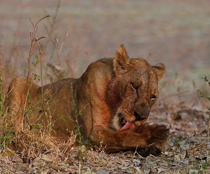

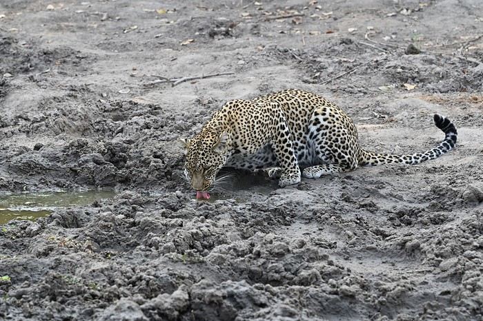
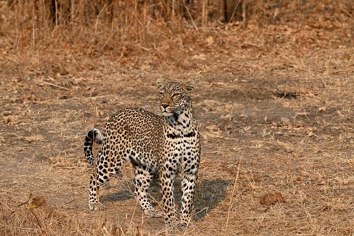
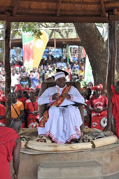
We spent two full days in South Luangwa before heading to Katete for the Kulamba ceremony. Kulamba is an annual event held at the end of August, celebrating the Chewa people, who live across Zambia, Malawi, and Mozambique. The Chewa king attends, and representatives from neighboring nations bring offerings. Thousands gather for dances, speeches, and a massive market. There are few tourists, making it a truly authentic experience.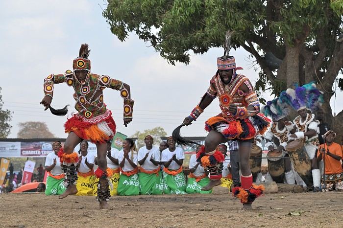
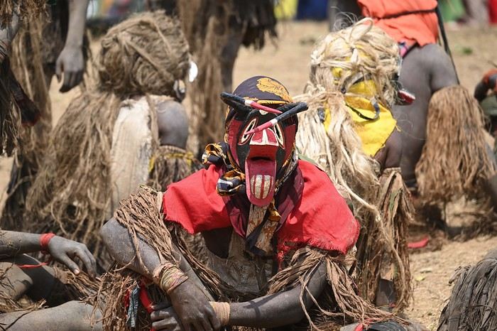
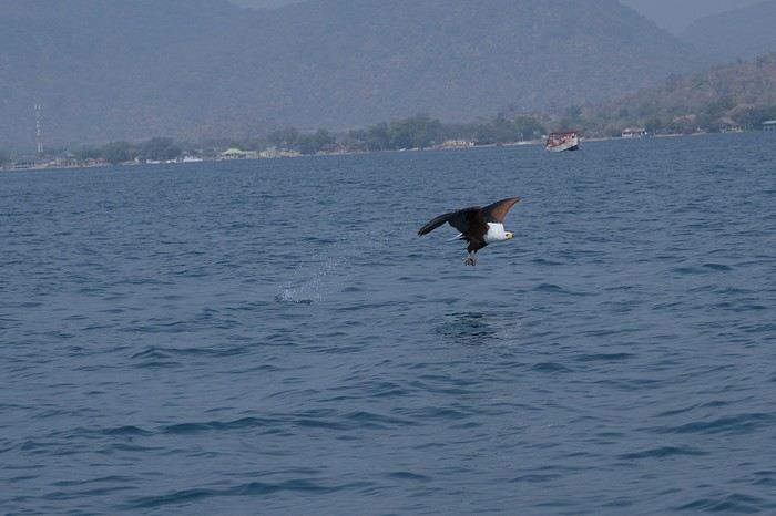
After a few days in Zambia, we returned to Malawi (the border crossing this time was smooth—just 45 minutes). Next stop: Lake Malawi. Lake Malawi covers over 20% of the country and stretches 580 km. It’s home to a family of fish called cichlids, some of which are endemic to the lake. I recommend taking a day trip from Cape Maclear for snorkeling and to watch the fishing eagles swoop down to catch fish.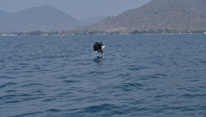
We hit the road again to visit Liwonde Reserve, where we had a few surprises. The lodge was on the other side of the river that borders the park, and the elephants didn’t seem to care. On the way from reception to our rooms, elephants blocked our path, and one even charged just before the stairs leading to our treehouse-style rooms.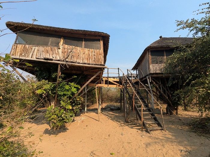
To top it off, monkeys ransacked our rooms, tearing through plastic bags for food. A mixed experience, but no real harm done. Next up: the mountains, specifically the Mulanje Massif. This is where Malawi’s tea is grown, and it’s also a great spot for day hikes or multi-day treks. The scenery is stunning, though sometimes the mist rolls in and hides it. After the mountains, we visited another reserve: Majete. The park is growing and now has more wildlife. We saw lions and even caught a fleeting glimpse of a leopard. And of course, the elephants got involved again—this time giving us a real scare. During the morning game drive with a guide, we stopped to watch a herd of elephants feeding. Everything was fine until, for some reason, a female got spooked—probably for her calf—and positioned herself in front of us on the track. After a few minutes, we thought the elephants would move on, but then a young one started provoking us. The problem? We had females and calves in front of us, but also two large adult males—one behind us and one to the side.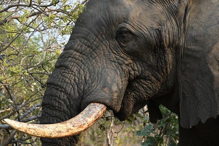 We were trapped, and even our guide looked nervous. After what felt like an eternity (though it was only a few minutes), the herd finally moved on, freeing the track. That afternoon, we did a self-drive safari and—you guessed it—we had zero interest in running into elephants again.
The next day, we headed back to Lilongwe for our flight home. It was a fantastic, varied trip with some intense moments (sometimes *too* intense). Malawi offers amazing opportunities for those who want more than just wildlife reserves.
We visited two countries: Zambia, known for its reserves, and Malawi, which is less well-known but absolutely worth a visit. Our flight landed in Lilongwe, Malawi’s capital, where our vehicle was waiting—though with a 3-hour delay. It was a 4x4 without the rooftop tent this time, since we stayed in lodges (prices are very reasonable in Malawi). Just a heads-up: don’t exchange money at the airport or banks—the official rate was 1,750 Malawian kwacha to $1. On the black market, the rate was between 3,000 and 3,500 kwacha, making the cost of living much cheaper.
With that out of the way, our first stop was South Luangwa National Park in Zambia. The first hiccup came at the Malawi-Zambia border: we were missing a document the rental company had forgotten. After some back-and-forth, they sent it via WhatsApp ($20 to get it validated by the police). But things got worse—the car’s chassis number was off by one digit from the registered one. I thought our trip was over before it even started! After what felt like forever, we got through with a "tip" of $200. Total border crossing time: 3 hours, costing nearly $400. We arrived in South Luangwa after dark.
Thankfully, the next day made up for it with an incredible day in the park (check out the photos).
We spent two full days in South Luangwa before heading to Katete for the Kulamba ceremony. Kulamba is an annual event held at the end of August, celebrating the Chewa people, who live across Zambia, Malawi, and Mozambique. The Chewa king attends, and representatives from neighboring nations bring offerings. Thousands gather for dances, speeches, and a massive market. There are few tourists, making it a truly authentic experience.
After a few days in Zambia, we returned to Malawi (the border crossing this time was smooth—just 45 minutes). Next stop: Lake Malawi. Lake Malawi covers over 20% of the country and stretches 580 km. It’s home to a family of fish called cichlids, some of which are endemic to the lake. I recommend taking a day trip from Cape Maclear for snorkeling and to watch the fishing eagles swoop down to catch fish.
We hit the road again to visit Liwonde Reserve, where we had a few surprises. The lodge was on the other side of the river that borders the park, and the elephants didn’t seem to care. On the way from reception to our rooms, elephants blocked our path, and one even charged just before the stairs leading to our treehouse-style rooms.
To top it off, monkeys ransacked our rooms, tearing through plastic bags for food. A mixed experience, but no real harm done. Next up: the mountains, specifically the Mulanje Massif. This is where Malawi’s tea is grown, and it’s also a great spot for day hikes or multi-day treks. The scenery is stunning, though sometimes the mist rolls in and hides it. After the mountains, we visited another reserve: Majete. The park is growing and now has more wildlife. We saw lions and even caught a fleeting glimpse of a leopard. And of course, the elephants got involved again—this time giving us a real scare. During the morning game drive with a guide, we stopped to watch a herd of elephants feeding. Everything was fine until, for some reason, a female got spooked—probably for her calf—and positioned herself in front of us on the track. After a few minutes, we thought the elephants would move on, but then a young one started provoking us. The problem? We had females and calves in front of us, but also two large adult males—one behind us and one to the side.
We were trapped, and even our guide looked nervous. After what felt like an eternity (though it was only a few minutes), the herd finally moved on, freeing the track. That afternoon, we did a self-drive safari and—you guessed it—we had zero interest in running into elephants again.
The next day, we headed back to Lilongwe for our flight home. It was a fantastic, varied trip with some intense moments (sometimes *too* intense). Malawi offers amazing opportunities for those who want more than just wildlife reserves.After exploring Dawson City, the final stop on our incredible road trip to the Yukon (see travel journal), it was time to head back to Quebec.
Instead of returning directly, we took advantage of this cross-country drive to make several stops in British Columbia and Alberta.
This part of the trip allowed us to discover some of the most beautiful attractions in Western Canada, from breathtaking landscapes to iconic natural sites that are must-sees in Canada.
Between majestic mountains, turquoise lakes, and jaw-dropping panoramas, every stop added a memorable touch to this already exceptional adventure.
A wonderful way to wrap up this journey across Canada while fully enjoying the richness and diversity of its vast landscapes.
In the upcoming posts, you’ll discover the highlights that marked our journey through Western Canada.
I invite you to watch the associated videos to fully experience the atmosphere, landscapes, and attractions we were lucky enough to explore.
To navigate to a specific post, here are the appropriate links:
Adventure on the Alaska Highway: Bald Eagles, Bison & Moose Adventure on the Alaska Highway: Bison, Caribou & Bears Yellowhead Highway (Alberta): Roche Miette, Jasper Lake & Emerald Pond Maligne Lake Road (Jasper) | Moose and Elk Exploring Mount Robson Provincial Park (BC) Must-Sees on the Icefields Parkway - Alberta David Thompson Highway11 (AB): A Stunning Scenic Route What to See in Yoho National Park (BC) Johnston Canyon: Hike to the Lower & Upper Falls Iconic Sites of East Kootenay, BC Lundbreck Falls - A Spectacular Waterfall in Southern Alberta Trails of Red Rock Canyon & Blakiston Falls - Waterton Waterton Village Under the Snow - A Unique Place Writing-on-Stone: A Park Famous for Its Hoodoos Red Rock Coulee Natural Area Alberta – A Supernatural Landscape Dinosaur Provincial Park Alberta - Mysterious Badlands Drumheller: Dinos, Hoodoos & Badlands Interpretive Trail Hike at Horsethief Canyon | Drumheller Badlands Red Deer: Public Art & Murals Downtown Calgary | Public Art, Skyline & Iconic Spots Medicine Hat | Public Art & Iconic Spots
Instead of returning directly, we took advantage of this cross-country drive to make several stops in British Columbia and Alberta.
This part of the trip allowed us to discover some of the most beautiful attractions in Western Canada, from breathtaking landscapes to iconic natural sites that are must-sees in Canada.
Between majestic mountains, turquoise lakes, and jaw-dropping panoramas, every stop added a memorable touch to this already exceptional adventure.
A wonderful way to wrap up this journey across Canada while fully enjoying the richness and diversity of its vast landscapes.
In the upcoming posts, you’ll discover the highlights that marked our journey through Western Canada.
I invite you to watch the associated videos to fully experience the atmosphere, landscapes, and attractions we were lucky enough to explore.
To navigate to a specific post, here are the appropriate links:
Adventure on the Alaska Highway: Bald Eagles, Bison & Moose Adventure on the Alaska Highway: Bison, Caribou & Bears Yellowhead Highway (Alberta): Roche Miette, Jasper Lake & Emerald Pond Maligne Lake Road (Jasper) | Moose and Elk Exploring Mount Robson Provincial Park (BC) Must-Sees on the Icefields Parkway - Alberta David Thompson Highway11 (AB): A Stunning Scenic Route What to See in Yoho National Park (BC) Johnston Canyon: Hike to the Lower & Upper Falls Iconic Sites of East Kootenay, BC Lundbreck Falls - A Spectacular Waterfall in Southern Alberta Trails of Red Rock Canyon & Blakiston Falls - Waterton Waterton Village Under the Snow - A Unique Place Writing-on-Stone: A Park Famous for Its Hoodoos Red Rock Coulee Natural Area Alberta – A Supernatural Landscape Dinosaur Provincial Park Alberta - Mysterious Badlands Drumheller: Dinos, Hoodoos & Badlands Interpretive Trail Hike at Horsethief Canyon | Drumheller Badlands Red Deer: Public Art & Murals Downtown Calgary | Public Art, Skyline & Iconic Spots Medicine Hat | Public Art & Iconic Spots
It’s an understatement to say that Japan is a world apart. All around me, people exclaim: "How lucky you are to be able to go there! I’ve always dreamed of visiting, of finding myself in that culture blending tradition and technology!" Yes, they’re right. Until the moment their dreams become reality and things appear as they truly are, without the filter of fantasized preconceptions. Because in the collective unconscious, Japan indeed seems like a civilization—if not neutral—at least stripped of any social maturation. As if it had emerged all at once from its canonical ages, offering only the best of its traditions, and as if those traditions were undoubtedly the foundation of its extraordinary discipline. Yet, as always, the truth is far more complex. Modern Japan is likely shaped by its millennia-old traditions. But that Japan is also the result of its own uncertainties and contradictions. I’ve always been wary. I’ve never understood why the cleaning women on the platform bow when the train arrives. At some point, too much discipline, too much deference—it makes you smile, it raises questions.
Finally, thanks to F., a dream is coming true! Not the dream of going to Japan—a country I’ve visited more than any other, except for Réunion and the UK—but the dream of completing the fastest round-the-world trip of my career. Indeed, due to the restrictions imposed by the Russians*, the plane flies over the Caucasus and China on the way there; on the return, it gracefully heads toward the Arctic after skirting the Aleutian Islands, Alaska, and Greenland. So, in nearly 26 hours of flight, I complete my 6th round-the-world trip. A round-the-world trip with just one stopover. Or two, if you count our impromptu detour to Okinawa.
(* In response to Western sanctions, Russia closed its airspace to Western airlines on February 28, 2022, except for Air Serbia, Turkish Airlines, Pegasus, and Belavia. This decision adds 2 to 3 hours to flight times and, incidentally, increases operating costs.)
The empire of noise. The empire that dazzles. In Japan, the auditory and visual space is constantly fed. No respite. You have to be strong. Navigating public transport feels like playing the most advanced video game: moving between language barriers and a different organization, the hero tries to ignore the numerous visual and auditory distractions. Mostly auditory, though. Because in Japan, there’s a culture of noise that has undoubtedly inspired our national railways. Everything must be announced. So, here and there, all along the route, we find agents whose sole role is to endlessly repeat safety messages through megaphones more or less suited to the situation. The result is a constant murmur, a kind of tinnitus, a subtle but incessant buzz that fades only at bedtime and returns with a vengeance at first light, when we descend back into the supposedly sterile depths of Osaka’s subway. "To go right, please turn right, kudasaï. When descending the stairs, please mind the steps, kudasaï. To go straight, please take the left corridor, kudasaï." That *kudasaï* ("please" in Japanese), I assure you, has permanently lodged itself in my auditory cells.
Screens are no exception; the brain is constantly stimulated. But paradoxically, passengers massively retreat into their own worlds via their screens. Literally glued to their phones, earbuds firmly in place, people escape into the virtual aisles of a furniture store, a game, a movie... In the train cars, raised voices are rare. The field is clear for announcements and other jingles. Each stop is announced by a little tune unique to each station. Simply incredible.
If we usually judge a country by the welcome its inhabitants offer, in Japan, we’re left wanting. Indeed, the Lost in Translation* spirit doesn’t just apply to verbal exchanges—it applies to everything, especially non-verbal communication. In Japan, me, the slightly North African Corsican, I’m at a loss. I speak loudly, I gesture, in front of a hotel concierge just as lost. Each for our own reasons. Yes, he speaks some English, but we can’t seem to connect. It’s a losing battle trying to find a bit of compassion from a local who’s far from familiar with Western concerns. I try to buy tickets for the World Expo? I run into a systematization as rigid as it is abrupt, which the concierge can’t seem to navigate. While we might still have a shred of common sense, here in Japan, everything is digitized. Soon, no one will be surprised that a QR code becomes essential just to go to the bathroom.
(* Film by Sofia Coppola, released in 2003, which explores isolation, unease, Japanese culture, and language through the experiences of two protagonists.)
In the end, we get that ticket for the Expo. After providing personal information on yet another account created for the occasion, we buy electronic tickets—a QR code, then—to regulate the comings and goings, the souls and aspirations of all these wandering beings scattered across the globe. And it’s probably for the best... Because we’ll be tens of thousands of visitors—100,000 to 150,000 per day—walking the aisles of this enormous improvised amusement park, a kind of delirious superstructure surrounded by the Grand Ring, the largest wooden construction in the world. Inside the park, the pavilions, flagship vessels of their respective countries, compete in ingenuity, proportionate to their GDP, to attract visitors. But you have to wait up to two hours to visit the most popular ones! Fortunately, about a hundred countries can be explored without waiting in shared, more spacious areas. What will I remember from this adventure? The beauty of that wooden structure, despite any environmental or financial considerations—200M € for barely renewable elements; a certain poetry, even magic, in the expression of this event—conversing with Juliette Petit, the splendid representative of Vanuatu, had something indescribable; a close-up experience of Japanese discipline when it came time to return to the subway after that epic evening—thousands upon thousands of people converging at the same time toward a single place without any interruption in the flow.
But my real passion is the countryside. So, I’ll especially remember that brief escape, on the very first day, to the Mino-o waterfall, where the journey itself was already enchanting. Quickly leaving the underground lines, our train speeds through the city’s endless expanse and drops us at the foot of a hill, the abrupt edge of the urban sprawl. The slope was too steep to build anything? We leave behind an impressive hotel, a capitalist eyesore defying the laws of elevation to tackle the climb toward the waterfall. A bucolic walk where the stroller can choose between a paved path or more epic trails. Here and there, stalls, temples, everywhere, a certain serenity. The city’s pulse gives way to a magnificent spectacle magnified by giant sequoias. From the depths of a ravine, we try to glimpse the sky beyond the foliage. Everything is oversized. Here, you can breathe.
***
In reality, Japan has never undertaken any real work of memory. Aside from a few feeble gestures to appease Washington in its choice of Asian partners, one wonders if the Japanese have ever truly grasped the horror they were forced to participate in. While our Judeo-Christian society has more or less assimilated the notions of forgiveness and self-questioning, where does Japanese society stand, juggling a millennia-old Zen philosophy and the unabashed Machiavellianism of an emperor utterly possessed? Is it just me, or does there float in the atmosphere a kind of unease, a malaise, an awkward relationship with reality? For me, bowing to a train as it enters the station is just the result of a poorly directed moral dilemma...
Ah, how distant is the time of sakoku, that closure of the country—both concrete and ideological—that was in vogue for two centuries. Because if no one could enter, no one could leave either! A boon for neighboring countries. But from 1854, following the skirmishes of Commodore Matthew Perry, who demanded Japan’s participation in trade, the country suddenly became aware of the disparities separating it from the West. Bring Japan up to the level of other nations? Industrialization, competition, search for raw materials... Hirohito (1901–1989) emerges on the scene, a bit expansionist and willing to stop at nothing to achieve his goals. Above all, he knew how to use, in his own way, the incredible capacity for self-sacrifice of his people...
We protest, we condemn, we all rally behind an acceptable discourse when it comes to discussing the use of the atomic bomb. Yet, we forget one essential thing: Hiroshima wasn’t enough to make Hirohito yield. While we’re bombarded with anti-fascist elements, as if the sole purpose of school curricula were to prevent us from voting for the National Rally, we completely overlook those events of rare cruelty that took place on the other side of the globe at a time contemporary with Nazi atrocities. Why? Because it was farther away, on the other side of the world? Because we must both condemn the use of nuclear weapons and Nazism? What a dangerous game. Killing civilians is beyond comprehension, everyone agrees on that. But hasn’t Japan ever been guilty of such atrocities? Our empathy is legitimate; it won’t, however, remove from my mind the idea that there was no other solution. Nagasaki is the most telling proof of that.
At least in France, in school textbooks, Hitler will have completely overshadowed the existence of people crueler and more abject than him. Certainly, Adolf was a deeply disturbed man whom events propelled to power. But I’m justified in believing that his approach was probably more humane than that of Joseph Stalin at the height of his art*. And if Hirohito followed the same line as Hitler, in the sense that he represented the superior race, he would apply with conviction what was Stalin’s credo: contempt for his own people when sending them to slaughter, and an even fiercer contempt for the human race when it didn’t have the good fortune to be Japanese. Just look at how China was invaded and by what means millions of Chinese were annihilated, burned, deported, buried alive! Operation Scorched Earth or Three Alls Policy for kill all, burn all, loot all? No comment. Even today, the Japanese are convinced they waged a patriotic war, when clearly, that war served only vague ideological (and certainly economic) interests.
(* "In many ways, Hitler’s National Socialism was far more humane than Communism: it wasn’t unthinkable to speak to the SS or the Gestapo, and dissuading them from sending you to a prison camp wasn’t utopian. To some extent (compared to the Communists), you could still expect a semblance of justice. All those who lived under Hitler and under Communism will tell you: as the front lines shifted, they always managed to end up in Germany, where, though it was a strange place ruled by a madman, life went on. Under Communism, there was no life; totalitarianism was absolute. Probably, Hitler’s conservatism prevented him from fully imitating Bolshevism." Seraphim Rose in The Revolutions of the 19th and 20th Centuries (circa 1970))
In Naha, we visit two strategic sites: the Imperial Navy headquarters and Maeda Escarpment, in Urasoe, better known as Hacksaw Ridge. I love this confrontation with history. In the hand-dug tunnels of the headquarters, we meet Japanese people seeking information. They’re not responsible for this tragedy. Neither are we. I would have liked to tell them that, to hug them, to move on. To finally believe in those peace messages displayed here and there. Yes, it’s curious to read those calls for peace* when no real work of memory** has been undertaken. Two civilizations, two perspectives, a profound misunderstanding. When I analyze the waste of that war—and particularly the waste of those Pacific battles—like Peleliu in autumn 1944 and Okinawa in spring 1945—I can’t bring myself to share in the pathological patriotism that reigns within these walls. There, the room where the last message of Admiral Minoru Ōta was transmitted in Morse, praising the merits of the archipelago’s people. A tangled mix that, yes, is charged with positive emotions but, no, won’t remove from my mind the idea that this people was completely conditioned, completely disconnected from reality. Allying with the Axis powers? Invading the South Pacific? And finding that noble! Everyone sees things through their own lens.
(* Peace Declaration by Denny Tamaki, Governor of Okinawa, June 2020. ** "Recognizing the atrocities committed by one’s country requires a mix of democratic culture and self-confidence that is more the exception than the rule." Dominique Moïsi in Les Échos, April 30, 2015)
Okinawa. 200,000 dead. Stemming from bushido, the way of the warrior, this conditioning reached its peak with the kamikaze philosophy in particular and suicide in general. So, schematically, here’s how things went: as the island was encircled—Peleliu, Iwo Jima, Okinawa—and all hope was lost, the order was given to kill ten American soldiers before taking one’s own life. The deceit of this system, where surrender is synonymous with dishonor, involves creating tunnels and secret pockets where Japanese soldiers hide and from which they emerge. Long before the atomic bomb, the knell of their war had sounded. Hiroshima and Nagasaki are just the result of human pride, of which Hirohito’s reign is the finest example. Why was this henchman of Satan left in place until his death? I don’t understand. While the humiliation inflicted on Germany repeatedly was abject, especially for its people, the absence of any real and pressing accountability for Hirohito in this large-scale carnage he instigated leaves room for the wildest interpretations. As if to underscore my point, Emperor Naruhito visited Okinawa the same day we did, paying his respects to the inhabitants who fell in battle. I looked at the faces in the monorail serving the south of the island. There were elderly people who undoubtedly lost their parents eighty years ago. To what extent can they blame this tragedy on the delusional visions of their leaders?
On Maeda Escarpment, I salute the courage of Desmond Doss, that conscientious objector who fought to serve his country while refusing to ever carry a weapon. There, at the top of a steep ridge, you can see to the north the Allies’ advance, while to the south, the slope is gentler down to Shuri, in front of the headquarters. The underground is a Swiss cheese filled with enemies. Desmond works as a medic. He manages to save 75 wounded from certain death by evacuating them at night from the battlefield using makeshift ropes. Back in Osaka, far from the somewhat dilapidated tropical islands, I rediscover the splendor and grandeur of Japan’s second-largest city. To tell the truth, and this applies to Okinawa too, the density is so insane on this archipelago that you sometimes wonder if it’s not just one giant city spread across the vast territory. Because between Tokyo and Osaka, while there are some mountains and forests, it’s the city that dominates; during rush hour, a rapid train connects the two cities every five minutes. We get lost in rather quiet alleys parallel to the main streets, only to find ourselves in the covered and lively galleries of Dōtonbori. We’re looking for a place to eat—above all, we’re trying to navigate the unlimited options stretching endlessly along the sidewalks. It’s absolutely mind-blowing. And while I introduce F. to a part of history that our Western societies have quickly forgotten, he initiates me into Japanese gastronomy despite my well-known aversion to Asian food. But nothing beats having a master in the field! We feast on okonomiyaki, Japanese pancakes expertly prepared and served on a teppan embedded in our table.
Night falls on Japan, and I still haven’t found the answer. Like in Singapore, one can praise the calm and serenity of human relationships, the delicacy that may just be hypocrisy, the politeness, the discipline. But above all, we notice that in the absence of freedom, in the absence of madness, poetry struggles to take root, boredom looms, as does real madness. Bushido still exists, honor is there and must be preserved. But the youth drowns in electronics and in willingly sterile cults (otaku), unable to discern what’s essential, failing to believe in their dreams. You have to succeed? Young people commit suicide because of school bullying, the slightly older ones because of work-related difficulties or marital problems. Nothing exceptional, we might say—average*—but you’d expect better from a country so well-organized, a country that makes so many Westerners dream. Yes, night falls on Japan. Empire of noise, empire of the senses, a very strange land where you find clean toilets in subway corridors but where the very meaning of life seems stifled by the mirages of technology. Above all, a civilization deprived of a penance that would prove salutary. We’re caught between two waters. Those of a shallow modernity without depth or anchor; those of a past that was majestic but irreparably tainted by the demonic madness of an overly adored emperor.
How can one fully thrive when guilt has no outlet?
(* France and Japan share a common statistic of 17 suicides per 100,000 inhabitants, which, depending on density, means 30 per day in France and 70 in Japan...)
Finally, thanks to F., a dream is coming true! Not the dream of going to Japan—a country I’ve visited more than any other, except for Réunion and the UK—but the dream of completing the fastest round-the-world trip of my career. Indeed, due to the restrictions imposed by the Russians*, the plane flies over the Caucasus and China on the way there; on the return, it gracefully heads toward the Arctic after skirting the Aleutian Islands, Alaska, and Greenland. So, in nearly 26 hours of flight, I complete my 6th round-the-world trip. A round-the-world trip with just one stopover. Or two, if you count our impromptu detour to Okinawa.
(* In response to Western sanctions, Russia closed its airspace to Western airlines on February 28, 2022, except for Air Serbia, Turkish Airlines, Pegasus, and Belavia. This decision adds 2 to 3 hours to flight times and, incidentally, increases operating costs.)
The empire of noise. The empire that dazzles. In Japan, the auditory and visual space is constantly fed. No respite. You have to be strong. Navigating public transport feels like playing the most advanced video game: moving between language barriers and a different organization, the hero tries to ignore the numerous visual and auditory distractions. Mostly auditory, though. Because in Japan, there’s a culture of noise that has undoubtedly inspired our national railways. Everything must be announced. So, here and there, all along the route, we find agents whose sole role is to endlessly repeat safety messages through megaphones more or less suited to the situation. The result is a constant murmur, a kind of tinnitus, a subtle but incessant buzz that fades only at bedtime and returns with a vengeance at first light, when we descend back into the supposedly sterile depths of Osaka’s subway. "To go right, please turn right, kudasaï. When descending the stairs, please mind the steps, kudasaï. To go straight, please take the left corridor, kudasaï." That *kudasaï* ("please" in Japanese), I assure you, has permanently lodged itself in my auditory cells.
Screens are no exception; the brain is constantly stimulated. But paradoxically, passengers massively retreat into their own worlds via their screens. Literally glued to their phones, earbuds firmly in place, people escape into the virtual aisles of a furniture store, a game, a movie... In the train cars, raised voices are rare. The field is clear for announcements and other jingles. Each stop is announced by a little tune unique to each station. Simply incredible.
If we usually judge a country by the welcome its inhabitants offer, in Japan, we’re left wanting. Indeed, the Lost in Translation* spirit doesn’t just apply to verbal exchanges—it applies to everything, especially non-verbal communication. In Japan, me, the slightly North African Corsican, I’m at a loss. I speak loudly, I gesture, in front of a hotel concierge just as lost. Each for our own reasons. Yes, he speaks some English, but we can’t seem to connect. It’s a losing battle trying to find a bit of compassion from a local who’s far from familiar with Western concerns. I try to buy tickets for the World Expo? I run into a systematization as rigid as it is abrupt, which the concierge can’t seem to navigate. While we might still have a shred of common sense, here in Japan, everything is digitized. Soon, no one will be surprised that a QR code becomes essential just to go to the bathroom.
(* Film by Sofia Coppola, released in 2003, which explores isolation, unease, Japanese culture, and language through the experiences of two protagonists.)
In the end, we get that ticket for the Expo. After providing personal information on yet another account created for the occasion, we buy electronic tickets—a QR code, then—to regulate the comings and goings, the souls and aspirations of all these wandering beings scattered across the globe. And it’s probably for the best... Because we’ll be tens of thousands of visitors—100,000 to 150,000 per day—walking the aisles of this enormous improvised amusement park, a kind of delirious superstructure surrounded by the Grand Ring, the largest wooden construction in the world. Inside the park, the pavilions, flagship vessels of their respective countries, compete in ingenuity, proportionate to their GDP, to attract visitors. But you have to wait up to two hours to visit the most popular ones! Fortunately, about a hundred countries can be explored without waiting in shared, more spacious areas. What will I remember from this adventure? The beauty of that wooden structure, despite any environmental or financial considerations—200M € for barely renewable elements; a certain poetry, even magic, in the expression of this event—conversing with Juliette Petit, the splendid representative of Vanuatu, had something indescribable; a close-up experience of Japanese discipline when it came time to return to the subway after that epic evening—thousands upon thousands of people converging at the same time toward a single place without any interruption in the flow.
But my real passion is the countryside. So, I’ll especially remember that brief escape, on the very first day, to the Mino-o waterfall, where the journey itself was already enchanting. Quickly leaving the underground lines, our train speeds through the city’s endless expanse and drops us at the foot of a hill, the abrupt edge of the urban sprawl. The slope was too steep to build anything? We leave behind an impressive hotel, a capitalist eyesore defying the laws of elevation to tackle the climb toward the waterfall. A bucolic walk where the stroller can choose between a paved path or more epic trails. Here and there, stalls, temples, everywhere, a certain serenity. The city’s pulse gives way to a magnificent spectacle magnified by giant sequoias. From the depths of a ravine, we try to glimpse the sky beyond the foliage. Everything is oversized. Here, you can breathe.
***
In reality, Japan has never undertaken any real work of memory. Aside from a few feeble gestures to appease Washington in its choice of Asian partners, one wonders if the Japanese have ever truly grasped the horror they were forced to participate in. While our Judeo-Christian society has more or less assimilated the notions of forgiveness and self-questioning, where does Japanese society stand, juggling a millennia-old Zen philosophy and the unabashed Machiavellianism of an emperor utterly possessed? Is it just me, or does there float in the atmosphere a kind of unease, a malaise, an awkward relationship with reality? For me, bowing to a train as it enters the station is just the result of a poorly directed moral dilemma...
Ah, how distant is the time of sakoku, that closure of the country—both concrete and ideological—that was in vogue for two centuries. Because if no one could enter, no one could leave either! A boon for neighboring countries. But from 1854, following the skirmishes of Commodore Matthew Perry, who demanded Japan’s participation in trade, the country suddenly became aware of the disparities separating it from the West. Bring Japan up to the level of other nations? Industrialization, competition, search for raw materials... Hirohito (1901–1989) emerges on the scene, a bit expansionist and willing to stop at nothing to achieve his goals. Above all, he knew how to use, in his own way, the incredible capacity for self-sacrifice of his people...
We protest, we condemn, we all rally behind an acceptable discourse when it comes to discussing the use of the atomic bomb. Yet, we forget one essential thing: Hiroshima wasn’t enough to make Hirohito yield. While we’re bombarded with anti-fascist elements, as if the sole purpose of school curricula were to prevent us from voting for the National Rally, we completely overlook those events of rare cruelty that took place on the other side of the globe at a time contemporary with Nazi atrocities. Why? Because it was farther away, on the other side of the world? Because we must both condemn the use of nuclear weapons and Nazism? What a dangerous game. Killing civilians is beyond comprehension, everyone agrees on that. But hasn’t Japan ever been guilty of such atrocities? Our empathy is legitimate; it won’t, however, remove from my mind the idea that there was no other solution. Nagasaki is the most telling proof of that.
At least in France, in school textbooks, Hitler will have completely overshadowed the existence of people crueler and more abject than him. Certainly, Adolf was a deeply disturbed man whom events propelled to power. But I’m justified in believing that his approach was probably more humane than that of Joseph Stalin at the height of his art*. And if Hirohito followed the same line as Hitler, in the sense that he represented the superior race, he would apply with conviction what was Stalin’s credo: contempt for his own people when sending them to slaughter, and an even fiercer contempt for the human race when it didn’t have the good fortune to be Japanese. Just look at how China was invaded and by what means millions of Chinese were annihilated, burned, deported, buried alive! Operation Scorched Earth or Three Alls Policy for kill all, burn all, loot all? No comment. Even today, the Japanese are convinced they waged a patriotic war, when clearly, that war served only vague ideological (and certainly economic) interests.
(* "In many ways, Hitler’s National Socialism was far more humane than Communism: it wasn’t unthinkable to speak to the SS or the Gestapo, and dissuading them from sending you to a prison camp wasn’t utopian. To some extent (compared to the Communists), you could still expect a semblance of justice. All those who lived under Hitler and under Communism will tell you: as the front lines shifted, they always managed to end up in Germany, where, though it was a strange place ruled by a madman, life went on. Under Communism, there was no life; totalitarianism was absolute. Probably, Hitler’s conservatism prevented him from fully imitating Bolshevism." Seraphim Rose in The Revolutions of the 19th and 20th Centuries (circa 1970))
In Naha, we visit two strategic sites: the Imperial Navy headquarters and Maeda Escarpment, in Urasoe, better known as Hacksaw Ridge. I love this confrontation with history. In the hand-dug tunnels of the headquarters, we meet Japanese people seeking information. They’re not responsible for this tragedy. Neither are we. I would have liked to tell them that, to hug them, to move on. To finally believe in those peace messages displayed here and there. Yes, it’s curious to read those calls for peace* when no real work of memory** has been undertaken. Two civilizations, two perspectives, a profound misunderstanding. When I analyze the waste of that war—and particularly the waste of those Pacific battles—like Peleliu in autumn 1944 and Okinawa in spring 1945—I can’t bring myself to share in the pathological patriotism that reigns within these walls. There, the room where the last message of Admiral Minoru Ōta was transmitted in Morse, praising the merits of the archipelago’s people. A tangled mix that, yes, is charged with positive emotions but, no, won’t remove from my mind the idea that this people was completely conditioned, completely disconnected from reality. Allying with the Axis powers? Invading the South Pacific? And finding that noble! Everyone sees things through their own lens.
(* Peace Declaration by Denny Tamaki, Governor of Okinawa, June 2020. ** "Recognizing the atrocities committed by one’s country requires a mix of democratic culture and self-confidence that is more the exception than the rule." Dominique Moïsi in Les Échos, April 30, 2015)
Okinawa. 200,000 dead. Stemming from bushido, the way of the warrior, this conditioning reached its peak with the kamikaze philosophy in particular and suicide in general. So, schematically, here’s how things went: as the island was encircled—Peleliu, Iwo Jima, Okinawa—and all hope was lost, the order was given to kill ten American soldiers before taking one’s own life. The deceit of this system, where surrender is synonymous with dishonor, involves creating tunnels and secret pockets where Japanese soldiers hide and from which they emerge. Long before the atomic bomb, the knell of their war had sounded. Hiroshima and Nagasaki are just the result of human pride, of which Hirohito’s reign is the finest example. Why was this henchman of Satan left in place until his death? I don’t understand. While the humiliation inflicted on Germany repeatedly was abject, especially for its people, the absence of any real and pressing accountability for Hirohito in this large-scale carnage he instigated leaves room for the wildest interpretations. As if to underscore my point, Emperor Naruhito visited Okinawa the same day we did, paying his respects to the inhabitants who fell in battle. I looked at the faces in the monorail serving the south of the island. There were elderly people who undoubtedly lost their parents eighty years ago. To what extent can they blame this tragedy on the delusional visions of their leaders?
On Maeda Escarpment, I salute the courage of Desmond Doss, that conscientious objector who fought to serve his country while refusing to ever carry a weapon. There, at the top of a steep ridge, you can see to the north the Allies’ advance, while to the south, the slope is gentler down to Shuri, in front of the headquarters. The underground is a Swiss cheese filled with enemies. Desmond works as a medic. He manages to save 75 wounded from certain death by evacuating them at night from the battlefield using makeshift ropes. Back in Osaka, far from the somewhat dilapidated tropical islands, I rediscover the splendor and grandeur of Japan’s second-largest city. To tell the truth, and this applies to Okinawa too, the density is so insane on this archipelago that you sometimes wonder if it’s not just one giant city spread across the vast territory. Because between Tokyo and Osaka, while there are some mountains and forests, it’s the city that dominates; during rush hour, a rapid train connects the two cities every five minutes. We get lost in rather quiet alleys parallel to the main streets, only to find ourselves in the covered and lively galleries of Dōtonbori. We’re looking for a place to eat—above all, we’re trying to navigate the unlimited options stretching endlessly along the sidewalks. It’s absolutely mind-blowing. And while I introduce F. to a part of history that our Western societies have quickly forgotten, he initiates me into Japanese gastronomy despite my well-known aversion to Asian food. But nothing beats having a master in the field! We feast on okonomiyaki, Japanese pancakes expertly prepared and served on a teppan embedded in our table.
Night falls on Japan, and I still haven’t found the answer. Like in Singapore, one can praise the calm and serenity of human relationships, the delicacy that may just be hypocrisy, the politeness, the discipline. But above all, we notice that in the absence of freedom, in the absence of madness, poetry struggles to take root, boredom looms, as does real madness. Bushido still exists, honor is there and must be preserved. But the youth drowns in electronics and in willingly sterile cults (otaku), unable to discern what’s essential, failing to believe in their dreams. You have to succeed? Young people commit suicide because of school bullying, the slightly older ones because of work-related difficulties or marital problems. Nothing exceptional, we might say—average*—but you’d expect better from a country so well-organized, a country that makes so many Westerners dream. Yes, night falls on Japan. Empire of noise, empire of the senses, a very strange land where you find clean toilets in subway corridors but where the very meaning of life seems stifled by the mirages of technology. Above all, a civilization deprived of a penance that would prove salutary. We’re caught between two waters. Those of a shallow modernity without depth or anchor; those of a past that was majestic but irreparably tainted by the demonic madness of an overly adored emperor.
How can one fully thrive when guilt has no outlet?
(* France and Japan share a common statistic of 17 suicides per 100,000 inhabitants, which, depending on density, means 30 per day in France and 70 in Japan...)
HIGHWAY 1
Highway 1 runs along the Pacific coast of California from Leggett in the north to Dana Point in the south. It's the longest state route in California, stretching 1,050 km.
It's famous for its breathtaking ocean views. That’s actually why it’s become such a popular route for road trips, with tons of attractions and points of interest all along the way.
After crossing the U.S. interior on our way out (see Road Trip USA 2023 - Part 1), we’re starting our return trip along this route from Leggett.
Videos are embedded throughout the summary. Please click on the image to start the video. To jump to a specific post, here are the appropriate links:
CALIFORNIA:
Scenic Overlooks on Route 1 Between Leggett and Fort Bragg The Pudding Creek Trestle Bridge in Fort Bragg Glass Beach - Fort Bragg Jenner Lookout Point - Highway 1 Goat Rock Beach - Sonoma Coast State Park - Jenner Point Reyes National Seashore - White House Pool Trail Point Reyes National Seashore - Limantour Beach Point Reyes National Seashore - Point Reyes Shipwreck Point Reyes National Seashore - Kehoe Beach Trail Point Reyes National Seashore - McClures Beach Trail Point Reyes National Seashore - Cypress Tree Tunnel Point Reyes National Seashore - Point Reyes Beach North Point Reyes National Seashore - Elephant Seals on Drakes Beach Point Reyes National Seashore - Point Reyes Beach South Point Reyes National Seashore – Elephant Seals Overlooks Point Reyes National Seashore - Chimney Rock Trail Point Reyes National Seashore - Point Reyes Lighthouse Trail Point Reyes National Seashore – Tule Elk Observation Point Bonita Lighthouse Trail - Sausalito Hawk Hill - Sausalito Battery Spencer Trail - Sausalito Rodeo Beach - Sausalito Point Cavallo - Golden Gate View - Sausalito Exploring Downtown Sausalito Visiting Sausalito’s Houseboats Crossing the Golden Gate Bridge - San Francisco Golden Gate Bridge Viewpoints - San Francisco Cruise to Alcatraz Island - San Francisco Visiting Alcatraz Island - San Francisco Civic Center - Downtown San Francisco Market Street & Yerba Buena Gardens - Downtown San Francisco Union Square & Financial District - Downtown San Francisco Fisherman's Wharf, Pier 39 & Embarcadero - San Francisco Sea Lion Observation - Pier 39 - San Francisco Lombard Street & Cable Car - Russian Hill - San Francisco Macondray Lane Historic District - Russian Hill - San Francisco Grace Cathedral & Huntington Park - Nob Hill - San Francisco Telegraph Hill - San Francisco Chinatown - San Francisco Alamo Square & Painted Ladies - Western Addition - San Francisco Palace of Fine Arts - Marina District - San Francisco Presidio of San Francisco California Coastal Trail - Lincoln Park - San Francisco California Palace of the Legion of Honor - Lincoln Park - San Francisco Sutro Baths - Lincoln Park - San Francisco Queen Wilhelmina Garden - Golden Gate Park - San Francisco Bison Paddock - Golden Gate Park - San Francisco Portals of the Past - Golden Gate Park - San Francisco Strawberry Hill - Golden Gate Park – San Francisco Prayerbook Cross & Robin Williams Meadow - Golden Gate Park - San Francisco Hidden Garden Steps & 16th Avenue Tiled Steps - San Francisco Grandview Park - San Francisco Hike - Twin Peaks Three Summits - San Francisco Longboarding Down Twin Peaks Blvd in San Francisco Haight-Ashbury - San Francisco Corona Heights Park - San Francisco Mission Dolores - San Francisco Mural Frescoes (Part 1) - Mission District - San Francisco Mural Frescoes (Part 2) - Mission District - San Francisco Devil's Slide Bunker - Pacifica Mavericks Beach - Half Moon Bay Martins Beach - Half Moon Bay Pigeon Point Lighthouse State Historic Park - Pescadero What to See in Santa Cruz Visiting Capitola What to See in Monterey Carmel-by-the-Sea Lovers Point Park - Pacific Grove Castle Rock, Hurricane Point & Little Sur River Viewpoints Pfeiffer Falls Trail Julia Pfeiffer Burns State Park Vista Point & McWay Falls Highway 1 - Big Sur Viewpoints Salmon Creek Falls San Carpoforo Creek Trail Elephant Seal Vista Point - San Simeon San Simeon Pier Moonstone Beach Boardwalk Shipwreck - Estero Bluffs State Park Surfing Competition in Morro Bay Port San Luis Pier - San Luis Obispo Pismo Beach Monarch Butterfly Grove - Pismo State Beach Nojoqui Falls Park - Solvang Arroyo Hondo Vista Point Solvang, a Charming Danish Town in California Chumash Painted Cave - Santa Barbara Goleta San Marcos Rd & Cachuma Lake Vista Points - Santa Barbara Old Santa Barbara Mission Walking Tour of Santa Barbara’s Historic Downtown West Beach - Santa Barbara What to See in Ventura Paradise Falls - Wildwood Regional Park - Thousand Oaks Sandy Dune & El Matador State Beach - Malibu Point Dume Nature Reserve - Malibu Malibu Pier Road Trip in the Malibu Mountains Los Liones Trail - Santa Monica Santa Monica Pier Rodeo Drive - Beverly Hills Greystone Mansion - Beverly Hills Hollywood Walk of Fame - Los Angeles Griffith Observatory - Los Angeles Hollywood Forever Cemetery - Los Angeles What to See in Venice Beach Venice Beach Skatepark ShoreLine Aquatic Park - Long Beach Alamitos Beach - Long Beach Naples Island - Long Beach Crescent Bay Point Park & Helser Park Kiosk - Laguna Beach Shell Beach at Twin Points - Laguna Beach Prairie Dogs at Agra Vista Point Top Gun House & Oceanside Pier Annie's Canyon Trail - Solana Beach (Via North Rios Trailhead Loop) Old Town San Diego La Jolla Coastal Trail - San Diego Balboa Park - San Diego Pacific Beach - San Diego Mission Beach - San Diego Ocean Beach Tide Pools - San Diego Sunset Cliffs Natural Park - San Diego Tuna Harbor Park - San Diego Seaport Village & Embarcadero Marina Park - San Diego Gaslamp Quarter - Downtown San Diego Coronado Island - San Diego Dead Dolly Lane - Alpine Galleta Meadows Metal Sculptures - Borrego Springs What to See in Palm Springs Robolights - Palm Springs Andreas Canyon Trail - Indian Canyons - Palm Springs Palm Canyon Trail - Indian Canyons - Palm Springs West Fork Falls Trail - Indian Canyons - Palm Springs Tahquitz Canyon Loop Trail - Indian Canyons - Palm Springs Desert Christ Park - Yucca Valley Pioneertown Salvation Mountain - Niland Slab City - Niland
Highway 1 runs along the Pacific coast of California from Leggett in the north to Dana Point in the south. It's the longest state route in California, stretching 1,050 km.
It's famous for its breathtaking ocean views. That’s actually why it’s become such a popular route for road trips, with tons of attractions and points of interest all along the way.
After crossing the U.S. interior on our way out (see Road Trip USA 2023 - Part 1), we’re starting our return trip along this route from Leggett.
Videos are embedded throughout the summary. Please click on the image to start the video. To jump to a specific post, here are the appropriate links:
CALIFORNIA:
Scenic Overlooks on Route 1 Between Leggett and Fort Bragg The Pudding Creek Trestle Bridge in Fort Bragg Glass Beach - Fort Bragg Jenner Lookout Point - Highway 1 Goat Rock Beach - Sonoma Coast State Park - Jenner Point Reyes National Seashore - White House Pool Trail Point Reyes National Seashore - Limantour Beach Point Reyes National Seashore - Point Reyes Shipwreck Point Reyes National Seashore - Kehoe Beach Trail Point Reyes National Seashore - McClures Beach Trail Point Reyes National Seashore - Cypress Tree Tunnel Point Reyes National Seashore - Point Reyes Beach North Point Reyes National Seashore - Elephant Seals on Drakes Beach Point Reyes National Seashore - Point Reyes Beach South Point Reyes National Seashore – Elephant Seals Overlooks Point Reyes National Seashore - Chimney Rock Trail Point Reyes National Seashore - Point Reyes Lighthouse Trail Point Reyes National Seashore – Tule Elk Observation Point Bonita Lighthouse Trail - Sausalito Hawk Hill - Sausalito Battery Spencer Trail - Sausalito Rodeo Beach - Sausalito Point Cavallo - Golden Gate View - Sausalito Exploring Downtown Sausalito Visiting Sausalito’s Houseboats Crossing the Golden Gate Bridge - San Francisco Golden Gate Bridge Viewpoints - San Francisco Cruise to Alcatraz Island - San Francisco Visiting Alcatraz Island - San Francisco Civic Center - Downtown San Francisco Market Street & Yerba Buena Gardens - Downtown San Francisco Union Square & Financial District - Downtown San Francisco Fisherman's Wharf, Pier 39 & Embarcadero - San Francisco Sea Lion Observation - Pier 39 - San Francisco Lombard Street & Cable Car - Russian Hill - San Francisco Macondray Lane Historic District - Russian Hill - San Francisco Grace Cathedral & Huntington Park - Nob Hill - San Francisco Telegraph Hill - San Francisco Chinatown - San Francisco Alamo Square & Painted Ladies - Western Addition - San Francisco Palace of Fine Arts - Marina District - San Francisco Presidio of San Francisco California Coastal Trail - Lincoln Park - San Francisco California Palace of the Legion of Honor - Lincoln Park - San Francisco Sutro Baths - Lincoln Park - San Francisco Queen Wilhelmina Garden - Golden Gate Park - San Francisco Bison Paddock - Golden Gate Park - San Francisco Portals of the Past - Golden Gate Park - San Francisco Strawberry Hill - Golden Gate Park – San Francisco Prayerbook Cross & Robin Williams Meadow - Golden Gate Park - San Francisco Hidden Garden Steps & 16th Avenue Tiled Steps - San Francisco Grandview Park - San Francisco Hike - Twin Peaks Three Summits - San Francisco Longboarding Down Twin Peaks Blvd in San Francisco Haight-Ashbury - San Francisco Corona Heights Park - San Francisco Mission Dolores - San Francisco Mural Frescoes (Part 1) - Mission District - San Francisco Mural Frescoes (Part 2) - Mission District - San Francisco Devil's Slide Bunker - Pacifica Mavericks Beach - Half Moon Bay Martins Beach - Half Moon Bay Pigeon Point Lighthouse State Historic Park - Pescadero What to See in Santa Cruz Visiting Capitola What to See in Monterey Carmel-by-the-Sea Lovers Point Park - Pacific Grove Castle Rock, Hurricane Point & Little Sur River Viewpoints Pfeiffer Falls Trail Julia Pfeiffer Burns State Park Vista Point & McWay Falls Highway 1 - Big Sur Viewpoints Salmon Creek Falls San Carpoforo Creek Trail Elephant Seal Vista Point - San Simeon San Simeon Pier Moonstone Beach Boardwalk Shipwreck - Estero Bluffs State Park Surfing Competition in Morro Bay Port San Luis Pier - San Luis Obispo Pismo Beach Monarch Butterfly Grove - Pismo State Beach Nojoqui Falls Park - Solvang Arroyo Hondo Vista Point Solvang, a Charming Danish Town in California Chumash Painted Cave - Santa Barbara Goleta San Marcos Rd & Cachuma Lake Vista Points - Santa Barbara Old Santa Barbara Mission Walking Tour of Santa Barbara’s Historic Downtown West Beach - Santa Barbara What to See in Ventura Paradise Falls - Wildwood Regional Park - Thousand Oaks Sandy Dune & El Matador State Beach - Malibu Point Dume Nature Reserve - Malibu Malibu Pier Road Trip in the Malibu Mountains Los Liones Trail - Santa Monica Santa Monica Pier Rodeo Drive - Beverly Hills Greystone Mansion - Beverly Hills Hollywood Walk of Fame - Los Angeles Griffith Observatory - Los Angeles Hollywood Forever Cemetery - Los Angeles What to See in Venice Beach Venice Beach Skatepark ShoreLine Aquatic Park - Long Beach Alamitos Beach - Long Beach Naples Island - Long Beach Crescent Bay Point Park & Helser Park Kiosk - Laguna Beach Shell Beach at Twin Points - Laguna Beach Prairie Dogs at Agra Vista Point Top Gun House & Oceanside Pier Annie's Canyon Trail - Solana Beach (Via North Rios Trailhead Loop) Old Town San Diego La Jolla Coastal Trail - San Diego Balboa Park - San Diego Pacific Beach - San Diego Mission Beach - San Diego Ocean Beach Tide Pools - San Diego Sunset Cliffs Natural Park - San Diego Tuna Harbor Park - San Diego Seaport Village & Embarcadero Marina Park - San Diego Gaslamp Quarter - Downtown San Diego Coronado Island - San Diego Dead Dolly Lane - Alpine Galleta Meadows Metal Sculptures - Borrego Springs What to See in Palm Springs Robolights - Palm Springs Andreas Canyon Trail - Indian Canyons - Palm Springs Palm Canyon Trail - Indian Canyons - Palm Springs West Fork Falls Trail - Indian Canyons - Palm Springs Tahquitz Canyon Loop Trail - Indian Canyons - Palm Springs Desert Christ Park - Yucca Valley Pioneertown Salvation Mountain - Niland Slab City - Niland
Hello,
Since I enjoy not only the countryside but also everything related to rail travel, I’m starting this photo thread dedicated to trains in Thailand (I’d guess most of us have taken one at some point...).
Feel free to post your pictures here as long as they fit the theme: rolling stock**, stations**, platforms, tracks (even without a train on them), technical equipment, engineering structures (bridges, viaducts), etc.—all in Thailand.
For each photo, I’ll (or you can) note the station or line where it was taken.
Comments and questions are welcome.
* train ** interiors or exteriors
All aboard!
* train ** interiors or exteriors
All aboard!
Off on new adventures!!!
For my wife’s 60th birthday, I’m really making her happy. While I usually pick warm, sunny destinations, she’s more tempted by places where you don’t suffer from the heat.
So, it’s off to Norway!! A real challenge for me—a southern guy who’s as cold-sensitive as they come.
I keep telling anyone who’ll listen (well, just myself, really) that these aren’t the countries for me, that rain will be our travel companion, that we’ll have to face polar bears, navigate between icebergs, that there are still Vikings around, and all sorts of other things.
Of course, not wanting to make it easy, we’re driving from the Lyon area where we live.
Friends who’ve visited the country told us it’s pretty expensive to eat out (among other things), so we’re bringing supplies—especially enough for apéritifs the whole trip!!!
It’s not a camper van, but a "hotel-car" we’ll be doing! We’ll see how it goes!
As usual, I’ll try to narrate the journey with my two-cent comments, plus some little tips to avoid our mistakes—assuming I don’t lose any fingers to the cold!
Every night, I’ll count them to make sure I still have all ten! We’re not in *Ch’tis* territory but even farther Noooorth (as Galabru would say).
Note that I’m traveling with a synovial effusion in my knee! The old man’s not in great shape!!
Here we go!!
PS: As always, I’m a filmmaker, so I’ve made an effort with a few photos from my phone.
PS: As always, I’m a filmmaker, so I’ve made an effort with a few photos from my phone.
...
After Southern Tanzania, I’m sharing a travel story about the Cantal region with you...
...
For us, at the start of 2025, Le CANTAL was a true “Terra Incognita”!!
After seeing some tempting TV reports, we decided to fill this gap—especially in terms of landscapes. On the same trip, we’ll also head to the Arcachon Basin, the International Seaplane Gathering in Biscarrosse, and my native Landes region...
So, on May 20th, we left Marseille in the rain and thunder, heading toward Nîmes, Saint-Hippolyte, Mont Aigoual, Florac, and stopping in Marvejols to give my arthritic back a break for the night.
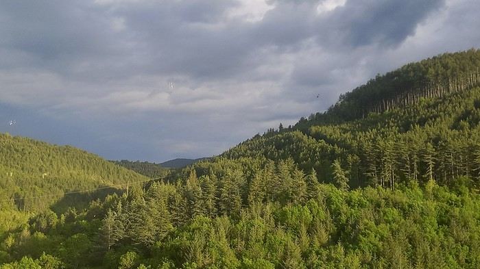
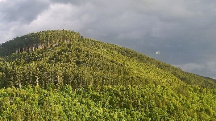
The next morning, we decided to revisit the Parc aux Loups du Gévaudan (Europe’s largest wolf park). As someone used to photo safaris in the wilds of East Africa, I’m not a fan of zoos at all—but I *do* have a deep admiration for wolves!!
Since it’s pretty unlikely I’ll ever see one in the wild, I’ll settle for this Parc aux Loups in Marvejols. This will be our third visit to this incredible gathering of these fascinating canines.
Some are still finishing their chilly night...
...
After Southern Tanzania, I’m sharing a travel story about the Cantal region with you...
...
For us, at the start of 2025, Le CANTAL was a true “Terra Incognita”!!
After seeing some tempting TV reports, we decided to fill this gap—especially in terms of landscapes. On the same trip, we’ll also head to the Arcachon Basin, the International Seaplane Gathering in Biscarrosse, and my native Landes region...
So, on May 20th, we left Marseille in the rain and thunder, heading toward Nîmes, Saint-Hippolyte, Mont Aigoual, Florac, and stopping in Marvejols to give my arthritic back a break for the night.
The next morning, we decided to revisit the Parc aux Loups du Gévaudan (Europe’s largest wolf park). As someone used to photo safaris in the wilds of East Africa, I’m not a fan of zoos at all—but I *do* have a deep admiration for wolves!!
Since it’s pretty unlikely I’ll ever see one in the wild, I’ll settle for this Parc aux Loups in Marvejols. This will be our third visit to this incredible gathering of these fascinating canines.
Some are still finishing their chilly night...
...
Hi there,
It’s not always easy to pick where to stay in national parks... like Kruger, for example.
Below is an attempt to decode the different types and options...
Remember, to book in a national park, you do it through the Sanparks website, except in KwaZulu-Natal (KZN Wildlife).
Choosing the type of camp that suits you: · Main Rest Camps, Satellite Camps, Bushveld Camps, Overnight Hides, Bush Lodges, Camp Site, Luxury Lodges Main Rest Camps These camps are usually quite large, even very large, like Skukuza. They have a fence! You can move around freely inside these camps at night with a torch. Staff are available, and there are security guards. Shops are more or less well-stocked but have the basics. You’ll find souvenir shops, restaurants, bars, and most often a pool. Depending on your choice, there are camping spots, chalets, huts, etc., with varying levels of comfort. Shared kitchens, shared bathrooms, or private facilities in each accommodation (see below). This isn’t the "wild" version but rather the more luxurious and secure option. Bushveld Camps Smaller and more intimate, with some amenities, but no restaurants or shops. Check if there’s a fence. Satellite Camps Always close to the main camps (more or less). As a rule, you check in at the main camp. Comfort level is lower than the options above. Check if there’s a fence. Camp Site + Overnight Hide The wildest level. That says it all. Bush Lodges + Luxury Lodges Bush lodges: exclusive environment. Since I haven’t tried them, I can’t give any tips. Luxury lodges: well, the name says it all. This is Kruger’s version of a private game reserve lodge. Game drives with a ranger in an open vehicle. Accommodation ranges from luxurious to very luxurious. Meals and lodging are of the same standard. But even so, the game drive rules are the same. Sure, you get exclusive access to a small area, but you can’t leave the marked trails, and normally, the return time to camp is exactly the same. The rule actually says that exceptionally, if there’s a great opportunity within x meters, they *might* go off-trail. First case in the far south: a very flexible ranger and an amazing game drive. Second case: a mediocre ranger and a boring game drive. Note that some may only offer lodging. Personally, I think the added value can be excessively expensive. Choosing your accommodation within a camp. This depends on the camp. Below is an attempt to decode. Camp site: just a spot, that’s it. Access to facilities like toilets, shared kitchen, etc. Huts: basic amenities, usually just a fan. Safari tent: the name says it all. It’s already set up. Bungalow: well, it’s a bungalow, and a guest house is a bungalow for a group. Decoding: AC = air conditioning. Fan = fan. Private or shared toilets. Private or shared bathroom. Equipped kitchen or shared. Terrace. Perimeter or not. View or not. First 2–5 letters — the type of accommodation.
CK = Campsite EH/EA/EB = Hut (AC, so air-conditioned) ES = Hut (fan only) CTT/ST= Safari Tent LBVST = Safari Tent with bush view LRVST = Safari Tent with river view BD/BA = Bungalow with private (and equipped) kitchen BG/BE = Bungalow with shared kitchen F, G or CO = Guesthouse or Cottages (more than one bedroom)
Number after the letters — number of beds 2, 3, 4, or 6 beds. The base price is for 2 people. There’s an extra charge for each additional person. The last letter, if present, indicates a particular feature.
U = Perimeter — close to the camp’s edge V = Perimeter + view (e.g., river) Z = For disabled access L = Large spot (camping) D = DSTV (television) E = Enclosed veranda
Example: BD3U = 3 people, private kitchen (and bathroom/toilet), perimeter with view.
Choosing the type of camp that suits you: · Main Rest Camps, Satellite Camps, Bushveld Camps, Overnight Hides, Bush Lodges, Camp Site, Luxury Lodges Main Rest Camps These camps are usually quite large, even very large, like Skukuza. They have a fence! You can move around freely inside these camps at night with a torch. Staff are available, and there are security guards. Shops are more or less well-stocked but have the basics. You’ll find souvenir shops, restaurants, bars, and most often a pool. Depending on your choice, there are camping spots, chalets, huts, etc., with varying levels of comfort. Shared kitchens, shared bathrooms, or private facilities in each accommodation (see below). This isn’t the "wild" version but rather the more luxurious and secure option. Bushveld Camps Smaller and more intimate, with some amenities, but no restaurants or shops. Check if there’s a fence. Satellite Camps Always close to the main camps (more or less). As a rule, you check in at the main camp. Comfort level is lower than the options above. Check if there’s a fence. Camp Site + Overnight Hide The wildest level. That says it all. Bush Lodges + Luxury Lodges Bush lodges: exclusive environment. Since I haven’t tried them, I can’t give any tips. Luxury lodges: well, the name says it all. This is Kruger’s version of a private game reserve lodge. Game drives with a ranger in an open vehicle. Accommodation ranges from luxurious to very luxurious. Meals and lodging are of the same standard. But even so, the game drive rules are the same. Sure, you get exclusive access to a small area, but you can’t leave the marked trails, and normally, the return time to camp is exactly the same. The rule actually says that exceptionally, if there’s a great opportunity within x meters, they *might* go off-trail. First case in the far south: a very flexible ranger and an amazing game drive. Second case: a mediocre ranger and a boring game drive. Note that some may only offer lodging. Personally, I think the added value can be excessively expensive. Choosing your accommodation within a camp. This depends on the camp. Below is an attempt to decode. Camp site: just a spot, that’s it. Access to facilities like toilets, shared kitchen, etc. Huts: basic amenities, usually just a fan. Safari tent: the name says it all. It’s already set up. Bungalow: well, it’s a bungalow, and a guest house is a bungalow for a group. Decoding: AC = air conditioning. Fan = fan. Private or shared toilets. Private or shared bathroom. Equipped kitchen or shared. Terrace. Perimeter or not. View or not. First 2–5 letters — the type of accommodation.
CK = Campsite EH/EA/EB = Hut (AC, so air-conditioned) ES = Hut (fan only) CTT/ST= Safari Tent LBVST = Safari Tent with bush view LRVST = Safari Tent with river view BD/BA = Bungalow with private (and equipped) kitchen BG/BE = Bungalow with shared kitchen F, G or CO = Guesthouse or Cottages (more than one bedroom)
Number after the letters — number of beds 2, 3, 4, or 6 beds. The base price is for 2 people. There’s an extra charge for each additional person. The last letter, if present, indicates a particular feature.
U = Perimeter — close to the camp’s edge V = Perimeter + view (e.g., river) Z = For disabled access L = Large spot (camping) D = DSTV (television) E = Enclosed veranda
Example: BD3U = 3 people, private kitchen (and bathroom/toilet), perimeter with view.
Introduction
In this travel journal, you’ll find a list of all the activities we did during our road trip through the Gaspésie.
Videos are embedded throughout the summary. Just click on the image to start the video.
To jump to a specific post, here are the relevant links:
Gaspé - Forillon National Park - Interpretation Center Gaspé - Forillon National Park - Mont-Saint-Alban Trail Gaspé - Forillon National Park - La Chute Trail Gaspé - Forillon National Park - Les Graves Trail Percé - Rivière-aux-Émeraudes Waterfall Percé - Bonaventure Island National Park Percé - Hike at the Foot of Percé Rock Percé Geopark - Suspended Glass Platform Percé Geopark - Magic Forest Loop Percé Geopark - Belvedere Trails Percé Geopark - Springs and Les Pieds Croches Trails Percé Geopark - Crevasse Trail Percé Geopark - Grande Coupe Trail Percé Geopark - Grotto Path Bonaventure - Le Malin de la Rivière Bonaventure Maria - Grand Sault Waterfall Carleton-sur-Mer - Les Saults Waterfall - Éperlan Trail Matapédia - Two Rivers Belvedere Saint-Alexis-de-Matapédia - Dream Horizon Belvedere Saint-André-de-Restigouche - Heart of the Plateaus Belvedere Saint-André-de-Restigouche - Picot Waterfalls Saint-Alexis-de-Matapédia - Robitaille Stream Waterfalls Trail Saint-Alexandre-des-Lacs - Philomène Waterfall Saint-Ulric - Ti-Mé Waterfall
In this travel journal, you’ll find a list of all the activities we did during our road trip through the Gaspésie.
Videos are embedded throughout the summary. Just click on the image to start the video.
To jump to a specific post, here are the relevant links:
Gaspé - Forillon National Park - Interpretation Center Gaspé - Forillon National Park - Mont-Saint-Alban Trail Gaspé - Forillon National Park - La Chute Trail Gaspé - Forillon National Park - Les Graves Trail Percé - Rivière-aux-Émeraudes Waterfall Percé - Bonaventure Island National Park Percé - Hike at the Foot of Percé Rock Percé Geopark - Suspended Glass Platform Percé Geopark - Magic Forest Loop Percé Geopark - Belvedere Trails Percé Geopark - Springs and Les Pieds Croches Trails Percé Geopark - Crevasse Trail Percé Geopark - Grande Coupe Trail Percé Geopark - Grotto Path Bonaventure - Le Malin de la Rivière Bonaventure Maria - Grand Sault Waterfall Carleton-sur-Mer - Les Saults Waterfall - Éperlan Trail Matapédia - Two Rivers Belvedere Saint-Alexis-de-Matapédia - Dream Horizon Belvedere Saint-André-de-Restigouche - Heart of the Plateaus Belvedere Saint-André-de-Restigouche - Picot Waterfalls Saint-Alexis-de-Matapédia - Robitaille Stream Waterfalls Trail Saint-Alexandre-des-Lacs - Philomène Waterfall Saint-Ulric - Ti-Mé Waterfall
The Eastern region is a landscape of protected coasts and bays, charming little fishing villages, exceptional scenic routes, and hiking trails in the heart of preserved habitats where many migratory bird species live, including puffins.
Stretching from Cape Bonavista in the north, where John Cabot landed in 1497, to Fortune and Grand Bank in the south, this part of Newfoundland was the first to be discovered and settled.
Visiting this region is like stepping back in time and discovering the cultural and artistic richness of this province, all at a more relaxed pace.
Source: https://www.exploretnl.ca/region-est
Videos are embedded throughout the summary. Please click on the image to start the video.
Bonavista Peninsula - Trinity - Gun Hill Trail Bonavista Peninsula - Trinity East - Skerwink Trail Bonavista Peninsula - Elliston - Puffin viewing site Bonavista Peninsula - Elliston - Spillars Cove (Cable John Cove) Bonavista - Dungeon Provincial Park Bonavista - John Cabot Municipal Park Bonavista Peninsula - Cape Bonavista Lighthouse St. Lawrence - Cape Chapeau Rouge Trail
Stretching from Cape Bonavista in the north, where John Cabot landed in 1497, to Fortune and Grand Bank in the south, this part of Newfoundland was the first to be discovered and settled.
Visiting this region is like stepping back in time and discovering the cultural and artistic richness of this province, all at a more relaxed pace.
Source: https://www.exploretnl.ca/region-est
Videos are embedded throughout the summary. Please click on the image to start the video.
Bonavista Peninsula - Trinity - Gun Hill Trail Bonavista Peninsula - Trinity East - Skerwink Trail Bonavista Peninsula - Elliston - Puffin viewing site Bonavista Peninsula - Elliston - Spillars Cove (Cable John Cove) Bonavista - Dungeon Provincial Park Bonavista - John Cabot Municipal Park Bonavista Peninsula - Cape Bonavista Lighthouse St. Lawrence - Cape Chapeau Rouge Trail
Ah! This trip to Texas, postponed so many times because of Covid. I wanted to discover this state, but not in the summer due to the temperatures.
I’ll try to dig into my memories since I didn’t take any notes.
Day 1: Departure
Early morning flight from Lyon to Frankfurt (I often fly with Lufthansa). We only have a 50-minute layover, but I trust German organization—it’s not just talk, since it took us only 30 minutes to get to the boarding gate. Arriving in Houston, we’re excited because it’s been 3 years since we last visited the USA, and we’ve missed it.
Everything goes smoothly with the formalities and the car rental, so 1.5 hours after landing, I park near Sam Houston Park to start our discovery. The park is pretty, clean, and has the unique feature of housing some well-preserved Victorian houses. The sun is shining, and it’s always fun to see old wooden houses surrounded by gleaming skyscrapers. A quick drive to the Rothko Chapel, which is dedicated to all faiths. There are also modern artworks in an annex building and outside. Then we head to Pasadena to reach our hotel and go to bed since we’ve been awake for a while!
Hotel: A classic Days Inn. It’s standard, but the beds are comfortable, and it’s a quiet place. The + of the day: We're back in the USA The -: Nothing
Day 2: NASA and then Galveston
Of course, we wake up super early. A quick trip to the nearby Walmart for the usual small purchases. Surprise—I can’t buy a bottle of California white wine because in Texas, there are set hours for buying alcohol. Talk about a bummer for my apéro! Next, we head to Kemah, a small, hyper-touristy port where everything is kitschy but clean and nice. It’s a bit overdone, but since NASA doesn’t open until 10 AM and it’s still early, we might as well enjoy the good weather in a pleasant spot.
We arrive at the NASA Houston center without any issues. It’s smaller than the one in Florida and organized a bit differently. There are trains that take passengers to the different sites, but you need to get tickets (included in the price), and once you’ve finished visiting one site, you have to return to the center to get a ticket for another. Not very practical.
We choose to visit the training center and the rockets, skipping the control room, which, based on the photos, looks like the one at Cape Canaveral. The training center is a cool place because it’s still in use. Engineers are working on machines and computers. We don’t see any astronauts training, but we see the space chair, the shuttle’s robotic arm, and lots of gadgets—this hangar is like Gyro Gearloose’s or Doc’s domain!
Next, we head to the rocket hangar, featuring the Saturn V, the same one as at Cape Canaveral. Finally, we wrap up our tour by returning to the center, where a Boeing 747 with a shuttle attached to its back dominates the outside. We can visit the shuttle, and we don’t miss the chance.
A few exhibits inside complete the experience and satisfy our thirst for knowledge. I love the space exploration era, and gotta say, the Americans do it right. Then we drive to Galveston, about 100 km away. Why Galveston? It’s by the sea, so swimming in late October isn’t unpleasant, and there’s a neighborhood called East End Historic District filled with stunning Victorian houses, each more beautiful than the last. Plus, it’s Halloween season, so the decorations are over the top! They really go all out!
Madame takes a swim, but I find the water too cold for my taste. Apéro (they didn’t trick me twice—I had time to go back to another Walmart!) Dinner + bedtime
Hotel: A classic Quality Inn. No issues. The +: NASA, even if it’s smaller than Cape Canaveral The -: I would’ve preferred the water in the Gulf of Mexico to be a bit warmer
Day 1: Departure
Early morning flight from Lyon to Frankfurt (I often fly with Lufthansa). We only have a 50-minute layover, but I trust German organization—it’s not just talk, since it took us only 30 minutes to get to the boarding gate. Arriving in Houston, we’re excited because it’s been 3 years since we last visited the USA, and we’ve missed it.
Everything goes smoothly with the formalities and the car rental, so 1.5 hours after landing, I park near Sam Houston Park to start our discovery. The park is pretty, clean, and has the unique feature of housing some well-preserved Victorian houses. The sun is shining, and it’s always fun to see old wooden houses surrounded by gleaming skyscrapers. A quick drive to the Rothko Chapel, which is dedicated to all faiths. There are also modern artworks in an annex building and outside. Then we head to Pasadena to reach our hotel and go to bed since we’ve been awake for a while!
Hotel: A classic Days Inn. It’s standard, but the beds are comfortable, and it’s a quiet place. The + of the day: We're back in the USA The -: Nothing
Day 2: NASA and then Galveston
Of course, we wake up super early. A quick trip to the nearby Walmart for the usual small purchases. Surprise—I can’t buy a bottle of California white wine because in Texas, there are set hours for buying alcohol. Talk about a bummer for my apéro! Next, we head to Kemah, a small, hyper-touristy port where everything is kitschy but clean and nice. It’s a bit overdone, but since NASA doesn’t open until 10 AM and it’s still early, we might as well enjoy the good weather in a pleasant spot.
We arrive at the NASA Houston center without any issues. It’s smaller than the one in Florida and organized a bit differently. There are trains that take passengers to the different sites, but you need to get tickets (included in the price), and once you’ve finished visiting one site, you have to return to the center to get a ticket for another. Not very practical.
We choose to visit the training center and the rockets, skipping the control room, which, based on the photos, looks like the one at Cape Canaveral. The training center is a cool place because it’s still in use. Engineers are working on machines and computers. We don’t see any astronauts training, but we see the space chair, the shuttle’s robotic arm, and lots of gadgets—this hangar is like Gyro Gearloose’s or Doc’s domain!
Next, we head to the rocket hangar, featuring the Saturn V, the same one as at Cape Canaveral. Finally, we wrap up our tour by returning to the center, where a Boeing 747 with a shuttle attached to its back dominates the outside. We can visit the shuttle, and we don’t miss the chance.
A few exhibits inside complete the experience and satisfy our thirst for knowledge. I love the space exploration era, and gotta say, the Americans do it right. Then we drive to Galveston, about 100 km away. Why Galveston? It’s by the sea, so swimming in late October isn’t unpleasant, and there’s a neighborhood called East End Historic District filled with stunning Victorian houses, each more beautiful than the last. Plus, it’s Halloween season, so the decorations are over the top! They really go all out!
Madame takes a swim, but I find the water too cold for my taste. Apéro (they didn’t trick me twice—I had time to go back to another Walmart!) Dinner + bedtime
Hotel: A classic Quality Inn. No issues. The +: NASA, even if it’s smaller than Cape Canaveral The -: I would’ve preferred the water in the Gulf of Mexico to be a bit warmer
Hi there,
I'm starting a new travel journal with my itinerary and memories in mind, and maybe a few photos if I can find some.
The context:
April 2020, I was supposed to go to Uzbekistan, and October 2020 to Texas: both canceled due to COVID. Summer vacations in 2020 weren’t gonna be fun. Optimistic, I’d rescheduled both trips for roughly the same dates in 2021: the first was canceled again because of COVID, the second due to U.S. entry conditions (still COVID-related!). Summer vacations in 2021 *had* to be more fun, or I was gonna lose it!!! Plus, our parents are dealing with health issues, which is weighing us down—we really need to get away!
So I looked into where we could go, somewhere we could live almost normally. I saw that Madeira had implemented strict COVID measures but that life on the island was pretty chill afterward. For me, Madeira = sun + hiking + landscapes. BINGO.
Day 1: The flight and arrival on the island
Flight with TAP via Lisbon, departing around noon. We wore our masks properly on the plane. (My last flight was to Portugal, and I told myself I’d break the jinx and leave COVID behind us.) Layover in Lisbon, then an afternoon flight to Madeira. The landing went smoothly, no wind. Cristiano Ronaldo Airport in Funchal is known for being one of the trickiest in the world due to crosswinds. The checks were standard, except COVID added an extra step. Before the trip, I had to fill out a questionnaire (Madeira Safe). Once there, a group of young people—probably students—greeted us, each with a tablet. The health questionnaire and vaccine check were super quick. Then we saw a doctor, and just like that, we were wished a great stay. Honestly, it was so well organized that it only took 10 minutes. We wouldn’t put our masks back on until we returned!
A taxi took us to our hotel in the hills above Funchal—a pretty upscale place, which isn’t our usual style, but we needed it this time! Dinner on the hotel terrace with the city at our feet. Amazing!
HOTEL: Quinta da Bela Vista
The +: We’re traveling!!! The -: Nothing.
The context:
April 2020, I was supposed to go to Uzbekistan, and October 2020 to Texas: both canceled due to COVID. Summer vacations in 2020 weren’t gonna be fun. Optimistic, I’d rescheduled both trips for roughly the same dates in 2021: the first was canceled again because of COVID, the second due to U.S. entry conditions (still COVID-related!). Summer vacations in 2021 *had* to be more fun, or I was gonna lose it!!! Plus, our parents are dealing with health issues, which is weighing us down—we really need to get away!
So I looked into where we could go, somewhere we could live almost normally. I saw that Madeira had implemented strict COVID measures but that life on the island was pretty chill afterward. For me, Madeira = sun + hiking + landscapes. BINGO.
Day 1: The flight and arrival on the island
Flight with TAP via Lisbon, departing around noon. We wore our masks properly on the plane. (My last flight was to Portugal, and I told myself I’d break the jinx and leave COVID behind us.) Layover in Lisbon, then an afternoon flight to Madeira. The landing went smoothly, no wind. Cristiano Ronaldo Airport in Funchal is known for being one of the trickiest in the world due to crosswinds. The checks were standard, except COVID added an extra step. Before the trip, I had to fill out a questionnaire (Madeira Safe). Once there, a group of young people—probably students—greeted us, each with a tablet. The health questionnaire and vaccine check were super quick. Then we saw a doctor, and just like that, we were wished a great stay. Honestly, it was so well organized that it only took 10 minutes. We wouldn’t put our masks back on until we returned!
A taxi took us to our hotel in the hills above Funchal—a pretty upscale place, which isn’t our usual style, but we needed it this time! Dinner on the hotel terrace with the city at our feet. Amazing!
HOTEL: Quinta da Bela Vista
The +: We’re traveling!!! The -: Nothing.
Hello everyone,
I’m so happy to share my climb with you, and if it inspires you to take it on, then it’ll be a success. Sometimes I’ll use the local language because I think it’s essential to connect with the people we meet along the way.
This adventure took place last year, just before winter, right after summer, and smack in the middle of autumn. That really sets the time of year. After climbing Mont-Beuvray—a story I shared here ages ago—I decided to tackle a much more adventurous peak: the summit of Haut-Folin, which rises to 901 m, and that’s no small feat, let’s be honest. It’s located in the Bois du Roi massif. Up there, you often brush against the clouds, which seem to take a mischievous pleasure in wrapping around you.
I’m going fully self-sufficient—no porters, no guide, no cook. I’m just treating myself to a very short approach flight. The flight is early in the morning on a small plane, the *Spirit of St Bernadette*, and it’s perfect. I’ll enjoy watching it deliver mail in the mountains. The pilot will drop me off at the hamlet of *La Pierre en Eau*, near Anost, a small village at the foot of this forest-covered giant.
Physical condition I’m now really seasoned for such an expedition because I’ve trained every day by walking to the village grocery store—round trip, in all weather, that’s 2.1 km. The 451 m elevation gain won’t be a problem for me. .../...
I’m so happy to share my climb with you, and if it inspires you to take it on, then it’ll be a success. Sometimes I’ll use the local language because I think it’s essential to connect with the people we meet along the way.
This adventure took place last year, just before winter, right after summer, and smack in the middle of autumn. That really sets the time of year. After climbing Mont-Beuvray—a story I shared here ages ago—I decided to tackle a much more adventurous peak: the summit of Haut-Folin, which rises to 901 m, and that’s no small feat, let’s be honest. It’s located in the Bois du Roi massif. Up there, you often brush against the clouds, which seem to take a mischievous pleasure in wrapping around you.
I’m going fully self-sufficient—no porters, no guide, no cook. I’m just treating myself to a very short approach flight. The flight is early in the morning on a small plane, the *Spirit of St Bernadette*, and it’s perfect. I’ll enjoy watching it deliver mail in the mountains. The pilot will drop me off at the hamlet of *La Pierre en Eau*, near Anost, a small village at the foot of this forest-covered giant.
Physical condition I’m now really seasoned for such an expedition because I’ve trained every day by walking to the village grocery store—round trip, in all weather, that’s 2.1 km. The 451 m elevation gain won’t be a problem for me. .../...
Wednesday, November 15, 2023
Flight Cairns – Sydney
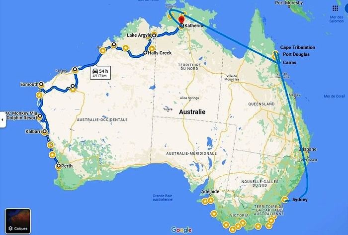 Okay, let’s recap. We’ve traveled through Western Australia, the Northern Territory, Queensland, and tonight we’ll be in New South Wales. We’ll even lose an extra hour—and a bunch of degrees!
We’re on a flawless journey so far. One of our suitcases is almost two kilos overweight. The guy checking us in gives us a nice smile and decides to overlook the excess baggage fee.
A flight, for once, without a hitch, no delay (just half an hour…). Taxi… We discover our… room… We’ve got a suite like never before on this trip. It’s a posh apartment on the 7th floor—on cloud nine, really! We can’t believe it. 113.26 € per night! The Meriton Suites Mascot Central if you ever find yourself in this city… We even have a washing machine (and it works!). Such a change from the cabins in the west!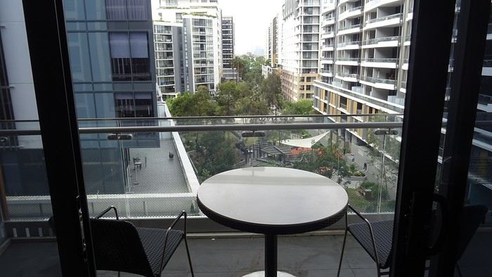
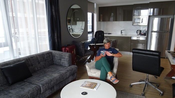
We don’t linger, though. We take the metro. Why? Well, yeah, we’re still kids at heart—off to the Opera House, of course!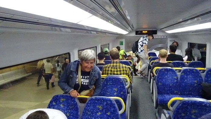
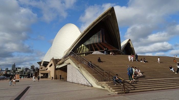
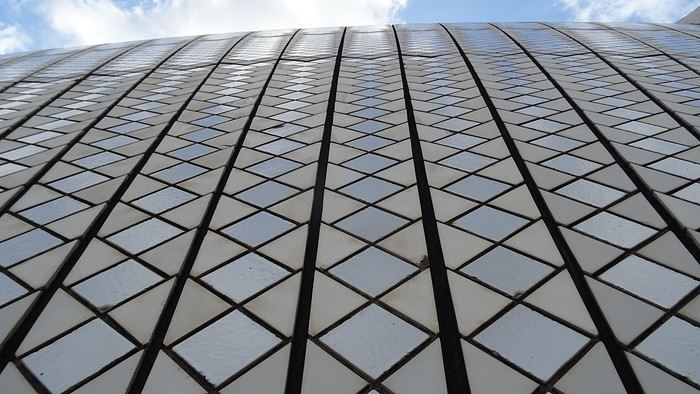
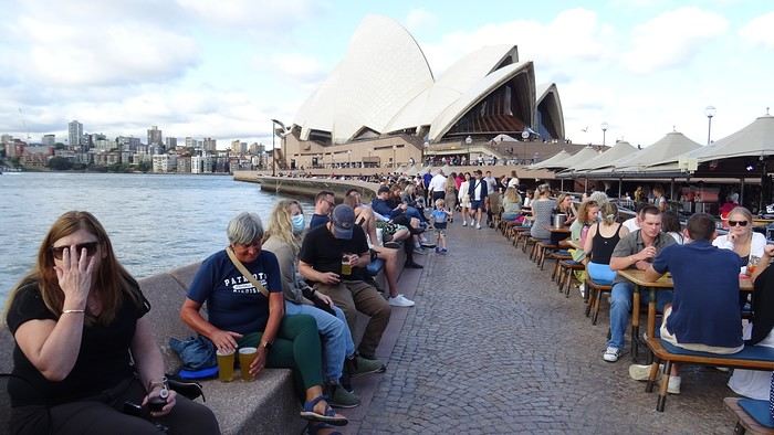
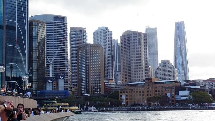
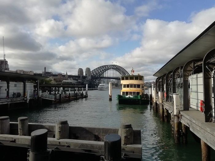 Restaurant prices have doubled. Even tripled. We reluctantly settle for a pizzeria because that T-bone for 155 AUD (100 €)…
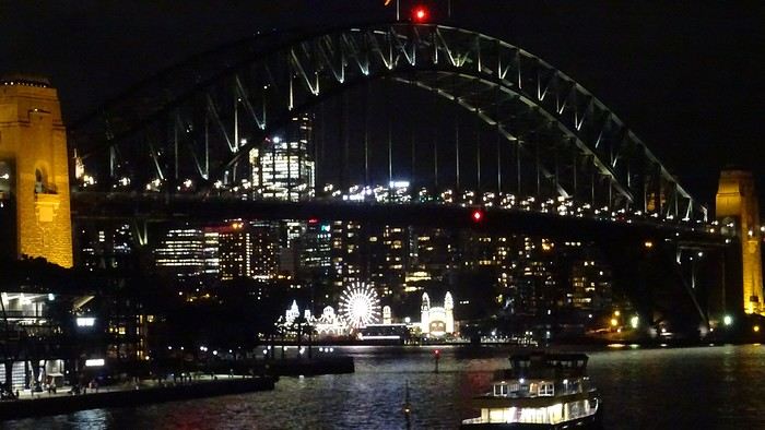
We know how to handle ourselves. There’s a Woolworths right downstairs. And we’ve got a kitchen, remember! And a terrace! We even have huge bats to brighten up our skies!
Okay, let’s recap. We’ve traveled through Western Australia, the Northern Territory, Queensland, and tonight we’ll be in New South Wales. We’ll even lose an extra hour—and a bunch of degrees!
We’re on a flawless journey so far. One of our suitcases is almost two kilos overweight. The guy checking us in gives us a nice smile and decides to overlook the excess baggage fee.A flight, for once, without a hitch, no delay (just half an hour…). Taxi… We discover our… room… We’ve got a suite like never before on this trip. It’s a posh apartment on the 7th floor—on cloud nine, really! We can’t believe it. 113.26 € per night! The Meriton Suites Mascot Central if you ever find yourself in this city… We even have a washing machine (and it works!). Such a change from the cabins in the west!
We don’t linger, though. We take the metro. Why? Well, yeah, we’re still kids at heart—off to the Opera House, of course!
Restaurant prices have doubled. Even tripled. We reluctantly settle for a pizzeria because that T-bone for 155 AUD (100 €)…
We know how to handle ourselves. There’s a Woolworths right downstairs. And we’ve got a kitchen, remember! And a terrace! We even have huge bats to brighten up our skies!
Thursday, November 2, 2023
Lake Argyle – Katherine
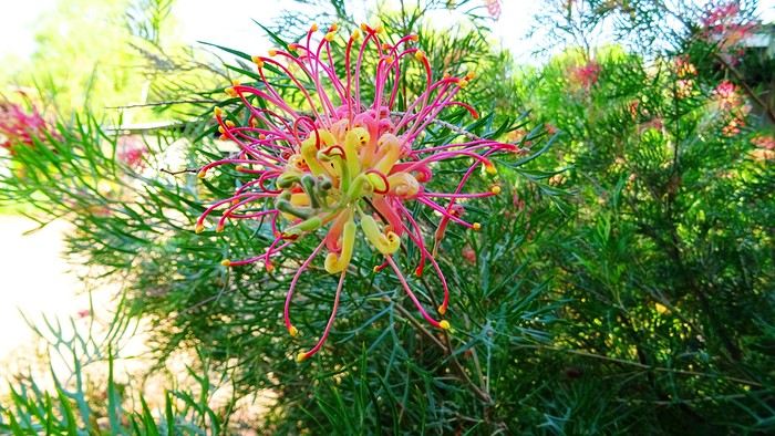
We had a great time. Now we’ve got to pay the price. We’re down one stop before Katherine. Gotta do the whole trip in one go—6 hours of driving. Let’s go! We’re a bit low on fuel with only 300 kilometers of range. The only station at the lake doesn’t open until 9 a.m., and the next (and only) one is 227 kilometers away… Should we risk it? Except for a magnificent frilled-neck lizard darting across the road on its big hind legs and an emu quickly disappearing into the bush, we didn’t see much. Oh—there was also a donkey, lost and panicked in the middle of the road… A quiet road with some beautiful scenery,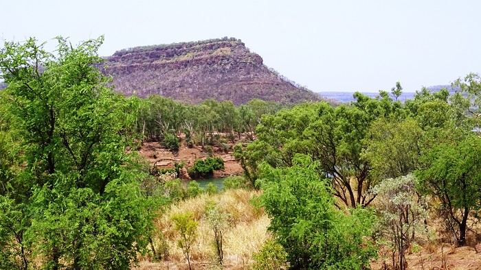 some worrying bushfires
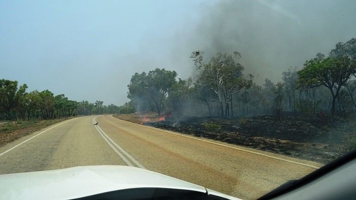
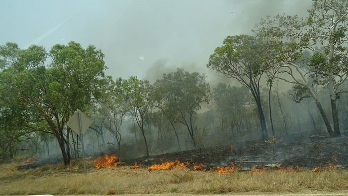 and a few opportunities to stop for a "warrior’s rest" (never go beyond the first second of the thought that starts drifting off the road…)
We cross an invisible border as we enter the Northern Territory, which comes with consequences—we immediately lose an hour and a half by changing time zones. The speed limit goes from 110 to 130.
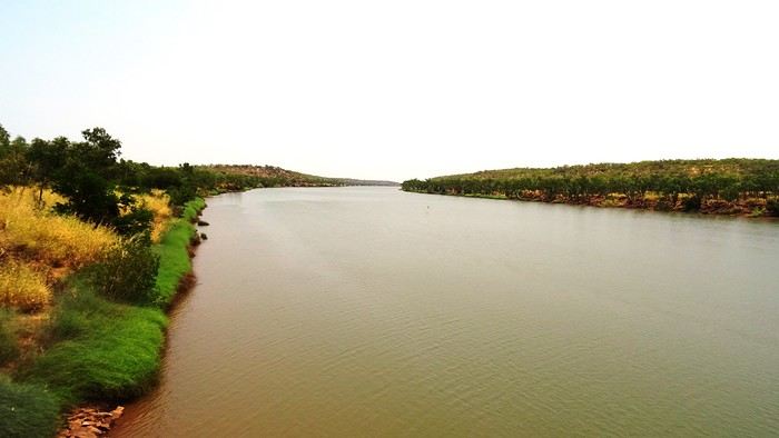
We arrive at the self check-in in Katherine. As usual, we’re a little taken aback at first. The noise, for starters. There’s a group rehearsing, it seems. We go check it out. We pass through the doors separating "The Stuart" from the adjoining bar and stumble upon what feels like collective hysteria. Turns out, it’s a concert. Aboriginal musicians completely fired up by some incredible music! There are just three of them, but they’re delivering a wall of sound that reminds us of South Africa’s finest neo-techno with a trance-like vibe. The crowd is wild! They’re singing in unison, screaming with joy. We get gently kicked out by security because we’re carrying our groceries, and they’re not having it. We promise ourselves we’ll come back once we’ve put them away in our little fridge.
Then we land. We end up finding plenty of nice things. It’s very possible we’ll like this place!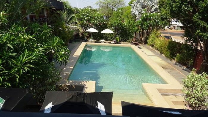
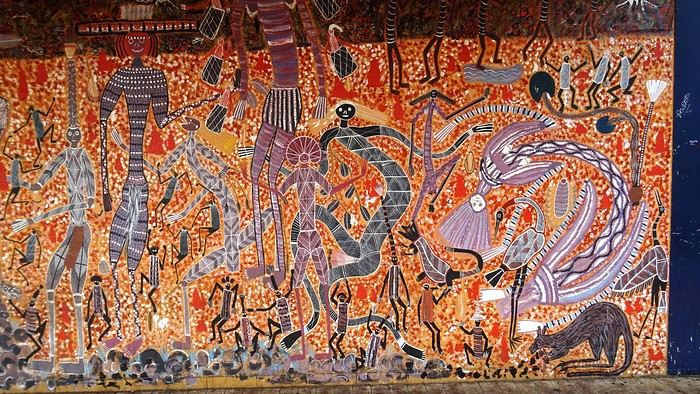 We head back to enjoy our post-battle Happy Hour.
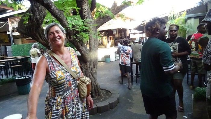 The concert’s over, but the crowd’s still riding the high. It’s indescribable. People are shouting across the room, screaming just for the fun of it—men and women alike. There’s pool, some beat-up arcade games being shaken like coconut trees. Dom and I feel like anthropologists. We’re pretty blown away. It’s epic! And the beer’s half the price it is elsewhere! We’ll definitely be back—that’s for sure!
We give up on finding a restaurant. Not sure they even exist, at least not this season. So, we’ve got a microwave—we eat at home on our little terrace, with a musical accompaniment from a massive orchestra of birds.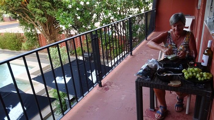 It sounds amazing!
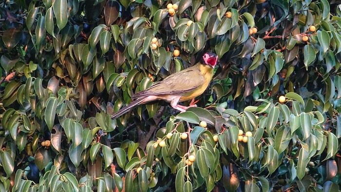
We had a great time. Now we’ve got to pay the price. We’re down one stop before Katherine. Gotta do the whole trip in one go—6 hours of driving. Let’s go! We’re a bit low on fuel with only 300 kilometers of range. The only station at the lake doesn’t open until 9 a.m., and the next (and only) one is 227 kilometers away… Should we risk it? Except for a magnificent frilled-neck lizard darting across the road on its big hind legs and an emu quickly disappearing into the bush, we didn’t see much. Oh—there was also a donkey, lost and panicked in the middle of the road… A quiet road with some beautiful scenery,
some worrying bushfires
and a few opportunities to stop for a "warrior’s rest" (never go beyond the first second of the thought that starts drifting off the road…)
We cross an invisible border as we enter the Northern Territory, which comes with consequences—we immediately lose an hour and a half by changing time zones. The speed limit goes from 110 to 130.
We arrive at the self check-in in Katherine. As usual, we’re a little taken aback at first. The noise, for starters. There’s a group rehearsing, it seems. We go check it out. We pass through the doors separating "The Stuart" from the adjoining bar and stumble upon what feels like collective hysteria. Turns out, it’s a concert. Aboriginal musicians completely fired up by some incredible music! There are just three of them, but they’re delivering a wall of sound that reminds us of South Africa’s finest neo-techno with a trance-like vibe. The crowd is wild! They’re singing in unison, screaming with joy. We get gently kicked out by security because we’re carrying our groceries, and they’re not having it. We promise ourselves we’ll come back once we’ve put them away in our little fridge.
Then we land. We end up finding plenty of nice things. It’s very possible we’ll like this place!
We head back to enjoy our post-battle Happy Hour.
The concert’s over, but the crowd’s still riding the high. It’s indescribable. People are shouting across the room, screaming just for the fun of it—men and women alike. There’s pool, some beat-up arcade games being shaken like coconut trees. Dom and I feel like anthropologists. We’re pretty blown away. It’s epic! And the beer’s half the price it is elsewhere! We’ll definitely be back—that’s for sure!We give up on finding a restaurant. Not sure they even exist, at least not this season. So, we’ve got a microwave—we eat at home on our little terrace, with a musical accompaniment from a massive orchestra of birds.
It sounds amazing!
14-Day Trip Report to Milos and Kimolos in September-October 2021
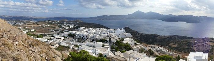
The village of Plaka in Milos
It was with great pleasure that we finally reconnected with our old habits as inveterate travelers! Greece, and more specifically the Greek islands, was the natural choice for us. After having already visited many Greek islands during around 18 trips, we decided to revisit islands we had seen over 40 years ago, like Milos, where our memories were extremely hazy. Our route was well-planned and familiar: a low-cost flight from Basel-Mulhouse to Athens, then a traditional ferry from Piraeus to Milos. Taking a speedboat, which is faster, would have forced us to spend a night in Piraeus. Plus, we felt that the traditional ferry was part of the journey, and with good weather, spending eight hours on deck wasn’t unpleasant at all. Watching the docking maneuvers with the comings and goings of trucks and cars, observing the passengers, reading a book, or admiring the scenery—all of that is part of the travel experience. Milos Island: Accommodation in Adamas We arrived quite late, around 11 PM, in Adamas, the port of Milos. No worries—the friendly couple managing the apartment was waiting for us, and it was just a 10-minute walk from the port. The first two days were spent unwinding, with swimming at the nearby beach, strolling through Adamas, and relaxing.
Discovering Plaka On the third day, we took the path along the small beach west of town toward a French military cemetery! A historical reminder of our presence here during the Crimean War, among others. The path climbs toward a beacon perched on top of a hill before disappearing into the scrubland. We returned to Adamas for lunch on our terrace.
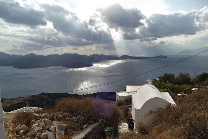
In the afternoon, we visited the hilltop village of Plaka by bus from Adamas. Plaka is the original old town, dominated by a church and, even higher up, the ruins of the Kastro. The view is magnificent. We stopped at a pastry shop in the village to enjoy excellent orange cakes and baklavas. Back in Adamas, we checked out car rental agencies to be more mobile, though the bus network seemed quite extensive. It costs around 40 € per day, plus 8 € if you want to significantly reduce the deductible. Port of Klima.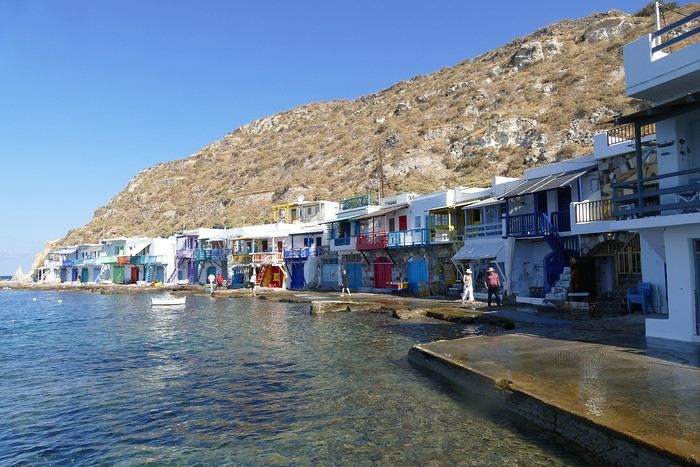
Yesterday’s weather was quite mixed with lots of clouds, but today the sun is shining again. We drove to the small port of Klima, famous for its boat garages called "sirmatas." It’s true that in the morning sun, these boat garages carved into the volcanic tuff are beautifully lit, turning the village into a colorful mosaic. Above the village, a path climbs directly to the magnificent Roman theater overlooking the surroundings and the sea.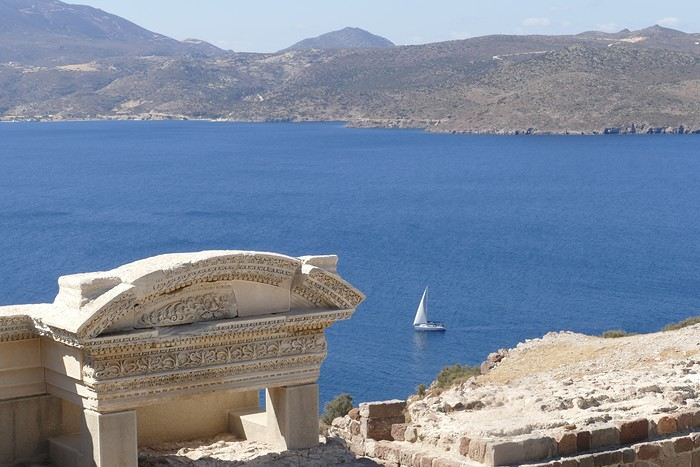 Following the well-marked path, we reached the road leading 200 meters down to the catacombs. It’s an impressive complex of 3rd and 4th-century catacombs, though only a small part is open to visitors—it’s still very moving. In the mid-afternoon, we got back in the car to visit the tiny ports of Firopotamos and Mandraki, which also have their colorful sirmatas. We took the opportunity to swim at the small beach in Mandraki, where the water was warm and calm.
Mandraki Port. We had a decent dinner at a seaside restaurant in Adamas, though you have to be selective—we had a bad experience at Kynigos on the second night!
Moving to Polonia in Eastern Milos, Sarakiniko Site
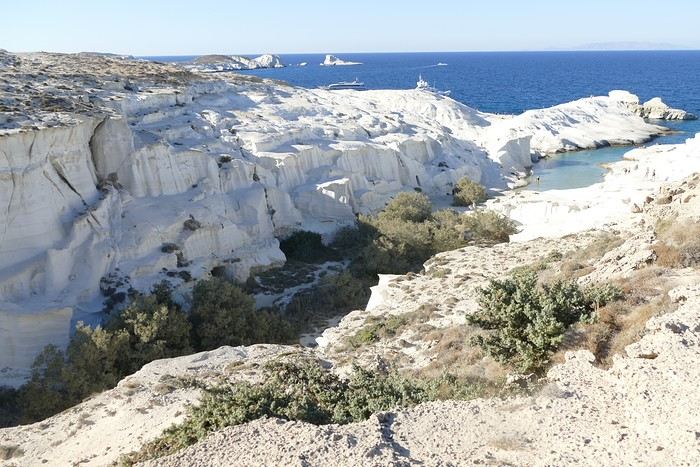
The Sarakiniko site We left Adamas for a second stay on Milos, this time in Polonia. The rental Panda was packed with the four of us and our luggage! Our apartment was in a beautiful house surrounded by a grove, so our lovely terrace was well-shaded. Luckily, there was a small beach nearby, and we went for a swim right away. Apart from us, there were only three other swimmers—definitely the end of the season!
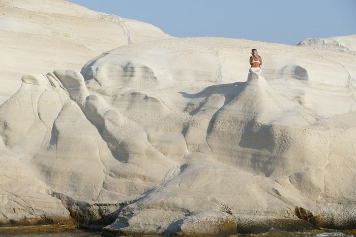
"Fairy chimney"! In the afternoon, we visited the famous Sarakiniko site, Milos’ emblematic spot. Judging by the number of cars in the parking lot, we wouldn’t be alone. As we approached, we heard an indefinable rock/punk/metal music: some young people had brought a sound system and a foghorn and were having fun diving off a fairly high cliff to impress the crowd. It definitely spoiled the visit. Most spots were taken by couples busy taking selfies, so getting photos of the site without tourists was impossible. Still, the site is magnificent, with its white cliffs looking like they’re covered in whipped cream! The sun was still very bright, reflecting strongly off the cliffs, making photography difficult due to the excessive brightness. We had a fish dinner in Polonia at the Enalion restaurant: while the octopus and squid were good, the fish soup tasted more like vegetable soup with a few fish crumbs—too bad.
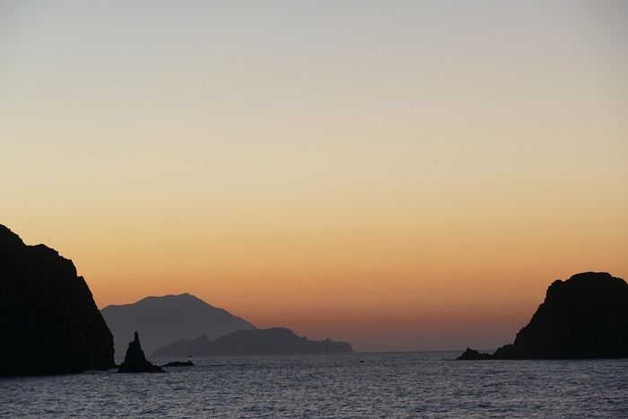
Sunset in Polonia
Ports of Papafranga and Mytikos We continued our exploration of Milos with the Papafranga gorge, a narrow and deep gorge that opens to the sea, where the water is a stunning color. Access via an unstable and dangerous path is prohibited, but that didn’t stop a couple of tourists in flip-flops from venturing in!!! We then swam in the tiny, calm, and sheltered cove of the small port of Mytikos. We returned to Polonia for lunch at Alkis: excellent moussaka. In the late afternoon, Pat and I went out to take some photos just before sunset near the Agios Nikolaos chapel, the beacon, and the new Petakoudia neighborhood next to Polonia to the north.
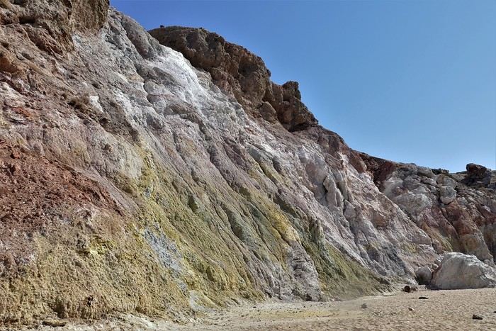
Paleochori Beach
Toward the Multicolored Beach of Paleochori Another sunny day: we still had to discover Paleochori Beach in the south of the island. It was 10:30 AM, and the beach was almost deserted! The water was pleasant, though a bit chilly when we first entered. The beach is bordered by a cliff that, in some places, displays a beautiful multicolored palette. We returned to Polonia in the late afternoon, and Pat and I headed toward Vouddhia Beach south of Polonia—bad choice. The beach is surrounded by a huge mining site served by a dusty road where lines of trucks loaded with ore cross paths. It’s the other side of the coin, and Greece still has progress to make in this area. Dinner at Alki’s was just as good as always. Return to the Sarakiniko Site Early this morning, Pat and I went back to the Sarakiniko site, hoping to take photos in better conditions. While there were fewer people, the parking lot was still full because sunrise is a must in Milos. Still, the conditions were good, and the sunrise spectators left quickly once the sun had risen above the horizon. During the day, an increasingly strong wind cooled the atmosphere, making swimming less enjoyable. Departure for Kimolos Island We changed islands and left Milos for Kimolos, a nearby island—just a 30-minute trip from Polonia’s port. Our apartment was at the entrance of the hilltop village. It’s a village with typical Cycladic architecture, featuring the remains of an old kastro, a few old churches, and windmill towers perched on the hill. We dined in a tiny tavern where the small outdoor tables were squeezed against the walls to let passersby through! As soon as the sun disappeared, it got cold, especially because of the wind. Ports of Kara and Goupa This morning, we explored the small hamlets of Kara and Goupa by Rema Beach, east of the main port. There, we found the sirmatas again—those boat garages partly carved into the volcanic tuff. The path winds between several sirmatas before climbing back up to the Praça road to return to the apartment.
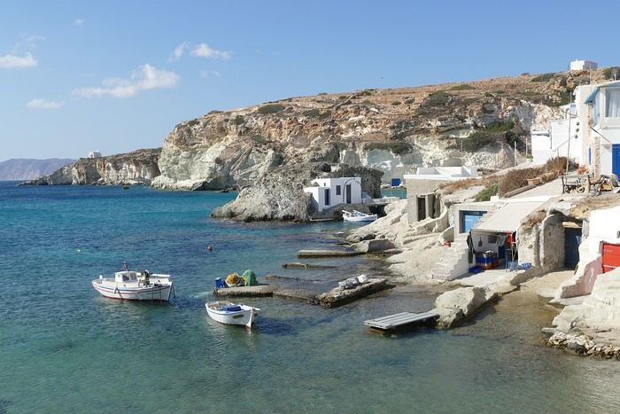
Ports of Kara and Goupa
In the afternoon, we strolled through town, and Pat and I climbed the hill overlooking the village to get a closer look at the few more or less ruined windmills dotting the ridge. Only one mill still had its complete mechanism in place under the roof; the others were empty. The view over the village, port, and sea was beautiful. That evening, we tried another restaurant in the village center, Kali Kardia Bohoris, which was well-frequented by locals, and we didn’t regret it: delicious food, efficient and friendly service, and reasonable prices.
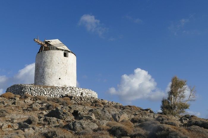
The Kastro Mill
Toward Aliki Beach We walked to Aliki Beach, west of the main village. It’s a large sandy beach shaded by tamarisk trees, but the strong wind prevented us from enjoying it. In the afternoon, I set off on a hike toward the fairy chimney at Skiadi (1.5 hours one way). The paths were very well-marked with signs indicating the trail number and the time to reach the destination. The countryside was beautiful but very dry at this time of year, and as always in Greece, many white chapels dotted the landscape. The numerous dry stone walls testify to the immense labor done by the island’s inhabitants over the centuries! For our last day in Kimolos, we decided to visit the beautiful Praça Beach, one of the most beautiful according to the guides! To get there, we took a path through the interior before joining the paved road near a large dump overflowing with various waste. It’s the flip side of the scenery, and Greece still has progress to make in this area. In the end, Praça Beach left us underwhelmed. The environment, marred by mining operations, detracts from the charm of the beautiful sandy beach. End of the Trip, Return to Piraeus and France And that’s it—we took the Zanteferries ferry back to Piraeus, arriving after a calm and sunny 10-hour journey. We had dinner at Souvlaki Street on the port and spent a good night at the Faros I Hotel in Piraeus—a great spot, close to the port, very clean, and reasonably priced. We flew from Athens to Basel-Mulhouse EuroAirport without any issues. N.B. Budget: around 1850 € all included for 14 days per couple The photo album is available by clicking this link: https://photos.app.goo.gl/wRpxRipg4erpzGj99
The village of Plaka in Milos
It was with great pleasure that we finally reconnected with our old habits as inveterate travelers! Greece, and more specifically the Greek islands, was the natural choice for us. After having already visited many Greek islands during around 18 trips, we decided to revisit islands we had seen over 40 years ago, like Milos, where our memories were extremely hazy. Our route was well-planned and familiar: a low-cost flight from Basel-Mulhouse to Athens, then a traditional ferry from Piraeus to Milos. Taking a speedboat, which is faster, would have forced us to spend a night in Piraeus. Plus, we felt that the traditional ferry was part of the journey, and with good weather, spending eight hours on deck wasn’t unpleasant at all. Watching the docking maneuvers with the comings and goings of trucks and cars, observing the passengers, reading a book, or admiring the scenery—all of that is part of the travel experience. Milos Island: Accommodation in Adamas We arrived quite late, around 11 PM, in Adamas, the port of Milos. No worries—the friendly couple managing the apartment was waiting for us, and it was just a 10-minute walk from the port. The first two days were spent unwinding, with swimming at the nearby beach, strolling through Adamas, and relaxing.
Discovering Plaka On the third day, we took the path along the small beach west of town toward a French military cemetery! A historical reminder of our presence here during the Crimean War, among others. The path climbs toward a beacon perched on top of a hill before disappearing into the scrubland. We returned to Adamas for lunch on our terrace.
In the afternoon, we visited the hilltop village of Plaka by bus from Adamas. Plaka is the original old town, dominated by a church and, even higher up, the ruins of the Kastro. The view is magnificent. We stopped at a pastry shop in the village to enjoy excellent orange cakes and baklavas. Back in Adamas, we checked out car rental agencies to be more mobile, though the bus network seemed quite extensive. It costs around 40 € per day, plus 8 € if you want to significantly reduce the deductible. Port of Klima.
Yesterday’s weather was quite mixed with lots of clouds, but today the sun is shining again. We drove to the small port of Klima, famous for its boat garages called "sirmatas." It’s true that in the morning sun, these boat garages carved into the volcanic tuff are beautifully lit, turning the village into a colorful mosaic. Above the village, a path climbs directly to the magnificent Roman theater overlooking the surroundings and the sea.
Following the well-marked path, we reached the road leading 200 meters down to the catacombs. It’s an impressive complex of 3rd and 4th-century catacombs, though only a small part is open to visitors—it’s still very moving. In the mid-afternoon, we got back in the car to visit the tiny ports of Firopotamos and Mandraki, which also have their colorful sirmatas. We took the opportunity to swim at the small beach in Mandraki, where the water was warm and calm.
Mandraki Port. We had a decent dinner at a seaside restaurant in Adamas, though you have to be selective—we had a bad experience at Kynigos on the second night!
Moving to Polonia in Eastern Milos, Sarakiniko SiteThe Sarakiniko site We left Adamas for a second stay on Milos, this time in Polonia. The rental Panda was packed with the four of us and our luggage! Our apartment was in a beautiful house surrounded by a grove, so our lovely terrace was well-shaded. Luckily, there was a small beach nearby, and we went for a swim right away. Apart from us, there were only three other swimmers—definitely the end of the season!
"Fairy chimney"! In the afternoon, we visited the famous Sarakiniko site, Milos’ emblematic spot. Judging by the number of cars in the parking lot, we wouldn’t be alone. As we approached, we heard an indefinable rock/punk/metal music: some young people had brought a sound system and a foghorn and were having fun diving off a fairly high cliff to impress the crowd. It definitely spoiled the visit. Most spots were taken by couples busy taking selfies, so getting photos of the site without tourists was impossible. Still, the site is magnificent, with its white cliffs looking like they’re covered in whipped cream! The sun was still very bright, reflecting strongly off the cliffs, making photography difficult due to the excessive brightness. We had a fish dinner in Polonia at the Enalion restaurant: while the octopus and squid were good, the fish soup tasted more like vegetable soup with a few fish crumbs—too bad.
Sunset in Polonia
Ports of Papafranga and Mytikos We continued our exploration of Milos with the Papafranga gorge, a narrow and deep gorge that opens to the sea, where the water is a stunning color. Access via an unstable and dangerous path is prohibited, but that didn’t stop a couple of tourists in flip-flops from venturing in!!! We then swam in the tiny, calm, and sheltered cove of the small port of Mytikos. We returned to Polonia for lunch at Alkis: excellent moussaka. In the late afternoon, Pat and I went out to take some photos just before sunset near the Agios Nikolaos chapel, the beacon, and the new Petakoudia neighborhood next to Polonia to the north.
Paleochori Beach
Toward the Multicolored Beach of Paleochori Another sunny day: we still had to discover Paleochori Beach in the south of the island. It was 10:30 AM, and the beach was almost deserted! The water was pleasant, though a bit chilly when we first entered. The beach is bordered by a cliff that, in some places, displays a beautiful multicolored palette. We returned to Polonia in the late afternoon, and Pat and I headed toward Vouddhia Beach south of Polonia—bad choice. The beach is surrounded by a huge mining site served by a dusty road where lines of trucks loaded with ore cross paths. It’s the other side of the coin, and Greece still has progress to make in this area. Dinner at Alki’s was just as good as always. Return to the Sarakiniko Site Early this morning, Pat and I went back to the Sarakiniko site, hoping to take photos in better conditions. While there were fewer people, the parking lot was still full because sunrise is a must in Milos. Still, the conditions were good, and the sunrise spectators left quickly once the sun had risen above the horizon. During the day, an increasingly strong wind cooled the atmosphere, making swimming less enjoyable. Departure for Kimolos Island We changed islands and left Milos for Kimolos, a nearby island—just a 30-minute trip from Polonia’s port. Our apartment was at the entrance of the hilltop village. It’s a village with typical Cycladic architecture, featuring the remains of an old kastro, a few old churches, and windmill towers perched on the hill. We dined in a tiny tavern where the small outdoor tables were squeezed against the walls to let passersby through! As soon as the sun disappeared, it got cold, especially because of the wind. Ports of Kara and Goupa This morning, we explored the small hamlets of Kara and Goupa by Rema Beach, east of the main port. There, we found the sirmatas again—those boat garages partly carved into the volcanic tuff. The path winds between several sirmatas before climbing back up to the Praça road to return to the apartment.
Ports of Kara and Goupa
In the afternoon, we strolled through town, and Pat and I climbed the hill overlooking the village to get a closer look at the few more or less ruined windmills dotting the ridge. Only one mill still had its complete mechanism in place under the roof; the others were empty. The view over the village, port, and sea was beautiful. That evening, we tried another restaurant in the village center, Kali Kardia Bohoris, which was well-frequented by locals, and we didn’t regret it: delicious food, efficient and friendly service, and reasonable prices.
The Kastro Mill
Toward Aliki Beach We walked to Aliki Beach, west of the main village. It’s a large sandy beach shaded by tamarisk trees, but the strong wind prevented us from enjoying it. In the afternoon, I set off on a hike toward the fairy chimney at Skiadi (1.5 hours one way). The paths were very well-marked with signs indicating the trail number and the time to reach the destination. The countryside was beautiful but very dry at this time of year, and as always in Greece, many white chapels dotted the landscape. The numerous dry stone walls testify to the immense labor done by the island’s inhabitants over the centuries! For our last day in Kimolos, we decided to visit the beautiful Praça Beach, one of the most beautiful according to the guides! To get there, we took a path through the interior before joining the paved road near a large dump overflowing with various waste. It’s the flip side of the scenery, and Greece still has progress to make in this area. In the end, Praça Beach left us underwhelmed. The environment, marred by mining operations, detracts from the charm of the beautiful sandy beach. End of the Trip, Return to Piraeus and France And that’s it—we took the Zanteferries ferry back to Piraeus, arriving after a calm and sunny 10-hour journey. We had dinner at Souvlaki Street on the port and spent a good night at the Faros I Hotel in Piraeus—a great spot, close to the port, very clean, and reasonably priced. We flew from Athens to Basel-Mulhouse EuroAirport without any issues. N.B. Budget: around 1850 € all included for 14 days per couple The photo album is available by clicking this link: https://photos.app.goo.gl/wRpxRipg4erpzGj99
I’m reposting here a travel journal originally published on the Routard forum in 2022 during VoyageForum’s hiatus. Without altering its content, I’ll try to streamline it. The few comments on the political situation reflect my feelings at the time and don’t account for events since then! I’d rather avoid debates on the topic. The photos are nothing fancy—just illustrative.
The context: we’re coming out of COVID. We’re looking for a not-too-distant destination, and Jordan has been catching our eye for a while. After some thought, we wonder if we shouldn’t take advantage of the geography to hop over to Israel. After all, Jerusalem is less than 100 km from Amman. Plus, Transavia lets you combine both destinations.
To plan our trip (February 19 to March 4, 2022), we contacted three French-speaking agencies in Amman. Their itinerary proposals were pretty similar, but the prices varied significantly. Given the many positive reviews we read on travel forums and a very attractive rate compared to competitors, we quickly settled on Ahmad Ababseh’s agency. Still, deep down, we had a slight worry—so many glowing reviews seemed a bit over the top, but we took the chance.
During the preparation, which happened in a very short timeframe (less than 10 days), Ahmad didn’t provide detailed roadbooks, and we made do with brief email or phone exchanges. Few details were shared either. We discussed hotels, with Ahmad preferring the ones he knew. We picked our hotel for our arrival in Amman, but before agreeing, Ahmad insisted on inspecting the rooms.
For payment, Ahmad only asked for a 500 € deposit and trusted our word for the balance, which we paid upon arrival. He also committed in writing to refund the full deposit if our trip was canceled due to COVID.
Finally, for the Israeli part, Ahmad contacted an agency in Jerusalem to handle the logistics. He didn’t take a commission.
The context: we’re coming out of COVID. We’re looking for a not-too-distant destination, and Jordan has been catching our eye for a while. After some thought, we wonder if we shouldn’t take advantage of the geography to hop over to Israel. After all, Jerusalem is less than 100 km from Amman. Plus, Transavia lets you combine both destinations.
To plan our trip (February 19 to March 4, 2022), we contacted three French-speaking agencies in Amman. Their itinerary proposals were pretty similar, but the prices varied significantly. Given the many positive reviews we read on travel forums and a very attractive rate compared to competitors, we quickly settled on Ahmad Ababseh’s agency. Still, deep down, we had a slight worry—so many glowing reviews seemed a bit over the top, but we took the chance.
During the preparation, which happened in a very short timeframe (less than 10 days), Ahmad didn’t provide detailed roadbooks, and we made do with brief email or phone exchanges. Few details were shared either. We discussed hotels, with Ahmad preferring the ones he knew. We picked our hotel for our arrival in Amman, but before agreeing, Ahmad insisted on inspecting the rooms.
For payment, Ahmad only asked for a 500 € deposit and trusted our word for the balance, which we paid upon arrival. He also committed in writing to refund the full deposit if our trip was canceled due to COVID.
Finally, for the Israeli part, Ahmad contacted an agency in Jerusalem to handle the logistics. He didn’t take a commission.
Returning to Curaçao is a bit like reopening a book whose pages still smell of sun and salt.
As soon as the plane descends toward the island, the familiar colors reappear: the dazzling turquoise of the sea, the pastel facades of Willemstad, and that unique light that seems to soften everything.
For this second trip, we no longer arrive as hesitant explorers, but as confirmed lovers of this warm island.
We already know that the warm wind will welcome us as soon as we step out of the airport, that the beaches will once again offer their infinite shades of blue, and that each day will have that unhurried pace that makes you forget the rest of the world.
Yet, despite this sense of déjà vu, Curaçao always manages to surprise. A new cove to discover, a different sunset, a smile shared with a local...
The island has that rare talent for reinventing itself without ever betraying what makes it so endearing.
This second trip isn’t a repetition, then, but a reunion: a chance to rediscover Curaçao with more attentive, more connected, and perhaps even more amazed eyes.
I invite you to keep reading this travel journal and watch the videos that will help you learn a little more about the island’s different attractions.
Just click on the video image to start watching.
To go to a specific post, here are the appropriate links:
Exploring Willemstad’s colorful neighborhoods The Most Beautiful Beaches in Curaçao Hike at Boka Sint Michiel | Flamingos & panoramic views Climbing Christoffel Mountain Den Dunki & Flamingos of Jan Thiel Must-see spots in Curaçao Snorkeling at Playa Kenepa Chiki: Turquoise Water & Tropical Fish Snorkeling at Porto Mari: One of Curaçao’s Best Spots Snorkeling at Mambo Beach, the Perfect Spot Snorkeling at Daaibooi Beach, a diverse marine world
As soon as the plane descends toward the island, the familiar colors reappear: the dazzling turquoise of the sea, the pastel facades of Willemstad, and that unique light that seems to soften everything.
For this second trip, we no longer arrive as hesitant explorers, but as confirmed lovers of this warm island.
We already know that the warm wind will welcome us as soon as we step out of the airport, that the beaches will once again offer their infinite shades of blue, and that each day will have that unhurried pace that makes you forget the rest of the world.
Yet, despite this sense of déjà vu, Curaçao always manages to surprise. A new cove to discover, a different sunset, a smile shared with a local...
The island has that rare talent for reinventing itself without ever betraying what makes it so endearing.
This second trip isn’t a repetition, then, but a reunion: a chance to rediscover Curaçao with more attentive, more connected, and perhaps even more amazed eyes.
I invite you to keep reading this travel journal and watch the videos that will help you learn a little more about the island’s different attractions.
Just click on the video image to start watching.
To go to a specific post, here are the appropriate links:
Exploring Willemstad’s colorful neighborhoods The Most Beautiful Beaches in Curaçao Hike at Boka Sint Michiel | Flamingos & panoramic views Climbing Christoffel Mountain Den Dunki & Flamingos of Jan Thiel Must-see spots in Curaçao Snorkeling at Playa Kenepa Chiki: Turquoise Water & Tropical Fish Snorkeling at Porto Mari: One of Curaçao’s Best Spots Snorkeling at Mambo Beach, the Perfect Spot Snorkeling at Daaibooi Beach, a diverse marine world
Foreword
This text has been proofread many times.
Sorry if some points in this A to Z have already been covered on this forum.
Text and drawings by the author.
Peru is still a very vast country, with so much to see, and obviously this text can't list all the attractions of the country.
*Abiseo (River) A national park that's very hard to access and doesn’t seem open to visitors. Includes the Gran Pajaten site (see below). Personally, it really sparks my imagination (not visited personally)
*Aguas Calientes the town next to Machu Picchu, more precisely below the archaeological site. As far as I know, you can only get there by train. Reminds me of the market where stalls line both sides of the tracks near Bangkok. I love it
*Altiplano: somewhere the "heart" of the Andes. I was able to trek across it on foot, starting from Caracollo in Bolivia, and of course, it’s vast plains to explore. This is where people live in a very rural way. Andean populations are quite austere compared to those in the lowlands or on the coast. You really have to appreciate the harshness of life to live there. Life is anything but superficial. I set a compass heading and found myself walking west toward the expanse of water near a place called La Joya. For pitching the tent, the nights were still chilly
*Canyon del Colca One of the deepest canyons in the world. Personally, I hiked down and back up on foot. The toughest stretch I’ve ever covered in my life.
*Ceviche More or less the national dish. A marinade of fish, shellfish, and lime. But you can find it in some restaurants in Europe, France, and certainly in Belgium or Switzerland. In the small restaurants of Pisco, you can eat excellent ceviche
*Cerro Sechín: Mostly bas-reliefs. A site little known to travelers in the Casma province. The first vestiges of a pre-Inca civilization with iconography similar to that of Chavín (not visited personally)
*Chan Chan A large city of the Chimú civilization and relatively vast to visit. You can see adobe walls with bas-reliefs. Visit from Trujillo, take a colectivo. Plan for the whole day
*Charango: a small guitar widely used in Andean music
*Chauchilla A necropolis near Nazca where you can see mummies exposed on the ground. YouTubers can do paranormal experiments there. And for anyone wondering about the fate of the soul and body after death, here’s the answer: the body remains after death. You can imagine your own flesh and body exposed to the winds of the Pampa and before eternity... (not visited personally)
*Chavín de Huántar (Lanzón) The site’s appeal lies in its mountainous surroundings, the Lanzón stela, and the sculpted heads on the façades. What few people know is that the Chavín civilization began its expansion centuries before the Incas. Unfortunately, you can’t get too close to see the Lanzón—the day I was there, it was protected by grilles. To get there: minibus from Huaraz or trek from Olleros. Then cross a high pass (over 5,000m). If you do it solo on foot, be careful—the path isn’t obvious from Olleros
*Chullpa: funerary tower, notably at Sillustani in the Lake Titicaca region
*Chimú: pre-Inca civilization whose center was Chan Chan.
*Chola/Cholitas (Bolivia): typical clothing style of women from the Andean plateaus
*Chompa: pronounce it *Chompaaa!* A common term for a wool sweater with vicuña patterns, often knitted from alpaca wool. If you dress like this, it’s a bit kitschy around the edges
*Cuy That one isn’t a guinea pig like in Guyana but an actual guinea pig. During a trip to Peru, I was hiking near a village north of Quillabamba (the terminus of the train line that passes through Aguas Calientes), and I was invited to stay in a house. The family raised a few of these pets. Apparently, the locals eat them. Since I’m not much of a meat-eater, it doesn’t really tempt me. How about you?
*Pacific Coast or how to talk about a place you haven’t visited? Except for the coast near Pisco and San Andrés, I haven’t visited any coastal cities. But that doesn’t mean these places lack interest or poetry. For fans of clichéd images, pelicans, seabirds, and fishing boats appear by the sea.
*Gran Pajaten: also closed to the public. Features anthropomorphic bas-reliefs. (not visited personally)
*Huaca. Visit the Huaca del Sol and Huaca de la Luna, especially near Trujillo. However, you can skip them—Chan Chan is still more interesting. Don’t forget to spend time visiting Chan Chan
*Huacachina A small oasis in the desert near Ica. Yes, we’re talking about an oasis because for those who’ve never traveled to Peru, the coastal strip along the Pacific is almost entirely desert, from north to south. Peru is territorially made up of three different regions: the desert coast, the Altiplano stretching north to south with mountain ranges (the Cordilleras), and the Amazon basin to the east. (not visited personally)
*Inca Kola It’s neither Coca-Cola nor Pepsi but a unique cola with a slightly orange color. Tastes like bubble gum
*Intiwatana: a carved rock shaped like a parallelepiped. Is it a sundial?
*Ballestas Islands: a highlight in Peru, though very touristy. You can only get there by boat from the port of San Andrés, a few kilometers from Pisco. It’s a surreal place to me—actually islets with cavities where sea lions and fur seals live. Since it’s a protected area, you’re not allowed to disembark. Guano is harvested there, which can be used as fertilizer.
*Kuelap: a fortress built by the Chachapoyas people. Rarely visited by travelers. (not visited personally)
*Larco Museum: an iconic museum in Lima with a large collection of pieces from archaeological and pre-Columbian sites. From what I remember, it has many pieces from the Moche civilization. As for the Moche statuettes, the prudish might look away. Probably a veneration of the god Priapus without knowing it.
*Nazca Lines Discovered by German archaeologist Maria Reiche, they stretch for kilometers. The designs in the desert around Nazca depict animals and cabalistic signs. The question I ask myself is why the creators of these lines represented a monkey and a hummingbird—species endemic to the tropical forest, not the desert plains around Nazca.
*Machu Picchu: means "old mountain" in Quechua. There’s also Wayna Picchu. The ruins of the site emerge from a sort of small plateau above Aguas Calientes. When the mist rises above the site and the bend of the Urubamba River, it’s truly magical... Also the starting point of the Inca Trail.
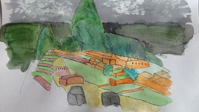
*Coca tea A decoction/infusion of the coca plant, meant to ease altitude sickness or *soroche*
*Chullo A rough translation would be a Peruvian wool hat.
*Moche: a civilization established in the Moche Valley, hence the term *Mochica*. What characterizes this civilization are the distinctive clay pieces representing faces and erotic statuettes
*Papa a la Huancaína A local potato dish
*Pisac: a typical market near Cusco
*Pisco Sour: perhaps the Peruvian equivalent of the *caipirinha* you drink in Brazil.
*Puya Raimondii A Bromeliaceae that still looks like a cactus, endemic to the Altiplano
*Quechua The language spoken by the indigenous people of the high plateaus (as well as Aymara in Bolivia)
*Quipu A knotted string used for counting. Widely used by the Inca administration.
*Sacsayhuamán (Q’enqo, Inca Bath) From Cusco’s Plaza de Armas, take the streets that climb above the city. Sacsayhuamán is called a fortress and is made up of large stone blocks. You wonder how the Incas could cut such huge blocks to assemble them—just like some streets in Cusco. The Q’enqo block is enigmatic; no one really knows what it represents.
*Savia Andina An Andean folk group.
*Tambo (=> Ollantaytambo) The Inca emperor (Atahualpa, Manco Capac) had the mission of controlling a vast empire. An empire that was still very extensive. Hence the importance of these *tambos* or relay stations. Napoleon created the civil code; the Incas invented the *tambos* and *quipus*.
*Tawantinsuyu: the Inca Empire
*Tinku: a warrior dance practiced mainly in Bolivia
*Golden Tumi: a sacrificial weapon. Often featured in Peru travel guides. See illustration
*Terra X: a documentary series from the German TV channel that aired on Arte. Some episodes focused on pre-Inca and Inca Peru. I must have some old recording tapes. In memory of Gottfried Kirchner as a source of inspiration.
*Uros: I checked—it actually refers to the people who live on these floating islands. Even if it’s touristy, it’s a must-visit because it’s incredible how people can live on islets made from nothing. Take the boat from Puno
*Vicuña, llama, guanaco: camelids characteristic of the Altiplano
*Wayna Picchu The young Picchu mountain. In the first minutes of *Aguirre, the Wrath of God*, you see Klaus Kinski—well, Aguirre—making his way along the Inca Trail. Werner Herzog must have broken his back filming those sequences.
*Zampoña: pan flute
Peru is still a very vast country, with so much to see, and obviously this text can't list all the attractions of the country.
*Abiseo (River) A national park that's very hard to access and doesn’t seem open to visitors. Includes the Gran Pajaten site (see below). Personally, it really sparks my imagination (not visited personally)
*Aguas Calientes the town next to Machu Picchu, more precisely below the archaeological site. As far as I know, you can only get there by train. Reminds me of the market where stalls line both sides of the tracks near Bangkok. I love it
*Altiplano: somewhere the "heart" of the Andes. I was able to trek across it on foot, starting from Caracollo in Bolivia, and of course, it’s vast plains to explore. This is where people live in a very rural way. Andean populations are quite austere compared to those in the lowlands or on the coast. You really have to appreciate the harshness of life to live there. Life is anything but superficial. I set a compass heading and found myself walking west toward the expanse of water near a place called La Joya. For pitching the tent, the nights were still chilly
*Canyon del Colca One of the deepest canyons in the world. Personally, I hiked down and back up on foot. The toughest stretch I’ve ever covered in my life.
*Ceviche More or less the national dish. A marinade of fish, shellfish, and lime. But you can find it in some restaurants in Europe, France, and certainly in Belgium or Switzerland. In the small restaurants of Pisco, you can eat excellent ceviche
*Cerro Sechín: Mostly bas-reliefs. A site little known to travelers in the Casma province. The first vestiges of a pre-Inca civilization with iconography similar to that of Chavín (not visited personally)
*Chan Chan A large city of the Chimú civilization and relatively vast to visit. You can see adobe walls with bas-reliefs. Visit from Trujillo, take a colectivo. Plan for the whole day
*Charango: a small guitar widely used in Andean music
*Chauchilla A necropolis near Nazca where you can see mummies exposed on the ground. YouTubers can do paranormal experiments there. And for anyone wondering about the fate of the soul and body after death, here’s the answer: the body remains after death. You can imagine your own flesh and body exposed to the winds of the Pampa and before eternity... (not visited personally)
*Chavín de Huántar (Lanzón) The site’s appeal lies in its mountainous surroundings, the Lanzón stela, and the sculpted heads on the façades. What few people know is that the Chavín civilization began its expansion centuries before the Incas. Unfortunately, you can’t get too close to see the Lanzón—the day I was there, it was protected by grilles. To get there: minibus from Huaraz or trek from Olleros. Then cross a high pass (over 5,000m). If you do it solo on foot, be careful—the path isn’t obvious from Olleros
*Chullpa: funerary tower, notably at Sillustani in the Lake Titicaca region
*Chimú: pre-Inca civilization whose center was Chan Chan.
*Chola/Cholitas (Bolivia): typical clothing style of women from the Andean plateaus
*Chompa: pronounce it *Chompaaa!* A common term for a wool sweater with vicuña patterns, often knitted from alpaca wool. If you dress like this, it’s a bit kitschy around the edges
*Cuy That one isn’t a guinea pig like in Guyana but an actual guinea pig. During a trip to Peru, I was hiking near a village north of Quillabamba (the terminus of the train line that passes through Aguas Calientes), and I was invited to stay in a house. The family raised a few of these pets. Apparently, the locals eat them. Since I’m not much of a meat-eater, it doesn’t really tempt me. How about you?
*Pacific Coast or how to talk about a place you haven’t visited? Except for the coast near Pisco and San Andrés, I haven’t visited any coastal cities. But that doesn’t mean these places lack interest or poetry. For fans of clichéd images, pelicans, seabirds, and fishing boats appear by the sea.
*Gran Pajaten: also closed to the public. Features anthropomorphic bas-reliefs. (not visited personally)
*Huaca. Visit the Huaca del Sol and Huaca de la Luna, especially near Trujillo. However, you can skip them—Chan Chan is still more interesting. Don’t forget to spend time visiting Chan Chan
*Huacachina A small oasis in the desert near Ica. Yes, we’re talking about an oasis because for those who’ve never traveled to Peru, the coastal strip along the Pacific is almost entirely desert, from north to south. Peru is territorially made up of three different regions: the desert coast, the Altiplano stretching north to south with mountain ranges (the Cordilleras), and the Amazon basin to the east. (not visited personally)
*Inca Kola It’s neither Coca-Cola nor Pepsi but a unique cola with a slightly orange color. Tastes like bubble gum
*Intiwatana: a carved rock shaped like a parallelepiped. Is it a sundial?
*Ballestas Islands: a highlight in Peru, though very touristy. You can only get there by boat from the port of San Andrés, a few kilometers from Pisco. It’s a surreal place to me—actually islets with cavities where sea lions and fur seals live. Since it’s a protected area, you’re not allowed to disembark. Guano is harvested there, which can be used as fertilizer.
*Kuelap: a fortress built by the Chachapoyas people. Rarely visited by travelers. (not visited personally)
*Larco Museum: an iconic museum in Lima with a large collection of pieces from archaeological and pre-Columbian sites. From what I remember, it has many pieces from the Moche civilization. As for the Moche statuettes, the prudish might look away. Probably a veneration of the god Priapus without knowing it.
*Nazca Lines Discovered by German archaeologist Maria Reiche, they stretch for kilometers. The designs in the desert around Nazca depict animals and cabalistic signs. The question I ask myself is why the creators of these lines represented a monkey and a hummingbird—species endemic to the tropical forest, not the desert plains around Nazca.
*Machu Picchu: means "old mountain" in Quechua. There’s also Wayna Picchu. The ruins of the site emerge from a sort of small plateau above Aguas Calientes. When the mist rises above the site and the bend of the Urubamba River, it’s truly magical... Also the starting point of the Inca Trail.
*Coca tea A decoction/infusion of the coca plant, meant to ease altitude sickness or *soroche*
*Chullo A rough translation would be a Peruvian wool hat.
*Moche: a civilization established in the Moche Valley, hence the term *Mochica*. What characterizes this civilization are the distinctive clay pieces representing faces and erotic statuettes
*Papa a la Huancaína A local potato dish
*Pisac: a typical market near Cusco
*Pisco Sour: perhaps the Peruvian equivalent of the *caipirinha* you drink in Brazil.
*Puya Raimondii A Bromeliaceae that still looks like a cactus, endemic to the Altiplano
*Quechua The language spoken by the indigenous people of the high plateaus (as well as Aymara in Bolivia)
*Quipu A knotted string used for counting. Widely used by the Inca administration.
*Sacsayhuamán (Q’enqo, Inca Bath) From Cusco’s Plaza de Armas, take the streets that climb above the city. Sacsayhuamán is called a fortress and is made up of large stone blocks. You wonder how the Incas could cut such huge blocks to assemble them—just like some streets in Cusco. The Q’enqo block is enigmatic; no one really knows what it represents.
*Savia Andina An Andean folk group.
*Tambo (=> Ollantaytambo) The Inca emperor (Atahualpa, Manco Capac) had the mission of controlling a vast empire. An empire that was still very extensive. Hence the importance of these *tambos* or relay stations. Napoleon created the civil code; the Incas invented the *tambos* and *quipus*.
*Tawantinsuyu: the Inca Empire
*Tinku: a warrior dance practiced mainly in Bolivia
*Golden Tumi: a sacrificial weapon. Often featured in Peru travel guides. See illustration
*Terra X: a documentary series from the German TV channel that aired on Arte. Some episodes focused on pre-Inca and Inca Peru. I must have some old recording tapes. In memory of Gottfried Kirchner as a source of inspiration.
*Uros: I checked—it actually refers to the people who live on these floating islands. Even if it’s touristy, it’s a must-visit because it’s incredible how people can live on islets made from nothing. Take the boat from Puno
*Vicuña, llama, guanaco: camelids characteristic of the Altiplano
*Wayna Picchu The young Picchu mountain. In the first minutes of *Aguirre, the Wrath of God*, you see Klaus Kinski—well, Aguirre—making his way along the Inca Trail. Werner Herzog must have broken his back filming those sequences.
*Zampoña: pan flute
After our amazing experience in the Lofoten Islands in summer 2023, I suggested to Jean Marie another trek I’d been wanting to do for a long time: the Skye Trail in Scotland.
A few photos of this stunning island and he was sold and ready to go.
The route is available on the excellent WalkHighlands site HERE (there’s also a Cicerone guide on the subject). And since I thought it was a shame it avoided the Black Cuillins, I added a 3-day detour in that area.
We took advantage of the May bank holidays in 2024, partly to avoid the peak tourist season and also the midge period—because for some reason, mosquitoes love me 😠!!
27/04 – Day 1 – Transfer to Skye and start of the trek: Rubha Hunish - Flodigarry 28/04 – Day 2 – Flodigarry – just before the Old Man of Storr 29/04 – Day 3 – Old Man of Storr – Portree, then bus to Sligachan 30/04 - Day 4 - Sligachan - Glenbrittle campsite via the Fairy Pools 01/05 – Day 5 – Round trip to Sgùrr na Banachdich from Glenbrittle campsite 02/05 – Day 6 – Round trip to Coire Lagan and walk on the Rubh an Dùnain peninsula 03/05 – Day 7 – Return (hitchhiking) to Sligachan campsite and hike in the Red Cuillins 04/05 – Day 8 – Resuming the Skye Trail – Sligachan – Elgol 05/05 – Day 9 – Elgol – Somewhere on the climb to Bla Bheinn 06/05 – Day 10 – Somewhere on the climb to Bla Bheinn - Broadford 07/05 – Day 11 – Visit to the Armadale Castle and park 08 & 09/05 – Return to Glasgow, visit the city, and return flight And here’s the summary
A few photos of this stunning island and he was sold and ready to go.
The route is available on the excellent WalkHighlands site HERE (there’s also a Cicerone guide on the subject). And since I thought it was a shame it avoided the Black Cuillins, I added a 3-day detour in that area.
We took advantage of the May bank holidays in 2024, partly to avoid the peak tourist season and also the midge period—because for some reason, mosquitoes love me 😠!!
27/04 – Day 1 – Transfer to Skye and start of the trek: Rubha Hunish - Flodigarry 28/04 – Day 2 – Flodigarry – just before the Old Man of Storr 29/04 – Day 3 – Old Man of Storr – Portree, then bus to Sligachan 30/04 - Day 4 - Sligachan - Glenbrittle campsite via the Fairy Pools 01/05 – Day 5 – Round trip to Sgùrr na Banachdich from Glenbrittle campsite 02/05 – Day 6 – Round trip to Coire Lagan and walk on the Rubh an Dùnain peninsula 03/05 – Day 7 – Return (hitchhiking) to Sligachan campsite and hike in the Red Cuillins 04/05 – Day 8 – Resuming the Skye Trail – Sligachan – Elgol 05/05 – Day 9 – Elgol – Somewhere on the climb to Bla Bheinn 06/05 – Day 10 – Somewhere on the climb to Bla Bheinn - Broadford 07/05 – Day 11 – Visit to the Armadale Castle and park 08 & 09/05 – Return to Glasgow, visit the city, and return flight And here’s the summary
Okay, Palermo—we know it. We go there to marvel at the architectural wonders born from the Arab-Norman-Byzantine-Gothic mix. And rightly so. We also go to treat our taste buds to all kinds of delights, both savory and sweet. Again, rightly so. We go to succumb to the charms of Palermo’s women, their sun-kissed skin glowing with golden highlights. Still, rightly so. And all while fantasizing about a mafia we’ll never actually see. Anyway.
But you’ll also find street art everywhere, even in the historic center. Sometimes, you just need to step a few meters away from the main tourist highways like Cassaro, Via Maqueda, or the main arteries of the Ballarò, Capo, or Vucciria markets to stumble upon some amazing murals. Duck into one or two slightly grimy alleys, weaving past trash and crumbling walls, and you’ll find real gems.
For example, just 50 meters south of the main artery of the Mercato del Capo, there’s a great spot with dozens of murals in a tiny neighborhood of run-down mini-houses. You’ll find plenty more south of the Mercato di Ballarò, in the Albergheria (the grittier side, not the one near Cassaro). There’s some in Ballarò itself too, but it’s hard to spot when the market’s in full swing with stalls everywhere. La Kalsa isn’t left out either, nor is Vucciria—just step away from the restaurant-packed streets.
Here are a few examples that really caught my eye.
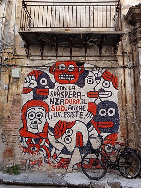 (In the heart of Albergheria, on a street every visitor walks down—lovely message from an unidentified artist)
But you’ll also find street art everywhere, even in the historic center. Sometimes, you just need to step a few meters away from the main tourist highways like Cassaro, Via Maqueda, or the main arteries of the Ballarò, Capo, or Vucciria markets to stumble upon some amazing murals. Duck into one or two slightly grimy alleys, weaving past trash and crumbling walls, and you’ll find real gems.
For example, just 50 meters south of the main artery of the Mercato del Capo, there’s a great spot with dozens of murals in a tiny neighborhood of run-down mini-houses. You’ll find plenty more south of the Mercato di Ballarò, in the Albergheria (the grittier side, not the one near Cassaro). There’s some in Ballarò itself too, but it’s hard to spot when the market’s in full swing with stalls everywhere. La Kalsa isn’t left out either, nor is Vucciria—just step away from the restaurant-packed streets.
Here are a few examples that really caught my eye.
(In the heart of Albergheria, on a street every visitor walks down—lovely message from an unidentified artist)The Avalon Peninsula, located in the southeast of Newfoundland Island, isn't just a picturesque place—it's also teeming with natural wonders: icebergs, whales, migratory seabirds, and wild caribou.
It was the first region of the province to be settled. Moreover, it's rich in legends, traditions, and the history of the early adventurers who conquered the New World.
St. John's, the capital, is one of the oldest and easternmost cities in North America. With its colorful houses nestled in the heart of steep rocky hills, it has the traditional charm of a small port town.
Below are the hikes we did in this region. A link is attached to each hike to give you quicker access to the relevant information.
Videos are embedded throughout the summary. Please click on the image to start the video.
Chance Cove Coastal Hiking Trail Cape St. Mary's Ecological Reserve Holyrood - Salmonier Nature Park La Manche Provincial Park - Suspension Bridge Trail Cape Spear - Lighthouse Trail St. John's - Deadman's Bay Trail Quidi Vidi - Sugarloaf Trail St. John's - Signal Hill National Historic Site St. John's - North Head Trail Loop - Signal Hill Salmon Cove - Salmon Cove Sands Provincial Park
It was the first region of the province to be settled. Moreover, it's rich in legends, traditions, and the history of the early adventurers who conquered the New World.
St. John's, the capital, is one of the oldest and easternmost cities in North America. With its colorful houses nestled in the heart of steep rocky hills, it has the traditional charm of a small port town.
Below are the hikes we did in this region. A link is attached to each hike to give you quicker access to the relevant information.
Videos are embedded throughout the summary. Please click on the image to start the video.
Chance Cove Coastal Hiking Trail Cape St. Mary's Ecological Reserve Holyrood - Salmonier Nature Park La Manche Provincial Park - Suspension Bridge Trail Cape Spear - Lighthouse Trail St. John's - Deadman's Bay Trail Quidi Vidi - Sugarloaf Trail St. John's - Signal Hill National Historic Site St. John's - North Head Trail Loop - Signal Hill Salmon Cove - Salmon Cove Sands Provincial Park
A land of adventure, the central region of Newfoundland is a vast area of dense forests and rugged coastlines.
To the north, between April and June, icebergs from Greenland drift along the famous "Iceberg Alley."
Inland, forests, lakes, and rivers dominate—once precious resources for Indigenous peoples and European settlers.
To the east lies Terra-Nova National Park and its typical habitat, made up of islands, ponds, bogs, and forests.
Finally, the southern coast, dotted with spectacular fjords, is home to several isolated fishing villages as well as the Miawpukek First Nation of Conne River, the province’s only recognized reserve.
Source: https://www.exploretnl.ca/region-centre
Below is a list of the hikes we did in this region. Each hike has a link attached so you can quickly access more information about it.
Videos are embedded throughout the summary. Click on the image to start the video.
King's Point - Alexander Murray Trail Grand Falls-Windsor - Thunder Brook Falls Trail King's Point - Rattling Brook Falls Trail Harbour Breton - Gun Hill Lookout Trail Harbour Breton - Deadman's Cove Trail Harbour Breton - Rocky Point Lighthouse Trail Harbour Breton Community Dildo Run Provincial Park - Black Head Trail Twillingate - Lower Little Harbour Trail Twillingate - Rockcut Twillingate Trails Twillingate - Lower Head Loop Trail Twillingate - Cuckhold's Point Trail Twillingate - Top of Twillingate Trail Terra-Nova National Park - Mill Cove Lookout Trail Eastport - Sandy Cove Lookout Trail
To the north, between April and June, icebergs from Greenland drift along the famous "Iceberg Alley."
Inland, forests, lakes, and rivers dominate—once precious resources for Indigenous peoples and European settlers.
To the east lies Terra-Nova National Park and its typical habitat, made up of islands, ponds, bogs, and forests.
Finally, the southern coast, dotted with spectacular fjords, is home to several isolated fishing villages as well as the Miawpukek First Nation of Conne River, the province’s only recognized reserve.
Source: https://www.exploretnl.ca/region-centre
Below is a list of the hikes we did in this region. Each hike has a link attached so you can quickly access more information about it.
Videos are embedded throughout the summary. Click on the image to start the video.
King's Point - Alexander Murray Trail Grand Falls-Windsor - Thunder Brook Falls Trail King's Point - Rattling Brook Falls Trail Harbour Breton - Gun Hill Lookout Trail Harbour Breton - Deadman's Cove Trail Harbour Breton - Rocky Point Lighthouse Trail Harbour Breton Community Dildo Run Provincial Park - Black Head Trail Twillingate - Lower Little Harbour Trail Twillingate - Rockcut Twillingate Trails Twillingate - Lower Head Loop Trail Twillingate - Cuckhold's Point Trail Twillingate - Top of Twillingate Trail Terra-Nova National Park - Mill Cove Lookout Trail Eastport - Sandy Cove Lookout Trail