Discussions similar to: Achat chaussures randonnée
FR

471 similar discussions in English

Mauritian Ti' Punch
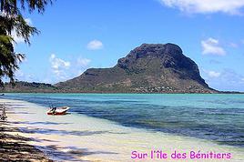
The recipe for the cocktail: endless beaches, a dazzling palette of colors, some breathtaking hikes, and excellent cuisine...

For the tasting, follow along in the pages of this travel journal! 😉

Don’t forget your hiking shoes, a swimsuit, sunscreen, but also a sweater, your driver’s license, and your credit card...

Just over 11 hours of flight, and we’ll be setting foot on Mauritian soil!

Open
Tips for choosing a long-distance touring bike
Hi there,

I’m currently looking for a bike to do my first bike trip across France, with the ultimate goal of cycling through Latin America. I’ve got a lot of questions and I’d love to hear if you have any answers or advice to share. First off, I’ve been through this before with hiking. I want to get top-quality gear right away. When I started hiking, I ended up buying everything three times—first beginner gear, then intermediate, then expert, etc. For biking, I’d prefer to skip that process and invest right now in a bike that could ideally handle Latin America. I’ve set a total max budget of around 5000 € (roughly 4000–4500 € for the bike and the rest for accessories: panniers, helmet, cycling shorts, etc.).

So, I’ve got quite a few questions:

* I’ve read in several places that some people recommend buying the bike directly in Latin America. Since I need a first bike to train in Europe, would it be better to buy an entry-level bike in France (and sell it before the big departure)? Or is it preferable to start right away with my final bike to get used to it? Is buying it there just to save a bit of money?

* For a long-term trip (around six months) in Latin America, is it better to go for a gravel bike or a mountain bike?

* Should I buy a new bike or a refurbished one? Even more so given that I’m planning a long trip—could a refurbished bike end up causing more breakdowns?

If you have any advice on models, technical features to prioritize, or recommended sellers or resellers, I’d love to hear it. I’m a total beginner—I’ve only just started watching videos and reading up on the subject, and all the technical specs are new to me!

Thanks in advance for your help!
Open
USA Road Trip 2023 - Part 1
In January 2023, we started our second road trip across the United States. We stayed from January to mid-March, which gave us plenty of time to visit several cities, attractions, and parks in multiple states.

This travel journal will be split into two parts due to the considerable number of places we visited.

This first journal covers the following states: Ohio, Indiana, Missouri, Oklahoma, Texas, New Mexico, Arizona, Nevada, and California, and takes you through the outbound leg of our road trip.

The second journal will showcase the attractions we visited on the return trip, which mainly follows the famous Highway 1 along the Pacific coast.

So, I invite you to keep reading this first journal, which serves as a long recap to help you discover the various attractions we explored throughout this road trip.

Videos are included throughout the recap. Please click on the image to start the video.

Here are the links to jump to a specific post:

OHIO:

WinterLand - Christmas Lights at Cleveland Public Square Lake View Cemetery - Cleveland - Part 1 Lake View Cemetery - Cleveland - Part 2 Stroll through Columbus Upper Falls to Lower Falls via Buckeye Trail - Hocking Hills State Park – Logan Cedar Falls & Whispering Falls Hiking Trail - Hocking Hills State Park – Logan Ash Cave Hiking Trail - Hocking Hills State Park – Logan Exploring Cincinnati

INDIANA:

Visiting Indianapolis

MISSOURI:

Exploring St. Louis

OKLAHOMA:

Catoosa Blue Whale Discovering Tulsa Exploring Oklahoma City

TEXAS:

Exploring Shamrock Discovering McLean Exploring Amarillo

NEW MEXICO:

Ancestral Sites Trail - Pecos National Historical Park Discovering Santa Fe The Santuario de Chimayó Stroll through Los Cerrillos Walk through the village of Madrid San Francisco de Asis Catholic Church & The Bottle House - Golden Albuquerque Murals 66 Diner - Albuquerque Stroll through Old Town (Albuquerque) Rinconada Canyon Trail - Petroglyph National Monument Mesa Point Trail - Boca Negra Canyon - Petroglyph National Monument Macaw Trail - Boca Negra Canyon - Petroglyph National Monument Cliff Base Trail - Boca Negra Canyon - Petroglyph National Monument Piedras Marcadas Canyon - Petroglyph National Monument Sandstone Bluffs & Ventana Natural Arch - El Malpais National Monument

ARIZONA:

Stewart's Petrified Wood Shop – Holbrook Stroll through Holbrook Discovering Joseph City Exploring Winslow Grand Falls (The "Chocolate Falls") – Leupp Island Trail - Walnut Canyon National Monument Rim Trail - Walnut Canyon National Monument Wukoki Pueblo Trail – Wupatki National Monument Wupatki Pueblo Trail – Wupatki National Monument Doney Mountain Trail – Wupatki National Monument Citadel & Nalakihu Pueblos Trail – Wupatki National Monument Lomaki & Box Canyon Pueblos Trail – Wupatki National Monument Discovering Flagstaff On the way to Sedona Slide Rock State Park – Sedona Midgley Bridge Trail – Wilson Canyon – Sedona Tlaquepaque Arts & Shopping Village Walking Tour - Sedona Chapel of the Holy Cross - Sedona Hiking at Cathedral Rock - Sedona Hiking the Bell Rock Trail - Sedona Hiking the Airport Loop Trail - Sedona Amitabha Stupa and Peace Park - Sedona Hiking the Boynton Canyon Vortex Trail - Sedona Hiking the Devil's Bridge Trail - Sedona Hiking the Birthing Cave Trail - Sedona Bell Rock Inn - Sedona On the roads of Sedona - Part 1 On the roads of Sedona - Part 2 Keyhole Sink Hiking Trail - Kaibab National Forest Discovering Williams Exploring Ash Fork Discovering Kingman Ramada by Wyndham Kingman Davis Camp Park - Bullhead City Discovering Yucca Lake Havasu Boardwalk Tour A duck catches a lobster – Lake Havasu Boardwalk

CALIFORNIA:

Exploring Needles Discovering Goffs Discovering Amboy Visiting the famous Bagdad Cafe - Newberry Springs Exploring Barstow Vehicles from Hell (Mad Max Cars) - Barstow Peggy Sue's 50's Diner - Yermo Liberty Sculpture Park - Yermo Lake Dolores Water Park - Newberry Springs ZZYZX Road - Mojave National Preserve Alien Fresh Jerky - Baker Kelso Dunes Trail - Mojave National Preserve Hole-in-the-Wall Rings Trail - Mojave National Preserve Visiting Mitchell Caverns - Mojave National Preserve Dante's View - Death Valley National Park Zabriskie Point - Death Valley National Park Golden Canyon - Death Valley National Park Artists Drive & Artists Palette - Death Valley National Park Devil's Golf Course - Death Valley National Park Natural Bridge Trail - Death Valley National Park Badwater Basin - Death Valley National Park Harmony Borax Works - Death Valley National Park Devil's Cornfield - Death Valley National Park Mesquite Flat Sand Dunes - Death Valley National Park Mosaic Canyon Trail - Death Valley National Park On the road - Death Valley National Park

NEVADA:

Cleveland Clinic Lou Ruvo Center for Brain Health - Las Vegas Exploring Downtown Las Vegas SlotZilla Zipline - Fremont Street Experience – Downtown Las Vegas Viva Vision Light Show 1 - Fremont Street Experience - Downtown Las Vegas Viva Vision Light Show 2 - Fremont Street Experience - Downtown Las Vegas Viva Vision Light Show 3 - Fremont Street Experience - Downtown Las Vegas Viva Vision Light Show 4 - Fremont Street Experience - Downtown Las Vegas Free Live Music – Fremont Street Experience - Downtown Las Vegas Chucky – Fremont Street Experience - Downtown Las Vegas Las Vegas Strip - Part 1 Las Vegas Strip - Part 2 Las Vegas Strip - Part 3 Las Vegas Strip - Part 4 Las Vegas Strip - Part 5 Tom Devlin's Monster Museum - Boulder City Hoover Dam Lake Mead - Lakeview Overlook - Boulder City Nelson Ghost Town - Searchlight

CALIFORNIA:

Scenic Route through Joshua Tree National Park via the North Entrance Hidden Valley Trail - Joshua Tree National Park Barker Dam Trail - Joshua Tree National Park Cap Rock Trail - Joshua Tree National Park Keys View Trail - Joshua Tree National Park Hall of Horrors Trail - Joshua Tree National Park Skull Rock Trail - Joshua Tree National Park Arch Rock Trail - Joshua Tree National Park Cholla Cactus Garden Trail - Joshua Tree National Park Lone Pine - Owens Valley Miss Alabama & Shark Fin - Alabama Hills - Owens Valley Lone Ranger Canyon - Alabama Hills - Owens Valley Mobius Arch Loop Trail (Heart Arch & Lathe Arch) - Alabama Hills - Owens Valley Eye of the Alabama Hills Arch - Alabama Hills - Owens Valley Boot & Cyclops Arches - Alabama Hills - Owens Valley One Mile Arch, Bowling Ball and Pins & Gunga Din Area - Alabama Hills - Owens Valley Whitney Portal Arch Trailhead - Alabama Hills - Owens Valley Fish Rocks & Trona Pinnacles - Mojave Desert Red Cliffs Trail - Red Rock Canyon State Park Hagen Canyon Nature Trail - Red Rock Canyon State Park Tour of Historic Downtown Tehachapi View of the Tehachapi Loop – Monolith César E. Chávez National Monument – Keene Discovering Bakersfield Kern County Museum – Bakersfield Bravo Farms, Tree House & Petting Zoo - Traver Walking Tour of Kingsburg Exploring Fresno Simonian Farms & Soul Consoling Japanese Internment Tower - Fresno Duncan Ceramic Products (iLoveToCreate) - Fresno Walking Tour of Modesto Wat Dhammararam Buddhist Temple - Stockton Walking Tour of Stockton Discovering Stockton University of the Pacific - Stockton Visiting Lodi Sutter's Fort State Historic Park - Sacramento California State Capitol - Sacramento Walking Tour - Sacramento Walking Tour - Winters Walking Tour - Napa The Chandelier Tree In Drive-Thru Tree Park - Leggett One Log House - Garberville Grandfather Tree - Piercy The Living Chimney Tree - Avenue of the Giants Stephens Grove Loop Trail - Avenue of the Giants Gould Grove Nature Loop Trail - Avenue of the Giants Fleishmann Grove Trail - Avenue of the Giants Mahan Plaque Trail - Avenue of the Giants Founders Grove Nature Loop Trail - Avenue of the Giants Eternal Tree House & Immortal Tree - Avenue of the Giants Drury-Chaney Loop Trail - Avenue of the Giants Walking Tour - Redcrest

COMING UP NEXT:

USA Road Trip 2023 - Part 2
Open
Croatia, Montenegro – two victims of overtourism?
Mid-June, two Auvergnats on the starting blocks—off we go to the former Yugoslavia! We’d already explored some nooks and crannies of northern Croatia back in 2019, so we’re keeping the momentum going by planning a trip to the south of the country and then Montenegro.

On the way back, we’ll drift into Bosnia-Herzegovina just to mix things up a bit!

We’re a little unsure about what to expect in terms of tourist crowds.

Dubrovnik has a reputation for being the hardest-hit city by overtourism, and Kotor and the whole Dalmatian coast aren’t exactly empty...

Luckily, most European countries haven’t started school holidays yet, and some measures seem to have been put in place to limit the flow (like restrictions on the number of cruise ships allowed to dock at the same time).

Maybe we’ll manage to escape the promised hell?

For now, we’re slamming the doors of the Scirocco and heading off to our first stop: northern Italy!

Open
USA 2022 Road Trip
During our first road trip across the United States, we covered 23,000 km and crossed 28 states in 53 days.

Originally, we had planned to drive Route 66 all the way to Oatman in Arizona and visit various national parks in the American West over a two-month period.

This itinerary was planned before our departure, and all the relevant information had been gathered to stick to the schedule.

Everything went so smoothly that we finished visiting the national parks well ahead of our planned return date.

It helped that having a bed, a portable toilet, and a cooler in our vehicle gave us some autonomy since we didn’t have to worry about accommodation.

So, we decided to extend our road trip to the cities of Nashville and Memphis in Tennessee.

We then headed to Louisiana to visit Baton Rouge and New Orleans.

We crossed Mississippi and Alabama before driving along Florida’s west coast all the way to Key West.

We returned via Florida’s east coast and then crossed the eastern U.S. states to get back to Quebec through the Jackman border crossing in Maine.

So, I invite you to keep reading this long recap, which will let you discover the different attractions we visited throughout this amazing journey.

Videos are included throughout the recap. Click on the image to start the video.

To jump to a specific post, here are the relevant links:

Route 66 - Illinois & Missouri Route 66 - St. Louis (Missouri) - Gateway Arch National Park Route 66 - Cuba (Missouri) - City Murals Route 66 - Springfield (Missouri) - Fantastic Caverns Route 66 - Kansas & Oklahoma Route 66 - Texas & Arizona Route 66 - Texas - The Stations of the Cross in Groom Route 66 - Texas - Panhandle - VW Slug Bug Ranch Texas - Palo Duro Canyon State Park - Juniper Trails Texas - Palo Duro Canyon State Park - The Lighthouse Trail Route 66 - Texas - Amarillo - Cadillac Ranch Route 66 - New Mexico - Santa Rosa Blue Hole New Mexico - Bandelier National Monument - Alcove House Trail via Main Loop Trail New Mexico - Bandelier National Monument - Tsankawi Ruins Trail New Mexico - White Rock Overlook Route 66 - New Mexico - Albuquerque - Old Town New Mexico - White Sands National Park New Mexico - White Sands National Park - Dune Life Nature Trail New Mexico - White Sands National Park - Playa Trail New Mexico - White Sands National Park - Interdune Boardwalk New Mexico - Gila Cliff Dwellings National Monument New Mexico - Grants - Ice Cave & Bandera Volcano New Mexico - Gallup - Pyramide Rock Trail & Church Rock Trail Arizona - Holbrook - Painted Desert Arizona - Petrified Forest National Park - Puerco Pueblo & Newspaper Rock Viewpoint Arizona - Petrified Forest National Park - Blue Mesa Arizona - Petrified Forest National Park - The Teepees, Agate Bridge & Jasper Forest Overlook Arizona - Petrified Forest National Park - Crystal Forest Trail Arizona - Petrified Forest National Park - Giant Logs Trail Arizona - Winslow - Two Guns Ghost Town Arizona - Cameron - Little Colorado River Gorge Overlooks Arizona - Grand Canyon National Park - Shoshone Point Trail Arizona - Grand Canyon National Park - Desert View Drive Arizona - Grand Canyon National Park - Rim Route (Orange) & Village Route (Blue) Arizona - Grand Canyon National Park - Hermit Route (Red Line) Route 66 - Arizona - Historic Town of Oatman Arizona - Bullhead City Community Park Nevada - Red Rock Canyon - Calico I & II & Sandstone Quarry Nevada - Red Rock Canyon - Willow Springs Nevada - Red Rock Canyon Lookouts Nevada - Valley of Fire State Park - White Domes Trail Nevada - Valley of Fire State Park - Seven Wonders Trail, Pink Canyon, Fire Wave Nevada - Valley of Fire State Park - Rainbow Vista Trail Nevada - Valley of Fire State Park - Mouse's Tank Trail Nevada - Valley of Fire State Park - Rock Formations Nevada - Valley of Fire State Park - Scenic Routes Nevada - Cathedral Gorge State Park - Slot Canyons Nevada - Cathedral Gorge State Park - Eagle Point & Miller Point Utah - Bryce Canyon National Park - Mossy Cave & Tropic Ditch Waterfall Trail Utah - Bryce Canyon National Park - Scenic Drive Utah - Zion National Park - Pa'rus Trail Utah - Zion National Park - Sand Bench Trail Utah - Zion National Park - Emerald Pools Trail Utah - Zion National Park - West Rim Trail (Trail connecting to Angels Landing) Utah - Zion National Park - Riverside Walk Utah - Zion National Park - Court of The Patriarchs & Big Bend Utah - Zion National Park - Mount Carmel Highway Scenic Drive Utah - Kanab - Jackson Flat Reservoir Utah - Toadstools Trail in Grand Staircase-Escalante National Monument Arizona - Page - Glen Canyon Dam Overlook Arizona - Page - Glen Canyon National Recreation Area Arizona - Page - Horseshoe Bend Overlook Arizona - Page - Upper Antelope Canyon Arizona - Page - Navajo Canyon Boat Tour at Lake Powell Arizona - Page - Antelope Canyon X Arizona - Canyon de Chelly National Monument - Chelly Canyon Arizona - Canyon de Chelly National Monument - Canyon del Muerto Arizona - Monument Valley Navajo Tribal Park Utah - Mexican Hat Utah - Mexican Hat - Goosenecks State Park Utah - Mexican Hat - Valley of the Gods Utah - The Moki Dugway Scenic Backway Utah - Blanding - Natural Bridges National Monument Utah - Lake Powell - Hite Crossing Bridge Utah - Lake Powell - Glen Canyon National Recreation Area - Hite Overlook Utah - Capitol Reef National Park - Chimney Rock Loop Trail Utah - Capitol Reef National Park - Hickman Bridge Trail Utah - Capitol Reef National Park - Grand Wash Trail Utah - Capitol Reef National Park - Sunset Point Trail Utah - Capitol Reef National Park - Goosenecks Trail Utah - Capitol Reef National Park - Viewpoints - Fruita Area Utah - Capitol Reef National Park - Viewpoints - Scenic Drive Utah - Capitol Reef National Park - Cassidy Arch Trail Utah - Capitol Reef National Park - On the way to Capitol Gorge Trailhead Utah - Capitol Reef National Park - Capitol Gorge Trailhead Utah - Monroe - Mystic Hot Springs Utah - Scenic Overlooks on UT-24, UT-119 & I-70 Utah - Arches National Park - Park Avenue Trail Utah - Arches National Park - Courthouse Towers Section's Viewpoints Utah - Arches National Park - Balanced Rock, Pothole Arch, Ham Rock & Garden of Eden Utah - Arches National Park - Double Arch Trail, Cove Arch, Cove of Caves & Panorama Point Utah - Arches National Park - Windows Loop & Turret Arch Trail Utah - Arches National Park - Delicate Arch Trail Utah - Arches National Park - Upper Delicate Arch Viewpoint Trail Utah - Arches National Park - Fiery Furnace Section - Viewpoints Utah - Arches National Park - Sand Dune Arch Trail Utah - Arches National Park - Skyline Arch Trail Utah - Arches National Park - Devils Garden Trail Utah - Dead Horse Point State Park - West Rim Trail Utah - Dead Horse Point State Park - East Rim Trail Utah - Moab - Utah State Route 279 (Potash Road) Utah - Moab - Shafer Trail - Potash Evaporation Ponds Utah - Moab - Potash Road Dinosaur Tracks and Petroglyphs Utah - Moab - Potash Road - Corona, Bowtie & Pinto Arches Trail Utah - Moab - Potash Road - Wall Street Climbing Area Utah - Moab - Kane Springs Road Utah - Moab - Kane Springs Road - Side By Side Adventure Utah - Moab - Kane Springs Road to Moab Utah - Canyonlands National Park - Island in the Sky - Mesa Arch Trail Utah - Canyonlands National Park - Island in the Sky - Aztec Butte Trail Utah - Canyonlands National Park - Island in the Sky - Whale Rock Trail Utah - Canyonlands National Park - Island in the Sky - Upheaval Dome Trail Utah - Canyonlands National Park - Island in the Sky - Grand View Point Overlook Trail Utah - Canyonlands National Park - Island in the Sky - White Rim Overlook Trail Utah - Canyonlands National Park - Island in the Sky - Overlooks Utah - Moab - Wilson Arch Utah - Monticello - Newspaper Rock State Historical Monument Utah - Canyonlands National Park - The Needles - Road Side Ruin Trail Utah - Canyonlands National Park - The Needles - Cave Spring Trail Utah - Canyonlands National Park - The Needles - Pothole Point Trail Utah - Canyonlands National Park - The Needles - Big Spring Canyon Overlook Trail Utah - Canyonlands National Park - The Needles - Overlooks Colorado - Mesa Verde National Park - Mesa Top Ruins Road Colorado - Mesa Verde National Park - Chapin Mesa Road Colorado - Mesa Verde National Park - Mesa Top Loop Colorado - Mesa Verde National Park - Wetherill Mesa Road Colorado - Great Sand Dunes National Park Colorado - Mosca - Zapata Falls Colorado - Colorado Springs - Garden of the Gods Colorado - Black Canyon of the Gunnison National Park Colorado - Gunnison - Curecanti National Recreation Area Colorado - Gunnison - Blue Mesa Dam & Reservoir Colorado - Lake Pueblo State Park (Pueblo Reservoir) Kentucky - Mayfield, 5 months after an EF4 tornado Tennessee - Nashville - Downtown Walking Tour Tennessee - Graceland Mansion - Home of Elvis Presley Tennessee - Graceland - Lisa Marie & Hound Dog II Jets Tennessee - Graceland - Elvis Presley Automobile Museum & Exhibits Tennessee - Exploring Memphis Louisiana - Exploring Baton Rouge Louisiana - Exploring Lafayette Louisiana - Exploring Houma Louisiana - New Orleans - French Quarter Tour Louisiana - New Orleans - Garden District Tour Louisiana - New Orleans - Creole Queen Mississippi River Cruise Florida - Clearwater Beach Florida - Sanibel Island - Bowman's Beach Florida - Siesta Key Beach Florida - Captiva Island - Turner Beach Florida - Key Largo - Sunset Florida - Key West - Smathers Beach Florida - Miami Beach - Art Deco District Florida - Miami Beach South Carolina - Myrtle Beach Virginia - Virginia Beach Maine - Scarborough - Pine Point Beach
Open
Albania in Autumn Colors
A new work assignment means our vacation dates can't stay the same.

We had planned to go to the Canary Islands, but flight prices are skyrocketing with this new holiday schedule.

So, I’m looking for an alternative to Gran Canaria and El Hierro and found two round-trip flights with Wizz Air to Tirana.

398 €, including baggage and seats—perfect!

Plus, the departure and return times are great, which is pretty rare for a low-cost flight!

All that’s left is to rent a car, plan the route, and book accommodations.

With two weeks, we’ll have to make some choices!

Here’s the final itinerary: Shkodra (2 nights), Valbonë (3 nights), Tirana (1 night), Lake Ohrid (1 night), Korçë (1 night), Përmet (1 night), Gjirokastër (1 night), Himarë (2 nights), Berat (2 nights), and Krujë (1 night).

A mix of countryside and small towns, a bit of the Mediterranean, and some mountains!

Late October isn’t the best season, so let’s keep our fingers crossed for the rest...

Open
Northern Morocco, the kingdom of kif?
My first trip to Morocco dates back to the early 90s.

Four more followed...

I’d never gone further north than Casablanca, Volubilis, or Fez—it was time to fix that!

So I planned a route that would fill in the gaps while revisiting a few places.

This route is pretty classic—if you’re looking for something original, you might want to skip it!

The starting point of the trip: the city of Rabat.

The stops?

Azrou, Fez, Al Hoceïma, Akchour, Tetouan, Tangier, Asilah, and finally Rabat.

Mostly an urban trip, then.

Too much?

We’ll see at the end of the travel journal!

Open
Santo Antão: West-East and North-South crossings
Hi everyone. Good evening! I’m back from Sententon. I’ve recovered now. What a beautiful, beautiful island—did it both ways. The crossing I’d call the "Madman’s Crossing" (a nod to another well-known one) is the one from Tarrafal to Ponta do Sol, which I did in 4.5 hours without speeding like Gonzalez. Then there’s what I’d call the "Grogue Diagonal"—the north-south route from Ribeira do Paul to the Janela Lighthouse, passing through Cova, Pico da Cruz, and Silva. A day and a half of pure enjoyment, wrapping up my visit to the island in supreme beauty. In my opinion, here are the island’s 7 must-dos: - The most stunning *bordeira* – the *bordeira do norte* - The most fantastic – the climb from João do Bento to Orgueiro - The most pleasant – the *vereda* Cova/Pico da Cruz/Silva - The most overrated – the northern coastal path - The most beautiful paved section – Ribeira de Penede’s lower part - The most grueling – Figueira de Cima to Chupador - The toughest – the climb to Salto Preto

And for any hiker, the Norte plateau is a must. Unfortunately, I couldn’t make it to Tope de Coroa—my only rainy day—but it was still good, even with the summit shrouded in clouds all day.

Here are my initial thoughts. I’m happy to share more with anyone planning the same crossings. I’m currently posting the route details on my blog and might share a few here. Though since the forum’s text editor isn’t top-notch without HTML, I’m not sure how it’ll turn out. In the meantime, you can check it out here --> Cape Verde. Should be of interest to hikers. Bye
Open
Langtang – Trekking in the Rain
We did the Langtang trek (hike) from September 10th to 17th, with the first and last days being the trip from Kathmandu and back—so 6 days of actual walking. It’s a fairly well-known trek but certainly not as famous or crowded as those in the Annapurna or Everest regions, which is why we chose it.

In theory, it’s mandatory to have a guide for this trek. In reality, it seems there are ways to bypass the regulations: we met at least two people hiking without a guide—a South Korean, a New Zealander, and possibly also a couple of English women and an American couple, though we’re not sure if they had a guide.

The agency we booked with had told us it was an affordable trek for relatively older people in good shape—which is our case (I’m 72 myself). I have to say upfront that we found it quite challenging, maybe because we didn’t have good weather—it was the end of the monsoon season. To be clear, no matter your fitness level, I’d say doing this trek in the middle of the monsoon season would be suicidal.

Day 1 – Journey from Kathmandu to Syapru Besi

On Monday, September 8th, there had been violent protests in Kathmandu against the government, which had, among other things, blocked access to social media and been accused of nepotism and corruption. There were 19 deaths. The situation was very tense on the day of our departure, Wednesday the 10th. The agency warned us that public transport was very unreliable. So, we decided to take a jeep, at an additional cost of $100 ($160 minus what was already budgeted for the bus).

We left a little before 7 a.m. and it took us a good hour just to reach the outskirts of Kathmandu. Along the way, we saw several houses and vehicles set on fire by protesters.

The road to Syapru Besi is only 120 km, but it’s frankly awful. It’s always narrow, winds through endless mountains, and the shoulders range from bad to confusing to nonexistent. Several sections are just dirt tracks. We didn’t regret opting for the jeep, as we could stop several times at our convenience—if only to let Y (my Thai partner) throw up everything she had. She’d taken her usual motion sickness medication, but the constant turns, accelerations, and braking eventually made her terribly carsick.

In Nuwakot, we stopped for breakfast at a nice little restaurant, Jimbu. It was around 8:30 a.m., and we’d barely covered 60 km. The restaurant has a lovely garden overlooking the Trishuli Ganga, the river flowing down from Syapru Besi. First photo: the river in the bottom right corner, mist and clouds over the mountain on the other side.

An hour later, my second photo: the hills along the Trishuli Ganga. You can see the different crops—lush green rice paddies in the lower right and corn, already yellowed and likely harvested, in the foreground on the left. And of course, the mist and clouds through which you can glimpse the mountain on the other side of the river.
Open
Nepal Feedback
NAMASTE NEPAL! PRACTICAL INFO AND EXPERIENCE FEEDBACK

Stay from March 25 to April 16, 2025

· Flight tickets Air India (via Delhi) (via Skyscanner) = 1130 € per person · Planned budget (and respected without too many restrictions and while buying a few small gifts) = 2000 € for the stay for two. Buses, taxis, and entrance fees to various sites represent a budget to consider. Meals are cheap. Drinks like beer/Coke, however, are not cheap and cost the equivalent of a meal. · Exchange rate of the rupee during our stay = 0.0064 € (the exchange rate is almost identical everywhere, including at the airport). · At the airport, purchase of two SIM cards (phone) = 1000 NPR x 2 for 28 days. · Kathmandu: we had booked the hotel upon arrival: Kathmandu Boutique Hotel (+977 015 357 446 – email: booking@kathmanduboutiquehotel.com), very well located in a quiet alley off the street, south of Thamel, a 10-minute walk from Durbar Square. A hotel like Nepal knows how to do, where tall people will have to duck. Night + breakfast = 18 € for two. Very warm welcome, great location, excellent value for money. · Bhaktapur: we had also booked a hotel for the end of our stay because the chance of the year 2025 made the Nepali New Year and Bisket Jatra particularly festive in Bhaktapur: Manju Baha Hotel School (+977 976 7234014 – email: manjubahahotel@gmail.com) located in an old monastery. "A social enterprise transforming an old monastery into a charming hotel, offering professional hospitality training to underprivileged Nepali youth." Night + breakfast = 32 € for two. Beautifully decorated room. Very warm welcome. Don’t miss the Changunarayan site (near Bhaktapur), it’s amazing. And if you’re lucky enough to be in Bhaktapur in mid-April for 3 days, there’s the Bisket Jatra festivities (Newari festival), joyful, noisy, fun, and wild… · Pokhara (hotel recommended by the Kathmandu hotel): Hotel Green Tara, Lakeside, 10th street, set back, quiet (Tel. +977 61 462698 – email: greentara_67@hotmail.com) · Trek permit (Lower Mustang, no need for an agency or guide, permits checked at Ghasa and Jomsom) = 2000 NPR per person (2 ID photos) · Bus Kathmandu/Pokhara and return = 2000 NPR per person · Bus Pokhara/Jomsom, 2 one-way tickets = 2800 NPR. · Taxi: negotiation with a driver we recommend, Vicky (+977 984 075 599). You explain what you want, negotiate the price, and he waits for you during the visit. Very charming, we used him several times. For example: departure from our hotel at 10 AM -> Boudhanath/Pashupatinath/Patan return at 5 PM to the hotel = 6500 NPR – Swayambhunath (round trip) = 1200 NPR · Site prices: https://ntb.gov.np/plan-your-trip/before-you-come/heritage-site-entry-fees o Visitor Pass for Kathmandu Durbar Square (for the duration of the stay, show your visa) = 1000 NPR per person (1 ID photo) o Bhaktapur Durbar Square (old town) = 1800 NPR per person o Patan = 1000 NPR per person o Swayambhu Stupa = 200 NPR per person o Boudha Stupa = 200 NPR per person o Pashupatinath Temple = 1000 NPR per person (interesting to take a guide) o Changunarayan Temple (6 km north of Bhaktapur) = 400 NPR per person o Mountain Museum in Pokhara = 750 NPR per person · E-cigarettes: e-cigarettes are banned in India and confiscated whether they’re in carry-on or checked luggage. On the way there, we had kept them in our carry-on, they were confiscated in Delhi. On the way back, learning from our previous experience, we put them in our checked luggage. Someone came to get us to take them out of our bags and confiscate them… You can find e-cigarettes and products in Kathmandu.

* * *

I’m 74 years old. I went to Nepal in 1982, 1983, and the last time in 1986. I wanted to introduce this beautiful and endearing country to my husband, and it was… now or never. So we decided it was now.

I knew the trek starting from Pokhara: Naudanda/Birethanti/Ghorepani/Tatopani/Kalopani. There was no way I was going to do that trek, especially the 1000-meter staircase to reach Ghorepani… You have to stay humble with age.

Back then, the road didn’t exist. I didn’t consider, with the construction of this road (NH48) along the western bank of the Kali Gandaki, doing a trek along a windy and dusty road. Was there an alternative hiking trail on the eastern bank? No one answered my question on VoyageForum, so I did my research online. And I found this site: "Andrées de Ruiter and Prem Rai - Trekking the Annapurna Circuit, including the new NATT trails that avoid the road - A guide to one of the most beautiful trekking regions in Nepal and the world (2011) - NATT = New Annapurna Trekking Trail".

Phew! A solution was emerging. This circuit from 2011 wasn’t fully marked. The idea was to go from Jomsom to Tatopani, so we needed to make sure the path was well-marked all the way, which we did, and the path exists, marked in red and white!

So, with the walking times information, we built our 8-day circuit:

· Jomsom/Thinigaon · Thinigaon/Chimang · Chimang/Saura · Saura/Kokhetanti · Rest day or, if in good shape: loop to Sekong Lake · Kokhetanti/Jhipra Deurali · Jhipra Deurali/Kopchepani · Kopchepani/Tatopani

It’s a senior trek, after all. So the walking times noted on the sites indicated 3 hours or even 4 hours for the two longest stages. That pace suited us fine.

On March 29, we left Kathmandu (1400m), after visiting the must-see sites, by bus to Pokhara: 200 km and 8.5 hours on a chaotic road under construction. I had a memory of Pokhara where it was the first city where you could see the Himalayan range, especially Machhapuchhare. But the pollution is such, the dust raised by traffic and construction, that no horizon is visible except the first hills around Pokhara.

We stayed 24 hours in Pokhara (820m), and on March 31, we left our luggage at the hotel and set off with our lightest backpacks: change of clothes, toiletries, first aid kit, anti-chafing cream, water bottle, sleeping bag liner, and light shoes for the stages.

We took the bus to Jomsom: 160 km/7.5 hours including stops for bathroom breaks, tea, and lunch. The road is nothing but a chaos of potholes, landslides, construction, dust, rebuilding, and mudslides. In Ghasa, the bus stops, and we’re told we’re at a checkpoint and that the two foreigners in the bus, my husband and I, need to have our permits checked, which takes a few minutes. The driving is rock-and-roll, surprising, and courteous. The drivers have their codes, and on these improbable roads, they’re virtuosos.

We could have chosen the plane, but several reasons dissuaded us: if there’s too much wind, the planes don’t take off; personally, I wasn’t reassured about landing in Jomsom, and this transport has a cost.

We arrived around 2 PM in Jomsom (2720m), and despite the early wake-up, the nearly 8 hours on the bus, and the altitude, we decided to head straight to Thinigaon (2840m). At the Jomsom checkpoint, they told us it was a 30-minute walk. Great! Except we took an hour and a half on an uphill road, bent over to fight a strong wind. But the Himalayan range is there! The Dhaulagiri, the Nilgiri, the Annapurnas as a reward.

In Thinigaon, we found a room at the "Nilgiri View Hotel" run by a didi (big sister in Nepali). From the lodge’s roof, she proudly showed us the different peaks surrounding the village and told us, worried, that it hadn’t snowed here for 3 years. She said there are very few tourists, that the season is rather in September/October/November. It seems there’s not a soul in this village, yet mules pass through the narrow street paved with large flat stones, their bells ringing. We dine at 6 PM and go to bed… Room = 1200 NPR and dinner, breakfast, and drinks = 2560 NPR.

On April 1, we set off at 9 AM, not for Chimang as planned but for Marpha! The didi from the Thinigaon lodge had said it was a 3-hour walk. The first part of this stage is attractive, the mountains are magnificent and imposing, the landscape is superb, there’s no one around, a feeling of being "alone in the world." We follow Dhumbra Tal, this small green lake. The path is a rocky track that climbs steeply. Then, around a hill, we start the big descent that joins the Kali Gandaki. We face the wind head-on, and the violent gusts take our breath away, throw us off balance, and envelop us in dust. We see the road on the other side of the Kali Gandaki. We arrive in the village of Chhairo at 2 PM, completely exhausted and with blistered feet, after 5 hours of walking instead of the planned 3.5 hours.

We’re welcomed by the village nurse, who tells us there’s a lodge in the village. Chhairo is a Tibetan village, a 20-minute walk from Marpha (according to the locals, multiply by 2 or even 3 for us…). We’re going to revise our trek plan and, first of all, spend the night in Chhairo.

The lodge is quite pleasant, and Karma, the hostess, is very friendly. She asks about our plans and suggests we stay in Chhairo the next day, from where we can visit Marpha and also Chimang, a 1-hour walk away, in light mode, meaning without backpacks. She invites us to participate in a village ceremony the next evening.

We immediately accept the proposal, as our feet need rest and the welcome is so warm… Dinner and bed!

We reworked our trek plan, which was too ambitious for our untrained bodies and, let’s face it… no longer in our first youth. In the initial plan, we thought there wouldn’t be too much elevation gain following the Kali Gandaki, but checking the map, we realize there might be significant elevation changes between Sauru and Sirkung. So we plan:

· Tomorrow: visit Marpha (2670m) and Chimang (2744m) · April 3: bus from Chhairo (2700m) to Kalopani (2530m) and continue on foot to Ghasa (2010m) · April 4: Ghasa/Pairataplo (1940m) · April 5: Pairatapla/Gadpar (1580m) · April 6: Gadpar/Narchyang (1510m) · April 7: Narchyang/Tatopani (1190m) · April 8: return to Pokhara.

Normally, it’s all downhill…

April 2, a rest day then… We set off in the morning to explore Marpha. We have to take a temporary bridge because the suspension bridge is closed due to road construction. We join the road and arrive in Marpha, a village famous for its apple orchards, brandy, cider, and apple juice production. This village is magnificent with its stone houses and monastery clinging to the hillside. The road construction spared it. There are people, but very few Western tourists.

We have lunch in Marpha and go back through Chhairo to take the path to Chimang. We cross a fragrant pine forest and find the rocky path; the landscape is splendid. We walk quietly, passing peaceful buffaloes and cows, and arrive at the foot of a stone staircase… 275 steps (which we counted on the way back) leading us to the village of Chimang. Chimang is an isolated Newari village that seems a bit desolate. Despite the slopes, there are crops on every little bit of land. Thankfully, we changed our initial program because there’s no lodge in this village, contrary to what we saw on a map… We wander through the village, which seems very deserted, have coffee in a house from another world, and then head back to Chhairo.

A rest day? = 5 hours of walking!!

Dinner and village ceremony. From what we understand, this ceremony is in honor of the Dalai Lama. Men, women, and children in traditional costumes gather twice a month; they dance, make, and offer small sweet cakes with Tibetan tea (made from tea, yak butter—often rancid—water, and salt). Surprising for first-timers…

Around 10 PM, we leave the ceremony; tomorrow morning, we need to be on the roadside by 7 AM to catch the bus to Kalopani…

This village of Chhairo is very pleasant and welcoming, no tourists, just two motorcyclists who arrived in the evening, one of whom participated in the ceremony and discreetly poured his Tibetan tea outside.

Lodge: "Norsang Tibetan Guesthouse and Restaurant". Total bill for 2 nights, 2 dinners, 2 breakfasts, and drinks = 8000 NPR.

April 3: bus from Chhairo to Kalopani, about 1.5 hours for the 20 km (200 NPR per person). We descend on the right bank of the Kali Gandaki. We find the red and white markings to resume the trek toward Ghasa. We’re in a fragrant pine forest, the Dhaulagiri on one side and the Annapurnas on the other, magnificent, and the path is pleasant and easy. We get a bit lost in this forest, always looking for the markings. Near Lete, two trekkers pass us, and we meet them again a little further on with two very young children, to whom we give the 2 hard-boiled eggs I didn’t eat this morning. They accepted them without hesitation.

We arrive in a village and ask for directions to Ghasa. The young girls point the way. But we come across a forest being logged, trees cut in all directions. We turn back and ask for confirmation. They confirm… But the two young girls catch up with us and clear the way. We have to step over, go around, and cross the felled trees, with no indication at all. Through this pick-up sticks of felled trees, the girls lead us to the top of a stone staircase, indicating that was the path. It’s the only place where we saw rhododendrons in bloom.

We descend the staircase. At the bottom, to the left, there’s a bridge to go toward Choyo, and to the right, a path to Ghasa. We take the right path and join the road. We should normally find the red and white markings, but we don’t… So we continue on the western bank road of the Kali Gandaki.

A little before the village of Misi, we see fumaroles on the opposite bank that seem to come from the ground. We don’t understand. We stopped to eat in the village of Misi (noodle soup = 600 NPR), but it’s hard to communicate with the elderly people running the guesthouse.

We continued on the road, not finding the marked path parallel to the road. Landslides, both on the left and right banks, seem to have taken over the marked routes. It’s a place where the Kali Gandaki gorge narrows, and on the opposite bank, the mountain smokes more and more, and we now hear the crackling of fire. Across from us, the mountain is burning… Our initial plan had us passing on that burning bank right now…

We arrive in Ghasa at 3:30 PM, a 6.5-hour stage but with a 1-hour stop at noon. We’re at the "Florida Guesthouse and Restaurant." From our room, we see the mountain smoking on the other side of the river, and at night, we see the flames. In this village, posters show Himalayan eagles and vultures that seem to be protected species. Indeed, we saw (and heard) 3 eagles circling today.

April 4 – Today, heading to Pairothapla or Kopchepani depending on our feet, accommodation options, and simply our desires.

No more smoke on the mountain this morning. It’s chilly, 7:45 AM, the sky is clear, just a smell of smoke outside.

Price of the lodge = 1000 NPR for the night + 3580 NPR for meals.

We cross Ghasa, which stretches over more than a kilometer. We have a drink at the last guesthouse in the village, and the didi, when she learns our destination, tells us to be careful because the villages we’re going to aren’t safe. Should we distribute our rupees in different pockets? Nah, we kept going.

At the exit of Ghasa, we find the red and white markings and take the suspension bridge to cross the boiling waters of the Kali Gandaki. The passage is impressive because the river is tumultuous. Lots of climbs and even more descents. We’re back on the eastern bank. It’s hot! On the narrow path, we meet a group of buffaloes. Who has the right of way? We decide to stick as close as possible to the rock wall and move forward calmly. The buffaloes look at us, chewing placidly, with no intention of jumping on us. Phew!

After a 5-hour stage (including stops), we arrive in Pairothapla, with hot feet and firm thighs, and decide we won’t go any further. It’s a good thing because there’s a lodge, the most basic so far, but with a great welcome. We have a meal and a short nap. The buffaloes we met on the way belong to this house. They come to drink at the fountain by the path.

Our host, very pleasant, doesn’t know what to do to please us and is very attentive. He wants to chat. He has two children, a 4-year-old girl and a 7-year-old boy. Where do they go to school? Do they go? He tells us that the fires in the mountain are caused by people, but for what reason? We won’t find out, but it’s illegal. From here, we can still see smoke rising in the distance. The wife is a bit less friendly. Corn kernels dry on a woven straw mat on the ground, and the mom sorts them.

From where we are, we overlook the valley and see the road under construction winding along the mountainside on the other bank.

Dinner on the terrace of the house overlooking the path, windbreaker and fleece on: dal bhat chicken for me and chicken curry for my husband: "organic" products, at least local production. There are small vegetable gardens everywhere with all sorts of vegetables.

April 5 – While we’re having breakfast on the terrace of our lodge, 5 porters, straps on their foreheads, heavily loaded, pass by on the path. A few minutes later, a group of 9 people appears. It must be said that since the beginning of our journey, we’ve met very few hikers. Two backpackers in Chhairo, the two hikers near Lete, two female hikers passed us before Pairothapla, a solo female hiker passed us…

The lodge in Pairothapla is called "Bimala Lodge & Thakali Kitchen" – Price for night + 4 meals + 2 breakfasts = 3000 NPR.

The descent toward the Kali Gandaki involves climbs whose steps we didn’t count. Clearly, the landslides on the mountain cause changes to the official ACAP trek marked in red and white, and the marking updates can’t keep up with the pace of these landslides. It’s almost always by chance that we find the markings. Fortunately, we can follow the power line that guides us somewhat.

Drink stop in Kopchepani, the legs are fine, but the feet don’t like being tightly enclosed. A group of trekkers with porters passes on the path. We met buffaloes that we kindly let pass; the path was wide enough, but it was a staircase going up, and we didn’t want to take any risks.

Across, a view of the magnificent Rupse Waterfall on the other bank of the Kali Gandaki, at the bottom, lots of vehicles and people.

Arrival in Gadpar after crossing a rather unwelcoming small village and cultivated gardens between dry stone walls, each better built than the last.

First lodge spotted, first lodge adopted to answer the call of our feet, and a very warm welcome from the owner. Since we hadn’t eaten at noon, we had Tibetan bread/jam. 6-hour stage including 1 hour of stops. Night + dinner + breakfast + drinks = 5060 NPR

April 6 – Today, heading to Narchyang.

For several days, we’ve seen banana trees with their bunches of fruit and even a prickly pear with large fruits ripening.

This stage is quite peaceful and pleasant. We take a suspension bridge to cross a tributary of the Kali Gandaki. While we’re resting for a moment before crossing the bridge, a couple of porters, a man and a woman, arrive and start across the bridge with their wood load in a basket held by a strap on their forehead, making them bend. We set off too… lighter than them.

On the other side of the bridge… a stone staircase, and it climbs steeply. The porter couple didn’t take this staircase; they went right on the path.

At the top of the staircase, we arrive in Narchyang after a 4-hour stage. A magnificent waterfall overlooks the village. We get lost in this fairly large village looking for a lodge. After wandering around for a while, we ask for directions, and an 84-year-old man takes us through the whole village and accompanies us to a very nice lodge run by a woman.

We chat with our hostess, who asks where we’re from and where we’re going. We explain that we want to reach Tatopani the next day and then return to Pokhara. She tells us there are 4x4s going directly to Pokhara and that it would probably be easier than taking a bus that might be full in Tatopani. After a quick consultation, we decide to return to Pokhara the next day by 4x4. She finds us a 4x4 with 2 seats left, departure at 8 AM – 5 hours on the road and 1500 NPR per person. A charming didi who does everything to be pleasant and helpful.

Narchyang community lodge = night + snacks + dinner + breakfast = 3000 NPR.

There you go, our trek ends tomorrow. Many necessary changes and adaptations to our initial trek, but no regrets, it was superb and a great experience that, for my part, I won’t be able to repeat. Always this encounter with the endearing, welcoming, curious, and very kind Nepali people. It was now or never, and we did it!

* * *

In conclusion, 3 full weeks in Nepal is a duration that allows visiting Kathmandu, Patan, and Bhaktapur, enjoying the various sites, and soaking in the atmosphere and urban Nepali life.

The trek, even revised and corrected, allowed us to get close to the impressive Annapurna and Dhaulagiri peaks. One or two acclimatization days might be necessary to get the body in tune with this magical and extraordinary land.
Open
Grand tour of Argentina March 2025
My buddy Christian and I (Patrick) are off for 28 days in Argentina in March. We’ve already shared several trips as a duo (Bolivia Peru, Namibia, Laos, Costa Rica). Since we’re starting from the idea that at our age (65) we won’t be coming back here—there are just too many other corners of the world to discover—we did the "grand tour" of Argentina, with 6 domestic flights to make the most of our 28 days. Here are our stops: 1) Departure from Brussels to Buenos Aires via Madrid 2) Arrival and first contact with Buenos Aires 3) Early morning flight to Ushuaia. Boat trip on the Beagle Channel 4) Ushuaia: hikes in Tierra del Fuego National Park 5) Ushuaia: last hike and flight to El Calafate 6) El Calafate to El Chaltén by bus. First hike 7) El Chaltén: hike 8) El Chaltén: hike 9) El Chaltén: hike and bus back to El Calafate 10) El Calafate: Perito Moreno Glacier 11) Flight to Bariloche. Car rental and surrounding areas 12) Seven Lakes Region 13) Nahuel Huapi National Park region 14) Flight to Salta. Car rental 15) To Tilcara 16) To Humahuaca 17) To Purmamarca 18) To Jujuy via the salt flats 19) To Cafayate 20) Around Cafayate 21) To Cachi 22) Back to Salta 23) Flight to Iguazu 24) Waterfalls on the Argentine side 25) Waterfalls on the Brazilian side and flight to Buenos Aires 26) Buenos Aires 27) Return flight 28) Morning arrival Happy reading!..
Open
Come discover the North Shore
INTRODUCTION

Travel journal updated in MAY 2025

Since our travel plans outside Canada were canceled due to Covid-19, we decided to take our vacation in Quebec this summer and cover over 5,270 kilometers to explore the various tourist attractions of the North Shore and Gaspésie.

This summary will cover our experiences on the North Shore, while Gaspésie will be the subject of a future summary.

The North Shore, known for its stunning nature, is the perfect spot for outdoor enthusiasts since you can enjoy activities like hiking, wildlife observation, sea kayaking, fishing, and hunting (to name just a few).

It’s also one of the best places in the world to see whales.

Our journey along the North Shore took place between the villages of Tadoussac and Kegaska, as Route 138 ends at the beautiful, long beach in Kegaska.
Open
Three-week itinerary in Kenya in January
Hello,

We’re planning a three-week trip to Kenya in January 2020 and wanted to share our itinerary. Maybe some of you have feedback or suggestions.

Our goals: we’re not big safari fans (though we do want to do 3 days of it), and that’s not why we’re going to Kenya. We’re huge nature lovers, into sports, hiking, meeting locals, agriculture, and food. We’d also like a few days of pure relaxation on the beach before heading back to Europe.

Here’s our rough itinerary:

Nairobi – arrive in the evening, overnight stay Travel to Mt. Kenya, start trekking Mt. Kenya Mt. Kenya Mt. Kenya Transfer to Meru? How? Rent a car? Guide (for the next three days?)? Meru safari Meru safari Samburu-Buffalo safari Transfer to Nakuru Nakuru – agriculture and people, members of the international Slow Food association Nakuru, Slow Food Nakuru, Slow Food Kichama, coffee plantations Hells Gate – walking or biking safari (Nairobi) Train to Mombasa, beach time and swimming Mombasa and surrounding area Mombasa and surrounding area Mombasa and surrounding area Mombasa and surrounding area Mombasa and surrounding area Train back to Nairobi

Thanks in advance for your thoughts!
Open
A Slightly Less Touristy Japan
Hi everyone, I’m Patrick, 67 years old, a seasoned traveler (already 22 trips outside Europe). In autumn 2025, I took my first 3-week trip to Japan, with stops in Tokyo, Kamakura, Matsumoto, Kamikochi, Takayama, Kanazawa, Kyoto, Nara, Osaka, Koyasan, Tokyo again, and Nikko. I wanted to go back in May 2026 and explore some lesser-known places to complement my first trip. Last year, there were four of us traveling together to discover Japan (a fairly classic itinerary). This time, I’ll be traveling solo for part of the trip and with a couple of French friends for the rest. The weather was gorgeous in May, averaging around 25°C, with two very hot days in Kyoto and only two rainy days. As usual, I organized everything myself, gathering plenty of information from various sites, including this one.

Transportation: An ICOCA card is essential. I got a 5-day Kansai-Hiroshima pass because I took the shinkansen between Hiroshima and Osaka three times, and it paid for itself quickly.

Accommodations: Mostly through Booking. No issues at all. Average cost was 46 € per night.

Meals: For breakfast, I alternated between buying food at a konbini to eat in my room or on the train and grabbing something at local cafés. For lunch and dinner, I tried to vary my meals as much as possible—lots of sashimi, sushi, and ramen. Okonomiyaki in Osaka and Hiroshima. Oysters in every form (raw, grilled, fried) in Onomichi and Hiroshima. A variety of seafood (shrimp, shellfish) in Hiroshima and Matsumoto. Fish whose names often escaped me, but notably mackerel and eel (unagi). Tempura and gyoza. Chicken skewers (yakitori) and one teppanyaki meal. One omakase meal (9 different dishes). In the end, not much meat aside from a few yakitori skewers. No splurges on super expensive wagyu or Kobe beef. Average dinner cost: 4,800 yen, drinks included.

The Itinerary: Day 1: Departure from Brussels Day 2: Arrival in Osaka Day 3: To Himeji, then Kurashiki Day 4: To Fukuyama, then Tomo no Ura, then Onomichi Day 5: Cycling the Shimanami Kaido Day 6: To Takahara, then Hiroshima Day 7: To Kyoto to attend the Aoi Matsuri parade Day 8: To Miyajima Day 9: Hiroshima, then Kyoto Day 10: Southern Kyoto Day 11: Northern Kyoto Day 12: Final day in Kyoto, then to Nagatsugawa Day 13: Start of the Nakasendo Trail (Magome to Tsumago) Day 14: Second day of the trail (Kiso Fukushima) Day 15: Third day of the trail (Narai), then Matsumoto Day 16: To Mt. Fuji (Kawaguchiko) Day 17: To Tokyo Day 18: Excursion to Enoshima and Kamakura Day 19: Flight home, with a 10-hour layover in Hong Kong Day 20: Arrival in Brussels
Open
Off on an adventure in Sri Lanka
Day 1 – December 6

Our decision is our decision. And it’s firm and final. Next winter, our plane will spread its great wings toward the island of Ceylon! "Wait a minute... Ceylon... Ceylon... that name rings a bell, but I can’t quite place it on the globe Grandma gave me for Christmas! Ceylon... Oh right, I’ve got it: Ceylon is the name of my tea!" Exactly. But the name on your pretty tea box is also the one used until 1972 for this island nation, a speck on the Indian Ocean at the southern tip of the Indian subcontinent: Sri Lanka!

For this new adventure, I’m exceptionally leaving my Flo behind, cowardly replaced by a double dose of testosterone. To write the book of this journey with me, I’m bringing along my brother, who’s used to this kind of thing, and... a guest star: My model of resilience. My dad! All aboard! Or rather, all aboard our tuk-tuk! Yes, you read that right: A real tuk-tuk, a little colorful rolling box that putters along at two miles an hour. The idea? Well, Sri Lanka and its winding roads overlooking the vastness of lush nature are tailor-made for this kind of vehicle. And since it’s one of only two countries in the world that allow foreigners to rent and drive these mini speedsters, we’ll be crisscrossing the island in our two-square-meter rolling box. Plus, adopting this mode of transport is a surefire way to connect directly with the locals, who’ll surely be curious to see a foreigner driving their iconic vehicle. Not to mention the... let’s say... spicy anecdotes it might generate. I mean, heading into a subtropical zone with my jet-black dad and his unpredictable digestive flora while deliberately choosing the tuk-tuk as our *only* means of transport? That’s the winning combo for an unforgettable adventure! "More seriously, Dad, Sullivan, I’m already loving the idea of living this adventure together, the three of us—brothers and father..."

So, does the intro to this new adventure get your salivary glands going? Yes? Too bad. Because unfortunately, the program handed out by the lady at the entrance has been slightly... let’s say *crumpled*. Some might even say "scrunched up and nearly tossed in the trash." First, six days ago, as the countdown echoed in us like a call to adventure, Cyclone Ditwah grabbed Sri Lanka, played with it like a rag doll, and left it battered on the ground. The toll is devastating: over a thousand dead, thousands of homes wiped out by relentless rains, roads and railways swallowed by massive mudslides. A country wounded once again, after the civil war, the 2004 tsunami, and the post-Covid economic crisis.

But as if this weather disaster wasn’t enough to shake our unbreakable adventurer spirit, fate decided to mess with us further by cutting our trio down to two. The victim? My brother, violently turned away because of a simple date on his passport that didn’t match the border officials’ expectations. Return to sender!

So now it’s just the two of us allowed to board the Qatar Airways Airbus A380 for this trip. If he were here, Denis Brognart would say, "And in the end, only one remains!" Except I know you’ll be with us, following our adventures! Right?
Open
Slovak travel journal
Hello and welcome aboard this travel journal. We’re heading to Slovakia together! Why this country? After visiting Hungary, Slovenia, Romania, and Poland in recent years, I’ve fallen in love with Eastern European countries. I adore the Slavic soul, its Austro-Hungarian villages, the gentle landscapes, the Carpathian Mountains, and that slightly mysterious atmosphere. Slovakia evokes a certain imagination with its deep forests, medieval castles, and cobbled villages. After seeing photos of the High Tatras—especially Lake Štrbské Pleso and Spiš Castle—I thought, "Let’s do it! We’re going!" So, will Slovakia live up to what I imagine? We’ll find out together. We decided to travel as a group of six (five adults and a six-year-old child), by car (we needed two). Here’s the day-by-day itinerary for this family trip, which started with a 3-day stay in Vienna (see the dedicated travel journal):


The itinerary: Day 1: Drive from Vienna to Banská Štiavnica and visit the town, then drive to Handlová Day 2: Bojnice Castle, the village of Čičmany, and a walk in the treetops at Bojnice, return to Handlová Day 3: Depart for Orava, visit Orava Castle and the Orava Skansen, drive to Veľký Slavkov Day 4: Visit Slovak Paradise—its gorges, lakes, and ice cave—overnight in Veľký Slavkov Day 5: Visit Bardejov, the "Death Road," wooden churches, and Ľubovňa Castle, overnight in Veľký Slavkov Day 6: Walks and hikes in the High Tatras, Lake Štrbské Pleso, Solisko summit, treetop walk in Ždiar, overnight in Veľký Slavkov Day 7: Drive to Košice, visit Spiš Castle, Tokaj wine route in Veľká Trňa, overnight in Košice Day 8: Visit Košice, overnight in Košice Day 9: Drive to Bratislava, stop at the Aragonite Cave in the Slovak Karst, overnight in Bratislava Day 10: Visit Bratislava, overnight stay Day 11 and 12: Return to France

Budget: I’m giving prices for 2 adults / 1 child. Slovakia is more expensive than it seems, and some expenses shouldn’t be underestimated. Transportation: Tolls and gas from France: 500 € round trip Slovak vignette for one month: 17.10 € Gas is fixed at 1.49 € per liter (E10) Parking at sites (all paid by the day, even in the most remote villages, even if you stay for just an hour). Payment is often required in cash upon arrival: total 63 € We didn’t pay at Spiš (we arrived before the cashier) or Ľubovňa (we arrived after the cashier left). Parking at Orava Village was free. In Košice and Bratislava, we parked for free at our accommodations. Public transport in Bratislava and Košice: 1-1.2 € for a bus ticket. Vending machines are available at some stops; otherwise, buy via SMS (Slovak phones only) or official sales points.


Accommodation: We mostly chose houses so we could cook ourselves and save on food. I’ve rated our satisfaction with these accommodations from 1 to 5 stars. Padua: DC Hotel: 1 night, 77 € ***** Handlová: Chata Remata: 2 nights, 120 € ***** Veľký Slavkov: Aplend: 4 nights, 220 € ** Košice: Luxury Old Town Loft 320m²: 2 nights, 120 € ***** Bratislava: Hotel Viktor: 2 nights, 138 € *** Brescia: Hotel Antica Fonte: 1 night, 82 € ***** Total: 757 €

Food: Groceries at Lidl for 5 meals for 3: 100 € (really cheap) Restaurants: 10-15 € per dish, ice cream 1-2.4 € per scoop, crêpes 8-12 €, a glass of wine 6-10 €... total: 500 €

Visits: There are discounts for seniors and children, which is great. We spent nearly 600 € in total, which is a lot. However, it’s a cultural destination with many castles, museums, caves, wine cellars, and nature activities: cable cars, canopy walks, paid hikes (Slovak Paradise gorges)... In the end, this trip to Slovakia cost nearly 2500 € for 3. We also need to add the Vienna portion to that. Now, here’s the day-by-day account of this beautiful journey.
Open
Aloha State: Hawaii February 2025
Alright, I'm diving into this Hawaiian travel journal! I hope lots of you will follow along because the destination is absolutely charming. 🙂 Just a heads-up—I might take a while to finish it.

The trip took place from February 20th to March 3rd, 2025 (11 days total, with 9 days on-site). It was a trip with my friend Christelle, with whom I’ve already traveled to Iceland and Morocco in recent years. We’re totally on the same wavelength, with the same expectations and desires, which makes things a lot easier (and, as a bonus, it helps cut down the final bill). Being the generous soul I am, I asked Christelle which country she wanted to visit. Her answer: Asia, since I’ve never been, or Namibia... Hawaii is basically the same thing, right?!! All thanks to the search comparator—I stumbled upon round-trip tickets from Paris to Honolulu for 580 € per person during school holidays, with a layover in Canada (I don’t get to choose my vacation dates). We jumped on it on August 28th (didn’t take much convincing). For info, I always check flight tickets during the last week of August or the first half of September because there are always amazing deals.

Nine days on-site is short, so we had to make some tough choices for the islands we’d visit (I’m only listing the main ones): - Oahu: the most urbanized but also home to Honolulu, Pearl Harbor, and some stunning beaches.

Kauai: the Garden Isle. It’s the island from *Jurassic Park*, with lush vegetation—so it’s pretty rainy. Big Island: volcanoes, volcanoes, and more, but also things like night snorkeling with manta rays. Maui: very touristy, with a magnificent volcano, the Road to Hana, and the ultimate spot for whale watching (and we were there right in the middle of whale season).

We limited ourselves to two islands to avoid rushing, and in the end, we picked Kauai (non-negotiable) and Oahu (which saved us an extra domestic flight and, since we were there in winter, let us experience the BIG WAVES on the North Shore). We would’ve loved to visit Big Island, but we’d already seen volcanoes in Iceland, and the island is huge—we just didn’t have enough time. Maui was recently hit by a major wildfire and is also the most expensive island (along with Kauai). We were really hoping to see humpback whales (my favorite animal) on both Oahu and Kauai. Hawaii is far, and it’s worth the effort. The journey went smoothly. I took a 40-minute bus ride and a 1h32 RER trip just to get to Roissy, then a 9h15 flight to Calgary, with a two-hour layover before a 6h45 flight to Honolulu. 11 hours of time difference, arriving at 10 PM local time. And you know what? (spoiler alert) I’d do it a thousand times if I got the chance.

Alright, let’s go—here we go!


Open
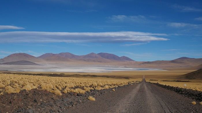
Northern Chile, Andean impressions.
Alright, this year, we're heading back to South America!

The initial plan was to retrace the route we imagined in the summer of 2020: a trip to northern Argentina starting from Córdoba.

Unfortunately, the flight to Córdoba no longer exists, and airfares to Javier Milei’s country are both outrageously priced and involve multiple layovers.

So, I tweaked Google Flights every which way and finally found a flight within my budget—departing from Clermont-Ferrand!

Not to Argentina, though...

Our transatlantic flight will cross the snow-capped Andes, landing in Santiago, Chile, with a return from Lima!

In between, two domestic flights and a big road trip loop starting from the coastal city of Arica to explore the treasures of northern Chile.

Our mode of transport: a pseudo 4x4 that won’t take us through sand dunes or devilish tracks but will let us tackle the entire secondary network, including unpaved main roads, while still being insured.

Is the suitcase packed with all-season clothes?

Are the driver’s license and passport ready?

Bank cards and a few euros too?

Off we go for just over 3 weeks of southern wanderings!


--/--

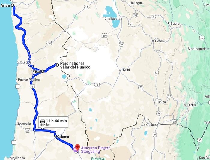
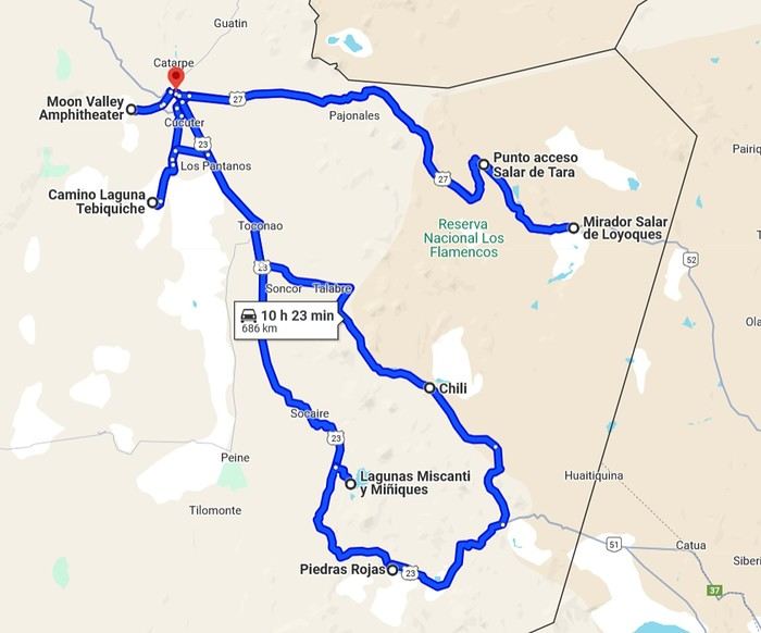
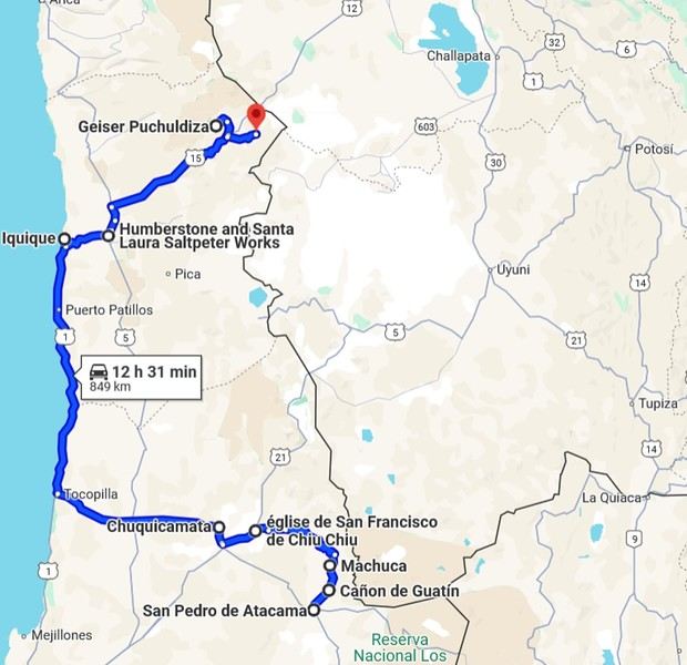
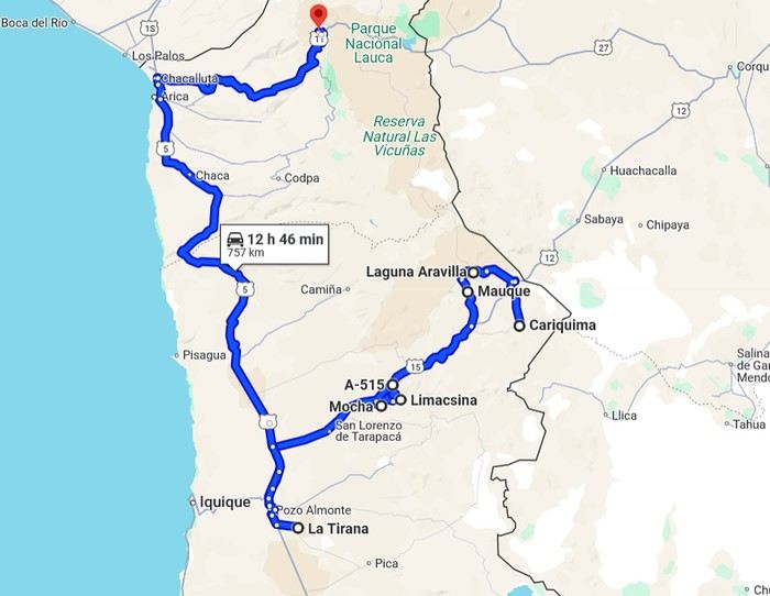
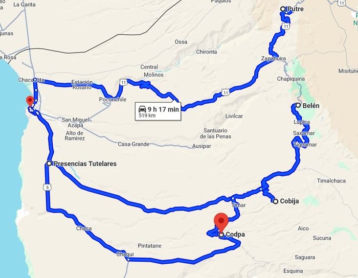
To keep all my esteemed readers on track, here are a few maps outlining the Arica-Arica loop!

1- From Arica to San Pedro de Atacama via Pica and the Salar de Huasco

2- Around San Pedro


3- From San Pedro to Cariquima


4- From Cariquima to Putre


5 - From Putre to Arica


Gas stations in this part of Chile are located in Arica, Iquique, Pozo Almonte, Pica, Calama, and San Pedro de Atacama.
Open
Come discover Ireland with us
IRELAND - INTRODUCTION

We planned our 15-day trip to Ireland several months in advance to create an itinerary that would let us see a multitude of tourist attractions across various regions of the Republic of Ireland and Northern Ireland.

We researched the main attractions in each region and noted their GPS coordinates.

After that, we used Google Maps to create a packed but realistic daily route. We printed all the itineraries, and they proved extremely useful since some attractions weren’t listed on the GPS a friend lent us, and some roads aren’t clearly marked.

This way, we were able to stick to our daily schedule.

Three months before our departure, we rented a car directly from Autoescape’s website for 136.44 € over 14 days. The rental was with BUDGET, and the car we got was a ŠKODA Citigo.

This rate includes unlimited mileage, collision damage waiver (CDW), theft protection (TP) with a 1,500 € excess, and unlimited third-party liability coverage.

Some roads in Ireland are very narrow, so a compact car is much appreciated. Don’t forget that driving is on the left, and there are plenty of roundabouts.

Luckily, my partner finds driving this way easy, and our travels went smoothly.

It’s worth mentioning how courteous and patient Irish drivers are—it’s truly phenomenal.

Two weeks before our trip, we booked our accommodations at various places like B&Bs, hotels, and university campuses through Hotels.com. We’ll talk more about each of them later.

When we arrived at Dublin Airport, going through customs was quite tedious. There are two lines: one for EU citizens and another for other foreigners. The wait for non-EU travelers is significantly longer.

The car rental isn’t directly at the terminal. You have to take a shuttle to the rental center. Once there, a company representative finalizes the contract and hands over the keys to our rental car.

And off we went on our adventure!

It’s also important to note that some roads have tolls. For most of them, you pay directly at a toll booth, and the fees are usually under 2 €.

However, the M50 motorway around Dublin works differently—it’s a prepaid toll. You’re charged when you drive between Junction 6 (N3 Blanchardstown) and Junction 7 (N4 Lucan). A large purple sign warns you as you approach one of these junctions.

Cameras automatically record your license plate, and fees are applied based on your vehicle category. For a standard car, the fee is 3.10 €.

You have until 8:00 PM the next day to pay at an authorized retailer or online at https://www.eflow.ie/.

We prepaid these fees directly on the site mentioned above.

If you don’t pay within the required time, you’ll be charged substantial penalties.

For dining, most grocery stores and gas stations offer a great selection of hot and cold meals at very reasonable prices. That’s why we mostly bought our food at places like SuperValu, Lidl, Spar, and Centra.

We invite you to keep reading about our adventure in the next section.
Open
Trek in Norway: Jotunheimen and Dovrefjell, you’ll adapt to the rain...
In the summer of 2026, we packed our backpacks again to wander around Jotunheimen National Park in Norway.

We’d never heard of this park just a few months earlier—we discovered it by following threads online.

It’s billed as the most mountainous park in the country, which really appealed to us after scrapping our original plan further north.

Unfortunately, it’s also the most crowded, which immediately made it less appealing! The presence of the highest peak in the Scandinavian Alps and the "famous" Bessengen ridge (famous because it’s apparently well-known across the country) probably has a lot to do with that.

Since we’d managed to avoid the crowds on the Kungsleden trails by camping away from the huts and timing our hike to miss the biggest groups of walkers, we figured we had the formula down and gave in to the call of the Norwegian mountains.

It’s the most mountainous park, sure, but also quite challenging in terms of progress, as we’d soon discover during the trek. And with uncooperative weather, we got the winning combo of a demanding hike. But I’m getting ahead of myself...

For the end of the trip, we planned a few days in Dovrefjell National Park—these two parks are easily connected by public transport—to see something different and, most importantly, to try and spot the musk oxen that live there.

My 04/08 - Arrival in Oslo Wed 05/08 - Bygdin – Torfinsbu Thu 06/08 - Torfinsbu - Gjendebu Fri 07/08 - Gjendebu - Fondsbu Sat 08/08 - Day hike to Slotafjellet Sun 09/08 - Day hike to Lake Kvitevatnet Mon 10/08 - Fondsbu - Gjendebu Tue 11/08 - Gjendebu - Before the Bessengen ridge Wed 12/08 - Bessengen ridge – Maurvangen campsite Thu 13/08 - Knutshoe ridge Fri 14/08 - Bus transfer to Spiterstulen hut via Lom Sat 15/08 - Day hike to Galdhøpiggen Sun 16/08 to Wed 19/08: Dovrefjell End of the trip and wrap-up
Open
Two Weeks in Dominica
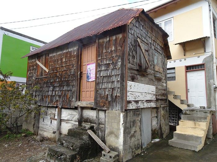
Hi everyone, I’m sharing my travel journal from Dominica (not to be confused with the Dominican Republic) in January 2020. We wanted to escape the rain, gloom, and cold of France—and we got *some* rain and storms, but also warmth!

DOMINICA A small Caribbean island of 754 km², located between Guadeloupe and Martinique, Dominica is part of the Commonwealth. Roseau is its capital. The locals speak English and Creole. The currency is the East Caribbean Dollar (EC$). In October 2019, we decided to visit this little paradise from January 9 to 24, 2020—14 nights on the island. We traveled as two couples. Flight booking with Air Caraïbes: Orly Terminal 4 to Pointe-à-Pitre by plane, then P-à-P to Roseau with L’Express des Îles (boat) for the outbound trip. Marigot to Pointe-à-Pitre to Orly (all by plane on the return). Air Caraïbes: navigAir: plane + shuttle + boat. They handle everything, even delays. A shuttle waits for us at the airport to take us to the boat.

Accommodation bookings: 7 nights on the Caribbean coast in Salisbury (Sunset Bay Club), 4 nights on the Atlantic coast in Taberi La Plaine (Citrus Creek Plantation), and 3 nights in Marigot (Hibiscus Valley Inn). Car rental booked (Courtesy Rental Car).

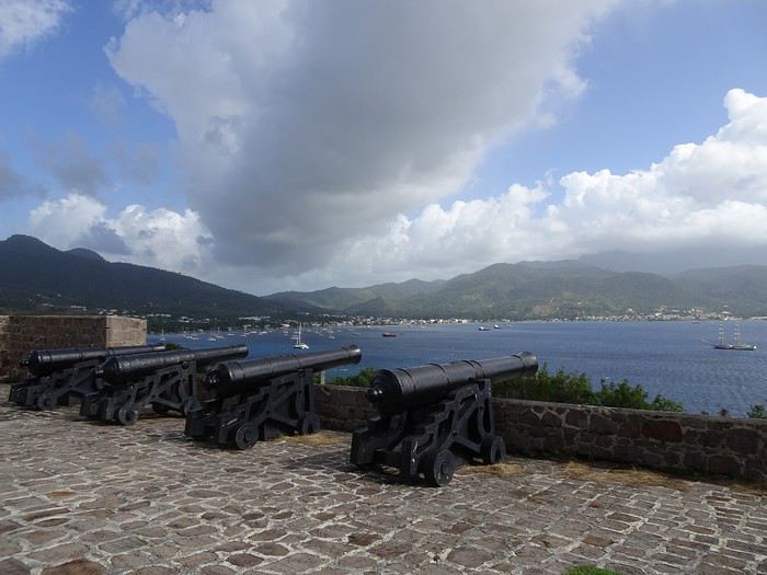
Thursday, January 9 8:00 AM: Orly Airport, baggage drop-off—we checked in 48 hours earlier. Scheduled takeoff at 11:10 AM. Arrival in P-à-P at 2:30 PM local time after a 7-hour, 50-minute flight. We collect our luggage, and a shuttle is waiting to take us to the dock for L’Express des Îles. We check in, and a big storm hits P-à-P. Scheduled departure at 5:00 PM for a 2-hour, 20-minute crossing. Lots of waves—many passengers got seasick during the trip. Arrival in Roseau at 7:30 PM. We go through customs. Some clementines to declare… which they confiscated! A taxi takes us to the car rental: Courtesy. The ride is covered by the rental company. We get an automatic. You need a special permit to drive in Dominica (12 €, issued by the rental company). And remember—driving is on the left! It’s dark, and we have a good hour’s drive to reach our hotel. First intersection, headlights coming toward us, honking… we’re on the wrong side—driving on the left, remember? Most roads are in poor condition, narrow, with few signs and little to no street lighting. The island was hit by Tropical Storm Erika in 2015 and Hurricane Maria in September 2017, causing major damage. We finally arrive in Coulibistrie at Sunset Bay Club at 9:30 PM. The owner welcomes us, warms up some bread and cheese, and offers us four beers. We have pâté, sausage, and chips—we have a little picnic on the terrace of our bungalow. We have two adjoining rooms. It’s 11:00 PM when we go to bed… and it’s raining.

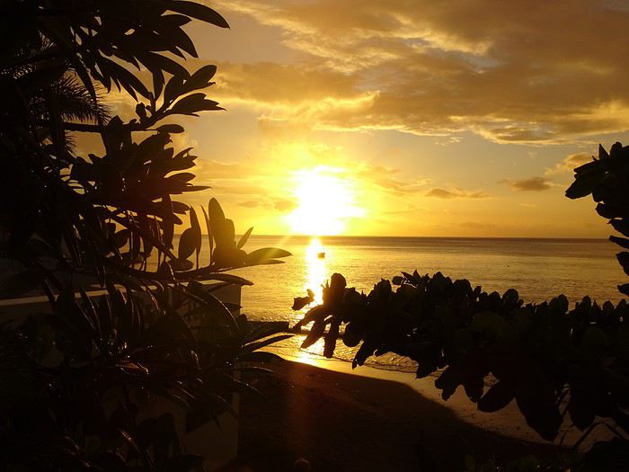
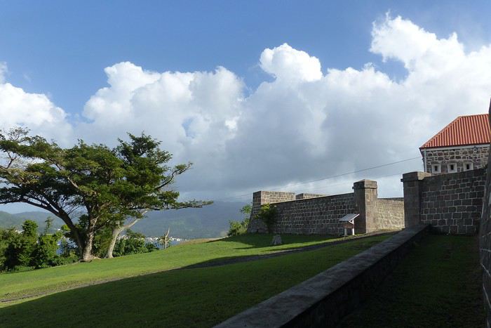
Friday, January 10 After a hearty breakfast (French toast or pancakes, jams, fresh juice, coffee or tea, eggs-bacon-cheese, bread, fresh fruit), the sun and rain take turns freely. We head north. Colihaut: a short walk through the village—we’re the only tourists. Portsmouth: lunch on Purple Turtle Beach at Sea Bird Bar and Grill (grilled fish, fries, salad, and the local beer: Kubuli). Then we visit Fort Shirley, part of Cabrits National Park. We do the yellow trail and part of the blue one. We buy a week-long pass, useful for some visits (no entry fee). On the way back, we stop at the market to buy some fruit. We arrive at Sunset in time to watch the sunset over the Caribbean Sea. All day, showers and sunshine.

Sunset at Sunset Sunset Beach Colihaut Colihaut
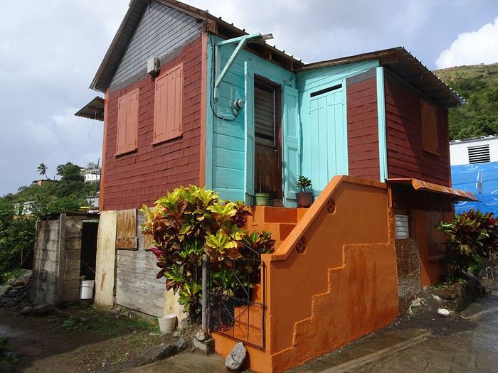


Fort Shirley


Open
Trip to the Raja Ampat Islands in June (Indonesia)
Hi there, I’m planning to visit the Raja Ampat Islands next June. It’s pretty tricky to organize. What’s the best gateway to get there? Do you know of any places to stay if I don’t want to go diving? Which agencies can provide information? Thanks so much for your help!
Open
Costa Rica: The dry season isn't what it used to be!
Introduction: For years, I’ve heard about Costa Rica, which seems like a country "made for me"—nature, not cities. I almost went in 2019, but a family issue made me cancel. Initially, I wanted to spend at least three weeks there, planning to go in our summer despite it being the rainy season. Then I realized what I wanted to do could fit into two weeks, so I ended up going in February. Plus, January’s weather was so awful that some sunshine should do me good. I found a flight at a decent price, but with two downsides. The first is that it leaves from Paris CDG, and the second is that it’s with Air France—a airline I’d sworn off after my misadventures with them back in 2008. We’ll see how it goes!
Open
Societal Evolution
Hello everyone,

It’s something we often notice in this forum—and many others—this behavioral shift.

A long-time member, or even a new one, asks a question. They get one or more answers, some brief, some detailed, and then... nothing???

Not even a simple thank you!!!

From what I’ve gathered, if the answers don’t align with what they wanted to hear, it seems natural for the asker to just disappear!! 😕 Unless—(and I fear this is the case)—basic politeness is no longer part of our society????

Please forgive my little rant.

Wishing everyone all the best. Cheers,

Puma2A


...
Open
From Bangkok to Krabi, Thailand by Car!
This first trip of 2025 will have the taste of Asia.

More precisely, Thailand!

It’s not my first time—I’ve often traveled across Southeast Asia between 2000 and 2015. (This travel journal, for example...)

But it’ll be my partner’s first steps in this part of the world.

The itinerary we’ve chosen will alternate between familiar sights for me and new discoveries for both of us.

I’ll get to see how the country has changed in 20 years—and what’s stayed the same!

We were torn between the north and the south of the kingdom. Fears of smoke from slash-and-burn farming and a desire to relax on the sand tipped the scales toward the south...

What if we rented a car?

I think driving in sprawling Bangkok would be a bit ambitious, so we’ll only book our vehicle from Hua Hin to return it in Surat Thani.

Other transportation will range from tuk-tuks to overnight trains and ride-hailing services.

And of course, the plane!

I’d love to travel from Auvergne to Bangkok by road, but 15 days wouldn’t be enough...

Plus, the current geopolitical situation isn’t exactly favorable...

So, once again, we’ll be stuck for hours in the less-than-comfortable economy class of Qatar Airways.

The arrival time was on schedule, entry formalities were quick, and all our luggage made it.

We left Lyon in wind and cold—now we’re breathing in the warm, humid air of กรุงเทพมหานคร.

To reach our hotel, we first took the metro, which dropped us off in the city center in about 30 minutes for the incredible price of 1.18 €.

A few taps on the GRAB app, and we booked a ride-hailing service for the last few kilometers.

We waited a while for our driver due to insane traffic in the area, but once in the 4x4, we were at our lodging in no time.

We chose this small hotel for its riverside location, tranquility, and price.

It’ll do the job perfectly—the only downside is the weak breakfast.

The room is inviting, and we collapse onto the bed for a well-deserved short nap.

Wake-up call in an hour for our first visits!

See you soon...

Open
So where are they and what are they doing?
This catchy and somewhat mysterious title comes from several questions I’ve been asking myself.

VF has been back open for a reasonable number of weeks and months now. The number of visitors overall matches past averages, but the number of members online in the last 24 hours seems relatively lower than what we used to see.

Yet, to my surprise, I’m seeing fewer travel journals, way fewer messages, and way fewer questions. I don’t see many new registered users online, and I notice a number of members who are logged in but either aren’t participating or have stopped participating.

Something’s not adding up for me because, in my opinion, VF is still appealing, and I don’t see which other sites could really compete.

Was there a real break between pre- and post-Covid? Does it just take more time for some people to discover the site or learn that it’s active again? Do people now prefer quick consumption on sites like FB or others I’m not familiar with? Where have the site’s old-timers gone, and what are they doing with their time now? What’s really going on here?
Open
Kyushu between Fukuoka and Nagasaki in autumn 2024 (Japan)
Fellow travelers,

Don’t they say "never two without three"? It seems so. Here I am again on the forum to share—and let’s be honest, indulge a bit of selfish pleasure—by recounting the story of this third installment in the Land of the Rising Sun.

Where? It’s all in the title. On the island of Kyushu in southern Japan, more precisely in the northwest between Fukuoka and Nagasaki. I hope to take you along with me for 19 nights and 18 full days this autumn of 2024. On the itinerary: gastronomy, crafts, festivals, waterfalls, encounters, and leisurely strolls in all simplicity.

A last-minute flight booked just 7 days before departure, and the route evolved regularly based on whims and accommodation availability, eventually settling on this:

- 5 nights in Fukuoka: Fukuoka city, Ukiha, Itoshima, Dazaifu, Yanagawa - 4 nights in Hasami, Nagasaki Prefecture: Okawachiyama, Arita, Takeo, Kashima, Yobuko, Karatsu, Kabeshima - 6 nights in Nagasaki: Ureshino, Higashi-Sonogi, Nagasaki city, Unzen, Sotome - 4 nights in Fukuoka: Karatsu, Fukuoka city

Most of the trip was done by car for practical reasons—easier access to certain places and freedom of movement—but also for the sheer joy of it. Despite slow traffic at times, driving in rural Japan is a delight.

If the program interests you, see you soon for the start of the journey.
Open
4 friends discover a piece of North India
Hello fellow travelers!

I’m adding my small contribution to the reopening celebration by posting this travel journal from India, made in January 2024. We’re 4 friends (2 couples), and we did a 3-week loop in Rajasthan, stopping by Delhi and Agra (which, as everyone knows, aren’t in Rajasthan 😛). Delhi - Agra - Jaipur - Bundi - Udaipur - Jodhpur - Jaisalmer - Delhi

We rented a car with a driver from Agra to Jaisalmer, 550 € for 14 days. https://chauffeurpriveeninde.com/fr/

We took the train from Delhi to Agra and the plane (Spicejet) from Jaisalmer to Delhi.

Most of the accommodations were booked on Booking before we left.

I’m sharing this story written by Richard and illustrated by me. We dedicate it to Nathalie and Bruno, our amazing travel companions.

Open
Off to explore Jordan!
Well, since the lockdown is dragging on, I’m starting a new travel journal following the one I finished publishing yesterday: https://voyageforum.com/discussion/voyage-pays-perles-voyage-dans-ouest-americain-d9943984/ This time, after the U.S., we’re heading to the Middle East—Jordan! And we’re keeping up the good habits: one day’s entry published every day at 5:30 PM! Happy reading, and feel free to leave a comment, question, or remark...

Franck
Open
Discovering the joys of camping in Namibia
This three-week trip to Namibia was a big first for us: - Visiting a country in winter, for someone who starts feeling comfortable at 25°C (77°F). - Camping, when we usually feel at home in a starred hotel. - Sleeping on the roof of a car—what an idea... when a comfy bed is waiting just a bit further. - Grocery shopping, cooking, doing the dishes... all the things we usually avoid to fully enjoy our vacation. - Washing up when and how we can, when we can’t imagine going a day without a shower. - Driving a big 4x4 on the left, with a manual transmission, when we usually opt for an automatic for more comfort.

Yep! You guessed it—we stepped way out of our comfort zone during this trip.

I had quite a few doubts while planning this adventure, but the more I read travel journals about Namibia, the more I wanted to go.

Personally, without this forum, I never would’ve dared to hit the Namibian roads in a 4x4. I was really anxious during the planning, so I want to thank everyone who contributed with their journals and forum discussions for helping me leave more peacefully.

At first, I wasn’t even considering sleeping in a tent. But after my husband’s persuasion—and my own curiosity to experience what I’d read in those travel journals—I gave in. So off we went in a double-cab Hilux with a rooftop tent.

And of course, let’s talk about me—the big cold-weather wimp. One of the biggest pre-trip challenges was choosing a sleeping bag. After a while, sleeping bags had no more secrets for me: temperature ratings (comfort, limit, extreme), shapes (mummy, rectangular), fillings (synthetic, down), compression rate, and weight... all these factors were a real puzzle. In the end, to make sure I wouldn’t be put off camping in winter (Australian winter, mind you), I went for a sleeping bag with a comfort rating of -10°C. And just to be *extra* sure I wouldn’t get cold, I bought a liner (never knew what that was before) in Thermolite, which boosts the sleeping bag’s temperature by 11°C. There are liners that add up to 15°C, but let’s not exaggerate—we’re not heading to the North Pole! My husband, on the other hand, got a sleeping bag with a -5°C comfort rating and a silk liner.

Was it enough? You’ll find out soon. In the meantime, another big thank you to everyone who helped me make this choice with their advice and experience.

Over a year in advance, we planned a three-week itinerary for our first trip to Namibia—classic route, nothing too out there. We chose to do the circuit clockwise because we wanted to finish on a high note in Etosha and its wildlife. They say it’s like Noah’s Ark out there! And why not, the cherry on top... some big cats.

We used Tourmaline’s services to book our accommodations and the 4x4.

Here’s our planned itinerary with campsites and lodgings—yes, there are a few solid roofs in there; we didn’t want to push it too far.

Day 1: Windhoek – Windhoek Gardens Guesthouse Day 2: Kalahari Anib Campsite Day 3: Namibrand Family Hideout Day 4: Sesriem Camp Day 5: Sesriem Camp Day 6: Rostock Ritz Camp Day 7: Swakopmund - Sea Breeze Guesthouse Day 8: Swakopmund - Sea Breeze Guesthouse Day 9: Spitzkoppe Camp Tented Day 10: Brandberg White Lady Campsite Day 11: Grootberg Lodge Day 12: Opuwo Country Campsite Day 13: Epupa Camp Day 14: Hobatere Lodge Day 15: Etosha Olifantsrus Camp Day 16: Etosha Okaukuejo Camp Day 17: Etosha Halali Camp Day 18: Etosha Namutoni Camp Day 19: Cheetah Eco Lodge Day 20: Windhoek – Londiningi B&B


Alright! Are you ready to follow this adventure with us in our Hilux?

Open

You might also like