Come discover the North Shore
FR

Translated into English.

Original post
PI
INTRODUCTION

Travel journal updated in MAY 2025

Since our travel plans outside Canada were canceled due to Covid-19, we decided to take our vacation in Quebec this summer and cover over 5,270 kilometers to explore the various tourist attractions of the North Shore and Gaspésie.

This summary will cover our experiences on the North Shore, while Gaspésie will be the subject of a future summary.

The North Shore, known for its stunning nature, is the perfect spot for outdoor enthusiasts since you can enjoy activities like hiking, wildlife observation, sea kayaking, fishing, and hunting (to name just a few).

It’s also one of the best places in the world to see whales.

Our journey along the North Shore took place between the villages of Tadoussac and Kegaska, as Route 138 ends at the beautiful, long beach in Kegaska.
Anne Blogue: https://deuxnomades.blogspot.com/ YouTube: https://www.youtube.com/c/SouthAngelVideo?sub_confirmation=1
PI Pinacoladada Globetrotter ·
TOURIST ATTRACTIONS

Below are the tourist attractions we visited. A link is attached to each one so you can quickly access more information about it.

Videos are included throughout the summary. Just click on the image to start the video.

The village of Tadoussac Tadoussac - Pointe de l'Islet Trail Tadoussac - Zodiac whale-watching cruise Tadoussac - Sand dunes and waterfall Sacré-Cœur - Black bear observation at Domaine de nos Ancêtres Les Escoumins - Moulin Trail Les Escoumins - Pointe-à-la-Croix Longue-Rive - Sault-au-Mouton Waterfall Park Portneuf-sur-Mer - The Sandbank Portneuf-sur-Mer - Pointe-des-Fortin Colombier - Îlets Jérémie Trail Ragueneau - The Old Wharf Pointe-aux-Outardes - Nature Park Baie-Comeau - Vieux-Poste Park Baie-Comeau - Belvédère du fjard Saint-Pancrace Franquelin - Croix Trail Baie-Trinité - Pointe-des-Monts Lighthouse Port-Cartier - Rivière-aux-Rochers Park Port-Cartier - Taïga Park - Patterson North Island Port-Cartier - Rivière-aux-Rochers Park - McCormick Island Port-Cartier - Patterson South Island Sept-Îles - Aylmer-Whittom Park Sept-Îles - Parc Ferland and its metal sculptures Sept-Îles - Petit-Havre de Matamec Sheldrake - Manitou River Falls Rivière-au-Tonnerre - Halte des Petites Sept-Îles Rivière-au-Tonnerre - Petit Sault and Grand Sault Falls Mingan Archipelago - Excursion to Île aux Perroquets and Île Nue Mingan - Ekuanitshit Paustuk Falls Mingan Archipelago - Excursion to Quarry and Niapiskau Islands

MAY 2025

This travel journal has been updated and could be very helpful if you're looking for information on tourist attractions to visit on the North Shore in Quebec, Canada.

Mingan Archipelago - Excursion to Quarry Island - Hiking in the forest Mingan Archipelago - Excursion to Quarry Island - The monoliths Mingan Archipelago - Excursion to Niapiskau Island Havre-Saint-Pierre - Cap Ferré Trail Havre-Saint-Pierre - Rivière-de-la-Corneille Belvedere Baie-Johan-Beetz Park Baie-Johan-Beetz - Cap Feldspath Mine Trail (Spar Mica) Baie-Johan-Beetz - Baie-Pontbriand Belvedere Aguanish - North Shore Natashquan - North Shore Kegaska - North Shore
Anne Blogue: https://deuxnomades.blogspot.com/ YouTube: https://www.youtube.com/c/SouthAngelVideo?sub_confirmation=1
PI Pinacoladada Globetrotter ·
THE VILLAGE OF TADOUSSAC

GPS coordinates: 48.143509, -69.715466

This isn’t our first visit to Tadoussac, but it’s always a pleasure to return to this charming little village by the St. Lawrence River.

Tadoussac is a very popular tourist destination, mainly because it’s one of the best spots on the Côte-Nord to observe marine mammals, both at sea and along the shoreline.

What’s more, there are several types of accommodation available (B&Bs, hotels, camping), as well as plenty of restaurants and a grocery store with a SAQ license.

The village has a lovely beach where the depth changes with the tides.

During our stay, we hiked the Pointe-de-l'Islet trail, took a zodiac excursion to see marine mammals (which were actually quite abundant), visited the Tadoussac dunes and its waterfall, and went black bear watching in Sacré-Cœur.

We stayed two nights at Camping Domaine des Dunes (GPS coordinates: 48.142825, -69.685692).

This video gives a preview of our activities in Tadoussac. More details on each will be shared later.

https://youtu.be/EPB5pl7MMYg
Anne Blogue: https://deuxnomades.blogspot.com/ YouTube: https://www.youtube.com/c/SouthAngelVideo?sub_confirmation=1
PI Pinacoladada Globetrotter ·
TADOUSSAC - LE SENTIER DE LA POINTE-DE-L'ISLET

GPS coordinates: 48.138453, -69.718144

The Pointe-de-L'Islet Trail is a 1 km loop trail that starts at the beginning of the road leading to the marina.

It’s marked by a staircase that leads into the forest and an interpretive sign nearby.

Due to COVID-19, the trail is currently one-way to maintain social distancing.

It offers great opportunities to spot whales, belugas, and seals that come close to the shoreline.

The trail is very well maintained. You’ll walk on wooden boardwalks or directly on the rocks.

There are several interpretive signs along the way that teach you about the marine ecosystems.

https://youtu.be/sHm69gIhtCs
Anne Blogue: https://deuxnomades.blogspot.com/ YouTube: https://www.youtube.com/c/SouthAngelVideo?sub_confirmation=1
PI Pinacoladada Globetrotter ·
TADOUSSAC - WHALE-WATCHING CRUISE BY ZODIAC

GPS coordinates: 48.144065, -69.720908 Ticket office GPS coordinates: 48.138083, -69.716454 Meeting point

We bought this excursion directly from the Croisières AML website. We got three additional attractions by using their discount passport offer.

For 96 $ (taxes included) per person, we got entry tickets for the whale-watching cruise, the Chauvin Trading Post, the Pointe-aux-Outardes Nature Park, and bear observation at the Domaine de nos ancêtres in Sacré-Cœur.

Departure was scheduled for 10:15 AM, and it was recommended to arrive at least 30 minutes before departure.

Due to COVID-19, wearing a mask and hand sanitizing were mandatory. The mask had to be worn throughout the entire cruise.

It’s recommended to dress warmly. The company provides a windbreaker-type suit, but it doesn’t fully protect from water.

We were incredibly lucky to have a sunny day with no wind at all, giving us a very calm water surface, perfect for observing marine mammals.

After the captain went over the safety instructions, we quickly left Tadoussac Bay and traveled a long distance on the water before finally stopping in the middle of the river to observe the marine wildlife.

Belugas, humpback whales, fin whales, porpoises, and seals were all putting on a show right in front of us.

These mammals sometimes came very close to our boat, and it was truly impressive to hear their breath.

We were even lucky enough to hear a whale singing.

https://youtu.be/c672IjKEHwo

The rest and end of this amazing excursion. Here are more scenes from our whale-watching trip. There were so many around us that we didn’t know where to look...

https://youtu.be/6FYlSHK-GS8
Anne Blogue: https://deuxnomades.blogspot.com/ YouTube: https://www.youtube.com/c/SouthAngelVideo?sub_confirmation=1
PI Pinacoladada Globetrotter ·
TADOUSSAC - SAND DUNES AND ITS WATERFALL

GPS coordinates: 48.152991, -69.667604

I recently discovered that Tadoussac not only has beautiful sand dunes but also a waterfall in the area.

Located along the shoreline, this waterfall is only accessible at low tide.

We headed there right after finishing our zodiac excursion.

The dunes, made of beautiful golden sand, are very tall, and there’s a path marked in the sand to reach the base of the dunes.

Since the sand is very loose, it’s much easier to go down the path than to climb back up.

Others who are more adventurous prefer to slide down the steep slope on their backsides or have fun gliding on a small surfboard.

We hurried to the waterfall—me wearing my boots and Alain going barefoot.

To get there, just follow the shoreline to the left of the beach when facing the St. Lawrence River. It’s less than a five-minute walk away.

Actually, we noticed there are two waterfalls surrounded by colorful rocks that add to the charm of the place. The scenery is really pretty.

Nearby, there’s also a tiny island you can reach. However, the tide had started coming back in, and the water level was rising quickly.

So we turned around and went back to the beach, taking the same path to return to the top of the dunes.

On our way back to the village of Tadoussac, more dunes are visible on the right side of the road. We went there and climbed to the top of these dunes to find a great view of the St. Lawrence River and the little oasis below.

https://youtu.be/_ko3GZxEgTI
Anne Blogue: https://deuxnomades.blogspot.com/ YouTube: https://www.youtube.com/c/SouthAngelVideo?sub_confirmation=1
PI Pinacoladada Globetrotter ·
SACRÉ-COEUR - BLACK BEAR OBSERVATION AT THE DOMAINE DE NOS ANCÊTRES

GPS coordinates: 48.220154, -69.754323 1895 Route 172, Sacré-Coeur

This activity, which takes place in Sacré-Coeur, about ten kilometers from the village of Tadoussac, was included in the Passport Discount offered when we purchased our whale-watching cruise with Croisières AML.

As recommended, we arrived at the Domaine de nos Ancêtres half an hour before the activity began.

Accompanied by a guide, we were a group of about forty people taking part in this activity.

We took a short bus ride to an observatory located in the forest. At the end of the road, we got off the bus and walked a few minutes along a trail leading to the observatory.

Due to the presence of Covid-19, masks must be worn throughout the activity. Additionally, no food can be brought along. So, leave your backpack in your vehicle and turn off your cell phone since silence is required.

The observatory consists of long benches arranged on several levels. No matter where we sit, the visibility is perfect.

In front of us, at an approximate distance of 100 meters, we see a tree trunk placed vertically in the middle of the road. Food was placed there to attract the bears.

The wait begins. There’s no guarantee we’ll see a bear, but the odds are pretty good.

We waited nearly 30 minutes in silence before spotting our first black bear. At first, it seemed hesitant to come out of the forest, but the food bait worked very well.

It stood up on its two hind legs and started gobbling up the food with its front paws.

After feasting for several long minutes, I don’t know if it sensed our presence or that of another bear, but it seemed on alert and moved back into the forest.

https://youtu.be/XBWytKgvkug

A short time later, the presence of another bear, older and larger, was confirmed.

It made its appearance calmly in front of us and headed straight for the tree trunk where the food had been stored.

The same little routine played out. Standing on its hind legs, it enjoyed the feast generously provided by the Domaine’s staff.

https://youtu.be/wYm9HmX0BMU
Anne Blogue: https://deuxnomades.blogspot.com/ YouTube: https://www.youtube.com/c/SouthAngelVideo?sub_confirmation=1
PI Pinacoladada Globetrotter ·
LES ESCOUMINS - MOULIN TRAIL

GPS coordinates: 48.346314, -69.405115

The Moulin Trail is a 2.2 km round-trip linear forest trail. It starts on Saint-Marcellin West Street near the fish market. There are about fifteen parking spots available to leave your vehicle.

First, we passed by Anse à la Boulangerie, which is behind the fish market. A shipyard is said to have been built there in the late 19th century. It’s a great spot to observe seabirds in their natural habitat.

During our walk, we saw several small birds darting through the air, trying to catch butterflies to feed on.

Stunning photos are displayed all along the trail. They were taken by photographer Robert La Salle, who has been exploring Quebec’s underwater world for many years (https://www.lasallephotographie.com).

These photos let us discover a vibrant aquatic world—one that most of us don’t even know exists.

At the end of the trail, we came across a road. We turned left onto it and walked down to the dock.

We spent several minutes watching the St. Lawrence River and spotted a few minke whales surfacing to catch their breath.

Since the tide was low, they were still quite far from the dock. However, when conditions are right, minke whales often come close to the shoreline. Belugas sometimes venture near as well.

https://youtu.be/jh9jVEmHnqs
Anne Blogue: https://deuxnomades.blogspot.com/ YouTube: https://www.youtube.com/c/SouthAngelVideo?sub_confirmation=1
PI Pinacoladada Globetrotter ·
LES ESCOUMINS - POINTE-À-LA-CROIX

GPS coordinates: 48.350498, -69.397492

Pointe-à-la-Croix is a tiny peninsula jutting into the St. Lawrence River between Baie Saint-Onge and Baie des Escoumins. It offers a stunning panoramic view of the village.

It's a really lovely spot where it's genuinely pleasant to take a short walk along the shoreline.

When the tide is low, as it was during our visit, the water recedes a great distance, revealing beaches and numerous rocks that emerge from the surface.

It's the perfect place to observe seabirds. There were actually quite a few around when we went.

When the tide is high, it's also an excellent spot for watching fin whales and belugas, as it allows them to come close to the shoreline.

https://youtu.be/9TzrKw7yDVM
Anne Blogue: https://deuxnomades.blogspot.com/ YouTube: https://www.youtube.com/c/SouthAngelVideo?sub_confirmation=1
PI Pinacoladada Globetrotter ·
LONGUE-RIVE - SAULT-AU-MOUTON FALLS PARK

GPS coordinates: 48.539826, -69.254963

Actually, this park in Longue-Rive is home to a tourist information kiosk built on the foundations of an old sawmill constructed in the mid-19th century.

The river flows right next to the kiosk. In the past, many logs used to pass through here before being shipped out by boat.

There are waterfalls on both sides of Route 138. The ones on the river side can be seen from two spots: at the top of the falls via a lookout next to the information kiosk, and at the bottom via a trail leading to a suspension bridge along the shoreline.

We first went to the lookout at the top of the falls and even walked on the rocks, letting us get really close to the waterfalls and enjoy a nice view of the suspension bridge and the river.

After that, we headed toward the stairs to the right of the information kiosk. At the bottom of the stairs, a trail first takes you to a tiny beach with a lovely view of the falls, then to the footbridge we crossed to get to the other side of the river.

Later, we made our way to the rocks along the shoreline and were delighted to discover more waterfalls. Actually, these cascade down several levels on this river before it flows into the St. Lawrence.

We then went back to the information kiosk and crossed Route 138 on foot to check out another waterfall upstream on the river. It’s really pretty too.

https://youtu.be/IjgtjSn6wPQ
Anne Blogue: https://deuxnomades.blogspot.com/ YouTube: https://www.youtube.com/c/SouthAngelVideo?sub_confirmation=1
PI Pinacoladada Globetrotter ·
PORTNEUF-SUR-MER - THE SAND BAR

GPS coordinates: 48.634014, -69.094714 (starting point at the tourist information kiosk)

The Sand Bar, stretching for several kilometers, is a natural spot perfect for birdwatching and observing marine mammals.

The hiking trail starts behind the tourist information kiosk. Take the time to go inside and grab the necessary info before setting off on this hike.

Once there, you’ll be given an explanatory brochure about the site, along with a list of birds you might spot.

It’s essential to go at low tide and check the tide schedule—if you wander too far, the rapidly rising water might make it hard to get back to your starting point.

A trail begins behind the information kiosk, crossing a forested area and salt marshes before ending at a long, beautiful stretch of sand.

We walked along the beach for a bit toward the east, then headed in the opposite direction to reach the mouth of the Portneuf River.

This river flows into the St. Lawrence River, winding between the Sand Bar and Pointe-des-Fortin (our next stop).

The scenery is truly charming, and the peaceful atmosphere makes it easy to appreciate this place.

During our visit, the birds weren’t around since it wasn’t the ideal time to see them. It’s best to go in the fall to fully enjoy the natural potential of this site.

On the way back, we noticed that the short trail leading to a lookout is lined with lots of pretty flowers, and different types of mushrooms cover the ground.

https://youtu.be/Ynmdt1cVllo
Anne Blogue: https://deuxnomades.blogspot.com/ YouTube: https://www.youtube.com/c/SouthAngelVideo?sub_confirmation=1
PI Pinacoladada Globetrotter ·
PORTNEUF-SUR-MER - LA POINTE-DES-FORTIN

GPS coordinates: 48.632900, -69.085833

After visiting the Portneuf-sur-Mer Sandbar, we headed to Pointe-des-Fortin for a hike on this beautiful, long beach.

Coming from the Portneuf region and my partner having the last name Fortin, we really wanted to visit this spot.

Parking is located at the end of Marina Road. This road runs alongside a campground.

A long staircase near the parking lot leads to a lookout that offers lovely panoramic views of the area.

You’ll discover a magnificent beach and multiple golden sandbars that become visible at low tide. The scenery is truly stunning.

After gazing at the horizon for a while, we made our way to the beach and started a hike all the way to the end of Pointe-des-Fortin.

It’s paradise for ATV enthusiasts. We saw several riding along this long beach.

As we walked along the shore, we spotted dark objects in the distance emerging from the ground. We had trouble making out what they could be.

When we arrived, locals told us they were the remains of a ship that had run aground in the area long ago.

After a pleasant chat with them, we continued our hike along the beach, made it to the end of Pointe-des-Fortin, and returned along the opposite side of the sandbar to walk along the Portneuf River.

Pointe-des-Fortin is also an excellent spot for whale watching, seals, and birds.

Plus, in the spring, thousands of capelin—tiny fish important to the St. Lawrence River ecosystem—roll onto the beach to lay their fertilized eggs in the sand.

https://youtu.be/0fUjK2er28I
Anne Blogue: https://deuxnomades.blogspot.com/ YouTube: https://www.youtube.com/c/SouthAngelVideo?sub_confirmation=1
PI Pinacoladada Globetrotter ·
COLOMBIER - SENTIER DES ILETS JÉRÉMIE

GPS coordinates: 48.880586, -68.792559 The small chapel GPS coordinates: 48.880706, -68.789360 Observation platform

I’d read online that there was an observation platform here by the coastline where you could spot seals. That’s mainly why we went.

We parked our car near the small chapel and headed behind it for a short hike along the trail that starts at the edge of the woods.

At the beginning of the trail, a descriptive sign tells the story of this place. It was an important trading post for over 200 years.

Today, it’s a major pilgrimage site for the Innu.

We absolutely fell in love with this spot! The tide was very low, so we didn’t see any seals.

But we discovered a landscape straight out of the most beautiful postcards.

Small coves, surrounded by colorful rocks, feature slightly turquoise water with incredible clarity! The beaches are covered in white shells that crunch underfoot.

We followed the channel that forms at low tide and found a stunning bay dotted with lovely beaches.

We noticed the tide was coming in because the water started rushing into the channel.

A fantastic place to check out if you’re visiting this region.

https://youtu.be/zxtRyzM0T4Y
Anne Blogue: https://deuxnomades.blogspot.com/ YouTube: https://www.youtube.com/c/SouthAngelVideo?sub_confirmation=1
PI Pinacoladada Globetrotter ·
RAGUENEAU - THE OLD PIER AND ITS DINOSAURS

GPS coordinates: 49.057284, -68.549503

The village of Ragueneau is the gateway to the Manicouagan Peninsula. We visited the old pier to see, among other things, the famous life-sized dinosaurs created by Mr. Rénald Girard.

It’s mentioned that these dinosaurs represent the strength and big-heartedness that characterize our pioneers, as well as the power of the natural elements in the early days of our history.

Besides the dinosaurs, you’ll find a playground, picnic tables, and interpretive panels at this spot. It’s a great place to take a family break—the kids will love it.

An obelisk, standing 100 feet tall, was also designed by Mr. Rénald Girard and erected at the end of the pier in 1995. The nine pillars that make it up represent the Manicouagan RCM and its eight municipalities.

At the end of the pier, tiny islands sometimes shelter colonies of birds and seals.

We walked along the rocks and discovered grooves that bear witness to the glacial erosion that occurred thousands of years ago.

https://youtu.be/RncShVZuE6E
Anne Blogue: https://deuxnomades.blogspot.com/ YouTube: https://www.youtube.com/c/SouthAngelVideo?sub_confirmation=1
LE Lescaribous Globetrotter ·
Hi, It's always great to follow your adventures, with so many videos 😛 I have several friends who went whale watching and told me they saw tons of them!! Maybe an indirect effect of COVID, since there was less tourist pressure with fewer "observation" boats on the water. In any case, from what I saw in your video, it was a real "festival" 😛 As for bear watching, I prefer observing them in their natural habitat, but it's true that it's more hit-or-miss. Keep up the good work
"Homme libre, toujours tu chériras la mer" (Baudelaire)
PI Pinacoladada Globetrotter ·
Hi there,

We were truly spoiled during our whale-watching excursion. I didn’t know where to look first! 😉 It must be said that the conditions were really ideal for observing them.

For black bear watching, we had no idea what to expect. We got this activity through the attraction passport. We thought we’d be hiking in the forest to spot them.

The bears are obviously in the woods, in their natural habitat, but the guide explained that they have to feed them to attract them so we can observe them. Bears are very opportunistic. Otherwise, why would they come near a group of tourists sitting silently in a shelter?

And since they’re afraid of humans, walking in a single file with a group might not be the ideal solution.

We were lucky, though, because I read that some people have sat silently for nearly 2 hours without seeing any. It must be pretty rare, but there’s no guarantee they’ll show up.

Have a great evening!
Anne Blogue: https://deuxnomades.blogspot.com/ YouTube: https://www.youtube.com/c/SouthAngelVideo?sub_confirmation=1
PI Pinacoladada Globetrotter ·
POINTE-AUX-OUTARDES - CAMPING PARC DE LA RIVE

GPS coordinates: 49.080287, -68.349225

Since we were planning to visit the Pointe-aux-Outardes nature park the next morning, we chose a campsite located near this attraction.

We had tried to book a campsite directly at the nature park, but it was fully booked.

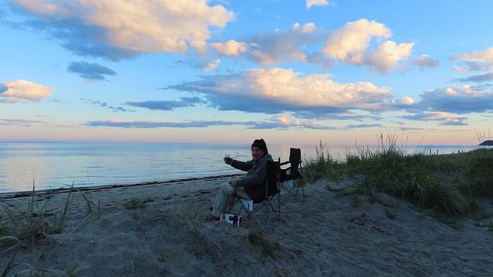
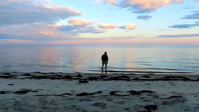
We had requested a site near the beach and didn’t regret it. There was no wind, and we got to enjoy a gorgeous sunset.


Alain even checked the water temperature. No doubt about it—it was freezing! 🙂

Anne Blogue: https://deuxnomades.blogspot.com/ YouTube: https://www.youtube.com/c/SouthAngelVideo?sub_confirmation=1
PI Pinacoladada Globetrotter ·
POINTE-AUX-OUTARDES NATURE PARK

GPS coordinates: 49.043049, -68.457707 https://parcnature.com/

The entry fee for this park was $9.40 per adult when we visited. However, for us, this attraction was included in our Attractions Passport.

This park alone has 8 different ecosystems. Several hiking trails have been established. They are very well marked and include wooden walkways, observation towers, and rest gazebos.

The place is also a recognized site for observing wildlife and flora. During migration periods, you can count over 200 bird species here.

We hiked several trails to complete a loop of about 10 km, which allowed us to explore the entire site.

We had the chance to spot a hare right at the start. It was patiently waiting for us at the trail entrance.

I love walking in the forest. The calm that reigns there and the scents around me give me an unmatched sense of well-being.

During our hike, we discovered the park’s different ecosystems: red pine forest, boreal forest, peat bog, alder thicket, salt marsh, spruce-fir forest, dunes, and beaches.

The hike is easy since there’s no major elevation change along the route. The terrain is relatively flat.

Flowers, plants, small fruits, and mushrooms line the trail edges.

We saw several birds, but it wasn’t the ideal season when we did this activity. I should also mention that we didn’t really take the time to stop and observe them properly.

After finishing our hike, we went to see the park’s beautiful, long beach.

At low tide, the water can recede several kilometers, revealing vast sandbanks where it’s pleasant to search for shells or even small crustaceans trapped in tide pools.

https://youtu.be/kfqHUeImdYA
Anne Blogue: https://deuxnomades.blogspot.com/ YouTube: https://www.youtube.com/c/SouthAngelVideo?sub_confirmation=1
PI Pinacoladada Globetrotter ·
BAIE-COMEAU - VIEUX-POSTE PARK

GPS coordinates: 49.187915, -68.240009

This historic site was home to a sawmill in the late 19th century, built at the mouth of the Amédée River. A dam had been erected on the river to control the water flow.

However, in 1907, spring floods caused significant damage and the loss of all the logs, leading to the sawmill's closure and, consequently, the abandonment of the village.

The Amédée River, which flows into the St. Lawrence River, features a series of stunning waterfalls that are easily accessible via a trail starting near the "Parc du Vieux-Poste" sign.

We reached the base of the first waterfall in less than five minutes. It cascades into the river in multiple small tiers with a deafening roar.

My partner managed to cross the river by stepping on rocks emerging from the water. I didn’t dare try the experience.

Afterward, we took another trail along the river to head downstream and admire more waterfalls that gradually descend in a series of small tiers.

Erosion has created multiple grooves in the rocks, sometimes giving them an orange hue.

This natural site, of great beauty, is easily accessible. Why not stop for a little break or even have a picnic while sitting on the rocks, watching the river flow into the majestic St. Lawrence River?

https://youtu.be/KkrbLbxGIUU
Anne Blogue: https://deuxnomades.blogspot.com/ YouTube: https://www.youtube.com/c/SouthAngelVideo?sub_confirmation=1
PI Pinacoladada Globetrotter ·
BAIE-COMEAU - BELVEDERE OF THE SAINT-PANCRACE FJARD

GPS coordinates: 49.298250, -68.053416

The belvedere of the Saint-Pancrace fjard is located on Route 138 east of the city of Baie-Comeau.

This rest stop was restored in 2017. A long wooden walkway leads to a first observation platform, making it accessible for people with reduced mobility as well.

The view of the Saint-Pancrace fjard and the St. Lawrence River is stunning. During the alcohol prohibition in the 1930s, this bay was frequented by bootleggers.

Today, this bay is mostly visited by boaters and kayakers. Behind the dock, there’s a magnificent waterfall.

A series of stairs leads to the highest point of the cliff, offering a lovely viewpoint over this bay surrounded by a vast green setting formed by the surrounding forest.

We continued our hike on a small trail that quickly led us to a rock at the edge of the cliff. From there, we had a superb view of a body of water: a lake, marsh... I couldn’t say for sure...

A few trails through the vegetation were visible nearby. Out of curiosity, we headed toward one of them. It led us toward Route 138, giving us a partial view of Lac Low on the other side of the road.

Afterward, we walked along Route 138 to cross the stream and check if there was a trail leading to the base of the waterfall in that area. We didn’t find one.

However, we had a view of the top of the waterfall. The water flowed over rocky mounds before plunging into the void.

https://youtu.be/P5nzVlSCeRE
Anne Blogue: https://deuxnomades.blogspot.com/ YouTube: https://www.youtube.com/c/SouthAngelVideo?sub_confirmation=1
PI Pinacoladada Globetrotter ·
FRANQUELIN - CROSS TRAIL

GPS coordinates: 49.293210, -67.892732 Parking GPS coordinates: 49.293522, -67.895457 Start of the trail GPS coordinates: 49.294956, -67.898932 Cross

Franquelin is a small village located in the Manicouagan RCM. The Cross Trail, which starts on rue des Bouleaux, leads to a lookout at the top of a 200-meter-high cliff.

A 20-meter-high cross was erected there. It’s actually very visible from the village.

The trail is very well marked and dotted with signs informing us about all the efforts made over the years for the creation of this trail, the installation of the cross at the top of the mountain, as well as the addition of rest areas, picnic spots, and an observation platform.

The trail isn’t too difficult to hike, but it’s quite a cardio workout since the climb takes about 45 minutes, and some sections are pretty steep.

The trail starts in the forest on a dirt road that’s passable with an ATV. Later, the path narrows and is covered with roots or rocky outcrops that require a bit more effort to navigate.

That’s probably why a bench was placed at these strategic spots—to let hikers rest and enjoy some lovely views of a lake or the St. Lawrence River.

After all that effort, we were thrilled to see that huge cross at the top of the cliff. The view of Franquelin village, surrounded by vast forests and the St. Lawrence River, is simply breathtaking.

Everything came together for a perfect panorama: the sun was shining, the river was calm, the tide was low, revealing sandbanks that added to the charm of this stunning landscape. It was magical!

After soaking in all those beautiful images, we headed back down to the village feeling lighter in heart and body.

We had parked our car near the "Village forestier d’antan," a reconstruction of an authentic logging village. It’s an interpretive center where you can learn more about the establishment of the forestry industry in the early 20th century. It’s only open during the summer season.

We didn’t visit it, but if you’d like more information, here’s the link to their website: https://www.villageforestierdantanfranquelin.com/.

https://youtu.be/Yu9p2HreVHE
Anne Blogue: https://deuxnomades.blogspot.com/ YouTube: https://www.youtube.com/c/SouthAngelVideo?sub_confirmation=1
PI Pinacoladada Globetrotter ·
BAIE-TRINITÉ - POINTE-DES-MONTS LIGHTHOUSE

GPS coordinates: 49.325751, -67.367247

The Pointe-des-Monts lighthouse, located in Baie-Trinité, was built in 1830 and is the second oldest lighthouse on the St. Lawrence River.

Set in a charming location, this lighthouse was designated a historic monument in 1964.

You need to cross a pedestrian bridge that overlooks a shallow part of the river to reach the small island where it stands.

The red-and-white lighthouse has seven floors, and visitors are allowed inside. The watch balcony is 30 meters high and offers a 360-degree view of the St. Lawrence River and the surrounding area. You can also spot marine mammals from here.

You can even spend the night in one of the four rooms at the Auberge la Maison du Gardien and enjoy some of the best seafood in the region at their restaurant.

When we visited, the site was closed because we arrived after 5:00 PM. That’s why we just admired it from the shoreline.

The scenery is very picturesque, and the setting is perfect for capturing beautiful photos of this historic spot.

We also spotted a colony of cormorants resting on a rock that jutted out of the St. Lawrence River.

Since the tide was coming in, the rock gradually disappeared as the water rose, and we watched the birds fly off one by one to find a better place to spend the night.

Check out this website if you'd like more information about the lighthouse: https://pharedepointedesmonts.com/.

https://youtu.be/JhHu-8PwwDw
Anne Blogue: https://deuxnomades.blogspot.com/ YouTube: https://www.youtube.com/c/SouthAngelVideo?sub_confirmation=1
PI Pinacoladada Globetrotter ·
BAIE-TRINITÉ - CAMPING DU GITE DU PHARE DE POINTE-DES-MONTS

GPS coordinates: 49.320029, -67.379623

We booked a site at this campground, located less than 2 kilometers from the Pointe-des-Monts lighthouse.

Following our request, we got a spot (#4) near the beach in a small bay.

The building with the showers and toilets was close to our site.

Drinking water is available at the reception.

For dinner, you can order a pizza at the reception. Otherwise, there’s a grocery store a few kilometers away from this remote spot.

We were lucky enough to enjoy pleasant weather and a gorgeous sunset again.


Anne Blogue: https://deuxnomades.blogspot.com/ YouTube: https://www.youtube.com/c/SouthAngelVideo?sub_confirmation=1
PI Pinacoladada Globetrotter ·
PORT-CARTIER - PARC DE LA RIVIÈRE AUX ROCHERS

GPS coordinates: 50.026995, -66.870051

The Parc de la Rivière aux Rochers is home to a salmon interpretation center. Located in the heart of Port-Cartier, this center offers a variety of activities such as guided tours, salmon observation during their upstream migration, and exhibits.

For fishing enthusiasts, packages are available through the Port-Cartier/Sept-Îles Wildlife Reserve.

The site also includes rest areas, picnic spots, and hiking trails.

The weather was pretty gloomy, but we put on our rain gear and set off for a short hike in the area.

The tumultuous waterfall, located near the interpretation center, is spectacular and worth the detour on its own.

I had noticed there was another waterfall nearby. That’s why we ventured onto the small trail that winds through the forest and follows the river to catch a glimpse of it.

However, this trail forms a loop and brings you back to the interpretation center. It was then that I spotted another trail starting on the other side of the main road.

We continued our hike on this trail, which led us to a waterfall on the Rivière Dominique that eventually joins the Rivière aux Rochers. This was indeed the waterfall I had seen online.

It’s much less imposing than its neighbor, but it’s set in a much more natural environment. It flows into a narrow passage dotted with rocks that bear witness to a long period of erosion.

https://youtu.be/1K2STHPElSQ
Anne Blogue: https://deuxnomades.blogspot.com/ YouTube: https://www.youtube.com/c/SouthAngelVideo?sub_confirmation=1
PI Pinacoladada Globetrotter ·
PORT-CARTIER - TAÏGA PARK - PATTERSON NORTH ISLAND

GPS coordinates: 50.022919, -66.869067

After leaving the salmon interpretation center area, we headed to Taïga Park located on Patterson North Island. Several parking spaces are available at the park entrance.

Two kilometers of hiking trails have been built in the boreal forest and run along the Rivière aux Rochers.

This hike allowed us to see several salmon pools and led us to a viewpoint in front of the dam waterfall, giving us a different angle to observe it.

The tumultuous torrents of water pouring just a few meters away are truly deafening.

The site is also great for birdwatching and... squirrels. One of these squirrels even followed us, hoping we’d feed it. Unfortunately, we had nothing to satisfy it.

https://youtu.be/WuCdZ3Gyx5A
Anne Blogue: https://deuxnomades.blogspot.com/ YouTube: https://www.youtube.com/c/SouthAngelVideo?sub_confirmation=1
PI Pinacoladada Globetrotter ·
PORT-CARTIER - PARC DE LA RIVIÈRE AUX ROCHERS - ILE McCORMICK

GPS coordinates: 50.022717, -66.867458

We left our car in the Parc de la Taïga parking lot and crossed the street to reach Île McCormick, which is also part of the Parc de la Rivière aux Rochers.

A trail runs along the river, letting us admire this waterway from a different angle. We also spotted another waterfall there.

The hike through the forest is short and leads to a pedestrian footbridge that overlooks the river.

We used it to get to the Parc des Cascades on the other side of the river. After that, we walked along the rocks by the river to head toward a long beach.

From there, we could see the wreck of the Lady Era, a Greek-flagged ship that ran aground on a shoal on December 1, 1977.

We returned to the parking lot via rue des Rochelois and Chemin des Îles, which allowed us to see the Rivière aux Rochers flowing into the St. Lawrence River.

https://youtu.be/EwrzvZ6kjkQ
Anne Blogue: https://deuxnomades.blogspot.com/ YouTube: https://www.youtube.com/c/SouthAngelVideo?sub_confirmation=1
PI Pinacoladada Globetrotter ·
PORT-CARTIER - PARC DE LA RIVIÈRE AUX ROCHERS - ILE PATTERSON SUD

GPS coordinates: 50.019881, -66.870363

Our latest hike at Parc de la Rivière aux Rochers was on Île Patterson Sud.

Even today, you can still see the remains of the Quebec North Shore Paper, a forestry company that played a key role in the founding of this town.

A barking mill, a residue incinerator, and a log flume used to transport logs to the shipping dock are still present on the site.

What’s more, interpretive panels tell us about that era.

We also enjoyed some lovely viewpoints over the Rivière aux Rochers and the Gulf of St. Lawrence.

https://youtu.be/tjEWH-QJ9bI
Anne Blogue: https://deuxnomades.blogspot.com/ YouTube: https://www.youtube.com/c/SouthAngelVideo?sub_confirmation=1
PI Pinacoladada Globetrotter ·
SEPT-ÎLES - AYLMER-WHITTOM PARK

GPS coordinates: 50.270128, -66.454102

Aylmer-Whittom Park is located at the mouth of the Rapides River, west of the city of Sept-Îles. Several wooded trails with wooden boardwalks and observation towers have been set up there.

Home to salt marshes among other things, this site is also ideal for observing seabirds.

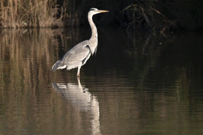
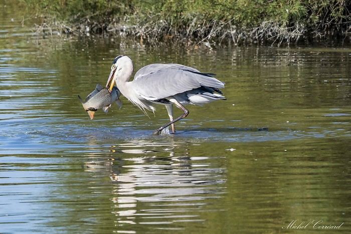
We were able to watch a great blue heron patiently pacing back and forth, trying to catch its food. We even saw it enjoying a meal a few times.

Interpretation panels have been put up to introduce us to the different elements that make up the ecosystem of this region.

Nicknamed the "squirrel park," it lives up to its name. There are loads of them, and they’re not shy at all. They even wait for us, ready for action.

A little boy walked by with his parents, holding a peanut in his hands. A squirrel made a huge leap to try to snatch it from him.

All hell broke loose! The squirrels squabbled, screeched, and started a wild chase against each other, really determined to scare off their rivals so they could be the one to claim the peanut—a priceless treasure in their eyes.

The catch? We didn’t have any! We went searching for a peanut, and eureka—we found one on the ground, still intact.

Alain knelt down, holding the peanut at the tip of his fingers. A squirrel came close, quickly grabbed it, and then dashed off at full speed with its precious loot.

As we continued our hike, we also discovered a charming little picturesque miniature village in the middle of the woods, complete with a house, a school, and a chapel.

We kept walking and, without realizing it, found ourselves in Parc Ferland.

There, we discovered stunning iron sculptures, which will be the topic of the next discussion.

Instead of retracing our steps, we went through the village and returned via Route 138.

We walked several kilometers on this hike, but I couldn’t tell you how many. I’d forgotten to wear socks in my shoes (even though I never do that), and the friction on my skin caused big blisters on one of my toes, the backs of my heels, and the soles of my feet. OUCH! I still have the marks three weeks later.

https://youtu.be/JvPuYwQJ4DE
Anne Blogue: https://deuxnomades.blogspot.com/ YouTube: https://www.youtube.com/c/SouthAngelVideo?sub_confirmation=1
PI Pinacoladada Globetrotter ·
SEPT-ÎLES – FERLAND PARK AND ITS METAL SCULPTURES

GPS coordinates: 50.268184, -66.430265

I think few tourists know about this little trail lined with metal sculptures. It’s located behind a huge mobile home park at the western entrance to the town of Sept-Îles.

These sculptures are the work of Mr. Jean-Pier Synnott, a welding artist. He created a small park where different creatures straight out of his imagination come together.

You enter through a heavy wrought-iron gate that creaks when you open it. We get the feeling of stepping into a forbidden world where fantastical beings mingle.

A loop trail lets you stroll easily through the woods and discover all these amazing sculptures, which depict characters, animals, birds, insects, flowers, and more.

To date, he has over 130 sculptures to his credit. Mr. Synnott has also displayed several of his works in his backyard. A sign informs visitors that you can freely explore while avoiding touching the sculptures.

You’ll find other cool creations there: planes, rockets, boats, submarines, fantastical creatures, etc. One sculpture also pays tribute to his family.

A great activity to do with family. These sculptures are sure to amaze both little ones and grown-ups alike.

https://youtu.be/6UG5KVjOtKc
Anne Blogue: https://deuxnomades.blogspot.com/ YouTube: https://www.youtube.com/c/SouthAngelVideo?sub_confirmation=1
VO Voyajou Globetrotter ·
I’ve been putting off an autumn trip to that area for years. I erased your contact details—I’d rather get lost—and watched a few videos, but I prefer the shock of real images (it’s amazing how reality matches my dreams 🤪). Mostly, I just wanted to congratulate you on all your travel journals with such a personal style (you’re the VoyageForum Guides all by yourself! 😏)
PI Pinacoladada Globetrotter ·
Hello,

Thank you for taking the time to comment on this travel journal.

I hope you’ll get the chance to travel to this magnificent landscape that is the North Shore one day.

For the video presentation, I’m really glad VoyageForum found an interface that allows them to display videos without weighing down their site.

I completely understand that most people prefer to see everything against a backdrop of images.

As for me, I prefer movement. That’s why I chose this type of media.

Thanks again. I wish you a wonderful day! 🙂

Anne
Anne Blogue: https://deuxnomades.blogspot.com/ YouTube: https://www.youtube.com/c/SouthAngelVideo?sub_confirmation=1
PI Pinacoladada Globetrotter ·
SEPT-ÎLES - CAMPING ZEC DE LA RIVIÈRE MOISIE

GPS coordinates: 50.264368, -66.036070

We spent the night at this campsite located along the Moisie River, which is known as the most important Atlantic salmon river in North America.

This river is also bordered by a lovely beach.

The electricity had a 30-amp outlet, but we didn’t have a converter. We first got permission to plug our extension cord into an outlet in the laundry room behind our site.

A little while later, an employee brought us a converter. We returned it the next morning.

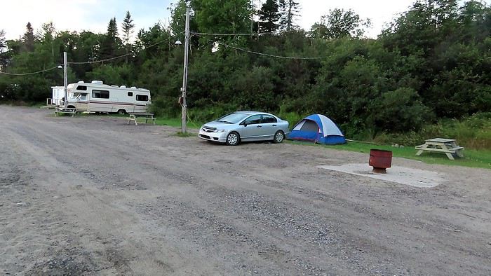
We arrived at the site quite late, so we set up our tent and, after dinner, relaxed around a cozy campfire.
Anne Blogue: https://deuxnomades.blogspot.com/ YouTube: https://www.youtube.com/c/SouthAngelVideo?sub_confirmation=1
PI Pinacoladada Globetrotter ·
SEPT-ÎLES - PETIT-HAVRE DE MATAMEC

GPS coordinates: 50.2916, -65.9474

Four trails form a 4.5 km loop. Interestingly, they let us explore the different ecosystems of this park.

We started our hike on the Telegraph Trail. It crosses a fir forest populated with spruces and poplars. This trail is relatively short and ends at the edge of a small road.

The Peat Bog Trail, 1 km long, starts on the other side of this road. It crosses a boreal forest and peat bogs, leading us to the shoreline.

The trail, very well marked, is bordered by a magnificent colorful vegetation carpet made up of lichens, shrubs, and herbaceous plants.

We then continued our hike on the Shoreline Trail. At 1.5 km long, it runs along the St. Lawrence River and lets us observe metamorphic rocks dating back about 1.1 billion years.

The different erosion cycles have naturally created true works of art. You can also admire some lovely small sandy beaches.

This trail ends at the intersection with the Marsh Trail. We turned left onto this trail to reach the shoreline, where you can see the Petit-Havre lighthouse.

This lighthouse, in rather poor condition, once served as a natural port for boats that served the buildings of the Matamec research station.

We then backtracked and continued our hike on the Marsh Trail (1.2 km), which brings us back to our starting point.

Four perpendicular trails (additional mileage) lead to observation points that let us learn more about the geological formations and salt marshes.

We spent nearly three hours in this park. If you love nature, it’s the perfect place for hiking.

In addition to discovering the park’s different ecosystems, you can also observe a diverse range of wildlife.

Indeed, several bird species can be spotted here, such as great blue herons and common loons.

The park is also home to mammals like red squirrels, minks, red foxes, wolves, black bears, and moose.

https://youtu.be/Mp-wNHJDZOM
Anne Blogue: https://deuxnomades.blogspot.com/ YouTube: https://www.youtube.com/c/SouthAngelVideo?sub_confirmation=1
PI Pinacoladada Globetrotter ·
SHELDRAKE - MANITOU RIVER FALLS

GPS coordinates: 50.316943, -65.244262

Two hiking trails run along the Manitou River, one on the west side and the other on the east side of the river.

The west trail, 0.6 km long, leads to a series of cascades. The east trail, 0.7 km long, leads to the falls.

After chatting with a woman working at the Minganie tourist information office located at this rest stop, we decided to head to the east side of the river since she told us that this trail was much better developed and that the falls were truly spectacular.

Our hike started at the rest stop. However, to get to the east side of the Manitou River, we had to walk along the shoulder of Route 138. This gave us a nice viewpoint over the river.

The first waterfall is easily accessible via a gravel trail that runs along the river. A lookout has been built at the base of this first waterfall, allowing us to enjoy a magnificent panorama.

You can often see rainbows forming when the sun shines on the water droplets suspended in the air.

Access to the second waterfall, however, requires good physical fitness since the trail is scattered with many roots and interrupted by wooden walkways and stairs totaling over 200 steps that you’ll not only have to descend... but also climb back up.

We then had to walk across a few logs to reach the small pebble beach at the base of this second waterfall.

The sight is breathtaking. The waterfall pours vigorously into the river, producing a deafening roar. The strong flow of water sprays mist that you can’t avoid if you get too close to the falls.

I noticed there was a trail leading to the top of the cliff behind the beach. So, I climbed to the top of the cliff to get a better view of the falls. From that height, I could see two levels of the waterfall.

Be careful if you take this trail, as it’s scattered with dirt and rocks that can be slippery.

If you’re passing through the area, don’t hesitate to visit this spot. However, unless you go early in the morning, expect not to be alone here. It’s one of the busiest places we’ve visited on the North Shore.

https://youtu.be/Zmzv56ChvkE
Anne Blogue: https://deuxnomades.blogspot.com/ YouTube: https://www.youtube.com/c/SouthAngelVideo?sub_confirmation=1
PI Pinacoladada Globetrotter ·
RIVIÈRE-AU-TONNERRE - HALTE DES PETITES SEPT-ILES

GPS coordinates: 50.264653, -64.854893

We stopped at a rest area called the Halte des Petites Sept-Îles. I’d heard it was possible to spot seals there. They like to come and rest on the rocks.

Unfortunately, we didn’t see any during our visit. However, we did discover several small sandy coves surrounded by rocks where the turquoise waters of the St. Lawrence River crashed against them.

We took the opportunity to go for a short hike along the river. Trust me, the scenery alone is worth the detour.

https://youtu.be/dTUIR-5r1tA
Anne Blogue: https://deuxnomades.blogspot.com/ YouTube: https://www.youtube.com/c/SouthAngelVideo?sub_confirmation=1
PI Pinacoladada Globetrotter ·
RIVIÈRE-AU-TONNERRE - PETIT SAULT FALLS AND GRAND SAULT FALLS

GPS coordinates: 50.2794, -64.7845 Petit Sault Falls GPS coordinates: 50.3088, -64.7433 Grand Sault Falls

The Petit Sault Falls lookout is accessible via an 800-meter trail located to the left of the parking lot and offers a viewpoint over the river. You can’t see the falls—the trees have certainly grown and ended up hiding them.

We went back to the parking lot and noticed another trail starting to the right.

We ventured down this path. It was quite wide at first but narrowed later and gradually faded away, with the vegetation becoming thicker and thicker.

We eventually found a way out of that tangle of branches and managed to get closer to the river, though it involved a few risks.

That’s how we got a nice view of the falls. The water flow wasn’t very strong.

It’s certainly much more impressive during spring floods, judging by the erosion on the surrounding rocks.

Those scarred rocks add a certain charm to the place.

To reach Grand Sault Falls, located north of Petit Sault Falls, you’ll need to drive 8.3 km on a sandy road.

At every fork, just keep to the right. Signs have been installed along the road to show the way.

From the parking lot, a well-marked but somewhat poorly maintained trail leads to a stunning 30-meter-high waterfall cascading down three tiers.

Its waters flow into a pool where it’s certainly refreshing to cool off during hot summer days.

Grand Sault Falls is without a doubt one of the most beautiful waterfalls we’ve seen on the Côte-Nord.

https://youtu.be/PteK-ekErvQ
Anne Blogue: https://deuxnomades.blogspot.com/ YouTube: https://www.youtube.com/c/SouthAngelVideo?sub_confirmation=1
PI Pinacoladada Globetrotter ·
LONGUE-POINTE-DE-MINGAN - CAMPING DE LA MINGANIE

GPS coordinates: 50.272331, -64.133395


We spent the night at a site in Camping de la Minganie, located near the sea. The owners are really super friendly.

We were supposed to set up near the beach. Since it was super windy during our stay, the owner let us set up on a spot near a fence to keep our tent from blowing away!!!

Those who were near the beach had a hard time putting up their tents! Sorry, but it was really funny!


For dinner, we went to grab a bite at Cantine chez Nath, a snack bar near the campsite.

Anne Blogue: https://deuxnomades.blogspot.com/ YouTube: https://www.youtube.com/c/SouthAngelVideo?sub_confirmation=1
PI Pinacoladada Globetrotter ·
MINGAN ARCHIPELAGO - EXCURSION TO PARROT ISLAND AND NUDE ISLAND

GPS coordinates: 50.267391, -64.141247 Les Entreprises Touristiques Loiselle

We had booked a 3.5-hour excursion to Parrot Island and Nude Island with Les Entreprises Touristiques Loiselle in advance.

When we showed up at their office, we were informed that our excursion was canceled due to the winds being much too strong.

We weren’t at all surprised by this decision. We had a feeling it would happen since the winds had been blowing hard all night and were still doing so when we woke up this morning.

Too bad, because this excursion would have allowed us, among other things, to see the puffins that are abundant on Parrot Island.

It’s only postponed. We’ll certainly have the opportunity to go back one day.
Anne Blogue: https://deuxnomades.blogspot.com/ YouTube: https://www.youtube.com/c/SouthAngelVideo?sub_confirmation=1
PI Pinacoladada Globetrotter ·
MINGAN - EKUANITSHIT PAUSTUK FALLS

GPS coordinates: 50.328013, -63.991398

The Ekuanitshit Paustuk Falls are located on the Mingan River. You can reach them via a 5 km sandy road. It's a very peaceful spot frequented by locals.

Every year on July 26th, the Innu gather here to celebrate a mass in honor of Saint Anne. A statue of Saint Anne is also erected near the river.

The falls aren’t very impressive in size, but they’re really pretty and set in a picturesque landscape.

The river is surrounded by eroded rocks in shades of pink and orange, adding to the charm of the place.

The falls flow into a large basin with a small island surrounded by sandy beaches.

There’s a building on this island—probably a hunting or fishing lodge.

https://youtu.be/KqakkcF9U1c
Anne Blogue: https://deuxnomades.blogspot.com/ YouTube: https://www.youtube.com/c/SouthAngelVideo?sub_confirmation=1
PI Pinacoladada Globetrotter ·
MINGAN ARCHIPELAGO - EXCURSION TO QUARRY AND NIAPISKAU ISLANDS

GPS coordinates: 50.236828, -63.606341 Boréale Maritime Services, Havre-Saint-Pierre

Access to these two islands, known for the beauty of their monoliths, is only by boat. To this end, we had made a reservation with Boréale Maritime Services, a maritime company recognized by Parks Canada.

We therefore went to the Havre-Saint-Pierre terminal to pick up our tickets and put on a warm coat to protect us from the wind and cold during the zodiac crossing, which lasts nearly half an hour.

We were a large group and had two boats at our disposal (12 and 36 seats). We boarded at the front of the smaller zodiac. Avoid this if you have joint problems, as we were thoroughly shaken during the crossing.

Upon our arrival on Quarry Island, we were greeted by a Parks Canada guide who told us about the formation of the islands and monoliths, as well as the terrestrial and marine life of the archipelago.

Quarry Island - Hiking in the forest

We had two hours to discover the island's attractions, which is not enough time to cover the entire 16-kilometer perimeter.

However, two trails can be taken to reach Anse des Érosions, where the most beautiful monoliths are located.

The "Anse des Érosions" trail, 600 meters long, leads directly to these famous monoliths, which are located on the other side of the island.

The "Les Falaises" trail, 1.2 km long, is the one we took. Equipped with wooden walkways and belvederes, this trail crosses the forest, cliffs, heathlands, and peat bogs.

It allows us to discover the different ecosystems of this island and enjoy beautiful viewpoints of the coastline.

This trail leads to Anse des Érosions, where the famous monoliths are located.

https://youtu.be/sU9lt-zTvJA

Quarry Island - The monoliths

The monoliths at Anse des Érosions are not very numerous, but they are spectacular due to their shapes and sizes.

Erosion has created true works of art scattered here and there along the coastline, transforming the landscape into an open-air museum.

https://youtu.be/-fZ2XiWTv8U

Niapiskau Island

After spending nearly two hours on Quarry Island, we set off by zodiac for Niapiskau Island.

We stayed for about an hour on this island to explore the impressive monoliths located on a long beach.

We didn’t have to look far, as most of them are near the dock.

They are quite imposing, and some are still topped with lush green vegetation.

We walked along the beach and discovered other beautiful rock formations.

The waters of the St. Lawrence River in this area are a beautiful turquoise color.

A short trail has been set up in the forest, leading to a belvedere that offers a nice viewpoint of the coastline.

On the way back, two people had taken our seats on the smaller zodiac, so we boarded the larger one.

This was a good thing for us. This zodiac is much more stable and, above all, much faster.

We approached two other islands. Some rock formations strikingly resembled huge macarons spread out on a beach.

As we neared the Havre-Saint-Pierre dock, we were lucky enough to spot a seal swimming near our boat. Unfortunately, I didn’t capture any images of that moment.

Entering the marina, we observed cormorants taking a break on the rocks.

https://youtu.be/KkNV7y5vSYU
Anne Blogue: https://deuxnomades.blogspot.com/ YouTube: https://www.youtube.com/c/SouthAngelVideo?sub_confirmation=1
PI Pinacoladada Globetrotter ·
MINGAN ARCHIPELAGO - EXCURSION TO QUARRY ISLAND - HIKE IN THE FOREST

GPS coordinates: 50.236828, -63.606341 Services Maritimes Boréale, Havre-Saint-Pierre

Access to these two islands (Quarry and Niapiskau), known for the beauty of their monoliths, is only possible by boat. To this end, we had made a reservation with Services Maritimes Boréale, a maritime company recognized by Parks Canada.

We therefore went to the Havre-Saint-Pierre terminal to pick up our tickets and put on a warm coat to protect us from the wind and cold during the zodiac crossing, which lasts nearly half an hour.

We were a large group and had two boats at our disposal (12 and 36 seats). We boarded at the front of the smaller zodiac. Avoid this if you have joint problems, as we were thoroughly shaken during the crossing.

Upon arrival, we were greeted by a Parks Canada guide who told us about the formation of the islands and monoliths, as well as the terrestrial and marine life of the archipelago.

Hike in the forest

We had two hours to discover the island’s attractions, which is not enough time to cover the entire 16-kilometer perimeter of the island.

However, two trails can be taken to reach Anse des Érosions, where the most beautiful monoliths are located.

The "Anse des Érosions" trail, 600 meters long, leads directly to these famous monoliths, which are located on the other side of the island.

The "Les Falaises" trail, 1.2 km long, is the one we took. Equipped with wooden walkways and belvederes, this trail crosses the forest, cliffs, moors, and peat bogs.

It allows us to discover the different ecosystems of this island and enjoy beautiful viewpoints of the coastline.

This trail leads to Anse des Érosions, where the famous monoliths are located.

https://youtu.be/sU9lt-zTvJA
Anne Blogue: https://deuxnomades.blogspot.com/ YouTube: https://www.youtube.com/c/SouthAngelVideo?sub_confirmation=1
PI Pinacoladada Globetrotter ·
MINGAN ARCHIPELAGO - EXCURSION TO QUARRY ISLAND - THE MONOLITHS

The monoliths at Anse des Érosions aren’t very numerous, but they’re absolutely stunning due to their shapes and sizes.

Erosion has created true works of art scattered along the coastline, transforming the landscape into an open-air museum.

https://youtu.be/-fZ2XiWTv8U
Anne Blogue: https://deuxnomades.blogspot.com/ YouTube: https://www.youtube.com/c/SouthAngelVideo?sub_confirmation=1
PI Pinacoladada Globetrotter ·
MINGAN ARCHIPELAGO - EXCURSION TO NIAPISKAU ISLAND

After spending nearly two hours on Quarry Island, we set off again by Zodiac toward Niapiskau Island.

We stayed on this island for about an hour to explore the impressive monoliths along a long beach.

We didn’t have to look far at all—most of them are right near the dock.

They’re actually quite massive, and some are still topped with lush green vegetation.

We walked along the beach and discovered other beautiful rock formations.

The waters of the St. Lawrence River in this area are a gorgeous turquoise color.

A short trail has been set up in the forest, leading to a lookout with a nice view of the coastline.

On the way back, two people had taken our spots on the smaller Zodiac, so we boarded the larger one instead.

It worked out well for us—the bigger Zodiac is much more stable and, most importantly, much faster.

We got close to two other islands, where some rock formations surprisingly resembled giant macarons spread out on the beach.

As we approached the dock in Havre-Saint-Pierre, we were lucky enough to spot a seal swimming near our boat. Unfortunately, I didn’t manage to capture any photos of the moment.

Entering the marina, we saw cormorants taking a break on the rocks.

https://youtu.be/KkNV7y5vSYU
Anne Blogue: https://deuxnomades.blogspot.com/ YouTube: https://www.youtube.com/c/SouthAngelVideo?sub_confirmation=1
PI Pinacoladada Globetrotter ·
HAVRE-SAINT-PIERRE - CAP FERRÉ TRAIL

GPS coordinates: 50.24160, -63.43120 Entrance to the path for Anse de la Grande Pointe GPS coordinates: 50.20494, -63.44754 Start of the trail

Cap Ferré is located less than 20 minutes from the town of Havre-Saint-Pierre. From Route 138, you’ll need to take a 5 km dirt road that ends in a cul-de-sac where the hiking trail begins.

Cap Ferré, located along the St. Lawrence River, has an ecosystem similar to that of the Mingan Archipelago islands. You’ll discover rare plants and beautiful limestone formations there.

A 900-meter trail runs along the river, allowing you to admire multiple monoliths along the edge of high eroded cliffs.

At the end of this trail, a stream flows down to the edge of a cliff and cascades into the river.

The site is breathtaking. Oxidation has created a phenomenal landscape. It looks like the cliff has taken on autumn colors—red, orange, beige, green... All these colors come together to form a scene straight out of a postcard.

https://youtu.be/BUgp59lixQY
Anne Blogue: https://deuxnomades.blogspot.com/ YouTube: https://www.youtube.com/c/SouthAngelVideo?sub_confirmation=1
PI Pinacoladada Globetrotter ·
HAVRE-SAINT-PIERRE - BELVÉDÈRE DE LA RIVIÈRE-DE-LA-CORNEILLE

GPS coordinates: 50.288994, -62.896314

The spot where we stopped isn’t an official rest area. When we arrived, we found a trail leading to the top of a hill.

So we ventured up the trail to reach the summit. From there, we had an amazing panoramic view of the area.

You can see marshes and a long wooden boardwalk running through a wooded area—there might even be a hiking trail there.

We also had a partial view of the river and the outfitter located at the river’s mouth.

https://youtu.be/fPAT2QIpOlc
Anne Blogue: https://deuxnomades.blogspot.com/ YouTube: https://www.youtube.com/c/SouthAngelVideo?sub_confirmation=1
PI Pinacoladada Globetrotter ·
BAIE-JOHAN-BEETZ PARK

GPS coordinates: 50.286735, -62.806762

The village of Baie Johan-Beetz is located in the heart of the boreal forest, halfway between Havre-Saint-Pierre and Natashquan.

We stopped in this village to go for a hike on the Sentier des Amoureux (Lovers' Trail), which runs along the coastline.

The trail, which is short, starts on a wooden footbridge and ends on a rocky headland where we had a stunning view of the village, particularly the Johan-Beetz house built in 1899, as well as the Piashti River.

Nearby, many inuksuit—stone cairns—also add charm to the landscape.

It’s definitely a fantastic spot for a picnic or just a quick break. You can sit in the two red Parks Canada chairs to admire the bay and the waters of the Gulf of St. Lawrence.

https://youtu.be/puq4R-blhuw
Anne Blogue: https://deuxnomades.blogspot.com/ YouTube: https://www.youtube.com/c/SouthAngelVideo?sub_confirmation=1
PI Pinacoladada Globetrotter ·
BAIE-JOHAN-BEETZ - CAP FELDSPATH MINE TRAIL (SPAR MICA)

GPS coordinates: 50.315301, -62.756221 Trailhead

The Cap Feldspath Mine Trail, also known as Spar Mica, leads to an old feldspar quarry that was operated in the mid-20th century.

At 3 km long, it crosses a forest devastated by a wildfire in 2013. The charred trees along the trail still bear witness to this sad event today.

However, vegetation has quickly bounced back, and you can observe several plant species as well as small fruits along the way.

The soil is sandy, and blueberries are abundant in this area. Alain picked and ate them all along the route.

We reached a small cove with a stunning white sand beach. The water is crystal clear.

We continued our hike along the coastline and spotted an old dock that was likely once used for transporting minerals.

We turned back and decided to climb to the top of the cliff near the beach.

**Avoid this if you have no climbing experience or are afraid of heights.**

There’s no marked trail. You’ll sometimes need to try different routes to find the best way to push through.

At the top of the cliff, the view of the beach and the Gulf of St. Lawrence is breathtaking.

The return trip was partly along this cliff. The landscape is magnificent. The granite rocks we walked on and the ground covered in lichens create a stunning, rustic scene.

During the hike along the cliff, we also enjoyed a lovely viewpoint overlooking the bay called Gaine à Foin.

At the end of the hike, we returned to the trail to head back to the parking lot.

https://youtu.be/Zh1Tg5juzs4
Anne Blogue: https://deuxnomades.blogspot.com/ YouTube: https://www.youtube.com/c/SouthAngelVideo?sub_confirmation=1
PI Pinacoladada Globetrotter ·
BAIE-JOHAN-BEETZ - BELVEDERE OF BAIE-PONTBRIAND

GPS coordinates: 50.2821526, -62.5519947

We made a stop at the Baie-Pontbriand rest area. From the parking lot, we got a viewpoint overlooking this magnificent bay as well as the Gulf of St. Lawrence.

A path, to the right of the parking lot, leads to the riverbank. I ventured out on some rocks to get a closer look at the river, which flows into pretty little waterfalls under the Route 138 bridge.

The bridge spanning the river also offers stunning viewpoints. Not only over the bay, but also on the opposite side where you can see the eerily calm river winding through a forest of charred trees.

https://youtu.be/t3vDNvBq88Y
Anne Blogue: https://deuxnomades.blogspot.com/ YouTube: https://www.youtube.com/c/SouthAngelVideo?sub_confirmation=1
PI Pinacoladada Globetrotter ·
AGUANISH - NORTH SHORE

Coordinates: 50.224421, -62.106420

Aguanish is a small fishing village located between Baie-Johan-Beetz and Natashquan, surrounded by long, stunning sandy beaches.

We took the opportunity to go for a little hike on a trail that starts near the playground at the end of Site Street.

It crosses high dunes and leads to the opposite side, where you’ll also find an incredibly beautiful beach.

We could’ve walked along the beach and circled the peninsula to return to the start of the trail, but we decided to backtrack instead.

We walked along the Aguanish River and noticed that its waters are warm and surprisingly clear.

Just outside the village, we stopped by the bridge overlooking the Aguanish River on Route 138.

On one side, you get a lovely view of the village and its beaches, and on the opposite side, you can see the Aguanish River waterfall.

https://youtu.be/Ya1lzrpJW6g
Anne Blogue: https://deuxnomades.blogspot.com/ YouTube: https://www.youtube.com/c/SouthAngelVideo?sub_confirmation=1
PI Pinacoladada Globetrotter ·
NATASHQUAN - NORTH SHORE

GPS coordinates: 50.185972, -61.822363 Parking areas GPS coordinates: 50.186111, -61.823680 Promenade des Anciens GPS coordinates: 50.181923, -61.822377 Historic site of the pebble beach GPS coordinates: 50.183514, -61.819397 Gilles Vigneault family site GPS coordinates: 50.175080, -61.806607 Municipal campground

The village of Natashquan is well known since it’s the birthplace of Gilles Vigneault, a world-renowned Quebecois singer-songwriter. It’s only been connected to the road network since 1996.

Our visit started at the historic site of the pebble beach. To get there, we took the Promenade des Anciens, a wooden boardwalk that begins at the tourist information center and ends at the historic site.

This historic site is an old fishing port. In the early 20th century, there were about thirty buildings used for salting and storing cod. Fishing gear was also stored there.

Designated a historic site on May 11, 2006, only a few buildings remain today.

We continued our walk to Café l'Échouerie, located by the beautiful, long beach that runs along the entire village. Unfortunately, it was closed when we passed by.

Next, we headed to the Gilles Vigneault family site, where you’ll find two houses and three outbuildings. Guided tours are available, but due to COVID-19 restrictions, no indoor visits were allowed during our stay.

We strolled through the village streets and discovered its church, built in 1861, as well as some local businesses like Chocolaterie La Coqueline, Maison Saint-Dilon, Gîte chez Mémé Daigle, the Le Bord du Cap interpretation center (a recreation of an old general store), and Auberge La Cache.

Many houses in the village are colorful, and some feature charming decorative elements.

We found everything we needed for lunch and dinner at the Marché Omni in Natashquan. Plus, this market has a SAQ license.

We spent the night at a site in the municipal campground.

https://youtu.be/sSs6jRDQUIo
Anne Blogue: https://deuxnomades.blogspot.com/ YouTube: https://www.youtube.com/c/SouthAngelVideo?sub_confirmation=1

Similar discussions

You might also like