I'm starting my first travel journal since VF reopened!
This will mostly be to share my impressions and some photos, with a few days' delay, but I'm starting this journal while I'm still here.
First, I'd like to thank those who helped me prepare for this trip.
I was able to organize this stay in one of the most expensive countries in the world thanks to the home-exchange principle. Not necessarily a direct swap, but through a points system, which is more practical for choosing where you want to go without it having to be a reciprocal exchange.
For this trip, there will already be two different accommodations. We'll see how it goes after that.
The first place is near Yverdon-les-Bains, close to Lake Neuchâtel.
So, we're going to explore this area!
We arrived under capricious weather that won’t leave us for the next few days!
We had dinner at a pizzeria recommended by *Le Routard* in Yverdon, then took a little nighttime stroll through the town center before heading inland to settle into our accommodation.
We discovered a very large, quiet house—and especially the cat that stayed behind! Funny for a couple of mice! He’ll be sleeping with us 😹
Hello,
Who among us hasn’t dreamed of having a ticket to Tahiti, Bora Bora, or the Marquesas in their pocket—preferably a one-way ticket to “paradise”?
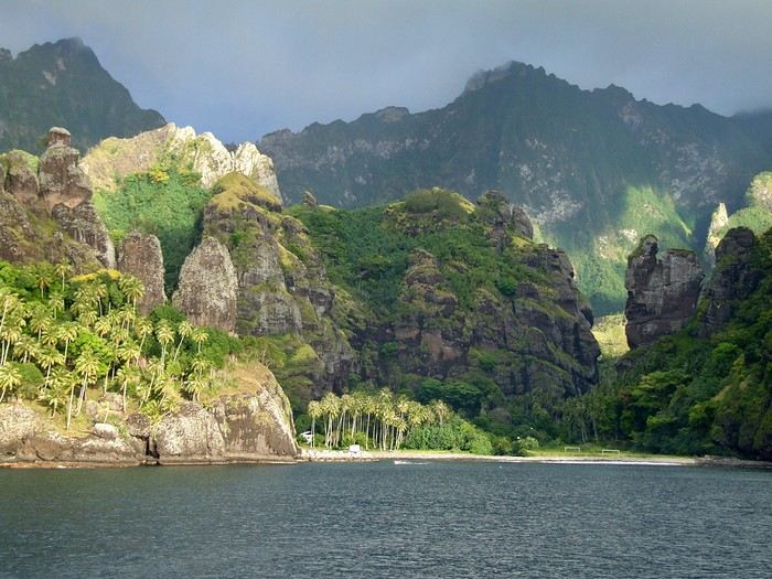 Idyllic landscape of a dream island, but difficult to access: the Bay of Virgins in Fatu Hiva, Marquesas Islands
Among the values conveyed by literature, tourism, and advertising is the quest for “elsewhere,” for a change of scenery, in the truest sense of the word—that is, the need to leave one’s country. This need for otherness, for difference, is projected onto dreamlike, idealized, even mythicized places. In our imaginary world, the island is often that place.
Yet we forget that islands have also been ideal prisons. The examples are numerous: Elba and Saint Helena, Alcatraz and Poulo Condor, If and Yeu, the Devil’s Islands and Leros. The latter, located in Greece in the Dodecanese, hosted a sinister forced labor camp during the colonels’ dictatorship as well as a psychiatric hospital. Despite the beauty of its bay, tourism has remained marginal there due to its bad reputation, unlike the neighboring island of Patmos.
I’d like to share a selection of about a dozen islands from across the world’s seas and oceans. For dreaming...
°°°°°°°°°°°°°°°
SANTORINI
July 27, 1967
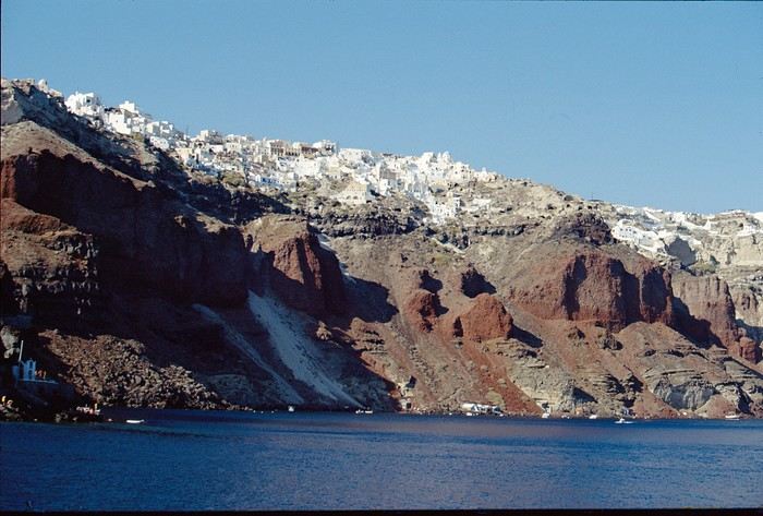
At dawn, the ferry from Agios Nikolaos (Crete) enters the immense caldera of Santorini. From the ship’s deck, Rainer, my travel companion, and I are left in awe by the sight of these towering, multicolored cliffs looming over us. We disembark and begin the steep climb on foot via the winding mule path up to the village of Fira, the capital perched above the cliff. Though it’s still very early, we head to the youth hostel. There wasn’t a soul in the alleys that morning—or rather, there were only cats! I have a fond memory of that encounter with Santorini: a sensory shock, a breathtaking volcanic site, a harmony of blue, ochre-red, and white. A welcoming island, as it was traditional to welcome the xénou, an island that hadn’t yet fully recovered from the terrible 1956 earthquake, a Cycladic architectural marvel where local life was still preserved.
It’s easy to see why, in antiquity, the island was named Kallisté (καλλίστη), “the most beautiful,” as it’s nearly impossible to resist gazing at this landscape shaped by tectonic forces. Indeed, a massive volcanic cataclysm—the Minoan eruption—shaped this scenery in the 17th century BCE, creating a caldera that was quickly filled by the sea. The enormous tsunamis that followed reached Crete, leading to the disappearance of the Minoan civilization.
A cliffside path along the caldera leads us to the peaceful village of Oia, at the northern tip of the island. Blue-domed churches and flower-filled villages with whitewashed houses line the way. This walk is a continuous marvel, offering splendid views of the caldera and the neighboring islands formed by the breakup of the ancient volcano (Thirissa, Nea Kameni). Oia is a large, picturesque village, like Fira perched on the cliff’s edge, which was severely damaged by the 1956 earthquake, and its scars are still visible. Its cave-like houses with vaulted roofs haven’t yet been turned into luxury hotels or shops. Absolute tranquility reigns here.
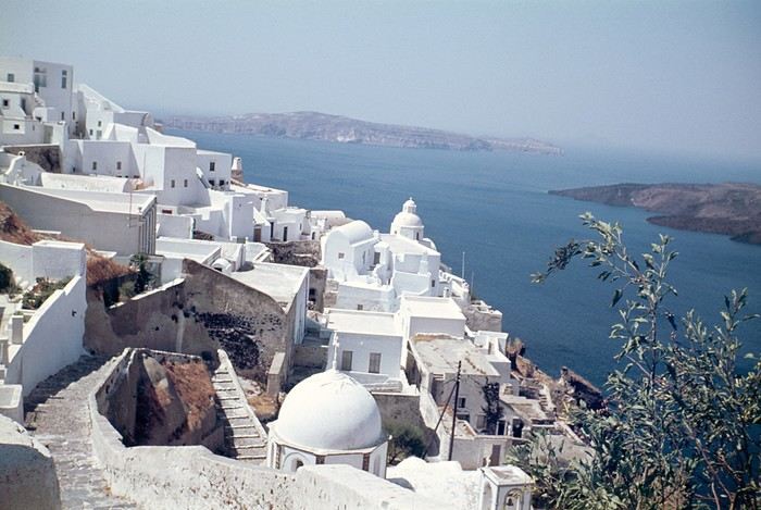 Oia in 1967—a peaceful village overlooking the caldera. But where are the pools and trendy bars?
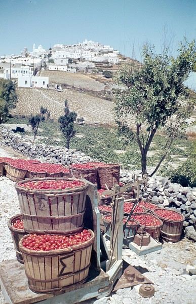
A lush countryside covered in olive trees and vineyards welcomes us for a pleasant hike, interrupted by the kindness of a friendly islander who gives us a lift in his truck for a few kilometers. He’s off to harvest his tomatoes, which he grows at the foot of Pyrgos Hill. The delicious little cherry tomato of Santorini earned an EU Protected Designation of Origin (PDO) in 2013. We climb up to the village of Pyrgos, perched on a hill and dominated by the elegant bell tower of its church. Finally, we reach the black sand beach of Kamari on the island’s eastern coast to enjoy a swim.
{...} To be continued

°°°°°°°°°°°°°°°°°
RAIVAVAE (French Polynesia)
November 15, 2007
Éléonore from Pension Tama welcomes us with traditional flower leis, as if she’d been waiting for old friends she hadn’t seen in ages. The small airport terminal is lively, the atmosphere warm—people hugging, rejoicing in reunions, all under kilos of flowers. Then, just as quickly, the place empties until the next flight... in a few days.
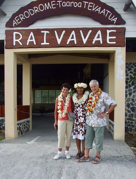
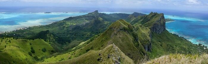
In the Austral Islands, a ninety-minute flight from Tahiti, Raivavae is a world away from the frenetic pace of Papeete or the tourist crowds of the Leeward Islands. The true paradise of the South Seas can still be savored here—it’s a bit like Bora Bora half a century ago. Our first feeling upon arriving on this island is wonder, with smiles that could melt even the gloomiest among us, landscapes so stunning they take your breath away, and above all, a sense of disorientation and fulfillment. Picture a mountainous island, about ten kilometers by three and a half, encircled by a coral reef and wild motu, cradling a lagoon with shades of blue that would make Bora Bora green with envy.
The roughly one thousand inhabitants of Raivavae are spread across four villages around the island. Children are everywhere, as is typical in Polynesia, and they greet you with open, genuine smiles. Here, ancestral values have survived progress. The predominantly Protestant population is very devout, as evidenced by the several temples built across the island. Religious fervor sets the rhythm of daily life. Sundays are reserved for worship and Sunday school (catechism). Work is forbidden on that day, and tourist activities are suspended. These rules are strict and respected.
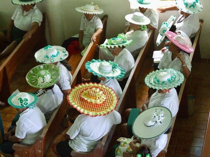 Hat contest for the worship celebration
Yet a sense of resignation is ever-present. The people of Raivavae know they are—and will remain—isolated. Despite the construction of an airstrip in 2004 and a few weekly flights to Tahiti and its nearest neighbor, Tubuai (200 km away), the island remains on the fringes of the world. One painful aspect is the separation of children from their parents when they leave for middle school in Tubuai starting in fifth grade. Television brings daily images of a world the islanders will likely never know, but one they often aspire to.
We are privileged. We have the pristine white-sand beaches of the motu and some of the most beautiful bays in Polynesia all to ourselves. The jewel in the crown, the island’s emblematic spot, is the “motu-pool,” about twenty minutes by boat. A natural, exquisite basin with crystal-clear water, gradients of blue, and white sand. And best of all, there’s almost no one there. In fact, lounging on the beach is frowned upon, especially for young women. Religion looks very unfavorably on sunbathing and lazing around. And yet, everything here leans toward that philosophy of life.
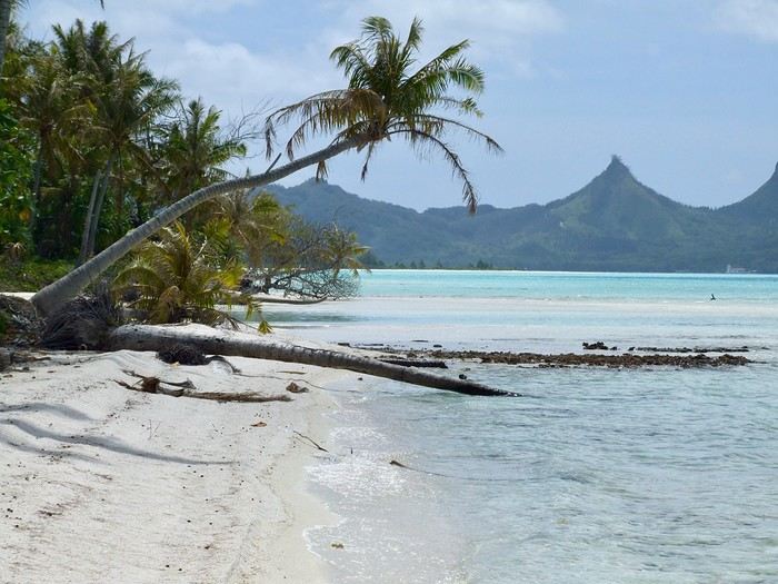
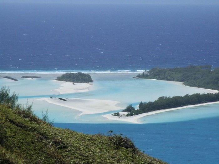 The "motu-pool"
{...} To be continued
Who among us hasn’t dreamed of having a ticket to Tahiti, Bora Bora, or the Marquesas in their pocket—preferably a one-way ticket to “paradise”?
Idyllic landscape of a dream island, but difficult to access: the Bay of Virgins in Fatu Hiva, Marquesas IslandsAmong the values conveyed by literature, tourism, and advertising is the quest for “elsewhere,” for a change of scenery, in the truest sense of the word—that is, the need to leave one’s country. This need for otherness, for difference, is projected onto dreamlike, idealized, even mythicized places. In our imaginary world, the island is often that place.
Yet we forget that islands have also been ideal prisons. The examples are numerous: Elba and Saint Helena, Alcatraz and Poulo Condor, If and Yeu, the Devil’s Islands and Leros. The latter, located in Greece in the Dodecanese, hosted a sinister forced labor camp during the colonels’ dictatorship as well as a psychiatric hospital. Despite the beauty of its bay, tourism has remained marginal there due to its bad reputation, unlike the neighboring island of Patmos.
I’d like to share a selection of about a dozen islands from across the world’s seas and oceans. For dreaming...
°°°°°°°°°°°°°°°
SANTORINI
July 27, 1967
At dawn, the ferry from Agios Nikolaos (Crete) enters the immense caldera of Santorini. From the ship’s deck, Rainer, my travel companion, and I are left in awe by the sight of these towering, multicolored cliffs looming over us. We disembark and begin the steep climb on foot via the winding mule path up to the village of Fira, the capital perched above the cliff. Though it’s still very early, we head to the youth hostel. There wasn’t a soul in the alleys that morning—or rather, there were only cats! I have a fond memory of that encounter with Santorini: a sensory shock, a breathtaking volcanic site, a harmony of blue, ochre-red, and white. A welcoming island, as it was traditional to welcome the xénou, an island that hadn’t yet fully recovered from the terrible 1956 earthquake, a Cycladic architectural marvel where local life was still preserved.
It’s easy to see why, in antiquity, the island was named Kallisté (καλλίστη), “the most beautiful,” as it’s nearly impossible to resist gazing at this landscape shaped by tectonic forces. Indeed, a massive volcanic cataclysm—the Minoan eruption—shaped this scenery in the 17th century BCE, creating a caldera that was quickly filled by the sea. The enormous tsunamis that followed reached Crete, leading to the disappearance of the Minoan civilization.
A cliffside path along the caldera leads us to the peaceful village of Oia, at the northern tip of the island. Blue-domed churches and flower-filled villages with whitewashed houses line the way. This walk is a continuous marvel, offering splendid views of the caldera and the neighboring islands formed by the breakup of the ancient volcano (Thirissa, Nea Kameni). Oia is a large, picturesque village, like Fira perched on the cliff’s edge, which was severely damaged by the 1956 earthquake, and its scars are still visible. Its cave-like houses with vaulted roofs haven’t yet been turned into luxury hotels or shops. Absolute tranquility reigns here.
Oia in 1967—a peaceful village overlooking the caldera. But where are the pools and trendy bars?A lush countryside covered in olive trees and vineyards welcomes us for a pleasant hike, interrupted by the kindness of a friendly islander who gives us a lift in his truck for a few kilometers. He’s off to harvest his tomatoes, which he grows at the foot of Pyrgos Hill. The delicious little cherry tomato of Santorini earned an EU Protected Designation of Origin (PDO) in 2013. We climb up to the village of Pyrgos, perched on a hill and dominated by the elegant bell tower of its church. Finally, we reach the black sand beach of Kamari on the island’s eastern coast to enjoy a swim.
{...} To be continued
°°°°°°°°°°°°°°°°°
RAIVAVAE (French Polynesia)
November 15, 2007
Éléonore from Pension Tama welcomes us with traditional flower leis, as if she’d been waiting for old friends she hadn’t seen in ages. The small airport terminal is lively, the atmosphere warm—people hugging, rejoicing in reunions, all under kilos of flowers. Then, just as quickly, the place empties until the next flight... in a few days.
In the Austral Islands, a ninety-minute flight from Tahiti, Raivavae is a world away from the frenetic pace of Papeete or the tourist crowds of the Leeward Islands. The true paradise of the South Seas can still be savored here—it’s a bit like Bora Bora half a century ago. Our first feeling upon arriving on this island is wonder, with smiles that could melt even the gloomiest among us, landscapes so stunning they take your breath away, and above all, a sense of disorientation and fulfillment. Picture a mountainous island, about ten kilometers by three and a half, encircled by a coral reef and wild motu, cradling a lagoon with shades of blue that would make Bora Bora green with envy.
The roughly one thousand inhabitants of Raivavae are spread across four villages around the island. Children are everywhere, as is typical in Polynesia, and they greet you with open, genuine smiles. Here, ancestral values have survived progress. The predominantly Protestant population is very devout, as evidenced by the several temples built across the island. Religious fervor sets the rhythm of daily life. Sundays are reserved for worship and Sunday school (catechism). Work is forbidden on that day, and tourist activities are suspended. These rules are strict and respected.
Hat contest for the worship celebrationYet a sense of resignation is ever-present. The people of Raivavae know they are—and will remain—isolated. Despite the construction of an airstrip in 2004 and a few weekly flights to Tahiti and its nearest neighbor, Tubuai (200 km away), the island remains on the fringes of the world. One painful aspect is the separation of children from their parents when they leave for middle school in Tubuai starting in fifth grade. Television brings daily images of a world the islanders will likely never know, but one they often aspire to.
We are privileged. We have the pristine white-sand beaches of the motu and some of the most beautiful bays in Polynesia all to ourselves. The jewel in the crown, the island’s emblematic spot, is the “motu-pool,” about twenty minutes by boat. A natural, exquisite basin with crystal-clear water, gradients of blue, and white sand. And best of all, there’s almost no one there. In fact, lounging on the beach is frowned upon, especially for young women. Religion looks very unfavorably on sunbathing and lazing around. And yet, everything here leans toward that philosophy of life.
The "motu-pool"{...} To be continued
Wednesday, April 1st
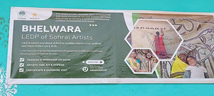
Hazaribagh I’ve got a meet-up with Adam Iman, a guide and painter. He picks me up from the hotel at 10 AM. Another traveler from Bangalore is supposed to join us, but while we wait for him to arrive, Adam takes me to see the paintings his mother and sister created at Hazaribagh station. The town became famous thanks to these murals, which can also be found in several surrounding villages. This art form has earned recognition and is now protected, a sign of its cultural importance. Once the visit is over, we go to pick up the other traveler and then head to our first village: Belwara, where Sohrai art is practiced. At the entrance, a sign proudly announces that we’re entering an artists’ village, where this art is created by women organized into micro-enterprises. Some even offer workshops for those who’d like to learn this tradition.
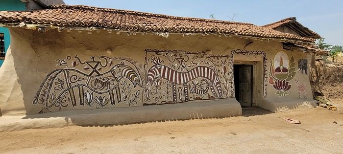
Sohrai art is tied to the harvest season, from October to mid-November. The motifs, in natural colors, celebrate fertility and abundance. The artists use pigments from the earth: red oxides, ochre, white kaolin, and black manganese. On the walls, you’ll see animals, fish, birds—all symbols of life and prosperity. As I look closer at the murals, I start to realize that each motif tells a story. Large animals like cows or bulls often take center stage. Their bodies are filled with intricate, almost hypnotic patterns. They symbolize wealth and prosperity for the household, as well as the deep respect for cattle, which are essential to daily life. On some facades, elephants stand out—massive and decorated with the same precision. They evoke quiet strength and protection. But it’s when I stop in front of one of the houses that I really take the time to look. The wall, a soft ochre, is entirely covered in murals. Two large animals stretch out on either side of the door, their elongated bodies fitting the length of the wall. Their silhouettes are filled with geometric patterns and incredibly fine curved lines, as if every space was patiently filled. Around them, stylized plants, flowers, and small decorative elements fill every gap. The door, dark and worn, becomes almost the silent center of the composition, framed by these living, protective forms. To the right, a more colorful motif catches the eye—a flower or a stylized lamp—like a touch of light on the earth. The whole thing gives an impression of perfect balance, between the rigor of the patterns and the freedom of the gesture.
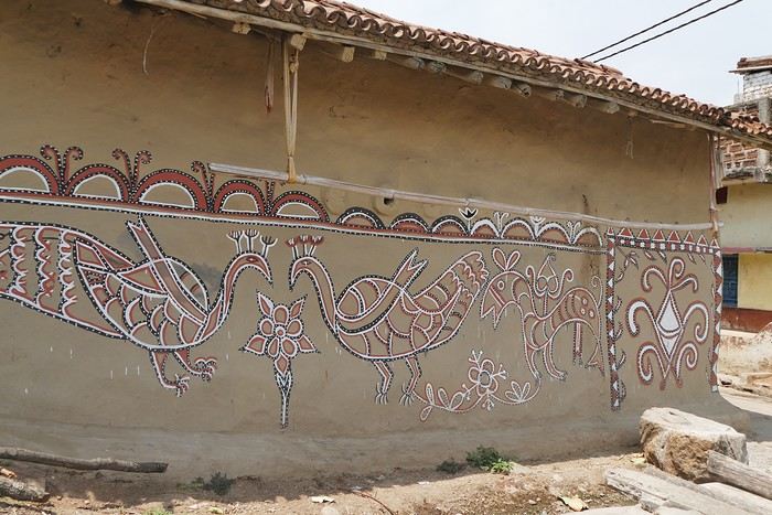
Elsewhere, birds and freer forms bring movement. Peacocks, recognizable by their stylized silhouettes, embody beauty and vitality, while fish symbolize water, fertility, and the continuity of life.
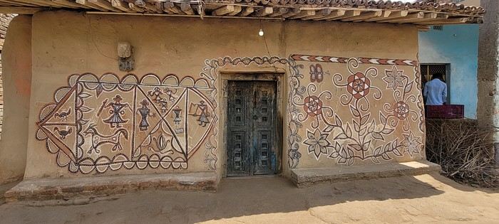
 On some paintings, the scenes become almost narrative: you can make out figures, everyday gestures, like a memory of the village inscribed in the walls. The decorative frames around the doors aren’t left to chance either—they symbolically protect the house, like a boundary between the inside and the outside world.
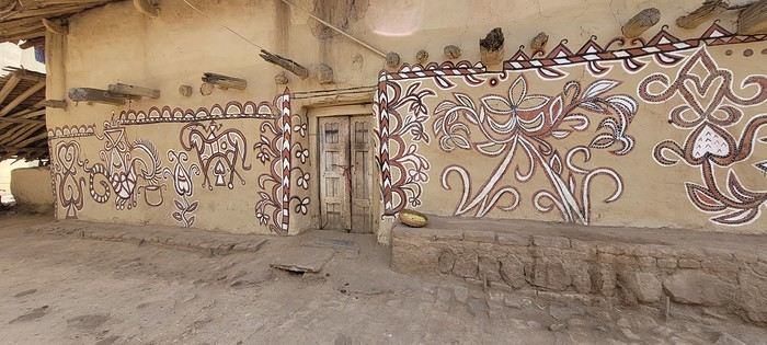
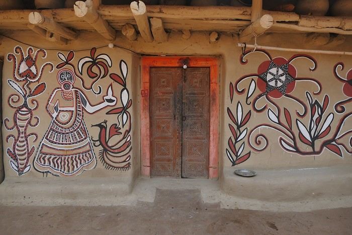
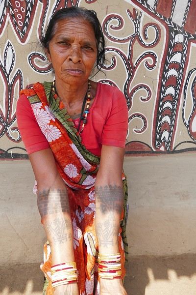
During the Sohrai festival, cattle are led into the jungle in the morning. Meanwhile, the women finish the *aripans*—these floor paintings—and continue the wall murals. Around noon, the animals return to the village, and the bulls’ horns are anointed with oil and vermilion in a gesture of gratitude, amid the vibrant colors adorning the houses. We visit several artists, including Parvat Devi, a well-known woman who has received many awards. Her arms are adorned with intriguing tattoos, which I’ll talk about in more detail later.
On another wall, the style changes completely. Here, no massive animals—just birds occupying the space, light and graceful, as if caught in mid-movement. Two silhouettes face each other, their long necks arched almost like mirrors, while their outstretched wings seem to vibrate with the patterns that compose them.
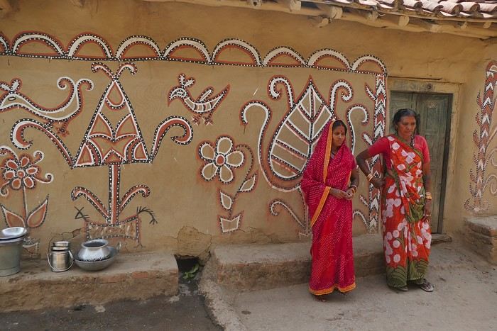
The design is more graphic, almost airy. The lines are smoother, more fluid, as if drawn in one confident stroke. The birds’ bodies aren’t solid—they’re filled with repetitive motifs like scales, stylized feathers, and spirals, giving a sense of continuous movement. Around them, everything comes to life: flowers burst open, arabesques swirl, and even the simplest shapes seem alive. What strikes me here is the sense of lightness. Where the large animals evoked stability and grounding, these birds bring something freer, almost joyful. They seem to embody movement, the circulation of life, like a breath flowing through the village.
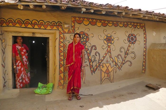
The colors remain the same—deep reds, intense blacks, and chalky white—but the rhythm is different. Faster, more spontaneous. As if each wall had its own personality, while still speaking the same language.
That’s probably why I’m so moved. I’d heard about these paintings from my friend Raja, and last year, I saw an exhibition in a village near my home. That first encounter made me want to come here. But seeing them in person is a whole different experience. These paintings are unique. This ancient art is passed down from mother to daughter, or mother-in-law to daughter-in-law, in a quiet, deeply living continuity. At first glance, it might seem almost childlike in its simplicity and pared-down forms. And yet, everything is thought out, balanced, mastered. Nothing is left to chance.
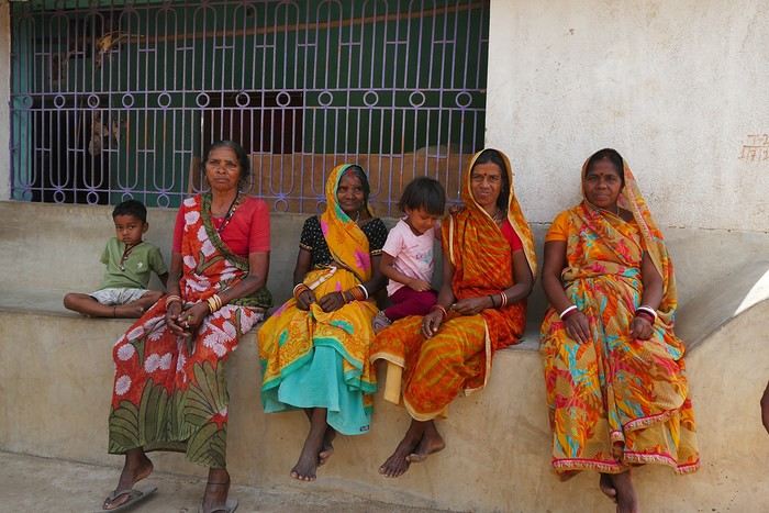
That apparent simplicity, combined with such rich symbolism, touches me deeply. There’s something sincere and essential in these walls—and that’s what moves me.
Hazaribagh I’ve got a meet-up with Adam Iman, a guide and painter. He picks me up from the hotel at 10 AM. Another traveler from Bangalore is supposed to join us, but while we wait for him to arrive, Adam takes me to see the paintings his mother and sister created at Hazaribagh station. The town became famous thanks to these murals, which can also be found in several surrounding villages. This art form has earned recognition and is now protected, a sign of its cultural importance. Once the visit is over, we go to pick up the other traveler and then head to our first village: Belwara, where Sohrai art is practiced. At the entrance, a sign proudly announces that we’re entering an artists’ village, where this art is created by women organized into micro-enterprises. Some even offer workshops for those who’d like to learn this tradition.
Sohrai art is tied to the harvest season, from October to mid-November. The motifs, in natural colors, celebrate fertility and abundance. The artists use pigments from the earth: red oxides, ochre, white kaolin, and black manganese. On the walls, you’ll see animals, fish, birds—all symbols of life and prosperity. As I look closer at the murals, I start to realize that each motif tells a story. Large animals like cows or bulls often take center stage. Their bodies are filled with intricate, almost hypnotic patterns. They symbolize wealth and prosperity for the household, as well as the deep respect for cattle, which are essential to daily life. On some facades, elephants stand out—massive and decorated with the same precision. They evoke quiet strength and protection. But it’s when I stop in front of one of the houses that I really take the time to look. The wall, a soft ochre, is entirely covered in murals. Two large animals stretch out on either side of the door, their elongated bodies fitting the length of the wall. Their silhouettes are filled with geometric patterns and incredibly fine curved lines, as if every space was patiently filled. Around them, stylized plants, flowers, and small decorative elements fill every gap. The door, dark and worn, becomes almost the silent center of the composition, framed by these living, protective forms. To the right, a more colorful motif catches the eye—a flower or a stylized lamp—like a touch of light on the earth. The whole thing gives an impression of perfect balance, between the rigor of the patterns and the freedom of the gesture.
Elsewhere, birds and freer forms bring movement. Peacocks, recognizable by their stylized silhouettes, embody beauty and vitality, while fish symbolize water, fertility, and the continuity of life.
On some paintings, the scenes become almost narrative: you can make out figures, everyday gestures, like a memory of the village inscribed in the walls. The decorative frames around the doors aren’t left to chance either—they symbolically protect the house, like a boundary between the inside and the outside world.During the Sohrai festival, cattle are led into the jungle in the morning. Meanwhile, the women finish the *aripans*—these floor paintings—and continue the wall murals. Around noon, the animals return to the village, and the bulls’ horns are anointed with oil and vermilion in a gesture of gratitude, amid the vibrant colors adorning the houses. We visit several artists, including Parvat Devi, a well-known woman who has received many awards. Her arms are adorned with intriguing tattoos, which I’ll talk about in more detail later.
On another wall, the style changes completely. Here, no massive animals—just birds occupying the space, light and graceful, as if caught in mid-movement. Two silhouettes face each other, their long necks arched almost like mirrors, while their outstretched wings seem to vibrate with the patterns that compose them.
The design is more graphic, almost airy. The lines are smoother, more fluid, as if drawn in one confident stroke. The birds’ bodies aren’t solid—they’re filled with repetitive motifs like scales, stylized feathers, and spirals, giving a sense of continuous movement. Around them, everything comes to life: flowers burst open, arabesques swirl, and even the simplest shapes seem alive. What strikes me here is the sense of lightness. Where the large animals evoked stability and grounding, these birds bring something freer, almost joyful. They seem to embody movement, the circulation of life, like a breath flowing through the village.
The colors remain the same—deep reds, intense blacks, and chalky white—but the rhythm is different. Faster, more spontaneous. As if each wall had its own personality, while still speaking the same language.
That’s probably why I’m so moved. I’d heard about these paintings from my friend Raja, and last year, I saw an exhibition in a village near my home. That first encounter made me want to come here. But seeing them in person is a whole different experience. These paintings are unique. This ancient art is passed down from mother to daughter, or mother-in-law to daughter-in-law, in a quiet, deeply living continuity. At first glance, it might seem almost childlike in its simplicity and pared-down forms. And yet, everything is thought out, balanced, mastered. Nothing is left to chance.
That apparent simplicity, combined with such rich symbolism, touches me deeply. There’s something sincere and essential in these walls—and that’s what moves me.
Autumn 2025 marks my 11th trip to Japan. I’ve neglected the south for too long, so like last year, it’s my main destination again.
We’ll revisit some familiar spots, but of course, we’ll also try plenty of new things. This trip feels a bit strange—no more of that initial magic, but on the other hand, we’ve really explored some off-the-beaten-path and private locations. The variety of regions, landscapes, and vehicles I’ve photographed is pretty remarkable. In search of vintage trains and threatened lines, I think my future trips will follow the same vibe.
After the 2017 and 2024 travel journals, it’s time to dive into Japan’s lesser-known side—all by public transport, of course. Day 1, arrival in Tokyo
The timing won’t be like other years since we arrive at Narita in the mid-afternoon after a layover in Hong Kong.
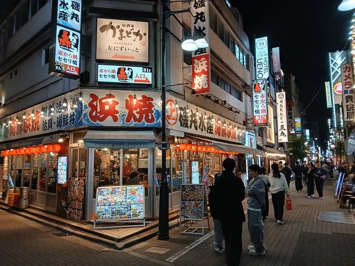
The only real mission for this afternoon is picking up tickets for the next day. And already, the first travel stress: I’ll have to rewrite the entire day because the Revaty Kinu 109 to Kinugawaonsen is fully booked, just like all the morning trains. So instead of a relaxed start exploring Ueno, I’m back to scrutinizing schedules. I manage to snag something last-minute after struggling for hours. Then, I wait for a message from Seiichi to meet up for dinner. Meeting friends on the first day and staying up late with jet lag—like I said, this trip isn’t like the others.
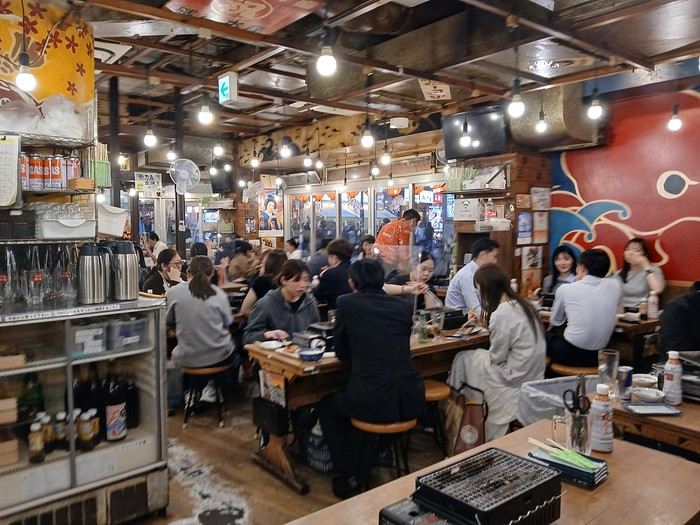
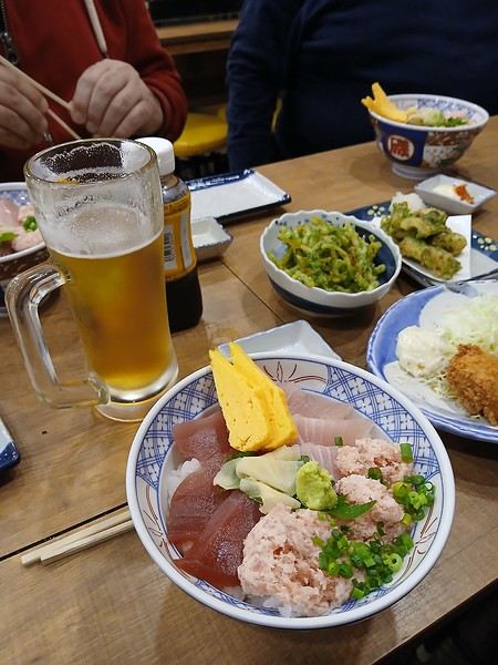
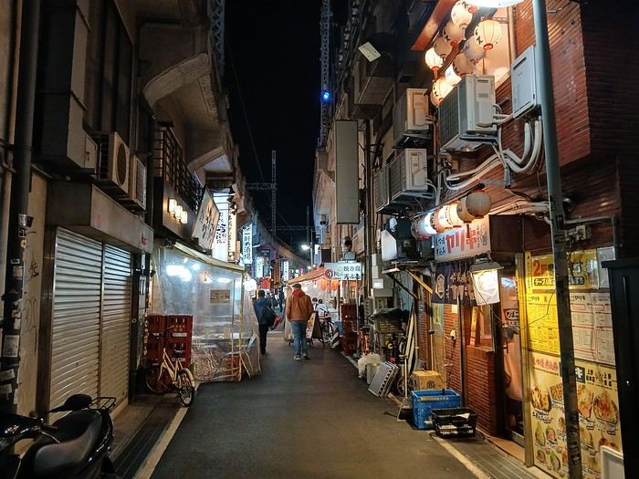
A great evening at a place I love.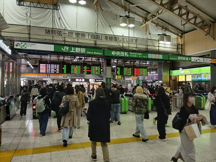
We’ll revisit some familiar spots, but of course, we’ll also try plenty of new things. This trip feels a bit strange—no more of that initial magic, but on the other hand, we’ve really explored some off-the-beaten-path and private locations. The variety of regions, landscapes, and vehicles I’ve photographed is pretty remarkable. In search of vintage trains and threatened lines, I think my future trips will follow the same vibe.
After the 2017 and 2024 travel journals, it’s time to dive into Japan’s lesser-known side—all by public transport, of course. Day 1, arrival in Tokyo
The timing won’t be like other years since we arrive at Narita in the mid-afternoon after a layover in Hong Kong.
The only real mission for this afternoon is picking up tickets for the next day. And already, the first travel stress: I’ll have to rewrite the entire day because the Revaty Kinu 109 to Kinugawaonsen is fully booked, just like all the morning trains. So instead of a relaxed start exploring Ueno, I’m back to scrutinizing schedules. I manage to snag something last-minute after struggling for hours. Then, I wait for a message from Seiichi to meet up for dinner. Meeting friends on the first day and staying up late with jet lag—like I said, this trip isn’t like the others.
A great evening at a place I love.
Some trips are born twice.
Ours was supposed to happen in 2020. Everything was ready: the itinerary, the flight tickets, hotel reservations and Machu Picchu, the rental car, dreams of high altitudes and wide-open spaces. And then the world stopped.
Like so many other plans, our trip to Peru was put on hold. Disappointment was followed by a more concrete reality: paperwork, endless back-and-forth, and battles to recover some of the costs we’d already paid.
The years went by. Life moved on, with its shifting priorities and unexpected twists. Rescheduling this trip wasn’t possible until 2025.
The itinerary stayed mostly true to what we’d imagined five years earlier. One major difference, though—in 2020, we’d planned to rent a car and explore the roads completely independently. Most importantly, we hadn’t included the three-day Ausangate trek, due to lack of time.
For 2025, our plans evolved. 4x4 rental prices had skyrocketed, and when we looked at our schedule more closely, we realized quite a few days didn’t actually need a vehicle. So we made a different choice and opted for private drivers instead. A decision we never regretted. Always punctual, thoughtful, and available... they were so much more than just drivers.
All our reservations were made in January, except for the trek, which we booked in February.
Finding reliable drivers on our own was tough, so we asked Laurent from Tout Pérou to handle it for us. Going through Tout Pérou also gave us a discount on the train ride to Aguas Calientes, so Laurent booked those tickets too. He also bought our Machu Picchu entrance tickets at the same price we would’ve paid on the official website. When comparing domestic flight prices, we found it was cheaper to book from Peru, so Laurent took care of those as well.
This time, nothing was going to stop us. Peru was waiting. And we were ready. 🙂
Ours was supposed to happen in 2020. Everything was ready: the itinerary, the flight tickets, hotel reservations and Machu Picchu, the rental car, dreams of high altitudes and wide-open spaces. And then the world stopped.
Like so many other plans, our trip to Peru was put on hold. Disappointment was followed by a more concrete reality: paperwork, endless back-and-forth, and battles to recover some of the costs we’d already paid.
The years went by. Life moved on, with its shifting priorities and unexpected twists. Rescheduling this trip wasn’t possible until 2025.
The itinerary stayed mostly true to what we’d imagined five years earlier. One major difference, though—in 2020, we’d planned to rent a car and explore the roads completely independently. Most importantly, we hadn’t included the three-day Ausangate trek, due to lack of time.
For 2025, our plans evolved. 4x4 rental prices had skyrocketed, and when we looked at our schedule more closely, we realized quite a few days didn’t actually need a vehicle. So we made a different choice and opted for private drivers instead. A decision we never regretted. Always punctual, thoughtful, and available... they were so much more than just drivers.
All our reservations were made in January, except for the trek, which we booked in February.
Finding reliable drivers on our own was tough, so we asked Laurent from Tout Pérou to handle it for us. Going through Tout Pérou also gave us a discount on the train ride to Aguas Calientes, so Laurent booked those tickets too. He also bought our Machu Picchu entrance tickets at the same price we would’ve paid on the official website. When comparing domestic flight prices, we found it was cheaper to book from Peru, so Laurent took care of those as well.
This time, nothing was going to stop us. Peru was waiting. And we were ready. 🙂
 Hello everyone!
This trip dates back to late 2021, but since Voyage Forum reopened for writing, I haven’t seen many travel journals about Tanzania, so I decided to repost this one, which I originally shared on another well-known travelers’ site—even though I prefer Voyage Forum’s user experience.
It’s also a chance for me to relive this exhilarating trip... So, if you’re up for it, let me take you on a classic adventure: Tarangire - Ngorongoro - Serengeti, plus a little bonus—the small Arusha Park.
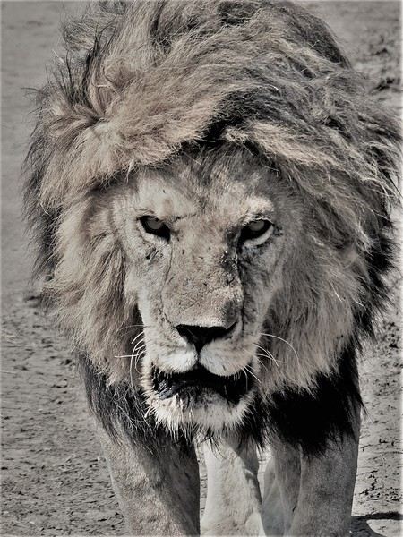
First off, yes, as the title of this journal suggests, we were lucky enough to spot *tons* of lions. The power they exude is incredible, even if most of the time they just look like big cats napping or strolling around. But lock eyes with one, and you’ll be glad you’re in the jeep.
Hello everyone!
This trip dates back to late 2021, but since Voyage Forum reopened for writing, I haven’t seen many travel journals about Tanzania, so I decided to repost this one, which I originally shared on another well-known travelers’ site—even though I prefer Voyage Forum’s user experience.
It’s also a chance for me to relive this exhilarating trip... So, if you’re up for it, let me take you on a classic adventure: Tarangire - Ngorongoro - Serengeti, plus a little bonus—the small Arusha Park.
First off, yes, as the title of this journal suggests, we were lucky enough to spot *tons* of lions. The power they exude is incredible, even if most of the time they just look like big cats napping or strolling around. But lock eyes with one, and you’ll be glad you’re in the jeep.
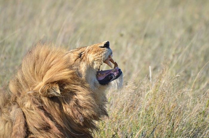
But let’s not forget the rest of the wildlife—and the landscapes, which are absolutely stunning, with those iconic tree silhouettes.
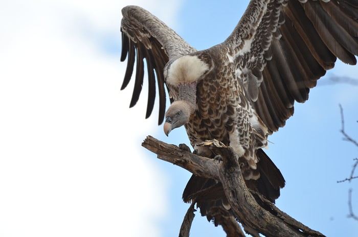
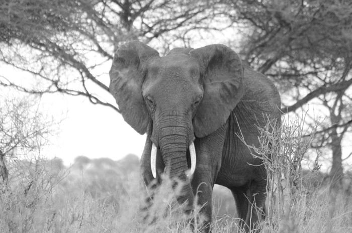
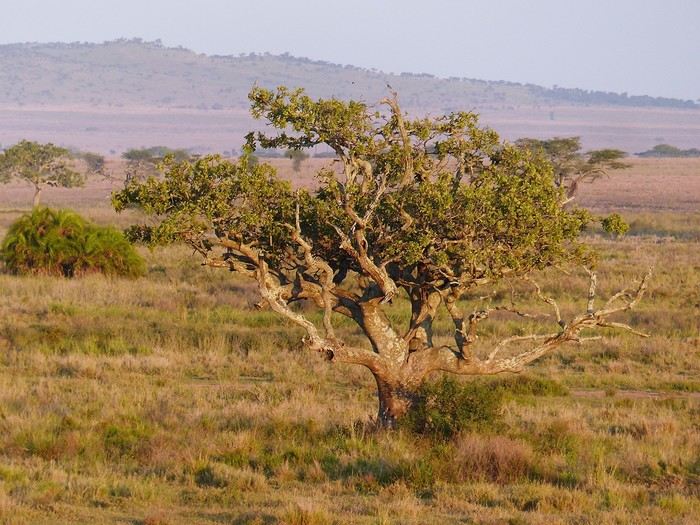
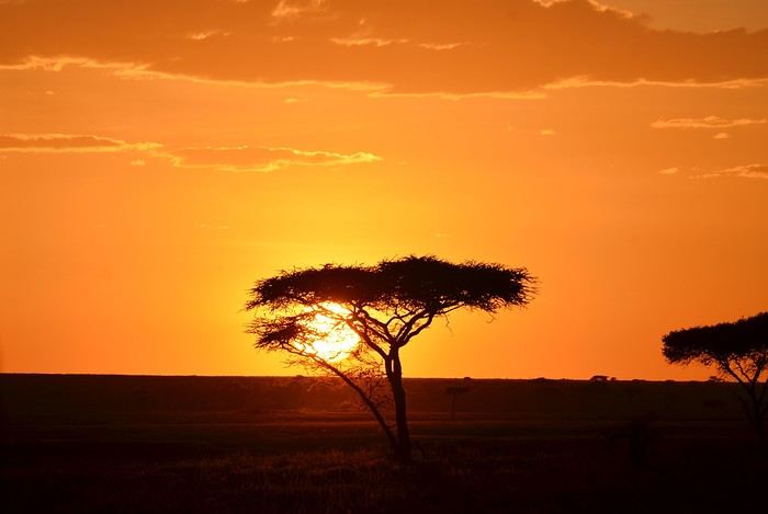
I remember before leaving, I was a little worried I wouldn’t feel that same sense of wonder I’d experienced two years earlier in Botswana (see my travel journal). That fear was unfounded—the magic worked its charm once again! Note: Since we had limited time, we focused our trip entirely on safari, so this journal is 100% animals and landscapes—and 0% Maasai. Next post: TARANGIRE
Our trip to Norway was two years ago already, but I thought it might still be of interest—and it’ll let me relive it a bit by proxy.
Before booking our flight tickets, we debated the route: should we prioritize the north with the Lofoten and Senja islands, or the south with its countless fjords? I was tempted to stay in the south—the country is so vast, and the drive north is long... but my husband really didn’t want to miss the Lofoten. In the end, we figured that since Norway is known for being expensive, we might only visit once (funny how we said the same thing before our first trip to the American West, and look how that turned out 😎), so we didn’t want to skip anything. That meant a 2–3 day drive up north. With 22 days on the ground, it was doable. Especially since, as usual, we skip big cities and gave Oslo a pass.
Practical details: - Flight tickets: 1195 € for 4 with Air France (Paris–Oslo outbound, Tromsø–Bergen–Paris return) - Car rental: 2020 € for 21 days (including the outrageous drop-off fee between Oslo and Tromsø—about 1000 €) - Tolls and ferries: 250 € for the portion billed directly by the rental company. Some ferries required advance booking and payment at the time of reservation—I’ll note their prices as I go through the story. - Hotels: 4135 €, averaging 188 € per night. We blew past our usual budgets from trips to the U.S., but oh well... - Food: 1570 €, averaging 71 € per day for 4 in a country where everything’s expensive... How’d we manage? We rarely ate out, mostly grocery shopped, and even packed half a suitcase with non-perishables: pasta, rice, a few cans, and even some cured sausage! We also stayed 3 nights at Clarion Collection hotels, where an evening buffet was included in the room rate.
Before booking our flight tickets, we debated the route: should we prioritize the north with the Lofoten and Senja islands, or the south with its countless fjords? I was tempted to stay in the south—the country is so vast, and the drive north is long... but my husband really didn’t want to miss the Lofoten. In the end, we figured that since Norway is known for being expensive, we might only visit once (funny how we said the same thing before our first trip to the American West, and look how that turned out 😎), so we didn’t want to skip anything. That meant a 2–3 day drive up north. With 22 days on the ground, it was doable. Especially since, as usual, we skip big cities and gave Oslo a pass.
Practical details: - Flight tickets: 1195 € for 4 with Air France (Paris–Oslo outbound, Tromsø–Bergen–Paris return) - Car rental: 2020 € for 21 days (including the outrageous drop-off fee between Oslo and Tromsø—about 1000 €) - Tolls and ferries: 250 € for the portion billed directly by the rental company. Some ferries required advance booking and payment at the time of reservation—I’ll note their prices as I go through the story. - Hotels: 4135 €, averaging 188 € per night. We blew past our usual budgets from trips to the U.S., but oh well... - Food: 1570 €, averaging 71 € per day for 4 in a country where everything’s expensive... How’d we manage? We rarely ate out, mostly grocery shopped, and even packed half a suitcase with non-perishables: pasta, rice, a few cans, and even some cured sausage! We also stayed 3 nights at Clarion Collection hotels, where an evening buffet was included in the room rate.
If I close my eyes and think of the Sultanate of Oman, I first smell a light scent of incense, feel the warmth of a sunbeam on my skin, before sand slips through my fingers. I taste the sweetness of a date, a real candy, then the flavor of coffee with a hint of cardamom and rosewater... I hear the desert wind whistling in my ears, the distant call of a muezzin, then the murmur of water. I open my eyes to see smiles, welcoming gestures, a turquoise sea, rocks ranging from ochre to purple, deep wadis where torrents burst forth, orange dunes, white sandy beaches where tiny crabs scurry at full speed. I see incredible oases emerging between arid mountains. I see abandoned villages that I’d dream were full of life, imposing fortresses overlooking valleys, and lively souks where offers are delicate and negotiation is a mutual courtesy.
All that, and so much more.
This is what I tried to capture in my illustrated travel journal, which I’ll fill in here and there with photos. I drew this journal “cold,” after my return (actually, I made it this summer, while our trip was last winter). It’s a pretty special format—I bought it in Japan without really knowing what I’d do with it. Well, it found its purpose! Below is a photo of this accordion-style journal: here, it’s only partially open, because when fully unfolded, it’s 5 meters long!
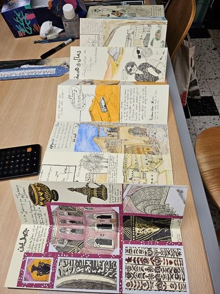
For drawing enthusiasts: The accordion format is both a constraint (each sheet is 9 cm x 27 cm) and a freedom (you can create a fresco). The paper is also a bit special: it doesn’t allow for fine lines, but it takes ink well (liner pen). However, everything has to be done almost in one go (with a very light pencil sketch) because it erases poorly. It absorbs too much water for coloring with markers or watercolors (unless you avoid soaking it), but it works well with oil pastels and their use with a brush and solvent. Since it’s yellowish, it allowed me to create contrasts even with white pastel.
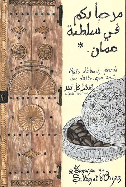 On the right, the "welcome marker"—those dates offered everywhere as a sign of hospitality. On the left, a tribute to those stunning doors worn by time, admired all over the old quarters, including the abandoned ones.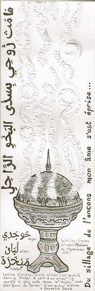
Oman is one of the world’s largest producers of frankincense resin. Incense burners are everywhere, from the simplest clay ones to the most precious handcrafted silver ones...
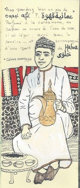 Hospitality will often lead you to accept a small coffee, an "Omani coffee," very light, subtly flavored with cardamom, maybe a touch of saffron, and occasionally rosewater.
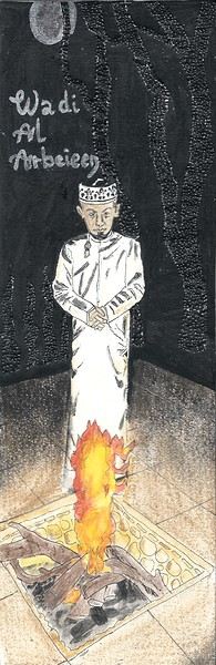
Here, I’ve depicted a man in the common everyday attire of Omanis: the dishdasha, mostly white (during the week and daytime; colors are more common in the evening or on Fridays and Saturdays). While you’ll see some men dressed in Western clothes, they’re very few. The white dishdasha is truly the shared attire of all men. The dishdasha, which has no hood, is distinguished by a small pom-pom attached to the collar, the furakha, which is soaked in perfume. And believe me, Omanis go overboard with it! "It smells like the pom-pom" is an expression that’s now part of our shared language, my husband and I.
Another must of men’s attire is the kuma, a small round head covering, usually white with brightly colored patterns. The keffiyeh is also worn (but without the cord called an agal in Arab countries), and it’s mostly worn by those with roots in the desert, from what I understood.
And what about the women, you might ask? Some are veiled, some in full black (but not a burka—more like a chador + abaya), due to the influence of Saudi Arabia and the United Arab Emirates, whereas the traditional outfit used to be a layering of very colorful dresses. Most of the women we saw wore neutral clothing, a plain veil over their hair, but with their faces uncovered. We also saw many saris and colorful veils—don’t forget that 40% of the population consists of Indian, Nepalese, and Bangladeshi immigrants, who work a lot in tourism, hospitality, restaurants, services, and construction.
Just to clarify, as a tourist, there’s no pressure to wear a veil, and never any disapproving looks. Of course, you’ll save the mini shorts, plunging necklines, bare shoulders, and midriffs for the hotel terrace—but I’d say that’s the same for men and women, and with the sun being strong, it’s better for your skin too.
Here’s the introduction! In the next post, I’ll tell you about my itinerary, and we can dive in!
Hospitality will often lead you to accept a small coffee, an "Omani coffee," very light, subtly flavored with cardamom, maybe a touch of saffron, and occasionally rosewater.
Here, I’ve depicted a man in the common everyday attire of Omanis: the dishdasha, mostly white (during the week and daytime; colors are more common in the evening or on Fridays and Saturdays). While you’ll see some men dressed in Western clothes, they’re very few. The white dishdasha is truly the shared attire of all men. The dishdasha, which has no hood, is distinguished by a small pom-pom attached to the collar, the furakha, which is soaked in perfume. And believe me, Omanis go overboard with it! "It smells like the pom-pom" is an expression that’s now part of our shared language, my husband and I.
Another must of men’s attire is the kuma, a small round head covering, usually white with brightly colored patterns. The keffiyeh is also worn (but without the cord called an agal in Arab countries), and it’s mostly worn by those with roots in the desert, from what I understood.
And what about the women, you might ask? Some are veiled, some in full black (but not a burka—more like a chador + abaya), due to the influence of Saudi Arabia and the United Arab Emirates, whereas the traditional outfit used to be a layering of very colorful dresses. Most of the women we saw wore neutral clothing, a plain veil over their hair, but with their faces uncovered. We also saw many saris and colorful veils—don’t forget that 40% of the population consists of Indian, Nepalese, and Bangladeshi immigrants, who work a lot in tourism, hospitality, restaurants, services, and construction.
Just to clarify, as a tourist, there’s no pressure to wear a veil, and never any disapproving looks. Of course, you’ll save the mini shorts, plunging necklines, bare shoulders, and midriffs for the hotel terrace—but I’d say that’s the same for men and women, and with the sun being strong, it’s better for your skin too.
Here’s the introduction! In the next post, I’ll tell you about my itinerary, and we can dive in!After a pretty disastrous weather-wise trip to Gran Canaria, we’re hoping this time the sun will shine in Puglia.
It’s not a sure thing, though—the weather’s been awful all over Europe in early May.
For those who’d like to (re)read the story without the digressions, it’s here.
Saturday, May 16: This time we’re flying out of Charleroi (Brussels South): the ticket prices, flight times, and proximity all worked for us. The airport (Ryanair) was recently renovated... but it’s still not very well organized. There are hardly any seats in the boarding areas, and... the restrooms cost money!!! The flight goes smoothly, though, and we land in Bari a little late.
We quickly pick up our rental car, a very local-looking Pandina (even more so than the Fiat 500 in this region), and hit the Italian roads... and their unique driving quirks (like the fact that the countless road signs along the streets and in towns are purely decorative 😏, and that Italian cars don’t have turn signals 😮... except for rental cars).
About an hour later, we arrive at our first accommodation, right in the middle of the countryside near Monopoli. The owner isn’t there, but they’ve left us a ton of info via messages and even turned on the space heater, which is a nice touch. We explore the property:

And the next morning before breakfast, its immediate surroundings:


Sunday, May 17: After our "seaside" experience in Gran Canaria last weekend (packed with people and locals), we decide to start inland. After a hearty breakfast,

we head toward Alberobello, a super touristy village famous for its trulli—those stone houses with conical roofs. We easily find a free parking spot on a street near the Aia Piccola district, where some trulli are still lived in year-round.


We almost immediately come across the Trullo Sovrano (the only two-story one), which you can visit (but we skip it—it’s opening time, and there’s already a line).

From there, we head down toward the Basilica of Cosma e Damiano... but we don’t go in because there’s a mass.

Now we’re on the main Piazza del Popolo, which connects the two districts of Alberobello: Rione Aia Piccola and Rione Monti, the more touristy one.
For those who’d like to (re)read the story without the digressions, it’s here.
Saturday, May 16: This time we’re flying out of Charleroi (Brussels South): the ticket prices, flight times, and proximity all worked for us. The airport (Ryanair) was recently renovated... but it’s still not very well organized. There are hardly any seats in the boarding areas, and... the restrooms cost money!!! The flight goes smoothly, though, and we land in Bari a little late.
We quickly pick up our rental car, a very local-looking Pandina (even more so than the Fiat 500 in this region), and hit the Italian roads... and their unique driving quirks (like the fact that the countless road signs along the streets and in towns are purely decorative 😏, and that Italian cars don’t have turn signals 😮... except for rental cars).
About an hour later, we arrive at our first accommodation, right in the middle of the countryside near Monopoli. The owner isn’t there, but they’ve left us a ton of info via messages and even turned on the space heater, which is a nice touch. We explore the property:
And the next morning before breakfast, its immediate surroundings:
Sunday, May 17: After our "seaside" experience in Gran Canaria last weekend (packed with people and locals), we decide to start inland. After a hearty breakfast,
we head toward Alberobello, a super touristy village famous for its trulli—those stone houses with conical roofs. We easily find a free parking spot on a street near the Aia Piccola district, where some trulli are still lived in year-round.
We almost immediately come across the Trullo Sovrano (the only two-story one), which you can visit (but we skip it—it’s opening time, and there’s already a line).
From there, we head down toward the Basilica of Cosma e Damiano... but we don’t go in because there’s a mass.
Now we’re on the main Piazza del Popolo, which connects the two districts of Alberobello: Rione Aia Piccola and Rione Monti, the more touristy one.
It’s an ancient city that breathes, a living spring.
Here, no kitschy signs like “I miss you in Fengyu,” nor mass-produced fake antiques.
The century-old houses still bear the marks of wind and rain; in the morning, you hear roosters crowing, and at dusk, smoke gently rises from the kitchens.
This city doesn’t try to please anyone—like the spring water flowing through it, it simply keeps living at its own pace.
Located in Eryuan County, in the Dali Prefecture of Yunnan, the ancient town of Fengyu is a nationally designated historical and cultural city. It’s nicknamed the “land of scholars and ink”—during the Qing Dynasty, the Fengxiang Academy produced four *jinshi* and eleven *juren* in the imperial examinations. The Bai families made studying and farming a true legacy. Even on market days, you’ll find stalls of calligraphy and paintings, while lintels and screen walls are covered with family mottos.
Fengyu was also an important stop on the ancient Tea Horse Road. It preserves the second-largest Bai architectural complex in China, just after Xizhou. The famous traveler Xu Xiake spent seven days here and compared it to the “peach blossom paradise.”
Located in Eryuan County, in the Dali Prefecture of Yunnan, the ancient town of Fengyu is a nationally designated historical and cultural city. It’s nicknamed the “land of scholars and ink”—during the Qing Dynasty, the Fengxiang Academy produced four *jinshi* and eleven *juren* in the imperial examinations. The Bai families made studying and farming a true legacy. Even on market days, you’ll find stalls of calligraphy and paintings, while lintels and screen walls are covered with family mottos.
Fengyu was also an important stop on the ancient Tea Horse Road. It preserves the second-largest Bai architectural complex in China, just after Xizhou. The famous traveler Xu Xiake spent seven days here and compared it to the “peach blossom paradise.”
As I’ve mentioned elsewhere, I inherited my love of travel from my parents and some of my grandparents. A strong passion, but one that was unfortunately limited by our family’s modest resources. Back then, living in northern Alsace, a simple trip to the southern part of the region—with the Wine Route as our destination—felt like an extraordinary journey to a land of plenty for the little boy I was in the late 60s and early 70s.
Everything seemed so huge when you were still just a kid.
Back then, I was overwhelmed by countless sensations—I was already highly sensitive, with a keen mind and a nose and taste buds that were developing like a pro’s. Which, as I’d later realize, wasn’t always an advantage.
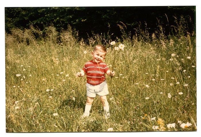
Those magical days always began with a gentle late-spring or midsummer morning. The interior of the white Peugeot 404, license plate 210 LZ 67, had already soaked up the sun before the engine purred to life, and the cabin gave off a scent I could still recognize today—a fragrance I found so pleasant. Back then, I had no idea it was just the smell of warm plastic from the car’s interior. Yes, the scents of the 404 on sunny days became my madeleine de Proust... What’s more, the whole family was unusually cheerful because those moments of relaxation and leisure were rare. Everyone worked, and no one had an easy job or was well paid. Without the *Trente Glorieuses*, these experiences might never have happened.
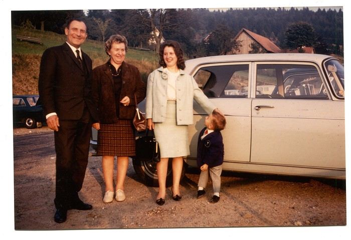
Once we crossed the canton’s borders, I felt like I was light-years away from my everyday surroundings, and every kilometer plunged me deeper into *terra incognita*. It was thrilling. Far from my so-called "medium-sized" town, wheat fields, cornfields, and cabbage patches stretched out, punctuated by tall poles connected by long wires and topped with vegetation—like giant clotheslines without laundry, where magical beanstalks might grow to touch the sky. Back then, I was still far from tasting their product, which was simply beer. At the time, there was still a significant local hop production. Fun fact: it wasn’t until 2002 that Anglo-Saxon scientists proved hops and cannabis belong to the same biological family.
After the fields, the landscape took another step up as it rolled past the little boy’s eyes, often glued to the windows. First came modest hills, then a succession of rolling slopes that soon formed an unbroken chain. Their 700 meters in altitude felt like Himalayan peaks to me—impressive, inert giants, a whole new world. Gazing at them, an intense emotion welled up somewhere between my stomach and lungs, nearly taking my breath away. What mysteries, what treasures did these heights hold? And then there were the cherries on top—the crowning touch that made the scene even more magical: proud, majestic castles perched on the summits like impassive sentinels. Monuments from the past, yet firmly rooted in the present on their rocky spurs. The little boy’s eyes sparkled—he’d been given a castle for Christmas, complete with battlements, towers, a drawbridge, and fully armed knights. He’d watched and lived *Ivanhoe* on the only French TV channel that existed back then.
Only once did my paternal grandfather join us on one of these trips. A tall, intelligent man with a face that could shift from stern to mischievous, clearly full of humor and charisma. Sadly, his relationship with alcohol had taken a toll on his life and, by extension, those of his loved ones. He had a strong personality—if his boss crossed the line, he wouldn’t hesitate to punch him, which meant he went through a lot of different jobs. Back then, you could quit one job and easily find another. It was quite something to see him in his final stages, hallucinating pink elephants and even drinking perfume when he had nothing else left. The last time I saw him, he’d slipped away from the doctors and nurses while hospitalized in pretty bad shape—at least, I assume his liver was the issue. We were sitting down for a family lunch when the door burst open, and there he stood in his pajamas, eyes twinkling with mischief, clearly pleased with the dramatic entrance. That theatrical moment didn’t spare us from burying him a few months later at the age of 71. One day, my mother told me the family doctor had quietly remarked that it was a shame—with his robust constitution, he could’ve lived to be a hundred. Yes, the family doctor—this was the man who’d come treat you any day, at almost any hour, just for a phone call. It really existed, it’s not a myth!
That day, his wife—my paternal grandmother—was also along for the ride. Everyone agreed that Jeannette was a good woman. She worked as a waitress at *Le Tigre*, the biggest brasserie in town, right in the center. Most customers preferred to be served by her, including local dignitaries and even the mayor. As a kid, I didn’t find her very fun, open, or warm—she seemed a bit stern. Back then, women in their fifties already had the face and build of grandmothers. Same went for men, don’t get me wrong. I had no idea about the struggles she faced because of her husband. I didn’t know that 30 years earlier, she’d had to flee Alsace while pregnant, under threat from Nazi fighter-bombers. I didn’t know she’d had several miscarriages, and that my father—her only surviving child, born prematurely in March 1940 at the other end of France—weighed less than a kilo at birth and was so tiny he could fit in a shoebox. Hard to imagine he’d grow into a strapping man nearly 1.80 meters tall, tipping the scales at 100 kilos. When you come back from summer camp in early August and ask why she didn’t pick you up with your parents, and they gently tell you she’s "in heaven," you don’t realize she passed away at 54 after suffering greatly from stomach cancer that had spread.
Back to that family outing, that enchanted parenthesis. I even remembered where we’d had lunch when I passed through Dambach-la-Ville decades later. One of those charming, flower-filled towns Alsace produces in abundance—and preserves so well. This one sits high on a hill, and I was a bit stunned on the parking lot because the view stretched far, revealing the Alsace plain below—its fields, villages, hills, and forests. The world seemed so vast and enticing that day, even though I was only glimpsing a tiny fraction of it.
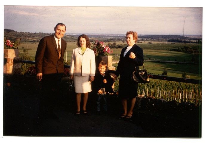
The region was already very touristy, but I wouldn’t notice the downsides until much later. That Sunday noon, I discovered a large restaurant filled with diners. I can still see the enormous piece of meat they served me, decorated with a little wooden skewer topped with a flag. I kept that one for a long time. Those were the golden days of rich, flowing, thick sauces—so flavorful—and the era of the world’s best fries, made on the spot with the best potatoes. To top it off, I was *exceptionally* allowed a small bottle of apple juice, Orangina, or—even better if possible—Sinalco. Yes, Sinalco—like Orangina, but better. A brand that must’ve disappeared in the 70s, but why, and what a shame! Since then, Orangina’s little bubbles have taken the brand to the other side of the planet—it’s now Japanese.
Year after year, I’d eagerly await that ecstatic moment when the most beautiful castle in Alsace, the Haut-Koenigsbourg, appeared in my field of vision. The perfect model, the archetype that blended into the landscape at the height of a child’s dreams. The trip home always felt like a reality check—less jarring than an alarm clock, but more diffuse and melancholic. From then on, there was only one wish: *When do we leave again?*
Those magical days always began with a gentle late-spring or midsummer morning. The interior of the white Peugeot 404, license plate 210 LZ 67, had already soaked up the sun before the engine purred to life, and the cabin gave off a scent I could still recognize today—a fragrance I found so pleasant. Back then, I had no idea it was just the smell of warm plastic from the car’s interior. Yes, the scents of the 404 on sunny days became my madeleine de Proust... What’s more, the whole family was unusually cheerful because those moments of relaxation and leisure were rare. Everyone worked, and no one had an easy job or was well paid. Without the *Trente Glorieuses*, these experiences might never have happened.
Once we crossed the canton’s borders, I felt like I was light-years away from my everyday surroundings, and every kilometer plunged me deeper into *terra incognita*. It was thrilling. Far from my so-called "medium-sized" town, wheat fields, cornfields, and cabbage patches stretched out, punctuated by tall poles connected by long wires and topped with vegetation—like giant clotheslines without laundry, where magical beanstalks might grow to touch the sky. Back then, I was still far from tasting their product, which was simply beer. At the time, there was still a significant local hop production. Fun fact: it wasn’t until 2002 that Anglo-Saxon scientists proved hops and cannabis belong to the same biological family.
After the fields, the landscape took another step up as it rolled past the little boy’s eyes, often glued to the windows. First came modest hills, then a succession of rolling slopes that soon formed an unbroken chain. Their 700 meters in altitude felt like Himalayan peaks to me—impressive, inert giants, a whole new world. Gazing at them, an intense emotion welled up somewhere between my stomach and lungs, nearly taking my breath away. What mysteries, what treasures did these heights hold? And then there were the cherries on top—the crowning touch that made the scene even more magical: proud, majestic castles perched on the summits like impassive sentinels. Monuments from the past, yet firmly rooted in the present on their rocky spurs. The little boy’s eyes sparkled—he’d been given a castle for Christmas, complete with battlements, towers, a drawbridge, and fully armed knights. He’d watched and lived *Ivanhoe* on the only French TV channel that existed back then.
Only once did my paternal grandfather join us on one of these trips. A tall, intelligent man with a face that could shift from stern to mischievous, clearly full of humor and charisma. Sadly, his relationship with alcohol had taken a toll on his life and, by extension, those of his loved ones. He had a strong personality—if his boss crossed the line, he wouldn’t hesitate to punch him, which meant he went through a lot of different jobs. Back then, you could quit one job and easily find another. It was quite something to see him in his final stages, hallucinating pink elephants and even drinking perfume when he had nothing else left. The last time I saw him, he’d slipped away from the doctors and nurses while hospitalized in pretty bad shape—at least, I assume his liver was the issue. We were sitting down for a family lunch when the door burst open, and there he stood in his pajamas, eyes twinkling with mischief, clearly pleased with the dramatic entrance. That theatrical moment didn’t spare us from burying him a few months later at the age of 71. One day, my mother told me the family doctor had quietly remarked that it was a shame—with his robust constitution, he could’ve lived to be a hundred. Yes, the family doctor—this was the man who’d come treat you any day, at almost any hour, just for a phone call. It really existed, it’s not a myth!
That day, his wife—my paternal grandmother—was also along for the ride. Everyone agreed that Jeannette was a good woman. She worked as a waitress at *Le Tigre*, the biggest brasserie in town, right in the center. Most customers preferred to be served by her, including local dignitaries and even the mayor. As a kid, I didn’t find her very fun, open, or warm—she seemed a bit stern. Back then, women in their fifties already had the face and build of grandmothers. Same went for men, don’t get me wrong. I had no idea about the struggles she faced because of her husband. I didn’t know that 30 years earlier, she’d had to flee Alsace while pregnant, under threat from Nazi fighter-bombers. I didn’t know she’d had several miscarriages, and that my father—her only surviving child, born prematurely in March 1940 at the other end of France—weighed less than a kilo at birth and was so tiny he could fit in a shoebox. Hard to imagine he’d grow into a strapping man nearly 1.80 meters tall, tipping the scales at 100 kilos. When you come back from summer camp in early August and ask why she didn’t pick you up with your parents, and they gently tell you she’s "in heaven," you don’t realize she passed away at 54 after suffering greatly from stomach cancer that had spread.
Back to that family outing, that enchanted parenthesis. I even remembered where we’d had lunch when I passed through Dambach-la-Ville decades later. One of those charming, flower-filled towns Alsace produces in abundance—and preserves so well. This one sits high on a hill, and I was a bit stunned on the parking lot because the view stretched far, revealing the Alsace plain below—its fields, villages, hills, and forests. The world seemed so vast and enticing that day, even though I was only glimpsing a tiny fraction of it.
The region was already very touristy, but I wouldn’t notice the downsides until much later. That Sunday noon, I discovered a large restaurant filled with diners. I can still see the enormous piece of meat they served me, decorated with a little wooden skewer topped with a flag. I kept that one for a long time. Those were the golden days of rich, flowing, thick sauces—so flavorful—and the era of the world’s best fries, made on the spot with the best potatoes. To top it off, I was *exceptionally* allowed a small bottle of apple juice, Orangina, or—even better if possible—Sinalco. Yes, Sinalco—like Orangina, but better. A brand that must’ve disappeared in the 70s, but why, and what a shame! Since then, Orangina’s little bubbles have taken the brand to the other side of the planet—it’s now Japanese.
Year after year, I’d eagerly await that ecstatic moment when the most beautiful castle in Alsace, the Haut-Koenigsbourg, appeared in my field of vision. The perfect model, the archetype that blended into the landscape at the height of a child’s dreams. The trip home always felt like a reality check—less jarring than an alarm clock, but more diffuse and melancholic. From then on, there was only one wish: *When do we leave again?*
Hi everyone,
We traveled to Norway in the summer of 2025, from July 17 to 29, to visit Senja Island and the Lofoten archipelago with a rental car. The common thread of these twelve days was clearly hiking, along with a few visits and experiences, and nights spent in a tent or in the car (which made it possible). We chose Narvik Airport for both arrival and departure for several complementary reasons: the desire to visit nearby Senja Island, slightly more affordable airfare, and finally, the rental price of the vehicle—especially the car model we were looking for. We only made one reservation, for the first campsite, as sleeping in a tent made things much easier. But we had the whole structure of the trip planned, a flexible outline that could adapt to the weather conditions we’d encounter. Senja Island isn’t part of the Lofoten archipelago, and during the early stages of planning this trip, we hadn’t planned to visit it. But its relative proximity to Narvik Airport and, above all, its unique geography definitely made us change our minds. We arrived in Evenes, where Narvik Airport is located, nearly 60 km from the city itself. Our first stop was 40 km further in Bjerkvik on the way to Senja, where there’s a Rema 1000 (a very common supermarket chain in Norway). We needed to buy some food and a gas cartridge for our stove. I’d emailed the store manager beforehand, who told me they didn’t sell them but that the two gas stations in the village were likely to have some in stock.
It was only at the Esso station that I found what I needed, but unfortunately, only one cartridge. Luckily, we quickly realized that most campsites (like in Iceland) have a shared kitchen with hotplates. That single small cartridge was just enough for the few nights we spent outside of campsites... We got our first taste of Norway’s characteristic landscapes: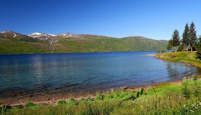
When we arrived at the Senja campsite, it was already 9:30 PM. A sign announced it was full, but luckily, I’d booked it 10 days earlier. By 10:30 PM, as we settled in to eat, it was still broad daylight, and the thermometer read 25°C—despite being at a latitude of 69° North! We went to bed around midnight, exhausted but under the light of a sun that was still very much present. Thanks to Earth’s tilted axis. We’d anticipated this by buying opaque sleep masks because, yes, at this time of year, it’s daylight all the time.
Friday, July 18:
Today, we planned two hikes on the island and a few stops along the way. The map clearly shows that the deepest fjords are in the north and west. Due to time and accessibility, we focused on the northern part of the island. Our first stop was at the viewing platform in Bergbotn:
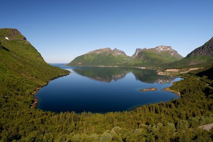
Then we headed toward Skaland, the starting point for our first hike. Along the way, we found plenty of reasons to stop—especially since, on this first day of travel, our thirst for Nordic landscapes was far from quenched.
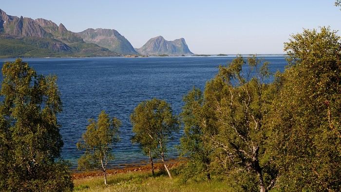
The town of Skaland is very practical: free parking, picnic tables for after the hike, and a Joker convenience store right next door. Our goal was the summit of Husfjellet: 670 m of elevation gain, between 8 and 9 km in length, and an estimated 4 hours and 30 minutes.
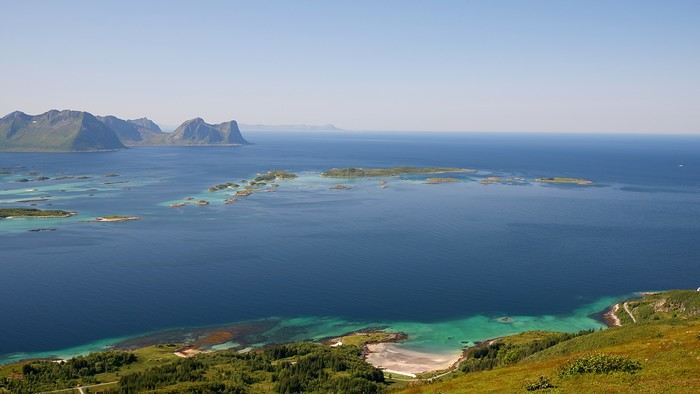
This hike offers two major viewpoints. The first overlooks the Bergsoyan islands to the west:
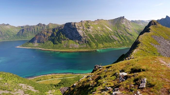
At the summit, the view shifts to the Steinfjorden fjord:
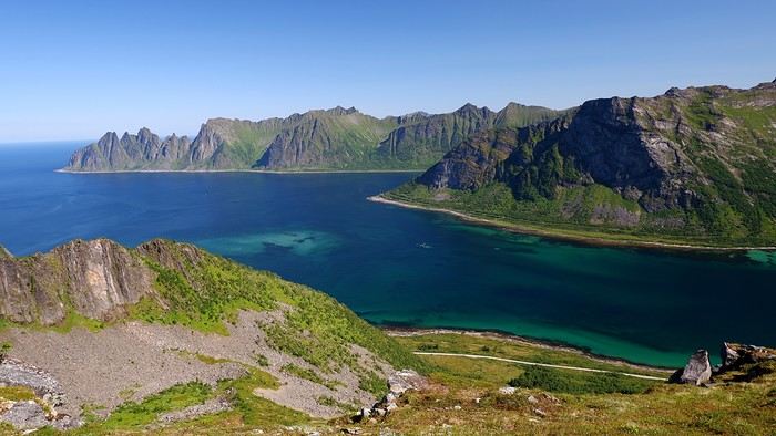
You can even clearly see the "Devil’s Teeth," which we’d see from below later:
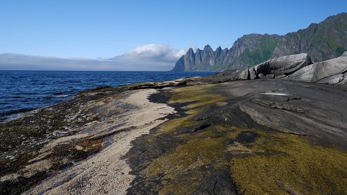
In total, the hike took us 4 hours and 30 minutes, including all the breaks. We treated ourselves to an ice cream in Skaland to recharge for the next hike. We hit the road again and stopped at Tungeneset to get a closer look at the Devil’s Teeth:
We continued to Fjordgard, the starting point for our second hike. Fjordgard isn’t very welcoming. There was a time when you could park right at the start of the hike up Mount Segla. Now, everything’s blocked off, and locals have even taken to blocking all possible parking spots nearby. You now have to park outside the town at a paid parking lot (90 NOK for 3 hours), adding an extra 2 km (round trip) of walking. Still, that was just a minor inconvenience because the hike that followed quickly made us forget all about it. The hike is fairly short (2 hours) but still has 520 m of elevation gain. This hike was a stark contrast to the first. This morning, we had sweeping views of the vast landscape. Here, Mount Segla, perched on the edge of the cliff, dominates the foreground:
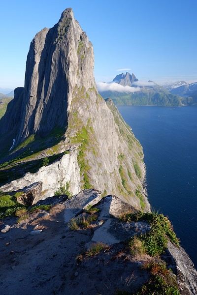
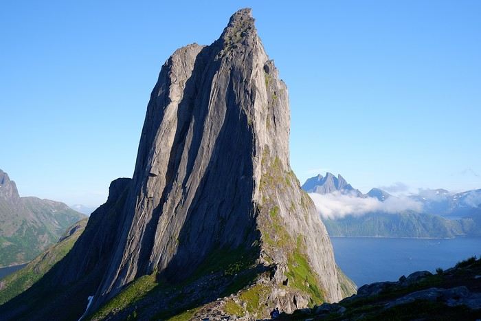
For those prone to vertigo, it might be best to stay at the foot of the mountain, as the trail climbs right along the cliff edge. And from that point on, you quickly understand what verticality really means...
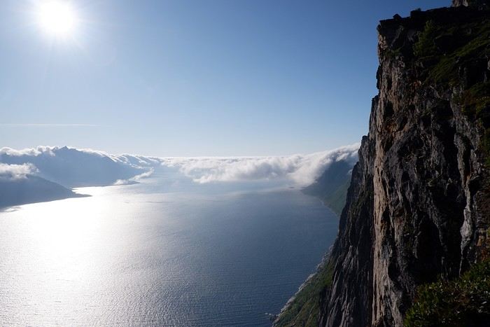
In total, we took 2 hours and 50 minutes, including breaks and the extra walk to the parking lot. The day was already well underway, and with 1,200 m of cumulative elevation gain, it was time to find a spot to eat and sleep. Since we hadn’t made any reservations, we’d planned to bivouac for the night. We weren’t too picky—just practical—so we decided to sleep in the car at the parking lot for tomorrow morning’s hike, just 5 km from Fjordgard.
We traveled to Norway in the summer of 2025, from July 17 to 29, to visit Senja Island and the Lofoten archipelago with a rental car. The common thread of these twelve days was clearly hiking, along with a few visits and experiences, and nights spent in a tent or in the car (which made it possible). We chose Narvik Airport for both arrival and departure for several complementary reasons: the desire to visit nearby Senja Island, slightly more affordable airfare, and finally, the rental price of the vehicle—especially the car model we were looking for. We only made one reservation, for the first campsite, as sleeping in a tent made things much easier. But we had the whole structure of the trip planned, a flexible outline that could adapt to the weather conditions we’d encounter. Senja Island isn’t part of the Lofoten archipelago, and during the early stages of planning this trip, we hadn’t planned to visit it. But its relative proximity to Narvik Airport and, above all, its unique geography definitely made us change our minds. We arrived in Evenes, where Narvik Airport is located, nearly 60 km from the city itself. Our first stop was 40 km further in Bjerkvik on the way to Senja, where there’s a Rema 1000 (a very common supermarket chain in Norway). We needed to buy some food and a gas cartridge for our stove. I’d emailed the store manager beforehand, who told me they didn’t sell them but that the two gas stations in the village were likely to have some in stock.
It was only at the Esso station that I found what I needed, but unfortunately, only one cartridge. Luckily, we quickly realized that most campsites (like in Iceland) have a shared kitchen with hotplates. That single small cartridge was just enough for the few nights we spent outside of campsites... We got our first taste of Norway’s characteristic landscapes:
When we arrived at the Senja campsite, it was already 9:30 PM. A sign announced it was full, but luckily, I’d booked it 10 days earlier. By 10:30 PM, as we settled in to eat, it was still broad daylight, and the thermometer read 25°C—despite being at a latitude of 69° North! We went to bed around midnight, exhausted but under the light of a sun that was still very much present. Thanks to Earth’s tilted axis. We’d anticipated this by buying opaque sleep masks because, yes, at this time of year, it’s daylight all the time.
Friday, July 18:
Today, we planned two hikes on the island and a few stops along the way. The map clearly shows that the deepest fjords are in the north and west. Due to time and accessibility, we focused on the northern part of the island. Our first stop was at the viewing platform in Bergbotn:
Then we headed toward Skaland, the starting point for our first hike. Along the way, we found plenty of reasons to stop—especially since, on this first day of travel, our thirst for Nordic landscapes was far from quenched.
The town of Skaland is very practical: free parking, picnic tables for after the hike, and a Joker convenience store right next door. Our goal was the summit of Husfjellet: 670 m of elevation gain, between 8 and 9 km in length, and an estimated 4 hours and 30 minutes.
This hike offers two major viewpoints. The first overlooks the Bergsoyan islands to the west:
At the summit, the view shifts to the Steinfjorden fjord:
You can even clearly see the "Devil’s Teeth," which we’d see from below later:
In total, the hike took us 4 hours and 30 minutes, including all the breaks. We treated ourselves to an ice cream in Skaland to recharge for the next hike. We hit the road again and stopped at Tungeneset to get a closer look at the Devil’s Teeth:
We continued to Fjordgard, the starting point for our second hike. Fjordgard isn’t very welcoming. There was a time when you could park right at the start of the hike up Mount Segla. Now, everything’s blocked off, and locals have even taken to blocking all possible parking spots nearby. You now have to park outside the town at a paid parking lot (90 NOK for 3 hours), adding an extra 2 km (round trip) of walking. Still, that was just a minor inconvenience because the hike that followed quickly made us forget all about it. The hike is fairly short (2 hours) but still has 520 m of elevation gain. This hike was a stark contrast to the first. This morning, we had sweeping views of the vast landscape. Here, Mount Segla, perched on the edge of the cliff, dominates the foreground:
For those prone to vertigo, it might be best to stay at the foot of the mountain, as the trail climbs right along the cliff edge. And from that point on, you quickly understand what verticality really means...
In total, we took 2 hours and 50 minutes, including breaks and the extra walk to the parking lot. The day was already well underway, and with 1,200 m of cumulative elevation gain, it was time to find a spot to eat and sleep. Since we hadn’t made any reservations, we’d planned to bivouac for the night. We weren’t too picky—just practical—so we decided to sleep in the car at the parking lot for tomorrow morning’s hike, just 5 km from Fjordgard.
Prologue
This journal recounts a trip to Rajasthan that’s already over a year old and that I’ve only now found the chance to write about. The summer of 2024 marked my return to India—my tenth trip—after six long years away since my last solo wanderings in Tamil Nadu in 2018 (the journal of which is published on this site). That absence was partly (but not only) due to the long COVID and post-COVID period, which saw a complete halt and then a major slowdown in global tourism. To top it off, Voyage Forum announced its closure in an end-of-the-world atmosphere. A sad time for our favorite social activity…
A few weeks after returning from Rajasthan, I tried to motivate myself to start writing a journal to publish on a forum claiming to be VF’s successor, which I’d eventually signed up for out of desperation. But I kept hesitating and putting the project off because, for one, I no longer have the time I used to. For another, the vibe wasn’t really taking off on that forum—it was overrun with ads and not very active, contrary to what its host’s name suggested. Despite its good intentions and commendable role as a stopgap, it also turned out to be very impractical to use, especially when you don’t have much time like me. I’ll admit I’d occasionally check back on VF to see if anything was happening. But all the discussions remained frozen in time, stuck in that fateful year, 2020. Then, rumors swirled online about shady reasons behind its closure, leaving little room for hope.
And then, one fine morning, I got a message at work from Marien informing me that VF had reopened. What a huge surprise! Even though the forum’s “end” had played out in a somewhat apocalyptic atmosphere, the memories of passionate and heated discussions, the frank debates, and the useful exchanges that made this site a traveler’s goldmine and a unique hub of conviviality all came rushing back to me like a breath of fresh air. I finally saw a sign and tried to motivate myself to find the time to publish the journal of this tenth trip to India and fifth to Rajasthan. But in the end, I got bogged down in professional and family obligations and never managed to find the time to get started. That’s now fixed, though, because I had two reasons for wanting to do it: I find that looking back on a trip to tell others about it is a highly beneficial introspective exercise. Also, I thought this journal could be useful to other travelers on a few points.
Because, “do we really need yet another journal about Rajasthan?” you might rightly ask! Especially in a time when so many journals about the “Land of Kings” have been published since VF’s return, not to mention the countless stories you can already find online about this region, one of India’s most touristy. And I’d add, why go back to Rajasthan for a fifth time, where I’ve already dragged my feet more than enough—through its forts, deserts, temples, cities, villages, bumpy roads, train stations, tasty street food stalls, cheap guesthouses, and more? Where some might see just another overhyped tourist destination full of the same old *Arabian Nights* clichés, worn to a thread, that I mentioned earlier, when there’s so much else to see in India? Well, first because it’s a magnificent country I never tire of, where I started an academic study and made so many connections. It’s also packed with places where you won’t find a single tourist (right, Marie-Jo?), even in the heart of well-trodden paths and classic itineraries. And most importantly, as I said earlier, things have changed in recent years. First, after six years without traveling far, the urge to go back to India was getting stronger. But this time, no more solo trips (often) or duo adventures (sometimes)—now it’s a team of four that has to come along! And even if you can argue with that, what better place than Rajasthan to introduce India to people who’ve never seen it? To kids you want to amaze? Plus, traveling with your new little family to your favorite country isn’t the same as going solo in often spartan conditions that only affect you. It’s a different challenge, but ultimately probably much harder. So, is it really reasonable to take two kids to India, including a two-year-old baby? That’s one of the main goals of this journal (but not the only one)—to try to answer that question.
As you can tell, it’s not so much the destination but the slightly unusual setup of this trip that, in my opinion, will make this journal interesting. Despite my experience and expertise (yes, I dare say it) in India, there were plenty of questions before we finalized the plan and said, “Alright, let’s go!” The questions were flying for us parents. Is it wise to travel to India with a two-year-old? What would we do (it happened) if the kids got very sick? Would they be able to handle a road trip on Rajasthan’s bumpy, dusty roads using public transport? Could they handle the shock of such a different world—the dirt, poverty, pollution, noise (…and the smell, as they say), the spicy food, monkeys, mosquitoes, snakes, tigers, leopards, and so on? In short, all the clichés that I usually joke about suddenly became potential realities. Another concern: as a mixed Franco-African family (not me, but my partner and her oldest), wouldn’t we risk not always being well received, given what you sometimes hear about that in India? How would Indians react to seeing a mixed-race family, the ultimate taboo in a country of purity and social segregation, which would undoubtedly raise many questions for them? Of course, not everything went as expected… Because, as you know, with India—and what makes it charming for some—there are always complications: sometimes where you don’t expect them… and sometimes where you do. I’ll go into detail about that in the journal to come (not right away) and in the final review (even later). These experiences could be useful to travelers who find themselves in similar situations and have the same questions we did before embarking on such a journey. And maybe it’ll spark the curiosity of those who aren’t concerned and will read yet another Rajasthan journal, but with its own unique twists.
Despite my unchanged constraints, which mean I have little time to write this, I don’t want to rush the story, so I’ll take my time. There will probably be lulls. I hope that won’t stop people from coming to react, debate, share their impressions, or ask for information.
This journal recounts a trip to Rajasthan that’s already over a year old and that I’ve only now found the chance to write about. The summer of 2024 marked my return to India—my tenth trip—after six long years away since my last solo wanderings in Tamil Nadu in 2018 (the journal of which is published on this site). That absence was partly (but not only) due to the long COVID and post-COVID period, which saw a complete halt and then a major slowdown in global tourism. To top it off, Voyage Forum announced its closure in an end-of-the-world atmosphere. A sad time for our favorite social activity…
A few weeks after returning from Rajasthan, I tried to motivate myself to start writing a journal to publish on a forum claiming to be VF’s successor, which I’d eventually signed up for out of desperation. But I kept hesitating and putting the project off because, for one, I no longer have the time I used to. For another, the vibe wasn’t really taking off on that forum—it was overrun with ads and not very active, contrary to what its host’s name suggested. Despite its good intentions and commendable role as a stopgap, it also turned out to be very impractical to use, especially when you don’t have much time like me. I’ll admit I’d occasionally check back on VF to see if anything was happening. But all the discussions remained frozen in time, stuck in that fateful year, 2020. Then, rumors swirled online about shady reasons behind its closure, leaving little room for hope.
And then, one fine morning, I got a message at work from Marien informing me that VF had reopened. What a huge surprise! Even though the forum’s “end” had played out in a somewhat apocalyptic atmosphere, the memories of passionate and heated discussions, the frank debates, and the useful exchanges that made this site a traveler’s goldmine and a unique hub of conviviality all came rushing back to me like a breath of fresh air. I finally saw a sign and tried to motivate myself to find the time to publish the journal of this tenth trip to India and fifth to Rajasthan. But in the end, I got bogged down in professional and family obligations and never managed to find the time to get started. That’s now fixed, though, because I had two reasons for wanting to do it: I find that looking back on a trip to tell others about it is a highly beneficial introspective exercise. Also, I thought this journal could be useful to other travelers on a few points.
Because, “do we really need yet another journal about Rajasthan?” you might rightly ask! Especially in a time when so many journals about the “Land of Kings” have been published since VF’s return, not to mention the countless stories you can already find online about this region, one of India’s most touristy. And I’d add, why go back to Rajasthan for a fifth time, where I’ve already dragged my feet more than enough—through its forts, deserts, temples, cities, villages, bumpy roads, train stations, tasty street food stalls, cheap guesthouses, and more? Where some might see just another overhyped tourist destination full of the same old *Arabian Nights* clichés, worn to a thread, that I mentioned earlier, when there’s so much else to see in India? Well, first because it’s a magnificent country I never tire of, where I started an academic study and made so many connections. It’s also packed with places where you won’t find a single tourist (right, Marie-Jo?), even in the heart of well-trodden paths and classic itineraries. And most importantly, as I said earlier, things have changed in recent years. First, after six years without traveling far, the urge to go back to India was getting stronger. But this time, no more solo trips (often) or duo adventures (sometimes)—now it’s a team of four that has to come along! And even if you can argue with that, what better place than Rajasthan to introduce India to people who’ve never seen it? To kids you want to amaze? Plus, traveling with your new little family to your favorite country isn’t the same as going solo in often spartan conditions that only affect you. It’s a different challenge, but ultimately probably much harder. So, is it really reasonable to take two kids to India, including a two-year-old baby? That’s one of the main goals of this journal (but not the only one)—to try to answer that question.
As you can tell, it’s not so much the destination but the slightly unusual setup of this trip that, in my opinion, will make this journal interesting. Despite my experience and expertise (yes, I dare say it) in India, there were plenty of questions before we finalized the plan and said, “Alright, let’s go!” The questions were flying for us parents. Is it wise to travel to India with a two-year-old? What would we do (it happened) if the kids got very sick? Would they be able to handle a road trip on Rajasthan’s bumpy, dusty roads using public transport? Could they handle the shock of such a different world—the dirt, poverty, pollution, noise (…and the smell, as they say), the spicy food, monkeys, mosquitoes, snakes, tigers, leopards, and so on? In short, all the clichés that I usually joke about suddenly became potential realities. Another concern: as a mixed Franco-African family (not me, but my partner and her oldest), wouldn’t we risk not always being well received, given what you sometimes hear about that in India? How would Indians react to seeing a mixed-race family, the ultimate taboo in a country of purity and social segregation, which would undoubtedly raise many questions for them? Of course, not everything went as expected… Because, as you know, with India—and what makes it charming for some—there are always complications: sometimes where you don’t expect them… and sometimes where you do. I’ll go into detail about that in the journal to come (not right away) and in the final review (even later). These experiences could be useful to travelers who find themselves in similar situations and have the same questions we did before embarking on such a journey. And maybe it’ll spark the curiosity of those who aren’t concerned and will read yet another Rajasthan journal, but with its own unique twists.
Despite my unchanged constraints, which mean I have little time to write this, I don’t want to rush the story, so I’ll take my time. There will probably be lulls. I hope that won’t stop people from coming to react, debate, share their impressions, or ask for information.
Introduction:
For years, I’ve heard about Costa Rica, which seems like a country "made for me"—nature, not cities.
I almost went in 2019, but a family issue made me cancel.
Initially, I wanted to spend at least three weeks there, planning to go in our summer despite it being the rainy season. Then I realized what I wanted to do could fit into two weeks, so I ended up going in February.
Plus, January’s weather was so awful that some sunshine should do me good.
I found a flight at a decent price, but with two downsides.
The first is that it leaves from Paris CDG, and the second is that it’s with Air France—a airline I’d sworn off after my misadventures with them back in 2008. We’ll see how it goes!
The recipe for the cocktail: endless beaches, a dazzling palette of colors, some breathtaking hikes, and excellent cuisine...
For the tasting, follow along in the pages of this travel journal! 😉
Don’t forget your hiking shoes, a swimsuit, sunscreen, but also a sweater, your driver’s license, and your credit card...
Just over 11 hours of flight, and we’ll be setting foot on Mauritian soil!
For the tasting, follow along in the pages of this travel journal! 😉
Don’t forget your hiking shoes, a swimsuit, sunscreen, but also a sweater, your driver’s license, and your credit card...
Just over 11 hours of flight, and we’ll be setting foot on Mauritian soil!
Aruba is a small island in the Dutch Caribbean located off the coast of Venezuela. It’s part of the ABC islands (Aruba, Bonaire, Curaçao).
After visiting the island of Curaçao a few years earlier, we decided to explore Aruba in November 2023.
We stayed for three weeks in an Airbnb-style accommodation and rented a vehicle for the entire period to visit the various tourist attractions on the island.
These are listed below.
You’ll find several supermarkets (Carrefour, Super Food, Jumbo, etc.) as well as a wide variety of restaurants.
*****
Note:
Please be aware that since July 2024, Aruba has implemented a $20 sustainable development tax for visitors arriving by air.
This tax is payable via the online ED Card platform during the ED card application process to enter Aruba.
I invite you to continue reading this travel journal and watch the videos that will help you discover this sunny destination.
*****
Videos are embedded throughout the summary. Click on the image to start the video.
To jump to a specific post, here are the relevant links:
Noord - California Lighthouse Noord - Bubali Bird Sanctuary Paradera - Casibari Rock Formations Santa Cruz - Ayo Rock Formations Bushiribana - New Natural Pool (Cave Pool) Noord - Bushiribana Gold Mill Ruins Santa Cruz - Natural Bridge Oranjestad - Hooiberg San Nicolas - Seroe Colorado Natural Bridge Spanish Lagoon Mangrove Trail Shoco Habitat - Spanish Lagoon Oranjestad - Balashi Gold Mill Ruins San Nicolas - Lourdes Grotto Arikok National Park - Daimari Beach, Boka Keto Beach (Moro), Conchi Natural Pool Arikok National Park - Boca Prins Beach Arikok National Park - Fontein Cave Arikok National Park – Quadirikiri Cave Arikok National Park – Hike to Sero Arikok Oranjestad & Noord - Walking tour San Nicolas and its murals San Nicolas and its mosaic street benches The famous seafood restaurant Zeerover Noord - Snorkeling around the Baboo shipwreck Noord - Arashi Beach Noord - Boca Catalina Beach Noord - Boca Catalina Beach - Snorkeling Noord - Snorkeling at Tres Tapi - Turtle and Ray Noord - Snorkeling at Malmok Beach - Flying gurnards Noord - Hadicurari Beach (Fishermen's Huts) Noord - Palm Beach Noord - Eagle Beach Noord – Manchebo Beach Oranjestad - Divi Beach Oranjestad - Druif Beach Oranjestad - Surfside Beach Pos Chiquito - Mangel Halto Beach Savaneta - Santo Largo Beach Savaneta - Battata Beach San Nicolas - Rodgers Beach San Nicolas - Baby Beach San Nicolas - Baby Beach - Snorkeling San Nicolas - Bachelor’s Beach (Boca Tabla) San Nicolas - Boca Grandi Beach San Nicolas - Colorado Point - Snorkeling at Bachelors Beach San Nicolas - Grapefield Beach Hike - Blackstone Beach via Natural Bridge Noord - Wariruri Beach
After visiting the island of Curaçao a few years earlier, we decided to explore Aruba in November 2023.
We stayed for three weeks in an Airbnb-style accommodation and rented a vehicle for the entire period to visit the various tourist attractions on the island.
These are listed below.
You’ll find several supermarkets (Carrefour, Super Food, Jumbo, etc.) as well as a wide variety of restaurants.
*****
Note:
Please be aware that since July 2024, Aruba has implemented a $20 sustainable development tax for visitors arriving by air.
This tax is payable via the online ED Card platform during the ED card application process to enter Aruba.
I invite you to continue reading this travel journal and watch the videos that will help you discover this sunny destination.
*****
Videos are embedded throughout the summary. Click on the image to start the video.
To jump to a specific post, here are the relevant links:
Noord - California Lighthouse Noord - Bubali Bird Sanctuary Paradera - Casibari Rock Formations Santa Cruz - Ayo Rock Formations Bushiribana - New Natural Pool (Cave Pool) Noord - Bushiribana Gold Mill Ruins Santa Cruz - Natural Bridge Oranjestad - Hooiberg San Nicolas - Seroe Colorado Natural Bridge Spanish Lagoon Mangrove Trail Shoco Habitat - Spanish Lagoon Oranjestad - Balashi Gold Mill Ruins San Nicolas - Lourdes Grotto Arikok National Park - Daimari Beach, Boka Keto Beach (Moro), Conchi Natural Pool Arikok National Park - Boca Prins Beach Arikok National Park - Fontein Cave Arikok National Park – Quadirikiri Cave Arikok National Park – Hike to Sero Arikok Oranjestad & Noord - Walking tour San Nicolas and its murals San Nicolas and its mosaic street benches The famous seafood restaurant Zeerover Noord - Snorkeling around the Baboo shipwreck Noord - Arashi Beach Noord - Boca Catalina Beach Noord - Boca Catalina Beach - Snorkeling Noord - Snorkeling at Tres Tapi - Turtle and Ray Noord - Snorkeling at Malmok Beach - Flying gurnards Noord - Hadicurari Beach (Fishermen's Huts) Noord - Palm Beach Noord - Eagle Beach Noord – Manchebo Beach Oranjestad - Divi Beach Oranjestad - Druif Beach Oranjestad - Surfside Beach Pos Chiquito - Mangel Halto Beach Savaneta - Santo Largo Beach Savaneta - Battata Beach San Nicolas - Rodgers Beach San Nicolas - Baby Beach San Nicolas - Baby Beach - Snorkeling San Nicolas - Bachelor’s Beach (Boca Tabla) San Nicolas - Boca Grandi Beach San Nicolas - Colorado Point - Snorkeling at Bachelors Beach San Nicolas - Grapefield Beach Hike - Blackstone Beach via Natural Bridge Noord - Wariruri Beach
A new work assignment means our vacation dates can't stay the same.
We had planned to go to the Canary Islands, but flight prices are skyrocketing with this new holiday schedule.
So, I’m looking for an alternative to Gran Canaria and El Hierro and found two round-trip flights with Wizz Air to Tirana.
398 €, including baggage and seats—perfect!
Plus, the departure and return times are great, which is pretty rare for a low-cost flight!
All that’s left is to rent a car, plan the route, and book accommodations.
With two weeks, we’ll have to make some choices!
Here’s the final itinerary: Shkodra (2 nights), Valbonë (3 nights), Tirana (1 night), Lake Ohrid (1 night), Korçë (1 night), Përmet (1 night), Gjirokastër (1 night), Himarë (2 nights), Berat (2 nights), and Krujë (1 night).
A mix of countryside and small towns, a bit of the Mediterranean, and some mountains!
Late October isn’t the best season, so let’s keep our fingers crossed for the rest...
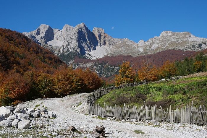
We had planned to go to the Canary Islands, but flight prices are skyrocketing with this new holiday schedule.
So, I’m looking for an alternative to Gran Canaria and El Hierro and found two round-trip flights with Wizz Air to Tirana.
398 €, including baggage and seats—perfect!
Plus, the departure and return times are great, which is pretty rare for a low-cost flight!
All that’s left is to rent a car, plan the route, and book accommodations.
With two weeks, we’ll have to make some choices!
Here’s the final itinerary: Shkodra (2 nights), Valbonë (3 nights), Tirana (1 night), Lake Ohrid (1 night), Korçë (1 night), Përmet (1 night), Gjirokastër (1 night), Himarë (2 nights), Berat (2 nights), and Krujë (1 night).
A mix of countryside and small towns, a bit of the Mediterranean, and some mountains!
Late October isn’t the best season, so let’s keep our fingers crossed for the rest...
PAKSE AND THE BOLAVENS PLATEAU
Bolavens (or "Bolovens" – "the region of the Lavens," an old tribe).
PAKSE
A sleepy town, but packed with backpackers in transit between Laos and Cambodia. The streets are numbered, but since there are no signs, you just have to figure it out (rumor has it the signs have been planned for years; luckily, the center isn’t big). Tons of small hotels, including the well-known Sabaidy 2 on Street 20, a big bazaar catering to all budgets, from dark dorms with shared bathrooms to real rooms with terraces or balconies. Since it’s so popular, booking ahead is recommended. My favorite: the Sala Champa, pricier but with two large terraces, one with a bar, and especially a terrace restaurant I consider the best in Pakse (try the divine steamed fish with lemongrass + Lao Gold beer, a rare delight; ask for room 100, with a big terrace). More upscale, the lovely Résidence Sisouk, run by the very classy and French-speaking Mme Sisouk, from the wealthy Lao Sisouk family, the country’s top coffee producer and one of those francophone families you encounter here and there around the world, where class and culture reign – and perfect French. Delicious pastries and, of course, extraordinary coffee tastings. Similar prices at the Pakse Hotel, run by French owners and famous for its rooftop bar-restaurant (great view!).
Tons of restaurants besides those at Sala Champa and Pakse Hotel: from Dao Lin and Sabaidee at the corner of Street 20 and 13, to a decent Indian place (Hassan) and a nice, cheap spot, the Lao Restaurant & Bar, where you can enjoy Lao cuisine for just a few kips, both also on Street 20. You can feast on grilled fish at the countless riverside stalls along the Mekong.
Pakse is home to the famous Yves, a Belgian married to a Lao woman, Noy, who opened the travel agency Miss Noy. He’ll go out of his way to help tourists; he’s incredible, the real tourism office for the region, with maps, endless advice, and every weekday at 6 PM, a full-blown lecture on the Bolavens and the 4000 Islands. A bunch of young travelers listen intently to his explanations about the whole area (he hands out a well-made photocopied map). He also rents bikes and has an internet café with computers that, miraculously, work perfectly. He’s so popular that in high season, you need to book a motorbike 2-3 days in advance (but if he’s out – and he has 40 – he’ll find one for you).
THE BOLAVENS PLATEAU
Plateaus just aren’t my thing – flat-lands! There are some relatively high peaks in the middle, but they’re only accessible by trekking. You can do a small loop from Pakse-Tad Lo-Thateng-Pakson-Pakse, or a big one from Tad Lo to Sekong, then head south to join the Paksong-Pakse road. Starting in the north, the Phu Xam waterfalls are okay (interesting local minority village-museum to the right of the parking lot, and a terrace restaurant above the small falls). Well, they’re on the way, so you might as well see them! After that, a boring road leads to the Tad Lo waterfalls, with tons of small hotels. I chose the big blue house by the river at the right corner of the bridge, the Sipaseth GH, with cute little bungalows in the garden, 4 rooms with balconies overlooking the river, and great food on the terrace facing the falls. **Avoid at all costs**: the Saisee GH, once nice with its little stilt houses by the falls, but now a monument to filth, indifference, and rudeness (confirmed by several people, unanimous on the issue). Luckily, the lovely Tad Lo Lodge, with its bungalows by the falls and gourmet restaurant right above them – not cheap at all – finally built small houses in the woods on the other side for $25.
The next morning, I’d had enough of plateaus, so I took a small loop heading south from Tad Lo to Thateng, and there, a wonder 5 km south of town: the Sinouk Resort. It’s like stepping into *Gone with the Wind* or the Chevalier de Leyritz’s Martinique. In the middle of the Sisouk family’s 34-hectare coffee plantation, a huge garden with three large colonial-style houses: one by the river and pond with a suite + 3 luxury rooms + a small, cozy one for $40 (that’s where I stayed), one with 4 superior rooms for $60, and a very large one overlooking everything with 6 luxury rooms ($60) + 2 huge suites for $90. Of course, it’s all decorated with antique furniture, local knick-knacks, and antiques; there’s a pool, a beautiful restaurant with two terraces, one overlooking a large pond and one by its edge. The food and service are impeccable, and the coffee: from espresso with whipped cream to green tea or wild honey cappuccino… too bad it keeps you up, or you’d sip it all evening (and morning, and afternoon, and in between). In short, a dream!
Back to Pakse via Paksong (what a dump!) and the Tad Fane waterfalls, those are spectacular – twin sisters plunging 200 meters. You can hike down to swim at the bottom (1-hour jungle trek round trip). Across the way, the nice Tad Fane Resort (small houses and a big terrace-restaurant facing the falls).
I think I missed the Katamkok waterfalls, but I don’t believe it – all these falls can’t compare to Ban Gioc Falls in northern Vietnam!!!
CHAMPASAK AND THE 4000 ISLANDS
CHAMPASAK
Even sleepier than Pakse! To avoid the ferry, cross the new Mekong bridge in Pakse, and after about 10 km, turn left at the big "Phaphinoy" sign (the first village in town). When you arrive, turn at the "River Resort" sign. A sumptuous resort on the Mekong, developed with American capital – pure luxury (they even have their own rice field and vegetable garden for the restaurant). Continuing on, you’ll come across the very pleasant Anouxa GH, where I had dinner and stayed. Small bungalows facing the river, garden rooms, and two large wooden houses with huge family rooms + a big terrace on the Mekong, and the food is great! They rent bikes and motorbikes. Further to the right, the pricey Inthira Hotel, which I found uninteresting since it’s on the road instead of by the Mekong. There’s also a Folie Lodge on Don Daeng Island, which I didn’t visit (the word "Folie" is justified: crazy prices, up to $200 and more).
A few nice wats and, of course, Wat Phou, Laos’ most important archaeological site, 10 km south of Champassak in the plains and on the mountainside (the stairs are a killer!). Watch out for the scorching heat, and it closes at 4:30 PM. It’s not Angkor Wat, but it’s still worth the detour. Plan for 2 hours. Entry is 50,000 kips + 5,000 to park your motorbike.
KHIET NGON
To continue south to the 4000 Islands, you have to take the "ferry" (actually fun little things – two canoes joined by a platform; better not mess up when loading your motorbike!). Once on the other side, turn left, and you’ll hit National Road 13 (Pakse-Siphandone, the 4000 Islands), the most boring road I’ve ever been on, like Phnom Penh-Siem Reap – flat and nothing to see. BUT there’s a real gem worth checking out: Kiet Ngon. At Km 48, take the laterite road toward Attapeu (big sign: "Attapeu 155 km") and eat red dust for 8 km (toll: 20,000 kips), then turn right (signposted) onto a good track. You enter the beautiful Xe Pian National Park, where you can still find wild elephants, leopards, and tigers. You arrive at the entrance of the small village of Ban Khiet Ngon. On your right, a small concrete building with 4 decent, cheap rooms (60,000 kips), facing an old wooden house that serves as the tourism office and its "elephant parking" garden. This village is where you can go on an elephant ride (20,000 kips) to the top of Phou Asa, one of the most unusual places I’ve ever seen. You climb through the jungle and emerge onto a flat slate summit, completely bare – it really feels like the Moon! In the distance, an astonishing site built to commemorate a victory by Lao nationalists over Siamese invaders in the 19th century (so the site isn’t 1,000 years old, as the locals claim). A vast archaeological site with an enclosure 180 m by 50 m, marked by 2-meter-high walls and columns made of slate stacked without mortar. At the back, a ruined temple and a tower. Beautiful views of the whole region. Popular with tourists arriving by minibus from Pakse. The elephant rides in a line aren’t my thing, so they tell you it’s forbidden to ride a motorbike, but I did it anyway without any issues – except for the unhappy looks from the mahouts (turn right at the village entrance, sign for "Phou Asa").
If you’ve got the funds, follow the signs for "Kingfisher Lodge" and arrive at Laos’ first ecolodge, developed by a Lao-Italian family. Lovely stilt houses (750,000 kips with breakfast) and 2 bungalows with just fans (250,000 kips). A small two-story wooden building with a restaurant and a terrace by a pond – the bonus: in the evening, wild elephants and buffalo come to drink with you. Booking ahead is recommended since it’s popular with groups from Pakse.
Paper guides also mention the more remote village of Ban Papho, deep in the jungle. There used to be elephant rides, but they’ve stopped. However, there are great treks in the national park (check with the Green Discovery agency in Pakse, which specializes in treks all over Laos).
THE 4000 ISLANDS
You continue on the mind-numbing Road 13 from Pakse and arrive at a brand-new bridge leading to Don Khong Island, where there’s nothing to see except two wats, so if you skip it, you’re not missing much. Next, the Nakasang sign, a small port with mini-ferries crossing the Mekong to Don Det Island. A celebrity, that one – one of those trashy spots for young people who think you can only have fun if you’re wasted on alcohol and drugs. A small street along the river, lined with guesthouses, restaurants, and bars – total chaos! Plus, there’s nothing to see on the island. So, take a tuk-tuk from the jetty, cross the dump, and arrive in a little paradise: Don Khone Island. I planned to stay 2 days but had to be dragged away after 6. A small main village with a dirt road, tons of guesthouses and great restaurants, and lots of beautiful things to see.
For lodging on Don Khone, it’s usually wooden bungalows with river-view terraces. Options range from the elegant and pricey Sala Done Hotel to Somphamit, Pan’s, Pakha GH, and many others. I found my haven away from everything: the little Phonvilay, 3 small bamboo buildings with 2 simple rooms each, terraces above a branch of the Mekong, and a big plus – a small path just to the right that goes down the riverbank, so 3-4 nice swims a day. All for 60,000 kips. To get there, turn right at the end of the bridge until you reach the wat, then take the small path to the river on the right of the wat’s wall.
For food, you’re spoiled for choice. I had all my dinners at the Cordon Bleu of the Fleur du Mékong. I don’t know how she does it, but even the simplest dishes have something extra. She’s famous for her curry (more like a mild stew) of duck or chicken with potatoes and sweet potatoes – a hearty treat. Go for the chicken; Asian ducks are all skin and bones. Her grilled fish is divine!
The island has quite a history: the Mekong upstream is over a kilometer wide (it’s said to reach 14 km during high water) and "falls" onto a rocky barrier. It splits into countless small branches, flowing wherever there’s a crack – hence the 4000 Islands and the impressive rapids. The French discovered this while trying to navigate the Mekong from Saigon to Luang Prabang and China – and bam, impassable! So they built a narrow-gauge railway starting from the south of the island, bypassing the rapids, and ending at the north of Don Det Island. You can see two rusted locomotives, discovered in the jungle in 1990 by a French explorer: one in the southern extension of the bridge and the other in Ban Hang Khone village at the southern tip of the island, both with large English signs and fascinating old photos explaining the whole history of the railway, abandoned when Road 13 was built along the 4000 Islands (the rails were removed, and the railway track is now an excellent trail).
Somphamit Rapids (Li Phi)
Locals call them Li Phi, meaning "the abyss of evil spirits" (the "phi" that Lao people still believe in), because they think the falls and rapids trap spirits, to the point that no one would ever swim there. It’s very dramatic. Entry fee: 35,000 kips. Small beach and a big restaurant with a terrace and thatched-roof tables.
Khon Pa Sai Rapids
A completely different kind, just as spectacular, and less crowded. Turn left at the bridge exit and go to the northern end of the island (Ban Khon Nua village), then continue south until you see a big yellow sign "Khon Pa Sai Waterfalls" pointing to a small path on the left. You arrive at a small suspension bridge with a corner restaurant and terrace where the food is great (I had most of my lunches there). Cross the bridge and follow the path to a spectacular site of falls and rapids. In the middle, you’ll see unique structures – gigantic fish traps over 10 meters long. During high water, each trap can catch up to 500 kg of fish (yes, five hundred) per day.
Ban Hang Khone
This is the "French port" at the southern tip of the island, where the Mekong, after its rapids, spreads out for kilometers – a real inland sea. This is where you can see the famous Irrawaddy dolphins in the morning or late afternoon (boat excursions). To get there, take the trail that was the old railway track, or continue south on the path past the Khon Pa Sai falls (but not by motorbike – the bridge is out). A huge concrete terrace, part of the old port facilities, with a magnificent panoramic view of the Mekong stretching into the distance. Just before, a small path leads to a big beach (with restaurants).
If you go back to Road 13 (or take a pirogue from Don Khone), further south are the Pha Peng Falls, Asia’s highest river falls (15 m). I didn’t go, but they’re said to be spectacular.
Bolavens (or "Bolovens" – "the region of the Lavens," an old tribe).
PAKSE
A sleepy town, but packed with backpackers in transit between Laos and Cambodia. The streets are numbered, but since there are no signs, you just have to figure it out (rumor has it the signs have been planned for years; luckily, the center isn’t big). Tons of small hotels, including the well-known Sabaidy 2 on Street 20, a big bazaar catering to all budgets, from dark dorms with shared bathrooms to real rooms with terraces or balconies. Since it’s so popular, booking ahead is recommended. My favorite: the Sala Champa, pricier but with two large terraces, one with a bar, and especially a terrace restaurant I consider the best in Pakse (try the divine steamed fish with lemongrass + Lao Gold beer, a rare delight; ask for room 100, with a big terrace). More upscale, the lovely Résidence Sisouk, run by the very classy and French-speaking Mme Sisouk, from the wealthy Lao Sisouk family, the country’s top coffee producer and one of those francophone families you encounter here and there around the world, where class and culture reign – and perfect French. Delicious pastries and, of course, extraordinary coffee tastings. Similar prices at the Pakse Hotel, run by French owners and famous for its rooftop bar-restaurant (great view!).
Tons of restaurants besides those at Sala Champa and Pakse Hotel: from Dao Lin and Sabaidee at the corner of Street 20 and 13, to a decent Indian place (Hassan) and a nice, cheap spot, the Lao Restaurant & Bar, where you can enjoy Lao cuisine for just a few kips, both also on Street 20. You can feast on grilled fish at the countless riverside stalls along the Mekong.
Pakse is home to the famous Yves, a Belgian married to a Lao woman, Noy, who opened the travel agency Miss Noy. He’ll go out of his way to help tourists; he’s incredible, the real tourism office for the region, with maps, endless advice, and every weekday at 6 PM, a full-blown lecture on the Bolavens and the 4000 Islands. A bunch of young travelers listen intently to his explanations about the whole area (he hands out a well-made photocopied map). He also rents bikes and has an internet café with computers that, miraculously, work perfectly. He’s so popular that in high season, you need to book a motorbike 2-3 days in advance (but if he’s out – and he has 40 – he’ll find one for you).
THE BOLAVENS PLATEAU
Plateaus just aren’t my thing – flat-lands! There are some relatively high peaks in the middle, but they’re only accessible by trekking. You can do a small loop from Pakse-Tad Lo-Thateng-Pakson-Pakse, or a big one from Tad Lo to Sekong, then head south to join the Paksong-Pakse road. Starting in the north, the Phu Xam waterfalls are okay (interesting local minority village-museum to the right of the parking lot, and a terrace restaurant above the small falls). Well, they’re on the way, so you might as well see them! After that, a boring road leads to the Tad Lo waterfalls, with tons of small hotels. I chose the big blue house by the river at the right corner of the bridge, the Sipaseth GH, with cute little bungalows in the garden, 4 rooms with balconies overlooking the river, and great food on the terrace facing the falls. **Avoid at all costs**: the Saisee GH, once nice with its little stilt houses by the falls, but now a monument to filth, indifference, and rudeness (confirmed by several people, unanimous on the issue). Luckily, the lovely Tad Lo Lodge, with its bungalows by the falls and gourmet restaurant right above them – not cheap at all – finally built small houses in the woods on the other side for $25.
The next morning, I’d had enough of plateaus, so I took a small loop heading south from Tad Lo to Thateng, and there, a wonder 5 km south of town: the Sinouk Resort. It’s like stepping into *Gone with the Wind* or the Chevalier de Leyritz’s Martinique. In the middle of the Sisouk family’s 34-hectare coffee plantation, a huge garden with three large colonial-style houses: one by the river and pond with a suite + 3 luxury rooms + a small, cozy one for $40 (that’s where I stayed), one with 4 superior rooms for $60, and a very large one overlooking everything with 6 luxury rooms ($60) + 2 huge suites for $90. Of course, it’s all decorated with antique furniture, local knick-knacks, and antiques; there’s a pool, a beautiful restaurant with two terraces, one overlooking a large pond and one by its edge. The food and service are impeccable, and the coffee: from espresso with whipped cream to green tea or wild honey cappuccino… too bad it keeps you up, or you’d sip it all evening (and morning, and afternoon, and in between). In short, a dream!
Back to Pakse via Paksong (what a dump!) and the Tad Fane waterfalls, those are spectacular – twin sisters plunging 200 meters. You can hike down to swim at the bottom (1-hour jungle trek round trip). Across the way, the nice Tad Fane Resort (small houses and a big terrace-restaurant facing the falls).
I think I missed the Katamkok waterfalls, but I don’t believe it – all these falls can’t compare to Ban Gioc Falls in northern Vietnam!!!
CHAMPASAK AND THE 4000 ISLANDS
CHAMPASAK
Even sleepier than Pakse! To avoid the ferry, cross the new Mekong bridge in Pakse, and after about 10 km, turn left at the big "Phaphinoy" sign (the first village in town). When you arrive, turn at the "River Resort" sign. A sumptuous resort on the Mekong, developed with American capital – pure luxury (they even have their own rice field and vegetable garden for the restaurant). Continuing on, you’ll come across the very pleasant Anouxa GH, where I had dinner and stayed. Small bungalows facing the river, garden rooms, and two large wooden houses with huge family rooms + a big terrace on the Mekong, and the food is great! They rent bikes and motorbikes. Further to the right, the pricey Inthira Hotel, which I found uninteresting since it’s on the road instead of by the Mekong. There’s also a Folie Lodge on Don Daeng Island, which I didn’t visit (the word "Folie" is justified: crazy prices, up to $200 and more).
A few nice wats and, of course, Wat Phou, Laos’ most important archaeological site, 10 km south of Champassak in the plains and on the mountainside (the stairs are a killer!). Watch out for the scorching heat, and it closes at 4:30 PM. It’s not Angkor Wat, but it’s still worth the detour. Plan for 2 hours. Entry is 50,000 kips + 5,000 to park your motorbike.
KHIET NGON
To continue south to the 4000 Islands, you have to take the "ferry" (actually fun little things – two canoes joined by a platform; better not mess up when loading your motorbike!). Once on the other side, turn left, and you’ll hit National Road 13 (Pakse-Siphandone, the 4000 Islands), the most boring road I’ve ever been on, like Phnom Penh-Siem Reap – flat and nothing to see. BUT there’s a real gem worth checking out: Kiet Ngon. At Km 48, take the laterite road toward Attapeu (big sign: "Attapeu 155 km") and eat red dust for 8 km (toll: 20,000 kips), then turn right (signposted) onto a good track. You enter the beautiful Xe Pian National Park, where you can still find wild elephants, leopards, and tigers. You arrive at the entrance of the small village of Ban Khiet Ngon. On your right, a small concrete building with 4 decent, cheap rooms (60,000 kips), facing an old wooden house that serves as the tourism office and its "elephant parking" garden. This village is where you can go on an elephant ride (20,000 kips) to the top of Phou Asa, one of the most unusual places I’ve ever seen. You climb through the jungle and emerge onto a flat slate summit, completely bare – it really feels like the Moon! In the distance, an astonishing site built to commemorate a victory by Lao nationalists over Siamese invaders in the 19th century (so the site isn’t 1,000 years old, as the locals claim). A vast archaeological site with an enclosure 180 m by 50 m, marked by 2-meter-high walls and columns made of slate stacked without mortar. At the back, a ruined temple and a tower. Beautiful views of the whole region. Popular with tourists arriving by minibus from Pakse. The elephant rides in a line aren’t my thing, so they tell you it’s forbidden to ride a motorbike, but I did it anyway without any issues – except for the unhappy looks from the mahouts (turn right at the village entrance, sign for "Phou Asa").
If you’ve got the funds, follow the signs for "Kingfisher Lodge" and arrive at Laos’ first ecolodge, developed by a Lao-Italian family. Lovely stilt houses (750,000 kips with breakfast) and 2 bungalows with just fans (250,000 kips). A small two-story wooden building with a restaurant and a terrace by a pond – the bonus: in the evening, wild elephants and buffalo come to drink with you. Booking ahead is recommended since it’s popular with groups from Pakse.
Paper guides also mention the more remote village of Ban Papho, deep in the jungle. There used to be elephant rides, but they’ve stopped. However, there are great treks in the national park (check with the Green Discovery agency in Pakse, which specializes in treks all over Laos).
THE 4000 ISLANDS
You continue on the mind-numbing Road 13 from Pakse and arrive at a brand-new bridge leading to Don Khong Island, where there’s nothing to see except two wats, so if you skip it, you’re not missing much. Next, the Nakasang sign, a small port with mini-ferries crossing the Mekong to Don Det Island. A celebrity, that one – one of those trashy spots for young people who think you can only have fun if you’re wasted on alcohol and drugs. A small street along the river, lined with guesthouses, restaurants, and bars – total chaos! Plus, there’s nothing to see on the island. So, take a tuk-tuk from the jetty, cross the dump, and arrive in a little paradise: Don Khone Island. I planned to stay 2 days but had to be dragged away after 6. A small main village with a dirt road, tons of guesthouses and great restaurants, and lots of beautiful things to see.
For lodging on Don Khone, it’s usually wooden bungalows with river-view terraces. Options range from the elegant and pricey Sala Done Hotel to Somphamit, Pan’s, Pakha GH, and many others. I found my haven away from everything: the little Phonvilay, 3 small bamboo buildings with 2 simple rooms each, terraces above a branch of the Mekong, and a big plus – a small path just to the right that goes down the riverbank, so 3-4 nice swims a day. All for 60,000 kips. To get there, turn right at the end of the bridge until you reach the wat, then take the small path to the river on the right of the wat’s wall.
For food, you’re spoiled for choice. I had all my dinners at the Cordon Bleu of the Fleur du Mékong. I don’t know how she does it, but even the simplest dishes have something extra. She’s famous for her curry (more like a mild stew) of duck or chicken with potatoes and sweet potatoes – a hearty treat. Go for the chicken; Asian ducks are all skin and bones. Her grilled fish is divine!
The island has quite a history: the Mekong upstream is over a kilometer wide (it’s said to reach 14 km during high water) and "falls" onto a rocky barrier. It splits into countless small branches, flowing wherever there’s a crack – hence the 4000 Islands and the impressive rapids. The French discovered this while trying to navigate the Mekong from Saigon to Luang Prabang and China – and bam, impassable! So they built a narrow-gauge railway starting from the south of the island, bypassing the rapids, and ending at the north of Don Det Island. You can see two rusted locomotives, discovered in the jungle in 1990 by a French explorer: one in the southern extension of the bridge and the other in Ban Hang Khone village at the southern tip of the island, both with large English signs and fascinating old photos explaining the whole history of the railway, abandoned when Road 13 was built along the 4000 Islands (the rails were removed, and the railway track is now an excellent trail).
Somphamit Rapids (Li Phi)
Locals call them Li Phi, meaning "the abyss of evil spirits" (the "phi" that Lao people still believe in), because they think the falls and rapids trap spirits, to the point that no one would ever swim there. It’s very dramatic. Entry fee: 35,000 kips. Small beach and a big restaurant with a terrace and thatched-roof tables.
Khon Pa Sai Rapids
A completely different kind, just as spectacular, and less crowded. Turn left at the bridge exit and go to the northern end of the island (Ban Khon Nua village), then continue south until you see a big yellow sign "Khon Pa Sai Waterfalls" pointing to a small path on the left. You arrive at a small suspension bridge with a corner restaurant and terrace where the food is great (I had most of my lunches there). Cross the bridge and follow the path to a spectacular site of falls and rapids. In the middle, you’ll see unique structures – gigantic fish traps over 10 meters long. During high water, each trap can catch up to 500 kg of fish (yes, five hundred) per day.
Ban Hang Khone
This is the "French port" at the southern tip of the island, where the Mekong, after its rapids, spreads out for kilometers – a real inland sea. This is where you can see the famous Irrawaddy dolphins in the morning or late afternoon (boat excursions). To get there, take the trail that was the old railway track, or continue south on the path past the Khon Pa Sai falls (but not by motorbike – the bridge is out). A huge concrete terrace, part of the old port facilities, with a magnificent panoramic view of the Mekong stretching into the distance. Just before, a small path leads to a big beach (with restaurants).
If you go back to Road 13 (or take a pirogue from Don Khone), further south are the Pha Peng Falls, Asia’s highest river falls (15 m). I didn’t go, but they’re said to be spectacular.
5 AM, I’m shivering.
The icy February 2022 fog wraps around the deserted Terminal 2, closed for renovations, on the outskirts of which my hotel stands. I wait alone at the stop in the pitch-black night for the first shuttle of the day, which is supposed to take me to T1. I have no idea where I’m going. All I know is the name: Jerusalem. I’m entirely goy, just as entirely atheist, but I’ve been visiting that imaginary city for decades. It haunts, fantastical, the medieval images that once occupied me for so long. It regularly creeps into my ears through the misfortune of news reports from radios around the world. It crystallizes so many of humanity’s delusions, of which I’m a part. I know nothing about it, haven’t read a single guidebook. But I want to see it, walk its streets, live it for a few days. Make it real, tangible.
The flight is on time. This is the era of mandatory FFP2 masks on all flights landing in Italy (Europe?). The crew valiantly fights against passengers’ ingenious attempts to remove them: sipping their drinks milliliter by milliliter, nibbling their snacks cubic millimeter by cubic millimeter, feigning breathing difficulties, yanking off the elastic bands... A rabbi passes through the rows collecting donations. Men put on their tefillin, drape their prayer shawls, and rock to the rhythm of their prayers. Already, the sense of elsewhere.
Ben Gurion Airport is a stunning airport—monumental, bright, functional, adorned with archaeological remnants and enormous photographs showcasing the country’s great leader in its works. I collect my visa from a kiosk, quickly endure the routine interrogation from a military officer slumped in his seat, withdraw some shekels from an ATM, get my nostrils swabbed at one of the many molecular testing stations in exchange for a yellow all-inclusive resort-style wristband that grants me passage through the outer doors. I spend ages (I think I’m just not good at this) in the crowd trying to find a sherut heading to Jerusalem, then lose myself in the landscape. Mediterranean-style—red earth, stunted vegetation, overrun with sprawling construction. I do glute exercises in this traffic, where a Neapolitan driver would embody road indolence. Endless traffic jams signal the city’s approach. The sherut drops me a few steps from my hotel, the Saint George’s Cathedral Pilgrim Guest House, right on the edge of the dotted lines on maps marking the divide between Jewish and Arab Jerusalem. It’s a pleasant complex with an inner garden and beautiful rooms featuring exposed stone vaults—and thank goodness, because I’m not allowed to leave until I get my test results. The reception staff, incredibly helpful, guide me through the myriad of meal delivery options. A roof over my head, a full stomach—all that’s left is to wait. Read Caillois, check the increasingly precise, increasingly ominous rumors of war brewing, yet again, in Europe, and navigate the city’s virtual map to get a sense of where to head once freed.
The next day, it’s done, and my first destination is, quite naturally, the Old City. The first gate I come across is Jaffa Gate, so Jaffa Gate it is—leading from the chaos of vehicles of all kinds into the labyrinth of alleys packed with goods of all kinds.
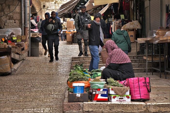
The flight is on time. This is the era of mandatory FFP2 masks on all flights landing in Italy (Europe?). The crew valiantly fights against passengers’ ingenious attempts to remove them: sipping their drinks milliliter by milliliter, nibbling their snacks cubic millimeter by cubic millimeter, feigning breathing difficulties, yanking off the elastic bands... A rabbi passes through the rows collecting donations. Men put on their tefillin, drape their prayer shawls, and rock to the rhythm of their prayers. Already, the sense of elsewhere.
Ben Gurion Airport is a stunning airport—monumental, bright, functional, adorned with archaeological remnants and enormous photographs showcasing the country’s great leader in its works. I collect my visa from a kiosk, quickly endure the routine interrogation from a military officer slumped in his seat, withdraw some shekels from an ATM, get my nostrils swabbed at one of the many molecular testing stations in exchange for a yellow all-inclusive resort-style wristband that grants me passage through the outer doors. I spend ages (I think I’m just not good at this) in the crowd trying to find a sherut heading to Jerusalem, then lose myself in the landscape. Mediterranean-style—red earth, stunted vegetation, overrun with sprawling construction. I do glute exercises in this traffic, where a Neapolitan driver would embody road indolence. Endless traffic jams signal the city’s approach. The sherut drops me a few steps from my hotel, the Saint George’s Cathedral Pilgrim Guest House, right on the edge of the dotted lines on maps marking the divide between Jewish and Arab Jerusalem. It’s a pleasant complex with an inner garden and beautiful rooms featuring exposed stone vaults—and thank goodness, because I’m not allowed to leave until I get my test results. The reception staff, incredibly helpful, guide me through the myriad of meal delivery options. A roof over my head, a full stomach—all that’s left is to wait. Read Caillois, check the increasingly precise, increasingly ominous rumors of war brewing, yet again, in Europe, and navigate the city’s virtual map to get a sense of where to head once freed.
The next day, it’s done, and my first destination is, quite naturally, the Old City. The first gate I come across is Jaffa Gate, so Jaffa Gate it is—leading from the chaos of vehicles of all kinds into the labyrinth of alleys packed with goods of all kinds.
Hi everyone!
If you're looking for great tips and offbeat spots, if you love exploring uncharted parts of a country, if the exotic is your adrenaline, then move along!
Our 15 days in early May in this part of Turkey (a country I first discovered during a city trip to Istanbul in 2017) will only tread well-worn paths and revisit popular routes. Simply because I kept hoping until the very end that our flight to Jordan wouldn’t be canceled. Events in the Gulf proved me wrong, so we left with: Zero preparation. Not a single hotel booked (well, except the first one), no visits planned, just a flight ticket bought three weeks earlier. No guidebook, no app—just the desire to explore southern Turkey and Cappadocia, whose images and the chance to stretch our legs had caught my eye.
Oh, wait—I did bring along a new guide: Gemini! Yes, my friends, generative AI was my chief advisor throughout the trip for sites to visit, accommodations, routes, and even restaurants! An experiment I wanted to try to form my own opinion on using this new technology. And what better way to test it than a Turkish getaway?
The verdict? You’ll have to wait for the trip recap to find out!
The main idea of the trip is also relaxation.
So, the plan is Antalya for a few days, the Turkish Riviera for a few more, Cappadocia as the highlight, and a return via Antalya to wrap up the trip. And it was all planned by AI!
So, if you're ready, fasten your seatbelts—cabin crew, doors to automatic and cross check—boarding for Turkey now!
 A little sneak peek?
If you're looking for great tips and offbeat spots, if you love exploring uncharted parts of a country, if the exotic is your adrenaline, then move along!
Our 15 days in early May in this part of Turkey (a country I first discovered during a city trip to Istanbul in 2017) will only tread well-worn paths and revisit popular routes. Simply because I kept hoping until the very end that our flight to Jordan wouldn’t be canceled. Events in the Gulf proved me wrong, so we left with: Zero preparation. Not a single hotel booked (well, except the first one), no visits planned, just a flight ticket bought three weeks earlier. No guidebook, no app—just the desire to explore southern Turkey and Cappadocia, whose images and the chance to stretch our legs had caught my eye.
Oh, wait—I did bring along a new guide: Gemini! Yes, my friends, generative AI was my chief advisor throughout the trip for sites to visit, accommodations, routes, and even restaurants! An experiment I wanted to try to form my own opinion on using this new technology. And what better way to test it than a Turkish getaway?
The verdict? You’ll have to wait for the trip recap to find out!
The main idea of the trip is also relaxation.
So, the plan is Antalya for a few days, the Turkish Riviera for a few more, Cappadocia as the highlight, and a return via Antalya to wrap up the trip. And it was all planned by AI!
So, if you're ready, fasten your seatbelts—cabin crew, doors to automatic and cross check—boarding for Turkey now!
A little sneak peek?5-day cruise around Komodo
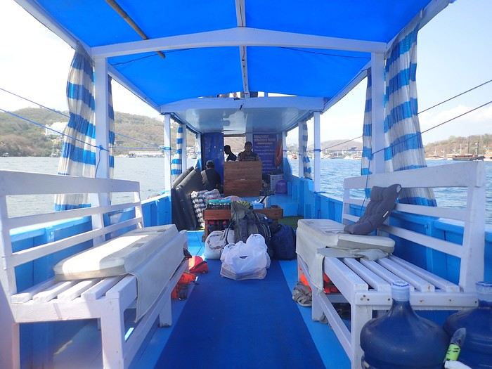 Not usually a fan of organized trips, during my stay in Labuan Bajo on Flores in May 2024, I started looking for a fisherman who could show me the islands around Komodo. At the port, I met Ari, a former freediver who knows the islands well, especially the best spots for fish and coral.
At the Bohême guest house, I proposed this outing, and one of the activity leaders was happy to join. We headed to Angel Island, where Ari took us snorkeling around the island. During this beautiful day, we appreciated his professionalism, and I suggested coming back the following year for a 5-day cruise. We had to agree on a budget and the period to consider.
Over the next year, we kept in touch via WhatsApp.
However, a month before departure, Ari told me he had lent his boat to a friend, who ran it aground on a rock, causing it to sink. No boat, no cruise! Since we had an agreement, I asked him to find another solution. His searches in the port, where everyone knows each other, turned out to be fruitful.
A certain "Captain" Kambar agreed to take us. He sometimes charters his boat for local travel agencies and could free up the requested period.
Not usually a fan of organized trips, during my stay in Labuan Bajo on Flores in May 2024, I started looking for a fisherman who could show me the islands around Komodo. At the port, I met Ari, a former freediver who knows the islands well, especially the best spots for fish and coral.
At the Bohême guest house, I proposed this outing, and one of the activity leaders was happy to join. We headed to Angel Island, where Ari took us snorkeling around the island. During this beautiful day, we appreciated his professionalism, and I suggested coming back the following year for a 5-day cruise. We had to agree on a budget and the period to consider.
Over the next year, we kept in touch via WhatsApp.
However, a month before departure, Ari told me he had lent his boat to a friend, who ran it aground on a rock, causing it to sink. No boat, no cruise! Since we had an agreement, I asked him to find another solution. His searches in the port, where everyone knows each other, turned out to be fruitful.
A certain "Captain" Kambar agreed to take us. He sometimes charters his boat for local travel agencies and could free up the requested period.
There will be six of us on board, as in the meantime, my daughter’s friend, Amandine, could join us for the cruise. Ari will act as a guide, and a mechanic will also be present. To reserve the boat for September 4th, Ari asked me to transfer a deposit of 5 million IDR to his account. After some hesitation, I decided to trust him and made the transfer. A few days later, he confirmed receipt of the amount.
In early September, we arrived in Labuan Bajo. Our first mission was to check the boat’s condition, the presence of life jackets, what we would eat, and if there were any restrictions on drinks. Everything was in order and met our expectations.
The day before departure, we met a 26-year-old Czech woman traveling alone after a stay in New Zealand. The description of our cruise excited her, and she got Ari’s number. That evening, at the restaurant, while we discussed the final preparations, Thérèsa joined us and asked if she could come along for the five-day cruise. Since she seemed like good company, I gladly accepted. However, following Indonesian custom, I negotiated firmly with Ari for a discount, and he agreed to lower the price by 2 million.
On September 4th, we set sail to explore the islands of Komodo and, above all, the seabeds, equipped with fins, masks, and snorkels. We had brought a board game for the trips between islands or for the evenings. In the end, it wasn’t used: the crossings rarely lasted more than an hour, except for two two-hour trips, and the conditions on board weren’t suitable for playing.
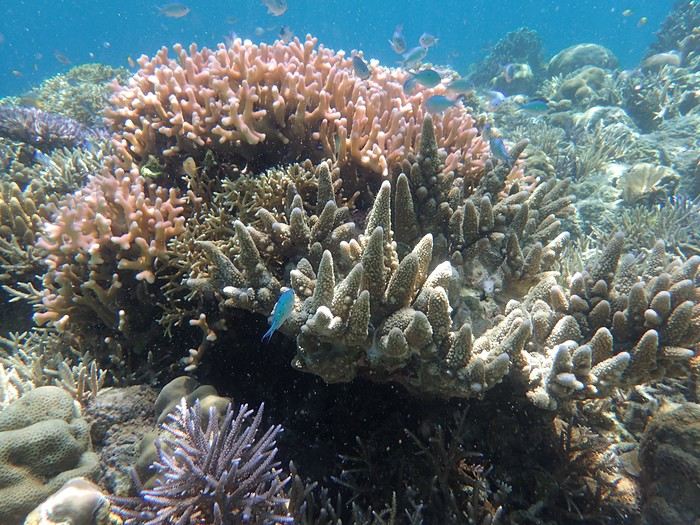
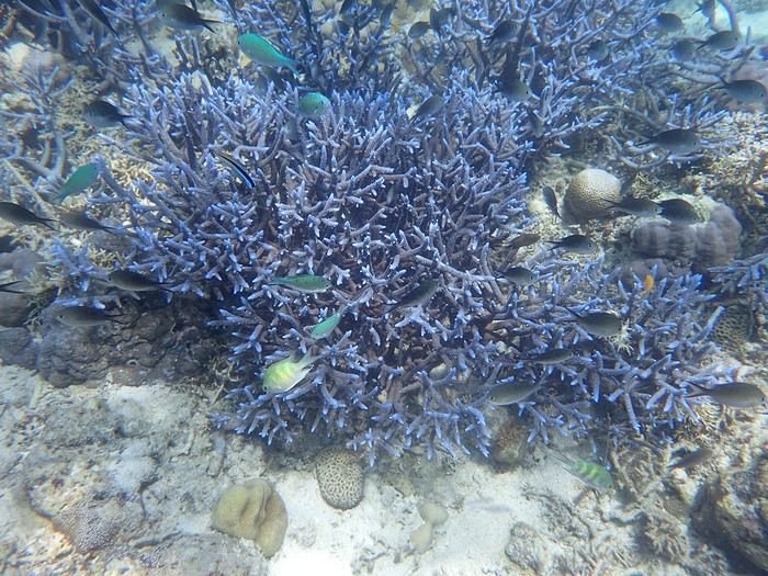 The first island we visited is north of Labuan Bajo: Seraya Small.
We didn’t disembark but anchored a short distance away. The coral reef, between 5 and 10 meters deep, offered visibility of 8 to 10 meters. We started with a few dives from the boat, as the water was so inviting. As with most of the upcoming sites, we were the only ones enjoying this little paradise.
Over about a kilometer along the drop-off, colorful corals and fish abound. As long as you don’t go past the rocky point on the right, the currents remain very weak, and the spot is accessible to beginners. After enjoying the sea enough, we returned to the boat, where Ari had prepared a good meal of rice, chicken, and vegetables. It was simple but excellent after all that effort.
The first island we visited is north of Labuan Bajo: Seraya Small.
We didn’t disembark but anchored a short distance away. The coral reef, between 5 and 10 meters deep, offered visibility of 8 to 10 meters. We started with a few dives from the boat, as the water was so inviting. As with most of the upcoming sites, we were the only ones enjoying this little paradise.
Over about a kilometer along the drop-off, colorful corals and fish abound. As long as you don’t go past the rocky point on the right, the currents remain very weak, and the spot is accessible to beginners. After enjoying the sea enough, we returned to the boat, where Ari had prepared a good meal of rice, chicken, and vegetables. It was simple but excellent after all that effort.
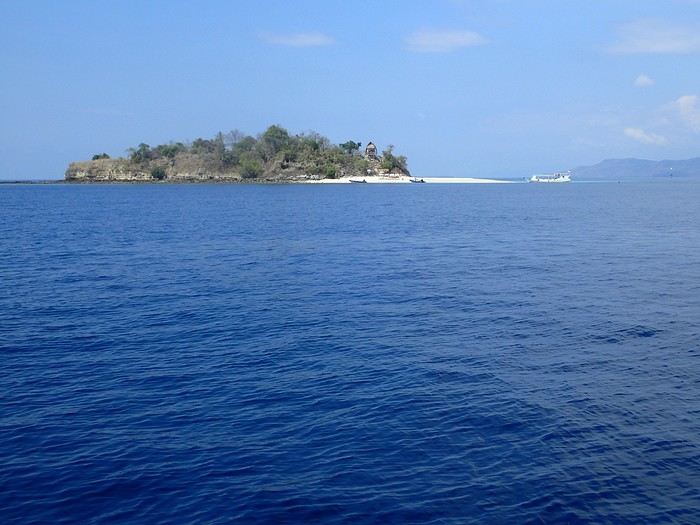 In the afternoon, we discovered Bero Island, where it was very hot. There were fewer fish and corals than at Seraya, but the corals were on white sand, allowing for beautiful, bright photos.
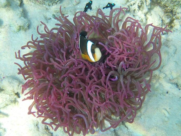 In the evening, we visited Hatamin, a fishing village. The population is very young and curious about our visit. At our request, we could have watched a local dance, but it would have taken some time to organize, and we didn’t plan to return. Ari asked if we wanted to take a shower, as on the boat, we could only rinse off with a little water from a basin.
On the second day, snorkeling near Hatamin, a small paradise island with white sand like in a travel brochure. A small temple is located in the middle of the island. In the water, we saw our first small reef sharks, some clownfish, and a sergeant major fish that followed us throughout our swim. The most beautiful part to explore is opposite the beach. Many corals and fish of all colors. A sailboat was anchored a short distance away, but we didn’t see anyone except an old man who apparently lived in the temple above.
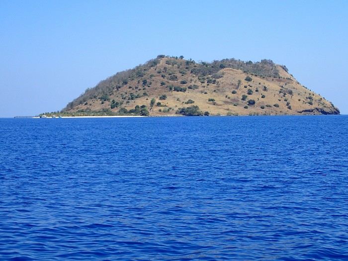
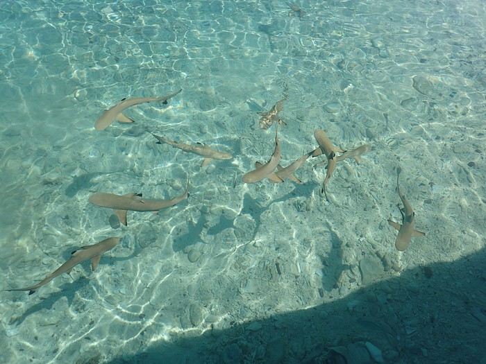
In the afternoon, we headed to the nearby island of Sabolong Besar. It’s a pretty little island with a harmonious resort made up of luxury huts that don’t spoil the landscape. In some places, the water is very clear with good visibility, and some schools of very young blacktip reef sharks swirl near the boat. There are beautiful corals on the left side of the resort and a bit of current when you approach the drop-off. Since the area to explore wasn’t very large, we had time to head to Sabolong Kecil. Then we went to the fishing village of Messah, where a Muslim celebration was taking place. There were people everywhere with many food offerings—what activity! It was like an anthill.
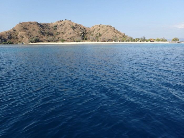
And at the end of the day, we anchored near Kanawa with a beautiful sunset.
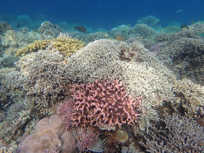 On the third day, we discovered Kanawa and some hawksbill turtles. There were many colorful corals, but we didn’t stay long. During this day, the stops were close together, making it intense with four visits.
Then we arrived at Sebayur Besar with a different snorkeling approach: Ari dropped us in the current, and we drifted for over a kilometer before he came to pick us up. At first, it seemed a bit worrying to see the boat move away while we were offshore, but we were quickly carried by the current and passed almost too quickly by so many corals and fish to see. What a pleasure to drift and freedive with little effort.
On the third day, we discovered Kanawa and some hawksbill turtles. There were many colorful corals, but we didn’t stay long. During this day, the stops were close together, making it intense with four visits.
Then we arrived at Sebayur Besar with a different snorkeling approach: Ari dropped us in the current, and we drifted for over a kilometer before he came to pick us up. At first, it seemed a bit worrying to see the boat move away while we were offshore, but we were quickly carried by the current and passed almost too quickly by so many corals and fish to see. What a pleasure to drift and freedive with little effort.
The drift lasted a good hour, and we reached Siaba Island, where the water was colder. There were many boats, and we had quickly lost the habit of seeing other tourists. Visibility was average—it was a nice spot, but after the drift at Sebayur, we liked it less. Around 1 p.m., we anchored with other boats because Ari met up with some friends, and we ate heartily since the cool water had whetted our appetites.
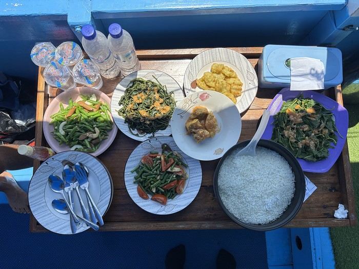
In the afternoon, we were at Manta Point. The water was cool, and there was a lot of excitement trying to follow the giant manta rays. We managed to dive down and get close to them, but it took a lot of effort and breath because, despite their leisurely appearance, they move quite fast for us little swimmers. Here, they come to feed and then return to the depths, and it’s not always certain you’ll encounter them. We ended the day at Makassar with a two-hour sail. There was a lot of wind and swell, the boat rocked, and we hoped there wouldn’t be an engine breakdown. We had to take down the tent on the boat’s roof, which had also been used for sleeping. Makassar’s beach is pink, caused by microorganisms called foraminifera. There are many beach huts along the shore, and we were alone, though it must get busy here during the day. On the fourth day, we visited Padar Island for its viewpoint amid hordes of tourists, then headed to Rinca and its Komodo dragons. Rinca is much less crowded than Komodo, which is why we chose this visit. We saw a few and took the usual photos. In the late afternoon, we snorkeled at Pempend Island, where the sea was choppy and the water a bit murky. And on the last day, we visited Strawberry Rock, named after the reddish rock overlooking the sea. There were many corals, but the water was rough with reduced visibility, and then we went to Kelor with its tourist "bars" and the pretty viewpoint.
In conclusion, we shared amazing moments and managed to complete our program. Luckily, the weather was very kind, and not a drop of rain fell in early September, except just upon returning to the port. It’s worth noting that after five intense days in the water from morning to night, we were glad to return to dry land because we were exhausted.
My daughter and her friend were so thrilled that, in return, they developed a website for Ari to help him get known, and I can share the link if you’d like. I visit Voyage Forum from time to time, so if you have any questions, don’t hesitate—I’ll answer them.
Not usually a fan of organized trips, during my stay in Labuan Bajo on Flores in May 2024, I started looking for a fisherman who could show me the islands around Komodo. At the port, I met Ari, a former freediver who knows the islands well, especially the best spots for fish and coral.
At the Bohême guest house, I proposed this outing, and one of the activity leaders was happy to join. We headed to Angel Island, where Ari took us snorkeling around the island. During this beautiful day, we appreciated his professionalism, and I suggested coming back the following year for a 5-day cruise. We had to agree on a budget and the period to consider.
Over the next year, we kept in touch via WhatsApp.
However, a month before departure, Ari told me he had lent his boat to a friend, who ran it aground on a rock, causing it to sink. No boat, no cruise! Since we had an agreement, I asked him to find another solution. His searches in the port, where everyone knows each other, turned out to be fruitful.
A certain "Captain" Kambar agreed to take us. He sometimes charters his boat for local travel agencies and could free up the requested period.There will be six of us on board, as in the meantime, my daughter’s friend, Amandine, could join us for the cruise. Ari will act as a guide, and a mechanic will also be present. To reserve the boat for September 4th, Ari asked me to transfer a deposit of 5 million IDR to his account. After some hesitation, I decided to trust him and made the transfer. A few days later, he confirmed receipt of the amount.
In early September, we arrived in Labuan Bajo. Our first mission was to check the boat’s condition, the presence of life jackets, what we would eat, and if there were any restrictions on drinks. Everything was in order and met our expectations.
The day before departure, we met a 26-year-old Czech woman traveling alone after a stay in New Zealand. The description of our cruise excited her, and she got Ari’s number. That evening, at the restaurant, while we discussed the final preparations, Thérèsa joined us and asked if she could come along for the five-day cruise. Since she seemed like good company, I gladly accepted. However, following Indonesian custom, I negotiated firmly with Ari for a discount, and he agreed to lower the price by 2 million.
On September 4th, we set sail to explore the islands of Komodo and, above all, the seabeds, equipped with fins, masks, and snorkels. We had brought a board game for the trips between islands or for the evenings. In the end, it wasn’t used: the crossings rarely lasted more than an hour, except for two two-hour trips, and the conditions on board weren’t suitable for playing.
The first island we visited is north of Labuan Bajo: Seraya Small.
We didn’t disembark but anchored a short distance away. The coral reef, between 5 and 10 meters deep, offered visibility of 8 to 10 meters. We started with a few dives from the boat, as the water was so inviting. As with most of the upcoming sites, we were the only ones enjoying this little paradise.
Over about a kilometer along the drop-off, colorful corals and fish abound. As long as you don’t go past the rocky point on the right, the currents remain very weak, and the spot is accessible to beginners. After enjoying the sea enough, we returned to the boat, where Ari had prepared a good meal of rice, chicken, and vegetables. It was simple but excellent after all that effort.
In the afternoon, we discovered Bero Island, where it was very hot. There were fewer fish and corals than at Seraya, but the corals were on white sand, allowing for beautiful, bright photos.
In the evening, we visited Hatamin, a fishing village. The population is very young and curious about our visit. At our request, we could have watched a local dance, but it would have taken some time to organize, and we didn’t plan to return. Ari asked if we wanted to take a shower, as on the boat, we could only rinse off with a little water from a basin.On the second day, snorkeling near Hatamin, a small paradise island with white sand like in a travel brochure. A small temple is located in the middle of the island. In the water, we saw our first small reef sharks, some clownfish, and a sergeant major fish that followed us throughout our swim. The most beautiful part to explore is opposite the beach. Many corals and fish of all colors. A sailboat was anchored a short distance away, but we didn’t see anyone except an old man who apparently lived in the temple above.
In the afternoon, we headed to the nearby island of Sabolong Besar. It’s a pretty little island with a harmonious resort made up of luxury huts that don’t spoil the landscape. In some places, the water is very clear with good visibility, and some schools of very young blacktip reef sharks swirl near the boat. There are beautiful corals on the left side of the resort and a bit of current when you approach the drop-off. Since the area to explore wasn’t very large, we had time to head to Sabolong Kecil. Then we went to the fishing village of Messah, where a Muslim celebration was taking place. There were people everywhere with many food offerings—what activity! It was like an anthill.
And at the end of the day, we anchored near Kanawa with a beautiful sunset.
On the third day, we discovered Kanawa and some hawksbill turtles. There were many colorful corals, but we didn’t stay long. During this day, the stops were close together, making it intense with four visits.
Then we arrived at Sebayur Besar with a different snorkeling approach: Ari dropped us in the current, and we drifted for over a kilometer before he came to pick us up. At first, it seemed a bit worrying to see the boat move away while we were offshore, but we were quickly carried by the current and passed almost too quickly by so many corals and fish to see. What a pleasure to drift and freedive with little effort.The drift lasted a good hour, and we reached Siaba Island, where the water was colder. There were many boats, and we had quickly lost the habit of seeing other tourists. Visibility was average—it was a nice spot, but after the drift at Sebayur, we liked it less. Around 1 p.m., we anchored with other boats because Ari met up with some friends, and we ate heartily since the cool water had whetted our appetites.
In the afternoon, we were at Manta Point. The water was cool, and there was a lot of excitement trying to follow the giant manta rays. We managed to dive down and get close to them, but it took a lot of effort and breath because, despite their leisurely appearance, they move quite fast for us little swimmers. Here, they come to feed and then return to the depths, and it’s not always certain you’ll encounter them. We ended the day at Makassar with a two-hour sail. There was a lot of wind and swell, the boat rocked, and we hoped there wouldn’t be an engine breakdown. We had to take down the tent on the boat’s roof, which had also been used for sleeping. Makassar’s beach is pink, caused by microorganisms called foraminifera. There are many beach huts along the shore, and we were alone, though it must get busy here during the day. On the fourth day, we visited Padar Island for its viewpoint amid hordes of tourists, then headed to Rinca and its Komodo dragons. Rinca is much less crowded than Komodo, which is why we chose this visit. We saw a few and took the usual photos. In the late afternoon, we snorkeled at Pempend Island, where the sea was choppy and the water a bit murky. And on the last day, we visited Strawberry Rock, named after the reddish rock overlooking the sea. There were many corals, but the water was rough with reduced visibility, and then we went to Kelor with its tourist "bars" and the pretty viewpoint.
In conclusion, we shared amazing moments and managed to complete our program. Luckily, the weather was very kind, and not a drop of rain fell in early September, except just upon returning to the port. It’s worth noting that after five intense days in the water from morning to night, we were glad to return to dry land because we were exhausted.
My daughter and her friend were so thrilled that, in return, they developed a website for Ari to help him get known, and I can share the link if you’d like. I visit Voyage Forum from time to time, so if you have any questions, don’t hesitate—I’ll answer them.
Hello everyone,
After sharing some safari photos from southern Tanzania, I’d like to show you those from our latest safari in Kenya in October 2025.
First, I’d like to thank Sylvie56, whose previous travel journals about this country inspired our trip choices. Thanks also for the info you sent us via PM. THANK YOU!
The following account is from a simple wildlife enthusiast. You won’t find anything here but images of landscapes, mammals, and birds. The stated purpose of this trip was purely and solely wildlife-focused. (It was in no way a discovery of the country or its people).
This stay/safari began (and ended) in Nairobi, with flights between France and Kenya operated by Qatar Airways departing from Nice.
Over two weeks, we first visited the reserves of Tsavo West and Tsavo East, then after a long road trip, the two reserves of Buffalo Springs and Samburu.
= Please wait until the end of the journal to ask any specific questions (or send them via PM) to keep the story flowing without interruptions or off-topic comments.
Thanks for your understanding.
...
Previous Kenya safari trip in 2017, here:
http://www.image-nature.com/forum/viewtopic.php?f=162&t=61119
...
After sharing some safari photos from southern Tanzania, I’d like to show you those from our latest safari in Kenya in October 2025.
First, I’d like to thank Sylvie56, whose previous travel journals about this country inspired our trip choices. Thanks also for the info you sent us via PM. THANK YOU!
The following account is from a simple wildlife enthusiast. You won’t find anything here but images of landscapes, mammals, and birds. The stated purpose of this trip was purely and solely wildlife-focused. (It was in no way a discovery of the country or its people).
This stay/safari began (and ended) in Nairobi, with flights between France and Kenya operated by Qatar Airways departing from Nice.
Over two weeks, we first visited the reserves of Tsavo West and Tsavo East, then after a long road trip, the two reserves of Buffalo Springs and Samburu.
= Please wait until the end of the journal to ask any specific questions (or send them via PM) to keep the story flowing without interruptions or off-topic comments.
Thanks for your understanding.
...
Previous Kenya safari trip in 2017, here:
http://www.image-nature.com/forum/viewtopic.php?f=162&t=61119
...
Last year, I stumbled upon a "nature reserve" in the Waterberg by sheer luck.
Just one night, but I was so thrilled that I went back this year for three nights.
It was perfect for breaking up the trip between Marakele and Mapungubwe.
The Waterberg is the Limpopo of game farms, hunting farms... and places trying to attract clients from Joburg and Kruger, with varying levels of ethics.
The roads aren’t always great, potholes are everywhere, and Google Maps is pretty unreliable.
But in my case, I found exactly what I was looking for...
As often happens, old farms have been grouped together to create a nature reserve that doesn’t sell you "wild" lions, has no rhinos (protecting rhinos is complicated), no elephants, and no buffalo. So, antelopes, elusive leopards, hyenas (didn’t see any), peaceful giraffes, warthogs, etc.—just general game! What’s the point? Well, you go for walks or hikes with game drives... you bike... you chill. You get out of the car. For us this year, a gorgeous "house," fully equipped, on the edge of the forest, with wood for the fire and a plain as the view... An unbeatable quality-to-price ratio in a natural setting! A little photo dump for the vibe. You’ve gathered that part of the exploration is by car (it’s big) and part on foot...
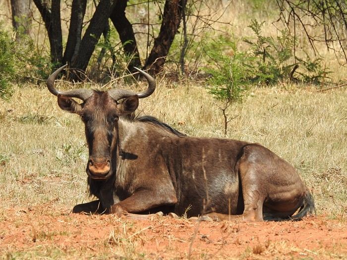
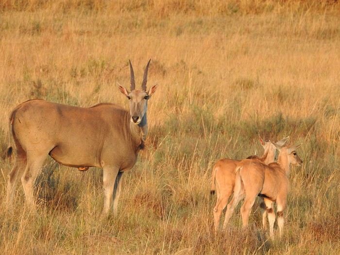
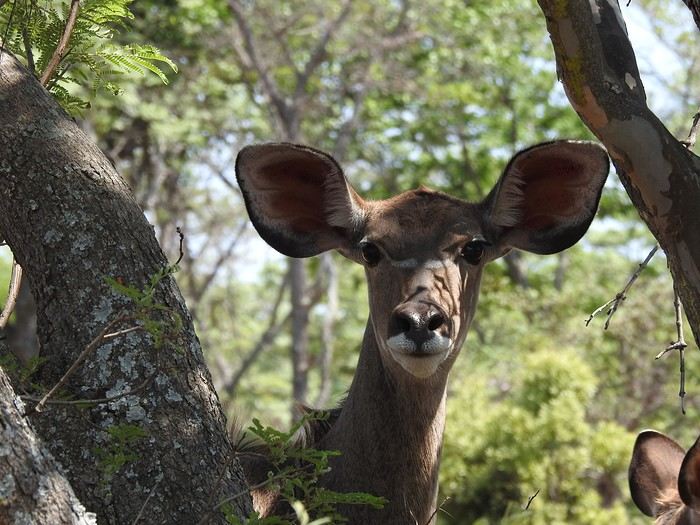
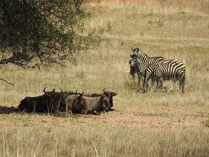
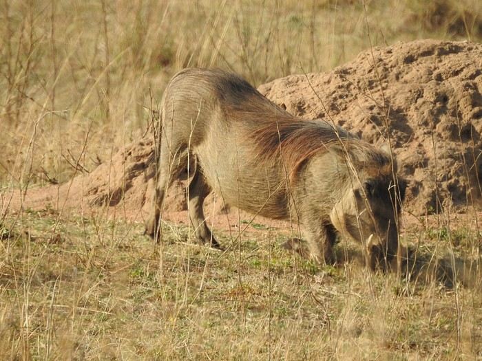
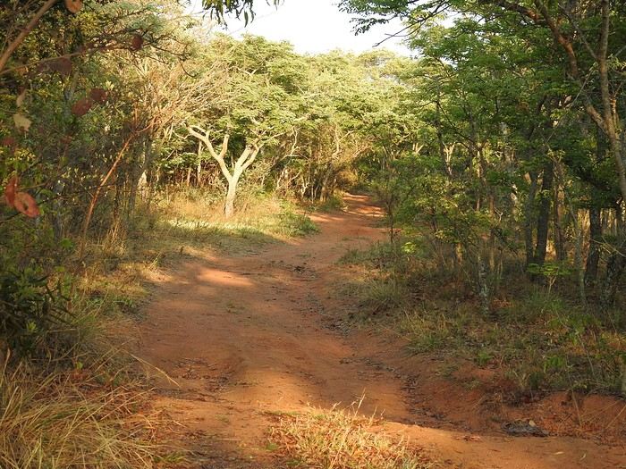
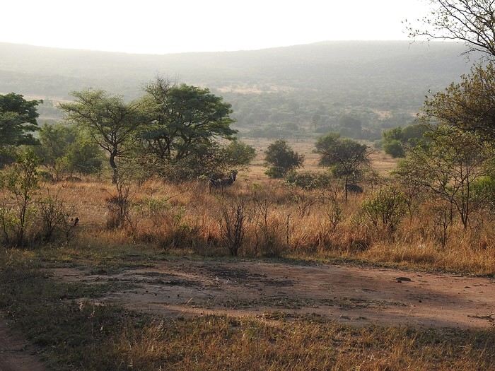
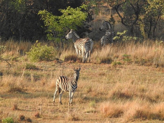

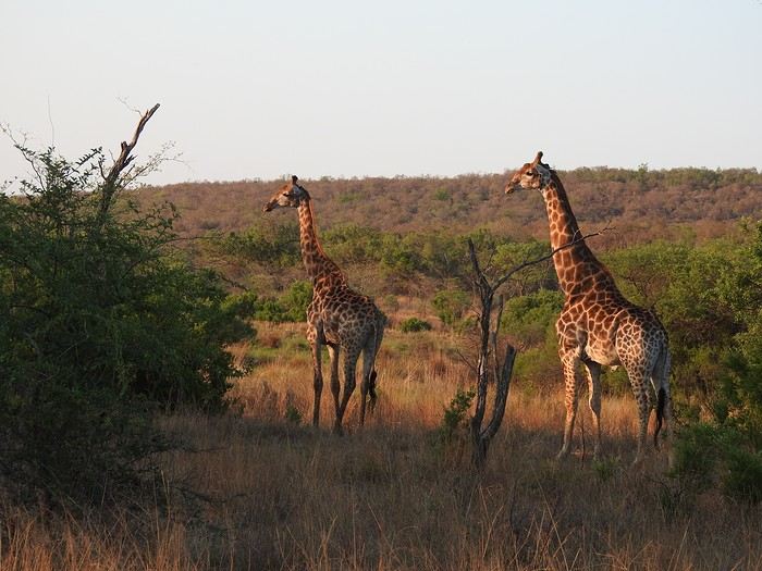
As often happens, old farms have been grouped together to create a nature reserve that doesn’t sell you "wild" lions, has no rhinos (protecting rhinos is complicated), no elephants, and no buffalo. So, antelopes, elusive leopards, hyenas (didn’t see any), peaceful giraffes, warthogs, etc.—just general game! What’s the point? Well, you go for walks or hikes with game drives... you bike... you chill. You get out of the car. For us this year, a gorgeous "house," fully equipped, on the edge of the forest, with wood for the fire and a plain as the view... An unbeatable quality-to-price ratio in a natural setting! A little photo dump for the vibe. You’ve gathered that part of the exploration is by car (it’s big) and part on foot...
Introduction
In this travel journal, you’ll find a list of all the activities we did during our road trip through the Gaspésie.
Videos are embedded throughout the summary. Just click on the image to start the video.
To jump to a specific post, here are the relevant links:
Gaspé - Forillon National Park - Interpretation Center Gaspé - Forillon National Park - Mont-Saint-Alban Trail Gaspé - Forillon National Park - La Chute Trail Gaspé - Forillon National Park - Les Graves Trail Percé - Rivière-aux-Émeraudes Waterfall Percé - Bonaventure Island National Park Percé - Hike at the Foot of Percé Rock Percé Geopark - Suspended Glass Platform Percé Geopark - Magic Forest Loop Percé Geopark - Belvedere Trails Percé Geopark - Springs and Les Pieds Croches Trails Percé Geopark - Crevasse Trail Percé Geopark - Grande Coupe Trail Percé Geopark - Grotto Path Bonaventure - Le Malin de la Rivière Bonaventure Maria - Grand Sault Waterfall Carleton-sur-Mer - Les Saults Waterfall - Éperlan Trail Matapédia - Two Rivers Belvedere Saint-Alexis-de-Matapédia - Dream Horizon Belvedere Saint-André-de-Restigouche - Heart of the Plateaus Belvedere Saint-André-de-Restigouche - Picot Waterfalls Saint-Alexis-de-Matapédia - Robitaille Stream Waterfalls Trail Saint-Alexandre-des-Lacs - Philomène Waterfall Saint-Ulric - Ti-Mé Waterfall
In this travel journal, you’ll find a list of all the activities we did during our road trip through the Gaspésie.
Videos are embedded throughout the summary. Just click on the image to start the video.
To jump to a specific post, here are the relevant links:
Gaspé - Forillon National Park - Interpretation Center Gaspé - Forillon National Park - Mont-Saint-Alban Trail Gaspé - Forillon National Park - La Chute Trail Gaspé - Forillon National Park - Les Graves Trail Percé - Rivière-aux-Émeraudes Waterfall Percé - Bonaventure Island National Park Percé - Hike at the Foot of Percé Rock Percé Geopark - Suspended Glass Platform Percé Geopark - Magic Forest Loop Percé Geopark - Belvedere Trails Percé Geopark - Springs and Les Pieds Croches Trails Percé Geopark - Crevasse Trail Percé Geopark - Grande Coupe Trail Percé Geopark - Grotto Path Bonaventure - Le Malin de la Rivière Bonaventure Maria - Grand Sault Waterfall Carleton-sur-Mer - Les Saults Waterfall - Éperlan Trail Matapédia - Two Rivers Belvedere Saint-Alexis-de-Matapédia - Dream Horizon Belvedere Saint-André-de-Restigouche - Heart of the Plateaus Belvedere Saint-André-de-Restigouche - Picot Waterfalls Saint-Alexis-de-Matapédia - Robitaille Stream Waterfalls Trail Saint-Alexandre-des-Lacs - Philomène Waterfall Saint-Ulric - Ti-Mé Waterfall
Hi everyone!
Blue skies (lots of them), whitewashed villages with steep alleyways, hundreds of churches, and... thousands of stairs? Welcome to the Cyclades! 🙂
We’d been dreaming about this for a while, but in July-August—with the crowds—no way! Now that I can travel outside school holidays, the Cyclades are back on the agenda. And so begins a loooong period of planning and second-guessing, with countless itinerary changes: the Cyclades, yes, but which ones? I was fixated on Folegandros (we won’t be going after all) and really wanted to visit Delos. So, for this first trip, it’ll be: Mykonos (and Delos)-Naxos-Amorgos-Santorini.
Saturday 24/05: Departure from Orly on a Transavia flight, arriving in Mykonos in the late afternoon. We found a hotel that offers free transfers (pretty rare and not insignificant—it’s 25 € each way for just a few kilometers 😠) and at a reasonable price (83 € per night for B&B). Time for dinner already: Greek salad and souvlaki (we’re in Greece, right?)
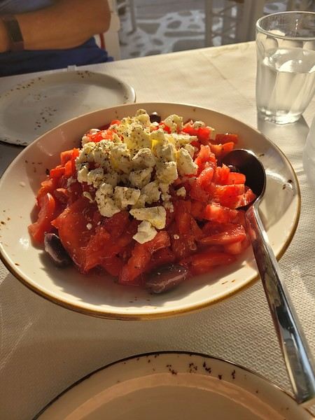 (Okay, this is actually a dakos with Naxos cheese, but I don’t have a photo of a Greek salad 😏).
Blue skies (lots of them), whitewashed villages with steep alleyways, hundreds of churches, and... thousands of stairs? Welcome to the Cyclades! 🙂
We’d been dreaming about this for a while, but in July-August—with the crowds—no way! Now that I can travel outside school holidays, the Cyclades are back on the agenda. And so begins a loooong period of planning and second-guessing, with countless itinerary changes: the Cyclades, yes, but which ones? I was fixated on Folegandros (we won’t be going after all) and really wanted to visit Delos. So, for this first trip, it’ll be: Mykonos (and Delos)-Naxos-Amorgos-Santorini.
Saturday 24/05: Departure from Orly on a Transavia flight, arriving in Mykonos in the late afternoon. We found a hotel that offers free transfers (pretty rare and not insignificant—it’s 25 € each way for just a few kilometers 😠) and at a reasonable price (83 € per night for B&B). Time for dinner already: Greek salad and souvlaki (we’re in Greece, right?)
(Okay, this is actually a dakos with Naxos cheese, but I don’t have a photo of a Greek salad 😏).Hey everyone,
A lot has happened in 4 years when it comes to travel. It wasn’t a little virus that would stop us from traveling, even if we sometimes had to adjust our destinations. So, I’m going to try to get back into posting travel journals, starting with destinations where there aren’t many recent stories.
I’ll begin with our trip of 2 weeks exploring the western part of Cuba. For those eager to read the story, I invite you to check out MyAtlas, where I started writing my travel journals during VoyageForum’s long hiatus: https://www.myatlas.com/Lofwyra/cuba-petit-detour-au-pays-du-mojito
Our itinerary, traveled in a 1954 classic American car with our driver Yoan, who spoke excellent French. I’ll add links to the posts as I write them.
2 nights in Habana Vieja - <<click here to go directly to the post>> 2 nights in Playa Larga** 2 nights in Cienfuegos** 3 nights in Trinidad*** 2 nights in Matanzas*** 3 nights in Viñales**** 1 night in Havana, downtown and Vedado
Before diving into the story, here are a few photos of what stood out to us beyond the usual sights of this country:
🙂 The birds, in large numbers—hummingbirds, pink flamingos, pelicans, and especially the tocororo, Cuba’s endemic bird, considered the national bird because the colors of its plumage match the Cuban flag.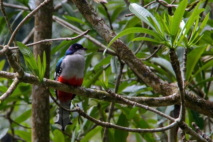
🙂 Matanzas, a city that doesn’t get much attention, sandwiched between Varadero and Havana. It doesn’t have the architectural splendor of Trinidad or Cienfuegos, some streets are really dirty, but it has a dynamic, lively vibe that really touched us.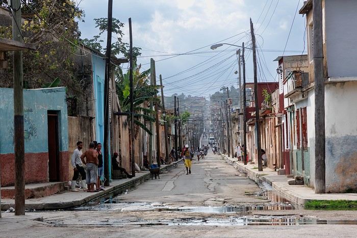
🙂 The ever-present blue, in the architecture, the cars, and the natural surroundings.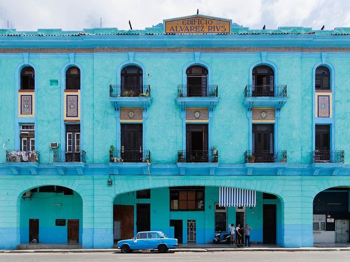
...and what we called the "Cuban style": rum and cigars in the company of Che 😎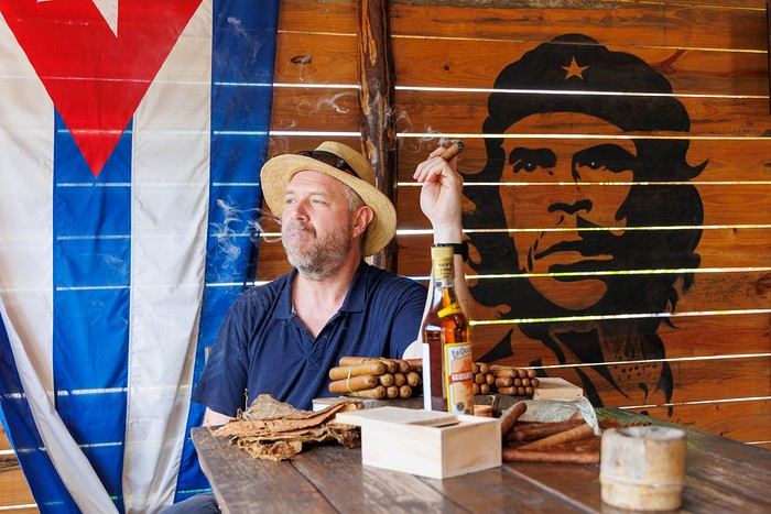
There’s still so much more to remember about this captivating and vibrant country, despite the economic crisis hitting Cubans hard... to be continued in the story.
Happy reading, Pascale
A lot has happened in 4 years when it comes to travel. It wasn’t a little virus that would stop us from traveling, even if we sometimes had to adjust our destinations. So, I’m going to try to get back into posting travel journals, starting with destinations where there aren’t many recent stories.
I’ll begin with our trip of 2 weeks exploring the western part of Cuba. For those eager to read the story, I invite you to check out MyAtlas, where I started writing my travel journals during VoyageForum’s long hiatus: https://www.myatlas.com/Lofwyra/cuba-petit-detour-au-pays-du-mojito
Our itinerary, traveled in a 1954 classic American car with our driver Yoan, who spoke excellent French. I’ll add links to the posts as I write them.
2 nights in Habana Vieja - <<click here to go directly to the post>> 2 nights in Playa Larga** 2 nights in Cienfuegos** 3 nights in Trinidad*** 2 nights in Matanzas*** 3 nights in Viñales**** 1 night in Havana, downtown and Vedado
Before diving into the story, here are a few photos of what stood out to us beyond the usual sights of this country:
🙂 The birds, in large numbers—hummingbirds, pink flamingos, pelicans, and especially the tocororo, Cuba’s endemic bird, considered the national bird because the colors of its plumage match the Cuban flag.
🙂 Matanzas, a city that doesn’t get much attention, sandwiched between Varadero and Havana. It doesn’t have the architectural splendor of Trinidad or Cienfuegos, some streets are really dirty, but it has a dynamic, lively vibe that really touched us.
🙂 The ever-present blue, in the architecture, the cars, and the natural surroundings.
...and what we called the "Cuban style": rum and cigars in the company of Che 😎
There’s still so much more to remember about this captivating and vibrant country, despite the economic crisis hitting Cubans hard... to be continued in the story.
Happy reading, Pascale
SIEM REAP
You can now rent scooters just about everywhere in Siem Reap, but at rip-off prices—$15–18 a day instead of $5–10 like everywhere else in Indochina. The best options are tuk-tuks or, even better, electric bikes ($12, but with a 50 km range, so they won’t let you go to Banteay Srei or the River of a Thousand Lingas in the Kulen Massif, which are too far). **WARNING:** Wear a helmet, or they *will* catch you. Scooters are banned from going from SR to the stunning temple of Koh Ker in the northeast and continuing to Battambang; no idea why!
My favorite little hotel in Siem Reap? The Neth Socheata, tucked in an alley off Thnou St near the market—lovely rooms, and the owner speaks great English. Then there’s the Ivy Guesthouse with its little garden, but it’s “always full,” according to the owner. For something upscale but still affordable, a fantastic spot is the Pavillon Indochine, tucked away on a quiet side street on the way to the airport—elegant, with incredible attention to decor, a terrace restaurant, garden, pool, etc. Everything you’d want for $70 including breakfast. I also spotted a hostel for backpackers, the Angkor Thom Hostel, with small 6-bed dorms for $4 with a fan or $6 with AC (18 Wat Bo St).
Food-wise, it’s all amazing! Pub Street has turned into a noise nightmare, with speakers blasting what’s supposed to be music but is just *boom, boom, boom, boom, boom*—run away, even though the pizzas at the Italian place Il Forno are really good. The famous and excellent Tigre de Papier has changed its name to Paper Tiger and is still just as good (lunch only, though, because across the street there’s a huge bar blasting *boom boom boom*, so you won’t be able to hear each other during dinner). On the other hand, the Italian-Cambodian El Toro on Pub Street is perfect, with fantastic pizzas and divine lasagna (go to the first-floor dining room—there’s a big bar across the street blasting *boom boom boom*, but at least you can still talk). Due to the lack of customers during COVID, all the French restaurants—Barrio (three times alas!), Les Deux Sœurs, Le Bel Air, and Le Mozart—have closed. The only one left is L’Olivier, which is pricey. I also discovered a great Moroccan restaurant (though run by a Sudanese man and his French wife), Le Tajine, on Strung Thmei St, 09 68 89 78 27. **WARNING:** For tagines and couscous, you need to order at least in the morning; wine and beer are fine. To get there, turn at the corner of the Cineplex behind the big market at the start of Sivatha Boulevard.
I finally went to the Khmer dance show. Beautiful dancers and dances, but **EAT BEFORE OR AFTER**—the meal is so awful that most Westerners leave it on their plates.
THE ANGKOR TEMPLES Use the excellent *Routard Cambodia* guide. Just a few tips: - Start with the pre-Angkorian Roluos group, 15 km before Siem Reap on the road to PP—it’s the “ancestor” of the temples.
- To avoid the big crowds at Angkor Wat, Bayon, and Ta Prohm, go between noon and 2 PM when everyone’s having lunch. - Speaking of lunch, the crowds flock to the hundred or so mediocre food stalls on the left side of Angkor Wat. Instead, head to Angkor Thom after the stunning Pre Rup temples, all the way to the small Sras Srang basin. Along the basin, there are several restaurants with terraces offering first-floor views of the water, and no crowds. Afterward, cross to the other side of the basin—you’ll end up in the countryside with charming villages where locals seem to live as they did during the temples’ golden age (at its peak, the population was estimated at 600,000–800,000, making it the largest city in the world. The theory for the abandonment is water shortages caused by overpopulation).
- I climbed Phnom Bakheng for the famous sunset, but the crowd was so ridiculous that instead of seeing the temple at sunset, you just see the heads and shoulders around you.
- There are tons of small temples that most people skip, and they’re missing out. My favorites: Thommanon, Neak Pean, Ta Som, and especially Pre Rup, an amazing brick complex with 14 towers.
**Big disappointment:** You can no longer climb to the first floor of Bayon, where you used to stand magically among the giant head statues. So, admire the beautiful bas-reliefs on the outside, but there’s no point going inside—you’ll just see a dark, square corridor with nothing interesting.
ANGKOR FURTHER AFIELD The wonderful Banteay Srei temple. A gem! I couldn’t find the bas-relief stolen by Malraux in the 1920s (fun fact: what he was doing in Indochina—stealing a bas-relief to sell for a fortune in France to cover his massive gambling debts on the stock market, where he ruined his very wealthy American wife—was an open secret. But the French authorities in Saigon, who hated him for his leftist views, decided to let him do it and catch him red-handed, which worked perfectly. He avoided jail only because all the leftist intellectuals in Saint-Germain, Sartre, Beauvoir, and co. cried scandal—though the real scandal was the looting).
30 km of excellent paved road further north, a great spot: the Kulen Massif and the River of a Thousand Lingas (at one point, you’ll come to a T-junction—turn left). Along the road at the foot of the massif, on your right, there’s a great restaurant, Bourey Sovann (where the food is excellent). The trail to the river starts just before it on the left. **Warning:** There are two sites for the River of a Thousand Lingas. One is accessible via a private road, so there’s a $20 toll, and you need to arrive before 11 AM because the road is narrow and traffic flows downhill after that. You’ll end up in a site full of shops, snack stalls, and two good restaurants, including one by a beautiful waterfall. However, the thousand lingas aren’t as spectacular there.
Banteay Srei + the River of a Thousand Lingas makes for a fantastic day. **WARNING:** You used to be able to go to the river and waterfall by scooter or tuk-tuk, but it’s now forbidden. So **go by taxi**—otherwise, you’ll be hiking 12 km round trip up a steep trail.
If you leave Siem Reap early, you can even add Beng Mealea temple on the way back, making a triangular route: SR-BS-Khulen-BM-SR (or the reverse).
If you have time, visit Banteay Samré temple, 10 km west of the Angkor Thom complex. A lovely site with very few visitors.
I’ve never been to the famous Preah Khan on a hill overlooking Thailand. There’s a big dispute between the two countries—the Thais insist the temple belongs to them because the entrance is in their country. There have been serious clashes in the recent past, and landmines are still abundant off the marked paths. They even claim the entire Siem Reap province is theirs and should be returned, arguing it was Thai in the past. It takes two days (6–7 hours each way), with an overnight stay in the nearby village (small hotels and one luxury option with a garden and pool, but it’s expensive).
TONLE SAP People talk about “floating villages,” but that’s a big mistake—these are actually villages of astonishing stilt houses, 4 meters high or more, due to the lake’s major floods. The most famous is Chong Khneas, which I skipped because it’s packed with tourists. Instead, I really liked Kampong Phluk, which is much quieter. To get there, continue on the road past the Roluos group until you reach a parking lot with pirogues lined up. They’ll take you down the river, stop at this amazing village for a walk, and then take you to the Tonle Sap, a true inland sea. At one point, you’ll pass through a flooded forest that you can explore by small boat. At the junction of the river and the Tonle Sap, and on the lake itself, there are floating restaurants where the food is great. Note that in the dry season, you can reach the village by scooter.
BACK TO PHNOM PENH AND ON TO SOUTHERN VIETNAM Since I’d planned at least 15 days in the Mekong Delta between Chau Doc and Saigon, I skipped Battambang, etc. With no desire to endure the dusty road from SR to PP again, I simply loaded my bike onto a bus with the great company Rith Monty (book at their office in SR on the small square at the start of Sivatha Boulevard—$10 for the bike and $6 for me), also known as Paramount. Their buses stop on 136 St right in the middle of PP. I’ll also mention the excellent Giant Ibis, with big modern buses that always leave on time—unlike the others.
I spent the night in PP, and the next morning took the fast boat from PP to Chau Doc with Hang Chau Tourist (buying the ticket the day before is recommended—$25—either at your hotel or the port, and they’ll pick you up at your hotel by tuk-tuk to take you to the port). Departure from PP at noon, arrival in Chau Doc around 4 PM. The boat is great—comfortable and fast. A crew member takes your passports for Cambodian exit formalities, and you handle Vietnamese immigration yourself—it all takes 15–20 minutes. The route isn’t on the Mekong but on the Bassac River to the border, then a wide north-south canal to Chau Doc (the arrival is really nice). In the Chau Doc-PP direction, the boat leaves Chau Doc at 7:30 AM.
My favorite little hotel in Siem Reap? The Neth Socheata, tucked in an alley off Thnou St near the market—lovely rooms, and the owner speaks great English. Then there’s the Ivy Guesthouse with its little garden, but it’s “always full,” according to the owner. For something upscale but still affordable, a fantastic spot is the Pavillon Indochine, tucked away on a quiet side street on the way to the airport—elegant, with incredible attention to decor, a terrace restaurant, garden, pool, etc. Everything you’d want for $70 including breakfast. I also spotted a hostel for backpackers, the Angkor Thom Hostel, with small 6-bed dorms for $4 with a fan or $6 with AC (18 Wat Bo St).
Food-wise, it’s all amazing! Pub Street has turned into a noise nightmare, with speakers blasting what’s supposed to be music but is just *boom, boom, boom, boom, boom*—run away, even though the pizzas at the Italian place Il Forno are really good. The famous and excellent Tigre de Papier has changed its name to Paper Tiger and is still just as good (lunch only, though, because across the street there’s a huge bar blasting *boom boom boom*, so you won’t be able to hear each other during dinner). On the other hand, the Italian-Cambodian El Toro on Pub Street is perfect, with fantastic pizzas and divine lasagna (go to the first-floor dining room—there’s a big bar across the street blasting *boom boom boom*, but at least you can still talk). Due to the lack of customers during COVID, all the French restaurants—Barrio (three times alas!), Les Deux Sœurs, Le Bel Air, and Le Mozart—have closed. The only one left is L’Olivier, which is pricey. I also discovered a great Moroccan restaurant (though run by a Sudanese man and his French wife), Le Tajine, on Strung Thmei St, 09 68 89 78 27. **WARNING:** For tagines and couscous, you need to order at least in the morning; wine and beer are fine. To get there, turn at the corner of the Cineplex behind the big market at the start of Sivatha Boulevard.
I finally went to the Khmer dance show. Beautiful dancers and dances, but **EAT BEFORE OR AFTER**—the meal is so awful that most Westerners leave it on their plates.
THE ANGKOR TEMPLES Use the excellent *Routard Cambodia* guide. Just a few tips: - Start with the pre-Angkorian Roluos group, 15 km before Siem Reap on the road to PP—it’s the “ancestor” of the temples.
- To avoid the big crowds at Angkor Wat, Bayon, and Ta Prohm, go between noon and 2 PM when everyone’s having lunch. - Speaking of lunch, the crowds flock to the hundred or so mediocre food stalls on the left side of Angkor Wat. Instead, head to Angkor Thom after the stunning Pre Rup temples, all the way to the small Sras Srang basin. Along the basin, there are several restaurants with terraces offering first-floor views of the water, and no crowds. Afterward, cross to the other side of the basin—you’ll end up in the countryside with charming villages where locals seem to live as they did during the temples’ golden age (at its peak, the population was estimated at 600,000–800,000, making it the largest city in the world. The theory for the abandonment is water shortages caused by overpopulation).
- I climbed Phnom Bakheng for the famous sunset, but the crowd was so ridiculous that instead of seeing the temple at sunset, you just see the heads and shoulders around you.
- There are tons of small temples that most people skip, and they’re missing out. My favorites: Thommanon, Neak Pean, Ta Som, and especially Pre Rup, an amazing brick complex with 14 towers.
**Big disappointment:** You can no longer climb to the first floor of Bayon, where you used to stand magically among the giant head statues. So, admire the beautiful bas-reliefs on the outside, but there’s no point going inside—you’ll just see a dark, square corridor with nothing interesting.
ANGKOR FURTHER AFIELD The wonderful Banteay Srei temple. A gem! I couldn’t find the bas-relief stolen by Malraux in the 1920s (fun fact: what he was doing in Indochina—stealing a bas-relief to sell for a fortune in France to cover his massive gambling debts on the stock market, where he ruined his very wealthy American wife—was an open secret. But the French authorities in Saigon, who hated him for his leftist views, decided to let him do it and catch him red-handed, which worked perfectly. He avoided jail only because all the leftist intellectuals in Saint-Germain, Sartre, Beauvoir, and co. cried scandal—though the real scandal was the looting).
30 km of excellent paved road further north, a great spot: the Kulen Massif and the River of a Thousand Lingas (at one point, you’ll come to a T-junction—turn left). Along the road at the foot of the massif, on your right, there’s a great restaurant, Bourey Sovann (where the food is excellent). The trail to the river starts just before it on the left. **Warning:** There are two sites for the River of a Thousand Lingas. One is accessible via a private road, so there’s a $20 toll, and you need to arrive before 11 AM because the road is narrow and traffic flows downhill after that. You’ll end up in a site full of shops, snack stalls, and two good restaurants, including one by a beautiful waterfall. However, the thousand lingas aren’t as spectacular there.
Banteay Srei + the River of a Thousand Lingas makes for a fantastic day. **WARNING:** You used to be able to go to the river and waterfall by scooter or tuk-tuk, but it’s now forbidden. So **go by taxi**—otherwise, you’ll be hiking 12 km round trip up a steep trail.
If you leave Siem Reap early, you can even add Beng Mealea temple on the way back, making a triangular route: SR-BS-Khulen-BM-SR (or the reverse).
If you have time, visit Banteay Samré temple, 10 km west of the Angkor Thom complex. A lovely site with very few visitors.
I’ve never been to the famous Preah Khan on a hill overlooking Thailand. There’s a big dispute between the two countries—the Thais insist the temple belongs to them because the entrance is in their country. There have been serious clashes in the recent past, and landmines are still abundant off the marked paths. They even claim the entire Siem Reap province is theirs and should be returned, arguing it was Thai in the past. It takes two days (6–7 hours each way), with an overnight stay in the nearby village (small hotels and one luxury option with a garden and pool, but it’s expensive).
TONLE SAP People talk about “floating villages,” but that’s a big mistake—these are actually villages of astonishing stilt houses, 4 meters high or more, due to the lake’s major floods. The most famous is Chong Khneas, which I skipped because it’s packed with tourists. Instead, I really liked Kampong Phluk, which is much quieter. To get there, continue on the road past the Roluos group until you reach a parking lot with pirogues lined up. They’ll take you down the river, stop at this amazing village for a walk, and then take you to the Tonle Sap, a true inland sea. At one point, you’ll pass through a flooded forest that you can explore by small boat. At the junction of the river and the Tonle Sap, and on the lake itself, there are floating restaurants where the food is great. Note that in the dry season, you can reach the village by scooter.
BACK TO PHNOM PENH AND ON TO SOUTHERN VIETNAM Since I’d planned at least 15 days in the Mekong Delta between Chau Doc and Saigon, I skipped Battambang, etc. With no desire to endure the dusty road from SR to PP again, I simply loaded my bike onto a bus with the great company Rith Monty (book at their office in SR on the small square at the start of Sivatha Boulevard—$10 for the bike and $6 for me), also known as Paramount. Their buses stop on 136 St right in the middle of PP. I’ll also mention the excellent Giant Ibis, with big modern buses that always leave on time—unlike the others.
I spent the night in PP, and the next morning took the fast boat from PP to Chau Doc with Hang Chau Tourist (buying the ticket the day before is recommended—$25—either at your hotel or the port, and they’ll pick you up at your hotel by tuk-tuk to take you to the port). Departure from PP at noon, arrival in Chau Doc around 4 PM. The boat is great—comfortable and fast. A crew member takes your passports for Cambodian exit formalities, and you handle Vietnamese immigration yourself—it all takes 15–20 minutes. The route isn’t on the Mekong but on the Bassac River to the border, then a wide north-south canal to Chau Doc (the arrival is really nice). In the Chau Doc-PP direction, the boat leaves Chau Doc at 7:30 AM.
Hi there,
My month in South Africa went really well. The itinerary revisits some places I’ve already seen—even a few times over...
Joburg – Marakele – Waterberg – Mapungubwe – Northern Kruger – Panorama Route – Southern Kruger – Eswatini (Hlane) – Maputaland (Sodwana Bay) – St Lucia – Joburg via Richards Bay.
I’ll skip some spots and focus on others.
Today’s topic: Marakele.
Back in 2009, I spent a day there, and since then... I’ve tried several times to go back.
The park isn’t very big—nowhere near as lush as Kruger—but it has a lot going for it. Even back then, there was a split between the western section, where you wouldn’t find any “dangerous” animals like elephants or buffalo (though rhinos were around), and the eastern section, the Big Five zone. Nowadays, the western part is open to mountain biking, and the campsite is completely unfenced, which pretty much confirms that the big animals aren’t there—no rhinos either (I didn’t see a single dung pile). The western section didn’t seem all that interesting to me... with vervet monkeys everywhere in the campsite. In the eastern part, there’s the Topli tented camp, right by a dam. It’s small but charming, with a great view and a loosely fenced perimeter (there are now lions and wild dogs in this area). No facilities—no restaurant, no pool (except at the campsite), no shop, no fuel, nothing...
View from the “chalet” terrace... nice and relaxed...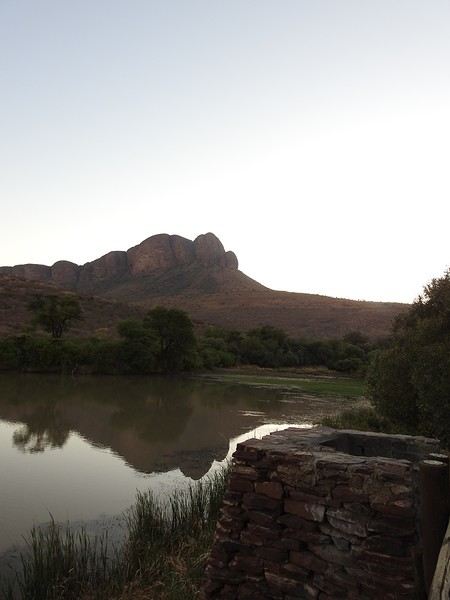

So, a terrace with a view for the lucky ones...
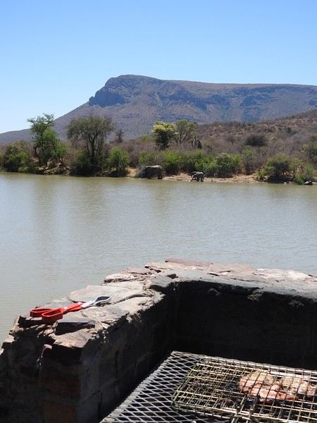
Bedroom and bathroom, separate and equipped kitchen. It can get windy. It must be cold in winter... but it’s hot this October.
Some lovely little roads... though some sections are 4x4-friendly.


A viewpoint at the top—you’re supposed to see the vulture colony from there... still haven’t seen it, as far as I’m concerned.

The animals?
My month in South Africa went really well. The itinerary revisits some places I’ve already seen—even a few times over...
Joburg – Marakele – Waterberg – Mapungubwe – Northern Kruger – Panorama Route – Southern Kruger – Eswatini (Hlane) – Maputaland (Sodwana Bay) – St Lucia – Joburg via Richards Bay.
I’ll skip some spots and focus on others.
Today’s topic: Marakele.
Back in 2009, I spent a day there, and since then... I’ve tried several times to go back.
The park isn’t very big—nowhere near as lush as Kruger—but it has a lot going for it. Even back then, there was a split between the western section, where you wouldn’t find any “dangerous” animals like elephants or buffalo (though rhinos were around), and the eastern section, the Big Five zone. Nowadays, the western part is open to mountain biking, and the campsite is completely unfenced, which pretty much confirms that the big animals aren’t there—no rhinos either (I didn’t see a single dung pile). The western section didn’t seem all that interesting to me... with vervet monkeys everywhere in the campsite. In the eastern part, there’s the Topli tented camp, right by a dam. It’s small but charming, with a great view and a loosely fenced perimeter (there are now lions and wild dogs in this area). No facilities—no restaurant, no pool (except at the campsite), no shop, no fuel, nothing...
View from the “chalet” terrace... nice and relaxed...
So, a terrace with a view for the lucky ones...
Bedroom and bathroom, separate and equipped kitchen. It can get windy. It must be cold in winter... but it’s hot this October.
Some lovely little roads... though some sections are 4x4-friendly.
A viewpoint at the top—you’re supposed to see the vulture colony from there... still haven’t seen it, as far as I’m concerned.
The animals?
We’ve read it all about Bali: mass tourism, non-stop parties, ferry disasters, the kingdom of “Instagrammers,” pollution, “Bali belly”... But luckily, this island isn’t just about Kuta’s beaches and the Lempuyang Temple.
Sure, it’s not as exotic or off-the-beaten-path as other Indonesian islands (the Moluccas, Timor, Flores...), but we spent 3 weeks there and loved it!
Our (planned) itinerary in 7 stops: - Ubud (4 nights) - Sidemen (2 nights) - Gili Meno (3 nights) - Amed (2 nights) - Pemuteran (4 nights) - Munduk (2 nights) - Jatiluwih (2 nights)
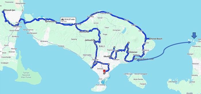
We booked our accommodations in advance, and for the rest (drivers, activities...), we took it day by day with help from the homestays (making sure to contact them a few days ahead via WhatsApp).
In the end, it’s an “easy” destination, very affordable, and one that’s managed to keep a certain authenticity.
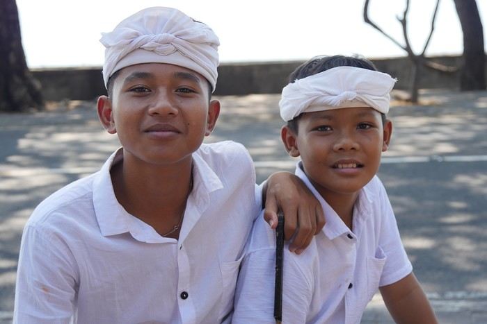
Sure, it’s not as exotic or off-the-beaten-path as other Indonesian islands (the Moluccas, Timor, Flores...), but we spent 3 weeks there and loved it!
Our (planned) itinerary in 7 stops: - Ubud (4 nights) - Sidemen (2 nights) - Gili Meno (3 nights) - Amed (2 nights) - Pemuteran (4 nights) - Munduk (2 nights) - Jatiluwih (2 nights)
We booked our accommodations in advance, and for the rest (drivers, activities...), we took it day by day with help from the homestays (making sure to contact them a few days ahead via WhatsApp).
In the end, it’s an “easy” destination, very affordable, and one that’s managed to keep a certain authenticity.
I’ve been busy—here’s another travel journal on Rajasthan, with some new discoveries as always.
Thursday, January 25: I left home at 4:30 AM and headed to Barcelona airport. The roads weren’t blocked by farmers yet, so I made the trip without any issues. I arrived at the airport at 7:10 AM, called Parkvia, and someone picked up my car 15 minutes later. All that was left was to check in my luggage. My Etihad flight was at 10:25 AM, which gave me time for breakfast. We landed in Abu Dhabi at 7:30 PM. The flight to Delhi was at 10:15 PM, the transfer went smoothly without any stress, and we arrived in Delhi at 3:00 AM. I couldn’t waste any time upon arrival because I had a flight to Jodhpur at 6:55 AM. I got to customs, and what a nice surprise—the hall was empty. I went through immediately, had my passport and visa checked, and everything was fine. I grabbed my bag quickly and looked for the transfer to T2, which is outside. You have to walk along the taxi parking lot and take the long corridors—it’s well signposted, and the transfer took 10 minutes. At first, I was a little stressed, not knowing how long customs would take, but in the end, I was early for my 6:55 AM flight. I’m even glad I booked this one, as it got me to Jodhpur at 8:20 AM.
When I arrived, I took an auto-rickshaw to Jodhpur Palace GH, which I’d booked on Booking. The welcome was nice, and I was given a room right away. I was hoping to rest a bit, but unfortunately, it was very noisy. I settled in, took a shower, and was ready to go out and explore the city. The owner stopped me as I was leaving and told me I had to change rooms—I had to repack my bag before heading out. He showed me the way to the clock tower, which is about a 15-minute walk away.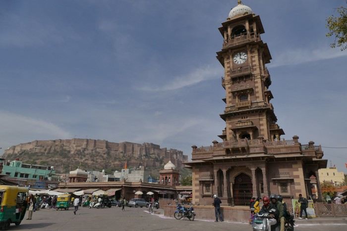
A market lines the street leading to the tower, and the traffic is intense.
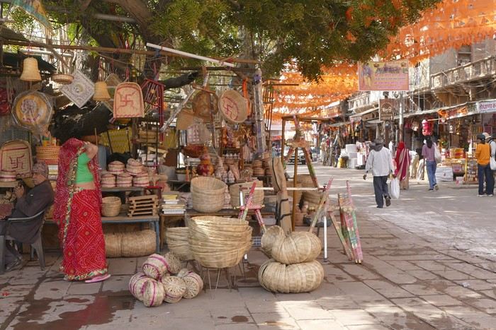
I set off in search of the stepwells and Gulab Sagar, a large basin with three water jets and a great view of Mehrangarh Fort. And yes, more baoris!
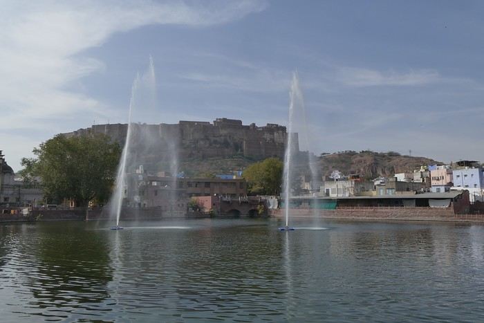
Toorji Ka Jhalra Bawdi isn’t far away. It’s a meet-up spot for tourists, with restaurants and terraces lining the area. The place is nice.
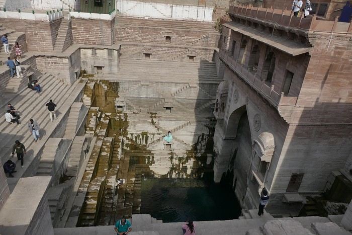
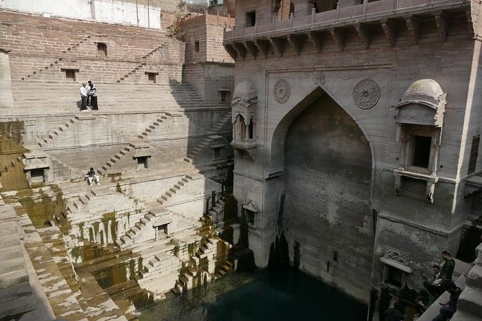
I looked for Mahila Bagh Ka Jhalra, went around in circles a bit, and finally found it right across from Gulab Sagar, where I’d already been. It’s not in good condition—it’s a shame it hasn’t been restored.
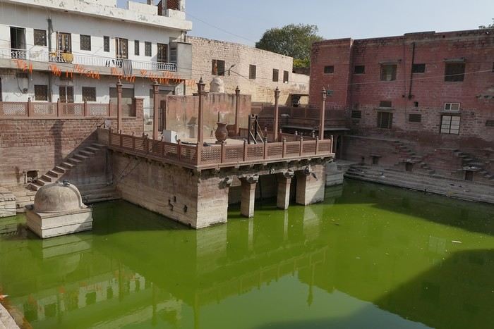
I went back through the clock tower area, found a currency exchange with a good rate, and booked my train tickets for the whole trip. The street was lively, with heavy traffic.
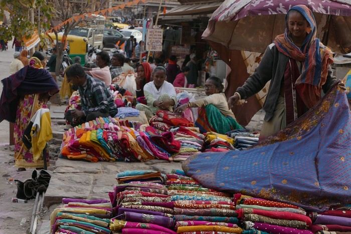
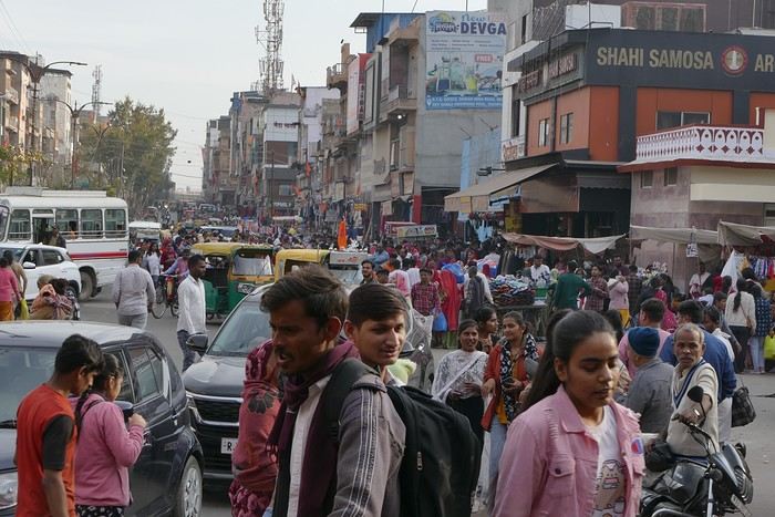
I was tired and headed back to the guesthouse. When I got there, I realized my phone wasn’t showing the right time, which gave me a chance to rest before going out for dinner. The Indigo restaurant is nearby and will be perfect.
Thursday, January 25: I left home at 4:30 AM and headed to Barcelona airport. The roads weren’t blocked by farmers yet, so I made the trip without any issues. I arrived at the airport at 7:10 AM, called Parkvia, and someone picked up my car 15 minutes later. All that was left was to check in my luggage. My Etihad flight was at 10:25 AM, which gave me time for breakfast. We landed in Abu Dhabi at 7:30 PM. The flight to Delhi was at 10:15 PM, the transfer went smoothly without any stress, and we arrived in Delhi at 3:00 AM. I couldn’t waste any time upon arrival because I had a flight to Jodhpur at 6:55 AM. I got to customs, and what a nice surprise—the hall was empty. I went through immediately, had my passport and visa checked, and everything was fine. I grabbed my bag quickly and looked for the transfer to T2, which is outside. You have to walk along the taxi parking lot and take the long corridors—it’s well signposted, and the transfer took 10 minutes. At first, I was a little stressed, not knowing how long customs would take, but in the end, I was early for my 6:55 AM flight. I’m even glad I booked this one, as it got me to Jodhpur at 8:20 AM.
When I arrived, I took an auto-rickshaw to Jodhpur Palace GH, which I’d booked on Booking. The welcome was nice, and I was given a room right away. I was hoping to rest a bit, but unfortunately, it was very noisy. I settled in, took a shower, and was ready to go out and explore the city. The owner stopped me as I was leaving and told me I had to change rooms—I had to repack my bag before heading out. He showed me the way to the clock tower, which is about a 15-minute walk away.
A market lines the street leading to the tower, and the traffic is intense.
I set off in search of the stepwells and Gulab Sagar, a large basin with three water jets and a great view of Mehrangarh Fort. And yes, more baoris!
Toorji Ka Jhalra Bawdi isn’t far away. It’s a meet-up spot for tourists, with restaurants and terraces lining the area. The place is nice.
I looked for Mahila Bagh Ka Jhalra, went around in circles a bit, and finally found it right across from Gulab Sagar, where I’d already been. It’s not in good condition—it’s a shame it hasn’t been restored.
I went back through the clock tower area, found a currency exchange with a good rate, and booked my train tickets for the whole trip. The street was lively, with heavy traffic.
I was tired and headed back to the guesthouse. When I got there, I realized my phone wasn’t showing the right time, which gave me a chance to rest before going out for dinner. The Indigo restaurant is nearby and will be perfect.