Hello fellow adventurers! :)
I’m writing this little message to the community and adventurers because I’m thinking of heading to Morocco (a country I know well) for a week in February (around the 6th or 10th, for about a week) to climb Mount Toubkal in the Atlas Mountains.
I’m used to hiking and backpacking, but this would be my first 4,000m peak.
I think the mountain landscapes are even more stunning in winter.
I know it’s necessary to hire a guide for this ascent.
Has anyone here already climbed it in winter? If so, any feedback or tips?
Also, if anyone wants to join me on this adventure, I’d love the company! :)
The idea would be to rent a car (around 10–15 € per day) and do some other hikes in the Marrakech area too.
Don’t hesitate to get in touch!
antoine.petiard@gmail.com - 0650536769
Looking forward to it, see you soon!
Antoine :)
1,278 similar discussions in English
Hi there,
We’ve just returned from 15 days in Cape Verde, including 8 days of hiking in Santo Antão. It was a fantastic trip with great weather and heat that stayed manageable. Everything was organized by a highly competent local agency that really listened to our requests. I’m happy to share more details about the hikes, hotels, etc. if you’d like!
Because of a miscalculation on extra costs (non-hotel expenses and transfers), I’ve got 18,000 escudos left—I’d be more than happy to exchange them for a more widely used currency!
We’ve just returned from 15 days in Cape Verde, including 8 days of hiking in Santo Antão. It was a fantastic trip with great weather and heat that stayed manageable. Everything was organized by a highly competent local agency that really listened to our requests. I’m happy to share more details about the hikes, hotels, etc. if you’d like!
Because of a miscalculation on extra costs (non-hotel expenses and transfers), I’ve got 18,000 escudos left—I’d be more than happy to exchange them for a more widely used currency!
Hi there,
Thanks for letting me know about the launch of the new VoyageForum.
I just want to say that I hope this fresh start has helped get rid of those rude people who thought they knew everything about every topic and would attack (and sometimes insult) participants who didn’t agree with them.
It was starting to feel like social media, where everyone thinks their own posts are the most accurate and truthful, and it was getting really tiresome—especially when all we really want to do is talk about travel.
So, my hope is that there’ll now be stricter moderation of exchanges between travelers.
Good luck with this new beginning!
Thanks for letting me know about the launch of the new VoyageForum.
I just want to say that I hope this fresh start has helped get rid of those rude people who thought they knew everything about every topic and would attack (and sometimes insult) participants who didn’t agree with them.
It was starting to feel like social media, where everyone thinks their own posts are the most accurate and truthful, and it was getting really tiresome—especially when all we really want to do is talk about travel.
So, my hope is that there’ll now be stricter moderation of exchanges between travelers.
Good luck with this new beginning!
I'm planning a trip to Sardinia in May 2025, visiting historical sites and the deep countryside: what are the most authentic places?
Hello,
We’re planning a trip to Zambia in 2 years. This will be our 4th trip to Southern Africa—the last one this year was Moremi, Boteti, KCGR, and KTP as a self-drive with campsites and no guide, just my wife and me. For this year’s trip, we prepared 2 years in advance—bookings are really complicated. We were lucky to get a spot at Bitterpan in KTP (there are only 4 chalets).
We’d like to know if it’s easy to get around Zambia, especially when it comes to restocking supplies. Should we rent a 4x4 in Zambia, Namibia, or South Africa? Botswana is very expensive. Which parks are the most interesting? We’re into wildlife photography.
Looking forward to hearing from you. Thanks in advance! Best regards, Jean-Marc
We’d like to know if it’s easy to get around Zambia, especially when it comes to restocking supplies. Should we rent a 4x4 in Zambia, Namibia, or South Africa? Botswana is very expensive. Which parks are the most interesting? We’re into wildlife photography.
Looking forward to hearing from you. Thanks in advance! Best regards, Jean-Marc
Hey everyone,
I’m sharing a slightly unusual travel journal with three goals. To make it work, this discussion should stay in the travel journal section so we can find it easily and keep adding info to existing posts.
This journal is meant to help "newbies" discover these magical places.
We go to Southern Africa not just for the animals, but also for that soft light, the atmosphere, and those incredible wild campsites where you feel so at home... I’d love for you all to share your favorite spots here—those we miss so much.
The last goal is figuring out how to photograph them. Honestly, I’m not happy with my photos because they don’t capture the feeling I get when I’m there or that unique atmosphere.
I’ll start with one of the first spots that, for me, is one of the most beautiful in Southern Africa: Passarge Valley 2 in the Central Kalahari. There, you’re alone—completely alone. The next campsite is over 25 km away, and that’s a half-day of 4x4 driving. In front of you, there’s nothing but the CKGR plains with herds of springboks... absolutely stunning 😎

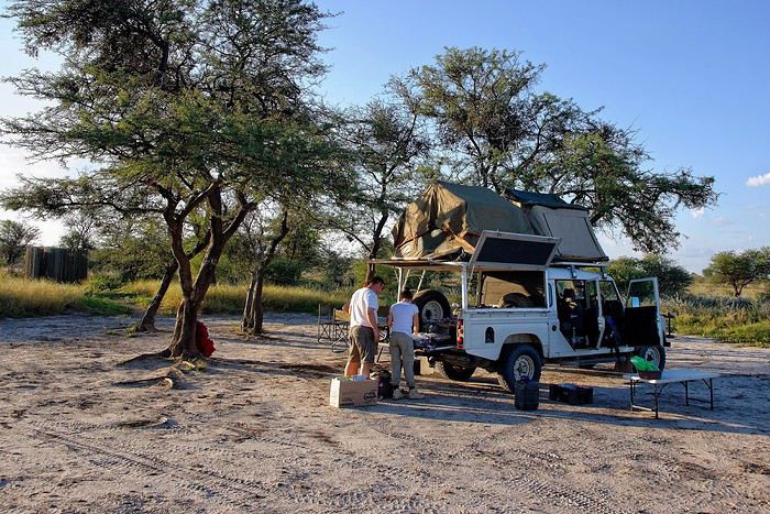
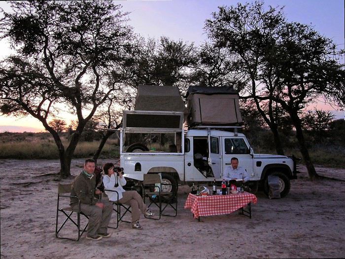
I’m sharing a slightly unusual travel journal with three goals. To make it work, this discussion should stay in the travel journal section so we can find it easily and keep adding info to existing posts.
This journal is meant to help "newbies" discover these magical places.
We go to Southern Africa not just for the animals, but also for that soft light, the atmosphere, and those incredible wild campsites where you feel so at home... I’d love for you all to share your favorite spots here—those we miss so much.
The last goal is figuring out how to photograph them. Honestly, I’m not happy with my photos because they don’t capture the feeling I get when I’m there or that unique atmosphere.
I’ll start with one of the first spots that, for me, is one of the most beautiful in Southern Africa: Passarge Valley 2 in the Central Kalahari. There, you’re alone—completely alone. The next campsite is over 25 km away, and that’s a half-day of 4x4 driving. In front of you, there’s nothing but the CKGR plains with herds of springboks... absolutely stunning 😎
My wife bought a flight ticket (Lucky Air) under her Thai maiden name and was issued a Chinese visa on her new Thai passport but with her French married name (due to administrative requirements). She was denied boarding by the airline in Bangkok for the flight to Kunming—resulting in the loss of our round-trip flight tickets, including mine since we were traveling together—despite presenting both passports at the airline counter at the same time.
Hi everyone,
I’m heading to Uganda in January.
I’ll be backpacking and using local transport as much as possible.
I plan to do the Rwenzori Mountains and see the gorillas.
Can you hire guides on the spot, or should I book accommodations in advance? I’d love any tips.
Thanks
Hey everyone,
I’m heading to Georgia for a month in October. I’m currently looking for a Georgian Assimil course, but it seems like it’s no longer published. I’ve scoured the internet but can’t find a used one. So my questions are:
- Do you know where I might find a used one somewhere?
- Do you know of a nice equivalent to Assimil for Georgian?
It’s just to get a few basic phrases, be able to read some signs, etc., because with only English and French, I think I might be a bit stuck sometimes.
Thanks!
simon
I’m heading to Georgia for a month in October. I’m currently looking for a Georgian Assimil course, but it seems like it’s no longer published. I’ve scoured the internet but can’t find a used one. So my questions are:
- Do you know where I might find a used one somewhere?
- Do you know of a nice equivalent to Assimil for Georgian?
It’s just to get a few basic phrases, be able to read some signs, etc., because with only English and French, I think I might be a bit stuck sometimes.
Thanks!
simon
Good evening everyone,
This is my 15,000th post, and it's a message I would have preferred never to write.
Patrick—Yangguizi—won’t be returning from his trek in Uganda. His health betrayed him in the mountains.
Like many of you, I laughed until I couldn’t anymore at his travel stories. I met him in Shanghai, then in Istanbul... We scoured restaurants—he was an incredible expert on world cuisines. We relived Korea, China. Always brilliant, so sharp, so funny, so down-to-earth. Being even a little bit his friend was something to be proud of. I think I envied him.
Patrick is still out there, of course... He found his happiness running across the world. He’s on his path. He never doubted that "the traveler doesn’t even know if he’ll return one day."
Not sure this would’ve suited him, but his departure devastates me.
Alright, Farewell, you foreign devil. Safe travels.
Michel
This is my 15,000th post, and it's a message I would have preferred never to write.
Patrick—Yangguizi—won’t be returning from his trek in Uganda. His health betrayed him in the mountains.
Like many of you, I laughed until I couldn’t anymore at his travel stories. I met him in Shanghai, then in Istanbul... We scoured restaurants—he was an incredible expert on world cuisines. We relived Korea, China. Always brilliant, so sharp, so funny, so down-to-earth. Being even a little bit his friend was something to be proud of. I think I envied him.
Patrick is still out there, of course... He found his happiness running across the world. He’s on his path. He never doubted that "the traveler doesn’t even know if he’ll return one day."
Not sure this would’ve suited him, but his departure devastates me.
Alright, Farewell, you foreign devil. Safe travels.
Michel
I have two questions about applying for a Non-Immigrant O Visa at the Thai embassy in France for someone over 50:
- - Do I need to provide the address(es) of stay in Thailand (hotels, staying with a Thai friend)?
- - Financial proof: Is a retirement statement showing over 2,000 € per month sufficient, or are bank statements also required?
I know there’s already a lot of information about the visa requirements on the embassy’s website, but from my experience—having dealt with embassies in other countries in previous years—I know that the information is sometimes (!) incomplete or inconsistent. So, I’d rather hear from people who’ve recently gone through this process to avoid any surprises after submitting my application, which could cause unpleasant delays.
I know there’s already a lot of information about the visa requirements on the embassy’s website, but from my experience—having dealt with embassies in other countries in previous years—I know that the information is sometimes (!) incomplete or inconsistent. So, I’d rather hear from people who’ve recently gone through this process to avoid any surprises after submitting my application, which could cause unpleasant delays.
Hi there,
On this forum, I shared my first trip to Tunisia from mid-February to early March (https://voyageforum.com/forum/impressions-tunisiennes-en-direct-d11460662/), a stay I enjoyed so much that six weeks later, I’m back in Tunisia for a full 15 days (I return on April 27).
This time, I landed in Monastir on a direct flight from Nice, again with Tunisair. We left about ten minutes late, and the flight lasted around 1 hour 30 minutes. A meal was served on board (cucumber salad with Edam-like cheese, carrots, and two small portions of dishes I couldn’t identify—semolina with peppers, olives, and parsley, two small rolls, a square of processed cheese, and a chocolate cake). It’s worth noting because it’s not common on flights this short.
In February, France and Tunisia were in the same time zone, but now Tunisia is one hour behind. This time difference and the flight duration work perfectly for a short 15-day trip since it takes me a few days to adjust to jet lag.
Luckily, I’d asked my hotel about the taxi fare from the airport because the drivers (there were several around me) didn’t hesitate to quote outrageous prices. The actual fare is 20 dinars, but one asked for 120 dinars. I refused, and another offered 60 dinars. I replied, "That’s too expensive—I’ll take the metro!" (Having tried the Tunis metro, I had no desire to repeat the experience in Monastir with a suitcase!). I started walking toward the metro, and one of the drivers caught up with me, saying, "20 dinars is fine!" I’ll skip the details, but the negotiation took a little while. When I arrived at the hotel, I told the receptionist someone had asked for 120 dinars. He put his hands to his head and said, "They’re awful!" He remembered our phone call two days earlier when I’d booked (he’s the one who told me I could take the metro).
The Mezri Hotel isn’t expensive. I got a sea-view room for 75 dinars (22 €). (I’d booked a balcony room for 90 dinars but wouldn’t have had time to enjoy it.) It’s well-located but noisy because there’s no double glazing. The receptionist is a very kind older gentleman. He called a friend whose wife is from Tozeur to find out if I should take a bus or a *louage* tomorrow and what time.
I arrived at the hotel around 7:00 PM and had time to stroll along the corniche to the ribat. Despite some run-down buildings, the seaside seemed livelier and cheerier than Sousse’s.
Monastir is the hometown of former president Bourguiba. I passed his mausoleum by taxi. There are Tunisian flags along the avenue by the sea because every year on April 6—the anniversary of Habib Bourguiba’s death—the president of the Republic visits the Bourguiba Mausoleum in Monastir to pay respects.
The taxi driver mentioned other Tunisian presidents. He complained about rising prices and insecurity, blaming President Kaïs Saïed (I’d already heard that security was better under Ben Ali).
At the end of my stay, I’ll take time to explore Monastir, but tomorrow morning, I’m off to Tozeur—a long bus ride awaits me.
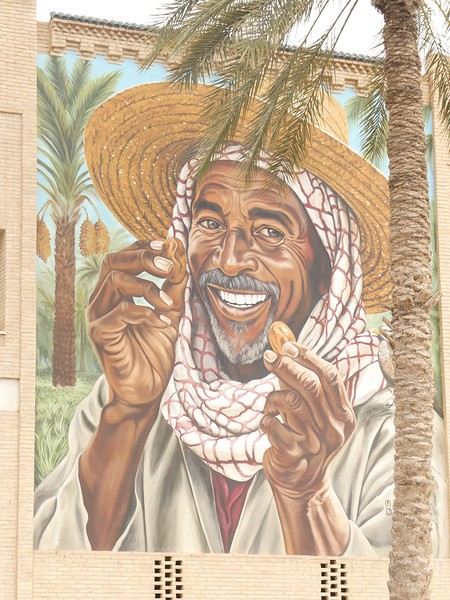

TO BE CONTINUED....
On this forum, I shared my first trip to Tunisia from mid-February to early March (https://voyageforum.com/forum/impressions-tunisiennes-en-direct-d11460662/), a stay I enjoyed so much that six weeks later, I’m back in Tunisia for a full 15 days (I return on April 27).
This time, I landed in Monastir on a direct flight from Nice, again with Tunisair. We left about ten minutes late, and the flight lasted around 1 hour 30 minutes. A meal was served on board (cucumber salad with Edam-like cheese, carrots, and two small portions of dishes I couldn’t identify—semolina with peppers, olives, and parsley, two small rolls, a square of processed cheese, and a chocolate cake). It’s worth noting because it’s not common on flights this short.
In February, France and Tunisia were in the same time zone, but now Tunisia is one hour behind. This time difference and the flight duration work perfectly for a short 15-day trip since it takes me a few days to adjust to jet lag.
Luckily, I’d asked my hotel about the taxi fare from the airport because the drivers (there were several around me) didn’t hesitate to quote outrageous prices. The actual fare is 20 dinars, but one asked for 120 dinars. I refused, and another offered 60 dinars. I replied, "That’s too expensive—I’ll take the metro!" (Having tried the Tunis metro, I had no desire to repeat the experience in Monastir with a suitcase!). I started walking toward the metro, and one of the drivers caught up with me, saying, "20 dinars is fine!" I’ll skip the details, but the negotiation took a little while. When I arrived at the hotel, I told the receptionist someone had asked for 120 dinars. He put his hands to his head and said, "They’re awful!" He remembered our phone call two days earlier when I’d booked (he’s the one who told me I could take the metro).
The Mezri Hotel isn’t expensive. I got a sea-view room for 75 dinars (22 €). (I’d booked a balcony room for 90 dinars but wouldn’t have had time to enjoy it.) It’s well-located but noisy because there’s no double glazing. The receptionist is a very kind older gentleman. He called a friend whose wife is from Tozeur to find out if I should take a bus or a *louage* tomorrow and what time.
I arrived at the hotel around 7:00 PM and had time to stroll along the corniche to the ribat. Despite some run-down buildings, the seaside seemed livelier and cheerier than Sousse’s.
Monastir is the hometown of former president Bourguiba. I passed his mausoleum by taxi. There are Tunisian flags along the avenue by the sea because every year on April 6—the anniversary of Habib Bourguiba’s death—the president of the Republic visits the Bourguiba Mausoleum in Monastir to pay respects.
The taxi driver mentioned other Tunisian presidents. He complained about rising prices and insecurity, blaming President Kaïs Saïed (I’d already heard that security was better under Ben Ali).
At the end of my stay, I’ll take time to explore Monastir, but tomorrow morning, I’m off to Tozeur—a long bus ride awaits me.
TO BE CONTINUED....
Hi everyone, it’s been a while since I last posted!
First time in South America for me, my wife, and our 7-year-old son. I’ve put together this itinerary and would love to hear your thoughts:
Bogotá 28/07 – 30/07: Arrival. Which neighborhood and outings would you recommend? Flight to
2 Filandia 30/07 – 03/08: (255 €). Waterfalls and horseback riding, Cocora Valley, Hiking, Nearby villages. Flight to 3 Tayrona 03/08 – 07/08: Hotel La Casablanca
Hike with Tierra Nevada and the Kogui village (any feedback?). Return by inner tube for the little one. Short night hike. Second hike to La Piscina, etc., return by 🐎.
4 Cartagena 07/08 – 10/08: Air-conditioned bus. Staying in Getsemaní? Mangroves & the Castle, exploring the city.
5 Bogotá 10/08 – 12/08
Feel free to share your feedback! Have a great day!
Seb
First time in South America for me, my wife, and our 7-year-old son. I’ve put together this itinerary and would love to hear your thoughts:
Bogotá 28/07 – 30/07: Arrival. Which neighborhood and outings would you recommend? Flight to
2 Filandia 30/07 – 03/08: (255 €). Waterfalls and horseback riding, Cocora Valley, Hiking, Nearby villages. Flight to 3 Tayrona 03/08 – 07/08: Hotel La Casablanca
Hike with Tierra Nevada and the Kogui village (any feedback?). Return by inner tube for the little one. Short night hike. Second hike to La Piscina, etc., return by 🐎.
4 Cartagena 07/08 – 10/08: Air-conditioned bus. Staying in Getsemaní? Mangroves & the Castle, exploring the city.
5 Bogotá 10/08 – 12/08
Feel free to share your feedback! Have a great day!
Seb
Hi everyone,
It’s been a while since I last posted... so I’m jumping back in with this amazing trip we took in October 2025:
We’re doing this trip with fellow traveler friends who, like us, have already been to Japan. That means we can aim for a different side of Japan, away from the usual tourist circuits. That’s why I opted to rent a car instead of relying on trains. I was drawn to the castles and the samurai-novel atmosphere.
When I plotted the sites I wanted to visit on Google Maps, it suggested a return route via the island of Shikoku, so it turned into a nice loop around the Seto Inland Sea between Kyushu, Chugoku, and Shikoku.
The trip will be just the four of us, doing it all independently. I rented a car from Budget in Fukuoka. Before heading over, I watched several videos to get an idea of what to expect—road signs, parking, and general driving behavior. In Japan, they drive on the left, but that’s not an issue since in Southern Africa we also drive on the “wrong side of the road,” so I’m used to it. For accommodations, after checking with two agencies, I decided to handle it myself. It saved a significant amount of money, and I was able to choose exactly what I wanted. I know I can be picky about the type of lodging I want, especially in Japan where you can really treat yourself. We stayed in some stunning ryokans, once in little cabins run by monks next to a temple, and more.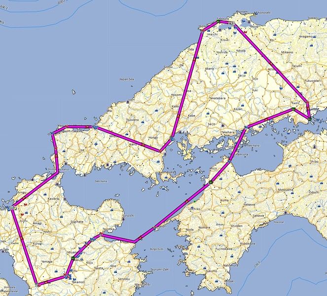
Here’s the route: Fukuoka - Hagi - Miyajima - Matsue - Okayama - Kurashiki - Matsuyama - Yufuin - Kurokawa - Kumamoto - Fukuoka
Here we gooo...
It’s been a while since I last posted... so I’m jumping back in with this amazing trip we took in October 2025:
We’re doing this trip with fellow traveler friends who, like us, have already been to Japan. That means we can aim for a different side of Japan, away from the usual tourist circuits. That’s why I opted to rent a car instead of relying on trains. I was drawn to the castles and the samurai-novel atmosphere.
When I plotted the sites I wanted to visit on Google Maps, it suggested a return route via the island of Shikoku, so it turned into a nice loop around the Seto Inland Sea between Kyushu, Chugoku, and Shikoku.
The trip will be just the four of us, doing it all independently. I rented a car from Budget in Fukuoka. Before heading over, I watched several videos to get an idea of what to expect—road signs, parking, and general driving behavior. In Japan, they drive on the left, but that’s not an issue since in Southern Africa we also drive on the “wrong side of the road,” so I’m used to it. For accommodations, after checking with two agencies, I decided to handle it myself. It saved a significant amount of money, and I was able to choose exactly what I wanted. I know I can be picky about the type of lodging I want, especially in Japan where you can really treat yourself. We stayed in some stunning ryokans, once in little cabins run by monks next to a temple, and more.
Here’s the route: Fukuoka - Hagi - Miyajima - Matsue - Okayama - Kurashiki - Matsuyama - Yufuin - Kurokawa - Kumamoto - Fukuoka
Here we gooo...
Hi,
Many of us have noticed that bugs have been making it difficult to navigate the forum lately.
I’ll let Kate and Ticapi explain the issue:
I went to your profile to check out the Thailand travel journal, and when I clicked on it, it brought me back here again. All week, I’ve been dealing with bugs like this—it’s really discouraging from continuing on VF.🙁
I had the same thing happen, and multiple times. For me, it was Montagnard’s latest journal that kept coming up no matter which discussion I clicked on.
Hopefully, a solution will be found soon.🙂
Many of us have noticed that bugs have been making it difficult to navigate the forum lately.
I’ll let Kate and Ticapi explain the issue:
I went to your profile to check out the Thailand travel journal, and when I clicked on it, it brought me back here again. All week, I’ve been dealing with bugs like this—it’s really discouraging from continuing on VF.🙁
I had the same thing happen, and multiple times. For me, it was Montagnard’s latest journal that kept coming up no matter which discussion I clicked on.
Hopefully, a solution will be found soon.🙂
Introduction
We stayed on the island of Gran Canaria during the first three months of 2024. It’s the third Canary Island we’ve visited, after Tenerife and Lanzarote.
We rented an apartment in Temisas. By staying in the same place for such a long period, the total price dropped by 50%.
We also rented a vehicle to make getting around the island easier.
Why the Canary Islands, and Gran Canaria in particular? For its pleasant climate, the nature and diversity of its landscapes, the charming villages, and especially the beauty of its many beaches.
In this travel journal, you’ll find a list of the many activities we did during our stay to explore the different attractions of this island.
These attractions are categorized to make it easier to find what interests you.
Videos are included throughout the summary. Click on the image to start the video.
To jump to a specific post, here are the relevant links:
HIKES:
Roque Nublo Maspalomas Dunes - Part 1 Maspalomas Dunes - Part 2 Los Azulejos de Veneguera Barranco de Las Vacas Ventana del Bentayga (Arco del Aserrador) Caves of the King Ventana de Morro (Ventana de la Ganifa) The Dog of Bentayga Cave of the Four Doors Ventana del Nublo Artenera - Caves of Acusa Seca Temisas - El Gigante Cave Fortress of Ansite Puerto de Las Nieves - Roque de Las Nieves Temisas - Cuevas de la Audiencia Roque Bentayga Guayadeque Ravine (Guayadeque Hermitage) Guayadeque Ravine (Cueva de Bartalo) El Zumacal - Barranco Tauco Casablanca Dam (Los Dolores Dam) Ayagaures - La Angostura Dam & Gambuesa Dam Santa Brígida - Alonso Ravine & Centennial Dragon Tree Pino Santo Hike in the Azuaje Ravine Gáldar - Red Lands of Samarrita Tejeda - Charco de La Paloma Bandama Boiler (Camino Borde de Caldera Bandama) Teror - Alamo Ravine Trail – SL-4 Telde - Calasio Caves Special Natural Reserve of Los Tilos de Moya Los Azulejos - Charco de Las Aneas Fataga Ravine Arinaga Military Battery Trail Maspalomas - Las Fuentes and del Canizo Ravines Mogán - Tauro Mountain Trail Tamabada - Llanos de La Mimbre & Sobre la Cueva Viewpoints Trail Hike to the Coronadero Arch via Barranco Hondo Barranco de Silva - Hike to the Jerez Caves Gáldar - Samson Cave - La Atalaya Peak Agaete - Roque Guayedra and Guayedra Ravine Artenara - Caballero Caves Arucas - Bufadero Salt Flats Barranco de Pino Gordo - Natural Pools Telde - Los Cernícalos Ravine Las Cruces - Toba Caves & Picón Puerto de Las Nieves - Moro Cave Agüimes - Morros de Ávila Caves Juncalillo del Sur - Laguna & Salinas de Abajo Caves of Camino de San Felipe Cruz de Tejeda, Cruz Chico and Degollada Viewpoint Hike on the Patalavaca Circuit Motor Grande - Puerto Rico Arch El Montañón - Los Hornos Dam Seafront Walk - Amadores Beach – Puerto Rico Beach Las Niñas Dam El Hornillo - Omega & Omicron Caves Arteara Necropolis Mogán - El Mulato Dam Las Garzas - El Regante Dam La Plata Route - Cho Flores Dam & El Charco Hondo Vega de Acusa - La Candelaria Dam Candelaria Hermitage – Acusa Seca Viewpoint Valsequillo de Gran Canaria – Roque La Vela Ayagaures Dam – GC-602 Lomo del Palo - Monte Pavón Trail Lugar La Laguna - Levada Fataga Dam & Ravine
BEACHES:
Mogán Beach Taurito Beach Tauro Beach Amadores Beach Puerto Rico Beach Anfi del Mar Beach Patalavaca Beach Meloneras Beach Maspalomas Beach English Beach (Playa del Inglés) Las Burras Beach San Agustin Beach Las Alcaravaneras Beach Las Canteras Beach (La Cicer) Las Canteras Beach (La Puntilla) Las Canteras Beach (Santa Catalina) Aquamarina Beach El Agujero - Bocabarranco Beach Hoya Del Pozo Beach Hoya Del Pozo Beach - Lizard with amputated tail El Cabron Beach Ojos de Garza Beach El Burrero Beach
NATURAL POOLS:
Charco Azul - El Risco Agaete Salt Flats Charco de Los Espejos - Sardina del Norte Natural Pools of Punta de Gáldar Snorkeling in the natural pool of Punta de Gáldar Natural Pool La Furnia o El Clavo - Gáldar Natural Pool of Los Dos Roques Emiliano Natural Pool - El Agujero Natural Pool of El Agujero Natural Pools of Roque Prieto Natural Pool El Altillo Los Charcones de Bañaderos – Arucas Natural Pools of El Charco de Las Palomas – Arucas Natural Pools of La Laja - Las Palmas de Gran Canaria Cueva de la Reina Mora - La Garita Natural Pools of Castillo del Romeral
TOWNS:
Center
Santa Brigida Vega de San Mateo Tejeda Artenara Vallesco Teror
Southwest
Santa Lucia de Tirajana Fataga San Bartolomé de Tirajana Puerto de Mogán La Aldea de San Nicolas
North
Arucas Firgas Moya Santa Maria de Guia Gáldar Agaete Puerto de Las Nieves
East
Vegueta - Las Palmas de Gran Canaria Triana - Las Palmas de Gran Canaria Ciudad Jardin - Las Palmas de Gran Canaria Canteras - Las Palmas de Gran Canaria Telde Valsequillo de Gran Canaria Ingenio Agüimes Temisas
VIEWPOINTS:
GC-60 Route (or nearby) GC-210 Route (or nearby) GC-210 Route between the tunnel and La Aldea de San Nicolás GC-215 & GC-65 Routes (or nearby) GC-200 Route (or nearby) GC-130 Route (or nearby) & GC-605 GC-70 Route (or nearby) & GC-21 Sheep herd on GC-70 Route GC-150, GC-240, GC-305, GC-350 & GC-301 Routes GC-606, GC-295, GC-231 and GC-41 Routes (or nearby) Viewpoints – GC-1 Route (or nearby) Viewpoints - Las Palmas de Gran Canaria Viewpoints - GC-2, GC-21, GC-15, GC-216 and GC-132 Routes (or nearby) Viewpoints - GC-503 & GC-217 Routes Viewpoints - GC-604, GC-505, GC-132, GC-42 and GC-802 Routes
MISCELLANEOUS:
San Rafael Aqueduct - Telde Abandoned San Rafael Estate - La Higuera Cenobio de Valerón La Cesta - Tejeda Puerto de la Aldea Scenic Route GC-671 to El Espinillo Scenic Route GC-607 to El Chorrillo The Galdar Cube (Santiago Quarry) Scenic Route GC-504 to Ayagaures Abandoned seaside resort in the Azuaje Ravine El Bufadero de La Garita – Telde GC-505 Route Abandoned Finca Las Haciendas (Los Mocanes) – Las Vegas de Valsequillo Ruins of San Juan Battery - Las Palmas de Gran Canaria Viera y Clavijo Canarian Botanical Garden - Las Palmas de Gran Canaria Tenefé Salt Flats Los Pérez, Lugarejos & Las Hoyas Dams Monte Pavón, Gran Canaria’s little Ireland Valleseco Lagoon Recreational Area Climbing - Fataga Ravine Surfing – El Agujero El Cairete Restaurant - Carrizal de Tejeda Paragliding flight observation - Los Giles La Cuevita Ayagaures Restaurant Statues and Murals - Cruce de Arinaga Aviation Monument (Las Majoreras) & Murals – Carrizal Artistic recycling by Antonio Peñita - Ojos de Garza Rainbows
We stayed on the island of Gran Canaria during the first three months of 2024. It’s the third Canary Island we’ve visited, after Tenerife and Lanzarote.
We rented an apartment in Temisas. By staying in the same place for such a long period, the total price dropped by 50%.
We also rented a vehicle to make getting around the island easier.
Why the Canary Islands, and Gran Canaria in particular? For its pleasant climate, the nature and diversity of its landscapes, the charming villages, and especially the beauty of its many beaches.
In this travel journal, you’ll find a list of the many activities we did during our stay to explore the different attractions of this island.
These attractions are categorized to make it easier to find what interests you.
Videos are included throughout the summary. Click on the image to start the video.
To jump to a specific post, here are the relevant links:
HIKES:
Roque Nublo Maspalomas Dunes - Part 1 Maspalomas Dunes - Part 2 Los Azulejos de Veneguera Barranco de Las Vacas Ventana del Bentayga (Arco del Aserrador) Caves of the King Ventana de Morro (Ventana de la Ganifa) The Dog of Bentayga Cave of the Four Doors Ventana del Nublo Artenera - Caves of Acusa Seca Temisas - El Gigante Cave Fortress of Ansite Puerto de Las Nieves - Roque de Las Nieves Temisas - Cuevas de la Audiencia Roque Bentayga Guayadeque Ravine (Guayadeque Hermitage) Guayadeque Ravine (Cueva de Bartalo) El Zumacal - Barranco Tauco Casablanca Dam (Los Dolores Dam) Ayagaures - La Angostura Dam & Gambuesa Dam Santa Brígida - Alonso Ravine & Centennial Dragon Tree Pino Santo Hike in the Azuaje Ravine Gáldar - Red Lands of Samarrita Tejeda - Charco de La Paloma Bandama Boiler (Camino Borde de Caldera Bandama) Teror - Alamo Ravine Trail – SL-4 Telde - Calasio Caves Special Natural Reserve of Los Tilos de Moya Los Azulejos - Charco de Las Aneas Fataga Ravine Arinaga Military Battery Trail Maspalomas - Las Fuentes and del Canizo Ravines Mogán - Tauro Mountain Trail Tamabada - Llanos de La Mimbre & Sobre la Cueva Viewpoints Trail Hike to the Coronadero Arch via Barranco Hondo Barranco de Silva - Hike to the Jerez Caves Gáldar - Samson Cave - La Atalaya Peak Agaete - Roque Guayedra and Guayedra Ravine Artenara - Caballero Caves Arucas - Bufadero Salt Flats Barranco de Pino Gordo - Natural Pools Telde - Los Cernícalos Ravine Las Cruces - Toba Caves & Picón Puerto de Las Nieves - Moro Cave Agüimes - Morros de Ávila Caves Juncalillo del Sur - Laguna & Salinas de Abajo Caves of Camino de San Felipe Cruz de Tejeda, Cruz Chico and Degollada Viewpoint Hike on the Patalavaca Circuit Motor Grande - Puerto Rico Arch El Montañón - Los Hornos Dam Seafront Walk - Amadores Beach – Puerto Rico Beach Las Niñas Dam El Hornillo - Omega & Omicron Caves Arteara Necropolis Mogán - El Mulato Dam Las Garzas - El Regante Dam La Plata Route - Cho Flores Dam & El Charco Hondo Vega de Acusa - La Candelaria Dam Candelaria Hermitage – Acusa Seca Viewpoint Valsequillo de Gran Canaria – Roque La Vela Ayagaures Dam – GC-602 Lomo del Palo - Monte Pavón Trail Lugar La Laguna - Levada Fataga Dam & Ravine
BEACHES:
Mogán Beach Taurito Beach Tauro Beach Amadores Beach Puerto Rico Beach Anfi del Mar Beach Patalavaca Beach Meloneras Beach Maspalomas Beach English Beach (Playa del Inglés) Las Burras Beach San Agustin Beach Las Alcaravaneras Beach Las Canteras Beach (La Cicer) Las Canteras Beach (La Puntilla) Las Canteras Beach (Santa Catalina) Aquamarina Beach El Agujero - Bocabarranco Beach Hoya Del Pozo Beach Hoya Del Pozo Beach - Lizard with amputated tail El Cabron Beach Ojos de Garza Beach El Burrero Beach
NATURAL POOLS:
Charco Azul - El Risco Agaete Salt Flats Charco de Los Espejos - Sardina del Norte Natural Pools of Punta de Gáldar Snorkeling in the natural pool of Punta de Gáldar Natural Pool La Furnia o El Clavo - Gáldar Natural Pool of Los Dos Roques Emiliano Natural Pool - El Agujero Natural Pool of El Agujero Natural Pools of Roque Prieto Natural Pool El Altillo Los Charcones de Bañaderos – Arucas Natural Pools of El Charco de Las Palomas – Arucas Natural Pools of La Laja - Las Palmas de Gran Canaria Cueva de la Reina Mora - La Garita Natural Pools of Castillo del Romeral
TOWNS:
Center
Santa Brigida Vega de San Mateo Tejeda Artenara Vallesco Teror
Southwest
Santa Lucia de Tirajana Fataga San Bartolomé de Tirajana Puerto de Mogán La Aldea de San Nicolas
North
Arucas Firgas Moya Santa Maria de Guia Gáldar Agaete Puerto de Las Nieves
East
Vegueta - Las Palmas de Gran Canaria Triana - Las Palmas de Gran Canaria Ciudad Jardin - Las Palmas de Gran Canaria Canteras - Las Palmas de Gran Canaria Telde Valsequillo de Gran Canaria Ingenio Agüimes Temisas
VIEWPOINTS:
GC-60 Route (or nearby) GC-210 Route (or nearby) GC-210 Route between the tunnel and La Aldea de San Nicolás GC-215 & GC-65 Routes (or nearby) GC-200 Route (or nearby) GC-130 Route (or nearby) & GC-605 GC-70 Route (or nearby) & GC-21 Sheep herd on GC-70 Route GC-150, GC-240, GC-305, GC-350 & GC-301 Routes GC-606, GC-295, GC-231 and GC-41 Routes (or nearby) Viewpoints – GC-1 Route (or nearby) Viewpoints - Las Palmas de Gran Canaria Viewpoints - GC-2, GC-21, GC-15, GC-216 and GC-132 Routes (or nearby) Viewpoints - GC-503 & GC-217 Routes Viewpoints - GC-604, GC-505, GC-132, GC-42 and GC-802 Routes
MISCELLANEOUS:
San Rafael Aqueduct - Telde Abandoned San Rafael Estate - La Higuera Cenobio de Valerón La Cesta - Tejeda Puerto de la Aldea Scenic Route GC-671 to El Espinillo Scenic Route GC-607 to El Chorrillo The Galdar Cube (Santiago Quarry) Scenic Route GC-504 to Ayagaures Abandoned seaside resort in the Azuaje Ravine El Bufadero de La Garita – Telde GC-505 Route Abandoned Finca Las Haciendas (Los Mocanes) – Las Vegas de Valsequillo Ruins of San Juan Battery - Las Palmas de Gran Canaria Viera y Clavijo Canarian Botanical Garden - Las Palmas de Gran Canaria Tenefé Salt Flats Los Pérez, Lugarejos & Las Hoyas Dams Monte Pavón, Gran Canaria’s little Ireland Valleseco Lagoon Recreational Area Climbing - Fataga Ravine Surfing – El Agujero El Cairete Restaurant - Carrizal de Tejeda Paragliding flight observation - Los Giles La Cuevita Ayagaures Restaurant Statues and Murals - Cruce de Arinaga Aviation Monument (Las Majoreras) & Murals – Carrizal Artistic recycling by Antonio Peñita - Ojos de Garza Rainbows
Since no travel journal has been posted about this destination since 2020, I’m giving it a go—maybe it’ll jog some memories for a few of you or give others a few ideas... even if, in the end, there isn’t much to tell 😎!
Even though the itinerary was as classic as can be, it still led to a few brain knots: in what order? How many nights on each island? Rent a car or not?
In short, plenty of existential questions to land on 4 nights per island, finishing with Mahé to avoid any nasty surprises before the return flight.
Saturday 03/22: Flight to Mahé with Qatar Airways (no—or rather, no more—direct flights from Paris 😕) A nice surprise at CDG with the discovery of a new lounge in Terminal 1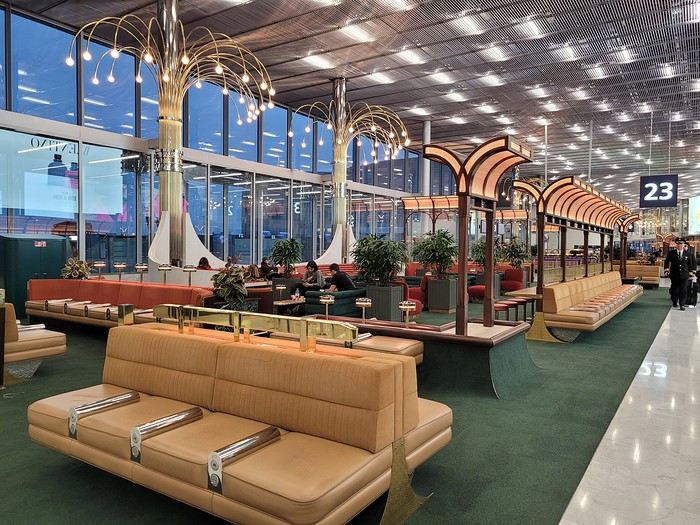
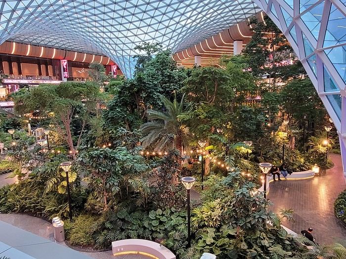
Then, an in-depth exploration of Doha Airport thanks to (or because of) a loooong layover:
And finally, arrival at the tiny Mahé airport where we step onto the tarmac feeling like we’ve walked into a steam room
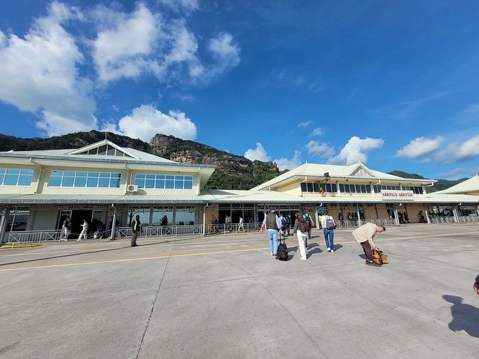 Baggage claim is quick, the shuttle to the port is on time, the ferry is punctual (we, on the other hand, are *very* early for it ), and there’s Praslin in sight:
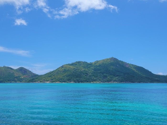
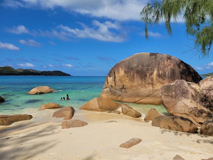
... with a sneak peek of the sea’s colors 🙂 Quick note on the photos: most were taken with a smartphone, and the colors are a bit more saturated than in real life (I did bring my hybrid camera, but in the end, I barely used it since it wasn’t very practical to lug around on the water or for snorkeling).
We pick up the car (a Grand i10 instead of a Picanto) from a muddy parking lot (it just rained) and off we go—of course, with a windshield wiper instead of the turn signal 😎, left-hand driving obliges. In just a few minutes, we arrive at our accommodation for these 4 nights on Praslin (Oh, and now the "lien" tab isn’t working! ) We’re blown away by the view from the terrace:
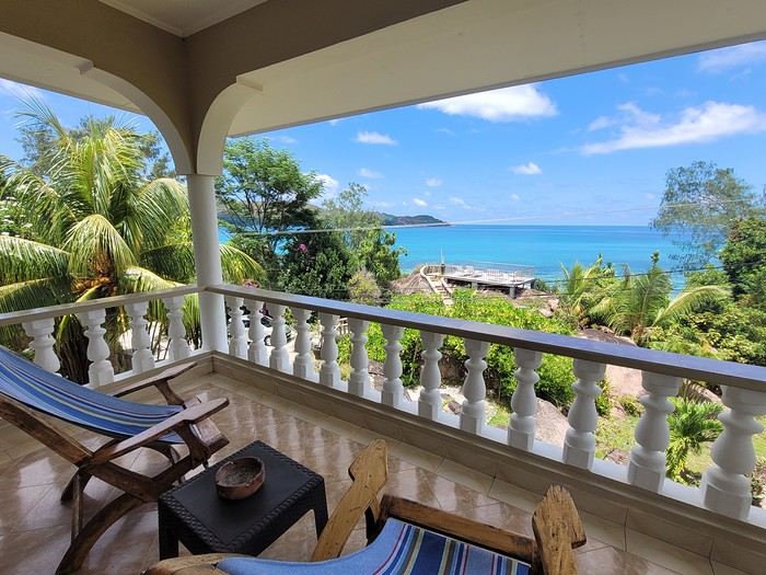
Then by the view from the little shared terrace on a promontory:
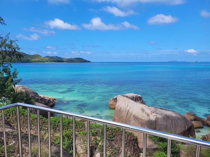 Before heading to test the water temperature on the other side of the road, at Anse Boudin, and spotting our first fish.
Saturday 03/22: Flight to Mahé with Qatar Airways (no—or rather, no more—direct flights from Paris 😕) A nice surprise at CDG with the discovery of a new lounge in Terminal 1
Then, an in-depth exploration of Doha Airport thanks to (or because of) a loooong layover:
And finally, arrival at the tiny Mahé airport where we step onto the tarmac feeling like we’ve walked into a steam room
Baggage claim is quick, the shuttle to the port is on time, the ferry is punctual (we, on the other hand, are *very* early for it ), and there’s Praslin in sight:... with a sneak peek of the sea’s colors 🙂 Quick note on the photos: most were taken with a smartphone, and the colors are a bit more saturated than in real life (I did bring my hybrid camera, but in the end, I barely used it since it wasn’t very practical to lug around on the water or for snorkeling).
We pick up the car (a Grand i10 instead of a Picanto) from a muddy parking lot (it just rained) and off we go—of course, with a windshield wiper instead of the turn signal 😎, left-hand driving obliges. In just a few minutes, we arrive at our accommodation for these 4 nights on Praslin (Oh, and now the "lien" tab isn’t working! ) We’re blown away by the view from the terrace:
Then by the view from the little shared terrace on a promontory:
Before heading to test the water temperature on the other side of the road, at Anse Boudin, and spotting our first fish.
Hey there, it's me again—back with my usual travel journal share for our loved ones, from our 15-day trip in October 2019.
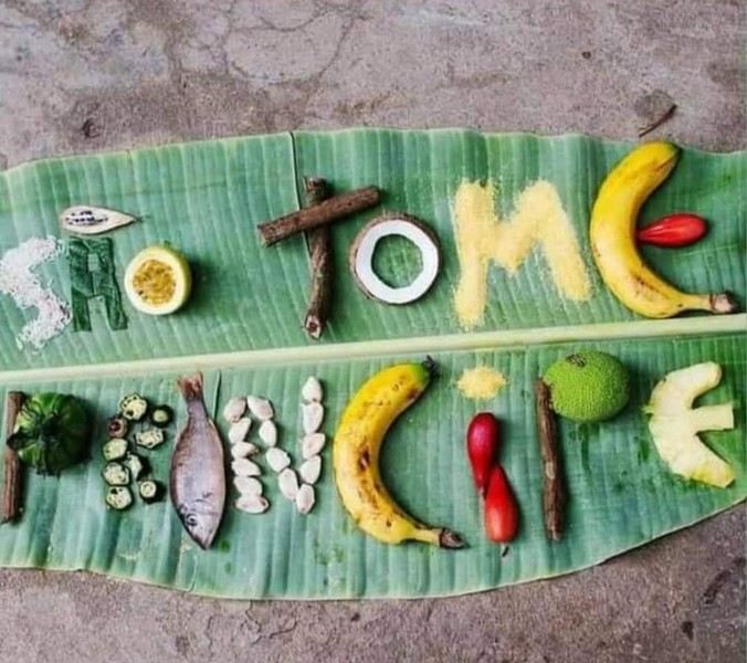
"Ah, here it is at last—that sweet scent of elsewhere so dear to Cricri and Lulu’s noses, that mix of apprehension and desire when facing the unknown.
We’re really diving into the unknown this time, taking you to the island of SAO TOMÉ... also known as the island: *‘Wait, what did you say?’* 😄. Because apparently, no one’s heard of Sao Tomé—except our Portuguese friends.
It’s an archipelago of three islands smack in the middle of the world, right on the equator, off the coast of Gabon.
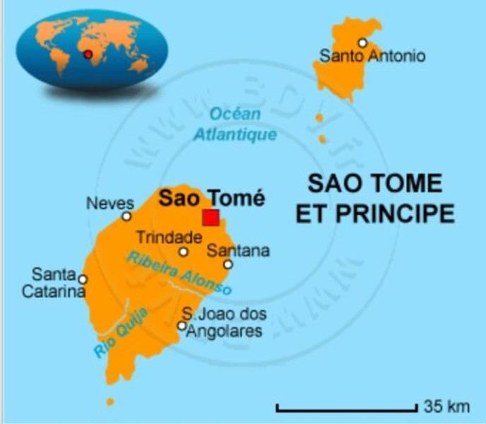
No, these aren’t the sun-soaked, Polynesian lagoon islands. Here, *‘it rains, it pours...’* pretty much all the time, it seems.
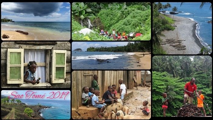
There’s not much to *‘see’* in the traditional tourist sense—EXCEPT for stunning landscapes, lush vegetation, a few beaches with golden or black sand, colonial buildings still in their original state, a single main road, and plenty of *‘tracks’* that are more or less drivable. All this surrounded by an African population that speaks Portuguese and is known for its warm welcome.
Well, that should be enough for our happiness—and hopefully yours too! 😊
Ready for landing?
"Ah, here it is at last—that sweet scent of elsewhere so dear to Cricri and Lulu’s noses, that mix of apprehension and desire when facing the unknown.
We’re really diving into the unknown this time, taking you to the island of SAO TOMÉ... also known as the island: *‘Wait, what did you say?’* 😄. Because apparently, no one’s heard of Sao Tomé—except our Portuguese friends.
It’s an archipelago of three islands smack in the middle of the world, right on the equator, off the coast of Gabon.
No, these aren’t the sun-soaked, Polynesian lagoon islands. Here, *‘it rains, it pours...’* pretty much all the time, it seems.
There’s not much to *‘see’* in the traditional tourist sense—EXCEPT for stunning landscapes, lush vegetation, a few beaches with golden or black sand, colonial buildings still in their original state, a single main road, and plenty of *‘tracks’* that are more or less drivable. All this surrounded by an African population that speaks Portuguese and is known for its warm welcome.
Well, that should be enough for our happiness—and hopefully yours too! 😊
Ready for landing?
It was the start of winter; I was freezing, and the mood wasn’t exactly joyful—Ukraine, 49.3...
So I self-medicated: a week in Italy to hear laughter and that melodic language, and of course, to immerse myself in beauty for a while.
I was looking for a destination: Florence. The choice was biased because I wanted to revisit *Primavera* and *The Birth of Venus*.
Then came the choice of airline: Vueling flies directly to Florence, but you’ve got to know how to handle Vueling—sometimes you make it to your destination, sometimes you’re left at the gate. It’s not expensive, but that’s about all it’s worth. Best to know their rules of the game. Plus, Vueling leaves from Orly, which is super easy to get to by metro.
The gods were with me that day—Vueling actually got me to Florence. On arrival, the temperature was better than forecast, and I knew the days were slightly longer in Italy (and shorter in Stockholm). And the Italian language was floating in the air...
I took the new tram that takes you to the heart of the city, near the great "cheesecake" that’s said to mark the superiority of the Renaissance over Europe’s sublime Gothic cathedrals. I walked around the big pastry and turned onto *my* street, Via dei Servi. Along the way, I stewed over my guilt for not admiring the sublime *Duomo*; I hoped no police had detected my rebellious, deviant mindset.
I’d chosen a hotel on the stunning Piazza della Santissima Annunziata—I’ll even share its name, that’s the VF spirit: it’s the Hotel Due Fontane.
And that’s the real point of this post: until Easter, you can treat yourself to a room in a very charming hotel for around 60 €, breakfast buffet included! To do this, book on Booking.com and make it clear you’ll return the next day with a new reservation at that price. You’ll have left your things in the luggage room to move into a new room in the evening. I didn’t have to play that game since the reception gave me a long-term stay at a reduced rate.
The next day, the kind barista drew a perfect, beautiful flower on my cappuccino. That man was the smile and good cheer of Italy.
Florence had more to offer, and this time I wasn’t being picky like I was with the big white pastry: I had a date with *Primavera* and Venus. Off to the Uffizi; the weather was decent, much warmer than Paris, and the girls were laughing.
Arriving at the Uffizi: had I bought a skip-the-line ticket? What for? I walked in subito and even got the winter discount rate. You’ll agree that when visiting a museum, it doesn’t matter if it’s hot or not. When I got to Botticelli’s room, I love being alone—I have the illusion of owning two of the most beautiful paintings in the world. There was one tourist there that day. We admired *Primavera* and *The Birth of Venus* without getting in each other’s way; those young women painted so long ago show such beauty and radiate such elegance, especially in their faces.
I hesitated about going to the Accademia, but David is worth a revisit. If a skip-the-line ticket is ever needed, it’s here. But no! I walked in subito! Usually, women don’t openly show their attraction, but you might hear "He’s cute" about a man. Around David, it’s amusing to see they’re not immune to the sight.
Off to the Medici Chapels; entrance subita. I felt humbled by the princes’ munificence and the master’s works.
Then it was time for a stroll—maybe a Mannerist painting at Santa Felicita (oh, miracle, it was open), or playing the game of comparing the two crucifixes, including Donatello’s, sipping a Spritz in a little bar with a view of the Ponte Vecchio, wandering Via Roma in the evening among the cheerful crowd and shops decked out for Christmas. Seeing the Church of Santa Maria del Carmine for its frescoes and the Italian Pantheon at Santa Croce (Napoleon’s first girlfriend is buried there). Italy, land of frescoes!
Every evening, until I exhausted my pasta card, I enjoyed spaghetti on *my* Via dei Servi.
The point of this post: you can visit Florence at a very low cost, without impossible queues, and without tourist pressure, in reasonably warm weather until Easter. In May, the Due Fontane charges 220 to 250 €! For the rest, I may have rambled a bit. PS: Vueling stranded me on the way back; my punishment was staying an extra day in this incredibly welcoming city.
The point of this post: you can visit Florence at a very low cost, without impossible queues, and without tourist pressure, in reasonably warm weather until Easter. In May, the Due Fontane charges 220 to 250 €! For the rest, I may have rambled a bit. PS: Vueling stranded me on the way back; my punishment was staying an extra day in this incredibly welcoming city.
Hi! We’ll be in El Nido at the end of February. We’d love to explore the magical islands around it—any tips or guided tours you’d recommend? There are three of us, including a 10-year-old girl, and this will be our last stop before heading home!
Philippines Trip 2024
Flight Paris → Manila
Wednesday, 12/02
Flight Manila → Cebu Sunnyside Moalboal Guest House Guesthouse – 400 m from the beach
Thursday, 13/02 Turtle-sardine tour: 8 € per hotel? Departure between 6 AM and 3 PM Duration: 1 h to 1 h 30
Friday, 14/02 Sharks and waterfalls? Departure at 3 AM?
Or just sharks for 15 €
Saturday, 15/02 Nothing planned or diving
Sunday, 16/02 Watch out: taxi at 8 AM
2 h 10 min drive
Arrival at Quartel Beach Oslob at 10:00 AM Ferry departure from Quartel Beach Oslob at 11:30 AM, Arrival at Bohol, Momo Beach Panglao at 1 PM
50 min taxi / 1000 PHP (15 €) by tuk-tuk or 1500 PHP (24 €) by taxi
We arrive at Southside Hotel at 2 PM
Check if we can get room 7, which is set apart from the others, based on the reviews
Rest and walk along the river
Monday, 17/02 We visit the tarsiers
Tuesday, 18/02 The Chocolate Hills
Wednesday, 19/02 A kayak tour? A cruise?
PS: We sent an email about a dolphin tour—possible for 200 € Abraham Tour to contact for more info and rates
http://whales.bohol.ph/packages.php
Still deciding if we’ll do it.
Thursday, 20/02 Departure from Bohol to catch the flight in Cebu: Leave the hotel at 7 AM
2 h ferry ride Arrival at Pier 1: 11:20 AM
30 min to the airport
Arrival at 1:15 PM: 90 min before the flight, so 1 h 30
Arrival in Coron at 4:05 PM at a homestay
Friday, 21/02 Tour with Hakim or Coron Travel
Then a tour with Hakim’s team: reef and other islands Hakim’s rate between 3200 PHP (50 €) and 2150 PHP (33 €) Coron Travel rate: 1700 PHP (27 €)
Saturday, 22/02 Exploring the area
Sunday, 23/02 Tour with Hakim or Coron Travel
Monday, 24/02 Private tour with Hakim
Tuesday, 25/02 Travel time: accommodation to port is a 5-minute walk?? Arrival at the port at 6 AM Departure from Coron Port at 7:30 AM Ferry travel time: 3 h 30 Arrival at El Nido Port at 11 AM
11-minute drive
Wednesday, 26/02 Boat trips with Go Paradise? Contact via Messenger
Thursday, 27/02
Friday, 28/02
Saturday, 1/03
Sunday, 2/03 Book a Grab for 9 AM Drive to El Nido Airport: 12 minutes Arrival at the airport at 9:30 AM–10 AM Departure at 11:55 AM Landing in Manila at 1:25 PM NAIA Terminal 2 Travel time: 26 min Book a Grab for 2 PM
Hotel in Manila at Malaki Festive
Monday, 3/03 Possibility to explore the city for 3 hours?
Tuesday, 4/03 Departure from Manila at 7:45 PM
Landing in Hong Kong Terminal 1 at 10:15 PM Layover: 1 h 50
Wednesday, 5/03
Landing in Paris Terminal 1 at 7:35 AM
Philippines Trip 2024
Flight Paris → Manila
Wednesday, 12/02
Flight Manila → Cebu Sunnyside Moalboal Guest House Guesthouse – 400 m from the beach
Thursday, 13/02 Turtle-sardine tour: 8 € per hotel? Departure between 6 AM and 3 PM Duration: 1 h to 1 h 30
Friday, 14/02 Sharks and waterfalls? Departure at 3 AM?
Or just sharks for 15 €
Saturday, 15/02 Nothing planned or diving
Sunday, 16/02 Watch out: taxi at 8 AM
2 h 10 min drive
Arrival at Quartel Beach Oslob at 10:00 AM Ferry departure from Quartel Beach Oslob at 11:30 AM, Arrival at Bohol, Momo Beach Panglao at 1 PM
50 min taxi / 1000 PHP (15 €) by tuk-tuk or 1500 PHP (24 €) by taxi
We arrive at Southside Hotel at 2 PM
Check if we can get room 7, which is set apart from the others, based on the reviews
Rest and walk along the river
Monday, 17/02 We visit the tarsiers
Tuesday, 18/02 The Chocolate Hills
Wednesday, 19/02 A kayak tour? A cruise?
PS: We sent an email about a dolphin tour—possible for 200 € Abraham Tour to contact for more info and rates
http://whales.bohol.ph/packages.php
Still deciding if we’ll do it.
Thursday, 20/02 Departure from Bohol to catch the flight in Cebu: Leave the hotel at 7 AM
2 h ferry ride Arrival at Pier 1: 11:20 AM
30 min to the airport
Arrival at 1:15 PM: 90 min before the flight, so 1 h 30
Arrival in Coron at 4:05 PM at a homestay
Friday, 21/02 Tour with Hakim or Coron Travel
Then a tour with Hakim’s team: reef and other islands Hakim’s rate between 3200 PHP (50 €) and 2150 PHP (33 €) Coron Travel rate: 1700 PHP (27 €)
Saturday, 22/02 Exploring the area
Sunday, 23/02 Tour with Hakim or Coron Travel
Monday, 24/02 Private tour with Hakim
Tuesday, 25/02 Travel time: accommodation to port is a 5-minute walk?? Arrival at the port at 6 AM Departure from Coron Port at 7:30 AM Ferry travel time: 3 h 30 Arrival at El Nido Port at 11 AM
11-minute drive
Wednesday, 26/02 Boat trips with Go Paradise? Contact via Messenger
Thursday, 27/02
Friday, 28/02
Saturday, 1/03
Sunday, 2/03 Book a Grab for 9 AM Drive to El Nido Airport: 12 minutes Arrival at the airport at 9:30 AM–10 AM Departure at 11:55 AM Landing in Manila at 1:25 PM NAIA Terminal 2 Travel time: 26 min Book a Grab for 2 PM
Hotel in Manila at Malaki Festive
Monday, 3/03 Possibility to explore the city for 3 hours?
Tuesday, 4/03 Departure from Manila at 7:45 PM
Landing in Hong Kong Terminal 1 at 10:15 PM Layover: 1 h 50
Wednesday, 5/03
Landing in Paris Terminal 1 at 7:35 AM
Hello fellow travel enthusiasts! 🌍
As a traveler and blogger, I’ve often been struck by the huge inequalities tied to freedom of movement. While some cross borders with ease, others face major obstacles due to their nationality, background, or the restrictive policies of certain countries.
On the occasion of International Human Rights Day, I wrote an article reflecting on this issue: 📖 Travelers' Rights: A Reflection on Freedom of Movement and Global Inequalities
In this article, I cover topics like:
Inequalities between passports ("strong" vs. "weak" passports). The specific challenges faced by travelers from marginalized communities. How to take action to promote more inclusive and equitable travel.
I’d love to hear your thoughts! 😊 Have you ever experienced these inequalities while traveling? How do you think we could raise more awareness about this issue? Feel free to share your experiences or ask questions in this thread. I can’t wait to discuss this with you!
Travel is also about building bridges between cultures. So let’s make sure it becomes a reality for everyone. ✈️🌎 Thanks for reading, and I look forward to exchanging ideas with you!
On the occasion of International Human Rights Day, I wrote an article reflecting on this issue: 📖 Travelers' Rights: A Reflection on Freedom of Movement and Global Inequalities
In this article, I cover topics like:
Inequalities between passports ("strong" vs. "weak" passports). The specific challenges faced by travelers from marginalized communities. How to take action to promote more inclusive and equitable travel.
I’d love to hear your thoughts! 😊 Have you ever experienced these inequalities while traveling? How do you think we could raise more awareness about this issue? Feel free to share your experiences or ask questions in this thread. I can’t wait to discuss this with you!
Travel is also about building bridges between cultures. So let’s make sure it becomes a reality for everyone. ✈️🌎 Thanks for reading, and I look forward to exchanging ideas with you!
Hello,
After 20 years of operation and a 4-year hiatus, we were happy to rediscover this forum following its acquisition by Myatlas.
At the very beginning of the adventure, there was a section allowing members to share their ideas—good or bad, feasible or not—with the team in charge to help perfect the forum.
So, to help VoyageForum regain its momentum and adapt to new audiences and a new environment, why not put our heads together and suggest some improvement ideas in this thread?
I’ll get the ball rolling!
Travel journals are limited to 300 photos because photo storage is expensive. This limitation is completely understandable, and Myatlas found a solution by offering a paid subscription for those who wanted to exceed the free photo limit. Maybe this approach could be adapted here? Limiting without offering an alternative is a reason members leave.
After 20 years of operation and a 4-year hiatus, we were happy to rediscover this forum following its acquisition by Myatlas.
At the very beginning of the adventure, there was a section allowing members to share their ideas—good or bad, feasible or not—with the team in charge to help perfect the forum.
So, to help VoyageForum regain its momentum and adapt to new audiences and a new environment, why not put our heads together and suggest some improvement ideas in this thread?
I’ll get the ball rolling!
Travel journals are limited to 300 photos because photo storage is expensive. This limitation is completely understandable, and Myatlas found a solution by offering a paid subscription for those who wanted to exceed the free photo limit. Maybe this approach could be adapted here? Limiting without offering an alternative is a reason members leave.
Hello,
Who among us hasn’t dreamed of having a ticket to Tahiti, Bora Bora, or the Marquesas in their pocket—preferably a one-way ticket to “paradise”?
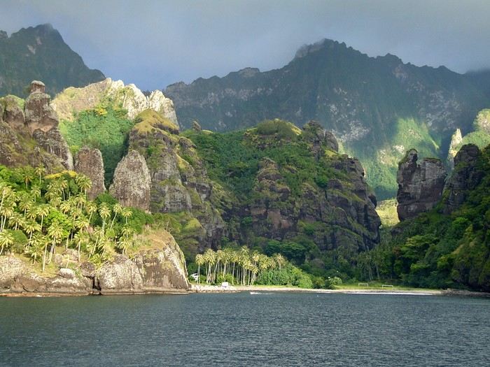 Idyllic landscape of a dream island, but difficult to access: the Bay of Virgins in Fatu Hiva, Marquesas Islands
Among the values conveyed by literature, tourism, and advertising is the quest for “elsewhere,” for a change of scenery, in the truest sense of the word—that is, the need to leave one’s country. This need for otherness, for difference, is projected onto dreamlike, idealized, even mythicized places. In our imaginary world, the island is often that place.
Yet we forget that islands have also been ideal prisons. The examples are numerous: Elba and Saint Helena, Alcatraz and Poulo Condor, If and Yeu, the Devil’s Islands and Leros. The latter, located in Greece in the Dodecanese, hosted a sinister forced labor camp during the colonels’ dictatorship as well as a psychiatric hospital. Despite the beauty of its bay, tourism has remained marginal there due to its bad reputation, unlike the neighboring island of Patmos.
I’d like to share a selection of about a dozen islands from across the world’s seas and oceans. For dreaming...
°°°°°°°°°°°°°°°
SANTORINI
July 27, 1967
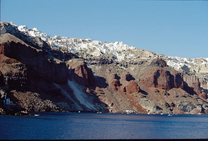
At dawn, the ferry from Agios Nikolaos (Crete) enters the immense caldera of Santorini. From the ship’s deck, Rainer, my travel companion, and I are left in awe by the sight of these towering, multicolored cliffs looming over us. We disembark and begin the steep climb on foot via the winding mule path up to the village of Fira, the capital perched above the cliff. Though it’s still very early, we head to the youth hostel. There wasn’t a soul in the alleys that morning—or rather, there were only cats! I have a fond memory of that encounter with Santorini: a sensory shock, a breathtaking volcanic site, a harmony of blue, ochre-red, and white. A welcoming island, as it was traditional to welcome the xénou, an island that hadn’t yet fully recovered from the terrible 1956 earthquake, a Cycladic architectural marvel where local life was still preserved.
It’s easy to see why, in antiquity, the island was named Kallisté (καλλίστη), “the most beautiful,” as it’s nearly impossible to resist gazing at this landscape shaped by tectonic forces. Indeed, a massive volcanic cataclysm—the Minoan eruption—shaped this scenery in the 17th century BCE, creating a caldera that was quickly filled by the sea. The enormous tsunamis that followed reached Crete, leading to the disappearance of the Minoan civilization.
A cliffside path along the caldera leads us to the peaceful village of Oia, at the northern tip of the island. Blue-domed churches and flower-filled villages with whitewashed houses line the way. This walk is a continuous marvel, offering splendid views of the caldera and the neighboring islands formed by the breakup of the ancient volcano (Thirissa, Nea Kameni). Oia is a large, picturesque village, like Fira perched on the cliff’s edge, which was severely damaged by the 1956 earthquake, and its scars are still visible. Its cave-like houses with vaulted roofs haven’t yet been turned into luxury hotels or shops. Absolute tranquility reigns here.
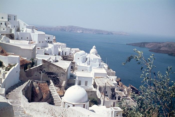 Oia in 1967—a peaceful village overlooking the caldera. But where are the pools and trendy bars?
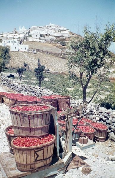
A lush countryside covered in olive trees and vineyards welcomes us for a pleasant hike, interrupted by the kindness of a friendly islander who gives us a lift in his truck for a few kilometers. He’s off to harvest his tomatoes, which he grows at the foot of Pyrgos Hill. The delicious little cherry tomato of Santorini earned an EU Protected Designation of Origin (PDO) in 2013. We climb up to the village of Pyrgos, perched on a hill and dominated by the elegant bell tower of its church. Finally, we reach the black sand beach of Kamari on the island’s eastern coast to enjoy a swim.
{...} To be continued

°°°°°°°°°°°°°°°°°
RAIVAVAE (French Polynesia)
November 15, 2007
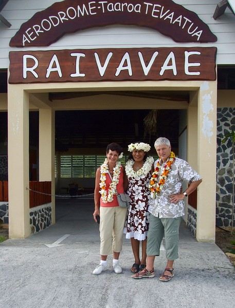
Éléonore from Pension Tama welcomes us with traditional flower leis, as if she’d been waiting for old friends she hadn’t seen in ages. The small airport terminal is lively, the atmosphere warm—people hugging, rejoicing in reunions, all under kilos of flowers. Then, just as quickly, the place empties until the next flight... in a few days.
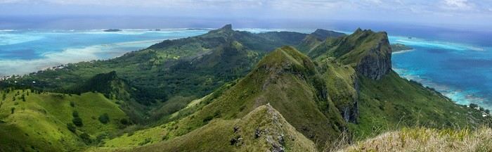
In the Austral Islands, a ninety-minute flight from Tahiti, Raivavae is a world away from the frenetic pace of Papeete or the tourist crowds of the Leeward Islands. The true paradise of the South Seas can still be savored here—it’s a bit like Bora Bora half a century ago. Our first feeling upon arriving on this island is wonder, with smiles that could melt even the gloomiest among us, landscapes so stunning they take your breath away, and above all, a sense of disorientation and fulfillment. Picture a mountainous island, about ten kilometers by three and a half, encircled by a coral reef and wild motu, cradling a lagoon with shades of blue that would make Bora Bora green with envy.
The roughly one thousand inhabitants of Raivavae are spread across four villages around the island. Children are everywhere, as is typical in Polynesia, and they greet you with open, genuine smiles. Here, ancestral values have survived progress. The predominantly Protestant population is very devout, as evidenced by the several temples built across the island. Religious fervor sets the rhythm of daily life. Sundays are reserved for worship and Sunday school (catechism). Work is forbidden on that day, and tourist activities are suspended. These rules are strict and respected.
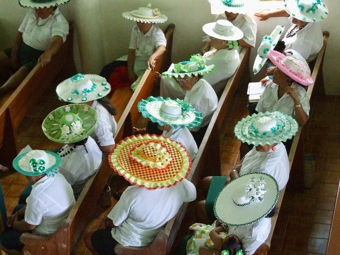 Hat contest for the worship celebration
Yet a sense of resignation is ever-present. The people of Raivavae know they are—and will remain—isolated. Despite the construction of an airstrip in 2004 and a few weekly flights to Tahiti and its nearest neighbor, Tubuai (200 km away), the island remains on the fringes of the world. One painful aspect is the separation of children from their parents when they leave for middle school in Tubuai starting in fifth grade. Television brings daily images of a world the islanders will likely never know, but one they often aspire to.
We are privileged. We have the pristine white-sand beaches of the motu and some of the most beautiful bays in Polynesia all to ourselves. The jewel in the crown, the island’s emblematic spot, is the “motu-pool,” about twenty minutes by boat. A natural, exquisite basin with crystal-clear water, gradients of blue, and white sand. And best of all, there’s almost no one there. In fact, lounging on the beach is frowned upon, especially for young women. Religion looks very unfavorably on sunbathing and lazing around. And yet, everything here leans toward that philosophy of life.
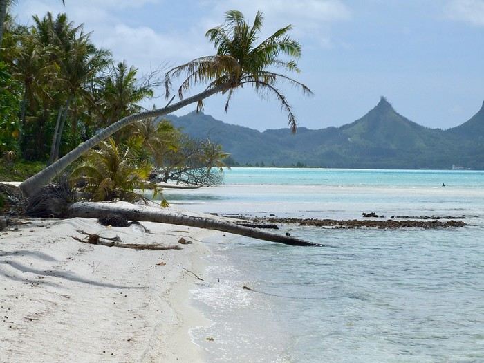
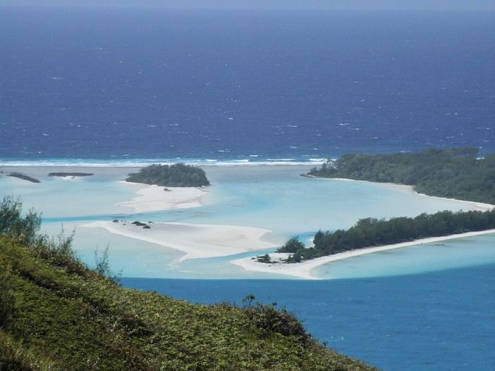 The "motu-pool"
{...} To be continued
Who among us hasn’t dreamed of having a ticket to Tahiti, Bora Bora, or the Marquesas in their pocket—preferably a one-way ticket to “paradise”?
Idyllic landscape of a dream island, but difficult to access: the Bay of Virgins in Fatu Hiva, Marquesas IslandsAmong the values conveyed by literature, tourism, and advertising is the quest for “elsewhere,” for a change of scenery, in the truest sense of the word—that is, the need to leave one’s country. This need for otherness, for difference, is projected onto dreamlike, idealized, even mythicized places. In our imaginary world, the island is often that place.
Yet we forget that islands have also been ideal prisons. The examples are numerous: Elba and Saint Helena, Alcatraz and Poulo Condor, If and Yeu, the Devil’s Islands and Leros. The latter, located in Greece in the Dodecanese, hosted a sinister forced labor camp during the colonels’ dictatorship as well as a psychiatric hospital. Despite the beauty of its bay, tourism has remained marginal there due to its bad reputation, unlike the neighboring island of Patmos.
I’d like to share a selection of about a dozen islands from across the world’s seas and oceans. For dreaming...
°°°°°°°°°°°°°°°
SANTORINI
July 27, 1967
At dawn, the ferry from Agios Nikolaos (Crete) enters the immense caldera of Santorini. From the ship’s deck, Rainer, my travel companion, and I are left in awe by the sight of these towering, multicolored cliffs looming over us. We disembark and begin the steep climb on foot via the winding mule path up to the village of Fira, the capital perched above the cliff. Though it’s still very early, we head to the youth hostel. There wasn’t a soul in the alleys that morning—or rather, there were only cats! I have a fond memory of that encounter with Santorini: a sensory shock, a breathtaking volcanic site, a harmony of blue, ochre-red, and white. A welcoming island, as it was traditional to welcome the xénou, an island that hadn’t yet fully recovered from the terrible 1956 earthquake, a Cycladic architectural marvel where local life was still preserved.
It’s easy to see why, in antiquity, the island was named Kallisté (καλλίστη), “the most beautiful,” as it’s nearly impossible to resist gazing at this landscape shaped by tectonic forces. Indeed, a massive volcanic cataclysm—the Minoan eruption—shaped this scenery in the 17th century BCE, creating a caldera that was quickly filled by the sea. The enormous tsunamis that followed reached Crete, leading to the disappearance of the Minoan civilization.
A cliffside path along the caldera leads us to the peaceful village of Oia, at the northern tip of the island. Blue-domed churches and flower-filled villages with whitewashed houses line the way. This walk is a continuous marvel, offering splendid views of the caldera and the neighboring islands formed by the breakup of the ancient volcano (Thirissa, Nea Kameni). Oia is a large, picturesque village, like Fira perched on the cliff’s edge, which was severely damaged by the 1956 earthquake, and its scars are still visible. Its cave-like houses with vaulted roofs haven’t yet been turned into luxury hotels or shops. Absolute tranquility reigns here.
Oia in 1967—a peaceful village overlooking the caldera. But where are the pools and trendy bars?A lush countryside covered in olive trees and vineyards welcomes us for a pleasant hike, interrupted by the kindness of a friendly islander who gives us a lift in his truck for a few kilometers. He’s off to harvest his tomatoes, which he grows at the foot of Pyrgos Hill. The delicious little cherry tomato of Santorini earned an EU Protected Designation of Origin (PDO) in 2013. We climb up to the village of Pyrgos, perched on a hill and dominated by the elegant bell tower of its church. Finally, we reach the black sand beach of Kamari on the island’s eastern coast to enjoy a swim.
{...} To be continued
°°°°°°°°°°°°°°°°°
RAIVAVAE (French Polynesia)
November 15, 2007
Éléonore from Pension Tama welcomes us with traditional flower leis, as if she’d been waiting for old friends she hadn’t seen in ages. The small airport terminal is lively, the atmosphere warm—people hugging, rejoicing in reunions, all under kilos of flowers. Then, just as quickly, the place empties until the next flight... in a few days.
In the Austral Islands, a ninety-minute flight from Tahiti, Raivavae is a world away from the frenetic pace of Papeete or the tourist crowds of the Leeward Islands. The true paradise of the South Seas can still be savored here—it’s a bit like Bora Bora half a century ago. Our first feeling upon arriving on this island is wonder, with smiles that could melt even the gloomiest among us, landscapes so stunning they take your breath away, and above all, a sense of disorientation and fulfillment. Picture a mountainous island, about ten kilometers by three and a half, encircled by a coral reef and wild motu, cradling a lagoon with shades of blue that would make Bora Bora green with envy.
The roughly one thousand inhabitants of Raivavae are spread across four villages around the island. Children are everywhere, as is typical in Polynesia, and they greet you with open, genuine smiles. Here, ancestral values have survived progress. The predominantly Protestant population is very devout, as evidenced by the several temples built across the island. Religious fervor sets the rhythm of daily life. Sundays are reserved for worship and Sunday school (catechism). Work is forbidden on that day, and tourist activities are suspended. These rules are strict and respected.
Hat contest for the worship celebrationYet a sense of resignation is ever-present. The people of Raivavae know they are—and will remain—isolated. Despite the construction of an airstrip in 2004 and a few weekly flights to Tahiti and its nearest neighbor, Tubuai (200 km away), the island remains on the fringes of the world. One painful aspect is the separation of children from their parents when they leave for middle school in Tubuai starting in fifth grade. Television brings daily images of a world the islanders will likely never know, but one they often aspire to.
We are privileged. We have the pristine white-sand beaches of the motu and some of the most beautiful bays in Polynesia all to ourselves. The jewel in the crown, the island’s emblematic spot, is the “motu-pool,” about twenty minutes by boat. A natural, exquisite basin with crystal-clear water, gradients of blue, and white sand. And best of all, there’s almost no one there. In fact, lounging on the beach is frowned upon, especially for young women. Religion looks very unfavorably on sunbathing and lazing around. And yet, everything here leans toward that philosophy of life.
The "motu-pool"{...} To be continued
I don’t want to write an obituary for VF here; I hope it’s just a rough patch and that we can keep exchanging. But I do want to list all the great things this Forum has given me:
-Some amazing travel stories from Yangguizi, one of which led me to North Korea. Just look at the power of storytelling! And Looping, Mariecurry, Michant... Pondi will see me in the Altai one day. -Meeting a really friendly travel companion, which gave me the confidence to explore the Russian Far North. Where else could I have found a travel buddy for such a unique trip? -Meeting people on the Forum who encouraged me to write and gave me confidence. I even found my Quebecois translator and Breton translator for a few lines here on VF. A big thank you to them. -A wealth of information from reading travel journals, plus the chance to ask specific questions to prepare for a trip. Reading these journals also inspired me to visit new destinations.
And then, Voyage Forum is like a big family made up of so many different personalities. Anonymity breaks down all barriers and inhibitions. Sure, some people can be a pain and might’ve needed some help, there are the lost souls; others are all kindness and warmth; some stand out for their beautiful French; that’s not something to dismiss in these times of language impoverishment; some intellectuals share ideas that often go over my head; there are the ruthless commentators on others’ writing and thoughts. Ego battles flare up—it’s all part of the game. I can’t imagine the work it takes to manage all this. Rarely, a historical discussion takes hold with knowledgeable contributors. How cool is that! It’s fascinating and educational. Unfortunately, political correctness often shuts it down quickly. The trolls are watching!
Thank you, VF. And thank you all who owe it to yourselves. What are the most original contributions?
-Some amazing travel stories from Yangguizi, one of which led me to North Korea. Just look at the power of storytelling! And Looping, Mariecurry, Michant... Pondi will see me in the Altai one day. -Meeting a really friendly travel companion, which gave me the confidence to explore the Russian Far North. Where else could I have found a travel buddy for such a unique trip? -Meeting people on the Forum who encouraged me to write and gave me confidence. I even found my Quebecois translator and Breton translator for a few lines here on VF. A big thank you to them. -A wealth of information from reading travel journals, plus the chance to ask specific questions to prepare for a trip. Reading these journals also inspired me to visit new destinations.
And then, Voyage Forum is like a big family made up of so many different personalities. Anonymity breaks down all barriers and inhibitions. Sure, some people can be a pain and might’ve needed some help, there are the lost souls; others are all kindness and warmth; some stand out for their beautiful French; that’s not something to dismiss in these times of language impoverishment; some intellectuals share ideas that often go over my head; there are the ruthless commentators on others’ writing and thoughts. Ego battles flare up—it’s all part of the game. I can’t imagine the work it takes to manage all this. Rarely, a historical discussion takes hold with knowledgeable contributors. How cool is that! It’s fascinating and educational. Unfortunately, political correctness often shuts it down quickly. The trolls are watching!
Thank you, VF. And thank you all who owe it to yourselves. What are the most original contributions?
In this time of general travel-journal scarcity, I’m stepping up to tell you about a far-too-short getaway to the Top West End, a local term for the very northern part of Western Australia, right on the border ( ;) ) with the Northern Territory.
As usual, I didn’t manage to keep it short, but this time I’ve got photos to go with it!
August 2020. Since the opportunities to explore the world are extremely limited right now, all we (R&X) can do is explore our own island! Well, just a part of it, because with the state borders still closed, we’re stuck in Western Australia (WA).
Luckily, we’re pretty fortunate because this state is huge: over 2.5 million km² (that’s more than four times the size of France or 1.5 times Quebec). What’s more, stretching over 20 degrees of latitude between the Antarctic Ocean and the Timor Sea, you’ll find climates ranging from Mediterranean to arid to tropical. That’s actually why we decided to head as far north as possible. Sick of the endless rainy winter in Perth, bring on the heat of the Kimberley... way up Nooorth!
Friday. At the airport, the main terminal was closed (not enough flights), so we ended up in the annex (where flights to the various mines usually depart from). There was no crowd at the gate, and in this huge, single departure lounge, empty seats were plentiful. Only three flights were listed on the screens for the rest of the morning: the first to Coondewanna (?), the second to Darwin, and ours to Kununurra (code KNX).
A cool breeze swept through the half-open corridors along the runways. At the top of the walkway leading to the Fokker 100 (the Airbuses and Boeings are now parked!), a flight attendant greeted us with a basket full of sanitary masks. We were actually the only masked passengers (the staff weren’t wearing them either). With zero Covid-19 cases in WA at the time, the only rule was to maintain social distancing—something pretty hard to do on a full plane!
It was also my first time wearing a mask—it felt weird, pretty uncomfortable, and after a while, painful behind the ears. I really feel for those who have to wear one all day, every day. The flight lasted three long hours, but luckily, I had a good book. From the window, I watched an endless expanse of salt lakes in all shapes and sizes—round, elongated, gray, white, sometimes blue and green—and an infinity of winding, capricious meanders, along with long straight lines that led nowhere. The last half-hour got more interesting as rocky, swollen formations and long, sloping plateaus appeared. Against the vast ochre landscape, green patches became more frequent.
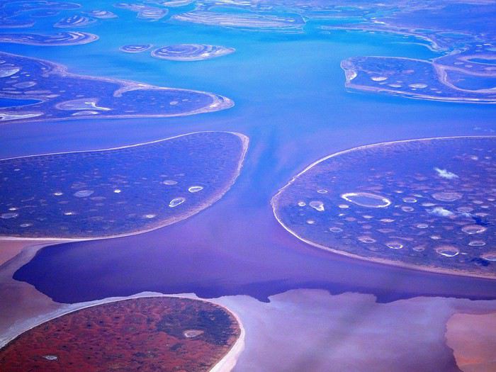
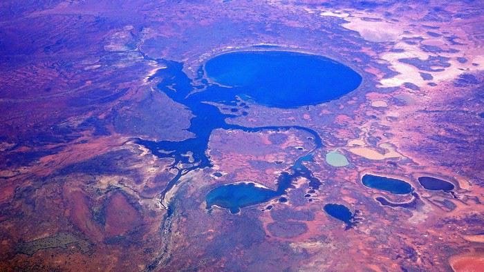
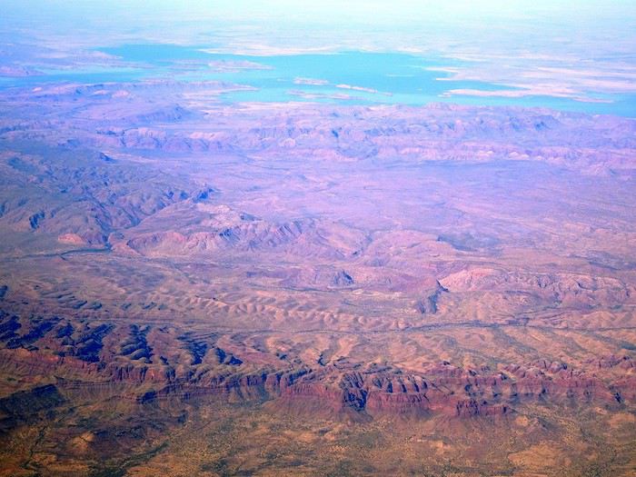
Just before landing, rows of green fields briefly appeared, along with an surprisingly wide river—but we were already rolling down the tarmac. A few hangars, a myriad of small, stationary planes, and a tiny terminal topped with a sign: “Welcome to Kununurra.”
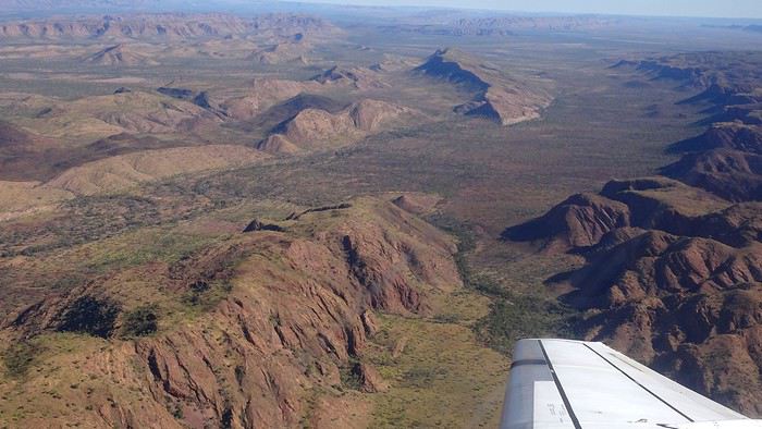
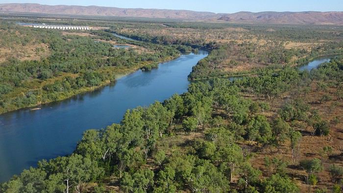
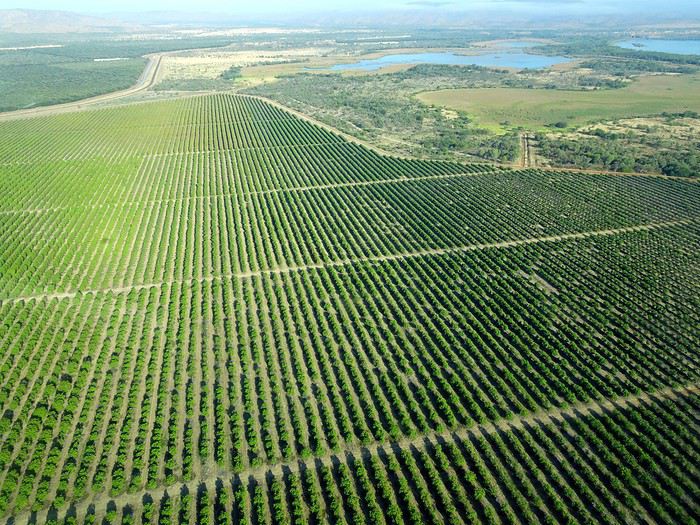
We wanted heat, and here it was—34°C the moment we stepped off the plane! We felt alive again and totally ridiculous in our jeans and sweaters. We quickly grabbed our suitcase and picked up the 4x4 we’d rented—more out of necessity, since only that type of vehicle can access the national parks we planned to visit.
Just four kilometers separated us from Kununurra, a town of 5,000 people founded in 1961 during the construction of the Lake Argyle Dam and the development of the Ord River Irrigation Area Scheme (more on that later). On the horizon, mountain ranges (a bit of an exaggeration, since we know Mt. Meharry, WA’s highest ‘mountain,’ doesn’t even reach 1,250 meters!) and closer to the road, a few irrigation canals cutting through stretches of bush, then a huge park overlooking a small lake lined with reeds.
A row of baobabs (yes, there are baobabs in Australia too!), a series of motels with immaculate lawns, a gas station, and there’s the main street leading to the town center—that is, the parking lots of the two supermarkets, the bottleshop, the pub, the Town Hall, the municipal pool, and the Tourist Office (already closed!), and at the next roundabout, another park, the Presbyterian church, and a few other shops. In short, two or three green blocks that you can explore in no time.
One road leads to the small industrial area and one of the town’s three or four campgrounds, while another heads toward the residential neighborhoods, which look just like the typical suburbs you find in any Australian city—except with tropical vegetation. We stocked up at Coles, an identical copy of the one near our place, and—surprise—the prices were practically the same.
We checked into one of the motels. The receptionist listed the town’s three or four restaurants, insisting that it’s always better to book a table. She recommended the Pump House, a bit outside town on the lake’s edge. “Best spot to watch the sunset, but hurry up.” she told us. It was only 5:00 PM!
When we got there half an hour later, the place was packed, and the sun had already disappeared behind a row of trees! Sure enough, we’d see a few days later that the sunset can be a stunning spectacle—if you wait a bit for the sky (especially if it’s cloudy) to blaze and reflect in the lake’s calm waters. A little disappointed, we headed back into town, where we easily found the other lively spot in town: the pub (nothing like an old English pub). Above the long L-shaped bar, several giant screens (thankfully muted) were broadcasting live footy, rugby league, etc. In one corner, players circled the pool table, while in another, customers were digging into plates of the day’s special. Instead of rooms, there were various patios where groups of friends and coworkers (easily recognizable by the fluoro vests they were still wearing) were gathered. We found a table under a mango tree—unfortunately, a little too close to the guitarist strumming his entire Country Music repertoire, complete with Keith Urban-style tremolos. Guaranteed culture shock!
Since it’s the custom here, we called the Country Club to book a table before the kitchen closed! The CC is the town’s—and even the region’s—fancy spot. Dark decor, modern furniture, dim lighting, and the air conditioning blasting. The twenty or so customers had taken refuge on the vast terrace, lit by torches. The view of the tall eucalyptus trees, illuminated by spotlights shifting from red to blue, was breathtaking.
The menu was minimal, but the grilled salmon was excellent, and the Pavlova (the meringue dessert Kiwis and Aussies have been arguing over since 1906) with melon and watermelon was absolutely divine.
It wasn’t even 9:00 PM, and we were already in bed. Had we already adopted the Top West End’s chicken schedule?!
To be continued... Journal dedicated to Attila
As usual, I didn’t manage to keep it short, but this time I’ve got photos to go with it!
August 2020. Since the opportunities to explore the world are extremely limited right now, all we (R&X) can do is explore our own island! Well, just a part of it, because with the state borders still closed, we’re stuck in Western Australia (WA).
Luckily, we’re pretty fortunate because this state is huge: over 2.5 million km² (that’s more than four times the size of France or 1.5 times Quebec). What’s more, stretching over 20 degrees of latitude between the Antarctic Ocean and the Timor Sea, you’ll find climates ranging from Mediterranean to arid to tropical. That’s actually why we decided to head as far north as possible. Sick of the endless rainy winter in Perth, bring on the heat of the Kimberley... way up Nooorth!
Friday. At the airport, the main terminal was closed (not enough flights), so we ended up in the annex (where flights to the various mines usually depart from). There was no crowd at the gate, and in this huge, single departure lounge, empty seats were plentiful. Only three flights were listed on the screens for the rest of the morning: the first to Coondewanna (?), the second to Darwin, and ours to Kununurra (code KNX).
A cool breeze swept through the half-open corridors along the runways. At the top of the walkway leading to the Fokker 100 (the Airbuses and Boeings are now parked!), a flight attendant greeted us with a basket full of sanitary masks. We were actually the only masked passengers (the staff weren’t wearing them either). With zero Covid-19 cases in WA at the time, the only rule was to maintain social distancing—something pretty hard to do on a full plane!
It was also my first time wearing a mask—it felt weird, pretty uncomfortable, and after a while, painful behind the ears. I really feel for those who have to wear one all day, every day. The flight lasted three long hours, but luckily, I had a good book. From the window, I watched an endless expanse of salt lakes in all shapes and sizes—round, elongated, gray, white, sometimes blue and green—and an infinity of winding, capricious meanders, along with long straight lines that led nowhere. The last half-hour got more interesting as rocky, swollen formations and long, sloping plateaus appeared. Against the vast ochre landscape, green patches became more frequent.
Just before landing, rows of green fields briefly appeared, along with an surprisingly wide river—but we were already rolling down the tarmac. A few hangars, a myriad of small, stationary planes, and a tiny terminal topped with a sign: “Welcome to Kununurra.”
We wanted heat, and here it was—34°C the moment we stepped off the plane! We felt alive again and totally ridiculous in our jeans and sweaters. We quickly grabbed our suitcase and picked up the 4x4 we’d rented—more out of necessity, since only that type of vehicle can access the national parks we planned to visit.
Just four kilometers separated us from Kununurra, a town of 5,000 people founded in 1961 during the construction of the Lake Argyle Dam and the development of the Ord River Irrigation Area Scheme (more on that later). On the horizon, mountain ranges (a bit of an exaggeration, since we know Mt. Meharry, WA’s highest ‘mountain,’ doesn’t even reach 1,250 meters!) and closer to the road, a few irrigation canals cutting through stretches of bush, then a huge park overlooking a small lake lined with reeds.
A row of baobabs (yes, there are baobabs in Australia too!), a series of motels with immaculate lawns, a gas station, and there’s the main street leading to the town center—that is, the parking lots of the two supermarkets, the bottleshop, the pub, the Town Hall, the municipal pool, and the Tourist Office (already closed!), and at the next roundabout, another park, the Presbyterian church, and a few other shops. In short, two or three green blocks that you can explore in no time.
One road leads to the small industrial area and one of the town’s three or four campgrounds, while another heads toward the residential neighborhoods, which look just like the typical suburbs you find in any Australian city—except with tropical vegetation. We stocked up at Coles, an identical copy of the one near our place, and—surprise—the prices were practically the same.
We checked into one of the motels. The receptionist listed the town’s three or four restaurants, insisting that it’s always better to book a table. She recommended the Pump House, a bit outside town on the lake’s edge. “Best spot to watch the sunset, but hurry up.” she told us. It was only 5:00 PM!
When we got there half an hour later, the place was packed, and the sun had already disappeared behind a row of trees! Sure enough, we’d see a few days later that the sunset can be a stunning spectacle—if you wait a bit for the sky (especially if it’s cloudy) to blaze and reflect in the lake’s calm waters. A little disappointed, we headed back into town, where we easily found the other lively spot in town: the pub (nothing like an old English pub). Above the long L-shaped bar, several giant screens (thankfully muted) were broadcasting live footy, rugby league, etc. In one corner, players circled the pool table, while in another, customers were digging into plates of the day’s special. Instead of rooms, there were various patios where groups of friends and coworkers (easily recognizable by the fluoro vests they were still wearing) were gathered. We found a table under a mango tree—unfortunately, a little too close to the guitarist strumming his entire Country Music repertoire, complete with Keith Urban-style tremolos. Guaranteed culture shock!
Since it’s the custom here, we called the Country Club to book a table before the kitchen closed! The CC is the town’s—and even the region’s—fancy spot. Dark decor, modern furniture, dim lighting, and the air conditioning blasting. The twenty or so customers had taken refuge on the vast terrace, lit by torches. The view of the tall eucalyptus trees, illuminated by spotlights shifting from red to blue, was breathtaking.
The menu was minimal, but the grilled salmon was excellent, and the Pavlova (the meringue dessert Kiwis and Aussies have been arguing over since 1906) with melon and watermelon was absolutely divine.
It wasn’t even 9:00 PM, and we were already in bed. Had we already adopted the Top West End’s chicken schedule?!
To be continued... Journal dedicated to Attila
Good evening everyone,
I hope you're all doing well despite this very unusual time…
Here’s a new travel journal to get you back on the Kenyan trails.
It was a really great idea to buy those flight tickets to Nairobi back in December. When Benoit suggested this new safari in February, I hesitated a little (very little): it was the season with particularly high temperatures, and the short rainy season in November/December had been very heavy, raising concerns about the state of the tracks… Given the current situation, no regrets, of course… We quickly organized the safari with our usual guide, and we booked the accommodations ourselves directly. (If we’d waited just a few more weeks, we might’ve regretted it…)
For once, we were able to leave from the airport near where we live (Lorient - Lann Bihoué), which is really convenient: no driving, no parking… We left home at 2 PM on Tuesday, February 18th, and arrived in Nairobi at 6 AM the next morning—perfect. (With a layover in CDG, of course 😉) Upon arrival, after a forehead temperature check by airport staff, we got our visas very quickly (forms filled out before departure). The customs agents congratulated us on our passports full of Kenyan stamps… but we still had to pay the 40 € for the visa.
All that was left was to collect our luggage, and we’d be ready to leave the airport shortly after landing. But there was a small issue: the baggage conveyor belt was broken… Eventually, the suitcases and bags were brought out by hand… Hakuna Matata, as they say here—no problem, as long as they’re all there. Benoit sent a message to Félix, our guide, to come meet us in the airport parking lot. After catching up with our respective families, we set off toward the Mombasa road, heading to Voi.
Traffic in Nairobi is still as heavy as ever, and the pollution is very noticeable (cars, but also cement factories…). The current lockdown has changed things. On social media, Mount Kenya and Kilimanjaro seem visible from Nairobi now!…
The first stop on this safari was a place we hadn’t visited before: the LUMO Community Wildlife Conservancy lumoconservancy.com/. It’s a small reserve located west of Tsavo West and near the Taita Hills. The reserve is managed by the local community, and entry fees are lower than in Tsavo’s national parks. We had initially planned to spend three days in Tsavo East, but since the accommodation wasn’t available for that long, we ended up choosing this option, which turned out to be a great discovery. Since the reserve is small, I think it’s hard to spend more than two days there. The advantage is that, since it’s not a national park, activities like walks or night safaris can be offered.
Alright, here are a few images to set the mood.
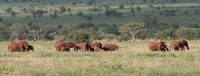
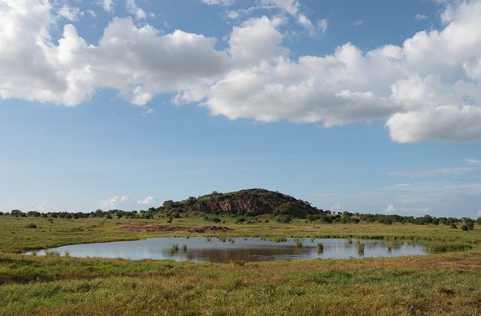
Elephants, but also hartebeests and lots of giraffes in a light we really liked.
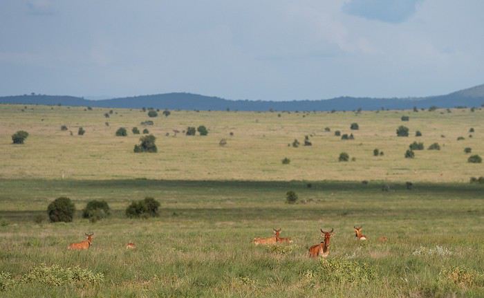
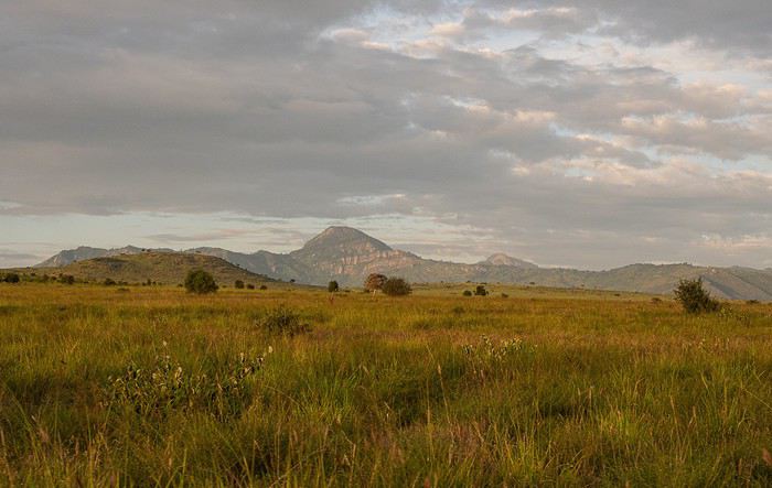
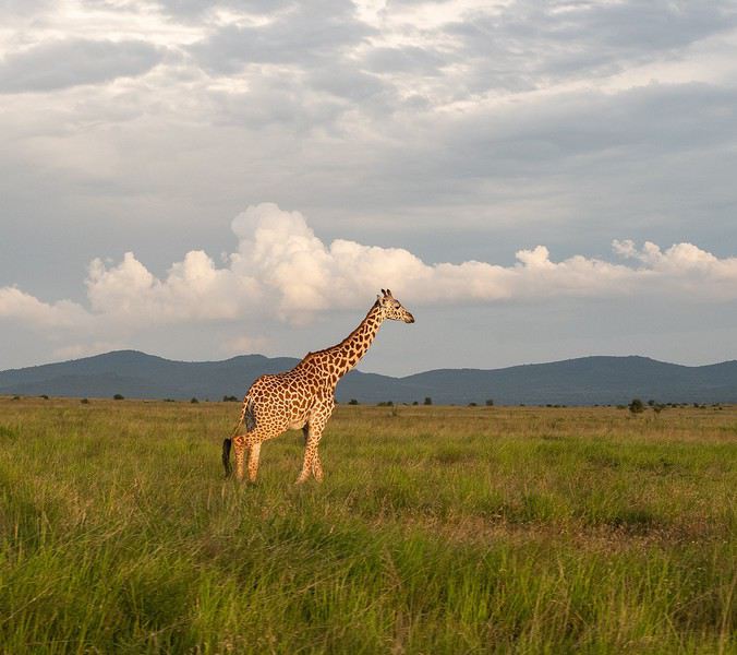
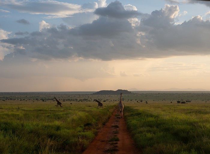
It was a really great idea to buy those flight tickets to Nairobi back in December. When Benoit suggested this new safari in February, I hesitated a little (very little): it was the season with particularly high temperatures, and the short rainy season in November/December had been very heavy, raising concerns about the state of the tracks… Given the current situation, no regrets, of course… We quickly organized the safari with our usual guide, and we booked the accommodations ourselves directly. (If we’d waited just a few more weeks, we might’ve regretted it…)
For once, we were able to leave from the airport near where we live (Lorient - Lann Bihoué), which is really convenient: no driving, no parking… We left home at 2 PM on Tuesday, February 18th, and arrived in Nairobi at 6 AM the next morning—perfect. (With a layover in CDG, of course 😉) Upon arrival, after a forehead temperature check by airport staff, we got our visas very quickly (forms filled out before departure). The customs agents congratulated us on our passports full of Kenyan stamps… but we still had to pay the 40 € for the visa.
All that was left was to collect our luggage, and we’d be ready to leave the airport shortly after landing. But there was a small issue: the baggage conveyor belt was broken… Eventually, the suitcases and bags were brought out by hand… Hakuna Matata, as they say here—no problem, as long as they’re all there. Benoit sent a message to Félix, our guide, to come meet us in the airport parking lot. After catching up with our respective families, we set off toward the Mombasa road, heading to Voi.
Traffic in Nairobi is still as heavy as ever, and the pollution is very noticeable (cars, but also cement factories…). The current lockdown has changed things. On social media, Mount Kenya and Kilimanjaro seem visible from Nairobi now!…
The first stop on this safari was a place we hadn’t visited before: the LUMO Community Wildlife Conservancy lumoconservancy.com/. It’s a small reserve located west of Tsavo West and near the Taita Hills. The reserve is managed by the local community, and entry fees are lower than in Tsavo’s national parks. We had initially planned to spend three days in Tsavo East, but since the accommodation wasn’t available for that long, we ended up choosing this option, which turned out to be a great discovery. Since the reserve is small, I think it’s hard to spend more than two days there. The advantage is that, since it’s not a national park, activities like walks or night safaris can be offered.
Alright, here are a few images to set the mood.
Elephants, but also hartebeests and lots of giraffes in a light we really liked.
Since I used this forum a lot to prepare our trip, here’s a little feedback from our 15-day self-drive adventure in southwestern Uganda.
For those who have questions, don’t hesitate! I’ll do my best to answer them 😉
We’d already traveled quite a bit in South Africa and once in Namibia, always self-driving. When the idea of visiting Uganda came up, we debated—especially me 😛—whether to go solo or with a guide. My husband quickly convinced me to do it self-drive, so I started planning and organizing the trip accordingly. We began preparations and bookings in June 2019 for a trip scheduled during the first two weeks of February 2020. We deliberately chose to explore just a small part of Uganda and take our time. We traveled as a group of four, with our oldest son and his partner.
Here’s our itinerary: - February 1: Departure from Brussels, arrival and overnight in Entebbe - February 2: Drive to Lake Mburo and overnight there - February 3: Drive to Lake Bunyonyi and overnight there - February 4: Boat ride on the lake, then departure for Kisoro. Overnight there - February 5: Trek in Mount Mgahinga National Park for the youngsters. Overnight in Kisoro - February 6: Drive to Bwindi Impenetrable Forest. Overnight in Rushaga - February 7: Gorilla tracking in Rushaga. Overnight in Rushaga - February 8: Drive to Queen Elizabeth National Park – Southern sector – Overnight on the park’s edge - February 9: Morning in the southern sector of the park, then crossing to the northern part – Short safari in the late afternoon – Overnight by the Kazinga Channel - February 10: Safari and boat cruise – Second night on site - February 11: Drive to Kibale Forest – Overnight there - February 12: Chimpanzee tracking in the morning – Bigodi swamps in the afternoon – Second night there - February 13: Scenic drive to see the crater lakes + walk at Lake Nkuruba Nature Reserve – Third night there - February 14: Return to Entebbe - February 15: Morning boat ride in the Mabamba swamps – Afternoon by Lake Victoria and midnight flight to Brussels. That’s the broad outline of our trip.
We fell in love with this country: the people, the kids shouting "muzungu," the colors, the landscapes, the wildlife... But we were also saddened by the poverty in some villages and the child labor, especially in "quarries."
I’ll try to post a day-by-day account if it interests anyone.
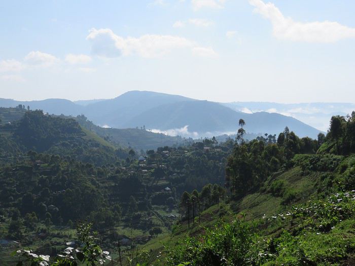
We’d already traveled quite a bit in South Africa and once in Namibia, always self-driving. When the idea of visiting Uganda came up, we debated—especially me 😛—whether to go solo or with a guide. My husband quickly convinced me to do it self-drive, so I started planning and organizing the trip accordingly. We began preparations and bookings in June 2019 for a trip scheduled during the first two weeks of February 2020. We deliberately chose to explore just a small part of Uganda and take our time. We traveled as a group of four, with our oldest son and his partner.
Here’s our itinerary: - February 1: Departure from Brussels, arrival and overnight in Entebbe - February 2: Drive to Lake Mburo and overnight there - February 3: Drive to Lake Bunyonyi and overnight there - February 4: Boat ride on the lake, then departure for Kisoro. Overnight there - February 5: Trek in Mount Mgahinga National Park for the youngsters. Overnight in Kisoro - February 6: Drive to Bwindi Impenetrable Forest. Overnight in Rushaga - February 7: Gorilla tracking in Rushaga. Overnight in Rushaga - February 8: Drive to Queen Elizabeth National Park – Southern sector – Overnight on the park’s edge - February 9: Morning in the southern sector of the park, then crossing to the northern part – Short safari in the late afternoon – Overnight by the Kazinga Channel - February 10: Safari and boat cruise – Second night on site - February 11: Drive to Kibale Forest – Overnight there - February 12: Chimpanzee tracking in the morning – Bigodi swamps in the afternoon – Second night there - February 13: Scenic drive to see the crater lakes + walk at Lake Nkuruba Nature Reserve – Third night there - February 14: Return to Entebbe - February 15: Morning boat ride in the Mabamba swamps – Afternoon by Lake Victoria and midnight flight to Brussels. That’s the broad outline of our trip.
We fell in love with this country: the people, the kids shouting "muzungu," the colors, the landscapes, the wildlife... But we were also saddened by the poverty in some villages and the child labor, especially in "quarries."
I’ll try to post a day-by-day account if it interests anyone.
Preamble:
For summer 2019, the idea was to return to Africa. We had already been to Namibia in 2017 (+ a few days in Botswana and the end of the trip at Victoria Falls), which we loved, and a trip to Asia in 2018 (Borneo, Perhentian, and Singapore), a nature-focused trip but a bit disappointing due to environmental destruction. The desire to return to Africa was very strong. We wanted a change of scenery, nature, discoveries, to step out of our little comfort zone (a bit, anyway!) and experience travel differently. In short, we dreamed of authenticity, and we weren’t disappointed.
We traveled as a family of four with our daughters, aged 19 and 17. When the urge for Africa hit, Uganda quickly stood out, especially for the chance to see rare animals, particularly the famous mountain gorillas. When I looked into the budget, I was quickly disheartened. It’s really expensive. Too expensive… Then, after reading a few trip reports on "VoyageForum" (thanks Muriel J!), I decided to ask a local agency for a quote. The first contact was very friendly and responsive, and the initial offer for two weeks fit our budget :). A few images gathered from the internet (especially Sipi Falls) finally convinced us all. I asked for an adapted offer with a few more sites to extend the trip to three weeks and cover a fairly complete visit to the country (which, of course, increased the budget! To stay within an acceptable range, we prioritized activities over accommodations and regularly chose the cheapest options, with 2-3 nice lodges in between). It’s booked! We were in October 2018, and the first thing to do was reserve permits to see the gorillas and chimpanzees. Then, the agency took care of all the bookings except for the international flights, which we booked with Ethiopian Airlines. A few months of waiting to look forward to… and a little worry too! Two events didn’t reassure us: the kidnapping of an American tourist by four men at the DRC border and the Ebola outbreak in Congo, with confirmed cases in Uganda by mid-June…
Here we are in July, and departure is approaching. The suitcases are packed (warm clothes, long, short, dark, light, practical, sun, rain, hiking/trekking shoes, flip-flops—clothes for every situation! Don’t forget: headlamp (essential!), binoculars, cameras), and we’re ready.
One day before departure, our agency Mpolampola, through its manager Paul, informs us that he won’t be the one taking care of us during the trip but another guide named Moses. He has a big problem with a vehicle and can’t do otherwise. For us, as long as everything is okay, no worries, especially since I had read glowing reviews about Moses, who turned out to be a very pleasant guide, cautious (most important) on the road, clear about all the activities, and an expert on birds, his specialty. We briefly met Paul in the middle of the trip, who is also very friendly. In short, we 100% recommend this agency. Flights to Entebbe went smoothly; we arrived around 10:30 AM, filled out health forms (Ebola information signs everywhere), visas, baggage claim, and met Moses, who took us directly to the vehicle. It was in pretty good condition with huge tires (we’d understand why later!), but it had quite a few miles (400,000 on the odometer!). Just missing a seatbelt… Okay, it’s Africa!
Now, here’s our day-by-day itinerary, which I’ll summarize briefly with ratings for each activity: ****TOPISSIME (Amazing) ***Very good **Good *Meh
Day 1) Departure from the airport at 11:45 AM for some currency exchange. Stop along the way at the equator for a meal and souvenir photo! Arrival at Lake Mburo Park *** around 5:00 PM. Even before entering the park, we saw lots of antelopes, zebras, elks, etc.—it’s magnificent. On the way, we had already encountered many goats and cows, and we were impressed by their enormous horns. We enjoyed a nice game drive until about 7:00 PM, when we reached our lodge, one of the nicest of the trip, Eagle’s Nest ****, with a magnificent view, a tent with a nice bathroom/shower, and a very good meal.
Day 2) Departure at 7:00 AM for a game drive; we encountered many animals again, especially antelopes, zebras, and birds. There are no giraffes, lions, or cheetahs in this park. We didn’t get lucky enough to see a leopard… :-) Then, we continued to Lake Bunyonyi ***, where the road and views are very beautiful, but we were shocked to see locals (mostly women and children) breaking stones by hand on the mountainside in very precarious safety conditions. There are regularly dramatic accidents because, over time, entire sections detach and cause landslides. These stones are then used for road construction… Another world… This was the only place we saw this. Lake Bunyonyi is a nice stop (but less exotic in our opinion since we have many lakes back home too!). We took a boat to our accommodation, Byoona Amagara ***, which has a lot of charm. We stayed in huts called "geodomes," completely open to nature, so it was very cool at night. To reach the toilets located below, you had to be brave! The meal consisted of lake shrimp—good but a bit bland.
Day 3) After a good breakfast, departure at 9:00 AM to visit three islands. We took several nice walks with beautiful views of the lake and islands. A local meal was served on the last island. At 1:00 PM, we met Moses for the rest of the program and headed to Ruhija in Bwindi Forest****. The landscapes are breathtaking. After two hours of driving and many photo stops, we arrived at our accommodation near the trekking starting point, Ruhija Gorilla Friends Resort **. We stayed in a room instead of the initially planned tents, which was just as well because there was a lot of wind during the night. We still had time for an activity and decided to meet the Bwata pygmies despite the bad reviews in the guide… The first part of the visit was quite nice, with a visit to a school where the children gave us a very joyful welcome. We had a great time listening to them sing and dance! Then we met the Bwata pygmies who live on the edge of the forest. When Bwindi Forest was declared a national park, they had to leave their habitat because their activities weren’t compatible with nature and wildlife protection. We left on a somewhat sad note… The visit ended with a local doctor explaining different medicinal plants, and we watched the making of local beer from sorghum. Good meal. We had butterflies in our stomachs—tomorrow was a big day! I admit I was a bit stressed, not entirely confident in my physical abilities…
Day 4) After a short night due to excitement, breakfast, and departure at 7:30 AM. First, it started calmly with singing and dancing. Then, a 15-minute briefing and group assignments. No one asked if we had any physical problems or anything (when booking, I had inquired a bit, and they told me groups were assigned based on physical abilities). We were assigned to the Mukiza group. At first, I was pretty happy—it was a fairly large group with babies :). The ranger explained that for now, they didn’t know where the gorillas were… the trackers couldn’t find them… Oh… (that’s not a good sign!!!) We set off at a good pace, first on a reasonably sloped path. We were accompanied by a family of four Italians and five porters (four for us!). After an hour, the ranger stopped us and informed us they still couldn’t find them—they had fought with another group the day before and scattered throughout the forest, so they were very far away, and we needed to move faster… Hmm… we picked up the pace (we weren’t going slowly before!!!) and walked for another good hour—down, up, down again, up again, we kept going, but always more or less on paths. Then another stop. A 10-minute break waiting for news. The news wasn’t very precise, it seemed! The ranger decided to cut through the forest—machetes were used to clear the path. We descended unimaginable slopes, then climbed back up. Our stick kept getting stuck; luckily, our porter helped us, held our hands, and the terrain was vertical! An hour later, another stop: we heard gorilla cries (yay!!!). False hope—we waited again for news from the trackers, who informed our ranger that it was a non-habituated family, so we couldn’t see them. Cold shower—we had to go all the way back up and return to the starting point to maybe see another group. But time was running out… We arrived around 1:30 PM; all the other groups had already left long ago. Our guide was worried because we still had a long drive ahead. We quickly ate a banana, and off we went for another trek (I was exhausted!). Luckily, this group was close—about 45 minutes of steep descent (I was already thinking about the climb back and considering being adopted by a gorilla ). The forest was sublime, with magnificent tree ferns—the place was truly splendid. Finally, we were there. The porters stayed behind, we grabbed our cameras, and followed the ranger. The progress wasn’t easy, but suddenly, a female was in front of us, curled up in a little ball, eating—so cute. The emotion overwhelmed us. But she moved away—it’s hard to observe them; they move constantly, and the terrain is very steep and uneven. We saw a female descending from a tree with a baby on her back—too adorable. Then, here was the silverback, enormous, incredible, yet so calm and peaceful. He ate quietly and gave us a nice demonstration of nostril exploration! We could observe them for a good hour, but photographing them wasn’t easy because they kept moving, and we could barely stand! Toward the end, a large male (black back) suddenly stood up and decided to pass right where I was! I ended up in the bushes, and the male passed in front of me just a few centimeters away (he stepped on one of my daughters’ feet!) followed by the whole family. Just an exceptional moment. It was time to leave; we had to climb back up. I dreaded it because, I admit, I was exhausted. We finished the hike after 4:00 PM, exhausted but happy. The ranger gave us diplomas, and we didn’t linger because we still had a long drive—we needed to reach Ishasha before nightfall. Our guide was a bit stressed. If we were to do it again, we’d spend an extra night in Bwindi. However, it seems finishing so late is exceptional—it never happens, according to our guide! The road between Bwindi and Ishasha is sublime, with extraordinary landscapes, and despite the late hour, we regularly asked our guide to stop for photos. We arrived at Enjojo *** Lodge around 6:00 PM. The huts are located quite far from the reception and the bathrooms, a bit far from the huts, but otherwise, it was very nice.
Day 5) Departure at 8:00 AM after a good breakfast with the hope of seeing tree-climbing lions (no luck!). Overall, there weren’t many animals, and we arrived around 12:45 PM at our next stop, Parkview Safari Lodge ****, with a magnificent view, a beautiful family bungalow, and a good meal. We enjoyed a short relaxation by the lovely pool. At 4:00 PM, we left to see Kyambura Gorge *** and hike there. Unfortunately, this activity is no longer available, so we walked around the area—it was very beautiful. Back at the hotel, a little rest after the previous day wasn’t a bad idea! Reading, swimming, meals, and dances made the end of the day enjoyable.
Day 6) Departure at 6:30 AM—one of our daughters was sick (stomachache, cold sweats…). Safari in Queen Elizabeth ** (Kaseny Plains)—a bit disappointing. Stop by the salt lake with a nice view. A small market, but we weren’t thrilled by the crafts (overall, apart from some beautiful baskets/plates, there wasn’t much, and the wooden objects were, in our opinion, much less pretty than in Namibia). Then we took the crater road (27 km long) **** with magnificent landscapes. However, you absolutely must close the windows because it’s infested with tsetse flies. At noon, we arrived at Mweya, where we stayed in basic rooms, but the restaurant was well-placed with a beautiful view of the Kazinga Channel. At 2:00 PM, we enjoyed a magnificent cruise **** on the channel. Elephants, antelopes, crocodiles, hippos (including adorable babies), buffaloes, all kinds of birds. Wow!!! Two hours of pure bliss. Quiet end of the day playing cards with a view of the channel and elephants.
Day 7) Departure at 6:00 AM—still sick, we weren’t sure if it was due to the preventive treatment (Malarone) or something else… Another game drive in Queen Elizabeth (Kaseny Plains) and breakfast by the salt lake. Overall, we were a bit disappointed by this park. Then we took the road to Crater Lakes***, again with very beautiful landscapes. A hike of about an hour and a half allowed us to discover these beautiful crater lakes (the water mainly comes from the Rwenzoris). We crossed pretty villages and had nice encounters. End of the day at Tinka’s Home ****, with a family. We loved this place—very welcoming, where we took a cooking class with our hosts. A really great time. After the meal, we enjoyed African stories and dances. Really awesome.
Day 8) Departure at 7:30 AM for another highly anticipated discovery—the chimpanzees in Kibale Forest ****. We went to the meeting point and were split into groups of six, each with a guide. We saw three different groups, and for the last group, we followed a chimpanzee (slightly more comfortable running in the forest than we were!) that led us to the group. Their cries are very impressive, and we could observe them well, even though they were often high up in the trees. We were lucky enough to see two on the ground, very close to us. It was magnificent. End of the encounter and return to the starting point—it was noon. We went back to Tinka’s Home for the meal (delicious!). At 2:00 PM, we hiked in Bigodi Swamp ***, a marsh surrounded by beautiful vegetation, especially huge papyrus, and inhabited by many birds and monkeys. We saw, among others, black-and-white colobus monkeys, red colobus monkeys, and vervet monkeys. We also visited a basket-weaving workshop where we bought two beautiful baskets. Then a short stop in Fort Portal, where we stayed for two nights at Ruwenzori View Guesthouse ***, a nice place with a family room and very good communal meals.
Day 9) Departure at 8:00 AM for a hike in the Rwenzori****—it was a bit chaotic today. First, we had to exchange shillings because we wouldn’t have another chance in the following days. At the bank, employees went to get the bills by motorcycle from other buildings—it was quite surreal! And it took time! Then there was a misunderstanding between the organizer and me… I really wanted to see the region where chameleons are found in the Rwenzori—this region is south of the mountain range, and we were in the north! Anyway, the program included an ascent in the northern part with a positive elevation gain of over 1,500 meters… Talking to the guide scheduled for this hike (Noah), we explained that we really wanted to discover the vegetation and these famous chameleons, not necessarily achieve a physical feat… (we’d had enough!). The decision was made to go south, which meant quite a bit of driving. The hike was really enjoyable, with magnificent vegetation by the river. We saw three of the four chameleon species present, including the famous three-horned chameleon. The region is superb. We ended with a drink at Ruboni Camp, which has a magnificent view of the region (ideally, we should have stayed there). Two hours of driving to finish, and a good meal :).
Day 10) Departure at 8:00 AM—we had a long drive to Ziwa Rhino Ranch****. We passed through Hoima, had lunch in Masindi, and arrived in time for the rhino tracking walk. We could approach them closely on foot—it was impressive. We saw eight. Since we were staying on-site in the guesthouse **, we received precise safety instructions for moving between the rooms and the restaurant. And we quickly understood why!
Day 11) Departure at 6:00 AM for breakfast—surprise, in front of our room, several large rhinos were sleeping (we had also heard a lot of animal noises during the night—rhinos but also what seemed to be predators). So we had to take a detour to reach the restaurant! Second surprise—next to the restaurant, just three meters away at most, two mothers and their baby were also sleeping! Memorable! Then we had an appointment for the shoebill trek and canoe ride **** (package with the previous day’s walk). So there we were, in our boots, splashing through 30 cm of water in search of the shoebill (I really wanted to see one :))! It was really fun, and luck was on our side—a shoebill had just landed in the distance! We approached as best we could and observed it from afar. What a strange bird! There are very few left, and Uganda is one of the countries where the chances of seeing one are quite good. The tour continued with a canoe cruise where we saw a herd of cows (the famous ones with enormous horns) being swum as a dowry to the father of the future bride! A funny spectacle. This stop wasn’t the most anticipated, but we all thought it was really worth the detour. Road to Murchison Falls Park, and arrival around noon at Red Chili Rest Camp **, where we stayed for two nights (family banda). Good meal. Then a cruise to Murchison Falls*** where we disembarked and continued on foot. It was pretty. Back to Red Chili.
Day 12) This morning, early departure for a cruise in search of the shoebill*** (booked in case we didn’t see one at Ziwa). The landscapes were pretty, but there weren’t many birds in the end. We spotted the chosen one from afar after the first 10 minutes—so the suspense didn’t last long :-) It was a nice activity but quite long—5 hours. In the afternoon, safari in Murchison Park****—this park is sublime, the landscapes fabulous. Really one of our favorite parts of the trip. Lots of animals and even a leopard spotted with binoculars because it was far away! Night at Red Chili.
Day 13) Departure for the first morning ferry—it was drizzling, the sky was threatening at first, so the landscape was spectacular! Beautiful contrasts. In the middle of the morning, we were lucky to observe a whole group of lions, first from afar, then with a little patience, the whole group approached until they passed beside and in front of our vehicle. What emotion and excitement! We could then observe large groups of giraffes. They were magnificent. The morning was incredible. Then we headed to our lodge, Fort Murchison ****, and on the way, we saw a whole group of elephants—the view was magnificent. We had a very good meal and enjoyed the pool a bit. We also met Paul, the organizer of our trip. Very nice :). In the late afternoon, off for a short safari in the park. We slept in very well-equipped tents.
Day 14) Today, we had a long drive to Kidepo Park. It was raining, which didn’t help our guide—according to him, the tracks near Kidepo turn to mud with rain and become difficult to navigate. We saw, among other things, a bus in a bad situation in the ditch. Some sections were really tricky, and we were glad to have a driver. The end of the trip—the landscape was spectacular and original, and we saw some traditional villages. We arrived at Kidepo quite late. Short safari in the park before reaching the accommodation. We booked two simple bandas in the park camp**. It was clean but didn’t hold up well in the rain . The restaurant was very nice, though.
Day 15) The day was dedicated to discovering Kidepo Park **** where the landscapes were again superb. First encounter with a lioness resting on a rock. We saw other lions later and observed them for a long time. There were almost no other tourists in the park. Our daughter wasn’t feeling well, and by the time we arrived at the lodge, she had a temperature of 39.5°C (103.1°F)… A nap was necessary. In the late afternoon, we returned to the spot where we had seen the lions that morning, and they were still there—they weren’t happy because rain was threatening! It was a great photo opportunity. Then came the downpour, and our driver urged us to return quickly because the tracks were becoming impassable. Indeed, a jeep was in the ditch… The return was eventful, and several times we slid without being able to do anything… Wow, what a day!
Day 16) No safari this morning because of impassable tracks—the road to Kotido*** was longer than expected as we had to take a detour. The landscapes along the way were surprising. We finally arrived around 1:00 PM at the accommodation and left at 3:00 PM to visit the largest manyatta in East Africa with two translators. It was incredible—a very beautiful experience. The manyatta is immense and has 28,000 inhabitants. Night at Karamojaarts guesthouse*—very average meal.
Day 17) Departure for Moroto****—on the way, we saw many bird species. Moroto doesn’t look like other Ugandan cities. Life there seems very pleasant. We arrived at Kara-Tunga and had a bite to eat. At 4:00 PM, we left to visit a Karamojong village. We enjoyed beautiful dances and watched communal games—it was fun and so authentic. Then we headed to a kraal (where shepherds and herds are) to set up our camp. Moses had to get used to the idea of sleeping in the tribe in a tent! It was incredible to find ourselves in this universe. The place was beautiful, and we had a great time with the Karamojong. Some had never seen white people… had never been in a car… Their culture is incredible. During the evening, around the fire, to our guide’s dismay (a bird enthusiast), they grilled hornbills! On our side, we ate a meal prepared by Kara-Tunga for our sensitive stomachs! Night in a tent.
Day 18) Dawn wake-up in the fog—the atmosphere was quite strange. Our daughter was attacked by a cow—fortunately, more fear than harm, but she ended up with a lot of thorns in her buttocks and thighs ! Then we left for the Mount Elgon region, specifically Sipi Falls****. Lacam Lodge****, perched on the edge of the cliff with a direct view of one of the falls, was just magnificent. The view and landscapes were fabulous. Big favorite. We had dinner and then went for a hike to visit the three falls in the region, partly in the rain. The landscapes were breathtaking! Sunset at Lacam Lodge with the sun setting over the waterfall. We couldn’t get enough and stayed to admire until nightfall!
Day 19) Visit to coffee plantations*** where we were given all the useful explanations to understand the culture and the incredible work required for this product, which is ultimately not very glorified. The visit was very interesting, and we drank very good coffee with the owners. Last photos at Lacam Lodge, and then departure for Jinja, where we arrived in the middle of the afternoon. We took a small cruise to see the source of the Nile*. Very touristy and not at all to our taste… Then a meal at Jinja Base Camp** where we enjoyed guacamole. Our guide Moses left us because another group was waiting for him!
Day 20) Road to Kampala***, the market, the Gaddafi Mosque. Short but interesting visit. Last meal in Entebbe by Lake Victoria, where we almost felt like we were by the sea. Transfer to the airport and return to Switzerland…
Epilogue: All four of us were enchanted by this trip, which will undoubtedly remain one of the most beautiful we’ve ever taken. Talking about it gives me chills and brings tears to my eyes. It was simply a magnificent experience. However, I wouldn’t recommend this trip to everyone because you often have to overlook small inconveniences like toilets (the worst of my life) and certain comfort details that, for us, remain details but could be important to others.
Our favorites: - The gorilla trek - The cruise on Kazinga Channel - The Fort Portal region - The Rwenzori Mountains - The chimpanzee trek - Murchison Falls - Kidepo - Spending time with the Karamojong tribe - The Sipi Falls region - The accommodations: Eagle’s Nest, Byonna Amagara, Parkview Lodge, Tinka’s Home, Rwenzori Guesthouse, Fort Murchison, Night in the kraal, and Lacam Lodge
What we liked less: - Queen Elizabeth Park - Jinja - The accommodations: Ziwa Rhino Ranch, Karamojaarts Guesthouse
I’ll try to post some photos later. If you have any questions about a future trip, I’d be happy to answer them.
For summer 2019, the idea was to return to Africa. We had already been to Namibia in 2017 (+ a few days in Botswana and the end of the trip at Victoria Falls), which we loved, and a trip to Asia in 2018 (Borneo, Perhentian, and Singapore), a nature-focused trip but a bit disappointing due to environmental destruction. The desire to return to Africa was very strong. We wanted a change of scenery, nature, discoveries, to step out of our little comfort zone (a bit, anyway!) and experience travel differently. In short, we dreamed of authenticity, and we weren’t disappointed.
We traveled as a family of four with our daughters, aged 19 and 17. When the urge for Africa hit, Uganda quickly stood out, especially for the chance to see rare animals, particularly the famous mountain gorillas. When I looked into the budget, I was quickly disheartened. It’s really expensive. Too expensive… Then, after reading a few trip reports on "VoyageForum" (thanks Muriel J!), I decided to ask a local agency for a quote. The first contact was very friendly and responsive, and the initial offer for two weeks fit our budget :). A few images gathered from the internet (especially Sipi Falls) finally convinced us all. I asked for an adapted offer with a few more sites to extend the trip to three weeks and cover a fairly complete visit to the country (which, of course, increased the budget! To stay within an acceptable range, we prioritized activities over accommodations and regularly chose the cheapest options, with 2-3 nice lodges in between). It’s booked! We were in October 2018, and the first thing to do was reserve permits to see the gorillas and chimpanzees. Then, the agency took care of all the bookings except for the international flights, which we booked with Ethiopian Airlines. A few months of waiting to look forward to… and a little worry too! Two events didn’t reassure us: the kidnapping of an American tourist by four men at the DRC border and the Ebola outbreak in Congo, with confirmed cases in Uganda by mid-June…
Here we are in July, and departure is approaching. The suitcases are packed (warm clothes, long, short, dark, light, practical, sun, rain, hiking/trekking shoes, flip-flops—clothes for every situation! Don’t forget: headlamp (essential!), binoculars, cameras), and we’re ready.
One day before departure, our agency Mpolampola, through its manager Paul, informs us that he won’t be the one taking care of us during the trip but another guide named Moses. He has a big problem with a vehicle and can’t do otherwise. For us, as long as everything is okay, no worries, especially since I had read glowing reviews about Moses, who turned out to be a very pleasant guide, cautious (most important) on the road, clear about all the activities, and an expert on birds, his specialty. We briefly met Paul in the middle of the trip, who is also very friendly. In short, we 100% recommend this agency. Flights to Entebbe went smoothly; we arrived around 10:30 AM, filled out health forms (Ebola information signs everywhere), visas, baggage claim, and met Moses, who took us directly to the vehicle. It was in pretty good condition with huge tires (we’d understand why later!), but it had quite a few miles (400,000 on the odometer!). Just missing a seatbelt… Okay, it’s Africa!
Now, here’s our day-by-day itinerary, which I’ll summarize briefly with ratings for each activity: ****TOPISSIME (Amazing) ***Very good **Good *Meh
Day 1) Departure from the airport at 11:45 AM for some currency exchange. Stop along the way at the equator for a meal and souvenir photo! Arrival at Lake Mburo Park *** around 5:00 PM. Even before entering the park, we saw lots of antelopes, zebras, elks, etc.—it’s magnificent. On the way, we had already encountered many goats and cows, and we were impressed by their enormous horns. We enjoyed a nice game drive until about 7:00 PM, when we reached our lodge, one of the nicest of the trip, Eagle’s Nest ****, with a magnificent view, a tent with a nice bathroom/shower, and a very good meal.
Day 2) Departure at 7:00 AM for a game drive; we encountered many animals again, especially antelopes, zebras, and birds. There are no giraffes, lions, or cheetahs in this park. We didn’t get lucky enough to see a leopard… :-) Then, we continued to Lake Bunyonyi ***, where the road and views are very beautiful, but we were shocked to see locals (mostly women and children) breaking stones by hand on the mountainside in very precarious safety conditions. There are regularly dramatic accidents because, over time, entire sections detach and cause landslides. These stones are then used for road construction… Another world… This was the only place we saw this. Lake Bunyonyi is a nice stop (but less exotic in our opinion since we have many lakes back home too!). We took a boat to our accommodation, Byoona Amagara ***, which has a lot of charm. We stayed in huts called "geodomes," completely open to nature, so it was very cool at night. To reach the toilets located below, you had to be brave! The meal consisted of lake shrimp—good but a bit bland.
Day 3) After a good breakfast, departure at 9:00 AM to visit three islands. We took several nice walks with beautiful views of the lake and islands. A local meal was served on the last island. At 1:00 PM, we met Moses for the rest of the program and headed to Ruhija in Bwindi Forest****. The landscapes are breathtaking. After two hours of driving and many photo stops, we arrived at our accommodation near the trekking starting point, Ruhija Gorilla Friends Resort **. We stayed in a room instead of the initially planned tents, which was just as well because there was a lot of wind during the night. We still had time for an activity and decided to meet the Bwata pygmies despite the bad reviews in the guide… The first part of the visit was quite nice, with a visit to a school where the children gave us a very joyful welcome. We had a great time listening to them sing and dance! Then we met the Bwata pygmies who live on the edge of the forest. When Bwindi Forest was declared a national park, they had to leave their habitat because their activities weren’t compatible with nature and wildlife protection. We left on a somewhat sad note… The visit ended with a local doctor explaining different medicinal plants, and we watched the making of local beer from sorghum. Good meal. We had butterflies in our stomachs—tomorrow was a big day! I admit I was a bit stressed, not entirely confident in my physical abilities…
Day 4) After a short night due to excitement, breakfast, and departure at 7:30 AM. First, it started calmly with singing and dancing. Then, a 15-minute briefing and group assignments. No one asked if we had any physical problems or anything (when booking, I had inquired a bit, and they told me groups were assigned based on physical abilities). We were assigned to the Mukiza group. At first, I was pretty happy—it was a fairly large group with babies :). The ranger explained that for now, they didn’t know where the gorillas were… the trackers couldn’t find them… Oh… (that’s not a good sign!!!) We set off at a good pace, first on a reasonably sloped path. We were accompanied by a family of four Italians and five porters (four for us!). After an hour, the ranger stopped us and informed us they still couldn’t find them—they had fought with another group the day before and scattered throughout the forest, so they were very far away, and we needed to move faster… Hmm… we picked up the pace (we weren’t going slowly before!!!) and walked for another good hour—down, up, down again, up again, we kept going, but always more or less on paths. Then another stop. A 10-minute break waiting for news. The news wasn’t very precise, it seemed! The ranger decided to cut through the forest—machetes were used to clear the path. We descended unimaginable slopes, then climbed back up. Our stick kept getting stuck; luckily, our porter helped us, held our hands, and the terrain was vertical! An hour later, another stop: we heard gorilla cries (yay!!!). False hope—we waited again for news from the trackers, who informed our ranger that it was a non-habituated family, so we couldn’t see them. Cold shower—we had to go all the way back up and return to the starting point to maybe see another group. But time was running out… We arrived around 1:30 PM; all the other groups had already left long ago. Our guide was worried because we still had a long drive ahead. We quickly ate a banana, and off we went for another trek (I was exhausted!). Luckily, this group was close—about 45 minutes of steep descent (I was already thinking about the climb back and considering being adopted by a gorilla ). The forest was sublime, with magnificent tree ferns—the place was truly splendid. Finally, we were there. The porters stayed behind, we grabbed our cameras, and followed the ranger. The progress wasn’t easy, but suddenly, a female was in front of us, curled up in a little ball, eating—so cute. The emotion overwhelmed us. But she moved away—it’s hard to observe them; they move constantly, and the terrain is very steep and uneven. We saw a female descending from a tree with a baby on her back—too adorable. Then, here was the silverback, enormous, incredible, yet so calm and peaceful. He ate quietly and gave us a nice demonstration of nostril exploration! We could observe them for a good hour, but photographing them wasn’t easy because they kept moving, and we could barely stand! Toward the end, a large male (black back) suddenly stood up and decided to pass right where I was! I ended up in the bushes, and the male passed in front of me just a few centimeters away (he stepped on one of my daughters’ feet!) followed by the whole family. Just an exceptional moment. It was time to leave; we had to climb back up. I dreaded it because, I admit, I was exhausted. We finished the hike after 4:00 PM, exhausted but happy. The ranger gave us diplomas, and we didn’t linger because we still had a long drive—we needed to reach Ishasha before nightfall. Our guide was a bit stressed. If we were to do it again, we’d spend an extra night in Bwindi. However, it seems finishing so late is exceptional—it never happens, according to our guide! The road between Bwindi and Ishasha is sublime, with extraordinary landscapes, and despite the late hour, we regularly asked our guide to stop for photos. We arrived at Enjojo *** Lodge around 6:00 PM. The huts are located quite far from the reception and the bathrooms, a bit far from the huts, but otherwise, it was very nice.
Day 5) Departure at 8:00 AM after a good breakfast with the hope of seeing tree-climbing lions (no luck!). Overall, there weren’t many animals, and we arrived around 12:45 PM at our next stop, Parkview Safari Lodge ****, with a magnificent view, a beautiful family bungalow, and a good meal. We enjoyed a short relaxation by the lovely pool. At 4:00 PM, we left to see Kyambura Gorge *** and hike there. Unfortunately, this activity is no longer available, so we walked around the area—it was very beautiful. Back at the hotel, a little rest after the previous day wasn’t a bad idea! Reading, swimming, meals, and dances made the end of the day enjoyable.
Day 6) Departure at 6:30 AM—one of our daughters was sick (stomachache, cold sweats…). Safari in Queen Elizabeth ** (Kaseny Plains)—a bit disappointing. Stop by the salt lake with a nice view. A small market, but we weren’t thrilled by the crafts (overall, apart from some beautiful baskets/plates, there wasn’t much, and the wooden objects were, in our opinion, much less pretty than in Namibia). Then we took the crater road (27 km long) **** with magnificent landscapes. However, you absolutely must close the windows because it’s infested with tsetse flies. At noon, we arrived at Mweya, where we stayed in basic rooms, but the restaurant was well-placed with a beautiful view of the Kazinga Channel. At 2:00 PM, we enjoyed a magnificent cruise **** on the channel. Elephants, antelopes, crocodiles, hippos (including adorable babies), buffaloes, all kinds of birds. Wow!!! Two hours of pure bliss. Quiet end of the day playing cards with a view of the channel and elephants.
Day 7) Departure at 6:00 AM—still sick, we weren’t sure if it was due to the preventive treatment (Malarone) or something else… Another game drive in Queen Elizabeth (Kaseny Plains) and breakfast by the salt lake. Overall, we were a bit disappointed by this park. Then we took the road to Crater Lakes***, again with very beautiful landscapes. A hike of about an hour and a half allowed us to discover these beautiful crater lakes (the water mainly comes from the Rwenzoris). We crossed pretty villages and had nice encounters. End of the day at Tinka’s Home ****, with a family. We loved this place—very welcoming, where we took a cooking class with our hosts. A really great time. After the meal, we enjoyed African stories and dances. Really awesome.
Day 8) Departure at 7:30 AM for another highly anticipated discovery—the chimpanzees in Kibale Forest ****. We went to the meeting point and were split into groups of six, each with a guide. We saw three different groups, and for the last group, we followed a chimpanzee (slightly more comfortable running in the forest than we were!) that led us to the group. Their cries are very impressive, and we could observe them well, even though they were often high up in the trees. We were lucky enough to see two on the ground, very close to us. It was magnificent. End of the encounter and return to the starting point—it was noon. We went back to Tinka’s Home for the meal (delicious!). At 2:00 PM, we hiked in Bigodi Swamp ***, a marsh surrounded by beautiful vegetation, especially huge papyrus, and inhabited by many birds and monkeys. We saw, among others, black-and-white colobus monkeys, red colobus monkeys, and vervet monkeys. We also visited a basket-weaving workshop where we bought two beautiful baskets. Then a short stop in Fort Portal, where we stayed for two nights at Ruwenzori View Guesthouse ***, a nice place with a family room and very good communal meals.
Day 9) Departure at 8:00 AM for a hike in the Rwenzori****—it was a bit chaotic today. First, we had to exchange shillings because we wouldn’t have another chance in the following days. At the bank, employees went to get the bills by motorcycle from other buildings—it was quite surreal! And it took time! Then there was a misunderstanding between the organizer and me… I really wanted to see the region where chameleons are found in the Rwenzori—this region is south of the mountain range, and we were in the north! Anyway, the program included an ascent in the northern part with a positive elevation gain of over 1,500 meters… Talking to the guide scheduled for this hike (Noah), we explained that we really wanted to discover the vegetation and these famous chameleons, not necessarily achieve a physical feat… (we’d had enough!). The decision was made to go south, which meant quite a bit of driving. The hike was really enjoyable, with magnificent vegetation by the river. We saw three of the four chameleon species present, including the famous three-horned chameleon. The region is superb. We ended with a drink at Ruboni Camp, which has a magnificent view of the region (ideally, we should have stayed there). Two hours of driving to finish, and a good meal :).
Day 10) Departure at 8:00 AM—we had a long drive to Ziwa Rhino Ranch****. We passed through Hoima, had lunch in Masindi, and arrived in time for the rhino tracking walk. We could approach them closely on foot—it was impressive. We saw eight. Since we were staying on-site in the guesthouse **, we received precise safety instructions for moving between the rooms and the restaurant. And we quickly understood why!
Day 11) Departure at 6:00 AM for breakfast—surprise, in front of our room, several large rhinos were sleeping (we had also heard a lot of animal noises during the night—rhinos but also what seemed to be predators). So we had to take a detour to reach the restaurant! Second surprise—next to the restaurant, just three meters away at most, two mothers and their baby were also sleeping! Memorable! Then we had an appointment for the shoebill trek and canoe ride **** (package with the previous day’s walk). So there we were, in our boots, splashing through 30 cm of water in search of the shoebill (I really wanted to see one :))! It was really fun, and luck was on our side—a shoebill had just landed in the distance! We approached as best we could and observed it from afar. What a strange bird! There are very few left, and Uganda is one of the countries where the chances of seeing one are quite good. The tour continued with a canoe cruise where we saw a herd of cows (the famous ones with enormous horns) being swum as a dowry to the father of the future bride! A funny spectacle. This stop wasn’t the most anticipated, but we all thought it was really worth the detour. Road to Murchison Falls Park, and arrival around noon at Red Chili Rest Camp **, where we stayed for two nights (family banda). Good meal. Then a cruise to Murchison Falls*** where we disembarked and continued on foot. It was pretty. Back to Red Chili.
Day 12) This morning, early departure for a cruise in search of the shoebill*** (booked in case we didn’t see one at Ziwa). The landscapes were pretty, but there weren’t many birds in the end. We spotted the chosen one from afar after the first 10 minutes—so the suspense didn’t last long :-) It was a nice activity but quite long—5 hours. In the afternoon, safari in Murchison Park****—this park is sublime, the landscapes fabulous. Really one of our favorite parts of the trip. Lots of animals and even a leopard spotted with binoculars because it was far away! Night at Red Chili.
Day 13) Departure for the first morning ferry—it was drizzling, the sky was threatening at first, so the landscape was spectacular! Beautiful contrasts. In the middle of the morning, we were lucky to observe a whole group of lions, first from afar, then with a little patience, the whole group approached until they passed beside and in front of our vehicle. What emotion and excitement! We could then observe large groups of giraffes. They were magnificent. The morning was incredible. Then we headed to our lodge, Fort Murchison ****, and on the way, we saw a whole group of elephants—the view was magnificent. We had a very good meal and enjoyed the pool a bit. We also met Paul, the organizer of our trip. Very nice :). In the late afternoon, off for a short safari in the park. We slept in very well-equipped tents.
Day 14) Today, we had a long drive to Kidepo Park. It was raining, which didn’t help our guide—according to him, the tracks near Kidepo turn to mud with rain and become difficult to navigate. We saw, among other things, a bus in a bad situation in the ditch. Some sections were really tricky, and we were glad to have a driver. The end of the trip—the landscape was spectacular and original, and we saw some traditional villages. We arrived at Kidepo quite late. Short safari in the park before reaching the accommodation. We booked two simple bandas in the park camp**. It was clean but didn’t hold up well in the rain . The restaurant was very nice, though.
Day 15) The day was dedicated to discovering Kidepo Park **** where the landscapes were again superb. First encounter with a lioness resting on a rock. We saw other lions later and observed them for a long time. There were almost no other tourists in the park. Our daughter wasn’t feeling well, and by the time we arrived at the lodge, she had a temperature of 39.5°C (103.1°F)… A nap was necessary. In the late afternoon, we returned to the spot where we had seen the lions that morning, and they were still there—they weren’t happy because rain was threatening! It was a great photo opportunity. Then came the downpour, and our driver urged us to return quickly because the tracks were becoming impassable. Indeed, a jeep was in the ditch… The return was eventful, and several times we slid without being able to do anything… Wow, what a day!
Day 16) No safari this morning because of impassable tracks—the road to Kotido*** was longer than expected as we had to take a detour. The landscapes along the way were surprising. We finally arrived around 1:00 PM at the accommodation and left at 3:00 PM to visit the largest manyatta in East Africa with two translators. It was incredible—a very beautiful experience. The manyatta is immense and has 28,000 inhabitants. Night at Karamojaarts guesthouse*—very average meal.
Day 17) Departure for Moroto****—on the way, we saw many bird species. Moroto doesn’t look like other Ugandan cities. Life there seems very pleasant. We arrived at Kara-Tunga and had a bite to eat. At 4:00 PM, we left to visit a Karamojong village. We enjoyed beautiful dances and watched communal games—it was fun and so authentic. Then we headed to a kraal (where shepherds and herds are) to set up our camp. Moses had to get used to the idea of sleeping in the tribe in a tent! It was incredible to find ourselves in this universe. The place was beautiful, and we had a great time with the Karamojong. Some had never seen white people… had never been in a car… Their culture is incredible. During the evening, around the fire, to our guide’s dismay (a bird enthusiast), they grilled hornbills! On our side, we ate a meal prepared by Kara-Tunga for our sensitive stomachs! Night in a tent.
Day 18) Dawn wake-up in the fog—the atmosphere was quite strange. Our daughter was attacked by a cow—fortunately, more fear than harm, but she ended up with a lot of thorns in her buttocks and thighs ! Then we left for the Mount Elgon region, specifically Sipi Falls****. Lacam Lodge****, perched on the edge of the cliff with a direct view of one of the falls, was just magnificent. The view and landscapes were fabulous. Big favorite. We had dinner and then went for a hike to visit the three falls in the region, partly in the rain. The landscapes were breathtaking! Sunset at Lacam Lodge with the sun setting over the waterfall. We couldn’t get enough and stayed to admire until nightfall!
Day 19) Visit to coffee plantations*** where we were given all the useful explanations to understand the culture and the incredible work required for this product, which is ultimately not very glorified. The visit was very interesting, and we drank very good coffee with the owners. Last photos at Lacam Lodge, and then departure for Jinja, where we arrived in the middle of the afternoon. We took a small cruise to see the source of the Nile*. Very touristy and not at all to our taste… Then a meal at Jinja Base Camp** where we enjoyed guacamole. Our guide Moses left us because another group was waiting for him!
Day 20) Road to Kampala***, the market, the Gaddafi Mosque. Short but interesting visit. Last meal in Entebbe by Lake Victoria, where we almost felt like we were by the sea. Transfer to the airport and return to Switzerland…
Epilogue: All four of us were enchanted by this trip, which will undoubtedly remain one of the most beautiful we’ve ever taken. Talking about it gives me chills and brings tears to my eyes. It was simply a magnificent experience. However, I wouldn’t recommend this trip to everyone because you often have to overlook small inconveniences like toilets (the worst of my life) and certain comfort details that, for us, remain details but could be important to others.
Our favorites: - The gorilla trek - The cruise on Kazinga Channel - The Fort Portal region - The Rwenzori Mountains - The chimpanzee trek - Murchison Falls - Kidepo - Spending time with the Karamojong tribe - The Sipi Falls region - The accommodations: Eagle’s Nest, Byonna Amagara, Parkview Lodge, Tinka’s Home, Rwenzori Guesthouse, Fort Murchison, Night in the kraal, and Lacam Lodge
What we liked less: - Queen Elizabeth Park - Jinja - The accommodations: Ziwa Rhino Ranch, Karamojaarts Guesthouse
I’ll try to post some photos later. If you have any questions about a future trip, I’d be happy to answer them.
Hi everyone,
I wanted to share a really unpleasant experience from our last trip booked with Promoséjours and organized by FTI.
We booked an 8-day/7-night stay in Egypt, from June 8 to 15. The flight initially scheduled was changed a week before departure to take off at 10 PM from Paris CDG. In the end, it took off with a 1-hour delay and included an unmentioned stopover in Marsa Alam. We landed in Hurghada at 4 AM and arrived at the hotel at 6 AM. So, we spent our first night on the plane.
For the return trip, surprise—the flight was moved up. We left the hotel at 10:30 PM on Friday the 14th to take off at 2 AM and land at 7 AM at Paris CDG. So, we spent our last night on the plane too.
After sending a complaint letter to Promoséjours / FTI, they replied that the first and last days can be dedicated to transport (which I already knew) and that no matter how many nights you book, you’re not guaranteed to spend them in the hotel—it could just as well be on the plane.
I’m really questioning this.
Isn’t there a law that protects customers in cases like this? Because when I do the math, the first and part of the second day were spent on transport, same for the second-to-last and last day. And I paid for 7 nights for a stay that only lasted 5.
Anyway, I just want to say thanks to them—thanks to their two sleepless nights in transit, I’m coming back even more exhausted from a trip that was supposed to be restful!
I also want to warn anyone booking through this agency about visas for Egypt. At booking, they told me the visa was included in the price, then they sent me an email saying I’d have to pay for it on-site at 25 €. Once there, we were directed to a special line for FTI customers, and guess what? They charged us 30 €!
Basically, they’re great at making sure you *enjoy* your vacation—mostly by enjoying your wallet!
If anyone has dealt with this kind of situation and won their case, I’m all ears.
Thanks in advance!
I wanted to share a really unpleasant experience from our last trip booked with Promoséjours and organized by FTI.
We booked an 8-day/7-night stay in Egypt, from June 8 to 15. The flight initially scheduled was changed a week before departure to take off at 10 PM from Paris CDG. In the end, it took off with a 1-hour delay and included an unmentioned stopover in Marsa Alam. We landed in Hurghada at 4 AM and arrived at the hotel at 6 AM. So, we spent our first night on the plane.
For the return trip, surprise—the flight was moved up. We left the hotel at 10:30 PM on Friday the 14th to take off at 2 AM and land at 7 AM at Paris CDG. So, we spent our last night on the plane too.
After sending a complaint letter to Promoséjours / FTI, they replied that the first and last days can be dedicated to transport (which I already knew) and that no matter how many nights you book, you’re not guaranteed to spend them in the hotel—it could just as well be on the plane.
I’m really questioning this.
Isn’t there a law that protects customers in cases like this? Because when I do the math, the first and part of the second day were spent on transport, same for the second-to-last and last day. And I paid for 7 nights for a stay that only lasted 5.
Anyway, I just want to say thanks to them—thanks to their two sleepless nights in transit, I’m coming back even more exhausted from a trip that was supposed to be restful!
I also want to warn anyone booking through this agency about visas for Egypt. At booking, they told me the visa was included in the price, then they sent me an email saying I’d have to pay for it on-site at 25 €. Once there, we were directed to a special line for FTI customers, and guess what? They charged us 30 €!
Basically, they’re great at making sure you *enjoy* your vacation—mostly by enjoying your wallet!
If anyone has dealt with this kind of situation and won their case, I’m all ears.
Thanks in advance!
Saturday, September 22, 2018
This morning, we woke up at dawn at 6:00 AM. Headed to Letlhakeng, the last town where we could fill up on fuel before starting our crossing of the Kalahari. Our consumption since Johannesburg has been 11L/100 km. We took the direction of Khutse Game Reserve, whose entrance is about a hundred kilometers north of Letlhakeng. Access is via a gravel road along which we saw magnificent pink trees.
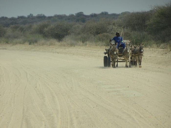
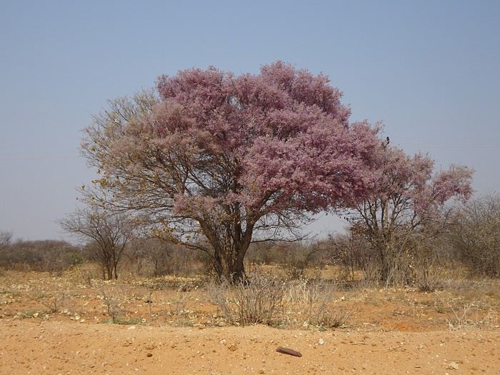
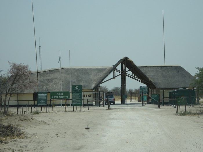
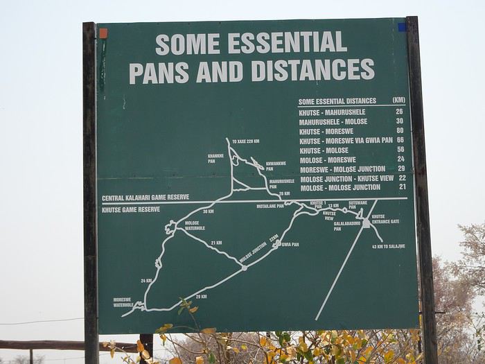
At Khutse Gate, we registered in the entry log and paid the access fees for 6 days: 120 Pulas/day/person and 50 Pulas/day/vehicle. Our stays at the Xaka and Deception Valley campsites had been reserved by our tour operator but not paid, contrary to what they’d told us. So we settled the 2 unpaid days of camping at 30 Pulas/day/person. The park rangers informed us that the southern triangle of Khutse Game Reserve, with its tip at Moreswe Pan, had burned. Note that these two campsites are government-run, which explains the low prices. Private campsites cost ten to fifteen times more. We headed to Khutse campsite, site 5. To enter the parks, you must have a reservation either at a lodge or a campsite. Since the number of spots in the campsites is limited, this means you have to book well in advance. We ate the salad we’d prepared the night before at our campsite. It was very hot—39°C. We made a round trip to Khankhe Pan. On the track, we encountered three South African cars, one of which was stuck in the sand and blocking the way. We helped push the car to get it unstuck. We saw very few animals at Khankhe Pan. We returned to the campsite, which has dry toilets and a shower you have to supply with your own water. We tried out the shower.
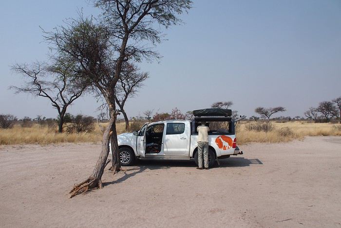
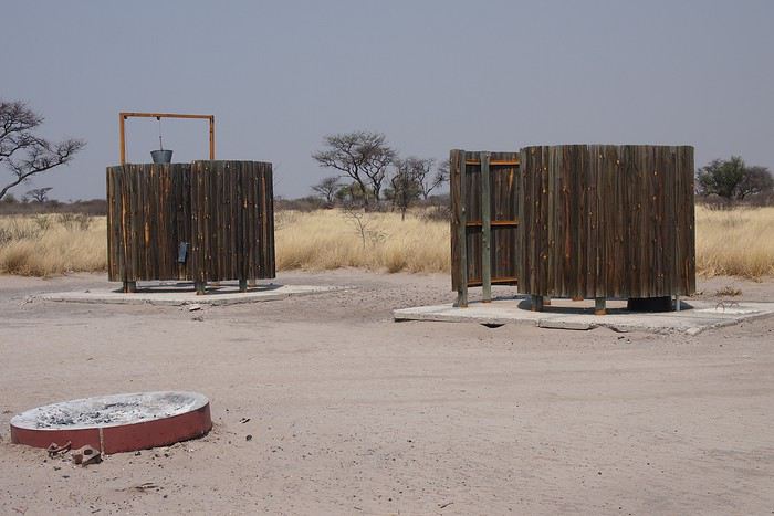
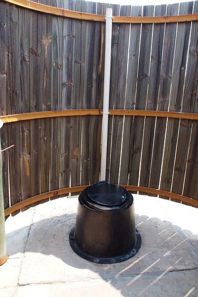
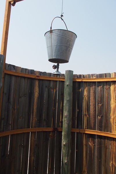
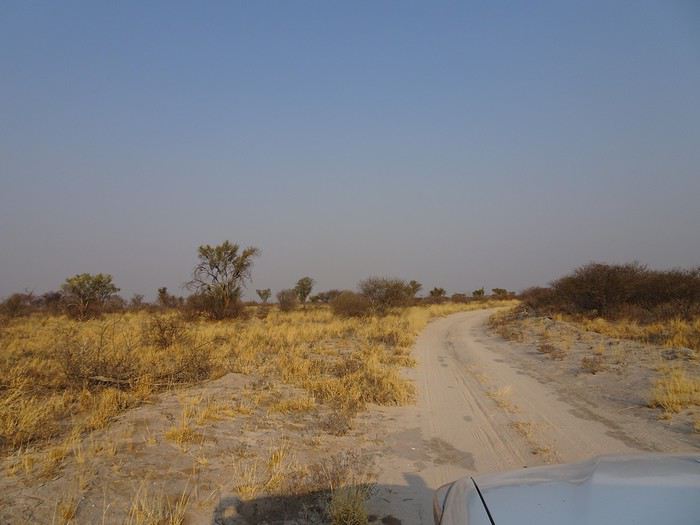
We witnessed our first Kalahari sunset. These sunsets are unmatched, and that didn’t change throughout the trip.
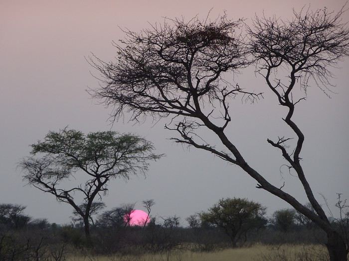
During the trip, we followed the solar rhythm—waking up at 6:00 AM, having dinner at sunset around 6:30 PM, and retiring to our tents by 8:30 PM.
Sunday, September 23, 2018 Up at 6:00 AM. It was 15°C. We were cold last night. Tonight, we’ll use blankets in addition to our sleeping bags. We headed southwest and, past Gwian Pan, turned northwest toward the Molose waterhole, where we saw our first elephants and our first raptor. Indeed, on the track leading to the Molose waterhole, we could see the traces of the massive fire that had ravaged the southern part of Khutse, as the park rangers had warned us.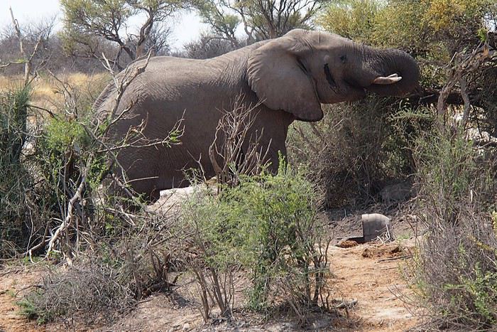
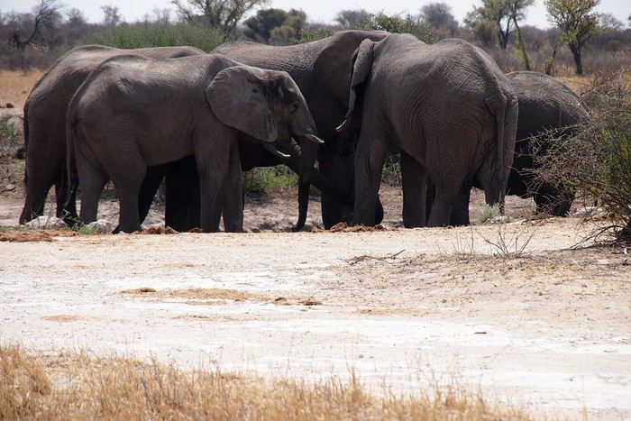
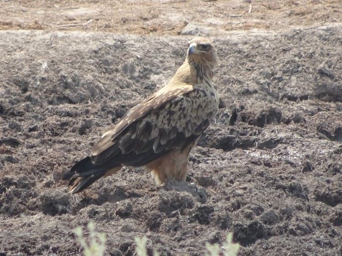
Our first braai at Khankhe campsite.
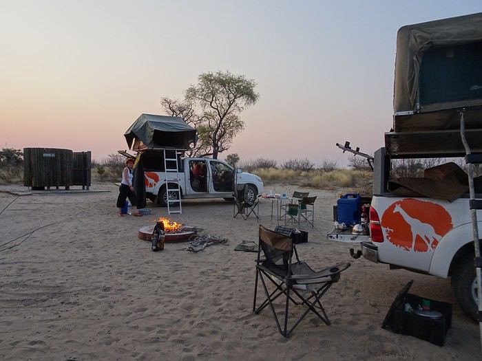
At Khutse Gate, we registered in the entry log and paid the access fees for 6 days: 120 Pulas/day/person and 50 Pulas/day/vehicle. Our stays at the Xaka and Deception Valley campsites had been reserved by our tour operator but not paid, contrary to what they’d told us. So we settled the 2 unpaid days of camping at 30 Pulas/day/person. The park rangers informed us that the southern triangle of Khutse Game Reserve, with its tip at Moreswe Pan, had burned. Note that these two campsites are government-run, which explains the low prices. Private campsites cost ten to fifteen times more. We headed to Khutse campsite, site 5. To enter the parks, you must have a reservation either at a lodge or a campsite. Since the number of spots in the campsites is limited, this means you have to book well in advance. We ate the salad we’d prepared the night before at our campsite. It was very hot—39°C. We made a round trip to Khankhe Pan. On the track, we encountered three South African cars, one of which was stuck in the sand and blocking the way. We helped push the car to get it unstuck. We saw very few animals at Khankhe Pan. We returned to the campsite, which has dry toilets and a shower you have to supply with your own water. We tried out the shower.
We witnessed our first Kalahari sunset. These sunsets are unmatched, and that didn’t change throughout the trip.
During the trip, we followed the solar rhythm—waking up at 6:00 AM, having dinner at sunset around 6:30 PM, and retiring to our tents by 8:30 PM.
Sunday, September 23, 2018 Up at 6:00 AM. It was 15°C. We were cold last night. Tonight, we’ll use blankets in addition to our sleeping bags. We headed southwest and, past Gwian Pan, turned northwest toward the Molose waterhole, where we saw our first elephants and our first raptor. Indeed, on the track leading to the Molose waterhole, we could see the traces of the massive fire that had ravaged the southern part of Khutse, as the park rangers had warned us.
Our first braai at Khankhe campsite.