I’ve never done a travel journal on VF before... so I’m giving it a go this year 😉. Just to share a bit of my 3-week trip around the West.
Since I couldn’t find anyone to share the trip with this year, I decided to go solo for 3 weeks at the last minute. So, it wasn’t a super organized or original trip—flight tickets booked last-minute, a loosely planned itinerary—but it was a choice I made.
I wanted to book zero hotels and just drive wherever I felt like. No set hikes or specific goals. Just a classic route through places I already knew for the most part, taking the time to soak in the landscapes. So, don’t expect a story about epic hikes leading to caves or hidden arches in unusual spots. It was more like a return to the roots of my first trip, with one twist: I wanted to explore some areas by mountain bike. Just to see things a little differently.
First up, instead of photos, I’ll share a little time-lapse I made during the trip.
Thursday, October 31:
Left Nice early in the morning for Phoenix via London.
The trip was a bit long because I had to wait 5.5 hours in London. My flight ticket was booked kinda late, so I didn’t have much choice.
And then it hit me—when you’re prepping for a trip, you always think you’ll forget something. It was in London that I realized I’d left my driver’s license on my living room shelf. I searched everywhere, but nope, I didn’t bring it.🤪
Luckily, I had an international permit, but the rental contract clearly stated that both licenses had to be presented.
I called a friend to ask her to overnight it to my first hotel, crossing my fingers that the mail wouldn’t take two weeks to arrive.
The flight with British Airways went pretty well. Comfortable enough to watch two movies, eat, take a little nap, and boom—I was in Phoenix.
Around 8 PM local time, I got to the Alamo car rental agency, and surprise—they didn’t care about my license at all. They glanced at the international permit, told me to bring the other one when I got it (basically, they didn’t give a damn), and handed me my car! Woohoo! 😛
I headed to my hotel (the only one I’d booked for my first night), explained to the front desk that my license should arrive by mail so they’d be in the loop, and crashed for a well-deserved first night in the U.S.
Friday, November 1 (And yes! It was a holiday in France, which would complicate my mail situation later.)
I woke up super early with my first goal: find a decent mountain bike at a good price but sturdy enough to handle some national park trails.
As I mentioned earlier, I decided to switch things up this year and explore some mountain bike trails—or just ride whenever I got the chance 😉.
I checked two Walmarts before finally finding a solid bike for under $150. Some might wonder why I bought one—well, the reason’s simple. Renting a bike costs between $40 and $70 a day. My trip lasted 22 days. QED (that’s "quod erat demonstrandum" for those who didn’t get it).
I bought the bike, which fit in my Jeep Compass by folding down the back seats (not super convenient, but it worked).
Off I went on my first adventures.
I decided to head to Apache Junction.
First stop: the Apache Trail at Goldfield Ghost Town. Pretty cute, though super touristy. Some classic Western decor, a little chapel overlooking everything, a museum, a mine, a small Disneyland-style train, souvenir shops, and places to grab a snack. Nothing mind-blowing, but still a fun little visit—especially if you’ve got kids.
I got lucky and explored the ghost town with two school buses—about a hundred excited kids. Total chaos for a ghost town, but hilarious to watch from a distance 😎.
A little further down the Apache Trail, there’s Lost Dutchman State Park. I didn’t linger too long because my goal was to reach the lakes, and after my Walmart adventure and some driving, it was already almost 1 PM. I munched on a bag of chips and hit the road (lots of 20–25 mph speed limits).
I spotted N 1st Water Road along the way, planning to come back in a few days.
My plan to get to the lakes ASAP got derailed when I found a parking lot with a horse trail right in the middle of the saguaros.
I asked a ranger in the lot if I could ride the trail on my mountain bike. He said it’d probably be tough but gave me the green light.
Off I went in my padded shorts and helmet. First bike ride through the cacti with my trusty travel companion (my bike, obviously).
I started off super excited on what seemed like an easy trail, but I quickly realized horse trails don’t account for some key biking challenges 😎—like climbing rocks isn’t exactly a breeze on a mountain bike 😛. No biggie, I carried the bike a few times but got to see my first saguaros up close! A pretty cool way to explore—I don’t regret buying the bike at all!
I got back on the road after drinking 1.5 liters of water (even in November, the sun’s no joke) and headed toward Canyon Lake. With vibes like Lake Powell, I was blown away by the scenery and decided to hang out a bit—just to "soak it in" and enjoy the quiet to end my day.
I didn’t see more of the Apache Trail because night falls fast, and for my first day, I figured that was plenty.
I’d decided not to stress about seeing everything at all costs since I’ve traveled a lot in the U.S. and plan to keep coming back. Whatever I missed, I’d catch next time—but I wanted to fully enjoy a few landscapes.
I drove back to Phoenix, grabbed a good burger, and spent the evening in my hotel room planning the next day. Originally, I was only supposed to stay one night in Phoenix, but with my license still MIA, I changed my plans. In the end, I was solo, no reservations anywhere, so I’d just take it day by day!
Saturday, November 2:
I decided to wake up early and head to Tucson for the day.
The drive from Phoenix was pretty easy. About 2 hours later, I was at the entrance of Saguaro National Park.
And guess what? There was a little trail perfect for mountain biking.
I parked my Jeep at the park entrance and hopped on my bike.
I ended up biking the whole park from start to finish—about 20 kilometers, with a paved main road and a gorgeous central trail right through the saguaros! Stunning!
Even being careful, I still got a few cactus spines in my left arm from brushing too close (it stings!). Not easy to remove, so I’d advise anyone with the same idea to be more careful than I was. You’ll figure it out fast! 😉
I spent most of the day in this amazing park—it’s totally worth the detour. It feels like hundreds of chimneys all lined up at equal distances. A unique landscape you’ve gotta see.
Next, I headed to Tucson to check out the airplane boneyard. I’d seen it in a movie years ago and always wanted to see it for myself. Mission accomplished!
It was pretty intense, but unfortunately, it didn’t seem possible to get to the most interesting plane alignments. There’s a museum with different types of planes and a guided tour. I settled for peeking through the fences at the planes guarded by military patrols.
I left around 6 PM and got back to Phoenix around 7:30–8 PM, super happy with my day of biking through the cacti!
Sunday, November 3:
Morning by the pool, lounging around—pure bliss. Around 11 AM, I headed to the Premium Outlets.
Feeling pretty pleased with myself, I bought 5 pairs of Levi’s for the price of one in France. Just for that, I knew coming to the U.S. was worth it! After that, nothing super exciting—except a cotton field south of Phoenix that I couldn’t stop admiring for a good hour.
I drove around the city—pretty dead on a Sunday—and headed back to the Apache Trail to tackle N 1st Water Road, which I’d spotted two days earlier. A really fun trail to bike if you’ve got a mountain bike 😉.
It gives access to several hikes and offers some great scenery. Highly recommend it.
Hi everyone,
I’m traveling in April with a layover in the United States.
I filled out the ESTA form but made a mistake by checking the wrong boxes, so my authorization was denied.
I tried again a few days later, this time checking the right boxes, but the application seemed stuck ("AUTHORIZATION DENIED").
I tried one last time a few days ago, and—oh, miracle—"AUTHORIZATION APPROVED".
However, I’m still worried because my first request was denied. Could I still be turned away at immigration?!
Will there be a record of my first application?
Thanks for your help....
Hi everyone, we're back from a DIY USA road trip we organized from July 31, 2026, to August 26, 2026.
The destination: The Southwest USA, including Texas, Arizona, and New Mexico. Roughly 7,000 kilometers covered.
The car: A Chevrolet Equinox for two, rented through BSP Auto and Avis. Inside, we had 2 suitcases, a travel bag, two carry-on bags, a Walmart cooler, photo gear, and water bottles (a 40-pack).
The route: Dallas DFW, Fort Worth, Houston, Austin, San Antonio, Alpine, El Paso, Tucson, Sedona, Albuquerque, Amarillo, and back to Dallas to finish with a departure from DFW.
The travelers: Two seniors well advanced in years (73 and 75) but still active (nothing too physically demanding—to stay alive and fund our trips), fully independent physically, though a bit less so mentally. Big USA fans, a country where anything is possible. More walkers than hikers, preferring 3-star hotels over roadside motels, Italian restaurants over US food, frequent stops for photos, museums over nothing, naps over forced marches. Not too whiny, just enough to stay French in the land of the "great Satan," as they say.
Not great with languages—street English (but handy), and my Spanish is non-existent except for: "Hola! Una cerveza por favor!" That’s about it. My wife understands everything but refuses to speak.
The cost of the road trip: Around 12,000 €, including AF flights, the car, gas, gifts, visits, and everything else. Well managed, since we’d budgeted 13,500 € initially.
The positive side: A delight, with those endless open roads. Museums to discover. The realization of the Hispanic presence and its important history in this part of America. Lovely locals. Tourists who were more or less friendly. A terrible Texan accent that was hard to understand. Gas stations that were like real stores, with prepared food, alcohol sold in Arizona and New Mexico, and employees who were always up for a laugh!
The negative side: The heat throughout the trip... 43°C in Dallas at the end. Impossible to walk the streets. Lots of homeless people in downtown Dallas. Hotel breakfasts that were always the same. You get used to it.
So, it was positive overall, but the concept is starting to wear us out. We might rethink the DIY road trip model for next time. If the man upstairs grants us more time.
Next up, we’ll wait for the first batch of sorted photos to go through the wringer.
We’re thrilled to officially announce the reopening of VoyageForum, now under the MyAtlas Group banner (click here to learn more about the acquisition of VoyageForum)! After four long years of closure, VoyageForum and its community are finally coming back to life! 🙂
Starting next week, we’ll begin sending out the newsletter announcing the forum’s reopening to all registered members, gradually over several weeks. This approach will give us enough time to train the new team while ensuring the new site server runs smoothly. So, please bear with us a few more weeks before the forum returns to its pre-2020 levels of traffic and participation.
We have plenty of ideas to not only grow VoyageForum further but also make it more financially stable. It’s important to note that the forum’s closure in 2020 was due to a lack of profitability following the impacts of the COVID-19 crisis. We’re committed to doing everything we can to prevent this financial situation from happening again, while ensuring a good balance between user experience and displaying our partners’ offers on the site.
We’d also like to publicly thank François Boucher, the founder of VoyageForum, for not only creating VoyageForum in 2002 and managing it for so many years with his team, but also for recognizing the skills within MyAtlas Group to ensure a smooth transition and continued development of the site. François will continue to collaborate with us for at least a few more months, mainly handling the technical aspects (programming and server management) and training the new team. Thanks again, François, for everything! 🙂
We can’t wait to see VoyageForum come back to life, with thousands of travelers helping each other, sharing great tips, and celebrating their passion for travel! Dear VoyageForum members, it’s now your turn to breathe new life into the forum by coming back regularly to share your travel experiences. Welcome back to your travel forum, and we look forward to seeing you all in large numbers! 🙂
Hi, I’m taking a cruise in Japan on the Diamond Princess from May 23 to June 5 and would love to hear from anyone who’s done it. Also, can we pay on board with Euros? Is it easy to use Wi-Fi when we’re ashore? What’s the weather like—do we need warm clothes or not? Are the excursions essential, or can we manage on our own outside of Tokyo, where we have a guide? If not, which excursions would you recommend? Thanks in advance for your replies.
Betty from the islands
" We’re ALL different, and so are our expectations when it comes to travel or leisure ".
There are—without a doubt—as many ways to experience a trip as there are travelers!!
For the two of us, it’s only our love of wild nature that guides us to East Africa.
The stated goal of this trip was purely wildlife-focused, and NOT about discovering the country or its people.
...
Hello everyone,
Previously, I shared the account of a trip/safari in southern Tanzania in June 2024, in the Mikumi and Selous reserves.
This time, still in southern Tanzania, I invite you to join us in Ruaha National Park. (Then, depending on the number of images allowed in my quota, at the end of my story, we’ll return to Selous for the second part of the same trip.)
- This trip/safari took place in November 2022.
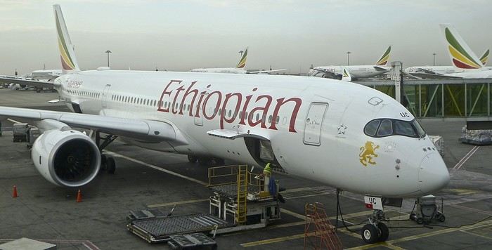
- Our flight started in Marseille, heading to Addis Ababa, then Dar es Salaam (via Ethiopian Airlines). In Dar, we spent one night at a hotel near the airfield.
-1- During the layover in Addis Ababa. The Airbus A-350 in the early morning mist.
Reminder: Click on each image to enlarge it, if needed.
.
From Dar es Salaam, if you want to go by road to Ruaha, it’ll take a very long and tiring day. 🤪
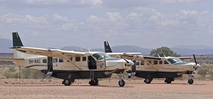
On previous trips, we’ve always taken a bush plane for this route.
In this case, it took just over an hour and a half, with two short intermediate stops to drop off passengers at other bush airstrips.
Since I’m also passionate about aviation, I love these flights where you can admire the landscapes from low altitude while sitting right behind the pilot 🙂.
-2- These routes mainly use Cessna 208 Caravans.
At the Msembe airstrip, we’re greeted around 1:30 PM by a guide and a driver from our chosen lodge. They brought a picnic basket, which we enjoy at a nearby picnic area. We’re by the Ruaha River, completely dry—it’s scorching hot.
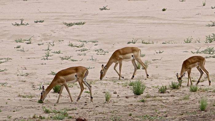
-3- The first mammals we encounter are a pair of female impalas, accompanied by a young male.
Reminder: Click on the image to view it in larger size. 😉
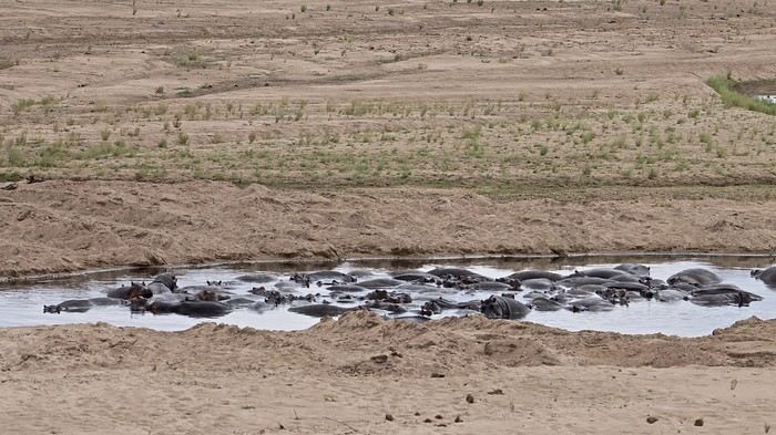
-4- To save the hippopotamus populations from certain death, rangers had to dig holes in the sand with bulldozers. Fortunately, water is present beneath the sand layer.
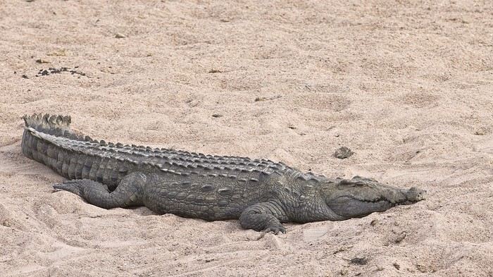
-5- This crocodile doesn’t seem to have been accepted as a swimming neighbor by the hippos...
We’ll explore along the river for 2-3 hours before crossing it at a ford toward the southern part of the reserve.
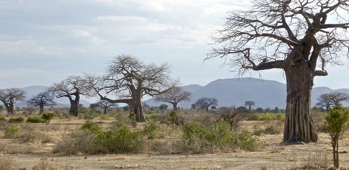
-6- The typical landscape of Ruaha, with its many baobabs.
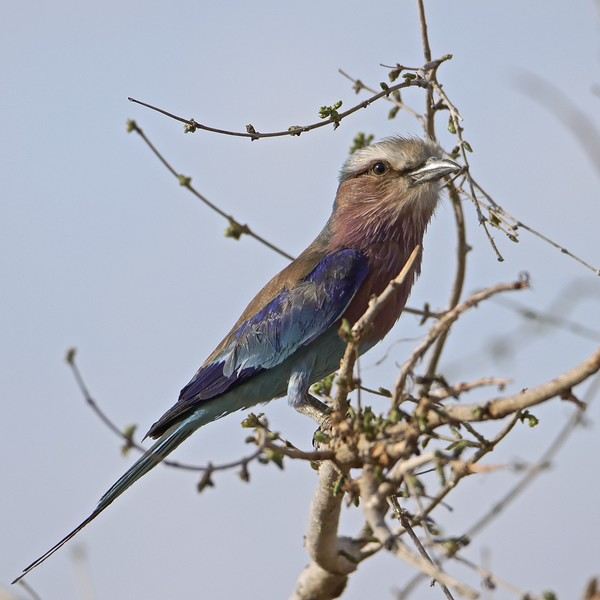
-7- My buddy the R.L.B. is also here to welcome me.... 🙂 🙂
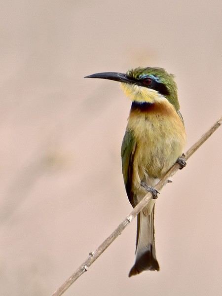
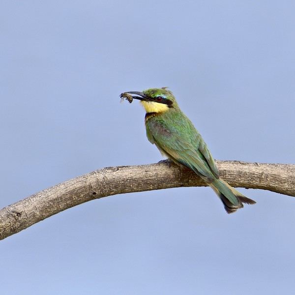
-8- As well as this little bee-eater... 😎
-9- ...which reminds us of the origin of its name...!
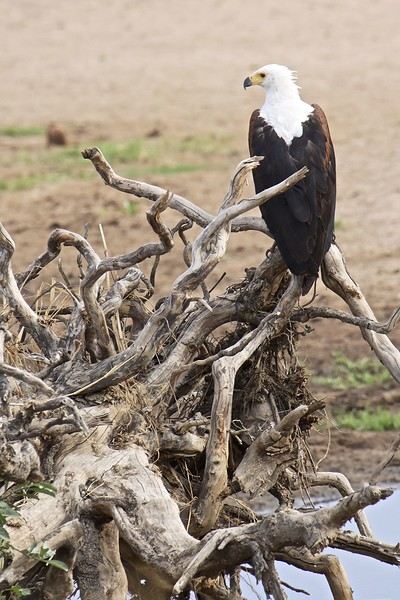
-10- Above a rare waterhole, a fish eagle keeps watch for fish...
...
*** Please wait until the end of the story for any questions or to share your own experiences in Ruaha. (Or via PM.)
Thanks in advance for keeping this account smooth and enjoyable. 😉
...
*** I’m not an ornithologist, but birds are an important and unavoidable part of safari discoveries. You’ll find quite a few in the images of my story. 😎
Hello,
I’m planning a trip for about ten people—seniors—to Friuli Venezia Giulia in September 2026.
Day 1 – We’ll likely arrive in Treviso and head first to UDINE for two nights.
Day 2 – Morning in Udine, then an afternoon visit to Cividale del Friuli. Travel by local train.
Day 3 – We’ll leave for a quick visit to Gorizia before heading to TRIESTE for one night.
Day 4 – Visit Trieste and Miramare. At the end of the day, take the train to Cervignano, then a local bus to Grado. Stay in Grado for three nights.
Day 5 – Explore central Grado and take a boat tour to the island of Barbana.
Day 6 – Relaxation day in Grado (as requested by the participants).
Day 7 – Visit Aquileia and possibly Palmanova.
Day 8 – Return to the airport or maybe a quick detour to Venice.
For the three days in Grado and the surrounding area, I was thinking of hiring a small bus with a driver. It seems like it’d be simpler—what do you think?
Any ideas or suggestions? Thanks for your feedback!
MADAPOLAM
Hi there,
what do you think of this itinerary, please? Do you think it’s doable?
We’re two adults—it’s our honeymoon trip! 🙂
Our main interests lean more toward nature and landscapes than cultural visits (though we won’t rule out one or two temple visits).
01/10/2025 W 10:30 AM – Departure from CDG (overnight flight)
02/10/2025 Th 11:25 AM – Arrival in Denpasar -> Ubud (south of the city) – overnight in Ubud
03/10/2025 F – Excursions around Ubud – overnight in Ubud
04/10/2025 Sa – Excursions around Ubud (Jatiluwih) – overnight in Ubud
05/10/2025 Su – Excursions around Ubud – overnight in Ubud
06/10/2025 M – Ubud -> Amed – overnight in Amed
07/10/2025 Tu – Amed – overnight in Amed
08/10/2025 W – Amed -> Padangbai – overnight in Padangbai
09/10/2025 Th – Padangbai -> Gili Air (first morning boat) – overnight on Gili Air
10/10/2025 F – Gili Air – overnight on Gili Air
11/10/2025 Sa – Gili Air – overnight on Gili Air
12/10/2025 Su – Gili Air -> Nusa Lembongan – overnight on Nusa Lembongan
13/10/2025 M – Nusa Lembongan – overnight on Nusa Lembongan
14/10/2025 Tu – Nusa Lembongan – overnight on Nusa Lembongan
15/10/2025 W – Nusa Lembongan – overnight on Nusa Lembongan (or return to Bali depending on sea conditions)
16/10/2025 Th – Jimbaran or Seminyak – overnight in Jimbaran or Seminyak
17/10/2025 F – Jimbaran -> Denpasar – departure at 6:45 PM (overnight flight)
18/10/2025 Sa 8:00 AM – Arrival at CDG – overnight at home
We stayed on the island of Gran Canaria during the first three months of 2024. It’s the third Canary Island we’ve visited, after Tenerife and Lanzarote.
We rented an apartment in Temisas. By staying in the same place for such a long period, the total price dropped by 50%.
We also rented a vehicle to make getting around the island easier.
Why the Canary Islands, and Gran Canaria in particular? For its pleasant climate, the nature and diversity of its landscapes, the charming villages, and especially the beauty of its many beaches.
In this travel journal, you’ll find a list of the many activities we did during our stay to explore the different attractions of this island.
These attractions are categorized to make it easier to find what interests you.
Videos are included throughout the summary. Click on the image to start the video.
To jump to a specific post, here are the relevant links:
HIKES:
Roque Nublo
Maspalomas Dunes - Part 1
Maspalomas Dunes - Part 2
Los Azulejos de Veneguera
Barranco de Las Vacas
Ventana del Bentayga (Arco del Aserrador)
Caves of the King
Ventana de Morro (Ventana de la Ganifa)
The Dog of Bentayga
Cave of the Four Doors
Ventana del Nublo
Artenera - Caves of Acusa Seca
Temisas - El Gigante Cave
Fortress of Ansite
Puerto de Las Nieves - Roque de Las Nieves
Temisas - Cuevas de la Audiencia
Roque Bentayga
Guayadeque Ravine (Guayadeque Hermitage)
Guayadeque Ravine (Cueva de Bartalo)
El Zumacal - Barranco Tauco
Casablanca Dam (Los Dolores Dam)
Ayagaures - La Angostura Dam & Gambuesa Dam
Santa Brígida - Alonso Ravine & Centennial Dragon Tree Pino Santo
Hike in the Azuaje Ravine
Gáldar - Red Lands of Samarrita
Tejeda - Charco de La Paloma
Bandama Boiler (Camino Borde de Caldera Bandama)
Teror - Alamo Ravine Trail – SL-4
Telde - Calasio Caves
Special Natural Reserve of Los Tilos de Moya
Los Azulejos - Charco de Las Aneas
Fataga Ravine
Arinaga Military Battery Trail
Maspalomas - Las Fuentes and del Canizo Ravines
Mogán - Tauro Mountain Trail
Tamabada - Llanos de La Mimbre & Sobre la Cueva Viewpoints Trail
Hike to the Coronadero Arch via Barranco Hondo
Barranco de Silva - Hike to the Jerez Caves
Gáldar - Samson Cave - La Atalaya Peak
Agaete - Roque Guayedra and Guayedra Ravine
Artenara - Caballero Caves
Arucas - Bufadero Salt Flats
Barranco de Pino Gordo - Natural Pools
Telde - Los Cernícalos Ravine
Las Cruces - Toba Caves & Picón
Puerto de Las Nieves - Moro Cave
Agüimes - Morros de Ávila Caves
Juncalillo del Sur - Laguna & Salinas de Abajo
Caves of Camino de San Felipe
Cruz de Tejeda, Cruz Chico and Degollada Viewpoint
Hike on the Patalavaca Circuit
Motor Grande - Puerto Rico Arch
El Montañón - Los Hornos Dam
Seafront Walk - Amadores Beach – Puerto Rico Beach
Las Niñas Dam
El Hornillo - Omega & Omicron Caves
Arteara Necropolis
Mogán - El Mulato Dam
Las Garzas - El Regante Dam
La Plata Route - Cho Flores Dam & El Charco Hondo
Vega de Acusa - La Candelaria Dam
Candelaria Hermitage – Acusa Seca Viewpoint
Valsequillo de Gran Canaria – Roque La Vela
Ayagaures Dam – GC-602
Lomo del Palo - Monte Pavón Trail
Lugar La Laguna - Levada
Fataga Dam & Ravine
BEACHES:
Mogán Beach
Taurito Beach
Tauro Beach
Amadores Beach
Puerto Rico Beach
Anfi del Mar Beach
Patalavaca Beach
Meloneras Beach
Maspalomas Beach
English Beach (Playa del Inglés)
Las Burras Beach
San Agustin Beach
Las Alcaravaneras Beach
Las Canteras Beach (La Cicer)
Las Canteras Beach (La Puntilla)
Las Canteras Beach (Santa Catalina)
Aquamarina Beach
El Agujero - Bocabarranco Beach
Hoya Del Pozo Beach
Hoya Del Pozo Beach - Lizard with amputated tail
El Cabron Beach
Ojos de Garza Beach
El Burrero Beach
NATURAL POOLS:
Charco Azul - El Risco
Agaete Salt Flats
Charco de Los Espejos - Sardina del Norte
Natural Pools of Punta de Gáldar
Snorkeling in the natural pool of Punta de Gáldar
Natural Pool La Furnia o El Clavo - Gáldar
Natural Pool of Los Dos Roques
Emiliano Natural Pool - El Agujero
Natural Pool of El Agujero
Natural Pools of Roque Prieto
Natural Pool El Altillo
Los Charcones de Bañaderos – Arucas
Natural Pools of El Charco de Las Palomas – Arucas
Natural Pools of La Laja - Las Palmas de Gran Canaria
Cueva de la Reina Mora - La Garita
Natural Pools of Castillo del Romeral
TOWNS:
Center
Santa Brigida
Vega de San Mateo
Tejeda
Artenara
Vallesco
Teror
Southwest
Santa Lucia de Tirajana
Fataga
San Bartolomé de Tirajana
Puerto de Mogán
La Aldea de San Nicolas
North
Arucas
Firgas
Moya
Santa Maria de Guia
Gáldar
Agaete
Puerto de Las Nieves
East
Vegueta - Las Palmas de Gran Canaria
Triana - Las Palmas de Gran Canaria
Ciudad Jardin - Las Palmas de Gran Canaria
Canteras - Las Palmas de Gran Canaria
Telde
Valsequillo de Gran Canaria
Ingenio
Agüimes
Temisas
VIEWPOINTS:
GC-60 Route (or nearby)
GC-210 Route (or nearby)
GC-210 Route between the tunnel and La Aldea de San Nicolás
GC-215 & GC-65 Routes (or nearby)
GC-200 Route (or nearby)
GC-130 Route (or nearby) & GC-605
GC-70 Route (or nearby) & GC-21
Sheep herd on GC-70 Route
GC-150, GC-240, GC-305, GC-350 & GC-301 Routes
GC-606, GC-295, GC-231 and GC-41 Routes (or nearby)
Viewpoints – GC-1 Route (or nearby)
Viewpoints - Las Palmas de Gran Canaria
Viewpoints - GC-2, GC-21, GC-15, GC-216 and GC-132 Routes (or nearby)
Viewpoints - GC-503 & GC-217 Routes
Viewpoints - GC-604, GC-505, GC-132, GC-42 and GC-802 Routes
MISCELLANEOUS:
San Rafael Aqueduct - Telde
Abandoned San Rafael Estate - La Higuera
Cenobio de Valerón
La Cesta - Tejeda
Puerto de la Aldea
Scenic Route GC-671 to El Espinillo
Scenic Route GC-607 to El Chorrillo
The Galdar Cube (Santiago Quarry)
Scenic Route GC-504 to Ayagaures
Abandoned seaside resort in the Azuaje Ravine
El Bufadero de La Garita – Telde
GC-505 Route
Abandoned Finca Las Haciendas (Los Mocanes) – Las Vegas de Valsequillo
Ruins of San Juan Battery - Las Palmas de Gran Canaria
Viera y Clavijo Canarian Botanical Garden - Las Palmas de Gran Canaria
Tenefé Salt Flats
Los Pérez, Lugarejos & Las Hoyas Dams
Monte Pavón, Gran Canaria’s little Ireland
Valleseco Lagoon Recreational Area
Climbing - Fataga Ravine
Surfing – El Agujero
El Cairete Restaurant - Carrizal de Tejeda
Paragliding flight observation - Los Giles
La Cuevita Ayagaures Restaurant
Statues and Murals - Cruce de Arinaga
Aviation Monument (Las Majoreras) & Murals – Carrizal
Artistic recycling by Antonio Peñita - Ojos de Garza
Rainbows
The context:
For my 60th birthday, I had planned to take my family (kids + partners) for a week in Gran Canaria, at an all-inclusive hotel, but with the firm intention of exploring and hiking. The deal was to meet up at least in the evenings to spend time together, if my pace didn’t suit them. Personally, I’m not into beaches and lazing around, but my daughter-in-law is pretty cool. We were going to be together, do what we liked, and all would be well.
Unfortunately, five days before departure, my mother-in-law passed away, and of course, we had to cancel everything.
I was able to get a refund for a lot of things, including the hotel despite missing the free cancellation deadline (really cool of them), and I got a one-year credit for the full price of the flight tickets.
So, we tried to plan the same thing for my kids, but with their schedules, we couldn’t find a date.
I had to find a destination served by Iberia, far enough to use up my credit.
We don’t know the Caribbean, we needed sun and a bit of rest, so the Dominican Republic won out.
But no way were we going to mess up by staying in an all-inclusive hotel and only visiting the island’s paradise beaches… (we’ll get back to that).
So, as usual, I put together a little road trip with a rental car.
Here we go!!!!
Day 1: Crossing the Atlantic
Super early departure for Lyon-Saint Exupéry Airport. A 3-hour layover in Madrid (my wife’s had enough of flight delays, so I played it safe). Flight to Santo Domingo without any issues. The luggage arrived, the driver I’d booked was there, everything went smoothly.
We got to our hotel in the Zona Colonial around 4 PM.
Bad luck—it’s on a cute little square where there was supposed to be neighborhood activity in the evening. It’s completely under construction! Too bad!
We decided to head to the Malecón, a sort of local Promenade des Anglais, except there are no English people. It’s nice, safe, spacious, and by the ocean. We walked for a while, and as happy hour rolled around, I started my training as an intern in rum-based cocktails.
A mojito, classic, but it’s amazing to be sipping the drink in the warmth, right by the big blue.
On the way back to the hotel, we grabbed some bananas, ate them in the room, and then bedtime.
The plus: We actually left!
The minus: There isn’t one
Here we go!!!
I left home at 4 AM on October 31st and headed to Barcelona. Driving through Barcelona on the ring road stresses me out a bit, but at 6 AM the traffic is smooth, and I arrive at the airport without any issues. I call the valet, who quickly comes to pick up my car. He takes photos of it from all angles before letting me go.
Baggage check-in hasn’t started yet, and there are already several of us waiting.
Once free, everything happens very quickly. The flight to Abu Dhabi is on time and goes smoothly. I’ve never had any problems with this airline, which I’ve been using for several years.
The flight to Bangkok arrives at 7 AM as scheduled. This is my first time in Thailand and Bangkok. I’m used to traveling in India, and I notice that everything here is well organized—the customs process is quick, and the luggage is already on the carousel.
I booked a taxi on Booking. All I have to do is find the right exit and door based on the agency’s instructions. A large sign with the names of people who booked is posted on a wall. A hostess greets me and calls the taxi, which arrives 5 minutes later. I booked one night at the Lost Inn BKK hotel in the Phra Nakhon district, and we arrive at 9 AM. The welcome isn’t warm, and I have to wait until noon, sitting on a chair, before I can check into my room. I’m exhausted, and sleeping sitting up isn’t ideal. Noon finally arrives—the room is small but clean, which is fine for one night. I quickly take a shower to wake up because I plan to spend the afternoon visiting the Grand Palace. First, I need to exchange some money, and the banks are all close together on the same street, which is very convenient. When I enter one, a hostess gives me a ticket and invites me to sit down. There are about twenty counters, and I wait quietly until my number is called. The exchange is quick, so I can head out to find the Royal Palace. It’s actually very easy, and the walk is pleasant.
Entry to the Royal Palace (500 baht).
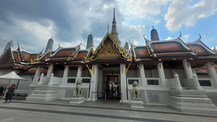
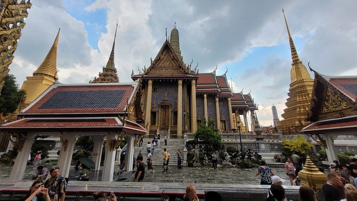
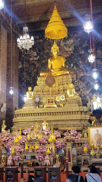
It’s magnificent and grand, and there are quite a few of us visiting. The sky is gray, it’s very humid, and a shower interrupts the visit. It’s a vast complex of temples and palaces. The buildings are colorful and sparkling, with a great sense of serenity (without the tourists, of course). I quietly enjoy the place and try to take photos without tourists, which isn’t easy.
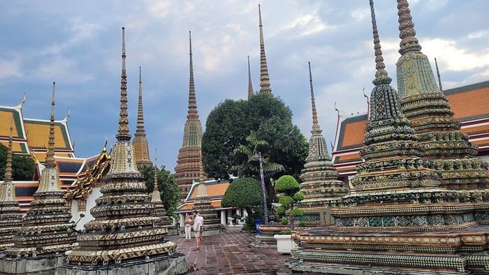
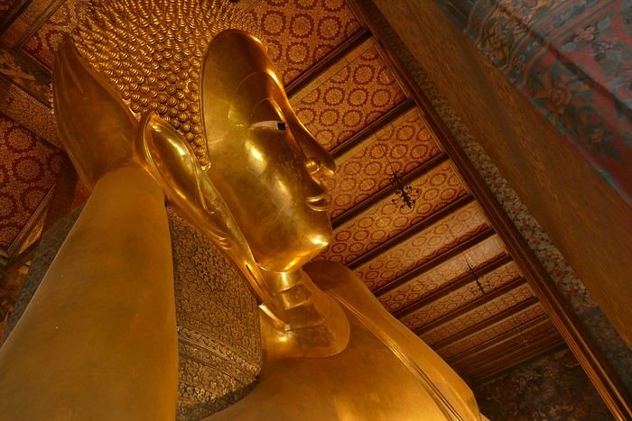
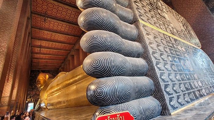
Very close to the Grand Palace is Wat Pho, one of the oldest Buddhist temples in the capital.
It’s very famous for its 46-meter-long reclining Buddha statue.
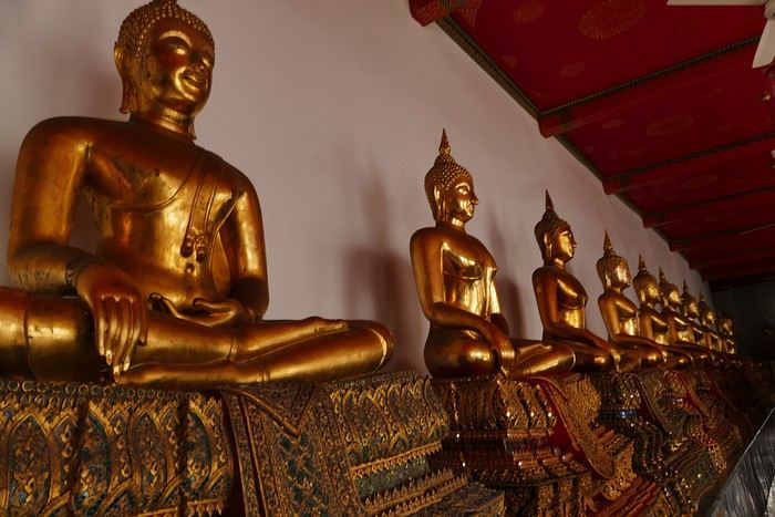
Walking around the temple, you can see different representations of Buddha, all covered in gold leaf.
Inside the temple, on one side, monks recite their prayers, while the other side is reserved for tourists who come to meditate in silence.
Before returning to the hotel, I have dinner at an Indian restaurant. I go to bed early because tomorrow’s wake-up call will be very early again.
Saturday, November 2nd
Wake-up at 4 AM, departure from the hotel at 4:30 AM. The taxi I booked via Booking is waiting for me and takes me to the airport. The trip is fairly quick—he takes small roads, and at this hour, there’s no traffic.
The flight to Phnom Penh is on time. Before boarding, I realize I left my fleece jacket on the carousel, but it’s too late to go back for it.
The flight goes well, and customs is quick.
At the exit, I take a tuk-tuk to Julieka’s GH near the museum. The welcome is friendly. I won’t be able to check into my room until noon, so I take the opportunity to exchange some euros on the market street. The street is lined with restaurants, and I’ll have my first meal there.
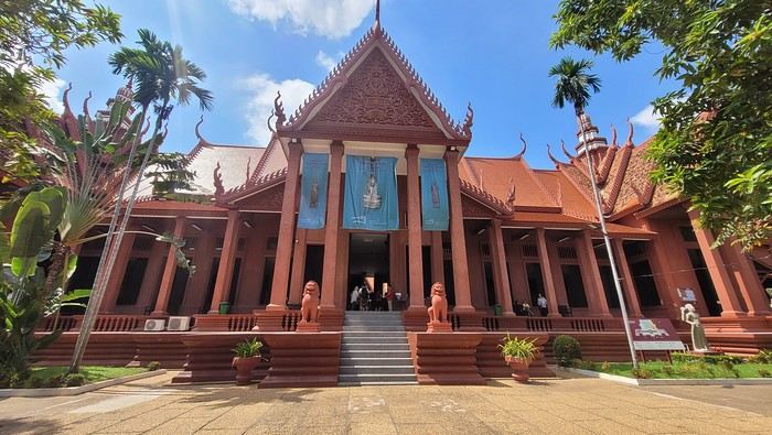
The museum is right across the street, so I don’t waste any time visiting it.
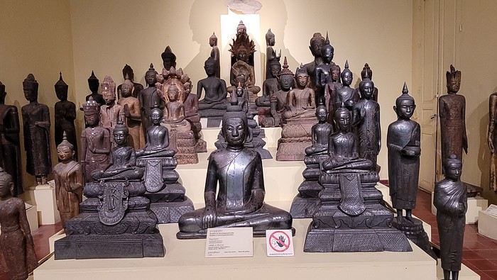
The representations of Hindu deities are very different from those in India, and I don’t recognize them. Many beautiful Buddhas are on display.
The museum is very pleasant, and there aren’t too many people, which is a plus.
At the exit, I return to the GH, settle into my room—which is decent and clean.
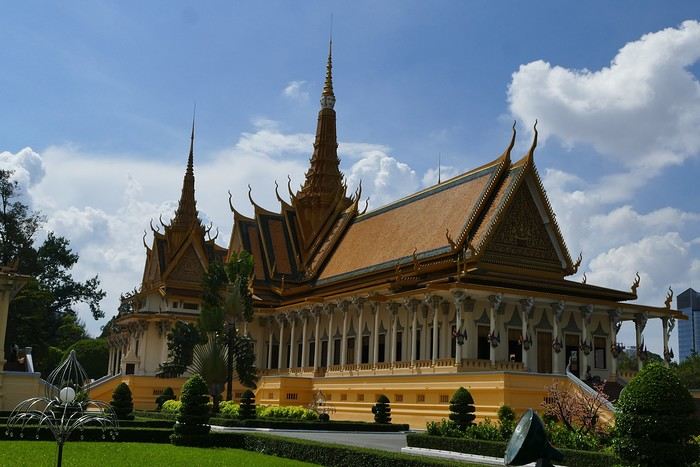
The Royal Palace is 1 km away. I walk along a garden, and at the end of the street is the Tonlé Sap, but I turn right. I arrive at a large esplanade and see the buildings with tiered roofs and glazed tiles. The entrance to the palace is a little further away.
At the entrance, I notice there isn’t the same crowd as at the one in BKK.
Khmer architecture is magnificent. The complex consists of gardens, palaces, pagodas with golden roofs, and slender spires.
The Silver Pagoda houses the small Emerald Buddha, which is actually made of jade. The silver flooring is covered with carpets. Photos are not allowed.
The walls surrounding the pagoda are covered with frescoes depicting scenes from the Ramayana.
After about 12 hours of flying from Toulouse (via Paris), we landed in Bogotá six years after our first trip to Colombia. This time, our journey will be very different, with only this stop in the Colombian capital in common.
Our travel itinerary
Bogotá / La Macarena (Caño Cristales) / Villa de Leyva / Barichara / San Gil / Girón / Mompox / Ciénaga and the Santa Marta lagoon / Minca / Los Naranjos (Tayrona Park) / Bogotá.
Step 1: Bogotá (and Nemecon)
Bogotá (1/3)
This morning, we had a meet-up with Flora from Aventure Colombia, who helped me organize one of our stops, a few transfers, and tomorrow’s day trip, the program of which I changed at the last minute after deciding to skip the visit to the Salt Cathedral of Zipaquirá. Flora is a kind and lovely person, always available, and she did everything to answer my questions and give me advice.
She’s a local contact I highly recommend. Flora can help you plan your trip, whether you want a fully organized tour or, like us, just need assistance with a specific stop or one or more transfers between cities.
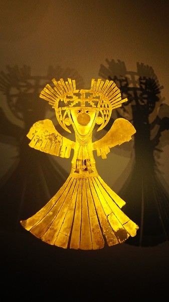
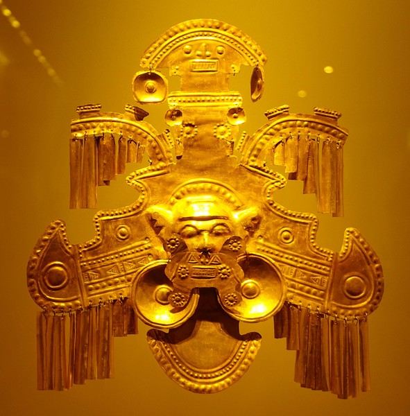
We left Flora after setting a meet-up for our return to Bogotá in a month. As we walked out of her agency, we headed to the wonderful Gold Museum, located just a hundred meters away. I was excited to revisit this amazing museum.
Note: Free entry for those over 60, regardless of nationality. Just show your passport.
Like six years ago, I was amazed by its museography, the beauty of the pieces on display, and that breathtaking shamanic room.
About two hours later, we decided to walk (careful, it’s a climb!) to the Monserrate cable car (3152m). Long wait to buy tickets and board the cable car! Once we arrived, a few raindrops, an impressive panoramic view of Bogotá’s vastness, a quick visit to the basilica (a pilgrimage site for Colombians), a walk through the tourist market, and at the top, plenty of small restaurants where we had our first Colombian meal.
After our hearty lunch, we were lucky to see the sun return!
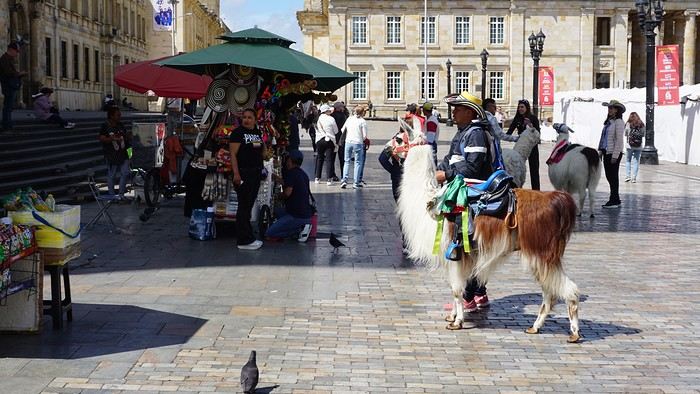
No line for the descent. We then headed back to the hotel because Justine wanted to rest and recover from the trip. As for me, I continued my walk. I discovered a really nice craft market recommended by Flora, Pasaje Rivas, returned to Bolívar Square, and wandered through different streets, including the main pedestrian avenue (Calle 7), where there’s always something to see.
Tomorrow, a change of scenery as we head out for a hike in a small desert (Desierto de Chueca), located about 2 hours from Bogotá in the village of Nemecon.
For this outing from Bogotá, with Flora’s help, we booked a car with a driver for the day. Flora also took care of booking the guide (since the site can only be visited with one).
Nemecon (2/3)
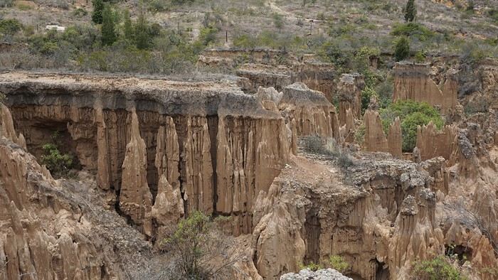
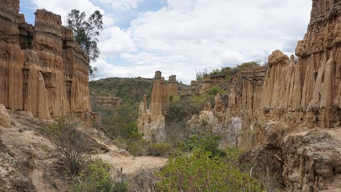
Today, we went to Nemecon to hike about 7.5 km in the ‘Desert of Checua.’ It’s nothing like sandy deserts! Instead, it’s geological formations sculpted by time, wind, and water.
After two hours on the road—almost one of them spent navigating traffic jams with cars, trucks, buses, and a continuous flow of motorcycles on either side of our taxi—we reached Nemecon! The village center is really (too?) quiet. We met up with Deisy and headed toward the ‘desert,’ about twenty minutes away on a bumpy dirt road.
Once there, a quick briefing, and off we went!
Deisy didn’t stop talking (in Spanish) for over 3 hours!!! She told us so much about her region (flower farming, water management, traditions, songs, etc.), the origin of the site, and even mentioned Antonio Banderas, who filmed *The 33* in the village’s salt mine (the story of the survival of 33 Chilean miners after a collapse in their copper and gold mine).
One hour of walking to reach the site, one hour to explore it, and one hour to return.
The advantage of this non-stop chatter was that it forced us to brush up on our Spanish at lightning speed. I even wondered if the effort to concentrate wasn’t more exhausting than the physical effort! Especially since on the way back, I got an oral quiz. Deisy wanted to make sure I remembered some of the information she’d given me during the visit: why is this rock white, that one red, and that one black?
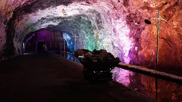
Back in the village, we had lunch at a restaurant recommended by Deisy before visiting the Nemecon salt mine. Before entering, a guide spent a good half-hour explaining the origin of the salt and the presence of many fossils in the area.
Again, concentrating was tough because all the comments were exclusively in Spanish!
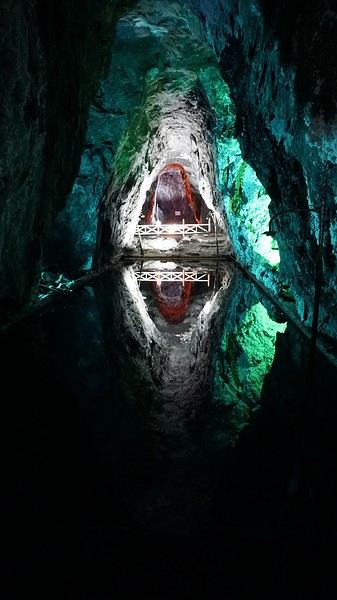
An hour and a half wandering through the tunnels with a ‘lovely miner’s helmet’ on our heads!
We met our driver at the mine entrance. The return to Bogotá was a bit faster, but traffic in the city center was still heavy! We arrived in front of our hotel between 8:00 and 8:30 PM.
It’s been a pretty intense start to the trip! Tonight, our legs are tired. Hopefully, tomorrow will be a bit more relaxed!
Bogotá (3/3)
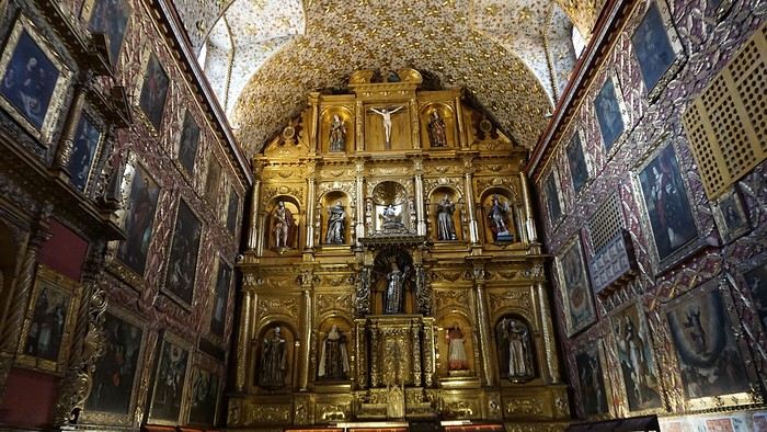
We started the day by visiting the Santa Clara Church Museum, located next to the presidential palace. Alejandra (from the local agency ‘Gaia Tours Colombia,’ which organized our stay in Caño Cristales (La Macarena)) had recommended this visit for its rich mural paintings.
A few hundred meters further, after crossing the Plaza Mayor again, we visited the cultural complex housing the Botero Museum, the Mint Museum, and the Bank of the Republic Art Museum.
Note that entry is free for all three museums.
Botero Museum: There are fewer works by Botero here than in the Medellín museum, but more paintings and sculptures by other artists, all from Botero’s private collection (donated to Colombia).
Mint Museum: We limited ourselves to visiting one room (on Flora’s advice) where three gold and gemstone monstrances and a Christ with a crown of emerald thorns are displayed. Photos are not allowed.
Art Museum: We visited two temporary exhibitions.
Lunchtime came quickly. We had a good meal at a reasonably priced small restaurant in the La Candelaria micro-district, near the Chorro de Quevedo square.
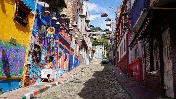
We decided to spend the afternoon wandering the streets and alleys of the historic center to discover local street art.
We also passed through very lively pedestrian streets. I also decided to revisit Pasaje Rivas to show Justine all the shops selling more or less artisanal products.
Tomorrow morning, we fly to La Macarena at 10:30 AM. Not to dance (you’d be surprised if I told you we were going to take a South American dance class, right?!), but to visit the fabulous Caño Cristales, a river naturally colored by aquatic plants. The planned program includes hiking, horseback riding, canoeing, and swimming among these plants.
This site was long inaccessible because the area was controlled by the FARC. Access and tourism development became possible after agreements and amnesty measures between the Colombian government and paramilitary groups.
As in other regions, former FARC members have been able to transition into various tourism-related activities.
After five trips to the American West, we had planned to switch countries and continents to visit Turkey. However, by the time we made up our minds, flight ticket prices had nearly doubled, reaching 400 € for a round-trip ticket. A bit disappointed, I started looking at transatlantic flight prices and stumbled upon discounted tickets from Basel-Mulhouse to Dallas—at the same price as our tickets to Turkey!
No hesitation needed; we bought the five tickets for a total of 1,860 € excluding baggage!
From Fort Worth Airport, we had two options:
- Head west on a loop through Texas, New Mexico, and southern Colorado
- Head east to change the scenery and explore East Texas, Louisiana, with a possible detour into Florida.
The latter option won unanimously, so here we are, off to discover new states, mainly Louisiana and Texas.
One of the main post-COVID challenges is finding a reasonably priced car rental. After an initial booking around 1,300 €, we kept an eye on prices a few weeks before departure and managed to snag a better deal at around 900 € for a comfortable sedan.
Yes, this summer will also be a first: no 4x4, no camping, and plenty of restaurants!
As always, I’ve planned a packed itinerary, ready to adjust on the go. A few weeks before departure, we learned we’d be at full capacity—our eldest son, Maxime, got his first-year med school results. By finishing as a top admit, he avoided the mandatory July-August internship that would’ve kept him from joining us. Instead, he wrapped up his internship at the last minute the night before our big departure.
We’ll get to savor these special moments together.
The itinerary:
Day 1 - 07/15: Fort Worth
Day 2: Dallas
Day 3: Jefferson - Caddo Lake
Day 4: Black Bayou Lake - Natchez - Stanton Hall and Rosalie Mansion
Day 5: St. Francisville - Rosedown Plantation - Cat Island Wildlife Refuge
Day 6: Mobile - USS Alabama Battleship Memorial Park
Day 7 - 8: Pensacola Beach
Day 9: Bellingrath Gardens - New Orleans
Day 10 - 11: New Orleans
Day 12: Plantation Route
Day 13: Jungle Gardens - Tabasco Factory - Vermilionville - Lake Martin
Day 14: Baton Rouge - USS Kidd
Day 15: Houma - Cajun Man's Swamp Tour
Day 16: Galveston, Texas
Day 17: Space Center Houston - Painted Churches
Day 18: San Antonio
Day 19: Texas Hill Country
Day 20: Texas Hill Country and evening in San Antonio
Day 21: Austin and Waco
Day 0 - 07/14: The departure timing isn’t exactly relaxing. On Thursday late afternoon, we hit the road to Alsace, aiming to drop off our two cockers with family before reaching the airport at 2 AM for a 3-hour power nap.
Not exactly fresh, we arrive at the terminal looking for a British Airways counter. None in sight, so we try our luck at a United Airlines counter—who knows, maybe it’ll work out. And bingo! The agent checks us in. We didn’t quite understand why, but maybe there’s some agreement between airlines. For the first time, we’re traveling without checked baggage, so no extra fees. Not a huge feat, given the scorching temperatures awaiting us!
The connecting flight to London goes smoothly.
During the layover, liquid checks get stricter—now requiring small bottles to be in a pre-approved clear bag, with only one bag allowed per passenger. Normally, no big deal, but between deodorant, sunscreen, after-sun lotion, hand sanitizer, contact lens solution, etc., we spend 20 minutes optimizing the arrangement! When we finally succeed, one of the security staff bursts out laughing and congratulates us!
With our stomachs growling, we grab an American breakfast before browsing the airport shops.
We then discover our plane for the long-haul flight and are thrilled to see it’s an A380—a first for Laetitia, though the rest of the family experienced it during our winter getaway. Still just as impressive!
With a hint of uncertainty, we take off for the States—my third trip in barely 12 months. This time, no endless badlands, canyons, slot canyons, hoodoos, or brain rocks, but a journey through five states (Texas, Louisiana, a quick stop in Mississippi, Alabama, and the northwest tip of Florida), where we hope to soak up a unique vibe... with a packed schedule of diverse visits.
Arrival at Fort Worth Airport and customs go smoothly. Since we have no checked baggage, we’re first in line at the Dollar counter. In just 3 minutes, the formalities are done. We decline the Toll Pass, which I don’t think we’ll need based on my "calculations," and head to the Dollar parking lot, where an employee tells us we can pick any car we want!
There are about thirty cars waiting. Too many choices!
After last year’s mishap in Oakland, where our 4x4’s trunk was broken into, we’re looking for a sedan to hide our luggage this time. Unfortunately, there are none—only SUVs. We finally settle on a comfortable 7-seater Ford SUV with a massive trunk when set up for five.
On the road from Fort Worth to Dallas, we accidentally take a toll highway without realizing until it’s too late to exit. Let’s hope Dollar doesn’t charge us a week’s worth of their pricey Toll Pass for a $2 toll. We’ll see... In the meantime, Maxime sets up Google Maps to avoid toll roads.
Since it’s not too late, we stop by the nearest Walmart for groceries before checking into our hotel room for three nights in East Dallas suburb.
Hi there,
This travel journal is to share our trip to Myanmar in January-February 2017 and relive the experience...
Six stops:
- the economic capital, Yangon,
- the ethnic groups in the east around Kengtong,
- Inle Lake
- Mandalay
- Bagan
- the Golden Rock and Bago
A trip for two, but organized with a local agency.
Flight with Vietnam Airlines (Paris/Ho Chi Minh City/Yangon on the way out, Yangon/Hanoi/Paris on the way back)
First stop, Yangon
At last, we arrive! That moment of excitement and impatience we all know when we land in a country we don’t know but have been dreaming about for a while. Butterflies in our stomachs—not just from the long flight!
It’s noon, everything goes smoothly (baggage, immigration, currency exchange, pre-booked taxi, ride to Yangon), and by 2:30 PM we check out of our hotel, tired from the journey but eager to explore the city and power through until evening to beat the jet lag.
We’re driven by To-Wen. Traffic is pretty heavy, but strangely, no motorbikes or scooters... To-Wen explains that two-wheelers have been banned in Yangon for several years because they’d become too numerous and caused many injuries and fatalities. To compensate, a very developed public transport system has been put in place.
Yangon, or Rangoon, isn’t Myanmar’s administrative capital. The official capital was moved to Naypyidaw in 2005 by government decision—some say to distance themselves from potential popular uprisings. Whatever the reason, it cost a fortune, and no one followed (only civil servants, who were forced to go), not even foreign embassies. This ghost capital makes all the Burmese we spoke to chuckle.
Yangon is the economic, cultural, and diplomatic capital, and it’s the most populous city (4.5 million people).
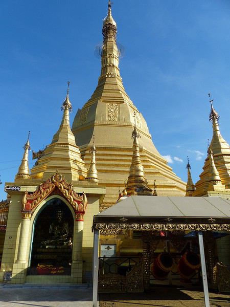
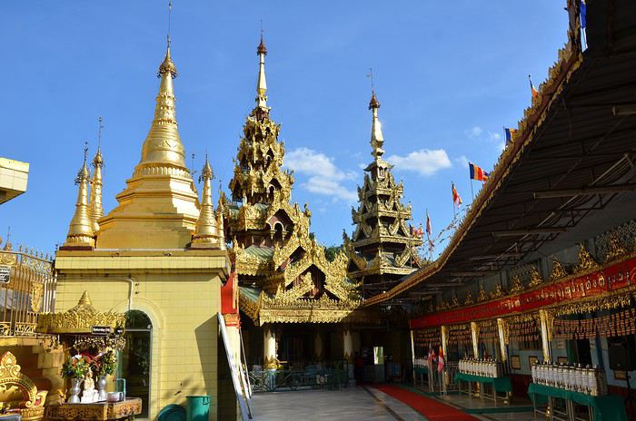
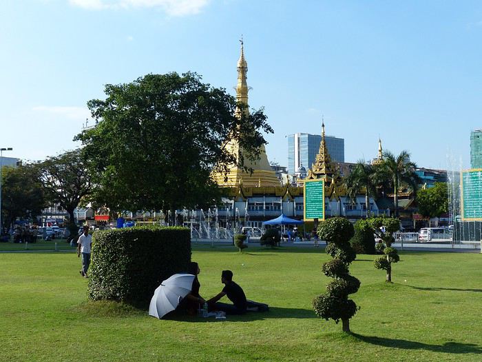
What did we see? Well, first we discovered the Sule Pagoda, a funny concept of a "roundabout pagoda" since it’s right in the middle of a busy intersection! Circular, its outer wall houses many tiny stalls. Then comes the miracle: the hustle and bustle of the street contrasts with the calm inside. You leave a noisy roundabout and suddenly find yourself in another world... flowers and fruit in front of the altars, the scent of jasmine mixed with incense...
Actually, this pagoda is very old—it’s said to have been founded in 230 BC to enshrine a hair of the Buddha, but it was in the 15th century that the great zedi (a slender stupa) on top reached its current height of 44 meters (see photos). It’s a symbolic site in the fight for democracy, as it was the rallying point for monk protests in 2007.
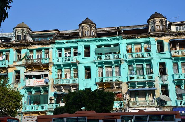
Next to the Sule Pagoda is Independence Park, which borders the colonial district (very run-down).
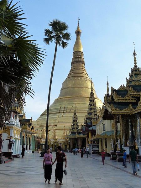
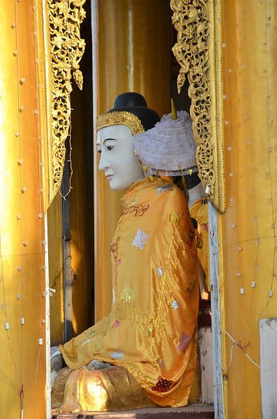
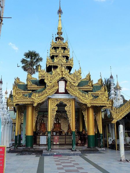
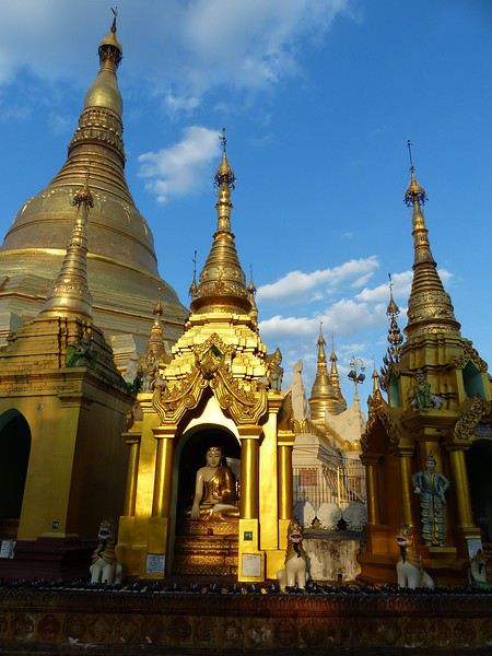
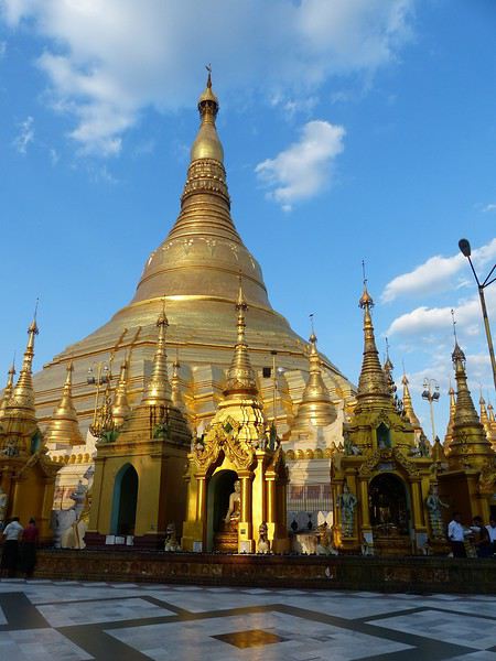
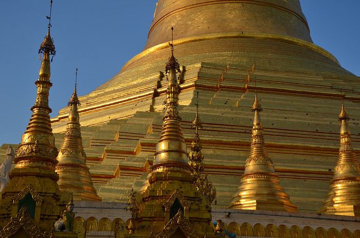
Then we had our first wow moment: the stunning Shwedagon Pagoda (see photos). It’s Myanmar’s most sacred Buddhist sanctuary, drawing crowds of devotees. Its stupa rises to 99 meters, surrounded by dozens of temples and zedis... It’s said that successive rulers have been embellishing and expanding it for over 1,500 years.
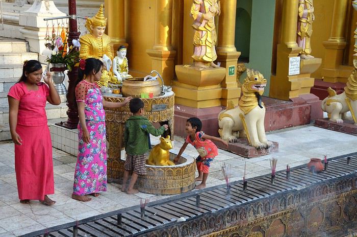
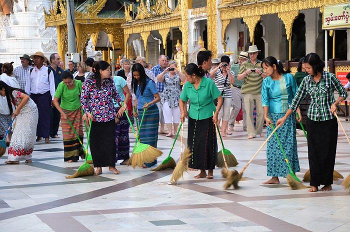
Believers gather in the many halls and circle the great golden stupa. Here, we encounter for the first time the incredible "quiet fervor" of the Burmese. A kind, open religiosity that doesn’t make us feel like intruders or nuisances—instead, it makes us want to understand their faith better.
If you go, make sure to be there in the late afternoon: the low rays of the setting sun bathe the site in gold and orange. The zedis glow... and everything becomes surreal.
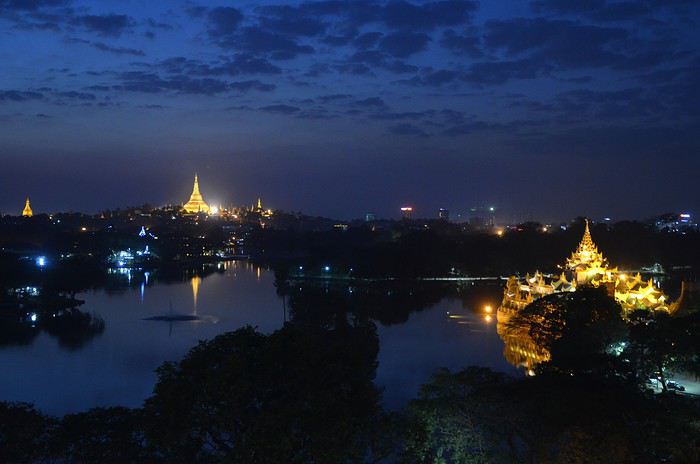
The sun sets early, so we head back to the hotel around 6:30 PM. Lucky for us, it has a stunning view of Yangon by night from the top floor. We settle in to sip our first vacation cocktail. In the foreground, the shadow of Kandawgyi Lake, and in the background, the illuminated Shwedagon Pagoda, which serves as a landmark for the whole city. (See photo.)
Tomorrow, we fly to Kengtung. We’ll be back in Yangon at the end of our trip to explore more.
Time for bed by 10 PM—we need a restful night to adjust to Myanmar time...
Next post: Kengtung and meeting the local ethnic groups.
In the autumn of 2011, Provence was hit by apocalyptic weather—torrential rain and a particularly violent east wind, reaching 130 kilometers per hour, whipping up waves as high as seven meters. It wasn’t the best time to venture outside. Yet, I told myself that after the storm, calm would return. I kept an eye on the weather forecast and noticed that starting November 10th, a favorable window should open for a little 600-kilometer cycling trip across Provence. The weather reports promised a high-pressure system that would keep the bad weather at bay over these highlands. That was all I needed to decide to set off. The planned route would take me through Provence’s biggest climbs: Mont Ventoux, Montagne de Lure, the Verdon Gorge, the Massif des Maures, and Sainte-Baume.
And so, despite my doubts, the call of adventure was stronger. The train pulled away, and once again, a journey began at Part-Dieu station. This time, I headed toward Haute-Provence for a cycling adventure. It would be my first solo bike trip. I was a little nervous—cycling with panniers makes you feel vulnerable to theft. I’d already been robbed while traveling in a group in Peru, and that experience left me deeply shaken. Alone, I hesitated. But no need to panic—I’d read accounts from long-distance cyclists who hadn’t been robbed, even if it does happen sometimes. I was particularly thinking of a young schoolteacher who had taken a sabbatical to cycle around the world. Her students had remarked, "Teacher, you’re not sporty—how will you manage to cycle around the world?" This young woman was full of resourcefulness. In South America, before flying to China, she locked her bike to a post to take care of a natural need. When she returned, the post had been torn out, and her bike—along with all her gear—was gone. It was a shock for many, but not for her. She boarded her flight to the Middle Kingdom, bought the essentials (including a new bike) once there, and continued her journey! Remembering this story, I almost felt ashamed of my cowardice. These were the thoughts running through my mind as the Rhône Valley rolled by toward Orange, the starting point of my Provençal adventure through the big climbs.
Day One: Orange to Sault via Mont Ventoux – 90 km
9:30 AM, I stepped off the train. With all my gear, I had to navigate the underground passage—no easy feat, given that my bike and luggage weighed 35 kilos. At this time of year, I expected some areas to be deserted, so I’d packed enough to bivouac comfortably. Once outside the station, the southern light flooded over me. I understood why people dream of retiring in these sun-drenched regions. As always, after disembarking from public transport, I had to get my bearings and decide which way to go. The sun, still low on the horizon, pointed east. The roar of fighter jet engines helped me locate the Air Base 115. That was all I needed to "reset the gyros."
As soon as I started pedaling, all my apprehensions vanished. The joy of discovery and physical effort took over, and euphoria washed over me. It’s amazing how emotions can shift from one moment to the next based on seemingly minor circumstances.
The weather was splendid—the forecast had predicted continuous showers, but it was completely wrong. I quickly left the city behind. Mont Ventoux loomed mysteriously, its dimensions hard to gauge. It was even more enigmatic with its summit hidden beneath swirling, mottled clouds clinging to the ridges. It reminded me of a great South American volcano. I struggled to imagine that in a few hours, I’d be up there under that blanket of mist.
The countryside was shaking off its autumnal nighttime dampness. The vineyards, interspersed with tall cypress hedges, confirmed I was in the magnificent Côtes du Rhône wine region. The distinctive Dentelles de Montmirail were very much in evidence. The air force base wasn’t far. I passed the runway’s end markers. A Mirage 2000 flew overhead in a tight turn, followed by another roaring into takeoff. It came straight at me before climbing sharply with a thunderous roar. Thirty years spent in that captivating world came rushing back. I recalled countless extraordinary human and technical experiences from my time in the service. But the purpose of this post isn’t to promote the air force—though I might post some articles one day about travels among men at war.
I continued on my way, leaving my past loves behind. As I pedaled, delightful names rolled by: Violès, Vacqueyras, Gigondas, Beaumes-de-Venise—the crème de la crème of the Côtes du Rhône Villages appellation. I let myself be enchanted by the vineyards and the little paths crisscrossing them. I started to doubt my route, though the imposing mass of Mont Ventoux in the distance acted like a giant beacon. At a crossroads, a car appeared. I approached to ask the driver for directions, but she didn’t even look at me and sped off, clearly frightened. I’d almost forgotten what a fearful world we live in, no doubt traumatized by all the horrors we see in the news and on TV.
The kilometers started adding up, but was my day’s goal too ambitious? It had been two months since I’d last ridden my bike. True, my last trip had been good training—the Route des Grandes Alpes—but that was two months ago. I can’t just take my bike out for a day trip; I need that sense of adventure to find the courage to exercise.
Two cyclists overtook me. Intrigued by my load, they struck up a conversation. They were skeptical when I told them I planned to cross Mont Ventoux that day. One of them pointed out a small chapel near the summit where I could bivouac sheltered. That motivated me even more to reach the top on this first stage. The chapel also had a mythical name for me—Sainte-Anne, the name of my parents’ villa. It was already noon, and I’d covered 50 kilometers. Malaucène appeared—the sacred village of Ventoux’s mad cyclists. Surprisingly, I didn’t see any other cyclists today. I remembered this place in June, teeming with aspirants for the king of summits. Before tackling the climb ahead, I needed to refuel. I enjoyed a pleasant gastronomic break at Max’s. At 1 PM, I started the most famous climb in cycling—21 kilometers, which would actually be 23. I knew it would be tough, especially with two handicaps: 50 kilometers already in my legs and 20 kilos of luggage. But I was counting on my tiny chainring, which let me climb trees to tackle the steep ramps.
I set off at a brisk pace along a deserted road. My speed held up for the first few kilometers. I quickly rose above the valley, the horizon widening. I was surprised to see no one on this world-renowned route among cycling enthusiasts. During the climb and descent, I’d only see five cyclists—but I’ll come back to that. I passed a sign explaining that the effort would be roughly equivalent to climbing the Col de la Bonnette. Having done the latter in September, I figured I’d be fine. I crossed paths with my first cyclist—a woman speeding downhill. After 12 kilometers, I hit slopes averaging 12%. I don’t know if the number 12 is cursed, but I got such a "bamboo" hit that I’d never experienced before. I thought I wouldn’t make it to the summit today. I stopped. My thighs burned so much I could barely walk—lactic acid overload. I looked for a relatively flat spot to pitch my tent. It was 3:30 PM, with two hours of daylight left. But I found nothing.
I got back on my bike, intending to stop as soon as I found a good bivouac spot. But nothing came up. However, my strength slowly returned, perhaps because the slope eased, though it remained around 10%. I entered the summit mists. A cyclist overtook me. I was in the zone where I had to pass the summit. Dusk caught me in the final difficulties. The atmosphere was downright austere. In the twilight, a kilometer from the summit, a cyclist was fixing his bike. I asked if he needed help. He made it clear he didn’t understand. So I asked, "Do you need some help?" His answer was clear: "No, thank you." He showed me his new inner tube. Inside, I thought, "Phew!" If I’d had to stop, sweating in the falling night with the cold intensifying, I’d have struggled to get going again. But he managed, and I continued into the twilight fog. I could barely make out the summit’s large antennas in the clouds, like immense ghosts trying to evade sight. The bike delivered sensations worthy of mountain racing. My goal was to quickly find the famous chapel in the descent to take shelter. As I glided down the southern slope, two cyclists without lights crossed my path in the night—probably heading to the station above, its lights visible in the fog.
I scanned the roadside in the dark for the chapel but saw nothing. After a kilometer or two, I lost all hope. I stopped to put on more clothes as the cold became intense. I had no idea where I could stop on these steep slopes to set up camp. Between the swirls of mist, I could intermittently see the Rhône Valley below, dotted with illuminated towns and villages. The sight was striking. What was I doing on this mountain at night? Then the miracle happened—the clouds parted, and from the ridge above me to the east, a beautiful full moon emerged, casting enough light to consider a nighttime descent to Sault, 26 kilometers away.
In this eerie atmosphere between the moon’s pale rays and patches of fog, I began my descent through a hazy, almost unreal world. The Ventoux’s characteristic white scree reflected the moonlight faintly, dimmed by the mist. In places, entire mountainsides were plunged into complete darkness, and I lost all sense of the road’s path. Then, around a tight bend caused by a land shift, the light returned. It seemed extreme compared to the darkness I’d left behind. I could once again clearly see the road’s contours, though not its potholes or gravel patches. Still, I let the slope carry me, and the speed felt significant, though the low light prevented me from reading my speedometer. In these moments, concentration was at its peak—all senses alert, reflexes ready to react to the slightest incident that could lead to a fall.
I was relieved to see Sault’s lights growing closer. In less than an hour, I reached it, considering the final little climb that required one last push. This village, bustling in summer, was deserted at this time of year—almost dead. The first hotel I came across was closed. A quick shadow passed in a small sloping street. Before it disappeared into the darkness at a house corner, I chased after it and asked about accommodation options. Very kindly, I was directed to what was probably the only hotel open in November. I quickly found it, and the reception was open. I entered wearing my black balaclava, bought in the Ayacucho region—the birthplace of Peru’s Shining Path. At this late hour, I saw questioning glances directed at me. I prefaced, "This isn’t a hold-up." Clearly, the owners had a sense of humor—they started smiling. I took off my balaclava and asked for a room. No problem, and from that moment, the pressure eased. I really didn’t feel like going back out to find a spot to pitch my tent in the biting cold.
The stage had been nearly 100 kilometers, and it was the first. It had been two months since I’d touched my bike, and I probably lacked even minimal training, even though my last bike trip had been crossing the French Alps. I really had to dig deep to overcome my weakness on Ventoux’s steep section. I don’t remember ever having to search so deeply for the energy to keep going. I knew the stage I’d set for tomorrow was significant, with the climb up Montagne de Lure’s northern slope—Ventoux’s little sister, whose ascent is reputed to be endless, over 25 kilometers. I hoped this first day wouldn’t leave me too sore to avoid suffering excessively tomorrow.
For now, relaxation—a hot shower did me a world of good, followed by a good meal. I ate a delicious andouillette from Troyes, very fine, with a particularly successful herb seasoning. I loved it, and yet I’m from Lyon and pride myself on knowing a thing or two about andouillette—not just a sausage but a whole category! A bit chauvinistic, I had to admit, though reluctantly, that I found it better than the ones I usually eat in the Lyon region!
Day Two: Sault to Forcalquier via Montagne de Lure – 116 km
This morning, the weather was magnificent—the air clear, still, very fresh, and invigorating, as only the late season can offer on these Provençal highlands. In summer, they’re known for their scorching heat and drought, but often overlooked is how harsh they can be with cold and storms. Authors like Giono or Bosco described them and their inhabitants wonderfully in books like "Les Âmes Fortes."
The miracle of the night had worked. I wasn’t sore anywhere and felt in great shape. I set off well-equipped, but the effort and sun soon made me sweat. It was time to shed some layers—hat and gloves. A gentle warmth replaced the cold, making for excellent cycling conditions. On the road to Trinit, there was no traffic—only the occasional hunters’ cars parked in the distance. These vehicles were recognizable by their large cages, used to transport hunting dogs. Sometimes, the silence was broken by a distant gunshot. The deciduous forests were losing their foliage, taking on that dull brown hue of late autumn, though here and there, a tree or shrub still resisted, displaying vivid yellow or red. The meadows, their grass already scorched by the cold, were damp from the night’s heavy humidity. The low sun highlighted thousands of spider webs that had trapped insects during the warm season.
Behind me, Mont Ventoux dominated these vast spaces. As often, its imposing, stony summit was crowned with a blanket of clouds. What an impressive mountain—it’s always so hard to gauge its dimensions. I struggled to realize that last night I’d been at the summit and descended its immense southern ridge in the dark. I hoped to return one day in favorable conditions—daylight and no clouds—to enjoy the vast panorama from this unique summit.
Leaving the very Provençal village of Trinit, I tackled my first climb of the day—the Col de l’Homme Mort. The road rose moderately for five kilometers in gentle warmth. The view over the region widened, and I felt the sheer joy of pedaling. At a good pace, I overcame this first little challenge. Once at the pass, I couldn’t resist the ritual of photographing my bike in front of the sign, giving the name and altitude—1,213 meters.
The northern slope was austere and still in shadow. The cold bit again. The road was wet and covered with leaves in places. It wasn’t impossible that some treacherous patches of black ice lurked around a bend. I descended toward the Jabron Valley with caution. Suddenly, around a bend in a forest clearing, the freshly snow-covered Alps, gleaming in the sun, leapt into view, blocking the horizon. I thought I recognized the distinctive silhouette of the Écrins’ south face above a multitude of jagged peaks.
This snow and these mountains awakened a flood of memories of great joys, but I also thought of the guide and his client who had just lost their lives on the Grandes Jorasses’ north face, at the top of a route called the Linceul. The name comes from the face’s appearance—a great ice slope bordering the Grandes Jorasses’ north wall. It was first climbed by René Desmaison in 1968. He passed away a few years ago and, in his final wishes, asked that his ashes be scattered in the Dévoluy Massif at the foot of Pic de Bure, not far from here in these immense pre-Alpine folds.
At my feet, the Jabron Valley stretched almost endlessly east toward Sisteron. In the distance, the dark mass of Montagne de Lure’s north face loomed. This mountain shares similarities with Mont Ventoux. It has the same summit scree of bright limestone, the same forests climbing up to the final rocky stretch, and that blanket of clouds adding a secretive, austere touch to the scene.
I turned left past the town of Séderon and headed toward the little Col de la Pigière, which in a few kilometers allowed me to truly plunge into the beautiful Jabron Valley. I passed through several villages with charming local names—Saint-Vincent, Noyer-sur-Jabron. The river offered lovely views of its narrow gorges with clear, cold water. Autumn seemed less advanced here than on the plateau I’d just left. Many trees still wore brilliant colors, some revealing extraordinary hues—mixes of crimson, pink, and bright red.
Arriving in Noyer-sur-Jabron, I took a tiny road on the river’s right bank, leading in a few kilometers to the foot of Montagne de Lure. In the village of Valbelle, I picnicked on leftovers I’d brought from home—an old cheese and a somewhat stale loaf of bread. It was 1:30 PM. I began the long climb of about 25 kilometers. According to a friend who’s a cycling expert in the region, this section is tough. No wonder it’s called Ventoux’s little sister—the Mont Blanc of cyclists. The elevation gain on this side is still 1,200 meters, while Ventoux via Malaucène is nearly 1,600 meters.
I hoped to reach the summit before nightfall and avoid reliving a nighttime descent. The route wound through a vast forest, following the terrain’s folds. There was activity—mushroom hunters were busy searching for the coveted chanterelle. The climb, though never very steep (only one kilometer at 9%), was interminable. Though traffic was practically nonexistent, I was overtaken by a group of Harley bikers—I counted about forty. Perched high on their machines, hands in the air on wildly shaped handlebars, some with their feet nearly in the sky due to the high footpegs, they didn’t even glance my way. What’s this idiot doing, unable to ride a motorcycle and forced to climb these mountains on a bike with big bags! I wasn’t offended—real Harley purists often see other motorcyclists as renegades, so bikes are even lower on the totem pole! But I didn’t want to start a debate about motorcycles. In my youth, when I was a wild motorcyclist (22 accidents on two wheels), clans were divided into Japanese, German, Italian, and British bike owners. The latter, on their vibrating, oil-leaking machines, considered themselves the purest. But let’s not fight—there’s a statute of limitations, and it’s been nearly forty years.
As yesterday, a few kilometers below the summit, I entered the fog, and the light dropped suddenly. What a hostile mountain in these conditions! It heightened the sense of living an incredible experience. The conditions we encounter play a major role in how the adventure imprints on our memory. I realized once again that in France, you can feel like you’re very far away. Finally, after this very long climb, the Pas de Graille sign suddenly appeared out of the grayness. Strange! Below the sign, a kilometer marker indicated this same pass was over three kilometers away. Clearly, the climb continued. In these final kilometers through the scree, I gained another 130 meters of elevation. Finally, the road’s high point was reached—1,720 meters. It was cold and damp. I quickly covered up, added my balaclava under my helmet, and put on warm gloves. As I was about to start the descent, a car stopped at the summit, and one of the passengers was surprised to find a bike there in these chilly, twilight conditions.
A 20-kilometer descent led me to the village of Saint-Étienne-les-Orgues. I hoped to find a place to stay for the night. No such luck! Everything was clearly closed—no chance of finding shelter. Tonight was getting complicated. I already had exactly 100 kilometers in my legs and didn’t feel like pedaling anymore, especially at night. But I had even less desire to sleep outside. What to do to avoid it? The town of Forcalquier was 16 kilometers away—I hoped the road would descend. I set off in that direction. The first third was along a beautiful, lightly trafficked departmental road with a slight downhill—I pedaled hard. But it got tougher. I joined a busier road, and night had fallen. A several-kilometer climb finished the journey. I knew my magnetic lights weren’t very powerful—hence the danger. They were even less so on the climb because the slower I went, the less they illuminated. Cars coming the opposite way often saw me late and blinded me with their high beams. After passing, I was plunged into total darkness for a few seconds while my pupils readjusted to the night. I imagined those coming up behind me saw me with little warning, despite my slightly fluorescent jacket. When the roadside was clear, I always positioned myself to quickly jump off the road. But unfortunately, in this long final climb, a guardrail prevented any escape to the right in case of sudden braking behind me. That was even more anxiety-inducing since I was stuck at a snail’s pace. Time seemed long. I pedaled as hard as I could, on the verge of asphyxiation, trying to escape this dangerous situation as quickly as possible. My only reference point was the vehicles in front of me, letting me know the climb wasn’t over. Then suddenly, the ordeal ended—the road’s high point was reached. The town and its lights emerged from the void, and clarity returned. Phew! I glided down toward this little town bathed in light. On November 11th, I hoped to find an open hotel since I’d clearly exceeded 100 kilometers, and the idea of having to leave town to find a bivouac spot somewhat frightened me.
I arrived in the town center. Activity was low. The first hotel was closed, but I spotted a lit sign for another establishment further on. I headed there, got off my bike, and entered. The welcome was immediately friendly—a big cat came to rub against me. For me, that was a very good sign, and the first impression was confirmed. I still had to go out to eat. I covered the minimum distance. A restaurant advertised "Mom’s Cooking." I expected Provençal specialties, but they were Moroccan. I chose a delicious tagine with lime and olives, followed by almond and honey ice cream. Exhausted after this 116-kilometer stage, I returned to my room. As often after intense efforts, it was hard to fall asleep.
Day Three: Forcalquier to Moustiers-Sainte-Marie – 58 km
On this third day, due to the progress made yesterday, the stage would be short. I’d call it a transition between two mountain ranges. Indeed, the next big climb is the Verdon Gorge. I planned to position myself at its foot this evening in preparation for a tough stage tomorrow. I made a few purchases—bread, bananas, and medicine for stomach burns (the midday sausage wasn’t always kind to me). The weather was still perfect. The route began with a long descent toward the Durance. It’s always nice to start a cycling day with a downhill—it boosts morale and allows for a gentle warm-up.
I quickly reached the town of Oraison. Just at its entrance, I crossed the Durance, which still bore traces of last week’s heavy rains along its sandbanks. Indeed, numerous stumps and trunks were scattered along its vast gravel bed, along with less ecological debris like old tires.
A little south of Oraison, I took the D907, a small road heading due east between scrubland and meadows. There it was—the Provence we imagine. This stable autumn weather, with still air, neither hot nor cold, just a fresh feeling when emerging from a shaded valley or a slight warmth under the sun, was ideal for a cyclist. After about ten kilometers at the bottom of a small valley I quickly passed through, the village of Le Brunet appeared on the right. It clung to the slopes leading to the Valensole Plateau. A few steep kilometers along a tiny winding road, and suddenly a vast panorama unfolded as the climb ended.
What a magnificent plateau! Though known for its wind, luckily today was completely calm. Far to the east, the Verdon’s great cliffs blocked the horizon. This allowed me to contemplate part of tomorrow’s stage. This place is full of mysteries—many UFO and extraterrestrial encounter stories are associated with it. Moreover, for about thirty years, France hid its ground-to-ground nuclear ballistic missiles here, grouped in the 1st GMS (Ballistic Missile Group), under the air force. Naturally, these rockets fueled fantasies, and pacifist groups settled in the region to protest this type of armament. This gives many reasons to shroud this austere, deserted land in mystery.
I took a dirt path leading to the heart of this zone and stopped at the forest’s edge for lunch. The silence was total, the view stretched very far. But nothing strange or bizarre manifested. No Martian came to share my frankly moldy cheese, very peppery sausage, or bruised banana—sniff! I resumed my route, and as often when crossing places with strong character, I tended to slow down to enjoy them longer. The immense lavender fields stretched endlessly, not very fragrant at this season. I arrived at a group of truffle oaks protected by a fence, with large red signs warning "Firearm." Clearly, the war for the black diamond was raging in this region. I remembered a novel where an old farmer made buyers believe nothing grew on his land. Every year, he secretly stole the mushrooms from the unsuspecting owners. Then one day, they discovered the truth, catching this "polite" neighbor trying to hide a basket full of beautiful, large truffles!
In these vast spaces, I felt good—a sense of plenitude. It’s strange that I only conceive of cycling through wandering. I struggle to plan a day trip. And if I do, it’s highly likely I won’t get up. I need that sense of adventure to fully appreciate my physical effort. Maybe one day I should get psychoanalyzed, but at my age, it’s probably too late! Today, I had all the time in the world—the stage was half as long as yesterday’s, with very little elevation gain. Not a sound, an impressive calm, a beautiful landscape—I pedaled in a wonderful place. That’s probably happiness!
I reached the village of Puimoisson on the plateau’s eastern edge—only 12 kilometers left to Moustiers. I took my time, sat at a café terrace in the sun, and leisurely enjoyed a coffee while listening to the village come to life. I was delighted by these melodious southern voices, bursting into great laughter. There are places where, despite the anxieties caused by our debt-ridden, dysfunctional societies, some have decided to take life on the bright side and show a saving insouciance.
The rest of the journey was a simple formality—I let the slope carry me toward the pretty little town of Moustiers-Sainte-Marie, clinging to the cliff and famous for its faïence. Arriving early for once, I went to the tourist office to choose a comfortable hotel. Indeed, the Hôtel des Restanques was very comfortable and admirably well-located. But at this time of year, I’d have to return to the village center for dinner. The very kind receptionist reserved a table for me at La Treille Muscate, a restaurant with a magnificently arranged room on the church square. It was only 3:30 PM—I continued to take my time, showering and relaxing in front of the TV. Then I set off to explore—or rather, re-explore—this village I’d visited several times before. But I’d never climbed to its chapel perched in the middle of the great cliff towering over the houses. A stony, aerial path led there. The first mentions of the Notre-Dame de Beauvoir chapel, known in ancient times as Notre-Dame d’Entre-Roches, date back to the 9th century. It’s one of the rare "respite" chapels found in Provence. These are chapels where stillborn children were brought to be revived for a few moments, just long enough to baptize them. They could then be buried religiously, ensuring the salvation of their souls. I was also very moved by reading some ex-votos, like the one from "A mother for her three children returned from the war."
The place was impressive, especially as night fell. I was alone and watched the shadows fill the great cliffs above me. With an old climber’s reflex, I looked for possible climbing routes among these slabs and cracks. But climbing is probably forbidden here, too close to the houses. Then I descended to stroll through the village, admiring the magnificent, finely crafted faïence patterns found in many shops. Finally, dinnertime arrived, and I joined my restaurant, which had been highly recommended. I was delighted by the foie gras ravioli and the pieds et paquets—the chef’s specialty. I’ll come back with family.
Day Four: Moustiers to Fréjus via the Verdon – 122 km
A hearty breakfast prepared me for the day’s tough efforts. Next to me, four Chinese people chatted animatedly. Of course, I didn’t understand a word—it was a language with strange intonations and sounds. I left the dining room and prepared my bike on the terrace. Seeing the volume of my luggage, my Chinese friends rushed over and asked to take turns having their photo taken in front of this funny setup. All laughing, they took photos in front of what they probably considered a French coolie off on some trading business! When they show these photos to their relatives, they’ll likely be perplexed about what motivates some to travel by bike rather than car. For them, the car is a symbol of success—according to an article I read last year, 14,000 cars are registered in China every day!
This morning, the air was fresh. As yesterday, I started with a long descent, this time leading to the edge of Lac de Sainte-Croix. A strong, biting headwind slowed me down. It wouldn’t last, as it was generated by the gorge’s outlet, which I’d reach in a few kilometers. On this cold morning, the lake’s shores exuded great tranquility. The sun was still hidden behind the Verdon’s mountainous mass. Trees with yellow leaves stood out against the water’s pale blue. The bridge marking the gorge’s beginning at the lake’s edge was an ideal spot to admire this natural splendor. At this early hour, the play of light and shadow on the water and the immense cliffs delivered a grandiose spectacle in beautiful harmony. This first contact with the gorges, which I knew well, amazed me.
Once past the bridge, the wind calmed. A little further on, I began the long climb that would take me to the top of this immense natural gash, which water had taken millions of years to carve. I was in good shape and highly motivated by the splendors to come. First, I reached the village of Aiguines, which offered a magnificent viewpoint over the lake. Then I continued toward the Corniche Sublime, where countless breathtaking panoramas unfolded as I progressed. But the climb was sustained and long, requiring effort—though my small chainring worked miracles. I first passed the Col d’Illoire, already 500 meters above the lake. Seeing all these great cliffs, countless climbing memories came flooding back. The classic routes of the Escalès cliff, over 300 meters high, flashed by. Routes with legendary names—La Demande, Les Écureuils, Luna-Bong, and many others. The one that left me with the best memory was ULA—a crack, vertical or even overhanging, of sheer beauty rising above a 40-meter slab in one go for 280 meters of sustained, beautiful climbing on extraordinary rock. It made me want to return to climb there, to immerse myself in the atmosphere of those past times. But climbing habits have changed—now routes are accessed from above by rappel, and people don’t always bother to do these great climbs in their entirety, focusing instead on shorter but technically much more difficult enterprises.
At almost every bend, I stopped and scanned these great cliffs, searching for memories of past experiences and emotions in these secret rock folds. The road climbed well above the pass, exceeding 1,200 meters. It was cool, especially since I was sweating. Finally reaching the high point of the Corniche Sublime, I couldn’t gain speed on the descent—my gaze was always drawn to this astonishing canyon. Around a bend, two cyclists with funny small-wheeled bikes. Wow! It was a couple of Australians doing a year-long tour of France. We chatted passionately about our two-wheeled experiences for a moment. But time was passing, and if I wanted to reach Fréjus before nightfall, I’d have to pedal seriously.
I stopped at the Pont de l’Artuby, where bungee jumping was in full swing. But I quickly set off again toward Comps. The wind was against me, and it was climbing. I started to doubt whether I’d make it to the coast that evening. At 2 PM, I was in Comps-sur-Artuby. I didn’t stop, knowing that before reaching the coast, I’d have no alternative to bivouacking, and I had 70 kilometers left to cover. Sure, it should be downhill, but a few climbs were on the program. After a descent out of the village, I crossed the Artuby River again on the Canjuers military camp. A several-kilometer climb followed, fortunately not too steep. I took the D19 toward Barjols. From there, despite the late hour, I opted for a tiny road passing through Claviers, a small perched village. Time passed quickly, but the kilometers added up. I regained hope. Fifteen kilometers after this last village, I reached Saint-Paul-en-Forêt via a magnificent forested route. I had plenty of time to observe mushroom hunters. I asked one who clearly had some in a plastic bag. He gave me this hilarious answer with a magnificent southern accent: "I only picked the bad ones." No reply was possible. I moved on with a smile. A little further on, another hunter carried a basket. As soon as he saw me, he quickly hid it—just in case I saw what it contained. Arriving at the village involved a steep climb, and I was close to 100 kilometers. I still had a little over 20 kilometers to go before reaching Fréjus. The race against nightfall had begun. Over there to my right, I saw the sun setting behind Roquebrune-sur-Argens’ distinctive rock. The sea appeared. There it was—I was in Fréjus’ industrial zone. On this Sunday evening, traffic was heavy. Indeed, many had taken advantage of the return of good weather after very heavy storms to go for a walk. After quite a few detours, I arrived at the seaside just as night fell. My odometer showed 122 km for the day. I quickly found a simple hotel, ate just as quickly, and went to bed.
Day Five: Fréjus to Solliès-Pont – 92 km
Once again, the night had done its restorative work, and I prepared to cross the Massif des Maures feeling quite fresh. The weather forecast was still favorable for today, but a deterioration was expected tomorrow. I tended to trust it because the east wind was blowing, and in the region, that’s a sign of rain. For now, in the short term, this wind would be very useful—it would push me generously throughout the day.
I started calmly along the harbor quays, looking at the boats. Then I joined the road to Saint-Aygulf and followed the coast for forty kilometers to Port-Grimaud. All these seaside resorts—Saint-Aygulf, Les Issambres, Sainte-Maxime—reminded me of my youth when we spent all our vacations fishing, whether from shore, underwater, or by boat. Looking at the sea roll by, I knew what the seabeds looked like under that surface hiding them. The marine areas we knew best were now under the parking lots and commercial zones of Saint-Raphaël’s new port. In our youth, these infrastructures didn’t exist, and their construction came at the expense of coastal marine areas. Our wonderful fishing spots were permanently buried. I remember seeing the first big trucks that came to dump their loads of earth and rubble, destroying all those wonderful places—sandbanks, seaweed beds, groups of rocky holes teeming with fish that enchanted our youth. Over forty years later, I can still visualize them in my imagination under those parking lots and stores, with the names we gave them—my brothers and I: le casse-croûte, le casse-pipe, les montagnes, la digue, la grille, la mare à mulets, la petite-plage, le trou, etc.
Let’s not be overwhelmed by nostalgia. I left the coast and took the little road through the Maures to Collobrières. The route led from ridge to ridge following the terrain’s movements. At this time of year, the region was admirable. Due to the heavy storms of recent weeks, water was streaming everywhere. Waterfalls and streams murmured all along the way. I didn’t recognize the Maures, which I knew for their dryness causing apocalyptic fires. Indeed, around a bend, I came across a small rest area where a memorial had been erected for three firefighters who lost their lives here while fighting one of those gigantic fires fanned by the mistral.
This forest holds treasures—first, the cork oak, then the arbutus, chestnut trees, and of course, mushrooms that love this granitic soil:
The cork oak can be found all along the road. It’s the forest’s essential element. You can recognize it by its light bark (before exploitation), which forms large bulges along the trunk. But after exploitation, the trunks are much smoother, less voluminous, and dark in color. The arbutus is a large berry with red skin covered in small protuberances, growing on the arbutus tree. This fruit, common in Mediterranean areas, ripens in November. That means today, there were plenty around me. Its flesh is orange, with the consistency of firm purée, and it crushes softly in the mouth. The taste of this berry is sweet and excellent. I didn’t hold back—I gorged myself on them, which served as my midday meal. Sometimes I had to climb embankments to get them.
The chestnut tree, a true industry of the region, brings wealth to the surrounding villages. They make candied chestnuts, ice cream, and other products derived from chestnut flour. Be careful not to stop just anywhere to pick this fruit, as the tree owners might not agree. They even make this clear with signs and surround their chestnut trees with fences. Mushrooms—saffron milk caps and porcini—are highly prized in the area. I saw a few hunters, but it clearly wasn’t miraculous. Supposedly, there had been too much rain?
There’s no time to get bored along this little road, from which you can sometimes see the sea. I passed the Col de Taillude at over 400 meters. I began the descent to Collobrières, the chestnut capital, whose festival attracts many people. Before entering, about a hundred meters from the first houses, a cyclist—probably an agricultural worker—came toward me. As he passed, he cheerfully called out, "Go on, little guy! It’s almost there!" We both smiled. At the end of November, the village was cold and almost deserted. Dead leaves swept the wet streets of the town. You could feel winter on the way. I continued my route to Pierrefeu-du-Var, on the western edge of the Massif des Maures. So I gave my last pedal strokes in this pretty little massif so characteristic of Provence.
I looked for a hotel in Cuers but without success. I descended toward Toulon and finally found one on the outskirts of Solliès-Pont. It catered to people coming to work in the region, so nothing very bucolic. But if the weather were to deteriorate tomorrow and turn to rain, I could quickly reach Hyères or Toulon station, which was a significant advantage. Indeed, November rains aren’t usually very pleasant on a bike.
Day Six: Solliès-Pont to Cassis via Sainte-Baume – 85 km
This morning, contrary to the weather forecast, the weather was beautiful, and the latest bulletin seemed to contradict yesterday’s. So no escape to Toulon—I resumed my route toward Sainte-Baume. I left the hotel via a tiny road that, through ups and downs, led me via shortcuts to the road to Belgentier. My body had gotten used to intense daily efforts, and I felt in Olympic form. At a good pace, I launched into a long climb with a moderate slope. The road was busy, but fortunately, the side lane for cyclists often made the exercise more pleasant. The villages rolled by—Méounes, La Roquebrussanne. Near the latter, I observed a Tiger combat helicopter in training. It hovered motionless for long periods—perhaps the pilots were training to master their increasingly sophisticated weapon systems, requiring even more learning?
I left the busy road and headed via an almost deserted route toward the village of Mazaugues. The climbs became steeper. A long descent, and there I was in this pretty village. A grocery store, which besides selling a few ingredients also served as a café. I sat near the electric heater—it was cold, and I was sweaty. I watched customers come and go and listened to the shopkeeper tell me about village life. The name Mazaugues comes from "water mass," which is why drought doesn’t usually affect this area. Apparently, you can even find mushrooms here in summer! I had a good time, and as I was leaving, a local cyclist started a conversation and told me about her dreams of long bike trips, currently limited by her situation as a mother of terrible children. She settled for day trips with her club, which was already good in this very hilly region. I told her the story of a man who, at 73, cycled solo around Morocco. So no panic—she still had thirty or forty years to realize her wildest dreams!
I was warned that it would be a tough climb to reach Sainte-Baume’s northern slope. Indeed, over eight kilometers, the average slope was sustained, but the landscape was wonderful. Here too, water was streaming everywhere. I passed one of those famous icehouses that used to supply Marseille with ice throughout the year. This northern slope of Sainte-Baume is very cold, and this characteristic was exploited in previous centuries to produce ice. Large cylindrical structures, well-protected to the north and semi-buried, received large quantities of water in late autumn, which froze during winter and was kept cool for months until the following winter. Ice blocks were cut and delivered by cart to the city. That’s how, in ancient times, ice was available in summer to keep fish fresh in Marseille. Did pastis exist at that time? If not, the ice cubes must have been bored!
Once the climb was over, the long ridge of Sainte-Baume appeared, and I could see its characteristic antennas. Nestled at the foot of the cliffs, the magnificent millennial forest revealed itself with its autumn colors. I stopped at the monastery. I’d been there several times before and had even slept there during a long walking trip. The welcome had been first-rate by the Dominicans, especially the sisters in their long immaculate robes. They radiated a serenity that was very contagious. Don’t hesitate to stop there for the night. I struggled to get back on my way—some places have a special spirit.
I was soon at the end of my journey. I continued along this magnificent mountain to the Col de l’Espigoulier. To the north, another immense wave of white limestone rose—Montagne Sainte-Victoire, a high place in Provence that painter Cézanne made world-famous. Once at the pass, the entire city of Marseille spread out at my feet, the Mediterranean coast revealed itself from the Calanques to La Ciotat, passing by the famous Cap Canaille, Europe’s highest sea cliff. Above me, bathed in sunlight, Bartagne’s northwest face, very popular among climbers, showed all its reliefs. With an old climber’s reflex, I spotted the many climbs I’d done there. I let myself be carried into a steep, winding descent toward the village of Gémenos in a beautiful setting full of cliffs.
A few more kilometers of climbing toward the Col de l’Ange, then toward Roquefort-la-Bédoule. In this last climb, I raced with two cyclists, admittedly not very young. Then, in a six-kilometer descent, I reached Cassis station, the endpoint of my six-day journey through this wild Provençal land between sea and mountain. I experienced great pleasure during these 570 kilometers through these renowned yet wild French massifs. As always, when a beautiful project comes to an end, you feel a bit orphaned by a beautiful dream come true. You have to quickly envision the next one to avoid a vague sense of emptiness taking over. My next adventure is already taking shape in my mind, but that’s another story.
This trip had been on my mind for about fifteen years.
But the discomfort of overnight stays, the difficulty of communication, and the prices of the few car rental options kept making me postpone the project.
And then, everything suddenly fell into place—I told myself, it’s time!
The preparations took longer than usual; the destination is still far from mainstream.
A bit of Kazakhstan?
Not in the end.
The south or not the south?
Yes, in the end.
Pre-book or go with the flow?
Only two stops were a leap into the unknown.
To help me find the ideal route, I made great use of this forum (thanks to everyone for patiently answering my questions!), pored over travel journals and blogs (Christian, Jeff), zoomed in on Google Maps and Yandex, and bought the guide published by OunTravela about this destination (the guide has been updated since).
---/---
You’ve got your passport, international driver’s license, bank cards, and euros?
Off we go to Lyon—just one night left before our early morning flight.
Tomorrow night, we’ll be sleeping in Bishkek!
(Steak for my partner’s mischievous nephews...)
You’ll find here a post with some practical information.
And here, the version of the travel journal without comments.
---/---
As a supplement, the route track.
Not necessarily ultra-accurate since Google has serious gaps for this destination...