Results for "Massif+Central+événement"
About 6,843 results.
More options
Many results are in French, the community’s main language. English translations are added over time.
Search results
Importer du parquet en teck d'Amérique du Sud ou d'Asie du Sud-Est
bonjour,
je cherche un plan pour importer du parquet ( interieur et exterieur) en bois exotique d'amerique du sud, si quelqu'un a un plan ou si vous exportez vous meme ce genre de produit contactez moi pour plus d'informations.
merci d'avance à tous
davy
Trek en Mauritanie
Notre avion entame sa descente, s'enfonce dans le coussin moelleux des nuages et soudain, apparaît un océan de sable
Ces dunes ocre, jaunes ou oranges sont notre terrain d'aventure pour les prochains jours. D'Atar à la passe d'Ebnou, du massif de Zarga aux dunes de Chinguetti en passant par l'erg Ouaranne, un trek au milieu du Sahara, dans le désert de Mauritanie...
La suite est ici: www.chinguetti.com
Ces dunes ocre, jaunes ou oranges sont notre terrain d'aventure pour les prochains jours. D'Atar à la passe d'Ebnou, du massif de Zarga aux dunes de Chinguetti en passant par l'erg Ouaranne, un trek au milieu du Sahara, dans le désert de Mauritanie...
La suite est ici: www.chinguetti.com
Randonnée dans les parcs naturels en France avec son chien
Bonjour
Je prépare un tour du sud est de la france, je vais bien sur en profiter pour randonner dans les parcs de la region
SOIT parc de la camargue, du verdon, du luberon ;des cevennes, des monts d ardeche, du mercantour, du vercors, chartreuse, ecrins, vercors, vanoise, massif des bauges ....
je me demande si je peux dans ces parcs emmener mon chien je sais que dans le parc de la vanoise c est interdit mais que dans les parcs des volcans d auvergne c est autorisé !!!!!
Merci de votre aide
@+
tyftou
Je prépare un tour du sud est de la france, je vais bien sur en profiter pour randonner dans les parcs de la region
SOIT parc de la camargue, du verdon, du luberon ;des cevennes, des monts d ardeche, du mercantour, du vercors, chartreuse, ecrins, vercors, vanoise, massif des bauges ....
je me demande si je peux dans ces parcs emmener mon chien je sais que dans le parc de la vanoise c est interdit mais que dans les parcs des volcans d auvergne c est autorisé !!!!!
Merci de votre aide
@+
tyftou
Les routes les moins pratiquées à Madagascar
Bonjour,
Je prépare un voyage à Madagascar. En descandant vers le Sud, je souhaite quitter un peu la nationale 7 pour emprunter des routes moins pratiquées afin de rencontrer un autre madagascar. Qulequ'un a-t-il déja tenté cette expérience?
Pascal
Je prépare un voyage à Madagascar. En descandant vers le Sud, je souhaite quitter un peu la nationale 7 pour emprunter des routes moins pratiquées afin de rencontrer un autre madagascar. Qulequ'un a-t-il déja tenté cette expérience?
Pascal
La Provence et la Côte d'Azur à vélo
😉bonjour,
j'aimerai debuter mon parcours du parc du mercantour et suivre la cote de menton a marseille le probleme c'est que je ne vois qu'une grosse nationale qui longe la cote
est ce que cette nationale est fort frequentee? je prefere de loin les petites routes sans trop de circulation
je voudrai aussi faire un petit detour par le massif de l'esterel et le massif des maures
quel parcours me conseillez vous? tout a l'air magnifique et je ne sais pas vraiment ou passer
merci d'avance pour les infos
tony
Traversée Yusufuli / Monts Kackars (est Turquie)
amateur de voyage a velos
je prepare mon periple de 15jours a l est de la turquie
je voudrais savoir si la traversee des monts kackars au depart de yusufuli est faisable le sentier est marque sur la carte j aimerais avoir plus d infos concernant ces pistes
merci a tous les lecteurs
Syrie... Allez-y....
Bonjour à tous ...
J'ai lu ce dernières semaines un certain nombre d'interrogations sur la sécurité dans ce pays compte tenu du contexte libanais.
Nous revenons d'un voyage de 8 jours là-bas (Damas, Maaloula, Hama, Krak des Chevaliers, Alep, Massif calcaire (Bara et Sergilla), Sergiopolis, Palmyre ...) et je veux par ce message témoigner de la qualité et de la chaleur de l'accueil des Syriens et de l'opportunité de découvrir ce pays dans des conditions actuelles : sites antiques très préservés, peu de touristes (nous avons croisé quelques petits groupes sur les sites les plus connus mais jamais de "horde barbare" ...), météo clémente, coût de la vie sur place très faible ... et encore une fois des syriens avides de faire découvrir leur pays autrement que ce que les média veulent bien nous présenter ...
Alors, si vous hésitiez, n'hésitez plus ... Si vous avez encore des doutes, je serai heureuse de vous répondre.
A vos sacs .....
J'ai lu ce dernières semaines un certain nombre d'interrogations sur la sécurité dans ce pays compte tenu du contexte libanais.
Nous revenons d'un voyage de 8 jours là-bas (Damas, Maaloula, Hama, Krak des Chevaliers, Alep, Massif calcaire (Bara et Sergilla), Sergiopolis, Palmyre ...) et je veux par ce message témoigner de la qualité et de la chaleur de l'accueil des Syriens et de l'opportunité de découvrir ce pays dans des conditions actuelles : sites antiques très préservés, peu de touristes (nous avons croisé quelques petits groupes sur les sites les plus connus mais jamais de "horde barbare" ...), météo clémente, coût de la vie sur place très faible ... et encore une fois des syriens avides de faire découvrir leur pays autrement que ce que les média veulent bien nous présenter ...
Alors, si vous hésitiez, n'hésitez plus ... Si vous avez encore des doutes, je serai heureuse de vous répondre.
A vos sacs .....
Trek en Bolivie
Je cherche un trek d'une dizaine de jour dans la cordillère Royale, avez vous des itinéraires à m'indiquer ?
Vic.
Vic.
Rando Val d'Aoste en Italie: dénivelés et sac à dos
Bonjour les zamis,
Le 25 juillet, je pars avec l'UCPA pour un raid d'une semaine dans le Val d'Aoste. L'occasion de parcourir les jolies vallées du massif du Ruitor et découvrir sommets, lacs et glaciers d'altitude. Les étapes comprennent entre 6 et 8 heures de marche par jour, les dénivelés s'échelonnent entre + 1039 m / - 726 m ; + 957 m / - 892 m ; + 492 m / - 600 m ; + 1211 m /- 366 m ; + 346 m / - 1760 m. + 700 m à + 1200 m de dénivelé positif. Est-ce important ou pas ? Par ailleurs, j'ai l'intention d'acheter un sac à dos (toujours emprunté jusqu'à présent). Quelqu'un peut-il me donner des conseils à ce sujet, sachant que je devrais porter mes affaires personnelles pour une semaine ainsi que 2 à 3 jours de pique-nique ? Quelle capacité (60 litres) … ?
Merci beaucoup. 😄
Le 25 juillet, je pars avec l'UCPA pour un raid d'une semaine dans le Val d'Aoste. L'occasion de parcourir les jolies vallées du massif du Ruitor et découvrir sommets, lacs et glaciers d'altitude. Les étapes comprennent entre 6 et 8 heures de marche par jour, les dénivelés s'échelonnent entre + 1039 m / - 726 m ; + 957 m / - 892 m ; + 492 m / - 600 m ; + 1211 m /- 366 m ; + 346 m / - 1760 m. + 700 m à + 1200 m de dénivelé positif. Est-ce important ou pas ? Par ailleurs, j'ai l'intention d'acheter un sac à dos (toujours emprunté jusqu'à présent). Quelqu'un peut-il me donner des conseils à ce sujet, sachant que je devrais porter mes affaires personnelles pour une semaine ainsi que 2 à 3 jours de pique-nique ? Quelle capacité (60 litres) … ?
Merci beaucoup. 😄
Pluie en octobre au Costa Rica et location de petit 4x4
Ola Todos,
Je pars au Costa Rica les 15 jours d'octobre tout en sachant que c'est encore la saison des pluies a cette epoque. Je me dis cependant que c'est un bon moyen de voir ce pays sans l'afflux massif de Yankee et avec la possibilité de reserver des hotels/cabinas d'un jour sur l'autre. Qqu'un pourrait-il me confirmer si j'ai raison ou tort ??
Concernant le pluie, octobre est-elle une periode où il pleut des cordes pendant des journées entieres ou cela se joue-t-il plus dans l'apres-midi pendant de courtes mais puissantes periode ?
Je souhaite louer un petit 4x4 pour explorer le pays et ne pas etre dependant des horaires de bus. Qqu'un connait-il une agence de loc fiable et abordable ?
Merci d'avance,
Saludos
Florent
Je pars au Costa Rica les 15 jours d'octobre tout en sachant que c'est encore la saison des pluies a cette epoque. Je me dis cependant que c'est un bon moyen de voir ce pays sans l'afflux massif de Yankee et avec la possibilité de reserver des hotels/cabinas d'un jour sur l'autre. Qqu'un pourrait-il me confirmer si j'ai raison ou tort ??
Concernant le pluie, octobre est-elle une periode où il pleut des cordes pendant des journées entieres ou cela se joue-t-il plus dans l'apres-midi pendant de courtes mais puissantes periode ?
Je souhaite louer un petit 4x4 pour explorer le pays et ne pas etre dependant des horaires de bus. Qqu'un connait-il une agence de loc fiable et abordable ?
Merci d'avance,
Saludos
Florent
Condition physique et âge maximum pour les Annapurna
Bonjour,
Je souhaiterai obtenir l'avis de plusieurs personnes voir quelques spécialistes car mon père est passionné de montagne et l'Himalaya. Il m'a donné gout à la rando et tous les été, il randonne dans les Alpes, souvent à proximité du massif du mont Blanc qu'il admire par tant de glaciers.....
Bref, il est sportif et l'a toujours été depuis qu'il est jeune, mais je n'arrive pas à le convaincre qu'il pourrait aller faire le tour des Annapurna, pas compliqué à ce que j'ai lu et ce qu'un collègue m'a dit.
Il craint de ne pas avoir assez de condition physique, et craint également le mal d'altitude, tant rabaché par certaines personnes ici en France. Il va avoir 55 ans la semaine prochaine et je me documente à fond pour le convaincre. DONNEZ MOI VOS CONSEILS SVP 🙂
INFO: randos cet été jusqu'à 7H de marche, entraine tj une equipe de foot de jeunes (13ans) et court avec eux. Capable de faire des footing 30' à 1H sans pb je pense.
Merci bcp.
Je souhaiterai obtenir l'avis de plusieurs personnes voir quelques spécialistes car mon père est passionné de montagne et l'Himalaya. Il m'a donné gout à la rando et tous les été, il randonne dans les Alpes, souvent à proximité du massif du mont Blanc qu'il admire par tant de glaciers.....
Bref, il est sportif et l'a toujours été depuis qu'il est jeune, mais je n'arrive pas à le convaincre qu'il pourrait aller faire le tour des Annapurna, pas compliqué à ce que j'ai lu et ce qu'un collègue m'a dit.
Il craint de ne pas avoir assez de condition physique, et craint également le mal d'altitude, tant rabaché par certaines personnes ici en France. Il va avoir 55 ans la semaine prochaine et je me documente à fond pour le convaincre. DONNEZ MOI VOS CONSEILS SVP 🙂
INFO: randos cet été jusqu'à 7H de marche, entraine tj une equipe de foot de jeunes (13ans) et court avec eux. Capable de faire des footing 30' à 1H sans pb je pense.
Merci bcp.
Which crowd-free hikes to do in Madeira and where to stay?
Hi everyone,
We’re leaving in 9 days for a two-week trip to Madeira, mainly to hike.
From my research, I’ve found that since last year, access to most trails—and systematically for the most popular ones—is now paid. You have to pay an access fee of 4.50 € per person per classified hike in 2026, and even 10.50 € for the most iconic hike: Pico Arieiro to Pico Ruivo. When paying, you also have to choose a day and a 30-minute time slot for your start time. Of course, this reservation is neither changeable nor refundable, even if the weather that day is terrible.
Personally, given the massive influx of tourists to the island in recent years, I don’t mind paying a fee to help maintain the trails. Similarly, setting a limit on the number of people who can hike them per day is certainly preferable to preserve this priceless heritage.
However, what’s much less fair is that in reality, most of the available spots are reserved: 1/ for Madeira residents (which is normal); 2/ for "economic operators" (meaning local tour operators). For example, if you’re a non-resident (independent tourist), no booking is possible for the Pico Arieiro hike for an early morning start before September! So, unfortunately, we’ll have to skip this hike. It’s the same issue for Ponta de São Lourenço, the 25 Fontes, Pico Ruivo... in short, all the most popular hikes. Oh well, we’ll skip those too!
So my question is: which hikes do you recommend where we won’t face the huge crowds that the others get? And where we can book the day before for the next day, taking the weather into account?
Finally, a quick accommodation question: we’ve booked the first week in Funchal, but I haven’t decided yet for the second week. Do you have any advice on where to stay in the south or north, preferably avoiding overly concrete-heavy and touristy spots?
Thanks in advance for your tips! 🙂
Pascal
We’re leaving in 9 days for a two-week trip to Madeira, mainly to hike.
From my research, I’ve found that since last year, access to most trails—and systematically for the most popular ones—is now paid. You have to pay an access fee of 4.50 € per person per classified hike in 2026, and even 10.50 € for the most iconic hike: Pico Arieiro to Pico Ruivo. When paying, you also have to choose a day and a 30-minute time slot for your start time. Of course, this reservation is neither changeable nor refundable, even if the weather that day is terrible.
Personally, given the massive influx of tourists to the island in recent years, I don’t mind paying a fee to help maintain the trails. Similarly, setting a limit on the number of people who can hike them per day is certainly preferable to preserve this priceless heritage.
However, what’s much less fair is that in reality, most of the available spots are reserved: 1/ for Madeira residents (which is normal); 2/ for "economic operators" (meaning local tour operators). For example, if you’re a non-resident (independent tourist), no booking is possible for the Pico Arieiro hike for an early morning start before September! So, unfortunately, we’ll have to skip this hike. It’s the same issue for Ponta de São Lourenço, the 25 Fontes, Pico Ruivo... in short, all the most popular hikes. Oh well, we’ll skip those too!
So my question is: which hikes do you recommend where we won’t face the huge crowds that the others get? And where we can book the day before for the next day, taking the weather into account?
Finally, a quick accommodation question: we’ve booked the first week in Funchal, but I haven’t decided yet for the second week. Do you have any advice on where to stay in the south or north, preferably avoiding overly concrete-heavy and touristy spots?
Thanks in advance for your tips! 🙂
Pascal
Fifth trip to Algeria
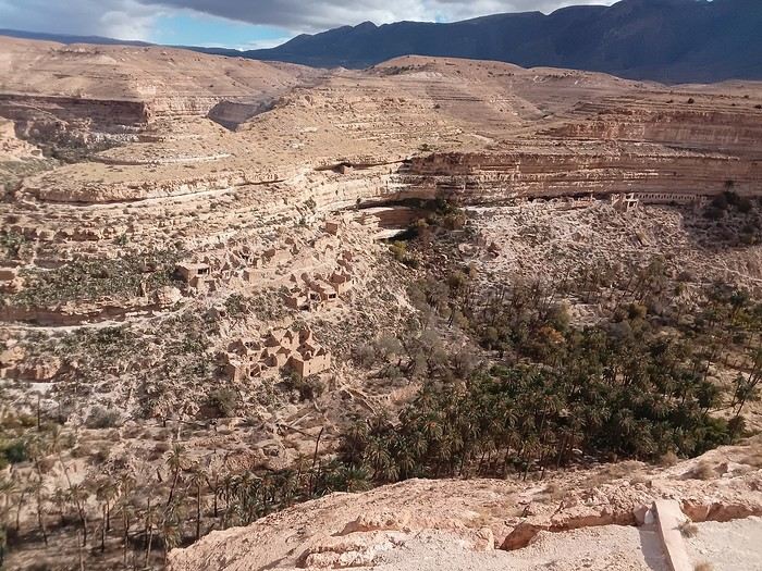 Tuesday, November 18th, flight from Montpellier to Oran and 4 days at Ali’s place in a rented apartment for 8,000 dinars per day. Saturday the 22nd, direct flight from Oran to Ghardaïa for 33 euros, which I booked through Booking since you can’t book domestic Air Algérie flights from France unless you have an Algerian credit card.
The only foreigner on board, they asked me three times if everything was okay, if I needed anything... Upon arrival, the police knew, asked where I was staying, I waited for the hostel taxi (Taskift for 8,000 dinars with half-board), they took a photo of his papers, and that was it.
Tuesday the 25th, Ghardaïa to Ouargla by minibus for 400 dinars, then a big bus to Biskra for 750 dinars. Night at the brand-new Cristal Hotel for 4,500 dinars. And of course, on the way to the balconies of Ghoufi and the Aurès massif—breathtaking!!!
Wednesday the 26th, left too late for Batna, no shared taxis after 3 PM, but my taxi to the bus station handed me off to a minibus driver and asked him to find me a taxi in Batna for Timgad. One call, and it was all set. 250 dinars to Batna and 1,200 dinars to Timgad. It was dark, 1°C, and raining—slippery.
Phew, arrived at 6:45 PM. Lovely Trajan Hotel right on the Roman ruins site for 9,000 dinars.
Thursday the 27th, Timgad at 9 AM, 5°C, and no more than 8°C expected all day. Gotta bundle up for the visit. Snow on the mountain and a freezing cold wind.
That’s the logistics. The euro is at 180 dinars.
Thanks to the Algerians for taking such good care of me like a queen—I can’t wait to come back. See you soon
Tuesday, November 18th, flight from Montpellier to Oran and 4 days at Ali’s place in a rented apartment for 8,000 dinars per day. Saturday the 22nd, direct flight from Oran to Ghardaïa for 33 euros, which I booked through Booking since you can’t book domestic Air Algérie flights from France unless you have an Algerian credit card.
The only foreigner on board, they asked me three times if everything was okay, if I needed anything... Upon arrival, the police knew, asked where I was staying, I waited for the hostel taxi (Taskift for 8,000 dinars with half-board), they took a photo of his papers, and that was it.
Tuesday the 25th, Ghardaïa to Ouargla by minibus for 400 dinars, then a big bus to Biskra for 750 dinars. Night at the brand-new Cristal Hotel for 4,500 dinars. And of course, on the way to the balconies of Ghoufi and the Aurès massif—breathtaking!!!
Wednesday the 26th, left too late for Batna, no shared taxis after 3 PM, but my taxi to the bus station handed me off to a minibus driver and asked him to find me a taxi in Batna for Timgad. One call, and it was all set. 250 dinars to Batna and 1,200 dinars to Timgad. It was dark, 1°C, and raining—slippery.
Phew, arrived at 6:45 PM. Lovely Trajan Hotel right on the Roman ruins site for 9,000 dinars.
Thursday the 27th, Timgad at 9 AM, 5°C, and no more than 8°C expected all day. Gotta bundle up for the visit. Snow on the mountain and a freezing cold wind.
That’s the logistics. The euro is at 180 dinars.
Thanks to the Algerians for taking such good care of me like a queen—I can’t wait to come back. See you soonTrip proposal to the Red Tadrart in the Algerian desert late November/early December
Hi everyone,
I’m looking to put together a small group to explore the Red Tadrart in the Tassili n’Ajjer desert from November 28 to December 7, 2025 (dates flexible depending on participants’ availability).
The idea is to experience this adventure together and benefit from group discounts.
=> Around 1000 € per person for a group of 5
=> Less if the group is larger.
This won’t be my first trip to the area, so you can trust me when I say you’re in for an incredible experience.
Highlights: endless red dunes, natural arches, ancient rock carvings, and camping under the stars.
For flight tickets, we can coordinate to optimize schedules and costs based on where everyone’s traveling from.
If you’re keen to discover the Sahara in a different way, or if you’d like more details, feel free to reach out.
Sarah
What are some good trekking routes in the Vosges?
hi there
I live near Dole, so not too far away, and I sometimes go hiking (Camino de Santiago, Saint-Guilhem-le-Désert, etc.), and I’d love it if someone could suggest a trek in the Vosges—I really don’t know the area well. (Yeah, I know, I’m a little embarrassed about that.)
If you could recommend a nice route.
Arrival by car or train, doesn’t matter.
Thanks so much!
Tips for a trip to the Dolomites: hikes, budget, and crowds
Hi everyone,
Next year I’d love to spend some time in the Dolomites and do a few nice hikes—not too difficult. Can anyone give me some tips? I’ve read that it gets super crowded, you have to start really early, and everything’s pretty expensive. Anyone familiar with the area?
Thanks for your help
Climbing Haut-Folin via the southern route, in stages
Hello everyone,
I’m so happy to share my climb with you, and if it inspires you to take it on, then it’ll be a success. Sometimes I’ll use the local language because I think it’s essential to connect with the people we meet along the way.
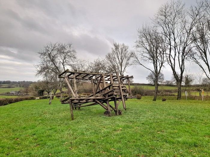
This adventure took place last year, just before winter, right after summer, and smack in the middle of autumn. That really sets the time of year. After climbing Mont-Beuvray—a story I shared here ages ago—I decided to tackle a much more adventurous peak: the summit of Haut-Folin, which rises to 901 m, and that’s no small feat, let’s be honest. It’s located in the Bois du Roi massif. Up there, you often brush against the clouds, which seem to take a mischievous pleasure in wrapping around you.
I’m going fully self-sufficient—no porters, no guide, no cook. I’m just treating myself to a very short approach flight. The flight is early in the morning on a small plane, the *Spirit of St Bernadette*, and it’s perfect. I’ll enjoy watching it deliver mail in the mountains. The pilot will drop me off at the hamlet of *La Pierre en Eau*, near Anost, a small village at the foot of this forest-covered giant.
Physical condition I’m now really seasoned for such an expedition because I’ve trained every day by walking to the village grocery store—round trip, in all weather, that’s 2.1 km. The 451 m elevation gain won’t be a problem for me. .../...
I’m so happy to share my climb with you, and if it inspires you to take it on, then it’ll be a success. Sometimes I’ll use the local language because I think it’s essential to connect with the people we meet along the way.
This adventure took place last year, just before winter, right after summer, and smack in the middle of autumn. That really sets the time of year. After climbing Mont-Beuvray—a story I shared here ages ago—I decided to tackle a much more adventurous peak: the summit of Haut-Folin, which rises to 901 m, and that’s no small feat, let’s be honest. It’s located in the Bois du Roi massif. Up there, you often brush against the clouds, which seem to take a mischievous pleasure in wrapping around you.
I’m going fully self-sufficient—no porters, no guide, no cook. I’m just treating myself to a very short approach flight. The flight is early in the morning on a small plane, the *Spirit of St Bernadette*, and it’s perfect. I’ll enjoy watching it deliver mail in the mountains. The pilot will drop me off at the hamlet of *La Pierre en Eau*, near Anost, a small village at the foot of this forest-covered giant.
Physical condition I’m now really seasoned for such an expedition because I’ve trained every day by walking to the village grocery store—round trip, in all weather, that’s 2.1 km. The 451 m elevation gain won’t be a problem for me. .../...
Review of my visit to Angkor
SIEM REAP
You can now rent scooters just about everywhere in Siem Reap, but at rip-off prices—$15–18 a day instead of $5–10 like everywhere else in Indochina. The best options are tuk-tuks or, even better, electric bikes ($12, but with a 50 km range, so they won’t let you go to Banteay Srei or the River of a Thousand Lingas in the Kulen Massif, which are too far). **WARNING:** Wear a helmet, or they *will* catch you. Scooters are banned from going from SR to the stunning temple of Koh Ker in the northeast and continuing to Battambang; no idea why!
My favorite little hotel in Siem Reap? The Neth Socheata, tucked in an alley off Thnou St near the market—lovely rooms, and the owner speaks great English. Then there’s the Ivy Guesthouse with its little garden, but it’s “always full,” according to the owner. For something upscale but still affordable, a fantastic spot is the Pavillon Indochine, tucked away on a quiet side street on the way to the airport—elegant, with incredible attention to decor, a terrace restaurant, garden, pool, etc. Everything you’d want for $70 including breakfast. I also spotted a hostel for backpackers, the Angkor Thom Hostel, with small 6-bed dorms for $4 with a fan or $6 with AC (18 Wat Bo St).
Food-wise, it’s all amazing! Pub Street has turned into a noise nightmare, with speakers blasting what’s supposed to be music but is just *boom, boom, boom, boom, boom*—run away, even though the pizzas at the Italian place Il Forno are really good. The famous and excellent Tigre de Papier has changed its name to Paper Tiger and is still just as good (lunch only, though, because across the street there’s a huge bar blasting *boom boom boom*, so you won’t be able to hear each other during dinner). On the other hand, the Italian-Cambodian El Toro on Pub Street is perfect, with fantastic pizzas and divine lasagna (go to the first-floor dining room—there’s a big bar across the street blasting *boom boom boom*, but at least you can still talk). Due to the lack of customers during COVID, all the French restaurants—Barrio (three times alas!), Les Deux Sœurs, Le Bel Air, and Le Mozart—have closed. The only one left is L’Olivier, which is pricey. I also discovered a great Moroccan restaurant (though run by a Sudanese man and his French wife), Le Tajine, on Strung Thmei St, 09 68 89 78 27. **WARNING:** For tagines and couscous, you need to order at least in the morning; wine and beer are fine. To get there, turn at the corner of the Cineplex behind the big market at the start of Sivatha Boulevard.
I finally went to the Khmer dance show. Beautiful dancers and dances, but **EAT BEFORE OR AFTER**—the meal is so awful that most Westerners leave it on their plates.
THE ANGKOR TEMPLES Use the excellent *Routard Cambodia* guide. Just a few tips: - Start with the pre-Angkorian Roluos group, 15 km before Siem Reap on the road to PP—it’s the “ancestor” of the temples.
- To avoid the big crowds at Angkor Wat, Bayon, and Ta Prohm, go between noon and 2 PM when everyone’s having lunch. - Speaking of lunch, the crowds flock to the hundred or so mediocre food stalls on the left side of Angkor Wat. Instead, head to Angkor Thom after the stunning Pre Rup temples, all the way to the small Sras Srang basin. Along the basin, there are several restaurants with terraces offering first-floor views of the water, and no crowds. Afterward, cross to the other side of the basin—you’ll end up in the countryside with charming villages where locals seem to live as they did during the temples’ golden age (at its peak, the population was estimated at 600,000–800,000, making it the largest city in the world. The theory for the abandonment is water shortages caused by overpopulation).
- I climbed Phnom Bakheng for the famous sunset, but the crowd was so ridiculous that instead of seeing the temple at sunset, you just see the heads and shoulders around you.
- There are tons of small temples that most people skip, and they’re missing out. My favorites: Thommanon, Neak Pean, Ta Som, and especially Pre Rup, an amazing brick complex with 14 towers.
**Big disappointment:** You can no longer climb to the first floor of Bayon, where you used to stand magically among the giant head statues. So, admire the beautiful bas-reliefs on the outside, but there’s no point going inside—you’ll just see a dark, square corridor with nothing interesting.
ANGKOR FURTHER AFIELD The wonderful Banteay Srei temple. A gem! I couldn’t find the bas-relief stolen by Malraux in the 1920s (fun fact: what he was doing in Indochina—stealing a bas-relief to sell for a fortune in France to cover his massive gambling debts on the stock market, where he ruined his very wealthy American wife—was an open secret. But the French authorities in Saigon, who hated him for his leftist views, decided to let him do it and catch him red-handed, which worked perfectly. He avoided jail only because all the leftist intellectuals in Saint-Germain, Sartre, Beauvoir, and co. cried scandal—though the real scandal was the looting).
30 km of excellent paved road further north, a great spot: the Kulen Massif and the River of a Thousand Lingas (at one point, you’ll come to a T-junction—turn left). Along the road at the foot of the massif, on your right, there’s a great restaurant, Bourey Sovann (where the food is excellent). The trail to the river starts just before it on the left. **Warning:** There are two sites for the River of a Thousand Lingas. One is accessible via a private road, so there’s a $20 toll, and you need to arrive before 11 AM because the road is narrow and traffic flows downhill after that. You’ll end up in a site full of shops, snack stalls, and two good restaurants, including one by a beautiful waterfall. However, the thousand lingas aren’t as spectacular there.
Banteay Srei + the River of a Thousand Lingas makes for a fantastic day. **WARNING:** You used to be able to go to the river and waterfall by scooter or tuk-tuk, but it’s now forbidden. So **go by taxi**—otherwise, you’ll be hiking 12 km round trip up a steep trail.
If you leave Siem Reap early, you can even add Beng Mealea temple on the way back, making a triangular route: SR-BS-Khulen-BM-SR (or the reverse).
If you have time, visit Banteay Samré temple, 10 km west of the Angkor Thom complex. A lovely site with very few visitors.
I’ve never been to the famous Preah Khan on a hill overlooking Thailand. There’s a big dispute between the two countries—the Thais insist the temple belongs to them because the entrance is in their country. There have been serious clashes in the recent past, and landmines are still abundant off the marked paths. They even claim the entire Siem Reap province is theirs and should be returned, arguing it was Thai in the past. It takes two days (6–7 hours each way), with an overnight stay in the nearby village (small hotels and one luxury option with a garden and pool, but it’s expensive).
TONLE SAP People talk about “floating villages,” but that’s a big mistake—these are actually villages of astonishing stilt houses, 4 meters high or more, due to the lake’s major floods. The most famous is Chong Khneas, which I skipped because it’s packed with tourists. Instead, I really liked Kampong Phluk, which is much quieter. To get there, continue on the road past the Roluos group until you reach a parking lot with pirogues lined up. They’ll take you down the river, stop at this amazing village for a walk, and then take you to the Tonle Sap, a true inland sea. At one point, you’ll pass through a flooded forest that you can explore by small boat. At the junction of the river and the Tonle Sap, and on the lake itself, there are floating restaurants where the food is great. Note that in the dry season, you can reach the village by scooter.
BACK TO PHNOM PENH AND ON TO SOUTHERN VIETNAM Since I’d planned at least 15 days in the Mekong Delta between Chau Doc and Saigon, I skipped Battambang, etc. With no desire to endure the dusty road from SR to PP again, I simply loaded my bike onto a bus with the great company Rith Monty (book at their office in SR on the small square at the start of Sivatha Boulevard—$10 for the bike and $6 for me), also known as Paramount. Their buses stop on 136 St right in the middle of PP. I’ll also mention the excellent Giant Ibis, with big modern buses that always leave on time—unlike the others.
I spent the night in PP, and the next morning took the fast boat from PP to Chau Doc with Hang Chau Tourist (buying the ticket the day before is recommended—$25—either at your hotel or the port, and they’ll pick you up at your hotel by tuk-tuk to take you to the port). Departure from PP at noon, arrival in Chau Doc around 4 PM. The boat is great—comfortable and fast. A crew member takes your passports for Cambodian exit formalities, and you handle Vietnamese immigration yourself—it all takes 15–20 minutes. The route isn’t on the Mekong but on the Bassac River to the border, then a wide north-south canal to Chau Doc (the arrival is really nice). In the Chau Doc-PP direction, the boat leaves Chau Doc at 7:30 AM.
My favorite little hotel in Siem Reap? The Neth Socheata, tucked in an alley off Thnou St near the market—lovely rooms, and the owner speaks great English. Then there’s the Ivy Guesthouse with its little garden, but it’s “always full,” according to the owner. For something upscale but still affordable, a fantastic spot is the Pavillon Indochine, tucked away on a quiet side street on the way to the airport—elegant, with incredible attention to decor, a terrace restaurant, garden, pool, etc. Everything you’d want for $70 including breakfast. I also spotted a hostel for backpackers, the Angkor Thom Hostel, with small 6-bed dorms for $4 with a fan or $6 with AC (18 Wat Bo St).
Food-wise, it’s all amazing! Pub Street has turned into a noise nightmare, with speakers blasting what’s supposed to be music but is just *boom, boom, boom, boom, boom*—run away, even though the pizzas at the Italian place Il Forno are really good. The famous and excellent Tigre de Papier has changed its name to Paper Tiger and is still just as good (lunch only, though, because across the street there’s a huge bar blasting *boom boom boom*, so you won’t be able to hear each other during dinner). On the other hand, the Italian-Cambodian El Toro on Pub Street is perfect, with fantastic pizzas and divine lasagna (go to the first-floor dining room—there’s a big bar across the street blasting *boom boom boom*, but at least you can still talk). Due to the lack of customers during COVID, all the French restaurants—Barrio (three times alas!), Les Deux Sœurs, Le Bel Air, and Le Mozart—have closed. The only one left is L’Olivier, which is pricey. I also discovered a great Moroccan restaurant (though run by a Sudanese man and his French wife), Le Tajine, on Strung Thmei St, 09 68 89 78 27. **WARNING:** For tagines and couscous, you need to order at least in the morning; wine and beer are fine. To get there, turn at the corner of the Cineplex behind the big market at the start of Sivatha Boulevard.
I finally went to the Khmer dance show. Beautiful dancers and dances, but **EAT BEFORE OR AFTER**—the meal is so awful that most Westerners leave it on their plates.
THE ANGKOR TEMPLES Use the excellent *Routard Cambodia* guide. Just a few tips: - Start with the pre-Angkorian Roluos group, 15 km before Siem Reap on the road to PP—it’s the “ancestor” of the temples.
- To avoid the big crowds at Angkor Wat, Bayon, and Ta Prohm, go between noon and 2 PM when everyone’s having lunch. - Speaking of lunch, the crowds flock to the hundred or so mediocre food stalls on the left side of Angkor Wat. Instead, head to Angkor Thom after the stunning Pre Rup temples, all the way to the small Sras Srang basin. Along the basin, there are several restaurants with terraces offering first-floor views of the water, and no crowds. Afterward, cross to the other side of the basin—you’ll end up in the countryside with charming villages where locals seem to live as they did during the temples’ golden age (at its peak, the population was estimated at 600,000–800,000, making it the largest city in the world. The theory for the abandonment is water shortages caused by overpopulation).
- I climbed Phnom Bakheng for the famous sunset, but the crowd was so ridiculous that instead of seeing the temple at sunset, you just see the heads and shoulders around you.
- There are tons of small temples that most people skip, and they’re missing out. My favorites: Thommanon, Neak Pean, Ta Som, and especially Pre Rup, an amazing brick complex with 14 towers.
**Big disappointment:** You can no longer climb to the first floor of Bayon, where you used to stand magically among the giant head statues. So, admire the beautiful bas-reliefs on the outside, but there’s no point going inside—you’ll just see a dark, square corridor with nothing interesting.
ANGKOR FURTHER AFIELD The wonderful Banteay Srei temple. A gem! I couldn’t find the bas-relief stolen by Malraux in the 1920s (fun fact: what he was doing in Indochina—stealing a bas-relief to sell for a fortune in France to cover his massive gambling debts on the stock market, where he ruined his very wealthy American wife—was an open secret. But the French authorities in Saigon, who hated him for his leftist views, decided to let him do it and catch him red-handed, which worked perfectly. He avoided jail only because all the leftist intellectuals in Saint-Germain, Sartre, Beauvoir, and co. cried scandal—though the real scandal was the looting).
30 km of excellent paved road further north, a great spot: the Kulen Massif and the River of a Thousand Lingas (at one point, you’ll come to a T-junction—turn left). Along the road at the foot of the massif, on your right, there’s a great restaurant, Bourey Sovann (where the food is excellent). The trail to the river starts just before it on the left. **Warning:** There are two sites for the River of a Thousand Lingas. One is accessible via a private road, so there’s a $20 toll, and you need to arrive before 11 AM because the road is narrow and traffic flows downhill after that. You’ll end up in a site full of shops, snack stalls, and two good restaurants, including one by a beautiful waterfall. However, the thousand lingas aren’t as spectacular there.
Banteay Srei + the River of a Thousand Lingas makes for a fantastic day. **WARNING:** You used to be able to go to the river and waterfall by scooter or tuk-tuk, but it’s now forbidden. So **go by taxi**—otherwise, you’ll be hiking 12 km round trip up a steep trail.
If you leave Siem Reap early, you can even add Beng Mealea temple on the way back, making a triangular route: SR-BS-Khulen-BM-SR (or the reverse).
If you have time, visit Banteay Samré temple, 10 km west of the Angkor Thom complex. A lovely site with very few visitors.
I’ve never been to the famous Preah Khan on a hill overlooking Thailand. There’s a big dispute between the two countries—the Thais insist the temple belongs to them because the entrance is in their country. There have been serious clashes in the recent past, and landmines are still abundant off the marked paths. They even claim the entire Siem Reap province is theirs and should be returned, arguing it was Thai in the past. It takes two days (6–7 hours each way), with an overnight stay in the nearby village (small hotels and one luxury option with a garden and pool, but it’s expensive).
TONLE SAP People talk about “floating villages,” but that’s a big mistake—these are actually villages of astonishing stilt houses, 4 meters high or more, due to the lake’s major floods. The most famous is Chong Khneas, which I skipped because it’s packed with tourists. Instead, I really liked Kampong Phluk, which is much quieter. To get there, continue on the road past the Roluos group until you reach a parking lot with pirogues lined up. They’ll take you down the river, stop at this amazing village for a walk, and then take you to the Tonle Sap, a true inland sea. At one point, you’ll pass through a flooded forest that you can explore by small boat. At the junction of the river and the Tonle Sap, and on the lake itself, there are floating restaurants where the food is great. Note that in the dry season, you can reach the village by scooter.
BACK TO PHNOM PENH AND ON TO SOUTHERN VIETNAM Since I’d planned at least 15 days in the Mekong Delta between Chau Doc and Saigon, I skipped Battambang, etc. With no desire to endure the dusty road from SR to PP again, I simply loaded my bike onto a bus with the great company Rith Monty (book at their office in SR on the small square at the start of Sivatha Boulevard—$10 for the bike and $6 for me), also known as Paramount. Their buses stop on 136 St right in the middle of PP. I’ll also mention the excellent Giant Ibis, with big modern buses that always leave on time—unlike the others.
I spent the night in PP, and the next morning took the fast boat from PP to Chau Doc with Hang Chau Tourist (buying the ticket the day before is recommended—$25—either at your hotel or the port, and they’ll pick you up at your hotel by tuk-tuk to take you to the port). Departure from PP at noon, arrival in Chau Doc around 4 PM. The boat is great—comfortable and fast. A crew member takes your passports for Cambodian exit formalities, and you handle Vietnamese immigration yourself—it all takes 15–20 minutes. The route isn’t on the Mekong but on the Bassac River to the border, then a wide north-south canal to Chau Doc (the arrival is really nice). In the Chau Doc-PP direction, the boat leaves Chau Doc at 7:30 AM.
Tenerife in February for hiking
I'm planning a 10-day trip to Tenerife to go hiking in February. Is the weather decent without too much fog at this time of year? Is an excursion to Teide National Park doable?
Thanks for your replies.
Riding through the Algerian Sahara by motorcycle in January
Hi everyone,
I’m starting to think about a trip that’s really close to my heart: Algeria by motorcycle, specifically the southern part of the country. It’d be for January 2025, and I’ve got two main questions:
Is it possible for an individual on a motorcycle to travel freely, outside of any organized tour, or does the regulation require some kind of supervision in the Algerian Sahara region?
Is the Hoggar massif accessible by road or by (rideable) tracks?
Beyond the official recommendations, I’m really looking for your firsthand experiences. Thanks so much for your answers, and sorry if my questions are a bit newbie!
Ride safe! ✌️ Didier
I’m starting to think about a trip that’s really close to my heart: Algeria by motorcycle, specifically the southern part of the country. It’d be for January 2025, and I’ve got two main questions:
Is it possible for an individual on a motorcycle to travel freely, outside of any organized tour, or does the regulation require some kind of supervision in the Algerian Sahara region?
Is the Hoggar massif accessible by road or by (rideable) tracks?
Beyond the official recommendations, I’m really looking for your firsthand experiences. Thanks so much for your answers, and sorry if my questions are a bit newbie!
Ride safe! ✌️ Didier