Results for "Afrique+du+Nord+itinéraire"
About 48,834 results.
More options
Many results are in French, the community’s main language. English translations are added over time.
Search results
Conseils voyage Australie - Nouvelle-Zélande
Bonjour à vous.
Je suis en train de lire pas mal de forum pour planifier un voyage en Océanie, désireux de faire depuis longtemps mais pas facile de faire une synthèse de tout, étant la 1ere fois que je pars au bout du monde. En effet je souhaite partir 3 semaines pour découvrir l’Australie et la Nouvelle Zélande (petit budget ~2000€)
Quel est la meilleure date pour partir ? J’avais lu novembre ? Que me conseillez-vous sur les 3 semaines, 1 semaine en Australie, 15j en NZ ? L’inverse ? Comment me loger, me déplacer ? Je vois souvent les gens se déplacer en Camping-car, vous confirmez ? Avez-vous des pistes pour des logements sinon ?
Quels itinéraires en Australie et la NZ pour les incontournables ? Amateur de photo et d’animaux, un safari me plairait bien.
Une piste pour avoir des tarifs de billets d’avions à moindre cout ? Si vous saviez m’orienter pour un tel voyage, je vous serez reconnaissant. Merci à vous. 😉
Quel est la meilleure date pour partir ? J’avais lu novembre ? Que me conseillez-vous sur les 3 semaines, 1 semaine en Australie, 15j en NZ ? L’inverse ? Comment me loger, me déplacer ? Je vois souvent les gens se déplacer en Camping-car, vous confirmez ? Avez-vous des pistes pour des logements sinon ?
Quels itinéraires en Australie et la NZ pour les incontournables ? Amateur de photo et d’animaux, un safari me plairait bien.
Une piste pour avoir des tarifs de billets d’avions à moindre cout ? Si vous saviez m’orienter pour un tel voyage, je vous serez reconnaissant. Merci à vous. 😉
Wadis, snorkeling, kayak à Oman en avril
Bonjour,
Je commence a préparer mon voyage de 15 jours du 9 au 23 avril 2016 en Oman et en famille ( 3 enfants de 5, 8 et 10 ans) ; On louera un 4x4 (déjà réservé chez europcar) et on campera la plupart du temps. Je commence juste à préparer la trame de notre itinéraire donc j'aurais quelques questions pour les spécialistes et connaisseurs qui auront la gentillesse de me répondre :
- eau dans les wadis : avril est-il une saison plutôt sêche ou plutôt humide ? En gros faut-il craindre de trouver les wadis complètement à sec ou bien complètement inondés ? Pour y trouver un niveau d'eau moyen (bien pour se baigner avec des enfants qui nagent tous bien) faut-il en privilégier certains ?
- snorkeling : est-ce facile de trouver des spots ou l'on puisse espérer voir poissons tropicaux et tortues par soi même sur la cote entre mascate et sur (bandar khayran par exemple) ou bien vaut-il mieux passer par une société spécialisé ou encore par des pêcheurs locaux ?
- Kayak de mer : est-il possible de louer des kayaks pour aller se balader en autonome dans bandar khayran ?
Question subsidiaire : Oman off-road ; j'ai lu avec intérêt tous les sujets annonçant l'arrivée de la nouvelle version ; ne partant que en avril, si quelqu'un partant avant nous l'achète las-bas et le ramène je suis intéressée pour l'acheter à son retour :-)
merci d'avance à tout ceux qui prendront quelques instant pour partager leur expérience...
Isabelle
Question subsidiaire : Oman off-road ; j'ai lu avec intérêt tous les sujets annonçant l'arrivée de la nouvelle version ; ne partant que en avril, si quelqu'un partant avant nous l'achète las-bas et le ramène je suis intéressée pour l'acheter à son retour :-)
merci d'avance à tout ceux qui prendront quelques instant pour partager leur expérience...
Isabelle
Namibie en camping-car avec 4 enfants. Un rêve devenu réalité.
Voici le récit de nos trois semaines en Namibie, voyage qui s'est déroulé du 24 septembre au 14 octobre 2012. Nous sommes partis avec nos quatre enfants de 4, 7, 9 et 12 ans. Nous avons loué un camping-car pour six chez B*b*-camper, loueur installé à Windhoek. Je préciserai autant que possible le prix que nous avons payé pour chaque nuit, sachant que souvent notre plus jeune ne payait pas et que deux de nos enfants payaient moitié prix. Eau et électricité entre parenthèse voudront dire robinet à l'emplacement et prise de courant (souvent locale) pour se brancher.
Notre trajet:

Voyageant avec des jeunes enfants et pour la première fois en Afrique, j'avais fait le choix de réserver un maximum de nuits d'avance. Les réservations ont été faites en direct auprès de la majorité des campings, via Cardboard Box Travel Shop pour les campings du NWR. Je ne regrette pas ce choix car il nous avait permis de préparer un itinéraire assez précis à l'avance, ce qui était rassurant pour nous. Par contre pas de paiement des réservations par internet quand pas de site sécurisé, donc pas de paiement du tout dans ces cas là. Malgré tout, certaines modifications ont eu lieu qui n'ont pas posé de problème. En effet, même dans les campings les plus remplis, il y avait des places libre, même si nos semaines 2 et 3 coïncidaient avec les vacances scolaires d'Afrique du Sud. Le problème principal qui s'est présenté à nous a été dû à notre loueur. En effet, nous avons découvert (mauvaise lecture du site ou du contrat? à vérifier...) le jour de la prise du camping-car que nous n'avions pas le droit de rouler sur des routes D. Bien sûr, notre itinéraire en comportait un certain nombre. Nous avons pris la décision de nous adapter aux circonstances (état des routes), d'assumer en cas de problème et de voir venir...
Budget (hors avion 3900 euro depuis la Réunion):
- Camping Car 6 couchages (le plus gros) pour 3 semaines, 21 j, km illimités , avec options assurance maxi CDW 6090 NS (609 euros), retour dimanche 350 NS, transfert airport vers loueur 155 NS/personne gratuit en dessous de 12 ans, location une paire de jumelle 135 NS, total = 39 445 NS. L'assurance CDW couvre les crevaisons qui nous serons remboursés. Pas d'état des lieu de carrosserie donc pas de soucis au retour pour les griffures par branches diverses.
(Note sur le loueur : pas de compresseur fourni nous avions apporté le nôtre, fort utile pour les gonflages lorsqu'on quitte une gravel pour revenir sur bitume.)
- Campings: 8525 $N - Alimentation: 8558 $N - Divers: 4783 $N - Essence: 6843 $N
Total: 68154 $N sans l'avion
Le change était à peu près de 1 euro pour 10 rands ou 10 dollars namibiens, allant en notre faveur au fur et à mesure du voyage, je laisse les prix en monnaie locale. Les indispensables emportés: des écrans dvd et un stock de films pour les enfants, la route est parfois longue, un doubleur de port allume cigare, un transfo pour convertir l'allume cigare en 220V, un adapteur prise namibienne, des draps pour les enfants (parce que le loueur considère qu'un duvet, c'est le couchage enfant et moi, glisser mes enfants dans un duvet inconnu, bof bof!) Les pas si nécessaires que ça: des duvets supplémentaires, ceux du loueur suffisaient largement, en cette saison, on a eu froid à Swakopmund et à Aus, c'est tout; le stick à lèvres (en vente absolument partout), les vêtements chauds que j'avais pris en bcp trop grande quantité pour les enfants.
Première semaine:
Le 23 septembre: Partant de la Réunion, nous n'avions pas la possibilité d'aller directement à Windhoek. Arrivant à 23h, nous avons choisi de dormir à Johannesburg et de prendre l'avion le lendemain à 12h pour Windhoek. Nous avions réservé et payé par Internet, une voiture de l' Emerald Guesthouse est venue nous chercher à l'aéroport et nous avons passé la nuit dans une maisonnette pour six personnes, deux chambres et salon, petit dèj inclus pour 1450 rands.
Le 24 septembre: Nous sommes à 14h15 à Windhoek, il y fait bien plus chaud qu'en Afrique du Sud malgré l'altitude et je vois mon premier chacal le long des pistes. Le loueur est là et en 20 minutes, avec tous nos bagages, nous sommes arrivés. Nous prenons possession de notre maison pour trois semaines. Les explications sont longues, il fait chaud, même pas un petit verre d'eau offert, c'est pro mais pas plus quoi! Nous partons pour la capitale, le GPS avec sa carte tracks 4 Africa est branché et nous trouve un supermarché où je fais le premier plein. Je trouve de tout, même du beurre breton. Les prix sont bien moins élevés qu'à la Réunion mais me semblent terribles pour le pays! Il faut être super vigilant pour la conduite à gauche, surtout aux carrefours. Ensuite, la nuit tombe déjà et nous allons dormir à Arrebush, le camping en ville pour 450$N (eau et électricité)
Le 25 septembre: Nous devons faire un saut à l'ambassade pour avoir une traduction du permis de Raphaël qui n'a pas pu avoir de permis international. Une fois cette formalité expédiée, nous prenons enfin la route pour Etosha!!!! La route est un peu monotone, le paysage pas très intéressant, hormis quelques termitières, des magnifiques Jacarandas à Otjiwarango

et des babouins qui traversent la route.

Nous passons la gate d'Okaukuejo et notre première girafe nous attend...

Je suis super émue!

Puis nos premiers zèbres

et nos premiers springboks.

Difficile d'imaginer à ce moment là qu'on va s'en lasser et trois jours plus tard dire "Non, rien, c'est encore des zèbres!" :-)... Nous arrivons au camping, payons la taxe du parc pour les quatre nuits 680 $N puis allons prendre possession de notre emplacement poussiéreux (500 $N la nuit, eau et électricité). Les sanitaires sont propres et nombreux et on apprécie la piscine qui est un peu fraîche mais il fait tellement chaud et sec! Puis nous allons découvrir à deux pas l'attraction du camp, le trou d'eau! Il y a un chacal qui traîne mais peu de temps après, c'est rhino,

girafes,

éléphants sur fond de coucher de soleil.

Pour une première journée, c'est extraordinaire, ils sont là à quelques dizaines de mètres de nous, les enfants sont scotchés, on reste un long moment.

Il y a une hiérarchie pour l'accès à l'eau, les girafes n’accéderont que quand l'éléphant sera parti.


Puis zèbres et springboks.

Nous sommes très surpris de voir traîner des chacals entre les tentes et surtout, de constater que nos enfants phobiques des chiens sont très intéressés et pas effrayés!
Notre trajet:
Voyageant avec des jeunes enfants et pour la première fois en Afrique, j'avais fait le choix de réserver un maximum de nuits d'avance. Les réservations ont été faites en direct auprès de la majorité des campings, via Cardboard Box Travel Shop pour les campings du NWR. Je ne regrette pas ce choix car il nous avait permis de préparer un itinéraire assez précis à l'avance, ce qui était rassurant pour nous. Par contre pas de paiement des réservations par internet quand pas de site sécurisé, donc pas de paiement du tout dans ces cas là. Malgré tout, certaines modifications ont eu lieu qui n'ont pas posé de problème. En effet, même dans les campings les plus remplis, il y avait des places libre, même si nos semaines 2 et 3 coïncidaient avec les vacances scolaires d'Afrique du Sud. Le problème principal qui s'est présenté à nous a été dû à notre loueur. En effet, nous avons découvert (mauvaise lecture du site ou du contrat? à vérifier...) le jour de la prise du camping-car que nous n'avions pas le droit de rouler sur des routes D. Bien sûr, notre itinéraire en comportait un certain nombre. Nous avons pris la décision de nous adapter aux circonstances (état des routes), d'assumer en cas de problème et de voir venir...
Budget (hors avion 3900 euro depuis la Réunion):
- Camping Car 6 couchages (le plus gros) pour 3 semaines, 21 j, km illimités , avec options assurance maxi CDW 6090 NS (609 euros), retour dimanche 350 NS, transfert airport vers loueur 155 NS/personne gratuit en dessous de 12 ans, location une paire de jumelle 135 NS, total = 39 445 NS. L'assurance CDW couvre les crevaisons qui nous serons remboursés. Pas d'état des lieu de carrosserie donc pas de soucis au retour pour les griffures par branches diverses.
(Note sur le loueur : pas de compresseur fourni nous avions apporté le nôtre, fort utile pour les gonflages lorsqu'on quitte une gravel pour revenir sur bitume.)
- Campings: 8525 $N - Alimentation: 8558 $N - Divers: 4783 $N - Essence: 6843 $N
Total: 68154 $N sans l'avion
Le change était à peu près de 1 euro pour 10 rands ou 10 dollars namibiens, allant en notre faveur au fur et à mesure du voyage, je laisse les prix en monnaie locale. Les indispensables emportés: des écrans dvd et un stock de films pour les enfants, la route est parfois longue, un doubleur de port allume cigare, un transfo pour convertir l'allume cigare en 220V, un adapteur prise namibienne, des draps pour les enfants (parce que le loueur considère qu'un duvet, c'est le couchage enfant et moi, glisser mes enfants dans un duvet inconnu, bof bof!) Les pas si nécessaires que ça: des duvets supplémentaires, ceux du loueur suffisaient largement, en cette saison, on a eu froid à Swakopmund et à Aus, c'est tout; le stick à lèvres (en vente absolument partout), les vêtements chauds que j'avais pris en bcp trop grande quantité pour les enfants.
Première semaine:
Le 23 septembre: Partant de la Réunion, nous n'avions pas la possibilité d'aller directement à Windhoek. Arrivant à 23h, nous avons choisi de dormir à Johannesburg et de prendre l'avion le lendemain à 12h pour Windhoek. Nous avions réservé et payé par Internet, une voiture de l' Emerald Guesthouse est venue nous chercher à l'aéroport et nous avons passé la nuit dans une maisonnette pour six personnes, deux chambres et salon, petit dèj inclus pour 1450 rands.
Le 24 septembre: Nous sommes à 14h15 à Windhoek, il y fait bien plus chaud qu'en Afrique du Sud malgré l'altitude et je vois mon premier chacal le long des pistes. Le loueur est là et en 20 minutes, avec tous nos bagages, nous sommes arrivés. Nous prenons possession de notre maison pour trois semaines. Les explications sont longues, il fait chaud, même pas un petit verre d'eau offert, c'est pro mais pas plus quoi! Nous partons pour la capitale, le GPS avec sa carte tracks 4 Africa est branché et nous trouve un supermarché où je fais le premier plein. Je trouve de tout, même du beurre breton. Les prix sont bien moins élevés qu'à la Réunion mais me semblent terribles pour le pays! Il faut être super vigilant pour la conduite à gauche, surtout aux carrefours. Ensuite, la nuit tombe déjà et nous allons dormir à Arrebush, le camping en ville pour 450$N (eau et électricité)
Le 25 septembre: Nous devons faire un saut à l'ambassade pour avoir une traduction du permis de Raphaël qui n'a pas pu avoir de permis international. Une fois cette formalité expédiée, nous prenons enfin la route pour Etosha!!!! La route est un peu monotone, le paysage pas très intéressant, hormis quelques termitières, des magnifiques Jacarandas à Otjiwarango
et des babouins qui traversent la route.
Nous passons la gate d'Okaukuejo et notre première girafe nous attend...
Je suis super émue!
Puis nos premiers zèbres
et nos premiers springboks.
Difficile d'imaginer à ce moment là qu'on va s'en lasser et trois jours plus tard dire "Non, rien, c'est encore des zèbres!" :-)... Nous arrivons au camping, payons la taxe du parc pour les quatre nuits 680 $N puis allons prendre possession de notre emplacement poussiéreux (500 $N la nuit, eau et électricité). Les sanitaires sont propres et nombreux et on apprécie la piscine qui est un peu fraîche mais il fait tellement chaud et sec! Puis nous allons découvrir à deux pas l'attraction du camp, le trou d'eau! Il y a un chacal qui traîne mais peu de temps après, c'est rhino,
girafes,
éléphants sur fond de coucher de soleil.
Pour une première journée, c'est extraordinaire, ils sont là à quelques dizaines de mètres de nous, les enfants sont scotchés, on reste un long moment.
Il y a une hiérarchie pour l'accès à l'eau, les girafes n’accéderont que quand l'éléphant sera parti.
Puis zèbres et springboks.
Nous sommes très surpris de voir traîner des chacals entre les tentes et surtout, de constater que nos enfants phobiques des chiens sont très intéressés et pas effrayés!
Catalogue Costa 2013
bonjour
Le catalogue 2013 est en ligne sur le site italien de Costa.Une nouveauté:un tour du monde par le sud sur le Néoromantica.Départ janvier 2014.
Le catalogue 2013 est en ligne sur le site italien de Costa.Une nouveauté:un tour du monde par le sud sur le Néoromantica.Départ janvier 2014.
Se rendre à la Réunion en camion aménagé: par où passer?
Bonjour j'aimerais savoir si il est possible de se rendre à la réunion en camion si quelqu’un la déjà fait et par quel itinéraire avec les pays a évité . *
Merci pous vos réponse .
Traverser le Sud Soudan par la terre?
Bonjour chers voyageurs !
Actuelement en velo en Afrique, un an passe a descende la cote ouest (nous sommes actuelement en Zambie) nous voulons remonter par l’est cette fois, jusqu’en Egypte. Le trajet est encore incertain, et pour cause, le visa Ethiopien dans le sens KENYA -> ETHIOPIE ne se fait NI A NAIROBI ni a la frontiere.
Voici la discussion concernee :
Les options pour remonter en egypte sont donc les suivantes :
- Passer par la Somalie (et trouver un bateau) -> Chaud chaud chaud ! - Passer par le Sud Soudan pour relier le Soudan puis l’Egypte. - Trouver le visa ETHIOPIE depuis l’OUGANDA, le BURUNDI ou le RWANDA.
Ma question est donc :
Quel est votre avis?
La situation au Sud Soudan est-elle suffisement sure pour la traverser en velo pour relier Kharthoum ? Comment se font les formalitees de Visa depuis l’Ouganda ? (Ambassade ou poste frontiere ?)
Un autre sujet a ete ouvert ici concernant l autre question sur le visa pour l'ethiopie depuis le burundi, le rwanda, l'ouganda...
Merci de l’aide genereuse des specialistes…
Jeremie et Claire, deux petits velos dans la tete.
Actuelement en velo en Afrique, un an passe a descende la cote ouest (nous sommes actuelement en Zambie) nous voulons remonter par l’est cette fois, jusqu’en Egypte. Le trajet est encore incertain, et pour cause, le visa Ethiopien dans le sens KENYA -> ETHIOPIE ne se fait NI A NAIROBI ni a la frontiere.
Voici la discussion concernee :
Les options pour remonter en egypte sont donc les suivantes :
- Passer par la Somalie (et trouver un bateau) -> Chaud chaud chaud ! - Passer par le Sud Soudan pour relier le Soudan puis l’Egypte. - Trouver le visa ETHIOPIE depuis l’OUGANDA, le BURUNDI ou le RWANDA.
Ma question est donc :
Quel est votre avis?
La situation au Sud Soudan est-elle suffisement sure pour la traverser en velo pour relier Kharthoum ? Comment se font les formalitees de Visa depuis l’Ouganda ? (Ambassade ou poste frontiere ?)
Un autre sujet a ete ouvert ici concernant l autre question sur le visa pour l'ethiopie depuis le burundi, le rwanda, l'ouganda...
Merci de l’aide genereuse des specialistes…
Jeremie et Claire, deux petits velos dans la tete.
Changement d'escales sur la croisière Costa "Retour en Terre Sainte"
COSTA vient de rechanger l'itineraire des croisieres sur le pacifica
plus d'escales en ISRAEL !!!!!!!
c'est remplacé par RHODES CHYPRE MARMARIS
quel dommage, cette croisiere sans l Egype et l'Israel !!!!
ils n'ont pas fini de brader ces croisieres qui ne se remplissent pas
Oui, le traitement anti-palu est indispensable!
Bonjour à tous les détracteurs du traitement !
Je vois que vous êtes nombreux à induire les gens en erreur, quand vous affirmez que le traitement anti-palu ne sert à rien à part enrichir les labos !
On n'a pas le droit de mettre la vie des autres en danger, et encore que même la sienne, ce n'est pas très intelligent.
Bien sûr, ça coûte cher, bien sûr c'est pas agréable à prendre, bien sûr c'est une contrainte...
Et après ? La santé (parfois celle de ses enfants) est plus importante que l'argent.
Si quelqu'un revenait de voyages et attrapait le palu, parce qu'il aurait écouté toutes les c... qu'on peut dire sur le forum, ce serait un meurtre !!! Induire les gens en erreur, c'est volontairement les tuer en cas de problème !
Alors, je somme tous les détracteurs de signer une charte les responsabilisant personnellement par rapport aux "conseils" qu'ils donnent sur ce forum, en acceptant toutes les conséquences que cela pourrait provoquer sur leur vie future... Réfléchissez à deux fois avant d'écrire et de mettre en avant des idées aussi démentes.
Et après ? La santé (parfois celle de ses enfants) est plus importante que l'argent.
Si quelqu'un revenait de voyages et attrapait le palu, parce qu'il aurait écouté toutes les c... qu'on peut dire sur le forum, ce serait un meurtre !!! Induire les gens en erreur, c'est volontairement les tuer en cas de problème !
Alors, je somme tous les détracteurs de signer une charte les responsabilisant personnellement par rapport aux "conseils" qu'ils donnent sur ce forum, en acceptant toutes les conséquences que cela pourrait provoquer sur leur vie future... Réfléchissez à deux fois avant d'écrire et de mettre en avant des idées aussi démentes.
Mauritian Ti' Punch
The recipe for the cocktail: endless beaches, a dazzling palette of colors, some breathtaking hikes, and excellent cuisine...
For the tasting, follow along in the pages of this travel journal! 😉
Don’t forget your hiking shoes, a swimsuit, sunscreen, but also a sweater, your driver’s license, and your credit card...
Just over 11 hours of flight, and we’ll be setting foot on Mauritian soil!
For the tasting, follow along in the pages of this travel journal! 😉
Don’t forget your hiking shoes, a swimsuit, sunscreen, but also a sweater, your driver’s license, and your credit card...
Just over 11 hours of flight, and we’ll be setting foot on Mauritian soil!
Turquie: bon plan pour un voyage de trois semaines en août 2012?
Bonsoir a tous
Mon amie et moi souhaiterons partir en Turquie en août 2012 pour une durée d'environs 3semaines et nous aimerions des conseilles d'itinéraires, sachant qu'on voudrais rester 1 semaine a Istanbul ensuite descendre vers le sud-ouest ( la côte ) et Cappadoces.
Est ce que qu'il aurait a cette période des couchsurfeurs? où des hôtels pas trop chère ? camping???
Comment se déplacer la bas? location de véhicule où pas?
Merci d'avance pour tout renseignement qui peu nous être trés utile pour organiser notre voyage
Namibia Travel Journal: May 2025 - Trip Review
NAMIBIA TRIP 2025: April 24 to May 20: Feel free to comment or ask us any questions about this amazing journey.
>> Find all our photos and videos for each day on our website here: www.montagne-aventure.net
**DAY 1: Thursday, April 24, 2025: Outbound Flights from Lyon to Windhoek via Munich - Visit to Munich:**

Off we go on a new adventure. The alarm rings at 6:30 AM, the travel bags are packed, and we head to Lyon Airport. We booked our flight tickets with Lufthansa. The first leg to Munich, Germany, is operated by AirBaltic. Departure at 1:05 PM for a 1-hour and 20-minute flight. We arrive at 2:30 PM.
**We now have a 7-hour layover, so we take the opportunity to get some fresh air and explore Munich.** We quickly exit Terminal 2 of the airport and head towards the subway. We buy a group day ticket "Airport-city Day Zone M-5," valid for 2 to 5 people at a price of 30.50 € (instead of 16.30 € per person). We take the S8 line to **Marienplatz** in 35 minutes. **This is the heart of the city.** The weather is overcast, quite cool, but dry. Perfect for a little city trip between two flights while leaving our large luggage in transit at the airport. **Munich is the third-largest German city after Berlin and Hamburg, in the Bavaria region.** **The center has a lot of charm and brings together several religious buildings, easy to explore on foot.** We are impressed by the number of people enjoying these 100% pedestrian streets, which are very pleasant. After Marienplatz, the most famous square with the town hall, we head to the Cathedral of Our Lady, a Gothic church, then continue to **Karlsplatz** and move on to **the food market offering a wide selection of high-end food products in an atmosphere where a certain art of living prevails.** We also visit St. Peter's Church before grabbing a bite to eat. Two good hours were enough for this 10 km city walk. It's time to take the subway back: by 6:30 PM, we are back at the airport. Now, it's time for a bit of waiting and rest. Our second flight is scheduled for 9:35 PM for a 9-hour and 30-minute journey to our final destination in Namibia: **Windhoek.**
> Round-trip flight tickets with Lufthansa from Lyon: 2029 €, or 1,014.50 € per person.
> Lyon Airport parking: 120 €
> Today's expenses: 7 € for 2 pizzas in France / 14 € for the restaurant in Munich / 30.50 € for the daily subway ticket in Munich.
**DAY 2: Friday, April 25, 2024: Arrival in Windhoek, Visit to the Namibian Capital:**
After a 9-hour and 30-minute overnight flight with Discover Airlines, we finally land on Namibian soil just before 7:30 AM. The day is breaking, and the colors are already stunning. We are eager despite the usual fatigue from the flight. The airline was punctual, with friendly staff and good meals, though a bit light. We are the first flight of the day to land, with no more than 15 flights per day here, from 7 AM to 8 PM. We disembark on the tarmac at this airport located in the middle of nowhere, **I finally set foot on African soil for the first time.** We exit among the first from the aircraft to go through the long formalities at the front of the line, as the wait can quickly become endless. Allow at least 5 minutes per person for e-visas. We still wait 45 minutes despite only about twenty people ahead of us. Phew, it's done. We collect our luggage and then withdraw money from an ATM. We make 4 withdrawals of the maximum amount, 2000 NAD $ per withdrawal, for a total of 380 €, or 95.33 € per withdrawal.
Our driver arrives at the same time, perfect timing, we were quick.
We leave the airport at 8:45 AM. By 9:30 AM, we arrive at the **Gracious Whisp vehicle rental agency**, located at the entrance of Windhoek, small and human-sized with a fleet of recent vehicles. More formalities, then a short wait as our vehicle is not yet ready. Time to decompress, catch our breath, and enjoy the very pleasant morning temperature. Not a cloud in sight. Next, a briefing on the vehicle, always with a bit of apprehension due to our approximate English. Allow 45 minutes of explanations, including setting up the roof tent, camping equipment, technical information in case of a flat tire, driving tips in Namibia, and a tour of the 4x4. We have all the necessary equipment for camping: mattresses, sleeping bags, pillows, table, chairs, gas stove, BBQ grill... as well as 2 spare tires, a compressor, a dual tank, and accessories for removing wheels. Off we go, it's time to muster our courage and get behind the wheel. **Heading to SuperSpar Maerua**, fortunately located less than 10 minutes away. We park with the help of a parking attendant; it's very crowded, the space is narrow, but everything goes well despite the cursed right-hand drive. Today's new mission: stock up on groceries. The store is well-stocked with local and imported products, catering to all tastes. We spend 114 € on groceries, from pasta to meat, BBQ lighters to dishwashing products. Two people load our groceries into two carts and transfer them to our vehicle; we feel compelled to leave a tip, 50 NAD $, as we don't have change yet. Now, we head to the hotel, 15 minutes away. Traffic is difficult at a complicated intersection; this will likely be the only traffic jam in Namibia. **We arrive at Kate's Nest Guesthouse & Backpackers around 1:15 PM, quite tired.** We take some well-deserved rest at this recent establishment, quite calm with secure private parking. After a short nap, we enjoy the quiet by the hotel pool. Night falls between 6:30 PM and 7 PM. We eat quietly in our room tonight before starting this long 4x4 road trip in camping mode in the heart of Namibia.
> Today's grocery expenses: 114 € at Super Spar Marua (2395.21 NAD $).
> Round-trip flight tickets with Lufthansa from Lyon: 2029 €, or 1,014.50 € per person.
> Vehicle rental: 4x4 Toyota with roof tent for 24 days: Gracious Whisp Car Rentals: 2,638 € (N$50,640) or **1,319 €** per person - (https://gwcarrentals.com/)
> Distance driven today: 15 km.
> Accommodation: Kate's Nest Guesthouse & Backpackers - 4 Aristotles Street Academia, 9000 Windhoek - 36 € for two for one night.
> Windhoek International Airport website: (https://www.airports.com.na/)
**DAY 3: Saturday, April 26, 2025: Windhoek to Hardap: Mariental Region - Kalahari Desert:**
After a good, restful night, we wake up leisurely around 7 AM. We enjoy the comfort provided by this first and last hotel before 24 nights under the tent.
**We leave Kate's Nest Guesthouse at 8:30 AM to tackle the Namibian roads.** We quickly leave the capital; in just 30 minutes, we find ourselves almost alone in the world. The landscape is dotted with small domes. We leave the **paved B1** quickly to turn left onto the **C15**. **From there, we won't see more than 10 vehicles all day.** After passing through the few houses of **Lekkerwaterpoort**, we tackle our first gravel road. These road sections are limited to 100 km/h, but even at 70 km/h, I find it already challenging. However, I quickly get used to it and gradually pick up speed to reach my cruising speed of around 80 to 90 km/h. **We are on immense straight lines crossing wild expanses as far as the eye can see.** **We come across two baboons, a few ostriches, and numerous cattle and sheep farms.** We pass through the charming village of **Uhlenhorst** with its typical houses and children with broad smiles waving at us. Life here is already very different from Windhoek. **The thermometer rises quickly from 16°C at 8:30 AM to over 28°C in the early afternoon.**
**We arrive at the Hardap Dam reserve at 2 PM.** We stop at the toll booth at the park entrance to pay the entrance fee: 250 NAD $ for 2 people and 1 vehicle. We continue to the dam and then the camp entrance, located a bit further. We had booked in advance, but this place remains little frequented by foreigners.
We take advantage of the hottest hours to rest by the large pool overlooking the immense lake, a very enjoyable moment. Would this be a bit of a vacation?
Around 4:30 PM, we head to the campsite. We overlook this vast water reserve. We arrive first; we will be only 3 vehicles spending the night here. It's time to get to work and set up our equipment for the first time. It takes us a good 20 minutes to set everything up, with a slight apprehension about unfolding the tent. Once this task is done, which we will have to repeat for almost a month, we will become much more efficient over time. Time for rest and contemplation in total silence. The sun gradually sets, and the heat quickly becomes bearable again. Bliss! **This dam is located 20 km northwest of Mariental in an area dotted with conical hills topped with dolerite buttons (Hardap means "hillock" in Nama). It captures the Fish River, which flows south, creating a large lake in the middle of an arid environment. The contrast is striking.** We enjoy our first sunset facing this 360° otherworldly landscape.
Around 7 PM, we start our first BBQ, or "braai" as it's called here. The temperature is perfect. The sun sets, giving way to a star-filled sky of incredible beauty thanks to the absence of any light pollution. The Milky Way will lull us throughout the evening. After some good sausages and potatoes on the BBQ, we head to our roof tent around 9:30 PM with a complete change of scenery in just 24 hours. France already seems so far away...
This campsite has shared showers and toilets, quite clean and functional, as well as a central area with several BBQs and tables. The sites are arranged in a semicircle, each with an electrical outlet. The sites are close to each other but spacious, some slightly shaded. We are only three vehicles tonight, so it's perfectly comfortable and quiet. Not to mention the large pool near the restaurant. Our trip is off to a great start.
> Today's road itinerary: Windhoek > Head south on the B1 to Rehoboth > Turn left onto the C25 then C15 to Stampriet > C20 to Hardap > Full north on the B1 > Then turn left onto the M93 - 5 hours of driving.
> Distance driven today: 354 km.
> Accommodation: Hardap Recreation Resort - 23.3 € for two - Large pool - GR6W+3M2, Hardap Game Reserve, Mariental, Namibia - (http://www.nwr.com.na/resorts/hardap-resort/)
**DAY 4: Sunday, April 27, 2025: Hardap - Brukkaros Volcano - Keetmanshoop - Quivertree Forest Rest Camp**
Our first night under the tent was very pleasant; the little wind quickly calmed down, giving way to absolute silence. The mattress is decent, more comfortable than some nights in Nepal. The length and width give us enough space for maximum comfort, despite my height (1.91 m). We wake up a little before 7 AM as the sun rises, and the lights dazzle us from the start of the day. We pack up the equipment in 30 minutes, quite easily. Then we enjoy the sun, which warms up quickly while we keep our light fleece on.
At 8:30 AM, **we hit the road again, heading south** to our first stop in **Mariental**. We want to do some shopping at SuperSpar, but once we arrive in the parking lot, a young local is fighting with the supermarket security guards and then threatens to throw stones. We don't want to take any risks right at the start, so despite the baton blows he receives, he doesn't stop. We leave empty-handed but fill up with fuel at the Shell station 1 km further. The price per liter is 21.33 NAD $, we fill our 107-liter tank for 107 €. In Namibia, you get served, and they bring the card machine to the window to pay. It's then customary to leave a tip.
We then take the B1 heading due south on a recently renovated road. Around 11:30 AM, we leave it on our right to take **a wild gravel road, the M98**. Just before **Berseba**, we turn right onto a small track, the **D3904 towards Brukkaros Crater up to a camp at 1588 m altitude**. The track then becomes too bumpy. We stop on the counter-slopes where **a wide panorama unfolds over these immense plains as far as the eye can see**. It's 12:15 PM, time for us to eat a rice and tuna salad facing this landscape.
**We are alone in the world until a vehicle arrives and parks next to us.** A bit of apprehension, 4 men head towards us. It turns out to be 4 shepherds looking for a lost foal. The conversation is pleasant, lost in the middle of nowhere. We find ourselves alone again in this absolute silence. **The heat becomes stifling with a good 30°C**. We get back on the road around 1 PM. Back on the B1, **we continue due south to Keetmanshoop**, which we reach around 3 PM. We stop there to do some shopping for 262 NAD $ (12 eggs, a can of tuna, a can of corn, bread, a soda, and a 5-liter water container), or 12.48 €. Two quite insistent children ask us for money or candy at the store exit, yet we give them a small tip, but they continue to cling to the car. Locals parked next to us tell them to leave us alone. Anyway, we finish the trip to **Quivertree Forest**, 15 km away. We will spend the night in this **pleasant farm run by a German**. Upon arrival, as the day before, and as I suppose in the future, we dive straight into the cool pool to relax after all these kilometers. A bliss. Then we take our 4x4 and choose a spot near these famous trees. After the 33°C this afternoon, once 4 PM passed, the temperature drops again and becomes very pleasant. **We are in the middle of the Kokerboom, one of the most interesting and characteristic plants of hot and arid regions. It's not really a tree but a variant of the aloe plant whose botanical name is Aloe Dichotoma. This Kokerboom has a smooth and thick trunk reaching up to 1 m in thickness and 9 m in height. They bloom for the first time at the age of 20 to 30 years.** The flowers are yellow and reach about thirty centimeters during the season between June and July. **They grow mainly in an environment with a high concentration of black rocks absorbing a large amount of heat (38°C). The rocks also serve to anchor the tree with its tentacle-like roots. It also resists frost. Each is between 200 and 300 years old.**
Around 5 PM, we walk to the farm reception to watch the feeding of **two cheetahs**. Magnificent carnivores taking their time to savor their piece of meat. **Then we return near our campsite to enjoy the sunset among these trees. The colors are sublime, as every evening apparently. A magnificent spectacle with colors evolving from yellow to orange then to pink, before giving way once again to a sky filled with thousands of stars.** Our campsite at Quiver Tree Forest Camp is very comfortable; we have a water supply, a stone table, a small lamp, an electrical outlet, a small tree for shade, and a BBQ that we won't use tonight; we'll cook on gas. The sites are far apart, with some shared facilities scattered around, a very beautiful setting. No reservation possible, no need, just show up directly. **The campsite accommodation for 2 people costs 28 €, including the reserve entrance fee of 5 €**. We finish this second bivouac evening around 9:30 PM, time for some reading and sleep in peaceful silence without wind.
> Today's road itinerary: Mariental > B1 heading south to Brukkaros > At Tses turn right towards Berseba via the M98 > Turn right onto the D3904 > 8 km > Brukkaros Volcano (stop at the lower camp as the track is difficult for 1 hour) > Keetmanshoop > Turn left onto the M29 > Quivertree Forest - 4 hours of driving.
> Distance driven today: 371 km.
> Distance walked today: 6 km.
> Today's expenses: Groceries for 12.48 € (262 NAD $) / Fuel for 107 € (1 liter of diesel for 21.33 NAD $).
> Accommodation: Quivertree Forest Rest Camp, P.O. Box 262, Keetmanshoop, Namibia - BBQ, hot showers, toilets, and electricity - No reservation - Pool - 18 €/Person (N$ 340.00 with park entrance) - (http://www.quivertreeforest.com/)
**DAY 5: Monday, April 28, 2025: Quivertree Forest Rest Camp - Giant's Playground - Keetmanshoop - Fish River Canyon - Canyon Roadhouse:**
After an excellent start to the night, we are woken up by the wind shortly before 6 AM, but the sunrise is not far off. We get up at 6:30 AM to enjoy it. The atmosphere is a bit cooler this morning, but the reward is already here.
The adventure continues. At 7:45 AM, we head towards **Giant's Playground**, 4 km away. We take a 3-kilometer walk through this expanse of blocks and igneous rocks.
We continue south at 8:45 AM, passing through Keetmanshoop again where we do some shopping for 25 €, a big stock-up for a good part of the trip: meats, canned goods, pasta, fruits... At 9:30 AM, we take the B4 to Fish River Canyon.
At 11:30 AM, we arrive at the entrance to the NWR park (350 NAD $ entrance for 2 people and 1 vehicle). The track becomes bumpy immediately upon entering the park. After about ten kilometers, we come upon this landscape carved by nature. In the end, it's well worth the detour. We were at the Grand Canyon in the USA exactly (https://www.montagne-aventure.net/2024/04/29/j21-3-juin-2024-grand-canyon-et-lac-powell/) and can thus confirm that this Fish River Canyon is comparable. We make several stops along the southern flank. **Here, nothing is developed; nature is almost in the wild state.** **With 160 km in length, up to 27 km in width, and a depth of 150 m, it is indeed the second-largest canyon in the world.** The history of the canyon is apparent in its different earth layers and stratification: the antiquity of the place is tangible, and the absence of vegetation is surprising. **It consists of two nested canyons, formed at distinct periods. The first distinct layer of schist, sandstone, and eruptive material surrounding the canyon was formed a few two billion years ago, then transformed due to heat and pressure into more solid rock such as gneiss. The inner canyon, carved more recently by the Fish River, has a depth of 270 m.**
We have a picnic once again alone in the world facing this grand panorama at the **Sulphur Spring View Point**. This is where the hiking trail begins, plunging into this narrow canyon, but it is forbidden to venture there alone without a guide. It's 30°C, but a slight wind makes the atmosphere bearable. At 1 PM, we retrace our steps and continue to the **Main View Point** then to the **Hikers View Point**.
In the south of Namibia, the Fish River Canyon, 160 km long, is a true geological wonder: a canyon nested within another canyon, one of the largest in the world. The first sedimentary layers formed two billion years ago; 500 million years ago, a period of tectonic activity caused these layers to crack and tilt, opening a vast canyon in the Earth's crust. The second canyon, with a depth of 270 m, was carved over time by the passage of the Fish River in this new valley.
At 3 PM, we arrive at our very charming camp for the evening, the **Canyon Road House**. We fill up with fuel right away because tomorrow we have a long day of isolated driving: 55 liters for 1240 NAD $. Then we settle into the campsite we had previously reserved in France. We are assigned site 2, very well set up under a tree with its BBQ and stone table just steps from the pool. We quickly set up the tent and jump straight into the pool for the relaxation moment of the day. As usual, the water is quite cool, but it's a real pleasure. Then we stroll around this Canyon Road House, which recreates the atmosphere of the roadside inns of the 1950s with old car wrecks and vintage gas pumps in a bygone era. **Around 5:45 PM, we start a short walk leading us to the top of a hill overlooking the wide plateau where we are to watch the sunset.**
And finally, to end this beautiful day, it's time for the braai, with grilled sausages and white beans on the evening menu.
> Park entrance: 150 DN/person + 50 DN/vehicle (18 € for two). It is possible to enter at two access points: Hobas in the north and Ai-Ais in the south.
> Today's road itinerary: M29 > Keetmanshoop > B1 > B4 > C12 (track) > After Holoog turn right onto the D601 (C37 track) > Accommodation on our right (stop just to check in before 6 PM) > Continue 30 km (30 minutes of track) to the viewpoints after Hobas where you must pay the entrance fee. Sunset View Point to the left > Return before sunset as the park closes (best lights at sunrise). 3 hours.
> Distance driven today: 228 km.
> Distance walked today: 10 km.
> Today's expenses: 25 € for groceries / 17 € for the Fish River Canyon park entrance / 58 € for fuel.
> Accommodation: Canyon Roadhouse, Gondwana Collection Namibia – 34.4 € for two - Pool - Near Hobas - (http://www.gondwana-collection.com/fr/accommodation/canyon-road-campsite)
**DAY 6: Tuesday, April 29, 2025: Canyon Roadhouse - Orange River - South African Border - Vista Trail - Gondwana Sperrgebiet Park - Aus:**
The night was excellent in this very comfortable campsite. **We wake up to the sound of birds** before the alarm at 6:45 AM. Our little morning routine starts as the sun rises. **A big day of driving awaits us to the South African border. This will be the southernmost point of our journey.** We hit the road at 8 AM via the C37, pass through **Hobas**, then turn onto the D207 to **Aussenkehr.** **We cross a mountainous barrier with some high peaks and perfect cones. The rock varies from orange to pink to black.**
We then cross a lunar desert as far as the eye can see on a giant dome; the track winds through nowhere without meeting anyone for hours. The landscapes are surprising. **We spot several ostriches and a gemsbok.** In the middle of this endless expanse, we come to an improbable intersection and continue right onto the D278.
In the middle of these arid lands, we come across a green zone: a vast vineyard. At 10:30 AM, **we come across a "Road closed" sign, fortunately, a local resident waves us to continue; a bit stressed, we proceed.** We start to follow the beautiful Orange River. On the other side of the bank, just a few meters away, South Africa is there. It is the second-longest river in Southern Africa, after the Zambezi. It flows over 2,000 km to the Atlantic. After passing through narrow gorges, we regain altitude before starting the descent, gently heading back north.
**We now cross and follow the Fish River, which joins the Orange River further south** **along this gorge dating back millennia.** At exactly noon, we take a lunch break by the Fish River, still without meeting a soul in this landscape between greenery and aridity. The temperature here is cooler with a pleasant 23°C on the banks, the perfect spot. **We continue on the track to Rosh Pinah**, where we find a paved road again. **The section along the Orange River and the Fish River was officially closed, but we were able to pass without any issues, avoiding a detour of at least 3 hours.** Phew. We now drive at high speed (limited to 120 km/h) through these vast spaces. We come across many ostriches after the **dozens of monkeys along the Fish River**. Around 3 PM, 3 km after the very small town of **Aus**, we reach **our campsite for the evening at Klein Aus Vista**. A new **small peaceful haven very well set up**. As usual, after checking in at reception, we jump straight into the beautiful pool to get our well-deserved dose of coolness, another good thermal shock that our bodies appreciate. Once this moment of relaxation is over, we take our 4x4 to reach the campsite located a bit higher, set apart at the foot of a hill that overlooks us.
After setting up, **around 5 PM, we head to the Vista Trail to climb to the top of a mountain overlooking the vast plain that surrounds us at 360°**. It takes about 30 minutes to climb. The place is just magical, **the perfect viewpoint to admire the sunset**. **We fully savor the moment. We also spot one of the few wild horses in the world capable of living in the desert.** Their numbers have decreased in recent years due to predation and drought (around 100 to 150). At 7 PM, we return to the camp, time for the braai and preparing the meal in this peaceful little camp.
In the south of Namibia, the Fish River Canyon, 160 km long, is a true geological wonder: a canyon nested within another canyon, one of the largest in the world. The first sedimentary layers formed two billion years ago; 500 million years ago, a period of tectonic activity caused these layers to crack and tilt, opening a vast canyon in the Earth's crust. The second canyon, with a depth of 270 m, was carved over time by the passage of the Fish River in this new valley.
> Today's road itinerary: 5 hours of driving: D324 heading south (track) > turn right onto the C10 (track) > D316 heading south > turn right onto the C13 > In Aus turn left onto the B4 > Campsite via a track on the left.
> Fuel station: Solitaire or Aus.
> Distance driven today: 398 km.
> Distance walked today: 7 km.
> Accommodation: Klein-Aus Vista Desert Horse Campsite - Farm Klein-Aus No 8 on the B4 main road to Luederitz Aus 9000, Aus, Namibia - (http://www.klein-aus-vista.com/accommodation/desert-horse-campsite/) 17908 420 DN - Water + Shared shower (hot water). No electricity.
**DAY 7: Wednesday, April 30, 2025: Aus - Kolmanskop - Diaz Point - Luderitz - Kanaan Desert:**
We wake up around 6:45 AM, with partly cloudy weather for once; we feel the ocean's influence gradually. But the sun isn't far off. At 7 AM, we leave the campsite heading west towards Luderitz via the B4. **First stop of the day: Kolmanskop, the ghost town we reach at 8:30 AM**, entry costs 180 NAD $ per person. We discover this **timeless place** in 1.5 hours, moving from building to building amidst violent sand-laden gusts of wind. There's a lot of charm in these different living spaces. **The sand quickly reclaimed the place after this mining town was abandoned.** This was once the headquarters of Consolidated Diamond Mines. It's hard to believe that this former town, where the diamond industry once flourished, had a hospital, a bowling alley, and a theater. The decline in diamond sales after World War II and the discovery of richer deposits put an end to this golden age. By 1956, the town was already completely deserted, and the sand had reclaimed its rights. **These dilapidated buildings swallowed by shifting dunes have something surreal about them.**
At 10:15 AM, we hit the road again **heading to Luderitz, 22 km away**, and first to **Diaz Point** **facing the Atlantic Ocean**. It's a wind-swept peninsula with its characteristic red and white lighthouse. There's a campsite and a coffee shop on site, but the place doesn't inspire rest without shade or shelter from the wind. We return to the city via the D701 track that runs along the ocean, be careful at low tide. We come across **a few fishermen and a fox as well as flamingos.**
We walk through the few streets of the city, much smaller than I imagined, then climb to the **famous little Lutheran church that overlooks the city, the Felsenkirchr.** **The wind blows very strongly here, and the sand is omnipresent, surrounded by the Namib Desert and the southern Atlantic coast.** **A German colonial relic barely touched by the 21st century, Luderitz seems frozen in the past, giving it both a gloomy and a certain charm. In short, it's certainly one of the most incongruous places in Africa.**
At 1:15 PM, just before leaving Luderitz, we do some shopping for 20.50 € and fill up with fuel: 61.50 €, 1290 NAD $ for 61 liters (21.18 $ per liter).
**We return via the B4 to Aus** (paved), **then via rougher tracks**, the C13 then the D707, magnificent as it runs along a mountain range with multiple colors on our right and an endless flat desert on the other side.
To access our campsite for the evening, we must take a **narrow private track for 7 km** on our right to emerge, in this total vastness, at the **isolated Kanaan Desert Retreat on a small hill**. I don't have time today to jump into the pool near the reception; we arrive at 5 PM at 8 small, isolated, and unique sites with a small kitchen, a shower, and a private toilet under a small tarp shelter. **A crazy charm with a unique view...** **This will be my favorite accommodation of this trip. The photos speak for themselves.** We jump into the outdoor shower while savoring the landscape, then prepare our evening braai while enjoying the colors fading, facing this plateau with bushes turning a vivid orange. **A moment that will remain etched for life.** **Savanna atmosphere under a thin emerging moon. Every minute offers different colors. Facing our meal, we have a natural giant screen.**
We end this day contemplating the stars and admire this thin orange moon setting on the horizon (8:42 PM).
**Ghost town just before Luderitz: Kolmanskop** (open from 8 AM to 3 PM - N$ 180 p.p – 9 €). Once, Kolmanskoppe was organized around diamond mining. After finding new, more prolific spots, the town was abandoned and is now a ghost town. The sand and dunes have reclaimed their rights and buried everything humans had built. Houses, train station, bakery, everything has been covered by sand, which passes through the windows, even though they are 1 meter high.
> Today's road itinerary: 5h30: B4 to Luderitz (paved) > Round trip > Kolmanskop on the left > Return via the previous campsite > Then C13 (track) > Turn left D707 (track) > Then track to the right to the campsite.
> Distance driven today: 438 km.
> Distance walked today: 8 km.
> Today's expenses: Groceries at the Spar in Luderitz for 20.50 € / Fuel fill-up in Luderitz for 61.50 €.
> Official Kolmanskop website: (https://kolmanskuppe.com) (open from 8 AM to 1 PM - N$ 180 p.p – 9 €).
> Accommodation: Night at the south of the Namibrand Nature Reserve: Kanaan Desert Retreat – 26.5 € for two - (http://www.kanaannamibia.com/) - Farm 104 Karas 9000 - Sanitary facilities + BBQ + Water + Pool - No electricity - My favorite accommodation of this trip.
**DAY 8: Thursday, May 1, 2025: Kanaan Desert Retreat - Namib Desert - Crossing the Namibrand Nature Reserve – Sesriem Canyon - Elim Dune - Little Sossus Lodge**
After a cooler night than the previous ones with about 10°C, we wake up around 7 AM. We admire, as usual, the sunrise between the desert and the mountains. **The spot from last night was truly perfect, isolated from the world, in total serenity, with a wake-up call to the sound of birds.**
We hit the road a little after 8 AM, heading north via the D707 to Spes Bona, then the gravel road C27 via Betta to Sesriem. **The landscapes roll by and dazzle us.** **We are right in the heart of the Namibrand reserve**, coming across numerous **zebras**, **impalas**, **ruminants that reproduce in large numbers**, and **gemsboks**. At noon, we stop in the shade of a tree to eat. The spot is so romantic facing orange arid mountains and a vast green plateau. **A landscape full of contrasts, timeless and silent.**
**The Namib Desert is the oldest on the planet; its name means "vast arid plain," and it also gave its name to the entire country: Namibia.** The majority of these arid and semi-arid lands dotted with viewpoints are part of the Namib-Naukluft National Park, which covers 23,000 km².
At 1 PM, we enter the Sossusvlei park. We start with the **Sesriem Canyon**, which is 3 km long and 30 m deep. We enter it with a short 1-hour hike into its depths. **It was carved by the Tsauchab River in an agglomerate of sand and pebbles over 15 million years old.** We retrace our steps back to Sesriem, which means "six belts," referring to the number of leather belts (from ox wagons) needed to draw water from the canyon. This remote locality is mainly the gateway to Sossusvlei but offers a gas station and some accommodations. For our part, we sleep 40 km away tonight.
**We then move on to Elim Dune.** It takes about 45 minutes of walking to reach its summit, and the climb is very breath-taking as we progress in the sand where we almost slide back with each step. **A first grand 360° panorama unfolds. The ochre color of the sand contrasts completely with the yellow plain and the brown and black mountains in the distance.**
At 3:15 PM, we start the descent facing Sesriem. We were completely alone once again on this dune. **These Namib dunes are composed of colored quartzite sand, presenting hues ranging from cream to orange and from red to purple. Unlike the ancient dunes of the Kalahari, these move with the wind and adopt distinct, ever-changing shapes.** Star dunes resemble stars seen from above, while transverse dunes, like those on the coast south of Walvis Bay, stand perpendicular to the prevailing southwest wind. The most stable dunes, which thus have the most vegetation, are parabolic dunes, due to the variability of the winds. Longitudinal (seif) dunes measure up to 100 m in height, while barchan dunes, crescent-shaped and predominant at the extreme north of the Skeleton Coast and south of Luderitz, are the most mobile, created by unidirectional winds.
**We get back on the road for 45 minutes to our campsite for the evening, Little Sossus, which we reach at 5 PM**, via C27 then right onto C19. As often upon our arrival, I jump into the cool pool to relax after all this driving, then we proceed to set up the camp. As the day before, the campsite consists of 10 fairly distant sites, with private sanitary facilities and a small roof. We are delighted with this crazy charm. The hot water for our shower is wood-heated: a Namibian lights it every evening around 5 PM.
For a change, or not, the menu features a small BBQ with pork ribs and pasta, facing another sunset, this time with partial cloud cover giving equally splendid colors. Time for a well-deserved rest after long corrugated tracks covered in our 4x4 today.
> Today's road itinerary: 4h45 of driving: Find the D707 and head north (track) > At Spesbona turn left onto the C27 (track) > At Sesriem after entering the park, turn left following View Point Sesriem > Continue 4.5 km to the Sesriem Canyon Parking > Return then head towards Elim Dune > Exit the park then take the D826 > Turn right onto the C19 heading SE > Turn right facing the D854 to the campsite (campsite closes at 7 PM).
> Distance driven today: 272 km.
> Distance walked today: 8 km.
> Today's expenses: Entry to the Sossusvlei Namib-Naukluft Park: 17 € for two (with one car).
> Accommodation: Little Sossus Lodge – 35 € for two - At the junction of the C19 and D854 roads Maltahohe 9000, Maltahohe, Namibia - (http://www.littlesossus.net/) - Pool + Private bathroom + Hot water + Electricity + BBQ + Grocery store (bread to order the day before).
**DAY 9: Friday, May 2, 2025: Little Sossus Lodge - Namib-Naukluft National Park – Sesriem - Sossusvlei - Big Daddy – Deadvlei - Tsauchab River Camp**
Today we start the day early to tackle **the famous dunes of Sossusvlei at first light**. The alarm goes off at 6 AM to leave the camp at 6:45 AM. The wind is blowing quite strongly in gusts this morning, but it only woke us up a quarter of an hour before sunrise. The park opens at 7:15 AM. We start with a small encounter: a friendly **jackal lounging by the roadside.**
We first have to cover the 40 km of track to Sesriem, pay the entrance fee (350 NAD $), and drive 65 km on a paved road this time to reach the **vast salt pan (a lake whose sediments are made of salts) of Sossusvlei**. **It appears amidst the gigantic red dunes that rise on either side. The wind constantly changes the shape of the dunes, as well as their colors, which vary with the light. The setting is breathtaking, giving an impression of immensity and timeless grandeur.**
The paved road ends; the last 4 kilometers become technical and are reserved for 4x4s. Phew, I pass without any problems, though not without stress, switching to L4 mode. **We start the ascent to Big Daddy at 8:45 AM, 325 m of elevation gain in the sand nonetheless.** We climb at an excellent speed despite the strong wind, in exactly 1 hour. At 9:45 AM, we are at the summit of what will remain etched for a long time. The 360° view is simply unimaginable; you have to experience it to believe it. The wind blows violently up there, **it feels like being in the high mountains, on a snow ridge, with a strong transport of sand. The atmosphere is magical.** We start the descent running barefoot in the steep sand.
**We then move on to its neighbor, Deadvlei.** **Here, petrified trees stand in the "vlei" (basin) with their dried branches casting desolate shadows on the white ground. The juxtaposition of the deep blue sky and the towering dunes is captivating.**
We return to the 4x4 parking at 11 AM, the stress rises again for the sandy track passage. We retrace our steps and stop at **Dune 45**.
At noon, we take the opportunity to picnic at the foot of **the beautiful Dune 40**, where there is already no one left. We enjoy the quiet again, well, almost, as the wind remains omnipresent.
At 1 PM, we return to **Sesriem**, where we fill up with fuel (21.15 NAD $ per liter), totaling 1630 for 77 liters (78 €), and do some shopping for 245 NAD $ (two nice pieces of pork, 2 cans, 2 sandwiches for tomorrow, and 1 soda), which is 12.48 €. It's 27°C. We hit the road again, heading to a new destination at 2 PM. We take the C19 back to Little Sossus where we spent the night, then turn left onto the gravel road D854 for about 40 km to **Tsauchab River camp**. Finally, we won't be sleeping here; we are redirected 7 km downstream to **Naukluft View Camp**, which also belongs to Tsauchab River Camp.
We arrive at 4 PM, and thankfully, the fatigue was starting to set in. **Our campsite is located under a small forest, providing some protection from the wind that blew strongly all day. The calm does us a world of good. Once again, a lot of charm**, with very spaced-out sites without any visibility. We can't wait to take our shower. It will be possible from 5 PM with, as the day before, water heated by a wood fire. Time to prepare the campsite for the night. And on the menu, a braai with two superb pieces of pork bought in Sesriem and fries!!!!
**The Namib Desert**
An impressive coastal desert stretching from the Atlantic to a high plateau inland, the narrow Namib Desert runs along the southwest African coast for about 1,300 km. **Considered one of the oldest deserts in the world**, it is bordered to the north by the Kaokoland Desert, which extends into Angola, and to the south by South Africa's Karoo. The narrow Namib is mostly less than 160 km wide. Despite this, it is considered to consist of three sections: the coastal strip influenced by the Atlantic; the Outer Namib, occupying what remains of the western half; and the Inner Namib, comprising the eastern half of the desert. Generally called the Skeleton Coast, the coastal Namib receives almost no rain and depends on regular marine fogs for moisture. From sea level, the terrain rises to 900 m, where the desert meets the base of the Great Escarpment to the east. In the Inner Namib, average annual rainfall is only about 50 mm.
The dryness is such a characteristic of the Namib that it is thought to have been in this arid state for at least 55 million years. It is all the more surprising to learn that animals such as vipers, geckos, zebras, and elephants live in this desert. Some areas of the Namib are also rich in flora, including Welwitschia mirabilis, which grows near the ground with seemingly exhausted leaves, extracting moisture from marine fogs and can live over 1,000 years. In the southern Namib, some dunes are up to 32 km long and 240 m high.
**The frequent fog of the Skeleton Coast:** Driving north along the coast of Namibia, the cold Benguela Current in the Atlantic cools the moist air above the ocean, which, upon meeting the warm desert air, leads to the formation of thick fog banks that drift up to 100 km into the center of the Namib before evaporating under the sun.
> Today's road itinerary: 4 hours of driving: C19 towards Sesriem (track) > D826 (paved) > Foot of Big Daddy via a technical sandy track > Return via the same route > D854 to Tsauchab.
> Gas station: Sesriem.
> Distance driven today: 254 km.
> Distance walked today: 12 km.
> Today's expenses: Park entry at Sesriem for 2 people: 17 € / Fuel fill-up: 78 € / Groceries at Sesriem gas station: 12 € (245 NAD $).
> Accommodation: Tsauchab River Camp - Naukluft View Camp - D054 & D850 GPS: S24 26' 37" E16 10' 11" Sossusvlei 22007, Maltahohe, Namibia - BBQ + Private sanitary facilities + Water - www.tsauchab.com
**DAY 10: Saturday, May 3, 2025: Tsauchab River Camp - Naukluft National Park - Olive Trail Hike (10 km) - Ababis Guest Farm**
We pack up the camp at 8 AM and continue our road trip north via the D854, a bumpy track with many corrugated sections. It's cool this morning, 12°C.
**We enter the Naukluft massif, discovering landscapes with very different terrain than before.** We first need to check in at the campsite, 13 km from the entrance at the end of the track: 350 NAD $ for 2 people and 1 vehicle, then return 4 km back. **On the agenda is the lovely Olive Trail, a 10 km hiking loop that starts 4 km northwest of the park office**, along the D854 that we follow. At 9:45 AM, the hike begins with a fairly steep ascent (about 45 minutes) among the **wild olive trees** from which the trail gets its name. **At the summit, we enjoy a view that embraces the Naukluft Valley.** We then turn east and gradually descend into a deep valley, passing over sometimes slippery rocks. We have a snack around 11:30 AM in these small gorges. **Further on, to cross the wall of a canyon in front of us, some chains are fixed to the rock to help us pass.** We finish this superb loop clockwise at 1:15 PM, taking 3.5 hours including 30 minutes of breaks. We only crossed a small group of 3 people on this wild adventure far from everything. At 1:45 PM, we exit the park and take the **D854 track north to Bullsport**. From there, we turn left and take the C14, which **runs along the bed of the Tsondab River.**
**We arrive at our campsite for the evening, Ababis Guest Farm, at 3 PM.** Quite early for once, allowing us to rest a bit in this peaceful farm where many sheep wander around us. We also enjoy the pool under a magnificent sun, less hot than the previous days, it's 22°C. The camp has only 4 spaced-out sites around shared sanitary facilities. **We are in the middle of a vast plain facing the Naukluft massif mountains.** We will have another beautiful sunset on these mountains. For the first time on this trip, **we will be completely alone at this campsite.** **We haven't encountered many people today**, just 3 during the hike and fewer than 10 vehicles all day.
> Today's road itinerary: Head north on the D854 (track) > Turn left to enter the Naukfluft National Park > Continue on the track then turn right to the Olive Trail hike parking lot (1 hour for 45 km). Return to the D854 and continue north > At Bullsport turn left onto the C14 to Ababis (still a track) > The camp is located on the left facing the D1261 (1 hour for 60 km from Olive Trail). Total: 2 hours of driving for 100 km.
> Gas station: No gas station on the route, except in Solitaire.
> Distance driven today: 115 km.
> Distance walked today: 13 km.
> Accommodation: Ababis Gaestefarm - Night booked by email – payment on site: (https://www.ababis-gaestefarm.de/) - P.O.Box 1004, Maltahöhe - N$ 300.00 per person
**DAY 11: Sunday, May 4, 2025: Ababis Gaestefarm - Namib-Naukluft National Park – Solitaire - Gaub Pass - Kuiseb Canyon - Moon Landscape - Walvis Bay**
The night was, for the first time since the start of this road trip, quite difficult. A strong wind accompanied us all night, making the tent flap constantly. A racket that drove us crazy. We still managed to sleep a few hours. The morning sun brings back our smiles. We hit the road for this new stage a little before 7:45 AM.
We start the day with a first stop less than 15 km away **on the C14 in Solitaire** at 8:15 AM. **This town is lost in the middle of nowhere with its small gas station with a western atmosphere adorned with rusted and sand-covered car wrecks.** After a quick supply stop: 86 NAD $, or 4 € for 1 water container and a box of cookies, we continue north still on the C14, **crossing the Tropic of Capricorn** then devouring this **magnificent track up to Gaub Pass**. **A succession of narrow gorges, turns, climbs, and descents breaking the monotony of the previous long straight lines.** We are right in the heart of no man's land for 200 km. We then start the descent to the **Kuiseb Canyon. It houses the wide bed of the eponymous river, dry almost all year.** Even when it flows for 2 to 3 weeks during the rainy season, it doesn't go beyond Gobabeb and then seeps into the sand. **The drinking water that supplies Walvis Bay is pumped at Rooibank from this underground water table.** **We now cross the Kuiseb Desert where impressive dunes roll down.** We make a short stop at a **natural rock arch** reminding us of our (https://www.montagne-aventure.net/2024/04/29/j19-1-juin-2024-canyonlands-national-park-et-arches-national-park/). Then we gradually descend towards **Walvis Bay** where we will spend the night. At noon, we enter the **Dorob National Park**. The thermometer drops 10°C in 10 minutes as we get closer to the Atlantic Ocean.
At 12:45 PM, much earlier than initially planned, we arrive at the **Moon Landscape** (View Point 4, free) to have a snack, via a very recent surprising dual carriageway in the middle of nowhere, then via the C28. We are again in the hinterlands, the temperature has soared: 30°C without a bit of shade. Even if the colors and the panorama must be exceptional at sunrise or sunset, the detour for this 360° panorama is still worth it. Extreme aridity as far as the eye can see. The place lives up to its name; it really feels like being on the moon. We get back on the road at 1:30 PM via the D1991, C28, then again the A2, which is very new. The latter runs along the beautiful dunes up to the **Dune 7**, where we make another stop.
Then we head towards our final destination of the day, **Walvis Bay. Its port is sheltered by a sand spit, a natural breakwater that protects the city from the powerful assaults of the ocean. Its port was long a strategic place: claimed by the Cape Colony in 1795, it was officially annexed by the British in 1878 to counter Germany's ambitions in the region. A colony of fur seals, pelicans, flamingos, and whale terns have made it their home.**
We do a big grocery shopping at the Spar located in the center for 66 €; it's very easy to park there. Then we fill up with fuel at an Engen station right across for 1117 NAD $ for 54 liters (20.6 NAD $ per liter), which is 54 €. We then **enjoy the seaside in the Lagoon neighborhood**, where it's also easy to park. After kilometers in the desert, **this cool break is more than welcome. The outside temperature is 22°C. In the distance, we can clearly see the clouds lingering over Swakopmund.**
We take the 4x4 one last time to the **Lagoon Chalets where we will spend the night**. The spot is well set up and surprising in the heart of a residential neighborhood. The sites are quite large, separated by fences around very comfortable shared sanitary facilities. BBQ, electricity, and shaded area. We settle in quietly before going out on foot to watch the **sunset over the Pacific Ocean along Lagoon Promenade Road**. We can still see this impressive persistent mist in the distance. The neighborhood is very peaceful, certainly without much charm, but with a very well-developed seafront that inspires relaxation after kilometers without meeting anyone in inhospitable lands. We end the day with our traditional braai: grilled chicken thighs and sautéed potatoes in the coolness of a starry sky.
> Today's road itinerary: 5h30 of driving (or 3h30 of driving for 250 km without the Moon Landscape): Head north on the C14 > Cross the Tropic of Capricorn > Gaub Pass > Kuiseb Canyon on our left in a round trip > Continue to Green Valley and leave the C14 to the right on the D1984 > Turn right on the C28 > Then left D1991 to Moon Landscape D1991 View Point 4 > Return via the same road and stop at Dune 7 for sunset > Walvis Bay.
> Gas station: Solitaire or Walvis Bay.
> Distance driven today: 372 km.
> Distance walked today: 5 km.
> Today's expenses: Fuel fill-up for 54 € + Groceries for 66 € at Spar.
> Accommodation: Walvis Bay: Lagoon Chalets – 36.6 € for two - (http://www.lagoonchaletswb.com/) - 8th Road West, Meersig Meersig 9000, Walvis Bay, Namibia - BBQ – Electricity – Shared sanitary facilities.

**DAY 12: Monday, May 5, 2025: Walvis Bay - Swakopmund - Round Trip to Cape Cross (seals) - Wreck of the Zeila en route - Henties Bay - Spitzkoppe Tented Camp & Campsite**
After an excellent night, a bit cooler and more humid than usual, we wake up around 7 AM and leave the camp at 7:45 AM to **follow the Atlantic coast heading north**. We thus leave **Walvis Bay**, a very pleasant stopover town, and follow the ocean via the B2. **We enter the mist and Swakopmund** at 8:40 AM, parking **near the lighthouse**. The atmosphere is very quiet, the streets seem dead with large empty parking lots and very little traffic, but the few open shops are filled with expatriates enjoying their breakfasts, French bakeries, cafes, travel agencies... **We are in this Benguela Current, a fast cold ocean current that flows from South Africa, up the coasts of Namibia and Angola, towards the northwest to join a warm equatorial current. Hence the supply of very fish-rich waters and this tenacious mist depending on the seasons. In the northern part of the Namib Desert, fogs are frequent during the southern winter. It's almost the only source of moisture since the city of Swakopmund receives, on average, only 11 liters of water per m² in December and January.**
**Swakopmund is wedged between the dunes and the Atlantic rollers. It is the Namibian capital of adventure activities and has a ghostly colonial remnant. With its German architecture, its seaside promenade, it resembles a seaside town of the North Sea or the Baltic.** It is also a bustling African city. **Nearly two-thirds of Swakopmund's population live in Mondesa, a township created during apartheid, northeast of the city center, a legacy of the South African mandate.** The heart of the city is located in the area of the pier, at the foot of the lighthouse, better known as the Mole. During the South African occupation of Swakopmund, the port took a back seat to Walvis Bay.
Continuing on this C34, sometimes on salt, we come across the famous **wreck of the Zeila, stranded in 2008**, on our left. We can see it through the thick fog, being very close to the beach. It's 10:15 AM. Further on, Henties Bay is a bay that attracts many fishermen; it's teeming with vehicles equipped with fishing rods. Besides its fish-rich waters, it enjoys a relaxed atmosphere and a large beach suitable for walks.
We continue further north, heading to Cape Cross, this time a round trip because we will turn off later here in Henties Bay to reach Spitzkoppe via good gravel roads that are quiet alternatives to the very busy paved B2 further south. **Henties Bay is part of the Dorob National Park, a multi-purpose park protecting coastal ecosystems and hosting the many renowned recreational activities of the region. The part of the coast north of Swakopmund up to the Ugab is particularly popular with fishermen who come in droves to fish for saltwater fish.** The small concrete buildings spaced at regular intervals are actually toilets for fishermen and campers. The coastline is also dotted with world-renowned surf spots.
Even before arriving, we can already smell it before we come across thousands of seals (population in 2021: 1.5 million). **The Cape Cross Seal Reserve, the most renowned on the Namibian coast, is home to the most famous breeding colony of fur seals, which seems to take full advantage of the high concentrations of fish present in the icy waters of the Benguela Current. We are impressed by the sight of these 100,000 pinnipeds lounging on the beach and frolicking in the waves.** We have a picnic a little away from the smells facing the ocean in the sun.
At 12:45 PM, it's time to hit the road again. We retrace our steps back to Henties Bay. We stop there to do another big grocery run before not encountering any big cities for many days. We will only buy fresh items day by day until the end of the trip; we have 23 € worth. **In the space of 30 minutes, we go from 15 to 36°C. The thermal shock with an amplitude of more than 20°C.** At 1:45 PM, we hit the road again via the D1918, then we try a very small track on our left, the D1925. It becomes narrow and rough; I have a bit of apprehension. We arrive at a gate to open in the middle of nowhere, then young children run up to us asking for water or food... We then drive to **Spitzkoppe. The arrival right in front of the mountains is majestic, off the beaten path. This mountain appears in the distance like a mirage above the dusty plains of southern Damaraland.** We come across a second gate held by a guard. We enter the "Community Camp" campsite without realizing it through the west entrance. We are given a small paper, then we go to the reception passing **at the foot of these gigantic, magnificent rocks.** Once at the reception, we are informed that this is not the camp we had booked. Ours is located just a little further, and in the end, it's better because the latter was packed. We were able to cross the park very close to these rocks without paying. We exit through the main entrance; 5 Himba children cling to our doors and trunk asking for bread and food again. We continue despite them staying attached, worried about hurting them. Phew, more fear than harm. We cross the few houses and arrive at the right camp at 4:30 PM, the Spitzkoppe Tented & Campsite. The spot is much quieter and well set up. We have site C12, cozy to perfection with its sink, a private shower and toilet, as well as electricity, under the shade of a tree and facing the mountains. The sunset and sunrise will be perfect. We set up the tent and, without delay, head to the pool for a big dose of coolness. Then it's time to prepare the BBQ and **contemplate the fading lights on the Spitzkoppe massif.**
> Today's road itinerary: 5 hours of driving: Head north on the B2 (paved) along the ocean > Swakopmund > C34 (paved) still heading north > On the left, the wreck of the Zeila before Henties Bay > Cape Cross round trip > Henties Bay > D1916 heading east (track) > Turn left onto D3716 > Turn left to the campsite.
> Gas station: Swakopmund or Henties Bay.
> Distance driven today: 344 km.
> Distance walked today: 6 km.
> Today's expenses: Groceries in Henties Bay: 23 € + Cape Cross park entry: 17 €.
> Accommodation: Spitzkoppe Tented Camp & Campsite - Spitzkoppe River Valley 00000, Spitzkoppe river valley, Namibia - (http://spitzkoppemountaincamp.com/) - 26 € - Pool - BBQ - Shower and toilet.
**DAY 13: Tuesday, May 6, 2025: Spitzkoppe - Rock Pools - Uis**
It's 6:45 AM, **we wake up at the foot of one of the most emblematic landscapes of the country, Spitzkoppe, which towers over the valley at 1,728 m.** **The Spitzkoppe massif, "pointed hat" in Afrikaans, is actually a set of three rock formations: Big Spitzkoppe, the granite domes of the Pontok Mountains that surround it, and Little Spitzkoppe, to the southwest. It was first climbed in 1946 and has never stopped attracting experienced climbers; it remains one of the most challenging ascents in the country. The climate in the region is hot**, so try to visit during the cooler months, as it can quickly reach 36°C in the sun in the afternoon. **Spitzkoppe is particularly striking at dusk, as it was last night, and at dawn this morning when the low light sets the rocks ablaze with red and orange hues. The spectacle is unique.**
We re-enter the park managed by the local community (160 NAD $ per person), then start with the **arch sector**. We quietly enjoy all the viewpoints under perfect orange colors. We leave this magnificent spot, reminding us of (https://www.montagne-aventure.net/2024/04/29/j19-1-juin-2024-canyonlands-national-park-et-arches-national-park/), but with much less crowding here. Around 10 AM, we head closer to these mythical peaks, including the main one nicknamed the Matterhorn of Namibia. Then we finish with the **ascent of the rock above Rock Pool. The 360° view of the park is a must-see. Small natural pools carved into the rock bring a bit of water to this arid and rocky landscape.** The wind blows strongly up there, and during a photo shoot with a tripod, it falls forward right onto the lens glass, cracking it... Frustration and shouts, these will be the last quality photos of this trip, and a new bill to pay when we return to replace it... Disgusted.
We continue to **Bushmans Paradise**, have a lunch break in the shade of a rock before hitting the road again around 12:30 PM after thoroughly exploring the park, feeling weakened and sad about my passion: photography...
We fill up with fuel as soon as we arrive in Uis at the price of 21 NAD $ per liter, a total of 1021 NAD $ for 50 liters (52 € by card). **Uis is a former mining town. Tin mining ceased in the early 1990s, but the high white mountain where the ore was dumped is clearly visible. The region is rich in amethysts, Brandberg crystals, and other semi-precious stones; we come across many vendors on the roadside.**
We then head to our final destination of the day, the **Daureb Isib Restcamp**. We arrive quite early for once at 2:45 PM in the heat, but the camp is just perfectly set up, surely the most upscale we will have during this trip. We are in a fortunately shaded area under palm leaves, with a table, chairs with cushions, a sink, a hot shower, toilets, a beautiful pool, and of course our private BBQ. Perfect for regaining a bit of a smile after the fall of my DSLR camera. **We are facing the Brandberg massif, the "fire mountain" in Afrikaans, dominated by Königstein (2,573 m), the highest peak in Namibia.** **The Brandberg owes its name to the reddish-orange glow that forms on its slopes at dawn and dusk, when the sun's rays awaken its red granite faces studded with crystals. It also hides a real treasure inside, as it contains an exceptional concentration of prehistoric rock art**, mainly paintings and some petroglyphs, including the most famous of them, the **White Lady in the Tsisab Gorge**. There are over 43,000 in total, dating back 2,000 to 4,000 years, scattered in hundreds of crevices around the mountain.
Time for the usual swim, laundry, and evening cooking. On the braai menu, local sausages with cheese pasta and leftovers for a good salad the next day.
> Today's road itinerary: 1h45: Head north on the D3716 > Then D1930 (gravel and sand track) to Uis.
> Gas station: Uis.
> Distance driven today: 113 km.
> Distance walked today: 6 km.
> Today's expenses: Fuel fill-up in Uis for 52 € (1,021 NAD $).

> Accommodation: Daureb Isib Restcamp - Erf 672 C/O 3rd & 4th Avenue Uis 9000, Uis, Namibia - (http://www.daurebisib.com/) – 31 € - Pool. Comfort with private bathroom + electricity + Wi-Fi at the restaurant. Clear sky for a beautiful starry night.
**DAY 14: Wednesday, May 7, 2025: Brandberg (Namibia's Highest Mountain) - Damaraland:**
**The Brandberg massif is an isolated, dome-shaped mountain, an inselberg, that towers over the gravel plains scorched by the sun of the Namib Desert to the northwest. It measures 23 km long and 20 km wide. It is the highest point in Namibia at 2,573 meters.**
This massif formed about 130 million years ago when a gigantic viscous mass of magma from deep within the Earth's crust rose through the surrounding rock layers before solidifying. Later, the granite mass was exposed by the erosion of the surrounding rocks.
**The Brandberg is the highest mountain in Namibia, peaking at an altitude of 2,573 m. The indigenous San people call it the "burning mountain," as it appears to glow with a red light at sunset. With its considerable height and width, this massif influences the local climate, attracting more rain on its slopes than the desert below.** The rain seeps through the springs. Unique animal and plant species thrive in this high-altitude environment, and prehistoric paintings adorn the rock faces hidden in the ravines around the base of the mountain.
The first night was also hot since the start of this trip, the thermometer did not drop below 20°C. We wake up gently around 8 AM, a pleasant sleep-in, the sun is already out. After a quick morning cleanup of the 4x4, we have time today, we hit the road at 9:30 AM, getting lost in the Brandberg massif. We are now in the **Damaraland, which stretches from the majestic rock formations of the Brandberg in the south, where we are today, to the bushy expanses at the foot of the rugged mountains of Sesfontein in the north, where we will be tomorrow. It is the perfect destination for wildlife and flora observation.**
We take the track heading towards the **White Lady**, but we want an alternative to this guided visit only. So, just before arriving, we turn right towards a viewpoint named on Google Maps **Rastplatz**. We come across **small Himba villages, living in extreme poverty with no natural resources; the inhabitants ask for water with every passing vehicle...** A bit further, we encounter about ten **ostriches** in the middle of the track, magnificent, as we get closer to the mountains in the background, and a few meters further, **a herd of Oryx**. Then we approach the **bed of the Ugab River**. We then go back and have a snack in the middle of nowhere, under the shade of our 4x4, facing the mountainous massif. We get back on the road around noon, while the temperature is at its peak in this very hot region, 35°C on the gauge with very dry air. We go up the C35 slightly then turn left onto the small track D2319 until we reach the Ugab bed again. Back to Uis in the mid-afternoon.
We did not book the same campsite as the previous night; today we are at the Brandberg Rest Camp. Unfortunately, the camp is not at the same level as the previous one, which was perfect. But the price is also much lower. The sites are next to each other, separated by small fences behind the main building. But it will do just fine. We have our BBQ and electricity, the shared sanitary facilities are decent. We then lounge in the large pool. We will then buy some water for 10 € at the supermarket located right across.
> Gas station: Uis.
> Distance driven today: 118 km.
> Today's expenses: Groceries in Uis: 10 €.
> Accommodation: Brandberg Rest Camp Uis - No 3 Uis Street Namibia 9000, Damaraland, Namibia - (http://www.brandbergrestcamp.com/) - Large pool – Shower – Electricity
**DAY 15: Thursday, May 8, 2025: Damaraland: Petrified Forest - Ugab Valley - Palmwag**
The night was excellent and slightly cooler than the previous one. We wake up around 7 AM and hit the road just before 7:45 AM heading to a new destination as we continue this Namibian road trip. **We cross Damaraland today from south to north.** First via the C35 to **Khorixas**, then turning left onto the C39. **We come across some villagers walking kilometers under the scorching sun with only a small water container in their hand... What a tough life, light-years away from ours.** About 40 km west of this town, we arrive at the **Petrified Forest National Monument**. It is a vast expanse of veld (open vegetation area), dotted with petrified tree trunks that can reach 34 m in length and 6 m in circumference, estimated to be over 260 million years old. These trees belonged to the Gymnospermae family, conifers among which we find today's cycads and welwitschias. The absence of roots and branches suggests that the trunks were deposited here during a significant flood. The site has about fifty trees, some half-buried in sandstone, others perfectly petrified in silica with their bark and growth rings. A guide is mandatory at the entrance to visit the site.
We then continue on this C39 due west to the junction of the D2612. We make a round trip to the south to **Twyfelfontein, which means "uncertain spring" or "bubbling spring" in Damara**. The site is a UNESCO World Heritage site, located at the entrance of the grassy Aba Huab Valley and houses one of the largest collections of rock art on the continent. More than **2,500 petroglyphs** have been discovered on over 200 stones, as well as some rock paintings. They date back about 6,000 years and others 2,500 years. Many engravings depict species that have since disappeared from the region, such as elephants, rhinoceroses, giraffes, and lions. The presence of a seal attests to the existence of links with the coastline at the time, now over 100 km away. It is here, as well as at Brandberg, that the human history of Namibia began with these testimonies of ritual and economic practices among hunter-gatherer peoples.
We continue a bit further south on the D3214 then D3254 to visit the **Organ Pipes, "organ pipes"**. The entrance is also paid, much to our regret... 500 NAD $ for two. We take a well-marked trail leading to a small gorge containing dolerite (coarse-grained basalt) columns 4 m high and aligned on an astonishing 100 m long wall. We are in a volcanic chain stretching over a dozen kilometers, a pile of scoria that seems to have been exposed to fire, the Burnt Mountain "burnt mountain" stands in a bleak and desolate landscape where almost nothing grows.
We head back north and return to the C39 then the C43 to **Palmwag where we will spend the night**. **This concession, covering an area of 5,500 km², is a region of red hills and plains, remarkable for its rolling landscapes as well as its rich fauna and flora**. The region serves as a **buffer zone between Etosha and the Skeleton Coast**. We have a good chance of encountering black rhinos, desert elephants, and lions, as well as spotted hyenas, giraffes, gemsboks, and other antelopes.
We pass the sanitary control barrier at 4 PM, just before entering Palmwag. In our direction, from south to north, we are simply asked about our future destinations and to present my French driver's license. A few meters further, there is a small gas station, then on our left our final destination of the day: the Palmwag Lodge Campsites. We are happy to arrive after this long journey. The welcome is very pleasant, and the site is very comfortable with a real brick shelter housing our shower and toilet, as well as water and electricity. We always have a BBQ available, but today we unfortunately no longer have meat due to concerns about the sanitary control, but we were not sure if it was rather in the other direction that the transport of fresh meat and dairy products is prohibited. We now cross our fingers to be able to observe some different animals, as the place is renowned for elephants, giraffes, and rhinos. We first take some time to relax in the pool before going for a walk around the reserve, without encountering anything unfortunately this evening, but the wake-up will be up to par... Time for the sunset, which is always one of the highlights of the day.
> Today's road itinerary: 5h30 of driving: C35 heading north > Then turn left onto the C39 > Petrified Forest > Go down on the D3612 in a round trip to Twyfelfontain (rock paintings and Organ Pipes) > Go back up on the C39 then C43 to Palmwag > Round trip on the C40 to Mount Grootberg Pass.
For info on the C43, there is a sanitary control at the entrance and exit (transporting raw meat is prohibited).
Palmwag: black rhinos (guided or free visit? at sunrise or sunset).
> Gas station: Twyfelfontain or Palmwag (07:00 – 19:00) – Tire repair in Palmwag.
> Distance driven today: 349 km.
> Distance walked today: km.
> Accommodation: North of Palmwag Lodge Campsites - GPS Coordinates -19.88556°, 13.93694° - Pool – Water and electricity – 34 € - (https://gondwana-collection.com/accommodation/palmwag-campsite?LodgeName=PALMWAG%20CAMPSITE)
**DAY 16: Friday, May 9, 2025: Palmwag - Sesfontein - Entry into Kaokoland - Opuwo**
This morning, we take our time watching for wildlife. We can finally observe our first **kudus** as the sun begins to illuminate the plain in front of us (see video and time-lapse of the day). A few minutes later, we also spot **a couple of giraffes with their calf**, moving calmly and serenely.
**We leave Palmwag** at 9 AM, heading to the northernmost point of Damaraland via the C43 to Sesfontein.
A few kilometers on the track, and we come across **a herd of zebras**, 11 to be exact, in the middle of green hills. Even further, it's more than twenty that cross right in front of us, a treat for our eyes. Their gait is majestic; they are very sensitive to noise. Some are more curious than others and don't hesitate to stay close if we remain quiet. We then cross numerous rough riverbeds. We must always stay very attentive at the wheel because we can drive at over 80 km/h on straight lines and then suddenly have to brake to cross these small streams, usually already dry at this time of year. Many antelopes are still present by the side of the track; the heat is already rising, and they are often lying on the ground at this hour.
**We arrive in Sesfontein at 11:15 AM**, just as the children are leaving school. Transportation is done by donkey-drawn carts. The villagers spend their time in the shade of the trees and in front of the few small shops. The atmosphere of its streets is dusty with a laid-back pace; this town has the feel of an oasis located **by the Hoanib River**, the town of six springs from which it gets its name. Founded in 1896, it was a military outpost built after a cattle plague epidemic. This page of its history is reflected in Fort Sesfontein, erected in 1905 to fight cattle diseases, arms smuggling, and poaching.
We take a lunch break at the exit of the village around 11:30 AM in the shade of a tree, so peaceful, it's 32°C. We continue further north, away from the usual tourist routes, and **enter the Kunene region, also called Kaokoland**. The track becomes narrower and more winding. **These are now vast solitary spaces largely devoid of roads, simply crossed by sandy tracks opened by the South African army just a few decades ago.** The fauna and flora have managed to adapt to this harsh and dry environment, like the desert elephant, an endangered species whose slender legs are perfectly suited to the long journeys the animal must make to find water, a rare resource. This region is also the territory of the Himba people, emblematic of the country. Its name comes from the Kunene River, which marks a narrow belt of vegetation at the Angolan border.
**We arrive in Opuwo at 3 PM**, **this town is the capital of the Kunene region**. Its name means "the end" in the Herero language, a fitting term for this dusty collection of commercial buildings surrounded by traditional huts with round thatched roofs.
**Opuwo is a strong cultural moment of this trip in Himba territory, this semi-nomadic people traditionally settles in an onganda (small village), moving if necessary to find access to water. Himba women are known for their ochre-colored cream, otjize, a mixture of butterfat and ochre powder, applied to protect and moisturize the skin and hair. Fire and smoke play an important role in their culture.** Smoke, often scented with herbs, is used by women for purification. It can also convey prayers to the supreme being, Muluru. In traditional celebrations, there is always a sacred fire that remains lit between the main hut and the animal enclosure, to maintain ties with the ancestors.
Right upon arrival, we fill up with fuel at the Shell station at the price of 21.48 NAD $ per liter, or 67 liters for 1454 NAD $ (72 €) by card. We then quickly stock up on meat at the Spar **where Himba women with bare breasts mix with us, the only white people shopping in the aisles**. **Since the beginning of this trip, this is where life is most bustling**. There are many people on these dusty streets, after kilometers without seeing anyone, the shock is brutal. There are small markets, poverty but also wealth. The town is quite spread out. There are no white people left, **we finally discover the true, harsh African life.**
We arrive at the **Opuwo Country Lodge at 3:30 PM**, located slightly on the heights. We have site 9 at the end of the property for maximum isolation as we like. Once again, we have private sanitary facilities, a BBQ, and electricity. Once settled, we walk 10 minutes to the reception where the pool is located to cool off. An infinity pool that is just magnificent facing the vast landscape before us. But this contrast between this little comfort and the town below makes us uneasy. The employees walk back down. A guard is present at the entrance of the lodge to ensure security; the park where we are is fenced. We enjoy a good braai, then enjoy the few lights of the town gradually lighting up. The night will be quite noisy for once with very loud music rising from a party below until 2:30 AM... And yet it comes from far away... Maybe a bar? In any case, we rule out what we thought was just a party during our visit here on Friday.
> Today's road itinerary: 4 hours of track: Return via the C43 heading south to Opuwo.
> Gas station: Okangwati or Opuwo
> Distance driven today: 261 km.
> Today's expenses: Fuel fill-up in Opuwo for 72 € + Groceries in Opuwo for 21 €.
> Accommodation: Opuwo Country Hotel - Opuwo Hilltop Opuwo 9000, Opuwo, Namibia - -18.044682 / 13.833861 - (http://www.opuwolodge.com/) - N$600.00 - Pool / Water / Private sanitary facilities / Electricity / BBQ.
**DAY 17: Saturday, May 10, 2025: Opuwo to Epupa Falls:**
We take our time this morning by the **Kunene River**, then we hit the road at 8:45 AM. This is our return trip to Opuwo.
After 4 good hours of driving, **we return to the bustling life of Opuwo**. We refill with fuel at the Shell station (21.48 NAD $ per liter) 820 NAD $ (40 €) for 38 liters and do a quick grocery run at the Spar for 488 NAD $ (24 €). We don't take any meat because we have the **sanitary barrier** to cross tomorrow before entering Etosha Park. We pay for these two expenses in cash for the first time; until now, the credit card was always accepted, so we now have to use the cash we withdrew at the airport. Then we head back to the Opuwo Country Lodge, arriving at the campsite at 2 PM. We are the first to arrive, we rest for a moment before heading to the pool and then end the day around our traditional BBQ with sausages and sautéed potatoes. The full moon accompanies us, perfect for nighttime observations in Etosha starting tomorrow.
The campsite's location should be avoided because we again have infernal music that gets louder from 7 PM to 2:30 AM... And yet it comes from far away... Maybe a bar? In any case, we eliminate what we thought was just a party during our visit here on Friday.
> Today's road itinerary: 4 hours of track: Return via the C43 heading south to Opuwo.
> Gas station: Okangwati or Opuwo
> Distance driven today: 180 km.
> Accommodation: Opuwo Country Hotel - Opuwo Hilltop Opuwo 9000, Opuwo, Namibia - -18.044682 / 13.833861 - (http://www.opuwolodge.com/) - N$600.00 - Pool / Water / Electricity / BBQ
**DAY 18: Sunday, May 11, 2025: Epupa Falls:**
Time for a "vacation" day; we wake up leisurely at 8 AM and take our time this morning. Breakfast and even coffee. The night was good, lulled by the sound of the waterfalls.
In the late morning, we head out on the small path along the banks of the Kunene River, which offers magnificent landscapes. We have a beautiful view of Angola from the opposite bank. The falls extend over about 1.5 km and flow over a series of promontories, the highest of which reaches 37 m.
At noon, we return to our campsite to eat in the shade of the palm trees. On the menu: fried eggs and pasta. We take advantage of this afternoon to rest before the last part of this road trip, with reading, writing, and pool time on the agenda.
In the late afternoon, we return to one of the viewpoints overlooking Epupa Falls to once again enjoy the sunset colors from a different angle. We are over the moon; our thoughts wander in all directions. We discuss future trips, adventures, reminisce about our memories, and think about the world around us... We savor the luck of being here. On the way back, a Himba woman asks if we can give her a ride in our 4x4 to Opuwo tomorrow.
Tonight, we dine on our traditional braai with white beans by the Kunene River. We are lulled by the sound of this powerful river flowing under the song of insects. The coolness sets in, and we fall asleep under the stars.
> Distance driven today: 0 km.
> Distance walked today: 10 km.
> Accommodation: Omarunga Lodge Campsites - 68 € for two nights - Site by the river - (https://gondwana-collection.com/fr/accommodation/omarunga-epupa-falls-campsite?LodgeName=OMARUNGA%20EPUPA-FALLS%20CAMPSITE&hsLang=en)

**DAY 19: Monday, May 12, 2025: Epupa to Opuwo**
We enjoy the morning a bit more by the **Kunene River**, then we hit the road at 8:45 AM. This is our return trip to Opuwo.
After 4 good hours on the road, **we return to the bustling life of Opuwo**. We refill with fuel at the Shell station (21.48 NAD $ per liter) for 820 NAD $ (40 €) for 38 liters and do a quick grocery run at the Spar for 488 NAD $ (24 €). We don't take any meat because we have the **sanitary barrier** to cross tomorrow before entering Etosha Park. We pay in cash for these two expenses for the first time; until now, the credit card was always accepted, so we have to use the cash we withdrew at the airport. Then we head back to the Opuwo Country Lodge, arriving at the campsite at 2:30 PM. We are the first to arrive, rest for a moment before heading to the pool, and then end the day with our traditional BBQ: sausages and sautéed potatoes. The full moon accompanies us, perfect for nighttime observations in Etosha starting tomorrow.
The campsite's location should be avoided, as we again have loud music until 2:30 AM... And it comes from far away... Maybe a bar? In any case, we rule out what we thought was just a party during our visit here on Friday.
> Today's road itinerary: 4 hours of track: Return via the C43 heading south to Opuwo.
> Gas station: Okangwati or Opuwo
> Distance driven today: 180 km.
> Accommodation: Opuwo Country Hotel - Opuwo Hilltop Opuwo 9000, Opuwo, Namibia - -18.044682 / 13.833861 - (http://www.opuwolodge.com/) - N$600.00 - Pool / Water / Private sanitary facilities / Electricity / BBQ
**DAY 20: Tuesday, May 13, 2025: Opuwo – Etosha - Olifantsrus**
We wake up before dawn around 6:30 AM. We pack up the camp at 7:15 AM heading to a first waterhole to watch the sunrise and start our day of observations and discoveries. It's 11°C, and as soon as we leave the campsite, we come across numerous zebras, foxes, and springboks with the sun rising on the horizon. Magnificent images.
**At 8:30 AM, we are still alone**, we witness **one of the most beautiful scenes of this trip: 3 lionesses hunting springboks**. It's thanks to the latter, slowing down, that we manage to spot 4 lionesses' heads barely above the tall grass. They hide, stand up, move slowly... We wait without moving. This is their perfect terrain for camouflage. **We are on the lookout and try to be discreet during this hunting scene**. We leave the area to let them finish their remarkable work and continue the track towards the East. The terrain becomes completely flat. It's now been 3 hours since we left the campsite without noticing the time passing, and especially without meeting anyone. Around 10 AM, near a waterhole, we come across a solitary elephant mixed with zebras, buffaloes, and springboks.
Around 11 AM, we take a lunch break; here, it's us who are enclosed in enclosures. Whether in the campsites or the few small equipped areas, we are fenced in by a gate. The animals are free on their territory. The wind has picked up again, just like the sun. We eat alone in absolute calm in the heart of this incredible, unique park; there are no words to describe what nature offers us here, far from any human activity. We start to see some safari vehicles arriving, but the attendance remains much lower than I had imagined. At most, a total of fifteen throughout the day.
Etosha is also a wonderful reserve of vegetation; you can find multiple mopane groves. But also acacias and other trees appreciated by ruminants. The south and east of the park have the most waterholes, which is where most animals gather. In the West, the vegetation is denser, and the wildlife is harder to spot, but it is well present, especially the black-faced impala and Hartmann's mountain zebra, which are found almost nowhere else. The area being less frequented, the bush feeling is more pronounced.
30 minutes of track after eating, **we come across a solitary male lion. The build compared to the females this morning is noticeable from afar**, even though this one is quite far from us unfortunately, unlike this morning when they were right on top of us.
**Etosha is the preferred habitat of lions in Namibia, with about 330 individuals roaming the park's plains, nearly half of the country's wild lions.** The big cats rest under the trees near waterholes, especially the one at Okaukuejo where we arrive today, but it's also a good spot for elephants and rhinos.
We then enter the territory of buffaloes, which we come across by the dozens now. Wow, the encounters keep coming. Then around 2 PM, we follow this immense **Etosha Pan** for the first time, which we will follow for a good part of tomorrow's day.
We arrive at our campsite at 3:30 PM after more than 8 hours of self-safari filled with discoveries. We sleep tonight at the **Olifantsrus Camp**, which we had previously booked in France. We had to wait and click several times for a spot to open up, as the camp has very few sites, and that's a good thing. It is located in one of the wildest areas of Etosha and has a practical observation tower overlooking a waterhole, offering us great opportunities to spot wildlife after nightfall (see photos). **The sunset is once again memorable.** In the guestbook at the reception, where each visitor can note their observations, 3 lions were seen the day before just a few steps from here (1 male, 1 female, and their cub), on a part of the track we didn't cover today; it will be on tomorrow morning's program. We cross our fingers for these predators.
> Today's road itinerary: 6 hours of driving: Leave Opuwo via the C41 (paved road) > Turn right onto the C35 (paved road) to the Galton Gate > Enter Etosha Park.
> Gas station: Opuwo.
> Distance driven today: 369 km.
> Accommodation: Olifantsrus Camping site - 53.4 € for two – Shared sanitary facilities – Electricity – BBQ – No grocery store - (https://www.etoshanationalpark.org/fr/accommodation/olifantsrus-camp)

**DAY 21: Wednesday, May 14, 2025: Etosha National Park: From Olifantsrus to Okaukuejo:**
We wake up before dawn around 6:30 AM. We pack up the camp at 7:15 AM as the gates open, heading to a first waterhole to watch the sunrise and start our day of observations. It's 11°C, and just outside the campsite, we come across numerous zebras, foxes, and springboks with the sun rising on the horizon. Magnificent scenes.
**At 8:30 AM, we are still alone**, and we witness **one of the most beautiful moments of this trip: three lionesses hunting springboks**. Thanks to the springboks slowing down, we manage to spot four lionesses' heads barely above the tall grass. They hide, stand up, and move slowly... We wait without moving. This is their perfect terrain for camouflage. **We stay alert and try to be discreet during this hunting scene**. We leave the area to let them finish their remarkable work and continue the track towards the east. The terrain becomes completely flat. It's been 3 hours since we left the campsite without noticing the time, and especially without meeting anyone. Around 10 AM, near a waterhole, we come across a solitary elephant mixed with zebras, buffaloes, and springboks.
Around 11 AM, we take a lunch break; here, it's us who are enclosed in enclosures. Whether in the campsites or the few small equipped areas, we are fenced in by a gate. The animals are free on their territory. The wind has picked up again, just like the sun. We eat alone in absolute calm in the heart of this incredible, unique park; there are no words to describe what nature offers us here, far from any human activity. We start to see some safari vehicles arriving, but the attendance remains much lower than I had imagined. At most, a total of fifteen throughout the day.
Etosha is also a wonderful reserve of vegetation; you can find multiple mopane groves. But also acacias and other trees appreciated by ruminants. The south and east of the park have the most waterholes, which is where most animals gather. In the west, the vegetation is denser, and the wildlife is harder to spot, but it is well present, especially the black-faced impala and Hartmann's mountain zebra, which are found almost nowhere else. The area being less frequented, the bush feeling is more pronounced.
Thirty minutes of track after eating, **we come across a solitary male lion. The build compared to the females this morning is noticeable from afar**, even though this one is quite far from us unfortunately, unlike this morning when they were right on top of us.
**Etosha is the preferred habitat of lions in Namibia, with about 330 individuals roaming the park's plains, nearly half of the country's wild lions.** The big cats rest under the trees near waterholes, especially the one at Okaukuejo where we arrive today, but it's also a good spot for elephants and rhinos.
We then enter the territory of buffaloes, which we come across by the dozens now. Wow, the encounters keep coming. Then around 2 PM, we follow this immense **Etosha Pan** for the first time, which we will follow for a good part of tomorrow's day.
We arrive at our campsite at 3:30 PM after more than 8 hours of self-safari filled with discoveries. We sleep tonight at the **Okaukuejo Resort**. Upon arrival, this impression of a small town in the middle of hundreds of kilometers without infrastructure remains shocking. **The atmosphere is quite different from last night in our small wild campsite**. However, even though the attendance is higher, we are lucky to get a site in a corner (number 46). **The lit waterhole will also be a reward**. After checking in, we take advantage of the small grocery store to buy two meats for our next BBQs in the park, 3 pork chops and sausages, as well as a cold drink for 252 NAD $. This locality also offers a gas station, a restaurant, and a nice pool, but our goal during this park stay remains focused on the wildlife, so I won't give in this time. Time to set up, followed by a short rest, then our toilette before heading to the "waterhole" for the sunset around 6 PM. **A new grand spectacle unfolds before us, a hundred zebras come to hydrate right before our eyes at the water reserve facing the sunset in a cloud of dust. Then a couple of lions approach stealthily without managing to fill their stomachs. A third guest arrives, a second male lion also comes to drink. The waterhole now becomes the territory of the lions... We are speechless facing what nature offers us, we savor for over an hour scrutinizing the smallest details. What an intense day, images that will remain forever etched in our minds.** It's our turn to have our meal with three beautiful pork chops on the BBQ accompanied by curry vegetables.
At 9 PM, we decide to return to the waterhole, a wonderful idea because we find **an elephant and two black rhinos courting in the water. The male has a hard time seducing his sweetheart and eventually leaves, but a third rhino appears out of nowhere to join her. The scenes unfold under the spotlights** accompanied by a sky full of stars. We eventually go to bed. Looking forward to the rest of the story tomorrow.
> Today's road itinerary: Camp Olifantsrus > Camp Okaukuejo.
> Gas station: Okaukuejo camp.
> Distance driven today: 229 km. > Today's expenses: Groceries for 12 €.
> Accommodation: Okaukuejo Camping Site - 48.12 € for two - Pool - Gas station - Lit waterhole - Grocery store - (https://www.etoshanationalpark.org/fr/accommodation/okaukuejo)

**DAY 22: Thursday, May 15, 2025: Etosha National Park: From Okaukuejo to Halali:**
We wake up around 5:30 AM to a strange noise getting closer, a few thunderclaps, then heavy rain pours down on us! The first since the start of this trip, we had forgotten its sound and smell. We leave the campsite quickly at 7:13 AM as the gates open, the rain stops just in time!
We are right in the heart of the park today. We arrive at the Etosha Pan, an immense flat salt desert that, a few days a year, transforms into a shallow expanse teeming with flamingos and pelicans. At the end of the dry season, everything, from elephants to grasslands, is covered in the white, chalky dust of Etosha.
Around noon, at the Riedfontein waterhole, we spot two male lions in this picturesque savannah. As we've noticed, the females hunt while the males protect the territory. The males and cubs will benefit first.
The day was less emotional than the previous one. We encounter far fewer animals, often at a greater distance. Is it because of the stormy rain we had at dawn this morning, or is it the area? The tracks were also more exhausting, especially the Rhino Drive without meeting a soul. But the view over the immense salt pan as far as the eye can see is worth seeing. Maybe the waterhole at the campsite will surprise us tonight as it did yesterday?
We arrive at 4 PM at the Halali Resort for our last night in the park. We still have a lit waterhole, more intimate than yesterday's, and we can walk around the park thanks to a hiking trail. The sanitary facilities are shared and quite recent, with each site offering its own BBQ and electrical outlet. After setting up and a quick wash, we head on foot to the Halali waterhole for sunset. Tonight's menu features local sausages (beef and pork) with curry pasta.
> Today's road itinerary: Camp Okaukuejo > Camp Halali.
> Gas station: Halali Camp.
> Distance driven today: 242 km.
> Accommodation: Halali Camping Site - 48.12 € for two - Pool - Gas station - Lit waterhole - Grocery store - (https://www.nwr.com.na/resorts/halali-resort/)

**DAY 23: Friday, May 16, 2025: Etosha National Park: From Halali to Namutoni - Waterberg Park:**
We pack up the camp at 7:15 AM as the gates open. It's 17°C, and the sun is out as usual. **We follow the Etosha Pan, still quite wet at this time of year.** The small track offers different viewpoints under a sun gradually rising higher.
The further east we go, the more we encounter gnus, kudus, and impalas. **We are once again spoiled and delighted by everything we discover this morning.** A majestic **giraffe** appears before our eyes just before arriving at **Namutoni** around 9:45 AM, quickly followed by 4 other companions. From there, we change plans, do the **Fischer's Pan** loop, and then decide to exit through the northern gate, allowing us to cover the entire park. Our last encounters will be with these tallest animals, the giraffes, and what a spectacle to see them spread their legs to hydrate, followed by gnus.
Just before the exit, we take a lunch break at an equipped area at 11:30 AM.
**We leave Etosha National Park with a touch of nostalgia through the King Nehale Iya Mpingana gate** at 12:30 PM. We find the beautiful paved B1 road, which is a great relief. Cows and goats take over; driving at 120 km/h on these single-lane, two-way roads with these animals we brush past requires constant vigilance. We fill up with fuel at 1:30 PM in **Oshivelo** (21.33 $ per liter), 93 liters for 99 € by card. Since we hadn't planned to go so far north out of Etosha, we are surprised to go through a **sanitary check** at the exit of the town, but it turns out to be even quicker than the previous one, a simple glance in the fridge by very smiling women, much more pleasant than the staff at the Etosha entrances and exits.
We pass **near Lake Otjikoto** ("deep hole" in Herero), which is **one of the only two natural lakes in Namibia along with its neighbor Lake Guinas**. In 1851, explorers Charles Andersson and Francis Galton came across this karst lake occupying a limestone cauldron 100 m long, 150 m wide, and 55 m deep. Its steep walls, about 20 m high, are the result of the collapse of the rock roof of the sinkhole under water pressure. This lake is also known for the large quantity of weapons and ammunition found in its depths. Remnants of the region's violent past, they were dumped there in 1915 by the retreating German army, refusing to let South African troops get their hands on them. Unfortunately, it's paid entry, and given the late hour, we continue on our way. To our great surprise, there is a lot of traffic on this B1, including many trucks, the first time we've seen so many people in this country. The landscapes change; we even discover deciduous trees taking on their autumn colors.
We pass through **Tsumeb**, and the road continues to **Otjiwarongo**, which means "pleasant place" in the Herero language, and the town lives up to its name. Prosperous and peaceful, with wide avenues and a relaxed atmosphere, we stop there to do some shopping. We buy some local meat to treat ourselves during these last two remaining camping nights: skewers, pork, and sausages, as well as biscuits, a last water tank, and yogurt for Mimi; 388 NAD $ - 20 €. We get back on the road heading south via the B1 for 15 minutes, then turn left onto the C42, still paved, for 30 minutes and 41 km, then left again onto the D2512, a wavy sandy track for 15 minutes.
**We enter the Waterberg National Park this evening.** The arrival facing this mountainous massif in the middle of the plains under the end-of-day lights of a deep red makes us even more eager to discover it. **Composed of impressive sandstone cliffs, tangles of vines, a canopy teeming with birds, elusive wildlife, and improbable dinosaur footprints. The Waterberg occupies a large sandstone plateau 50 km long and 16 km wide, at an altitude of 150 m above the plain.** It is possible to encounter elands, black wildebeests, roan antelopes, buffaloes, and red hartebeests, and with luck, leopards, as well as 200 identified bird species.
We arrive at the NWR campsite at 6 PM, the first time we arrive so late, just before nightfall. It's from here that various hiking trails start for tomorrow's day, including the **Mountain View Trail** that climbs to the edge of the plateau. We quickly settle into this peaceful camp where calm reigns, no more than 5 vehicles tonight. The place is shaded, with fairly recent shared sanitary facilities, electricity, and a BBQ for each. We savor our second-to-last braai under the stars, hearing our plane that brought us to Frankfurt fly over, every day at the same time over the Waterberg then Etosha. Very rare, as there are very few flights that land or fly over Namibian skies.
> Today's road itinerary: 10 hours of driving: B1 then C42 then D2512.
> Gas station: Exit of Etosha Park, Tsumeb, Otavi, or Waterberg Park.
> Distance driven today: 616 km.
> Accommodation: NWR Waterberg Camping Site - Pool - Water - 45 € for two - (https://www.nwr.com.na/resorts/waterberg-resort/#1577510913112-8f243e49-35a647e7-1997)

**DAY 24: Saturday, May 17, 2025: Waterberg Park - Otjiwa:**
We wake up around 7 AM after a very cool night.
**At sunrise, the cliffs appear even redder, and the cries of baboons echo around us.** We come across about thirty of them. We start the hike around 8:15 AM. **The Mountain View Trail will take us to the Waterberg Plateau.** The temperature is pleasant for walking. **The trail starts in a thick forest where the song of birds resonates.** The path is little frequented, so progress is slow and irregular; we regularly have to duck, step over, and climb rocks. However, in 35 minutes, we reach the top of the plateau. We are once again alone in the world in this Namibian nature. **The 360° panorama extends over a wide plain of green shrubs below, then over these steep red cliffs** giving access to this suspended plateau of the Waterberg. To enter, unfortunately, a special permit is required, and you must be accompanied by a guide. We savor the moment under the already hot sun at 9 AM. After an hour reminiscing about our journey on our rocky promontory, we start the descent at 10 AM, completing a loop back to our starting point. **At 10:30 AM, we pass by the small cemetery of German fighters who died in 1904**, then we hit the road back to the B1. We take a lunch break at noon at one of the tables scattered regularly along the paved roads. We are watched by **baboons** perched in their tree. We then decide to make a **detour through the town of Otjiwarongo**, which we didn't have time to explore properly yesterday. **A quick visit to the train station is a must to see locomotive No. 41, built in 1912 by the German company Henschel. It was transported to Namibia to carry ore between the mines of Tsumeb and the port of Swakopmund before being decommissioned in 1960 when the tracks were modified.**
We return to do some shopping and bring back some souvenirs for 300 NAD $ (14 €). We then take the road south on the B1. I start to feel the end of this immense loop through Namibia. Morale is gradually dropping. But we still have plenty of beautiful things to discover. We arrive at 3 PM at the **Otjiwa Safari Lodge. This will be our last night camping after 22 nights sleeping in the wild to the sound of animals.** The nostalgia is palpable. We enter this high-end private park; we don't really feel at home upon arrival. The reception, the pool, the restaurant, everything is very upscale, unlike anything we've experienced during this road trip. However, the reserve has its charm; we come across our beautiful antelopes again. The 10 sites are very comfortable, spaced apart under some bushes. Each has, of course, its BBQ, electricity, lighting, and sink. Before enjoying our last evening, we need to do a thorough dusting of the 4x4 and a good cleaning and organizing of our belongings. Then it's time for our last perfect braai: chicken and pork skewers, as well as tomato-flavored white beans.
> Today's road itinerary: 1h30 of driving: Waterberg > Otjiwarongo > Okonjima wildlife reserve - D2512 then C22 then B1 then turn right onto a 3 km track.
> Gas station: Waterberg Park.
> Distance driven today: 135 km.
> Distance walked today: 6 km.
> Today's expenses: Souvenirs for 14 €.
> Accommodation: Otjiwa Safari Lodge - B1 main road, west side Otjiwarongo 12001, Otjiwarongo, Namibia - (http://www.otjiwa.com.na/) – 40 € for two – From 3 PM.
**DAY 25: Sunday, May 18, 2025: Otjiwa - Windhoek:**
For this last leg of our Namibian journey, we complete the loop back to our starting point, Windhoek. We leave our last campsite at Otjiwa, later than usual, at 10 AM. We head due south on the B1 in less than 3 hours to the country's capital, not without a touch of nostalgia after all these kilometers traveled through Namibia. The landscapes roll by with a lot of melancholy. We make a stop 60 km north, in Okahandja. We take the opportunity to fill up with fuel (21.10 $ per liter), 500 NAD $ for 23 liters; the card machine wasn't working, so we had to withdraw from an ATM at the next gas station. A local was quite insistent at my window, asking for food or money. Anyway, after 15 minutes, we get back on the road.
From here, we take the new A1, a 2x2 lane highway limited, like the previous roads, to 120 km/h. Then we gradually see some of the country's industries before entering the capital in the blink of an eye. We arrive at 1:45 PM at Chameleon Backpackers. It's a small hostel-style hotel with a central pool, a shared kitchen, secure indoor parking, and a restaurant. They also organize tours (3 Day Express, 3 Day Link, 4 Days Etosha, 7 Day Norbert Adventure), very different from everything we've encountered so far, a kind of atmosphere like in Thailand. There are dormitories, rooms with shared bathrooms, and our little cocoon, the Love Bird, a room located alone on the upper floor with its small balcony, a swing, its bathroom, and its large bed with a thatched roof. A lot of charm while overlooking the pool. We eat before setting off to explore the capital.
Windhoek is a modern and well-maintained city, contrasting completely with the rest of the country. It is heavily influenced by its German colonial heritage, still very present in some streets of the capital. The architecture is colorful and surprising. The skyline is shared between the spires of a neo-baroque cathedral, the unusual silhouette of three castles from the German colonial era, and glass and steel skyscrapers. Office workers head to Zoo Park at lunchtime.
We enjoy the smell of grills at some street corners lined with small single-story houses with zinc roofs.
We first head to Windhoek's emblematic monument, its unofficial symbol: Christuskirche, just a 10-minute walk away. This German Lutheran church rises above the traffic at the center of an intersection. Built in 1907 with local sandstone. The roof and other elements were imported from Europe. The result evokes a gingerbread house.
We then walk along the pedestrian shopping street of **Post Street Mall** to admire African crafts, but on this Sunday, most shops are closed; we'll come back tomorrow. We return via the Wernhil shopping center.
> Today's road itinerary: Return to Windhoek in 3 hours via the B1 then the A1. In the capital, turn left onto Florence Nightingale, then right onto Beethoven Street then C28 then B6, then Bismarck Street. Take Church Street and Trift Street towards Voight Street.
> Gas station: Okahandja or Windhoek.
> Distance driven today: 245 km.
> Accommodation: Chameleon Backpackers & Guesthouse – 49 € for two - 5-7 Voigt St, North Windhoek Central, 9000 Windhoek
**DAY 26: Monday, May 19, 2025: Windhoek, Visit to the Namibian Capital:**
Our last sleep in Namibia... The wake-up is a bit sad; we still enjoy this return to comfort in a real bed. After a hearty breakfast, we check out of our little cocoon at 10 AM. We leave our vehicle in the secure parking lot and return for a walk in the center of Windhoek. On this Monday, the center is immediately livelier while still remaining extremely calm for a capital. The pace of life is slow; employees move slowly without rushing, each task is performed with a slowness that is almost surprising. A few skyscrapers further on, we quickly leave the hyper-center. We retrace our steps to the shopping gallery where we linger for a while. We eat around noon with African music in the background, making us even more nostalgic. Then the trip will gradually come to an end, unfortunately, until the moment when we will have to, not without regret, return our rental vehicle around 3 PM... We stop by the hotel again and then head to the rental agency and then to the airport by shuttle, included in our contract.
At 4:20 PM, we are back at the airport. We see ourselves upon arrival as if it were yesterday... Tears are not far off; we wait, the formalities are much quicker than upon arrival. **We board by walking across the tarmac on foot, escorted by about fifteen Namibians, facing the sunset. It will be there until the end, beautifully drawn on the horizon, to say goodbye to Namibia...**
> Round-trip flight tickets with Lufthansa from Lyon: 2029 €, or **1,014.50 €** per person.
> Vehicle rental: 4x4 Toyota with roof tent for 24 days: Gracious Whisp Car Rentals: 2,638 € (N$50,640) or **1,319 €** per person - (https://gwcarrentals.com/)
**DAY 27: Tuesday, May 20, 2025:** Flight FRA 8:15 AM -> 9:35 AM LYS (Air Dolomite No. 1074)
Total expenses including flight tickets + vehicle rental + visa + Lyon parking + food + fuel:
Cost per person: 3467 € Cost for two: 6935 €
>> All our photos and videos for each day on our website here: (https://www.montagne-aventure.net/voyages-découvertes/namibie-2025/)
>> Find all our photos and videos for each day on our website here: www.montagne-aventure.net
**DAY 1: Thursday, April 24, 2025: Outbound Flights from Lyon to Windhoek via Munich - Visit to Munich:**
Off we go on a new adventure. The alarm rings at 6:30 AM, the travel bags are packed, and we head to Lyon Airport. We booked our flight tickets with Lufthansa. The first leg to Munich, Germany, is operated by AirBaltic. Departure at 1:05 PM for a 1-hour and 20-minute flight. We arrive at 2:30 PM.
**We now have a 7-hour layover, so we take the opportunity to get some fresh air and explore Munich.** We quickly exit Terminal 2 of the airport and head towards the subway. We buy a group day ticket "Airport-city Day Zone M-5," valid for 2 to 5 people at a price of 30.50 € (instead of 16.30 € per person). We take the S8 line to **Marienplatz** in 35 minutes. **This is the heart of the city.** The weather is overcast, quite cool, but dry. Perfect for a little city trip between two flights while leaving our large luggage in transit at the airport. **Munich is the third-largest German city after Berlin and Hamburg, in the Bavaria region.** **The center has a lot of charm and brings together several religious buildings, easy to explore on foot.** We are impressed by the number of people enjoying these 100% pedestrian streets, which are very pleasant. After Marienplatz, the most famous square with the town hall, we head to the Cathedral of Our Lady, a Gothic church, then continue to **Karlsplatz** and move on to **the food market offering a wide selection of high-end food products in an atmosphere where a certain art of living prevails.** We also visit St. Peter's Church before grabbing a bite to eat. Two good hours were enough for this 10 km city walk. It's time to take the subway back: by 6:30 PM, we are back at the airport. Now, it's time for a bit of waiting and rest. Our second flight is scheduled for 9:35 PM for a 9-hour and 30-minute journey to our final destination in Namibia: **Windhoek.**
> Round-trip flight tickets with Lufthansa from Lyon: 2029 €, or 1,014.50 € per person.
> Lyon Airport parking: 120 €
> Today's expenses: 7 € for 2 pizzas in France / 14 € for the restaurant in Munich / 30.50 € for the daily subway ticket in Munich.
**DAY 2: Friday, April 25, 2024: Arrival in Windhoek, Visit to the Namibian Capital:**
After a 9-hour and 30-minute overnight flight with Discover Airlines, we finally land on Namibian soil just before 7:30 AM. The day is breaking, and the colors are already stunning. We are eager despite the usual fatigue from the flight. The airline was punctual, with friendly staff and good meals, though a bit light. We are the first flight of the day to land, with no more than 15 flights per day here, from 7 AM to 8 PM. We disembark on the tarmac at this airport located in the middle of nowhere, **I finally set foot on African soil for the first time.** We exit among the first from the aircraft to go through the long formalities at the front of the line, as the wait can quickly become endless. Allow at least 5 minutes per person for e-visas. We still wait 45 minutes despite only about twenty people ahead of us. Phew, it's done. We collect our luggage and then withdraw money from an ATM. We make 4 withdrawals of the maximum amount, 2000 NAD $ per withdrawal, for a total of 380 €, or 95.33 € per withdrawal.
Our driver arrives at the same time, perfect timing, we were quick.
We leave the airport at 8:45 AM. By 9:30 AM, we arrive at the **Gracious Whisp vehicle rental agency**, located at the entrance of Windhoek, small and human-sized with a fleet of recent vehicles. More formalities, then a short wait as our vehicle is not yet ready. Time to decompress, catch our breath, and enjoy the very pleasant morning temperature. Not a cloud in sight. Next, a briefing on the vehicle, always with a bit of apprehension due to our approximate English. Allow 45 minutes of explanations, including setting up the roof tent, camping equipment, technical information in case of a flat tire, driving tips in Namibia, and a tour of the 4x4. We have all the necessary equipment for camping: mattresses, sleeping bags, pillows, table, chairs, gas stove, BBQ grill... as well as 2 spare tires, a compressor, a dual tank, and accessories for removing wheels. Off we go, it's time to muster our courage and get behind the wheel. **Heading to SuperSpar Maerua**, fortunately located less than 10 minutes away. We park with the help of a parking attendant; it's very crowded, the space is narrow, but everything goes well despite the cursed right-hand drive. Today's new mission: stock up on groceries. The store is well-stocked with local and imported products, catering to all tastes. We spend 114 € on groceries, from pasta to meat, BBQ lighters to dishwashing products. Two people load our groceries into two carts and transfer them to our vehicle; we feel compelled to leave a tip, 50 NAD $, as we don't have change yet. Now, we head to the hotel, 15 minutes away. Traffic is difficult at a complicated intersection; this will likely be the only traffic jam in Namibia. **We arrive at Kate's Nest Guesthouse & Backpackers around 1:15 PM, quite tired.** We take some well-deserved rest at this recent establishment, quite calm with secure private parking. After a short nap, we enjoy the quiet by the hotel pool. Night falls between 6:30 PM and 7 PM. We eat quietly in our room tonight before starting this long 4x4 road trip in camping mode in the heart of Namibia.
> Today's grocery expenses: 114 € at Super Spar Marua (2395.21 NAD $).
> Round-trip flight tickets with Lufthansa from Lyon: 2029 €, or 1,014.50 € per person.
> Vehicle rental: 4x4 Toyota with roof tent for 24 days: Gracious Whisp Car Rentals: 2,638 € (N$50,640) or **1,319 €** per person - (https://gwcarrentals.com/)
> Distance driven today: 15 km.
> Accommodation: Kate's Nest Guesthouse & Backpackers - 4 Aristotles Street Academia, 9000 Windhoek - 36 € for two for one night.
> Windhoek International Airport website: (https://www.airports.com.na/)
**DAY 3: Saturday, April 26, 2025: Windhoek to Hardap: Mariental Region - Kalahari Desert:**
After a good, restful night, we wake up leisurely around 7 AM. We enjoy the comfort provided by this first and last hotel before 24 nights under the tent.
**We leave Kate's Nest Guesthouse at 8:30 AM to tackle the Namibian roads.** We quickly leave the capital; in just 30 minutes, we find ourselves almost alone in the world. The landscape is dotted with small domes. We leave the **paved B1** quickly to turn left onto the **C15**. **From there, we won't see more than 10 vehicles all day.** After passing through the few houses of **Lekkerwaterpoort**, we tackle our first gravel road. These road sections are limited to 100 km/h, but even at 70 km/h, I find it already challenging. However, I quickly get used to it and gradually pick up speed to reach my cruising speed of around 80 to 90 km/h. **We are on immense straight lines crossing wild expanses as far as the eye can see.** **We come across two baboons, a few ostriches, and numerous cattle and sheep farms.** We pass through the charming village of **Uhlenhorst** with its typical houses and children with broad smiles waving at us. Life here is already very different from Windhoek. **The thermometer rises quickly from 16°C at 8:30 AM to over 28°C in the early afternoon.**
**We arrive at the Hardap Dam reserve at 2 PM.** We stop at the toll booth at the park entrance to pay the entrance fee: 250 NAD $ for 2 people and 1 vehicle. We continue to the dam and then the camp entrance, located a bit further. We had booked in advance, but this place remains little frequented by foreigners.
We take advantage of the hottest hours to rest by the large pool overlooking the immense lake, a very enjoyable moment. Would this be a bit of a vacation?
Around 4:30 PM, we head to the campsite. We overlook this vast water reserve. We arrive first; we will be only 3 vehicles spending the night here. It's time to get to work and set up our equipment for the first time. It takes us a good 20 minutes to set everything up, with a slight apprehension about unfolding the tent. Once this task is done, which we will have to repeat for almost a month, we will become much more efficient over time. Time for rest and contemplation in total silence. The sun gradually sets, and the heat quickly becomes bearable again. Bliss! **This dam is located 20 km northwest of Mariental in an area dotted with conical hills topped with dolerite buttons (Hardap means "hillock" in Nama). It captures the Fish River, which flows south, creating a large lake in the middle of an arid environment. The contrast is striking.** We enjoy our first sunset facing this 360° otherworldly landscape.
Around 7 PM, we start our first BBQ, or "braai" as it's called here. The temperature is perfect. The sun sets, giving way to a star-filled sky of incredible beauty thanks to the absence of any light pollution. The Milky Way will lull us throughout the evening. After some good sausages and potatoes on the BBQ, we head to our roof tent around 9:30 PM with a complete change of scenery in just 24 hours. France already seems so far away...
This campsite has shared showers and toilets, quite clean and functional, as well as a central area with several BBQs and tables. The sites are arranged in a semicircle, each with an electrical outlet. The sites are close to each other but spacious, some slightly shaded. We are only three vehicles tonight, so it's perfectly comfortable and quiet. Not to mention the large pool near the restaurant. Our trip is off to a great start.
> Today's road itinerary: Windhoek > Head south on the B1 to Rehoboth > Turn left onto the C25 then C15 to Stampriet > C20 to Hardap > Full north on the B1 > Then turn left onto the M93 - 5 hours of driving.
> Distance driven today: 354 km.
> Accommodation: Hardap Recreation Resort - 23.3 € for two - Large pool - GR6W+3M2, Hardap Game Reserve, Mariental, Namibia - (http://www.nwr.com.na/resorts/hardap-resort/)
**DAY 4: Sunday, April 27, 2025: Hardap - Brukkaros Volcano - Keetmanshoop - Quivertree Forest Rest Camp**
Our first night under the tent was very pleasant; the little wind quickly calmed down, giving way to absolute silence. The mattress is decent, more comfortable than some nights in Nepal. The length and width give us enough space for maximum comfort, despite my height (1.91 m). We wake up a little before 7 AM as the sun rises, and the lights dazzle us from the start of the day. We pack up the equipment in 30 minutes, quite easily. Then we enjoy the sun, which warms up quickly while we keep our light fleece on.
At 8:30 AM, **we hit the road again, heading south** to our first stop in **Mariental**. We want to do some shopping at SuperSpar, but once we arrive in the parking lot, a young local is fighting with the supermarket security guards and then threatens to throw stones. We don't want to take any risks right at the start, so despite the baton blows he receives, he doesn't stop. We leave empty-handed but fill up with fuel at the Shell station 1 km further. The price per liter is 21.33 NAD $, we fill our 107-liter tank for 107 €. In Namibia, you get served, and they bring the card machine to the window to pay. It's then customary to leave a tip.
We then take the B1 heading due south on a recently renovated road. Around 11:30 AM, we leave it on our right to take **a wild gravel road, the M98**. Just before **Berseba**, we turn right onto a small track, the **D3904 towards Brukkaros Crater up to a camp at 1588 m altitude**. The track then becomes too bumpy. We stop on the counter-slopes where **a wide panorama unfolds over these immense plains as far as the eye can see**. It's 12:15 PM, time for us to eat a rice and tuna salad facing this landscape.
**We are alone in the world until a vehicle arrives and parks next to us.** A bit of apprehension, 4 men head towards us. It turns out to be 4 shepherds looking for a lost foal. The conversation is pleasant, lost in the middle of nowhere. We find ourselves alone again in this absolute silence. **The heat becomes stifling with a good 30°C**. We get back on the road around 1 PM. Back on the B1, **we continue due south to Keetmanshoop**, which we reach around 3 PM. We stop there to do some shopping for 262 NAD $ (12 eggs, a can of tuna, a can of corn, bread, a soda, and a 5-liter water container), or 12.48 €. Two quite insistent children ask us for money or candy at the store exit, yet we give them a small tip, but they continue to cling to the car. Locals parked next to us tell them to leave us alone. Anyway, we finish the trip to **Quivertree Forest**, 15 km away. We will spend the night in this **pleasant farm run by a German**. Upon arrival, as the day before, and as I suppose in the future, we dive straight into the cool pool to relax after all these kilometers. A bliss. Then we take our 4x4 and choose a spot near these famous trees. After the 33°C this afternoon, once 4 PM passed, the temperature drops again and becomes very pleasant. **We are in the middle of the Kokerboom, one of the most interesting and characteristic plants of hot and arid regions. It's not really a tree but a variant of the aloe plant whose botanical name is Aloe Dichotoma. This Kokerboom has a smooth and thick trunk reaching up to 1 m in thickness and 9 m in height. They bloom for the first time at the age of 20 to 30 years.** The flowers are yellow and reach about thirty centimeters during the season between June and July. **They grow mainly in an environment with a high concentration of black rocks absorbing a large amount of heat (38°C). The rocks also serve to anchor the tree with its tentacle-like roots. It also resists frost. Each is between 200 and 300 years old.**
Around 5 PM, we walk to the farm reception to watch the feeding of **two cheetahs**. Magnificent carnivores taking their time to savor their piece of meat. **Then we return near our campsite to enjoy the sunset among these trees. The colors are sublime, as every evening apparently. A magnificent spectacle with colors evolving from yellow to orange then to pink, before giving way once again to a sky filled with thousands of stars.** Our campsite at Quiver Tree Forest Camp is very comfortable; we have a water supply, a stone table, a small lamp, an electrical outlet, a small tree for shade, and a BBQ that we won't use tonight; we'll cook on gas. The sites are far apart, with some shared facilities scattered around, a very beautiful setting. No reservation possible, no need, just show up directly. **The campsite accommodation for 2 people costs 28 €, including the reserve entrance fee of 5 €**. We finish this second bivouac evening around 9:30 PM, time for some reading and sleep in peaceful silence without wind.
> Today's road itinerary: Mariental > B1 heading south to Brukkaros > At Tses turn right towards Berseba via the M98 > Turn right onto the D3904 > 8 km > Brukkaros Volcano (stop at the lower camp as the track is difficult for 1 hour) > Keetmanshoop > Turn left onto the M29 > Quivertree Forest - 4 hours of driving.
> Distance driven today: 371 km.
> Distance walked today: 6 km.
> Today's expenses: Groceries for 12.48 € (262 NAD $) / Fuel for 107 € (1 liter of diesel for 21.33 NAD $).
> Accommodation: Quivertree Forest Rest Camp, P.O. Box 262, Keetmanshoop, Namibia - BBQ, hot showers, toilets, and electricity - No reservation - Pool - 18 €/Person (N$ 340.00 with park entrance) - (http://www.quivertreeforest.com/)
**DAY 5: Monday, April 28, 2025: Quivertree Forest Rest Camp - Giant's Playground - Keetmanshoop - Fish River Canyon - Canyon Roadhouse:**
After an excellent start to the night, we are woken up by the wind shortly before 6 AM, but the sunrise is not far off. We get up at 6:30 AM to enjoy it. The atmosphere is a bit cooler this morning, but the reward is already here.
The adventure continues. At 7:45 AM, we head towards **Giant's Playground**, 4 km away. We take a 3-kilometer walk through this expanse of blocks and igneous rocks.
We continue south at 8:45 AM, passing through Keetmanshoop again where we do some shopping for 25 €, a big stock-up for a good part of the trip: meats, canned goods, pasta, fruits... At 9:30 AM, we take the B4 to Fish River Canyon.
At 11:30 AM, we arrive at the entrance to the NWR park (350 NAD $ entrance for 2 people and 1 vehicle). The track becomes bumpy immediately upon entering the park. After about ten kilometers, we come upon this landscape carved by nature. In the end, it's well worth the detour. We were at the Grand Canyon in the USA exactly (https://www.montagne-aventure.net/2024/04/29/j21-3-juin-2024-grand-canyon-et-lac-powell/) and can thus confirm that this Fish River Canyon is comparable. We make several stops along the southern flank. **Here, nothing is developed; nature is almost in the wild state.** **With 160 km in length, up to 27 km in width, and a depth of 150 m, it is indeed the second-largest canyon in the world.** The history of the canyon is apparent in its different earth layers and stratification: the antiquity of the place is tangible, and the absence of vegetation is surprising. **It consists of two nested canyons, formed at distinct periods. The first distinct layer of schist, sandstone, and eruptive material surrounding the canyon was formed a few two billion years ago, then transformed due to heat and pressure into more solid rock such as gneiss. The inner canyon, carved more recently by the Fish River, has a depth of 270 m.**
We have a picnic once again alone in the world facing this grand panorama at the **Sulphur Spring View Point**. This is where the hiking trail begins, plunging into this narrow canyon, but it is forbidden to venture there alone without a guide. It's 30°C, but a slight wind makes the atmosphere bearable. At 1 PM, we retrace our steps and continue to the **Main View Point** then to the **Hikers View Point**.
In the south of Namibia, the Fish River Canyon, 160 km long, is a true geological wonder: a canyon nested within another canyon, one of the largest in the world. The first sedimentary layers formed two billion years ago; 500 million years ago, a period of tectonic activity caused these layers to crack and tilt, opening a vast canyon in the Earth's crust. The second canyon, with a depth of 270 m, was carved over time by the passage of the Fish River in this new valley.
At 3 PM, we arrive at our very charming camp for the evening, the **Canyon Road House**. We fill up with fuel right away because tomorrow we have a long day of isolated driving: 55 liters for 1240 NAD $. Then we settle into the campsite we had previously reserved in France. We are assigned site 2, very well set up under a tree with its BBQ and stone table just steps from the pool. We quickly set up the tent and jump straight into the pool for the relaxation moment of the day. As usual, the water is quite cool, but it's a real pleasure. Then we stroll around this Canyon Road House, which recreates the atmosphere of the roadside inns of the 1950s with old car wrecks and vintage gas pumps in a bygone era. **Around 5:45 PM, we start a short walk leading us to the top of a hill overlooking the wide plateau where we are to watch the sunset.**
And finally, to end this beautiful day, it's time for the braai, with grilled sausages and white beans on the evening menu.
> Park entrance: 150 DN/person + 50 DN/vehicle (18 € for two). It is possible to enter at two access points: Hobas in the north and Ai-Ais in the south.
> Today's road itinerary: M29 > Keetmanshoop > B1 > B4 > C12 (track) > After Holoog turn right onto the D601 (C37 track) > Accommodation on our right (stop just to check in before 6 PM) > Continue 30 km (30 minutes of track) to the viewpoints after Hobas where you must pay the entrance fee. Sunset View Point to the left > Return before sunset as the park closes (best lights at sunrise). 3 hours.
> Distance driven today: 228 km.
> Distance walked today: 10 km.
> Today's expenses: 25 € for groceries / 17 € for the Fish River Canyon park entrance / 58 € for fuel.
> Accommodation: Canyon Roadhouse, Gondwana Collection Namibia – 34.4 € for two - Pool - Near Hobas - (http://www.gondwana-collection.com/fr/accommodation/canyon-road-campsite)
**DAY 6: Tuesday, April 29, 2025: Canyon Roadhouse - Orange River - South African Border - Vista Trail - Gondwana Sperrgebiet Park - Aus:**
The night was excellent in this very comfortable campsite. **We wake up to the sound of birds** before the alarm at 6:45 AM. Our little morning routine starts as the sun rises. **A big day of driving awaits us to the South African border. This will be the southernmost point of our journey.** We hit the road at 8 AM via the C37, pass through **Hobas**, then turn onto the D207 to **Aussenkehr.** **We cross a mountainous barrier with some high peaks and perfect cones. The rock varies from orange to pink to black.**
We then cross a lunar desert as far as the eye can see on a giant dome; the track winds through nowhere without meeting anyone for hours. The landscapes are surprising. **We spot several ostriches and a gemsbok.** In the middle of this endless expanse, we come to an improbable intersection and continue right onto the D278.
In the middle of these arid lands, we come across a green zone: a vast vineyard. At 10:30 AM, **we come across a "Road closed" sign, fortunately, a local resident waves us to continue; a bit stressed, we proceed.** We start to follow the beautiful Orange River. On the other side of the bank, just a few meters away, South Africa is there. It is the second-longest river in Southern Africa, after the Zambezi. It flows over 2,000 km to the Atlantic. After passing through narrow gorges, we regain altitude before starting the descent, gently heading back north.
**We now cross and follow the Fish River, which joins the Orange River further south** **along this gorge dating back millennia.** At exactly noon, we take a lunch break by the Fish River, still without meeting a soul in this landscape between greenery and aridity. The temperature here is cooler with a pleasant 23°C on the banks, the perfect spot. **We continue on the track to Rosh Pinah**, where we find a paved road again. **The section along the Orange River and the Fish River was officially closed, but we were able to pass without any issues, avoiding a detour of at least 3 hours.** Phew. We now drive at high speed (limited to 120 km/h) through these vast spaces. We come across many ostriches after the **dozens of monkeys along the Fish River**. Around 3 PM, 3 km after the very small town of **Aus**, we reach **our campsite for the evening at Klein Aus Vista**. A new **small peaceful haven very well set up**. As usual, after checking in at reception, we jump straight into the beautiful pool to get our well-deserved dose of coolness, another good thermal shock that our bodies appreciate. Once this moment of relaxation is over, we take our 4x4 to reach the campsite located a bit higher, set apart at the foot of a hill that overlooks us.
After setting up, **around 5 PM, we head to the Vista Trail to climb to the top of a mountain overlooking the vast plain that surrounds us at 360°**. It takes about 30 minutes to climb. The place is just magical, **the perfect viewpoint to admire the sunset**. **We fully savor the moment. We also spot one of the few wild horses in the world capable of living in the desert.** Their numbers have decreased in recent years due to predation and drought (around 100 to 150). At 7 PM, we return to the camp, time for the braai and preparing the meal in this peaceful little camp.
In the south of Namibia, the Fish River Canyon, 160 km long, is a true geological wonder: a canyon nested within another canyon, one of the largest in the world. The first sedimentary layers formed two billion years ago; 500 million years ago, a period of tectonic activity caused these layers to crack and tilt, opening a vast canyon in the Earth's crust. The second canyon, with a depth of 270 m, was carved over time by the passage of the Fish River in this new valley.
> Today's road itinerary: 5 hours of driving: D324 heading south (track) > turn right onto the C10 (track) > D316 heading south > turn right onto the C13 > In Aus turn left onto the B4 > Campsite via a track on the left.
> Fuel station: Solitaire or Aus.
> Distance driven today: 398 km.
> Distance walked today: 7 km.
> Accommodation: Klein-Aus Vista Desert Horse Campsite - Farm Klein-Aus No 8 on the B4 main road to Luederitz Aus 9000, Aus, Namibia - (http://www.klein-aus-vista.com/accommodation/desert-horse-campsite/) 17908 420 DN - Water + Shared shower (hot water). No electricity.
**DAY 7: Wednesday, April 30, 2025: Aus - Kolmanskop - Diaz Point - Luderitz - Kanaan Desert:**
We wake up around 6:45 AM, with partly cloudy weather for once; we feel the ocean's influence gradually. But the sun isn't far off. At 7 AM, we leave the campsite heading west towards Luderitz via the B4. **First stop of the day: Kolmanskop, the ghost town we reach at 8:30 AM**, entry costs 180 NAD $ per person. We discover this **timeless place** in 1.5 hours, moving from building to building amidst violent sand-laden gusts of wind. There's a lot of charm in these different living spaces. **The sand quickly reclaimed the place after this mining town was abandoned.** This was once the headquarters of Consolidated Diamond Mines. It's hard to believe that this former town, where the diamond industry once flourished, had a hospital, a bowling alley, and a theater. The decline in diamond sales after World War II and the discovery of richer deposits put an end to this golden age. By 1956, the town was already completely deserted, and the sand had reclaimed its rights. **These dilapidated buildings swallowed by shifting dunes have something surreal about them.**
At 10:15 AM, we hit the road again **heading to Luderitz, 22 km away**, and first to **Diaz Point** **facing the Atlantic Ocean**. It's a wind-swept peninsula with its characteristic red and white lighthouse. There's a campsite and a coffee shop on site, but the place doesn't inspire rest without shade or shelter from the wind. We return to the city via the D701 track that runs along the ocean, be careful at low tide. We come across **a few fishermen and a fox as well as flamingos.**
We walk through the few streets of the city, much smaller than I imagined, then climb to the **famous little Lutheran church that overlooks the city, the Felsenkirchr.** **The wind blows very strongly here, and the sand is omnipresent, surrounded by the Namib Desert and the southern Atlantic coast.** **A German colonial relic barely touched by the 21st century, Luderitz seems frozen in the past, giving it both a gloomy and a certain charm. In short, it's certainly one of the most incongruous places in Africa.**
At 1:15 PM, just before leaving Luderitz, we do some shopping for 20.50 € and fill up with fuel: 61.50 €, 1290 NAD $ for 61 liters (21.18 $ per liter).
**We return via the B4 to Aus** (paved), **then via rougher tracks**, the C13 then the D707, magnificent as it runs along a mountain range with multiple colors on our right and an endless flat desert on the other side.
To access our campsite for the evening, we must take a **narrow private track for 7 km** on our right to emerge, in this total vastness, at the **isolated Kanaan Desert Retreat on a small hill**. I don't have time today to jump into the pool near the reception; we arrive at 5 PM at 8 small, isolated, and unique sites with a small kitchen, a shower, and a private toilet under a small tarp shelter. **A crazy charm with a unique view...** **This will be my favorite accommodation of this trip. The photos speak for themselves.** We jump into the outdoor shower while savoring the landscape, then prepare our evening braai while enjoying the colors fading, facing this plateau with bushes turning a vivid orange. **A moment that will remain etched for life.** **Savanna atmosphere under a thin emerging moon. Every minute offers different colors. Facing our meal, we have a natural giant screen.**
We end this day contemplating the stars and admire this thin orange moon setting on the horizon (8:42 PM).
**Ghost town just before Luderitz: Kolmanskop** (open from 8 AM to 3 PM - N$ 180 p.p – 9 €). Once, Kolmanskoppe was organized around diamond mining. After finding new, more prolific spots, the town was abandoned and is now a ghost town. The sand and dunes have reclaimed their rights and buried everything humans had built. Houses, train station, bakery, everything has been covered by sand, which passes through the windows, even though they are 1 meter high.
> Today's road itinerary: 5h30: B4 to Luderitz (paved) > Round trip > Kolmanskop on the left > Return via the previous campsite > Then C13 (track) > Turn left D707 (track) > Then track to the right to the campsite.
> Distance driven today: 438 km.
> Distance walked today: 8 km.
> Today's expenses: Groceries at the Spar in Luderitz for 20.50 € / Fuel fill-up in Luderitz for 61.50 €.
> Official Kolmanskop website: (https://kolmanskuppe.com) (open from 8 AM to 1 PM - N$ 180 p.p – 9 €).
> Accommodation: Night at the south of the Namibrand Nature Reserve: Kanaan Desert Retreat – 26.5 € for two - (http://www.kanaannamibia.com/) - Farm 104 Karas 9000 - Sanitary facilities + BBQ + Water + Pool - No electricity - My favorite accommodation of this trip.
**DAY 8: Thursday, May 1, 2025: Kanaan Desert Retreat - Namib Desert - Crossing the Namibrand Nature Reserve – Sesriem Canyon - Elim Dune - Little Sossus Lodge**
After a cooler night than the previous ones with about 10°C, we wake up around 7 AM. We admire, as usual, the sunrise between the desert and the mountains. **The spot from last night was truly perfect, isolated from the world, in total serenity, with a wake-up call to the sound of birds.**
We hit the road a little after 8 AM, heading north via the D707 to Spes Bona, then the gravel road C27 via Betta to Sesriem. **The landscapes roll by and dazzle us.** **We are right in the heart of the Namibrand reserve**, coming across numerous **zebras**, **impalas**, **ruminants that reproduce in large numbers**, and **gemsboks**. At noon, we stop in the shade of a tree to eat. The spot is so romantic facing orange arid mountains and a vast green plateau. **A landscape full of contrasts, timeless and silent.**
**The Namib Desert is the oldest on the planet; its name means "vast arid plain," and it also gave its name to the entire country: Namibia.** The majority of these arid and semi-arid lands dotted with viewpoints are part of the Namib-Naukluft National Park, which covers 23,000 km².
At 1 PM, we enter the Sossusvlei park. We start with the **Sesriem Canyon**, which is 3 km long and 30 m deep. We enter it with a short 1-hour hike into its depths. **It was carved by the Tsauchab River in an agglomerate of sand and pebbles over 15 million years old.** We retrace our steps back to Sesriem, which means "six belts," referring to the number of leather belts (from ox wagons) needed to draw water from the canyon. This remote locality is mainly the gateway to Sossusvlei but offers a gas station and some accommodations. For our part, we sleep 40 km away tonight.
**We then move on to Elim Dune.** It takes about 45 minutes of walking to reach its summit, and the climb is very breath-taking as we progress in the sand where we almost slide back with each step. **A first grand 360° panorama unfolds. The ochre color of the sand contrasts completely with the yellow plain and the brown and black mountains in the distance.**
At 3:15 PM, we start the descent facing Sesriem. We were completely alone once again on this dune. **These Namib dunes are composed of colored quartzite sand, presenting hues ranging from cream to orange and from red to purple. Unlike the ancient dunes of the Kalahari, these move with the wind and adopt distinct, ever-changing shapes.** Star dunes resemble stars seen from above, while transverse dunes, like those on the coast south of Walvis Bay, stand perpendicular to the prevailing southwest wind. The most stable dunes, which thus have the most vegetation, are parabolic dunes, due to the variability of the winds. Longitudinal (seif) dunes measure up to 100 m in height, while barchan dunes, crescent-shaped and predominant at the extreme north of the Skeleton Coast and south of Luderitz, are the most mobile, created by unidirectional winds.
**We get back on the road for 45 minutes to our campsite for the evening, Little Sossus, which we reach at 5 PM**, via C27 then right onto C19. As often upon our arrival, I jump into the cool pool to relax after all this driving, then we proceed to set up the camp. As the day before, the campsite consists of 10 fairly distant sites, with private sanitary facilities and a small roof. We are delighted with this crazy charm. The hot water for our shower is wood-heated: a Namibian lights it every evening around 5 PM.
For a change, or not, the menu features a small BBQ with pork ribs and pasta, facing another sunset, this time with partial cloud cover giving equally splendid colors. Time for a well-deserved rest after long corrugated tracks covered in our 4x4 today.
> Today's road itinerary: 4h45 of driving: Find the D707 and head north (track) > At Spesbona turn left onto the C27 (track) > At Sesriem after entering the park, turn left following View Point Sesriem > Continue 4.5 km to the Sesriem Canyon Parking > Return then head towards Elim Dune > Exit the park then take the D826 > Turn right onto the C19 heading SE > Turn right facing the D854 to the campsite (campsite closes at 7 PM).
> Distance driven today: 272 km.
> Distance walked today: 8 km.
> Today's expenses: Entry to the Sossusvlei Namib-Naukluft Park: 17 € for two (with one car).
> Accommodation: Little Sossus Lodge – 35 € for two - At the junction of the C19 and D854 roads Maltahohe 9000, Maltahohe, Namibia - (http://www.littlesossus.net/) - Pool + Private bathroom + Hot water + Electricity + BBQ + Grocery store (bread to order the day before).
**DAY 9: Friday, May 2, 2025: Little Sossus Lodge - Namib-Naukluft National Park – Sesriem - Sossusvlei - Big Daddy – Deadvlei - Tsauchab River Camp**
Today we start the day early to tackle **the famous dunes of Sossusvlei at first light**. The alarm goes off at 6 AM to leave the camp at 6:45 AM. The wind is blowing quite strongly in gusts this morning, but it only woke us up a quarter of an hour before sunrise. The park opens at 7:15 AM. We start with a small encounter: a friendly **jackal lounging by the roadside.**
We first have to cover the 40 km of track to Sesriem, pay the entrance fee (350 NAD $), and drive 65 km on a paved road this time to reach the **vast salt pan (a lake whose sediments are made of salts) of Sossusvlei**. **It appears amidst the gigantic red dunes that rise on either side. The wind constantly changes the shape of the dunes, as well as their colors, which vary with the light. The setting is breathtaking, giving an impression of immensity and timeless grandeur.**
The paved road ends; the last 4 kilometers become technical and are reserved for 4x4s. Phew, I pass without any problems, though not without stress, switching to L4 mode. **We start the ascent to Big Daddy at 8:45 AM, 325 m of elevation gain in the sand nonetheless.** We climb at an excellent speed despite the strong wind, in exactly 1 hour. At 9:45 AM, we are at the summit of what will remain etched for a long time. The 360° view is simply unimaginable; you have to experience it to believe it. The wind blows violently up there, **it feels like being in the high mountains, on a snow ridge, with a strong transport of sand. The atmosphere is magical.** We start the descent running barefoot in the steep sand.
**We then move on to its neighbor, Deadvlei.** **Here, petrified trees stand in the "vlei" (basin) with their dried branches casting desolate shadows on the white ground. The juxtaposition of the deep blue sky and the towering dunes is captivating.**
We return to the 4x4 parking at 11 AM, the stress rises again for the sandy track passage. We retrace our steps and stop at **Dune 45**.
At noon, we take the opportunity to picnic at the foot of **the beautiful Dune 40**, where there is already no one left. We enjoy the quiet again, well, almost, as the wind remains omnipresent.
At 1 PM, we return to **Sesriem**, where we fill up with fuel (21.15 NAD $ per liter), totaling 1630 for 77 liters (78 €), and do some shopping for 245 NAD $ (two nice pieces of pork, 2 cans, 2 sandwiches for tomorrow, and 1 soda), which is 12.48 €. It's 27°C. We hit the road again, heading to a new destination at 2 PM. We take the C19 back to Little Sossus where we spent the night, then turn left onto the gravel road D854 for about 40 km to **Tsauchab River camp**. Finally, we won't be sleeping here; we are redirected 7 km downstream to **Naukluft View Camp**, which also belongs to Tsauchab River Camp.
We arrive at 4 PM, and thankfully, the fatigue was starting to set in. **Our campsite is located under a small forest, providing some protection from the wind that blew strongly all day. The calm does us a world of good. Once again, a lot of charm**, with very spaced-out sites without any visibility. We can't wait to take our shower. It will be possible from 5 PM with, as the day before, water heated by a wood fire. Time to prepare the campsite for the night. And on the menu, a braai with two superb pieces of pork bought in Sesriem and fries!!!!
**The Namib Desert**
An impressive coastal desert stretching from the Atlantic to a high plateau inland, the narrow Namib Desert runs along the southwest African coast for about 1,300 km. **Considered one of the oldest deserts in the world**, it is bordered to the north by the Kaokoland Desert, which extends into Angola, and to the south by South Africa's Karoo. The narrow Namib is mostly less than 160 km wide. Despite this, it is considered to consist of three sections: the coastal strip influenced by the Atlantic; the Outer Namib, occupying what remains of the western half; and the Inner Namib, comprising the eastern half of the desert. Generally called the Skeleton Coast, the coastal Namib receives almost no rain and depends on regular marine fogs for moisture. From sea level, the terrain rises to 900 m, where the desert meets the base of the Great Escarpment to the east. In the Inner Namib, average annual rainfall is only about 50 mm.
The dryness is such a characteristic of the Namib that it is thought to have been in this arid state for at least 55 million years. It is all the more surprising to learn that animals such as vipers, geckos, zebras, and elephants live in this desert. Some areas of the Namib are also rich in flora, including Welwitschia mirabilis, which grows near the ground with seemingly exhausted leaves, extracting moisture from marine fogs and can live over 1,000 years. In the southern Namib, some dunes are up to 32 km long and 240 m high.
**The frequent fog of the Skeleton Coast:** Driving north along the coast of Namibia, the cold Benguela Current in the Atlantic cools the moist air above the ocean, which, upon meeting the warm desert air, leads to the formation of thick fog banks that drift up to 100 km into the center of the Namib before evaporating under the sun.
> Today's road itinerary: 4 hours of driving: C19 towards Sesriem (track) > D826 (paved) > Foot of Big Daddy via a technical sandy track > Return via the same route > D854 to Tsauchab.
> Gas station: Sesriem.
> Distance driven today: 254 km.
> Distance walked today: 12 km.
> Today's expenses: Park entry at Sesriem for 2 people: 17 € / Fuel fill-up: 78 € / Groceries at Sesriem gas station: 12 € (245 NAD $).
> Accommodation: Tsauchab River Camp - Naukluft View Camp - D054 & D850 GPS: S24 26' 37" E16 10' 11" Sossusvlei 22007, Maltahohe, Namibia - BBQ + Private sanitary facilities + Water - www.tsauchab.com
**DAY 10: Saturday, May 3, 2025: Tsauchab River Camp - Naukluft National Park - Olive Trail Hike (10 km) - Ababis Guest Farm**
We pack up the camp at 8 AM and continue our road trip north via the D854, a bumpy track with many corrugated sections. It's cool this morning, 12°C.
**We enter the Naukluft massif, discovering landscapes with very different terrain than before.** We first need to check in at the campsite, 13 km from the entrance at the end of the track: 350 NAD $ for 2 people and 1 vehicle, then return 4 km back. **On the agenda is the lovely Olive Trail, a 10 km hiking loop that starts 4 km northwest of the park office**, along the D854 that we follow. At 9:45 AM, the hike begins with a fairly steep ascent (about 45 minutes) among the **wild olive trees** from which the trail gets its name. **At the summit, we enjoy a view that embraces the Naukluft Valley.** We then turn east and gradually descend into a deep valley, passing over sometimes slippery rocks. We have a snack around 11:30 AM in these small gorges. **Further on, to cross the wall of a canyon in front of us, some chains are fixed to the rock to help us pass.** We finish this superb loop clockwise at 1:15 PM, taking 3.5 hours including 30 minutes of breaks. We only crossed a small group of 3 people on this wild adventure far from everything. At 1:45 PM, we exit the park and take the **D854 track north to Bullsport**. From there, we turn left and take the C14, which **runs along the bed of the Tsondab River.**
**We arrive at our campsite for the evening, Ababis Guest Farm, at 3 PM.** Quite early for once, allowing us to rest a bit in this peaceful farm where many sheep wander around us. We also enjoy the pool under a magnificent sun, less hot than the previous days, it's 22°C. The camp has only 4 spaced-out sites around shared sanitary facilities. **We are in the middle of a vast plain facing the Naukluft massif mountains.** We will have another beautiful sunset on these mountains. For the first time on this trip, **we will be completely alone at this campsite.** **We haven't encountered many people today**, just 3 during the hike and fewer than 10 vehicles all day.
> Today's road itinerary: Head north on the D854 (track) > Turn left to enter the Naukfluft National Park > Continue on the track then turn right to the Olive Trail hike parking lot (1 hour for 45 km). Return to the D854 and continue north > At Bullsport turn left onto the C14 to Ababis (still a track) > The camp is located on the left facing the D1261 (1 hour for 60 km from Olive Trail). Total: 2 hours of driving for 100 km.
> Gas station: No gas station on the route, except in Solitaire.
> Distance driven today: 115 km.
> Distance walked today: 13 km.
> Accommodation: Ababis Gaestefarm - Night booked by email – payment on site: (https://www.ababis-gaestefarm.de/) - P.O.Box 1004, Maltahöhe - N$ 300.00 per person
**DAY 11: Sunday, May 4, 2025: Ababis Gaestefarm - Namib-Naukluft National Park – Solitaire - Gaub Pass - Kuiseb Canyon - Moon Landscape - Walvis Bay**
The night was, for the first time since the start of this road trip, quite difficult. A strong wind accompanied us all night, making the tent flap constantly. A racket that drove us crazy. We still managed to sleep a few hours. The morning sun brings back our smiles. We hit the road for this new stage a little before 7:45 AM.
We start the day with a first stop less than 15 km away **on the C14 in Solitaire** at 8:15 AM. **This town is lost in the middle of nowhere with its small gas station with a western atmosphere adorned with rusted and sand-covered car wrecks.** After a quick supply stop: 86 NAD $, or 4 € for 1 water container and a box of cookies, we continue north still on the C14, **crossing the Tropic of Capricorn** then devouring this **magnificent track up to Gaub Pass**. **A succession of narrow gorges, turns, climbs, and descents breaking the monotony of the previous long straight lines.** We are right in the heart of no man's land for 200 km. We then start the descent to the **Kuiseb Canyon. It houses the wide bed of the eponymous river, dry almost all year.** Even when it flows for 2 to 3 weeks during the rainy season, it doesn't go beyond Gobabeb and then seeps into the sand. **The drinking water that supplies Walvis Bay is pumped at Rooibank from this underground water table.** **We now cross the Kuiseb Desert where impressive dunes roll down.** We make a short stop at a **natural rock arch** reminding us of our (https://www.montagne-aventure.net/2024/04/29/j19-1-juin-2024-canyonlands-national-park-et-arches-national-park/). Then we gradually descend towards **Walvis Bay** where we will spend the night. At noon, we enter the **Dorob National Park**. The thermometer drops 10°C in 10 minutes as we get closer to the Atlantic Ocean.
At 12:45 PM, much earlier than initially planned, we arrive at the **Moon Landscape** (View Point 4, free) to have a snack, via a very recent surprising dual carriageway in the middle of nowhere, then via the C28. We are again in the hinterlands, the temperature has soared: 30°C without a bit of shade. Even if the colors and the panorama must be exceptional at sunrise or sunset, the detour for this 360° panorama is still worth it. Extreme aridity as far as the eye can see. The place lives up to its name; it really feels like being on the moon. We get back on the road at 1:30 PM via the D1991, C28, then again the A2, which is very new. The latter runs along the beautiful dunes up to the **Dune 7**, where we make another stop.
Then we head towards our final destination of the day, **Walvis Bay. Its port is sheltered by a sand spit, a natural breakwater that protects the city from the powerful assaults of the ocean. Its port was long a strategic place: claimed by the Cape Colony in 1795, it was officially annexed by the British in 1878 to counter Germany's ambitions in the region. A colony of fur seals, pelicans, flamingos, and whale terns have made it their home.**
We do a big grocery shopping at the Spar located in the center for 66 €; it's very easy to park there. Then we fill up with fuel at an Engen station right across for 1117 NAD $ for 54 liters (20.6 NAD $ per liter), which is 54 €. We then **enjoy the seaside in the Lagoon neighborhood**, where it's also easy to park. After kilometers in the desert, **this cool break is more than welcome. The outside temperature is 22°C. In the distance, we can clearly see the clouds lingering over Swakopmund.**
We take the 4x4 one last time to the **Lagoon Chalets where we will spend the night**. The spot is well set up and surprising in the heart of a residential neighborhood. The sites are quite large, separated by fences around very comfortable shared sanitary facilities. BBQ, electricity, and shaded area. We settle in quietly before going out on foot to watch the **sunset over the Pacific Ocean along Lagoon Promenade Road**. We can still see this impressive persistent mist in the distance. The neighborhood is very peaceful, certainly without much charm, but with a very well-developed seafront that inspires relaxation after kilometers without meeting anyone in inhospitable lands. We end the day with our traditional braai: grilled chicken thighs and sautéed potatoes in the coolness of a starry sky.
> Today's road itinerary: 5h30 of driving (or 3h30 of driving for 250 km without the Moon Landscape): Head north on the C14 > Cross the Tropic of Capricorn > Gaub Pass > Kuiseb Canyon on our left in a round trip > Continue to Green Valley and leave the C14 to the right on the D1984 > Turn right on the C28 > Then left D1991 to Moon Landscape D1991 View Point 4 > Return via the same road and stop at Dune 7 for sunset > Walvis Bay.
> Gas station: Solitaire or Walvis Bay.
> Distance driven today: 372 km.
> Distance walked today: 5 km.
> Today's expenses: Fuel fill-up for 54 € + Groceries for 66 € at Spar.
> Accommodation: Walvis Bay: Lagoon Chalets – 36.6 € for two - (http://www.lagoonchaletswb.com/) - 8th Road West, Meersig Meersig 9000, Walvis Bay, Namibia - BBQ – Electricity – Shared sanitary facilities.
**DAY 12: Monday, May 5, 2025: Walvis Bay - Swakopmund - Round Trip to Cape Cross (seals) - Wreck of the Zeila en route - Henties Bay - Spitzkoppe Tented Camp & Campsite**
After an excellent night, a bit cooler and more humid than usual, we wake up around 7 AM and leave the camp at 7:45 AM to **follow the Atlantic coast heading north**. We thus leave **Walvis Bay**, a very pleasant stopover town, and follow the ocean via the B2. **We enter the mist and Swakopmund** at 8:40 AM, parking **near the lighthouse**. The atmosphere is very quiet, the streets seem dead with large empty parking lots and very little traffic, but the few open shops are filled with expatriates enjoying their breakfasts, French bakeries, cafes, travel agencies... **We are in this Benguela Current, a fast cold ocean current that flows from South Africa, up the coasts of Namibia and Angola, towards the northwest to join a warm equatorial current. Hence the supply of very fish-rich waters and this tenacious mist depending on the seasons. In the northern part of the Namib Desert, fogs are frequent during the southern winter. It's almost the only source of moisture since the city of Swakopmund receives, on average, only 11 liters of water per m² in December and January.**
**Swakopmund is wedged between the dunes and the Atlantic rollers. It is the Namibian capital of adventure activities and has a ghostly colonial remnant. With its German architecture, its seaside promenade, it resembles a seaside town of the North Sea or the Baltic.** It is also a bustling African city. **Nearly two-thirds of Swakopmund's population live in Mondesa, a township created during apartheid, northeast of the city center, a legacy of the South African mandate.** The heart of the city is located in the area of the pier, at the foot of the lighthouse, better known as the Mole. During the South African occupation of Swakopmund, the port took a back seat to Walvis Bay.
Continuing on this C34, sometimes on salt, we come across the famous **wreck of the Zeila, stranded in 2008**, on our left. We can see it through the thick fog, being very close to the beach. It's 10:15 AM. Further on, Henties Bay is a bay that attracts many fishermen; it's teeming with vehicles equipped with fishing rods. Besides its fish-rich waters, it enjoys a relaxed atmosphere and a large beach suitable for walks.
We continue further north, heading to Cape Cross, this time a round trip because we will turn off later here in Henties Bay to reach Spitzkoppe via good gravel roads that are quiet alternatives to the very busy paved B2 further south. **Henties Bay is part of the Dorob National Park, a multi-purpose park protecting coastal ecosystems and hosting the many renowned recreational activities of the region. The part of the coast north of Swakopmund up to the Ugab is particularly popular with fishermen who come in droves to fish for saltwater fish.** The small concrete buildings spaced at regular intervals are actually toilets for fishermen and campers. The coastline is also dotted with world-renowned surf spots.
Even before arriving, we can already smell it before we come across thousands of seals (population in 2021: 1.5 million). **The Cape Cross Seal Reserve, the most renowned on the Namibian coast, is home to the most famous breeding colony of fur seals, which seems to take full advantage of the high concentrations of fish present in the icy waters of the Benguela Current. We are impressed by the sight of these 100,000 pinnipeds lounging on the beach and frolicking in the waves.** We have a picnic a little away from the smells facing the ocean in the sun.
At 12:45 PM, it's time to hit the road again. We retrace our steps back to Henties Bay. We stop there to do another big grocery run before not encountering any big cities for many days. We will only buy fresh items day by day until the end of the trip; we have 23 € worth. **In the space of 30 minutes, we go from 15 to 36°C. The thermal shock with an amplitude of more than 20°C.** At 1:45 PM, we hit the road again via the D1918, then we try a very small track on our left, the D1925. It becomes narrow and rough; I have a bit of apprehension. We arrive at a gate to open in the middle of nowhere, then young children run up to us asking for water or food... We then drive to **Spitzkoppe. The arrival right in front of the mountains is majestic, off the beaten path. This mountain appears in the distance like a mirage above the dusty plains of southern Damaraland.** We come across a second gate held by a guard. We enter the "Community Camp" campsite without realizing it through the west entrance. We are given a small paper, then we go to the reception passing **at the foot of these gigantic, magnificent rocks.** Once at the reception, we are informed that this is not the camp we had booked. Ours is located just a little further, and in the end, it's better because the latter was packed. We were able to cross the park very close to these rocks without paying. We exit through the main entrance; 5 Himba children cling to our doors and trunk asking for bread and food again. We continue despite them staying attached, worried about hurting them. Phew, more fear than harm. We cross the few houses and arrive at the right camp at 4:30 PM, the Spitzkoppe Tented & Campsite. The spot is much quieter and well set up. We have site C12, cozy to perfection with its sink, a private shower and toilet, as well as electricity, under the shade of a tree and facing the mountains. The sunset and sunrise will be perfect. We set up the tent and, without delay, head to the pool for a big dose of coolness. Then it's time to prepare the BBQ and **contemplate the fading lights on the Spitzkoppe massif.**
> Today's road itinerary: 5 hours of driving: Head north on the B2 (paved) along the ocean > Swakopmund > C34 (paved) still heading north > On the left, the wreck of the Zeila before Henties Bay > Cape Cross round trip > Henties Bay > D1916 heading east (track) > Turn left onto D3716 > Turn left to the campsite.
> Gas station: Swakopmund or Henties Bay.
> Distance driven today: 344 km.
> Distance walked today: 6 km.
> Today's expenses: Groceries in Henties Bay: 23 € + Cape Cross park entry: 17 €.
> Accommodation: Spitzkoppe Tented Camp & Campsite - Spitzkoppe River Valley 00000, Spitzkoppe river valley, Namibia - (http://spitzkoppemountaincamp.com/) - 26 € - Pool - BBQ - Shower and toilet.
**DAY 13: Tuesday, May 6, 2025: Spitzkoppe - Rock Pools - Uis**
It's 6:45 AM, **we wake up at the foot of one of the most emblematic landscapes of the country, Spitzkoppe, which towers over the valley at 1,728 m.** **The Spitzkoppe massif, "pointed hat" in Afrikaans, is actually a set of three rock formations: Big Spitzkoppe, the granite domes of the Pontok Mountains that surround it, and Little Spitzkoppe, to the southwest. It was first climbed in 1946 and has never stopped attracting experienced climbers; it remains one of the most challenging ascents in the country. The climate in the region is hot**, so try to visit during the cooler months, as it can quickly reach 36°C in the sun in the afternoon. **Spitzkoppe is particularly striking at dusk, as it was last night, and at dawn this morning when the low light sets the rocks ablaze with red and orange hues. The spectacle is unique.**
We re-enter the park managed by the local community (160 NAD $ per person), then start with the **arch sector**. We quietly enjoy all the viewpoints under perfect orange colors. We leave this magnificent spot, reminding us of (https://www.montagne-aventure.net/2024/04/29/j19-1-juin-2024-canyonlands-national-park-et-arches-national-park/), but with much less crowding here. Around 10 AM, we head closer to these mythical peaks, including the main one nicknamed the Matterhorn of Namibia. Then we finish with the **ascent of the rock above Rock Pool. The 360° view of the park is a must-see. Small natural pools carved into the rock bring a bit of water to this arid and rocky landscape.** The wind blows strongly up there, and during a photo shoot with a tripod, it falls forward right onto the lens glass, cracking it... Frustration and shouts, these will be the last quality photos of this trip, and a new bill to pay when we return to replace it... Disgusted.
We continue to **Bushmans Paradise**, have a lunch break in the shade of a rock before hitting the road again around 12:30 PM after thoroughly exploring the park, feeling weakened and sad about my passion: photography...
We fill up with fuel as soon as we arrive in Uis at the price of 21 NAD $ per liter, a total of 1021 NAD $ for 50 liters (52 € by card). **Uis is a former mining town. Tin mining ceased in the early 1990s, but the high white mountain where the ore was dumped is clearly visible. The region is rich in amethysts, Brandberg crystals, and other semi-precious stones; we come across many vendors on the roadside.**
We then head to our final destination of the day, the **Daureb Isib Restcamp**. We arrive quite early for once at 2:45 PM in the heat, but the camp is just perfectly set up, surely the most upscale we will have during this trip. We are in a fortunately shaded area under palm leaves, with a table, chairs with cushions, a sink, a hot shower, toilets, a beautiful pool, and of course our private BBQ. Perfect for regaining a bit of a smile after the fall of my DSLR camera. **We are facing the Brandberg massif, the "fire mountain" in Afrikaans, dominated by Königstein (2,573 m), the highest peak in Namibia.** **The Brandberg owes its name to the reddish-orange glow that forms on its slopes at dawn and dusk, when the sun's rays awaken its red granite faces studded with crystals. It also hides a real treasure inside, as it contains an exceptional concentration of prehistoric rock art**, mainly paintings and some petroglyphs, including the most famous of them, the **White Lady in the Tsisab Gorge**. There are over 43,000 in total, dating back 2,000 to 4,000 years, scattered in hundreds of crevices around the mountain.
Time for the usual swim, laundry, and evening cooking. On the braai menu, local sausages with cheese pasta and leftovers for a good salad the next day.
> Today's road itinerary: 1h45: Head north on the D3716 > Then D1930 (gravel and sand track) to Uis.
> Gas station: Uis.
> Distance driven today: 113 km.
> Distance walked today: 6 km.
> Today's expenses: Fuel fill-up in Uis for 52 € (1,021 NAD $).
> Accommodation: Daureb Isib Restcamp - Erf 672 C/O 3rd & 4th Avenue Uis 9000, Uis, Namibia - (http://www.daurebisib.com/) – 31 € - Pool. Comfort with private bathroom + electricity + Wi-Fi at the restaurant. Clear sky for a beautiful starry night.
**DAY 14: Wednesday, May 7, 2025: Brandberg (Namibia's Highest Mountain) - Damaraland:**
**The Brandberg massif is an isolated, dome-shaped mountain, an inselberg, that towers over the gravel plains scorched by the sun of the Namib Desert to the northwest. It measures 23 km long and 20 km wide. It is the highest point in Namibia at 2,573 meters.**
This massif formed about 130 million years ago when a gigantic viscous mass of magma from deep within the Earth's crust rose through the surrounding rock layers before solidifying. Later, the granite mass was exposed by the erosion of the surrounding rocks.
**The Brandberg is the highest mountain in Namibia, peaking at an altitude of 2,573 m. The indigenous San people call it the "burning mountain," as it appears to glow with a red light at sunset. With its considerable height and width, this massif influences the local climate, attracting more rain on its slopes than the desert below.** The rain seeps through the springs. Unique animal and plant species thrive in this high-altitude environment, and prehistoric paintings adorn the rock faces hidden in the ravines around the base of the mountain.
The first night was also hot since the start of this trip, the thermometer did not drop below 20°C. We wake up gently around 8 AM, a pleasant sleep-in, the sun is already out. After a quick morning cleanup of the 4x4, we have time today, we hit the road at 9:30 AM, getting lost in the Brandberg massif. We are now in the **Damaraland, which stretches from the majestic rock formations of the Brandberg in the south, where we are today, to the bushy expanses at the foot of the rugged mountains of Sesfontein in the north, where we will be tomorrow. It is the perfect destination for wildlife and flora observation.**
We take the track heading towards the **White Lady**, but we want an alternative to this guided visit only. So, just before arriving, we turn right towards a viewpoint named on Google Maps **Rastplatz**. We come across **small Himba villages, living in extreme poverty with no natural resources; the inhabitants ask for water with every passing vehicle...** A bit further, we encounter about ten **ostriches** in the middle of the track, magnificent, as we get closer to the mountains in the background, and a few meters further, **a herd of Oryx**. Then we approach the **bed of the Ugab River**. We then go back and have a snack in the middle of nowhere, under the shade of our 4x4, facing the mountainous massif. We get back on the road around noon, while the temperature is at its peak in this very hot region, 35°C on the gauge with very dry air. We go up the C35 slightly then turn left onto the small track D2319 until we reach the Ugab bed again. Back to Uis in the mid-afternoon.
We did not book the same campsite as the previous night; today we are at the Brandberg Rest Camp. Unfortunately, the camp is not at the same level as the previous one, which was perfect. But the price is also much lower. The sites are next to each other, separated by small fences behind the main building. But it will do just fine. We have our BBQ and electricity, the shared sanitary facilities are decent. We then lounge in the large pool. We will then buy some water for 10 € at the supermarket located right across.
> Gas station: Uis.
> Distance driven today: 118 km.
> Today's expenses: Groceries in Uis: 10 €.
> Accommodation: Brandberg Rest Camp Uis - No 3 Uis Street Namibia 9000, Damaraland, Namibia - (http://www.brandbergrestcamp.com/) - Large pool – Shower – Electricity
**DAY 15: Thursday, May 8, 2025: Damaraland: Petrified Forest - Ugab Valley - Palmwag**
The night was excellent and slightly cooler than the previous one. We wake up around 7 AM and hit the road just before 7:45 AM heading to a new destination as we continue this Namibian road trip. **We cross Damaraland today from south to north.** First via the C35 to **Khorixas**, then turning left onto the C39. **We come across some villagers walking kilometers under the scorching sun with only a small water container in their hand... What a tough life, light-years away from ours.** About 40 km west of this town, we arrive at the **Petrified Forest National Monument**. It is a vast expanse of veld (open vegetation area), dotted with petrified tree trunks that can reach 34 m in length and 6 m in circumference, estimated to be over 260 million years old. These trees belonged to the Gymnospermae family, conifers among which we find today's cycads and welwitschias. The absence of roots and branches suggests that the trunks were deposited here during a significant flood. The site has about fifty trees, some half-buried in sandstone, others perfectly petrified in silica with their bark and growth rings. A guide is mandatory at the entrance to visit the site.
We then continue on this C39 due west to the junction of the D2612. We make a round trip to the south to **Twyfelfontein, which means "uncertain spring" or "bubbling spring" in Damara**. The site is a UNESCO World Heritage site, located at the entrance of the grassy Aba Huab Valley and houses one of the largest collections of rock art on the continent. More than **2,500 petroglyphs** have been discovered on over 200 stones, as well as some rock paintings. They date back about 6,000 years and others 2,500 years. Many engravings depict species that have since disappeared from the region, such as elephants, rhinoceroses, giraffes, and lions. The presence of a seal attests to the existence of links with the coastline at the time, now over 100 km away. It is here, as well as at Brandberg, that the human history of Namibia began with these testimonies of ritual and economic practices among hunter-gatherer peoples.
We continue a bit further south on the D3214 then D3254 to visit the **Organ Pipes, "organ pipes"**. The entrance is also paid, much to our regret... 500 NAD $ for two. We take a well-marked trail leading to a small gorge containing dolerite (coarse-grained basalt) columns 4 m high and aligned on an astonishing 100 m long wall. We are in a volcanic chain stretching over a dozen kilometers, a pile of scoria that seems to have been exposed to fire, the Burnt Mountain "burnt mountain" stands in a bleak and desolate landscape where almost nothing grows.
We head back north and return to the C39 then the C43 to **Palmwag where we will spend the night**. **This concession, covering an area of 5,500 km², is a region of red hills and plains, remarkable for its rolling landscapes as well as its rich fauna and flora**. The region serves as a **buffer zone between Etosha and the Skeleton Coast**. We have a good chance of encountering black rhinos, desert elephants, and lions, as well as spotted hyenas, giraffes, gemsboks, and other antelopes.
We pass the sanitary control barrier at 4 PM, just before entering Palmwag. In our direction, from south to north, we are simply asked about our future destinations and to present my French driver's license. A few meters further, there is a small gas station, then on our left our final destination of the day: the Palmwag Lodge Campsites. We are happy to arrive after this long journey. The welcome is very pleasant, and the site is very comfortable with a real brick shelter housing our shower and toilet, as well as water and electricity. We always have a BBQ available, but today we unfortunately no longer have meat due to concerns about the sanitary control, but we were not sure if it was rather in the other direction that the transport of fresh meat and dairy products is prohibited. We now cross our fingers to be able to observe some different animals, as the place is renowned for elephants, giraffes, and rhinos. We first take some time to relax in the pool before going for a walk around the reserve, without encountering anything unfortunately this evening, but the wake-up will be up to par... Time for the sunset, which is always one of the highlights of the day.
> Today's road itinerary: 5h30 of driving: C35 heading north > Then turn left onto the C39 > Petrified Forest > Go down on the D3612 in a round trip to Twyfelfontain (rock paintings and Organ Pipes) > Go back up on the C39 then C43 to Palmwag > Round trip on the C40 to Mount Grootberg Pass.
For info on the C43, there is a sanitary control at the entrance and exit (transporting raw meat is prohibited).
Palmwag: black rhinos (guided or free visit? at sunrise or sunset).
> Gas station: Twyfelfontain or Palmwag (07:00 – 19:00) – Tire repair in Palmwag.
> Distance driven today: 349 km.
> Distance walked today: km.
> Accommodation: North of Palmwag Lodge Campsites - GPS Coordinates -19.88556°, 13.93694° - Pool – Water and electricity – 34 € - (https://gondwana-collection.com/accommodation/palmwag-campsite?LodgeName=PALMWAG%20CAMPSITE)
**DAY 16: Friday, May 9, 2025: Palmwag - Sesfontein - Entry into Kaokoland - Opuwo**
This morning, we take our time watching for wildlife. We can finally observe our first **kudus** as the sun begins to illuminate the plain in front of us (see video and time-lapse of the day). A few minutes later, we also spot **a couple of giraffes with their calf**, moving calmly and serenely.
**We leave Palmwag** at 9 AM, heading to the northernmost point of Damaraland via the C43 to Sesfontein.
A few kilometers on the track, and we come across **a herd of zebras**, 11 to be exact, in the middle of green hills. Even further, it's more than twenty that cross right in front of us, a treat for our eyes. Their gait is majestic; they are very sensitive to noise. Some are more curious than others and don't hesitate to stay close if we remain quiet. We then cross numerous rough riverbeds. We must always stay very attentive at the wheel because we can drive at over 80 km/h on straight lines and then suddenly have to brake to cross these small streams, usually already dry at this time of year. Many antelopes are still present by the side of the track; the heat is already rising, and they are often lying on the ground at this hour.
**We arrive in Sesfontein at 11:15 AM**, just as the children are leaving school. Transportation is done by donkey-drawn carts. The villagers spend their time in the shade of the trees and in front of the few small shops. The atmosphere of its streets is dusty with a laid-back pace; this town has the feel of an oasis located **by the Hoanib River**, the town of six springs from which it gets its name. Founded in 1896, it was a military outpost built after a cattle plague epidemic. This page of its history is reflected in Fort Sesfontein, erected in 1905 to fight cattle diseases, arms smuggling, and poaching.
We take a lunch break at the exit of the village around 11:30 AM in the shade of a tree, so peaceful, it's 32°C. We continue further north, away from the usual tourist routes, and **enter the Kunene region, also called Kaokoland**. The track becomes narrower and more winding. **These are now vast solitary spaces largely devoid of roads, simply crossed by sandy tracks opened by the South African army just a few decades ago.** The fauna and flora have managed to adapt to this harsh and dry environment, like the desert elephant, an endangered species whose slender legs are perfectly suited to the long journeys the animal must make to find water, a rare resource. This region is also the territory of the Himba people, emblematic of the country. Its name comes from the Kunene River, which marks a narrow belt of vegetation at the Angolan border.
**We arrive in Opuwo at 3 PM**, **this town is the capital of the Kunene region**. Its name means "the end" in the Herero language, a fitting term for this dusty collection of commercial buildings surrounded by traditional huts with round thatched roofs.
**Opuwo is a strong cultural moment of this trip in Himba territory, this semi-nomadic people traditionally settles in an onganda (small village), moving if necessary to find access to water. Himba women are known for their ochre-colored cream, otjize, a mixture of butterfat and ochre powder, applied to protect and moisturize the skin and hair. Fire and smoke play an important role in their culture.** Smoke, often scented with herbs, is used by women for purification. It can also convey prayers to the supreme being, Muluru. In traditional celebrations, there is always a sacred fire that remains lit between the main hut and the animal enclosure, to maintain ties with the ancestors.
Right upon arrival, we fill up with fuel at the Shell station at the price of 21.48 NAD $ per liter, or 67 liters for 1454 NAD $ (72 €) by card. We then quickly stock up on meat at the Spar **where Himba women with bare breasts mix with us, the only white people shopping in the aisles**. **Since the beginning of this trip, this is where life is most bustling**. There are many people on these dusty streets, after kilometers without seeing anyone, the shock is brutal. There are small markets, poverty but also wealth. The town is quite spread out. There are no white people left, **we finally discover the true, harsh African life.**
We arrive at the **Opuwo Country Lodge at 3:30 PM**, located slightly on the heights. We have site 9 at the end of the property for maximum isolation as we like. Once again, we have private sanitary facilities, a BBQ, and electricity. Once settled, we walk 10 minutes to the reception where the pool is located to cool off. An infinity pool that is just magnificent facing the vast landscape before us. But this contrast between this little comfort and the town below makes us uneasy. The employees walk back down. A guard is present at the entrance of the lodge to ensure security; the park where we are is fenced. We enjoy a good braai, then enjoy the few lights of the town gradually lighting up. The night will be quite noisy for once with very loud music rising from a party below until 2:30 AM... And yet it comes from far away... Maybe a bar? In any case, we rule out what we thought was just a party during our visit here on Friday.
> Today's road itinerary: 4 hours of track: Return via the C43 heading south to Opuwo.
> Gas station: Okangwati or Opuwo
> Distance driven today: 261 km.
> Today's expenses: Fuel fill-up in Opuwo for 72 € + Groceries in Opuwo for 21 €.
> Accommodation: Opuwo Country Hotel - Opuwo Hilltop Opuwo 9000, Opuwo, Namibia - -18.044682 / 13.833861 - (http://www.opuwolodge.com/) - N$600.00 - Pool / Water / Private sanitary facilities / Electricity / BBQ.
**DAY 17: Saturday, May 10, 2025: Opuwo to Epupa Falls:**
We take our time this morning by the **Kunene River**, then we hit the road at 8:45 AM. This is our return trip to Opuwo.
After 4 good hours of driving, **we return to the bustling life of Opuwo**. We refill with fuel at the Shell station (21.48 NAD $ per liter) 820 NAD $ (40 €) for 38 liters and do a quick grocery run at the Spar for 488 NAD $ (24 €). We don't take any meat because we have the **sanitary barrier** to cross tomorrow before entering Etosha Park. We pay for these two expenses in cash for the first time; until now, the credit card was always accepted, so we now have to use the cash we withdrew at the airport. Then we head back to the Opuwo Country Lodge, arriving at the campsite at 2 PM. We are the first to arrive, we rest for a moment before heading to the pool and then end the day around our traditional BBQ with sausages and sautéed potatoes. The full moon accompanies us, perfect for nighttime observations in Etosha starting tomorrow.
The campsite's location should be avoided because we again have infernal music that gets louder from 7 PM to 2:30 AM... And yet it comes from far away... Maybe a bar? In any case, we eliminate what we thought was just a party during our visit here on Friday.
> Today's road itinerary: 4 hours of track: Return via the C43 heading south to Opuwo.
> Gas station: Okangwati or Opuwo
> Distance driven today: 180 km.
> Accommodation: Opuwo Country Hotel - Opuwo Hilltop Opuwo 9000, Opuwo, Namibia - -18.044682 / 13.833861 - (http://www.opuwolodge.com/) - N$600.00 - Pool / Water / Electricity / BBQ
**DAY 18: Sunday, May 11, 2025: Epupa Falls:**
Time for a "vacation" day; we wake up leisurely at 8 AM and take our time this morning. Breakfast and even coffee. The night was good, lulled by the sound of the waterfalls.
In the late morning, we head out on the small path along the banks of the Kunene River, which offers magnificent landscapes. We have a beautiful view of Angola from the opposite bank. The falls extend over about 1.5 km and flow over a series of promontories, the highest of which reaches 37 m.
At noon, we return to our campsite to eat in the shade of the palm trees. On the menu: fried eggs and pasta. We take advantage of this afternoon to rest before the last part of this road trip, with reading, writing, and pool time on the agenda.
In the late afternoon, we return to one of the viewpoints overlooking Epupa Falls to once again enjoy the sunset colors from a different angle. We are over the moon; our thoughts wander in all directions. We discuss future trips, adventures, reminisce about our memories, and think about the world around us... We savor the luck of being here. On the way back, a Himba woman asks if we can give her a ride in our 4x4 to Opuwo tomorrow.
Tonight, we dine on our traditional braai with white beans by the Kunene River. We are lulled by the sound of this powerful river flowing under the song of insects. The coolness sets in, and we fall asleep under the stars.
> Distance driven today: 0 km.
> Distance walked today: 10 km.
> Accommodation: Omarunga Lodge Campsites - 68 € for two nights - Site by the river - (https://gondwana-collection.com/fr/accommodation/omarunga-epupa-falls-campsite?LodgeName=OMARUNGA%20EPUPA-FALLS%20CAMPSITE&hsLang=en)
**DAY 19: Monday, May 12, 2025: Epupa to Opuwo**
We enjoy the morning a bit more by the **Kunene River**, then we hit the road at 8:45 AM. This is our return trip to Opuwo.
After 4 good hours on the road, **we return to the bustling life of Opuwo**. We refill with fuel at the Shell station (21.48 NAD $ per liter) for 820 NAD $ (40 €) for 38 liters and do a quick grocery run at the Spar for 488 NAD $ (24 €). We don't take any meat because we have the **sanitary barrier** to cross tomorrow before entering Etosha Park. We pay in cash for these two expenses for the first time; until now, the credit card was always accepted, so we have to use the cash we withdrew at the airport. Then we head back to the Opuwo Country Lodge, arriving at the campsite at 2:30 PM. We are the first to arrive, rest for a moment before heading to the pool, and then end the day with our traditional BBQ: sausages and sautéed potatoes. The full moon accompanies us, perfect for nighttime observations in Etosha starting tomorrow.
The campsite's location should be avoided, as we again have loud music until 2:30 AM... And it comes from far away... Maybe a bar? In any case, we rule out what we thought was just a party during our visit here on Friday.
> Today's road itinerary: 4 hours of track: Return via the C43 heading south to Opuwo.
> Gas station: Okangwati or Opuwo
> Distance driven today: 180 km.
> Accommodation: Opuwo Country Hotel - Opuwo Hilltop Opuwo 9000, Opuwo, Namibia - -18.044682 / 13.833861 - (http://www.opuwolodge.com/) - N$600.00 - Pool / Water / Private sanitary facilities / Electricity / BBQ
**DAY 20: Tuesday, May 13, 2025: Opuwo – Etosha - Olifantsrus**
We wake up before dawn around 6:30 AM. We pack up the camp at 7:15 AM heading to a first waterhole to watch the sunrise and start our day of observations and discoveries. It's 11°C, and as soon as we leave the campsite, we come across numerous zebras, foxes, and springboks with the sun rising on the horizon. Magnificent images.
**At 8:30 AM, we are still alone**, we witness **one of the most beautiful scenes of this trip: 3 lionesses hunting springboks**. It's thanks to the latter, slowing down, that we manage to spot 4 lionesses' heads barely above the tall grass. They hide, stand up, move slowly... We wait without moving. This is their perfect terrain for camouflage. **We are on the lookout and try to be discreet during this hunting scene**. We leave the area to let them finish their remarkable work and continue the track towards the East. The terrain becomes completely flat. It's now been 3 hours since we left the campsite without noticing the time passing, and especially without meeting anyone. Around 10 AM, near a waterhole, we come across a solitary elephant mixed with zebras, buffaloes, and springboks.
Around 11 AM, we take a lunch break; here, it's us who are enclosed in enclosures. Whether in the campsites or the few small equipped areas, we are fenced in by a gate. The animals are free on their territory. The wind has picked up again, just like the sun. We eat alone in absolute calm in the heart of this incredible, unique park; there are no words to describe what nature offers us here, far from any human activity. We start to see some safari vehicles arriving, but the attendance remains much lower than I had imagined. At most, a total of fifteen throughout the day.
Etosha is also a wonderful reserve of vegetation; you can find multiple mopane groves. But also acacias and other trees appreciated by ruminants. The south and east of the park have the most waterholes, which is where most animals gather. In the West, the vegetation is denser, and the wildlife is harder to spot, but it is well present, especially the black-faced impala and Hartmann's mountain zebra, which are found almost nowhere else. The area being less frequented, the bush feeling is more pronounced.
30 minutes of track after eating, **we come across a solitary male lion. The build compared to the females this morning is noticeable from afar**, even though this one is quite far from us unfortunately, unlike this morning when they were right on top of us.
**Etosha is the preferred habitat of lions in Namibia, with about 330 individuals roaming the park's plains, nearly half of the country's wild lions.** The big cats rest under the trees near waterholes, especially the one at Okaukuejo where we arrive today, but it's also a good spot for elephants and rhinos.
We then enter the territory of buffaloes, which we come across by the dozens now. Wow, the encounters keep coming. Then around 2 PM, we follow this immense **Etosha Pan** for the first time, which we will follow for a good part of tomorrow's day.
We arrive at our campsite at 3:30 PM after more than 8 hours of self-safari filled with discoveries. We sleep tonight at the **Olifantsrus Camp**, which we had previously booked in France. We had to wait and click several times for a spot to open up, as the camp has very few sites, and that's a good thing. It is located in one of the wildest areas of Etosha and has a practical observation tower overlooking a waterhole, offering us great opportunities to spot wildlife after nightfall (see photos). **The sunset is once again memorable.** In the guestbook at the reception, where each visitor can note their observations, 3 lions were seen the day before just a few steps from here (1 male, 1 female, and their cub), on a part of the track we didn't cover today; it will be on tomorrow morning's program. We cross our fingers for these predators.
> Today's road itinerary: 6 hours of driving: Leave Opuwo via the C41 (paved road) > Turn right onto the C35 (paved road) to the Galton Gate > Enter Etosha Park.
> Gas station: Opuwo.
> Distance driven today: 369 km.
> Accommodation: Olifantsrus Camping site - 53.4 € for two – Shared sanitary facilities – Electricity – BBQ – No grocery store - (https://www.etoshanationalpark.org/fr/accommodation/olifantsrus-camp)
**DAY 21: Wednesday, May 14, 2025: Etosha National Park: From Olifantsrus to Okaukuejo:**
We wake up before dawn around 6:30 AM. We pack up the camp at 7:15 AM as the gates open, heading to a first waterhole to watch the sunrise and start our day of observations. It's 11°C, and just outside the campsite, we come across numerous zebras, foxes, and springboks with the sun rising on the horizon. Magnificent scenes.
**At 8:30 AM, we are still alone**, and we witness **one of the most beautiful moments of this trip: three lionesses hunting springboks**. Thanks to the springboks slowing down, we manage to spot four lionesses' heads barely above the tall grass. They hide, stand up, and move slowly... We wait without moving. This is their perfect terrain for camouflage. **We stay alert and try to be discreet during this hunting scene**. We leave the area to let them finish their remarkable work and continue the track towards the east. The terrain becomes completely flat. It's been 3 hours since we left the campsite without noticing the time, and especially without meeting anyone. Around 10 AM, near a waterhole, we come across a solitary elephant mixed with zebras, buffaloes, and springboks.
Around 11 AM, we take a lunch break; here, it's us who are enclosed in enclosures. Whether in the campsites or the few small equipped areas, we are fenced in by a gate. The animals are free on their territory. The wind has picked up again, just like the sun. We eat alone in absolute calm in the heart of this incredible, unique park; there are no words to describe what nature offers us here, far from any human activity. We start to see some safari vehicles arriving, but the attendance remains much lower than I had imagined. At most, a total of fifteen throughout the day.
Etosha is also a wonderful reserve of vegetation; you can find multiple mopane groves. But also acacias and other trees appreciated by ruminants. The south and east of the park have the most waterholes, which is where most animals gather. In the west, the vegetation is denser, and the wildlife is harder to spot, but it is well present, especially the black-faced impala and Hartmann's mountain zebra, which are found almost nowhere else. The area being less frequented, the bush feeling is more pronounced.
Thirty minutes of track after eating, **we come across a solitary male lion. The build compared to the females this morning is noticeable from afar**, even though this one is quite far from us unfortunately, unlike this morning when they were right on top of us.
**Etosha is the preferred habitat of lions in Namibia, with about 330 individuals roaming the park's plains, nearly half of the country's wild lions.** The big cats rest under the trees near waterholes, especially the one at Okaukuejo where we arrive today, but it's also a good spot for elephants and rhinos.
We then enter the territory of buffaloes, which we come across by the dozens now. Wow, the encounters keep coming. Then around 2 PM, we follow this immense **Etosha Pan** for the first time, which we will follow for a good part of tomorrow's day.
We arrive at our campsite at 3:30 PM after more than 8 hours of self-safari filled with discoveries. We sleep tonight at the **Okaukuejo Resort**. Upon arrival, this impression of a small town in the middle of hundreds of kilometers without infrastructure remains shocking. **The atmosphere is quite different from last night in our small wild campsite**. However, even though the attendance is higher, we are lucky to get a site in a corner (number 46). **The lit waterhole will also be a reward**. After checking in, we take advantage of the small grocery store to buy two meats for our next BBQs in the park, 3 pork chops and sausages, as well as a cold drink for 252 NAD $. This locality also offers a gas station, a restaurant, and a nice pool, but our goal during this park stay remains focused on the wildlife, so I won't give in this time. Time to set up, followed by a short rest, then our toilette before heading to the "waterhole" for the sunset around 6 PM. **A new grand spectacle unfolds before us, a hundred zebras come to hydrate right before our eyes at the water reserve facing the sunset in a cloud of dust. Then a couple of lions approach stealthily without managing to fill their stomachs. A third guest arrives, a second male lion also comes to drink. The waterhole now becomes the territory of the lions... We are speechless facing what nature offers us, we savor for over an hour scrutinizing the smallest details. What an intense day, images that will remain forever etched in our minds.** It's our turn to have our meal with three beautiful pork chops on the BBQ accompanied by curry vegetables.
At 9 PM, we decide to return to the waterhole, a wonderful idea because we find **an elephant and two black rhinos courting in the water. The male has a hard time seducing his sweetheart and eventually leaves, but a third rhino appears out of nowhere to join her. The scenes unfold under the spotlights** accompanied by a sky full of stars. We eventually go to bed. Looking forward to the rest of the story tomorrow.
> Today's road itinerary: Camp Olifantsrus > Camp Okaukuejo.
> Gas station: Okaukuejo camp.
> Distance driven today: 229 km. > Today's expenses: Groceries for 12 €.
> Accommodation: Okaukuejo Camping Site - 48.12 € for two - Pool - Gas station - Lit waterhole - Grocery store - (https://www.etoshanationalpark.org/fr/accommodation/okaukuejo)
**DAY 22: Thursday, May 15, 2025: Etosha National Park: From Okaukuejo to Halali:**
We wake up around 5:30 AM to a strange noise getting closer, a few thunderclaps, then heavy rain pours down on us! The first since the start of this trip, we had forgotten its sound and smell. We leave the campsite quickly at 7:13 AM as the gates open, the rain stops just in time!
We are right in the heart of the park today. We arrive at the Etosha Pan, an immense flat salt desert that, a few days a year, transforms into a shallow expanse teeming with flamingos and pelicans. At the end of the dry season, everything, from elephants to grasslands, is covered in the white, chalky dust of Etosha.
Around noon, at the Riedfontein waterhole, we spot two male lions in this picturesque savannah. As we've noticed, the females hunt while the males protect the territory. The males and cubs will benefit first.
The day was less emotional than the previous one. We encounter far fewer animals, often at a greater distance. Is it because of the stormy rain we had at dawn this morning, or is it the area? The tracks were also more exhausting, especially the Rhino Drive without meeting a soul. But the view over the immense salt pan as far as the eye can see is worth seeing. Maybe the waterhole at the campsite will surprise us tonight as it did yesterday?
We arrive at 4 PM at the Halali Resort for our last night in the park. We still have a lit waterhole, more intimate than yesterday's, and we can walk around the park thanks to a hiking trail. The sanitary facilities are shared and quite recent, with each site offering its own BBQ and electrical outlet. After setting up and a quick wash, we head on foot to the Halali waterhole for sunset. Tonight's menu features local sausages (beef and pork) with curry pasta.
> Today's road itinerary: Camp Okaukuejo > Camp Halali.
> Gas station: Halali Camp.
> Distance driven today: 242 km.
> Accommodation: Halali Camping Site - 48.12 € for two - Pool - Gas station - Lit waterhole - Grocery store - (https://www.nwr.com.na/resorts/halali-resort/)
**DAY 23: Friday, May 16, 2025: Etosha National Park: From Halali to Namutoni - Waterberg Park:**
We pack up the camp at 7:15 AM as the gates open. It's 17°C, and the sun is out as usual. **We follow the Etosha Pan, still quite wet at this time of year.** The small track offers different viewpoints under a sun gradually rising higher.
The further east we go, the more we encounter gnus, kudus, and impalas. **We are once again spoiled and delighted by everything we discover this morning.** A majestic **giraffe** appears before our eyes just before arriving at **Namutoni** around 9:45 AM, quickly followed by 4 other companions. From there, we change plans, do the **Fischer's Pan** loop, and then decide to exit through the northern gate, allowing us to cover the entire park. Our last encounters will be with these tallest animals, the giraffes, and what a spectacle to see them spread their legs to hydrate, followed by gnus.
Just before the exit, we take a lunch break at an equipped area at 11:30 AM.
**We leave Etosha National Park with a touch of nostalgia through the King Nehale Iya Mpingana gate** at 12:30 PM. We find the beautiful paved B1 road, which is a great relief. Cows and goats take over; driving at 120 km/h on these single-lane, two-way roads with these animals we brush past requires constant vigilance. We fill up with fuel at 1:30 PM in **Oshivelo** (21.33 $ per liter), 93 liters for 99 € by card. Since we hadn't planned to go so far north out of Etosha, we are surprised to go through a **sanitary check** at the exit of the town, but it turns out to be even quicker than the previous one, a simple glance in the fridge by very smiling women, much more pleasant than the staff at the Etosha entrances and exits.
We pass **near Lake Otjikoto** ("deep hole" in Herero), which is **one of the only two natural lakes in Namibia along with its neighbor Lake Guinas**. In 1851, explorers Charles Andersson and Francis Galton came across this karst lake occupying a limestone cauldron 100 m long, 150 m wide, and 55 m deep. Its steep walls, about 20 m high, are the result of the collapse of the rock roof of the sinkhole under water pressure. This lake is also known for the large quantity of weapons and ammunition found in its depths. Remnants of the region's violent past, they were dumped there in 1915 by the retreating German army, refusing to let South African troops get their hands on them. Unfortunately, it's paid entry, and given the late hour, we continue on our way. To our great surprise, there is a lot of traffic on this B1, including many trucks, the first time we've seen so many people in this country. The landscapes change; we even discover deciduous trees taking on their autumn colors.
We pass through **Tsumeb**, and the road continues to **Otjiwarongo**, which means "pleasant place" in the Herero language, and the town lives up to its name. Prosperous and peaceful, with wide avenues and a relaxed atmosphere, we stop there to do some shopping. We buy some local meat to treat ourselves during these last two remaining camping nights: skewers, pork, and sausages, as well as biscuits, a last water tank, and yogurt for Mimi; 388 NAD $ - 20 €. We get back on the road heading south via the B1 for 15 minutes, then turn left onto the C42, still paved, for 30 minutes and 41 km, then left again onto the D2512, a wavy sandy track for 15 minutes.
**We enter the Waterberg National Park this evening.** The arrival facing this mountainous massif in the middle of the plains under the end-of-day lights of a deep red makes us even more eager to discover it. **Composed of impressive sandstone cliffs, tangles of vines, a canopy teeming with birds, elusive wildlife, and improbable dinosaur footprints. The Waterberg occupies a large sandstone plateau 50 km long and 16 km wide, at an altitude of 150 m above the plain.** It is possible to encounter elands, black wildebeests, roan antelopes, buffaloes, and red hartebeests, and with luck, leopards, as well as 200 identified bird species.
We arrive at the NWR campsite at 6 PM, the first time we arrive so late, just before nightfall. It's from here that various hiking trails start for tomorrow's day, including the **Mountain View Trail** that climbs to the edge of the plateau. We quickly settle into this peaceful camp where calm reigns, no more than 5 vehicles tonight. The place is shaded, with fairly recent shared sanitary facilities, electricity, and a BBQ for each. We savor our second-to-last braai under the stars, hearing our plane that brought us to Frankfurt fly over, every day at the same time over the Waterberg then Etosha. Very rare, as there are very few flights that land or fly over Namibian skies.
> Today's road itinerary: 10 hours of driving: B1 then C42 then D2512.
> Gas station: Exit of Etosha Park, Tsumeb, Otavi, or Waterberg Park.
> Distance driven today: 616 km.
> Accommodation: NWR Waterberg Camping Site - Pool - Water - 45 € for two - (https://www.nwr.com.na/resorts/waterberg-resort/#1577510913112-8f243e49-35a647e7-1997)
**DAY 24: Saturday, May 17, 2025: Waterberg Park - Otjiwa:**
We wake up around 7 AM after a very cool night.
**At sunrise, the cliffs appear even redder, and the cries of baboons echo around us.** We come across about thirty of them. We start the hike around 8:15 AM. **The Mountain View Trail will take us to the Waterberg Plateau.** The temperature is pleasant for walking. **The trail starts in a thick forest where the song of birds resonates.** The path is little frequented, so progress is slow and irregular; we regularly have to duck, step over, and climb rocks. However, in 35 minutes, we reach the top of the plateau. We are once again alone in the world in this Namibian nature. **The 360° panorama extends over a wide plain of green shrubs below, then over these steep red cliffs** giving access to this suspended plateau of the Waterberg. To enter, unfortunately, a special permit is required, and you must be accompanied by a guide. We savor the moment under the already hot sun at 9 AM. After an hour reminiscing about our journey on our rocky promontory, we start the descent at 10 AM, completing a loop back to our starting point. **At 10:30 AM, we pass by the small cemetery of German fighters who died in 1904**, then we hit the road back to the B1. We take a lunch break at noon at one of the tables scattered regularly along the paved roads. We are watched by **baboons** perched in their tree. We then decide to make a **detour through the town of Otjiwarongo**, which we didn't have time to explore properly yesterday. **A quick visit to the train station is a must to see locomotive No. 41, built in 1912 by the German company Henschel. It was transported to Namibia to carry ore between the mines of Tsumeb and the port of Swakopmund before being decommissioned in 1960 when the tracks were modified.**
We return to do some shopping and bring back some souvenirs for 300 NAD $ (14 €). We then take the road south on the B1. I start to feel the end of this immense loop through Namibia. Morale is gradually dropping. But we still have plenty of beautiful things to discover. We arrive at 3 PM at the **Otjiwa Safari Lodge. This will be our last night camping after 22 nights sleeping in the wild to the sound of animals.** The nostalgia is palpable. We enter this high-end private park; we don't really feel at home upon arrival. The reception, the pool, the restaurant, everything is very upscale, unlike anything we've experienced during this road trip. However, the reserve has its charm; we come across our beautiful antelopes again. The 10 sites are very comfortable, spaced apart under some bushes. Each has, of course, its BBQ, electricity, lighting, and sink. Before enjoying our last evening, we need to do a thorough dusting of the 4x4 and a good cleaning and organizing of our belongings. Then it's time for our last perfect braai: chicken and pork skewers, as well as tomato-flavored white beans.
> Today's road itinerary: 1h30 of driving: Waterberg > Otjiwarongo > Okonjima wildlife reserve - D2512 then C22 then B1 then turn right onto a 3 km track.
> Gas station: Waterberg Park.
> Distance driven today: 135 km.
> Distance walked today: 6 km.
> Today's expenses: Souvenirs for 14 €.
> Accommodation: Otjiwa Safari Lodge - B1 main road, west side Otjiwarongo 12001, Otjiwarongo, Namibia - (http://www.otjiwa.com.na/) – 40 € for two – From 3 PM.
**DAY 25: Sunday, May 18, 2025: Otjiwa - Windhoek:**
For this last leg of our Namibian journey, we complete the loop back to our starting point, Windhoek. We leave our last campsite at Otjiwa, later than usual, at 10 AM. We head due south on the B1 in less than 3 hours to the country's capital, not without a touch of nostalgia after all these kilometers traveled through Namibia. The landscapes roll by with a lot of melancholy. We make a stop 60 km north, in Okahandja. We take the opportunity to fill up with fuel (21.10 $ per liter), 500 NAD $ for 23 liters; the card machine wasn't working, so we had to withdraw from an ATM at the next gas station. A local was quite insistent at my window, asking for food or money. Anyway, after 15 minutes, we get back on the road.
From here, we take the new A1, a 2x2 lane highway limited, like the previous roads, to 120 km/h. Then we gradually see some of the country's industries before entering the capital in the blink of an eye. We arrive at 1:45 PM at Chameleon Backpackers. It's a small hostel-style hotel with a central pool, a shared kitchen, secure indoor parking, and a restaurant. They also organize tours (3 Day Express, 3 Day Link, 4 Days Etosha, 7 Day Norbert Adventure), very different from everything we've encountered so far, a kind of atmosphere like in Thailand. There are dormitories, rooms with shared bathrooms, and our little cocoon, the Love Bird, a room located alone on the upper floor with its small balcony, a swing, its bathroom, and its large bed with a thatched roof. A lot of charm while overlooking the pool. We eat before setting off to explore the capital.
Windhoek is a modern and well-maintained city, contrasting completely with the rest of the country. It is heavily influenced by its German colonial heritage, still very present in some streets of the capital. The architecture is colorful and surprising. The skyline is shared between the spires of a neo-baroque cathedral, the unusual silhouette of three castles from the German colonial era, and glass and steel skyscrapers. Office workers head to Zoo Park at lunchtime.
We enjoy the smell of grills at some street corners lined with small single-story houses with zinc roofs.
We first head to Windhoek's emblematic monument, its unofficial symbol: Christuskirche, just a 10-minute walk away. This German Lutheran church rises above the traffic at the center of an intersection. Built in 1907 with local sandstone. The roof and other elements were imported from Europe. The result evokes a gingerbread house.
We then walk along the pedestrian shopping street of **Post Street Mall** to admire African crafts, but on this Sunday, most shops are closed; we'll come back tomorrow. We return via the Wernhil shopping center.
> Today's road itinerary: Return to Windhoek in 3 hours via the B1 then the A1. In the capital, turn left onto Florence Nightingale, then right onto Beethoven Street then C28 then B6, then Bismarck Street. Take Church Street and Trift Street towards Voight Street.
> Gas station: Okahandja or Windhoek.
> Distance driven today: 245 km.
> Accommodation: Chameleon Backpackers & Guesthouse – 49 € for two - 5-7 Voigt St, North Windhoek Central, 9000 Windhoek
**DAY 26: Monday, May 19, 2025: Windhoek, Visit to the Namibian Capital:**
Our last sleep in Namibia... The wake-up is a bit sad; we still enjoy this return to comfort in a real bed. After a hearty breakfast, we check out of our little cocoon at 10 AM. We leave our vehicle in the secure parking lot and return for a walk in the center of Windhoek. On this Monday, the center is immediately livelier while still remaining extremely calm for a capital. The pace of life is slow; employees move slowly without rushing, each task is performed with a slowness that is almost surprising. A few skyscrapers further on, we quickly leave the hyper-center. We retrace our steps to the shopping gallery where we linger for a while. We eat around noon with African music in the background, making us even more nostalgic. Then the trip will gradually come to an end, unfortunately, until the moment when we will have to, not without regret, return our rental vehicle around 3 PM... We stop by the hotel again and then head to the rental agency and then to the airport by shuttle, included in our contract.
At 4:20 PM, we are back at the airport. We see ourselves upon arrival as if it were yesterday... Tears are not far off; we wait, the formalities are much quicker than upon arrival. **We board by walking across the tarmac on foot, escorted by about fifteen Namibians, facing the sunset. It will be there until the end, beautifully drawn on the horizon, to say goodbye to Namibia...**
> Round-trip flight tickets with Lufthansa from Lyon: 2029 €, or **1,014.50 €** per person.
> Vehicle rental: 4x4 Toyota with roof tent for 24 days: Gracious Whisp Car Rentals: 2,638 € (N$50,640) or **1,319 €** per person - (https://gwcarrentals.com/)
**DAY 27: Tuesday, May 20, 2025:** Flight FRA 8:15 AM -> 9:35 AM LYS (Air Dolomite No. 1074)
Total expenses including flight tickets + vehicle rental + visa + Lyon parking + food + fuel:
Cost per person: 3467 € Cost for two: 6935 €
>> All our photos and videos for each day on our website here: (https://www.montagne-aventure.net/voyages-découvertes/namibie-2025/)
Alaska 2018, The Last Frontier!
De retour sur VF après plusieurs mois d'errance entre un road-trip en Afrique du Sud, un contrat en Guadeloupe, un voyage en Tanzanie et un déménagement surprise en Guyane... Je commence, enfin et parallèlement à la préparation de notre prochain voyage en Patagonie, le récit de notre voyage de 3 semaines en Alaska réalisé en Juillet 2018. 🙂
C'est un voyage que nous avons organisé 6 mois en avance.
Après deux longs voyages en Afrique australe nous aurions adoré remettre ça, mais cette année je ne pouvais pas partir plus de 3 semaines et nous nous sommes laissés dire que ce serait bien aussi de voir autre chose et de visiter de nouveaux continents. Qu'a cela ne tienne !
Passionnés de faune sauvage et de grands espaces nous n'avons pas mit longtemps à nous décider et c'est tout naturellement vers le 49ème état des Etats Unis que nous nous sommes tournés. L'Alaska ! L'Alaska et sa faune exceptionnelle qui font rêver bien des amoureux de nature.
Nous avons rapidement prit nos billets d'avions pour Anchorage et en avons profiter pour organiser une escale de 2 jours en Islande afin de visiter la péninsule de Reykjanes que nous n'avions pas pu explorer l'année passée pour cause de tempête de neige.
Nous avons décidé de partir en Juillet plutot qu'en Aout car c'est la période qui semblait la plus sèche (tout est relatif) et la plus propice à l'observation des célèbres grizzlys.
En entamant la préparation de notre voyage, nous nous sommes vite rendu compte qu'organiser un road-trip en Alaska serait très différent de ce que nous connaissions.
Tout d'abord l'Alaska est une destination réputée pour être peu abordable, les locations de voitures via les agences internationales habituelles sont très chères, il y a peu de solution d’hébergement donc il faut réserver longtemps en avance et le rapport qualité prix varie entre mauvais et moyen.
En somme, la façon la plus simple d'y voyager est de louer un camping-car, ce qui n'est pas donné non plus.
En 2017 nous nous étions vraiment beaucoup investis dans l'organisation de notre road-trip de 2 mois en Afrique australe que nous avions commencé à préparer presque 1 an en avance. Cette année nous ne voulions pas nous prendre la tête, nous louerons donc un gros SUV et dormirons dedans pendant 3 semaines comme nous l'avions fait lors de notre tour d'Islande.
C'est une option qui peut paraitre peu confortable mais nous aimons beaucoup la liberté qu'elle offre et cela permet de faire de grosses économies sur l'hébergement pour pouvoir faire plus d'activités ou simplement partir plus longtemps...
Nous nous sommes dépechés de louer un Hyundai Sante Fe (or similar) à Alamo via Happytour et de réserver une journée de bear watching (activité phare et très chère qui s'organise des mois en avance).
Puis, pour des raisons d'hygiènes et de repos obligatoire, nous nous sommes également offert 4 nuits en dur et nous avons acheté quelques guide de voyage, dont The Millepost pour attendre patiemment (ou pas) le jour du départ. 🙂
Au final le seul impératif de notre road-trip était d’être à Homer le 14 Juillet pour le bear watching à Katmai NP et c'est autour de cette date que nous avons élaboré notre programme.
J1 (03/07/18) : Islande, Blue Lagoon
J2 (04/07/18) : Islande, Péninsule de Reykjanes, Reykjavic -> Anchorage
J3 (05/07/18) : Anchorage -> Denali NP
J4 (06/07/18) : Denali NP
J5 (07/07/18) : Denali NP
J6 (08/08/18) : Denali NP
J7 (09/07/18) : Denali NP -> Talkeetna
J8 (10/07/18) : Talkeetna -> Anchorage
J9 (11/07/18) : Anchorage -> Girdwood
J10 (12/07/18) : Girdwood -> Russian River
J11 (13/0718) : Russian River -> Homer
J12 (14/07/18) : Brooks Falls - Katmai NP
J13 (15/07/18) : Homer - Kachemak Bay
J14 (16/07/18) : Homer -> Seward
J15 (17/07/18) : Seward
J16 (18/07/18) : Seward -> Whittiez
J17 (19/07/18) : Whittier -> Valdez
J18 (20/07/18) : Valdez
J19 (21/07/18) : Valdez -> Kenicott
J20 (22/07/18) : Kenicott
J21 (23/07/18) : Kenicott -> Anchorage
J22 (24/07/18) : Départ à 8h pour moi destination Pointe à Pitre et à 16h pour Alison destination Paris.
N'ayant que 19 jours sur place, nous avons fait le choix de nous concentrer sur l'Alaska "continentale" en particulier la très belle péninsule de Kenai et le Denali NP qui était une des principales raisons de notre voyage. 🙂 Le Yukon, et l'Alaska maritime seront donc les destinations de prochains voyages, si la vie le permet !
Le cout total de ce voyage a été d'environ 9000€ à deux et je détaillerai nos différentes dépenses à la fin de ce carnet.
Après ce petit texte d'introduction dont tout le monde se fout, place au récit et aux photos !! 😎
C'est un voyage que nous avons organisé 6 mois en avance.
Après deux longs voyages en Afrique australe nous aurions adoré remettre ça, mais cette année je ne pouvais pas partir plus de 3 semaines et nous nous sommes laissés dire que ce serait bien aussi de voir autre chose et de visiter de nouveaux continents. Qu'a cela ne tienne !
Passionnés de faune sauvage et de grands espaces nous n'avons pas mit longtemps à nous décider et c'est tout naturellement vers le 49ème état des Etats Unis que nous nous sommes tournés. L'Alaska ! L'Alaska et sa faune exceptionnelle qui font rêver bien des amoureux de nature.
Nous avons rapidement prit nos billets d'avions pour Anchorage et en avons profiter pour organiser une escale de 2 jours en Islande afin de visiter la péninsule de Reykjanes que nous n'avions pas pu explorer l'année passée pour cause de tempête de neige.
Nous avons décidé de partir en Juillet plutot qu'en Aout car c'est la période qui semblait la plus sèche (tout est relatif) et la plus propice à l'observation des célèbres grizzlys.
En entamant la préparation de notre voyage, nous nous sommes vite rendu compte qu'organiser un road-trip en Alaska serait très différent de ce que nous connaissions.
Tout d'abord l'Alaska est une destination réputée pour être peu abordable, les locations de voitures via les agences internationales habituelles sont très chères, il y a peu de solution d’hébergement donc il faut réserver longtemps en avance et le rapport qualité prix varie entre mauvais et moyen.
En somme, la façon la plus simple d'y voyager est de louer un camping-car, ce qui n'est pas donné non plus.
En 2017 nous nous étions vraiment beaucoup investis dans l'organisation de notre road-trip de 2 mois en Afrique australe que nous avions commencé à préparer presque 1 an en avance. Cette année nous ne voulions pas nous prendre la tête, nous louerons donc un gros SUV et dormirons dedans pendant 3 semaines comme nous l'avions fait lors de notre tour d'Islande.
C'est une option qui peut paraitre peu confortable mais nous aimons beaucoup la liberté qu'elle offre et cela permet de faire de grosses économies sur l'hébergement pour pouvoir faire plus d'activités ou simplement partir plus longtemps...
Nous nous sommes dépechés de louer un Hyundai Sante Fe (or similar) à Alamo via Happytour et de réserver une journée de bear watching (activité phare et très chère qui s'organise des mois en avance).
Puis, pour des raisons d'hygiènes et de repos obligatoire, nous nous sommes également offert 4 nuits en dur et nous avons acheté quelques guide de voyage, dont The Millepost pour attendre patiemment (ou pas) le jour du départ. 🙂
Au final le seul impératif de notre road-trip était d’être à Homer le 14 Juillet pour le bear watching à Katmai NP et c'est autour de cette date que nous avons élaboré notre programme.
J1 (03/07/18) : Islande, Blue Lagoon
J2 (04/07/18) : Islande, Péninsule de Reykjanes, Reykjavic -> Anchorage
J3 (05/07/18) : Anchorage -> Denali NP
J4 (06/07/18) : Denali NP
J5 (07/07/18) : Denali NP
J6 (08/08/18) : Denali NP
J7 (09/07/18) : Denali NP -> Talkeetna
J8 (10/07/18) : Talkeetna -> Anchorage
J9 (11/07/18) : Anchorage -> Girdwood
J10 (12/07/18) : Girdwood -> Russian River
J11 (13/0718) : Russian River -> Homer
J12 (14/07/18) : Brooks Falls - Katmai NP
J13 (15/07/18) : Homer - Kachemak Bay
J14 (16/07/18) : Homer -> Seward
J15 (17/07/18) : Seward
J16 (18/07/18) : Seward -> Whittiez
J17 (19/07/18) : Whittier -> Valdez
J18 (20/07/18) : Valdez
J19 (21/07/18) : Valdez -> Kenicott
J20 (22/07/18) : Kenicott
J21 (23/07/18) : Kenicott -> Anchorage
J22 (24/07/18) : Départ à 8h pour moi destination Pointe à Pitre et à 16h pour Alison destination Paris.
N'ayant que 19 jours sur place, nous avons fait le choix de nous concentrer sur l'Alaska "continentale" en particulier la très belle péninsule de Kenai et le Denali NP qui était une des principales raisons de notre voyage. 🙂 Le Yukon, et l'Alaska maritime seront donc les destinations de prochains voyages, si la vie le permet !
Le cout total de ce voyage a été d'environ 9000€ à deux et je détaillerai nos différentes dépenses à la fin de ce carnet.
Après ce petit texte d'introduction dont tout le monde se fout, place au récit et aux photos !! 😎
The Moluccas: Splendors (and Struggles) of an Archipelago Unknown to Tourists
Hello everyone!
This travel journal aims to help future travelers (well, I hope so!), since there’s so little information available about this remote archipelago. Big thanks to Lolodesiles and Ayis for answering my questions while I planned this trip!
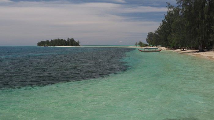
Context This is our fourth trip to Indonesia as a couple—after Java-Bali in 2011, Flores-Komodo in 2013, and Sulawesi in 2016—each time for three weeks. It’s also our tenth trip to Southeast Asia overall.
We’re traveling like we have in previous years: with a rough itinerary that often changes based on who we meet, tips from other travelers, how tired we are, or what we’re feeling in the moment. In the Moluccas, it’ll change constantly, mostly depending on transportation.
Our only accommodation booking: the first few nights in Ambon when we arrive.
Planned route (to be refined on the spot): Ambon - Banda Islands - Lease Islands - Ternate - Tidore - Halmahera (between Sofifi and Tobelo) - Morotai and the neighboring unnamed archipelago.
Flights: Lyon-Paris-Singapore on Air France (428 € round-trip), with good meals, champagne, and wine (we like our little comforts when going on vacation 😏). Then Singapore-Jakarta-Ambon on Air Asia and Garuda. Return flight: Ternate-Jakarta-Singapore on Lion Air, with a 3-day stopover in Singapore before heading home.
Episode 1: Ambon to Banda Our guesthouse, booked two days before departure, is 45 minutes from Ambon Airport, near Natsepa Beach (northeast of Leihitu). It’s a pretty average beach—quiet on weekdays but packed on Sundays (we saw the difference). It’s lined with warungs. This rainy day helps us readjust to the atmosphere of this country we love so much.
Our “Solim Guesthouse” is a lovely house with a living/dining room and garden, costing 15 € per night for two, including a hearty breakfast. Dinner is at Gaba Gaba, a great restaurant just a short walk away, right by the water, recommended by our host. Fun fact: it’s in the Lonely Planet, and it might be the only LP-listed spot in the Moluccas that actually matches the description (the others either don’t exist or have nothing to do with what’s advertised 😠).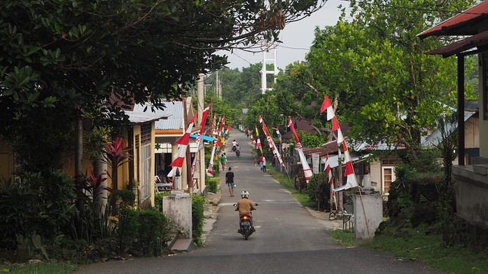
For the next two days, the super-friendly owner lends us his scooter. We set off to explore the coastal villages in northern Leihitu (the western part of Ambon Island, which has a weird shape).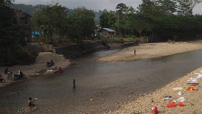 Laundry and trucks washed in the same stream.
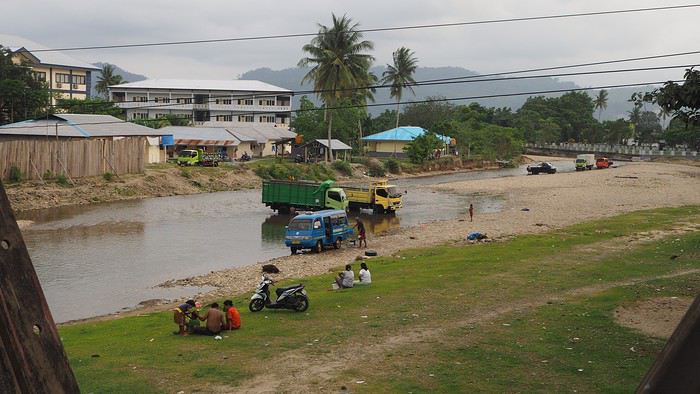
Liang Beach, described as the island’s most beautiful, is almost gone (climate change or something else?), but the colors are magical.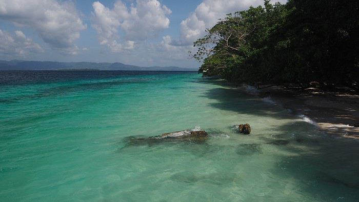
We continue 25 km toward a snorkeling spot our host recommended, taking a gorgeous, deserted little road through tiny villages in clove plantations (oh, those unforgettable scents!), stunning coves, and dense forest.
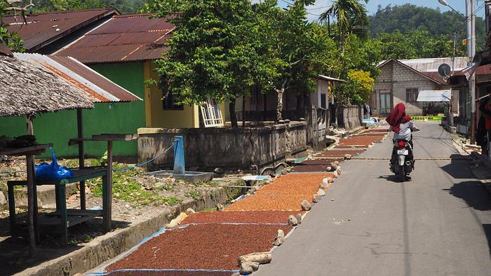
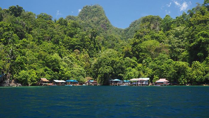 We’re greeted dozens of times with “Hello Mister”—a daily routine in the Moluccas. Every time we stop, we pose for photos to be saved on locals’ smartphones. They don’t see tourists often.
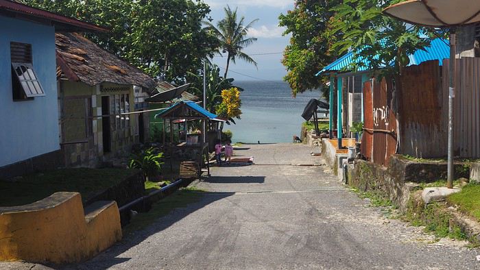
We ask for directions to the snorkeling spot (not easy—we only know basic Indonesian like *Selamat pagi*, *siang*, *sore*, and other polite phrases). Not many people know where it is (especially since we never know which village we’re in), but we eventually reach a small village that seems to be the right place. 🙂
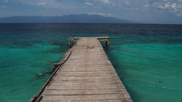
We ask a local to take us there by boat (it’s not reachable by land).
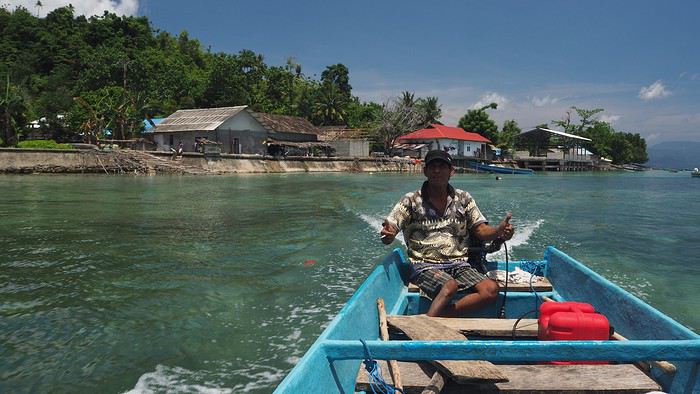
The spot is at most 100 meters long, but the coral is in good condition (apparently not dynamited by fishermen, unlike in other parts of this beautiful country where fishing methods are destructive and nature pays the price 😠). The fish are plentiful and diverse. It’s a great start before heading to Banda. We’re happy to have the place to ourselves… though we don’t yet realize we won’t see a single tourist for the rest of the trip!
After two days of rest, we head to Tulehu Port in the morning, aiming for the Banda Islands. We know the journey is often tricky: the Pelni ferry runs twice a month but doesn’t match our dates, the 10-seat Suzi Air plane is always full (you can’t book—you have to show up on Mondays and Fridays), and it’s often canceled due to weather. So we opt for the Tuesday speedboat (which also gets canceled if there are waves or wind), with the next one on Saturday. We’re used to Indonesian ports—crowded, rusty boats, no English speakers—but we still feel lost. When I ask about the speedboat to Bandaneira, people gesture wildly, someone takes me to the “harbor office,” then tells me there’s no boat, others try to sell me tickets, and some just say, “No boat.”
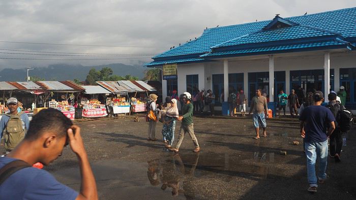
Luckily, an English-speaking local approaches us and confirms the speedboat is broken. The next one will be Saturday *if* it’s fixed—otherwise, even later. 🤪 😠 We’re crushed. We came here for the Banda Islands… 🙁 We decide waiting five days for a maybe-boat isn’t an option, so we decide to head straight to North Moluccas, which was planned for later. We’re so disappointed we don’t even want to stay in the area. The Lease Islands don’t appeal to us despite what we’ve read, and Seram would deserve its own trip with its remote mountain tribes. Huge disappointment—we’d been dreaming of Banda for months, with its incredible drop-offs like Bunaken, its islands covered in nutmeg trees, etc. I’d read that Banda is in the world’s top 5, alongside Bunaken (amazing—we went in 2016), Komodo (incredible—we went in 2013), Sipadan, and another spot I’ve forgotten.
We take a taxi back to Ambon (45 minutes) to a travel agency to buy plane tickets to Ternate. There’s a daily ATR72 flight at noon—perfect timing. Ambon is the capital of South Moluccas (or Central, depending on who you ask!) with 300,000 people. The city doesn’t seem unpleasant, but we don’t stop. On the plane, there are only about ten passengers for 72 seats. The flight attendants are stunning, as always with Wings Air—clearly, they’re hired for their looks. 😊
Stopover in Bacan—a runway in the middle of coconut trees serving a tiny town—then we fly over countless volcanoes, the last one towering over Ternate.
Next episode coming soon: Ternate.
This travel journal aims to help future travelers (well, I hope so!), since there’s so little information available about this remote archipelago. Big thanks to Lolodesiles and Ayis for answering my questions while I planned this trip!
Context This is our fourth trip to Indonesia as a couple—after Java-Bali in 2011, Flores-Komodo in 2013, and Sulawesi in 2016—each time for three weeks. It’s also our tenth trip to Southeast Asia overall.
We’re traveling like we have in previous years: with a rough itinerary that often changes based on who we meet, tips from other travelers, how tired we are, or what we’re feeling in the moment. In the Moluccas, it’ll change constantly, mostly depending on transportation.
Our only accommodation booking: the first few nights in Ambon when we arrive.
Planned route (to be refined on the spot): Ambon - Banda Islands - Lease Islands - Ternate - Tidore - Halmahera (between Sofifi and Tobelo) - Morotai and the neighboring unnamed archipelago.
Flights: Lyon-Paris-Singapore on Air France (428 € round-trip), with good meals, champagne, and wine (we like our little comforts when going on vacation 😏). Then Singapore-Jakarta-Ambon on Air Asia and Garuda. Return flight: Ternate-Jakarta-Singapore on Lion Air, with a 3-day stopover in Singapore before heading home.
Episode 1: Ambon to Banda Our guesthouse, booked two days before departure, is 45 minutes from Ambon Airport, near Natsepa Beach (northeast of Leihitu). It’s a pretty average beach—quiet on weekdays but packed on Sundays (we saw the difference). It’s lined with warungs. This rainy day helps us readjust to the atmosphere of this country we love so much.
Our “Solim Guesthouse” is a lovely house with a living/dining room and garden, costing 15 € per night for two, including a hearty breakfast. Dinner is at Gaba Gaba, a great restaurant just a short walk away, right by the water, recommended by our host. Fun fact: it’s in the Lonely Planet, and it might be the only LP-listed spot in the Moluccas that actually matches the description (the others either don’t exist or have nothing to do with what’s advertised 😠).
For the next two days, the super-friendly owner lends us his scooter. We set off to explore the coastal villages in northern Leihitu (the western part of Ambon Island, which has a weird shape).
Laundry and trucks washed in the same stream.
Liang Beach, described as the island’s most beautiful, is almost gone (climate change or something else?), but the colors are magical.
We continue 25 km toward a snorkeling spot our host recommended, taking a gorgeous, deserted little road through tiny villages in clove plantations (oh, those unforgettable scents!), stunning coves, and dense forest.
We’re greeted dozens of times with “Hello Mister”—a daily routine in the Moluccas. Every time we stop, we pose for photos to be saved on locals’ smartphones. They don’t see tourists often.We ask for directions to the snorkeling spot (not easy—we only know basic Indonesian like *Selamat pagi*, *siang*, *sore*, and other polite phrases). Not many people know where it is (especially since we never know which village we’re in), but we eventually reach a small village that seems to be the right place. 🙂
We ask a local to take us there by boat (it’s not reachable by land).
The spot is at most 100 meters long, but the coral is in good condition (apparently not dynamited by fishermen, unlike in other parts of this beautiful country where fishing methods are destructive and nature pays the price 😠). The fish are plentiful and diverse. It’s a great start before heading to Banda. We’re happy to have the place to ourselves… though we don’t yet realize we won’t see a single tourist for the rest of the trip!
After two days of rest, we head to Tulehu Port in the morning, aiming for the Banda Islands. We know the journey is often tricky: the Pelni ferry runs twice a month but doesn’t match our dates, the 10-seat Suzi Air plane is always full (you can’t book—you have to show up on Mondays and Fridays), and it’s often canceled due to weather. So we opt for the Tuesday speedboat (which also gets canceled if there are waves or wind), with the next one on Saturday. We’re used to Indonesian ports—crowded, rusty boats, no English speakers—but we still feel lost. When I ask about the speedboat to Bandaneira, people gesture wildly, someone takes me to the “harbor office,” then tells me there’s no boat, others try to sell me tickets, and some just say, “No boat.”
Luckily, an English-speaking local approaches us and confirms the speedboat is broken. The next one will be Saturday *if* it’s fixed—otherwise, even later. 🤪 😠 We’re crushed. We came here for the Banda Islands… 🙁 We decide waiting five days for a maybe-boat isn’t an option, so we decide to head straight to North Moluccas, which was planned for later. We’re so disappointed we don’t even want to stay in the area. The Lease Islands don’t appeal to us despite what we’ve read, and Seram would deserve its own trip with its remote mountain tribes. Huge disappointment—we’d been dreaming of Banda for months, with its incredible drop-offs like Bunaken, its islands covered in nutmeg trees, etc. I’d read that Banda is in the world’s top 5, alongside Bunaken (amazing—we went in 2016), Komodo (incredible—we went in 2013), Sipadan, and another spot I’ve forgotten.
We take a taxi back to Ambon (45 minutes) to a travel agency to buy plane tickets to Ternate. There’s a daily ATR72 flight at noon—perfect timing. Ambon is the capital of South Moluccas (or Central, depending on who you ask!) with 300,000 people. The city doesn’t seem unpleasant, but we don’t stop. On the plane, there are only about ten passengers for 72 seats. The flight attendants are stunning, as always with Wings Air—clearly, they’re hired for their looks. 😊
Stopover in Bacan—a runway in the middle of coconut trees serving a tiny town—then we fly over countless volcanoes, the last one towering over Ternate.
Next episode coming soon: Ternate.
Princess Cruises en Europe
... et surtout en Méditerranée
Cette Cie US a des navires de positionnés en Europe ( Méditerranée et Mer du Nord+++) Mais aucune "tête de ligne" en Méditerranée c'est Barcelone / Rome / Athènes, il y a juste une escale a Marseille sur une seule croisière ! Je comprends qu'elle daine en partie une clientèle US (d'ou surement le choix des têtes de ligne) mais pas uniquement, quelqu'un sait il ce qu'il y a comme autres nationalités a bord de ces croisières "Europe/Méditerranée" ! j'imagine par avance que les français ne sont pas très nombreux pourtant Princess a des routes très intéressantes si on y regarde bien
Cette Cie US a des navires de positionnés en Europe ( Méditerranée et Mer du Nord+++) Mais aucune "tête de ligne" en Méditerranée c'est Barcelone / Rome / Athènes, il y a juste une escale a Marseille sur une seule croisière ! Je comprends qu'elle daine en partie une clientèle US (d'ou surement le choix des têtes de ligne) mais pas uniquement, quelqu'un sait il ce qu'il y a comme autres nationalités a bord de ces croisières "Europe/Méditerranée" ! j'imagine par avance que les français ne sont pas très nombreux pourtant Princess a des routes très intéressantes si on y regarde bien
Zimbabwe et Zambie: retour d'un voyage entre amis
Bonjour à tous
Voici un résumé rapide de notre voyage au Zimbabwe et en Zambie en juillet / août 2016.
POUR LE CARNET AU JOUR LE JOUR C'EST PAR ICI ... Sinon il y a LA VERSION BLOG avec de nombreuses photos 🙂
La genèse
Suite à une agréable rencontre en janvier 2015 avec des amis de Voyage Forum (Pierre, Eric, Jean-Luc, Julie, Vincent, Marie-Gabrielle et Yves) le virus m’a repris … on veut retourner en Afrique Australe. On voudrait en profiter pour faire un voyage long, du moins pour nous, donc au moins 3 semaines … au final il fera même 3.5 semaines, donc obligatoirement en juillet/août. Seulement voilà, Valérie ne veut pas retourner en Afrique Australe s’il fait froid, elle trouve qu’on a eu trop froid au Botswana en 2012 !. C’est Pierre qui me trouve la solution « va donc au nord du Zambèze il y fait nettement moins froid ! ». Je sors la carte, la Zambie ok, ça a l’air top ! … et pourquoi pas un peu de Zimbabwe. Je lance une discussion sur VF et grâce à mes amis on construit petit à petit un itinéraire sympa. J’en profite pour alimenter la discussion avec toutes les infos que j’ai pu glaner. C’est au court de cette discussion que le 19 mars 2015, date à marquer d’une pierre blanche, que je reçois un message de Mayrig (qu’on avait vu lors de la rencontre chez Eric) : « si on peut faire un bout de chemin ensemble, ce serait avec plaisir » … GENIAL … de connaissances ils deviendront des amis et ensemble nous avons préparé ce grand voyage, le « un bout de chemin » c’est transformé en 3.5 semaines de voyageJ.
Se rajouterons deux amis, attirés par les belles photos et le dépaysement de l’Afrique Australe. Un avantage, c’est qu’on sera 2 4x4, ce qui est beaucoup plus sécurisant vu qu’on ne sera pas directement sur des « autoroutes touristiques ». Un autre avantage c’est que les frais seront divisés par 6, cela nous a permis de louer, dès que c’était possible, des camp exclusifs (à Hwange et à Mana Pool). Et un troisième … nous serons deux pour préparer le voyage et c’est un grand plaisir que de partager ainsi une préparation, les idées rebondissant de l’un à l’autre. Et un quatrième … que c’est agréable de partager avec d’autres ces moments uniques …
Les véhicules Pour Marie-Gabrielle et Yves c’est simple, ils ont un 4x4 en Afrique Australe qui les attend à Maun. C’est un magnifique Defender (mon rêveJ) tout équipé avec tentes au sol.
Pour ma part j’ai consulté Asco (avec qui on a l’habitude de travailler), Hemingway basé à Livingstone et très bien réputé et Bushlore en Afrique du Sud. Au final on a retenu Bushlore. Financièrement ils étaient intéressant, d’autant plus que le Rand est très bas ce qui a fait une économie substantielle apr rapport à Hemingway. En plus chez n a choisi un Land Cruiser 79 alors que Hemingway n’a que des Hilux 2.5 D. Pourquoi pas de Defender me direz-vous, alors qu’on adore ce véhicule … personne n’a voulu nous le livrer si loin dans un pays avec peu d’infrastructure … parait que le Def n’est pas assez fiable !!!!.
Quelques semaines avant le voyage j’avais recontacté Clyde chez Bushlore pour lui rappeler qu’on sera loin et que ce serait bien qu’on ait un véhicule au top … mon message sera entendu puisque le LandCruiser accusera 6.000 kms lorsqu’on le prendra à Livingstone, ce qui est rien sachant qu’il a déjà dû venir de voyage Johannesburg. L’aménagement du véhicule est le meilleur que nous ayons eu (désolé Asco !) avec un très grand tiroir et des rangements bien pensés. Le seul hic c’est les tentes qui étaient anciennes et usées. Comme bien souvent les fermetures éclairs avaient du mal à passer les angles. Pour le reste rien à dire, on était content du véhicule et du service. Lorsque nous avons rendu la voiture il y avait quelques rayures, un pneu à plat et un projecteur arrière avec une vitre cassé, ils ne nous en ont pas tenu rigueur et rien réclamé. Point très important, bien vérifier que tous les papiers sont là pour le passage des différentes frontières !.
Ce n’est pas forcément tout simple vu qu’il y a autant de réglementation que de douaniers au Zimbabwe … et en Zambie ils ne sont pas en reste. Par exemple lorsque nous sommes revenus en Zambie la douanière a trouvé qu’il nous manquait un papier, alors qu’on était déjà en Zambie … Elle voulait un certificat du propriétaire nous autorisant à traverser la frontière avec son véhicule. Jusque-là ça semble normal et nous l’avions … de Bushlore … sauf que les véhicules sont acquis en crédit-bail donc in fine le propriétaire c’est Toyota Finance … et nous n’avions pas de papier de Toyota et d’ailleurs un tel papier n’existe pas et est impossible à avoir … inextricable. Du coup ça c’est réglé à l’Africaine … lentement, d’un bureau à l’autre, à chaque fois une petite attente et au fil du temps le papier semble être devenu de moins en moins indispensable et nous avons fini par avoir nos tampons sans avoir payé de bakchich ni rien fait de spécial … A chaque fois un « facilitateur » nous a choisis … on s’est laissé faire. Ils ont la technique pour court-circuité les files, savent à quel guichet aller et c’est de bonne guerre, du moment qu’ils restent raisonnable en commission et que ça se passe avec le sourire. Le premier a même voulu nous donner un reçu … bon on l’attend encore. De mémoire on leur a donné 10 ou 20 dollars à chaque passage. Au final on peut dire que les passages se sont bien passés mais nous ont à chaque fois coûté environ 1h30.
Voici ce que Julie nous avait communiqué concernant les passages de frontière :
Equipement spécifique pour la Zambie et le ZImbabwe Stickers réfléchissants (2 blancs de 60 mm x 50 mm à l’avant et 2 rouges de 60 mm x 50 mm à l’arrière) Extincteur homologué de 1,5kg 2 triangles
Le loueur doit te fournir pour un véhicule immatriculé en dehors de la Zambie et du ZImbabwe : Les papiers du véhicule Une lettre d'autorisation de circuler en Zambie et au Zimbabwe Le TIP pour la Zambie La facture de la road tax zambienne Le papier de l'assurance tierce au moins valable pour la Zambie La facture de la taxe carbone
A la frontière Zambienne Documents à présenter Passeport avec une validité de plus de 6 mois et 2 pages vierges Permis original accompagné d’un permis de conduire international Autorisation du loueur de circuler dans les pays où vous souhaitez vous rendre Papiers du véhicule Assurance tierce si obligatoire dans le pays traversé (cette assurance peut être achetée aux frontières)
Documents à obtenir au poste Visa individuel Permis temporaire d’importation du véhicule mentionnant le numéro de châssis et le numéro du moteur (pense à vérifier où se situent ces numéros dans le véhicule au moment de la remise de la voiture, ça peut aider si la police fait un contrôle, ce qui arrive rarement) Facture des taxes payées (taxe carbone, droit de passage …) Assurance tierce si non obtenue au préalable
Formalités pour les véhicules entrant en Zambie TIP (Temporary Import Permit) Road Toll : 20 USD pour un véhicule sud-africain, valide 1 an Assurance : 260 ZMW pour 1 mois ou 400 ZMW pour 3 mois (peut se négocier ;-) ) Taxe Carbone : 150 ZMW pour un 4×4, due à chaque entrée Kazungula District Council : 30 ZMW pour le Motor Vehicule Levy, (sans doute demandé uniquement au poste de Kazungula)
Au final le passage au Zimbabwe nous avait coûté 165 $ pour nous 4 et le véhicule. A l’aéroport de Livingstone ils n’avaient pas de visas commun Zimbabwe / Zambie. Le retour en Zambie : 40$, nous avions déjà des visas à entrées multiples pris à l’aéroport de Livingstone à notre arrivée. Dans ce prix il y a la road taxe qui nous a permis de ne pas avoir à payer le péage « autoroutier » que nous avons croisé vers Lusaka.
Au niveau pratique
Réservation Nous avons transité par Bushlore, ce qui est pratique car on peut facilement faire un virement en AFS (contrairement au Zimbabwe qui est sur blacklist) et tout payer en une fois. Néanmoins ça n’a pas été de tout repos car Nicole chez Bushlore n’est pas très à l’aise avec les chiffres. Normalement au courant de 2016 Zimpark (organisme officiel de réservation des parcs au Zimbabwe) met en place un système de booking sur internet.
L'itinéraire 29 juillet - Livingstone Course au Shoprite, bien achalandé +++ Stations-service Nuit Maramba River Lodge en « bungalow » - chambre correct sans plus Localisation et lodge bien, bungalow correct, repas bien Réservé à l’avance par internet.
30 juillet – Hwange - 260 kms Passage de frontière (165 $ pour nous 4 et la voiture) et courses côté Zimbabwéen à Victoria Falls pour acheter ce qui risquait de ne pas passer la frontière. Le supermarché de Vic est encore mieux achalandé que celui de Livingstone, mais plus cher. Route pour Hwange, macadam puis piste en bon état. A l’intérieur du parc les pistes sont aussi en bon état Particularité de Hwange, de magnifiques Hide pour contempler les animaux aux points de vue. Nuit à Sinamatella en camping, très bel endroit au bord de la falaise Repas au restaurant du camping
30 juillet – Hwange – 26 kms … si on y va directement Divagation dans le parc Nuit à Masuma Dam Picnic Area. On peut louer l’endroit qui de ce fait se trouve privatisé – exceptionnel. Avec vu sur le waterhole etoutetout
31 juillet – Hwange – 146 kms … si on y va directement Divagation dans le parc Nuit à Ngweshla Picnic Area. On peut louer l’endroit qui de ce fait se trouve privatisé – très beau également, en revanche on ne voit le waterhole.
1 août – Hwange à Mlibilizi – 190 kms … si on y va directement Déjeuner et ravitaillement essence à Main Camp Route en très bon état Nuit initialement prévu au Manzini Lodge, qui en fait a fermé. On a fini au Mlibizi Resort, où nous avons loué deux chalets. Bel endroit au bord du lac Kariba. Ils ne servent pas à manger en revanche les chalets sont équipés.
2 août – Ferry sur le lac Kariba – 22 heures de bateau On dort sur le ferry, il y a des matelas. La nourriture très bonne est incluse dans le prix. Attention il n’y a que 3 emplacements pour des voitures surélevé, sinon il faut déposer tout ce qu’il y a sur le toit. En tout le ferry peut contenir 12 voitures et 72 personnes. Départ à 9h et arrivée le lendemain à 7h
3 août – Kariba à Mana Pool – 173 kms Ravitaillement essence + course à Kariba (avec du choix) Route jusqu’à Marongora où il y a l’office du parc. Paiement et remplissage de registresss Puis piste en bon état jusqu’à la gate de Nyakasikane Puis re-piste correct jusqu’à Nyamepi ranger Office Nuit à BBC Exclusive Camp. Emplacement privatif … il n’y a que nous et … et … beaucoup d’animaux autour de nous. Exceptionnel, impossible de faire 50 mètres sans devoir contourner un éléphant, un Impala, le tout sous les rires des hippos.
4 août – Mana Pool Divagation dans le parc Pistes en bon état Nuit à BBC Exclusive Camp. 5 août – Mana Pool – 20 kms Divagation dans le parc Nuit à Nkupe Exclusive Camp … très bel endroit, plus isolé que BBC mais moins « giboyeux »
6 août – Mana Pool – 60 kms Divagation dans le parc Pistes en bon état sans rien de particulier, la partie finale à partir de la piste principale est déjà plus « hard ». Nuit à Chitake 2 Exclusive Camp … exceptionnel, là vous êtes réellement seul, il n’y a que vous à 50 kms à la ronde. Le point d’eau est une résurgence dans un canyon. Certainement un des endroits les plus « hors normes » où nous ayons été. C’est ici que le matin on a assisté à une « charge » de buffle depuis la rive du canyon jusqu’au fond pour venir boire
7 août – Mana Pool – Bridge Camp – 404 kms Départ vers 7h Attention prendre de l’essence AVANT de passer la frontière, côté Zimbabwéens, car de l’autre côté il n’y a rien. Nous avons dû attendre d’être sur la Great East Road. Passage de frontière à Chirundu – 1h30 Ensuite on a tourné à droite vers Lower Zambezi pour emprunter la Leopard Road Là niveau piste c’est déjà nettement plus costaud, très peu fréquenté (il vaut mieux qu’il ne vous arrive rien), piste pas entretenue avec des ornières très profondes et quelques montées sérieuses. Du moment où on quitte la route de Lower Zambezi jusqu’à Chwonge il y a 103 kms, on mettra presque 4 heures. Ensuite belle route goudronnée jusqu’à Bridge Camp où nous arriverons vers 19 h Nuit en chalet au Bridge Camp, correct. Repas sur place correct également. Le patron est un blanc …
8 août – Bridge Camp à South Luangwa – 481 kms Stop à Chipata pour déjeuner + ravitaillement + essence Fruit et légumes … il y en a plein à vendre le long de la route Route goudronnée jusqu’à Chipata De Chipata très bonne piste (ou goudron) jusqu’à South Luangwa, de mémoire 2h30. Il y a une station-service et un petit shop. C’est touristique. Attention la station n’est pas toujours approvisionnée, dans ce cas aucun plan B. Nuit à Wildlife Camp, bien placé le long de la rivière, en tente sur le toit. C’est déjà un grand camping où il peut y avoir des groupes. Repas correct dans le restaurant du camp.
9 août – South Luangwa – 32 kms sans les divagations Secteur Mfuwe le matin Après-midi secteur Nsefu Nuit au Zikomo Lodge qui a 4 emplacements de camping. Nous avons particulièrement apprécié l’accueil qui n’a pas fait de différence entre clients « en dur » et campeurs (cocktail d’accueil, piscine, ..) Repas restaurant sur place bien. Un de nos coups de cœurs. En revanche c’est assez loin de la piste principale et elle n’est pas trop roulante. A privilégier pour visiter Nsefu d’autant plus qu’ils ont un passage privé pour accéder à cette partie du parc.
10 août – South Luangwa – 32 kms Visite Nsefu secteur Nuit à Wildlife Camp.
11 août – South Luangwa – Muntinondo – 223 kms Départ vers 7h – arrivée à Muntinondo vers 16 h Plein au village de South Luangwa La M5 qui traverse SL a quelques passages très très raides, encore plus que la Leopard Road, mais sans les ornières. C’est aussi du très costaud. Celle-là et la Leopard Road sont les deux pistes les plus costauds et longues qu’on ait fait. Beaucoup plus qu’en Namibie où ce ne sont que quelques passages qui sont raides. Un autre élément c’est la présence en nombre des mouches Tsé Tsé lorsqu’on commence à monter l’escarpement, on a croisé les doigts et on s’est retenu pour ne pas avoir à sortir, elles étaient des centaines à nous tourner autour et profiter du capot de la voiture comme transport en commun. Nuit Muntinondo Wilderness Lodge en chalet (ils n’en ont que 4). Repas restaurant sur place … exceptionnel aussi bien pour la beauté des lieux que la qualité des prestations. Ils ont aussi un camping.
12 août – Muntinondo à Bangwelu – 150 kms Piste d’accès très fatigante entre bumps et sable. Il y a des habitations dispersées sur les 30 derniers kms. Le Shoebill Camp est fermé depuis juin 2016 … peut-être un nouveau campement mais pour le moment on n’a rien vu. Nuit au Nsobe Community Camp. Très bien, pas d’emplacements délimités, ils vous installent sous un arbre. On a de la place …. Possibilité d’organiser une excursion « Shoebill », il suffit de le demander au gardien. Août n’est pas la bonne saison pour voir les becs-en-sabots … mais nous aurons la chance d‘en voir un.
13 août – Bangwelu à Kundalila Falls – 184 kms Excursion Shoebill retour vers 11h Toujours cette même piste fatigante. A la gate de Bangwelu nous avons pris à droite vers Waka Waka. Stop à Waka Waka pour déjeuner. Le camp semble désaffecté, énormément de mouches, désagréable. Au moment de partir un gars passe et réclame de l’argent pour avoir pique-niqué sur place (de mémoire 20 $) !!! .. dire qu’on avait prévu de s’arrêter ici pour profiter du lac et passer la nuit. Du coup on a repris la voiture avec comme objectif Kundalila Falls. Toujours cette même mauvaise, très mauvaise piste. Dire qu’elle est en « blanc » sur la carte, il y en a en « pointillé » qui sont en bien meilleur état. Une fois sur la Great East Road macadam puis une très bonne piste jusqu’à Kundalila. Nous arriverons vers 17h30. Le camp est en fait le parking de la journée endroit bof !.
14 août – Kundalila Falls à Fringilla Farm – 427 kms Macadam tout du long. Pour l’essence il y a régulièrement des stations et des villes avec des supermarchés (Serenje, Mkushi, Kapiri, Kabwe) Nuit Fringilla Farm réputé pour la viande … ne fait c’est surtout les saucisses leur spécialité, et elle est excellente. Fringilla est un gros centre de vacances (à l’échelle de la Zambie). Nous avons pris des chambres, on y a bien dormi, mais sans charme particulier
15 août – Fringilla Farm à Kafue NP – 307 kms Retour en arrière jusqu’à Landless Corner. Macadam presque tout du long. Parfois on longe le macadam sans avoir le droit d’aller dessus … mais dans l’ensemble c’est roulant .. sauf si on suit le GPS qui au rond-point de Mumbwa vous dit d’aller tout droit. Là c’est beaucoup moi drôle, piste complètement ravinée alors que si au rond-point on prend à gauche on reste sur le macadam. Ravitaillement essence à Mumbwa. Ensuite macadam jusqu’à l’entrée du parc. Piste correct à moyennement défoncé jusqu’au Kafwala Rapids Camp. On est arrivée vers 15h30 Nuit en chalet (pas prévu, ce fut la bonne surprise) Endroit magnifique, si vous donnez vos aliments ils se feront un plaisir de vous faire la cuisine. Possibilité de faire une croisière d’un soir sur la rivière Kafue … qui en fait est un fleuve très large à cet endroit. Un coup de cœur également.
16 août – Kafue NP – 230 kms Busangas Plains – 115 kms / 3h30 de piste Le lodge nous a laissé partir à 4h du matin pour pouvoir être de bonne heure sur place. Pistes pas forcément évidentes lorsqu’on arrive aux Busangas avec de « sérieux » bumps Nuit idem.
17 août – Kafue NP – 190 kms De Kafwala à Kaing U Nuit en Camping à Kaing U Possibilité de faire une croisière … sauf quand on y était car il y avait des américains qui monopolisaient le lodge. Les animaux sont de l’autre côté de la rivière par rapport au lodge, donc peu d’intérêt de faire un tour en 4x4, il faut avoir un bateau disponible pour traverser ou alors arriver par l’autre rive et y laisser le 4x4. Les gens du lodge viennent vous chercher, mais dans ce cas comment camper ???. Nous n’avons pas apprécié l’accueil, on a très bien senti qu’’on était « que » campeurs. L’emplacement de camping est bien agencé mais comme on est entouré d’arbres il n’y a plus ce sentiment d’immensité qu’on a ressenti ailleurs. Nuit idem.
18 août – Kafue à Livingstone – 480 kms 11 heures avec les arrêts. Là il faut savoir par où passer car les pistes peuvent être en réalité des routes et des routes des pistes … De Kaing U revenir par la petite piste pas facile pour rejoindre la route de Itezhi-Tezhi Road. Ensuite descendre sur la piste (qui longe la route) jusqu’à Itezhi, où il y a une possibilité de refaire le plein un peu au sud de du pont. Ensuite il faut longer la rive nord de la Kafue jusqu’à 10 kms environ à l’Est de Shimbizi. Là il y a un bac qui permet de traverser le rivière. Ensuite quelque kms de bumb, très bump (marécage séché) et tout d’un coup un peu avant Namwata du macadam tout beau … et on en aura jusqu’à Livingstone. Ce qui fait, alors qu’on avait prévu un stop, on a continué jusqu’à Livingstone où nous sommes arrivé vers 18 h. Nuit au Maramba River Lodge, mais cette fois en camping. On a trouvé le camping très bien et très peu fréquenté. Si vous prenez les emplacements E, F, G, … vous serez à la lisière du camp bien isolé des autres. Le diner au lodge est très bien.
19 août – Livingstone Survol des chutes en hélicoptère avec United Air Charter. Je crois que nous avons payé entre 130 et 160 $ par personne je crois pour un ¼ heure. Ils sont venus nous chercher au Lodge. Nuit idem.
20 août – retour Restitution du 4x4 à l’aéroport avant d’embarquer sur la SAA
Si vous voyez un point que vous souhaitez que j’aborde n’hésitez pas à demander c’est avec plaisir que je parlerais d’une région qui m’a énormément plu .. POUR LE CARNET AU JOUR LE JOUR C'EST PAR ICI ...
Sinon il y a LA VERSION BLOG avec de nombreuses photos 🙂
POUR LE CARNET AU JOUR LE JOUR C'EST PAR ICI ... Sinon il y a LA VERSION BLOG avec de nombreuses photos 🙂
La genèse
Suite à une agréable rencontre en janvier 2015 avec des amis de Voyage Forum (Pierre, Eric, Jean-Luc, Julie, Vincent, Marie-Gabrielle et Yves) le virus m’a repris … on veut retourner en Afrique Australe. On voudrait en profiter pour faire un voyage long, du moins pour nous, donc au moins 3 semaines … au final il fera même 3.5 semaines, donc obligatoirement en juillet/août. Seulement voilà, Valérie ne veut pas retourner en Afrique Australe s’il fait froid, elle trouve qu’on a eu trop froid au Botswana en 2012 !. C’est Pierre qui me trouve la solution « va donc au nord du Zambèze il y fait nettement moins froid ! ». Je sors la carte, la Zambie ok, ça a l’air top ! … et pourquoi pas un peu de Zimbabwe. Je lance une discussion sur VF et grâce à mes amis on construit petit à petit un itinéraire sympa. J’en profite pour alimenter la discussion avec toutes les infos que j’ai pu glaner. C’est au court de cette discussion que le 19 mars 2015, date à marquer d’une pierre blanche, que je reçois un message de Mayrig (qu’on avait vu lors de la rencontre chez Eric) : « si on peut faire un bout de chemin ensemble, ce serait avec plaisir » … GENIAL … de connaissances ils deviendront des amis et ensemble nous avons préparé ce grand voyage, le « un bout de chemin » c’est transformé en 3.5 semaines de voyageJ.
Se rajouterons deux amis, attirés par les belles photos et le dépaysement de l’Afrique Australe. Un avantage, c’est qu’on sera 2 4x4, ce qui est beaucoup plus sécurisant vu qu’on ne sera pas directement sur des « autoroutes touristiques ». Un autre avantage c’est que les frais seront divisés par 6, cela nous a permis de louer, dès que c’était possible, des camp exclusifs (à Hwange et à Mana Pool). Et un troisième … nous serons deux pour préparer le voyage et c’est un grand plaisir que de partager ainsi une préparation, les idées rebondissant de l’un à l’autre. Et un quatrième … que c’est agréable de partager avec d’autres ces moments uniques …
Les véhicules Pour Marie-Gabrielle et Yves c’est simple, ils ont un 4x4 en Afrique Australe qui les attend à Maun. C’est un magnifique Defender (mon rêveJ) tout équipé avec tentes au sol.
Pour ma part j’ai consulté Asco (avec qui on a l’habitude de travailler), Hemingway basé à Livingstone et très bien réputé et Bushlore en Afrique du Sud. Au final on a retenu Bushlore. Financièrement ils étaient intéressant, d’autant plus que le Rand est très bas ce qui a fait une économie substantielle apr rapport à Hemingway. En plus chez n a choisi un Land Cruiser 79 alors que Hemingway n’a que des Hilux 2.5 D. Pourquoi pas de Defender me direz-vous, alors qu’on adore ce véhicule … personne n’a voulu nous le livrer si loin dans un pays avec peu d’infrastructure … parait que le Def n’est pas assez fiable !!!!.
Quelques semaines avant le voyage j’avais recontacté Clyde chez Bushlore pour lui rappeler qu’on sera loin et que ce serait bien qu’on ait un véhicule au top … mon message sera entendu puisque le LandCruiser accusera 6.000 kms lorsqu’on le prendra à Livingstone, ce qui est rien sachant qu’il a déjà dû venir de voyage Johannesburg. L’aménagement du véhicule est le meilleur que nous ayons eu (désolé Asco !) avec un très grand tiroir et des rangements bien pensés. Le seul hic c’est les tentes qui étaient anciennes et usées. Comme bien souvent les fermetures éclairs avaient du mal à passer les angles. Pour le reste rien à dire, on était content du véhicule et du service. Lorsque nous avons rendu la voiture il y avait quelques rayures, un pneu à plat et un projecteur arrière avec une vitre cassé, ils ne nous en ont pas tenu rigueur et rien réclamé. Point très important, bien vérifier que tous les papiers sont là pour le passage des différentes frontières !.
Ce n’est pas forcément tout simple vu qu’il y a autant de réglementation que de douaniers au Zimbabwe … et en Zambie ils ne sont pas en reste. Par exemple lorsque nous sommes revenus en Zambie la douanière a trouvé qu’il nous manquait un papier, alors qu’on était déjà en Zambie … Elle voulait un certificat du propriétaire nous autorisant à traverser la frontière avec son véhicule. Jusque-là ça semble normal et nous l’avions … de Bushlore … sauf que les véhicules sont acquis en crédit-bail donc in fine le propriétaire c’est Toyota Finance … et nous n’avions pas de papier de Toyota et d’ailleurs un tel papier n’existe pas et est impossible à avoir … inextricable. Du coup ça c’est réglé à l’Africaine … lentement, d’un bureau à l’autre, à chaque fois une petite attente et au fil du temps le papier semble être devenu de moins en moins indispensable et nous avons fini par avoir nos tampons sans avoir payé de bakchich ni rien fait de spécial … A chaque fois un « facilitateur » nous a choisis … on s’est laissé faire. Ils ont la technique pour court-circuité les files, savent à quel guichet aller et c’est de bonne guerre, du moment qu’ils restent raisonnable en commission et que ça se passe avec le sourire. Le premier a même voulu nous donner un reçu … bon on l’attend encore. De mémoire on leur a donné 10 ou 20 dollars à chaque passage. Au final on peut dire que les passages se sont bien passés mais nous ont à chaque fois coûté environ 1h30.
Voici ce que Julie nous avait communiqué concernant les passages de frontière :
Equipement spécifique pour la Zambie et le ZImbabwe Stickers réfléchissants (2 blancs de 60 mm x 50 mm à l’avant et 2 rouges de 60 mm x 50 mm à l’arrière) Extincteur homologué de 1,5kg 2 triangles
Le loueur doit te fournir pour un véhicule immatriculé en dehors de la Zambie et du ZImbabwe : Les papiers du véhicule Une lettre d'autorisation de circuler en Zambie et au Zimbabwe Le TIP pour la Zambie La facture de la road tax zambienne Le papier de l'assurance tierce au moins valable pour la Zambie La facture de la taxe carbone
A la frontière Zambienne Documents à présenter Passeport avec une validité de plus de 6 mois et 2 pages vierges Permis original accompagné d’un permis de conduire international Autorisation du loueur de circuler dans les pays où vous souhaitez vous rendre Papiers du véhicule Assurance tierce si obligatoire dans le pays traversé (cette assurance peut être achetée aux frontières)
Documents à obtenir au poste Visa individuel Permis temporaire d’importation du véhicule mentionnant le numéro de châssis et le numéro du moteur (pense à vérifier où se situent ces numéros dans le véhicule au moment de la remise de la voiture, ça peut aider si la police fait un contrôle, ce qui arrive rarement) Facture des taxes payées (taxe carbone, droit de passage …) Assurance tierce si non obtenue au préalable
Formalités pour les véhicules entrant en Zambie TIP (Temporary Import Permit) Road Toll : 20 USD pour un véhicule sud-africain, valide 1 an Assurance : 260 ZMW pour 1 mois ou 400 ZMW pour 3 mois (peut se négocier ;-) ) Taxe Carbone : 150 ZMW pour un 4×4, due à chaque entrée Kazungula District Council : 30 ZMW pour le Motor Vehicule Levy, (sans doute demandé uniquement au poste de Kazungula)
Au final le passage au Zimbabwe nous avait coûté 165 $ pour nous 4 et le véhicule. A l’aéroport de Livingstone ils n’avaient pas de visas commun Zimbabwe / Zambie. Le retour en Zambie : 40$, nous avions déjà des visas à entrées multiples pris à l’aéroport de Livingstone à notre arrivée. Dans ce prix il y a la road taxe qui nous a permis de ne pas avoir à payer le péage « autoroutier » que nous avons croisé vers Lusaka.
Au niveau pratique
Réservation Nous avons transité par Bushlore, ce qui est pratique car on peut facilement faire un virement en AFS (contrairement au Zimbabwe qui est sur blacklist) et tout payer en une fois. Néanmoins ça n’a pas été de tout repos car Nicole chez Bushlore n’est pas très à l’aise avec les chiffres. Normalement au courant de 2016 Zimpark (organisme officiel de réservation des parcs au Zimbabwe) met en place un système de booking sur internet.
L'itinéraire 29 juillet - Livingstone Course au Shoprite, bien achalandé +++ Stations-service Nuit Maramba River Lodge en « bungalow » - chambre correct sans plus Localisation et lodge bien, bungalow correct, repas bien Réservé à l’avance par internet.
30 juillet – Hwange - 260 kms Passage de frontière (165 $ pour nous 4 et la voiture) et courses côté Zimbabwéen à Victoria Falls pour acheter ce qui risquait de ne pas passer la frontière. Le supermarché de Vic est encore mieux achalandé que celui de Livingstone, mais plus cher. Route pour Hwange, macadam puis piste en bon état. A l’intérieur du parc les pistes sont aussi en bon état Particularité de Hwange, de magnifiques Hide pour contempler les animaux aux points de vue. Nuit à Sinamatella en camping, très bel endroit au bord de la falaise Repas au restaurant du camping
30 juillet – Hwange – 26 kms … si on y va directement Divagation dans le parc Nuit à Masuma Dam Picnic Area. On peut louer l’endroit qui de ce fait se trouve privatisé – exceptionnel. Avec vu sur le waterhole etoutetout
31 juillet – Hwange – 146 kms … si on y va directement Divagation dans le parc Nuit à Ngweshla Picnic Area. On peut louer l’endroit qui de ce fait se trouve privatisé – très beau également, en revanche on ne voit le waterhole.
1 août – Hwange à Mlibilizi – 190 kms … si on y va directement Déjeuner et ravitaillement essence à Main Camp Route en très bon état Nuit initialement prévu au Manzini Lodge, qui en fait a fermé. On a fini au Mlibizi Resort, où nous avons loué deux chalets. Bel endroit au bord du lac Kariba. Ils ne servent pas à manger en revanche les chalets sont équipés.
2 août – Ferry sur le lac Kariba – 22 heures de bateau On dort sur le ferry, il y a des matelas. La nourriture très bonne est incluse dans le prix. Attention il n’y a que 3 emplacements pour des voitures surélevé, sinon il faut déposer tout ce qu’il y a sur le toit. En tout le ferry peut contenir 12 voitures et 72 personnes. Départ à 9h et arrivée le lendemain à 7h
3 août – Kariba à Mana Pool – 173 kms Ravitaillement essence + course à Kariba (avec du choix) Route jusqu’à Marongora où il y a l’office du parc. Paiement et remplissage de registresss Puis piste en bon état jusqu’à la gate de Nyakasikane Puis re-piste correct jusqu’à Nyamepi ranger Office Nuit à BBC Exclusive Camp. Emplacement privatif … il n’y a que nous et … et … beaucoup d’animaux autour de nous. Exceptionnel, impossible de faire 50 mètres sans devoir contourner un éléphant, un Impala, le tout sous les rires des hippos.
4 août – Mana Pool Divagation dans le parc Pistes en bon état Nuit à BBC Exclusive Camp. 5 août – Mana Pool – 20 kms Divagation dans le parc Nuit à Nkupe Exclusive Camp … très bel endroit, plus isolé que BBC mais moins « giboyeux »
6 août – Mana Pool – 60 kms Divagation dans le parc Pistes en bon état sans rien de particulier, la partie finale à partir de la piste principale est déjà plus « hard ». Nuit à Chitake 2 Exclusive Camp … exceptionnel, là vous êtes réellement seul, il n’y a que vous à 50 kms à la ronde. Le point d’eau est une résurgence dans un canyon. Certainement un des endroits les plus « hors normes » où nous ayons été. C’est ici que le matin on a assisté à une « charge » de buffle depuis la rive du canyon jusqu’au fond pour venir boire
7 août – Mana Pool – Bridge Camp – 404 kms Départ vers 7h Attention prendre de l’essence AVANT de passer la frontière, côté Zimbabwéens, car de l’autre côté il n’y a rien. Nous avons dû attendre d’être sur la Great East Road. Passage de frontière à Chirundu – 1h30 Ensuite on a tourné à droite vers Lower Zambezi pour emprunter la Leopard Road Là niveau piste c’est déjà nettement plus costaud, très peu fréquenté (il vaut mieux qu’il ne vous arrive rien), piste pas entretenue avec des ornières très profondes et quelques montées sérieuses. Du moment où on quitte la route de Lower Zambezi jusqu’à Chwonge il y a 103 kms, on mettra presque 4 heures. Ensuite belle route goudronnée jusqu’à Bridge Camp où nous arriverons vers 19 h Nuit en chalet au Bridge Camp, correct. Repas sur place correct également. Le patron est un blanc …
8 août – Bridge Camp à South Luangwa – 481 kms Stop à Chipata pour déjeuner + ravitaillement + essence Fruit et légumes … il y en a plein à vendre le long de la route Route goudronnée jusqu’à Chipata De Chipata très bonne piste (ou goudron) jusqu’à South Luangwa, de mémoire 2h30. Il y a une station-service et un petit shop. C’est touristique. Attention la station n’est pas toujours approvisionnée, dans ce cas aucun plan B. Nuit à Wildlife Camp, bien placé le long de la rivière, en tente sur le toit. C’est déjà un grand camping où il peut y avoir des groupes. Repas correct dans le restaurant du camp.
9 août – South Luangwa – 32 kms sans les divagations Secteur Mfuwe le matin Après-midi secteur Nsefu Nuit au Zikomo Lodge qui a 4 emplacements de camping. Nous avons particulièrement apprécié l’accueil qui n’a pas fait de différence entre clients « en dur » et campeurs (cocktail d’accueil, piscine, ..) Repas restaurant sur place bien. Un de nos coups de cœurs. En revanche c’est assez loin de la piste principale et elle n’est pas trop roulante. A privilégier pour visiter Nsefu d’autant plus qu’ils ont un passage privé pour accéder à cette partie du parc.
10 août – South Luangwa – 32 kms Visite Nsefu secteur Nuit à Wildlife Camp.
11 août – South Luangwa – Muntinondo – 223 kms Départ vers 7h – arrivée à Muntinondo vers 16 h Plein au village de South Luangwa La M5 qui traverse SL a quelques passages très très raides, encore plus que la Leopard Road, mais sans les ornières. C’est aussi du très costaud. Celle-là et la Leopard Road sont les deux pistes les plus costauds et longues qu’on ait fait. Beaucoup plus qu’en Namibie où ce ne sont que quelques passages qui sont raides. Un autre élément c’est la présence en nombre des mouches Tsé Tsé lorsqu’on commence à monter l’escarpement, on a croisé les doigts et on s’est retenu pour ne pas avoir à sortir, elles étaient des centaines à nous tourner autour et profiter du capot de la voiture comme transport en commun. Nuit Muntinondo Wilderness Lodge en chalet (ils n’en ont que 4). Repas restaurant sur place … exceptionnel aussi bien pour la beauté des lieux que la qualité des prestations. Ils ont aussi un camping.
12 août – Muntinondo à Bangwelu – 150 kms Piste d’accès très fatigante entre bumps et sable. Il y a des habitations dispersées sur les 30 derniers kms. Le Shoebill Camp est fermé depuis juin 2016 … peut-être un nouveau campement mais pour le moment on n’a rien vu. Nuit au Nsobe Community Camp. Très bien, pas d’emplacements délimités, ils vous installent sous un arbre. On a de la place …. Possibilité d’organiser une excursion « Shoebill », il suffit de le demander au gardien. Août n’est pas la bonne saison pour voir les becs-en-sabots … mais nous aurons la chance d‘en voir un.
13 août – Bangwelu à Kundalila Falls – 184 kms Excursion Shoebill retour vers 11h Toujours cette même piste fatigante. A la gate de Bangwelu nous avons pris à droite vers Waka Waka. Stop à Waka Waka pour déjeuner. Le camp semble désaffecté, énormément de mouches, désagréable. Au moment de partir un gars passe et réclame de l’argent pour avoir pique-niqué sur place (de mémoire 20 $) !!! .. dire qu’on avait prévu de s’arrêter ici pour profiter du lac et passer la nuit. Du coup on a repris la voiture avec comme objectif Kundalila Falls. Toujours cette même mauvaise, très mauvaise piste. Dire qu’elle est en « blanc » sur la carte, il y en a en « pointillé » qui sont en bien meilleur état. Une fois sur la Great East Road macadam puis une très bonne piste jusqu’à Kundalila. Nous arriverons vers 17h30. Le camp est en fait le parking de la journée endroit bof !.
14 août – Kundalila Falls à Fringilla Farm – 427 kms Macadam tout du long. Pour l’essence il y a régulièrement des stations et des villes avec des supermarchés (Serenje, Mkushi, Kapiri, Kabwe) Nuit Fringilla Farm réputé pour la viande … ne fait c’est surtout les saucisses leur spécialité, et elle est excellente. Fringilla est un gros centre de vacances (à l’échelle de la Zambie). Nous avons pris des chambres, on y a bien dormi, mais sans charme particulier
15 août – Fringilla Farm à Kafue NP – 307 kms Retour en arrière jusqu’à Landless Corner. Macadam presque tout du long. Parfois on longe le macadam sans avoir le droit d’aller dessus … mais dans l’ensemble c’est roulant .. sauf si on suit le GPS qui au rond-point de Mumbwa vous dit d’aller tout droit. Là c’est beaucoup moi drôle, piste complètement ravinée alors que si au rond-point on prend à gauche on reste sur le macadam. Ravitaillement essence à Mumbwa. Ensuite macadam jusqu’à l’entrée du parc. Piste correct à moyennement défoncé jusqu’au Kafwala Rapids Camp. On est arrivée vers 15h30 Nuit en chalet (pas prévu, ce fut la bonne surprise) Endroit magnifique, si vous donnez vos aliments ils se feront un plaisir de vous faire la cuisine. Possibilité de faire une croisière d’un soir sur la rivière Kafue … qui en fait est un fleuve très large à cet endroit. Un coup de cœur également.
16 août – Kafue NP – 230 kms Busangas Plains – 115 kms / 3h30 de piste Le lodge nous a laissé partir à 4h du matin pour pouvoir être de bonne heure sur place. Pistes pas forcément évidentes lorsqu’on arrive aux Busangas avec de « sérieux » bumps Nuit idem.
17 août – Kafue NP – 190 kms De Kafwala à Kaing U Nuit en Camping à Kaing U Possibilité de faire une croisière … sauf quand on y était car il y avait des américains qui monopolisaient le lodge. Les animaux sont de l’autre côté de la rivière par rapport au lodge, donc peu d’intérêt de faire un tour en 4x4, il faut avoir un bateau disponible pour traverser ou alors arriver par l’autre rive et y laisser le 4x4. Les gens du lodge viennent vous chercher, mais dans ce cas comment camper ???. Nous n’avons pas apprécié l’accueil, on a très bien senti qu’’on était « que » campeurs. L’emplacement de camping est bien agencé mais comme on est entouré d’arbres il n’y a plus ce sentiment d’immensité qu’on a ressenti ailleurs. Nuit idem.
18 août – Kafue à Livingstone – 480 kms 11 heures avec les arrêts. Là il faut savoir par où passer car les pistes peuvent être en réalité des routes et des routes des pistes … De Kaing U revenir par la petite piste pas facile pour rejoindre la route de Itezhi-Tezhi Road. Ensuite descendre sur la piste (qui longe la route) jusqu’à Itezhi, où il y a une possibilité de refaire le plein un peu au sud de du pont. Ensuite il faut longer la rive nord de la Kafue jusqu’à 10 kms environ à l’Est de Shimbizi. Là il y a un bac qui permet de traverser le rivière. Ensuite quelque kms de bumb, très bump (marécage séché) et tout d’un coup un peu avant Namwata du macadam tout beau … et on en aura jusqu’à Livingstone. Ce qui fait, alors qu’on avait prévu un stop, on a continué jusqu’à Livingstone où nous sommes arrivé vers 18 h. Nuit au Maramba River Lodge, mais cette fois en camping. On a trouvé le camping très bien et très peu fréquenté. Si vous prenez les emplacements E, F, G, … vous serez à la lisière du camp bien isolé des autres. Le diner au lodge est très bien.
19 août – Livingstone Survol des chutes en hélicoptère avec United Air Charter. Je crois que nous avons payé entre 130 et 160 $ par personne je crois pour un ¼ heure. Ils sont venus nous chercher au Lodge. Nuit idem.
20 août – retour Restitution du 4x4 à l’aéroport avant d’embarquer sur la SAA
Si vous voyez un point que vous souhaitez que j’aborde n’hésitez pas à demander c’est avec plaisir que je parlerais d’une région qui m’a énormément plu .. POUR LE CARNET AU JOUR LE JOUR C'EST PAR ICI ...
Sinon il y a LA VERSION BLOG avec de nombreuses photos 🙂
Soleil de minuit en Norvège
Bonjour,
Je projette de partir vers le 20 mai prochain en Norvège avec un retour prévu en France fin juin. Aurais-je la chance de voir le soleil de minuit et à quel niveau de la Norvège. Merci de votre réponse Liselotte
Je projette de partir vers le 20 mai prochain en Norvège avec un retour prévu en France fin juin. Aurais-je la chance de voir le soleil de minuit et à quel niveau de la Norvège. Merci de votre réponse Liselotte
Safari et plongée en Tanzanie
Avec ses réserves animalières parmi les plus prestigieuses du continent africain, avec ses côtes poissonneuses aux fonds sous-marins exceptionnels, la Tanzanie a plus d'une corde à son arc. Voici le récit de notre voyage de 12 jours alliant safari et plongée.
La version accompagnée de photos et de cartes se trouve ici :
https://sites.google.com/site/fabuleuxvoyages...
Ci-dessous le texte accompagné d'une sélection de quelques photos.
Bonne découverte ! 😉
 ............................................................................................................................................................
Présentation
Une fois n'est pas coutume : voici un projet dont nous avons confié la presque totalité de la préparation à un tour-opérateur. Nous en avons juste ébauché la trame et indiqué quelques critères, c'est tout !
En ce début d'automne, nous cherchions avant tout une destination où Hervé puisse pratiquer la plongée sous-marine dans des eaux chaudes (et pas comme en Norvège en combinaison étanche !) mais pas une destination exclusivement tournée vers cette activité. Il fallait qu'on puisse y faire autre chose aussi !
A cette saison, l'océan Indien nous semblait le plus indiqué. Mais nous avions déjà pas mal écumé Maurice, Madagascar, Réunion, Seychelles...
Mais jamais la Tanzanie... alors pourquoi pas ?
Né en 1964 de la fusion du territoire du Tanganyika et de l'archipel de Zanzibar, le pays possède des atouts considérables à la fois côté terre et côté mer.
En effet, les îles de l'archipel de Zanzibar, Mafia et Pemba sont réputées pour leurs fonds sous-marins préservés et poissonneux.
Après renseignement, nous avons opté pour l'île de Mafia, au cœur de la plus grande réserve marine de Tanzanie, et prévu d'y consacrer six jours.
Depuis notre voyage en Namibie, nous avions envie de retourner en Afrique. La Tanzanie abrite les plus grandes et les plus prestigieuses réserves animalières du continent. C'est l'occasion !
Mais ici pas ou peu de self-drive, le pays a fait le choix de développer le tourisme sur la base de safaris privatifs ou en petits groupes. C'est donc pour un safari à deux avec chauffeur-guide que nous optons et cela pour six jours supplémentaires.
Quant aux parcs, nous retenons les parcs classiques du Nord tanzanien : Manyara, Serengeti, Ngorongoro et Tarangire.
Pour concrétiser ce projet, nous nous sommes tournés vers trois opérateurs français, deux spécialisés en safari et un spécialisé en plongée. Nous avons finalement choisi le projet de l'agence Ultramarina - plus abouti en matière de plongée - et dont les choix d'hébergement de la partie safari correspondaient mieux à nos attentes.
Sur place, l'agence réceptive est Ranger Safaris. L'hébergement se fera dans de très beaux lodges ou camps.
Une fois n'est pas coutume : nous allons pouvoir aborder ce voyage, l'esprit vierge de toute image, et nous laisser surprendre par chaque découverte !
Un mois avant notre départ, alors que nous venons de finaliser nos réservations, une information va pourtant venir tempérer notre enthousiasme. Fin septembre, le gouvernement français ajoute onze pays dont la Tanzanie à sa liste des Etats dans lesquels les Français sont appelés à la "plus grande prudence", ce qui ne va pas rassurer nos familles. Ce n'est néanmoins pas un motif suffisant pour annuler le voyage, prévu très loin des zones réellement déconseillées (frontières avec le Burundi, le Rwanda et la République démocratique du Congo).
Afin de rassurer nos proches et nous tenir au courant de toute information, nous nous inscrivons sur le fil de sécurité Ariane.
Malgré ces contrariétés, nous décidons de rester zen, impatients de retrouver la magie de la savane africaine et les couleurs de l'océan Indien.
Le voyage et l'arrivée en Tanzanie J1 : Lundi 3 novembre 2014
Il n'existe pas de vol direct entre la France et la Tanzanie. Parmi plusieurs possibilités, nous avons opté pour le plan de vol des compagnies Air France – KLM : Paris – Amsterdam – Kilimandjaro avec retour Dar Es Salam – Amsterdam – Paris. Comme nous prendrons des vols intérieurs entre le nord de la Tanzanie et l'île de Mafia puis entre Mafia et Dar Es Salam, le poids des bagages sur ces vols est limité à 15 kilos par personne, bagages à main compris. Des sacs souples sont fortement recommandés. En raison de cette limitation et bien qu'ayant droit à deux bagages de 23 kg chacun sur le vol international, nous avons prévu de voyager légers, sans ordinateur portable, sans GPS mais avec tout notre matériel de plongée, notamment pour Hervé combinaison et gilet.
La balance au comptoir d'enregistrement Air France indique 14 kg pour le sac de plongée et 10 pour le sac de vêtements. En y ajoutant le poids de nos bagages à main, nous sommes dans les clous.
Le vol Air France Paris – Amsterdam de 7 h 15 est le premier de la journée. A Amsterdam, notre temps de correspondance est de 80 minutes, ce qui devrait être largement suffisant s'il n'y a aucun contretemps, la durée normale nécessaire étant estimée à cinquante minutes. Mais voilà qu'Air France annonce un premier retard de quinze minutes pour demande de supplément de ménage de la cabine. De quinze minutes en quinze minutes, l'appareil part finalement avec cinquante minutes de retard. Il atterrit à 9 heures et met encore un quart d'heure de plus pour rejoindre sa place de stationnement. On ronge notre frein tout en trépignant d'impatience. A l'extinction du signal lumineux, on bondit du siège afin d'être parmi les premiers à quitter l'appareil.
Il nous reste alors moins d'une heure avant le décollage du vol international. C'est la course ! Nous piquons un sprint à travers l'aérogare. Passage aux contrôles douaniers puis aux contrôles de sécurité, nous arrivons hors d'haleine à la porte d'embarquement à destination de Kilimandjaro. Les voyageurs sont déjà en train d'embarquer, nous arrivons juste à temps. Ouf !
Nous pouvons enfin nous relaxer sur ce vol de 9 heures à destination de l'aéroport international du Kilimandjaro.
Hervé a eu la bonne idée de nous commander des repas végétariens sauf qu'il a dû se tromper en indiquant "végétariens stricts, sans œuf sans fromage sans lait". Autant dire que c'est léger et tristounet comme repas. Le seul avantage, c'est qu'on est servis avant tout le monde. Mais après on louche avec envie sur les plateaux richement garnis de nos voisins. Heureusement qu'il nous reste quelques gourmandises dans nos bagages pour tenir le coup !
Quelques films, quelques siestes et une collation végétarienne plus tard, il est déjà 21 heures quand nous arrivons à destination. Pour espérer apercevoir le Kilimandjaro, il faudra revenir !
A peine sur le tarmac, nous nous emplissons de cette douceur africaine avant de revenir à des formalités plus terre à terre.
Sous douane, nous sommes accueillis par un représentant accrédité par notre agence, chargé de nous faire établir nos visas (50 USD par personne payables en espèces). Entre nous, on n'avait pas vraiment besoin de lui mais il faut bien justifier le recours à une agence. Le passage à l'immigration est sérieux : photographie, empreintes main droite, pouce droit, main gauche, pouce gauche… on se croirait presque aux USA. Mais la file est bien plus fluide qu'aux States, la récupération des bagages immédiate. Tout est plié en une demi-heure. Efficace, la Tanzanie !
Le chauffeur de Ranger Safaris (pas le chauffeur du safari car lui on ne le rencontrera que demain) – celui chargé de nous conduire à notre hôtel à Arusha – nous attend à l'extérieur de l'aéroport. L'ombre du point culminant de l'Afrique plane au-dessus de nos têtes alors que nous faisons route vers Arusha et son Coffee Lodge qui, comme l'indique son nom, est situé au milieu d'une plantation de café.
Il fait nuit. Nous n'avons guère l'opportunité de profiter de l'environnement mais nous devinons, en le traversant, un très beau jardin dans lequel sont répartis une trentaine de bungalows.
Nous découvrons notre chambre, très vaste, à la décoration chaude et raffinée dans laquelle nous nous installons avec bonheur après cette longue journée. Demain briefing à 8 h 30 !

Premières rencontres sur la route vers le lac Manyara J2 : Mardi 4 novembre 2014
Un petit déjeuner matinal nous laisse tout le loisir de profiter encore un peu du superbe jardin de l'hôtel avant le départ pour cette courte étape entre Arusha et le lac Manyara (120 km, moins de 2 heures).
A 8 h 30 nous avons rendez-vous avec Julius. Non, ce n'est toujours pas notre chauffeur, lui on le rencontrera juste après. Julius est un représentant de la compagnie "Ranger Safaris" chargé de récapituler avec nous le déroulement du voyage. Entre nous, on aurait pu s'en passer mais il faut bien justifier le recours à une agence.
Après ce petit débriefing, voici enfin Daniel, un Rasta dynamique et jovial, au volant de son véhicule, un Toyota Landcruiser rallongé, pouvant accueillir jusqu'à 7 passagers, équipé d'une glacière électrique et d'un toit ouvrant panoramique. A deux, nous y serons très l'aise !
Ça y est, le voyage peut commencer.
Daniel parle très bien le français, mais aussi l'italien et l'espagnol, en plus de l'anglais et du swahili, la langue officielle du pays. Il s'empresse immédiatement de nous enseigner quelques fondamentaux de sa langue : karibu = bienvenue, jumbo = bonjour et asante = merci. En échange, nous lui apprendrons pendant le voyage trois mots qui l'amuseront beaucoup et qu'il notera soigneusement sur son téléphone portable : parigot, péquenot et… vitiligo !
Mais revenons au sujet !
Nous quittons bientôt les plantations de café de la région d'Arusha dominées par la fière silhouette du mont Meru (4500 mètres) pour des paysages plus arides et plus désolés sur lesquels se détache ça et là l'alignement de quelques modestes huttes Masaï. Seules les ombrelles des acacias apportent une touche verdoyante à ce décor poussiéreux.
Au bout d'une heure, à hauteur de Makuyuni, nous prenons définitivement la direction du lac Manyara. Daniel nous précise qu'à partir de là et bien qu'en dehors de tout parc national nous pourrions commencer à voir des animaux. Propos immédiatement confirmé par l'apparition d'une girafe à la robe particulièrement ouvragée, attirée par les pousses tendres de ces acacias.
La destination finale n'est plus très loin. Les falaises du Rift sont visibles alors que nous atteignons le village de Mtowa-Mbu
A la sortie du hameau, nous laissons sur notre gauche l'entrée du parc national pour nous diriger d'abord vers notre lodge. La route sinueuse part alors à l'assaut du Rift, 500 mètres de dénivelé, pour accéder dans un virage en épingle à cheveux à une point de vue général sur le lac Manyara et au-delà sur les terres de culture qui l'entourent. La découverte du parc sera au programme de cet après-midi.
En attendant, nous sommes accueillis très chaleureusement à l'Escarpment Lodge où serviette humide et verre de Ginger Ale nous attendent à la descente de notre camion. En guise de préambule, Yolande la manager nous met au courant des pratiques qui auront cours dans la quasi-totalité des hébergements de notre parcours : on ne se déplace pas tout seuls dans l'enceinte du lodge, une fois la nuit tombée. La propriété est ouverte à son extrémité sur le parc national, il arrive donc que des animaux potentiellement dangereux y pénètrent. C'est noté !
La découverte de notre bungalow, planté au bord de l'escarpement, nous laisse sans voix ! C'est tout simplement magnifique !
Mais avant de découvrir, on l'espère, les grands animaux plus tard dans l'après-midi, en voilà déjà d'autres, plus petits et plus inoffensifs… quoique !
Une femelle Agame lézardant sur les planches Un scorpion d'eau avec lequel nous avons partagé le bain ! Gloups !
Le déjeuner est l'occasion de tester le steak de bœuf tanzanien, excellent, car ici on ne mange manifestement pas de gibier (game food). Un repas copieux à l'issue duquel on ferait bien une sieste sauf que Daniel nous attend pour notre premier… game drive ! Alors Manyara, nous voilà ! La suite en… page suivante.
Vue sur le lac Manyara
Premier safari au parc national du lac Manyara J2 (suite)
Le parc national du lac Manyara se présente sous forme d'une langue de terre d'une quarantaine de kilomètres de long, inscrite entre le tombant du Rift et les eaux saumâtres du lac. Nous l'abordons par la porte Nord.
Cette partie du parc est l'habitat idéal des babouins, à savoir une forêt à la végétation dense, d'où dépassent de grands arbres tels que acajous et figuiers géants, mais aussi acacias ombrelle et palmiers prisés par d'autres espèces.
Il devrait donc y avoir du monde !D'ailleurs, ils ne tardent pas à se montrer.
L'occasion est idéale pour tirer le portrait à ce singe vervet, un petit singe de couleur gris-brun, reconnaissable à sa face noire cerclée de blanc.
Quelques centaines de mètres plus loin, ce sont les babouins qui créent l'événement, mettant en scène leurs relations familiales de façon absolument touchante.
A la sortie de la forêt, place à une vaste plaine herbeuse où paissent tranquillement impalas, gnous, zèbres et phacochères.
La piste qui la traverse mène à la mare aux hippopotames où, surprise, il est possible de quitter son véhicule. C'est l'occasion de se dégourdir les jambes et pour Daniel de faire quelques acrobaties.
Depuis cette passerelle en bois, on est assuré d'apercevoir des hippopotames, fidèles des lieux. Ils ne sont pas loin, faisant bon ménage avec les autres herbivores.
Mais cette grande zone humide est aussi un paradis pour les oiseaux (380 espèces dans le parc)
Mais alors que nous abordons la boucle de retour vers l'entrée, en passant à nouveau dans la forêt, je m'écrie tout d'un coup : "Stooop, des éléphants". Hervé rit en douce car en Namibie il m'était arrivé de prendre le dos gris d'un bœuf pour celui d'un éléphant. "Non, je vous assure, j'ai vraiment vu des éléphants" protestai-je !
Effectivement, en faisant marche arrière, nous distinguons, ça et là, dans les taillis touffus, une trompe, une queue, un dos. A force de tendre le cou pour les apercevoir, on en aurait presque un torticolis alors qu'il suffisait de poursuivre un peu pour trouver tout un troupeau de pachydermes en plein milieu de la piste.
Une juste revanche sur la Namibie où les éléphants se sont fait désirer pendant tout notre séjour !
Ils nous font une belle prestation entre intimidations et reculades.
Avec cette rencontre, nous sommes comblés et satisfaits de cette première journée de safari. Certes, nous n'avons pas vu la lionne couchée sur une branche d'acacia, image emblématique du parc, mais parmi les animaux du Big Five (éléphant, lion, léopard, rhinocéros, buffle) nous avons déjà mis le plus gros à notre actif.
Il reste alors à rentrer au lodge pour profiter de la fin de l'après-midi sur la terrasse avant un coucher de soleil flamboyant... absolument magique !
Une première journée très riche et très intense ! Demain route vers le plus ancien et le plus populaire des parcs tanzaniens, le fameux Serengeti !
Famille de babouins
En passant par la région du N'Gorongoro et le pays masaï J3 : Mercredi 5 novembre 2014
En attendant que le soleil se lève, la savane se teinte de rouge sang avant de retrouver sa blondeur sous l'effet des premiers rayons.
Aujourd'hui, en plus du trajet jusqu'au parc national de Serengeti, notre programme prévoit d'enchaîner avec un safari. Bref, une journée continue que nous devrions juste interrompre, le temps d'un pique-nique. Alors pas de temps à perdre, à 8 heures, Daniel démarre le Land.
Jaracandas et flamboyants ornent le bord de la route qui sinue entre terres rouges et vallons fertiles pendant la trentaine de kilomètres qui nous séparent de la région du N'Gorongoro.
Incorporée initialement au parc national du Serengeti, à sa création en 1951, la région en a été soustraite en 1959 suite au conflit opposant les autorités du parc aux résidents masaï. Elle jouit désormais, sous le nom de N'Gorongoro Conservation Area, d'un statut particulier qui permet la cohabitation de la faune sauvage et de l'élevage pastoral. Cette aire protégée regroupe un certain nombre de sommets dépassant les 3 000 mètres ainsi qu'une série de cratères dont le plus connu de tous, le cratère du N'Gorongoro, qui abrite une faune exceptionnelle. Son exploration est prévue dans quelques jours, aujourd'hui nous sommes seulement de passage.
Mais même dans ce cas, tout véhicule et tout voyageur (même local) est soumis au paiement d'un droit de passage. Daniel effectue les formalités pour nous à la porte de Lodoare.
A partir de ce point, la route devient piste gravillonnée, parfois tôle ondulée, et s'élève péniblement jusqu'aux lèvres du cratère à travers une forêt primaire d'arbres fantomatiques flanqués de barbes de lichen et de plantes épiphytes.
A l'issue de la montée, à plus de 2 000 mètres d'altitude, la vue sur la cuvette du N'Gorongoro est grandiose. 2560
Tout en perdant de l'altitude, nous poursuivons vers l'ouest dans des paysages brûlés par le soleil, jalonnés de villages masaï, formés de cases rondes de branchages et de pisé.
La vie traditionnelle masaï s'organise autour du bétail. Tous les matins, c'est le même rituel : il faut conduire les bêtes vers les pâturages et les points d'eau. C'est ainsi que se forment de longs chapelets de bétail, poussés devant eux par des pasteurs élégamment vêtus de toge rouge vif ou bleu roi.
Sur le bord de la route, ces jeunes gens nous font signe. Leurs visages peints indiquent qu'ils ont été circoncis, rite de passage à l'âge adulte.
Entre N'Gorongoro et Serengeti, nous nous écartons momentanément de la piste pour faire un saut jusqu'aux gorges d'Olduvai et son musée où a été retrouvé le plus ancien fossile humain, connu sous le nom de Homo habilis. C'est l'occasion d'une pause, la gorge est jolie mais la visite pas vraiment incontournable.
Bon an, mal an, nous atteignons l'entrée du parc national du Serengeti vers 13 heures. La butte de Naabi Hill est le passage obligé de tous les véhicules pour les formalités, pour la pause déjeuner et pour la vue depuis le sommet de la butte.
Tout autour de cette ruche humaine rôdent aussi quelques opportunistes : Lézard Agame… vorace ! Merle métallique… gourmand ! et marabout… nettoyeur !
Du point de vue de Naabi Hill, nous contemplons la plaine sans fin du Serengeti en attendant d'y être vraiment dans quelques instants. RDV en page suivante.
Jeunes Masaï
Serengeti : un épisode de la migration des gnous ? J3 (suite)
Grande comme le territoire de la Belgique, cette vaste étendue du Serengeti, filant à perte de vue vers l'horizon bleu, n'est pas une morne plaine pour autant. De ci de là, on y trouve des amoncellements de rochers granitiques aux formes rondes, les kopjes, comme autant d'îlots flottant sur cet océan d'herbe.
C'est aussi une des plus prestigieuses réserves animalières du monde. C'est ce que nous sommes d'ailleurs venus vérifier.
Déjà, au bord de la piste principale et à intervalle régulier, quelques ambassadeurs ont l'air de poser pour le voyageur. Fier Bubale Girafe espiègle Outardes Kori pressées
Après quelques kilomètres, Daniel quitte la piste principale, nous pouvons enfin ouvrir le toit et profiter de la vue panoramique.
Derrière ces collines apparaissant à l'horizon se trouve notre camp du soir. Mais en attendant de le rejoindre, nous avons quelques heures devant nous pour sillonner les pistes alentour à la recherche des animaux.
Nous ne tardons pas à en croiser des milliers, cavalant dans la poussière. Un stop d'une heure n'a pas suffi à tous les voir défiler.
Serait-ce le début de la Grande Migration ?
Curieusement, ils migrent du sud vers le nord alors qu'ils devraient faire le contraire, à cette période de l'année. Sans doute un peu déboussolés, ils suivent peut-être les pluies qui tombent localement par ci par là, leur prodiguant de nouveaux pâturages.
Une rencontre impressionnante et inattendue qui marquera nos esprits !
Tiens, ceux-là n'ont pas l'air d'être concernés par le mouvement précédent !
Nous poursuivons vers le pied de la colline quand tout d'un coup, Daniel est averti par sa radio de la présence d'un léopard. Changement radical de direction, on file à toute allure vers l'endroit indiqué.
"Là, m'écriai-je, je vois quelque chose dans l'herbe."
Ce n'est pas (encore) le léopard, mais avec ces oreilles et sa bouille caractéristiques, oui, vous l'aurez reconnu…
En effet, c'est un serval, je suis contente de ma trouvaille, car c'est un animal qu'on observe rarement de jour.
Quant au léopard, nous le trouverons plus classiquement couché sur une branche, sur un arbre aussi photogénique que lui.
Magnifique…
Après une aussi belle prise (de vue) qui nous vaut d'accrocher un nouveau membre du Big Five à notre tableau de chasse (photographique), nous décidons d'en rester là. Secoués dans notre 4 x 4 depuis 8 heures ce matin, vivement le camp !
Il est 17 heures quand nous arrivons à destination, accueillis comme à l'accoutumée avec serviettes humides (indispensables après une telle journée) et verre de bienvenue. Accueil efficace et prévenant.
Adossé au Moru Kopjes, avec vue sur la plaine, Pioneer Camp se compose d'une dizaine de grandes tentes individuelles, très confortables, toutes équipées de salle de bains, à la décoration d'influence "out of Africa". Une expérience et des sensations qui s'annoncent uniques au cœur de la savane !
Ce soir, après le dîner pris lui aussi sous une grande tente, parmi la quinzaine d'hôtes présents, nous sommes trois couples de Français à nous retrouver autour d'un feu de camp à bavarder de voyages jusque tard dans la soirée.
Quand on nous raccompagne, car ici non plus on ne se déplace pas seuls la nuit, quelques gros buffles ont déjà pris leurs quartiers autour de nos tentes.
Espérons que la nuit sera paisible...
Demain, journée entière consacrée au Serengeti suivie d'une deuxième nuit au "camp des pionniers".
Migration des gnous ?
Serengeti : à la recherche des lions mais pas seulement J4 : Jeudi 6 novembre 2014
Toute la nuit, la respiration bruyante et le piétinement des buffles ont rythmé notre sommeil. Une expérience qu'on n'est pas prêts d'oublier !
Alors que les premiers rayons inondent d'une douce lumière les kopjes derrière le camp, nous sommes déjà prêts pour un nouveau safari.
Le pique-nique est dans la boîte. A 7 h 30 nous levons le camp pour une journée entière consacrée au Serengeti. L'objectif de Daniel est de nous montrer des lions, mais toute autre rencontre sera bienvenue.
D'ailleurs, dès la sortie du camp, une scène insolite retient notre attention. Un mâle impala compte le nombre de ses admiratrices. Il n'est pas peu fier de son harem !
Dans le but de voir des lions, Daniel commence par longer les berges de la rivière. Bientôt, un premier indice lui donnera raison. Les prédateurs ne sont sans doute pas loin !
En réalité, ce sont des prédatrices, trois belles lionnes couchées sous un arbre ! Elles ont dû chasser toute la nuit.
Au bout d'un moment, elles sortent de leur torpeur. Les yeux dans les yeux ! Tout en se léchant les babines et en montrant leurs crocs !
L'une d'elles tente un peu d'exercice. . Ho hisse !
Pff, trop dur, elle laisse tomber.
Sur ces entrefaites, nous poursuivons vers d'autres horizons, espérant encore d'autres moments d'une même intensité.
Plus loin, une autruche nous fait son cinéma… … alors qu'une hyène cherche une charogne à se mettre sous la dent. … et qu'un phacochère s'active, crinière au vent.
Au beau milieu de la mare, les hippopotames macèrent à l'abri du soleil par cette belle et chaude journée.
Soudain, la radio grésille, un guépard est signalé dans les parages. Nous n'allons pas rater l'occasion. Le voici, imperturbable à l'ombre d'un buisson.
Enfin, alors que nous sommes en route vers notre pause de la mi-journée, voilà que le roi Lion daigne lui aussi nous montrer le bout de son nez, mais juste le bout de son nez, guère plus.
Maintenant cap sur le Visitor Center de Seronera pour un pique-nique bien mérité après avoir sillonné les pistes pendant plus de cinq heures. Suite du safari en page suivante.
Lionnes dans le Serengeti

Serengeti : des lionnes entre autres J4 : suite
Après notre pause au Visitor Center de Seronera, le seul endroit dans les alentours où l'on puisse quitter la voiture, nous reprenons tout doucement le chemin du retour, non sans quelques détours, au gré des rencontres.
D'abord toute une troupe de pachydermes. Les plus gourmands se concentrent autour des arbres à fièvre (acacias) dont ils raffolent de l'écorce jaune. Quant aux plus jeunes, ils passent leur temps à chahuter et à jouer à saute-mouton, ou plutôt à saute-éléphant en l'occurrence ! 3015 En repassant devant l'arbre des lionnes, celles-ci sont toujours là et n'ont guère changé de position. Elles ont néanmoins dû bouger dans la journée, ramenant près d'elle un bout de leur casse-croûte. Elles sont plus que repues !
Avec ces magnifiques cornes et son regard de velours, ce cobe mérite un portrait.
Enfin, alors que nous sommes sur le point de rentrer au camp, un dernier arrêt est motivé par la vue de ces petits animaux très rigolos que nous n'avions jamais vus jusqu'à présent : une famille d'otocyons. Un petit air de Maitre Yoda ?
Daniel a tenu ses objectifs. Dans la liste des Big Five, nous pouvons désormais cocher la case des lions. Il nous reste le rhinocéros et le buffle à valider, mais aux dires de Daniel, nous devrions trouver notre bonheur demain dans le cratère du N'Gorongoro.
En attendant, c'est avec plaisir que nous retrouvons notre camp au cœur de la savane.
A la tombée de la nuit, impalas, gnous et buffles encerclent les lieux. La nuit risque d'être sonore !
Lionne repue !
Dans le cratère du N'Gorongoro J5 : Vendredi 7 novembre 2014
La nuit a été épique et notre sommeil sans cesse interrompu par le grognement entêtant des gnous. Nous avons sursauté à chacune de leurs cavalcades, de leurs bousculades ou de leurs accélérations, redoutant à chaque instant qu'ils ne trébuchent sur les piquets de la tente.
Ce n'est qu'au petit matin que la savane a retrouvé son calme alors que pour nous, c'est déjà l'heure de quitter le camp au terme d'une expérience mémorable.
Cap sur N'Gorongoro avec cette fois-ci un safari au cœur de son cratère.
Mais pour l'atteindre, il faut d'abord refaire en sens inverse une partie du trajet déjà parcouru il y deux jours, et pas le plus agréable, car notre circuit n'est pas une boucle mais un aller-retour, ou presque. Dommage que notre agence ne nous ait pas proposé un circuit un peu différent avec retour en avion directement depuis l'aérodrome du Serengeti.
Au bout de trois heures de cahots sur une piste inconfortable et poussiéreuse, nous voici enfin à la porte Ouest du parc.
Le cirque du N'Gorongoro, communément appelé cratère, est en réalité une caldeira, c'est-à-dire une dépression d'origine volcanique causée par l'effondrement de la partie centrale d'un volcan il y a 2,5 millions d'années. Avec sa vingtaine de kilomètres de diamètre, elle passe pour être la plus grande et la plus belle du monde. On y dénombre quelques 25 000 grands mammifères.
De boucle en boucle, sur 600 mètres de dénivelé, entre aloès et euphorbes candélabres, la route offre des points de vue spectaculaires sur les étendues du cratère.
Au loin on repère les taches sombres des grands troupeaux. Chaque virage nous rapproche des gnous, zèbres, gazelles, buffles…
Depuis les hauteurs, on pourrait avoir l'impression qu'il s'agit d'une vaste zone désertique. Pas du tout ! Les nombreux cours d'eau qui dévalent les pentes méridionales du cratère alimentent lacs et marécages.
Les marais de Mandusi hébergent une troupe d'hippopotames, plus d'une centaine paraît-il. Apparemment, ils ne craignent pas la promiscuité !
Ceux de Goringor attirent les oiseaux, notamment les flamants roses, mais aussi des buffles et autres herbivores trouvant sur les berges de l'herbe tendre et verte.
Enfin, les sources du Ngoitokikok sont le lieu de rendez-vous que se donnent les guides à l'heure du déjeuner. C'est donc là que nous nous rendons pour notre pause de la mi-journée.
Mais juste avant, alertés par leur radio, tous les véhicules affluent, comme un seul homme, vers un point à peine visible : un rhinocéros noir, perdu dans un océan d'herbe. La rencontre n'a pas le goût d'exclusivité qu'avait celle faite en Namibie en plein milieu du Damaraland en dehors de tout parc et de toute réserve, mais quand on sait qu'on n'en compte plus que 19 ici, on peut s'estimer heureux d'avoir pu en apercevoir un. Le rhinocéros fait aujourd'hui l'objet d'une protection vigilante.
Maintenant, poursuivons vers le seul endroit dans le cratère où il est permis de descendre de son véhicule. Néanmoins, le pique-nique doit être pris à l'intérieur de la voiture car l'endroit est hanté de rapaces qui ont pris l'habitude de dérober la nourriture des pique-niqueurs jusque dans leur main, entraînant quelques accidents. C'est seulement après avoir mangé que l'on peut faire un petit tour sur les bords du plan d'eau.
Dans le cratère du N'Gorongoro
Du N'Gorongoro à Karatu J5 suite
Ce qui nous a frappés depuis notre arrivée dans le N'Gorongoro, c'est la taille des troupeaux. Mais on a aussi eu l'occasion d'observer quelques individus dans le détail. Petit florilège au fil de notre parcours !
Après avoir sillonné les pistes en long, en large et en travers, il est temps de nous diriger vers la porte Est du parc pour la sortie. Mais d'abord, au sud du lac Magadi, le passage par un îlot forestier nous vaut une dernière rencontre avec les buffles à l'abri d'un merveilleux bouquet d'acacias xanthophloea.
Puis kwaheri (au revoir) N'Gorongoro.
En prenant de la hauteur, nous laissons derrière nous la flaque blanche du lac salé et les vastes étendues de la caldeira.
Une fois sortis du cratère, notre hébergement est encore à une trentaine de kilomètres, à proximité de la petite ville de Karatu, en plein milieu d'une plantation, dans un environnement luxuriant.
La propriétaire nous donne le choix parmi les deux chambres communicantes de la demeure appelée "Plantation House" et nous laisse même les deux salles de bains à disposition, au cas où... C'est trop, mais bien agréable. J Encore un hébergement class et cosy à souhait !
A noter qu'ici on peut se promener en toute liberté dans la propriété, même à la nuit tombée. Les seuls félins qu'on risque de rencontrer sont inoffensifs !
Au terme de cette journée dans le N'Gorongoro, après avoir vu des buffles en pagaille et un des seuls rhinocéros du cratère, notre liste des Big Five est maintenant complète. Il reste demain le parc national de Tarangire à visiter. Ce ne sera que du bonus !
Vue sur le cratère du N'Gorongoro
Tarangire : des baobabs et des éléphants J6 : Samedi 8 novembre 2014
C'est sur un tapis mauve de pétales de jacarandas que nous quittons la plantation de Karatu à destination du parc national de Tarangire.
Le trajet jusqu'à l'entrée du parc prend presque trois heures et repasse par une portion d'itinéraire déjà emprunté précédemment, de Karatu à Makuyuni, en passant à proximité du lac Manyara et en traversant comme à l'aller le petit village de Mto wa Mbu.
Dans ce dernier, Daniel nous propose une variante : traverser le village à pied pendant qu'il ira nous attendre à la sortie. Une excellente idée qui nous donne l'occasion de faire un peu de marche, de capter quelques scènes de la vie locale et de faire quelques achats au passage.
Un peu avant 11 heures, nous atteignons la porte d'entrée du parc. Ancien terrain de chasse déclaré parc national en 1970, Tarangire présente, sur 2600 km2, une diversité végétale étonnante où dominent le baobab, l'arbre à saucisses et l'acacia tortilis.
Pendant que Daniel règle les formalités, nous allons immédiatement nous mesurer au premier des arbres cités, l'emblématique baobab.
Ce n'est encore que le début d'une longue série d'arbres géants qui rivalisent de beauté dans des paysages fabuleux.
L'arbre à saucisses est lui aussi majestueux !
Côté animaux, le parc est réputé pour abriter une grande population d'éléphants. Ils ont principalement investi le lit de la rivière, on les aperçoit surtout de loin. Néanmoins, de temps à autre, certains croisent notre route pour notre plus grande joie.
En dehors des éléphants, d'autres rencontres insolites vont marquer cette matinée. Singes vervet joueurs ! Mangouste décontractée ! Dik-dik tout menu ! Python grimpeur !
Mais Tarangire est aussi le domaine de la mouche tsé-tsé. Même si ses piqures sont aujourd'hui sans danger pour l'homme, elles ne sont pas moins douloureuses, un peu comme des piqures de taons. En plus, il fait très chaud aujourd'hui. C'est donc avec plaisir et soulagement que nous accueillons une pause piscine et un déjeuner au Sopa Lodge.
Ainsi ragaillardis, c'est reparti jusqu'au coucher de soleil… en page suivante !
Tarangire National Park

Tarangire… au coucher du soleil J6 suite
Tarangire est aussi beaucoup moins fréquenté que les autres parcs nationaux du Nord tanzanien. Effectivement, depuis ce matin, nous avons croisé plus d'éléphants que de véhicules.
En cette fin d'après-midi, la présence des pachydermes ne fait que renforcer la beauté du décor entre les couleurs de la terre et celles du ciel. Une palette et une harmonie parfaites !
Ici pas d'éléphant mais cette euphorbe candélabre est un sujet photographique à part entière.
Tiens, un attroupement. Y a-t-il quelque chose à voir ? En levant la tête, un léopard nous nargue en tirant la langue avant de sombrer à nouveau dans ses rêves.
Pour nous, il est temps de sortir du parc, il est déjà 17 heures. Daniel nous annonce encore trois quarts d'heure de route pour rejoindre notre hébergement, ce qui devrait nous faire arriver juste à temps pour le coucher de soleil.
Un dernier baobab sur la route ? Pas vraiment le dernier ! Il y en a encore bien d'autres, tout au long de la piste complètement improbable qui serpente entre acacias et baobabs, en plein milieu de nulle part.
Comme prévu, le soleil est sur le point de se coucher. Hâtons-nous !
La conception du camp, niché dans les baobabs, est pour le moins originale. Il s'agit de 20 tree-houses sur pilotis perchées à plusieurs mètres du sol. Certaines sont même construites autour des baobabs.
L'intérieur chaleureux et confortable dépasse nos attentes !
La terrasse est le lieu idéal pour assister au coucher de soleil. On s'installe dans nos rocking-chairs et on en prend plein les yeux. Le spectacle est éblouissant, à l'image de cette journée haute en couleurs qui restera le coup de cœur de notre séjour.
Pendant ce temps, une troupe de cobes a investi le point d'eau où une multitude de grenouilles se sont mises à croasser en chœur. La nuit promet d'être animée.
Coucher de soleil à Tarangire

De Arusha à Mafia, la journée de tous les transferts J7 : Dimanche 9 novembre 2014
En dehors de quelques piétinements de cobes, la nuit a été calme mais ce matin, c'est le bourdonnement assourdissant d'un essaim de guêpes qui fait office de réveille-matin.
Départ de bonne heure pour rallier Arusha : 3 heures de route en tout.
Cette journée marque la fin de notre safari dont on peut déjà dire qu'il a été en tout point réussi que ce soit par la qualité exceptionnelle des hébergements, la variété des paysages, les rencontres animalières intenses ainsi que l'attention et la gentillesse de notre chauffeur.
Côté météo, il a fait très beau et chaud (autour de 30 degrés) et nous sommes toujours passés entre les gouttes bien qu'étant au début de la petite saison des pluies. Mais ce n'est pas pour autant la fin du voyage, nous amorçons en fin de matinée le deuxième volet du séjour, avec six jours supplémentaires sur l'île de Mafia.
Notre vol de Arusha à Mafia est d'ailleurs un voyage à part entière. Avec une escale à Zanzibar et un changement d'appareil à Dar es-Salam, c'est une traversée d'une bonne partie du pays que nous nous apprêtons à entreprendre. Départ de Arusha à 12 h 15. Arrivée à Mafia à 15 h 30.
Peu après le décollage de Arusha, dans un petit avion d'une douzaine de places de la compagnie Coastal Aviation.
La côte et l'océan Indien sont en vue Survol d'un banc de sable Atterrissage imminent à Zanzibar Et re… décollage presque immédiat après avoir embarqué deux passagers supplémentaires.
A Dar es-Salam, après un court transit, on repart à bord d'un autre appareil pour notre destination finale, Mafia.
Une vingtaine de kilomètres au large de l'estuaire de la rivière Rififi qui s'échappe de la réserve de Selous, l'archipel de Mafia est beaucoup moins touristique que son voisin Zanzibar.
Parmi un certain nombre d'îles, d'îlots et de bancs de sable, la plus grande d'entre elles, Mafia, 50 kilomètres de long et 15 kilomètres de large, est entourée d'une barrière de corail. Plus de la moitié des côtes de l'archipel a été classée en réserve marine.
Côté végétation, rien à voir avec les savanes du continent. C'est une île tropicale où les palmiers côtoient mangrove et forêt humide. 40 000 habitants répartis sur 24 villages vivent sur les différentes îles (Mafia, Jubondi, Chole, Juani). Ils tirent leurs ressources de la pêche et de l'agriculture. Ils sont principalement musulmans.
Pour notre séjour, nous avons opté pour une petite structure de sept bungalows en bord de mer, au sein de la réserve marine : Pole Pole Bungalows.
Accueil efficace et attentionné de la part d'Anne, la manager (Française de surcroit), prête à se mettre en quatre pour nous rendre le séjour inoubliable et… il le sera 🙂
Pole Pole signifie "doucement, doucement" en swahili. Ce sera notre devise pour les six jours à venir.
Plage île de Mafia
Pole Pole : l'hôtel et son environnement J8 à 12 : Du lundi 10 au vendredi 14 novembre 2014
Nous avons souvent eu la chance d'être surclassés dans les hébergements. C'est à nouveau le cas cette fois-ci puisque sur sept bungalows dont cinq doubles et deux familiaux, nous héritons d'un familial, en outre le mieux situé en surplomb de l'océan.
Avec deux chambres, un patio, une terrasse et une adorable petite tonnelle, nous avons de quoi nous étaler ! L'entrée dans le patio, au fond la tonnelle ! La vue sur le patio et l'entrée, depuis la tonnelle. La chambre simple, mais joliment décorée dans des matériaux locaux. Sur la terrasse un lit zanzibari invitant au farniente !
L'ensemble est situé dans un jardin tropical luxuriant où dominent des espèces tels que cocotiers, manguiers et autres arbres fruitiers (fruits de la passion, noix de cajou). Ils attirent quantité d'oiseaux, de papillons et de petits reptiles ainsi qu'une colonie d'écureuils à l'origine de joyeuses cavalcades jusque sous la charpente de notre habitation.
L'hôtel possède aussi son propre jardin potager bio, comprenant laitues, tomates, melons d'eau, poivrons et différentes herbes et épices. Profitons-en immédiatement pour louer la cuisine, excellente et raffinée, essentiellement à base de poissons et de produits de la mer, une combinaison de différentes traditions culinaires assortie d'une touche italienne, propriétaire italien oblige. Un régal !
Sur ce, il est temps d'explorer un peu les environs. A partir de la plage, on peut longer le littoral vers l'ouest. C'est parti !
Le sentier se fraie un passage dans d'épaisses mangroves, régulièrement interrompues par quelques fenêtres donnant sur l'océan où seules les frêles embarcations locales se glissent discrètement.
Ces mangroves constituent des habitats et des nurserys importants pour les espèces juvéniles de poissons et de crustacés.
Un bout de plage entre le Pole Pole et son voisin Kinasi Lodge abrite un mini chantier naval où quelques pêcheurs sont en train de redonner des couleurs à leur cher Habibi, leur bateau chéri.
On pourrait ainsi continuer pendant des kilomètres mais nous, on n'ira pas plus loin que cet énorme baobab.
De retour au point de départ (la plage de Pole Pole), si on poursuit vers l'est, on arrive au bout d'une petite dizaine de minutes, au Mafia Lodge qui abrite aussi un centre de plongée , Mafia Lodge Diving Center, chargé d'organiser les activités pour le compte de Pole Pole.
En effet, une excursion par jour en bateau dans la baie de Chole est incluse dans notre forfait. En outre, Hervé, lui, a pris un forfait comprenant huit plongées.
Nous sommes donc impatients de savoir comment tout ceci va pouvoir s'articuler. Manifestement, c'est un peu plus compliqué que prévu.
Dans la mangrove

Excursions dans la baie de Chole
De nos précédents voyages vers des destinations de plongée, nous avions l'habitude d'organiser nos activités de la manière suivante : Hervé partait en général le matin pour deux plongées successives, ce qui le faisait revenir en début d'après-midi. Nous avions ensuite tout l'après-midi pour être ensemble.
Or, ici, en raison de marées importantes, découvrant la baie sur plusieurs centaines de mètres devant notre hôtel, toutes les activités, que ce soit la plongée ou les autres excursions en mer, sont tributaires de ces horaires.
Pour Hervé, selon les jours, la plongée pourra (devra) se faire à l'extérieur ou à l'intérieur de la baie. Elle pourra aussi bien débuter à 7 heures qu'à midi. La plupart du temps, les sorties plongée ne seront pas compatibles avec les autres excursions en mer, ce qui signifie que nous serons parfois séparés une bonne partie de la journée.
Sur l'ensemble de notre séjour, les excursions incluses ont été les suivantes : snorkeling (2x), Chole Island Tour, Marimbani Sandbank ainsi qu'une croisière dans la baie au coucher de soleil.
Snorkeling
Une première fois à Coral Garden en compagnie de Cristina et Anders, un couple suédois de Göteborg et la deuxième fois, j'ai eu droit à une sortie en exclusivité à Small Rock. Mon retour en compagnie de mon équipage. Bien entourée, non ?
Chole Island Tour
Chole est l'île la plus proche de Mafia. Nous sommes quatre à bord, encadrés par trois hommes d'équipage : Anders et Cristina de Göteborg, Isabelle de Genève et moi. La visite commence par quelques sites historiques : ruines de bâtiments construits par les Arabes au XIème siècle, et d'autres par les Allemands au XIXème siècle, vestiges de la prison et du marché datant de la période de l'esclavage.
La balade se poursuit dans une forêt de baobabs et d'arbres fruitiers géants abritant la plus grande colonie de chauves-souris frugivores du pays.
Enfin, après être passés dans le village où la population vit toujours sans eau douce ni électricité, nous terminons la visite au seul bar de l'île situé sur la seule plage donnant vers l'ouest où nous sommes aux premières loges pour assister au coucher de soleil sur Mafia.
Marimbani Sandbank
Marimbani est un magnifique banc de sable apparaissant lentement à marée basse et disparaissant complètement à marée haute. C'est en plus un fantastique site de pique-nique. Quand, en outre, la sortie permet de réunir plongeurs et non-plongeurs, tous les ingrédients sont réunis pour en faire un moment inoubliable.
Pourtant, la journée commence sous des nuages menaçants.
Pour l'instant, peu importe puisque nous commençons par mettre la tête sous l'eau. En effet, la sortie débute par une séance de plongée pour les plongeurs (Casimir, Jean Georges et Hervé) et du snorkeling pour Sonja et moi. Cap sur Coral Garden !
A la surface ou par douze mètres de fond, le jardin de corail est une merveille où le ballet des poissons magnifie la beauté du récif.
Mais il faut effectivement être au fond pour pouvoir saisir davantage de détails, notamment ce discret poisson-feuille préférant se fondre dans son milieu… … où la délicatesse du manteau de ce bénitier.
Pendant ce temps, le ciel a retrouvé sa limpidité et c'est sur une mer d'huile que nous faisons maintenant route vers le fameux banc de sable.
Pendant que l'équipage s'active pour préparer le barbecue et dresser la table, je reste à barboter au bord de l'eau.
Après avoir fait honneur au bon plat de poisson (snapper = vivaneau), une dernière balade sur ce banc éphémère et encore une nième baignade. A cette heure, il fait meilleur dans l'eau.
Le retour se fait à la voile, une façon de mieux expérimenter la devise locale… "pole pole" .
Une journée formidable… tout simplement !
Sur le banc de sable de Marimbani

Plongées à Mafia Compte-rendu fait par Hervé
Mes plongées à Mafia ont été une très bonne surprise aussi bien par la qualité que la densité des coraux et des poissons. Il faut dire que c'est une réserve où la pêche n'est autorisée que pour de très petits bateaux et seulement à la ligne. J'ai vu aussi quelques rares apnéistes locaux avec un fusil harpon.
Concernant les coraux, ils sont très variés et en excellente santé. Leur densité est parfois impressionnante. Pas de zone morte du tout, pas d'algues. Cette bonne santé du récif est dûe à plusieurs facteurs : peu d'hôtels sur l'île, peu de population locale et aucune activité industrielle. Les côtes sont largement occupées par des mangroves et l'île est à une vingtaine de kilomètres au large des côtes africaines. Il y a très peu de bateaux à moteur et les bateaux de plongée ne jettent pas l'ancre, les plongées étant toutes des dérivantes, avec des courants très variables.
Autre fait surprenant : la visibilité comme la qualité et la quantité de la faune sont aussi bonnes à l'intérieur comme à l'extérieur du lagon. Dans l'ensemble la visibilité varie entre 15 et 30 mètres, du moins en cette saison.
Les moniteurs, au nombre de cinq, parlent tous plusieurs langues et sont tous très cool.
Les plongées durent au minimum 45 minutes. Si un membre de la palanquée est un peu juste en air, il remonte avec la bouée du moniteur, les autres pouvant poursuivre leur exploration. C'est très appréciable de pouvoir être assuré de faire toute sa plongée. Une plongée du bord entre 6 et 10 mètres de profondeur à la recherche de petits animacules ("Nudibranches City) et d'un gros banc de carangues a même duré 90 minutes, en binôme avec le moniteur.
Quatre plongeurs au maximum par palanquée et en général de niveau comparable. Le club ayant plusieurs bateaux, nous n'avons jamais été plus de 12 par bateau, ce qui laisse largement toute la place nécessaire à bord. Les briefings sont clairs, ni trop longs ni trop courts. Pas encore de Nitrox mais c'est en projet, paraît-il.
Les poissons sont peu farouches ce qui permet de les approcher de près. Une de mes plus belles rencontres fut avec une Loche d'au moins 50kg ou peut être 100 qui venait droit sur moi et qui m'a frôlé en passant, en pleine eau, sans dévier de sa route.
Ma plongée favorite a été celle faite sur le site de Coral Island en compagnie du moniteur et d'un couple de Français, moniteurs de plongée à Mayotte. Plongée "carrée" à 27 mètres de 60 minutes avec une bouteille de 12 litres. Paysages fabuleux, calme et sérénité, innombrables poissons dont certains rares, champs de coraux magnifiques disposés avec une harmonie incroyable, exemple de ce que la nature sait faire quant on la laisse s'exprimer pleinement, beaucoup d'émotions.
En un mot, un moment exceptionnel, sans doute une de mes plus belles ambiances de plongée, toutes destinations confondues. En plus, c'était ma 400ème.
Bref, j'ai vraiment eu beaucoup de plaisir à plonger à Mafia.
Fonds sous-marins Mafia
Croisière au coucher du soleil
C'est notre dernière soirée au Pole Pole et à cette occasion Anne la manager nous a prévu une croisière au coucher du soleil. Elle s'est aussi arrangée pour que nous soyons les seuls à bord du bateau ;-) Comme l'hôtel est orienté vers l'est, le seul moyen pour assister au spectacle du soleil couchant est de s'éloigner un peu de la côte en bateau afin de faire face à l'ouest. C'est parti !
Une fois à distance de la plage, l'équipage hisse les voiles. C'est dans un silence religieux que l'embarcation glisse sur l'océan.
Bientôt le ciel commence à se teinter d'une douce lumière.
Le bateau s'approche de l'île voisine de Juani et s'immobilise à proximité de ces îlots rocheux, lieu de ralliement pour la nuit de quantité d'aigrettes.
C'est le moment de trinquer et d'apprécier le jus des noix de coco fraîches que nous avions commandées.
Encore un peu de patience avant que le ciel ne s'embrase et que le soleil, tel un ballon de feu, ne glisse vers l'horizon.
Au moment où il disparaît, nous assistons, incrédules, à un phénomène rare, l'apparition fugitive d'un rayon vert. L'histoire du rayon vert n'est donc pas un canular mais bien un véritable phénomène optique.
Une fois le soleil couché, nous reprenons la mer alors que le ciel se pare de teintes allant de l'orangé au violet en passant par le rose et le mauve.
La nuit est déjà tombée quand nous accostons sur la plage. Là une autre surprise nous attend : Anne a fait dresser pour nous une table sur le sable en bord de mer, pour un dîner en tête à tête à la lueur des bougies et sous la voûte étoilée.
Une chouette initiative pour une fin de séjour toute en émotion !
Coucher du soleil sur Mafia
Le mot de la fin
Impressions générales
Ce voyage court mais alliant deux pôles d'attractivité différents (safari et plongée) a été particulièrement dépaysant. Nous avons vraiment eu l'impression de faire deux voyages en un.
La partie safari (cinq jours pleins) a été intense et nous a permis de découvrir une grande concentration d'animaux en très peu de temps. Les puristes prétendront sans doute que quatre parcs ou réserves en cinq/six jours, c'est trop. C'est également ce que nous craignions mais au final nous aurions bien du mal à en éliminer un a postériori tellement ils sont tous singuliers.
D'abord, trois d'entre eux (Manyara, N'Gorongoro et Serengeti) se concentrent sur le même axe routier. Il serait donc difficile d'en éliminer un. Leur enchaînement permet une montée en puissance dans l'approche de la faune. Tarangire est un peu plus excentré par rapport aux trois précédents mais rien que ses paysages avec ses arbres géants et sa terre rouge valent le déplacement. Il a en plus l'avantage d'être le moins fréquenté des parcs du Nord.
A propos de fréquentation, c'est dans le cratère du N'Gorongoro qu'elle est la plus élevée avec un pic en fin de matinée. La végétation rase la rend encore plus flagrante.
Si on devait comparer avec la Namibie, je dirais que cette dernière se prête mieux à un voyage plus long, axé sur une découverte plus diversifiée du pays alors que la Tanzanie a surtout mis l'accent sur l'aspect safari, plus adapté à un court séjour. Dans l'objectif de ce voyage, le safari convenait donc parfaitement bien et nous a donné entière satisfaction.
Le seul petit reproche que nous pourrions faire à notre agence de voyages serait de ne pas nous avoir proposé un enchaînement un peu différent des parcs qui nous aurait fait finir au Serengeti d'où nous aurions pu revenir en avion au point de départ.
Le fait de ne pas conduire nous même ne nous a pas réellement manqué. Pour une si courte durée, c'était au contraire un avantage, notre attention étant entièrement dirigée vers les animaux et les paysages. Néanmoins, self drivers inconditionnels s'abstenir !
En revanche, ce qui nous a réellement manqué, c'est de ne pas pouvoir randonner. C'est pourquoi, si c'était à refaire, nous intègrerions sans doute un walking safari.
La partie séjour/plongée a été une excellente surprise puisque nous avons trouvé à Mafia une destination de plongée hors pair, avec un parc marin protégé et un récif en excellente santé, très bien préservé. Sans parler de l'hébergement au Pole Pole où confidentialité, charme et convivialité riment avec sens de l'accueil et disponibilité.
Mafia reste d'ores et déjà une destination de plongée à retenir pour un futur voyage qui pourrait être complété par les parcs du Sud tanzanien (Ruaha et Selous ?). Une idée à creuser ;-)
Un mot sur les hébergements
Sur ce point, rien à redire. La sélection de notre agence a été parfaite, aucune fausse note. Je ne reviens pas sur l'hôtel à Mafia, le Pole Pole, déjà largement encensé plus haut ;-)
A propos des hébergements pendant le safari : - le plus original du point de vue architectural : Tarangire Tree Top - le plus original du point de vue de l'ambiance"out of Africa" : Serengeti Pioneer Camp - le plus accueillant : Escarpement Lodge à égalité avec le Pole Pole. - plus classiques mais très bien aussi : Coffee Lodge et Plantation Lodge
Remerciements
A notre chauffeur Daniel, efficace, toujours de bonne humeur, excellent guide et conducteur. A Anne, manager du Pole Pole pour toutes ses petites attentions. Nous espérons la revoir dans le futur et pourquoi pas au Mozambique où elle a pris ses fonctions depuis peu dans un resort de l'archipel des Quirimbas. Encore une idée de séjour/plongée à creuser qui pourrait également se combiner avec les parcs du Sud tanzanien J
Bibliographie/webographie
Comme nous n'avions quasiment pas préparé ce voyage, le seul guide dont je me suis servie (surtout après coup) est celui fourni par l'agence : Guide Mondeos "Kenya, Tanzanie et Zanzibar"
Je tiens néanmoins à signaler l'excellent site Internet de B.L. très complet et bien illustré. Une mine d'informations. http://safari-tanzanie.net/
Un dernier mot ?
Une belle destination qui suscite… l'envie d'y retourner !
Poisson empereur juvénile
FIN 😉
La version accompagnée de photos et de cartes se trouve ici :
https://sites.google.com/site/fabuleuxvoyages...
Ci-dessous le texte accompagné d'une sélection de quelques photos.
Bonne découverte ! 😉
............................................................................................................................................................Présentation
Une fois n'est pas coutume : voici un projet dont nous avons confié la presque totalité de la préparation à un tour-opérateur. Nous en avons juste ébauché la trame et indiqué quelques critères, c'est tout !
En ce début d'automne, nous cherchions avant tout une destination où Hervé puisse pratiquer la plongée sous-marine dans des eaux chaudes (et pas comme en Norvège en combinaison étanche !) mais pas une destination exclusivement tournée vers cette activité. Il fallait qu'on puisse y faire autre chose aussi !
A cette saison, l'océan Indien nous semblait le plus indiqué. Mais nous avions déjà pas mal écumé Maurice, Madagascar, Réunion, Seychelles...
Mais jamais la Tanzanie... alors pourquoi pas ?
Né en 1964 de la fusion du territoire du Tanganyika et de l'archipel de Zanzibar, le pays possède des atouts considérables à la fois côté terre et côté mer.
En effet, les îles de l'archipel de Zanzibar, Mafia et Pemba sont réputées pour leurs fonds sous-marins préservés et poissonneux.
Après renseignement, nous avons opté pour l'île de Mafia, au cœur de la plus grande réserve marine de Tanzanie, et prévu d'y consacrer six jours.
Depuis notre voyage en Namibie, nous avions envie de retourner en Afrique. La Tanzanie abrite les plus grandes et les plus prestigieuses réserves animalières du continent. C'est l'occasion !
Mais ici pas ou peu de self-drive, le pays a fait le choix de développer le tourisme sur la base de safaris privatifs ou en petits groupes. C'est donc pour un safari à deux avec chauffeur-guide que nous optons et cela pour six jours supplémentaires.
Quant aux parcs, nous retenons les parcs classiques du Nord tanzanien : Manyara, Serengeti, Ngorongoro et Tarangire.
Pour concrétiser ce projet, nous nous sommes tournés vers trois opérateurs français, deux spécialisés en safari et un spécialisé en plongée. Nous avons finalement choisi le projet de l'agence Ultramarina - plus abouti en matière de plongée - et dont les choix d'hébergement de la partie safari correspondaient mieux à nos attentes.
Sur place, l'agence réceptive est Ranger Safaris. L'hébergement se fera dans de très beaux lodges ou camps.
Une fois n'est pas coutume : nous allons pouvoir aborder ce voyage, l'esprit vierge de toute image, et nous laisser surprendre par chaque découverte !
Un mois avant notre départ, alors que nous venons de finaliser nos réservations, une information va pourtant venir tempérer notre enthousiasme. Fin septembre, le gouvernement français ajoute onze pays dont la Tanzanie à sa liste des Etats dans lesquels les Français sont appelés à la "plus grande prudence", ce qui ne va pas rassurer nos familles. Ce n'est néanmoins pas un motif suffisant pour annuler le voyage, prévu très loin des zones réellement déconseillées (frontières avec le Burundi, le Rwanda et la République démocratique du Congo).
Afin de rassurer nos proches et nous tenir au courant de toute information, nous nous inscrivons sur le fil de sécurité Ariane.
Malgré ces contrariétés, nous décidons de rester zen, impatients de retrouver la magie de la savane africaine et les couleurs de l'océan Indien.
Le voyage et l'arrivée en Tanzanie J1 : Lundi 3 novembre 2014
Il n'existe pas de vol direct entre la France et la Tanzanie. Parmi plusieurs possibilités, nous avons opté pour le plan de vol des compagnies Air France – KLM : Paris – Amsterdam – Kilimandjaro avec retour Dar Es Salam – Amsterdam – Paris. Comme nous prendrons des vols intérieurs entre le nord de la Tanzanie et l'île de Mafia puis entre Mafia et Dar Es Salam, le poids des bagages sur ces vols est limité à 15 kilos par personne, bagages à main compris. Des sacs souples sont fortement recommandés. En raison de cette limitation et bien qu'ayant droit à deux bagages de 23 kg chacun sur le vol international, nous avons prévu de voyager légers, sans ordinateur portable, sans GPS mais avec tout notre matériel de plongée, notamment pour Hervé combinaison et gilet.
La balance au comptoir d'enregistrement Air France indique 14 kg pour le sac de plongée et 10 pour le sac de vêtements. En y ajoutant le poids de nos bagages à main, nous sommes dans les clous.
Le vol Air France Paris – Amsterdam de 7 h 15 est le premier de la journée. A Amsterdam, notre temps de correspondance est de 80 minutes, ce qui devrait être largement suffisant s'il n'y a aucun contretemps, la durée normale nécessaire étant estimée à cinquante minutes. Mais voilà qu'Air France annonce un premier retard de quinze minutes pour demande de supplément de ménage de la cabine. De quinze minutes en quinze minutes, l'appareil part finalement avec cinquante minutes de retard. Il atterrit à 9 heures et met encore un quart d'heure de plus pour rejoindre sa place de stationnement. On ronge notre frein tout en trépignant d'impatience. A l'extinction du signal lumineux, on bondit du siège afin d'être parmi les premiers à quitter l'appareil.
Il nous reste alors moins d'une heure avant le décollage du vol international. C'est la course ! Nous piquons un sprint à travers l'aérogare. Passage aux contrôles douaniers puis aux contrôles de sécurité, nous arrivons hors d'haleine à la porte d'embarquement à destination de Kilimandjaro. Les voyageurs sont déjà en train d'embarquer, nous arrivons juste à temps. Ouf !
Nous pouvons enfin nous relaxer sur ce vol de 9 heures à destination de l'aéroport international du Kilimandjaro.
Hervé a eu la bonne idée de nous commander des repas végétariens sauf qu'il a dû se tromper en indiquant "végétariens stricts, sans œuf sans fromage sans lait". Autant dire que c'est léger et tristounet comme repas. Le seul avantage, c'est qu'on est servis avant tout le monde. Mais après on louche avec envie sur les plateaux richement garnis de nos voisins. Heureusement qu'il nous reste quelques gourmandises dans nos bagages pour tenir le coup !
Quelques films, quelques siestes et une collation végétarienne plus tard, il est déjà 21 heures quand nous arrivons à destination. Pour espérer apercevoir le Kilimandjaro, il faudra revenir !
A peine sur le tarmac, nous nous emplissons de cette douceur africaine avant de revenir à des formalités plus terre à terre.
Sous douane, nous sommes accueillis par un représentant accrédité par notre agence, chargé de nous faire établir nos visas (50 USD par personne payables en espèces). Entre nous, on n'avait pas vraiment besoin de lui mais il faut bien justifier le recours à une agence. Le passage à l'immigration est sérieux : photographie, empreintes main droite, pouce droit, main gauche, pouce gauche… on se croirait presque aux USA. Mais la file est bien plus fluide qu'aux States, la récupération des bagages immédiate. Tout est plié en une demi-heure. Efficace, la Tanzanie !
Le chauffeur de Ranger Safaris (pas le chauffeur du safari car lui on ne le rencontrera que demain) – celui chargé de nous conduire à notre hôtel à Arusha – nous attend à l'extérieur de l'aéroport. L'ombre du point culminant de l'Afrique plane au-dessus de nos têtes alors que nous faisons route vers Arusha et son Coffee Lodge qui, comme l'indique son nom, est situé au milieu d'une plantation de café.
Il fait nuit. Nous n'avons guère l'opportunité de profiter de l'environnement mais nous devinons, en le traversant, un très beau jardin dans lequel sont répartis une trentaine de bungalows.
Nous découvrons notre chambre, très vaste, à la décoration chaude et raffinée dans laquelle nous nous installons avec bonheur après cette longue journée. Demain briefing à 8 h 30 !
Premières rencontres sur la route vers le lac Manyara J2 : Mardi 4 novembre 2014
Un petit déjeuner matinal nous laisse tout le loisir de profiter encore un peu du superbe jardin de l'hôtel avant le départ pour cette courte étape entre Arusha et le lac Manyara (120 km, moins de 2 heures).
A 8 h 30 nous avons rendez-vous avec Julius. Non, ce n'est toujours pas notre chauffeur, lui on le rencontrera juste après. Julius est un représentant de la compagnie "Ranger Safaris" chargé de récapituler avec nous le déroulement du voyage. Entre nous, on aurait pu s'en passer mais il faut bien justifier le recours à une agence.
Après ce petit débriefing, voici enfin Daniel, un Rasta dynamique et jovial, au volant de son véhicule, un Toyota Landcruiser rallongé, pouvant accueillir jusqu'à 7 passagers, équipé d'une glacière électrique et d'un toit ouvrant panoramique. A deux, nous y serons très l'aise !
Ça y est, le voyage peut commencer.
Daniel parle très bien le français, mais aussi l'italien et l'espagnol, en plus de l'anglais et du swahili, la langue officielle du pays. Il s'empresse immédiatement de nous enseigner quelques fondamentaux de sa langue : karibu = bienvenue, jumbo = bonjour et asante = merci. En échange, nous lui apprendrons pendant le voyage trois mots qui l'amuseront beaucoup et qu'il notera soigneusement sur son téléphone portable : parigot, péquenot et… vitiligo !
Mais revenons au sujet !
Nous quittons bientôt les plantations de café de la région d'Arusha dominées par la fière silhouette du mont Meru (4500 mètres) pour des paysages plus arides et plus désolés sur lesquels se détache ça et là l'alignement de quelques modestes huttes Masaï. Seules les ombrelles des acacias apportent une touche verdoyante à ce décor poussiéreux.
Au bout d'une heure, à hauteur de Makuyuni, nous prenons définitivement la direction du lac Manyara. Daniel nous précise qu'à partir de là et bien qu'en dehors de tout parc national nous pourrions commencer à voir des animaux. Propos immédiatement confirmé par l'apparition d'une girafe à la robe particulièrement ouvragée, attirée par les pousses tendres de ces acacias.
La destination finale n'est plus très loin. Les falaises du Rift sont visibles alors que nous atteignons le village de Mtowa-Mbu
A la sortie du hameau, nous laissons sur notre gauche l'entrée du parc national pour nous diriger d'abord vers notre lodge. La route sinueuse part alors à l'assaut du Rift, 500 mètres de dénivelé, pour accéder dans un virage en épingle à cheveux à une point de vue général sur le lac Manyara et au-delà sur les terres de culture qui l'entourent. La découverte du parc sera au programme de cet après-midi.
En attendant, nous sommes accueillis très chaleureusement à l'Escarpment Lodge où serviette humide et verre de Ginger Ale nous attendent à la descente de notre camion. En guise de préambule, Yolande la manager nous met au courant des pratiques qui auront cours dans la quasi-totalité des hébergements de notre parcours : on ne se déplace pas tout seuls dans l'enceinte du lodge, une fois la nuit tombée. La propriété est ouverte à son extrémité sur le parc national, il arrive donc que des animaux potentiellement dangereux y pénètrent. C'est noté !
La découverte de notre bungalow, planté au bord de l'escarpement, nous laisse sans voix ! C'est tout simplement magnifique !
Mais avant de découvrir, on l'espère, les grands animaux plus tard dans l'après-midi, en voilà déjà d'autres, plus petits et plus inoffensifs… quoique !
Une femelle Agame lézardant sur les planches Un scorpion d'eau avec lequel nous avons partagé le bain ! Gloups !
Le déjeuner est l'occasion de tester le steak de bœuf tanzanien, excellent, car ici on ne mange manifestement pas de gibier (game food). Un repas copieux à l'issue duquel on ferait bien une sieste sauf que Daniel nous attend pour notre premier… game drive ! Alors Manyara, nous voilà ! La suite en… page suivante.
Vue sur le lac Manyara
Premier safari au parc national du lac Manyara J2 (suite)
Le parc national du lac Manyara se présente sous forme d'une langue de terre d'une quarantaine de kilomètres de long, inscrite entre le tombant du Rift et les eaux saumâtres du lac. Nous l'abordons par la porte Nord.
Cette partie du parc est l'habitat idéal des babouins, à savoir une forêt à la végétation dense, d'où dépassent de grands arbres tels que acajous et figuiers géants, mais aussi acacias ombrelle et palmiers prisés par d'autres espèces.
Il devrait donc y avoir du monde !D'ailleurs, ils ne tardent pas à se montrer.
L'occasion est idéale pour tirer le portrait à ce singe vervet, un petit singe de couleur gris-brun, reconnaissable à sa face noire cerclée de blanc.
Quelques centaines de mètres plus loin, ce sont les babouins qui créent l'événement, mettant en scène leurs relations familiales de façon absolument touchante.
A la sortie de la forêt, place à une vaste plaine herbeuse où paissent tranquillement impalas, gnous, zèbres et phacochères.
La piste qui la traverse mène à la mare aux hippopotames où, surprise, il est possible de quitter son véhicule. C'est l'occasion de se dégourdir les jambes et pour Daniel de faire quelques acrobaties.
Depuis cette passerelle en bois, on est assuré d'apercevoir des hippopotames, fidèles des lieux. Ils ne sont pas loin, faisant bon ménage avec les autres herbivores.
Mais cette grande zone humide est aussi un paradis pour les oiseaux (380 espèces dans le parc)
Mais alors que nous abordons la boucle de retour vers l'entrée, en passant à nouveau dans la forêt, je m'écrie tout d'un coup : "Stooop, des éléphants". Hervé rit en douce car en Namibie il m'était arrivé de prendre le dos gris d'un bœuf pour celui d'un éléphant. "Non, je vous assure, j'ai vraiment vu des éléphants" protestai-je !
Effectivement, en faisant marche arrière, nous distinguons, ça et là, dans les taillis touffus, une trompe, une queue, un dos. A force de tendre le cou pour les apercevoir, on en aurait presque un torticolis alors qu'il suffisait de poursuivre un peu pour trouver tout un troupeau de pachydermes en plein milieu de la piste.
Une juste revanche sur la Namibie où les éléphants se sont fait désirer pendant tout notre séjour !
Ils nous font une belle prestation entre intimidations et reculades.
Avec cette rencontre, nous sommes comblés et satisfaits de cette première journée de safari. Certes, nous n'avons pas vu la lionne couchée sur une branche d'acacia, image emblématique du parc, mais parmi les animaux du Big Five (éléphant, lion, léopard, rhinocéros, buffle) nous avons déjà mis le plus gros à notre actif.
Il reste alors à rentrer au lodge pour profiter de la fin de l'après-midi sur la terrasse avant un coucher de soleil flamboyant... absolument magique !
Une première journée très riche et très intense ! Demain route vers le plus ancien et le plus populaire des parcs tanzaniens, le fameux Serengeti !
Famille de babouins
En passant par la région du N'Gorongoro et le pays masaï J3 : Mercredi 5 novembre 2014
En attendant que le soleil se lève, la savane se teinte de rouge sang avant de retrouver sa blondeur sous l'effet des premiers rayons.
Aujourd'hui, en plus du trajet jusqu'au parc national de Serengeti, notre programme prévoit d'enchaîner avec un safari. Bref, une journée continue que nous devrions juste interrompre, le temps d'un pique-nique. Alors pas de temps à perdre, à 8 heures, Daniel démarre le Land.
Jaracandas et flamboyants ornent le bord de la route qui sinue entre terres rouges et vallons fertiles pendant la trentaine de kilomètres qui nous séparent de la région du N'Gorongoro.
Incorporée initialement au parc national du Serengeti, à sa création en 1951, la région en a été soustraite en 1959 suite au conflit opposant les autorités du parc aux résidents masaï. Elle jouit désormais, sous le nom de N'Gorongoro Conservation Area, d'un statut particulier qui permet la cohabitation de la faune sauvage et de l'élevage pastoral. Cette aire protégée regroupe un certain nombre de sommets dépassant les 3 000 mètres ainsi qu'une série de cratères dont le plus connu de tous, le cratère du N'Gorongoro, qui abrite une faune exceptionnelle. Son exploration est prévue dans quelques jours, aujourd'hui nous sommes seulement de passage.
Mais même dans ce cas, tout véhicule et tout voyageur (même local) est soumis au paiement d'un droit de passage. Daniel effectue les formalités pour nous à la porte de Lodoare.
A partir de ce point, la route devient piste gravillonnée, parfois tôle ondulée, et s'élève péniblement jusqu'aux lèvres du cratère à travers une forêt primaire d'arbres fantomatiques flanqués de barbes de lichen et de plantes épiphytes.
A l'issue de la montée, à plus de 2 000 mètres d'altitude, la vue sur la cuvette du N'Gorongoro est grandiose. 2560
Tout en perdant de l'altitude, nous poursuivons vers l'ouest dans des paysages brûlés par le soleil, jalonnés de villages masaï, formés de cases rondes de branchages et de pisé.
La vie traditionnelle masaï s'organise autour du bétail. Tous les matins, c'est le même rituel : il faut conduire les bêtes vers les pâturages et les points d'eau. C'est ainsi que se forment de longs chapelets de bétail, poussés devant eux par des pasteurs élégamment vêtus de toge rouge vif ou bleu roi.
Sur le bord de la route, ces jeunes gens nous font signe. Leurs visages peints indiquent qu'ils ont été circoncis, rite de passage à l'âge adulte.
Entre N'Gorongoro et Serengeti, nous nous écartons momentanément de la piste pour faire un saut jusqu'aux gorges d'Olduvai et son musée où a été retrouvé le plus ancien fossile humain, connu sous le nom de Homo habilis. C'est l'occasion d'une pause, la gorge est jolie mais la visite pas vraiment incontournable.
Bon an, mal an, nous atteignons l'entrée du parc national du Serengeti vers 13 heures. La butte de Naabi Hill est le passage obligé de tous les véhicules pour les formalités, pour la pause déjeuner et pour la vue depuis le sommet de la butte.
Tout autour de cette ruche humaine rôdent aussi quelques opportunistes : Lézard Agame… vorace ! Merle métallique… gourmand ! et marabout… nettoyeur !
Du point de vue de Naabi Hill, nous contemplons la plaine sans fin du Serengeti en attendant d'y être vraiment dans quelques instants. RDV en page suivante.
Jeunes Masaï
Serengeti : un épisode de la migration des gnous ? J3 (suite)
Grande comme le territoire de la Belgique, cette vaste étendue du Serengeti, filant à perte de vue vers l'horizon bleu, n'est pas une morne plaine pour autant. De ci de là, on y trouve des amoncellements de rochers granitiques aux formes rondes, les kopjes, comme autant d'îlots flottant sur cet océan d'herbe.
C'est aussi une des plus prestigieuses réserves animalières du monde. C'est ce que nous sommes d'ailleurs venus vérifier.
Déjà, au bord de la piste principale et à intervalle régulier, quelques ambassadeurs ont l'air de poser pour le voyageur. Fier Bubale Girafe espiègle Outardes Kori pressées
Après quelques kilomètres, Daniel quitte la piste principale, nous pouvons enfin ouvrir le toit et profiter de la vue panoramique.
Derrière ces collines apparaissant à l'horizon se trouve notre camp du soir. Mais en attendant de le rejoindre, nous avons quelques heures devant nous pour sillonner les pistes alentour à la recherche des animaux.
Nous ne tardons pas à en croiser des milliers, cavalant dans la poussière. Un stop d'une heure n'a pas suffi à tous les voir défiler.
Serait-ce le début de la Grande Migration ?
Curieusement, ils migrent du sud vers le nord alors qu'ils devraient faire le contraire, à cette période de l'année. Sans doute un peu déboussolés, ils suivent peut-être les pluies qui tombent localement par ci par là, leur prodiguant de nouveaux pâturages.
Une rencontre impressionnante et inattendue qui marquera nos esprits !
Tiens, ceux-là n'ont pas l'air d'être concernés par le mouvement précédent !
Nous poursuivons vers le pied de la colline quand tout d'un coup, Daniel est averti par sa radio de la présence d'un léopard. Changement radical de direction, on file à toute allure vers l'endroit indiqué.
"Là, m'écriai-je, je vois quelque chose dans l'herbe."
Ce n'est pas (encore) le léopard, mais avec ces oreilles et sa bouille caractéristiques, oui, vous l'aurez reconnu…
En effet, c'est un serval, je suis contente de ma trouvaille, car c'est un animal qu'on observe rarement de jour.
Quant au léopard, nous le trouverons plus classiquement couché sur une branche, sur un arbre aussi photogénique que lui.
Magnifique…
Après une aussi belle prise (de vue) qui nous vaut d'accrocher un nouveau membre du Big Five à notre tableau de chasse (photographique), nous décidons d'en rester là. Secoués dans notre 4 x 4 depuis 8 heures ce matin, vivement le camp !
Il est 17 heures quand nous arrivons à destination, accueillis comme à l'accoutumée avec serviettes humides (indispensables après une telle journée) et verre de bienvenue. Accueil efficace et prévenant.
Adossé au Moru Kopjes, avec vue sur la plaine, Pioneer Camp se compose d'une dizaine de grandes tentes individuelles, très confortables, toutes équipées de salle de bains, à la décoration d'influence "out of Africa". Une expérience et des sensations qui s'annoncent uniques au cœur de la savane !
Ce soir, après le dîner pris lui aussi sous une grande tente, parmi la quinzaine d'hôtes présents, nous sommes trois couples de Français à nous retrouver autour d'un feu de camp à bavarder de voyages jusque tard dans la soirée.
Quand on nous raccompagne, car ici non plus on ne se déplace pas seuls la nuit, quelques gros buffles ont déjà pris leurs quartiers autour de nos tentes.
Espérons que la nuit sera paisible...
Demain, journée entière consacrée au Serengeti suivie d'une deuxième nuit au "camp des pionniers".
Migration des gnous ?
Serengeti : à la recherche des lions mais pas seulement J4 : Jeudi 6 novembre 2014
Toute la nuit, la respiration bruyante et le piétinement des buffles ont rythmé notre sommeil. Une expérience qu'on n'est pas prêts d'oublier !
Alors que les premiers rayons inondent d'une douce lumière les kopjes derrière le camp, nous sommes déjà prêts pour un nouveau safari.
Le pique-nique est dans la boîte. A 7 h 30 nous levons le camp pour une journée entière consacrée au Serengeti. L'objectif de Daniel est de nous montrer des lions, mais toute autre rencontre sera bienvenue.
D'ailleurs, dès la sortie du camp, une scène insolite retient notre attention. Un mâle impala compte le nombre de ses admiratrices. Il n'est pas peu fier de son harem !
Dans le but de voir des lions, Daniel commence par longer les berges de la rivière. Bientôt, un premier indice lui donnera raison. Les prédateurs ne sont sans doute pas loin !
En réalité, ce sont des prédatrices, trois belles lionnes couchées sous un arbre ! Elles ont dû chasser toute la nuit.
Au bout d'un moment, elles sortent de leur torpeur. Les yeux dans les yeux ! Tout en se léchant les babines et en montrant leurs crocs !
L'une d'elles tente un peu d'exercice. . Ho hisse !
Pff, trop dur, elle laisse tomber.
Sur ces entrefaites, nous poursuivons vers d'autres horizons, espérant encore d'autres moments d'une même intensité.
Plus loin, une autruche nous fait son cinéma… … alors qu'une hyène cherche une charogne à se mettre sous la dent. … et qu'un phacochère s'active, crinière au vent.
Au beau milieu de la mare, les hippopotames macèrent à l'abri du soleil par cette belle et chaude journée.
Soudain, la radio grésille, un guépard est signalé dans les parages. Nous n'allons pas rater l'occasion. Le voici, imperturbable à l'ombre d'un buisson.
Enfin, alors que nous sommes en route vers notre pause de la mi-journée, voilà que le roi Lion daigne lui aussi nous montrer le bout de son nez, mais juste le bout de son nez, guère plus.
Maintenant cap sur le Visitor Center de Seronera pour un pique-nique bien mérité après avoir sillonné les pistes pendant plus de cinq heures. Suite du safari en page suivante.
Lionnes dans le Serengeti
Serengeti : des lionnes entre autres J4 : suite
Après notre pause au Visitor Center de Seronera, le seul endroit dans les alentours où l'on puisse quitter la voiture, nous reprenons tout doucement le chemin du retour, non sans quelques détours, au gré des rencontres.
D'abord toute une troupe de pachydermes. Les plus gourmands se concentrent autour des arbres à fièvre (acacias) dont ils raffolent de l'écorce jaune. Quant aux plus jeunes, ils passent leur temps à chahuter et à jouer à saute-mouton, ou plutôt à saute-éléphant en l'occurrence ! 3015 En repassant devant l'arbre des lionnes, celles-ci sont toujours là et n'ont guère changé de position. Elles ont néanmoins dû bouger dans la journée, ramenant près d'elle un bout de leur casse-croûte. Elles sont plus que repues !
Avec ces magnifiques cornes et son regard de velours, ce cobe mérite un portrait.
Enfin, alors que nous sommes sur le point de rentrer au camp, un dernier arrêt est motivé par la vue de ces petits animaux très rigolos que nous n'avions jamais vus jusqu'à présent : une famille d'otocyons. Un petit air de Maitre Yoda ?
Daniel a tenu ses objectifs. Dans la liste des Big Five, nous pouvons désormais cocher la case des lions. Il nous reste le rhinocéros et le buffle à valider, mais aux dires de Daniel, nous devrions trouver notre bonheur demain dans le cratère du N'Gorongoro.
En attendant, c'est avec plaisir que nous retrouvons notre camp au cœur de la savane.
A la tombée de la nuit, impalas, gnous et buffles encerclent les lieux. La nuit risque d'être sonore !
Lionne repue !
Dans le cratère du N'Gorongoro J5 : Vendredi 7 novembre 2014
La nuit a été épique et notre sommeil sans cesse interrompu par le grognement entêtant des gnous. Nous avons sursauté à chacune de leurs cavalcades, de leurs bousculades ou de leurs accélérations, redoutant à chaque instant qu'ils ne trébuchent sur les piquets de la tente.
Ce n'est qu'au petit matin que la savane a retrouvé son calme alors que pour nous, c'est déjà l'heure de quitter le camp au terme d'une expérience mémorable.
Cap sur N'Gorongoro avec cette fois-ci un safari au cœur de son cratère.
Mais pour l'atteindre, il faut d'abord refaire en sens inverse une partie du trajet déjà parcouru il y deux jours, et pas le plus agréable, car notre circuit n'est pas une boucle mais un aller-retour, ou presque. Dommage que notre agence ne nous ait pas proposé un circuit un peu différent avec retour en avion directement depuis l'aérodrome du Serengeti.
Au bout de trois heures de cahots sur une piste inconfortable et poussiéreuse, nous voici enfin à la porte Ouest du parc.
Le cirque du N'Gorongoro, communément appelé cratère, est en réalité une caldeira, c'est-à-dire une dépression d'origine volcanique causée par l'effondrement de la partie centrale d'un volcan il y a 2,5 millions d'années. Avec sa vingtaine de kilomètres de diamètre, elle passe pour être la plus grande et la plus belle du monde. On y dénombre quelques 25 000 grands mammifères.
De boucle en boucle, sur 600 mètres de dénivelé, entre aloès et euphorbes candélabres, la route offre des points de vue spectaculaires sur les étendues du cratère.
Au loin on repère les taches sombres des grands troupeaux. Chaque virage nous rapproche des gnous, zèbres, gazelles, buffles…
Depuis les hauteurs, on pourrait avoir l'impression qu'il s'agit d'une vaste zone désertique. Pas du tout ! Les nombreux cours d'eau qui dévalent les pentes méridionales du cratère alimentent lacs et marécages.
Les marais de Mandusi hébergent une troupe d'hippopotames, plus d'une centaine paraît-il. Apparemment, ils ne craignent pas la promiscuité !
Ceux de Goringor attirent les oiseaux, notamment les flamants roses, mais aussi des buffles et autres herbivores trouvant sur les berges de l'herbe tendre et verte.
Enfin, les sources du Ngoitokikok sont le lieu de rendez-vous que se donnent les guides à l'heure du déjeuner. C'est donc là que nous nous rendons pour notre pause de la mi-journée.
Mais juste avant, alertés par leur radio, tous les véhicules affluent, comme un seul homme, vers un point à peine visible : un rhinocéros noir, perdu dans un océan d'herbe. La rencontre n'a pas le goût d'exclusivité qu'avait celle faite en Namibie en plein milieu du Damaraland en dehors de tout parc et de toute réserve, mais quand on sait qu'on n'en compte plus que 19 ici, on peut s'estimer heureux d'avoir pu en apercevoir un. Le rhinocéros fait aujourd'hui l'objet d'une protection vigilante.
Maintenant, poursuivons vers le seul endroit dans le cratère où il est permis de descendre de son véhicule. Néanmoins, le pique-nique doit être pris à l'intérieur de la voiture car l'endroit est hanté de rapaces qui ont pris l'habitude de dérober la nourriture des pique-niqueurs jusque dans leur main, entraînant quelques accidents. C'est seulement après avoir mangé que l'on peut faire un petit tour sur les bords du plan d'eau.
Dans le cratère du N'Gorongoro
Du N'Gorongoro à Karatu J5 suite
Ce qui nous a frappés depuis notre arrivée dans le N'Gorongoro, c'est la taille des troupeaux. Mais on a aussi eu l'occasion d'observer quelques individus dans le détail. Petit florilège au fil de notre parcours !
Après avoir sillonné les pistes en long, en large et en travers, il est temps de nous diriger vers la porte Est du parc pour la sortie. Mais d'abord, au sud du lac Magadi, le passage par un îlot forestier nous vaut une dernière rencontre avec les buffles à l'abri d'un merveilleux bouquet d'acacias xanthophloea.
Puis kwaheri (au revoir) N'Gorongoro.
En prenant de la hauteur, nous laissons derrière nous la flaque blanche du lac salé et les vastes étendues de la caldeira.
Une fois sortis du cratère, notre hébergement est encore à une trentaine de kilomètres, à proximité de la petite ville de Karatu, en plein milieu d'une plantation, dans un environnement luxuriant.
La propriétaire nous donne le choix parmi les deux chambres communicantes de la demeure appelée "Plantation House" et nous laisse même les deux salles de bains à disposition, au cas où... C'est trop, mais bien agréable. J Encore un hébergement class et cosy à souhait !
A noter qu'ici on peut se promener en toute liberté dans la propriété, même à la nuit tombée. Les seuls félins qu'on risque de rencontrer sont inoffensifs !
Au terme de cette journée dans le N'Gorongoro, après avoir vu des buffles en pagaille et un des seuls rhinocéros du cratère, notre liste des Big Five est maintenant complète. Il reste demain le parc national de Tarangire à visiter. Ce ne sera que du bonus !
Vue sur le cratère du N'Gorongoro
Tarangire : des baobabs et des éléphants J6 : Samedi 8 novembre 2014
C'est sur un tapis mauve de pétales de jacarandas que nous quittons la plantation de Karatu à destination du parc national de Tarangire.
Le trajet jusqu'à l'entrée du parc prend presque trois heures et repasse par une portion d'itinéraire déjà emprunté précédemment, de Karatu à Makuyuni, en passant à proximité du lac Manyara et en traversant comme à l'aller le petit village de Mto wa Mbu.
Dans ce dernier, Daniel nous propose une variante : traverser le village à pied pendant qu'il ira nous attendre à la sortie. Une excellente idée qui nous donne l'occasion de faire un peu de marche, de capter quelques scènes de la vie locale et de faire quelques achats au passage.
Un peu avant 11 heures, nous atteignons la porte d'entrée du parc. Ancien terrain de chasse déclaré parc national en 1970, Tarangire présente, sur 2600 km2, une diversité végétale étonnante où dominent le baobab, l'arbre à saucisses et l'acacia tortilis.
Pendant que Daniel règle les formalités, nous allons immédiatement nous mesurer au premier des arbres cités, l'emblématique baobab.
Ce n'est encore que le début d'une longue série d'arbres géants qui rivalisent de beauté dans des paysages fabuleux.
L'arbre à saucisses est lui aussi majestueux !
Côté animaux, le parc est réputé pour abriter une grande population d'éléphants. Ils ont principalement investi le lit de la rivière, on les aperçoit surtout de loin. Néanmoins, de temps à autre, certains croisent notre route pour notre plus grande joie.
En dehors des éléphants, d'autres rencontres insolites vont marquer cette matinée. Singes vervet joueurs ! Mangouste décontractée ! Dik-dik tout menu ! Python grimpeur !
Mais Tarangire est aussi le domaine de la mouche tsé-tsé. Même si ses piqures sont aujourd'hui sans danger pour l'homme, elles ne sont pas moins douloureuses, un peu comme des piqures de taons. En plus, il fait très chaud aujourd'hui. C'est donc avec plaisir et soulagement que nous accueillons une pause piscine et un déjeuner au Sopa Lodge.
Ainsi ragaillardis, c'est reparti jusqu'au coucher de soleil… en page suivante !
Tarangire National Park
Tarangire… au coucher du soleil J6 suite
Tarangire est aussi beaucoup moins fréquenté que les autres parcs nationaux du Nord tanzanien. Effectivement, depuis ce matin, nous avons croisé plus d'éléphants que de véhicules.
En cette fin d'après-midi, la présence des pachydermes ne fait que renforcer la beauté du décor entre les couleurs de la terre et celles du ciel. Une palette et une harmonie parfaites !
Ici pas d'éléphant mais cette euphorbe candélabre est un sujet photographique à part entière.
Tiens, un attroupement. Y a-t-il quelque chose à voir ? En levant la tête, un léopard nous nargue en tirant la langue avant de sombrer à nouveau dans ses rêves.
Pour nous, il est temps de sortir du parc, il est déjà 17 heures. Daniel nous annonce encore trois quarts d'heure de route pour rejoindre notre hébergement, ce qui devrait nous faire arriver juste à temps pour le coucher de soleil.
Un dernier baobab sur la route ? Pas vraiment le dernier ! Il y en a encore bien d'autres, tout au long de la piste complètement improbable qui serpente entre acacias et baobabs, en plein milieu de nulle part.
Comme prévu, le soleil est sur le point de se coucher. Hâtons-nous !
La conception du camp, niché dans les baobabs, est pour le moins originale. Il s'agit de 20 tree-houses sur pilotis perchées à plusieurs mètres du sol. Certaines sont même construites autour des baobabs.
L'intérieur chaleureux et confortable dépasse nos attentes !
La terrasse est le lieu idéal pour assister au coucher de soleil. On s'installe dans nos rocking-chairs et on en prend plein les yeux. Le spectacle est éblouissant, à l'image de cette journée haute en couleurs qui restera le coup de cœur de notre séjour.
Pendant ce temps, une troupe de cobes a investi le point d'eau où une multitude de grenouilles se sont mises à croasser en chœur. La nuit promet d'être animée.
Coucher de soleil à Tarangire
De Arusha à Mafia, la journée de tous les transferts J7 : Dimanche 9 novembre 2014
En dehors de quelques piétinements de cobes, la nuit a été calme mais ce matin, c'est le bourdonnement assourdissant d'un essaim de guêpes qui fait office de réveille-matin.
Départ de bonne heure pour rallier Arusha : 3 heures de route en tout.
Cette journée marque la fin de notre safari dont on peut déjà dire qu'il a été en tout point réussi que ce soit par la qualité exceptionnelle des hébergements, la variété des paysages, les rencontres animalières intenses ainsi que l'attention et la gentillesse de notre chauffeur.
Côté météo, il a fait très beau et chaud (autour de 30 degrés) et nous sommes toujours passés entre les gouttes bien qu'étant au début de la petite saison des pluies. Mais ce n'est pas pour autant la fin du voyage, nous amorçons en fin de matinée le deuxième volet du séjour, avec six jours supplémentaires sur l'île de Mafia.
Notre vol de Arusha à Mafia est d'ailleurs un voyage à part entière. Avec une escale à Zanzibar et un changement d'appareil à Dar es-Salam, c'est une traversée d'une bonne partie du pays que nous nous apprêtons à entreprendre. Départ de Arusha à 12 h 15. Arrivée à Mafia à 15 h 30.
Peu après le décollage de Arusha, dans un petit avion d'une douzaine de places de la compagnie Coastal Aviation.
La côte et l'océan Indien sont en vue Survol d'un banc de sable Atterrissage imminent à Zanzibar Et re… décollage presque immédiat après avoir embarqué deux passagers supplémentaires.
A Dar es-Salam, après un court transit, on repart à bord d'un autre appareil pour notre destination finale, Mafia.
Une vingtaine de kilomètres au large de l'estuaire de la rivière Rififi qui s'échappe de la réserve de Selous, l'archipel de Mafia est beaucoup moins touristique que son voisin Zanzibar.
Parmi un certain nombre d'îles, d'îlots et de bancs de sable, la plus grande d'entre elles, Mafia, 50 kilomètres de long et 15 kilomètres de large, est entourée d'une barrière de corail. Plus de la moitié des côtes de l'archipel a été classée en réserve marine.
Côté végétation, rien à voir avec les savanes du continent. C'est une île tropicale où les palmiers côtoient mangrove et forêt humide. 40 000 habitants répartis sur 24 villages vivent sur les différentes îles (Mafia, Jubondi, Chole, Juani). Ils tirent leurs ressources de la pêche et de l'agriculture. Ils sont principalement musulmans.
Pour notre séjour, nous avons opté pour une petite structure de sept bungalows en bord de mer, au sein de la réserve marine : Pole Pole Bungalows.
Accueil efficace et attentionné de la part d'Anne, la manager (Française de surcroit), prête à se mettre en quatre pour nous rendre le séjour inoubliable et… il le sera 🙂
Pole Pole signifie "doucement, doucement" en swahili. Ce sera notre devise pour les six jours à venir.
Plage île de Mafia
Pole Pole : l'hôtel et son environnement J8 à 12 : Du lundi 10 au vendredi 14 novembre 2014
Nous avons souvent eu la chance d'être surclassés dans les hébergements. C'est à nouveau le cas cette fois-ci puisque sur sept bungalows dont cinq doubles et deux familiaux, nous héritons d'un familial, en outre le mieux situé en surplomb de l'océan.
Avec deux chambres, un patio, une terrasse et une adorable petite tonnelle, nous avons de quoi nous étaler ! L'entrée dans le patio, au fond la tonnelle ! La vue sur le patio et l'entrée, depuis la tonnelle. La chambre simple, mais joliment décorée dans des matériaux locaux. Sur la terrasse un lit zanzibari invitant au farniente !
L'ensemble est situé dans un jardin tropical luxuriant où dominent des espèces tels que cocotiers, manguiers et autres arbres fruitiers (fruits de la passion, noix de cajou). Ils attirent quantité d'oiseaux, de papillons et de petits reptiles ainsi qu'une colonie d'écureuils à l'origine de joyeuses cavalcades jusque sous la charpente de notre habitation.
L'hôtel possède aussi son propre jardin potager bio, comprenant laitues, tomates, melons d'eau, poivrons et différentes herbes et épices. Profitons-en immédiatement pour louer la cuisine, excellente et raffinée, essentiellement à base de poissons et de produits de la mer, une combinaison de différentes traditions culinaires assortie d'une touche italienne, propriétaire italien oblige. Un régal !
Sur ce, il est temps d'explorer un peu les environs. A partir de la plage, on peut longer le littoral vers l'ouest. C'est parti !
Le sentier se fraie un passage dans d'épaisses mangroves, régulièrement interrompues par quelques fenêtres donnant sur l'océan où seules les frêles embarcations locales se glissent discrètement.
Ces mangroves constituent des habitats et des nurserys importants pour les espèces juvéniles de poissons et de crustacés.
Un bout de plage entre le Pole Pole et son voisin Kinasi Lodge abrite un mini chantier naval où quelques pêcheurs sont en train de redonner des couleurs à leur cher Habibi, leur bateau chéri.
On pourrait ainsi continuer pendant des kilomètres mais nous, on n'ira pas plus loin que cet énorme baobab.
De retour au point de départ (la plage de Pole Pole), si on poursuit vers l'est, on arrive au bout d'une petite dizaine de minutes, au Mafia Lodge qui abrite aussi un centre de plongée , Mafia Lodge Diving Center, chargé d'organiser les activités pour le compte de Pole Pole.
En effet, une excursion par jour en bateau dans la baie de Chole est incluse dans notre forfait. En outre, Hervé, lui, a pris un forfait comprenant huit plongées.
Nous sommes donc impatients de savoir comment tout ceci va pouvoir s'articuler. Manifestement, c'est un peu plus compliqué que prévu.
Dans la mangrove
Excursions dans la baie de Chole
De nos précédents voyages vers des destinations de plongée, nous avions l'habitude d'organiser nos activités de la manière suivante : Hervé partait en général le matin pour deux plongées successives, ce qui le faisait revenir en début d'après-midi. Nous avions ensuite tout l'après-midi pour être ensemble.
Or, ici, en raison de marées importantes, découvrant la baie sur plusieurs centaines de mètres devant notre hôtel, toutes les activités, que ce soit la plongée ou les autres excursions en mer, sont tributaires de ces horaires.
Pour Hervé, selon les jours, la plongée pourra (devra) se faire à l'extérieur ou à l'intérieur de la baie. Elle pourra aussi bien débuter à 7 heures qu'à midi. La plupart du temps, les sorties plongée ne seront pas compatibles avec les autres excursions en mer, ce qui signifie que nous serons parfois séparés une bonne partie de la journée.
Sur l'ensemble de notre séjour, les excursions incluses ont été les suivantes : snorkeling (2x), Chole Island Tour, Marimbani Sandbank ainsi qu'une croisière dans la baie au coucher de soleil.
Snorkeling
Une première fois à Coral Garden en compagnie de Cristina et Anders, un couple suédois de Göteborg et la deuxième fois, j'ai eu droit à une sortie en exclusivité à Small Rock. Mon retour en compagnie de mon équipage. Bien entourée, non ?
Chole Island Tour
Chole est l'île la plus proche de Mafia. Nous sommes quatre à bord, encadrés par trois hommes d'équipage : Anders et Cristina de Göteborg, Isabelle de Genève et moi. La visite commence par quelques sites historiques : ruines de bâtiments construits par les Arabes au XIème siècle, et d'autres par les Allemands au XIXème siècle, vestiges de la prison et du marché datant de la période de l'esclavage.
La balade se poursuit dans une forêt de baobabs et d'arbres fruitiers géants abritant la plus grande colonie de chauves-souris frugivores du pays.
Enfin, après être passés dans le village où la population vit toujours sans eau douce ni électricité, nous terminons la visite au seul bar de l'île situé sur la seule plage donnant vers l'ouest où nous sommes aux premières loges pour assister au coucher de soleil sur Mafia.
Marimbani Sandbank
Marimbani est un magnifique banc de sable apparaissant lentement à marée basse et disparaissant complètement à marée haute. C'est en plus un fantastique site de pique-nique. Quand, en outre, la sortie permet de réunir plongeurs et non-plongeurs, tous les ingrédients sont réunis pour en faire un moment inoubliable.
Pourtant, la journée commence sous des nuages menaçants.
Pour l'instant, peu importe puisque nous commençons par mettre la tête sous l'eau. En effet, la sortie débute par une séance de plongée pour les plongeurs (Casimir, Jean Georges et Hervé) et du snorkeling pour Sonja et moi. Cap sur Coral Garden !
A la surface ou par douze mètres de fond, le jardin de corail est une merveille où le ballet des poissons magnifie la beauté du récif.
Mais il faut effectivement être au fond pour pouvoir saisir davantage de détails, notamment ce discret poisson-feuille préférant se fondre dans son milieu… … où la délicatesse du manteau de ce bénitier.
Pendant ce temps, le ciel a retrouvé sa limpidité et c'est sur une mer d'huile que nous faisons maintenant route vers le fameux banc de sable.
Pendant que l'équipage s'active pour préparer le barbecue et dresser la table, je reste à barboter au bord de l'eau.
Après avoir fait honneur au bon plat de poisson (snapper = vivaneau), une dernière balade sur ce banc éphémère et encore une nième baignade. A cette heure, il fait meilleur dans l'eau.
Le retour se fait à la voile, une façon de mieux expérimenter la devise locale… "pole pole" .
Une journée formidable… tout simplement !
Sur le banc de sable de Marimbani
Plongées à Mafia Compte-rendu fait par Hervé
Mes plongées à Mafia ont été une très bonne surprise aussi bien par la qualité que la densité des coraux et des poissons. Il faut dire que c'est une réserve où la pêche n'est autorisée que pour de très petits bateaux et seulement à la ligne. J'ai vu aussi quelques rares apnéistes locaux avec un fusil harpon.
Concernant les coraux, ils sont très variés et en excellente santé. Leur densité est parfois impressionnante. Pas de zone morte du tout, pas d'algues. Cette bonne santé du récif est dûe à plusieurs facteurs : peu d'hôtels sur l'île, peu de population locale et aucune activité industrielle. Les côtes sont largement occupées par des mangroves et l'île est à une vingtaine de kilomètres au large des côtes africaines. Il y a très peu de bateaux à moteur et les bateaux de plongée ne jettent pas l'ancre, les plongées étant toutes des dérivantes, avec des courants très variables.
Autre fait surprenant : la visibilité comme la qualité et la quantité de la faune sont aussi bonnes à l'intérieur comme à l'extérieur du lagon. Dans l'ensemble la visibilité varie entre 15 et 30 mètres, du moins en cette saison.
Les moniteurs, au nombre de cinq, parlent tous plusieurs langues et sont tous très cool.
Les plongées durent au minimum 45 minutes. Si un membre de la palanquée est un peu juste en air, il remonte avec la bouée du moniteur, les autres pouvant poursuivre leur exploration. C'est très appréciable de pouvoir être assuré de faire toute sa plongée. Une plongée du bord entre 6 et 10 mètres de profondeur à la recherche de petits animacules ("Nudibranches City) et d'un gros banc de carangues a même duré 90 minutes, en binôme avec le moniteur.
Quatre plongeurs au maximum par palanquée et en général de niveau comparable. Le club ayant plusieurs bateaux, nous n'avons jamais été plus de 12 par bateau, ce qui laisse largement toute la place nécessaire à bord. Les briefings sont clairs, ni trop longs ni trop courts. Pas encore de Nitrox mais c'est en projet, paraît-il.
Les poissons sont peu farouches ce qui permet de les approcher de près. Une de mes plus belles rencontres fut avec une Loche d'au moins 50kg ou peut être 100 qui venait droit sur moi et qui m'a frôlé en passant, en pleine eau, sans dévier de sa route.
Ma plongée favorite a été celle faite sur le site de Coral Island en compagnie du moniteur et d'un couple de Français, moniteurs de plongée à Mayotte. Plongée "carrée" à 27 mètres de 60 minutes avec une bouteille de 12 litres. Paysages fabuleux, calme et sérénité, innombrables poissons dont certains rares, champs de coraux magnifiques disposés avec une harmonie incroyable, exemple de ce que la nature sait faire quant on la laisse s'exprimer pleinement, beaucoup d'émotions.
En un mot, un moment exceptionnel, sans doute une de mes plus belles ambiances de plongée, toutes destinations confondues. En plus, c'était ma 400ème.
Bref, j'ai vraiment eu beaucoup de plaisir à plonger à Mafia.
Fonds sous-marins Mafia
Croisière au coucher du soleil
C'est notre dernière soirée au Pole Pole et à cette occasion Anne la manager nous a prévu une croisière au coucher du soleil. Elle s'est aussi arrangée pour que nous soyons les seuls à bord du bateau ;-) Comme l'hôtel est orienté vers l'est, le seul moyen pour assister au spectacle du soleil couchant est de s'éloigner un peu de la côte en bateau afin de faire face à l'ouest. C'est parti !
Une fois à distance de la plage, l'équipage hisse les voiles. C'est dans un silence religieux que l'embarcation glisse sur l'océan.
Bientôt le ciel commence à se teinter d'une douce lumière.
Le bateau s'approche de l'île voisine de Juani et s'immobilise à proximité de ces îlots rocheux, lieu de ralliement pour la nuit de quantité d'aigrettes.
C'est le moment de trinquer et d'apprécier le jus des noix de coco fraîches que nous avions commandées.
Encore un peu de patience avant que le ciel ne s'embrase et que le soleil, tel un ballon de feu, ne glisse vers l'horizon.
Au moment où il disparaît, nous assistons, incrédules, à un phénomène rare, l'apparition fugitive d'un rayon vert. L'histoire du rayon vert n'est donc pas un canular mais bien un véritable phénomène optique.
Une fois le soleil couché, nous reprenons la mer alors que le ciel se pare de teintes allant de l'orangé au violet en passant par le rose et le mauve.
La nuit est déjà tombée quand nous accostons sur la plage. Là une autre surprise nous attend : Anne a fait dresser pour nous une table sur le sable en bord de mer, pour un dîner en tête à tête à la lueur des bougies et sous la voûte étoilée.
Une chouette initiative pour une fin de séjour toute en émotion !
Coucher du soleil sur Mafia
Le mot de la fin
Impressions générales
Ce voyage court mais alliant deux pôles d'attractivité différents (safari et plongée) a été particulièrement dépaysant. Nous avons vraiment eu l'impression de faire deux voyages en un.
La partie safari (cinq jours pleins) a été intense et nous a permis de découvrir une grande concentration d'animaux en très peu de temps. Les puristes prétendront sans doute que quatre parcs ou réserves en cinq/six jours, c'est trop. C'est également ce que nous craignions mais au final nous aurions bien du mal à en éliminer un a postériori tellement ils sont tous singuliers.
D'abord, trois d'entre eux (Manyara, N'Gorongoro et Serengeti) se concentrent sur le même axe routier. Il serait donc difficile d'en éliminer un. Leur enchaînement permet une montée en puissance dans l'approche de la faune. Tarangire est un peu plus excentré par rapport aux trois précédents mais rien que ses paysages avec ses arbres géants et sa terre rouge valent le déplacement. Il a en plus l'avantage d'être le moins fréquenté des parcs du Nord.
A propos de fréquentation, c'est dans le cratère du N'Gorongoro qu'elle est la plus élevée avec un pic en fin de matinée. La végétation rase la rend encore plus flagrante.
Si on devait comparer avec la Namibie, je dirais que cette dernière se prête mieux à un voyage plus long, axé sur une découverte plus diversifiée du pays alors que la Tanzanie a surtout mis l'accent sur l'aspect safari, plus adapté à un court séjour. Dans l'objectif de ce voyage, le safari convenait donc parfaitement bien et nous a donné entière satisfaction.
Le seul petit reproche que nous pourrions faire à notre agence de voyages serait de ne pas nous avoir proposé un enchaînement un peu différent des parcs qui nous aurait fait finir au Serengeti d'où nous aurions pu revenir en avion au point de départ.
Le fait de ne pas conduire nous même ne nous a pas réellement manqué. Pour une si courte durée, c'était au contraire un avantage, notre attention étant entièrement dirigée vers les animaux et les paysages. Néanmoins, self drivers inconditionnels s'abstenir !
En revanche, ce qui nous a réellement manqué, c'est de ne pas pouvoir randonner. C'est pourquoi, si c'était à refaire, nous intègrerions sans doute un walking safari.
La partie séjour/plongée a été une excellente surprise puisque nous avons trouvé à Mafia une destination de plongée hors pair, avec un parc marin protégé et un récif en excellente santé, très bien préservé. Sans parler de l'hébergement au Pole Pole où confidentialité, charme et convivialité riment avec sens de l'accueil et disponibilité.
Mafia reste d'ores et déjà une destination de plongée à retenir pour un futur voyage qui pourrait être complété par les parcs du Sud tanzanien (Ruaha et Selous ?). Une idée à creuser ;-)
Un mot sur les hébergements
Sur ce point, rien à redire. La sélection de notre agence a été parfaite, aucune fausse note. Je ne reviens pas sur l'hôtel à Mafia, le Pole Pole, déjà largement encensé plus haut ;-)
A propos des hébergements pendant le safari : - le plus original du point de vue architectural : Tarangire Tree Top - le plus original du point de vue de l'ambiance"out of Africa" : Serengeti Pioneer Camp - le plus accueillant : Escarpement Lodge à égalité avec le Pole Pole. - plus classiques mais très bien aussi : Coffee Lodge et Plantation Lodge
Remerciements
A notre chauffeur Daniel, efficace, toujours de bonne humeur, excellent guide et conducteur. A Anne, manager du Pole Pole pour toutes ses petites attentions. Nous espérons la revoir dans le futur et pourquoi pas au Mozambique où elle a pris ses fonctions depuis peu dans un resort de l'archipel des Quirimbas. Encore une idée de séjour/plongée à creuser qui pourrait également se combiner avec les parcs du Sud tanzanien J
Bibliographie/webographie
Comme nous n'avions quasiment pas préparé ce voyage, le seul guide dont je me suis servie (surtout après coup) est celui fourni par l'agence : Guide Mondeos "Kenya, Tanzanie et Zanzibar"
Je tiens néanmoins à signaler l'excellent site Internet de B.L. très complet et bien illustré. Une mine d'informations. http://safari-tanzanie.net/
Un dernier mot ?
Une belle destination qui suscite… l'envie d'y retourner !
Poisson empereur juvénile
FIN 😉
Départ Maroc octobre 2014
Bonsoir. Nous devons partir la semaine prochaine pour le Maroc.Vu les événements prise d'otage nous sommes indécis et ne savons plus quoifaire.
Si quelqu'un a des renseignements merci de nous les communiquer.
Si aussi vous avez l'intention de partir merci de nous donner votre avis
Avez vous toujours l'envie de ce périple ?
Merci à tous
Endroit pour nager avec les dauphins avec des enfants
Bonjour,
Nous préparons un périple de 3 mois et demi du 5 février au 16 mai 2015, entre la Thaïlande/Cambodge en Février, et le Nouvelle Zélande de fin mars à fin avril. Nous avons 3 filles dont 2 qui rêvent de nager avec les dauphins!!
Pouvez vous me donner des bonnes adresses, des bonnes agences soit en Thaïlande soit en Nouvelle Zélande pour qu'on puisse réaliser ce joli rêve!!!!
Merci d'avance
Estelle
Notre site: http://leschreslutis.wifeo.com/
Estelle
Nous préparons un périple de 3 mois et demi du 5 février au 16 mai 2015, entre la Thaïlande/Cambodge en Février, et le Nouvelle Zélande de fin mars à fin avril. Nous avons 3 filles dont 2 qui rêvent de nager avec les dauphins!!
Pouvez vous me donner des bonnes adresses, des bonnes agences soit en Thaïlande soit en Nouvelle Zélande pour qu'on puisse réaliser ce joli rêve!!!!
Merci d'avance
Estelle
Notre site: http://leschreslutis.wifeo.com/
Estelle
Retour de croisière de Vancouver à Tianjin sur le Diamond Princess, septembre 2013
Bonjour à tous,
De retour depuis quelques jours j'espère vous faire partager un peu du bonheur qu'a été cette si belle croisière.
Itinéraire : Vancouver (Colombie Britanique), Ketchican (Alaska), Juneau (Alaska), Skagway (Alaska), Glacier Bay National Park (navigation touristique), College Fjord (navigation touristique), Whittier (Alaska), 6 jours de mer (Océan Pacifique), Muroran (Japon), Vladivostok (Russie), Busan (Corée du Sud), Qingdao (Chine), Dalian (Chine), Tianjin (Chine), Pékin (Chine)
11 septembre, Marseille-Vancouver : Le vol avec KLM s'est bien passé si ce n'est un siège inconfortable avec une boule dans le dossier qui a rendu les dernières heures de vol très pénibles. Mais à l'arrivée... une seule valise nous est livrée. Visiblement nous ne sommes pas les seuls dans ce cas, la procédure est bien rodée. Ils nous assurent qu'ils nous livreront la valise le lendemain à l'hôtel.
Heureusement nous avons trois jours avant d'embarquer sur le bateau.
Nous empruntons la Canada Line pour rejoindre le down town. C'est une liaison ferroviaire rapide qui permet d’effectuer le trajet entre l’aéroport international de Vancouver (YVR) et le centre-ville de Vancouver en 26 minutes. Avec une seule valise c'est plus facile!. Pour 3 fois moins cher que le taxi c'est très pratique et notre hôtel se trouve à 750 m. Les citadins sont très sympathiques, dès que nous baissons le nez sur notre plan quelqu'un s'arrête pour nous proposer de l'aide. (Les Français feraient bien d'en prendre de la graine).
Nous posons rapidement nos affaires à l'hôtel. Très bien cet hôtel : l'Hermitage Hôtel, nous sommes même accueillis par une femme qui parle parfaitement le français. Nous choisissons comme à l'habitude d'ignorer le décalage horaire, c'est la meilleure façon de le circonscrire. Nous voilà donc partis à pieds, cela fait du bien de se dérouiller les jambes après toutes ces heures de vol, il fait un temps merveilleux et 27°C. Nous commençons par le quartier Gastown, le centre historique du vieux Vancouver, et l'horloge à vapeur qui produit un sifflement toutes les 15 minutes dans un nuage de vapeur.
 Nous allons manger dans la quartier de Yaletown où l'on trouve une multitude de restaurants.

Le lendemain le réveil est difficile sans valise et sans affaires. Si on ne nous ramène pas la valise (comme c'est de plus en plus courant d'après ce que j'ai lu sur le net), faut-il partir sans vêtements (glagla en Alaska!), ou bien tout racheter en deux jours ? C'est difficile pour une croisière. Je suis petite et rien ne me va jamais, en plus ici c'est le pays des "géants", ce serait mieux en Asie pour ma taille... Il n'y a pas de bonne solution et je ne me vois pas rentrer en France, je l'ai tellement rêvée cette croisière. Bon on essaie de ne pas y penser...
Ce matin direction False Creek, le temps est toujours magnifique, et il fait chaud. Nous allons prendre l'Aquabus (petit ferry qui remonte la creek) à Hornby pour traverser jusque Granville Island.

Nous visitons le Public Market, ce sont des halles "de luxe" en quelque sorte où l'on trouve des produits bio et de l'artisanat avec des prix en conséquence! 46$ le kilo de saumon! Heureux sont les ours, ils ont leur propre filière! Nous continuons le parcours de l'aquabus...


Et rejoignons ensuite le Waterfront


Le soir nous nous régalons d'un plat de pâtes dans un restaurant Italien, les meilleures que j'ai mangées. Mais.... les plus chères aussi!!! 116$ !!! Wow! l'arnaque! Si vous voulez l'éviter c'est :

Bonne surprise, la valise est de retour ! Les vacances peuvent commencer ! Ce matin nous partons (le cœur léger) vers Stanley Park pour faire la promenade Seawall qui fait le tour du parc en longeant la mer.


Au nord du parc, Le Lions Gate Bridge, un pont suspendu construit en 1938. Nous passerons bientôt dessous...
 Tiens, un petit clin d'œil pour notre ministre de la délinquance qui veut libérer les détenus...
 Au cœur du parc, le Beaver Lake, on ne se croirait pas si proche de la ville

Nous traversons le parc et rejoignons Canada Place à pieds par le water front. La promenade est longue mais très belle sous ce si beau soleil.

Le Radiance OTS est à quai, demain ce sera le nôtre.
Nous allons jusque Chinatown mais nous sommes très déçu, il est 17 h et c'est visiblement l'heure de la fermeture. Tout est fermé et sans vie.
Nous avons beaucoup aimé Vancouver, c'est un ville très agréable qui nous a fait penser à Sydney. Les habitants semblent calmes, détendus, courtois et serviables. Mêmes les voitures ne sont pas agressives et respectent les piétons avec le sourire... Ca fait rêver...
De retour depuis quelques jours j'espère vous faire partager un peu du bonheur qu'a été cette si belle croisière.
Itinéraire : Vancouver (Colombie Britanique), Ketchican (Alaska), Juneau (Alaska), Skagway (Alaska), Glacier Bay National Park (navigation touristique), College Fjord (navigation touristique), Whittier (Alaska), 6 jours de mer (Océan Pacifique), Muroran (Japon), Vladivostok (Russie), Busan (Corée du Sud), Qingdao (Chine), Dalian (Chine), Tianjin (Chine), Pékin (Chine)
11 septembre, Marseille-Vancouver : Le vol avec KLM s'est bien passé si ce n'est un siège inconfortable avec une boule dans le dossier qui a rendu les dernières heures de vol très pénibles. Mais à l'arrivée... une seule valise nous est livrée. Visiblement nous ne sommes pas les seuls dans ce cas, la procédure est bien rodée. Ils nous assurent qu'ils nous livreront la valise le lendemain à l'hôtel.
Heureusement nous avons trois jours avant d'embarquer sur le bateau.
Nous empruntons la Canada Line pour rejoindre le down town. C'est une liaison ferroviaire rapide qui permet d’effectuer le trajet entre l’aéroport international de Vancouver (YVR) et le centre-ville de Vancouver en 26 minutes. Avec une seule valise c'est plus facile!. Pour 3 fois moins cher que le taxi c'est très pratique et notre hôtel se trouve à 750 m. Les citadins sont très sympathiques, dès que nous baissons le nez sur notre plan quelqu'un s'arrête pour nous proposer de l'aide. (Les Français feraient bien d'en prendre de la graine).
Nous posons rapidement nos affaires à l'hôtel. Très bien cet hôtel : l'Hermitage Hôtel, nous sommes même accueillis par une femme qui parle parfaitement le français. Nous choisissons comme à l'habitude d'ignorer le décalage horaire, c'est la meilleure façon de le circonscrire. Nous voilà donc partis à pieds, cela fait du bien de se dérouiller les jambes après toutes ces heures de vol, il fait un temps merveilleux et 27°C. Nous commençons par le quartier Gastown, le centre historique du vieux Vancouver, et l'horloge à vapeur qui produit un sifflement toutes les 15 minutes dans un nuage de vapeur.
Nous allons manger dans la quartier de Yaletown où l'on trouve une multitude de restaurants.Le lendemain le réveil est difficile sans valise et sans affaires. Si on ne nous ramène pas la valise (comme c'est de plus en plus courant d'après ce que j'ai lu sur le net), faut-il partir sans vêtements (glagla en Alaska!), ou bien tout racheter en deux jours ? C'est difficile pour une croisière. Je suis petite et rien ne me va jamais, en plus ici c'est le pays des "géants", ce serait mieux en Asie pour ma taille... Il n'y a pas de bonne solution et je ne me vois pas rentrer en France, je l'ai tellement rêvée cette croisière. Bon on essaie de ne pas y penser...
Ce matin direction False Creek, le temps est toujours magnifique, et il fait chaud. Nous allons prendre l'Aquabus (petit ferry qui remonte la creek) à Hornby pour traverser jusque Granville Island.
Nous visitons le Public Market, ce sont des halles "de luxe" en quelque sorte où l'on trouve des produits bio et de l'artisanat avec des prix en conséquence! 46$ le kilo de saumon! Heureux sont les ours, ils ont leur propre filière! Nous continuons le parcours de l'aquabus...
Et rejoignons ensuite le Waterfront
Le soir nous nous régalons d'un plat de pâtes dans un restaurant Italien, les meilleures que j'ai mangées. Mais.... les plus chères aussi!!! 116$ !!! Wow! l'arnaque! Si vous voulez l'éviter c'est :
Bonne surprise, la valise est de retour ! Les vacances peuvent commencer ! Ce matin nous partons (le cœur léger) vers Stanley Park pour faire la promenade Seawall qui fait le tour du parc en longeant la mer.
Au nord du parc, Le Lions Gate Bridge, un pont suspendu construit en 1938. Nous passerons bientôt dessous...
Tiens, un petit clin d'œil pour notre ministre de la délinquance qui veut libérer les détenus...
Au cœur du parc, le Beaver Lake, on ne se croirait pas si proche de la villeNous traversons le parc et rejoignons Canada Place à pieds par le water front. La promenade est longue mais très belle sous ce si beau soleil.
Le Radiance OTS est à quai, demain ce sera le nôtre.
Nous allons jusque Chinatown mais nous sommes très déçu, il est 17 h et c'est visiblement l'heure de la fermeture. Tout est fermé et sans vie.
Nous avons beaucoup aimé Vancouver, c'est un ville très agréable qui nous a fait penser à Sydney. Les habitants semblent calmes, détendus, courtois et serviables. Mêmes les voitures ne sont pas agressives et respectent les piétons avec le sourire... Ca fait rêver...