Results for "escalade+|+3+>+266"
10399 results found.
Conseils sur Rangoon/Yangon au Myanmar English translation pending
Salut,
Je souhaite voyager a Rangoun/Yangon, est-ce que quelqu'un a des infos, conseils?
Merci
Pamina
Je souhaite voyager a Rangoun/Yangon, est-ce que quelqu'un a des infos, conseils?
Merci
Pamina
LTI Beach Resort ou Lookea Fiesta à Punta Cana English translation pending
Bonjour,
je souhaite partir debut septembre a punta cana, et j'aimerais avoir votre avis sur ces 2 clubs: LTI Beach resort et Le club lookea Fiesta.
Merci à tous
je souhaite partir debut septembre a punta cana, et j'aimerais avoir votre avis sur ces 2 clubs: LTI Beach resort et Le club lookea Fiesta.
Merci à tous
Hébergement à Haïti English translation pending
Helloo
Je souhaiterai fortement voyager à Haïti cet hiver.. Le problème est que je suis activement à la recherche d'endroits où dormir mais la seule chose que j'ai trouvé c'est des hotels très dispendieux.
J'essaie de voyager pour le moins cher possible et le confort ne m'importe peu. Par contre, je pars seule alors je souhaiterai un minimun de sécurité....
Si quelqu'un connaît des hotels pas cher ou d'autres idées d'hébergement, svp faite le moi savoir.
Merci Beaucoup 🙂
Je souhaiterai fortement voyager à Haïti cet hiver.. Le problème est que je suis activement à la recherche d'endroits où dormir mais la seule chose que j'ai trouvé c'est des hotels très dispendieux.
J'essaie de voyager pour le moins cher possible et le confort ne m'importe peu. Par contre, je pars seule alors je souhaiterai un minimun de sécurité....
Si quelqu'un connaît des hotels pas cher ou d'autres idées d'hébergement, svp faite le moi savoir.
Merci Beaucoup 🙂
Bon plan pour la haute altitude pour tous au Mexique English translation pending
Un bon plan pour faire connaissance avec la haute altitude sans depender quasiment rien et sans necesairement etre un alipiniste chevronne:
Le Citalteptl (ou Pico de Orisaba) au Mexique, le point culminant. A Mexico, aller au Club Alpin Mexicain, louer piolet et crampon (pas besoin de beaudrier). Se rendre a Cuidad Cerdan, aller a l'uniaue hotel de la ville, demander Don Illario (sans rapport avec Hillary), c'est un guide. Negocier un peu le prix, en gros 150 euros maxi. Ensuite, vamos. montee en 4x4 jusqu'a 4400, montee au refuge a 4600, nuit au refuge, ne pas oublier les aspirines, puis 1100 m a faire dans la matinee, ce n'est pas la mer a boire, il faut aller a son rythme. C'est une experience tres interessante, et c'est depaysant, dans ce pays. Je ne parlais pas espagnol a l'epoque, je baragouinais en espanglais. Ca le faisait. Comme quoi, tout ca est assez simple. Bonne promenade.
Si vous aussi, vous connaissez des 5000 ou meme des 6000 a portee, n'hesitez pas.
Loopkin
Le Citalteptl (ou Pico de Orisaba) au Mexique, le point culminant. A Mexico, aller au Club Alpin Mexicain, louer piolet et crampon (pas besoin de beaudrier). Se rendre a Cuidad Cerdan, aller a l'uniaue hotel de la ville, demander Don Illario (sans rapport avec Hillary), c'est un guide. Negocier un peu le prix, en gros 150 euros maxi. Ensuite, vamos. montee en 4x4 jusqu'a 4400, montee au refuge a 4600, nuit au refuge, ne pas oublier les aspirines, puis 1100 m a faire dans la matinee, ce n'est pas la mer a boire, il faut aller a son rythme. C'est une experience tres interessante, et c'est depaysant, dans ce pays. Je ne parlais pas espagnol a l'epoque, je baragouinais en espanglais. Ca le faisait. Comme quoi, tout ca est assez simple. Bonne promenade.
Si vous aussi, vous connaissez des 5000 ou meme des 6000 a portee, n'hesitez pas.
Loopkin
Breathtaking Kyrgyzstan!
This trip had been on my mind for about fifteen years.
But the discomfort of overnight stays, the difficulty of communication, and the prices of the few car rental options kept making me postpone the project.
And then, everything suddenly fell into place—I told myself, it’s time!
The preparations took longer than usual; the destination is still far from mainstream.
A bit of Kazakhstan? Not in the end.
The south or not the south? Yes, in the end.
Pre-book or go with the flow? Only two stops were a leap into the unknown.
To help me find the ideal route, I made great use of this forum (thanks to everyone for patiently answering my questions!), pored over travel journals and blogs (Christian, Jeff), zoomed in on Google Maps and Yandex, and bought the guide published by OunTravela about this destination (the guide has been updated since).
---/---
You’ve got your passport, international driver’s license, bank cards, and euros?
Off we go to Lyon—just one night left before our early morning flight.
Tomorrow night, we’ll be sleeping in Bishkek! (Steak for my partner’s mischievous nephews...)

You’ll find here a post with some practical information.
And here, the version of the travel journal without comments.
---/---
As a supplement, the route track. Not necessarily ultra-accurate since Google has serious gaps for this destination...
From Bishkek to Karakol:

From Karakol to Kochkor:

From Kochkor to Baetov:

From Baetov to Kara-Köl:

From Kara-Köl to Bishkek:


But the discomfort of overnight stays, the difficulty of communication, and the prices of the few car rental options kept making me postpone the project.
And then, everything suddenly fell into place—I told myself, it’s time!
The preparations took longer than usual; the destination is still far from mainstream.
A bit of Kazakhstan? Not in the end.
The south or not the south? Yes, in the end.
Pre-book or go with the flow? Only two stops were a leap into the unknown.
To help me find the ideal route, I made great use of this forum (thanks to everyone for patiently answering my questions!), pored over travel journals and blogs (Christian, Jeff), zoomed in on Google Maps and Yandex, and bought the guide published by OunTravela about this destination (the guide has been updated since).
---/---
You’ve got your passport, international driver’s license, bank cards, and euros?
Off we go to Lyon—just one night left before our early morning flight.
Tomorrow night, we’ll be sleeping in Bishkek! (Steak for my partner’s mischievous nephews...)
You’ll find here a post with some practical information.
And here, the version of the travel journal without comments.
---/---
As a supplement, the route track. Not necessarily ultra-accurate since Google has serious gaps for this destination...
From Bishkek to Karakol:
From Karakol to Kochkor:
From Kochkor to Baetov:
From Baetov to Kara-Köl:
From Kara-Köl to Bishkek:
Off on a winter adventure in the American West!
Day 1 – February 14
We all have two lives. And the second one kicks off the day you realize you only have one, with the determination to spend the time you have left on what truly adds sparkle to your life, Kevin! I like to elegantly introduce a trip with a philosophical quote. First, it gives you the illusion that I’m some kind of deep thinker, and second, it lets me fill up the first few lines of my blank page when I don’t know how to tell you I’m diving back into what really lights up my life: another adventure beyond the horizon! And nearly every other year, like a toxic relationship, my horizon tends to take shape in Uncle Sam’s backyard. And this, despite his cousin Donald calling the shots. Speaking of which, it was partly that impulsive guy who pushed us to be just as impulsive and snag our four flight tickets at a ridiculously low price—a direct result of foreign tourism taking a hit from BetaMax’s repeated antics... Four tickets? Who are the other lucky ones? In this case, our lucky ones are actually lucky ladies: My Flo, always up for exploring the world with me on foot, camelback, or scooter, is obviously in on the fun. The other two seats went to our daughters, Sasha and Luna, both thrilled to be part of this new American adventure...
But what’s the American West like in February?... A gamble. Let’s call it Russian roulette since we’re not landing during peak weather season. That’s why we encouraged our transportation and accommodation to get cozy and produce a little camper van, so we can stay ultra-flexible in the face of any weather tantrums. We’ll be roaming in Kara the van with the motto "Follow the sun!" Bad weather? We bolt. Snow? We speed up. Sunny? We act like it was the plan all along and soak it up.
"Okay, but why keep coming back to the same corner of the globe? After ten American adventures, you must be tired of seeing the same things, right?" But I’m not crazy, you know!... The American West is like making love to your gorgeous wife over and over, always enjoying it just as much. And contrary to what you might think, the American West isn’t just the Grand Canyon, Monument Valley, Las Vegas, and Bryce Canyon. Proof is, after ten trips to the U.S., my retinas are still untouched by three-quarters of the places I scribbled on a napkin for this adventure... Oh, and add to that my wife, who I’ve easily converted to my religion, and boom... relapse is even easier! Because yes, we’ve landed in Los Angeles after a sunny flight over Greenland, still under Danish flag for now. And we’re already heading east through the XXL traffic of L.A.’s eight-lane highways, eager to dive into our first discoveries. But first, night is taking over the sky, and second, we’ve been officially awake for 24 hours, so I suggest wrapping up this intro. I’ll tell you more tomorrow morning. Sound good?


We all have two lives. And the second one kicks off the day you realize you only have one, with the determination to spend the time you have left on what truly adds sparkle to your life, Kevin! I like to elegantly introduce a trip with a philosophical quote. First, it gives you the illusion that I’m some kind of deep thinker, and second, it lets me fill up the first few lines of my blank page when I don’t know how to tell you I’m diving back into what really lights up my life: another adventure beyond the horizon! And nearly every other year, like a toxic relationship, my horizon tends to take shape in Uncle Sam’s backyard. And this, despite his cousin Donald calling the shots. Speaking of which, it was partly that impulsive guy who pushed us to be just as impulsive and snag our four flight tickets at a ridiculously low price—a direct result of foreign tourism taking a hit from BetaMax’s repeated antics... Four tickets? Who are the other lucky ones? In this case, our lucky ones are actually lucky ladies: My Flo, always up for exploring the world with me on foot, camelback, or scooter, is obviously in on the fun. The other two seats went to our daughters, Sasha and Luna, both thrilled to be part of this new American adventure...
But what’s the American West like in February?... A gamble. Let’s call it Russian roulette since we’re not landing during peak weather season. That’s why we encouraged our transportation and accommodation to get cozy and produce a little camper van, so we can stay ultra-flexible in the face of any weather tantrums. We’ll be roaming in Kara the van with the motto "Follow the sun!" Bad weather? We bolt. Snow? We speed up. Sunny? We act like it was the plan all along and soak it up.
"Okay, but why keep coming back to the same corner of the globe? After ten American adventures, you must be tired of seeing the same things, right?" But I’m not crazy, you know!... The American West is like making love to your gorgeous wife over and over, always enjoying it just as much. And contrary to what you might think, the American West isn’t just the Grand Canyon, Monument Valley, Las Vegas, and Bryce Canyon. Proof is, after ten trips to the U.S., my retinas are still untouched by three-quarters of the places I scribbled on a napkin for this adventure... Oh, and add to that my wife, who I’ve easily converted to my religion, and boom... relapse is even easier! Because yes, we’ve landed in Los Angeles after a sunny flight over Greenland, still under Danish flag for now. And we’re already heading east through the XXL traffic of L.A.’s eight-lane highways, eager to dive into our first discoveries. But first, night is taking over the sky, and second, we’ve been officially awake for 24 hours, so I suggest wrapping up this intro. I’ll tell you more tomorrow morning. Sound good?
June 2026 Theme Thread: Such a Beautiful Landscape
This is where we chat.
One-month road trip in Namibia
Here we go—finally, the big day has arrived! A trip the whole family (my two kids, my husband, and me) had been looking forward to for so long.
To keep it short, we left from Nice, arrived in Namibia on June 25, 2025, and left again on the 21st—four weeks later.
We used an agency for all the camping reservations, activities, and the car rental. At least that side of things was taken care of. Michaël was our contact throughout the planning and the trip itself.
We spent our first night at Londiningi BB. A bit out of the city center but very quiet. The rooms were spacious and clean, and we could eat on-site that evening. Perfect for recovering from the flight.
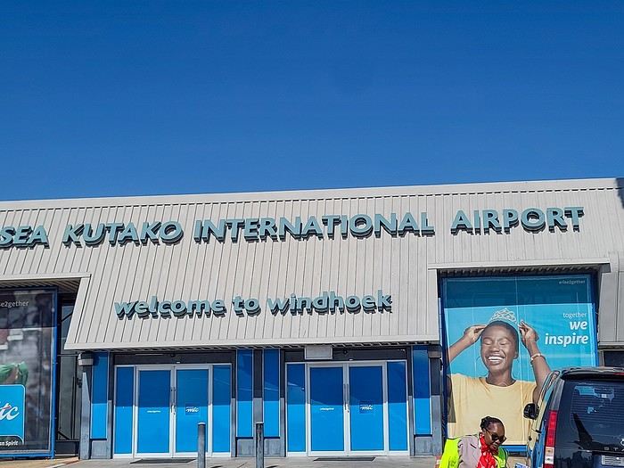
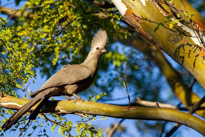
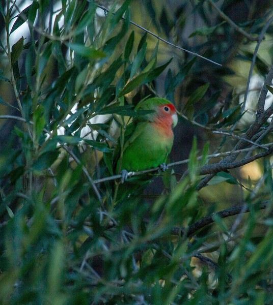
We spent our first night at Londiningi BB. A bit out of the city center but very quiet. The rooms were spacious and clean, and we could eat on-site that evening. Perfect for recovering from the flight.
Review of an expedition cruise to the Seychelles with Ponant from January 25 to February 2, 2026
Hi everyone,
It was totally by chance that I found this cruise while chatting with Alfred in November 2024. It wasn’t planned, but the price was attractive—one of those "great deals" from Ponant that I love and that don’t exist anymore. Since everyone’s wondering, here’s the answer without waiting for the end of the story: after my various loyalty discounts, I paid **3,250 € per person** for 8 nights/9 days on the expedition cruise *The Essentials of the Seychelles*.
Expedition cruises are by far our favorites. The outings are done by Zodiac with the ship’s naturalist guides, everything’s included, and there’s no need to add any excursions or prepare anything.
We’re liking long flights less and less, so to break up the trip, we decided to stop over in Doha for four days on the way there and one day on the way back.
I’m happy to share the good and not-so-good moments, the great surprises, and the disappointments of this trip with you.
It was totally by chance that I found this cruise while chatting with Alfred in November 2024. It wasn’t planned, but the price was attractive—one of those "great deals" from Ponant that I love and that don’t exist anymore. Since everyone’s wondering, here’s the answer without waiting for the end of the story: after my various loyalty discounts, I paid **3,250 € per person** for 8 nights/9 days on the expedition cruise *The Essentials of the Seychelles*.
Expedition cruises are by far our favorites. The outings are done by Zodiac with the ship’s naturalist guides, everything’s included, and there’s no need to add any excursions or prepare anything.
We’re liking long flights less and less, so to break up the trip, we decided to stop over in Doha for four days on the way there and one day on the way back.
I’m happy to share the good and not-so-good moments, the great surprises, and the disappointments of this trip with you.
The Foam of Days
Now that the curtain has fallen on the past year, it’s time to see what’s happening around here.
It seems pretty quiet, but I’ll read more in detail later.
First, I need to tell you all an anecdote.
My eldest little girl, in her third year of law school, was really scared she wouldn’t pass the year. I told her: “Trust yourself, you’ve worked so hard, and worst case, if you fail, you’ll just redo the year.” “But I don’t think I’ll make it—they changed the rules, and if I mess up even one unit, I have to start all over.” I knew her grades weren’t exactly stellar, and with what I was about to say, I wasn’t taking much of a risk. “Here’s the deal, sweetheart: if you pass, I promise I’ll take you to India, just the two of us.” I have to admit, India is a country I’ve talked about so much to all my grandchildren that in their minds, it’s become a magical, mythical place (hmm).
July had barely begun when my phone rang, her name flashing on the screen. “Mamido, I did it!” My promise came rushing back—oh no, oh no, oh no! “Congratulations, sweetheart!” A little shyly, she said: “Is the India trip still on?”
And me, replying: “Of course it is!”
And that’s that—a promise is a promise, or you risk losing that precious trust that keeps hearts warm and at peace.
We’re leaving in February. Only 8 days—yikes, the carbon footprint! But we can’t miss her tutorials, or she’ll be kicked out. Personally, that works just fine for me.
Going to India has become a challenge for me. It’s far, it’s exhausting, I sweat, I hate mosquitoes, the spices bother my mouth when I used to love them. There’s noise all the time—at night, the dogs bark nonstop, and we almost get run over. I’ll get lost in the streets because my sense of direction has vanished. I don’t like rice anymore. All that chaos and those cultural differences that once enchanted me now just overwhelm me. But I promised.
The upside—and it’s a big one—Raman, the same driver I’ve had forever, will be at the airport with a sign with our names. We’ll stop at the same little shop for chai (or tea, plain and simple) with that aroma that intoxicates me, halfway through the trip.
It’ll be a tiny trip—staying with friends, I’ll show her a few places I love: Chidambaram, Mamallapuram, and the clinic where I worked. Then we’ll head back. My little girl will go home to her parents.
As for me, I’ll leave right away for our Scottish island with Homme for our chilly winter.
How can you love a country so much you want to live there, then suddenly reject it, no longer able to appreciate what once made it special? That’s the mystery of love, I guess.
First, I need to tell you all an anecdote.
My eldest little girl, in her third year of law school, was really scared she wouldn’t pass the year. I told her: “Trust yourself, you’ve worked so hard, and worst case, if you fail, you’ll just redo the year.” “But I don’t think I’ll make it—they changed the rules, and if I mess up even one unit, I have to start all over.” I knew her grades weren’t exactly stellar, and with what I was about to say, I wasn’t taking much of a risk. “Here’s the deal, sweetheart: if you pass, I promise I’ll take you to India, just the two of us.” I have to admit, India is a country I’ve talked about so much to all my grandchildren that in their minds, it’s become a magical, mythical place (hmm).
July had barely begun when my phone rang, her name flashing on the screen. “Mamido, I did it!” My promise came rushing back—oh no, oh no, oh no! “Congratulations, sweetheart!” A little shyly, she said: “Is the India trip still on?”
And me, replying: “Of course it is!”
And that’s that—a promise is a promise, or you risk losing that precious trust that keeps hearts warm and at peace.
We’re leaving in February. Only 8 days—yikes, the carbon footprint! But we can’t miss her tutorials, or she’ll be kicked out. Personally, that works just fine for me.
Going to India has become a challenge for me. It’s far, it’s exhausting, I sweat, I hate mosquitoes, the spices bother my mouth when I used to love them. There’s noise all the time—at night, the dogs bark nonstop, and we almost get run over. I’ll get lost in the streets because my sense of direction has vanished. I don’t like rice anymore. All that chaos and those cultural differences that once enchanted me now just overwhelm me. But I promised.
The upside—and it’s a big one—Raman, the same driver I’ve had forever, will be at the airport with a sign with our names. We’ll stop at the same little shop for chai (or tea, plain and simple) with that aroma that intoxicates me, halfway through the trip.
It’ll be a tiny trip—staying with friends, I’ll show her a few places I love: Chidambaram, Mamallapuram, and the clinic where I worked. Then we’ll head back. My little girl will go home to her parents.
As for me, I’ll leave right away for our Scottish island with Homme for our chilly winter.
How can you love a country so much you want to live there, then suddenly reject it, no longer able to appreciate what once made it special? That’s the mystery of love, I guess.
Scotland - Skye Trail and a little extra
After our amazing experience in the Lofoten Islands in summer 2023, I suggested to Jean Marie another trek I’d been wanting to do for a long time: the Skye Trail in Scotland.
A few photos of this stunning island and he was sold and ready to go.
The route is available on the excellent WalkHighlands site HERE (there’s also a Cicerone guide on the subject). And since I thought it was a shame it avoided the Black Cuillins, I added a 3-day detour in that area.
We took advantage of the May bank holidays in 2024, partly to avoid the peak tourist season and also the midge period—because for some reason, mosquitoes love me 😠!!
27/04 – Day 1 – Transfer to Skye and start of the trek: Rubha Hunish - Flodigarry 28/04 – Day 2 – Flodigarry – just before the Old Man of Storr 29/04 – Day 3 – Old Man of Storr – Portree, then bus to Sligachan 30/04 - Day 4 - Sligachan - Glenbrittle campsite via the Fairy Pools 01/05 – Day 5 – Round trip to Sgùrr na Banachdich from Glenbrittle campsite 02/05 – Day 6 – Round trip to Coire Lagan and walk on the Rubh an Dùnain peninsula 03/05 – Day 7 – Return (hitchhiking) to Sligachan campsite and hike in the Red Cuillins 04/05 – Day 8 – Resuming the Skye Trail – Sligachan – Elgol 05/05 – Day 9 – Elgol – Somewhere on the climb to Bla Bheinn 06/05 – Day 10 – Somewhere on the climb to Bla Bheinn - Broadford 07/05 – Day 11 – Visit to the Armadale Castle and park 08 & 09/05 – Return to Glasgow, visit the city, and return flight And here’s the summary
A few photos of this stunning island and he was sold and ready to go.
The route is available on the excellent WalkHighlands site HERE (there’s also a Cicerone guide on the subject). And since I thought it was a shame it avoided the Black Cuillins, I added a 3-day detour in that area.
We took advantage of the May bank holidays in 2024, partly to avoid the peak tourist season and also the midge period—because for some reason, mosquitoes love me 😠!!
27/04 – Day 1 – Transfer to Skye and start of the trek: Rubha Hunish - Flodigarry 28/04 – Day 2 – Flodigarry – just before the Old Man of Storr 29/04 – Day 3 – Old Man of Storr – Portree, then bus to Sligachan 30/04 - Day 4 - Sligachan - Glenbrittle campsite via the Fairy Pools 01/05 – Day 5 – Round trip to Sgùrr na Banachdich from Glenbrittle campsite 02/05 – Day 6 – Round trip to Coire Lagan and walk on the Rubh an Dùnain peninsula 03/05 – Day 7 – Return (hitchhiking) to Sligachan campsite and hike in the Red Cuillins 04/05 – Day 8 – Resuming the Skye Trail – Sligachan – Elgol 05/05 – Day 9 – Elgol – Somewhere on the climb to Bla Bheinn 06/05 – Day 10 – Somewhere on the climb to Bla Bheinn - Broadford 07/05 – Day 11 – Visit to the Armadale Castle and park 08 & 09/05 – Return to Glasgow, visit the city, and return flight And here’s the summary
Road Trip USA 2023 - Part 2
HIGHWAY 1
Highway 1 runs along the Pacific coast of California from Leggett in the north to Dana Point in the south. It's the longest state route in California, stretching 1,050 km.
It's famous for its breathtaking ocean views. That’s actually why it’s become such a popular route for road trips, with tons of attractions and points of interest all along the way.
After crossing the U.S. interior on our way out (see Road Trip USA 2023 - Part 1), we’re starting our return trip along this route from Leggett.
Videos are embedded throughout the summary. Please click on the image to start the video. To jump to a specific post, here are the appropriate links:
CALIFORNIA:
Scenic Overlooks on Route 1 Between Leggett and Fort Bragg The Pudding Creek Trestle Bridge in Fort Bragg Glass Beach - Fort Bragg Jenner Lookout Point - Highway 1 Goat Rock Beach - Sonoma Coast State Park - Jenner Point Reyes National Seashore - White House Pool Trail Point Reyes National Seashore - Limantour Beach Point Reyes National Seashore - Point Reyes Shipwreck Point Reyes National Seashore - Kehoe Beach Trail Point Reyes National Seashore - McClures Beach Trail Point Reyes National Seashore - Cypress Tree Tunnel Point Reyes National Seashore - Point Reyes Beach North Point Reyes National Seashore - Elephant Seals on Drakes Beach Point Reyes National Seashore - Point Reyes Beach South Point Reyes National Seashore – Elephant Seals Overlooks Point Reyes National Seashore - Chimney Rock Trail Point Reyes National Seashore - Point Reyes Lighthouse Trail Point Reyes National Seashore – Tule Elk Observation Point Bonita Lighthouse Trail - Sausalito Hawk Hill - Sausalito Battery Spencer Trail - Sausalito Rodeo Beach - Sausalito Point Cavallo - Golden Gate View - Sausalito Exploring Downtown Sausalito Visiting Sausalito’s Houseboats Crossing the Golden Gate Bridge - San Francisco Golden Gate Bridge Viewpoints - San Francisco Cruise to Alcatraz Island - San Francisco Visiting Alcatraz Island - San Francisco Civic Center - Downtown San Francisco Market Street & Yerba Buena Gardens - Downtown San Francisco Union Square & Financial District - Downtown San Francisco Fisherman's Wharf, Pier 39 & Embarcadero - San Francisco Sea Lion Observation - Pier 39 - San Francisco Lombard Street & Cable Car - Russian Hill - San Francisco Macondray Lane Historic District - Russian Hill - San Francisco Grace Cathedral & Huntington Park - Nob Hill - San Francisco Telegraph Hill - San Francisco Chinatown - San Francisco Alamo Square & Painted Ladies - Western Addition - San Francisco Palace of Fine Arts - Marina District - San Francisco Presidio of San Francisco California Coastal Trail - Lincoln Park - San Francisco California Palace of the Legion of Honor - Lincoln Park - San Francisco Sutro Baths - Lincoln Park - San Francisco Queen Wilhelmina Garden - Golden Gate Park - San Francisco Bison Paddock - Golden Gate Park - San Francisco Portals of the Past - Golden Gate Park - San Francisco Strawberry Hill - Golden Gate Park – San Francisco Prayerbook Cross & Robin Williams Meadow - Golden Gate Park - San Francisco Hidden Garden Steps & 16th Avenue Tiled Steps - San Francisco Grandview Park - San Francisco Hike - Twin Peaks Three Summits - San Francisco Longboarding Down Twin Peaks Blvd in San Francisco Haight-Ashbury - San Francisco Corona Heights Park - San Francisco Mission Dolores - San Francisco Mural Frescoes (Part 1) - Mission District - San Francisco Mural Frescoes (Part 2) - Mission District - San Francisco Devil's Slide Bunker - Pacifica Mavericks Beach - Half Moon Bay Martins Beach - Half Moon Bay Pigeon Point Lighthouse State Historic Park - Pescadero What to See in Santa Cruz Visiting Capitola What to See in Monterey Carmel-by-the-Sea Lovers Point Park - Pacific Grove Castle Rock, Hurricane Point & Little Sur River Viewpoints Pfeiffer Falls Trail Julia Pfeiffer Burns State Park Vista Point & McWay Falls Highway 1 - Big Sur Viewpoints Salmon Creek Falls San Carpoforo Creek Trail Elephant Seal Vista Point - San Simeon San Simeon Pier Moonstone Beach Boardwalk Shipwreck - Estero Bluffs State Park Surfing Competition in Morro Bay Port San Luis Pier - San Luis Obispo Pismo Beach Monarch Butterfly Grove - Pismo State Beach Nojoqui Falls Park - Solvang Arroyo Hondo Vista Point Solvang, a Charming Danish Town in California Chumash Painted Cave - Santa Barbara Goleta San Marcos Rd & Cachuma Lake Vista Points - Santa Barbara Old Santa Barbara Mission Walking Tour of Santa Barbara’s Historic Downtown West Beach - Santa Barbara What to See in Ventura Paradise Falls - Wildwood Regional Park - Thousand Oaks Sandy Dune & El Matador State Beach - Malibu Point Dume Nature Reserve - Malibu Malibu Pier Road Trip in the Malibu Mountains Los Liones Trail - Santa Monica Santa Monica Pier Rodeo Drive - Beverly Hills Greystone Mansion - Beverly Hills Hollywood Walk of Fame - Los Angeles Griffith Observatory - Los Angeles Hollywood Forever Cemetery - Los Angeles What to See in Venice Beach Venice Beach Skatepark ShoreLine Aquatic Park - Long Beach Alamitos Beach - Long Beach Naples Island - Long Beach Crescent Bay Point Park & Helser Park Kiosk - Laguna Beach Shell Beach at Twin Points - Laguna Beach Prairie Dogs at Agra Vista Point Top Gun House & Oceanside Pier Annie's Canyon Trail - Solana Beach (Via North Rios Trailhead Loop) Old Town San Diego La Jolla Coastal Trail - San Diego Balboa Park - San Diego Pacific Beach - San Diego Mission Beach - San Diego Ocean Beach Tide Pools - San Diego Sunset Cliffs Natural Park - San Diego Tuna Harbor Park - San Diego Seaport Village & Embarcadero Marina Park - San Diego Gaslamp Quarter - Downtown San Diego Coronado Island - San Diego Dead Dolly Lane - Alpine Galleta Meadows Metal Sculptures - Borrego Springs What to See in Palm Springs Robolights - Palm Springs Andreas Canyon Trail - Indian Canyons - Palm Springs Palm Canyon Trail - Indian Canyons - Palm Springs West Fork Falls Trail - Indian Canyons - Palm Springs Tahquitz Canyon Loop Trail - Indian Canyons - Palm Springs Desert Christ Park - Yucca Valley Pioneertown Salvation Mountain - Niland Slab City - Niland
Highway 1 runs along the Pacific coast of California from Leggett in the north to Dana Point in the south. It's the longest state route in California, stretching 1,050 km.
It's famous for its breathtaking ocean views. That’s actually why it’s become such a popular route for road trips, with tons of attractions and points of interest all along the way.
After crossing the U.S. interior on our way out (see Road Trip USA 2023 - Part 1), we’re starting our return trip along this route from Leggett.
Videos are embedded throughout the summary. Please click on the image to start the video. To jump to a specific post, here are the appropriate links:
CALIFORNIA:
Scenic Overlooks on Route 1 Between Leggett and Fort Bragg The Pudding Creek Trestle Bridge in Fort Bragg Glass Beach - Fort Bragg Jenner Lookout Point - Highway 1 Goat Rock Beach - Sonoma Coast State Park - Jenner Point Reyes National Seashore - White House Pool Trail Point Reyes National Seashore - Limantour Beach Point Reyes National Seashore - Point Reyes Shipwreck Point Reyes National Seashore - Kehoe Beach Trail Point Reyes National Seashore - McClures Beach Trail Point Reyes National Seashore - Cypress Tree Tunnel Point Reyes National Seashore - Point Reyes Beach North Point Reyes National Seashore - Elephant Seals on Drakes Beach Point Reyes National Seashore - Point Reyes Beach South Point Reyes National Seashore – Elephant Seals Overlooks Point Reyes National Seashore - Chimney Rock Trail Point Reyes National Seashore - Point Reyes Lighthouse Trail Point Reyes National Seashore – Tule Elk Observation Point Bonita Lighthouse Trail - Sausalito Hawk Hill - Sausalito Battery Spencer Trail - Sausalito Rodeo Beach - Sausalito Point Cavallo - Golden Gate View - Sausalito Exploring Downtown Sausalito Visiting Sausalito’s Houseboats Crossing the Golden Gate Bridge - San Francisco Golden Gate Bridge Viewpoints - San Francisco Cruise to Alcatraz Island - San Francisco Visiting Alcatraz Island - San Francisco Civic Center - Downtown San Francisco Market Street & Yerba Buena Gardens - Downtown San Francisco Union Square & Financial District - Downtown San Francisco Fisherman's Wharf, Pier 39 & Embarcadero - San Francisco Sea Lion Observation - Pier 39 - San Francisco Lombard Street & Cable Car - Russian Hill - San Francisco Macondray Lane Historic District - Russian Hill - San Francisco Grace Cathedral & Huntington Park - Nob Hill - San Francisco Telegraph Hill - San Francisco Chinatown - San Francisco Alamo Square & Painted Ladies - Western Addition - San Francisco Palace of Fine Arts - Marina District - San Francisco Presidio of San Francisco California Coastal Trail - Lincoln Park - San Francisco California Palace of the Legion of Honor - Lincoln Park - San Francisco Sutro Baths - Lincoln Park - San Francisco Queen Wilhelmina Garden - Golden Gate Park - San Francisco Bison Paddock - Golden Gate Park - San Francisco Portals of the Past - Golden Gate Park - San Francisco Strawberry Hill - Golden Gate Park – San Francisco Prayerbook Cross & Robin Williams Meadow - Golden Gate Park - San Francisco Hidden Garden Steps & 16th Avenue Tiled Steps - San Francisco Grandview Park - San Francisco Hike - Twin Peaks Three Summits - San Francisco Longboarding Down Twin Peaks Blvd in San Francisco Haight-Ashbury - San Francisco Corona Heights Park - San Francisco Mission Dolores - San Francisco Mural Frescoes (Part 1) - Mission District - San Francisco Mural Frescoes (Part 2) - Mission District - San Francisco Devil's Slide Bunker - Pacifica Mavericks Beach - Half Moon Bay Martins Beach - Half Moon Bay Pigeon Point Lighthouse State Historic Park - Pescadero What to See in Santa Cruz Visiting Capitola What to See in Monterey Carmel-by-the-Sea Lovers Point Park - Pacific Grove Castle Rock, Hurricane Point & Little Sur River Viewpoints Pfeiffer Falls Trail Julia Pfeiffer Burns State Park Vista Point & McWay Falls Highway 1 - Big Sur Viewpoints Salmon Creek Falls San Carpoforo Creek Trail Elephant Seal Vista Point - San Simeon San Simeon Pier Moonstone Beach Boardwalk Shipwreck - Estero Bluffs State Park Surfing Competition in Morro Bay Port San Luis Pier - San Luis Obispo Pismo Beach Monarch Butterfly Grove - Pismo State Beach Nojoqui Falls Park - Solvang Arroyo Hondo Vista Point Solvang, a Charming Danish Town in California Chumash Painted Cave - Santa Barbara Goleta San Marcos Rd & Cachuma Lake Vista Points - Santa Barbara Old Santa Barbara Mission Walking Tour of Santa Barbara’s Historic Downtown West Beach - Santa Barbara What to See in Ventura Paradise Falls - Wildwood Regional Park - Thousand Oaks Sandy Dune & El Matador State Beach - Malibu Point Dume Nature Reserve - Malibu Malibu Pier Road Trip in the Malibu Mountains Los Liones Trail - Santa Monica Santa Monica Pier Rodeo Drive - Beverly Hills Greystone Mansion - Beverly Hills Hollywood Walk of Fame - Los Angeles Griffith Observatory - Los Angeles Hollywood Forever Cemetery - Los Angeles What to See in Venice Beach Venice Beach Skatepark ShoreLine Aquatic Park - Long Beach Alamitos Beach - Long Beach Naples Island - Long Beach Crescent Bay Point Park & Helser Park Kiosk - Laguna Beach Shell Beach at Twin Points - Laguna Beach Prairie Dogs at Agra Vista Point Top Gun House & Oceanside Pier Annie's Canyon Trail - Solana Beach (Via North Rios Trailhead Loop) Old Town San Diego La Jolla Coastal Trail - San Diego Balboa Park - San Diego Pacific Beach - San Diego Mission Beach - San Diego Ocean Beach Tide Pools - San Diego Sunset Cliffs Natural Park - San Diego Tuna Harbor Park - San Diego Seaport Village & Embarcadero Marina Park - San Diego Gaslamp Quarter - Downtown San Diego Coronado Island - San Diego Dead Dolly Lane - Alpine Galleta Meadows Metal Sculptures - Borrego Springs What to See in Palm Springs Robolights - Palm Springs Andreas Canyon Trail - Indian Canyons - Palm Springs Palm Canyon Trail - Indian Canyons - Palm Springs West Fork Falls Trail - Indian Canyons - Palm Springs Tahquitz Canyon Loop Trail - Indian Canyons - Palm Springs Desert Christ Park - Yucca Valley Pioneertown Salvation Mountain - Niland Slab City - Niland
Renting a car in the USA and driver's civil liability.
Hi everyone.
I’ve been wondering: Is it still reasonable to rent a car in the U.S.?
Apparently, since early January 2025—and very quietly—the most important insurance coverage, namely the driver’s civil liability, has seen its coverage amount drop from $1 million to just $300,000. This coverage is supposed to protect us from damages we might be responsible for while driving. We can go decades without a single scrape (especially if it’s our fault), but anything can happen in a split second. A motorcycle appearing out of nowhere, a misjudgment at one of those huge intersections with staggered traffic lights, and suddenly we could be deemed at fault for the accident. We’d then have to pay out of pocket for the other party’s medical expenses. Given what hospitals charge... it can easily exceed $300,000 and turn into a nightmare in no time!!! Plus, anyone who’s driven on American roads has seen those billboards for lawyers offering their services to accident victims. So on top of the sky-high medical bill, the lawyer will demand compensation worthy of a Hollywood movie!!!! So, is it even worth getting behind the wheel in America anymore? Well... that’s just my take! And on top of that, I haven’t found any insurance company that offers such high civil liability coverage. Chapka and others do offer coverage in the millions, but motor vehicles are excluded.... So here’s the thing... Unless I’ve "missed something," I’ve come to this conclusion: Renting a car in the U.S. is like playing Russian roulette! But maybe I’m being too pessimistic? What do you think?
I’ve been wondering: Is it still reasonable to rent a car in the U.S.?
Apparently, since early January 2025—and very quietly—the most important insurance coverage, namely the driver’s civil liability, has seen its coverage amount drop from $1 million to just $300,000. This coverage is supposed to protect us from damages we might be responsible for while driving. We can go decades without a single scrape (especially if it’s our fault), but anything can happen in a split second. A motorcycle appearing out of nowhere, a misjudgment at one of those huge intersections with staggered traffic lights, and suddenly we could be deemed at fault for the accident. We’d then have to pay out of pocket for the other party’s medical expenses. Given what hospitals charge... it can easily exceed $300,000 and turn into a nightmare in no time!!! Plus, anyone who’s driven on American roads has seen those billboards for lawyers offering their services to accident victims. So on top of the sky-high medical bill, the lawyer will demand compensation worthy of a Hollywood movie!!!! So, is it even worth getting behind the wheel in America anymore? Well... that’s just my take! And on top of that, I haven’t found any insurance company that offers such high civil liability coverage. Chapka and others do offer coverage in the millions, but motor vehicles are excluded.... So here’s the thing... Unless I’ve "missed something," I’ve come to this conclusion: Renting a car in the U.S. is like playing Russian roulette! But maybe I’m being too pessimistic? What do you think?
Mauritian Ti' Punch
The recipe for the cocktail: endless beaches, a dazzling palette of colors, some breathtaking hikes, and excellent cuisine...
For the tasting, follow along in the pages of this travel journal! 😉
Don’t forget your hiking shoes, a swimsuit, sunscreen, but also a sweater, your driver’s license, and your credit card...
Just over 11 hours of flight, and we’ll be setting foot on Mauritian soil!
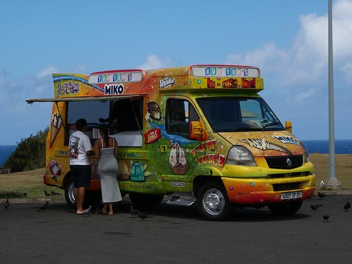
For the tasting, follow along in the pages of this travel journal! 😉
Don’t forget your hiking shoes, a swimsuit, sunscreen, but also a sweater, your driver’s license, and your credit card...
Just over 11 hours of flight, and we’ll be setting foot on Mauritian soil!
Yet Another Travel Journal in this (Too) Familiar Rajasthan, But with Family and Kids
Prologue
This journal recounts a trip to Rajasthan that’s already over a year old and that I’ve only now found the chance to write about. The summer of 2024 marked my return to India—my tenth trip—after six long years away since my last solo wanderings in Tamil Nadu in 2018 (the journal of which is published on this site). That absence was partly (but not only) due to the long COVID and post-COVID period, which saw a complete halt and then a major slowdown in global tourism. To top it off, Voyage Forum announced its closure in an end-of-the-world atmosphere. A sad time for our favorite social activity…
A few weeks after returning from Rajasthan, I tried to motivate myself to start writing a journal to publish on a forum claiming to be VF’s successor, which I’d eventually signed up for out of desperation. But I kept hesitating and putting the project off because, for one, I no longer have the time I used to. For another, the vibe wasn’t really taking off on that forum—it was overrun with ads and not very active, contrary to what its host’s name suggested. Despite its good intentions and commendable role as a stopgap, it also turned out to be very impractical to use, especially when you don’t have much time like me. I’ll admit I’d occasionally check back on VF to see if anything was happening. But all the discussions remained frozen in time, stuck in that fateful year, 2020. Then, rumors swirled online about shady reasons behind its closure, leaving little room for hope.
And then, one fine morning, I got a message at work from Marien informing me that VF had reopened. What a huge surprise! Even though the forum’s “end” had played out in a somewhat apocalyptic atmosphere, the memories of passionate and heated discussions, the frank debates, and the useful exchanges that made this site a traveler’s goldmine and a unique hub of conviviality all came rushing back to me like a breath of fresh air. I finally saw a sign and tried to motivate myself to find the time to publish the journal of this tenth trip to India and fifth to Rajasthan. But in the end, I got bogged down in professional and family obligations and never managed to find the time to get started. That’s now fixed, though, because I had two reasons for wanting to do it: I find that looking back on a trip to tell others about it is a highly beneficial introspective exercise. Also, I thought this journal could be useful to other travelers on a few points.
Because, “do we really need yet another journal about Rajasthan?” you might rightly ask! Especially in a time when so many journals about the “Land of Kings” have been published since VF’s return, not to mention the countless stories you can already find online about this region, one of India’s most touristy. And I’d add, why go back to Rajasthan for a fifth time, where I’ve already dragged my feet more than enough—through its forts, deserts, temples, cities, villages, bumpy roads, train stations, tasty street food stalls, cheap guesthouses, and more? Where some might see just another overhyped tourist destination full of the same old *Arabian Nights* clichés, worn to a thread, that I mentioned earlier, when there’s so much else to see in India? Well, first because it’s a magnificent country I never tire of, where I started an academic study and made so many connections. It’s also packed with places where you won’t find a single tourist (right, Marie-Jo?), even in the heart of well-trodden paths and classic itineraries. And most importantly, as I said earlier, things have changed in recent years. First, after six years without traveling far, the urge to go back to India was getting stronger. But this time, no more solo trips (often) or duo adventures (sometimes)—now it’s a team of four that has to come along! And even if you can argue with that, what better place than Rajasthan to introduce India to people who’ve never seen it? To kids you want to amaze? Plus, traveling with your new little family to your favorite country isn’t the same as going solo in often spartan conditions that only affect you. It’s a different challenge, but ultimately probably much harder. So, is it really reasonable to take two kids to India, including a two-year-old baby? That’s one of the main goals of this journal (but not the only one)—to try to answer that question.
As you can tell, it’s not so much the destination but the slightly unusual setup of this trip that, in my opinion, will make this journal interesting. Despite my experience and expertise (yes, I dare say it) in India, there were plenty of questions before we finalized the plan and said, “Alright, let’s go!” The questions were flying for us parents. Is it wise to travel to India with a two-year-old? What would we do (it happened) if the kids got very sick? Would they be able to handle a road trip on Rajasthan’s bumpy, dusty roads using public transport? Could they handle the shock of such a different world—the dirt, poverty, pollution, noise (…and the smell, as they say), the spicy food, monkeys, mosquitoes, snakes, tigers, leopards, and so on? In short, all the clichés that I usually joke about suddenly became potential realities. Another concern: as a mixed Franco-African family (not me, but my partner and her oldest), wouldn’t we risk not always being well received, given what you sometimes hear about that in India? How would Indians react to seeing a mixed-race family, the ultimate taboo in a country of purity and social segregation, which would undoubtedly raise many questions for them? Of course, not everything went as expected… Because, as you know, with India—and what makes it charming for some—there are always complications: sometimes where you don’t expect them… and sometimes where you do. I’ll go into detail about that in the journal to come (not right away) and in the final review (even later). These experiences could be useful to travelers who find themselves in similar situations and have the same questions we did before embarking on such a journey. And maybe it’ll spark the curiosity of those who aren’t concerned and will read yet another Rajasthan journal, but with its own unique twists.
Despite my unchanged constraints, which mean I have little time to write this, I don’t want to rush the story, so I’ll take my time. There will probably be lulls. I hope that won’t stop people from coming to react, debate, share their impressions, or ask for information.
This journal recounts a trip to Rajasthan that’s already over a year old and that I’ve only now found the chance to write about. The summer of 2024 marked my return to India—my tenth trip—after six long years away since my last solo wanderings in Tamil Nadu in 2018 (the journal of which is published on this site). That absence was partly (but not only) due to the long COVID and post-COVID period, which saw a complete halt and then a major slowdown in global tourism. To top it off, Voyage Forum announced its closure in an end-of-the-world atmosphere. A sad time for our favorite social activity…
A few weeks after returning from Rajasthan, I tried to motivate myself to start writing a journal to publish on a forum claiming to be VF’s successor, which I’d eventually signed up for out of desperation. But I kept hesitating and putting the project off because, for one, I no longer have the time I used to. For another, the vibe wasn’t really taking off on that forum—it was overrun with ads and not very active, contrary to what its host’s name suggested. Despite its good intentions and commendable role as a stopgap, it also turned out to be very impractical to use, especially when you don’t have much time like me. I’ll admit I’d occasionally check back on VF to see if anything was happening. But all the discussions remained frozen in time, stuck in that fateful year, 2020. Then, rumors swirled online about shady reasons behind its closure, leaving little room for hope.
And then, one fine morning, I got a message at work from Marien informing me that VF had reopened. What a huge surprise! Even though the forum’s “end” had played out in a somewhat apocalyptic atmosphere, the memories of passionate and heated discussions, the frank debates, and the useful exchanges that made this site a traveler’s goldmine and a unique hub of conviviality all came rushing back to me like a breath of fresh air. I finally saw a sign and tried to motivate myself to find the time to publish the journal of this tenth trip to India and fifth to Rajasthan. But in the end, I got bogged down in professional and family obligations and never managed to find the time to get started. That’s now fixed, though, because I had two reasons for wanting to do it: I find that looking back on a trip to tell others about it is a highly beneficial introspective exercise. Also, I thought this journal could be useful to other travelers on a few points.
Because, “do we really need yet another journal about Rajasthan?” you might rightly ask! Especially in a time when so many journals about the “Land of Kings” have been published since VF’s return, not to mention the countless stories you can already find online about this region, one of India’s most touristy. And I’d add, why go back to Rajasthan for a fifth time, where I’ve already dragged my feet more than enough—through its forts, deserts, temples, cities, villages, bumpy roads, train stations, tasty street food stalls, cheap guesthouses, and more? Where some might see just another overhyped tourist destination full of the same old *Arabian Nights* clichés, worn to a thread, that I mentioned earlier, when there’s so much else to see in India? Well, first because it’s a magnificent country I never tire of, where I started an academic study and made so many connections. It’s also packed with places where you won’t find a single tourist (right, Marie-Jo?), even in the heart of well-trodden paths and classic itineraries. And most importantly, as I said earlier, things have changed in recent years. First, after six years without traveling far, the urge to go back to India was getting stronger. But this time, no more solo trips (often) or duo adventures (sometimes)—now it’s a team of four that has to come along! And even if you can argue with that, what better place than Rajasthan to introduce India to people who’ve never seen it? To kids you want to amaze? Plus, traveling with your new little family to your favorite country isn’t the same as going solo in often spartan conditions that only affect you. It’s a different challenge, but ultimately probably much harder. So, is it really reasonable to take two kids to India, including a two-year-old baby? That’s one of the main goals of this journal (but not the only one)—to try to answer that question.
As you can tell, it’s not so much the destination but the slightly unusual setup of this trip that, in my opinion, will make this journal interesting. Despite my experience and expertise (yes, I dare say it) in India, there were plenty of questions before we finalized the plan and said, “Alright, let’s go!” The questions were flying for us parents. Is it wise to travel to India with a two-year-old? What would we do (it happened) if the kids got very sick? Would they be able to handle a road trip on Rajasthan’s bumpy, dusty roads using public transport? Could they handle the shock of such a different world—the dirt, poverty, pollution, noise (…and the smell, as they say), the spicy food, monkeys, mosquitoes, snakes, tigers, leopards, and so on? In short, all the clichés that I usually joke about suddenly became potential realities. Another concern: as a mixed Franco-African family (not me, but my partner and her oldest), wouldn’t we risk not always being well received, given what you sometimes hear about that in India? How would Indians react to seeing a mixed-race family, the ultimate taboo in a country of purity and social segregation, which would undoubtedly raise many questions for them? Of course, not everything went as expected… Because, as you know, with India—and what makes it charming for some—there are always complications: sometimes where you don’t expect them… and sometimes where you do. I’ll go into detail about that in the journal to come (not right away) and in the final review (even later). These experiences could be useful to travelers who find themselves in similar situations and have the same questions we did before embarking on such a journey. And maybe it’ll spark the curiosity of those who aren’t concerned and will read yet another Rajasthan journal, but with its own unique twists.
Despite my unchanged constraints, which mean I have little time to write this, I don’t want to rush the story, so I’ll take my time. There will probably be lulls. I hope that won’t stop people from coming to react, debate, share their impressions, or ask for information.
From Southern Shikoku, between land and sea, to the blue waters of Miyakojima and finally the Tokyo metropolis
From Southern Shikoku, between land and sea, to the blue waters of Miyakojima and finally Tokyo’s megacity
Hi everyone,
I have to admit, I really hesitated before deciding to write this travel journal... Writing one takes a lot of time and energy, and since this is my 4th trip, I wondered if it would actually interest anyone other than myself (both for the discovery and the writing). But after a few "Are you going to write a journal?" requests and especially the renewed pleasure from reading other travelers’ travel journals about Japan or elsewhere on this forum or elsewhere, I’ve decided to share this 4th installment in the Land of the Rising Sun here.
The itinerary: 27 full days, from late May to late June 2025, right in the middle of the rainy season, including:
-->13 days in Shikoku, from Kochi (Kochi Prefecture) to Matsuyama (Ehime Prefecture)

-->7 days in Miyakojima (Okinawa Prefecture)

-->7 days in Tokyo

The trip was decided on fairly last-minute this year, as usual.
I regularly check flight prices to track fluctuations for this destination, even without concrete plans. Finding a slightly cheaper direct flight (900 €) than what I’d seen in previous months (around 1,200–1,400 € on average) for a Paris-Tokyo route with Japanese airline ANA was too tempting to resist the urge to return to this enchanting country. After long hesitations between exploring the San’in region (Matsue, Tottori, Yamaguchi) and southern Shikoku, the decision was made—I took the plunge! The tickets are booked: Paris to Kochi with a layover in Tokyo, all with ANA, the airline I’d been dreaming of... for 1,120 € per person. Okay, it’s not cheap, but it’s still better than in 2023.
We leave in 2 weeks!! Now it’s just a matter of getting everything ready!
Intense work ahead in these 2 weeks to:
finalize a more precise itinerary and reach an agreement—yep, because even though we both love Japan, our preferences differ slightly, and we have to choose between exploring new places or taking time to revisit beloved spots... decide how much time to spend in each selected area without rushing while still exploring research places that might interest us and watch videos about Japan book accommodations: yes, it’s possible to do this on the spot as we go, but last year, we noticed that last-minute options were pretty expensive, so we’re booking ahead—even if it means keeping a few options open while we decide or see if better deals pop up later reserve rental cars order yen check the weather regularly and wonder if choosing the *tsuyu* (rainy season) was really a good idea—and whether we’ll be stuck in non-stop rain???
What a tough job, right? Traveling to Japan for a month—such a hard life! Despite this being my 4th trip, the excitement is just as intense as the first time.
The only small downside is that when we booked the flight tickets, there were only a few seats left, so we’re only sitting together on the international return flight. Plus, on the outbound flight, we’ve got the middle seats. Another lingering question: what French-language films will be available? According to the internet, the selection seems limited. Oh well, these are just minor details—it’s almost time to fly!
PS: I’ll be posting slowly and irregularly... so for those interested, be patient or maybe set an alert...
Hi everyone,
I have to admit, I really hesitated before deciding to write this travel journal... Writing one takes a lot of time and energy, and since this is my 4th trip, I wondered if it would actually interest anyone other than myself (both for the discovery and the writing). But after a few "Are you going to write a journal?" requests and especially the renewed pleasure from reading other travelers’ travel journals about Japan or elsewhere on this forum or elsewhere, I’ve decided to share this 4th installment in the Land of the Rising Sun here.
The itinerary: 27 full days, from late May to late June 2025, right in the middle of the rainy season, including:
-->13 days in Shikoku, from Kochi (Kochi Prefecture) to Matsuyama (Ehime Prefecture)
-->7 days in Miyakojima (Okinawa Prefecture)
-->7 days in Tokyo
The trip was decided on fairly last-minute this year, as usual.
I regularly check flight prices to track fluctuations for this destination, even without concrete plans. Finding a slightly cheaper direct flight (900 €) than what I’d seen in previous months (around 1,200–1,400 € on average) for a Paris-Tokyo route with Japanese airline ANA was too tempting to resist the urge to return to this enchanting country. After long hesitations between exploring the San’in region (Matsue, Tottori, Yamaguchi) and southern Shikoku, the decision was made—I took the plunge! The tickets are booked: Paris to Kochi with a layover in Tokyo, all with ANA, the airline I’d been dreaming of... for 1,120 € per person. Okay, it’s not cheap, but it’s still better than in 2023.
We leave in 2 weeks!! Now it’s just a matter of getting everything ready!
Intense work ahead in these 2 weeks to:
finalize a more precise itinerary and reach an agreement—yep, because even though we both love Japan, our preferences differ slightly, and we have to choose between exploring new places or taking time to revisit beloved spots... decide how much time to spend in each selected area without rushing while still exploring research places that might interest us and watch videos about Japan book accommodations: yes, it’s possible to do this on the spot as we go, but last year, we noticed that last-minute options were pretty expensive, so we’re booking ahead—even if it means keeping a few options open while we decide or see if better deals pop up later reserve rental cars order yen check the weather regularly and wonder if choosing the *tsuyu* (rainy season) was really a good idea—and whether we’ll be stuck in non-stop rain???
What a tough job, right? Traveling to Japan for a month—such a hard life! Despite this being my 4th trip, the excitement is just as intense as the first time.
The only small downside is that when we booked the flight tickets, there were only a few seats left, so we’re only sitting together on the international return flight. Plus, on the outbound flight, we’ve got the middle seats. Another lingering question: what French-language films will be available? According to the internet, the selection seems limited. Oh well, these are just minor details—it’s almost time to fly!
PS: I’ll be posting slowly and irregularly... so for those interested, be patient or maybe set an alert...
Another side of my trip to Thailand: Villages, nature, countryside, mountains...
February 9th is a pivotal day during my trip to Thailand. Up until this date, my focus had been on cities, temples, and other urban landmarks. Starting February 10th, I’ll finally leave the city behind for the outskirts—one town, one life, farther from tourism, more real, more authentic... Then comes the bucolic surroundings of Chiang Mai, nature, the countryside, the mountains.
This morning, I head to visit the ethnographic museum. I’d been told about another one, but it’s permanently closed. I wonder if it’s the same one that might have changed its name and location.
I thoroughly enjoy visiting this museum. At first, I’m a bit annoyed because the place is packed with noisy school groups blocking the display cases without even showing the slightest interest. But soon, their chaperones manage to lead them into another room, giving me some peace. They maintain this distance throughout the tour, allowing me to explore the museum in complete tranquility. I really appreciate their tact.
I’m amazed by the absolutely stunning fabric displays and the countless everyday objects, especially the very old pottery. There’s so much beautiful basketry and intricately carved wood. The statues are also incredible... After seeing all of them, I no longer feel like buying any from the shops.
On my way back, not far from my hotel, I discover a rather unique place that only serves one drink, which they’ve made their specialty: egg coffee! A pretty surprising novelty. I have to try it.

At the bottom of the cup, they pour a layer of milk, topped with a layer of liquid coffee, followed by a layer of egg yolk, and finally a top layer that turns out to be a mix of coffee and cocoa powder. It’s a cold drink that, in the end, doesn’t have much flavor, and the price is pretty steep for such a small cup. You’re paying for the exclusivity!
Later in the day, I venture once again into small alleys, something I love doing when exploring a new city—no specific goal, just wandering east of the city, outside the walls.

I encounter very few tourists there and discover unsuspected little shops overflowing with lovely items, much cheaper than what you find in the heart of the tourist district. Then I wander through the floors of Warorot Market. I discover another kind of temple there: the temple of good deals. I love finding clothes that are really original for locals, not the flood of shirts and pants that tourists love but no Thai would ever buy, which invade the shops in the "Historic Square." I stop in my tracks in front of a stall with beautiful shirts featuring stunning geometric patterns in elegant color combinations and very short sleeves. Hmm, these would be perfect for showing off my biceps, one of which is adorned with the magnificent Ganesh tattoo I got last year in Bali. "When you’ve got nice things, you’ve got to show them off!" he said. 😜🙏💪 I pick out two for 380 baht and negotiate them down to 300. But the seller won’t go any lower. I understand I’ve reached the limit of her commercial possibilities. Just as I’m leaving the shop, happy with my purchase, my ever-helpful inner voice, Petite Voix, suggests: - You didn’t try them on because you were too lazy to take off the one you’re wearing and also because of the sweat, but you could just put one on over the one you’re wearing. It’s light enough that it won’t bother you.
I go back to the two sellers, who burst out laughing when I ask to try them on. - Oh no, it’s way too small for you! It’s a women’s shirt! - But they don’t look particularly feminine in style! And I chose XXL... I put the shirt on, and of course, it won’t close. Then I notice the buttons are on the wrong side. That’s why the sleeves seemed so short!!! They put the shirts back on the rack and refund me without any fuss, commenting amid total hilarity: - Well, thank goodness you tried it on just as you were leaving the shop!
Since I don’t want to walk too much before tomorrow’s first Big Outing with the driver, I end my stroll with a visit to two very pretty temples recommended by Joël.

I’d rather not post more temple photos. But these ones smell like village and countryside...


I’ve never seen anything like Wat Ket Karam, so extravagant...


And I end my day with two other lesser-known temples: Wat Noung Kham, simple and finally free of gold and glitter,

and Wat Dap Phai, where an intimate ceremony is taking place at the end of the day.
This morning, I head to visit the ethnographic museum. I’d been told about another one, but it’s permanently closed. I wonder if it’s the same one that might have changed its name and location.
I thoroughly enjoy visiting this museum. At first, I’m a bit annoyed because the place is packed with noisy school groups blocking the display cases without even showing the slightest interest. But soon, their chaperones manage to lead them into another room, giving me some peace. They maintain this distance throughout the tour, allowing me to explore the museum in complete tranquility. I really appreciate their tact.
I’m amazed by the absolutely stunning fabric displays and the countless everyday objects, especially the very old pottery. There’s so much beautiful basketry and intricately carved wood. The statues are also incredible... After seeing all of them, I no longer feel like buying any from the shops.
On my way back, not far from my hotel, I discover a rather unique place that only serves one drink, which they’ve made their specialty: egg coffee! A pretty surprising novelty. I have to try it.
At the bottom of the cup, they pour a layer of milk, topped with a layer of liquid coffee, followed by a layer of egg yolk, and finally a top layer that turns out to be a mix of coffee and cocoa powder. It’s a cold drink that, in the end, doesn’t have much flavor, and the price is pretty steep for such a small cup. You’re paying for the exclusivity!
Later in the day, I venture once again into small alleys, something I love doing when exploring a new city—no specific goal, just wandering east of the city, outside the walls.
I encounter very few tourists there and discover unsuspected little shops overflowing with lovely items, much cheaper than what you find in the heart of the tourist district. Then I wander through the floors of Warorot Market. I discover another kind of temple there: the temple of good deals. I love finding clothes that are really original for locals, not the flood of shirts and pants that tourists love but no Thai would ever buy, which invade the shops in the "Historic Square." I stop in my tracks in front of a stall with beautiful shirts featuring stunning geometric patterns in elegant color combinations and very short sleeves. Hmm, these would be perfect for showing off my biceps, one of which is adorned with the magnificent Ganesh tattoo I got last year in Bali. "When you’ve got nice things, you’ve got to show them off!" he said. 😜🙏💪 I pick out two for 380 baht and negotiate them down to 300. But the seller won’t go any lower. I understand I’ve reached the limit of her commercial possibilities. Just as I’m leaving the shop, happy with my purchase, my ever-helpful inner voice, Petite Voix, suggests: - You didn’t try them on because you were too lazy to take off the one you’re wearing and also because of the sweat, but you could just put one on over the one you’re wearing. It’s light enough that it won’t bother you.
I go back to the two sellers, who burst out laughing when I ask to try them on. - Oh no, it’s way too small for you! It’s a women’s shirt! - But they don’t look particularly feminine in style! And I chose XXL... I put the shirt on, and of course, it won’t close. Then I notice the buttons are on the wrong side. That’s why the sleeves seemed so short!!! They put the shirts back on the rack and refund me without any fuss, commenting amid total hilarity: - Well, thank goodness you tried it on just as you were leaving the shop!
Since I don’t want to walk too much before tomorrow’s first Big Outing with the driver, I end my stroll with a visit to two very pretty temples recommended by Joël.
I’d rather not post more temple photos. But these ones smell like village and countryside...
I’ve never seen anything like Wat Ket Karam, so extravagant...
And I end my day with two other lesser-known temples: Wat Noung Kham, simple and finally free of gold and glitter,
and Wat Dap Phai, where an intimate ceremony is taking place at the end of the day.
Mice in Switzerland, the Other Cheese Country!
I'm starting my first travel journal since VF reopened!
This will mostly be to share my impressions and some photos, with a few days' delay, but I'm starting this journal while I'm still here.
First, I'd like to thank those who helped me prepare for this trip.
I was able to organize this stay in one of the most expensive countries in the world thanks to the home-exchange principle. Not necessarily a direct swap, but through a points system, which is more practical for choosing where you want to go without it having to be a reciprocal exchange.
For this trip, there will already be two different accommodations. We'll see how it goes after that.
The first place is near Yverdon-les-Bains, close to Lake Neuchâtel.
So, we're going to explore this area!
We arrived under capricious weather that won’t leave us for the next few days!
We had dinner at a pizzeria recommended by *Le Routard* in Yverdon, then took a little nighttime stroll through the town center before heading inland to settle into our accommodation.
We discovered a very large, quiet house—and especially the cat that stayed behind! Funny for a couple of mice! He’ll be sleeping with us 😹
This will mostly be to share my impressions and some photos, with a few days' delay, but I'm starting this journal while I'm still here.
First, I'd like to thank those who helped me prepare for this trip.
I was able to organize this stay in one of the most expensive countries in the world thanks to the home-exchange principle. Not necessarily a direct swap, but through a points system, which is more practical for choosing where you want to go without it having to be a reciprocal exchange.
For this trip, there will already be two different accommodations. We'll see how it goes after that.
The first place is near Yverdon-les-Bains, close to Lake Neuchâtel.
So, we're going to explore this area!
We arrived under capricious weather that won’t leave us for the next few days!
We had dinner at a pizzeria recommended by *Le Routard* in Yverdon, then took a little nighttime stroll through the town center before heading inland to settle into our accommodation.
We discovered a very large, quiet house—and especially the cat that stayed behind! Funny for a couple of mice! He’ll be sleeping with us 😹
USA Road Trip 2023 - Part 1
In January 2023, we started our second road trip across the United States. We stayed from January to mid-March, which gave us plenty of time to visit several cities, attractions, and parks in multiple states.
This travel journal will be split into two parts due to the considerable number of places we visited.
This first journal covers the following states: Ohio, Indiana, Missouri, Oklahoma, Texas, New Mexico, Arizona, Nevada, and California, and takes you through the outbound leg of our road trip.
The second journal will showcase the attractions we visited on the return trip, which mainly follows the famous Highway 1 along the Pacific coast.
So, I invite you to keep reading this first journal, which serves as a long recap to help you discover the various attractions we explored throughout this road trip.
Videos are included throughout the recap. Please click on the image to start the video.
Here are the links to jump to a specific post:
OHIO:
WinterLand - Christmas Lights at Cleveland Public Square Lake View Cemetery - Cleveland - Part 1 Lake View Cemetery - Cleveland - Part 2 Stroll through Columbus Upper Falls to Lower Falls via Buckeye Trail - Hocking Hills State Park – Logan Cedar Falls & Whispering Falls Hiking Trail - Hocking Hills State Park – Logan Ash Cave Hiking Trail - Hocking Hills State Park – Logan Exploring Cincinnati
INDIANA:
Visiting Indianapolis
MISSOURI:
Exploring St. Louis
OKLAHOMA:
Catoosa Blue Whale Discovering Tulsa Exploring Oklahoma City
TEXAS:
Exploring Shamrock Discovering McLean Exploring Amarillo
NEW MEXICO:
Ancestral Sites Trail - Pecos National Historical Park Discovering Santa Fe The Santuario de Chimayó Stroll through Los Cerrillos Walk through the village of Madrid San Francisco de Asis Catholic Church & The Bottle House - Golden Albuquerque Murals 66 Diner - Albuquerque Stroll through Old Town (Albuquerque) Rinconada Canyon Trail - Petroglyph National Monument Mesa Point Trail - Boca Negra Canyon - Petroglyph National Monument Macaw Trail - Boca Negra Canyon - Petroglyph National Monument Cliff Base Trail - Boca Negra Canyon - Petroglyph National Monument Piedras Marcadas Canyon - Petroglyph National Monument Sandstone Bluffs & Ventana Natural Arch - El Malpais National Monument
ARIZONA:
Stewart's Petrified Wood Shop – Holbrook Stroll through Holbrook Discovering Joseph City Exploring Winslow Grand Falls (The "Chocolate Falls") – Leupp Island Trail - Walnut Canyon National Monument Rim Trail - Walnut Canyon National Monument Wukoki Pueblo Trail – Wupatki National Monument Wupatki Pueblo Trail – Wupatki National Monument Doney Mountain Trail – Wupatki National Monument Citadel & Nalakihu Pueblos Trail – Wupatki National Monument Lomaki & Box Canyon Pueblos Trail – Wupatki National Monument Discovering Flagstaff On the way to Sedona Slide Rock State Park – Sedona Midgley Bridge Trail – Wilson Canyon – Sedona Tlaquepaque Arts & Shopping Village Walking Tour - Sedona Chapel of the Holy Cross - Sedona Hiking at Cathedral Rock - Sedona Hiking the Bell Rock Trail - Sedona Hiking the Airport Loop Trail - Sedona Amitabha Stupa and Peace Park - Sedona Hiking the Boynton Canyon Vortex Trail - Sedona Hiking the Devil's Bridge Trail - Sedona Hiking the Birthing Cave Trail - Sedona Bell Rock Inn - Sedona On the roads of Sedona - Part 1 On the roads of Sedona - Part 2 Keyhole Sink Hiking Trail - Kaibab National Forest Discovering Williams Exploring Ash Fork Discovering Kingman Ramada by Wyndham Kingman Davis Camp Park - Bullhead City Discovering Yucca Lake Havasu Boardwalk Tour A duck catches a lobster – Lake Havasu Boardwalk
CALIFORNIA:
Exploring Needles Discovering Goffs Discovering Amboy Visiting the famous Bagdad Cafe - Newberry Springs Exploring Barstow Vehicles from Hell (Mad Max Cars) - Barstow Peggy Sue's 50's Diner - Yermo Liberty Sculpture Park - Yermo Lake Dolores Water Park - Newberry Springs ZZYZX Road - Mojave National Preserve Alien Fresh Jerky - Baker Kelso Dunes Trail - Mojave National Preserve Hole-in-the-Wall Rings Trail - Mojave National Preserve Visiting Mitchell Caverns - Mojave National Preserve Dante's View - Death Valley National Park Zabriskie Point - Death Valley National Park Golden Canyon - Death Valley National Park Artists Drive & Artists Palette - Death Valley National Park Devil's Golf Course - Death Valley National Park Natural Bridge Trail - Death Valley National Park Badwater Basin - Death Valley National Park Harmony Borax Works - Death Valley National Park Devil's Cornfield - Death Valley National Park Mesquite Flat Sand Dunes - Death Valley National Park Mosaic Canyon Trail - Death Valley National Park On the road - Death Valley National Park
NEVADA:
Cleveland Clinic Lou Ruvo Center for Brain Health - Las Vegas Exploring Downtown Las Vegas SlotZilla Zipline - Fremont Street Experience – Downtown Las Vegas Viva Vision Light Show 1 - Fremont Street Experience - Downtown Las Vegas Viva Vision Light Show 2 - Fremont Street Experience - Downtown Las Vegas Viva Vision Light Show 3 - Fremont Street Experience - Downtown Las Vegas Viva Vision Light Show 4 - Fremont Street Experience - Downtown Las Vegas Free Live Music – Fremont Street Experience - Downtown Las Vegas Chucky – Fremont Street Experience - Downtown Las Vegas Las Vegas Strip - Part 1 Las Vegas Strip - Part 2 Las Vegas Strip - Part 3 Las Vegas Strip - Part 4 Las Vegas Strip - Part 5 Tom Devlin's Monster Museum - Boulder City Hoover Dam Lake Mead - Lakeview Overlook - Boulder City Nelson Ghost Town - Searchlight
CALIFORNIA:
Scenic Route through Joshua Tree National Park via the North Entrance Hidden Valley Trail - Joshua Tree National Park Barker Dam Trail - Joshua Tree National Park Cap Rock Trail - Joshua Tree National Park Keys View Trail - Joshua Tree National Park Hall of Horrors Trail - Joshua Tree National Park Skull Rock Trail - Joshua Tree National Park Arch Rock Trail - Joshua Tree National Park Cholla Cactus Garden Trail - Joshua Tree National Park Lone Pine - Owens Valley Miss Alabama & Shark Fin - Alabama Hills - Owens Valley Lone Ranger Canyon - Alabama Hills - Owens Valley Mobius Arch Loop Trail (Heart Arch & Lathe Arch) - Alabama Hills - Owens Valley Eye of the Alabama Hills Arch - Alabama Hills - Owens Valley Boot & Cyclops Arches - Alabama Hills - Owens Valley One Mile Arch, Bowling Ball and Pins & Gunga Din Area - Alabama Hills - Owens Valley Whitney Portal Arch Trailhead - Alabama Hills - Owens Valley Fish Rocks & Trona Pinnacles - Mojave Desert Red Cliffs Trail - Red Rock Canyon State Park Hagen Canyon Nature Trail - Red Rock Canyon State Park Tour of Historic Downtown Tehachapi View of the Tehachapi Loop – Monolith César E. Chávez National Monument – Keene Discovering Bakersfield Kern County Museum – Bakersfield Bravo Farms, Tree House & Petting Zoo - Traver Walking Tour of Kingsburg Exploring Fresno Simonian Farms & Soul Consoling Japanese Internment Tower - Fresno Duncan Ceramic Products (iLoveToCreate) - Fresno Walking Tour of Modesto Wat Dhammararam Buddhist Temple - Stockton Walking Tour of Stockton Discovering Stockton University of the Pacific - Stockton Visiting Lodi Sutter's Fort State Historic Park - Sacramento California State Capitol - Sacramento Walking Tour - Sacramento Walking Tour - Winters Walking Tour - Napa The Chandelier Tree In Drive-Thru Tree Park - Leggett One Log House - Garberville Grandfather Tree - Piercy The Living Chimney Tree - Avenue of the Giants Stephens Grove Loop Trail - Avenue of the Giants Gould Grove Nature Loop Trail - Avenue of the Giants Fleishmann Grove Trail - Avenue of the Giants Mahan Plaque Trail - Avenue of the Giants Founders Grove Nature Loop Trail - Avenue of the Giants Eternal Tree House & Immortal Tree - Avenue of the Giants Drury-Chaney Loop Trail - Avenue of the Giants Walking Tour - Redcrest
COMING UP NEXT:
USA Road Trip 2023 - Part 2
This travel journal will be split into two parts due to the considerable number of places we visited.
This first journal covers the following states: Ohio, Indiana, Missouri, Oklahoma, Texas, New Mexico, Arizona, Nevada, and California, and takes you through the outbound leg of our road trip.
The second journal will showcase the attractions we visited on the return trip, which mainly follows the famous Highway 1 along the Pacific coast.
So, I invite you to keep reading this first journal, which serves as a long recap to help you discover the various attractions we explored throughout this road trip.
Videos are included throughout the recap. Please click on the image to start the video.
Here are the links to jump to a specific post:
OHIO:
WinterLand - Christmas Lights at Cleveland Public Square Lake View Cemetery - Cleveland - Part 1 Lake View Cemetery - Cleveland - Part 2 Stroll through Columbus Upper Falls to Lower Falls via Buckeye Trail - Hocking Hills State Park – Logan Cedar Falls & Whispering Falls Hiking Trail - Hocking Hills State Park – Logan Ash Cave Hiking Trail - Hocking Hills State Park – Logan Exploring Cincinnati
INDIANA:
Visiting Indianapolis
MISSOURI:
Exploring St. Louis
OKLAHOMA:
Catoosa Blue Whale Discovering Tulsa Exploring Oklahoma City
TEXAS:
Exploring Shamrock Discovering McLean Exploring Amarillo
NEW MEXICO:
Ancestral Sites Trail - Pecos National Historical Park Discovering Santa Fe The Santuario de Chimayó Stroll through Los Cerrillos Walk through the village of Madrid San Francisco de Asis Catholic Church & The Bottle House - Golden Albuquerque Murals 66 Diner - Albuquerque Stroll through Old Town (Albuquerque) Rinconada Canyon Trail - Petroglyph National Monument Mesa Point Trail - Boca Negra Canyon - Petroglyph National Monument Macaw Trail - Boca Negra Canyon - Petroglyph National Monument Cliff Base Trail - Boca Negra Canyon - Petroglyph National Monument Piedras Marcadas Canyon - Petroglyph National Monument Sandstone Bluffs & Ventana Natural Arch - El Malpais National Monument
ARIZONA:
Stewart's Petrified Wood Shop – Holbrook Stroll through Holbrook Discovering Joseph City Exploring Winslow Grand Falls (The "Chocolate Falls") – Leupp Island Trail - Walnut Canyon National Monument Rim Trail - Walnut Canyon National Monument Wukoki Pueblo Trail – Wupatki National Monument Wupatki Pueblo Trail – Wupatki National Monument Doney Mountain Trail – Wupatki National Monument Citadel & Nalakihu Pueblos Trail – Wupatki National Monument Lomaki & Box Canyon Pueblos Trail – Wupatki National Monument Discovering Flagstaff On the way to Sedona Slide Rock State Park – Sedona Midgley Bridge Trail – Wilson Canyon – Sedona Tlaquepaque Arts & Shopping Village Walking Tour - Sedona Chapel of the Holy Cross - Sedona Hiking at Cathedral Rock - Sedona Hiking the Bell Rock Trail - Sedona Hiking the Airport Loop Trail - Sedona Amitabha Stupa and Peace Park - Sedona Hiking the Boynton Canyon Vortex Trail - Sedona Hiking the Devil's Bridge Trail - Sedona Hiking the Birthing Cave Trail - Sedona Bell Rock Inn - Sedona On the roads of Sedona - Part 1 On the roads of Sedona - Part 2 Keyhole Sink Hiking Trail - Kaibab National Forest Discovering Williams Exploring Ash Fork Discovering Kingman Ramada by Wyndham Kingman Davis Camp Park - Bullhead City Discovering Yucca Lake Havasu Boardwalk Tour A duck catches a lobster – Lake Havasu Boardwalk
CALIFORNIA:
Exploring Needles Discovering Goffs Discovering Amboy Visiting the famous Bagdad Cafe - Newberry Springs Exploring Barstow Vehicles from Hell (Mad Max Cars) - Barstow Peggy Sue's 50's Diner - Yermo Liberty Sculpture Park - Yermo Lake Dolores Water Park - Newberry Springs ZZYZX Road - Mojave National Preserve Alien Fresh Jerky - Baker Kelso Dunes Trail - Mojave National Preserve Hole-in-the-Wall Rings Trail - Mojave National Preserve Visiting Mitchell Caverns - Mojave National Preserve Dante's View - Death Valley National Park Zabriskie Point - Death Valley National Park Golden Canyon - Death Valley National Park Artists Drive & Artists Palette - Death Valley National Park Devil's Golf Course - Death Valley National Park Natural Bridge Trail - Death Valley National Park Badwater Basin - Death Valley National Park Harmony Borax Works - Death Valley National Park Devil's Cornfield - Death Valley National Park Mesquite Flat Sand Dunes - Death Valley National Park Mosaic Canyon Trail - Death Valley National Park On the road - Death Valley National Park
NEVADA:
Cleveland Clinic Lou Ruvo Center for Brain Health - Las Vegas Exploring Downtown Las Vegas SlotZilla Zipline - Fremont Street Experience – Downtown Las Vegas Viva Vision Light Show 1 - Fremont Street Experience - Downtown Las Vegas Viva Vision Light Show 2 - Fremont Street Experience - Downtown Las Vegas Viva Vision Light Show 3 - Fremont Street Experience - Downtown Las Vegas Viva Vision Light Show 4 - Fremont Street Experience - Downtown Las Vegas Free Live Music – Fremont Street Experience - Downtown Las Vegas Chucky – Fremont Street Experience - Downtown Las Vegas Las Vegas Strip - Part 1 Las Vegas Strip - Part 2 Las Vegas Strip - Part 3 Las Vegas Strip - Part 4 Las Vegas Strip - Part 5 Tom Devlin's Monster Museum - Boulder City Hoover Dam Lake Mead - Lakeview Overlook - Boulder City Nelson Ghost Town - Searchlight
CALIFORNIA:
Scenic Route through Joshua Tree National Park via the North Entrance Hidden Valley Trail - Joshua Tree National Park Barker Dam Trail - Joshua Tree National Park Cap Rock Trail - Joshua Tree National Park Keys View Trail - Joshua Tree National Park Hall of Horrors Trail - Joshua Tree National Park Skull Rock Trail - Joshua Tree National Park Arch Rock Trail - Joshua Tree National Park Cholla Cactus Garden Trail - Joshua Tree National Park Lone Pine - Owens Valley Miss Alabama & Shark Fin - Alabama Hills - Owens Valley Lone Ranger Canyon - Alabama Hills - Owens Valley Mobius Arch Loop Trail (Heart Arch & Lathe Arch) - Alabama Hills - Owens Valley Eye of the Alabama Hills Arch - Alabama Hills - Owens Valley Boot & Cyclops Arches - Alabama Hills - Owens Valley One Mile Arch, Bowling Ball and Pins & Gunga Din Area - Alabama Hills - Owens Valley Whitney Portal Arch Trailhead - Alabama Hills - Owens Valley Fish Rocks & Trona Pinnacles - Mojave Desert Red Cliffs Trail - Red Rock Canyon State Park Hagen Canyon Nature Trail - Red Rock Canyon State Park Tour of Historic Downtown Tehachapi View of the Tehachapi Loop – Monolith César E. Chávez National Monument – Keene Discovering Bakersfield Kern County Museum – Bakersfield Bravo Farms, Tree House & Petting Zoo - Traver Walking Tour of Kingsburg Exploring Fresno Simonian Farms & Soul Consoling Japanese Internment Tower - Fresno Duncan Ceramic Products (iLoveToCreate) - Fresno Walking Tour of Modesto Wat Dhammararam Buddhist Temple - Stockton Walking Tour of Stockton Discovering Stockton University of the Pacific - Stockton Visiting Lodi Sutter's Fort State Historic Park - Sacramento California State Capitol - Sacramento Walking Tour - Sacramento Walking Tour - Winters Walking Tour - Napa The Chandelier Tree In Drive-Thru Tree Park - Leggett One Log House - Garberville Grandfather Tree - Piercy The Living Chimney Tree - Avenue of the Giants Stephens Grove Loop Trail - Avenue of the Giants Gould Grove Nature Loop Trail - Avenue of the Giants Fleishmann Grove Trail - Avenue of the Giants Mahan Plaque Trail - Avenue of the Giants Founders Grove Nature Loop Trail - Avenue of the Giants Eternal Tree House & Immortal Tree - Avenue of the Giants Drury-Chaney Loop Trail - Avenue of the Giants Walking Tour - Redcrest
COMING UP NEXT:
USA Road Trip 2023 - Part 2
Join me in discovering Gran Canaria
Introduction
We stayed on the island of Gran Canaria during the first three months of 2024. It’s the third Canary Island we’ve visited, after Tenerife and Lanzarote.
We rented an apartment in Temisas. By staying in the same place for such a long period, the total price dropped by 50%.
We also rented a vehicle to make getting around the island easier.
Why the Canary Islands, and Gran Canaria in particular? For its pleasant climate, the nature and diversity of its landscapes, the charming villages, and especially the beauty of its many beaches.
In this travel journal, you’ll find a list of the many activities we did during our stay to explore the different attractions of this island.
These attractions are categorized to make it easier to find what interests you.
Videos are included throughout the summary. Click on the image to start the video.
To jump to a specific post, here are the relevant links:
HIKES:
Roque Nublo Maspalomas Dunes - Part 1 Maspalomas Dunes - Part 2 Los Azulejos de Veneguera Barranco de Las Vacas Ventana del Bentayga (Arco del Aserrador) Caves of the King Ventana de Morro (Ventana de la Ganifa) The Dog of Bentayga Cave of the Four Doors Ventana del Nublo Artenera - Caves of Acusa Seca Temisas - El Gigante Cave Fortress of Ansite Puerto de Las Nieves - Roque de Las Nieves Temisas - Cuevas de la Audiencia Roque Bentayga Guayadeque Ravine (Guayadeque Hermitage) Guayadeque Ravine (Cueva de Bartalo) El Zumacal - Barranco Tauco Casablanca Dam (Los Dolores Dam) Ayagaures - La Angostura Dam & Gambuesa Dam Santa Brígida - Alonso Ravine & Centennial Dragon Tree Pino Santo Hike in the Azuaje Ravine Gáldar - Red Lands of Samarrita Tejeda - Charco de La Paloma Bandama Boiler (Camino Borde de Caldera Bandama) Teror - Alamo Ravine Trail – SL-4 Telde - Calasio Caves Special Natural Reserve of Los Tilos de Moya Los Azulejos - Charco de Las Aneas Fataga Ravine Arinaga Military Battery Trail Maspalomas - Las Fuentes and del Canizo Ravines Mogán - Tauro Mountain Trail Tamabada - Llanos de La Mimbre & Sobre la Cueva Viewpoints Trail Hike to the Coronadero Arch via Barranco Hondo Barranco de Silva - Hike to the Jerez Caves Gáldar - Samson Cave - La Atalaya Peak Agaete - Roque Guayedra and Guayedra Ravine Artenara - Caballero Caves Arucas - Bufadero Salt Flats Barranco de Pino Gordo - Natural Pools Telde - Los Cernícalos Ravine Las Cruces - Toba Caves & Picón Puerto de Las Nieves - Moro Cave Agüimes - Morros de Ávila Caves Juncalillo del Sur - Laguna & Salinas de Abajo Caves of Camino de San Felipe Cruz de Tejeda, Cruz Chico and Degollada Viewpoint Hike on the Patalavaca Circuit Motor Grande - Puerto Rico Arch El Montañón - Los Hornos Dam Seafront Walk - Amadores Beach – Puerto Rico Beach Las Niñas Dam El Hornillo - Omega & Omicron Caves Arteara Necropolis Mogán - El Mulato Dam Las Garzas - El Regante Dam La Plata Route - Cho Flores Dam & El Charco Hondo Vega de Acusa - La Candelaria Dam Candelaria Hermitage – Acusa Seca Viewpoint Valsequillo de Gran Canaria – Roque La Vela Ayagaures Dam – GC-602 Lomo del Palo - Monte Pavón Trail Lugar La Laguna - Levada Fataga Dam & Ravine
BEACHES:
Mogán Beach Taurito Beach Tauro Beach Amadores Beach Puerto Rico Beach Anfi del Mar Beach Patalavaca Beach Meloneras Beach Maspalomas Beach English Beach (Playa del Inglés) Las Burras Beach San Agustin Beach Las Alcaravaneras Beach Las Canteras Beach (La Cicer) Las Canteras Beach (La Puntilla) Las Canteras Beach (Santa Catalina) Aquamarina Beach El Agujero - Bocabarranco Beach Hoya Del Pozo Beach Hoya Del Pozo Beach - Lizard with amputated tail El Cabron Beach Ojos de Garza Beach El Burrero Beach
NATURAL POOLS:
Charco Azul - El Risco Agaete Salt Flats Charco de Los Espejos - Sardina del Norte Natural Pools of Punta de Gáldar Snorkeling in the natural pool of Punta de Gáldar Natural Pool La Furnia o El Clavo - Gáldar Natural Pool of Los Dos Roques Emiliano Natural Pool - El Agujero Natural Pool of El Agujero Natural Pools of Roque Prieto Natural Pool El Altillo Los Charcones de Bañaderos – Arucas Natural Pools of El Charco de Las Palomas – Arucas Natural Pools of La Laja - Las Palmas de Gran Canaria Cueva de la Reina Mora - La Garita Natural Pools of Castillo del Romeral
TOWNS:
Center
Santa Brigida Vega de San Mateo Tejeda Artenara Vallesco Teror
Southwest
Santa Lucia de Tirajana Fataga San Bartolomé de Tirajana Puerto de Mogán La Aldea de San Nicolas
North
Arucas Firgas Moya Santa Maria de Guia Gáldar Agaete Puerto de Las Nieves
East
Vegueta - Las Palmas de Gran Canaria Triana - Las Palmas de Gran Canaria Ciudad Jardin - Las Palmas de Gran Canaria Canteras - Las Palmas de Gran Canaria Telde Valsequillo de Gran Canaria Ingenio Agüimes Temisas
VIEWPOINTS:
GC-60 Route (or nearby) GC-210 Route (or nearby) GC-210 Route between the tunnel and La Aldea de San Nicolás GC-215 & GC-65 Routes (or nearby) GC-200 Route (or nearby) GC-130 Route (or nearby) & GC-605 GC-70 Route (or nearby) & GC-21 Sheep herd on GC-70 Route GC-150, GC-240, GC-305, GC-350 & GC-301 Routes GC-606, GC-295, GC-231 and GC-41 Routes (or nearby) Viewpoints – GC-1 Route (or nearby) Viewpoints - Las Palmas de Gran Canaria Viewpoints - GC-2, GC-21, GC-15, GC-216 and GC-132 Routes (or nearby) Viewpoints - GC-503 & GC-217 Routes Viewpoints - GC-604, GC-505, GC-132, GC-42 and GC-802 Routes
MISCELLANEOUS:
San Rafael Aqueduct - Telde Abandoned San Rafael Estate - La Higuera Cenobio de Valerón La Cesta - Tejeda Puerto de la Aldea Scenic Route GC-671 to El Espinillo Scenic Route GC-607 to El Chorrillo The Galdar Cube (Santiago Quarry) Scenic Route GC-504 to Ayagaures Abandoned seaside resort in the Azuaje Ravine El Bufadero de La Garita – Telde GC-505 Route Abandoned Finca Las Haciendas (Los Mocanes) – Las Vegas de Valsequillo Ruins of San Juan Battery - Las Palmas de Gran Canaria Viera y Clavijo Canarian Botanical Garden - Las Palmas de Gran Canaria Tenefé Salt Flats Los Pérez, Lugarejos & Las Hoyas Dams Monte Pavón, Gran Canaria’s little Ireland Valleseco Lagoon Recreational Area Climbing - Fataga Ravine Surfing – El Agujero El Cairete Restaurant - Carrizal de Tejeda Paragliding flight observation - Los Giles La Cuevita Ayagaures Restaurant Statues and Murals - Cruce de Arinaga Aviation Monument (Las Majoreras) & Murals – Carrizal Artistic recycling by Antonio Peñita - Ojos de Garza Rainbows
We stayed on the island of Gran Canaria during the first three months of 2024. It’s the third Canary Island we’ve visited, after Tenerife and Lanzarote.
We rented an apartment in Temisas. By staying in the same place for such a long period, the total price dropped by 50%.
We also rented a vehicle to make getting around the island easier.
Why the Canary Islands, and Gran Canaria in particular? For its pleasant climate, the nature and diversity of its landscapes, the charming villages, and especially the beauty of its many beaches.
In this travel journal, you’ll find a list of the many activities we did during our stay to explore the different attractions of this island.
These attractions are categorized to make it easier to find what interests you.
Videos are included throughout the summary. Click on the image to start the video.
To jump to a specific post, here are the relevant links:
HIKES:
Roque Nublo Maspalomas Dunes - Part 1 Maspalomas Dunes - Part 2 Los Azulejos de Veneguera Barranco de Las Vacas Ventana del Bentayga (Arco del Aserrador) Caves of the King Ventana de Morro (Ventana de la Ganifa) The Dog of Bentayga Cave of the Four Doors Ventana del Nublo Artenera - Caves of Acusa Seca Temisas - El Gigante Cave Fortress of Ansite Puerto de Las Nieves - Roque de Las Nieves Temisas - Cuevas de la Audiencia Roque Bentayga Guayadeque Ravine (Guayadeque Hermitage) Guayadeque Ravine (Cueva de Bartalo) El Zumacal - Barranco Tauco Casablanca Dam (Los Dolores Dam) Ayagaures - La Angostura Dam & Gambuesa Dam Santa Brígida - Alonso Ravine & Centennial Dragon Tree Pino Santo Hike in the Azuaje Ravine Gáldar - Red Lands of Samarrita Tejeda - Charco de La Paloma Bandama Boiler (Camino Borde de Caldera Bandama) Teror - Alamo Ravine Trail – SL-4 Telde - Calasio Caves Special Natural Reserve of Los Tilos de Moya Los Azulejos - Charco de Las Aneas Fataga Ravine Arinaga Military Battery Trail Maspalomas - Las Fuentes and del Canizo Ravines Mogán - Tauro Mountain Trail Tamabada - Llanos de La Mimbre & Sobre la Cueva Viewpoints Trail Hike to the Coronadero Arch via Barranco Hondo Barranco de Silva - Hike to the Jerez Caves Gáldar - Samson Cave - La Atalaya Peak Agaete - Roque Guayedra and Guayedra Ravine Artenara - Caballero Caves Arucas - Bufadero Salt Flats Barranco de Pino Gordo - Natural Pools Telde - Los Cernícalos Ravine Las Cruces - Toba Caves & Picón Puerto de Las Nieves - Moro Cave Agüimes - Morros de Ávila Caves Juncalillo del Sur - Laguna & Salinas de Abajo Caves of Camino de San Felipe Cruz de Tejeda, Cruz Chico and Degollada Viewpoint Hike on the Patalavaca Circuit Motor Grande - Puerto Rico Arch El Montañón - Los Hornos Dam Seafront Walk - Amadores Beach – Puerto Rico Beach Las Niñas Dam El Hornillo - Omega & Omicron Caves Arteara Necropolis Mogán - El Mulato Dam Las Garzas - El Regante Dam La Plata Route - Cho Flores Dam & El Charco Hondo Vega de Acusa - La Candelaria Dam Candelaria Hermitage – Acusa Seca Viewpoint Valsequillo de Gran Canaria – Roque La Vela Ayagaures Dam – GC-602 Lomo del Palo - Monte Pavón Trail Lugar La Laguna - Levada Fataga Dam & Ravine
BEACHES:
Mogán Beach Taurito Beach Tauro Beach Amadores Beach Puerto Rico Beach Anfi del Mar Beach Patalavaca Beach Meloneras Beach Maspalomas Beach English Beach (Playa del Inglés) Las Burras Beach San Agustin Beach Las Alcaravaneras Beach Las Canteras Beach (La Cicer) Las Canteras Beach (La Puntilla) Las Canteras Beach (Santa Catalina) Aquamarina Beach El Agujero - Bocabarranco Beach Hoya Del Pozo Beach Hoya Del Pozo Beach - Lizard with amputated tail El Cabron Beach Ojos de Garza Beach El Burrero Beach
NATURAL POOLS:
Charco Azul - El Risco Agaete Salt Flats Charco de Los Espejos - Sardina del Norte Natural Pools of Punta de Gáldar Snorkeling in the natural pool of Punta de Gáldar Natural Pool La Furnia o El Clavo - Gáldar Natural Pool of Los Dos Roques Emiliano Natural Pool - El Agujero Natural Pool of El Agujero Natural Pools of Roque Prieto Natural Pool El Altillo Los Charcones de Bañaderos – Arucas Natural Pools of El Charco de Las Palomas – Arucas Natural Pools of La Laja - Las Palmas de Gran Canaria Cueva de la Reina Mora - La Garita Natural Pools of Castillo del Romeral
TOWNS:
Center
Santa Brigida Vega de San Mateo Tejeda Artenara Vallesco Teror
Southwest
Santa Lucia de Tirajana Fataga San Bartolomé de Tirajana Puerto de Mogán La Aldea de San Nicolas
North
Arucas Firgas Moya Santa Maria de Guia Gáldar Agaete Puerto de Las Nieves
East
Vegueta - Las Palmas de Gran Canaria Triana - Las Palmas de Gran Canaria Ciudad Jardin - Las Palmas de Gran Canaria Canteras - Las Palmas de Gran Canaria Telde Valsequillo de Gran Canaria Ingenio Agüimes Temisas
VIEWPOINTS:
GC-60 Route (or nearby) GC-210 Route (or nearby) GC-210 Route between the tunnel and La Aldea de San Nicolás GC-215 & GC-65 Routes (or nearby) GC-200 Route (or nearby) GC-130 Route (or nearby) & GC-605 GC-70 Route (or nearby) & GC-21 Sheep herd on GC-70 Route GC-150, GC-240, GC-305, GC-350 & GC-301 Routes GC-606, GC-295, GC-231 and GC-41 Routes (or nearby) Viewpoints – GC-1 Route (or nearby) Viewpoints - Las Palmas de Gran Canaria Viewpoints - GC-2, GC-21, GC-15, GC-216 and GC-132 Routes (or nearby) Viewpoints - GC-503 & GC-217 Routes Viewpoints - GC-604, GC-505, GC-132, GC-42 and GC-802 Routes
MISCELLANEOUS:
San Rafael Aqueduct - Telde Abandoned San Rafael Estate - La Higuera Cenobio de Valerón La Cesta - Tejeda Puerto de la Aldea Scenic Route GC-671 to El Espinillo Scenic Route GC-607 to El Chorrillo The Galdar Cube (Santiago Quarry) Scenic Route GC-504 to Ayagaures Abandoned seaside resort in the Azuaje Ravine El Bufadero de La Garita – Telde GC-505 Route Abandoned Finca Las Haciendas (Los Mocanes) – Las Vegas de Valsequillo Ruins of San Juan Battery - Las Palmas de Gran Canaria Viera y Clavijo Canarian Botanical Garden - Las Palmas de Gran Canaria Tenefé Salt Flats Los Pérez, Lugarejos & Las Hoyas Dams Monte Pavón, Gran Canaria’s little Ireland Valleseco Lagoon Recreational Area Climbing - Fataga Ravine Surfing – El Agujero El Cairete Restaurant - Carrizal de Tejeda Paragliding flight observation - Los Giles La Cuevita Ayagaures Restaurant Statues and Murals - Cruce de Arinaga Aviation Monument (Las Majoreras) & Murals – Carrizal Artistic recycling by Antonio Peñita - Ojos de Garza Rainbows
Meghalaya: A Very Rainy Week
Friday, April 18
Night in Guwahati
Before leaving the guesthouse, I drop off a small bag that I’ll pick up when I return.
I take a tuk-tuk at 7:40 AM to get to the sumo departure point for Shillong, the capital of Meghalaya.
My bag is loaded onto the roof, my seat is assigned, and we have to wait for the car to fill up.
While waiting, I watch the street come to life. I have fun photographing the different modes of transport passing by.
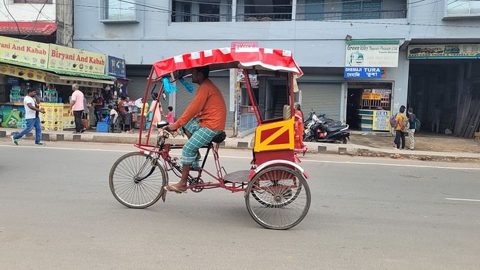
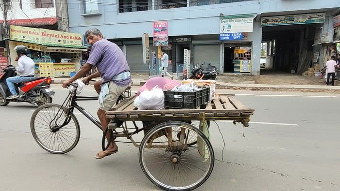
Time passes faster when you’re occupied. We leave at 8:20 AM, and the driver does door-to-door service along the way. We make our first stop for 25 minutes at 9:10 AM, then another for breakfast at 10:10 AM. The scenery is very different from Assam and Nagaland. We drive alongside a pine forest and a large lake. There are beautiful viewpoints, but the driver isn’t stopping for sightseeing, so I have to settle for looking through the car windows.
We finally arrive in Shillong at 11:45 AM. The driver stops in the middle of nowhere, so I have to walk up the street to find a taxi. I flag one down, and he agrees to take me to my new guesthouse, the Rockski Boutique Bed & Breakfast. No sooner do I arrive than a storm with a heavy downpour welcomes me. When I arrived in Guwahati at the end of October, I’d booked a guide with a car for this week. There’s no public transport to get from village to village, so I had to take a car to visit. The tourism manager, Sachin, sent me a message to let me know that the driver, Welbis, will pick me up tomorrow morning at 8 AM. The temperature is much cooler here—only 19°C. At 2:30 PM, the rain stops, and I take the opportunity to explore the city. I start with the cathedral. Today is Good Friday, so I’m going to see how it’s celebrated here. Meghalaya is a Catholic state. The cathedral isn’t far from the guesthouse—it’s huge and all blue.
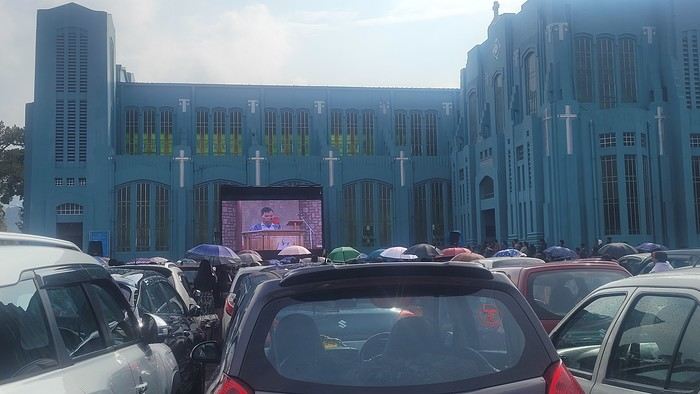
I arrive during mass, and it’s impossible to enter—the faithful are numerous outside in the parking lot. Giant screens broadcast the ceremony.

While waiting, I watch the street come to life. I have fun photographing the different modes of transport passing by.
Time passes faster when you’re occupied. We leave at 8:20 AM, and the driver does door-to-door service along the way. We make our first stop for 25 minutes at 9:10 AM, then another for breakfast at 10:10 AM. The scenery is very different from Assam and Nagaland. We drive alongside a pine forest and a large lake. There are beautiful viewpoints, but the driver isn’t stopping for sightseeing, so I have to settle for looking through the car windows.
We finally arrive in Shillong at 11:45 AM. The driver stops in the middle of nowhere, so I have to walk up the street to find a taxi. I flag one down, and he agrees to take me to my new guesthouse, the Rockski Boutique Bed & Breakfast. No sooner do I arrive than a storm with a heavy downpour welcomes me. When I arrived in Guwahati at the end of October, I’d booked a guide with a car for this week. There’s no public transport to get from village to village, so I had to take a car to visit. The tourism manager, Sachin, sent me a message to let me know that the driver, Welbis, will pick me up tomorrow morning at 8 AM. The temperature is much cooler here—only 19°C. At 2:30 PM, the rain stops, and I take the opportunity to explore the city. I start with the cathedral. Today is Good Friday, so I’m going to see how it’s celebrated here. Meghalaya is a Catholic state. The cathedral isn’t far from the guesthouse—it’s huge and all blue.
I arrive during mass, and it’s impossible to enter—the faithful are numerous outside in the parking lot. Giant screens broadcast the ceremony.
USA 2022 Road Trip
During our first road trip across the United States, we covered 23,000 km and crossed 28 states in 53 days.
Originally, we had planned to drive Route 66 all the way to Oatman in Arizona and visit various national parks in the American West over a two-month period.
This itinerary was planned before our departure, and all the relevant information had been gathered to stick to the schedule.
Everything went so smoothly that we finished visiting the national parks well ahead of our planned return date.
It helped that having a bed, a portable toilet, and a cooler in our vehicle gave us some autonomy since we didn’t have to worry about accommodation.
So, we decided to extend our road trip to the cities of Nashville and Memphis in Tennessee.
We then headed to Louisiana to visit Baton Rouge and New Orleans.
We crossed Mississippi and Alabama before driving along Florida’s west coast all the way to Key West.
We returned via Florida’s east coast and then crossed the eastern U.S. states to get back to Quebec through the Jackman border crossing in Maine.
So, I invite you to keep reading this long recap, which will let you discover the different attractions we visited throughout this amazing journey.
Videos are included throughout the recap. Click on the image to start the video.
To jump to a specific post, here are the relevant links:
Route 66 - Illinois & Missouri Route 66 - St. Louis (Missouri) - Gateway Arch National Park Route 66 - Cuba (Missouri) - City Murals Route 66 - Springfield (Missouri) - Fantastic Caverns Route 66 - Kansas & Oklahoma Route 66 - Texas & Arizona Route 66 - Texas - The Stations of the Cross in Groom Route 66 - Texas - Panhandle - VW Slug Bug Ranch Texas - Palo Duro Canyon State Park - Juniper Trails Texas - Palo Duro Canyon State Park - The Lighthouse Trail Route 66 - Texas - Amarillo - Cadillac Ranch Route 66 - New Mexico - Santa Rosa Blue Hole New Mexico - Bandelier National Monument - Alcove House Trail via Main Loop Trail New Mexico - Bandelier National Monument - Tsankawi Ruins Trail New Mexico - White Rock Overlook Route 66 - New Mexico - Albuquerque - Old Town New Mexico - White Sands National Park New Mexico - White Sands National Park - Dune Life Nature Trail New Mexico - White Sands National Park - Playa Trail New Mexico - White Sands National Park - Interdune Boardwalk New Mexico - Gila Cliff Dwellings National Monument New Mexico - Grants - Ice Cave & Bandera Volcano New Mexico - Gallup - Pyramide Rock Trail & Church Rock Trail Arizona - Holbrook - Painted Desert Arizona - Petrified Forest National Park - Puerco Pueblo & Newspaper Rock Viewpoint Arizona - Petrified Forest National Park - Blue Mesa Arizona - Petrified Forest National Park - The Teepees, Agate Bridge & Jasper Forest Overlook Arizona - Petrified Forest National Park - Crystal Forest Trail Arizona - Petrified Forest National Park - Giant Logs Trail Arizona - Winslow - Two Guns Ghost Town Arizona - Cameron - Little Colorado River Gorge Overlooks Arizona - Grand Canyon National Park - Shoshone Point Trail Arizona - Grand Canyon National Park - Desert View Drive Arizona - Grand Canyon National Park - Rim Route (Orange) & Village Route (Blue) Arizona - Grand Canyon National Park - Hermit Route (Red Line) Route 66 - Arizona - Historic Town of Oatman Arizona - Bullhead City Community Park Nevada - Red Rock Canyon - Calico I & II & Sandstone Quarry Nevada - Red Rock Canyon - Willow Springs Nevada - Red Rock Canyon Lookouts Nevada - Valley of Fire State Park - White Domes Trail Nevada - Valley of Fire State Park - Seven Wonders Trail, Pink Canyon, Fire Wave Nevada - Valley of Fire State Park - Rainbow Vista Trail Nevada - Valley of Fire State Park - Mouse's Tank Trail Nevada - Valley of Fire State Park - Rock Formations Nevada - Valley of Fire State Park - Scenic Routes Nevada - Cathedral Gorge State Park - Slot Canyons Nevada - Cathedral Gorge State Park - Eagle Point & Miller Point Utah - Bryce Canyon National Park - Mossy Cave & Tropic Ditch Waterfall Trail Utah - Bryce Canyon National Park - Scenic Drive Utah - Zion National Park - Pa'rus Trail Utah - Zion National Park - Sand Bench Trail Utah - Zion National Park - Emerald Pools Trail Utah - Zion National Park - West Rim Trail (Trail connecting to Angels Landing) Utah - Zion National Park - Riverside Walk Utah - Zion National Park - Court of The Patriarchs & Big Bend Utah - Zion National Park - Mount Carmel Highway Scenic Drive Utah - Kanab - Jackson Flat Reservoir Utah - Toadstools Trail in Grand Staircase-Escalante National Monument Arizona - Page - Glen Canyon Dam Overlook Arizona - Page - Glen Canyon National Recreation Area Arizona - Page - Horseshoe Bend Overlook Arizona - Page - Upper Antelope Canyon Arizona - Page - Navajo Canyon Boat Tour at Lake Powell Arizona - Page - Antelope Canyon X Arizona - Canyon de Chelly National Monument - Chelly Canyon Arizona - Canyon de Chelly National Monument - Canyon del Muerto Arizona - Monument Valley Navajo Tribal Park Utah - Mexican Hat Utah - Mexican Hat - Goosenecks State Park Utah - Mexican Hat - Valley of the Gods Utah - The Moki Dugway Scenic Backway Utah - Blanding - Natural Bridges National Monument Utah - Lake Powell - Hite Crossing Bridge Utah - Lake Powell - Glen Canyon National Recreation Area - Hite Overlook Utah - Capitol Reef National Park - Chimney Rock Loop Trail Utah - Capitol Reef National Park - Hickman Bridge Trail Utah - Capitol Reef National Park - Grand Wash Trail Utah - Capitol Reef National Park - Sunset Point Trail Utah - Capitol Reef National Park - Goosenecks Trail Utah - Capitol Reef National Park - Viewpoints - Fruita Area Utah - Capitol Reef National Park - Viewpoints - Scenic Drive Utah - Capitol Reef National Park - Cassidy Arch Trail Utah - Capitol Reef National Park - On the way to Capitol Gorge Trailhead Utah - Capitol Reef National Park - Capitol Gorge Trailhead Utah - Monroe - Mystic Hot Springs Utah - Scenic Overlooks on UT-24, UT-119 & I-70 Utah - Arches National Park - Park Avenue Trail Utah - Arches National Park - Courthouse Towers Section's Viewpoints Utah - Arches National Park - Balanced Rock, Pothole Arch, Ham Rock & Garden of Eden Utah - Arches National Park - Double Arch Trail, Cove Arch, Cove of Caves & Panorama Point Utah - Arches National Park - Windows Loop & Turret Arch Trail Utah - Arches National Park - Delicate Arch Trail Utah - Arches National Park - Upper Delicate Arch Viewpoint Trail Utah - Arches National Park - Fiery Furnace Section - Viewpoints Utah - Arches National Park - Sand Dune Arch Trail Utah - Arches National Park - Skyline Arch Trail Utah - Arches National Park - Devils Garden Trail Utah - Dead Horse Point State Park - West Rim Trail Utah - Dead Horse Point State Park - East Rim Trail Utah - Moab - Utah State Route 279 (Potash Road) Utah - Moab - Shafer Trail - Potash Evaporation Ponds Utah - Moab - Potash Road Dinosaur Tracks and Petroglyphs Utah - Moab - Potash Road - Corona, Bowtie & Pinto Arches Trail Utah - Moab - Potash Road - Wall Street Climbing Area Utah - Moab - Kane Springs Road Utah - Moab - Kane Springs Road - Side By Side Adventure Utah - Moab - Kane Springs Road to Moab Utah - Canyonlands National Park - Island in the Sky - Mesa Arch Trail Utah - Canyonlands National Park - Island in the Sky - Aztec Butte Trail Utah - Canyonlands National Park - Island in the Sky - Whale Rock Trail Utah - Canyonlands National Park - Island in the Sky - Upheaval Dome Trail Utah - Canyonlands National Park - Island in the Sky - Grand View Point Overlook Trail Utah - Canyonlands National Park - Island in the Sky - White Rim Overlook Trail Utah - Canyonlands National Park - Island in the Sky - Overlooks Utah - Moab - Wilson Arch Utah - Monticello - Newspaper Rock State Historical Monument Utah - Canyonlands National Park - The Needles - Road Side Ruin Trail Utah - Canyonlands National Park - The Needles - Cave Spring Trail Utah - Canyonlands National Park - The Needles - Pothole Point Trail Utah - Canyonlands National Park - The Needles - Big Spring Canyon Overlook Trail Utah - Canyonlands National Park - The Needles - Overlooks Colorado - Mesa Verde National Park - Mesa Top Ruins Road Colorado - Mesa Verde National Park - Chapin Mesa Road Colorado - Mesa Verde National Park - Mesa Top Loop Colorado - Mesa Verde National Park - Wetherill Mesa Road Colorado - Great Sand Dunes National Park Colorado - Mosca - Zapata Falls Colorado - Colorado Springs - Garden of the Gods Colorado - Black Canyon of the Gunnison National Park Colorado - Gunnison - Curecanti National Recreation Area Colorado - Gunnison - Blue Mesa Dam & Reservoir Colorado - Lake Pueblo State Park (Pueblo Reservoir) Kentucky - Mayfield, 5 months after an EF4 tornado Tennessee - Nashville - Downtown Walking Tour Tennessee - Graceland Mansion - Home of Elvis Presley Tennessee - Graceland - Lisa Marie & Hound Dog II Jets Tennessee - Graceland - Elvis Presley Automobile Museum & Exhibits Tennessee - Exploring Memphis Louisiana - Exploring Baton Rouge Louisiana - Exploring Lafayette Louisiana - Exploring Houma Louisiana - New Orleans - French Quarter Tour Louisiana - New Orleans - Garden District Tour Louisiana - New Orleans - Creole Queen Mississippi River Cruise Florida - Clearwater Beach Florida - Sanibel Island - Bowman's Beach Florida - Siesta Key Beach Florida - Captiva Island - Turner Beach Florida - Key Largo - Sunset Florida - Key West - Smathers Beach Florida - Miami Beach - Art Deco District Florida - Miami Beach South Carolina - Myrtle Beach Virginia - Virginia Beach Maine - Scarborough - Pine Point Beach
Originally, we had planned to drive Route 66 all the way to Oatman in Arizona and visit various national parks in the American West over a two-month period.
This itinerary was planned before our departure, and all the relevant information had been gathered to stick to the schedule.
Everything went so smoothly that we finished visiting the national parks well ahead of our planned return date.
It helped that having a bed, a portable toilet, and a cooler in our vehicle gave us some autonomy since we didn’t have to worry about accommodation.
So, we decided to extend our road trip to the cities of Nashville and Memphis in Tennessee.
We then headed to Louisiana to visit Baton Rouge and New Orleans.
We crossed Mississippi and Alabama before driving along Florida’s west coast all the way to Key West.
We returned via Florida’s east coast and then crossed the eastern U.S. states to get back to Quebec through the Jackman border crossing in Maine.
So, I invite you to keep reading this long recap, which will let you discover the different attractions we visited throughout this amazing journey.
Videos are included throughout the recap. Click on the image to start the video.
To jump to a specific post, here are the relevant links:
Route 66 - Illinois & Missouri Route 66 - St. Louis (Missouri) - Gateway Arch National Park Route 66 - Cuba (Missouri) - City Murals Route 66 - Springfield (Missouri) - Fantastic Caverns Route 66 - Kansas & Oklahoma Route 66 - Texas & Arizona Route 66 - Texas - The Stations of the Cross in Groom Route 66 - Texas - Panhandle - VW Slug Bug Ranch Texas - Palo Duro Canyon State Park - Juniper Trails Texas - Palo Duro Canyon State Park - The Lighthouse Trail Route 66 - Texas - Amarillo - Cadillac Ranch Route 66 - New Mexico - Santa Rosa Blue Hole New Mexico - Bandelier National Monument - Alcove House Trail via Main Loop Trail New Mexico - Bandelier National Monument - Tsankawi Ruins Trail New Mexico - White Rock Overlook Route 66 - New Mexico - Albuquerque - Old Town New Mexico - White Sands National Park New Mexico - White Sands National Park - Dune Life Nature Trail New Mexico - White Sands National Park - Playa Trail New Mexico - White Sands National Park - Interdune Boardwalk New Mexico - Gila Cliff Dwellings National Monument New Mexico - Grants - Ice Cave & Bandera Volcano New Mexico - Gallup - Pyramide Rock Trail & Church Rock Trail Arizona - Holbrook - Painted Desert Arizona - Petrified Forest National Park - Puerco Pueblo & Newspaper Rock Viewpoint Arizona - Petrified Forest National Park - Blue Mesa Arizona - Petrified Forest National Park - The Teepees, Agate Bridge & Jasper Forest Overlook Arizona - Petrified Forest National Park - Crystal Forest Trail Arizona - Petrified Forest National Park - Giant Logs Trail Arizona - Winslow - Two Guns Ghost Town Arizona - Cameron - Little Colorado River Gorge Overlooks Arizona - Grand Canyon National Park - Shoshone Point Trail Arizona - Grand Canyon National Park - Desert View Drive Arizona - Grand Canyon National Park - Rim Route (Orange) & Village Route (Blue) Arizona - Grand Canyon National Park - Hermit Route (Red Line) Route 66 - Arizona - Historic Town of Oatman Arizona - Bullhead City Community Park Nevada - Red Rock Canyon - Calico I & II & Sandstone Quarry Nevada - Red Rock Canyon - Willow Springs Nevada - Red Rock Canyon Lookouts Nevada - Valley of Fire State Park - White Domes Trail Nevada - Valley of Fire State Park - Seven Wonders Trail, Pink Canyon, Fire Wave Nevada - Valley of Fire State Park - Rainbow Vista Trail Nevada - Valley of Fire State Park - Mouse's Tank Trail Nevada - Valley of Fire State Park - Rock Formations Nevada - Valley of Fire State Park - Scenic Routes Nevada - Cathedral Gorge State Park - Slot Canyons Nevada - Cathedral Gorge State Park - Eagle Point & Miller Point Utah - Bryce Canyon National Park - Mossy Cave & Tropic Ditch Waterfall Trail Utah - Bryce Canyon National Park - Scenic Drive Utah - Zion National Park - Pa'rus Trail Utah - Zion National Park - Sand Bench Trail Utah - Zion National Park - Emerald Pools Trail Utah - Zion National Park - West Rim Trail (Trail connecting to Angels Landing) Utah - Zion National Park - Riverside Walk Utah - Zion National Park - Court of The Patriarchs & Big Bend Utah - Zion National Park - Mount Carmel Highway Scenic Drive Utah - Kanab - Jackson Flat Reservoir Utah - Toadstools Trail in Grand Staircase-Escalante National Monument Arizona - Page - Glen Canyon Dam Overlook Arizona - Page - Glen Canyon National Recreation Area Arizona - Page - Horseshoe Bend Overlook Arizona - Page - Upper Antelope Canyon Arizona - Page - Navajo Canyon Boat Tour at Lake Powell Arizona - Page - Antelope Canyon X Arizona - Canyon de Chelly National Monument - Chelly Canyon Arizona - Canyon de Chelly National Monument - Canyon del Muerto Arizona - Monument Valley Navajo Tribal Park Utah - Mexican Hat Utah - Mexican Hat - Goosenecks State Park Utah - Mexican Hat - Valley of the Gods Utah - The Moki Dugway Scenic Backway Utah - Blanding - Natural Bridges National Monument Utah - Lake Powell - Hite Crossing Bridge Utah - Lake Powell - Glen Canyon National Recreation Area - Hite Overlook Utah - Capitol Reef National Park - Chimney Rock Loop Trail Utah - Capitol Reef National Park - Hickman Bridge Trail Utah - Capitol Reef National Park - Grand Wash Trail Utah - Capitol Reef National Park - Sunset Point Trail Utah - Capitol Reef National Park - Goosenecks Trail Utah - Capitol Reef National Park - Viewpoints - Fruita Area Utah - Capitol Reef National Park - Viewpoints - Scenic Drive Utah - Capitol Reef National Park - Cassidy Arch Trail Utah - Capitol Reef National Park - On the way to Capitol Gorge Trailhead Utah - Capitol Reef National Park - Capitol Gorge Trailhead Utah - Monroe - Mystic Hot Springs Utah - Scenic Overlooks on UT-24, UT-119 & I-70 Utah - Arches National Park - Park Avenue Trail Utah - Arches National Park - Courthouse Towers Section's Viewpoints Utah - Arches National Park - Balanced Rock, Pothole Arch, Ham Rock & Garden of Eden Utah - Arches National Park - Double Arch Trail, Cove Arch, Cove of Caves & Panorama Point Utah - Arches National Park - Windows Loop & Turret Arch Trail Utah - Arches National Park - Delicate Arch Trail Utah - Arches National Park - Upper Delicate Arch Viewpoint Trail Utah - Arches National Park - Fiery Furnace Section - Viewpoints Utah - Arches National Park - Sand Dune Arch Trail Utah - Arches National Park - Skyline Arch Trail Utah - Arches National Park - Devils Garden Trail Utah - Dead Horse Point State Park - West Rim Trail Utah - Dead Horse Point State Park - East Rim Trail Utah - Moab - Utah State Route 279 (Potash Road) Utah - Moab - Shafer Trail - Potash Evaporation Ponds Utah - Moab - Potash Road Dinosaur Tracks and Petroglyphs Utah - Moab - Potash Road - Corona, Bowtie & Pinto Arches Trail Utah - Moab - Potash Road - Wall Street Climbing Area Utah - Moab - Kane Springs Road Utah - Moab - Kane Springs Road - Side By Side Adventure Utah - Moab - Kane Springs Road to Moab Utah - Canyonlands National Park - Island in the Sky - Mesa Arch Trail Utah - Canyonlands National Park - Island in the Sky - Aztec Butte Trail Utah - Canyonlands National Park - Island in the Sky - Whale Rock Trail Utah - Canyonlands National Park - Island in the Sky - Upheaval Dome Trail Utah - Canyonlands National Park - Island in the Sky - Grand View Point Overlook Trail Utah - Canyonlands National Park - Island in the Sky - White Rim Overlook Trail Utah - Canyonlands National Park - Island in the Sky - Overlooks Utah - Moab - Wilson Arch Utah - Monticello - Newspaper Rock State Historical Monument Utah - Canyonlands National Park - The Needles - Road Side Ruin Trail Utah - Canyonlands National Park - The Needles - Cave Spring Trail Utah - Canyonlands National Park - The Needles - Pothole Point Trail Utah - Canyonlands National Park - The Needles - Big Spring Canyon Overlook Trail Utah - Canyonlands National Park - The Needles - Overlooks Colorado - Mesa Verde National Park - Mesa Top Ruins Road Colorado - Mesa Verde National Park - Chapin Mesa Road Colorado - Mesa Verde National Park - Mesa Top Loop Colorado - Mesa Verde National Park - Wetherill Mesa Road Colorado - Great Sand Dunes National Park Colorado - Mosca - Zapata Falls Colorado - Colorado Springs - Garden of the Gods Colorado - Black Canyon of the Gunnison National Park Colorado - Gunnison - Curecanti National Recreation Area Colorado - Gunnison - Blue Mesa Dam & Reservoir Colorado - Lake Pueblo State Park (Pueblo Reservoir) Kentucky - Mayfield, 5 months after an EF4 tornado Tennessee - Nashville - Downtown Walking Tour Tennessee - Graceland Mansion - Home of Elvis Presley Tennessee - Graceland - Lisa Marie & Hound Dog II Jets Tennessee - Graceland - Elvis Presley Automobile Museum & Exhibits Tennessee - Exploring Memphis Louisiana - Exploring Baton Rouge Louisiana - Exploring Lafayette Louisiana - Exploring Houma Louisiana - New Orleans - French Quarter Tour Louisiana - New Orleans - Garden District Tour Louisiana - New Orleans - Creole Queen Mississippi River Cruise Florida - Clearwater Beach Florida - Sanibel Island - Bowman's Beach Florida - Siesta Key Beach Florida - Captiva Island - Turner Beach Florida - Key Largo - Sunset Florida - Key West - Smathers Beach Florida - Miami Beach - Art Deco District Florida - Miami Beach South Carolina - Myrtle Beach Virginia - Virginia Beach Maine - Scarborough - Pine Point Beach
Newfoundland - Hikes in the Central Region of the Island
A land of adventure, the central region of Newfoundland is a vast area of dense forests and rugged coastlines.
To the north, between April and June, icebergs from Greenland drift along the famous "Iceberg Alley."
Inland, forests, lakes, and rivers dominate—once precious resources for Indigenous peoples and European settlers.
To the east lies Terra-Nova National Park and its typical habitat, made up of islands, ponds, bogs, and forests.
Finally, the southern coast, dotted with spectacular fjords, is home to several isolated fishing villages as well as the Miawpukek First Nation of Conne River, the province’s only recognized reserve.
Source: https://www.exploretnl.ca/region-centre
Below is a list of the hikes we did in this region. Each hike has a link attached so you can quickly access more information about it.
Videos are embedded throughout the summary. Click on the image to start the video.
King's Point - Alexander Murray Trail Grand Falls-Windsor - Thunder Brook Falls Trail King's Point - Rattling Brook Falls Trail Harbour Breton - Gun Hill Lookout Trail Harbour Breton - Deadman's Cove Trail Harbour Breton - Rocky Point Lighthouse Trail Harbour Breton Community Dildo Run Provincial Park - Black Head Trail Twillingate - Lower Little Harbour Trail Twillingate - Rockcut Twillingate Trails Twillingate - Lower Head Loop Trail Twillingate - Cuckhold's Point Trail Twillingate - Top of Twillingate Trail Terra-Nova National Park - Mill Cove Lookout Trail Eastport - Sandy Cove Lookout Trail
To the north, between April and June, icebergs from Greenland drift along the famous "Iceberg Alley."
Inland, forests, lakes, and rivers dominate—once precious resources for Indigenous peoples and European settlers.
To the east lies Terra-Nova National Park and its typical habitat, made up of islands, ponds, bogs, and forests.
Finally, the southern coast, dotted with spectacular fjords, is home to several isolated fishing villages as well as the Miawpukek First Nation of Conne River, the province’s only recognized reserve.
Source: https://www.exploretnl.ca/region-centre
Below is a list of the hikes we did in this region. Each hike has a link attached so you can quickly access more information about it.
Videos are embedded throughout the summary. Click on the image to start the video.
King's Point - Alexander Murray Trail Grand Falls-Windsor - Thunder Brook Falls Trail King's Point - Rattling Brook Falls Trail Harbour Breton - Gun Hill Lookout Trail Harbour Breton - Deadman's Cove Trail Harbour Breton - Rocky Point Lighthouse Trail Harbour Breton Community Dildo Run Provincial Park - Black Head Trail Twillingate - Lower Little Harbour Trail Twillingate - Rockcut Twillingate Trails Twillingate - Lower Head Loop Trail Twillingate - Cuckhold's Point Trail Twillingate - Top of Twillingate Trail Terra-Nova National Park - Mill Cove Lookout Trail Eastport - Sandy Cove Lookout Trail
Newfoundland: Hikes in Gros Morne National Park
INTRODUCTION
Creating a masterpiece like Gros Morne National Park wasn’t done overnight. So, when you first discover this extraordinary place, it’s easy to understand why Mother Nature took over 485 million years to bring it to life.
Here, glacial valleys, forests, rugged coastline, beaches, and peat bogs follow one another and intertwine to form a unique ecosystem, one that’s rare in the world. After all, this is where geologists found tangible evidence of the theory of continental drift, and it’s one of the few places on Earth where you can see—and even walk on—the Earth’s mantle. This site is a true celebration of the raw, enigmatic power and beauty of the physical world.
Designated a national park in 1973 and later a UNESCO World Heritage Site in 1987, it’s an 1,805 km² playground just waiting for the adventurer in you. Whether you’re traveling solo, with family, or with friends, for a few days or several weeks, you won’t run out of things to do here.
Source: https://www.exploretnl.ca/parc-national-gros-morne
The hikes we did in this region are listed below. Each hike has a link so you can quickly access more information about it.
Videos are embedded throughout the summary. Click on the image to start the video.
Stanleyville Trail Trout River Pond Trail Trout River Pond Trail (Return) Green Gardens Trail Tablelands Trail Scenic Route 431 Lookout Hills Trail Southeast Brook Falls Trail Gros Morne Mountain Trail (James Callaghan Trail) Berry Hill Trail Baker's Brook Falls Trail Berry Hill Pond Trail Western Brook Pond Trail Boat Tour on Western Brook Pond Steve’s Trail Shallow Bay Beach
Creating a masterpiece like Gros Morne National Park wasn’t done overnight. So, when you first discover this extraordinary place, it’s easy to understand why Mother Nature took over 485 million years to bring it to life.
Here, glacial valleys, forests, rugged coastline, beaches, and peat bogs follow one another and intertwine to form a unique ecosystem, one that’s rare in the world. After all, this is where geologists found tangible evidence of the theory of continental drift, and it’s one of the few places on Earth where you can see—and even walk on—the Earth’s mantle. This site is a true celebration of the raw, enigmatic power and beauty of the physical world.
Designated a national park in 1973 and later a UNESCO World Heritage Site in 1987, it’s an 1,805 km² playground just waiting for the adventurer in you. Whether you’re traveling solo, with family, or with friends, for a few days or several weeks, you won’t run out of things to do here.
Source: https://www.exploretnl.ca/parc-national-gros-morne
The hikes we did in this region are listed below. Each hike has a link so you can quickly access more information about it.
Videos are embedded throughout the summary. Click on the image to start the video.
Stanleyville Trail Trout River Pond Trail Trout River Pond Trail (Return) Green Gardens Trail Tablelands Trail Scenic Route 431 Lookout Hills Trail Southeast Brook Falls Trail Gros Morne Mountain Trail (James Callaghan Trail) Berry Hill Trail Baker's Brook Falls Trail Berry Hill Pond Trail Western Brook Pond Trail Boat Tour on Western Brook Pond Steve’s Trail Shallow Bay Beach
Newfoundland - Hikes in the Western Part of the Island
INTRODUCTION
Trip taken in 2021, but still relevant for exploring the island of Newfoundland.
We went on multiple hikes in this Canadian province, which offers a unique and breathtaking landscape.
GPS coordinates: 46.20884, -60.24498 Marine Atlantic Ferry
To do this, we traveled to North Sydney, Nova Scotia, to board a Marine Atlantic ferry that took us to Port aux Basques in Newfoundland. The crossing takes about 7 hours.
The ferry *Highlanders* features spacious cabins for two or four people, a restaurant, a retail store, and a play area for kids.
The reclining seats are comfortable and include a headphone jack and a USB charging port.
We went out on the open-air panoramic observation deck several times to admire the Atlantic Ocean, hoping to spot some marine wildlife. Unfortunately, we didn’t see any.
This short video gives you an overview of the facilities. For more details, I invite you to check out Marine Atlantic’s website at the following address: https://www.marineatlantique.ca/.
https://youtu.be/oV9_7AcJnEQ
Trip taken in 2021, but still relevant for exploring the island of Newfoundland.
We went on multiple hikes in this Canadian province, which offers a unique and breathtaking landscape.
GPS coordinates: 46.20884, -60.24498 Marine Atlantic Ferry
To do this, we traveled to North Sydney, Nova Scotia, to board a Marine Atlantic ferry that took us to Port aux Basques in Newfoundland. The crossing takes about 7 hours.
The ferry *Highlanders* features spacious cabins for two or four people, a restaurant, a retail store, and a play area for kids.
The reclining seats are comfortable and include a headphone jack and a USB charging port.
We went out on the open-air panoramic observation deck several times to admire the Atlantic Ocean, hoping to spot some marine wildlife. Unfortunately, we didn’t see any.
This short video gives you an overview of the facilities. For more details, I invite you to check out Marine Atlantic’s website at the following address: https://www.marineatlantique.ca/.
https://youtu.be/oV9_7AcJnEQ
Southwest Part 2: 55 Days in Colorado, New Mexico, Arizona, Nevada, and Utah
This travel journal is the second part of the trip whose first part you can find here: 1st part...
Sunday, August 7: the day we discover a magical place... Edmaier's Secret...
We got up at 8:00 AM, had breakfast on the terrace of our tiny house, and then set off again toward yesterday’s trail. This time, we stopped after 4.5 miles on House Rock Valley Road at the Buckskin Gulch Trail parking lot. We weren’t interested in that trail today—the slot canyon is muddy anyway after the recent storms...
Instead, we explored a lesser-known area that became our playground. And what a playground it was, folks—an out-of-this-world spot, THE highlight of our trip!!! 😏
Just imagine being in the middle of these landscapes, and the cherry on top... no one else around!!!!! Well, we did meet a couple who were coming back—it was 9:30 AM 😮. Did they camp there? Did they turn back? 🙁
After paying the entry permit online, we set off with plenty of water (6L for the four of us) plus a gallon we hid along the way for the return trip. 😉 After a one-hour approach hike along a wash, we reached the sea of sand.
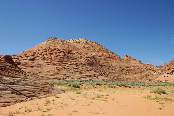
We had to cross it to reach our goal: a strip about 2 km long and 1 km wide that you can explore freely since there’s no marked trail... We entered a few GPS points into our Garmin Etrex, and off we went!!! 😎 It was... magical, enchanting, a true love-at-first-sight moment!
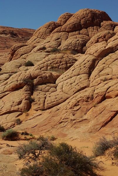
Brain Rock, waves, fine and brittle rock, colors—it goes up, it goes down.
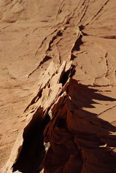
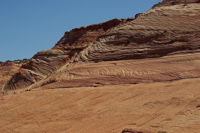
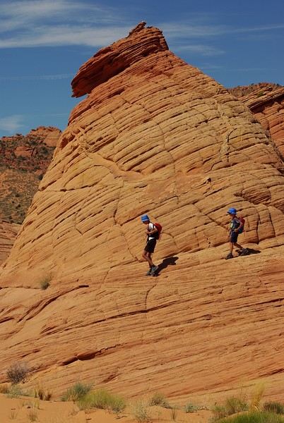
Just thinking about it gives me chills... I remember sitting still for two minutes, taking in these wonders with such emotion that I teared up...
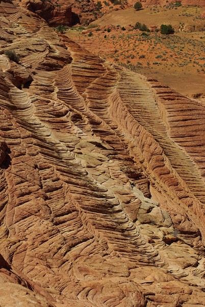
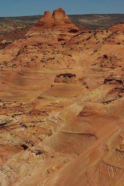
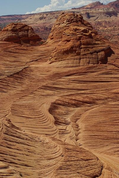
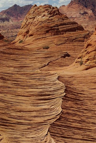
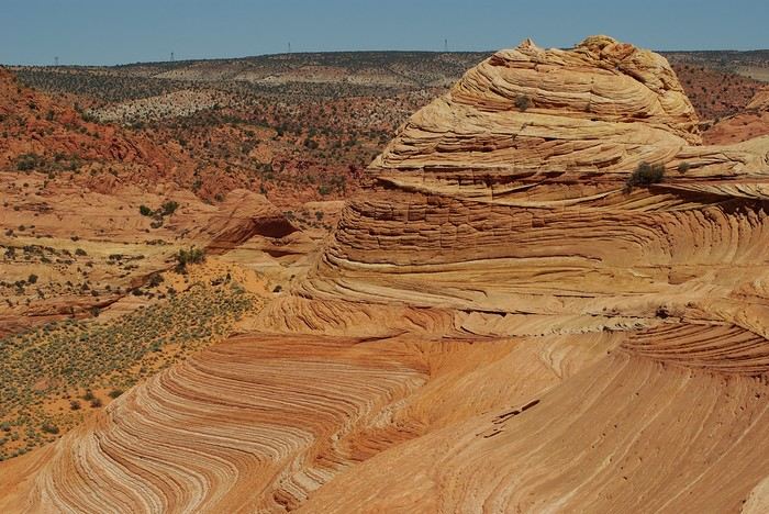
Sunday, August 7: the day we discover a magical place... Edmaier's Secret...
We got up at 8:00 AM, had breakfast on the terrace of our tiny house, and then set off again toward yesterday’s trail. This time, we stopped after 4.5 miles on House Rock Valley Road at the Buckskin Gulch Trail parking lot. We weren’t interested in that trail today—the slot canyon is muddy anyway after the recent storms...
Instead, we explored a lesser-known area that became our playground. And what a playground it was, folks—an out-of-this-world spot, THE highlight of our trip!!! 😏
Just imagine being in the middle of these landscapes, and the cherry on top... no one else around!!!!! Well, we did meet a couple who were coming back—it was 9:30 AM 😮. Did they camp there? Did they turn back? 🙁
After paying the entry permit online, we set off with plenty of water (6L for the four of us) plus a gallon we hid along the way for the return trip. 😉 After a one-hour approach hike along a wash, we reached the sea of sand.
We had to cross it to reach our goal: a strip about 2 km long and 1 km wide that you can explore freely since there’s no marked trail... We entered a few GPS points into our Garmin Etrex, and off we went!!! 😎 It was... magical, enchanting, a true love-at-first-sight moment!
Brain Rock, waves, fine and brittle rock, colors—it goes up, it goes down.
Just thinking about it gives me chills... I remember sitting still for two minutes, taking in these wonders with such emotion that I teared up...
21-Day Trip to La Gomera and La Palma
Travel Journal: 21 Days in La Gomera and La Palma
From February 6 to February 26, 2024
Tuesday, February 6 We left around 9 AM with our car, along with Pierre-Paul and Patricia, heading to the Bluepark parking lot in Bartenheim. As expected, we were awaited and left promptly for EuroAirport Basel. Took off at 12:25 PM for a 4-hour-15-minute flight under excellent conditions. Beautiful arrival in Tenerife with Teide in sight under a clear blue sky. Fifteen minutes later, we waited for bus No. 40 to Los Cristianos with quite a few other tourists, but we managed to find four seats. From the bus station, it was a 20-minute walk to our hotel. We checked into a lovely apartment for the four of us, complete with all the comforts. Outside, it was quite warm—at least 25°C! After dropping off our luggage, we went for a stroll. The immediate surroundings of the hotel held no interest for us: a modern, concrete area filled with hotels, bars, tourist agencies, and unappealing restaurants all offering the same bland international cuisine. Pat went to cool off at the pool, unfortunately overrun by loud, drunk English tourists. I took a walk to the paseo maritimo that leads to the port, skirting the seafront. The promenade was pleasant, but it could have been any seaside resort in the world—same old scene: a succession of bars with blaring music where many elderly people sipped cold beers waiting for the sunset, the backdrop a wall of resort-style hotels resembling rabbit hutches! Upon reaching the port, I scouted the route we’d take the next day to the Fred Olsen ferry. Back at the apartment, in the early evening, we looked for a non-touristy restaurant for dinner. Monique stopped a woman to ask her opinion! In this area, she told us, there’s no restaurant that serves Canarian or Spanish cuisine! The only place with decent restaurants is at the port. Off we went to the port, where we sat down at Al Bordo restaurant and ordered a seafood paella for four. Excellent, and at a very reasonable price (36 € for two). We returned to the hotel along the seafront.
Wednesday, February 7
Woke up at 6 AM. Had breakfast in the apartment with what we’d bought the day before at a supermarket. It was still dark when we left on foot toward the port, walking along the calm seafront at this early hour. Forty minutes later, we arrived and waited 10 minutes before the ferry docked. At 9:30 AM, we left the port of Los Cristianos for a 50-minute crossing on a calm sea under a beautiful blue sky. There were quite a few people on this large ferry, but many had no luggage, meaning they were visiting La Gomera for the day and would take the ferry back in the evening. Upon disembarking, we went straight to our rental car agency to pick up the car we’d booked online a few months earlier. It was a nice Peugeot 2008, spacious enough for the four of us and our luggage. We immediately took the beautiful road from San Sebastián that climbs directly into the mountains toward our rental in Vallehermoso. The road was in perfect condition—it seemed brand new, like all the others we’d take on this island later. This side of the island is very arid with little vegetation, and the terrain is particularly rugged, as it is throughout the island. We stopped at our first miradors, which would be followed by many more throughout our Canarian trip. Our first visit was to the small village of Agulo, perched on a promontory above the sea and at the foot of a high cliff. The village features typical Canarian houses with windows flush with the façade and black volcanic stone masonry on white or reddish-brown walls. The first recommended restaurant was already booked for a group, so we settled for the shaded terrace of the excellent El Alameda bar-restaurant. From Agulo, you can access the Abrante viewpoint via a winding road, where the view of Agulo, 600 meters below, is exceptional. A glass ledge over the void lets you test your fear of heights!
We drove to Vallehermoso to do our grocery shopping at the supermarket—a habit that would continue until the end of the trip. Our little house, "Casa rural El Encatadora," is located in a beautiful flower-filled valley a few kilometers west of Vallehermoso. Each of us had a bedroom with an en-suite bathroom, plus a living room, kitchen, and a small terrace overlooking the quiet street at the valley’s end, which didn’t bother us at all.
Thursday, February 8 The good weather seemed to follow us since our arrival in the Canary Islands. This morning, we took the road—still as beautiful and new—toward Arure, high up to the west. The landscape was magnificent, with breathtaking glimpses of the sea far below. In Arure, we parked in front of Conchita’s bar, where a hike (Rother No. 30) starts toward two viewpoints: Alojera, which we reached after 45 minutes on a lovely path. Monique, tired from the first steep climb, stopped at the first viewpoint and hitchhiked back to Arure. Meanwhile, we continued toward the second viewpoint, Los Barranquillos, where the view of the surroundings was partially hidden by misty clouds rising from the sea. The entire mountain is sculpted by ancient, endless terraces climbing until the slope becomes too steep for construction—visible traces of the hard work of past inhabitants trying to survive in a harsh environment. We had a decent lunch at La Conchita bar, then drove to the small seaside town of Puerto la Caleta, sheltered by an immense cliff plunging into the sea. Black sand beach, rough sea—despite our encouragement, Pat didn’t dare to swim! As for the old village of Caleta, it’s perched on the mountainside, and visiting it requires climbing steep, stair-filled alleys to discover a few traditional houses. Back at the casa, dinner in, and card games...
 Vallehermoso
Friday, February 9 This morning, the sky was overcast, and the peaks around us were shrouded in clouds. We took the same road as yesterday to hike Las Creces. Quickly gaining altitude, we entered a thick fog—visibility was very limited. We stopped at the Las Creces parking lot; visibility improved, and the sun wasn’t far off. The hike is entirely within a beautiful laurel forest, with the sun playing hide-and-seek, but it wasn’t cold despite the altitude. After finishing the loop trail, we decided to picnic—not there, as it was too chilly—but on Vallehermoso’s beach, where we found a nice picnic area sheltered by large black rocks. A short digestive walk on the surrounding hill to admire the little beach from above. Back in Vallehermoso, we did some grocery shopping, then tried to return to the casa—only to find ourselves locked out because we’d left the key in the lock inside! After several attempts and with the help of Yéli, a relative of the owner we called for help, we were finally able to get back in!
Saturday, February 10
It rained last night, and the sky remained overcast. Monique decided to rest this morning. PP, Pat, and I set off on the hike that starts from the house toward the Marichal reservoir. The sun wasn’t far off, and by 11 AM, it was fully out. The pleasant hike passed by many flower-filled gardens and orchards—orange, lemon, and mandarin trees in fruit. The path climbed gently toward the reservoir, where the view of the Cano rock dominating the landscape was magnificent. The last part of the climb was a bit tough, overgrown with lush vegetation, and the trail was slippery from last night’s rain. We descended via a different, much more pleasant path and returned to the casa just in time for lunch, prepared by Monique. This valley is rich with its many farmers and market gardeners who’ve cultivated the entire valley, taking advantage of the water flowing down from the mountain, captured upstream and redistributed through countless pipes snaking along the paths. Numerous tanks also store water during dry periods. The houses are scattered across both sides of the valley, and these colorful little homes add a beautiful touch to the landscape. The many palm trees give this valley a distinctly tropical feel—you could almost imagine yourself in the Caribbean. Add to that some salsa music drifting from a hut where farmers were working, and the picture is complete. A well-chilled beer apéro capped off a lovely morning. The afternoon was dedicated to rest, relaxation, reading, and games.
Sunday, February 11 The blue sky returned, though a few clouds still capped the highest peaks. Today, we visited Garajonay National Park, which covers the highest central mountains. Up there, we were above the clouds, and the panoramas from the various viewpoints were stunning: first, Cherelepin, accessible from the Laguna Grande parking lot, then Alto de Garajonay, offering an exceptional view of Teide—over 3,000 meters high—emerging from the clouds on Tenerife, far in the distance. We continued to the Los Roques viewpoints, then stopped for lunch at the Degollada de Peraza restaurant, where the view of the barranco was impressive. We descended toward San Sebastián and checked into our new lodging, La Cabezada, located in the countryside about 3 km above San Sebastián. It’s a small apartment adjacent to the owner’s, with a lovely terrace overlooking the surrounding mountains and surrounded by a beautiful garden. Apéro, then dinner on our beautiful terrace.
Monday, February 12 This morning, we went down to visit San Sebastián de La Gomera: its old tower, main street with some beautiful traditional houses, and the Church of the Assumption. Back at the casa for lunch. In the afternoon, Pat, PP, and I set off on the short hike from San Sebastián beach to La Guancha beach. We drove down and parked on the beach. The path climbs along the hill overlooking San Sebastián, passes by the tall Christ statue dominating the landscape, and roughly follows the coast down to the isolated Guancha beach. A beautiful hike under a hot sun, and a swim was welcome, even if the beach and sea access weren’t very comfortable due to large pebbles and quickly deepening water. Apart from two nudist bathers, there was no one on this beach. We returned the same way.
Tuesday, February 13 Rest day. We went down to town to stroll and do some shopping. I took the opportunity to visit the parador, beautifully situated above the city in a lovely garden overlooking the port and town. Together, we went for a cuba libre at the "Cuba Libre" bar, then had lunch at Breñusca (mediocre paella!). Back at the casa, then we went back down to town to see a carnival parade, a "passacalles," which actually passed an hour earlier than scheduled. Oh well.
Wednesday, February 14 Each to their own program this morning. Pat went swimming at San Sebastián beach, Monique rested at the casa, and PP and I set off on the hike from Playa de Avalos to the Ermita de Guadalupe on Playa del Cangrejo. It wasn’t easy to find the right road or the parking spot, but we managed. The path seemed to have suffered landslides, according to a sign at the trailhead! We decided to check it out, ready to turn back if it seemed too dangerous. In the end, apart from one or two slightly tricky spots where we had to climb a pile of rocks, the trail remained passable, though a bit vertigo-inducing in places. The narrow path clings to very vertical cliffs nearly 300 meters above sea level! But what a magnificent view. At one point, the trail runs alongside a wall of basaltic pipes. We returned via the drivable track that parallels the trail a bit lower. Back at the house for lunch. In the late afternoon, we returned to town to attend the "Entierro de las Sardinas" (Burial of the Sardine), which closes the Canarian carnival festivities. While waiting, we strolled through the parador’s gardens and had mojitos in town. Around 9 PM, we heard the noise and cries of the mourners. The procession advanced, led by a large papier-mâché sardine on a float, surrounded by wailing mourners. The procession headed toward the sea, where the sardine was burned, and a mini fireworks display ended the procession. It was all very good-natured, and everyone had fun. We ended the evening with dinner at a good fish restaurant, El Pajar.
 Entierro de la Sardina in San Sebastián de La Gomera
Thursday, February 15
Woke up at 5:15 AM. The only suitable ferry was at 7 AM, which would get us to La Palma by late morning rather than evening. We packed our bags, had breakfast, then headed to the port, left our rental car, and boarded the ferry to Tenerife, from where we’d continue to La Palma. Calm sea, beautiful sun—by 10:30 AM, we disembarked in La Palma. We picked up our car and immediately headed to our new apartment in Breña Alta. It’s a large apartment with a superb terrace facing the sea, fully equipped and very comfortable. The hosts recommended Casa Goyo restaurant, near the airport and close to us. It’s a restaurant with many small rooms, some of which can be reserved for families. The fish-based cuisine (chipirones, pulpo) was excellent, hearty, and reasonably priced. Since it’s in the airport’s flight path, we occasionally heard planes landing. Quick and efficient service. Afterward, we visited Santa Cruz de La Palma, which reminded us of the historic quarters of La Orotava in Tenerife or the capital of Gran Canaria.
Friday, February 16
Beautiful weather, blue sky. We headed to the San Bartolo viewpoint toward the northeast coast, then to the lovely village of San Andrés, which we explored. From there, we walked along the shore to the natural pools of Charco Azul, where we swam in the cool but "swimmable" sea. Back in San Andrés for lunch at the "San Andrés" restaurant on the beautiful church square. Very good fish-based meal. We got back in the car and continued along the north coast to the port of Espindola and the natural pools of Fajana near the Cumplida lighthouse. A fairly strong wind whipped up beautiful waves crashing onto the rocky coast in bursts of foam. Back in Santa Cruz, we stopped at the Mercadona supermarket to buy fresh shrimp for dinner. San Andrés
Saturday, February 17
Uniform blue sky, even on the heights. We took the beautiful road that winds up to the summit of the Caldera de Taburiente. Several viewpoints offer 360° views of the entire island and beyond: you can make out La Gomera, El Hierro, and, of course, Tenerife with the perfect triangle of Teide. We parked at the Los Andes viewpoint parking lot and started our hike to Pico de la Cruz along a trail following the ridge, offering superb views into the caldera. We got back in the car and passed by the Roque de los Muchachos astronomical complex, composed of numerous observatories, some with very aesthetic mirror telescopes. We hiked from the Roque de los Muchachos parking lot to the various viewpoints, always as impressive. Picnic on site, then back to Santa Cruz. We stopped by our car dealer because the oil warning light came on—better safe than sorry. The representative reassured us but preferred to give us a Fiat Cross SUV instead. The Caldera de Taburiente
Sunday, February 18 The weather was a bit mixed, with cloudy patches. We set off to hike the Barranco de la Cuba de Galga. Unfortunately, the Los Tilos trail had been closed for several months due to a major landslide. The parking lot by the road was already quite full, and indeed, we crossed paths with many hikers along the way—it’s an easy hike with little elevation gain, which is rare here in La Palma! The beautiful path winds through a very narrow, deep gorge covered in lush tropical vegetation—you’d think you were in a Southeast Asian forest, especially with the humidity in the gorge bringing out earthy and floral scents. Halfway through, Monique turned back while the rest of us continued to the Cuba de Galga. A light drizzle accompanied us on the return. For lunch, we went to Chipi Chipi restaurant in the heights of Santa Cruz. The cool air forced us to leave the lovely terrace for the slightly noisy dining room. The meal was very good and hearty. Afternoon spent resting at our house.
 La Cuba de la Galga
Monday, February 19 A few clouds still clung to the nearby mountain peaks. We headed south to Los Canarios. We stopped in front of the small San Antonio Abad church, where a path leads to the viewpoint in 15 minutes. Then we visited the San Antonio Volcano Interpretation Center and climbed to the viewpoint via the trail along the crater’s edge, offering a plunging view into the crater. Then PP, Pat, and I headed toward the Teneguía volcano but turned back given the remaining distance and the intense heat bearing down on us! Plus, the landscape was rather arid and not very interesting. We got back in the car and drove down to the salt flats at the island’s southern tip. The ocean crashes here in large waves, exploding against the volcanic rocks and feeding a "blowhole" carved into the rock. We stopped for drinks at the salt flats restaurant, then headed home. The salt flats in Fuencaliente
Tuesday, February 20 Beautiful weather with a few clouds clinging to the mountains, as usual. A relaxed morning since my parking reservation at La Cumbrecita didn’t start until 1 PM. It takes about 30 minutes from Santa Cruz to reach the valley floor via a beautiful but narrow road toward the end, though there’s very little traffic. Meanwhile, the clouds had disappeared, and the view from the La Cumbrecita viewpoint was superb. We recognized Pico de la Cruz in the distance, where we’d been a few days earlier. We then took the path leading to the Las Chozas viewpoint through a magnificent Canarian pine forest. We picnicked on site, then took the path to the Los Roques viewpoint. We returned the same way since the direct route was closed for construction. Back in Santa Cruz, we visited the Sanctuary of Las Nieves, with its beautiful golden Baroque altar. Hike from La Cumbrecita
Wednesday, February 21 After packing our things and loading the car, we left Santa Cruz under a very blue sky for Los Llanos de Aridane, where we stopped to visit this lovely town. The Church of Nuestra Señora de los Remedios has a beautiful coffered ceiling and an original papier-mâché Christ statue from the 16th century. Around it, colorful old Canarian houses brighten the streets of the town center. We took the opportunity to stroll, do some shopping, and finally sat down at La Pergola restaurant for a mediocre lunch. We got back in the car to check into our new house in Arecida. On the way, we stopped at the Mirador del Time, which once again offered an impressive panorama, allowing us—for the first time—to see the damage caused by the Tajogaite volcano eruption in 2021. You can clearly see the still-smoking crater and the large black lava flow covering the landscape down to the sea. We really liked our new accommodation: a local house that’s been renovated on the heights of Arecida, not far from the Canarian pine forest. From several terraces, we have a 360° view of the sea and mountains. We even have a private pool! There are two beautiful, brand-new bedrooms, each with its own bathroom—the best. Plus, we’re on the GR 131 trail that runs along the Barranco de las Angustias toward the northeast.
 Los Llanos de Aridane
Thursday, February 22 Once again, beautiful weather greeted us when we woke up. We started the GR 131 with the goal of reaching the Torre del Time viewpoint—about 400 meters of elevation gain. The path, quite steep at first, winds through a superb Canarian pine forest. A few viewpoints let you appreciate the sheer drop of the Barranco de las Angustias—watch out for vertigo! At the Torre del Time viewpoint, there’s a nearly 1,000-meter vertical drop. We returned via another path, the PLP1, which meanders first through this beautiful forest, then along lovely flower-filled gardens adjacent to beautiful properties that cascade from the forest down to the road serving these neighborhoods. This afternoon, we tried to get closer to the area devastated by the 2021 lava flows. Several roads are still closed or reserved for residents, while others—brand new—have been rebuilt to open up this densely populated and cultivated region. In some places, the lava flow slightly diverted, sparing some properties that logically should have disappeared. Now, they’re encircled by a massive cooled lava field. In other spots, twisted and charred metal scraps or greenhouse remains protrude from the lava—all that’s left of the former banana plantations. A little higher up, you can see the slightly smoking crater of Tajogaite, responsible for this disaster. Back to Casa Barreros.
 View of Los Llanos and, in the background, the 2021 lava flow
Friday, February 23
Though the sky was still blue, the temperature had dropped due to a chilly wind. By midday, it still rose to 22°C. Today, we headed north, specifically to the town of Tijarafe, where a very narrow road descends to the small port, Porís de Candelaria. The 3.7-kilometer road drops 700 meters in elevation, with gradients up to 30%—it was going to be intense! Indeed, the descent was scary, with the void right next to the very narrow road where passing was impossible except at a few rare spots. Everything went well—there was little traffic at this early hour. From the parking lot at the bottom, a path leads to Porís de Candelaria. It’s surprising to see this small fishing hamlet nestled in the shelter of an immense cave opening onto the sea, which was quite rough today. The sun, at this time of year, would appear late in the cave, which remained in shadow for much of the day. We returned via the same road, strolled through the small town of Puntagorda, and had lunch at El Jardín de los Naranjos restaurant—excellent meal. Fishing hamlet of Candelaria
Saturday, February 24 The air was still cool, but the sun was beautiful. While Monique stayed home to rest, the three of us headed to the village of Las Tricias to hike the Buracas Caves trail. We left the car parked on the LP1 road and took the small paved road down to the sign marking the trail’s start. The signage for all the trails we took here, as in La Gomera, was very well done. The path descended steadily, then more steeply toward the caves where the island’s first inhabitants lived—some petroglyphs are still visible in certain caves. The path then climbed back up, passing magnificent dragon trees and more or less elaborate huts occupied by Germans who’ve lived here for many years. Back at Casa Barreros for some rest.
Sunday, February 25 The weather once again blessed us with a beautiful day. This morning, we visited the local produce market held on weekends in Puntagorda. You’ll find agricultural products, crafts, and food to keep you going. A little further on, there’s a glass viewpoint overlooking the barranco plunging toward the sea, with a view of the thrill-seekers trying the zip line right next to it. Lunch at Naranjos—definitely a good spot—with their shrimp and spice tagliatelle. Back home for an afternoon of relaxation.
Monday, February 26 We left Arecida under a cloudy sky. Driving up from Los Llanos de Aridane toward the east, an enormous cascade of clouds poured from the mountain peaks into the Los Llanos plain—very impressive. Arriving in Santa Cruz, we went for a stroll, did some last-minute shopping, then had a final good-quality paella at La Chalana on the paseo maritimo. We left the car in the parking lot and took the 5 PM Olsen ferry to Tenerife on a slightly choppy sea, but the ferry didn’t rock too much. Arriving at 7:15 PM, we dropped off our things near the port in our reserved apartment and went for dinner at Abordo—rubbery chipirones. A digestive stroll among the ever-increasing number of tourists in Los Cristianos—restaurants were packed to the brim, the season is in full swing here. Gone is the calm of La Gomera and La Palma, and the laid-back tourism of German hikers among whom a few French were hiding!
Tuesday, February 27 To make our homemade breakfast more enjoyable, we went to buy pastries at the local bakery, then took one last walk on the paseo along the beaches, mingling with the many mobility scooters driven by elderly or disabled people, joggers, and tourists. Last apéro near the bus station, then off to the airport. After a smooth 4-hour-30-minute flight, we arrived in Basel-Mulhouse at 10:20 PM.
THE END
Conclusion A fantastic trip to two islands with magnificent and diverse nature, where landscapes range from desert-like to tropical depending on exposure to winds and clouds. Thanks to the many beautiful viewpoints, you can truly appreciate these exceptionally dynamic reliefs. A hiker’s paradise, the trails are all very well marked, though the choice of easy or moderate paths for "casual walkers" is quite limited. Another notable advantage, in our opinion, is that these islands are very lightly developed—you’ll hardly see any of those ugly hotel blocks that spoil the landscapes of some other Canary Islands. It’s true that the beaches on these two islands don’t meet traditional international tourism criteria: they’re small, with black sand, and often difficult to access. Special mention for the quality of the road network (except for a few small local roads), which seems brand new, well-paved, and well-signposted. We also enjoyed exceptional weather for February, with fewer than three days of gray or rainy weather out of 21.
Almost all the accommodations we chose met or exceeded our expectations, often at reasonable prices: an average of 98 € per night for an apartment or house with two bedrooms for four people.
All photos can be viewed by clicking this link: https://photos.app.goo.gl/G44pPk4g9PW1rNzg8
Tuesday, February 6 We left around 9 AM with our car, along with Pierre-Paul and Patricia, heading to the Bluepark parking lot in Bartenheim. As expected, we were awaited and left promptly for EuroAirport Basel. Took off at 12:25 PM for a 4-hour-15-minute flight under excellent conditions. Beautiful arrival in Tenerife with Teide in sight under a clear blue sky. Fifteen minutes later, we waited for bus No. 40 to Los Cristianos with quite a few other tourists, but we managed to find four seats. From the bus station, it was a 20-minute walk to our hotel. We checked into a lovely apartment for the four of us, complete with all the comforts. Outside, it was quite warm—at least 25°C! After dropping off our luggage, we went for a stroll. The immediate surroundings of the hotel held no interest for us: a modern, concrete area filled with hotels, bars, tourist agencies, and unappealing restaurants all offering the same bland international cuisine. Pat went to cool off at the pool, unfortunately overrun by loud, drunk English tourists. I took a walk to the paseo maritimo that leads to the port, skirting the seafront. The promenade was pleasant, but it could have been any seaside resort in the world—same old scene: a succession of bars with blaring music where many elderly people sipped cold beers waiting for the sunset, the backdrop a wall of resort-style hotels resembling rabbit hutches! Upon reaching the port, I scouted the route we’d take the next day to the Fred Olsen ferry. Back at the apartment, in the early evening, we looked for a non-touristy restaurant for dinner. Monique stopped a woman to ask her opinion! In this area, she told us, there’s no restaurant that serves Canarian or Spanish cuisine! The only place with decent restaurants is at the port. Off we went to the port, where we sat down at Al Bordo restaurant and ordered a seafood paella for four. Excellent, and at a very reasonable price (36 € for two). We returned to the hotel along the seafront.
Wednesday, February 7
Woke up at 6 AM. Had breakfast in the apartment with what we’d bought the day before at a supermarket. It was still dark when we left on foot toward the port, walking along the calm seafront at this early hour. Forty minutes later, we arrived and waited 10 minutes before the ferry docked. At 9:30 AM, we left the port of Los Cristianos for a 50-minute crossing on a calm sea under a beautiful blue sky. There were quite a few people on this large ferry, but many had no luggage, meaning they were visiting La Gomera for the day and would take the ferry back in the evening. Upon disembarking, we went straight to our rental car agency to pick up the car we’d booked online a few months earlier. It was a nice Peugeot 2008, spacious enough for the four of us and our luggage. We immediately took the beautiful road from San Sebastián that climbs directly into the mountains toward our rental in Vallehermoso. The road was in perfect condition—it seemed brand new, like all the others we’d take on this island later. This side of the island is very arid with little vegetation, and the terrain is particularly rugged, as it is throughout the island. We stopped at our first miradors, which would be followed by many more throughout our Canarian trip. Our first visit was to the small village of Agulo, perched on a promontory above the sea and at the foot of a high cliff. The village features typical Canarian houses with windows flush with the façade and black volcanic stone masonry on white or reddish-brown walls. The first recommended restaurant was already booked for a group, so we settled for the shaded terrace of the excellent El Alameda bar-restaurant. From Agulo, you can access the Abrante viewpoint via a winding road, where the view of Agulo, 600 meters below, is exceptional. A glass ledge over the void lets you test your fear of heights!
We drove to Vallehermoso to do our grocery shopping at the supermarket—a habit that would continue until the end of the trip. Our little house, "Casa rural El Encatadora," is located in a beautiful flower-filled valley a few kilometers west of Vallehermoso. Each of us had a bedroom with an en-suite bathroom, plus a living room, kitchen, and a small terrace overlooking the quiet street at the valley’s end, which didn’t bother us at all.
Thursday, February 8 The good weather seemed to follow us since our arrival in the Canary Islands. This morning, we took the road—still as beautiful and new—toward Arure, high up to the west. The landscape was magnificent, with breathtaking glimpses of the sea far below. In Arure, we parked in front of Conchita’s bar, where a hike (Rother No. 30) starts toward two viewpoints: Alojera, which we reached after 45 minutes on a lovely path. Monique, tired from the first steep climb, stopped at the first viewpoint and hitchhiked back to Arure. Meanwhile, we continued toward the second viewpoint, Los Barranquillos, where the view of the surroundings was partially hidden by misty clouds rising from the sea. The entire mountain is sculpted by ancient, endless terraces climbing until the slope becomes too steep for construction—visible traces of the hard work of past inhabitants trying to survive in a harsh environment. We had a decent lunch at La Conchita bar, then drove to the small seaside town of Puerto la Caleta, sheltered by an immense cliff plunging into the sea. Black sand beach, rough sea—despite our encouragement, Pat didn’t dare to swim! As for the old village of Caleta, it’s perched on the mountainside, and visiting it requires climbing steep, stair-filled alleys to discover a few traditional houses. Back at the casa, dinner in, and card games...
VallehermosoFriday, February 9 This morning, the sky was overcast, and the peaks around us were shrouded in clouds. We took the same road as yesterday to hike Las Creces. Quickly gaining altitude, we entered a thick fog—visibility was very limited. We stopped at the Las Creces parking lot; visibility improved, and the sun wasn’t far off. The hike is entirely within a beautiful laurel forest, with the sun playing hide-and-seek, but it wasn’t cold despite the altitude. After finishing the loop trail, we decided to picnic—not there, as it was too chilly—but on Vallehermoso’s beach, where we found a nice picnic area sheltered by large black rocks. A short digestive walk on the surrounding hill to admire the little beach from above. Back in Vallehermoso, we did some grocery shopping, then tried to return to the casa—only to find ourselves locked out because we’d left the key in the lock inside! After several attempts and with the help of Yéli, a relative of the owner we called for help, we were finally able to get back in!
Saturday, February 10
It rained last night, and the sky remained overcast. Monique decided to rest this morning. PP, Pat, and I set off on the hike that starts from the house toward the Marichal reservoir. The sun wasn’t far off, and by 11 AM, it was fully out. The pleasant hike passed by many flower-filled gardens and orchards—orange, lemon, and mandarin trees in fruit. The path climbed gently toward the reservoir, where the view of the Cano rock dominating the landscape was magnificent. The last part of the climb was a bit tough, overgrown with lush vegetation, and the trail was slippery from last night’s rain. We descended via a different, much more pleasant path and returned to the casa just in time for lunch, prepared by Monique. This valley is rich with its many farmers and market gardeners who’ve cultivated the entire valley, taking advantage of the water flowing down from the mountain, captured upstream and redistributed through countless pipes snaking along the paths. Numerous tanks also store water during dry periods. The houses are scattered across both sides of the valley, and these colorful little homes add a beautiful touch to the landscape. The many palm trees give this valley a distinctly tropical feel—you could almost imagine yourself in the Caribbean. Add to that some salsa music drifting from a hut where farmers were working, and the picture is complete. A well-chilled beer apéro capped off a lovely morning. The afternoon was dedicated to rest, relaxation, reading, and games.
Sunday, February 11 The blue sky returned, though a few clouds still capped the highest peaks. Today, we visited Garajonay National Park, which covers the highest central mountains. Up there, we were above the clouds, and the panoramas from the various viewpoints were stunning: first, Cherelepin, accessible from the Laguna Grande parking lot, then Alto de Garajonay, offering an exceptional view of Teide—over 3,000 meters high—emerging from the clouds on Tenerife, far in the distance. We continued to the Los Roques viewpoints, then stopped for lunch at the Degollada de Peraza restaurant, where the view of the barranco was impressive. We descended toward San Sebastián and checked into our new lodging, La Cabezada, located in the countryside about 3 km above San Sebastián. It’s a small apartment adjacent to the owner’s, with a lovely terrace overlooking the surrounding mountains and surrounded by a beautiful garden. Apéro, then dinner on our beautiful terrace.
Monday, February 12 This morning, we went down to visit San Sebastián de La Gomera: its old tower, main street with some beautiful traditional houses, and the Church of the Assumption. Back at the casa for lunch. In the afternoon, Pat, PP, and I set off on the short hike from San Sebastián beach to La Guancha beach. We drove down and parked on the beach. The path climbs along the hill overlooking San Sebastián, passes by the tall Christ statue dominating the landscape, and roughly follows the coast down to the isolated Guancha beach. A beautiful hike under a hot sun, and a swim was welcome, even if the beach and sea access weren’t very comfortable due to large pebbles and quickly deepening water. Apart from two nudist bathers, there was no one on this beach. We returned the same way.
Tuesday, February 13 Rest day. We went down to town to stroll and do some shopping. I took the opportunity to visit the parador, beautifully situated above the city in a lovely garden overlooking the port and town. Together, we went for a cuba libre at the "Cuba Libre" bar, then had lunch at Breñusca (mediocre paella!). Back at the casa, then we went back down to town to see a carnival parade, a "passacalles," which actually passed an hour earlier than scheduled. Oh well.
Wednesday, February 14 Each to their own program this morning. Pat went swimming at San Sebastián beach, Monique rested at the casa, and PP and I set off on the hike from Playa de Avalos to the Ermita de Guadalupe on Playa del Cangrejo. It wasn’t easy to find the right road or the parking spot, but we managed. The path seemed to have suffered landslides, according to a sign at the trailhead! We decided to check it out, ready to turn back if it seemed too dangerous. In the end, apart from one or two slightly tricky spots where we had to climb a pile of rocks, the trail remained passable, though a bit vertigo-inducing in places. The narrow path clings to very vertical cliffs nearly 300 meters above sea level! But what a magnificent view. At one point, the trail runs alongside a wall of basaltic pipes. We returned via the drivable track that parallels the trail a bit lower. Back at the house for lunch. In the late afternoon, we returned to town to attend the "Entierro de las Sardinas" (Burial of the Sardine), which closes the Canarian carnival festivities. While waiting, we strolled through the parador’s gardens and had mojitos in town. Around 9 PM, we heard the noise and cries of the mourners. The procession advanced, led by a large papier-mâché sardine on a float, surrounded by wailing mourners. The procession headed toward the sea, where the sardine was burned, and a mini fireworks display ended the procession. It was all very good-natured, and everyone had fun. We ended the evening with dinner at a good fish restaurant, El Pajar.
Entierro de la Sardina in San Sebastián de La GomeraThursday, February 15
Woke up at 5:15 AM. The only suitable ferry was at 7 AM, which would get us to La Palma by late morning rather than evening. We packed our bags, had breakfast, then headed to the port, left our rental car, and boarded the ferry to Tenerife, from where we’d continue to La Palma. Calm sea, beautiful sun—by 10:30 AM, we disembarked in La Palma. We picked up our car and immediately headed to our new apartment in Breña Alta. It’s a large apartment with a superb terrace facing the sea, fully equipped and very comfortable. The hosts recommended Casa Goyo restaurant, near the airport and close to us. It’s a restaurant with many small rooms, some of which can be reserved for families. The fish-based cuisine (chipirones, pulpo) was excellent, hearty, and reasonably priced. Since it’s in the airport’s flight path, we occasionally heard planes landing. Quick and efficient service. Afterward, we visited Santa Cruz de La Palma, which reminded us of the historic quarters of La Orotava in Tenerife or the capital of Gran Canaria.
Friday, February 16
Beautiful weather, blue sky. We headed to the San Bartolo viewpoint toward the northeast coast, then to the lovely village of San Andrés, which we explored. From there, we walked along the shore to the natural pools of Charco Azul, where we swam in the cool but "swimmable" sea. Back in San Andrés for lunch at the "San Andrés" restaurant on the beautiful church square. Very good fish-based meal. We got back in the car and continued along the north coast to the port of Espindola and the natural pools of Fajana near the Cumplida lighthouse. A fairly strong wind whipped up beautiful waves crashing onto the rocky coast in bursts of foam. Back in Santa Cruz, we stopped at the Mercadona supermarket to buy fresh shrimp for dinner.
San AndrésSaturday, February 17
Uniform blue sky, even on the heights. We took the beautiful road that winds up to the summit of the Caldera de Taburiente. Several viewpoints offer 360° views of the entire island and beyond: you can make out La Gomera, El Hierro, and, of course, Tenerife with the perfect triangle of Teide. We parked at the Los Andes viewpoint parking lot and started our hike to Pico de la Cruz along a trail following the ridge, offering superb views into the caldera. We got back in the car and passed by the Roque de los Muchachos astronomical complex, composed of numerous observatories, some with very aesthetic mirror telescopes. We hiked from the Roque de los Muchachos parking lot to the various viewpoints, always as impressive. Picnic on site, then back to Santa Cruz. We stopped by our car dealer because the oil warning light came on—better safe than sorry. The representative reassured us but preferred to give us a Fiat Cross SUV instead.
The Caldera de TaburienteSunday, February 18 The weather was a bit mixed, with cloudy patches. We set off to hike the Barranco de la Cuba de Galga. Unfortunately, the Los Tilos trail had been closed for several months due to a major landslide. The parking lot by the road was already quite full, and indeed, we crossed paths with many hikers along the way—it’s an easy hike with little elevation gain, which is rare here in La Palma! The beautiful path winds through a very narrow, deep gorge covered in lush tropical vegetation—you’d think you were in a Southeast Asian forest, especially with the humidity in the gorge bringing out earthy and floral scents. Halfway through, Monique turned back while the rest of us continued to the Cuba de Galga. A light drizzle accompanied us on the return. For lunch, we went to Chipi Chipi restaurant in the heights of Santa Cruz. The cool air forced us to leave the lovely terrace for the slightly noisy dining room. The meal was very good and hearty. Afternoon spent resting at our house.
La Cuba de la GalgaMonday, February 19 A few clouds still clung to the nearby mountain peaks. We headed south to Los Canarios. We stopped in front of the small San Antonio Abad church, where a path leads to the viewpoint in 15 minutes. Then we visited the San Antonio Volcano Interpretation Center and climbed to the viewpoint via the trail along the crater’s edge, offering a plunging view into the crater. Then PP, Pat, and I headed toward the Teneguía volcano but turned back given the remaining distance and the intense heat bearing down on us! Plus, the landscape was rather arid and not very interesting. We got back in the car and drove down to the salt flats at the island’s southern tip. The ocean crashes here in large waves, exploding against the volcanic rocks and feeding a "blowhole" carved into the rock. We stopped for drinks at the salt flats restaurant, then headed home.
The salt flats in FuencalienteTuesday, February 20 Beautiful weather with a few clouds clinging to the mountains, as usual. A relaxed morning since my parking reservation at La Cumbrecita didn’t start until 1 PM. It takes about 30 minutes from Santa Cruz to reach the valley floor via a beautiful but narrow road toward the end, though there’s very little traffic. Meanwhile, the clouds had disappeared, and the view from the La Cumbrecita viewpoint was superb. We recognized Pico de la Cruz in the distance, where we’d been a few days earlier. We then took the path leading to the Las Chozas viewpoint through a magnificent Canarian pine forest. We picnicked on site, then took the path to the Los Roques viewpoint. We returned the same way since the direct route was closed for construction. Back in Santa Cruz, we visited the Sanctuary of Las Nieves, with its beautiful golden Baroque altar.
Hike from La CumbrecitaWednesday, February 21 After packing our things and loading the car, we left Santa Cruz under a very blue sky for Los Llanos de Aridane, where we stopped to visit this lovely town. The Church of Nuestra Señora de los Remedios has a beautiful coffered ceiling and an original papier-mâché Christ statue from the 16th century. Around it, colorful old Canarian houses brighten the streets of the town center. We took the opportunity to stroll, do some shopping, and finally sat down at La Pergola restaurant for a mediocre lunch. We got back in the car to check into our new house in Arecida. On the way, we stopped at the Mirador del Time, which once again offered an impressive panorama, allowing us—for the first time—to see the damage caused by the Tajogaite volcano eruption in 2021. You can clearly see the still-smoking crater and the large black lava flow covering the landscape down to the sea. We really liked our new accommodation: a local house that’s been renovated on the heights of Arecida, not far from the Canarian pine forest. From several terraces, we have a 360° view of the sea and mountains. We even have a private pool! There are two beautiful, brand-new bedrooms, each with its own bathroom—the best. Plus, we’re on the GR 131 trail that runs along the Barranco de las Angustias toward the northeast.
Los Llanos de AridaneThursday, February 22 Once again, beautiful weather greeted us when we woke up. We started the GR 131 with the goal of reaching the Torre del Time viewpoint—about 400 meters of elevation gain. The path, quite steep at first, winds through a superb Canarian pine forest. A few viewpoints let you appreciate the sheer drop of the Barranco de las Angustias—watch out for vertigo! At the Torre del Time viewpoint, there’s a nearly 1,000-meter vertical drop. We returned via another path, the PLP1, which meanders first through this beautiful forest, then along lovely flower-filled gardens adjacent to beautiful properties that cascade from the forest down to the road serving these neighborhoods. This afternoon, we tried to get closer to the area devastated by the 2021 lava flows. Several roads are still closed or reserved for residents, while others—brand new—have been rebuilt to open up this densely populated and cultivated region. In some places, the lava flow slightly diverted, sparing some properties that logically should have disappeared. Now, they’re encircled by a massive cooled lava field. In other spots, twisted and charred metal scraps or greenhouse remains protrude from the lava—all that’s left of the former banana plantations. A little higher up, you can see the slightly smoking crater of Tajogaite, responsible for this disaster. Back to Casa Barreros.
View of Los Llanos and, in the background, the 2021 lava flowFriday, February 23
Though the sky was still blue, the temperature had dropped due to a chilly wind. By midday, it still rose to 22°C. Today, we headed north, specifically to the town of Tijarafe, where a very narrow road descends to the small port, Porís de Candelaria. The 3.7-kilometer road drops 700 meters in elevation, with gradients up to 30%—it was going to be intense! Indeed, the descent was scary, with the void right next to the very narrow road where passing was impossible except at a few rare spots. Everything went well—there was little traffic at this early hour. From the parking lot at the bottom, a path leads to Porís de Candelaria. It’s surprising to see this small fishing hamlet nestled in the shelter of an immense cave opening onto the sea, which was quite rough today. The sun, at this time of year, would appear late in the cave, which remained in shadow for much of the day. We returned via the same road, strolled through the small town of Puntagorda, and had lunch at El Jardín de los Naranjos restaurant—excellent meal.
Fishing hamlet of CandelariaSaturday, February 24 The air was still cool, but the sun was beautiful. While Monique stayed home to rest, the three of us headed to the village of Las Tricias to hike the Buracas Caves trail. We left the car parked on the LP1 road and took the small paved road down to the sign marking the trail’s start. The signage for all the trails we took here, as in La Gomera, was very well done. The path descended steadily, then more steeply toward the caves where the island’s first inhabitants lived—some petroglyphs are still visible in certain caves. The path then climbed back up, passing magnificent dragon trees and more or less elaborate huts occupied by Germans who’ve lived here for many years. Back at Casa Barreros for some rest.
Sunday, February 25 The weather once again blessed us with a beautiful day. This morning, we visited the local produce market held on weekends in Puntagorda. You’ll find agricultural products, crafts, and food to keep you going. A little further on, there’s a glass viewpoint overlooking the barranco plunging toward the sea, with a view of the thrill-seekers trying the zip line right next to it. Lunch at Naranjos—definitely a good spot—with their shrimp and spice tagliatelle. Back home for an afternoon of relaxation.
Monday, February 26 We left Arecida under a cloudy sky. Driving up from Los Llanos de Aridane toward the east, an enormous cascade of clouds poured from the mountain peaks into the Los Llanos plain—very impressive. Arriving in Santa Cruz, we went for a stroll, did some last-minute shopping, then had a final good-quality paella at La Chalana on the paseo maritimo. We left the car in the parking lot and took the 5 PM Olsen ferry to Tenerife on a slightly choppy sea, but the ferry didn’t rock too much. Arriving at 7:15 PM, we dropped off our things near the port in our reserved apartment and went for dinner at Abordo—rubbery chipirones. A digestive stroll among the ever-increasing number of tourists in Los Cristianos—restaurants were packed to the brim, the season is in full swing here. Gone is the calm of La Gomera and La Palma, and the laid-back tourism of German hikers among whom a few French were hiding!
Tuesday, February 27 To make our homemade breakfast more enjoyable, we went to buy pastries at the local bakery, then took one last walk on the paseo along the beaches, mingling with the many mobility scooters driven by elderly or disabled people, joggers, and tourists. Last apéro near the bus station, then off to the airport. After a smooth 4-hour-30-minute flight, we arrived in Basel-Mulhouse at 10:20 PM.
THE END
Conclusion A fantastic trip to two islands with magnificent and diverse nature, where landscapes range from desert-like to tropical depending on exposure to winds and clouds. Thanks to the many beautiful viewpoints, you can truly appreciate these exceptionally dynamic reliefs. A hiker’s paradise, the trails are all very well marked, though the choice of easy or moderate paths for "casual walkers" is quite limited. Another notable advantage, in our opinion, is that these islands are very lightly developed—you’ll hardly see any of those ugly hotel blocks that spoil the landscapes of some other Canary Islands. It’s true that the beaches on these two islands don’t meet traditional international tourism criteria: they’re small, with black sand, and often difficult to access. Special mention for the quality of the road network (except for a few small local roads), which seems brand new, well-paved, and well-signposted. We also enjoyed exceptional weather for February, with fewer than three days of gray or rainy weather out of 21.
Almost all the accommodations we chose met or exceeded our expectations, often at reasonable prices: an average of 98 € per night for an apartment or house with two bedrooms for four people.
All photos can be viewed by clicking this link: https://photos.app.goo.gl/G44pPk4g9PW1rNzg8
Mexico: The Magic of the Yucatán
Hello everyone,
What a pleasure to be back on VF after a few difficult years 😎 So, before diving into the topic, welcome back to VF and above all... keep going!
Well, I’m finally picking up my old habit of posting a new travel journal.
Before heading to Mexico in the summer of 2023 with my family (my partner and our two boys, aged 18 and 16), I had somehow convinced myself—though I can’t even remember why—that the Yucatán was too touristy, too cliché, too expensive, and overrated!
The country didn’t particularly appeal to me, but faced with my wife’s insistence—she’d been there years ago, before we met, and had promised to show our sons this incredible place—my arguments didn’t hold much weight.
And thank goodness, because I have to admit she was absolutely right to take us there! In the end, we encountered far fewer tourists than we’d feared (except at a few sites), and the prices, which we’d been told were geared toward American neighbors (US), turned out to be quite affordable. In short, it was pure joy on both counts. All that was left was for the trip itself to be beautiful and memorable—and it was...
1st stop: Isla Holbox and the whale sharks
Holbox (pronounced “Hol-bosh”) is a stunning island where you can relax in an enchanting setting.
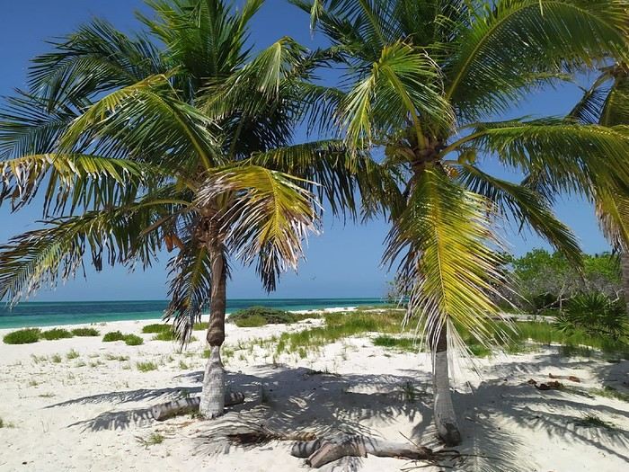
Our main goal in coming to Holbox was to swim with whale sharks. So, the first thing we told our hotel, Los Arcos Holbox, upon arrival was to arrange an excursion with one of the island’s many tour operators: Glendy Tours Holbox. We set off the next morning, bright and early.
The itinerary for this outing is the same for all tour operators (and there are about thirty of them!): roughly two hours by speedboat, then snorkeling with the whale sharks, followed by another boat ride to Cabo Catoche for lunch, then more boating to a fish-filled snorkeling spot before heading back. In total, the excursion can take eight hours—or even longer.
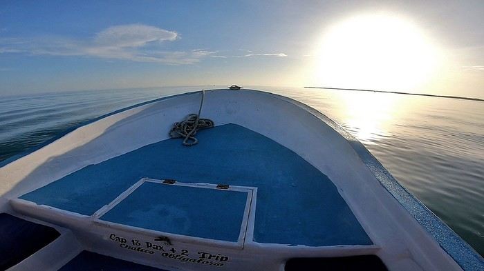
Besides my two sons and me, there were only two other clients on board—a French couple. Our boat was one of the very first to leave, but after ten minutes, the pilot got a radio call. We turned back without any explanation, returning to the departure dock.
There, a young woman who clearly fancied herself a diva was waiting for us. She was Mexican and boarded the boat, snubbing all five of us while flirting with the pilot and guide, who were suddenly all eyes for her. We couldn’t understand how this diva had convinced our tour operator to turn the boat around just to pick her up when she hadn’t even booked and we were already far out. We left 20 minutes late.
The two-hour journey passed surprisingly quickly, and for good reason: we spotted dolphins six times! They were leaping out of the water as they moved. Pure joy. We stopped whenever they were near the boat.
The photo isn’t great—the ultra-wide-angle lens on my GoPro makes the dolphins look smaller—but at least I got a souvenir.
A few flying fish (exocets) also glided a meter or two above the water as we sped along. The false start was forgotten, and the day was off to a fantastic start in this stunning marine environment...
When we reached the area where the whale sharks were supposed to be, the guide explained that we’d now have to scan the sea until we spotted one. It could take five minutes or forty-five, he said, and if we were unlucky, we might not see any at all!
An hour and a half later—still nothing! The captain then headed toward a distant area where about twenty other boats were already gathered.
Sure enough, there was a juvenile whale shark (still a good eight meters long) there, and all the boats were lining up to approach it slowly, one by one, so as not to scare the animal. Each boat got about thirty seconds within a few meters of it, engine idling, before making way for the next. We were allowed to approach three times, but we weren’t permitted to dive in. That’s normal—such a crowd of divers around a single animal would stress it out, and here, whale sharks are protected by regulations: swimming with them is strictly controlled. There was even a coast guard boat with us at all times, monitoring everyone’s behavior.
We were torn between the luck of seeing such a magnificent animal, even from the surface, and the discomfort we felt about the absurd situation. All those boats lined up just to catch a fleeting glimpse of the shark for a few seconds—let’s be honest, it was ridiculous. In short, the whole thing was unpleasant, and probably even more so for the shark than for us, though it did keep gulping down kilos of plankton as if nothing were happening...
When it was our turn to approach, I dipped my GoPro into the water at arm’s length and framed the shot blindly, hoping for a decent image of the shark.
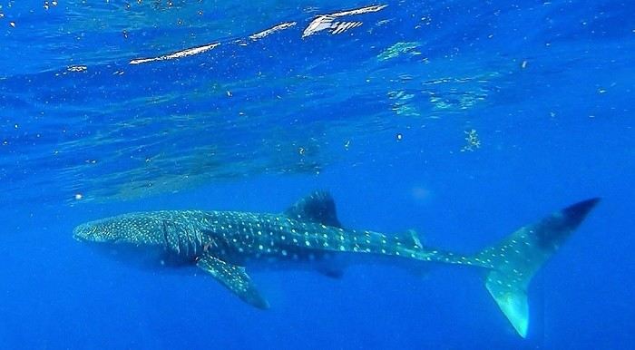
On the third and final approach, the sixth passenger on board—the one we’d had to turn back for ten minutes after departure—quietly spoke to the guide and captain after putting on her flippers (even though, I’ll remind you, no one was allowed to dive). She wanted them to ask the coast guard for permission to dive with the shark—just her! She whispered so we couldn’t hear what she was offering in exchange.
The two lackeys complied and shouted the request to the officials in front of all the other boats, with no shame whatsoever. With so many witnesses, the coast guard had no choice but to refuse. The diva wouldn’t let it go and asked them to insist, which they did, but the refusal was firm and final.
On the nearest boats, everyone had heard and was stunned. They openly mocked this bimbo who clearly had no shame. Hidden behind her star sunglasses, she responded with a dismissive smile. Pathetic.
The encounter with the shark ended, and we set off for Cabo Catoche, a site on Holbox Island where we were to have lunch.
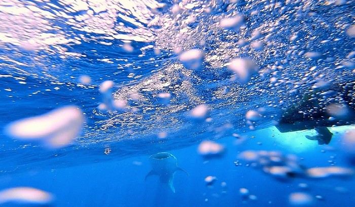
We were a little disappointed not to have had the chance to see the usual school of whale sharks (they’re often dozens swimming together!), but that’s nature’s way, and we knew it.
And then, an unlikely stroke of luck: a boat ahead of us was putting divers in the water with a pair of adult whale sharks. We joined them, and while we were putting on our masks and snorkels, the guide briefed us. He said my sons and I would go first, followed by the French couple and the diva.
But Miss World, clearly unhappy with this order, quietly complained to the guide, who eventually switched the order. It didn’t bother us since we’d only get a minute in the water anyway—what’s a minute more or less?
So the three of them got in the water, and a moment later, they were done. My two sons and I, sitting on the edge of the boat with masks on and snorkels in our mouths, were ready to finally take the plunge. But instead of continuing to follow the shark, the captain was suddenly all eyes for Miss Silicone! He even let go of the wheel for a moment to help her back on board.
One of the two sharks had already left minutes earlier, and the second was swimming farther away. Other boats were arriving, and the captain went to join the queue 100 meters from the shark. Soon, even more boats showed up. There were way too many people, the shark left, and diving was no longer possible.
I was, of course, a little disappointed not to have fulfilled my long-time dream of swimming with a whale shark, even briefly. But I was mostly disgusted for my two boys, who had been so excited about it. I told the guide exactly what I thought and asked for compensation—not for missing out on swimming with the shark (you can never guarantee seeing one, nature isn’t at our beck and call), but for clearly skipping our turn to dive. He promised a refund.
At the end of the day, back on land, he dropped us all off, and as he was about to leave, I reminded him about the refund. He agreed again, calmly got back on board, and sped off as if nothing had happened—just him and the captain, two total cowards. I couldn’t believe it.
Of course, back at our hotel (which had booked this tour operator—Glendy Tours), I explained the situation and asked for my refund again. The receptionist called the manager, who arrived with the guide. Our runaway wasn’t so cocky anymore. Inside, I was fuming, but I kept my cool during the discussion that followed.
Right off the bat, I made a point of looking the so-called guide in the eyes while telling him he’d run off like a coward. I did my best to stay calm, speaking clearly, staring him down the whole time, and repeating several times that he was a coward, in front of the manager, who didn’t say a word. The guide had clearly been told by his boss to keep quiet because he didn’t utter a word during the entire twenty-minute conversation.
Anyway, I’ll spare you the details, but in the end, the manager only offered us another excursion the next day as compensation for the “inconvenience.” It was just snorkeling with fish, not another whale shark trip. He admitted their fault, but since we had to leave early the next morning and had other bookings for the rest of the trip, we couldn’t accept. And he refused to refund us.
On Tripadvisor, Glendy Tours has a mediocre rating (3 out of 5), but more importantly, it ranks 29th out of 36 nautical tour operators rated by customers. I was pretty upset with the hotel for booking such an amateur for us.

If you want to swim with whale sharks in Holbox, you might end up with Glendy Tours. And it might go well—I certainly hope so. But given the price of such an excursion (3,000 pesos per person, about 160 €!), I’d still suggest quickly checking online before you go to see which providers have the best ratings. You’ll have a much better chance of things going smoothly with the top-rated ones than with those as poorly ranked as Glendy Tours.
On the other hand, if you’re a beautiful young woman, you can choose them without worry—you’ll get better treatment than the rest of us...
To wrap up this excursion, I have to mention the “respect for nature” angle that all these tour operators highlight. They tell us they respect the whale sharks: only two or three people can dive at a time, and only for a few minutes, so as not to disturb these gentle giants...
We believed them before we left, but that’s not what we saw. When the sharks are hard to find except for one, everyone rushes it, and only the constant presence of the coast guard prevents the tour operators from putting their clients in the water.
Because for the second shark we saw, when the divers from our boat got out of the water and we left to join the queue while it was our turn to dive, other boats quickly arrived and started swarming the poor shark, which eventually left.
In other words, it’s clear these companies only respect the sharks when they’re being watched.
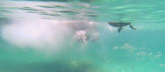 Boat reversing a meter away from a pelican
And for the snorkeling near Cabo Catoche, they attract fish daily by feeding them—a practice that’s normally discouraged. Afterward, these fish can’t feed naturally anymore and become dependent on Glendy Tours and its competitors.
A quick note on the rest of the excursion: Cabo Catoche (the site where we had lunch, on Holbox Island) is the northernmost point of the entire Yucatán. The place is paradise.
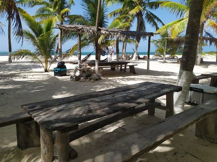
On the way back, we spent half an hour snorkeling at a site that turned out to be fish-filled only because the tour operators had the bad habit of feeding the fish. But this practice, which isn’t respectful of nature, is normally discouraged.
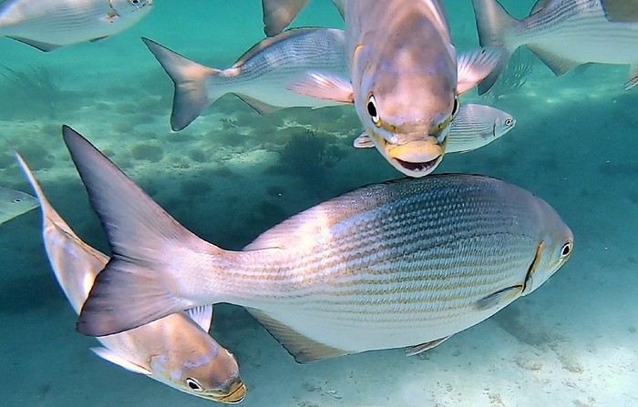
Plus, life jackets—like in many places in the Yucatán—are mandatory!!
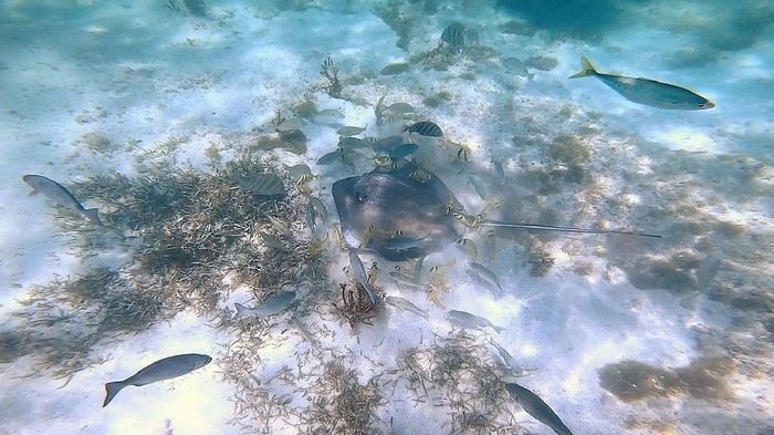
As divers, we didn’t find the site very interesting, but objectively, it should delight those who aren’t used to putting their heads underwater in beautiful dive spots.
We hated feeling trapped in those life jackets, stuck at the surface, and for me, the highlight was swimming next to a pelican that wasn’t too shy—it was paddling right beside me in green water.
Anyway, it seems we can’t post more than 10 photos at once on VF, so I’ll come back with the rest of the journal in another message. Because after these early trip mishaps, the rest of the journey turned out to be magnificent...
What a pleasure to be back on VF after a few difficult years 😎 So, before diving into the topic, welcome back to VF and above all... keep going!
Well, I’m finally picking up my old habit of posting a new travel journal.
Before heading to Mexico in the summer of 2023 with my family (my partner and our two boys, aged 18 and 16), I had somehow convinced myself—though I can’t even remember why—that the Yucatán was too touristy, too cliché, too expensive, and overrated!
The country didn’t particularly appeal to me, but faced with my wife’s insistence—she’d been there years ago, before we met, and had promised to show our sons this incredible place—my arguments didn’t hold much weight.
And thank goodness, because I have to admit she was absolutely right to take us there! In the end, we encountered far fewer tourists than we’d feared (except at a few sites), and the prices, which we’d been told were geared toward American neighbors (US), turned out to be quite affordable. In short, it was pure joy on both counts. All that was left was for the trip itself to be beautiful and memorable—and it was...
1st stop: Isla Holbox and the whale sharks
Holbox (pronounced “Hol-bosh”) is a stunning island where you can relax in an enchanting setting.
Our main goal in coming to Holbox was to swim with whale sharks. So, the first thing we told our hotel, Los Arcos Holbox, upon arrival was to arrange an excursion with one of the island’s many tour operators: Glendy Tours Holbox. We set off the next morning, bright and early.
The itinerary for this outing is the same for all tour operators (and there are about thirty of them!): roughly two hours by speedboat, then snorkeling with the whale sharks, followed by another boat ride to Cabo Catoche for lunch, then more boating to a fish-filled snorkeling spot before heading back. In total, the excursion can take eight hours—or even longer.
Besides my two sons and me, there were only two other clients on board—a French couple. Our boat was one of the very first to leave, but after ten minutes, the pilot got a radio call. We turned back without any explanation, returning to the departure dock.
There, a young woman who clearly fancied herself a diva was waiting for us. She was Mexican and boarded the boat, snubbing all five of us while flirting with the pilot and guide, who were suddenly all eyes for her. We couldn’t understand how this diva had convinced our tour operator to turn the boat around just to pick her up when she hadn’t even booked and we were already far out. We left 20 minutes late.
The two-hour journey passed surprisingly quickly, and for good reason: we spotted dolphins six times! They were leaping out of the water as they moved. Pure joy. We stopped whenever they were near the boat.
The photo isn’t great—the ultra-wide-angle lens on my GoPro makes the dolphins look smaller—but at least I got a souvenir.
A few flying fish (exocets) also glided a meter or two above the water as we sped along. The false start was forgotten, and the day was off to a fantastic start in this stunning marine environment...
When we reached the area where the whale sharks were supposed to be, the guide explained that we’d now have to scan the sea until we spotted one. It could take five minutes or forty-five, he said, and if we were unlucky, we might not see any at all!
An hour and a half later—still nothing! The captain then headed toward a distant area where about twenty other boats were already gathered.
Sure enough, there was a juvenile whale shark (still a good eight meters long) there, and all the boats were lining up to approach it slowly, one by one, so as not to scare the animal. Each boat got about thirty seconds within a few meters of it, engine idling, before making way for the next. We were allowed to approach three times, but we weren’t permitted to dive in. That’s normal—such a crowd of divers around a single animal would stress it out, and here, whale sharks are protected by regulations: swimming with them is strictly controlled. There was even a coast guard boat with us at all times, monitoring everyone’s behavior.
We were torn between the luck of seeing such a magnificent animal, even from the surface, and the discomfort we felt about the absurd situation. All those boats lined up just to catch a fleeting glimpse of the shark for a few seconds—let’s be honest, it was ridiculous. In short, the whole thing was unpleasant, and probably even more so for the shark than for us, though it did keep gulping down kilos of plankton as if nothing were happening...
When it was our turn to approach, I dipped my GoPro into the water at arm’s length and framed the shot blindly, hoping for a decent image of the shark.
On the third and final approach, the sixth passenger on board—the one we’d had to turn back for ten minutes after departure—quietly spoke to the guide and captain after putting on her flippers (even though, I’ll remind you, no one was allowed to dive). She wanted them to ask the coast guard for permission to dive with the shark—just her! She whispered so we couldn’t hear what she was offering in exchange.
The two lackeys complied and shouted the request to the officials in front of all the other boats, with no shame whatsoever. With so many witnesses, the coast guard had no choice but to refuse. The diva wouldn’t let it go and asked them to insist, which they did, but the refusal was firm and final.
On the nearest boats, everyone had heard and was stunned. They openly mocked this bimbo who clearly had no shame. Hidden behind her star sunglasses, she responded with a dismissive smile. Pathetic.
The encounter with the shark ended, and we set off for Cabo Catoche, a site on Holbox Island where we were to have lunch.
We were a little disappointed not to have had the chance to see the usual school of whale sharks (they’re often dozens swimming together!), but that’s nature’s way, and we knew it.
And then, an unlikely stroke of luck: a boat ahead of us was putting divers in the water with a pair of adult whale sharks. We joined them, and while we were putting on our masks and snorkels, the guide briefed us. He said my sons and I would go first, followed by the French couple and the diva.
But Miss World, clearly unhappy with this order, quietly complained to the guide, who eventually switched the order. It didn’t bother us since we’d only get a minute in the water anyway—what’s a minute more or less?
So the three of them got in the water, and a moment later, they were done. My two sons and I, sitting on the edge of the boat with masks on and snorkels in our mouths, were ready to finally take the plunge. But instead of continuing to follow the shark, the captain was suddenly all eyes for Miss Silicone! He even let go of the wheel for a moment to help her back on board.
One of the two sharks had already left minutes earlier, and the second was swimming farther away. Other boats were arriving, and the captain went to join the queue 100 meters from the shark. Soon, even more boats showed up. There were way too many people, the shark left, and diving was no longer possible.
I was, of course, a little disappointed not to have fulfilled my long-time dream of swimming with a whale shark, even briefly. But I was mostly disgusted for my two boys, who had been so excited about it. I told the guide exactly what I thought and asked for compensation—not for missing out on swimming with the shark (you can never guarantee seeing one, nature isn’t at our beck and call), but for clearly skipping our turn to dive. He promised a refund.
At the end of the day, back on land, he dropped us all off, and as he was about to leave, I reminded him about the refund. He agreed again, calmly got back on board, and sped off as if nothing had happened—just him and the captain, two total cowards. I couldn’t believe it.
Of course, back at our hotel (which had booked this tour operator—Glendy Tours), I explained the situation and asked for my refund again. The receptionist called the manager, who arrived with the guide. Our runaway wasn’t so cocky anymore. Inside, I was fuming, but I kept my cool during the discussion that followed.
Right off the bat, I made a point of looking the so-called guide in the eyes while telling him he’d run off like a coward. I did my best to stay calm, speaking clearly, staring him down the whole time, and repeating several times that he was a coward, in front of the manager, who didn’t say a word. The guide had clearly been told by his boss to keep quiet because he didn’t utter a word during the entire twenty-minute conversation.
Anyway, I’ll spare you the details, but in the end, the manager only offered us another excursion the next day as compensation for the “inconvenience.” It was just snorkeling with fish, not another whale shark trip. He admitted their fault, but since we had to leave early the next morning and had other bookings for the rest of the trip, we couldn’t accept. And he refused to refund us.
On Tripadvisor, Glendy Tours has a mediocre rating (3 out of 5), but more importantly, it ranks 29th out of 36 nautical tour operators rated by customers. I was pretty upset with the hotel for booking such an amateur for us.
If you want to swim with whale sharks in Holbox, you might end up with Glendy Tours. And it might go well—I certainly hope so. But given the price of such an excursion (3,000 pesos per person, about 160 €!), I’d still suggest quickly checking online before you go to see which providers have the best ratings. You’ll have a much better chance of things going smoothly with the top-rated ones than with those as poorly ranked as Glendy Tours.
On the other hand, if you’re a beautiful young woman, you can choose them without worry—you’ll get better treatment than the rest of us...
To wrap up this excursion, I have to mention the “respect for nature” angle that all these tour operators highlight. They tell us they respect the whale sharks: only two or three people can dive at a time, and only for a few minutes, so as not to disturb these gentle giants...
We believed them before we left, but that’s not what we saw. When the sharks are hard to find except for one, everyone rushes it, and only the constant presence of the coast guard prevents the tour operators from putting their clients in the water.
Because for the second shark we saw, when the divers from our boat got out of the water and we left to join the queue while it was our turn to dive, other boats quickly arrived and started swarming the poor shark, which eventually left.
In other words, it’s clear these companies only respect the sharks when they’re being watched.
Boat reversing a meter away from a pelicanAnd for the snorkeling near Cabo Catoche, they attract fish daily by feeding them—a practice that’s normally discouraged. Afterward, these fish can’t feed naturally anymore and become dependent on Glendy Tours and its competitors.
A quick note on the rest of the excursion: Cabo Catoche (the site where we had lunch, on Holbox Island) is the northernmost point of the entire Yucatán. The place is paradise.
On the way back, we spent half an hour snorkeling at a site that turned out to be fish-filled only because the tour operators had the bad habit of feeding the fish. But this practice, which isn’t respectful of nature, is normally discouraged.
Plus, life jackets—like in many places in the Yucatán—are mandatory!!
As divers, we didn’t find the site very interesting, but objectively, it should delight those who aren’t used to putting their heads underwater in beautiful dive spots.
We hated feeling trapped in those life jackets, stuck at the surface, and for me, the highlight was swimming next to a pelican that wasn’t too shy—it was paddling right beside me in green water.
Anyway, it seems we can’t post more than 10 photos at once on VF, so I’ll come back with the rest of the journal in another message. Because after these early trip mishaps, the rest of the journey turned out to be magnificent...
To the Top West End
In this time of general travel-journal scarcity, I’m stepping up to tell you about a far-too-short getaway to the Top West End, a local term for the very northern part of Western Australia, right on the border ( ;) ) with the Northern Territory.
As usual, I didn’t manage to keep it short, but this time I’ve got photos to go with it!
August 2020. Since the opportunities to explore the world are extremely limited right now, all we (R&X) can do is explore our own island! Well, just a part of it, because with the state borders still closed, we’re stuck in Western Australia (WA).
Luckily, we’re pretty fortunate because this state is huge: over 2.5 million km² (that’s more than four times the size of France or 1.5 times Quebec). What’s more, stretching over 20 degrees of latitude between the Antarctic Ocean and the Timor Sea, you’ll find climates ranging from Mediterranean to arid to tropical. That’s actually why we decided to head as far north as possible. Sick of the endless rainy winter in Perth, bring on the heat of the Kimberley... way up Nooorth!
Friday. At the airport, the main terminal was closed (not enough flights), so we ended up in the annex (where flights to the various mines usually depart from). There was no crowd at the gate, and in this huge, single departure lounge, empty seats were plentiful. Only three flights were listed on the screens for the rest of the morning: the first to Coondewanna (?), the second to Darwin, and ours to Kununurra (code KNX).
A cool breeze swept through the half-open corridors along the runways. At the top of the walkway leading to the Fokker 100 (the Airbuses and Boeings are now parked!), a flight attendant greeted us with a basket full of sanitary masks. We were actually the only masked passengers (the staff weren’t wearing them either). With zero Covid-19 cases in WA at the time, the only rule was to maintain social distancing—something pretty hard to do on a full plane!
It was also my first time wearing a mask—it felt weird, pretty uncomfortable, and after a while, painful behind the ears. I really feel for those who have to wear one all day, every day. The flight lasted three long hours, but luckily, I had a good book. From the window, I watched an endless expanse of salt lakes in all shapes and sizes—round, elongated, gray, white, sometimes blue and green—and an infinity of winding, capricious meanders, along with long straight lines that led nowhere. The last half-hour got more interesting as rocky, swollen formations and long, sloping plateaus appeared. Against the vast ochre landscape, green patches became more frequent.
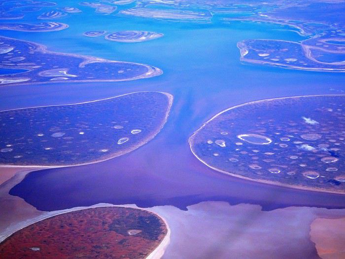
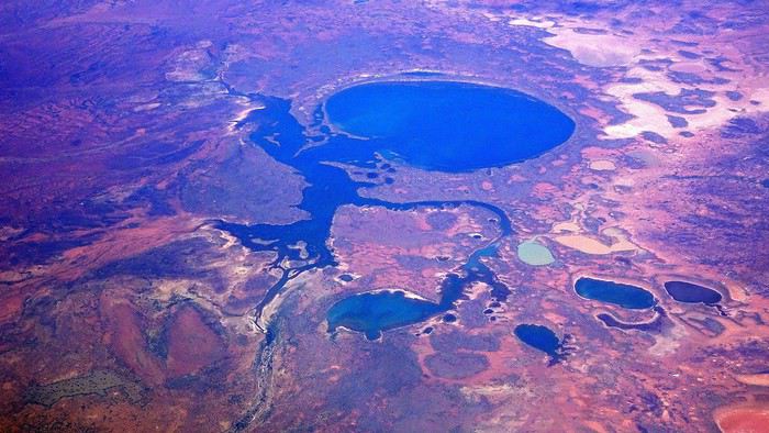
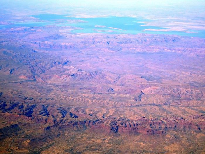
Just before landing, rows of green fields briefly appeared, along with an surprisingly wide river—but we were already rolling down the tarmac. A few hangars, a myriad of small, stationary planes, and a tiny terminal topped with a sign: “Welcome to Kununurra.”
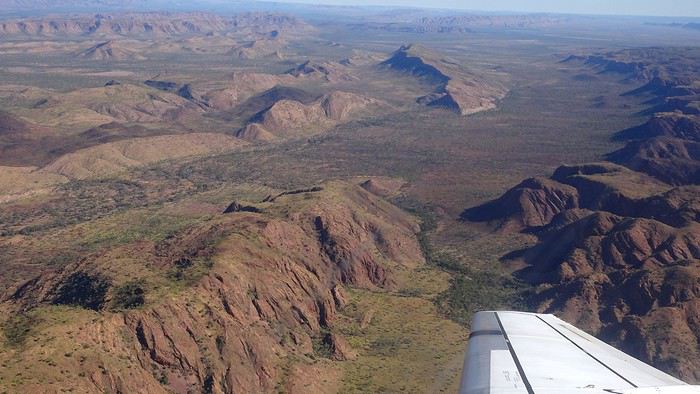
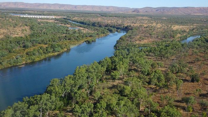
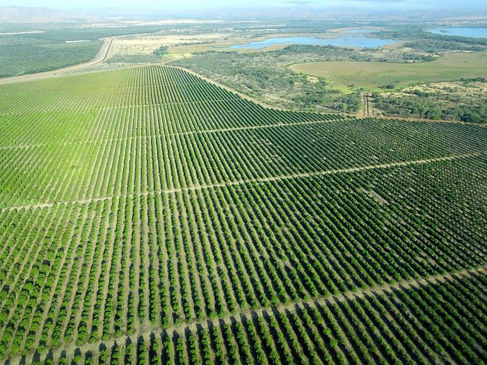
We wanted heat, and here it was—34°C the moment we stepped off the plane! We felt alive again and totally ridiculous in our jeans and sweaters. We quickly grabbed our suitcase and picked up the 4x4 we’d rented—more out of necessity, since only that type of vehicle can access the national parks we planned to visit.
Just four kilometers separated us from Kununurra, a town of 5,000 people founded in 1961 during the construction of the Lake Argyle Dam and the development of the Ord River Irrigation Area Scheme (more on that later). On the horizon, mountain ranges (a bit of an exaggeration, since we know Mt. Meharry, WA’s highest ‘mountain,’ doesn’t even reach 1,250 meters!) and closer to the road, a few irrigation canals cutting through stretches of bush, then a huge park overlooking a small lake lined with reeds.
A row of baobabs (yes, there are baobabs in Australia too!), a series of motels with immaculate lawns, a gas station, and there’s the main street leading to the town center—that is, the parking lots of the two supermarkets, the bottleshop, the pub, the Town Hall, the municipal pool, and the Tourist Office (already closed!), and at the next roundabout, another park, the Presbyterian church, and a few other shops. In short, two or three green blocks that you can explore in no time.
One road leads to the small industrial area and one of the town’s three or four campgrounds, while another heads toward the residential neighborhoods, which look just like the typical suburbs you find in any Australian city—except with tropical vegetation. We stocked up at Coles, an identical copy of the one near our place, and—surprise—the prices were practically the same.
We checked into one of the motels. The receptionist listed the town’s three or four restaurants, insisting that it’s always better to book a table. She recommended the Pump House, a bit outside town on the lake’s edge. “Best spot to watch the sunset, but hurry up.” she told us. It was only 5:00 PM!
When we got there half an hour later, the place was packed, and the sun had already disappeared behind a row of trees! Sure enough, we’d see a few days later that the sunset can be a stunning spectacle—if you wait a bit for the sky (especially if it’s cloudy) to blaze and reflect in the lake’s calm waters. A little disappointed, we headed back into town, where we easily found the other lively spot in town: the pub (nothing like an old English pub). Above the long L-shaped bar, several giant screens (thankfully muted) were broadcasting live footy, rugby league, etc. In one corner, players circled the pool table, while in another, customers were digging into plates of the day’s special. Instead of rooms, there were various patios where groups of friends and coworkers (easily recognizable by the fluoro vests they were still wearing) were gathered. We found a table under a mango tree—unfortunately, a little too close to the guitarist strumming his entire Country Music repertoire, complete with Keith Urban-style tremolos. Guaranteed culture shock!
Since it’s the custom here, we called the Country Club to book a table before the kitchen closed! The CC is the town’s—and even the region’s—fancy spot. Dark decor, modern furniture, dim lighting, and the air conditioning blasting. The twenty or so customers had taken refuge on the vast terrace, lit by torches. The view of the tall eucalyptus trees, illuminated by spotlights shifting from red to blue, was breathtaking.
The menu was minimal, but the grilled salmon was excellent, and the Pavlova (the meringue dessert Kiwis and Aussies have been arguing over since 1906) with melon and watermelon was absolutely divine.
It wasn’t even 9:00 PM, and we were already in bed. Had we already adopted the Top West End’s chicken schedule?!
To be continued... Journal dedicated to Attila
As usual, I didn’t manage to keep it short, but this time I’ve got photos to go with it!
August 2020. Since the opportunities to explore the world are extremely limited right now, all we (R&X) can do is explore our own island! Well, just a part of it, because with the state borders still closed, we’re stuck in Western Australia (WA).
Luckily, we’re pretty fortunate because this state is huge: over 2.5 million km² (that’s more than four times the size of France or 1.5 times Quebec). What’s more, stretching over 20 degrees of latitude between the Antarctic Ocean and the Timor Sea, you’ll find climates ranging from Mediterranean to arid to tropical. That’s actually why we decided to head as far north as possible. Sick of the endless rainy winter in Perth, bring on the heat of the Kimberley... way up Nooorth!
Friday. At the airport, the main terminal was closed (not enough flights), so we ended up in the annex (where flights to the various mines usually depart from). There was no crowd at the gate, and in this huge, single departure lounge, empty seats were plentiful. Only three flights were listed on the screens for the rest of the morning: the first to Coondewanna (?), the second to Darwin, and ours to Kununurra (code KNX).
A cool breeze swept through the half-open corridors along the runways. At the top of the walkway leading to the Fokker 100 (the Airbuses and Boeings are now parked!), a flight attendant greeted us with a basket full of sanitary masks. We were actually the only masked passengers (the staff weren’t wearing them either). With zero Covid-19 cases in WA at the time, the only rule was to maintain social distancing—something pretty hard to do on a full plane!
It was also my first time wearing a mask—it felt weird, pretty uncomfortable, and after a while, painful behind the ears. I really feel for those who have to wear one all day, every day. The flight lasted three long hours, but luckily, I had a good book. From the window, I watched an endless expanse of salt lakes in all shapes and sizes—round, elongated, gray, white, sometimes blue and green—and an infinity of winding, capricious meanders, along with long straight lines that led nowhere. The last half-hour got more interesting as rocky, swollen formations and long, sloping plateaus appeared. Against the vast ochre landscape, green patches became more frequent.
Just before landing, rows of green fields briefly appeared, along with an surprisingly wide river—but we were already rolling down the tarmac. A few hangars, a myriad of small, stationary planes, and a tiny terminal topped with a sign: “Welcome to Kununurra.”
We wanted heat, and here it was—34°C the moment we stepped off the plane! We felt alive again and totally ridiculous in our jeans and sweaters. We quickly grabbed our suitcase and picked up the 4x4 we’d rented—more out of necessity, since only that type of vehicle can access the national parks we planned to visit.
Just four kilometers separated us from Kununurra, a town of 5,000 people founded in 1961 during the construction of the Lake Argyle Dam and the development of the Ord River Irrigation Area Scheme (more on that later). On the horizon, mountain ranges (a bit of an exaggeration, since we know Mt. Meharry, WA’s highest ‘mountain,’ doesn’t even reach 1,250 meters!) and closer to the road, a few irrigation canals cutting through stretches of bush, then a huge park overlooking a small lake lined with reeds.
A row of baobabs (yes, there are baobabs in Australia too!), a series of motels with immaculate lawns, a gas station, and there’s the main street leading to the town center—that is, the parking lots of the two supermarkets, the bottleshop, the pub, the Town Hall, the municipal pool, and the Tourist Office (already closed!), and at the next roundabout, another park, the Presbyterian church, and a few other shops. In short, two or three green blocks that you can explore in no time.
One road leads to the small industrial area and one of the town’s three or four campgrounds, while another heads toward the residential neighborhoods, which look just like the typical suburbs you find in any Australian city—except with tropical vegetation. We stocked up at Coles, an identical copy of the one near our place, and—surprise—the prices were practically the same.
We checked into one of the motels. The receptionist listed the town’s three or four restaurants, insisting that it’s always better to book a table. She recommended the Pump House, a bit outside town on the lake’s edge. “Best spot to watch the sunset, but hurry up.” she told us. It was only 5:00 PM!
When we got there half an hour later, the place was packed, and the sun had already disappeared behind a row of trees! Sure enough, we’d see a few days later that the sunset can be a stunning spectacle—if you wait a bit for the sky (especially if it’s cloudy) to blaze and reflect in the lake’s calm waters. A little disappointed, we headed back into town, where we easily found the other lively spot in town: the pub (nothing like an old English pub). Above the long L-shaped bar, several giant screens (thankfully muted) were broadcasting live footy, rugby league, etc. In one corner, players circled the pool table, while in another, customers were digging into plates of the day’s special. Instead of rooms, there were various patios where groups of friends and coworkers (easily recognizable by the fluoro vests they were still wearing) were gathered. We found a table under a mango tree—unfortunately, a little too close to the guitarist strumming his entire Country Music repertoire, complete with Keith Urban-style tremolos. Guaranteed culture shock!
Since it’s the custom here, we called the Country Club to book a table before the kitchen closed! The CC is the town’s—and even the region’s—fancy spot. Dark decor, modern furniture, dim lighting, and the air conditioning blasting. The twenty or so customers had taken refuge on the vast terrace, lit by torches. The view of the tall eucalyptus trees, illuminated by spotlights shifting from red to blue, was breathtaking.
The menu was minimal, but the grilled salmon was excellent, and the Pavlova (the meringue dessert Kiwis and Aussies have been arguing over since 1906) with melon and watermelon was absolutely divine.
It wasn’t even 9:00 PM, and we were already in bed. Had we already adopted the Top West End’s chicken schedule?!
To be continued... Journal dedicated to Attila
Come discover the North Shore
INTRODUCTION
Travel journal updated in MAY 2025
Since our travel plans outside Canada were canceled due to Covid-19, we decided to take our vacation in Quebec this summer and cover over 5,270 kilometers to explore the various tourist attractions of the North Shore and Gaspésie.
This summary will cover our experiences on the North Shore, while Gaspésie will be the subject of a future summary.
The North Shore, known for its stunning nature, is the perfect spot for outdoor enthusiasts since you can enjoy activities like hiking, wildlife observation, sea kayaking, fishing, and hunting (to name just a few).
It’s also one of the best places in the world to see whales.
Our journey along the North Shore took place between the villages of Tadoussac and Kegaska, as Route 138 ends at the beautiful, long beach in Kegaska.
Travel journal updated in MAY 2025
Since our travel plans outside Canada were canceled due to Covid-19, we decided to take our vacation in Quebec this summer and cover over 5,270 kilometers to explore the various tourist attractions of the North Shore and Gaspésie.
This summary will cover our experiences on the North Shore, while Gaspésie will be the subject of a future summary.
The North Shore, known for its stunning nature, is the perfect spot for outdoor enthusiasts since you can enjoy activities like hiking, wildlife observation, sea kayaking, fishing, and hunting (to name just a few).
It’s also one of the best places in the world to see whales.
Our journey along the North Shore took place between the villages of Tadoussac and Kegaska, as Route 138 ends at the beautiful, long beach in Kegaska.