Results for "pêche+|+65"
31545 results found.
Bleu Majorelle (Maroc) English translation pending
Deja sur les jeans on utilisait de l'indigo pour colorer en bleu
Pour avoir du rouge, allons cueillir un coquelicot
Un petit detour par les epices de la cuisine, du safran pour la paella mais aussi pour le jaune
Ne pas confondre la menthe du whisky berbere avec sa verte version sauvage
Du henne marron pour decorer les mains en toutes saisons
Et le khol pour noircir les yeux des galantes dames
La neige fraiche a seulement 80 km de Marrakech, 2700 m d'altitude
L'herbe bien verte, bien tendre de la vallee de l'Ourika, petit paradis tranquille
Au bonheur des surfeurs, l'eau salee d'Essaouira, ville maritime plein de charme
Que nous sommes petits au pied des gorges du Todra, 300m de roche verticale
Le mystere de cette terre rouge, au fond de la vallee du Dades
Ces merveilleuses portes en bois decouvertes au detour d'une ruelle
La finesse architecturale, la richesse des motifs en stuc au coeur de la medersa Ben Youssef
A Ouarzazate, a la croisee des chemins, les mosaiques au plafond d'une vieille kasbah
La douceur d'un jus d'orange presse au milieu de la foule de Djema el Fna
Le reconfort d'une assiete berbere apres tant de route entre Atlas et Sargho
Apres de longues deambulations dans les souks, un the a la menthe pour rafraichir
Grand peche de gourmandise, mais qui peut resister aux patisseries marocaines face a la mer
Et les inombrables tajines au poulet, au poisson, a la viande ou kefta
Sentir les amandiers en fleur dans la palmeraie de Tinehir
Jeter un oeil rapide dans une tannerie, odeur indescriptible de cuir, de peau et de graisse
Medina, mellah, jardins, ... de l'encens pour nous suivre partout
Le calme serein, le bleu mysterieux, les bougainvilliers envoutants du jardin Majorelle
Ksar de Ait Benhadou, les incontournables chameaux pour les touristes en manque de photos
Les babouches jaunes, rouges, roses, marrons, noires aux pieds de cette foule immense
Et les "Inch Allah" qui nous accompagnent partout et resonnent encore dans nos oreilles
En melangeant toutes ces couleurs, ces saveurs, ces matieres, ces odeurs..
Nous obtenons un fabuleux pays...
Le MAROC tout simplement !
Pour avoir du rouge, allons cueillir un coquelicot
Un petit detour par les epices de la cuisine, du safran pour la paella mais aussi pour le jaune
Ne pas confondre la menthe du whisky berbere avec sa verte version sauvage
Du henne marron pour decorer les mains en toutes saisons
Et le khol pour noircir les yeux des galantes dames
La neige fraiche a seulement 80 km de Marrakech, 2700 m d'altitude
L'herbe bien verte, bien tendre de la vallee de l'Ourika, petit paradis tranquille
Au bonheur des surfeurs, l'eau salee d'Essaouira, ville maritime plein de charme
Que nous sommes petits au pied des gorges du Todra, 300m de roche verticale
Le mystere de cette terre rouge, au fond de la vallee du Dades
Ces merveilleuses portes en bois decouvertes au detour d'une ruelle
La finesse architecturale, la richesse des motifs en stuc au coeur de la medersa Ben Youssef
A Ouarzazate, a la croisee des chemins, les mosaiques au plafond d'une vieille kasbah
La douceur d'un jus d'orange presse au milieu de la foule de Djema el Fna
Le reconfort d'une assiete berbere apres tant de route entre Atlas et Sargho
Apres de longues deambulations dans les souks, un the a la menthe pour rafraichir
Grand peche de gourmandise, mais qui peut resister aux patisseries marocaines face a la mer
Et les inombrables tajines au poulet, au poisson, a la viande ou kefta
Sentir les amandiers en fleur dans la palmeraie de Tinehir
Jeter un oeil rapide dans une tannerie, odeur indescriptible de cuir, de peau et de graisse
Medina, mellah, jardins, ... de l'encens pour nous suivre partout
Le calme serein, le bleu mysterieux, les bougainvilliers envoutants du jardin Majorelle
Ksar de Ait Benhadou, les incontournables chameaux pour les touristes en manque de photos
Les babouches jaunes, rouges, roses, marrons, noires aux pieds de cette foule immense
Et les "Inch Allah" qui nous accompagnent partout et resonnent encore dans nos oreilles
En melangeant toutes ces couleurs, ces saveurs, ces matieres, ces odeurs..
Nous obtenons un fabuleux pays...
Le MAROC tout simplement !
Hôtel Melia Caribe 5* English translation pending
bonjour, nous projetons un depart pour la republique dominicaine le 02 janvier 2004 en groupe, nous somme 4 aduldes, et 3 enfants et plus precisement au melia caribe, hotel 5 * . est ce que c la bonne periode pour la rd ? quelq un connait il cet hotel ? est il interressant pour des enfants ? ( 5, 8, et 11 ans ) . quel sont en general les prix pratique sur l ile pour les activite comme le ski nautique, la plongee ou la peche au gros ? il y a t il une grosse difference entre le cote atlantique et la cote caraibe au niveau de la temperature de l eau et de la clarete ? s il vous plait, rassure moi !! 🙂 en attendend vos precieux renseignement, je vous dit a bientot, et joyeuse fete a tout le monde !! 😉
Hôtel Decameron ou Ile de San Andres? English translation pending
Bonjour,
j'hésite entre le panama (l'hôtel decameron) et l'île de San Andres pour des vacances à la fin d'avril. J'aimerais avoir des commentaires positifs ou négatifs sur ces deux endroits touristiques et surtout des infos sur les excursions que vous avez aimés.
merci.
j'hésite entre le panama (l'hôtel decameron) et l'île de San Andres pour des vacances à la fin d'avril. J'aimerais avoir des commentaires positifs ou négatifs sur ces deux endroits touristiques et surtout des infos sur les excursions que vous avez aimés.
merci.
Hôtel Reef club Coco Beach à Playa del carmen English translation pending
Cet hotel est situé proche de play del carmen et a été construit en octobre 2003 donc hyper récent.
Qui a entendu parler de cet hotel, ou quelqu'un y a t'il séjourné recemment ?
Merci
Qui a entendu parler de cet hotel, ou quelqu'un y a t'il séjourné recemment ?
Merci
Cayo Coco: hotel El Senador English translation pending
Bonjour je suis nouveau ici.
Nous allons à Cayo Coco (El Senador) au mois de février et je voulais savoir quel genre d'excursions que l'on peux faire à Cayo Coco ??
Merci à tous
TooNZ
Nous allons à Cayo Coco (El Senador) au mois de février et je voulais savoir quel genre d'excursions que l'on peux faire à Cayo Coco ??
Merci à tous
TooNZ
Projets de treks ou de randos English translation pending
Il faut bien commencer un jour et comme ce topic ne peut pas se lancer tout seul 😐, je vous propose de lancer le débat en posant vos questions sur des projets que vous avez aussi bien pour des sorties de W-E que pour des séjours à l'étranger.Je pense que chacun pourra apporter des réponses aux questions qui seront posées.Nous avons tous parcourus des endroits différents et il sera facile de se monter une base de données sur toutes nos découvertes.Ne pas avoir peur de poser des questions, ici nous échangeons sur un forum sympa, sans se prendre la tête et nous avons énormément à recueillir pour nos plaisirs du voyage à pied 😎.
Alors à tout de suite, c'est cool comme disent nos jeunes 😉😎
Alors à tout de suite, c'est cool comme disent nos jeunes 😉😎
De l'Alaska vers le Yukon: durée et budget English translation pending
Bonsoir à tous,
je voudrais aller en Alaska et dans le Yukon. Pourriez vous me donner quelques conseils ? Par exemple, une idée du prix, les lieux à ne pas manquer, le nombre de jours nécessaires pour profiter pleinement du séjour.
Merci d'avance,
W.J.
je voudrais aller en Alaska et dans le Yukon. Pourriez vous me donner quelques conseils ? Par exemple, une idée du prix, les lieux à ne pas manquer, le nombre de jours nécessaires pour profiter pleinement du séjour.
Merci d'avance,
W.J.
Trouver un job en voyageant? English translation pending
Salut!!
Partant bientôt pour un périple de 8 mois (Asie, Océanie, Am du sud) avec un budget mini, je me creuse les méninges pour trouver des idées de job que je pourrais faire sur place, et qui m'aideraient à finir mon voyage. Les missions idéales ne dureraient pas plus de 3/4 semlaines. J'ai une formation universitaire (bac+5 à dominante maths, info et mécanique), mais je suis prèt à tous types de boulots. J'avais pensé à participer à une campagne de peche (au noir) au Chili par exemple.
Si vous avez des idées, tuyaux ou mieux contacts/adresses, ils seront d'un grand intéret pour moi, merci!
Cordialement
Partant bientôt pour un périple de 8 mois (Asie, Océanie, Am du sud) avec un budget mini, je me creuse les méninges pour trouver des idées de job que je pourrais faire sur place, et qui m'aideraient à finir mon voyage. Les missions idéales ne dureraient pas plus de 3/4 semlaines. J'ai une formation universitaire (bac+5 à dominante maths, info et mécanique), mais je suis prèt à tous types de boulots. J'avais pensé à participer à une campagne de peche (au noir) au Chili par exemple.
Si vous avez des idées, tuyaux ou mieux contacts/adresses, ils seront d'un grand intéret pour moi, merci!
Cordialement
Dauphins en Amérique Centrale (Belize) English translation pending
Bonjour à tous,
Je prévoit de partir en Amérique centrale l'an prochain et en particulier au Bélize.
Je cherche un endroit au Bélize ou les pays limitrophes où on peut voir les dauphins et eventuellement nager avec ( si possible pas trop cher).
Merci à tous.
Mélanie 😉
Je prévoit de partir en Amérique centrale l'an prochain et en particulier au Bélize.
Je cherche un endroit au Bélize ou les pays limitrophes où on peut voir les dauphins et eventuellement nager avec ( si possible pas trop cher).
Merci à tous.
Mélanie 😉
Le grand nord du Québec English translation pending
BONJOUR !
J'aimerais discuter avec vous ici du grand nord ( Nunavik ) nouvelle région touristique du Québec. Pays des aurores boréales et du peuple inuit, cette région forte en paysage grandiose offre l'immensité avec ces quelques 507, 000 km carré de terrain habiter par 24, 000 personnes seulement.
Discutons sur la faune, la flore, les plus beaux endroits a visiter, le cratère du nouveau Québec, vos expériences sur le terrain, les coutumes encestrales, la migration du plus grand migrateur au monde le caribou, la peche et ces interminables ressources, ou se documenté sur le Nunavik, vos photos, etc...
Au plaisir de vous lire !
A bientot !!
J'aimerais discuter avec vous ici du grand nord ( Nunavik ) nouvelle région touristique du Québec. Pays des aurores boréales et du peuple inuit, cette région forte en paysage grandiose offre l'immensité avec ces quelques 507, 000 km carré de terrain habiter par 24, 000 personnes seulement.
Discutons sur la faune, la flore, les plus beaux endroits a visiter, le cratère du nouveau Québec, vos expériences sur le terrain, les coutumes encestrales, la migration du plus grand migrateur au monde le caribou, la peche et ces interminables ressources, ou se documenté sur le Nunavik, vos photos, etc...
Au plaisir de vous lire !
A bientot !!
Les îles Malouines English translation pending
Récit de voyage aux île Malouines (long... très long...)
(et pour voir les photos de ce voyage: http://www.mysterra.org/reportage/iles_malouines.html)
La visite des Malouines est motivée, pour la majorité des visiteurs, par l’intérêt pour la nature et la faune. Pour une plus petite partie des touristes, c’est un conflit vieux de 20 ans, mais encore étonnamment présent dans la mémoire de tous, qui attire les amateurs d’histoire.
Le premier sentiment qui frappe notre esprit c’est l’isolement, la solitude presque jusqu’à l’angoisse, la toute puissance de la nature sur l’homme, qui pour se rassurer tente de reproduire les modèles d’organisation propre à nos amis anglo-saxons où tout est codifié.
C’est aussi des îles uniquement composées de terres privées dont les droits ont été acquis, il y a plus de 100 ans. Des terres sauvages mais étroitement contrôlées où le moindre profit peut être réalisé.
Des gens simples comme des agriculteurs vivant proche de la nature, doivent depuis 1982 composer avec un développement trop rapide et artificiel: la présence militaire a permis la modernisation et l’extension des infrastructures des îles. Economiquement, l’activité traditionnelle (l’élevage de moutons pour la laine) est en perte de vitesse. A court terme la vente de licences pour la pêche industrielle fournit au Gouvernement des ressources suffisantes. A moyen terme, il ne semble pas exister d’autres possibilités que le développement du tourisme, sous quelle forme et avec quels moyens la question reste ouverte. A plus long terme l’avenir reste flou; certains rêvent aux revenus de l’or noir, sans penser aux nuisances. La prospérité de ces îles passe par la normalisation des rapports avec ses grands voisins d’Amérique du sud et l’établissement de relations commerciales. L’avenir nous le dira!
Cette société vit sans réel avenir, sous perfusion d’un état éloigné de 14’000 km, coupé d’une Amérique latine et particulièrement de l’Argentine, si proche, qui pourrait beaucoup lui apporter.
Visiter ces îles laisse beaucoup d’images fortes: de terre, de mer, de lumière, de faune mais trop peu de souvenirs de ses habitants qui se cachent derrière une identité nationale héritée d’un conflit bien actuel. Il faudrait sûrement plus de temps pour percer cette méfiance latente, elle aussi héritée de ce conflit.
Le voyage
Dès notre arrivée à l’aéroport de Brize Norton (Angleterre) et jusqu’à notre sortie de l’aérogare de Mont Pleasant aux Malouines nous sommes complètement pris en charge, dirigés, nourris et logés (à Brize Norton la nuit avant le départ et lors du transit à l’île de l’Ascension) par la Royal Air Force. Il n’est pas nécessaire de penser à quoique que ce soit, pire, penser ne ferait que nous poser des problèmes bien inutiles, nous suivons donc comme des moutons les instructions fournies par des membres de la RAF. L’impression qui subsiste est un voyage agréable avec comme seul stress la stratégie à employer pour ne pas avoir à payer de surtaxe pour le poids excessif de nos bagages (100kg)!
L’omniprésence de l’armée saute aux yeux à l’arrivée aux Malouines. Tout de suite l’histoire nous rattrape et le conflit, vieux de près de 20 ans, est bien présent. Avant d’atterrir sur l’aéroport de Mount Pleasant, nous sommes escortés par deux jets “tornado” qui vont nous accompagner pour les 15 dernières minutes de vol. A peine foulé le sol des Malouines et avant les formalités douanières, un sergent de la RAF nous informe des dangers des mines et autres munitions qui peuvent encore être présentes sur l’île. Il est intéressant de savoir que cette mise en garde très militaire n’est faite qu’aux voyageurs arrivant avec le Tristar de la RAF et non à ceux en provenance du Chili (avec Lan Chile)! En fait, nous supposons que ces informations sont surtout destinée aux soldats qui constituent la majorité des passagers de l’avion. Pour nous l’ambiance est quand même un peu particulière et nous montre bien que ces îles vivent encore dans la réalité du conflit anglo-argentin.
Premières impressions
Sur la route entre Mont Pleasant et la “ville” de Stanley, nous prenons enfin conscience d’être arrivés. Le temps est gris et la température fraîche. L’isolement de ces îles au bout du monde engendre presque de l’angoisse et des questions du genre “que va-t-on bien pouvoir faire pendant trois semaines ici?” ou “était-ce vraiment une bonne idée de venir ici?”. De plus cette route est interminable, le seul décor des paysages arides et monotones augmente la sensation de terre perdue et de désolation. On se demande aussi ce qui a bien pu pousser des hommes à venir se battre dans cette région, il y a 20 ans. Rien ici ne peut attiser la convoitise, la nature sauvage pousserait plutôt l’homme à s’unir pour survivre.
Stanley, la capitale de 2’000 habitants est très calme, presque déserte, mais bien organisée, trop peut être. Des interdits, des signaux de danger partout, une police bon enfant mais très présente. Une micro-société impersonnelle est qui semble, de prime abord, impénétrable. Dans la baie, plusieurs épaves, vestiges d'un port beaucoup plus actif, renforce l'atmosphère assez sinistre du site. Plus loin, étrange surprise, dans la vitrine d’un commerce un texte écrit en grosses lettres sur une pancarte s’adresse au peuple argentin, comme si le conflit ne s’était terminé que la veille. Un pamphlet qui invite les Argentins à rester chez eux, tant que leur gouvernement et la population n’aura pas officiellement reconnu la souveraineté britannique sur les îles Malouines. Cette pancarte est-elle le fait d’un individu isolé ou alors le reflet de la mentalité qui règne ici? Une chose est sûre, vu le nombre de drapeaux britanniques flottants à Stanley, l’attachement et le patriotisme de la population envers la Grande-Bretagne est évident, mais quel est le degré de tolérance vis-à-vis de l’Argentine?
Rencontre avec les gens
Pas facile ! Bien que petite, cette société a ses propres règles, elle considère le touriste plus comme une vache à lait que comme un partenaire avec qui l’on peut partagé un moment de vie (cette remarque est d’ailleurs aussi applicable à certaines régions de notre pays!). Cette impression nous l’avions déjà eue lors de nos contacts par Internet pour la préparation du voyage. La majorité de ces contacts n’étaient que commerciaux et pas faciles. Il semble que peu d’autochtones aient la bosse des affaires et du tourisme.
Si cette difficulté d’approche resta présente lors de tout notre séjour, elle nous permit d’apprécier d’autant plus nos rencontres avec des personnes qui tranchent complètement avec l’impression générale. Nous ne pouvons ici que remercier ces personnes et conseiller à tous les futurs visiteurs de conserver un peu de temps pour les rencontrer. Kay, cette grand-mère qui tient un Bed&Breakfast, accueille ses hôtes sans affectation, avec une simplicité qui met tout le monde à l’aise dès les premières minutes. Mick, le plongeur, et ses amis qui sans nous connaître nous prêteront un matériel très onéreux sans aucune hésitation. Nick, l’agriculteur qui nous reçoit avec enthousiasme et nous ouvre ses terres, alors que d’autres ont fait du droit de passage leur principal revenu. Robin, en pleine tonte de moutons, n’hésitera pas à nous consacrer du temps pour nous expliquer avec chaleur son activité, ses difficultés et ses projets. Mais aussi d’autres rencontres, plus brèves, avec des gens accueillants et ravis de pouvoir échanger quelques paroles avec des étrangers. Après avoir rencontrés toutes ces personnes nous constatons l'existence de deux types de mentalités opposées: l’une liée à des valeurs de simplicité et de spontanéité, l’autre obnubilée par l'exploitation mercantile des touristes.
Découverte des terres
Notre première exploration se déroule sur la “presque-île” à l’Est de Stanley. Etonnant d’observer sur une si petite surface (environ 7 kilomètres de longueur sur 2 kilomètres de largeur) une telle variété de paysages: terres arides, champs d'herbe ou de broussaille, étangs, rochers, falaises, plages et dunes de sable.
De grandes plages de sable blanc donnent à cet endroit un petit air paradisiaque, il ne manque que les palmiers. Malheureusement, elles ne sont pas accessibles, les Argentins craignant un débarquement anglais aux alentours de Stanley les ont truffées des mines lors du conflit de 1982. Toutes sont clairement signalées et clôturées et ne semblent pas poser de problème à la population.
La découverte du trois mats “Lady Elisabeth” nous fait faire un bond dans le passé. Jadis, au temps de la marine à voile, Stanley était un port d’intense activité. Une escale, d’où l’on embarquait des vivres frais, mais aussi un terminus pour les navires venus s’échouer dans un état déplorable, après avoir lutté des semaines pour franchir le Cap Horn. Aujourd’hui, en témoignage de cette époque, de nombreuses épaves jonchent les côtes des Malouines. Un parfum d’aventure hante chacun de ces navires. Explorer ces carcasses de rouille chatoyante et découvrir leur histoire rocambolesque est une expérience inoubliable.
En s’éloignant de Stanley et des côtes, les paysages dans les terres deviennent plus monotones. Landes en fleurs et pâturages d’un vert éclatant donnent aux Malouines un petit air d’Irlande. Nous roulons des heures sans croiser le moindre véhicule et sans apercevoir âme qui vive. Sensation d’être les seules personnes en vie dans cet immense paysage mais ceci toujours dans un sentiment de totale sécurité, lequel est malheureusement de plus en plus rare dans notre monde.
A l’approche d’une colonie de fermes (“settlement”) perdues au milieu de nullepart, l’élevage des moutons prédomine. Ces animaux peureux broutent en toute liberté l’herbes des plaines jusqu’au bord des côtes, quelque fois en compagnie de manchots. Les fermes sont modestes et semblent d’une autre époque mais les domaines sont si grands que les bergers se déplacent à moto, en quad ou à l’aide de 4x4.
Lors de nos explorations dans les terres nous constatons que le réseau routier est limité et que l’état des pistes impose un véhicule 4x4. La solitude des grands espaces balayés par les vents est notre compagne de voyage. Où se cachent donc les gens? Certains “settlements” nous offrent un spectacle de désolation, bâtiments délabrés et habitants invisibles, véritable ville fantôme! Les îles portent encore les cicatrices du conflit de 1982, à tout moments des symboles de cette guerre, qui refuse de se faire oublier, sont bien présents: monuments, cimetières, carcasses d’avions, d’hélicoptères et plus de 150 champs de mines protégés par des barbelés.
Découverte de la faune
Si un animal devait figurer sur le drapeau des Malouines se serait sans hésitation le manchot. On le trouve un peu partout sur l'île où son observation est toujours un plaisir rafraîchissant. Mais ce n'est de loin pas sur la plage qu'il est le plus présent, il est le sujet incontournable de toutes les conversations. Gare à celui qui n'aura pas révisé son manuel d'ornithologie car il sera vite perdu dans les discussions d'initiés entre ornithologues professionnels et amateurs. L'ornithologue est d'ailleurs en nombre la deuxième “espèce” vivant sur les îles et la seule qui ne soit pas menacée d'extinction! Plus sérieusement, les Malouines offrent une occasion exceptionnelle d'observer des animaux comme les lions de mer, éléphants de mer, manchots, cormorans et albatros pour ne citer que les plus connus. La relative difficulté d'accès - la plupart des colonies se trouvent soit dans des lieux éloignés des routes soit sur de petites Îles atteignables uniquement par avion - limite le nombre de touristes et permet d'approcher en toute tranquillité une faune peu méfiante.
En arrivant aux Malouines nous pensions trouver des manchots partout. En réalité, mis à part la réserve de Gypsy Cove, proche de Stanley, la faune se cache dans des lieux éloignés et difficilement accessibles. Pour l’observer un puissant 4x4 ou un bateau s’impose; à notre grand regret, notre petite jeep Suzuki, pourtant très maniable, ne suffira pas. Le désir d’observer la plus grande colonie de manchots royaux des Malouines, située à Volunteer Point, nous a obligés à louer les services d’un chauffeur et de son véhicule. Lors de cette excursion pour une des destinations les plus touristiques de l’île nous avons eu l’occasion d’assister à un événement assez insolite: ce matin-là, trois véhicules doivent se rendre à Volunteer Point, mais les trois chauffeurs n’ont pas eu l’idée d’organiser un déplacement en commun. Bob, notre guide, a même fait venir son fils avec un deuxième véhicule pour nous dépanner en cas d’embourbement. Ce n’est qu’après deux heures de route et de nombreuses discussions par radio que les 3 chauffeurs décident de s’attendre et de se regrouper! Sagesse bien récompensée puisqu’au retour chaque véhicule s’enlisa à tour de rôle. Sans l’aide d’un deuxième véhicule nous serions encore en train d’essayer d’extraire notre jeep d’un terrain complètement détrempé. Cette anecdote démontre bien que l’organisation du tourisme s’avère défaillante et irrationnelle.
Bien que Volunteer Point soit d’un intérêt certain, le fait de dépendre d’une tierce personne pour s’y rendre, réduit considérablement notre liberté d’action: horaire à respecter, lieu d’arrivée imposé, temps sur place trop court pour bien explorer la région et dépendance d’une météo capricieuse sans possibilité d’annuler ou de repousser l’excursion. L’idéal aurait été de séjourner quelques jours sur place, mais le seul toit pouvant nous abriter est loué à des prix totalement prohibitifs par les propriétaires des lieux, qui soit dit en passant demandent déjà un droit de passage de 10£ par personne (chauffeur compris!) juste pour traverser leurs terres. La seule solution est, comme l’a expérimenté un couple de Français rencontré sur place, le camping. Au vu de l’état déplorable de nos deux amis et de leur matériel, il était difficilement envisageable d’exposer notre équipement photo et vidéo aux violentes intempéries.
Revenons à nos moutons, ou plutôt à nos manchots! Pour observer en toute liberté la faune des Malouines, un séjour sur une petite île éloignée s’avère être la solution idéale. Nous avons eu la chance de nous rendre sur l’île de Sealion. Après avoir survolé quelques bras de mer dans notre petit avion de la “Figas”, nous arrivons à l’extrémité sud de l’archipel. Quelques sueurs à l’attérissage sur une piste de terre et nous voilà déjà en train de parcourir cette petite île de sept kilomètres de long sur environ deux de large. Sept habitants, une quinzaine de touristes et des milliers d’animaux.
Pendant notre séjour, nous allons découvrir à quelques pas de notre confortable logement une faune surprenante. De nombreux oiseaux dont le “caracara austral”, ce rapace, d’une agilité et rapidité saisissante, prendra un malin plaisir à nous voler nos bonnets. Parmi trois espèces de manchots, le “papou” est notre favori, assez méfiant, il nous observe prêt à déguerpir clopin-clopant vers l’océan. Mais si nous nous couchons immobiles sur le sol, il accourt, curieux d’observer ces étranges créatures que nous sommes. Une fois extirpé d’un champ de “tussock” (une touffe d’herbe des îles sub-antarctiques), nous marchons le long d’une falaise érodée par les vents et la puissance de la mer. Le paysage est très beau, sauvage et aride. Au bas des falaises, des lions de mer menaçants nous observent. Ce grand phoque mérite bien son nom: crinière imposante, rapidité étonnante et rugissement tonitruant. Pas question d’entrer dans leur territoire, ils protègent leurs petits. Sealion Island devrait plutôt se nommer Elephant Seal Island, en raison du nombre considérable d’éléphants de mer présents sur cette île. Impressionnants par leur poids mais attachants par leurs attitudes, les éléphants de mer sont très amusants à observer. Couchés dans l’eau ou dans le sable, ils se grattent avec délicatesse en prenant des attitudes très humaines! Sous ses airs de gros pataud on découvre un animal sensible, quelquefois timide ou même peureux.
Sealion offre un très bel aperçu de la faune des Malouines, la proximité des colonies d’animaux en fait un lieu idéal d’observation. Les quatre jours passés sur cette île nous ont suffi pour effectuer la quasi totalité des photos animalières, preuve de la richesse des lieux.
Conclusion
Lors de notre départ, sur le chemin de l’aéroport, nous redécouvrons la route qui nous amena 20 jours plus tôt à Stanley. La sensations de malaise a disparu, des sentiments de bonheur et des regrets persistent. La découverte de ces terres inconnues et de leur faune exceptionnelle nous a procuré d’intenses moments d’émotion. Les regrets sont aussi présents: trop peu de souvenirs de leurs habitants. Une organisation différente de notre voyage aurait peut-être permis une meilleure approche des autochtones, mais comment le deviner avant, si ce n’est avec l’aide des organismes de tourisme installés sur place ou en Angleterre? Malheureusement, ceux-ci considèrent les Malouines comme une terre intéressante à visiter pour sa nature et sa faune, et non pour ses habitants au mode de vie trop proche de notre monde occidental. Et s’ils avaient raison?
Vous avez lu jusqu'au bout?!? Merci!!!
😉
Fabrice
(et pour voir les photos de ce voyage: http://www.mysterra.org/reportage/iles_malouines.html)
La visite des Malouines est motivée, pour la majorité des visiteurs, par l’intérêt pour la nature et la faune. Pour une plus petite partie des touristes, c’est un conflit vieux de 20 ans, mais encore étonnamment présent dans la mémoire de tous, qui attire les amateurs d’histoire.
Le premier sentiment qui frappe notre esprit c’est l’isolement, la solitude presque jusqu’à l’angoisse, la toute puissance de la nature sur l’homme, qui pour se rassurer tente de reproduire les modèles d’organisation propre à nos amis anglo-saxons où tout est codifié.
C’est aussi des îles uniquement composées de terres privées dont les droits ont été acquis, il y a plus de 100 ans. Des terres sauvages mais étroitement contrôlées où le moindre profit peut être réalisé.
Des gens simples comme des agriculteurs vivant proche de la nature, doivent depuis 1982 composer avec un développement trop rapide et artificiel: la présence militaire a permis la modernisation et l’extension des infrastructures des îles. Economiquement, l’activité traditionnelle (l’élevage de moutons pour la laine) est en perte de vitesse. A court terme la vente de licences pour la pêche industrielle fournit au Gouvernement des ressources suffisantes. A moyen terme, il ne semble pas exister d’autres possibilités que le développement du tourisme, sous quelle forme et avec quels moyens la question reste ouverte. A plus long terme l’avenir reste flou; certains rêvent aux revenus de l’or noir, sans penser aux nuisances. La prospérité de ces îles passe par la normalisation des rapports avec ses grands voisins d’Amérique du sud et l’établissement de relations commerciales. L’avenir nous le dira!
Cette société vit sans réel avenir, sous perfusion d’un état éloigné de 14’000 km, coupé d’une Amérique latine et particulièrement de l’Argentine, si proche, qui pourrait beaucoup lui apporter.
Visiter ces îles laisse beaucoup d’images fortes: de terre, de mer, de lumière, de faune mais trop peu de souvenirs de ses habitants qui se cachent derrière une identité nationale héritée d’un conflit bien actuel. Il faudrait sûrement plus de temps pour percer cette méfiance latente, elle aussi héritée de ce conflit.
Le voyage
Dès notre arrivée à l’aéroport de Brize Norton (Angleterre) et jusqu’à notre sortie de l’aérogare de Mont Pleasant aux Malouines nous sommes complètement pris en charge, dirigés, nourris et logés (à Brize Norton la nuit avant le départ et lors du transit à l’île de l’Ascension) par la Royal Air Force. Il n’est pas nécessaire de penser à quoique que ce soit, pire, penser ne ferait que nous poser des problèmes bien inutiles, nous suivons donc comme des moutons les instructions fournies par des membres de la RAF. L’impression qui subsiste est un voyage agréable avec comme seul stress la stratégie à employer pour ne pas avoir à payer de surtaxe pour le poids excessif de nos bagages (100kg)!
L’omniprésence de l’armée saute aux yeux à l’arrivée aux Malouines. Tout de suite l’histoire nous rattrape et le conflit, vieux de près de 20 ans, est bien présent. Avant d’atterrir sur l’aéroport de Mount Pleasant, nous sommes escortés par deux jets “tornado” qui vont nous accompagner pour les 15 dernières minutes de vol. A peine foulé le sol des Malouines et avant les formalités douanières, un sergent de la RAF nous informe des dangers des mines et autres munitions qui peuvent encore être présentes sur l’île. Il est intéressant de savoir que cette mise en garde très militaire n’est faite qu’aux voyageurs arrivant avec le Tristar de la RAF et non à ceux en provenance du Chili (avec Lan Chile)! En fait, nous supposons que ces informations sont surtout destinée aux soldats qui constituent la majorité des passagers de l’avion. Pour nous l’ambiance est quand même un peu particulière et nous montre bien que ces îles vivent encore dans la réalité du conflit anglo-argentin.
Premières impressions
Sur la route entre Mont Pleasant et la “ville” de Stanley, nous prenons enfin conscience d’être arrivés. Le temps est gris et la température fraîche. L’isolement de ces îles au bout du monde engendre presque de l’angoisse et des questions du genre “que va-t-on bien pouvoir faire pendant trois semaines ici?” ou “était-ce vraiment une bonne idée de venir ici?”. De plus cette route est interminable, le seul décor des paysages arides et monotones augmente la sensation de terre perdue et de désolation. On se demande aussi ce qui a bien pu pousser des hommes à venir se battre dans cette région, il y a 20 ans. Rien ici ne peut attiser la convoitise, la nature sauvage pousserait plutôt l’homme à s’unir pour survivre.
Stanley, la capitale de 2’000 habitants est très calme, presque déserte, mais bien organisée, trop peut être. Des interdits, des signaux de danger partout, une police bon enfant mais très présente. Une micro-société impersonnelle est qui semble, de prime abord, impénétrable. Dans la baie, plusieurs épaves, vestiges d'un port beaucoup plus actif, renforce l'atmosphère assez sinistre du site. Plus loin, étrange surprise, dans la vitrine d’un commerce un texte écrit en grosses lettres sur une pancarte s’adresse au peuple argentin, comme si le conflit ne s’était terminé que la veille. Un pamphlet qui invite les Argentins à rester chez eux, tant que leur gouvernement et la population n’aura pas officiellement reconnu la souveraineté britannique sur les îles Malouines. Cette pancarte est-elle le fait d’un individu isolé ou alors le reflet de la mentalité qui règne ici? Une chose est sûre, vu le nombre de drapeaux britanniques flottants à Stanley, l’attachement et le patriotisme de la population envers la Grande-Bretagne est évident, mais quel est le degré de tolérance vis-à-vis de l’Argentine?
Rencontre avec les gens
Pas facile ! Bien que petite, cette société a ses propres règles, elle considère le touriste plus comme une vache à lait que comme un partenaire avec qui l’on peut partagé un moment de vie (cette remarque est d’ailleurs aussi applicable à certaines régions de notre pays!). Cette impression nous l’avions déjà eue lors de nos contacts par Internet pour la préparation du voyage. La majorité de ces contacts n’étaient que commerciaux et pas faciles. Il semble que peu d’autochtones aient la bosse des affaires et du tourisme.
Si cette difficulté d’approche resta présente lors de tout notre séjour, elle nous permit d’apprécier d’autant plus nos rencontres avec des personnes qui tranchent complètement avec l’impression générale. Nous ne pouvons ici que remercier ces personnes et conseiller à tous les futurs visiteurs de conserver un peu de temps pour les rencontrer. Kay, cette grand-mère qui tient un Bed&Breakfast, accueille ses hôtes sans affectation, avec une simplicité qui met tout le monde à l’aise dès les premières minutes. Mick, le plongeur, et ses amis qui sans nous connaître nous prêteront un matériel très onéreux sans aucune hésitation. Nick, l’agriculteur qui nous reçoit avec enthousiasme et nous ouvre ses terres, alors que d’autres ont fait du droit de passage leur principal revenu. Robin, en pleine tonte de moutons, n’hésitera pas à nous consacrer du temps pour nous expliquer avec chaleur son activité, ses difficultés et ses projets. Mais aussi d’autres rencontres, plus brèves, avec des gens accueillants et ravis de pouvoir échanger quelques paroles avec des étrangers. Après avoir rencontrés toutes ces personnes nous constatons l'existence de deux types de mentalités opposées: l’une liée à des valeurs de simplicité et de spontanéité, l’autre obnubilée par l'exploitation mercantile des touristes.
Découverte des terres
Notre première exploration se déroule sur la “presque-île” à l’Est de Stanley. Etonnant d’observer sur une si petite surface (environ 7 kilomètres de longueur sur 2 kilomètres de largeur) une telle variété de paysages: terres arides, champs d'herbe ou de broussaille, étangs, rochers, falaises, plages et dunes de sable.
De grandes plages de sable blanc donnent à cet endroit un petit air paradisiaque, il ne manque que les palmiers. Malheureusement, elles ne sont pas accessibles, les Argentins craignant un débarquement anglais aux alentours de Stanley les ont truffées des mines lors du conflit de 1982. Toutes sont clairement signalées et clôturées et ne semblent pas poser de problème à la population.
La découverte du trois mats “Lady Elisabeth” nous fait faire un bond dans le passé. Jadis, au temps de la marine à voile, Stanley était un port d’intense activité. Une escale, d’où l’on embarquait des vivres frais, mais aussi un terminus pour les navires venus s’échouer dans un état déplorable, après avoir lutté des semaines pour franchir le Cap Horn. Aujourd’hui, en témoignage de cette époque, de nombreuses épaves jonchent les côtes des Malouines. Un parfum d’aventure hante chacun de ces navires. Explorer ces carcasses de rouille chatoyante et découvrir leur histoire rocambolesque est une expérience inoubliable.
En s’éloignant de Stanley et des côtes, les paysages dans les terres deviennent plus monotones. Landes en fleurs et pâturages d’un vert éclatant donnent aux Malouines un petit air d’Irlande. Nous roulons des heures sans croiser le moindre véhicule et sans apercevoir âme qui vive. Sensation d’être les seules personnes en vie dans cet immense paysage mais ceci toujours dans un sentiment de totale sécurité, lequel est malheureusement de plus en plus rare dans notre monde.
A l’approche d’une colonie de fermes (“settlement”) perdues au milieu de nullepart, l’élevage des moutons prédomine. Ces animaux peureux broutent en toute liberté l’herbes des plaines jusqu’au bord des côtes, quelque fois en compagnie de manchots. Les fermes sont modestes et semblent d’une autre époque mais les domaines sont si grands que les bergers se déplacent à moto, en quad ou à l’aide de 4x4.
Lors de nos explorations dans les terres nous constatons que le réseau routier est limité et que l’état des pistes impose un véhicule 4x4. La solitude des grands espaces balayés par les vents est notre compagne de voyage. Où se cachent donc les gens? Certains “settlements” nous offrent un spectacle de désolation, bâtiments délabrés et habitants invisibles, véritable ville fantôme! Les îles portent encore les cicatrices du conflit de 1982, à tout moments des symboles de cette guerre, qui refuse de se faire oublier, sont bien présents: monuments, cimetières, carcasses d’avions, d’hélicoptères et plus de 150 champs de mines protégés par des barbelés.
Découverte de la faune
Si un animal devait figurer sur le drapeau des Malouines se serait sans hésitation le manchot. On le trouve un peu partout sur l'île où son observation est toujours un plaisir rafraîchissant. Mais ce n'est de loin pas sur la plage qu'il est le plus présent, il est le sujet incontournable de toutes les conversations. Gare à celui qui n'aura pas révisé son manuel d'ornithologie car il sera vite perdu dans les discussions d'initiés entre ornithologues professionnels et amateurs. L'ornithologue est d'ailleurs en nombre la deuxième “espèce” vivant sur les îles et la seule qui ne soit pas menacée d'extinction! Plus sérieusement, les Malouines offrent une occasion exceptionnelle d'observer des animaux comme les lions de mer, éléphants de mer, manchots, cormorans et albatros pour ne citer que les plus connus. La relative difficulté d'accès - la plupart des colonies se trouvent soit dans des lieux éloignés des routes soit sur de petites Îles atteignables uniquement par avion - limite le nombre de touristes et permet d'approcher en toute tranquillité une faune peu méfiante.
En arrivant aux Malouines nous pensions trouver des manchots partout. En réalité, mis à part la réserve de Gypsy Cove, proche de Stanley, la faune se cache dans des lieux éloignés et difficilement accessibles. Pour l’observer un puissant 4x4 ou un bateau s’impose; à notre grand regret, notre petite jeep Suzuki, pourtant très maniable, ne suffira pas. Le désir d’observer la plus grande colonie de manchots royaux des Malouines, située à Volunteer Point, nous a obligés à louer les services d’un chauffeur et de son véhicule. Lors de cette excursion pour une des destinations les plus touristiques de l’île nous avons eu l’occasion d’assister à un événement assez insolite: ce matin-là, trois véhicules doivent se rendre à Volunteer Point, mais les trois chauffeurs n’ont pas eu l’idée d’organiser un déplacement en commun. Bob, notre guide, a même fait venir son fils avec un deuxième véhicule pour nous dépanner en cas d’embourbement. Ce n’est qu’après deux heures de route et de nombreuses discussions par radio que les 3 chauffeurs décident de s’attendre et de se regrouper! Sagesse bien récompensée puisqu’au retour chaque véhicule s’enlisa à tour de rôle. Sans l’aide d’un deuxième véhicule nous serions encore en train d’essayer d’extraire notre jeep d’un terrain complètement détrempé. Cette anecdote démontre bien que l’organisation du tourisme s’avère défaillante et irrationnelle.
Bien que Volunteer Point soit d’un intérêt certain, le fait de dépendre d’une tierce personne pour s’y rendre, réduit considérablement notre liberté d’action: horaire à respecter, lieu d’arrivée imposé, temps sur place trop court pour bien explorer la région et dépendance d’une météo capricieuse sans possibilité d’annuler ou de repousser l’excursion. L’idéal aurait été de séjourner quelques jours sur place, mais le seul toit pouvant nous abriter est loué à des prix totalement prohibitifs par les propriétaires des lieux, qui soit dit en passant demandent déjà un droit de passage de 10£ par personne (chauffeur compris!) juste pour traverser leurs terres. La seule solution est, comme l’a expérimenté un couple de Français rencontré sur place, le camping. Au vu de l’état déplorable de nos deux amis et de leur matériel, il était difficilement envisageable d’exposer notre équipement photo et vidéo aux violentes intempéries.
Revenons à nos moutons, ou plutôt à nos manchots! Pour observer en toute liberté la faune des Malouines, un séjour sur une petite île éloignée s’avère être la solution idéale. Nous avons eu la chance de nous rendre sur l’île de Sealion. Après avoir survolé quelques bras de mer dans notre petit avion de la “Figas”, nous arrivons à l’extrémité sud de l’archipel. Quelques sueurs à l’attérissage sur une piste de terre et nous voilà déjà en train de parcourir cette petite île de sept kilomètres de long sur environ deux de large. Sept habitants, une quinzaine de touristes et des milliers d’animaux.
Pendant notre séjour, nous allons découvrir à quelques pas de notre confortable logement une faune surprenante. De nombreux oiseaux dont le “caracara austral”, ce rapace, d’une agilité et rapidité saisissante, prendra un malin plaisir à nous voler nos bonnets. Parmi trois espèces de manchots, le “papou” est notre favori, assez méfiant, il nous observe prêt à déguerpir clopin-clopant vers l’océan. Mais si nous nous couchons immobiles sur le sol, il accourt, curieux d’observer ces étranges créatures que nous sommes. Une fois extirpé d’un champ de “tussock” (une touffe d’herbe des îles sub-antarctiques), nous marchons le long d’une falaise érodée par les vents et la puissance de la mer. Le paysage est très beau, sauvage et aride. Au bas des falaises, des lions de mer menaçants nous observent. Ce grand phoque mérite bien son nom: crinière imposante, rapidité étonnante et rugissement tonitruant. Pas question d’entrer dans leur territoire, ils protègent leurs petits. Sealion Island devrait plutôt se nommer Elephant Seal Island, en raison du nombre considérable d’éléphants de mer présents sur cette île. Impressionnants par leur poids mais attachants par leurs attitudes, les éléphants de mer sont très amusants à observer. Couchés dans l’eau ou dans le sable, ils se grattent avec délicatesse en prenant des attitudes très humaines! Sous ses airs de gros pataud on découvre un animal sensible, quelquefois timide ou même peureux.
Sealion offre un très bel aperçu de la faune des Malouines, la proximité des colonies d’animaux en fait un lieu idéal d’observation. Les quatre jours passés sur cette île nous ont suffi pour effectuer la quasi totalité des photos animalières, preuve de la richesse des lieux.
Conclusion
Lors de notre départ, sur le chemin de l’aéroport, nous redécouvrons la route qui nous amena 20 jours plus tôt à Stanley. La sensations de malaise a disparu, des sentiments de bonheur et des regrets persistent. La découverte de ces terres inconnues et de leur faune exceptionnelle nous a procuré d’intenses moments d’émotion. Les regrets sont aussi présents: trop peu de souvenirs de leurs habitants. Une organisation différente de notre voyage aurait peut-être permis une meilleure approche des autochtones, mais comment le deviner avant, si ce n’est avec l’aide des organismes de tourisme installés sur place ou en Angleterre? Malheureusement, ceux-ci considèrent les Malouines comme une terre intéressante à visiter pour sa nature et sa faune, et non pour ses habitants au mode de vie trop proche de notre monde occidental. Et s’ils avaient raison?
Vous avez lu jusqu'au bout?!? Merci!!!
😉
Fabrice
A Guide to Kashmir
Arthur Neve (1859–1919), an English doctor and missionary, dedicated most of his life to his passion for Kashmir, a region he wrote several books about—including this guide (18 editions published between 1890 and 1945).
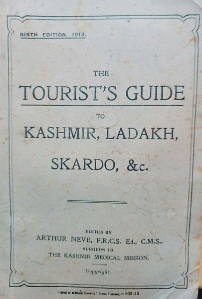 This copy (225 pages, 9th edition, 1913), published in Lahore, features dozens of detailed itineraries with maps, covering campsites, mountain pastures, river crossings, and more. Among them, you can trek from Srinagar to Khapalu and then to Baltistan, or "travel" from Leh to Yarkand (Xinjiang) via the Nubra Valley, along with other unexpected destinations.
The guide also includes suggestions for shikara rides, houseboat rentals, and gear for hunting, camping, fishing, and photography.
This copy (225 pages, 9th edition, 1913), published in Lahore, features dozens of detailed itineraries with maps, covering campsites, mountain pastures, river crossings, and more. Among them, you can trek from Srinagar to Khapalu and then to Baltistan, or "travel" from Leh to Yarkand (Xinjiang) via the Nubra Valley, along with other unexpected destinations.
The guide also includes suggestions for shikara rides, houseboat rentals, and gear for hunting, camping, fishing, and photography.
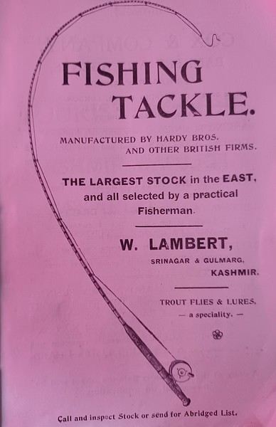 Plus, it lists various supplies like chocolate, Egyptian cigarettes, frames, and alcohol.
Note that the Murree Brewery, relocated to Rawalpindi, is still operational—though, in theory, the predominantly Muslim population can’t access it.
Plus, it lists various supplies like chocolate, Egyptian cigarettes, frames, and alcohol.
Note that the Murree Brewery, relocated to Rawalpindi, is still operational—though, in theory, the predominantly Muslim population can’t access it.
 I found this book in a box of old books, and you can still find copies on Anglo-Saxon websites—though often at prohibitive prices.
This copy (225 pages, 9th edition, 1913), published in Lahore, features dozens of detailed itineraries with maps, covering campsites, mountain pastures, river crossings, and more. Among them, you can trek from Srinagar to Khapalu and then to Baltistan, or "travel" from Leh to Yarkand (Xinjiang) via the Nubra Valley, along with other unexpected destinations.
The guide also includes suggestions for shikara rides, houseboat rentals, and gear for hunting, camping, fishing, and photography.
Plus, it lists various supplies like chocolate, Egyptian cigarettes, frames, and alcohol.
Note that the Murree Brewery, relocated to Rawalpindi, is still operational—though, in theory, the predominantly Muslim population can’t access it.
I found this book in a box of old books, and you can still find copies on Anglo-Saxon websites—though often at prohibitive prices.Can you book hotels last-minute in Quebec in late September - early October?
Hi there, I’m planning a road trip to Quebec in late September/early October.
Since I’m over 75, it’s impossible to rent a camper van. So, the option left is a car plus hotels. I’m used to traveling freely—I sketch out a rough route and stop wherever and whenever I feel like it.
Is it possible during this period to travel without booking hotels/motels or B&Bs in advance, knowing I’ll only need a double room?
Thanks for your replies.
3-Week Itinerary - Santiago, Fogo & Maio - Family of 5
Hello,
We’re a family of 5 (2 adults and 3 kids who’ll be 2, 7, and 10 years old) planning to visit the islands of Santiago, Fogo, and Maio this summer. We’ll have 22 full days on the ground. It’s a shame (financially, logistically, and environmentally speaking!), but we’ll be taking 4 flights: a round-trip from Santiago to Fogo and another from Santiago to Maio. We’d like to position Maio toward the end of our stay since we enjoy ending our trips with a quieter beach phase.
For now, based on flight schedules and dates, we’re thinking of doing: 23/07: Arrival in Santiago 24/07 – 30/07: Fogo (5 full days) 30/07 – 05/08: Santiago (5 full days) 05/08 – 11/08: Maio (5 full days) 11/08 – 15/08: Santiago (3 full days) 15/08: Return to France
FOGO: Of course, we want to visit Cha das Caldeiras, where we’d like to spend 3 nights. We’d love to explore the valley and are also considering hiking the smaller Pico (the taller one seems too ambitious for us with the kids). Do you have any info on that hike? What else do you recommend doing on the other days? Where can we go for other walks? I’ve seen that it’s possible to descend from Cha das Caldeiras to Monteiros, but I’m worried it might still be too challenging. It looks amazing!! But how do we manage with our luggage? Otherwise, the north of the island intrigues me, though we’re not thrilled about São Filipe, even though we know we’ll have to spend at least one night there before returning to Santiago.
On this island, we initially thought about not renting a car, but I’m wondering if that’s a good idea for us with all the luggage. If we do rent one, is it easy to reach Cha das Caldeiras by car? Any advice is welcome!
MAIO: Here, I think renting a car will be essential for us to get around easily. We’d like to do an excursion to observe turtle nesting. I haven’t found much info on this—where and with whom should we go? Otherwise, the plan is to do some snorkeling directly from the beach, independently, since we’ll need to take turns so one adult can stay with our 2-year-old. Any spots you’d recommend?
Which towns would you suggest staying in? All options work for us—we’re fine with settling in one place or splitting our time (e.g., 3 nights in one spot and 3 nights elsewhere).
Basically, I’m open to all tips and recommendations for this little week on Maio (short walks, places to relax, beaches, etc.)!
SANTIAGO: Nothing too original, but for Santiago, we’re considering visiting Cidade Velha, Tarrafal, and Ribeira da Prata (for the black sand beach and natural pools), as well as Serra Malagueta for a hike. There must be so much more to do, especially with the time we have. What else would you recommend?
I’m struggling to figure out how to organize our time there since we’ll have 5 full days first, then 3 more. How would you do it?
Thanks,
For now, based on flight schedules and dates, we’re thinking of doing: 23/07: Arrival in Santiago 24/07 – 30/07: Fogo (5 full days) 30/07 – 05/08: Santiago (5 full days) 05/08 – 11/08: Maio (5 full days) 11/08 – 15/08: Santiago (3 full days) 15/08: Return to France
FOGO: Of course, we want to visit Cha das Caldeiras, where we’d like to spend 3 nights. We’d love to explore the valley and are also considering hiking the smaller Pico (the taller one seems too ambitious for us with the kids). Do you have any info on that hike? What else do you recommend doing on the other days? Where can we go for other walks? I’ve seen that it’s possible to descend from Cha das Caldeiras to Monteiros, but I’m worried it might still be too challenging. It looks amazing!! But how do we manage with our luggage? Otherwise, the north of the island intrigues me, though we’re not thrilled about São Filipe, even though we know we’ll have to spend at least one night there before returning to Santiago.
On this island, we initially thought about not renting a car, but I’m wondering if that’s a good idea for us with all the luggage. If we do rent one, is it easy to reach Cha das Caldeiras by car? Any advice is welcome!
MAIO: Here, I think renting a car will be essential for us to get around easily. We’d like to do an excursion to observe turtle nesting. I haven’t found much info on this—where and with whom should we go? Otherwise, the plan is to do some snorkeling directly from the beach, independently, since we’ll need to take turns so one adult can stay with our 2-year-old. Any spots you’d recommend?
Which towns would you suggest staying in? All options work for us—we’re fine with settling in one place or splitting our time (e.g., 3 nights in one spot and 3 nights elsewhere).
Basically, I’m open to all tips and recommendations for this little week on Maio (short walks, places to relax, beaches, etc.)!
SANTIAGO: Nothing too original, but for Santiago, we’re considering visiting Cidade Velha, Tarrafal, and Ribeira da Prata (for the black sand beach and natural pools), as well as Serra Malagueta for a hike. There must be so much more to do, especially with the time we have. What else would you recommend?
I’m struggling to figure out how to organize our time there since we’ll have 5 full days first, then 3 more. How would you do it?
Thanks,
Draft itinerary for 3 weeks in Sicily without a car
Hi everyone,
I’d love to get your thoughts on the following itinerary (late May). I like to take my time in ruins and museums, and beaches don’t interest me. I’ll be staying in hostels and using public transport. Do you see any major omissions or things that aren’t worth it? Thanks!
Day 1: Arrival in CATANIA Day 2: Catania – visit (fish market, cathedral, Biscarri Palace, etc.) Day 3: Mount Etna (day trip)
Day 4: Morning trip to TAORMINA, visit the town Day 5: Alcantara Gorge (day trip) + more time in Taormina
Day 6: Trip to SYRACUSE, visit Ortigia Day 7: Ortigia Day 8: NOTO (day trip) (or another Baroque town?) Day 9: Syracuse Archaeological Park + more time in Ortigia (or leave for Enna?)
Day 10: Transport via Enna? TO BE RESOLVED (long, 2 or 3 changes, limited accommodation in Enna...)
Day 11: AGRIGENTO: town and Scala dei Turchi (optional) Day 12: Valley of the Temples + archaeological museum
Day 13: Departure for TRAPANI (4h), afternoon: town (+ salt flats?) Day 14: Segesta (day trip) + town/Erice Day 15: Monte Cofano Nature Reserve (hike + summit) (day trip) Day 16: Zingaro Nature Park (coastal route out, ridge route back) (day trip)
Day 17: Departure for the AEGADIAN ISLANDS: Levanzo and Favignana (bike), overnight if possible Day 18: Egadi Islands
Day 19: Departure for PALERMO + first visits Day 20: The city Day 21: The city (Monreale?) Day 22: Options: - Capo Gallo hike (3.5h round trip) (via Mondello) - Cefalù (45 min by train) Day 23: Return flight
I’d love to get your thoughts on the following itinerary (late May). I like to take my time in ruins and museums, and beaches don’t interest me. I’ll be staying in hostels and using public transport. Do you see any major omissions or things that aren’t worth it? Thanks!
Day 1: Arrival in CATANIA Day 2: Catania – visit (fish market, cathedral, Biscarri Palace, etc.) Day 3: Mount Etna (day trip)
Day 4: Morning trip to TAORMINA, visit the town Day 5: Alcantara Gorge (day trip) + more time in Taormina
Day 6: Trip to SYRACUSE, visit Ortigia Day 7: Ortigia Day 8: NOTO (day trip) (or another Baroque town?) Day 9: Syracuse Archaeological Park + more time in Ortigia (or leave for Enna?)
Day 10: Transport via Enna? TO BE RESOLVED (long, 2 or 3 changes, limited accommodation in Enna...)
Day 11: AGRIGENTO: town and Scala dei Turchi (optional) Day 12: Valley of the Temples + archaeological museum
Day 13: Departure for TRAPANI (4h), afternoon: town (+ salt flats?) Day 14: Segesta (day trip) + town/Erice Day 15: Monte Cofano Nature Reserve (hike + summit) (day trip) Day 16: Zingaro Nature Park (coastal route out, ridge route back) (day trip)
Day 17: Departure for the AEGADIAN ISLANDS: Levanzo and Favignana (bike), overnight if possible Day 18: Egadi Islands
Day 19: Departure for PALERMO + first visits Day 20: The city Day 21: The city (Monreale?) Day 22: Options: - Capo Gallo hike (3.5h round trip) (via Mondello) - Cefalù (45 min by train) Day 23: Return flight
Short stop in Bali: stay in Denpasar or go to Ubud?
Hi everyone,
This September, my partner and I are heading to North Sulawesi for 3 weeks. Our international flight is with Malaysia Airlines, departing from Paris. We have a layover in KL, then fly to Denpasar, followed by a domestic flight from Denpasar to Manado. We land in Bali Denpasar on 05/09 around 12:00 PM, and our flight to Manado is on 07/09 at 1:30 AM. The plan was to have at least one night (from the 5th to the 6th of September) between our international flight and our flight to Manado, just to recharge a bit since we're not 20 anymore 😛. My question is, given the very short stop in Bali (a day and a half), is it better to stay in Denpasar rather than go to Ubud for the night? I’ve been to Bali before, and from what I remember, even though the distances are short, transfers take a long time because of the extremely heavy traffic—but I was there in July, not September. I’m not sure if that makes a big difference? If the answer is "it’s better to stay in Denpasar," are there any nice places to visit? There’s very little feedback about the city since tourists usually don’t stick around. Thanks in advance for your replies.
This September, my partner and I are heading to North Sulawesi for 3 weeks. Our international flight is with Malaysia Airlines, departing from Paris. We have a layover in KL, then fly to Denpasar, followed by a domestic flight from Denpasar to Manado. We land in Bali Denpasar on 05/09 around 12:00 PM, and our flight to Manado is on 07/09 at 1:30 AM. The plan was to have at least one night (from the 5th to the 6th of September) between our international flight and our flight to Manado, just to recharge a bit since we're not 20 anymore 😛. My question is, given the very short stop in Bali (a day and a half), is it better to stay in Denpasar rather than go to Ubud for the night? I’ve been to Bali before, and from what I remember, even though the distances are short, transfers take a long time because of the extremely heavy traffic—but I was there in July, not September. I’m not sure if that makes a big difference? If the answer is "it’s better to stay in Denpasar," are there any nice places to visit? There’s very little feedback about the city since tourists usually don’t stick around. Thanks in advance for your replies.
A Brief A to Z of Peru
Foreword
This text has been proofread many times.
Sorry if some points in this A to Z have already been covered on this forum.
Text and drawings by the author.
Peru is still a very vast country, with so much to see, and obviously this text can't list all the attractions of the country.
*Abiseo (River) A national park that's very hard to access and doesn’t seem open to visitors. Includes the Gran Pajaten site (see below). Personally, it really sparks my imagination (not visited personally)
*Aguas Calientes the town next to Machu Picchu, more precisely below the archaeological site. As far as I know, you can only get there by train. Reminds me of the market where stalls line both sides of the tracks near Bangkok. I love it
*Altiplano: somewhere the "heart" of the Andes. I was able to trek across it on foot, starting from Caracollo in Bolivia, and of course, it’s vast plains to explore. This is where people live in a very rural way. Andean populations are quite austere compared to those in the lowlands or on the coast. You really have to appreciate the harshness of life to live there. Life is anything but superficial. I set a compass heading and found myself walking west toward the expanse of water near a place called La Joya. For pitching the tent, the nights were still chilly
*Canyon del Colca One of the deepest canyons in the world. Personally, I hiked down and back up on foot. The toughest stretch I’ve ever covered in my life.
*Ceviche More or less the national dish. A marinade of fish, shellfish, and lime. But you can find it in some restaurants in Europe, France, and certainly in Belgium or Switzerland. In the small restaurants of Pisco, you can eat excellent ceviche
*Cerro Sechín: Mostly bas-reliefs. A site little known to travelers in the Casma province. The first vestiges of a pre-Inca civilization with iconography similar to that of Chavín (not visited personally)
*Chan Chan A large city of the Chimú civilization and relatively vast to visit. You can see adobe walls with bas-reliefs. Visit from Trujillo, take a colectivo. Plan for the whole day
*Charango: a small guitar widely used in Andean music
*Chauchilla A necropolis near Nazca where you can see mummies exposed on the ground. YouTubers can do paranormal experiments there. And for anyone wondering about the fate of the soul and body after death, here’s the answer: the body remains after death. You can imagine your own flesh and body exposed to the winds of the Pampa and before eternity... (not visited personally)
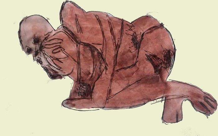
*Chavín de Huántar (Lanzón) The site’s appeal lies in its mountainous surroundings, the Lanzón stela, and the sculpted heads on the façades. What few people know is that the Chavín civilization began its expansion centuries before the Incas. Unfortunately, you can’t get too close to see the Lanzón—the day I was there, it was protected by grilles. To get there: minibus from Huaraz or trek from Olleros. Then cross a high pass (over 5,000m). If you do it solo on foot, be careful—the path isn’t obvious from Olleros
*Chullpa: funerary tower, notably at Sillustani in the Lake Titicaca region
*Chimú: pre-Inca civilization whose center was Chan Chan.
*Chola/Cholitas (Bolivia): typical clothing style of women from the Andean plateaus
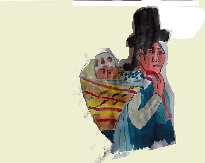
*Chompa: pronounce it *Chompaaa!* A common term for a wool sweater with vicuña patterns, often knitted from alpaca wool. If you dress like this, it’s a bit kitschy around the edges
*Cuy That one isn’t a guinea pig like in Guyana but an actual guinea pig. During a trip to Peru, I was hiking near a village north of Quillabamba (the terminus of the train line that passes through Aguas Calientes), and I was invited to stay in a house. The family raised a few of these pets. Apparently, the locals eat them. Since I’m not much of a meat-eater, it doesn’t really tempt me. How about you?
*Pacific Coast or how to talk about a place you haven’t visited? Except for the coast near Pisco and San Andrés, I haven’t visited any coastal cities. But that doesn’t mean these places lack interest or poetry. For fans of clichéd images, pelicans, seabirds, and fishing boats appear by the sea.
*Gran Pajaten: also closed to the public. Features anthropomorphic bas-reliefs. (not visited personally)
*Huaca. Visit the Huaca del Sol and Huaca de la Luna, especially near Trujillo. However, you can skip them—Chan Chan is still more interesting. Don’t forget to spend time visiting Chan Chan
*Huacachina A small oasis in the desert near Ica. Yes, we’re talking about an oasis because for those who’ve never traveled to Peru, the coastal strip along the Pacific is almost entirely desert, from north to south. Peru is territorially made up of three different regions: the desert coast, the Altiplano stretching north to south with mountain ranges (the Cordilleras), and the Amazon basin to the east. (not visited personally)
*Inca Kola It’s neither Coca-Cola nor Pepsi but a unique cola with a slightly orange color. Tastes like bubble gum
*Intiwatana: a carved rock shaped like a parallelepiped. Is it a sundial?
*Ballestas Islands: a highlight in Peru, though very touristy. You can only get there by boat from the port of San Andrés, a few kilometers from Pisco. It’s a surreal place to me—actually islets with cavities where sea lions and fur seals live. Since it’s a protected area, you’re not allowed to disembark. Guano is harvested there, which can be used as fertilizer.
*Kuelap: a fortress built by the Chachapoyas people. Rarely visited by travelers. (not visited personally)
*Larco Museum: an iconic museum in Lima with a large collection of pieces from archaeological and pre-Columbian sites. From what I remember, it has many pieces from the Moche civilization. As for the Moche statuettes, the prudish might look away. Probably a veneration of the god Priapus without knowing it.
*Nazca Lines Discovered by German archaeologist Maria Reiche, they stretch for kilometers. The designs in the desert around Nazca depict animals and cabalistic signs. The question I ask myself is why the creators of these lines represented a monkey and a hummingbird—species endemic to the tropical forest, not the desert plains around Nazca.
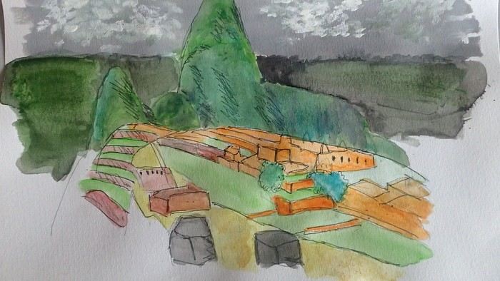
*Machu Picchu: means "old mountain" in Quechua. There’s also Wayna Picchu. The ruins of the site emerge from a sort of small plateau above Aguas Calientes. When the mist rises above the site and the bend of the Urubamba River, it’s truly magical... Also the starting point of the Inca Trail.
*Coca tea A decoction/infusion of the coca plant, meant to ease altitude sickness or *soroche*
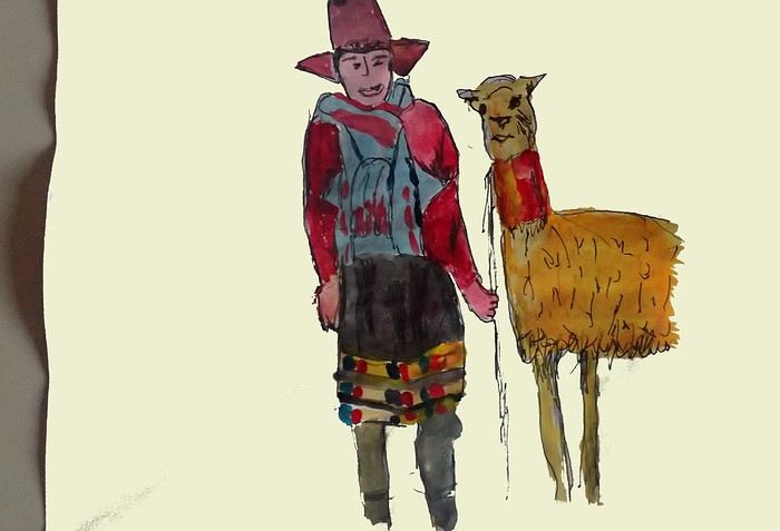
*Chullo A rough translation would be a Peruvian wool hat.
*Moche: a civilization established in the Moche Valley, hence the term *Mochica*. What characterizes this civilization are the distinctive clay pieces representing faces and erotic statuettes
*Papa a la Huancaína A local potato dish
*Pisac: a typical market near Cusco
*Pisco Sour: perhaps the Peruvian equivalent of the *caipirinha* you drink in Brazil.
*Puya Raimondii A Bromeliaceae that still looks like a cactus, endemic to the Altiplano
*Quechua The language spoken by the indigenous people of the high plateaus (as well as Aymara in Bolivia)
*Quipu A knotted string used for counting. Widely used by the Inca administration.
*Sacsayhuamán (Q’enqo, Inca Bath) From Cusco’s Plaza de Armas, take the streets that climb above the city. Sacsayhuamán is called a fortress and is made up of large stone blocks. You wonder how the Incas could cut such huge blocks to assemble them—just like some streets in Cusco. The Q’enqo block is enigmatic; no one really knows what it represents.
*Savia Andina An Andean folk group.
*Tambo (=> Ollantaytambo) The Inca emperor (Atahualpa, Manco Capac) had the mission of controlling a vast empire. An empire that was still very extensive. Hence the importance of these *tambos* or relay stations. Napoleon created the civil code; the Incas invented the *tambos* and *quipus*.
*Tawantinsuyu: the Inca Empire
*Tinku: a warrior dance practiced mainly in Bolivia
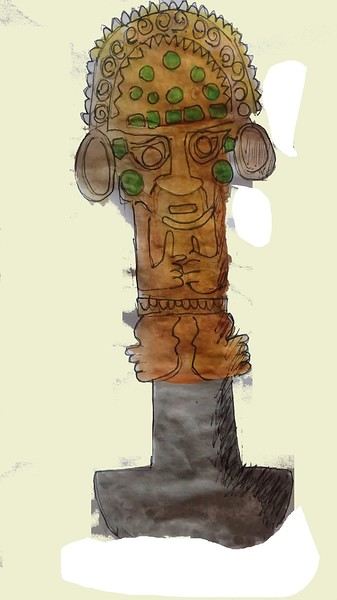
*Golden Tumi: a sacrificial weapon. Often featured in Peru travel guides. See illustration
*Terra X: a documentary series from the German TV channel that aired on Arte. Some episodes focused on pre-Inca and Inca Peru. I must have some old recording tapes. In memory of Gottfried Kirchner as a source of inspiration.
*Uros: I checked—it actually refers to the people who live on these floating islands. Even if it’s touristy, it’s a must-visit because it’s incredible how people can live on islets made from nothing. Take the boat from Puno
*Vicuña, llama, guanaco: camelids characteristic of the Altiplano
*Wayna Picchu The young Picchu mountain. In the first minutes of *Aguirre, the Wrath of God*, you see Klaus Kinski—well, Aguirre—making his way along the Inca Trail. Werner Herzog must have broken his back filming those sequences.
*Zampoña: pan flute
Peru is still a very vast country, with so much to see, and obviously this text can't list all the attractions of the country.
*Abiseo (River) A national park that's very hard to access and doesn’t seem open to visitors. Includes the Gran Pajaten site (see below). Personally, it really sparks my imagination (not visited personally)
*Aguas Calientes the town next to Machu Picchu, more precisely below the archaeological site. As far as I know, you can only get there by train. Reminds me of the market where stalls line both sides of the tracks near Bangkok. I love it
*Altiplano: somewhere the "heart" of the Andes. I was able to trek across it on foot, starting from Caracollo in Bolivia, and of course, it’s vast plains to explore. This is where people live in a very rural way. Andean populations are quite austere compared to those in the lowlands or on the coast. You really have to appreciate the harshness of life to live there. Life is anything but superficial. I set a compass heading and found myself walking west toward the expanse of water near a place called La Joya. For pitching the tent, the nights were still chilly
*Canyon del Colca One of the deepest canyons in the world. Personally, I hiked down and back up on foot. The toughest stretch I’ve ever covered in my life.
*Ceviche More or less the national dish. A marinade of fish, shellfish, and lime. But you can find it in some restaurants in Europe, France, and certainly in Belgium or Switzerland. In the small restaurants of Pisco, you can eat excellent ceviche
*Cerro Sechín: Mostly bas-reliefs. A site little known to travelers in the Casma province. The first vestiges of a pre-Inca civilization with iconography similar to that of Chavín (not visited personally)
*Chan Chan A large city of the Chimú civilization and relatively vast to visit. You can see adobe walls with bas-reliefs. Visit from Trujillo, take a colectivo. Plan for the whole day
*Charango: a small guitar widely used in Andean music
*Chauchilla A necropolis near Nazca where you can see mummies exposed on the ground. YouTubers can do paranormal experiments there. And for anyone wondering about the fate of the soul and body after death, here’s the answer: the body remains after death. You can imagine your own flesh and body exposed to the winds of the Pampa and before eternity... (not visited personally)
*Chavín de Huántar (Lanzón) The site’s appeal lies in its mountainous surroundings, the Lanzón stela, and the sculpted heads on the façades. What few people know is that the Chavín civilization began its expansion centuries before the Incas. Unfortunately, you can’t get too close to see the Lanzón—the day I was there, it was protected by grilles. To get there: minibus from Huaraz or trek from Olleros. Then cross a high pass (over 5,000m). If you do it solo on foot, be careful—the path isn’t obvious from Olleros
*Chullpa: funerary tower, notably at Sillustani in the Lake Titicaca region
*Chimú: pre-Inca civilization whose center was Chan Chan.
*Chola/Cholitas (Bolivia): typical clothing style of women from the Andean plateaus
*Chompa: pronounce it *Chompaaa!* A common term for a wool sweater with vicuña patterns, often knitted from alpaca wool. If you dress like this, it’s a bit kitschy around the edges
*Cuy That one isn’t a guinea pig like in Guyana but an actual guinea pig. During a trip to Peru, I was hiking near a village north of Quillabamba (the terminus of the train line that passes through Aguas Calientes), and I was invited to stay in a house. The family raised a few of these pets. Apparently, the locals eat them. Since I’m not much of a meat-eater, it doesn’t really tempt me. How about you?
*Pacific Coast or how to talk about a place you haven’t visited? Except for the coast near Pisco and San Andrés, I haven’t visited any coastal cities. But that doesn’t mean these places lack interest or poetry. For fans of clichéd images, pelicans, seabirds, and fishing boats appear by the sea.
*Gran Pajaten: also closed to the public. Features anthropomorphic bas-reliefs. (not visited personally)
*Huaca. Visit the Huaca del Sol and Huaca de la Luna, especially near Trujillo. However, you can skip them—Chan Chan is still more interesting. Don’t forget to spend time visiting Chan Chan
*Huacachina A small oasis in the desert near Ica. Yes, we’re talking about an oasis because for those who’ve never traveled to Peru, the coastal strip along the Pacific is almost entirely desert, from north to south. Peru is territorially made up of three different regions: the desert coast, the Altiplano stretching north to south with mountain ranges (the Cordilleras), and the Amazon basin to the east. (not visited personally)
*Inca Kola It’s neither Coca-Cola nor Pepsi but a unique cola with a slightly orange color. Tastes like bubble gum
*Intiwatana: a carved rock shaped like a parallelepiped. Is it a sundial?
*Ballestas Islands: a highlight in Peru, though very touristy. You can only get there by boat from the port of San Andrés, a few kilometers from Pisco. It’s a surreal place to me—actually islets with cavities where sea lions and fur seals live. Since it’s a protected area, you’re not allowed to disembark. Guano is harvested there, which can be used as fertilizer.
*Kuelap: a fortress built by the Chachapoyas people. Rarely visited by travelers. (not visited personally)
*Larco Museum: an iconic museum in Lima with a large collection of pieces from archaeological and pre-Columbian sites. From what I remember, it has many pieces from the Moche civilization. As for the Moche statuettes, the prudish might look away. Probably a veneration of the god Priapus without knowing it.
*Nazca Lines Discovered by German archaeologist Maria Reiche, they stretch for kilometers. The designs in the desert around Nazca depict animals and cabalistic signs. The question I ask myself is why the creators of these lines represented a monkey and a hummingbird—species endemic to the tropical forest, not the desert plains around Nazca.
*Machu Picchu: means "old mountain" in Quechua. There’s also Wayna Picchu. The ruins of the site emerge from a sort of small plateau above Aguas Calientes. When the mist rises above the site and the bend of the Urubamba River, it’s truly magical... Also the starting point of the Inca Trail.
*Coca tea A decoction/infusion of the coca plant, meant to ease altitude sickness or *soroche*
*Chullo A rough translation would be a Peruvian wool hat.
*Moche: a civilization established in the Moche Valley, hence the term *Mochica*. What characterizes this civilization are the distinctive clay pieces representing faces and erotic statuettes
*Papa a la Huancaína A local potato dish
*Pisac: a typical market near Cusco
*Pisco Sour: perhaps the Peruvian equivalent of the *caipirinha* you drink in Brazil.
*Puya Raimondii A Bromeliaceae that still looks like a cactus, endemic to the Altiplano
*Quechua The language spoken by the indigenous people of the high plateaus (as well as Aymara in Bolivia)
*Quipu A knotted string used for counting. Widely used by the Inca administration.
*Sacsayhuamán (Q’enqo, Inca Bath) From Cusco’s Plaza de Armas, take the streets that climb above the city. Sacsayhuamán is called a fortress and is made up of large stone blocks. You wonder how the Incas could cut such huge blocks to assemble them—just like some streets in Cusco. The Q’enqo block is enigmatic; no one really knows what it represents.
*Savia Andina An Andean folk group.
*Tambo (=> Ollantaytambo) The Inca emperor (Atahualpa, Manco Capac) had the mission of controlling a vast empire. An empire that was still very extensive. Hence the importance of these *tambos* or relay stations. Napoleon created the civil code; the Incas invented the *tambos* and *quipus*.
*Tawantinsuyu: the Inca Empire
*Tinku: a warrior dance practiced mainly in Bolivia
*Golden Tumi: a sacrificial weapon. Often featured in Peru travel guides. See illustration
*Terra X: a documentary series from the German TV channel that aired on Arte. Some episodes focused on pre-Inca and Inca Peru. I must have some old recording tapes. In memory of Gottfried Kirchner as a source of inspiration.
*Uros: I checked—it actually refers to the people who live on these floating islands. Even if it’s touristy, it’s a must-visit because it’s incredible how people can live on islets made from nothing. Take the boat from Puno
*Vicuña, llama, guanaco: camelids characteristic of the Altiplano
*Wayna Picchu The young Picchu mountain. In the first minutes of *Aguirre, the Wrath of God*, you see Klaus Kinski—well, Aguirre—making his way along the Inca Trail. Werner Herzog must have broken his back filming those sequences.
*Zampoña: pan flute
Already twenty years...
« Ali is not dead; he continues to inspire many talented musicians. There’s a new generation of artists who have their own style, but they’ve all listened to Ali Farka Touré. » (Ms. Kuypers-Touré, widow of Ali Farka Touré)
Ali Farka Touré (1939-2006)
Recognized worldwide as one of the most important musicians from Africa, his guitar playing earned him the nickname “the African John Lee Hooker.” But Ali Farka Touré preferred to flip the script and highlight the roots of Southern U.S. music in the Sahel region: « I have the roots and the trunk; they only have the leaves and branches. » In other words, what John Lee Hooker played was an echo of a distant African past. Ali Farka Touré was the guardian of traditions, and even though his sound resembled the blues, it remained deeply tied to the land of his ancestors—in Africa, in Mali. A farmer at heart, the famous Malian singer and guitarist continued to cultivate the land until his hospitalization for cancer, from which he passed away on March 7, 2006, in Bamako at the age of 66.
The son of a soldier who fell in combat while serving in the French army, he was born in 1939 in Kanau, near Timbuktu, then part of French Sudan (a subdivision of French West Africa, now Mali). He was raised by an uncle with harsh teaching methods and a grandmother who was “strong in voodoo,” communicating with spirits. At ten years old, he had a revelation for the single-string lute djurkel, “the instrument of the spirits,” and for the fiddle njarka. Seven years later, while training as a driver at a clinic, he fell in love with a colleague’s guitar. It wasn’t until 1968, when he was to represent Mali in Bulgaria, that he finally had the chance to acquire his first six-string guitar. International acclaim came later, following numerous concerts in the UK in the mid-1980s, at the invitation of World Circuit, the independent English label to which he remained loyal his entire life.
Several times, Ali Farka Touré announced his plan to stop making music. « It’s time for me to focus on my own. I don’t want Europe to tear me away from Africa. [...] Me, I love cultivating the land. In my life, if I’m not in the fields, I’m fishing or in the garden! »
Yet, Ali Farka Touré regularly returned to perform in Europe and the U.S. In 1995, he won his first Grammy Award for the album Talking Timbuktu, recorded in 1993 with bassist John Patitucci, percussionist Jim Keltner, the great Californian guitarist Ry Cooder, and the venerable guitarist Clarence Gatemouth Brown. His last three years were extraordinarily productive. Back to back, he recorded his best albums: In the Heart of the Moon (2004), Ali & Toumani (released in 2010), both duets with kora player Toumani Diabaté, and Savane (2005), dedicated to the traditional Peul and Songhai repertoires. At the same time, he tirelessly devoted himself to his agricultural work and his duties as mayor, a role he had held since 2004.
A multi-instrumentalist, he was a self-taught musician with an impressive musical culture. His discography includes around fifteen albums and several timeless hits used in films or as TV program themes. A universal symbol of West African sound heritage, his presence and his role in spreading a centuries-old legacy are undeniable. His son, also a musician, Vieux Farka Touré, now bears the heavy responsibility of carrying on his illustrious father’s message and legacy. His album Les Racines, released in 2002, is his contribution to preserving an instantly recognizable sound.
Meanwhile, his country, Mali, has paid tribute to him: for several years now, a square and a street in Bamako, the capital of Mali, have borne his name (both located in the Lafiabougou district).
In 2023, World Circuit released a new posthumous album, Voyageur, the first to feature previously unreleased tracks since 2010. It includes pieces composed and recorded spontaneously over the last 15 years, whether during his many tours or in the studio. These tracks once again showcase Touré’s passion for the musical traditions of his homeland and for the creativity and cultural diversity of West Africa. Below, an excerpt from this album: the beautiful song Chérie (with a very young Oumou Sangaré)—magnificent!!!
hgb
Ali Farka Touré feat. Oumou Sangaré: Chérie
Ali Farka Touré (1939-2006)
Recognized worldwide as one of the most important musicians from Africa, his guitar playing earned him the nickname “the African John Lee Hooker.” But Ali Farka Touré preferred to flip the script and highlight the roots of Southern U.S. music in the Sahel region: « I have the roots and the trunk; they only have the leaves and branches. » In other words, what John Lee Hooker played was an echo of a distant African past. Ali Farka Touré was the guardian of traditions, and even though his sound resembled the blues, it remained deeply tied to the land of his ancestors—in Africa, in Mali. A farmer at heart, the famous Malian singer and guitarist continued to cultivate the land until his hospitalization for cancer, from which he passed away on March 7, 2006, in Bamako at the age of 66.
The son of a soldier who fell in combat while serving in the French army, he was born in 1939 in Kanau, near Timbuktu, then part of French Sudan (a subdivision of French West Africa, now Mali). He was raised by an uncle with harsh teaching methods and a grandmother who was “strong in voodoo,” communicating with spirits. At ten years old, he had a revelation for the single-string lute djurkel, “the instrument of the spirits,” and for the fiddle njarka. Seven years later, while training as a driver at a clinic, he fell in love with a colleague’s guitar. It wasn’t until 1968, when he was to represent Mali in Bulgaria, that he finally had the chance to acquire his first six-string guitar. International acclaim came later, following numerous concerts in the UK in the mid-1980s, at the invitation of World Circuit, the independent English label to which he remained loyal his entire life.
Several times, Ali Farka Touré announced his plan to stop making music. « It’s time for me to focus on my own. I don’t want Europe to tear me away from Africa. [...] Me, I love cultivating the land. In my life, if I’m not in the fields, I’m fishing or in the garden! »
Yet, Ali Farka Touré regularly returned to perform in Europe and the U.S. In 1995, he won his first Grammy Award for the album Talking Timbuktu, recorded in 1993 with bassist John Patitucci, percussionist Jim Keltner, the great Californian guitarist Ry Cooder, and the venerable guitarist Clarence Gatemouth Brown. His last three years were extraordinarily productive. Back to back, he recorded his best albums: In the Heart of the Moon (2004), Ali & Toumani (released in 2010), both duets with kora player Toumani Diabaté, and Savane (2005), dedicated to the traditional Peul and Songhai repertoires. At the same time, he tirelessly devoted himself to his agricultural work and his duties as mayor, a role he had held since 2004.
A multi-instrumentalist, he was a self-taught musician with an impressive musical culture. His discography includes around fifteen albums and several timeless hits used in films or as TV program themes. A universal symbol of West African sound heritage, his presence and his role in spreading a centuries-old legacy are undeniable. His son, also a musician, Vieux Farka Touré, now bears the heavy responsibility of carrying on his illustrious father’s message and legacy. His album Les Racines, released in 2002, is his contribution to preserving an instantly recognizable sound.
Meanwhile, his country, Mali, has paid tribute to him: for several years now, a square and a street in Bamako, the capital of Mali, have borne his name (both located in the Lafiabougou district).
In 2023, World Circuit released a new posthumous album, Voyageur, the first to feature previously unreleased tracks since 2010. It includes pieces composed and recorded spontaneously over the last 15 years, whether during his many tours or in the studio. These tracks once again showcase Touré’s passion for the musical traditions of his homeland and for the creativity and cultural diversity of West Africa. Below, an excerpt from this album: the beautiful song Chérie (with a very young Oumou Sangaré)—magnificent!!!
hgb
Ali Farka Touré feat. Oumou Sangaré: Chérie
February contest theme: lakes and ponds around the world
Let’s stick with the water theme—it’s definitely the season (maybe a bit *too* much for some of those dealing with floods 😕).
After the flowing waters (with varying energy levels), let’s take it easy with still waters:
 Lakes (Annecy)
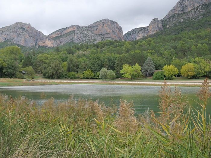 Ponds (near Moustiers Saint Marie)
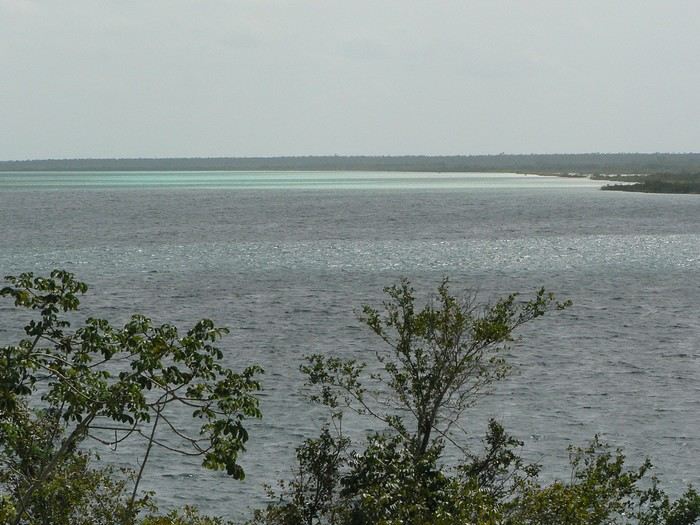 Lagoons (Bacalar)
If you’ve got nice photos of a pond—or even a puddle—why not? Natural bodies of water only: no pools or fountains (reservoir lakes are accepted… because they often look like natural lakes ).
The contest rules are the same as always 😉: Up to 3 photos per member, one photo per post (a little explanation is better), and past winning photos from other VF contests aren’t allowed. You have until Sunday, February 22nd at 11:59 PM (Paris time) to post your photos. Voting starts Monday the 23rd at midnight—rank your top 3 photos in order (3, 2, and 1 points). Voting ends Saturday, February 28th at 11:59 PM. Results will be announced on March 1st. The winning photo is the one with the most points (in case of a tie, the photo ranked first the most times wins). The lucky winner gets to organize March’s contest 😎.
Dig into your archives…
Lakes (Annecy)
Ponds (near Moustiers Saint Marie)
Lagoons (Bacalar)If you’ve got nice photos of a pond—or even a puddle—why not? Natural bodies of water only: no pools or fountains (reservoir lakes are accepted… because they often look like natural lakes ).
The contest rules are the same as always 😉: Up to 3 photos per member, one photo per post (a little explanation is better), and past winning photos from other VF contests aren’t allowed. You have until Sunday, February 22nd at 11:59 PM (Paris time) to post your photos. Voting starts Monday the 23rd at midnight—rank your top 3 photos in order (3, 2, and 1 points). Voting ends Saturday, February 28th at 11:59 PM. Results will be announced on March 1st. The winning photo is the one with the most points (in case of a tie, the photo ranked first the most times wins). The lucky winner gets to organize March’s contest 😎.
Dig into your archives…
7 weeks and 150 years between us on a southern Morocco road trip
We arrive in the evening in Marrakesh, and a taxi arranged by our friendly Riad is waiting for us. The driver takes us to the door, where we’re briefly greeted by our hosts. The room is heated—phew—because it’s really cold on this January 17th for our arrival. Riad Alisma, where we’re staying for 2 nights. The next morning, it’s pouring rain when we wake up, but after a good breakfast, the rain has calmed down. Off we go to the medersa, which allows for a relatively sheltered visit. We’d visited this palace 15 years ago—it’s been renovated since then.
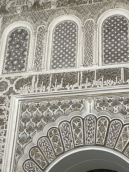
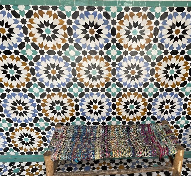
From there, without the rain, we wander aimlessly and eventually end up near the tanneries, but it’s Sunday, and there’s very little activity. Of course, we get hassled by a tout.
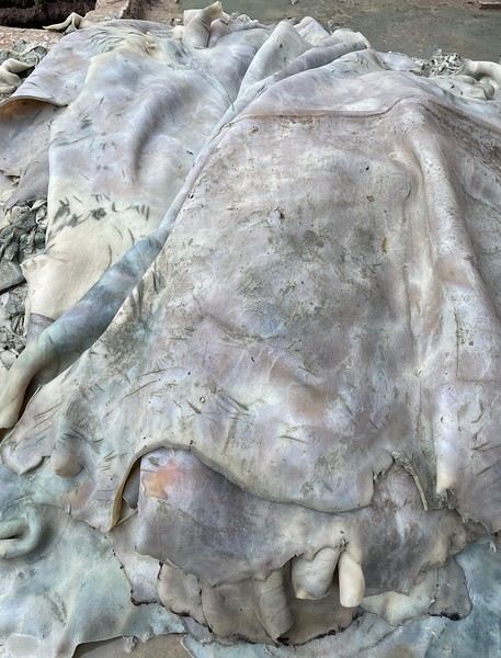
Here, the hides after being treated with lime—I love the colors.
We part ways a bit annoyed. He gets a little revenge by giving us bad directions, and we end up outside the city walls. We decide to take a taxi to the new modern art museum—60 dirhams for the 5 km, which is nothing when you think about it. That tout, who we didn’t ask for anything and made it clear we weren’t buying anything, dragged us into a shop supposedly only open that day and demanded 50 dirhams for his "services"! Let’s forget that bad moment and enjoy the exhibition at the MACAL.
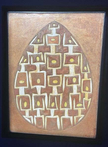
The taxi on the way back drops us off at Place des Ferblantiers, not far from our Riad. We’re a little peckish—it’s worth mentioning that at lunchtime, we only ate a plate of beans from a street vendor. So, we buy a bunch of little sweets, each more delicious than the last, at Ajar. We snack while sipping mint tea and watching life go by around us. A final visit to the Museum of Moroccan Cuisine on our way back helps us dodge a few more showers. Then it’s back to the Riad. The atmosphere in the city is heating up—it’s the AFCON final tonight. The temperatures, though? Not so much. We ordered a meal at the Riad, and it was a good call—not only was it really tasty, but the rain also picked up again. Our day in Marrakesh ends under the covers with a good book and some photo sorting. Still, we managed 10,750 steps. View of our Riad
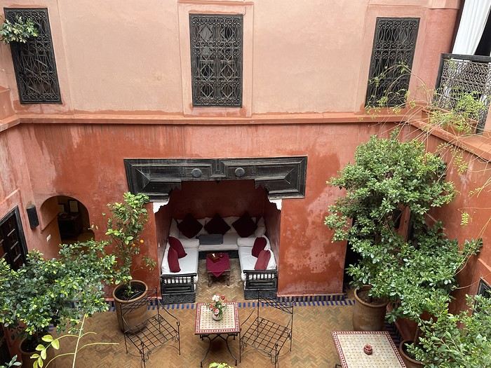
Tomorrow, we’ll pick up our rental car from Medloc and head to Essaouira.
From there, without the rain, we wander aimlessly and eventually end up near the tanneries, but it’s Sunday, and there’s very little activity. Of course, we get hassled by a tout.
Here, the hides after being treated with lime—I love the colors.
We part ways a bit annoyed. He gets a little revenge by giving us bad directions, and we end up outside the city walls. We decide to take a taxi to the new modern art museum—60 dirhams for the 5 km, which is nothing when you think about it. That tout, who we didn’t ask for anything and made it clear we weren’t buying anything, dragged us into a shop supposedly only open that day and demanded 50 dirhams for his "services"! Let’s forget that bad moment and enjoy the exhibition at the MACAL.
The taxi on the way back drops us off at Place des Ferblantiers, not far from our Riad. We’re a little peckish—it’s worth mentioning that at lunchtime, we only ate a plate of beans from a street vendor. So, we buy a bunch of little sweets, each more delicious than the last, at Ajar. We snack while sipping mint tea and watching life go by around us. A final visit to the Museum of Moroccan Cuisine on our way back helps us dodge a few more showers. Then it’s back to the Riad. The atmosphere in the city is heating up—it’s the AFCON final tonight. The temperatures, though? Not so much. We ordered a meal at the Riad, and it was a good call—not only was it really tasty, but the rain also picked up again. Our day in Marrakesh ends under the covers with a good book and some photo sorting. Still, we managed 10,750 steps. View of our Riad
Tomorrow, we’ll pick up our rental car from Medloc and head to Essaouira.
Do you know a nice restaurant in Kochi?
I'm looking for a small, not-too-touristy restaurant in Fort Kochi. Do you know one not too far from Jacob Road?
Thanks
Mosquitoes in Quebec in the summer
Hi there!! We all know there are mosquitoes in Quebec… but is it bearable? Are the cities affected too? Like Montreal and Quebec City? I can imagine it’s bad in the parks… The road trip would be from July 5th to the 21st, right in the middle of bug season!! Best, Christophe
In the land... of Senegambia
Hey fellow travelers!
So, a new year has begun. It’s time to reconnect with the VF buddies and wish you all my best for 2026—a year I hope is obviously full of travel, since, as I just made up: "If travel’s good, everything’s good" 😄.
To celebrate, I’m inviting you into my new "travel journal," the one from our latest trip in November 2025, a little two-week adventure.
This time, we headed to The Gambia, a tiny country tucked right in the middle of Senegal, before making our way to Casamance.
The Gambia is English-speaking, Senegal is French-speaking, but the locals? They couldn’t care less—because in this part of the world, they mostly speak Wolof, Fula, Jola, or Mandinka. Hence the title: Senegambia 😉.
As usual, I’m sharing the live updates I sent to friends and family—super casual, of course.
I know this isn’t the kind of destination that draws crowds, but if you love adventure, laughter, and emotion, it might just be your thing 😊.
Hugs 😘
So, a new year has begun. It’s time to reconnect with the VF buddies and wish you all my best for 2026—a year I hope is obviously full of travel, since, as I just made up: "If travel’s good, everything’s good" 😄.
To celebrate, I’m inviting you into my new "travel journal," the one from our latest trip in November 2025, a little two-week adventure.
This time, we headed to The Gambia, a tiny country tucked right in the middle of Senegal, before making our way to Casamance.
The Gambia is English-speaking, Senegal is French-speaking, but the locals? They couldn’t care less—because in this part of the world, they mostly speak Wolof, Fula, Jola, or Mandinka. Hence the title: Senegambia 😉.
As usual, I’m sharing the live updates I sent to friends and family—super casual, of course.
I know this isn’t the kind of destination that draws crowds, but if you love adventure, laughter, and emotion, it might just be your thing 😊.
Hugs 😘
Flores or Sulawesi? Can't decide!
Hi everyone,
First post in years on the forum—I’m so happy it’s back up and running!
I’ve been wrestling with this question for weeks now: Flores or Sulawesi?
I’m leaving in July for 24 days, followed by 2 weeks around Makassar/Wakatobi for work. For the first part, I’m traveling with my family (my partner + 3 kids aged 6 to 14).
I’ve had a long-time dream of Komodo, but I’m worried it’s become super touristy... though the crossing to Maumere still sounds amazing. I’m also not thrilled about all the internal flights.
On the other hand, since I’ll be in Sulawesi anyway, I’m thinking a crossing from Gorontalo to Luwuk via the Togians (maybe even a few days in Banggai) + a detour to Toraja (which I visited 10 years ago) could be an incredible trip too.
For my family, this is their first trip to Indonesia, so I’d love it to feel *mythic* ;).
Any advice is welcome—I’m really struggling to decide! I know it’s a choice between two great options...
Thanks!
I’ve been wrestling with this question for weeks now: Flores or Sulawesi?
I’m leaving in July for 24 days, followed by 2 weeks around Makassar/Wakatobi for work. For the first part, I’m traveling with my family (my partner + 3 kids aged 6 to 14).
I’ve had a long-time dream of Komodo, but I’m worried it’s become super touristy... though the crossing to Maumere still sounds amazing. I’m also not thrilled about all the internal flights.
On the other hand, since I’ll be in Sulawesi anyway, I’m thinking a crossing from Gorontalo to Luwuk via the Togians (maybe even a few days in Banggai) + a detour to Toraja (which I visited 10 years ago) could be an incredible trip too.
For my family, this is their first trip to Indonesia, so I’d love it to feel *mythic* ;).
Any advice is welcome—I’m really struggling to decide! I know it’s a choice between two great options...
Thanks!
Trip to Morocco in September-October 2025, in our camper van
Hi everyone,
We’re just back from a month-long trip to Morocco in our camper van.
After crossing France (we left from the Nantes area) and Spain, we arrived in Algeciras where we bought our boat tickets to Tangier. When we got to Tangier, as we were going through customs, you can imagine our surprise when the customs officer took our road map of Morocco and pointed out the label "Western Sahara" (just like in the forum’s destination section, by the way!).
He wanted it to say "Moroccan Sahara" instead!!! But there was nothing we could do—it was an old map... He wouldn’t listen, and after long discussions with the other (younger) customs officers, he finally gave it back and let us through... Unbelievable! Later, we heard that other travelers had their maps confiscated outright.
So, hide it well if you want to keep yours!!!
Anyway, we skirted around Tangier’s suburbs—pretty grim—and finally arrived in Asilah.
Following the coast and the long promenade along the beach, we reached the campsite. It was a bit crowded, not much shade, but it wasn’t far from the medina or the beach, and it wasn’t expensive. There’s some life here: Moroccan families seem to live on-site, in tents or basic bungalows. A woman was cooking tagine on a brazier—we were right in the atmosphere! The night was quiet, and we slept well. We set off on foot, walking along the seafront to the medina... We’d already been here in 2009. It was less touristy back then! Still, at this early hour, the little streets inside were very quiet. The walls had been freshly whitewashed, and there were even more murals than before. Around 11:30 AM, we strolled along the ramparts by the sea. There was a nice breeze! And a lot more people around. We enjoyed a milkshake on the terrace of a café overlooking the beach that stretches out at the foot of the medina. Some young guys were having fun diving off the rocks—and even off the top of the wall!
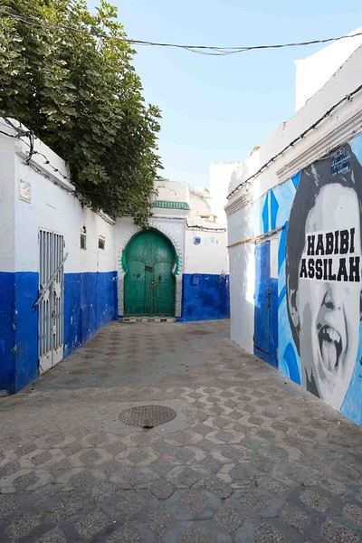
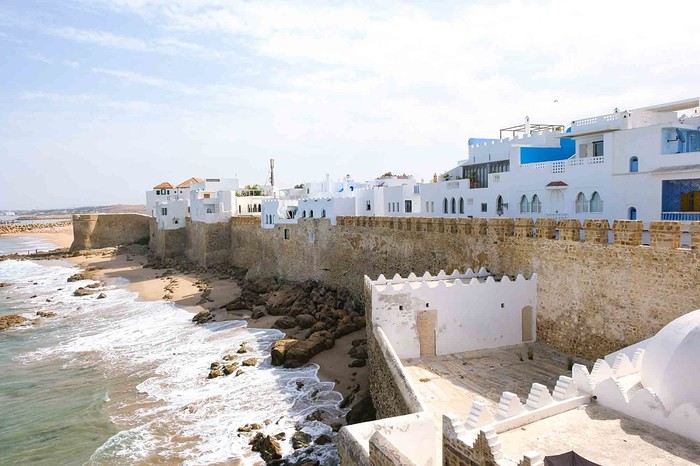
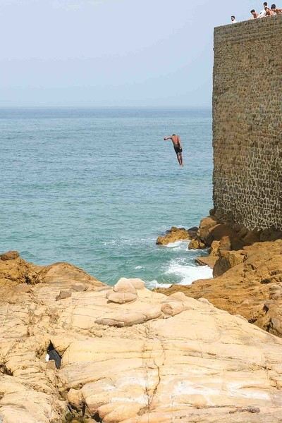
Anyway, we skirted around Tangier’s suburbs—pretty grim—and finally arrived in Asilah.
Following the coast and the long promenade along the beach, we reached the campsite. It was a bit crowded, not much shade, but it wasn’t far from the medina or the beach, and it wasn’t expensive. There’s some life here: Moroccan families seem to live on-site, in tents or basic bungalows. A woman was cooking tagine on a brazier—we were right in the atmosphere! The night was quiet, and we slept well. We set off on foot, walking along the seafront to the medina... We’d already been here in 2009. It was less touristy back then! Still, at this early hour, the little streets inside were very quiet. The walls had been freshly whitewashed, and there were even more murals than before. Around 11:30 AM, we strolled along the ramparts by the sea. There was a nice breeze! And a lot more people around. We enjoyed a milkshake on the terrace of a café overlooking the beach that stretches out at the foot of the medina. Some young guys were having fun diving off the rocks—and even off the top of the wall!
Nisyros: Greece’s most beautiful island?
Hi everyone,
I hesitated for a long time before publishing this travel journal since it’s been 8 months now since I left Nisyros. But in the end, I found it too beautiful to keep quiet about. So here we go—I finally got around to writing it. Nisyros is a stunning little Greek island, and luckily, it’s well hidden. Located a good twenty hours by boat from Athens, its distance from the Greek mainland deters most tourists from visiting. That’s what makes it an off-the-beaten-path destination. So much for the general info.
Before diving into the details, I should mention that I visited by bike (despite its severe and constant volcanic elevation) as part of a solo trip from France to Turkey. Why this detail? Because out of the ten countries I crossed and the dozens of sites I saw, Nisyros is one of my top three favorites (along with Pag Island, off-season, in Croatia, and Albania for its overall beauty—stunning natural landscapes and the incredible hospitality of its people). Anyway, welcome to this travel journal dedicated to the lovely little volcanic island of Nisyros…
I arrived one beautiful morning in Mandraki, the island’s main port. The twenty-hour boat ride from Athens went by like a breeze. I slept on the deck for three or four hours, sprawled on a bench that was more or less sheltered from the wind. At this time of year (it’s May 2nd), tourists aren’t exactly flocking here, so the boat was far from full. My first glimpse of Nisyros is classic Greek island scenery: blazing sun, an azure sky, and an even deeper blue sea. The trip is off to a great start. I quickly found a small, out-of-the-way hotel (I’m one of those people who avoids crowds as much as possible when traveling, which is getting harder and harder to do). While everyone else from the boat turned right out of the port toward the center of Mandraki, I went left! My nice little hotel was just a hundred meters away, facing a pretty little Orthodox church whose red color contrasted beautifully with the deep blue sea.
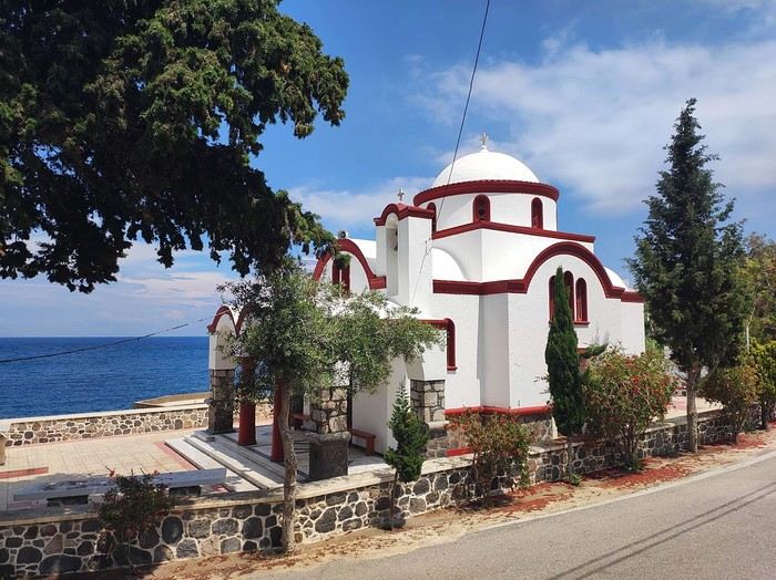
I dropped off my panniers in my room so I could ride light for once, then headed toward the next village: Pali. It’s a small fishing village that apparently comes to life a bit in the summer with a few tourists.
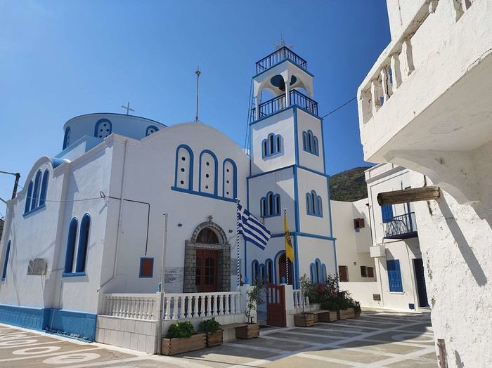
As I pedaled along the dock, I passed right by a guy sitting in a chair in full sun. Unfazed despite the sweat pouring down his forehead, he untangled his fishing net with a precision that commanded respect. I gave him the obligatory kalimera (good morning), but he reacted like a deaf-mute—no response at all. On the other hand, his employee answered me kindly from the trawler docked right next to him. Standing on deck, he was also untangling a mess of nets and invited me aboard to chat. That’s Mohamed.
Communication wasn’t easy since he only spoke Greek and I didn’t, but he was cheerful, and his joy was contagious. He proudly showed off their catch of the day: two beautiful rays and a few brightly colored fish. We chatted like that for about fifteen minutes.
When it was time to hit the road again, I said goodbye to Mohamed, who smiled back. But this time, his boss—still dripping sweat in his chair under the scorching sun—greeted me too. Turns out he wasn’t deaf or mute after all.
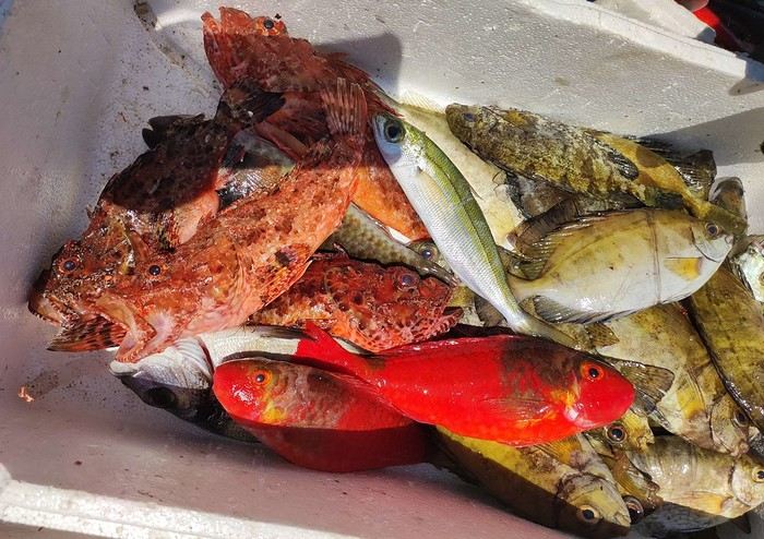
I continued along the coast since that’s where most of Nisyros’ beaches are. They start lining up just outside Pali. These are black sand beaches, which can’t hide their volcanic origins.
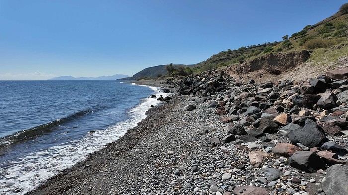
Yesterday afternoon in Athens, I met Peter and Michelle, a Dutch-French couple, while we were waiting for the ferry to depart. The Greek sailors were on strike, so we ended up waiting about twelve hours before setting off. Anyway, we had plenty of time to chat, and Peter, who’s lived on Tilos—a small island near Nisyros—for about twenty years, told me that many migrants pass through these two islands. Most come from Afghanistan and Syria, fleeing authoritarian regimes and the massacres that come with them. They’re looking for *anywhere* else where the future can’t possibly be worse. Peter explained that you often find their belongings on the local beaches. And sure enough, I didn’t have to look far to spot some—clothes, life jackets…
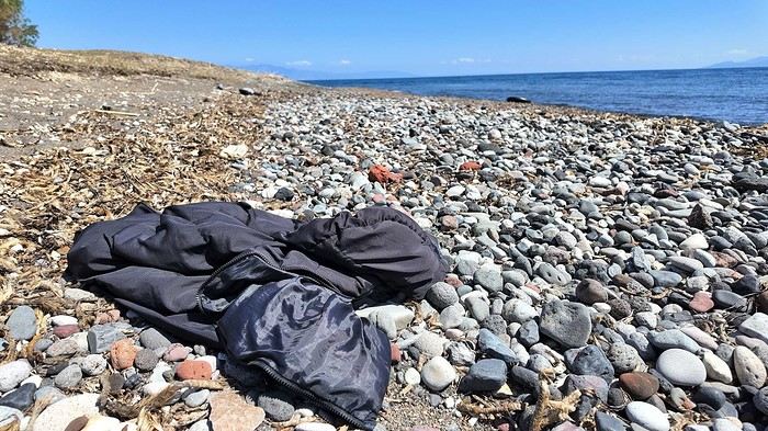
I glanced around, hoping to see one of them to maybe exchange a few words, but no—no one. I was completely alone.
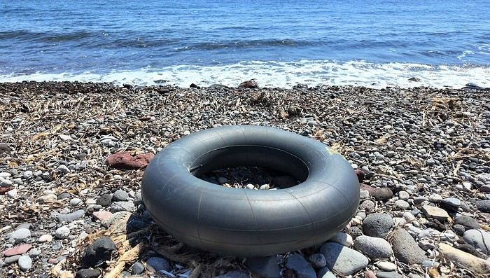
I got back on my bike and spent the rest of the day wandering aimlessly, just exploring this beautiful part of Nisyros. I also picked up some supplies because tomorrow, I’d be heading inland for two days, deep into its four-kilometer-wide caldera to explore the volcano. I’d be sleeping in a tent, so I needed to stock up on food. After a restful night in a real bed—something rare on this bike trip (and I won’t even mention the shower…)—I finally set off for the volcano (I’ll share details about that charming little hotel with the amazing breakfasts at the end of the journal). To reach Stefanos (the name of the main crater), I had to climb to the top of the caldera. It was hot, and some of the slopes were between 10 and 15%, which is steep, especially with a 54 kg bike. But who cares? I was admiring the scenery, and I have to say, I was surprised by how green it was. The higher I climbed, the more beautiful the vegetation became. It stood out against the blue of the sea, and the landscapes inside the island were truly stunning. So, I stopped every five minutes to take photos. Every now and then, I’d come across cows in the middle of the road—or goats in the trees! They climbed with the agility of monkeys to munch on the leaves. I couldn’t get a photo of them because they’d all scatter before I got close. It was actually the noise they made climbing down that tipped me off to their presence. Two villages sit at the top of the caldera: Emporios and Nikia. I passed the first one without climbing up to it, then continued to the second. And let me tell you, Nikia was love at first sight! I found myself pedaling through tiny streets, some barely wider than my bike with its panniers. The walls were white, and the doors were painted in all sorts of colors—green, blue, red… The streets were empty, and silence reigned. But it wasn’t a dead silence. It was more like the kind you find in small, secret, peaceful places. The village exuded tranquility, calm, and well-being. I leaned my bike—with all its gear—against a wall without locking it. It was the first time on this trip that I’d done that. Sure, its weight made it more like a tank than a bike, so you’d have to be *really* motivated to steal it, but here, for some reason, I felt completely at ease. Maybe it wasn’t the smartest move, but I go a lot by instinct, and here, it felt right. So I left my bike there and went to eat a little farther away, at a small restaurant on the village’s main square. It’s famous all over Greece for the beautiful mosaic that covers and decorates the floor. Once I’d eaten and drunk my fill, I hopped back on my bike, which had waited patiently without running off. And the best part? After riding uphill all morning to reach the top of the caldera, all I had to do now was coast downhill to the volcano. Pure bliss in such breathtaking scenery.
I hesitated for a long time before publishing this travel journal since it’s been 8 months now since I left Nisyros. But in the end, I found it too beautiful to keep quiet about. So here we go—I finally got around to writing it. Nisyros is a stunning little Greek island, and luckily, it’s well hidden. Located a good twenty hours by boat from Athens, its distance from the Greek mainland deters most tourists from visiting. That’s what makes it an off-the-beaten-path destination. So much for the general info.
Before diving into the details, I should mention that I visited by bike (despite its severe and constant volcanic elevation) as part of a solo trip from France to Turkey. Why this detail? Because out of the ten countries I crossed and the dozens of sites I saw, Nisyros is one of my top three favorites (along with Pag Island, off-season, in Croatia, and Albania for its overall beauty—stunning natural landscapes and the incredible hospitality of its people). Anyway, welcome to this travel journal dedicated to the lovely little volcanic island of Nisyros…
I arrived one beautiful morning in Mandraki, the island’s main port. The twenty-hour boat ride from Athens went by like a breeze. I slept on the deck for three or four hours, sprawled on a bench that was more or less sheltered from the wind. At this time of year (it’s May 2nd), tourists aren’t exactly flocking here, so the boat was far from full. My first glimpse of Nisyros is classic Greek island scenery: blazing sun, an azure sky, and an even deeper blue sea. The trip is off to a great start. I quickly found a small, out-of-the-way hotel (I’m one of those people who avoids crowds as much as possible when traveling, which is getting harder and harder to do). While everyone else from the boat turned right out of the port toward the center of Mandraki, I went left! My nice little hotel was just a hundred meters away, facing a pretty little Orthodox church whose red color contrasted beautifully with the deep blue sea.
I dropped off my panniers in my room so I could ride light for once, then headed toward the next village: Pali. It’s a small fishing village that apparently comes to life a bit in the summer with a few tourists.
As I pedaled along the dock, I passed right by a guy sitting in a chair in full sun. Unfazed despite the sweat pouring down his forehead, he untangled his fishing net with a precision that commanded respect. I gave him the obligatory kalimera (good morning), but he reacted like a deaf-mute—no response at all. On the other hand, his employee answered me kindly from the trawler docked right next to him. Standing on deck, he was also untangling a mess of nets and invited me aboard to chat. That’s Mohamed.
Communication wasn’t easy since he only spoke Greek and I didn’t, but he was cheerful, and his joy was contagious. He proudly showed off their catch of the day: two beautiful rays and a few brightly colored fish. We chatted like that for about fifteen minutes.
When it was time to hit the road again, I said goodbye to Mohamed, who smiled back. But this time, his boss—still dripping sweat in his chair under the scorching sun—greeted me too. Turns out he wasn’t deaf or mute after all.
I continued along the coast since that’s where most of Nisyros’ beaches are. They start lining up just outside Pali. These are black sand beaches, which can’t hide their volcanic origins.
Yesterday afternoon in Athens, I met Peter and Michelle, a Dutch-French couple, while we were waiting for the ferry to depart. The Greek sailors were on strike, so we ended up waiting about twelve hours before setting off. Anyway, we had plenty of time to chat, and Peter, who’s lived on Tilos—a small island near Nisyros—for about twenty years, told me that many migrants pass through these two islands. Most come from Afghanistan and Syria, fleeing authoritarian regimes and the massacres that come with them. They’re looking for *anywhere* else where the future can’t possibly be worse. Peter explained that you often find their belongings on the local beaches. And sure enough, I didn’t have to look far to spot some—clothes, life jackets…
I glanced around, hoping to see one of them to maybe exchange a few words, but no—no one. I was completely alone.
I got back on my bike and spent the rest of the day wandering aimlessly, just exploring this beautiful part of Nisyros. I also picked up some supplies because tomorrow, I’d be heading inland for two days, deep into its four-kilometer-wide caldera to explore the volcano. I’d be sleeping in a tent, so I needed to stock up on food. After a restful night in a real bed—something rare on this bike trip (and I won’t even mention the shower…)—I finally set off for the volcano (I’ll share details about that charming little hotel with the amazing breakfasts at the end of the journal). To reach Stefanos (the name of the main crater), I had to climb to the top of the caldera. It was hot, and some of the slopes were between 10 and 15%, which is steep, especially with a 54 kg bike. But who cares? I was admiring the scenery, and I have to say, I was surprised by how green it was. The higher I climbed, the more beautiful the vegetation became. It stood out against the blue of the sea, and the landscapes inside the island were truly stunning. So, I stopped every five minutes to take photos. Every now and then, I’d come across cows in the middle of the road—or goats in the trees! They climbed with the agility of monkeys to munch on the leaves. I couldn’t get a photo of them because they’d all scatter before I got close. It was actually the noise they made climbing down that tipped me off to their presence. Two villages sit at the top of the caldera: Emporios and Nikia. I passed the first one without climbing up to it, then continued to the second. And let me tell you, Nikia was love at first sight! I found myself pedaling through tiny streets, some barely wider than my bike with its panniers. The walls were white, and the doors were painted in all sorts of colors—green, blue, red… The streets were empty, and silence reigned. But it wasn’t a dead silence. It was more like the kind you find in small, secret, peaceful places. The village exuded tranquility, calm, and well-being. I leaned my bike—with all its gear—against a wall without locking it. It was the first time on this trip that I’d done that. Sure, its weight made it more like a tank than a bike, so you’d have to be *really* motivated to steal it, but here, for some reason, I felt completely at ease. Maybe it wasn’t the smartest move, but I go a lot by instinct, and here, it felt right. So I left my bike there and went to eat a little farther away, at a small restaurant on the village’s main square. It’s famous all over Greece for the beautiful mosaic that covers and decorates the floor. Once I’d eaten and drunk my fill, I hopped back on my bike, which had waited patiently without running off. And the best part? After riding uphill all morning to reach the top of the caldera, all I had to do now was coast downhill to the volcano. Pure bliss in such breathtaking scenery.
The Waterberg
Last year, I stumbled upon a "nature reserve" in the Waterberg by sheer luck.
Just one night, but I was so thrilled that I went back this year for three nights.
It was perfect for breaking up the trip between Marakele and Mapungubwe.
The Waterberg is the Limpopo of game farms, hunting farms... and places trying to attract clients from Joburg and Kruger, with varying levels of ethics.
The roads aren’t always great, potholes are everywhere, and Google Maps is pretty unreliable.
But in my case, I found exactly what I was looking for...
As often happens, old farms have been grouped together to create a nature reserve that doesn’t sell you "wild" lions, has no rhinos (protecting rhinos is complicated), no elephants, and no buffalo. So, antelopes, elusive leopards, hyenas (didn’t see any), peaceful giraffes, warthogs, etc.—just general game! What’s the point? Well, you go for walks or hikes with game drives... you bike... you chill. You get out of the car. For us this year, a gorgeous "house," fully equipped, on the edge of the forest, with wood for the fire and a plain as the view... An unbeatable quality-to-price ratio in a natural setting! A little photo dump for the vibe. You’ve gathered that part of the exploration is by car (it’s big) and part on foot...
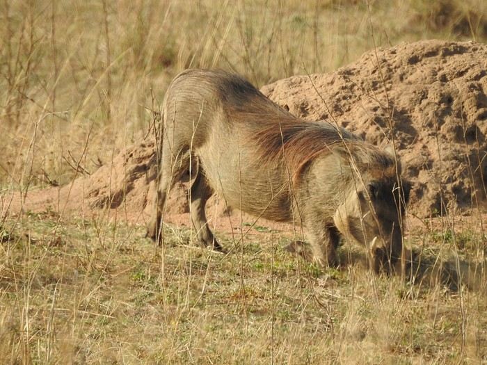
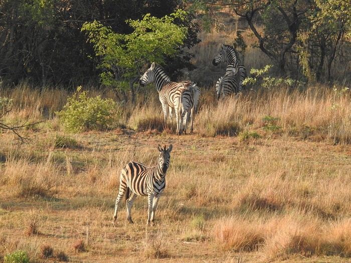

As often happens, old farms have been grouped together to create a nature reserve that doesn’t sell you "wild" lions, has no rhinos (protecting rhinos is complicated), no elephants, and no buffalo. So, antelopes, elusive leopards, hyenas (didn’t see any), peaceful giraffes, warthogs, etc.—just general game! What’s the point? Well, you go for walks or hikes with game drives... you bike... you chill. You get out of the car. For us this year, a gorgeous "house," fully equipped, on the edge of the forest, with wood for the fire and a plain as the view... An unbeatable quality-to-price ratio in a natural setting! A little photo dump for the vibe. You’ve gathered that part of the exploration is by car (it’s big) and part on foot...
15-Day Road Trip Recap: Colorado and New Mexico
Hello, here’s a totally subjective recap of our 15-day road trip between Colorado and New Mexico, from late September to mid-October.
Our main interests are culture, museums, and landscapes—no hiking or trails for us. Personally, I’m pretty contemplative, and luckily, there’s always something to see out there! We’re pretty used to the US; we’ve been going there often for a long time (let’s just say we’re not exactly young anymore).
Budget: Even though we don’t set a strict budget beforehand, we try to keep costs as low as possible. This time, we managed to spend around 4000 € for two, all included. To do this: avoid expensive accommodations, staying between 60 and 120 € per night with an average of 90 €/night, mixing Airbnb and motels. And skip the “real” restaurants, which are pretty pricey in the US: sandwiches for lunch, takeout or cooking in the Airbnb in the evening. We shop at Sprouts or Whole Foods—organic-style chains that are pricier than Walmart but better. In the evenings, Sprouts has discounts on items that didn’t sell during the day. Also, avoid toll roads, paid parking, and overly expensive attractions or sites. The dispensary budget is separate…
Route: Denver/Colorado Springs/Alamosa/Raton/Santa Fe/Cuba/Cortez/Grand Junction/Glenwood Springs/Denver This wasn’t too planned in advance—we booked a few nights upon arrival and went with the flow. Flight from CDG to Denver with AF/Delta, car rental at Dollar for a standard SUV. The guy at the Dollar counter upsold me on extra insurance for flat tires (and since I knew we’d be off-roading, I took it). Without telling me, he upgraded me to a Jeep Sahara 4X4 Hybrid. Nice.
Listening to the news upon arrival, the anchor announced, “It’s officially fall now.” We hadn’t really thought about that before leaving, but yeah—it’s the time when the trees turn fluorescent yellow and red. Amazing.
Colorado Springs: Garden of the Gods is a free park with paved trails winding through red/orange rock formations. Magical at sunrise—groups of deer roam around, along with birds and rabbits. It’s small but wow! Didn’t try the Manitou Incline in Manitou Springs, a staircase with thousands of steps going straight up the mountain. Impressive from the bottom, but the parking is paid, which is a downside for those willing to tackle it. The Cog Railway goes up to the summit of Pikes Peak—around $100 when we were there. No thanks. And of course, the parking is paid too. For fans, Maggie’s Farm dispensary is great.
On Route 24, Eleven Mile Canyon Recreation Area is fly-fishing paradise—just like in the movie *A River Runs Through It*. Entry is $11, and a trail follows the river at the bottom of the canyon to the dam. Dozens of people in waders are in the water, casting their lines over and over. You can see the salmon in the clear water, and we had a picnic in the sun, imagining Brad Pitt catching a fish.
Buena Vista: A cute little tourist town with an Outdoor Fair that day—some pretty impressive vehicles for sale, set up for mountain living (like Juniper outfitting a RAM).
Alamosa: The closest town to Great Sand Dunes National Park, crossed by the Rio Grande (and let’s be real—it’s more of a stream than a river!). Park access was free because it was National Park Day. A park with massive dunes—climbing them is pretty exhausting, with lots of wind and sinking sand. Glad we didn’t do it in summer; I can’t imagine how tough it’d be in the heat. It’s a bit deceptive: it looks easy to get to the top of a dune, but it’s really not. The campsites were nice, and it was busy that weekend. We passed the “Point of No Return,” a sandy trail winding through the hills and connecting to Route 559 from above. Didn’t go all the way, but it’s possible the entrance is free from that side. However, you need a 4X4 with good ground clearance. After 1 or 2 km on the trail, you’re alone between the dunes and hills—hardly anyone around. But tricky to turn around or pass other vehicles; the trail isn’t wide. We crossed paths with a Hanomag (registered in the Netherlands—impressive!) coming down without stopping, or risking getting stuck.
On the way out, we took the small Route 403, which quickly turns into a trail crossing the mountain. Entire sections of forest were turning fluorescent yellow with patches of green and red—an incredible sight.
Raton: A small town that probably peaked in the late 19th century and has been in slow decline ever since. The Raton Pass Motor Inn is the kind of place that makes the US legendary—entirely 50s and 60s decor, really well done. I had the Betty Page room—too cool. Felt like we were on Route 66. Even better.
Santa Fe: A small city with no high-rises—almost all low-rise buildings, many in adobe, blending perfectly into the landscape. The old downtown is touristy but nice, with its plaza and church. There’s a really cool vibe—we loved it. For drinks, the bar at the top of La Fonda Hotel was packed for sunset, with a diverse crowd. Not overpriced for the location. SITE Santa Fe is a contemporary art space near the train station. It’s free, and the temporary exhibit was really good—high quality. Museum Hill is, as the name suggests, where several museums are located. We visited the Museum of Indian Art and Culture—great if you’re into “First Nations” history. Saw The Dandy Warhols at The Bridge—an outdoor venue, one of the last concerts of the season before winter makes it too cold. Oddly, there was no bag check, just an ID required (even though it was obvious we were over 21!). Tickets were reasonable, around $30 (concerts in the US can be crazy expensive). The band was good, with fewer than 300 people in front. A sign at the bar warned: Don’t forget you’re at 1,500 meters—alcohol hits harder up here!
Albuquerque: A sprawling city with an old historic center that feels a bit like Disneyland—too perfect for my taste. The real highlight is the Sandia Peak Tramway, which goes up to the old ski resort above the city. Tickets are around $35, and it’s worth it—the ride over the canyons is pretty wild. The ski resort is a bit abandoned; apparently, like elsewhere, there’s no snow anymore. I asked several people about the lack of snow, and the answer was always the same: “It’s cyclical.” Okay then. We arrived for the start of the International Balloon Fiesta (one of the world’s largest hot-air balloon gatherings), hoping to see hundreds of balloons in the sky. Nope—windy today, so no one took off. Bummer.
Las Vegas: New Mexico has its own Las Vegas, but it’s nothing like the other one—a sleepy little town with a perfectly preserved 19th-century Historic Plaza Hotel, brick buildings, and vintage streetlights. Everything is so well-preserved it’s often used as a filming location. NM attracts a lot of productions thanks to tax incentives and its Western landscapes—and it’s cheaper than California! That day, a huge Texas flag was flying in the wind: they were filming the second season of *Ransom Canyon* for Netflix in the town center. If we’d been dressed more “Western,” we could’ve been extras.
Jemez Springs: Its Jemez Hot Springs is super cute—several thermal pools at different temperatures, a New Age vibe. The pools are surrounded by big rocks, and you’re asked to speak softly. A place where you could spend hours. $50 for two hours for two.
Los Alamos: A town made legendary by the bomb, the movie, etc. Heads up: It’s still a research center, and to cross part of the town, you need to show ID. No stopping or taking photos allowed. Other than the Oppenheimer House (currently closed—only the neighboring house is open to visitors), there’s not much to see. There’s a replica of the camp entrance, but it’s been turned into restrooms.
Georgia O’Keeffe Trail (American painter, 1887–1986): Her museum in Santa Fe is pretty good, even if they don’t have tons of works. Entry is $20. Her house in Abiquiu is open for visits, but it’s way overpriced at $65. So we skipped it. You can get an idea of it by stopping at the Welcome Center on Route 84. Further down the same road, Ghost Ranch is worth a visit—beautiful setting, free to enter, with trails to explore and a great atmosphere.
Chaco Culture National Historical Park: A pretty isolated park—25 km of trails to get there, with only a small section paved. The road is decent except for the last few kilometers, which have potholes. I can’t imagine it being accessible after rain, though that doesn’t happen often! This park, in the middle of a desert plain with a few canyons, is one of the rare places where you can find multi-story structures from pre-Columbian civilizations—so, before the “current” tribes. But cruel disappointment: it’s been shut down for a few days. We met a Native ranger—tall, with long hair—who explained that even though he wasn’t being paid, he was still guarding the park and had closed all access to the sites. Darn. Turned around and headed back down the trail.
Same story in the next town, Aztec (a funny name, right?): Aztec Ruins National Monument was closed too.
We passed Ship Rock, the Navajo’s sacred mountain—really impressive. Couldn’t find a trail to get closer, but it’s better from a distance anyway! The town of Shiprock itself is pretty depressing—poor living conditions for some Natives, with rundown mobile homes and piles of junk cars.
Stopped in Cortez to visit Mesa Verde National Park. Ate at Denny’s—hadn’t been there in ages (though it’s the kind of place I should feel at home in!). The customers all looked like they’d stepped out of *The Addams Family*—a little creepy. Or funny, depending on your perspective. For Mesa Verde, after discussing it on this forum with the honorable member Caussat (who didn’t find it that amazing), we were on the fence. Problem solved: it was closed too. Back on the road.
Durango: Really nice with its Main Ave and its shops, cafés—touristy but with local life. Famous for its tourist train to Silverton, but we didn’t do it—way too expensive. Choice between a steam locomotive or diesel (which belches black, stinky smoke—yuck). The diesel should be replaced with electric as soon as they get the funds.
Million Dollar Highway: The road winds through the mountains, and every turn (and there are a lot) is breathtaking—unbelievable landscapes with fluorescent yellow, green, and snow-capped mountains. Just wow.
Silverton: A Western town nestled between two mountains, preserved in its original state despite the tourists arriving by train. Around it, abandoned mines and old wooden ties—must’ve been tough for the 19th-century miners.
Grand Junction: The city is surrounded by giant mesas—pretty impressive. The old downtown is *too* clean—almost sterile.
Colorado National Monument: Just outside the city, a winding road climbs between stunning canyons, with sweeping views of the valley. Entry was free that day due to the shutdown.
Route 330, which we took to get back to the highway, passes through a place called “Cowboy Country”—and it’s true. We saw guys in Stetsons with huge pickups, the road turned into a trail with cows wandering on it, and we had to honk to get them to move. The trail to I-70 was full of potholes—the 4X4 came in handy. Had a picnic by Vega Reservoir: the booth at the entrance was empty, but people left cash in envelopes for camping fees. Anyone passing by could’ve taken it, but it’s an example of US trust and honesty!
Glenwood Springs: A small town famous for its hot springs pool—they claim it’s the largest in the world. I don’t know about that, but it has a great look. Unfortunately, it was closed for maintenance those days! Blew our budget by staying at the Hotel Colorado, a huge 1893 building with a real atmosphere in its grand lobby and fake fireplaces. Fire pits in front of wooden chairs in the garden with mountain views—just really great.
Aspen: The billionaires’ ski resort, but surprisingly, parking was free for 2 hours. Rare to see a place for the super-rich that doesn’t scream “not for you” (like Palm Beach, for example). A former mining town completely redone, every shop occupied by a luxury brand. There’s even a thrift shop run by sweet retirees—funny as hell. Two ski lifts to start directly with your skis, but we didn’t see the price—they were still closed. Lots of houses that aren’t huge but are cute, though looking at real estate prices made us think, “Is there an extra zero on that listing?” A 6-bedroom villa for $52 million? Wow. The mountains around are gorgeous—no wonder it became what it is.
Another fancy resort nearby: Vail, more modern in its construction. The restaurants opted for a “Schwarzwald” decor—kind of odd.
Denver: Nothing really stood out for us in this city, except the Design Museum—the Kirkland, where a local painter collected furniture and supplies from Arts and Crafts to Postmodern. Just really great. Entry is included with a visit to the Denver Art Museum, which has diverse collections—from Impressionism (they have a Manet, a Van Gogh, a Cézanne, several Sisleys) to photography. The best part for me was the “Ancient Americas” totems—huge, impressive wooden sculptures, painted, the kind you’re more used to seeing in Polynesia or Easter Island. Personally, I didn’t know Natives made them too. That’s what museums are for!
Back at the airport, where I had to tag my own luggage (you have to do everything yourself with these US airlines). The tag said SLC/CDG! But we were supposed to connect through JFK. Turns out, they’d put us on a DEN/SLC/CDG flight without telling us. In the end, we gained 30 minutes on our original arrival time in Paris!
There you go—hope this inspires other travelers! !
Our main interests are culture, museums, and landscapes—no hiking or trails for us. Personally, I’m pretty contemplative, and luckily, there’s always something to see out there! We’re pretty used to the US; we’ve been going there often for a long time (let’s just say we’re not exactly young anymore).
Budget: Even though we don’t set a strict budget beforehand, we try to keep costs as low as possible. This time, we managed to spend around 4000 € for two, all included. To do this: avoid expensive accommodations, staying between 60 and 120 € per night with an average of 90 €/night, mixing Airbnb and motels. And skip the “real” restaurants, which are pretty pricey in the US: sandwiches for lunch, takeout or cooking in the Airbnb in the evening. We shop at Sprouts or Whole Foods—organic-style chains that are pricier than Walmart but better. In the evenings, Sprouts has discounts on items that didn’t sell during the day. Also, avoid toll roads, paid parking, and overly expensive attractions or sites. The dispensary budget is separate…
Route: Denver/Colorado Springs/Alamosa/Raton/Santa Fe/Cuba/Cortez/Grand Junction/Glenwood Springs/Denver This wasn’t too planned in advance—we booked a few nights upon arrival and went with the flow. Flight from CDG to Denver with AF/Delta, car rental at Dollar for a standard SUV. The guy at the Dollar counter upsold me on extra insurance for flat tires (and since I knew we’d be off-roading, I took it). Without telling me, he upgraded me to a Jeep Sahara 4X4 Hybrid. Nice.
Listening to the news upon arrival, the anchor announced, “It’s officially fall now.” We hadn’t really thought about that before leaving, but yeah—it’s the time when the trees turn fluorescent yellow and red. Amazing.
Colorado Springs: Garden of the Gods is a free park with paved trails winding through red/orange rock formations. Magical at sunrise—groups of deer roam around, along with birds and rabbits. It’s small but wow! Didn’t try the Manitou Incline in Manitou Springs, a staircase with thousands of steps going straight up the mountain. Impressive from the bottom, but the parking is paid, which is a downside for those willing to tackle it. The Cog Railway goes up to the summit of Pikes Peak—around $100 when we were there. No thanks. And of course, the parking is paid too. For fans, Maggie’s Farm dispensary is great.
On Route 24, Eleven Mile Canyon Recreation Area is fly-fishing paradise—just like in the movie *A River Runs Through It*. Entry is $11, and a trail follows the river at the bottom of the canyon to the dam. Dozens of people in waders are in the water, casting their lines over and over. You can see the salmon in the clear water, and we had a picnic in the sun, imagining Brad Pitt catching a fish.
Buena Vista: A cute little tourist town with an Outdoor Fair that day—some pretty impressive vehicles for sale, set up for mountain living (like Juniper outfitting a RAM).
Alamosa: The closest town to Great Sand Dunes National Park, crossed by the Rio Grande (and let’s be real—it’s more of a stream than a river!). Park access was free because it was National Park Day. A park with massive dunes—climbing them is pretty exhausting, with lots of wind and sinking sand. Glad we didn’t do it in summer; I can’t imagine how tough it’d be in the heat. It’s a bit deceptive: it looks easy to get to the top of a dune, but it’s really not. The campsites were nice, and it was busy that weekend. We passed the “Point of No Return,” a sandy trail winding through the hills and connecting to Route 559 from above. Didn’t go all the way, but it’s possible the entrance is free from that side. However, you need a 4X4 with good ground clearance. After 1 or 2 km on the trail, you’re alone between the dunes and hills—hardly anyone around. But tricky to turn around or pass other vehicles; the trail isn’t wide. We crossed paths with a Hanomag (registered in the Netherlands—impressive!) coming down without stopping, or risking getting stuck.
On the way out, we took the small Route 403, which quickly turns into a trail crossing the mountain. Entire sections of forest were turning fluorescent yellow with patches of green and red—an incredible sight.
Raton: A small town that probably peaked in the late 19th century and has been in slow decline ever since. The Raton Pass Motor Inn is the kind of place that makes the US legendary—entirely 50s and 60s decor, really well done. I had the Betty Page room—too cool. Felt like we were on Route 66. Even better.
Santa Fe: A small city with no high-rises—almost all low-rise buildings, many in adobe, blending perfectly into the landscape. The old downtown is touristy but nice, with its plaza and church. There’s a really cool vibe—we loved it. For drinks, the bar at the top of La Fonda Hotel was packed for sunset, with a diverse crowd. Not overpriced for the location. SITE Santa Fe is a contemporary art space near the train station. It’s free, and the temporary exhibit was really good—high quality. Museum Hill is, as the name suggests, where several museums are located. We visited the Museum of Indian Art and Culture—great if you’re into “First Nations” history. Saw The Dandy Warhols at The Bridge—an outdoor venue, one of the last concerts of the season before winter makes it too cold. Oddly, there was no bag check, just an ID required (even though it was obvious we were over 21!). Tickets were reasonable, around $30 (concerts in the US can be crazy expensive). The band was good, with fewer than 300 people in front. A sign at the bar warned: Don’t forget you’re at 1,500 meters—alcohol hits harder up here!
Albuquerque: A sprawling city with an old historic center that feels a bit like Disneyland—too perfect for my taste. The real highlight is the Sandia Peak Tramway, which goes up to the old ski resort above the city. Tickets are around $35, and it’s worth it—the ride over the canyons is pretty wild. The ski resort is a bit abandoned; apparently, like elsewhere, there’s no snow anymore. I asked several people about the lack of snow, and the answer was always the same: “It’s cyclical.” Okay then. We arrived for the start of the International Balloon Fiesta (one of the world’s largest hot-air balloon gatherings), hoping to see hundreds of balloons in the sky. Nope—windy today, so no one took off. Bummer.
Las Vegas: New Mexico has its own Las Vegas, but it’s nothing like the other one—a sleepy little town with a perfectly preserved 19th-century Historic Plaza Hotel, brick buildings, and vintage streetlights. Everything is so well-preserved it’s often used as a filming location. NM attracts a lot of productions thanks to tax incentives and its Western landscapes—and it’s cheaper than California! That day, a huge Texas flag was flying in the wind: they were filming the second season of *Ransom Canyon* for Netflix in the town center. If we’d been dressed more “Western,” we could’ve been extras.
Jemez Springs: Its Jemez Hot Springs is super cute—several thermal pools at different temperatures, a New Age vibe. The pools are surrounded by big rocks, and you’re asked to speak softly. A place where you could spend hours. $50 for two hours for two.
Los Alamos: A town made legendary by the bomb, the movie, etc. Heads up: It’s still a research center, and to cross part of the town, you need to show ID. No stopping or taking photos allowed. Other than the Oppenheimer House (currently closed—only the neighboring house is open to visitors), there’s not much to see. There’s a replica of the camp entrance, but it’s been turned into restrooms.
Georgia O’Keeffe Trail (American painter, 1887–1986): Her museum in Santa Fe is pretty good, even if they don’t have tons of works. Entry is $20. Her house in Abiquiu is open for visits, but it’s way overpriced at $65. So we skipped it. You can get an idea of it by stopping at the Welcome Center on Route 84. Further down the same road, Ghost Ranch is worth a visit—beautiful setting, free to enter, with trails to explore and a great atmosphere.
Chaco Culture National Historical Park: A pretty isolated park—25 km of trails to get there, with only a small section paved. The road is decent except for the last few kilometers, which have potholes. I can’t imagine it being accessible after rain, though that doesn’t happen often! This park, in the middle of a desert plain with a few canyons, is one of the rare places where you can find multi-story structures from pre-Columbian civilizations—so, before the “current” tribes. But cruel disappointment: it’s been shut down for a few days. We met a Native ranger—tall, with long hair—who explained that even though he wasn’t being paid, he was still guarding the park and had closed all access to the sites. Darn. Turned around and headed back down the trail.
Same story in the next town, Aztec (a funny name, right?): Aztec Ruins National Monument was closed too.
We passed Ship Rock, the Navajo’s sacred mountain—really impressive. Couldn’t find a trail to get closer, but it’s better from a distance anyway! The town of Shiprock itself is pretty depressing—poor living conditions for some Natives, with rundown mobile homes and piles of junk cars.
Stopped in Cortez to visit Mesa Verde National Park. Ate at Denny’s—hadn’t been there in ages (though it’s the kind of place I should feel at home in!). The customers all looked like they’d stepped out of *The Addams Family*—a little creepy. Or funny, depending on your perspective. For Mesa Verde, after discussing it on this forum with the honorable member Caussat (who didn’t find it that amazing), we were on the fence. Problem solved: it was closed too. Back on the road.
Durango: Really nice with its Main Ave and its shops, cafés—touristy but with local life. Famous for its tourist train to Silverton, but we didn’t do it—way too expensive. Choice between a steam locomotive or diesel (which belches black, stinky smoke—yuck). The diesel should be replaced with electric as soon as they get the funds.
Million Dollar Highway: The road winds through the mountains, and every turn (and there are a lot) is breathtaking—unbelievable landscapes with fluorescent yellow, green, and snow-capped mountains. Just wow.
Silverton: A Western town nestled between two mountains, preserved in its original state despite the tourists arriving by train. Around it, abandoned mines and old wooden ties—must’ve been tough for the 19th-century miners.
Grand Junction: The city is surrounded by giant mesas—pretty impressive. The old downtown is *too* clean—almost sterile.
Colorado National Monument: Just outside the city, a winding road climbs between stunning canyons, with sweeping views of the valley. Entry was free that day due to the shutdown.
Route 330, which we took to get back to the highway, passes through a place called “Cowboy Country”—and it’s true. We saw guys in Stetsons with huge pickups, the road turned into a trail with cows wandering on it, and we had to honk to get them to move. The trail to I-70 was full of potholes—the 4X4 came in handy. Had a picnic by Vega Reservoir: the booth at the entrance was empty, but people left cash in envelopes for camping fees. Anyone passing by could’ve taken it, but it’s an example of US trust and honesty!
Glenwood Springs: A small town famous for its hot springs pool—they claim it’s the largest in the world. I don’t know about that, but it has a great look. Unfortunately, it was closed for maintenance those days! Blew our budget by staying at the Hotel Colorado, a huge 1893 building with a real atmosphere in its grand lobby and fake fireplaces. Fire pits in front of wooden chairs in the garden with mountain views—just really great.
Aspen: The billionaires’ ski resort, but surprisingly, parking was free for 2 hours. Rare to see a place for the super-rich that doesn’t scream “not for you” (like Palm Beach, for example). A former mining town completely redone, every shop occupied by a luxury brand. There’s even a thrift shop run by sweet retirees—funny as hell. Two ski lifts to start directly with your skis, but we didn’t see the price—they were still closed. Lots of houses that aren’t huge but are cute, though looking at real estate prices made us think, “Is there an extra zero on that listing?” A 6-bedroom villa for $52 million? Wow. The mountains around are gorgeous—no wonder it became what it is.
Another fancy resort nearby: Vail, more modern in its construction. The restaurants opted for a “Schwarzwald” decor—kind of odd.
Denver: Nothing really stood out for us in this city, except the Design Museum—the Kirkland, where a local painter collected furniture and supplies from Arts and Crafts to Postmodern. Just really great. Entry is included with a visit to the Denver Art Museum, which has diverse collections—from Impressionism (they have a Manet, a Van Gogh, a Cézanne, several Sisleys) to photography. The best part for me was the “Ancient Americas” totems—huge, impressive wooden sculptures, painted, the kind you’re more used to seeing in Polynesia or Easter Island. Personally, I didn’t know Natives made them too. That’s what museums are for!
Back at the airport, where I had to tag my own luggage (you have to do everything yourself with these US airlines). The tag said SLC/CDG! But we were supposed to connect through JFK. Turns out, they’d put us on a DEN/SLC/CDG flight without telling us. In the end, we gained 30 minutes on our original arrival time in Paris!
There you go—hope this inspires other travelers! !
Hiking, camping, and snorkeling on Madagascar's east coast
Hello,
I’m continuing the Antalaha–Maroantsetra discussion but for some info in the other direction, specifically about hiking from Maroantsetra to Antalaha.
In mid-December, I plan to take it easy from Tamatave to Antalaha. I’m thinking of making a few stops, like Nosy Atafana—has anyone snorkeled there? Is it nice? Can you find bush taxis on the Soniera–Ivongo / Maroantsetra stretch?
After that, I’m considering walking from Maroantsetra to Antalaha and figuring things out as I go, since the path seems well-used, so I’m not planning on a guide. Good idea or totally foolish? Should I bring a tent and some camping gear, or, as I’ve read multiple times, are there several villages with lodging and food options along the way? Any spots worth stopping at or nothing special to see?
In Antalaha, I saw the recommendation for Villa Malaza in the previous discussion, so I’m keeping that in mind. If there’s space, I’ll plan to stay there. In Antalaha itself, are there any places to visit, things to see, or activities you’d recommend?
Thanks in advance to everyone for any tips—they’ll be really helpful!
In mid-December, I plan to take it easy from Tamatave to Antalaha. I’m thinking of making a few stops, like Nosy Atafana—has anyone snorkeled there? Is it nice? Can you find bush taxis on the Soniera–Ivongo / Maroantsetra stretch?
After that, I’m considering walking from Maroantsetra to Antalaha and figuring things out as I go, since the path seems well-used, so I’m not planning on a guide. Good idea or totally foolish? Should I bring a tent and some camping gear, or, as I’ve read multiple times, are there several villages with lodging and food options along the way? Any spots worth stopping at or nothing special to see?
In Antalaha, I saw the recommendation for Villa Malaza in the previous discussion, so I’m keeping that in mind. If there’s space, I’ll plan to stay there. In Antalaha itself, are there any places to visit, things to see, or activities you’d recommend?
Thanks in advance to everyone for any tips—they’ll be really helpful!
Info for 2-day treks in Mondulkiri and Ratanakiri
Hi there,
Could anyone give me some tips on 2-day treks in these areas? We're heading there in November...
Thanks so much!