Results for "Crète+|+124+>+211"
31672 results found.
Join me in discovering Gran Canaria
Introduction
We stayed on the island of Gran Canaria during the first three months of 2024. It’s the third Canary Island we’ve visited, after Tenerife and Lanzarote.
We rented an apartment in Temisas. By staying in the same place for such a long period, the total price dropped by 50%.
We also rented a vehicle to make getting around the island easier.
Why the Canary Islands, and Gran Canaria in particular? For its pleasant climate, the nature and diversity of its landscapes, the charming villages, and especially the beauty of its many beaches.
In this travel journal, you’ll find a list of the many activities we did during our stay to explore the different attractions of this island.
These attractions are categorized to make it easier to find what interests you.
Videos are included throughout the summary. Click on the image to start the video.
To jump to a specific post, here are the relevant links:
HIKES:
Roque Nublo Maspalomas Dunes - Part 1 Maspalomas Dunes - Part 2 Los Azulejos de Veneguera Barranco de Las Vacas Ventana del Bentayga (Arco del Aserrador) Caves of the King Ventana de Morro (Ventana de la Ganifa) The Dog of Bentayga Cave of the Four Doors Ventana del Nublo Artenera - Caves of Acusa Seca Temisas - El Gigante Cave Fortress of Ansite Puerto de Las Nieves - Roque de Las Nieves Temisas - Cuevas de la Audiencia Roque Bentayga Guayadeque Ravine (Guayadeque Hermitage) Guayadeque Ravine (Cueva de Bartalo) El Zumacal - Barranco Tauco Casablanca Dam (Los Dolores Dam) Ayagaures - La Angostura Dam & Gambuesa Dam Santa Brígida - Alonso Ravine & Centennial Dragon Tree Pino Santo Hike in the Azuaje Ravine Gáldar - Red Lands of Samarrita Tejeda - Charco de La Paloma Bandama Boiler (Camino Borde de Caldera Bandama) Teror - Alamo Ravine Trail – SL-4 Telde - Calasio Caves Special Natural Reserve of Los Tilos de Moya Los Azulejos - Charco de Las Aneas Fataga Ravine Arinaga Military Battery Trail Maspalomas - Las Fuentes and del Canizo Ravines Mogán - Tauro Mountain Trail Tamabada - Llanos de La Mimbre & Sobre la Cueva Viewpoints Trail Hike to the Coronadero Arch via Barranco Hondo Barranco de Silva - Hike to the Jerez Caves Gáldar - Samson Cave - La Atalaya Peak Agaete - Roque Guayedra and Guayedra Ravine Artenara - Caballero Caves Arucas - Bufadero Salt Flats Barranco de Pino Gordo - Natural Pools Telde - Los Cernícalos Ravine Las Cruces - Toba Caves & Picón Puerto de Las Nieves - Moro Cave Agüimes - Morros de Ávila Caves Juncalillo del Sur - Laguna & Salinas de Abajo Caves of Camino de San Felipe Cruz de Tejeda, Cruz Chico and Degollada Viewpoint Hike on the Patalavaca Circuit Motor Grande - Puerto Rico Arch El Montañón - Los Hornos Dam Seafront Walk - Amadores Beach – Puerto Rico Beach Las Niñas Dam El Hornillo - Omega & Omicron Caves Arteara Necropolis Mogán - El Mulato Dam Las Garzas - El Regante Dam La Plata Route - Cho Flores Dam & El Charco Hondo Vega de Acusa - La Candelaria Dam Candelaria Hermitage – Acusa Seca Viewpoint Valsequillo de Gran Canaria – Roque La Vela Ayagaures Dam – GC-602 Lomo del Palo - Monte Pavón Trail Lugar La Laguna - Levada Fataga Dam & Ravine
BEACHES:
Mogán Beach Taurito Beach Tauro Beach Amadores Beach Puerto Rico Beach Anfi del Mar Beach Patalavaca Beach Meloneras Beach Maspalomas Beach English Beach (Playa del Inglés) Las Burras Beach San Agustin Beach Las Alcaravaneras Beach Las Canteras Beach (La Cicer) Las Canteras Beach (La Puntilla) Las Canteras Beach (Santa Catalina) Aquamarina Beach El Agujero - Bocabarranco Beach Hoya Del Pozo Beach Hoya Del Pozo Beach - Lizard with amputated tail El Cabron Beach Ojos de Garza Beach El Burrero Beach
NATURAL POOLS:
Charco Azul - El Risco Agaete Salt Flats Charco de Los Espejos - Sardina del Norte Natural Pools of Punta de Gáldar Snorkeling in the natural pool of Punta de Gáldar Natural Pool La Furnia o El Clavo - Gáldar Natural Pool of Los Dos Roques Emiliano Natural Pool - El Agujero Natural Pool of El Agujero Natural Pools of Roque Prieto Natural Pool El Altillo Los Charcones de Bañaderos – Arucas Natural Pools of El Charco de Las Palomas – Arucas Natural Pools of La Laja - Las Palmas de Gran Canaria Cueva de la Reina Mora - La Garita Natural Pools of Castillo del Romeral
TOWNS:
Center
Santa Brigida Vega de San Mateo Tejeda Artenara Vallesco Teror
Southwest
Santa Lucia de Tirajana Fataga San Bartolomé de Tirajana Puerto de Mogán La Aldea de San Nicolas
North
Arucas Firgas Moya Santa Maria de Guia Gáldar Agaete Puerto de Las Nieves
East
Vegueta - Las Palmas de Gran Canaria Triana - Las Palmas de Gran Canaria Ciudad Jardin - Las Palmas de Gran Canaria Canteras - Las Palmas de Gran Canaria Telde Valsequillo de Gran Canaria Ingenio Agüimes Temisas
VIEWPOINTS:
GC-60 Route (or nearby) GC-210 Route (or nearby) GC-210 Route between the tunnel and La Aldea de San Nicolás GC-215 & GC-65 Routes (or nearby) GC-200 Route (or nearby) GC-130 Route (or nearby) & GC-605 GC-70 Route (or nearby) & GC-21 Sheep herd on GC-70 Route GC-150, GC-240, GC-305, GC-350 & GC-301 Routes GC-606, GC-295, GC-231 and GC-41 Routes (or nearby) Viewpoints – GC-1 Route (or nearby) Viewpoints - Las Palmas de Gran Canaria Viewpoints - GC-2, GC-21, GC-15, GC-216 and GC-132 Routes (or nearby) Viewpoints - GC-503 & GC-217 Routes Viewpoints - GC-604, GC-505, GC-132, GC-42 and GC-802 Routes
MISCELLANEOUS:
San Rafael Aqueduct - Telde Abandoned San Rafael Estate - La Higuera Cenobio de Valerón La Cesta - Tejeda Puerto de la Aldea Scenic Route GC-671 to El Espinillo Scenic Route GC-607 to El Chorrillo The Galdar Cube (Santiago Quarry) Scenic Route GC-504 to Ayagaures Abandoned seaside resort in the Azuaje Ravine El Bufadero de La Garita – Telde GC-505 Route Abandoned Finca Las Haciendas (Los Mocanes) – Las Vegas de Valsequillo Ruins of San Juan Battery - Las Palmas de Gran Canaria Viera y Clavijo Canarian Botanical Garden - Las Palmas de Gran Canaria Tenefé Salt Flats Los Pérez, Lugarejos & Las Hoyas Dams Monte Pavón, Gran Canaria’s little Ireland Valleseco Lagoon Recreational Area Climbing - Fataga Ravine Surfing – El Agujero El Cairete Restaurant - Carrizal de Tejeda Paragliding flight observation - Los Giles La Cuevita Ayagaures Restaurant Statues and Murals - Cruce de Arinaga Aviation Monument (Las Majoreras) & Murals – Carrizal Artistic recycling by Antonio Peñita - Ojos de Garza Rainbows
We stayed on the island of Gran Canaria during the first three months of 2024. It’s the third Canary Island we’ve visited, after Tenerife and Lanzarote.
We rented an apartment in Temisas. By staying in the same place for such a long period, the total price dropped by 50%.
We also rented a vehicle to make getting around the island easier.
Why the Canary Islands, and Gran Canaria in particular? For its pleasant climate, the nature and diversity of its landscapes, the charming villages, and especially the beauty of its many beaches.
In this travel journal, you’ll find a list of the many activities we did during our stay to explore the different attractions of this island.
These attractions are categorized to make it easier to find what interests you.
Videos are included throughout the summary. Click on the image to start the video.
To jump to a specific post, here are the relevant links:
HIKES:
Roque Nublo Maspalomas Dunes - Part 1 Maspalomas Dunes - Part 2 Los Azulejos de Veneguera Barranco de Las Vacas Ventana del Bentayga (Arco del Aserrador) Caves of the King Ventana de Morro (Ventana de la Ganifa) The Dog of Bentayga Cave of the Four Doors Ventana del Nublo Artenera - Caves of Acusa Seca Temisas - El Gigante Cave Fortress of Ansite Puerto de Las Nieves - Roque de Las Nieves Temisas - Cuevas de la Audiencia Roque Bentayga Guayadeque Ravine (Guayadeque Hermitage) Guayadeque Ravine (Cueva de Bartalo) El Zumacal - Barranco Tauco Casablanca Dam (Los Dolores Dam) Ayagaures - La Angostura Dam & Gambuesa Dam Santa Brígida - Alonso Ravine & Centennial Dragon Tree Pino Santo Hike in the Azuaje Ravine Gáldar - Red Lands of Samarrita Tejeda - Charco de La Paloma Bandama Boiler (Camino Borde de Caldera Bandama) Teror - Alamo Ravine Trail – SL-4 Telde - Calasio Caves Special Natural Reserve of Los Tilos de Moya Los Azulejos - Charco de Las Aneas Fataga Ravine Arinaga Military Battery Trail Maspalomas - Las Fuentes and del Canizo Ravines Mogán - Tauro Mountain Trail Tamabada - Llanos de La Mimbre & Sobre la Cueva Viewpoints Trail Hike to the Coronadero Arch via Barranco Hondo Barranco de Silva - Hike to the Jerez Caves Gáldar - Samson Cave - La Atalaya Peak Agaete - Roque Guayedra and Guayedra Ravine Artenara - Caballero Caves Arucas - Bufadero Salt Flats Barranco de Pino Gordo - Natural Pools Telde - Los Cernícalos Ravine Las Cruces - Toba Caves & Picón Puerto de Las Nieves - Moro Cave Agüimes - Morros de Ávila Caves Juncalillo del Sur - Laguna & Salinas de Abajo Caves of Camino de San Felipe Cruz de Tejeda, Cruz Chico and Degollada Viewpoint Hike on the Patalavaca Circuit Motor Grande - Puerto Rico Arch El Montañón - Los Hornos Dam Seafront Walk - Amadores Beach – Puerto Rico Beach Las Niñas Dam El Hornillo - Omega & Omicron Caves Arteara Necropolis Mogán - El Mulato Dam Las Garzas - El Regante Dam La Plata Route - Cho Flores Dam & El Charco Hondo Vega de Acusa - La Candelaria Dam Candelaria Hermitage – Acusa Seca Viewpoint Valsequillo de Gran Canaria – Roque La Vela Ayagaures Dam – GC-602 Lomo del Palo - Monte Pavón Trail Lugar La Laguna - Levada Fataga Dam & Ravine
BEACHES:
Mogán Beach Taurito Beach Tauro Beach Amadores Beach Puerto Rico Beach Anfi del Mar Beach Patalavaca Beach Meloneras Beach Maspalomas Beach English Beach (Playa del Inglés) Las Burras Beach San Agustin Beach Las Alcaravaneras Beach Las Canteras Beach (La Cicer) Las Canteras Beach (La Puntilla) Las Canteras Beach (Santa Catalina) Aquamarina Beach El Agujero - Bocabarranco Beach Hoya Del Pozo Beach Hoya Del Pozo Beach - Lizard with amputated tail El Cabron Beach Ojos de Garza Beach El Burrero Beach
NATURAL POOLS:
Charco Azul - El Risco Agaete Salt Flats Charco de Los Espejos - Sardina del Norte Natural Pools of Punta de Gáldar Snorkeling in the natural pool of Punta de Gáldar Natural Pool La Furnia o El Clavo - Gáldar Natural Pool of Los Dos Roques Emiliano Natural Pool - El Agujero Natural Pool of El Agujero Natural Pools of Roque Prieto Natural Pool El Altillo Los Charcones de Bañaderos – Arucas Natural Pools of El Charco de Las Palomas – Arucas Natural Pools of La Laja - Las Palmas de Gran Canaria Cueva de la Reina Mora - La Garita Natural Pools of Castillo del Romeral
TOWNS:
Center
Santa Brigida Vega de San Mateo Tejeda Artenara Vallesco Teror
Southwest
Santa Lucia de Tirajana Fataga San Bartolomé de Tirajana Puerto de Mogán La Aldea de San Nicolas
North
Arucas Firgas Moya Santa Maria de Guia Gáldar Agaete Puerto de Las Nieves
East
Vegueta - Las Palmas de Gran Canaria Triana - Las Palmas de Gran Canaria Ciudad Jardin - Las Palmas de Gran Canaria Canteras - Las Palmas de Gran Canaria Telde Valsequillo de Gran Canaria Ingenio Agüimes Temisas
VIEWPOINTS:
GC-60 Route (or nearby) GC-210 Route (or nearby) GC-210 Route between the tunnel and La Aldea de San Nicolás GC-215 & GC-65 Routes (or nearby) GC-200 Route (or nearby) GC-130 Route (or nearby) & GC-605 GC-70 Route (or nearby) & GC-21 Sheep herd on GC-70 Route GC-150, GC-240, GC-305, GC-350 & GC-301 Routes GC-606, GC-295, GC-231 and GC-41 Routes (or nearby) Viewpoints – GC-1 Route (or nearby) Viewpoints - Las Palmas de Gran Canaria Viewpoints - GC-2, GC-21, GC-15, GC-216 and GC-132 Routes (or nearby) Viewpoints - GC-503 & GC-217 Routes Viewpoints - GC-604, GC-505, GC-132, GC-42 and GC-802 Routes
MISCELLANEOUS:
San Rafael Aqueduct - Telde Abandoned San Rafael Estate - La Higuera Cenobio de Valerón La Cesta - Tejeda Puerto de la Aldea Scenic Route GC-671 to El Espinillo Scenic Route GC-607 to El Chorrillo The Galdar Cube (Santiago Quarry) Scenic Route GC-504 to Ayagaures Abandoned seaside resort in the Azuaje Ravine El Bufadero de La Garita – Telde GC-505 Route Abandoned Finca Las Haciendas (Los Mocanes) – Las Vegas de Valsequillo Ruins of San Juan Battery - Las Palmas de Gran Canaria Viera y Clavijo Canarian Botanical Garden - Las Palmas de Gran Canaria Tenefé Salt Flats Los Pérez, Lugarejos & Las Hoyas Dams Monte Pavón, Gran Canaria’s little Ireland Valleseco Lagoon Recreational Area Climbing - Fataga Ravine Surfing – El Agujero El Cairete Restaurant - Carrizal de Tejeda Paragliding flight observation - Los Giles La Cuevita Ayagaures Restaurant Statues and Murals - Cruce de Arinaga Aviation Monument (Las Majoreras) & Murals – Carrizal Artistic recycling by Antonio Peñita - Ojos de Garza Rainbows
Croatia, Montenegro – two victims of overtourism?
Mid-June, two Auvergnats on the starting blocks—off we go to the former Yugoslavia!
We’d already explored some nooks and crannies of northern Croatia back in 2019, so we’re keeping the momentum going by planning a trip to the south of the country and then Montenegro.
On the way back, we’ll drift into Bosnia-Herzegovina just to mix things up a bit!
We’re a little unsure about what to expect in terms of tourist crowds.
Dubrovnik has a reputation for being the hardest-hit city by overtourism, and Kotor and the whole Dalmatian coast aren’t exactly empty...
Luckily, most European countries haven’t started school holidays yet, and some measures seem to have been put in place to limit the flow (like restrictions on the number of cruise ships allowed to dock at the same time).
Maybe we’ll manage to escape the promised hell?
For now, we’re slamming the doors of the Scirocco and heading off to our first stop: northern Italy!
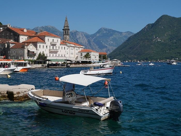
On the way back, we’ll drift into Bosnia-Herzegovina just to mix things up a bit!
We’re a little unsure about what to expect in terms of tourist crowds.
Dubrovnik has a reputation for being the hardest-hit city by overtourism, and Kotor and the whole Dalmatian coast aren’t exactly empty...
Luckily, most European countries haven’t started school holidays yet, and some measures seem to have been put in place to limit the flow (like restrictions on the number of cruise ships allowed to dock at the same time).
Maybe we’ll manage to escape the promised hell?
For now, we’re slamming the doors of the Scirocco and heading off to our first stop: northern Italy!
Vaccines and treatments for Thailand
Hi there,
I’ve already visited quite a few countries across several continents, but I’m pretty new to Asia.
I’m planning a trip to Thailand in October or November, and I wanted to check about health precautions: malaria treatment, vaccinations (hepatitis A or others...). I’ll mostly be in the northern region, around Chiang Mai, where I’ll spend a lot of time in nature and the mountains. Then I’ll head south to Phuket or Krabi and visit Khao Sok National Park. I’ll finish up in Bangkok, with a likely detour to Kanchanaburi.
From what I understand, for a stay of less than 60 days, I don’t need a visa (I’m a French national)? I just need to fill out the TDAC form 3 to 5 days before arrival?
Thanks for your advice! Fred
I’ve already visited quite a few countries across several continents, but I’m pretty new to Asia.
I’m planning a trip to Thailand in October or November, and I wanted to check about health precautions: malaria treatment, vaccinations (hepatitis A or others...). I’ll mostly be in the northern region, around Chiang Mai, where I’ll spend a lot of time in nature and the mountains. Then I’ll head south to Phuket or Krabi and visit Khao Sok National Park. I’ll finish up in Bangkok, with a likely detour to Kanchanaburi.
From what I understand, for a stay of less than 60 days, I don’t need a visa (I’m a French national)? I just need to fill out the TDAC form 3 to 5 days before arrival?
Thanks for your advice! Fred
Come discover the island of Madeira with me
Introduction
We arrived on the island of Madeira (Portugal) at the beginning of May 2023 and stayed for 5 weeks.
This island is renowned for its rich cultural heritage, its famous hikes through lush landscapes, and its seaside resorts. It offers an unforgettable experience for nature lovers.
In this travel journal, you’ll find a list of the many activities we did during our stay to explore the different attractions of this magnificent island.
These attractions are categorized to make it easier to search based on your interests, if needed.
Videos are included throughout the summary. Please click on the image to start the video.
To jump to a specific post, here are the appropriate links:
HIKES:
Calheta - PR19 Caminho Real do Paúl do Mar Santana - Ribeiro Frio - PR11 Vereda dos Balcões Sao Vicente - Gingas - PR16 Levada Fajã do Rodrigues Rabaçal - PR6.1 Levada do Risco & PR6 Levada das 25 fontes Rabaçal - PR6.2 Levada do Alecrim & PR6.3 Vereda da Lagoa do Vento Caniçal - PR8 Vereda da Ponta de São Lourenço São Jorge - PR18 Levada do Rei Ponta do Sol - PR7 modified - Levada Nova & Levada do Moinho Machico - PR5 Vereda das Funduras Funchal - PR1 Vereda do Areeiro (Pico do Areeiro to Pico Ruivo) Funchal - PR1 Vereda do Areeiro (Pico Ruivo to Pico do Areeiro) Funchal - PR1.2 Vereda do Pico Ruivo (outbound) Funchal - PR1.2 Vereda do Pico Ruivo (return) Porto Moniz - Fanal Forest Porto Moniz - PR14 Levada dos Cedros Ribeira Brava - PR17 Caminho do Pináculo e Folhadal (Encumeada) Ribeira Brava - PR17 Caminho do Pináculo e Folhadal (Lombo do Mouro) Ribeira Brava - PR17 Caminho do Pináculo e Folhadal (Bica da Cana) Santana - PR9 Levada do Caldeirão Verde Lamaceiros - Levada Ribeira da Janela Ribeiro Frio - PR10 Levada do Furado Tabua - Levada da Nova (Eastern Sector) Tabua - Levada da Nova (Western Sector) Boa Morte - Levada do Norte Verada da Levada do Facho - Levada do Norte (South) Vale Paraiso - Levada da Serra do Faial Porto Moniz - PR13 Vereda do Fanal Referta - Levada do Castelejo Porto da Cruz - Levada do Castelejo Estanquinhos - Pico Ruivo do Paul da Serra Boaventura - Levada de Cima & Levada da Acha Grande
SEASIDE RESORTS & NATURAL POOLS:
Natural pools of Seixal Seixal Naval Club Seaside Resort - Natural pool Natural pools of Porto Moniz Funchal - Lido Seaside Resort Santana - Foz da Ribeira do Faial Seaside Resort Câmara de Lobos - Salinas Seaside Resort Porto Moniz - Aquário/Cachalote Natural Pools Funchal - Doca do Cavacas Seaside Resort Funchal - Ponta Gorda Seaside Resort Caniço - Roca Mar Hotel Seaside Resort Caniço - Lido Galoma Seaside Resort Calhau de São Jorge Seaside Resort Ribeira Brava Seaside Resort
BEACHES:
São Jorge Beach Calheta Beach Seixal - Laje Beach (Jamaica) Porto de Seixal Beach Caniço - Reis Magos Beach Machico - Machico Beach (Banda d'Além) Machico - São Roque Beach Machico - Ribeira Natal Beach Caniçal - Prainha Beach Porto da Cruz - Alagoa Beach
TOWNS:
Stroll through the town of Ponta do Sol Stroll through the town of Câmara de Lobos Stroll through the town of Ribeira Brava Stroll through the town of Funchal Funchal - Wicker toboggan ride Stroll through the town of Machico Stroll through the town of Santana Stroll through the town of São Vicente São Vicente Caves Park
VIEWPOINTS:
Calheta Region Ponta do Sol Region Ribeira Brava Region Câmara de Lobos Region Funchal Region Santa Cruz Region Porto Moniz Region São Vicente Region Santana Region Machico Region On the road in Madeira
WATERFALLS ALONG THE WAY
Ponta do Sol - Anjos Waterfall Sao Vicente - Água d'Alto Waterfall Seixal - Córrego da Furna Waterfall
We arrived on the island of Madeira (Portugal) at the beginning of May 2023 and stayed for 5 weeks.
This island is renowned for its rich cultural heritage, its famous hikes through lush landscapes, and its seaside resorts. It offers an unforgettable experience for nature lovers.
In this travel journal, you’ll find a list of the many activities we did during our stay to explore the different attractions of this magnificent island.
These attractions are categorized to make it easier to search based on your interests, if needed.
Videos are included throughout the summary. Please click on the image to start the video.
To jump to a specific post, here are the appropriate links:
HIKES:
Calheta - PR19 Caminho Real do Paúl do Mar Santana - Ribeiro Frio - PR11 Vereda dos Balcões Sao Vicente - Gingas - PR16 Levada Fajã do Rodrigues Rabaçal - PR6.1 Levada do Risco & PR6 Levada das 25 fontes Rabaçal - PR6.2 Levada do Alecrim & PR6.3 Vereda da Lagoa do Vento Caniçal - PR8 Vereda da Ponta de São Lourenço São Jorge - PR18 Levada do Rei Ponta do Sol - PR7 modified - Levada Nova & Levada do Moinho Machico - PR5 Vereda das Funduras Funchal - PR1 Vereda do Areeiro (Pico do Areeiro to Pico Ruivo) Funchal - PR1 Vereda do Areeiro (Pico Ruivo to Pico do Areeiro) Funchal - PR1.2 Vereda do Pico Ruivo (outbound) Funchal - PR1.2 Vereda do Pico Ruivo (return) Porto Moniz - Fanal Forest Porto Moniz - PR14 Levada dos Cedros Ribeira Brava - PR17 Caminho do Pináculo e Folhadal (Encumeada) Ribeira Brava - PR17 Caminho do Pináculo e Folhadal (Lombo do Mouro) Ribeira Brava - PR17 Caminho do Pináculo e Folhadal (Bica da Cana) Santana - PR9 Levada do Caldeirão Verde Lamaceiros - Levada Ribeira da Janela Ribeiro Frio - PR10 Levada do Furado Tabua - Levada da Nova (Eastern Sector) Tabua - Levada da Nova (Western Sector) Boa Morte - Levada do Norte Verada da Levada do Facho - Levada do Norte (South) Vale Paraiso - Levada da Serra do Faial Porto Moniz - PR13 Vereda do Fanal Referta - Levada do Castelejo Porto da Cruz - Levada do Castelejo Estanquinhos - Pico Ruivo do Paul da Serra Boaventura - Levada de Cima & Levada da Acha Grande
SEASIDE RESORTS & NATURAL POOLS:
Natural pools of Seixal Seixal Naval Club Seaside Resort - Natural pool Natural pools of Porto Moniz Funchal - Lido Seaside Resort Santana - Foz da Ribeira do Faial Seaside Resort Câmara de Lobos - Salinas Seaside Resort Porto Moniz - Aquário/Cachalote Natural Pools Funchal - Doca do Cavacas Seaside Resort Funchal - Ponta Gorda Seaside Resort Caniço - Roca Mar Hotel Seaside Resort Caniço - Lido Galoma Seaside Resort Calhau de São Jorge Seaside Resort Ribeira Brava Seaside Resort
BEACHES:
São Jorge Beach Calheta Beach Seixal - Laje Beach (Jamaica) Porto de Seixal Beach Caniço - Reis Magos Beach Machico - Machico Beach (Banda d'Além) Machico - São Roque Beach Machico - Ribeira Natal Beach Caniçal - Prainha Beach Porto da Cruz - Alagoa Beach
TOWNS:
Stroll through the town of Ponta do Sol Stroll through the town of Câmara de Lobos Stroll through the town of Ribeira Brava Stroll through the town of Funchal Funchal - Wicker toboggan ride Stroll through the town of Machico Stroll through the town of Santana Stroll through the town of São Vicente São Vicente Caves Park
VIEWPOINTS:
Calheta Region Ponta do Sol Region Ribeira Brava Region Câmara de Lobos Region Funchal Region Santa Cruz Region Porto Moniz Region São Vicente Region Santana Region Machico Region On the road in Madeira
WATERFALLS ALONG THE WAY
Ponta do Sol - Anjos Waterfall Sao Vicente - Água d'Alto Waterfall Seixal - Córrego da Furna Waterfall
Exploring the Lower North Shore and Labrador – Come Join the Adventure!
After visiting Newfoundland Island, we took the ferry to Blanc-Sablon, a municipality located on the Lower North Shore in Quebec, Canada.
Instead of heading back to Quebec via Sydney in Nova Scotia, we decided to explore the Lower North Shore—the least-known region of Quebec—as well as Labrador, which is part of the province of Newfoundland and Labrador.
From Blanc-Sablon, we drove to the municipality of Vieux-Fort via Route 138. This road ends in that municipality.
Afterward, we crossed Labrador to return to the Old Capital. Only one road allows this route. It wasn’t fully paved during our trip, but it is now.
We made stops in different areas to go on hikes that let us discover some incredible landscapes.
I hope this travel journal inspires you to venture into these stunning regions.
Videos are embedded throughout the summary. Click on the image to start the video.
Lower North Shore:
Lower North Shore - Blanc-Sablon - Brador Falls Lookout Lower North Shore - Blanc-Sablon - Astragalus Trail (Milk-Vetch Trail) Lower North Shore - Bonne-Espérance - Granny Hill Trail
Labrador:
Red Bay - Tracey Hill Trail Mary's Harbour - White Water Falls Trail Mary's Harbour - Gin Cove Hiking Trail Mary's Harbour - Dr. Moret Hiking Trail Happy Valley-Goose Bay - Birch Island Walk North West River - Sunday Hill Lookout Trail Churchill Falls - Bowdoin Canyon Nature Trail Labrador City - Tanya Lake Loop Trail Labrador City - Crystal Falls Hiking Trail
North Shore
North Shore - Manic 2, 3, 5 Hydroelectric Plants and Daniel-Johnson Dam Baie-Comeau - Pioneers Park Tadoussac Village
**********
More landscapes of the Lower North Shore, Labrador, and the North Shore
Instead of heading back to Quebec via Sydney in Nova Scotia, we decided to explore the Lower North Shore—the least-known region of Quebec—as well as Labrador, which is part of the province of Newfoundland and Labrador.
From Blanc-Sablon, we drove to the municipality of Vieux-Fort via Route 138. This road ends in that municipality.
Afterward, we crossed Labrador to return to the Old Capital. Only one road allows this route. It wasn’t fully paved during our trip, but it is now.
We made stops in different areas to go on hikes that let us discover some incredible landscapes.
I hope this travel journal inspires you to venture into these stunning regions.
Videos are embedded throughout the summary. Click on the image to start the video.
Lower North Shore:
Lower North Shore - Blanc-Sablon - Brador Falls Lookout Lower North Shore - Blanc-Sablon - Astragalus Trail (Milk-Vetch Trail) Lower North Shore - Bonne-Espérance - Granny Hill Trail
Labrador:
Red Bay - Tracey Hill Trail Mary's Harbour - White Water Falls Trail Mary's Harbour - Gin Cove Hiking Trail Mary's Harbour - Dr. Moret Hiking Trail Happy Valley-Goose Bay - Birch Island Walk North West River - Sunday Hill Lookout Trail Churchill Falls - Bowdoin Canyon Nature Trail Labrador City - Tanya Lake Loop Trail Labrador City - Crystal Falls Hiking Trail
North Shore
North Shore - Manic 2, 3, 5 Hydroelectric Plants and Daniel-Johnson Dam Baie-Comeau - Pioneers Park Tadoussac Village
**********
More landscapes of the Lower North Shore, Labrador, and the North Shore
Newfoundland: Hikes in Gros Morne National Park
INTRODUCTION
Creating a masterpiece like Gros Morne National Park wasn’t done overnight. So, when you first discover this extraordinary place, it’s easy to understand why Mother Nature took over 485 million years to bring it to life.
Here, glacial valleys, forests, rugged coastline, beaches, and peat bogs follow one another and intertwine to form a unique ecosystem, one that’s rare in the world. After all, this is where geologists found tangible evidence of the theory of continental drift, and it’s one of the few places on Earth where you can see—and even walk on—the Earth’s mantle. This site is a true celebration of the raw, enigmatic power and beauty of the physical world.
Designated a national park in 1973 and later a UNESCO World Heritage Site in 1987, it’s an 1,805 km² playground just waiting for the adventurer in you. Whether you’re traveling solo, with family, or with friends, for a few days or several weeks, you won’t run out of things to do here.
Source: https://www.exploretnl.ca/parc-national-gros-morne
The hikes we did in this region are listed below. Each hike has a link so you can quickly access more information about it.
Videos are embedded throughout the summary. Click on the image to start the video.
Stanleyville Trail Trout River Pond Trail Trout River Pond Trail (Return) Green Gardens Trail Tablelands Trail Scenic Route 431 Lookout Hills Trail Southeast Brook Falls Trail Gros Morne Mountain Trail (James Callaghan Trail) Berry Hill Trail Baker's Brook Falls Trail Berry Hill Pond Trail Western Brook Pond Trail Boat Tour on Western Brook Pond Steve’s Trail Shallow Bay Beach
Creating a masterpiece like Gros Morne National Park wasn’t done overnight. So, when you first discover this extraordinary place, it’s easy to understand why Mother Nature took over 485 million years to bring it to life.
Here, glacial valleys, forests, rugged coastline, beaches, and peat bogs follow one another and intertwine to form a unique ecosystem, one that’s rare in the world. After all, this is where geologists found tangible evidence of the theory of continental drift, and it’s one of the few places on Earth where you can see—and even walk on—the Earth’s mantle. This site is a true celebration of the raw, enigmatic power and beauty of the physical world.
Designated a national park in 1973 and later a UNESCO World Heritage Site in 1987, it’s an 1,805 km² playground just waiting for the adventurer in you. Whether you’re traveling solo, with family, or with friends, for a few days or several weeks, you won’t run out of things to do here.
Source: https://www.exploretnl.ca/parc-national-gros-morne
The hikes we did in this region are listed below. Each hike has a link so you can quickly access more information about it.
Videos are embedded throughout the summary. Click on the image to start the video.
Stanleyville Trail Trout River Pond Trail Trout River Pond Trail (Return) Green Gardens Trail Tablelands Trail Scenic Route 431 Lookout Hills Trail Southeast Brook Falls Trail Gros Morne Mountain Trail (James Callaghan Trail) Berry Hill Trail Baker's Brook Falls Trail Berry Hill Pond Trail Western Brook Pond Trail Boat Tour on Western Brook Pond Steve’s Trail Shallow Bay Beach
3 weeks in Colombia (August 2023)
Why Colombia?
It's quite simple. For the past few years, my daughter has been living with a Colombian from Bogotá. The idea was to discover his country, meet his family, and do part of the trip all four of us together.
We’re heading out first as scouts, then they’ll join us to continue the journey.
The itinerary was shared in another post—now it’s time for the impressions.
No photos, as for me, it’s video and nothing more!
Day 1: The big departure What was planned: A flight from Lyon Saint-Exupéry late morning heading to Frankfurt. Two hours of waiting in Frankfurt (just enough time to eat a pretzel!!) and then off to Bogotá for an arrival around 7 PM local time. I hadn’t done the Check-Mig (to be done 72 hours before the flight). I did it on my phone, giving a fake arrival date in Colombia, and the attendant told me there wouldn’t be any issues in Bogotá. Actually, two hours of delay at departure in Lyon because a sick passenger was on the plane—they had to evacuate him, and the ambulance that was supposed to be there didn’t have permission to come near the plane. Ah, French administrative formalities!!!!! Flight to Frankfurt with Lufthansa went smoothly. A sprint through the airport—very well organized. Connection secured, so we boarded the plane, and two hours later than scheduled, we took off for an 11-hour flight! Arrival in Bogotá, and the immigration process took over an hour and a half because of the crowds. However, no issues with the Check-Mig—they barely glanced at it. Our daughter’s father-in-law ended up waiting over 3 hours at the airport because of this!!! Surprise: No luggage. Luckily, we had packed essentials in our carry-ons! Quick administrative paperwork, and Lufthansa informed me our bags would be on the next flight, so no big deal. Off to our hotel in La Candelaria and a good night’s rest.
The plus: We’re in Bogotá! The minus: Flight delays are becoming more and more common.
Day 1: The big departure What was planned: A flight from Lyon Saint-Exupéry late morning heading to Frankfurt. Two hours of waiting in Frankfurt (just enough time to eat a pretzel!!) and then off to Bogotá for an arrival around 7 PM local time. I hadn’t done the Check-Mig (to be done 72 hours before the flight). I did it on my phone, giving a fake arrival date in Colombia, and the attendant told me there wouldn’t be any issues in Bogotá. Actually, two hours of delay at departure in Lyon because a sick passenger was on the plane—they had to evacuate him, and the ambulance that was supposed to be there didn’t have permission to come near the plane. Ah, French administrative formalities!!!!! Flight to Frankfurt with Lufthansa went smoothly. A sprint through the airport—very well organized. Connection secured, so we boarded the plane, and two hours later than scheduled, we took off for an 11-hour flight! Arrival in Bogotá, and the immigration process took over an hour and a half because of the crowds. However, no issues with the Check-Mig—they barely glanced at it. Our daughter’s father-in-law ended up waiting over 3 hours at the airport because of this!!! Surprise: No luggage. Luckily, we had packed essentials in our carry-ons! Quick administrative paperwork, and Lufthansa informed me our bags would be on the next flight, so no big deal. Off to our hotel in La Candelaria and a good night’s rest.
The plus: We’re in Bogotá! The minus: Flight delays are becoming more and more common.
Discovering Assam and Nagaland 2025
Before I begin, I’d like to thank Michèle Buisson and her "Misha’s travel journals," which really helped me plan this trip. It’s tough to find information about this part of India, which is quite different from the "more traditional India." I’m so grateful to her for introducing me to a family who hosted me for 4 nights and 3 days. I can’t wait to return the favor and welcome you all to my place in early July!
Thursday, March 20th. The alarm goes off super early, but I’m already awake—I was too worried I’d sleep through it. I leave the house at 4:00 AM. The rain has stopped, and at this hour, there aren’t many trucks on the road. I arrive at Barcelona Airport easily by 6:20 AM, let the valet know I’m there, and he quickly picks up my car. This time, I’m flying with Etihad Airways again. I booked the ticket during my trip to Cambodia: Barcelona/Kolkata, Delhi/Barcelona for 567 €. At that price, I didn’t hesitate for long—I knew I had to take it. And I’m glad I did because, by the time I returned, the price had gone up to 700 €. I can already hear the reactions: "Wow, how’d you get a ticket for that price? What site did you use? You’re amazing, MarieJo!" One thing’s for sure—I’m really happy with this deal. The flights from Barcelona to Abu Dhabi and Abu Dhabi to Kolkata go smoothly, and we arrive on time at 2:55 AM. There aren’t many people at immigration, so I get through quickly. My luggage isn’t on the carousel yet. After collecting my bag, I check in for my next flight with IndiGo, a 5:40 AM flight to Guwahati, arriving at 7:00 AM. I’m starting to feel pretty tired, so I take a taxi from the airport to Gruham Sojourn Homestay. The house is upstairs, and the neighborhood seems quiet, with restaurants lining the street. The room won’t be ready until 10:00 AM, so I rest on the bench in the meantime. Once in the room, I take a shower—it really helps me feel refreshed. I need to exchange some euros, so I look up a nearby exchange bureau on Google and head out to find it. I locate it easily, and the staff are super friendly. I get a great rate (1 € = 90 INR). I wander around the neighborhood. The train station isn’t far, and small markets line the streets. I head back to my area, walking along the main avenue. About 500 meters from my street, I discover a museum. The visit is fascinating—I see the famous Majuli masks, among other things.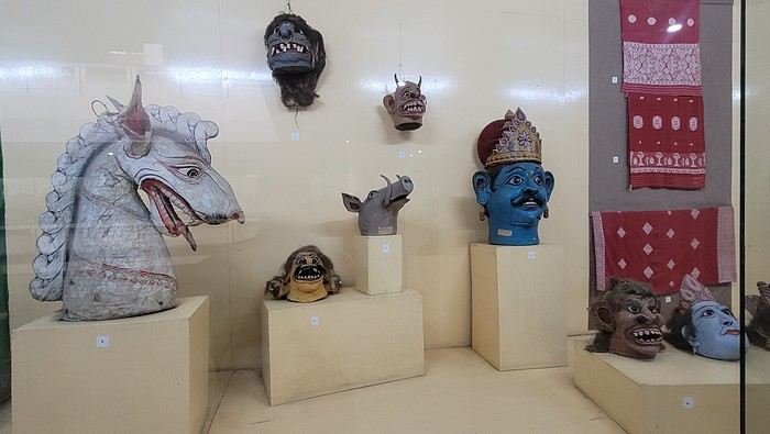

I’m not far from the Brahmaputra River, and the temptation to visit is too strong to resist. I’d hoped to find a promenade along the river, but that doesn’t exist here. I walk back calmly and notice several restaurants in my street. On the doorstep of my accommodation, I spot a pastry shop with cakes that look more like the ones we have in France than the typical ones here in India. A visit is a must, and I’m not disappointed!

Tonight, I’m dining at a restaurant in the street. The menu is a bit disappointing—burgers, pizzas, pasta—nothing very Indian. So, I’ll go with tomato pasta.
Thursday, March 20th. The alarm goes off super early, but I’m already awake—I was too worried I’d sleep through it. I leave the house at 4:00 AM. The rain has stopped, and at this hour, there aren’t many trucks on the road. I arrive at Barcelona Airport easily by 6:20 AM, let the valet know I’m there, and he quickly picks up my car. This time, I’m flying with Etihad Airways again. I booked the ticket during my trip to Cambodia: Barcelona/Kolkata, Delhi/Barcelona for 567 €. At that price, I didn’t hesitate for long—I knew I had to take it. And I’m glad I did because, by the time I returned, the price had gone up to 700 €. I can already hear the reactions: "Wow, how’d you get a ticket for that price? What site did you use? You’re amazing, MarieJo!" One thing’s for sure—I’m really happy with this deal. The flights from Barcelona to Abu Dhabi and Abu Dhabi to Kolkata go smoothly, and we arrive on time at 2:55 AM. There aren’t many people at immigration, so I get through quickly. My luggage isn’t on the carousel yet. After collecting my bag, I check in for my next flight with IndiGo, a 5:40 AM flight to Guwahati, arriving at 7:00 AM. I’m starting to feel pretty tired, so I take a taxi from the airport to Gruham Sojourn Homestay. The house is upstairs, and the neighborhood seems quiet, with restaurants lining the street. The room won’t be ready until 10:00 AM, so I rest on the bench in the meantime. Once in the room, I take a shower—it really helps me feel refreshed. I need to exchange some euros, so I look up a nearby exchange bureau on Google and head out to find it. I locate it easily, and the staff are super friendly. I get a great rate (1 € = 90 INR). I wander around the neighborhood. The train station isn’t far, and small markets line the streets. I head back to my area, walking along the main avenue. About 500 meters from my street, I discover a museum. The visit is fascinating—I see the famous Majuli masks, among other things.
I’m not far from the Brahmaputra River, and the temptation to visit is too strong to resist. I’d hoped to find a promenade along the river, but that doesn’t exist here. I walk back calmly and notice several restaurants in my street. On the doorstep of my accommodation, I spot a pastry shop with cakes that look more like the ones we have in France than the typical ones here in India. A visit is a must, and I’m not disappointed!
Tonight, I’m dining at a restaurant in the street. The menu is a bit disappointing—burgers, pizzas, pasta—nothing very Indian. So, I’ll go with tomato pasta.
Drakensberg in August: is it the right time?
Hi there,
We’re heading to South Africa in August 2025 and planning a classic loop that I’d love to finish with the Drakensberg (I’m a big hiking fan) before returning to Johannesburg to catch our flight.
I’ve got 3 nights for this part of our trip. But I’m wondering if it’s actually a good idea to hike in the Drakensberg in August, since it’s the Southern Hemisphere winter (I’m from Réunion and we hike year-round there, but I don’t know what the climate’s like in South Africa, especially the Drakensberg).
I’m particularly worried about getting stuck because of snow and missing our flight... ;)
I’ve read so many different things that I’m totally confused!
If it’s okay to hike at this time of year, what would you recommend? I’m torn between Champagne Valley and Royal Natal National Park.
Thanks in advance for your firsthand tips!
Malijp
A wonderful week around Tromsø, Kvaløya, and the Lyngen Alps
Hi everyone,
There haven’t been many recent stories about Norway in winter, and since I had trouble finding info on winter hikes, I thought I’d share a little travel journal.
Back in September 2024, while planning our summer 2025 trip to Norway, I joined some Facebook groups dedicated to travel in Scandinavia and started reading travel blogs. Since winter trips were being planned at the time, I came across posts with stunning photos of northern Norway in winter. I’d always pictured monotonous landscapes of pine forests and frozen lakes, so I was pleasantly surprised to see fjords, mountain ranges, and charming colorful cabins—just like in the Lofoten Islands. Turns out, the vast pine forests are more typical of Finnish Lapland. Norway, north of the Arctic Circle, is actually much more diverse. That was all it took to suggest this destination to my three guys for our winter vacation. After some research, early March seemed ideal—good weather, long enough daylight, and great chances for northern lights. A direct flight from Paris to Tromsø sealed the deal. The only downside? The cost of cars, accommodations, and activities nearly made us back out! Everything except flights is really expensive.
Since our oldest son had an important school deadline in June, he decided to skip the trip, so we ended up going as a trio. We took a Transavia round-trip flight from Orly to Tromsø for an amazing trip from March 1st to 8th.
Want to come along?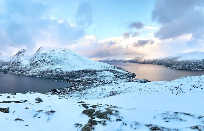
There haven’t been many recent stories about Norway in winter, and since I had trouble finding info on winter hikes, I thought I’d share a little travel journal.
Back in September 2024, while planning our summer 2025 trip to Norway, I joined some Facebook groups dedicated to travel in Scandinavia and started reading travel blogs. Since winter trips were being planned at the time, I came across posts with stunning photos of northern Norway in winter. I’d always pictured monotonous landscapes of pine forests and frozen lakes, so I was pleasantly surprised to see fjords, mountain ranges, and charming colorful cabins—just like in the Lofoten Islands. Turns out, the vast pine forests are more typical of Finnish Lapland. Norway, north of the Arctic Circle, is actually much more diverse. That was all it took to suggest this destination to my three guys for our winter vacation. After some research, early March seemed ideal—good weather, long enough daylight, and great chances for northern lights. A direct flight from Paris to Tromsø sealed the deal. The only downside? The cost of cars, accommodations, and activities nearly made us back out! Everything except flights is really expensive.
Since our oldest son had an important school deadline in June, he decided to skip the trip, so we ended up going as a trio. We took a Transavia round-trip flight from Orly to Tromsø for an amazing trip from March 1st to 8th.
Want to come along?
15 days in Turkey with family: Is this itinerary doable?
Hi there.
About a month ago, I posted a potential itinerary for Bulgaria and Istanbul, but in the end, since we found some relatively cheap flight tickets to Istanbul, we decided to go for a trip to Turkey instead.
When? 2 weeks, late August (14th to 29th) Who? Dad, mom, a 17-year-old teen, and an 11-year-old child
Here’s our plan: do you think it’s doable? Any practical tips?
We start with 4 full days in Istanbul (5 nights) Then, we rent a car and head to Ephesus. We stay there for 1 day (2 nights) After that, we drive to Kaş. We stay there for 4 full days (5 nights), enough time to relax a bit, see Kaputaş Beach and Kekova, the site of Myra, the site of Patara, and possibly the site of Çıralı/Olympos—even though it’s a bit far—and Saklıkent Gorge. From Kaş, we spend 2 nights near Denizli to see Pamukkale and Aphrodisias. Is it possible to visit both sites in the same day? Then, we travel from Pamukkale back to Istanbul, return the car, and spend one last night in Istanbul.
Thanks for your thoughts!
When? 2 weeks, late August (14th to 29th) Who? Dad, mom, a 17-year-old teen, and an 11-year-old child
Here’s our plan: do you think it’s doable? Any practical tips?
We start with 4 full days in Istanbul (5 nights) Then, we rent a car and head to Ephesus. We stay there for 1 day (2 nights) After that, we drive to Kaş. We stay there for 4 full days (5 nights), enough time to relax a bit, see Kaputaş Beach and Kekova, the site of Myra, the site of Patara, and possibly the site of Çıralı/Olympos—even though it’s a bit far—and Saklıkent Gorge. From Kaş, we spend 2 nights near Denizli to see Pamukkale and Aphrodisias. Is it possible to visit both sites in the same day? Then, we travel from Pamukkale back to Istanbul, return the car, and spend one last night in Istanbul.
Thanks for your thoughts!
Two Quebecers Attempting Mount Meru
In 2015, for my 50th birthday, my daughter and I went to Kenya and Tanzania for a safari. Ten years later, for my 60th, a new African adventure: returning to Tanzania, this time to attempt the ascent of Mount Meru.
After watching documentaries and films about Everest climbers, I’ve always been drawn to the idea of experiencing something like that. I’m impressed by those who risk their lives just to chase their dreams and push their limits (my partner would say they’re crazy). I’ve never pretended I could climb the roof of the world. My sights were set on Kilimanjaro instead. But when my daughter planned our adventure, she lowered my ambitions by a few meters by choosing Meru—and I get it. We’re both very active, but we’re not seasoned athletes. And our mountains in Quebec, as beautiful as they are, don’t offer the chance to climb very high to test our endurance against the lack of oxygen.
So, to prepare physically, I worked my 60-year-old legs daily by walking and climbing small hills near home. As for altitude sickness, I’ll have to trust my system and my old lungs, but it still stresses me out. The departure is approaching, and there’s no turning back—I tell myself that at worst, I’ll have tried.
February 2nd, departure day. We leave Montreal on an Air France flight as scheduled. Luckily, because we were worried, our flight times were delayed, and our layover at CDG will be tight. After a 6.5-hour flight to Paris, no messing around—we have just enough time to sit for about thirty minutes before boarding another 8.5-hour flight to Zanzibar, still with Air France. In Zanzibar, we stay on the plane while pale-faced passengers disembark, replaced by sun-kissed travelers (it’s sunny and warm in Zanzibar). We then take a short flight to Kilimanjaro Airport, our final destination. Exhausted but happy to step off the big metal bird, a driver from the agency we chose (Soaring Flamingo) waits to take us to our hotel, the Tulia in Arusha. It’s 2 AM when we finally collapse onto the mattress. Tomorrow, we’ll spend the day recovering from the sleepless flight, relaxing by a murky pool in a beautiful flower-filled courtyard, surrounded by palm trees and the everyday sounds of Africa. At that moment, I feel privileged to share this experience with my daughter, and I think about the mountain that awaits us.
To be continued...
After watching documentaries and films about Everest climbers, I’ve always been drawn to the idea of experiencing something like that. I’m impressed by those who risk their lives just to chase their dreams and push their limits (my partner would say they’re crazy). I’ve never pretended I could climb the roof of the world. My sights were set on Kilimanjaro instead. But when my daughter planned our adventure, she lowered my ambitions by a few meters by choosing Meru—and I get it. We’re both very active, but we’re not seasoned athletes. And our mountains in Quebec, as beautiful as they are, don’t offer the chance to climb very high to test our endurance against the lack of oxygen.
So, to prepare physically, I worked my 60-year-old legs daily by walking and climbing small hills near home. As for altitude sickness, I’ll have to trust my system and my old lungs, but it still stresses me out. The departure is approaching, and there’s no turning back—I tell myself that at worst, I’ll have tried.
February 2nd, departure day. We leave Montreal on an Air France flight as scheduled. Luckily, because we were worried, our flight times were delayed, and our layover at CDG will be tight. After a 6.5-hour flight to Paris, no messing around—we have just enough time to sit for about thirty minutes before boarding another 8.5-hour flight to Zanzibar, still with Air France. In Zanzibar, we stay on the plane while pale-faced passengers disembark, replaced by sun-kissed travelers (it’s sunny and warm in Zanzibar). We then take a short flight to Kilimanjaro Airport, our final destination. Exhausted but happy to step off the big metal bird, a driver from the agency we chose (Soaring Flamingo) waits to take us to our hotel, the Tulia in Arusha. It’s 2 AM when we finally collapse onto the mattress. Tomorrow, we’ll spend the day recovering from the sleepless flight, relaxing by a murky pool in a beautiful flower-filled courtyard, surrounded by palm trees and the everyday sounds of Africa. At that moment, I feel privileged to share this experience with my daughter, and I think about the mountain that awaits us.
To be continued...
Tips for a 9-day itinerary in southern Morocco
Hi there!
As mentioned in a previous post, we're heading to Morocco in April for 9 days instead of the originally planned 7.
Here's the itinerary I've mapped out to ideally have a complete trip, but I think it might be too ambitious. What do you think? Here's the itinerary (click)
For those who can't open the link: Marrakech (the afternoon of our arrival + 1 day, we’ve already been there without the kids, the goal is not to stay too long) – night Aït Ben Haddou Ouarzazate Skoura – night Oasis de Fint Dadès Gorges Tinghir – night Merzouga – night Zagora – night M’hamid – ideally a night in the desert Agdz Marrakech – night (itinerary via Telouet)
What do you think of this plan? Will it feel too rushed, or is it manageable? Since we don’t know the places, it’s hard to tell if we’ll want to stop everywhere along the way or if there’s enough time to spend at each spot. I’ve included some night-stop assumptions (1 or 2 nights).
We’d love to hear your thoughts! We’re traveling with my wife, a 13-year-old teen, and a 10-year-old. We’ll have our own rental car.
Thanks! !
As mentioned in a previous post, we're heading to Morocco in April for 9 days instead of the originally planned 7.
Here's the itinerary I've mapped out to ideally have a complete trip, but I think it might be too ambitious. What do you think? Here's the itinerary (click)
For those who can't open the link: Marrakech (the afternoon of our arrival + 1 day, we’ve already been there without the kids, the goal is not to stay too long) – night Aït Ben Haddou Ouarzazate Skoura – night Oasis de Fint Dadès Gorges Tinghir – night Merzouga – night Zagora – night M’hamid – ideally a night in the desert Agdz Marrakech – night (itinerary via Telouet)
What do you think of this plan? Will it feel too rushed, or is it manageable? Since we don’t know the places, it’s hard to tell if we’ll want to stop everywhere along the way or if there’s enough time to spend at each spot. I’ve included some night-stop assumptions (1 or 2 nights).
We’d love to hear your thoughts! We’re traveling with my wife, a 13-year-old teen, and a 10-year-old. We’ll have our own rental car.
Thanks! !
Tanzania 2019 - Polé Polé
KARIBUUU
Over 5 years later, I’m finally getting around to writing the travel journal for our first trip to East Africa: Tanzania. *Polé Polé*, as they say! 😎
A trip I’d started planning just 6 years ago, in February 2019, for my post-internship exam vacation. After returning to South Africa in July 2019 with my family, this trip, planned for September 2019, would be all about discovery and a few firsts: first trip with friends, first trek, first time in East Africa. I really wanted to attempt the Kilimanjaro ascent, try to still see some of its "eternal" ice, and Alison wanted to do as much safari as possible. Unlike with the Zulus, Himbas, or San, visiting a Maasai village wasn’t on the agenda. Thanks to the Kessy Brothers agency, who were super responsive, Sandy from VF, and other members who helped prepare our trip, we settled on the following itinerary:
Day -1 (8/30): Departure from Pointe-à-Pitre Day 0 (8/31): Departure from Paris Day 1 (9/01): Arrival at Kilimanjaro Airport / Ameg Lodge (Moshi) DAY 2 (9/02): Machame gate / Machame camp DAY 3 (9/03): Shira / Shira camp DAY 4 (9/04): Baranco / Baranco camp DAY 5 (9/05): Barafu / Barafu camp DAY 6 (9/06): Barafu + Summit at midnight / Mweka camp DAY 7 (9/07): Mweka gate / Sal Salnero Hotel (Moshi) DAY 8 (9/08): Arusha National Park / Kanga camp DAY 9 (9/09): Tarangire National Park / Kanga camp DAY 10 (9/10): Tarangire National Park / Twiga Lodge DAY 11 (9/11): Lake Manyara / Twiga Lodge DAY 12 (9/12): Ngorongoro Crater / Simba campsite DAY 13 (9/13): Serengeti National Park / Seronera campsite DAY 14 (9/14): Serengeti National Park - Uoga Kuria Camp DAY 15 (9/15): Serengeti National Park / Waso campsite DAY 16 (9/16): Lake Natron / Maasai Giraffe Ecolodge DAY 17 (9/17): Kilimanjaro Airport Day 18 (9/18): Zanzibar Day 19 (9/19): Zanzibar Day 20 (9/20): Zanzibar Day 21 (9/21): Zanzibar
As I mentioned in my first travel journal about our South Africa trip, I’ve had a special connection to Tanzania for a long time. Growing up in the Indian Ocean without ever visiting Africa, those wildlife documentaries on TV when I skipped my pharmacy classes... I imagined and dreamed about this land and country so much.
The original plan was to go just the two of us with Alison, but somehow—though I don’t quite remember how—we ended up organizing the trip with our friends Mélissa and Doriane, who joined us in Arusha after our Kilimanjaro trek for the last two weeks and their very first safari. I think it was Melissa who had the idea to crash our trip, and she was right to do so! 😉 Flights: Pointe-à-Pitre-Grand Case and Grand Case-Paris with Air Caraïbes. Flights: Paris-JRO and ZNZ-Paris with Kenya Airways (layover in Nairobi). Flight: JRO-ZNZ with Air Tanzania.
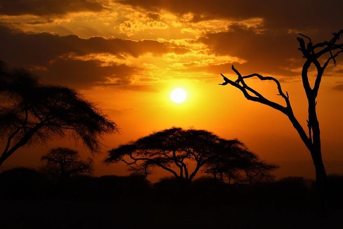
Safe travels! !
Over 5 years later, I’m finally getting around to writing the travel journal for our first trip to East Africa: Tanzania. *Polé Polé*, as they say! 😎
A trip I’d started planning just 6 years ago, in February 2019, for my post-internship exam vacation. After returning to South Africa in July 2019 with my family, this trip, planned for September 2019, would be all about discovery and a few firsts: first trip with friends, first trek, first time in East Africa. I really wanted to attempt the Kilimanjaro ascent, try to still see some of its "eternal" ice, and Alison wanted to do as much safari as possible. Unlike with the Zulus, Himbas, or San, visiting a Maasai village wasn’t on the agenda. Thanks to the Kessy Brothers agency, who were super responsive, Sandy from VF, and other members who helped prepare our trip, we settled on the following itinerary:
Day -1 (8/30): Departure from Pointe-à-Pitre Day 0 (8/31): Departure from Paris Day 1 (9/01): Arrival at Kilimanjaro Airport / Ameg Lodge (Moshi) DAY 2 (9/02): Machame gate / Machame camp DAY 3 (9/03): Shira / Shira camp DAY 4 (9/04): Baranco / Baranco camp DAY 5 (9/05): Barafu / Barafu camp DAY 6 (9/06): Barafu + Summit at midnight / Mweka camp DAY 7 (9/07): Mweka gate / Sal Salnero Hotel (Moshi) DAY 8 (9/08): Arusha National Park / Kanga camp DAY 9 (9/09): Tarangire National Park / Kanga camp DAY 10 (9/10): Tarangire National Park / Twiga Lodge DAY 11 (9/11): Lake Manyara / Twiga Lodge DAY 12 (9/12): Ngorongoro Crater / Simba campsite DAY 13 (9/13): Serengeti National Park / Seronera campsite DAY 14 (9/14): Serengeti National Park - Uoga Kuria Camp DAY 15 (9/15): Serengeti National Park / Waso campsite DAY 16 (9/16): Lake Natron / Maasai Giraffe Ecolodge DAY 17 (9/17): Kilimanjaro Airport Day 18 (9/18): Zanzibar Day 19 (9/19): Zanzibar Day 20 (9/20): Zanzibar Day 21 (9/21): Zanzibar
As I mentioned in my first travel journal about our South Africa trip, I’ve had a special connection to Tanzania for a long time. Growing up in the Indian Ocean without ever visiting Africa, those wildlife documentaries on TV when I skipped my pharmacy classes... I imagined and dreamed about this land and country so much.
The original plan was to go just the two of us with Alison, but somehow—though I don’t quite remember how—we ended up organizing the trip with our friends Mélissa and Doriane, who joined us in Arusha after our Kilimanjaro trek for the last two weeks and their very first safari. I think it was Melissa who had the idea to crash our trip, and she was right to do so! 😉 Flights: Pointe-à-Pitre-Grand Case and Grand Case-Paris with Air Caraïbes. Flights: Paris-JRO and ZNZ-Paris with Kenya Airways (layover in Nairobi). Flight: JRO-ZNZ with Air Tanzania.
Safe travels! !
CLIFFS OF THE WORLD: January 2025 Photo Contest
It's tough to find a fresh topic since so many themes have already been covered, so this one is intentionally narrow to highlight the photo—inspired by a recent visit ;)
**Participation** Each VF member can submit up to 3 photos, until **Saturday, January 25 at 11:59 PM Paris time**. Each photo must be posted in a separate message, with its number (1, 2, or 3). Don’t forget to add a little explanation (comment, location, etc.).
**Voting:** Each VF member can vote for the 3 photos they think are the best, based on their own criteria and the theme.
Voting runs from **Sunday, January 26 to Friday, January 31 at 11:59 PM Paris time**.
Photos should be ranked in order of preference: - 1st photo: 3 points - 2nd photo: 2 points - 3rd photo: 1 point
The winner is the photographer whose photo earns the most points.
Results will be announced on **February 1**. In case of a tie, the number of first-place votes will decide. The winner gets the honor of organizing February’s contest.
For discussion about the contest, check the thread: https://voyageforum.com/forum/discussion-falaises-monde-concours-janvier-2025-d10659248/
(Big thanks to Raga and unamilanese—I just did a copy-paste 😎)
**Participation** Each VF member can submit up to 3 photos, until **Saturday, January 25 at 11:59 PM Paris time**. Each photo must be posted in a separate message, with its number (1, 2, or 3). Don’t forget to add a little explanation (comment, location, etc.).
**Voting:** Each VF member can vote for the 3 photos they think are the best, based on their own criteria and the theme.
Voting runs from **Sunday, January 26 to Friday, January 31 at 11:59 PM Paris time**.
Photos should be ranked in order of preference: - 1st photo: 3 points - 2nd photo: 2 points - 3rd photo: 1 point
The winner is the photographer whose photo earns the most points.
Results will be announced on **February 1**. In case of a tie, the number of first-place votes will decide. The winner gets the honor of organizing February’s contest.
For discussion about the contest, check the thread: https://voyageforum.com/forum/discussion-falaises-monde-concours-janvier-2025-d10659248/
(Big thanks to Raga and unamilanese—I just did a copy-paste 😎)
Photo Safaris in Kenya
Back on the forum, I’m starting to write up two 3-week trips to Kenya in August 2021 and 2023.
In 2021, Quynh and I traveled with Régis (Rjulie95 on VF). Our son joined us in Baringo for the second half of the trip.
In 2023, we went with two friends who’d been dreaming of seeing wild animals ever since we got back from Kenya. We didn’t need much convincing to go with them!
The two itineraries are almost identical (well, when you love something...) but we did make a few tweaks.
- The first part of the trip was with a local driver/guide, Félix, who was recommended by Sylvie56. Sylvie and her husband Ben are Kenya enthusiasts—they’ve been there countless times, always with Félix... and for good reason! He’s fantastic!
- The second part was with Melting Pot Safari, an agency that adapted to our photography needs. Tony Crocetta, the co-founder (along with his Kenyan friend Simon Chebon), is a wildlife photographer himself.
Here are the itineraries for both trips, including accommodations:
In 2021: Day 0: Paris / Nairobi - 67 Airport Hotel Day 1: Nairobi / Amboseli - Simba Cottage Day 2: Amboseli - Simba Cottage Day 3: Amboseli / Aberdares - Fishing Lodge Day 4: Aberdares - Fishing Lodge Day 5: Aberdares - Fishing Lodge Day 6: Aberdares / Samburu - Riverside Camp Day 7: Samburu - Riverside Camp Day 8: Samburu - Riverside Camp Day 9: Samburu / Nakuru - Merica Hotel Day 10: Nakuru / Baringo - Tumbili Cliff Lodge Day 11: Baringo - Tumbili Cliff Lodge Day 12: Baringo - Tumbili Cliff Lodge Day 13: Baringo / Maasai Mara – Meltingpot Bush Camp Day 14 to 18: Maasai Mara – Meltingpot Bush Camp Day 19: Maasai Mara / Nairobi – Roussel Guest House Day 20: Nairobi / Paris
In 2023: Day 0: Lyon / Paris / Nairobi - 67 Airport Hotel Day 1: Nairobi / Meru - Ikweta Camp Day 2: Meru - Ikweta Camp Day 3: Meru - Ikweta Camp Day 4: Meru / Samburu - Riverside Camp Day 5: Samburu – Riverside Camp Day 6: Samburu / Buffalo Springs – Samburu Simba Day 7: Buffalo Springs / Ol Pejeta – Sweetwater Camp Day 8: Ol Pejeta / Amboseli - Simba Cottage Day 9: Amboseli - Simba Cottage Day 10: Amboseli - Simba Cottage Day 11: Amboseli / Nakuru – Lake Nakuru Lodge Day 12: Nakuru / Baringo - Tumbili Cliff Lodge Day 13: Baringo - Tumbili Cliff Lodge Day 14: Baringo - Tumbili Cliff Lodge Day 15: Baringo / Maasai Mara – Meltingpot Bush Camp Day 16 to 20: Maasai Mara – Meltingpot Bush Camp Day 21: Maasai Mara / Nairobi / Paris
Here’s an itinerary—it’s not exactly what we did, but a combination of both.
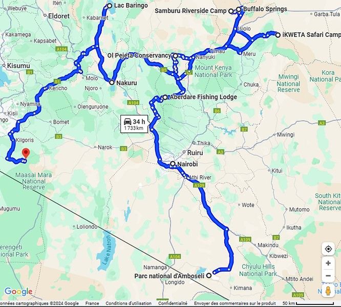
Ready to join us on safari to see some wild animals?
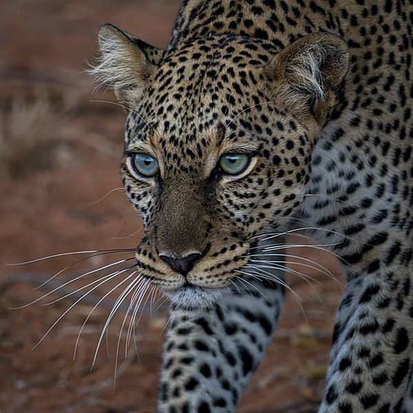
The two itineraries are almost identical (well, when you love something...) but we did make a few tweaks.
- The first part of the trip was with a local driver/guide, Félix, who was recommended by Sylvie56. Sylvie and her husband Ben are Kenya enthusiasts—they’ve been there countless times, always with Félix... and for good reason! He’s fantastic!
- The second part was with Melting Pot Safari, an agency that adapted to our photography needs. Tony Crocetta, the co-founder (along with his Kenyan friend Simon Chebon), is a wildlife photographer himself.
Here are the itineraries for both trips, including accommodations:
In 2021: Day 0: Paris / Nairobi - 67 Airport Hotel Day 1: Nairobi / Amboseli - Simba Cottage Day 2: Amboseli - Simba Cottage Day 3: Amboseli / Aberdares - Fishing Lodge Day 4: Aberdares - Fishing Lodge Day 5: Aberdares - Fishing Lodge Day 6: Aberdares / Samburu - Riverside Camp Day 7: Samburu - Riverside Camp Day 8: Samburu - Riverside Camp Day 9: Samburu / Nakuru - Merica Hotel Day 10: Nakuru / Baringo - Tumbili Cliff Lodge Day 11: Baringo - Tumbili Cliff Lodge Day 12: Baringo - Tumbili Cliff Lodge Day 13: Baringo / Maasai Mara – Meltingpot Bush Camp Day 14 to 18: Maasai Mara – Meltingpot Bush Camp Day 19: Maasai Mara / Nairobi – Roussel Guest House Day 20: Nairobi / Paris
In 2023: Day 0: Lyon / Paris / Nairobi - 67 Airport Hotel Day 1: Nairobi / Meru - Ikweta Camp Day 2: Meru - Ikweta Camp Day 3: Meru - Ikweta Camp Day 4: Meru / Samburu - Riverside Camp Day 5: Samburu – Riverside Camp Day 6: Samburu / Buffalo Springs – Samburu Simba Day 7: Buffalo Springs / Ol Pejeta – Sweetwater Camp Day 8: Ol Pejeta / Amboseli - Simba Cottage Day 9: Amboseli - Simba Cottage Day 10: Amboseli - Simba Cottage Day 11: Amboseli / Nakuru – Lake Nakuru Lodge Day 12: Nakuru / Baringo - Tumbili Cliff Lodge Day 13: Baringo - Tumbili Cliff Lodge Day 14: Baringo - Tumbili Cliff Lodge Day 15: Baringo / Maasai Mara – Meltingpot Bush Camp Day 16 to 20: Maasai Mara – Meltingpot Bush Camp Day 21: Maasai Mara / Nairobi / Paris
Here’s an itinerary—it’s not exactly what we did, but a combination of both.
Ready to join us on safari to see some wild animals?
Martine and DD in Colorado and Utah
Hello everyone! 🙂
So many silent months, and now Voyage Forum is accessible again. That’s cool because we can pick up our discussions for our mutual enjoyment.
I hope everyone is doing well and that you’ve been able to take some great trips, whether to the USA or elsewhere.
In September 2020, we had planned a round trip to explore Colorado, but unfortunately, a nasty virus messed up our plans, closing borders and keeping us stuck at home. Luckily for us, canceling the car, flights, and accommodations didn’t cost us a thing—everything was refunded.
In 2023, a loop from Las Vegas let us revisit places we’d seen in 2017 and discover new ones, this time spending more time at each stop with some lovely hikes.
In 2024, we finally revisited the 2020 plan, and I’ll start with that.
However, unforeseen circumstances mean I have much less time than before, so I’ll keep my trip reports shorter (ha ha ha—you’ll have less of my prose to endure).
Another change: for those who remember the "Gang of Four crazy sixty-somethings," it was just DD and me this time. Our dear Mimi and Maumau left the Var to focus on raising horses and can’t leave their little green paradise to join us anymore. We were unfortunately much tamer without them.
We traveled from September 11 to October 3.
The itinerary
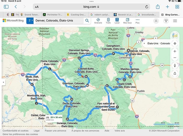
Day 1: Flight Marseille-Paris-Denver, then Manitou Springs (133 km) Day 2: Manitou Springs (49 km) Day 3: Cripple Creek (104 km) Day 4: Salida (254 km) Day 5: Great Sand Dunes (231 km) Day 6: Durango (283 km) Day 7: Durango (Durango-Silverton train) Day 8: Ouray (121 km) Day 9: Ouray (Perimeter Trail hike) Day 10: Cortez (213 km) Day 11: Cortez (Mesa Verde National Park, 134 km) Day 12: Monticello (268 km, detour to Chesler Park) Day 13: Moab (171 km, Delicate Arch) Day 14: Moab (98 km, Fisher Towers) Day 15: Moab (171 km, Canyonlands) Day 16: Fruita (210 km, Colorado National Monument) Day 17: Crested Butte (224 km via Kebler Pass) Day 18: Crested Butte (57 km) Day 19: Glenwood Springs (150 km) Day 20: Glenwood Springs (118 km, Rifle State Park) Day 21: Georgetown (258 km via Independence Pass) Day 22: Denver (123 km), then return flight
We speak very little English. We spent 21 nights there and covered a 3,400 km loop by car and 160 km on foot (we’re still trying to hike while we’re in shape) from Denver in September 2024. We wanted this road trip to help us explore Colorado a bit more—we’d only spent 6 nights there in 2019—and to see it during the fall foliage season. We also wanted to return to Utah (we love Moab) to enjoy its red rocks, which we adore.
In the prices you see (some in euros, others in dollars), I’ve included bank fees and exchange charges. The flights, car, and parking were paid by credit card when we booked in February. Usually, we book around November, but some obligations kept us from doing it earlier. We downloaded the MPC (Mobile Passport Control) app on our phone, which saved us time at immigration.
📊 **Budget: just under 8,500 € for both of us, all included**
📊 **Flights** Marseille-Paris (CDG)-Denver: 2,152 € for both of us, with one checked bag each
📊 **ESTA and America the Beautiful Pass** The ones from our 2023 road trip were still valid
📊 **Parking at Marseille airport: 122 €**
📊 **Car: Nissan Rogue (the French X-Trail) from Hertz: 1,165 €** By booking through Air France (and earning miles), we got a 15% discount. Hertz offers a free Hertz Gold Plus Rewards program, which gives us priority counter service.
📊 **Accommodation: 3,050 €** We stayed in motels and hotels of various ranges (from 100 € to 270 € per night, depending on the city), all booked through Hotels.com or Booking. Booking sometimes offers cheaper rates if you book via the "Booking mobile" app. We also got some preferential rates thanks to our Genius 2 status. Out of 21 nights, only one place didn’t include breakfast.
📊 **Other expenses (activities booked by credit card before leaving)** Durango-Silverton train: 210 € (we booked the enclosed vintage coach in March) Mesa Verde: Balcony House: 15.15 € (booked 14 days before the visit) Timed-entry passes for Arches National Park: 6 € for 3 days (booked June 1 for September entries via http://récreation.gov/). We booked three different days to play with the weather.
📊 **Supplementary insurance with AVA: 204 €** (due to our age 😅 and the high cost of medical consultations in the USA)
📊 **Cash: 1,540 €** We left with 1,000 € exchanged before departure and made two withdrawals (500 $ and 200 $). This cash was used to pay for: - Evening restaurants and tips (between 70 $ and 95 $ for two meals and two drinks) - Two state parks: Dead Horse State Park (20 $) and Rifle State Park (10 $) - The Monarch Pass gondola (24 $) - Midday picnics - Gas (slightly cheaper with cash): 204 $ for 3,400 km - Personal souvenirs and little treats.
Like in our previous road trips, we didn’t rent a GPS. We used the offline GPS app Here We Go, for which we’d downloaded maps of Colorado and Utah from France, as well as a new offline app called Organic Maps as a backup—though we didn’t end up needing it.
❤️❤️❤️ **Highlights (there are so many!)** 📍 The stunning landscapes of Colorado, especially with the fall colors 📍 A step back in time at the old farm in Florissant Fossil Beds National Monument 📍 The prairies of Cripple Creek and the mining remnants of the Vindicator Trail 📍 The cheeky chipmunks in the ghost town of St. Elmo 📍 Great Sand Dunes and its soft sand 📍 The steam train between Durango and Silverton: we’re glad we chose the round-trip because it rained heavily on the way there, but we got to enjoy the scenery on the way back when the sun came out 📍 The unexpected meet-up with Michèle from the group outside a restaurant in Durango 📍 The hot springs in Ouray 📍 Mesa Verde and its still-vibrant past 📍 The red rocks of Moab and Delicate Arch at sunset 📍 The lace-like Fisher Towers and the view from the end of the trail 📍 The gorgeous Route 128 leading to Colorado National Monument—small, easy to visit, and so beautiful 📍 The colors of the fabulous Kebler Pass, Crested Butte, and especially the hike through the golden aspens (Lower and Upper Loop) 📍 The waterfalls at Rifle State Park 📍 The tundra of Independence Pass 📍 The Halloween decorations in Georgetown and Idaho Springs
😞😞 **Flops (there are very few!)** 📍 The viewpoints we missed because they weren’t well-marked or we didn’t see the signs 📍 The closure of some hiking trails (Hanging Lake and parts of Canyonlands) and the Sal Mountain Loop road, which kept us from accessing it 📍😢 The Chesler Park hike we had to cut short due to poor time management—180 km between our stop in Cortez meant we didn’t arrive until 10:30 AM, way too late for a 17 km hike.
Hope this helps! Have a great evening, everyone, and see you soon! 😊
The itinerary
Day 1: Flight Marseille-Paris-Denver, then Manitou Springs (133 km) Day 2: Manitou Springs (49 km) Day 3: Cripple Creek (104 km) Day 4: Salida (254 km) Day 5: Great Sand Dunes (231 km) Day 6: Durango (283 km) Day 7: Durango (Durango-Silverton train) Day 8: Ouray (121 km) Day 9: Ouray (Perimeter Trail hike) Day 10: Cortez (213 km) Day 11: Cortez (Mesa Verde National Park, 134 km) Day 12: Monticello (268 km, detour to Chesler Park) Day 13: Moab (171 km, Delicate Arch) Day 14: Moab (98 km, Fisher Towers) Day 15: Moab (171 km, Canyonlands) Day 16: Fruita (210 km, Colorado National Monument) Day 17: Crested Butte (224 km via Kebler Pass) Day 18: Crested Butte (57 km) Day 19: Glenwood Springs (150 km) Day 20: Glenwood Springs (118 km, Rifle State Park) Day 21: Georgetown (258 km via Independence Pass) Day 22: Denver (123 km), then return flight
We speak very little English. We spent 21 nights there and covered a 3,400 km loop by car and 160 km on foot (we’re still trying to hike while we’re in shape) from Denver in September 2024. We wanted this road trip to help us explore Colorado a bit more—we’d only spent 6 nights there in 2019—and to see it during the fall foliage season. We also wanted to return to Utah (we love Moab) to enjoy its red rocks, which we adore.
In the prices you see (some in euros, others in dollars), I’ve included bank fees and exchange charges. The flights, car, and parking were paid by credit card when we booked in February. Usually, we book around November, but some obligations kept us from doing it earlier. We downloaded the MPC (Mobile Passport Control) app on our phone, which saved us time at immigration.
📊 **Budget: just under 8,500 € for both of us, all included**
📊 **Flights** Marseille-Paris (CDG)-Denver: 2,152 € for both of us, with one checked bag each
📊 **ESTA and America the Beautiful Pass** The ones from our 2023 road trip were still valid
📊 **Parking at Marseille airport: 122 €**
📊 **Car: Nissan Rogue (the French X-Trail) from Hertz: 1,165 €** By booking through Air France (and earning miles), we got a 15% discount. Hertz offers a free Hertz Gold Plus Rewards program, which gives us priority counter service.
📊 **Accommodation: 3,050 €** We stayed in motels and hotels of various ranges (from 100 € to 270 € per night, depending on the city), all booked through Hotels.com or Booking. Booking sometimes offers cheaper rates if you book via the "Booking mobile" app. We also got some preferential rates thanks to our Genius 2 status. Out of 21 nights, only one place didn’t include breakfast.
📊 **Other expenses (activities booked by credit card before leaving)** Durango-Silverton train: 210 € (we booked the enclosed vintage coach in March) Mesa Verde: Balcony House: 15.15 € (booked 14 days before the visit) Timed-entry passes for Arches National Park: 6 € for 3 days (booked June 1 for September entries via http://récreation.gov/). We booked three different days to play with the weather.
📊 **Supplementary insurance with AVA: 204 €** (due to our age 😅 and the high cost of medical consultations in the USA)
📊 **Cash: 1,540 €** We left with 1,000 € exchanged before departure and made two withdrawals (500 $ and 200 $). This cash was used to pay for: - Evening restaurants and tips (between 70 $ and 95 $ for two meals and two drinks) - Two state parks: Dead Horse State Park (20 $) and Rifle State Park (10 $) - The Monarch Pass gondola (24 $) - Midday picnics - Gas (slightly cheaper with cash): 204 $ for 3,400 km - Personal souvenirs and little treats.
Like in our previous road trips, we didn’t rent a GPS. We used the offline GPS app Here We Go, for which we’d downloaded maps of Colorado and Utah from France, as well as a new offline app called Organic Maps as a backup—though we didn’t end up needing it.
❤️❤️❤️ **Highlights (there are so many!)** 📍 The stunning landscapes of Colorado, especially with the fall colors 📍 A step back in time at the old farm in Florissant Fossil Beds National Monument 📍 The prairies of Cripple Creek and the mining remnants of the Vindicator Trail 📍 The cheeky chipmunks in the ghost town of St. Elmo 📍 Great Sand Dunes and its soft sand 📍 The steam train between Durango and Silverton: we’re glad we chose the round-trip because it rained heavily on the way there, but we got to enjoy the scenery on the way back when the sun came out 📍 The unexpected meet-up with Michèle from the group outside a restaurant in Durango 📍 The hot springs in Ouray 📍 Mesa Verde and its still-vibrant past 📍 The red rocks of Moab and Delicate Arch at sunset 📍 The lace-like Fisher Towers and the view from the end of the trail 📍 The gorgeous Route 128 leading to Colorado National Monument—small, easy to visit, and so beautiful 📍 The colors of the fabulous Kebler Pass, Crested Butte, and especially the hike through the golden aspens (Lower and Upper Loop) 📍 The waterfalls at Rifle State Park 📍 The tundra of Independence Pass 📍 The Halloween decorations in Georgetown and Idaho Springs
😞😞 **Flops (there are very few!)** 📍 The viewpoints we missed because they weren’t well-marked or we didn’t see the signs 📍 The closure of some hiking trails (Hanging Lake and parts of Canyonlands) and the Sal Mountain Loop road, which kept us from accessing it 📍😢 The Chesler Park hike we had to cut short due to poor time management—180 km between our stop in Cortez meant we didn’t arrive until 10:30 AM, way too late for a 17 km hike.
Hope this helps! Have a great evening, everyone, and see you soon! 😊
Iceland: A Week on the Land of Ice and Fire in April
4 years... it’s been so long!!!
What a pleasure to be back on VF and, most of all, to see all the forum members again 🙂
And what a joy to read the travel journals of those travel addicts who were quicker than their own shadow to share their discoveries. Their keyboards and mice must’ve been itching
I’ll admit I’m feeling a bit of that itch too, but I’m way too lazy to dive into the story of our latest trip—last summer in the northwest USA. I’ll probably get to it later, but it might take a while! So, I’m jumping into the short recap of our *way* too short trip to Iceland at the end of April 2024. And even though it’s not the done thing, I’m going to spoil it and start with the conclusion: it was *amazing*!!!
Back in February, on the eve of leaving for a few days’ holiday in Alsace, we started wondering what we could do for Easter break. Scotland and Iceland were the top contenders. The boys are growing up, but they still travel with us often, and they tipped the scales in favor of Iceland. Since we decided a bit late, before booking the flights, I took a quick look at available accommodations. There wasn’t much left, and some were at crazy prices, but I managed to line up a decent itinerary with places that seemed like good value for money. I read travel journals on VF and blogs I could find, picked up bits of info from Facebook groups, and the route quickly took shape—even if I struggled with the place names, mixing them up and forgetting them. The dream could begin...
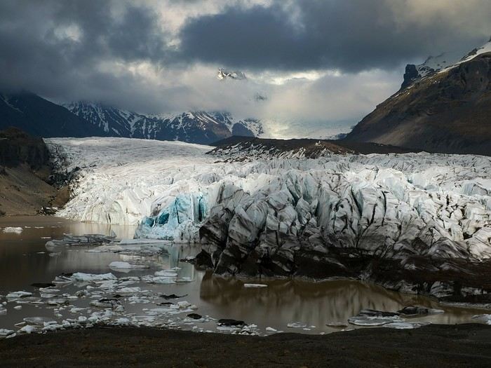
Bookings
Flight tickets bought directly from Fly Play’s website: 1520 € for the four of us (adult fare), with just two checked bags and one carry-on each. It was the compromise we found to keep costs down while still fitting all the bulky clothes we’d need. Late April isn’t quite winter anymore, but it’s not quite spring either, so we packed for chilly weather. Fly Play is Icelandair’s low-cost airline. No complaints: check-in was quick, service was efficient, and the flights were on time.
The car. Booked with Golden Circle car rental, a small family-run business with offices just 5 minutes from the airport. I’d read good things about them, and I can confirm everything went smoothly with our Dacia Duster—it wasn’t brand new, but it was reliable and spacious. We paid 463 € for the week, with full insurance included. The manager picked us up at the airport 10 minutes after I messaged him on WhatsApp to say we’d arrived. For the return trip, since our flight was super early and the agency wasn’t open yet, we agreed to leave the car in the airport parking lot and sent him a photo of the spot so he could find it. Super convenient! I read *so* many questions on Facebook groups about insurance: *Should I get the max coverage or not? I’ve got a Visa Premier, I’ve never had an accident, it adds 100 €...* Between sandstorms that can damage the bodywork and skidding off the road due to bad weather (we saw a few cars in ditches!), we decided to go for the rental company’s max insurance to be safe. It was also a requirement for leaving the car in the airport parking lot on our way back, since we couldn’t do the final inspection.
Accommodations were all booked on Booking.com and Hotels.com: - 2 nights in a cottage at Fossatun Country Hotel, near Borgarnes (we rented the sunset cottage—great spot, with a nice view and separate from the other lodgings) - 1 night in an apartment at Bakki Hostel and Apartments, in Eyrarbakki (top-notch) - 1 night in a gorgeous (and pricey!) apartment at Vik Apartments - 2 nights in a family room at Adventure Hof Hotel (perfect location) - 1 night at Blue Viking Studio near the airport (meh, but fine for a few hours’ sleep before an early flight) Total: 1234 €, averaging 176 € per night for 4-person accommodations.
The itinerary Day 1: Arrival around noon at the airport - Hraunfossar / Night at Fossatun Country Hotel Day 2: Snæfellsnes Peninsula / Night at Fossatun Country Hotel Day 3: Bruarfoss - Geysir - Gullfoss - Reykjadalur hot springs / Night in Eyrarbakki Day 4: Seljalandsfoss and Gljúfrafoss - DC-3 wreck (the one near Seljalandsfoss) - Skógafoss - Kvernufoss - Sólheimajökull (hike to the foot of the glacier) - Dyrhólaey - Reynisfjara Beach / Night in Vík Day 5: Fjaðrárgljúfur Canyon - Vatnajökull (3-hour hike to Svartifoss and Skaftafell) / Night in Hof Day 6: Múlagljúfur Canyon (2h45 hike) - Fjallsárlón - Jökulsárlón and Diamond Beach - Svínafellsjökull / Night in Hof Day 7: Drive back - Reykjavik - Sky Lagoon / Night in Keflavík Day 8: Flight back at 6 AM
That’s the practical side covered. I’ll leave you with a photo of our trusty steed.
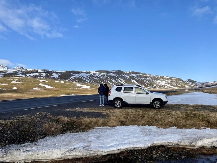
And what a joy to read the travel journals of those travel addicts who were quicker than their own shadow to share their discoveries. Their keyboards and mice must’ve been itching
I’ll admit I’m feeling a bit of that itch too, but I’m way too lazy to dive into the story of our latest trip—last summer in the northwest USA. I’ll probably get to it later, but it might take a while! So, I’m jumping into the short recap of our *way* too short trip to Iceland at the end of April 2024. And even though it’s not the done thing, I’m going to spoil it and start with the conclusion: it was *amazing*!!!
Back in February, on the eve of leaving for a few days’ holiday in Alsace, we started wondering what we could do for Easter break. Scotland and Iceland were the top contenders. The boys are growing up, but they still travel with us often, and they tipped the scales in favor of Iceland. Since we decided a bit late, before booking the flights, I took a quick look at available accommodations. There wasn’t much left, and some were at crazy prices, but I managed to line up a decent itinerary with places that seemed like good value for money. I read travel journals on VF and blogs I could find, picked up bits of info from Facebook groups, and the route quickly took shape—even if I struggled with the place names, mixing them up and forgetting them. The dream could begin...
Bookings
Flight tickets bought directly from Fly Play’s website: 1520 € for the four of us (adult fare), with just two checked bags and one carry-on each. It was the compromise we found to keep costs down while still fitting all the bulky clothes we’d need. Late April isn’t quite winter anymore, but it’s not quite spring either, so we packed for chilly weather. Fly Play is Icelandair’s low-cost airline. No complaints: check-in was quick, service was efficient, and the flights were on time.
The car. Booked with Golden Circle car rental, a small family-run business with offices just 5 minutes from the airport. I’d read good things about them, and I can confirm everything went smoothly with our Dacia Duster—it wasn’t brand new, but it was reliable and spacious. We paid 463 € for the week, with full insurance included. The manager picked us up at the airport 10 minutes after I messaged him on WhatsApp to say we’d arrived. For the return trip, since our flight was super early and the agency wasn’t open yet, we agreed to leave the car in the airport parking lot and sent him a photo of the spot so he could find it. Super convenient! I read *so* many questions on Facebook groups about insurance: *Should I get the max coverage or not? I’ve got a Visa Premier, I’ve never had an accident, it adds 100 €...* Between sandstorms that can damage the bodywork and skidding off the road due to bad weather (we saw a few cars in ditches!), we decided to go for the rental company’s max insurance to be safe. It was also a requirement for leaving the car in the airport parking lot on our way back, since we couldn’t do the final inspection.
Accommodations were all booked on Booking.com and Hotels.com: - 2 nights in a cottage at Fossatun Country Hotel, near Borgarnes (we rented the sunset cottage—great spot, with a nice view and separate from the other lodgings) - 1 night in an apartment at Bakki Hostel and Apartments, in Eyrarbakki (top-notch) - 1 night in a gorgeous (and pricey!) apartment at Vik Apartments - 2 nights in a family room at Adventure Hof Hotel (perfect location) - 1 night at Blue Viking Studio near the airport (meh, but fine for a few hours’ sleep before an early flight) Total: 1234 €, averaging 176 € per night for 4-person accommodations.
The itinerary Day 1: Arrival around noon at the airport - Hraunfossar / Night at Fossatun Country Hotel Day 2: Snæfellsnes Peninsula / Night at Fossatun Country Hotel Day 3: Bruarfoss - Geysir - Gullfoss - Reykjadalur hot springs / Night in Eyrarbakki Day 4: Seljalandsfoss and Gljúfrafoss - DC-3 wreck (the one near Seljalandsfoss) - Skógafoss - Kvernufoss - Sólheimajökull (hike to the foot of the glacier) - Dyrhólaey - Reynisfjara Beach / Night in Vík Day 5: Fjaðrárgljúfur Canyon - Vatnajökull (3-hour hike to Svartifoss and Skaftafell) / Night in Hof Day 6: Múlagljúfur Canyon (2h45 hike) - Fjallsárlón - Jökulsárlón and Diamond Beach - Svínafellsjökull / Night in Hof Day 7: Drive back - Reykjavik - Sky Lagoon / Night in Keflavík Day 8: Flight back at 6 AM
That’s the practical side covered. I’ll leave you with a photo of our trusty steed.
14-Day Trip Report to Milos and Kimolos in September-October 2021
14-Day Trip Report to Milos and Kimolos in September-October 2021
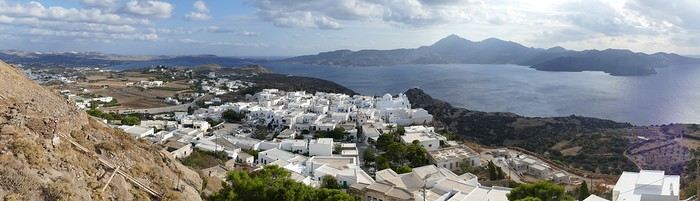
The village of Plaka in Milos
It was with great pleasure that we finally reconnected with our old habits as inveterate travelers! Greece, and more specifically the Greek islands, was the natural choice for us. After having already visited many Greek islands during around 18 trips, we decided to revisit islands we had seen over 40 years ago, like Milos, where our memories were extremely hazy. Our route was well-planned and familiar: a low-cost flight from Basel-Mulhouse to Athens, then a traditional ferry from Piraeus to Milos. Taking a speedboat, which is faster, would have forced us to spend a night in Piraeus. Plus, we felt that the traditional ferry was part of the journey, and with good weather, spending eight hours on deck wasn’t unpleasant at all. Watching the docking maneuvers with the comings and goings of trucks and cars, observing the passengers, reading a book, or admiring the scenery—all of that is part of the travel experience. Milos Island: Accommodation in Adamas We arrived quite late, around 11 PM, in Adamas, the port of Milos. No worries—the friendly couple managing the apartment was waiting for us, and it was just a 10-minute walk from the port. The first two days were spent unwinding, with swimming at the nearby beach, strolling through Adamas, and relaxing.
Discovering Plaka On the third day, we took the path along the small beach west of town toward a French military cemetery! A historical reminder of our presence here during the Crimean War, among others. The path climbs toward a beacon perched on top of a hill before disappearing into the scrubland. We returned to Adamas for lunch on our terrace.
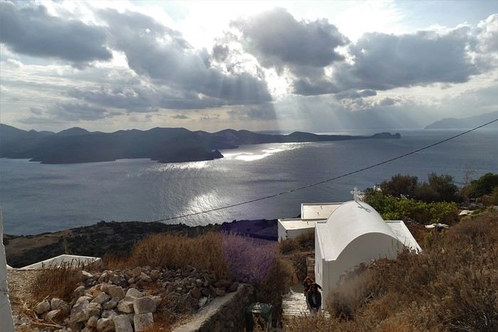
In the afternoon, we visited the hilltop village of Plaka by bus from Adamas. Plaka is the original old town, dominated by a church and, even higher up, the ruins of the Kastro. The view is magnificent. We stopped at a pastry shop in the village to enjoy excellent orange cakes and baklavas. Back in Adamas, we checked out car rental agencies to be more mobile, though the bus network seemed quite extensive. It costs around 40 € per day, plus 8 € if you want to significantly reduce the deductible. Port of Klima.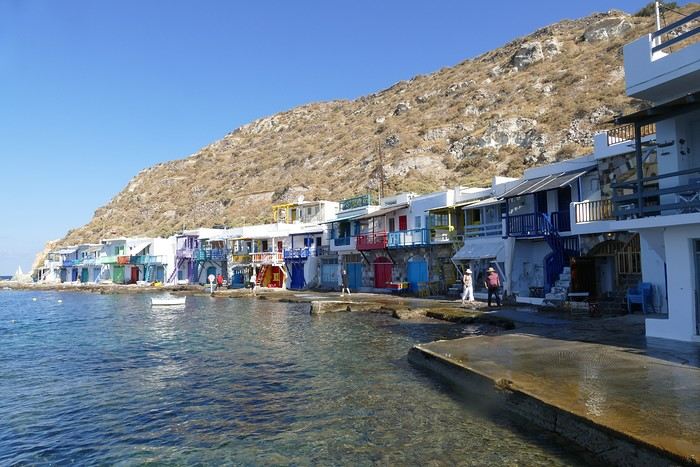
Yesterday’s weather was quite mixed with lots of clouds, but today the sun is shining again. We drove to the small port of Klima, famous for its boat garages called "sirmatas." It’s true that in the morning sun, these boat garages carved into the volcanic tuff are beautifully lit, turning the village into a colorful mosaic. Above the village, a path climbs directly to the magnificent Roman theater overlooking the surroundings and the sea.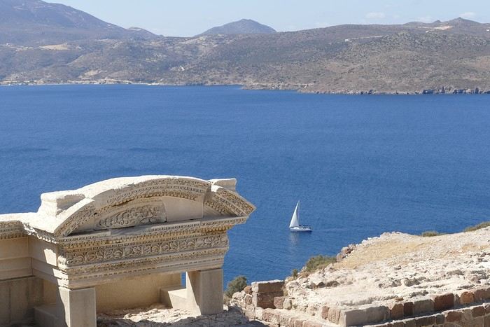 Following the well-marked path, we reached the road leading 200 meters down to the catacombs. It’s an impressive complex of 3rd and 4th-century catacombs, though only a small part is open to visitors—it’s still very moving. In the mid-afternoon, we got back in the car to visit the tiny ports of Firopotamos and Mandraki, which also have their colorful sirmatas. We took the opportunity to swim at the small beach in Mandraki, where the water was warm and calm.
Mandraki Port. We had a decent dinner at a seaside restaurant in Adamas, though you have to be selective—we had a bad experience at Kynigos on the second night!
Moving to Polonia in Eastern Milos, Sarakiniko Site
Following the well-marked path, we reached the road leading 200 meters down to the catacombs. It’s an impressive complex of 3rd and 4th-century catacombs, though only a small part is open to visitors—it’s still very moving. In the mid-afternoon, we got back in the car to visit the tiny ports of Firopotamos and Mandraki, which also have their colorful sirmatas. We took the opportunity to swim at the small beach in Mandraki, where the water was warm and calm.
Mandraki Port. We had a decent dinner at a seaside restaurant in Adamas, though you have to be selective—we had a bad experience at Kynigos on the second night!
Moving to Polonia in Eastern Milos, Sarakiniko Site
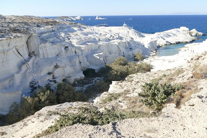
The Sarakiniko site We left Adamas for a second stay on Milos, this time in Polonia. The rental Panda was packed with the four of us and our luggage! Our apartment was in a beautiful house surrounded by a grove, so our lovely terrace was well-shaded. Luckily, there was a small beach nearby, and we went for a swim right away. Apart from us, there were only three other swimmers—definitely the end of the season!
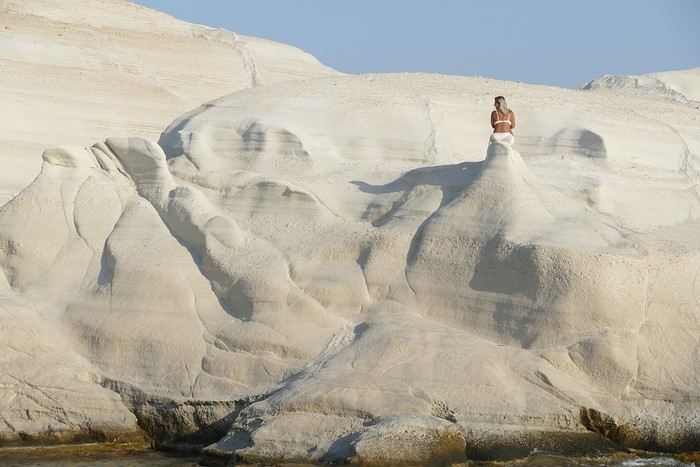
"Fairy chimney"! In the afternoon, we visited the famous Sarakiniko site, Milos’ emblematic spot. Judging by the number of cars in the parking lot, we wouldn’t be alone. As we approached, we heard an indefinable rock/punk/metal music: some young people had brought a sound system and a foghorn and were having fun diving off a fairly high cliff to impress the crowd. It definitely spoiled the visit. Most spots were taken by couples busy taking selfies, so getting photos of the site without tourists was impossible. Still, the site is magnificent, with its white cliffs looking like they’re covered in whipped cream! The sun was still very bright, reflecting strongly off the cliffs, making photography difficult due to the excessive brightness. We had a fish dinner in Polonia at the Enalion restaurant: while the octopus and squid were good, the fish soup tasted more like vegetable soup with a few fish crumbs—too bad.
Sunset in Polonia
Ports of Papafranga and Mytikos We continued our exploration of Milos with the Papafranga gorge, a narrow and deep gorge that opens to the sea, where the water is a stunning color. Access via an unstable and dangerous path is prohibited, but that didn’t stop a couple of tourists in flip-flops from venturing in!!! We then swam in the tiny, calm, and sheltered cove of the small port of Mytikos. We returned to Polonia for lunch at Alkis: excellent moussaka. In the late afternoon, Pat and I went out to take some photos just before sunset near the Agios Nikolaos chapel, the beacon, and the new Petakoudia neighborhood next to Polonia to the north.
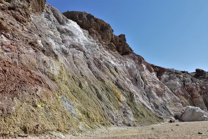
Paleochori Beach
Toward the Multicolored Beach of Paleochori Another sunny day: we still had to discover Paleochori Beach in the south of the island. It was 10:30 AM, and the beach was almost deserted! The water was pleasant, though a bit chilly when we first entered. The beach is bordered by a cliff that, in some places, displays a beautiful multicolored palette. We returned to Polonia in the late afternoon, and Pat and I headed toward Vouddhia Beach south of Polonia—bad choice. The beach is surrounded by a huge mining site served by a dusty road where lines of trucks loaded with ore cross paths. It’s the other side of the coin, and Greece still has progress to make in this area. Dinner at Alki’s was just as good as always. Return to the Sarakiniko Site Early this morning, Pat and I went back to the Sarakiniko site, hoping to take photos in better conditions. While there were fewer people, the parking lot was still full because sunrise is a must in Milos. Still, the conditions were good, and the sunrise spectators left quickly once the sun had risen above the horizon. During the day, an increasingly strong wind cooled the atmosphere, making swimming less enjoyable. Departure for Kimolos Island We changed islands and left Milos for Kimolos, a nearby island—just a 30-minute trip from Polonia’s port. Our apartment was at the entrance of the hilltop village. It’s a village with typical Cycladic architecture, featuring the remains of an old kastro, a few old churches, and windmill towers perched on the hill. We dined in a tiny tavern where the small outdoor tables were squeezed against the walls to let passersby through! As soon as the sun disappeared, it got cold, especially because of the wind. Ports of Kara and Goupa This morning, we explored the small hamlets of Kara and Goupa by Rema Beach, east of the main port. There, we found the sirmatas again—those boat garages partly carved into the volcanic tuff. The path winds between several sirmatas before climbing back up to the Praça road to return to the apartment.
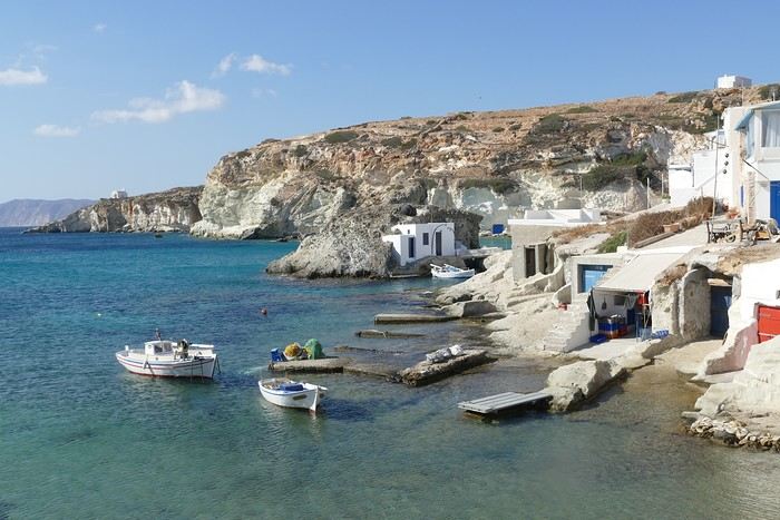
Ports of Kara and Goupa
In the afternoon, we strolled through town, and Pat and I climbed the hill overlooking the village to get a closer look at the few more or less ruined windmills dotting the ridge. Only one mill still had its complete mechanism in place under the roof; the others were empty. The view over the village, port, and sea was beautiful. That evening, we tried another restaurant in the village center, Kali Kardia Bohoris, which was well-frequented by locals, and we didn’t regret it: delicious food, efficient and friendly service, and reasonable prices.
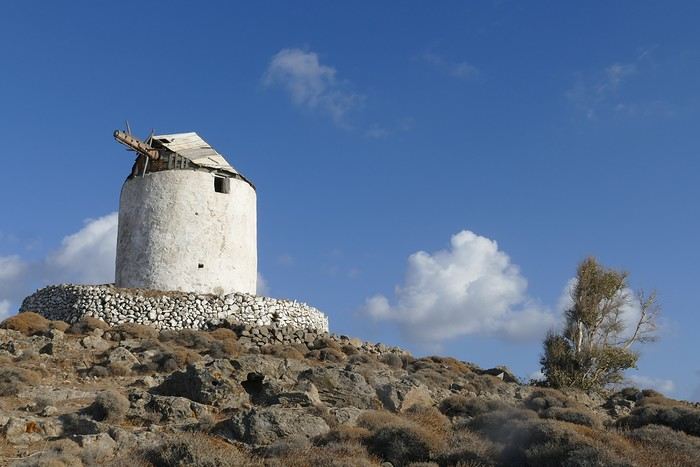
The Kastro Mill
Toward Aliki Beach We walked to Aliki Beach, west of the main village. It’s a large sandy beach shaded by tamarisk trees, but the strong wind prevented us from enjoying it. In the afternoon, I set off on a hike toward the fairy chimney at Skiadi (1.5 hours one way). The paths were very well-marked with signs indicating the trail number and the time to reach the destination. The countryside was beautiful but very dry at this time of year, and as always in Greece, many white chapels dotted the landscape. The numerous dry stone walls testify to the immense labor done by the island’s inhabitants over the centuries! For our last day in Kimolos, we decided to visit the beautiful Praça Beach, one of the most beautiful according to the guides! To get there, we took a path through the interior before joining the paved road near a large dump overflowing with various waste. It’s the flip side of the scenery, and Greece still has progress to make in this area. In the end, Praça Beach left us underwhelmed. The environment, marred by mining operations, detracts from the charm of the beautiful sandy beach. End of the Trip, Return to Piraeus and France And that’s it—we took the Zanteferries ferry back to Piraeus, arriving after a calm and sunny 10-hour journey. We had dinner at Souvlaki Street on the port and spent a good night at the Faros I Hotel in Piraeus—a great spot, close to the port, very clean, and reasonably priced. We flew from Athens to Basel-Mulhouse EuroAirport without any issues. N.B. Budget: around 1850 € all included for 14 days per couple The photo album is available by clicking this link: https://photos.app.goo.gl/wRpxRipg4erpzGj99
The village of Plaka in Milos
It was with great pleasure that we finally reconnected with our old habits as inveterate travelers! Greece, and more specifically the Greek islands, was the natural choice for us. After having already visited many Greek islands during around 18 trips, we decided to revisit islands we had seen over 40 years ago, like Milos, where our memories were extremely hazy. Our route was well-planned and familiar: a low-cost flight from Basel-Mulhouse to Athens, then a traditional ferry from Piraeus to Milos. Taking a speedboat, which is faster, would have forced us to spend a night in Piraeus. Plus, we felt that the traditional ferry was part of the journey, and with good weather, spending eight hours on deck wasn’t unpleasant at all. Watching the docking maneuvers with the comings and goings of trucks and cars, observing the passengers, reading a book, or admiring the scenery—all of that is part of the travel experience. Milos Island: Accommodation in Adamas We arrived quite late, around 11 PM, in Adamas, the port of Milos. No worries—the friendly couple managing the apartment was waiting for us, and it was just a 10-minute walk from the port. The first two days were spent unwinding, with swimming at the nearby beach, strolling through Adamas, and relaxing.
Discovering Plaka On the third day, we took the path along the small beach west of town toward a French military cemetery! A historical reminder of our presence here during the Crimean War, among others. The path climbs toward a beacon perched on top of a hill before disappearing into the scrubland. We returned to Adamas for lunch on our terrace.
In the afternoon, we visited the hilltop village of Plaka by bus from Adamas. Plaka is the original old town, dominated by a church and, even higher up, the ruins of the Kastro. The view is magnificent. We stopped at a pastry shop in the village to enjoy excellent orange cakes and baklavas. Back in Adamas, we checked out car rental agencies to be more mobile, though the bus network seemed quite extensive. It costs around 40 € per day, plus 8 € if you want to significantly reduce the deductible. Port of Klima.
Yesterday’s weather was quite mixed with lots of clouds, but today the sun is shining again. We drove to the small port of Klima, famous for its boat garages called "sirmatas." It’s true that in the morning sun, these boat garages carved into the volcanic tuff are beautifully lit, turning the village into a colorful mosaic. Above the village, a path climbs directly to the magnificent Roman theater overlooking the surroundings and the sea.
Following the well-marked path, we reached the road leading 200 meters down to the catacombs. It’s an impressive complex of 3rd and 4th-century catacombs, though only a small part is open to visitors—it’s still very moving. In the mid-afternoon, we got back in the car to visit the tiny ports of Firopotamos and Mandraki, which also have their colorful sirmatas. We took the opportunity to swim at the small beach in Mandraki, where the water was warm and calm.
Mandraki Port. We had a decent dinner at a seaside restaurant in Adamas, though you have to be selective—we had a bad experience at Kynigos on the second night!
Moving to Polonia in Eastern Milos, Sarakiniko SiteThe Sarakiniko site We left Adamas for a second stay on Milos, this time in Polonia. The rental Panda was packed with the four of us and our luggage! Our apartment was in a beautiful house surrounded by a grove, so our lovely terrace was well-shaded. Luckily, there was a small beach nearby, and we went for a swim right away. Apart from us, there were only three other swimmers—definitely the end of the season!
"Fairy chimney"! In the afternoon, we visited the famous Sarakiniko site, Milos’ emblematic spot. Judging by the number of cars in the parking lot, we wouldn’t be alone. As we approached, we heard an indefinable rock/punk/metal music: some young people had brought a sound system and a foghorn and were having fun diving off a fairly high cliff to impress the crowd. It definitely spoiled the visit. Most spots were taken by couples busy taking selfies, so getting photos of the site without tourists was impossible. Still, the site is magnificent, with its white cliffs looking like they’re covered in whipped cream! The sun was still very bright, reflecting strongly off the cliffs, making photography difficult due to the excessive brightness. We had a fish dinner in Polonia at the Enalion restaurant: while the octopus and squid were good, the fish soup tasted more like vegetable soup with a few fish crumbs—too bad.
Sunset in Polonia
Ports of Papafranga and Mytikos We continued our exploration of Milos with the Papafranga gorge, a narrow and deep gorge that opens to the sea, where the water is a stunning color. Access via an unstable and dangerous path is prohibited, but that didn’t stop a couple of tourists in flip-flops from venturing in!!! We then swam in the tiny, calm, and sheltered cove of the small port of Mytikos. We returned to Polonia for lunch at Alkis: excellent moussaka. In the late afternoon, Pat and I went out to take some photos just before sunset near the Agios Nikolaos chapel, the beacon, and the new Petakoudia neighborhood next to Polonia to the north.
Paleochori Beach
Toward the Multicolored Beach of Paleochori Another sunny day: we still had to discover Paleochori Beach in the south of the island. It was 10:30 AM, and the beach was almost deserted! The water was pleasant, though a bit chilly when we first entered. The beach is bordered by a cliff that, in some places, displays a beautiful multicolored palette. We returned to Polonia in the late afternoon, and Pat and I headed toward Vouddhia Beach south of Polonia—bad choice. The beach is surrounded by a huge mining site served by a dusty road where lines of trucks loaded with ore cross paths. It’s the other side of the coin, and Greece still has progress to make in this area. Dinner at Alki’s was just as good as always. Return to the Sarakiniko Site Early this morning, Pat and I went back to the Sarakiniko site, hoping to take photos in better conditions. While there were fewer people, the parking lot was still full because sunrise is a must in Milos. Still, the conditions were good, and the sunrise spectators left quickly once the sun had risen above the horizon. During the day, an increasingly strong wind cooled the atmosphere, making swimming less enjoyable. Departure for Kimolos Island We changed islands and left Milos for Kimolos, a nearby island—just a 30-minute trip from Polonia’s port. Our apartment was at the entrance of the hilltop village. It’s a village with typical Cycladic architecture, featuring the remains of an old kastro, a few old churches, and windmill towers perched on the hill. We dined in a tiny tavern where the small outdoor tables were squeezed against the walls to let passersby through! As soon as the sun disappeared, it got cold, especially because of the wind. Ports of Kara and Goupa This morning, we explored the small hamlets of Kara and Goupa by Rema Beach, east of the main port. There, we found the sirmatas again—those boat garages partly carved into the volcanic tuff. The path winds between several sirmatas before climbing back up to the Praça road to return to the apartment.
Ports of Kara and Goupa
In the afternoon, we strolled through town, and Pat and I climbed the hill overlooking the village to get a closer look at the few more or less ruined windmills dotting the ridge. Only one mill still had its complete mechanism in place under the roof; the others were empty. The view over the village, port, and sea was beautiful. That evening, we tried another restaurant in the village center, Kali Kardia Bohoris, which was well-frequented by locals, and we didn’t regret it: delicious food, efficient and friendly service, and reasonable prices.
The Kastro Mill
Toward Aliki Beach We walked to Aliki Beach, west of the main village. It’s a large sandy beach shaded by tamarisk trees, but the strong wind prevented us from enjoying it. In the afternoon, I set off on a hike toward the fairy chimney at Skiadi (1.5 hours one way). The paths were very well-marked with signs indicating the trail number and the time to reach the destination. The countryside was beautiful but very dry at this time of year, and as always in Greece, many white chapels dotted the landscape. The numerous dry stone walls testify to the immense labor done by the island’s inhabitants over the centuries! For our last day in Kimolos, we decided to visit the beautiful Praça Beach, one of the most beautiful according to the guides! To get there, we took a path through the interior before joining the paved road near a large dump overflowing with various waste. It’s the flip side of the scenery, and Greece still has progress to make in this area. In the end, Praça Beach left us underwhelmed. The environment, marred by mining operations, detracts from the charm of the beautiful sandy beach. End of the Trip, Return to Piraeus and France And that’s it—we took the Zanteferries ferry back to Piraeus, arriving after a calm and sunny 10-hour journey. We had dinner at Souvlaki Street on the port and spent a good night at the Faros I Hotel in Piraeus—a great spot, close to the port, very clean, and reasonably priced. We flew from Athens to Basel-Mulhouse EuroAirport without any issues. N.B. Budget: around 1850 € all included for 14 days per couple The photo album is available by clicking this link: https://photos.app.goo.gl/wRpxRipg4erpzGj99
What is a travel journal?
I thought I knew the definition, but since VF reopened, I’ve been wondering—so if you could help me out, that’d be great! 🙂.
Thanks a lot!
Thanks a lot!
21-Day Trip to La Gomera and La Palma
Travel Journal: 21 Days in La Gomera and La Palma
From February 6 to February 26, 2024
Tuesday, February 6 We left around 9 AM with our car, along with Pierre-Paul and Patricia, heading to the Bluepark parking lot in Bartenheim. As expected, we were awaited and left promptly for EuroAirport Basel. Took off at 12:25 PM for a 4-hour-15-minute flight under excellent conditions. Beautiful arrival in Tenerife with Teide in sight under a clear blue sky. Fifteen minutes later, we waited for bus No. 40 to Los Cristianos with quite a few other tourists, but we managed to find four seats. From the bus station, it was a 20-minute walk to our hotel. We checked into a lovely apartment for the four of us, complete with all the comforts. Outside, it was quite warm—at least 25°C! After dropping off our luggage, we went for a stroll. The immediate surroundings of the hotel held no interest for us: a modern, concrete area filled with hotels, bars, tourist agencies, and unappealing restaurants all offering the same bland international cuisine. Pat went to cool off at the pool, unfortunately overrun by loud, drunk English tourists. I took a walk to the paseo maritimo that leads to the port, skirting the seafront. The promenade was pleasant, but it could have been any seaside resort in the world—same old scene: a succession of bars with blaring music where many elderly people sipped cold beers waiting for the sunset, the backdrop a wall of resort-style hotels resembling rabbit hutches! Upon reaching the port, I scouted the route we’d take the next day to the Fred Olsen ferry. Back at the apartment, in the early evening, we looked for a non-touristy restaurant for dinner. Monique stopped a woman to ask her opinion! In this area, she told us, there’s no restaurant that serves Canarian or Spanish cuisine! The only place with decent restaurants is at the port. Off we went to the port, where we sat down at Al Bordo restaurant and ordered a seafood paella for four. Excellent, and at a very reasonable price (36 € for two). We returned to the hotel along the seafront.
Wednesday, February 7
Woke up at 6 AM. Had breakfast in the apartment with what we’d bought the day before at a supermarket. It was still dark when we left on foot toward the port, walking along the calm seafront at this early hour. Forty minutes later, we arrived and waited 10 minutes before the ferry docked. At 9:30 AM, we left the port of Los Cristianos for a 50-minute crossing on a calm sea under a beautiful blue sky. There were quite a few people on this large ferry, but many had no luggage, meaning they were visiting La Gomera for the day and would take the ferry back in the evening. Upon disembarking, we went straight to our rental car agency to pick up the car we’d booked online a few months earlier. It was a nice Peugeot 2008, spacious enough for the four of us and our luggage. We immediately took the beautiful road from San Sebastián that climbs directly into the mountains toward our rental in Vallehermoso. The road was in perfect condition—it seemed brand new, like all the others we’d take on this island later. This side of the island is very arid with little vegetation, and the terrain is particularly rugged, as it is throughout the island. We stopped at our first miradors, which would be followed by many more throughout our Canarian trip. Our first visit was to the small village of Agulo, perched on a promontory above the sea and at the foot of a high cliff. The village features typical Canarian houses with windows flush with the façade and black volcanic stone masonry on white or reddish-brown walls. The first recommended restaurant was already booked for a group, so we settled for the shaded terrace of the excellent El Alameda bar-restaurant. From Agulo, you can access the Abrante viewpoint via a winding road, where the view of Agulo, 600 meters below, is exceptional. A glass ledge over the void lets you test your fear of heights!
We drove to Vallehermoso to do our grocery shopping at the supermarket—a habit that would continue until the end of the trip. Our little house, "Casa rural El Encatadora," is located in a beautiful flower-filled valley a few kilometers west of Vallehermoso. Each of us had a bedroom with an en-suite bathroom, plus a living room, kitchen, and a small terrace overlooking the quiet street at the valley’s end, which didn’t bother us at all.
Thursday, February 8 The good weather seemed to follow us since our arrival in the Canary Islands. This morning, we took the road—still as beautiful and new—toward Arure, high up to the west. The landscape was magnificent, with breathtaking glimpses of the sea far below. In Arure, we parked in front of Conchita’s bar, where a hike (Rother No. 30) starts toward two viewpoints: Alojera, which we reached after 45 minutes on a lovely path. Monique, tired from the first steep climb, stopped at the first viewpoint and hitchhiked back to Arure. Meanwhile, we continued toward the second viewpoint, Los Barranquillos, where the view of the surroundings was partially hidden by misty clouds rising from the sea. The entire mountain is sculpted by ancient, endless terraces climbing until the slope becomes too steep for construction—visible traces of the hard work of past inhabitants trying to survive in a harsh environment. We had a decent lunch at La Conchita bar, then drove to the small seaside town of Puerto la Caleta, sheltered by an immense cliff plunging into the sea. Black sand beach, rough sea—despite our encouragement, Pat didn’t dare to swim! As for the old village of Caleta, it’s perched on the mountainside, and visiting it requires climbing steep, stair-filled alleys to discover a few traditional houses. Back at the casa, dinner in, and card games...
 Vallehermoso
Friday, February 9 This morning, the sky was overcast, and the peaks around us were shrouded in clouds. We took the same road as yesterday to hike Las Creces. Quickly gaining altitude, we entered a thick fog—visibility was very limited. We stopped at the Las Creces parking lot; visibility improved, and the sun wasn’t far off. The hike is entirely within a beautiful laurel forest, with the sun playing hide-and-seek, but it wasn’t cold despite the altitude. After finishing the loop trail, we decided to picnic—not there, as it was too chilly—but on Vallehermoso’s beach, where we found a nice picnic area sheltered by large black rocks. A short digestive walk on the surrounding hill to admire the little beach from above. Back in Vallehermoso, we did some grocery shopping, then tried to return to the casa—only to find ourselves locked out because we’d left the key in the lock inside! After several attempts and with the help of Yéli, a relative of the owner we called for help, we were finally able to get back in!
Saturday, February 10
It rained last night, and the sky remained overcast. Monique decided to rest this morning. PP, Pat, and I set off on the hike that starts from the house toward the Marichal reservoir. The sun wasn’t far off, and by 11 AM, it was fully out. The pleasant hike passed by many flower-filled gardens and orchards—orange, lemon, and mandarin trees in fruit. The path climbed gently toward the reservoir, where the view of the Cano rock dominating the landscape was magnificent. The last part of the climb was a bit tough, overgrown with lush vegetation, and the trail was slippery from last night’s rain. We descended via a different, much more pleasant path and returned to the casa just in time for lunch, prepared by Monique. This valley is rich with its many farmers and market gardeners who’ve cultivated the entire valley, taking advantage of the water flowing down from the mountain, captured upstream and redistributed through countless pipes snaking along the paths. Numerous tanks also store water during dry periods. The houses are scattered across both sides of the valley, and these colorful little homes add a beautiful touch to the landscape. The many palm trees give this valley a distinctly tropical feel—you could almost imagine yourself in the Caribbean. Add to that some salsa music drifting from a hut where farmers were working, and the picture is complete. A well-chilled beer apéro capped off a lovely morning. The afternoon was dedicated to rest, relaxation, reading, and games.
Sunday, February 11 The blue sky returned, though a few clouds still capped the highest peaks. Today, we visited Garajonay National Park, which covers the highest central mountains. Up there, we were above the clouds, and the panoramas from the various viewpoints were stunning: first, Cherelepin, accessible from the Laguna Grande parking lot, then Alto de Garajonay, offering an exceptional view of Teide—over 3,000 meters high—emerging from the clouds on Tenerife, far in the distance. We continued to the Los Roques viewpoints, then stopped for lunch at the Degollada de Peraza restaurant, where the view of the barranco was impressive. We descended toward San Sebastián and checked into our new lodging, La Cabezada, located in the countryside about 3 km above San Sebastián. It’s a small apartment adjacent to the owner’s, with a lovely terrace overlooking the surrounding mountains and surrounded by a beautiful garden. Apéro, then dinner on our beautiful terrace.
Monday, February 12 This morning, we went down to visit San Sebastián de La Gomera: its old tower, main street with some beautiful traditional houses, and the Church of the Assumption. Back at the casa for lunch. In the afternoon, Pat, PP, and I set off on the short hike from San Sebastián beach to La Guancha beach. We drove down and parked on the beach. The path climbs along the hill overlooking San Sebastián, passes by the tall Christ statue dominating the landscape, and roughly follows the coast down to the isolated Guancha beach. A beautiful hike under a hot sun, and a swim was welcome, even if the beach and sea access weren’t very comfortable due to large pebbles and quickly deepening water. Apart from two nudist bathers, there was no one on this beach. We returned the same way.
Tuesday, February 13 Rest day. We went down to town to stroll and do some shopping. I took the opportunity to visit the parador, beautifully situated above the city in a lovely garden overlooking the port and town. Together, we went for a cuba libre at the "Cuba Libre" bar, then had lunch at Breñusca (mediocre paella!). Back at the casa, then we went back down to town to see a carnival parade, a "passacalles," which actually passed an hour earlier than scheduled. Oh well.
Wednesday, February 14 Each to their own program this morning. Pat went swimming at San Sebastián beach, Monique rested at the casa, and PP and I set off on the hike from Playa de Avalos to the Ermita de Guadalupe on Playa del Cangrejo. It wasn’t easy to find the right road or the parking spot, but we managed. The path seemed to have suffered landslides, according to a sign at the trailhead! We decided to check it out, ready to turn back if it seemed too dangerous. In the end, apart from one or two slightly tricky spots where we had to climb a pile of rocks, the trail remained passable, though a bit vertigo-inducing in places. The narrow path clings to very vertical cliffs nearly 300 meters above sea level! But what a magnificent view. At one point, the trail runs alongside a wall of basaltic pipes. We returned via the drivable track that parallels the trail a bit lower. Back at the house for lunch. In the late afternoon, we returned to town to attend the "Entierro de las Sardinas" (Burial of the Sardine), which closes the Canarian carnival festivities. While waiting, we strolled through the parador’s gardens and had mojitos in town. Around 9 PM, we heard the noise and cries of the mourners. The procession advanced, led by a large papier-mâché sardine on a float, surrounded by wailing mourners. The procession headed toward the sea, where the sardine was burned, and a mini fireworks display ended the procession. It was all very good-natured, and everyone had fun. We ended the evening with dinner at a good fish restaurant, El Pajar.
 Entierro de la Sardina in San Sebastián de La Gomera
Thursday, February 15
Woke up at 5:15 AM. The only suitable ferry was at 7 AM, which would get us to La Palma by late morning rather than evening. We packed our bags, had breakfast, then headed to the port, left our rental car, and boarded the ferry to Tenerife, from where we’d continue to La Palma. Calm sea, beautiful sun—by 10:30 AM, we disembarked in La Palma. We picked up our car and immediately headed to our new apartment in Breña Alta. It’s a large apartment with a superb terrace facing the sea, fully equipped and very comfortable. The hosts recommended Casa Goyo restaurant, near the airport and close to us. It’s a restaurant with many small rooms, some of which can be reserved for families. The fish-based cuisine (chipirones, pulpo) was excellent, hearty, and reasonably priced. Since it’s in the airport’s flight path, we occasionally heard planes landing. Quick and efficient service. Afterward, we visited Santa Cruz de La Palma, which reminded us of the historic quarters of La Orotava in Tenerife or the capital of Gran Canaria.
Friday, February 16
Beautiful weather, blue sky. We headed to the San Bartolo viewpoint toward the northeast coast, then to the lovely village of San Andrés, which we explored. From there, we walked along the shore to the natural pools of Charco Azul, where we swam in the cool but "swimmable" sea. Back in San Andrés for lunch at the "San Andrés" restaurant on the beautiful church square. Very good fish-based meal. We got back in the car and continued along the north coast to the port of Espindola and the natural pools of Fajana near the Cumplida lighthouse. A fairly strong wind whipped up beautiful waves crashing onto the rocky coast in bursts of foam. Back in Santa Cruz, we stopped at the Mercadona supermarket to buy fresh shrimp for dinner. San Andrés
Saturday, February 17
Uniform blue sky, even on the heights. We took the beautiful road that winds up to the summit of the Caldera de Taburiente. Several viewpoints offer 360° views of the entire island and beyond: you can make out La Gomera, El Hierro, and, of course, Tenerife with the perfect triangle of Teide. We parked at the Los Andes viewpoint parking lot and started our hike to Pico de la Cruz along a trail following the ridge, offering superb views into the caldera. We got back in the car and passed by the Roque de los Muchachos astronomical complex, composed of numerous observatories, some with very aesthetic mirror telescopes. We hiked from the Roque de los Muchachos parking lot to the various viewpoints, always as impressive. Picnic on site, then back to Santa Cruz. We stopped by our car dealer because the oil warning light came on—better safe than sorry. The representative reassured us but preferred to give us a Fiat Cross SUV instead. The Caldera de Taburiente
Sunday, February 18 The weather was a bit mixed, with cloudy patches. We set off to hike the Barranco de la Cuba de Galga. Unfortunately, the Los Tilos trail had been closed for several months due to a major landslide. The parking lot by the road was already quite full, and indeed, we crossed paths with many hikers along the way—it’s an easy hike with little elevation gain, which is rare here in La Palma! The beautiful path winds through a very narrow, deep gorge covered in lush tropical vegetation—you’d think you were in a Southeast Asian forest, especially with the humidity in the gorge bringing out earthy and floral scents. Halfway through, Monique turned back while the rest of us continued to the Cuba de Galga. A light drizzle accompanied us on the return. For lunch, we went to Chipi Chipi restaurant in the heights of Santa Cruz. The cool air forced us to leave the lovely terrace for the slightly noisy dining room. The meal was very good and hearty. Afternoon spent resting at our house.
 La Cuba de la Galga
Monday, February 19 A few clouds still clung to the nearby mountain peaks. We headed south to Los Canarios. We stopped in front of the small San Antonio Abad church, where a path leads to the viewpoint in 15 minutes. Then we visited the San Antonio Volcano Interpretation Center and climbed to the viewpoint via the trail along the crater’s edge, offering a plunging view into the crater. Then PP, Pat, and I headed toward the Teneguía volcano but turned back given the remaining distance and the intense heat bearing down on us! Plus, the landscape was rather arid and not very interesting. We got back in the car and drove down to the salt flats at the island’s southern tip. The ocean crashes here in large waves, exploding against the volcanic rocks and feeding a "blowhole" carved into the rock. We stopped for drinks at the salt flats restaurant, then headed home. The salt flats in Fuencaliente
Tuesday, February 20 Beautiful weather with a few clouds clinging to the mountains, as usual. A relaxed morning since my parking reservation at La Cumbrecita didn’t start until 1 PM. It takes about 30 minutes from Santa Cruz to reach the valley floor via a beautiful but narrow road toward the end, though there’s very little traffic. Meanwhile, the clouds had disappeared, and the view from the La Cumbrecita viewpoint was superb. We recognized Pico de la Cruz in the distance, where we’d been a few days earlier. We then took the path leading to the Las Chozas viewpoint through a magnificent Canarian pine forest. We picnicked on site, then took the path to the Los Roques viewpoint. We returned the same way since the direct route was closed for construction. Back in Santa Cruz, we visited the Sanctuary of Las Nieves, with its beautiful golden Baroque altar. Hike from La Cumbrecita
Wednesday, February 21 After packing our things and loading the car, we left Santa Cruz under a very blue sky for Los Llanos de Aridane, where we stopped to visit this lovely town. The Church of Nuestra Señora de los Remedios has a beautiful coffered ceiling and an original papier-mâché Christ statue from the 16th century. Around it, colorful old Canarian houses brighten the streets of the town center. We took the opportunity to stroll, do some shopping, and finally sat down at La Pergola restaurant for a mediocre lunch. We got back in the car to check into our new house in Arecida. On the way, we stopped at the Mirador del Time, which once again offered an impressive panorama, allowing us—for the first time—to see the damage caused by the Tajogaite volcano eruption in 2021. You can clearly see the still-smoking crater and the large black lava flow covering the landscape down to the sea. We really liked our new accommodation: a local house that’s been renovated on the heights of Arecida, not far from the Canarian pine forest. From several terraces, we have a 360° view of the sea and mountains. We even have a private pool! There are two beautiful, brand-new bedrooms, each with its own bathroom—the best. Plus, we’re on the GR 131 trail that runs along the Barranco de las Angustias toward the northeast.
 Los Llanos de Aridane
Thursday, February 22 Once again, beautiful weather greeted us when we woke up. We started the GR 131 with the goal of reaching the Torre del Time viewpoint—about 400 meters of elevation gain. The path, quite steep at first, winds through a superb Canarian pine forest. A few viewpoints let you appreciate the sheer drop of the Barranco de las Angustias—watch out for vertigo! At the Torre del Time viewpoint, there’s a nearly 1,000-meter vertical drop. We returned via another path, the PLP1, which meanders first through this beautiful forest, then along lovely flower-filled gardens adjacent to beautiful properties that cascade from the forest down to the road serving these neighborhoods. This afternoon, we tried to get closer to the area devastated by the 2021 lava flows. Several roads are still closed or reserved for residents, while others—brand new—have been rebuilt to open up this densely populated and cultivated region. In some places, the lava flow slightly diverted, sparing some properties that logically should have disappeared. Now, they’re encircled by a massive cooled lava field. In other spots, twisted and charred metal scraps or greenhouse remains protrude from the lava—all that’s left of the former banana plantations. A little higher up, you can see the slightly smoking crater of Tajogaite, responsible for this disaster. Back to Casa Barreros.
 View of Los Llanos and, in the background, the 2021 lava flow
Friday, February 23
Though the sky was still blue, the temperature had dropped due to a chilly wind. By midday, it still rose to 22°C. Today, we headed north, specifically to the town of Tijarafe, where a very narrow road descends to the small port, Porís de Candelaria. The 3.7-kilometer road drops 700 meters in elevation, with gradients up to 30%—it was going to be intense! Indeed, the descent was scary, with the void right next to the very narrow road where passing was impossible except at a few rare spots. Everything went well—there was little traffic at this early hour. From the parking lot at the bottom, a path leads to Porís de Candelaria. It’s surprising to see this small fishing hamlet nestled in the shelter of an immense cave opening onto the sea, which was quite rough today. The sun, at this time of year, would appear late in the cave, which remained in shadow for much of the day. We returned via the same road, strolled through the small town of Puntagorda, and had lunch at El Jardín de los Naranjos restaurant—excellent meal. Fishing hamlet of Candelaria
Saturday, February 24 The air was still cool, but the sun was beautiful. While Monique stayed home to rest, the three of us headed to the village of Las Tricias to hike the Buracas Caves trail. We left the car parked on the LP1 road and took the small paved road down to the sign marking the trail’s start. The signage for all the trails we took here, as in La Gomera, was very well done. The path descended steadily, then more steeply toward the caves where the island’s first inhabitants lived—some petroglyphs are still visible in certain caves. The path then climbed back up, passing magnificent dragon trees and more or less elaborate huts occupied by Germans who’ve lived here for many years. Back at Casa Barreros for some rest.
Sunday, February 25 The weather once again blessed us with a beautiful day. This morning, we visited the local produce market held on weekends in Puntagorda. You’ll find agricultural products, crafts, and food to keep you going. A little further on, there’s a glass viewpoint overlooking the barranco plunging toward the sea, with a view of the thrill-seekers trying the zip line right next to it. Lunch at Naranjos—definitely a good spot—with their shrimp and spice tagliatelle. Back home for an afternoon of relaxation.
Monday, February 26 We left Arecida under a cloudy sky. Driving up from Los Llanos de Aridane toward the east, an enormous cascade of clouds poured from the mountain peaks into the Los Llanos plain—very impressive. Arriving in Santa Cruz, we went for a stroll, did some last-minute shopping, then had a final good-quality paella at La Chalana on the paseo maritimo. We left the car in the parking lot and took the 5 PM Olsen ferry to Tenerife on a slightly choppy sea, but the ferry didn’t rock too much. Arriving at 7:15 PM, we dropped off our things near the port in our reserved apartment and went for dinner at Abordo—rubbery chipirones. A digestive stroll among the ever-increasing number of tourists in Los Cristianos—restaurants were packed to the brim, the season is in full swing here. Gone is the calm of La Gomera and La Palma, and the laid-back tourism of German hikers among whom a few French were hiding!
Tuesday, February 27 To make our homemade breakfast more enjoyable, we went to buy pastries at the local bakery, then took one last walk on the paseo along the beaches, mingling with the many mobility scooters driven by elderly or disabled people, joggers, and tourists. Last apéro near the bus station, then off to the airport. After a smooth 4-hour-30-minute flight, we arrived in Basel-Mulhouse at 10:20 PM.
THE END
Conclusion A fantastic trip to two islands with magnificent and diverse nature, where landscapes range from desert-like to tropical depending on exposure to winds and clouds. Thanks to the many beautiful viewpoints, you can truly appreciate these exceptionally dynamic reliefs. A hiker’s paradise, the trails are all very well marked, though the choice of easy or moderate paths for "casual walkers" is quite limited. Another notable advantage, in our opinion, is that these islands are very lightly developed—you’ll hardly see any of those ugly hotel blocks that spoil the landscapes of some other Canary Islands. It’s true that the beaches on these two islands don’t meet traditional international tourism criteria: they’re small, with black sand, and often difficult to access. Special mention for the quality of the road network (except for a few small local roads), which seems brand new, well-paved, and well-signposted. We also enjoyed exceptional weather for February, with fewer than three days of gray or rainy weather out of 21.
Almost all the accommodations we chose met or exceeded our expectations, often at reasonable prices: an average of 98 € per night for an apartment or house with two bedrooms for four people.
All photos can be viewed by clicking this link: https://photos.app.goo.gl/G44pPk4g9PW1rNzg8
Tuesday, February 6 We left around 9 AM with our car, along with Pierre-Paul and Patricia, heading to the Bluepark parking lot in Bartenheim. As expected, we were awaited and left promptly for EuroAirport Basel. Took off at 12:25 PM for a 4-hour-15-minute flight under excellent conditions. Beautiful arrival in Tenerife with Teide in sight under a clear blue sky. Fifteen minutes later, we waited for bus No. 40 to Los Cristianos with quite a few other tourists, but we managed to find four seats. From the bus station, it was a 20-minute walk to our hotel. We checked into a lovely apartment for the four of us, complete with all the comforts. Outside, it was quite warm—at least 25°C! After dropping off our luggage, we went for a stroll. The immediate surroundings of the hotel held no interest for us: a modern, concrete area filled with hotels, bars, tourist agencies, and unappealing restaurants all offering the same bland international cuisine. Pat went to cool off at the pool, unfortunately overrun by loud, drunk English tourists. I took a walk to the paseo maritimo that leads to the port, skirting the seafront. The promenade was pleasant, but it could have been any seaside resort in the world—same old scene: a succession of bars with blaring music where many elderly people sipped cold beers waiting for the sunset, the backdrop a wall of resort-style hotels resembling rabbit hutches! Upon reaching the port, I scouted the route we’d take the next day to the Fred Olsen ferry. Back at the apartment, in the early evening, we looked for a non-touristy restaurant for dinner. Monique stopped a woman to ask her opinion! In this area, she told us, there’s no restaurant that serves Canarian or Spanish cuisine! The only place with decent restaurants is at the port. Off we went to the port, where we sat down at Al Bordo restaurant and ordered a seafood paella for four. Excellent, and at a very reasonable price (36 € for two). We returned to the hotel along the seafront.
Wednesday, February 7
Woke up at 6 AM. Had breakfast in the apartment with what we’d bought the day before at a supermarket. It was still dark when we left on foot toward the port, walking along the calm seafront at this early hour. Forty minutes later, we arrived and waited 10 minutes before the ferry docked. At 9:30 AM, we left the port of Los Cristianos for a 50-minute crossing on a calm sea under a beautiful blue sky. There were quite a few people on this large ferry, but many had no luggage, meaning they were visiting La Gomera for the day and would take the ferry back in the evening. Upon disembarking, we went straight to our rental car agency to pick up the car we’d booked online a few months earlier. It was a nice Peugeot 2008, spacious enough for the four of us and our luggage. We immediately took the beautiful road from San Sebastián that climbs directly into the mountains toward our rental in Vallehermoso. The road was in perfect condition—it seemed brand new, like all the others we’d take on this island later. This side of the island is very arid with little vegetation, and the terrain is particularly rugged, as it is throughout the island. We stopped at our first miradors, which would be followed by many more throughout our Canarian trip. Our first visit was to the small village of Agulo, perched on a promontory above the sea and at the foot of a high cliff. The village features typical Canarian houses with windows flush with the façade and black volcanic stone masonry on white or reddish-brown walls. The first recommended restaurant was already booked for a group, so we settled for the shaded terrace of the excellent El Alameda bar-restaurant. From Agulo, you can access the Abrante viewpoint via a winding road, where the view of Agulo, 600 meters below, is exceptional. A glass ledge over the void lets you test your fear of heights!
We drove to Vallehermoso to do our grocery shopping at the supermarket—a habit that would continue until the end of the trip. Our little house, "Casa rural El Encatadora," is located in a beautiful flower-filled valley a few kilometers west of Vallehermoso. Each of us had a bedroom with an en-suite bathroom, plus a living room, kitchen, and a small terrace overlooking the quiet street at the valley’s end, which didn’t bother us at all.
Thursday, February 8 The good weather seemed to follow us since our arrival in the Canary Islands. This morning, we took the road—still as beautiful and new—toward Arure, high up to the west. The landscape was magnificent, with breathtaking glimpses of the sea far below. In Arure, we parked in front of Conchita’s bar, where a hike (Rother No. 30) starts toward two viewpoints: Alojera, which we reached after 45 minutes on a lovely path. Monique, tired from the first steep climb, stopped at the first viewpoint and hitchhiked back to Arure. Meanwhile, we continued toward the second viewpoint, Los Barranquillos, where the view of the surroundings was partially hidden by misty clouds rising from the sea. The entire mountain is sculpted by ancient, endless terraces climbing until the slope becomes too steep for construction—visible traces of the hard work of past inhabitants trying to survive in a harsh environment. We had a decent lunch at La Conchita bar, then drove to the small seaside town of Puerto la Caleta, sheltered by an immense cliff plunging into the sea. Black sand beach, rough sea—despite our encouragement, Pat didn’t dare to swim! As for the old village of Caleta, it’s perched on the mountainside, and visiting it requires climbing steep, stair-filled alleys to discover a few traditional houses. Back at the casa, dinner in, and card games...
VallehermosoFriday, February 9 This morning, the sky was overcast, and the peaks around us were shrouded in clouds. We took the same road as yesterday to hike Las Creces. Quickly gaining altitude, we entered a thick fog—visibility was very limited. We stopped at the Las Creces parking lot; visibility improved, and the sun wasn’t far off. The hike is entirely within a beautiful laurel forest, with the sun playing hide-and-seek, but it wasn’t cold despite the altitude. After finishing the loop trail, we decided to picnic—not there, as it was too chilly—but on Vallehermoso’s beach, where we found a nice picnic area sheltered by large black rocks. A short digestive walk on the surrounding hill to admire the little beach from above. Back in Vallehermoso, we did some grocery shopping, then tried to return to the casa—only to find ourselves locked out because we’d left the key in the lock inside! After several attempts and with the help of Yéli, a relative of the owner we called for help, we were finally able to get back in!
Saturday, February 10
It rained last night, and the sky remained overcast. Monique decided to rest this morning. PP, Pat, and I set off on the hike that starts from the house toward the Marichal reservoir. The sun wasn’t far off, and by 11 AM, it was fully out. The pleasant hike passed by many flower-filled gardens and orchards—orange, lemon, and mandarin trees in fruit. The path climbed gently toward the reservoir, where the view of the Cano rock dominating the landscape was magnificent. The last part of the climb was a bit tough, overgrown with lush vegetation, and the trail was slippery from last night’s rain. We descended via a different, much more pleasant path and returned to the casa just in time for lunch, prepared by Monique. This valley is rich with its many farmers and market gardeners who’ve cultivated the entire valley, taking advantage of the water flowing down from the mountain, captured upstream and redistributed through countless pipes snaking along the paths. Numerous tanks also store water during dry periods. The houses are scattered across both sides of the valley, and these colorful little homes add a beautiful touch to the landscape. The many palm trees give this valley a distinctly tropical feel—you could almost imagine yourself in the Caribbean. Add to that some salsa music drifting from a hut where farmers were working, and the picture is complete. A well-chilled beer apéro capped off a lovely morning. The afternoon was dedicated to rest, relaxation, reading, and games.
Sunday, February 11 The blue sky returned, though a few clouds still capped the highest peaks. Today, we visited Garajonay National Park, which covers the highest central mountains. Up there, we were above the clouds, and the panoramas from the various viewpoints were stunning: first, Cherelepin, accessible from the Laguna Grande parking lot, then Alto de Garajonay, offering an exceptional view of Teide—over 3,000 meters high—emerging from the clouds on Tenerife, far in the distance. We continued to the Los Roques viewpoints, then stopped for lunch at the Degollada de Peraza restaurant, where the view of the barranco was impressive. We descended toward San Sebastián and checked into our new lodging, La Cabezada, located in the countryside about 3 km above San Sebastián. It’s a small apartment adjacent to the owner’s, with a lovely terrace overlooking the surrounding mountains and surrounded by a beautiful garden. Apéro, then dinner on our beautiful terrace.
Monday, February 12 This morning, we went down to visit San Sebastián de La Gomera: its old tower, main street with some beautiful traditional houses, and the Church of the Assumption. Back at the casa for lunch. In the afternoon, Pat, PP, and I set off on the short hike from San Sebastián beach to La Guancha beach. We drove down and parked on the beach. The path climbs along the hill overlooking San Sebastián, passes by the tall Christ statue dominating the landscape, and roughly follows the coast down to the isolated Guancha beach. A beautiful hike under a hot sun, and a swim was welcome, even if the beach and sea access weren’t very comfortable due to large pebbles and quickly deepening water. Apart from two nudist bathers, there was no one on this beach. We returned the same way.
Tuesday, February 13 Rest day. We went down to town to stroll and do some shopping. I took the opportunity to visit the parador, beautifully situated above the city in a lovely garden overlooking the port and town. Together, we went for a cuba libre at the "Cuba Libre" bar, then had lunch at Breñusca (mediocre paella!). Back at the casa, then we went back down to town to see a carnival parade, a "passacalles," which actually passed an hour earlier than scheduled. Oh well.
Wednesday, February 14 Each to their own program this morning. Pat went swimming at San Sebastián beach, Monique rested at the casa, and PP and I set off on the hike from Playa de Avalos to the Ermita de Guadalupe on Playa del Cangrejo. It wasn’t easy to find the right road or the parking spot, but we managed. The path seemed to have suffered landslides, according to a sign at the trailhead! We decided to check it out, ready to turn back if it seemed too dangerous. In the end, apart from one or two slightly tricky spots where we had to climb a pile of rocks, the trail remained passable, though a bit vertigo-inducing in places. The narrow path clings to very vertical cliffs nearly 300 meters above sea level! But what a magnificent view. At one point, the trail runs alongside a wall of basaltic pipes. We returned via the drivable track that parallels the trail a bit lower. Back at the house for lunch. In the late afternoon, we returned to town to attend the "Entierro de las Sardinas" (Burial of the Sardine), which closes the Canarian carnival festivities. While waiting, we strolled through the parador’s gardens and had mojitos in town. Around 9 PM, we heard the noise and cries of the mourners. The procession advanced, led by a large papier-mâché sardine on a float, surrounded by wailing mourners. The procession headed toward the sea, where the sardine was burned, and a mini fireworks display ended the procession. It was all very good-natured, and everyone had fun. We ended the evening with dinner at a good fish restaurant, El Pajar.
Entierro de la Sardina in San Sebastián de La GomeraThursday, February 15
Woke up at 5:15 AM. The only suitable ferry was at 7 AM, which would get us to La Palma by late morning rather than evening. We packed our bags, had breakfast, then headed to the port, left our rental car, and boarded the ferry to Tenerife, from where we’d continue to La Palma. Calm sea, beautiful sun—by 10:30 AM, we disembarked in La Palma. We picked up our car and immediately headed to our new apartment in Breña Alta. It’s a large apartment with a superb terrace facing the sea, fully equipped and very comfortable. The hosts recommended Casa Goyo restaurant, near the airport and close to us. It’s a restaurant with many small rooms, some of which can be reserved for families. The fish-based cuisine (chipirones, pulpo) was excellent, hearty, and reasonably priced. Since it’s in the airport’s flight path, we occasionally heard planes landing. Quick and efficient service. Afterward, we visited Santa Cruz de La Palma, which reminded us of the historic quarters of La Orotava in Tenerife or the capital of Gran Canaria.
Friday, February 16
Beautiful weather, blue sky. We headed to the San Bartolo viewpoint toward the northeast coast, then to the lovely village of San Andrés, which we explored. From there, we walked along the shore to the natural pools of Charco Azul, where we swam in the cool but "swimmable" sea. Back in San Andrés for lunch at the "San Andrés" restaurant on the beautiful church square. Very good fish-based meal. We got back in the car and continued along the north coast to the port of Espindola and the natural pools of Fajana near the Cumplida lighthouse. A fairly strong wind whipped up beautiful waves crashing onto the rocky coast in bursts of foam. Back in Santa Cruz, we stopped at the Mercadona supermarket to buy fresh shrimp for dinner.
San AndrésSaturday, February 17
Uniform blue sky, even on the heights. We took the beautiful road that winds up to the summit of the Caldera de Taburiente. Several viewpoints offer 360° views of the entire island and beyond: you can make out La Gomera, El Hierro, and, of course, Tenerife with the perfect triangle of Teide. We parked at the Los Andes viewpoint parking lot and started our hike to Pico de la Cruz along a trail following the ridge, offering superb views into the caldera. We got back in the car and passed by the Roque de los Muchachos astronomical complex, composed of numerous observatories, some with very aesthetic mirror telescopes. We hiked from the Roque de los Muchachos parking lot to the various viewpoints, always as impressive. Picnic on site, then back to Santa Cruz. We stopped by our car dealer because the oil warning light came on—better safe than sorry. The representative reassured us but preferred to give us a Fiat Cross SUV instead.
The Caldera de TaburienteSunday, February 18 The weather was a bit mixed, with cloudy patches. We set off to hike the Barranco de la Cuba de Galga. Unfortunately, the Los Tilos trail had been closed for several months due to a major landslide. The parking lot by the road was already quite full, and indeed, we crossed paths with many hikers along the way—it’s an easy hike with little elevation gain, which is rare here in La Palma! The beautiful path winds through a very narrow, deep gorge covered in lush tropical vegetation—you’d think you were in a Southeast Asian forest, especially with the humidity in the gorge bringing out earthy and floral scents. Halfway through, Monique turned back while the rest of us continued to the Cuba de Galga. A light drizzle accompanied us on the return. For lunch, we went to Chipi Chipi restaurant in the heights of Santa Cruz. The cool air forced us to leave the lovely terrace for the slightly noisy dining room. The meal was very good and hearty. Afternoon spent resting at our house.
La Cuba de la GalgaMonday, February 19 A few clouds still clung to the nearby mountain peaks. We headed south to Los Canarios. We stopped in front of the small San Antonio Abad church, where a path leads to the viewpoint in 15 minutes. Then we visited the San Antonio Volcano Interpretation Center and climbed to the viewpoint via the trail along the crater’s edge, offering a plunging view into the crater. Then PP, Pat, and I headed toward the Teneguía volcano but turned back given the remaining distance and the intense heat bearing down on us! Plus, the landscape was rather arid and not very interesting. We got back in the car and drove down to the salt flats at the island’s southern tip. The ocean crashes here in large waves, exploding against the volcanic rocks and feeding a "blowhole" carved into the rock. We stopped for drinks at the salt flats restaurant, then headed home.
The salt flats in FuencalienteTuesday, February 20 Beautiful weather with a few clouds clinging to the mountains, as usual. A relaxed morning since my parking reservation at La Cumbrecita didn’t start until 1 PM. It takes about 30 minutes from Santa Cruz to reach the valley floor via a beautiful but narrow road toward the end, though there’s very little traffic. Meanwhile, the clouds had disappeared, and the view from the La Cumbrecita viewpoint was superb. We recognized Pico de la Cruz in the distance, where we’d been a few days earlier. We then took the path leading to the Las Chozas viewpoint through a magnificent Canarian pine forest. We picnicked on site, then took the path to the Los Roques viewpoint. We returned the same way since the direct route was closed for construction. Back in Santa Cruz, we visited the Sanctuary of Las Nieves, with its beautiful golden Baroque altar.
Hike from La CumbrecitaWednesday, February 21 After packing our things and loading the car, we left Santa Cruz under a very blue sky for Los Llanos de Aridane, where we stopped to visit this lovely town. The Church of Nuestra Señora de los Remedios has a beautiful coffered ceiling and an original papier-mâché Christ statue from the 16th century. Around it, colorful old Canarian houses brighten the streets of the town center. We took the opportunity to stroll, do some shopping, and finally sat down at La Pergola restaurant for a mediocre lunch. We got back in the car to check into our new house in Arecida. On the way, we stopped at the Mirador del Time, which once again offered an impressive panorama, allowing us—for the first time—to see the damage caused by the Tajogaite volcano eruption in 2021. You can clearly see the still-smoking crater and the large black lava flow covering the landscape down to the sea. We really liked our new accommodation: a local house that’s been renovated on the heights of Arecida, not far from the Canarian pine forest. From several terraces, we have a 360° view of the sea and mountains. We even have a private pool! There are two beautiful, brand-new bedrooms, each with its own bathroom—the best. Plus, we’re on the GR 131 trail that runs along the Barranco de las Angustias toward the northeast.
Los Llanos de AridaneThursday, February 22 Once again, beautiful weather greeted us when we woke up. We started the GR 131 with the goal of reaching the Torre del Time viewpoint—about 400 meters of elevation gain. The path, quite steep at first, winds through a superb Canarian pine forest. A few viewpoints let you appreciate the sheer drop of the Barranco de las Angustias—watch out for vertigo! At the Torre del Time viewpoint, there’s a nearly 1,000-meter vertical drop. We returned via another path, the PLP1, which meanders first through this beautiful forest, then along lovely flower-filled gardens adjacent to beautiful properties that cascade from the forest down to the road serving these neighborhoods. This afternoon, we tried to get closer to the area devastated by the 2021 lava flows. Several roads are still closed or reserved for residents, while others—brand new—have been rebuilt to open up this densely populated and cultivated region. In some places, the lava flow slightly diverted, sparing some properties that logically should have disappeared. Now, they’re encircled by a massive cooled lava field. In other spots, twisted and charred metal scraps or greenhouse remains protrude from the lava—all that’s left of the former banana plantations. A little higher up, you can see the slightly smoking crater of Tajogaite, responsible for this disaster. Back to Casa Barreros.
View of Los Llanos and, in the background, the 2021 lava flowFriday, February 23
Though the sky was still blue, the temperature had dropped due to a chilly wind. By midday, it still rose to 22°C. Today, we headed north, specifically to the town of Tijarafe, where a very narrow road descends to the small port, Porís de Candelaria. The 3.7-kilometer road drops 700 meters in elevation, with gradients up to 30%—it was going to be intense! Indeed, the descent was scary, with the void right next to the very narrow road where passing was impossible except at a few rare spots. Everything went well—there was little traffic at this early hour. From the parking lot at the bottom, a path leads to Porís de Candelaria. It’s surprising to see this small fishing hamlet nestled in the shelter of an immense cave opening onto the sea, which was quite rough today. The sun, at this time of year, would appear late in the cave, which remained in shadow for much of the day. We returned via the same road, strolled through the small town of Puntagorda, and had lunch at El Jardín de los Naranjos restaurant—excellent meal.
Fishing hamlet of CandelariaSaturday, February 24 The air was still cool, but the sun was beautiful. While Monique stayed home to rest, the three of us headed to the village of Las Tricias to hike the Buracas Caves trail. We left the car parked on the LP1 road and took the small paved road down to the sign marking the trail’s start. The signage for all the trails we took here, as in La Gomera, was very well done. The path descended steadily, then more steeply toward the caves where the island’s first inhabitants lived—some petroglyphs are still visible in certain caves. The path then climbed back up, passing magnificent dragon trees and more or less elaborate huts occupied by Germans who’ve lived here for many years. Back at Casa Barreros for some rest.
Sunday, February 25 The weather once again blessed us with a beautiful day. This morning, we visited the local produce market held on weekends in Puntagorda. You’ll find agricultural products, crafts, and food to keep you going. A little further on, there’s a glass viewpoint overlooking the barranco plunging toward the sea, with a view of the thrill-seekers trying the zip line right next to it. Lunch at Naranjos—definitely a good spot—with their shrimp and spice tagliatelle. Back home for an afternoon of relaxation.
Monday, February 26 We left Arecida under a cloudy sky. Driving up from Los Llanos de Aridane toward the east, an enormous cascade of clouds poured from the mountain peaks into the Los Llanos plain—very impressive. Arriving in Santa Cruz, we went for a stroll, did some last-minute shopping, then had a final good-quality paella at La Chalana on the paseo maritimo. We left the car in the parking lot and took the 5 PM Olsen ferry to Tenerife on a slightly choppy sea, but the ferry didn’t rock too much. Arriving at 7:15 PM, we dropped off our things near the port in our reserved apartment and went for dinner at Abordo—rubbery chipirones. A digestive stroll among the ever-increasing number of tourists in Los Cristianos—restaurants were packed to the brim, the season is in full swing here. Gone is the calm of La Gomera and La Palma, and the laid-back tourism of German hikers among whom a few French were hiding!
Tuesday, February 27 To make our homemade breakfast more enjoyable, we went to buy pastries at the local bakery, then took one last walk on the paseo along the beaches, mingling with the many mobility scooters driven by elderly or disabled people, joggers, and tourists. Last apéro near the bus station, then off to the airport. After a smooth 4-hour-30-minute flight, we arrived in Basel-Mulhouse at 10:20 PM.
THE END
Conclusion A fantastic trip to two islands with magnificent and diverse nature, where landscapes range from desert-like to tropical depending on exposure to winds and clouds. Thanks to the many beautiful viewpoints, you can truly appreciate these exceptionally dynamic reliefs. A hiker’s paradise, the trails are all very well marked, though the choice of easy or moderate paths for "casual walkers" is quite limited. Another notable advantage, in our opinion, is that these islands are very lightly developed—you’ll hardly see any of those ugly hotel blocks that spoil the landscapes of some other Canary Islands. It’s true that the beaches on these two islands don’t meet traditional international tourism criteria: they’re small, with black sand, and often difficult to access. Special mention for the quality of the road network (except for a few small local roads), which seems brand new, well-paved, and well-signposted. We also enjoyed exceptional weather for February, with fewer than three days of gray or rainy weather out of 21.
Almost all the accommodations we chose met or exceeded our expectations, often at reasonable prices: an average of 98 € per night for an apartment or house with two bedrooms for four people.
All photos can be viewed by clicking this link: https://photos.app.goo.gl/G44pPk4g9PW1rNzg8
The "Must-Sees" of the American West
This adventure began during Covid... Yep, Covid turned a lot of things upside down, but most of all, it kept us cooped up for a few months and stopped us from traveling for a while—even longer for a die-hard fan of the American West like me.
While borders were closed, I started imagining what an ideal itinerary might look like—one that would string together all the Southwest must-sees in just two weeks, during the best time of year: September and October. When the U.S. announced in September 2021 that borders would reopen in the coming weeks, I regained hope and began scouting flight tickets for a departure in September 2022.
But here’s the thing: tackling solo hikes, each one tougher than the last, right in the heart of the Wilderness, could be a risky—even reckless—endeavor for a father of three. After a quick chat with some virtual friends who are just as passionate about the Southwest as I am, with good physical condition and nearly the same list of must-visit spots, Franck and his brother Sullivan were in! 🙂
In November, we snagged flight tickets from Nice to San Francisco for the modest sum of 400 €, and a few days later, I booked a Toyota Tacoma pickup for 840 € !
It’s not cheap for just 15 days, and a pickup isn’t exactly ideal for luggage, but the prices for full-size 4x4s have become totally outrageous! Due to border closures, rental companies had to offload a lot of these big 4x4s, which tourists love. Then, supply and demand did the rest !
Franck and I spent the winter and spring trying to cram the equivalent of three weeks of hikes into two. But even with physical limits, we had to stay reasonable! Three to four months before departure, we entered the lotteries for different must-see spots: The Subway, Coyote Buttes North (home to the famous Wave), and Coyote Buttes South (CBS).
The Wave is the holy grail for any Southwest enthusiast. Since 2015, we’ve tried our luck with the online and on-site lotteries about ten times, but the spots are unfortunately limited: just 20 per day. A glimmer of hope, though—since early 2022, that number has increased to 64 people allowed per day, with 48 spots awarded via the online lottery.
After all three of us tried our luck for The Wave, on June 1st at exactly 5 PM, I got an email that started with, "Congratulations! You were successful in the Coyote Buttes North (The Wave) September 2022 Permit Lottery at Coyote Buttes North (The Wave)...". At 5:01 PM, I called Franck, whose dream it’s been for over 20 years—ever since the first photos were published in a travel magazine! He didn’t believe me when I told him, and I had to forward the email for him to finally accept the unbelievable: we were going to The Wave and all the incredible spots scattered across the protected area of Coyote Buttes North.
I’ve already been to Coyote Buttes South twice, but there are areas I couldn’t explore in the middle of summer because they were too remote. So, I had no trouble letting my buddies convince me to go back for a third time. Plus, given how hard it is to access, we had no trouble securing a permit online as long as we logged in at exactly 8 PM on the dot!
For The Subway, all three of us struck out. No big deal—we won at CBN and CBS!
Among the sites to visit, there are two that I’m particularly attached to because I know my chances of wanting to see them again are slim. The first is Angel Arch, one of the most legendary arches in the Southwest, due to its remoteness from any trace of civilization. To get there, the recommended hike is Upper Salt Creek, and you’re looking at a 50 km round-trip in an area with no water (in September) and populated by bears.
The second site is the Hopi Salt Trail, in Navajo land, which, after a very tough hike, lets you marvel at the turquoise-blue waters of the Little Colorado before it meets the Colorado River. The Hopi Salt Trail is, like The Wave, the holy grail for any Southwest enthusiast, and the windows of opportunity to see the water in that magical color are very short each year. For this, you have to monitor the Little Colorado’s gauges downstream from Cameron: if the level stays at its lowest for 10 consecutive days—meaning no rain—you can hope for turquoise water. The ideal period rarely exceeds 30 days a year, and it’s usually in June that all the stars align.
But unfortunately, one month before departure, while the flow rate at Cameron looked promising, several storms in September dashed our hopes of doing the Hopi Salt Trail, even at the end of the road trip.
We still had two consolation prizes, though:
After a last-minute cancellation, while keeping an eye out for available spots for The Subway, it turned out that three spots opened up exactly on the day we’d planned to go—so we rushed to grab them!! Regarding the 4x4 rental, the prices for full-size models dropped by several hundred dollars, and we ended up finding a Chevrolet Tahoe for less than $1000. A steal and a serious boost in comfort, so we could store all our gear and food without worry!
Here’s the initial plan in a perfect world: D1 The White Domes - Camping D2 Sunrise at The White Domes - The Subway D3 Coyote Buttes North D4 Coyote Buttes South - White Pocket D5 Wahweap Hoodoos - Sidestep Canyon - Colourful Canyon - White Rocks - Sunset at Yellow Rock D6 Broken Bow Arch - Reflection Canyon D7 Coyote Gulch D8 The Volcano (or The Oasis - Zebra Slot Canyon if the weather’s good) - North Caineville Mesa D9 The Needles: Squaw Canyon - Lost Canyon combo - Druid Arch - Chesler Park D10 Upper Salt Creek Day 1 - Camping D11 Upper Salt Creek Day 2 D12 Hopi-Navajo Territory: Ha Ho No Geh Canyon, Coal Mine Canyon, Bends of the Little Colorado D13 Grand Canyon: South Kaibab Trail and Bright Angel Trail D14 Upper East Zion: East Temple Loop, Jughandle Arch, Center of the Universe, and Checkerboard Mesa Summit And several backup options in case of bad weather, including Spencer Trail, West Cove, and Buffington Pockets.
Enough talking—time for action!
While borders were closed, I started imagining what an ideal itinerary might look like—one that would string together all the Southwest must-sees in just two weeks, during the best time of year: September and October. When the U.S. announced in September 2021 that borders would reopen in the coming weeks, I regained hope and began scouting flight tickets for a departure in September 2022.
But here’s the thing: tackling solo hikes, each one tougher than the last, right in the heart of the Wilderness, could be a risky—even reckless—endeavor for a father of three. After a quick chat with some virtual friends who are just as passionate about the Southwest as I am, with good physical condition and nearly the same list of must-visit spots, Franck and his brother Sullivan were in! 🙂
In November, we snagged flight tickets from Nice to San Francisco for the modest sum of 400 €, and a few days later, I booked a Toyota Tacoma pickup for 840 € !
It’s not cheap for just 15 days, and a pickup isn’t exactly ideal for luggage, but the prices for full-size 4x4s have become totally outrageous! Due to border closures, rental companies had to offload a lot of these big 4x4s, which tourists love. Then, supply and demand did the rest !
Franck and I spent the winter and spring trying to cram the equivalent of three weeks of hikes into two. But even with physical limits, we had to stay reasonable! Three to four months before departure, we entered the lotteries for different must-see spots: The Subway, Coyote Buttes North (home to the famous Wave), and Coyote Buttes South (CBS).
The Wave is the holy grail for any Southwest enthusiast. Since 2015, we’ve tried our luck with the online and on-site lotteries about ten times, but the spots are unfortunately limited: just 20 per day. A glimmer of hope, though—since early 2022, that number has increased to 64 people allowed per day, with 48 spots awarded via the online lottery.
After all three of us tried our luck for The Wave, on June 1st at exactly 5 PM, I got an email that started with, "Congratulations! You were successful in the Coyote Buttes North (The Wave) September 2022 Permit Lottery at Coyote Buttes North (The Wave)...". At 5:01 PM, I called Franck, whose dream it’s been for over 20 years—ever since the first photos were published in a travel magazine! He didn’t believe me when I told him, and I had to forward the email for him to finally accept the unbelievable: we were going to The Wave and all the incredible spots scattered across the protected area of Coyote Buttes North.
I’ve already been to Coyote Buttes South twice, but there are areas I couldn’t explore in the middle of summer because they were too remote. So, I had no trouble letting my buddies convince me to go back for a third time. Plus, given how hard it is to access, we had no trouble securing a permit online as long as we logged in at exactly 8 PM on the dot!
For The Subway, all three of us struck out. No big deal—we won at CBN and CBS!
Among the sites to visit, there are two that I’m particularly attached to because I know my chances of wanting to see them again are slim. The first is Angel Arch, one of the most legendary arches in the Southwest, due to its remoteness from any trace of civilization. To get there, the recommended hike is Upper Salt Creek, and you’re looking at a 50 km round-trip in an area with no water (in September) and populated by bears.
The second site is the Hopi Salt Trail, in Navajo land, which, after a very tough hike, lets you marvel at the turquoise-blue waters of the Little Colorado before it meets the Colorado River. The Hopi Salt Trail is, like The Wave, the holy grail for any Southwest enthusiast, and the windows of opportunity to see the water in that magical color are very short each year. For this, you have to monitor the Little Colorado’s gauges downstream from Cameron: if the level stays at its lowest for 10 consecutive days—meaning no rain—you can hope for turquoise water. The ideal period rarely exceeds 30 days a year, and it’s usually in June that all the stars align.
But unfortunately, one month before departure, while the flow rate at Cameron looked promising, several storms in September dashed our hopes of doing the Hopi Salt Trail, even at the end of the road trip.
We still had two consolation prizes, though:
After a last-minute cancellation, while keeping an eye out for available spots for The Subway, it turned out that three spots opened up exactly on the day we’d planned to go—so we rushed to grab them!! Regarding the 4x4 rental, the prices for full-size models dropped by several hundred dollars, and we ended up finding a Chevrolet Tahoe for less than $1000. A steal and a serious boost in comfort, so we could store all our gear and food without worry!
Here’s the initial plan in a perfect world: D1 The White Domes - Camping D2 Sunrise at The White Domes - The Subway D3 Coyote Buttes North D4 Coyote Buttes South - White Pocket D5 Wahweap Hoodoos - Sidestep Canyon - Colourful Canyon - White Rocks - Sunset at Yellow Rock D6 Broken Bow Arch - Reflection Canyon D7 Coyote Gulch D8 The Volcano (or The Oasis - Zebra Slot Canyon if the weather’s good) - North Caineville Mesa D9 The Needles: Squaw Canyon - Lost Canyon combo - Druid Arch - Chesler Park D10 Upper Salt Creek Day 1 - Camping D11 Upper Salt Creek Day 2 D12 Hopi-Navajo Territory: Ha Ho No Geh Canyon, Coal Mine Canyon, Bends of the Little Colorado D13 Grand Canyon: South Kaibab Trail and Bright Angel Trail D14 Upper East Zion: East Temple Loop, Jughandle Arch, Center of the Universe, and Checkerboard Mesa Summit And several backup options in case of bad weather, including Spencer Trail, West Cove, and Buffington Pockets.
Enough talking—time for action!
4 friends discover a piece of North India
Hello fellow travelers!
I’m adding my small contribution to the reopening celebration by posting this travel journal from India, made in January 2024. We’re 4 friends (2 couples), and we did a 3-week loop in Rajasthan, stopping by Delhi and Agra (which, as everyone knows, aren’t in Rajasthan 😛). Delhi - Agra - Jaipur - Bundi - Udaipur - Jodhpur - Jaisalmer - Delhi
We rented a car with a driver from Agra to Jaisalmer, 550 € for 14 days. https://chauffeurpriveeninde.com/fr/
We took the train from Delhi to Agra and the plane (Spicejet) from Jaisalmer to Delhi.
Most of the accommodations were booked on Booking before we left.
I’m sharing this story written by Richard and illustrated by me. We dedicate it to Nathalie and Bruno, our amazing travel companions.
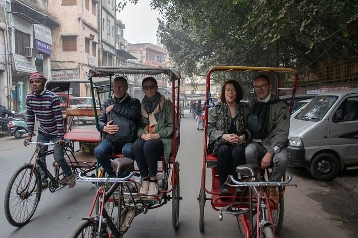
I’m adding my small contribution to the reopening celebration by posting this travel journal from India, made in January 2024. We’re 4 friends (2 couples), and we did a 3-week loop in Rajasthan, stopping by Delhi and Agra (which, as everyone knows, aren’t in Rajasthan 😛). Delhi - Agra - Jaipur - Bundi - Udaipur - Jodhpur - Jaisalmer - Delhi
We rented a car with a driver from Agra to Jaisalmer, 550 € for 14 days. https://chauffeurpriveeninde.com/fr/
We took the train from Delhi to Agra and the plane (Spicejet) from Jaisalmer to Delhi.
Most of the accommodations were booked on Booking before we left.
I’m sharing this story written by Richard and illustrated by me. We dedicate it to Nathalie and Bruno, our amazing travel companions.
VoyageForum is back!
Hello, how are you all?
To be honest, this isn't really a "deep" topic—just a quick note to say I'm really happy VoyageForum is finally back up. I hope everyone who contributed to this site is still around, still traveling, and in good health. For my part, travel didn’t really stop despite the COVID crisis.
Looking forward to sharing photos, travel stories, and discussions with all of you again.
Jacques
And I’ll share a photo right away—taken last year in the Vichada region of Colombia, where I’m heading back in 2 weeks.
Welcome back to VF!
Welcome back to VF!
First trips after...
A turbulent period came to an end around 2022.
Many of us have returned to big trips after making only very small ones—or none at all. For a little anecdote, my dentist told me that due to the lack of travel, a lot of clients treated themselves to implants they would’ve otherwise skipped. The joy of traveling again probably gave some vacationers smiles they hadn’t dared to show before!
Here, you can share what’s on your mind: Have these new, real trips disappointed you, rejuvenated you, or just relieved a long frustration?
For my part, not being so young anymore, there was definitely relief but no explosion of joy. I just had the feeling of picking up the thread of life after a foggy pause, with the bitter taste that 2 or 3 years of my life had been partly stolen from me.
Many of us have returned to big trips after making only very small ones—or none at all. For a little anecdote, my dentist told me that due to the lack of travel, a lot of clients treated themselves to implants they would’ve otherwise skipped. The joy of traveling again probably gave some vacationers smiles they hadn’t dared to show before!
Here, you can share what’s on your mind: Have these new, real trips disappointed you, rejuvenated you, or just relieved a long frustration?
For my part, not being so young anymore, there was definitely relief but no explosion of joy. I just had the feeling of picking up the thread of life after a foggy pause, with the bitter taste that 2 or 3 years of my life had been partly stolen from me.
République Dominicaine: au fil de la route... et autres souvenirs English translation pending
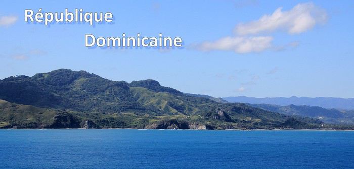
Ce sont mes derniers souvenirs de voyage à l'étranger, c'était avant … avant que la pandémie de la Covid-19 ne s'abatte sur notre planète et contrarie (en autre !) nos désirs de voyages loin de chez nous. Un récit à propos d'une dernière escale dans les Caraïbes, elle date du début mars et c'était donc en République Dominicaine. Ce carnet aborde principalement le souvenir d'une échappée le long d'une « route » hors des sentiers battus, dans le nord de l'île. Une région bien moins fréquentée et donc moins connue que les très courus sites balnéaires de cette grande île tropicale. Un récit qui est également l'occasion pour moi de partager dans une seconde partie quelques autres souvenirs de voyage en Rep. Dom. Ils sont un peu plus anciens et concernent quelques uns des incontournables sites à visiter de la destination.
--
L'escale approche. Peu à peu, la côte se fait plus nette, le soleil a fait disparaître la nébulosité et la plage d'Amber Cove apparaît dans toute sa beauté.
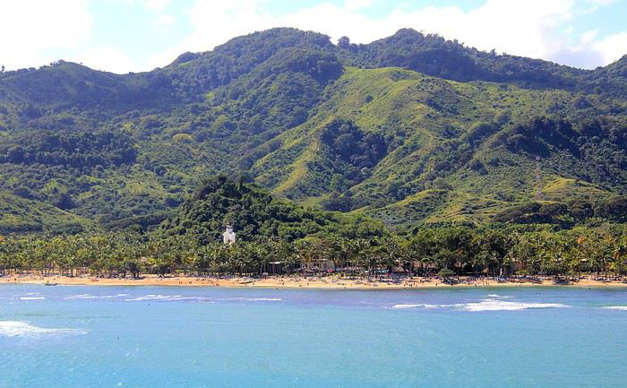
Le trio qui fait le charme des îles tropicales est bien présent sous nos yeux : des eaux bleues, du sable clair bordé d'une palmeraie et un versant verdoyant qui en impose en surplomb du rivage. Un coquet clocher aux tonalités jaune et rose bonbon émerge au-dessus de cette étendue de palmes. Pour afficher la nationalité de l'île, les couleurs sont hissées haut. On reconnaît les carrés rouge et bleu séparés d'une croix blanche du drapeau de la République Dominicaine.
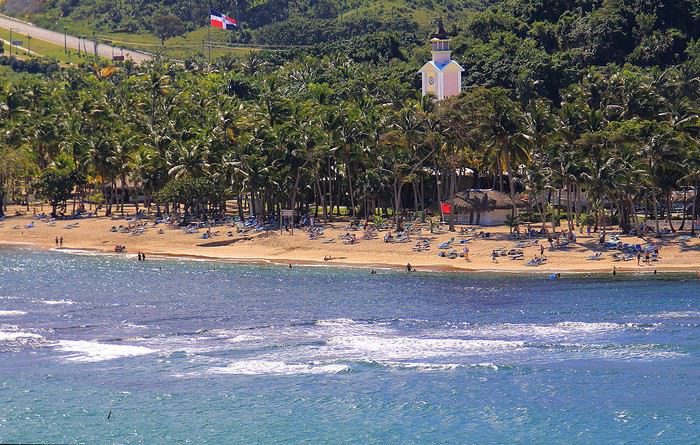
Nous sommes précisément sur la côte nord de l'île, dans la région de l'ancienne ville coloniale espagnole de Puerto Plata.
Un dernier coup d’œil sur la jolie baie encadrée de promontoires rocheux en fond de décor et bordée d'une langue de terre au vert lumineux qui défile juste sous nos yeux.
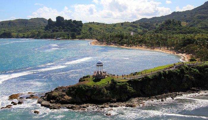
A peine débarqués du navire, on embarque à nouveau … mais sur un tout autre moyen de transport, finie la navigation, on prend place maintenant sur un drôle de véhicule hybride. Un genre de machine à grosses roues, dans un style intermédiaire entre camion et bus d'aventures tout-terrain. De simples banquettes font offices de sièges, quant aux dossiers et aux montants métalliques, ils sont tous rembourrés et capitonnés … On le comprend vite, la route, enfin la piste qui s'annonce pour cette virée risque d'être chaotique. Pas de doute, il ne doit pas s'agir d'un long ruban de bitume très tranquille !
Pour l'instant nous traversons la paisible petite ville de Maimon. Une agglomération sans grand intérêt si ce n'est d'avoir un aperçu de la vie quotidienne locale. Des enfants bruyants jouent dans la cour de l'école et quelques habitantes font leurs achats dans les boutiques, la plupart sont de simples maisons/cases comme d'ailleurs beaucoup d'habitations. En voici deux exemples assez représentatifs du style de l'habitat local. Une simple maison recouverte de tôles ondulées mais dont les murs extérieurs sont agrémentés d'une teinte bleutée. C'est un aspect des plus courants dans la petite cité.
Plus loin, nous passons devant une maison un peu plus cossue : un propret jardinet et des grilles ouvragées entourent cette demeure plus élaborée et dont on imagine le meilleur confort intérieur.
Passons la périphérie urbaine, place à la campagne. On le constate dès le début du trajet, les terrains aux abords de la voie sont détrempés voire inondés. Le chauffeur, sympa, nous informe que de récentes et fortes intempéries ont quelque peu endommagé la piste que nous devons emprunter … Au fond de cette baie, le courant et les torrents ont charrié des quantités de branchages, certains sont encore là, amassés au bord du rivage bordé de mangrove.
Sur ce tronçon, un torrent a emporté une partie de la route, le passage se fait désormais sur une seule voie constituée de terre battue.
Discussion sur le thème (concours septembre 2020): lieux, scènes de départ ou d'arrivée English translation pending
Rebonjour, 🙂
C'est ici que l'on discute , échange, sur le thème: lieux, scènes de départ ou d'arrivée.
Pour revenir au concours, c'est ici
Les Cyclades en juillet: Anafi, Amorgos, Astypaléa English translation pending
GENESE
Comme tous, le COVID a chamboulé nos plans. Normalement nous devions aller à Madagascar pendant un mois, projet reporté à l’année prochaine. Seulement, n’ayant jamais arrêté de travailler, malgré le confinement et le Covid j’avais réellement besoin de faire une « pause ».
Souhaitant limiter les risques de restrictions de déplacements nous ne quitterons pas l’Europe en nous centrant sur des endroits que nous avons toujours voulu visiter, mais habituellement trop fréquentés pour nous. Il y avait la Suisse avec ses montagnes et ses trains de légende, l’Islande et les îles Grecques.
Au final c’est l’attrait du soleil qui l’a emporté … enfin surtout auprès de madame ! Nous avions « entrevu » Santorin et Myconos lors d’une croisière en méditerranée en 2007 avec les enfants. Nous avions adoré … sauf la fréquentation !
Le premier élément à choisir est le point d’entrée, accessible en avion. Il y a Santorin et Myconos dans les Cyclades. Comme je rêvais de revoir la caldera de Santorin, le choix fut rapide. Ensuite je voulais des îles peu fréquentées ne nécessitant pas de trop long trajet en ferry. Sur 2 semaines 3 îles m’a paru être le bon choix. Avec le recul je confirme que c’est un bon dosage. Je me suis beaucoup servi du site Hellenica et Cycladen.be, qui sont très bien, pour faire mes choix.
La première sera Anafi, dans la catégorie « peu fréquentée » elle est très bien placée, en plus elle est petite, montagneuse et avec de belles plages. Une des raisons de sa faible fréquentation est le peu de liaison maritimes, ce sera donc à partir de cette contrainte que s’articulera le voyage.
Le second choix sera Astypalea car il y a un aéroport pour repartir, en plus c’est aussi une île peu fréquentée par les étrangers. Elle fait partie des Dodécanèse mais géographique se trouve proche des Cyclades.
Amorgos se glissera très naturellement entre les deux.
Une fois le planning établi j’ai réservé les vols chez Volotea qui a le bon goût de partir de Strasbourg … mauvais choix car les vols seront annulés 2 semaines plus tard.🏴☠️ Je me suis retourné vers Easy Jet qui part de Bâle Mulhouse, finalement tout aussi proche de chez nous que Strasbourg. Il faut dire qu’en Alsace nous avons la chance d’avoir pas mal d’aéroports dans un rayon de 3 heures autour de chez nous (en plus des deux précités il y a surtout Zurich et Frankfurt). Nous ferons donc BSL – Athènes – Santorin puis Astypalea – Athènes – BSL.
J’ai réservé par internet en direct les pensions : Villa Kalamiotissa pour Anafi Emprostiada Traditional Guest House et Pano Gitonia pour Amorgos Studio Killindra pour Astypalea Je réserve aussi une voiture à Amorgos puisque l’île est assez grande … et au final, suite à un échange avec mon logeur, également à Anafi.
Le roadbook sera assez rapide à établir … tant mieux car je n’ai que très peu de temps disponible, relancer mon entreprise suite au Covid-19 a accaparé tout mon temps.
En voiture ... pour ceux qui veulent 🙂
Comme tous, le COVID a chamboulé nos plans. Normalement nous devions aller à Madagascar pendant un mois, projet reporté à l’année prochaine. Seulement, n’ayant jamais arrêté de travailler, malgré le confinement et le Covid j’avais réellement besoin de faire une « pause ».
Souhaitant limiter les risques de restrictions de déplacements nous ne quitterons pas l’Europe en nous centrant sur des endroits que nous avons toujours voulu visiter, mais habituellement trop fréquentés pour nous. Il y avait la Suisse avec ses montagnes et ses trains de légende, l’Islande et les îles Grecques.
Au final c’est l’attrait du soleil qui l’a emporté … enfin surtout auprès de madame ! Nous avions « entrevu » Santorin et Myconos lors d’une croisière en méditerranée en 2007 avec les enfants. Nous avions adoré … sauf la fréquentation !
Le premier élément à choisir est le point d’entrée, accessible en avion. Il y a Santorin et Myconos dans les Cyclades. Comme je rêvais de revoir la caldera de Santorin, le choix fut rapide. Ensuite je voulais des îles peu fréquentées ne nécessitant pas de trop long trajet en ferry. Sur 2 semaines 3 îles m’a paru être le bon choix. Avec le recul je confirme que c’est un bon dosage. Je me suis beaucoup servi du site Hellenica et Cycladen.be, qui sont très bien, pour faire mes choix.
La première sera Anafi, dans la catégorie « peu fréquentée » elle est très bien placée, en plus elle est petite, montagneuse et avec de belles plages. Une des raisons de sa faible fréquentation est le peu de liaison maritimes, ce sera donc à partir de cette contrainte que s’articulera le voyage.
Le second choix sera Astypalea car il y a un aéroport pour repartir, en plus c’est aussi une île peu fréquentée par les étrangers. Elle fait partie des Dodécanèse mais géographique se trouve proche des Cyclades.
Amorgos se glissera très naturellement entre les deux.
Une fois le planning établi j’ai réservé les vols chez Volotea qui a le bon goût de partir de Strasbourg … mauvais choix car les vols seront annulés 2 semaines plus tard.🏴☠️ Je me suis retourné vers Easy Jet qui part de Bâle Mulhouse, finalement tout aussi proche de chez nous que Strasbourg. Il faut dire qu’en Alsace nous avons la chance d’avoir pas mal d’aéroports dans un rayon de 3 heures autour de chez nous (en plus des deux précités il y a surtout Zurich et Frankfurt). Nous ferons donc BSL – Athènes – Santorin puis Astypalea – Athènes – BSL.
J’ai réservé par internet en direct les pensions : Villa Kalamiotissa pour Anafi Emprostiada Traditional Guest House et Pano Gitonia pour Amorgos Studio Killindra pour Astypalea Je réserve aussi une voiture à Amorgos puisque l’île est assez grande … et au final, suite à un échange avec mon logeur, également à Anafi.
Le roadbook sera assez rapide à établir … tant mieux car je n’ai que très peu de temps disponible, relancer mon entreprise suite au Covid-19 a accaparé tout mon temps.
En voiture ... pour ceux qui veulent 🙂
Balade au Cap Ferret English translation pending

En cette année si particulière où les idées de voyage au-delà de nos frontières sont difficilement envisageables … l'occasion nous est donnée de « voyager » plus près de chez nous. Avec ce récit très illustré, je vous invite à découvrir (ou à redécouvrir) un de nos plus beaux sites du Sud-Ouest : le Cap Ferret. Entre les eaux du Bassin d'Arcachon et les vagues de l'Océan Atlantique, ma balade (photographique) suivra les rivages, de plages en dunes et traversera la pinède jusqu'au phare. J'ai choisi de vous présenter ces lieux que j'apprécie tout particulièrement depuis de nombreuses années mais en essayant d'éviter l'affluence estivale … Vous l'avez donc compris, ce sera ce coin de nature privilégiée qui sera à l'honneur mais sans l'agitation et la surfréquentation de la haute saison ! Certaines des photos présentées ont été prises à la fin de ce printemps, d'autres sont plus anciennes mais toutes vous feront partager, je le souhaite, le charme fou de cette si plaisante presqu'île.
……………………………………………………… ………………………………………………………..
Au Cap-Ferret, un privilège des lèves-tôt consiste à assister parfois au spectacle de l'embrasement du ciel avant le lever du soleil … avec un plus, celui de contempler les nuances sur le miroir d'eau du Bassin d'Arcachon. Des lumières et des teintes dévoilées dans un superbe fondu enchaîné. De minutes en minutes, les tonalités varient passant comme ce matin-là de l'orangé au rose jusqu'à ce que le soleil inonde le paysage marin de sa lumière dorée. Splendide et éblouissant.

Je me trouve sur la plage du phare et il suffit de se retourner pour voir côté terre, le fameux phare avec sa lanterne encore allumée. Le phare du Cap Ferret qui veille sur cette extrémité de presqu'île sera un peu un fil rouge au cours de cette balade qui va vous mener du rivage côté Bassin jusqu'au littoral côté Océan. Un fil rouge … ou plutôt rouge et blanc à l'image des couleurs de sa haute colonne. Un phare qui domine toute cette extrémité de la presqu'île, on l'aperçoit de presque partout, aussi il sera présent sur plusieurs de mes photos de ce récit. En bordure de plage, les villas avec vue marine nous offrent à l'aurore un second miroir avec des reflets d'or sur leurs surfaces vitrées.
Un peu plus loin et un peu plus tard dans la matinée, nous voici à l'entrée du Quartier des pêcheurs que l'on pourrait également qualifier de quartier des ostréiculteurs. Un site classé pour le pittoresque de ses cabanes en bois. A côté de cette cabane, une pinasse, l'embarcation traditionnelle des lieux, vient de se refaire une beauté à coups de pinceaux. Elle attend sagement la prochaine mise à l'eau. Ici règne une atmosphère d'authenticité, celle des travailleurs de la mer et des parcs ostréicoles.

Dans ce hameau on prépare les fameuses huîtres du Bassin que l'on peut même déguster sur des terrasses aménagées avec vue imprenable sur l'étendue d'eau de la baie du Mimbeau.
C'est la dernière cabane ostréicole, tout au bout du quartier des pêcheurs, une cabane avec ici une vue dégagée sur la célèbre Dune du Pilat. J'aime bien cette atmosphère surannée donnée par cette ancienne Aronde des années 50/60. La présentation de la photo en sépia convient parfaitement en renforçant cette impression rétro … mais c'est peut-être dommage de se priver des jolies teintes jaunes des genêts en fleurs ! Bon, une précision, la photo n'a été prise qu'il y a deux ans seulement.

Faisons maintenant un bref crochet à proximité des cabanes des ostréiculteurs en passant parmi les pins. Avec ce soleil matinal et cette photo prise à contre-jour, les pins allongent leurs ombres sur le sol, un bel effet photogénique, je m'empresse de le capturer.
Un autre point de vue depuis ce bosquet. Ici, entre les pins et leurs lignes verticales s'invite la colonne toute droite du phare. Entre deux troncs elle s'immisce et tranche avec sa teinte claire par rapport à celle plus sombre de l'écorce des troncs de résineux.
Il est grand temps de rallumer les étoiles! English translation pending
Bonjour à tous
Le Vietnam pays magique multiculturel aux paysages diversifiés et époustouflants. Voilà ce que je vous invite à partager sans aborder s'il vous plaît ce qui aujourd'hui empêche la planète de vivre... Essayons d'être constructifs et positivons! Il est grand temps de rallumer les étoiles!
Pour commencer avec légèreté: La médecine des Dao, le bain aux herbes. C'est un moment délicieux après une journée de marche et de visites rien de tel pour vous requinquer! Ce bain est très souvent proposé aux touristes dans le nord, spécialité de l'ethnie Dao il est "accommodé" dans plusieurs maisons d'hôtes et hôtels aux besoins des touristes.
Traditionnellement les recettes sont destinées à chaque cas et en fonction de la pathologie: femmes enceintes ou qui viennent d'accoucher, nouveau-nés, malades, vieillards…les herbes seront donc choisies en fonction des besoins et du type de médication (orale, en bain, en emplâtre...). C'est dès l'aube que les femmes, les hommes, les chamanes iront cueillir ces plantes, racines et écorces dans la forêt, le tout sera combiné à un régime adapté (on ne mange pas de tout..) et souvent suivi d'un massage spécifique.
Nous en avons testé plusieurs à plusieurs endroits mais celui de la chamane Dao d'un petit village au nord de Muong Lay restera sans doute le plus authentique et le plus insolite.. On nous prend en main dès notre arrivée dans la maison de la chamane. Elle y vit avec sa fille et son gendre... Maison, je devrai plus dire assemblage de planches et de tôles et quand on connaît les rigueurs de l'hivers on peut rêver mieux. La pièce principale est bourrée de pots en tout genre remplis de décoctions plus ou moins troubles...ces sont les médications à avaler, beurk.. Il y a aussi de gros sacs (plastique) d'herbes, de racines, d'écorces, un vrai magasin d'herboriste (l'ordre et la propreté en moins) sans oublier bien sur l'hôtel des ancêtres. Derrière des rideaux, les couches des habitants, nous ne dormirons pas là, ouf.. Puis attenantes, les deux salles des bains avec 2 baquets chacune et entre les deux sous une pergola un énorme foyer construit en ciment surmonté d'une aussi énorme bassine où l'eau et les herbes "cuisent" jusqu'à parfois 12 heures...c'est là que l'on fait aussi cuire la soupe des cochons... Le feu est alimenté de poupée de maïs et de bois. C'est dans ces baquets que nous tromperont plus ou moins longtemps...le temps de "cuisson" est décidé par la chamane en fonction de chacun, jamais plus de 30 mm...et les herbes qui seront rajoutée dans les baquets seront aussi choisies en fonction de chaque "malade". C'est très très chaud, il faut vraiment se faire violence pour entrer là dedans et c'est sans compter qu'une fois immergés la dame ajoute de l'eau chaude bien sur...ouille. Une fois "les touristes bien cuits" on nous sort de là, inutile de préciser que nous ressemblons plus à des homards qu'à des visages pâles... Après cuisson, nous serons conduits ensuite vers le silo à grains, où une pièce spéciale massage à été aménagée à son top, on l'atteint via une échelle de bois...au sol deux couches. Ici commence le moment le plus douloureux de tous les massages faits au Vietnam par le gendre et la fille de la maison.. Pas de douces caresses, non, non, mais un pétrissage et un battage en bonne et due forme suivis de torsion, j'ai cru ma dernière heure arrivée... Pour clore la séance nous dînerons chez la chamane d'un souper spécial, la couleur des mets est importante, nous ne mangerons que du blanc et du vert....des légumes et des herbes inconnues de nous et un peu de poulet bouilli, élastique à souhait, sans doute celui que nous avons croisé sur le chemin en arrivant et des petits poissons frits (très bons). C'est sans conteste le meilleur soin reçu au Vietnam si l'on fait abstraction de la propreté des lieux, des serviettes (surtout apporter les siennes) et des moments douloureux.
Le Vietnam pays magique multiculturel aux paysages diversifiés et époustouflants. Voilà ce que je vous invite à partager sans aborder s'il vous plaît ce qui aujourd'hui empêche la planète de vivre... Essayons d'être constructifs et positivons! Il est grand temps de rallumer les étoiles!
Pour commencer avec légèreté: La médecine des Dao, le bain aux herbes. C'est un moment délicieux après une journée de marche et de visites rien de tel pour vous requinquer! Ce bain est très souvent proposé aux touristes dans le nord, spécialité de l'ethnie Dao il est "accommodé" dans plusieurs maisons d'hôtes et hôtels aux besoins des touristes.
Traditionnellement les recettes sont destinées à chaque cas et en fonction de la pathologie: femmes enceintes ou qui viennent d'accoucher, nouveau-nés, malades, vieillards…les herbes seront donc choisies en fonction des besoins et du type de médication (orale, en bain, en emplâtre...). C'est dès l'aube que les femmes, les hommes, les chamanes iront cueillir ces plantes, racines et écorces dans la forêt, le tout sera combiné à un régime adapté (on ne mange pas de tout..) et souvent suivi d'un massage spécifique.
Nous en avons testé plusieurs à plusieurs endroits mais celui de la chamane Dao d'un petit village au nord de Muong Lay restera sans doute le plus authentique et le plus insolite.. On nous prend en main dès notre arrivée dans la maison de la chamane. Elle y vit avec sa fille et son gendre... Maison, je devrai plus dire assemblage de planches et de tôles et quand on connaît les rigueurs de l'hivers on peut rêver mieux. La pièce principale est bourrée de pots en tout genre remplis de décoctions plus ou moins troubles...ces sont les médications à avaler, beurk.. Il y a aussi de gros sacs (plastique) d'herbes, de racines, d'écorces, un vrai magasin d'herboriste (l'ordre et la propreté en moins) sans oublier bien sur l'hôtel des ancêtres. Derrière des rideaux, les couches des habitants, nous ne dormirons pas là, ouf.. Puis attenantes, les deux salles des bains avec 2 baquets chacune et entre les deux sous une pergola un énorme foyer construit en ciment surmonté d'une aussi énorme bassine où l'eau et les herbes "cuisent" jusqu'à parfois 12 heures...c'est là que l'on fait aussi cuire la soupe des cochons... Le feu est alimenté de poupée de maïs et de bois. C'est dans ces baquets que nous tromperont plus ou moins longtemps...le temps de "cuisson" est décidé par la chamane en fonction de chacun, jamais plus de 30 mm...et les herbes qui seront rajoutée dans les baquets seront aussi choisies en fonction de chaque "malade". C'est très très chaud, il faut vraiment se faire violence pour entrer là dedans et c'est sans compter qu'une fois immergés la dame ajoute de l'eau chaude bien sur...ouille. Une fois "les touristes bien cuits" on nous sort de là, inutile de préciser que nous ressemblons plus à des homards qu'à des visages pâles... Après cuisson, nous serons conduits ensuite vers le silo à grains, où une pièce spéciale massage à été aménagée à son top, on l'atteint via une échelle de bois...au sol deux couches. Ici commence le moment le plus douloureux de tous les massages faits au Vietnam par le gendre et la fille de la maison.. Pas de douces caresses, non, non, mais un pétrissage et un battage en bonne et due forme suivis de torsion, j'ai cru ma dernière heure arrivée... Pour clore la séance nous dînerons chez la chamane d'un souper spécial, la couleur des mets est importante, nous ne mangerons que du blanc et du vert....des légumes et des herbes inconnues de nous et un peu de poulet bouilli, élastique à souhait, sans doute celui que nous avons croisé sur le chemin en arrivant et des petits poissons frits (très bons). C'est sans conteste le meilleur soin reçu au Vietnam si l'on fait abstraction de la propreté des lieux, des serviettes (surtout apporter les siennes) et des moments douloureux.