Results for "National+Gallery+|+9+>+228"
42164 results found.
Sumatra ou Sulawesi en Indonésie? English translation pending
Hello !
Mon agence de voyage m'a déconseillé Sumatra dans le cadre d'un voyage en Indonesie et me conseille plutôt Sulawesi et le pays Toraja... J'avais vu des images de Sumatra, les paysages me paraissaient superbes (lac Toba, pays Minangkabau, Gunung Leuser National Park, Pulau Samosir ...). Qu'en pensez-vous ?
Merci !
Mon agence de voyage m'a déconseillé Sumatra dans le cadre d'un voyage en Indonesie et me conseille plutôt Sulawesi et le pays Toraja... J'avais vu des images de Sumatra, les paysages me paraissaient superbes (lac Toba, pays Minangkabau, Gunung Leuser National Park, Pulau Samosir ...). Qu'en pensez-vous ?
Merci !
Transit à l'aéroport de Santiago du Chili English translation pending
Je risque de devoir patienter plusiseurs heures dans l'aeroport de SANTIAGO pour prendre une correspondance de vol interieur.Y a t il plusieurs boutiques ? restaurants, banques ? Est ce que les 2 aeroports: international et national sont proches l'un de l'autre ? Quel est sa grandeur ? Est-il agreable ? UN GRAND MERCI A TOUS POUR VOS REPONSES.
Suggestion d'hôtel au Costa Rica English translation pending
Bonjour ! Je planifie un voyage au Costa Rica et j'aimerais avoir vos suggestions d'hotels dans les régions de la pénisules d'Osa, près du parc national de Carara (Jaco, Manuel Antonio) et à San José.
Notre budget pour 2 personnes est d'environ 70 $ US incluant le coût des repas.
merci pour votre aide
Pura vida 😉
Notre budget pour 2 personnes est d'environ 70 $ US incluant le coût des repas.
merci pour votre aide
Pura vida 😉
Chili en automne English translation pending
Bonjour,
Je pars au Chili en automne pour un mois . Ayant planifié de faire la Patagonie/Terre de feu + parc Torres del Paine + Nord (Atacama), j’hésite entre visiter une autre région du Chili (Chiloé, régions des lacs, …) ou faire une incursion en Argentine (Parc national des glaciers) . Faites-moi part de vos expériences pour m’aider dans ce choix SVP Ushuaia vaut-il le détour ? Y-a-t’il des volcans en activité qui vaillent vraiment la peine d’être visités (et pas trop touristiques)?Merci d'avance 😉
Je pars au Chili en automne pour un mois . Ayant planifié de faire la Patagonie/Terre de feu + parc Torres del Paine + Nord (Atacama), j’hésite entre visiter une autre région du Chili (Chiloé, régions des lacs, …) ou faire une incursion en Argentine (Parc national des glaciers) . Faites-moi part de vos expériences pour m’aider dans ce choix SVP Ushuaia vaut-il le détour ? Y-a-t’il des volcans en activité qui vaillent vraiment la peine d’être visités (et pas trop touristiques)?Merci d'avance 😉
Et au milieu coule une riviere English translation pending
Lever avec le soleil, seau d’eau froide pour tres momentanement baisser la temperature corporelle, puis je m’installe dans mon fauteuil et j’allume la television.
C’est un reportage comme je n’en ai jamais vu, encore mieux que National Geographic et Planete reunis, intitule «De l’autre cote de la riviere, les ghats ».
Une riviere donc, des ghats ensuite, et derriere, pour couronner le paysage, les gopurams du temple de Viruspaksha, ainsi que les ruines de Hemkuta Hill en vision panoramique
Pour eclairage, le soleil levant qui illumine l’entree du temple oriente a l’est.
Un reportage sans commentaire ni musique, juste les bruits du linge que l’on frappe contre la pierre, des enfants qui pataugent dans l’eau et des oiseaux qui chantent. Pas un klaxon, pas un bruit de frein, pas une voiture.
Un reportage comme si j’y etais…
… mais j’y suis !
Je suis assise sur une chaise, en face de Hampi, de l’autre cote de la riviere. Je ne me lasse pas de regarder sans fin, ces hommes, femmes et enfants, profiter de la plus grande salle de bain de la region. Un defile de couleurs, tous ces vetements qui sont mouilles, savonnes, frappes, rinces et enfin etendus sur les escaliers. Pour connaître la longueur d’un sarii, comptez le nombre de marches a gravir pour entierement l’etaler. Un assortiment de jaune, rouge, vert, bleu tel un patchwork, une peinture moderne, composee de carres multicolores de tailles variables.
Les gens aussi sont mouilles, savonnes, rinces, seches, pour commencer tout propre une nouvelle journee. Les enfants s’amusent, les jeunes garcons se prennent en photos en pyramide humaines, les religieux font les prieres, les femmes lavent leurs longues nattes.
Et au milieu de la riviere, les pecheurs qui relevent leurs filets, a bord d’une coracle. Cette embarcation ronde a base de roseau, est aussi utilisee pour traverser la riviere par les gens bien sur, les velos egalement, les motos aussi incroyable que ca puisse paraître, tellement cette embarcation parait fragile.
Vijayanagar (cite de la victoire), capitale d’un des plus grand empires hindous. Fondee en 1336, au temps de la conquete du nord de l’Inde par les musulmans, ce royaume a connu prosperite et abondance pendant environ deux siecles. Difficile d’imaginer que ce coin tranquille de verdure et ce hameau de 1000 ames, ait au temps de sa splendeur abrite plus de 500 000 habitants sur plus de 43 km carres.
Vestiges de cette epoque, des ruines de temples, de palais royaux, de bains, de bazaar eparpilles un peu partout entre paysages de grands canyons, compose de cailloux, roches, monts et vallees ; et oasis de palmiers, bananier et champs de tournesols.
Plus de 80 monuments, qui se decouvrent au detour d’un chemin, le long de la route ou pres de la riviere.
Chaque pas amene son lot de surprise, tel le temple d’Achyutaraya que je decouvre petit a petit au milieu de son ecrin de verdure en descendant dans une vallee rocheuse. J’essaye d’imaginer l’ambiance du Sule Bazaar, longue allee, maintenant deserte et vide, qui mene au temple, ou se trouvaient tous les commercants et l’animation de la ville.
Comment ne pas s’extasier devant la finesse des sculptures, la precision des details, sur les colonnes, les lintaux, les statues.
Des dimensions inimaginables, des animaux mythologiques, des dieux et des deesses dans toutes les positions graves dans le granit et la pierre.
Sous le fort soleil de l’ete indien, le bain en plein air du temple de Krishna m’appelle, difficile de resister a ce reservoir encadre d’un cloitre au milieu des champs de bananiers. Mais il ne faut pas se laisser tromper par cette eau pleine d’algues ! Des bains, il y en a a profusion, les bains de la reine et son decor des milles et une nuit, le bain ocotogonal isole dans la campagne, bains le plus souvent vides, comme pour narguer le pauvre visiteur ruisselant de sueur.
Empire hindou, mais visiteurs de tous les coins de l’Inde et meme d’Europe. Une mosquee s’integre parfaitement dans le quartier royal, a cote des etables des elephants royaux, des aqueducs, du reservoir en escaliers en pierres noires a la geometrie parfaite, du temple souterrain et tant d’autres vestiges.
Le long de la route, un village, une ecole decoree aux couleurs de l’Inde, puis en haut de cette montee, un temple. Un peu de monde le long des bananiers, un chemin de terre, puis une statue de Narasimha, quatrieme avatar de Vishnu.
Impossible de les decrire tous, impossible de mettre des mots sur ces prouesses architecturales et artistiques, impossible de decrire le sentiment de serenite et de bien etre qui se degage de ces lieux.
Ballades entre riviere et ruines, entre verdure et pierres, temoignages d'hier, scenes d’aujourd’hui.
Vijayanagar, Hampi, merveille du Karnataka.
C’est un reportage comme je n’en ai jamais vu, encore mieux que National Geographic et Planete reunis, intitule «De l’autre cote de la riviere, les ghats ».
Une riviere donc, des ghats ensuite, et derriere, pour couronner le paysage, les gopurams du temple de Viruspaksha, ainsi que les ruines de Hemkuta Hill en vision panoramique
Pour eclairage, le soleil levant qui illumine l’entree du temple oriente a l’est.
Un reportage sans commentaire ni musique, juste les bruits du linge que l’on frappe contre la pierre, des enfants qui pataugent dans l’eau et des oiseaux qui chantent. Pas un klaxon, pas un bruit de frein, pas une voiture.
Un reportage comme si j’y etais…
… mais j’y suis !
Je suis assise sur une chaise, en face de Hampi, de l’autre cote de la riviere. Je ne me lasse pas de regarder sans fin, ces hommes, femmes et enfants, profiter de la plus grande salle de bain de la region. Un defile de couleurs, tous ces vetements qui sont mouilles, savonnes, frappes, rinces et enfin etendus sur les escaliers. Pour connaître la longueur d’un sarii, comptez le nombre de marches a gravir pour entierement l’etaler. Un assortiment de jaune, rouge, vert, bleu tel un patchwork, une peinture moderne, composee de carres multicolores de tailles variables.
Les gens aussi sont mouilles, savonnes, rinces, seches, pour commencer tout propre une nouvelle journee. Les enfants s’amusent, les jeunes garcons se prennent en photos en pyramide humaines, les religieux font les prieres, les femmes lavent leurs longues nattes.
Et au milieu de la riviere, les pecheurs qui relevent leurs filets, a bord d’une coracle. Cette embarcation ronde a base de roseau, est aussi utilisee pour traverser la riviere par les gens bien sur, les velos egalement, les motos aussi incroyable que ca puisse paraître, tellement cette embarcation parait fragile.
Vijayanagar (cite de la victoire), capitale d’un des plus grand empires hindous. Fondee en 1336, au temps de la conquete du nord de l’Inde par les musulmans, ce royaume a connu prosperite et abondance pendant environ deux siecles. Difficile d’imaginer que ce coin tranquille de verdure et ce hameau de 1000 ames, ait au temps de sa splendeur abrite plus de 500 000 habitants sur plus de 43 km carres.
Vestiges de cette epoque, des ruines de temples, de palais royaux, de bains, de bazaar eparpilles un peu partout entre paysages de grands canyons, compose de cailloux, roches, monts et vallees ; et oasis de palmiers, bananier et champs de tournesols.
Plus de 80 monuments, qui se decouvrent au detour d’un chemin, le long de la route ou pres de la riviere.
Chaque pas amene son lot de surprise, tel le temple d’Achyutaraya que je decouvre petit a petit au milieu de son ecrin de verdure en descendant dans une vallee rocheuse. J’essaye d’imaginer l’ambiance du Sule Bazaar, longue allee, maintenant deserte et vide, qui mene au temple, ou se trouvaient tous les commercants et l’animation de la ville.
Comment ne pas s’extasier devant la finesse des sculptures, la precision des details, sur les colonnes, les lintaux, les statues.
Des dimensions inimaginables, des animaux mythologiques, des dieux et des deesses dans toutes les positions graves dans le granit et la pierre.
Sous le fort soleil de l’ete indien, le bain en plein air du temple de Krishna m’appelle, difficile de resister a ce reservoir encadre d’un cloitre au milieu des champs de bananiers. Mais il ne faut pas se laisser tromper par cette eau pleine d’algues ! Des bains, il y en a a profusion, les bains de la reine et son decor des milles et une nuit, le bain ocotogonal isole dans la campagne, bains le plus souvent vides, comme pour narguer le pauvre visiteur ruisselant de sueur.
Empire hindou, mais visiteurs de tous les coins de l’Inde et meme d’Europe. Une mosquee s’integre parfaitement dans le quartier royal, a cote des etables des elephants royaux, des aqueducs, du reservoir en escaliers en pierres noires a la geometrie parfaite, du temple souterrain et tant d’autres vestiges.
Le long de la route, un village, une ecole decoree aux couleurs de l’Inde, puis en haut de cette montee, un temple. Un peu de monde le long des bananiers, un chemin de terre, puis une statue de Narasimha, quatrieme avatar de Vishnu.
Impossible de les decrire tous, impossible de mettre des mots sur ces prouesses architecturales et artistiques, impossible de decrire le sentiment de serenite et de bien etre qui se degage de ces lieux.
Ballades entre riviere et ruines, entre verdure et pierres, temoignages d'hier, scenes d’aujourd’hui.
Vijayanagar, Hampi, merveille du Karnataka.
Quels sites visiter en Californie? English translation pending
Bonjour je pars pour 2 semaines en californie, mais 3 jours chez une copine a LA alors il me reste 10 jours pour visiter...
J'avais penser faire 2-3 jours a san francisco faire la visite d'un ou deux parc national soit yosemite ou sequoia ou death valley lequel avez vous préféré?
Et en profiter pour faire une petite virée a Las vegas
Si vous avez de bonnes adresse je suis preneur...
Merci
J'avais penser faire 2-3 jours a san francisco faire la visite d'un ou deux parc national soit yosemite ou sequoia ou death valley lequel avez vous préféré?
Et en profiter pour faire une petite virée a Las vegas
Si vous avez de bonnes adresse je suis preneur...
Merci
Transfert entre les deux aéroports à Buenos Aires English translation pending
Bonjour à tous
Je dois rejoindre des amis au Nord de l'argentine, j'ai mes billets d'avion jusqu' à la ville où je les rejoint, mais souci pour moi, j'ai un trasnferts à faire par mes propres moyens de l'aéroport international pistarini à l'aéroport national j. newbery Ne connaissant absolument pas buenos aires, que me conseillez vous : Un taxi est il envisageable ? Un Bus direct existe t'il ?
Merci pour votre aide.
Christophe
Je dois rejoindre des amis au Nord de l'argentine, j'ai mes billets d'avion jusqu' à la ville où je les rejoint, mais souci pour moi, j'ai un trasnferts à faire par mes propres moyens de l'aéroport international pistarini à l'aéroport national j. newbery Ne connaissant absolument pas buenos aires, que me conseillez vous : Un taxi est il envisageable ? Un Bus direct existe t'il ?
Merci pour votre aide.
Christophe
Namibie, terre de mirages English translation pending
 Comme le laisse suposer mes différentes interventions dans divers forums je suis un amoureux de ce superbe pays d'Afrique australe qu'est la Namibie.
Du Fish River Canyon au sud au Parc National d'Etosha au nord en passant par les sables du Namib, du Kalahari ou de la côte des squelettes; de la bande de Caprivi au Damaraland ; de la Petrified Forest au monts du Naukluft ; du plateau de Waterberg à Twiffelfontein ; de White Lady aux Welvetchias ........
Dans ce pays où un léger vent vous rafraichis tout au long de l'année, on ne peut faire beaucoup de Km sans s'émerveiller. Les sables et les dunes rouges sombres de Sossusvlei sont toujours un choc la première fois, nues ou couvertes d'herbes rases jaunies; quelques kilomètres plus loin les monts sombres du Naukluft; encore un peu plus loin cette vision lunaire du désert au portes de Swakopmund.
Et encore : le désert, la mer et ....... 60.000 phoques . Ou alors : le Damaraland avec ses sites pariétaux exeptionnels, sa forêt pétrifiée, Organ pipe, ses Welvetchias et ses cratères de météorites.
Et que dire du spectacle offert dans le parc national d'Etosha, au détour d'un point d'eau, derrrière le moindre buisson la vie animale africaine dans toute sa splendeur. Lions qui s'abreuvent, troupeaux de zèbres, gnous, oryx, et autres antiloppes et gazelles qui paissent, léopards repus sur sa branches, Hyènes, chacals, renards du Cap, Troupeaux d'éléphants ou mâles solitaires parcourant le bush, rhinocéros noirs trotinant près du pan ......
🙂 Et les nuits passé à veiller autour des "waterholes" éclairés pour fixer au fond de ma mémoire ces scènes nocturnes incroyables de la vie animale.
La bande de Caprivi et sa verdeur pleines de petits parcs nationaux sublimes. Le plateau du Waterberg où Isolés au sommet rhinocéros blancs et noirs y cotoient antiloppes roannes et hypodragues. et le Kalahari et ses Sans, ces petits bushimens si accueillant et vivant en parfaite harmonie avec sa terre hostile.
Ce pays mérite DES séjours et non pas UN car il y a tellement à y découvrir.
🙂 Vivement avril 2004 🙂
Infos Tsingy de Bamahara et... English translation pending
😉 bonjour,
Infos pour les routards à destination de Madagascar : Tsingy de Bemaraha, les villages Mangily (Ifaty) fin mai 2003 et Tana.
Taux de change 1€=7200 fmg au 2 juin 2003, il y aura la dévaluation de la monnaie et changement de billet dans les mois qui suivent.
De Tana vers le parc national des Tsingy de Bemaraha : De aéroport Ivato faites vous déposer à gare routière d’Anosibe (au nord de Tana), prix du taxi entre 40000 et 50000 fmg (moi j’ai payé 40000 fmg) ou partager les frais avec d’autres routards, départ tous les jours de Tana vers Morondava à 14h (horaire de départ est flexible et seyez mora mora !) tarif 100000 fmg et arrivé à Morondava le lendemain vers 6h50 du matin. Un conseil réserver votre place à l’avance si cela est possible, les meilleures places sont soient à côté de chauffeur côté fenêtre soient le rangé derrière le chauffeur plus d’espace pour les pieds. Une fois vous êtes à la gare routière de Morondava faites vous déposer par un taxi pour 5000 fmg à la gare routière au centre ville à côté du Menabe hôtel à destination de Belo-sur-Tsiribihina, là vous avez droit au 404 bâché avec deux rangés de siège en bois l’un en face de l’autre et vous êtes serré comme des sardines en boîte, 98 km, 4h de route, tarif 25000 fmg…mais en prime au quart du chemin préparez vos appareils photos car vous avez l’allée des Baobabs ! Tarif taxi de Morondava a/r pour la visite l’allée des Baobabs est de 80000 fmg, et d’après mes renseignements la forêt, les tombeaux, le parc… ne valent le coût pour la visite. Si vous souhaitiez de louer un 4x4 avec chauffeur de Morondava vers Bekopaka cela vous coûtera entre 2 millions à 2, 8 millions fmg pour 2 à 3 jours. Bref, après 4h de trajets vous êtes arrivé à l’embarcadère du village de St-Mary, la traversée dure 35’ et coûte 5000 fmg. Arrivé à l’embarcadère de Belo-sur-Tsiribihina entre 13h et 14h et vous êtes à 1 km du centre ville. Il est trop tard de prendre un taxi brousse pour continuer le chemin, une nuit de repos bien mérité s’impose, a moins que vous avez louer un 4x4 depuis Morondava… Bon il faut le dire un seul hôtel valable à Belo-sur-Tsiribihina est certainement l’hôtel du Menabe (ou Le grand hôtel pour les locaux) tenu par un natif grec marié avec une malgache, (une pensée amicale à eux), douche à l’intérieur, ventilateur, moustiquaire, très propre et vue sur le fleuve Tsiribihina et la ville ! Et il n’y a plus de musique en face pendant le WE depuis un an et demi ! Le guide est comme d’habitude tjs en retard pour la mise à jour et on ne peut plus camper derrière l’hôtel ! 70000 fmg une chambre pour deux ou 80000 fmg chambre familiale. Demander à voir les statuts, les photos, les peintures malgaches de 60 ans voir plus !
Taxi brousse de Belo-sur-Tsiribihina vers Andimaka ou Bekopaka(Tsingy) : Depuis le 24 mai 2003 vous avez un taxi brousse (sté Acoli c’est un karane) qui relie Belo-sur-Tsiribihina vers Bekopaka (Tsingy), tarif jusqu’au Andimaka 25000 fmg et jusqu’au Bekopaka 50000 fmg. Compter au moins 10h de trajet jusqu’au Bekopaka, bcp de poussière et ça secoue pas mal ! En cas où pas taxi brousse s’arrête à Andimaka, là c’est la galère ! soit faire les 23 km à pied ou louer une charrette à zébu jusqu’à Bekopaka entre 120 et 150000 fmg, 6h de route après vous jurez plus jamais la charrette !!!! Conseil faites la provision d’eau, de bière ou de vivre depuis Belo (5000 fmg la bouteille eau vive) sinon vous risquez de payer le double à Bekopaka, et dès fois il n’y a plus d’eau à acheter ! Emportez des micropurs en cas où… Je suppose que vous avez pu prendre le taxi brousse d’Acoli conduit par son fils Chaïne jusqu’au Bekopaka l’embarcadère de la rivière Manambolo, à l’heure actuel le bac ne fonctionne pas car il y a un trou… La traversée en pirogue coûte 2500 fmg/per et dure 15’. Enfin vous êtes au parc national des Tsingy de Bemaraha et le bureau de l’ANGAP se trouve à côté de l’embarcadère. Vous avez le choix de camper pour 10000 fmg/j au bord de la rivière de Manambolo ou de dormir Chez Ibrahim pour 45000 fmg/j mais il se trouve à 2, 5 km de l’embarcadère ! dur dur ! Vous pouvez louer un porteur pour 15000 à 25000 fmg (porteur de bagages et pas vous !) ou louer une charrette. Pour les riches le relais Tsingy est ouvert pour au minimum 250000 fmg/j et obligation de prendre les repas sur place !!!! Le repas Chez Ibrahim coûte 40000 fmg !!! et les boissons…je vous ai déjà prévenu !!! Vu l’état de la chambre, la douche avec un seau d’eau et surtout le wc avec le trou creusé et l’odeur pour 45000 fmg la nuit c’est du vol ! Bref, de toute façon vous avez pas de choix… Tarif parc national : Droit d’entrée pour 3 jours 50000 fmg, Grands Tsingy : Guide obligatoire 100000 fmg/j, assister au couché ou levé du soleil 120000 fmg, la distance totale à parcourir à pied départ Chez Ibrahim et retour Chez Ibrahim 45 km, vous avez égalemant le choix de louer une charrette pour 150000 fmg a/r. Penser à emmener au minimum 3 litres d’eau et à manger car il n’y a rien une fois vous êtes là bas, porteur de 15000 à 25000 fmg/j ; meilleure solution est de camper une nuit à 2 km de l’entrée des grands Tsingy dans un emplacement prévu pour et entamer la visite tôt le matin pour assister au levé du soleil. Circuit combiné petits Tsingy (4h de marche) + les georges Manambolo (2h de pirogue) : 165000 fmg. J’ai surpris d’entendre certains visiteurs dire que ça vaut pas le coût de visiter les petits Tsingy ! Ils répètent bêtement d’après le livre … mais il n’y rien avoir avec les Grands et ce n’est pas le même parcours, ce n’est pas le même paysage !!!! Moi, je l’ai fait des deux ! Par contre si vous n’avez pas le temps de visiter les deux, privilégié les grands Tsingy mais c’est vraiment dommage ! vous mettez des jours pour venir jusqu’ici et …. ! Tsingy un pur chef-d’œuvre de la nature, une merveille ! Pour repartir pour Morondava soit taxi brousse, soit la charrette ou à pieds jusqu’à Andimaka 23 km ! Quant à moi j’ai pu trouvé une place dans une 4X4 loué par un belge nommé jacques G jusqu’au Morondava et une autre 4X4 d’un vazaha résident à Tana nommé JC B (une pensée amicale à eux et merci). Une nuit à Morondava est presque obligatoire pour continuer votre chemin, le Trecigogne est fermé pour travaux (50000 fmg/nuit) pour l’hôtel similaire j’ai dormi Chez Bougainvilliers bord de la mer et j’ai le droit tout l’hôtel à moi tout seul ! Pour info le vol intérieur avec Air Mad de Morondava-Tuléar 101€ et par de liaison routière vers Belo-sur-mer piste encore inondée fin mai/03. Je continuais mon chemin jusqu’au Ansirabe avec le 4x4 de JC qui remontait à vide jusqu’au Tana, une fois à Ansirabe taxi brousse vers Tuléar, j’ai payé 125000 fmg ! en principe c’est 60000 fmg tarif malgache, départ tous les jours à partir de 17 ou 18 h et arrivée à Tuléar vers midi le lendemain (entre 18 et 20 h de trajet). A savoir pour le retour de Tuléar vers Tana il y a dès fois des 4X4 qui remontaient à vide, se renseigner dans la même gare routière (en principe même tarif que le taxi brousse 100000 et 115000 fmg). Taxi brousse de Tuléar vers Tana se fait tous les jours dès 6h du matin tarif 115000 fmg et arrivé à Tana vers 5h du matin le lendemain.
Tuléar vers Ifaty les villages Mangily : Taxi vers la gare routère pour Ifaty 5000 fmg ou en pousse-pousse 3000 fmg. Taxi brousse camion de Tuléar vers Mangily 10000 fmg, 23 km, 2h30 de transport ou en 1h30 avec le taxi brousse 4X4 mais il n’y en a pas tout le temps.
Les villages Mangily (Ifaty) : Chez micheline bungalows-paillottes 25000 fmg/j pas d’électricité et en retrait de la plage. Préférer Chez Alex bungalows-paillottes 35000 fmg bord de la plage, avec électricité de 18h-00h, toilettes et wc propres et discothèque le WE.
Tananarive : (tarif juin 2003) Déplacement avec le taxi dans la ville entre 2000 et 5000 fmg dans la journée, 10000 fmg le soir ou la nuit, de Tana vers aéroport 50000 fmg. Forfait taxi A/R de Tana/marché artisanat/ Croc Farm/Aéroport et une petite course dans la ville compter 150000 fmg.
Hôtel Lambert entre 60000 et 70000 fmg douche à l’intérieure avec eau chaude, préférer 70000 fmg au 1ère étage plus propre et avec vue sur la ville. S’il vous reste de l’argent je vous propose l’hôtel Le Sakamanga entre 132000 et 165000 fmg la nuit, c’est joli et très propre, il faut réserver longtemps à l’avance et c’est tjs complet, un bon restau surtout le filet de zébu avec les légumes grillés au sauce poivre vert, j’ai encore le goût dans la bouche (pour 37000 fmg) !!! Une assiette de foie gras à 27000 fmg il paraît que c’est bon.
Bonne route à tous les routards et un mot pour finir que j’aime Madagascar !
Infos pour les routards à destination de Madagascar : Tsingy de Bemaraha, les villages Mangily (Ifaty) fin mai 2003 et Tana.
Taux de change 1€=7200 fmg au 2 juin 2003, il y aura la dévaluation de la monnaie et changement de billet dans les mois qui suivent.
De Tana vers le parc national des Tsingy de Bemaraha : De aéroport Ivato faites vous déposer à gare routière d’Anosibe (au nord de Tana), prix du taxi entre 40000 et 50000 fmg (moi j’ai payé 40000 fmg) ou partager les frais avec d’autres routards, départ tous les jours de Tana vers Morondava à 14h (horaire de départ est flexible et seyez mora mora !) tarif 100000 fmg et arrivé à Morondava le lendemain vers 6h50 du matin. Un conseil réserver votre place à l’avance si cela est possible, les meilleures places sont soient à côté de chauffeur côté fenêtre soient le rangé derrière le chauffeur plus d’espace pour les pieds. Une fois vous êtes à la gare routière de Morondava faites vous déposer par un taxi pour 5000 fmg à la gare routière au centre ville à côté du Menabe hôtel à destination de Belo-sur-Tsiribihina, là vous avez droit au 404 bâché avec deux rangés de siège en bois l’un en face de l’autre et vous êtes serré comme des sardines en boîte, 98 km, 4h de route, tarif 25000 fmg…mais en prime au quart du chemin préparez vos appareils photos car vous avez l’allée des Baobabs ! Tarif taxi de Morondava a/r pour la visite l’allée des Baobabs est de 80000 fmg, et d’après mes renseignements la forêt, les tombeaux, le parc… ne valent le coût pour la visite. Si vous souhaitiez de louer un 4x4 avec chauffeur de Morondava vers Bekopaka cela vous coûtera entre 2 millions à 2, 8 millions fmg pour 2 à 3 jours. Bref, après 4h de trajets vous êtes arrivé à l’embarcadère du village de St-Mary, la traversée dure 35’ et coûte 5000 fmg. Arrivé à l’embarcadère de Belo-sur-Tsiribihina entre 13h et 14h et vous êtes à 1 km du centre ville. Il est trop tard de prendre un taxi brousse pour continuer le chemin, une nuit de repos bien mérité s’impose, a moins que vous avez louer un 4x4 depuis Morondava… Bon il faut le dire un seul hôtel valable à Belo-sur-Tsiribihina est certainement l’hôtel du Menabe (ou Le grand hôtel pour les locaux) tenu par un natif grec marié avec une malgache, (une pensée amicale à eux), douche à l’intérieur, ventilateur, moustiquaire, très propre et vue sur le fleuve Tsiribihina et la ville ! Et il n’y a plus de musique en face pendant le WE depuis un an et demi ! Le guide est comme d’habitude tjs en retard pour la mise à jour et on ne peut plus camper derrière l’hôtel ! 70000 fmg une chambre pour deux ou 80000 fmg chambre familiale. Demander à voir les statuts, les photos, les peintures malgaches de 60 ans voir plus !
Taxi brousse de Belo-sur-Tsiribihina vers Andimaka ou Bekopaka(Tsingy) : Depuis le 24 mai 2003 vous avez un taxi brousse (sté Acoli c’est un karane) qui relie Belo-sur-Tsiribihina vers Bekopaka (Tsingy), tarif jusqu’au Andimaka 25000 fmg et jusqu’au Bekopaka 50000 fmg. Compter au moins 10h de trajet jusqu’au Bekopaka, bcp de poussière et ça secoue pas mal ! En cas où pas taxi brousse s’arrête à Andimaka, là c’est la galère ! soit faire les 23 km à pied ou louer une charrette à zébu jusqu’à Bekopaka entre 120 et 150000 fmg, 6h de route après vous jurez plus jamais la charrette !!!! Conseil faites la provision d’eau, de bière ou de vivre depuis Belo (5000 fmg la bouteille eau vive) sinon vous risquez de payer le double à Bekopaka, et dès fois il n’y a plus d’eau à acheter ! Emportez des micropurs en cas où… Je suppose que vous avez pu prendre le taxi brousse d’Acoli conduit par son fils Chaïne jusqu’au Bekopaka l’embarcadère de la rivière Manambolo, à l’heure actuel le bac ne fonctionne pas car il y a un trou… La traversée en pirogue coûte 2500 fmg/per et dure 15’. Enfin vous êtes au parc national des Tsingy de Bemaraha et le bureau de l’ANGAP se trouve à côté de l’embarcadère. Vous avez le choix de camper pour 10000 fmg/j au bord de la rivière de Manambolo ou de dormir Chez Ibrahim pour 45000 fmg/j mais il se trouve à 2, 5 km de l’embarcadère ! dur dur ! Vous pouvez louer un porteur pour 15000 à 25000 fmg (porteur de bagages et pas vous !) ou louer une charrette. Pour les riches le relais Tsingy est ouvert pour au minimum 250000 fmg/j et obligation de prendre les repas sur place !!!! Le repas Chez Ibrahim coûte 40000 fmg !!! et les boissons…je vous ai déjà prévenu !!! Vu l’état de la chambre, la douche avec un seau d’eau et surtout le wc avec le trou creusé et l’odeur pour 45000 fmg la nuit c’est du vol ! Bref, de toute façon vous avez pas de choix… Tarif parc national : Droit d’entrée pour 3 jours 50000 fmg, Grands Tsingy : Guide obligatoire 100000 fmg/j, assister au couché ou levé du soleil 120000 fmg, la distance totale à parcourir à pied départ Chez Ibrahim et retour Chez Ibrahim 45 km, vous avez égalemant le choix de louer une charrette pour 150000 fmg a/r. Penser à emmener au minimum 3 litres d’eau et à manger car il n’y a rien une fois vous êtes là bas, porteur de 15000 à 25000 fmg/j ; meilleure solution est de camper une nuit à 2 km de l’entrée des grands Tsingy dans un emplacement prévu pour et entamer la visite tôt le matin pour assister au levé du soleil. Circuit combiné petits Tsingy (4h de marche) + les georges Manambolo (2h de pirogue) : 165000 fmg. J’ai surpris d’entendre certains visiteurs dire que ça vaut pas le coût de visiter les petits Tsingy ! Ils répètent bêtement d’après le livre … mais il n’y rien avoir avec les Grands et ce n’est pas le même parcours, ce n’est pas le même paysage !!!! Moi, je l’ai fait des deux ! Par contre si vous n’avez pas le temps de visiter les deux, privilégié les grands Tsingy mais c’est vraiment dommage ! vous mettez des jours pour venir jusqu’ici et …. ! Tsingy un pur chef-d’œuvre de la nature, une merveille ! Pour repartir pour Morondava soit taxi brousse, soit la charrette ou à pieds jusqu’à Andimaka 23 km ! Quant à moi j’ai pu trouvé une place dans une 4X4 loué par un belge nommé jacques G jusqu’au Morondava et une autre 4X4 d’un vazaha résident à Tana nommé JC B (une pensée amicale à eux et merci). Une nuit à Morondava est presque obligatoire pour continuer votre chemin, le Trecigogne est fermé pour travaux (50000 fmg/nuit) pour l’hôtel similaire j’ai dormi Chez Bougainvilliers bord de la mer et j’ai le droit tout l’hôtel à moi tout seul ! Pour info le vol intérieur avec Air Mad de Morondava-Tuléar 101€ et par de liaison routière vers Belo-sur-mer piste encore inondée fin mai/03. Je continuais mon chemin jusqu’au Ansirabe avec le 4x4 de JC qui remontait à vide jusqu’au Tana, une fois à Ansirabe taxi brousse vers Tuléar, j’ai payé 125000 fmg ! en principe c’est 60000 fmg tarif malgache, départ tous les jours à partir de 17 ou 18 h et arrivée à Tuléar vers midi le lendemain (entre 18 et 20 h de trajet). A savoir pour le retour de Tuléar vers Tana il y a dès fois des 4X4 qui remontaient à vide, se renseigner dans la même gare routière (en principe même tarif que le taxi brousse 100000 et 115000 fmg). Taxi brousse de Tuléar vers Tana se fait tous les jours dès 6h du matin tarif 115000 fmg et arrivé à Tana vers 5h du matin le lendemain.
Tuléar vers Ifaty les villages Mangily : Taxi vers la gare routère pour Ifaty 5000 fmg ou en pousse-pousse 3000 fmg. Taxi brousse camion de Tuléar vers Mangily 10000 fmg, 23 km, 2h30 de transport ou en 1h30 avec le taxi brousse 4X4 mais il n’y en a pas tout le temps.
Les villages Mangily (Ifaty) : Chez micheline bungalows-paillottes 25000 fmg/j pas d’électricité et en retrait de la plage. Préférer Chez Alex bungalows-paillottes 35000 fmg bord de la plage, avec électricité de 18h-00h, toilettes et wc propres et discothèque le WE.
Tananarive : (tarif juin 2003) Déplacement avec le taxi dans la ville entre 2000 et 5000 fmg dans la journée, 10000 fmg le soir ou la nuit, de Tana vers aéroport 50000 fmg. Forfait taxi A/R de Tana/marché artisanat/ Croc Farm/Aéroport et une petite course dans la ville compter 150000 fmg.
Hôtel Lambert entre 60000 et 70000 fmg douche à l’intérieure avec eau chaude, préférer 70000 fmg au 1ère étage plus propre et avec vue sur la ville. S’il vous reste de l’argent je vous propose l’hôtel Le Sakamanga entre 132000 et 165000 fmg la nuit, c’est joli et très propre, il faut réserver longtemps à l’avance et c’est tjs complet, un bon restau surtout le filet de zébu avec les légumes grillés au sauce poivre vert, j’ai encore le goût dans la bouche (pour 37000 fmg) !!! Une assiette de foie gras à 27000 fmg il paraît que c’est bon.
Bonne route à tous les routards et un mot pour finir que j’aime Madagascar !
Climat en Afrique du Sud à Noël? English translation pending
J'envisageais de partir en Afrique du Sud pendant les vacances de Noël . Est-ce que c'est la bonne saison ? (températures, présence d'animaux ....)
Est-ce que qqn peut me renseigner sur les vaccins qu'il faut prévoir ?
(mon circuit serait le suivant : Johannesbourg, Parc National Kruger, réserve de Millwane, réserve de Mkuze, Durban, Parc National du Drakensberg, Lesotho, Johannesbourg)
Merci d'avance
Est-ce que qqn peut me renseigner sur les vaccins qu'il faut prévoir ?
(mon circuit serait le suivant : Johannesbourg, Parc National Kruger, réserve de Millwane, réserve de Mkuze, Durban, Parc National du Drakensberg, Lesotho, Johannesbourg)
Merci d'avance
Travailler 6 mois en Tunisie English translation pending
bonjour je me présente je m'appelle Benoit j'ai 23 ans et je termine mes études d'urbanisme par un stage de 6 mois à l'institut national du patrimoine de tunisie à Tunis. Je ne connais absolument pas ce pays. L'année précédente j'ai travailler 3 mois au Maroc à Marrakech et aprés ce voyage j'ai eu (comme d'habitude aprés chaque voyage) l'envi de repartir.
en fait j'aimerais savoir si quelqu'un pourrait me donner des renseignement sur le cout de la vie (le manque de confort ne me pose aucun problème), le cout des transports, les lieux à voir, si la frontiere lybienne est ouverte, etc etc...
Je ne connais absolument personne qui soit aller en Tunisie. En réalité si j'en connais, mais ceux-ci ont tous été dans quelques grandes hotels pour occidentaux sans réellement visiter le pays. Je n'ai donc ni contact, ni avis sur ce pays.
N'hésitez pas à me répondre même si ce n'est que pour vous donnez votre sentiment sur ce pays, je vous en serrais extrêmement reconnaissant!
merci d'avance pour vos réponses
Benoit
en fait j'aimerais savoir si quelqu'un pourrait me donner des renseignement sur le cout de la vie (le manque de confort ne me pose aucun problème), le cout des transports, les lieux à voir, si la frontiere lybienne est ouverte, etc etc...
Je ne connais absolument personne qui soit aller en Tunisie. En réalité si j'en connais, mais ceux-ci ont tous été dans quelques grandes hotels pour occidentaux sans réellement visiter le pays. Je n'ai donc ni contact, ni avis sur ce pays.
N'hésitez pas à me répondre même si ce n'est que pour vous donnez votre sentiment sur ce pays, je vous en serrais extrêmement reconnaissant!
merci d'avance pour vos réponses
Benoit
Parc naturel "Los Haitises" en République dominicaine English translation pending
Ce parc naturel vaut-il le coup? et avec qui le visiter?
Bons plans sur Koh Samet (Thaïlande) English translation pending
après un périple vers chang mai, ayuthaya, kanchanaburi, nous envisageons un petit repos sur koh samet, pour la baignade et le corail. Au total 15 jours du 16 au 31 Août. Merci de vos conseils
Itinéaires pour Guatemala et Honduras, Utila ou Roatan? English translation pending
😉 Bonjour à tous,
Je prépare un voyage d'un mois au Guatemala Honduras du 20 juin au 20 juillet 2004 environ.
Mon itinéraire approximatif est le suivant:
Flores- Tikal Poptun Biotopo Chocon Machacas Guatemala Ciudad, volcan Pacaya Lac Atitlan avec Panjachel (Nebaj dans la cordillère los Cuchumanates) La Ceiba, (parc national punta sal ou parc national cuero y salado) Utila ou Roatan
Que pensez-vous de cet itinéraire? Quelqu'un est-il déjà allé dans les parcs cités? Je recherche un parc où il y a des cascades, des animaux que l'on peut voir et éventuellement des grottes. Pour faire du rafting, où faut-il aller? La période pose t-elle problème?
Pour être sure de voir des animaux tels que le jaguar, je pense qu'il vaut mieux que j'aille dans un zoo, connaissez-vous un zoo au Guatemala ou dans la région de La Ceiba au Honduras ou des endroits où l'on soigne les animaux blessés?
J'hésite entre Utila et Roatan, laquelle est la mieux pour faire du snorkelling et de la plongée? Je sais que l'on peut aller nager avec les dauphins de Roatan, peut-on le faire d'Utila. Les requins-baleines sont-ils visisbles au mois de juillet?
Merci de vos réponses précieuses pour organiser ce voyage.
Mel
Je prépare un voyage d'un mois au Guatemala Honduras du 20 juin au 20 juillet 2004 environ.
Mon itinéraire approximatif est le suivant:
Flores- Tikal Poptun Biotopo Chocon Machacas Guatemala Ciudad, volcan Pacaya Lac Atitlan avec Panjachel (Nebaj dans la cordillère los Cuchumanates) La Ceiba, (parc national punta sal ou parc national cuero y salado) Utila ou Roatan
Que pensez-vous de cet itinéraire? Quelqu'un est-il déjà allé dans les parcs cités? Je recherche un parc où il y a des cascades, des animaux que l'on peut voir et éventuellement des grottes. Pour faire du rafting, où faut-il aller? La période pose t-elle problème?
Pour être sure de voir des animaux tels que le jaguar, je pense qu'il vaut mieux que j'aille dans un zoo, connaissez-vous un zoo au Guatemala ou dans la région de La Ceiba au Honduras ou des endroits où l'on soigne les animaux blessés?
J'hésite entre Utila et Roatan, laquelle est la mieux pour faire du snorkelling et de la plongée? Je sais que l'on peut aller nager avec les dauphins de Roatan, peut-on le faire d'Utila. Les requins-baleines sont-ils visisbles au mois de juillet?
Merci de vos réponses précieuses pour organiser ce voyage.
Mel
Vos suggestions pour le Népal English translation pending
😉salut à tous et à toutes
voila la situation, 1 pote et moi partons faire le tr des annapurnas, le trajet est fait mais, vous qui avez deja foulés le sol nepalais, je suis sur que vous pourriez ns filer ds plans bien sympas .dernier truc, si qqn connait le royal chitwan national park, j'aimerai avoir son opinion sur la faune qui s'y trouve
alors à vos clavier et merci d'avance pr vos reponse
voila la situation, 1 pote et moi partons faire le tr des annapurnas, le trajet est fait mais, vous qui avez deja foulés le sol nepalais, je suis sur que vous pourriez ns filer ds plans bien sympas .dernier truc, si qqn connait le royal chitwan national park, j'aimerai avoir son opinion sur la faune qui s'y trouve
alors à vos clavier et merci d'avance pr vos reponse
Kazakhstan in August: climate, itinerary, and 4x4 questions
Hi everyone,
My partner and I are planning a 3-week trip to Kazakhstan in August and would love your input to refine our itinerary.
We’re thinking of spending the first part of the trip in the Almaty region, including the following spots:
Singing Barkhan (singing dune)
Altyn-Emel National Park
Charyn Canyon National Park
Ozora Ushchel'ya Reki Kensu (Kensu River Valley lakes)
possibly Ile-Alatau National Park
After that, we’d like to explore the Mangystau region around Aktau, with highlights like:
Airakty
Tuzbair Salt Lake
Kyzylkup ("Tiramisu")
Gora Bokty
Bozzhyra
Three Brothers Peaks
We’re planning to rent a 4x4 in each region and have a few questions:
Could you recommend any reliable 4x4 rental companies in both the Almaty and Aktau/Mangystau regions?
I’ve read that the Mangystau region can get extremely hot in August. Do you think it’s better to start with Almaty and finish with Aktau to hopefully have milder temperatures (less extreme😛)? For us, doing the reverse would be simpler in terms of international flights, the domestic flight, and it’d also be significantly cheaper.
Regarding the places listed above, do you think there are any must-see spots we should add, or conversely, any sites that aren’t worth the detour?
More generally, do you have any practical tips for a 3-week trip to Kazakhstan in August (road conditions, fuel availability, reservations, weather, safety, etc.)?
Thanks so much for your feedback and advice! P.S.: We’re used to traveling independently and driving 4x4s in sometimes challenging conditions (Namibia, Tanzania, Bolivia—South Lipez, Chile, etc.), and we’re also experienced hikers, used to self-sufficient treks (Patagonia, Huayhuash, Three Peaks in Nepal, among others). We’re just mentioning this to give you an idea of our level of self-sufficiency for this kind of trip.
Singing Barkhan (singing dune)
Altyn-Emel National Park
Charyn Canyon National Park
Ozora Ushchel'ya Reki Kensu (Kensu River Valley lakes)
possibly Ile-Alatau National Park
After that, we’d like to explore the Mangystau region around Aktau, with highlights like:
Airakty
Tuzbair Salt Lake
Kyzylkup ("Tiramisu")
Gora Bokty
Bozzhyra
Three Brothers Peaks
We’re planning to rent a 4x4 in each region and have a few questions:
Could you recommend any reliable 4x4 rental companies in both the Almaty and Aktau/Mangystau regions?
I’ve read that the Mangystau region can get extremely hot in August. Do you think it’s better to start with Almaty and finish with Aktau to hopefully have milder temperatures (less extreme😛)? For us, doing the reverse would be simpler in terms of international flights, the domestic flight, and it’d also be significantly cheaper.
Regarding the places listed above, do you think there are any must-see spots we should add, or conversely, any sites that aren’t worth the detour?
More generally, do you have any practical tips for a 3-week trip to Kazakhstan in August (road conditions, fuel availability, reservations, weather, safety, etc.)?
Thanks so much for your feedback and advice! P.S.: We’re used to traveling independently and driving 4x4s in sometimes challenging conditions (Namibia, Tanzania, Bolivia—South Lipez, Chile, etc.), and we’re also experienced hikers, used to self-sufficient treks (Patagonia, Huayhuash, Three Peaks in Nepal, among others). We’re just mentioning this to give you an idea of our level of self-sufficiency for this kind of trip.
Three national parks in Zambia and Victoria Falls
We landed in Victoria Falls, Zimbabwe, and headed straight to Kasane in Botswana to pick up our car.
Our vehicle is a 4x4 because in Zambia, it's practically impossible to use anything else, especially in the national parks. I’ve already had the pleasure of visiting South Luangwa National Park—it’s one of the reasons for this trip, the main one being to travel in Africa with one of my sons.
First stop: Livingstone on the banks of the Zambezi River. Along the way, we discovered a lovely restaurant at Socrates with a super-friendly owner (we’ll actually stop there again on our way back). We spent our first night in the rooftop tent after a stunning sunset, accompanied by the grunting of hippos in the river.
The next day, we set off early, heading to Kafue NP. In fact, we’ll always leave early—waking up between 5:00 and 5:30 AM and hitting the road an hour later. Kafue is a lesser-known park, mostly forested, and the animals are skittish because they’re not used to human presence. We crossed the park from south to north and came across various antelopes. Near Lake Itezhi-Tezhi, there are plains where wildlife is easier to spot.
After Kafue, we headed to South Luangwa. This journey requires stops in Mumbwa and Petauke. Two pleasant stops where we found lodges (a nice change from the rooftop tent) at affordable prices and met welcoming people.
For me, South Luangwa is Zambia’s most beautiful park—the river is stunning, the landscapes are gorgeous, and there’s a wide variety of wildlife, including, of course, big cats. A tip for those, like us, who aren’t with a guide: if you’re staying near the park for several days, don’t hesitate to do a "game drive" to scout out where the animals are so you can return the next day with your own vehicle. Of course, in the dry season, you’ll want to focus on waterholes to see the animals—and you’ll need a bit of luck too. The elephant population is growing, and we were lucky enough to see around sixty elephants crossing the Luangwa at dawn, spread across several groups. South Luangwa is the westernmost point of our trip, and we’re now heading east to Lower Zambezi.
Lower Zambezi is Zambia’s side of Mana Pools on the Zimbabwe side. We took a boat ride on the Zambezi to see elephants, hippos, crocodiles, and a multitude of birds living along the water and on the river’s islands. The sunset there is also magnificent.
To explore the park, we followed the waterways parallel to the Zambezi, mostly on the western side (see our route). Lower Zambezi is the last park we visit, and the final leg of our trip will be Victoria Falls.
Victoria Falls—or Mosi-Oa-Tunya ("The Smoke That Thunders")—are truly impressive, even during the dry season. We saw the falls from both countries: in Zambia for the overall view and the bridge that serves as the border, and in Zimbabwe to get as close as possible to the most spectacular parts of the falls.
This marks the end of our trip, which, despite a blown tire on the road, went off without any major issues. Zambia is a beautiful country that immerses you in wild, still-preserved nature.
Slovenia and Northern Italy without a car
Here’s the itinerary for a ten-day trip through Slovenia and Northern Italy using local transport.
Saturday, May 2: Arrival
Arrived in Ljubljana on a Transavia flight from Paris. I’d spotted a bus connection to the city center, but it’s worth noting there’s no dedicated line—most buses stopping at the airport come from Bled. On a sunny Saturday afternoon, the bus was already packed with people who’d headed to the lake for some fresh air. I ended up taking a shared van, with drivers actively offering transfers to travelers. I paid 12 € for the ride to the train station, then walked 15 minutes to Hotel Celica. It lives up to its description as a former prison turned hotel—close to the city center, clean, with a hearty breakfast. The rooms are basic, with beds 3 meters off the ground, accessible by a wooden ladder. For dinner, I opted for an Indian restaurant.
Sunday, May 3: Urban marathon
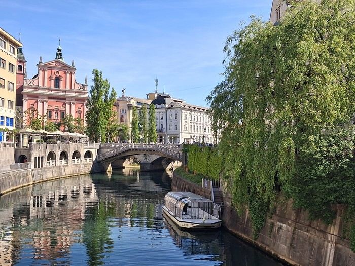
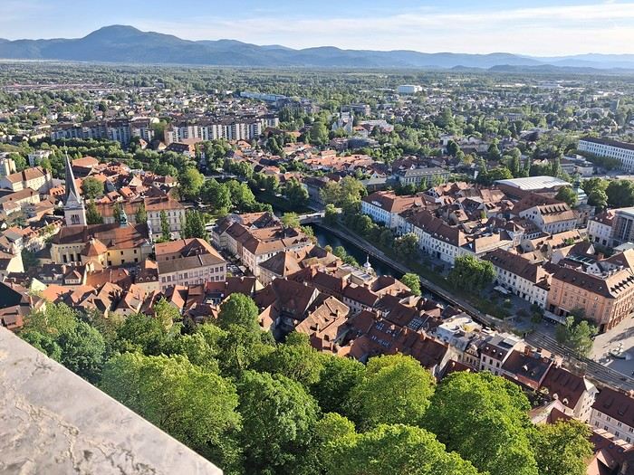
Good news: museums are free on the first Sunday of the month. I started with the National Gallery, then took a stroll through Tivoli Park, enjoying the outdoors. I tried grilling in the park before heading to the Museum of Modern Art and the eclectic National Museum of Slovenia, which was interesting for its architecture. Next up was the castle—you can enter the grounds for free; the only reason to pay is to access the keep for the city views.
Monday, May 4: Bled
I spent the morning exploring Ljubljana’s architecture but was disappointed by the Krakovo district, which guidebooks had hyped up.
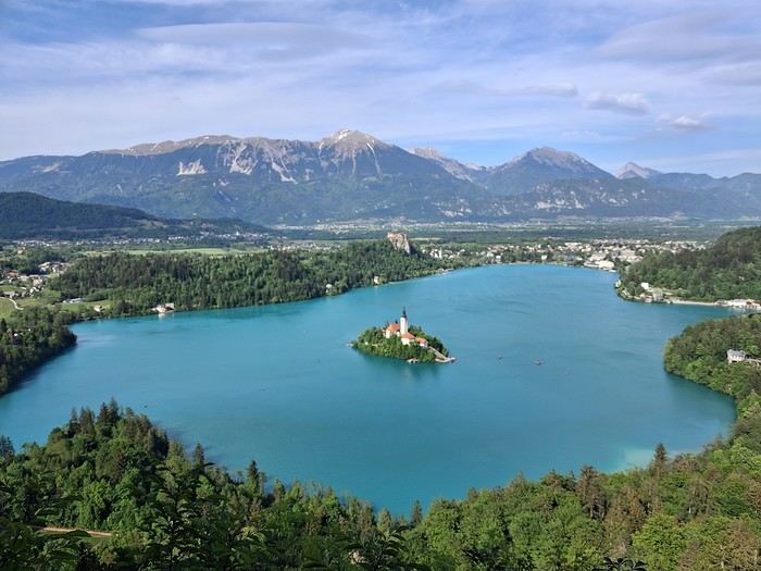
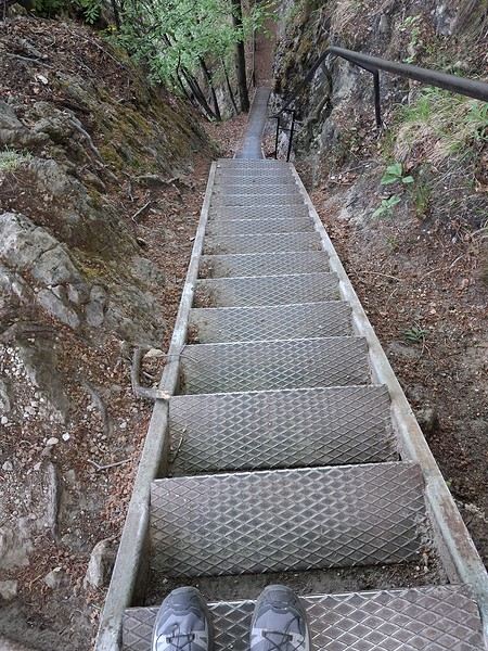
In the afternoon, I took the bus to Bled. The hostel was right at the bus station, and I soon realized I’d be the only guest—the owner was struggling to attract visitors. I walked around the lake and searched for the viewpoint access. It’s a steep climb with a staircase, but worth it.
Tuesday, May 5: Vintgar Gorge
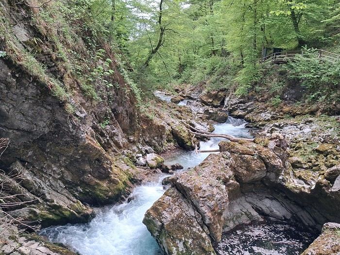
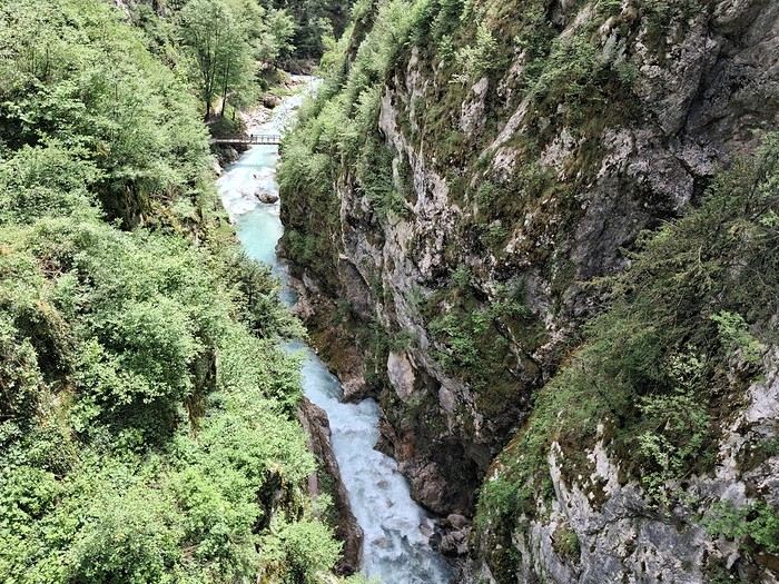
I headed to the gorges early in the morning via a shuttle, then walked back to Bled. It was stunning—it reminded me a bit of the Samaria Gorge I’d visited last year.
The bus took me straight to Stara Fužina near Lake Bohinj, where I stayed in a homestay. I loved it, even though there wasn’t much interaction with the hosts.
The weather was overcast and misty, giving the lake a Scottish vibe.
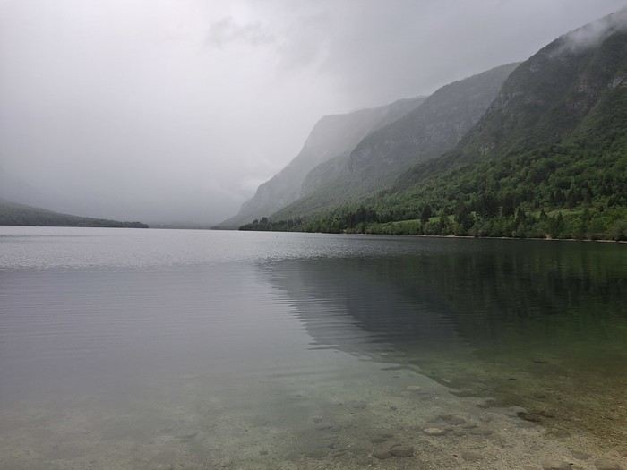
Wednesday, May 6: Bohinj
Rainy day, so I took the bus to Ukanc at the far end of the lake and walked back.
Thursday, May 7: Mostnica Gorge and the auto-train
I set off on foot for the gorges from Stara Fužina, taking a detour up to Planina Uskovnica, a steep and rarely used trail. The views of Triglav and the traditional alpine huts were incredible.
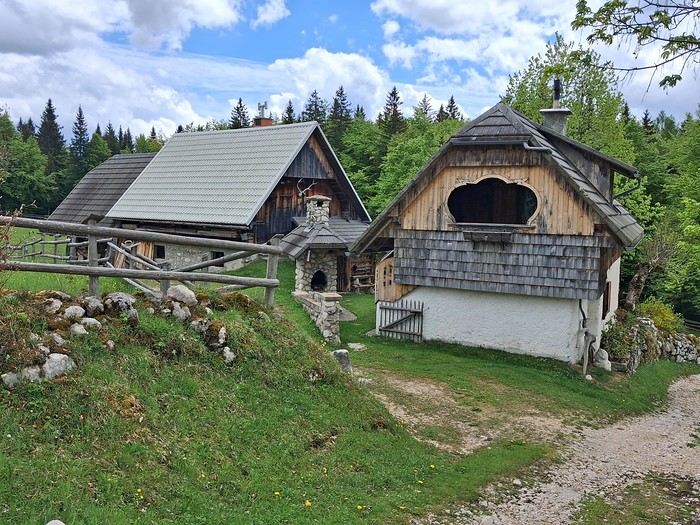
I then took the auto-train to Most na Soči. The passenger section has compartments, and the windows can be opened. The ride through the gorges was breathtaking. I stayed at a family-run guesthouse near the Most na Soči station—authentic and cozy.
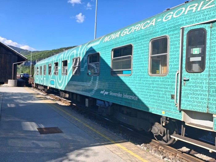
Friday, May 8: Tolmin Gorge and Nova Gorica
I took the bus to Tolmin, then walked 30 minutes to the gorges. The trail is well-maintained but short, so I extended my hike with a scenic loop through the gorges and nearby villages.
A quick train ride later, I was in Nova Gorica for the night, positioning myself to reach the Adriatic coast the next day. I explored at a fast pace—Villa Raffut on the Slovenian side, then crossed the border to visit Palazzo Attems-Petzenstein and grab an aperitivo in the main square. You could tell I was in Italy just by the vibe. The old border checkpoint is still there.
Saturday, May 9: Piran
Three trains and a bus later, I arrived. The journey was scenic, and it was worth it.
Piran is touristy but manageable. It feels like a mix of Croatia and Italy, with both influences evident. The maritime museum was fascinating, with its detailed ship models. There’s still a local feel—there was even a great blues concert by the harbor that evening.
Sunday, May 10: Piran
I walked to Izola along the coast—a beautiful route with paths, roads, and lakes. It was Sunday, and the tip of the village was lively with families picnicking. I decided to take the bus to Koper. The regional museum was quiet, but the garden was stunning.
Monday, May 11: Trieste
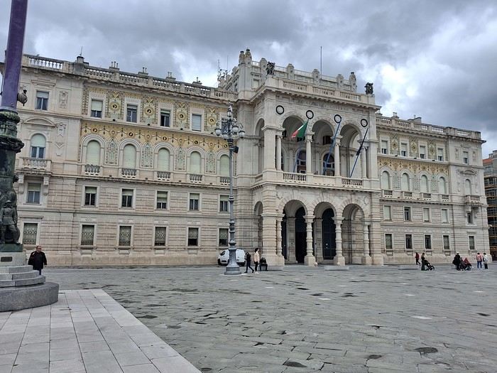
The bus connection from Koper was frequent and easy. Trieste is very open to the sea. I visited the castle and the massive Revoltella Museum—good timing, since it was raining. The collection spans everything from classical to contemporary art.
I missed my connection to Stresa later that day, so I had to improvise a night in a dorm near Milan’s train station.
Tuesday, May 12: Stresa
I came mainly for the Borromean Islands. First impressions weren’t great—crowded at the dock and windy. I didn’t like Isola Bella—too many people and too flashy. I much preferred Isola Madre, with its peaceful gardens where you can find solitude. On the way back, I stopped at Isola dei Pescatori after some hesitation, and it was worth it. Finally, I explored Stresa, with its colorful houses and grand palaces.
Wednesday, May 13: Heading to the Jura
I wrapped up my trip by taking the EuroCity train from Milan to Geneva via the Simplon Pass. From there, I headed to my vacation spot, taking the train from Nyon to La Cure (on the border). The rest of the journey was private.
Saturday, May 2: Arrival
Arrived in Ljubljana on a Transavia flight from Paris. I’d spotted a bus connection to the city center, but it’s worth noting there’s no dedicated line—most buses stopping at the airport come from Bled. On a sunny Saturday afternoon, the bus was already packed with people who’d headed to the lake for some fresh air. I ended up taking a shared van, with drivers actively offering transfers to travelers. I paid 12 € for the ride to the train station, then walked 15 minutes to Hotel Celica. It lives up to its description as a former prison turned hotel—close to the city center, clean, with a hearty breakfast. The rooms are basic, with beds 3 meters off the ground, accessible by a wooden ladder. For dinner, I opted for an Indian restaurant.
Sunday, May 3: Urban marathon
Good news: museums are free on the first Sunday of the month. I started with the National Gallery, then took a stroll through Tivoli Park, enjoying the outdoors. I tried grilling in the park before heading to the Museum of Modern Art and the eclectic National Museum of Slovenia, which was interesting for its architecture. Next up was the castle—you can enter the grounds for free; the only reason to pay is to access the keep for the city views.
Monday, May 4: Bled
I spent the morning exploring Ljubljana’s architecture but was disappointed by the Krakovo district, which guidebooks had hyped up.
In the afternoon, I took the bus to Bled. The hostel was right at the bus station, and I soon realized I’d be the only guest—the owner was struggling to attract visitors. I walked around the lake and searched for the viewpoint access. It’s a steep climb with a staircase, but worth it.
Tuesday, May 5: Vintgar Gorge
I headed to the gorges early in the morning via a shuttle, then walked back to Bled. It was stunning—it reminded me a bit of the Samaria Gorge I’d visited last year.
The bus took me straight to Stara Fužina near Lake Bohinj, where I stayed in a homestay. I loved it, even though there wasn’t much interaction with the hosts.
The weather was overcast and misty, giving the lake a Scottish vibe.
Wednesday, May 6: Bohinj
Rainy day, so I took the bus to Ukanc at the far end of the lake and walked back.
Thursday, May 7: Mostnica Gorge and the auto-train
I set off on foot for the gorges from Stara Fužina, taking a detour up to Planina Uskovnica, a steep and rarely used trail. The views of Triglav and the traditional alpine huts were incredible.
I then took the auto-train to Most na Soči. The passenger section has compartments, and the windows can be opened. The ride through the gorges was breathtaking. I stayed at a family-run guesthouse near the Most na Soči station—authentic and cozy.
Friday, May 8: Tolmin Gorge and Nova Gorica
I took the bus to Tolmin, then walked 30 minutes to the gorges. The trail is well-maintained but short, so I extended my hike with a scenic loop through the gorges and nearby villages.
A quick train ride later, I was in Nova Gorica for the night, positioning myself to reach the Adriatic coast the next day. I explored at a fast pace—Villa Raffut on the Slovenian side, then crossed the border to visit Palazzo Attems-Petzenstein and grab an aperitivo in the main square. You could tell I was in Italy just by the vibe. The old border checkpoint is still there.
Saturday, May 9: Piran
Three trains and a bus later, I arrived. The journey was scenic, and it was worth it.
Piran is touristy but manageable. It feels like a mix of Croatia and Italy, with both influences evident. The maritime museum was fascinating, with its detailed ship models. There’s still a local feel—there was even a great blues concert by the harbor that evening.
Sunday, May 10: Piran
I walked to Izola along the coast—a beautiful route with paths, roads, and lakes. It was Sunday, and the tip of the village was lively with families picnicking. I decided to take the bus to Koper. The regional museum was quiet, but the garden was stunning.
Monday, May 11: Trieste
The bus connection from Koper was frequent and easy. Trieste is very open to the sea. I visited the castle and the massive Revoltella Museum—good timing, since it was raining. The collection spans everything from classical to contemporary art.
I missed my connection to Stresa later that day, so I had to improvise a night in a dorm near Milan’s train station.
Tuesday, May 12: Stresa
I came mainly for the Borromean Islands. First impressions weren’t great—crowded at the dock and windy. I didn’t like Isola Bella—too many people and too flashy. I much preferred Isola Madre, with its peaceful gardens where you can find solitude. On the way back, I stopped at Isola dei Pescatori after some hesitation, and it was worth it. Finally, I explored Stresa, with its colorful houses and grand palaces.
Wednesday, May 13: Heading to the Jura
I wrapped up my trip by taking the EuroCity train from Milan to Geneva via the Simplon Pass. From there, I headed to my vacation spot, taking the train from Nyon to La Cure (on the border). The rest of the journey was private.
What short hikes can I do around Karakol?
Hi there,
I’m looking for half-day hikes near Karakol (not Jety-Oguz, since I’ll be heading there separately—max 30 minutes’ drive to the trailhead).
I can find longer treks, but nothing for a short outing!
So, if you’ve got any ideas...
Thanks! :)
I’m looking for half-day hikes near Karakol (not Jety-Oguz, since I’ll be heading there separately—max 30 minutes’ drive to the trailhead).
I can find longer treks, but nothing for a short outing!
So, if you’ve got any ideas...
Thanks! :)
Parking and bus question for hiking in Samaria Gorge
Hi there,
I’m reposting about the logistics for Samaria Gorge. I’d love to get recent info, especially about whether it’s possible to park my car in Omalos, do the hike, and then catch a bus back to my vehicle. In theory, it’s doable, but when you check the KTEL website, there aren’t any feasible schedules listed. If anyone has recently organized this with reliable, verified details, I’d really appreciate it. Thanks in advance!
I’m reposting about the logistics for Samaria Gorge. I’d love to get recent info, especially about whether it’s possible to park my car in Omalos, do the hike, and then catch a bus back to my vehicle. In theory, it’s doable, but when you check the KTEL website, there aren’t any feasible schedules listed. If anyone has recently organized this with reliable, verified details, I’d really appreciate it. Thanks in advance!
South Africa in safari mode: February/March 2026
Hi everyone,
With my girlfriend Christelle, we’ve chosen South Africa for our first trip to Southern Africa, focusing on safaris—after a long debate with a Cape Town/Kruger combo. But that would’ve meant cutting out St Lucia, which would’ve been harder to fit into another trip. And St Lucia—thanks to Michel and all those travel journals—we really wanted to go there.
So our 11-night itinerary ended up like this, mostly shaped by school holidays: - 3 nights in St Lucia - 1 night in Hluhluwe - 1 night at Mkhaya Game Reserve (Eswatini) - 1 night at Hlane Royal National Park (Eswatini) - 3 nights in Kruger (Berg en Dal / Satara / Tamboti) - 1 night at Shindzela Tented Camp in the Timbavati private reserve - 1 final night in Kruger at Lower Sabie
All of this in the off-season and rainy season, just a month after catastrophic floods that killed over 150 people and seriously damaged Kruger’s infrastructure.
I’ll jump straight to St Lucia and skip the loooong journey to get there (with a layover in Frankfurt, landing in Johannesburg, a domestic flight to Durban, and the rest by rental SUV—First Car Rental, perfect, no complaints).
To motivate readers—especially some familiar faces here—I’ll drop in a first photo.

With my girlfriend Christelle, we’ve chosen South Africa for our first trip to Southern Africa, focusing on safaris—after a long debate with a Cape Town/Kruger combo. But that would’ve meant cutting out St Lucia, which would’ve been harder to fit into another trip. And St Lucia—thanks to Michel and all those travel journals—we really wanted to go there.
So our 11-night itinerary ended up like this, mostly shaped by school holidays: - 3 nights in St Lucia - 1 night in Hluhluwe - 1 night at Mkhaya Game Reserve (Eswatini) - 1 night at Hlane Royal National Park (Eswatini) - 3 nights in Kruger (Berg en Dal / Satara / Tamboti) - 1 night at Shindzela Tented Camp in the Timbavati private reserve - 1 final night in Kruger at Lower Sabie
All of this in the off-season and rainy season, just a month after catastrophic floods that killed over 150 people and seriously damaged Kruger’s infrastructure.
I’ll jump straight to St Lucia and skip the loooong journey to get there (with a layover in Frankfurt, landing in Johannesburg, a domestic flight to Durban, and the rest by rental SUV—First Car Rental, perfect, no complaints).
To motivate readers—especially some familiar faces here—I’ll drop in a first photo.
Recap of our safari from February 7th to 17th, 2026
We went on a safari in Tanzania from February 7th, 2026, to February 17th, 2026. It remains a wonderful memory. There were six of us in the group. Here’s the itinerary and the images that are still etched in our minds:
02/07/2026 – 6:40 AM – 8:30 PM – Flight from LYON to ARUSHA
02/08/2026 – Day 2 – MATURENI Waterfall – Coffee making and tasting at a plantation – Day 2 video (you may need to click "BROWSE YOUTUBE")
02/09/2026 – Day 3 – Maasai village of BOMA – https://youtu.be/9lwBONmBIVU
Visit to local schools and the dispensary – Donation of school supplies.
02/10/2026 – Day 4 – TARANGIRE National Park – https://youtu.be/OPpTgUECj0Q
02/11/2026 – Day 5 – Lake Manyara National Park – https://youtu.be/ZFt3tLtum5A
02/12/2026 – Day 6 – SERENGETI Park – https://youtu.be/5TYJE-3IO4w and https://youtu.be/t08g-XJlmdY
02/13/2026 – Day 7 – SERENGETI National Park (continued) – https://youtu.be/ZQkD1YmPzY0
02/14/2026 – Day 8 – Access to Ngorongoro National Park – https://youtu.be/1F__NeCRxhg
02/15/2026 – Day 9 – Ngorongoro Crater – https://youtu.be/BFw7tbjuO5s, then https://youtu.be/WdbHtPcYu8o and https://youtu.be/RBp_H9OMJxY
02/16/2026 – Day 10 – Visit to Arusha
02/17/2026 – Day 10 – 1:30 AM – Transfer to Kilimanjaro Airport
FINANCIAL SUMMARY FLIGHTS 1,500 €
SEJOUIR PACKAGE 1,526 €
TIPS AND MISC. 100 €
TOTAL 3,126 €
Trip duration: from 02/07/26 to 02/17/26 => 11 days total, or 9 days excluding travel time.
1- FLIGHT DURATION WITH AIR FRANCE OUTBOUND: from 6:40 AM to 8:30 PM => 12 hours (plus 2-hour time difference in Arusha) RETURN: from 2:45 AM to 2:00 PM => 13 hours 15 minutes (not including a 1-hour 15-minute departure delay)
FINANCIAL SUMMARY FLIGHTS 1,500 €
SEJOUIR PACKAGE 1,526 €
TIPS AND MISC. 100 €
TOTAL 3,126 €
Trip duration: from 02/07/26 to 02/17/26 => 11 days total, or 9 days excluding travel time.
1- FLIGHT DURATION WITH AIR FRANCE OUTBOUND: from 6:40 AM to 8:30 PM => 12 hours (plus 2-hour time difference in Arusha) RETURN: from 2:45 AM to 2:00 PM => 13 hours 15 minutes (not including a 1-hour 15-minute departure delay)
Tips for a 20-day Montenegro and Croatia itinerary
hello
I’m looking for advice for a last-minute trip—about 3 weeks (half Montenegro, half Croatia).
I’m traveling solo, backpacker style (low budget, hostels). I’m 40 and love exploring cool spots—cities, beaches, mountains, sports activities, you name it.
I’m torn between renting a car or just going with the flow using buses once I’m there. A car would definitely be more convenient, but it might be pricier—plus, parking (is it paid?) and having to return it to the same place. My plan is to start in Montenegro (flying into Podgorica or Albania) and finish in Croatia, so I’d either need to do short-term rentals per country or one-way.
In Montenegro, here are the spots I’ve noted: - Ulcinj and Velika Plaža beach - A side trip to Lake Skadar and Virpazar - Budva, Sveti Stefan, and Petrovac - Cetinje and Lovćen National Park - Kotor / Perast - Žabljak and Durmitor National Park + rafting in the Tara Canyon Is 8–10 days enough?
And in Croatia, I’ve got: - Dubrovnik - Korčula - Hvar - Split + Trogir and Krka National Park - Zadar - Plitvice Lakes National Park - Croatian Istria / Rovinj / Pula - Zagreb Around 10–12 days.
Any tips on the stops (adding or cutting some from my list) or transportation options?
Thanks in advance!
I’m torn between renting a car or just going with the flow using buses once I’m there. A car would definitely be more convenient, but it might be pricier—plus, parking (is it paid?) and having to return it to the same place. My plan is to start in Montenegro (flying into Podgorica or Albania) and finish in Croatia, so I’d either need to do short-term rentals per country or one-way.
In Montenegro, here are the spots I’ve noted: - Ulcinj and Velika Plaža beach - A side trip to Lake Skadar and Virpazar - Budva, Sveti Stefan, and Petrovac - Cetinje and Lovćen National Park - Kotor / Perast - Žabljak and Durmitor National Park + rafting in the Tara Canyon Is 8–10 days enough?
And in Croatia, I’ve got: - Dubrovnik - Korčula - Hvar - Split + Trogir and Krka National Park - Zadar - Plitvice Lakes National Park - Croatian Istria / Rovinj / Pula - Zagreb Around 10–12 days.
Any tips on the stops (adding or cutting some from my list) or transportation options?
Thanks in advance!
A Brief A to Z of Peru
Foreword
This text has been proofread many times.
Sorry if some points in this A to Z have already been covered on this forum.
Text and drawings by the author.
Peru is still a very vast country, with so much to see, and obviously this text can't list all the attractions of the country.
*Abiseo (River) A national park that's very hard to access and doesn’t seem open to visitors. Includes the Gran Pajaten site (see below). Personally, it really sparks my imagination (not visited personally)
*Aguas Calientes the town next to Machu Picchu, more precisely below the archaeological site. As far as I know, you can only get there by train. Reminds me of the market where stalls line both sides of the tracks near Bangkok. I love it
*Altiplano: somewhere the "heart" of the Andes. I was able to trek across it on foot, starting from Caracollo in Bolivia, and of course, it’s vast plains to explore. This is where people live in a very rural way. Andean populations are quite austere compared to those in the lowlands or on the coast. You really have to appreciate the harshness of life to live there. Life is anything but superficial. I set a compass heading and found myself walking west toward the expanse of water near a place called La Joya. For pitching the tent, the nights were still chilly
*Canyon del Colca One of the deepest canyons in the world. Personally, I hiked down and back up on foot. The toughest stretch I’ve ever covered in my life.
*Ceviche More or less the national dish. A marinade of fish, shellfish, and lime. But you can find it in some restaurants in Europe, France, and certainly in Belgium or Switzerland. In the small restaurants of Pisco, you can eat excellent ceviche
*Cerro Sechín: Mostly bas-reliefs. A site little known to travelers in the Casma province. The first vestiges of a pre-Inca civilization with iconography similar to that of Chavín (not visited personally)
*Chan Chan A large city of the Chimú civilization and relatively vast to visit. You can see adobe walls with bas-reliefs. Visit from Trujillo, take a colectivo. Plan for the whole day
*Charango: a small guitar widely used in Andean music
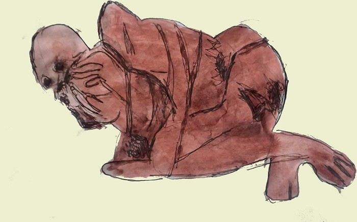
*Chauchilla A necropolis near Nazca where you can see mummies exposed on the ground. YouTubers can do paranormal experiments there. And for anyone wondering about the fate of the soul and body after death, here’s the answer: the body remains after death. You can imagine your own flesh and body exposed to the winds of the Pampa and before eternity... (not visited personally)
*Chavín de Huántar (Lanzón) The site’s appeal lies in its mountainous surroundings, the Lanzón stela, and the sculpted heads on the façades. What few people know is that the Chavín civilization began its expansion centuries before the Incas. Unfortunately, you can’t get too close to see the Lanzón—the day I was there, it was protected by grilles. To get there: minibus from Huaraz or trek from Olleros. Then cross a high pass (over 5,000m). If you do it solo on foot, be careful—the path isn’t obvious from Olleros
*Chullpa: funerary tower, notably at Sillustani in the Lake Titicaca region
*Chimú: pre-Inca civilization whose center was Chan Chan.
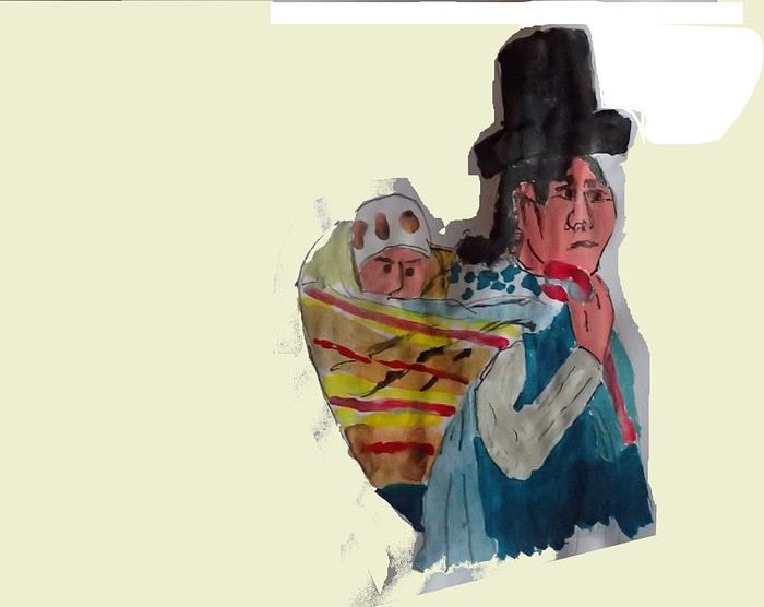
*Chola/Cholitas (Bolivia): typical clothing style of women from the Andean plateaus
*Chompa: pronounce it *Chompaaa!* A common term for a wool sweater with vicuña patterns, often knitted from alpaca wool. If you dress like this, it’s a bit kitschy around the edges
*Cuy That one isn’t a guinea pig like in Guyana but an actual guinea pig. During a trip to Peru, I was hiking near a village north of Quillabamba (the terminus of the train line that passes through Aguas Calientes), and I was invited to stay in a house. The family raised a few of these pets. Apparently, the locals eat them. Since I’m not much of a meat-eater, it doesn’t really tempt me. How about you?
*Pacific Coast or how to talk about a place you haven’t visited? Except for the coast near Pisco and San Andrés, I haven’t visited any coastal cities. But that doesn’t mean these places lack interest or poetry. For fans of clichéd images, pelicans, seabirds, and fishing boats appear by the sea.
*Gran Pajaten: also closed to the public. Features anthropomorphic bas-reliefs. (not visited personally)
*Huaca. Visit the Huaca del Sol and Huaca de la Luna, especially near Trujillo. However, you can skip them—Chan Chan is still more interesting. Don’t forget to spend time visiting Chan Chan
*Huacachina A small oasis in the desert near Ica. Yes, we’re talking about an oasis because for those who’ve never traveled to Peru, the coastal strip along the Pacific is almost entirely desert, from north to south. Peru is territorially made up of three different regions: the desert coast, the Altiplano stretching north to south with mountain ranges (the Cordilleras), and the Amazon basin to the east. (not visited personally)
*Inca Kola It’s neither Coca-Cola nor Pepsi but a unique cola with a slightly orange color. Tastes like bubble gum
*Intiwatana: a carved rock shaped like a parallelepiped. Is it a sundial?
*Ballestas Islands: a highlight in Peru, though very touristy. You can only get there by boat from the port of San Andrés, a few kilometers from Pisco. It’s a surreal place to me—actually islets with cavities where sea lions and fur seals live. Since it’s a protected area, you’re not allowed to disembark. Guano is harvested there, which can be used as fertilizer.
*Kuelap: a fortress built by the Chachapoyas people. Rarely visited by travelers. (not visited personally)
*Larco Museum: an iconic museum in Lima with a large collection of pieces from archaeological and pre-Columbian sites. From what I remember, it has many pieces from the Moche civilization. As for the Moche statuettes, the prudish might look away. Probably a veneration of the god Priapus without knowing it.
*Nazca Lines Discovered by German archaeologist Maria Reiche, they stretch for kilometers. The designs in the desert around Nazca depict animals and cabalistic signs. The question I ask myself is why the creators of these lines represented a monkey and a hummingbird—species endemic to the tropical forest, not the desert plains around Nazca.
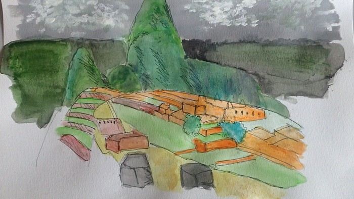
*Machu Picchu: means "old mountain" in Quechua. There’s also Wayna Picchu. The ruins of the site emerge from a sort of small plateau above Aguas Calientes. When the mist rises above the site and the bend of the Urubamba River, it’s truly magical... Also the starting point of the Inca Trail.
*Coca tea A decoction/infusion of the coca plant, meant to ease altitude sickness or *soroche*
*Chullo A rough translation would be a Peruvian wool hat.
*Moche: a civilization established in the Moche Valley, hence the term *Mochica*. What characterizes this civilization are the distinctive clay pieces representing faces and erotic statuettes
*Papa a la Huancaína A local potato dish
*Pisac: a typical market near Cusco
*Pisco Sour: perhaps the Peruvian equivalent of the *caipirinha* you drink in Brazil.
*Puya Raimondii A Bromeliaceae that still looks like a cactus, endemic to the Altiplano
*Quechua The language spoken by the indigenous people of the high plateaus (as well as Aymara in Bolivia)
*Quipu A knotted string used for counting. Widely used by the Inca administration.
*Sacsayhuamán (Q’enqo, Inca Bath) From Cusco’s Plaza de Armas, take the streets that climb above the city. Sacsayhuamán is called a fortress and is made up of large stone blocks. You wonder how the Incas could cut such huge blocks to assemble them—just like some streets in Cusco. The Q’enqo block is enigmatic; no one really knows what it represents.
*Savia Andina An Andean folk group.
*Tambo (=> Ollantaytambo) The Inca emperor (Atahualpa, Manco Capac) had the mission of controlling a vast empire. An empire that was still very extensive. Hence the importance of these *tambos* or relay stations. Napoleon created the civil code; the Incas invented the *tambos* and *quipus*.
*Tawantinsuyu: the Inca Empire
*Tinku: a warrior dance practiced mainly in Bolivia
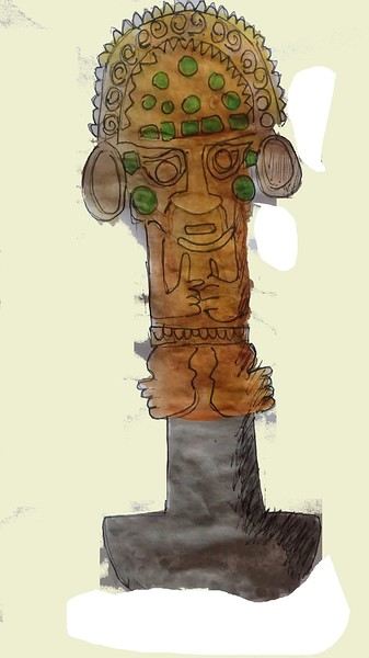
*Golden Tumi: a sacrificial weapon. Often featured in Peru travel guides. See illustration
*Terra X: a documentary series from the German TV channel that aired on Arte. Some episodes focused on pre-Inca and Inca Peru. I must have some old recording tapes. In memory of Gottfried Kirchner as a source of inspiration.
*Uros: I checked—it actually refers to the people who live on these floating islands. Even if it’s touristy, it’s a must-visit because it’s incredible how people can live on islets made from nothing. Take the boat from Puno
*Vicuña, llama, guanaco: camelids characteristic of the Altiplano
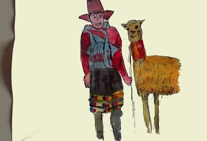
*Wayna Picchu The young Picchu mountain. In the first minutes of *Aguirre, the Wrath of God*, you see Klaus Kinski—well, Aguirre—making his way along the Inca Trail. Werner Herzog must have broken his back filming those sequences.
*Zampoña: pan flute
Peru is still a very vast country, with so much to see, and obviously this text can't list all the attractions of the country.
*Abiseo (River) A national park that's very hard to access and doesn’t seem open to visitors. Includes the Gran Pajaten site (see below). Personally, it really sparks my imagination (not visited personally)
*Aguas Calientes the town next to Machu Picchu, more precisely below the archaeological site. As far as I know, you can only get there by train. Reminds me of the market where stalls line both sides of the tracks near Bangkok. I love it
*Altiplano: somewhere the "heart" of the Andes. I was able to trek across it on foot, starting from Caracollo in Bolivia, and of course, it’s vast plains to explore. This is where people live in a very rural way. Andean populations are quite austere compared to those in the lowlands or on the coast. You really have to appreciate the harshness of life to live there. Life is anything but superficial. I set a compass heading and found myself walking west toward the expanse of water near a place called La Joya. For pitching the tent, the nights were still chilly
*Canyon del Colca One of the deepest canyons in the world. Personally, I hiked down and back up on foot. The toughest stretch I’ve ever covered in my life.
*Ceviche More or less the national dish. A marinade of fish, shellfish, and lime. But you can find it in some restaurants in Europe, France, and certainly in Belgium or Switzerland. In the small restaurants of Pisco, you can eat excellent ceviche
*Cerro Sechín: Mostly bas-reliefs. A site little known to travelers in the Casma province. The first vestiges of a pre-Inca civilization with iconography similar to that of Chavín (not visited personally)
*Chan Chan A large city of the Chimú civilization and relatively vast to visit. You can see adobe walls with bas-reliefs. Visit from Trujillo, take a colectivo. Plan for the whole day
*Charango: a small guitar widely used in Andean music
*Chauchilla A necropolis near Nazca where you can see mummies exposed on the ground. YouTubers can do paranormal experiments there. And for anyone wondering about the fate of the soul and body after death, here’s the answer: the body remains after death. You can imagine your own flesh and body exposed to the winds of the Pampa and before eternity... (not visited personally)
*Chavín de Huántar (Lanzón) The site’s appeal lies in its mountainous surroundings, the Lanzón stela, and the sculpted heads on the façades. What few people know is that the Chavín civilization began its expansion centuries before the Incas. Unfortunately, you can’t get too close to see the Lanzón—the day I was there, it was protected by grilles. To get there: minibus from Huaraz or trek from Olleros. Then cross a high pass (over 5,000m). If you do it solo on foot, be careful—the path isn’t obvious from Olleros
*Chullpa: funerary tower, notably at Sillustani in the Lake Titicaca region
*Chimú: pre-Inca civilization whose center was Chan Chan.
*Chola/Cholitas (Bolivia): typical clothing style of women from the Andean plateaus
*Chompa: pronounce it *Chompaaa!* A common term for a wool sweater with vicuña patterns, often knitted from alpaca wool. If you dress like this, it’s a bit kitschy around the edges
*Cuy That one isn’t a guinea pig like in Guyana but an actual guinea pig. During a trip to Peru, I was hiking near a village north of Quillabamba (the terminus of the train line that passes through Aguas Calientes), and I was invited to stay in a house. The family raised a few of these pets. Apparently, the locals eat them. Since I’m not much of a meat-eater, it doesn’t really tempt me. How about you?
*Pacific Coast or how to talk about a place you haven’t visited? Except for the coast near Pisco and San Andrés, I haven’t visited any coastal cities. But that doesn’t mean these places lack interest or poetry. For fans of clichéd images, pelicans, seabirds, and fishing boats appear by the sea.
*Gran Pajaten: also closed to the public. Features anthropomorphic bas-reliefs. (not visited personally)
*Huaca. Visit the Huaca del Sol and Huaca de la Luna, especially near Trujillo. However, you can skip them—Chan Chan is still more interesting. Don’t forget to spend time visiting Chan Chan
*Huacachina A small oasis in the desert near Ica. Yes, we’re talking about an oasis because for those who’ve never traveled to Peru, the coastal strip along the Pacific is almost entirely desert, from north to south. Peru is territorially made up of three different regions: the desert coast, the Altiplano stretching north to south with mountain ranges (the Cordilleras), and the Amazon basin to the east. (not visited personally)
*Inca Kola It’s neither Coca-Cola nor Pepsi but a unique cola with a slightly orange color. Tastes like bubble gum
*Intiwatana: a carved rock shaped like a parallelepiped. Is it a sundial?
*Ballestas Islands: a highlight in Peru, though very touristy. You can only get there by boat from the port of San Andrés, a few kilometers from Pisco. It’s a surreal place to me—actually islets with cavities where sea lions and fur seals live. Since it’s a protected area, you’re not allowed to disembark. Guano is harvested there, which can be used as fertilizer.
*Kuelap: a fortress built by the Chachapoyas people. Rarely visited by travelers. (not visited personally)
*Larco Museum: an iconic museum in Lima with a large collection of pieces from archaeological and pre-Columbian sites. From what I remember, it has many pieces from the Moche civilization. As for the Moche statuettes, the prudish might look away. Probably a veneration of the god Priapus without knowing it.
*Nazca Lines Discovered by German archaeologist Maria Reiche, they stretch for kilometers. The designs in the desert around Nazca depict animals and cabalistic signs. The question I ask myself is why the creators of these lines represented a monkey and a hummingbird—species endemic to the tropical forest, not the desert plains around Nazca.
*Machu Picchu: means "old mountain" in Quechua. There’s also Wayna Picchu. The ruins of the site emerge from a sort of small plateau above Aguas Calientes. When the mist rises above the site and the bend of the Urubamba River, it’s truly magical... Also the starting point of the Inca Trail.
*Coca tea A decoction/infusion of the coca plant, meant to ease altitude sickness or *soroche*
*Chullo A rough translation would be a Peruvian wool hat.
*Moche: a civilization established in the Moche Valley, hence the term *Mochica*. What characterizes this civilization are the distinctive clay pieces representing faces and erotic statuettes
*Papa a la Huancaína A local potato dish
*Pisac: a typical market near Cusco
*Pisco Sour: perhaps the Peruvian equivalent of the *caipirinha* you drink in Brazil.
*Puya Raimondii A Bromeliaceae that still looks like a cactus, endemic to the Altiplano
*Quechua The language spoken by the indigenous people of the high plateaus (as well as Aymara in Bolivia)
*Quipu A knotted string used for counting. Widely used by the Inca administration.
*Sacsayhuamán (Q’enqo, Inca Bath) From Cusco’s Plaza de Armas, take the streets that climb above the city. Sacsayhuamán is called a fortress and is made up of large stone blocks. You wonder how the Incas could cut such huge blocks to assemble them—just like some streets in Cusco. The Q’enqo block is enigmatic; no one really knows what it represents.
*Savia Andina An Andean folk group.
*Tambo (=> Ollantaytambo) The Inca emperor (Atahualpa, Manco Capac) had the mission of controlling a vast empire. An empire that was still very extensive. Hence the importance of these *tambos* or relay stations. Napoleon created the civil code; the Incas invented the *tambos* and *quipus*.
*Tawantinsuyu: the Inca Empire
*Tinku: a warrior dance practiced mainly in Bolivia
*Golden Tumi: a sacrificial weapon. Often featured in Peru travel guides. See illustration
*Terra X: a documentary series from the German TV channel that aired on Arte. Some episodes focused on pre-Inca and Inca Peru. I must have some old recording tapes. In memory of Gottfried Kirchner as a source of inspiration.
*Uros: I checked—it actually refers to the people who live on these floating islands. Even if it’s touristy, it’s a must-visit because it’s incredible how people can live on islets made from nothing. Take the boat from Puno
*Vicuña, llama, guanaco: camelids characteristic of the Altiplano
*Wayna Picchu The young Picchu mountain. In the first minutes of *Aguirre, the Wrath of God*, you see Klaus Kinski—well, Aguirre—making his way along the Inca Trail. Werner Herzog must have broken his back filming those sequences.
*Zampoña: pan flute
Accessibility questions for points of interest on the San Diego to Las Vegas route
Hello.
I’d like to travel along I-15N from San Diego to Las Vegas with my mom, who’s 67. We’ve explored Northern California and the California Coast over the past two years and now want to continue through the desert.
There are several attractions along the way: - Mormon Rocks - Desert Discovery Center and visit the Old Woman meteorite - Joshua Tree National Park - Mojave Desert - Mojave National Preserve - Anza-Borrego Desert State Park - Silverwood Lake
My mom has back issues that prevent her from hiking or walking on trails with elevation changes. Is it possible to visit these places by car, or are the routes flat enough?
I’d love for her to experience the desert with an itinerary adapted to her condition. I’m also open to other points of interest that aren’t mentioned. We have 3-4 days for the trip, so we’re not in a rush—just want to explore.
Thanks so much. The trip would be in fall 2026
There are several attractions along the way: - Mormon Rocks - Desert Discovery Center and visit the Old Woman meteorite - Joshua Tree National Park - Mojave Desert - Mojave National Preserve - Anza-Borrego Desert State Park - Silverwood Lake
My mom has back issues that prevent her from hiking or walking on trails with elevation changes. Is it possible to visit these places by car, or are the routes flat enough?
I’d love for her to experience the desert with an itinerary adapted to her condition. I’m also open to other points of interest that aren’t mentioned. We have 3-4 days for the trip, so we’re not in a rush—just want to explore.
Thanks so much. The trip would be in fall 2026
Lombok or Flores for snorkeling?
Our Bali-Lombok trip is taking shape, but we’d love to wrap up the stay with at least a solid week of snorkeling somewhere the coral is still in great condition. In your opinion, are the Gili Secrets in southern Lombok better than Flores Island, where there are supposedly amazing underwater landscapes?
Update on the international driving permit
Hi everyone,
I just found out there’s an update on the international driving permit. What was bound to happen has happened: it now costs (for now!!) 7 50 €. https://www.service-public.gouv.fr/particuliers/actualites/A18833
There’s also a link at the bottom of the article for the list of countries where it’s mandatory.
Have a great day! 😊
Christelle
I just found out there’s an update on the international driving permit. What was bound to happen has happened: it now costs (for now!!) 7 50 €. https://www.service-public.gouv.fr/particuliers/actualites/A18833
There’s also a link at the bottom of the article for the list of countries where it’s mandatory.
Have a great day! 😊
Christelle
Feedback on my Chile travel itinerary
Hi everyone!
I’m planning the trip of my dreams for next November—Chile! I’d love to get your thoughts on my potential itinerary. I know it’s a big investment in terms of both time and money, so every bit of feedback, suggestion, or info helps immensely. Thank you in advance!!
1-Flight to Santiago
2-Explore Santiago
3-Explore Santiago
4-Bus from STG to Valpo (2h) + visit Valparaíso + night in Viña
5-Visit Valparaíso + bus back to STG (2h)
6-Flight to Calama + bus to San Pedro + explore and acclimate in San Pedro + car rental in the afternoon (+Chaxa?)
7-(Very early) Valle del Arcoíris + Laguna Cejar + Valle de la Luna
8-Laguna Miñiques & Miscanti + Salar de Talar + Laguna Tuyajto
9-Geysers El Tatio early in the morning + Cañón de Guatín + return car
10-Excursion to Salar de Uyuni
11-Excursion to Salar de Uyuni
12-Excursion to Salar de Uyuni
13-Excursion to Salar de Uyuni + return to San Pedro for the night
14-Bus to Calama + flight Calama-La Serena + explore La Serena
15-Excursion to Reserva Pingüino + bonus time (sunset at Playa Tongoy or elsewhere...)
16-Rent a car in Pisco Elqui & Vicuña + Observatory
17-Return car in La Serena + flight Santiago & Puerto Montt (4h)
18-Rent a 4x2 car + drive to Temuco (4h)
19-Reserva Nacional Malalcahuello + hike + night in Temuco
20-Parque Nacional Conguillío then drive and night in Pucón
21-Villarrica Volcano
22-Parque Huerquehue
23-Activities on-site
24-Drive to Valdivia + explore and night there
25-Drive to Puerto Varas (via Frutillar, etc.) + activities on-site
26-Salto Las Cascadas + Parque Nacional Vicente Pérez Rosales (Salto del Petrohué) + Canoeing/Rafting?
27-Drive to Parque Alerce Andino (round trip 3h) + hike Sendero Sargazo?
28-Drive to Castro + explore Chiloé and night in Castro
29-Explore Chiloé
30-Explore Chiloé + return to Puerto Varas
31-Drive to Cochamó (1h30) + drive to Hornopirén (2h30)
32-Ferry to Caleta Gonzalo + drive to Chaitén (1h20)
33-Parque Nacional Pumalín, night in Chaitén
34-Drive to Puyuhuapi + Sendero Ventisquero Yelcho?
35-Ventisquero Colgante + drive to Coyhaique
36-Drive to Villa Cerro Castillo
37-Hike Cerro Castillo
38-Drive to Puerto Río Tranquilo
39-Excursion to Glaciar Exploradores
40-Mármol Cathedral + lake activities
41-Drive to Cochrane
42-Parque Patagonia
43-Drive to Chile Chico
44-Ferry Chile Chico-Ibañez + drive to Coyhaique + drop off car
45-Flight to Punta Arenas (1h30) + explore the city
46-Rent a car + drive to Puerto Natales
47-Drive to Torres del Paine in the morning + hike to the base of the towers (return to Puerto Natales for the night)
48-Torres del Paine hike 2 (return to Puerto Natales for the night)
49-Torres del Paine hike 3 (return to Puerto Natales for the night)
50-Drive to Punta Arenas
51-Flight Punta Arenas-Santiago + flight Santiago-Buenos Aires (2h)
52-Explore Buenos Aires
53-Explore Buenos Aires
54-Explore Buenos Aires
55-Flight back to France
I’m planning the trip of my dreams for next November—Chile! I’d love to get your thoughts on my potential itinerary. I know it’s a big investment in terms of both time and money, so every bit of feedback, suggestion, or info helps immensely. Thank you in advance!!
1-Flight to Santiago
2-Explore Santiago
3-Explore Santiago
4-Bus from STG to Valpo (2h) + visit Valparaíso + night in Viña
5-Visit Valparaíso + bus back to STG (2h)
6-Flight to Calama + bus to San Pedro + explore and acclimate in San Pedro + car rental in the afternoon (+Chaxa?)
7-(Very early) Valle del Arcoíris + Laguna Cejar + Valle de la Luna
8-Laguna Miñiques & Miscanti + Salar de Talar + Laguna Tuyajto
9-Geysers El Tatio early in the morning + Cañón de Guatín + return car
10-Excursion to Salar de Uyuni
11-Excursion to Salar de Uyuni
12-Excursion to Salar de Uyuni
13-Excursion to Salar de Uyuni + return to San Pedro for the night
14-Bus to Calama + flight Calama-La Serena + explore La Serena
15-Excursion to Reserva Pingüino + bonus time (sunset at Playa Tongoy or elsewhere...)
16-Rent a car in Pisco Elqui & Vicuña + Observatory
17-Return car in La Serena + flight Santiago & Puerto Montt (4h)
18-Rent a 4x2 car + drive to Temuco (4h)
19-Reserva Nacional Malalcahuello + hike + night in Temuco
20-Parque Nacional Conguillío then drive and night in Pucón
21-Villarrica Volcano
22-Parque Huerquehue
23-Activities on-site
24-Drive to Valdivia + explore and night there
25-Drive to Puerto Varas (via Frutillar, etc.) + activities on-site
26-Salto Las Cascadas + Parque Nacional Vicente Pérez Rosales (Salto del Petrohué) + Canoeing/Rafting?
27-Drive to Parque Alerce Andino (round trip 3h) + hike Sendero Sargazo?
28-Drive to Castro + explore Chiloé and night in Castro
29-Explore Chiloé
30-Explore Chiloé + return to Puerto Varas
31-Drive to Cochamó (1h30) + drive to Hornopirén (2h30)
32-Ferry to Caleta Gonzalo + drive to Chaitén (1h20)
33-Parque Nacional Pumalín, night in Chaitén
34-Drive to Puyuhuapi + Sendero Ventisquero Yelcho?
35-Ventisquero Colgante + drive to Coyhaique
36-Drive to Villa Cerro Castillo
37-Hike Cerro Castillo
38-Drive to Puerto Río Tranquilo
39-Excursion to Glaciar Exploradores
40-Mármol Cathedral + lake activities
41-Drive to Cochrane
42-Parque Patagonia
43-Drive to Chile Chico
44-Ferry Chile Chico-Ibañez + drive to Coyhaique + drop off car
45-Flight to Punta Arenas (1h30) + explore the city
46-Rent a car + drive to Puerto Natales
47-Drive to Torres del Paine in the morning + hike to the base of the towers (return to Puerto Natales for the night)
48-Torres del Paine hike 2 (return to Puerto Natales for the night)
49-Torres del Paine hike 3 (return to Puerto Natales for the night)
50-Drive to Punta Arenas
51-Flight Punta Arenas-Santiago + flight Santiago-Buenos Aires (2h)
52-Explore Buenos Aires
53-Explore Buenos Aires
54-Explore Buenos Aires
55-Flight back to France
Occ'ygène 2026: The Rencontres Voyageurs Program with My Atlas, Voyage Forum, and Cimalp
From March 27 to 29, 2026, the Occ'ygène show returns to the MEETT in Toulouse. My Atlas and Les Rencontres Voyageurs are welcoming Cimalp as a partner for this year's event.
Cimalp: French outdoor equipment brand
Founded in 1964 by a mountaineer in the Drôme region, Cimalp designs technical clothing and accessories for mountain activities and the great outdoors. The brand will be part of all the weekend’s conferences and activities, sharing its expertise on hiking, trekking, and itinerant travel gear.
The three-day program
The 400 m² Rencontres Voyageurs space offers a varied schedule (still being fine-tuned):
Friday, March 27: The "Small Talk" for free exchanges between visitors and travelers, a travel video masterclass hosted by Campers Lab, talks on solo female travel, and authentic Tunisia with the National Tourism Office.
Saturday, March 28: Conferences on bike travel and solo female travel, a screening and talk by Stéphane Crobarieu, a practical workshop "packing your backpack" with the FFRandonnée Occitane, and a meet-up with Morgane Lefèvre sharing her journey "Au bord des Mondes, from the Alps to Persia."
Sunday, March 29: A conference on solo female hiking, a video masterclass, a technical session on long-distance vehicle preparation, and the "World Connoisseurs" quiz to wrap up the show.
Come meet us!
The My Atlas team will be there all weekend, alongside the Voyage Forum community and many passionate travelers. It’s the perfect opportunity to chat about your escape plans, share experiences, pick up practical tips, and discover off-the-beaten-path routes. In a friendly bivouac atmosphere, come discuss vehicle setups, favorite destinations, or simply meet other adventurers who share your thirst for discovery.
Free tickets with My Atlas
My Atlas is offering free entry to the show. Book your tickets via this link:
https://billetterie-tev.teamaxess.com/webshop/402/tickets?voucher=OCCRENC26
Practical info:
MEETT - Toulouse Exhibition Center
March 27-29, 2026
Friday and Saturday: 10 AM–7 PM / Sunday: 10 AM–6 PM
More info:
https://lesrencontresvoyageurs.fr/occygene/
https://www.salon-occygene.com/fr
Java itinerary ideas (excluding Yogyakarta, Bromo, and Ijen)
We’ve already explored Bali, eastern Java, and its volcanoes back in 2013, and we’d love to return to Java to discover other spots that aren’t so "mainstream." There’ll be three of us—a couple and our 25-year-old son. We love nature, small towns, villages, beautiful landscapes, and a bit of beach time... We’re used to backpacking around Southeast Asia. Any tips for exploring some great spots in Java in a coherent way, with 3 or 4 bases for a 3-week trip from late June to mid-July? We don’t want to revisit Bromo or Ijen (they seem way too crowded compared to 2013), and we might swing by Djogja but won’t redo Borobudur or Prambanan (same issue...). Looking forward to your tips! Thanks 🙂