Results for "Cape+May+|+3+>+99"
5025 results found.
Feedback on our 15-day self-drive trip in South Africa
Hi there
We’re planning to do this route as a self-drive trip. There’ll be six of us, so with a large car—is the drive between Durban and Johannesburg manageable? Thanks for your feedback! Day 2: Cape Town Day 3: Cape of Good Hope Day 4: Hermanus, Cape Agulhas Day 5: Wine Route Day 6: Cape Town → Durban (flight) → St. Lucia Day 7: St. Lucia Day 8: Hluhluwe Day 9: Mlilwane Day 10: Sabi Sand Day 11: Sabi Sand Day 12: Kruger Day 13: Panoramic Route Day 14: Balule → Johannesburg
We’re planning to do this route as a self-drive trip. There’ll be six of us, so with a large car—is the drive between Durban and Johannesburg manageable? Thanks for your feedback! Day 2: Cape Town Day 3: Cape of Good Hope Day 4: Hermanus, Cape Agulhas Day 5: Wine Route Day 6: Cape Town → Durban (flight) → St. Lucia Day 7: St. Lucia Day 8: Hluhluwe Day 9: Mlilwane Day 10: Sabi Sand Day 11: Sabi Sand Day 12: Kruger Day 13: Panoramic Route Day 14: Balule → Johannesburg
Namibia Travel Journal: May 2025 - Trip Review
NAMIBIA TRIP 2025: April 24 to May 20: Feel free to comment or ask us any questions about this amazing journey.
>> Find all our photos and videos for each day on our website here: www.montagne-aventure.net
**DAY 1: Thursday, April 24, 2025: Outbound Flights from Lyon to Windhoek via Munich - Visit to Munich:**

Off we go on a new adventure. The alarm rings at 6:30 AM, the travel bags are packed, and we head to Lyon Airport. We booked our flight tickets with Lufthansa. The first leg to Munich, Germany, is operated by AirBaltic. Departure at 1:05 PM for a 1-hour and 20-minute flight. We arrive at 2:30 PM.
**We now have a 7-hour layover, so we take the opportunity to get some fresh air and explore Munich.** We quickly exit Terminal 2 of the airport and head towards the subway. We buy a group day ticket "Airport-city Day Zone M-5," valid for 2 to 5 people at a price of 30.50 € (instead of 16.30 € per person). We take the S8 line to **Marienplatz** in 35 minutes. **This is the heart of the city.** The weather is overcast, quite cool, but dry. Perfect for a little city trip between two flights while leaving our large luggage in transit at the airport. **Munich is the third-largest German city after Berlin and Hamburg, in the Bavaria region.** **The center has a lot of charm and brings together several religious buildings, easy to explore on foot.** We are impressed by the number of people enjoying these 100% pedestrian streets, which are very pleasant. After Marienplatz, the most famous square with the town hall, we head to the Cathedral of Our Lady, a Gothic church, then continue to **Karlsplatz** and move on to **the food market offering a wide selection of high-end food products in an atmosphere where a certain art of living prevails.** We also visit St. Peter's Church before grabbing a bite to eat. Two good hours were enough for this 10 km city walk. It's time to take the subway back: by 6:30 PM, we are back at the airport. Now, it's time for a bit of waiting and rest. Our second flight is scheduled for 9:35 PM for a 9-hour and 30-minute journey to our final destination in Namibia: **Windhoek.**
> Round-trip flight tickets with Lufthansa from Lyon: 2029 €, or 1,014.50 € per person.
> Lyon Airport parking: 120 €
> Today's expenses: 7 € for 2 pizzas in France / 14 € for the restaurant in Munich / 30.50 € for the daily subway ticket in Munich.
**DAY 2: Friday, April 25, 2024: Arrival in Windhoek, Visit to the Namibian Capital:**
After a 9-hour and 30-minute overnight flight with Discover Airlines, we finally land on Namibian soil just before 7:30 AM. The day is breaking, and the colors are already stunning. We are eager despite the usual fatigue from the flight. The airline was punctual, with friendly staff and good meals, though a bit light. We are the first flight of the day to land, with no more than 15 flights per day here, from 7 AM to 8 PM. We disembark on the tarmac at this airport located in the middle of nowhere, **I finally set foot on African soil for the first time.** We exit among the first from the aircraft to go through the long formalities at the front of the line, as the wait can quickly become endless. Allow at least 5 minutes per person for e-visas. We still wait 45 minutes despite only about twenty people ahead of us. Phew, it's done. We collect our luggage and then withdraw money from an ATM. We make 4 withdrawals of the maximum amount, 2000 NAD $ per withdrawal, for a total of 380 €, or 95.33 € per withdrawal.
Our driver arrives at the same time, perfect timing, we were quick.
We leave the airport at 8:45 AM. By 9:30 AM, we arrive at the **Gracious Whisp vehicle rental agency**, located at the entrance of Windhoek, small and human-sized with a fleet of recent vehicles. More formalities, then a short wait as our vehicle is not yet ready. Time to decompress, catch our breath, and enjoy the very pleasant morning temperature. Not a cloud in sight. Next, a briefing on the vehicle, always with a bit of apprehension due to our approximate English. Allow 45 minutes of explanations, including setting up the roof tent, camping equipment, technical information in case of a flat tire, driving tips in Namibia, and a tour of the 4x4. We have all the necessary equipment for camping: mattresses, sleeping bags, pillows, table, chairs, gas stove, BBQ grill... as well as 2 spare tires, a compressor, a dual tank, and accessories for removing wheels. Off we go, it's time to muster our courage and get behind the wheel. **Heading to SuperSpar Maerua**, fortunately located less than 10 minutes away. We park with the help of a parking attendant; it's very crowded, the space is narrow, but everything goes well despite the cursed right-hand drive. Today's new mission: stock up on groceries. The store is well-stocked with local and imported products, catering to all tastes. We spend 114 € on groceries, from pasta to meat, BBQ lighters to dishwashing products. Two people load our groceries into two carts and transfer them to our vehicle; we feel compelled to leave a tip, 50 NAD $, as we don't have change yet. Now, we head to the hotel, 15 minutes away. Traffic is difficult at a complicated intersection; this will likely be the only traffic jam in Namibia. **We arrive at Kate's Nest Guesthouse & Backpackers around 1:15 PM, quite tired.** We take some well-deserved rest at this recent establishment, quite calm with secure private parking. After a short nap, we enjoy the quiet by the hotel pool. Night falls between 6:30 PM and 7 PM. We eat quietly in our room tonight before starting this long 4x4 road trip in camping mode in the heart of Namibia.
> Today's grocery expenses: 114 € at Super Spar Marua (2395.21 NAD $).
> Round-trip flight tickets with Lufthansa from Lyon: 2029 €, or 1,014.50 € per person.
> Vehicle rental: 4x4 Toyota with roof tent for 24 days: Gracious Whisp Car Rentals: 2,638 € (N$50,640) or **1,319 €** per person - (https://gwcarrentals.com/)
> Distance driven today: 15 km.
> Accommodation: Kate's Nest Guesthouse & Backpackers - 4 Aristotles Street Academia, 9000 Windhoek - 36 € for two for one night.
> Windhoek International Airport website: (https://www.airports.com.na/)
**DAY 3: Saturday, April 26, 2025: Windhoek to Hardap: Mariental Region - Kalahari Desert:**
After a good, restful night, we wake up leisurely around 7 AM. We enjoy the comfort provided by this first and last hotel before 24 nights under the tent.
**We leave Kate's Nest Guesthouse at 8:30 AM to tackle the Namibian roads.** We quickly leave the capital; in just 30 minutes, we find ourselves almost alone in the world. The landscape is dotted with small domes. We leave the **paved B1** quickly to turn left onto the **C15**. **From there, we won't see more than 10 vehicles all day.** After passing through the few houses of **Lekkerwaterpoort**, we tackle our first gravel road. These road sections are limited to 100 km/h, but even at 70 km/h, I find it already challenging. However, I quickly get used to it and gradually pick up speed to reach my cruising speed of around 80 to 90 km/h. **We are on immense straight lines crossing wild expanses as far as the eye can see.** **We come across two baboons, a few ostriches, and numerous cattle and sheep farms.** We pass through the charming village of **Uhlenhorst** with its typical houses and children with broad smiles waving at us. Life here is already very different from Windhoek. **The thermometer rises quickly from 16°C at 8:30 AM to over 28°C in the early afternoon.**
**We arrive at the Hardap Dam reserve at 2 PM.** We stop at the toll booth at the park entrance to pay the entrance fee: 250 NAD $ for 2 people and 1 vehicle. We continue to the dam and then the camp entrance, located a bit further. We had booked in advance, but this place remains little frequented by foreigners.
We take advantage of the hottest hours to rest by the large pool overlooking the immense lake, a very enjoyable moment. Would this be a bit of a vacation?
Around 4:30 PM, we head to the campsite. We overlook this vast water reserve. We arrive first; we will be only 3 vehicles spending the night here. It's time to get to work and set up our equipment for the first time. It takes us a good 20 minutes to set everything up, with a slight apprehension about unfolding the tent. Once this task is done, which we will have to repeat for almost a month, we will become much more efficient over time. Time for rest and contemplation in total silence. The sun gradually sets, and the heat quickly becomes bearable again. Bliss! **This dam is located 20 km northwest of Mariental in an area dotted with conical hills topped with dolerite buttons (Hardap means "hillock" in Nama). It captures the Fish River, which flows south, creating a large lake in the middle of an arid environment. The contrast is striking.** We enjoy our first sunset facing this 360° otherworldly landscape.
Around 7 PM, we start our first BBQ, or "braai" as it's called here. The temperature is perfect. The sun sets, giving way to a star-filled sky of incredible beauty thanks to the absence of any light pollution. The Milky Way will lull us throughout the evening. After some good sausages and potatoes on the BBQ, we head to our roof tent around 9:30 PM with a complete change of scenery in just 24 hours. France already seems so far away...
This campsite has shared showers and toilets, quite clean and functional, as well as a central area with several BBQs and tables. The sites are arranged in a semicircle, each with an electrical outlet. The sites are close to each other but spacious, some slightly shaded. We are only three vehicles tonight, so it's perfectly comfortable and quiet. Not to mention the large pool near the restaurant. Our trip is off to a great start.
> Today's road itinerary: Windhoek > Head south on the B1 to Rehoboth > Turn left onto the C25 then C15 to Stampriet > C20 to Hardap > Full north on the B1 > Then turn left onto the M93 - 5 hours of driving.
> Distance driven today: 354 km.
> Accommodation: Hardap Recreation Resort - 23.3 € for two - Large pool - GR6W+3M2, Hardap Game Reserve, Mariental, Namibia - (http://www.nwr.com.na/resorts/hardap-resort/)
**DAY 4: Sunday, April 27, 2025: Hardap - Brukkaros Volcano - Keetmanshoop - Quivertree Forest Rest Camp**
Our first night under the tent was very pleasant; the little wind quickly calmed down, giving way to absolute silence. The mattress is decent, more comfortable than some nights in Nepal. The length and width give us enough space for maximum comfort, despite my height (1.91 m). We wake up a little before 7 AM as the sun rises, and the lights dazzle us from the start of the day. We pack up the equipment in 30 minutes, quite easily. Then we enjoy the sun, which warms up quickly while we keep our light fleece on.
At 8:30 AM, **we hit the road again, heading south** to our first stop in **Mariental**. We want to do some shopping at SuperSpar, but once we arrive in the parking lot, a young local is fighting with the supermarket security guards and then threatens to throw stones. We don't want to take any risks right at the start, so despite the baton blows he receives, he doesn't stop. We leave empty-handed but fill up with fuel at the Shell station 1 km further. The price per liter is 21.33 NAD $, we fill our 107-liter tank for 107 €. In Namibia, you get served, and they bring the card machine to the window to pay. It's then customary to leave a tip.
We then take the B1 heading due south on a recently renovated road. Around 11:30 AM, we leave it on our right to take **a wild gravel road, the M98**. Just before **Berseba**, we turn right onto a small track, the **D3904 towards Brukkaros Crater up to a camp at 1588 m altitude**. The track then becomes too bumpy. We stop on the counter-slopes where **a wide panorama unfolds over these immense plains as far as the eye can see**. It's 12:15 PM, time for us to eat a rice and tuna salad facing this landscape.
**We are alone in the world until a vehicle arrives and parks next to us.** A bit of apprehension, 4 men head towards us. It turns out to be 4 shepherds looking for a lost foal. The conversation is pleasant, lost in the middle of nowhere. We find ourselves alone again in this absolute silence. **The heat becomes stifling with a good 30°C**. We get back on the road around 1 PM. Back on the B1, **we continue due south to Keetmanshoop**, which we reach around 3 PM. We stop there to do some shopping for 262 NAD $ (12 eggs, a can of tuna, a can of corn, bread, a soda, and a 5-liter water container), or 12.48 €. Two quite insistent children ask us for money or candy at the store exit, yet we give them a small tip, but they continue to cling to the car. Locals parked next to us tell them to leave us alone. Anyway, we finish the trip to **Quivertree Forest**, 15 km away. We will spend the night in this **pleasant farm run by a German**. Upon arrival, as the day before, and as I suppose in the future, we dive straight into the cool pool to relax after all these kilometers. A bliss. Then we take our 4x4 and choose a spot near these famous trees. After the 33°C this afternoon, once 4 PM passed, the temperature drops again and becomes very pleasant. **We are in the middle of the Kokerboom, one of the most interesting and characteristic plants of hot and arid regions. It's not really a tree but a variant of the aloe plant whose botanical name is Aloe Dichotoma. This Kokerboom has a smooth and thick trunk reaching up to 1 m in thickness and 9 m in height. They bloom for the first time at the age of 20 to 30 years.** The flowers are yellow and reach about thirty centimeters during the season between June and July. **They grow mainly in an environment with a high concentration of black rocks absorbing a large amount of heat (38°C). The rocks also serve to anchor the tree with its tentacle-like roots. It also resists frost. Each is between 200 and 300 years old.**
Around 5 PM, we walk to the farm reception to watch the feeding of **two cheetahs**. Magnificent carnivores taking their time to savor their piece of meat. **Then we return near our campsite to enjoy the sunset among these trees. The colors are sublime, as every evening apparently. A magnificent spectacle with colors evolving from yellow to orange then to pink, before giving way once again to a sky filled with thousands of stars.** Our campsite at Quiver Tree Forest Camp is very comfortable; we have a water supply, a stone table, a small lamp, an electrical outlet, a small tree for shade, and a BBQ that we won't use tonight; we'll cook on gas. The sites are far apart, with some shared facilities scattered around, a very beautiful setting. No reservation possible, no need, just show up directly. **The campsite accommodation for 2 people costs 28 €, including the reserve entrance fee of 5 €**. We finish this second bivouac evening around 9:30 PM, time for some reading and sleep in peaceful silence without wind.
> Today's road itinerary: Mariental > B1 heading south to Brukkaros > At Tses turn right towards Berseba via the M98 > Turn right onto the D3904 > 8 km > Brukkaros Volcano (stop at the lower camp as the track is difficult for 1 hour) > Keetmanshoop > Turn left onto the M29 > Quivertree Forest - 4 hours of driving.
> Distance driven today: 371 km.
> Distance walked today: 6 km.
> Today's expenses: Groceries for 12.48 € (262 NAD $) / Fuel for 107 € (1 liter of diesel for 21.33 NAD $).
> Accommodation: Quivertree Forest Rest Camp, P.O. Box 262, Keetmanshoop, Namibia - BBQ, hot showers, toilets, and electricity - No reservation - Pool - 18 €/Person (N$ 340.00 with park entrance) - (http://www.quivertreeforest.com/)
**DAY 5: Monday, April 28, 2025: Quivertree Forest Rest Camp - Giant's Playground - Keetmanshoop - Fish River Canyon - Canyon Roadhouse:**
After an excellent start to the night, we are woken up by the wind shortly before 6 AM, but the sunrise is not far off. We get up at 6:30 AM to enjoy it. The atmosphere is a bit cooler this morning, but the reward is already here.
The adventure continues. At 7:45 AM, we head towards **Giant's Playground**, 4 km away. We take a 3-kilometer walk through this expanse of blocks and igneous rocks.
We continue south at 8:45 AM, passing through Keetmanshoop again where we do some shopping for 25 €, a big stock-up for a good part of the trip: meats, canned goods, pasta, fruits... At 9:30 AM, we take the B4 to Fish River Canyon.
At 11:30 AM, we arrive at the entrance to the NWR park (350 NAD $ entrance for 2 people and 1 vehicle). The track becomes bumpy immediately upon entering the park. After about ten kilometers, we come upon this landscape carved by nature. In the end, it's well worth the detour. We were at the Grand Canyon in the USA exactly (https://www.montagne-aventure.net/2024/04/29/j21-3-juin-2024-grand-canyon-et-lac-powell/) and can thus confirm that this Fish River Canyon is comparable. We make several stops along the southern flank. **Here, nothing is developed; nature is almost in the wild state.** **With 160 km in length, up to 27 km in width, and a depth of 150 m, it is indeed the second-largest canyon in the world.** The history of the canyon is apparent in its different earth layers and stratification: the antiquity of the place is tangible, and the absence of vegetation is surprising. **It consists of two nested canyons, formed at distinct periods. The first distinct layer of schist, sandstone, and eruptive material surrounding the canyon was formed a few two billion years ago, then transformed due to heat and pressure into more solid rock such as gneiss. The inner canyon, carved more recently by the Fish River, has a depth of 270 m.**
We have a picnic once again alone in the world facing this grand panorama at the **Sulphur Spring View Point**. This is where the hiking trail begins, plunging into this narrow canyon, but it is forbidden to venture there alone without a guide. It's 30°C, but a slight wind makes the atmosphere bearable. At 1 PM, we retrace our steps and continue to the **Main View Point** then to the **Hikers View Point**.
In the south of Namibia, the Fish River Canyon, 160 km long, is a true geological wonder: a canyon nested within another canyon, one of the largest in the world. The first sedimentary layers formed two billion years ago; 500 million years ago, a period of tectonic activity caused these layers to crack and tilt, opening a vast canyon in the Earth's crust. The second canyon, with a depth of 270 m, was carved over time by the passage of the Fish River in this new valley.
At 3 PM, we arrive at our very charming camp for the evening, the **Canyon Road House**. We fill up with fuel right away because tomorrow we have a long day of isolated driving: 55 liters for 1240 NAD $. Then we settle into the campsite we had previously reserved in France. We are assigned site 2, very well set up under a tree with its BBQ and stone table just steps from the pool. We quickly set up the tent and jump straight into the pool for the relaxation moment of the day. As usual, the water is quite cool, but it's a real pleasure. Then we stroll around this Canyon Road House, which recreates the atmosphere of the roadside inns of the 1950s with old car wrecks and vintage gas pumps in a bygone era. **Around 5:45 PM, we start a short walk leading us to the top of a hill overlooking the wide plateau where we are to watch the sunset.**
And finally, to end this beautiful day, it's time for the braai, with grilled sausages and white beans on the evening menu.
> Park entrance: 150 DN/person + 50 DN/vehicle (18 € for two). It is possible to enter at two access points: Hobas in the north and Ai-Ais in the south.
> Today's road itinerary: M29 > Keetmanshoop > B1 > B4 > C12 (track) > After Holoog turn right onto the D601 (C37 track) > Accommodation on our right (stop just to check in before 6 PM) > Continue 30 km (30 minutes of track) to the viewpoints after Hobas where you must pay the entrance fee. Sunset View Point to the left > Return before sunset as the park closes (best lights at sunrise). 3 hours.
> Distance driven today: 228 km.
> Distance walked today: 10 km.
> Today's expenses: 25 € for groceries / 17 € for the Fish River Canyon park entrance / 58 € for fuel.
> Accommodation: Canyon Roadhouse, Gondwana Collection Namibia – 34.4 € for two - Pool - Near Hobas - (http://www.gondwana-collection.com/fr/accommodation/canyon-road-campsite)
**DAY 6: Tuesday, April 29, 2025: Canyon Roadhouse - Orange River - South African Border - Vista Trail - Gondwana Sperrgebiet Park - Aus:**
The night was excellent in this very comfortable campsite. **We wake up to the sound of birds** before the alarm at 6:45 AM. Our little morning routine starts as the sun rises. **A big day of driving awaits us to the South African border. This will be the southernmost point of our journey.** We hit the road at 8 AM via the C37, pass through **Hobas**, then turn onto the D207 to **Aussenkehr.** **We cross a mountainous barrier with some high peaks and perfect cones. The rock varies from orange to pink to black.**
We then cross a lunar desert as far as the eye can see on a giant dome; the track winds through nowhere without meeting anyone for hours. The landscapes are surprising. **We spot several ostriches and a gemsbok.** In the middle of this endless expanse, we come to an improbable intersection and continue right onto the D278.
In the middle of these arid lands, we come across a green zone: a vast vineyard. At 10:30 AM, **we come across a "Road closed" sign, fortunately, a local resident waves us to continue; a bit stressed, we proceed.** We start to follow the beautiful Orange River. On the other side of the bank, just a few meters away, South Africa is there. It is the second-longest river in Southern Africa, after the Zambezi. It flows over 2,000 km to the Atlantic. After passing through narrow gorges, we regain altitude before starting the descent, gently heading back north.
**We now cross and follow the Fish River, which joins the Orange River further south** **along this gorge dating back millennia.** At exactly noon, we take a lunch break by the Fish River, still without meeting a soul in this landscape between greenery and aridity. The temperature here is cooler with a pleasant 23°C on the banks, the perfect spot. **We continue on the track to Rosh Pinah**, where we find a paved road again. **The section along the Orange River and the Fish River was officially closed, but we were able to pass without any issues, avoiding a detour of at least 3 hours.** Phew. We now drive at high speed (limited to 120 km/h) through these vast spaces. We come across many ostriches after the **dozens of monkeys along the Fish River**. Around 3 PM, 3 km after the very small town of **Aus**, we reach **our campsite for the evening at Klein Aus Vista**. A new **small peaceful haven very well set up**. As usual, after checking in at reception, we jump straight into the beautiful pool to get our well-deserved dose of coolness, another good thermal shock that our bodies appreciate. Once this moment of relaxation is over, we take our 4x4 to reach the campsite located a bit higher, set apart at the foot of a hill that overlooks us.
After setting up, **around 5 PM, we head to the Vista Trail to climb to the top of a mountain overlooking the vast plain that surrounds us at 360°**. It takes about 30 minutes to climb. The place is just magical, **the perfect viewpoint to admire the sunset**. **We fully savor the moment. We also spot one of the few wild horses in the world capable of living in the desert.** Their numbers have decreased in recent years due to predation and drought (around 100 to 150). At 7 PM, we return to the camp, time for the braai and preparing the meal in this peaceful little camp.
In the south of Namibia, the Fish River Canyon, 160 km long, is a true geological wonder: a canyon nested within another canyon, one of the largest in the world. The first sedimentary layers formed two billion years ago; 500 million years ago, a period of tectonic activity caused these layers to crack and tilt, opening a vast canyon in the Earth's crust. The second canyon, with a depth of 270 m, was carved over time by the passage of the Fish River in this new valley.
> Today's road itinerary: 5 hours of driving: D324 heading south (track) > turn right onto the C10 (track) > D316 heading south > turn right onto the C13 > In Aus turn left onto the B4 > Campsite via a track on the left.
> Fuel station: Solitaire or Aus.
> Distance driven today: 398 km.
> Distance walked today: 7 km.
> Accommodation: Klein-Aus Vista Desert Horse Campsite - Farm Klein-Aus No 8 on the B4 main road to Luederitz Aus 9000, Aus, Namibia - (http://www.klein-aus-vista.com/accommodation/desert-horse-campsite/) 17908 420 DN - Water + Shared shower (hot water). No electricity.
**DAY 7: Wednesday, April 30, 2025: Aus - Kolmanskop - Diaz Point - Luderitz - Kanaan Desert:**
We wake up around 6:45 AM, with partly cloudy weather for once; we feel the ocean's influence gradually. But the sun isn't far off. At 7 AM, we leave the campsite heading west towards Luderitz via the B4. **First stop of the day: Kolmanskop, the ghost town we reach at 8:30 AM**, entry costs 180 NAD $ per person. We discover this **timeless place** in 1.5 hours, moving from building to building amidst violent sand-laden gusts of wind. There's a lot of charm in these different living spaces. **The sand quickly reclaimed the place after this mining town was abandoned.** This was once the headquarters of Consolidated Diamond Mines. It's hard to believe that this former town, where the diamond industry once flourished, had a hospital, a bowling alley, and a theater. The decline in diamond sales after World War II and the discovery of richer deposits put an end to this golden age. By 1956, the town was already completely deserted, and the sand had reclaimed its rights. **These dilapidated buildings swallowed by shifting dunes have something surreal about them.**
At 10:15 AM, we hit the road again **heading to Luderitz, 22 km away**, and first to **Diaz Point** **facing the Atlantic Ocean**. It's a wind-swept peninsula with its characteristic red and white lighthouse. There's a campsite and a coffee shop on site, but the place doesn't inspire rest without shade or shelter from the wind. We return to the city via the D701 track that runs along the ocean, be careful at low tide. We come across **a few fishermen and a fox as well as flamingos.**
We walk through the few streets of the city, much smaller than I imagined, then climb to the **famous little Lutheran church that overlooks the city, the Felsenkirchr.** **The wind blows very strongly here, and the sand is omnipresent, surrounded by the Namib Desert and the southern Atlantic coast.** **A German colonial relic barely touched by the 21st century, Luderitz seems frozen in the past, giving it both a gloomy and a certain charm. In short, it's certainly one of the most incongruous places in Africa.**
At 1:15 PM, just before leaving Luderitz, we do some shopping for 20.50 € and fill up with fuel: 61.50 €, 1290 NAD $ for 61 liters (21.18 $ per liter).
**We return via the B4 to Aus** (paved), **then via rougher tracks**, the C13 then the D707, magnificent as it runs along a mountain range with multiple colors on our right and an endless flat desert on the other side.
To access our campsite for the evening, we must take a **narrow private track for 7 km** on our right to emerge, in this total vastness, at the **isolated Kanaan Desert Retreat on a small hill**. I don't have time today to jump into the pool near the reception; we arrive at 5 PM at 8 small, isolated, and unique sites with a small kitchen, a shower, and a private toilet under a small tarp shelter. **A crazy charm with a unique view...** **This will be my favorite accommodation of this trip. The photos speak for themselves.** We jump into the outdoor shower while savoring the landscape, then prepare our evening braai while enjoying the colors fading, facing this plateau with bushes turning a vivid orange. **A moment that will remain etched for life.** **Savanna atmosphere under a thin emerging moon. Every minute offers different colors. Facing our meal, we have a natural giant screen.**
We end this day contemplating the stars and admire this thin orange moon setting on the horizon (8:42 PM).
**Ghost town just before Luderitz: Kolmanskop** (open from 8 AM to 3 PM - N$ 180 p.p – 9 €). Once, Kolmanskoppe was organized around diamond mining. After finding new, more prolific spots, the town was abandoned and is now a ghost town. The sand and dunes have reclaimed their rights and buried everything humans had built. Houses, train station, bakery, everything has been covered by sand, which passes through the windows, even though they are 1 meter high.
> Today's road itinerary: 5h30: B4 to Luderitz (paved) > Round trip > Kolmanskop on the left > Return via the previous campsite > Then C13 (track) > Turn left D707 (track) > Then track to the right to the campsite.
> Distance driven today: 438 km.
> Distance walked today: 8 km.
> Today's expenses: Groceries at the Spar in Luderitz for 20.50 € / Fuel fill-up in Luderitz for 61.50 €.
> Official Kolmanskop website: (https://kolmanskuppe.com) (open from 8 AM to 1 PM - N$ 180 p.p – 9 €).
> Accommodation: Night at the south of the Namibrand Nature Reserve: Kanaan Desert Retreat – 26.5 € for two - (http://www.kanaannamibia.com/) - Farm 104 Karas 9000 - Sanitary facilities + BBQ + Water + Pool - No electricity - My favorite accommodation of this trip.
**DAY 8: Thursday, May 1, 2025: Kanaan Desert Retreat - Namib Desert - Crossing the Namibrand Nature Reserve – Sesriem Canyon - Elim Dune - Little Sossus Lodge**
After a cooler night than the previous ones with about 10°C, we wake up around 7 AM. We admire, as usual, the sunrise between the desert and the mountains. **The spot from last night was truly perfect, isolated from the world, in total serenity, with a wake-up call to the sound of birds.**
We hit the road a little after 8 AM, heading north via the D707 to Spes Bona, then the gravel road C27 via Betta to Sesriem. **The landscapes roll by and dazzle us.** **We are right in the heart of the Namibrand reserve**, coming across numerous **zebras**, **impalas**, **ruminants that reproduce in large numbers**, and **gemsboks**. At noon, we stop in the shade of a tree to eat. The spot is so romantic facing orange arid mountains and a vast green plateau. **A landscape full of contrasts, timeless and silent.**
**The Namib Desert is the oldest on the planet; its name means "vast arid plain," and it also gave its name to the entire country: Namibia.** The majority of these arid and semi-arid lands dotted with viewpoints are part of the Namib-Naukluft National Park, which covers 23,000 km².
At 1 PM, we enter the Sossusvlei park. We start with the **Sesriem Canyon**, which is 3 km long and 30 m deep. We enter it with a short 1-hour hike into its depths. **It was carved by the Tsauchab River in an agglomerate of sand and pebbles over 15 million years old.** We retrace our steps back to Sesriem, which means "six belts," referring to the number of leather belts (from ox wagons) needed to draw water from the canyon. This remote locality is mainly the gateway to Sossusvlei but offers a gas station and some accommodations. For our part, we sleep 40 km away tonight.
**We then move on to Elim Dune.** It takes about 45 minutes of walking to reach its summit, and the climb is very breath-taking as we progress in the sand where we almost slide back with each step. **A first grand 360° panorama unfolds. The ochre color of the sand contrasts completely with the yellow plain and the brown and black mountains in the distance.**
At 3:15 PM, we start the descent facing Sesriem. We were completely alone once again on this dune. **These Namib dunes are composed of colored quartzite sand, presenting hues ranging from cream to orange and from red to purple. Unlike the ancient dunes of the Kalahari, these move with the wind and adopt distinct, ever-changing shapes.** Star dunes resemble stars seen from above, while transverse dunes, like those on the coast south of Walvis Bay, stand perpendicular to the prevailing southwest wind. The most stable dunes, which thus have the most vegetation, are parabolic dunes, due to the variability of the winds. Longitudinal (seif) dunes measure up to 100 m in height, while barchan dunes, crescent-shaped and predominant at the extreme north of the Skeleton Coast and south of Luderitz, are the most mobile, created by unidirectional winds.
**We get back on the road for 45 minutes to our campsite for the evening, Little Sossus, which we reach at 5 PM**, via C27 then right onto C19. As often upon our arrival, I jump into the cool pool to relax after all this driving, then we proceed to set up the camp. As the day before, the campsite consists of 10 fairly distant sites, with private sanitary facilities and a small roof. We are delighted with this crazy charm. The hot water for our shower is wood-heated: a Namibian lights it every evening around 5 PM.
For a change, or not, the menu features a small BBQ with pork ribs and pasta, facing another sunset, this time with partial cloud cover giving equally splendid colors. Time for a well-deserved rest after long corrugated tracks covered in our 4x4 today.
> Today's road itinerary: 4h45 of driving: Find the D707 and head north (track) > At Spesbona turn left onto the C27 (track) > At Sesriem after entering the park, turn left following View Point Sesriem > Continue 4.5 km to the Sesriem Canyon Parking > Return then head towards Elim Dune > Exit the park then take the D826 > Turn right onto the C19 heading SE > Turn right facing the D854 to the campsite (campsite closes at 7 PM).
> Distance driven today: 272 km.
> Distance walked today: 8 km.
> Today's expenses: Entry to the Sossusvlei Namib-Naukluft Park: 17 € for two (with one car).
> Accommodation: Little Sossus Lodge – 35 € for two - At the junction of the C19 and D854 roads Maltahohe 9000, Maltahohe, Namibia - (http://www.littlesossus.net/) - Pool + Private bathroom + Hot water + Electricity + BBQ + Grocery store (bread to order the day before).
**DAY 9: Friday, May 2, 2025: Little Sossus Lodge - Namib-Naukluft National Park – Sesriem - Sossusvlei - Big Daddy – Deadvlei - Tsauchab River Camp**
Today we start the day early to tackle **the famous dunes of Sossusvlei at first light**. The alarm goes off at 6 AM to leave the camp at 6:45 AM. The wind is blowing quite strongly in gusts this morning, but it only woke us up a quarter of an hour before sunrise. The park opens at 7:15 AM. We start with a small encounter: a friendly **jackal lounging by the roadside.**
We first have to cover the 40 km of track to Sesriem, pay the entrance fee (350 NAD $), and drive 65 km on a paved road this time to reach the **vast salt pan (a lake whose sediments are made of salts) of Sossusvlei**. **It appears amidst the gigantic red dunes that rise on either side. The wind constantly changes the shape of the dunes, as well as their colors, which vary with the light. The setting is breathtaking, giving an impression of immensity and timeless grandeur.**
The paved road ends; the last 4 kilometers become technical and are reserved for 4x4s. Phew, I pass without any problems, though not without stress, switching to L4 mode. **We start the ascent to Big Daddy at 8:45 AM, 325 m of elevation gain in the sand nonetheless.** We climb at an excellent speed despite the strong wind, in exactly 1 hour. At 9:45 AM, we are at the summit of what will remain etched for a long time. The 360° view is simply unimaginable; you have to experience it to believe it. The wind blows violently up there, **it feels like being in the high mountains, on a snow ridge, with a strong transport of sand. The atmosphere is magical.** We start the descent running barefoot in the steep sand.
**We then move on to its neighbor, Deadvlei.** **Here, petrified trees stand in the "vlei" (basin) with their dried branches casting desolate shadows on the white ground. The juxtaposition of the deep blue sky and the towering dunes is captivating.**
We return to the 4x4 parking at 11 AM, the stress rises again for the sandy track passage. We retrace our steps and stop at **Dune 45**.
At noon, we take the opportunity to picnic at the foot of **the beautiful Dune 40**, where there is already no one left. We enjoy the quiet again, well, almost, as the wind remains omnipresent.
At 1 PM, we return to **Sesriem**, where we fill up with fuel (21.15 NAD $ per liter), totaling 1630 for 77 liters (78 €), and do some shopping for 245 NAD $ (two nice pieces of pork, 2 cans, 2 sandwiches for tomorrow, and 1 soda), which is 12.48 €. It's 27°C. We hit the road again, heading to a new destination at 2 PM. We take the C19 back to Little Sossus where we spent the night, then turn left onto the gravel road D854 for about 40 km to **Tsauchab River camp**. Finally, we won't be sleeping here; we are redirected 7 km downstream to **Naukluft View Camp**, which also belongs to Tsauchab River Camp.
We arrive at 4 PM, and thankfully, the fatigue was starting to set in. **Our campsite is located under a small forest, providing some protection from the wind that blew strongly all day. The calm does us a world of good. Once again, a lot of charm**, with very spaced-out sites without any visibility. We can't wait to take our shower. It will be possible from 5 PM with, as the day before, water heated by a wood fire. Time to prepare the campsite for the night. And on the menu, a braai with two superb pieces of pork bought in Sesriem and fries!!!!
**The Namib Desert**
An impressive coastal desert stretching from the Atlantic to a high plateau inland, the narrow Namib Desert runs along the southwest African coast for about 1,300 km. **Considered one of the oldest deserts in the world**, it is bordered to the north by the Kaokoland Desert, which extends into Angola, and to the south by South Africa's Karoo. The narrow Namib is mostly less than 160 km wide. Despite this, it is considered to consist of three sections: the coastal strip influenced by the Atlantic; the Outer Namib, occupying what remains of the western half; and the Inner Namib, comprising the eastern half of the desert. Generally called the Skeleton Coast, the coastal Namib receives almost no rain and depends on regular marine fogs for moisture. From sea level, the terrain rises to 900 m, where the desert meets the base of the Great Escarpment to the east. In the Inner Namib, average annual rainfall is only about 50 mm.
The dryness is such a characteristic of the Namib that it is thought to have been in this arid state for at least 55 million years. It is all the more surprising to learn that animals such as vipers, geckos, zebras, and elephants live in this desert. Some areas of the Namib are also rich in flora, including Welwitschia mirabilis, which grows near the ground with seemingly exhausted leaves, extracting moisture from marine fogs and can live over 1,000 years. In the southern Namib, some dunes are up to 32 km long and 240 m high.
**The frequent fog of the Skeleton Coast:** Driving north along the coast of Namibia, the cold Benguela Current in the Atlantic cools the moist air above the ocean, which, upon meeting the warm desert air, leads to the formation of thick fog banks that drift up to 100 km into the center of the Namib before evaporating under the sun.
> Today's road itinerary: 4 hours of driving: C19 towards Sesriem (track) > D826 (paved) > Foot of Big Daddy via a technical sandy track > Return via the same route > D854 to Tsauchab.
> Gas station: Sesriem.
> Distance driven today: 254 km.
> Distance walked today: 12 km.
> Today's expenses: Park entry at Sesriem for 2 people: 17 € / Fuel fill-up: 78 € / Groceries at Sesriem gas station: 12 € (245 NAD $).
> Accommodation: Tsauchab River Camp - Naukluft View Camp - D054 & D850 GPS: S24 26' 37" E16 10' 11" Sossusvlei 22007, Maltahohe, Namibia - BBQ + Private sanitary facilities + Water - www.tsauchab.com
**DAY 10: Saturday, May 3, 2025: Tsauchab River Camp - Naukluft National Park - Olive Trail Hike (10 km) - Ababis Guest Farm**
We pack up the camp at 8 AM and continue our road trip north via the D854, a bumpy track with many corrugated sections. It's cool this morning, 12°C.
**We enter the Naukluft massif, discovering landscapes with very different terrain than before.** We first need to check in at the campsite, 13 km from the entrance at the end of the track: 350 NAD $ for 2 people and 1 vehicle, then return 4 km back. **On the agenda is the lovely Olive Trail, a 10 km hiking loop that starts 4 km northwest of the park office**, along the D854 that we follow. At 9:45 AM, the hike begins with a fairly steep ascent (about 45 minutes) among the **wild olive trees** from which the trail gets its name. **At the summit, we enjoy a view that embraces the Naukluft Valley.** We then turn east and gradually descend into a deep valley, passing over sometimes slippery rocks. We have a snack around 11:30 AM in these small gorges. **Further on, to cross the wall of a canyon in front of us, some chains are fixed to the rock to help us pass.** We finish this superb loop clockwise at 1:15 PM, taking 3.5 hours including 30 minutes of breaks. We only crossed a small group of 3 people on this wild adventure far from everything. At 1:45 PM, we exit the park and take the **D854 track north to Bullsport**. From there, we turn left and take the C14, which **runs along the bed of the Tsondab River.**
**We arrive at our campsite for the evening, Ababis Guest Farm, at 3 PM.** Quite early for once, allowing us to rest a bit in this peaceful farm where many sheep wander around us. We also enjoy the pool under a magnificent sun, less hot than the previous days, it's 22°C. The camp has only 4 spaced-out sites around shared sanitary facilities. **We are in the middle of a vast plain facing the Naukluft massif mountains.** We will have another beautiful sunset on these mountains. For the first time on this trip, **we will be completely alone at this campsite.** **We haven't encountered many people today**, just 3 during the hike and fewer than 10 vehicles all day.
> Today's road itinerary: Head north on the D854 (track) > Turn left to enter the Naukfluft National Park > Continue on the track then turn right to the Olive Trail hike parking lot (1 hour for 45 km). Return to the D854 and continue north > At Bullsport turn left onto the C14 to Ababis (still a track) > The camp is located on the left facing the D1261 (1 hour for 60 km from Olive Trail). Total: 2 hours of driving for 100 km.
> Gas station: No gas station on the route, except in Solitaire.
> Distance driven today: 115 km.
> Distance walked today: 13 km.
> Accommodation: Ababis Gaestefarm - Night booked by email – payment on site: (https://www.ababis-gaestefarm.de/) - P.O.Box 1004, Maltahöhe - N$ 300.00 per person
**DAY 11: Sunday, May 4, 2025: Ababis Gaestefarm - Namib-Naukluft National Park – Solitaire - Gaub Pass - Kuiseb Canyon - Moon Landscape - Walvis Bay**
The night was, for the first time since the start of this road trip, quite difficult. A strong wind accompanied us all night, making the tent flap constantly. A racket that drove us crazy. We still managed to sleep a few hours. The morning sun brings back our smiles. We hit the road for this new stage a little before 7:45 AM.
We start the day with a first stop less than 15 km away **on the C14 in Solitaire** at 8:15 AM. **This town is lost in the middle of nowhere with its small gas station with a western atmosphere adorned with rusted and sand-covered car wrecks.** After a quick supply stop: 86 NAD $, or 4 € for 1 water container and a box of cookies, we continue north still on the C14, **crossing the Tropic of Capricorn** then devouring this **magnificent track up to Gaub Pass**. **A succession of narrow gorges, turns, climbs, and descents breaking the monotony of the previous long straight lines.** We are right in the heart of no man's land for 200 km. We then start the descent to the **Kuiseb Canyon. It houses the wide bed of the eponymous river, dry almost all year.** Even when it flows for 2 to 3 weeks during the rainy season, it doesn't go beyond Gobabeb and then seeps into the sand. **The drinking water that supplies Walvis Bay is pumped at Rooibank from this underground water table.** **We now cross the Kuiseb Desert where impressive dunes roll down.** We make a short stop at a **natural rock arch** reminding us of our (https://www.montagne-aventure.net/2024/04/29/j19-1-juin-2024-canyonlands-national-park-et-arches-national-park/). Then we gradually descend towards **Walvis Bay** where we will spend the night. At noon, we enter the **Dorob National Park**. The thermometer drops 10°C in 10 minutes as we get closer to the Atlantic Ocean.
At 12:45 PM, much earlier than initially planned, we arrive at the **Moon Landscape** (View Point 4, free) to have a snack, via a very recent surprising dual carriageway in the middle of nowhere, then via the C28. We are again in the hinterlands, the temperature has soared: 30°C without a bit of shade. Even if the colors and the panorama must be exceptional at sunrise or sunset, the detour for this 360° panorama is still worth it. Extreme aridity as far as the eye can see. The place lives up to its name; it really feels like being on the moon. We get back on the road at 1:30 PM via the D1991, C28, then again the A2, which is very new. The latter runs along the beautiful dunes up to the **Dune 7**, where we make another stop.
Then we head towards our final destination of the day, **Walvis Bay. Its port is sheltered by a sand spit, a natural breakwater that protects the city from the powerful assaults of the ocean. Its port was long a strategic place: claimed by the Cape Colony in 1795, it was officially annexed by the British in 1878 to counter Germany's ambitions in the region. A colony of fur seals, pelicans, flamingos, and whale terns have made it their home.**
We do a big grocery shopping at the Spar located in the center for 66 €; it's very easy to park there. Then we fill up with fuel at an Engen station right across for 1117 NAD $ for 54 liters (20.6 NAD $ per liter), which is 54 €. We then **enjoy the seaside in the Lagoon neighborhood**, where it's also easy to park. After kilometers in the desert, **this cool break is more than welcome. The outside temperature is 22°C. In the distance, we can clearly see the clouds lingering over Swakopmund.**
We take the 4x4 one last time to the **Lagoon Chalets where we will spend the night**. The spot is well set up and surprising in the heart of a residential neighborhood. The sites are quite large, separated by fences around very comfortable shared sanitary facilities. BBQ, electricity, and shaded area. We settle in quietly before going out on foot to watch the **sunset over the Pacific Ocean along Lagoon Promenade Road**. We can still see this impressive persistent mist in the distance. The neighborhood is very peaceful, certainly without much charm, but with a very well-developed seafront that inspires relaxation after kilometers without meeting anyone in inhospitable lands. We end the day with our traditional braai: grilled chicken thighs and sautéed potatoes in the coolness of a starry sky.
> Today's road itinerary: 5h30 of driving (or 3h30 of driving for 250 km without the Moon Landscape): Head north on the C14 > Cross the Tropic of Capricorn > Gaub Pass > Kuiseb Canyon on our left in a round trip > Continue to Green Valley and leave the C14 to the right on the D1984 > Turn right on the C28 > Then left D1991 to Moon Landscape D1991 View Point 4 > Return via the same road and stop at Dune 7 for sunset > Walvis Bay.
> Gas station: Solitaire or Walvis Bay.
> Distance driven today: 372 km.
> Distance walked today: 5 km.
> Today's expenses: Fuel fill-up for 54 € + Groceries for 66 € at Spar.
> Accommodation: Walvis Bay: Lagoon Chalets – 36.6 € for two - (http://www.lagoonchaletswb.com/) - 8th Road West, Meersig Meersig 9000, Walvis Bay, Namibia - BBQ – Electricity – Shared sanitary facilities.

**DAY 12: Monday, May 5, 2025: Walvis Bay - Swakopmund - Round Trip to Cape Cross (seals) - Wreck of the Zeila en route - Henties Bay - Spitzkoppe Tented Camp & Campsite**
After an excellent night, a bit cooler and more humid than usual, we wake up around 7 AM and leave the camp at 7:45 AM to **follow the Atlantic coast heading north**. We thus leave **Walvis Bay**, a very pleasant stopover town, and follow the ocean via the B2. **We enter the mist and Swakopmund** at 8:40 AM, parking **near the lighthouse**. The atmosphere is very quiet, the streets seem dead with large empty parking lots and very little traffic, but the few open shops are filled with expatriates enjoying their breakfasts, French bakeries, cafes, travel agencies... **We are in this Benguela Current, a fast cold ocean current that flows from South Africa, up the coasts of Namibia and Angola, towards the northwest to join a warm equatorial current. Hence the supply of very fish-rich waters and this tenacious mist depending on the seasons. In the northern part of the Namib Desert, fogs are frequent during the southern winter. It's almost the only source of moisture since the city of Swakopmund receives, on average, only 11 liters of water per m² in December and January.**
**Swakopmund is wedged between the dunes and the Atlantic rollers. It is the Namibian capital of adventure activities and has a ghostly colonial remnant. With its German architecture, its seaside promenade, it resembles a seaside town of the North Sea or the Baltic.** It is also a bustling African city. **Nearly two-thirds of Swakopmund's population live in Mondesa, a township created during apartheid, northeast of the city center, a legacy of the South African mandate.** The heart of the city is located in the area of the pier, at the foot of the lighthouse, better known as the Mole. During the South African occupation of Swakopmund, the port took a back seat to Walvis Bay.
Continuing on this C34, sometimes on salt, we come across the famous **wreck of the Zeila, stranded in 2008**, on our left. We can see it through the thick fog, being very close to the beach. It's 10:15 AM. Further on, Henties Bay is a bay that attracts many fishermen; it's teeming with vehicles equipped with fishing rods. Besides its fish-rich waters, it enjoys a relaxed atmosphere and a large beach suitable for walks.
We continue further north, heading to Cape Cross, this time a round trip because we will turn off later here in Henties Bay to reach Spitzkoppe via good gravel roads that are quiet alternatives to the very busy paved B2 further south. **Henties Bay is part of the Dorob National Park, a multi-purpose park protecting coastal ecosystems and hosting the many renowned recreational activities of the region. The part of the coast north of Swakopmund up to the Ugab is particularly popular with fishermen who come in droves to fish for saltwater fish.** The small concrete buildings spaced at regular intervals are actually toilets for fishermen and campers. The coastline is also dotted with world-renowned surf spots.
Even before arriving, we can already smell it before we come across thousands of seals (population in 2021: 1.5 million). **The Cape Cross Seal Reserve, the most renowned on the Namibian coast, is home to the most famous breeding colony of fur seals, which seems to take full advantage of the high concentrations of fish present in the icy waters of the Benguela Current. We are impressed by the sight of these 100,000 pinnipeds lounging on the beach and frolicking in the waves.** We have a picnic a little away from the smells facing the ocean in the sun.
At 12:45 PM, it's time to hit the road again. We retrace our steps back to Henties Bay. We stop there to do another big grocery run before not encountering any big cities for many days. We will only buy fresh items day by day until the end of the trip; we have 23 € worth. **In the space of 30 minutes, we go from 15 to 36°C. The thermal shock with an amplitude of more than 20°C.** At 1:45 PM, we hit the road again via the D1918, then we try a very small track on our left, the D1925. It becomes narrow and rough; I have a bit of apprehension. We arrive at a gate to open in the middle of nowhere, then young children run up to us asking for water or food... We then drive to **Spitzkoppe. The arrival right in front of the mountains is majestic, off the beaten path. This mountain appears in the distance like a mirage above the dusty plains of southern Damaraland.** We come across a second gate held by a guard. We enter the "Community Camp" campsite without realizing it through the west entrance. We are given a small paper, then we go to the reception passing **at the foot of these gigantic, magnificent rocks.** Once at the reception, we are informed that this is not the camp we had booked. Ours is located just a little further, and in the end, it's better because the latter was packed. We were able to cross the park very close to these rocks without paying. We exit through the main entrance; 5 Himba children cling to our doors and trunk asking for bread and food again. We continue despite them staying attached, worried about hurting them. Phew, more fear than harm. We cross the few houses and arrive at the right camp at 4:30 PM, the Spitzkoppe Tented & Campsite. The spot is much quieter and well set up. We have site C12, cozy to perfection with its sink, a private shower and toilet, as well as electricity, under the shade of a tree and facing the mountains. The sunset and sunrise will be perfect. We set up the tent and, without delay, head to the pool for a big dose of coolness. Then it's time to prepare the BBQ and **contemplate the fading lights on the Spitzkoppe massif.**
> Today's road itinerary: 5 hours of driving: Head north on the B2 (paved) along the ocean > Swakopmund > C34 (paved) still heading north > On the left, the wreck of the Zeila before Henties Bay > Cape Cross round trip > Henties Bay > D1916 heading east (track) > Turn left onto D3716 > Turn left to the campsite.
> Gas station: Swakopmund or Henties Bay.
> Distance driven today: 344 km.
> Distance walked today: 6 km.
> Today's expenses: Groceries in Henties Bay: 23 € + Cape Cross park entry: 17 €.
> Accommodation: Spitzkoppe Tented Camp & Campsite - Spitzkoppe River Valley 00000, Spitzkoppe river valley, Namibia - (http://spitzkoppemountaincamp.com/) - 26 € - Pool - BBQ - Shower and toilet.
**DAY 13: Tuesday, May 6, 2025: Spitzkoppe - Rock Pools - Uis**
It's 6:45 AM, **we wake up at the foot of one of the most emblematic landscapes of the country, Spitzkoppe, which towers over the valley at 1,728 m.** **The Spitzkoppe massif, "pointed hat" in Afrikaans, is actually a set of three rock formations: Big Spitzkoppe, the granite domes of the Pontok Mountains that surround it, and Little Spitzkoppe, to the southwest. It was first climbed in 1946 and has never stopped attracting experienced climbers; it remains one of the most challenging ascents in the country. The climate in the region is hot**, so try to visit during the cooler months, as it can quickly reach 36°C in the sun in the afternoon. **Spitzkoppe is particularly striking at dusk, as it was last night, and at dawn this morning when the low light sets the rocks ablaze with red and orange hues. The spectacle is unique.**
We re-enter the park managed by the local community (160 NAD $ per person), then start with the **arch sector**. We quietly enjoy all the viewpoints under perfect orange colors. We leave this magnificent spot, reminding us of (https://www.montagne-aventure.net/2024/04/29/j19-1-juin-2024-canyonlands-national-park-et-arches-national-park/), but with much less crowding here. Around 10 AM, we head closer to these mythical peaks, including the main one nicknamed the Matterhorn of Namibia. Then we finish with the **ascent of the rock above Rock Pool. The 360° view of the park is a must-see. Small natural pools carved into the rock bring a bit of water to this arid and rocky landscape.** The wind blows strongly up there, and during a photo shoot with a tripod, it falls forward right onto the lens glass, cracking it... Frustration and shouts, these will be the last quality photos of this trip, and a new bill to pay when we return to replace it... Disgusted.
We continue to **Bushmans Paradise**, have a lunch break in the shade of a rock before hitting the road again around 12:30 PM after thoroughly exploring the park, feeling weakened and sad about my passion: photography...
We fill up with fuel as soon as we arrive in Uis at the price of 21 NAD $ per liter, a total of 1021 NAD $ for 50 liters (52 € by card). **Uis is a former mining town. Tin mining ceased in the early 1990s, but the high white mountain where the ore was dumped is clearly visible. The region is rich in amethysts, Brandberg crystals, and other semi-precious stones; we come across many vendors on the roadside.**
We then head to our final destination of the day, the **Daureb Isib Restcamp**. We arrive quite early for once at 2:45 PM in the heat, but the camp is just perfectly set up, surely the most upscale we will have during this trip. We are in a fortunately shaded area under palm leaves, with a table, chairs with cushions, a sink, a hot shower, toilets, a beautiful pool, and of course our private BBQ. Perfect for regaining a bit of a smile after the fall of my DSLR camera. **We are facing the Brandberg massif, the "fire mountain" in Afrikaans, dominated by Königstein (2,573 m), the highest peak in Namibia.** **The Brandberg owes its name to the reddish-orange glow that forms on its slopes at dawn and dusk, when the sun's rays awaken its red granite faces studded with crystals. It also hides a real treasure inside, as it contains an exceptional concentration of prehistoric rock art**, mainly paintings and some petroglyphs, including the most famous of them, the **White Lady in the Tsisab Gorge**. There are over 43,000 in total, dating back 2,000 to 4,000 years, scattered in hundreds of crevices around the mountain.
Time for the usual swim, laundry, and evening cooking. On the braai menu, local sausages with cheese pasta and leftovers for a good salad the next day.
> Today's road itinerary: 1h45: Head north on the D3716 > Then D1930 (gravel and sand track) to Uis.
> Gas station: Uis.
> Distance driven today: 113 km.
> Distance walked today: 6 km.
> Today's expenses: Fuel fill-up in Uis for 52 € (1,021 NAD $).

> Accommodation: Daureb Isib Restcamp - Erf 672 C/O 3rd & 4th Avenue Uis 9000, Uis, Namibia - (http://www.daurebisib.com/) – 31 € - Pool. Comfort with private bathroom + electricity + Wi-Fi at the restaurant. Clear sky for a beautiful starry night.
**DAY 14: Wednesday, May 7, 2025: Brandberg (Namibia's Highest Mountain) - Damaraland:**
**The Brandberg massif is an isolated, dome-shaped mountain, an inselberg, that towers over the gravel plains scorched by the sun of the Namib Desert to the northwest. It measures 23 km long and 20 km wide. It is the highest point in Namibia at 2,573 meters.**
This massif formed about 130 million years ago when a gigantic viscous mass of magma from deep within the Earth's crust rose through the surrounding rock layers before solidifying. Later, the granite mass was exposed by the erosion of the surrounding rocks.
**The Brandberg is the highest mountain in Namibia, peaking at an altitude of 2,573 m. The indigenous San people call it the "burning mountain," as it appears to glow with a red light at sunset. With its considerable height and width, this massif influences the local climate, attracting more rain on its slopes than the desert below.** The rain seeps through the springs. Unique animal and plant species thrive in this high-altitude environment, and prehistoric paintings adorn the rock faces hidden in the ravines around the base of the mountain.
The first night was also hot since the start of this trip, the thermometer did not drop below 20°C. We wake up gently around 8 AM, a pleasant sleep-in, the sun is already out. After a quick morning cleanup of the 4x4, we have time today, we hit the road at 9:30 AM, getting lost in the Brandberg massif. We are now in the **Damaraland, which stretches from the majestic rock formations of the Brandberg in the south, where we are today, to the bushy expanses at the foot of the rugged mountains of Sesfontein in the north, where we will be tomorrow. It is the perfect destination for wildlife and flora observation.**
We take the track heading towards the **White Lady**, but we want an alternative to this guided visit only. So, just before arriving, we turn right towards a viewpoint named on Google Maps **Rastplatz**. We come across **small Himba villages, living in extreme poverty with no natural resources; the inhabitants ask for water with every passing vehicle...** A bit further, we encounter about ten **ostriches** in the middle of the track, magnificent, as we get closer to the mountains in the background, and a few meters further, **a herd of Oryx**. Then we approach the **bed of the Ugab River**. We then go back and have a snack in the middle of nowhere, under the shade of our 4x4, facing the mountainous massif. We get back on the road around noon, while the temperature is at its peak in this very hot region, 35°C on the gauge with very dry air. We go up the C35 slightly then turn left onto the small track D2319 until we reach the Ugab bed again. Back to Uis in the mid-afternoon.
We did not book the same campsite as the previous night; today we are at the Brandberg Rest Camp. Unfortunately, the camp is not at the same level as the previous one, which was perfect. But the price is also much lower. The sites are next to each other, separated by small fences behind the main building. But it will do just fine. We have our BBQ and electricity, the shared sanitary facilities are decent. We then lounge in the large pool. We will then buy some water for 10 € at the supermarket located right across.
> Gas station: Uis.
> Distance driven today: 118 km.
> Today's expenses: Groceries in Uis: 10 €.
> Accommodation: Brandberg Rest Camp Uis - No 3 Uis Street Namibia 9000, Damaraland, Namibia - (http://www.brandbergrestcamp.com/) - Large pool – Shower – Electricity
**DAY 15: Thursday, May 8, 2025: Damaraland: Petrified Forest - Ugab Valley - Palmwag**
The night was excellent and slightly cooler than the previous one. We wake up around 7 AM and hit the road just before 7:45 AM heading to a new destination as we continue this Namibian road trip. **We cross Damaraland today from south to north.** First via the C35 to **Khorixas**, then turning left onto the C39. **We come across some villagers walking kilometers under the scorching sun with only a small water container in their hand... What a tough life, light-years away from ours.** About 40 km west of this town, we arrive at the **Petrified Forest National Monument**. It is a vast expanse of veld (open vegetation area), dotted with petrified tree trunks that can reach 34 m in length and 6 m in circumference, estimated to be over 260 million years old. These trees belonged to the Gymnospermae family, conifers among which we find today's cycads and welwitschias. The absence of roots and branches suggests that the trunks were deposited here during a significant flood. The site has about fifty trees, some half-buried in sandstone, others perfectly petrified in silica with their bark and growth rings. A guide is mandatory at the entrance to visit the site.
We then continue on this C39 due west to the junction of the D2612. We make a round trip to the south to **Twyfelfontein, which means "uncertain spring" or "bubbling spring" in Damara**. The site is a UNESCO World Heritage site, located at the entrance of the grassy Aba Huab Valley and houses one of the largest collections of rock art on the continent. More than **2,500 petroglyphs** have been discovered on over 200 stones, as well as some rock paintings. They date back about 6,000 years and others 2,500 years. Many engravings depict species that have since disappeared from the region, such as elephants, rhinoceroses, giraffes, and lions. The presence of a seal attests to the existence of links with the coastline at the time, now over 100 km away. It is here, as well as at Brandberg, that the human history of Namibia began with these testimonies of ritual and economic practices among hunter-gatherer peoples.
We continue a bit further south on the D3214 then D3254 to visit the **Organ Pipes, "organ pipes"**. The entrance is also paid, much to our regret... 500 NAD $ for two. We take a well-marked trail leading to a small gorge containing dolerite (coarse-grained basalt) columns 4 m high and aligned on an astonishing 100 m long wall. We are in a volcanic chain stretching over a dozen kilometers, a pile of scoria that seems to have been exposed to fire, the Burnt Mountain "burnt mountain" stands in a bleak and desolate landscape where almost nothing grows.
We head back north and return to the C39 then the C43 to **Palmwag where we will spend the night**. **This concession, covering an area of 5,500 km², is a region of red hills and plains, remarkable for its rolling landscapes as well as its rich fauna and flora**. The region serves as a **buffer zone between Etosha and the Skeleton Coast**. We have a good chance of encountering black rhinos, desert elephants, and lions, as well as spotted hyenas, giraffes, gemsboks, and other antelopes.
We pass the sanitary control barrier at 4 PM, just before entering Palmwag. In our direction, from south to north, we are simply asked about our future destinations and to present my French driver's license. A few meters further, there is a small gas station, then on our left our final destination of the day: the Palmwag Lodge Campsites. We are happy to arrive after this long journey. The welcome is very pleasant, and the site is very comfortable with a real brick shelter housing our shower and toilet, as well as water and electricity. We always have a BBQ available, but today we unfortunately no longer have meat due to concerns about the sanitary control, but we were not sure if it was rather in the other direction that the transport of fresh meat and dairy products is prohibited. We now cross our fingers to be able to observe some different animals, as the place is renowned for elephants, giraffes, and rhinos. We first take some time to relax in the pool before going for a walk around the reserve, without encountering anything unfortunately this evening, but the wake-up will be up to par... Time for the sunset, which is always one of the highlights of the day.
> Today's road itinerary: 5h30 of driving: C35 heading north > Then turn left onto the C39 > Petrified Forest > Go down on the D3612 in a round trip to Twyfelfontain (rock paintings and Organ Pipes) > Go back up on the C39 then C43 to Palmwag > Round trip on the C40 to Mount Grootberg Pass.
For info on the C43, there is a sanitary control at the entrance and exit (transporting raw meat is prohibited).
Palmwag: black rhinos (guided or free visit? at sunrise or sunset).
> Gas station: Twyfelfontain or Palmwag (07:00 – 19:00) – Tire repair in Palmwag.
> Distance driven today: 349 km.
> Distance walked today: km.
> Accommodation: North of Palmwag Lodge Campsites - GPS Coordinates -19.88556°, 13.93694° - Pool – Water and electricity – 34 € - (https://gondwana-collection.com/accommodation/palmwag-campsite?LodgeName=PALMWAG%20CAMPSITE)
**DAY 16: Friday, May 9, 2025: Palmwag - Sesfontein - Entry into Kaokoland - Opuwo**
This morning, we take our time watching for wildlife. We can finally observe our first **kudus** as the sun begins to illuminate the plain in front of us (see video and time-lapse of the day). A few minutes later, we also spot **a couple of giraffes with their calf**, moving calmly and serenely.
**We leave Palmwag** at 9 AM, heading to the northernmost point of Damaraland via the C43 to Sesfontein.
A few kilometers on the track, and we come across **a herd of zebras**, 11 to be exact, in the middle of green hills. Even further, it's more than twenty that cross right in front of us, a treat for our eyes. Their gait is majestic; they are very sensitive to noise. Some are more curious than others and don't hesitate to stay close if we remain quiet. We then cross numerous rough riverbeds. We must always stay very attentive at the wheel because we can drive at over 80 km/h on straight lines and then suddenly have to brake to cross these small streams, usually already dry at this time of year. Many antelopes are still present by the side of the track; the heat is already rising, and they are often lying on the ground at this hour.
**We arrive in Sesfontein at 11:15 AM**, just as the children are leaving school. Transportation is done by donkey-drawn carts. The villagers spend their time in the shade of the trees and in front of the few small shops. The atmosphere of its streets is dusty with a laid-back pace; this town has the feel of an oasis located **by the Hoanib River**, the town of six springs from which it gets its name. Founded in 1896, it was a military outpost built after a cattle plague epidemic. This page of its history is reflected in Fort Sesfontein, erected in 1905 to fight cattle diseases, arms smuggling, and poaching.
We take a lunch break at the exit of the village around 11:30 AM in the shade of a tree, so peaceful, it's 32°C. We continue further north, away from the usual tourist routes, and **enter the Kunene region, also called Kaokoland**. The track becomes narrower and more winding. **These are now vast solitary spaces largely devoid of roads, simply crossed by sandy tracks opened by the South African army just a few decades ago.** The fauna and flora have managed to adapt to this harsh and dry environment, like the desert elephant, an endangered species whose slender legs are perfectly suited to the long journeys the animal must make to find water, a rare resource. This region is also the territory of the Himba people, emblematic of the country. Its name comes from the Kunene River, which marks a narrow belt of vegetation at the Angolan border.
**We arrive in Opuwo at 3 PM**, **this town is the capital of the Kunene region**. Its name means "the end" in the Herero language, a fitting term for this dusty collection of commercial buildings surrounded by traditional huts with round thatched roofs.
**Opuwo is a strong cultural moment of this trip in Himba territory, this semi-nomadic people traditionally settles in an onganda (small village), moving if necessary to find access to water. Himba women are known for their ochre-colored cream, otjize, a mixture of butterfat and ochre powder, applied to protect and moisturize the skin and hair. Fire and smoke play an important role in their culture.** Smoke, often scented with herbs, is used by women for purification. It can also convey prayers to the supreme being, Muluru. In traditional celebrations, there is always a sacred fire that remains lit between the main hut and the animal enclosure, to maintain ties with the ancestors.
Right upon arrival, we fill up with fuel at the Shell station at the price of 21.48 NAD $ per liter, or 67 liters for 1454 NAD $ (72 €) by card. We then quickly stock up on meat at the Spar **where Himba women with bare breasts mix with us, the only white people shopping in the aisles**. **Since the beginning of this trip, this is where life is most bustling**. There are many people on these dusty streets, after kilometers without seeing anyone, the shock is brutal. There are small markets, poverty but also wealth. The town is quite spread out. There are no white people left, **we finally discover the true, harsh African life.**
We arrive at the **Opuwo Country Lodge at 3:30 PM**, located slightly on the heights. We have site 9 at the end of the property for maximum isolation as we like. Once again, we have private sanitary facilities, a BBQ, and electricity. Once settled, we walk 10 minutes to the reception where the pool is located to cool off. An infinity pool that is just magnificent facing the vast landscape before us. But this contrast between this little comfort and the town below makes us uneasy. The employees walk back down. A guard is present at the entrance of the lodge to ensure security; the park where we are is fenced. We enjoy a good braai, then enjoy the few lights of the town gradually lighting up. The night will be quite noisy for once with very loud music rising from a party below until 2:30 AM... And yet it comes from far away... Maybe a bar? In any case, we rule out what we thought was just a party during our visit here on Friday.
> Today's road itinerary: 4 hours of track: Return via the C43 heading south to Opuwo.
> Gas station: Okangwati or Opuwo
> Distance driven today: 261 km.
> Today's expenses: Fuel fill-up in Opuwo for 72 € + Groceries in Opuwo for 21 €.
> Accommodation: Opuwo Country Hotel - Opuwo Hilltop Opuwo 9000, Opuwo, Namibia - -18.044682 / 13.833861 - (http://www.opuwolodge.com/) - N$600.00 - Pool / Water / Private sanitary facilities / Electricity / BBQ.
**DAY 17: Saturday, May 10, 2025: Opuwo to Epupa Falls:**
We take our time this morning by the **Kunene River**, then we hit the road at 8:45 AM. This is our return trip to Opuwo.
After 4 good hours of driving, **we return to the bustling life of Opuwo**. We refill with fuel at the Shell station (21.48 NAD $ per liter) 820 NAD $ (40 €) for 38 liters and do a quick grocery run at the Spar for 488 NAD $ (24 €). We don't take any meat because we have the **sanitary barrier** to cross tomorrow before entering Etosha Park. We pay for these two expenses in cash for the first time; until now, the credit card was always accepted, so we now have to use the cash we withdrew at the airport. Then we head back to the Opuwo Country Lodge, arriving at the campsite at 2 PM. We are the first to arrive, we rest for a moment before heading to the pool and then end the day around our traditional BBQ with sausages and sautéed potatoes. The full moon accompanies us, perfect for nighttime observations in Etosha starting tomorrow.
The campsite's location should be avoided because we again have infernal music that gets louder from 7 PM to 2:30 AM... And yet it comes from far away... Maybe a bar? In any case, we eliminate what we thought was just a party during our visit here on Friday.
> Today's road itinerary: 4 hours of track: Return via the C43 heading south to Opuwo.
> Gas station: Okangwati or Opuwo
> Distance driven today: 180 km.
> Accommodation: Opuwo Country Hotel - Opuwo Hilltop Opuwo 9000, Opuwo, Namibia - -18.044682 / 13.833861 - (http://www.opuwolodge.com/) - N$600.00 - Pool / Water / Electricity / BBQ
**DAY 18: Sunday, May 11, 2025: Epupa Falls:**
Time for a "vacation" day; we wake up leisurely at 8 AM and take our time this morning. Breakfast and even coffee. The night was good, lulled by the sound of the waterfalls.
In the late morning, we head out on the small path along the banks of the Kunene River, which offers magnificent landscapes. We have a beautiful view of Angola from the opposite bank. The falls extend over about 1.5 km and flow over a series of promontories, the highest of which reaches 37 m.
At noon, we return to our campsite to eat in the shade of the palm trees. On the menu: fried eggs and pasta. We take advantage of this afternoon to rest before the last part of this road trip, with reading, writing, and pool time on the agenda.
In the late afternoon, we return to one of the viewpoints overlooking Epupa Falls to once again enjoy the sunset colors from a different angle. We are over the moon; our thoughts wander in all directions. We discuss future trips, adventures, reminisce about our memories, and think about the world around us... We savor the luck of being here. On the way back, a Himba woman asks if we can give her a ride in our 4x4 to Opuwo tomorrow.
Tonight, we dine on our traditional braai with white beans by the Kunene River. We are lulled by the sound of this powerful river flowing under the song of insects. The coolness sets in, and we fall asleep under the stars.
> Distance driven today: 0 km.
> Distance walked today: 10 km.
> Accommodation: Omarunga Lodge Campsites - 68 € for two nights - Site by the river - (https://gondwana-collection.com/fr/accommodation/omarunga-epupa-falls-campsite?LodgeName=OMARUNGA%20EPUPA-FALLS%20CAMPSITE&hsLang=en)

**DAY 19: Monday, May 12, 2025: Epupa to Opuwo**
We enjoy the morning a bit more by the **Kunene River**, then we hit the road at 8:45 AM. This is our return trip to Opuwo.
After 4 good hours on the road, **we return to the bustling life of Opuwo**. We refill with fuel at the Shell station (21.48 NAD $ per liter) for 820 NAD $ (40 €) for 38 liters and do a quick grocery run at the Spar for 488 NAD $ (24 €). We don't take any meat because we have the **sanitary barrier** to cross tomorrow before entering Etosha Park. We pay in cash for these two expenses for the first time; until now, the credit card was always accepted, so we have to use the cash we withdrew at the airport. Then we head back to the Opuwo Country Lodge, arriving at the campsite at 2:30 PM. We are the first to arrive, rest for a moment before heading to the pool, and then end the day with our traditional BBQ: sausages and sautéed potatoes. The full moon accompanies us, perfect for nighttime observations in Etosha starting tomorrow.
The campsite's location should be avoided, as we again have loud music until 2:30 AM... And it comes from far away... Maybe a bar? In any case, we rule out what we thought was just a party during our visit here on Friday.
> Today's road itinerary: 4 hours of track: Return via the C43 heading south to Opuwo.
> Gas station: Okangwati or Opuwo
> Distance driven today: 180 km.
> Accommodation: Opuwo Country Hotel - Opuwo Hilltop Opuwo 9000, Opuwo, Namibia - -18.044682 / 13.833861 - (http://www.opuwolodge.com/) - N$600.00 - Pool / Water / Private sanitary facilities / Electricity / BBQ
**DAY 20: Tuesday, May 13, 2025: Opuwo – Etosha - Olifantsrus**
We wake up before dawn around 6:30 AM. We pack up the camp at 7:15 AM heading to a first waterhole to watch the sunrise and start our day of observations and discoveries. It's 11°C, and as soon as we leave the campsite, we come across numerous zebras, foxes, and springboks with the sun rising on the horizon. Magnificent images.
**At 8:30 AM, we are still alone**, we witness **one of the most beautiful scenes of this trip: 3 lionesses hunting springboks**. It's thanks to the latter, slowing down, that we manage to spot 4 lionesses' heads barely above the tall grass. They hide, stand up, move slowly... We wait without moving. This is their perfect terrain for camouflage. **We are on the lookout and try to be discreet during this hunting scene**. We leave the area to let them finish their remarkable work and continue the track towards the East. The terrain becomes completely flat. It's now been 3 hours since we left the campsite without noticing the time passing, and especially without meeting anyone. Around 10 AM, near a waterhole, we come across a solitary elephant mixed with zebras, buffaloes, and springboks.
Around 11 AM, we take a lunch break; here, it's us who are enclosed in enclosures. Whether in the campsites or the few small equipped areas, we are fenced in by a gate. The animals are free on their territory. The wind has picked up again, just like the sun. We eat alone in absolute calm in the heart of this incredible, unique park; there are no words to describe what nature offers us here, far from any human activity. We start to see some safari vehicles arriving, but the attendance remains much lower than I had imagined. At most, a total of fifteen throughout the day.
Etosha is also a wonderful reserve of vegetation; you can find multiple mopane groves. But also acacias and other trees appreciated by ruminants. The south and east of the park have the most waterholes, which is where most animals gather. In the West, the vegetation is denser, and the wildlife is harder to spot, but it is well present, especially the black-faced impala and Hartmann's mountain zebra, which are found almost nowhere else. The area being less frequented, the bush feeling is more pronounced.
30 minutes of track after eating, **we come across a solitary male lion. The build compared to the females this morning is noticeable from afar**, even though this one is quite far from us unfortunately, unlike this morning when they were right on top of us.
**Etosha is the preferred habitat of lions in Namibia, with about 330 individuals roaming the park's plains, nearly half of the country's wild lions.** The big cats rest under the trees near waterholes, especially the one at Okaukuejo where we arrive today, but it's also a good spot for elephants and rhinos.
We then enter the territory of buffaloes, which we come across by the dozens now. Wow, the encounters keep coming. Then around 2 PM, we follow this immense **Etosha Pan** for the first time, which we will follow for a good part of tomorrow's day.
We arrive at our campsite at 3:30 PM after more than 8 hours of self-safari filled with discoveries. We sleep tonight at the **Olifantsrus Camp**, which we had previously booked in France. We had to wait and click several times for a spot to open up, as the camp has very few sites, and that's a good thing. It is located in one of the wildest areas of Etosha and has a practical observation tower overlooking a waterhole, offering us great opportunities to spot wildlife after nightfall (see photos). **The sunset is once again memorable.** In the guestbook at the reception, where each visitor can note their observations, 3 lions were seen the day before just a few steps from here (1 male, 1 female, and their cub), on a part of the track we didn't cover today; it will be on tomorrow morning's program. We cross our fingers for these predators.
> Today's road itinerary: 6 hours of driving: Leave Opuwo via the C41 (paved road) > Turn right onto the C35 (paved road) to the Galton Gate > Enter Etosha Park.
> Gas station: Opuwo.
> Distance driven today: 369 km.
> Accommodation: Olifantsrus Camping site - 53.4 € for two – Shared sanitary facilities – Electricity – BBQ – No grocery store - (https://www.etoshanationalpark.org/fr/accommodation/olifantsrus-camp)

**DAY 21: Wednesday, May 14, 2025: Etosha National Park: From Olifantsrus to Okaukuejo:**
We wake up before dawn around 6:30 AM. We pack up the camp at 7:15 AM as the gates open, heading to a first waterhole to watch the sunrise and start our day of observations. It's 11°C, and just outside the campsite, we come across numerous zebras, foxes, and springboks with the sun rising on the horizon. Magnificent scenes.
**At 8:30 AM, we are still alone**, and we witness **one of the most beautiful moments of this trip: three lionesses hunting springboks**. Thanks to the springboks slowing down, we manage to spot four lionesses' heads barely above the tall grass. They hide, stand up, and move slowly... We wait without moving. This is their perfect terrain for camouflage. **We stay alert and try to be discreet during this hunting scene**. We leave the area to let them finish their remarkable work and continue the track towards the east. The terrain becomes completely flat. It's been 3 hours since we left the campsite without noticing the time, and especially without meeting anyone. Around 10 AM, near a waterhole, we come across a solitary elephant mixed with zebras, buffaloes, and springboks.
Around 11 AM, we take a lunch break; here, it's us who are enclosed in enclosures. Whether in the campsites or the few small equipped areas, we are fenced in by a gate. The animals are free on their territory. The wind has picked up again, just like the sun. We eat alone in absolute calm in the heart of this incredible, unique park; there are no words to describe what nature offers us here, far from any human activity. We start to see some safari vehicles arriving, but the attendance remains much lower than I had imagined. At most, a total of fifteen throughout the day.
Etosha is also a wonderful reserve of vegetation; you can find multiple mopane groves. But also acacias and other trees appreciated by ruminants. The south and east of the park have the most waterholes, which is where most animals gather. In the west, the vegetation is denser, and the wildlife is harder to spot, but it is well present, especially the black-faced impala and Hartmann's mountain zebra, which are found almost nowhere else. The area being less frequented, the bush feeling is more pronounced.
Thirty minutes of track after eating, **we come across a solitary male lion. The build compared to the females this morning is noticeable from afar**, even though this one is quite far from us unfortunately, unlike this morning when they were right on top of us.
**Etosha is the preferred habitat of lions in Namibia, with about 330 individuals roaming the park's plains, nearly half of the country's wild lions.** The big cats rest under the trees near waterholes, especially the one at Okaukuejo where we arrive today, but it's also a good spot for elephants and rhinos.
We then enter the territory of buffaloes, which we come across by the dozens now. Wow, the encounters keep coming. Then around 2 PM, we follow this immense **Etosha Pan** for the first time, which we will follow for a good part of tomorrow's day.
We arrive at our campsite at 3:30 PM after more than 8 hours of self-safari filled with discoveries. We sleep tonight at the **Okaukuejo Resort**. Upon arrival, this impression of a small town in the middle of hundreds of kilometers without infrastructure remains shocking. **The atmosphere is quite different from last night in our small wild campsite**. However, even though the attendance is higher, we are lucky to get a site in a corner (number 46). **The lit waterhole will also be a reward**. After checking in, we take advantage of the small grocery store to buy two meats for our next BBQs in the park, 3 pork chops and sausages, as well as a cold drink for 252 NAD $. This locality also offers a gas station, a restaurant, and a nice pool, but our goal during this park stay remains focused on the wildlife, so I won't give in this time. Time to set up, followed by a short rest, then our toilette before heading to the "waterhole" for the sunset around 6 PM. **A new grand spectacle unfolds before us, a hundred zebras come to hydrate right before our eyes at the water reserve facing the sunset in a cloud of dust. Then a couple of lions approach stealthily without managing to fill their stomachs. A third guest arrives, a second male lion also comes to drink. The waterhole now becomes the territory of the lions... We are speechless facing what nature offers us, we savor for over an hour scrutinizing the smallest details. What an intense day, images that will remain forever etched in our minds.** It's our turn to have our meal with three beautiful pork chops on the BBQ accompanied by curry vegetables.
At 9 PM, we decide to return to the waterhole, a wonderful idea because we find **an elephant and two black rhinos courting in the water. The male has a hard time seducing his sweetheart and eventually leaves, but a third rhino appears out of nowhere to join her. The scenes unfold under the spotlights** accompanied by a sky full of stars. We eventually go to bed. Looking forward to the rest of the story tomorrow.
> Today's road itinerary: Camp Olifantsrus > Camp Okaukuejo.
> Gas station: Okaukuejo camp.
> Distance driven today: 229 km. > Today's expenses: Groceries for 12 €.
> Accommodation: Okaukuejo Camping Site - 48.12 € for two - Pool - Gas station - Lit waterhole - Grocery store - (https://www.etoshanationalpark.org/fr/accommodation/okaukuejo)

**DAY 22: Thursday, May 15, 2025: Etosha National Park: From Okaukuejo to Halali:**
We wake up around 5:30 AM to a strange noise getting closer, a few thunderclaps, then heavy rain pours down on us! The first since the start of this trip, we had forgotten its sound and smell. We leave the campsite quickly at 7:13 AM as the gates open, the rain stops just in time!
We are right in the heart of the park today. We arrive at the Etosha Pan, an immense flat salt desert that, a few days a year, transforms into a shallow expanse teeming with flamingos and pelicans. At the end of the dry season, everything, from elephants to grasslands, is covered in the white, chalky dust of Etosha.
Around noon, at the Riedfontein waterhole, we spot two male lions in this picturesque savannah. As we've noticed, the females hunt while the males protect the territory. The males and cubs will benefit first.
The day was less emotional than the previous one. We encounter far fewer animals, often at a greater distance. Is it because of the stormy rain we had at dawn this morning, or is it the area? The tracks were also more exhausting, especially the Rhino Drive without meeting a soul. But the view over the immense salt pan as far as the eye can see is worth seeing. Maybe the waterhole at the campsite will surprise us tonight as it did yesterday?
We arrive at 4 PM at the Halali Resort for our last night in the park. We still have a lit waterhole, more intimate than yesterday's, and we can walk around the park thanks to a hiking trail. The sanitary facilities are shared and quite recent, with each site offering its own BBQ and electrical outlet. After setting up and a quick wash, we head on foot to the Halali waterhole for sunset. Tonight's menu features local sausages (beef and pork) with curry pasta.
> Today's road itinerary: Camp Okaukuejo > Camp Halali.
> Gas station: Halali Camp.
> Distance driven today: 242 km.
> Accommodation: Halali Camping Site - 48.12 € for two - Pool - Gas station - Lit waterhole - Grocery store - (https://www.nwr.com.na/resorts/halali-resort/)

**DAY 23: Friday, May 16, 2025: Etosha National Park: From Halali to Namutoni - Waterberg Park:**
We pack up the camp at 7:15 AM as the gates open. It's 17°C, and the sun is out as usual. **We follow the Etosha Pan, still quite wet at this time of year.** The small track offers different viewpoints under a sun gradually rising higher.
The further east we go, the more we encounter gnus, kudus, and impalas. **We are once again spoiled and delighted by everything we discover this morning.** A majestic **giraffe** appears before our eyes just before arriving at **Namutoni** around 9:45 AM, quickly followed by 4 other companions. From there, we change plans, do the **Fischer's Pan** loop, and then decide to exit through the northern gate, allowing us to cover the entire park. Our last encounters will be with these tallest animals, the giraffes, and what a spectacle to see them spread their legs to hydrate, followed by gnus.
Just before the exit, we take a lunch break at an equipped area at 11:30 AM.
**We leave Etosha National Park with a touch of nostalgia through the King Nehale Iya Mpingana gate** at 12:30 PM. We find the beautiful paved B1 road, which is a great relief. Cows and goats take over; driving at 120 km/h on these single-lane, two-way roads with these animals we brush past requires constant vigilance. We fill up with fuel at 1:30 PM in **Oshivelo** (21.33 $ per liter), 93 liters for 99 € by card. Since we hadn't planned to go so far north out of Etosha, we are surprised to go through a **sanitary check** at the exit of the town, but it turns out to be even quicker than the previous one, a simple glance in the fridge by very smiling women, much more pleasant than the staff at the Etosha entrances and exits.
We pass **near Lake Otjikoto** ("deep hole" in Herero), which is **one of the only two natural lakes in Namibia along with its neighbor Lake Guinas**. In 1851, explorers Charles Andersson and Francis Galton came across this karst lake occupying a limestone cauldron 100 m long, 150 m wide, and 55 m deep. Its steep walls, about 20 m high, are the result of the collapse of the rock roof of the sinkhole under water pressure. This lake is also known for the large quantity of weapons and ammunition found in its depths. Remnants of the region's violent past, they were dumped there in 1915 by the retreating German army, refusing to let South African troops get their hands on them. Unfortunately, it's paid entry, and given the late hour, we continue on our way. To our great surprise, there is a lot of traffic on this B1, including many trucks, the first time we've seen so many people in this country. The landscapes change; we even discover deciduous trees taking on their autumn colors.
We pass through **Tsumeb**, and the road continues to **Otjiwarongo**, which means "pleasant place" in the Herero language, and the town lives up to its name. Prosperous and peaceful, with wide avenues and a relaxed atmosphere, we stop there to do some shopping. We buy some local meat to treat ourselves during these last two remaining camping nights: skewers, pork, and sausages, as well as biscuits, a last water tank, and yogurt for Mimi; 388 NAD $ - 20 €. We get back on the road heading south via the B1 for 15 minutes, then turn left onto the C42, still paved, for 30 minutes and 41 km, then left again onto the D2512, a wavy sandy track for 15 minutes.
**We enter the Waterberg National Park this evening.** The arrival facing this mountainous massif in the middle of the plains under the end-of-day lights of a deep red makes us even more eager to discover it. **Composed of impressive sandstone cliffs, tangles of vines, a canopy teeming with birds, elusive wildlife, and improbable dinosaur footprints. The Waterberg occupies a large sandstone plateau 50 km long and 16 km wide, at an altitude of 150 m above the plain.** It is possible to encounter elands, black wildebeests, roan antelopes, buffaloes, and red hartebeests, and with luck, leopards, as well as 200 identified bird species.
We arrive at the NWR campsite at 6 PM, the first time we arrive so late, just before nightfall. It's from here that various hiking trails start for tomorrow's day, including the **Mountain View Trail** that climbs to the edge of the plateau. We quickly settle into this peaceful camp where calm reigns, no more than 5 vehicles tonight. The place is shaded, with fairly recent shared sanitary facilities, electricity, and a BBQ for each. We savor our second-to-last braai under the stars, hearing our plane that brought us to Frankfurt fly over, every day at the same time over the Waterberg then Etosha. Very rare, as there are very few flights that land or fly over Namibian skies.
> Today's road itinerary: 10 hours of driving: B1 then C42 then D2512.
> Gas station: Exit of Etosha Park, Tsumeb, Otavi, or Waterberg Park.
> Distance driven today: 616 km.
> Accommodation: NWR Waterberg Camping Site - Pool - Water - 45 € for two - (https://www.nwr.com.na/resorts/waterberg-resort/#1577510913112-8f243e49-35a647e7-1997)

**DAY 24: Saturday, May 17, 2025: Waterberg Park - Otjiwa:**
We wake up around 7 AM after a very cool night.
**At sunrise, the cliffs appear even redder, and the cries of baboons echo around us.** We come across about thirty of them. We start the hike around 8:15 AM. **The Mountain View Trail will take us to the Waterberg Plateau.** The temperature is pleasant for walking. **The trail starts in a thick forest where the song of birds resonates.** The path is little frequented, so progress is slow and irregular; we regularly have to duck, step over, and climb rocks. However, in 35 minutes, we reach the top of the plateau. We are once again alone in the world in this Namibian nature. **The 360° panorama extends over a wide plain of green shrubs below, then over these steep red cliffs** giving access to this suspended plateau of the Waterberg. To enter, unfortunately, a special permit is required, and you must be accompanied by a guide. We savor the moment under the already hot sun at 9 AM. After an hour reminiscing about our journey on our rocky promontory, we start the descent at 10 AM, completing a loop back to our starting point. **At 10:30 AM, we pass by the small cemetery of German fighters who died in 1904**, then we hit the road back to the B1. We take a lunch break at noon at one of the tables scattered regularly along the paved roads. We are watched by **baboons** perched in their tree. We then decide to make a **detour through the town of Otjiwarongo**, which we didn't have time to explore properly yesterday. **A quick visit to the train station is a must to see locomotive No. 41, built in 1912 by the German company Henschel. It was transported to Namibia to carry ore between the mines of Tsumeb and the port of Swakopmund before being decommissioned in 1960 when the tracks were modified.**
We return to do some shopping and bring back some souvenirs for 300 NAD $ (14 €). We then take the road south on the B1. I start to feel the end of this immense loop through Namibia. Morale is gradually dropping. But we still have plenty of beautiful things to discover. We arrive at 3 PM at the **Otjiwa Safari Lodge. This will be our last night camping after 22 nights sleeping in the wild to the sound of animals.** The nostalgia is palpable. We enter this high-end private park; we don't really feel at home upon arrival. The reception, the pool, the restaurant, everything is very upscale, unlike anything we've experienced during this road trip. However, the reserve has its charm; we come across our beautiful antelopes again. The 10 sites are very comfortable, spaced apart under some bushes. Each has, of course, its BBQ, electricity, lighting, and sink. Before enjoying our last evening, we need to do a thorough dusting of the 4x4 and a good cleaning and organizing of our belongings. Then it's time for our last perfect braai: chicken and pork skewers, as well as tomato-flavored white beans.
> Today's road itinerary: 1h30 of driving: Waterberg > Otjiwarongo > Okonjima wildlife reserve - D2512 then C22 then B1 then turn right onto a 3 km track.
> Gas station: Waterberg Park.
> Distance driven today: 135 km.
> Distance walked today: 6 km.
> Today's expenses: Souvenirs for 14 €.
> Accommodation: Otjiwa Safari Lodge - B1 main road, west side Otjiwarongo 12001, Otjiwarongo, Namibia - (http://www.otjiwa.com.na/) – 40 € for two – From 3 PM.
**DAY 25: Sunday, May 18, 2025: Otjiwa - Windhoek:**
For this last leg of our Namibian journey, we complete the loop back to our starting point, Windhoek. We leave our last campsite at Otjiwa, later than usual, at 10 AM. We head due south on the B1 in less than 3 hours to the country's capital, not without a touch of nostalgia after all these kilometers traveled through Namibia. The landscapes roll by with a lot of melancholy. We make a stop 60 km north, in Okahandja. We take the opportunity to fill up with fuel (21.10 $ per liter), 500 NAD $ for 23 liters; the card machine wasn't working, so we had to withdraw from an ATM at the next gas station. A local was quite insistent at my window, asking for food or money. Anyway, after 15 minutes, we get back on the road.
From here, we take the new A1, a 2x2 lane highway limited, like the previous roads, to 120 km/h. Then we gradually see some of the country's industries before entering the capital in the blink of an eye. We arrive at 1:45 PM at Chameleon Backpackers. It's a small hostel-style hotel with a central pool, a shared kitchen, secure indoor parking, and a restaurant. They also organize tours (3 Day Express, 3 Day Link, 4 Days Etosha, 7 Day Norbert Adventure), very different from everything we've encountered so far, a kind of atmosphere like in Thailand. There are dormitories, rooms with shared bathrooms, and our little cocoon, the Love Bird, a room located alone on the upper floor with its small balcony, a swing, its bathroom, and its large bed with a thatched roof. A lot of charm while overlooking the pool. We eat before setting off to explore the capital.
Windhoek is a modern and well-maintained city, contrasting completely with the rest of the country. It is heavily influenced by its German colonial heritage, still very present in some streets of the capital. The architecture is colorful and surprising. The skyline is shared between the spires of a neo-baroque cathedral, the unusual silhouette of three castles from the German colonial era, and glass and steel skyscrapers. Office workers head to Zoo Park at lunchtime.
We enjoy the smell of grills at some street corners lined with small single-story houses with zinc roofs.
We first head to Windhoek's emblematic monument, its unofficial symbol: Christuskirche, just a 10-minute walk away. This German Lutheran church rises above the traffic at the center of an intersection. Built in 1907 with local sandstone. The roof and other elements were imported from Europe. The result evokes a gingerbread house.
We then walk along the pedestrian shopping street of **Post Street Mall** to admire African crafts, but on this Sunday, most shops are closed; we'll come back tomorrow. We return via the Wernhil shopping center.
> Today's road itinerary: Return to Windhoek in 3 hours via the B1 then the A1. In the capital, turn left onto Florence Nightingale, then right onto Beethoven Street then C28 then B6, then Bismarck Street. Take Church Street and Trift Street towards Voight Street.
> Gas station: Okahandja or Windhoek.
> Distance driven today: 245 km.
> Accommodation: Chameleon Backpackers & Guesthouse – 49 € for two - 5-7 Voigt St, North Windhoek Central, 9000 Windhoek
**DAY 26: Monday, May 19, 2025: Windhoek, Visit to the Namibian Capital:**
Our last sleep in Namibia... The wake-up is a bit sad; we still enjoy this return to comfort in a real bed. After a hearty breakfast, we check out of our little cocoon at 10 AM. We leave our vehicle in the secure parking lot and return for a walk in the center of Windhoek. On this Monday, the center is immediately livelier while still remaining extremely calm for a capital. The pace of life is slow; employees move slowly without rushing, each task is performed with a slowness that is almost surprising. A few skyscrapers further on, we quickly leave the hyper-center. We retrace our steps to the shopping gallery where we linger for a while. We eat around noon with African music in the background, making us even more nostalgic. Then the trip will gradually come to an end, unfortunately, until the moment when we will have to, not without regret, return our rental vehicle around 3 PM... We stop by the hotel again and then head to the rental agency and then to the airport by shuttle, included in our contract.
At 4:20 PM, we are back at the airport. We see ourselves upon arrival as if it were yesterday... Tears are not far off; we wait, the formalities are much quicker than upon arrival. **We board by walking across the tarmac on foot, escorted by about fifteen Namibians, facing the sunset. It will be there until the end, beautifully drawn on the horizon, to say goodbye to Namibia...**
> Round-trip flight tickets with Lufthansa from Lyon: 2029 €, or **1,014.50 €** per person.
> Vehicle rental: 4x4 Toyota with roof tent for 24 days: Gracious Whisp Car Rentals: 2,638 € (N$50,640) or **1,319 €** per person - (https://gwcarrentals.com/)
**DAY 27: Tuesday, May 20, 2025:** Flight FRA 8:15 AM -> 9:35 AM LYS (Air Dolomite No. 1074)
Total expenses including flight tickets + vehicle rental + visa + Lyon parking + food + fuel:
Cost per person: 3467 € Cost for two: 6935 €
>> All our photos and videos for each day on our website here: (https://www.montagne-aventure.net/voyages-découvertes/namibie-2025/)
>> Find all our photos and videos for each day on our website here: www.montagne-aventure.net
**DAY 1: Thursday, April 24, 2025: Outbound Flights from Lyon to Windhoek via Munich - Visit to Munich:**
Off we go on a new adventure. The alarm rings at 6:30 AM, the travel bags are packed, and we head to Lyon Airport. We booked our flight tickets with Lufthansa. The first leg to Munich, Germany, is operated by AirBaltic. Departure at 1:05 PM for a 1-hour and 20-minute flight. We arrive at 2:30 PM.
**We now have a 7-hour layover, so we take the opportunity to get some fresh air and explore Munich.** We quickly exit Terminal 2 of the airport and head towards the subway. We buy a group day ticket "Airport-city Day Zone M-5," valid for 2 to 5 people at a price of 30.50 € (instead of 16.30 € per person). We take the S8 line to **Marienplatz** in 35 minutes. **This is the heart of the city.** The weather is overcast, quite cool, but dry. Perfect for a little city trip between two flights while leaving our large luggage in transit at the airport. **Munich is the third-largest German city after Berlin and Hamburg, in the Bavaria region.** **The center has a lot of charm and brings together several religious buildings, easy to explore on foot.** We are impressed by the number of people enjoying these 100% pedestrian streets, which are very pleasant. After Marienplatz, the most famous square with the town hall, we head to the Cathedral of Our Lady, a Gothic church, then continue to **Karlsplatz** and move on to **the food market offering a wide selection of high-end food products in an atmosphere where a certain art of living prevails.** We also visit St. Peter's Church before grabbing a bite to eat. Two good hours were enough for this 10 km city walk. It's time to take the subway back: by 6:30 PM, we are back at the airport. Now, it's time for a bit of waiting and rest. Our second flight is scheduled for 9:35 PM for a 9-hour and 30-minute journey to our final destination in Namibia: **Windhoek.**
> Round-trip flight tickets with Lufthansa from Lyon: 2029 €, or 1,014.50 € per person.
> Lyon Airport parking: 120 €
> Today's expenses: 7 € for 2 pizzas in France / 14 € for the restaurant in Munich / 30.50 € for the daily subway ticket in Munich.
**DAY 2: Friday, April 25, 2024: Arrival in Windhoek, Visit to the Namibian Capital:**
After a 9-hour and 30-minute overnight flight with Discover Airlines, we finally land on Namibian soil just before 7:30 AM. The day is breaking, and the colors are already stunning. We are eager despite the usual fatigue from the flight. The airline was punctual, with friendly staff and good meals, though a bit light. We are the first flight of the day to land, with no more than 15 flights per day here, from 7 AM to 8 PM. We disembark on the tarmac at this airport located in the middle of nowhere, **I finally set foot on African soil for the first time.** We exit among the first from the aircraft to go through the long formalities at the front of the line, as the wait can quickly become endless. Allow at least 5 minutes per person for e-visas. We still wait 45 minutes despite only about twenty people ahead of us. Phew, it's done. We collect our luggage and then withdraw money from an ATM. We make 4 withdrawals of the maximum amount, 2000 NAD $ per withdrawal, for a total of 380 €, or 95.33 € per withdrawal.
Our driver arrives at the same time, perfect timing, we were quick.
We leave the airport at 8:45 AM. By 9:30 AM, we arrive at the **Gracious Whisp vehicle rental agency**, located at the entrance of Windhoek, small and human-sized with a fleet of recent vehicles. More formalities, then a short wait as our vehicle is not yet ready. Time to decompress, catch our breath, and enjoy the very pleasant morning temperature. Not a cloud in sight. Next, a briefing on the vehicle, always with a bit of apprehension due to our approximate English. Allow 45 minutes of explanations, including setting up the roof tent, camping equipment, technical information in case of a flat tire, driving tips in Namibia, and a tour of the 4x4. We have all the necessary equipment for camping: mattresses, sleeping bags, pillows, table, chairs, gas stove, BBQ grill... as well as 2 spare tires, a compressor, a dual tank, and accessories for removing wheels. Off we go, it's time to muster our courage and get behind the wheel. **Heading to SuperSpar Maerua**, fortunately located less than 10 minutes away. We park with the help of a parking attendant; it's very crowded, the space is narrow, but everything goes well despite the cursed right-hand drive. Today's new mission: stock up on groceries. The store is well-stocked with local and imported products, catering to all tastes. We spend 114 € on groceries, from pasta to meat, BBQ lighters to dishwashing products. Two people load our groceries into two carts and transfer them to our vehicle; we feel compelled to leave a tip, 50 NAD $, as we don't have change yet. Now, we head to the hotel, 15 minutes away. Traffic is difficult at a complicated intersection; this will likely be the only traffic jam in Namibia. **We arrive at Kate's Nest Guesthouse & Backpackers around 1:15 PM, quite tired.** We take some well-deserved rest at this recent establishment, quite calm with secure private parking. After a short nap, we enjoy the quiet by the hotel pool. Night falls between 6:30 PM and 7 PM. We eat quietly in our room tonight before starting this long 4x4 road trip in camping mode in the heart of Namibia.
> Today's grocery expenses: 114 € at Super Spar Marua (2395.21 NAD $).
> Round-trip flight tickets with Lufthansa from Lyon: 2029 €, or 1,014.50 € per person.
> Vehicle rental: 4x4 Toyota with roof tent for 24 days: Gracious Whisp Car Rentals: 2,638 € (N$50,640) or **1,319 €** per person - (https://gwcarrentals.com/)
> Distance driven today: 15 km.
> Accommodation: Kate's Nest Guesthouse & Backpackers - 4 Aristotles Street Academia, 9000 Windhoek - 36 € for two for one night.
> Windhoek International Airport website: (https://www.airports.com.na/)
**DAY 3: Saturday, April 26, 2025: Windhoek to Hardap: Mariental Region - Kalahari Desert:**
After a good, restful night, we wake up leisurely around 7 AM. We enjoy the comfort provided by this first and last hotel before 24 nights under the tent.
**We leave Kate's Nest Guesthouse at 8:30 AM to tackle the Namibian roads.** We quickly leave the capital; in just 30 minutes, we find ourselves almost alone in the world. The landscape is dotted with small domes. We leave the **paved B1** quickly to turn left onto the **C15**. **From there, we won't see more than 10 vehicles all day.** After passing through the few houses of **Lekkerwaterpoort**, we tackle our first gravel road. These road sections are limited to 100 km/h, but even at 70 km/h, I find it already challenging. However, I quickly get used to it and gradually pick up speed to reach my cruising speed of around 80 to 90 km/h. **We are on immense straight lines crossing wild expanses as far as the eye can see.** **We come across two baboons, a few ostriches, and numerous cattle and sheep farms.** We pass through the charming village of **Uhlenhorst** with its typical houses and children with broad smiles waving at us. Life here is already very different from Windhoek. **The thermometer rises quickly from 16°C at 8:30 AM to over 28°C in the early afternoon.**
**We arrive at the Hardap Dam reserve at 2 PM.** We stop at the toll booth at the park entrance to pay the entrance fee: 250 NAD $ for 2 people and 1 vehicle. We continue to the dam and then the camp entrance, located a bit further. We had booked in advance, but this place remains little frequented by foreigners.
We take advantage of the hottest hours to rest by the large pool overlooking the immense lake, a very enjoyable moment. Would this be a bit of a vacation?
Around 4:30 PM, we head to the campsite. We overlook this vast water reserve. We arrive first; we will be only 3 vehicles spending the night here. It's time to get to work and set up our equipment for the first time. It takes us a good 20 minutes to set everything up, with a slight apprehension about unfolding the tent. Once this task is done, which we will have to repeat for almost a month, we will become much more efficient over time. Time for rest and contemplation in total silence. The sun gradually sets, and the heat quickly becomes bearable again. Bliss! **This dam is located 20 km northwest of Mariental in an area dotted with conical hills topped with dolerite buttons (Hardap means "hillock" in Nama). It captures the Fish River, which flows south, creating a large lake in the middle of an arid environment. The contrast is striking.** We enjoy our first sunset facing this 360° otherworldly landscape.
Around 7 PM, we start our first BBQ, or "braai" as it's called here. The temperature is perfect. The sun sets, giving way to a star-filled sky of incredible beauty thanks to the absence of any light pollution. The Milky Way will lull us throughout the evening. After some good sausages and potatoes on the BBQ, we head to our roof tent around 9:30 PM with a complete change of scenery in just 24 hours. France already seems so far away...
This campsite has shared showers and toilets, quite clean and functional, as well as a central area with several BBQs and tables. The sites are arranged in a semicircle, each with an electrical outlet. The sites are close to each other but spacious, some slightly shaded. We are only three vehicles tonight, so it's perfectly comfortable and quiet. Not to mention the large pool near the restaurant. Our trip is off to a great start.
> Today's road itinerary: Windhoek > Head south on the B1 to Rehoboth > Turn left onto the C25 then C15 to Stampriet > C20 to Hardap > Full north on the B1 > Then turn left onto the M93 - 5 hours of driving.
> Distance driven today: 354 km.
> Accommodation: Hardap Recreation Resort - 23.3 € for two - Large pool - GR6W+3M2, Hardap Game Reserve, Mariental, Namibia - (http://www.nwr.com.na/resorts/hardap-resort/)
**DAY 4: Sunday, April 27, 2025: Hardap - Brukkaros Volcano - Keetmanshoop - Quivertree Forest Rest Camp**
Our first night under the tent was very pleasant; the little wind quickly calmed down, giving way to absolute silence. The mattress is decent, more comfortable than some nights in Nepal. The length and width give us enough space for maximum comfort, despite my height (1.91 m). We wake up a little before 7 AM as the sun rises, and the lights dazzle us from the start of the day. We pack up the equipment in 30 minutes, quite easily. Then we enjoy the sun, which warms up quickly while we keep our light fleece on.
At 8:30 AM, **we hit the road again, heading south** to our first stop in **Mariental**. We want to do some shopping at SuperSpar, but once we arrive in the parking lot, a young local is fighting with the supermarket security guards and then threatens to throw stones. We don't want to take any risks right at the start, so despite the baton blows he receives, he doesn't stop. We leave empty-handed but fill up with fuel at the Shell station 1 km further. The price per liter is 21.33 NAD $, we fill our 107-liter tank for 107 €. In Namibia, you get served, and they bring the card machine to the window to pay. It's then customary to leave a tip.
We then take the B1 heading due south on a recently renovated road. Around 11:30 AM, we leave it on our right to take **a wild gravel road, the M98**. Just before **Berseba**, we turn right onto a small track, the **D3904 towards Brukkaros Crater up to a camp at 1588 m altitude**. The track then becomes too bumpy. We stop on the counter-slopes where **a wide panorama unfolds over these immense plains as far as the eye can see**. It's 12:15 PM, time for us to eat a rice and tuna salad facing this landscape.
**We are alone in the world until a vehicle arrives and parks next to us.** A bit of apprehension, 4 men head towards us. It turns out to be 4 shepherds looking for a lost foal. The conversation is pleasant, lost in the middle of nowhere. We find ourselves alone again in this absolute silence. **The heat becomes stifling with a good 30°C**. We get back on the road around 1 PM. Back on the B1, **we continue due south to Keetmanshoop**, which we reach around 3 PM. We stop there to do some shopping for 262 NAD $ (12 eggs, a can of tuna, a can of corn, bread, a soda, and a 5-liter water container), or 12.48 €. Two quite insistent children ask us for money or candy at the store exit, yet we give them a small tip, but they continue to cling to the car. Locals parked next to us tell them to leave us alone. Anyway, we finish the trip to **Quivertree Forest**, 15 km away. We will spend the night in this **pleasant farm run by a German**. Upon arrival, as the day before, and as I suppose in the future, we dive straight into the cool pool to relax after all these kilometers. A bliss. Then we take our 4x4 and choose a spot near these famous trees. After the 33°C this afternoon, once 4 PM passed, the temperature drops again and becomes very pleasant. **We are in the middle of the Kokerboom, one of the most interesting and characteristic plants of hot and arid regions. It's not really a tree but a variant of the aloe plant whose botanical name is Aloe Dichotoma. This Kokerboom has a smooth and thick trunk reaching up to 1 m in thickness and 9 m in height. They bloom for the first time at the age of 20 to 30 years.** The flowers are yellow and reach about thirty centimeters during the season between June and July. **They grow mainly in an environment with a high concentration of black rocks absorbing a large amount of heat (38°C). The rocks also serve to anchor the tree with its tentacle-like roots. It also resists frost. Each is between 200 and 300 years old.**
Around 5 PM, we walk to the farm reception to watch the feeding of **two cheetahs**. Magnificent carnivores taking their time to savor their piece of meat. **Then we return near our campsite to enjoy the sunset among these trees. The colors are sublime, as every evening apparently. A magnificent spectacle with colors evolving from yellow to orange then to pink, before giving way once again to a sky filled with thousands of stars.** Our campsite at Quiver Tree Forest Camp is very comfortable; we have a water supply, a stone table, a small lamp, an electrical outlet, a small tree for shade, and a BBQ that we won't use tonight; we'll cook on gas. The sites are far apart, with some shared facilities scattered around, a very beautiful setting. No reservation possible, no need, just show up directly. **The campsite accommodation for 2 people costs 28 €, including the reserve entrance fee of 5 €**. We finish this second bivouac evening around 9:30 PM, time for some reading and sleep in peaceful silence without wind.
> Today's road itinerary: Mariental > B1 heading south to Brukkaros > At Tses turn right towards Berseba via the M98 > Turn right onto the D3904 > 8 km > Brukkaros Volcano (stop at the lower camp as the track is difficult for 1 hour) > Keetmanshoop > Turn left onto the M29 > Quivertree Forest - 4 hours of driving.
> Distance driven today: 371 km.
> Distance walked today: 6 km.
> Today's expenses: Groceries for 12.48 € (262 NAD $) / Fuel for 107 € (1 liter of diesel for 21.33 NAD $).
> Accommodation: Quivertree Forest Rest Camp, P.O. Box 262, Keetmanshoop, Namibia - BBQ, hot showers, toilets, and electricity - No reservation - Pool - 18 €/Person (N$ 340.00 with park entrance) - (http://www.quivertreeforest.com/)
**DAY 5: Monday, April 28, 2025: Quivertree Forest Rest Camp - Giant's Playground - Keetmanshoop - Fish River Canyon - Canyon Roadhouse:**
After an excellent start to the night, we are woken up by the wind shortly before 6 AM, but the sunrise is not far off. We get up at 6:30 AM to enjoy it. The atmosphere is a bit cooler this morning, but the reward is already here.
The adventure continues. At 7:45 AM, we head towards **Giant's Playground**, 4 km away. We take a 3-kilometer walk through this expanse of blocks and igneous rocks.
We continue south at 8:45 AM, passing through Keetmanshoop again where we do some shopping for 25 €, a big stock-up for a good part of the trip: meats, canned goods, pasta, fruits... At 9:30 AM, we take the B4 to Fish River Canyon.
At 11:30 AM, we arrive at the entrance to the NWR park (350 NAD $ entrance for 2 people and 1 vehicle). The track becomes bumpy immediately upon entering the park. After about ten kilometers, we come upon this landscape carved by nature. In the end, it's well worth the detour. We were at the Grand Canyon in the USA exactly (https://www.montagne-aventure.net/2024/04/29/j21-3-juin-2024-grand-canyon-et-lac-powell/) and can thus confirm that this Fish River Canyon is comparable. We make several stops along the southern flank. **Here, nothing is developed; nature is almost in the wild state.** **With 160 km in length, up to 27 km in width, and a depth of 150 m, it is indeed the second-largest canyon in the world.** The history of the canyon is apparent in its different earth layers and stratification: the antiquity of the place is tangible, and the absence of vegetation is surprising. **It consists of two nested canyons, formed at distinct periods. The first distinct layer of schist, sandstone, and eruptive material surrounding the canyon was formed a few two billion years ago, then transformed due to heat and pressure into more solid rock such as gneiss. The inner canyon, carved more recently by the Fish River, has a depth of 270 m.**
We have a picnic once again alone in the world facing this grand panorama at the **Sulphur Spring View Point**. This is where the hiking trail begins, plunging into this narrow canyon, but it is forbidden to venture there alone without a guide. It's 30°C, but a slight wind makes the atmosphere bearable. At 1 PM, we retrace our steps and continue to the **Main View Point** then to the **Hikers View Point**.
In the south of Namibia, the Fish River Canyon, 160 km long, is a true geological wonder: a canyon nested within another canyon, one of the largest in the world. The first sedimentary layers formed two billion years ago; 500 million years ago, a period of tectonic activity caused these layers to crack and tilt, opening a vast canyon in the Earth's crust. The second canyon, with a depth of 270 m, was carved over time by the passage of the Fish River in this new valley.
At 3 PM, we arrive at our very charming camp for the evening, the **Canyon Road House**. We fill up with fuel right away because tomorrow we have a long day of isolated driving: 55 liters for 1240 NAD $. Then we settle into the campsite we had previously reserved in France. We are assigned site 2, very well set up under a tree with its BBQ and stone table just steps from the pool. We quickly set up the tent and jump straight into the pool for the relaxation moment of the day. As usual, the water is quite cool, but it's a real pleasure. Then we stroll around this Canyon Road House, which recreates the atmosphere of the roadside inns of the 1950s with old car wrecks and vintage gas pumps in a bygone era. **Around 5:45 PM, we start a short walk leading us to the top of a hill overlooking the wide plateau where we are to watch the sunset.**
And finally, to end this beautiful day, it's time for the braai, with grilled sausages and white beans on the evening menu.
> Park entrance: 150 DN/person + 50 DN/vehicle (18 € for two). It is possible to enter at two access points: Hobas in the north and Ai-Ais in the south.
> Today's road itinerary: M29 > Keetmanshoop > B1 > B4 > C12 (track) > After Holoog turn right onto the D601 (C37 track) > Accommodation on our right (stop just to check in before 6 PM) > Continue 30 km (30 minutes of track) to the viewpoints after Hobas where you must pay the entrance fee. Sunset View Point to the left > Return before sunset as the park closes (best lights at sunrise). 3 hours.
> Distance driven today: 228 km.
> Distance walked today: 10 km.
> Today's expenses: 25 € for groceries / 17 € for the Fish River Canyon park entrance / 58 € for fuel.
> Accommodation: Canyon Roadhouse, Gondwana Collection Namibia – 34.4 € for two - Pool - Near Hobas - (http://www.gondwana-collection.com/fr/accommodation/canyon-road-campsite)
**DAY 6: Tuesday, April 29, 2025: Canyon Roadhouse - Orange River - South African Border - Vista Trail - Gondwana Sperrgebiet Park - Aus:**
The night was excellent in this very comfortable campsite. **We wake up to the sound of birds** before the alarm at 6:45 AM. Our little morning routine starts as the sun rises. **A big day of driving awaits us to the South African border. This will be the southernmost point of our journey.** We hit the road at 8 AM via the C37, pass through **Hobas**, then turn onto the D207 to **Aussenkehr.** **We cross a mountainous barrier with some high peaks and perfect cones. The rock varies from orange to pink to black.**
We then cross a lunar desert as far as the eye can see on a giant dome; the track winds through nowhere without meeting anyone for hours. The landscapes are surprising. **We spot several ostriches and a gemsbok.** In the middle of this endless expanse, we come to an improbable intersection and continue right onto the D278.
In the middle of these arid lands, we come across a green zone: a vast vineyard. At 10:30 AM, **we come across a "Road closed" sign, fortunately, a local resident waves us to continue; a bit stressed, we proceed.** We start to follow the beautiful Orange River. On the other side of the bank, just a few meters away, South Africa is there. It is the second-longest river in Southern Africa, after the Zambezi. It flows over 2,000 km to the Atlantic. After passing through narrow gorges, we regain altitude before starting the descent, gently heading back north.
**We now cross and follow the Fish River, which joins the Orange River further south** **along this gorge dating back millennia.** At exactly noon, we take a lunch break by the Fish River, still without meeting a soul in this landscape between greenery and aridity. The temperature here is cooler with a pleasant 23°C on the banks, the perfect spot. **We continue on the track to Rosh Pinah**, where we find a paved road again. **The section along the Orange River and the Fish River was officially closed, but we were able to pass without any issues, avoiding a detour of at least 3 hours.** Phew. We now drive at high speed (limited to 120 km/h) through these vast spaces. We come across many ostriches after the **dozens of monkeys along the Fish River**. Around 3 PM, 3 km after the very small town of **Aus**, we reach **our campsite for the evening at Klein Aus Vista**. A new **small peaceful haven very well set up**. As usual, after checking in at reception, we jump straight into the beautiful pool to get our well-deserved dose of coolness, another good thermal shock that our bodies appreciate. Once this moment of relaxation is over, we take our 4x4 to reach the campsite located a bit higher, set apart at the foot of a hill that overlooks us.
After setting up, **around 5 PM, we head to the Vista Trail to climb to the top of a mountain overlooking the vast plain that surrounds us at 360°**. It takes about 30 minutes to climb. The place is just magical, **the perfect viewpoint to admire the sunset**. **We fully savor the moment. We also spot one of the few wild horses in the world capable of living in the desert.** Their numbers have decreased in recent years due to predation and drought (around 100 to 150). At 7 PM, we return to the camp, time for the braai and preparing the meal in this peaceful little camp.
In the south of Namibia, the Fish River Canyon, 160 km long, is a true geological wonder: a canyon nested within another canyon, one of the largest in the world. The first sedimentary layers formed two billion years ago; 500 million years ago, a period of tectonic activity caused these layers to crack and tilt, opening a vast canyon in the Earth's crust. The second canyon, with a depth of 270 m, was carved over time by the passage of the Fish River in this new valley.
> Today's road itinerary: 5 hours of driving: D324 heading south (track) > turn right onto the C10 (track) > D316 heading south > turn right onto the C13 > In Aus turn left onto the B4 > Campsite via a track on the left.
> Fuel station: Solitaire or Aus.
> Distance driven today: 398 km.
> Distance walked today: 7 km.
> Accommodation: Klein-Aus Vista Desert Horse Campsite - Farm Klein-Aus No 8 on the B4 main road to Luederitz Aus 9000, Aus, Namibia - (http://www.klein-aus-vista.com/accommodation/desert-horse-campsite/) 17908 420 DN - Water + Shared shower (hot water). No electricity.
**DAY 7: Wednesday, April 30, 2025: Aus - Kolmanskop - Diaz Point - Luderitz - Kanaan Desert:**
We wake up around 6:45 AM, with partly cloudy weather for once; we feel the ocean's influence gradually. But the sun isn't far off. At 7 AM, we leave the campsite heading west towards Luderitz via the B4. **First stop of the day: Kolmanskop, the ghost town we reach at 8:30 AM**, entry costs 180 NAD $ per person. We discover this **timeless place** in 1.5 hours, moving from building to building amidst violent sand-laden gusts of wind. There's a lot of charm in these different living spaces. **The sand quickly reclaimed the place after this mining town was abandoned.** This was once the headquarters of Consolidated Diamond Mines. It's hard to believe that this former town, where the diamond industry once flourished, had a hospital, a bowling alley, and a theater. The decline in diamond sales after World War II and the discovery of richer deposits put an end to this golden age. By 1956, the town was already completely deserted, and the sand had reclaimed its rights. **These dilapidated buildings swallowed by shifting dunes have something surreal about them.**
At 10:15 AM, we hit the road again **heading to Luderitz, 22 km away**, and first to **Diaz Point** **facing the Atlantic Ocean**. It's a wind-swept peninsula with its characteristic red and white lighthouse. There's a campsite and a coffee shop on site, but the place doesn't inspire rest without shade or shelter from the wind. We return to the city via the D701 track that runs along the ocean, be careful at low tide. We come across **a few fishermen and a fox as well as flamingos.**
We walk through the few streets of the city, much smaller than I imagined, then climb to the **famous little Lutheran church that overlooks the city, the Felsenkirchr.** **The wind blows very strongly here, and the sand is omnipresent, surrounded by the Namib Desert and the southern Atlantic coast.** **A German colonial relic barely touched by the 21st century, Luderitz seems frozen in the past, giving it both a gloomy and a certain charm. In short, it's certainly one of the most incongruous places in Africa.**
At 1:15 PM, just before leaving Luderitz, we do some shopping for 20.50 € and fill up with fuel: 61.50 €, 1290 NAD $ for 61 liters (21.18 $ per liter).
**We return via the B4 to Aus** (paved), **then via rougher tracks**, the C13 then the D707, magnificent as it runs along a mountain range with multiple colors on our right and an endless flat desert on the other side.
To access our campsite for the evening, we must take a **narrow private track for 7 km** on our right to emerge, in this total vastness, at the **isolated Kanaan Desert Retreat on a small hill**. I don't have time today to jump into the pool near the reception; we arrive at 5 PM at 8 small, isolated, and unique sites with a small kitchen, a shower, and a private toilet under a small tarp shelter. **A crazy charm with a unique view...** **This will be my favorite accommodation of this trip. The photos speak for themselves.** We jump into the outdoor shower while savoring the landscape, then prepare our evening braai while enjoying the colors fading, facing this plateau with bushes turning a vivid orange. **A moment that will remain etched for life.** **Savanna atmosphere under a thin emerging moon. Every minute offers different colors. Facing our meal, we have a natural giant screen.**
We end this day contemplating the stars and admire this thin orange moon setting on the horizon (8:42 PM).
**Ghost town just before Luderitz: Kolmanskop** (open from 8 AM to 3 PM - N$ 180 p.p – 9 €). Once, Kolmanskoppe was organized around diamond mining. After finding new, more prolific spots, the town was abandoned and is now a ghost town. The sand and dunes have reclaimed their rights and buried everything humans had built. Houses, train station, bakery, everything has been covered by sand, which passes through the windows, even though they are 1 meter high.
> Today's road itinerary: 5h30: B4 to Luderitz (paved) > Round trip > Kolmanskop on the left > Return via the previous campsite > Then C13 (track) > Turn left D707 (track) > Then track to the right to the campsite.
> Distance driven today: 438 km.
> Distance walked today: 8 km.
> Today's expenses: Groceries at the Spar in Luderitz for 20.50 € / Fuel fill-up in Luderitz for 61.50 €.
> Official Kolmanskop website: (https://kolmanskuppe.com) (open from 8 AM to 1 PM - N$ 180 p.p – 9 €).
> Accommodation: Night at the south of the Namibrand Nature Reserve: Kanaan Desert Retreat – 26.5 € for two - (http://www.kanaannamibia.com/) - Farm 104 Karas 9000 - Sanitary facilities + BBQ + Water + Pool - No electricity - My favorite accommodation of this trip.
**DAY 8: Thursday, May 1, 2025: Kanaan Desert Retreat - Namib Desert - Crossing the Namibrand Nature Reserve – Sesriem Canyon - Elim Dune - Little Sossus Lodge**
After a cooler night than the previous ones with about 10°C, we wake up around 7 AM. We admire, as usual, the sunrise between the desert and the mountains. **The spot from last night was truly perfect, isolated from the world, in total serenity, with a wake-up call to the sound of birds.**
We hit the road a little after 8 AM, heading north via the D707 to Spes Bona, then the gravel road C27 via Betta to Sesriem. **The landscapes roll by and dazzle us.** **We are right in the heart of the Namibrand reserve**, coming across numerous **zebras**, **impalas**, **ruminants that reproduce in large numbers**, and **gemsboks**. At noon, we stop in the shade of a tree to eat. The spot is so romantic facing orange arid mountains and a vast green plateau. **A landscape full of contrasts, timeless and silent.**
**The Namib Desert is the oldest on the planet; its name means "vast arid plain," and it also gave its name to the entire country: Namibia.** The majority of these arid and semi-arid lands dotted with viewpoints are part of the Namib-Naukluft National Park, which covers 23,000 km².
At 1 PM, we enter the Sossusvlei park. We start with the **Sesriem Canyon**, which is 3 km long and 30 m deep. We enter it with a short 1-hour hike into its depths. **It was carved by the Tsauchab River in an agglomerate of sand and pebbles over 15 million years old.** We retrace our steps back to Sesriem, which means "six belts," referring to the number of leather belts (from ox wagons) needed to draw water from the canyon. This remote locality is mainly the gateway to Sossusvlei but offers a gas station and some accommodations. For our part, we sleep 40 km away tonight.
**We then move on to Elim Dune.** It takes about 45 minutes of walking to reach its summit, and the climb is very breath-taking as we progress in the sand where we almost slide back with each step. **A first grand 360° panorama unfolds. The ochre color of the sand contrasts completely with the yellow plain and the brown and black mountains in the distance.**
At 3:15 PM, we start the descent facing Sesriem. We were completely alone once again on this dune. **These Namib dunes are composed of colored quartzite sand, presenting hues ranging from cream to orange and from red to purple. Unlike the ancient dunes of the Kalahari, these move with the wind and adopt distinct, ever-changing shapes.** Star dunes resemble stars seen from above, while transverse dunes, like those on the coast south of Walvis Bay, stand perpendicular to the prevailing southwest wind. The most stable dunes, which thus have the most vegetation, are parabolic dunes, due to the variability of the winds. Longitudinal (seif) dunes measure up to 100 m in height, while barchan dunes, crescent-shaped and predominant at the extreme north of the Skeleton Coast and south of Luderitz, are the most mobile, created by unidirectional winds.
**We get back on the road for 45 minutes to our campsite for the evening, Little Sossus, which we reach at 5 PM**, via C27 then right onto C19. As often upon our arrival, I jump into the cool pool to relax after all this driving, then we proceed to set up the camp. As the day before, the campsite consists of 10 fairly distant sites, with private sanitary facilities and a small roof. We are delighted with this crazy charm. The hot water for our shower is wood-heated: a Namibian lights it every evening around 5 PM.
For a change, or not, the menu features a small BBQ with pork ribs and pasta, facing another sunset, this time with partial cloud cover giving equally splendid colors. Time for a well-deserved rest after long corrugated tracks covered in our 4x4 today.
> Today's road itinerary: 4h45 of driving: Find the D707 and head north (track) > At Spesbona turn left onto the C27 (track) > At Sesriem after entering the park, turn left following View Point Sesriem > Continue 4.5 km to the Sesriem Canyon Parking > Return then head towards Elim Dune > Exit the park then take the D826 > Turn right onto the C19 heading SE > Turn right facing the D854 to the campsite (campsite closes at 7 PM).
> Distance driven today: 272 km.
> Distance walked today: 8 km.
> Today's expenses: Entry to the Sossusvlei Namib-Naukluft Park: 17 € for two (with one car).
> Accommodation: Little Sossus Lodge – 35 € for two - At the junction of the C19 and D854 roads Maltahohe 9000, Maltahohe, Namibia - (http://www.littlesossus.net/) - Pool + Private bathroom + Hot water + Electricity + BBQ + Grocery store (bread to order the day before).
**DAY 9: Friday, May 2, 2025: Little Sossus Lodge - Namib-Naukluft National Park – Sesriem - Sossusvlei - Big Daddy – Deadvlei - Tsauchab River Camp**
Today we start the day early to tackle **the famous dunes of Sossusvlei at first light**. The alarm goes off at 6 AM to leave the camp at 6:45 AM. The wind is blowing quite strongly in gusts this morning, but it only woke us up a quarter of an hour before sunrise. The park opens at 7:15 AM. We start with a small encounter: a friendly **jackal lounging by the roadside.**
We first have to cover the 40 km of track to Sesriem, pay the entrance fee (350 NAD $), and drive 65 km on a paved road this time to reach the **vast salt pan (a lake whose sediments are made of salts) of Sossusvlei**. **It appears amidst the gigantic red dunes that rise on either side. The wind constantly changes the shape of the dunes, as well as their colors, which vary with the light. The setting is breathtaking, giving an impression of immensity and timeless grandeur.**
The paved road ends; the last 4 kilometers become technical and are reserved for 4x4s. Phew, I pass without any problems, though not without stress, switching to L4 mode. **We start the ascent to Big Daddy at 8:45 AM, 325 m of elevation gain in the sand nonetheless.** We climb at an excellent speed despite the strong wind, in exactly 1 hour. At 9:45 AM, we are at the summit of what will remain etched for a long time. The 360° view is simply unimaginable; you have to experience it to believe it. The wind blows violently up there, **it feels like being in the high mountains, on a snow ridge, with a strong transport of sand. The atmosphere is magical.** We start the descent running barefoot in the steep sand.
**We then move on to its neighbor, Deadvlei.** **Here, petrified trees stand in the "vlei" (basin) with their dried branches casting desolate shadows on the white ground. The juxtaposition of the deep blue sky and the towering dunes is captivating.**
We return to the 4x4 parking at 11 AM, the stress rises again for the sandy track passage. We retrace our steps and stop at **Dune 45**.
At noon, we take the opportunity to picnic at the foot of **the beautiful Dune 40**, where there is already no one left. We enjoy the quiet again, well, almost, as the wind remains omnipresent.
At 1 PM, we return to **Sesriem**, where we fill up with fuel (21.15 NAD $ per liter), totaling 1630 for 77 liters (78 €), and do some shopping for 245 NAD $ (two nice pieces of pork, 2 cans, 2 sandwiches for tomorrow, and 1 soda), which is 12.48 €. It's 27°C. We hit the road again, heading to a new destination at 2 PM. We take the C19 back to Little Sossus where we spent the night, then turn left onto the gravel road D854 for about 40 km to **Tsauchab River camp**. Finally, we won't be sleeping here; we are redirected 7 km downstream to **Naukluft View Camp**, which also belongs to Tsauchab River Camp.
We arrive at 4 PM, and thankfully, the fatigue was starting to set in. **Our campsite is located under a small forest, providing some protection from the wind that blew strongly all day. The calm does us a world of good. Once again, a lot of charm**, with very spaced-out sites without any visibility. We can't wait to take our shower. It will be possible from 5 PM with, as the day before, water heated by a wood fire. Time to prepare the campsite for the night. And on the menu, a braai with two superb pieces of pork bought in Sesriem and fries!!!!
**The Namib Desert**
An impressive coastal desert stretching from the Atlantic to a high plateau inland, the narrow Namib Desert runs along the southwest African coast for about 1,300 km. **Considered one of the oldest deserts in the world**, it is bordered to the north by the Kaokoland Desert, which extends into Angola, and to the south by South Africa's Karoo. The narrow Namib is mostly less than 160 km wide. Despite this, it is considered to consist of three sections: the coastal strip influenced by the Atlantic; the Outer Namib, occupying what remains of the western half; and the Inner Namib, comprising the eastern half of the desert. Generally called the Skeleton Coast, the coastal Namib receives almost no rain and depends on regular marine fogs for moisture. From sea level, the terrain rises to 900 m, where the desert meets the base of the Great Escarpment to the east. In the Inner Namib, average annual rainfall is only about 50 mm.
The dryness is such a characteristic of the Namib that it is thought to have been in this arid state for at least 55 million years. It is all the more surprising to learn that animals such as vipers, geckos, zebras, and elephants live in this desert. Some areas of the Namib are also rich in flora, including Welwitschia mirabilis, which grows near the ground with seemingly exhausted leaves, extracting moisture from marine fogs and can live over 1,000 years. In the southern Namib, some dunes are up to 32 km long and 240 m high.
**The frequent fog of the Skeleton Coast:** Driving north along the coast of Namibia, the cold Benguela Current in the Atlantic cools the moist air above the ocean, which, upon meeting the warm desert air, leads to the formation of thick fog banks that drift up to 100 km into the center of the Namib before evaporating under the sun.
> Today's road itinerary: 4 hours of driving: C19 towards Sesriem (track) > D826 (paved) > Foot of Big Daddy via a technical sandy track > Return via the same route > D854 to Tsauchab.
> Gas station: Sesriem.
> Distance driven today: 254 km.
> Distance walked today: 12 km.
> Today's expenses: Park entry at Sesriem for 2 people: 17 € / Fuel fill-up: 78 € / Groceries at Sesriem gas station: 12 € (245 NAD $).
> Accommodation: Tsauchab River Camp - Naukluft View Camp - D054 & D850 GPS: S24 26' 37" E16 10' 11" Sossusvlei 22007, Maltahohe, Namibia - BBQ + Private sanitary facilities + Water - www.tsauchab.com
**DAY 10: Saturday, May 3, 2025: Tsauchab River Camp - Naukluft National Park - Olive Trail Hike (10 km) - Ababis Guest Farm**
We pack up the camp at 8 AM and continue our road trip north via the D854, a bumpy track with many corrugated sections. It's cool this morning, 12°C.
**We enter the Naukluft massif, discovering landscapes with very different terrain than before.** We first need to check in at the campsite, 13 km from the entrance at the end of the track: 350 NAD $ for 2 people and 1 vehicle, then return 4 km back. **On the agenda is the lovely Olive Trail, a 10 km hiking loop that starts 4 km northwest of the park office**, along the D854 that we follow. At 9:45 AM, the hike begins with a fairly steep ascent (about 45 minutes) among the **wild olive trees** from which the trail gets its name. **At the summit, we enjoy a view that embraces the Naukluft Valley.** We then turn east and gradually descend into a deep valley, passing over sometimes slippery rocks. We have a snack around 11:30 AM in these small gorges. **Further on, to cross the wall of a canyon in front of us, some chains are fixed to the rock to help us pass.** We finish this superb loop clockwise at 1:15 PM, taking 3.5 hours including 30 minutes of breaks. We only crossed a small group of 3 people on this wild adventure far from everything. At 1:45 PM, we exit the park and take the **D854 track north to Bullsport**. From there, we turn left and take the C14, which **runs along the bed of the Tsondab River.**
**We arrive at our campsite for the evening, Ababis Guest Farm, at 3 PM.** Quite early for once, allowing us to rest a bit in this peaceful farm where many sheep wander around us. We also enjoy the pool under a magnificent sun, less hot than the previous days, it's 22°C. The camp has only 4 spaced-out sites around shared sanitary facilities. **We are in the middle of a vast plain facing the Naukluft massif mountains.** We will have another beautiful sunset on these mountains. For the first time on this trip, **we will be completely alone at this campsite.** **We haven't encountered many people today**, just 3 during the hike and fewer than 10 vehicles all day.
> Today's road itinerary: Head north on the D854 (track) > Turn left to enter the Naukfluft National Park > Continue on the track then turn right to the Olive Trail hike parking lot (1 hour for 45 km). Return to the D854 and continue north > At Bullsport turn left onto the C14 to Ababis (still a track) > The camp is located on the left facing the D1261 (1 hour for 60 km from Olive Trail). Total: 2 hours of driving for 100 km.
> Gas station: No gas station on the route, except in Solitaire.
> Distance driven today: 115 km.
> Distance walked today: 13 km.
> Accommodation: Ababis Gaestefarm - Night booked by email – payment on site: (https://www.ababis-gaestefarm.de/) - P.O.Box 1004, Maltahöhe - N$ 300.00 per person
**DAY 11: Sunday, May 4, 2025: Ababis Gaestefarm - Namib-Naukluft National Park – Solitaire - Gaub Pass - Kuiseb Canyon - Moon Landscape - Walvis Bay**
The night was, for the first time since the start of this road trip, quite difficult. A strong wind accompanied us all night, making the tent flap constantly. A racket that drove us crazy. We still managed to sleep a few hours. The morning sun brings back our smiles. We hit the road for this new stage a little before 7:45 AM.
We start the day with a first stop less than 15 km away **on the C14 in Solitaire** at 8:15 AM. **This town is lost in the middle of nowhere with its small gas station with a western atmosphere adorned with rusted and sand-covered car wrecks.** After a quick supply stop: 86 NAD $, or 4 € for 1 water container and a box of cookies, we continue north still on the C14, **crossing the Tropic of Capricorn** then devouring this **magnificent track up to Gaub Pass**. **A succession of narrow gorges, turns, climbs, and descents breaking the monotony of the previous long straight lines.** We are right in the heart of no man's land for 200 km. We then start the descent to the **Kuiseb Canyon. It houses the wide bed of the eponymous river, dry almost all year.** Even when it flows for 2 to 3 weeks during the rainy season, it doesn't go beyond Gobabeb and then seeps into the sand. **The drinking water that supplies Walvis Bay is pumped at Rooibank from this underground water table.** **We now cross the Kuiseb Desert where impressive dunes roll down.** We make a short stop at a **natural rock arch** reminding us of our (https://www.montagne-aventure.net/2024/04/29/j19-1-juin-2024-canyonlands-national-park-et-arches-national-park/). Then we gradually descend towards **Walvis Bay** where we will spend the night. At noon, we enter the **Dorob National Park**. The thermometer drops 10°C in 10 minutes as we get closer to the Atlantic Ocean.
At 12:45 PM, much earlier than initially planned, we arrive at the **Moon Landscape** (View Point 4, free) to have a snack, via a very recent surprising dual carriageway in the middle of nowhere, then via the C28. We are again in the hinterlands, the temperature has soared: 30°C without a bit of shade. Even if the colors and the panorama must be exceptional at sunrise or sunset, the detour for this 360° panorama is still worth it. Extreme aridity as far as the eye can see. The place lives up to its name; it really feels like being on the moon. We get back on the road at 1:30 PM via the D1991, C28, then again the A2, which is very new. The latter runs along the beautiful dunes up to the **Dune 7**, where we make another stop.
Then we head towards our final destination of the day, **Walvis Bay. Its port is sheltered by a sand spit, a natural breakwater that protects the city from the powerful assaults of the ocean. Its port was long a strategic place: claimed by the Cape Colony in 1795, it was officially annexed by the British in 1878 to counter Germany's ambitions in the region. A colony of fur seals, pelicans, flamingos, and whale terns have made it their home.**
We do a big grocery shopping at the Spar located in the center for 66 €; it's very easy to park there. Then we fill up with fuel at an Engen station right across for 1117 NAD $ for 54 liters (20.6 NAD $ per liter), which is 54 €. We then **enjoy the seaside in the Lagoon neighborhood**, where it's also easy to park. After kilometers in the desert, **this cool break is more than welcome. The outside temperature is 22°C. In the distance, we can clearly see the clouds lingering over Swakopmund.**
We take the 4x4 one last time to the **Lagoon Chalets where we will spend the night**. The spot is well set up and surprising in the heart of a residential neighborhood. The sites are quite large, separated by fences around very comfortable shared sanitary facilities. BBQ, electricity, and shaded area. We settle in quietly before going out on foot to watch the **sunset over the Pacific Ocean along Lagoon Promenade Road**. We can still see this impressive persistent mist in the distance. The neighborhood is very peaceful, certainly without much charm, but with a very well-developed seafront that inspires relaxation after kilometers without meeting anyone in inhospitable lands. We end the day with our traditional braai: grilled chicken thighs and sautéed potatoes in the coolness of a starry sky.
> Today's road itinerary: 5h30 of driving (or 3h30 of driving for 250 km without the Moon Landscape): Head north on the C14 > Cross the Tropic of Capricorn > Gaub Pass > Kuiseb Canyon on our left in a round trip > Continue to Green Valley and leave the C14 to the right on the D1984 > Turn right on the C28 > Then left D1991 to Moon Landscape D1991 View Point 4 > Return via the same road and stop at Dune 7 for sunset > Walvis Bay.
> Gas station: Solitaire or Walvis Bay.
> Distance driven today: 372 km.
> Distance walked today: 5 km.
> Today's expenses: Fuel fill-up for 54 € + Groceries for 66 € at Spar.
> Accommodation: Walvis Bay: Lagoon Chalets – 36.6 € for two - (http://www.lagoonchaletswb.com/) - 8th Road West, Meersig Meersig 9000, Walvis Bay, Namibia - BBQ – Electricity – Shared sanitary facilities.
**DAY 12: Monday, May 5, 2025: Walvis Bay - Swakopmund - Round Trip to Cape Cross (seals) - Wreck of the Zeila en route - Henties Bay - Spitzkoppe Tented Camp & Campsite**
After an excellent night, a bit cooler and more humid than usual, we wake up around 7 AM and leave the camp at 7:45 AM to **follow the Atlantic coast heading north**. We thus leave **Walvis Bay**, a very pleasant stopover town, and follow the ocean via the B2. **We enter the mist and Swakopmund** at 8:40 AM, parking **near the lighthouse**. The atmosphere is very quiet, the streets seem dead with large empty parking lots and very little traffic, but the few open shops are filled with expatriates enjoying their breakfasts, French bakeries, cafes, travel agencies... **We are in this Benguela Current, a fast cold ocean current that flows from South Africa, up the coasts of Namibia and Angola, towards the northwest to join a warm equatorial current. Hence the supply of very fish-rich waters and this tenacious mist depending on the seasons. In the northern part of the Namib Desert, fogs are frequent during the southern winter. It's almost the only source of moisture since the city of Swakopmund receives, on average, only 11 liters of water per m² in December and January.**
**Swakopmund is wedged between the dunes and the Atlantic rollers. It is the Namibian capital of adventure activities and has a ghostly colonial remnant. With its German architecture, its seaside promenade, it resembles a seaside town of the North Sea or the Baltic.** It is also a bustling African city. **Nearly two-thirds of Swakopmund's population live in Mondesa, a township created during apartheid, northeast of the city center, a legacy of the South African mandate.** The heart of the city is located in the area of the pier, at the foot of the lighthouse, better known as the Mole. During the South African occupation of Swakopmund, the port took a back seat to Walvis Bay.
Continuing on this C34, sometimes on salt, we come across the famous **wreck of the Zeila, stranded in 2008**, on our left. We can see it through the thick fog, being very close to the beach. It's 10:15 AM. Further on, Henties Bay is a bay that attracts many fishermen; it's teeming with vehicles equipped with fishing rods. Besides its fish-rich waters, it enjoys a relaxed atmosphere and a large beach suitable for walks.
We continue further north, heading to Cape Cross, this time a round trip because we will turn off later here in Henties Bay to reach Spitzkoppe via good gravel roads that are quiet alternatives to the very busy paved B2 further south. **Henties Bay is part of the Dorob National Park, a multi-purpose park protecting coastal ecosystems and hosting the many renowned recreational activities of the region. The part of the coast north of Swakopmund up to the Ugab is particularly popular with fishermen who come in droves to fish for saltwater fish.** The small concrete buildings spaced at regular intervals are actually toilets for fishermen and campers. The coastline is also dotted with world-renowned surf spots.
Even before arriving, we can already smell it before we come across thousands of seals (population in 2021: 1.5 million). **The Cape Cross Seal Reserve, the most renowned on the Namibian coast, is home to the most famous breeding colony of fur seals, which seems to take full advantage of the high concentrations of fish present in the icy waters of the Benguela Current. We are impressed by the sight of these 100,000 pinnipeds lounging on the beach and frolicking in the waves.** We have a picnic a little away from the smells facing the ocean in the sun.
At 12:45 PM, it's time to hit the road again. We retrace our steps back to Henties Bay. We stop there to do another big grocery run before not encountering any big cities for many days. We will only buy fresh items day by day until the end of the trip; we have 23 € worth. **In the space of 30 minutes, we go from 15 to 36°C. The thermal shock with an amplitude of more than 20°C.** At 1:45 PM, we hit the road again via the D1918, then we try a very small track on our left, the D1925. It becomes narrow and rough; I have a bit of apprehension. We arrive at a gate to open in the middle of nowhere, then young children run up to us asking for water or food... We then drive to **Spitzkoppe. The arrival right in front of the mountains is majestic, off the beaten path. This mountain appears in the distance like a mirage above the dusty plains of southern Damaraland.** We come across a second gate held by a guard. We enter the "Community Camp" campsite without realizing it through the west entrance. We are given a small paper, then we go to the reception passing **at the foot of these gigantic, magnificent rocks.** Once at the reception, we are informed that this is not the camp we had booked. Ours is located just a little further, and in the end, it's better because the latter was packed. We were able to cross the park very close to these rocks without paying. We exit through the main entrance; 5 Himba children cling to our doors and trunk asking for bread and food again. We continue despite them staying attached, worried about hurting them. Phew, more fear than harm. We cross the few houses and arrive at the right camp at 4:30 PM, the Spitzkoppe Tented & Campsite. The spot is much quieter and well set up. We have site C12, cozy to perfection with its sink, a private shower and toilet, as well as electricity, under the shade of a tree and facing the mountains. The sunset and sunrise will be perfect. We set up the tent and, without delay, head to the pool for a big dose of coolness. Then it's time to prepare the BBQ and **contemplate the fading lights on the Spitzkoppe massif.**
> Today's road itinerary: 5 hours of driving: Head north on the B2 (paved) along the ocean > Swakopmund > C34 (paved) still heading north > On the left, the wreck of the Zeila before Henties Bay > Cape Cross round trip > Henties Bay > D1916 heading east (track) > Turn left onto D3716 > Turn left to the campsite.
> Gas station: Swakopmund or Henties Bay.
> Distance driven today: 344 km.
> Distance walked today: 6 km.
> Today's expenses: Groceries in Henties Bay: 23 € + Cape Cross park entry: 17 €.
> Accommodation: Spitzkoppe Tented Camp & Campsite - Spitzkoppe River Valley 00000, Spitzkoppe river valley, Namibia - (http://spitzkoppemountaincamp.com/) - 26 € - Pool - BBQ - Shower and toilet.
**DAY 13: Tuesday, May 6, 2025: Spitzkoppe - Rock Pools - Uis**
It's 6:45 AM, **we wake up at the foot of one of the most emblematic landscapes of the country, Spitzkoppe, which towers over the valley at 1,728 m.** **The Spitzkoppe massif, "pointed hat" in Afrikaans, is actually a set of three rock formations: Big Spitzkoppe, the granite domes of the Pontok Mountains that surround it, and Little Spitzkoppe, to the southwest. It was first climbed in 1946 and has never stopped attracting experienced climbers; it remains one of the most challenging ascents in the country. The climate in the region is hot**, so try to visit during the cooler months, as it can quickly reach 36°C in the sun in the afternoon. **Spitzkoppe is particularly striking at dusk, as it was last night, and at dawn this morning when the low light sets the rocks ablaze with red and orange hues. The spectacle is unique.**
We re-enter the park managed by the local community (160 NAD $ per person), then start with the **arch sector**. We quietly enjoy all the viewpoints under perfect orange colors. We leave this magnificent spot, reminding us of (https://www.montagne-aventure.net/2024/04/29/j19-1-juin-2024-canyonlands-national-park-et-arches-national-park/), but with much less crowding here. Around 10 AM, we head closer to these mythical peaks, including the main one nicknamed the Matterhorn of Namibia. Then we finish with the **ascent of the rock above Rock Pool. The 360° view of the park is a must-see. Small natural pools carved into the rock bring a bit of water to this arid and rocky landscape.** The wind blows strongly up there, and during a photo shoot with a tripod, it falls forward right onto the lens glass, cracking it... Frustration and shouts, these will be the last quality photos of this trip, and a new bill to pay when we return to replace it... Disgusted.
We continue to **Bushmans Paradise**, have a lunch break in the shade of a rock before hitting the road again around 12:30 PM after thoroughly exploring the park, feeling weakened and sad about my passion: photography...
We fill up with fuel as soon as we arrive in Uis at the price of 21 NAD $ per liter, a total of 1021 NAD $ for 50 liters (52 € by card). **Uis is a former mining town. Tin mining ceased in the early 1990s, but the high white mountain where the ore was dumped is clearly visible. The region is rich in amethysts, Brandberg crystals, and other semi-precious stones; we come across many vendors on the roadside.**
We then head to our final destination of the day, the **Daureb Isib Restcamp**. We arrive quite early for once at 2:45 PM in the heat, but the camp is just perfectly set up, surely the most upscale we will have during this trip. We are in a fortunately shaded area under palm leaves, with a table, chairs with cushions, a sink, a hot shower, toilets, a beautiful pool, and of course our private BBQ. Perfect for regaining a bit of a smile after the fall of my DSLR camera. **We are facing the Brandberg massif, the "fire mountain" in Afrikaans, dominated by Königstein (2,573 m), the highest peak in Namibia.** **The Brandberg owes its name to the reddish-orange glow that forms on its slopes at dawn and dusk, when the sun's rays awaken its red granite faces studded with crystals. It also hides a real treasure inside, as it contains an exceptional concentration of prehistoric rock art**, mainly paintings and some petroglyphs, including the most famous of them, the **White Lady in the Tsisab Gorge**. There are over 43,000 in total, dating back 2,000 to 4,000 years, scattered in hundreds of crevices around the mountain.
Time for the usual swim, laundry, and evening cooking. On the braai menu, local sausages with cheese pasta and leftovers for a good salad the next day.
> Today's road itinerary: 1h45: Head north on the D3716 > Then D1930 (gravel and sand track) to Uis.
> Gas station: Uis.
> Distance driven today: 113 km.
> Distance walked today: 6 km.
> Today's expenses: Fuel fill-up in Uis for 52 € (1,021 NAD $).
> Accommodation: Daureb Isib Restcamp - Erf 672 C/O 3rd & 4th Avenue Uis 9000, Uis, Namibia - (http://www.daurebisib.com/) – 31 € - Pool. Comfort with private bathroom + electricity + Wi-Fi at the restaurant. Clear sky for a beautiful starry night.
**DAY 14: Wednesday, May 7, 2025: Brandberg (Namibia's Highest Mountain) - Damaraland:**
**The Brandberg massif is an isolated, dome-shaped mountain, an inselberg, that towers over the gravel plains scorched by the sun of the Namib Desert to the northwest. It measures 23 km long and 20 km wide. It is the highest point in Namibia at 2,573 meters.**
This massif formed about 130 million years ago when a gigantic viscous mass of magma from deep within the Earth's crust rose through the surrounding rock layers before solidifying. Later, the granite mass was exposed by the erosion of the surrounding rocks.
**The Brandberg is the highest mountain in Namibia, peaking at an altitude of 2,573 m. The indigenous San people call it the "burning mountain," as it appears to glow with a red light at sunset. With its considerable height and width, this massif influences the local climate, attracting more rain on its slopes than the desert below.** The rain seeps through the springs. Unique animal and plant species thrive in this high-altitude environment, and prehistoric paintings adorn the rock faces hidden in the ravines around the base of the mountain.
The first night was also hot since the start of this trip, the thermometer did not drop below 20°C. We wake up gently around 8 AM, a pleasant sleep-in, the sun is already out. After a quick morning cleanup of the 4x4, we have time today, we hit the road at 9:30 AM, getting lost in the Brandberg massif. We are now in the **Damaraland, which stretches from the majestic rock formations of the Brandberg in the south, where we are today, to the bushy expanses at the foot of the rugged mountains of Sesfontein in the north, where we will be tomorrow. It is the perfect destination for wildlife and flora observation.**
We take the track heading towards the **White Lady**, but we want an alternative to this guided visit only. So, just before arriving, we turn right towards a viewpoint named on Google Maps **Rastplatz**. We come across **small Himba villages, living in extreme poverty with no natural resources; the inhabitants ask for water with every passing vehicle...** A bit further, we encounter about ten **ostriches** in the middle of the track, magnificent, as we get closer to the mountains in the background, and a few meters further, **a herd of Oryx**. Then we approach the **bed of the Ugab River**. We then go back and have a snack in the middle of nowhere, under the shade of our 4x4, facing the mountainous massif. We get back on the road around noon, while the temperature is at its peak in this very hot region, 35°C on the gauge with very dry air. We go up the C35 slightly then turn left onto the small track D2319 until we reach the Ugab bed again. Back to Uis in the mid-afternoon.
We did not book the same campsite as the previous night; today we are at the Brandberg Rest Camp. Unfortunately, the camp is not at the same level as the previous one, which was perfect. But the price is also much lower. The sites are next to each other, separated by small fences behind the main building. But it will do just fine. We have our BBQ and electricity, the shared sanitary facilities are decent. We then lounge in the large pool. We will then buy some water for 10 € at the supermarket located right across.
> Gas station: Uis.
> Distance driven today: 118 km.
> Today's expenses: Groceries in Uis: 10 €.
> Accommodation: Brandberg Rest Camp Uis - No 3 Uis Street Namibia 9000, Damaraland, Namibia - (http://www.brandbergrestcamp.com/) - Large pool – Shower – Electricity
**DAY 15: Thursday, May 8, 2025: Damaraland: Petrified Forest - Ugab Valley - Palmwag**
The night was excellent and slightly cooler than the previous one. We wake up around 7 AM and hit the road just before 7:45 AM heading to a new destination as we continue this Namibian road trip. **We cross Damaraland today from south to north.** First via the C35 to **Khorixas**, then turning left onto the C39. **We come across some villagers walking kilometers under the scorching sun with only a small water container in their hand... What a tough life, light-years away from ours.** About 40 km west of this town, we arrive at the **Petrified Forest National Monument**. It is a vast expanse of veld (open vegetation area), dotted with petrified tree trunks that can reach 34 m in length and 6 m in circumference, estimated to be over 260 million years old. These trees belonged to the Gymnospermae family, conifers among which we find today's cycads and welwitschias. The absence of roots and branches suggests that the trunks were deposited here during a significant flood. The site has about fifty trees, some half-buried in sandstone, others perfectly petrified in silica with their bark and growth rings. A guide is mandatory at the entrance to visit the site.
We then continue on this C39 due west to the junction of the D2612. We make a round trip to the south to **Twyfelfontein, which means "uncertain spring" or "bubbling spring" in Damara**. The site is a UNESCO World Heritage site, located at the entrance of the grassy Aba Huab Valley and houses one of the largest collections of rock art on the continent. More than **2,500 petroglyphs** have been discovered on over 200 stones, as well as some rock paintings. They date back about 6,000 years and others 2,500 years. Many engravings depict species that have since disappeared from the region, such as elephants, rhinoceroses, giraffes, and lions. The presence of a seal attests to the existence of links with the coastline at the time, now over 100 km away. It is here, as well as at Brandberg, that the human history of Namibia began with these testimonies of ritual and economic practices among hunter-gatherer peoples.
We continue a bit further south on the D3214 then D3254 to visit the **Organ Pipes, "organ pipes"**. The entrance is also paid, much to our regret... 500 NAD $ for two. We take a well-marked trail leading to a small gorge containing dolerite (coarse-grained basalt) columns 4 m high and aligned on an astonishing 100 m long wall. We are in a volcanic chain stretching over a dozen kilometers, a pile of scoria that seems to have been exposed to fire, the Burnt Mountain "burnt mountain" stands in a bleak and desolate landscape where almost nothing grows.
We head back north and return to the C39 then the C43 to **Palmwag where we will spend the night**. **This concession, covering an area of 5,500 km², is a region of red hills and plains, remarkable for its rolling landscapes as well as its rich fauna and flora**. The region serves as a **buffer zone between Etosha and the Skeleton Coast**. We have a good chance of encountering black rhinos, desert elephants, and lions, as well as spotted hyenas, giraffes, gemsboks, and other antelopes.
We pass the sanitary control barrier at 4 PM, just before entering Palmwag. In our direction, from south to north, we are simply asked about our future destinations and to present my French driver's license. A few meters further, there is a small gas station, then on our left our final destination of the day: the Palmwag Lodge Campsites. We are happy to arrive after this long journey. The welcome is very pleasant, and the site is very comfortable with a real brick shelter housing our shower and toilet, as well as water and electricity. We always have a BBQ available, but today we unfortunately no longer have meat due to concerns about the sanitary control, but we were not sure if it was rather in the other direction that the transport of fresh meat and dairy products is prohibited. We now cross our fingers to be able to observe some different animals, as the place is renowned for elephants, giraffes, and rhinos. We first take some time to relax in the pool before going for a walk around the reserve, without encountering anything unfortunately this evening, but the wake-up will be up to par... Time for the sunset, which is always one of the highlights of the day.
> Today's road itinerary: 5h30 of driving: C35 heading north > Then turn left onto the C39 > Petrified Forest > Go down on the D3612 in a round trip to Twyfelfontain (rock paintings and Organ Pipes) > Go back up on the C39 then C43 to Palmwag > Round trip on the C40 to Mount Grootberg Pass.
For info on the C43, there is a sanitary control at the entrance and exit (transporting raw meat is prohibited).
Palmwag: black rhinos (guided or free visit? at sunrise or sunset).
> Gas station: Twyfelfontain or Palmwag (07:00 – 19:00) – Tire repair in Palmwag.
> Distance driven today: 349 km.
> Distance walked today: km.
> Accommodation: North of Palmwag Lodge Campsites - GPS Coordinates -19.88556°, 13.93694° - Pool – Water and electricity – 34 € - (https://gondwana-collection.com/accommodation/palmwag-campsite?LodgeName=PALMWAG%20CAMPSITE)
**DAY 16: Friday, May 9, 2025: Palmwag - Sesfontein - Entry into Kaokoland - Opuwo**
This morning, we take our time watching for wildlife. We can finally observe our first **kudus** as the sun begins to illuminate the plain in front of us (see video and time-lapse of the day). A few minutes later, we also spot **a couple of giraffes with their calf**, moving calmly and serenely.
**We leave Palmwag** at 9 AM, heading to the northernmost point of Damaraland via the C43 to Sesfontein.
A few kilometers on the track, and we come across **a herd of zebras**, 11 to be exact, in the middle of green hills. Even further, it's more than twenty that cross right in front of us, a treat for our eyes. Their gait is majestic; they are very sensitive to noise. Some are more curious than others and don't hesitate to stay close if we remain quiet. We then cross numerous rough riverbeds. We must always stay very attentive at the wheel because we can drive at over 80 km/h on straight lines and then suddenly have to brake to cross these small streams, usually already dry at this time of year. Many antelopes are still present by the side of the track; the heat is already rising, and they are often lying on the ground at this hour.
**We arrive in Sesfontein at 11:15 AM**, just as the children are leaving school. Transportation is done by donkey-drawn carts. The villagers spend their time in the shade of the trees and in front of the few small shops. The atmosphere of its streets is dusty with a laid-back pace; this town has the feel of an oasis located **by the Hoanib River**, the town of six springs from which it gets its name. Founded in 1896, it was a military outpost built after a cattle plague epidemic. This page of its history is reflected in Fort Sesfontein, erected in 1905 to fight cattle diseases, arms smuggling, and poaching.
We take a lunch break at the exit of the village around 11:30 AM in the shade of a tree, so peaceful, it's 32°C. We continue further north, away from the usual tourist routes, and **enter the Kunene region, also called Kaokoland**. The track becomes narrower and more winding. **These are now vast solitary spaces largely devoid of roads, simply crossed by sandy tracks opened by the South African army just a few decades ago.** The fauna and flora have managed to adapt to this harsh and dry environment, like the desert elephant, an endangered species whose slender legs are perfectly suited to the long journeys the animal must make to find water, a rare resource. This region is also the territory of the Himba people, emblematic of the country. Its name comes from the Kunene River, which marks a narrow belt of vegetation at the Angolan border.
**We arrive in Opuwo at 3 PM**, **this town is the capital of the Kunene region**. Its name means "the end" in the Herero language, a fitting term for this dusty collection of commercial buildings surrounded by traditional huts with round thatched roofs.
**Opuwo is a strong cultural moment of this trip in Himba territory, this semi-nomadic people traditionally settles in an onganda (small village), moving if necessary to find access to water. Himba women are known for their ochre-colored cream, otjize, a mixture of butterfat and ochre powder, applied to protect and moisturize the skin and hair. Fire and smoke play an important role in their culture.** Smoke, often scented with herbs, is used by women for purification. It can also convey prayers to the supreme being, Muluru. In traditional celebrations, there is always a sacred fire that remains lit between the main hut and the animal enclosure, to maintain ties with the ancestors.
Right upon arrival, we fill up with fuel at the Shell station at the price of 21.48 NAD $ per liter, or 67 liters for 1454 NAD $ (72 €) by card. We then quickly stock up on meat at the Spar **where Himba women with bare breasts mix with us, the only white people shopping in the aisles**. **Since the beginning of this trip, this is where life is most bustling**. There are many people on these dusty streets, after kilometers without seeing anyone, the shock is brutal. There are small markets, poverty but also wealth. The town is quite spread out. There are no white people left, **we finally discover the true, harsh African life.**
We arrive at the **Opuwo Country Lodge at 3:30 PM**, located slightly on the heights. We have site 9 at the end of the property for maximum isolation as we like. Once again, we have private sanitary facilities, a BBQ, and electricity. Once settled, we walk 10 minutes to the reception where the pool is located to cool off. An infinity pool that is just magnificent facing the vast landscape before us. But this contrast between this little comfort and the town below makes us uneasy. The employees walk back down. A guard is present at the entrance of the lodge to ensure security; the park where we are is fenced. We enjoy a good braai, then enjoy the few lights of the town gradually lighting up. The night will be quite noisy for once with very loud music rising from a party below until 2:30 AM... And yet it comes from far away... Maybe a bar? In any case, we rule out what we thought was just a party during our visit here on Friday.
> Today's road itinerary: 4 hours of track: Return via the C43 heading south to Opuwo.
> Gas station: Okangwati or Opuwo
> Distance driven today: 261 km.
> Today's expenses: Fuel fill-up in Opuwo for 72 € + Groceries in Opuwo for 21 €.
> Accommodation: Opuwo Country Hotel - Opuwo Hilltop Opuwo 9000, Opuwo, Namibia - -18.044682 / 13.833861 - (http://www.opuwolodge.com/) - N$600.00 - Pool / Water / Private sanitary facilities / Electricity / BBQ.
**DAY 17: Saturday, May 10, 2025: Opuwo to Epupa Falls:**
We take our time this morning by the **Kunene River**, then we hit the road at 8:45 AM. This is our return trip to Opuwo.
After 4 good hours of driving, **we return to the bustling life of Opuwo**. We refill with fuel at the Shell station (21.48 NAD $ per liter) 820 NAD $ (40 €) for 38 liters and do a quick grocery run at the Spar for 488 NAD $ (24 €). We don't take any meat because we have the **sanitary barrier** to cross tomorrow before entering Etosha Park. We pay for these two expenses in cash for the first time; until now, the credit card was always accepted, so we now have to use the cash we withdrew at the airport. Then we head back to the Opuwo Country Lodge, arriving at the campsite at 2 PM. We are the first to arrive, we rest for a moment before heading to the pool and then end the day around our traditional BBQ with sausages and sautéed potatoes. The full moon accompanies us, perfect for nighttime observations in Etosha starting tomorrow.
The campsite's location should be avoided because we again have infernal music that gets louder from 7 PM to 2:30 AM... And yet it comes from far away... Maybe a bar? In any case, we eliminate what we thought was just a party during our visit here on Friday.
> Today's road itinerary: 4 hours of track: Return via the C43 heading south to Opuwo.
> Gas station: Okangwati or Opuwo
> Distance driven today: 180 km.
> Accommodation: Opuwo Country Hotel - Opuwo Hilltop Opuwo 9000, Opuwo, Namibia - -18.044682 / 13.833861 - (http://www.opuwolodge.com/) - N$600.00 - Pool / Water / Electricity / BBQ
**DAY 18: Sunday, May 11, 2025: Epupa Falls:**
Time for a "vacation" day; we wake up leisurely at 8 AM and take our time this morning. Breakfast and even coffee. The night was good, lulled by the sound of the waterfalls.
In the late morning, we head out on the small path along the banks of the Kunene River, which offers magnificent landscapes. We have a beautiful view of Angola from the opposite bank. The falls extend over about 1.5 km and flow over a series of promontories, the highest of which reaches 37 m.
At noon, we return to our campsite to eat in the shade of the palm trees. On the menu: fried eggs and pasta. We take advantage of this afternoon to rest before the last part of this road trip, with reading, writing, and pool time on the agenda.
In the late afternoon, we return to one of the viewpoints overlooking Epupa Falls to once again enjoy the sunset colors from a different angle. We are over the moon; our thoughts wander in all directions. We discuss future trips, adventures, reminisce about our memories, and think about the world around us... We savor the luck of being here. On the way back, a Himba woman asks if we can give her a ride in our 4x4 to Opuwo tomorrow.
Tonight, we dine on our traditional braai with white beans by the Kunene River. We are lulled by the sound of this powerful river flowing under the song of insects. The coolness sets in, and we fall asleep under the stars.
> Distance driven today: 0 km.
> Distance walked today: 10 km.
> Accommodation: Omarunga Lodge Campsites - 68 € for two nights - Site by the river - (https://gondwana-collection.com/fr/accommodation/omarunga-epupa-falls-campsite?LodgeName=OMARUNGA%20EPUPA-FALLS%20CAMPSITE&hsLang=en)
**DAY 19: Monday, May 12, 2025: Epupa to Opuwo**
We enjoy the morning a bit more by the **Kunene River**, then we hit the road at 8:45 AM. This is our return trip to Opuwo.
After 4 good hours on the road, **we return to the bustling life of Opuwo**. We refill with fuel at the Shell station (21.48 NAD $ per liter) for 820 NAD $ (40 €) for 38 liters and do a quick grocery run at the Spar for 488 NAD $ (24 €). We don't take any meat because we have the **sanitary barrier** to cross tomorrow before entering Etosha Park. We pay in cash for these two expenses for the first time; until now, the credit card was always accepted, so we have to use the cash we withdrew at the airport. Then we head back to the Opuwo Country Lodge, arriving at the campsite at 2:30 PM. We are the first to arrive, rest for a moment before heading to the pool, and then end the day with our traditional BBQ: sausages and sautéed potatoes. The full moon accompanies us, perfect for nighttime observations in Etosha starting tomorrow.
The campsite's location should be avoided, as we again have loud music until 2:30 AM... And it comes from far away... Maybe a bar? In any case, we rule out what we thought was just a party during our visit here on Friday.
> Today's road itinerary: 4 hours of track: Return via the C43 heading south to Opuwo.
> Gas station: Okangwati or Opuwo
> Distance driven today: 180 km.
> Accommodation: Opuwo Country Hotel - Opuwo Hilltop Opuwo 9000, Opuwo, Namibia - -18.044682 / 13.833861 - (http://www.opuwolodge.com/) - N$600.00 - Pool / Water / Private sanitary facilities / Electricity / BBQ
**DAY 20: Tuesday, May 13, 2025: Opuwo – Etosha - Olifantsrus**
We wake up before dawn around 6:30 AM. We pack up the camp at 7:15 AM heading to a first waterhole to watch the sunrise and start our day of observations and discoveries. It's 11°C, and as soon as we leave the campsite, we come across numerous zebras, foxes, and springboks with the sun rising on the horizon. Magnificent images.
**At 8:30 AM, we are still alone**, we witness **one of the most beautiful scenes of this trip: 3 lionesses hunting springboks**. It's thanks to the latter, slowing down, that we manage to spot 4 lionesses' heads barely above the tall grass. They hide, stand up, move slowly... We wait without moving. This is their perfect terrain for camouflage. **We are on the lookout and try to be discreet during this hunting scene**. We leave the area to let them finish their remarkable work and continue the track towards the East. The terrain becomes completely flat. It's now been 3 hours since we left the campsite without noticing the time passing, and especially without meeting anyone. Around 10 AM, near a waterhole, we come across a solitary elephant mixed with zebras, buffaloes, and springboks.
Around 11 AM, we take a lunch break; here, it's us who are enclosed in enclosures. Whether in the campsites or the few small equipped areas, we are fenced in by a gate. The animals are free on their territory. The wind has picked up again, just like the sun. We eat alone in absolute calm in the heart of this incredible, unique park; there are no words to describe what nature offers us here, far from any human activity. We start to see some safari vehicles arriving, but the attendance remains much lower than I had imagined. At most, a total of fifteen throughout the day.
Etosha is also a wonderful reserve of vegetation; you can find multiple mopane groves. But also acacias and other trees appreciated by ruminants. The south and east of the park have the most waterholes, which is where most animals gather. In the West, the vegetation is denser, and the wildlife is harder to spot, but it is well present, especially the black-faced impala and Hartmann's mountain zebra, which are found almost nowhere else. The area being less frequented, the bush feeling is more pronounced.
30 minutes of track after eating, **we come across a solitary male lion. The build compared to the females this morning is noticeable from afar**, even though this one is quite far from us unfortunately, unlike this morning when they were right on top of us.
**Etosha is the preferred habitat of lions in Namibia, with about 330 individuals roaming the park's plains, nearly half of the country's wild lions.** The big cats rest under the trees near waterholes, especially the one at Okaukuejo where we arrive today, but it's also a good spot for elephants and rhinos.
We then enter the territory of buffaloes, which we come across by the dozens now. Wow, the encounters keep coming. Then around 2 PM, we follow this immense **Etosha Pan** for the first time, which we will follow for a good part of tomorrow's day.
We arrive at our campsite at 3:30 PM after more than 8 hours of self-safari filled with discoveries. We sleep tonight at the **Olifantsrus Camp**, which we had previously booked in France. We had to wait and click several times for a spot to open up, as the camp has very few sites, and that's a good thing. It is located in one of the wildest areas of Etosha and has a practical observation tower overlooking a waterhole, offering us great opportunities to spot wildlife after nightfall (see photos). **The sunset is once again memorable.** In the guestbook at the reception, where each visitor can note their observations, 3 lions were seen the day before just a few steps from here (1 male, 1 female, and their cub), on a part of the track we didn't cover today; it will be on tomorrow morning's program. We cross our fingers for these predators.
> Today's road itinerary: 6 hours of driving: Leave Opuwo via the C41 (paved road) > Turn right onto the C35 (paved road) to the Galton Gate > Enter Etosha Park.
> Gas station: Opuwo.
> Distance driven today: 369 km.
> Accommodation: Olifantsrus Camping site - 53.4 € for two – Shared sanitary facilities – Electricity – BBQ – No grocery store - (https://www.etoshanationalpark.org/fr/accommodation/olifantsrus-camp)
**DAY 21: Wednesday, May 14, 2025: Etosha National Park: From Olifantsrus to Okaukuejo:**
We wake up before dawn around 6:30 AM. We pack up the camp at 7:15 AM as the gates open, heading to a first waterhole to watch the sunrise and start our day of observations. It's 11°C, and just outside the campsite, we come across numerous zebras, foxes, and springboks with the sun rising on the horizon. Magnificent scenes.
**At 8:30 AM, we are still alone**, and we witness **one of the most beautiful moments of this trip: three lionesses hunting springboks**. Thanks to the springboks slowing down, we manage to spot four lionesses' heads barely above the tall grass. They hide, stand up, and move slowly... We wait without moving. This is their perfect terrain for camouflage. **We stay alert and try to be discreet during this hunting scene**. We leave the area to let them finish their remarkable work and continue the track towards the east. The terrain becomes completely flat. It's been 3 hours since we left the campsite without noticing the time, and especially without meeting anyone. Around 10 AM, near a waterhole, we come across a solitary elephant mixed with zebras, buffaloes, and springboks.
Around 11 AM, we take a lunch break; here, it's us who are enclosed in enclosures. Whether in the campsites or the few small equipped areas, we are fenced in by a gate. The animals are free on their territory. The wind has picked up again, just like the sun. We eat alone in absolute calm in the heart of this incredible, unique park; there are no words to describe what nature offers us here, far from any human activity. We start to see some safari vehicles arriving, but the attendance remains much lower than I had imagined. At most, a total of fifteen throughout the day.
Etosha is also a wonderful reserve of vegetation; you can find multiple mopane groves. But also acacias and other trees appreciated by ruminants. The south and east of the park have the most waterholes, which is where most animals gather. In the west, the vegetation is denser, and the wildlife is harder to spot, but it is well present, especially the black-faced impala and Hartmann's mountain zebra, which are found almost nowhere else. The area being less frequented, the bush feeling is more pronounced.
Thirty minutes of track after eating, **we come across a solitary male lion. The build compared to the females this morning is noticeable from afar**, even though this one is quite far from us unfortunately, unlike this morning when they were right on top of us.
**Etosha is the preferred habitat of lions in Namibia, with about 330 individuals roaming the park's plains, nearly half of the country's wild lions.** The big cats rest under the trees near waterholes, especially the one at Okaukuejo where we arrive today, but it's also a good spot for elephants and rhinos.
We then enter the territory of buffaloes, which we come across by the dozens now. Wow, the encounters keep coming. Then around 2 PM, we follow this immense **Etosha Pan** for the first time, which we will follow for a good part of tomorrow's day.
We arrive at our campsite at 3:30 PM after more than 8 hours of self-safari filled with discoveries. We sleep tonight at the **Okaukuejo Resort**. Upon arrival, this impression of a small town in the middle of hundreds of kilometers without infrastructure remains shocking. **The atmosphere is quite different from last night in our small wild campsite**. However, even though the attendance is higher, we are lucky to get a site in a corner (number 46). **The lit waterhole will also be a reward**. After checking in, we take advantage of the small grocery store to buy two meats for our next BBQs in the park, 3 pork chops and sausages, as well as a cold drink for 252 NAD $. This locality also offers a gas station, a restaurant, and a nice pool, but our goal during this park stay remains focused on the wildlife, so I won't give in this time. Time to set up, followed by a short rest, then our toilette before heading to the "waterhole" for the sunset around 6 PM. **A new grand spectacle unfolds before us, a hundred zebras come to hydrate right before our eyes at the water reserve facing the sunset in a cloud of dust. Then a couple of lions approach stealthily without managing to fill their stomachs. A third guest arrives, a second male lion also comes to drink. The waterhole now becomes the territory of the lions... We are speechless facing what nature offers us, we savor for over an hour scrutinizing the smallest details. What an intense day, images that will remain forever etched in our minds.** It's our turn to have our meal with three beautiful pork chops on the BBQ accompanied by curry vegetables.
At 9 PM, we decide to return to the waterhole, a wonderful idea because we find **an elephant and two black rhinos courting in the water. The male has a hard time seducing his sweetheart and eventually leaves, but a third rhino appears out of nowhere to join her. The scenes unfold under the spotlights** accompanied by a sky full of stars. We eventually go to bed. Looking forward to the rest of the story tomorrow.
> Today's road itinerary: Camp Olifantsrus > Camp Okaukuejo.
> Gas station: Okaukuejo camp.
> Distance driven today: 229 km. > Today's expenses: Groceries for 12 €.
> Accommodation: Okaukuejo Camping Site - 48.12 € for two - Pool - Gas station - Lit waterhole - Grocery store - (https://www.etoshanationalpark.org/fr/accommodation/okaukuejo)
**DAY 22: Thursday, May 15, 2025: Etosha National Park: From Okaukuejo to Halali:**
We wake up around 5:30 AM to a strange noise getting closer, a few thunderclaps, then heavy rain pours down on us! The first since the start of this trip, we had forgotten its sound and smell. We leave the campsite quickly at 7:13 AM as the gates open, the rain stops just in time!
We are right in the heart of the park today. We arrive at the Etosha Pan, an immense flat salt desert that, a few days a year, transforms into a shallow expanse teeming with flamingos and pelicans. At the end of the dry season, everything, from elephants to grasslands, is covered in the white, chalky dust of Etosha.
Around noon, at the Riedfontein waterhole, we spot two male lions in this picturesque savannah. As we've noticed, the females hunt while the males protect the territory. The males and cubs will benefit first.
The day was less emotional than the previous one. We encounter far fewer animals, often at a greater distance. Is it because of the stormy rain we had at dawn this morning, or is it the area? The tracks were also more exhausting, especially the Rhino Drive without meeting a soul. But the view over the immense salt pan as far as the eye can see is worth seeing. Maybe the waterhole at the campsite will surprise us tonight as it did yesterday?
We arrive at 4 PM at the Halali Resort for our last night in the park. We still have a lit waterhole, more intimate than yesterday's, and we can walk around the park thanks to a hiking trail. The sanitary facilities are shared and quite recent, with each site offering its own BBQ and electrical outlet. After setting up and a quick wash, we head on foot to the Halali waterhole for sunset. Tonight's menu features local sausages (beef and pork) with curry pasta.
> Today's road itinerary: Camp Okaukuejo > Camp Halali.
> Gas station: Halali Camp.
> Distance driven today: 242 km.
> Accommodation: Halali Camping Site - 48.12 € for two - Pool - Gas station - Lit waterhole - Grocery store - (https://www.nwr.com.na/resorts/halali-resort/)
**DAY 23: Friday, May 16, 2025: Etosha National Park: From Halali to Namutoni - Waterberg Park:**
We pack up the camp at 7:15 AM as the gates open. It's 17°C, and the sun is out as usual. **We follow the Etosha Pan, still quite wet at this time of year.** The small track offers different viewpoints under a sun gradually rising higher.
The further east we go, the more we encounter gnus, kudus, and impalas. **We are once again spoiled and delighted by everything we discover this morning.** A majestic **giraffe** appears before our eyes just before arriving at **Namutoni** around 9:45 AM, quickly followed by 4 other companions. From there, we change plans, do the **Fischer's Pan** loop, and then decide to exit through the northern gate, allowing us to cover the entire park. Our last encounters will be with these tallest animals, the giraffes, and what a spectacle to see them spread their legs to hydrate, followed by gnus.
Just before the exit, we take a lunch break at an equipped area at 11:30 AM.
**We leave Etosha National Park with a touch of nostalgia through the King Nehale Iya Mpingana gate** at 12:30 PM. We find the beautiful paved B1 road, which is a great relief. Cows and goats take over; driving at 120 km/h on these single-lane, two-way roads with these animals we brush past requires constant vigilance. We fill up with fuel at 1:30 PM in **Oshivelo** (21.33 $ per liter), 93 liters for 99 € by card. Since we hadn't planned to go so far north out of Etosha, we are surprised to go through a **sanitary check** at the exit of the town, but it turns out to be even quicker than the previous one, a simple glance in the fridge by very smiling women, much more pleasant than the staff at the Etosha entrances and exits.
We pass **near Lake Otjikoto** ("deep hole" in Herero), which is **one of the only two natural lakes in Namibia along with its neighbor Lake Guinas**. In 1851, explorers Charles Andersson and Francis Galton came across this karst lake occupying a limestone cauldron 100 m long, 150 m wide, and 55 m deep. Its steep walls, about 20 m high, are the result of the collapse of the rock roof of the sinkhole under water pressure. This lake is also known for the large quantity of weapons and ammunition found in its depths. Remnants of the region's violent past, they were dumped there in 1915 by the retreating German army, refusing to let South African troops get their hands on them. Unfortunately, it's paid entry, and given the late hour, we continue on our way. To our great surprise, there is a lot of traffic on this B1, including many trucks, the first time we've seen so many people in this country. The landscapes change; we even discover deciduous trees taking on their autumn colors.
We pass through **Tsumeb**, and the road continues to **Otjiwarongo**, which means "pleasant place" in the Herero language, and the town lives up to its name. Prosperous and peaceful, with wide avenues and a relaxed atmosphere, we stop there to do some shopping. We buy some local meat to treat ourselves during these last two remaining camping nights: skewers, pork, and sausages, as well as biscuits, a last water tank, and yogurt for Mimi; 388 NAD $ - 20 €. We get back on the road heading south via the B1 for 15 minutes, then turn left onto the C42, still paved, for 30 minutes and 41 km, then left again onto the D2512, a wavy sandy track for 15 minutes.
**We enter the Waterberg National Park this evening.** The arrival facing this mountainous massif in the middle of the plains under the end-of-day lights of a deep red makes us even more eager to discover it. **Composed of impressive sandstone cliffs, tangles of vines, a canopy teeming with birds, elusive wildlife, and improbable dinosaur footprints. The Waterberg occupies a large sandstone plateau 50 km long and 16 km wide, at an altitude of 150 m above the plain.** It is possible to encounter elands, black wildebeests, roan antelopes, buffaloes, and red hartebeests, and with luck, leopards, as well as 200 identified bird species.
We arrive at the NWR campsite at 6 PM, the first time we arrive so late, just before nightfall. It's from here that various hiking trails start for tomorrow's day, including the **Mountain View Trail** that climbs to the edge of the plateau. We quickly settle into this peaceful camp where calm reigns, no more than 5 vehicles tonight. The place is shaded, with fairly recent shared sanitary facilities, electricity, and a BBQ for each. We savor our second-to-last braai under the stars, hearing our plane that brought us to Frankfurt fly over, every day at the same time over the Waterberg then Etosha. Very rare, as there are very few flights that land or fly over Namibian skies.
> Today's road itinerary: 10 hours of driving: B1 then C42 then D2512.
> Gas station: Exit of Etosha Park, Tsumeb, Otavi, or Waterberg Park.
> Distance driven today: 616 km.
> Accommodation: NWR Waterberg Camping Site - Pool - Water - 45 € for two - (https://www.nwr.com.na/resorts/waterberg-resort/#1577510913112-8f243e49-35a647e7-1997)
**DAY 24: Saturday, May 17, 2025: Waterberg Park - Otjiwa:**
We wake up around 7 AM after a very cool night.
**At sunrise, the cliffs appear even redder, and the cries of baboons echo around us.** We come across about thirty of them. We start the hike around 8:15 AM. **The Mountain View Trail will take us to the Waterberg Plateau.** The temperature is pleasant for walking. **The trail starts in a thick forest where the song of birds resonates.** The path is little frequented, so progress is slow and irregular; we regularly have to duck, step over, and climb rocks. However, in 35 minutes, we reach the top of the plateau. We are once again alone in the world in this Namibian nature. **The 360° panorama extends over a wide plain of green shrubs below, then over these steep red cliffs** giving access to this suspended plateau of the Waterberg. To enter, unfortunately, a special permit is required, and you must be accompanied by a guide. We savor the moment under the already hot sun at 9 AM. After an hour reminiscing about our journey on our rocky promontory, we start the descent at 10 AM, completing a loop back to our starting point. **At 10:30 AM, we pass by the small cemetery of German fighters who died in 1904**, then we hit the road back to the B1. We take a lunch break at noon at one of the tables scattered regularly along the paved roads. We are watched by **baboons** perched in their tree. We then decide to make a **detour through the town of Otjiwarongo**, which we didn't have time to explore properly yesterday. **A quick visit to the train station is a must to see locomotive No. 41, built in 1912 by the German company Henschel. It was transported to Namibia to carry ore between the mines of Tsumeb and the port of Swakopmund before being decommissioned in 1960 when the tracks were modified.**
We return to do some shopping and bring back some souvenirs for 300 NAD $ (14 €). We then take the road south on the B1. I start to feel the end of this immense loop through Namibia. Morale is gradually dropping. But we still have plenty of beautiful things to discover. We arrive at 3 PM at the **Otjiwa Safari Lodge. This will be our last night camping after 22 nights sleeping in the wild to the sound of animals.** The nostalgia is palpable. We enter this high-end private park; we don't really feel at home upon arrival. The reception, the pool, the restaurant, everything is very upscale, unlike anything we've experienced during this road trip. However, the reserve has its charm; we come across our beautiful antelopes again. The 10 sites are very comfortable, spaced apart under some bushes. Each has, of course, its BBQ, electricity, lighting, and sink. Before enjoying our last evening, we need to do a thorough dusting of the 4x4 and a good cleaning and organizing of our belongings. Then it's time for our last perfect braai: chicken and pork skewers, as well as tomato-flavored white beans.
> Today's road itinerary: 1h30 of driving: Waterberg > Otjiwarongo > Okonjima wildlife reserve - D2512 then C22 then B1 then turn right onto a 3 km track.
> Gas station: Waterberg Park.
> Distance driven today: 135 km.
> Distance walked today: 6 km.
> Today's expenses: Souvenirs for 14 €.
> Accommodation: Otjiwa Safari Lodge - B1 main road, west side Otjiwarongo 12001, Otjiwarongo, Namibia - (http://www.otjiwa.com.na/) – 40 € for two – From 3 PM.
**DAY 25: Sunday, May 18, 2025: Otjiwa - Windhoek:**
For this last leg of our Namibian journey, we complete the loop back to our starting point, Windhoek. We leave our last campsite at Otjiwa, later than usual, at 10 AM. We head due south on the B1 in less than 3 hours to the country's capital, not without a touch of nostalgia after all these kilometers traveled through Namibia. The landscapes roll by with a lot of melancholy. We make a stop 60 km north, in Okahandja. We take the opportunity to fill up with fuel (21.10 $ per liter), 500 NAD $ for 23 liters; the card machine wasn't working, so we had to withdraw from an ATM at the next gas station. A local was quite insistent at my window, asking for food or money. Anyway, after 15 minutes, we get back on the road.
From here, we take the new A1, a 2x2 lane highway limited, like the previous roads, to 120 km/h. Then we gradually see some of the country's industries before entering the capital in the blink of an eye. We arrive at 1:45 PM at Chameleon Backpackers. It's a small hostel-style hotel with a central pool, a shared kitchen, secure indoor parking, and a restaurant. They also organize tours (3 Day Express, 3 Day Link, 4 Days Etosha, 7 Day Norbert Adventure), very different from everything we've encountered so far, a kind of atmosphere like in Thailand. There are dormitories, rooms with shared bathrooms, and our little cocoon, the Love Bird, a room located alone on the upper floor with its small balcony, a swing, its bathroom, and its large bed with a thatched roof. A lot of charm while overlooking the pool. We eat before setting off to explore the capital.
Windhoek is a modern and well-maintained city, contrasting completely with the rest of the country. It is heavily influenced by its German colonial heritage, still very present in some streets of the capital. The architecture is colorful and surprising. The skyline is shared between the spires of a neo-baroque cathedral, the unusual silhouette of three castles from the German colonial era, and glass and steel skyscrapers. Office workers head to Zoo Park at lunchtime.
We enjoy the smell of grills at some street corners lined with small single-story houses with zinc roofs.
We first head to Windhoek's emblematic monument, its unofficial symbol: Christuskirche, just a 10-minute walk away. This German Lutheran church rises above the traffic at the center of an intersection. Built in 1907 with local sandstone. The roof and other elements were imported from Europe. The result evokes a gingerbread house.
We then walk along the pedestrian shopping street of **Post Street Mall** to admire African crafts, but on this Sunday, most shops are closed; we'll come back tomorrow. We return via the Wernhil shopping center.
> Today's road itinerary: Return to Windhoek in 3 hours via the B1 then the A1. In the capital, turn left onto Florence Nightingale, then right onto Beethoven Street then C28 then B6, then Bismarck Street. Take Church Street and Trift Street towards Voight Street.
> Gas station: Okahandja or Windhoek.
> Distance driven today: 245 km.
> Accommodation: Chameleon Backpackers & Guesthouse – 49 € for two - 5-7 Voigt St, North Windhoek Central, 9000 Windhoek
**DAY 26: Monday, May 19, 2025: Windhoek, Visit to the Namibian Capital:**
Our last sleep in Namibia... The wake-up is a bit sad; we still enjoy this return to comfort in a real bed. After a hearty breakfast, we check out of our little cocoon at 10 AM. We leave our vehicle in the secure parking lot and return for a walk in the center of Windhoek. On this Monday, the center is immediately livelier while still remaining extremely calm for a capital. The pace of life is slow; employees move slowly without rushing, each task is performed with a slowness that is almost surprising. A few skyscrapers further on, we quickly leave the hyper-center. We retrace our steps to the shopping gallery where we linger for a while. We eat around noon with African music in the background, making us even more nostalgic. Then the trip will gradually come to an end, unfortunately, until the moment when we will have to, not without regret, return our rental vehicle around 3 PM... We stop by the hotel again and then head to the rental agency and then to the airport by shuttle, included in our contract.
At 4:20 PM, we are back at the airport. We see ourselves upon arrival as if it were yesterday... Tears are not far off; we wait, the formalities are much quicker than upon arrival. **We board by walking across the tarmac on foot, escorted by about fifteen Namibians, facing the sunset. It will be there until the end, beautifully drawn on the horizon, to say goodbye to Namibia...**
> Round-trip flight tickets with Lufthansa from Lyon: 2029 €, or **1,014.50 €** per person.
> Vehicle rental: 4x4 Toyota with roof tent for 24 days: Gracious Whisp Car Rentals: 2,638 € (N$50,640) or **1,319 €** per person - (https://gwcarrentals.com/)
**DAY 27: Tuesday, May 20, 2025:** Flight FRA 8:15 AM -> 9:35 AM LYS (Air Dolomite No. 1074)
Total expenses including flight tickets + vehicle rental + visa + Lyon parking + food + fuel:
Cost per person: 3467 € Cost for two: 6935 €
>> All our photos and videos for each day on our website here: (https://www.montagne-aventure.net/voyages-découvertes/namibie-2025/)
Newfoundland - Hikes in the Eastern Part of the Island
The Eastern region is a landscape of protected coasts and bays, charming little fishing villages, exceptional scenic routes, and hiking trails in the heart of preserved habitats where many migratory bird species live, including puffins.
Stretching from Cape Bonavista in the north, where John Cabot landed in 1497, to Fortune and Grand Bank in the south, this part of Newfoundland was the first to be discovered and settled.
Visiting this region is like stepping back in time and discovering the cultural and artistic richness of this province, all at a more relaxed pace.
Source: https://www.exploretnl.ca/region-est
Videos are embedded throughout the summary. Please click on the image to start the video.
Bonavista Peninsula - Trinity - Gun Hill Trail Bonavista Peninsula - Trinity East - Skerwink Trail Bonavista Peninsula - Elliston - Puffin viewing site Bonavista Peninsula - Elliston - Spillars Cove (Cable John Cove) Bonavista - Dungeon Provincial Park Bonavista - John Cabot Municipal Park Bonavista Peninsula - Cape Bonavista Lighthouse St. Lawrence - Cape Chapeau Rouge Trail
Stretching from Cape Bonavista in the north, where John Cabot landed in 1497, to Fortune and Grand Bank in the south, this part of Newfoundland was the first to be discovered and settled.
Visiting this region is like stepping back in time and discovering the cultural and artistic richness of this province, all at a more relaxed pace.
Source: https://www.exploretnl.ca/region-est
Videos are embedded throughout the summary. Please click on the image to start the video.
Bonavista Peninsula - Trinity - Gun Hill Trail Bonavista Peninsula - Trinity East - Skerwink Trail Bonavista Peninsula - Elliston - Puffin viewing site Bonavista Peninsula - Elliston - Spillars Cove (Cable John Cove) Bonavista - Dungeon Provincial Park Bonavista - John Cabot Municipal Park Bonavista Peninsula - Cape Bonavista Lighthouse St. Lawrence - Cape Chapeau Rouge Trail
Australia 2025: Discovering the 5th Continent
Hi everyone.
Because that’s also what sparks the desire in every traveler (well, at least for me) to set foot on Australian soil: discovering a new continent.
Right now, I’ve got some time on my hands—those who follow me know that. A nasty muscle tear (which really doesn’t want to heal) is keeping me grounded for another week, so I’ve decided to open a new travel journal, recounting my recent trip from December 14, 2024, to January 12, 2025, in Australia.
The origins of this trip started last May in Crete, an island I chose for a 10-day break. It’s really lovely, by the way, but that’s not the point… It’s around this time every year that we decide on our next winter destination, and Argentina was at the top of the list—Sydney wasn’t even on the radar… I’d been looking at flights to Buenos Aires for a while, and the prices were shocking… But by the pool one lazy afternoon, scrolling on my iPhone, a promo from Geneva to Sydney caught my eye. The deal ticked two boxes on my traveler’s bucket list: a flight to Australia and a flight with Singapore Airlines, often ranked as the world’s best airline. A quick chat with the missus (well, of course!) and the decision was made: off to the land of kangaroos! Now, once you add luggage and Economy Plus, it still comes to 1600 € per person, but that’s a reasonable price. Either way, we already know what we’re in for—Australia is a budget commitment!

Thanks to 123rf for the image loan 😛
Right now, I’ve got some time on my hands—those who follow me know that. A nasty muscle tear (which really doesn’t want to heal) is keeping me grounded for another week, so I’ve decided to open a new travel journal, recounting my recent trip from December 14, 2024, to January 12, 2025, in Australia.
The origins of this trip started last May in Crete, an island I chose for a 10-day break. It’s really lovely, by the way, but that’s not the point… It’s around this time every year that we decide on our next winter destination, and Argentina was at the top of the list—Sydney wasn’t even on the radar… I’d been looking at flights to Buenos Aires for a while, and the prices were shocking… But by the pool one lazy afternoon, scrolling on my iPhone, a promo from Geneva to Sydney caught my eye. The deal ticked two boxes on my traveler’s bucket list: a flight to Australia and a flight with Singapore Airlines, often ranked as the world’s best airline. A quick chat with the missus (well, of course!) and the decision was made: off to the land of kangaroos! Now, once you add luggage and Economy Plus, it still comes to 1600 € per person, but that’s a reasonable price. Either way, we already know what we’re in for—Australia is a budget commitment!
Thanks to 123rf for the image loan 😛
Drakensberg in August: is it the right time?
Hi there,
We’re heading to South Africa in August 2025 and planning a classic loop that I’d love to finish with the Drakensberg (I’m a big hiking fan) before returning to Johannesburg to catch our flight.
I’ve got 3 nights for this part of our trip. But I’m wondering if it’s actually a good idea to hike in the Drakensberg in August, since it’s the Southern Hemisphere winter (I’m from Réunion and we hike year-round there, but I don’t know what the climate’s like in South Africa, especially the Drakensberg).
I’m particularly worried about getting stuck because of snow and missing our flight... ;)
I’ve read so many different things that I’m totally confused!
If it’s okay to hike at this time of year, what would you recommend? I’m torn between Champagne Valley and Royal Natal National Park.
Thanks in advance for your firsthand tips!
Malijp
Undecided on the itinerary for a one-month summer road trip
Hi everyone,
We’re thinking of heading back to the US but we’re still debating the itinerary. We’d love to revisit New York, but after that...? We’ve already explored the East Coast without making it down to Florida. So we’re wondering if we should go there. New Orleans has been catching our eye, and Memphis with its blues-rock vibe is also really appealing. A road trip that would start on the East Coast and head inland/mid-country. Any suggestions?
Or... we’re even considering stretching all the way to the West Coast: - Passing through LA, which we’d ultimately skipped on our West Coast trip, but maybe it’s not the best time to go with all those wildfires that have devastated iconic spots... - Or heading north to Washington and/or Oregon states, or closer, Montana.
Anyway, I’d love to hear your thoughts on what kind of loop we could do in 4 weeks... Given that in 2023, we spent nearly 6 weeks in the West, covering San Francisco, Yosemite, Death Valley, Mammoth Lake, Monument Valley, Grand Canyon, Page and its surroundings, Arches, Canyonlands, Grand Teton, Yellowstone, Zion, Bryce, and Las Vegas.
On that note, I have to give a big shout-out to Thibaut, aka ITAT, for his time and invaluable advice in planning that West Coast trip. Since then, I’ve really enjoyed taking the time to share tips about places I’ve visited! Speaking of which, don’t hesitate to PM me for West Coast advice! Otherwise, I’ll be sharing a recap of that trip in a travel journal—currently in Word—that I’ll post on the forum later. For those interested, I also made a video montage (with clickable chapters in the description) of those 5 weeks here: https://www.youtube.com/watch?v=Wx8d4ommhv4. Just a heads-up: the Bodie videos aren’t mine (my GoPro died), and the grass was completely green when we passed through, unlike in the video.
Looking forward to your suggestions! !
We’re thinking of heading back to the US but we’re still debating the itinerary. We’d love to revisit New York, but after that...? We’ve already explored the East Coast without making it down to Florida. So we’re wondering if we should go there. New Orleans has been catching our eye, and Memphis with its blues-rock vibe is also really appealing. A road trip that would start on the East Coast and head inland/mid-country. Any suggestions?
Or... we’re even considering stretching all the way to the West Coast: - Passing through LA, which we’d ultimately skipped on our West Coast trip, but maybe it’s not the best time to go with all those wildfires that have devastated iconic spots... - Or heading north to Washington and/or Oregon states, or closer, Montana.
Anyway, I’d love to hear your thoughts on what kind of loop we could do in 4 weeks... Given that in 2023, we spent nearly 6 weeks in the West, covering San Francisco, Yosemite, Death Valley, Mammoth Lake, Monument Valley, Grand Canyon, Page and its surroundings, Arches, Canyonlands, Grand Teton, Yellowstone, Zion, Bryce, and Las Vegas.
On that note, I have to give a big shout-out to Thibaut, aka ITAT, for his time and invaluable advice in planning that West Coast trip. Since then, I’ve really enjoyed taking the time to share tips about places I’ve visited! Speaking of which, don’t hesitate to PM me for West Coast advice! Otherwise, I’ll be sharing a recap of that trip in a travel journal—currently in Word—that I’ll post on the forum later. For those interested, I also made a video montage (with clickable chapters in the description) of those 5 weeks here: https://www.youtube.com/watch?v=Wx8d4ommhv4. Just a heads-up: the Bodie videos aren’t mine (my GoPro died), and the grass was completely green when we passed through, unlike in the video.
Looking forward to your suggestions! !
White as snow: February 2025 friendly photo contest
I could just as easily have written white as marble, white as salt, white as coconut milk...
This month’s theme is white in every way imaginable.
Not just a little touch in the top right corner of the photo!
Nor a white square on a white background...
Also, black and white won’t be allowed.
For the rest, I’ll let the voters be the sole judges of whether the theme is respected!
I’m now borrowing Ragamuffin’s wording for the rules:
Every VF member can submit up to 3 photos, until Sunday, February 23 at 11:59 PM, Clermont-Ferrand time.
Each photo must be posted in a separate message, with its number (1, 2, or 3).
Don’t forget to add a little explanation (comment, location, etc.).
Voting:
Every VF member can vote for the 3 photos they think are the best, based on their own criteria and the theme.
Voting will take place from Monday, February 24 to Friday, February 28 at 2:00 PM, Clermont-Ferrand time.
The chosen photos should be listed in order of preference: - 1st photo: 3 points - 2nd: 2 points - 3rd: 1 point
The winner is the author of the photo with the most points.
Results will be published on February 28 in the late afternoon. In case of a tie, the number of first-place votes will decide. The winner will have the honor of organizing March’s contest.
Photos that have already been nominated (1st, 2nd, or 3rd) in another contest are not eligible to participate in this one.
The off-topic contest discussion is happening here
This month’s theme is white in every way imaginable.
Not just a little touch in the top right corner of the photo!
Nor a white square on a white background...
Also, black and white won’t be allowed.
For the rest, I’ll let the voters be the sole judges of whether the theme is respected!
I’m now borrowing Ragamuffin’s wording for the rules:
Every VF member can submit up to 3 photos, until Sunday, February 23 at 11:59 PM, Clermont-Ferrand time.
Each photo must be posted in a separate message, with its number (1, 2, or 3).
Don’t forget to add a little explanation (comment, location, etc.).
Voting:
Every VF member can vote for the 3 photos they think are the best, based on their own criteria and the theme.
Voting will take place from Monday, February 24 to Friday, February 28 at 2:00 PM, Clermont-Ferrand time.
The chosen photos should be listed in order of preference: - 1st photo: 3 points - 2nd: 2 points - 3rd: 1 point
The winner is the author of the photo with the most points.
Results will be published on February 28 in the late afternoon. In case of a tie, the number of first-place votes will decide. The winner will have the honor of organizing March’s contest.
Photos that have already been nominated (1st, 2nd, or 3rd) in another contest are not eligible to participate in this one.
The off-topic contest discussion is happening here
The Great Ocean Road in Australia
Tuesday, December 5, 2023
Melbourne – Lorne
We pick up the car 500 meters away, in a Chinatown parking lot that the hotel has a deal with, then it’s off with a *vroom vroom* while listening to a podcast about the victim of a compulsive mythomaniac—who also happens to be her husband—leading a completely compartmentalized double life. Later, he discovers, after contacting his alter-ego from this parallel universe, that he was actually living a *third* life... and maybe even more? We arrive in Torquay, where we stretch our legs along the Koorie Cultural Walk with a view of Bells Beach...
It’s here, just outside Lorne, that the Great Ocean Road officially begins...
We arrive at our apartment, which is pretty nice—Dom and I are really particular about the quality of our terraces. I’ve never really talked about the practical quirks of daily life in Australia. For example, I could tell you that *every single* power outlet we used on this trip had a switch to turn it on or off. No exceptions, ever! Why? They must find it useful, but for us, it’s a total mystery... And of course, their power outlets require an adapter. Just one of many little peculiarities. Another odd observation: *every* toilet, even the most remote ones hidden deep in the bush, always had a roll of toilet paper available. No shortages here!
And then we’re greeted by a big family of cute sparrows...
Another odd observation: *every* toilet, even the most remote ones hidden deep in the bush, always had a roll of toilet paper available. No shortages here!
And then we’re greeted by a big family of cute sparrows...
We spent a long time enjoying their pool before heading out for a walk—all the way to Erskine Falls, about ten kilometers away...
We pick up the car 500 meters away, in a Chinatown parking lot that the hotel has a deal with, then it’s off with a *vroom vroom* while listening to a podcast about the victim of a compulsive mythomaniac—who also happens to be her husband—leading a completely compartmentalized double life. Later, he discovers, after contacting his alter-ego from this parallel universe, that he was actually living a *third* life... and maybe even more? We arrive in Torquay, where we stretch our legs along the Koorie Cultural Walk with a view of Bells Beach...
It’s here, just outside Lorne, that the Great Ocean Road officially begins...
We arrive at our apartment, which is pretty nice—Dom and I are really particular about the quality of our terraces. I’ve never really talked about the practical quirks of daily life in Australia. For example, I could tell you that *every single* power outlet we used on this trip had a switch to turn it on or off. No exceptions, ever! Why? They must find it useful, but for us, it’s a total mystery... And of course, their power outlets require an adapter. Just one of many little peculiarities.
Another odd observation: *every* toilet, even the most remote ones hidden deep in the bush, always had a roll of toilet paper available. No shortages here!
And then we’re greeted by a big family of cute sparrows...We spent a long time enjoying their pool before heading out for a walk—all the way to Erskine Falls, about ten kilometers away...
Our South Africa Trip Itinerary
Hi everyone,
I’m reaching out today to gather some great tips for the second part of our trip to South Africa, which will take place from 03/21 to 04/11. We don’t want to rush too much either. We’ll start in Cape Town (tickets already booked) since it seems like a good time to visit this region—except for the whales in Hermanus, which we won’t be seeing. Oh, and I almost forgot, we’re renting a car for both legs of the trip for more freedom.
The first part is planned like this:
- 03/21: Arrival in Cape Town, staying until 03/24 - 03/25: Visit to the Cape, including a stop in Simon’s Town - 2 nights in Stellenbosch from 03/26 to 03/28 - 3 nights in Knysna to explore the area from 03/28 to 03/31 - 03/31: Flight from Port Elizabeth to Durban, where we’ll spend one night in Umhlanga
After that, I’m a bit lost 🙂. Next, I was thinking of doing:
2 nights in St. Lucia 2 nights in Eswatini 4 nights in Kruger Park (2 nights in Skukuza and 2 nights in Balule to visit a private reserve) 1 night at Blyde Canyon 1 night somewhere to get closer to Johannesburg (Graskop?) since we’ll need to return the car by around 11:00 AM on 04/11.
So, does the second part make sense or not? I’ve done quite a bit of research, but I’m still a little lost . We can’t wait to be there, and your valuable advice would be very welcome. Thanks so much in advance, and have a great day! Luis
The first part is planned like this:
- 03/21: Arrival in Cape Town, staying until 03/24 - 03/25: Visit to the Cape, including a stop in Simon’s Town - 2 nights in Stellenbosch from 03/26 to 03/28 - 3 nights in Knysna to explore the area from 03/28 to 03/31 - 03/31: Flight from Port Elizabeth to Durban, where we’ll spend one night in Umhlanga
After that, I’m a bit lost 🙂. Next, I was thinking of doing:
2 nights in St. Lucia 2 nights in Eswatini 4 nights in Kruger Park (2 nights in Skukuza and 2 nights in Balule to visit a private reserve) 1 night at Blyde Canyon 1 night somewhere to get closer to Johannesburg (Graskop?) since we’ll need to return the car by around 11:00 AM on 04/11.
So, does the second part make sense or not? I’ve done quite a bit of research, but I’m still a little lost . We can’t wait to be there, and your valuable advice would be very welcome. Thanks so much in advance, and have a great day! Luis
A Trip to Australia: Tasmania
Sunday, November 26, 2023
Melbourne - Hobart
Flawless journey to Hobart. Our stay in the southernmost land we’ve ever visited. And indeed, everything’s different. The climate—14°C, rain that varies in intensity but never stops, the landscapes… It’s a shock! But, apart from the bad weather, Dom is thrilled.
We’ve also downgraded our accommodations. We’ve got a tiny room, and the bathroom—private, at least—is two hallways away… But the price is reasonable (under 100 €) and the location is central.
We cheered ourselves up by dining at *The Drunken Admiral* (reservations are a must—we barely snagged a table for 8 PM!). The decor is straight out of an old ship, complete with cheeky statues in the style of *Pirates of the Caribbean*… We had fun! The food was decent, but pricey. Dom loved it; I was less impressed.
We bailed on the British series *Emma*, based on Jane Austen. We couldn’t take it anymore. The boredom was so intense that the specter of a collective suicide loomed over us. This show, where the world’s most insufferable bourgeoisie—the English nobility—lives out love stories with such improbable naivety that I wanted to scream, is pure torture. Mercy, I surrender! I’ll tell you anything you want, just make it stop! We got rid of it. We’re safe now!
We’ve also downgraded our accommodations. We’ve got a tiny room, and the bathroom—private, at least—is two hallways away… But the price is reasonable (under 100 €) and the location is central.
We cheered ourselves up by dining at *The Drunken Admiral* (reservations are a must—we barely snagged a table for 8 PM!). The decor is straight out of an old ship, complete with cheeky statues in the style of *Pirates of the Caribbean*… We had fun! The food was decent, but pricey. Dom loved it; I was less impressed.
We bailed on the British series *Emma*, based on Jane Austen. We couldn’t take it anymore. The boredom was so intense that the specter of a collective suicide loomed over us. This show, where the world’s most insufferable bourgeoisie—the English nobility—lives out love stories with such improbable naivety that I wanted to scream, is pure torture. Mercy, I surrender! I’ll tell you anything you want, just make it stop! We got rid of it. We’re safe now!
Family Road Trip: San Francisco - Portland - San Francisco
Hi there,
We’re planning a family road trip (kids aged 10 and 15) over 23 days between San Francisco and Portland (Northern California and Oregon). It’ll be a loop. We want to take our time with hikes but also enjoy the cities to relax a bit (Portland / SF).
Here’s our itinerary—I’d love your thoughts on the places we’ve picked, suggestions for stops along the way, and whether this route is doable given the distances (especially Tahoe Lake to Crater Lake and Crater Lake to Portland):
Day 1: Arrive in San Francisco midday, head to Yosemite (3 nights). Day 1/2: Yosemite Valley / Glacier Point, etc. Day 3: Tioga Road with a stop at Mono Lake (1 night in Bridgeport). Day 4: Bodie in the morning, then drive to North Lake Tahoe (2 nights in North Lake Tahoe). Day 5: Lake Tahoe. Day 6: Long drive to Crater Lake via Burney Falls? (2 nights in Fort Klamath). Day 7: Crater Lake. Day 8: Drive to Portland via Bend (4 nights in Portland). Days 9–11: Portland + Columbia Gorge. Day 12: Portland to Newport via Highway 101: Cannon Beach/Tillamook (1 night in Newport). Day 13: Newport to Golden Beach via Florence/Oregon Dunes (1 night in Golden Beach). Day 14: Drive to Jedediah Smith Redwood State Park (3 nights near Crescent City). Days 15–16: Redwood National Park (Fern Canyon / Avenue of the Giants, etc.). Day 17: Drive along the coast via Eureka / Fort Bragg (1 night in Willits). Day 18: Drive to San Francisco via Napa Valley (5 nights in SF). Days 19–22: San Francisco. Day 23: Departure.
Everything’s booked but still flexible, so I can adjust if needed.
Thanks in advance!
We’re planning a family road trip (kids aged 10 and 15) over 23 days between San Francisco and Portland (Northern California and Oregon). It’ll be a loop. We want to take our time with hikes but also enjoy the cities to relax a bit (Portland / SF).
Here’s our itinerary—I’d love your thoughts on the places we’ve picked, suggestions for stops along the way, and whether this route is doable given the distances (especially Tahoe Lake to Crater Lake and Crater Lake to Portland):
Day 1: Arrive in San Francisco midday, head to Yosemite (3 nights). Day 1/2: Yosemite Valley / Glacier Point, etc. Day 3: Tioga Road with a stop at Mono Lake (1 night in Bridgeport). Day 4: Bodie in the morning, then drive to North Lake Tahoe (2 nights in North Lake Tahoe). Day 5: Lake Tahoe. Day 6: Long drive to Crater Lake via Burney Falls? (2 nights in Fort Klamath). Day 7: Crater Lake. Day 8: Drive to Portland via Bend (4 nights in Portland). Days 9–11: Portland + Columbia Gorge. Day 12: Portland to Newport via Highway 101: Cannon Beach/Tillamook (1 night in Newport). Day 13: Newport to Golden Beach via Florence/Oregon Dunes (1 night in Golden Beach). Day 14: Drive to Jedediah Smith Redwood State Park (3 nights near Crescent City). Days 15–16: Redwood National Park (Fern Canyon / Avenue of the Giants, etc.). Day 17: Drive along the coast via Eureka / Fort Bragg (1 night in Willits). Day 18: Drive to San Francisco via Napa Valley (5 nights in SF). Days 19–22: San Francisco. Day 23: Departure.
Everything’s booked but still flexible, so I can adjust if needed.
Thanks in advance!
Summer trip to South Africa
Hello,
Happy 2025, filled with wonderful travels! 🙂
We’re traveling as a family to South Africa for the first time in July (two parents and our four young adult children). We’ve planned a loop starting from Port Elizabeth for 13 days, followed by another loop from Johannesburg with 2 days at Blyde River Canyon and 5 days in Kruger NP.
We’re wondering about the Port Elizabeth loop. Here’s our initial idea: Day 1: Early arrival in Port Elizabeth, morning walk in Tsitsikamma NP, night at Storm River Rest Camp. Day 2: Continue visiting Tsitsikamma NP early in the morning, then Robberg Nature Reserve, night at Ebb and Flow Rest Camp. Day 3: Visit the Wilderness area, night at Ebb and Flow Rest Camp. Day 4: Drive to Hermanus. Several options: Bontebok NP or The Hoop and Cape Agulhas; night in Hermanus. Day 5: Coastal trail, boat trip (?), night in Cape Town. Day 6: Table Mountain, Bo-Kaap, Waterfront; night in Cape Town. Day 7: Cape Peninsula, night in Cape Town. Day 8: Karoo Desert National Botanical Garden, Matjiesfontein; night in the area. Day 9: AM: Karoo NP; night in Beaufort West. Day 10: Karoo NP; night in Beaufort West. Day 11: AM: Camdeboo NP; night in Graaff-Reinet. Day 12: Morning: Camdeboo NP; drive to Addo Elephant NP; visit depending on arrival time; night at Addo Elephant Rest Camp. Day 13: Addo Elephant NP; night in Port Elizabeth. Day 14: Early flight.
Does this seem balanced and suitable for July? It’s quite packed, but we’ve already had to skip quite a bit. Initially, would it be better to spend 2 nights in Tsitsikamma and just one in Wilderness? Or just one night at each to free up a day for something else?
For the car, is a minivan enough, or should we plan at least an SUV for the parks given the season?
Thanks in advance for your feedback. Have a great evening
Happy 2025, filled with wonderful travels! 🙂
We’re traveling as a family to South Africa for the first time in July (two parents and our four young adult children). We’ve planned a loop starting from Port Elizabeth for 13 days, followed by another loop from Johannesburg with 2 days at Blyde River Canyon and 5 days in Kruger NP.
We’re wondering about the Port Elizabeth loop. Here’s our initial idea: Day 1: Early arrival in Port Elizabeth, morning walk in Tsitsikamma NP, night at Storm River Rest Camp. Day 2: Continue visiting Tsitsikamma NP early in the morning, then Robberg Nature Reserve, night at Ebb and Flow Rest Camp. Day 3: Visit the Wilderness area, night at Ebb and Flow Rest Camp. Day 4: Drive to Hermanus. Several options: Bontebok NP or The Hoop and Cape Agulhas; night in Hermanus. Day 5: Coastal trail, boat trip (?), night in Cape Town. Day 6: Table Mountain, Bo-Kaap, Waterfront; night in Cape Town. Day 7: Cape Peninsula, night in Cape Town. Day 8: Karoo Desert National Botanical Garden, Matjiesfontein; night in the area. Day 9: AM: Karoo NP; night in Beaufort West. Day 10: Karoo NP; night in Beaufort West. Day 11: AM: Camdeboo NP; night in Graaff-Reinet. Day 12: Morning: Camdeboo NP; drive to Addo Elephant NP; visit depending on arrival time; night at Addo Elephant Rest Camp. Day 13: Addo Elephant NP; night in Port Elizabeth. Day 14: Early flight.
Does this seem balanced and suitable for July? It’s quite packed, but we’ve already had to skip quite a bit. Initially, would it be better to spend 2 nights in Tsitsikamma and just one in Wilderness? Or just one night at each to free up a day for something else?
For the car, is a minivan enough, or should we plan at least an SUV for the parks given the season?
Thanks in advance for your feedback. Have a great evening
Photo Safaris in Kenya
Back on the forum, I’m starting to write up two 3-week trips to Kenya in August 2021 and 2023.
In 2021, Quynh and I traveled with Régis (Rjulie95 on VF). Our son joined us in Baringo for the second half of the trip.
In 2023, we went with two friends who’d been dreaming of seeing wild animals ever since we got back from Kenya. We didn’t need much convincing to go with them!
The two itineraries are almost identical (well, when you love something...) but we did make a few tweaks.
- The first part of the trip was with a local driver/guide, Félix, who was recommended by Sylvie56. Sylvie and her husband Ben are Kenya enthusiasts—they’ve been there countless times, always with Félix... and for good reason! He’s fantastic!
- The second part was with Melting Pot Safari, an agency that adapted to our photography needs. Tony Crocetta, the co-founder (along with his Kenyan friend Simon Chebon), is a wildlife photographer himself.
Here are the itineraries for both trips, including accommodations:
In 2021: Day 0: Paris / Nairobi - 67 Airport Hotel Day 1: Nairobi / Amboseli - Simba Cottage Day 2: Amboseli - Simba Cottage Day 3: Amboseli / Aberdares - Fishing Lodge Day 4: Aberdares - Fishing Lodge Day 5: Aberdares - Fishing Lodge Day 6: Aberdares / Samburu - Riverside Camp Day 7: Samburu - Riverside Camp Day 8: Samburu - Riverside Camp Day 9: Samburu / Nakuru - Merica Hotel Day 10: Nakuru / Baringo - Tumbili Cliff Lodge Day 11: Baringo - Tumbili Cliff Lodge Day 12: Baringo - Tumbili Cliff Lodge Day 13: Baringo / Maasai Mara – Meltingpot Bush Camp Day 14 to 18: Maasai Mara – Meltingpot Bush Camp Day 19: Maasai Mara / Nairobi – Roussel Guest House Day 20: Nairobi / Paris
In 2023: Day 0: Lyon / Paris / Nairobi - 67 Airport Hotel Day 1: Nairobi / Meru - Ikweta Camp Day 2: Meru - Ikweta Camp Day 3: Meru - Ikweta Camp Day 4: Meru / Samburu - Riverside Camp Day 5: Samburu – Riverside Camp Day 6: Samburu / Buffalo Springs – Samburu Simba Day 7: Buffalo Springs / Ol Pejeta – Sweetwater Camp Day 8: Ol Pejeta / Amboseli - Simba Cottage Day 9: Amboseli - Simba Cottage Day 10: Amboseli - Simba Cottage Day 11: Amboseli / Nakuru – Lake Nakuru Lodge Day 12: Nakuru / Baringo - Tumbili Cliff Lodge Day 13: Baringo - Tumbili Cliff Lodge Day 14: Baringo - Tumbili Cliff Lodge Day 15: Baringo / Maasai Mara – Meltingpot Bush Camp Day 16 to 20: Maasai Mara – Meltingpot Bush Camp Day 21: Maasai Mara / Nairobi / Paris
Here’s an itinerary—it’s not exactly what we did, but a combination of both.
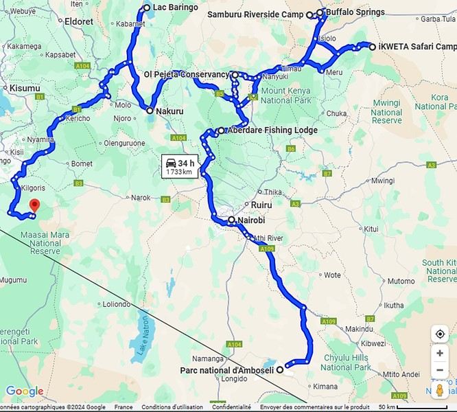
Ready to join us on safari to see some wild animals?
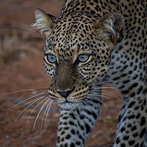
The two itineraries are almost identical (well, when you love something...) but we did make a few tweaks.
- The first part of the trip was with a local driver/guide, Félix, who was recommended by Sylvie56. Sylvie and her husband Ben are Kenya enthusiasts—they’ve been there countless times, always with Félix... and for good reason! He’s fantastic!
- The second part was with Melting Pot Safari, an agency that adapted to our photography needs. Tony Crocetta, the co-founder (along with his Kenyan friend Simon Chebon), is a wildlife photographer himself.
Here are the itineraries for both trips, including accommodations:
In 2021: Day 0: Paris / Nairobi - 67 Airport Hotel Day 1: Nairobi / Amboseli - Simba Cottage Day 2: Amboseli - Simba Cottage Day 3: Amboseli / Aberdares - Fishing Lodge Day 4: Aberdares - Fishing Lodge Day 5: Aberdares - Fishing Lodge Day 6: Aberdares / Samburu - Riverside Camp Day 7: Samburu - Riverside Camp Day 8: Samburu - Riverside Camp Day 9: Samburu / Nakuru - Merica Hotel Day 10: Nakuru / Baringo - Tumbili Cliff Lodge Day 11: Baringo - Tumbili Cliff Lodge Day 12: Baringo - Tumbili Cliff Lodge Day 13: Baringo / Maasai Mara – Meltingpot Bush Camp Day 14 to 18: Maasai Mara – Meltingpot Bush Camp Day 19: Maasai Mara / Nairobi – Roussel Guest House Day 20: Nairobi / Paris
In 2023: Day 0: Lyon / Paris / Nairobi - 67 Airport Hotel Day 1: Nairobi / Meru - Ikweta Camp Day 2: Meru - Ikweta Camp Day 3: Meru - Ikweta Camp Day 4: Meru / Samburu - Riverside Camp Day 5: Samburu – Riverside Camp Day 6: Samburu / Buffalo Springs – Samburu Simba Day 7: Buffalo Springs / Ol Pejeta – Sweetwater Camp Day 8: Ol Pejeta / Amboseli - Simba Cottage Day 9: Amboseli - Simba Cottage Day 10: Amboseli - Simba Cottage Day 11: Amboseli / Nakuru – Lake Nakuru Lodge Day 12: Nakuru / Baringo - Tumbili Cliff Lodge Day 13: Baringo - Tumbili Cliff Lodge Day 14: Baringo - Tumbili Cliff Lodge Day 15: Baringo / Maasai Mara – Meltingpot Bush Camp Day 16 to 20: Maasai Mara – Meltingpot Bush Camp Day 21: Maasai Mara / Nairobi / Paris
Here’s an itinerary—it’s not exactly what we did, but a combination of both.
Ready to join us on safari to see some wild animals?
A trip to Australia: Far North Queensland
Thursday, November 9, 2023
Cairns
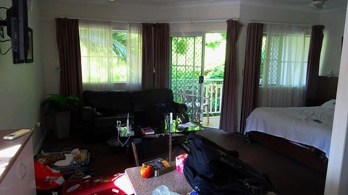
TV scriptwriters are a funny bunch. As soon as their ordinary mug starts becoming recognizable on the street thanks to success, their egos start swelling. They walk on clouds. So, one of the guys who worked on the script for our trip—the one who specifically came up with the bit about the SD card being ejected into the great beyond—has built himself a nice little reputation. The kind that can sometimes launch a real career. Then, inevitably, they just can’t stop. That’s how this guy had the poor idea of adding one last twist to the sequence that made him a one-day star. An idea that’s basically about squeezing the lemon until the very last drop, if you know what I mean. The little bag I take everywhere with my essentials—car keys, camera, phone—has also hosted a bunch of secondary items over time. Tissues, a book, city maps... whatever. It became a mess! So I finally decided to sort it out. I empty it onto a table. And there, stunned, I find the memory card that Dom and I desperately searched for on all fours on Cahill’s Crossing walkway, remember? Under the shocked gaze of a little Australian girl. It had ejected straight into my bag! What do you think? Should we fire the scriptwriter? It’s way too improbable! Stuff like that doesn’t happen in real life, right?
We head out to explore Cairns. The city is mostly about the waterfront, the Esplanade. You’ll find tons of bronze plaques there, most of them in memory of a deceased loved one. All you have to do is shell out a few hundred euros, and one day, a bewildered tourist will read your prose, charmed by your lovely turns of phrase. Vanity is a thriving business!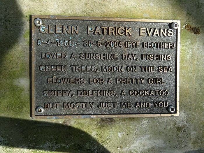
It makes for some reading... We spot our parakeets again... What were they called? Oh right, in abundance! Everywhere, banyan fig trees provide shade from a sun that never seems to tire. Parks... Here, kids are king.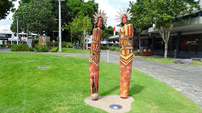 Luxury hotels with their infinity pools...
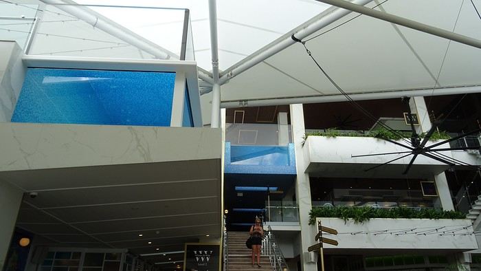
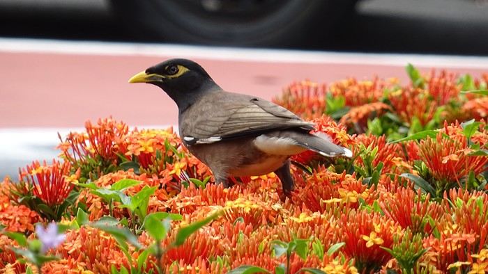 You don’t know where to look first... You’ve got to go all out. Google... Where can we rent bikes? When we finally track down the only operator in town, we find the place closed. A bit further on, a Visitor’s Center might find us an alternative? We meet a charming young guy, super dynamic and a great communicator. We leave without bikes but with a full snorkeling package for the day after tomorrow! I call the shop that let us down... Well done! The owner was at the doctor’s; he’s back now, and we can make a deal!
- Oh, Dominique, where are you off to like that, so proudly and at full speed? - Me? To the Botanic Garden, of course! It’s huge and free!
They’ve recycled oil tanks into art galleries!
TV scriptwriters are a funny bunch. As soon as their ordinary mug starts becoming recognizable on the street thanks to success, their egos start swelling. They walk on clouds. So, one of the guys who worked on the script for our trip—the one who specifically came up with the bit about the SD card being ejected into the great beyond—has built himself a nice little reputation. The kind that can sometimes launch a real career. Then, inevitably, they just can’t stop. That’s how this guy had the poor idea of adding one last twist to the sequence that made him a one-day star. An idea that’s basically about squeezing the lemon until the very last drop, if you know what I mean. The little bag I take everywhere with my essentials—car keys, camera, phone—has also hosted a bunch of secondary items over time. Tissues, a book, city maps... whatever. It became a mess! So I finally decided to sort it out. I empty it onto a table. And there, stunned, I find the memory card that Dom and I desperately searched for on all fours on Cahill’s Crossing walkway, remember? Under the shocked gaze of a little Australian girl. It had ejected straight into my bag! What do you think? Should we fire the scriptwriter? It’s way too improbable! Stuff like that doesn’t happen in real life, right?
We head out to explore Cairns. The city is mostly about the waterfront, the Esplanade. You’ll find tons of bronze plaques there, most of them in memory of a deceased loved one. All you have to do is shell out a few hundred euros, and one day, a bewildered tourist will read your prose, charmed by your lovely turns of phrase. Vanity is a thriving business!
It makes for some reading... We spot our parakeets again... What were they called? Oh right, in abundance! Everywhere, banyan fig trees provide shade from a sun that never seems to tire. Parks... Here, kids are king.
Luxury hotels with their infinity pools...
You don’t know where to look first... You’ve got to go all out. Google... Where can we rent bikes? When we finally track down the only operator in town, we find the place closed. A bit further on, a Visitor’s Center might find us an alternative? We meet a charming young guy, super dynamic and a great communicator. We leave without bikes but with a full snorkeling package for the day after tomorrow! I call the shop that let us down... Well done! The owner was at the doctor’s; he’s back now, and we can make a deal!
- Oh, Dominique, where are you off to like that, so proudly and at full speed? - Me? To the Botanic Garden, of course! It’s huge and free!
They’ve recycled oil tanks into art galleries!
A long journey around Australia
Sunday, October 1st, 2023
Mulhouse-London
We dumped our trash on our neighbors. We hugged, overflowing with emotion. Then Léa from Taxis S showed up. She knows us well. For ages, she’s been our driver. She was practically the official taxiwoman for the trips of the company where Dom and I met. She knew us when we were single! Almost teenagers! She knows everyone and fills in the biographies of people we’d forgotten.
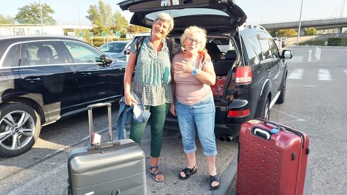 Across the street, while we loaded the luggage, S., perched in his window frame, waved a handkerchief. This wasn’t just any trip.
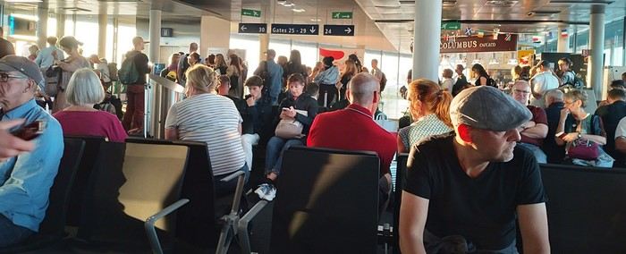 Then things got tricky. It’s funny how fate sinks its teeth into our happy moments—there’s this whole intermediate phase where the poison seeps in unnoticed because you’re still in the dark...
First, there was a delay on our flight to London. Dom immediately went on high alert, while I stayed calm. In my mind, we had two hours. I knew we had to go from Terminal 5 to Terminal 4, but two hours—come on, that’s plenty, right?
Then things got tricky. It’s funny how fate sinks its teeth into our happy moments—there’s this whole intermediate phase where the poison seeps in unnoticed because you’re still in the dark...
First, there was a delay on our flight to London. Dom immediately went on high alert, while I stayed calm. In my mind, we had two hours. I knew we had to go from Terminal 5 to Terminal 4, but two hours—come on, that’s plenty, right?
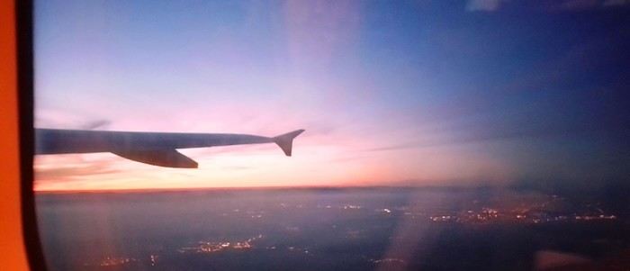
Bad calculation! Because those two hours were between the first flight’s landing and the second’s takeoff. But flights close at least half an hour before departure. Getting from one terminal to another means taking a shuttle bus. We waited for the one going to Terminal 4... until a young guy paid to direct people (who hadn’t seen us) informed us it was no longer possible to access Terminal 4 without going through Terminal 2 first for a connection! That really cranked up the pressure. We started installing a mental countdown with a programmed explosion at the end—guaranteed stress with added beads of sweat. The terminal bus was driven by a young Pakistani guy. We were *so* tense we bombarded him with our frantic, repetitive questions. “So? When are we getting there? What’s happening? Why aren’t we moving?” Our eyes were glued to our watches. The poor guy knew. Perfectly. Because it was obvious—no way around it. We weren’t going to make it. It was impossible. But Dom and I stubbornly refused to believe it. Then the kid stopped the bus. Me, hysterical: “What are you doing? What’s going on? Our plane takes off in... in... 4 minutes!!!! We’re gonna miss iiiiiit!” He wasn’t calm either. “You’ve already missed it!” He explained we had to cross a zone that required an escort car to clear a path through the runways. Impossible to do without. It’s forbidden. We had to WAIT (!!!). Then he got a radio call—he had to rush to Terminal 3 to pick up a passenger who was *super* tight on time. “Amir!!!! It’s RIGHT NOW!” they yelled in his already-red ears, thanks to the complaints of two hysterical Frenchies. Dom and I were in overdrive, hallucinating! We wanted to stop him, maybe even hit him to prevent him from turning around. He picked up the girl, whom we instantly hated like the most despicable witch. I turned on my data, searched for Malaysia Airlines’ number at Terminal 4, called, and actually got someone—quite a feat. A woman cut off my frantic rambling with a blunt “It’s over, the check-in is closed, the plane is about to take off.” I heard her but refused to accept it. I yelled, “We’re coming!” She shot back her monolithic “It’s over.” Finally at the doors of that damn Terminal 4, we ran—*really* ran—a marathon, Gate 6, security checks, pat-downs, “Take off your belts,” we asked questions, everyone seemed confident, we ran with one hand holding up our pants, the other clutching our belt, Gate 6—the room was empty. A girl was sitting there, calmly on the phone. We pounced on her. She calmed us down. Little by little, the light came back. Our brains rebooted. We finally understood it was over. We’d have to start crafting a new plan with the new reality. It started with a return to Terminal 5 to talk to British Airways, which took a good hour. With the same driver as before. We were alone with him. He took the time to apologize, to assure us it wasn’t his fault, that our problem had no solution, that nothing could’ve changed the outcome. At BA, we were exhausted. We were greeted by a handsome young man in a navy-blue uniform with gold stripes everywhere. We could’ve made a scene, but we were just relieved to find someone who’d take charge of our story. It was a minimal response, but it was *a* response. I suppose we could’ve demanded a business-class upgrade or a free trip, but we were just happy with a few vouchers for food, a hotel room with breakfast, and a little bag with plastic toys, a razor, toothbrush, hygiene products, and a T-shirt... Trinkets... But we were fine with it all—we said thank you eagerly because the essential was assured. He found us seats on flights tomorrow. *Tomorrow.* We were afraid to hope! We had the exact same flights but a day later. The same crappy times, but it was all good. We felt saved from the shipwreck, like survivors. - And what about the luggage? - .... !!!!
Monday, October 2nd, 2023 London - Kuala Lumpur
It wasn’t the Ritz, but with exhaustion on our side, we slept well. The continental breakfast was way better than we’d expected from an Ibis Budget. Still, it wasn’t enough to restore my joy for life. The course correction had turned into an arduous obstacle course. I scoured the car rental site every which way. Couldn’t reschedule the car. I’d done it before, but this time... Not to mention the laptop battery was complaining—the Brits have this quirk of making their power outlets incompatible with our chargers. Frustrated, I called them but ended up with a girl who declared herself incompetent and offered to have someone from Avis in Perth call me back—someone who’d supposedly handle rentals better. I decided to wait while taking a bath. Barely settled in, the phone rang. I was soaking wet, of course, and asked Dom to answer. Unfortunately, she’s known for disliking my phone, and in a clumsy move, she hung up. We got annoyed. She put dry towels on the edge of the bathtub, but—another false move—they fell in the water. The phone rang again... I completely redid the plans for the next two days, then transferred the files to my phone to consult them later offline. I plugged in my USB cable... *Plop!* The battery died abruptly—my PC shut down without any of the usual polite warnings! I looked around, hoping to find someone to strangle... Long story short, you can tell the day started under the worst omens. I was in a foul mood and spread my bad vibes to Dominique, who was initially in much better spirits... I called Mastercard, hoping to get a refund for the non-refundable night in Perth we’d already paid for. Same old song: “We’ll call you back”... Then... I’ll cut it short—buses, trains, lots of waiting... We rushed to reach the infamous Terminal 4.
We tried new options and convinced ourselves that a delayed departure flight is unrecoverable, no matter the scenario. We were furious that BA hadn’t bothered to tell us, leaving us to run around like rats in a burning house.
Tuesday, October 3rd, 2023 Kuala Lumpur-Perth
The flight was pretty nice. 13 hours, though. Dom and I were facing each other across the aisle. We could get up easily whenever we wanted without bothering anyone and chat when we felt like it. Besides, their chicken was amazing. They were kind enough to offer Dom a truly remarkable glass of rum. Good movies too, including the excellent *Prisoners* by Denis Villeneuve. At KL, during boarding, we developed a nagging worry about our luggage. We checked with some Malaysian Airlines staff. I sensed their hesitation. They made calls. Then changed their minds, giving us smiles and thumbs up...
Wednesday, October 4th, 2023 Perth
*Happy is the man who, like Ulysses, has had a fine voyage.* Well, for us, it wasn’t that. Finally arrived, we experienced the loneliness of tourists watching the baggage carousel spin, emptying of its precious containers one by one, until only a handful of travelers were left, staring at each other in disbelief. Without luggage, you’re kinda screwed. Not even a change of socks—our feet had been swimming in the same shoes for 3 days. No adapter, so no laptop. No toiletries. We could’ve cried! The lost luggage guy played his part. If you want compensation, fill out the disclaimer on the website made for that. And then, “Don’t worry, your luggage will arrive tomorrow!” “Don’t worry?!” From the start of the trip, we’ve been jerked around, fed lies. Tomorrow is the *absolute* last chance to get them back. Beyond that, we’d have to scramble a whole new trip. And lose a lot in the process! I have no idea how to go about it. Tomorrow... OMG... Tomorrow... We landed at 1 AM. Avis, the car rental place, opens at 6:30. Luckily, we found some decent breakfast. It cheered us up and gave us a second wind. Incorrigible, we started believing again! Well, then we just killed time. What else was there to do?

In front of Avis’s little shack, we were freezing. We’d been there since dawn. The girl who showed up, a Latina, immediately saw us as a nuisance who’d ruin her hopes of a peaceful start. Her face and tone were as unwelcoming as possible. You know us—it ended with hugs. She gave us a gorgeous, brand-new car! A hybrid with ultra-sophisticated features, all buttons you shouldn’t touch if you want to drive this thing without causing irreparable damage! We’re off! Driving on the left is easy at first. You think about it constantly. It’s counterintuitive, it takes effort. It’s later, when you get used to it and confidence sets in, that it becomes dangerous—old reflexes can send you into a wall. Anyway, the car and I immediately clicked.
In Perth, underground parking next to the hotel, friendly welcome—we ended up forgetting all the morning’s mishaps. Should we go sightseeing?
https://voyageforum.com/images/posts/small/1733767537-5Nwk6t3DsBZNOzf.jpg
Across the street, while we loaded the luggage, S., perched in his window frame, waved a handkerchief. This wasn’t just any trip.
Then things got tricky. It’s funny how fate sinks its teeth into our happy moments—there’s this whole intermediate phase where the poison seeps in unnoticed because you’re still in the dark...
First, there was a delay on our flight to London. Dom immediately went on high alert, while I stayed calm. In my mind, we had two hours. I knew we had to go from Terminal 5 to Terminal 4, but two hours—come on, that’s plenty, right?
Bad calculation! Because those two hours were between the first flight’s landing and the second’s takeoff. But flights close at least half an hour before departure. Getting from one terminal to another means taking a shuttle bus. We waited for the one going to Terminal 4... until a young guy paid to direct people (who hadn’t seen us) informed us it was no longer possible to access Terminal 4 without going through Terminal 2 first for a connection! That really cranked up the pressure. We started installing a mental countdown with a programmed explosion at the end—guaranteed stress with added beads of sweat. The terminal bus was driven by a young Pakistani guy. We were *so* tense we bombarded him with our frantic, repetitive questions. “So? When are we getting there? What’s happening? Why aren’t we moving?” Our eyes were glued to our watches. The poor guy knew. Perfectly. Because it was obvious—no way around it. We weren’t going to make it. It was impossible. But Dom and I stubbornly refused to believe it. Then the kid stopped the bus. Me, hysterical: “What are you doing? What’s going on? Our plane takes off in... in... 4 minutes!!!! We’re gonna miss iiiiiit!” He wasn’t calm either. “You’ve already missed it!” He explained we had to cross a zone that required an escort car to clear a path through the runways. Impossible to do without. It’s forbidden. We had to WAIT (!!!). Then he got a radio call—he had to rush to Terminal 3 to pick up a passenger who was *super* tight on time. “Amir!!!! It’s RIGHT NOW!” they yelled in his already-red ears, thanks to the complaints of two hysterical Frenchies. Dom and I were in overdrive, hallucinating! We wanted to stop him, maybe even hit him to prevent him from turning around. He picked up the girl, whom we instantly hated like the most despicable witch. I turned on my data, searched for Malaysia Airlines’ number at Terminal 4, called, and actually got someone—quite a feat. A woman cut off my frantic rambling with a blunt “It’s over, the check-in is closed, the plane is about to take off.” I heard her but refused to accept it. I yelled, “We’re coming!” She shot back her monolithic “It’s over.” Finally at the doors of that damn Terminal 4, we ran—*really* ran—a marathon, Gate 6, security checks, pat-downs, “Take off your belts,” we asked questions, everyone seemed confident, we ran with one hand holding up our pants, the other clutching our belt, Gate 6—the room was empty. A girl was sitting there, calmly on the phone. We pounced on her. She calmed us down. Little by little, the light came back. Our brains rebooted. We finally understood it was over. We’d have to start crafting a new plan with the new reality. It started with a return to Terminal 5 to talk to British Airways, which took a good hour. With the same driver as before. We were alone with him. He took the time to apologize, to assure us it wasn’t his fault, that our problem had no solution, that nothing could’ve changed the outcome. At BA, we were exhausted. We were greeted by a handsome young man in a navy-blue uniform with gold stripes everywhere. We could’ve made a scene, but we were just relieved to find someone who’d take charge of our story. It was a minimal response, but it was *a* response. I suppose we could’ve demanded a business-class upgrade or a free trip, but we were just happy with a few vouchers for food, a hotel room with breakfast, and a little bag with plastic toys, a razor, toothbrush, hygiene products, and a T-shirt... Trinkets... But we were fine with it all—we said thank you eagerly because the essential was assured. He found us seats on flights tomorrow. *Tomorrow.* We were afraid to hope! We had the exact same flights but a day later. The same crappy times, but it was all good. We felt saved from the shipwreck, like survivors. - And what about the luggage? - .... !!!!
Monday, October 2nd, 2023 London - Kuala Lumpur
It wasn’t the Ritz, but with exhaustion on our side, we slept well. The continental breakfast was way better than we’d expected from an Ibis Budget. Still, it wasn’t enough to restore my joy for life. The course correction had turned into an arduous obstacle course. I scoured the car rental site every which way. Couldn’t reschedule the car. I’d done it before, but this time... Not to mention the laptop battery was complaining—the Brits have this quirk of making their power outlets incompatible with our chargers. Frustrated, I called them but ended up with a girl who declared herself incompetent and offered to have someone from Avis in Perth call me back—someone who’d supposedly handle rentals better. I decided to wait while taking a bath. Barely settled in, the phone rang. I was soaking wet, of course, and asked Dom to answer. Unfortunately, she’s known for disliking my phone, and in a clumsy move, she hung up. We got annoyed. She put dry towels on the edge of the bathtub, but—another false move—they fell in the water. The phone rang again... I completely redid the plans for the next two days, then transferred the files to my phone to consult them later offline. I plugged in my USB cable... *Plop!* The battery died abruptly—my PC shut down without any of the usual polite warnings! I looked around, hoping to find someone to strangle... Long story short, you can tell the day started under the worst omens. I was in a foul mood and spread my bad vibes to Dominique, who was initially in much better spirits... I called Mastercard, hoping to get a refund for the non-refundable night in Perth we’d already paid for. Same old song: “We’ll call you back”... Then... I’ll cut it short—buses, trains, lots of waiting... We rushed to reach the infamous Terminal 4.
We tried new options and convinced ourselves that a delayed departure flight is unrecoverable, no matter the scenario. We were furious that BA hadn’t bothered to tell us, leaving us to run around like rats in a burning house.
Tuesday, October 3rd, 2023 Kuala Lumpur-Perth
The flight was pretty nice. 13 hours, though. Dom and I were facing each other across the aisle. We could get up easily whenever we wanted without bothering anyone and chat when we felt like it. Besides, their chicken was amazing. They were kind enough to offer Dom a truly remarkable glass of rum. Good movies too, including the excellent *Prisoners* by Denis Villeneuve. At KL, during boarding, we developed a nagging worry about our luggage. We checked with some Malaysian Airlines staff. I sensed their hesitation. They made calls. Then changed their minds, giving us smiles and thumbs up...
Wednesday, October 4th, 2023 Perth
*Happy is the man who, like Ulysses, has had a fine voyage.* Well, for us, it wasn’t that. Finally arrived, we experienced the loneliness of tourists watching the baggage carousel spin, emptying of its precious containers one by one, until only a handful of travelers were left, staring at each other in disbelief. Without luggage, you’re kinda screwed. Not even a change of socks—our feet had been swimming in the same shoes for 3 days. No adapter, so no laptop. No toiletries. We could’ve cried! The lost luggage guy played his part. If you want compensation, fill out the disclaimer on the website made for that. And then, “Don’t worry, your luggage will arrive tomorrow!” “Don’t worry?!” From the start of the trip, we’ve been jerked around, fed lies. Tomorrow is the *absolute* last chance to get them back. Beyond that, we’d have to scramble a whole new trip. And lose a lot in the process! I have no idea how to go about it. Tomorrow... OMG... Tomorrow... We landed at 1 AM. Avis, the car rental place, opens at 6:30. Luckily, we found some decent breakfast. It cheered us up and gave us a second wind. Incorrigible, we started believing again! Well, then we just killed time. What else was there to do?
In front of Avis’s little shack, we were freezing. We’d been there since dawn. The girl who showed up, a Latina, immediately saw us as a nuisance who’d ruin her hopes of a peaceful start. Her face and tone were as unwelcoming as possible. You know us—it ended with hugs. She gave us a gorgeous, brand-new car! A hybrid with ultra-sophisticated features, all buttons you shouldn’t touch if you want to drive this thing without causing irreparable damage! We’re off! Driving on the left is easy at first. You think about it constantly. It’s counterintuitive, it takes effort. It’s later, when you get used to it and confidence sets in, that it becomes dangerous—old reflexes can send you into a wall. Anyway, the car and I immediately clicked.
In Perth, underground parking next to the hotel, friendly welcome—we ended up forgetting all the morning’s mishaps. Should we go sightseeing?
https://voyageforum.com/images/posts/small/1733767537-5Nwk6t3DsBZNOzf.jpg
Come discover Prince Edward Island
FOREWORD
In July 2018, we decided to go on a road trip to Prince Edward Island. We had four days off, so it was the perfect opportunity to set off on an adventure.
This time, I hadn’t had much time to prepare an itinerary. I’d only done a bit of research online to try and find tourist attractions that might interest us.
I should say that it wasn’t our first visit to the island, and since our stay was quite short, we decided to complete the island loop by making stops along the coast to admire the lighthouses, small fishing villages, beaches, and the stunning steep cliffs.
We also made a few stops at lookouts along the road and even went for a hike in Greenwich National Park.
Our trip was more of an escape into nature. When we travel, we feel best when we’re far from the noise and crowds.
So, I invite you to discover the fabulous landscapes of Prince Edward Island.
To get there, we had to cover nearly 1,000 km. It took us a full day, and we had to cross parts of Quebec and New Brunswick.
The roads are beautiful. However, there isn’t much to see except the vast forests lining the highways.
The Confederation Bridge, which is 12.9 kilometers long, connects New Brunswick to Prince Edward Island.
There’s no fee to enter the island when you cross this bridge. However, a toll must be paid when leaving the island.
https://www.confederationbridge.com/fr/tolls-fees
https://youtu.be/UWhn5bqLONU
In July 2018, we decided to go on a road trip to Prince Edward Island. We had four days off, so it was the perfect opportunity to set off on an adventure.
This time, I hadn’t had much time to prepare an itinerary. I’d only done a bit of research online to try and find tourist attractions that might interest us.
I should say that it wasn’t our first visit to the island, and since our stay was quite short, we decided to complete the island loop by making stops along the coast to admire the lighthouses, small fishing villages, beaches, and the stunning steep cliffs.
We also made a few stops at lookouts along the road and even went for a hike in Greenwich National Park.
Our trip was more of an escape into nature. When we travel, we feel best when we’re far from the noise and crowds.
So, I invite you to discover the fabulous landscapes of Prince Edward Island.
To get there, we had to cover nearly 1,000 km. It took us a full day, and we had to cross parts of Quebec and New Brunswick.
The roads are beautiful. However, there isn’t much to see except the vast forests lining the highways.
The Confederation Bridge, which is 12.9 kilometers long, connects New Brunswick to Prince Edward Island.
There’s no fee to enter the island when you cross this bridge. However, a toll must be paid when leaving the island.
https://www.confederationbridge.com/fr/tolls-fees
https://youtu.be/UWhn5bqLONU
Pèlerinage de Shikoku: préparons le voyage ensemble? English translation pending
Bonjour à toutes et tous!!!
Je m'appelle Benjamin, j'ai 39 ans. Gros enthousiaste du Japon, j'ai eu la chance de pouvoir y aller (Honshû plusieurs fois et Kyûshû l'été dernier).
Depuis quelques années, j'ai le projet de faire le pèlerinage de Shikoku, idéalement d'ici à 5 ans. Ces choses se préparent, ne serait ce que financièrement et je me disais que c'est toujours plus fun et plus enrichissant de préparer un voyage d'envergure avec d'autres personnes dans mon cas. D'où ce message. Si vous avez envie d'échanger parce que vous êtes aussi dans cette optique, je serais ravi que l'on fasse de ce fil un endroit de partage, de conseils, d'échange de bonnes idées ou de doutes aussi :)
Il y a énormément de choses à penser en même temps (Voyage, logement, équipement (rando+pélerinage)), je commence à peine un budget sur excel par catégories. J'avais aussi acheté le guide 88 shikoku (https://www.amazon.fr/Shikoku-Japan-Route-Guide-4th/dp/4829710586) qui a l'air plus qu'indispensable.
Je suis hyper motivé à entreprendre un projet aussi riche, car tout reste à faire. Pour information, je pense a priori faire ce pèlerinage à pied mais sans camper.
N'hésitez pas à laisser un petit mot, et au plaisir de partager ce projet qui me tient beaucoup à coeur.
Benjamin
Je m'appelle Benjamin, j'ai 39 ans. Gros enthousiaste du Japon, j'ai eu la chance de pouvoir y aller (Honshû plusieurs fois et Kyûshû l'été dernier).
Depuis quelques années, j'ai le projet de faire le pèlerinage de Shikoku, idéalement d'ici à 5 ans. Ces choses se préparent, ne serait ce que financièrement et je me disais que c'est toujours plus fun et plus enrichissant de préparer un voyage d'envergure avec d'autres personnes dans mon cas. D'où ce message. Si vous avez envie d'échanger parce que vous êtes aussi dans cette optique, je serais ravi que l'on fasse de ce fil un endroit de partage, de conseils, d'échange de bonnes idées ou de doutes aussi :)
Il y a énormément de choses à penser en même temps (Voyage, logement, équipement (rando+pélerinage)), je commence à peine un budget sur excel par catégories. J'avais aussi acheté le guide 88 shikoku (https://www.amazon.fr/Shikoku-Japan-Route-Guide-4th/dp/4829710586) qui a l'air plus qu'indispensable.
Je suis hyper motivé à entreprendre un projet aussi riche, car tout reste à faire. Pour information, je pense a priori faire ce pèlerinage à pied mais sans camper.
N'hésitez pas à laisser un petit mot, et au plaisir de partager ce projet qui me tient beaucoup à coeur.
Benjamin
Mais où qu'il est ce truc là (4) English translation pending
Afrique du Sud 2019: retour en terres africaines et premier road-trip en famille English translation pending
Heureux de retrouver le forum d’Afrique australe pour me replonger dans notre voyage de l’été dernier et le partager avec vous.
Bien que ce fut déjà mon 4ème voyage en Afrique du Sud celui-ci eut, dès la préparation, une saveur toute particulière puisque ça allait être notre premier voyage en famille depuis une éternité, et cette fois-ci les rôles étaient inversés puisque c’est moi qui allais faire découvrir à mes parents ma destination de cœur, l’Afrique. 🙂
La concordance des temps dans cette dernière phrase m’a achevé… Ce carnet s’annonce compliqué. 😄
C’est un voyage que nous avons donc réalisé à 5, mes parents, mes 2 jeunes frères et moi-même. Ma sœur n’ayant pas pu se joindre à nous et Alison, ma copine, ayant gardé ses congés pour notre voyage de Septembre en Tanzanie.
C’est un rêve qui, enfin, se réalisait puisque cela faisait plusieurs années que j’essayais d’organiser quelque chose en famille et c’est en rentrant d’Alaksa en Aout 2018 que mes parents se sont motivés pour visiter l’Afrique du Sud. J’ai donc eu quasiment 1an pour préparer ce magnifique voyage en parallèle de celui en Tanzanie avec Alison.
Le circuit se voulait tant classique que magnifique. 24 jours à travers l’Afrique du Sud, à mes yeux le plus beau pays du monde, de Joburg à Capetown.
J0 (06/07/19) : Paris -> Madrid -> Johannesburg J1 (07/07/19) : OR Tambo Int Airport -> Forever Blyde Canyon J2 (08/07/19) : Blyde River Canyon J3 (09/07/19) : Forever Blyde Canyon –> Kruger National Park J4 (10/07/19) : Kruger National Park J5 (11/07/19) : Kruger National Park J6 (12/07/19) : Kruger National Park J7 (13/07/19) : Kruger National Park J8 (14/07/19) : Kruger National Park -> Santa Lucia J9 (15/07/19) : Isimangaliso wetland Park J10 (16/07/19) : Hluhluwe-iMfolozi J11 (17/07/19) : Hluhluwe-iMfolozi J12 (18/07/19) : Hluhluwe-iMfolozi -> Golden Gate NP J13 (19/07/19) : Golden Gate NP J14 (20/07/19) : Golden Gate NP -> Mountain Zebra NP J15 (21/07/19) : Mountain Zebra NP J16 (22/07/19) : Mountain Zebra NP J17 (23/07/19) : Mountain Zebra NP ->Cambedoo NP J18 (24/07/19) : Cambedoo NP -> Addo Elephant NP J19 (25/07/19) : Addo Elephant NP -> De Hoop NR J20 (26/07/19) : De Hoop NR J21 (27/07/19) : De Hoop NR - Capetown J22 (28/07/19) : Capetown J23 (29/07/19) : Capetown J24 (30/07/19) : Capetown - Johannesburg J25 (31/07/19) : Soweto – Départ
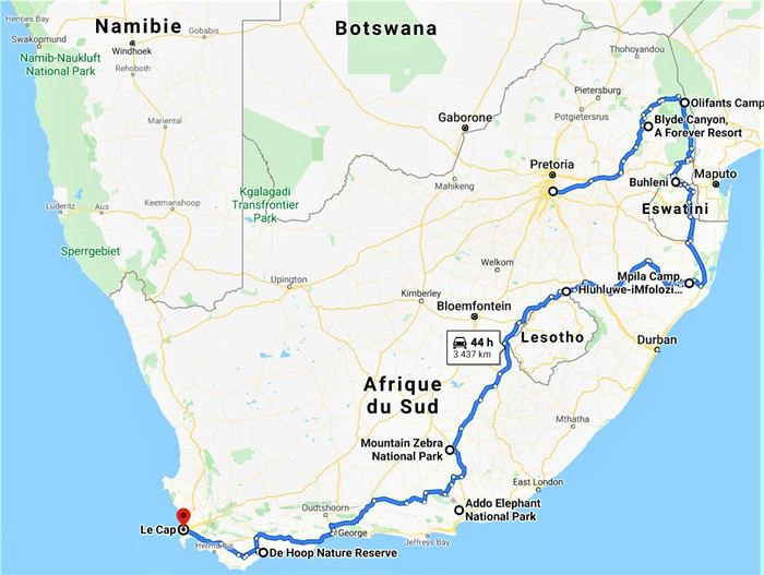
Étant 5 grands gabarits la question du véhicule était délicate puisque c’est dans ce véhicule que nous allions passer le plus de temps, en safari ou sur la route. Nous avons finalement opté pour la location d’un Hyundai H1 chez Budget, option la plus économique et la plus confortable avec 7 places et une plus haute garde au sol pour mieux voir les animaux et le paysage.
Après 11 mois d’attente, début des vacances scolaires et départ de Guadeloupe le vendredi 5 Juillet, pour mes parents et mes frères que je rejoindrai sur Paris le lendemain avant de décoller pour Madrid puis Joburg, tous ensemble, le samedi 6 au soir.
See you in the bush ! (Bilan conseils et budget en fin de carnet.)
Bien que ce fut déjà mon 4ème voyage en Afrique du Sud celui-ci eut, dès la préparation, une saveur toute particulière puisque ça allait être notre premier voyage en famille depuis une éternité, et cette fois-ci les rôles étaient inversés puisque c’est moi qui allais faire découvrir à mes parents ma destination de cœur, l’Afrique. 🙂
La concordance des temps dans cette dernière phrase m’a achevé… Ce carnet s’annonce compliqué. 😄
C’est un voyage que nous avons donc réalisé à 5, mes parents, mes 2 jeunes frères et moi-même. Ma sœur n’ayant pas pu se joindre à nous et Alison, ma copine, ayant gardé ses congés pour notre voyage de Septembre en Tanzanie.
C’est un rêve qui, enfin, se réalisait puisque cela faisait plusieurs années que j’essayais d’organiser quelque chose en famille et c’est en rentrant d’Alaksa en Aout 2018 que mes parents se sont motivés pour visiter l’Afrique du Sud. J’ai donc eu quasiment 1an pour préparer ce magnifique voyage en parallèle de celui en Tanzanie avec Alison.
Le circuit se voulait tant classique que magnifique. 24 jours à travers l’Afrique du Sud, à mes yeux le plus beau pays du monde, de Joburg à Capetown.
J0 (06/07/19) : Paris -> Madrid -> Johannesburg J1 (07/07/19) : OR Tambo Int Airport -> Forever Blyde Canyon J2 (08/07/19) : Blyde River Canyon J3 (09/07/19) : Forever Blyde Canyon –> Kruger National Park J4 (10/07/19) : Kruger National Park J5 (11/07/19) : Kruger National Park J6 (12/07/19) : Kruger National Park J7 (13/07/19) : Kruger National Park J8 (14/07/19) : Kruger National Park -> Santa Lucia J9 (15/07/19) : Isimangaliso wetland Park J10 (16/07/19) : Hluhluwe-iMfolozi J11 (17/07/19) : Hluhluwe-iMfolozi J12 (18/07/19) : Hluhluwe-iMfolozi -> Golden Gate NP J13 (19/07/19) : Golden Gate NP J14 (20/07/19) : Golden Gate NP -> Mountain Zebra NP J15 (21/07/19) : Mountain Zebra NP J16 (22/07/19) : Mountain Zebra NP J17 (23/07/19) : Mountain Zebra NP ->Cambedoo NP J18 (24/07/19) : Cambedoo NP -> Addo Elephant NP J19 (25/07/19) : Addo Elephant NP -> De Hoop NR J20 (26/07/19) : De Hoop NR J21 (27/07/19) : De Hoop NR - Capetown J22 (28/07/19) : Capetown J23 (29/07/19) : Capetown J24 (30/07/19) : Capetown - Johannesburg J25 (31/07/19) : Soweto – Départ
Étant 5 grands gabarits la question du véhicule était délicate puisque c’est dans ce véhicule que nous allions passer le plus de temps, en safari ou sur la route. Nous avons finalement opté pour la location d’un Hyundai H1 chez Budget, option la plus économique et la plus confortable avec 7 places et une plus haute garde au sol pour mieux voir les animaux et le paysage.
Après 11 mois d’attente, début des vacances scolaires et départ de Guadeloupe le vendredi 5 Juillet, pour mes parents et mes frères que je rejoindrai sur Paris le lendemain avant de décoller pour Madrid puis Joburg, tous ensemble, le samedi 6 au soir.
See you in the bush ! (Bilan conseils et budget en fin de carnet.)
Voyage 5 mois et 3 semaines en Amérique du Sud English translation pending
Bonjour,
Il n'est jamais trop tard pour rendre compte de son voyage. Le confinement me laisse enfin du temps pour le faire.
Je suis parti le 17 août 2017 et je suis rentré le 7 février 2018. Entre temps, je suis allé en Argentine par cargo puis une fois sur ce continent, j'ai visité l'Uruguay, l'Argentine et le Chili.
Durant tout ce voyage, j'ai tenu un carnet journalier.
Je me propose de vous le livrer.
Cape Town and Kruger: 12 days in February with teens
Hi everyone,
I’d love to share a little travel journal from our 14-day/12-night road trip with our two teens (14 and 17) in February/March 2020. A huge thank you to all of you who helped me plan this trip to South Africa—your patience with my endless questions was amazing!
We left Lyon on Saturday, February 22 at 7:00 AM and arrived in Johannesburg at 10:00 PM after a short layover in Amsterdam. Flights cost 440 € per person (booked in October), with carry-on luggage. We added just one checked bag for the whole family (80 € round-trip with the free Flying Blue membership). Since we’d be moving around a lot, we packed light! In Lyon, we reserved parking at P5 in advance for 70 € for 14 days. The Air France/KLM flight was smooth. When we landed, we picked up our bags and had booked a night at the Aero Guest Lodge, just 5 minutes from the airport, with a free shuttle and breakfast. All you have to do is send a WhatsApp message when you arrive at the airport to let the shuttle driver know. The tricky part? Finding him in the terminal—he wasn’t holding a sign with the hotel’s name. 🤪 A South African called him for me since my English wasn’t great (and I had to get used to the accent 😛), and helped us spot the driver (who was actually less than 5 meters away!) with other guests. When we got to the hotel: all good, except we were 10 people in a van meant for 7. The room was spacious—one king-size bed and two single beds for the kids—with a simple but clean bathroom, a garden, pool, and breakfast (which we didn’t try). All for 65 €, so an awesome value!
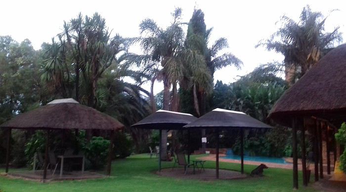 After a restful night, we woke up at 6:00 AM to catch the shuttle back to the airport. Just a heads-up: there’s only one shuttle per hour in the morning, and Kulula canceled our 9:00 AM flight, moving it to 8:00 AM—so no time for breakfast (it starts at 6:30).
We waited 15 minutes in the lovely garden for the driver, who dropped us off at the airport in 5 minutes.
We checked in for our flight to Cape Town, which cost around 40 € (including two checked bags per person).
We grabbed breakfast at the airport instead (less than 20 € for all four of us—one of the nice surprises of South Africa!), and arrived in Cape Town at 10:20 AM.
After a restful night, we woke up at 6:00 AM to catch the shuttle back to the airport. Just a heads-up: there’s only one shuttle per hour in the morning, and Kulula canceled our 9:00 AM flight, moving it to 8:00 AM—so no time for breakfast (it starts at 6:30).
We waited 15 minutes in the lovely garden for the driver, who dropped us off at the airport in 5 minutes.
We checked in for our flight to Cape Town, which cost around 40 € (including two checked bags per person).
We grabbed breakfast at the airport instead (less than 20 € for all four of us—one of the nice surprises of South Africa!), and arrived in Cape Town at 10:20 AM.
 After quickly picking up our bags, we headed to the Avis counter and left with a Toyota Corolla for 80 € for 4 days (rented with the Flying Blue card—free additional driver).
Everything’s on the left... not easy, but it works if you plan your route well.
We drove to our Airbnb in Constantia. We were surprised to see animals, bikes, and pedestrians on the highway!
We arrived around 11:30 AM at our rental—a huge house in the vineyards, in a super secure neighborhood, about 15-20 minutes from Hout Bay. It felt like Beverly Hills, but with super-high walls and barbed wire around the villas. 😕
After quickly picking up our bags, we headed to the Avis counter and left with a Toyota Corolla for 80 € for 4 days (rented with the Flying Blue card—free additional driver).
Everything’s on the left... not easy, but it works if you plan your route well.
We drove to our Airbnb in Constantia. We were surprised to see animals, bikes, and pedestrians on the highway!
We arrived around 11:30 AM at our rental—a huge house in the vineyards, in a super secure neighborhood, about 15-20 minutes from Hout Bay. It felt like Beverly Hills, but with super-high walls and barbed wire around the villas. 😕

We dropped off our bags, changed into shorts (it was around 30°C/86°F), and headed to the Bay Harbour Market in Hout Bay. We had lunch there—such a great vibe! We wandered through the stalls, everyone picked their own dish, and we sat down on the terrace. There was music, artisans of all kinds... a really nice moment.

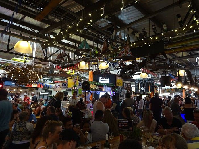
I’d withdrawn 50 € before leaving... and that gave me change to pay the parking attendant. Lunch cost around 30 € for four, including food and drinks.

After browsing the artisan stalls, we headed to Hout Bay Beach near the restaurant, Marina Wharf (another small tip for the parking attendant—we’d have to get used to that!). We stopped to admire the sea lions. An ice cream for 1 €? No way we were saying no! 🙂
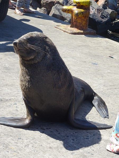
The fatigue was starting to hit, so we headed to the grocery store 10 minutes away (Constantia shopping center) and then had an aperitif in front of the vineyards, opening a delicious bottle of white wine.
I’d love to share a little travel journal from our 14-day/12-night road trip with our two teens (14 and 17) in February/March 2020. A huge thank you to all of you who helped me plan this trip to South Africa—your patience with my endless questions was amazing!
We left Lyon on Saturday, February 22 at 7:00 AM and arrived in Johannesburg at 10:00 PM after a short layover in Amsterdam. Flights cost 440 € per person (booked in October), with carry-on luggage. We added just one checked bag for the whole family (80 € round-trip with the free Flying Blue membership). Since we’d be moving around a lot, we packed light! In Lyon, we reserved parking at P5 in advance for 70 € for 14 days. The Air France/KLM flight was smooth. When we landed, we picked up our bags and had booked a night at the Aero Guest Lodge, just 5 minutes from the airport, with a free shuttle and breakfast. All you have to do is send a WhatsApp message when you arrive at the airport to let the shuttle driver know. The tricky part? Finding him in the terminal—he wasn’t holding a sign with the hotel’s name. 🤪 A South African called him for me since my English wasn’t great (and I had to get used to the accent 😛), and helped us spot the driver (who was actually less than 5 meters away!) with other guests. When we got to the hotel: all good, except we were 10 people in a van meant for 7. The room was spacious—one king-size bed and two single beds for the kids—with a simple but clean bathroom, a garden, pool, and breakfast (which we didn’t try). All for 65 €, so an awesome value!
After a restful night, we woke up at 6:00 AM to catch the shuttle back to the airport. Just a heads-up: there’s only one shuttle per hour in the morning, and Kulula canceled our 9:00 AM flight, moving it to 8:00 AM—so no time for breakfast (it starts at 6:30).
We waited 15 minutes in the lovely garden for the driver, who dropped us off at the airport in 5 minutes.
We checked in for our flight to Cape Town, which cost around 40 € (including two checked bags per person).
We grabbed breakfast at the airport instead (less than 20 € for all four of us—one of the nice surprises of South Africa!), and arrived in Cape Town at 10:20 AM.
After quickly picking up our bags, we headed to the Avis counter and left with a Toyota Corolla for 80 € for 4 days (rented with the Flying Blue card—free additional driver).
Everything’s on the left... not easy, but it works if you plan your route well.
We drove to our Airbnb in Constantia. We were surprised to see animals, bikes, and pedestrians on the highway!
We arrived around 11:30 AM at our rental—a huge house in the vineyards, in a super secure neighborhood, about 15-20 minutes from Hout Bay. It felt like Beverly Hills, but with super-high walls and barbed wire around the villas. 😕We dropped off our bags, changed into shorts (it was around 30°C/86°F), and headed to the Bay Harbour Market in Hout Bay. We had lunch there—such a great vibe! We wandered through the stalls, everyone picked their own dish, and we sat down on the terrace. There was music, artisans of all kinds... a really nice moment.
I’d withdrawn 50 € before leaving... and that gave me change to pay the parking attendant. Lunch cost around 30 € for four, including food and drinks.
After browsing the artisan stalls, we headed to Hout Bay Beach near the restaurant, Marina Wharf (another small tip for the parking attendant—we’d have to get used to that!). We stopped to admire the sea lions. An ice cream for 1 €? No way we were saying no! 🙂
The fatigue was starting to hit, so we headed to the grocery store 10 minutes away (Constantia shopping center) and then had an aperitif in front of the vineyards, opening a delicious bottle of white wine.
Compte rendu Cuba 2020 English translation pending
🙂
En ces temps difficiles, rien que une bonne lecture évasive à la maison CUBA 2020
>>>14 jours >>>5 villes coloniale >>>1500 kms en Ford 195 >>>4 sites UNESCO >>>8 casas particulares utilisées >>>beaucoup de langoustes
Références : Application MAPS.ME Page FB : Je pars à Cuba Page FB : Les français à Cuba Page FB : Cuba : conseils pour bien préparer son voyage www.cubanoscope.com www.jeparsacuba.com Carte Cuba 1.1000000 BORCH plastifiée Guide du Routard CUBA 2019
JOUR 1 : PARIS>>>LA HAVANE 10h de vol 25° (samedi 18/01/2020) Voilà c’est le départ tant attendu, direction l’aéroport d’Orly pour un vol direct à destination de la Havane, capitale de CUBA. Nous sommes à l’aéroport vers 08h00 pour un décollage à 10h00 sur la compagnie Air Caraïbes que nous testons pour la première fois. Nous sommes dans une boutique DutyFree, pour quelques achats, lorsqu’une annonce retentit et nous concerne. Notre vol est retardé de 2h30 ! Bon bin, il va falloir attendre, on finit nos achats, qui seront gardés à Orly, jusqu’à notre retour (pratique). Nous sommes en salle d’embarquement F21, on nous remet une attestation de retard de la part de la compagnie, et on nous sert un petit piquenique. La raison invoquée par Air Caraïbes, est qu’ils ont dû changer d’appareil, alors que depuis 08h00 que nous sommes là, en porte F21, il y a un avion Air Caraïbes qui est au stationnement, il y restera jusqu’à notre décollage qui sera effectif à 13h20, soit 3h20 de retard au décollage (ce changement d’appareil a-t-il eu lieu>>>mystère….).
J’ai eu le temps de prévenir 2 personnes à La Havane, de notre retard, une qui doit nous donner des réservations faites en ligne, et notre chauffeur Pavel, qui nous attend à l’aéroport. Les 10h30 de vol se passent très bien, on a trouvé les services à bord d’un bon niveau, équipage agréable et divertissements très variés. On se pose donc à 17h30 heure locale au lieu de 14h40. Il y a pas mal de monde aux guichets immigration, mais nous passons assez rapidement la douane munis de notre carte de tourisme (visa) en main, un tampon de plus dans le passeport et nous passons (notre assurance rapatriement ne nous a pas été demandée, mais elle est obligatoire). Nous n’avons pas de bagages en soute, alors nous nous dirigeons vers la sortie, tout en constatant qu’il faudrait un papier bleu rempli, que nous n’avons pas. Une personne récupère ce papier, un papier pour une famille, un peu perdus, on suit un peu tout le monde, la personne est un peu submergée, et nous passons avec d’autres personnes.
Un fois sortis, nous repérons facilement Pavel (notre chauffeur privé pour 2 semaines) avec la pancarte à nos noms. Nous allons directement échanger en espagnol, et cela pour toute la durée du voyage. Voulant faire du change, je lui demande où cela est possible, et il y a un guichet à droite en sortant. Mais, il me propose de le faire avec lui, et au même taux, c’est parfait. Il m’expliquera que cela l’intéresse d’avoir des euros ou des dollars pour acheter des pièces de voitures au cas où, et qu’il paie cela dans une de ces deux monnaies.
FOCUS MONNAIE A CUBA : Bon à savoir, à Cuba il existe 2 monnaies en vigueur, un peso national (CUP) pour les cubains et un peso convertible (CUC) pour les touristes, ces 2 monnaies ne sont pas récupérables en dehors du territoire cubain, donc il faut arriver avec des espèces, attention une commission supplémentaire est prise en cas de change avec des dollars américains. Et avoir sa CB pour des retraits possibles en ville.
Et un des moments tant attendus arrive, nous découvrons notre voiture, une FORD 1953 Customline Sedan bleu, Pavel la tient de son père, et elle a été entièrement refaite. Et nous voici partis vers la ville, on voit déjà énormément de voitures américaines des années 50 et 60, il y en a partout en fait. La nuit tombe maintenant, puisque nous sommes arrivés en retard, et Pavel gentiment nous propose un tour de ville vers les spots illuminés de La Havane, on est vraiment dans le bain, le Capitolio, le théâtre national, nous remontons le Paseo del Prado, on en avait rêvé, on y est !!!
Pavel nous dépose ensuite à notre hébergement, nous sommes chez l’habitant (et cela durera 2 semaines). Nous sommes à la Casa Esperanza, chez Henri, français et Esperanza, cubaine sa femme. Il s’agit d’une maison de 1910 entièrement rénovée en 11 mois !
FOCUS HEBERGEMENT A CUBA : Cuba étant pendant longtemps un pays assez fermé, l’offre en hébergement touristique est restée faible et d’état, l’hôtellerie n’est pas dans le meilleur des états et n’est pas bien rénovée faute d’argent. Ainsi, face à la demande touristique grandissante, dès 1997, Fidel Castro a ainsi autorisé les particuliers à louer deux chambres maximum à des étrangers. En 2011, le régime a dû libéraliser cette location. Il est désormais légal de louer plus de deux chambres par logement voire même une maison entière. (Tarifs moyens 15 à 40 CUC par nuit, environ 13,50 à 36€). Il y a environ aujourd’hui à La Havane plus de 800 casa particular.
Nous laissons Pavel pour ce soir et nous le retrouverons lundi matin. Henri nous indique un petit itinéraire pour aller se restaurer. Notre hébergement est dans le quartier de la vieille Havane, pratique où tout peut se faire à pied. Nous allons donc partir à pied, il fait nuit, les cubains sont très souvent dehors et dans la rue, ce que nous remarquons de suite, c’est l’état déplorable, ou en ruine, de pas mal de maisons coloniales ou début XXème. A pied, on peut vraiment avoir l’impression d’être en insécurité, il fait nuit, on voit de tout, ruines, animaux et cubains, et en fait il n’en est rien du tout, c’est très sécuritaire malgré la vision que nous percevons. A 5mn, nous rejoignons la Plaza Vieja, superbe place coloniale rénovée aux façades authentiques, plusieurs restaurants, et surtout ce que nous rêvions aussi, on est samedi soir, la musique cubaine est là, dans les maisons ou dans la rue, on y est !!! On trouve un petit resto et notre premier mojito ! Retour à l’hébergement, il est 21h30, on commence à absorber le jetlag, bonne nuit.
>>>14 jours >>>5 villes coloniale >>>1500 kms en Ford 195 >>>4 sites UNESCO >>>8 casas particulares utilisées >>>beaucoup de langoustes
Références : Application MAPS.ME Page FB : Je pars à Cuba Page FB : Les français à Cuba Page FB : Cuba : conseils pour bien préparer son voyage www.cubanoscope.com www.jeparsacuba.com Carte Cuba 1.1000000 BORCH plastifiée Guide du Routard CUBA 2019
JOUR 1 : PARIS>>>LA HAVANE 10h de vol 25° (samedi 18/01/2020) Voilà c’est le départ tant attendu, direction l’aéroport d’Orly pour un vol direct à destination de la Havane, capitale de CUBA. Nous sommes à l’aéroport vers 08h00 pour un décollage à 10h00 sur la compagnie Air Caraïbes que nous testons pour la première fois. Nous sommes dans une boutique DutyFree, pour quelques achats, lorsqu’une annonce retentit et nous concerne. Notre vol est retardé de 2h30 ! Bon bin, il va falloir attendre, on finit nos achats, qui seront gardés à Orly, jusqu’à notre retour (pratique). Nous sommes en salle d’embarquement F21, on nous remet une attestation de retard de la part de la compagnie, et on nous sert un petit piquenique. La raison invoquée par Air Caraïbes, est qu’ils ont dû changer d’appareil, alors que depuis 08h00 que nous sommes là, en porte F21, il y a un avion Air Caraïbes qui est au stationnement, il y restera jusqu’à notre décollage qui sera effectif à 13h20, soit 3h20 de retard au décollage (ce changement d’appareil a-t-il eu lieu>>>mystère….).
J’ai eu le temps de prévenir 2 personnes à La Havane, de notre retard, une qui doit nous donner des réservations faites en ligne, et notre chauffeur Pavel, qui nous attend à l’aéroport. Les 10h30 de vol se passent très bien, on a trouvé les services à bord d’un bon niveau, équipage agréable et divertissements très variés. On se pose donc à 17h30 heure locale au lieu de 14h40. Il y a pas mal de monde aux guichets immigration, mais nous passons assez rapidement la douane munis de notre carte de tourisme (visa) en main, un tampon de plus dans le passeport et nous passons (notre assurance rapatriement ne nous a pas été demandée, mais elle est obligatoire). Nous n’avons pas de bagages en soute, alors nous nous dirigeons vers la sortie, tout en constatant qu’il faudrait un papier bleu rempli, que nous n’avons pas. Une personne récupère ce papier, un papier pour une famille, un peu perdus, on suit un peu tout le monde, la personne est un peu submergée, et nous passons avec d’autres personnes.
Un fois sortis, nous repérons facilement Pavel (notre chauffeur privé pour 2 semaines) avec la pancarte à nos noms. Nous allons directement échanger en espagnol, et cela pour toute la durée du voyage. Voulant faire du change, je lui demande où cela est possible, et il y a un guichet à droite en sortant. Mais, il me propose de le faire avec lui, et au même taux, c’est parfait. Il m’expliquera que cela l’intéresse d’avoir des euros ou des dollars pour acheter des pièces de voitures au cas où, et qu’il paie cela dans une de ces deux monnaies.
FOCUS MONNAIE A CUBA : Bon à savoir, à Cuba il existe 2 monnaies en vigueur, un peso national (CUP) pour les cubains et un peso convertible (CUC) pour les touristes, ces 2 monnaies ne sont pas récupérables en dehors du territoire cubain, donc il faut arriver avec des espèces, attention une commission supplémentaire est prise en cas de change avec des dollars américains. Et avoir sa CB pour des retraits possibles en ville.
Et un des moments tant attendus arrive, nous découvrons notre voiture, une FORD 1953 Customline Sedan bleu, Pavel la tient de son père, et elle a été entièrement refaite. Et nous voici partis vers la ville, on voit déjà énormément de voitures américaines des années 50 et 60, il y en a partout en fait. La nuit tombe maintenant, puisque nous sommes arrivés en retard, et Pavel gentiment nous propose un tour de ville vers les spots illuminés de La Havane, on est vraiment dans le bain, le Capitolio, le théâtre national, nous remontons le Paseo del Prado, on en avait rêvé, on y est !!!
Pavel nous dépose ensuite à notre hébergement, nous sommes chez l’habitant (et cela durera 2 semaines). Nous sommes à la Casa Esperanza, chez Henri, français et Esperanza, cubaine sa femme. Il s’agit d’une maison de 1910 entièrement rénovée en 11 mois !
FOCUS HEBERGEMENT A CUBA : Cuba étant pendant longtemps un pays assez fermé, l’offre en hébergement touristique est restée faible et d’état, l’hôtellerie n’est pas dans le meilleur des états et n’est pas bien rénovée faute d’argent. Ainsi, face à la demande touristique grandissante, dès 1997, Fidel Castro a ainsi autorisé les particuliers à louer deux chambres maximum à des étrangers. En 2011, le régime a dû libéraliser cette location. Il est désormais légal de louer plus de deux chambres par logement voire même une maison entière. (Tarifs moyens 15 à 40 CUC par nuit, environ 13,50 à 36€). Il y a environ aujourd’hui à La Havane plus de 800 casa particular.
Nous laissons Pavel pour ce soir et nous le retrouverons lundi matin. Henri nous indique un petit itinéraire pour aller se restaurer. Notre hébergement est dans le quartier de la vieille Havane, pratique où tout peut se faire à pied. Nous allons donc partir à pied, il fait nuit, les cubains sont très souvent dehors et dans la rue, ce que nous remarquons de suite, c’est l’état déplorable, ou en ruine, de pas mal de maisons coloniales ou début XXème. A pied, on peut vraiment avoir l’impression d’être en insécurité, il fait nuit, on voit de tout, ruines, animaux et cubains, et en fait il n’en est rien du tout, c’est très sécuritaire malgré la vision que nous percevons. A 5mn, nous rejoignons la Plaza Vieja, superbe place coloniale rénovée aux façades authentiques, plusieurs restaurants, et surtout ce que nous rêvions aussi, on est samedi soir, la musique cubaine est là, dans les maisons ou dans la rue, on y est !!! On trouve un petit resto et notre premier mojito ! Retour à l’hébergement, il est 21h30, on commence à absorber le jetlag, bonne nuit.
Itinéraire d'un mois dans le Colorado en été English translation pending
Bonsoir à tous !
Les vacances d'été sont encore loin mais voilà que je réfléchis déjà au voyage de l'été 2021... Ca serait une 1e fois dans "l'ouest US".
Pour nous présenter, nous sommes 4 (les parents + 2 enfants qui auront 12 et 7 ans) et nous voyageons en échange de maison depuis 11 ans.
Je sais que les road trip dans l'ouest sont la principale façon de découvrir afin de voir un max mais là, ça serait un peu différent. C'est pourquoi je voulais vous soumettre mon idée d'itinéraire en fonction des échanges que j'ai pu commencer à trouver. Au début j'étais partie sur plusieurs états mais les trajets et la contrainte des échanges m'ont fait me recentrer sur le Colorado principalement pour faire une boucle. Je n'ai pas encore super bien détaillé les trucs à faire (soyez indulgents !).
Le but du voyage est de prendre le temps de découvrir cet état, de profiter de ce qu'il a à faire, quelques petites balades à pied, d'en prendre aussi plein les yeux avec les jolies routes, de voir des rodéos, profiter de l'ambiance western...
5 jours soit à Evergreen, Louisville ou Boulder (rocky mountains, rodéo, Denver...) 5 jours à Glenwood Springs (sources chaudes, stations en montagne...) 5 jours à Moab (arches et canyonlands) 1 nuit à Monument Valley 5 nuits à Durango (train de silverton, mesa verde...) 1 nuit à Great Dunes 4 nuits à Manitou Springs
Qu'en dites-vous ? Y a t-il des choses qui vous ne semblent pas indispensables ? ou au contraire à faire absolument ? merci !
5 jours soit à Evergreen, Louisville ou Boulder (rocky mountains, rodéo, Denver...) 5 jours à Glenwood Springs (sources chaudes, stations en montagne...) 5 jours à Moab (arches et canyonlands) 1 nuit à Monument Valley 5 nuits à Durango (train de silverton, mesa verde...) 1 nuit à Great Dunes 4 nuits à Manitou Springs
Qu'en dites-vous ? Y a t-il des choses qui vous ne semblent pas indispensables ? ou au contraire à faire absolument ? merci !
La Namibie (et environs) des piafous English translation pending
Bonjour à tous,
Je n'avais pas encore partagé sur Voyage Forum un de nos safaris à orientation piafoulogique. (Piafoulogique, car beaucoup de nos safaris, comme beaucoup dans nos safaris, sont orientés vers la gent ailée, même si perso myself pour ma part je ne crache pas sur un lycaon ou un guépard ou...)
C'est donc avec un plaisir que j'espère vous faire partager que je vais vous montrer quelques-unes des photos d'oiseaux que nous avons faites en Namibie, ma blonde et moi. J'ai adopté une présentation par ordre alphabétique, une sorte de catalogue succinct des emplumés namibiens. Succinct car nous n'avons de photos (montrables ou à peu près) que de 139 espèces namibiennes (plus 24 au Botswana et Zimbabwe), même pas le quart de l'avifaune namibienne (687 espèces d'après Avibase). Et aussi 34 espèces de mammifères, dont il ne sera pas question ici (à 4 ou 5 photos près dans le pavé ci-dessous).

Amitiés à tous et bises aux autres
BL
PS : pour ceux qui seraient intéressés par des détails sur notre voyage, je les renvoie à notre carnet de voyage sur Wilipi. Nous avons voyagé "pépère" avec un guide-chauffeur (l'excellent Olivier), avec un circuit organisé (par Namvic) qui nous a conduits de Windhoek à Victoria Falls.
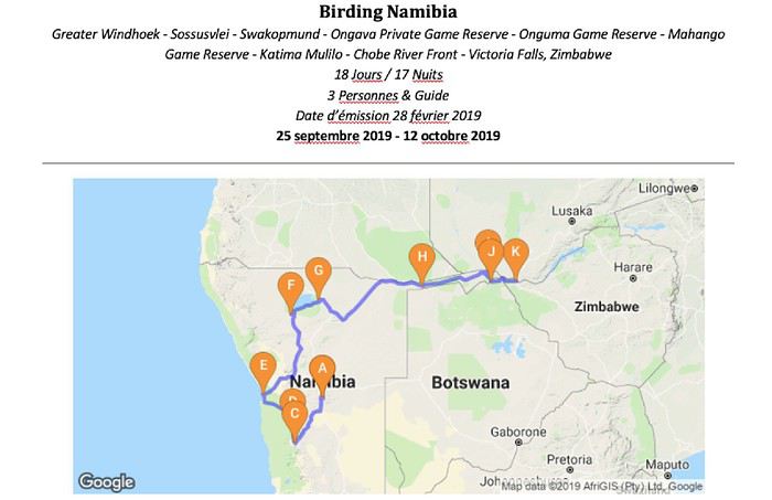
PS' : et pour ceux qui se demandent "mais pourquoi tant d'ailes", j'ai essayé de répondre à la question finalo-fondamentale "Et les piafous dans tout ça ?" dans une page de safari-tanzanie.net "Photographier des oiseaux en safari ... Pourquoi ? Où ? Lesquels ? Comment ?"
PS '' : et enfin d'enfin, l'index des espèces namibiennes (et assimilées) photographiées
Je n'avais pas encore partagé sur Voyage Forum un de nos safaris à orientation piafoulogique. (Piafoulogique, car beaucoup de nos safaris, comme beaucoup dans nos safaris, sont orientés vers la gent ailée, même si perso myself pour ma part je ne crache pas sur un lycaon ou un guépard ou...)
C'est donc avec un plaisir que j'espère vous faire partager que je vais vous montrer quelques-unes des photos d'oiseaux que nous avons faites en Namibie, ma blonde et moi. J'ai adopté une présentation par ordre alphabétique, une sorte de catalogue succinct des emplumés namibiens. Succinct car nous n'avons de photos (montrables ou à peu près) que de 139 espèces namibiennes (plus 24 au Botswana et Zimbabwe), même pas le quart de l'avifaune namibienne (687 espèces d'après Avibase). Et aussi 34 espèces de mammifères, dont il ne sera pas question ici (à 4 ou 5 photos près dans le pavé ci-dessous).
Amitiés à tous et bises aux autres
BL
PS : pour ceux qui seraient intéressés par des détails sur notre voyage, je les renvoie à notre carnet de voyage sur Wilipi. Nous avons voyagé "pépère" avec un guide-chauffeur (l'excellent Olivier), avec un circuit organisé (par Namvic) qui nous a conduits de Windhoek à Victoria Falls.
PS' : et pour ceux qui se demandent "mais pourquoi tant d'ailes", j'ai essayé de répondre à la question finalo-fondamentale "Et les piafous dans tout ça ?" dans une page de safari-tanzanie.net "Photographier des oiseaux en safari ... Pourquoi ? Où ? Lesquels ? Comment ?"
PS '' : et enfin d'enfin, l'index des espèces namibiennes (et assimilées) photographiées
Itinéraire 32 jours entre la Californie et l'état de Washington en campervan English translation pending
Bonjour à tous.
Ma femme et moi envisageons un séjour en campervan de 32 jours pleins (hors trajet avion) en juin au départ de San Francisco. On souhaite aller jusqu'à l'état de Wasington puis revenir à San Francisco en passant par l'Orégon. Nous aimons par dessus tout, la nature, la randonnée et la photo ! Notre itinéraire est en cours d'élaboration. Il est peu-être un peu trop ambitieux .... Etant au début de nos recherches, j'ai beaucoup de mal à me rendre compte du temps nécessaire à passer dans chaque lieu. Que pensez-vous de cet ébauche d'itinéraire ? Mérite-t-il d'être fait dans l'autre sens ? (eu égard à la neige en début de saison dans certains sites...)
J1 : SF J2-J5 : Yosemite NP (en espérant avoir le permis pour le Half Dome !) J6 : Bodie puis lac Tahoe J7 : Lac Tahoe J8-J9 : Lassen Valcanique NP J10-J11 : Crater Lake NP J12-J13 : Steens Mountains NP J14 : Newberry National Volcanic Monument J15 : Smith Rock State Park J16 : Painted Hills J17 : Jon Day Fossil Bads National Monument J18 : Hood river (scenic by way 30 direction Portland) J19-J20 : Mount Rainier NP J21-J25 : Olympic NP J26 : Cannon Beach J27 : Oregon Dunes National Recreation Area J28 : Crescent City J29-J30 : Red Wood Forest NP J31 : Humbolt Redwood State Park J32 : SF
Est-ce réalisable ? Que changeriez-vous ?
Merci d'avance 🙂
Ma femme et moi envisageons un séjour en campervan de 32 jours pleins (hors trajet avion) en juin au départ de San Francisco. On souhaite aller jusqu'à l'état de Wasington puis revenir à San Francisco en passant par l'Orégon. Nous aimons par dessus tout, la nature, la randonnée et la photo ! Notre itinéraire est en cours d'élaboration. Il est peu-être un peu trop ambitieux .... Etant au début de nos recherches, j'ai beaucoup de mal à me rendre compte du temps nécessaire à passer dans chaque lieu. Que pensez-vous de cet ébauche d'itinéraire ? Mérite-t-il d'être fait dans l'autre sens ? (eu égard à la neige en début de saison dans certains sites...)
J1 : SF J2-J5 : Yosemite NP (en espérant avoir le permis pour le Half Dome !) J6 : Bodie puis lac Tahoe J7 : Lac Tahoe J8-J9 : Lassen Valcanique NP J10-J11 : Crater Lake NP J12-J13 : Steens Mountains NP J14 : Newberry National Volcanic Monument J15 : Smith Rock State Park J16 : Painted Hills J17 : Jon Day Fossil Bads National Monument J18 : Hood river (scenic by way 30 direction Portland) J19-J20 : Mount Rainier NP J21-J25 : Olympic NP J26 : Cannon Beach J27 : Oregon Dunes National Recreation Area J28 : Crescent City J29-J30 : Red Wood Forest NP J31 : Humbolt Redwood State Park J32 : SF
Est-ce réalisable ? Que changeriez-vous ?
Merci d'avance 🙂
Traveling in South Africa: organized tour or DIY?
Hello,
I’m really interested in traveling to South Africa in September 2020. My question is whether I should go on an organized tour or plan my own itinerary. Organized trips are pretty expensive $$$$, but the security aspect reassures me. I’d love to hear your thoughts on safety in South Africa and whether it’s easy to arrange activities like visiting vineyards, Cape Town, and going on a safari on our own. Which is better in terms of cost—booking an organized trip or doing it ourselves? It’s definitely less exciting to follow a group for 10 days. We’re a couple in our 50s who love nature. 😊🦁
I’m really interested in traveling to South Africa in September 2020. My question is whether I should go on an organized tour or plan my own itinerary. Organized trips are pretty expensive $$$$, but the security aspect reassures me. I’d love to hear your thoughts on safety in South Africa and whether it’s easy to arrange activities like visiting vineyards, Cape Town, and going on a safari on our own. Which is better in terms of cost—booking an organized trip or doing it ourselves? It’s definitely less exciting to follow a group for 10 days. We’re a couple in our 50s who love nature. 😊🦁
Voyager sans connaître la destination? Nous voilà inscrits... English translation pending
Nous sommes à un mois de notre départ et nous ne connaissons pas la destination puisque c'est un voyage mystère que nous avons réservé par l'agence CAP MYSTERE....
Nous avons donc rempli un questionnaire assez détaillé sur notre type de voyage, nos envies , nos budget...
C'est donc un voyage lointain avec une destination au soleil alliant la faune et la flore et hors des sentiers battus.
Nous allons bientôt recevoir le premier indice.
Nous sommes méga surexcités et en ce qui me concerne (moins mon conjoint plus sage) , je ne cesse de chercher les vols possibles avec les éléments que j'ai....
Arghhhh c'est horriblement dure d'attendre.
Nous avons donc rempli un questionnaire assez détaillé sur notre type de voyage, nos envies , nos budget...
C'est donc un voyage lointain avec une destination au soleil alliant la faune et la flore et hors des sentiers battus.
Nous allons bientôt recevoir le premier indice.
Nous sommes méga surexcités et en ce qui me concerne (moins mon conjoint plus sage) , je ne cesse de chercher les vols possibles avec les éléments que j'ai....
Arghhhh c'est horriblement dure d'attendre.
Notre trip en Afrique du Sud, destination Le Cap English translation pending
Vendredi 28 nov, 7h, nous sommes réveillés depuis 1h. En attendant le breakfast de 8h, nous partons sur les hauteurs voir le phare et la côte sauvage, elle est magnifique, les vagues sont toutes argentées par les rayons de soleil. Il n'y a que les cris des oiseaux et le clapotis de l'eau.
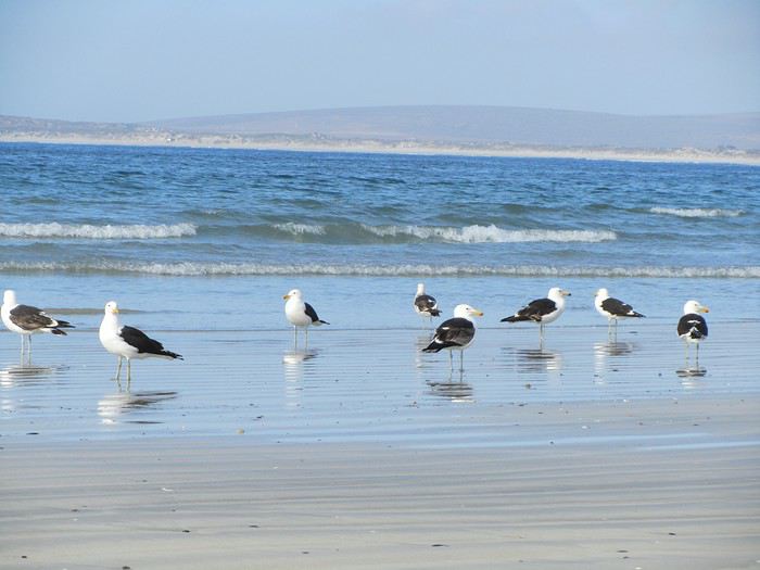 Nous avons découvert échouée sur le sable une famille de phoques , personne n'a su nous dire ce qui a causer leur mort et une énorme méduse au moins 30 cm de diamètre!
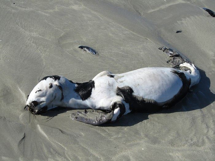


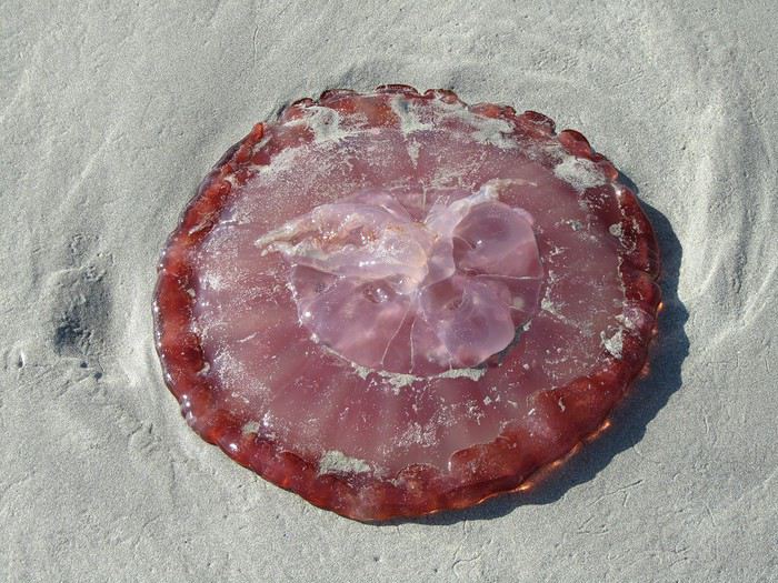
L'air marin a taquiné notre appétit, il fait bon être devant le petit déjeuner. Nous rencontrons un italien qui parle parfaitement le français, c'est un ami de la propriétaire, elle l'a appelé pour qu'il vienne nous faire la causette. Il est en Afrique du Sud depuis 40 ans, il connait bien Toulon, même au bout du monde, nous entendons parler de la France.
Nous les quittons à regrets, nous étions si bien dans ce petit village, mais il nous faut poursuivre notre balade vers Clanwilliam via Velddrif, Eland's Bay, la côte est splendide, pique -nique près de Lambert's Bay, royaume de la langouste, son port de pêche les exporte dans le monde entier; les amateurs de sensations fortes ne seront pas déçus par l'odeur qui y règne!
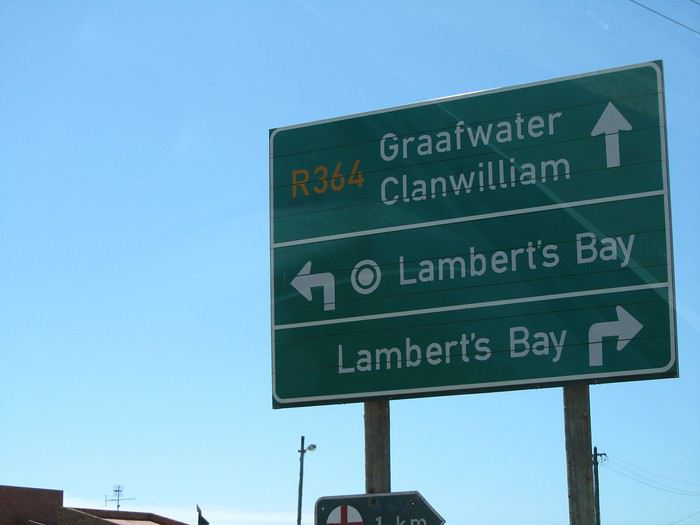
Nous atteignons Clanwillian , typique ambiance de ville d'Afrique. Pôle de la commercialisation du Rooibos, herbe rouge (ça ne se fume pas) le "thé" sud-africain par excellence, une plante locale dont la décoction, pauvre en tanin et exempte de caféine, est supposée avoir des vertus médicinales, est exportée dans le monde.
Tour de ville, recherche d'un B&B. Dans une rue calme et fleurie, bordée d'agréables maisons, nous remarquons "B&B ELEPHANT RIVER", c'est ici qu'il faut dormir!
Mais il n'y a personne pour nous recevoir, le portail est fermé et les chiens dans le fond du jardin aboient à qui mieux mieux. Au bout de 10 mn d'attente, un ouvrier jardinier qui passait nous fait signe de rester et reprend son chemin... Quelques minutes plus tard, la propriétaire arrive à notre grand étonnement, ce monsieur était allé la prévenir! Elle nous fait visiter les trois lodges et choisir celui qui nous convient. Tarif défiant tout concurrence 500 rands la nuit. Nous ne rencontrons que des personnes avenantes et sympathiques. Après un douche qui n'était pas superflue, tour du quartier et du centre ville à pied.
 nous rencontrons une manifestation pour le SIDA
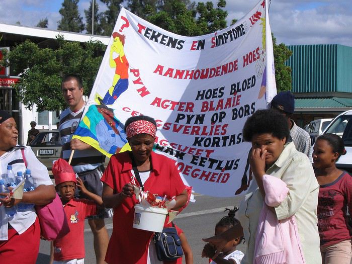
Tout près du lodge, nous avons repéré un resto accueillant et sympathique,
 encore une fois les steaks sont énormes 500gr, nous ne le cherchons pas sous les frites, c'est le contraire qui se produit
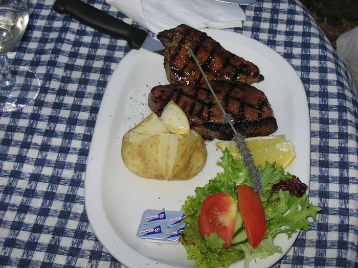 Il est 21h30, le sommeil se fait sentir, il est vrai que nous sommes debout depuis 6h du matin. J'oublie de vous dire que nous avons un lit à baldaquin!!

Demain, une bonne journée nous attend.
Nous avons découvert échouée sur le sable une famille de phoques , personne n'a su nous dire ce qui a causer leur mort et une énorme méduse au moins 30 cm de diamètre!
L'air marin a taquiné notre appétit, il fait bon être devant le petit déjeuner. Nous rencontrons un italien qui parle parfaitement le français, c'est un ami de la propriétaire, elle l'a appelé pour qu'il vienne nous faire la causette. Il est en Afrique du Sud depuis 40 ans, il connait bien Toulon, même au bout du monde, nous entendons parler de la France.
Nous les quittons à regrets, nous étions si bien dans ce petit village, mais il nous faut poursuivre notre balade vers Clanwilliam via Velddrif, Eland's Bay, la côte est splendide, pique -nique près de Lambert's Bay, royaume de la langouste, son port de pêche les exporte dans le monde entier; les amateurs de sensations fortes ne seront pas déçus par l'odeur qui y règne!
Nous atteignons Clanwillian , typique ambiance de ville d'Afrique. Pôle de la commercialisation du Rooibos, herbe rouge (ça ne se fume pas) le "thé" sud-africain par excellence, une plante locale dont la décoction, pauvre en tanin et exempte de caféine, est supposée avoir des vertus médicinales, est exportée dans le monde.
Tour de ville, recherche d'un B&B. Dans une rue calme et fleurie, bordée d'agréables maisons, nous remarquons "B&B ELEPHANT RIVER", c'est ici qu'il faut dormir!
Mais il n'y a personne pour nous recevoir, le portail est fermé et les chiens dans le fond du jardin aboient à qui mieux mieux. Au bout de 10 mn d'attente, un ouvrier jardinier qui passait nous fait signe de rester et reprend son chemin... Quelques minutes plus tard, la propriétaire arrive à notre grand étonnement, ce monsieur était allé la prévenir! Elle nous fait visiter les trois lodges et choisir celui qui nous convient. Tarif défiant tout concurrence 500 rands la nuit. Nous ne rencontrons que des personnes avenantes et sympathiques. Après un douche qui n'était pas superflue, tour du quartier et du centre ville à pied.
nous rencontrons une manifestation pour le SIDA
Tout près du lodge, nous avons repéré un resto accueillant et sympathique,
encore une fois les steaks sont énormes 500gr, nous ne le cherchons pas sous les frites, c'est le contraire qui se produit
Il est 21h30, le sommeil se fait sentir, il est vrai que nous sommes debout depuis 6h du matin. J'oublie de vous dire que nous avons un lit à baldaquin!!
Demain, une bonne journée nous attend.
Notre trip en Afrique du Sud, destination Le Cap English translation pending
Nous entamons notre troisième jour. Passage obligé à la banque, il faut se remplir les poches et les vider d'une partie pour la location. Pas simple de se faire comprendre, car nous ne parlons que très peu l'anglais. Le distributeur ne veut pas nous délivrer 3000 rands, mais à force de mots et de gestes, nous sommes parvenus au guichet à faire le retrait, sympa la fille (nous avons compris par la suite qu'il fallait faire 2 retraits de petites sommes) des petits tracas sans importance. C 'est parti pour la côte Ouest, le littoral est sauvage et magnifique. Les eaux froides de l'Atlantique 14° ne se prêtent pas à la baignade, mais le courant froid du Bengula offre des langoustes à profusion et d'excellents poissons.
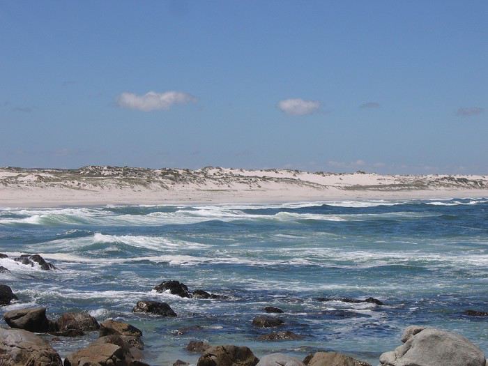
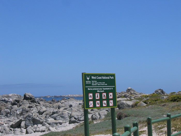 Nous pénétrons dans "West Coast National Park" 27600 hec. Le Namaqualand, jardin extraordinaire connaît en Afrique du Sud le même succès que l'arrivée du Beaujolais nouveau à Paris...
 Il mérite le nom de paradis floral: le sol aride, reconnaissant des quelques gouttes de pluie que lui accorde la nature uns fois par an, se couvre, d'un bout à l'autre de l'horizon, d'un tapis de fleurs aux couleurs éclatantes. Dommage, nous arrivons à la fin de cette merveilleuse transformation.
 La pureté du Lagon de Langebaan avec ses îlots accueillent chaque printemps des milliers d'oiseaux migrateurs. Nous pique-niquons face à cette beauté de la nature.
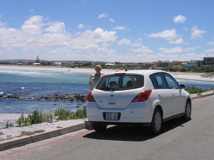 Il nous faut reprendre la route en direction de Vredenburg, où nous cherchons un concessionnaire Nissan, depuis la prise de la voiture, il y a un bruit à l'avant. Après un contrôle, il s'agit d'un élément sous le moteur a peine vissé! (erreur d'usine, la voiture est neuve, comme quoi, il ne faut pas se fier à l'aspect de la voiture). Nous avons eu un accueil remarquable, le mécano est allé avec mon mari tester la voiture pendant que l'on m'offrait thé et petits gâteaux. L a réparation a été faite gratuitement!! Pourboire de 300 rands, ça les valait bien.
 Enfin, nous découvrons au bout de 16km de route aride, à l'horizon, un halo blanc baigné de soleil "Paternoster" petit village de pêche typique avec ses maisons aux murs blanchis comme en Grèce, incroyable! Selon la légende, il occupe le site où des naufragés portugais récitèrent le Notre Père pour rendre grâce à leur survie.
 Comme nous avons coutume de le faire, un tour de village s'impose pour se donner une idée de l'ambiance, repérer les restaurants et les guest houses.
 Au bout du village en bord de plage, Baywatch B&B, nous fait un clin d’œil. Nous demandons à voir la chambre et là, c'est magnifique... d'un excellent niveau: 680 rands pour deux.
 Pieds dans le sable en sortant du B&B, "A little taste of heaven on earth"
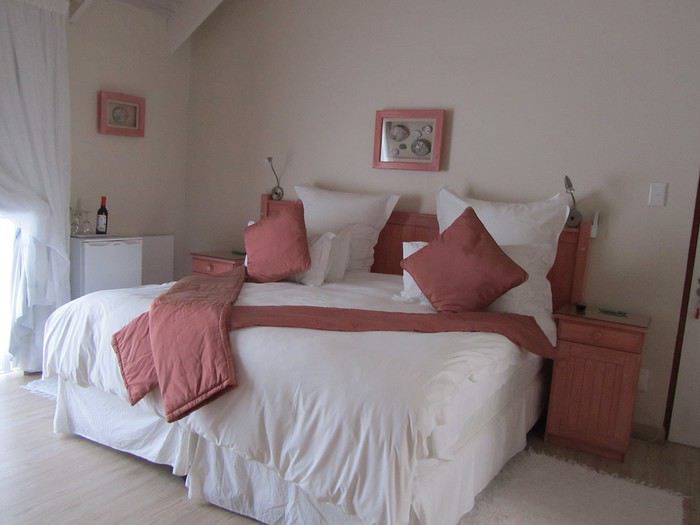 Nous demandons à voir la chambre et là, c'est magnifique... d'un excellent niveau: 680 rands pour deux.
 Nous sommes accueillis chaleureusement, je demande où trouver une cabine téléphonique, voilà qu'elle nous tend son cellulaire pour que nous appelions la France, ce que nous refusons, alors, elle nous propose Internet! C'est extraordinaire de rencontrer des personnes qui vous sont étrangères, qui ne parlent pas la même langue, qui sont accueillantes, super sympathiques et prêtent à tout pour vous faciliter la vie!
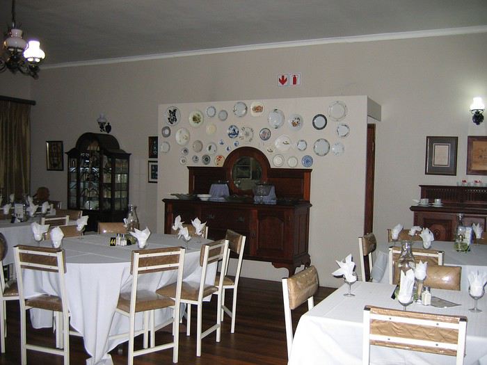 Sur ce, il est temps d'aller dîner, nous avons repéré un resto qui ne paie pas trop de mine, mais où le menu a l'air bien alléchant, quelle bonne idée nous avons eu de le choisir. L'intérieur est typiquement hollandais et le repas n'en parlons pas! des steaks de calamars de 500gr, délicieusement bons, un seul aurait suffit pour deux. Pour terminer, une glace que nous avons demandé très petite, nous avions vu la taille réelle, la serveuse n'en revenait pas! Cassé le ventre. Il ne nous reste plus qu'à se glisser sous les draps et à se laisser bercer par le bruit des vagues. GOOD NIGHT
Nous pénétrons dans "West Coast National Park" 27600 hec. Le Namaqualand, jardin extraordinaire connaît en Afrique du Sud le même succès que l'arrivée du Beaujolais nouveau à Paris...
Il mérite le nom de paradis floral: le sol aride, reconnaissant des quelques gouttes de pluie que lui accorde la nature uns fois par an, se couvre, d'un bout à l'autre de l'horizon, d'un tapis de fleurs aux couleurs éclatantes. Dommage, nous arrivons à la fin de cette merveilleuse transformation.
La pureté du Lagon de Langebaan avec ses îlots accueillent chaque printemps des milliers d'oiseaux migrateurs. Nous pique-niquons face à cette beauté de la nature.
Il nous faut reprendre la route en direction de Vredenburg, où nous cherchons un concessionnaire Nissan, depuis la prise de la voiture, il y a un bruit à l'avant. Après un contrôle, il s'agit d'un élément sous le moteur a peine vissé! (erreur d'usine, la voiture est neuve, comme quoi, il ne faut pas se fier à l'aspect de la voiture). Nous avons eu un accueil remarquable, le mécano est allé avec mon mari tester la voiture pendant que l'on m'offrait thé et petits gâteaux. L a réparation a été faite gratuitement!! Pourboire de 300 rands, ça les valait bien.
Enfin, nous découvrons au bout de 16km de route aride, à l'horizon, un halo blanc baigné de soleil "Paternoster" petit village de pêche typique avec ses maisons aux murs blanchis comme en Grèce, incroyable! Selon la légende, il occupe le site où des naufragés portugais récitèrent le Notre Père pour rendre grâce à leur survie.
Comme nous avons coutume de le faire, un tour de village s'impose pour se donner une idée de l'ambiance, repérer les restaurants et les guest houses.
Au bout du village en bord de plage, Baywatch B&B, nous fait un clin d’œil. Nous demandons à voir la chambre et là, c'est magnifique... d'un excellent niveau: 680 rands pour deux.
Pieds dans le sable en sortant du B&B, "A little taste of heaven on earth"
Nous demandons à voir la chambre et là, c'est magnifique... d'un excellent niveau: 680 rands pour deux.
Nous sommes accueillis chaleureusement, je demande où trouver une cabine téléphonique, voilà qu'elle nous tend son cellulaire pour que nous appelions la France, ce que nous refusons, alors, elle nous propose Internet! C'est extraordinaire de rencontrer des personnes qui vous sont étrangères, qui ne parlent pas la même langue, qui sont accueillantes, super sympathiques et prêtent à tout pour vous faciliter la vie!
Sur ce, il est temps d'aller dîner, nous avons repéré un resto qui ne paie pas trop de mine, mais où le menu a l'air bien alléchant, quelle bonne idée nous avons eu de le choisir. L'intérieur est typiquement hollandais et le repas n'en parlons pas! des steaks de calamars de 500gr, délicieusement bons, un seul aurait suffit pour deux. Pour terminer, une glace que nous avons demandé très petite, nous avions vu la taille réelle, la serveuse n'en revenait pas! Cassé le ventre. Il ne nous reste plus qu'à se glisser sous les draps et à se laisser bercer par le bruit des vagues. GOOD NIGHTRetour de 32 jours de road-trip entre Johannesburg et Le Cap English translation pending
Bonjour à tous. Nous sommes rentrés il y a quelques jours d’un road-trip de 32 jours en Afrique du Sud, entre Johannesburg et le Cap dont 6 jours passés au Kruger. Ci-dessous, en remerciement de ceux qui nous ont aidés pour la préparation du trip et pour ceux qui souhaiteraient faire la même chose, notre parcours et programme. Ce qui suit est notre expérience et notre vécu, ainsi que notre ressenti, rien d’autre je tiens à le préciser pour éviter tout débat qui n’aurait pas lieu d��être. C’est encore tout chaud, vous pouvez me poser des questions, j’y répondrai avec plaisir.
26 novembre : 20h30, on décolle de Nice pour Roissy Charles De Gaulle où nous attend, sous la pluie, le mérou, l’A380 d’Air France, que nous allons prendre pour rejoindre Johannesburg, première étape de notre trip en Afrique du Sud. Pont supérieur, sièges duo, j’ai puisé dans mon stock de miles pour que ce vol vers la nation arc en ciel se déroule au mieux. Un départ à 23h35 et une arrivée à 11h15 locales. Il n’y a qu’une heure (en plus) de décalage horaire entre Paris et Johannesburg. Un vol de plus de onze heures, mais un vol super agréable, l’appareil est quasiment vide de passagers, quelle que soit la classe, du moins sur le pont supérieur.
27 novembre : 11h15, nous nous posons à Tambo, l’aéroport de Johannesburg. Il nous faudra moins de 40 minutes pour quitter l’avion, passer les contrôles, récupérer nos bagages et rejoindre Seto, le chauffeur du taxi que nous avons commandé sur Booking.com pour 22 euros, qui nous attend, pancarte à la main, dans le hall des arrivées. Il n’est même pas 13 heures lorsque nous nous présentons à l’accueil du 12 Décades, notre hôtel du quartier Maboneng, réservé sur Booking.com pour trois nuits. Un hôtel original, construit dans un ancien entrepôt industriel. La chambre, un appartement studio, n’étant pas encore prête nous allons déjeuner au Pata-pata, restaurant qui jouxte l’hôtel. Balade ensuite dans le quartier de Maboneng, qui se résume à une rue de laquelle il ne faut pas sortir pour cause d’insécurité… Récupération de la chambre et après-midi / soirée à Maboneng. Dîner au Maverick Cover, et retour à la chambre pour notre première nuit en Afrique du Sud. Il n’est que 20 heures, mais les rues sont déjà vides et les restaurants ferment, même dans ce quartier touristique…
28 novembre : Première surprise, le jour commence à se lever dès quatre heures du matin… Le soleil, lui, finira de nous réveiller à six heures, en inondant de lumière l’appartement. Impossible de rester davantage au lit, on se lève tôt en Afrique. On décide de se préparer et d’aller petit-déjeuner au Pata-pata en bas de l’hôtel, il ouvre à peine, nous en profitons pour faire un tour du quartier à pied, explorant les rues déconseillées… Aucune mauvaise rencontre, mais nous constatons que la pauvreté est bien présente et que le quartier semble abandonné des pouvoirs publics. Au retour, nous nous arrêterons à l’hôtel pour backpackers « le Curiosity » où nous réserverons un tour de 4 heures, à vélo, de Soweto. 1320 rands pour deux avec déjeuner. 9 heures 30, le taxi, nous récupère au pied de l’hôtel et nous emmène au Lébos Soweto, en plein cœur du quartier du même nom. Un accueil agréable, un guide jeune et dynamique, issu de Soweto, et un petit groupe de dix participants dont deux français sympathiques, et nous voilà partis à pédaler sur les routes de l’un des plus grands et célèbres township Sud-Africains. Sportif, c’est sûr, surtout qu’il fait plus de trente degrés, que ça monte beaucoup et que les chemins ne sont pas toujours nets et goudronnés… Mais une superbe découverte de cet endroit historique, tragique, où nous serons accueillis par les sourires des femmes et des enfants, qui nous conduira jusque devant la maison de naissance de Nelson Mandela. Une visite que nous conseillons à tous ceux qui peuvent pédaler (également possibilité de ne faire que deux heures, ou à pied). 14 heures, le tour se terminera au Lébos Soweto où nous attend un délicieux repas. Taxi retour pour Maboneng, pour une douche et quelques heures de récupération et nous partons, en taxi, dîner au Local Grill à Parktown nord. Un resto donné pour être l’un des meilleurs restos de viande du pays. Un régal pour nous, on s’est fait plaisir. Retour et nuit au 12 Décades.
29 novembre : de nouveau réveillés tôt par le soleil et la chaleur, nous partons petit-déjeuner au Cinamon, une boulangerie de quartier, fréquentée par les locaux, qui se trouve dans une rue proche de Maboneng. Nous nous rendons ensuite en taxi à Constitution Hill où nous allons prendre un bus rouge City tour (15 euros par personne, ticket donnant lieu à des réductions sur les entrées de certains sites). Nous ferons le tour jusqu’au musée de l’Apartheid que nous souhaitons visiter. Un très beau musée qui vous prend aux tripes et duquel on ne ressort pas intact… Nous le conseillons fortement. Pour faire passer le tout, nous irons nous détendre au Gold Reef, parc à thèmes où nous visiterons une mine d’or à plus de 75 mètres sous terre (Vous pouvez ne prendre que le ticket pour la visite de la mine ou un combiné mine plus manèges). Un endroit très sympa, rempli d’enfants des écoles et de quelques (rares) touristes. Repas sur place avant de reprendre le bus rouge pour finir le tour. Nous en profiterons pour visiter Constitution Hill, notre dernier arrêt, avant de rentrer en Uber à Maboneng, un Uber que nous partagerons avec un couple, de New yorkais, rencontré sur place. Soirée à Melville au Hell’s Kitchen, un bar déjanté pour gens déjantés…Pour ceux qui veulent se faire plaisir et s’amuser à peu de frais dans une ambiance festive… Retour à Maboneng en taxi.
30 novembre : Lever tôt, nous retournons au Cinamon pour petit-déjeuner. Retour ensuite à l’hôtel pour fermer les sacs et prendre le taxi qui doit nous conduire à l’aéroport où nous allons récupérer notre voiture de location pour la suite du voyage jusqu’au Cap et dont la première étape sera Graskop. Surprise, la queue est longue au comptoir Budget pour récupérer notre véhicule. Pratiquement une heure pour obtenir les clefs. Mais une bonne surprise nous attend, nous serons surclassés, gratuitement, et la Toyota Corolla réservée se transformera en Suzuki Vitara, un SUV des plus agréables. Pour ceux que ça intéresse, la carte de débit visa sera acceptée sans aucun commentaire, et le permis international, refusé, seul le permis national comptait aux yeux de l’agent de traitement midi, nous prenons enfin la route pour Graskop via Sabie, non sans quelques errements autour de Johannesburg. Nous arriverons à Sabie à 16h00, où nous ferons quelques courses au Spar, puis à 17h30 à Graskop où nous descendrons au Cabine Log, nuit en chalet. Balade en ville et repas à l’hôtel de Graskop ou nous nous ferons arnaquer sur la note. Il nous faudra plusieurs minutes pour obtenir un remboursement sur notre carte bancaire… Vérifiez toujours l’addition, quel que soit votre état après le repas… Là, ils en ont profité et nous n’avons pas apprécié. Nuit au Log Cabines sletters.
01 décembre : 8h00, petit déjeuner à Graskop, plein du VL, et départ pour Le Blyde River canyon, avec un premier stop sur le site « God Window » qui ne se trouve qu’à 1400 mètres du Log Cabine Sletter, notre logement. Peu de monde, ciel bleu, nous monterons jusqu’à la Rain Forest, une jolie balade, pour observer le magnifique panorama. Départ ensuite pour le site des potholes de Blyde River, non sans multiplier les arrêts photos tout au long du trajet. Un site magnifique que celui des potholes, que nous avons beaucoup aimé là aussi, un peu de monde, mais sans plus (nous sommes dimanche). Nous déjeunerons léger sur place avant de reprendre la route pour le site des trois huttes, three Rondavels. Quelques arrêts photos plus tard, nous voici sur place. Peu de monde également, mais un soleil qui tape très fort (pensez aux protections pour la tête, et à la crème solaire). Superbe site que nous mitraillerons de mille façons sans être dérangés. 15 heures 30, il est temps de prendre la route pour Orpen Gate où nous allons faire notre entrée dans le Kruger pour les six prochains jours. Il nous faudra une heure trente pour arriver à Orpen Gate. 17 heures nous enregistrons pour Tamboti, notre camp du jour réservé sur le site San Park. Accueil pas vraiment agréable, mais rapide et efficace. Nous effectuons quelques achats à Orpen camps car nous avons réservé au Tamboti tended camp, où il n’y a rien. On en profite pour réserver une marche pour le lendemain matin, 4h30 puis nous entrons enfin dans le Kruger où sur les deux kilomètres qui sépare Orpen de Tamboti, nous apercevrons gnous, impalas, oiseaux inconnus (de nous) et, surtout, un groupe d’éléphants, au bord et au milieu du chemin premier frissons, premières photos, ça démarre fort… Nous récupérons notre tente, mi toile-mi dure, entièrement équipée au bord de la rivière asséchée où se trouve une bande de babouins joueurs. Le soleil, baisse, première bière sur la terrasse. Seuls au monde, ou presque, heureux d’être là … Nous ne veillerons pas longtemps, la journée a été bien remplie, la fatigue nous rattrape, d’autant plus que le réveil est programmée à quatre heure demain matin…
02 décembre : Réveil à 4 heures du mat pour la marche du matin dans le parc avec les rangers. Nous retrouvons à 4 heures 30, au point de rendez-vous, une jeune ranger qui sera notre chauffeur et notre accompagnatrice pendant la balade ainsi qu’un autre ranger qui nous rejoindra sur place. 20 minutes de route et nous voilà partis pour trois heures de marche dans l’aube naissante. Un autre couple nous accompagne. Nous ne verrons pas de grands animaux, si ce n’est des éléphants, au loin, et des girafes et impalas. L’intérêt de la balade réside plutôt dans le fait de se promener à pied, dans le parc. 8 heures, nous rentrons au camp où nous fermons nos sacs et reprenons la route, cette fois pour Satara. Sur le trajet, nous sillonnerons les routes et chemins du parc Kruger en multipliant les arrêts photos… Éléphants, girafes, zèbres, Impalas, buffles… On s’en donne à cœur joie et on se régale. Nous arriverons à Satara à 16 heures par 39 degrés... Satara, un camp immense, qui nous fera, un peu, regretter notre logement de la veille à Tamboti. Mais la climatisation va nous permettre de passer une bonne nuit et de récupérer…
03 décembre : 30 degrés à 8h00. Nous prenons un café au restaurant de Satara, faisons le plein du VL à la station du camp, et prenons la route pour Olifant, où nous allons passer la nuit. Deux heures et demie de trajet, où nous ne croiserons que six véhicules, en comptant les arrêts photos, pour relier les deux camps. Un super moment où nous verrons girafes, zèbres, éléphants, impalas, gnous, grands coudous… que du bonheur. Le parc est bien vert, il y a beaucoup de bébés partout. Midi, arrivée à Olifant et déjeuner sur la terrasse panoramique du restaurant, une vue incroyable sur la rivière et les hippopotames qui s’y prélassent. Nous sommes seuls. Peut-être à cause de la chaleur il fait 38 degrés… On récupère notre bungalow, face à la rivière et après une douche réparatrice, nous reprenons la piste pour rejoindre Letaba où nous ferons une pause « glaces » au magasin du camp. Peu d’animaux aperçus tout au long du trajet, à part hippos, et impalas, mais il fait 44 degrés à l’ombre… 16h, nous retournons sur Olifant par un circuit différent. Et là, les animaux sont de nouveau présents : éléphants, girafes, zèbres, phacochères, lycaons… 18h00, nous arrivons à Olifant où nous filons sur la terrasse du restaurant boire une bière en regardant le coucher de soleil sur la rivière Magnifique ! tout est dit. Nous terminerons la soirée au restaurant pour fêter l’anniversaire de Corinne, qui aura droit à une danse locale, du personnel, que j’avais informé, un sacré souvenir. Un vent violent, chaud, et soudain, obligera tout le monde à regagner l’intérieur du restaurant le temps que le personnel ferme les baies vitrées, tout s’envole, chaises, verres, une tempête de vent aussi soudaine qu’inattendue qui soufflera toute la nuit sur Olifant…
04 décembre : 8h00, petit déjeuner au restaurant panoramique du camp, mais les choses ont changé. Les nuages ont suivi le vent, le ciel est gris et la température à baissé, et de quelle manière ! De 44 degrés la veille à 17 heures, nous sommes tombés à 18, 17 même à 16 heures 30. L’hiver en été, tout le monde range shorts et tongs et ressort pantalons longs et polaires… Mais pas de quoi nous décourager nous prenons la route pour Satara où nous allons passer une nouvelle nuit avant de descendre vers le sud. Quatre heures de trajet, pauses photos comprises, où nous verrons de nouveau beaucoup d’animaux dont notre premier crocodile. Ni le temps gris, ni le froid, ni la bruine, ne parviendront à gâcher notre plaisir d’être là. Midi, nous déjeunons à Satara, récupérons notre chambre et repartons sillonner les pistes du secteur. Beaucoup d’animaux, là aussi, et même des lions, que nous verrons de loin, avec le zoom de l’appareil photo et les jumelles. Mais aussi nos premières autruches, un énorme phacochère, beaucoup d’éléphants et girafes, zèbres, +++. Nous retournerons à Satara pour 17 heures, étonnés du temps passé… Un peu de repos et repas au restaurant du camp, qui pour le coup, vue la fraîcheur, ressemble à un resto de haute montagne…
05 décembre : Petit déjeuner et départ à 8h30 pour Lover Sabie, notre camp pour la prochaine nuit, après avoir fait le plein. Le ciel est gris et la température à 19… Nous tombons immédiatement sur un groupe d’une centaine de babouins qui squattent la route, quelques photos et nous repartons de nouveau les animaux sont au rendez-vous, nous sommes surpris par le nombre d’éléphants, girafes, zèbres que l’on peut rencontrer. Nous roulons jusqu’à Tshokwane où nous faisons une halte et quelques achats et repartons pour Lower Sabie, où nous arriverons à 13h30. Déjeuner au restaurant avec vue panoramique sur la rivière. Il y a plus de monde qu’à Satara, plus d’enfants aussi, c’est moins intime qu’Olifant ou Tamboti. La pluie vient de faire son apparition et nous récupérons notre tente avec vue sur la rivière… Petite vue, entre deux arbres, il faut le dire. Les abords du logement ne sont pas très agréables, beaucoup moins qu’à Tamboti, l’ensemble est moins joli, moins soigné. Bref, pas vraiment un coup de cœur pour cette tente, qui est pourtant le logement le plus cher de notre séjour au Kruger, mais elle fera l’affaire pour une nuit. 15h00, la pluie s’est arrêtée, nous repartons en safari sur le secteur. Une balade dont nous reviendrons à 18h30 encore beaucoup d’animaux jusqu’au bord de la piste, et même trois jeunes hyènes, nous en rencontrerons une adulte plus tard. Les éléphants occupent les bords et milieu des pistes et nous obligent, plusieurs fois, à stopper. On nous signalera un léopard et des lions, mais nous n’aurons pas la chance de les apercevoir. Oiseaux, phacochères, crocodiles, hippopotames, et même une mangouste… notre tableau de chasse s’étoffe. Dîner au restaurant du camp et repos bien mérité. Le safari ça creuse et sa fatigue…
06 décembre : Petit déjeuner à Lower Sabie d’où nous observons les hippopotames dans la rivière, et départ pour Crocodile Bridge pour notre dernière journée et dernière nuit au Kruger. Nouvelle journée safari en espérant décrocher le Graal, et nous rapprocher du Big Five. Nous n’allons pas être déçus… Dès le départ, phacochères, mangoustes, singes, oiseaux et bien sûr éléphants, girafes, zèbres, impalas, +++, nous accompagnent, mais c’est aux abords de Crocodile Bridge que nous vibrerons vraiment en apercevant en même temps lions et rhinocéros… Un régal. Midi, nous nous enregistrons au camps et allons déjeuner en ville, car il n’y a pas de restaurant à Crocodile Bridge. Nous quittons donc le Kruger par la porte Crocodile bridge et revenons à 14 heures pour récupérer notre bungalow, superbe, avant de reprendre le safari jusqu’à 18 heures. Comme le matin, les animaux sont au rendez-vous, même deux lions qui dorment au milieu de la route… Soirée au bungalow, demain nous partons pour Kosi Bay en traversant le Swaziland. 6 nuits au Kruger nous auront permis d’explorer, un peu, le parc. Nous pensons que la durée idéale se situe à 5 jours où plus.
07 décembre : Bye-bye Kruger, départ à 7 heures pour Kosi Bay, via la traversée du Swaziland. Un parcours, sur Google Map, de 5h30 qui va rapidement se transformer en 7 puis en 9 heures de route, la faute à des travaux routiers au Swaziland qui nous obligeront à emprunter des routes en chantier, pistes de pierres et de poussière où les camions et les fous du volant font la loi. En quittant le Kruger, nous serons impressionnés par l’impressionnante file d’attente de camions et de voitures qui attendent de passer le poste frontière avec le Mozambique. Je dois dire ici, que nous avons failli faire la queue nous aussi, pour rien, mais que grâce à trois vendeurs à la sauvette qui essayaient de nous refourguer des équipements pour la voiture (soi-disant obligatoires au Mozambique), nous avons compris que pour le Swaziland, il fallait tourner avant… Et là, tout roule, peu de circulation et personne à l’immigration. Mais c’est sur la route que cela se gâte, de déviation en déviation, il nous faudra 9 heures pour rejoindre Kosi Bay. Signalons que nous avons subi un contrôle routier à l’entrée du Swaziland et un contrôle de vitesse un peu plus tard. Pour infos : le permis de conduire international, malgré le mauvais état de mon permis rose, n’a pas été demandé par la police et que la border letter ne nous a pas été demandée à la frontière. Nous arrivons au Kosi bay lodge à 17 heures, soirée au restaurant du lodge…
08 décembre : Nous avons réservé une excursion pour 9 heures. Le tour des trois lacs de Kosi Bay, en bateau. Notre guide nous attend devant la réception et nous partons, à pied, pour le premier lac, où se trouve amarré le bateau du lodge. Une belle vedette, dotée de puissants moteurs, rien que pour nous… La balade est superbe, nous naviguons au milieu des chenaux, voyons multitude d’oiseaux, un énorme varan, beaucoup de poissons dans l’eau claire, des flamands roses et des hippopotames dont une femelle, accompagnée d’un bébé, qui va charger dans notre direction nous sommes sidérés par la vitesse de l’animal malgré sa masse. 11 heures, nous stoppons à l’entrée d’un chenal et nous nous mettons à l’eau avec masque et tuba. Nous apercevrons des milliers d’alevins et de petits poissons qui recherchent la protection de la mangrove. Midi, nous traversons le lac 3 pour rejoindre la côte qui donne sur l’océan Indien. Quelques minutes de marche dans le sable et nous voilà sur une plage immense et déserte, où viennent se fracasser les vagues de l’océan. Notre guide repart au bateau et nous donne rendez-vous deux heures plus tard. Le temps pour nous de pique-niquer et de nous baigner, ou du moins de nous tremper, car les vagues sont vraiment très fortes et le courant puissant. Nous rentrerons au lodge à 15 heures où nous profiterons de la piscine privative du chalet jusqu’à l’heure de l’apéro… Une belle journée pour 500 rands/pax. Dîner et dernière soirée au Kosi bay Lodge.
09 décembre : Départ pour Sainte Lucie à 8 heures. Il pleut ce matin sur Kosi bay et sa région, une pluie forte qui nous accompagnera jusqu’à mi-chemin. En route nous bifurquons vers Umkhuse où nous souhaitons effectuer un trail nature de trois heures au départ du lodge. Mal nous en pris, la piste de terre se transformera rapidement en bain de boue à cause des récentes pluies. La voiture glisse, patine et s’en sort, pas grâce à mes talents de conducteurs sur chemin de terre, mais grâce à la qualité motrice du Vitara. Nous ne tenterons pas plus le diable et finirons par faire demi-tour avant de nous retrouver enlisés… Une péripétie que nous laissons derrière nous en retrouvant le bitume et la route pour Sainte Lucie où nous allons passer 2 nuits au Monzi Safari Lodge. Une belle tente réservée sur Booking.com. Nous arrivons à midi et commençons notre séjour par un fish and ship local, aussi bon qu’en Écosse… Balade en ville, un peu de shopping, réservation d’un tour Hippo & Crocos chez Advantage Tour, 240 rands/pax, pour le lendemain matin, et un peu de farniente, complèteront notre journée. Dîner en ville au restaurant la Baraka.
10 décembre : On traîne un peu au lit ce matin. Dehors il pleut et la tente est trop glamour pour que l’on ait envie de la quitter… Petit déjeuner « maison » sur notre terrasse et départ pour la jetée où nous avons rendez-vous à dix heures pour le tour Hippos and Crocos… Une vingtaine de personnes feront la croisière avec nous. La pluie a stoppé mais il y a du vent et il fait frais on se félicite d’avoir pris nos coupe-vent. Malgré le ciel gris et bas, la lumière est belle et nous profitons à fond de la balade. Hippopotames et oiseaux sont au rendez-vous, deux crocodiles aussi. Retour au quai à midi et nous irons déjeuner au restaurant John Dory’s où on se régalera de sushis et poissons. Départ ensuite pour le Cap Vidal. Nous pensions simplement suivre une route pour y arriver, mais non, c’est une réserve et vous réglez un droit d’entrée 173 rands pour deux. On voulait aussi visiter la ferme des crocos, mais on ratera l’entrée et au retour elle sera fermée… Nous passerons quatre heures à arpenter la réserve jusqu’au cap Vidal, en empruntant les pistes de terre, boueuses, et la route principale. L’immense plage de cap Vidal sous la pluie, restera un très beau souvenir de ce voyage. Nous verrons également des animaux, troupeau de buffles, de grands coudous, des zèbres, phacochères, rapaces, et surtout un énorme éléphant, mâle solitaire, qui au bord et au milieu de la route, a roulé des mécaniques à notre encontre, visiblement agacé de notre présence, ou énervé par la pluie. Une petite frayeur, en tout cas, lorsque l’énorme animal a fait mine de s’avancer vers nous à deux reprises, tout en semblant nous observer, avant de reprendre sa route… Retour au Monzi Safari Lodge à 18 heures, il pleut de plus en plus fort, et dîner au Barraca, un chouette établissement juste à côté du lodge, que nous avons choisi car la tempête, résidu des cyclones qui grondent au-dessus de Madagascar, est de plus en plus violente…
11 décembre : La tempête a fait rage toute la nuit, vent et pluie, coupure d’électricité… Nous dormons peu et nous réveillons très tôt pour nous préparer, et reprendre la route pour notre prochaine étape : Pietermaritzburg, via Durban. Il est 8 heures lorsque nous pouvons enfin partir la pluie redouble d’intensité et nous accompagnera tout le long du trajet jusqu’à destination où le soleil fait enfin son apparition. Un trajet ponctué de petites frayeurs dues aux mauvaises conditions météo, à la conduite très, trop, rapide des Sud-Africains, aux comportements imprévisibles de certains et à toutes sortes de choses qui peuvent apparaître devant vous, y compris sur l’autoroute : chiens, chèvres, vaches, voitures arrêtées, personnes, vélos, trous sur la route… j’en passe et des meilleures ! Nous arriverons finalement à destination à 11 heures 45. L’Ascot Inn, réservé sur Booking.com, où nous descendons est très agréable. Le temps de déposer les bagages et nous partons en ville, où nous visitons le musée Thathan Art Gallery au second étage duquel se trouve un ravissant resto salon de thé où nous déjeunerons. Nous passerons ensuite les heures suivantes à nous balader en ville. Dîner et nuit à l’Ascot Inn.
12 décembre : Départ à 7 heures pour Coffee Bay à pas moins de 434 bornes de Pietermaritzburg, la plus longue étape, prévue, de ce road trip. Le temps est agréable, le soleil joue à cache cache-cache entre les nuages. Nous prenons la N2 en direction East London que nous quitterons à Tatham pour bifurquer vers Coffee Bay, pour une dernière heure de route, sous la bruine et dans le brouillard… Il est 14 heures 30 lorsque nous arrivons à l’Océan View que nous avons réservé via Booking.com. Soit 7 heures de voyage, avec une pause repas dans un KFC, quelques errances dans les villes traversées (nous n’avons pas, comme à notre habitude, pris de GPS mais seulement une carte papier). Le plus difficile restant toutefois la circulation des camions (beaucoup de 38 tonnes), qui peinaient à gravir les nombreuses et longues côtes de ce trajet. Un parcours très vallonné, traversant de petites villes qui nous offrira un bel aperçu de la région. Comme la veille, nous aurons quelques frayeurs avec les fous du volant locaux et tout ce qui peut surgir sur une route en Afrique du Sud… Conseil : soyez très vigilants, respectez les limitations de vitesse et le code de la route (stops et feux rouges, la police est très présente), ne collez jamais de trop près le véhicule qui vous précède. Après récupération de la chambre au Sea View, un très bel établissement sur la plage, face à la mer, nous passerons le reste de l’après-midi à nous balader sur l’immense plage de sable et les environs nous sommes seuls, l’hôtel, comme les précédents, est très peu fréquenté, on est tranquille, on profite. Dîner et nuit au Sea View.
13 décembre : départ à 8 heures, après le petit déjeuner, pour Port Elizabeth où nous arriverons vers 14 heures 30 un trajet agréable sur la N2, une belle route qui traverse de beaux paysages, le road-trip comme nous l’apprécions. Nous récupérons notre chambre au B&B St Philippe, réservé sur Booking.com, puis nous partons explorer la ville et le bord de mer jusqu’à l’heure du dîner que nous prendrons rue Stanley, à deux rues du B&B, au restaurant Asadas, où nous serons enchantés par la cuisine proposée.
14 décembre : Départ pour Addo éléphants parc. Nous arriverons sur place à 9 heures, il y a peu de monde. Utilisation de la Wild card pour les frais d’entrée, un tour à la boutique souvenirs, et nous voilà sur les pistes du parc. Nous sommes venus pour les éléphants et nous n’avons pas été déçus, nous en avons aperçus un grand nombre, des troupeaux entiers, autour des points d’eau. Mais, avouons-le, après le Kruger, nous sommes restés, un peu, sur notre faim. Les éléphants mis à part, nous n’avons aperçus qu’un fennec, une tortue, trois zèbres, des phacochères et des lions dormant sous les arbres très, très loin… Tout ça pour vous dire qu’Addo, on y va pour voir les… éléphants. Sinon, à notre avis, le stop n’est pas obligatoire, surtout si vous avez déjà fait ou allez faire le Kruger. De plus, nous avons été déçus par le comportement des automobilistes qui bloquent, carrément, le passage des éléphants, ces derniers paraissant parfois perdus. Un ranger sur place pour mettre un peu d’ordre ne serait pas de trop. Là, parfois, c’est un vrai cirque, à vous de juger. Pour nous, il n’y a pas photo avec le Kruger. 13 heures, nous quittons le parc pour retourner à Port Elisabeth et poursuivre la découverte de la ville. Nous pousserons jusqu’à Sardinia Bay à une vingtaine de kilomètres et découvrirons de superbes panoramas. 19 heures, retour en ville et, comme la veille, dîner à l’Asada, rue Stanley.
15 décembre : Départ pour le parc de Tsitsikamma après le petit déjeuner. Nous partons à 8 heures de Port Elisabeth, pour une arrivée à 10 heures au parc, entrée Storm River Mouth. Utilisation de la Wild card pour les frais d’entrée et nous partons directement pour le pont suspendu. Le soleil est là, le ciel bleu, c’est dimanche et il y a un peu plus de monde que sur les sites visités jusqu’à présent. La balade tient toutes ses promesses, le site est juste magnifique. L’océan se déchaine sous des ponts suspendus et contre rochers et falaises nous avons adoré, la rando nous a pris 1 heure trente aller/retour. Midi, nous déjeunons sur place dans un resto au bord de l’océan puis nous attaquons notre après-midi de trails. Plusieurs sont donnés pour un temps X et un nombre de kilomètres X, nous en combinons 3 pour 10 kilomètres et 3 heures et demies de marche dont un spectaculaire retour par un sentier qui longe l’océan Indien qui gronde. Vous l’avez compris, Tsitsikamma : nous avons aimé. 17 heures, nous quittons le parc pour le village de Storm River où nous avons réservé une nuit, sur Booking.com, au Tsitsikamma Village Inn. Un endroit agréable et reposant à souhaits. Dîner et soirée dans l’un des restaurants du Village Inn. Nous avons beaucoup apprécié cet hôtel et nous le conseillons.
16 décembre : Garden road. Nous quittons, à regrets, le Tsitsikamma Village Inn après le breakfast. Un hôtel, construit comme un petit village de maisons créoles, que nous recommandons. Nous roulons sur la Garden road en direction de Wilderness, notre étape du jour. Nous ferons une pause pour admirer la très belle Plettenberg Bay et une autre à Knysna. Nous arriverons vers midi à Wilderness, où nous rejoindrons directement le départ du Kingfisher trail qui se trouve dans le National Parc de Wilderness. Utilisation de la Wild card pour les frais d’entrée, puis nous nous lançons à l’assaut des 5 km du sentier qui nous conduira jusqu’aux chutes d’eau. Une belle balade sur un sentier bien aménagé, mais qui comporte quand même de nombreux escaliers, montées et pentes. Il est donné pour 3-4 heures de marche, nous le ferons en 3, stops photos compris. Pas mal de monde, surtout des jeunes qui vont se baigner dans l’eau des chutes. 15 heures, nous rejoignons notre B&B du jour, le Whale’s Way Océan Retreat. Un magnifique B&B, réservé sur Booking.com, situé dans un quartier très résidentiel, face à l’océan. Nous irons nous balader sur l’immense plage de sable qui borde la falaise. Un endroit magnifique, sous le vent et le soleil, où nous pourrons admirer la témérité des pêcheurs à pied qui n’hésitent pas à braver les vagues. Nous apercevrons, également, un banc de dauphins jouant sur la crête des vagues. Dîner au Salinas, à Wilderness, un resto de fruits de mer que nous a réservé notre hôte.
17 décembre : nous quittons Wilderness pour Prince Albert. Une longue et belle journée nous attend. Et elle commence par le Montagu Pass, une piste qui n’est autre que l’ancienne route qui relie George à Oudtshoorn la capitale des autruches. Une belle balade en montagne qui débouchera sur la fameuse route 62, équivalent Sud-Africain de la 66 nous ferons d’ailleurs un stop au Smitswinkel, à Oudtshoorn, un diner aux couleurs et à la décoration de la 66… Visite ensuite de la Safari Autruche ferme, où nous ferons le safari de 13 heures (durée 1 heure). Il fait très chaud, 44 degrés, et le vent est brûlant. Le safari est tout de même intéressant. 14 heures 30, départ pour Cango Caves à 30 bornes de là. Nous ferons la visite des grottes de 15 heures nous serons étonnés par la taille des grottes, c’est très beau (durée 1 heure). Départ ensuite pour Prince Albert que nous rejoindrons en franchissant le Swartberg Pass 27 Km de piste qui nous émerveilleront par la beauté des paysages qui s’offriront à nous. Il sera plus de 18 heures lorsque nous arriverons au Saxe Coburg lodge B&B de Prince Albert où nous allons descendre pour les 2 prochaines nuits. Dîner au Rude Chef et nuit à Prince Albert.
18 décembre : Matinée tranquille pour ce que nous avons décidé comme « journée de relâche » après les derniers jours de road-trip. Peu de route prévue aujourd’hui, mais une balade à pied dans Prince Albert après le petit déjeuner. Un peu de shopping, visite du musée local et promenade jusqu’à midi, heure à laquelle nous reprendrons la voiture pour rejoindre la « Olives Farm » pour déjeuner, à 5 Km de Prince Albert. Une ferme d’oliviers, perdue au milieu de nulle part, où nous dégusterons divers produits fabriqués sur place, dont l’huile d’olive, extraordinairement parfumée. Déjeuner au resto de la ferme puis départ en petite balade pour avoir un aperçu du grand Karoo qui nous fera penser au Far-West… Retour au lodge vers 16 heures pour profiter de la piscine et du calme des lieux, puis départ à 18 heures 30, pour le cinéma de Prince Albert, à pied, où nous irons voir le Roi Lion. Un bon film, mais plus que pour le film, c’est pour le cinéma lui-même que nous y allons. Un cinéma avec bar à l’entrée et une salle comme nous n’en avions jamais vue, que ce soit au niveau confort ou déco. Bref, une très belle soirée.
19 décembre : 9 heures, départ pour Matjiesfontein, étape du jour. Une balade à travers le grand Karoo qui nous conduira à ce petit hameau de quelques bâtiments construits autour de la gare, elle-même construite au milieu de nulle part… Un endroit particulier, où nous descendrons au Lord Milner Hôtel. Un établissement d’époque, bâti par un écossais, que l’on dit hanté et qui nous rappellera fortement l’Écosse. Arrivés à 11 heures 30, promenade dans cet endroit insolite, puis déjeuner au Laird Arms, un pub où le personnel est en tenue d’époque. Visite des petits, mais intéressants musées locaux, dont celui des transports. Visite obligée de la gare avec l’arrivée d’un train, si long qu’il nous faudra marcher deux cents mètres en dehors des quais pour arriver à hauteur des locomotives où, surprise, nous constaterons que le conducteur est une conductrice, jeune femme noire aux cheveux blonds… Photos des machines et nous reprenons notre balade, un peu de shopping, un arrêt café et il est déjà 16 heures 30. Surpris que la journée soit si rapidement passée, nous irons profiter des derniers moments de soleil au bord de la piscine. Une journée calme et hors du temps que nous avons apprécié à sa juste valeur après bientôt un mois de road-trip. Dîner et nuit au Lord Milner Hôtel.
20 décembre : Départ à 9 heures de Matjiesfontein pour Hermanus. Nous suivons la N1 jusqu’à Worcester, la vallée de la Breede, la route des vins, du moins une partie. Nous bifurquons vers Robertson où nous irons visiter un chaix, le Mc Grégor, du hameau du même nom. Dégustation de vins blancs, achats, petit tour à Mc Grégor, il est temps de reprendre la route… Sur les hauteurs, des incendies se sont déclarés et un voile de brume couvre la vallée. Nous poursuivons par la N2 en direction du Cap jusqu’à la bifurcation pour Hermanus. Nous y serons à 14 heures 30, et là, c’est le choc. Nous nous attendions à un petit port de pêche et nous nous retrouvons dans une ville balnéaire très fréquentée et très moderne… Nous récupérons notre chambre au Potting Shed, réservé sur Booking, et partons en balade à pied, explorer bord de mer et centre-ville, une promenade qui nous conduira jusqu’à 18 heures. Dîner en ville et nuit au Potting Shed.
21 décembre : Départ à 8 heures 30 pour Cap Agulhas je commettrai l’erreur de ne pas faire le plein avant de partir et de sous-estimer la distance, ce qui fait que nous arriverons à Augulhas grâce aux vapeurs d’essence qui restaient dans le réservoir… Conseil : toujours faire le plein pour s’éviter des sueurs froides et le risque de rester en rade au milieu de nulle part. D’autant plus que nous avons choisi de suivre le bord de mer, la Whale’s Way, ce qui nous offrira de beaux panoramas mais nous obligera à suivre la 316 sur une piste de terre. 11 heures 30, arrivée à Cap Agulhas. Coup de cœur, c’est magnifique. Un peu de monde, de très belles maisons, des restos et un air de station balnéaire très agréable. Mais surtout, le point le plus au sud du continent africain et le point de rencontre de deux océans : l’Indien et l’Atlantique. Un lieu symbolisé par un monument devant lequel chacun veut se faire prendre en photo. Nous jouerons le jeu et attendrons notre tour. Un instant d’émotions. Puis nous tremperons une main dans l’Indien et quelques mètres plus loin, une autre dans l’Atlantique… Nous irons ensuite déjeuner à Agulhas avant d’aller visiter le phare. Très beau, gérer par Sanpark mais la Wilde Card n’est pas acceptée. Nous monterons au sommet, attention pas d’escaliers mais une série d’échelles assez raides. Très belle vue du haut du phare. 15 heures, nous reprenons la route pour Bredasdorp où nous souhaitons visiter le musée des épaves et des naufrages. Un super musée pour ceux que ça intéressent. Retour ensuite sur Hermanus où nous arriverons à 17 heures 45 comme la veille balade en bord de mer, photos, apéro, resto… Nuit au Potting Shed.
22 décembre : départ par la route des baleines pour la région du Cap où nous allons terminer notre road trip. Une route avec des panoramas sublimes qui nous feront multiplier les pauses photos. Arrêt à Betty Bay où nous irons voir les pingouins au Stone point parc, un sentier payant, aménagé en une longue passerelle de bois qui permet l’observation des pingouins. Très sympa, nous avons beaucoup aimé. Un peu de monde, mais nous sommes dimanche à trois jours de noël. Nous poursuivrons ensuite jusqu’ à Stellenbosch, sur la route des vins. Une très jolie ville, avec beaucoup de magasins et restaurants. Nous y déjeunerons et y ferons un peu de shopping avant de reprendre la route pour Cap Town où nous allons passer nos 4 dernières nuits avant le retour en France. Un petit arrêt dans une station-service pour laver la voiture de toute la poussière qui la recouvrait et Cap Town, nous voilà. La première nuit étant au Lagoon Beach, nous nous dirigeons vers Minerton où se trouve l’établissement. Une mini déception que cet hôtel qui ne correspond pas du tout à l’image du petit hôtel sympa que nous en avions. C’est tout à fait le contraire, un établissement immense, sur une plage où règne l’interdiction de baignade (permanente) suite pollution de l’eau… Beaucoup de monde, rien qui nous emballe pour ce premier contact avec Cap Town. C’est finalement le coucher de soleil sur Table Mountain qui nous rendra le sourire… Dîner et nuit au Lagoon Beach Hotel.
23 décembre : 9 heures, départ pour Table Mountain. Trop tard pour éviter la file d’attente et les problèmes de stationnement… Tant pis, nous nous garons tout en bas, sur le premier parking et prenons la navette gratuite jusqu’au téléphérique. 5 minutes plus tard, nous nous délestons de 720 rands pour un aller-retour en direction de la fameuse montagne. Mais d’abord, il faudra faire la queue, 1 heure 30, pour pouvoir embarquer à bord de l’engin. Une nacelle ultra moderne, dont l’intérieur tourne de façon à ce que tout le monde puisse profiter du panorama. Il est midi lorsque nous débarquons, enfin, au sommet. Une bière, deux chips, et nous voilà partis en direction du Beacon point, une randonnée de trois heures A/R. Une autre rando sur le plateau principal et il est déjà l’heure de refaire la queue pour redescendre. Il nous faudra 1 heure et demie pour arriver à la nacelle… 19 heures, nous rejoindrons le Town house Hôtel où nous allons passer les trois dernières nuits. En conclusion, nous dirons que malgré les files d’attente, nous avons été emballés par Table Mountain, un endroit à faire absolument…
24 décembre : Départ pour le cap de bonne espérance. Entrée prise en charge par la Wild Card. Nous y arriverons pour 10 heures et y resterons jusqu’à 15 heures. Arrivés sous un superbe soleil, nous subirons ensuite un violent orage et la brume, puis de nouveau un ciel dégagé. De très belles photos, une rando sur les rochers… Nous avons beaucoup aimé. Pas mal de monde aussi à partir de 14 heures. Nous n’avons pas apprécié la pagaille pour prendre les photos devant le panneau indiquant le cap. Encore moins apprécié la conduite de certains touristes, des français, qui essaient de resquiller et cause des problèmes. Bref, si le site est magnifique, nous avons préféré l’ambiance de Cap Agulhas, un autre public… N’hésitez pas à consacrer plusieurs heures à ce parc. La route pour s’y rendre est sympa et traverse quelques jolies petites villes. Retour en fin d’après-midi à Cap Town où nous espérons réveillonner, mais surprise, tout est prévu pour le 25, le 24 c’est la veille, ce n’est pas Noël nous précise-t-on…
25 décembre : journée de Noël, nous partons visiter l’aquarium des deux océans. Nous avons apprécié la visite de ce musée océanographique. Midi, nous poursuivons avec Waterfront, ses restaurants, ses boutiques à touristes, ses magasins de luxe Déjeuner léger au restaurant Parada, puis balade sur les quais et le Mall Victoria. Il y a énormément de monde, c’est épuisant. Une visite qui nous conduira jusqu’à la fin de la journée, heure à laquelle nous rentrerons au Townhouse Hôtel pour la soirée de Noël.
26 décembre : Une longue journée nous attend, le départ est prévu pour ce soir ou plutôt demain à minuit 10 nous refaisons nos sacs en répartissant les affaires pour équilibrer le poids, puis nous partons pour Stellenbosch où nous avons décidé de passer la dernière journée de notre périple Sud-Africain. Le retour de la voiture est prévu pour 20 heures et l’enregistrement du vol à 22 heures, nous avons le temps… Arrivés à Stellenbosch sous un ciel mitigé, nous irons nous balader dans cette jolie ville avant d’aller déjeuner pour notre dernier « bon repas » en Afrique du Sud. Le temps maussade nous encouragera à reprendre la voiture pour une dernière fois. Nous pousserons jusqu’à Gordon Bay et ferons un stop, au retour, à Strand, le temps de manger une crêpe. Petit tour au bord de mer et il est déjà 18 heures. Notre vol est prévu à 0 heure 40, nous avons le temps, mais le cœur n’y est plus, c’est la fin du voyage, nous nous dirigeons sur l’aéroport pour rendre la voiture au terme d’un périple de 6987 kilomètres. Un retour rapide un petit coup de portière sur la carrosserie, pour une fois nous n’y sommes pour rien, sera relevé par les agents de Budget. Pas de soucis nous sommes assurés. Nous rejoignons le terminal international et nous installons devant la baie vitrée pour passer le temps (merci wifi, ordi et livre…).
27 décembre : Arrivée à Nice, via Paris Charles De Gaulle, à 14 heures 30 la boucle est bouclée.
Si c’était à refaire : nous conserverions le même parcours, mais nous enlèverions une nuit à port Elizabeth pour la placer à Tsitsikamma. Nous visiterions Addo en arrivant à Port Elizabeth plutôt que le lendemain. Nous enlèverions une au Cap pour la placer à Stellenbosch à 40 km de Cap Town.
Notre avis, aimé, pas aimé : Nous avons adoré le Kruger, l’ambiance, les animaux, la magie des lieux, les camps, la liberté de mouvement et la facilité d’accès. Nous avons aimé Johannesburg plus que Cap Town. Même si nous avons trouvé Cap Town plus jolie, nous n’y avons pas aimé l’ambiance. Trop froide, trop touristique, trop guindée par endroit. Nous avons préféré la première partie du voyage à la seconde : celle de Johannesburg à Coffee Bay. La seconde, de Port Elizabeth à Cap Town, bien qu’elle offre des paysages à couper le souffle, nous a moins emballés. Son côté trop propre, trop policé, trop… c’est trop. Nous n’y avons pas retrouvé le parfum d’aventure qui flottait sur la première partie. Pour nous, les deux parties sont clairement deux voyages différents et si nous retournons en Afrique du Sud, ce sera certainement entre Johannesburg et Coffee Bay. Nous avons apprécié la nourriture, pas chère et très bonne, certainement l’un de nos voyages où nous avons le mieux mangé et bu… Le vin est excellent, de très bonne bouteilles à partir de 5 euros, au restaurant… imbattable. Nous avons adoré la gentillesse des Sud-Africains, noirs ou blancs.
Concernant la sécurité : nous n’avons ressenti aucune insécurité quel que soit l’endroit, ce qui ne veut pas dire qu’elle n’existe pas. Nous avons pu constater qu’il y avait des endroits à ne pas fréquenter, des horaires à respecter, et un bon sens évident à avoir. Mais nous n’avons pas pris plus de précautions que pour nos voyages précédents en Asie, en Amérique Centrale ou ailleurs. Nous n’avons eu aucun souci avec la police, aucun contrôle à part au Swaziland. Aucun problème, non plus sur les routes, près de 7000 bornes quand même, mais il faut rester vigilant, c’est tout. L’Afrique du Sud est idéale pour le road-trip. Le permis international ne nous a été demandé nulle part et même refusé lorsque je l’ai présenté chez Budget ou lors du contrôle au Swaziland. La carte de débit a été acceptée sans problème chez Budget. Nous ne parlerons pas ici des conditions de vie des uns ou des autres, des noirs, des blancs, de l’après Apartheid, ce n’est pas l’objet de ce carnet et de toute façon, nous savons par expérience, que cinq semaines ne suffisent pas pour avoir assez de recul et parler d’un sujet aussi grave et douloureux. Nous nous en tiendrons à ce que je dis plus haut : nous avons trouvé les Sud-Africains très sympas, gentils et serviables.
Argent : Nous sommes partis avec des espèces (une habitude chez nous), change effectué en France. Nous les avons utilisés tout au long du voyage et n’avons jamais retiré de d’argent aux ATM. Nous avons utilisé nos CB en alternance avec les espèces. Chacun sa manière de faire et de voir les choses…
Conclusion : un très beau road-trip, comme nous les aimons, beaucoup de très belles routes, de beaux paysages. Nous avons adoré ce voyage. L’Afrique du Sud est un pays magnifique, nous l’avons découverte au fil des kilomètres et de la route et nous l’avons vraiment appréciée. Toutefois, nous vous devons d’être honnêtes en disant que, le Kruger mis à part, même si le voyage a été magnifique, il nous a manqué la petite étincelle, ce petit truc en plus, rencontré dans d’autres pays, qui fait la différence, la magie d’un voyage… Ce qui n’enlève rien à la beauté du pays. Vous pouvez consulter le carnet définitif, avec photos et plus d'infos, sur notre blog en cliquant le lien suivant : https://www.1destination2voyages.com/l-afrique-du-sud-en-road-trip-1
26 novembre : 20h30, on décolle de Nice pour Roissy Charles De Gaulle où nous attend, sous la pluie, le mérou, l’A380 d’Air France, que nous allons prendre pour rejoindre Johannesburg, première étape de notre trip en Afrique du Sud. Pont supérieur, sièges duo, j’ai puisé dans mon stock de miles pour que ce vol vers la nation arc en ciel se déroule au mieux. Un départ à 23h35 et une arrivée à 11h15 locales. Il n’y a qu’une heure (en plus) de décalage horaire entre Paris et Johannesburg. Un vol de plus de onze heures, mais un vol super agréable, l’appareil est quasiment vide de passagers, quelle que soit la classe, du moins sur le pont supérieur.
27 novembre : 11h15, nous nous posons à Tambo, l’aéroport de Johannesburg. Il nous faudra moins de 40 minutes pour quitter l’avion, passer les contrôles, récupérer nos bagages et rejoindre Seto, le chauffeur du taxi que nous avons commandé sur Booking.com pour 22 euros, qui nous attend, pancarte à la main, dans le hall des arrivées. Il n’est même pas 13 heures lorsque nous nous présentons à l’accueil du 12 Décades, notre hôtel du quartier Maboneng, réservé sur Booking.com pour trois nuits. Un hôtel original, construit dans un ancien entrepôt industriel. La chambre, un appartement studio, n’étant pas encore prête nous allons déjeuner au Pata-pata, restaurant qui jouxte l’hôtel. Balade ensuite dans le quartier de Maboneng, qui se résume à une rue de laquelle il ne faut pas sortir pour cause d’insécurité… Récupération de la chambre et après-midi / soirée à Maboneng. Dîner au Maverick Cover, et retour à la chambre pour notre première nuit en Afrique du Sud. Il n’est que 20 heures, mais les rues sont déjà vides et les restaurants ferment, même dans ce quartier touristique…
28 novembre : Première surprise, le jour commence à se lever dès quatre heures du matin… Le soleil, lui, finira de nous réveiller à six heures, en inondant de lumière l’appartement. Impossible de rester davantage au lit, on se lève tôt en Afrique. On décide de se préparer et d’aller petit-déjeuner au Pata-pata en bas de l’hôtel, il ouvre à peine, nous en profitons pour faire un tour du quartier à pied, explorant les rues déconseillées… Aucune mauvaise rencontre, mais nous constatons que la pauvreté est bien présente et que le quartier semble abandonné des pouvoirs publics. Au retour, nous nous arrêterons à l’hôtel pour backpackers « le Curiosity » où nous réserverons un tour de 4 heures, à vélo, de Soweto. 1320 rands pour deux avec déjeuner. 9 heures 30, le taxi, nous récupère au pied de l’hôtel et nous emmène au Lébos Soweto, en plein cœur du quartier du même nom. Un accueil agréable, un guide jeune et dynamique, issu de Soweto, et un petit groupe de dix participants dont deux français sympathiques, et nous voilà partis à pédaler sur les routes de l’un des plus grands et célèbres township Sud-Africains. Sportif, c’est sûr, surtout qu’il fait plus de trente degrés, que ça monte beaucoup et que les chemins ne sont pas toujours nets et goudronnés… Mais une superbe découverte de cet endroit historique, tragique, où nous serons accueillis par les sourires des femmes et des enfants, qui nous conduira jusque devant la maison de naissance de Nelson Mandela. Une visite que nous conseillons à tous ceux qui peuvent pédaler (également possibilité de ne faire que deux heures, ou à pied). 14 heures, le tour se terminera au Lébos Soweto où nous attend un délicieux repas. Taxi retour pour Maboneng, pour une douche et quelques heures de récupération et nous partons, en taxi, dîner au Local Grill à Parktown nord. Un resto donné pour être l’un des meilleurs restos de viande du pays. Un régal pour nous, on s’est fait plaisir. Retour et nuit au 12 Décades.
29 novembre : de nouveau réveillés tôt par le soleil et la chaleur, nous partons petit-déjeuner au Cinamon, une boulangerie de quartier, fréquentée par les locaux, qui se trouve dans une rue proche de Maboneng. Nous nous rendons ensuite en taxi à Constitution Hill où nous allons prendre un bus rouge City tour (15 euros par personne, ticket donnant lieu à des réductions sur les entrées de certains sites). Nous ferons le tour jusqu’au musée de l’Apartheid que nous souhaitons visiter. Un très beau musée qui vous prend aux tripes et duquel on ne ressort pas intact… Nous le conseillons fortement. Pour faire passer le tout, nous irons nous détendre au Gold Reef, parc à thèmes où nous visiterons une mine d’or à plus de 75 mètres sous terre (Vous pouvez ne prendre que le ticket pour la visite de la mine ou un combiné mine plus manèges). Un endroit très sympa, rempli d’enfants des écoles et de quelques (rares) touristes. Repas sur place avant de reprendre le bus rouge pour finir le tour. Nous en profiterons pour visiter Constitution Hill, notre dernier arrêt, avant de rentrer en Uber à Maboneng, un Uber que nous partagerons avec un couple, de New yorkais, rencontré sur place. Soirée à Melville au Hell’s Kitchen, un bar déjanté pour gens déjantés…Pour ceux qui veulent se faire plaisir et s’amuser à peu de frais dans une ambiance festive… Retour à Maboneng en taxi.
30 novembre : Lever tôt, nous retournons au Cinamon pour petit-déjeuner. Retour ensuite à l’hôtel pour fermer les sacs et prendre le taxi qui doit nous conduire à l’aéroport où nous allons récupérer notre voiture de location pour la suite du voyage jusqu’au Cap et dont la première étape sera Graskop. Surprise, la queue est longue au comptoir Budget pour récupérer notre véhicule. Pratiquement une heure pour obtenir les clefs. Mais une bonne surprise nous attend, nous serons surclassés, gratuitement, et la Toyota Corolla réservée se transformera en Suzuki Vitara, un SUV des plus agréables. Pour ceux que ça intéresse, la carte de débit visa sera acceptée sans aucun commentaire, et le permis international, refusé, seul le permis national comptait aux yeux de l’agent de traitement midi, nous prenons enfin la route pour Graskop via Sabie, non sans quelques errements autour de Johannesburg. Nous arriverons à Sabie à 16h00, où nous ferons quelques courses au Spar, puis à 17h30 à Graskop où nous descendrons au Cabine Log, nuit en chalet. Balade en ville et repas à l’hôtel de Graskop ou nous nous ferons arnaquer sur la note. Il nous faudra plusieurs minutes pour obtenir un remboursement sur notre carte bancaire… Vérifiez toujours l’addition, quel que soit votre état après le repas… Là, ils en ont profité et nous n’avons pas apprécié. Nuit au Log Cabines sletters.
01 décembre : 8h00, petit déjeuner à Graskop, plein du VL, et départ pour Le Blyde River canyon, avec un premier stop sur le site « God Window » qui ne se trouve qu’à 1400 mètres du Log Cabine Sletter, notre logement. Peu de monde, ciel bleu, nous monterons jusqu’à la Rain Forest, une jolie balade, pour observer le magnifique panorama. Départ ensuite pour le site des potholes de Blyde River, non sans multiplier les arrêts photos tout au long du trajet. Un site magnifique que celui des potholes, que nous avons beaucoup aimé là aussi, un peu de monde, mais sans plus (nous sommes dimanche). Nous déjeunerons léger sur place avant de reprendre la route pour le site des trois huttes, three Rondavels. Quelques arrêts photos plus tard, nous voici sur place. Peu de monde également, mais un soleil qui tape très fort (pensez aux protections pour la tête, et à la crème solaire). Superbe site que nous mitraillerons de mille façons sans être dérangés. 15 heures 30, il est temps de prendre la route pour Orpen Gate où nous allons faire notre entrée dans le Kruger pour les six prochains jours. Il nous faudra une heure trente pour arriver à Orpen Gate. 17 heures nous enregistrons pour Tamboti, notre camp du jour réservé sur le site San Park. Accueil pas vraiment agréable, mais rapide et efficace. Nous effectuons quelques achats à Orpen camps car nous avons réservé au Tamboti tended camp, où il n’y a rien. On en profite pour réserver une marche pour le lendemain matin, 4h30 puis nous entrons enfin dans le Kruger où sur les deux kilomètres qui sépare Orpen de Tamboti, nous apercevrons gnous, impalas, oiseaux inconnus (de nous) et, surtout, un groupe d’éléphants, au bord et au milieu du chemin premier frissons, premières photos, ça démarre fort… Nous récupérons notre tente, mi toile-mi dure, entièrement équipée au bord de la rivière asséchée où se trouve une bande de babouins joueurs. Le soleil, baisse, première bière sur la terrasse. Seuls au monde, ou presque, heureux d’être là … Nous ne veillerons pas longtemps, la journée a été bien remplie, la fatigue nous rattrape, d’autant plus que le réveil est programmée à quatre heure demain matin…
02 décembre : Réveil à 4 heures du mat pour la marche du matin dans le parc avec les rangers. Nous retrouvons à 4 heures 30, au point de rendez-vous, une jeune ranger qui sera notre chauffeur et notre accompagnatrice pendant la balade ainsi qu’un autre ranger qui nous rejoindra sur place. 20 minutes de route et nous voilà partis pour trois heures de marche dans l’aube naissante. Un autre couple nous accompagne. Nous ne verrons pas de grands animaux, si ce n’est des éléphants, au loin, et des girafes et impalas. L’intérêt de la balade réside plutôt dans le fait de se promener à pied, dans le parc. 8 heures, nous rentrons au camp où nous fermons nos sacs et reprenons la route, cette fois pour Satara. Sur le trajet, nous sillonnerons les routes et chemins du parc Kruger en multipliant les arrêts photos… Éléphants, girafes, zèbres, Impalas, buffles… On s’en donne à cœur joie et on se régale. Nous arriverons à Satara à 16 heures par 39 degrés... Satara, un camp immense, qui nous fera, un peu, regretter notre logement de la veille à Tamboti. Mais la climatisation va nous permettre de passer une bonne nuit et de récupérer…
03 décembre : 30 degrés à 8h00. Nous prenons un café au restaurant de Satara, faisons le plein du VL à la station du camp, et prenons la route pour Olifant, où nous allons passer la nuit. Deux heures et demie de trajet, où nous ne croiserons que six véhicules, en comptant les arrêts photos, pour relier les deux camps. Un super moment où nous verrons girafes, zèbres, éléphants, impalas, gnous, grands coudous… que du bonheur. Le parc est bien vert, il y a beaucoup de bébés partout. Midi, arrivée à Olifant et déjeuner sur la terrasse panoramique du restaurant, une vue incroyable sur la rivière et les hippopotames qui s’y prélassent. Nous sommes seuls. Peut-être à cause de la chaleur il fait 38 degrés… On récupère notre bungalow, face à la rivière et après une douche réparatrice, nous reprenons la piste pour rejoindre Letaba où nous ferons une pause « glaces » au magasin du camp. Peu d’animaux aperçus tout au long du trajet, à part hippos, et impalas, mais il fait 44 degrés à l’ombre… 16h, nous retournons sur Olifant par un circuit différent. Et là, les animaux sont de nouveau présents : éléphants, girafes, zèbres, phacochères, lycaons… 18h00, nous arrivons à Olifant où nous filons sur la terrasse du restaurant boire une bière en regardant le coucher de soleil sur la rivière Magnifique ! tout est dit. Nous terminerons la soirée au restaurant pour fêter l’anniversaire de Corinne, qui aura droit à une danse locale, du personnel, que j’avais informé, un sacré souvenir. Un vent violent, chaud, et soudain, obligera tout le monde à regagner l’intérieur du restaurant le temps que le personnel ferme les baies vitrées, tout s’envole, chaises, verres, une tempête de vent aussi soudaine qu’inattendue qui soufflera toute la nuit sur Olifant…
04 décembre : 8h00, petit déjeuner au restaurant panoramique du camp, mais les choses ont changé. Les nuages ont suivi le vent, le ciel est gris et la température à baissé, et de quelle manière ! De 44 degrés la veille à 17 heures, nous sommes tombés à 18, 17 même à 16 heures 30. L’hiver en été, tout le monde range shorts et tongs et ressort pantalons longs et polaires… Mais pas de quoi nous décourager nous prenons la route pour Satara où nous allons passer une nouvelle nuit avant de descendre vers le sud. Quatre heures de trajet, pauses photos comprises, où nous verrons de nouveau beaucoup d’animaux dont notre premier crocodile. Ni le temps gris, ni le froid, ni la bruine, ne parviendront à gâcher notre plaisir d’être là. Midi, nous déjeunons à Satara, récupérons notre chambre et repartons sillonner les pistes du secteur. Beaucoup d’animaux, là aussi, et même des lions, que nous verrons de loin, avec le zoom de l’appareil photo et les jumelles. Mais aussi nos premières autruches, un énorme phacochère, beaucoup d’éléphants et girafes, zèbres, +++. Nous retournerons à Satara pour 17 heures, étonnés du temps passé… Un peu de repos et repas au restaurant du camp, qui pour le coup, vue la fraîcheur, ressemble à un resto de haute montagne…
05 décembre : Petit déjeuner et départ à 8h30 pour Lover Sabie, notre camp pour la prochaine nuit, après avoir fait le plein. Le ciel est gris et la température à 19… Nous tombons immédiatement sur un groupe d’une centaine de babouins qui squattent la route, quelques photos et nous repartons de nouveau les animaux sont au rendez-vous, nous sommes surpris par le nombre d’éléphants, girafes, zèbres que l’on peut rencontrer. Nous roulons jusqu’à Tshokwane où nous faisons une halte et quelques achats et repartons pour Lower Sabie, où nous arriverons à 13h30. Déjeuner au restaurant avec vue panoramique sur la rivière. Il y a plus de monde qu’à Satara, plus d’enfants aussi, c’est moins intime qu’Olifant ou Tamboti. La pluie vient de faire son apparition et nous récupérons notre tente avec vue sur la rivière… Petite vue, entre deux arbres, il faut le dire. Les abords du logement ne sont pas très agréables, beaucoup moins qu’à Tamboti, l’ensemble est moins joli, moins soigné. Bref, pas vraiment un coup de cœur pour cette tente, qui est pourtant le logement le plus cher de notre séjour au Kruger, mais elle fera l’affaire pour une nuit. 15h00, la pluie s’est arrêtée, nous repartons en safari sur le secteur. Une balade dont nous reviendrons à 18h30 encore beaucoup d’animaux jusqu’au bord de la piste, et même trois jeunes hyènes, nous en rencontrerons une adulte plus tard. Les éléphants occupent les bords et milieu des pistes et nous obligent, plusieurs fois, à stopper. On nous signalera un léopard et des lions, mais nous n’aurons pas la chance de les apercevoir. Oiseaux, phacochères, crocodiles, hippopotames, et même une mangouste… notre tableau de chasse s’étoffe. Dîner au restaurant du camp et repos bien mérité. Le safari ça creuse et sa fatigue…
06 décembre : Petit déjeuner à Lower Sabie d’où nous observons les hippopotames dans la rivière, et départ pour Crocodile Bridge pour notre dernière journée et dernière nuit au Kruger. Nouvelle journée safari en espérant décrocher le Graal, et nous rapprocher du Big Five. Nous n’allons pas être déçus… Dès le départ, phacochères, mangoustes, singes, oiseaux et bien sûr éléphants, girafes, zèbres, impalas, +++, nous accompagnent, mais c’est aux abords de Crocodile Bridge que nous vibrerons vraiment en apercevant en même temps lions et rhinocéros… Un régal. Midi, nous nous enregistrons au camps et allons déjeuner en ville, car il n’y a pas de restaurant à Crocodile Bridge. Nous quittons donc le Kruger par la porte Crocodile bridge et revenons à 14 heures pour récupérer notre bungalow, superbe, avant de reprendre le safari jusqu’à 18 heures. Comme le matin, les animaux sont au rendez-vous, même deux lions qui dorment au milieu de la route… Soirée au bungalow, demain nous partons pour Kosi Bay en traversant le Swaziland. 6 nuits au Kruger nous auront permis d’explorer, un peu, le parc. Nous pensons que la durée idéale se situe à 5 jours où plus.
07 décembre : Bye-bye Kruger, départ à 7 heures pour Kosi Bay, via la traversée du Swaziland. Un parcours, sur Google Map, de 5h30 qui va rapidement se transformer en 7 puis en 9 heures de route, la faute à des travaux routiers au Swaziland qui nous obligeront à emprunter des routes en chantier, pistes de pierres et de poussière où les camions et les fous du volant font la loi. En quittant le Kruger, nous serons impressionnés par l’impressionnante file d’attente de camions et de voitures qui attendent de passer le poste frontière avec le Mozambique. Je dois dire ici, que nous avons failli faire la queue nous aussi, pour rien, mais que grâce à trois vendeurs à la sauvette qui essayaient de nous refourguer des équipements pour la voiture (soi-disant obligatoires au Mozambique), nous avons compris que pour le Swaziland, il fallait tourner avant… Et là, tout roule, peu de circulation et personne à l’immigration. Mais c’est sur la route que cela se gâte, de déviation en déviation, il nous faudra 9 heures pour rejoindre Kosi Bay. Signalons que nous avons subi un contrôle routier à l’entrée du Swaziland et un contrôle de vitesse un peu plus tard. Pour infos : le permis de conduire international, malgré le mauvais état de mon permis rose, n’a pas été demandé par la police et que la border letter ne nous a pas été demandée à la frontière. Nous arrivons au Kosi bay lodge à 17 heures, soirée au restaurant du lodge…
08 décembre : Nous avons réservé une excursion pour 9 heures. Le tour des trois lacs de Kosi Bay, en bateau. Notre guide nous attend devant la réception et nous partons, à pied, pour le premier lac, où se trouve amarré le bateau du lodge. Une belle vedette, dotée de puissants moteurs, rien que pour nous… La balade est superbe, nous naviguons au milieu des chenaux, voyons multitude d’oiseaux, un énorme varan, beaucoup de poissons dans l’eau claire, des flamands roses et des hippopotames dont une femelle, accompagnée d’un bébé, qui va charger dans notre direction nous sommes sidérés par la vitesse de l’animal malgré sa masse. 11 heures, nous stoppons à l’entrée d’un chenal et nous nous mettons à l’eau avec masque et tuba. Nous apercevrons des milliers d’alevins et de petits poissons qui recherchent la protection de la mangrove. Midi, nous traversons le lac 3 pour rejoindre la côte qui donne sur l’océan Indien. Quelques minutes de marche dans le sable et nous voilà sur une plage immense et déserte, où viennent se fracasser les vagues de l’océan. Notre guide repart au bateau et nous donne rendez-vous deux heures plus tard. Le temps pour nous de pique-niquer et de nous baigner, ou du moins de nous tremper, car les vagues sont vraiment très fortes et le courant puissant. Nous rentrerons au lodge à 15 heures où nous profiterons de la piscine privative du chalet jusqu’à l’heure de l’apéro… Une belle journée pour 500 rands/pax. Dîner et dernière soirée au Kosi bay Lodge.
09 décembre : Départ pour Sainte Lucie à 8 heures. Il pleut ce matin sur Kosi bay et sa région, une pluie forte qui nous accompagnera jusqu’à mi-chemin. En route nous bifurquons vers Umkhuse où nous souhaitons effectuer un trail nature de trois heures au départ du lodge. Mal nous en pris, la piste de terre se transformera rapidement en bain de boue à cause des récentes pluies. La voiture glisse, patine et s’en sort, pas grâce à mes talents de conducteurs sur chemin de terre, mais grâce à la qualité motrice du Vitara. Nous ne tenterons pas plus le diable et finirons par faire demi-tour avant de nous retrouver enlisés… Une péripétie que nous laissons derrière nous en retrouvant le bitume et la route pour Sainte Lucie où nous allons passer 2 nuits au Monzi Safari Lodge. Une belle tente réservée sur Booking.com. Nous arrivons à midi et commençons notre séjour par un fish and ship local, aussi bon qu’en Écosse… Balade en ville, un peu de shopping, réservation d’un tour Hippo & Crocos chez Advantage Tour, 240 rands/pax, pour le lendemain matin, et un peu de farniente, complèteront notre journée. Dîner en ville au restaurant la Baraka.
10 décembre : On traîne un peu au lit ce matin. Dehors il pleut et la tente est trop glamour pour que l’on ait envie de la quitter… Petit déjeuner « maison » sur notre terrasse et départ pour la jetée où nous avons rendez-vous à dix heures pour le tour Hippos and Crocos… Une vingtaine de personnes feront la croisière avec nous. La pluie a stoppé mais il y a du vent et il fait frais on se félicite d’avoir pris nos coupe-vent. Malgré le ciel gris et bas, la lumière est belle et nous profitons à fond de la balade. Hippopotames et oiseaux sont au rendez-vous, deux crocodiles aussi. Retour au quai à midi et nous irons déjeuner au restaurant John Dory’s où on se régalera de sushis et poissons. Départ ensuite pour le Cap Vidal. Nous pensions simplement suivre une route pour y arriver, mais non, c’est une réserve et vous réglez un droit d’entrée 173 rands pour deux. On voulait aussi visiter la ferme des crocos, mais on ratera l’entrée et au retour elle sera fermée… Nous passerons quatre heures à arpenter la réserve jusqu’au cap Vidal, en empruntant les pistes de terre, boueuses, et la route principale. L’immense plage de cap Vidal sous la pluie, restera un très beau souvenir de ce voyage. Nous verrons également des animaux, troupeau de buffles, de grands coudous, des zèbres, phacochères, rapaces, et surtout un énorme éléphant, mâle solitaire, qui au bord et au milieu de la route, a roulé des mécaniques à notre encontre, visiblement agacé de notre présence, ou énervé par la pluie. Une petite frayeur, en tout cas, lorsque l’énorme animal a fait mine de s’avancer vers nous à deux reprises, tout en semblant nous observer, avant de reprendre sa route… Retour au Monzi Safari Lodge à 18 heures, il pleut de plus en plus fort, et dîner au Barraca, un chouette établissement juste à côté du lodge, que nous avons choisi car la tempête, résidu des cyclones qui grondent au-dessus de Madagascar, est de plus en plus violente…
11 décembre : La tempête a fait rage toute la nuit, vent et pluie, coupure d’électricité… Nous dormons peu et nous réveillons très tôt pour nous préparer, et reprendre la route pour notre prochaine étape : Pietermaritzburg, via Durban. Il est 8 heures lorsque nous pouvons enfin partir la pluie redouble d’intensité et nous accompagnera tout le long du trajet jusqu’à destination où le soleil fait enfin son apparition. Un trajet ponctué de petites frayeurs dues aux mauvaises conditions météo, à la conduite très, trop, rapide des Sud-Africains, aux comportements imprévisibles de certains et à toutes sortes de choses qui peuvent apparaître devant vous, y compris sur l’autoroute : chiens, chèvres, vaches, voitures arrêtées, personnes, vélos, trous sur la route… j’en passe et des meilleures ! Nous arriverons finalement à destination à 11 heures 45. L’Ascot Inn, réservé sur Booking.com, où nous descendons est très agréable. Le temps de déposer les bagages et nous partons en ville, où nous visitons le musée Thathan Art Gallery au second étage duquel se trouve un ravissant resto salon de thé où nous déjeunerons. Nous passerons ensuite les heures suivantes à nous balader en ville. Dîner et nuit à l’Ascot Inn.
12 décembre : Départ à 7 heures pour Coffee Bay à pas moins de 434 bornes de Pietermaritzburg, la plus longue étape, prévue, de ce road trip. Le temps est agréable, le soleil joue à cache cache-cache entre les nuages. Nous prenons la N2 en direction East London que nous quitterons à Tatham pour bifurquer vers Coffee Bay, pour une dernière heure de route, sous la bruine et dans le brouillard… Il est 14 heures 30 lorsque nous arrivons à l’Océan View que nous avons réservé via Booking.com. Soit 7 heures de voyage, avec une pause repas dans un KFC, quelques errances dans les villes traversées (nous n’avons pas, comme à notre habitude, pris de GPS mais seulement une carte papier). Le plus difficile restant toutefois la circulation des camions (beaucoup de 38 tonnes), qui peinaient à gravir les nombreuses et longues côtes de ce trajet. Un parcours très vallonné, traversant de petites villes qui nous offrira un bel aperçu de la région. Comme la veille, nous aurons quelques frayeurs avec les fous du volant locaux et tout ce qui peut surgir sur une route en Afrique du Sud… Conseil : soyez très vigilants, respectez les limitations de vitesse et le code de la route (stops et feux rouges, la police est très présente), ne collez jamais de trop près le véhicule qui vous précède. Après récupération de la chambre au Sea View, un très bel établissement sur la plage, face à la mer, nous passerons le reste de l’après-midi à nous balader sur l’immense plage de sable et les environs nous sommes seuls, l’hôtel, comme les précédents, est très peu fréquenté, on est tranquille, on profite. Dîner et nuit au Sea View.
13 décembre : départ à 8 heures, après le petit déjeuner, pour Port Elizabeth où nous arriverons vers 14 heures 30 un trajet agréable sur la N2, une belle route qui traverse de beaux paysages, le road-trip comme nous l’apprécions. Nous récupérons notre chambre au B&B St Philippe, réservé sur Booking.com, puis nous partons explorer la ville et le bord de mer jusqu’à l’heure du dîner que nous prendrons rue Stanley, à deux rues du B&B, au restaurant Asadas, où nous serons enchantés par la cuisine proposée.
14 décembre : Départ pour Addo éléphants parc. Nous arriverons sur place à 9 heures, il y a peu de monde. Utilisation de la Wild card pour les frais d’entrée, un tour à la boutique souvenirs, et nous voilà sur les pistes du parc. Nous sommes venus pour les éléphants et nous n’avons pas été déçus, nous en avons aperçus un grand nombre, des troupeaux entiers, autour des points d’eau. Mais, avouons-le, après le Kruger, nous sommes restés, un peu, sur notre faim. Les éléphants mis à part, nous n’avons aperçus qu’un fennec, une tortue, trois zèbres, des phacochères et des lions dormant sous les arbres très, très loin… Tout ça pour vous dire qu’Addo, on y va pour voir les… éléphants. Sinon, à notre avis, le stop n’est pas obligatoire, surtout si vous avez déjà fait ou allez faire le Kruger. De plus, nous avons été déçus par le comportement des automobilistes qui bloquent, carrément, le passage des éléphants, ces derniers paraissant parfois perdus. Un ranger sur place pour mettre un peu d’ordre ne serait pas de trop. Là, parfois, c’est un vrai cirque, à vous de juger. Pour nous, il n’y a pas photo avec le Kruger. 13 heures, nous quittons le parc pour retourner à Port Elisabeth et poursuivre la découverte de la ville. Nous pousserons jusqu’à Sardinia Bay à une vingtaine de kilomètres et découvrirons de superbes panoramas. 19 heures, retour en ville et, comme la veille, dîner à l’Asada, rue Stanley.
15 décembre : Départ pour le parc de Tsitsikamma après le petit déjeuner. Nous partons à 8 heures de Port Elisabeth, pour une arrivée à 10 heures au parc, entrée Storm River Mouth. Utilisation de la Wild card pour les frais d’entrée et nous partons directement pour le pont suspendu. Le soleil est là, le ciel bleu, c’est dimanche et il y a un peu plus de monde que sur les sites visités jusqu’à présent. La balade tient toutes ses promesses, le site est juste magnifique. L’océan se déchaine sous des ponts suspendus et contre rochers et falaises nous avons adoré, la rando nous a pris 1 heure trente aller/retour. Midi, nous déjeunons sur place dans un resto au bord de l’océan puis nous attaquons notre après-midi de trails. Plusieurs sont donnés pour un temps X et un nombre de kilomètres X, nous en combinons 3 pour 10 kilomètres et 3 heures et demies de marche dont un spectaculaire retour par un sentier qui longe l’océan Indien qui gronde. Vous l’avez compris, Tsitsikamma : nous avons aimé. 17 heures, nous quittons le parc pour le village de Storm River où nous avons réservé une nuit, sur Booking.com, au Tsitsikamma Village Inn. Un endroit agréable et reposant à souhaits. Dîner et soirée dans l’un des restaurants du Village Inn. Nous avons beaucoup apprécié cet hôtel et nous le conseillons.
16 décembre : Garden road. Nous quittons, à regrets, le Tsitsikamma Village Inn après le breakfast. Un hôtel, construit comme un petit village de maisons créoles, que nous recommandons. Nous roulons sur la Garden road en direction de Wilderness, notre étape du jour. Nous ferons une pause pour admirer la très belle Plettenberg Bay et une autre à Knysna. Nous arriverons vers midi à Wilderness, où nous rejoindrons directement le départ du Kingfisher trail qui se trouve dans le National Parc de Wilderness. Utilisation de la Wild card pour les frais d’entrée, puis nous nous lançons à l’assaut des 5 km du sentier qui nous conduira jusqu’aux chutes d’eau. Une belle balade sur un sentier bien aménagé, mais qui comporte quand même de nombreux escaliers, montées et pentes. Il est donné pour 3-4 heures de marche, nous le ferons en 3, stops photos compris. Pas mal de monde, surtout des jeunes qui vont se baigner dans l’eau des chutes. 15 heures, nous rejoignons notre B&B du jour, le Whale’s Way Océan Retreat. Un magnifique B&B, réservé sur Booking.com, situé dans un quartier très résidentiel, face à l’océan. Nous irons nous balader sur l’immense plage de sable qui borde la falaise. Un endroit magnifique, sous le vent et le soleil, où nous pourrons admirer la témérité des pêcheurs à pied qui n’hésitent pas à braver les vagues. Nous apercevrons, également, un banc de dauphins jouant sur la crête des vagues. Dîner au Salinas, à Wilderness, un resto de fruits de mer que nous a réservé notre hôte.
17 décembre : nous quittons Wilderness pour Prince Albert. Une longue et belle journée nous attend. Et elle commence par le Montagu Pass, une piste qui n’est autre que l’ancienne route qui relie George à Oudtshoorn la capitale des autruches. Une belle balade en montagne qui débouchera sur la fameuse route 62, équivalent Sud-Africain de la 66 nous ferons d’ailleurs un stop au Smitswinkel, à Oudtshoorn, un diner aux couleurs et à la décoration de la 66… Visite ensuite de la Safari Autruche ferme, où nous ferons le safari de 13 heures (durée 1 heure). Il fait très chaud, 44 degrés, et le vent est brûlant. Le safari est tout de même intéressant. 14 heures 30, départ pour Cango Caves à 30 bornes de là. Nous ferons la visite des grottes de 15 heures nous serons étonnés par la taille des grottes, c’est très beau (durée 1 heure). Départ ensuite pour Prince Albert que nous rejoindrons en franchissant le Swartberg Pass 27 Km de piste qui nous émerveilleront par la beauté des paysages qui s’offriront à nous. Il sera plus de 18 heures lorsque nous arriverons au Saxe Coburg lodge B&B de Prince Albert où nous allons descendre pour les 2 prochaines nuits. Dîner au Rude Chef et nuit à Prince Albert.
18 décembre : Matinée tranquille pour ce que nous avons décidé comme « journée de relâche » après les derniers jours de road-trip. Peu de route prévue aujourd’hui, mais une balade à pied dans Prince Albert après le petit déjeuner. Un peu de shopping, visite du musée local et promenade jusqu’à midi, heure à laquelle nous reprendrons la voiture pour rejoindre la « Olives Farm » pour déjeuner, à 5 Km de Prince Albert. Une ferme d’oliviers, perdue au milieu de nulle part, où nous dégusterons divers produits fabriqués sur place, dont l’huile d’olive, extraordinairement parfumée. Déjeuner au resto de la ferme puis départ en petite balade pour avoir un aperçu du grand Karoo qui nous fera penser au Far-West… Retour au lodge vers 16 heures pour profiter de la piscine et du calme des lieux, puis départ à 18 heures 30, pour le cinéma de Prince Albert, à pied, où nous irons voir le Roi Lion. Un bon film, mais plus que pour le film, c’est pour le cinéma lui-même que nous y allons. Un cinéma avec bar à l’entrée et une salle comme nous n’en avions jamais vue, que ce soit au niveau confort ou déco. Bref, une très belle soirée.
19 décembre : 9 heures, départ pour Matjiesfontein, étape du jour. Une balade à travers le grand Karoo qui nous conduira à ce petit hameau de quelques bâtiments construits autour de la gare, elle-même construite au milieu de nulle part… Un endroit particulier, où nous descendrons au Lord Milner Hôtel. Un établissement d’époque, bâti par un écossais, que l’on dit hanté et qui nous rappellera fortement l’Écosse. Arrivés à 11 heures 30, promenade dans cet endroit insolite, puis déjeuner au Laird Arms, un pub où le personnel est en tenue d’époque. Visite des petits, mais intéressants musées locaux, dont celui des transports. Visite obligée de la gare avec l’arrivée d’un train, si long qu’il nous faudra marcher deux cents mètres en dehors des quais pour arriver à hauteur des locomotives où, surprise, nous constaterons que le conducteur est une conductrice, jeune femme noire aux cheveux blonds… Photos des machines et nous reprenons notre balade, un peu de shopping, un arrêt café et il est déjà 16 heures 30. Surpris que la journée soit si rapidement passée, nous irons profiter des derniers moments de soleil au bord de la piscine. Une journée calme et hors du temps que nous avons apprécié à sa juste valeur après bientôt un mois de road-trip. Dîner et nuit au Lord Milner Hôtel.
20 décembre : Départ à 9 heures de Matjiesfontein pour Hermanus. Nous suivons la N1 jusqu’à Worcester, la vallée de la Breede, la route des vins, du moins une partie. Nous bifurquons vers Robertson où nous irons visiter un chaix, le Mc Grégor, du hameau du même nom. Dégustation de vins blancs, achats, petit tour à Mc Grégor, il est temps de reprendre la route… Sur les hauteurs, des incendies se sont déclarés et un voile de brume couvre la vallée. Nous poursuivons par la N2 en direction du Cap jusqu’à la bifurcation pour Hermanus. Nous y serons à 14 heures 30, et là, c’est le choc. Nous nous attendions à un petit port de pêche et nous nous retrouvons dans une ville balnéaire très fréquentée et très moderne… Nous récupérons notre chambre au Potting Shed, réservé sur Booking, et partons en balade à pied, explorer bord de mer et centre-ville, une promenade qui nous conduira jusqu’à 18 heures. Dîner en ville et nuit au Potting Shed.
21 décembre : Départ à 8 heures 30 pour Cap Agulhas je commettrai l’erreur de ne pas faire le plein avant de partir et de sous-estimer la distance, ce qui fait que nous arriverons à Augulhas grâce aux vapeurs d’essence qui restaient dans le réservoir… Conseil : toujours faire le plein pour s’éviter des sueurs froides et le risque de rester en rade au milieu de nulle part. D’autant plus que nous avons choisi de suivre le bord de mer, la Whale’s Way, ce qui nous offrira de beaux panoramas mais nous obligera à suivre la 316 sur une piste de terre. 11 heures 30, arrivée à Cap Agulhas. Coup de cœur, c’est magnifique. Un peu de monde, de très belles maisons, des restos et un air de station balnéaire très agréable. Mais surtout, le point le plus au sud du continent africain et le point de rencontre de deux océans : l’Indien et l’Atlantique. Un lieu symbolisé par un monument devant lequel chacun veut se faire prendre en photo. Nous jouerons le jeu et attendrons notre tour. Un instant d’émotions. Puis nous tremperons une main dans l’Indien et quelques mètres plus loin, une autre dans l’Atlantique… Nous irons ensuite déjeuner à Agulhas avant d’aller visiter le phare. Très beau, gérer par Sanpark mais la Wilde Card n’est pas acceptée. Nous monterons au sommet, attention pas d’escaliers mais une série d’échelles assez raides. Très belle vue du haut du phare. 15 heures, nous reprenons la route pour Bredasdorp où nous souhaitons visiter le musée des épaves et des naufrages. Un super musée pour ceux que ça intéressent. Retour ensuite sur Hermanus où nous arriverons à 17 heures 45 comme la veille balade en bord de mer, photos, apéro, resto… Nuit au Potting Shed.
22 décembre : départ par la route des baleines pour la région du Cap où nous allons terminer notre road trip. Une route avec des panoramas sublimes qui nous feront multiplier les pauses photos. Arrêt à Betty Bay où nous irons voir les pingouins au Stone point parc, un sentier payant, aménagé en une longue passerelle de bois qui permet l’observation des pingouins. Très sympa, nous avons beaucoup aimé. Un peu de monde, mais nous sommes dimanche à trois jours de noël. Nous poursuivrons ensuite jusqu’ à Stellenbosch, sur la route des vins. Une très jolie ville, avec beaucoup de magasins et restaurants. Nous y déjeunerons et y ferons un peu de shopping avant de reprendre la route pour Cap Town où nous allons passer nos 4 dernières nuits avant le retour en France. Un petit arrêt dans une station-service pour laver la voiture de toute la poussière qui la recouvrait et Cap Town, nous voilà. La première nuit étant au Lagoon Beach, nous nous dirigeons vers Minerton où se trouve l’établissement. Une mini déception que cet hôtel qui ne correspond pas du tout à l’image du petit hôtel sympa que nous en avions. C’est tout à fait le contraire, un établissement immense, sur une plage où règne l’interdiction de baignade (permanente) suite pollution de l’eau… Beaucoup de monde, rien qui nous emballe pour ce premier contact avec Cap Town. C’est finalement le coucher de soleil sur Table Mountain qui nous rendra le sourire… Dîner et nuit au Lagoon Beach Hotel.
23 décembre : 9 heures, départ pour Table Mountain. Trop tard pour éviter la file d’attente et les problèmes de stationnement… Tant pis, nous nous garons tout en bas, sur le premier parking et prenons la navette gratuite jusqu’au téléphérique. 5 minutes plus tard, nous nous délestons de 720 rands pour un aller-retour en direction de la fameuse montagne. Mais d’abord, il faudra faire la queue, 1 heure 30, pour pouvoir embarquer à bord de l’engin. Une nacelle ultra moderne, dont l’intérieur tourne de façon à ce que tout le monde puisse profiter du panorama. Il est midi lorsque nous débarquons, enfin, au sommet. Une bière, deux chips, et nous voilà partis en direction du Beacon point, une randonnée de trois heures A/R. Une autre rando sur le plateau principal et il est déjà l’heure de refaire la queue pour redescendre. Il nous faudra 1 heure et demie pour arriver à la nacelle… 19 heures, nous rejoindrons le Town house Hôtel où nous allons passer les trois dernières nuits. En conclusion, nous dirons que malgré les files d’attente, nous avons été emballés par Table Mountain, un endroit à faire absolument…
24 décembre : Départ pour le cap de bonne espérance. Entrée prise en charge par la Wild Card. Nous y arriverons pour 10 heures et y resterons jusqu’à 15 heures. Arrivés sous un superbe soleil, nous subirons ensuite un violent orage et la brume, puis de nouveau un ciel dégagé. De très belles photos, une rando sur les rochers… Nous avons beaucoup aimé. Pas mal de monde aussi à partir de 14 heures. Nous n’avons pas apprécié la pagaille pour prendre les photos devant le panneau indiquant le cap. Encore moins apprécié la conduite de certains touristes, des français, qui essaient de resquiller et cause des problèmes. Bref, si le site est magnifique, nous avons préféré l’ambiance de Cap Agulhas, un autre public… N’hésitez pas à consacrer plusieurs heures à ce parc. La route pour s’y rendre est sympa et traverse quelques jolies petites villes. Retour en fin d’après-midi à Cap Town où nous espérons réveillonner, mais surprise, tout est prévu pour le 25, le 24 c’est la veille, ce n’est pas Noël nous précise-t-on…
25 décembre : journée de Noël, nous partons visiter l’aquarium des deux océans. Nous avons apprécié la visite de ce musée océanographique. Midi, nous poursuivons avec Waterfront, ses restaurants, ses boutiques à touristes, ses magasins de luxe Déjeuner léger au restaurant Parada, puis balade sur les quais et le Mall Victoria. Il y a énormément de monde, c’est épuisant. Une visite qui nous conduira jusqu’à la fin de la journée, heure à laquelle nous rentrerons au Townhouse Hôtel pour la soirée de Noël.
26 décembre : Une longue journée nous attend, le départ est prévu pour ce soir ou plutôt demain à minuit 10 nous refaisons nos sacs en répartissant les affaires pour équilibrer le poids, puis nous partons pour Stellenbosch où nous avons décidé de passer la dernière journée de notre périple Sud-Africain. Le retour de la voiture est prévu pour 20 heures et l’enregistrement du vol à 22 heures, nous avons le temps… Arrivés à Stellenbosch sous un ciel mitigé, nous irons nous balader dans cette jolie ville avant d’aller déjeuner pour notre dernier « bon repas » en Afrique du Sud. Le temps maussade nous encouragera à reprendre la voiture pour une dernière fois. Nous pousserons jusqu’à Gordon Bay et ferons un stop, au retour, à Strand, le temps de manger une crêpe. Petit tour au bord de mer et il est déjà 18 heures. Notre vol est prévu à 0 heure 40, nous avons le temps, mais le cœur n’y est plus, c’est la fin du voyage, nous nous dirigeons sur l’aéroport pour rendre la voiture au terme d’un périple de 6987 kilomètres. Un retour rapide un petit coup de portière sur la carrosserie, pour une fois nous n’y sommes pour rien, sera relevé par les agents de Budget. Pas de soucis nous sommes assurés. Nous rejoignons le terminal international et nous installons devant la baie vitrée pour passer le temps (merci wifi, ordi et livre…).
27 décembre : Arrivée à Nice, via Paris Charles De Gaulle, à 14 heures 30 la boucle est bouclée.
Si c’était à refaire : nous conserverions le même parcours, mais nous enlèverions une nuit à port Elizabeth pour la placer à Tsitsikamma. Nous visiterions Addo en arrivant à Port Elizabeth plutôt que le lendemain. Nous enlèverions une au Cap pour la placer à Stellenbosch à 40 km de Cap Town.
Notre avis, aimé, pas aimé : Nous avons adoré le Kruger, l’ambiance, les animaux, la magie des lieux, les camps, la liberté de mouvement et la facilité d’accès. Nous avons aimé Johannesburg plus que Cap Town. Même si nous avons trouvé Cap Town plus jolie, nous n’y avons pas aimé l’ambiance. Trop froide, trop touristique, trop guindée par endroit. Nous avons préféré la première partie du voyage à la seconde : celle de Johannesburg à Coffee Bay. La seconde, de Port Elizabeth à Cap Town, bien qu’elle offre des paysages à couper le souffle, nous a moins emballés. Son côté trop propre, trop policé, trop… c’est trop. Nous n’y avons pas retrouvé le parfum d’aventure qui flottait sur la première partie. Pour nous, les deux parties sont clairement deux voyages différents et si nous retournons en Afrique du Sud, ce sera certainement entre Johannesburg et Coffee Bay. Nous avons apprécié la nourriture, pas chère et très bonne, certainement l’un de nos voyages où nous avons le mieux mangé et bu… Le vin est excellent, de très bonne bouteilles à partir de 5 euros, au restaurant… imbattable. Nous avons adoré la gentillesse des Sud-Africains, noirs ou blancs.
Concernant la sécurité : nous n’avons ressenti aucune insécurité quel que soit l’endroit, ce qui ne veut pas dire qu’elle n’existe pas. Nous avons pu constater qu’il y avait des endroits à ne pas fréquenter, des horaires à respecter, et un bon sens évident à avoir. Mais nous n’avons pas pris plus de précautions que pour nos voyages précédents en Asie, en Amérique Centrale ou ailleurs. Nous n’avons eu aucun souci avec la police, aucun contrôle à part au Swaziland. Aucun problème, non plus sur les routes, près de 7000 bornes quand même, mais il faut rester vigilant, c’est tout. L’Afrique du Sud est idéale pour le road-trip. Le permis international ne nous a été demandé nulle part et même refusé lorsque je l’ai présenté chez Budget ou lors du contrôle au Swaziland. La carte de débit a été acceptée sans problème chez Budget. Nous ne parlerons pas ici des conditions de vie des uns ou des autres, des noirs, des blancs, de l’après Apartheid, ce n’est pas l’objet de ce carnet et de toute façon, nous savons par expérience, que cinq semaines ne suffisent pas pour avoir assez de recul et parler d’un sujet aussi grave et douloureux. Nous nous en tiendrons à ce que je dis plus haut : nous avons trouvé les Sud-Africains très sympas, gentils et serviables.
Argent : Nous sommes partis avec des espèces (une habitude chez nous), change effectué en France. Nous les avons utilisés tout au long du voyage et n’avons jamais retiré de d’argent aux ATM. Nous avons utilisé nos CB en alternance avec les espèces. Chacun sa manière de faire et de voir les choses…
Conclusion : un très beau road-trip, comme nous les aimons, beaucoup de très belles routes, de beaux paysages. Nous avons adoré ce voyage. L’Afrique du Sud est un pays magnifique, nous l’avons découverte au fil des kilomètres et de la route et nous l’avons vraiment appréciée. Toutefois, nous vous devons d’être honnêtes en disant que, le Kruger mis à part, même si le voyage a été magnifique, il nous a manqué la petite étincelle, ce petit truc en plus, rencontré dans d’autres pays, qui fait la différence, la magie d’un voyage… Ce qui n’enlève rien à la beauté du pays. Vous pouvez consulter le carnet définitif, avec photos et plus d'infos, sur notre blog en cliquant le lien suivant : https://www.1destination2voyages.com/l-afrique-du-sud-en-road-trip-1