Results for "Lagon+ou+Lagoon+|+9+>+214"
9088 results found.
Départ en Islande vers le 10 mars: bons plans? English translation pending
Bonjour,
J'aimerais partir en Islande vers le 10 mars...trouvez-vous que c'est une bonne idée?? Nous avons l'intention de séjourner à Reyjavik pendant une semaine et puique nous allon louer une auto, nous allons visiter plusieurs endroits et à chaque jour, on reviendrait à Reyjavik la journée même. Qu'en pensez-vous?? De plus, j'ai entendu dire que la nourriture est très cher...pouvez-vous me donner des exemples.
Merci
Si vous avez des conseils, ne vous gênez surtout pas.
Catherine
J'aimerais partir en Islande vers le 10 mars...trouvez-vous que c'est une bonne idée?? Nous avons l'intention de séjourner à Reyjavik pendant une semaine et puique nous allon louer une auto, nous allons visiter plusieurs endroits et à chaque jour, on reviendrait à Reyjavik la journée même. Qu'en pensez-vous?? De plus, j'ai entendu dire que la nourriture est très cher...pouvez-vous me donner des exemples.
Merci
Si vous avez des conseils, ne vous gênez surtout pas.
Catherine
Croisière en voilier au départ de Phuket English translation pending
Je suis nouvelle sur le forum - première demande d'infos - j'espère que cela va marcher !nous avons loué un catamaran en avril 09 durée 15 jours au départ de Phuket. Si quelqu'un a des infos à me communiquer : à faire, ne pas rater, bons plans, petits conseils - cela nous aiderait à préparer la croisière. d'avance merci.
Belles plages en Polynésie? English translation pending
Bonjour à tous,
En achetant le Lonely sur la Polynesie, il est indiqué que pour les plages, on est loin de l'idée que l'on peut se faire de la Polynesie et qu'il vaut mieux aller ailleurs. Du coup on est un peu déboussolé avec ma femme... on compte y aller 3 semaines en octobre.
On ne souhaite pas passer nos 3 semaines de vacances à lesarder au soleil mais on aime bien se reposer au soleil de temps en temps. Y a t il une ile qu'il faut privilegier pour les plages ?
Voici les iles que nous comptions faire : Tahiti/Moorea/Hua Hine/Bora Bora/Rangiroa/Nuku Hiva/Hiva Oa
Merci de votre aide !
Charles.
En achetant le Lonely sur la Polynesie, il est indiqué que pour les plages, on est loin de l'idée que l'on peut se faire de la Polynesie et qu'il vaut mieux aller ailleurs. Du coup on est un peu déboussolé avec ma femme... on compte y aller 3 semaines en octobre.
On ne souhaite pas passer nos 3 semaines de vacances à lesarder au soleil mais on aime bien se reposer au soleil de temps en temps. Y a t il une ile qu'il faut privilegier pour les plages ?
Voici les iles que nous comptions faire : Tahiti/Moorea/Hua Hine/Bora Bora/Rangiroa/Nuku Hiva/Hiva Oa
Merci de votre aide !
Charles.
Quelle île pour deux filles en Polynésie-Française? English translation pending
Namaste,
Nous sommes 2 Suissesses qui voyageons une annee sac a dos et nous allons nous rendre dans un mois et demi en Polynesie Francaise 😎
Mais nous sommes perdues, nous ne savons pas sur quelle ile nous rendre 🤪
L ideal pour nous, serait une ile avec de belles plages de sable blanc, des palmiers, pouvoir nager et faire du snorkelling avec nos amis les poissons 🙂
En tenant compte bien sur que nous n avons pas un budget illimite et que nous desirions etre proche de toutes les commodites necessaires (magasins, restaurants, etc etc) et de la plage bien sur.
Que proposez vous ????
Merci beaucoup et a bientot
Nous sommes 2 Suissesses qui voyageons une annee sac a dos et nous allons nous rendre dans un mois et demi en Polynesie Francaise 😎
Mais nous sommes perdues, nous ne savons pas sur quelle ile nous rendre 🤪
L ideal pour nous, serait une ile avec de belles plages de sable blanc, des palmiers, pouvoir nager et faire du snorkelling avec nos amis les poissons 🙂
En tenant compte bien sur que nous n avons pas un budget illimite et que nous desirions etre proche de toutes les commodites necessaires (magasins, restaurants, etc etc) et de la plage bien sur.
Que proposez vous ????
Merci beaucoup et a bientot
Profiter des massages à Koh Tao? English translation pending
pour commencer, désolés pour l'intérêt peut-être sommaire de notre question...ms qui pour nous a toute son importance!! lol
Peut-on profiter des délices des massages sur Koh tao?ailleurs que ds les spas bien entendu... Est ce que c aussi répandu qu'à Bkk, Koh Samui, etc?
Oui, bien sûr, Koh tao, c'est la plongée...ms faut bien récupérer de cette "dure" activité!!!
Peut-on profiter des délices des massages sur Koh tao?ailleurs que ds les spas bien entendu... Est ce que c aussi répandu qu'à Bkk, Koh Samui, etc?
Oui, bien sûr, Koh tao, c'est la plongée...ms faut bien récupérer de cette "dure" activité!!!
Choisir une île aux Maldives English translation pending
Bonjour,
avec ma compagne, nous souhaitons aller aux Maldives au mois de mars 2006.
Seulement, avec toutes ces iles, nous avons du mal à faire notre choix.
Nous souhaitons faire du snorkling, avoir un hotel correcte, et etre au calme.
Nous pensons partir avec KUONI. Nous avons retenu quelques iles : Meeru Village, Vehlidu, Rihiveli.
J'aimerais avoir votre avis sur ces iles, et si elles correspondent à nos attentes.
Merci
Christophe
Hôtel bien situé à Margarita pour la plongée en apnée English translation pending
Bonjours à vous tous, nous aimerions aller au Venezuela pour nos prochaines vacances au mois de février. J'aimerais savoir si il y a des hôtels bien situés pour faire de la plongée en apnée.
Merci pour vos réponses.
P.S. si vous connaissez d'autres destinations pour faire se sport j'aimerais bien les connaître. Nous aimerions pouvoir en faire directement sur le site de notre hôtel.
Merci pour vos réponses.
P.S. si vous connaissez d'autres destinations pour faire se sport j'aimerais bien les connaître. Nous aimerions pouvoir en faire directement sur le site de notre hôtel.
Les 10 plus belles îles du monde English translation pending
J'aurais voulu lancer en quelque sorte un sondage pour avoir votre avis sur les 10 plus belles iles du monde.
Currency on Île aux Nattes
Hi everyone, I’m heading to Île aux Nattes in a few weeks and I’d like to know if euros are accepted in the island’s restaurants.
At the hotel where I’ll be staying, they take card payments, but for activities, I can’t find any reliable info.
Could anyone tell me the approximate cost in euros and/or ariary for a week (food outside the hotel) on the island for two people?
Also, has anyone ever exchanged money at the Paris Magenta exchange bureau? Thanks!
Also, has anyone ever exchanged money at the Paris Magenta exchange bureau? Thanks!
Namibia Travel Journal: May 2025 - Trip Review
NAMIBIA TRIP 2025: April 24 to May 20: Feel free to comment or ask us any questions about this amazing journey.
>> Find all our photos and videos for each day on our website here: www.montagne-aventure.net
**DAY 1: Thursday, April 24, 2025: Outbound Flights from Lyon to Windhoek via Munich - Visit to Munich:**

Off we go on a new adventure. The alarm rings at 6:30 AM, the travel bags are packed, and we head to Lyon Airport. We booked our flight tickets with Lufthansa. The first leg to Munich, Germany, is operated by AirBaltic. Departure at 1:05 PM for a 1-hour and 20-minute flight. We arrive at 2:30 PM.
**We now have a 7-hour layover, so we take the opportunity to get some fresh air and explore Munich.** We quickly exit Terminal 2 of the airport and head towards the subway. We buy a group day ticket "Airport-city Day Zone M-5," valid for 2 to 5 people at a price of 30.50 € (instead of 16.30 € per person). We take the S8 line to **Marienplatz** in 35 minutes. **This is the heart of the city.** The weather is overcast, quite cool, but dry. Perfect for a little city trip between two flights while leaving our large luggage in transit at the airport. **Munich is the third-largest German city after Berlin and Hamburg, in the Bavaria region.** **The center has a lot of charm and brings together several religious buildings, easy to explore on foot.** We are impressed by the number of people enjoying these 100% pedestrian streets, which are very pleasant. After Marienplatz, the most famous square with the town hall, we head to the Cathedral of Our Lady, a Gothic church, then continue to **Karlsplatz** and move on to **the food market offering a wide selection of high-end food products in an atmosphere where a certain art of living prevails.** We also visit St. Peter's Church before grabbing a bite to eat. Two good hours were enough for this 10 km city walk. It's time to take the subway back: by 6:30 PM, we are back at the airport. Now, it's time for a bit of waiting and rest. Our second flight is scheduled for 9:35 PM for a 9-hour and 30-minute journey to our final destination in Namibia: **Windhoek.**
> Round-trip flight tickets with Lufthansa from Lyon: 2029 €, or 1,014.50 € per person.
> Lyon Airport parking: 120 €
> Today's expenses: 7 € for 2 pizzas in France / 14 € for the restaurant in Munich / 30.50 € for the daily subway ticket in Munich.
**DAY 2: Friday, April 25, 2024: Arrival in Windhoek, Visit to the Namibian Capital:**
After a 9-hour and 30-minute overnight flight with Discover Airlines, we finally land on Namibian soil just before 7:30 AM. The day is breaking, and the colors are already stunning. We are eager despite the usual fatigue from the flight. The airline was punctual, with friendly staff and good meals, though a bit light. We are the first flight of the day to land, with no more than 15 flights per day here, from 7 AM to 8 PM. We disembark on the tarmac at this airport located in the middle of nowhere, **I finally set foot on African soil for the first time.** We exit among the first from the aircraft to go through the long formalities at the front of the line, as the wait can quickly become endless. Allow at least 5 minutes per person for e-visas. We still wait 45 minutes despite only about twenty people ahead of us. Phew, it's done. We collect our luggage and then withdraw money from an ATM. We make 4 withdrawals of the maximum amount, 2000 NAD $ per withdrawal, for a total of 380 €, or 95.33 € per withdrawal.
Our driver arrives at the same time, perfect timing, we were quick.
We leave the airport at 8:45 AM. By 9:30 AM, we arrive at the **Gracious Whisp vehicle rental agency**, located at the entrance of Windhoek, small and human-sized with a fleet of recent vehicles. More formalities, then a short wait as our vehicle is not yet ready. Time to decompress, catch our breath, and enjoy the very pleasant morning temperature. Not a cloud in sight. Next, a briefing on the vehicle, always with a bit of apprehension due to our approximate English. Allow 45 minutes of explanations, including setting up the roof tent, camping equipment, technical information in case of a flat tire, driving tips in Namibia, and a tour of the 4x4. We have all the necessary equipment for camping: mattresses, sleeping bags, pillows, table, chairs, gas stove, BBQ grill... as well as 2 spare tires, a compressor, a dual tank, and accessories for removing wheels. Off we go, it's time to muster our courage and get behind the wheel. **Heading to SuperSpar Maerua**, fortunately located less than 10 minutes away. We park with the help of a parking attendant; it's very crowded, the space is narrow, but everything goes well despite the cursed right-hand drive. Today's new mission: stock up on groceries. The store is well-stocked with local and imported products, catering to all tastes. We spend 114 € on groceries, from pasta to meat, BBQ lighters to dishwashing products. Two people load our groceries into two carts and transfer them to our vehicle; we feel compelled to leave a tip, 50 NAD $, as we don't have change yet. Now, we head to the hotel, 15 minutes away. Traffic is difficult at a complicated intersection; this will likely be the only traffic jam in Namibia. **We arrive at Kate's Nest Guesthouse & Backpackers around 1:15 PM, quite tired.** We take some well-deserved rest at this recent establishment, quite calm with secure private parking. After a short nap, we enjoy the quiet by the hotel pool. Night falls between 6:30 PM and 7 PM. We eat quietly in our room tonight before starting this long 4x4 road trip in camping mode in the heart of Namibia.
> Today's grocery expenses: 114 € at Super Spar Marua (2395.21 NAD $).
> Round-trip flight tickets with Lufthansa from Lyon: 2029 €, or 1,014.50 € per person.
> Vehicle rental: 4x4 Toyota with roof tent for 24 days: Gracious Whisp Car Rentals: 2,638 € (N$50,640) or **1,319 €** per person - (https://gwcarrentals.com/)
> Distance driven today: 15 km.
> Accommodation: Kate's Nest Guesthouse & Backpackers - 4 Aristotles Street Academia, 9000 Windhoek - 36 € for two for one night.
> Windhoek International Airport website: (https://www.airports.com.na/)
**DAY 3: Saturday, April 26, 2025: Windhoek to Hardap: Mariental Region - Kalahari Desert:**
After a good, restful night, we wake up leisurely around 7 AM. We enjoy the comfort provided by this first and last hotel before 24 nights under the tent.
**We leave Kate's Nest Guesthouse at 8:30 AM to tackle the Namibian roads.** We quickly leave the capital; in just 30 minutes, we find ourselves almost alone in the world. The landscape is dotted with small domes. We leave the **paved B1** quickly to turn left onto the **C15**. **From there, we won't see more than 10 vehicles all day.** After passing through the few houses of **Lekkerwaterpoort**, we tackle our first gravel road. These road sections are limited to 100 km/h, but even at 70 km/h, I find it already challenging. However, I quickly get used to it and gradually pick up speed to reach my cruising speed of around 80 to 90 km/h. **We are on immense straight lines crossing wild expanses as far as the eye can see.** **We come across two baboons, a few ostriches, and numerous cattle and sheep farms.** We pass through the charming village of **Uhlenhorst** with its typical houses and children with broad smiles waving at us. Life here is already very different from Windhoek. **The thermometer rises quickly from 16°C at 8:30 AM to over 28°C in the early afternoon.**
**We arrive at the Hardap Dam reserve at 2 PM.** We stop at the toll booth at the park entrance to pay the entrance fee: 250 NAD $ for 2 people and 1 vehicle. We continue to the dam and then the camp entrance, located a bit further. We had booked in advance, but this place remains little frequented by foreigners.
We take advantage of the hottest hours to rest by the large pool overlooking the immense lake, a very enjoyable moment. Would this be a bit of a vacation?
Around 4:30 PM, we head to the campsite. We overlook this vast water reserve. We arrive first; we will be only 3 vehicles spending the night here. It's time to get to work and set up our equipment for the first time. It takes us a good 20 minutes to set everything up, with a slight apprehension about unfolding the tent. Once this task is done, which we will have to repeat for almost a month, we will become much more efficient over time. Time for rest and contemplation in total silence. The sun gradually sets, and the heat quickly becomes bearable again. Bliss! **This dam is located 20 km northwest of Mariental in an area dotted with conical hills topped with dolerite buttons (Hardap means "hillock" in Nama). It captures the Fish River, which flows south, creating a large lake in the middle of an arid environment. The contrast is striking.** We enjoy our first sunset facing this 360° otherworldly landscape.
Around 7 PM, we start our first BBQ, or "braai" as it's called here. The temperature is perfect. The sun sets, giving way to a star-filled sky of incredible beauty thanks to the absence of any light pollution. The Milky Way will lull us throughout the evening. After some good sausages and potatoes on the BBQ, we head to our roof tent around 9:30 PM with a complete change of scenery in just 24 hours. France already seems so far away...
This campsite has shared showers and toilets, quite clean and functional, as well as a central area with several BBQs and tables. The sites are arranged in a semicircle, each with an electrical outlet. The sites are close to each other but spacious, some slightly shaded. We are only three vehicles tonight, so it's perfectly comfortable and quiet. Not to mention the large pool near the restaurant. Our trip is off to a great start.
> Today's road itinerary: Windhoek > Head south on the B1 to Rehoboth > Turn left onto the C25 then C15 to Stampriet > C20 to Hardap > Full north on the B1 > Then turn left onto the M93 - 5 hours of driving.
> Distance driven today: 354 km.
> Accommodation: Hardap Recreation Resort - 23.3 € for two - Large pool - GR6W+3M2, Hardap Game Reserve, Mariental, Namibia - (http://www.nwr.com.na/resorts/hardap-resort/)
**DAY 4: Sunday, April 27, 2025: Hardap - Brukkaros Volcano - Keetmanshoop - Quivertree Forest Rest Camp**
Our first night under the tent was very pleasant; the little wind quickly calmed down, giving way to absolute silence. The mattress is decent, more comfortable than some nights in Nepal. The length and width give us enough space for maximum comfort, despite my height (1.91 m). We wake up a little before 7 AM as the sun rises, and the lights dazzle us from the start of the day. We pack up the equipment in 30 minutes, quite easily. Then we enjoy the sun, which warms up quickly while we keep our light fleece on.
At 8:30 AM, **we hit the road again, heading south** to our first stop in **Mariental**. We want to do some shopping at SuperSpar, but once we arrive in the parking lot, a young local is fighting with the supermarket security guards and then threatens to throw stones. We don't want to take any risks right at the start, so despite the baton blows he receives, he doesn't stop. We leave empty-handed but fill up with fuel at the Shell station 1 km further. The price per liter is 21.33 NAD $, we fill our 107-liter tank for 107 €. In Namibia, you get served, and they bring the card machine to the window to pay. It's then customary to leave a tip.
We then take the B1 heading due south on a recently renovated road. Around 11:30 AM, we leave it on our right to take **a wild gravel road, the M98**. Just before **Berseba**, we turn right onto a small track, the **D3904 towards Brukkaros Crater up to a camp at 1588 m altitude**. The track then becomes too bumpy. We stop on the counter-slopes where **a wide panorama unfolds over these immense plains as far as the eye can see**. It's 12:15 PM, time for us to eat a rice and tuna salad facing this landscape.
**We are alone in the world until a vehicle arrives and parks next to us.** A bit of apprehension, 4 men head towards us. It turns out to be 4 shepherds looking for a lost foal. The conversation is pleasant, lost in the middle of nowhere. We find ourselves alone again in this absolute silence. **The heat becomes stifling with a good 30°C**. We get back on the road around 1 PM. Back on the B1, **we continue due south to Keetmanshoop**, which we reach around 3 PM. We stop there to do some shopping for 262 NAD $ (12 eggs, a can of tuna, a can of corn, bread, a soda, and a 5-liter water container), or 12.48 €. Two quite insistent children ask us for money or candy at the store exit, yet we give them a small tip, but they continue to cling to the car. Locals parked next to us tell them to leave us alone. Anyway, we finish the trip to **Quivertree Forest**, 15 km away. We will spend the night in this **pleasant farm run by a German**. Upon arrival, as the day before, and as I suppose in the future, we dive straight into the cool pool to relax after all these kilometers. A bliss. Then we take our 4x4 and choose a spot near these famous trees. After the 33°C this afternoon, once 4 PM passed, the temperature drops again and becomes very pleasant. **We are in the middle of the Kokerboom, one of the most interesting and characteristic plants of hot and arid regions. It's not really a tree but a variant of the aloe plant whose botanical name is Aloe Dichotoma. This Kokerboom has a smooth and thick trunk reaching up to 1 m in thickness and 9 m in height. They bloom for the first time at the age of 20 to 30 years.** The flowers are yellow and reach about thirty centimeters during the season between June and July. **They grow mainly in an environment with a high concentration of black rocks absorbing a large amount of heat (38°C). The rocks also serve to anchor the tree with its tentacle-like roots. It also resists frost. Each is between 200 and 300 years old.**
Around 5 PM, we walk to the farm reception to watch the feeding of **two cheetahs**. Magnificent carnivores taking their time to savor their piece of meat. **Then we return near our campsite to enjoy the sunset among these trees. The colors are sublime, as every evening apparently. A magnificent spectacle with colors evolving from yellow to orange then to pink, before giving way once again to a sky filled with thousands of stars.** Our campsite at Quiver Tree Forest Camp is very comfortable; we have a water supply, a stone table, a small lamp, an electrical outlet, a small tree for shade, and a BBQ that we won't use tonight; we'll cook on gas. The sites are far apart, with some shared facilities scattered around, a very beautiful setting. No reservation possible, no need, just show up directly. **The campsite accommodation for 2 people costs 28 €, including the reserve entrance fee of 5 €**. We finish this second bivouac evening around 9:30 PM, time for some reading and sleep in peaceful silence without wind.
> Today's road itinerary: Mariental > B1 heading south to Brukkaros > At Tses turn right towards Berseba via the M98 > Turn right onto the D3904 > 8 km > Brukkaros Volcano (stop at the lower camp as the track is difficult for 1 hour) > Keetmanshoop > Turn left onto the M29 > Quivertree Forest - 4 hours of driving.
> Distance driven today: 371 km.
> Distance walked today: 6 km.
> Today's expenses: Groceries for 12.48 € (262 NAD $) / Fuel for 107 € (1 liter of diesel for 21.33 NAD $).
> Accommodation: Quivertree Forest Rest Camp, P.O. Box 262, Keetmanshoop, Namibia - BBQ, hot showers, toilets, and electricity - No reservation - Pool - 18 €/Person (N$ 340.00 with park entrance) - (http://www.quivertreeforest.com/)
**DAY 5: Monday, April 28, 2025: Quivertree Forest Rest Camp - Giant's Playground - Keetmanshoop - Fish River Canyon - Canyon Roadhouse:**
After an excellent start to the night, we are woken up by the wind shortly before 6 AM, but the sunrise is not far off. We get up at 6:30 AM to enjoy it. The atmosphere is a bit cooler this morning, but the reward is already here.
The adventure continues. At 7:45 AM, we head towards **Giant's Playground**, 4 km away. We take a 3-kilometer walk through this expanse of blocks and igneous rocks.
We continue south at 8:45 AM, passing through Keetmanshoop again where we do some shopping for 25 €, a big stock-up for a good part of the trip: meats, canned goods, pasta, fruits... At 9:30 AM, we take the B4 to Fish River Canyon.
At 11:30 AM, we arrive at the entrance to the NWR park (350 NAD $ entrance for 2 people and 1 vehicle). The track becomes bumpy immediately upon entering the park. After about ten kilometers, we come upon this landscape carved by nature. In the end, it's well worth the detour. We were at the Grand Canyon in the USA exactly (https://www.montagne-aventure.net/2024/04/29/j21-3-juin-2024-grand-canyon-et-lac-powell/) and can thus confirm that this Fish River Canyon is comparable. We make several stops along the southern flank. **Here, nothing is developed; nature is almost in the wild state.** **With 160 km in length, up to 27 km in width, and a depth of 150 m, it is indeed the second-largest canyon in the world.** The history of the canyon is apparent in its different earth layers and stratification: the antiquity of the place is tangible, and the absence of vegetation is surprising. **It consists of two nested canyons, formed at distinct periods. The first distinct layer of schist, sandstone, and eruptive material surrounding the canyon was formed a few two billion years ago, then transformed due to heat and pressure into more solid rock such as gneiss. The inner canyon, carved more recently by the Fish River, has a depth of 270 m.**
We have a picnic once again alone in the world facing this grand panorama at the **Sulphur Spring View Point**. This is where the hiking trail begins, plunging into this narrow canyon, but it is forbidden to venture there alone without a guide. It's 30°C, but a slight wind makes the atmosphere bearable. At 1 PM, we retrace our steps and continue to the **Main View Point** then to the **Hikers View Point**.
In the south of Namibia, the Fish River Canyon, 160 km long, is a true geological wonder: a canyon nested within another canyon, one of the largest in the world. The first sedimentary layers formed two billion years ago; 500 million years ago, a period of tectonic activity caused these layers to crack and tilt, opening a vast canyon in the Earth's crust. The second canyon, with a depth of 270 m, was carved over time by the passage of the Fish River in this new valley.
At 3 PM, we arrive at our very charming camp for the evening, the **Canyon Road House**. We fill up with fuel right away because tomorrow we have a long day of isolated driving: 55 liters for 1240 NAD $. Then we settle into the campsite we had previously reserved in France. We are assigned site 2, very well set up under a tree with its BBQ and stone table just steps from the pool. We quickly set up the tent and jump straight into the pool for the relaxation moment of the day. As usual, the water is quite cool, but it's a real pleasure. Then we stroll around this Canyon Road House, which recreates the atmosphere of the roadside inns of the 1950s with old car wrecks and vintage gas pumps in a bygone era. **Around 5:45 PM, we start a short walk leading us to the top of a hill overlooking the wide plateau where we are to watch the sunset.**
And finally, to end this beautiful day, it's time for the braai, with grilled sausages and white beans on the evening menu.
> Park entrance: 150 DN/person + 50 DN/vehicle (18 € for two). It is possible to enter at two access points: Hobas in the north and Ai-Ais in the south.
> Today's road itinerary: M29 > Keetmanshoop > B1 > B4 > C12 (track) > After Holoog turn right onto the D601 (C37 track) > Accommodation on our right (stop just to check in before 6 PM) > Continue 30 km (30 minutes of track) to the viewpoints after Hobas where you must pay the entrance fee. Sunset View Point to the left > Return before sunset as the park closes (best lights at sunrise). 3 hours.
> Distance driven today: 228 km.
> Distance walked today: 10 km.
> Today's expenses: 25 € for groceries / 17 € for the Fish River Canyon park entrance / 58 € for fuel.
> Accommodation: Canyon Roadhouse, Gondwana Collection Namibia – 34.4 € for two - Pool - Near Hobas - (http://www.gondwana-collection.com/fr/accommodation/canyon-road-campsite)
**DAY 6: Tuesday, April 29, 2025: Canyon Roadhouse - Orange River - South African Border - Vista Trail - Gondwana Sperrgebiet Park - Aus:**
The night was excellent in this very comfortable campsite. **We wake up to the sound of birds** before the alarm at 6:45 AM. Our little morning routine starts as the sun rises. **A big day of driving awaits us to the South African border. This will be the southernmost point of our journey.** We hit the road at 8 AM via the C37, pass through **Hobas**, then turn onto the D207 to **Aussenkehr.** **We cross a mountainous barrier with some high peaks and perfect cones. The rock varies from orange to pink to black.**
We then cross a lunar desert as far as the eye can see on a giant dome; the track winds through nowhere without meeting anyone for hours. The landscapes are surprising. **We spot several ostriches and a gemsbok.** In the middle of this endless expanse, we come to an improbable intersection and continue right onto the D278.
In the middle of these arid lands, we come across a green zone: a vast vineyard. At 10:30 AM, **we come across a "Road closed" sign, fortunately, a local resident waves us to continue; a bit stressed, we proceed.** We start to follow the beautiful Orange River. On the other side of the bank, just a few meters away, South Africa is there. It is the second-longest river in Southern Africa, after the Zambezi. It flows over 2,000 km to the Atlantic. After passing through narrow gorges, we regain altitude before starting the descent, gently heading back north.
**We now cross and follow the Fish River, which joins the Orange River further south** **along this gorge dating back millennia.** At exactly noon, we take a lunch break by the Fish River, still without meeting a soul in this landscape between greenery and aridity. The temperature here is cooler with a pleasant 23°C on the banks, the perfect spot. **We continue on the track to Rosh Pinah**, where we find a paved road again. **The section along the Orange River and the Fish River was officially closed, but we were able to pass without any issues, avoiding a detour of at least 3 hours.** Phew. We now drive at high speed (limited to 120 km/h) through these vast spaces. We come across many ostriches after the **dozens of monkeys along the Fish River**. Around 3 PM, 3 km after the very small town of **Aus**, we reach **our campsite for the evening at Klein Aus Vista**. A new **small peaceful haven very well set up**. As usual, after checking in at reception, we jump straight into the beautiful pool to get our well-deserved dose of coolness, another good thermal shock that our bodies appreciate. Once this moment of relaxation is over, we take our 4x4 to reach the campsite located a bit higher, set apart at the foot of a hill that overlooks us.
After setting up, **around 5 PM, we head to the Vista Trail to climb to the top of a mountain overlooking the vast plain that surrounds us at 360°**. It takes about 30 minutes to climb. The place is just magical, **the perfect viewpoint to admire the sunset**. **We fully savor the moment. We also spot one of the few wild horses in the world capable of living in the desert.** Their numbers have decreased in recent years due to predation and drought (around 100 to 150). At 7 PM, we return to the camp, time for the braai and preparing the meal in this peaceful little camp.
In the south of Namibia, the Fish River Canyon, 160 km long, is a true geological wonder: a canyon nested within another canyon, one of the largest in the world. The first sedimentary layers formed two billion years ago; 500 million years ago, a period of tectonic activity caused these layers to crack and tilt, opening a vast canyon in the Earth's crust. The second canyon, with a depth of 270 m, was carved over time by the passage of the Fish River in this new valley.
> Today's road itinerary: 5 hours of driving: D324 heading south (track) > turn right onto the C10 (track) > D316 heading south > turn right onto the C13 > In Aus turn left onto the B4 > Campsite via a track on the left.
> Fuel station: Solitaire or Aus.
> Distance driven today: 398 km.
> Distance walked today: 7 km.
> Accommodation: Klein-Aus Vista Desert Horse Campsite - Farm Klein-Aus No 8 on the B4 main road to Luederitz Aus 9000, Aus, Namibia - (http://www.klein-aus-vista.com/accommodation/desert-horse-campsite/) 17908 420 DN - Water + Shared shower (hot water). No electricity.
**DAY 7: Wednesday, April 30, 2025: Aus - Kolmanskop - Diaz Point - Luderitz - Kanaan Desert:**
We wake up around 6:45 AM, with partly cloudy weather for once; we feel the ocean's influence gradually. But the sun isn't far off. At 7 AM, we leave the campsite heading west towards Luderitz via the B4. **First stop of the day: Kolmanskop, the ghost town we reach at 8:30 AM**, entry costs 180 NAD $ per person. We discover this **timeless place** in 1.5 hours, moving from building to building amidst violent sand-laden gusts of wind. There's a lot of charm in these different living spaces. **The sand quickly reclaimed the place after this mining town was abandoned.** This was once the headquarters of Consolidated Diamond Mines. It's hard to believe that this former town, where the diamond industry once flourished, had a hospital, a bowling alley, and a theater. The decline in diamond sales after World War II and the discovery of richer deposits put an end to this golden age. By 1956, the town was already completely deserted, and the sand had reclaimed its rights. **These dilapidated buildings swallowed by shifting dunes have something surreal about them.**
At 10:15 AM, we hit the road again **heading to Luderitz, 22 km away**, and first to **Diaz Point** **facing the Atlantic Ocean**. It's a wind-swept peninsula with its characteristic red and white lighthouse. There's a campsite and a coffee shop on site, but the place doesn't inspire rest without shade or shelter from the wind. We return to the city via the D701 track that runs along the ocean, be careful at low tide. We come across **a few fishermen and a fox as well as flamingos.**
We walk through the few streets of the city, much smaller than I imagined, then climb to the **famous little Lutheran church that overlooks the city, the Felsenkirchr.** **The wind blows very strongly here, and the sand is omnipresent, surrounded by the Namib Desert and the southern Atlantic coast.** **A German colonial relic barely touched by the 21st century, Luderitz seems frozen in the past, giving it both a gloomy and a certain charm. In short, it's certainly one of the most incongruous places in Africa.**
At 1:15 PM, just before leaving Luderitz, we do some shopping for 20.50 € and fill up with fuel: 61.50 €, 1290 NAD $ for 61 liters (21.18 $ per liter).
**We return via the B4 to Aus** (paved), **then via rougher tracks**, the C13 then the D707, magnificent as it runs along a mountain range with multiple colors on our right and an endless flat desert on the other side.
To access our campsite for the evening, we must take a **narrow private track for 7 km** on our right to emerge, in this total vastness, at the **isolated Kanaan Desert Retreat on a small hill**. I don't have time today to jump into the pool near the reception; we arrive at 5 PM at 8 small, isolated, and unique sites with a small kitchen, a shower, and a private toilet under a small tarp shelter. **A crazy charm with a unique view...** **This will be my favorite accommodation of this trip. The photos speak for themselves.** We jump into the outdoor shower while savoring the landscape, then prepare our evening braai while enjoying the colors fading, facing this plateau with bushes turning a vivid orange. **A moment that will remain etched for life.** **Savanna atmosphere under a thin emerging moon. Every minute offers different colors. Facing our meal, we have a natural giant screen.**
We end this day contemplating the stars and admire this thin orange moon setting on the horizon (8:42 PM).
**Ghost town just before Luderitz: Kolmanskop** (open from 8 AM to 3 PM - N$ 180 p.p – 9 €). Once, Kolmanskoppe was organized around diamond mining. After finding new, more prolific spots, the town was abandoned and is now a ghost town. The sand and dunes have reclaimed their rights and buried everything humans had built. Houses, train station, bakery, everything has been covered by sand, which passes through the windows, even though they are 1 meter high.
> Today's road itinerary: 5h30: B4 to Luderitz (paved) > Round trip > Kolmanskop on the left > Return via the previous campsite > Then C13 (track) > Turn left D707 (track) > Then track to the right to the campsite.
> Distance driven today: 438 km.
> Distance walked today: 8 km.
> Today's expenses: Groceries at the Spar in Luderitz for 20.50 € / Fuel fill-up in Luderitz for 61.50 €.
> Official Kolmanskop website: (https://kolmanskuppe.com) (open from 8 AM to 1 PM - N$ 180 p.p – 9 €).
> Accommodation: Night at the south of the Namibrand Nature Reserve: Kanaan Desert Retreat – 26.5 € for two - (http://www.kanaannamibia.com/) - Farm 104 Karas 9000 - Sanitary facilities + BBQ + Water + Pool - No electricity - My favorite accommodation of this trip.
**DAY 8: Thursday, May 1, 2025: Kanaan Desert Retreat - Namib Desert - Crossing the Namibrand Nature Reserve – Sesriem Canyon - Elim Dune - Little Sossus Lodge**
After a cooler night than the previous ones with about 10°C, we wake up around 7 AM. We admire, as usual, the sunrise between the desert and the mountains. **The spot from last night was truly perfect, isolated from the world, in total serenity, with a wake-up call to the sound of birds.**
We hit the road a little after 8 AM, heading north via the D707 to Spes Bona, then the gravel road C27 via Betta to Sesriem. **The landscapes roll by and dazzle us.** **We are right in the heart of the Namibrand reserve**, coming across numerous **zebras**, **impalas**, **ruminants that reproduce in large numbers**, and **gemsboks**. At noon, we stop in the shade of a tree to eat. The spot is so romantic facing orange arid mountains and a vast green plateau. **A landscape full of contrasts, timeless and silent.**
**The Namib Desert is the oldest on the planet; its name means "vast arid plain," and it also gave its name to the entire country: Namibia.** The majority of these arid and semi-arid lands dotted with viewpoints are part of the Namib-Naukluft National Park, which covers 23,000 km².
At 1 PM, we enter the Sossusvlei park. We start with the **Sesriem Canyon**, which is 3 km long and 30 m deep. We enter it with a short 1-hour hike into its depths. **It was carved by the Tsauchab River in an agglomerate of sand and pebbles over 15 million years old.** We retrace our steps back to Sesriem, which means "six belts," referring to the number of leather belts (from ox wagons) needed to draw water from the canyon. This remote locality is mainly the gateway to Sossusvlei but offers a gas station and some accommodations. For our part, we sleep 40 km away tonight.
**We then move on to Elim Dune.** It takes about 45 minutes of walking to reach its summit, and the climb is very breath-taking as we progress in the sand where we almost slide back with each step. **A first grand 360° panorama unfolds. The ochre color of the sand contrasts completely with the yellow plain and the brown and black mountains in the distance.**
At 3:15 PM, we start the descent facing Sesriem. We were completely alone once again on this dune. **These Namib dunes are composed of colored quartzite sand, presenting hues ranging from cream to orange and from red to purple. Unlike the ancient dunes of the Kalahari, these move with the wind and adopt distinct, ever-changing shapes.** Star dunes resemble stars seen from above, while transverse dunes, like those on the coast south of Walvis Bay, stand perpendicular to the prevailing southwest wind. The most stable dunes, which thus have the most vegetation, are parabolic dunes, due to the variability of the winds. Longitudinal (seif) dunes measure up to 100 m in height, while barchan dunes, crescent-shaped and predominant at the extreme north of the Skeleton Coast and south of Luderitz, are the most mobile, created by unidirectional winds.
**We get back on the road for 45 minutes to our campsite for the evening, Little Sossus, which we reach at 5 PM**, via C27 then right onto C19. As often upon our arrival, I jump into the cool pool to relax after all this driving, then we proceed to set up the camp. As the day before, the campsite consists of 10 fairly distant sites, with private sanitary facilities and a small roof. We are delighted with this crazy charm. The hot water for our shower is wood-heated: a Namibian lights it every evening around 5 PM.
For a change, or not, the menu features a small BBQ with pork ribs and pasta, facing another sunset, this time with partial cloud cover giving equally splendid colors. Time for a well-deserved rest after long corrugated tracks covered in our 4x4 today.
> Today's road itinerary: 4h45 of driving: Find the D707 and head north (track) > At Spesbona turn left onto the C27 (track) > At Sesriem after entering the park, turn left following View Point Sesriem > Continue 4.5 km to the Sesriem Canyon Parking > Return then head towards Elim Dune > Exit the park then take the D826 > Turn right onto the C19 heading SE > Turn right facing the D854 to the campsite (campsite closes at 7 PM).
> Distance driven today: 272 km.
> Distance walked today: 8 km.
> Today's expenses: Entry to the Sossusvlei Namib-Naukluft Park: 17 € for two (with one car).
> Accommodation: Little Sossus Lodge – 35 € for two - At the junction of the C19 and D854 roads Maltahohe 9000, Maltahohe, Namibia - (http://www.littlesossus.net/) - Pool + Private bathroom + Hot water + Electricity + BBQ + Grocery store (bread to order the day before).
**DAY 9: Friday, May 2, 2025: Little Sossus Lodge - Namib-Naukluft National Park – Sesriem - Sossusvlei - Big Daddy – Deadvlei - Tsauchab River Camp**
Today we start the day early to tackle **the famous dunes of Sossusvlei at first light**. The alarm goes off at 6 AM to leave the camp at 6:45 AM. The wind is blowing quite strongly in gusts this morning, but it only woke us up a quarter of an hour before sunrise. The park opens at 7:15 AM. We start with a small encounter: a friendly **jackal lounging by the roadside.**
We first have to cover the 40 km of track to Sesriem, pay the entrance fee (350 NAD $), and drive 65 km on a paved road this time to reach the **vast salt pan (a lake whose sediments are made of salts) of Sossusvlei**. **It appears amidst the gigantic red dunes that rise on either side. The wind constantly changes the shape of the dunes, as well as their colors, which vary with the light. The setting is breathtaking, giving an impression of immensity and timeless grandeur.**
The paved road ends; the last 4 kilometers become technical and are reserved for 4x4s. Phew, I pass without any problems, though not without stress, switching to L4 mode. **We start the ascent to Big Daddy at 8:45 AM, 325 m of elevation gain in the sand nonetheless.** We climb at an excellent speed despite the strong wind, in exactly 1 hour. At 9:45 AM, we are at the summit of what will remain etched for a long time. The 360° view is simply unimaginable; you have to experience it to believe it. The wind blows violently up there, **it feels like being in the high mountains, on a snow ridge, with a strong transport of sand. The atmosphere is magical.** We start the descent running barefoot in the steep sand.
**We then move on to its neighbor, Deadvlei.** **Here, petrified trees stand in the "vlei" (basin) with their dried branches casting desolate shadows on the white ground. The juxtaposition of the deep blue sky and the towering dunes is captivating.**
We return to the 4x4 parking at 11 AM, the stress rises again for the sandy track passage. We retrace our steps and stop at **Dune 45**.
At noon, we take the opportunity to picnic at the foot of **the beautiful Dune 40**, where there is already no one left. We enjoy the quiet again, well, almost, as the wind remains omnipresent.
At 1 PM, we return to **Sesriem**, where we fill up with fuel (21.15 NAD $ per liter), totaling 1630 for 77 liters (78 €), and do some shopping for 245 NAD $ (two nice pieces of pork, 2 cans, 2 sandwiches for tomorrow, and 1 soda), which is 12.48 €. It's 27°C. We hit the road again, heading to a new destination at 2 PM. We take the C19 back to Little Sossus where we spent the night, then turn left onto the gravel road D854 for about 40 km to **Tsauchab River camp**. Finally, we won't be sleeping here; we are redirected 7 km downstream to **Naukluft View Camp**, which also belongs to Tsauchab River Camp.
We arrive at 4 PM, and thankfully, the fatigue was starting to set in. **Our campsite is located under a small forest, providing some protection from the wind that blew strongly all day. The calm does us a world of good. Once again, a lot of charm**, with very spaced-out sites without any visibility. We can't wait to take our shower. It will be possible from 5 PM with, as the day before, water heated by a wood fire. Time to prepare the campsite for the night. And on the menu, a braai with two superb pieces of pork bought in Sesriem and fries!!!!
**The Namib Desert**
An impressive coastal desert stretching from the Atlantic to a high plateau inland, the narrow Namib Desert runs along the southwest African coast for about 1,300 km. **Considered one of the oldest deserts in the world**, it is bordered to the north by the Kaokoland Desert, which extends into Angola, and to the south by South Africa's Karoo. The narrow Namib is mostly less than 160 km wide. Despite this, it is considered to consist of three sections: the coastal strip influenced by the Atlantic; the Outer Namib, occupying what remains of the western half; and the Inner Namib, comprising the eastern half of the desert. Generally called the Skeleton Coast, the coastal Namib receives almost no rain and depends on regular marine fogs for moisture. From sea level, the terrain rises to 900 m, where the desert meets the base of the Great Escarpment to the east. In the Inner Namib, average annual rainfall is only about 50 mm.
The dryness is such a characteristic of the Namib that it is thought to have been in this arid state for at least 55 million years. It is all the more surprising to learn that animals such as vipers, geckos, zebras, and elephants live in this desert. Some areas of the Namib are also rich in flora, including Welwitschia mirabilis, which grows near the ground with seemingly exhausted leaves, extracting moisture from marine fogs and can live over 1,000 years. In the southern Namib, some dunes are up to 32 km long and 240 m high.
**The frequent fog of the Skeleton Coast:** Driving north along the coast of Namibia, the cold Benguela Current in the Atlantic cools the moist air above the ocean, which, upon meeting the warm desert air, leads to the formation of thick fog banks that drift up to 100 km into the center of the Namib before evaporating under the sun.
> Today's road itinerary: 4 hours of driving: C19 towards Sesriem (track) > D826 (paved) > Foot of Big Daddy via a technical sandy track > Return via the same route > D854 to Tsauchab.
> Gas station: Sesriem.
> Distance driven today: 254 km.
> Distance walked today: 12 km.
> Today's expenses: Park entry at Sesriem for 2 people: 17 € / Fuel fill-up: 78 € / Groceries at Sesriem gas station: 12 € (245 NAD $).
> Accommodation: Tsauchab River Camp - Naukluft View Camp - D054 & D850 GPS: S24 26' 37" E16 10' 11" Sossusvlei 22007, Maltahohe, Namibia - BBQ + Private sanitary facilities + Water - www.tsauchab.com
**DAY 10: Saturday, May 3, 2025: Tsauchab River Camp - Naukluft National Park - Olive Trail Hike (10 km) - Ababis Guest Farm**
We pack up the camp at 8 AM and continue our road trip north via the D854, a bumpy track with many corrugated sections. It's cool this morning, 12°C.
**We enter the Naukluft massif, discovering landscapes with very different terrain than before.** We first need to check in at the campsite, 13 km from the entrance at the end of the track: 350 NAD $ for 2 people and 1 vehicle, then return 4 km back. **On the agenda is the lovely Olive Trail, a 10 km hiking loop that starts 4 km northwest of the park office**, along the D854 that we follow. At 9:45 AM, the hike begins with a fairly steep ascent (about 45 minutes) among the **wild olive trees** from which the trail gets its name. **At the summit, we enjoy a view that embraces the Naukluft Valley.** We then turn east and gradually descend into a deep valley, passing over sometimes slippery rocks. We have a snack around 11:30 AM in these small gorges. **Further on, to cross the wall of a canyon in front of us, some chains are fixed to the rock to help us pass.** We finish this superb loop clockwise at 1:15 PM, taking 3.5 hours including 30 minutes of breaks. We only crossed a small group of 3 people on this wild adventure far from everything. At 1:45 PM, we exit the park and take the **D854 track north to Bullsport**. From there, we turn left and take the C14, which **runs along the bed of the Tsondab River.**
**We arrive at our campsite for the evening, Ababis Guest Farm, at 3 PM.** Quite early for once, allowing us to rest a bit in this peaceful farm where many sheep wander around us. We also enjoy the pool under a magnificent sun, less hot than the previous days, it's 22°C. The camp has only 4 spaced-out sites around shared sanitary facilities. **We are in the middle of a vast plain facing the Naukluft massif mountains.** We will have another beautiful sunset on these mountains. For the first time on this trip, **we will be completely alone at this campsite.** **We haven't encountered many people today**, just 3 during the hike and fewer than 10 vehicles all day.
> Today's road itinerary: Head north on the D854 (track) > Turn left to enter the Naukfluft National Park > Continue on the track then turn right to the Olive Trail hike parking lot (1 hour for 45 km). Return to the D854 and continue north > At Bullsport turn left onto the C14 to Ababis (still a track) > The camp is located on the left facing the D1261 (1 hour for 60 km from Olive Trail). Total: 2 hours of driving for 100 km.
> Gas station: No gas station on the route, except in Solitaire.
> Distance driven today: 115 km.
> Distance walked today: 13 km.
> Accommodation: Ababis Gaestefarm - Night booked by email – payment on site: (https://www.ababis-gaestefarm.de/) - P.O.Box 1004, Maltahöhe - N$ 300.00 per person
**DAY 11: Sunday, May 4, 2025: Ababis Gaestefarm - Namib-Naukluft National Park – Solitaire - Gaub Pass - Kuiseb Canyon - Moon Landscape - Walvis Bay**
The night was, for the first time since the start of this road trip, quite difficult. A strong wind accompanied us all night, making the tent flap constantly. A racket that drove us crazy. We still managed to sleep a few hours. The morning sun brings back our smiles. We hit the road for this new stage a little before 7:45 AM.
We start the day with a first stop less than 15 km away **on the C14 in Solitaire** at 8:15 AM. **This town is lost in the middle of nowhere with its small gas station with a western atmosphere adorned with rusted and sand-covered car wrecks.** After a quick supply stop: 86 NAD $, or 4 € for 1 water container and a box of cookies, we continue north still on the C14, **crossing the Tropic of Capricorn** then devouring this **magnificent track up to Gaub Pass**. **A succession of narrow gorges, turns, climbs, and descents breaking the monotony of the previous long straight lines.** We are right in the heart of no man's land for 200 km. We then start the descent to the **Kuiseb Canyon. It houses the wide bed of the eponymous river, dry almost all year.** Even when it flows for 2 to 3 weeks during the rainy season, it doesn't go beyond Gobabeb and then seeps into the sand. **The drinking water that supplies Walvis Bay is pumped at Rooibank from this underground water table.** **We now cross the Kuiseb Desert where impressive dunes roll down.** We make a short stop at a **natural rock arch** reminding us of our (https://www.montagne-aventure.net/2024/04/29/j19-1-juin-2024-canyonlands-national-park-et-arches-national-park/). Then we gradually descend towards **Walvis Bay** where we will spend the night. At noon, we enter the **Dorob National Park**. The thermometer drops 10°C in 10 minutes as we get closer to the Atlantic Ocean.
At 12:45 PM, much earlier than initially planned, we arrive at the **Moon Landscape** (View Point 4, free) to have a snack, via a very recent surprising dual carriageway in the middle of nowhere, then via the C28. We are again in the hinterlands, the temperature has soared: 30°C without a bit of shade. Even if the colors and the panorama must be exceptional at sunrise or sunset, the detour for this 360° panorama is still worth it. Extreme aridity as far as the eye can see. The place lives up to its name; it really feels like being on the moon. We get back on the road at 1:30 PM via the D1991, C28, then again the A2, which is very new. The latter runs along the beautiful dunes up to the **Dune 7**, where we make another stop.
Then we head towards our final destination of the day, **Walvis Bay. Its port is sheltered by a sand spit, a natural breakwater that protects the city from the powerful assaults of the ocean. Its port was long a strategic place: claimed by the Cape Colony in 1795, it was officially annexed by the British in 1878 to counter Germany's ambitions in the region. A colony of fur seals, pelicans, flamingos, and whale terns have made it their home.**
We do a big grocery shopping at the Spar located in the center for 66 €; it's very easy to park there. Then we fill up with fuel at an Engen station right across for 1117 NAD $ for 54 liters (20.6 NAD $ per liter), which is 54 €. We then **enjoy the seaside in the Lagoon neighborhood**, where it's also easy to park. After kilometers in the desert, **this cool break is more than welcome. The outside temperature is 22°C. In the distance, we can clearly see the clouds lingering over Swakopmund.**
We take the 4x4 one last time to the **Lagoon Chalets where we will spend the night**. The spot is well set up and surprising in the heart of a residential neighborhood. The sites are quite large, separated by fences around very comfortable shared sanitary facilities. BBQ, electricity, and shaded area. We settle in quietly before going out on foot to watch the **sunset over the Pacific Ocean along Lagoon Promenade Road**. We can still see this impressive persistent mist in the distance. The neighborhood is very peaceful, certainly without much charm, but with a very well-developed seafront that inspires relaxation after kilometers without meeting anyone in inhospitable lands. We end the day with our traditional braai: grilled chicken thighs and sautéed potatoes in the coolness of a starry sky.
> Today's road itinerary: 5h30 of driving (or 3h30 of driving for 250 km without the Moon Landscape): Head north on the C14 > Cross the Tropic of Capricorn > Gaub Pass > Kuiseb Canyon on our left in a round trip > Continue to Green Valley and leave the C14 to the right on the D1984 > Turn right on the C28 > Then left D1991 to Moon Landscape D1991 View Point 4 > Return via the same road and stop at Dune 7 for sunset > Walvis Bay.
> Gas station: Solitaire or Walvis Bay.
> Distance driven today: 372 km.
> Distance walked today: 5 km.
> Today's expenses: Fuel fill-up for 54 € + Groceries for 66 € at Spar.
> Accommodation: Walvis Bay: Lagoon Chalets – 36.6 € for two - (http://www.lagoonchaletswb.com/) - 8th Road West, Meersig Meersig 9000, Walvis Bay, Namibia - BBQ – Electricity – Shared sanitary facilities.

**DAY 12: Monday, May 5, 2025: Walvis Bay - Swakopmund - Round Trip to Cape Cross (seals) - Wreck of the Zeila en route - Henties Bay - Spitzkoppe Tented Camp & Campsite**
After an excellent night, a bit cooler and more humid than usual, we wake up around 7 AM and leave the camp at 7:45 AM to **follow the Atlantic coast heading north**. We thus leave **Walvis Bay**, a very pleasant stopover town, and follow the ocean via the B2. **We enter the mist and Swakopmund** at 8:40 AM, parking **near the lighthouse**. The atmosphere is very quiet, the streets seem dead with large empty parking lots and very little traffic, but the few open shops are filled with expatriates enjoying their breakfasts, French bakeries, cafes, travel agencies... **We are in this Benguela Current, a fast cold ocean current that flows from South Africa, up the coasts of Namibia and Angola, towards the northwest to join a warm equatorial current. Hence the supply of very fish-rich waters and this tenacious mist depending on the seasons. In the northern part of the Namib Desert, fogs are frequent during the southern winter. It's almost the only source of moisture since the city of Swakopmund receives, on average, only 11 liters of water per m² in December and January.**
**Swakopmund is wedged between the dunes and the Atlantic rollers. It is the Namibian capital of adventure activities and has a ghostly colonial remnant. With its German architecture, its seaside promenade, it resembles a seaside town of the North Sea or the Baltic.** It is also a bustling African city. **Nearly two-thirds of Swakopmund's population live in Mondesa, a township created during apartheid, northeast of the city center, a legacy of the South African mandate.** The heart of the city is located in the area of the pier, at the foot of the lighthouse, better known as the Mole. During the South African occupation of Swakopmund, the port took a back seat to Walvis Bay.
Continuing on this C34, sometimes on salt, we come across the famous **wreck of the Zeila, stranded in 2008**, on our left. We can see it through the thick fog, being very close to the beach. It's 10:15 AM. Further on, Henties Bay is a bay that attracts many fishermen; it's teeming with vehicles equipped with fishing rods. Besides its fish-rich waters, it enjoys a relaxed atmosphere and a large beach suitable for walks.
We continue further north, heading to Cape Cross, this time a round trip because we will turn off later here in Henties Bay to reach Spitzkoppe via good gravel roads that are quiet alternatives to the very busy paved B2 further south. **Henties Bay is part of the Dorob National Park, a multi-purpose park protecting coastal ecosystems and hosting the many renowned recreational activities of the region. The part of the coast north of Swakopmund up to the Ugab is particularly popular with fishermen who come in droves to fish for saltwater fish.** The small concrete buildings spaced at regular intervals are actually toilets for fishermen and campers. The coastline is also dotted with world-renowned surf spots.
Even before arriving, we can already smell it before we come across thousands of seals (population in 2021: 1.5 million). **The Cape Cross Seal Reserve, the most renowned on the Namibian coast, is home to the most famous breeding colony of fur seals, which seems to take full advantage of the high concentrations of fish present in the icy waters of the Benguela Current. We are impressed by the sight of these 100,000 pinnipeds lounging on the beach and frolicking in the waves.** We have a picnic a little away from the smells facing the ocean in the sun.
At 12:45 PM, it's time to hit the road again. We retrace our steps back to Henties Bay. We stop there to do another big grocery run before not encountering any big cities for many days. We will only buy fresh items day by day until the end of the trip; we have 23 € worth. **In the space of 30 minutes, we go from 15 to 36°C. The thermal shock with an amplitude of more than 20°C.** At 1:45 PM, we hit the road again via the D1918, then we try a very small track on our left, the D1925. It becomes narrow and rough; I have a bit of apprehension. We arrive at a gate to open in the middle of nowhere, then young children run up to us asking for water or food... We then drive to **Spitzkoppe. The arrival right in front of the mountains is majestic, off the beaten path. This mountain appears in the distance like a mirage above the dusty plains of southern Damaraland.** We come across a second gate held by a guard. We enter the "Community Camp" campsite without realizing it through the west entrance. We are given a small paper, then we go to the reception passing **at the foot of these gigantic, magnificent rocks.** Once at the reception, we are informed that this is not the camp we had booked. Ours is located just a little further, and in the end, it's better because the latter was packed. We were able to cross the park very close to these rocks without paying. We exit through the main entrance; 5 Himba children cling to our doors and trunk asking for bread and food again. We continue despite them staying attached, worried about hurting them. Phew, more fear than harm. We cross the few houses and arrive at the right camp at 4:30 PM, the Spitzkoppe Tented & Campsite. The spot is much quieter and well set up. We have site C12, cozy to perfection with its sink, a private shower and toilet, as well as electricity, under the shade of a tree and facing the mountains. The sunset and sunrise will be perfect. We set up the tent and, without delay, head to the pool for a big dose of coolness. Then it's time to prepare the BBQ and **contemplate the fading lights on the Spitzkoppe massif.**
> Today's road itinerary: 5 hours of driving: Head north on the B2 (paved) along the ocean > Swakopmund > C34 (paved) still heading north > On the left, the wreck of the Zeila before Henties Bay > Cape Cross round trip > Henties Bay > D1916 heading east (track) > Turn left onto D3716 > Turn left to the campsite.
> Gas station: Swakopmund or Henties Bay.
> Distance driven today: 344 km.
> Distance walked today: 6 km.
> Today's expenses: Groceries in Henties Bay: 23 € + Cape Cross park entry: 17 €.
> Accommodation: Spitzkoppe Tented Camp & Campsite - Spitzkoppe River Valley 00000, Spitzkoppe river valley, Namibia - (http://spitzkoppemountaincamp.com/) - 26 € - Pool - BBQ - Shower and toilet.
**DAY 13: Tuesday, May 6, 2025: Spitzkoppe - Rock Pools - Uis**
It's 6:45 AM, **we wake up at the foot of one of the most emblematic landscapes of the country, Spitzkoppe, which towers over the valley at 1,728 m.** **The Spitzkoppe massif, "pointed hat" in Afrikaans, is actually a set of three rock formations: Big Spitzkoppe, the granite domes of the Pontok Mountains that surround it, and Little Spitzkoppe, to the southwest. It was first climbed in 1946 and has never stopped attracting experienced climbers; it remains one of the most challenging ascents in the country. The climate in the region is hot**, so try to visit during the cooler months, as it can quickly reach 36°C in the sun in the afternoon. **Spitzkoppe is particularly striking at dusk, as it was last night, and at dawn this morning when the low light sets the rocks ablaze with red and orange hues. The spectacle is unique.**
We re-enter the park managed by the local community (160 NAD $ per person), then start with the **arch sector**. We quietly enjoy all the viewpoints under perfect orange colors. We leave this magnificent spot, reminding us of (https://www.montagne-aventure.net/2024/04/29/j19-1-juin-2024-canyonlands-national-park-et-arches-national-park/), but with much less crowding here. Around 10 AM, we head closer to these mythical peaks, including the main one nicknamed the Matterhorn of Namibia. Then we finish with the **ascent of the rock above Rock Pool. The 360° view of the park is a must-see. Small natural pools carved into the rock bring a bit of water to this arid and rocky landscape.** The wind blows strongly up there, and during a photo shoot with a tripod, it falls forward right onto the lens glass, cracking it... Frustration and shouts, these will be the last quality photos of this trip, and a new bill to pay when we return to replace it... Disgusted.
We continue to **Bushmans Paradise**, have a lunch break in the shade of a rock before hitting the road again around 12:30 PM after thoroughly exploring the park, feeling weakened and sad about my passion: photography...
We fill up with fuel as soon as we arrive in Uis at the price of 21 NAD $ per liter, a total of 1021 NAD $ for 50 liters (52 € by card). **Uis is a former mining town. Tin mining ceased in the early 1990s, but the high white mountain where the ore was dumped is clearly visible. The region is rich in amethysts, Brandberg crystals, and other semi-precious stones; we come across many vendors on the roadside.**
We then head to our final destination of the day, the **Daureb Isib Restcamp**. We arrive quite early for once at 2:45 PM in the heat, but the camp is just perfectly set up, surely the most upscale we will have during this trip. We are in a fortunately shaded area under palm leaves, with a table, chairs with cushions, a sink, a hot shower, toilets, a beautiful pool, and of course our private BBQ. Perfect for regaining a bit of a smile after the fall of my DSLR camera. **We are facing the Brandberg massif, the "fire mountain" in Afrikaans, dominated by Königstein (2,573 m), the highest peak in Namibia.** **The Brandberg owes its name to the reddish-orange glow that forms on its slopes at dawn and dusk, when the sun's rays awaken its red granite faces studded with crystals. It also hides a real treasure inside, as it contains an exceptional concentration of prehistoric rock art**, mainly paintings and some petroglyphs, including the most famous of them, the **White Lady in the Tsisab Gorge**. There are over 43,000 in total, dating back 2,000 to 4,000 years, scattered in hundreds of crevices around the mountain.
Time for the usual swim, laundry, and evening cooking. On the braai menu, local sausages with cheese pasta and leftovers for a good salad the next day.
> Today's road itinerary: 1h45: Head north on the D3716 > Then D1930 (gravel and sand track) to Uis.
> Gas station: Uis.
> Distance driven today: 113 km.
> Distance walked today: 6 km.
> Today's expenses: Fuel fill-up in Uis for 52 € (1,021 NAD $).

> Accommodation: Daureb Isib Restcamp - Erf 672 C/O 3rd & 4th Avenue Uis 9000, Uis, Namibia - (http://www.daurebisib.com/) – 31 € - Pool. Comfort with private bathroom + electricity + Wi-Fi at the restaurant. Clear sky for a beautiful starry night.
**DAY 14: Wednesday, May 7, 2025: Brandberg (Namibia's Highest Mountain) - Damaraland:**
**The Brandberg massif is an isolated, dome-shaped mountain, an inselberg, that towers over the gravel plains scorched by the sun of the Namib Desert to the northwest. It measures 23 km long and 20 km wide. It is the highest point in Namibia at 2,573 meters.**
This massif formed about 130 million years ago when a gigantic viscous mass of magma from deep within the Earth's crust rose through the surrounding rock layers before solidifying. Later, the granite mass was exposed by the erosion of the surrounding rocks.
**The Brandberg is the highest mountain in Namibia, peaking at an altitude of 2,573 m. The indigenous San people call it the "burning mountain," as it appears to glow with a red light at sunset. With its considerable height and width, this massif influences the local climate, attracting more rain on its slopes than the desert below.** The rain seeps through the springs. Unique animal and plant species thrive in this high-altitude environment, and prehistoric paintings adorn the rock faces hidden in the ravines around the base of the mountain.
The first night was also hot since the start of this trip, the thermometer did not drop below 20°C. We wake up gently around 8 AM, a pleasant sleep-in, the sun is already out. After a quick morning cleanup of the 4x4, we have time today, we hit the road at 9:30 AM, getting lost in the Brandberg massif. We are now in the **Damaraland, which stretches from the majestic rock formations of the Brandberg in the south, where we are today, to the bushy expanses at the foot of the rugged mountains of Sesfontein in the north, where we will be tomorrow. It is the perfect destination for wildlife and flora observation.**
We take the track heading towards the **White Lady**, but we want an alternative to this guided visit only. So, just before arriving, we turn right towards a viewpoint named on Google Maps **Rastplatz**. We come across **small Himba villages, living in extreme poverty with no natural resources; the inhabitants ask for water with every passing vehicle...** A bit further, we encounter about ten **ostriches** in the middle of the track, magnificent, as we get closer to the mountains in the background, and a few meters further, **a herd of Oryx**. Then we approach the **bed of the Ugab River**. We then go back and have a snack in the middle of nowhere, under the shade of our 4x4, facing the mountainous massif. We get back on the road around noon, while the temperature is at its peak in this very hot region, 35°C on the gauge with very dry air. We go up the C35 slightly then turn left onto the small track D2319 until we reach the Ugab bed again. Back to Uis in the mid-afternoon.
We did not book the same campsite as the previous night; today we are at the Brandberg Rest Camp. Unfortunately, the camp is not at the same level as the previous one, which was perfect. But the price is also much lower. The sites are next to each other, separated by small fences behind the main building. But it will do just fine. We have our BBQ and electricity, the shared sanitary facilities are decent. We then lounge in the large pool. We will then buy some water for 10 € at the supermarket located right across.
> Gas station: Uis.
> Distance driven today: 118 km.
> Today's expenses: Groceries in Uis: 10 €.
> Accommodation: Brandberg Rest Camp Uis - No 3 Uis Street Namibia 9000, Damaraland, Namibia - (http://www.brandbergrestcamp.com/) - Large pool – Shower – Electricity
**DAY 15: Thursday, May 8, 2025: Damaraland: Petrified Forest - Ugab Valley - Palmwag**
The night was excellent and slightly cooler than the previous one. We wake up around 7 AM and hit the road just before 7:45 AM heading to a new destination as we continue this Namibian road trip. **We cross Damaraland today from south to north.** First via the C35 to **Khorixas**, then turning left onto the C39. **We come across some villagers walking kilometers under the scorching sun with only a small water container in their hand... What a tough life, light-years away from ours.** About 40 km west of this town, we arrive at the **Petrified Forest National Monument**. It is a vast expanse of veld (open vegetation area), dotted with petrified tree trunks that can reach 34 m in length and 6 m in circumference, estimated to be over 260 million years old. These trees belonged to the Gymnospermae family, conifers among which we find today's cycads and welwitschias. The absence of roots and branches suggests that the trunks were deposited here during a significant flood. The site has about fifty trees, some half-buried in sandstone, others perfectly petrified in silica with their bark and growth rings. A guide is mandatory at the entrance to visit the site.
We then continue on this C39 due west to the junction of the D2612. We make a round trip to the south to **Twyfelfontein, which means "uncertain spring" or "bubbling spring" in Damara**. The site is a UNESCO World Heritage site, located at the entrance of the grassy Aba Huab Valley and houses one of the largest collections of rock art on the continent. More than **2,500 petroglyphs** have been discovered on over 200 stones, as well as some rock paintings. They date back about 6,000 years and others 2,500 years. Many engravings depict species that have since disappeared from the region, such as elephants, rhinoceroses, giraffes, and lions. The presence of a seal attests to the existence of links with the coastline at the time, now over 100 km away. It is here, as well as at Brandberg, that the human history of Namibia began with these testimonies of ritual and economic practices among hunter-gatherer peoples.
We continue a bit further south on the D3214 then D3254 to visit the **Organ Pipes, "organ pipes"**. The entrance is also paid, much to our regret... 500 NAD $ for two. We take a well-marked trail leading to a small gorge containing dolerite (coarse-grained basalt) columns 4 m high and aligned on an astonishing 100 m long wall. We are in a volcanic chain stretching over a dozen kilometers, a pile of scoria that seems to have been exposed to fire, the Burnt Mountain "burnt mountain" stands in a bleak and desolate landscape where almost nothing grows.
We head back north and return to the C39 then the C43 to **Palmwag where we will spend the night**. **This concession, covering an area of 5,500 km², is a region of red hills and plains, remarkable for its rolling landscapes as well as its rich fauna and flora**. The region serves as a **buffer zone between Etosha and the Skeleton Coast**. We have a good chance of encountering black rhinos, desert elephants, and lions, as well as spotted hyenas, giraffes, gemsboks, and other antelopes.
We pass the sanitary control barrier at 4 PM, just before entering Palmwag. In our direction, from south to north, we are simply asked about our future destinations and to present my French driver's license. A few meters further, there is a small gas station, then on our left our final destination of the day: the Palmwag Lodge Campsites. We are happy to arrive after this long journey. The welcome is very pleasant, and the site is very comfortable with a real brick shelter housing our shower and toilet, as well as water and electricity. We always have a BBQ available, but today we unfortunately no longer have meat due to concerns about the sanitary control, but we were not sure if it was rather in the other direction that the transport of fresh meat and dairy products is prohibited. We now cross our fingers to be able to observe some different animals, as the place is renowned for elephants, giraffes, and rhinos. We first take some time to relax in the pool before going for a walk around the reserve, without encountering anything unfortunately this evening, but the wake-up will be up to par... Time for the sunset, which is always one of the highlights of the day.
> Today's road itinerary: 5h30 of driving: C35 heading north > Then turn left onto the C39 > Petrified Forest > Go down on the D3612 in a round trip to Twyfelfontain (rock paintings and Organ Pipes) > Go back up on the C39 then C43 to Palmwag > Round trip on the C40 to Mount Grootberg Pass.
For info on the C43, there is a sanitary control at the entrance and exit (transporting raw meat is prohibited).
Palmwag: black rhinos (guided or free visit? at sunrise or sunset).
> Gas station: Twyfelfontain or Palmwag (07:00 – 19:00) – Tire repair in Palmwag.
> Distance driven today: 349 km.
> Distance walked today: km.
> Accommodation: North of Palmwag Lodge Campsites - GPS Coordinates -19.88556°, 13.93694° - Pool – Water and electricity – 34 € - (https://gondwana-collection.com/accommodation/palmwag-campsite?LodgeName=PALMWAG%20CAMPSITE)
**DAY 16: Friday, May 9, 2025: Palmwag - Sesfontein - Entry into Kaokoland - Opuwo**
This morning, we take our time watching for wildlife. We can finally observe our first **kudus** as the sun begins to illuminate the plain in front of us (see video and time-lapse of the day). A few minutes later, we also spot **a couple of giraffes with their calf**, moving calmly and serenely.
**We leave Palmwag** at 9 AM, heading to the northernmost point of Damaraland via the C43 to Sesfontein.
A few kilometers on the track, and we come across **a herd of zebras**, 11 to be exact, in the middle of green hills. Even further, it's more than twenty that cross right in front of us, a treat for our eyes. Their gait is majestic; they are very sensitive to noise. Some are more curious than others and don't hesitate to stay close if we remain quiet. We then cross numerous rough riverbeds. We must always stay very attentive at the wheel because we can drive at over 80 km/h on straight lines and then suddenly have to brake to cross these small streams, usually already dry at this time of year. Many antelopes are still present by the side of the track; the heat is already rising, and they are often lying on the ground at this hour.
**We arrive in Sesfontein at 11:15 AM**, just as the children are leaving school. Transportation is done by donkey-drawn carts. The villagers spend their time in the shade of the trees and in front of the few small shops. The atmosphere of its streets is dusty with a laid-back pace; this town has the feel of an oasis located **by the Hoanib River**, the town of six springs from which it gets its name. Founded in 1896, it was a military outpost built after a cattle plague epidemic. This page of its history is reflected in Fort Sesfontein, erected in 1905 to fight cattle diseases, arms smuggling, and poaching.
We take a lunch break at the exit of the village around 11:30 AM in the shade of a tree, so peaceful, it's 32°C. We continue further north, away from the usual tourist routes, and **enter the Kunene region, also called Kaokoland**. The track becomes narrower and more winding. **These are now vast solitary spaces largely devoid of roads, simply crossed by sandy tracks opened by the South African army just a few decades ago.** The fauna and flora have managed to adapt to this harsh and dry environment, like the desert elephant, an endangered species whose slender legs are perfectly suited to the long journeys the animal must make to find water, a rare resource. This region is also the territory of the Himba people, emblematic of the country. Its name comes from the Kunene River, which marks a narrow belt of vegetation at the Angolan border.
**We arrive in Opuwo at 3 PM**, **this town is the capital of the Kunene region**. Its name means "the end" in the Herero language, a fitting term for this dusty collection of commercial buildings surrounded by traditional huts with round thatched roofs.
**Opuwo is a strong cultural moment of this trip in Himba territory, this semi-nomadic people traditionally settles in an onganda (small village), moving if necessary to find access to water. Himba women are known for their ochre-colored cream, otjize, a mixture of butterfat and ochre powder, applied to protect and moisturize the skin and hair. Fire and smoke play an important role in their culture.** Smoke, often scented with herbs, is used by women for purification. It can also convey prayers to the supreme being, Muluru. In traditional celebrations, there is always a sacred fire that remains lit between the main hut and the animal enclosure, to maintain ties with the ancestors.
Right upon arrival, we fill up with fuel at the Shell station at the price of 21.48 NAD $ per liter, or 67 liters for 1454 NAD $ (72 €) by card. We then quickly stock up on meat at the Spar **where Himba women with bare breasts mix with us, the only white people shopping in the aisles**. **Since the beginning of this trip, this is where life is most bustling**. There are many people on these dusty streets, after kilometers without seeing anyone, the shock is brutal. There are small markets, poverty but also wealth. The town is quite spread out. There are no white people left, **we finally discover the true, harsh African life.**
We arrive at the **Opuwo Country Lodge at 3:30 PM**, located slightly on the heights. We have site 9 at the end of the property for maximum isolation as we like. Once again, we have private sanitary facilities, a BBQ, and electricity. Once settled, we walk 10 minutes to the reception where the pool is located to cool off. An infinity pool that is just magnificent facing the vast landscape before us. But this contrast between this little comfort and the town below makes us uneasy. The employees walk back down. A guard is present at the entrance of the lodge to ensure security; the park where we are is fenced. We enjoy a good braai, then enjoy the few lights of the town gradually lighting up. The night will be quite noisy for once with very loud music rising from a party below until 2:30 AM... And yet it comes from far away... Maybe a bar? In any case, we rule out what we thought was just a party during our visit here on Friday.
> Today's road itinerary: 4 hours of track: Return via the C43 heading south to Opuwo.
> Gas station: Okangwati or Opuwo
> Distance driven today: 261 km.
> Today's expenses: Fuel fill-up in Opuwo for 72 € + Groceries in Opuwo for 21 €.
> Accommodation: Opuwo Country Hotel - Opuwo Hilltop Opuwo 9000, Opuwo, Namibia - -18.044682 / 13.833861 - (http://www.opuwolodge.com/) - N$600.00 - Pool / Water / Private sanitary facilities / Electricity / BBQ.
**DAY 17: Saturday, May 10, 2025: Opuwo to Epupa Falls:**
We take our time this morning by the **Kunene River**, then we hit the road at 8:45 AM. This is our return trip to Opuwo.
After 4 good hours of driving, **we return to the bustling life of Opuwo**. We refill with fuel at the Shell station (21.48 NAD $ per liter) 820 NAD $ (40 €) for 38 liters and do a quick grocery run at the Spar for 488 NAD $ (24 €). We don't take any meat because we have the **sanitary barrier** to cross tomorrow before entering Etosha Park. We pay for these two expenses in cash for the first time; until now, the credit card was always accepted, so we now have to use the cash we withdrew at the airport. Then we head back to the Opuwo Country Lodge, arriving at the campsite at 2 PM. We are the first to arrive, we rest for a moment before heading to the pool and then end the day around our traditional BBQ with sausages and sautéed potatoes. The full moon accompanies us, perfect for nighttime observations in Etosha starting tomorrow.
The campsite's location should be avoided because we again have infernal music that gets louder from 7 PM to 2:30 AM... And yet it comes from far away... Maybe a bar? In any case, we eliminate what we thought was just a party during our visit here on Friday.
> Today's road itinerary: 4 hours of track: Return via the C43 heading south to Opuwo.
> Gas station: Okangwati or Opuwo
> Distance driven today: 180 km.
> Accommodation: Opuwo Country Hotel - Opuwo Hilltop Opuwo 9000, Opuwo, Namibia - -18.044682 / 13.833861 - (http://www.opuwolodge.com/) - N$600.00 - Pool / Water / Electricity / BBQ
**DAY 18: Sunday, May 11, 2025: Epupa Falls:**
Time for a "vacation" day; we wake up leisurely at 8 AM and take our time this morning. Breakfast and even coffee. The night was good, lulled by the sound of the waterfalls.
In the late morning, we head out on the small path along the banks of the Kunene River, which offers magnificent landscapes. We have a beautiful view of Angola from the opposite bank. The falls extend over about 1.5 km and flow over a series of promontories, the highest of which reaches 37 m.
At noon, we return to our campsite to eat in the shade of the palm trees. On the menu: fried eggs and pasta. We take advantage of this afternoon to rest before the last part of this road trip, with reading, writing, and pool time on the agenda.
In the late afternoon, we return to one of the viewpoints overlooking Epupa Falls to once again enjoy the sunset colors from a different angle. We are over the moon; our thoughts wander in all directions. We discuss future trips, adventures, reminisce about our memories, and think about the world around us... We savor the luck of being here. On the way back, a Himba woman asks if we can give her a ride in our 4x4 to Opuwo tomorrow.
Tonight, we dine on our traditional braai with white beans by the Kunene River. We are lulled by the sound of this powerful river flowing under the song of insects. The coolness sets in, and we fall asleep under the stars.
> Distance driven today: 0 km.
> Distance walked today: 10 km.
> Accommodation: Omarunga Lodge Campsites - 68 € for two nights - Site by the river - (https://gondwana-collection.com/fr/accommodation/omarunga-epupa-falls-campsite?LodgeName=OMARUNGA%20EPUPA-FALLS%20CAMPSITE&hsLang=en)

**DAY 19: Monday, May 12, 2025: Epupa to Opuwo**
We enjoy the morning a bit more by the **Kunene River**, then we hit the road at 8:45 AM. This is our return trip to Opuwo.
After 4 good hours on the road, **we return to the bustling life of Opuwo**. We refill with fuel at the Shell station (21.48 NAD $ per liter) for 820 NAD $ (40 €) for 38 liters and do a quick grocery run at the Spar for 488 NAD $ (24 €). We don't take any meat because we have the **sanitary barrier** to cross tomorrow before entering Etosha Park. We pay in cash for these two expenses for the first time; until now, the credit card was always accepted, so we have to use the cash we withdrew at the airport. Then we head back to the Opuwo Country Lodge, arriving at the campsite at 2:30 PM. We are the first to arrive, rest for a moment before heading to the pool, and then end the day with our traditional BBQ: sausages and sautéed potatoes. The full moon accompanies us, perfect for nighttime observations in Etosha starting tomorrow.
The campsite's location should be avoided, as we again have loud music until 2:30 AM... And it comes from far away... Maybe a bar? In any case, we rule out what we thought was just a party during our visit here on Friday.
> Today's road itinerary: 4 hours of track: Return via the C43 heading south to Opuwo.
> Gas station: Okangwati or Opuwo
> Distance driven today: 180 km.
> Accommodation: Opuwo Country Hotel - Opuwo Hilltop Opuwo 9000, Opuwo, Namibia - -18.044682 / 13.833861 - (http://www.opuwolodge.com/) - N$600.00 - Pool / Water / Private sanitary facilities / Electricity / BBQ
**DAY 20: Tuesday, May 13, 2025: Opuwo – Etosha - Olifantsrus**
We wake up before dawn around 6:30 AM. We pack up the camp at 7:15 AM heading to a first waterhole to watch the sunrise and start our day of observations and discoveries. It's 11°C, and as soon as we leave the campsite, we come across numerous zebras, foxes, and springboks with the sun rising on the horizon. Magnificent images.
**At 8:30 AM, we are still alone**, we witness **one of the most beautiful scenes of this trip: 3 lionesses hunting springboks**. It's thanks to the latter, slowing down, that we manage to spot 4 lionesses' heads barely above the tall grass. They hide, stand up, move slowly... We wait without moving. This is their perfect terrain for camouflage. **We are on the lookout and try to be discreet during this hunting scene**. We leave the area to let them finish their remarkable work and continue the track towards the East. The terrain becomes completely flat. It's now been 3 hours since we left the campsite without noticing the time passing, and especially without meeting anyone. Around 10 AM, near a waterhole, we come across a solitary elephant mixed with zebras, buffaloes, and springboks.
Around 11 AM, we take a lunch break; here, it's us who are enclosed in enclosures. Whether in the campsites or the few small equipped areas, we are fenced in by a gate. The animals are free on their territory. The wind has picked up again, just like the sun. We eat alone in absolute calm in the heart of this incredible, unique park; there are no words to describe what nature offers us here, far from any human activity. We start to see some safari vehicles arriving, but the attendance remains much lower than I had imagined. At most, a total of fifteen throughout the day.
Etosha is also a wonderful reserve of vegetation; you can find multiple mopane groves. But also acacias and other trees appreciated by ruminants. The south and east of the park have the most waterholes, which is where most animals gather. In the West, the vegetation is denser, and the wildlife is harder to spot, but it is well present, especially the black-faced impala and Hartmann's mountain zebra, which are found almost nowhere else. The area being less frequented, the bush feeling is more pronounced.
30 minutes of track after eating, **we come across a solitary male lion. The build compared to the females this morning is noticeable from afar**, even though this one is quite far from us unfortunately, unlike this morning when they were right on top of us.
**Etosha is the preferred habitat of lions in Namibia, with about 330 individuals roaming the park's plains, nearly half of the country's wild lions.** The big cats rest under the trees near waterholes, especially the one at Okaukuejo where we arrive today, but it's also a good spot for elephants and rhinos.
We then enter the territory of buffaloes, which we come across by the dozens now. Wow, the encounters keep coming. Then around 2 PM, we follow this immense **Etosha Pan** for the first time, which we will follow for a good part of tomorrow's day.
We arrive at our campsite at 3:30 PM after more than 8 hours of self-safari filled with discoveries. We sleep tonight at the **Olifantsrus Camp**, which we had previously booked in France. We had to wait and click several times for a spot to open up, as the camp has very few sites, and that's a good thing. It is located in one of the wildest areas of Etosha and has a practical observation tower overlooking a waterhole, offering us great opportunities to spot wildlife after nightfall (see photos). **The sunset is once again memorable.** In the guestbook at the reception, where each visitor can note their observations, 3 lions were seen the day before just a few steps from here (1 male, 1 female, and their cub), on a part of the track we didn't cover today; it will be on tomorrow morning's program. We cross our fingers for these predators.
> Today's road itinerary: 6 hours of driving: Leave Opuwo via the C41 (paved road) > Turn right onto the C35 (paved road) to the Galton Gate > Enter Etosha Park.
> Gas station: Opuwo.
> Distance driven today: 369 km.
> Accommodation: Olifantsrus Camping site - 53.4 € for two – Shared sanitary facilities – Electricity – BBQ – No grocery store - (https://www.etoshanationalpark.org/fr/accommodation/olifantsrus-camp)

**DAY 21: Wednesday, May 14, 2025: Etosha National Park: From Olifantsrus to Okaukuejo:**
We wake up before dawn around 6:30 AM. We pack up the camp at 7:15 AM as the gates open, heading to a first waterhole to watch the sunrise and start our day of observations. It's 11°C, and just outside the campsite, we come across numerous zebras, foxes, and springboks with the sun rising on the horizon. Magnificent scenes.
**At 8:30 AM, we are still alone**, and we witness **one of the most beautiful moments of this trip: three lionesses hunting springboks**. Thanks to the springboks slowing down, we manage to spot four lionesses' heads barely above the tall grass. They hide, stand up, and move slowly... We wait without moving. This is their perfect terrain for camouflage. **We stay alert and try to be discreet during this hunting scene**. We leave the area to let them finish their remarkable work and continue the track towards the east. The terrain becomes completely flat. It's been 3 hours since we left the campsite without noticing the time, and especially without meeting anyone. Around 10 AM, near a waterhole, we come across a solitary elephant mixed with zebras, buffaloes, and springboks.
Around 11 AM, we take a lunch break; here, it's us who are enclosed in enclosures. Whether in the campsites or the few small equipped areas, we are fenced in by a gate. The animals are free on their territory. The wind has picked up again, just like the sun. We eat alone in absolute calm in the heart of this incredible, unique park; there are no words to describe what nature offers us here, far from any human activity. We start to see some safari vehicles arriving, but the attendance remains much lower than I had imagined. At most, a total of fifteen throughout the day.
Etosha is also a wonderful reserve of vegetation; you can find multiple mopane groves. But also acacias and other trees appreciated by ruminants. The south and east of the park have the most waterholes, which is where most animals gather. In the west, the vegetation is denser, and the wildlife is harder to spot, but it is well present, especially the black-faced impala and Hartmann's mountain zebra, which are found almost nowhere else. The area being less frequented, the bush feeling is more pronounced.
Thirty minutes of track after eating, **we come across a solitary male lion. The build compared to the females this morning is noticeable from afar**, even though this one is quite far from us unfortunately, unlike this morning when they were right on top of us.
**Etosha is the preferred habitat of lions in Namibia, with about 330 individuals roaming the park's plains, nearly half of the country's wild lions.** The big cats rest under the trees near waterholes, especially the one at Okaukuejo where we arrive today, but it's also a good spot for elephants and rhinos.
We then enter the territory of buffaloes, which we come across by the dozens now. Wow, the encounters keep coming. Then around 2 PM, we follow this immense **Etosha Pan** for the first time, which we will follow for a good part of tomorrow's day.
We arrive at our campsite at 3:30 PM after more than 8 hours of self-safari filled with discoveries. We sleep tonight at the **Okaukuejo Resort**. Upon arrival, this impression of a small town in the middle of hundreds of kilometers without infrastructure remains shocking. **The atmosphere is quite different from last night in our small wild campsite**. However, even though the attendance is higher, we are lucky to get a site in a corner (number 46). **The lit waterhole will also be a reward**. After checking in, we take advantage of the small grocery store to buy two meats for our next BBQs in the park, 3 pork chops and sausages, as well as a cold drink for 252 NAD $. This locality also offers a gas station, a restaurant, and a nice pool, but our goal during this park stay remains focused on the wildlife, so I won't give in this time. Time to set up, followed by a short rest, then our toilette before heading to the "waterhole" for the sunset around 6 PM. **A new grand spectacle unfolds before us, a hundred zebras come to hydrate right before our eyes at the water reserve facing the sunset in a cloud of dust. Then a couple of lions approach stealthily without managing to fill their stomachs. A third guest arrives, a second male lion also comes to drink. The waterhole now becomes the territory of the lions... We are speechless facing what nature offers us, we savor for over an hour scrutinizing the smallest details. What an intense day, images that will remain forever etched in our minds.** It's our turn to have our meal with three beautiful pork chops on the BBQ accompanied by curry vegetables.
At 9 PM, we decide to return to the waterhole, a wonderful idea because we find **an elephant and two black rhinos courting in the water. The male has a hard time seducing his sweetheart and eventually leaves, but a third rhino appears out of nowhere to join her. The scenes unfold under the spotlights** accompanied by a sky full of stars. We eventually go to bed. Looking forward to the rest of the story tomorrow.
> Today's road itinerary: Camp Olifantsrus > Camp Okaukuejo.
> Gas station: Okaukuejo camp.
> Distance driven today: 229 km. > Today's expenses: Groceries for 12 €.
> Accommodation: Okaukuejo Camping Site - 48.12 € for two - Pool - Gas station - Lit waterhole - Grocery store - (https://www.etoshanationalpark.org/fr/accommodation/okaukuejo)

**DAY 22: Thursday, May 15, 2025: Etosha National Park: From Okaukuejo to Halali:**
We wake up around 5:30 AM to a strange noise getting closer, a few thunderclaps, then heavy rain pours down on us! The first since the start of this trip, we had forgotten its sound and smell. We leave the campsite quickly at 7:13 AM as the gates open, the rain stops just in time!
We are right in the heart of the park today. We arrive at the Etosha Pan, an immense flat salt desert that, a few days a year, transforms into a shallow expanse teeming with flamingos and pelicans. At the end of the dry season, everything, from elephants to grasslands, is covered in the white, chalky dust of Etosha.
Around noon, at the Riedfontein waterhole, we spot two male lions in this picturesque savannah. As we've noticed, the females hunt while the males protect the territory. The males and cubs will benefit first.
The day was less emotional than the previous one. We encounter far fewer animals, often at a greater distance. Is it because of the stormy rain we had at dawn this morning, or is it the area? The tracks were also more exhausting, especially the Rhino Drive without meeting a soul. But the view over the immense salt pan as far as the eye can see is worth seeing. Maybe the waterhole at the campsite will surprise us tonight as it did yesterday?
We arrive at 4 PM at the Halali Resort for our last night in the park. We still have a lit waterhole, more intimate than yesterday's, and we can walk around the park thanks to a hiking trail. The sanitary facilities are shared and quite recent, with each site offering its own BBQ and electrical outlet. After setting up and a quick wash, we head on foot to the Halali waterhole for sunset. Tonight's menu features local sausages (beef and pork) with curry pasta.
> Today's road itinerary: Camp Okaukuejo > Camp Halali.
> Gas station: Halali Camp.
> Distance driven today: 242 km.
> Accommodation: Halali Camping Site - 48.12 € for two - Pool - Gas station - Lit waterhole - Grocery store - (https://www.nwr.com.na/resorts/halali-resort/)

**DAY 23: Friday, May 16, 2025: Etosha National Park: From Halali to Namutoni - Waterberg Park:**
We pack up the camp at 7:15 AM as the gates open. It's 17°C, and the sun is out as usual. **We follow the Etosha Pan, still quite wet at this time of year.** The small track offers different viewpoints under a sun gradually rising higher.
The further east we go, the more we encounter gnus, kudus, and impalas. **We are once again spoiled and delighted by everything we discover this morning.** A majestic **giraffe** appears before our eyes just before arriving at **Namutoni** around 9:45 AM, quickly followed by 4 other companions. From there, we change plans, do the **Fischer's Pan** loop, and then decide to exit through the northern gate, allowing us to cover the entire park. Our last encounters will be with these tallest animals, the giraffes, and what a spectacle to see them spread their legs to hydrate, followed by gnus.
Just before the exit, we take a lunch break at an equipped area at 11:30 AM.
**We leave Etosha National Park with a touch of nostalgia through the King Nehale Iya Mpingana gate** at 12:30 PM. We find the beautiful paved B1 road, which is a great relief. Cows and goats take over; driving at 120 km/h on these single-lane, two-way roads with these animals we brush past requires constant vigilance. We fill up with fuel at 1:30 PM in **Oshivelo** (21.33 $ per liter), 93 liters for 99 € by card. Since we hadn't planned to go so far north out of Etosha, we are surprised to go through a **sanitary check** at the exit of the town, but it turns out to be even quicker than the previous one, a simple glance in the fridge by very smiling women, much more pleasant than the staff at the Etosha entrances and exits.
We pass **near Lake Otjikoto** ("deep hole" in Herero), which is **one of the only two natural lakes in Namibia along with its neighbor Lake Guinas**. In 1851, explorers Charles Andersson and Francis Galton came across this karst lake occupying a limestone cauldron 100 m long, 150 m wide, and 55 m deep. Its steep walls, about 20 m high, are the result of the collapse of the rock roof of the sinkhole under water pressure. This lake is also known for the large quantity of weapons and ammunition found in its depths. Remnants of the region's violent past, they were dumped there in 1915 by the retreating German army, refusing to let South African troops get their hands on them. Unfortunately, it's paid entry, and given the late hour, we continue on our way. To our great surprise, there is a lot of traffic on this B1, including many trucks, the first time we've seen so many people in this country. The landscapes change; we even discover deciduous trees taking on their autumn colors.
We pass through **Tsumeb**, and the road continues to **Otjiwarongo**, which means "pleasant place" in the Herero language, and the town lives up to its name. Prosperous and peaceful, with wide avenues and a relaxed atmosphere, we stop there to do some shopping. We buy some local meat to treat ourselves during these last two remaining camping nights: skewers, pork, and sausages, as well as biscuits, a last water tank, and yogurt for Mimi; 388 NAD $ - 20 €. We get back on the road heading south via the B1 for 15 minutes, then turn left onto the C42, still paved, for 30 minutes and 41 km, then left again onto the D2512, a wavy sandy track for 15 minutes.
**We enter the Waterberg National Park this evening.** The arrival facing this mountainous massif in the middle of the plains under the end-of-day lights of a deep red makes us even more eager to discover it. **Composed of impressive sandstone cliffs, tangles of vines, a canopy teeming with birds, elusive wildlife, and improbable dinosaur footprints. The Waterberg occupies a large sandstone plateau 50 km long and 16 km wide, at an altitude of 150 m above the plain.** It is possible to encounter elands, black wildebeests, roan antelopes, buffaloes, and red hartebeests, and with luck, leopards, as well as 200 identified bird species.
We arrive at the NWR campsite at 6 PM, the first time we arrive so late, just before nightfall. It's from here that various hiking trails start for tomorrow's day, including the **Mountain View Trail** that climbs to the edge of the plateau. We quickly settle into this peaceful camp where calm reigns, no more than 5 vehicles tonight. The place is shaded, with fairly recent shared sanitary facilities, electricity, and a BBQ for each. We savor our second-to-last braai under the stars, hearing our plane that brought us to Frankfurt fly over, every day at the same time over the Waterberg then Etosha. Very rare, as there are very few flights that land or fly over Namibian skies.
> Today's road itinerary: 10 hours of driving: B1 then C42 then D2512.
> Gas station: Exit of Etosha Park, Tsumeb, Otavi, or Waterberg Park.
> Distance driven today: 616 km.
> Accommodation: NWR Waterberg Camping Site - Pool - Water - 45 € for two - (https://www.nwr.com.na/resorts/waterberg-resort/#1577510913112-8f243e49-35a647e7-1997)

**DAY 24: Saturday, May 17, 2025: Waterberg Park - Otjiwa:**
We wake up around 7 AM after a very cool night.
**At sunrise, the cliffs appear even redder, and the cries of baboons echo around us.** We come across about thirty of them. We start the hike around 8:15 AM. **The Mountain View Trail will take us to the Waterberg Plateau.** The temperature is pleasant for walking. **The trail starts in a thick forest where the song of birds resonates.** The path is little frequented, so progress is slow and irregular; we regularly have to duck, step over, and climb rocks. However, in 35 minutes, we reach the top of the plateau. We are once again alone in the world in this Namibian nature. **The 360° panorama extends over a wide plain of green shrubs below, then over these steep red cliffs** giving access to this suspended plateau of the Waterberg. To enter, unfortunately, a special permit is required, and you must be accompanied by a guide. We savor the moment under the already hot sun at 9 AM. After an hour reminiscing about our journey on our rocky promontory, we start the descent at 10 AM, completing a loop back to our starting point. **At 10:30 AM, we pass by the small cemetery of German fighters who died in 1904**, then we hit the road back to the B1. We take a lunch break at noon at one of the tables scattered regularly along the paved roads. We are watched by **baboons** perched in their tree. We then decide to make a **detour through the town of Otjiwarongo**, which we didn't have time to explore properly yesterday. **A quick visit to the train station is a must to see locomotive No. 41, built in 1912 by the German company Henschel. It was transported to Namibia to carry ore between the mines of Tsumeb and the port of Swakopmund before being decommissioned in 1960 when the tracks were modified.**
We return to do some shopping and bring back some souvenirs for 300 NAD $ (14 €). We then take the road south on the B1. I start to feel the end of this immense loop through Namibia. Morale is gradually dropping. But we still have plenty of beautiful things to discover. We arrive at 3 PM at the **Otjiwa Safari Lodge. This will be our last night camping after 22 nights sleeping in the wild to the sound of animals.** The nostalgia is palpable. We enter this high-end private park; we don't really feel at home upon arrival. The reception, the pool, the restaurant, everything is very upscale, unlike anything we've experienced during this road trip. However, the reserve has its charm; we come across our beautiful antelopes again. The 10 sites are very comfortable, spaced apart under some bushes. Each has, of course, its BBQ, electricity, lighting, and sink. Before enjoying our last evening, we need to do a thorough dusting of the 4x4 and a good cleaning and organizing of our belongings. Then it's time for our last perfect braai: chicken and pork skewers, as well as tomato-flavored white beans.
> Today's road itinerary: 1h30 of driving: Waterberg > Otjiwarongo > Okonjima wildlife reserve - D2512 then C22 then B1 then turn right onto a 3 km track.
> Gas station: Waterberg Park.
> Distance driven today: 135 km.
> Distance walked today: 6 km.
> Today's expenses: Souvenirs for 14 €.
> Accommodation: Otjiwa Safari Lodge - B1 main road, west side Otjiwarongo 12001, Otjiwarongo, Namibia - (http://www.otjiwa.com.na/) – 40 € for two – From 3 PM.
**DAY 25: Sunday, May 18, 2025: Otjiwa - Windhoek:**
For this last leg of our Namibian journey, we complete the loop back to our starting point, Windhoek. We leave our last campsite at Otjiwa, later than usual, at 10 AM. We head due south on the B1 in less than 3 hours to the country's capital, not without a touch of nostalgia after all these kilometers traveled through Namibia. The landscapes roll by with a lot of melancholy. We make a stop 60 km north, in Okahandja. We take the opportunity to fill up with fuel (21.10 $ per liter), 500 NAD $ for 23 liters; the card machine wasn't working, so we had to withdraw from an ATM at the next gas station. A local was quite insistent at my window, asking for food or money. Anyway, after 15 minutes, we get back on the road.
From here, we take the new A1, a 2x2 lane highway limited, like the previous roads, to 120 km/h. Then we gradually see some of the country's industries before entering the capital in the blink of an eye. We arrive at 1:45 PM at Chameleon Backpackers. It's a small hostel-style hotel with a central pool, a shared kitchen, secure indoor parking, and a restaurant. They also organize tours (3 Day Express, 3 Day Link, 4 Days Etosha, 7 Day Norbert Adventure), very different from everything we've encountered so far, a kind of atmosphere like in Thailand. There are dormitories, rooms with shared bathrooms, and our little cocoon, the Love Bird, a room located alone on the upper floor with its small balcony, a swing, its bathroom, and its large bed with a thatched roof. A lot of charm while overlooking the pool. We eat before setting off to explore the capital.
Windhoek is a modern and well-maintained city, contrasting completely with the rest of the country. It is heavily influenced by its German colonial heritage, still very present in some streets of the capital. The architecture is colorful and surprising. The skyline is shared between the spires of a neo-baroque cathedral, the unusual silhouette of three castles from the German colonial era, and glass and steel skyscrapers. Office workers head to Zoo Park at lunchtime.
We enjoy the smell of grills at some street corners lined with small single-story houses with zinc roofs.
We first head to Windhoek's emblematic monument, its unofficial symbol: Christuskirche, just a 10-minute walk away. This German Lutheran church rises above the traffic at the center of an intersection. Built in 1907 with local sandstone. The roof and other elements were imported from Europe. The result evokes a gingerbread house.
We then walk along the pedestrian shopping street of **Post Street Mall** to admire African crafts, but on this Sunday, most shops are closed; we'll come back tomorrow. We return via the Wernhil shopping center.
> Today's road itinerary: Return to Windhoek in 3 hours via the B1 then the A1. In the capital, turn left onto Florence Nightingale, then right onto Beethoven Street then C28 then B6, then Bismarck Street. Take Church Street and Trift Street towards Voight Street.
> Gas station: Okahandja or Windhoek.
> Distance driven today: 245 km.
> Accommodation: Chameleon Backpackers & Guesthouse – 49 € for two - 5-7 Voigt St, North Windhoek Central, 9000 Windhoek
**DAY 26: Monday, May 19, 2025: Windhoek, Visit to the Namibian Capital:**
Our last sleep in Namibia... The wake-up is a bit sad; we still enjoy this return to comfort in a real bed. After a hearty breakfast, we check out of our little cocoon at 10 AM. We leave our vehicle in the secure parking lot and return for a walk in the center of Windhoek. On this Monday, the center is immediately livelier while still remaining extremely calm for a capital. The pace of life is slow; employees move slowly without rushing, each task is performed with a slowness that is almost surprising. A few skyscrapers further on, we quickly leave the hyper-center. We retrace our steps to the shopping gallery where we linger for a while. We eat around noon with African music in the background, making us even more nostalgic. Then the trip will gradually come to an end, unfortunately, until the moment when we will have to, not without regret, return our rental vehicle around 3 PM... We stop by the hotel again and then head to the rental agency and then to the airport by shuttle, included in our contract.
At 4:20 PM, we are back at the airport. We see ourselves upon arrival as if it were yesterday... Tears are not far off; we wait, the formalities are much quicker than upon arrival. **We board by walking across the tarmac on foot, escorted by about fifteen Namibians, facing the sunset. It will be there until the end, beautifully drawn on the horizon, to say goodbye to Namibia...**
> Round-trip flight tickets with Lufthansa from Lyon: 2029 €, or **1,014.50 €** per person.
> Vehicle rental: 4x4 Toyota with roof tent for 24 days: Gracious Whisp Car Rentals: 2,638 € (N$50,640) or **1,319 €** per person - (https://gwcarrentals.com/)
**DAY 27: Tuesday, May 20, 2025:** Flight FRA 8:15 AM -> 9:35 AM LYS (Air Dolomite No. 1074)
Total expenses including flight tickets + vehicle rental + visa + Lyon parking + food + fuel:
Cost per person: 3467 € Cost for two: 6935 €
>> All our photos and videos for each day on our website here: (https://www.montagne-aventure.net/voyages-découvertes/namibie-2025/)
>> Find all our photos and videos for each day on our website here: www.montagne-aventure.net
**DAY 1: Thursday, April 24, 2025: Outbound Flights from Lyon to Windhoek via Munich - Visit to Munich:**
Off we go on a new adventure. The alarm rings at 6:30 AM, the travel bags are packed, and we head to Lyon Airport. We booked our flight tickets with Lufthansa. The first leg to Munich, Germany, is operated by AirBaltic. Departure at 1:05 PM for a 1-hour and 20-minute flight. We arrive at 2:30 PM.
**We now have a 7-hour layover, so we take the opportunity to get some fresh air and explore Munich.** We quickly exit Terminal 2 of the airport and head towards the subway. We buy a group day ticket "Airport-city Day Zone M-5," valid for 2 to 5 people at a price of 30.50 € (instead of 16.30 € per person). We take the S8 line to **Marienplatz** in 35 minutes. **This is the heart of the city.** The weather is overcast, quite cool, but dry. Perfect for a little city trip between two flights while leaving our large luggage in transit at the airport. **Munich is the third-largest German city after Berlin and Hamburg, in the Bavaria region.** **The center has a lot of charm and brings together several religious buildings, easy to explore on foot.** We are impressed by the number of people enjoying these 100% pedestrian streets, which are very pleasant. After Marienplatz, the most famous square with the town hall, we head to the Cathedral of Our Lady, a Gothic church, then continue to **Karlsplatz** and move on to **the food market offering a wide selection of high-end food products in an atmosphere where a certain art of living prevails.** We also visit St. Peter's Church before grabbing a bite to eat. Two good hours were enough for this 10 km city walk. It's time to take the subway back: by 6:30 PM, we are back at the airport. Now, it's time for a bit of waiting and rest. Our second flight is scheduled for 9:35 PM for a 9-hour and 30-minute journey to our final destination in Namibia: **Windhoek.**
> Round-trip flight tickets with Lufthansa from Lyon: 2029 €, or 1,014.50 € per person.
> Lyon Airport parking: 120 €
> Today's expenses: 7 € for 2 pizzas in France / 14 € for the restaurant in Munich / 30.50 € for the daily subway ticket in Munich.
**DAY 2: Friday, April 25, 2024: Arrival in Windhoek, Visit to the Namibian Capital:**
After a 9-hour and 30-minute overnight flight with Discover Airlines, we finally land on Namibian soil just before 7:30 AM. The day is breaking, and the colors are already stunning. We are eager despite the usual fatigue from the flight. The airline was punctual, with friendly staff and good meals, though a bit light. We are the first flight of the day to land, with no more than 15 flights per day here, from 7 AM to 8 PM. We disembark on the tarmac at this airport located in the middle of nowhere, **I finally set foot on African soil for the first time.** We exit among the first from the aircraft to go through the long formalities at the front of the line, as the wait can quickly become endless. Allow at least 5 minutes per person for e-visas. We still wait 45 minutes despite only about twenty people ahead of us. Phew, it's done. We collect our luggage and then withdraw money from an ATM. We make 4 withdrawals of the maximum amount, 2000 NAD $ per withdrawal, for a total of 380 €, or 95.33 € per withdrawal.
Our driver arrives at the same time, perfect timing, we were quick.
We leave the airport at 8:45 AM. By 9:30 AM, we arrive at the **Gracious Whisp vehicle rental agency**, located at the entrance of Windhoek, small and human-sized with a fleet of recent vehicles. More formalities, then a short wait as our vehicle is not yet ready. Time to decompress, catch our breath, and enjoy the very pleasant morning temperature. Not a cloud in sight. Next, a briefing on the vehicle, always with a bit of apprehension due to our approximate English. Allow 45 minutes of explanations, including setting up the roof tent, camping equipment, technical information in case of a flat tire, driving tips in Namibia, and a tour of the 4x4. We have all the necessary equipment for camping: mattresses, sleeping bags, pillows, table, chairs, gas stove, BBQ grill... as well as 2 spare tires, a compressor, a dual tank, and accessories for removing wheels. Off we go, it's time to muster our courage and get behind the wheel. **Heading to SuperSpar Maerua**, fortunately located less than 10 minutes away. We park with the help of a parking attendant; it's very crowded, the space is narrow, but everything goes well despite the cursed right-hand drive. Today's new mission: stock up on groceries. The store is well-stocked with local and imported products, catering to all tastes. We spend 114 € on groceries, from pasta to meat, BBQ lighters to dishwashing products. Two people load our groceries into two carts and transfer them to our vehicle; we feel compelled to leave a tip, 50 NAD $, as we don't have change yet. Now, we head to the hotel, 15 minutes away. Traffic is difficult at a complicated intersection; this will likely be the only traffic jam in Namibia. **We arrive at Kate's Nest Guesthouse & Backpackers around 1:15 PM, quite tired.** We take some well-deserved rest at this recent establishment, quite calm with secure private parking. After a short nap, we enjoy the quiet by the hotel pool. Night falls between 6:30 PM and 7 PM. We eat quietly in our room tonight before starting this long 4x4 road trip in camping mode in the heart of Namibia.
> Today's grocery expenses: 114 € at Super Spar Marua (2395.21 NAD $).
> Round-trip flight tickets with Lufthansa from Lyon: 2029 €, or 1,014.50 € per person.
> Vehicle rental: 4x4 Toyota with roof tent for 24 days: Gracious Whisp Car Rentals: 2,638 € (N$50,640) or **1,319 €** per person - (https://gwcarrentals.com/)
> Distance driven today: 15 km.
> Accommodation: Kate's Nest Guesthouse & Backpackers - 4 Aristotles Street Academia, 9000 Windhoek - 36 € for two for one night.
> Windhoek International Airport website: (https://www.airports.com.na/)
**DAY 3: Saturday, April 26, 2025: Windhoek to Hardap: Mariental Region - Kalahari Desert:**
After a good, restful night, we wake up leisurely around 7 AM. We enjoy the comfort provided by this first and last hotel before 24 nights under the tent.
**We leave Kate's Nest Guesthouse at 8:30 AM to tackle the Namibian roads.** We quickly leave the capital; in just 30 minutes, we find ourselves almost alone in the world. The landscape is dotted with small domes. We leave the **paved B1** quickly to turn left onto the **C15**. **From there, we won't see more than 10 vehicles all day.** After passing through the few houses of **Lekkerwaterpoort**, we tackle our first gravel road. These road sections are limited to 100 km/h, but even at 70 km/h, I find it already challenging. However, I quickly get used to it and gradually pick up speed to reach my cruising speed of around 80 to 90 km/h. **We are on immense straight lines crossing wild expanses as far as the eye can see.** **We come across two baboons, a few ostriches, and numerous cattle and sheep farms.** We pass through the charming village of **Uhlenhorst** with its typical houses and children with broad smiles waving at us. Life here is already very different from Windhoek. **The thermometer rises quickly from 16°C at 8:30 AM to over 28°C in the early afternoon.**
**We arrive at the Hardap Dam reserve at 2 PM.** We stop at the toll booth at the park entrance to pay the entrance fee: 250 NAD $ for 2 people and 1 vehicle. We continue to the dam and then the camp entrance, located a bit further. We had booked in advance, but this place remains little frequented by foreigners.
We take advantage of the hottest hours to rest by the large pool overlooking the immense lake, a very enjoyable moment. Would this be a bit of a vacation?
Around 4:30 PM, we head to the campsite. We overlook this vast water reserve. We arrive first; we will be only 3 vehicles spending the night here. It's time to get to work and set up our equipment for the first time. It takes us a good 20 minutes to set everything up, with a slight apprehension about unfolding the tent. Once this task is done, which we will have to repeat for almost a month, we will become much more efficient over time. Time for rest and contemplation in total silence. The sun gradually sets, and the heat quickly becomes bearable again. Bliss! **This dam is located 20 km northwest of Mariental in an area dotted with conical hills topped with dolerite buttons (Hardap means "hillock" in Nama). It captures the Fish River, which flows south, creating a large lake in the middle of an arid environment. The contrast is striking.** We enjoy our first sunset facing this 360° otherworldly landscape.
Around 7 PM, we start our first BBQ, or "braai" as it's called here. The temperature is perfect. The sun sets, giving way to a star-filled sky of incredible beauty thanks to the absence of any light pollution. The Milky Way will lull us throughout the evening. After some good sausages and potatoes on the BBQ, we head to our roof tent around 9:30 PM with a complete change of scenery in just 24 hours. France already seems so far away...
This campsite has shared showers and toilets, quite clean and functional, as well as a central area with several BBQs and tables. The sites are arranged in a semicircle, each with an electrical outlet. The sites are close to each other but spacious, some slightly shaded. We are only three vehicles tonight, so it's perfectly comfortable and quiet. Not to mention the large pool near the restaurant. Our trip is off to a great start.
> Today's road itinerary: Windhoek > Head south on the B1 to Rehoboth > Turn left onto the C25 then C15 to Stampriet > C20 to Hardap > Full north on the B1 > Then turn left onto the M93 - 5 hours of driving.
> Distance driven today: 354 km.
> Accommodation: Hardap Recreation Resort - 23.3 € for two - Large pool - GR6W+3M2, Hardap Game Reserve, Mariental, Namibia - (http://www.nwr.com.na/resorts/hardap-resort/)
**DAY 4: Sunday, April 27, 2025: Hardap - Brukkaros Volcano - Keetmanshoop - Quivertree Forest Rest Camp**
Our first night under the tent was very pleasant; the little wind quickly calmed down, giving way to absolute silence. The mattress is decent, more comfortable than some nights in Nepal. The length and width give us enough space for maximum comfort, despite my height (1.91 m). We wake up a little before 7 AM as the sun rises, and the lights dazzle us from the start of the day. We pack up the equipment in 30 minutes, quite easily. Then we enjoy the sun, which warms up quickly while we keep our light fleece on.
At 8:30 AM, **we hit the road again, heading south** to our first stop in **Mariental**. We want to do some shopping at SuperSpar, but once we arrive in the parking lot, a young local is fighting with the supermarket security guards and then threatens to throw stones. We don't want to take any risks right at the start, so despite the baton blows he receives, he doesn't stop. We leave empty-handed but fill up with fuel at the Shell station 1 km further. The price per liter is 21.33 NAD $, we fill our 107-liter tank for 107 €. In Namibia, you get served, and they bring the card machine to the window to pay. It's then customary to leave a tip.
We then take the B1 heading due south on a recently renovated road. Around 11:30 AM, we leave it on our right to take **a wild gravel road, the M98**. Just before **Berseba**, we turn right onto a small track, the **D3904 towards Brukkaros Crater up to a camp at 1588 m altitude**. The track then becomes too bumpy. We stop on the counter-slopes where **a wide panorama unfolds over these immense plains as far as the eye can see**. It's 12:15 PM, time for us to eat a rice and tuna salad facing this landscape.
**We are alone in the world until a vehicle arrives and parks next to us.** A bit of apprehension, 4 men head towards us. It turns out to be 4 shepherds looking for a lost foal. The conversation is pleasant, lost in the middle of nowhere. We find ourselves alone again in this absolute silence. **The heat becomes stifling with a good 30°C**. We get back on the road around 1 PM. Back on the B1, **we continue due south to Keetmanshoop**, which we reach around 3 PM. We stop there to do some shopping for 262 NAD $ (12 eggs, a can of tuna, a can of corn, bread, a soda, and a 5-liter water container), or 12.48 €. Two quite insistent children ask us for money or candy at the store exit, yet we give them a small tip, but they continue to cling to the car. Locals parked next to us tell them to leave us alone. Anyway, we finish the trip to **Quivertree Forest**, 15 km away. We will spend the night in this **pleasant farm run by a German**. Upon arrival, as the day before, and as I suppose in the future, we dive straight into the cool pool to relax after all these kilometers. A bliss. Then we take our 4x4 and choose a spot near these famous trees. After the 33°C this afternoon, once 4 PM passed, the temperature drops again and becomes very pleasant. **We are in the middle of the Kokerboom, one of the most interesting and characteristic plants of hot and arid regions. It's not really a tree but a variant of the aloe plant whose botanical name is Aloe Dichotoma. This Kokerboom has a smooth and thick trunk reaching up to 1 m in thickness and 9 m in height. They bloom for the first time at the age of 20 to 30 years.** The flowers are yellow and reach about thirty centimeters during the season between June and July. **They grow mainly in an environment with a high concentration of black rocks absorbing a large amount of heat (38°C). The rocks also serve to anchor the tree with its tentacle-like roots. It also resists frost. Each is between 200 and 300 years old.**
Around 5 PM, we walk to the farm reception to watch the feeding of **two cheetahs**. Magnificent carnivores taking their time to savor their piece of meat. **Then we return near our campsite to enjoy the sunset among these trees. The colors are sublime, as every evening apparently. A magnificent spectacle with colors evolving from yellow to orange then to pink, before giving way once again to a sky filled with thousands of stars.** Our campsite at Quiver Tree Forest Camp is very comfortable; we have a water supply, a stone table, a small lamp, an electrical outlet, a small tree for shade, and a BBQ that we won't use tonight; we'll cook on gas. The sites are far apart, with some shared facilities scattered around, a very beautiful setting. No reservation possible, no need, just show up directly. **The campsite accommodation for 2 people costs 28 €, including the reserve entrance fee of 5 €**. We finish this second bivouac evening around 9:30 PM, time for some reading and sleep in peaceful silence without wind.
> Today's road itinerary: Mariental > B1 heading south to Brukkaros > At Tses turn right towards Berseba via the M98 > Turn right onto the D3904 > 8 km > Brukkaros Volcano (stop at the lower camp as the track is difficult for 1 hour) > Keetmanshoop > Turn left onto the M29 > Quivertree Forest - 4 hours of driving.
> Distance driven today: 371 km.
> Distance walked today: 6 km.
> Today's expenses: Groceries for 12.48 € (262 NAD $) / Fuel for 107 € (1 liter of diesel for 21.33 NAD $).
> Accommodation: Quivertree Forest Rest Camp, P.O. Box 262, Keetmanshoop, Namibia - BBQ, hot showers, toilets, and electricity - No reservation - Pool - 18 €/Person (N$ 340.00 with park entrance) - (http://www.quivertreeforest.com/)
**DAY 5: Monday, April 28, 2025: Quivertree Forest Rest Camp - Giant's Playground - Keetmanshoop - Fish River Canyon - Canyon Roadhouse:**
After an excellent start to the night, we are woken up by the wind shortly before 6 AM, but the sunrise is not far off. We get up at 6:30 AM to enjoy it. The atmosphere is a bit cooler this morning, but the reward is already here.
The adventure continues. At 7:45 AM, we head towards **Giant's Playground**, 4 km away. We take a 3-kilometer walk through this expanse of blocks and igneous rocks.
We continue south at 8:45 AM, passing through Keetmanshoop again where we do some shopping for 25 €, a big stock-up for a good part of the trip: meats, canned goods, pasta, fruits... At 9:30 AM, we take the B4 to Fish River Canyon.
At 11:30 AM, we arrive at the entrance to the NWR park (350 NAD $ entrance for 2 people and 1 vehicle). The track becomes bumpy immediately upon entering the park. After about ten kilometers, we come upon this landscape carved by nature. In the end, it's well worth the detour. We were at the Grand Canyon in the USA exactly (https://www.montagne-aventure.net/2024/04/29/j21-3-juin-2024-grand-canyon-et-lac-powell/) and can thus confirm that this Fish River Canyon is comparable. We make several stops along the southern flank. **Here, nothing is developed; nature is almost in the wild state.** **With 160 km in length, up to 27 km in width, and a depth of 150 m, it is indeed the second-largest canyon in the world.** The history of the canyon is apparent in its different earth layers and stratification: the antiquity of the place is tangible, and the absence of vegetation is surprising. **It consists of two nested canyons, formed at distinct periods. The first distinct layer of schist, sandstone, and eruptive material surrounding the canyon was formed a few two billion years ago, then transformed due to heat and pressure into more solid rock such as gneiss. The inner canyon, carved more recently by the Fish River, has a depth of 270 m.**
We have a picnic once again alone in the world facing this grand panorama at the **Sulphur Spring View Point**. This is where the hiking trail begins, plunging into this narrow canyon, but it is forbidden to venture there alone without a guide. It's 30°C, but a slight wind makes the atmosphere bearable. At 1 PM, we retrace our steps and continue to the **Main View Point** then to the **Hikers View Point**.
In the south of Namibia, the Fish River Canyon, 160 km long, is a true geological wonder: a canyon nested within another canyon, one of the largest in the world. The first sedimentary layers formed two billion years ago; 500 million years ago, a period of tectonic activity caused these layers to crack and tilt, opening a vast canyon in the Earth's crust. The second canyon, with a depth of 270 m, was carved over time by the passage of the Fish River in this new valley.
At 3 PM, we arrive at our very charming camp for the evening, the **Canyon Road House**. We fill up with fuel right away because tomorrow we have a long day of isolated driving: 55 liters for 1240 NAD $. Then we settle into the campsite we had previously reserved in France. We are assigned site 2, very well set up under a tree with its BBQ and stone table just steps from the pool. We quickly set up the tent and jump straight into the pool for the relaxation moment of the day. As usual, the water is quite cool, but it's a real pleasure. Then we stroll around this Canyon Road House, which recreates the atmosphere of the roadside inns of the 1950s with old car wrecks and vintage gas pumps in a bygone era. **Around 5:45 PM, we start a short walk leading us to the top of a hill overlooking the wide plateau where we are to watch the sunset.**
And finally, to end this beautiful day, it's time for the braai, with grilled sausages and white beans on the evening menu.
> Park entrance: 150 DN/person + 50 DN/vehicle (18 € for two). It is possible to enter at two access points: Hobas in the north and Ai-Ais in the south.
> Today's road itinerary: M29 > Keetmanshoop > B1 > B4 > C12 (track) > After Holoog turn right onto the D601 (C37 track) > Accommodation on our right (stop just to check in before 6 PM) > Continue 30 km (30 minutes of track) to the viewpoints after Hobas where you must pay the entrance fee. Sunset View Point to the left > Return before sunset as the park closes (best lights at sunrise). 3 hours.
> Distance driven today: 228 km.
> Distance walked today: 10 km.
> Today's expenses: 25 € for groceries / 17 € for the Fish River Canyon park entrance / 58 € for fuel.
> Accommodation: Canyon Roadhouse, Gondwana Collection Namibia – 34.4 € for two - Pool - Near Hobas - (http://www.gondwana-collection.com/fr/accommodation/canyon-road-campsite)
**DAY 6: Tuesday, April 29, 2025: Canyon Roadhouse - Orange River - South African Border - Vista Trail - Gondwana Sperrgebiet Park - Aus:**
The night was excellent in this very comfortable campsite. **We wake up to the sound of birds** before the alarm at 6:45 AM. Our little morning routine starts as the sun rises. **A big day of driving awaits us to the South African border. This will be the southernmost point of our journey.** We hit the road at 8 AM via the C37, pass through **Hobas**, then turn onto the D207 to **Aussenkehr.** **We cross a mountainous barrier with some high peaks and perfect cones. The rock varies from orange to pink to black.**
We then cross a lunar desert as far as the eye can see on a giant dome; the track winds through nowhere without meeting anyone for hours. The landscapes are surprising. **We spot several ostriches and a gemsbok.** In the middle of this endless expanse, we come to an improbable intersection and continue right onto the D278.
In the middle of these arid lands, we come across a green zone: a vast vineyard. At 10:30 AM, **we come across a "Road closed" sign, fortunately, a local resident waves us to continue; a bit stressed, we proceed.** We start to follow the beautiful Orange River. On the other side of the bank, just a few meters away, South Africa is there. It is the second-longest river in Southern Africa, after the Zambezi. It flows over 2,000 km to the Atlantic. After passing through narrow gorges, we regain altitude before starting the descent, gently heading back north.
**We now cross and follow the Fish River, which joins the Orange River further south** **along this gorge dating back millennia.** At exactly noon, we take a lunch break by the Fish River, still without meeting a soul in this landscape between greenery and aridity. The temperature here is cooler with a pleasant 23°C on the banks, the perfect spot. **We continue on the track to Rosh Pinah**, where we find a paved road again. **The section along the Orange River and the Fish River was officially closed, but we were able to pass without any issues, avoiding a detour of at least 3 hours.** Phew. We now drive at high speed (limited to 120 km/h) through these vast spaces. We come across many ostriches after the **dozens of monkeys along the Fish River**. Around 3 PM, 3 km after the very small town of **Aus**, we reach **our campsite for the evening at Klein Aus Vista**. A new **small peaceful haven very well set up**. As usual, after checking in at reception, we jump straight into the beautiful pool to get our well-deserved dose of coolness, another good thermal shock that our bodies appreciate. Once this moment of relaxation is over, we take our 4x4 to reach the campsite located a bit higher, set apart at the foot of a hill that overlooks us.
After setting up, **around 5 PM, we head to the Vista Trail to climb to the top of a mountain overlooking the vast plain that surrounds us at 360°**. It takes about 30 minutes to climb. The place is just magical, **the perfect viewpoint to admire the sunset**. **We fully savor the moment. We also spot one of the few wild horses in the world capable of living in the desert.** Their numbers have decreased in recent years due to predation and drought (around 100 to 150). At 7 PM, we return to the camp, time for the braai and preparing the meal in this peaceful little camp.
In the south of Namibia, the Fish River Canyon, 160 km long, is a true geological wonder: a canyon nested within another canyon, one of the largest in the world. The first sedimentary layers formed two billion years ago; 500 million years ago, a period of tectonic activity caused these layers to crack and tilt, opening a vast canyon in the Earth's crust. The second canyon, with a depth of 270 m, was carved over time by the passage of the Fish River in this new valley.
> Today's road itinerary: 5 hours of driving: D324 heading south (track) > turn right onto the C10 (track) > D316 heading south > turn right onto the C13 > In Aus turn left onto the B4 > Campsite via a track on the left.
> Fuel station: Solitaire or Aus.
> Distance driven today: 398 km.
> Distance walked today: 7 km.
> Accommodation: Klein-Aus Vista Desert Horse Campsite - Farm Klein-Aus No 8 on the B4 main road to Luederitz Aus 9000, Aus, Namibia - (http://www.klein-aus-vista.com/accommodation/desert-horse-campsite/) 17908 420 DN - Water + Shared shower (hot water). No electricity.
**DAY 7: Wednesday, April 30, 2025: Aus - Kolmanskop - Diaz Point - Luderitz - Kanaan Desert:**
We wake up around 6:45 AM, with partly cloudy weather for once; we feel the ocean's influence gradually. But the sun isn't far off. At 7 AM, we leave the campsite heading west towards Luderitz via the B4. **First stop of the day: Kolmanskop, the ghost town we reach at 8:30 AM**, entry costs 180 NAD $ per person. We discover this **timeless place** in 1.5 hours, moving from building to building amidst violent sand-laden gusts of wind. There's a lot of charm in these different living spaces. **The sand quickly reclaimed the place after this mining town was abandoned.** This was once the headquarters of Consolidated Diamond Mines. It's hard to believe that this former town, where the diamond industry once flourished, had a hospital, a bowling alley, and a theater. The decline in diamond sales after World War II and the discovery of richer deposits put an end to this golden age. By 1956, the town was already completely deserted, and the sand had reclaimed its rights. **These dilapidated buildings swallowed by shifting dunes have something surreal about them.**
At 10:15 AM, we hit the road again **heading to Luderitz, 22 km away**, and first to **Diaz Point** **facing the Atlantic Ocean**. It's a wind-swept peninsula with its characteristic red and white lighthouse. There's a campsite and a coffee shop on site, but the place doesn't inspire rest without shade or shelter from the wind. We return to the city via the D701 track that runs along the ocean, be careful at low tide. We come across **a few fishermen and a fox as well as flamingos.**
We walk through the few streets of the city, much smaller than I imagined, then climb to the **famous little Lutheran church that overlooks the city, the Felsenkirchr.** **The wind blows very strongly here, and the sand is omnipresent, surrounded by the Namib Desert and the southern Atlantic coast.** **A German colonial relic barely touched by the 21st century, Luderitz seems frozen in the past, giving it both a gloomy and a certain charm. In short, it's certainly one of the most incongruous places in Africa.**
At 1:15 PM, just before leaving Luderitz, we do some shopping for 20.50 € and fill up with fuel: 61.50 €, 1290 NAD $ for 61 liters (21.18 $ per liter).
**We return via the B4 to Aus** (paved), **then via rougher tracks**, the C13 then the D707, magnificent as it runs along a mountain range with multiple colors on our right and an endless flat desert on the other side.
To access our campsite for the evening, we must take a **narrow private track for 7 km** on our right to emerge, in this total vastness, at the **isolated Kanaan Desert Retreat on a small hill**. I don't have time today to jump into the pool near the reception; we arrive at 5 PM at 8 small, isolated, and unique sites with a small kitchen, a shower, and a private toilet under a small tarp shelter. **A crazy charm with a unique view...** **This will be my favorite accommodation of this trip. The photos speak for themselves.** We jump into the outdoor shower while savoring the landscape, then prepare our evening braai while enjoying the colors fading, facing this plateau with bushes turning a vivid orange. **A moment that will remain etched for life.** **Savanna atmosphere under a thin emerging moon. Every minute offers different colors. Facing our meal, we have a natural giant screen.**
We end this day contemplating the stars and admire this thin orange moon setting on the horizon (8:42 PM).
**Ghost town just before Luderitz: Kolmanskop** (open from 8 AM to 3 PM - N$ 180 p.p – 9 €). Once, Kolmanskoppe was organized around diamond mining. After finding new, more prolific spots, the town was abandoned and is now a ghost town. The sand and dunes have reclaimed their rights and buried everything humans had built. Houses, train station, bakery, everything has been covered by sand, which passes through the windows, even though they are 1 meter high.
> Today's road itinerary: 5h30: B4 to Luderitz (paved) > Round trip > Kolmanskop on the left > Return via the previous campsite > Then C13 (track) > Turn left D707 (track) > Then track to the right to the campsite.
> Distance driven today: 438 km.
> Distance walked today: 8 km.
> Today's expenses: Groceries at the Spar in Luderitz for 20.50 € / Fuel fill-up in Luderitz for 61.50 €.
> Official Kolmanskop website: (https://kolmanskuppe.com) (open from 8 AM to 1 PM - N$ 180 p.p – 9 €).
> Accommodation: Night at the south of the Namibrand Nature Reserve: Kanaan Desert Retreat – 26.5 € for two - (http://www.kanaannamibia.com/) - Farm 104 Karas 9000 - Sanitary facilities + BBQ + Water + Pool - No electricity - My favorite accommodation of this trip.
**DAY 8: Thursday, May 1, 2025: Kanaan Desert Retreat - Namib Desert - Crossing the Namibrand Nature Reserve – Sesriem Canyon - Elim Dune - Little Sossus Lodge**
After a cooler night than the previous ones with about 10°C, we wake up around 7 AM. We admire, as usual, the sunrise between the desert and the mountains. **The spot from last night was truly perfect, isolated from the world, in total serenity, with a wake-up call to the sound of birds.**
We hit the road a little after 8 AM, heading north via the D707 to Spes Bona, then the gravel road C27 via Betta to Sesriem. **The landscapes roll by and dazzle us.** **We are right in the heart of the Namibrand reserve**, coming across numerous **zebras**, **impalas**, **ruminants that reproduce in large numbers**, and **gemsboks**. At noon, we stop in the shade of a tree to eat. The spot is so romantic facing orange arid mountains and a vast green plateau. **A landscape full of contrasts, timeless and silent.**
**The Namib Desert is the oldest on the planet; its name means "vast arid plain," and it also gave its name to the entire country: Namibia.** The majority of these arid and semi-arid lands dotted with viewpoints are part of the Namib-Naukluft National Park, which covers 23,000 km².
At 1 PM, we enter the Sossusvlei park. We start with the **Sesriem Canyon**, which is 3 km long and 30 m deep. We enter it with a short 1-hour hike into its depths. **It was carved by the Tsauchab River in an agglomerate of sand and pebbles over 15 million years old.** We retrace our steps back to Sesriem, which means "six belts," referring to the number of leather belts (from ox wagons) needed to draw water from the canyon. This remote locality is mainly the gateway to Sossusvlei but offers a gas station and some accommodations. For our part, we sleep 40 km away tonight.
**We then move on to Elim Dune.** It takes about 45 minutes of walking to reach its summit, and the climb is very breath-taking as we progress in the sand where we almost slide back with each step. **A first grand 360° panorama unfolds. The ochre color of the sand contrasts completely with the yellow plain and the brown and black mountains in the distance.**
At 3:15 PM, we start the descent facing Sesriem. We were completely alone once again on this dune. **These Namib dunes are composed of colored quartzite sand, presenting hues ranging from cream to orange and from red to purple. Unlike the ancient dunes of the Kalahari, these move with the wind and adopt distinct, ever-changing shapes.** Star dunes resemble stars seen from above, while transverse dunes, like those on the coast south of Walvis Bay, stand perpendicular to the prevailing southwest wind. The most stable dunes, which thus have the most vegetation, are parabolic dunes, due to the variability of the winds. Longitudinal (seif) dunes measure up to 100 m in height, while barchan dunes, crescent-shaped and predominant at the extreme north of the Skeleton Coast and south of Luderitz, are the most mobile, created by unidirectional winds.
**We get back on the road for 45 minutes to our campsite for the evening, Little Sossus, which we reach at 5 PM**, via C27 then right onto C19. As often upon our arrival, I jump into the cool pool to relax after all this driving, then we proceed to set up the camp. As the day before, the campsite consists of 10 fairly distant sites, with private sanitary facilities and a small roof. We are delighted with this crazy charm. The hot water for our shower is wood-heated: a Namibian lights it every evening around 5 PM.
For a change, or not, the menu features a small BBQ with pork ribs and pasta, facing another sunset, this time with partial cloud cover giving equally splendid colors. Time for a well-deserved rest after long corrugated tracks covered in our 4x4 today.
> Today's road itinerary: 4h45 of driving: Find the D707 and head north (track) > At Spesbona turn left onto the C27 (track) > At Sesriem after entering the park, turn left following View Point Sesriem > Continue 4.5 km to the Sesriem Canyon Parking > Return then head towards Elim Dune > Exit the park then take the D826 > Turn right onto the C19 heading SE > Turn right facing the D854 to the campsite (campsite closes at 7 PM).
> Distance driven today: 272 km.
> Distance walked today: 8 km.
> Today's expenses: Entry to the Sossusvlei Namib-Naukluft Park: 17 € for two (with one car).
> Accommodation: Little Sossus Lodge – 35 € for two - At the junction of the C19 and D854 roads Maltahohe 9000, Maltahohe, Namibia - (http://www.littlesossus.net/) - Pool + Private bathroom + Hot water + Electricity + BBQ + Grocery store (bread to order the day before).
**DAY 9: Friday, May 2, 2025: Little Sossus Lodge - Namib-Naukluft National Park – Sesriem - Sossusvlei - Big Daddy – Deadvlei - Tsauchab River Camp**
Today we start the day early to tackle **the famous dunes of Sossusvlei at first light**. The alarm goes off at 6 AM to leave the camp at 6:45 AM. The wind is blowing quite strongly in gusts this morning, but it only woke us up a quarter of an hour before sunrise. The park opens at 7:15 AM. We start with a small encounter: a friendly **jackal lounging by the roadside.**
We first have to cover the 40 km of track to Sesriem, pay the entrance fee (350 NAD $), and drive 65 km on a paved road this time to reach the **vast salt pan (a lake whose sediments are made of salts) of Sossusvlei**. **It appears amidst the gigantic red dunes that rise on either side. The wind constantly changes the shape of the dunes, as well as their colors, which vary with the light. The setting is breathtaking, giving an impression of immensity and timeless grandeur.**
The paved road ends; the last 4 kilometers become technical and are reserved for 4x4s. Phew, I pass without any problems, though not without stress, switching to L4 mode. **We start the ascent to Big Daddy at 8:45 AM, 325 m of elevation gain in the sand nonetheless.** We climb at an excellent speed despite the strong wind, in exactly 1 hour. At 9:45 AM, we are at the summit of what will remain etched for a long time. The 360° view is simply unimaginable; you have to experience it to believe it. The wind blows violently up there, **it feels like being in the high mountains, on a snow ridge, with a strong transport of sand. The atmosphere is magical.** We start the descent running barefoot in the steep sand.
**We then move on to its neighbor, Deadvlei.** **Here, petrified trees stand in the "vlei" (basin) with their dried branches casting desolate shadows on the white ground. The juxtaposition of the deep blue sky and the towering dunes is captivating.**
We return to the 4x4 parking at 11 AM, the stress rises again for the sandy track passage. We retrace our steps and stop at **Dune 45**.
At noon, we take the opportunity to picnic at the foot of **the beautiful Dune 40**, where there is already no one left. We enjoy the quiet again, well, almost, as the wind remains omnipresent.
At 1 PM, we return to **Sesriem**, where we fill up with fuel (21.15 NAD $ per liter), totaling 1630 for 77 liters (78 €), and do some shopping for 245 NAD $ (two nice pieces of pork, 2 cans, 2 sandwiches for tomorrow, and 1 soda), which is 12.48 €. It's 27°C. We hit the road again, heading to a new destination at 2 PM. We take the C19 back to Little Sossus where we spent the night, then turn left onto the gravel road D854 for about 40 km to **Tsauchab River camp**. Finally, we won't be sleeping here; we are redirected 7 km downstream to **Naukluft View Camp**, which also belongs to Tsauchab River Camp.
We arrive at 4 PM, and thankfully, the fatigue was starting to set in. **Our campsite is located under a small forest, providing some protection from the wind that blew strongly all day. The calm does us a world of good. Once again, a lot of charm**, with very spaced-out sites without any visibility. We can't wait to take our shower. It will be possible from 5 PM with, as the day before, water heated by a wood fire. Time to prepare the campsite for the night. And on the menu, a braai with two superb pieces of pork bought in Sesriem and fries!!!!
**The Namib Desert**
An impressive coastal desert stretching from the Atlantic to a high plateau inland, the narrow Namib Desert runs along the southwest African coast for about 1,300 km. **Considered one of the oldest deserts in the world**, it is bordered to the north by the Kaokoland Desert, which extends into Angola, and to the south by South Africa's Karoo. The narrow Namib is mostly less than 160 km wide. Despite this, it is considered to consist of three sections: the coastal strip influenced by the Atlantic; the Outer Namib, occupying what remains of the western half; and the Inner Namib, comprising the eastern half of the desert. Generally called the Skeleton Coast, the coastal Namib receives almost no rain and depends on regular marine fogs for moisture. From sea level, the terrain rises to 900 m, where the desert meets the base of the Great Escarpment to the east. In the Inner Namib, average annual rainfall is only about 50 mm.
The dryness is such a characteristic of the Namib that it is thought to have been in this arid state for at least 55 million years. It is all the more surprising to learn that animals such as vipers, geckos, zebras, and elephants live in this desert. Some areas of the Namib are also rich in flora, including Welwitschia mirabilis, which grows near the ground with seemingly exhausted leaves, extracting moisture from marine fogs and can live over 1,000 years. In the southern Namib, some dunes are up to 32 km long and 240 m high.
**The frequent fog of the Skeleton Coast:** Driving north along the coast of Namibia, the cold Benguela Current in the Atlantic cools the moist air above the ocean, which, upon meeting the warm desert air, leads to the formation of thick fog banks that drift up to 100 km into the center of the Namib before evaporating under the sun.
> Today's road itinerary: 4 hours of driving: C19 towards Sesriem (track) > D826 (paved) > Foot of Big Daddy via a technical sandy track > Return via the same route > D854 to Tsauchab.
> Gas station: Sesriem.
> Distance driven today: 254 km.
> Distance walked today: 12 km.
> Today's expenses: Park entry at Sesriem for 2 people: 17 € / Fuel fill-up: 78 € / Groceries at Sesriem gas station: 12 € (245 NAD $).
> Accommodation: Tsauchab River Camp - Naukluft View Camp - D054 & D850 GPS: S24 26' 37" E16 10' 11" Sossusvlei 22007, Maltahohe, Namibia - BBQ + Private sanitary facilities + Water - www.tsauchab.com
**DAY 10: Saturday, May 3, 2025: Tsauchab River Camp - Naukluft National Park - Olive Trail Hike (10 km) - Ababis Guest Farm**
We pack up the camp at 8 AM and continue our road trip north via the D854, a bumpy track with many corrugated sections. It's cool this morning, 12°C.
**We enter the Naukluft massif, discovering landscapes with very different terrain than before.** We first need to check in at the campsite, 13 km from the entrance at the end of the track: 350 NAD $ for 2 people and 1 vehicle, then return 4 km back. **On the agenda is the lovely Olive Trail, a 10 km hiking loop that starts 4 km northwest of the park office**, along the D854 that we follow. At 9:45 AM, the hike begins with a fairly steep ascent (about 45 minutes) among the **wild olive trees** from which the trail gets its name. **At the summit, we enjoy a view that embraces the Naukluft Valley.** We then turn east and gradually descend into a deep valley, passing over sometimes slippery rocks. We have a snack around 11:30 AM in these small gorges. **Further on, to cross the wall of a canyon in front of us, some chains are fixed to the rock to help us pass.** We finish this superb loop clockwise at 1:15 PM, taking 3.5 hours including 30 minutes of breaks. We only crossed a small group of 3 people on this wild adventure far from everything. At 1:45 PM, we exit the park and take the **D854 track north to Bullsport**. From there, we turn left and take the C14, which **runs along the bed of the Tsondab River.**
**We arrive at our campsite for the evening, Ababis Guest Farm, at 3 PM.** Quite early for once, allowing us to rest a bit in this peaceful farm where many sheep wander around us. We also enjoy the pool under a magnificent sun, less hot than the previous days, it's 22°C. The camp has only 4 spaced-out sites around shared sanitary facilities. **We are in the middle of a vast plain facing the Naukluft massif mountains.** We will have another beautiful sunset on these mountains. For the first time on this trip, **we will be completely alone at this campsite.** **We haven't encountered many people today**, just 3 during the hike and fewer than 10 vehicles all day.
> Today's road itinerary: Head north on the D854 (track) > Turn left to enter the Naukfluft National Park > Continue on the track then turn right to the Olive Trail hike parking lot (1 hour for 45 km). Return to the D854 and continue north > At Bullsport turn left onto the C14 to Ababis (still a track) > The camp is located on the left facing the D1261 (1 hour for 60 km from Olive Trail). Total: 2 hours of driving for 100 km.
> Gas station: No gas station on the route, except in Solitaire.
> Distance driven today: 115 km.
> Distance walked today: 13 km.
> Accommodation: Ababis Gaestefarm - Night booked by email – payment on site: (https://www.ababis-gaestefarm.de/) - P.O.Box 1004, Maltahöhe - N$ 300.00 per person
**DAY 11: Sunday, May 4, 2025: Ababis Gaestefarm - Namib-Naukluft National Park – Solitaire - Gaub Pass - Kuiseb Canyon - Moon Landscape - Walvis Bay**
The night was, for the first time since the start of this road trip, quite difficult. A strong wind accompanied us all night, making the tent flap constantly. A racket that drove us crazy. We still managed to sleep a few hours. The morning sun brings back our smiles. We hit the road for this new stage a little before 7:45 AM.
We start the day with a first stop less than 15 km away **on the C14 in Solitaire** at 8:15 AM. **This town is lost in the middle of nowhere with its small gas station with a western atmosphere adorned with rusted and sand-covered car wrecks.** After a quick supply stop: 86 NAD $, or 4 € for 1 water container and a box of cookies, we continue north still on the C14, **crossing the Tropic of Capricorn** then devouring this **magnificent track up to Gaub Pass**. **A succession of narrow gorges, turns, climbs, and descents breaking the monotony of the previous long straight lines.** We are right in the heart of no man's land for 200 km. We then start the descent to the **Kuiseb Canyon. It houses the wide bed of the eponymous river, dry almost all year.** Even when it flows for 2 to 3 weeks during the rainy season, it doesn't go beyond Gobabeb and then seeps into the sand. **The drinking water that supplies Walvis Bay is pumped at Rooibank from this underground water table.** **We now cross the Kuiseb Desert where impressive dunes roll down.** We make a short stop at a **natural rock arch** reminding us of our (https://www.montagne-aventure.net/2024/04/29/j19-1-juin-2024-canyonlands-national-park-et-arches-national-park/). Then we gradually descend towards **Walvis Bay** where we will spend the night. At noon, we enter the **Dorob National Park**. The thermometer drops 10°C in 10 minutes as we get closer to the Atlantic Ocean.
At 12:45 PM, much earlier than initially planned, we arrive at the **Moon Landscape** (View Point 4, free) to have a snack, via a very recent surprising dual carriageway in the middle of nowhere, then via the C28. We are again in the hinterlands, the temperature has soared: 30°C without a bit of shade. Even if the colors and the panorama must be exceptional at sunrise or sunset, the detour for this 360° panorama is still worth it. Extreme aridity as far as the eye can see. The place lives up to its name; it really feels like being on the moon. We get back on the road at 1:30 PM via the D1991, C28, then again the A2, which is very new. The latter runs along the beautiful dunes up to the **Dune 7**, where we make another stop.
Then we head towards our final destination of the day, **Walvis Bay. Its port is sheltered by a sand spit, a natural breakwater that protects the city from the powerful assaults of the ocean. Its port was long a strategic place: claimed by the Cape Colony in 1795, it was officially annexed by the British in 1878 to counter Germany's ambitions in the region. A colony of fur seals, pelicans, flamingos, and whale terns have made it their home.**
We do a big grocery shopping at the Spar located in the center for 66 €; it's very easy to park there. Then we fill up with fuel at an Engen station right across for 1117 NAD $ for 54 liters (20.6 NAD $ per liter), which is 54 €. We then **enjoy the seaside in the Lagoon neighborhood**, where it's also easy to park. After kilometers in the desert, **this cool break is more than welcome. The outside temperature is 22°C. In the distance, we can clearly see the clouds lingering over Swakopmund.**
We take the 4x4 one last time to the **Lagoon Chalets where we will spend the night**. The spot is well set up and surprising in the heart of a residential neighborhood. The sites are quite large, separated by fences around very comfortable shared sanitary facilities. BBQ, electricity, and shaded area. We settle in quietly before going out on foot to watch the **sunset over the Pacific Ocean along Lagoon Promenade Road**. We can still see this impressive persistent mist in the distance. The neighborhood is very peaceful, certainly without much charm, but with a very well-developed seafront that inspires relaxation after kilometers without meeting anyone in inhospitable lands. We end the day with our traditional braai: grilled chicken thighs and sautéed potatoes in the coolness of a starry sky.
> Today's road itinerary: 5h30 of driving (or 3h30 of driving for 250 km without the Moon Landscape): Head north on the C14 > Cross the Tropic of Capricorn > Gaub Pass > Kuiseb Canyon on our left in a round trip > Continue to Green Valley and leave the C14 to the right on the D1984 > Turn right on the C28 > Then left D1991 to Moon Landscape D1991 View Point 4 > Return via the same road and stop at Dune 7 for sunset > Walvis Bay.
> Gas station: Solitaire or Walvis Bay.
> Distance driven today: 372 km.
> Distance walked today: 5 km.
> Today's expenses: Fuel fill-up for 54 € + Groceries for 66 € at Spar.
> Accommodation: Walvis Bay: Lagoon Chalets – 36.6 € for two - (http://www.lagoonchaletswb.com/) - 8th Road West, Meersig Meersig 9000, Walvis Bay, Namibia - BBQ – Electricity – Shared sanitary facilities.
**DAY 12: Monday, May 5, 2025: Walvis Bay - Swakopmund - Round Trip to Cape Cross (seals) - Wreck of the Zeila en route - Henties Bay - Spitzkoppe Tented Camp & Campsite**
After an excellent night, a bit cooler and more humid than usual, we wake up around 7 AM and leave the camp at 7:45 AM to **follow the Atlantic coast heading north**. We thus leave **Walvis Bay**, a very pleasant stopover town, and follow the ocean via the B2. **We enter the mist and Swakopmund** at 8:40 AM, parking **near the lighthouse**. The atmosphere is very quiet, the streets seem dead with large empty parking lots and very little traffic, but the few open shops are filled with expatriates enjoying their breakfasts, French bakeries, cafes, travel agencies... **We are in this Benguela Current, a fast cold ocean current that flows from South Africa, up the coasts of Namibia and Angola, towards the northwest to join a warm equatorial current. Hence the supply of very fish-rich waters and this tenacious mist depending on the seasons. In the northern part of the Namib Desert, fogs are frequent during the southern winter. It's almost the only source of moisture since the city of Swakopmund receives, on average, only 11 liters of water per m² in December and January.**
**Swakopmund is wedged between the dunes and the Atlantic rollers. It is the Namibian capital of adventure activities and has a ghostly colonial remnant. With its German architecture, its seaside promenade, it resembles a seaside town of the North Sea or the Baltic.** It is also a bustling African city. **Nearly two-thirds of Swakopmund's population live in Mondesa, a township created during apartheid, northeast of the city center, a legacy of the South African mandate.** The heart of the city is located in the area of the pier, at the foot of the lighthouse, better known as the Mole. During the South African occupation of Swakopmund, the port took a back seat to Walvis Bay.
Continuing on this C34, sometimes on salt, we come across the famous **wreck of the Zeila, stranded in 2008**, on our left. We can see it through the thick fog, being very close to the beach. It's 10:15 AM. Further on, Henties Bay is a bay that attracts many fishermen; it's teeming with vehicles equipped with fishing rods. Besides its fish-rich waters, it enjoys a relaxed atmosphere and a large beach suitable for walks.
We continue further north, heading to Cape Cross, this time a round trip because we will turn off later here in Henties Bay to reach Spitzkoppe via good gravel roads that are quiet alternatives to the very busy paved B2 further south. **Henties Bay is part of the Dorob National Park, a multi-purpose park protecting coastal ecosystems and hosting the many renowned recreational activities of the region. The part of the coast north of Swakopmund up to the Ugab is particularly popular with fishermen who come in droves to fish for saltwater fish.** The small concrete buildings spaced at regular intervals are actually toilets for fishermen and campers. The coastline is also dotted with world-renowned surf spots.
Even before arriving, we can already smell it before we come across thousands of seals (population in 2021: 1.5 million). **The Cape Cross Seal Reserve, the most renowned on the Namibian coast, is home to the most famous breeding colony of fur seals, which seems to take full advantage of the high concentrations of fish present in the icy waters of the Benguela Current. We are impressed by the sight of these 100,000 pinnipeds lounging on the beach and frolicking in the waves.** We have a picnic a little away from the smells facing the ocean in the sun.
At 12:45 PM, it's time to hit the road again. We retrace our steps back to Henties Bay. We stop there to do another big grocery run before not encountering any big cities for many days. We will only buy fresh items day by day until the end of the trip; we have 23 € worth. **In the space of 30 minutes, we go from 15 to 36°C. The thermal shock with an amplitude of more than 20°C.** At 1:45 PM, we hit the road again via the D1918, then we try a very small track on our left, the D1925. It becomes narrow and rough; I have a bit of apprehension. We arrive at a gate to open in the middle of nowhere, then young children run up to us asking for water or food... We then drive to **Spitzkoppe. The arrival right in front of the mountains is majestic, off the beaten path. This mountain appears in the distance like a mirage above the dusty plains of southern Damaraland.** We come across a second gate held by a guard. We enter the "Community Camp" campsite without realizing it through the west entrance. We are given a small paper, then we go to the reception passing **at the foot of these gigantic, magnificent rocks.** Once at the reception, we are informed that this is not the camp we had booked. Ours is located just a little further, and in the end, it's better because the latter was packed. We were able to cross the park very close to these rocks without paying. We exit through the main entrance; 5 Himba children cling to our doors and trunk asking for bread and food again. We continue despite them staying attached, worried about hurting them. Phew, more fear than harm. We cross the few houses and arrive at the right camp at 4:30 PM, the Spitzkoppe Tented & Campsite. The spot is much quieter and well set up. We have site C12, cozy to perfection with its sink, a private shower and toilet, as well as electricity, under the shade of a tree and facing the mountains. The sunset and sunrise will be perfect. We set up the tent and, without delay, head to the pool for a big dose of coolness. Then it's time to prepare the BBQ and **contemplate the fading lights on the Spitzkoppe massif.**
> Today's road itinerary: 5 hours of driving: Head north on the B2 (paved) along the ocean > Swakopmund > C34 (paved) still heading north > On the left, the wreck of the Zeila before Henties Bay > Cape Cross round trip > Henties Bay > D1916 heading east (track) > Turn left onto D3716 > Turn left to the campsite.
> Gas station: Swakopmund or Henties Bay.
> Distance driven today: 344 km.
> Distance walked today: 6 km.
> Today's expenses: Groceries in Henties Bay: 23 € + Cape Cross park entry: 17 €.
> Accommodation: Spitzkoppe Tented Camp & Campsite - Spitzkoppe River Valley 00000, Spitzkoppe river valley, Namibia - (http://spitzkoppemountaincamp.com/) - 26 € - Pool - BBQ - Shower and toilet.
**DAY 13: Tuesday, May 6, 2025: Spitzkoppe - Rock Pools - Uis**
It's 6:45 AM, **we wake up at the foot of one of the most emblematic landscapes of the country, Spitzkoppe, which towers over the valley at 1,728 m.** **The Spitzkoppe massif, "pointed hat" in Afrikaans, is actually a set of three rock formations: Big Spitzkoppe, the granite domes of the Pontok Mountains that surround it, and Little Spitzkoppe, to the southwest. It was first climbed in 1946 and has never stopped attracting experienced climbers; it remains one of the most challenging ascents in the country. The climate in the region is hot**, so try to visit during the cooler months, as it can quickly reach 36°C in the sun in the afternoon. **Spitzkoppe is particularly striking at dusk, as it was last night, and at dawn this morning when the low light sets the rocks ablaze with red and orange hues. The spectacle is unique.**
We re-enter the park managed by the local community (160 NAD $ per person), then start with the **arch sector**. We quietly enjoy all the viewpoints under perfect orange colors. We leave this magnificent spot, reminding us of (https://www.montagne-aventure.net/2024/04/29/j19-1-juin-2024-canyonlands-national-park-et-arches-national-park/), but with much less crowding here. Around 10 AM, we head closer to these mythical peaks, including the main one nicknamed the Matterhorn of Namibia. Then we finish with the **ascent of the rock above Rock Pool. The 360° view of the park is a must-see. Small natural pools carved into the rock bring a bit of water to this arid and rocky landscape.** The wind blows strongly up there, and during a photo shoot with a tripod, it falls forward right onto the lens glass, cracking it... Frustration and shouts, these will be the last quality photos of this trip, and a new bill to pay when we return to replace it... Disgusted.
We continue to **Bushmans Paradise**, have a lunch break in the shade of a rock before hitting the road again around 12:30 PM after thoroughly exploring the park, feeling weakened and sad about my passion: photography...
We fill up with fuel as soon as we arrive in Uis at the price of 21 NAD $ per liter, a total of 1021 NAD $ for 50 liters (52 € by card). **Uis is a former mining town. Tin mining ceased in the early 1990s, but the high white mountain where the ore was dumped is clearly visible. The region is rich in amethysts, Brandberg crystals, and other semi-precious stones; we come across many vendors on the roadside.**
We then head to our final destination of the day, the **Daureb Isib Restcamp**. We arrive quite early for once at 2:45 PM in the heat, but the camp is just perfectly set up, surely the most upscale we will have during this trip. We are in a fortunately shaded area under palm leaves, with a table, chairs with cushions, a sink, a hot shower, toilets, a beautiful pool, and of course our private BBQ. Perfect for regaining a bit of a smile after the fall of my DSLR camera. **We are facing the Brandberg massif, the "fire mountain" in Afrikaans, dominated by Königstein (2,573 m), the highest peak in Namibia.** **The Brandberg owes its name to the reddish-orange glow that forms on its slopes at dawn and dusk, when the sun's rays awaken its red granite faces studded with crystals. It also hides a real treasure inside, as it contains an exceptional concentration of prehistoric rock art**, mainly paintings and some petroglyphs, including the most famous of them, the **White Lady in the Tsisab Gorge**. There are over 43,000 in total, dating back 2,000 to 4,000 years, scattered in hundreds of crevices around the mountain.
Time for the usual swim, laundry, and evening cooking. On the braai menu, local sausages with cheese pasta and leftovers for a good salad the next day.
> Today's road itinerary: 1h45: Head north on the D3716 > Then D1930 (gravel and sand track) to Uis.
> Gas station: Uis.
> Distance driven today: 113 km.
> Distance walked today: 6 km.
> Today's expenses: Fuel fill-up in Uis for 52 € (1,021 NAD $).
> Accommodation: Daureb Isib Restcamp - Erf 672 C/O 3rd & 4th Avenue Uis 9000, Uis, Namibia - (http://www.daurebisib.com/) – 31 € - Pool. Comfort with private bathroom + electricity + Wi-Fi at the restaurant. Clear sky for a beautiful starry night.
**DAY 14: Wednesday, May 7, 2025: Brandberg (Namibia's Highest Mountain) - Damaraland:**
**The Brandberg massif is an isolated, dome-shaped mountain, an inselberg, that towers over the gravel plains scorched by the sun of the Namib Desert to the northwest. It measures 23 km long and 20 km wide. It is the highest point in Namibia at 2,573 meters.**
This massif formed about 130 million years ago when a gigantic viscous mass of magma from deep within the Earth's crust rose through the surrounding rock layers before solidifying. Later, the granite mass was exposed by the erosion of the surrounding rocks.
**The Brandberg is the highest mountain in Namibia, peaking at an altitude of 2,573 m. The indigenous San people call it the "burning mountain," as it appears to glow with a red light at sunset. With its considerable height and width, this massif influences the local climate, attracting more rain on its slopes than the desert below.** The rain seeps through the springs. Unique animal and plant species thrive in this high-altitude environment, and prehistoric paintings adorn the rock faces hidden in the ravines around the base of the mountain.
The first night was also hot since the start of this trip, the thermometer did not drop below 20°C. We wake up gently around 8 AM, a pleasant sleep-in, the sun is already out. After a quick morning cleanup of the 4x4, we have time today, we hit the road at 9:30 AM, getting lost in the Brandberg massif. We are now in the **Damaraland, which stretches from the majestic rock formations of the Brandberg in the south, where we are today, to the bushy expanses at the foot of the rugged mountains of Sesfontein in the north, where we will be tomorrow. It is the perfect destination for wildlife and flora observation.**
We take the track heading towards the **White Lady**, but we want an alternative to this guided visit only. So, just before arriving, we turn right towards a viewpoint named on Google Maps **Rastplatz**. We come across **small Himba villages, living in extreme poverty with no natural resources; the inhabitants ask for water with every passing vehicle...** A bit further, we encounter about ten **ostriches** in the middle of the track, magnificent, as we get closer to the mountains in the background, and a few meters further, **a herd of Oryx**. Then we approach the **bed of the Ugab River**. We then go back and have a snack in the middle of nowhere, under the shade of our 4x4, facing the mountainous massif. We get back on the road around noon, while the temperature is at its peak in this very hot region, 35°C on the gauge with very dry air. We go up the C35 slightly then turn left onto the small track D2319 until we reach the Ugab bed again. Back to Uis in the mid-afternoon.
We did not book the same campsite as the previous night; today we are at the Brandberg Rest Camp. Unfortunately, the camp is not at the same level as the previous one, which was perfect. But the price is also much lower. The sites are next to each other, separated by small fences behind the main building. But it will do just fine. We have our BBQ and electricity, the shared sanitary facilities are decent. We then lounge in the large pool. We will then buy some water for 10 € at the supermarket located right across.
> Gas station: Uis.
> Distance driven today: 118 km.
> Today's expenses: Groceries in Uis: 10 €.
> Accommodation: Brandberg Rest Camp Uis - No 3 Uis Street Namibia 9000, Damaraland, Namibia - (http://www.brandbergrestcamp.com/) - Large pool – Shower – Electricity
**DAY 15: Thursday, May 8, 2025: Damaraland: Petrified Forest - Ugab Valley - Palmwag**
The night was excellent and slightly cooler than the previous one. We wake up around 7 AM and hit the road just before 7:45 AM heading to a new destination as we continue this Namibian road trip. **We cross Damaraland today from south to north.** First via the C35 to **Khorixas**, then turning left onto the C39. **We come across some villagers walking kilometers under the scorching sun with only a small water container in their hand... What a tough life, light-years away from ours.** About 40 km west of this town, we arrive at the **Petrified Forest National Monument**. It is a vast expanse of veld (open vegetation area), dotted with petrified tree trunks that can reach 34 m in length and 6 m in circumference, estimated to be over 260 million years old. These trees belonged to the Gymnospermae family, conifers among which we find today's cycads and welwitschias. The absence of roots and branches suggests that the trunks were deposited here during a significant flood. The site has about fifty trees, some half-buried in sandstone, others perfectly petrified in silica with their bark and growth rings. A guide is mandatory at the entrance to visit the site.
We then continue on this C39 due west to the junction of the D2612. We make a round trip to the south to **Twyfelfontein, which means "uncertain spring" or "bubbling spring" in Damara**. The site is a UNESCO World Heritage site, located at the entrance of the grassy Aba Huab Valley and houses one of the largest collections of rock art on the continent. More than **2,500 petroglyphs** have been discovered on over 200 stones, as well as some rock paintings. They date back about 6,000 years and others 2,500 years. Many engravings depict species that have since disappeared from the region, such as elephants, rhinoceroses, giraffes, and lions. The presence of a seal attests to the existence of links with the coastline at the time, now over 100 km away. It is here, as well as at Brandberg, that the human history of Namibia began with these testimonies of ritual and economic practices among hunter-gatherer peoples.
We continue a bit further south on the D3214 then D3254 to visit the **Organ Pipes, "organ pipes"**. The entrance is also paid, much to our regret... 500 NAD $ for two. We take a well-marked trail leading to a small gorge containing dolerite (coarse-grained basalt) columns 4 m high and aligned on an astonishing 100 m long wall. We are in a volcanic chain stretching over a dozen kilometers, a pile of scoria that seems to have been exposed to fire, the Burnt Mountain "burnt mountain" stands in a bleak and desolate landscape where almost nothing grows.
We head back north and return to the C39 then the C43 to **Palmwag where we will spend the night**. **This concession, covering an area of 5,500 km², is a region of red hills and plains, remarkable for its rolling landscapes as well as its rich fauna and flora**. The region serves as a **buffer zone between Etosha and the Skeleton Coast**. We have a good chance of encountering black rhinos, desert elephants, and lions, as well as spotted hyenas, giraffes, gemsboks, and other antelopes.
We pass the sanitary control barrier at 4 PM, just before entering Palmwag. In our direction, from south to north, we are simply asked about our future destinations and to present my French driver's license. A few meters further, there is a small gas station, then on our left our final destination of the day: the Palmwag Lodge Campsites. We are happy to arrive after this long journey. The welcome is very pleasant, and the site is very comfortable with a real brick shelter housing our shower and toilet, as well as water and electricity. We always have a BBQ available, but today we unfortunately no longer have meat due to concerns about the sanitary control, but we were not sure if it was rather in the other direction that the transport of fresh meat and dairy products is prohibited. We now cross our fingers to be able to observe some different animals, as the place is renowned for elephants, giraffes, and rhinos. We first take some time to relax in the pool before going for a walk around the reserve, without encountering anything unfortunately this evening, but the wake-up will be up to par... Time for the sunset, which is always one of the highlights of the day.
> Today's road itinerary: 5h30 of driving: C35 heading north > Then turn left onto the C39 > Petrified Forest > Go down on the D3612 in a round trip to Twyfelfontain (rock paintings and Organ Pipes) > Go back up on the C39 then C43 to Palmwag > Round trip on the C40 to Mount Grootberg Pass.
For info on the C43, there is a sanitary control at the entrance and exit (transporting raw meat is prohibited).
Palmwag: black rhinos (guided or free visit? at sunrise or sunset).
> Gas station: Twyfelfontain or Palmwag (07:00 – 19:00) – Tire repair in Palmwag.
> Distance driven today: 349 km.
> Distance walked today: km.
> Accommodation: North of Palmwag Lodge Campsites - GPS Coordinates -19.88556°, 13.93694° - Pool – Water and electricity – 34 € - (https://gondwana-collection.com/accommodation/palmwag-campsite?LodgeName=PALMWAG%20CAMPSITE)
**DAY 16: Friday, May 9, 2025: Palmwag - Sesfontein - Entry into Kaokoland - Opuwo**
This morning, we take our time watching for wildlife. We can finally observe our first **kudus** as the sun begins to illuminate the plain in front of us (see video and time-lapse of the day). A few minutes later, we also spot **a couple of giraffes with their calf**, moving calmly and serenely.
**We leave Palmwag** at 9 AM, heading to the northernmost point of Damaraland via the C43 to Sesfontein.
A few kilometers on the track, and we come across **a herd of zebras**, 11 to be exact, in the middle of green hills. Even further, it's more than twenty that cross right in front of us, a treat for our eyes. Their gait is majestic; they are very sensitive to noise. Some are more curious than others and don't hesitate to stay close if we remain quiet. We then cross numerous rough riverbeds. We must always stay very attentive at the wheel because we can drive at over 80 km/h on straight lines and then suddenly have to brake to cross these small streams, usually already dry at this time of year. Many antelopes are still present by the side of the track; the heat is already rising, and they are often lying on the ground at this hour.
**We arrive in Sesfontein at 11:15 AM**, just as the children are leaving school. Transportation is done by donkey-drawn carts. The villagers spend their time in the shade of the trees and in front of the few small shops. The atmosphere of its streets is dusty with a laid-back pace; this town has the feel of an oasis located **by the Hoanib River**, the town of six springs from which it gets its name. Founded in 1896, it was a military outpost built after a cattle plague epidemic. This page of its history is reflected in Fort Sesfontein, erected in 1905 to fight cattle diseases, arms smuggling, and poaching.
We take a lunch break at the exit of the village around 11:30 AM in the shade of a tree, so peaceful, it's 32°C. We continue further north, away from the usual tourist routes, and **enter the Kunene region, also called Kaokoland**. The track becomes narrower and more winding. **These are now vast solitary spaces largely devoid of roads, simply crossed by sandy tracks opened by the South African army just a few decades ago.** The fauna and flora have managed to adapt to this harsh and dry environment, like the desert elephant, an endangered species whose slender legs are perfectly suited to the long journeys the animal must make to find water, a rare resource. This region is also the territory of the Himba people, emblematic of the country. Its name comes from the Kunene River, which marks a narrow belt of vegetation at the Angolan border.
**We arrive in Opuwo at 3 PM**, **this town is the capital of the Kunene region**. Its name means "the end" in the Herero language, a fitting term for this dusty collection of commercial buildings surrounded by traditional huts with round thatched roofs.
**Opuwo is a strong cultural moment of this trip in Himba territory, this semi-nomadic people traditionally settles in an onganda (small village), moving if necessary to find access to water. Himba women are known for their ochre-colored cream, otjize, a mixture of butterfat and ochre powder, applied to protect and moisturize the skin and hair. Fire and smoke play an important role in their culture.** Smoke, often scented with herbs, is used by women for purification. It can also convey prayers to the supreme being, Muluru. In traditional celebrations, there is always a sacred fire that remains lit between the main hut and the animal enclosure, to maintain ties with the ancestors.
Right upon arrival, we fill up with fuel at the Shell station at the price of 21.48 NAD $ per liter, or 67 liters for 1454 NAD $ (72 €) by card. We then quickly stock up on meat at the Spar **where Himba women with bare breasts mix with us, the only white people shopping in the aisles**. **Since the beginning of this trip, this is where life is most bustling**. There are many people on these dusty streets, after kilometers without seeing anyone, the shock is brutal. There are small markets, poverty but also wealth. The town is quite spread out. There are no white people left, **we finally discover the true, harsh African life.**
We arrive at the **Opuwo Country Lodge at 3:30 PM**, located slightly on the heights. We have site 9 at the end of the property for maximum isolation as we like. Once again, we have private sanitary facilities, a BBQ, and electricity. Once settled, we walk 10 minutes to the reception where the pool is located to cool off. An infinity pool that is just magnificent facing the vast landscape before us. But this contrast between this little comfort and the town below makes us uneasy. The employees walk back down. A guard is present at the entrance of the lodge to ensure security; the park where we are is fenced. We enjoy a good braai, then enjoy the few lights of the town gradually lighting up. The night will be quite noisy for once with very loud music rising from a party below until 2:30 AM... And yet it comes from far away... Maybe a bar? In any case, we rule out what we thought was just a party during our visit here on Friday.
> Today's road itinerary: 4 hours of track: Return via the C43 heading south to Opuwo.
> Gas station: Okangwati or Opuwo
> Distance driven today: 261 km.
> Today's expenses: Fuel fill-up in Opuwo for 72 € + Groceries in Opuwo for 21 €.
> Accommodation: Opuwo Country Hotel - Opuwo Hilltop Opuwo 9000, Opuwo, Namibia - -18.044682 / 13.833861 - (http://www.opuwolodge.com/) - N$600.00 - Pool / Water / Private sanitary facilities / Electricity / BBQ.
**DAY 17: Saturday, May 10, 2025: Opuwo to Epupa Falls:**
We take our time this morning by the **Kunene River**, then we hit the road at 8:45 AM. This is our return trip to Opuwo.
After 4 good hours of driving, **we return to the bustling life of Opuwo**. We refill with fuel at the Shell station (21.48 NAD $ per liter) 820 NAD $ (40 €) for 38 liters and do a quick grocery run at the Spar for 488 NAD $ (24 €). We don't take any meat because we have the **sanitary barrier** to cross tomorrow before entering Etosha Park. We pay for these two expenses in cash for the first time; until now, the credit card was always accepted, so we now have to use the cash we withdrew at the airport. Then we head back to the Opuwo Country Lodge, arriving at the campsite at 2 PM. We are the first to arrive, we rest for a moment before heading to the pool and then end the day around our traditional BBQ with sausages and sautéed potatoes. The full moon accompanies us, perfect for nighttime observations in Etosha starting tomorrow.
The campsite's location should be avoided because we again have infernal music that gets louder from 7 PM to 2:30 AM... And yet it comes from far away... Maybe a bar? In any case, we eliminate what we thought was just a party during our visit here on Friday.
> Today's road itinerary: 4 hours of track: Return via the C43 heading south to Opuwo.
> Gas station: Okangwati or Opuwo
> Distance driven today: 180 km.
> Accommodation: Opuwo Country Hotel - Opuwo Hilltop Opuwo 9000, Opuwo, Namibia - -18.044682 / 13.833861 - (http://www.opuwolodge.com/) - N$600.00 - Pool / Water / Electricity / BBQ
**DAY 18: Sunday, May 11, 2025: Epupa Falls:**
Time for a "vacation" day; we wake up leisurely at 8 AM and take our time this morning. Breakfast and even coffee. The night was good, lulled by the sound of the waterfalls.
In the late morning, we head out on the small path along the banks of the Kunene River, which offers magnificent landscapes. We have a beautiful view of Angola from the opposite bank. The falls extend over about 1.5 km and flow over a series of promontories, the highest of which reaches 37 m.
At noon, we return to our campsite to eat in the shade of the palm trees. On the menu: fried eggs and pasta. We take advantage of this afternoon to rest before the last part of this road trip, with reading, writing, and pool time on the agenda.
In the late afternoon, we return to one of the viewpoints overlooking Epupa Falls to once again enjoy the sunset colors from a different angle. We are over the moon; our thoughts wander in all directions. We discuss future trips, adventures, reminisce about our memories, and think about the world around us... We savor the luck of being here. On the way back, a Himba woman asks if we can give her a ride in our 4x4 to Opuwo tomorrow.
Tonight, we dine on our traditional braai with white beans by the Kunene River. We are lulled by the sound of this powerful river flowing under the song of insects. The coolness sets in, and we fall asleep under the stars.
> Distance driven today: 0 km.
> Distance walked today: 10 km.
> Accommodation: Omarunga Lodge Campsites - 68 € for two nights - Site by the river - (https://gondwana-collection.com/fr/accommodation/omarunga-epupa-falls-campsite?LodgeName=OMARUNGA%20EPUPA-FALLS%20CAMPSITE&hsLang=en)
**DAY 19: Monday, May 12, 2025: Epupa to Opuwo**
We enjoy the morning a bit more by the **Kunene River**, then we hit the road at 8:45 AM. This is our return trip to Opuwo.
After 4 good hours on the road, **we return to the bustling life of Opuwo**. We refill with fuel at the Shell station (21.48 NAD $ per liter) for 820 NAD $ (40 €) for 38 liters and do a quick grocery run at the Spar for 488 NAD $ (24 €). We don't take any meat because we have the **sanitary barrier** to cross tomorrow before entering Etosha Park. We pay in cash for these two expenses for the first time; until now, the credit card was always accepted, so we have to use the cash we withdrew at the airport. Then we head back to the Opuwo Country Lodge, arriving at the campsite at 2:30 PM. We are the first to arrive, rest for a moment before heading to the pool, and then end the day with our traditional BBQ: sausages and sautéed potatoes. The full moon accompanies us, perfect for nighttime observations in Etosha starting tomorrow.
The campsite's location should be avoided, as we again have loud music until 2:30 AM... And it comes from far away... Maybe a bar? In any case, we rule out what we thought was just a party during our visit here on Friday.
> Today's road itinerary: 4 hours of track: Return via the C43 heading south to Opuwo.
> Gas station: Okangwati or Opuwo
> Distance driven today: 180 km.
> Accommodation: Opuwo Country Hotel - Opuwo Hilltop Opuwo 9000, Opuwo, Namibia - -18.044682 / 13.833861 - (http://www.opuwolodge.com/) - N$600.00 - Pool / Water / Private sanitary facilities / Electricity / BBQ
**DAY 20: Tuesday, May 13, 2025: Opuwo – Etosha - Olifantsrus**
We wake up before dawn around 6:30 AM. We pack up the camp at 7:15 AM heading to a first waterhole to watch the sunrise and start our day of observations and discoveries. It's 11°C, and as soon as we leave the campsite, we come across numerous zebras, foxes, and springboks with the sun rising on the horizon. Magnificent images.
**At 8:30 AM, we are still alone**, we witness **one of the most beautiful scenes of this trip: 3 lionesses hunting springboks**. It's thanks to the latter, slowing down, that we manage to spot 4 lionesses' heads barely above the tall grass. They hide, stand up, move slowly... We wait without moving. This is their perfect terrain for camouflage. **We are on the lookout and try to be discreet during this hunting scene**. We leave the area to let them finish their remarkable work and continue the track towards the East. The terrain becomes completely flat. It's now been 3 hours since we left the campsite without noticing the time passing, and especially without meeting anyone. Around 10 AM, near a waterhole, we come across a solitary elephant mixed with zebras, buffaloes, and springboks.
Around 11 AM, we take a lunch break; here, it's us who are enclosed in enclosures. Whether in the campsites or the few small equipped areas, we are fenced in by a gate. The animals are free on their territory. The wind has picked up again, just like the sun. We eat alone in absolute calm in the heart of this incredible, unique park; there are no words to describe what nature offers us here, far from any human activity. We start to see some safari vehicles arriving, but the attendance remains much lower than I had imagined. At most, a total of fifteen throughout the day.
Etosha is also a wonderful reserve of vegetation; you can find multiple mopane groves. But also acacias and other trees appreciated by ruminants. The south and east of the park have the most waterholes, which is where most animals gather. In the West, the vegetation is denser, and the wildlife is harder to spot, but it is well present, especially the black-faced impala and Hartmann's mountain zebra, which are found almost nowhere else. The area being less frequented, the bush feeling is more pronounced.
30 minutes of track after eating, **we come across a solitary male lion. The build compared to the females this morning is noticeable from afar**, even though this one is quite far from us unfortunately, unlike this morning when they were right on top of us.
**Etosha is the preferred habitat of lions in Namibia, with about 330 individuals roaming the park's plains, nearly half of the country's wild lions.** The big cats rest under the trees near waterholes, especially the one at Okaukuejo where we arrive today, but it's also a good spot for elephants and rhinos.
We then enter the territory of buffaloes, which we come across by the dozens now. Wow, the encounters keep coming. Then around 2 PM, we follow this immense **Etosha Pan** for the first time, which we will follow for a good part of tomorrow's day.
We arrive at our campsite at 3:30 PM after more than 8 hours of self-safari filled with discoveries. We sleep tonight at the **Olifantsrus Camp**, which we had previously booked in France. We had to wait and click several times for a spot to open up, as the camp has very few sites, and that's a good thing. It is located in one of the wildest areas of Etosha and has a practical observation tower overlooking a waterhole, offering us great opportunities to spot wildlife after nightfall (see photos). **The sunset is once again memorable.** In the guestbook at the reception, where each visitor can note their observations, 3 lions were seen the day before just a few steps from here (1 male, 1 female, and their cub), on a part of the track we didn't cover today; it will be on tomorrow morning's program. We cross our fingers for these predators.
> Today's road itinerary: 6 hours of driving: Leave Opuwo via the C41 (paved road) > Turn right onto the C35 (paved road) to the Galton Gate > Enter Etosha Park.
> Gas station: Opuwo.
> Distance driven today: 369 km.
> Accommodation: Olifantsrus Camping site - 53.4 € for two – Shared sanitary facilities – Electricity – BBQ – No grocery store - (https://www.etoshanationalpark.org/fr/accommodation/olifantsrus-camp)
**DAY 21: Wednesday, May 14, 2025: Etosha National Park: From Olifantsrus to Okaukuejo:**
We wake up before dawn around 6:30 AM. We pack up the camp at 7:15 AM as the gates open, heading to a first waterhole to watch the sunrise and start our day of observations. It's 11°C, and just outside the campsite, we come across numerous zebras, foxes, and springboks with the sun rising on the horizon. Magnificent scenes.
**At 8:30 AM, we are still alone**, and we witness **one of the most beautiful moments of this trip: three lionesses hunting springboks**. Thanks to the springboks slowing down, we manage to spot four lionesses' heads barely above the tall grass. They hide, stand up, and move slowly... We wait without moving. This is their perfect terrain for camouflage. **We stay alert and try to be discreet during this hunting scene**. We leave the area to let them finish their remarkable work and continue the track towards the east. The terrain becomes completely flat. It's been 3 hours since we left the campsite without noticing the time, and especially without meeting anyone. Around 10 AM, near a waterhole, we come across a solitary elephant mixed with zebras, buffaloes, and springboks.
Around 11 AM, we take a lunch break; here, it's us who are enclosed in enclosures. Whether in the campsites or the few small equipped areas, we are fenced in by a gate. The animals are free on their territory. The wind has picked up again, just like the sun. We eat alone in absolute calm in the heart of this incredible, unique park; there are no words to describe what nature offers us here, far from any human activity. We start to see some safari vehicles arriving, but the attendance remains much lower than I had imagined. At most, a total of fifteen throughout the day.
Etosha is also a wonderful reserve of vegetation; you can find multiple mopane groves. But also acacias and other trees appreciated by ruminants. The south and east of the park have the most waterholes, which is where most animals gather. In the west, the vegetation is denser, and the wildlife is harder to spot, but it is well present, especially the black-faced impala and Hartmann's mountain zebra, which are found almost nowhere else. The area being less frequented, the bush feeling is more pronounced.
Thirty minutes of track after eating, **we come across a solitary male lion. The build compared to the females this morning is noticeable from afar**, even though this one is quite far from us unfortunately, unlike this morning when they were right on top of us.
**Etosha is the preferred habitat of lions in Namibia, with about 330 individuals roaming the park's plains, nearly half of the country's wild lions.** The big cats rest under the trees near waterholes, especially the one at Okaukuejo where we arrive today, but it's also a good spot for elephants and rhinos.
We then enter the territory of buffaloes, which we come across by the dozens now. Wow, the encounters keep coming. Then around 2 PM, we follow this immense **Etosha Pan** for the first time, which we will follow for a good part of tomorrow's day.
We arrive at our campsite at 3:30 PM after more than 8 hours of self-safari filled with discoveries. We sleep tonight at the **Okaukuejo Resort**. Upon arrival, this impression of a small town in the middle of hundreds of kilometers without infrastructure remains shocking. **The atmosphere is quite different from last night in our small wild campsite**. However, even though the attendance is higher, we are lucky to get a site in a corner (number 46). **The lit waterhole will also be a reward**. After checking in, we take advantage of the small grocery store to buy two meats for our next BBQs in the park, 3 pork chops and sausages, as well as a cold drink for 252 NAD $. This locality also offers a gas station, a restaurant, and a nice pool, but our goal during this park stay remains focused on the wildlife, so I won't give in this time. Time to set up, followed by a short rest, then our toilette before heading to the "waterhole" for the sunset around 6 PM. **A new grand spectacle unfolds before us, a hundred zebras come to hydrate right before our eyes at the water reserve facing the sunset in a cloud of dust. Then a couple of lions approach stealthily without managing to fill their stomachs. A third guest arrives, a second male lion also comes to drink. The waterhole now becomes the territory of the lions... We are speechless facing what nature offers us, we savor for over an hour scrutinizing the smallest details. What an intense day, images that will remain forever etched in our minds.** It's our turn to have our meal with three beautiful pork chops on the BBQ accompanied by curry vegetables.
At 9 PM, we decide to return to the waterhole, a wonderful idea because we find **an elephant and two black rhinos courting in the water. The male has a hard time seducing his sweetheart and eventually leaves, but a third rhino appears out of nowhere to join her. The scenes unfold under the spotlights** accompanied by a sky full of stars. We eventually go to bed. Looking forward to the rest of the story tomorrow.
> Today's road itinerary: Camp Olifantsrus > Camp Okaukuejo.
> Gas station: Okaukuejo camp.
> Distance driven today: 229 km. > Today's expenses: Groceries for 12 €.
> Accommodation: Okaukuejo Camping Site - 48.12 € for two - Pool - Gas station - Lit waterhole - Grocery store - (https://www.etoshanationalpark.org/fr/accommodation/okaukuejo)
**DAY 22: Thursday, May 15, 2025: Etosha National Park: From Okaukuejo to Halali:**
We wake up around 5:30 AM to a strange noise getting closer, a few thunderclaps, then heavy rain pours down on us! The first since the start of this trip, we had forgotten its sound and smell. We leave the campsite quickly at 7:13 AM as the gates open, the rain stops just in time!
We are right in the heart of the park today. We arrive at the Etosha Pan, an immense flat salt desert that, a few days a year, transforms into a shallow expanse teeming with flamingos and pelicans. At the end of the dry season, everything, from elephants to grasslands, is covered in the white, chalky dust of Etosha.
Around noon, at the Riedfontein waterhole, we spot two male lions in this picturesque savannah. As we've noticed, the females hunt while the males protect the territory. The males and cubs will benefit first.
The day was less emotional than the previous one. We encounter far fewer animals, often at a greater distance. Is it because of the stormy rain we had at dawn this morning, or is it the area? The tracks were also more exhausting, especially the Rhino Drive without meeting a soul. But the view over the immense salt pan as far as the eye can see is worth seeing. Maybe the waterhole at the campsite will surprise us tonight as it did yesterday?
We arrive at 4 PM at the Halali Resort for our last night in the park. We still have a lit waterhole, more intimate than yesterday's, and we can walk around the park thanks to a hiking trail. The sanitary facilities are shared and quite recent, with each site offering its own BBQ and electrical outlet. After setting up and a quick wash, we head on foot to the Halali waterhole for sunset. Tonight's menu features local sausages (beef and pork) with curry pasta.
> Today's road itinerary: Camp Okaukuejo > Camp Halali.
> Gas station: Halali Camp.
> Distance driven today: 242 km.
> Accommodation: Halali Camping Site - 48.12 € for two - Pool - Gas station - Lit waterhole - Grocery store - (https://www.nwr.com.na/resorts/halali-resort/)
**DAY 23: Friday, May 16, 2025: Etosha National Park: From Halali to Namutoni - Waterberg Park:**
We pack up the camp at 7:15 AM as the gates open. It's 17°C, and the sun is out as usual. **We follow the Etosha Pan, still quite wet at this time of year.** The small track offers different viewpoints under a sun gradually rising higher.
The further east we go, the more we encounter gnus, kudus, and impalas. **We are once again spoiled and delighted by everything we discover this morning.** A majestic **giraffe** appears before our eyes just before arriving at **Namutoni** around 9:45 AM, quickly followed by 4 other companions. From there, we change plans, do the **Fischer's Pan** loop, and then decide to exit through the northern gate, allowing us to cover the entire park. Our last encounters will be with these tallest animals, the giraffes, and what a spectacle to see them spread their legs to hydrate, followed by gnus.
Just before the exit, we take a lunch break at an equipped area at 11:30 AM.
**We leave Etosha National Park with a touch of nostalgia through the King Nehale Iya Mpingana gate** at 12:30 PM. We find the beautiful paved B1 road, which is a great relief. Cows and goats take over; driving at 120 km/h on these single-lane, two-way roads with these animals we brush past requires constant vigilance. We fill up with fuel at 1:30 PM in **Oshivelo** (21.33 $ per liter), 93 liters for 99 € by card. Since we hadn't planned to go so far north out of Etosha, we are surprised to go through a **sanitary check** at the exit of the town, but it turns out to be even quicker than the previous one, a simple glance in the fridge by very smiling women, much more pleasant than the staff at the Etosha entrances and exits.
We pass **near Lake Otjikoto** ("deep hole" in Herero), which is **one of the only two natural lakes in Namibia along with its neighbor Lake Guinas**. In 1851, explorers Charles Andersson and Francis Galton came across this karst lake occupying a limestone cauldron 100 m long, 150 m wide, and 55 m deep. Its steep walls, about 20 m high, are the result of the collapse of the rock roof of the sinkhole under water pressure. This lake is also known for the large quantity of weapons and ammunition found in its depths. Remnants of the region's violent past, they were dumped there in 1915 by the retreating German army, refusing to let South African troops get their hands on them. Unfortunately, it's paid entry, and given the late hour, we continue on our way. To our great surprise, there is a lot of traffic on this B1, including many trucks, the first time we've seen so many people in this country. The landscapes change; we even discover deciduous trees taking on their autumn colors.
We pass through **Tsumeb**, and the road continues to **Otjiwarongo**, which means "pleasant place" in the Herero language, and the town lives up to its name. Prosperous and peaceful, with wide avenues and a relaxed atmosphere, we stop there to do some shopping. We buy some local meat to treat ourselves during these last two remaining camping nights: skewers, pork, and sausages, as well as biscuits, a last water tank, and yogurt for Mimi; 388 NAD $ - 20 €. We get back on the road heading south via the B1 for 15 minutes, then turn left onto the C42, still paved, for 30 minutes and 41 km, then left again onto the D2512, a wavy sandy track for 15 minutes.
**We enter the Waterberg National Park this evening.** The arrival facing this mountainous massif in the middle of the plains under the end-of-day lights of a deep red makes us even more eager to discover it. **Composed of impressive sandstone cliffs, tangles of vines, a canopy teeming with birds, elusive wildlife, and improbable dinosaur footprints. The Waterberg occupies a large sandstone plateau 50 km long and 16 km wide, at an altitude of 150 m above the plain.** It is possible to encounter elands, black wildebeests, roan antelopes, buffaloes, and red hartebeests, and with luck, leopards, as well as 200 identified bird species.
We arrive at the NWR campsite at 6 PM, the first time we arrive so late, just before nightfall. It's from here that various hiking trails start for tomorrow's day, including the **Mountain View Trail** that climbs to the edge of the plateau. We quickly settle into this peaceful camp where calm reigns, no more than 5 vehicles tonight. The place is shaded, with fairly recent shared sanitary facilities, electricity, and a BBQ for each. We savor our second-to-last braai under the stars, hearing our plane that brought us to Frankfurt fly over, every day at the same time over the Waterberg then Etosha. Very rare, as there are very few flights that land or fly over Namibian skies.
> Today's road itinerary: 10 hours of driving: B1 then C42 then D2512.
> Gas station: Exit of Etosha Park, Tsumeb, Otavi, or Waterberg Park.
> Distance driven today: 616 km.
> Accommodation: NWR Waterberg Camping Site - Pool - Water - 45 € for two - (https://www.nwr.com.na/resorts/waterberg-resort/#1577510913112-8f243e49-35a647e7-1997)
**DAY 24: Saturday, May 17, 2025: Waterberg Park - Otjiwa:**
We wake up around 7 AM after a very cool night.
**At sunrise, the cliffs appear even redder, and the cries of baboons echo around us.** We come across about thirty of them. We start the hike around 8:15 AM. **The Mountain View Trail will take us to the Waterberg Plateau.** The temperature is pleasant for walking. **The trail starts in a thick forest where the song of birds resonates.** The path is little frequented, so progress is slow and irregular; we regularly have to duck, step over, and climb rocks. However, in 35 minutes, we reach the top of the plateau. We are once again alone in the world in this Namibian nature. **The 360° panorama extends over a wide plain of green shrubs below, then over these steep red cliffs** giving access to this suspended plateau of the Waterberg. To enter, unfortunately, a special permit is required, and you must be accompanied by a guide. We savor the moment under the already hot sun at 9 AM. After an hour reminiscing about our journey on our rocky promontory, we start the descent at 10 AM, completing a loop back to our starting point. **At 10:30 AM, we pass by the small cemetery of German fighters who died in 1904**, then we hit the road back to the B1. We take a lunch break at noon at one of the tables scattered regularly along the paved roads. We are watched by **baboons** perched in their tree. We then decide to make a **detour through the town of Otjiwarongo**, which we didn't have time to explore properly yesterday. **A quick visit to the train station is a must to see locomotive No. 41, built in 1912 by the German company Henschel. It was transported to Namibia to carry ore between the mines of Tsumeb and the port of Swakopmund before being decommissioned in 1960 when the tracks were modified.**
We return to do some shopping and bring back some souvenirs for 300 NAD $ (14 €). We then take the road south on the B1. I start to feel the end of this immense loop through Namibia. Morale is gradually dropping. But we still have plenty of beautiful things to discover. We arrive at 3 PM at the **Otjiwa Safari Lodge. This will be our last night camping after 22 nights sleeping in the wild to the sound of animals.** The nostalgia is palpable. We enter this high-end private park; we don't really feel at home upon arrival. The reception, the pool, the restaurant, everything is very upscale, unlike anything we've experienced during this road trip. However, the reserve has its charm; we come across our beautiful antelopes again. The 10 sites are very comfortable, spaced apart under some bushes. Each has, of course, its BBQ, electricity, lighting, and sink. Before enjoying our last evening, we need to do a thorough dusting of the 4x4 and a good cleaning and organizing of our belongings. Then it's time for our last perfect braai: chicken and pork skewers, as well as tomato-flavored white beans.
> Today's road itinerary: 1h30 of driving: Waterberg > Otjiwarongo > Okonjima wildlife reserve - D2512 then C22 then B1 then turn right onto a 3 km track.
> Gas station: Waterberg Park.
> Distance driven today: 135 km.
> Distance walked today: 6 km.
> Today's expenses: Souvenirs for 14 €.
> Accommodation: Otjiwa Safari Lodge - B1 main road, west side Otjiwarongo 12001, Otjiwarongo, Namibia - (http://www.otjiwa.com.na/) – 40 € for two – From 3 PM.
**DAY 25: Sunday, May 18, 2025: Otjiwa - Windhoek:**
For this last leg of our Namibian journey, we complete the loop back to our starting point, Windhoek. We leave our last campsite at Otjiwa, later than usual, at 10 AM. We head due south on the B1 in less than 3 hours to the country's capital, not without a touch of nostalgia after all these kilometers traveled through Namibia. The landscapes roll by with a lot of melancholy. We make a stop 60 km north, in Okahandja. We take the opportunity to fill up with fuel (21.10 $ per liter), 500 NAD $ for 23 liters; the card machine wasn't working, so we had to withdraw from an ATM at the next gas station. A local was quite insistent at my window, asking for food or money. Anyway, after 15 minutes, we get back on the road.
From here, we take the new A1, a 2x2 lane highway limited, like the previous roads, to 120 km/h. Then we gradually see some of the country's industries before entering the capital in the blink of an eye. We arrive at 1:45 PM at Chameleon Backpackers. It's a small hostel-style hotel with a central pool, a shared kitchen, secure indoor parking, and a restaurant. They also organize tours (3 Day Express, 3 Day Link, 4 Days Etosha, 7 Day Norbert Adventure), very different from everything we've encountered so far, a kind of atmosphere like in Thailand. There are dormitories, rooms with shared bathrooms, and our little cocoon, the Love Bird, a room located alone on the upper floor with its small balcony, a swing, its bathroom, and its large bed with a thatched roof. A lot of charm while overlooking the pool. We eat before setting off to explore the capital.
Windhoek is a modern and well-maintained city, contrasting completely with the rest of the country. It is heavily influenced by its German colonial heritage, still very present in some streets of the capital. The architecture is colorful and surprising. The skyline is shared between the spires of a neo-baroque cathedral, the unusual silhouette of three castles from the German colonial era, and glass and steel skyscrapers. Office workers head to Zoo Park at lunchtime.
We enjoy the smell of grills at some street corners lined with small single-story houses with zinc roofs.
We first head to Windhoek's emblematic monument, its unofficial symbol: Christuskirche, just a 10-minute walk away. This German Lutheran church rises above the traffic at the center of an intersection. Built in 1907 with local sandstone. The roof and other elements were imported from Europe. The result evokes a gingerbread house.
We then walk along the pedestrian shopping street of **Post Street Mall** to admire African crafts, but on this Sunday, most shops are closed; we'll come back tomorrow. We return via the Wernhil shopping center.
> Today's road itinerary: Return to Windhoek in 3 hours via the B1 then the A1. In the capital, turn left onto Florence Nightingale, then right onto Beethoven Street then C28 then B6, then Bismarck Street. Take Church Street and Trift Street towards Voight Street.
> Gas station: Okahandja or Windhoek.
> Distance driven today: 245 km.
> Accommodation: Chameleon Backpackers & Guesthouse – 49 € for two - 5-7 Voigt St, North Windhoek Central, 9000 Windhoek
**DAY 26: Monday, May 19, 2025: Windhoek, Visit to the Namibian Capital:**
Our last sleep in Namibia... The wake-up is a bit sad; we still enjoy this return to comfort in a real bed. After a hearty breakfast, we check out of our little cocoon at 10 AM. We leave our vehicle in the secure parking lot and return for a walk in the center of Windhoek. On this Monday, the center is immediately livelier while still remaining extremely calm for a capital. The pace of life is slow; employees move slowly without rushing, each task is performed with a slowness that is almost surprising. A few skyscrapers further on, we quickly leave the hyper-center. We retrace our steps to the shopping gallery where we linger for a while. We eat around noon with African music in the background, making us even more nostalgic. Then the trip will gradually come to an end, unfortunately, until the moment when we will have to, not without regret, return our rental vehicle around 3 PM... We stop by the hotel again and then head to the rental agency and then to the airport by shuttle, included in our contract.
At 4:20 PM, we are back at the airport. We see ourselves upon arrival as if it were yesterday... Tears are not far off; we wait, the formalities are much quicker than upon arrival. **We board by walking across the tarmac on foot, escorted by about fifteen Namibians, facing the sunset. It will be there until the end, beautifully drawn on the horizon, to say goodbye to Namibia...**
> Round-trip flight tickets with Lufthansa from Lyon: 2029 €, or **1,014.50 €** per person.
> Vehicle rental: 4x4 Toyota with roof tent for 24 days: Gracious Whisp Car Rentals: 2,638 € (N$50,640) or **1,319 €** per person - (https://gwcarrentals.com/)
**DAY 27: Tuesday, May 20, 2025:** Flight FRA 8:15 AM -> 9:35 AM LYS (Air Dolomite No. 1074)
Total expenses including flight tickets + vehicle rental + visa + Lyon parking + food + fuel:
Cost per person: 3467 € Cost for two: 6935 €
>> All our photos and videos for each day on our website here: (https://www.montagne-aventure.net/voyages-découvertes/namibie-2025/)
Cumuler randonnées à la Réunion et visites des îles alentours English translation pending
Bonjour,
L'été 2021 nous aimerions randonner à la Réunion (faire les 3 cirques au moins) pour cela j'ai trouvé pas mal de circuits, mais auriez vous un prestataire local à me conseiller ?
Après environ 10 jours de rando, que ne faut-il pas louper à visiter sur l'ile ?
Ensuite j'hésite entre Mayotte Madagascar et Maurice, sachant 2 ou 3 jours de balnéaires sont mon max. Que me conseillez vous pour le plus grand dépaysement
Pour finir je me demande s'il est judicieux de prendre un vol en boucle (paris, la réunion, mayotte, paris) ou s'il existe des AR genre : paris, la réunion, mayotte, paris ?
Merci pour toutes vos suggestions
Les Australes: un archipel singulier et méconnu English translation pending
A A la découverte de RAIVAVAE, l' île de passion
INTRO
Je sais que beaucoup parmi vous seront intéressés par la série de carnets de voyage aux Îles Australes - ou Tuha'a Pae en langue polynésienne- qui va suivre. Vous pourrez ainsi faire vos choix et programmer d'intégrer une ou deux îles à votre itinéraire, trois peut-être au grand maximum, lors de votre prochain voyage en Polynésie Française.
Pour nous qui résidons ici depuis 30 ans, c'est aussi la première fois que nous partons dans cette direction, cap au sud. Ce n' est pas une destination facile en termes de climat, souvent instable et imprévisible, de longueur de séjour et de moyens financiers.
Air Tahiti propose un Pass 4 îles qui est quasiment inutilisable sauf à rester trois semaines ou un mois et dépenser une fortune. La raison : des liaisons inter-îles rares et irrégulières et très chères, y compris pour les îliens eux-mêmes qui ont des tarifs-résident pour aller et venir entre leur île et Tahiti mais paient plein tarif pour les déplacements entre les îles. Exemple : Un vol Raivavae - Tubuai, d'une durée de 25 minutes est facturé 38000 FCP ( = 340 euros ) !
Nous avons décidé de consacrer du temps et un peu d'argent à cet archipel cette année. Ce premier carnet concerne Raivavae, la plus méridionale des îles disposant d'un aéroport ( ce qui place Rapa - à deux jours de bateau plus au sud- hors champ ). Le prochain qui sera posté mi-mars, en continuation de celui-ci, concernera Tubuai et Rurutu. Il restera Rimatara que nous visiterons fin avril.
UN PEU DE GEOGRAPHIE Raivavae - anciennement nommée Vavitu - se situe à 730 kms au sud-est de Tahiti. Elle appartient à l' archipel des Australes, au même titre que Rurutu, Tubuai, Rimatara, Rapa et Marotiti , île inhabitée proche de Rapa où - selon certains écrits- l'on déportait autrefois les récalcitrants, les violents ou simplement les rebelles à l' autorité du chef. Raivavae est une île volcanique d'environ 16 km2 de terres émergées, dotée d'un lagon superbe par sa forme et ses couleurs qui rappelle celui de Bora-Bora en plus petit, ourlé de 28 motu éparpillés le long de la barrière de corail. Elle culmine au mont Hiro à 432 m d'altitude. L'île compte actuellement 970 habitants environ, répartis sur 4 villages : Rairua, Mahanatoa, Anatonu et Vaiuru. Notre pension Ataha se trouve dans ce dernier village cité, le long de la route circulaire qui borde le lagon. On parle à Raivavae un dialecte particulier ainsi que le tahitien et le français bien sur. Que signifie le nom Raivavae ? Etymologiquement, ce nom provient de ' ra'i ', le ciel et de ' vavae ' qui veut dire 'se frayer un chemin'. L' ensemble signifie donc ' se frayer un chemin dans le ciel ' et , par extension, ' à ciel ouvert '.
UN PEU D'HISTOIRE Raivavae fut découverte en 1775 par le navigateur espagnol Thomas Gayangos voyageant à bord de la frégate l' Aguila. On remarque que certains résidents ont les yeux très clairs, gris ou pers, comme cela se retrouve chez des habitants de Galice et d'Andalousie. Le séjour de Gayangos et de son équipage à Raivavae donne peut-être la raison de cette particularité physique. Maintenant pourquoi l' île de passion ? Dans les écrits anciens datant d'avant le christianisme et l' évangélisation protestante , quand on mentionne Raivavae, on évoque une île de guerriers en permanence engagés dans des combats de clans affreux et sanguinaires, on évoque aussi des rituels érotiques très poussés et des célébrations païennes inédites et uniques en leur genre. En d'autres termes, Raivavae fut , à une certaine époque, l'île de l' amour et de la mort confondus. Rien de tel aujourd'hui... L' île a un rythme de vie alangui et tranquille, surtout le dimanche. La vie reste assez communautaire à Raivavae et on est censé partager avec les autres, une spécificité partagée avec Rapa.
RAPA Petite digression sur Rapa dont on ne parle jamais. C'est une île isolée et coupée du monde, où le communautarisme voire le collectivisme est érigé en mode de vie sous le contrôle du Conseil des Sages ( = les anciens ) qui , entre autres, refuse la construction d'un aérodrome depuis des années ! En d'autres termes, chacun est sous surveillance de l' autre, parent, ami, pasteur, maire. On ne fait pas ce que l'on veut comme on veut. On s'adapte, on obéit et on s'incline. Et , si on transgresse, on paie cher son audace. Un exemple ? Vous êtes surpris en train de pêcher au fusil dans une baie de l' île où la pêche a été proscrite pendant 5 ans, vous méritez donc une punition ! La mairie va vous couper l' électricité pendant des semaines, voire des mois, ce qui va compliquer votre vie quotidienne ! Autre détail qui surprendra : Le dimanche, la Mairie coupe l' électricité dans l' île entière...sauf au temple, histoire d' encourager - le terme est faible - tout le monde à se précipiter au culte ! Pas évident donc de vivre dans une île comme Rapa, dans une forme de huis-clos social et religieux. Toute forme d'individualisme est proscrite, ce qui explique pourquoi les jeunes ont tendance à se désintéresser du religieux et finalement à partir, même si les perspectives de vie et de travail à Tahiti ne sont pas fantastiques. Déjà, il n' y a pas de collège sur île et les collégiens - dès la 6 ème - en sont éloignés pendant l' année scolaire; ils font leur scolarité au Collège de Tubuai, pour continuer leurs études ensuite, éventuellement dans l'un des lycées de Tahiti. Le maire a rétabli il y a quelques années le ' rahui ' , à savoir un système traditionnel polynésien visant à exploiter de manière raisonnée et préserver durablement les richesses marines. Ce système est officiellement levé pour le bien général de manière occasionnelle. Quand la pêche a lieu, elle est collective, ouverte à tous et éco-responsable, et le poisson pêché est distribué aux familles en fonction du nombre de personnes qui les composent. Même chose d'ailleurs pour la viande qui est prélevée sur les troupeaux de cochons, chèvres et vachettes sauvages. C'est plutôt positif écologiquement parlant, même si c'est vécu comme très contraignant. L 'île est tempérée, la seule du genre en Polynésie. Tous nos légumes et nos arbres fruitiers européens du genre cerisier ou pommier y pousseraient sans mal, mais l'innovation n' est pas le fort de la population, ni surtout du conseil des sages qui ne veut rien changer à rien. Les maisons y sont équipées de cheminées et on y dort le plus souvent sous couette surtout en hiver austral. Temps souvent froid, humide, venteux sous une montagne glacée. Mer froide et agitée. On est loin des lagons bleus et tièdes. On parle à Rapa un dialecte particulier que l'on comprend très difficilement si l'on est polynésien d'ailleurs. Le français demeure la langue unitaire. Difficile de séjourner à Rapa moins de deux mois, le temps que le cargo - alias le Tuhaa Pae -qui livre le frêt et transporte des passagers, aille à Tahiti et en revienne ! La liaison avec Rapa n' est pas hebdomadaire mais beaucoup plus irrégulière. Pas de pensions de famille, on trouvera cependant à se loger chez l' habitant. Le voyage en cargo reste une expérience unique. On peut soit dormir sur le pont ou bien se réserver une cabine - plutôt confortable - quand le navire assure la liaison maritime jusqu'à Rapa ! L' armateur ne permet le passage qu'à douze passagers par voyage uniquement. Escales plus ou moins longues dans les 4 premières îles, puis à Rapa où l'on arrive à l'aube et où on peut trouver des prestataires qui vont vous balader pendant toute la journée. Le navire reste à quai toute la journée et repart en soirée direction Tahiti, sans escale cette fois. Parfois il reste à quai une journée de plus... Attention : Mer très agitée et tempétueuse dans ces contrées. Le bateau est à l' ancienne et n' a pas de stabilisateurs; il roule et tangue énormément. A déconseiller à ceux qui n'ont pas le pied marin. A part cela, on déjeune et l'on dîne ( très bien, dit-on ) à la table du capitaine. Excellents retours de voyage de ceux qui ont tenté l' aventure. Compter une dizaine de jours en mer et en escale plus ou moins prolongée. Deux mois si on tente le séjour long... Fin de ma longue digression.
NOTRE ESCAPADE
Billet Air Tahiti ( avec carte de fidélité ) : 66000 FCP pour deux personnes. Durée du vol ( sans escale ) : 1 H 50. Sur ATR 72. Se munir d'argent liquide ( FCFP ) ou d'un carnet de chèques local. Pas de DAB sur l' île. Pas de règlement en carte bancaire. Il y a un bureau de Poste uniquement.
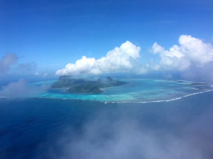

Vendredi 18 janvier
Départ à midi 30 / Arrivée à 14 h 20. Nous sommes attendus avec le collier de fleurs traditionnel par Odile, propriétaire de la pension Ataha. Nous aurons aussi l' occasion de rencontrer son mari Terani qui s'occupe du bricolage, du bateau ( pour les excursions ) et du fa'a'pou ( jardin familial ), une institution dans chaque famille de l'île, si l'on veut manger des légumes et des fruits frais. Dans le jardin familial, un espace est réservé à la tarodière, le taro étant à la base de beaucoup de plats cuisinés à Raivavae, mais aussi dans les autres îles australes. La route de ceinture est bétonnée et en assez mauvais état. On circule à 40 km à l' heure maxi. La pension est à 3 kms environ, on est donc arrivé tout de suite. Nous nous installons et partons faire une longue balade à pied le long de cette unique route circulaire. ( Il y a aussi une route traversière bordée de quelques maisons ou hameaux). Rares sont en fait les terrains plats pouvant servir aux cultures maraîchères et fruitières, sauf derrière les maisons construites côté montagne uniquement. Les ' fare ' sont assez sommaires, certains un peu vieux et déglingués, du moins ceux qui bordent la route, alors que de nouvelles constructions sont apparues à l' arrière. Surprenant que ces vieilles maisons - avec rideaux tirés et portes fermées à clé- ne soient pas démolies... J' en demande la raison et obtiens une réponse inattendue : ces anciens ' fare ' servent en fait de tombeaux aux anciens. Il parait même que certaines familles enterrent leurs morts sous le carrelage du salon de leur maison neuve... ! Raison ultime : il n' y a jamais eu de cimetière municipal à Raivavae. On cherche actuellement un terrain pour en construire un, enfin.... Cela devrait prendre encore du temps !
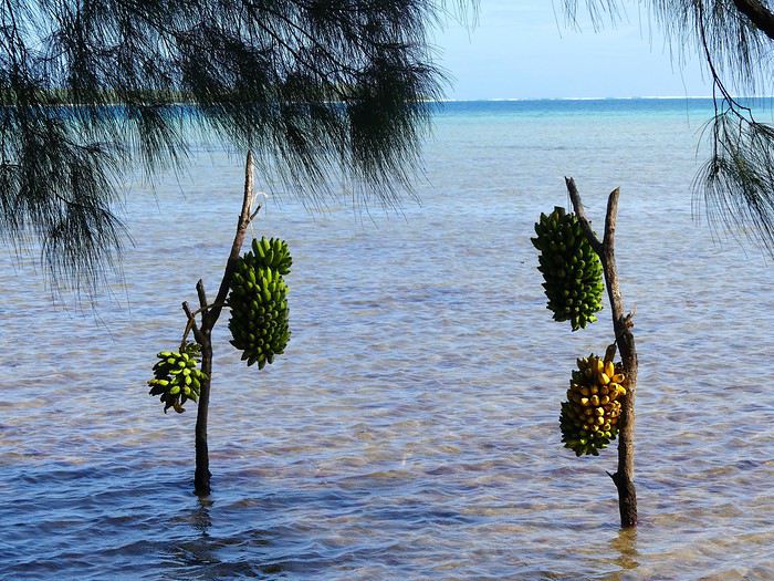
Le long de la route aussi, des cochons attachés par une patte ( chaque famille en ayant de 1 à 3 ). Une tradition bien ancrée ici aussi, semble-t-il. Depuis peu, les gens ont obligation de les transférer côté montagne, de sorte que le lagon ne soit pas indirectement pollué. Les cochons sont engraissés pour les fêtes religieuses de fin d'année mais aussi celles du mois de mai, mois festif et religieux entre tous à Raivavae. Autre chose encore qui attire l'oeil : les régimes de bananes suspendus à des poteaux de bois fichés dans le sable au bord du lagon. Cela surprend de prime abord, mais est en fait astucieux. Les bananes, encore vertes, préalablement lavées, brossées et nettoyées abondamment dans l' eau de mer, ne seront de ce fait attaquées ni par les oiseaux, ni par les rats, ni par les fourmis, ni par les insectes piqueurs du genre guêpe. Elles murissent tranquillement et parfaitement ainsi. Il fallait y penser, mais je n' ai jamais vu procéder ainsi dans une autre île polynésienne. II fait beau et pas trop chaud en ce vendredi après-midi. La balade de plusieurs kilomètres terminée, nous rentrons à la pension pour une douche, un peu d'internet ( dans la salle commune ) et le dîner à 19 heures tapantes. Internet a changé et facilité la vie des gens dans ce genre d'île isolée. Tout a commencé avec la construction de l' aérodrome en 2003, l' installation du courant électrique et l' apparition des téléphones fixe et portable. Une vraie révolution qui permet à ceux qui aiment le calme et la nonchalance de la vie aux îles de profiter des beautés de Raivavae tout en restant connecté. Avant, c'était une autre époque ! Un huis-clos un peu difficile, d'après ce que j' ai compris. La population, dans l' ensemble, vit modestement car très peu salariée. De 20 à 30 personnes ( sur 970 ) ont de vrais revenus. Les anciens reçoivent chacun 70000 FCP par mois, ce qui fait vivre souvent une famille entière. Décision ( tout de même un peu électoraliste ) prise il y a des années par le gouvernement Flosse mais rien n' a changé depuis et tout continue comme avant... Pas d'impôts sur le revenu, pas de taxe foncière ou d'habitation. Ce n' est pas le cas pour ces deux dernières taxes, je le signale, à Rurutu et Tubuai, plus prospères que Raivavae. Rapa fonctionne comme Raivavae à ce niveau, au ralenti et à l' exception.
Pour revenir à l'isolement de ces îles, il faut comprendre qu'elles ont vécu en autarcie complète avec leurs traditions spécifiques et leurs systèmes politiques chapeautés par des royautés guerrières, pendant des siècles. Leurs habitants n' hésitaient pas à prendre la mer et ont donc fini par découvrir qu'il y avait des îles voisines qui méritaient qu'on s'y intéresse, moins pour tenter de les conquérir que pour rechercher le contact et s'ouvrir au monde. Aux Îles sous le Vent, aux îles du Vent, aux Tuamotu, aux Marquises ou aux Gambier, les îles sont proches les unes des autres et s'aperçoivent à l'oeil nu. Les guerres entre clans ont perduré dans ces archipels, bien sur, mais des contacts plus enrichissants ont aussi eu lieu. L' unicité des Australes, c'est aussi l' unicité de chaque île composant cet archipel.
La modernité et l' ouverture vers l' extérieur n'ont été possibles que grâce aux aéroports qui desservent parfois de tout petits atolls, grâce à la Légion Etrangère qui a fait l' éreintant travail de terrassement sous le soleil, aux efforts des gouvernements locaux successifs pour désenclaver un maximum d' 'îles sur un territoire grand comme l' Europe de l' Ouest, grâce enfin aux technologies nouvelles.
Le changement à Raivavae est donc très récent et ne date que d'une quinzaine d'années. Il reste très peu impacté par un tourisme balbutiant. La destination est rare et demeure chère.


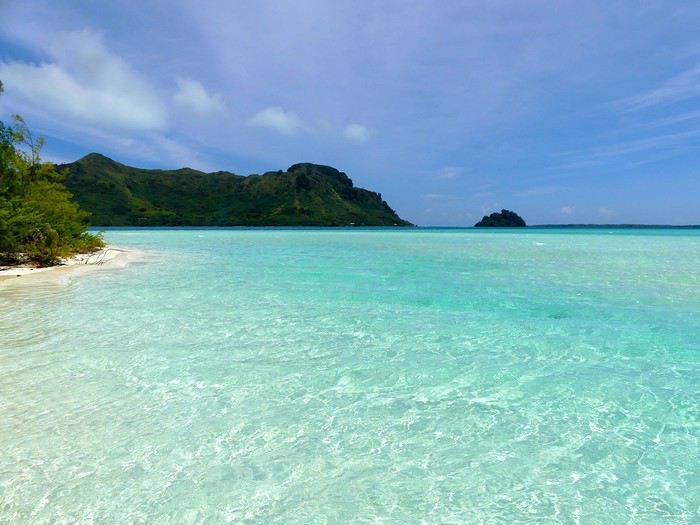

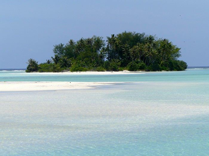

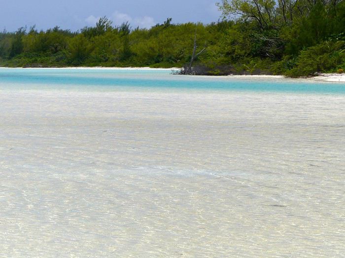
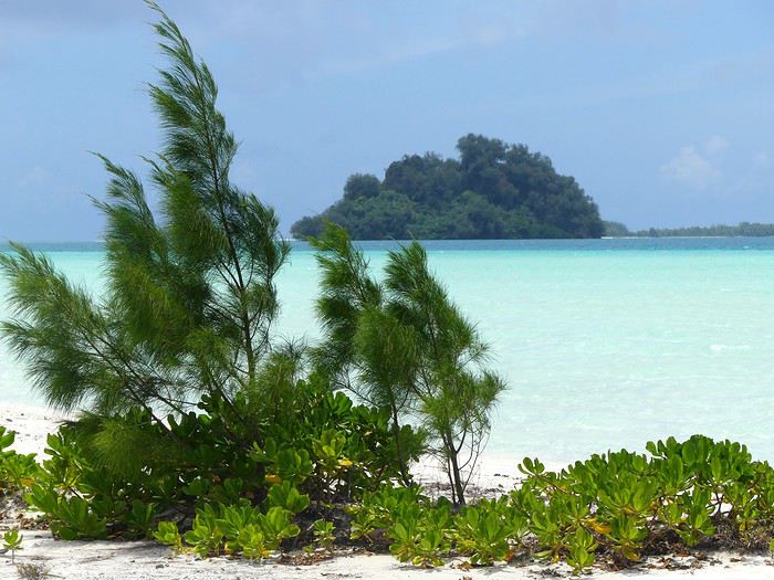
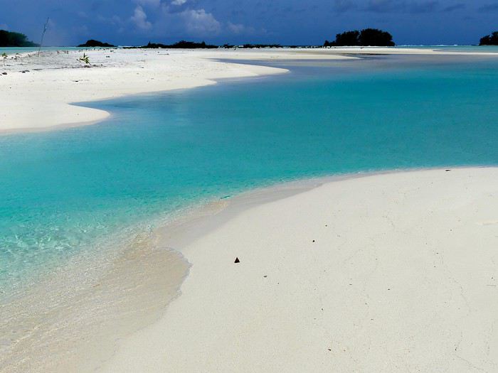

Samedi 19 janvier Réveil en fanfare à 5 heures du matin ( il fait jour ) : d'abord un scooter qui pétarade sur la route proche, puis un chien qui aboie puis enfin un coq qui pousse un cri perçant sous la fenêtre ouverte. Il est temps de se lever, tôt comme tout le monde ici ou presque.
Nous nous sommes entendus avec Terani et Odile pour un tour de l'île en bateau jusqu'à la mi-journée suivi d'un déjeuner au motu Vaiamanu, dit motu-piscine. Il fait un temps magnifique, le lagon est une splendeur. Chatoiements du soleil sur l'eau qui frise, couleurs et limpidité de l'eau exceptionnelles comme cela se voit dans les îles éloignées et exemptes de pollution. Cela, c'est ce qui rend la Polynésie incontournable en termes de beauté naturelle. Difficile de trouver aussi beau ailleurs. Ce lagon est vraiment à la hauteur de sa réputation. Sur le trajet, joyau vert émeraude dans son écrin bleu foncé, le motu Hotuatua, planté face à la pointe Hopa, sauvage et interdit d'accès car réserve naturelle protégée d'oiseaux divers dont les sternes blanches et surtout les frégates occupées à leurs parades amoureuses ( les mâles arborent d'énormes jabots rouges ) et à la construction de leurs nids. Un milliardaire américain a tenté d'acheter ce motu mais en vain, les terrains n' étant pas cessibles à des non-résidents. On ne comprend pas trop bien les motivations de ce monsieur, car le motu n' est pas très grand, il est recouvert d'une végétation dense et luxuriante et y construire une habitation tiendrait de l' exploit. On dira que c'était un caprice de riche qui pense pouvoir tout acheter !
La montagne est bien dégagée, les photos seront parfaites. A la mi-journée, nous rejoignons le motu-piscine où se trouvent déjà d'autres visiteurs venus d'autres pensions. nous sommes 9 en tout. Un jeune couple dynamique originaire de l'île, Irène et Patrick Tamaititahio, est revenu de Tahiti pour s'installer durablement dans leur île d'origine avec le projet de faire table ouverte au motu tous les jours sauf le dimanche. Ils comptent même prochainement ouvrir un camping. A suivre donc ! La famille de Patrick possède le motu, les pensions se déchargent sur le couple des obligations culinaires, les visiteurs ( y compris les résidents de l île qui le désirent ) profitent du repas, des installations, du panorama, du farniente et de la mer. Nous allons rester sur place tout l' après-midi. Une merveille, même pour nous qui en avons vu quelques autres dans ce pays ! Au début des années 2000, le Territoire a tenté de racheter l' endroit à ses propriétaires pour y construire un hôtel de luxe. Refus catégorique de la population malgré de fortes incitations et la promesse ( tenue... ) de construire un aéroport pour désenclaver l'île et lui apporter des touristes. Encore faut-il savoir à qui on achète, les terres en Polynésie - à la cession ou par voie d' héritage- étant en indivision totale. Quand le gouvernement français a, dans les années 50, et dans un but de modernisation du pays, modifié par décret la loi sur l' héritage en se gardant la possibilité d' exproprier ( pour le bien public ), le vote de la loi - comme souvent - a été acquis au Parlement sans que l'on fasse mention des TOM. Calcul ou stratégie délibérée ? Sans doute les deux pour éviter les problèmes et des rigidités insulaires impossibles et dangereuses à gérer à 18.000 kms de distance de la métropole. De même, la loi Veil - pour ménager les Eglises locales très influentes et traditionalistes - n' a été validée sur le Territoire qu'il y a quelques années seulement.
Retour à la pension en fin d'après-midi. Terani est venu nous chercher d'un coup de bateau. il ne faut que 10 mn entre marina et motu. Le lagon est navigable, ce qui est un plus. En revanche, il n' est pas aussi poissonneux que ceux des atolls des Tuamotu. On ne peut pas pêcher son poisson sur le trajet du motu et l'y faire cuire dans la foulée. De très beaux coraux branchus d'un jaune intense, d'autres coraux dits encroûtants, bleus, gris et violets recouvrant par plaques des rochers entiers, parsèment les fonds entre les îlots et bancs de sable proches du récif. Beaucoup de coraux choux-fleurs également, d'un bleu électrique. Ce sont des variétés adaptées aux changements de température de la mer, que l'on ne trouve pas dans les Îles de la Société. Les coraux semblent se développer en corolles plus ramassées et à la dentelle moins fine. La qualité de l' eau est exceptionnelle, ce qui explique cette santé éclatante des coraux et autres communautés lagunaires et récifales. L'eau est cristalline et scintille comme le diamant sous le soleil le long des bancs de sable immaculés. Il y a également une profusion de bénitiers - ou ' pahua ' en tahitien - énormes aux lèvres de toutes les couleurs aux abords du récif, dans les ' hoa ' ( chenaux qui irriguent et oxygènent le lagon en eau océanique ), entre les ' motu ' . Raivavae est connue pour ses bénitiers que l'on ramasse de manière raisonnée, sans qu'ils soient exportés en masse vers Tahiti comme cela a pu se faire à Tahaa ou Raiatea ces vingt dernières années. L'île à bénitiers, cela reste, malgré tout, Rapa où l'on aurait comptabilisé 80 millions de ces mollusques autour de l'île : de quoi permettre à tous d'en manger tous les jours ! Rapa, je le signale, ne compte que 520 habitants, une population en baisse ! Lors de notre déjeuner sous les ' aito ' ( ou filaos ou arbres de fer), la chair de bénitier sera servie en entrée ( crue macérée dans l' eau de mer / crue macérée au citron ) puis cuite à la sauce au curry ). Ensuite grosse carangue bleue grillée, poissons-chats locaux ( un peu comme des rougets rallongés dotés de barbillons ), poulet grillé, pain coco fait maison par Irène, pastèques et bananes en dessert. Eau de coco et eau minérale comme boissons. Iréne et son mari protègent aussi les plants de bois de santal qui poussent en quantité sur leur motu. Raivavae, à une certaine époque, était une étape obligée pour les bateaux santaliers qui s'y ravitaillaient en bois précieux. Cette époque est oubliée, mais on essaie de faire prospérer ces arbres magiques et odorants qui poussent si lentement et avec tant de difficulté.
Dimanche 20 janvier : Après une nuit orageuse ( c'est cela aussi les Australes ! ), nous nous réveillons sous la pluie. Et il va pleuvoir dru jusqu' en milieu d'après-midi. Aïe ! Ce n' était pas prévu, ni attendu d'ailleurs ! Nous devions faire l' escalade du mont Hiro ce matin. Ce n' est même pas la peine d'y penser quand on voit les trombes d'eau qui descendent du ciel. C'est même déconseillé car dangereux.
Quelques infos cependant. Compter 4 heures environ AR. Un sentier privé monte derrière la pension Ataha. D'autres départs de sentiers ailleurs bien sur. Pente très raide au départ dans une brousse dense plantée de ' purau ' (ou hibiscus) de goyaviers, de bois de fer ( ou ' aito ' en tahitien ) , laissant progressivement place à des étendues de roseaux et de hautes fougères. On finit par déboucher sur un espace en pente douce ouvert et gazonné qui mène en se rétrécissant à la crête. Du haut du mont Hiro, on a un panorama à 360° sur sommets avoisinants, motu et étendues lagunaires en camaïeux de bleus.
Nous sommes forcément déçus de devoir attendre si longtemps la fin de ce mauvais temps passager. En outre, c'est dimanche et la route de ceinture est absolument déserte. Il n' y a que les quatre temples où se concentre la vie villageoise : à chaque fois, une foule clairsemée de paroissiens habillés tout de blanc et qui vont, ce jour-là, passer sept longues heures assis à écouter les prêches du pasteur et à chanter des hymnes. Pourquoi un culte aussi long ? Simplement parce que, en ce 3ème dimanche de janvier, on commémore chaque année une journée cataclysmique ( pluies diluviennes, glissements de terrain, 'fare' emportés, personnes disparues ) de la fin janvier 1959. Ceux qui ne sont pas au temple doivent dormir... Autant dire que le milieu de journée est un peu tristounet !
L' amélioration météo espérée va arriver en fin d'après-midi avec des teintes de ciel et mer superbes au fur et à mesure que la lumière baisse. Le lagon est plat et lisse, silence total bien avant l' arrivée de la nuit. Le temps est suspendu. Et il semble que la pluie se soit arrêtée pour de bon...? Mais non, il va re-pleuvoir, à partir de 23 h00, mais plus régulièrement, toute la nuit, jusqu' à 5 heures du matin environ. Même si on élude beaucoup les discussions sur la météo à Raivavae, on aura compris que ce temps instable est très courant à Raivavae. Et donc....? Vous allez me dire, mais à quelle période faut-il venir pour être sur d'avoir du beau temps ? Eh bien, c'est simple, la fenêtre est étroite, il faut voyager aux Australes en février et mars, plus précisément encore de mi-février à fin mars. On sécurise beau temps calme et mer chaude. De février à avril à Rimatara, car cette île est la plus proche de la Société et donc moins marquée australe, d'un point de vue météorologique, que les 3 autres. Dans notre malheur, nous avons de la chance. L'avion de retour ne part que lundi 21 en fin d'après-midi. Nous avons donc encore une journée quasi entière à consacrer à la découverte de Raivavae.
Lundi 21 janvier Et voilà que, vers 7-8 heures, le ciel bleu apparait, avec soleil un peu incertain. Tout cela va s'arranger joliment en milieu de matinée et pour toute la journée. Nous avons à prendre des décisions sur la façon d'occuper la journée agréablement.
Pas de mont Hiro ce matin non plus, il a trop plu pendant la nuit. Un tour de l'île en vélo est possible, mais la route est très abîmée et pleine de nids-de-poule et je n' ai pas envie de partir seul. Mon épouse a déclaré forfait, suite à une chute accidentelle sur un genou.
Il y a bien des grottes telles la grotte Ana Poiri, mais celle-ci n 'est pas impressionnante comme celles de Rurutu que nous verrons obligatoirement en mars. On attendra donc.
On peut également aller voir l'unique tiki souriant qui est demeuré à Raivavae tandis que deux autres étaient transportés à Tahiti dans les années 30, et que le troisième est au fond du lagon dans lequel il est tombé par mégarde lors du transbordement.
Les marae de l'île, aux dires de notre hôtesse, n'ont rien de remarquable. Ils sont accessibles facilement de la route mais délaissés : mara'e Pua Pua Tiare, mara'e Mauna Oto, mara'e Vaimano. Problème : ils sont généralement situés sur des terrains privés et plus ou moins barricadés, et on ne rentre pas chez les gens comme cela ! La municipalité a vraiment du travail à faire et à donner pour les rendre attractifs. Ceci étant, il y a un grand marae sur l'îlot Marae Atoni qui, semble-t-il, mérite une visite.
Il reste le motu Rani, un autre coin de nature sauvage et préservée, propriété de la famille de notre hôte Terani. il nous propose de nous y emmener jouer les Robinson. C'est tentant et nous n' allons pas regretter. Odile et Terani ont construit des petits bungalows très simples sur le motu pour y accueillir des visiteurs en recherche de vie tranquille au bord du lagon et sous les étoiles ( quand il ne pleut pas, bien sur... ). Il parait qu'ils ont beaucoup de succès ! La nourriture est apportée en bateau de l'île. Tarifs un peu plus élevés qu'à la pension Ataha. Attention à la saison fraîche, juillet et août. Il peut faire un froid relatif ( pas de moustiques ) , il faut se couvrir, et la mer au motu est à 18-19° seulement ! Comme en Bretagne nord en juillet ! Contre 26° en ce moment, de janvier à début avril. Les touristes canadiens adorent Raivavae en juillet, parait-il. Température de la mer comme au Nouveau Brunswick en été.
Retour à la pension vers 15h 30 pour une douche rapide. Transfert à l' aéroport à 16 heures. Départ à 16H 55. ( l' avion a déjà fait escale à Tubuai ). Décollage, moteurs rugissant à fond et sur les chapeaux de roues : la piste est courte comme à Maupiti. Arrivée à Tahiti-Faa'a à 18 heures 50 comme prévu.
Ainsi se termine notre escapade à Raivavae. Nos prochains séjours dans les autres îles permettront de compléter le tableau des activités intéressantes - certaines plus sportives - à privilégier d'une île à l' autre. Vous aurez compris que Raivavae est surtout une île-détente de premier choix.
ADDENDUM Quelques tarifs qui, forcément vous intéresseront et peut-être vous feront sursauter... La nuit en demi-pension est facturée 13000 FCP pour deux personnes. C' est une constante partout en PF ( entre 12500 et 15000 FCP en demi-pension ) La journée au motu-piscine ( avec déjeuner inclus ) est facturée 5000 FCP par personne. Le tour de l'île en bateau est facturé 10000 FCP par personne ( environ 3 heures ). Notre séjour à la pension Ahata nous a coûté 77000 FCP pour deux. A rajouter aux billets d'avion. Il faut donc compter -en euros- environ 350 euros par jour à deux, vol compris.
On peut imaginer de faire une île en 3 jours, 2 îles en 6 jours, 3 îles en 10-12 jours, 4 îles en 15 jours minimum. Pour réduire - paradoxalement - le coût global, il faut envisager de visiter 2 ou 3 îles avec le Pass. Il semble assez facile de combiner - au moins - Raivavae et Tubuai en un séjour. Attention : les horaires changent 2 fois l'an.
Moana
PS Si vous voulez en lire davantage sur les Australes, déroulez le menu... On continue avec quelques infos et deux légendes sur RAIVAVAE. Ensuite ce sera TUBUAI...
INTRO
Je sais que beaucoup parmi vous seront intéressés par la série de carnets de voyage aux Îles Australes - ou Tuha'a Pae en langue polynésienne- qui va suivre. Vous pourrez ainsi faire vos choix et programmer d'intégrer une ou deux îles à votre itinéraire, trois peut-être au grand maximum, lors de votre prochain voyage en Polynésie Française.
Pour nous qui résidons ici depuis 30 ans, c'est aussi la première fois que nous partons dans cette direction, cap au sud. Ce n' est pas une destination facile en termes de climat, souvent instable et imprévisible, de longueur de séjour et de moyens financiers.
Air Tahiti propose un Pass 4 îles qui est quasiment inutilisable sauf à rester trois semaines ou un mois et dépenser une fortune. La raison : des liaisons inter-îles rares et irrégulières et très chères, y compris pour les îliens eux-mêmes qui ont des tarifs-résident pour aller et venir entre leur île et Tahiti mais paient plein tarif pour les déplacements entre les îles. Exemple : Un vol Raivavae - Tubuai, d'une durée de 25 minutes est facturé 38000 FCP ( = 340 euros ) !
Nous avons décidé de consacrer du temps et un peu d'argent à cet archipel cette année. Ce premier carnet concerne Raivavae, la plus méridionale des îles disposant d'un aéroport ( ce qui place Rapa - à deux jours de bateau plus au sud- hors champ ). Le prochain qui sera posté mi-mars, en continuation de celui-ci, concernera Tubuai et Rurutu. Il restera Rimatara que nous visiterons fin avril.
UN PEU DE GEOGRAPHIE Raivavae - anciennement nommée Vavitu - se situe à 730 kms au sud-est de Tahiti. Elle appartient à l' archipel des Australes, au même titre que Rurutu, Tubuai, Rimatara, Rapa et Marotiti , île inhabitée proche de Rapa où - selon certains écrits- l'on déportait autrefois les récalcitrants, les violents ou simplement les rebelles à l' autorité du chef. Raivavae est une île volcanique d'environ 16 km2 de terres émergées, dotée d'un lagon superbe par sa forme et ses couleurs qui rappelle celui de Bora-Bora en plus petit, ourlé de 28 motu éparpillés le long de la barrière de corail. Elle culmine au mont Hiro à 432 m d'altitude. L'île compte actuellement 970 habitants environ, répartis sur 4 villages : Rairua, Mahanatoa, Anatonu et Vaiuru. Notre pension Ataha se trouve dans ce dernier village cité, le long de la route circulaire qui borde le lagon. On parle à Raivavae un dialecte particulier ainsi que le tahitien et le français bien sur. Que signifie le nom Raivavae ? Etymologiquement, ce nom provient de ' ra'i ', le ciel et de ' vavae ' qui veut dire 'se frayer un chemin'. L' ensemble signifie donc ' se frayer un chemin dans le ciel ' et , par extension, ' à ciel ouvert '.
UN PEU D'HISTOIRE Raivavae fut découverte en 1775 par le navigateur espagnol Thomas Gayangos voyageant à bord de la frégate l' Aguila. On remarque que certains résidents ont les yeux très clairs, gris ou pers, comme cela se retrouve chez des habitants de Galice et d'Andalousie. Le séjour de Gayangos et de son équipage à Raivavae donne peut-être la raison de cette particularité physique. Maintenant pourquoi l' île de passion ? Dans les écrits anciens datant d'avant le christianisme et l' évangélisation protestante , quand on mentionne Raivavae, on évoque une île de guerriers en permanence engagés dans des combats de clans affreux et sanguinaires, on évoque aussi des rituels érotiques très poussés et des célébrations païennes inédites et uniques en leur genre. En d'autres termes, Raivavae fut , à une certaine époque, l'île de l' amour et de la mort confondus. Rien de tel aujourd'hui... L' île a un rythme de vie alangui et tranquille, surtout le dimanche. La vie reste assez communautaire à Raivavae et on est censé partager avec les autres, une spécificité partagée avec Rapa.
RAPA Petite digression sur Rapa dont on ne parle jamais. C'est une île isolée et coupée du monde, où le communautarisme voire le collectivisme est érigé en mode de vie sous le contrôle du Conseil des Sages ( = les anciens ) qui , entre autres, refuse la construction d'un aérodrome depuis des années ! En d'autres termes, chacun est sous surveillance de l' autre, parent, ami, pasteur, maire. On ne fait pas ce que l'on veut comme on veut. On s'adapte, on obéit et on s'incline. Et , si on transgresse, on paie cher son audace. Un exemple ? Vous êtes surpris en train de pêcher au fusil dans une baie de l' île où la pêche a été proscrite pendant 5 ans, vous méritez donc une punition ! La mairie va vous couper l' électricité pendant des semaines, voire des mois, ce qui va compliquer votre vie quotidienne ! Autre détail qui surprendra : Le dimanche, la Mairie coupe l' électricité dans l' île entière...sauf au temple, histoire d' encourager - le terme est faible - tout le monde à se précipiter au culte ! Pas évident donc de vivre dans une île comme Rapa, dans une forme de huis-clos social et religieux. Toute forme d'individualisme est proscrite, ce qui explique pourquoi les jeunes ont tendance à se désintéresser du religieux et finalement à partir, même si les perspectives de vie et de travail à Tahiti ne sont pas fantastiques. Déjà, il n' y a pas de collège sur île et les collégiens - dès la 6 ème - en sont éloignés pendant l' année scolaire; ils font leur scolarité au Collège de Tubuai, pour continuer leurs études ensuite, éventuellement dans l'un des lycées de Tahiti. Le maire a rétabli il y a quelques années le ' rahui ' , à savoir un système traditionnel polynésien visant à exploiter de manière raisonnée et préserver durablement les richesses marines. Ce système est officiellement levé pour le bien général de manière occasionnelle. Quand la pêche a lieu, elle est collective, ouverte à tous et éco-responsable, et le poisson pêché est distribué aux familles en fonction du nombre de personnes qui les composent. Même chose d'ailleurs pour la viande qui est prélevée sur les troupeaux de cochons, chèvres et vachettes sauvages. C'est plutôt positif écologiquement parlant, même si c'est vécu comme très contraignant. L 'île est tempérée, la seule du genre en Polynésie. Tous nos légumes et nos arbres fruitiers européens du genre cerisier ou pommier y pousseraient sans mal, mais l'innovation n' est pas le fort de la population, ni surtout du conseil des sages qui ne veut rien changer à rien. Les maisons y sont équipées de cheminées et on y dort le plus souvent sous couette surtout en hiver austral. Temps souvent froid, humide, venteux sous une montagne glacée. Mer froide et agitée. On est loin des lagons bleus et tièdes. On parle à Rapa un dialecte particulier que l'on comprend très difficilement si l'on est polynésien d'ailleurs. Le français demeure la langue unitaire. Difficile de séjourner à Rapa moins de deux mois, le temps que le cargo - alias le Tuhaa Pae -qui livre le frêt et transporte des passagers, aille à Tahiti et en revienne ! La liaison avec Rapa n' est pas hebdomadaire mais beaucoup plus irrégulière. Pas de pensions de famille, on trouvera cependant à se loger chez l' habitant. Le voyage en cargo reste une expérience unique. On peut soit dormir sur le pont ou bien se réserver une cabine - plutôt confortable - quand le navire assure la liaison maritime jusqu'à Rapa ! L' armateur ne permet le passage qu'à douze passagers par voyage uniquement. Escales plus ou moins longues dans les 4 premières îles, puis à Rapa où l'on arrive à l'aube et où on peut trouver des prestataires qui vont vous balader pendant toute la journée. Le navire reste à quai toute la journée et repart en soirée direction Tahiti, sans escale cette fois. Parfois il reste à quai une journée de plus... Attention : Mer très agitée et tempétueuse dans ces contrées. Le bateau est à l' ancienne et n' a pas de stabilisateurs; il roule et tangue énormément. A déconseiller à ceux qui n'ont pas le pied marin. A part cela, on déjeune et l'on dîne ( très bien, dit-on ) à la table du capitaine. Excellents retours de voyage de ceux qui ont tenté l' aventure. Compter une dizaine de jours en mer et en escale plus ou moins prolongée. Deux mois si on tente le séjour long... Fin de ma longue digression.
NOTRE ESCAPADE
Billet Air Tahiti ( avec carte de fidélité ) : 66000 FCP pour deux personnes. Durée du vol ( sans escale ) : 1 H 50. Sur ATR 72. Se munir d'argent liquide ( FCFP ) ou d'un carnet de chèques local. Pas de DAB sur l' île. Pas de règlement en carte bancaire. Il y a un bureau de Poste uniquement.
Vendredi 18 janvier
Départ à midi 30 / Arrivée à 14 h 20. Nous sommes attendus avec le collier de fleurs traditionnel par Odile, propriétaire de la pension Ataha. Nous aurons aussi l' occasion de rencontrer son mari Terani qui s'occupe du bricolage, du bateau ( pour les excursions ) et du fa'a'pou ( jardin familial ), une institution dans chaque famille de l'île, si l'on veut manger des légumes et des fruits frais. Dans le jardin familial, un espace est réservé à la tarodière, le taro étant à la base de beaucoup de plats cuisinés à Raivavae, mais aussi dans les autres îles australes. La route de ceinture est bétonnée et en assez mauvais état. On circule à 40 km à l' heure maxi. La pension est à 3 kms environ, on est donc arrivé tout de suite. Nous nous installons et partons faire une longue balade à pied le long de cette unique route circulaire. ( Il y a aussi une route traversière bordée de quelques maisons ou hameaux). Rares sont en fait les terrains plats pouvant servir aux cultures maraîchères et fruitières, sauf derrière les maisons construites côté montagne uniquement. Les ' fare ' sont assez sommaires, certains un peu vieux et déglingués, du moins ceux qui bordent la route, alors que de nouvelles constructions sont apparues à l' arrière. Surprenant que ces vieilles maisons - avec rideaux tirés et portes fermées à clé- ne soient pas démolies... J' en demande la raison et obtiens une réponse inattendue : ces anciens ' fare ' servent en fait de tombeaux aux anciens. Il parait même que certaines familles enterrent leurs morts sous le carrelage du salon de leur maison neuve... ! Raison ultime : il n' y a jamais eu de cimetière municipal à Raivavae. On cherche actuellement un terrain pour en construire un, enfin.... Cela devrait prendre encore du temps !
Le long de la route aussi, des cochons attachés par une patte ( chaque famille en ayant de 1 à 3 ). Une tradition bien ancrée ici aussi, semble-t-il. Depuis peu, les gens ont obligation de les transférer côté montagne, de sorte que le lagon ne soit pas indirectement pollué. Les cochons sont engraissés pour les fêtes religieuses de fin d'année mais aussi celles du mois de mai, mois festif et religieux entre tous à Raivavae. Autre chose encore qui attire l'oeil : les régimes de bananes suspendus à des poteaux de bois fichés dans le sable au bord du lagon. Cela surprend de prime abord, mais est en fait astucieux. Les bananes, encore vertes, préalablement lavées, brossées et nettoyées abondamment dans l' eau de mer, ne seront de ce fait attaquées ni par les oiseaux, ni par les rats, ni par les fourmis, ni par les insectes piqueurs du genre guêpe. Elles murissent tranquillement et parfaitement ainsi. Il fallait y penser, mais je n' ai jamais vu procéder ainsi dans une autre île polynésienne. II fait beau et pas trop chaud en ce vendredi après-midi. La balade de plusieurs kilomètres terminée, nous rentrons à la pension pour une douche, un peu d'internet ( dans la salle commune ) et le dîner à 19 heures tapantes. Internet a changé et facilité la vie des gens dans ce genre d'île isolée. Tout a commencé avec la construction de l' aérodrome en 2003, l' installation du courant électrique et l' apparition des téléphones fixe et portable. Une vraie révolution qui permet à ceux qui aiment le calme et la nonchalance de la vie aux îles de profiter des beautés de Raivavae tout en restant connecté. Avant, c'était une autre époque ! Un huis-clos un peu difficile, d'après ce que j' ai compris. La population, dans l' ensemble, vit modestement car très peu salariée. De 20 à 30 personnes ( sur 970 ) ont de vrais revenus. Les anciens reçoivent chacun 70000 FCP par mois, ce qui fait vivre souvent une famille entière. Décision ( tout de même un peu électoraliste ) prise il y a des années par le gouvernement Flosse mais rien n' a changé depuis et tout continue comme avant... Pas d'impôts sur le revenu, pas de taxe foncière ou d'habitation. Ce n' est pas le cas pour ces deux dernières taxes, je le signale, à Rurutu et Tubuai, plus prospères que Raivavae. Rapa fonctionne comme Raivavae à ce niveau, au ralenti et à l' exception.
Pour revenir à l'isolement de ces îles, il faut comprendre qu'elles ont vécu en autarcie complète avec leurs traditions spécifiques et leurs systèmes politiques chapeautés par des royautés guerrières, pendant des siècles. Leurs habitants n' hésitaient pas à prendre la mer et ont donc fini par découvrir qu'il y avait des îles voisines qui méritaient qu'on s'y intéresse, moins pour tenter de les conquérir que pour rechercher le contact et s'ouvrir au monde. Aux Îles sous le Vent, aux îles du Vent, aux Tuamotu, aux Marquises ou aux Gambier, les îles sont proches les unes des autres et s'aperçoivent à l'oeil nu. Les guerres entre clans ont perduré dans ces archipels, bien sur, mais des contacts plus enrichissants ont aussi eu lieu. L' unicité des Australes, c'est aussi l' unicité de chaque île composant cet archipel.
La modernité et l' ouverture vers l' extérieur n'ont été possibles que grâce aux aéroports qui desservent parfois de tout petits atolls, grâce à la Légion Etrangère qui a fait l' éreintant travail de terrassement sous le soleil, aux efforts des gouvernements locaux successifs pour désenclaver un maximum d' 'îles sur un territoire grand comme l' Europe de l' Ouest, grâce enfin aux technologies nouvelles.
Le changement à Raivavae est donc très récent et ne date que d'une quinzaine d'années. Il reste très peu impacté par un tourisme balbutiant. La destination est rare et demeure chère.
Samedi 19 janvier Réveil en fanfare à 5 heures du matin ( il fait jour ) : d'abord un scooter qui pétarade sur la route proche, puis un chien qui aboie puis enfin un coq qui pousse un cri perçant sous la fenêtre ouverte. Il est temps de se lever, tôt comme tout le monde ici ou presque.
Nous nous sommes entendus avec Terani et Odile pour un tour de l'île en bateau jusqu'à la mi-journée suivi d'un déjeuner au motu Vaiamanu, dit motu-piscine. Il fait un temps magnifique, le lagon est une splendeur. Chatoiements du soleil sur l'eau qui frise, couleurs et limpidité de l'eau exceptionnelles comme cela se voit dans les îles éloignées et exemptes de pollution. Cela, c'est ce qui rend la Polynésie incontournable en termes de beauté naturelle. Difficile de trouver aussi beau ailleurs. Ce lagon est vraiment à la hauteur de sa réputation. Sur le trajet, joyau vert émeraude dans son écrin bleu foncé, le motu Hotuatua, planté face à la pointe Hopa, sauvage et interdit d'accès car réserve naturelle protégée d'oiseaux divers dont les sternes blanches et surtout les frégates occupées à leurs parades amoureuses ( les mâles arborent d'énormes jabots rouges ) et à la construction de leurs nids. Un milliardaire américain a tenté d'acheter ce motu mais en vain, les terrains n' étant pas cessibles à des non-résidents. On ne comprend pas trop bien les motivations de ce monsieur, car le motu n' est pas très grand, il est recouvert d'une végétation dense et luxuriante et y construire une habitation tiendrait de l' exploit. On dira que c'était un caprice de riche qui pense pouvoir tout acheter !
La montagne est bien dégagée, les photos seront parfaites. A la mi-journée, nous rejoignons le motu-piscine où se trouvent déjà d'autres visiteurs venus d'autres pensions. nous sommes 9 en tout. Un jeune couple dynamique originaire de l'île, Irène et Patrick Tamaititahio, est revenu de Tahiti pour s'installer durablement dans leur île d'origine avec le projet de faire table ouverte au motu tous les jours sauf le dimanche. Ils comptent même prochainement ouvrir un camping. A suivre donc ! La famille de Patrick possède le motu, les pensions se déchargent sur le couple des obligations culinaires, les visiteurs ( y compris les résidents de l île qui le désirent ) profitent du repas, des installations, du panorama, du farniente et de la mer. Nous allons rester sur place tout l' après-midi. Une merveille, même pour nous qui en avons vu quelques autres dans ce pays ! Au début des années 2000, le Territoire a tenté de racheter l' endroit à ses propriétaires pour y construire un hôtel de luxe. Refus catégorique de la population malgré de fortes incitations et la promesse ( tenue... ) de construire un aéroport pour désenclaver l'île et lui apporter des touristes. Encore faut-il savoir à qui on achète, les terres en Polynésie - à la cession ou par voie d' héritage- étant en indivision totale. Quand le gouvernement français a, dans les années 50, et dans un but de modernisation du pays, modifié par décret la loi sur l' héritage en se gardant la possibilité d' exproprier ( pour le bien public ), le vote de la loi - comme souvent - a été acquis au Parlement sans que l'on fasse mention des TOM. Calcul ou stratégie délibérée ? Sans doute les deux pour éviter les problèmes et des rigidités insulaires impossibles et dangereuses à gérer à 18.000 kms de distance de la métropole. De même, la loi Veil - pour ménager les Eglises locales très influentes et traditionalistes - n' a été validée sur le Territoire qu'il y a quelques années seulement.
Retour à la pension en fin d'après-midi. Terani est venu nous chercher d'un coup de bateau. il ne faut que 10 mn entre marina et motu. Le lagon est navigable, ce qui est un plus. En revanche, il n' est pas aussi poissonneux que ceux des atolls des Tuamotu. On ne peut pas pêcher son poisson sur le trajet du motu et l'y faire cuire dans la foulée. De très beaux coraux branchus d'un jaune intense, d'autres coraux dits encroûtants, bleus, gris et violets recouvrant par plaques des rochers entiers, parsèment les fonds entre les îlots et bancs de sable proches du récif. Beaucoup de coraux choux-fleurs également, d'un bleu électrique. Ce sont des variétés adaptées aux changements de température de la mer, que l'on ne trouve pas dans les Îles de la Société. Les coraux semblent se développer en corolles plus ramassées et à la dentelle moins fine. La qualité de l' eau est exceptionnelle, ce qui explique cette santé éclatante des coraux et autres communautés lagunaires et récifales. L'eau est cristalline et scintille comme le diamant sous le soleil le long des bancs de sable immaculés. Il y a également une profusion de bénitiers - ou ' pahua ' en tahitien - énormes aux lèvres de toutes les couleurs aux abords du récif, dans les ' hoa ' ( chenaux qui irriguent et oxygènent le lagon en eau océanique ), entre les ' motu ' . Raivavae est connue pour ses bénitiers que l'on ramasse de manière raisonnée, sans qu'ils soient exportés en masse vers Tahiti comme cela a pu se faire à Tahaa ou Raiatea ces vingt dernières années. L'île à bénitiers, cela reste, malgré tout, Rapa où l'on aurait comptabilisé 80 millions de ces mollusques autour de l'île : de quoi permettre à tous d'en manger tous les jours ! Rapa, je le signale, ne compte que 520 habitants, une population en baisse ! Lors de notre déjeuner sous les ' aito ' ( ou filaos ou arbres de fer), la chair de bénitier sera servie en entrée ( crue macérée dans l' eau de mer / crue macérée au citron ) puis cuite à la sauce au curry ). Ensuite grosse carangue bleue grillée, poissons-chats locaux ( un peu comme des rougets rallongés dotés de barbillons ), poulet grillé, pain coco fait maison par Irène, pastèques et bananes en dessert. Eau de coco et eau minérale comme boissons. Iréne et son mari protègent aussi les plants de bois de santal qui poussent en quantité sur leur motu. Raivavae, à une certaine époque, était une étape obligée pour les bateaux santaliers qui s'y ravitaillaient en bois précieux. Cette époque est oubliée, mais on essaie de faire prospérer ces arbres magiques et odorants qui poussent si lentement et avec tant de difficulté.
Dimanche 20 janvier : Après une nuit orageuse ( c'est cela aussi les Australes ! ), nous nous réveillons sous la pluie. Et il va pleuvoir dru jusqu' en milieu d'après-midi. Aïe ! Ce n' était pas prévu, ni attendu d'ailleurs ! Nous devions faire l' escalade du mont Hiro ce matin. Ce n' est même pas la peine d'y penser quand on voit les trombes d'eau qui descendent du ciel. C'est même déconseillé car dangereux.
Quelques infos cependant. Compter 4 heures environ AR. Un sentier privé monte derrière la pension Ataha. D'autres départs de sentiers ailleurs bien sur. Pente très raide au départ dans une brousse dense plantée de ' purau ' (ou hibiscus) de goyaviers, de bois de fer ( ou ' aito ' en tahitien ) , laissant progressivement place à des étendues de roseaux et de hautes fougères. On finit par déboucher sur un espace en pente douce ouvert et gazonné qui mène en se rétrécissant à la crête. Du haut du mont Hiro, on a un panorama à 360° sur sommets avoisinants, motu et étendues lagunaires en camaïeux de bleus.
Nous sommes forcément déçus de devoir attendre si longtemps la fin de ce mauvais temps passager. En outre, c'est dimanche et la route de ceinture est absolument déserte. Il n' y a que les quatre temples où se concentre la vie villageoise : à chaque fois, une foule clairsemée de paroissiens habillés tout de blanc et qui vont, ce jour-là, passer sept longues heures assis à écouter les prêches du pasteur et à chanter des hymnes. Pourquoi un culte aussi long ? Simplement parce que, en ce 3ème dimanche de janvier, on commémore chaque année une journée cataclysmique ( pluies diluviennes, glissements de terrain, 'fare' emportés, personnes disparues ) de la fin janvier 1959. Ceux qui ne sont pas au temple doivent dormir... Autant dire que le milieu de journée est un peu tristounet !
L' amélioration météo espérée va arriver en fin d'après-midi avec des teintes de ciel et mer superbes au fur et à mesure que la lumière baisse. Le lagon est plat et lisse, silence total bien avant l' arrivée de la nuit. Le temps est suspendu. Et il semble que la pluie se soit arrêtée pour de bon...? Mais non, il va re-pleuvoir, à partir de 23 h00, mais plus régulièrement, toute la nuit, jusqu' à 5 heures du matin environ. Même si on élude beaucoup les discussions sur la météo à Raivavae, on aura compris que ce temps instable est très courant à Raivavae. Et donc....? Vous allez me dire, mais à quelle période faut-il venir pour être sur d'avoir du beau temps ? Eh bien, c'est simple, la fenêtre est étroite, il faut voyager aux Australes en février et mars, plus précisément encore de mi-février à fin mars. On sécurise beau temps calme et mer chaude. De février à avril à Rimatara, car cette île est la plus proche de la Société et donc moins marquée australe, d'un point de vue météorologique, que les 3 autres. Dans notre malheur, nous avons de la chance. L'avion de retour ne part que lundi 21 en fin d'après-midi. Nous avons donc encore une journée quasi entière à consacrer à la découverte de Raivavae.
Lundi 21 janvier Et voilà que, vers 7-8 heures, le ciel bleu apparait, avec soleil un peu incertain. Tout cela va s'arranger joliment en milieu de matinée et pour toute la journée. Nous avons à prendre des décisions sur la façon d'occuper la journée agréablement.
Pas de mont Hiro ce matin non plus, il a trop plu pendant la nuit. Un tour de l'île en vélo est possible, mais la route est très abîmée et pleine de nids-de-poule et je n' ai pas envie de partir seul. Mon épouse a déclaré forfait, suite à une chute accidentelle sur un genou.
Il y a bien des grottes telles la grotte Ana Poiri, mais celle-ci n 'est pas impressionnante comme celles de Rurutu que nous verrons obligatoirement en mars. On attendra donc.
On peut également aller voir l'unique tiki souriant qui est demeuré à Raivavae tandis que deux autres étaient transportés à Tahiti dans les années 30, et que le troisième est au fond du lagon dans lequel il est tombé par mégarde lors du transbordement.
Les marae de l'île, aux dires de notre hôtesse, n'ont rien de remarquable. Ils sont accessibles facilement de la route mais délaissés : mara'e Pua Pua Tiare, mara'e Mauna Oto, mara'e Vaimano. Problème : ils sont généralement situés sur des terrains privés et plus ou moins barricadés, et on ne rentre pas chez les gens comme cela ! La municipalité a vraiment du travail à faire et à donner pour les rendre attractifs. Ceci étant, il y a un grand marae sur l'îlot Marae Atoni qui, semble-t-il, mérite une visite.
Il reste le motu Rani, un autre coin de nature sauvage et préservée, propriété de la famille de notre hôte Terani. il nous propose de nous y emmener jouer les Robinson. C'est tentant et nous n' allons pas regretter. Odile et Terani ont construit des petits bungalows très simples sur le motu pour y accueillir des visiteurs en recherche de vie tranquille au bord du lagon et sous les étoiles ( quand il ne pleut pas, bien sur... ). Il parait qu'ils ont beaucoup de succès ! La nourriture est apportée en bateau de l'île. Tarifs un peu plus élevés qu'à la pension Ataha. Attention à la saison fraîche, juillet et août. Il peut faire un froid relatif ( pas de moustiques ) , il faut se couvrir, et la mer au motu est à 18-19° seulement ! Comme en Bretagne nord en juillet ! Contre 26° en ce moment, de janvier à début avril. Les touristes canadiens adorent Raivavae en juillet, parait-il. Température de la mer comme au Nouveau Brunswick en été.
Retour à la pension vers 15h 30 pour une douche rapide. Transfert à l' aéroport à 16 heures. Départ à 16H 55. ( l' avion a déjà fait escale à Tubuai ). Décollage, moteurs rugissant à fond et sur les chapeaux de roues : la piste est courte comme à Maupiti. Arrivée à Tahiti-Faa'a à 18 heures 50 comme prévu.
Ainsi se termine notre escapade à Raivavae. Nos prochains séjours dans les autres îles permettront de compléter le tableau des activités intéressantes - certaines plus sportives - à privilégier d'une île à l' autre. Vous aurez compris que Raivavae est surtout une île-détente de premier choix.
ADDENDUM Quelques tarifs qui, forcément vous intéresseront et peut-être vous feront sursauter... La nuit en demi-pension est facturée 13000 FCP pour deux personnes. C' est une constante partout en PF ( entre 12500 et 15000 FCP en demi-pension ) La journée au motu-piscine ( avec déjeuner inclus ) est facturée 5000 FCP par personne. Le tour de l'île en bateau est facturé 10000 FCP par personne ( environ 3 heures ). Notre séjour à la pension Ahata nous a coûté 77000 FCP pour deux. A rajouter aux billets d'avion. Il faut donc compter -en euros- environ 350 euros par jour à deux, vol compris.
On peut imaginer de faire une île en 3 jours, 2 îles en 6 jours, 3 îles en 10-12 jours, 4 îles en 15 jours minimum. Pour réduire - paradoxalement - le coût global, il faut envisager de visiter 2 ou 3 îles avec le Pass. Il semble assez facile de combiner - au moins - Raivavae et Tubuai en un séjour. Attention : les horaires changent 2 fois l'an.
Moana
PS Si vous voulez en lire davantage sur les Australes, déroulez le menu... On continue avec quelques infos et deux légendes sur RAIVAVAE. Ensuite ce sera TUBUAI...
Tahiti la méconnue English translation pending
Je vous propose une série de carnets dans lesquels vous trouverez des suggestions, des conseils et des astuces destinées à faciliter l' organisation de votre voyage et de votre séjour ou vos séjours en Polynésie Française.
Elle commence, en forme de clin d'oeil, par un carnet sur Tahiti la belle et s'adresse à tous ceux qui affirment - un peu vite parce qu'ils visitent souvent au pas de charge- qu'il n' y a rien à voir à Tahiti, que la ville est sale et trop urbanisée et la circulation démentielle. Les mêmes se précipitent vers Moorea ou Bora-Bora, les Marquises ou les Tuamotu sans avoir eu la curiosité de faire le tour de la plus grande île du Territoire et d'apprécier ses beautés cachées : musées, sentiers de randonnée, cascades, sites sacrés, activités sportives dans un cadre somptueux, etc..
UN PEU D'HISTOIRE Tahiti est associée au mythe du paradis depuis la visite de Louis Antoine de Bougainville et de son équipage, le 6 avril 1768, sur les deux navires la Boudeuse et l' Etoile. Tout commence en baie de Hitiaa. beaucoup ont nourri le mythe, de Loti à Segalen et à Gauguin bien sur. UN PEU DE GEOGRAPHIE Tahiti - avec sa soeur Moorea - fait partie des Iles du Vent dans l' archipel de la Société. c'est la plus grande île de Polynésie Française avec ses 1042 km2 et ses 190 kms de périmètre. Elle culmine à 2241 m au mont Orohena. Elle compte environ 185000 habitants. C'est au départ une île éminemment volcanique. Le premier volcan, jailli des profondeurs il y a 3 million d'années, a crée Tahiti Nui, la grande partie de l' île. Le second volcan, âgé de 500.000 ans a crée Tahiti Iti, la petite partie de l'île. Ces volcans sont éteints depuis longtemps et sont reliés par l'isthme de Taravao.
Je suis résident en PF depuis 30 ans et le circuit que je vais vous indiquer ici est incontournable, que ce soit le premier jour de votre arrivée, ou en fin de séjour quand vous aurez visité un ou deux autres archipels. Quand on débarque d'un aussi long vol de presque 24 heures d'avion, deux nuits à Papeete permettent de se reposer, retrouver de l' énergie et visiter une île qui réserve de belles surprises. L' aéroport de Tahiti Faa'a est l' entrée officielle par les airs sur le Territoire de Polynésie Française et sur l'île de Tahiti, la première et la dernière étape d'un voyage en Polynésie. Quand on arrive par le vol d' Air France - ou celui d'ATN ou encore celui de French Bee- vers 5 ou 6 heures du matin, on peut conseiller d'aller faire un tour au grand marché sans tarder, en particulier le dimanche ( uniquement Air France ce jour-là ) et s'imprégner d'une ambiance toute polynésienne : couleurs, senteurs et odeurs de cuisine sont au rendez-vous. Mais attention, à 8 h 30, tout est fini ou presque. Papeete n' est pas une ville inoubliable, même s'il est agréable d'y habiter, en particulier sur les hauteurs où il fait moins chaud. On fera le tour de ville en 2 heures : front de mer, temple, cathédrale, petites rues et échoppes autour du marché. La ville est haute en couleur et l' atmosphère générale est très tahitienne. Disons que la ville est typée et est une bonne introduction au voyage qui va suivre.
Excursion d' 1 jour : environ 140 kms Location de voiture à l' aéroport à l' arrivée L' itinéraire que je vous propose est un tour de l'île classique qui commence le matin, pas trop tard, par les côtes est et nord, à savoir Pirae, Arue et puis Mahina où l'on fera la première halte côté pointe Vénus, plage de sable noir et phare historique. L' endroit a été récemment joliment réaménagé et est très plaisant et ombragé. Peu de monde le matin, sauf le week-end, on flâne et on photographie à loisir. Le phare est l'un des rares monuments un peu anciens qui ont résisté sur l' île ( avec la cathédrale de Papeete et la Mairie d'Arue (banlieue de PPT traversée précédemment ), ancienne maison coloniale restaurée superbement comme il y en avait des dizaines dans des parcs immenses le long de la côte. L'histoire de la Pointe Venus, c'est l' arrivée officielle des missionnaires venus évangéliser les populations locales au 19ème siècle. Pas de trace de mission à cet endroit précis, mais il reste le phare qui date de cette époque. On quitte la Pointe Venus pour rejoindre la route de côte, et l'on s'éloigne doucement de Papeete le long d' une jolie route en bord de mer. Pas de lagon de ce côté-ci de Tahiti, la mer se fait entendre et écume sur les rochers. Le week-end surtout, on y voit surfeurs, planchistes et autres amateurs de sensations car les vagues peuvent devenir grosses par temps agité. Et nous voici déjà ( km 22 ) au site de Teruaporea, aussi appelé Trou du Souffleur de Tiarei et anciennement Arahoho ( qui en tahitien veut dire ' la grotte qui hurle ' ). Quand la mer est formée et que les vagues viennent s'écraser sur la muraille, le souffle d'eau vaporisée est puissant. C'est un bel endroit bien ventilé, face à l'océan, proche d'une petite plage sauvage, remuée par les vagues, fréquenté par les bodyboarders qui y trouvent de beaux trains de vagues à surfer. Ensuite, on va rouler tranquillement sur cette même route circulaire, en traversant de petits villages et en admirant les points de vue sur la mer, la montagne et les îlots proches du rivage. .
.
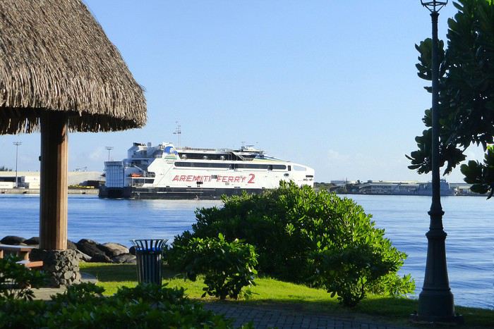
Peu de circulation. On est loin de Papeete. Au bout d'environ une heure, on rejoint la presqu'île de Taiarapu, aussi appelée Tahiti Iti ( ' iti ' en tahitien veut dire ' petit ' ) rattachée au reste de l'île par un isthme au ras de l'eau, avec le lagon d'un côté et la mangrove ( encore visible dans cette partie de île ) de l' autre. La ville principale est Taravao où l'on pourra, le moment venu, venir ou revenir pour déjeuner d'un poisson cru à la tahitienne ou d'un steak frites... Taravao en tant que petite ville n' a pas un interêt majeur, et on filera directement vers le Plateau de Taravao par une route ( qu'il faut trouver... ) très panoramique qui serpente vers les hauteurs et permet d'avoir un point de vue unique sur la grande île, le lagon et la pleine mer. Beaucoup de fermes sur le Plateau se consacrent à l'élevage, et le lait frais que l'on trouve dans les supermarchés de l'île vient de cette partie de l'île. On peut s'arrêter un peu plus longuement pour randonner. Si l'on est randonneur chevronné, la presqu'île est l' endroit rêvé pour des balades un peu plus professionnelles dans ce qu'on appelle le Pari, la partie sauvage ( pas de route d'accès ) de la presqu'île où l'on randonne entre mer et terre. Et si l'on est en plus plongeur, les spots dans cette partie de l'île sont réputés. Se renseigner à Papeete ou à Taravao. Après un déjeuner rapide, on prend la route de Teahupoo, site de la ' vague ' mythique de Tahiti, point de rencontre une fois l'an des surfeurs professionnels du monde entier. La vague peut par gros temps être la plus énorme au monde. Teahupoo, c'est aussi un petit village traditionnel auquel on a accès via un petit pont suspendu. On ira jusqu'au bout du chemin en longeant les modestes ' fare ' et on admirera la rivière de Vaipoiri, claire sous ses nénuphars. Tout cela à 1 km de ' la vague '. On peut pique-niquer ou se livrer à la contemplation dans cet endroit retiré et si tranquille au bord de l' eau.
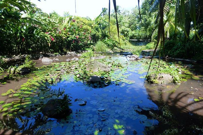
C'est le bout de la route et il faut revenir par le même chemin vers Taravao ;on se retrouve alors sur la route circulaire mais côte sud, qui va nous ramener tranquillement vers Papeete. Arrêt suivant, 5 mn après avoir quitté le rond-point d'entrée de Taravao : le Musée des îles qui est modeste, mais expose des objets anciens polynésiens et tapas, une rétrospective de l' oeuvre de Paul Gauguin, et des expositions au fil de l' année. Dans le jardin botanique, un arboretum intéressant. On continue notre circuit pour arriver au Jardin d'eau de Vaipahi ( PK 49 à Mataeia / randonnée possible sous les pins jusqu'à un point de vue sur presqu'île et lagon ) ) puis aux grottes de Maraa, le long de la route : des endroits bien indiqués, fleuris et frais. Puis, il convient de faire de nouveau halte au Marae Arahurahu, facile d'accès ( panneau indicateur sur la gauche de la route, côté montagne ) pour y admirer les vestiges ( restaurés et remontés tout de même ) d'un grand ensemble cérémoniel. On continue vers la plage de Vaiava, au km 18, la plus belle plage de Tahiti , sur la commune de Punauauia : sable blanc, eau claire et courante, aucun danger, la barrière de corail accessible à la nage. Je vous conseille donc de ne pas oublier vos maillots de bain, serviettes et crème solaire ( pas d'ombre l' après-midi ). Des douches sont disponibles à la sortie de la plage. Parking aménagé. Un endroit vraiment rêvé après une journée de marche et de voiture. Enfin, on rejoint la ville de Papeete où je vous propose un dernier arrêt en ville, derrière les bâtiments de l' Assemblée Territoriale, aux Jardins de la Reine. C'était là - sur le site actuel de l' Assemblée - que se trouvait autrefois le Palais de la reine Pomaré, dernière reine de Tahiti. Il était entouré d'un parc boisé et de jardins fleuris et ombragés et agrémenté d' une source d' eau douce et fraîche en forme de piscine naturelle où se baignait la Reine. On retrouve tout cela dans cet endroit magiquement calme malgré la circulation urbaine proche. Nous voici en ville, donc revenus au point de départ mais ce circuit peut être agrémenté - à l' aller par exemple - d' un autre détour, par exemple au Belvédère, pour lequel il faut aussi une voiture. L' embranchement se trouve à Arué. La route est étroite et sinueuse et monte à travers les bois. Il faut s'attendre à devoir croiser au moins un véhicule descendant et donc à manoeuvrer comme sur les routes des îles écossaises. Une fois au sommet, on se retrouve sur les grandes hauteurs de Tahiti et la vue est magnifique. Excursion facile et rapide.


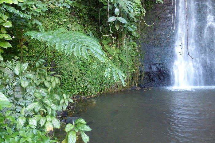
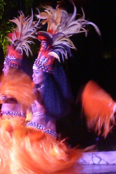
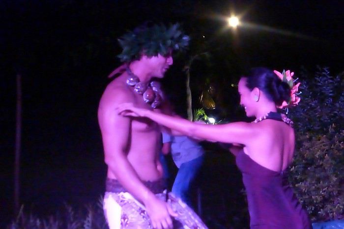

L' excursion est terminée, mais le séjour à Tahiti peut se prolonger à loisir et avec plaisir. Les plongeurs - souvent obsédés par Rangiroa ou Fakarava- trouveront pourtant ici, à Tahiti, des spots de rêve et des clubs de plongée professionnels à la hauteur. Je ne plonge pas moi-même mais des amis plongent régulièrement et rapportent des mini-vidéos absolument fabuleuses ( de 15 à 35 m de profondeur, poissons, requins bien sur, raies manta et gorgones fabuleuses ). Utiliser une Go Pro avec flash.
Autre excursion possible : Moorea, l'île soeur que l'on peut rejoindre en catamaran. Partir tôt le matin au premier bateau pour la lumière ( 7h 30 ). On peut louer une Vespa ou une moto ou une voiture bien sur, sur place. On peut aussi passer une voiture de location réservée à Tahiti à la journée ( pour une voiture moyenne, compter environ 8000 FCP AR, à savoir 60 euros ). Les prix ont bien baissé, et la voiture donne de l' autonomie et de la flexibilité. Possibilité aussi, à Moorea, de réserver une journée au Coco Beach, sur un motu en face de l' Intercontinental. C' est un restaurant qui a son propre embarcadère. Le motu est superbe, la nourriture de qualité, les prix très compétitifs, le site exceptionnel. Pour se relaxer, nager, bronzer et faire du snorkeling en toute sécurité. La Polynésie, c'est cela aussi ! Réserver le passage à l' avance de préférence, surtout le we, généralement très chargé, par exemple sur le site www.aremiti.pf.
Encore une excursion à la journée, plutôt le we , sauf en période de vacances scolaires sur le Territoire : l' atoll de Tetiaroa, dit atoll de Marlon Brando ( sur lequel on a construit le Brando, un hôtel de luxe hyper-écologique et très cher), qui était autrefois la résidence d'été de la dernière reine de Tahiti, la reine Pomaré. Journée exceptionnelle, surtout quand le temps est de la partie, le bateau ancre derrière la barrière ( pas de passe ) et l'on franchit le récif sur la vague montante dans un canot pneumatique. Même chose au retour. On peut se baigner à loisir, et marcher le long de la plage dans la partie publique de l'atoll vers l' Île aux Oiseaux où nichent des centaines de sternes et fous de Bassan. Les oeufs sont à même le sol, on se retrouve au contact des bébés fous tout blancs et ahuris dans la végétation basse, avec des plumes dressées sur la tête. Les oiseaux sont en confiance et n' ont pas appris à se méfier de l' homme. Une expérience rare ! Certains touristes se conduisant très mal et sans respect pour ce site de vie et de nidification fragile, il se pourrait que dans un avenir proche, on ne puisse plus - comme autrefois- profiter de cet endroit merveilleux.
On peut aussi consacrer une journée à la Traversière, une route / piste facilement inondable et submersible au creux de la caldeira de la vallée de la Vaihiria à la vallée de la Papenoo et qu'il vaut mieux faire en visite guidée avec 4X4. Via le refuge de la Maroto et le village Fare Hape ( et ses sites archéologiques ) et enfin le tunnel qui permet de passer de l' autre côté. On parle ici de 40 kms de découverte. Toutes infos à Papeete et sur Internet bien sur. A / Vaihiria Quad Tahiti . Tel : 87744639 Email : vaihiriaquad@gmail.com B / Tahiti Discovery. Tel : 87771594 Email : teiva.tahitidiscovery@gmail.com C / Tahiti Safari Expedition. tel : 40421415 Email : tahiti.safari@mail.pf D / Ia Ora Na Tahiti Expeditions. tel : 87758807 Email : iaoranaexpeditions@gmail.com
Autre excursion possible à la journée aux ' lava tubes ' ( des tunnels de lave sauvages et préservés sur les hauteurs de Hitiaa ).
Toujours sur la commune de Hitiaa, on pourra randonner le long d'un magnifique ligne de cascades, la Faraura. Chaussures en plastique, genre crocs avec chaussettes conseillées.
Pour les randonneurs aguerris, il y a la longue et sportive ascension de l' Aorai, troisième sommet de l'île. Pour des randonneurs plus ordinaires mais toujours sportifs, on conseillera la randonnée vers le mont Marau ( environ 20 kms AR ). il ne faut pas avoir le vertige car certains passages sont difficiles et possibles uniquement avec cordes. ( Sentier accessible depuis le haut de St Hilaire à Faa'a ou du Lotus à Punaauia )
A / Tahiti Reva Trek. Contacter Angelina Bordas : Tel : 87747720 Email : pirimato@mail.pf B / Aito Rando : Contacter Pierre et Jimmy Leyral : Tel : 87762025 Email : aitorando987@gmail.com C / Vertical Limit : Contacter François Pratique : Tel : 87321549 Email : francoispratique@yahoo.fr
On peut aussi choisir la voie des airs et survoler Tahiti, grâce à une nouvelle compagnie, Tahiti Nui Helicopters. Vols touristiques entre 10 et 30 minutes : vallée de la Fautaua, col de Tiara à 1050 m d'altitude et port de Papeete pour le premier, plateau des orangers, Papenoo, caldeira, cascades et sommets vertigineux pour la seconde, vol entre mer et terre pour la dernière. Tarifs à partir de 16250 FCP. Quatre passagers minimum. Tous les jours de 7 h 00 à 19 h 00. A l' aéroport ( zone nord ). Site Internet : www.tahitinuihelicopers.com Email : commercial@tnh.pf
Trois mara'e sont visibles à Tahiti : le mara'e Ta'ata à Pa'ea ( rattaché au monde marin ), le mara'e Arahurahu déjà cité, rénové et servant d'écrin à des spectacles traditionnels, le mara'e Mahaiatea situé à Papara, moins intéressant car écroulé mais en voie d'aménagement.
Trois musées enfin : celui de la Perle à Papeete ( sur le front de mer ), le Musée de Tahiti et ses Îles au pk 15, à la pointe des Pêcheurs à Punaauia, et le Musée James Norman Hall ( auteur, entre autres du livre ' les révoltés de la Bounty ' -au PK 5 de Arue.
Pour les amateurs de golf : Golf Olivier Bréaud à Atimaono ( 41 kms de Papeete ) Tel : 40574052 Email : egat@egat.pf
Pour les fans de parapente Tahiti Parapente : tel : 87779017 Site Internet : www.tahiti-parapente.com
Pour les fans de mer et de sport ( en particulier le subwing ) Tahiti by Boat . Tel : 87291510
On ne peut quitter Tahiti sans aller voir un spectacle de danse dans un hôtel, principalement l' L'Intercontinental et le Sofitel. Le mercredi soir pour assister à un spectacle de danses marquisiennes à l' Intercontinental, les vendredi et samedi soirs dans ces deux hôtels, avec ou sans dîner. Certains restaurants ont aussi leur propre spectacle de danses, mais les hôtels offrent une scène plus impressionnante et où l'on peut rassembler davantage de danseurs.
Je recommande donc de quitter la France le jeudi pour une arrivée le vendredi matin et -au moins- un week end sur place pour profiter de tout, la plage, le marché, les plages à surf, la presqu'île, les soirées avec danses traditionnelles. Tout est une question de choix et d'équilibre, mais louper Tahiti serait, vous l' avez désormais compris, une erreur monumentale... ! A bientôt
Moana
UN PEU D'HISTOIRE Tahiti est associée au mythe du paradis depuis la visite de Louis Antoine de Bougainville et de son équipage, le 6 avril 1768, sur les deux navires la Boudeuse et l' Etoile. Tout commence en baie de Hitiaa. beaucoup ont nourri le mythe, de Loti à Segalen et à Gauguin bien sur. UN PEU DE GEOGRAPHIE Tahiti - avec sa soeur Moorea - fait partie des Iles du Vent dans l' archipel de la Société. c'est la plus grande île de Polynésie Française avec ses 1042 km2 et ses 190 kms de périmètre. Elle culmine à 2241 m au mont Orohena. Elle compte environ 185000 habitants. C'est au départ une île éminemment volcanique. Le premier volcan, jailli des profondeurs il y a 3 million d'années, a crée Tahiti Nui, la grande partie de l' île. Le second volcan, âgé de 500.000 ans a crée Tahiti Iti, la petite partie de l'île. Ces volcans sont éteints depuis longtemps et sont reliés par l'isthme de Taravao.
Je suis résident en PF depuis 30 ans et le circuit que je vais vous indiquer ici est incontournable, que ce soit le premier jour de votre arrivée, ou en fin de séjour quand vous aurez visité un ou deux autres archipels. Quand on débarque d'un aussi long vol de presque 24 heures d'avion, deux nuits à Papeete permettent de se reposer, retrouver de l' énergie et visiter une île qui réserve de belles surprises. L' aéroport de Tahiti Faa'a est l' entrée officielle par les airs sur le Territoire de Polynésie Française et sur l'île de Tahiti, la première et la dernière étape d'un voyage en Polynésie. Quand on arrive par le vol d' Air France - ou celui d'ATN ou encore celui de French Bee- vers 5 ou 6 heures du matin, on peut conseiller d'aller faire un tour au grand marché sans tarder, en particulier le dimanche ( uniquement Air France ce jour-là ) et s'imprégner d'une ambiance toute polynésienne : couleurs, senteurs et odeurs de cuisine sont au rendez-vous. Mais attention, à 8 h 30, tout est fini ou presque. Papeete n' est pas une ville inoubliable, même s'il est agréable d'y habiter, en particulier sur les hauteurs où il fait moins chaud. On fera le tour de ville en 2 heures : front de mer, temple, cathédrale, petites rues et échoppes autour du marché. La ville est haute en couleur et l' atmosphère générale est très tahitienne. Disons que la ville est typée et est une bonne introduction au voyage qui va suivre.
Excursion d' 1 jour : environ 140 kms Location de voiture à l' aéroport à l' arrivée L' itinéraire que je vous propose est un tour de l'île classique qui commence le matin, pas trop tard, par les côtes est et nord, à savoir Pirae, Arue et puis Mahina où l'on fera la première halte côté pointe Vénus, plage de sable noir et phare historique. L' endroit a été récemment joliment réaménagé et est très plaisant et ombragé. Peu de monde le matin, sauf le week-end, on flâne et on photographie à loisir. Le phare est l'un des rares monuments un peu anciens qui ont résisté sur l' île ( avec la cathédrale de Papeete et la Mairie d'Arue (banlieue de PPT traversée précédemment ), ancienne maison coloniale restaurée superbement comme il y en avait des dizaines dans des parcs immenses le long de la côte. L'histoire de la Pointe Venus, c'est l' arrivée officielle des missionnaires venus évangéliser les populations locales au 19ème siècle. Pas de trace de mission à cet endroit précis, mais il reste le phare qui date de cette époque. On quitte la Pointe Venus pour rejoindre la route de côte, et l'on s'éloigne doucement de Papeete le long d' une jolie route en bord de mer. Pas de lagon de ce côté-ci de Tahiti, la mer se fait entendre et écume sur les rochers. Le week-end surtout, on y voit surfeurs, planchistes et autres amateurs de sensations car les vagues peuvent devenir grosses par temps agité. Et nous voici déjà ( km 22 ) au site de Teruaporea, aussi appelé Trou du Souffleur de Tiarei et anciennement Arahoho ( qui en tahitien veut dire ' la grotte qui hurle ' ). Quand la mer est formée et que les vagues viennent s'écraser sur la muraille, le souffle d'eau vaporisée est puissant. C'est un bel endroit bien ventilé, face à l'océan, proche d'une petite plage sauvage, remuée par les vagues, fréquenté par les bodyboarders qui y trouvent de beaux trains de vagues à surfer. Ensuite, on va rouler tranquillement sur cette même route circulaire, en traversant de petits villages et en admirant les points de vue sur la mer, la montagne et les îlots proches du rivage.
.
Peu de circulation. On est loin de Papeete. Au bout d'environ une heure, on rejoint la presqu'île de Taiarapu, aussi appelée Tahiti Iti ( ' iti ' en tahitien veut dire ' petit ' ) rattachée au reste de l'île par un isthme au ras de l'eau, avec le lagon d'un côté et la mangrove ( encore visible dans cette partie de île ) de l' autre. La ville principale est Taravao où l'on pourra, le moment venu, venir ou revenir pour déjeuner d'un poisson cru à la tahitienne ou d'un steak frites... Taravao en tant que petite ville n' a pas un interêt majeur, et on filera directement vers le Plateau de Taravao par une route ( qu'il faut trouver... ) très panoramique qui serpente vers les hauteurs et permet d'avoir un point de vue unique sur la grande île, le lagon et la pleine mer. Beaucoup de fermes sur le Plateau se consacrent à l'élevage, et le lait frais que l'on trouve dans les supermarchés de l'île vient de cette partie de l'île. On peut s'arrêter un peu plus longuement pour randonner. Si l'on est randonneur chevronné, la presqu'île est l' endroit rêvé pour des balades un peu plus professionnelles dans ce qu'on appelle le Pari, la partie sauvage ( pas de route d'accès ) de la presqu'île où l'on randonne entre mer et terre. Et si l'on est en plus plongeur, les spots dans cette partie de l'île sont réputés. Se renseigner à Papeete ou à Taravao. Après un déjeuner rapide, on prend la route de Teahupoo, site de la ' vague ' mythique de Tahiti, point de rencontre une fois l'an des surfeurs professionnels du monde entier. La vague peut par gros temps être la plus énorme au monde. Teahupoo, c'est aussi un petit village traditionnel auquel on a accès via un petit pont suspendu. On ira jusqu'au bout du chemin en longeant les modestes ' fare ' et on admirera la rivière de Vaipoiri, claire sous ses nénuphars. Tout cela à 1 km de ' la vague '. On peut pique-niquer ou se livrer à la contemplation dans cet endroit retiré et si tranquille au bord de l' eau.
C'est le bout de la route et il faut revenir par le même chemin vers Taravao ;on se retrouve alors sur la route circulaire mais côte sud, qui va nous ramener tranquillement vers Papeete. Arrêt suivant, 5 mn après avoir quitté le rond-point d'entrée de Taravao : le Musée des îles qui est modeste, mais expose des objets anciens polynésiens et tapas, une rétrospective de l' oeuvre de Paul Gauguin, et des expositions au fil de l' année. Dans le jardin botanique, un arboretum intéressant. On continue notre circuit pour arriver au Jardin d'eau de Vaipahi ( PK 49 à Mataeia / randonnée possible sous les pins jusqu'à un point de vue sur presqu'île et lagon ) ) puis aux grottes de Maraa, le long de la route : des endroits bien indiqués, fleuris et frais. Puis, il convient de faire de nouveau halte au Marae Arahurahu, facile d'accès ( panneau indicateur sur la gauche de la route, côté montagne ) pour y admirer les vestiges ( restaurés et remontés tout de même ) d'un grand ensemble cérémoniel. On continue vers la plage de Vaiava, au km 18, la plus belle plage de Tahiti , sur la commune de Punauauia : sable blanc, eau claire et courante, aucun danger, la barrière de corail accessible à la nage. Je vous conseille donc de ne pas oublier vos maillots de bain, serviettes et crème solaire ( pas d'ombre l' après-midi ). Des douches sont disponibles à la sortie de la plage. Parking aménagé. Un endroit vraiment rêvé après une journée de marche et de voiture. Enfin, on rejoint la ville de Papeete où je vous propose un dernier arrêt en ville, derrière les bâtiments de l' Assemblée Territoriale, aux Jardins de la Reine. C'était là - sur le site actuel de l' Assemblée - que se trouvait autrefois le Palais de la reine Pomaré, dernière reine de Tahiti. Il était entouré d'un parc boisé et de jardins fleuris et ombragés et agrémenté d' une source d' eau douce et fraîche en forme de piscine naturelle où se baignait la Reine. On retrouve tout cela dans cet endroit magiquement calme malgré la circulation urbaine proche. Nous voici en ville, donc revenus au point de départ mais ce circuit peut être agrémenté - à l' aller par exemple - d' un autre détour, par exemple au Belvédère, pour lequel il faut aussi une voiture. L' embranchement se trouve à Arué. La route est étroite et sinueuse et monte à travers les bois. Il faut s'attendre à devoir croiser au moins un véhicule descendant et donc à manoeuvrer comme sur les routes des îles écossaises. Une fois au sommet, on se retrouve sur les grandes hauteurs de Tahiti et la vue est magnifique. Excursion facile et rapide.
L' excursion est terminée, mais le séjour à Tahiti peut se prolonger à loisir et avec plaisir. Les plongeurs - souvent obsédés par Rangiroa ou Fakarava- trouveront pourtant ici, à Tahiti, des spots de rêve et des clubs de plongée professionnels à la hauteur. Je ne plonge pas moi-même mais des amis plongent régulièrement et rapportent des mini-vidéos absolument fabuleuses ( de 15 à 35 m de profondeur, poissons, requins bien sur, raies manta et gorgones fabuleuses ). Utiliser une Go Pro avec flash.
Autre excursion possible : Moorea, l'île soeur que l'on peut rejoindre en catamaran. Partir tôt le matin au premier bateau pour la lumière ( 7h 30 ). On peut louer une Vespa ou une moto ou une voiture bien sur, sur place. On peut aussi passer une voiture de location réservée à Tahiti à la journée ( pour une voiture moyenne, compter environ 8000 FCP AR, à savoir 60 euros ). Les prix ont bien baissé, et la voiture donne de l' autonomie et de la flexibilité. Possibilité aussi, à Moorea, de réserver une journée au Coco Beach, sur un motu en face de l' Intercontinental. C' est un restaurant qui a son propre embarcadère. Le motu est superbe, la nourriture de qualité, les prix très compétitifs, le site exceptionnel. Pour se relaxer, nager, bronzer et faire du snorkeling en toute sécurité. La Polynésie, c'est cela aussi ! Réserver le passage à l' avance de préférence, surtout le we, généralement très chargé, par exemple sur le site www.aremiti.pf.
Encore une excursion à la journée, plutôt le we , sauf en période de vacances scolaires sur le Territoire : l' atoll de Tetiaroa, dit atoll de Marlon Brando ( sur lequel on a construit le Brando, un hôtel de luxe hyper-écologique et très cher), qui était autrefois la résidence d'été de la dernière reine de Tahiti, la reine Pomaré. Journée exceptionnelle, surtout quand le temps est de la partie, le bateau ancre derrière la barrière ( pas de passe ) et l'on franchit le récif sur la vague montante dans un canot pneumatique. Même chose au retour. On peut se baigner à loisir, et marcher le long de la plage dans la partie publique de l'atoll vers l' Île aux Oiseaux où nichent des centaines de sternes et fous de Bassan. Les oeufs sont à même le sol, on se retrouve au contact des bébés fous tout blancs et ahuris dans la végétation basse, avec des plumes dressées sur la tête. Les oiseaux sont en confiance et n' ont pas appris à se méfier de l' homme. Une expérience rare ! Certains touristes se conduisant très mal et sans respect pour ce site de vie et de nidification fragile, il se pourrait que dans un avenir proche, on ne puisse plus - comme autrefois- profiter de cet endroit merveilleux.
On peut aussi consacrer une journée à la Traversière, une route / piste facilement inondable et submersible au creux de la caldeira de la vallée de la Vaihiria à la vallée de la Papenoo et qu'il vaut mieux faire en visite guidée avec 4X4. Via le refuge de la Maroto et le village Fare Hape ( et ses sites archéologiques ) et enfin le tunnel qui permet de passer de l' autre côté. On parle ici de 40 kms de découverte. Toutes infos à Papeete et sur Internet bien sur. A / Vaihiria Quad Tahiti . Tel : 87744639 Email : vaihiriaquad@gmail.com B / Tahiti Discovery. Tel : 87771594 Email : teiva.tahitidiscovery@gmail.com C / Tahiti Safari Expedition. tel : 40421415 Email : tahiti.safari@mail.pf D / Ia Ora Na Tahiti Expeditions. tel : 87758807 Email : iaoranaexpeditions@gmail.com
Autre excursion possible à la journée aux ' lava tubes ' ( des tunnels de lave sauvages et préservés sur les hauteurs de Hitiaa ).
Toujours sur la commune de Hitiaa, on pourra randonner le long d'un magnifique ligne de cascades, la Faraura. Chaussures en plastique, genre crocs avec chaussettes conseillées.
Pour les randonneurs aguerris, il y a la longue et sportive ascension de l' Aorai, troisième sommet de l'île. Pour des randonneurs plus ordinaires mais toujours sportifs, on conseillera la randonnée vers le mont Marau ( environ 20 kms AR ). il ne faut pas avoir le vertige car certains passages sont difficiles et possibles uniquement avec cordes. ( Sentier accessible depuis le haut de St Hilaire à Faa'a ou du Lotus à Punaauia )
A / Tahiti Reva Trek. Contacter Angelina Bordas : Tel : 87747720 Email : pirimato@mail.pf B / Aito Rando : Contacter Pierre et Jimmy Leyral : Tel : 87762025 Email : aitorando987@gmail.com C / Vertical Limit : Contacter François Pratique : Tel : 87321549 Email : francoispratique@yahoo.fr
On peut aussi choisir la voie des airs et survoler Tahiti, grâce à une nouvelle compagnie, Tahiti Nui Helicopters. Vols touristiques entre 10 et 30 minutes : vallée de la Fautaua, col de Tiara à 1050 m d'altitude et port de Papeete pour le premier, plateau des orangers, Papenoo, caldeira, cascades et sommets vertigineux pour la seconde, vol entre mer et terre pour la dernière. Tarifs à partir de 16250 FCP. Quatre passagers minimum. Tous les jours de 7 h 00 à 19 h 00. A l' aéroport ( zone nord ). Site Internet : www.tahitinuihelicopers.com Email : commercial@tnh.pf
Trois mara'e sont visibles à Tahiti : le mara'e Ta'ata à Pa'ea ( rattaché au monde marin ), le mara'e Arahurahu déjà cité, rénové et servant d'écrin à des spectacles traditionnels, le mara'e Mahaiatea situé à Papara, moins intéressant car écroulé mais en voie d'aménagement.
Trois musées enfin : celui de la Perle à Papeete ( sur le front de mer ), le Musée de Tahiti et ses Îles au pk 15, à la pointe des Pêcheurs à Punaauia, et le Musée James Norman Hall ( auteur, entre autres du livre ' les révoltés de la Bounty ' -au PK 5 de Arue.
Pour les amateurs de golf : Golf Olivier Bréaud à Atimaono ( 41 kms de Papeete ) Tel : 40574052 Email : egat@egat.pf
Pour les fans de parapente Tahiti Parapente : tel : 87779017 Site Internet : www.tahiti-parapente.com
Pour les fans de mer et de sport ( en particulier le subwing ) Tahiti by Boat . Tel : 87291510
On ne peut quitter Tahiti sans aller voir un spectacle de danse dans un hôtel, principalement l' L'Intercontinental et le Sofitel. Le mercredi soir pour assister à un spectacle de danses marquisiennes à l' Intercontinental, les vendredi et samedi soirs dans ces deux hôtels, avec ou sans dîner. Certains restaurants ont aussi leur propre spectacle de danses, mais les hôtels offrent une scène plus impressionnante et où l'on peut rassembler davantage de danseurs.
Je recommande donc de quitter la France le jeudi pour une arrivée le vendredi matin et -au moins- un week end sur place pour profiter de tout, la plage, le marché, les plages à surf, la presqu'île, les soirées avec danses traditionnelles. Tout est une question de choix et d'équilibre, mais louper Tahiti serait, vous l' avez désormais compris, une erreur monumentale... ! A bientôt
Moana
Temps de route Reykjavik - Vik English translation pending
Est il possible de faire en voiture de location un aller retour sur Vik dans la journée depuis Reyklavik, sans passer son temps sur la route et ceci a mi avril , en prévoyant des arrêts sur les cascades et autres. Je n'est malheureusement que 3 jours sur place.
Pour les septiques, en arrivant le 16 avril au soir, je compte faire le cercle d'or le dimanche 17 dans la journée, ensuite le 18 un whales watching avec Elding le matin a 9 heures, après midi a 16 heures Blue lagoon, pour finir par l'aller retour sur Vik le 19 dans la journée, depart avion le 20 au matin. Je sais trés court, mais on fait avec
Merci a tous de vos réponses
Pour les septiques, en arrivant le 16 avril au soir, je compte faire le cercle d'or le dimanche 17 dans la journée, ensuite le 18 un whales watching avec Elding le matin a 9 heures, après midi a 16 heures Blue lagoon, pour finir par l'aller retour sur Vik le 19 dans la journée, depart avion le 20 au matin. Je sais trés court, mais on fait avec
Merci a tous de vos réponses
Voyage de noces en Polynésie-Française English translation pending
Bonjour à tous,
Pour notre voyage de noces nous venons en polynesie!
Nous aimerions avoir quelques conseils et aide!
16/09: nous arrivons à 1h du matin (donc dans la nuit du 15 au 16) à Tahiti 17/19: Tahiti puis ferry ou avion pour Moorea Nous serons donc 1j 1/2 à Tahiti, Nous pensions louer un appartement dans le centre de Tahiti avec airbnb? Ou un appartement plus excentré avec loc de voiture? Ou encore prendre une excursion à la demi journée? Y'en a t'il de bien? Ou un cours de surf?
17/09: depart pour Moorea, nous avons le pass inter iles mais nous conseillez vous malgrès tout de prendre le ferry? Nous logerons 4 nuits au Hilton
21/09: depart pour Bora pour 3 nuits au Sofitel private island (octopus24 tu as fini de me decider!!)
24/09: mes questions se posent là! Dans mon pass j'ai rataiea, maupiti ou huahine! Donc et bien...nous hésitons entre les 3! Attention se serait seulement pour 2 nuits donc très courts mais au moins nous aurons vu autre chose 😛 ! Nous aimons le farniente (mais je pense qu'avec moorea et bora nous aurons quand meme eu nnotre compte) , les balades (pas de grosses rando), les activités un peu sensation, les belles plages.
Voilou, le devis est en cours avec yestahiti donc de "l'interieur" c'est modulable et l'ordre aussi du coups!
Merci de votre aide et avis!!
Pour notre voyage de noces nous venons en polynesie!
Nous aimerions avoir quelques conseils et aide!
16/09: nous arrivons à 1h du matin (donc dans la nuit du 15 au 16) à Tahiti 17/19: Tahiti puis ferry ou avion pour Moorea Nous serons donc 1j 1/2 à Tahiti, Nous pensions louer un appartement dans le centre de Tahiti avec airbnb? Ou un appartement plus excentré avec loc de voiture? Ou encore prendre une excursion à la demi journée? Y'en a t'il de bien? Ou un cours de surf?
17/09: depart pour Moorea, nous avons le pass inter iles mais nous conseillez vous malgrès tout de prendre le ferry? Nous logerons 4 nuits au Hilton
21/09: depart pour Bora pour 3 nuits au Sofitel private island (octopus24 tu as fini de me decider!!)
24/09: mes questions se posent là! Dans mon pass j'ai rataiea, maupiti ou huahine! Donc et bien...nous hésitons entre les 3! Attention se serait seulement pour 2 nuits donc très courts mais au moins nous aurons vu autre chose 😛 ! Nous aimons le farniente (mais je pense qu'avec moorea et bora nous aurons quand meme eu nnotre compte) , les balades (pas de grosses rando), les activités un peu sensation, les belles plages.
Voilou, le devis est en cours avec yestahiti donc de "l'interieur" c'est modulable et l'ordre aussi du coups!
Merci de votre aide et avis!!
Itinéraire "raisonnable" 3 semaines aux Philippines du 6 au 25 janvier 2016 English translation pending
Bonjour,
Nous nous rendrons pour la première fois aux Philippines en Janvier prochain (arrivée à Manille). Nous avons réalisé - étant donné le temps que prend chaque transfert - que pour vraiment profiter des lieux, des atmosphères et apprécier nos vacances il valait mieux nous limiter à 3 ou 4 endroits pour ce premier voyage.
Nous aimons le snorkeling, les randonnées, les balades à vélo ou en moto.
Après avoir lu vos commentaires et conseils depuis quelques temps (lemonk68, jeandaune, doud2, cottetcottet et consorts : vous êtes maintenant des légendes pour nous 😉), voici ce que nous avons retenu :
Première semaine : Port Barton avec Island hopping et 1 ou 2 nuits à Capnica. Nous pensions faire Bantayan, Camiguin et Negros la 2ème et 3ème semaines, mais nous avons appris par lemonk68 que le climat n'était pas propice à Camiguin en ce moment).
Que pourrions-nous ajouter à cet itinéraire ? par quoi remplacer Camiguin ?
Merci pour votre aide.
Nous aimons le snorkeling, les randonnées, les balades à vélo ou en moto.
Après avoir lu vos commentaires et conseils depuis quelques temps (lemonk68, jeandaune, doud2, cottetcottet et consorts : vous êtes maintenant des légendes pour nous 😉), voici ce que nous avons retenu :
Première semaine : Port Barton avec Island hopping et 1 ou 2 nuits à Capnica. Nous pensions faire Bantayan, Camiguin et Negros la 2ème et 3ème semaines, mais nous avons appris par lemonk68 que le climat n'était pas propice à Camiguin en ce moment).
Que pourrions-nous ajouter à cet itinéraire ? par quoi remplacer Camiguin ?
Merci pour votre aide.
Hébergement à Rodrigues, fin d'année 2014 English translation pending
Chers amis globe-trotters.
Je prévois un séjour à l'Ile Rodrigues pour cette fin d'année 2014 (fin dec. janvier), et je j'aimerais trouver un hébergement, hors des sentiers battus (hors port Mathurin, Anse aux Anglais.. et les les hôtels..).
J'aimerais un hébergement sur la partie haute de l’Île ou sur la côte sud ou dans la région ouest.
Quelqu'un aurait il des adresses?
Je vous remercie d'avance
Laurent
Voyage de noce 21 nuits en Polynésie, des avis sur ces idées? English translation pending
Ia orana,
Nous arrivons le 23 aout à 5h du mat à l’aéroport de Tahiti et repartons le 13 septembre à 7h50.
Nous souhaitons passer le niveau 1 de plongée, c’est pourquoi j’ai prévu 6 ou 7 jours à Moorea pour commencer. Ensuite Maupiti me tiens vraiment à cœur car très belle et préservée. De plus je rêve de nager avec les baleines et c’est surtout à Moorea et Maupiti que je peux les voir (Rurutu aussi mais c’est trop loin). Finir par Rangiroa pour les plus belles plongées et la belle pension Tevahine dispo juste à ce moment c’est sûr.
Les incertitudes sont plus au milieu : envie de Tahaa pour la vanille, les tortues et le beau Vahine Island, Bora Bora pour voir parce que c’est Bora Bora mais je
n’ai pas envie d’y rester trop, et Huahine ça a l’air bien aussi…
Option E Moorea 4 Maupiti 5 Tahaa 4 Bora 2 Rangiroa 5
Option F Moorea 4 Huahine 3 Bora 2 Maupiti 5 Tahaa 2 Rangiroa 4
Option E Moorea 4 Maupiti 5 Tahaa 4 Bora 2 Rangiroa 5
Option F Moorea 4 Huahine 3 Bora 2 Maupiti 5 Tahaa 2 Rangiroa 4
Descendre à Dakhla depuis Agadir en Logan (voiture) de location English translation pending
Bonjour,
Les prix pour descendre sur Dakhla en avion ont vraiment augmenté donc je ma demandais si on ne pouvait pas y aller avec sa propre voiture de location? c'est faisable en combien de temps? Ensuite peut on trouver des logements pour 2 dans les 20 euros environ..Est ce que ces établissements sont loin des endroits où l'on peut pratiquer le kitesurf? Par avance merci 🙂
Les prix pour descendre sur Dakhla en avion ont vraiment augmenté donc je ma demandais si on ne pouvait pas y aller avec sa propre voiture de location? c'est faisable en combien de temps? Ensuite peut on trouver des logements pour 2 dans les 20 euros environ..Est ce que ces établissements sont loin des endroits où l'on peut pratiquer le kitesurf? Par avance merci 🙂
Snorkeling à la Réunion au mois d'août English translation pending
Bonjour à tous
Je prépare mes vacances du mois d'aout. J'aimerai faire du snorkeling. Je me posais la question de la température de l'eau, de sa clarté et de le beauté des fonds entre la réunion, l'île maurice ou le sri lanka en cette période. Je vous remercie de m'aider. J'ai un peu voyagé (thailande, birmanie, inde entre autre) je me ferai un plaisir de vous informer moi aussi si je le peux. Merci d'avance
Hôtel Ancon Trinidad English translation pending
bonjour, nous partons au mois de mars pour deux semaines au ancon , j' aimerais si quelqu' un pouvait prendre quelques minutes de son temps pour me dire comment il a trouvé cette hotel nourritures et personnels p/s le voyage doit avoir été effectué automne 2011 ou hiver 2012 merci à l'avance.
Costa Rica: endroit sympa sur la côte? English translation pending
Bonjour,
Je pars au Costa Rica avec un ami pendant 3 petites semaines, du 23 Mars au 13 Avril.
Pour la fin du séjour, nous aimerions trouver un endroit sympa, assez calme, et vraiment sur la cote.
J'avais pensé à Cahuita, où un parc a l'air très bien : http://www.albylodge.com/Home_Java_Version/Spanisch/Los_Cabinas/los_cabinas.html
Des plages sont-elles sympas ?
J'ai lu que les courants pouvaient être forts dans ce coin. Est-ce que la baignade est dangereuse ? Si c'est le cas, va falloir trouver un autre endroit je pense.
Merci à tous pour vos retours et suggestions,
A bientot !
Maldives: hôtel sur pilotis? English translation pending
Bonjour a toutes et tous
J'aimerais savoir si c'est vraiment interessant de loger dans un hotel sur Pilotis aux Maldives ?? (j'ai entendu dire qu(il faisait très très chaud et que du coup il fallait avoir la clim allumée en permanence) Sachant que nous partirions en fevrier 2011, nous commencçons a nous renseigner le plus possible dès maintenant. En gros est ce vraiement interessant sur pilotis par rapport au prix ? Et pouvez vous me dire quelle ile est la plus peuplée en poissons ??( afin de pouvoir bien voir les poissons sans avoir besoins d'aller nager trop loin) . MErci a tous de vos réponses 🙂
J'aimerais savoir si c'est vraiment interessant de loger dans un hotel sur Pilotis aux Maldives ?? (j'ai entendu dire qu(il faisait très très chaud et que du coup il fallait avoir la clim allumée en permanence) Sachant que nous partirions en fevrier 2011, nous commencçons a nous renseigner le plus possible dès maintenant. En gros est ce vraiement interessant sur pilotis par rapport au prix ? Et pouvez vous me dire quelle ile est la plus peuplée en poissons ??( afin de pouvoir bien voir les poissons sans avoir besoins d'aller nager trop loin) . MErci a tous de vos réponses 🙂
Hôtel Coco Palm Dhuni Kolhu aux Maldives English translation pending
Bonjour, je pars aux Maldives fin octobre dans l'hôtel Coco Palm Dhuni Kolhu
et j'aimerai savoir vos avis sur cet hôtel, nous sommes dans un bungalow sur pilotis.
Et également les excursions sympa à faire ainsi que des renseignements sur la plongée, car je veux profiter un maximum des fonds sous marins 🙂🙂🙂🙂
Merci
Et également les excursions sympa à faire ainsi que des renseignements sur la plongée, car je veux profiter un maximum des fonds sous marins 🙂🙂🙂🙂
Merci
Logements sur les îles de la côte est de la Malaisie? English translation pending
Bonjour à tous et à toutes,
par manque d'expérience, nous nous retrouvons mon amoureuse et moi à quelques jours de notre départ sans hôtel sur les Perenthians. Voici mes questions:
- il n'y a plus de places dans les différents hôtels de la plage sud ouest de Besar, là où nous souhaitons séjourner: est-ce irréversible? l'un d'entre vous a-t-il déjà connu cette situation et comment a-t-il fait? - est-ce la même chose sur Kecil? pire? - quelle est l'ultime solution? Est-ce possible de planter une tente? - faut-il également réserver à l'avance pour la plongée ou pouvons-nous attendre d'être sur place?
Nous n'avons pas encore fait les démarches pour Pulau Tioman (qui arrive plus tard durant notre séjour): est-ce le même contexte en terme de razzia des chalets sea view?
Merci!!!
Christophe
par manque d'expérience, nous nous retrouvons mon amoureuse et moi à quelques jours de notre départ sans hôtel sur les Perenthians. Voici mes questions:
- il n'y a plus de places dans les différents hôtels de la plage sud ouest de Besar, là où nous souhaitons séjourner: est-ce irréversible? l'un d'entre vous a-t-il déjà connu cette situation et comment a-t-il fait? - est-ce la même chose sur Kecil? pire? - quelle est l'ultime solution? Est-ce possible de planter une tente? - faut-il également réserver à l'avance pour la plongée ou pouvons-nous attendre d'être sur place?
Nous n'avons pas encore fait les démarches pour Pulau Tioman (qui arrive plus tard durant notre séjour): est-ce le même contexte en terme de razzia des chalets sea view?
Merci!!!
Christophe
Ile Maurice: privilégier l'hôtel aux locations - insécurité grandissante English translation pending
Je recommande à tous ceux qui veulent choisir des locations de privilégier les hôtels ou les résidences très fortement sécurisées (bien vérifier que les alarmes soient reliées à des sociétés de sécurisées) et encore ??? car Maurice devient le nouveau Zimbawee ..... nous nous rendons en location depuis neuf ans, mais compte tenu des agressions et des vols de plus en plus nombreux sur les lieux touristique, nous recommandons la plus grande vigilance.
copie de ma lette envoyée aux medias mauriciens pour le Ministère du Tourisme en attendant sa publication !
Monsieur le ministre
Je me permets de vous écrire et j’ose espérer que vous lisiez cette lettre
Tout d’abord je tiens à préciser que je viens en vacances presque deux mois par an , depuis neuf ans à l’Ile Maurice .
Si je me rends chez vous , c’est parce que j’aime votre île, ses paysages, j’aime les mauriciens et la culture mauricienne.
Depuis deux ou trois ans, nous avons remarqué une lente dégradation de la propreté (voir hygiène). de la sécurité et l’accueil touristique. Nous tenions donc à vous faire part de notre réflexion concernant ces trois points. Si je dis nous, c’est que je parle également au nom de nos amis français touristes comme nous et qui m’ont demandé expressément de leur servir de « porte parole »
Je vais essayer d’être brève et évoquer les faits suivants qui se sont déroulés lors de notre dernier séjour en novembre et décembre 2009.
Propreté sur l’Ile
Nous résidons pendant nos vacances entre Trou aux Biches et Mont Choisy dans une maison que nous louons. Le quartier est devenu très sale (mais c’est identique dans bien d’autres lieux)
Les cotés des rues sont jonchés de bouteilles plastique et de canettes de bière .
Nous avons vu à plusieurs reprises des mauriciens sortir du bus et jeter leur papiers par terre sur la route Nous avons même surpris un chauffeur de taxi devant l’hôtel CASUARINA en train de jeter son cornet de glace en papier sur le parking à côté de la plage . (comme s’il ne gagnait pas sa vie grâce aux touristes !)
Si vous vous rendez le soir à l’ ile aux cerfs vers 17 heures vous verrez que les familles qui viennent en pique nique laissent tous leurs détritus par terre (malgré les nombreuses poubelles Et cet endroit est, , si je ne me trompe , référencé dans vos guides de vacances comme l’endroit touristique à ne pas manquer !
Pourtant, nous avons remarqué en quelques années les efforts faits par votre gouvernement : affiches personnel plus important pour nettoyer les plages et nombre de poubelles installés sur les lieux publics A quoi servent ces efforts si l’éducation à la propreté est inexistante chez certains mauriciens. ? Ne pensez-vous pas qu’une politique d’éducation à la propreté et de prise de conscience de l’importance du « tourisme « sur l’économie soit indispensable ? Pensez-vous que les touristes ne sortent jamais de leur hôtel ?
Insécurité
Pendant notre séjour en novembre et décembre 2009 entre Trou aux Biches et Mont Choisy, cinq maisons où résidaient des touristes ont été cambriolées (vol d’appareil photos - ordinateurs - carte bleues et argent) Vous pourrez, je pense vérifier ces faits auprès de la police de Trou aux Biches (s’ils ont bien voulu comptabiliser les dépôts de plaintes ?) et deux autres dans la semaine après notre départ le 19 décembre . Ce sont seulement les faits dont nous avons eu part, il y en a certainement d’autres.
(il suffit de lire la presse !)
Nous avons , nous la chance de louer une maison très protégée et bien équipée en alarme (qui se sont enclenchées quand même trois fois la nuit durant notre séjour avec des tentatives d‘effraction !)
Depuis deux ans, nous ne voyons plus de ronde de police dans notre quartier. Est-ce normal ?
Pourquoi jouez-vous aux aveugles au Ministère du Tourisme alors que vous savez que l’insécurité est grandissante et que le nombre de cambriolages dans les bungalows touristiques sont en nombre croissant chaque année.
Attendez-vous que les cambrioleurs commettent des actes de violence sur les touristes pour réagir ? (il y en a d’ailleurs eu à Grand Baie sur une touriste étrangère un soir de décembre !)
Et je viens de lire la presse du 19 janvier qui relate de faits similaires et de violences sur des touristes à Bell mare.
Pensez-vous que le touriste apprécie de devoir se barricader le soir chez lui pour ne pas se faire agresser ? Pensez-vous que les touristes viennent en vacances pour être toujours aux aguets et avoir peur. Jusqu’à maintenant, nous faisions très attention de ne pas porter de bijoux et ne pas afficher des objets de valeur pour éviter toute tentation. Nous ne pensions pas, en neuf ans, en venir à nous enfermer à clefs et ne plus profiter de la terrasse le soir , Pensez-vous que cette peur fasse partie des vacances de rêves auxquelles nous aspirons tous ? Nous apprécions justement l’Ile Maurice pour sa qualité de vie et son calme.
Agressivité
Je vais évoquer maintenant des faits qui me semblent encore plus importants.
Incivilité, voir agressivité de certains mauriciens .
Un couple d’amis Français (à qui nous avions tant parlé de Maurice) est venu nous rejoindre pour une semaine en novembre. Quelle ne fut pas leur surprise par le premier accueil des mauriciens à l’aéroport Ils se sont vus mettre « au piquet » par un jeune stagiaire au contrôle de Police, qui faisait certainement du zèle. Tout simplement parce qu’ils ne possédaient pas le numéro de téléphone de l’endroit où ils se rendaient. (le nom de propriétaire et l’adresse précise et exacte ne lui suffisait pas) On leur a donné l’autorisation de repartir, une fois tous les passagers sortis de l’aéroport en leur disant « vous ferez attention l‘année prochaine à bien remplir votre feuille, sinon vous resterez peut-être plus longtemps au contrôle !!! » !. Quelle bonne impression de l’accueil mauricien ils ont eu ! (ce fut leur premier séjour à Maurice et je pense le dernier !)
Je me suis entendue traiter de « sale française, et on m’a demandé de » rentrer chez moi « parce que je marchais dans un parking et qu’un mauricien arrivait vite et voulait se garer. Je le gênais! Il paraît que le code de la route est différent chez vous !
Mon mari s’est fait insulter par un chauffeur de bus de TBS et des amis ont été également insultés !
Lorsque nous louons, une voiture, nous nous faisons agresser verbalement, parce que nous, nous respectons le code de la route !. A plusieurs reprises, des français qui viennent à la même période que nous ont subi de propos « anti-blanc ».
Lors de nos premiers séjours, nous avions une impression de paix et sérénité. Maintenant nous remarquons que les mauriciens de couleur et de religion différentes ne cohabitent pas si bien que cela !
Nous avons parmi notre groupe, été tous très choqués de cette montée du racisme et des propos contre les gens de race blanche (même mauriciens ) proférés par certains autres mauriciens à leur égard !
Qu’attendez-vous Monsieur le Ministre pour réagir et faire en sorte que les touristes aient envie de revenir ? Pense-vous que l’Ile Maurice, soit le nombril du monde touristique pour jouer les aveugles et les sourds face a cette dégradation ? Pensez-vous qu’il n’y a pas d’autres destinations où nous pouvons nous rendre ? Ou attendez-vous que les chiffres de la fréquentation touristique baissent tellement pour faire quelque chose ! (ou peut-être souhaitez vous seulement recevoir les touristes qui viennent une semaine, voir cinq jours dans les hôtels de luxe ou développer uniquement la vente des maisons de Luxe ) Que vont devenir toutes ces professions qui vivent du Tourisme ( taxis, commerçants, restaurateurs, vendeurs de plage etc … etc… ! ) si nous partons deux mois par an vers d’autres destinations ? Nous sommes plusieurs à penser ne pas revenir si les choses « ne s’arrangent pas «.
J’ose espérer Monsieur le Ministre, que si vous lisez cette lettre vous ne me répondrez pas en me disant que du racisme, de la saleté et des gens mal élevés, il y en a partout. Nous connaissons tous ce genre de réponses. J’essaie tour simplement de vous interpeller et j’essaie par ces propos d ‘être la plus objective possible. Je tiens donc à préciser à nouveau que j’aime votre île et les mauriciens Nous s y avons de très chers amis et nous connaissons beaucoup de mauriciens charmants et gentils..
Si je me permets de vous interpeller, c’est aussi en grande partie pour eux ………. .
Je vous ai d’ailleurs adressé cette lettre ouverte au nom de tous nos amis français qui nous ont faire part de remarques similaires !
Nous aimerions tant pouvoir revenir à l’Ile Maurice l’année prochaine, mais revenir dans ces conditions n’est pas encore sûr !
En attendant une réponse de votre part, je vous adresse, Monsieur le Ministre, mes salutations les plus
Respectueuses.
copie de ma lette envoyée aux medias mauriciens pour le Ministère du Tourisme en attendant sa publication !
Monsieur le ministre
Je me permets de vous écrire et j’ose espérer que vous lisiez cette lettre
Tout d’abord je tiens à préciser que je viens en vacances presque deux mois par an , depuis neuf ans à l’Ile Maurice .
Si je me rends chez vous , c’est parce que j’aime votre île, ses paysages, j’aime les mauriciens et la culture mauricienne.
Depuis deux ou trois ans, nous avons remarqué une lente dégradation de la propreté (voir hygiène). de la sécurité et l’accueil touristique. Nous tenions donc à vous faire part de notre réflexion concernant ces trois points. Si je dis nous, c’est que je parle également au nom de nos amis français touristes comme nous et qui m’ont demandé expressément de leur servir de « porte parole »
Je vais essayer d’être brève et évoquer les faits suivants qui se sont déroulés lors de notre dernier séjour en novembre et décembre 2009.
Propreté sur l’Ile
Nous résidons pendant nos vacances entre Trou aux Biches et Mont Choisy dans une maison que nous louons. Le quartier est devenu très sale (mais c’est identique dans bien d’autres lieux)
Les cotés des rues sont jonchés de bouteilles plastique et de canettes de bière .
Nous avons vu à plusieurs reprises des mauriciens sortir du bus et jeter leur papiers par terre sur la route Nous avons même surpris un chauffeur de taxi devant l’hôtel CASUARINA en train de jeter son cornet de glace en papier sur le parking à côté de la plage . (comme s’il ne gagnait pas sa vie grâce aux touristes !)
Si vous vous rendez le soir à l’ ile aux cerfs vers 17 heures vous verrez que les familles qui viennent en pique nique laissent tous leurs détritus par terre (malgré les nombreuses poubelles Et cet endroit est, , si je ne me trompe , référencé dans vos guides de vacances comme l’endroit touristique à ne pas manquer !
Pourtant, nous avons remarqué en quelques années les efforts faits par votre gouvernement : affiches personnel plus important pour nettoyer les plages et nombre de poubelles installés sur les lieux publics A quoi servent ces efforts si l’éducation à la propreté est inexistante chez certains mauriciens. ? Ne pensez-vous pas qu’une politique d’éducation à la propreté et de prise de conscience de l’importance du « tourisme « sur l’économie soit indispensable ? Pensez-vous que les touristes ne sortent jamais de leur hôtel ?
Insécurité
Pendant notre séjour en novembre et décembre 2009 entre Trou aux Biches et Mont Choisy, cinq maisons où résidaient des touristes ont été cambriolées (vol d’appareil photos - ordinateurs - carte bleues et argent) Vous pourrez, je pense vérifier ces faits auprès de la police de Trou aux Biches (s’ils ont bien voulu comptabiliser les dépôts de plaintes ?) et deux autres dans la semaine après notre départ le 19 décembre . Ce sont seulement les faits dont nous avons eu part, il y en a certainement d’autres.
(il suffit de lire la presse !)
Nous avons , nous la chance de louer une maison très protégée et bien équipée en alarme (qui se sont enclenchées quand même trois fois la nuit durant notre séjour avec des tentatives d‘effraction !)
Depuis deux ans, nous ne voyons plus de ronde de police dans notre quartier. Est-ce normal ?
Pourquoi jouez-vous aux aveugles au Ministère du Tourisme alors que vous savez que l’insécurité est grandissante et que le nombre de cambriolages dans les bungalows touristiques sont en nombre croissant chaque année.
Attendez-vous que les cambrioleurs commettent des actes de violence sur les touristes pour réagir ? (il y en a d’ailleurs eu à Grand Baie sur une touriste étrangère un soir de décembre !)
Et je viens de lire la presse du 19 janvier qui relate de faits similaires et de violences sur des touristes à Bell mare.
Pensez-vous que le touriste apprécie de devoir se barricader le soir chez lui pour ne pas se faire agresser ? Pensez-vous que les touristes viennent en vacances pour être toujours aux aguets et avoir peur. Jusqu’à maintenant, nous faisions très attention de ne pas porter de bijoux et ne pas afficher des objets de valeur pour éviter toute tentation. Nous ne pensions pas, en neuf ans, en venir à nous enfermer à clefs et ne plus profiter de la terrasse le soir , Pensez-vous que cette peur fasse partie des vacances de rêves auxquelles nous aspirons tous ? Nous apprécions justement l’Ile Maurice pour sa qualité de vie et son calme.
Agressivité
Je vais évoquer maintenant des faits qui me semblent encore plus importants.
Incivilité, voir agressivité de certains mauriciens .
Un couple d’amis Français (à qui nous avions tant parlé de Maurice) est venu nous rejoindre pour une semaine en novembre. Quelle ne fut pas leur surprise par le premier accueil des mauriciens à l’aéroport Ils se sont vus mettre « au piquet » par un jeune stagiaire au contrôle de Police, qui faisait certainement du zèle. Tout simplement parce qu’ils ne possédaient pas le numéro de téléphone de l’endroit où ils se rendaient. (le nom de propriétaire et l’adresse précise et exacte ne lui suffisait pas) On leur a donné l’autorisation de repartir, une fois tous les passagers sortis de l’aéroport en leur disant « vous ferez attention l‘année prochaine à bien remplir votre feuille, sinon vous resterez peut-être plus longtemps au contrôle !!! » !. Quelle bonne impression de l’accueil mauricien ils ont eu ! (ce fut leur premier séjour à Maurice et je pense le dernier !)
Je me suis entendue traiter de « sale française, et on m’a demandé de » rentrer chez moi « parce que je marchais dans un parking et qu’un mauricien arrivait vite et voulait se garer. Je le gênais! Il paraît que le code de la route est différent chez vous !
Mon mari s’est fait insulter par un chauffeur de bus de TBS et des amis ont été également insultés !
Lorsque nous louons, une voiture, nous nous faisons agresser verbalement, parce que nous, nous respectons le code de la route !. A plusieurs reprises, des français qui viennent à la même période que nous ont subi de propos « anti-blanc ».
Lors de nos premiers séjours, nous avions une impression de paix et sérénité. Maintenant nous remarquons que les mauriciens de couleur et de religion différentes ne cohabitent pas si bien que cela !
Nous avons parmi notre groupe, été tous très choqués de cette montée du racisme et des propos contre les gens de race blanche (même mauriciens ) proférés par certains autres mauriciens à leur égard !
Qu’attendez-vous Monsieur le Ministre pour réagir et faire en sorte que les touristes aient envie de revenir ? Pense-vous que l’Ile Maurice, soit le nombril du monde touristique pour jouer les aveugles et les sourds face a cette dégradation ? Pensez-vous qu’il n’y a pas d’autres destinations où nous pouvons nous rendre ? Ou attendez-vous que les chiffres de la fréquentation touristique baissent tellement pour faire quelque chose ! (ou peut-être souhaitez vous seulement recevoir les touristes qui viennent une semaine, voir cinq jours dans les hôtels de luxe ou développer uniquement la vente des maisons de Luxe ) Que vont devenir toutes ces professions qui vivent du Tourisme ( taxis, commerçants, restaurateurs, vendeurs de plage etc … etc… ! ) si nous partons deux mois par an vers d’autres destinations ? Nous sommes plusieurs à penser ne pas revenir si les choses « ne s’arrangent pas «.
J’ose espérer Monsieur le Ministre, que si vous lisez cette lettre vous ne me répondrez pas en me disant que du racisme, de la saleté et des gens mal élevés, il y en a partout. Nous connaissons tous ce genre de réponses. J’essaie tour simplement de vous interpeller et j’essaie par ces propos d ‘être la plus objective possible. Je tiens donc à préciser à nouveau que j’aime votre île et les mauriciens Nous s y avons de très chers amis et nous connaissons beaucoup de mauriciens charmants et gentils..
Si je me permets de vous interpeller, c’est aussi en grande partie pour eux ………. .
Je vous ai d’ailleurs adressé cette lettre ouverte au nom de tous nos amis français qui nous ont faire part de remarques similaires !
Nous aimerions tant pouvoir revenir à l’Ile Maurice l’année prochaine, mais revenir dans ces conditions n’est pas encore sûr !
En attendant une réponse de votre part, je vous adresse, Monsieur le Ministre, mes salutations les plus
Respectueuses.
Liaisons inter-îles en bateaux en Polynésie? English translation pending
Bonjour
Je souhaiterais savoir si il est facile d'embarquer sur les bateaux qui font les liaisons inter-îles (iles sous le vent), car sur le forum j'ai lu que les places étaient souvent réservées aux Polynésiens.Faut-il réserver à l'avance ou cela peut-il se faire au dernier moment?(Nous y serons à partir du 24/07/2010 pour 5 semaines dans le cadre d'un tour du monde.) Les enfants paient-ils le même prix que les adultes ?
Merci d'avance
Je souhaiterais savoir si il est facile d'embarquer sur les bateaux qui font les liaisons inter-îles (iles sous le vent), car sur le forum j'ai lu que les places étaient souvent réservées aux Polynésiens.Faut-il réserver à l'avance ou cela peut-il se faire au dernier moment?(Nous y serons à partir du 24/07/2010 pour 5 semaines dans le cadre d'un tour du monde.) Les enfants paient-ils le même prix que les adultes ?
Merci d'avance
Choix d'îles/pays en Océanie en décembre? English translation pending
Bonjour à tous,
Nous partons l'an prochain pour un tour du monde durant lequel nous aimerions passer 2 semaines dans des îles du Pacifique.
Notre trajet se décompose ainsi:
Octobre-Novembre: Australie
décembre-mi-Janvier: Nlle-Zélande
Ainsi notre trip dans les îles peut se situer entre les deux destinations ci-dessus: soit au début décembre OU mi-janvier, selon le climat de celles-ci.
Seulement voilà, laquelle/lesquelles choisir: Vanuatu? Fidji? Cook?
Nous voyageons à petit budget et nous souhaiterions visiter ces îles pour les paysages paradisiaques, les fonds marins, mais aussi pour un intérieur de terres intéressant (volcans, forêts, ...).
Pourriez-vous nous aider à faire un choix sans passer 2 semaines sous les pluies tropicales?
Merci infiniment!
Nous partons l'an prochain pour un tour du monde durant lequel nous aimerions passer 2 semaines dans des îles du Pacifique.
Notre trajet se décompose ainsi:
Octobre-Novembre: Australie
décembre-mi-Janvier: Nlle-Zélande
Ainsi notre trip dans les îles peut se situer entre les deux destinations ci-dessus: soit au début décembre OU mi-janvier, selon le climat de celles-ci.
Seulement voilà, laquelle/lesquelles choisir: Vanuatu? Fidji? Cook?
Nous voyageons à petit budget et nous souhaiterions visiter ces îles pour les paysages paradisiaques, les fonds marins, mais aussi pour un intérieur de terres intéressant (volcans, forêts, ...).
Pourriez-vous nous aider à faire un choix sans passer 2 semaines sous les pluies tropicales?
Merci infiniment!
Qu'est devenu l'atoll de Hao? English translation pending
Bonjour à toutes et tous,
Cette question est due au fait qu'en 1969/1970, j'ai fait mon service militaire sur cet atoll. Depuis, malgré de nombreuses recherches sur le net, impossible de savoir ce que sont devenus les endroits ou j'ai travaillé, à savoir la centrale thermique qui était couplée à des désalinisateurs qui fournissaient entre autre Mururoa.
De nombreux batiments de logement et administratifs entouraient cette centrale. Du personnel civil de la SNECMA travaillait avec nous
Alors, comme je sais qu'Hao s'est un peu ouvert au tourisme, peut être certaines ou certains s'y sont-ils rendus ces dernières années et pourront ainsi répondre çà mes interrogations ?
Par avance merci à tout le monde.
Jean-Michel
Cette question est due au fait qu'en 1969/1970, j'ai fait mon service militaire sur cet atoll. Depuis, malgré de nombreuses recherches sur le net, impossible de savoir ce que sont devenus les endroits ou j'ai travaillé, à savoir la centrale thermique qui était couplée à des désalinisateurs qui fournissaient entre autre Mururoa.
De nombreux batiments de logement et administratifs entouraient cette centrale. Du personnel civil de la SNECMA travaillait avec nous
Alors, comme je sais qu'Hao s'est un peu ouvert au tourisme, peut être certaines ou certains s'y sont-ils rendus ces dernières années et pourront ainsi répondre çà mes interrogations ?
Par avance merci à tout le monde.
Jean-Michel
Islande: compagnie au départ du Québec, meilleure période pour y aller? English translation pending
Bonjour à tous!
Sur un coup de tête, nous avons décidé, ma cousine et moi, que nous allions passer quelques semaines en Islande pour visiter ce merveilleux pays! Par contre, j'ai quelques question. Tout d'abord, avec quelle compagnie puis-je faire affaire pour acheter les billets d'avion? Est-ce préférable d'y aller avec une compagnie canadienne ou américaine étant donné que je demeure au Québec? Aussi, j'ai entendu dire que juin est le meilleur temps de l'année pour y aller: moins de touristes, moins cher, plus de soleil...est ce que tout cela a du sens? Nous voulons pouvoir faire quelques randonnées alors c'est certain que nous voulons avoir le moins de pluie possible! Également, y a-t-il un meilleur moment dans l'année pour acheter des devises Islandaises?
Je vous remercie d'avance de répondre à mes questions et je prend toutes les suggestions que vous voudrez bien me donner! Au plaisir!
Magali
Sur un coup de tête, nous avons décidé, ma cousine et moi, que nous allions passer quelques semaines en Islande pour visiter ce merveilleux pays! Par contre, j'ai quelques question. Tout d'abord, avec quelle compagnie puis-je faire affaire pour acheter les billets d'avion? Est-ce préférable d'y aller avec une compagnie canadienne ou américaine étant donné que je demeure au Québec? Aussi, j'ai entendu dire que juin est le meilleur temps de l'année pour y aller: moins de touristes, moins cher, plus de soleil...est ce que tout cela a du sens? Nous voulons pouvoir faire quelques randonnées alors c'est certain que nous voulons avoir le moins de pluie possible! Également, y a-t-il un meilleur moment dans l'année pour acheter des devises Islandaises?
Je vous remercie d'avance de répondre à mes questions et je prend toutes les suggestions que vous voudrez bien me donner! Au plaisir!
Magali