Results for "Concepcion+|+4+>+127"
5142 results found.
Planning a 3-month Southern Africa trip with kids in a camper van
Hello,
I’m reaching out because I’ve already read tons of info from other forums (thanks a million, by the way!) and blogs, but now I’m overwhelmed with details and have so many questions. I’m really hoping you can help us figure this out! Here’s the plan: We’re leaving France for Senegal in our camper van (with two kids, aged 4 and 7), then shipping the van to South Africa before heading to Namibia. We’re planning to leave this summer and should arrive in South Africa in early September. The goal is to reach Réunion by early December, which gives us 3 months to explore Southern Africa. Originally, we wanted to pick up the van in Cape Town, head up to Namibia, and visit the main parks and iconic spots, then go north to Botswana (Etosha Park) and Zimbabwe (Victoria Falls) before heading back down to South Africa to enjoy the milder temperatures while exploring the country. But now we’re wondering how to get back to South Africa. We’ve come up with three options: - Head back down through Botswana: I’ve read everywhere that Botswana isn’t recommended for kids under 6 (most parks) because it can be potentially dangerous—few enclosures for animals (even though we have a camper van with "secure" beds), and the agencies we’ve contacted don’t recommend it. Plus, southern Botswana is tough to navigate in a camper van. - Return from central Botswana (Maun) to Windhoek and drive back to Cape Town via Namibia. - Cross Zimbabwe and potentially Mozambique to head down to Kruger Park and Johannesburg.
Anyone familiar with this region have any recommendations?
Also, is it necessary to book accommodations in advance? Is that only required in certain countries (maybe Botswana/Zimbabwe)? We’d like a mix of camping and lodges.
All advice is welcome!
I’m reaching out because I’ve already read tons of info from other forums (thanks a million, by the way!) and blogs, but now I’m overwhelmed with details and have so many questions. I’m really hoping you can help us figure this out! Here’s the plan: We’re leaving France for Senegal in our camper van (with two kids, aged 4 and 7), then shipping the van to South Africa before heading to Namibia. We’re planning to leave this summer and should arrive in South Africa in early September. The goal is to reach Réunion by early December, which gives us 3 months to explore Southern Africa. Originally, we wanted to pick up the van in Cape Town, head up to Namibia, and visit the main parks and iconic spots, then go north to Botswana (Etosha Park) and Zimbabwe (Victoria Falls) before heading back down to South Africa to enjoy the milder temperatures while exploring the country. But now we’re wondering how to get back to South Africa. We’ve come up with three options: - Head back down through Botswana: I’ve read everywhere that Botswana isn’t recommended for kids under 6 (most parks) because it can be potentially dangerous—few enclosures for animals (even though we have a camper van with "secure" beds), and the agencies we’ve contacted don’t recommend it. Plus, southern Botswana is tough to navigate in a camper van. - Return from central Botswana (Maun) to Windhoek and drive back to Cape Town via Namibia. - Cross Zimbabwe and potentially Mozambique to head down to Kruger Park and Johannesburg.
Anyone familiar with this region have any recommendations?
Also, is it necessary to book accommodations in advance? Is that only required in certain countries (maybe Botswana/Zimbabwe)? We’d like a mix of camping and lodges.
All advice is welcome!
Martine from DD in Arizona and New Mexico
Good evening everyone! 🙂
We’re back from our September 2025 road trip, this time to explore Arizona and New Mexico, and it’s time for me to start my travel journal—especially since everything’s already booked for another trip in September 2026 (to California), and I need to get started on the planning.
I was a little worried this new visit to Uncle Sam’s country might not be as "wow" as the others, but we still discovered some incredible places.
For those who don’t know us, we’re a couple in our seventies who speak very little English, but that didn’t stop us from fully enjoying our stay.
For this 6th road trip in the U.S., we spent 21 nights there, drove 4,160 km by car, and walked nearly 160 km in a loop starting from Phoenix.
We’d been to Arizona before (but not this side) and never to New Mexico. This whole road trip was a huge discovery for us.
In the prices mentioned (some in euros, others in dollars), bank fees and exchange charges are included. The flights, car rental, and parking were all paid for in December 2024 when we booked.
We’d downloaded the MPC (Mobile Passport Control) app, but there wasn’t a dedicated line at Phoenix Airport. Still, we got through quickly with friendly, smiling agents.
I don’t drive at all (I hate it), so the stops were chosen based on activities but also, for some, to limit daily mileage for the sole driver. The kilometers listed in the itinerary are the daily distances.
We traveled from September 9th to 22nd, unfortunately once again without our dear friends Mimi and Maumau.
The itinerary
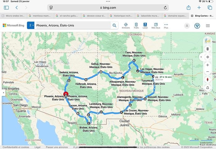
Day 1: Flight Marseille-Paris-Phoenix, then Gold Canyon (133 km) Day 2: Tucson (271 km) Lost Dutchman State Park Day 3: Tucson (155 km) Day 4: Tucson (34 km) Day 5: Bisbee (182 km) Day 6: Lordsburg (345 km) Day 7: Las Cruces (253 km) Day 8: Alamogordo (162 km) Day 9: Roswell (264 km) Day 10: Tucumcari (369 km) Day 11: Las Vegas (281 km) – the one in New Mexico Day 12: Taos (213 km) Day 13: Santa Fe (224 km) Day 14: Albuquerque (123 km) Day 15: Gallup (246 km) Day 16: Holbrook (224 km) Day 17: Flagstaff (179 km) Day 18: Sedona (118 km) Day 19: Sedona (48 km) Day 20: Sedona (41 km) Day 21: Phoenix (256 km) Day 22: Phoenix Airport (35 km)
📊 **Budget**: A little over 7,500 € for both of us, all included. The exchange rate was in our favor (1.17 dollars to 1 €). 📊 **Flights**: Marseille-Paris Charles de Gaulle-Phoenix: 1,787 € for two, with one checked bag each (Air France) 📊 **ESTA**: $42 📊 **America the Beautiful Pass**: $80 📊 **Parking**: 134 € (super eco at Marseille) 📊 **Car rental (Hertz)**: 865 €. Since there were no SUVs left in the reserved category (Nissan Rogue), we got an upgrade (4x4 Ford Explorer). We booked through Air France (15% discount). We’d originally reserved it in December for 1,140 €, but since prices dropped in March, we canceled and rebooked for 865 €. Hertz offers a free Hertz Gold Plus Rewards program, which gives you priority counter service when picking up the car. 📊 **Accommodation**: 2,400 € We stayed in hotels and motels of varying standards (from 60 to 203 € per night, depending on the city), all booked through Booking.com or Hotels.com. Out of 21 nights, only two didn’t include breakfast in the price. Booking.com sometimes offers slightly cheaper rates if you book by phone using the mobile app, and our Genius 3 status on the site also got us some preferential rates. 📊 **Supplementary insurance**: AVA 200 € for medical care if needed 📊 **Cash**: $2,078. We left with 1,000 € exchanged before departure and made two withdrawals of $500. This cash covered: - Evening restaurants and tips - Midday picnics - Gas: $298 for 4,160 km - Museum and private park entries (per person): - Lost Dutchman: $10 - Arizona-Sonora Desert Museum: $28 - Bird Cage Theater: $16 - Tombstone Shootout: $8 - New Mexico Farm & Ranch Museum: $12 - Roswell International UFO Museum: $5 - Billy the Kid Museum: $7 - Rancho de Taos: $22 - West Fork Oak Creek Trail entry: $15 We got a few discounts thanks to our senior age (+65). - Souvenirs and little treats
Like on our previous road trips, we didn’t rent a GPS. We got around using offline GPS apps Here WeGo and Organic Maps, with maps of the states we visited downloaded before we left (on our phones).
❤️❤️❤️ **Highlights** (there are so many!) 📍 Goldfield Ghost Town (even if it’s a reconstruction) 📍 The standing army of Saguaro cacti at Saguaro National Park West 📍 Diving into the cowboy universe of Tombstone 📍 The welcome from Rick and Henry at our guesthouse in Bisbee (Garden at Mile High Ranch) 📍 The tangled rocks of Chiricahua National Monument 📍 The flavored pistachios from Dwayne’s Fresh Jerky and Mac Ginnis Pistachioland 📍 Restaurants: La Posta (Las Cruces), Diner 66 (Albuquerque), and the Haunted Hamburger (Jerome) 📍 The old plazas of New Mexico 📍 The solitude and beauty of the white dunes at White Sands National Park 📍 Stepping back in time at the Billy the Kid Museum (Fort Stanton) 📍 Sections of historic Route 66 and the old motels of Tucumcari, especially at night when all the neon lights are on 📍 Taos Pueblo and diving into Native American culture 📍 After the Rio Grande Bridge, the descent via NM 567 to the very bottom of the Rio Grande Gorge, then the road along the riverbanks to Taos 📍 The tranquility of the Chimayo Sanctuary 📍 Discovering the ingenious native dwellings at Bandelier National Monument and Walnut Canyon National Park 📍 The small towns along the Turquoise Trail 📍 The red rocks of Red Rock Park and the Painted Desert 📍 The extraordinary colors of the petrified trees at Petrified Forest National Park 📍 Sedona, its red rocks, and the reward of the viewpoints at the end of hikes (Devil’s Bridge, The Subway, and West Fork Oak Creek) 📍 The immersion in Mexico when visiting Tlaquepaque 📍 The almost-ghost town of Jerome and its terraced streets 📍 The incredible kindness of Americans, always ready to help and up for a chat ❤️
☹️☹️☹️ **Flops** (there are very few) 📍 Several museums and churches being closed, so we couldn’t visit them 📍 Some museums and visitor centers opening late (10 AM) and closing early (4 PM) 📍 A 64 € phone roaming charge because we got near the Mexican border and picked up their cell tower 📍 The outrageous price ($5.99) for a gallon of gas at the Shell near Phoenix Airport
I hope this helps! Anyway, thanks for reading my long post. Don’t hesitate to reach out, even via PM, if you see I haven’t replied and you’d like more details. Have a great evening, everyone! 🙂
We’re back from our September 2025 road trip, this time to explore Arizona and New Mexico, and it’s time for me to start my travel journal—especially since everything’s already booked for another trip in September 2026 (to California), and I need to get started on the planning.
I was a little worried this new visit to Uncle Sam’s country might not be as "wow" as the others, but we still discovered some incredible places.
For those who don’t know us, we’re a couple in our seventies who speak very little English, but that didn’t stop us from fully enjoying our stay.
For this 6th road trip in the U.S., we spent 21 nights there, drove 4,160 km by car, and walked nearly 160 km in a loop starting from Phoenix.
We’d been to Arizona before (but not this side) and never to New Mexico. This whole road trip was a huge discovery for us.
In the prices mentioned (some in euros, others in dollars), bank fees and exchange charges are included. The flights, car rental, and parking were all paid for in December 2024 when we booked.
We’d downloaded the MPC (Mobile Passport Control) app, but there wasn’t a dedicated line at Phoenix Airport. Still, we got through quickly with friendly, smiling agents.
I don’t drive at all (I hate it), so the stops were chosen based on activities but also, for some, to limit daily mileage for the sole driver. The kilometers listed in the itinerary are the daily distances.
We traveled from September 9th to 22nd, unfortunately once again without our dear friends Mimi and Maumau.
The itinerary
Day 1: Flight Marseille-Paris-Phoenix, then Gold Canyon (133 km) Day 2: Tucson (271 km) Lost Dutchman State Park Day 3: Tucson (155 km) Day 4: Tucson (34 km) Day 5: Bisbee (182 km) Day 6: Lordsburg (345 km) Day 7: Las Cruces (253 km) Day 8: Alamogordo (162 km) Day 9: Roswell (264 km) Day 10: Tucumcari (369 km) Day 11: Las Vegas (281 km) – the one in New Mexico Day 12: Taos (213 km) Day 13: Santa Fe (224 km) Day 14: Albuquerque (123 km) Day 15: Gallup (246 km) Day 16: Holbrook (224 km) Day 17: Flagstaff (179 km) Day 18: Sedona (118 km) Day 19: Sedona (48 km) Day 20: Sedona (41 km) Day 21: Phoenix (256 km) Day 22: Phoenix Airport (35 km)
📊 **Budget**: A little over 7,500 € for both of us, all included. The exchange rate was in our favor (1.17 dollars to 1 €). 📊 **Flights**: Marseille-Paris Charles de Gaulle-Phoenix: 1,787 € for two, with one checked bag each (Air France) 📊 **ESTA**: $42 📊 **America the Beautiful Pass**: $80 📊 **Parking**: 134 € (super eco at Marseille) 📊 **Car rental (Hertz)**: 865 €. Since there were no SUVs left in the reserved category (Nissan Rogue), we got an upgrade (4x4 Ford Explorer). We booked through Air France (15% discount). We’d originally reserved it in December for 1,140 €, but since prices dropped in March, we canceled and rebooked for 865 €. Hertz offers a free Hertz Gold Plus Rewards program, which gives you priority counter service when picking up the car. 📊 **Accommodation**: 2,400 € We stayed in hotels and motels of varying standards (from 60 to 203 € per night, depending on the city), all booked through Booking.com or Hotels.com. Out of 21 nights, only two didn’t include breakfast in the price. Booking.com sometimes offers slightly cheaper rates if you book by phone using the mobile app, and our Genius 3 status on the site also got us some preferential rates. 📊 **Supplementary insurance**: AVA 200 € for medical care if needed 📊 **Cash**: $2,078. We left with 1,000 € exchanged before departure and made two withdrawals of $500. This cash covered: - Evening restaurants and tips - Midday picnics - Gas: $298 for 4,160 km - Museum and private park entries (per person): - Lost Dutchman: $10 - Arizona-Sonora Desert Museum: $28 - Bird Cage Theater: $16 - Tombstone Shootout: $8 - New Mexico Farm & Ranch Museum: $12 - Roswell International UFO Museum: $5 - Billy the Kid Museum: $7 - Rancho de Taos: $22 - West Fork Oak Creek Trail entry: $15 We got a few discounts thanks to our senior age (+65). - Souvenirs and little treats
Like on our previous road trips, we didn’t rent a GPS. We got around using offline GPS apps Here WeGo and Organic Maps, with maps of the states we visited downloaded before we left (on our phones).
❤️❤️❤️ **Highlights** (there are so many!) 📍 Goldfield Ghost Town (even if it’s a reconstruction) 📍 The standing army of Saguaro cacti at Saguaro National Park West 📍 Diving into the cowboy universe of Tombstone 📍 The welcome from Rick and Henry at our guesthouse in Bisbee (Garden at Mile High Ranch) 📍 The tangled rocks of Chiricahua National Monument 📍 The flavored pistachios from Dwayne’s Fresh Jerky and Mac Ginnis Pistachioland 📍 Restaurants: La Posta (Las Cruces), Diner 66 (Albuquerque), and the Haunted Hamburger (Jerome) 📍 The old plazas of New Mexico 📍 The solitude and beauty of the white dunes at White Sands National Park 📍 Stepping back in time at the Billy the Kid Museum (Fort Stanton) 📍 Sections of historic Route 66 and the old motels of Tucumcari, especially at night when all the neon lights are on 📍 Taos Pueblo and diving into Native American culture 📍 After the Rio Grande Bridge, the descent via NM 567 to the very bottom of the Rio Grande Gorge, then the road along the riverbanks to Taos 📍 The tranquility of the Chimayo Sanctuary 📍 Discovering the ingenious native dwellings at Bandelier National Monument and Walnut Canyon National Park 📍 The small towns along the Turquoise Trail 📍 The red rocks of Red Rock Park and the Painted Desert 📍 The extraordinary colors of the petrified trees at Petrified Forest National Park 📍 Sedona, its red rocks, and the reward of the viewpoints at the end of hikes (Devil’s Bridge, The Subway, and West Fork Oak Creek) 📍 The immersion in Mexico when visiting Tlaquepaque 📍 The almost-ghost town of Jerome and its terraced streets 📍 The incredible kindness of Americans, always ready to help and up for a chat ❤️
☹️☹️☹️ **Flops** (there are very few) 📍 Several museums and churches being closed, so we couldn’t visit them 📍 Some museums and visitor centers opening late (10 AM) and closing early (4 PM) 📍 A 64 € phone roaming charge because we got near the Mexican border and picked up their cell tower 📍 The outrageous price ($5.99) for a gallon of gas at the Shell near Phoenix Airport
I hope this helps! Anyway, thanks for reading my long post. Don’t hesitate to reach out, even via PM, if you see I haven’t replied and you’d like more details. Have a great evening, everyone! 🙂
Requirements for travel to Russia and Mongolia
Hi there,
I’m planning a trip to Russia and Mongolia, starting from France.
Crossing the border at Poland/Belarus or Georgia/Russia—other borders seem either closed or complicated.
Tourist visas for 3 months with multiple entries.
Do you have any info on Russian companies that cover a 4x4 vehicle for 3 months, and what prices in rubles or euros you’ve paid?
Which bank did you use for expenses? (EuroMastercard and Visa cards no longer work.)
Regarding Russian SIM cards, a new system called "Gosuslugi" has been introduced. How long did it take you to get one, and what steps did you follow?
Thanks
Which bank did you use for expenses? (EuroMastercard and Visa cards no longer work.)
Regarding Russian SIM cards, a new system called "Gosuslugi" has been introduced. How long did it take you to get one, and what steps did you follow?
Thanks
Travel Journal - 28 Days in China in August 2025
Hi everyone! I’m sharing a modest travel journal from my trip to China in August 2025.
There wasn’t much room for improvisation on this trip—everything was planned in advance. Since August is peak season, I decided to book train tickets early, and once that was set, I reserved all the accommodations too. I got everything on Trip.com.
I bought the flight tickets back in March from Hainan Airlines. They were super expensive, but with these travel dates, I couldn’t exactly dream of a bargain!
I picked up e-SIMs valid for a month from Free just before departure: 10 € for the e-SIM + 19.90 € for a one-month plan with 35 GB of data abroad.
No need for a VPN with these e-SIMs, but D. still got one—a multi-device plan for 5 € with a discount from Let’s VPN, valid for a month. It was for evenings at the hotel on Wi-Fi to avoid burning through the 35 GB with video.
I downloaded Alipay, WeChat, Amap (Baidu Maps), and Trip.com. We also have Google Translate and Maps.me—absolute must-haves.
We’re ready to go!
I’ve been waiting for this day for nearly 15 years!! I travel a lot, but this one—this is MY TRIP 🙂 It’s been postponed so many times: because I wanted to do it with the right person, because I have a Turkish stamp in my passport and heard they don’t issue visas with that, because of COVID... and then China introduced a 30-day visa exemption, and that was the green light! Ugh, they forced us to take our vacation in August this year—far from ideal—but no more delays. Saturday, August 2, 2025: it’s finally the big day!
Days 1 and 2: We got dropped off at Charles de Gaulle at 9:30 AM. I supposedly checked in online, but only for the first flight and without getting the boarding pass... Might as well scrap online check-in in that case. So, we spent over an hour in line at the counter to get them. We didn’t have any checked luggage—just our backpacks as carry-ons—so this was a step we’d never had to deal with before, but whatever, it’s done. No wait at passport control, 5 minutes through security, a quick walk around the terminal, 10 minutes in the boarding area, and it was already time to board. Departure around 12:45 PM, arrival in Chongqing at 4:50 AM. We had a few hours of layover before our next flight. Went through immigration, connecting flight control, and security. Pro tip: check your next flight’s boarding gate right after immigration. We never saw it displayed again anywhere in the terminal.
The Free e-SIMs work—phew!
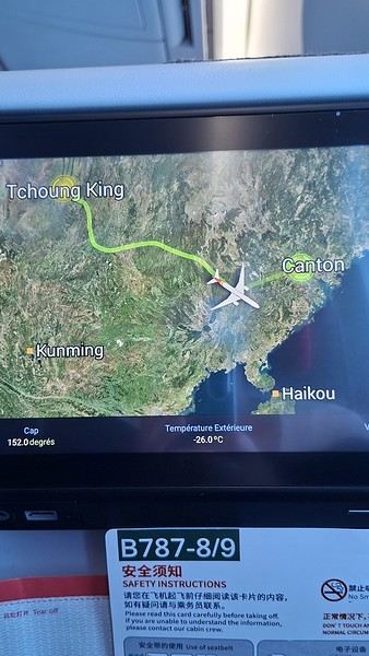
Took off at 9:30 AM, arrived in Guangzhou (Canton) at 11:20 AM in the rain. I love how Chongqing is translated as "Tchoung King" on the screens in the plane—very French!
During my first two trips to China, we paid for everything in cash, but this time, we’re going all-in on Alipay and WeChat. I still brought the leftover change from previous trips—it might come in handy. At the metro station, they showed us a QR code to buy tickets via WeChat. There were probably machines and even a ticket counter, but we didn’t see them, and buying via WeChat was pretty simple. 8 yuan to Changshu Lu, which is 22 stops. So far, so good. Then, we had to find the hotel, which wasn’t on Google Maps, Maps.me, or Amap... Easy 😎! We found it without too much hassle, though. Dropped off our stuff and went out to eat. 55 yuan for two claypots with fish/eel, rice, cabbage, and purple eggplant. When we left, it was pouring. We grabbed our umbrellas and set off to explore the neighborhood: Enning Road (we’ll come back later to check out a specific spot), Shangxiajiu (the pedestrian shopping street), Baohua Road... The area is pretty diverse—one street to the next, it’s like stepping into a different world.

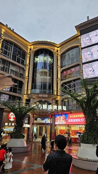
There weren’t many people around, probably because of the rain. We grabbed a quick street food dinner and went to bed—we were exhausted. We struggled to stay awake until 11 PM to adjust to the time change as quickly as possible. There’s a 6-hour time difference.
There wasn’t much room for improvisation on this trip—everything was planned in advance. Since August is peak season, I decided to book train tickets early, and once that was set, I reserved all the accommodations too. I got everything on Trip.com.
I bought the flight tickets back in March from Hainan Airlines. They were super expensive, but with these travel dates, I couldn’t exactly dream of a bargain!
I picked up e-SIMs valid for a month from Free just before departure: 10 € for the e-SIM + 19.90 € for a one-month plan with 35 GB of data abroad.
No need for a VPN with these e-SIMs, but D. still got one—a multi-device plan for 5 € with a discount from Let’s VPN, valid for a month. It was for evenings at the hotel on Wi-Fi to avoid burning through the 35 GB with video.
I downloaded Alipay, WeChat, Amap (Baidu Maps), and Trip.com. We also have Google Translate and Maps.me—absolute must-haves.
We’re ready to go!
I’ve been waiting for this day for nearly 15 years!! I travel a lot, but this one—this is MY TRIP 🙂 It’s been postponed so many times: because I wanted to do it with the right person, because I have a Turkish stamp in my passport and heard they don’t issue visas with that, because of COVID... and then China introduced a 30-day visa exemption, and that was the green light! Ugh, they forced us to take our vacation in August this year—far from ideal—but no more delays. Saturday, August 2, 2025: it’s finally the big day!
Days 1 and 2: We got dropped off at Charles de Gaulle at 9:30 AM. I supposedly checked in online, but only for the first flight and without getting the boarding pass... Might as well scrap online check-in in that case. So, we spent over an hour in line at the counter to get them. We didn’t have any checked luggage—just our backpacks as carry-ons—so this was a step we’d never had to deal with before, but whatever, it’s done. No wait at passport control, 5 minutes through security, a quick walk around the terminal, 10 minutes in the boarding area, and it was already time to board. Departure around 12:45 PM, arrival in Chongqing at 4:50 AM. We had a few hours of layover before our next flight. Went through immigration, connecting flight control, and security. Pro tip: check your next flight’s boarding gate right after immigration. We never saw it displayed again anywhere in the terminal.
The Free e-SIMs work—phew!
Took off at 9:30 AM, arrived in Guangzhou (Canton) at 11:20 AM in the rain. I love how Chongqing is translated as "Tchoung King" on the screens in the plane—very French!
During my first two trips to China, we paid for everything in cash, but this time, we’re going all-in on Alipay and WeChat. I still brought the leftover change from previous trips—it might come in handy. At the metro station, they showed us a QR code to buy tickets via WeChat. There were probably machines and even a ticket counter, but we didn’t see them, and buying via WeChat was pretty simple. 8 yuan to Changshu Lu, which is 22 stops. So far, so good. Then, we had to find the hotel, which wasn’t on Google Maps, Maps.me, or Amap... Easy 😎! We found it without too much hassle, though. Dropped off our stuff and went out to eat. 55 yuan for two claypots with fish/eel, rice, cabbage, and purple eggplant. When we left, it was pouring. We grabbed our umbrellas and set off to explore the neighborhood: Enning Road (we’ll come back later to check out a specific spot), Shangxiajiu (the pedestrian shopping street), Baohua Road... The area is pretty diverse—one street to the next, it’s like stepping into a different world.
There weren’t many people around, probably because of the rain. We grabbed a quick street food dinner and went to bed—we were exhausted. We struggled to stay awake until 11 PM to adjust to the time change as quickly as possible. There’s a 6-hour time difference.
USA Road Trip 2023 - Part 1
In January 2023, we started our second road trip across the United States. We stayed from January to mid-March, which gave us plenty of time to visit several cities, attractions, and parks in multiple states.
This travel journal will be split into two parts due to the considerable number of places we visited.
This first journal covers the following states: Ohio, Indiana, Missouri, Oklahoma, Texas, New Mexico, Arizona, Nevada, and California, and takes you through the outbound leg of our road trip.
The second journal will showcase the attractions we visited on the return trip, which mainly follows the famous Highway 1 along the Pacific coast.
So, I invite you to keep reading this first journal, which serves as a long recap to help you discover the various attractions we explored throughout this road trip.
Videos are included throughout the recap. Please click on the image to start the video.
Here are the links to jump to a specific post:
OHIO:
WinterLand - Christmas Lights at Cleveland Public Square Lake View Cemetery - Cleveland - Part 1 Lake View Cemetery - Cleveland - Part 2 Stroll through Columbus Upper Falls to Lower Falls via Buckeye Trail - Hocking Hills State Park – Logan Cedar Falls & Whispering Falls Hiking Trail - Hocking Hills State Park – Logan Ash Cave Hiking Trail - Hocking Hills State Park – Logan Exploring Cincinnati
INDIANA:
Visiting Indianapolis
MISSOURI:
Exploring St. Louis
OKLAHOMA:
Catoosa Blue Whale Discovering Tulsa Exploring Oklahoma City
TEXAS:
Exploring Shamrock Discovering McLean Exploring Amarillo
NEW MEXICO:
Ancestral Sites Trail - Pecos National Historical Park Discovering Santa Fe The Santuario de Chimayó Stroll through Los Cerrillos Walk through the village of Madrid San Francisco de Asis Catholic Church & The Bottle House - Golden Albuquerque Murals 66 Diner - Albuquerque Stroll through Old Town (Albuquerque) Rinconada Canyon Trail - Petroglyph National Monument Mesa Point Trail - Boca Negra Canyon - Petroglyph National Monument Macaw Trail - Boca Negra Canyon - Petroglyph National Monument Cliff Base Trail - Boca Negra Canyon - Petroglyph National Monument Piedras Marcadas Canyon - Petroglyph National Monument Sandstone Bluffs & Ventana Natural Arch - El Malpais National Monument
ARIZONA:
Stewart's Petrified Wood Shop – Holbrook Stroll through Holbrook Discovering Joseph City Exploring Winslow Grand Falls (The "Chocolate Falls") – Leupp Island Trail - Walnut Canyon National Monument Rim Trail - Walnut Canyon National Monument Wukoki Pueblo Trail – Wupatki National Monument Wupatki Pueblo Trail – Wupatki National Monument Doney Mountain Trail – Wupatki National Monument Citadel & Nalakihu Pueblos Trail – Wupatki National Monument Lomaki & Box Canyon Pueblos Trail – Wupatki National Monument Discovering Flagstaff On the way to Sedona Slide Rock State Park – Sedona Midgley Bridge Trail – Wilson Canyon – Sedona Tlaquepaque Arts & Shopping Village Walking Tour - Sedona Chapel of the Holy Cross - Sedona Hiking at Cathedral Rock - Sedona Hiking the Bell Rock Trail - Sedona Hiking the Airport Loop Trail - Sedona Amitabha Stupa and Peace Park - Sedona Hiking the Boynton Canyon Vortex Trail - Sedona Hiking the Devil's Bridge Trail - Sedona Hiking the Birthing Cave Trail - Sedona Bell Rock Inn - Sedona On the roads of Sedona - Part 1 On the roads of Sedona - Part 2 Keyhole Sink Hiking Trail - Kaibab National Forest Discovering Williams Exploring Ash Fork Discovering Kingman Ramada by Wyndham Kingman Davis Camp Park - Bullhead City Discovering Yucca Lake Havasu Boardwalk Tour A duck catches a lobster – Lake Havasu Boardwalk
CALIFORNIA:
Exploring Needles Discovering Goffs Discovering Amboy Visiting the famous Bagdad Cafe - Newberry Springs Exploring Barstow Vehicles from Hell (Mad Max Cars) - Barstow Peggy Sue's 50's Diner - Yermo Liberty Sculpture Park - Yermo Lake Dolores Water Park - Newberry Springs ZZYZX Road - Mojave National Preserve Alien Fresh Jerky - Baker Kelso Dunes Trail - Mojave National Preserve Hole-in-the-Wall Rings Trail - Mojave National Preserve Visiting Mitchell Caverns - Mojave National Preserve Dante's View - Death Valley National Park Zabriskie Point - Death Valley National Park Golden Canyon - Death Valley National Park Artists Drive & Artists Palette - Death Valley National Park Devil's Golf Course - Death Valley National Park Natural Bridge Trail - Death Valley National Park Badwater Basin - Death Valley National Park Harmony Borax Works - Death Valley National Park Devil's Cornfield - Death Valley National Park Mesquite Flat Sand Dunes - Death Valley National Park Mosaic Canyon Trail - Death Valley National Park On the road - Death Valley National Park
NEVADA:
Cleveland Clinic Lou Ruvo Center for Brain Health - Las Vegas Exploring Downtown Las Vegas SlotZilla Zipline - Fremont Street Experience – Downtown Las Vegas Viva Vision Light Show 1 - Fremont Street Experience - Downtown Las Vegas Viva Vision Light Show 2 - Fremont Street Experience - Downtown Las Vegas Viva Vision Light Show 3 - Fremont Street Experience - Downtown Las Vegas Viva Vision Light Show 4 - Fremont Street Experience - Downtown Las Vegas Free Live Music – Fremont Street Experience - Downtown Las Vegas Chucky – Fremont Street Experience - Downtown Las Vegas Las Vegas Strip - Part 1 Las Vegas Strip - Part 2 Las Vegas Strip - Part 3 Las Vegas Strip - Part 4 Las Vegas Strip - Part 5 Tom Devlin's Monster Museum - Boulder City Hoover Dam Lake Mead - Lakeview Overlook - Boulder City Nelson Ghost Town - Searchlight
CALIFORNIA:
Scenic Route through Joshua Tree National Park via the North Entrance Hidden Valley Trail - Joshua Tree National Park Barker Dam Trail - Joshua Tree National Park Cap Rock Trail - Joshua Tree National Park Keys View Trail - Joshua Tree National Park Hall of Horrors Trail - Joshua Tree National Park Skull Rock Trail - Joshua Tree National Park Arch Rock Trail - Joshua Tree National Park Cholla Cactus Garden Trail - Joshua Tree National Park Lone Pine - Owens Valley Miss Alabama & Shark Fin - Alabama Hills - Owens Valley Lone Ranger Canyon - Alabama Hills - Owens Valley Mobius Arch Loop Trail (Heart Arch & Lathe Arch) - Alabama Hills - Owens Valley Eye of the Alabama Hills Arch - Alabama Hills - Owens Valley Boot & Cyclops Arches - Alabama Hills - Owens Valley One Mile Arch, Bowling Ball and Pins & Gunga Din Area - Alabama Hills - Owens Valley Whitney Portal Arch Trailhead - Alabama Hills - Owens Valley Fish Rocks & Trona Pinnacles - Mojave Desert Red Cliffs Trail - Red Rock Canyon State Park Hagen Canyon Nature Trail - Red Rock Canyon State Park Tour of Historic Downtown Tehachapi View of the Tehachapi Loop – Monolith César E. Chávez National Monument – Keene Discovering Bakersfield Kern County Museum – Bakersfield Bravo Farms, Tree House & Petting Zoo - Traver Walking Tour of Kingsburg Exploring Fresno Simonian Farms & Soul Consoling Japanese Internment Tower - Fresno Duncan Ceramic Products (iLoveToCreate) - Fresno Walking Tour of Modesto Wat Dhammararam Buddhist Temple - Stockton Walking Tour of Stockton Discovering Stockton University of the Pacific - Stockton Visiting Lodi Sutter's Fort State Historic Park - Sacramento California State Capitol - Sacramento Walking Tour - Sacramento Walking Tour - Winters Walking Tour - Napa The Chandelier Tree In Drive-Thru Tree Park - Leggett One Log House - Garberville Grandfather Tree - Piercy The Living Chimney Tree - Avenue of the Giants Stephens Grove Loop Trail - Avenue of the Giants Gould Grove Nature Loop Trail - Avenue of the Giants Fleishmann Grove Trail - Avenue of the Giants Mahan Plaque Trail - Avenue of the Giants Founders Grove Nature Loop Trail - Avenue of the Giants Eternal Tree House & Immortal Tree - Avenue of the Giants Drury-Chaney Loop Trail - Avenue of the Giants Walking Tour - Redcrest
COMING UP NEXT:
USA Road Trip 2023 - Part 2
This travel journal will be split into two parts due to the considerable number of places we visited.
This first journal covers the following states: Ohio, Indiana, Missouri, Oklahoma, Texas, New Mexico, Arizona, Nevada, and California, and takes you through the outbound leg of our road trip.
The second journal will showcase the attractions we visited on the return trip, which mainly follows the famous Highway 1 along the Pacific coast.
So, I invite you to keep reading this first journal, which serves as a long recap to help you discover the various attractions we explored throughout this road trip.
Videos are included throughout the recap. Please click on the image to start the video.
Here are the links to jump to a specific post:
OHIO:
WinterLand - Christmas Lights at Cleveland Public Square Lake View Cemetery - Cleveland - Part 1 Lake View Cemetery - Cleveland - Part 2 Stroll through Columbus Upper Falls to Lower Falls via Buckeye Trail - Hocking Hills State Park – Logan Cedar Falls & Whispering Falls Hiking Trail - Hocking Hills State Park – Logan Ash Cave Hiking Trail - Hocking Hills State Park – Logan Exploring Cincinnati
INDIANA:
Visiting Indianapolis
MISSOURI:
Exploring St. Louis
OKLAHOMA:
Catoosa Blue Whale Discovering Tulsa Exploring Oklahoma City
TEXAS:
Exploring Shamrock Discovering McLean Exploring Amarillo
NEW MEXICO:
Ancestral Sites Trail - Pecos National Historical Park Discovering Santa Fe The Santuario de Chimayó Stroll through Los Cerrillos Walk through the village of Madrid San Francisco de Asis Catholic Church & The Bottle House - Golden Albuquerque Murals 66 Diner - Albuquerque Stroll through Old Town (Albuquerque) Rinconada Canyon Trail - Petroglyph National Monument Mesa Point Trail - Boca Negra Canyon - Petroglyph National Monument Macaw Trail - Boca Negra Canyon - Petroglyph National Monument Cliff Base Trail - Boca Negra Canyon - Petroglyph National Monument Piedras Marcadas Canyon - Petroglyph National Monument Sandstone Bluffs & Ventana Natural Arch - El Malpais National Monument
ARIZONA:
Stewart's Petrified Wood Shop – Holbrook Stroll through Holbrook Discovering Joseph City Exploring Winslow Grand Falls (The "Chocolate Falls") – Leupp Island Trail - Walnut Canyon National Monument Rim Trail - Walnut Canyon National Monument Wukoki Pueblo Trail – Wupatki National Monument Wupatki Pueblo Trail – Wupatki National Monument Doney Mountain Trail – Wupatki National Monument Citadel & Nalakihu Pueblos Trail – Wupatki National Monument Lomaki & Box Canyon Pueblos Trail – Wupatki National Monument Discovering Flagstaff On the way to Sedona Slide Rock State Park – Sedona Midgley Bridge Trail – Wilson Canyon – Sedona Tlaquepaque Arts & Shopping Village Walking Tour - Sedona Chapel of the Holy Cross - Sedona Hiking at Cathedral Rock - Sedona Hiking the Bell Rock Trail - Sedona Hiking the Airport Loop Trail - Sedona Amitabha Stupa and Peace Park - Sedona Hiking the Boynton Canyon Vortex Trail - Sedona Hiking the Devil's Bridge Trail - Sedona Hiking the Birthing Cave Trail - Sedona Bell Rock Inn - Sedona On the roads of Sedona - Part 1 On the roads of Sedona - Part 2 Keyhole Sink Hiking Trail - Kaibab National Forest Discovering Williams Exploring Ash Fork Discovering Kingman Ramada by Wyndham Kingman Davis Camp Park - Bullhead City Discovering Yucca Lake Havasu Boardwalk Tour A duck catches a lobster – Lake Havasu Boardwalk
CALIFORNIA:
Exploring Needles Discovering Goffs Discovering Amboy Visiting the famous Bagdad Cafe - Newberry Springs Exploring Barstow Vehicles from Hell (Mad Max Cars) - Barstow Peggy Sue's 50's Diner - Yermo Liberty Sculpture Park - Yermo Lake Dolores Water Park - Newberry Springs ZZYZX Road - Mojave National Preserve Alien Fresh Jerky - Baker Kelso Dunes Trail - Mojave National Preserve Hole-in-the-Wall Rings Trail - Mojave National Preserve Visiting Mitchell Caverns - Mojave National Preserve Dante's View - Death Valley National Park Zabriskie Point - Death Valley National Park Golden Canyon - Death Valley National Park Artists Drive & Artists Palette - Death Valley National Park Devil's Golf Course - Death Valley National Park Natural Bridge Trail - Death Valley National Park Badwater Basin - Death Valley National Park Harmony Borax Works - Death Valley National Park Devil's Cornfield - Death Valley National Park Mesquite Flat Sand Dunes - Death Valley National Park Mosaic Canyon Trail - Death Valley National Park On the road - Death Valley National Park
NEVADA:
Cleveland Clinic Lou Ruvo Center for Brain Health - Las Vegas Exploring Downtown Las Vegas SlotZilla Zipline - Fremont Street Experience – Downtown Las Vegas Viva Vision Light Show 1 - Fremont Street Experience - Downtown Las Vegas Viva Vision Light Show 2 - Fremont Street Experience - Downtown Las Vegas Viva Vision Light Show 3 - Fremont Street Experience - Downtown Las Vegas Viva Vision Light Show 4 - Fremont Street Experience - Downtown Las Vegas Free Live Music – Fremont Street Experience - Downtown Las Vegas Chucky – Fremont Street Experience - Downtown Las Vegas Las Vegas Strip - Part 1 Las Vegas Strip - Part 2 Las Vegas Strip - Part 3 Las Vegas Strip - Part 4 Las Vegas Strip - Part 5 Tom Devlin's Monster Museum - Boulder City Hoover Dam Lake Mead - Lakeview Overlook - Boulder City Nelson Ghost Town - Searchlight
CALIFORNIA:
Scenic Route through Joshua Tree National Park via the North Entrance Hidden Valley Trail - Joshua Tree National Park Barker Dam Trail - Joshua Tree National Park Cap Rock Trail - Joshua Tree National Park Keys View Trail - Joshua Tree National Park Hall of Horrors Trail - Joshua Tree National Park Skull Rock Trail - Joshua Tree National Park Arch Rock Trail - Joshua Tree National Park Cholla Cactus Garden Trail - Joshua Tree National Park Lone Pine - Owens Valley Miss Alabama & Shark Fin - Alabama Hills - Owens Valley Lone Ranger Canyon - Alabama Hills - Owens Valley Mobius Arch Loop Trail (Heart Arch & Lathe Arch) - Alabama Hills - Owens Valley Eye of the Alabama Hills Arch - Alabama Hills - Owens Valley Boot & Cyclops Arches - Alabama Hills - Owens Valley One Mile Arch, Bowling Ball and Pins & Gunga Din Area - Alabama Hills - Owens Valley Whitney Portal Arch Trailhead - Alabama Hills - Owens Valley Fish Rocks & Trona Pinnacles - Mojave Desert Red Cliffs Trail - Red Rock Canyon State Park Hagen Canyon Nature Trail - Red Rock Canyon State Park Tour of Historic Downtown Tehachapi View of the Tehachapi Loop – Monolith César E. Chávez National Monument – Keene Discovering Bakersfield Kern County Museum – Bakersfield Bravo Farms, Tree House & Petting Zoo - Traver Walking Tour of Kingsburg Exploring Fresno Simonian Farms & Soul Consoling Japanese Internment Tower - Fresno Duncan Ceramic Products (iLoveToCreate) - Fresno Walking Tour of Modesto Wat Dhammararam Buddhist Temple - Stockton Walking Tour of Stockton Discovering Stockton University of the Pacific - Stockton Visiting Lodi Sutter's Fort State Historic Park - Sacramento California State Capitol - Sacramento Walking Tour - Sacramento Walking Tour - Winters Walking Tour - Napa The Chandelier Tree In Drive-Thru Tree Park - Leggett One Log House - Garberville Grandfather Tree - Piercy The Living Chimney Tree - Avenue of the Giants Stephens Grove Loop Trail - Avenue of the Giants Gould Grove Nature Loop Trail - Avenue of the Giants Fleishmann Grove Trail - Avenue of the Giants Mahan Plaque Trail - Avenue of the Giants Founders Grove Nature Loop Trail - Avenue of the Giants Eternal Tree House & Immortal Tree - Avenue of the Giants Drury-Chaney Loop Trail - Avenue of the Giants Walking Tour - Redcrest
COMING UP NEXT:
USA Road Trip 2023 - Part 2
Which camp should I book in Kruger National Park?
Hi everyone,
For those who’ve been following me... progress is being made!
Anyway, just to recap for the others: I’m leaving Manyeleti (a private reserve) to do a self-drive safari in the main Kruger Park for 2 nights before heading to Blyde River Canyon (sharing all this so you can picture the route). So Satara seemed like a good base for the safari, except that you can only book accommodation in this non-private park through Sandparks to find a camp. Since Satara is fully booked, the only ones with availability for my dates are:
Tamboti, Olifants, and Satara—wait, no, Satara’s full—so Letaba, sorry! Any thoughts on these camps?
Because I can enter via Orpen and drive north (safari-style), which would let us explore, but:
1/ Too many km if we pick the farthest one, Letaba?
If I leave Manyeleti (Honeyguide Mantobeni) after the morning safari, what time do I need to be at the camp by?
It’s all coming together—I just need to pick the camp based on distance, so thanks to all of you for your invaluable help! Dan
It’s all coming together—I just need to pick the camp based on distance, so thanks to all of you for your invaluable help! Dan
Croatia, Montenegro – two victims of overtourism?
Mid-June, two Auvergnats on the starting blocks—off we go to the former Yugoslavia!
We’d already explored some nooks and crannies of northern Croatia back in 2019, so we’re keeping the momentum going by planning a trip to the south of the country and then Montenegro.
On the way back, we’ll drift into Bosnia-Herzegovina just to mix things up a bit!
We’re a little unsure about what to expect in terms of tourist crowds.
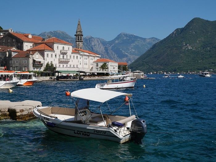
Dubrovnik has a reputation for being the hardest-hit city by overtourism, and Kotor and the whole Dalmatian coast aren’t exactly empty...
Luckily, most European countries haven’t started school holidays yet, and some measures seem to have been put in place to limit the flow (like restrictions on the number of cruise ships allowed to dock at the same time).
Maybe we’ll manage to escape the promised hell?
For now, we’re slamming the doors of the Scirocco and heading off to our first stop: northern Italy!
On the way back, we’ll drift into Bosnia-Herzegovina just to mix things up a bit!
We’re a little unsure about what to expect in terms of tourist crowds.
Dubrovnik has a reputation for being the hardest-hit city by overtourism, and Kotor and the whole Dalmatian coast aren’t exactly empty...
Luckily, most European countries haven’t started school holidays yet, and some measures seem to have been put in place to limit the flow (like restrictions on the number of cruise ships allowed to dock at the same time).
Maybe we’ll manage to escape the promised hell?
For now, we’re slamming the doors of the Scirocco and heading off to our first stop: northern Italy!
Namibia Travel Journal: May 2025 - Trip Review
NAMIBIA TRIP 2025: April 24 to May 20: Feel free to comment or ask us any questions about this amazing journey.
>> Find all our photos and videos for each day on our website here: www.montagne-aventure.net
**DAY 1: Thursday, April 24, 2025: Outbound Flights from Lyon to Windhoek via Munich - Visit to Munich:**

Off we go on a new adventure. The alarm rings at 6:30 AM, the travel bags are packed, and we head to Lyon Airport. We booked our flight tickets with Lufthansa. The first leg to Munich, Germany, is operated by AirBaltic. Departure at 1:05 PM for a 1-hour and 20-minute flight. We arrive at 2:30 PM.
**We now have a 7-hour layover, so we take the opportunity to get some fresh air and explore Munich.** We quickly exit Terminal 2 of the airport and head towards the subway. We buy a group day ticket "Airport-city Day Zone M-5," valid for 2 to 5 people at a price of 30.50 € (instead of 16.30 € per person). We take the S8 line to **Marienplatz** in 35 minutes. **This is the heart of the city.** The weather is overcast, quite cool, but dry. Perfect for a little city trip between two flights while leaving our large luggage in transit at the airport. **Munich is the third-largest German city after Berlin and Hamburg, in the Bavaria region.** **The center has a lot of charm and brings together several religious buildings, easy to explore on foot.** We are impressed by the number of people enjoying these 100% pedestrian streets, which are very pleasant. After Marienplatz, the most famous square with the town hall, we head to the Cathedral of Our Lady, a Gothic church, then continue to **Karlsplatz** and move on to **the food market offering a wide selection of high-end food products in an atmosphere where a certain art of living prevails.** We also visit St. Peter's Church before grabbing a bite to eat. Two good hours were enough for this 10 km city walk. It's time to take the subway back: by 6:30 PM, we are back at the airport. Now, it's time for a bit of waiting and rest. Our second flight is scheduled for 9:35 PM for a 9-hour and 30-minute journey to our final destination in Namibia: **Windhoek.**
> Round-trip flight tickets with Lufthansa from Lyon: 2029 €, or 1,014.50 € per person.
> Lyon Airport parking: 120 €
> Today's expenses: 7 € for 2 pizzas in France / 14 € for the restaurant in Munich / 30.50 € for the daily subway ticket in Munich.
**DAY 2: Friday, April 25, 2024: Arrival in Windhoek, Visit to the Namibian Capital:**
After a 9-hour and 30-minute overnight flight with Discover Airlines, we finally land on Namibian soil just before 7:30 AM. The day is breaking, and the colors are already stunning. We are eager despite the usual fatigue from the flight. The airline was punctual, with friendly staff and good meals, though a bit light. We are the first flight of the day to land, with no more than 15 flights per day here, from 7 AM to 8 PM. We disembark on the tarmac at this airport located in the middle of nowhere, **I finally set foot on African soil for the first time.** We exit among the first from the aircraft to go through the long formalities at the front of the line, as the wait can quickly become endless. Allow at least 5 minutes per person for e-visas. We still wait 45 minutes despite only about twenty people ahead of us. Phew, it's done. We collect our luggage and then withdraw money from an ATM. We make 4 withdrawals of the maximum amount, 2000 NAD $ per withdrawal, for a total of 380 €, or 95.33 € per withdrawal.
Our driver arrives at the same time, perfect timing, we were quick.
We leave the airport at 8:45 AM. By 9:30 AM, we arrive at the **Gracious Whisp vehicle rental agency**, located at the entrance of Windhoek, small and human-sized with a fleet of recent vehicles. More formalities, then a short wait as our vehicle is not yet ready. Time to decompress, catch our breath, and enjoy the very pleasant morning temperature. Not a cloud in sight. Next, a briefing on the vehicle, always with a bit of apprehension due to our approximate English. Allow 45 minutes of explanations, including setting up the roof tent, camping equipment, technical information in case of a flat tire, driving tips in Namibia, and a tour of the 4x4. We have all the necessary equipment for camping: mattresses, sleeping bags, pillows, table, chairs, gas stove, BBQ grill... as well as 2 spare tires, a compressor, a dual tank, and accessories for removing wheels. Off we go, it's time to muster our courage and get behind the wheel. **Heading to SuperSpar Maerua**, fortunately located less than 10 minutes away. We park with the help of a parking attendant; it's very crowded, the space is narrow, but everything goes well despite the cursed right-hand drive. Today's new mission: stock up on groceries. The store is well-stocked with local and imported products, catering to all tastes. We spend 114 € on groceries, from pasta to meat, BBQ lighters to dishwashing products. Two people load our groceries into two carts and transfer them to our vehicle; we feel compelled to leave a tip, 50 NAD $, as we don't have change yet. Now, we head to the hotel, 15 minutes away. Traffic is difficult at a complicated intersection; this will likely be the only traffic jam in Namibia. **We arrive at Kate's Nest Guesthouse & Backpackers around 1:15 PM, quite tired.** We take some well-deserved rest at this recent establishment, quite calm with secure private parking. After a short nap, we enjoy the quiet by the hotel pool. Night falls between 6:30 PM and 7 PM. We eat quietly in our room tonight before starting this long 4x4 road trip in camping mode in the heart of Namibia.
> Today's grocery expenses: 114 € at Super Spar Marua (2395.21 NAD $).
> Round-trip flight tickets with Lufthansa from Lyon: 2029 €, or 1,014.50 € per person.
> Vehicle rental: 4x4 Toyota with roof tent for 24 days: Gracious Whisp Car Rentals: 2,638 € (N$50,640) or **1,319 €** per person - (https://gwcarrentals.com/)
> Distance driven today: 15 km.
> Accommodation: Kate's Nest Guesthouse & Backpackers - 4 Aristotles Street Academia, 9000 Windhoek - 36 € for two for one night.
> Windhoek International Airport website: (https://www.airports.com.na/)
**DAY 3: Saturday, April 26, 2025: Windhoek to Hardap: Mariental Region - Kalahari Desert:**
After a good, restful night, we wake up leisurely around 7 AM. We enjoy the comfort provided by this first and last hotel before 24 nights under the tent.
**We leave Kate's Nest Guesthouse at 8:30 AM to tackle the Namibian roads.** We quickly leave the capital; in just 30 minutes, we find ourselves almost alone in the world. The landscape is dotted with small domes. We leave the **paved B1** quickly to turn left onto the **C15**. **From there, we won't see more than 10 vehicles all day.** After passing through the few houses of **Lekkerwaterpoort**, we tackle our first gravel road. These road sections are limited to 100 km/h, but even at 70 km/h, I find it already challenging. However, I quickly get used to it and gradually pick up speed to reach my cruising speed of around 80 to 90 km/h. **We are on immense straight lines crossing wild expanses as far as the eye can see.** **We come across two baboons, a few ostriches, and numerous cattle and sheep farms.** We pass through the charming village of **Uhlenhorst** with its typical houses and children with broad smiles waving at us. Life here is already very different from Windhoek. **The thermometer rises quickly from 16°C at 8:30 AM to over 28°C in the early afternoon.**
**We arrive at the Hardap Dam reserve at 2 PM.** We stop at the toll booth at the park entrance to pay the entrance fee: 250 NAD $ for 2 people and 1 vehicle. We continue to the dam and then the camp entrance, located a bit further. We had booked in advance, but this place remains little frequented by foreigners.
We take advantage of the hottest hours to rest by the large pool overlooking the immense lake, a very enjoyable moment. Would this be a bit of a vacation?
Around 4:30 PM, we head to the campsite. We overlook this vast water reserve. We arrive first; we will be only 3 vehicles spending the night here. It's time to get to work and set up our equipment for the first time. It takes us a good 20 minutes to set everything up, with a slight apprehension about unfolding the tent. Once this task is done, which we will have to repeat for almost a month, we will become much more efficient over time. Time for rest and contemplation in total silence. The sun gradually sets, and the heat quickly becomes bearable again. Bliss! **This dam is located 20 km northwest of Mariental in an area dotted with conical hills topped with dolerite buttons (Hardap means "hillock" in Nama). It captures the Fish River, which flows south, creating a large lake in the middle of an arid environment. The contrast is striking.** We enjoy our first sunset facing this 360° otherworldly landscape.
Around 7 PM, we start our first BBQ, or "braai" as it's called here. The temperature is perfect. The sun sets, giving way to a star-filled sky of incredible beauty thanks to the absence of any light pollution. The Milky Way will lull us throughout the evening. After some good sausages and potatoes on the BBQ, we head to our roof tent around 9:30 PM with a complete change of scenery in just 24 hours. France already seems so far away...
This campsite has shared showers and toilets, quite clean and functional, as well as a central area with several BBQs and tables. The sites are arranged in a semicircle, each with an electrical outlet. The sites are close to each other but spacious, some slightly shaded. We are only three vehicles tonight, so it's perfectly comfortable and quiet. Not to mention the large pool near the restaurant. Our trip is off to a great start.
> Today's road itinerary: Windhoek > Head south on the B1 to Rehoboth > Turn left onto the C25 then C15 to Stampriet > C20 to Hardap > Full north on the B1 > Then turn left onto the M93 - 5 hours of driving.
> Distance driven today: 354 km.
> Accommodation: Hardap Recreation Resort - 23.3 € for two - Large pool - GR6W+3M2, Hardap Game Reserve, Mariental, Namibia - (http://www.nwr.com.na/resorts/hardap-resort/)
**DAY 4: Sunday, April 27, 2025: Hardap - Brukkaros Volcano - Keetmanshoop - Quivertree Forest Rest Camp**
Our first night under the tent was very pleasant; the little wind quickly calmed down, giving way to absolute silence. The mattress is decent, more comfortable than some nights in Nepal. The length and width give us enough space for maximum comfort, despite my height (1.91 m). We wake up a little before 7 AM as the sun rises, and the lights dazzle us from the start of the day. We pack up the equipment in 30 minutes, quite easily. Then we enjoy the sun, which warms up quickly while we keep our light fleece on.
At 8:30 AM, **we hit the road again, heading south** to our first stop in **Mariental**. We want to do some shopping at SuperSpar, but once we arrive in the parking lot, a young local is fighting with the supermarket security guards and then threatens to throw stones. We don't want to take any risks right at the start, so despite the baton blows he receives, he doesn't stop. We leave empty-handed but fill up with fuel at the Shell station 1 km further. The price per liter is 21.33 NAD $, we fill our 107-liter tank for 107 €. In Namibia, you get served, and they bring the card machine to the window to pay. It's then customary to leave a tip.
We then take the B1 heading due south on a recently renovated road. Around 11:30 AM, we leave it on our right to take **a wild gravel road, the M98**. Just before **Berseba**, we turn right onto a small track, the **D3904 towards Brukkaros Crater up to a camp at 1588 m altitude**. The track then becomes too bumpy. We stop on the counter-slopes where **a wide panorama unfolds over these immense plains as far as the eye can see**. It's 12:15 PM, time for us to eat a rice and tuna salad facing this landscape.
**We are alone in the world until a vehicle arrives and parks next to us.** A bit of apprehension, 4 men head towards us. It turns out to be 4 shepherds looking for a lost foal. The conversation is pleasant, lost in the middle of nowhere. We find ourselves alone again in this absolute silence. **The heat becomes stifling with a good 30°C**. We get back on the road around 1 PM. Back on the B1, **we continue due south to Keetmanshoop**, which we reach around 3 PM. We stop there to do some shopping for 262 NAD $ (12 eggs, a can of tuna, a can of corn, bread, a soda, and a 5-liter water container), or 12.48 €. Two quite insistent children ask us for money or candy at the store exit, yet we give them a small tip, but they continue to cling to the car. Locals parked next to us tell them to leave us alone. Anyway, we finish the trip to **Quivertree Forest**, 15 km away. We will spend the night in this **pleasant farm run by a German**. Upon arrival, as the day before, and as I suppose in the future, we dive straight into the cool pool to relax after all these kilometers. A bliss. Then we take our 4x4 and choose a spot near these famous trees. After the 33°C this afternoon, once 4 PM passed, the temperature drops again and becomes very pleasant. **We are in the middle of the Kokerboom, one of the most interesting and characteristic plants of hot and arid regions. It's not really a tree but a variant of the aloe plant whose botanical name is Aloe Dichotoma. This Kokerboom has a smooth and thick trunk reaching up to 1 m in thickness and 9 m in height. They bloom for the first time at the age of 20 to 30 years.** The flowers are yellow and reach about thirty centimeters during the season between June and July. **They grow mainly in an environment with a high concentration of black rocks absorbing a large amount of heat (38°C). The rocks also serve to anchor the tree with its tentacle-like roots. It also resists frost. Each is between 200 and 300 years old.**
Around 5 PM, we walk to the farm reception to watch the feeding of **two cheetahs**. Magnificent carnivores taking their time to savor their piece of meat. **Then we return near our campsite to enjoy the sunset among these trees. The colors are sublime, as every evening apparently. A magnificent spectacle with colors evolving from yellow to orange then to pink, before giving way once again to a sky filled with thousands of stars.** Our campsite at Quiver Tree Forest Camp is very comfortable; we have a water supply, a stone table, a small lamp, an electrical outlet, a small tree for shade, and a BBQ that we won't use tonight; we'll cook on gas. The sites are far apart, with some shared facilities scattered around, a very beautiful setting. No reservation possible, no need, just show up directly. **The campsite accommodation for 2 people costs 28 €, including the reserve entrance fee of 5 €**. We finish this second bivouac evening around 9:30 PM, time for some reading and sleep in peaceful silence without wind.
> Today's road itinerary: Mariental > B1 heading south to Brukkaros > At Tses turn right towards Berseba via the M98 > Turn right onto the D3904 > 8 km > Brukkaros Volcano (stop at the lower camp as the track is difficult for 1 hour) > Keetmanshoop > Turn left onto the M29 > Quivertree Forest - 4 hours of driving.
> Distance driven today: 371 km.
> Distance walked today: 6 km.
> Today's expenses: Groceries for 12.48 € (262 NAD $) / Fuel for 107 € (1 liter of diesel for 21.33 NAD $).
> Accommodation: Quivertree Forest Rest Camp, P.O. Box 262, Keetmanshoop, Namibia - BBQ, hot showers, toilets, and electricity - No reservation - Pool - 18 €/Person (N$ 340.00 with park entrance) - (http://www.quivertreeforest.com/)
**DAY 5: Monday, April 28, 2025: Quivertree Forest Rest Camp - Giant's Playground - Keetmanshoop - Fish River Canyon - Canyon Roadhouse:**
After an excellent start to the night, we are woken up by the wind shortly before 6 AM, but the sunrise is not far off. We get up at 6:30 AM to enjoy it. The atmosphere is a bit cooler this morning, but the reward is already here.
The adventure continues. At 7:45 AM, we head towards **Giant's Playground**, 4 km away. We take a 3-kilometer walk through this expanse of blocks and igneous rocks.
We continue south at 8:45 AM, passing through Keetmanshoop again where we do some shopping for 25 €, a big stock-up for a good part of the trip: meats, canned goods, pasta, fruits... At 9:30 AM, we take the B4 to Fish River Canyon.
At 11:30 AM, we arrive at the entrance to the NWR park (350 NAD $ entrance for 2 people and 1 vehicle). The track becomes bumpy immediately upon entering the park. After about ten kilometers, we come upon this landscape carved by nature. In the end, it's well worth the detour. We were at the Grand Canyon in the USA exactly (https://www.montagne-aventure.net/2024/04/29/j21-3-juin-2024-grand-canyon-et-lac-powell/) and can thus confirm that this Fish River Canyon is comparable. We make several stops along the southern flank. **Here, nothing is developed; nature is almost in the wild state.** **With 160 km in length, up to 27 km in width, and a depth of 150 m, it is indeed the second-largest canyon in the world.** The history of the canyon is apparent in its different earth layers and stratification: the antiquity of the place is tangible, and the absence of vegetation is surprising. **It consists of two nested canyons, formed at distinct periods. The first distinct layer of schist, sandstone, and eruptive material surrounding the canyon was formed a few two billion years ago, then transformed due to heat and pressure into more solid rock such as gneiss. The inner canyon, carved more recently by the Fish River, has a depth of 270 m.**
We have a picnic once again alone in the world facing this grand panorama at the **Sulphur Spring View Point**. This is where the hiking trail begins, plunging into this narrow canyon, but it is forbidden to venture there alone without a guide. It's 30°C, but a slight wind makes the atmosphere bearable. At 1 PM, we retrace our steps and continue to the **Main View Point** then to the **Hikers View Point**.
In the south of Namibia, the Fish River Canyon, 160 km long, is a true geological wonder: a canyon nested within another canyon, one of the largest in the world. The first sedimentary layers formed two billion years ago; 500 million years ago, a period of tectonic activity caused these layers to crack and tilt, opening a vast canyon in the Earth's crust. The second canyon, with a depth of 270 m, was carved over time by the passage of the Fish River in this new valley.
At 3 PM, we arrive at our very charming camp for the evening, the **Canyon Road House**. We fill up with fuel right away because tomorrow we have a long day of isolated driving: 55 liters for 1240 NAD $. Then we settle into the campsite we had previously reserved in France. We are assigned site 2, very well set up under a tree with its BBQ and stone table just steps from the pool. We quickly set up the tent and jump straight into the pool for the relaxation moment of the day. As usual, the water is quite cool, but it's a real pleasure. Then we stroll around this Canyon Road House, which recreates the atmosphere of the roadside inns of the 1950s with old car wrecks and vintage gas pumps in a bygone era. **Around 5:45 PM, we start a short walk leading us to the top of a hill overlooking the wide plateau where we are to watch the sunset.**
And finally, to end this beautiful day, it's time for the braai, with grilled sausages and white beans on the evening menu.
> Park entrance: 150 DN/person + 50 DN/vehicle (18 € for two). It is possible to enter at two access points: Hobas in the north and Ai-Ais in the south.
> Today's road itinerary: M29 > Keetmanshoop > B1 > B4 > C12 (track) > After Holoog turn right onto the D601 (C37 track) > Accommodation on our right (stop just to check in before 6 PM) > Continue 30 km (30 minutes of track) to the viewpoints after Hobas where you must pay the entrance fee. Sunset View Point to the left > Return before sunset as the park closes (best lights at sunrise). 3 hours.
> Distance driven today: 228 km.
> Distance walked today: 10 km.
> Today's expenses: 25 € for groceries / 17 € for the Fish River Canyon park entrance / 58 € for fuel.
> Accommodation: Canyon Roadhouse, Gondwana Collection Namibia – 34.4 € for two - Pool - Near Hobas - (http://www.gondwana-collection.com/fr/accommodation/canyon-road-campsite)
**DAY 6: Tuesday, April 29, 2025: Canyon Roadhouse - Orange River - South African Border - Vista Trail - Gondwana Sperrgebiet Park - Aus:**
The night was excellent in this very comfortable campsite. **We wake up to the sound of birds** before the alarm at 6:45 AM. Our little morning routine starts as the sun rises. **A big day of driving awaits us to the South African border. This will be the southernmost point of our journey.** We hit the road at 8 AM via the C37, pass through **Hobas**, then turn onto the D207 to **Aussenkehr.** **We cross a mountainous barrier with some high peaks and perfect cones. The rock varies from orange to pink to black.**
We then cross a lunar desert as far as the eye can see on a giant dome; the track winds through nowhere without meeting anyone for hours. The landscapes are surprising. **We spot several ostriches and a gemsbok.** In the middle of this endless expanse, we come to an improbable intersection and continue right onto the D278.
In the middle of these arid lands, we come across a green zone: a vast vineyard. At 10:30 AM, **we come across a "Road closed" sign, fortunately, a local resident waves us to continue; a bit stressed, we proceed.** We start to follow the beautiful Orange River. On the other side of the bank, just a few meters away, South Africa is there. It is the second-longest river in Southern Africa, after the Zambezi. It flows over 2,000 km to the Atlantic. After passing through narrow gorges, we regain altitude before starting the descent, gently heading back north.
**We now cross and follow the Fish River, which joins the Orange River further south** **along this gorge dating back millennia.** At exactly noon, we take a lunch break by the Fish River, still without meeting a soul in this landscape between greenery and aridity. The temperature here is cooler with a pleasant 23°C on the banks, the perfect spot. **We continue on the track to Rosh Pinah**, where we find a paved road again. **The section along the Orange River and the Fish River was officially closed, but we were able to pass without any issues, avoiding a detour of at least 3 hours.** Phew. We now drive at high speed (limited to 120 km/h) through these vast spaces. We come across many ostriches after the **dozens of monkeys along the Fish River**. Around 3 PM, 3 km after the very small town of **Aus**, we reach **our campsite for the evening at Klein Aus Vista**. A new **small peaceful haven very well set up**. As usual, after checking in at reception, we jump straight into the beautiful pool to get our well-deserved dose of coolness, another good thermal shock that our bodies appreciate. Once this moment of relaxation is over, we take our 4x4 to reach the campsite located a bit higher, set apart at the foot of a hill that overlooks us.
After setting up, **around 5 PM, we head to the Vista Trail to climb to the top of a mountain overlooking the vast plain that surrounds us at 360°**. It takes about 30 minutes to climb. The place is just magical, **the perfect viewpoint to admire the sunset**. **We fully savor the moment. We also spot one of the few wild horses in the world capable of living in the desert.** Their numbers have decreased in recent years due to predation and drought (around 100 to 150). At 7 PM, we return to the camp, time for the braai and preparing the meal in this peaceful little camp.
In the south of Namibia, the Fish River Canyon, 160 km long, is a true geological wonder: a canyon nested within another canyon, one of the largest in the world. The first sedimentary layers formed two billion years ago; 500 million years ago, a period of tectonic activity caused these layers to crack and tilt, opening a vast canyon in the Earth's crust. The second canyon, with a depth of 270 m, was carved over time by the passage of the Fish River in this new valley.
> Today's road itinerary: 5 hours of driving: D324 heading south (track) > turn right onto the C10 (track) > D316 heading south > turn right onto the C13 > In Aus turn left onto the B4 > Campsite via a track on the left.
> Fuel station: Solitaire or Aus.
> Distance driven today: 398 km.
> Distance walked today: 7 km.
> Accommodation: Klein-Aus Vista Desert Horse Campsite - Farm Klein-Aus No 8 on the B4 main road to Luederitz Aus 9000, Aus, Namibia - (http://www.klein-aus-vista.com/accommodation/desert-horse-campsite/) 17908 420 DN - Water + Shared shower (hot water). No electricity.
**DAY 7: Wednesday, April 30, 2025: Aus - Kolmanskop - Diaz Point - Luderitz - Kanaan Desert:**
We wake up around 6:45 AM, with partly cloudy weather for once; we feel the ocean's influence gradually. But the sun isn't far off. At 7 AM, we leave the campsite heading west towards Luderitz via the B4. **First stop of the day: Kolmanskop, the ghost town we reach at 8:30 AM**, entry costs 180 NAD $ per person. We discover this **timeless place** in 1.5 hours, moving from building to building amidst violent sand-laden gusts of wind. There's a lot of charm in these different living spaces. **The sand quickly reclaimed the place after this mining town was abandoned.** This was once the headquarters of Consolidated Diamond Mines. It's hard to believe that this former town, where the diamond industry once flourished, had a hospital, a bowling alley, and a theater. The decline in diamond sales after World War II and the discovery of richer deposits put an end to this golden age. By 1956, the town was already completely deserted, and the sand had reclaimed its rights. **These dilapidated buildings swallowed by shifting dunes have something surreal about them.**
At 10:15 AM, we hit the road again **heading to Luderitz, 22 km away**, and first to **Diaz Point** **facing the Atlantic Ocean**. It's a wind-swept peninsula with its characteristic red and white lighthouse. There's a campsite and a coffee shop on site, but the place doesn't inspire rest without shade or shelter from the wind. We return to the city via the D701 track that runs along the ocean, be careful at low tide. We come across **a few fishermen and a fox as well as flamingos.**
We walk through the few streets of the city, much smaller than I imagined, then climb to the **famous little Lutheran church that overlooks the city, the Felsenkirchr.** **The wind blows very strongly here, and the sand is omnipresent, surrounded by the Namib Desert and the southern Atlantic coast.** **A German colonial relic barely touched by the 21st century, Luderitz seems frozen in the past, giving it both a gloomy and a certain charm. In short, it's certainly one of the most incongruous places in Africa.**
At 1:15 PM, just before leaving Luderitz, we do some shopping for 20.50 € and fill up with fuel: 61.50 €, 1290 NAD $ for 61 liters (21.18 $ per liter).
**We return via the B4 to Aus** (paved), **then via rougher tracks**, the C13 then the D707, magnificent as it runs along a mountain range with multiple colors on our right and an endless flat desert on the other side.
To access our campsite for the evening, we must take a **narrow private track for 7 km** on our right to emerge, in this total vastness, at the **isolated Kanaan Desert Retreat on a small hill**. I don't have time today to jump into the pool near the reception; we arrive at 5 PM at 8 small, isolated, and unique sites with a small kitchen, a shower, and a private toilet under a small tarp shelter. **A crazy charm with a unique view...** **This will be my favorite accommodation of this trip. The photos speak for themselves.** We jump into the outdoor shower while savoring the landscape, then prepare our evening braai while enjoying the colors fading, facing this plateau with bushes turning a vivid orange. **A moment that will remain etched for life.** **Savanna atmosphere under a thin emerging moon. Every minute offers different colors. Facing our meal, we have a natural giant screen.**
We end this day contemplating the stars and admire this thin orange moon setting on the horizon (8:42 PM).
**Ghost town just before Luderitz: Kolmanskop** (open from 8 AM to 3 PM - N$ 180 p.p – 9 €). Once, Kolmanskoppe was organized around diamond mining. After finding new, more prolific spots, the town was abandoned and is now a ghost town. The sand and dunes have reclaimed their rights and buried everything humans had built. Houses, train station, bakery, everything has been covered by sand, which passes through the windows, even though they are 1 meter high.
> Today's road itinerary: 5h30: B4 to Luderitz (paved) > Round trip > Kolmanskop on the left > Return via the previous campsite > Then C13 (track) > Turn left D707 (track) > Then track to the right to the campsite.
> Distance driven today: 438 km.
> Distance walked today: 8 km.
> Today's expenses: Groceries at the Spar in Luderitz for 20.50 € / Fuel fill-up in Luderitz for 61.50 €.
> Official Kolmanskop website: (https://kolmanskuppe.com) (open from 8 AM to 1 PM - N$ 180 p.p – 9 €).
> Accommodation: Night at the south of the Namibrand Nature Reserve: Kanaan Desert Retreat – 26.5 € for two - (http://www.kanaannamibia.com/) - Farm 104 Karas 9000 - Sanitary facilities + BBQ + Water + Pool - No electricity - My favorite accommodation of this trip.
**DAY 8: Thursday, May 1, 2025: Kanaan Desert Retreat - Namib Desert - Crossing the Namibrand Nature Reserve – Sesriem Canyon - Elim Dune - Little Sossus Lodge**
After a cooler night than the previous ones with about 10°C, we wake up around 7 AM. We admire, as usual, the sunrise between the desert and the mountains. **The spot from last night was truly perfect, isolated from the world, in total serenity, with a wake-up call to the sound of birds.**
We hit the road a little after 8 AM, heading north via the D707 to Spes Bona, then the gravel road C27 via Betta to Sesriem. **The landscapes roll by and dazzle us.** **We are right in the heart of the Namibrand reserve**, coming across numerous **zebras**, **impalas**, **ruminants that reproduce in large numbers**, and **gemsboks**. At noon, we stop in the shade of a tree to eat. The spot is so romantic facing orange arid mountains and a vast green plateau. **A landscape full of contrasts, timeless and silent.**
**The Namib Desert is the oldest on the planet; its name means "vast arid plain," and it also gave its name to the entire country: Namibia.** The majority of these arid and semi-arid lands dotted with viewpoints are part of the Namib-Naukluft National Park, which covers 23,000 km².
At 1 PM, we enter the Sossusvlei park. We start with the **Sesriem Canyon**, which is 3 km long and 30 m deep. We enter it with a short 1-hour hike into its depths. **It was carved by the Tsauchab River in an agglomerate of sand and pebbles over 15 million years old.** We retrace our steps back to Sesriem, which means "six belts," referring to the number of leather belts (from ox wagons) needed to draw water from the canyon. This remote locality is mainly the gateway to Sossusvlei but offers a gas station and some accommodations. For our part, we sleep 40 km away tonight.
**We then move on to Elim Dune.** It takes about 45 minutes of walking to reach its summit, and the climb is very breath-taking as we progress in the sand where we almost slide back with each step. **A first grand 360° panorama unfolds. The ochre color of the sand contrasts completely with the yellow plain and the brown and black mountains in the distance.**
At 3:15 PM, we start the descent facing Sesriem. We were completely alone once again on this dune. **These Namib dunes are composed of colored quartzite sand, presenting hues ranging from cream to orange and from red to purple. Unlike the ancient dunes of the Kalahari, these move with the wind and adopt distinct, ever-changing shapes.** Star dunes resemble stars seen from above, while transverse dunes, like those on the coast south of Walvis Bay, stand perpendicular to the prevailing southwest wind. The most stable dunes, which thus have the most vegetation, are parabolic dunes, due to the variability of the winds. Longitudinal (seif) dunes measure up to 100 m in height, while barchan dunes, crescent-shaped and predominant at the extreme north of the Skeleton Coast and south of Luderitz, are the most mobile, created by unidirectional winds.
**We get back on the road for 45 minutes to our campsite for the evening, Little Sossus, which we reach at 5 PM**, via C27 then right onto C19. As often upon our arrival, I jump into the cool pool to relax after all this driving, then we proceed to set up the camp. As the day before, the campsite consists of 10 fairly distant sites, with private sanitary facilities and a small roof. We are delighted with this crazy charm. The hot water for our shower is wood-heated: a Namibian lights it every evening around 5 PM.
For a change, or not, the menu features a small BBQ with pork ribs and pasta, facing another sunset, this time with partial cloud cover giving equally splendid colors. Time for a well-deserved rest after long corrugated tracks covered in our 4x4 today.
> Today's road itinerary: 4h45 of driving: Find the D707 and head north (track) > At Spesbona turn left onto the C27 (track) > At Sesriem after entering the park, turn left following View Point Sesriem > Continue 4.5 km to the Sesriem Canyon Parking > Return then head towards Elim Dune > Exit the park then take the D826 > Turn right onto the C19 heading SE > Turn right facing the D854 to the campsite (campsite closes at 7 PM).
> Distance driven today: 272 km.
> Distance walked today: 8 km.
> Today's expenses: Entry to the Sossusvlei Namib-Naukluft Park: 17 € for two (with one car).
> Accommodation: Little Sossus Lodge – 35 € for two - At the junction of the C19 and D854 roads Maltahohe 9000, Maltahohe, Namibia - (http://www.littlesossus.net/) - Pool + Private bathroom + Hot water + Electricity + BBQ + Grocery store (bread to order the day before).
**DAY 9: Friday, May 2, 2025: Little Sossus Lodge - Namib-Naukluft National Park – Sesriem - Sossusvlei - Big Daddy – Deadvlei - Tsauchab River Camp**
Today we start the day early to tackle **the famous dunes of Sossusvlei at first light**. The alarm goes off at 6 AM to leave the camp at 6:45 AM. The wind is blowing quite strongly in gusts this morning, but it only woke us up a quarter of an hour before sunrise. The park opens at 7:15 AM. We start with a small encounter: a friendly **jackal lounging by the roadside.**
We first have to cover the 40 km of track to Sesriem, pay the entrance fee (350 NAD $), and drive 65 km on a paved road this time to reach the **vast salt pan (a lake whose sediments are made of salts) of Sossusvlei**. **It appears amidst the gigantic red dunes that rise on either side. The wind constantly changes the shape of the dunes, as well as their colors, which vary with the light. The setting is breathtaking, giving an impression of immensity and timeless grandeur.**
The paved road ends; the last 4 kilometers become technical and are reserved for 4x4s. Phew, I pass without any problems, though not without stress, switching to L4 mode. **We start the ascent to Big Daddy at 8:45 AM, 325 m of elevation gain in the sand nonetheless.** We climb at an excellent speed despite the strong wind, in exactly 1 hour. At 9:45 AM, we are at the summit of what will remain etched for a long time. The 360° view is simply unimaginable; you have to experience it to believe it. The wind blows violently up there, **it feels like being in the high mountains, on a snow ridge, with a strong transport of sand. The atmosphere is magical.** We start the descent running barefoot in the steep sand.
**We then move on to its neighbor, Deadvlei.** **Here, petrified trees stand in the "vlei" (basin) with their dried branches casting desolate shadows on the white ground. The juxtaposition of the deep blue sky and the towering dunes is captivating.**
We return to the 4x4 parking at 11 AM, the stress rises again for the sandy track passage. We retrace our steps and stop at **Dune 45**.
At noon, we take the opportunity to picnic at the foot of **the beautiful Dune 40**, where there is already no one left. We enjoy the quiet again, well, almost, as the wind remains omnipresent.
At 1 PM, we return to **Sesriem**, where we fill up with fuel (21.15 NAD $ per liter), totaling 1630 for 77 liters (78 €), and do some shopping for 245 NAD $ (two nice pieces of pork, 2 cans, 2 sandwiches for tomorrow, and 1 soda), which is 12.48 €. It's 27°C. We hit the road again, heading to a new destination at 2 PM. We take the C19 back to Little Sossus where we spent the night, then turn left onto the gravel road D854 for about 40 km to **Tsauchab River camp**. Finally, we won't be sleeping here; we are redirected 7 km downstream to **Naukluft View Camp**, which also belongs to Tsauchab River Camp.
We arrive at 4 PM, and thankfully, the fatigue was starting to set in. **Our campsite is located under a small forest, providing some protection from the wind that blew strongly all day. The calm does us a world of good. Once again, a lot of charm**, with very spaced-out sites without any visibility. We can't wait to take our shower. It will be possible from 5 PM with, as the day before, water heated by a wood fire. Time to prepare the campsite for the night. And on the menu, a braai with two superb pieces of pork bought in Sesriem and fries!!!!
**The Namib Desert**
An impressive coastal desert stretching from the Atlantic to a high plateau inland, the narrow Namib Desert runs along the southwest African coast for about 1,300 km. **Considered one of the oldest deserts in the world**, it is bordered to the north by the Kaokoland Desert, which extends into Angola, and to the south by South Africa's Karoo. The narrow Namib is mostly less than 160 km wide. Despite this, it is considered to consist of three sections: the coastal strip influenced by the Atlantic; the Outer Namib, occupying what remains of the western half; and the Inner Namib, comprising the eastern half of the desert. Generally called the Skeleton Coast, the coastal Namib receives almost no rain and depends on regular marine fogs for moisture. From sea level, the terrain rises to 900 m, where the desert meets the base of the Great Escarpment to the east. In the Inner Namib, average annual rainfall is only about 50 mm.
The dryness is such a characteristic of the Namib that it is thought to have been in this arid state for at least 55 million years. It is all the more surprising to learn that animals such as vipers, geckos, zebras, and elephants live in this desert. Some areas of the Namib are also rich in flora, including Welwitschia mirabilis, which grows near the ground with seemingly exhausted leaves, extracting moisture from marine fogs and can live over 1,000 years. In the southern Namib, some dunes are up to 32 km long and 240 m high.
**The frequent fog of the Skeleton Coast:** Driving north along the coast of Namibia, the cold Benguela Current in the Atlantic cools the moist air above the ocean, which, upon meeting the warm desert air, leads to the formation of thick fog banks that drift up to 100 km into the center of the Namib before evaporating under the sun.
> Today's road itinerary: 4 hours of driving: C19 towards Sesriem (track) > D826 (paved) > Foot of Big Daddy via a technical sandy track > Return via the same route > D854 to Tsauchab.
> Gas station: Sesriem.
> Distance driven today: 254 km.
> Distance walked today: 12 km.
> Today's expenses: Park entry at Sesriem for 2 people: 17 € / Fuel fill-up: 78 € / Groceries at Sesriem gas station: 12 € (245 NAD $).
> Accommodation: Tsauchab River Camp - Naukluft View Camp - D054 & D850 GPS: S24 26' 37" E16 10' 11" Sossusvlei 22007, Maltahohe, Namibia - BBQ + Private sanitary facilities + Water - www.tsauchab.com
**DAY 10: Saturday, May 3, 2025: Tsauchab River Camp - Naukluft National Park - Olive Trail Hike (10 km) - Ababis Guest Farm**
We pack up the camp at 8 AM and continue our road trip north via the D854, a bumpy track with many corrugated sections. It's cool this morning, 12°C.
**We enter the Naukluft massif, discovering landscapes with very different terrain than before.** We first need to check in at the campsite, 13 km from the entrance at the end of the track: 350 NAD $ for 2 people and 1 vehicle, then return 4 km back. **On the agenda is the lovely Olive Trail, a 10 km hiking loop that starts 4 km northwest of the park office**, along the D854 that we follow. At 9:45 AM, the hike begins with a fairly steep ascent (about 45 minutes) among the **wild olive trees** from which the trail gets its name. **At the summit, we enjoy a view that embraces the Naukluft Valley.** We then turn east and gradually descend into a deep valley, passing over sometimes slippery rocks. We have a snack around 11:30 AM in these small gorges. **Further on, to cross the wall of a canyon in front of us, some chains are fixed to the rock to help us pass.** We finish this superb loop clockwise at 1:15 PM, taking 3.5 hours including 30 minutes of breaks. We only crossed a small group of 3 people on this wild adventure far from everything. At 1:45 PM, we exit the park and take the **D854 track north to Bullsport**. From there, we turn left and take the C14, which **runs along the bed of the Tsondab River.**
**We arrive at our campsite for the evening, Ababis Guest Farm, at 3 PM.** Quite early for once, allowing us to rest a bit in this peaceful farm where many sheep wander around us. We also enjoy the pool under a magnificent sun, less hot than the previous days, it's 22°C. The camp has only 4 spaced-out sites around shared sanitary facilities. **We are in the middle of a vast plain facing the Naukluft massif mountains.** We will have another beautiful sunset on these mountains. For the first time on this trip, **we will be completely alone at this campsite.** **We haven't encountered many people today**, just 3 during the hike and fewer than 10 vehicles all day.
> Today's road itinerary: Head north on the D854 (track) > Turn left to enter the Naukfluft National Park > Continue on the track then turn right to the Olive Trail hike parking lot (1 hour for 45 km). Return to the D854 and continue north > At Bullsport turn left onto the C14 to Ababis (still a track) > The camp is located on the left facing the D1261 (1 hour for 60 km from Olive Trail). Total: 2 hours of driving for 100 km.
> Gas station: No gas station on the route, except in Solitaire.
> Distance driven today: 115 km.
> Distance walked today: 13 km.
> Accommodation: Ababis Gaestefarm - Night booked by email – payment on site: (https://www.ababis-gaestefarm.de/) - P.O.Box 1004, Maltahöhe - N$ 300.00 per person
**DAY 11: Sunday, May 4, 2025: Ababis Gaestefarm - Namib-Naukluft National Park – Solitaire - Gaub Pass - Kuiseb Canyon - Moon Landscape - Walvis Bay**
The night was, for the first time since the start of this road trip, quite difficult. A strong wind accompanied us all night, making the tent flap constantly. A racket that drove us crazy. We still managed to sleep a few hours. The morning sun brings back our smiles. We hit the road for this new stage a little before 7:45 AM.
We start the day with a first stop less than 15 km away **on the C14 in Solitaire** at 8:15 AM. **This town is lost in the middle of nowhere with its small gas station with a western atmosphere adorned with rusted and sand-covered car wrecks.** After a quick supply stop: 86 NAD $, or 4 € for 1 water container and a box of cookies, we continue north still on the C14, **crossing the Tropic of Capricorn** then devouring this **magnificent track up to Gaub Pass**. **A succession of narrow gorges, turns, climbs, and descents breaking the monotony of the previous long straight lines.** We are right in the heart of no man's land for 200 km. We then start the descent to the **Kuiseb Canyon. It houses the wide bed of the eponymous river, dry almost all year.** Even when it flows for 2 to 3 weeks during the rainy season, it doesn't go beyond Gobabeb and then seeps into the sand. **The drinking water that supplies Walvis Bay is pumped at Rooibank from this underground water table.** **We now cross the Kuiseb Desert where impressive dunes roll down.** We make a short stop at a **natural rock arch** reminding us of our (https://www.montagne-aventure.net/2024/04/29/j19-1-juin-2024-canyonlands-national-park-et-arches-national-park/). Then we gradually descend towards **Walvis Bay** where we will spend the night. At noon, we enter the **Dorob National Park**. The thermometer drops 10°C in 10 minutes as we get closer to the Atlantic Ocean.
At 12:45 PM, much earlier than initially planned, we arrive at the **Moon Landscape** (View Point 4, free) to have a snack, via a very recent surprising dual carriageway in the middle of nowhere, then via the C28. We are again in the hinterlands, the temperature has soared: 30°C without a bit of shade. Even if the colors and the panorama must be exceptional at sunrise or sunset, the detour for this 360° panorama is still worth it. Extreme aridity as far as the eye can see. The place lives up to its name; it really feels like being on the moon. We get back on the road at 1:30 PM via the D1991, C28, then again the A2, which is very new. The latter runs along the beautiful dunes up to the **Dune 7**, where we make another stop.
Then we head towards our final destination of the day, **Walvis Bay. Its port is sheltered by a sand spit, a natural breakwater that protects the city from the powerful assaults of the ocean. Its port was long a strategic place: claimed by the Cape Colony in 1795, it was officially annexed by the British in 1878 to counter Germany's ambitions in the region. A colony of fur seals, pelicans, flamingos, and whale terns have made it their home.**
We do a big grocery shopping at the Spar located in the center for 66 €; it's very easy to park there. Then we fill up with fuel at an Engen station right across for 1117 NAD $ for 54 liters (20.6 NAD $ per liter), which is 54 €. We then **enjoy the seaside in the Lagoon neighborhood**, where it's also easy to park. After kilometers in the desert, **this cool break is more than welcome. The outside temperature is 22°C. In the distance, we can clearly see the clouds lingering over Swakopmund.**
We take the 4x4 one last time to the **Lagoon Chalets where we will spend the night**. The spot is well set up and surprising in the heart of a residential neighborhood. The sites are quite large, separated by fences around very comfortable shared sanitary facilities. BBQ, electricity, and shaded area. We settle in quietly before going out on foot to watch the **sunset over the Pacific Ocean along Lagoon Promenade Road**. We can still see this impressive persistent mist in the distance. The neighborhood is very peaceful, certainly without much charm, but with a very well-developed seafront that inspires relaxation after kilometers without meeting anyone in inhospitable lands. We end the day with our traditional braai: grilled chicken thighs and sautéed potatoes in the coolness of a starry sky.
> Today's road itinerary: 5h30 of driving (or 3h30 of driving for 250 km without the Moon Landscape): Head north on the C14 > Cross the Tropic of Capricorn > Gaub Pass > Kuiseb Canyon on our left in a round trip > Continue to Green Valley and leave the C14 to the right on the D1984 > Turn right on the C28 > Then left D1991 to Moon Landscape D1991 View Point 4 > Return via the same road and stop at Dune 7 for sunset > Walvis Bay.
> Gas station: Solitaire or Walvis Bay.
> Distance driven today: 372 km.
> Distance walked today: 5 km.
> Today's expenses: Fuel fill-up for 54 € + Groceries for 66 € at Spar.
> Accommodation: Walvis Bay: Lagoon Chalets – 36.6 € for two - (http://www.lagoonchaletswb.com/) - 8th Road West, Meersig Meersig 9000, Walvis Bay, Namibia - BBQ – Electricity – Shared sanitary facilities.

**DAY 12: Monday, May 5, 2025: Walvis Bay - Swakopmund - Round Trip to Cape Cross (seals) - Wreck of the Zeila en route - Henties Bay - Spitzkoppe Tented Camp & Campsite**
After an excellent night, a bit cooler and more humid than usual, we wake up around 7 AM and leave the camp at 7:45 AM to **follow the Atlantic coast heading north**. We thus leave **Walvis Bay**, a very pleasant stopover town, and follow the ocean via the B2. **We enter the mist and Swakopmund** at 8:40 AM, parking **near the lighthouse**. The atmosphere is very quiet, the streets seem dead with large empty parking lots and very little traffic, but the few open shops are filled with expatriates enjoying their breakfasts, French bakeries, cafes, travel agencies... **We are in this Benguela Current, a fast cold ocean current that flows from South Africa, up the coasts of Namibia and Angola, towards the northwest to join a warm equatorial current. Hence the supply of very fish-rich waters and this tenacious mist depending on the seasons. In the northern part of the Namib Desert, fogs are frequent during the southern winter. It's almost the only source of moisture since the city of Swakopmund receives, on average, only 11 liters of water per m² in December and January.**
**Swakopmund is wedged between the dunes and the Atlantic rollers. It is the Namibian capital of adventure activities and has a ghostly colonial remnant. With its German architecture, its seaside promenade, it resembles a seaside town of the North Sea or the Baltic.** It is also a bustling African city. **Nearly two-thirds of Swakopmund's population live in Mondesa, a township created during apartheid, northeast of the city center, a legacy of the South African mandate.** The heart of the city is located in the area of the pier, at the foot of the lighthouse, better known as the Mole. During the South African occupation of Swakopmund, the port took a back seat to Walvis Bay.
Continuing on this C34, sometimes on salt, we come across the famous **wreck of the Zeila, stranded in 2008**, on our left. We can see it through the thick fog, being very close to the beach. It's 10:15 AM. Further on, Henties Bay is a bay that attracts many fishermen; it's teeming with vehicles equipped with fishing rods. Besides its fish-rich waters, it enjoys a relaxed atmosphere and a large beach suitable for walks.
We continue further north, heading to Cape Cross, this time a round trip because we will turn off later here in Henties Bay to reach Spitzkoppe via good gravel roads that are quiet alternatives to the very busy paved B2 further south. **Henties Bay is part of the Dorob National Park, a multi-purpose park protecting coastal ecosystems and hosting the many renowned recreational activities of the region. The part of the coast north of Swakopmund up to the Ugab is particularly popular with fishermen who come in droves to fish for saltwater fish.** The small concrete buildings spaced at regular intervals are actually toilets for fishermen and campers. The coastline is also dotted with world-renowned surf spots.
Even before arriving, we can already smell it before we come across thousands of seals (population in 2021: 1.5 million). **The Cape Cross Seal Reserve, the most renowned on the Namibian coast, is home to the most famous breeding colony of fur seals, which seems to take full advantage of the high concentrations of fish present in the icy waters of the Benguela Current. We are impressed by the sight of these 100,000 pinnipeds lounging on the beach and frolicking in the waves.** We have a picnic a little away from the smells facing the ocean in the sun.
At 12:45 PM, it's time to hit the road again. We retrace our steps back to Henties Bay. We stop there to do another big grocery run before not encountering any big cities for many days. We will only buy fresh items day by day until the end of the trip; we have 23 € worth. **In the space of 30 minutes, we go from 15 to 36°C. The thermal shock with an amplitude of more than 20°C.** At 1:45 PM, we hit the road again via the D1918, then we try a very small track on our left, the D1925. It becomes narrow and rough; I have a bit of apprehension. We arrive at a gate to open in the middle of nowhere, then young children run up to us asking for water or food... We then drive to **Spitzkoppe. The arrival right in front of the mountains is majestic, off the beaten path. This mountain appears in the distance like a mirage above the dusty plains of southern Damaraland.** We come across a second gate held by a guard. We enter the "Community Camp" campsite without realizing it through the west entrance. We are given a small paper, then we go to the reception passing **at the foot of these gigantic, magnificent rocks.** Once at the reception, we are informed that this is not the camp we had booked. Ours is located just a little further, and in the end, it's better because the latter was packed. We were able to cross the park very close to these rocks without paying. We exit through the main entrance; 5 Himba children cling to our doors and trunk asking for bread and food again. We continue despite them staying attached, worried about hurting them. Phew, more fear than harm. We cross the few houses and arrive at the right camp at 4:30 PM, the Spitzkoppe Tented & Campsite. The spot is much quieter and well set up. We have site C12, cozy to perfection with its sink, a private shower and toilet, as well as electricity, under the shade of a tree and facing the mountains. The sunset and sunrise will be perfect. We set up the tent and, without delay, head to the pool for a big dose of coolness. Then it's time to prepare the BBQ and **contemplate the fading lights on the Spitzkoppe massif.**
> Today's road itinerary: 5 hours of driving: Head north on the B2 (paved) along the ocean > Swakopmund > C34 (paved) still heading north > On the left, the wreck of the Zeila before Henties Bay > Cape Cross round trip > Henties Bay > D1916 heading east (track) > Turn left onto D3716 > Turn left to the campsite.
> Gas station: Swakopmund or Henties Bay.
> Distance driven today: 344 km.
> Distance walked today: 6 km.
> Today's expenses: Groceries in Henties Bay: 23 € + Cape Cross park entry: 17 €.
> Accommodation: Spitzkoppe Tented Camp & Campsite - Spitzkoppe River Valley 00000, Spitzkoppe river valley, Namibia - (http://spitzkoppemountaincamp.com/) - 26 € - Pool - BBQ - Shower and toilet.
**DAY 13: Tuesday, May 6, 2025: Spitzkoppe - Rock Pools - Uis**
It's 6:45 AM, **we wake up at the foot of one of the most emblematic landscapes of the country, Spitzkoppe, which towers over the valley at 1,728 m.** **The Spitzkoppe massif, "pointed hat" in Afrikaans, is actually a set of three rock formations: Big Spitzkoppe, the granite domes of the Pontok Mountains that surround it, and Little Spitzkoppe, to the southwest. It was first climbed in 1946 and has never stopped attracting experienced climbers; it remains one of the most challenging ascents in the country. The climate in the region is hot**, so try to visit during the cooler months, as it can quickly reach 36°C in the sun in the afternoon. **Spitzkoppe is particularly striking at dusk, as it was last night, and at dawn this morning when the low light sets the rocks ablaze with red and orange hues. The spectacle is unique.**
We re-enter the park managed by the local community (160 NAD $ per person), then start with the **arch sector**. We quietly enjoy all the viewpoints under perfect orange colors. We leave this magnificent spot, reminding us of (https://www.montagne-aventure.net/2024/04/29/j19-1-juin-2024-canyonlands-national-park-et-arches-national-park/), but with much less crowding here. Around 10 AM, we head closer to these mythical peaks, including the main one nicknamed the Matterhorn of Namibia. Then we finish with the **ascent of the rock above Rock Pool. The 360° view of the park is a must-see. Small natural pools carved into the rock bring a bit of water to this arid and rocky landscape.** The wind blows strongly up there, and during a photo shoot with a tripod, it falls forward right onto the lens glass, cracking it... Frustration and shouts, these will be the last quality photos of this trip, and a new bill to pay when we return to replace it... Disgusted.
We continue to **Bushmans Paradise**, have a lunch break in the shade of a rock before hitting the road again around 12:30 PM after thoroughly exploring the park, feeling weakened and sad about my passion: photography...
We fill up with fuel as soon as we arrive in Uis at the price of 21 NAD $ per liter, a total of 1021 NAD $ for 50 liters (52 € by card). **Uis is a former mining town. Tin mining ceased in the early 1990s, but the high white mountain where the ore was dumped is clearly visible. The region is rich in amethysts, Brandberg crystals, and other semi-precious stones; we come across many vendors on the roadside.**
We then head to our final destination of the day, the **Daureb Isib Restcamp**. We arrive quite early for once at 2:45 PM in the heat, but the camp is just perfectly set up, surely the most upscale we will have during this trip. We are in a fortunately shaded area under palm leaves, with a table, chairs with cushions, a sink, a hot shower, toilets, a beautiful pool, and of course our private BBQ. Perfect for regaining a bit of a smile after the fall of my DSLR camera. **We are facing the Brandberg massif, the "fire mountain" in Afrikaans, dominated by Königstein (2,573 m), the highest peak in Namibia.** **The Brandberg owes its name to the reddish-orange glow that forms on its slopes at dawn and dusk, when the sun's rays awaken its red granite faces studded with crystals. It also hides a real treasure inside, as it contains an exceptional concentration of prehistoric rock art**, mainly paintings and some petroglyphs, including the most famous of them, the **White Lady in the Tsisab Gorge**. There are over 43,000 in total, dating back 2,000 to 4,000 years, scattered in hundreds of crevices around the mountain.
Time for the usual swim, laundry, and evening cooking. On the braai menu, local sausages with cheese pasta and leftovers for a good salad the next day.
> Today's road itinerary: 1h45: Head north on the D3716 > Then D1930 (gravel and sand track) to Uis.
> Gas station: Uis.
> Distance driven today: 113 km.
> Distance walked today: 6 km.
> Today's expenses: Fuel fill-up in Uis for 52 € (1,021 NAD $).

> Accommodation: Daureb Isib Restcamp - Erf 672 C/O 3rd & 4th Avenue Uis 9000, Uis, Namibia - (http://www.daurebisib.com/) – 31 € - Pool. Comfort with private bathroom + electricity + Wi-Fi at the restaurant. Clear sky for a beautiful starry night.
**DAY 14: Wednesday, May 7, 2025: Brandberg (Namibia's Highest Mountain) - Damaraland:**
**The Brandberg massif is an isolated, dome-shaped mountain, an inselberg, that towers over the gravel plains scorched by the sun of the Namib Desert to the northwest. It measures 23 km long and 20 km wide. It is the highest point in Namibia at 2,573 meters.**
This massif formed about 130 million years ago when a gigantic viscous mass of magma from deep within the Earth's crust rose through the surrounding rock layers before solidifying. Later, the granite mass was exposed by the erosion of the surrounding rocks.
**The Brandberg is the highest mountain in Namibia, peaking at an altitude of 2,573 m. The indigenous San people call it the "burning mountain," as it appears to glow with a red light at sunset. With its considerable height and width, this massif influences the local climate, attracting more rain on its slopes than the desert below.** The rain seeps through the springs. Unique animal and plant species thrive in this high-altitude environment, and prehistoric paintings adorn the rock faces hidden in the ravines around the base of the mountain.
The first night was also hot since the start of this trip, the thermometer did not drop below 20°C. We wake up gently around 8 AM, a pleasant sleep-in, the sun is already out. After a quick morning cleanup of the 4x4, we have time today, we hit the road at 9:30 AM, getting lost in the Brandberg massif. We are now in the **Damaraland, which stretches from the majestic rock formations of the Brandberg in the south, where we are today, to the bushy expanses at the foot of the rugged mountains of Sesfontein in the north, where we will be tomorrow. It is the perfect destination for wildlife and flora observation.**
We take the track heading towards the **White Lady**, but we want an alternative to this guided visit only. So, just before arriving, we turn right towards a viewpoint named on Google Maps **Rastplatz**. We come across **small Himba villages, living in extreme poverty with no natural resources; the inhabitants ask for water with every passing vehicle...** A bit further, we encounter about ten **ostriches** in the middle of the track, magnificent, as we get closer to the mountains in the background, and a few meters further, **a herd of Oryx**. Then we approach the **bed of the Ugab River**. We then go back and have a snack in the middle of nowhere, under the shade of our 4x4, facing the mountainous massif. We get back on the road around noon, while the temperature is at its peak in this very hot region, 35°C on the gauge with very dry air. We go up the C35 slightly then turn left onto the small track D2319 until we reach the Ugab bed again. Back to Uis in the mid-afternoon.
We did not book the same campsite as the previous night; today we are at the Brandberg Rest Camp. Unfortunately, the camp is not at the same level as the previous one, which was perfect. But the price is also much lower. The sites are next to each other, separated by small fences behind the main building. But it will do just fine. We have our BBQ and electricity, the shared sanitary facilities are decent. We then lounge in the large pool. We will then buy some water for 10 € at the supermarket located right across.
> Gas station: Uis.
> Distance driven today: 118 km.
> Today's expenses: Groceries in Uis: 10 €.
> Accommodation: Brandberg Rest Camp Uis - No 3 Uis Street Namibia 9000, Damaraland, Namibia - (http://www.brandbergrestcamp.com/) - Large pool – Shower – Electricity
**DAY 15: Thursday, May 8, 2025: Damaraland: Petrified Forest - Ugab Valley - Palmwag**
The night was excellent and slightly cooler than the previous one. We wake up around 7 AM and hit the road just before 7:45 AM heading to a new destination as we continue this Namibian road trip. **We cross Damaraland today from south to north.** First via the C35 to **Khorixas**, then turning left onto the C39. **We come across some villagers walking kilometers under the scorching sun with only a small water container in their hand... What a tough life, light-years away from ours.** About 40 km west of this town, we arrive at the **Petrified Forest National Monument**. It is a vast expanse of veld (open vegetation area), dotted with petrified tree trunks that can reach 34 m in length and 6 m in circumference, estimated to be over 260 million years old. These trees belonged to the Gymnospermae family, conifers among which we find today's cycads and welwitschias. The absence of roots and branches suggests that the trunks were deposited here during a significant flood. The site has about fifty trees, some half-buried in sandstone, others perfectly petrified in silica with their bark and growth rings. A guide is mandatory at the entrance to visit the site.
We then continue on this C39 due west to the junction of the D2612. We make a round trip to the south to **Twyfelfontein, which means "uncertain spring" or "bubbling spring" in Damara**. The site is a UNESCO World Heritage site, located at the entrance of the grassy Aba Huab Valley and houses one of the largest collections of rock art on the continent. More than **2,500 petroglyphs** have been discovered on over 200 stones, as well as some rock paintings. They date back about 6,000 years and others 2,500 years. Many engravings depict species that have since disappeared from the region, such as elephants, rhinoceroses, giraffes, and lions. The presence of a seal attests to the existence of links with the coastline at the time, now over 100 km away. It is here, as well as at Brandberg, that the human history of Namibia began with these testimonies of ritual and economic practices among hunter-gatherer peoples.
We continue a bit further south on the D3214 then D3254 to visit the **Organ Pipes, "organ pipes"**. The entrance is also paid, much to our regret... 500 NAD $ for two. We take a well-marked trail leading to a small gorge containing dolerite (coarse-grained basalt) columns 4 m high and aligned on an astonishing 100 m long wall. We are in a volcanic chain stretching over a dozen kilometers, a pile of scoria that seems to have been exposed to fire, the Burnt Mountain "burnt mountain" stands in a bleak and desolate landscape where almost nothing grows.
We head back north and return to the C39 then the C43 to **Palmwag where we will spend the night**. **This concession, covering an area of 5,500 km², is a region of red hills and plains, remarkable for its rolling landscapes as well as its rich fauna and flora**. The region serves as a **buffer zone between Etosha and the Skeleton Coast**. We have a good chance of encountering black rhinos, desert elephants, and lions, as well as spotted hyenas, giraffes, gemsboks, and other antelopes.
We pass the sanitary control barrier at 4 PM, just before entering Palmwag. In our direction, from south to north, we are simply asked about our future destinations and to present my French driver's license. A few meters further, there is a small gas station, then on our left our final destination of the day: the Palmwag Lodge Campsites. We are happy to arrive after this long journey. The welcome is very pleasant, and the site is very comfortable with a real brick shelter housing our shower and toilet, as well as water and electricity. We always have a BBQ available, but today we unfortunately no longer have meat due to concerns about the sanitary control, but we were not sure if it was rather in the other direction that the transport of fresh meat and dairy products is prohibited. We now cross our fingers to be able to observe some different animals, as the place is renowned for elephants, giraffes, and rhinos. We first take some time to relax in the pool before going for a walk around the reserve, without encountering anything unfortunately this evening, but the wake-up will be up to par... Time for the sunset, which is always one of the highlights of the day.
> Today's road itinerary: 5h30 of driving: C35 heading north > Then turn left onto the C39 > Petrified Forest > Go down on the D3612 in a round trip to Twyfelfontain (rock paintings and Organ Pipes) > Go back up on the C39 then C43 to Palmwag > Round trip on the C40 to Mount Grootberg Pass.
For info on the C43, there is a sanitary control at the entrance and exit (transporting raw meat is prohibited).
Palmwag: black rhinos (guided or free visit? at sunrise or sunset).
> Gas station: Twyfelfontain or Palmwag (07:00 – 19:00) – Tire repair in Palmwag.
> Distance driven today: 349 km.
> Distance walked today: km.
> Accommodation: North of Palmwag Lodge Campsites - GPS Coordinates -19.88556°, 13.93694° - Pool – Water and electricity – 34 € - (https://gondwana-collection.com/accommodation/palmwag-campsite?LodgeName=PALMWAG%20CAMPSITE)
**DAY 16: Friday, May 9, 2025: Palmwag - Sesfontein - Entry into Kaokoland - Opuwo**
This morning, we take our time watching for wildlife. We can finally observe our first **kudus** as the sun begins to illuminate the plain in front of us (see video and time-lapse of the day). A few minutes later, we also spot **a couple of giraffes with their calf**, moving calmly and serenely.
**We leave Palmwag** at 9 AM, heading to the northernmost point of Damaraland via the C43 to Sesfontein.
A few kilometers on the track, and we come across **a herd of zebras**, 11 to be exact, in the middle of green hills. Even further, it's more than twenty that cross right in front of us, a treat for our eyes. Their gait is majestic; they are very sensitive to noise. Some are more curious than others and don't hesitate to stay close if we remain quiet. We then cross numerous rough riverbeds. We must always stay very attentive at the wheel because we can drive at over 80 km/h on straight lines and then suddenly have to brake to cross these small streams, usually already dry at this time of year. Many antelopes are still present by the side of the track; the heat is already rising, and they are often lying on the ground at this hour.
**We arrive in Sesfontein at 11:15 AM**, just as the children are leaving school. Transportation is done by donkey-drawn carts. The villagers spend their time in the shade of the trees and in front of the few small shops. The atmosphere of its streets is dusty with a laid-back pace; this town has the feel of an oasis located **by the Hoanib River**, the town of six springs from which it gets its name. Founded in 1896, it was a military outpost built after a cattle plague epidemic. This page of its history is reflected in Fort Sesfontein, erected in 1905 to fight cattle diseases, arms smuggling, and poaching.
We take a lunch break at the exit of the village around 11:30 AM in the shade of a tree, so peaceful, it's 32°C. We continue further north, away from the usual tourist routes, and **enter the Kunene region, also called Kaokoland**. The track becomes narrower and more winding. **These are now vast solitary spaces largely devoid of roads, simply crossed by sandy tracks opened by the South African army just a few decades ago.** The fauna and flora have managed to adapt to this harsh and dry environment, like the desert elephant, an endangered species whose slender legs are perfectly suited to the long journeys the animal must make to find water, a rare resource. This region is also the territory of the Himba people, emblematic of the country. Its name comes from the Kunene River, which marks a narrow belt of vegetation at the Angolan border.
**We arrive in Opuwo at 3 PM**, **this town is the capital of the Kunene region**. Its name means "the end" in the Herero language, a fitting term for this dusty collection of commercial buildings surrounded by traditional huts with round thatched roofs.
**Opuwo is a strong cultural moment of this trip in Himba territory, this semi-nomadic people traditionally settles in an onganda (small village), moving if necessary to find access to water. Himba women are known for their ochre-colored cream, otjize, a mixture of butterfat and ochre powder, applied to protect and moisturize the skin and hair. Fire and smoke play an important role in their culture.** Smoke, often scented with herbs, is used by women for purification. It can also convey prayers to the supreme being, Muluru. In traditional celebrations, there is always a sacred fire that remains lit between the main hut and the animal enclosure, to maintain ties with the ancestors.
Right upon arrival, we fill up with fuel at the Shell station at the price of 21.48 NAD $ per liter, or 67 liters for 1454 NAD $ (72 €) by card. We then quickly stock up on meat at the Spar **where Himba women with bare breasts mix with us, the only white people shopping in the aisles**. **Since the beginning of this trip, this is where life is most bustling**. There are many people on these dusty streets, after kilometers without seeing anyone, the shock is brutal. There are small markets, poverty but also wealth. The town is quite spread out. There are no white people left, **we finally discover the true, harsh African life.**
We arrive at the **Opuwo Country Lodge at 3:30 PM**, located slightly on the heights. We have site 9 at the end of the property for maximum isolation as we like. Once again, we have private sanitary facilities, a BBQ, and electricity. Once settled, we walk 10 minutes to the reception where the pool is located to cool off. An infinity pool that is just magnificent facing the vast landscape before us. But this contrast between this little comfort and the town below makes us uneasy. The employees walk back down. A guard is present at the entrance of the lodge to ensure security; the park where we are is fenced. We enjoy a good braai, then enjoy the few lights of the town gradually lighting up. The night will be quite noisy for once with very loud music rising from a party below until 2:30 AM... And yet it comes from far away... Maybe a bar? In any case, we rule out what we thought was just a party during our visit here on Friday.
> Today's road itinerary: 4 hours of track: Return via the C43 heading south to Opuwo.
> Gas station: Okangwati or Opuwo
> Distance driven today: 261 km.
> Today's expenses: Fuel fill-up in Opuwo for 72 € + Groceries in Opuwo for 21 €.
> Accommodation: Opuwo Country Hotel - Opuwo Hilltop Opuwo 9000, Opuwo, Namibia - -18.044682 / 13.833861 - (http://www.opuwolodge.com/) - N$600.00 - Pool / Water / Private sanitary facilities / Electricity / BBQ.
**DAY 17: Saturday, May 10, 2025: Opuwo to Epupa Falls:**
We take our time this morning by the **Kunene River**, then we hit the road at 8:45 AM. This is our return trip to Opuwo.
After 4 good hours of driving, **we return to the bustling life of Opuwo**. We refill with fuel at the Shell station (21.48 NAD $ per liter) 820 NAD $ (40 €) for 38 liters and do a quick grocery run at the Spar for 488 NAD $ (24 €). We don't take any meat because we have the **sanitary barrier** to cross tomorrow before entering Etosha Park. We pay for these two expenses in cash for the first time; until now, the credit card was always accepted, so we now have to use the cash we withdrew at the airport. Then we head back to the Opuwo Country Lodge, arriving at the campsite at 2 PM. We are the first to arrive, we rest for a moment before heading to the pool and then end the day around our traditional BBQ with sausages and sautéed potatoes. The full moon accompanies us, perfect for nighttime observations in Etosha starting tomorrow.
The campsite's location should be avoided because we again have infernal music that gets louder from 7 PM to 2:30 AM... And yet it comes from far away... Maybe a bar? In any case, we eliminate what we thought was just a party during our visit here on Friday.
> Today's road itinerary: 4 hours of track: Return via the C43 heading south to Opuwo.
> Gas station: Okangwati or Opuwo
> Distance driven today: 180 km.
> Accommodation: Opuwo Country Hotel - Opuwo Hilltop Opuwo 9000, Opuwo, Namibia - -18.044682 / 13.833861 - (http://www.opuwolodge.com/) - N$600.00 - Pool / Water / Electricity / BBQ
**DAY 18: Sunday, May 11, 2025: Epupa Falls:**
Time for a "vacation" day; we wake up leisurely at 8 AM and take our time this morning. Breakfast and even coffee. The night was good, lulled by the sound of the waterfalls.
In the late morning, we head out on the small path along the banks of the Kunene River, which offers magnificent landscapes. We have a beautiful view of Angola from the opposite bank. The falls extend over about 1.5 km and flow over a series of promontories, the highest of which reaches 37 m.
At noon, we return to our campsite to eat in the shade of the palm trees. On the menu: fried eggs and pasta. We take advantage of this afternoon to rest before the last part of this road trip, with reading, writing, and pool time on the agenda.
In the late afternoon, we return to one of the viewpoints overlooking Epupa Falls to once again enjoy the sunset colors from a different angle. We are over the moon; our thoughts wander in all directions. We discuss future trips, adventures, reminisce about our memories, and think about the world around us... We savor the luck of being here. On the way back, a Himba woman asks if we can give her a ride in our 4x4 to Opuwo tomorrow.
Tonight, we dine on our traditional braai with white beans by the Kunene River. We are lulled by the sound of this powerful river flowing under the song of insects. The coolness sets in, and we fall asleep under the stars.
> Distance driven today: 0 km.
> Distance walked today: 10 km.
> Accommodation: Omarunga Lodge Campsites - 68 € for two nights - Site by the river - (https://gondwana-collection.com/fr/accommodation/omarunga-epupa-falls-campsite?LodgeName=OMARUNGA%20EPUPA-FALLS%20CAMPSITE&hsLang=en)

**DAY 19: Monday, May 12, 2025: Epupa to Opuwo**
We enjoy the morning a bit more by the **Kunene River**, then we hit the road at 8:45 AM. This is our return trip to Opuwo.
After 4 good hours on the road, **we return to the bustling life of Opuwo**. We refill with fuel at the Shell station (21.48 NAD $ per liter) for 820 NAD $ (40 €) for 38 liters and do a quick grocery run at the Spar for 488 NAD $ (24 €). We don't take any meat because we have the **sanitary barrier** to cross tomorrow before entering Etosha Park. We pay in cash for these two expenses for the first time; until now, the credit card was always accepted, so we have to use the cash we withdrew at the airport. Then we head back to the Opuwo Country Lodge, arriving at the campsite at 2:30 PM. We are the first to arrive, rest for a moment before heading to the pool, and then end the day with our traditional BBQ: sausages and sautéed potatoes. The full moon accompanies us, perfect for nighttime observations in Etosha starting tomorrow.
The campsite's location should be avoided, as we again have loud music until 2:30 AM... And it comes from far away... Maybe a bar? In any case, we rule out what we thought was just a party during our visit here on Friday.
> Today's road itinerary: 4 hours of track: Return via the C43 heading south to Opuwo.
> Gas station: Okangwati or Opuwo
> Distance driven today: 180 km.
> Accommodation: Opuwo Country Hotel - Opuwo Hilltop Opuwo 9000, Opuwo, Namibia - -18.044682 / 13.833861 - (http://www.opuwolodge.com/) - N$600.00 - Pool / Water / Private sanitary facilities / Electricity / BBQ
**DAY 20: Tuesday, May 13, 2025: Opuwo – Etosha - Olifantsrus**
We wake up before dawn around 6:30 AM. We pack up the camp at 7:15 AM heading to a first waterhole to watch the sunrise and start our day of observations and discoveries. It's 11°C, and as soon as we leave the campsite, we come across numerous zebras, foxes, and springboks with the sun rising on the horizon. Magnificent images.
**At 8:30 AM, we are still alone**, we witness **one of the most beautiful scenes of this trip: 3 lionesses hunting springboks**. It's thanks to the latter, slowing down, that we manage to spot 4 lionesses' heads barely above the tall grass. They hide, stand up, move slowly... We wait without moving. This is their perfect terrain for camouflage. **We are on the lookout and try to be discreet during this hunting scene**. We leave the area to let them finish their remarkable work and continue the track towards the East. The terrain becomes completely flat. It's now been 3 hours since we left the campsite without noticing the time passing, and especially without meeting anyone. Around 10 AM, near a waterhole, we come across a solitary elephant mixed with zebras, buffaloes, and springboks.
Around 11 AM, we take a lunch break; here, it's us who are enclosed in enclosures. Whether in the campsites or the few small equipped areas, we are fenced in by a gate. The animals are free on their territory. The wind has picked up again, just like the sun. We eat alone in absolute calm in the heart of this incredible, unique park; there are no words to describe what nature offers us here, far from any human activity. We start to see some safari vehicles arriving, but the attendance remains much lower than I had imagined. At most, a total of fifteen throughout the day.
Etosha is also a wonderful reserve of vegetation; you can find multiple mopane groves. But also acacias and other trees appreciated by ruminants. The south and east of the park have the most waterholes, which is where most animals gather. In the West, the vegetation is denser, and the wildlife is harder to spot, but it is well present, especially the black-faced impala and Hartmann's mountain zebra, which are found almost nowhere else. The area being less frequented, the bush feeling is more pronounced.
30 minutes of track after eating, **we come across a solitary male lion. The build compared to the females this morning is noticeable from afar**, even though this one is quite far from us unfortunately, unlike this morning when they were right on top of us.
**Etosha is the preferred habitat of lions in Namibia, with about 330 individuals roaming the park's plains, nearly half of the country's wild lions.** The big cats rest under the trees near waterholes, especially the one at Okaukuejo where we arrive today, but it's also a good spot for elephants and rhinos.
We then enter the territory of buffaloes, which we come across by the dozens now. Wow, the encounters keep coming. Then around 2 PM, we follow this immense **Etosha Pan** for the first time, which we will follow for a good part of tomorrow's day.
We arrive at our campsite at 3:30 PM after more than 8 hours of self-safari filled with discoveries. We sleep tonight at the **Olifantsrus Camp**, which we had previously booked in France. We had to wait and click several times for a spot to open up, as the camp has very few sites, and that's a good thing. It is located in one of the wildest areas of Etosha and has a practical observation tower overlooking a waterhole, offering us great opportunities to spot wildlife after nightfall (see photos). **The sunset is once again memorable.** In the guestbook at the reception, where each visitor can note their observations, 3 lions were seen the day before just a few steps from here (1 male, 1 female, and their cub), on a part of the track we didn't cover today; it will be on tomorrow morning's program. We cross our fingers for these predators.
> Today's road itinerary: 6 hours of driving: Leave Opuwo via the C41 (paved road) > Turn right onto the C35 (paved road) to the Galton Gate > Enter Etosha Park.
> Gas station: Opuwo.
> Distance driven today: 369 km.
> Accommodation: Olifantsrus Camping site - 53.4 € for two – Shared sanitary facilities – Electricity – BBQ – No grocery store - (https://www.etoshanationalpark.org/fr/accommodation/olifantsrus-camp)

**DAY 21: Wednesday, May 14, 2025: Etosha National Park: From Olifantsrus to Okaukuejo:**
We wake up before dawn around 6:30 AM. We pack up the camp at 7:15 AM as the gates open, heading to a first waterhole to watch the sunrise and start our day of observations. It's 11°C, and just outside the campsite, we come across numerous zebras, foxes, and springboks with the sun rising on the horizon. Magnificent scenes.
**At 8:30 AM, we are still alone**, and we witness **one of the most beautiful moments of this trip: three lionesses hunting springboks**. Thanks to the springboks slowing down, we manage to spot four lionesses' heads barely above the tall grass. They hide, stand up, and move slowly... We wait without moving. This is their perfect terrain for camouflage. **We stay alert and try to be discreet during this hunting scene**. We leave the area to let them finish their remarkable work and continue the track towards the east. The terrain becomes completely flat. It's been 3 hours since we left the campsite without noticing the time, and especially without meeting anyone. Around 10 AM, near a waterhole, we come across a solitary elephant mixed with zebras, buffaloes, and springboks.
Around 11 AM, we take a lunch break; here, it's us who are enclosed in enclosures. Whether in the campsites or the few small equipped areas, we are fenced in by a gate. The animals are free on their territory. The wind has picked up again, just like the sun. We eat alone in absolute calm in the heart of this incredible, unique park; there are no words to describe what nature offers us here, far from any human activity. We start to see some safari vehicles arriving, but the attendance remains much lower than I had imagined. At most, a total of fifteen throughout the day.
Etosha is also a wonderful reserve of vegetation; you can find multiple mopane groves. But also acacias and other trees appreciated by ruminants. The south and east of the park have the most waterholes, which is where most animals gather. In the west, the vegetation is denser, and the wildlife is harder to spot, but it is well present, especially the black-faced impala and Hartmann's mountain zebra, which are found almost nowhere else. The area being less frequented, the bush feeling is more pronounced.
Thirty minutes of track after eating, **we come across a solitary male lion. The build compared to the females this morning is noticeable from afar**, even though this one is quite far from us unfortunately, unlike this morning when they were right on top of us.
**Etosha is the preferred habitat of lions in Namibia, with about 330 individuals roaming the park's plains, nearly half of the country's wild lions.** The big cats rest under the trees near waterholes, especially the one at Okaukuejo where we arrive today, but it's also a good spot for elephants and rhinos.
We then enter the territory of buffaloes, which we come across by the dozens now. Wow, the encounters keep coming. Then around 2 PM, we follow this immense **Etosha Pan** for the first time, which we will follow for a good part of tomorrow's day.
We arrive at our campsite at 3:30 PM after more than 8 hours of self-safari filled with discoveries. We sleep tonight at the **Okaukuejo Resort**. Upon arrival, this impression of a small town in the middle of hundreds of kilometers without infrastructure remains shocking. **The atmosphere is quite different from last night in our small wild campsite**. However, even though the attendance is higher, we are lucky to get a site in a corner (number 46). **The lit waterhole will also be a reward**. After checking in, we take advantage of the small grocery store to buy two meats for our next BBQs in the park, 3 pork chops and sausages, as well as a cold drink for 252 NAD $. This locality also offers a gas station, a restaurant, and a nice pool, but our goal during this park stay remains focused on the wildlife, so I won't give in this time. Time to set up, followed by a short rest, then our toilette before heading to the "waterhole" for the sunset around 6 PM. **A new grand spectacle unfolds before us, a hundred zebras come to hydrate right before our eyes at the water reserve facing the sunset in a cloud of dust. Then a couple of lions approach stealthily without managing to fill their stomachs. A third guest arrives, a second male lion also comes to drink. The waterhole now becomes the territory of the lions... We are speechless facing what nature offers us, we savor for over an hour scrutinizing the smallest details. What an intense day, images that will remain forever etched in our minds.** It's our turn to have our meal with three beautiful pork chops on the BBQ accompanied by curry vegetables.
At 9 PM, we decide to return to the waterhole, a wonderful idea because we find **an elephant and two black rhinos courting in the water. The male has a hard time seducing his sweetheart and eventually leaves, but a third rhino appears out of nowhere to join her. The scenes unfold under the spotlights** accompanied by a sky full of stars. We eventually go to bed. Looking forward to the rest of the story tomorrow.
> Today's road itinerary: Camp Olifantsrus > Camp Okaukuejo.
> Gas station: Okaukuejo camp.
> Distance driven today: 229 km. > Today's expenses: Groceries for 12 €.
> Accommodation: Okaukuejo Camping Site - 48.12 € for two - Pool - Gas station - Lit waterhole - Grocery store - (https://www.etoshanationalpark.org/fr/accommodation/okaukuejo)

**DAY 22: Thursday, May 15, 2025: Etosha National Park: From Okaukuejo to Halali:**
We wake up around 5:30 AM to a strange noise getting closer, a few thunderclaps, then heavy rain pours down on us! The first since the start of this trip, we had forgotten its sound and smell. We leave the campsite quickly at 7:13 AM as the gates open, the rain stops just in time!
We are right in the heart of the park today. We arrive at the Etosha Pan, an immense flat salt desert that, a few days a year, transforms into a shallow expanse teeming with flamingos and pelicans. At the end of the dry season, everything, from elephants to grasslands, is covered in the white, chalky dust of Etosha.
Around noon, at the Riedfontein waterhole, we spot two male lions in this picturesque savannah. As we've noticed, the females hunt while the males protect the territory. The males and cubs will benefit first.
The day was less emotional than the previous one. We encounter far fewer animals, often at a greater distance. Is it because of the stormy rain we had at dawn this morning, or is it the area? The tracks were also more exhausting, especially the Rhino Drive without meeting a soul. But the view over the immense salt pan as far as the eye can see is worth seeing. Maybe the waterhole at the campsite will surprise us tonight as it did yesterday?
We arrive at 4 PM at the Halali Resort for our last night in the park. We still have a lit waterhole, more intimate than yesterday's, and we can walk around the park thanks to a hiking trail. The sanitary facilities are shared and quite recent, with each site offering its own BBQ and electrical outlet. After setting up and a quick wash, we head on foot to the Halali waterhole for sunset. Tonight's menu features local sausages (beef and pork) with curry pasta.
> Today's road itinerary: Camp Okaukuejo > Camp Halali.
> Gas station: Halali Camp.
> Distance driven today: 242 km.
> Accommodation: Halali Camping Site - 48.12 € for two - Pool - Gas station - Lit waterhole - Grocery store - (https://www.nwr.com.na/resorts/halali-resort/)

**DAY 23: Friday, May 16, 2025: Etosha National Park: From Halali to Namutoni - Waterberg Park:**
We pack up the camp at 7:15 AM as the gates open. It's 17°C, and the sun is out as usual. **We follow the Etosha Pan, still quite wet at this time of year.** The small track offers different viewpoints under a sun gradually rising higher.
The further east we go, the more we encounter gnus, kudus, and impalas. **We are once again spoiled and delighted by everything we discover this morning.** A majestic **giraffe** appears before our eyes just before arriving at **Namutoni** around 9:45 AM, quickly followed by 4 other companions. From there, we change plans, do the **Fischer's Pan** loop, and then decide to exit through the northern gate, allowing us to cover the entire park. Our last encounters will be with these tallest animals, the giraffes, and what a spectacle to see them spread their legs to hydrate, followed by gnus.
Just before the exit, we take a lunch break at an equipped area at 11:30 AM.
**We leave Etosha National Park with a touch of nostalgia through the King Nehale Iya Mpingana gate** at 12:30 PM. We find the beautiful paved B1 road, which is a great relief. Cows and goats take over; driving at 120 km/h on these single-lane, two-way roads with these animals we brush past requires constant vigilance. We fill up with fuel at 1:30 PM in **Oshivelo** (21.33 $ per liter), 93 liters for 99 € by card. Since we hadn't planned to go so far north out of Etosha, we are surprised to go through a **sanitary check** at the exit of the town, but it turns out to be even quicker than the previous one, a simple glance in the fridge by very smiling women, much more pleasant than the staff at the Etosha entrances and exits.
We pass **near Lake Otjikoto** ("deep hole" in Herero), which is **one of the only two natural lakes in Namibia along with its neighbor Lake Guinas**. In 1851, explorers Charles Andersson and Francis Galton came across this karst lake occupying a limestone cauldron 100 m long, 150 m wide, and 55 m deep. Its steep walls, about 20 m high, are the result of the collapse of the rock roof of the sinkhole under water pressure. This lake is also known for the large quantity of weapons and ammunition found in its depths. Remnants of the region's violent past, they were dumped there in 1915 by the retreating German army, refusing to let South African troops get their hands on them. Unfortunately, it's paid entry, and given the late hour, we continue on our way. To our great surprise, there is a lot of traffic on this B1, including many trucks, the first time we've seen so many people in this country. The landscapes change; we even discover deciduous trees taking on their autumn colors.
We pass through **Tsumeb**, and the road continues to **Otjiwarongo**, which means "pleasant place" in the Herero language, and the town lives up to its name. Prosperous and peaceful, with wide avenues and a relaxed atmosphere, we stop there to do some shopping. We buy some local meat to treat ourselves during these last two remaining camping nights: skewers, pork, and sausages, as well as biscuits, a last water tank, and yogurt for Mimi; 388 NAD $ - 20 €. We get back on the road heading south via the B1 for 15 minutes, then turn left onto the C42, still paved, for 30 minutes and 41 km, then left again onto the D2512, a wavy sandy track for 15 minutes.
**We enter the Waterberg National Park this evening.** The arrival facing this mountainous massif in the middle of the plains under the end-of-day lights of a deep red makes us even more eager to discover it. **Composed of impressive sandstone cliffs, tangles of vines, a canopy teeming with birds, elusive wildlife, and improbable dinosaur footprints. The Waterberg occupies a large sandstone plateau 50 km long and 16 km wide, at an altitude of 150 m above the plain.** It is possible to encounter elands, black wildebeests, roan antelopes, buffaloes, and red hartebeests, and with luck, leopards, as well as 200 identified bird species.
We arrive at the NWR campsite at 6 PM, the first time we arrive so late, just before nightfall. It's from here that various hiking trails start for tomorrow's day, including the **Mountain View Trail** that climbs to the edge of the plateau. We quickly settle into this peaceful camp where calm reigns, no more than 5 vehicles tonight. The place is shaded, with fairly recent shared sanitary facilities, electricity, and a BBQ for each. We savor our second-to-last braai under the stars, hearing our plane that brought us to Frankfurt fly over, every day at the same time over the Waterberg then Etosha. Very rare, as there are very few flights that land or fly over Namibian skies.
> Today's road itinerary: 10 hours of driving: B1 then C42 then D2512.
> Gas station: Exit of Etosha Park, Tsumeb, Otavi, or Waterberg Park.
> Distance driven today: 616 km.
> Accommodation: NWR Waterberg Camping Site - Pool - Water - 45 € for two - (https://www.nwr.com.na/resorts/waterberg-resort/#1577510913112-8f243e49-35a647e7-1997)

**DAY 24: Saturday, May 17, 2025: Waterberg Park - Otjiwa:**
We wake up around 7 AM after a very cool night.
**At sunrise, the cliffs appear even redder, and the cries of baboons echo around us.** We come across about thirty of them. We start the hike around 8:15 AM. **The Mountain View Trail will take us to the Waterberg Plateau.** The temperature is pleasant for walking. **The trail starts in a thick forest where the song of birds resonates.** The path is little frequented, so progress is slow and irregular; we regularly have to duck, step over, and climb rocks. However, in 35 minutes, we reach the top of the plateau. We are once again alone in the world in this Namibian nature. **The 360° panorama extends over a wide plain of green shrubs below, then over these steep red cliffs** giving access to this suspended plateau of the Waterberg. To enter, unfortunately, a special permit is required, and you must be accompanied by a guide. We savor the moment under the already hot sun at 9 AM. After an hour reminiscing about our journey on our rocky promontory, we start the descent at 10 AM, completing a loop back to our starting point. **At 10:30 AM, we pass by the small cemetery of German fighters who died in 1904**, then we hit the road back to the B1. We take a lunch break at noon at one of the tables scattered regularly along the paved roads. We are watched by **baboons** perched in their tree. We then decide to make a **detour through the town of Otjiwarongo**, which we didn't have time to explore properly yesterday. **A quick visit to the train station is a must to see locomotive No. 41, built in 1912 by the German company Henschel. It was transported to Namibia to carry ore between the mines of Tsumeb and the port of Swakopmund before being decommissioned in 1960 when the tracks were modified.**
We return to do some shopping and bring back some souvenirs for 300 NAD $ (14 €). We then take the road south on the B1. I start to feel the end of this immense loop through Namibia. Morale is gradually dropping. But we still have plenty of beautiful things to discover. We arrive at 3 PM at the **Otjiwa Safari Lodge. This will be our last night camping after 22 nights sleeping in the wild to the sound of animals.** The nostalgia is palpable. We enter this high-end private park; we don't really feel at home upon arrival. The reception, the pool, the restaurant, everything is very upscale, unlike anything we've experienced during this road trip. However, the reserve has its charm; we come across our beautiful antelopes again. The 10 sites are very comfortable, spaced apart under some bushes. Each has, of course, its BBQ, electricity, lighting, and sink. Before enjoying our last evening, we need to do a thorough dusting of the 4x4 and a good cleaning and organizing of our belongings. Then it's time for our last perfect braai: chicken and pork skewers, as well as tomato-flavored white beans.
> Today's road itinerary: 1h30 of driving: Waterberg > Otjiwarongo > Okonjima wildlife reserve - D2512 then C22 then B1 then turn right onto a 3 km track.
> Gas station: Waterberg Park.
> Distance driven today: 135 km.
> Distance walked today: 6 km.
> Today's expenses: Souvenirs for 14 €.
> Accommodation: Otjiwa Safari Lodge - B1 main road, west side Otjiwarongo 12001, Otjiwarongo, Namibia - (http://www.otjiwa.com.na/) – 40 € for two – From 3 PM.
**DAY 25: Sunday, May 18, 2025: Otjiwa - Windhoek:**
For this last leg of our Namibian journey, we complete the loop back to our starting point, Windhoek. We leave our last campsite at Otjiwa, later than usual, at 10 AM. We head due south on the B1 in less than 3 hours to the country's capital, not without a touch of nostalgia after all these kilometers traveled through Namibia. The landscapes roll by with a lot of melancholy. We make a stop 60 km north, in Okahandja. We take the opportunity to fill up with fuel (21.10 $ per liter), 500 NAD $ for 23 liters; the card machine wasn't working, so we had to withdraw from an ATM at the next gas station. A local was quite insistent at my window, asking for food or money. Anyway, after 15 minutes, we get back on the road.
From here, we take the new A1, a 2x2 lane highway limited, like the previous roads, to 120 km/h. Then we gradually see some of the country's industries before entering the capital in the blink of an eye. We arrive at 1:45 PM at Chameleon Backpackers. It's a small hostel-style hotel with a central pool, a shared kitchen, secure indoor parking, and a restaurant. They also organize tours (3 Day Express, 3 Day Link, 4 Days Etosha, 7 Day Norbert Adventure), very different from everything we've encountered so far, a kind of atmosphere like in Thailand. There are dormitories, rooms with shared bathrooms, and our little cocoon, the Love Bird, a room located alone on the upper floor with its small balcony, a swing, its bathroom, and its large bed with a thatched roof. A lot of charm while overlooking the pool. We eat before setting off to explore the capital.
Windhoek is a modern and well-maintained city, contrasting completely with the rest of the country. It is heavily influenced by its German colonial heritage, still very present in some streets of the capital. The architecture is colorful and surprising. The skyline is shared between the spires of a neo-baroque cathedral, the unusual silhouette of three castles from the German colonial era, and glass and steel skyscrapers. Office workers head to Zoo Park at lunchtime.
We enjoy the smell of grills at some street corners lined with small single-story houses with zinc roofs.
We first head to Windhoek's emblematic monument, its unofficial symbol: Christuskirche, just a 10-minute walk away. This German Lutheran church rises above the traffic at the center of an intersection. Built in 1907 with local sandstone. The roof and other elements were imported from Europe. The result evokes a gingerbread house.
We then walk along the pedestrian shopping street of **Post Street Mall** to admire African crafts, but on this Sunday, most shops are closed; we'll come back tomorrow. We return via the Wernhil shopping center.
> Today's road itinerary: Return to Windhoek in 3 hours via the B1 then the A1. In the capital, turn left onto Florence Nightingale, then right onto Beethoven Street then C28 then B6, then Bismarck Street. Take Church Street and Trift Street towards Voight Street.
> Gas station: Okahandja or Windhoek.
> Distance driven today: 245 km.
> Accommodation: Chameleon Backpackers & Guesthouse – 49 € for two - 5-7 Voigt St, North Windhoek Central, 9000 Windhoek
**DAY 26: Monday, May 19, 2025: Windhoek, Visit to the Namibian Capital:**
Our last sleep in Namibia... The wake-up is a bit sad; we still enjoy this return to comfort in a real bed. After a hearty breakfast, we check out of our little cocoon at 10 AM. We leave our vehicle in the secure parking lot and return for a walk in the center of Windhoek. On this Monday, the center is immediately livelier while still remaining extremely calm for a capital. The pace of life is slow; employees move slowly without rushing, each task is performed with a slowness that is almost surprising. A few skyscrapers further on, we quickly leave the hyper-center. We retrace our steps to the shopping gallery where we linger for a while. We eat around noon with African music in the background, making us even more nostalgic. Then the trip will gradually come to an end, unfortunately, until the moment when we will have to, not without regret, return our rental vehicle around 3 PM... We stop by the hotel again and then head to the rental agency and then to the airport by shuttle, included in our contract.
At 4:20 PM, we are back at the airport. We see ourselves upon arrival as if it were yesterday... Tears are not far off; we wait, the formalities are much quicker than upon arrival. **We board by walking across the tarmac on foot, escorted by about fifteen Namibians, facing the sunset. It will be there until the end, beautifully drawn on the horizon, to say goodbye to Namibia...**
> Round-trip flight tickets with Lufthansa from Lyon: 2029 €, or **1,014.50 €** per person.
> Vehicle rental: 4x4 Toyota with roof tent for 24 days: Gracious Whisp Car Rentals: 2,638 € (N$50,640) or **1,319 €** per person - (https://gwcarrentals.com/)
**DAY 27: Tuesday, May 20, 2025:** Flight FRA 8:15 AM -> 9:35 AM LYS (Air Dolomite No. 1074)
Total expenses including flight tickets + vehicle rental + visa + Lyon parking + food + fuel:
Cost per person: 3467 € Cost for two: 6935 €
>> All our photos and videos for each day on our website here: (https://www.montagne-aventure.net/voyages-découvertes/namibie-2025/)
>> Find all our photos and videos for each day on our website here: www.montagne-aventure.net
**DAY 1: Thursday, April 24, 2025: Outbound Flights from Lyon to Windhoek via Munich - Visit to Munich:**
Off we go on a new adventure. The alarm rings at 6:30 AM, the travel bags are packed, and we head to Lyon Airport. We booked our flight tickets with Lufthansa. The first leg to Munich, Germany, is operated by AirBaltic. Departure at 1:05 PM for a 1-hour and 20-minute flight. We arrive at 2:30 PM.
**We now have a 7-hour layover, so we take the opportunity to get some fresh air and explore Munich.** We quickly exit Terminal 2 of the airport and head towards the subway. We buy a group day ticket "Airport-city Day Zone M-5," valid for 2 to 5 people at a price of 30.50 € (instead of 16.30 € per person). We take the S8 line to **Marienplatz** in 35 minutes. **This is the heart of the city.** The weather is overcast, quite cool, but dry. Perfect for a little city trip between two flights while leaving our large luggage in transit at the airport. **Munich is the third-largest German city after Berlin and Hamburg, in the Bavaria region.** **The center has a lot of charm and brings together several religious buildings, easy to explore on foot.** We are impressed by the number of people enjoying these 100% pedestrian streets, which are very pleasant. After Marienplatz, the most famous square with the town hall, we head to the Cathedral of Our Lady, a Gothic church, then continue to **Karlsplatz** and move on to **the food market offering a wide selection of high-end food products in an atmosphere where a certain art of living prevails.** We also visit St. Peter's Church before grabbing a bite to eat. Two good hours were enough for this 10 km city walk. It's time to take the subway back: by 6:30 PM, we are back at the airport. Now, it's time for a bit of waiting and rest. Our second flight is scheduled for 9:35 PM for a 9-hour and 30-minute journey to our final destination in Namibia: **Windhoek.**
> Round-trip flight tickets with Lufthansa from Lyon: 2029 €, or 1,014.50 € per person.
> Lyon Airport parking: 120 €
> Today's expenses: 7 € for 2 pizzas in France / 14 € for the restaurant in Munich / 30.50 € for the daily subway ticket in Munich.
**DAY 2: Friday, April 25, 2024: Arrival in Windhoek, Visit to the Namibian Capital:**
After a 9-hour and 30-minute overnight flight with Discover Airlines, we finally land on Namibian soil just before 7:30 AM. The day is breaking, and the colors are already stunning. We are eager despite the usual fatigue from the flight. The airline was punctual, with friendly staff and good meals, though a bit light. We are the first flight of the day to land, with no more than 15 flights per day here, from 7 AM to 8 PM. We disembark on the tarmac at this airport located in the middle of nowhere, **I finally set foot on African soil for the first time.** We exit among the first from the aircraft to go through the long formalities at the front of the line, as the wait can quickly become endless. Allow at least 5 minutes per person for e-visas. We still wait 45 minutes despite only about twenty people ahead of us. Phew, it's done. We collect our luggage and then withdraw money from an ATM. We make 4 withdrawals of the maximum amount, 2000 NAD $ per withdrawal, for a total of 380 €, or 95.33 € per withdrawal.
Our driver arrives at the same time, perfect timing, we were quick.
We leave the airport at 8:45 AM. By 9:30 AM, we arrive at the **Gracious Whisp vehicle rental agency**, located at the entrance of Windhoek, small and human-sized with a fleet of recent vehicles. More formalities, then a short wait as our vehicle is not yet ready. Time to decompress, catch our breath, and enjoy the very pleasant morning temperature. Not a cloud in sight. Next, a briefing on the vehicle, always with a bit of apprehension due to our approximate English. Allow 45 minutes of explanations, including setting up the roof tent, camping equipment, technical information in case of a flat tire, driving tips in Namibia, and a tour of the 4x4. We have all the necessary equipment for camping: mattresses, sleeping bags, pillows, table, chairs, gas stove, BBQ grill... as well as 2 spare tires, a compressor, a dual tank, and accessories for removing wheels. Off we go, it's time to muster our courage and get behind the wheel. **Heading to SuperSpar Maerua**, fortunately located less than 10 minutes away. We park with the help of a parking attendant; it's very crowded, the space is narrow, but everything goes well despite the cursed right-hand drive. Today's new mission: stock up on groceries. The store is well-stocked with local and imported products, catering to all tastes. We spend 114 € on groceries, from pasta to meat, BBQ lighters to dishwashing products. Two people load our groceries into two carts and transfer them to our vehicle; we feel compelled to leave a tip, 50 NAD $, as we don't have change yet. Now, we head to the hotel, 15 minutes away. Traffic is difficult at a complicated intersection; this will likely be the only traffic jam in Namibia. **We arrive at Kate's Nest Guesthouse & Backpackers around 1:15 PM, quite tired.** We take some well-deserved rest at this recent establishment, quite calm with secure private parking. After a short nap, we enjoy the quiet by the hotel pool. Night falls between 6:30 PM and 7 PM. We eat quietly in our room tonight before starting this long 4x4 road trip in camping mode in the heart of Namibia.
> Today's grocery expenses: 114 € at Super Spar Marua (2395.21 NAD $).
> Round-trip flight tickets with Lufthansa from Lyon: 2029 €, or 1,014.50 € per person.
> Vehicle rental: 4x4 Toyota with roof tent for 24 days: Gracious Whisp Car Rentals: 2,638 € (N$50,640) or **1,319 €** per person - (https://gwcarrentals.com/)
> Distance driven today: 15 km.
> Accommodation: Kate's Nest Guesthouse & Backpackers - 4 Aristotles Street Academia, 9000 Windhoek - 36 € for two for one night.
> Windhoek International Airport website: (https://www.airports.com.na/)
**DAY 3: Saturday, April 26, 2025: Windhoek to Hardap: Mariental Region - Kalahari Desert:**
After a good, restful night, we wake up leisurely around 7 AM. We enjoy the comfort provided by this first and last hotel before 24 nights under the tent.
**We leave Kate's Nest Guesthouse at 8:30 AM to tackle the Namibian roads.** We quickly leave the capital; in just 30 minutes, we find ourselves almost alone in the world. The landscape is dotted with small domes. We leave the **paved B1** quickly to turn left onto the **C15**. **From there, we won't see more than 10 vehicles all day.** After passing through the few houses of **Lekkerwaterpoort**, we tackle our first gravel road. These road sections are limited to 100 km/h, but even at 70 km/h, I find it already challenging. However, I quickly get used to it and gradually pick up speed to reach my cruising speed of around 80 to 90 km/h. **We are on immense straight lines crossing wild expanses as far as the eye can see.** **We come across two baboons, a few ostriches, and numerous cattle and sheep farms.** We pass through the charming village of **Uhlenhorst** with its typical houses and children with broad smiles waving at us. Life here is already very different from Windhoek. **The thermometer rises quickly from 16°C at 8:30 AM to over 28°C in the early afternoon.**
**We arrive at the Hardap Dam reserve at 2 PM.** We stop at the toll booth at the park entrance to pay the entrance fee: 250 NAD $ for 2 people and 1 vehicle. We continue to the dam and then the camp entrance, located a bit further. We had booked in advance, but this place remains little frequented by foreigners.
We take advantage of the hottest hours to rest by the large pool overlooking the immense lake, a very enjoyable moment. Would this be a bit of a vacation?
Around 4:30 PM, we head to the campsite. We overlook this vast water reserve. We arrive first; we will be only 3 vehicles spending the night here. It's time to get to work and set up our equipment for the first time. It takes us a good 20 minutes to set everything up, with a slight apprehension about unfolding the tent. Once this task is done, which we will have to repeat for almost a month, we will become much more efficient over time. Time for rest and contemplation in total silence. The sun gradually sets, and the heat quickly becomes bearable again. Bliss! **This dam is located 20 km northwest of Mariental in an area dotted with conical hills topped with dolerite buttons (Hardap means "hillock" in Nama). It captures the Fish River, which flows south, creating a large lake in the middle of an arid environment. The contrast is striking.** We enjoy our first sunset facing this 360° otherworldly landscape.
Around 7 PM, we start our first BBQ, or "braai" as it's called here. The temperature is perfect. The sun sets, giving way to a star-filled sky of incredible beauty thanks to the absence of any light pollution. The Milky Way will lull us throughout the evening. After some good sausages and potatoes on the BBQ, we head to our roof tent around 9:30 PM with a complete change of scenery in just 24 hours. France already seems so far away...
This campsite has shared showers and toilets, quite clean and functional, as well as a central area with several BBQs and tables. The sites are arranged in a semicircle, each with an electrical outlet. The sites are close to each other but spacious, some slightly shaded. We are only three vehicles tonight, so it's perfectly comfortable and quiet. Not to mention the large pool near the restaurant. Our trip is off to a great start.
> Today's road itinerary: Windhoek > Head south on the B1 to Rehoboth > Turn left onto the C25 then C15 to Stampriet > C20 to Hardap > Full north on the B1 > Then turn left onto the M93 - 5 hours of driving.
> Distance driven today: 354 km.
> Accommodation: Hardap Recreation Resort - 23.3 € for two - Large pool - GR6W+3M2, Hardap Game Reserve, Mariental, Namibia - (http://www.nwr.com.na/resorts/hardap-resort/)
**DAY 4: Sunday, April 27, 2025: Hardap - Brukkaros Volcano - Keetmanshoop - Quivertree Forest Rest Camp**
Our first night under the tent was very pleasant; the little wind quickly calmed down, giving way to absolute silence. The mattress is decent, more comfortable than some nights in Nepal. The length and width give us enough space for maximum comfort, despite my height (1.91 m). We wake up a little before 7 AM as the sun rises, and the lights dazzle us from the start of the day. We pack up the equipment in 30 minutes, quite easily. Then we enjoy the sun, which warms up quickly while we keep our light fleece on.
At 8:30 AM, **we hit the road again, heading south** to our first stop in **Mariental**. We want to do some shopping at SuperSpar, but once we arrive in the parking lot, a young local is fighting with the supermarket security guards and then threatens to throw stones. We don't want to take any risks right at the start, so despite the baton blows he receives, he doesn't stop. We leave empty-handed but fill up with fuel at the Shell station 1 km further. The price per liter is 21.33 NAD $, we fill our 107-liter tank for 107 €. In Namibia, you get served, and they bring the card machine to the window to pay. It's then customary to leave a tip.
We then take the B1 heading due south on a recently renovated road. Around 11:30 AM, we leave it on our right to take **a wild gravel road, the M98**. Just before **Berseba**, we turn right onto a small track, the **D3904 towards Brukkaros Crater up to a camp at 1588 m altitude**. The track then becomes too bumpy. We stop on the counter-slopes where **a wide panorama unfolds over these immense plains as far as the eye can see**. It's 12:15 PM, time for us to eat a rice and tuna salad facing this landscape.
**We are alone in the world until a vehicle arrives and parks next to us.** A bit of apprehension, 4 men head towards us. It turns out to be 4 shepherds looking for a lost foal. The conversation is pleasant, lost in the middle of nowhere. We find ourselves alone again in this absolute silence. **The heat becomes stifling with a good 30°C**. We get back on the road around 1 PM. Back on the B1, **we continue due south to Keetmanshoop**, which we reach around 3 PM. We stop there to do some shopping for 262 NAD $ (12 eggs, a can of tuna, a can of corn, bread, a soda, and a 5-liter water container), or 12.48 €. Two quite insistent children ask us for money or candy at the store exit, yet we give them a small tip, but they continue to cling to the car. Locals parked next to us tell them to leave us alone. Anyway, we finish the trip to **Quivertree Forest**, 15 km away. We will spend the night in this **pleasant farm run by a German**. Upon arrival, as the day before, and as I suppose in the future, we dive straight into the cool pool to relax after all these kilometers. A bliss. Then we take our 4x4 and choose a spot near these famous trees. After the 33°C this afternoon, once 4 PM passed, the temperature drops again and becomes very pleasant. **We are in the middle of the Kokerboom, one of the most interesting and characteristic plants of hot and arid regions. It's not really a tree but a variant of the aloe plant whose botanical name is Aloe Dichotoma. This Kokerboom has a smooth and thick trunk reaching up to 1 m in thickness and 9 m in height. They bloom for the first time at the age of 20 to 30 years.** The flowers are yellow and reach about thirty centimeters during the season between June and July. **They grow mainly in an environment with a high concentration of black rocks absorbing a large amount of heat (38°C). The rocks also serve to anchor the tree with its tentacle-like roots. It also resists frost. Each is between 200 and 300 years old.**
Around 5 PM, we walk to the farm reception to watch the feeding of **two cheetahs**. Magnificent carnivores taking their time to savor their piece of meat. **Then we return near our campsite to enjoy the sunset among these trees. The colors are sublime, as every evening apparently. A magnificent spectacle with colors evolving from yellow to orange then to pink, before giving way once again to a sky filled with thousands of stars.** Our campsite at Quiver Tree Forest Camp is very comfortable; we have a water supply, a stone table, a small lamp, an electrical outlet, a small tree for shade, and a BBQ that we won't use tonight; we'll cook on gas. The sites are far apart, with some shared facilities scattered around, a very beautiful setting. No reservation possible, no need, just show up directly. **The campsite accommodation for 2 people costs 28 €, including the reserve entrance fee of 5 €**. We finish this second bivouac evening around 9:30 PM, time for some reading and sleep in peaceful silence without wind.
> Today's road itinerary: Mariental > B1 heading south to Brukkaros > At Tses turn right towards Berseba via the M98 > Turn right onto the D3904 > 8 km > Brukkaros Volcano (stop at the lower camp as the track is difficult for 1 hour) > Keetmanshoop > Turn left onto the M29 > Quivertree Forest - 4 hours of driving.
> Distance driven today: 371 km.
> Distance walked today: 6 km.
> Today's expenses: Groceries for 12.48 € (262 NAD $) / Fuel for 107 € (1 liter of diesel for 21.33 NAD $).
> Accommodation: Quivertree Forest Rest Camp, P.O. Box 262, Keetmanshoop, Namibia - BBQ, hot showers, toilets, and electricity - No reservation - Pool - 18 €/Person (N$ 340.00 with park entrance) - (http://www.quivertreeforest.com/)
**DAY 5: Monday, April 28, 2025: Quivertree Forest Rest Camp - Giant's Playground - Keetmanshoop - Fish River Canyon - Canyon Roadhouse:**
After an excellent start to the night, we are woken up by the wind shortly before 6 AM, but the sunrise is not far off. We get up at 6:30 AM to enjoy it. The atmosphere is a bit cooler this morning, but the reward is already here.
The adventure continues. At 7:45 AM, we head towards **Giant's Playground**, 4 km away. We take a 3-kilometer walk through this expanse of blocks and igneous rocks.
We continue south at 8:45 AM, passing through Keetmanshoop again where we do some shopping for 25 €, a big stock-up for a good part of the trip: meats, canned goods, pasta, fruits... At 9:30 AM, we take the B4 to Fish River Canyon.
At 11:30 AM, we arrive at the entrance to the NWR park (350 NAD $ entrance for 2 people and 1 vehicle). The track becomes bumpy immediately upon entering the park. After about ten kilometers, we come upon this landscape carved by nature. In the end, it's well worth the detour. We were at the Grand Canyon in the USA exactly (https://www.montagne-aventure.net/2024/04/29/j21-3-juin-2024-grand-canyon-et-lac-powell/) and can thus confirm that this Fish River Canyon is comparable. We make several stops along the southern flank. **Here, nothing is developed; nature is almost in the wild state.** **With 160 km in length, up to 27 km in width, and a depth of 150 m, it is indeed the second-largest canyon in the world.** The history of the canyon is apparent in its different earth layers and stratification: the antiquity of the place is tangible, and the absence of vegetation is surprising. **It consists of two nested canyons, formed at distinct periods. The first distinct layer of schist, sandstone, and eruptive material surrounding the canyon was formed a few two billion years ago, then transformed due to heat and pressure into more solid rock such as gneiss. The inner canyon, carved more recently by the Fish River, has a depth of 270 m.**
We have a picnic once again alone in the world facing this grand panorama at the **Sulphur Spring View Point**. This is where the hiking trail begins, plunging into this narrow canyon, but it is forbidden to venture there alone without a guide. It's 30°C, but a slight wind makes the atmosphere bearable. At 1 PM, we retrace our steps and continue to the **Main View Point** then to the **Hikers View Point**.
In the south of Namibia, the Fish River Canyon, 160 km long, is a true geological wonder: a canyon nested within another canyon, one of the largest in the world. The first sedimentary layers formed two billion years ago; 500 million years ago, a period of tectonic activity caused these layers to crack and tilt, opening a vast canyon in the Earth's crust. The second canyon, with a depth of 270 m, was carved over time by the passage of the Fish River in this new valley.
At 3 PM, we arrive at our very charming camp for the evening, the **Canyon Road House**. We fill up with fuel right away because tomorrow we have a long day of isolated driving: 55 liters for 1240 NAD $. Then we settle into the campsite we had previously reserved in France. We are assigned site 2, very well set up under a tree with its BBQ and stone table just steps from the pool. We quickly set up the tent and jump straight into the pool for the relaxation moment of the day. As usual, the water is quite cool, but it's a real pleasure. Then we stroll around this Canyon Road House, which recreates the atmosphere of the roadside inns of the 1950s with old car wrecks and vintage gas pumps in a bygone era. **Around 5:45 PM, we start a short walk leading us to the top of a hill overlooking the wide plateau where we are to watch the sunset.**
And finally, to end this beautiful day, it's time for the braai, with grilled sausages and white beans on the evening menu.
> Park entrance: 150 DN/person + 50 DN/vehicle (18 € for two). It is possible to enter at two access points: Hobas in the north and Ai-Ais in the south.
> Today's road itinerary: M29 > Keetmanshoop > B1 > B4 > C12 (track) > After Holoog turn right onto the D601 (C37 track) > Accommodation on our right (stop just to check in before 6 PM) > Continue 30 km (30 minutes of track) to the viewpoints after Hobas where you must pay the entrance fee. Sunset View Point to the left > Return before sunset as the park closes (best lights at sunrise). 3 hours.
> Distance driven today: 228 km.
> Distance walked today: 10 km.
> Today's expenses: 25 € for groceries / 17 € for the Fish River Canyon park entrance / 58 € for fuel.
> Accommodation: Canyon Roadhouse, Gondwana Collection Namibia – 34.4 € for two - Pool - Near Hobas - (http://www.gondwana-collection.com/fr/accommodation/canyon-road-campsite)
**DAY 6: Tuesday, April 29, 2025: Canyon Roadhouse - Orange River - South African Border - Vista Trail - Gondwana Sperrgebiet Park - Aus:**
The night was excellent in this very comfortable campsite. **We wake up to the sound of birds** before the alarm at 6:45 AM. Our little morning routine starts as the sun rises. **A big day of driving awaits us to the South African border. This will be the southernmost point of our journey.** We hit the road at 8 AM via the C37, pass through **Hobas**, then turn onto the D207 to **Aussenkehr.** **We cross a mountainous barrier with some high peaks and perfect cones. The rock varies from orange to pink to black.**
We then cross a lunar desert as far as the eye can see on a giant dome; the track winds through nowhere without meeting anyone for hours. The landscapes are surprising. **We spot several ostriches and a gemsbok.** In the middle of this endless expanse, we come to an improbable intersection and continue right onto the D278.
In the middle of these arid lands, we come across a green zone: a vast vineyard. At 10:30 AM, **we come across a "Road closed" sign, fortunately, a local resident waves us to continue; a bit stressed, we proceed.** We start to follow the beautiful Orange River. On the other side of the bank, just a few meters away, South Africa is there. It is the second-longest river in Southern Africa, after the Zambezi. It flows over 2,000 km to the Atlantic. After passing through narrow gorges, we regain altitude before starting the descent, gently heading back north.
**We now cross and follow the Fish River, which joins the Orange River further south** **along this gorge dating back millennia.** At exactly noon, we take a lunch break by the Fish River, still without meeting a soul in this landscape between greenery and aridity. The temperature here is cooler with a pleasant 23°C on the banks, the perfect spot. **We continue on the track to Rosh Pinah**, where we find a paved road again. **The section along the Orange River and the Fish River was officially closed, but we were able to pass without any issues, avoiding a detour of at least 3 hours.** Phew. We now drive at high speed (limited to 120 km/h) through these vast spaces. We come across many ostriches after the **dozens of monkeys along the Fish River**. Around 3 PM, 3 km after the very small town of **Aus**, we reach **our campsite for the evening at Klein Aus Vista**. A new **small peaceful haven very well set up**. As usual, after checking in at reception, we jump straight into the beautiful pool to get our well-deserved dose of coolness, another good thermal shock that our bodies appreciate. Once this moment of relaxation is over, we take our 4x4 to reach the campsite located a bit higher, set apart at the foot of a hill that overlooks us.
After setting up, **around 5 PM, we head to the Vista Trail to climb to the top of a mountain overlooking the vast plain that surrounds us at 360°**. It takes about 30 minutes to climb. The place is just magical, **the perfect viewpoint to admire the sunset**. **We fully savor the moment. We also spot one of the few wild horses in the world capable of living in the desert.** Their numbers have decreased in recent years due to predation and drought (around 100 to 150). At 7 PM, we return to the camp, time for the braai and preparing the meal in this peaceful little camp.
In the south of Namibia, the Fish River Canyon, 160 km long, is a true geological wonder: a canyon nested within another canyon, one of the largest in the world. The first sedimentary layers formed two billion years ago; 500 million years ago, a period of tectonic activity caused these layers to crack and tilt, opening a vast canyon in the Earth's crust. The second canyon, with a depth of 270 m, was carved over time by the passage of the Fish River in this new valley.
> Today's road itinerary: 5 hours of driving: D324 heading south (track) > turn right onto the C10 (track) > D316 heading south > turn right onto the C13 > In Aus turn left onto the B4 > Campsite via a track on the left.
> Fuel station: Solitaire or Aus.
> Distance driven today: 398 km.
> Distance walked today: 7 km.
> Accommodation: Klein-Aus Vista Desert Horse Campsite - Farm Klein-Aus No 8 on the B4 main road to Luederitz Aus 9000, Aus, Namibia - (http://www.klein-aus-vista.com/accommodation/desert-horse-campsite/) 17908 420 DN - Water + Shared shower (hot water). No electricity.
**DAY 7: Wednesday, April 30, 2025: Aus - Kolmanskop - Diaz Point - Luderitz - Kanaan Desert:**
We wake up around 6:45 AM, with partly cloudy weather for once; we feel the ocean's influence gradually. But the sun isn't far off. At 7 AM, we leave the campsite heading west towards Luderitz via the B4. **First stop of the day: Kolmanskop, the ghost town we reach at 8:30 AM**, entry costs 180 NAD $ per person. We discover this **timeless place** in 1.5 hours, moving from building to building amidst violent sand-laden gusts of wind. There's a lot of charm in these different living spaces. **The sand quickly reclaimed the place after this mining town was abandoned.** This was once the headquarters of Consolidated Diamond Mines. It's hard to believe that this former town, where the diamond industry once flourished, had a hospital, a bowling alley, and a theater. The decline in diamond sales after World War II and the discovery of richer deposits put an end to this golden age. By 1956, the town was already completely deserted, and the sand had reclaimed its rights. **These dilapidated buildings swallowed by shifting dunes have something surreal about them.**
At 10:15 AM, we hit the road again **heading to Luderitz, 22 km away**, and first to **Diaz Point** **facing the Atlantic Ocean**. It's a wind-swept peninsula with its characteristic red and white lighthouse. There's a campsite and a coffee shop on site, but the place doesn't inspire rest without shade or shelter from the wind. We return to the city via the D701 track that runs along the ocean, be careful at low tide. We come across **a few fishermen and a fox as well as flamingos.**
We walk through the few streets of the city, much smaller than I imagined, then climb to the **famous little Lutheran church that overlooks the city, the Felsenkirchr.** **The wind blows very strongly here, and the sand is omnipresent, surrounded by the Namib Desert and the southern Atlantic coast.** **A German colonial relic barely touched by the 21st century, Luderitz seems frozen in the past, giving it both a gloomy and a certain charm. In short, it's certainly one of the most incongruous places in Africa.**
At 1:15 PM, just before leaving Luderitz, we do some shopping for 20.50 € and fill up with fuel: 61.50 €, 1290 NAD $ for 61 liters (21.18 $ per liter).
**We return via the B4 to Aus** (paved), **then via rougher tracks**, the C13 then the D707, magnificent as it runs along a mountain range with multiple colors on our right and an endless flat desert on the other side.
To access our campsite for the evening, we must take a **narrow private track for 7 km** on our right to emerge, in this total vastness, at the **isolated Kanaan Desert Retreat on a small hill**. I don't have time today to jump into the pool near the reception; we arrive at 5 PM at 8 small, isolated, and unique sites with a small kitchen, a shower, and a private toilet under a small tarp shelter. **A crazy charm with a unique view...** **This will be my favorite accommodation of this trip. The photos speak for themselves.** We jump into the outdoor shower while savoring the landscape, then prepare our evening braai while enjoying the colors fading, facing this plateau with bushes turning a vivid orange. **A moment that will remain etched for life.** **Savanna atmosphere under a thin emerging moon. Every minute offers different colors. Facing our meal, we have a natural giant screen.**
We end this day contemplating the stars and admire this thin orange moon setting on the horizon (8:42 PM).
**Ghost town just before Luderitz: Kolmanskop** (open from 8 AM to 3 PM - N$ 180 p.p – 9 €). Once, Kolmanskoppe was organized around diamond mining. After finding new, more prolific spots, the town was abandoned and is now a ghost town. The sand and dunes have reclaimed their rights and buried everything humans had built. Houses, train station, bakery, everything has been covered by sand, which passes through the windows, even though they are 1 meter high.
> Today's road itinerary: 5h30: B4 to Luderitz (paved) > Round trip > Kolmanskop on the left > Return via the previous campsite > Then C13 (track) > Turn left D707 (track) > Then track to the right to the campsite.
> Distance driven today: 438 km.
> Distance walked today: 8 km.
> Today's expenses: Groceries at the Spar in Luderitz for 20.50 € / Fuel fill-up in Luderitz for 61.50 €.
> Official Kolmanskop website: (https://kolmanskuppe.com) (open from 8 AM to 1 PM - N$ 180 p.p – 9 €).
> Accommodation: Night at the south of the Namibrand Nature Reserve: Kanaan Desert Retreat – 26.5 € for two - (http://www.kanaannamibia.com/) - Farm 104 Karas 9000 - Sanitary facilities + BBQ + Water + Pool - No electricity - My favorite accommodation of this trip.
**DAY 8: Thursday, May 1, 2025: Kanaan Desert Retreat - Namib Desert - Crossing the Namibrand Nature Reserve – Sesriem Canyon - Elim Dune - Little Sossus Lodge**
After a cooler night than the previous ones with about 10°C, we wake up around 7 AM. We admire, as usual, the sunrise between the desert and the mountains. **The spot from last night was truly perfect, isolated from the world, in total serenity, with a wake-up call to the sound of birds.**
We hit the road a little after 8 AM, heading north via the D707 to Spes Bona, then the gravel road C27 via Betta to Sesriem. **The landscapes roll by and dazzle us.** **We are right in the heart of the Namibrand reserve**, coming across numerous **zebras**, **impalas**, **ruminants that reproduce in large numbers**, and **gemsboks**. At noon, we stop in the shade of a tree to eat. The spot is so romantic facing orange arid mountains and a vast green plateau. **A landscape full of contrasts, timeless and silent.**
**The Namib Desert is the oldest on the planet; its name means "vast arid plain," and it also gave its name to the entire country: Namibia.** The majority of these arid and semi-arid lands dotted with viewpoints are part of the Namib-Naukluft National Park, which covers 23,000 km².
At 1 PM, we enter the Sossusvlei park. We start with the **Sesriem Canyon**, which is 3 km long and 30 m deep. We enter it with a short 1-hour hike into its depths. **It was carved by the Tsauchab River in an agglomerate of sand and pebbles over 15 million years old.** We retrace our steps back to Sesriem, which means "six belts," referring to the number of leather belts (from ox wagons) needed to draw water from the canyon. This remote locality is mainly the gateway to Sossusvlei but offers a gas station and some accommodations. For our part, we sleep 40 km away tonight.
**We then move on to Elim Dune.** It takes about 45 minutes of walking to reach its summit, and the climb is very breath-taking as we progress in the sand where we almost slide back with each step. **A first grand 360° panorama unfolds. The ochre color of the sand contrasts completely with the yellow plain and the brown and black mountains in the distance.**
At 3:15 PM, we start the descent facing Sesriem. We were completely alone once again on this dune. **These Namib dunes are composed of colored quartzite sand, presenting hues ranging from cream to orange and from red to purple. Unlike the ancient dunes of the Kalahari, these move with the wind and adopt distinct, ever-changing shapes.** Star dunes resemble stars seen from above, while transverse dunes, like those on the coast south of Walvis Bay, stand perpendicular to the prevailing southwest wind. The most stable dunes, which thus have the most vegetation, are parabolic dunes, due to the variability of the winds. Longitudinal (seif) dunes measure up to 100 m in height, while barchan dunes, crescent-shaped and predominant at the extreme north of the Skeleton Coast and south of Luderitz, are the most mobile, created by unidirectional winds.
**We get back on the road for 45 minutes to our campsite for the evening, Little Sossus, which we reach at 5 PM**, via C27 then right onto C19. As often upon our arrival, I jump into the cool pool to relax after all this driving, then we proceed to set up the camp. As the day before, the campsite consists of 10 fairly distant sites, with private sanitary facilities and a small roof. We are delighted with this crazy charm. The hot water for our shower is wood-heated: a Namibian lights it every evening around 5 PM.
For a change, or not, the menu features a small BBQ with pork ribs and pasta, facing another sunset, this time with partial cloud cover giving equally splendid colors. Time for a well-deserved rest after long corrugated tracks covered in our 4x4 today.
> Today's road itinerary: 4h45 of driving: Find the D707 and head north (track) > At Spesbona turn left onto the C27 (track) > At Sesriem after entering the park, turn left following View Point Sesriem > Continue 4.5 km to the Sesriem Canyon Parking > Return then head towards Elim Dune > Exit the park then take the D826 > Turn right onto the C19 heading SE > Turn right facing the D854 to the campsite (campsite closes at 7 PM).
> Distance driven today: 272 km.
> Distance walked today: 8 km.
> Today's expenses: Entry to the Sossusvlei Namib-Naukluft Park: 17 € for two (with one car).
> Accommodation: Little Sossus Lodge – 35 € for two - At the junction of the C19 and D854 roads Maltahohe 9000, Maltahohe, Namibia - (http://www.littlesossus.net/) - Pool + Private bathroom + Hot water + Electricity + BBQ + Grocery store (bread to order the day before).
**DAY 9: Friday, May 2, 2025: Little Sossus Lodge - Namib-Naukluft National Park – Sesriem - Sossusvlei - Big Daddy – Deadvlei - Tsauchab River Camp**
Today we start the day early to tackle **the famous dunes of Sossusvlei at first light**. The alarm goes off at 6 AM to leave the camp at 6:45 AM. The wind is blowing quite strongly in gusts this morning, but it only woke us up a quarter of an hour before sunrise. The park opens at 7:15 AM. We start with a small encounter: a friendly **jackal lounging by the roadside.**
We first have to cover the 40 km of track to Sesriem, pay the entrance fee (350 NAD $), and drive 65 km on a paved road this time to reach the **vast salt pan (a lake whose sediments are made of salts) of Sossusvlei**. **It appears amidst the gigantic red dunes that rise on either side. The wind constantly changes the shape of the dunes, as well as their colors, which vary with the light. The setting is breathtaking, giving an impression of immensity and timeless grandeur.**
The paved road ends; the last 4 kilometers become technical and are reserved for 4x4s. Phew, I pass without any problems, though not without stress, switching to L4 mode. **We start the ascent to Big Daddy at 8:45 AM, 325 m of elevation gain in the sand nonetheless.** We climb at an excellent speed despite the strong wind, in exactly 1 hour. At 9:45 AM, we are at the summit of what will remain etched for a long time. The 360° view is simply unimaginable; you have to experience it to believe it. The wind blows violently up there, **it feels like being in the high mountains, on a snow ridge, with a strong transport of sand. The atmosphere is magical.** We start the descent running barefoot in the steep sand.
**We then move on to its neighbor, Deadvlei.** **Here, petrified trees stand in the "vlei" (basin) with their dried branches casting desolate shadows on the white ground. The juxtaposition of the deep blue sky and the towering dunes is captivating.**
We return to the 4x4 parking at 11 AM, the stress rises again for the sandy track passage. We retrace our steps and stop at **Dune 45**.
At noon, we take the opportunity to picnic at the foot of **the beautiful Dune 40**, where there is already no one left. We enjoy the quiet again, well, almost, as the wind remains omnipresent.
At 1 PM, we return to **Sesriem**, where we fill up with fuel (21.15 NAD $ per liter), totaling 1630 for 77 liters (78 €), and do some shopping for 245 NAD $ (two nice pieces of pork, 2 cans, 2 sandwiches for tomorrow, and 1 soda), which is 12.48 €. It's 27°C. We hit the road again, heading to a new destination at 2 PM. We take the C19 back to Little Sossus where we spent the night, then turn left onto the gravel road D854 for about 40 km to **Tsauchab River camp**. Finally, we won't be sleeping here; we are redirected 7 km downstream to **Naukluft View Camp**, which also belongs to Tsauchab River Camp.
We arrive at 4 PM, and thankfully, the fatigue was starting to set in. **Our campsite is located under a small forest, providing some protection from the wind that blew strongly all day. The calm does us a world of good. Once again, a lot of charm**, with very spaced-out sites without any visibility. We can't wait to take our shower. It will be possible from 5 PM with, as the day before, water heated by a wood fire. Time to prepare the campsite for the night. And on the menu, a braai with two superb pieces of pork bought in Sesriem and fries!!!!
**The Namib Desert**
An impressive coastal desert stretching from the Atlantic to a high plateau inland, the narrow Namib Desert runs along the southwest African coast for about 1,300 km. **Considered one of the oldest deserts in the world**, it is bordered to the north by the Kaokoland Desert, which extends into Angola, and to the south by South Africa's Karoo. The narrow Namib is mostly less than 160 km wide. Despite this, it is considered to consist of three sections: the coastal strip influenced by the Atlantic; the Outer Namib, occupying what remains of the western half; and the Inner Namib, comprising the eastern half of the desert. Generally called the Skeleton Coast, the coastal Namib receives almost no rain and depends on regular marine fogs for moisture. From sea level, the terrain rises to 900 m, where the desert meets the base of the Great Escarpment to the east. In the Inner Namib, average annual rainfall is only about 50 mm.
The dryness is such a characteristic of the Namib that it is thought to have been in this arid state for at least 55 million years. It is all the more surprising to learn that animals such as vipers, geckos, zebras, and elephants live in this desert. Some areas of the Namib are also rich in flora, including Welwitschia mirabilis, which grows near the ground with seemingly exhausted leaves, extracting moisture from marine fogs and can live over 1,000 years. In the southern Namib, some dunes are up to 32 km long and 240 m high.
**The frequent fog of the Skeleton Coast:** Driving north along the coast of Namibia, the cold Benguela Current in the Atlantic cools the moist air above the ocean, which, upon meeting the warm desert air, leads to the formation of thick fog banks that drift up to 100 km into the center of the Namib before evaporating under the sun.
> Today's road itinerary: 4 hours of driving: C19 towards Sesriem (track) > D826 (paved) > Foot of Big Daddy via a technical sandy track > Return via the same route > D854 to Tsauchab.
> Gas station: Sesriem.
> Distance driven today: 254 km.
> Distance walked today: 12 km.
> Today's expenses: Park entry at Sesriem for 2 people: 17 € / Fuel fill-up: 78 € / Groceries at Sesriem gas station: 12 € (245 NAD $).
> Accommodation: Tsauchab River Camp - Naukluft View Camp - D054 & D850 GPS: S24 26' 37" E16 10' 11" Sossusvlei 22007, Maltahohe, Namibia - BBQ + Private sanitary facilities + Water - www.tsauchab.com
**DAY 10: Saturday, May 3, 2025: Tsauchab River Camp - Naukluft National Park - Olive Trail Hike (10 km) - Ababis Guest Farm**
We pack up the camp at 8 AM and continue our road trip north via the D854, a bumpy track with many corrugated sections. It's cool this morning, 12°C.
**We enter the Naukluft massif, discovering landscapes with very different terrain than before.** We first need to check in at the campsite, 13 km from the entrance at the end of the track: 350 NAD $ for 2 people and 1 vehicle, then return 4 km back. **On the agenda is the lovely Olive Trail, a 10 km hiking loop that starts 4 km northwest of the park office**, along the D854 that we follow. At 9:45 AM, the hike begins with a fairly steep ascent (about 45 minutes) among the **wild olive trees** from which the trail gets its name. **At the summit, we enjoy a view that embraces the Naukluft Valley.** We then turn east and gradually descend into a deep valley, passing over sometimes slippery rocks. We have a snack around 11:30 AM in these small gorges. **Further on, to cross the wall of a canyon in front of us, some chains are fixed to the rock to help us pass.** We finish this superb loop clockwise at 1:15 PM, taking 3.5 hours including 30 minutes of breaks. We only crossed a small group of 3 people on this wild adventure far from everything. At 1:45 PM, we exit the park and take the **D854 track north to Bullsport**. From there, we turn left and take the C14, which **runs along the bed of the Tsondab River.**
**We arrive at our campsite for the evening, Ababis Guest Farm, at 3 PM.** Quite early for once, allowing us to rest a bit in this peaceful farm where many sheep wander around us. We also enjoy the pool under a magnificent sun, less hot than the previous days, it's 22°C. The camp has only 4 spaced-out sites around shared sanitary facilities. **We are in the middle of a vast plain facing the Naukluft massif mountains.** We will have another beautiful sunset on these mountains. For the first time on this trip, **we will be completely alone at this campsite.** **We haven't encountered many people today**, just 3 during the hike and fewer than 10 vehicles all day.
> Today's road itinerary: Head north on the D854 (track) > Turn left to enter the Naukfluft National Park > Continue on the track then turn right to the Olive Trail hike parking lot (1 hour for 45 km). Return to the D854 and continue north > At Bullsport turn left onto the C14 to Ababis (still a track) > The camp is located on the left facing the D1261 (1 hour for 60 km from Olive Trail). Total: 2 hours of driving for 100 km.
> Gas station: No gas station on the route, except in Solitaire.
> Distance driven today: 115 km.
> Distance walked today: 13 km.
> Accommodation: Ababis Gaestefarm - Night booked by email – payment on site: (https://www.ababis-gaestefarm.de/) - P.O.Box 1004, Maltahöhe - N$ 300.00 per person
**DAY 11: Sunday, May 4, 2025: Ababis Gaestefarm - Namib-Naukluft National Park – Solitaire - Gaub Pass - Kuiseb Canyon - Moon Landscape - Walvis Bay**
The night was, for the first time since the start of this road trip, quite difficult. A strong wind accompanied us all night, making the tent flap constantly. A racket that drove us crazy. We still managed to sleep a few hours. The morning sun brings back our smiles. We hit the road for this new stage a little before 7:45 AM.
We start the day with a first stop less than 15 km away **on the C14 in Solitaire** at 8:15 AM. **This town is lost in the middle of nowhere with its small gas station with a western atmosphere adorned with rusted and sand-covered car wrecks.** After a quick supply stop: 86 NAD $, or 4 € for 1 water container and a box of cookies, we continue north still on the C14, **crossing the Tropic of Capricorn** then devouring this **magnificent track up to Gaub Pass**. **A succession of narrow gorges, turns, climbs, and descents breaking the monotony of the previous long straight lines.** We are right in the heart of no man's land for 200 km. We then start the descent to the **Kuiseb Canyon. It houses the wide bed of the eponymous river, dry almost all year.** Even when it flows for 2 to 3 weeks during the rainy season, it doesn't go beyond Gobabeb and then seeps into the sand. **The drinking water that supplies Walvis Bay is pumped at Rooibank from this underground water table.** **We now cross the Kuiseb Desert where impressive dunes roll down.** We make a short stop at a **natural rock arch** reminding us of our (https://www.montagne-aventure.net/2024/04/29/j19-1-juin-2024-canyonlands-national-park-et-arches-national-park/). Then we gradually descend towards **Walvis Bay** where we will spend the night. At noon, we enter the **Dorob National Park**. The thermometer drops 10°C in 10 minutes as we get closer to the Atlantic Ocean.
At 12:45 PM, much earlier than initially planned, we arrive at the **Moon Landscape** (View Point 4, free) to have a snack, via a very recent surprising dual carriageway in the middle of nowhere, then via the C28. We are again in the hinterlands, the temperature has soared: 30°C without a bit of shade. Even if the colors and the panorama must be exceptional at sunrise or sunset, the detour for this 360° panorama is still worth it. Extreme aridity as far as the eye can see. The place lives up to its name; it really feels like being on the moon. We get back on the road at 1:30 PM via the D1991, C28, then again the A2, which is very new. The latter runs along the beautiful dunes up to the **Dune 7**, where we make another stop.
Then we head towards our final destination of the day, **Walvis Bay. Its port is sheltered by a sand spit, a natural breakwater that protects the city from the powerful assaults of the ocean. Its port was long a strategic place: claimed by the Cape Colony in 1795, it was officially annexed by the British in 1878 to counter Germany's ambitions in the region. A colony of fur seals, pelicans, flamingos, and whale terns have made it their home.**
We do a big grocery shopping at the Spar located in the center for 66 €; it's very easy to park there. Then we fill up with fuel at an Engen station right across for 1117 NAD $ for 54 liters (20.6 NAD $ per liter), which is 54 €. We then **enjoy the seaside in the Lagoon neighborhood**, where it's also easy to park. After kilometers in the desert, **this cool break is more than welcome. The outside temperature is 22°C. In the distance, we can clearly see the clouds lingering over Swakopmund.**
We take the 4x4 one last time to the **Lagoon Chalets where we will spend the night**. The spot is well set up and surprising in the heart of a residential neighborhood. The sites are quite large, separated by fences around very comfortable shared sanitary facilities. BBQ, electricity, and shaded area. We settle in quietly before going out on foot to watch the **sunset over the Pacific Ocean along Lagoon Promenade Road**. We can still see this impressive persistent mist in the distance. The neighborhood is very peaceful, certainly without much charm, but with a very well-developed seafront that inspires relaxation after kilometers without meeting anyone in inhospitable lands. We end the day with our traditional braai: grilled chicken thighs and sautéed potatoes in the coolness of a starry sky.
> Today's road itinerary: 5h30 of driving (or 3h30 of driving for 250 km without the Moon Landscape): Head north on the C14 > Cross the Tropic of Capricorn > Gaub Pass > Kuiseb Canyon on our left in a round trip > Continue to Green Valley and leave the C14 to the right on the D1984 > Turn right on the C28 > Then left D1991 to Moon Landscape D1991 View Point 4 > Return via the same road and stop at Dune 7 for sunset > Walvis Bay.
> Gas station: Solitaire or Walvis Bay.
> Distance driven today: 372 km.
> Distance walked today: 5 km.
> Today's expenses: Fuel fill-up for 54 € + Groceries for 66 € at Spar.
> Accommodation: Walvis Bay: Lagoon Chalets – 36.6 € for two - (http://www.lagoonchaletswb.com/) - 8th Road West, Meersig Meersig 9000, Walvis Bay, Namibia - BBQ – Electricity – Shared sanitary facilities.
**DAY 12: Monday, May 5, 2025: Walvis Bay - Swakopmund - Round Trip to Cape Cross (seals) - Wreck of the Zeila en route - Henties Bay - Spitzkoppe Tented Camp & Campsite**
After an excellent night, a bit cooler and more humid than usual, we wake up around 7 AM and leave the camp at 7:45 AM to **follow the Atlantic coast heading north**. We thus leave **Walvis Bay**, a very pleasant stopover town, and follow the ocean via the B2. **We enter the mist and Swakopmund** at 8:40 AM, parking **near the lighthouse**. The atmosphere is very quiet, the streets seem dead with large empty parking lots and very little traffic, but the few open shops are filled with expatriates enjoying their breakfasts, French bakeries, cafes, travel agencies... **We are in this Benguela Current, a fast cold ocean current that flows from South Africa, up the coasts of Namibia and Angola, towards the northwest to join a warm equatorial current. Hence the supply of very fish-rich waters and this tenacious mist depending on the seasons. In the northern part of the Namib Desert, fogs are frequent during the southern winter. It's almost the only source of moisture since the city of Swakopmund receives, on average, only 11 liters of water per m² in December and January.**
**Swakopmund is wedged between the dunes and the Atlantic rollers. It is the Namibian capital of adventure activities and has a ghostly colonial remnant. With its German architecture, its seaside promenade, it resembles a seaside town of the North Sea or the Baltic.** It is also a bustling African city. **Nearly two-thirds of Swakopmund's population live in Mondesa, a township created during apartheid, northeast of the city center, a legacy of the South African mandate.** The heart of the city is located in the area of the pier, at the foot of the lighthouse, better known as the Mole. During the South African occupation of Swakopmund, the port took a back seat to Walvis Bay.
Continuing on this C34, sometimes on salt, we come across the famous **wreck of the Zeila, stranded in 2008**, on our left. We can see it through the thick fog, being very close to the beach. It's 10:15 AM. Further on, Henties Bay is a bay that attracts many fishermen; it's teeming with vehicles equipped with fishing rods. Besides its fish-rich waters, it enjoys a relaxed atmosphere and a large beach suitable for walks.
We continue further north, heading to Cape Cross, this time a round trip because we will turn off later here in Henties Bay to reach Spitzkoppe via good gravel roads that are quiet alternatives to the very busy paved B2 further south. **Henties Bay is part of the Dorob National Park, a multi-purpose park protecting coastal ecosystems and hosting the many renowned recreational activities of the region. The part of the coast north of Swakopmund up to the Ugab is particularly popular with fishermen who come in droves to fish for saltwater fish.** The small concrete buildings spaced at regular intervals are actually toilets for fishermen and campers. The coastline is also dotted with world-renowned surf spots.
Even before arriving, we can already smell it before we come across thousands of seals (population in 2021: 1.5 million). **The Cape Cross Seal Reserve, the most renowned on the Namibian coast, is home to the most famous breeding colony of fur seals, which seems to take full advantage of the high concentrations of fish present in the icy waters of the Benguela Current. We are impressed by the sight of these 100,000 pinnipeds lounging on the beach and frolicking in the waves.** We have a picnic a little away from the smells facing the ocean in the sun.
At 12:45 PM, it's time to hit the road again. We retrace our steps back to Henties Bay. We stop there to do another big grocery run before not encountering any big cities for many days. We will only buy fresh items day by day until the end of the trip; we have 23 € worth. **In the space of 30 minutes, we go from 15 to 36°C. The thermal shock with an amplitude of more than 20°C.** At 1:45 PM, we hit the road again via the D1918, then we try a very small track on our left, the D1925. It becomes narrow and rough; I have a bit of apprehension. We arrive at a gate to open in the middle of nowhere, then young children run up to us asking for water or food... We then drive to **Spitzkoppe. The arrival right in front of the mountains is majestic, off the beaten path. This mountain appears in the distance like a mirage above the dusty plains of southern Damaraland.** We come across a second gate held by a guard. We enter the "Community Camp" campsite without realizing it through the west entrance. We are given a small paper, then we go to the reception passing **at the foot of these gigantic, magnificent rocks.** Once at the reception, we are informed that this is not the camp we had booked. Ours is located just a little further, and in the end, it's better because the latter was packed. We were able to cross the park very close to these rocks without paying. We exit through the main entrance; 5 Himba children cling to our doors and trunk asking for bread and food again. We continue despite them staying attached, worried about hurting them. Phew, more fear than harm. We cross the few houses and arrive at the right camp at 4:30 PM, the Spitzkoppe Tented & Campsite. The spot is much quieter and well set up. We have site C12, cozy to perfection with its sink, a private shower and toilet, as well as electricity, under the shade of a tree and facing the mountains. The sunset and sunrise will be perfect. We set up the tent and, without delay, head to the pool for a big dose of coolness. Then it's time to prepare the BBQ and **contemplate the fading lights on the Spitzkoppe massif.**
> Today's road itinerary: 5 hours of driving: Head north on the B2 (paved) along the ocean > Swakopmund > C34 (paved) still heading north > On the left, the wreck of the Zeila before Henties Bay > Cape Cross round trip > Henties Bay > D1916 heading east (track) > Turn left onto D3716 > Turn left to the campsite.
> Gas station: Swakopmund or Henties Bay.
> Distance driven today: 344 km.
> Distance walked today: 6 km.
> Today's expenses: Groceries in Henties Bay: 23 € + Cape Cross park entry: 17 €.
> Accommodation: Spitzkoppe Tented Camp & Campsite - Spitzkoppe River Valley 00000, Spitzkoppe river valley, Namibia - (http://spitzkoppemountaincamp.com/) - 26 € - Pool - BBQ - Shower and toilet.
**DAY 13: Tuesday, May 6, 2025: Spitzkoppe - Rock Pools - Uis**
It's 6:45 AM, **we wake up at the foot of one of the most emblematic landscapes of the country, Spitzkoppe, which towers over the valley at 1,728 m.** **The Spitzkoppe massif, "pointed hat" in Afrikaans, is actually a set of three rock formations: Big Spitzkoppe, the granite domes of the Pontok Mountains that surround it, and Little Spitzkoppe, to the southwest. It was first climbed in 1946 and has never stopped attracting experienced climbers; it remains one of the most challenging ascents in the country. The climate in the region is hot**, so try to visit during the cooler months, as it can quickly reach 36°C in the sun in the afternoon. **Spitzkoppe is particularly striking at dusk, as it was last night, and at dawn this morning when the low light sets the rocks ablaze with red and orange hues. The spectacle is unique.**
We re-enter the park managed by the local community (160 NAD $ per person), then start with the **arch sector**. We quietly enjoy all the viewpoints under perfect orange colors. We leave this magnificent spot, reminding us of (https://www.montagne-aventure.net/2024/04/29/j19-1-juin-2024-canyonlands-national-park-et-arches-national-park/), but with much less crowding here. Around 10 AM, we head closer to these mythical peaks, including the main one nicknamed the Matterhorn of Namibia. Then we finish with the **ascent of the rock above Rock Pool. The 360° view of the park is a must-see. Small natural pools carved into the rock bring a bit of water to this arid and rocky landscape.** The wind blows strongly up there, and during a photo shoot with a tripod, it falls forward right onto the lens glass, cracking it... Frustration and shouts, these will be the last quality photos of this trip, and a new bill to pay when we return to replace it... Disgusted.
We continue to **Bushmans Paradise**, have a lunch break in the shade of a rock before hitting the road again around 12:30 PM after thoroughly exploring the park, feeling weakened and sad about my passion: photography...
We fill up with fuel as soon as we arrive in Uis at the price of 21 NAD $ per liter, a total of 1021 NAD $ for 50 liters (52 € by card). **Uis is a former mining town. Tin mining ceased in the early 1990s, but the high white mountain where the ore was dumped is clearly visible. The region is rich in amethysts, Brandberg crystals, and other semi-precious stones; we come across many vendors on the roadside.**
We then head to our final destination of the day, the **Daureb Isib Restcamp**. We arrive quite early for once at 2:45 PM in the heat, but the camp is just perfectly set up, surely the most upscale we will have during this trip. We are in a fortunately shaded area under palm leaves, with a table, chairs with cushions, a sink, a hot shower, toilets, a beautiful pool, and of course our private BBQ. Perfect for regaining a bit of a smile after the fall of my DSLR camera. **We are facing the Brandberg massif, the "fire mountain" in Afrikaans, dominated by Königstein (2,573 m), the highest peak in Namibia.** **The Brandberg owes its name to the reddish-orange glow that forms on its slopes at dawn and dusk, when the sun's rays awaken its red granite faces studded with crystals. It also hides a real treasure inside, as it contains an exceptional concentration of prehistoric rock art**, mainly paintings and some petroglyphs, including the most famous of them, the **White Lady in the Tsisab Gorge**. There are over 43,000 in total, dating back 2,000 to 4,000 years, scattered in hundreds of crevices around the mountain.
Time for the usual swim, laundry, and evening cooking. On the braai menu, local sausages with cheese pasta and leftovers for a good salad the next day.
> Today's road itinerary: 1h45: Head north on the D3716 > Then D1930 (gravel and sand track) to Uis.
> Gas station: Uis.
> Distance driven today: 113 km.
> Distance walked today: 6 km.
> Today's expenses: Fuel fill-up in Uis for 52 € (1,021 NAD $).
> Accommodation: Daureb Isib Restcamp - Erf 672 C/O 3rd & 4th Avenue Uis 9000, Uis, Namibia - (http://www.daurebisib.com/) – 31 € - Pool. Comfort with private bathroom + electricity + Wi-Fi at the restaurant. Clear sky for a beautiful starry night.
**DAY 14: Wednesday, May 7, 2025: Brandberg (Namibia's Highest Mountain) - Damaraland:**
**The Brandberg massif is an isolated, dome-shaped mountain, an inselberg, that towers over the gravel plains scorched by the sun of the Namib Desert to the northwest. It measures 23 km long and 20 km wide. It is the highest point in Namibia at 2,573 meters.**
This massif formed about 130 million years ago when a gigantic viscous mass of magma from deep within the Earth's crust rose through the surrounding rock layers before solidifying. Later, the granite mass was exposed by the erosion of the surrounding rocks.
**The Brandberg is the highest mountain in Namibia, peaking at an altitude of 2,573 m. The indigenous San people call it the "burning mountain," as it appears to glow with a red light at sunset. With its considerable height and width, this massif influences the local climate, attracting more rain on its slopes than the desert below.** The rain seeps through the springs. Unique animal and plant species thrive in this high-altitude environment, and prehistoric paintings adorn the rock faces hidden in the ravines around the base of the mountain.
The first night was also hot since the start of this trip, the thermometer did not drop below 20°C. We wake up gently around 8 AM, a pleasant sleep-in, the sun is already out. After a quick morning cleanup of the 4x4, we have time today, we hit the road at 9:30 AM, getting lost in the Brandberg massif. We are now in the **Damaraland, which stretches from the majestic rock formations of the Brandberg in the south, where we are today, to the bushy expanses at the foot of the rugged mountains of Sesfontein in the north, where we will be tomorrow. It is the perfect destination for wildlife and flora observation.**
We take the track heading towards the **White Lady**, but we want an alternative to this guided visit only. So, just before arriving, we turn right towards a viewpoint named on Google Maps **Rastplatz**. We come across **small Himba villages, living in extreme poverty with no natural resources; the inhabitants ask for water with every passing vehicle...** A bit further, we encounter about ten **ostriches** in the middle of the track, magnificent, as we get closer to the mountains in the background, and a few meters further, **a herd of Oryx**. Then we approach the **bed of the Ugab River**. We then go back and have a snack in the middle of nowhere, under the shade of our 4x4, facing the mountainous massif. We get back on the road around noon, while the temperature is at its peak in this very hot region, 35°C on the gauge with very dry air. We go up the C35 slightly then turn left onto the small track D2319 until we reach the Ugab bed again. Back to Uis in the mid-afternoon.
We did not book the same campsite as the previous night; today we are at the Brandberg Rest Camp. Unfortunately, the camp is not at the same level as the previous one, which was perfect. But the price is also much lower. The sites are next to each other, separated by small fences behind the main building. But it will do just fine. We have our BBQ and electricity, the shared sanitary facilities are decent. We then lounge in the large pool. We will then buy some water for 10 € at the supermarket located right across.
> Gas station: Uis.
> Distance driven today: 118 km.
> Today's expenses: Groceries in Uis: 10 €.
> Accommodation: Brandberg Rest Camp Uis - No 3 Uis Street Namibia 9000, Damaraland, Namibia - (http://www.brandbergrestcamp.com/) - Large pool – Shower – Electricity
**DAY 15: Thursday, May 8, 2025: Damaraland: Petrified Forest - Ugab Valley - Palmwag**
The night was excellent and slightly cooler than the previous one. We wake up around 7 AM and hit the road just before 7:45 AM heading to a new destination as we continue this Namibian road trip. **We cross Damaraland today from south to north.** First via the C35 to **Khorixas**, then turning left onto the C39. **We come across some villagers walking kilometers under the scorching sun with only a small water container in their hand... What a tough life, light-years away from ours.** About 40 km west of this town, we arrive at the **Petrified Forest National Monument**. It is a vast expanse of veld (open vegetation area), dotted with petrified tree trunks that can reach 34 m in length and 6 m in circumference, estimated to be over 260 million years old. These trees belonged to the Gymnospermae family, conifers among which we find today's cycads and welwitschias. The absence of roots and branches suggests that the trunks were deposited here during a significant flood. The site has about fifty trees, some half-buried in sandstone, others perfectly petrified in silica with their bark and growth rings. A guide is mandatory at the entrance to visit the site.
We then continue on this C39 due west to the junction of the D2612. We make a round trip to the south to **Twyfelfontein, which means "uncertain spring" or "bubbling spring" in Damara**. The site is a UNESCO World Heritage site, located at the entrance of the grassy Aba Huab Valley and houses one of the largest collections of rock art on the continent. More than **2,500 petroglyphs** have been discovered on over 200 stones, as well as some rock paintings. They date back about 6,000 years and others 2,500 years. Many engravings depict species that have since disappeared from the region, such as elephants, rhinoceroses, giraffes, and lions. The presence of a seal attests to the existence of links with the coastline at the time, now over 100 km away. It is here, as well as at Brandberg, that the human history of Namibia began with these testimonies of ritual and economic practices among hunter-gatherer peoples.
We continue a bit further south on the D3214 then D3254 to visit the **Organ Pipes, "organ pipes"**. The entrance is also paid, much to our regret... 500 NAD $ for two. We take a well-marked trail leading to a small gorge containing dolerite (coarse-grained basalt) columns 4 m high and aligned on an astonishing 100 m long wall. We are in a volcanic chain stretching over a dozen kilometers, a pile of scoria that seems to have been exposed to fire, the Burnt Mountain "burnt mountain" stands in a bleak and desolate landscape where almost nothing grows.
We head back north and return to the C39 then the C43 to **Palmwag where we will spend the night**. **This concession, covering an area of 5,500 km², is a region of red hills and plains, remarkable for its rolling landscapes as well as its rich fauna and flora**. The region serves as a **buffer zone between Etosha and the Skeleton Coast**. We have a good chance of encountering black rhinos, desert elephants, and lions, as well as spotted hyenas, giraffes, gemsboks, and other antelopes.
We pass the sanitary control barrier at 4 PM, just before entering Palmwag. In our direction, from south to north, we are simply asked about our future destinations and to present my French driver's license. A few meters further, there is a small gas station, then on our left our final destination of the day: the Palmwag Lodge Campsites. We are happy to arrive after this long journey. The welcome is very pleasant, and the site is very comfortable with a real brick shelter housing our shower and toilet, as well as water and electricity. We always have a BBQ available, but today we unfortunately no longer have meat due to concerns about the sanitary control, but we were not sure if it was rather in the other direction that the transport of fresh meat and dairy products is prohibited. We now cross our fingers to be able to observe some different animals, as the place is renowned for elephants, giraffes, and rhinos. We first take some time to relax in the pool before going for a walk around the reserve, without encountering anything unfortunately this evening, but the wake-up will be up to par... Time for the sunset, which is always one of the highlights of the day.
> Today's road itinerary: 5h30 of driving: C35 heading north > Then turn left onto the C39 > Petrified Forest > Go down on the D3612 in a round trip to Twyfelfontain (rock paintings and Organ Pipes) > Go back up on the C39 then C43 to Palmwag > Round trip on the C40 to Mount Grootberg Pass.
For info on the C43, there is a sanitary control at the entrance and exit (transporting raw meat is prohibited).
Palmwag: black rhinos (guided or free visit? at sunrise or sunset).
> Gas station: Twyfelfontain or Palmwag (07:00 – 19:00) – Tire repair in Palmwag.
> Distance driven today: 349 km.
> Distance walked today: km.
> Accommodation: North of Palmwag Lodge Campsites - GPS Coordinates -19.88556°, 13.93694° - Pool – Water and electricity – 34 € - (https://gondwana-collection.com/accommodation/palmwag-campsite?LodgeName=PALMWAG%20CAMPSITE)
**DAY 16: Friday, May 9, 2025: Palmwag - Sesfontein - Entry into Kaokoland - Opuwo**
This morning, we take our time watching for wildlife. We can finally observe our first **kudus** as the sun begins to illuminate the plain in front of us (see video and time-lapse of the day). A few minutes later, we also spot **a couple of giraffes with their calf**, moving calmly and serenely.
**We leave Palmwag** at 9 AM, heading to the northernmost point of Damaraland via the C43 to Sesfontein.
A few kilometers on the track, and we come across **a herd of zebras**, 11 to be exact, in the middle of green hills. Even further, it's more than twenty that cross right in front of us, a treat for our eyes. Their gait is majestic; they are very sensitive to noise. Some are more curious than others and don't hesitate to stay close if we remain quiet. We then cross numerous rough riverbeds. We must always stay very attentive at the wheel because we can drive at over 80 km/h on straight lines and then suddenly have to brake to cross these small streams, usually already dry at this time of year. Many antelopes are still present by the side of the track; the heat is already rising, and they are often lying on the ground at this hour.
**We arrive in Sesfontein at 11:15 AM**, just as the children are leaving school. Transportation is done by donkey-drawn carts. The villagers spend their time in the shade of the trees and in front of the few small shops. The atmosphere of its streets is dusty with a laid-back pace; this town has the feel of an oasis located **by the Hoanib River**, the town of six springs from which it gets its name. Founded in 1896, it was a military outpost built after a cattle plague epidemic. This page of its history is reflected in Fort Sesfontein, erected in 1905 to fight cattle diseases, arms smuggling, and poaching.
We take a lunch break at the exit of the village around 11:30 AM in the shade of a tree, so peaceful, it's 32°C. We continue further north, away from the usual tourist routes, and **enter the Kunene region, also called Kaokoland**. The track becomes narrower and more winding. **These are now vast solitary spaces largely devoid of roads, simply crossed by sandy tracks opened by the South African army just a few decades ago.** The fauna and flora have managed to adapt to this harsh and dry environment, like the desert elephant, an endangered species whose slender legs are perfectly suited to the long journeys the animal must make to find water, a rare resource. This region is also the territory of the Himba people, emblematic of the country. Its name comes from the Kunene River, which marks a narrow belt of vegetation at the Angolan border.
**We arrive in Opuwo at 3 PM**, **this town is the capital of the Kunene region**. Its name means "the end" in the Herero language, a fitting term for this dusty collection of commercial buildings surrounded by traditional huts with round thatched roofs.
**Opuwo is a strong cultural moment of this trip in Himba territory, this semi-nomadic people traditionally settles in an onganda (small village), moving if necessary to find access to water. Himba women are known for their ochre-colored cream, otjize, a mixture of butterfat and ochre powder, applied to protect and moisturize the skin and hair. Fire and smoke play an important role in their culture.** Smoke, often scented with herbs, is used by women for purification. It can also convey prayers to the supreme being, Muluru. In traditional celebrations, there is always a sacred fire that remains lit between the main hut and the animal enclosure, to maintain ties with the ancestors.
Right upon arrival, we fill up with fuel at the Shell station at the price of 21.48 NAD $ per liter, or 67 liters for 1454 NAD $ (72 €) by card. We then quickly stock up on meat at the Spar **where Himba women with bare breasts mix with us, the only white people shopping in the aisles**. **Since the beginning of this trip, this is where life is most bustling**. There are many people on these dusty streets, after kilometers without seeing anyone, the shock is brutal. There are small markets, poverty but also wealth. The town is quite spread out. There are no white people left, **we finally discover the true, harsh African life.**
We arrive at the **Opuwo Country Lodge at 3:30 PM**, located slightly on the heights. We have site 9 at the end of the property for maximum isolation as we like. Once again, we have private sanitary facilities, a BBQ, and electricity. Once settled, we walk 10 minutes to the reception where the pool is located to cool off. An infinity pool that is just magnificent facing the vast landscape before us. But this contrast between this little comfort and the town below makes us uneasy. The employees walk back down. A guard is present at the entrance of the lodge to ensure security; the park where we are is fenced. We enjoy a good braai, then enjoy the few lights of the town gradually lighting up. The night will be quite noisy for once with very loud music rising from a party below until 2:30 AM... And yet it comes from far away... Maybe a bar? In any case, we rule out what we thought was just a party during our visit here on Friday.
> Today's road itinerary: 4 hours of track: Return via the C43 heading south to Opuwo.
> Gas station: Okangwati or Opuwo
> Distance driven today: 261 km.
> Today's expenses: Fuel fill-up in Opuwo for 72 € + Groceries in Opuwo for 21 €.
> Accommodation: Opuwo Country Hotel - Opuwo Hilltop Opuwo 9000, Opuwo, Namibia - -18.044682 / 13.833861 - (http://www.opuwolodge.com/) - N$600.00 - Pool / Water / Private sanitary facilities / Electricity / BBQ.
**DAY 17: Saturday, May 10, 2025: Opuwo to Epupa Falls:**
We take our time this morning by the **Kunene River**, then we hit the road at 8:45 AM. This is our return trip to Opuwo.
After 4 good hours of driving, **we return to the bustling life of Opuwo**. We refill with fuel at the Shell station (21.48 NAD $ per liter) 820 NAD $ (40 €) for 38 liters and do a quick grocery run at the Spar for 488 NAD $ (24 €). We don't take any meat because we have the **sanitary barrier** to cross tomorrow before entering Etosha Park. We pay for these two expenses in cash for the first time; until now, the credit card was always accepted, so we now have to use the cash we withdrew at the airport. Then we head back to the Opuwo Country Lodge, arriving at the campsite at 2 PM. We are the first to arrive, we rest for a moment before heading to the pool and then end the day around our traditional BBQ with sausages and sautéed potatoes. The full moon accompanies us, perfect for nighttime observations in Etosha starting tomorrow.
The campsite's location should be avoided because we again have infernal music that gets louder from 7 PM to 2:30 AM... And yet it comes from far away... Maybe a bar? In any case, we eliminate what we thought was just a party during our visit here on Friday.
> Today's road itinerary: 4 hours of track: Return via the C43 heading south to Opuwo.
> Gas station: Okangwati or Opuwo
> Distance driven today: 180 km.
> Accommodation: Opuwo Country Hotel - Opuwo Hilltop Opuwo 9000, Opuwo, Namibia - -18.044682 / 13.833861 - (http://www.opuwolodge.com/) - N$600.00 - Pool / Water / Electricity / BBQ
**DAY 18: Sunday, May 11, 2025: Epupa Falls:**
Time for a "vacation" day; we wake up leisurely at 8 AM and take our time this morning. Breakfast and even coffee. The night was good, lulled by the sound of the waterfalls.
In the late morning, we head out on the small path along the banks of the Kunene River, which offers magnificent landscapes. We have a beautiful view of Angola from the opposite bank. The falls extend over about 1.5 km and flow over a series of promontories, the highest of which reaches 37 m.
At noon, we return to our campsite to eat in the shade of the palm trees. On the menu: fried eggs and pasta. We take advantage of this afternoon to rest before the last part of this road trip, with reading, writing, and pool time on the agenda.
In the late afternoon, we return to one of the viewpoints overlooking Epupa Falls to once again enjoy the sunset colors from a different angle. We are over the moon; our thoughts wander in all directions. We discuss future trips, adventures, reminisce about our memories, and think about the world around us... We savor the luck of being here. On the way back, a Himba woman asks if we can give her a ride in our 4x4 to Opuwo tomorrow.
Tonight, we dine on our traditional braai with white beans by the Kunene River. We are lulled by the sound of this powerful river flowing under the song of insects. The coolness sets in, and we fall asleep under the stars.
> Distance driven today: 0 km.
> Distance walked today: 10 km.
> Accommodation: Omarunga Lodge Campsites - 68 € for two nights - Site by the river - (https://gondwana-collection.com/fr/accommodation/omarunga-epupa-falls-campsite?LodgeName=OMARUNGA%20EPUPA-FALLS%20CAMPSITE&hsLang=en)
**DAY 19: Monday, May 12, 2025: Epupa to Opuwo**
We enjoy the morning a bit more by the **Kunene River**, then we hit the road at 8:45 AM. This is our return trip to Opuwo.
After 4 good hours on the road, **we return to the bustling life of Opuwo**. We refill with fuel at the Shell station (21.48 NAD $ per liter) for 820 NAD $ (40 €) for 38 liters and do a quick grocery run at the Spar for 488 NAD $ (24 €). We don't take any meat because we have the **sanitary barrier** to cross tomorrow before entering Etosha Park. We pay in cash for these two expenses for the first time; until now, the credit card was always accepted, so we have to use the cash we withdrew at the airport. Then we head back to the Opuwo Country Lodge, arriving at the campsite at 2:30 PM. We are the first to arrive, rest for a moment before heading to the pool, and then end the day with our traditional BBQ: sausages and sautéed potatoes. The full moon accompanies us, perfect for nighttime observations in Etosha starting tomorrow.
The campsite's location should be avoided, as we again have loud music until 2:30 AM... And it comes from far away... Maybe a bar? In any case, we rule out what we thought was just a party during our visit here on Friday.
> Today's road itinerary: 4 hours of track: Return via the C43 heading south to Opuwo.
> Gas station: Okangwati or Opuwo
> Distance driven today: 180 km.
> Accommodation: Opuwo Country Hotel - Opuwo Hilltop Opuwo 9000, Opuwo, Namibia - -18.044682 / 13.833861 - (http://www.opuwolodge.com/) - N$600.00 - Pool / Water / Private sanitary facilities / Electricity / BBQ
**DAY 20: Tuesday, May 13, 2025: Opuwo – Etosha - Olifantsrus**
We wake up before dawn around 6:30 AM. We pack up the camp at 7:15 AM heading to a first waterhole to watch the sunrise and start our day of observations and discoveries. It's 11°C, and as soon as we leave the campsite, we come across numerous zebras, foxes, and springboks with the sun rising on the horizon. Magnificent images.
**At 8:30 AM, we are still alone**, we witness **one of the most beautiful scenes of this trip: 3 lionesses hunting springboks**. It's thanks to the latter, slowing down, that we manage to spot 4 lionesses' heads barely above the tall grass. They hide, stand up, move slowly... We wait without moving. This is their perfect terrain for camouflage. **We are on the lookout and try to be discreet during this hunting scene**. We leave the area to let them finish their remarkable work and continue the track towards the East. The terrain becomes completely flat. It's now been 3 hours since we left the campsite without noticing the time passing, and especially without meeting anyone. Around 10 AM, near a waterhole, we come across a solitary elephant mixed with zebras, buffaloes, and springboks.
Around 11 AM, we take a lunch break; here, it's us who are enclosed in enclosures. Whether in the campsites or the few small equipped areas, we are fenced in by a gate. The animals are free on their territory. The wind has picked up again, just like the sun. We eat alone in absolute calm in the heart of this incredible, unique park; there are no words to describe what nature offers us here, far from any human activity. We start to see some safari vehicles arriving, but the attendance remains much lower than I had imagined. At most, a total of fifteen throughout the day.
Etosha is also a wonderful reserve of vegetation; you can find multiple mopane groves. But also acacias and other trees appreciated by ruminants. The south and east of the park have the most waterholes, which is where most animals gather. In the West, the vegetation is denser, and the wildlife is harder to spot, but it is well present, especially the black-faced impala and Hartmann's mountain zebra, which are found almost nowhere else. The area being less frequented, the bush feeling is more pronounced.
30 minutes of track after eating, **we come across a solitary male lion. The build compared to the females this morning is noticeable from afar**, even though this one is quite far from us unfortunately, unlike this morning when they were right on top of us.
**Etosha is the preferred habitat of lions in Namibia, with about 330 individuals roaming the park's plains, nearly half of the country's wild lions.** The big cats rest under the trees near waterholes, especially the one at Okaukuejo where we arrive today, but it's also a good spot for elephants and rhinos.
We then enter the territory of buffaloes, which we come across by the dozens now. Wow, the encounters keep coming. Then around 2 PM, we follow this immense **Etosha Pan** for the first time, which we will follow for a good part of tomorrow's day.
We arrive at our campsite at 3:30 PM after more than 8 hours of self-safari filled with discoveries. We sleep tonight at the **Olifantsrus Camp**, which we had previously booked in France. We had to wait and click several times for a spot to open up, as the camp has very few sites, and that's a good thing. It is located in one of the wildest areas of Etosha and has a practical observation tower overlooking a waterhole, offering us great opportunities to spot wildlife after nightfall (see photos). **The sunset is once again memorable.** In the guestbook at the reception, where each visitor can note their observations, 3 lions were seen the day before just a few steps from here (1 male, 1 female, and their cub), on a part of the track we didn't cover today; it will be on tomorrow morning's program. We cross our fingers for these predators.
> Today's road itinerary: 6 hours of driving: Leave Opuwo via the C41 (paved road) > Turn right onto the C35 (paved road) to the Galton Gate > Enter Etosha Park.
> Gas station: Opuwo.
> Distance driven today: 369 km.
> Accommodation: Olifantsrus Camping site - 53.4 € for two – Shared sanitary facilities – Electricity – BBQ – No grocery store - (https://www.etoshanationalpark.org/fr/accommodation/olifantsrus-camp)
**DAY 21: Wednesday, May 14, 2025: Etosha National Park: From Olifantsrus to Okaukuejo:**
We wake up before dawn around 6:30 AM. We pack up the camp at 7:15 AM as the gates open, heading to a first waterhole to watch the sunrise and start our day of observations. It's 11°C, and just outside the campsite, we come across numerous zebras, foxes, and springboks with the sun rising on the horizon. Magnificent scenes.
**At 8:30 AM, we are still alone**, and we witness **one of the most beautiful moments of this trip: three lionesses hunting springboks**. Thanks to the springboks slowing down, we manage to spot four lionesses' heads barely above the tall grass. They hide, stand up, and move slowly... We wait without moving. This is their perfect terrain for camouflage. **We stay alert and try to be discreet during this hunting scene**. We leave the area to let them finish their remarkable work and continue the track towards the east. The terrain becomes completely flat. It's been 3 hours since we left the campsite without noticing the time, and especially without meeting anyone. Around 10 AM, near a waterhole, we come across a solitary elephant mixed with zebras, buffaloes, and springboks.
Around 11 AM, we take a lunch break; here, it's us who are enclosed in enclosures. Whether in the campsites or the few small equipped areas, we are fenced in by a gate. The animals are free on their territory. The wind has picked up again, just like the sun. We eat alone in absolute calm in the heart of this incredible, unique park; there are no words to describe what nature offers us here, far from any human activity. We start to see some safari vehicles arriving, but the attendance remains much lower than I had imagined. At most, a total of fifteen throughout the day.
Etosha is also a wonderful reserve of vegetation; you can find multiple mopane groves. But also acacias and other trees appreciated by ruminants. The south and east of the park have the most waterholes, which is where most animals gather. In the west, the vegetation is denser, and the wildlife is harder to spot, but it is well present, especially the black-faced impala and Hartmann's mountain zebra, which are found almost nowhere else. The area being less frequented, the bush feeling is more pronounced.
Thirty minutes of track after eating, **we come across a solitary male lion. The build compared to the females this morning is noticeable from afar**, even though this one is quite far from us unfortunately, unlike this morning when they were right on top of us.
**Etosha is the preferred habitat of lions in Namibia, with about 330 individuals roaming the park's plains, nearly half of the country's wild lions.** The big cats rest under the trees near waterholes, especially the one at Okaukuejo where we arrive today, but it's also a good spot for elephants and rhinos.
We then enter the territory of buffaloes, which we come across by the dozens now. Wow, the encounters keep coming. Then around 2 PM, we follow this immense **Etosha Pan** for the first time, which we will follow for a good part of tomorrow's day.
We arrive at our campsite at 3:30 PM after more than 8 hours of self-safari filled with discoveries. We sleep tonight at the **Okaukuejo Resort**. Upon arrival, this impression of a small town in the middle of hundreds of kilometers without infrastructure remains shocking. **The atmosphere is quite different from last night in our small wild campsite**. However, even though the attendance is higher, we are lucky to get a site in a corner (number 46). **The lit waterhole will also be a reward**. After checking in, we take advantage of the small grocery store to buy two meats for our next BBQs in the park, 3 pork chops and sausages, as well as a cold drink for 252 NAD $. This locality also offers a gas station, a restaurant, and a nice pool, but our goal during this park stay remains focused on the wildlife, so I won't give in this time. Time to set up, followed by a short rest, then our toilette before heading to the "waterhole" for the sunset around 6 PM. **A new grand spectacle unfolds before us, a hundred zebras come to hydrate right before our eyes at the water reserve facing the sunset in a cloud of dust. Then a couple of lions approach stealthily without managing to fill their stomachs. A third guest arrives, a second male lion also comes to drink. The waterhole now becomes the territory of the lions... We are speechless facing what nature offers us, we savor for over an hour scrutinizing the smallest details. What an intense day, images that will remain forever etched in our minds.** It's our turn to have our meal with three beautiful pork chops on the BBQ accompanied by curry vegetables.
At 9 PM, we decide to return to the waterhole, a wonderful idea because we find **an elephant and two black rhinos courting in the water. The male has a hard time seducing his sweetheart and eventually leaves, but a third rhino appears out of nowhere to join her. The scenes unfold under the spotlights** accompanied by a sky full of stars. We eventually go to bed. Looking forward to the rest of the story tomorrow.
> Today's road itinerary: Camp Olifantsrus > Camp Okaukuejo.
> Gas station: Okaukuejo camp.
> Distance driven today: 229 km. > Today's expenses: Groceries for 12 €.
> Accommodation: Okaukuejo Camping Site - 48.12 € for two - Pool - Gas station - Lit waterhole - Grocery store - (https://www.etoshanationalpark.org/fr/accommodation/okaukuejo)
**DAY 22: Thursday, May 15, 2025: Etosha National Park: From Okaukuejo to Halali:**
We wake up around 5:30 AM to a strange noise getting closer, a few thunderclaps, then heavy rain pours down on us! The first since the start of this trip, we had forgotten its sound and smell. We leave the campsite quickly at 7:13 AM as the gates open, the rain stops just in time!
We are right in the heart of the park today. We arrive at the Etosha Pan, an immense flat salt desert that, a few days a year, transforms into a shallow expanse teeming with flamingos and pelicans. At the end of the dry season, everything, from elephants to grasslands, is covered in the white, chalky dust of Etosha.
Around noon, at the Riedfontein waterhole, we spot two male lions in this picturesque savannah. As we've noticed, the females hunt while the males protect the territory. The males and cubs will benefit first.
The day was less emotional than the previous one. We encounter far fewer animals, often at a greater distance. Is it because of the stormy rain we had at dawn this morning, or is it the area? The tracks were also more exhausting, especially the Rhino Drive without meeting a soul. But the view over the immense salt pan as far as the eye can see is worth seeing. Maybe the waterhole at the campsite will surprise us tonight as it did yesterday?
We arrive at 4 PM at the Halali Resort for our last night in the park. We still have a lit waterhole, more intimate than yesterday's, and we can walk around the park thanks to a hiking trail. The sanitary facilities are shared and quite recent, with each site offering its own BBQ and electrical outlet. After setting up and a quick wash, we head on foot to the Halali waterhole for sunset. Tonight's menu features local sausages (beef and pork) with curry pasta.
> Today's road itinerary: Camp Okaukuejo > Camp Halali.
> Gas station: Halali Camp.
> Distance driven today: 242 km.
> Accommodation: Halali Camping Site - 48.12 € for two - Pool - Gas station - Lit waterhole - Grocery store - (https://www.nwr.com.na/resorts/halali-resort/)
**DAY 23: Friday, May 16, 2025: Etosha National Park: From Halali to Namutoni - Waterberg Park:**
We pack up the camp at 7:15 AM as the gates open. It's 17°C, and the sun is out as usual. **We follow the Etosha Pan, still quite wet at this time of year.** The small track offers different viewpoints under a sun gradually rising higher.
The further east we go, the more we encounter gnus, kudus, and impalas. **We are once again spoiled and delighted by everything we discover this morning.** A majestic **giraffe** appears before our eyes just before arriving at **Namutoni** around 9:45 AM, quickly followed by 4 other companions. From there, we change plans, do the **Fischer's Pan** loop, and then decide to exit through the northern gate, allowing us to cover the entire park. Our last encounters will be with these tallest animals, the giraffes, and what a spectacle to see them spread their legs to hydrate, followed by gnus.
Just before the exit, we take a lunch break at an equipped area at 11:30 AM.
**We leave Etosha National Park with a touch of nostalgia through the King Nehale Iya Mpingana gate** at 12:30 PM. We find the beautiful paved B1 road, which is a great relief. Cows and goats take over; driving at 120 km/h on these single-lane, two-way roads with these animals we brush past requires constant vigilance. We fill up with fuel at 1:30 PM in **Oshivelo** (21.33 $ per liter), 93 liters for 99 € by card. Since we hadn't planned to go so far north out of Etosha, we are surprised to go through a **sanitary check** at the exit of the town, but it turns out to be even quicker than the previous one, a simple glance in the fridge by very smiling women, much more pleasant than the staff at the Etosha entrances and exits.
We pass **near Lake Otjikoto** ("deep hole" in Herero), which is **one of the only two natural lakes in Namibia along with its neighbor Lake Guinas**. In 1851, explorers Charles Andersson and Francis Galton came across this karst lake occupying a limestone cauldron 100 m long, 150 m wide, and 55 m deep. Its steep walls, about 20 m high, are the result of the collapse of the rock roof of the sinkhole under water pressure. This lake is also known for the large quantity of weapons and ammunition found in its depths. Remnants of the region's violent past, they were dumped there in 1915 by the retreating German army, refusing to let South African troops get their hands on them. Unfortunately, it's paid entry, and given the late hour, we continue on our way. To our great surprise, there is a lot of traffic on this B1, including many trucks, the first time we've seen so many people in this country. The landscapes change; we even discover deciduous trees taking on their autumn colors.
We pass through **Tsumeb**, and the road continues to **Otjiwarongo**, which means "pleasant place" in the Herero language, and the town lives up to its name. Prosperous and peaceful, with wide avenues and a relaxed atmosphere, we stop there to do some shopping. We buy some local meat to treat ourselves during these last two remaining camping nights: skewers, pork, and sausages, as well as biscuits, a last water tank, and yogurt for Mimi; 388 NAD $ - 20 €. We get back on the road heading south via the B1 for 15 minutes, then turn left onto the C42, still paved, for 30 minutes and 41 km, then left again onto the D2512, a wavy sandy track for 15 minutes.
**We enter the Waterberg National Park this evening.** The arrival facing this mountainous massif in the middle of the plains under the end-of-day lights of a deep red makes us even more eager to discover it. **Composed of impressive sandstone cliffs, tangles of vines, a canopy teeming with birds, elusive wildlife, and improbable dinosaur footprints. The Waterberg occupies a large sandstone plateau 50 km long and 16 km wide, at an altitude of 150 m above the plain.** It is possible to encounter elands, black wildebeests, roan antelopes, buffaloes, and red hartebeests, and with luck, leopards, as well as 200 identified bird species.
We arrive at the NWR campsite at 6 PM, the first time we arrive so late, just before nightfall. It's from here that various hiking trails start for tomorrow's day, including the **Mountain View Trail** that climbs to the edge of the plateau. We quickly settle into this peaceful camp where calm reigns, no more than 5 vehicles tonight. The place is shaded, with fairly recent shared sanitary facilities, electricity, and a BBQ for each. We savor our second-to-last braai under the stars, hearing our plane that brought us to Frankfurt fly over, every day at the same time over the Waterberg then Etosha. Very rare, as there are very few flights that land or fly over Namibian skies.
> Today's road itinerary: 10 hours of driving: B1 then C42 then D2512.
> Gas station: Exit of Etosha Park, Tsumeb, Otavi, or Waterberg Park.
> Distance driven today: 616 km.
> Accommodation: NWR Waterberg Camping Site - Pool - Water - 45 € for two - (https://www.nwr.com.na/resorts/waterberg-resort/#1577510913112-8f243e49-35a647e7-1997)
**DAY 24: Saturday, May 17, 2025: Waterberg Park - Otjiwa:**
We wake up around 7 AM after a very cool night.
**At sunrise, the cliffs appear even redder, and the cries of baboons echo around us.** We come across about thirty of them. We start the hike around 8:15 AM. **The Mountain View Trail will take us to the Waterberg Plateau.** The temperature is pleasant for walking. **The trail starts in a thick forest where the song of birds resonates.** The path is little frequented, so progress is slow and irregular; we regularly have to duck, step over, and climb rocks. However, in 35 minutes, we reach the top of the plateau. We are once again alone in the world in this Namibian nature. **The 360° panorama extends over a wide plain of green shrubs below, then over these steep red cliffs** giving access to this suspended plateau of the Waterberg. To enter, unfortunately, a special permit is required, and you must be accompanied by a guide. We savor the moment under the already hot sun at 9 AM. After an hour reminiscing about our journey on our rocky promontory, we start the descent at 10 AM, completing a loop back to our starting point. **At 10:30 AM, we pass by the small cemetery of German fighters who died in 1904**, then we hit the road back to the B1. We take a lunch break at noon at one of the tables scattered regularly along the paved roads. We are watched by **baboons** perched in their tree. We then decide to make a **detour through the town of Otjiwarongo**, which we didn't have time to explore properly yesterday. **A quick visit to the train station is a must to see locomotive No. 41, built in 1912 by the German company Henschel. It was transported to Namibia to carry ore between the mines of Tsumeb and the port of Swakopmund before being decommissioned in 1960 when the tracks were modified.**
We return to do some shopping and bring back some souvenirs for 300 NAD $ (14 €). We then take the road south on the B1. I start to feel the end of this immense loop through Namibia. Morale is gradually dropping. But we still have plenty of beautiful things to discover. We arrive at 3 PM at the **Otjiwa Safari Lodge. This will be our last night camping after 22 nights sleeping in the wild to the sound of animals.** The nostalgia is palpable. We enter this high-end private park; we don't really feel at home upon arrival. The reception, the pool, the restaurant, everything is very upscale, unlike anything we've experienced during this road trip. However, the reserve has its charm; we come across our beautiful antelopes again. The 10 sites are very comfortable, spaced apart under some bushes. Each has, of course, its BBQ, electricity, lighting, and sink. Before enjoying our last evening, we need to do a thorough dusting of the 4x4 and a good cleaning and organizing of our belongings. Then it's time for our last perfect braai: chicken and pork skewers, as well as tomato-flavored white beans.
> Today's road itinerary: 1h30 of driving: Waterberg > Otjiwarongo > Okonjima wildlife reserve - D2512 then C22 then B1 then turn right onto a 3 km track.
> Gas station: Waterberg Park.
> Distance driven today: 135 km.
> Distance walked today: 6 km.
> Today's expenses: Souvenirs for 14 €.
> Accommodation: Otjiwa Safari Lodge - B1 main road, west side Otjiwarongo 12001, Otjiwarongo, Namibia - (http://www.otjiwa.com.na/) – 40 € for two – From 3 PM.
**DAY 25: Sunday, May 18, 2025: Otjiwa - Windhoek:**
For this last leg of our Namibian journey, we complete the loop back to our starting point, Windhoek. We leave our last campsite at Otjiwa, later than usual, at 10 AM. We head due south on the B1 in less than 3 hours to the country's capital, not without a touch of nostalgia after all these kilometers traveled through Namibia. The landscapes roll by with a lot of melancholy. We make a stop 60 km north, in Okahandja. We take the opportunity to fill up with fuel (21.10 $ per liter), 500 NAD $ for 23 liters; the card machine wasn't working, so we had to withdraw from an ATM at the next gas station. A local was quite insistent at my window, asking for food or money. Anyway, after 15 minutes, we get back on the road.
From here, we take the new A1, a 2x2 lane highway limited, like the previous roads, to 120 km/h. Then we gradually see some of the country's industries before entering the capital in the blink of an eye. We arrive at 1:45 PM at Chameleon Backpackers. It's a small hostel-style hotel with a central pool, a shared kitchen, secure indoor parking, and a restaurant. They also organize tours (3 Day Express, 3 Day Link, 4 Days Etosha, 7 Day Norbert Adventure), very different from everything we've encountered so far, a kind of atmosphere like in Thailand. There are dormitories, rooms with shared bathrooms, and our little cocoon, the Love Bird, a room located alone on the upper floor with its small balcony, a swing, its bathroom, and its large bed with a thatched roof. A lot of charm while overlooking the pool. We eat before setting off to explore the capital.
Windhoek is a modern and well-maintained city, contrasting completely with the rest of the country. It is heavily influenced by its German colonial heritage, still very present in some streets of the capital. The architecture is colorful and surprising. The skyline is shared between the spires of a neo-baroque cathedral, the unusual silhouette of three castles from the German colonial era, and glass and steel skyscrapers. Office workers head to Zoo Park at lunchtime.
We enjoy the smell of grills at some street corners lined with small single-story houses with zinc roofs.
We first head to Windhoek's emblematic monument, its unofficial symbol: Christuskirche, just a 10-minute walk away. This German Lutheran church rises above the traffic at the center of an intersection. Built in 1907 with local sandstone. The roof and other elements were imported from Europe. The result evokes a gingerbread house.
We then walk along the pedestrian shopping street of **Post Street Mall** to admire African crafts, but on this Sunday, most shops are closed; we'll come back tomorrow. We return via the Wernhil shopping center.
> Today's road itinerary: Return to Windhoek in 3 hours via the B1 then the A1. In the capital, turn left onto Florence Nightingale, then right onto Beethoven Street then C28 then B6, then Bismarck Street. Take Church Street and Trift Street towards Voight Street.
> Gas station: Okahandja or Windhoek.
> Distance driven today: 245 km.
> Accommodation: Chameleon Backpackers & Guesthouse – 49 € for two - 5-7 Voigt St, North Windhoek Central, 9000 Windhoek
**DAY 26: Monday, May 19, 2025: Windhoek, Visit to the Namibian Capital:**
Our last sleep in Namibia... The wake-up is a bit sad; we still enjoy this return to comfort in a real bed. After a hearty breakfast, we check out of our little cocoon at 10 AM. We leave our vehicle in the secure parking lot and return for a walk in the center of Windhoek. On this Monday, the center is immediately livelier while still remaining extremely calm for a capital. The pace of life is slow; employees move slowly without rushing, each task is performed with a slowness that is almost surprising. A few skyscrapers further on, we quickly leave the hyper-center. We retrace our steps to the shopping gallery where we linger for a while. We eat around noon with African music in the background, making us even more nostalgic. Then the trip will gradually come to an end, unfortunately, until the moment when we will have to, not without regret, return our rental vehicle around 3 PM... We stop by the hotel again and then head to the rental agency and then to the airport by shuttle, included in our contract.
At 4:20 PM, we are back at the airport. We see ourselves upon arrival as if it were yesterday... Tears are not far off; we wait, the formalities are much quicker than upon arrival. **We board by walking across the tarmac on foot, escorted by about fifteen Namibians, facing the sunset. It will be there until the end, beautifully drawn on the horizon, to say goodbye to Namibia...**
> Round-trip flight tickets with Lufthansa from Lyon: 2029 €, or **1,014.50 €** per person.
> Vehicle rental: 4x4 Toyota with roof tent for 24 days: Gracious Whisp Car Rentals: 2,638 € (N$50,640) or **1,319 €** per person - (https://gwcarrentals.com/)
**DAY 27: Tuesday, May 20, 2025:** Flight FRA 8:15 AM -> 9:35 AM LYS (Air Dolomite No. 1074)
Total expenses including flight tickets + vehicle rental + visa + Lyon parking + food + fuel:
Cost per person: 3467 € Cost for two: 6935 €
>> All our photos and videos for each day on our website here: (https://www.montagne-aventure.net/voyages-découvertes/namibie-2025/)
Australia 2025: Discovering the 5th Continent
Hi everyone.
Because that’s also what sparks the desire in every traveler (well, at least for me) to set foot on Australian soil: discovering a new continent.
Right now, I’ve got some time on my hands—those who follow me know that. A nasty muscle tear (which really doesn’t want to heal) is keeping me grounded for another week, so I’ve decided to open a new travel journal, recounting my recent trip from December 14, 2024, to January 12, 2025, in Australia.
The origins of this trip started last May in Crete, an island I chose for a 10-day break. It’s really lovely, by the way, but that’s not the point… It’s around this time every year that we decide on our next winter destination, and Argentina was at the top of the list—Sydney wasn’t even on the radar… I’d been looking at flights to Buenos Aires for a while, and the prices were shocking… But by the pool one lazy afternoon, scrolling on my iPhone, a promo from Geneva to Sydney caught my eye. The deal ticked two boxes on my traveler’s bucket list: a flight to Australia and a flight with Singapore Airlines, often ranked as the world’s best airline. A quick chat with the missus (well, of course!) and the decision was made: off to the land of kangaroos! Now, once you add luggage and Economy Plus, it still comes to 1600 € per person, but that’s a reasonable price. Either way, we already know what we’re in for—Australia is a budget commitment!

Thanks to 123rf for the image loan 😛
Right now, I’ve got some time on my hands—those who follow me know that. A nasty muscle tear (which really doesn’t want to heal) is keeping me grounded for another week, so I’ve decided to open a new travel journal, recounting my recent trip from December 14, 2024, to January 12, 2025, in Australia.
The origins of this trip started last May in Crete, an island I chose for a 10-day break. It’s really lovely, by the way, but that’s not the point… It’s around this time every year that we decide on our next winter destination, and Argentina was at the top of the list—Sydney wasn’t even on the radar… I’d been looking at flights to Buenos Aires for a while, and the prices were shocking… But by the pool one lazy afternoon, scrolling on my iPhone, a promo from Geneva to Sydney caught my eye. The deal ticked two boxes on my traveler’s bucket list: a flight to Australia and a flight with Singapore Airlines, often ranked as the world’s best airline. A quick chat with the missus (well, of course!) and the decision was made: off to the land of kangaroos! Now, once you add luggage and Economy Plus, it still comes to 1600 € per person, but that’s a reasonable price. Either way, we already know what we’re in for—Australia is a budget commitment!
Thanks to 123rf for the image loan 😛
15-Day Namibia Itinerary
Hi there,
I’m finalizing the itinerary for my trip to Namibia in October and would love to get it validated by you, the experts.
I’ll be traveling by 4x4 with a rooftop tent.
Here’s the itinerary:
Day 1: Arrival in Windhoek Night in REHOBOTH or nearby
Day 2: Rehoboth to Stampriet
Day 3: Road to Sesriem
Day 4: Head to Sossusvlei/Sesriem Canyon
Day 5: Road to Walvis Bay
Day 6: Day in Walvis Bay
Day 7: Head to Spitzkoppe
Day 8: Direction Cape Cross then Brandberg
Day 9: Brandberg, Twyfelfontein, Palmwag
Day 10: Palmwag
Day 11: Head to Etosha Day 12: Etosha
Day 13: Head to Waterberg after morning safari
Day 14: Full day at Waterberg
Day 15: Return to Windhoek for flight at 8:30 PM
What do you think? I’m open to all suggestions!
Thanks
Here’s the itinerary:
Day 1: Arrival in Windhoek Night in REHOBOTH or nearby
Day 2: Rehoboth to Stampriet
Day 3: Road to Sesriem
Day 4: Head to Sossusvlei/Sesriem Canyon
Day 5: Road to Walvis Bay
Day 6: Day in Walvis Bay
Day 7: Head to Spitzkoppe
Day 8: Direction Cape Cross then Brandberg
Day 9: Brandberg, Twyfelfontein, Palmwag
Day 10: Palmwag
Day 11: Head to Etosha Day 12: Etosha
Day 13: Head to Waterberg after morning safari
Day 14: Full day at Waterberg
Day 15: Return to Windhoek for flight at 8:30 PM
What do you think? I’m open to all suggestions!
Thanks
A long journey around Australia
Sunday, October 1st, 2023
Mulhouse-London
We dumped our trash on our neighbors. We hugged, overflowing with emotion. Then Léa from Taxis S showed up. She knows us well. For ages, she’s been our driver. She was practically the official taxiwoman for the trips of the company where Dom and I met. She knew us when we were single! Almost teenagers! She knows everyone and fills in the biographies of people we’d forgotten.
 Across the street, while we loaded the luggage, S., perched in his window frame, waved a handkerchief. This wasn’t just any trip.
 Then things got tricky. It’s funny how fate sinks its teeth into our happy moments—there’s this whole intermediate phase where the poison seeps in unnoticed because you’re still in the dark...
First, there was a delay on our flight to London. Dom immediately went on high alert, while I stayed calm. In my mind, we had two hours. I knew we had to go from Terminal 5 to Terminal 4, but two hours—come on, that’s plenty, right?
Then things got tricky. It’s funny how fate sinks its teeth into our happy moments—there’s this whole intermediate phase where the poison seeps in unnoticed because you’re still in the dark...
First, there was a delay on our flight to London. Dom immediately went on high alert, while I stayed calm. In my mind, we had two hours. I knew we had to go from Terminal 5 to Terminal 4, but two hours—come on, that’s plenty, right?
Bad calculation! Because those two hours were between the first flight’s landing and the second’s takeoff. But flights close at least half an hour before departure. Getting from one terminal to another means taking a shuttle bus. We waited for the one going to Terminal 4... until a young guy paid to direct people (who hadn’t seen us) informed us it was no longer possible to access Terminal 4 without going through Terminal 2 first for a connection! That really cranked up the pressure. We started installing a mental countdown with a programmed explosion at the end—guaranteed stress with added beads of sweat. The terminal bus was driven by a young Pakistani guy. We were *so* tense we bombarded him with our frantic, repetitive questions. “So? When are we getting there? What’s happening? Why aren’t we moving?” Our eyes were glued to our watches. The poor guy knew. Perfectly. Because it was obvious—no way around it. We weren’t going to make it. It was impossible. But Dom and I stubbornly refused to believe it. Then the kid stopped the bus. Me, hysterical: “What are you doing? What’s going on? Our plane takes off in... in... 4 minutes!!!! We’re gonna miss iiiiiit!” He wasn’t calm either. “You’ve already missed it!” He explained we had to cross a zone that required an escort car to clear a path through the runways. Impossible to do without. It’s forbidden. We had to WAIT (!!!). Then he got a radio call—he had to rush to Terminal 3 to pick up a passenger who was *super* tight on time. “Amir!!!! It’s RIGHT NOW!” they yelled in his already-red ears, thanks to the complaints of two hysterical Frenchies. Dom and I were in overdrive, hallucinating! We wanted to stop him, maybe even hit him to prevent him from turning around. He picked up the girl, whom we instantly hated like the most despicable witch. I turned on my data, searched for Malaysia Airlines’ number at Terminal 4, called, and actually got someone—quite a feat. A woman cut off my frantic rambling with a blunt “It’s over, the check-in is closed, the plane is about to take off.” I heard her but refused to accept it. I yelled, “We’re coming!” She shot back her monolithic “It’s over.” Finally at the doors of that damn Terminal 4, we ran—*really* ran—a marathon, Gate 6, security checks, pat-downs, “Take off your belts,” we asked questions, everyone seemed confident, we ran with one hand holding up our pants, the other clutching our belt, Gate 6—the room was empty. A girl was sitting there, calmly on the phone. We pounced on her. She calmed us down. Little by little, the light came back. Our brains rebooted. We finally understood it was over. We’d have to start crafting a new plan with the new reality. It started with a return to Terminal 5 to talk to British Airways, which took a good hour. With the same driver as before. We were alone with him. He took the time to apologize, to assure us it wasn’t his fault, that our problem had no solution, that nothing could’ve changed the outcome. At BA, we were exhausted. We were greeted by a handsome young man in a navy-blue uniform with gold stripes everywhere. We could’ve made a scene, but we were just relieved to find someone who’d take charge of our story. It was a minimal response, but it was *a* response. I suppose we could’ve demanded a business-class upgrade or a free trip, but we were just happy with a few vouchers for food, a hotel room with breakfast, and a little bag with plastic toys, a razor, toothbrush, hygiene products, and a T-shirt... Trinkets... But we were fine with it all—we said thank you eagerly because the essential was assured. He found us seats on flights tomorrow. *Tomorrow.* We were afraid to hope! We had the exact same flights but a day later. The same crappy times, but it was all good. We felt saved from the shipwreck, like survivors. - And what about the luggage? - .... !!!!
Monday, October 2nd, 2023 London - Kuala Lumpur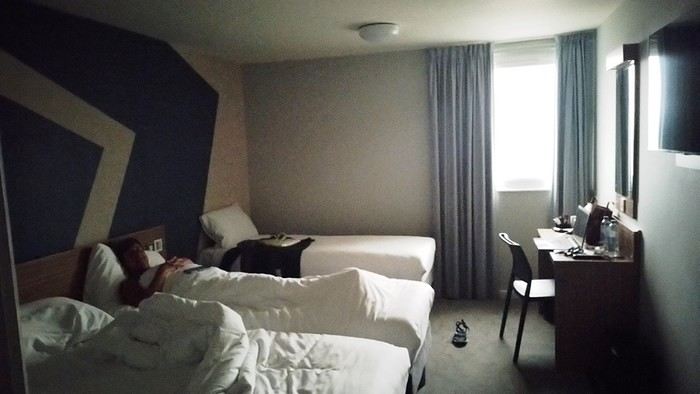
It wasn’t the Ritz, but with exhaustion on our side, we slept well. The continental breakfast was way better than we’d expected from an Ibis Budget. Still, it wasn’t enough to restore my joy for life. The course correction had turned into an arduous obstacle course. I scoured the car rental site every which way. Couldn’t reschedule the car. I’d done it before, but this time... Not to mention the laptop battery was complaining—the Brits have this quirk of making their power outlets incompatible with our chargers. Frustrated, I called them but ended up with a girl who declared herself incompetent and offered to have someone from Avis in Perth call me back—someone who’d supposedly handle rentals better. I decided to wait while taking a bath. Barely settled in, the phone rang. I was soaking wet, of course, and asked Dom to answer. Unfortunately, she’s known for disliking my phone, and in a clumsy move, she hung up. We got annoyed. She put dry towels on the edge of the bathtub, but—another false move—they fell in the water. The phone rang again... I completely redid the plans for the next two days, then transferred the files to my phone to consult them later offline. I plugged in my USB cable... *Plop!* The battery died abruptly—my PC shut down without any of the usual polite warnings! I looked around, hoping to find someone to strangle... Long story short, you can tell the day started under the worst omens. I was in a foul mood and spread my bad vibes to Dominique, who was initially in much better spirits... I called Mastercard, hoping to get a refund for the non-refundable night in Perth we’d already paid for. Same old song: “We’ll call you back”... Then... I’ll cut it short—buses, trains, lots of waiting... We rushed to reach the infamous Terminal 4.
We tried new options and convinced ourselves that a delayed departure flight is unrecoverable, no matter the scenario. We were furious that BA hadn’t bothered to tell us, leaving us to run around like rats in a burning house.
Tuesday, October 3rd, 2023 Kuala Lumpur-Perth
The flight was pretty nice. 13 hours, though. Dom and I were facing each other across the aisle. We could get up easily whenever we wanted without bothering anyone and chat when we felt like it. Besides, their chicken was amazing. They were kind enough to offer Dom a truly remarkable glass of rum. Good movies too, including the excellent *Prisoners* by Denis Villeneuve. At KL, during boarding, we developed a nagging worry about our luggage. We checked with some Malaysian Airlines staff. I sensed their hesitation. They made calls. Then changed their minds, giving us smiles and thumbs up...
Wednesday, October 4th, 2023 Perth
*Happy is the man who, like Ulysses, has had a fine voyage.* Well, for us, it wasn’t that. Finally arrived, we experienced the loneliness of tourists watching the baggage carousel spin, emptying of its precious containers one by one, until only a handful of travelers were left, staring at each other in disbelief. Without luggage, you’re kinda screwed. Not even a change of socks—our feet had been swimming in the same shoes for 3 days. No adapter, so no laptop. No toiletries. We could’ve cried! The lost luggage guy played his part. If you want compensation, fill out the disclaimer on the website made for that. And then, “Don’t worry, your luggage will arrive tomorrow!” “Don’t worry?!” From the start of the trip, we’ve been jerked around, fed lies. Tomorrow is the *absolute* last chance to get them back. Beyond that, we’d have to scramble a whole new trip. And lose a lot in the process! I have no idea how to go about it. Tomorrow... OMG... Tomorrow... We landed at 1 AM. Avis, the car rental place, opens at 6:30. Luckily, we found some decent breakfast. It cheered us up and gave us a second wind. Incorrigible, we started believing again! Well, then we just killed time. What else was there to do?

In front of Avis’s little shack, we were freezing. We’d been there since dawn. The girl who showed up, a Latina, immediately saw us as a nuisance who’d ruin her hopes of a peaceful start. Her face and tone were as unwelcoming as possible. You know us—it ended with hugs. She gave us a gorgeous, brand-new car! A hybrid with ultra-sophisticated features, all buttons you shouldn’t touch if you want to drive this thing without causing irreparable damage! We’re off! Driving on the left is easy at first. You think about it constantly. It’s counterintuitive, it takes effort. It’s later, when you get used to it and confidence sets in, that it becomes dangerous—old reflexes can send you into a wall. Anyway, the car and I immediately clicked.
In Perth, underground parking next to the hotel, friendly welcome—we ended up forgetting all the morning’s mishaps. Should we go sightseeing?
https://voyageforum.com/images/posts/small/1733767537-5Nwk6t3DsBZNOzf.jpg
Across the street, while we loaded the luggage, S., perched in his window frame, waved a handkerchief. This wasn’t just any trip.
Then things got tricky. It’s funny how fate sinks its teeth into our happy moments—there’s this whole intermediate phase where the poison seeps in unnoticed because you’re still in the dark...
First, there was a delay on our flight to London. Dom immediately went on high alert, while I stayed calm. In my mind, we had two hours. I knew we had to go from Terminal 5 to Terminal 4, but two hours—come on, that’s plenty, right?
Bad calculation! Because those two hours were between the first flight’s landing and the second’s takeoff. But flights close at least half an hour before departure. Getting from one terminal to another means taking a shuttle bus. We waited for the one going to Terminal 4... until a young guy paid to direct people (who hadn’t seen us) informed us it was no longer possible to access Terminal 4 without going through Terminal 2 first for a connection! That really cranked up the pressure. We started installing a mental countdown with a programmed explosion at the end—guaranteed stress with added beads of sweat. The terminal bus was driven by a young Pakistani guy. We were *so* tense we bombarded him with our frantic, repetitive questions. “So? When are we getting there? What’s happening? Why aren’t we moving?” Our eyes were glued to our watches. The poor guy knew. Perfectly. Because it was obvious—no way around it. We weren’t going to make it. It was impossible. But Dom and I stubbornly refused to believe it. Then the kid stopped the bus. Me, hysterical: “What are you doing? What’s going on? Our plane takes off in... in... 4 minutes!!!! We’re gonna miss iiiiiit!” He wasn’t calm either. “You’ve already missed it!” He explained we had to cross a zone that required an escort car to clear a path through the runways. Impossible to do without. It’s forbidden. We had to WAIT (!!!). Then he got a radio call—he had to rush to Terminal 3 to pick up a passenger who was *super* tight on time. “Amir!!!! It’s RIGHT NOW!” they yelled in his already-red ears, thanks to the complaints of two hysterical Frenchies. Dom and I were in overdrive, hallucinating! We wanted to stop him, maybe even hit him to prevent him from turning around. He picked up the girl, whom we instantly hated like the most despicable witch. I turned on my data, searched for Malaysia Airlines’ number at Terminal 4, called, and actually got someone—quite a feat. A woman cut off my frantic rambling with a blunt “It’s over, the check-in is closed, the plane is about to take off.” I heard her but refused to accept it. I yelled, “We’re coming!” She shot back her monolithic “It’s over.” Finally at the doors of that damn Terminal 4, we ran—*really* ran—a marathon, Gate 6, security checks, pat-downs, “Take off your belts,” we asked questions, everyone seemed confident, we ran with one hand holding up our pants, the other clutching our belt, Gate 6—the room was empty. A girl was sitting there, calmly on the phone. We pounced on her. She calmed us down. Little by little, the light came back. Our brains rebooted. We finally understood it was over. We’d have to start crafting a new plan with the new reality. It started with a return to Terminal 5 to talk to British Airways, which took a good hour. With the same driver as before. We were alone with him. He took the time to apologize, to assure us it wasn’t his fault, that our problem had no solution, that nothing could’ve changed the outcome. At BA, we were exhausted. We were greeted by a handsome young man in a navy-blue uniform with gold stripes everywhere. We could’ve made a scene, but we were just relieved to find someone who’d take charge of our story. It was a minimal response, but it was *a* response. I suppose we could’ve demanded a business-class upgrade or a free trip, but we were just happy with a few vouchers for food, a hotel room with breakfast, and a little bag with plastic toys, a razor, toothbrush, hygiene products, and a T-shirt... Trinkets... But we were fine with it all—we said thank you eagerly because the essential was assured. He found us seats on flights tomorrow. *Tomorrow.* We were afraid to hope! We had the exact same flights but a day later. The same crappy times, but it was all good. We felt saved from the shipwreck, like survivors. - And what about the luggage? - .... !!!!
Monday, October 2nd, 2023 London - Kuala Lumpur
It wasn’t the Ritz, but with exhaustion on our side, we slept well. The continental breakfast was way better than we’d expected from an Ibis Budget. Still, it wasn’t enough to restore my joy for life. The course correction had turned into an arduous obstacle course. I scoured the car rental site every which way. Couldn’t reschedule the car. I’d done it before, but this time... Not to mention the laptop battery was complaining—the Brits have this quirk of making their power outlets incompatible with our chargers. Frustrated, I called them but ended up with a girl who declared herself incompetent and offered to have someone from Avis in Perth call me back—someone who’d supposedly handle rentals better. I decided to wait while taking a bath. Barely settled in, the phone rang. I was soaking wet, of course, and asked Dom to answer. Unfortunately, she’s known for disliking my phone, and in a clumsy move, she hung up. We got annoyed. She put dry towels on the edge of the bathtub, but—another false move—they fell in the water. The phone rang again... I completely redid the plans for the next two days, then transferred the files to my phone to consult them later offline. I plugged in my USB cable... *Plop!* The battery died abruptly—my PC shut down without any of the usual polite warnings! I looked around, hoping to find someone to strangle... Long story short, you can tell the day started under the worst omens. I was in a foul mood and spread my bad vibes to Dominique, who was initially in much better spirits... I called Mastercard, hoping to get a refund for the non-refundable night in Perth we’d already paid for. Same old song: “We’ll call you back”... Then... I’ll cut it short—buses, trains, lots of waiting... We rushed to reach the infamous Terminal 4.
We tried new options and convinced ourselves that a delayed departure flight is unrecoverable, no matter the scenario. We were furious that BA hadn’t bothered to tell us, leaving us to run around like rats in a burning house.
Tuesday, October 3rd, 2023 Kuala Lumpur-Perth
The flight was pretty nice. 13 hours, though. Dom and I were facing each other across the aisle. We could get up easily whenever we wanted without bothering anyone and chat when we felt like it. Besides, their chicken was amazing. They were kind enough to offer Dom a truly remarkable glass of rum. Good movies too, including the excellent *Prisoners* by Denis Villeneuve. At KL, during boarding, we developed a nagging worry about our luggage. We checked with some Malaysian Airlines staff. I sensed their hesitation. They made calls. Then changed their minds, giving us smiles and thumbs up...
Wednesday, October 4th, 2023 Perth
*Happy is the man who, like Ulysses, has had a fine voyage.* Well, for us, it wasn’t that. Finally arrived, we experienced the loneliness of tourists watching the baggage carousel spin, emptying of its precious containers one by one, until only a handful of travelers were left, staring at each other in disbelief. Without luggage, you’re kinda screwed. Not even a change of socks—our feet had been swimming in the same shoes for 3 days. No adapter, so no laptop. No toiletries. We could’ve cried! The lost luggage guy played his part. If you want compensation, fill out the disclaimer on the website made for that. And then, “Don’t worry, your luggage will arrive tomorrow!” “Don’t worry?!” From the start of the trip, we’ve been jerked around, fed lies. Tomorrow is the *absolute* last chance to get them back. Beyond that, we’d have to scramble a whole new trip. And lose a lot in the process! I have no idea how to go about it. Tomorrow... OMG... Tomorrow... We landed at 1 AM. Avis, the car rental place, opens at 6:30. Luckily, we found some decent breakfast. It cheered us up and gave us a second wind. Incorrigible, we started believing again! Well, then we just killed time. What else was there to do?
In front of Avis’s little shack, we were freezing. We’d been there since dawn. The girl who showed up, a Latina, immediately saw us as a nuisance who’d ruin her hopes of a peaceful start. Her face and tone were as unwelcoming as possible. You know us—it ended with hugs. She gave us a gorgeous, brand-new car! A hybrid with ultra-sophisticated features, all buttons you shouldn’t touch if you want to drive this thing without causing irreparable damage! We’re off! Driving on the left is easy at first. You think about it constantly. It’s counterintuitive, it takes effort. It’s later, when you get used to it and confidence sets in, that it becomes dangerous—old reflexes can send you into a wall. Anyway, the car and I immediately clicked.
In Perth, underground parking next to the hotel, friendly welcome—we ended up forgetting all the morning’s mishaps. Should we go sightseeing?
https://voyageforum.com/images/posts/small/1733767537-5Nwk6t3DsBZNOzf.jpg
4x4 Expeditions in Southern Africa
Hi there,
Here’s a quick summary of six trips across Southern Africa, covering South Africa, Namibia, Botswana, Zimbabwe, and more. I traveled for a total of 23 months, over 100,000 km, and crossed 9 countries from South Africa to Tanzania. To do this, I bought an old Land Cruiser—a 1989 BJ 75 with a long chassis and a 3.4L turbo engine—which I converted into a bush camper set up for self-sufficiency in Africa: dual fuel tanks (235 L total) plus 2 x 20-liter jerry cans of diesel, 2 spare tires, a compressor, a toolbox with repair gear, a 50-liter water tank plus 2 x 30-liter and 2 x 10-liter jerry cans, a roof tent, multiple storage boxes, a sturdy roof rack, and even a paramotor. I also packed a first-aid kit and shipped the camper to South Africa by freight. My son joined me for part of the journey.
Key countries and highlights: South Africa in every direction, including its wildlife parks; in Namibia, the classics like Etosha, Fish River, Sossusvlei, Kaudum, but especially Damaraland and Kaokoland; in Botswana, a full loop of the Okavango, crossing the Makgadikgadi Pan, Moremi Park, the Linyanti River; and a tour of Zimbabwe with its national parks. During the last trip in 2020, due to COVID, we found refuge on a 250 km² Namibian farm with its own wildlife reserve. While crossing Damaraland and Kaokoland, we were completely self-sufficient, with supplies for over a month and 130 L of water.
In South Africa and Namibia, one issue that surprised us was the fences stretching for millions of kilometers along the tracks. Namibia is one and a half times the size of France but has a population of only about 2.5 million, mostly concentrated in a dozen small towns of 10,000 to 50,000 people—except for the capital, Windhoek (296,000). Paradoxically, compared to France, the space for freedom is extremely limited. Everything is private and requires payment. Even the Namib Desert is fenced... and you need a permit just to pick up a rock! For someone used to wild camping, it can get frustrating. Sometimes we ignored the rules, but the best solution is to ask a farmer (a real one, like a sheep or cattle rancher—not the ones with 3-meter electrified fences, which are lodges or private reserves) if you can camp on their land.
To truly enjoy freedom in Namibia, you need to venture into the northwest, along the Skeleton Coast, in Damaraland and Kaokoland. However, it’s essential to know your vehicle inside out, be a good mechanic, bring spare parts, and plan for potential breakdowns. Take care of your ride because a major issue out there can be a matter of survival. My motto: "Don’t break down, don’t break down, don’t break down..." Safari pros only venture into this region with two 4x4s. In Messum Crater, we met a couple waiting for rescue (thanks to a satellite device from their rental company) after their driveshaft broke. Keep in mind that in these areas, you’ll cover about 80 km in 8 hours.
Here are some of the issues we faced: a broken rear suspension leaf, several broken bolts on the front leaf springs, the spare tire mount breaking multiple times (replaced on the spot), a cracked water radiator in 1998 causing overheating and a seized valve stem in its guide, plus a bent rocker arm (field repair, valve adjustment, damaged head gasket, daily radiator refills, and a scratched cylinder—engine fully rebuilt upon return). Five roof rack mounts broke and were repaired at a technical high school in South Africa. The battery mount also broke (fixed with a steel plate found on the trail). The fuel filter clogged several times (changed or cleaned on the spot). A huge impact on the windshield from a piece of coal falling from a power plant supply truck (temporary repair with Araldite). The brake master cylinder failed in Marienfluss (repaired, seals replaced in Tsumeb). Multiple flat tires from acacia thorns. The rear door latch broke (homemade aluminum rod repair in Franschhoek). The voltmeter and ammeter failed (repaired on the spot). During the freight trip, despite locking the doors and having a partition between the front and back, someone managed to get in through the small side window, forced open the locks on two accessible storage boxes, and stole my tools (replaced later). A ball joint on the paramotor frame came loose mid-flight, damaging the wing and propeller (propeller shipped from France, homemade repair).
Health issues on the way to Tanzania: a painful sciatica and many sleepless nights (cortisone injection in Dodoma).
Kaokoland, Namibia—the northwest region: https://youtu.be/DzGepFsrnZs
Damaraland: https://youtu.be/DITQj8NvLZ4
Botswana: https://youtu.be/TEvDG0S62hg
Kaudom and Mohembo Parks: https://youtu.be/wq_Yf7jNLhw
Here’s a quick summary of six trips across Southern Africa, covering South Africa, Namibia, Botswana, Zimbabwe, and more. I traveled for a total of 23 months, over 100,000 km, and crossed 9 countries from South Africa to Tanzania. To do this, I bought an old Land Cruiser—a 1989 BJ 75 with a long chassis and a 3.4L turbo engine—which I converted into a bush camper set up for self-sufficiency in Africa: dual fuel tanks (235 L total) plus 2 x 20-liter jerry cans of diesel, 2 spare tires, a compressor, a toolbox with repair gear, a 50-liter water tank plus 2 x 30-liter and 2 x 10-liter jerry cans, a roof tent, multiple storage boxes, a sturdy roof rack, and even a paramotor. I also packed a first-aid kit and shipped the camper to South Africa by freight. My son joined me for part of the journey.
Key countries and highlights: South Africa in every direction, including its wildlife parks; in Namibia, the classics like Etosha, Fish River, Sossusvlei, Kaudum, but especially Damaraland and Kaokoland; in Botswana, a full loop of the Okavango, crossing the Makgadikgadi Pan, Moremi Park, the Linyanti River; and a tour of Zimbabwe with its national parks. During the last trip in 2020, due to COVID, we found refuge on a 250 km² Namibian farm with its own wildlife reserve. While crossing Damaraland and Kaokoland, we were completely self-sufficient, with supplies for over a month and 130 L of water.
In South Africa and Namibia, one issue that surprised us was the fences stretching for millions of kilometers along the tracks. Namibia is one and a half times the size of France but has a population of only about 2.5 million, mostly concentrated in a dozen small towns of 10,000 to 50,000 people—except for the capital, Windhoek (296,000). Paradoxically, compared to France, the space for freedom is extremely limited. Everything is private and requires payment. Even the Namib Desert is fenced... and you need a permit just to pick up a rock! For someone used to wild camping, it can get frustrating. Sometimes we ignored the rules, but the best solution is to ask a farmer (a real one, like a sheep or cattle rancher—not the ones with 3-meter electrified fences, which are lodges or private reserves) if you can camp on their land.
To truly enjoy freedom in Namibia, you need to venture into the northwest, along the Skeleton Coast, in Damaraland and Kaokoland. However, it’s essential to know your vehicle inside out, be a good mechanic, bring spare parts, and plan for potential breakdowns. Take care of your ride because a major issue out there can be a matter of survival. My motto: "Don’t break down, don’t break down, don’t break down..." Safari pros only venture into this region with two 4x4s. In Messum Crater, we met a couple waiting for rescue (thanks to a satellite device from their rental company) after their driveshaft broke. Keep in mind that in these areas, you’ll cover about 80 km in 8 hours.
Here are some of the issues we faced: a broken rear suspension leaf, several broken bolts on the front leaf springs, the spare tire mount breaking multiple times (replaced on the spot), a cracked water radiator in 1998 causing overheating and a seized valve stem in its guide, plus a bent rocker arm (field repair, valve adjustment, damaged head gasket, daily radiator refills, and a scratched cylinder—engine fully rebuilt upon return). Five roof rack mounts broke and were repaired at a technical high school in South Africa. The battery mount also broke (fixed with a steel plate found on the trail). The fuel filter clogged several times (changed or cleaned on the spot). A huge impact on the windshield from a piece of coal falling from a power plant supply truck (temporary repair with Araldite). The brake master cylinder failed in Marienfluss (repaired, seals replaced in Tsumeb). Multiple flat tires from acacia thorns. The rear door latch broke (homemade aluminum rod repair in Franschhoek). The voltmeter and ammeter failed (repaired on the spot). During the freight trip, despite locking the doors and having a partition between the front and back, someone managed to get in through the small side window, forced open the locks on two accessible storage boxes, and stole my tools (replaced later). A ball joint on the paramotor frame came loose mid-flight, damaging the wing and propeller (propeller shipped from France, homemade repair).
Health issues on the way to Tanzania: a painful sciatica and many sleepless nights (cortisone injection in Dodoma).
Kaokoland, Namibia—the northwest region: https://youtu.be/DzGepFsrnZs
Damaraland: https://youtu.be/DITQj8NvLZ4
Botswana: https://youtu.be/TEvDG0S62hg
Kaudom and Mohembo Parks: https://youtu.be/wq_Yf7jNLhw
South Africa in Three Trips
Hello,
In these post-COVID years, South Africa (SA) has drawn me back again... The long-time forum members will say I'm a bit obsessed (I've now surpassed 20 trips to this country, including 2 in Namibia)... But new readers can find my old travel journals and enjoy this new installment. So, three new trips... each lasting a month... always too short. I’ll try to be pragmatic.
Let’s start with the basics! You can plan your trip from your couch with complete peace of mind. Through any Booking site or directly (sometimes cheaper), I’ve never had any issues with my direct bookings—they’ve always matched what was promised. For national parks outside KwaZulu-Natal (where it’s KZN Wildlife), use the SANparks website, or Nature Reserve for that type of "accommodation." Air France, Lufthansa, or KLM... depending on the year and circumstances. Most flights are overnight, allowing you to arrive early in Joburg and... leave this city I don’t much like as quickly as possible. KLM offers a daytime flight to Cape Town... just arrange your first night’s stay. You drive on the left in SA (you knew that, right?)... you get used to it. Passport: must still be valid for 6 months with several blank pages... Car rental? A car is pretty much essential, whether for short or long trips. It’s safer too. Aside from the secure Gautrain in Joburg and Cape Town (CT from now on), I don’t take the train. Except for the red bus drop-off/pick-up in CT, I don’t take the bus. In this specific case, it’s practical because you can access all of CT’s spots—including the famous Lion’s Head—without worrying about parking or traffic. These past three years, I’ve chosen Around About Cars as my rental company. I’m very satisfied with them. What kind of car? It depends on what you’re doing and your budget. The vast majority of roads don’t require a special vehicle. In a park, the "high ground clearance" of SUVs lets you see animals better and helps avoid potholes (the SA version—ostrich-sized), speed bumps (our "sleeping policemen" with a big belly), and tackle the last few kilometers or 100 meters that can be a bit rough with complete peace of mind. Do your research. For me, it’s 4x2 or 4x4 depending on... South Africans drive fast... and I feel safer that way. International driver’s permit? Legally required! Never asked for by a rental company, only once by the police—but I stood my ground, confident, and it went smoothly. Road checks? Yes, often—at least two every time, but they’re relaxed... Note that if a police officer wants to give you a fine, it must be done at the police station—insist on going there... they’ll usually drop it. If they suggest paying on the spot in cash to "make things easier"... it’s just for their pocket. There’s a special "police alert" number—remind them of it! The rand is the South African currency. Nowadays, cards work in many places. But note: a car rental company will ask for a credit card, not a debit card. Be careful: cash is no longer accepted in SANparks camps and other places (entrances, etc.)! It’s card only! I always carry some cash. I order it from Yeschange (sounds dodgy, but it’s very reliable). Phew... What an introduction!
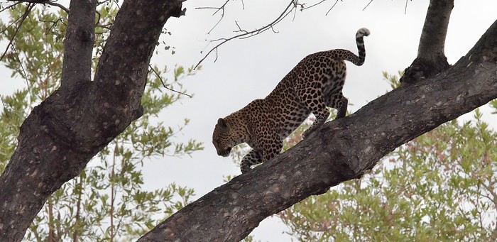
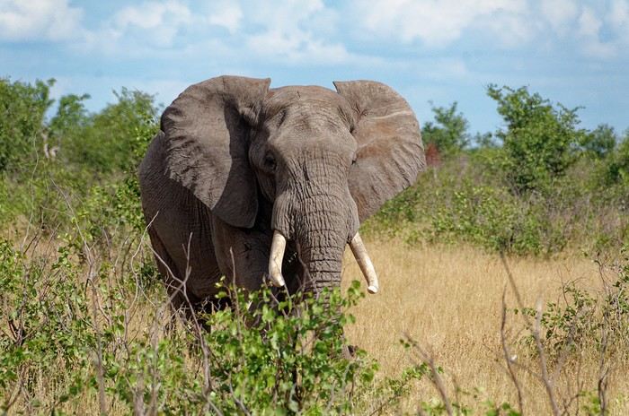
In these post-COVID years, South Africa (SA) has drawn me back again... The long-time forum members will say I'm a bit obsessed (I've now surpassed 20 trips to this country, including 2 in Namibia)... But new readers can find my old travel journals and enjoy this new installment. So, three new trips... each lasting a month... always too short. I’ll try to be pragmatic.
Let’s start with the basics! You can plan your trip from your couch with complete peace of mind. Through any Booking site or directly (sometimes cheaper), I’ve never had any issues with my direct bookings—they’ve always matched what was promised. For national parks outside KwaZulu-Natal (where it’s KZN Wildlife), use the SANparks website, or Nature Reserve for that type of "accommodation." Air France, Lufthansa, or KLM... depending on the year and circumstances. Most flights are overnight, allowing you to arrive early in Joburg and... leave this city I don’t much like as quickly as possible. KLM offers a daytime flight to Cape Town... just arrange your first night’s stay. You drive on the left in SA (you knew that, right?)... you get used to it. Passport: must still be valid for 6 months with several blank pages... Car rental? A car is pretty much essential, whether for short or long trips. It’s safer too. Aside from the secure Gautrain in Joburg and Cape Town (CT from now on), I don’t take the train. Except for the red bus drop-off/pick-up in CT, I don’t take the bus. In this specific case, it’s practical because you can access all of CT’s spots—including the famous Lion’s Head—without worrying about parking or traffic. These past three years, I’ve chosen Around About Cars as my rental company. I’m very satisfied with them. What kind of car? It depends on what you’re doing and your budget. The vast majority of roads don’t require a special vehicle. In a park, the "high ground clearance" of SUVs lets you see animals better and helps avoid potholes (the SA version—ostrich-sized), speed bumps (our "sleeping policemen" with a big belly), and tackle the last few kilometers or 100 meters that can be a bit rough with complete peace of mind. Do your research. For me, it’s 4x2 or 4x4 depending on... South Africans drive fast... and I feel safer that way. International driver’s permit? Legally required! Never asked for by a rental company, only once by the police—but I stood my ground, confident, and it went smoothly. Road checks? Yes, often—at least two every time, but they’re relaxed... Note that if a police officer wants to give you a fine, it must be done at the police station—insist on going there... they’ll usually drop it. If they suggest paying on the spot in cash to "make things easier"... it’s just for their pocket. There’s a special "police alert" number—remind them of it! The rand is the South African currency. Nowadays, cards work in many places. But note: a car rental company will ask for a credit card, not a debit card. Be careful: cash is no longer accepted in SANparks camps and other places (entrances, etc.)! It’s card only! I always carry some cash. I order it from Yeschange (sounds dodgy, but it’s very reliable). Phew... What an introduction!
Choix de cadre acier cause douleur aux cervicales (à vélo) English translation pending
Bonjour,
Lors de mes recherches sur le net je suis tombé plusieurs fois sur ce forum donc je me suis dit que ce serait intéressant d'y demander de bons conseils.
Après 3 années à partir en vacances avec nos Peugeot ns pliant et la volonté d'utiliser le moins possible la voiture nous avons décidé d'investir dans des vélos un peux plus sérieux, histoire d'aller encore plus loin avec plus d'efficacité !
Je trouve en occaz un ktm pour ma femme, cadre alu roues de 700 et fourche télescopique avec tous les œillets qui vont bien pour recevoir de l'équipement plus tard. Pour moi je trouve un bmc alpen challenge à 40mn de chez moi à un bon prix et sur place je succombe à cette beauté. Frein à disque hydraulique, cadre alu, roue 700, Shimano 105.... Bref une belle bête !
Sauf que finalement c'est un bout de bois et qu'après chaque sortie je ressent des douleurs aux cervicales. J'ai joué sur tout ce que j'ai pu pour m'y faire, raccourcie la potence avec un angle plus grand, ajouté des cornes, joué sur différents réglages de selle mais rien n'y fait. J'en conclue donc que le soucis ne vient peut être pas de la position plutôt sportive sur ce vélo mais bien le retour des chocs dans directement dans mes cervicales !
Nous envisageons de faire une partie de la Loire à vélo l'année prochaine et je ne me voit pas partir avec le bmc.
Maintenant ce que j'en pense : à 43 ans j'ai été un peu prétentieux de prendre ce type de vélo hyper urbain pour finalement faire un peu de chemin.
Maintenant les solutions et c'est là que j'ai besoin de vos conseils : soit je revend le bmc et je me retrouve un vélo moins typé sportif, soit je trouve un kit cadre et je dépouille le bmc qui est bien équipé.
Cahier des charges : pour une utilisation mixte chemin + ou- roulant/ petite route à 20km/h maxi. En priorité je veux du confort, de bons freins car j'ai ma petite derrière moi, de quoi poser des sacoches avant par la suite, et un budget plutôt serré (disons 300/400e pour un kit cadre que je retrouverai en partie en revendant le bmc) ou 600/700e pour un vélo complet.
Voilà vous savez tout, j'attends vos avis et vos expériences pour m'aider dans mes choix.... Merci !
Quel vélo Gravel choisir en 2020? English translation pending
Bonjour,
J'ai acheté il y a 4 jours un gravel croix de fer Genesis 20, que je me suis fait vélo hier !!! J'avoue avoir eu un coup de coeur pour ce vélo.... mais depuis ce vol je me suis mise à nouveau en quête de recherche car j'ai à nouveau comparé les prix et les équipements et à nouveau le doute plane. Le problème du croix de fer c'est la dimension du cadre il faut avoir un buste assez long pour avoir un minimum de confort ou alors raccourcir la potence mais le guidon devient nerveux et la tenue de route se dégrade selon avis d'expert ! Alors toutes les questions sont là pour un budget entre 1000 et 1500e grand max car l'assurance heureusement va me rembourser mais je vais perdre de billes ! : - cadre acier ou alu - choisir un cadre et faire monter son vélo // cadre ll city par exemple // - choix de la transition - choix des freins - pneu en 700 de quelle marque ? car il paraît qu'on ne fait pas assez attention aux pneus quand on achète son vélo alors que ce sont eux qui après le cadre offre une belle adhérence et confort route
déjà une bonne base si je pouvais avoir vos avis d'expert ....! voire quelques modèles en exemple ....
Bonne journée à tous, Anne
J'ai acheté il y a 4 jours un gravel croix de fer Genesis 20, que je me suis fait vélo hier !!! J'avoue avoir eu un coup de coeur pour ce vélo.... mais depuis ce vol je me suis mise à nouveau en quête de recherche car j'ai à nouveau comparé les prix et les équipements et à nouveau le doute plane. Le problème du croix de fer c'est la dimension du cadre il faut avoir un buste assez long pour avoir un minimum de confort ou alors raccourcir la potence mais le guidon devient nerveux et la tenue de route se dégrade selon avis d'expert ! Alors toutes les questions sont là pour un budget entre 1000 et 1500e grand max car l'assurance heureusement va me rembourser mais je vais perdre de billes ! : - cadre acier ou alu - choisir un cadre et faire monter son vélo // cadre ll city par exemple // - choix de la transition - choix des freins - pneu en 700 de quelle marque ? car il paraît qu'on ne fait pas assez attention aux pneus quand on achète son vélo alors que ce sont eux qui après le cadre offre une belle adhérence et confort route
déjà une bonne base si je pouvais avoir vos avis d'expert ....! voire quelques modèles en exemple ....
Bonne journée à tous, Anne
Chicanes et voies vertes en Bretagne (à vélo) English translation pending
Bonjour,
Je compte partir en vélo en Bretagne avec mon chien dans une remorque. J'ai un souvenir de difficultés avec les chicanes. Une fois, c'est un groupe de coureurs à pied qui ont soulevé le vélo et la remorque par dessus la chicane mais mon chien était descendu, quand même! C'était sur la Loire à vélo, vers Orléans.
Y a-t-il parmi les honorables membres du forum quelqu'un qui pourrait me dire quel type de chicanes je risque de rencontrer? Celles qui n'ont que quelques gros poteaux qui empêchent les voitures de passer sont les plus faciles. En fait ce ne sont pas des chicanes à proprement parler, mais il y en a qui sont impossibles à négocier avec une remorque.
Quant à l'itinéraire, je vais me décider en fonction du type de chicanes que vous allez gentiment me décrire.
Je me rends bien compte que c'est une question difficile mais il y a peut-être des cyclistes qui connaissent bien leur région. Ainsi, moi, je peux vous dire que le long de la Vilaine, entre Redon et Guipry, ça passe bien.
solution alternative: qui gère les voies vertes? Je peux peut-être m'adresser directement au bureau chargé de l'entretien des voies?
Bon, en tout cas, merci d'avance et bonne soirée.
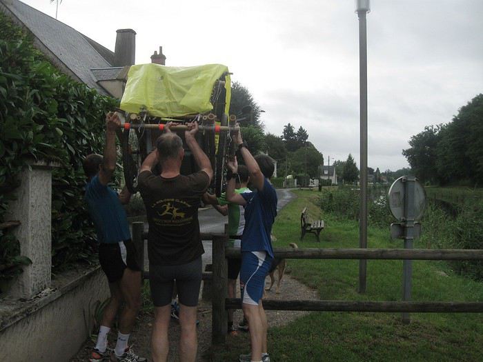
Quelques campings à me conseiller en Bretagne? English translation pending
Bonjour à tous
Cet été je pédale en France : en Bretagne et Loire-Atlantique. En gros : Redon - Carhaix par le Canal de Nantes à Brest direction Concarneau puis le littoral Sud, quelques îles, golfe du Morbihan Guérande - Pornic.
Les tarifs stratosphériques de certains campings m'affolent un peu. Il est vrai que je pars à la mauvaise période : fin juillet - mi août...
Quant aux tarifs cyclos, j'en ai trouvé quelques uns mais à partir de la presqu'île de Rhuys et jusqu'à Pornic je sèche un peu... il reste l'option bivouac mais dans les coins très touristiques, je préfère éviter et surtout pouvoir me "poser" afin de me donner le temps de visiter :)
Avez vous des campings à me conseiller - toute catégories confondues - pour leur accueil, leur confort et/ou leurs tarifs, de Port Navalo à Pornic (où j'ai déjà réservé un hébergement).
Merci !
Cet été je pédale en France : en Bretagne et Loire-Atlantique. En gros : Redon - Carhaix par le Canal de Nantes à Brest direction Concarneau puis le littoral Sud, quelques îles, golfe du Morbihan Guérande - Pornic.
Les tarifs stratosphériques de certains campings m'affolent un peu. Il est vrai que je pars à la mauvaise période : fin juillet - mi août...
Quant aux tarifs cyclos, j'en ai trouvé quelques uns mais à partir de la presqu'île de Rhuys et jusqu'à Pornic je sèche un peu... il reste l'option bivouac mais dans les coins très touristiques, je préfère éviter et surtout pouvoir me "poser" afin de me donner le temps de visiter :)
Avez vous des campings à me conseiller - toute catégories confondues - pour leur accueil, leur confort et/ou leurs tarifs, de Port Navalo à Pornic (où j'ai déjà réservé un hébergement).
Merci !
Avis sur les itinéraires et hébergements en Namibie English translation pending
Bonjour à tous
Tout d'abord un grand merci aux personnes qui prennent le temps de répondre et de donner leurs conseils. Ce forum est une mine d'informations.
Nous projetons de partir en Namibie du 23 juin au 13 juillet 2021 (à confirmer en fonction des vols) avec nos deux filles qui auront 16 et 13 ans 1/2. L'idée est de le faire en 4*4 avec tentes sur le toit pour profiter au maximum des grands espaces et de couper un peu avec des lodges et guest farms. Je ne sais pas encore à quelle fréquence. Peut-être prendre un lodge quand le camping n'apporte pas de plus value pour profiter du cadre.
J'ai pris contact avec deux TO : Suntrail et Tourmaline qui m'ont envoyé chacun un 1er jet et j'aimerais avoir votre avis.
Suntrail :
Windhoek - Londiningi Guesthouse Mariental - Lapa Lange Game Lodge Sesriem - Sesriem Campsite * 2 Naukluft - Naukluft Camp Swakopmund - Brigadoon Guest House * 2 Spitzkoppe - Spitzkoppe Camp Brandberg - Brandberg White Lady Lodge Twyfelfontein - Mawani Mountain Camp Palwag - Palmwag Lodge * 2 Sesfontein - Khowarib Lodge Epupa Falls - Omarunga Camp * 2 Etosha - Olifantsrus Campsite Etosha - Okaukuejo Camp Etosha -Halali Camp Etosha - Namutoni Camp Waterberg Plateau - Waterberg Camp Windhoek
Tourmaline :
Windhoek - Londiningi B&B (le même que Suntrail je suppose) Mariental - Anib Lodge Naukluft - NWR Naukluft Sesriem - NWR Sesriem * 2 Swakopmund - Brigadoon Cottage * 2 Spitzkoppe - Spitzkoppe Camp Brandberg - Brandberg White Lady Lodge Twyfelfontein - Twyfelfontein lodge Palwag - Palmwag Lodge * 2 Sesfontein - Khowarib Lodge Kaokoland - khowareb Lodge Epupa Falls - Epupa Camp * 2 Kamanjab - Toko Lodge Etosha - NWR Okaukuejo Etosha -NWR Halali Etosha - NWR Namutoni Waterberg Plateau - NWR Waterberg Windhoek
Les itinéraires se ressemblent avec quelques petites différences. il faut déjà que je revois le combiné campsite / lodges car après réflexion je trouve que cela fait bcp de nuits en lodges, alors qu'on loue un 4*4 équipé camping. De plus, une moyenne gamme nous suffit, je n'ai pas encore regardé quelle gamme ils ont choisies. Il me semble avoir lu que sur juin / juillet on ne peut pas profiter des piscines.
Suntrail propose une nuit de plus à Etosha, quel est votre avis : 3 ou 4 nuits ?
C'est une première ébauche à affiner bien sûr mais quelques premiers avis sur les itinéraires et les hébergements que vous connaissez m'aideraient déjà beaucoup.
Merci à l'avance à ceux qui vont m'éclairer !
Tout d'abord un grand merci aux personnes qui prennent le temps de répondre et de donner leurs conseils. Ce forum est une mine d'informations.
Nous projetons de partir en Namibie du 23 juin au 13 juillet 2021 (à confirmer en fonction des vols) avec nos deux filles qui auront 16 et 13 ans 1/2. L'idée est de le faire en 4*4 avec tentes sur le toit pour profiter au maximum des grands espaces et de couper un peu avec des lodges et guest farms. Je ne sais pas encore à quelle fréquence. Peut-être prendre un lodge quand le camping n'apporte pas de plus value pour profiter du cadre.
J'ai pris contact avec deux TO : Suntrail et Tourmaline qui m'ont envoyé chacun un 1er jet et j'aimerais avoir votre avis.
Suntrail :
Windhoek - Londiningi Guesthouse Mariental - Lapa Lange Game Lodge Sesriem - Sesriem Campsite * 2 Naukluft - Naukluft Camp Swakopmund - Brigadoon Guest House * 2 Spitzkoppe - Spitzkoppe Camp Brandberg - Brandberg White Lady Lodge Twyfelfontein - Mawani Mountain Camp Palwag - Palmwag Lodge * 2 Sesfontein - Khowarib Lodge Epupa Falls - Omarunga Camp * 2 Etosha - Olifantsrus Campsite Etosha - Okaukuejo Camp Etosha -Halali Camp Etosha - Namutoni Camp Waterberg Plateau - Waterberg Camp Windhoek
Tourmaline :
Windhoek - Londiningi B&B (le même que Suntrail je suppose) Mariental - Anib Lodge Naukluft - NWR Naukluft Sesriem - NWR Sesriem * 2 Swakopmund - Brigadoon Cottage * 2 Spitzkoppe - Spitzkoppe Camp Brandberg - Brandberg White Lady Lodge Twyfelfontein - Twyfelfontein lodge Palwag - Palmwag Lodge * 2 Sesfontein - Khowarib Lodge Kaokoland - khowareb Lodge Epupa Falls - Epupa Camp * 2 Kamanjab - Toko Lodge Etosha - NWR Okaukuejo Etosha -NWR Halali Etosha - NWR Namutoni Waterberg Plateau - NWR Waterberg Windhoek
Les itinéraires se ressemblent avec quelques petites différences. il faut déjà que je revois le combiné campsite / lodges car après réflexion je trouve que cela fait bcp de nuits en lodges, alors qu'on loue un 4*4 équipé camping. De plus, une moyenne gamme nous suffit, je n'ai pas encore regardé quelle gamme ils ont choisies. Il me semble avoir lu que sur juin / juillet on ne peut pas profiter des piscines.
Suntrail propose une nuit de plus à Etosha, quel est votre avis : 3 ou 4 nuits ?
C'est une première ébauche à affiner bien sûr mais quelques premiers avis sur les itinéraires et les hébergements que vous connaissez m'aideraient déjà beaucoup.
Merci à l'avance à ceux qui vont m'éclairer !
Retour d'expérience de Pékin à Shanghai via Wutaishan English translation pending
Il y a un an, le 17 mai 2019, nous partions en Chine trois semaines, mon épouse et moi-même. Nous avions longtemps hésité à y aller, et quand nous y repensons maintenant, vu la crise sanitaire actuelle, nous nous disons que nous avions bien fait. Pourquoi ce récit maintenant ? D’abord pour les photos (lien à la fin), qui nous rappellent des souvenirs, meilleurs aujourd’hui que juste après le retour, et qui pourraient faire rêver de futurs voyageurs. Ensuite pour quelques explications des conditions de ce voyage, même si elles sont peut-être hors de propos aujourd’hui. Et évidemment, merci à tous ceux qui nous ont aidés sur ce forum par leurs publications, ou leurs réponses directes à nos questions.
Nos impressions générales La Grande muraille et tant d'autres sites, nous en rêvions, surtout après le récit et le film d'un cousin il y a six ans. Car auparavant, mon épouse avait de gros préjugés sur les Chinois (différend historique avec les Vietnamiens, bien qu'elle ait aussi des origines chinoises !), et je m'imaginais les voyages en Chine exclusivement urbains. Ces avis ont été nuancés. Nous avons volontairement choisi un parcours culturel, avec de nombreux sites classés à l'Unesco, au nord, la région historique la plus densément peuplée. Nous avons laissé de côté le sud, en se disant que ce serait pour un éventuel autre voyage, et sachant que certains paysages devaient ressembler au nord Vietnam que nous connaissons déjà. En trois semaines, impossible de visiter un pays 17 fois plus grand que la France. Au final, nous ne sommes pas mécontents de nos choix, mais le timing était quand même serré, car nous avons sous-estimé les temps de transports, la foule, la fatigue. Surtout à Pékin, ce n'est pas 4 jours qu'il nous fallait, mais 5 ou 6, tant il y a de choses à voir. Nous nous demandons toujours comment certains tours opérateurs enchaînent la Cité interdite, la Colline du charbon, et le temple du Ciel dans la même journée, sans compter les embouteillages pour leurs cars ! Ces premières journées à Pékin ont été difficiles, mal remis du décalage horaire, et sans repères culturels. Le premier dîner a été épique pour se faire comprendre et l'accueil pas très chaleureux à notre guesthouse. À Hangzhou, nous avions un programme chargé qui aurait nécessité 2 jours au lieu de 1 seul. Nous avons finalement privilégié les rencontres aux visites. A Shanghai, alors que nous avions planifié tout notre voyage en fonction de la date, nous avons raté la course des bateaux-dragons, car elle avait été avancée d'un jour. Le matin même à la télé au petit-déjeuner, nous avions vu des images... Nous nous disions, tiens, ils se préparent pour demain... Si nous avions compris le chinois... La date n'était même pas actualisée sur les rares sites internet en anglais ! Les réceptionnistes de l'hôtel ne connaissaient même pas la manifestation ! Finalement nous sommes retournés dans la vieille ville chinoise, où la foule était beaucoup plus nombreuse que la première fois. Côté foule justement, le pire pour nous a été la Cité Interdite, malgré nos précautions, puis dans une moindre mesure, le Palais d’été à Pékin (un dimanche, mais moins monde dans les espaces avec suppléments), l’armée de terre cuite à Xi’an (bien aménagé quand même), le jardin du Humble administrateur à Suzhou (dommage, mais nous étions prévenus), le temple suspendu près de Datong (très petit). À part deux demi-journées de pluie à Xi'an (bien trempés !) et Shanghai, et le ciel parfois gris, notamment à Pékin, le temps était magnifique et les températures autour de 30 degrés. Nous avons évité un 39 degrés de justesse à Xi'an.
Notre trajet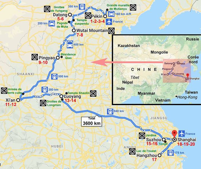
J1 # ven 17-mai # 23:20 Départ du vol Air France J2 # sam 18-mai # Arrivée 15:35 à PEKIN. Retrait des devises au DAB à l’aéroport + achat carte SIM / Transfert aéroport-hôtel en taxi (24 km, 40 mn) / Installation à l’hôtel pour 4 nuits près du temple des Lamas. J3 # dim 19-mai # Palais d'été (métro, A/S environ 1H, 20 km) J4 # lun 20-mai # Excursion aux tombeaux Ming + Grande muraille à Mutianyu (taxi A/R 160 km, 3H 30) J5 # mar 21-mai # Mat : Cité Interdite (métro) / AM : Temple du Ciel, jardin uniquement (métro) J6 # mer 22-mai # Mat : Temple des Lamas / hutongs (à pied, 400 m de l’hôtel) / AM : Taxi pour la gare. Départ du train à 14:16, arrivée à 20:43 à DATONG. Taxi pour l’hôtel (10 mn) dans le centre historique, et installation pour 2 nuits. J7 # jeu 23-mai # Mat : Excursion aux Grottes de Yungang (taxi A/R 35 km, 1H) / AM : Temple de Huayan (à pied, à 400 m de l’hôtel) J8 # ven 24-mai # Mat : Monastère suspendu (85 km, 1H15) et pagode en bois (58 km, 45 mn) / AM : Continuation en taxi vers les montagnes sacrées de WUTAISHAN (110 km, 2H 15). Installation à l’hôtel pour 2 nuits. J9 # sam 25-mai # Monastères de Wutaishan : Pusading, Xiantong, Tayuan, Nanshan (à pied/taxi) J10 # dim 26-mai # Mat : Route vers Pingyao (car, 400 km, environ 5H) / AM : Taxi et installation à l’hôtel à PINGYAO dans le centre historique pour 2 nuits. Début des visites à pied : remparts, temple de Confucius. J11 # lun 27-mai # Visite de la vieille ville de Pingyao (à pied). J12 # mar 28-mai # Mat : Excursion à la Résidence Qiao (taxi A/R, 50 km, 2H) / AM : Temple de Shuanglin (taxi, 8 km, 25 mn). Continuation vers la gare (8 km, 10 mn). Départ du train à 15:43, arrivée à XI’AN à 18:29. Taxi pour l’hôtel dans le centre historique (16 km, 45 mn), et installation pour 2 nuits. J13 # mer 29-mai # Mat : Armée en terre cuite (bus A/R 84 km, 2H) / AM : centre commercial près de l’hôtel J14 # jeu 30-mai # Mat : Musée du Shanxi, Grande pagode de l’Oie Sauvage (métro/à pied) / AM : Quartier Hui et Grande mosquée (à pied). Taxi pour la gare. Départ du train à 17:11, arrivée à 18:42 à LUOYANG. Taxi pour l’hôtel et installation pour 2 nuits. J15 # ven 31-mai # Excursion au Monastère Shaolin, puis au temple du Cheval blanc (Tour en bus, A/R 110 km) J16 # sam 01-juin # Mat : Grottes de Longmen (taxi A/R 30 km, 30 mn). Continuation pour la gare. / AM : Départ du train à 11:50 (dej à bord), arrivée à 17:13 à SUZHOU. Taxi pour l’hôtel et installation pour 2 nuits. J17 # dim 02-juin # Mat : Jardin de l’Humble Administrateur puis musée de la Soie (taxi / à pied) / AM : Excursion à Tongli (métro), bateau sur les canaux, jardins Pearl Tower et Tuisi. J18 # lun 03-juin # Mat : Marché aux fleurs, Jardin de la forêt de Lion (à pied) / AM : Canaux (à pied). Taxi pour la gare. Départ du train à 16:05, arrivée à 17:27 à HANGZHOU. Taxi pour l’hôtel et installation pour 1 seule nuit. J19 # mar 04-juin # Mat : Lac de l’Ouest (1ère visite à pied). Champs de thé de Longjin (voiture) / AM : Bateau sur le lac de l’Ouest pour l’île centrale. Centre historique avec une pharmacie de 1874. Taxi (vers 16H30) pour la gare. Départ du train à 18:06, arrivée à 19:00 à SHANGHAI. Taxi pour l’hôtel (20 km, 40 mn), et installation pour 3 nuits. J20 # mer 05-juin # Mat : Jardin Yu et vieille ville chinoise (taxi). / AM : Rue de Nankin, Bund, ferry, Pudong (métro/à pied/bateau) / Soir : Tour Jin Mao, puis Bund et rue de Nankin (taxi/ à pied/ métro) J21 # jeu 06-juin # Mat : Concession Française, dont parc Fuxing (métro/à pied/taxi) / AM : Musée de Shanghai, People square (à pied). J22 # ven 07-juin # Mat : Marché aux grillons, Suzhou creek pour la course des bateaux-dragons loupée, Temple de Jade (à pied/métro/taxi) / AM : Courses dans la vieille ville chinoise (métro/taxi/à pied) / Soir (vers 19H) : Taxi pour la gare de Longyang Road (12 km, 25 mn). Train Maglev pour l'aéroport (10 mn). Vol départ à 23:20. J23 # sam 08-juin # Arrivée à Paris à 05:40.
Notre budget final Avant de partir, nous avions contacté par internet des tours opérateurs sur place, pensant à la barrière de la langue. Les prix nous ont finalement dissuadés d'en sélectionner un. Au final, après comparaison, et même si les prestations sont forcément différentes, ils étaient plus élevés de 50 à 100% par rapport à ce que nous avons réalisé par nous-mêmes, moins de 2000 € par personne, se décomposant ainsi :
450 € pour le vol international A/R direct sur Air France. Vraiment pas cher, et un Airbus A380 au retour. 420 € pour les transports intérieurs, dont 84 € pour les métros/taxi en ville, 170 € pour 2500 km en train, et 166 € pour 1000 km en taxi/car. 38 € en moyenne (de 17 à 71 €) la chambre double. Moins de 12 € pour l’alimentaire par personne et par jour. 126 € par personne pour les frais de visa, parmi les plus chers au monde. Près de 300 € par personne pour nos visites. Presque tout est payant, et est même relativement cher par rapport au revenu moyen chinois, jusqu’à 120 ou 130 yuans certains sites, et encore nous avions des tarifs de moyenne saison. Nous nous sommes dit que c'était un moyen dissuasif de réduire la foule, que la tranquillité avait un prix. Mais dans les musées gratuits de Xi'an ou de Shanghai, il n'y avait pas vraiment plus de monde qu'ailleurs. A noter par ailleurs qu’à Mutianyu, les deux téléphériques n’appartenant pas à la même société, il faut payer deux fois pour la montée et pour la descente, et le prix est plus cher en haut qu’aux guichets en bas. Mieux vaut prévoir ! La visite de la Grande muraille nous est ainsi revenue à 560 yuans pour deux, mais sans regrets, car nous étions vraiment tranquilles. Cadeaux-souvenirs-achats « personnels » non compris.
Le taux de change nous est revenu en moyenne à 7,60 yuans par euro, hors frais bancaires.
Nos transports interurbains Pour les grandes distances, nous n’avons pris aucun vol intérieur, vu leurs coûts un peu élevés et les durées acceptables des trajets en trains.
Nous avons principalement pris des TGV en 2nde classe, réservés via le site internet fr.trip.com. Les rames sont nickel, les gares immenses comme des aéroports. Attention, il peut exister plusieurs gares dans les villes (TGV, non TGV, directions diverses). Bien revérifier sur sa réservation. Il est facile de se repérer avec les directions en caract��res latins. Nous avons récupéré sans frais tous nos billets dans la première gare calme (Pingyao) pour éviter ensuite de faire la queue à chaque fois. Nous arrivions en général une heure avant le départ. Une seule fois, nous nous sommes mal placés sur les quais, à l'arrière au lieu de l'avant. Les agents nous ont alors aidés à porter nos bagages dans les couloirs de la rame. Les trains sont parfaitement à l'heure. Seul le Pékin-Datong n'était pas un TGV. Nous avions une cabine 1ère classe avec banquettes 4 lits, bien que nous circulions de jour. Nous avons eu toute la cabine pour nous seuls sur la seconde moitié du trajet, et de jeunes voisins sur la première moitié. Nous n'avons pas discuté avec eux, ils ne parlaient apparemment pas anglais. Comme plusieurs Chinois, nous avons utilisé deux fois les fontaines d'eau bouillante en bout de voiture pour nos boites de noodles. Des prises électriques étaient disponibles pour charger les smartphones.
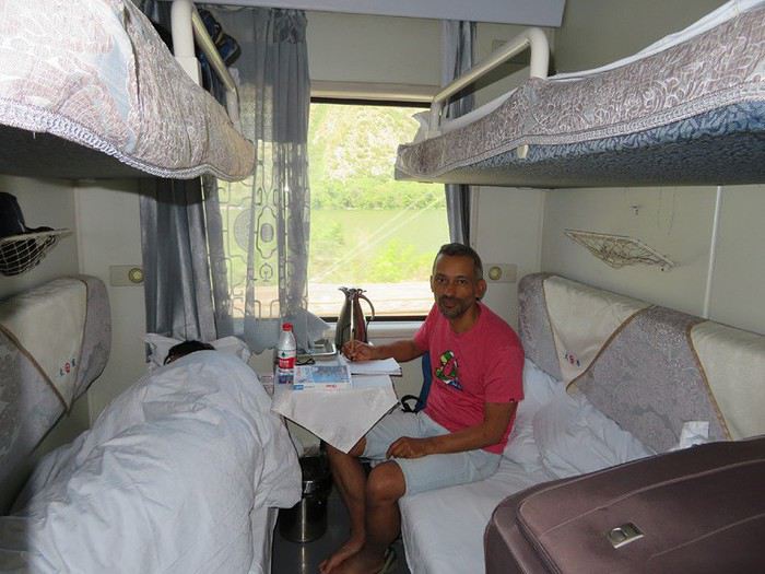 Train Pékin-Datong, où nos voisins font la sieste !
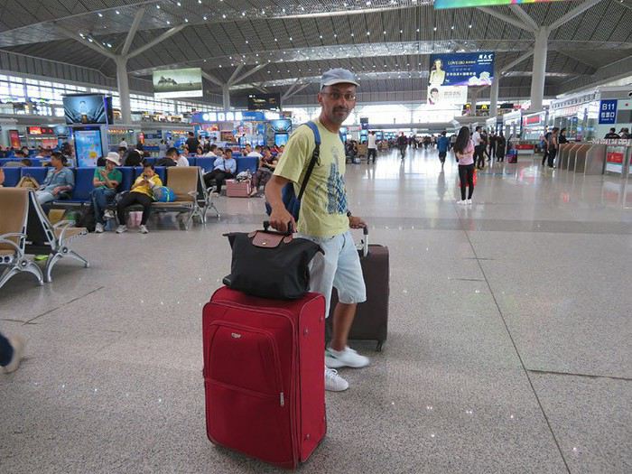 Gare de Xi'an, immense comme un aéroport.
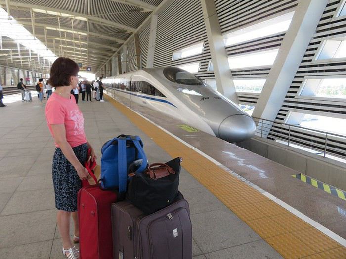 Quais à Shuzhou, prêts à monter comme tout le monde.
Entre Datong et Wutaishan, nous avons pris un taxi via notre hôtelier très sympathique. Le chauffeur ne parlait pas anglais mais nous avons réussi à nous comprendre via un traducteur. Nous avions plusieurs étapes prévues. Nous l'avons invité à déjeuner. Pour la Grande muraille, nous avons aussi trouvé notre jeune chauffeur via notre hôtelier. Il parlait anglais et nous avons eu des conversations très intéressantes. Il s'est baladé aussi avec nous et nous l'avons invité à déjeuner. C'était une très belle journée, sûrement mieux qu'avec un groupe.
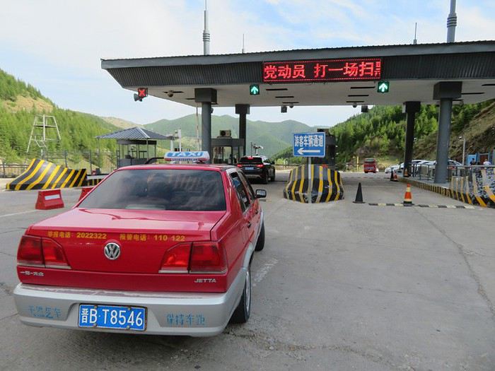 Notre taxi à la barrière de péage de la vallée de Wutaishan, où il a eu quelques problèmes administratifs.
Nous n’avons fait qu’un seul trajet en car régulier, entre Wutaishan et Pingyao. Notre hôtelier s’est occupé de la réservation, touchant sans doute une commission. Il nous a déconseillé le taxi en raison du prix, que je me suis fait confirmé directement auprès d’un chauffeur. Finalement, nous n'avons pas regretté. D'une part, nous n’avions que de l'autoroute et les paysages n’étaient pas extraordinaires. D'autre part, nous avons côtoyé un groupe sympathique de pèlerins, qui nous ont même offert à manger dans un arrêt routier. Et au terminus, une autre passagère s'est assurée que nous étions bien récupérés par un taxi avant de nous lâcher ! Nous étions les seuls occidentaux, mais certains Chinois travaillaient à l'étranger et parlaient très bien anglais.
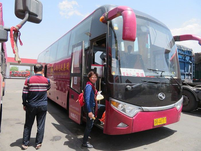 Dans un relais routier vers Pingyao.
Pour Shaolin, via notre hôtelier très sympathique, nous sommes partis en car avec un petit groupe, le seul du voyage, avec surtout des Chinois dont certains de l'étranger qui nous ont servi de traducteur... parfois... autrement dit, nous n'avons pas eu beaucoup d'explications. C'était plutôt bien organisé, avec des transferts en bus ou voiture en fonction des options, mais nous avons quand même perdu beaucoup de temps l'après-midi pour la visite du temple du Cheval blanc, qui à la limite ne méritait pas un détour : 45 mn de visite pour 3h de transports et d'attente. Nous aurions du prendre un taxi ou se contenter de Shaolin.
Nos transports urbains En ville, nous avons utilisé le métro, le taxi quand les stations étaient éloignées, et nos pieds ! Les villes ayant souvent plus d'un million d'habitants, elles disposent d'un métro (Pékin, Xi'an, Suzhou, Hangzhou, Shanghai). Nous nous sommes facilement repérés et avons pris les tickets à l'unité dans les distributeurs automatiques. Comme dans les aéroports et les gares, les voyageurs passent sous un portail électronique et les sacs passent aux rayons X. C'est quand même assez fluide, car peu de personnes ont un sac finalement. A la sortie Tiananmen, il y avait un contrôle supplémentaire des cartes d’identité ou passeports, et nous avons perdu 20 mn. Côté sécurité, pas de soucis, au moins une caméra tous les 2 mètres ! Pékin, qui doit avoir le plus ancien métro, a aussi peu d'escalators. Cela rajoute de la fatigue. Pas de PUB, peu de décoration, le métro est surtout fonctionnel et très propre.
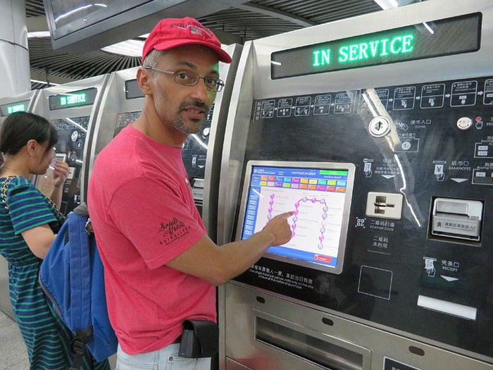 Distributeur automatique de billets dans le métro à Pékin
Le taxi n'est pas très cher, et est intéressant à partir du forfait kilométrique de 2 ou 3 km et pour deux personnes. Avec nos bagages, nous l'avons systématiquement pris entre les gares et nos hébergements, même à Luoyang où nous aurions pu marcher seulement sur 500 ou 700 m. Le chauffeur était d'ailleurs surpris, car par la route, le chemin était plus long ! Nous avons parfois eu beaucoup de difficultés à héler un taxi. Bien qu'ils soient nombreux, ceux-ci sont souvent réservés. Nous avons attendus parfois 20 à 30 mn, surtout à Xi'an, craignant même louper notre train. Certains chauffeurs n'ont pas voulu nous prendre à cause des bagages trop volumineux ou de la destination... Ils ne manquent pas de clients ! Bien que nous étions prévenus, nous avons été arnaqués une fois à Shanghai, la nuit. Le compteur ne fonctionnait pas et le chauffeur a baragouiné sans que nous lui demandions le prix de la course. Résultat : 100 yuans au lieu de sans doute 20 ou 30. Enfin, à la sortie nord de la Cité interdite, la station de métro est assez éloignée. Des bus sont disponibles, mais nous ne voulions pas nous aventurer, bien que des francophones auraient pu nous aider. Et les taxis étaient hors de prix, 100 yuans minimum. Nous sommes donc partis à pied jusqu'au métro, en faisant une pause resto.
Nos hébergements Parmi les 9, nous étions 3 fois dans des petites structures familiales (Pékin, Pingyao, Hangzhou), 3 fois en AJ ou moyennes structures (Datong, Wutaishan, Luoyang), et 3 fois en grands hôtels chinois (Xi'an, Suzhou, Shanghai). Les réservations via Booking.com étaient plutôt conformes, mais une a été annulée quelques jours avant et nous avons pu la remplacer sans soucis (Suzhou devait être une guesthouse). Nous étions plutôt dans les centres historiques. Pékin était un peu plus vieux, le reste était très propre. Les tarifs sont naturellement plus élevés dans les très grandes villes. Pour seulement 17 euros la nuit, nous avions quelques doutes sur Pingyao malgré de bons commentaires, mais c'était effectivement l'un de nos meilleurs hébergements. Les douches n'étaient généralement pas séparées des WC. Le wifi fonctionnait partout. L'accueil était plus distant dans les grands hôtels, pas beaucoup d'efforts pour nous aider ou parler en anglais, sachant que leur clientèle était surtout chinoise. Sinon nos logeurs nous ont toujours aidés pour des informations ou des déplacements. Quand nous avions le petit-déjeuner inclus, c'était chinois, et nous n'avons pas vraiment apprécié, même à Datong qui était top et où nous avions une corbeille de fruits chaque jour dans notre chambre. A Hangzhou, devant notre perplexité, la patronne nous a guidés à pied près du lac puis nous a baladés en voiture vers les champs de thé, gracieusement, avec un autre couple germano-chinois. Ce fut une matinée très sympa.
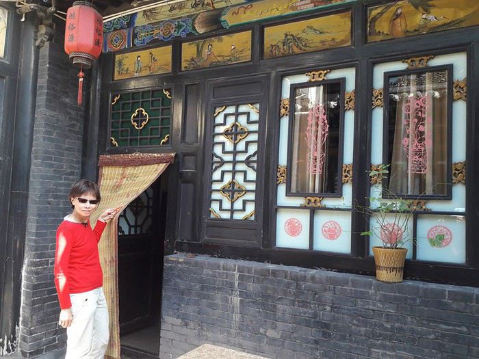 Entrée de notre chambre dans une cour carrée à Pingyao
Notre restauration Contrairement à nos habitudes, nous n'avons pas souvent cherché des restos recommandés, car ils étaient parfois éloignés. Nous avons privilégié les restos ayant des cartes avec photo à défaut de traduction anglaise (rare), des plats exposés en vitrine, ou de nombreux clients chinois. Des chinois parlant anglais des tables voisines nous ont parfois aidés à la compréhension des plats. Quelques belles surprises, comme un énorme poisson à Datong, ou le quartier Hui à Xi’an, mais nous en avons eu aussi des mauvaises entre les plats épicés ou non, le chaud-froid, le sucré-salé. Reste notre valeur sûre : les dumplings, de toutes sortes et vraiment pas chers. Nous avons aussi bien aimé les champignons très variés, avec diverses préparations en sauce, frits, sautés... Le canard laqué ? Pas gouté à Pékin, mais nous connaissons bien à Paris. Nous avons succombé une fois à une pizzeria (assez moyen et cher dans le chic quartier de Xiantidi à Shanghai), et deux fois à un Mac do (alors que nous y allons très rarement en France). En fait, c'était plus intéressant d'y voir les Chinois y manger. Côté desserts, le choix était restreint dans les restos. Dans des superettes et des épiceries fines, nous avons trouvé quelques gâteaux excellents, des bonbons et fruits confits. C’était difficile de comprendre la composition, nous hésitions beaucoup au début, moins à la fin ! Des choses que nous aimions, nous ne les avons pas retrouvées dans une autre région, et nous avons regretté. Les fruits nous ont manqué, et c'est seulement vers la fin, plus au sud, que nous en avons vu beaucoup, notamment des litchis. Nous n'avons jamais été malades, mais nous avons perdu quelques kilos, ce qui ne nous était jamais arrivé en voyage, même en Inde.
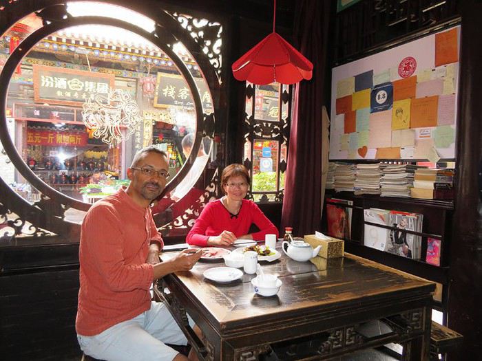 Resto Dejuyan à Pingyo, l'un des rares recommandés que nous ayons fait.
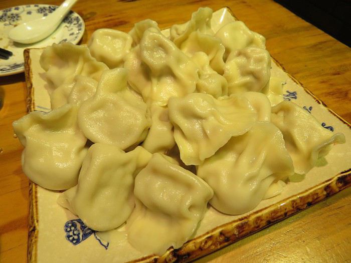 Les dumplings, une valeur sûre !
Nos facilités matérielles Dès l'arrivée à l'aéroport, nous avons retiré de l'argent à un DAB (retrait maxi de 3000 yuans, nous avons préféré Bank of China et ACBD), et avons pris une carte SIM dans un petit stand de China Mobile. Le forfait téléphone n'était pas élevé mais suffisant pour nos rares appels locaux. La carte SIM était aussi utile pour internet dans la rue, quoique le GPS maps.me n'en a pas besoin si les cartes sont préalablement téléchargées comme nous l’avions fait. Pour les appels internationaux (France, Etats-Unis, Vietnam), nous avons utilisé Viber avec le wifi dans les hôtels. J’avais installé l’application WeChat, mais impossible de payer avec. Elle a juste servi à quelques échanges avec deux Chinois. Nous avions aussi installé un VPN avant d’arriver dans le pays.
Nos contacts avec la population Comme beaucoup de touristes, notre crainte était la barrière de la langue, vu que très peu de Chinois parlent anglais, et que les idéogrammes remplacent notre alphabet. Alors oui, les contacts ont été limités, quoique... Nous avons eu une longue conversation avec notre jeune chauffeur qui s'est baladé avec nous sur la Grande muraille. Idem à Hangzhou. Les Chinois de l'étranger nous ont souvent bien aidé pour les traductions, sinon nous avions Google translate, et nos interlocuteurs avaient aussi une application. Le plus long échange ainsi a été avec notre hôtelier à Datong, une bonne demi-heure. Nous avons bien rigolé parfois, car les traductions n’étaient pas parfaites dans les deux sens. Mieux vaut des phrases courtes, et passer par la traduction Chinois-anglais que Chinois-français. Mais toujours être dépendant d'une machine, ne nous incitait pas à engager la conversation, nous cherchions à nous débrouiller seuls, et immanquablement, nous sommes passés à côté d'informations importantes, comme pour la fête des bateaux-dragon qui devait être le clou de notre voyage. Certains Chinois, qui voyaient bien que la conversation était impossible, nous ont même carrément tourné le dos. Pourquoi perdre son temps ? Le plus incroyable était dans un grand resto à Shanghai, qui était sûr de faire le plein. Du coup, nous sommes ressortis ! Mais en général, les Chinois ont été assez attentifs à nos attentes. Nous avons croisé très peu d'étrangers, ceux-ci étant souvent noyés dans la masse de tous les touristes chinois. Nous étions même des extraterrestres à Wutaishan. Shanghai était plus cosmopolite, mais il était trop tard pour échanger sur des expériences.
Nos cadeaux-souvenirs Nous ne sommes pas trop adeptes des objets décoratifs. Nous avons surtout ramené des produits alimentaires : champignons et fleurs de troellius (infusion) de Wutaishan, bœuf de Pingyao, bœuf séché, gâteaux divers, bonbons et fruits confits, ainsi que d’excellents litchis frais. Nous avons aussi acheté à Shanghai une paire de Feiyue, portée notamment par les moines de Shaolin.
Nos photos au cours de ce voyage C’est par ici : https://photos.google.com/share/AF1QipMbz1iSnD8-2C2FlzUyjiKaHFiHcv7YxnA7BFq0dXuLDTWOz2FeQvzF0LgIXugLFw?key=Zkt5eFNxd1pYWTFmdzZISDdZM3k5aDBNR0lNTlBB
Nos impressions générales La Grande muraille et tant d'autres sites, nous en rêvions, surtout après le récit et le film d'un cousin il y a six ans. Car auparavant, mon épouse avait de gros préjugés sur les Chinois (différend historique avec les Vietnamiens, bien qu'elle ait aussi des origines chinoises !), et je m'imaginais les voyages en Chine exclusivement urbains. Ces avis ont été nuancés. Nous avons volontairement choisi un parcours culturel, avec de nombreux sites classés à l'Unesco, au nord, la région historique la plus densément peuplée. Nous avons laissé de côté le sud, en se disant que ce serait pour un éventuel autre voyage, et sachant que certains paysages devaient ressembler au nord Vietnam que nous connaissons déjà. En trois semaines, impossible de visiter un pays 17 fois plus grand que la France. Au final, nous ne sommes pas mécontents de nos choix, mais le timing était quand même serré, car nous avons sous-estimé les temps de transports, la foule, la fatigue. Surtout à Pékin, ce n'est pas 4 jours qu'il nous fallait, mais 5 ou 6, tant il y a de choses à voir. Nous nous demandons toujours comment certains tours opérateurs enchaînent la Cité interdite, la Colline du charbon, et le temple du Ciel dans la même journée, sans compter les embouteillages pour leurs cars ! Ces premières journées à Pékin ont été difficiles, mal remis du décalage horaire, et sans repères culturels. Le premier dîner a été épique pour se faire comprendre et l'accueil pas très chaleureux à notre guesthouse. À Hangzhou, nous avions un programme chargé qui aurait nécessité 2 jours au lieu de 1 seul. Nous avons finalement privilégié les rencontres aux visites. A Shanghai, alors que nous avions planifié tout notre voyage en fonction de la date, nous avons raté la course des bateaux-dragons, car elle avait été avancée d'un jour. Le matin même à la télé au petit-déjeuner, nous avions vu des images... Nous nous disions, tiens, ils se préparent pour demain... Si nous avions compris le chinois... La date n'était même pas actualisée sur les rares sites internet en anglais ! Les réceptionnistes de l'hôtel ne connaissaient même pas la manifestation ! Finalement nous sommes retournés dans la vieille ville chinoise, où la foule était beaucoup plus nombreuse que la première fois. Côté foule justement, le pire pour nous a été la Cité Interdite, malgré nos précautions, puis dans une moindre mesure, le Palais d’été à Pékin (un dimanche, mais moins monde dans les espaces avec suppléments), l’armée de terre cuite à Xi’an (bien aménagé quand même), le jardin du Humble administrateur à Suzhou (dommage, mais nous étions prévenus), le temple suspendu près de Datong (très petit). À part deux demi-journées de pluie à Xi'an (bien trempés !) et Shanghai, et le ciel parfois gris, notamment à Pékin, le temps était magnifique et les températures autour de 30 degrés. Nous avons évité un 39 degrés de justesse à Xi'an.
Notre trajet
J1 # ven 17-mai # 23:20 Départ du vol Air France J2 # sam 18-mai # Arrivée 15:35 à PEKIN. Retrait des devises au DAB à l’aéroport + achat carte SIM / Transfert aéroport-hôtel en taxi (24 km, 40 mn) / Installation à l’hôtel pour 4 nuits près du temple des Lamas. J3 # dim 19-mai # Palais d'été (métro, A/S environ 1H, 20 km) J4 # lun 20-mai # Excursion aux tombeaux Ming + Grande muraille à Mutianyu (taxi A/R 160 km, 3H 30) J5 # mar 21-mai # Mat : Cité Interdite (métro) / AM : Temple du Ciel, jardin uniquement (métro) J6 # mer 22-mai # Mat : Temple des Lamas / hutongs (à pied, 400 m de l’hôtel) / AM : Taxi pour la gare. Départ du train à 14:16, arrivée à 20:43 à DATONG. Taxi pour l’hôtel (10 mn) dans le centre historique, et installation pour 2 nuits. J7 # jeu 23-mai # Mat : Excursion aux Grottes de Yungang (taxi A/R 35 km, 1H) / AM : Temple de Huayan (à pied, à 400 m de l’hôtel) J8 # ven 24-mai # Mat : Monastère suspendu (85 km, 1H15) et pagode en bois (58 km, 45 mn) / AM : Continuation en taxi vers les montagnes sacrées de WUTAISHAN (110 km, 2H 15). Installation à l’hôtel pour 2 nuits. J9 # sam 25-mai # Monastères de Wutaishan : Pusading, Xiantong, Tayuan, Nanshan (à pied/taxi) J10 # dim 26-mai # Mat : Route vers Pingyao (car, 400 km, environ 5H) / AM : Taxi et installation à l’hôtel à PINGYAO dans le centre historique pour 2 nuits. Début des visites à pied : remparts, temple de Confucius. J11 # lun 27-mai # Visite de la vieille ville de Pingyao (à pied). J12 # mar 28-mai # Mat : Excursion à la Résidence Qiao (taxi A/R, 50 km, 2H) / AM : Temple de Shuanglin (taxi, 8 km, 25 mn). Continuation vers la gare (8 km, 10 mn). Départ du train à 15:43, arrivée à XI’AN à 18:29. Taxi pour l’hôtel dans le centre historique (16 km, 45 mn), et installation pour 2 nuits. J13 # mer 29-mai # Mat : Armée en terre cuite (bus A/R 84 km, 2H) / AM : centre commercial près de l’hôtel J14 # jeu 30-mai # Mat : Musée du Shanxi, Grande pagode de l’Oie Sauvage (métro/à pied) / AM : Quartier Hui et Grande mosquée (à pied). Taxi pour la gare. Départ du train à 17:11, arrivée à 18:42 à LUOYANG. Taxi pour l’hôtel et installation pour 2 nuits. J15 # ven 31-mai # Excursion au Monastère Shaolin, puis au temple du Cheval blanc (Tour en bus, A/R 110 km) J16 # sam 01-juin # Mat : Grottes de Longmen (taxi A/R 30 km, 30 mn). Continuation pour la gare. / AM : Départ du train à 11:50 (dej à bord), arrivée à 17:13 à SUZHOU. Taxi pour l’hôtel et installation pour 2 nuits. J17 # dim 02-juin # Mat : Jardin de l’Humble Administrateur puis musée de la Soie (taxi / à pied) / AM : Excursion à Tongli (métro), bateau sur les canaux, jardins Pearl Tower et Tuisi. J18 # lun 03-juin # Mat : Marché aux fleurs, Jardin de la forêt de Lion (à pied) / AM : Canaux (à pied). Taxi pour la gare. Départ du train à 16:05, arrivée à 17:27 à HANGZHOU. Taxi pour l’hôtel et installation pour 1 seule nuit. J19 # mar 04-juin # Mat : Lac de l’Ouest (1ère visite à pied). Champs de thé de Longjin (voiture) / AM : Bateau sur le lac de l’Ouest pour l’île centrale. Centre historique avec une pharmacie de 1874. Taxi (vers 16H30) pour la gare. Départ du train à 18:06, arrivée à 19:00 à SHANGHAI. Taxi pour l’hôtel (20 km, 40 mn), et installation pour 3 nuits. J20 # mer 05-juin # Mat : Jardin Yu et vieille ville chinoise (taxi). / AM : Rue de Nankin, Bund, ferry, Pudong (métro/à pied/bateau) / Soir : Tour Jin Mao, puis Bund et rue de Nankin (taxi/ à pied/ métro) J21 # jeu 06-juin # Mat : Concession Française, dont parc Fuxing (métro/à pied/taxi) / AM : Musée de Shanghai, People square (à pied). J22 # ven 07-juin # Mat : Marché aux grillons, Suzhou creek pour la course des bateaux-dragons loupée, Temple de Jade (à pied/métro/taxi) / AM : Courses dans la vieille ville chinoise (métro/taxi/à pied) / Soir (vers 19H) : Taxi pour la gare de Longyang Road (12 km, 25 mn). Train Maglev pour l'aéroport (10 mn). Vol départ à 23:20. J23 # sam 08-juin # Arrivée à Paris à 05:40.
Notre budget final Avant de partir, nous avions contacté par internet des tours opérateurs sur place, pensant à la barrière de la langue. Les prix nous ont finalement dissuadés d'en sélectionner un. Au final, après comparaison, et même si les prestations sont forcément différentes, ils étaient plus élevés de 50 à 100% par rapport à ce que nous avons réalisé par nous-mêmes, moins de 2000 € par personne, se décomposant ainsi :
450 € pour le vol international A/R direct sur Air France. Vraiment pas cher, et un Airbus A380 au retour. 420 € pour les transports intérieurs, dont 84 € pour les métros/taxi en ville, 170 € pour 2500 km en train, et 166 € pour 1000 km en taxi/car. 38 € en moyenne (de 17 à 71 €) la chambre double. Moins de 12 € pour l’alimentaire par personne et par jour. 126 € par personne pour les frais de visa, parmi les plus chers au monde. Près de 300 € par personne pour nos visites. Presque tout est payant, et est même relativement cher par rapport au revenu moyen chinois, jusqu’à 120 ou 130 yuans certains sites, et encore nous avions des tarifs de moyenne saison. Nous nous sommes dit que c'était un moyen dissuasif de réduire la foule, que la tranquillité avait un prix. Mais dans les musées gratuits de Xi'an ou de Shanghai, il n'y avait pas vraiment plus de monde qu'ailleurs. A noter par ailleurs qu’à Mutianyu, les deux téléphériques n’appartenant pas à la même société, il faut payer deux fois pour la montée et pour la descente, et le prix est plus cher en haut qu’aux guichets en bas. Mieux vaut prévoir ! La visite de la Grande muraille nous est ainsi revenue à 560 yuans pour deux, mais sans regrets, car nous étions vraiment tranquilles. Cadeaux-souvenirs-achats « personnels » non compris.
Le taux de change nous est revenu en moyenne à 7,60 yuans par euro, hors frais bancaires.
Nos transports interurbains Pour les grandes distances, nous n’avons pris aucun vol intérieur, vu leurs coûts un peu élevés et les durées acceptables des trajets en trains.
Nous avons principalement pris des TGV en 2nde classe, réservés via le site internet fr.trip.com. Les rames sont nickel, les gares immenses comme des aéroports. Attention, il peut exister plusieurs gares dans les villes (TGV, non TGV, directions diverses). Bien revérifier sur sa réservation. Il est facile de se repérer avec les directions en caract��res latins. Nous avons récupéré sans frais tous nos billets dans la première gare calme (Pingyao) pour éviter ensuite de faire la queue à chaque fois. Nous arrivions en général une heure avant le départ. Une seule fois, nous nous sommes mal placés sur les quais, à l'arrière au lieu de l'avant. Les agents nous ont alors aidés à porter nos bagages dans les couloirs de la rame. Les trains sont parfaitement à l'heure. Seul le Pékin-Datong n'était pas un TGV. Nous avions une cabine 1ère classe avec banquettes 4 lits, bien que nous circulions de jour. Nous avons eu toute la cabine pour nous seuls sur la seconde moitié du trajet, et de jeunes voisins sur la première moitié. Nous n'avons pas discuté avec eux, ils ne parlaient apparemment pas anglais. Comme plusieurs Chinois, nous avons utilisé deux fois les fontaines d'eau bouillante en bout de voiture pour nos boites de noodles. Des prises électriques étaient disponibles pour charger les smartphones.
Train Pékin-Datong, où nos voisins font la sieste !
Gare de Xi'an, immense comme un aéroport.
Quais à Shuzhou, prêts à monter comme tout le monde.Entre Datong et Wutaishan, nous avons pris un taxi via notre hôtelier très sympathique. Le chauffeur ne parlait pas anglais mais nous avons réussi à nous comprendre via un traducteur. Nous avions plusieurs étapes prévues. Nous l'avons invité à déjeuner. Pour la Grande muraille, nous avons aussi trouvé notre jeune chauffeur via notre hôtelier. Il parlait anglais et nous avons eu des conversations très intéressantes. Il s'est baladé aussi avec nous et nous l'avons invité à déjeuner. C'était une très belle journée, sûrement mieux qu'avec un groupe.
Notre taxi à la barrière de péage de la vallée de Wutaishan, où il a eu quelques problèmes administratifs.Nous n’avons fait qu’un seul trajet en car régulier, entre Wutaishan et Pingyao. Notre hôtelier s’est occupé de la réservation, touchant sans doute une commission. Il nous a déconseillé le taxi en raison du prix, que je me suis fait confirmé directement auprès d’un chauffeur. Finalement, nous n'avons pas regretté. D'une part, nous n’avions que de l'autoroute et les paysages n’étaient pas extraordinaires. D'autre part, nous avons côtoyé un groupe sympathique de pèlerins, qui nous ont même offert à manger dans un arrêt routier. Et au terminus, une autre passagère s'est assurée que nous étions bien récupérés par un taxi avant de nous lâcher ! Nous étions les seuls occidentaux, mais certains Chinois travaillaient à l'étranger et parlaient très bien anglais.
Dans un relais routier vers Pingyao.Pour Shaolin, via notre hôtelier très sympathique, nous sommes partis en car avec un petit groupe, le seul du voyage, avec surtout des Chinois dont certains de l'étranger qui nous ont servi de traducteur... parfois... autrement dit, nous n'avons pas eu beaucoup d'explications. C'était plutôt bien organisé, avec des transferts en bus ou voiture en fonction des options, mais nous avons quand même perdu beaucoup de temps l'après-midi pour la visite du temple du Cheval blanc, qui à la limite ne méritait pas un détour : 45 mn de visite pour 3h de transports et d'attente. Nous aurions du prendre un taxi ou se contenter de Shaolin.
Nos transports urbains En ville, nous avons utilisé le métro, le taxi quand les stations étaient éloignées, et nos pieds ! Les villes ayant souvent plus d'un million d'habitants, elles disposent d'un métro (Pékin, Xi'an, Suzhou, Hangzhou, Shanghai). Nous nous sommes facilement repérés et avons pris les tickets à l'unité dans les distributeurs automatiques. Comme dans les aéroports et les gares, les voyageurs passent sous un portail électronique et les sacs passent aux rayons X. C'est quand même assez fluide, car peu de personnes ont un sac finalement. A la sortie Tiananmen, il y avait un contrôle supplémentaire des cartes d’identité ou passeports, et nous avons perdu 20 mn. Côté sécurité, pas de soucis, au moins une caméra tous les 2 mètres ! Pékin, qui doit avoir le plus ancien métro, a aussi peu d'escalators. Cela rajoute de la fatigue. Pas de PUB, peu de décoration, le métro est surtout fonctionnel et très propre.
Distributeur automatique de billets dans le métro à PékinLe taxi n'est pas très cher, et est intéressant à partir du forfait kilométrique de 2 ou 3 km et pour deux personnes. Avec nos bagages, nous l'avons systématiquement pris entre les gares et nos hébergements, même à Luoyang où nous aurions pu marcher seulement sur 500 ou 700 m. Le chauffeur était d'ailleurs surpris, car par la route, le chemin était plus long ! Nous avons parfois eu beaucoup de difficultés à héler un taxi. Bien qu'ils soient nombreux, ceux-ci sont souvent réservés. Nous avons attendus parfois 20 à 30 mn, surtout à Xi'an, craignant même louper notre train. Certains chauffeurs n'ont pas voulu nous prendre à cause des bagages trop volumineux ou de la destination... Ils ne manquent pas de clients ! Bien que nous étions prévenus, nous avons été arnaqués une fois à Shanghai, la nuit. Le compteur ne fonctionnait pas et le chauffeur a baragouiné sans que nous lui demandions le prix de la course. Résultat : 100 yuans au lieu de sans doute 20 ou 30. Enfin, à la sortie nord de la Cité interdite, la station de métro est assez éloignée. Des bus sont disponibles, mais nous ne voulions pas nous aventurer, bien que des francophones auraient pu nous aider. Et les taxis étaient hors de prix, 100 yuans minimum. Nous sommes donc partis à pied jusqu'au métro, en faisant une pause resto.
Nos hébergements Parmi les 9, nous étions 3 fois dans des petites structures familiales (Pékin, Pingyao, Hangzhou), 3 fois en AJ ou moyennes structures (Datong, Wutaishan, Luoyang), et 3 fois en grands hôtels chinois (Xi'an, Suzhou, Shanghai). Les réservations via Booking.com étaient plutôt conformes, mais une a été annulée quelques jours avant et nous avons pu la remplacer sans soucis (Suzhou devait être une guesthouse). Nous étions plutôt dans les centres historiques. Pékin était un peu plus vieux, le reste était très propre. Les tarifs sont naturellement plus élevés dans les très grandes villes. Pour seulement 17 euros la nuit, nous avions quelques doutes sur Pingyao malgré de bons commentaires, mais c'était effectivement l'un de nos meilleurs hébergements. Les douches n'étaient généralement pas séparées des WC. Le wifi fonctionnait partout. L'accueil était plus distant dans les grands hôtels, pas beaucoup d'efforts pour nous aider ou parler en anglais, sachant que leur clientèle était surtout chinoise. Sinon nos logeurs nous ont toujours aidés pour des informations ou des déplacements. Quand nous avions le petit-déjeuner inclus, c'était chinois, et nous n'avons pas vraiment apprécié, même à Datong qui était top et où nous avions une corbeille de fruits chaque jour dans notre chambre. A Hangzhou, devant notre perplexité, la patronne nous a guidés à pied près du lac puis nous a baladés en voiture vers les champs de thé, gracieusement, avec un autre couple germano-chinois. Ce fut une matinée très sympa.
Entrée de notre chambre dans une cour carrée à PingyaoNotre restauration Contrairement à nos habitudes, nous n'avons pas souvent cherché des restos recommandés, car ils étaient parfois éloignés. Nous avons privilégié les restos ayant des cartes avec photo à défaut de traduction anglaise (rare), des plats exposés en vitrine, ou de nombreux clients chinois. Des chinois parlant anglais des tables voisines nous ont parfois aidés à la compréhension des plats. Quelques belles surprises, comme un énorme poisson à Datong, ou le quartier Hui à Xi’an, mais nous en avons eu aussi des mauvaises entre les plats épicés ou non, le chaud-froid, le sucré-salé. Reste notre valeur sûre : les dumplings, de toutes sortes et vraiment pas chers. Nous avons aussi bien aimé les champignons très variés, avec diverses préparations en sauce, frits, sautés... Le canard laqué ? Pas gouté à Pékin, mais nous connaissons bien à Paris. Nous avons succombé une fois à une pizzeria (assez moyen et cher dans le chic quartier de Xiantidi à Shanghai), et deux fois à un Mac do (alors que nous y allons très rarement en France). En fait, c'était plus intéressant d'y voir les Chinois y manger. Côté desserts, le choix était restreint dans les restos. Dans des superettes et des épiceries fines, nous avons trouvé quelques gâteaux excellents, des bonbons et fruits confits. C’était difficile de comprendre la composition, nous hésitions beaucoup au début, moins à la fin ! Des choses que nous aimions, nous ne les avons pas retrouvées dans une autre région, et nous avons regretté. Les fruits nous ont manqué, et c'est seulement vers la fin, plus au sud, que nous en avons vu beaucoup, notamment des litchis. Nous n'avons jamais été malades, mais nous avons perdu quelques kilos, ce qui ne nous était jamais arrivé en voyage, même en Inde.
Resto Dejuyan à Pingyo, l'un des rares recommandés que nous ayons fait.
Les dumplings, une valeur sûre !Nos facilités matérielles Dès l'arrivée à l'aéroport, nous avons retiré de l'argent à un DAB (retrait maxi de 3000 yuans, nous avons préféré Bank of China et ACBD), et avons pris une carte SIM dans un petit stand de China Mobile. Le forfait téléphone n'était pas élevé mais suffisant pour nos rares appels locaux. La carte SIM était aussi utile pour internet dans la rue, quoique le GPS maps.me n'en a pas besoin si les cartes sont préalablement téléchargées comme nous l’avions fait. Pour les appels internationaux (France, Etats-Unis, Vietnam), nous avons utilisé Viber avec le wifi dans les hôtels. J’avais installé l’application WeChat, mais impossible de payer avec. Elle a juste servi à quelques échanges avec deux Chinois. Nous avions aussi installé un VPN avant d’arriver dans le pays.
Nos contacts avec la population Comme beaucoup de touristes, notre crainte était la barrière de la langue, vu que très peu de Chinois parlent anglais, et que les idéogrammes remplacent notre alphabet. Alors oui, les contacts ont été limités, quoique... Nous avons eu une longue conversation avec notre jeune chauffeur qui s'est baladé avec nous sur la Grande muraille. Idem à Hangzhou. Les Chinois de l'étranger nous ont souvent bien aidé pour les traductions, sinon nous avions Google translate, et nos interlocuteurs avaient aussi une application. Le plus long échange ainsi a été avec notre hôtelier à Datong, une bonne demi-heure. Nous avons bien rigolé parfois, car les traductions n’étaient pas parfaites dans les deux sens. Mieux vaut des phrases courtes, et passer par la traduction Chinois-anglais que Chinois-français. Mais toujours être dépendant d'une machine, ne nous incitait pas à engager la conversation, nous cherchions à nous débrouiller seuls, et immanquablement, nous sommes passés à côté d'informations importantes, comme pour la fête des bateaux-dragon qui devait être le clou de notre voyage. Certains Chinois, qui voyaient bien que la conversation était impossible, nous ont même carrément tourné le dos. Pourquoi perdre son temps ? Le plus incroyable était dans un grand resto à Shanghai, qui était sûr de faire le plein. Du coup, nous sommes ressortis ! Mais en général, les Chinois ont été assez attentifs à nos attentes. Nous avons croisé très peu d'étrangers, ceux-ci étant souvent noyés dans la masse de tous les touristes chinois. Nous étions même des extraterrestres à Wutaishan. Shanghai était plus cosmopolite, mais il était trop tard pour échanger sur des expériences.
Nos cadeaux-souvenirs Nous ne sommes pas trop adeptes des objets décoratifs. Nous avons surtout ramené des produits alimentaires : champignons et fleurs de troellius (infusion) de Wutaishan, bœuf de Pingyao, bœuf séché, gâteaux divers, bonbons et fruits confits, ainsi que d’excellents litchis frais. Nous avons aussi acheté à Shanghai une paire de Feiyue, portée notamment par les moines de Shaolin.
Nos photos au cours de ce voyage C’est par ici : https://photos.google.com/share/AF1QipMbz1iSnD8-2C2FlzUyjiKaHFiHcv7YxnA7BFq0dXuLDTWOz2FeQvzF0LgIXugLFw?key=Zkt5eFNxd1pYWTFmdzZISDdZM3k5aDBNR0lNTlBB
Touristikis à la crème de solaris English translation pending
Comme j'ai un peu de temps, je vous livre le récit d'un voyage de 2018 qui traînait sur mon ordinateur :
Il était une fois, par delà les pandémies et les crises économiques, un temps où nous pouvions voyager : 2018. En cette année béni(t)e, il n’y eut pour nous point de virée nord-atlantique dans la chaleur estivale au programme, point de douches gratuites rafraîchissantes, point de températures vivifiantes, point de gastronomie douteuse et point de prix déments. En passant, félicitations à l’Islande et ses pizzas caoutchouteuse à 30 euros. En 2018, non, on va dans un vrai pays où l’on sait ce que signifie avoir chaud, manger et glander à une terrasse : la Grèce. Et comme nous ne sommes quand même pas des stakhanovistes du 40° à l’ombre, nous avons choisi le printemps, avril plus précisément. Pour le terrain de jeu, il s'agira d'Athènes et du Péloponnèse sur un peu plus de deux semaines. A nous, les petites églises, les ruines romantiques et les oliviers scintillants !
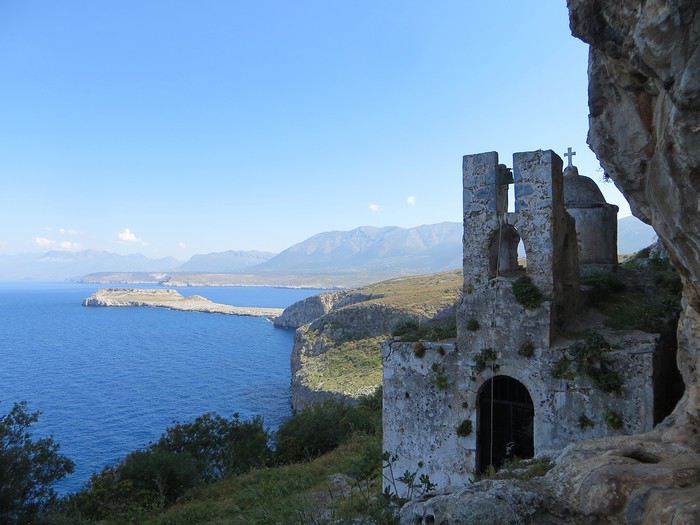 Bien choisir sa photo d'appel pour attirer le chaland. Un bon point et toute mon estime pour celui qui devine où c'est.
Avec la Grèce - pour ceux qui ont lu mes autres carnets qui sont tellement merveilleux qu’il faut les lire immédiatement et que votre vie s’en trouvera changée et éblouie - tout est chamboulé : fini les campings, les dortoirs et les piques-niques miteux de nos voyages dans le nord, place aux hôtels, aux b&b et aux restos. Et en plus, les Grecs ont le bon goût d’être accueillants.
Laissons la parole à du Ballay, parrainé par Alain Deloin et Jean-Michel Apeupré :
Heureux qui comme Ulysse a fait un beau voyage (en Grèce), Ou comme celui-là qui vit le Parthénon, Et puis est retourné, plein d'image et pâmoison, Vivre exubérant le reste de son âge
Et avant d'attaquer le vif du sujet, quelques annonces pour le public innocent : Avertissement : vous lisez ce compte-rendu à vos risques et périls. Toute indignation n’est pas de ma responsabilité. Avertissement bis : non je ne suis pas raciste non je n’ai rien contre les Néerlandais, j’ai d’ailleurs un ami néerlandais non les Grecs ne sont pas des feignants oui les Allemands ont pour passe-temps l’invasion… Ah mince une rechute.
Jour 1
Ayé, c’est parti pour une journée de transport translation Lyon-Athènes via Munich en empruntant la Lufthansa. Le vol est sans encombre, une conversation s’engage avec un voisin grec sympathique autour de la qualité douteuse de la bouffe allemande. J'en profite pour avoir une illumination : la nourriture, voilà ce qui unit les Européens (enfin ceux du sud) ! Eclair de génie, j’ai trouvé comment sauver l’Union européenne « tous unis contre la vie beurk ». Malheureusement, ça risque d’exclure les riches du nord. D’ailleurs c’est peut-être un signe : faut-il mal manger pour être riche ? Faudrait exclure les Japonais de l’équation mais sinon ça marche (pays germaniques, scandinaves et anglo-saxons même combat). Revenons au voisin grec, je tente de donner un tour sportif à la conversation mais malheureusement il n’aime pas le foot « football is shit »… Arrgghh, de quoi vais-je bien pouvoir parler alors ?! Du coup, je parle plus. Alors qu’un petit débat sur le scandale du moment, le président du PAOK Salonique et son flingue, ça, ça aurait été fun .
L’atterrissage se passe sans encombre dans cet aéroport d’Athènes qui a changé de place depuis mon unique passage dans le coin et s’est éloigné du centre-ville. Première prise de contact avec l’alphabet grec, on avait essayé pour le fun de potasser les équivalences mais c’est loin d’être évident ! Combien d'équivalents du O ont-ils dans cet alphabet ?!
Le trajet jusqu’au centre d’Athènes est long, très long et le métro/train se remplit progressivement jusqu’à être bondé à ras bord. Nous sommes tassés, compressés et pour sortir de cette fournaise, c’est la lutte finale, poussons-nous et demain, l’air sera le sauveur du genre humain (note à moi-même : éviter la prochaine fois d’arriver au moment de la sortie du travail)
La chambre chez l’habitant est bien placée, en plein centre sans être très bruyante. On profite de notre premier soir pour une approche de la cuisine grecque et un mauvais choix de commande (que de la friture…). On enchaîne sur une petite balade nocturne pour revenir sur l’impression née du voyage précédent (ie dans les années 90 la voiture reine, une ville bruyante et désagréable). Eh bien en fait, une partie du centre-ville s’est piétonnisé, il y a de la vie, des restos et des cafés avec des terrasses partout, c’est très agréable finalement.
Il était une fois, par delà les pandémies et les crises économiques, un temps où nous pouvions voyager : 2018. En cette année béni(t)e, il n’y eut pour nous point de virée nord-atlantique dans la chaleur estivale au programme, point de douches gratuites rafraîchissantes, point de températures vivifiantes, point de gastronomie douteuse et point de prix déments. En passant, félicitations à l’Islande et ses pizzas caoutchouteuse à 30 euros. En 2018, non, on va dans un vrai pays où l’on sait ce que signifie avoir chaud, manger et glander à une terrasse : la Grèce. Et comme nous ne sommes quand même pas des stakhanovistes du 40° à l’ombre, nous avons choisi le printemps, avril plus précisément. Pour le terrain de jeu, il s'agira d'Athènes et du Péloponnèse sur un peu plus de deux semaines. A nous, les petites églises, les ruines romantiques et les oliviers scintillants !
Bien choisir sa photo d'appel pour attirer le chaland. Un bon point et toute mon estime pour celui qui devine où c'est.Avec la Grèce - pour ceux qui ont lu mes autres carnets qui sont tellement merveilleux qu’il faut les lire immédiatement et que votre vie s’en trouvera changée et éblouie - tout est chamboulé : fini les campings, les dortoirs et les piques-niques miteux de nos voyages dans le nord, place aux hôtels, aux b&b et aux restos. Et en plus, les Grecs ont le bon goût d’être accueillants.
Laissons la parole à du Ballay, parrainé par Alain Deloin et Jean-Michel Apeupré :
Heureux qui comme Ulysse a fait un beau voyage (en Grèce), Ou comme celui-là qui vit le Parthénon, Et puis est retourné, plein d'image et pâmoison, Vivre exubérant le reste de son âge
Et avant d'attaquer le vif du sujet, quelques annonces pour le public innocent : Avertissement : vous lisez ce compte-rendu à vos risques et périls. Toute indignation n’est pas de ma responsabilité. Avertissement bis : non je ne suis pas raciste non je n’ai rien contre les Néerlandais, j’ai d’ailleurs un ami néerlandais non les Grecs ne sont pas des feignants oui les Allemands ont pour passe-temps l’invasion… Ah mince une rechute.
Jour 1
Ayé, c’est parti pour une journée de transport translation Lyon-Athènes via Munich en empruntant la Lufthansa. Le vol est sans encombre, une conversation s’engage avec un voisin grec sympathique autour de la qualité douteuse de la bouffe allemande. J'en profite pour avoir une illumination : la nourriture, voilà ce qui unit les Européens (enfin ceux du sud) ! Eclair de génie, j’ai trouvé comment sauver l’Union européenne « tous unis contre la vie beurk ». Malheureusement, ça risque d’exclure les riches du nord. D’ailleurs c’est peut-être un signe : faut-il mal manger pour être riche ? Faudrait exclure les Japonais de l’équation mais sinon ça marche (pays germaniques, scandinaves et anglo-saxons même combat). Revenons au voisin grec, je tente de donner un tour sportif à la conversation mais malheureusement il n’aime pas le foot « football is shit »… Arrgghh, de quoi vais-je bien pouvoir parler alors ?! Du coup, je parle plus. Alors qu’un petit débat sur le scandale du moment, le président du PAOK Salonique et son flingue, ça, ça aurait été fun .
L’atterrissage se passe sans encombre dans cet aéroport d’Athènes qui a changé de place depuis mon unique passage dans le coin et s’est éloigné du centre-ville. Première prise de contact avec l’alphabet grec, on avait essayé pour le fun de potasser les équivalences mais c’est loin d’être évident ! Combien d'équivalents du O ont-ils dans cet alphabet ?!
Le trajet jusqu’au centre d’Athènes est long, très long et le métro/train se remplit progressivement jusqu’à être bondé à ras bord. Nous sommes tassés, compressés et pour sortir de cette fournaise, c’est la lutte finale, poussons-nous et demain, l’air sera le sauveur du genre humain (note à moi-même : éviter la prochaine fois d’arriver au moment de la sortie du travail)
La chambre chez l’habitant est bien placée, en plein centre sans être très bruyante. On profite de notre premier soir pour une approche de la cuisine grecque et un mauvais choix de commande (que de la friture…). On enchaîne sur une petite balade nocturne pour revenir sur l’impression née du voyage précédent (ie dans les années 90 la voiture reine, une ville bruyante et désagréable). Eh bien en fait, une partie du centre-ville s’est piétonnisé, il y a de la vie, des restos et des cafés avec des terrasses partout, c’est très agréable finalement.
On part en vadrouille dans les Balkans! English translation pending
Et bien le confinement a de beaux jours devant lui ! Chose promise, chose due (publier une journée de vadrouille par jour de confinement) ! Après le carnet sur un voyage aux Etats-Unis (voyageforum.com/...-americain-d9943984/), après le carnet sur une vadrouille en Jordanie (https://voyageforum.com/discussion/on-part-en-vadrouille-en-jordanie-d9991360/), voici maintenant un carnet dans les balkans, voyage réalisé il y a maintenant quelques années :
Et on garde les bonnes habitudes, publication d'une journée par jour, à chaque fois à 17h30 ! Bonne lecture et n'hésite pas à laisser un commentaire, une question, une remarque, ...
Franck
Et on garde les bonnes habitudes, publication d'une journée par jour, à chaque fois à 17h30 ! Bonne lecture et n'hésite pas à laisser un commentaire, une question, une remarque, ...
Franck
Été 1985 : un voyage de noces hors du commun dans la Chine pop English translation pending
Deuxième séjour à Pékin en 2018, je discute à l'auberge avec une voyageuse :
"Pékin ! Ici on vit vraiment dans un autre monde."
"Peut-être, mais alors que dire du Pékin des années 80. Une autre planète !"
Ceux qui découvrent cette Chine du 21° siècle ne retrouveront guère que des fragments de celle que je vais raconter ici, comme j'ai pu le constater par moi-même. (Voir mes carnets sur la route de la soie.)
Ce sera donc un carnet "impressions de Chine", ce qui m'est resté de plus marquant. Les quelques photos jaunies que j'ai pu sauver sont scannées et de mauvaise qualité. Merci à Jacqueline et Jean-Pierre pour leur contribution photographique, entièrement d'époque elle aussi.
AU MENU
Préambule - le contexte politique et économique du pays Chapitre 1 - Un voyage qui s'annonce pas très romantique, c'était prévu... Chapitre 2 - Pékin : le trafic de monnaie. Illégal mais indispensable. Chapitre 3 - Pékin 1985-2018 : du Moyen-Age à la révolution technologique. Immersion comparative. Chapitre 4 - Pékin : un billet de train pour Xi'an ? Pas si simple que ça. Chapitre 5 - Le "qi feng shui". Le soigneur se fait soigner. Chapitre 6 - Xi'an : «mei yo», la réponse favorite des fonctionnaires. Chapitre 7 - Vol au-dessus de la jungle. Le coucou arrivera-t-il à bon port ? Chapitre 8 - Chongqing : le bal, ou la vie sexuelle des jeunes chinois. Chapitre 9 - Croisière pop sur le Yangtse. Chapitre 10 - L'hôtel à rats. C'est à Wuhan, comme par hasard. Chapitre 11 - Canton : à la recherche de xiao Wu. Chapitre 12 - Canton : un train sous haute surveillance. Chapitre 13 - Hong Kong : dur retour à la civilisation. Albums : les photos d'époque signées Jacqueline et Jean-Pierre. A partir de la page 5 Témoignages et photos d'époque. Merci aux différents contributeurs. A partir de la page 6. Ne manquez pas le Tibet et le Xinjiang !
PREAMBULE : le contexte politique et économique Comment voyager dans ce pays encore très fermé, obscur, énigmatique, dont en Europe on ne connaît guère la mentalité, les règles de fonctionnement, dont on ne perçoit à l'étranger que quelques images soigneusement filtrées par la censure. Comment se déplacer, se loger, se nourrir, sans moyen de communication, sans réservation d'hôtel ou de train, sans connaître la langue , sans aide, sans guide, sans assistance, sans carte bleue...
1984, date clé pour le voyageur Après trente années de communisme à marche forcée, de campagnes idéologiques calamiteuses pour les populations, de luttes intestines pour le pouvoir, le pays n'arrive pas à décoller économiquement. L'écart grandit avec les nations développées. Mais avec le rétablissement des relations diplomatiques avec les Etats Unis en 1979, le nouveau président, Deng Xiaoping, tient enfin sa revanche et entame sa longue marche vers le progrès. Les fossiles maoïstes de la "longue marche", des "cent fleurs", du "grand bond en avant", les criminels de la "grande révolution culturelle prolétarienne", représentés par la "bande des quatre", tous ceux qui l'avaient évincé du pouvoir et condamné à l'oubli au fin fond d'une province, le sont à leur tour.
Le "révisionniste", comme l'a appelé la veuve Mao, lance ses réformes de libéralisation et d'ouverture de l'économie : « Peu importe qu'un chat soit blanc ou noir, l'essentiel est qu'il attrape les souris ! » Parole du maître.
Parmi ces réformes : l'ouverture au tourisme. Jusqu'à présent, pour visiter le pays, il fallait obligatoirement, soit passer par un tour opérateur avec guide et circuit programmé, soit demander des autorisations de voyage pour un nombre limité de destinations. Très peu pour moi. Mais en 1984, monsieur Deng supprime le permis de circuler et ouvre quasiment tout le pays aux visiteurs. L'info provoque un déclic : - C'est l'occasion ou jamais. L'année prochaine, ce sera la Chine. Et en sac à dos! Et ce sera aussi notre voyage de noces...
Nous aurons le privilège d'être parmi les premiers voyageurs occidentaux à tenter l'aventure. Je pourrai enfin mettre en pratique ce que j'ai appris de chinois à la fac et réaliser un vieux rêve. A nous la Chine, à nous la découverte de ce pays mystérieux et fascinant. Quelle réalité se cache derrière ces images édulcorées de bonheur populaire que nous distillent les images officielles ? Comment vit-on réellement dans ce pays ? Quel accueil réserve-t-on aux impérialistes occidentaux ?

Wuhan, 1985 : slogans révolutionnaires pour mini gardes rouges
CHAPITRE 1 : un voyage qui s'annonce pas très romantique, c'était prévu... Eh oui, juste mariés, il y a peut-être plus glamour comme destination. Bon, Venise, on connaît déjà. Quoi de mieux qu'une telle aventure pour forger un couple ? Pendant toute l'année, je peaufine le projet : itinéraire, transports, hébergements... Les guides de voyage sur la Chine ne sont pas nombreux, il n'en existe d'ailleurs qu'un en français. Pour ce qui est de l'itinéraire, c'est à peu près établi, pour le reste, ce sera au coup par coup, improvisation et opportunités. L'aventure quoi. Juste qu'on dispose d'un mois entre l'atterrissage et le retour à Hong-Kong. Pour l'itinéraire, ce sera donc Pékin - Hong Kong, mais par où et comment ? C'est le grand mystère, même si certains incontournables sont au programme : la Grande Muraille, Xi'an et son armée en terre cuite, la croisière sur le Yang Tse Kiang...
Août 1985 : Hong Kong, premiers pas en extrême-orient Munis d'un joli visa sur notre passeport et d'un billet d'avion Hong Kong - Pékin acheté en agence en France, nous débarquons à Hong Kong pour y passer une nuit avant de repartir pour Pékin le lendemain, L'atterrissage au-dessus de la ville est spectaculaire, l'avion louvoie entre les immeubles pour plonger vers la piste au raz de l'océan, un véritable tour de manège à sensations. Pas trop le temps d'explorer la ville, mais le dépaysement est déjà total. Et pourtant, ce n'est rien à côté de ce qui nous attend...
Ca commence plutôt mal Aéroport de Hong Kong, le lendemain. Nos billets sont valables, pas de problème, seulement : - Désolé, mais vous n'avez pas confirmé votre vol, l'avion est complet. Il va falloir attendre deux ou trois jours... Eh oui, en 1985, il faut confirmer son vol la veille par téléphone. Dans l'excitation et l'émotion, nous avions complètement oublié la consigne. Zut alors, deux ou trois jours de perdus sur le projet, c'est beaucoup trop. - Attendez ici, peut-être il y aura des places si des voyageurs ne se présentent pas. Longue attente plutôt anxieuse, et quelques minutes avant le décollage, petit signe de l'employé : - C'est bon, il reste deux places, vous pouvez partir.
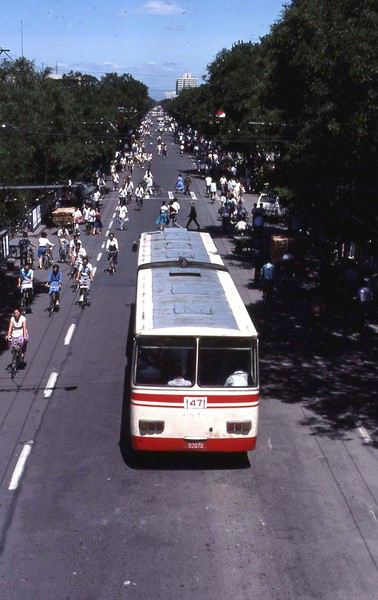
Pékin : avenue Xidan. Photo : Jacqueline et Jean-Pierre
Dès l'aéroport, j'ai senti le choc... Une simple piste en béton, pas d'avion en attente, un trafic aérien quasi nul, un bâtiment à la chinoise, usé et vieillot à souhait, des gardes en uniforme. L'aéroport est encore une base militaire, accessoirement civile pour quelques rares liaisons vers l'URSS et les pays d'Asie. Il n'y a rien dans ce qui fait office de hall d'accueil, une pièce de quelques dizaines de mètres carré tout au plus.
Contrôles minutieux, file d'attente, les militaires ne sont pas très souriants, et le comité d'accueil pas très... accueillant. On n'est pas là pour rigoler, surtout avec ces étrangers qui débarquent de Hong Kong, la zone capitaliste. Eh oui, Hong Kong chinois, ce sera dans une dizaine d'années. D'ici là...
Des billets de Monopoly ?! Un simple bureau dans un recoin fait office de banque. Vite, changer nos travelers chèques en dollars. Ben oui, la carte bleue, ça n'existe pas encore. Derrière son boulier, l'employé fait ses calculs à une vitesse incroyable et me rend le change. Surprise : j'ai une liasse de jolis billets tout neufs dans la main, mais ils n'ont rien à voir avec la monnaie locale. La preuve, il n'y a pas le portrait du grand timonier, mais des jolis dessins de monuments et paysages ! Ca ressemble davantage à des billets de Monopoly.
C'est quoi ce truc ?
Une bonne affaire, mais un gros risque En fait, c'est une monnaie spéciale réservée aux étrangers. Nous allons vite apprendre deux choses. - Un, cette monnaie n'est pas utilisée (et même interdite) par les chinois dans leur vie quotidienne. Elle est réservée aux étrangers et ils doivent payer avec. - Deux, elle est très recherchée par quelques autochtones, car c'est la seule monnaie ayant un équivalent dollar. A l'époque, le yuan chinois ne vaut absolument rien, il n'est pas convertible dans une autre monnaie. Pire que le kopeck. Du coup, notre monnaie "spécial étrangers" fait l'objet d'un trafic formellement interdit et sévèrement réprimé par les autorités.
Mais comment faire si tu veux voyager en dehors des circuits touristiques et des grands hôtels, juste prendre le bus par exemple ou manger dans une gargote. Ca, les autorités n'en ont cure. Un étranger, ça dort dans les hôtels de luxe, ça prend l'avion ou le train en première classe, ça mange dans les grands restaurants. Mieux encore, ça voyage en groupe avec un guide.
Pas d'autre solution, il faudra changer au black Dans la rue, avec les petits trafiquants locaux. Il y a même un cours « officiel » du change : un yuan de Monopoly contre trois yuans de monnaie populaire. A l'époque, un yuan, c'est à peu près un franc. Une sacrée bonne affaire ! Le tout, c'est de ne pas se faire pincer. Les rumeurs les plus folles courent sur les peines encourues pour les trafiquants, mais aussi pour les étrangers qui se font pincer. C'est d'ailleurs marqué sur certains documents. Si les peines de prison ferme ont de quoi dissuader le voyageur, il faudra quand même prendre le risque, pas le choix. Une des nombreuses absurdités du système.
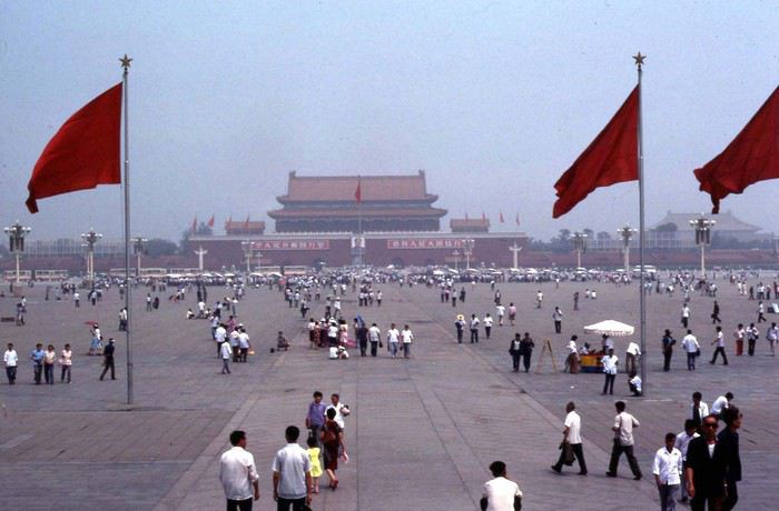
Pékin : place Tian An Men. Photo : Jacqueline et Jean-Pierre
Mise à l'épreuve 1 : trouver un hébergement... Sortie de l'aéroport, c'est l'après-midi. Quelques taxis attendent, réservés aux privilégiés du régime et aux étrangers. Mais nous ne savons même pas où nous allons, juste en ville, et on verra après. Donc ce sera le bus, celui-ci prend la monnaie de Monopoly. C'est notre premier transport en commun, direction le centre ville, à une vingtaine de kilomètres. Très bien, mais où aller, à qui demander un tuyau, un renseignement, une bonne adresse ?
L'aéroport étant en rase campagne, la route bordée d'arbres qui conduit à Pékin centre ressemble à une de nos départementales. De part et d'autres, c'est le défilé des paysans, le plus souvent à pied, tirant des charrettes à bras, quelques fois à bicyclette ou en tracteur. Pour nous occidentaux déjà rodés aux autoroutes, c'est un choc. Ici, pas de voiture individuelle : les véhicules à moteur, c'est juste des camions, quelques bus et de rares taxi, c'est tout .
La carte de Pékin n'indique rien d'autre que le nom des rues, impossible de savoir où se trouve tel service, hôtel, restaurant... Il faut se débrouiller. Les quelques éléments écrits et oraux de chinois que je possède, je vais vite devoir les mettre à l'épreuve. L'anglais ici, on connaît pas.
Juste à côté de nous est assise une jeune femme, bien de sa personne, sans doute un cadre du parti ou d'une grande entreprise. Elle semble plus amène que les autres voyageurs, plus disposée à rendre service. J'entame la conversation comme je peux. Après les échanges d'usage : - Nous sommes français, c'est notre premier voyage en Chine. Connaissez-vous un hôtel sur le trajet du bus qui nous accepterait ? Coup de chance, la femme nous en indique un non loin d'un arrêt, elle nous dira quand il faudra descendre.
Mise à l'épreuve 2 : et qui accepte les étrangers... L'hôtel n'est pas facile à trouver, tout se ressemble ici et rien ne permet de discerner au premier coup d'oeil la fonction d'un bâtiment. Ce n'est même pas écrit « hôtel » à l'entrée. Finalement nous poussons la porte de ce qui semble être ce que nous cherchons. Un étroit couloir sombre, un guichet, une sorte de réception, on dirait un peu un hôtel. Le type de l'accueil est très surpris de nous voir ici, mais oui, c'est bien un hôtel, sauf que : - C'est interdit aux étrangers, vous ne devez pas rester ici ! - Mais comment faire alors ? Le type décroche son téléphone, puis, au bout d'un moment : - Prenez le bus et descendez à cet arrêt, vous y trouverez un hôtel pour vous.
C'est ainsi que nous découvrons que nous ne pourrons pas loger comme on veut dans le pays. La plupart des hôtels sont interdits aux étrangers, il faut toujours aller à l'hôtel spécial « wai guo ren». Oui, mais ce n'est pas forcément indiqué. Quant à dormir chez l'habitant, ce n'est même pas la peine d'y songer, c'est interdit. De plus, quand on voit dans quoi vivent les gens en ville, le peu d'espace dont ils disposent, ça ne donne pas vraiment envie de se faire inviter.
Je ne me souviens plus comment nous avons fait pour trouver le bon bus et le bon arrêt, juste que ça n'a pas été facile du tout. La contrôleuse du bus a tiré une drôle de tronche quand je lui ai tendu le billet de Monoploy, mais elle n'avait pas le choix. Un mao le ticket, dix centimes de franc. Premier aperçu du coup de la vie : trois fois rien. Dans le bus, tous les regards sont fixés sur nous...
Pas de doute, il faut absolument trouver de la monnaie locale, et le plus vite possible. On ne va rien pouvoir faire avec cette monnaie de m... Et quand par hasard ils sont acceptés, on y perd sacrément au change, car ils nous rendent l'argent en monnaie locale. C'est une arnaque gouvernementale bien calculée !
Prochain épisode : le trafic de monnaie
Ce sera donc un carnet "impressions de Chine", ce qui m'est resté de plus marquant. Les quelques photos jaunies que j'ai pu sauver sont scannées et de mauvaise qualité. Merci à Jacqueline et Jean-Pierre pour leur contribution photographique, entièrement d'époque elle aussi.
AU MENU
Préambule - le contexte politique et économique du pays Chapitre 1 - Un voyage qui s'annonce pas très romantique, c'était prévu... Chapitre 2 - Pékin : le trafic de monnaie. Illégal mais indispensable. Chapitre 3 - Pékin 1985-2018 : du Moyen-Age à la révolution technologique. Immersion comparative. Chapitre 4 - Pékin : un billet de train pour Xi'an ? Pas si simple que ça. Chapitre 5 - Le "qi feng shui". Le soigneur se fait soigner. Chapitre 6 - Xi'an : «mei yo», la réponse favorite des fonctionnaires. Chapitre 7 - Vol au-dessus de la jungle. Le coucou arrivera-t-il à bon port ? Chapitre 8 - Chongqing : le bal, ou la vie sexuelle des jeunes chinois. Chapitre 9 - Croisière pop sur le Yangtse. Chapitre 10 - L'hôtel à rats. C'est à Wuhan, comme par hasard. Chapitre 11 - Canton : à la recherche de xiao Wu. Chapitre 12 - Canton : un train sous haute surveillance. Chapitre 13 - Hong Kong : dur retour à la civilisation. Albums : les photos d'époque signées Jacqueline et Jean-Pierre. A partir de la page 5 Témoignages et photos d'époque. Merci aux différents contributeurs. A partir de la page 6. Ne manquez pas le Tibet et le Xinjiang !
PREAMBULE : le contexte politique et économique Comment voyager dans ce pays encore très fermé, obscur, énigmatique, dont en Europe on ne connaît guère la mentalité, les règles de fonctionnement, dont on ne perçoit à l'étranger que quelques images soigneusement filtrées par la censure. Comment se déplacer, se loger, se nourrir, sans moyen de communication, sans réservation d'hôtel ou de train, sans connaître la langue , sans aide, sans guide, sans assistance, sans carte bleue...
1984, date clé pour le voyageur Après trente années de communisme à marche forcée, de campagnes idéologiques calamiteuses pour les populations, de luttes intestines pour le pouvoir, le pays n'arrive pas à décoller économiquement. L'écart grandit avec les nations développées. Mais avec le rétablissement des relations diplomatiques avec les Etats Unis en 1979, le nouveau président, Deng Xiaoping, tient enfin sa revanche et entame sa longue marche vers le progrès. Les fossiles maoïstes de la "longue marche", des "cent fleurs", du "grand bond en avant", les criminels de la "grande révolution culturelle prolétarienne", représentés par la "bande des quatre", tous ceux qui l'avaient évincé du pouvoir et condamné à l'oubli au fin fond d'une province, le sont à leur tour.
Le "révisionniste", comme l'a appelé la veuve Mao, lance ses réformes de libéralisation et d'ouverture de l'économie : « Peu importe qu'un chat soit blanc ou noir, l'essentiel est qu'il attrape les souris ! » Parole du maître.
Parmi ces réformes : l'ouverture au tourisme. Jusqu'à présent, pour visiter le pays, il fallait obligatoirement, soit passer par un tour opérateur avec guide et circuit programmé, soit demander des autorisations de voyage pour un nombre limité de destinations. Très peu pour moi. Mais en 1984, monsieur Deng supprime le permis de circuler et ouvre quasiment tout le pays aux visiteurs. L'info provoque un déclic : - C'est l'occasion ou jamais. L'année prochaine, ce sera la Chine. Et en sac à dos! Et ce sera aussi notre voyage de noces...
Nous aurons le privilège d'être parmi les premiers voyageurs occidentaux à tenter l'aventure. Je pourrai enfin mettre en pratique ce que j'ai appris de chinois à la fac et réaliser un vieux rêve. A nous la Chine, à nous la découverte de ce pays mystérieux et fascinant. Quelle réalité se cache derrière ces images édulcorées de bonheur populaire que nous distillent les images officielles ? Comment vit-on réellement dans ce pays ? Quel accueil réserve-t-on aux impérialistes occidentaux ?
Wuhan, 1985 : slogans révolutionnaires pour mini gardes rouges
CHAPITRE 1 : un voyage qui s'annonce pas très romantique, c'était prévu... Eh oui, juste mariés, il y a peut-être plus glamour comme destination. Bon, Venise, on connaît déjà. Quoi de mieux qu'une telle aventure pour forger un couple ? Pendant toute l'année, je peaufine le projet : itinéraire, transports, hébergements... Les guides de voyage sur la Chine ne sont pas nombreux, il n'en existe d'ailleurs qu'un en français. Pour ce qui est de l'itinéraire, c'est à peu près établi, pour le reste, ce sera au coup par coup, improvisation et opportunités. L'aventure quoi. Juste qu'on dispose d'un mois entre l'atterrissage et le retour à Hong-Kong. Pour l'itinéraire, ce sera donc Pékin - Hong Kong, mais par où et comment ? C'est le grand mystère, même si certains incontournables sont au programme : la Grande Muraille, Xi'an et son armée en terre cuite, la croisière sur le Yang Tse Kiang...
Août 1985 : Hong Kong, premiers pas en extrême-orient Munis d'un joli visa sur notre passeport et d'un billet d'avion Hong Kong - Pékin acheté en agence en France, nous débarquons à Hong Kong pour y passer une nuit avant de repartir pour Pékin le lendemain, L'atterrissage au-dessus de la ville est spectaculaire, l'avion louvoie entre les immeubles pour plonger vers la piste au raz de l'océan, un véritable tour de manège à sensations. Pas trop le temps d'explorer la ville, mais le dépaysement est déjà total. Et pourtant, ce n'est rien à côté de ce qui nous attend...
Ca commence plutôt mal Aéroport de Hong Kong, le lendemain. Nos billets sont valables, pas de problème, seulement : - Désolé, mais vous n'avez pas confirmé votre vol, l'avion est complet. Il va falloir attendre deux ou trois jours... Eh oui, en 1985, il faut confirmer son vol la veille par téléphone. Dans l'excitation et l'émotion, nous avions complètement oublié la consigne. Zut alors, deux ou trois jours de perdus sur le projet, c'est beaucoup trop. - Attendez ici, peut-être il y aura des places si des voyageurs ne se présentent pas. Longue attente plutôt anxieuse, et quelques minutes avant le décollage, petit signe de l'employé : - C'est bon, il reste deux places, vous pouvez partir.
Pékin : avenue Xidan. Photo : Jacqueline et Jean-Pierre
Dès l'aéroport, j'ai senti le choc... Une simple piste en béton, pas d'avion en attente, un trafic aérien quasi nul, un bâtiment à la chinoise, usé et vieillot à souhait, des gardes en uniforme. L'aéroport est encore une base militaire, accessoirement civile pour quelques rares liaisons vers l'URSS et les pays d'Asie. Il n'y a rien dans ce qui fait office de hall d'accueil, une pièce de quelques dizaines de mètres carré tout au plus.
Contrôles minutieux, file d'attente, les militaires ne sont pas très souriants, et le comité d'accueil pas très... accueillant. On n'est pas là pour rigoler, surtout avec ces étrangers qui débarquent de Hong Kong, la zone capitaliste. Eh oui, Hong Kong chinois, ce sera dans une dizaine d'années. D'ici là...
Des billets de Monopoly ?! Un simple bureau dans un recoin fait office de banque. Vite, changer nos travelers chèques en dollars. Ben oui, la carte bleue, ça n'existe pas encore. Derrière son boulier, l'employé fait ses calculs à une vitesse incroyable et me rend le change. Surprise : j'ai une liasse de jolis billets tout neufs dans la main, mais ils n'ont rien à voir avec la monnaie locale. La preuve, il n'y a pas le portrait du grand timonier, mais des jolis dessins de monuments et paysages ! Ca ressemble davantage à des billets de Monopoly.
C'est quoi ce truc ?
Une bonne affaire, mais un gros risque En fait, c'est une monnaie spéciale réservée aux étrangers. Nous allons vite apprendre deux choses. - Un, cette monnaie n'est pas utilisée (et même interdite) par les chinois dans leur vie quotidienne. Elle est réservée aux étrangers et ils doivent payer avec. - Deux, elle est très recherchée par quelques autochtones, car c'est la seule monnaie ayant un équivalent dollar. A l'époque, le yuan chinois ne vaut absolument rien, il n'est pas convertible dans une autre monnaie. Pire que le kopeck. Du coup, notre monnaie "spécial étrangers" fait l'objet d'un trafic formellement interdit et sévèrement réprimé par les autorités.
Mais comment faire si tu veux voyager en dehors des circuits touristiques et des grands hôtels, juste prendre le bus par exemple ou manger dans une gargote. Ca, les autorités n'en ont cure. Un étranger, ça dort dans les hôtels de luxe, ça prend l'avion ou le train en première classe, ça mange dans les grands restaurants. Mieux encore, ça voyage en groupe avec un guide.
Pas d'autre solution, il faudra changer au black Dans la rue, avec les petits trafiquants locaux. Il y a même un cours « officiel » du change : un yuan de Monopoly contre trois yuans de monnaie populaire. A l'époque, un yuan, c'est à peu près un franc. Une sacrée bonne affaire ! Le tout, c'est de ne pas se faire pincer. Les rumeurs les plus folles courent sur les peines encourues pour les trafiquants, mais aussi pour les étrangers qui se font pincer. C'est d'ailleurs marqué sur certains documents. Si les peines de prison ferme ont de quoi dissuader le voyageur, il faudra quand même prendre le risque, pas le choix. Une des nombreuses absurdités du système.
Pékin : place Tian An Men. Photo : Jacqueline et Jean-Pierre
Mise à l'épreuve 1 : trouver un hébergement... Sortie de l'aéroport, c'est l'après-midi. Quelques taxis attendent, réservés aux privilégiés du régime et aux étrangers. Mais nous ne savons même pas où nous allons, juste en ville, et on verra après. Donc ce sera le bus, celui-ci prend la monnaie de Monopoly. C'est notre premier transport en commun, direction le centre ville, à une vingtaine de kilomètres. Très bien, mais où aller, à qui demander un tuyau, un renseignement, une bonne adresse ?
L'aéroport étant en rase campagne, la route bordée d'arbres qui conduit à Pékin centre ressemble à une de nos départementales. De part et d'autres, c'est le défilé des paysans, le plus souvent à pied, tirant des charrettes à bras, quelques fois à bicyclette ou en tracteur. Pour nous occidentaux déjà rodés aux autoroutes, c'est un choc. Ici, pas de voiture individuelle : les véhicules à moteur, c'est juste des camions, quelques bus et de rares taxi, c'est tout .
La carte de Pékin n'indique rien d'autre que le nom des rues, impossible de savoir où se trouve tel service, hôtel, restaurant... Il faut se débrouiller. Les quelques éléments écrits et oraux de chinois que je possède, je vais vite devoir les mettre à l'épreuve. L'anglais ici, on connaît pas.
Juste à côté de nous est assise une jeune femme, bien de sa personne, sans doute un cadre du parti ou d'une grande entreprise. Elle semble plus amène que les autres voyageurs, plus disposée à rendre service. J'entame la conversation comme je peux. Après les échanges d'usage : - Nous sommes français, c'est notre premier voyage en Chine. Connaissez-vous un hôtel sur le trajet du bus qui nous accepterait ? Coup de chance, la femme nous en indique un non loin d'un arrêt, elle nous dira quand il faudra descendre.
Mise à l'épreuve 2 : et qui accepte les étrangers... L'hôtel n'est pas facile à trouver, tout se ressemble ici et rien ne permet de discerner au premier coup d'oeil la fonction d'un bâtiment. Ce n'est même pas écrit « hôtel » à l'entrée. Finalement nous poussons la porte de ce qui semble être ce que nous cherchons. Un étroit couloir sombre, un guichet, une sorte de réception, on dirait un peu un hôtel. Le type de l'accueil est très surpris de nous voir ici, mais oui, c'est bien un hôtel, sauf que : - C'est interdit aux étrangers, vous ne devez pas rester ici ! - Mais comment faire alors ? Le type décroche son téléphone, puis, au bout d'un moment : - Prenez le bus et descendez à cet arrêt, vous y trouverez un hôtel pour vous.
C'est ainsi que nous découvrons que nous ne pourrons pas loger comme on veut dans le pays. La plupart des hôtels sont interdits aux étrangers, il faut toujours aller à l'hôtel spécial « wai guo ren». Oui, mais ce n'est pas forcément indiqué. Quant à dormir chez l'habitant, ce n'est même pas la peine d'y songer, c'est interdit. De plus, quand on voit dans quoi vivent les gens en ville, le peu d'espace dont ils disposent, ça ne donne pas vraiment envie de se faire inviter.
Je ne me souviens plus comment nous avons fait pour trouver le bon bus et le bon arrêt, juste que ça n'a pas été facile du tout. La contrôleuse du bus a tiré une drôle de tronche quand je lui ai tendu le billet de Monoploy, mais elle n'avait pas le choix. Un mao le ticket, dix centimes de franc. Premier aperçu du coup de la vie : trois fois rien. Dans le bus, tous les regards sont fixés sur nous...
Pas de doute, il faut absolument trouver de la monnaie locale, et le plus vite possible. On ne va rien pouvoir faire avec cette monnaie de m... Et quand par hasard ils sont acceptés, on y perd sacrément au change, car ils nous rendent l'argent en monnaie locale. C'est une arnaque gouvernementale bien calculée !
Prochain épisode : le trafic de monnaie
Mais où qu'il est ce truc là (4) English translation pending
Préparation de 3 semaines namibiennes en avril 2021 English translation pending
Hello la communauté,
De retour sur VF, j'entame donc la préparation de notre retour en Namibie prévu pour l'année prochaine, à priori en Avril 2021.
Après 2 voyages namibiens au mois d'Aout, nous avons maintenant hâte de découvrir la Namibie pendant la saison chaude et humide (enfin pas trop quand même hein ?!), c'est pourquoi nous voudrions partir au mois d'Avril, à la fin de la saison des pluies, pour pouvoir profiter des paysages verdoyants, des piscines des lodges et des soirées tempérées sous le ciel étoilé.
Nous serons entre 2 et 6 (Dépend de la fiabilité des amis 😇) et l'idée serait de louer un (ou plusieurs) 4x4 équipé et d'alterner nuit en camping et nuit en lodge.
Ayant déjà fait 2 séjours de 15 jours en Namibie nous voulons cette fois ci découvrir de nouvelles région (Kunene et Caprivi) et prendre un petit peu plus notre temps (mais ça on se le dit à chaque fois et au final on ne s'y tient jamais 😄)
Nous espérons disposer de 23 jours sur place. Et voici l'ébauche de notre programme :
J1 : Arrivée Windhoek tôt le matin -> Bagatelle Kalahari GR J2 : Bagatelle Kalahari GR -> Namibrand Family Hideout J3 : Namibrand Family Hideout J4 : Namibrand Family Hiedout -> Sossus Dune Lodge J5 : Sossus Dune Lodge J6 : Sossus Dune Lodge -> Rostock Ritz J7 : Rostock Ritz -> Swakopmund J8 : Swakopmund -> Brandberg White Lady J9 : Brandberg White Lady -> Palmwag J10 : Palmwag -> Grootberg Lodge J11: Grootberg Lodge J12 : Grootberg Lodge -> Epupa J13 : Epupa J14 : Epupa -> Dolomite Camp J15 : Dolomite Camp -> Okaukuejo J16 : Okaukuejo -> Halali J17 : Halali J18 : Halali -> Mahango GR (Caprivi) J19 : Mahango GR (Caprivi) J20 : Caprivi ? J21 : Caprivi ? J22 : Victoria Falls ? Retour Windhoek ? J23 : Remise du véhicule (Kasane ou Windhoek) et décollage (le soir de préférence)
En gros... Ce qui fait quand même un bon 4000km en un peu plus de 3 semaines. Sachant que les étapes incontournables de ce prochain voyage sont Epupa, Etosha et la bande de Caprivi.
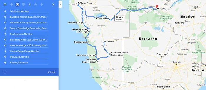
Alors, j'ai vu que beaucoup d'entre vous étiez allé, ou retourné, en Namibie ces dernières années. 🙂 J'ai lu la plupart des carnets récents concernant cet itinéraire (nombreux) et cette période de l'année (beaucoup moins nombreux 😇) et j'ouvre donc ce sujet pour regrouper un peu les informations et les conseils.
J'ai déjà beaucoup de questions 😊 Dans l'ordre,
Quelle compagnie relie l’Europe (Paris ou Francfort) et Windhoek à cette période avec arrivée tôt le matin ? Sans escale si possible.
Je voulais retourner à Bagatelle où nous avions dormi lors de notre premier voyage il y a 5 ans mais j'ai lu aussi beaucoup de retours positifs sur le Kalahari Anib Lodge, quelqu'un a t'il déjà comparé les deux ?
Plutot Ameib Ranch ou Bagatelle White Lady ? 😉 Vous savez si il y a des éléphants du coté du Brandberg à cette période ?
Pour la bande de Caprivi j'ai bien entendu noté la Mahango GR, et il nous resterait 2 jours. Y a t'il d'autre réserve sympa à visiter avec beaucoup de faune au bord du fleuve +/- balade en bateau ? Si vous avez des conseils coté botswanais je suis preneur aussi. 🙂
Dans l'état actuel du programme j'envisage fortement un drop off à Kasane avec pourquoi pas une journée aux chutes Victoria mais ce n'est pas obligatoire.
Merci par avance pour vos remarques, vos conseils et votre bonne humeur ! 🙂
De retour sur VF, j'entame donc la préparation de notre retour en Namibie prévu pour l'année prochaine, à priori en Avril 2021.
Après 2 voyages namibiens au mois d'Aout, nous avons maintenant hâte de découvrir la Namibie pendant la saison chaude et humide (enfin pas trop quand même hein ?!), c'est pourquoi nous voudrions partir au mois d'Avril, à la fin de la saison des pluies, pour pouvoir profiter des paysages verdoyants, des piscines des lodges et des soirées tempérées sous le ciel étoilé.
Nous serons entre 2 et 6 (Dépend de la fiabilité des amis 😇) et l'idée serait de louer un (ou plusieurs) 4x4 équipé et d'alterner nuit en camping et nuit en lodge.
Ayant déjà fait 2 séjours de 15 jours en Namibie nous voulons cette fois ci découvrir de nouvelles région (Kunene et Caprivi) et prendre un petit peu plus notre temps (mais ça on se le dit à chaque fois et au final on ne s'y tient jamais 😄)
Nous espérons disposer de 23 jours sur place. Et voici l'ébauche de notre programme :
J1 : Arrivée Windhoek tôt le matin -> Bagatelle Kalahari GR J2 : Bagatelle Kalahari GR -> Namibrand Family Hideout J3 : Namibrand Family Hideout J4 : Namibrand Family Hiedout -> Sossus Dune Lodge J5 : Sossus Dune Lodge J6 : Sossus Dune Lodge -> Rostock Ritz J7 : Rostock Ritz -> Swakopmund J8 : Swakopmund -> Brandberg White Lady J9 : Brandberg White Lady -> Palmwag J10 : Palmwag -> Grootberg Lodge J11: Grootberg Lodge J12 : Grootberg Lodge -> Epupa J13 : Epupa J14 : Epupa -> Dolomite Camp J15 : Dolomite Camp -> Okaukuejo J16 : Okaukuejo -> Halali J17 : Halali J18 : Halali -> Mahango GR (Caprivi) J19 : Mahango GR (Caprivi) J20 : Caprivi ? J21 : Caprivi ? J22 : Victoria Falls ? Retour Windhoek ? J23 : Remise du véhicule (Kasane ou Windhoek) et décollage (le soir de préférence)
En gros... Ce qui fait quand même un bon 4000km en un peu plus de 3 semaines. Sachant que les étapes incontournables de ce prochain voyage sont Epupa, Etosha et la bande de Caprivi.
Alors, j'ai vu que beaucoup d'entre vous étiez allé, ou retourné, en Namibie ces dernières années. 🙂 J'ai lu la plupart des carnets récents concernant cet itinéraire (nombreux) et cette période de l'année (beaucoup moins nombreux 😇) et j'ouvre donc ce sujet pour regrouper un peu les informations et les conseils.
J'ai déjà beaucoup de questions 😊 Dans l'ordre,
Quelle compagnie relie l’Europe (Paris ou Francfort) et Windhoek à cette période avec arrivée tôt le matin ? Sans escale si possible.
Je voulais retourner à Bagatelle où nous avions dormi lors de notre premier voyage il y a 5 ans mais j'ai lu aussi beaucoup de retours positifs sur le Kalahari Anib Lodge, quelqu'un a t'il déjà comparé les deux ?
Plutot Ameib Ranch ou Bagatelle White Lady ? 😉 Vous savez si il y a des éléphants du coté du Brandberg à cette période ?
Pour la bande de Caprivi j'ai bien entendu noté la Mahango GR, et il nous resterait 2 jours. Y a t'il d'autre réserve sympa à visiter avec beaucoup de faune au bord du fleuve +/- balade en bateau ? Si vous avez des conseils coté botswanais je suis preneur aussi. 🙂
Dans l'état actuel du programme j'envisage fortement un drop off à Kasane avec pourquoi pas une journée aux chutes Victoria mais ce n'est pas obligatoire.
Merci par avance pour vos remarques, vos conseils et votre bonne humeur ! 🙂
Cape Town and Kruger: 12 days in February with teens
Hi everyone,
I’d love to share a little travel journal from our 14-day/12-night road trip with our two teens (14 and 17) in February/March 2020. A huge thank you to all of you who helped me plan this trip to South Africa—your patience with my endless questions was amazing!
We left Lyon on Saturday, February 22 at 7:00 AM and arrived in Johannesburg at 10:00 PM after a short layover in Amsterdam. Flights cost 440 € per person (booked in October), with carry-on luggage. We added just one checked bag for the whole family (80 € round-trip with the free Flying Blue membership). Since we’d be moving around a lot, we packed light! In Lyon, we reserved parking at P5 in advance for 70 € for 14 days. The Air France/KLM flight was smooth. When we landed, we picked up our bags and had booked a night at the Aero Guest Lodge, just 5 minutes from the airport, with a free shuttle and breakfast. All you have to do is send a WhatsApp message when you arrive at the airport to let the shuttle driver know. The tricky part? Finding him in the terminal—he wasn’t holding a sign with the hotel’s name. 🤪 A South African called him for me since my English wasn’t great (and I had to get used to the accent 😛), and helped us spot the driver (who was actually less than 5 meters away!) with other guests. When we got to the hotel: all good, except we were 10 people in a van meant for 7. The room was spacious—one king-size bed and two single beds for the kids—with a simple but clean bathroom, a garden, pool, and breakfast (which we didn’t try). All for 65 €, so an awesome value!
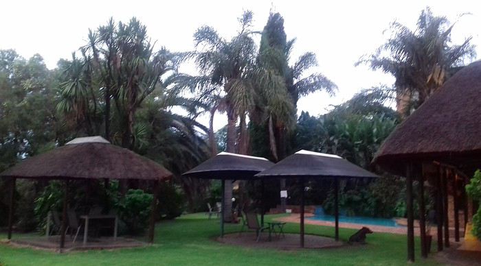 After a restful night, we woke up at 6:00 AM to catch the shuttle back to the airport. Just a heads-up: there’s only one shuttle per hour in the morning, and Kulula canceled our 9:00 AM flight, moving it to 8:00 AM—so no time for breakfast (it starts at 6:30).
We waited 15 minutes in the lovely garden for the driver, who dropped us off at the airport in 5 minutes.
We checked in for our flight to Cape Town, which cost around 40 € (including two checked bags per person).
We grabbed breakfast at the airport instead (less than 20 € for all four of us—one of the nice surprises of South Africa!), and arrived in Cape Town at 10:20 AM.
After a restful night, we woke up at 6:00 AM to catch the shuttle back to the airport. Just a heads-up: there’s only one shuttle per hour in the morning, and Kulula canceled our 9:00 AM flight, moving it to 8:00 AM—so no time for breakfast (it starts at 6:30).
We waited 15 minutes in the lovely garden for the driver, who dropped us off at the airport in 5 minutes.
We checked in for our flight to Cape Town, which cost around 40 € (including two checked bags per person).
We grabbed breakfast at the airport instead (less than 20 € for all four of us—one of the nice surprises of South Africa!), and arrived in Cape Town at 10:20 AM.
 After quickly picking up our bags, we headed to the Avis counter and left with a Toyota Corolla for 80 € for 4 days (rented with the Flying Blue card—free additional driver).
Everything’s on the left... not easy, but it works if you plan your route well.
We drove to our Airbnb in Constantia. We were surprised to see animals, bikes, and pedestrians on the highway!
We arrived around 11:30 AM at our rental—a huge house in the vineyards, in a super secure neighborhood, about 15-20 minutes from Hout Bay. It felt like Beverly Hills, but with super-high walls and barbed wire around the villas. 😕
After quickly picking up our bags, we headed to the Avis counter and left with a Toyota Corolla for 80 € for 4 days (rented with the Flying Blue card—free additional driver).
Everything’s on the left... not easy, but it works if you plan your route well.
We drove to our Airbnb in Constantia. We were surprised to see animals, bikes, and pedestrians on the highway!
We arrived around 11:30 AM at our rental—a huge house in the vineyards, in a super secure neighborhood, about 15-20 minutes from Hout Bay. It felt like Beverly Hills, but with super-high walls and barbed wire around the villas. 😕

We dropped off our bags, changed into shorts (it was around 30°C/86°F), and headed to the Bay Harbour Market in Hout Bay. We had lunch there—such a great vibe! We wandered through the stalls, everyone picked their own dish, and we sat down on the terrace. There was music, artisans of all kinds... a really nice moment.

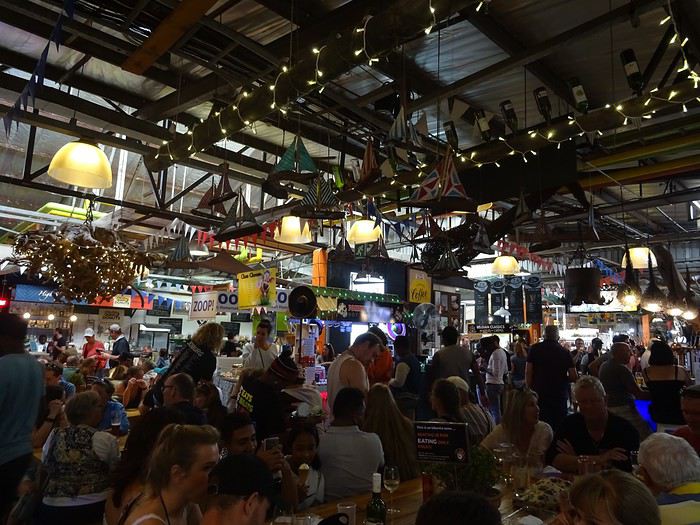
I’d withdrawn 50 € before leaving... and that gave me change to pay the parking attendant. Lunch cost around 30 € for four, including food and drinks.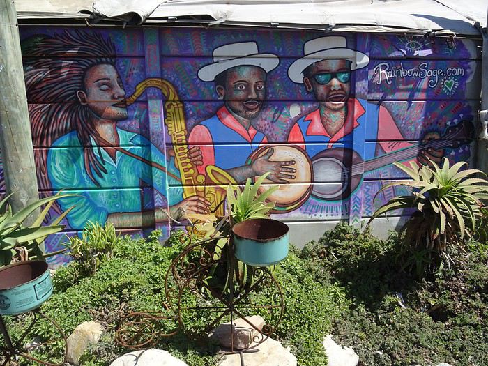

After browsing the artisan stalls, we headed to Hout Bay Beach near the restaurant, Marina Wharf (another small tip for the parking attendant—we’d have to get used to that!). We stopped to admire the sea lions. An ice cream for 1 €? No way we were saying no! 🙂
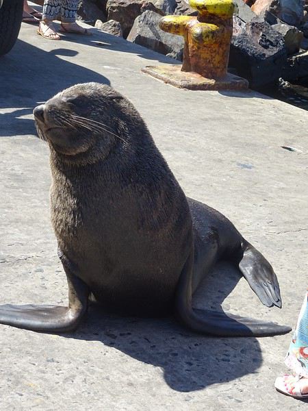
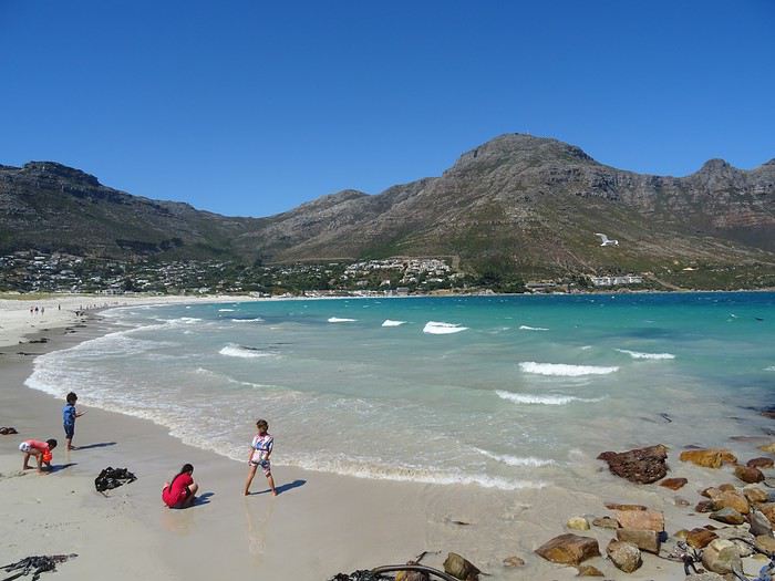
The fatigue was starting to hit, so we headed to the grocery store 10 minutes away (Constantia shopping center) and then had an aperitif in front of the vineyards, opening a delicious bottle of white wine.
I’d love to share a little travel journal from our 14-day/12-night road trip with our two teens (14 and 17) in February/March 2020. A huge thank you to all of you who helped me plan this trip to South Africa—your patience with my endless questions was amazing!
We left Lyon on Saturday, February 22 at 7:00 AM and arrived in Johannesburg at 10:00 PM after a short layover in Amsterdam. Flights cost 440 € per person (booked in October), with carry-on luggage. We added just one checked bag for the whole family (80 € round-trip with the free Flying Blue membership). Since we’d be moving around a lot, we packed light! In Lyon, we reserved parking at P5 in advance for 70 € for 14 days. The Air France/KLM flight was smooth. When we landed, we picked up our bags and had booked a night at the Aero Guest Lodge, just 5 minutes from the airport, with a free shuttle and breakfast. All you have to do is send a WhatsApp message when you arrive at the airport to let the shuttle driver know. The tricky part? Finding him in the terminal—he wasn’t holding a sign with the hotel’s name. 🤪 A South African called him for me since my English wasn’t great (and I had to get used to the accent 😛), and helped us spot the driver (who was actually less than 5 meters away!) with other guests. When we got to the hotel: all good, except we were 10 people in a van meant for 7. The room was spacious—one king-size bed and two single beds for the kids—with a simple but clean bathroom, a garden, pool, and breakfast (which we didn’t try). All for 65 €, so an awesome value!
After a restful night, we woke up at 6:00 AM to catch the shuttle back to the airport. Just a heads-up: there’s only one shuttle per hour in the morning, and Kulula canceled our 9:00 AM flight, moving it to 8:00 AM—so no time for breakfast (it starts at 6:30).
We waited 15 minutes in the lovely garden for the driver, who dropped us off at the airport in 5 minutes.
We checked in for our flight to Cape Town, which cost around 40 € (including two checked bags per person).
We grabbed breakfast at the airport instead (less than 20 € for all four of us—one of the nice surprises of South Africa!), and arrived in Cape Town at 10:20 AM.
After quickly picking up our bags, we headed to the Avis counter and left with a Toyota Corolla for 80 € for 4 days (rented with the Flying Blue card—free additional driver).
Everything’s on the left... not easy, but it works if you plan your route well.
We drove to our Airbnb in Constantia. We were surprised to see animals, bikes, and pedestrians on the highway!
We arrived around 11:30 AM at our rental—a huge house in the vineyards, in a super secure neighborhood, about 15-20 minutes from Hout Bay. It felt like Beverly Hills, but with super-high walls and barbed wire around the villas. 😕We dropped off our bags, changed into shorts (it was around 30°C/86°F), and headed to the Bay Harbour Market in Hout Bay. We had lunch there—such a great vibe! We wandered through the stalls, everyone picked their own dish, and we sat down on the terrace. There was music, artisans of all kinds... a really nice moment.
I’d withdrawn 50 € before leaving... and that gave me change to pay the parking attendant. Lunch cost around 30 € for four, including food and drinks.
After browsing the artisan stalls, we headed to Hout Bay Beach near the restaurant, Marina Wharf (another small tip for the parking attendant—we’d have to get used to that!). We stopped to admire the sea lions. An ice cream for 1 €? No way we were saying no! 🙂
The fatigue was starting to hit, so we headed to the grocery store 10 minutes away (Constantia shopping center) and then had an aperitif in front of the vineyards, opening a delicious bottle of white wine.
Eswatini, en traversant le petit royaume English translation pending
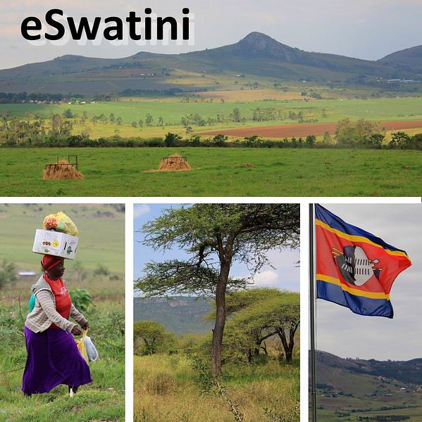 C'est un petit pays enclavé au cœur de l'Afrique australe, coincé entre l'Afrique du sud et le Mozambique. Et si ce nom d' Eswatini ne vous évoque rien, sachez que son appellation ancienne est bien plus connue … Swaziland mais c'était avant 2018, avant que le Roi du pays ne décide de nommer son territoire en langue locale. Car une des particularités de ce pays, pardon de ce royaume, est d'être la dernière monarchie absolue du continent africain.
Lorsqu'on voyage en Afrique du Sud, du Sud au Nord, la traversée de l'eSwatini s'avère le plus court chemin entre les réserves animalières de Huluwe et celles de la région du célèbre parc Kruger.
Je vous invite donc avec ce récit à la découverte (enfin à un aperçu) de ce petit royaume, le road trip vous fera traverser les paysages vallonnés et verdoyants de cet original eSwatini.
C'est un petit pays enclavé au cœur de l'Afrique australe, coincé entre l'Afrique du sud et le Mozambique. Et si ce nom d' Eswatini ne vous évoque rien, sachez que son appellation ancienne est bien plus connue … Swaziland mais c'était avant 2018, avant que le Roi du pays ne décide de nommer son territoire en langue locale. Car une des particularités de ce pays, pardon de ce royaume, est d'être la dernière monarchie absolue du continent africain.
Lorsqu'on voyage en Afrique du Sud, du Sud au Nord, la traversée de l'eSwatini s'avère le plus court chemin entre les réserves animalières de Huluwe et celles de la région du célèbre parc Kruger.
Je vous invite donc avec ce récit à la découverte (enfin à un aperçu) de ce petit royaume, le road trip vous fera traverser les paysages vallonnés et verdoyants de cet original eSwatini.………………………………………………………………………………………………………………………...
Avant de débuter notre périple à travers l'eSwatini, du Sud au Nord, faut-il encore y pénétrer. Place à la séquence formalités.
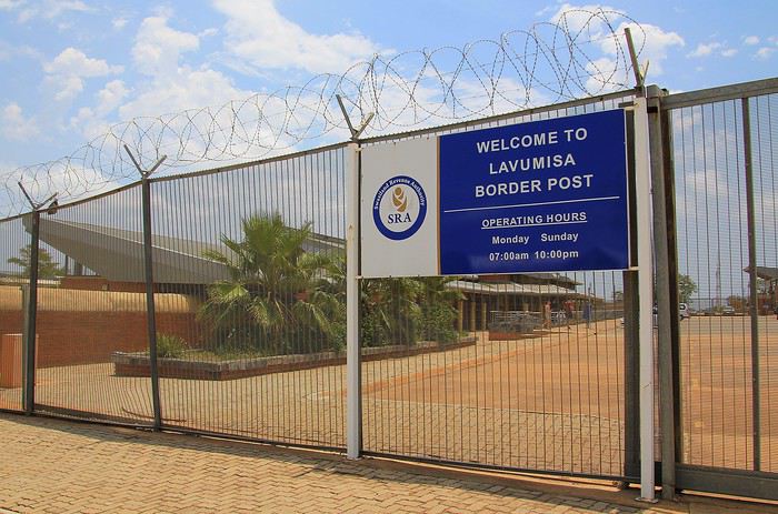
Nous voici au poste frontière de Lavumisa, enfin pour l'instant nous attendons devant les grilles et les murs hérissés de fils de fer barbelés. Même si le pays est petit par son étendue, environ 200 kilomètres sur 130 de large et sa population modeste avec seulement 1,5 millions d'habitants … modeste étant bien le terme car la pauvreté y sévit à grande échelle ! eh bien, on le constate, ce poste douanier a tout d'une grande nation avec des bâtiments aux imposantes dimensions. Une succession de hangars, de halls et de bureaux qui paraissent quelque peu démesurés en rapport au nombre de personnes qui passent ce matin cette frontière. Nous sommes à bord d'un minibus pour ce voyage mais il nous faut mettre pieds à terre, la réglementation locale nous oblige à passer la frontière individuellement et en marchant.
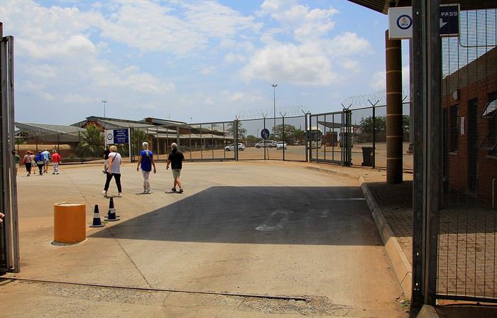
Presque une petite randonnée entre une chicane formée par des grillages puis ensuite avec la traversée d'un parking et d'une cour avant de pénétrer dans un immense hall agréablement climatisé. Là, les employés attendent les passants. Présentation des passeports puis traditionnels coups de tampon, à la va vite ! Pour les formalités, c'en est donc terminé car il me faut préciser que je n'ai pas souvenir d'un quelconque contrôle de nos bagages qui eux étaient restés tranquillement à bord de notre véhicule …
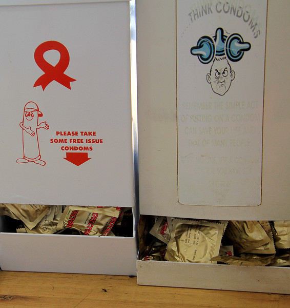
A l'opposé des bureaux, sur une table trône un distributeur, il met à la disposition des visiteurs un cadeau de bienvenue dans le royaume. Mais de quoi s'agit-il ? En fait, c'est un distributeur de préservatifs et en plus il y a le choix entre deux modèles. Cela pourrait prêter à sourire mais finalement l'initiative des autorités locales est bien pensée. Car il faut savoir que dans ce territoire (comme d'ailleurs dans plusieurs autres du continent africain), un inquiétant fléau sévit, le Sida ! Au plus fort de l'épidémie il y aurait eu, paraît-il, plus d'un quart de séropositifs parmi la population locale, la plus forte prévalence au monde. Des chiffres alarmants qui ont donc motivé cette distribution gratuite … jusqu'aux portes du pays. Une dernière précision, d'après les statistiques la situation se serait améliorée, on ne peut que s'en réjouir.
A nous maintenant la découverte du royaume de l'eSwatini. Juste après la frontière, le premier bâtiment officiel couleur locale est ce simple bureau de poste.
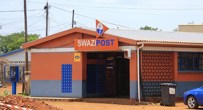
Passé le bourg, nous cheminons sur une longue route droite. De part et d'autre, place à une savane desséchée parsemée d'arbustes et d’acacias, elle s'étend à perte de vue sur une région sans relief. Pour être franc, ce sud du territoire n'est pas vraiment la plus belle région de ce pays. Ça et là, il y a bien quelques habitations. De simples cases, quelques lopins de terre arides et quelques animaux, chèvres et vaches, toutes aussi maigres les unes que les autres.
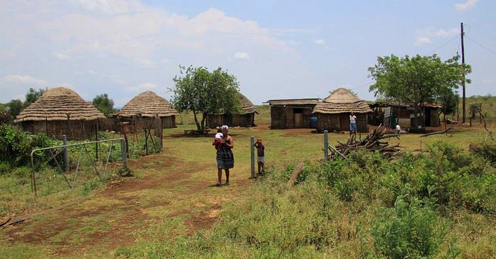
On l'imagine, c'est une vie de misère que vivent ces rares habitants. Dès que l'on s'arrête sur le bord de la route, femmes et enfants viennent à notre rencontre … pour nous dire bonjour certes, mais surtout pour quémander quelques objets ou un peu de monnaie … cela peut paraître un peu agaçant mais ne serait-on pas tenter de faire pareil si nous étions à leur place ?
Après une soixantaine de kilomètres parcourus sur cette très rectiligne nationale MR8, notre seconde halte est une pause restauration au bourg de Nsoko. Le Nisela Coffee shop est un établissement à l'hygiène plutôt rassurante … ce qui malheureusement ne semble pas toujours le cas des quelques « cantines » de villages. Une fois rassasié (repas simple mais correct) et en attendant la poursuite du trajet, on profite de ces quelques instants de repos … pas en piquant une courte sieste à l'ombre des épineux mais pour faire une petite balade digestive.
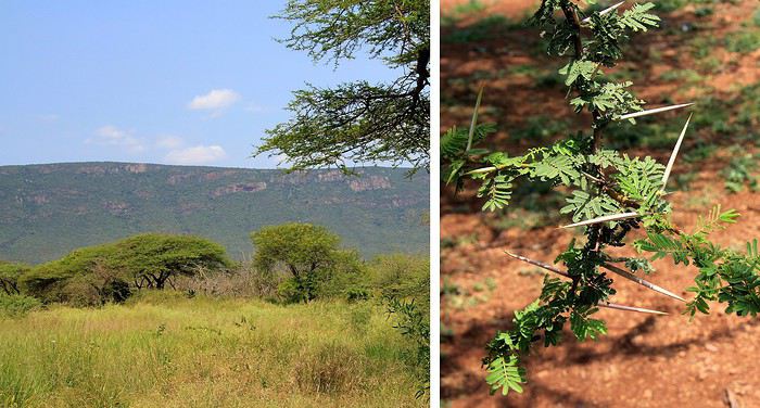
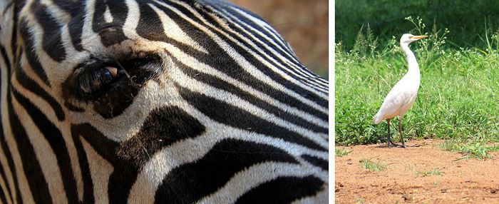
Au Nisela, se trouve un parc avec quelques animaux « sauvages » dans des enclos sécurisés, à l'image de ce zèbre à l’œil vitreux. C'est une invitation à en découvrir un peu plus car le Nisela est aussi un lieu de départ pour des safaris animaliers. Ainsi, comme en Afrique du Sud, le Swaziland, pardon l'eSwatini, est un territoire où l'on peut observer une grande partie de la faune sauvage de l'Afrique australe. Mais les réserves locales sont moins renommées que celles de la région du célèbre Parc Kruger … notre destination, au-delà des terres de l'eSwatini.
A propos des animaux du pays, j'ai bien aimé la vue d'un dessin au style naïf d'un artiste local. Le dessin représentait la faune animalière de ces contrées avec des animaux sauvages et aussi des animaux domestiques … Je m'en suis inspiré pour réaliser le dessin, à ma manière et sans prétention, présenté ci-dessous.
Nous avons repris la route et peu à peu le paysage change catégoriquement d'aspect. Il en est fini des étendues de savanes brûlées par le soleil, place maintenant à des plaines cultivées. Ici, c'est le royaume de la canne à sucre. Des hectares et des hectares de champs de cannes qui ondulent au gré des vents, la proximité avec ce cours d'eau n'est sans doute pas étrangère à la fertilité de ces terres.
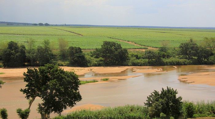
Qui dit champs de cannes à sucre … dit évidement présence dans cette région d'une imposante distillerie avec son corollaire, les nombreuses charrettes et/ou camions chargés de cannes fraîchement coupées. Ils se dirigent tous vers la grande distillerie. L'image paraît sympathique et très couleur locale … sauf si, sur la route, on suit de tels chargements. Vous vous en doutez, ils roulent à petite vitesse, tout en vous masquant la vue. Grrr !
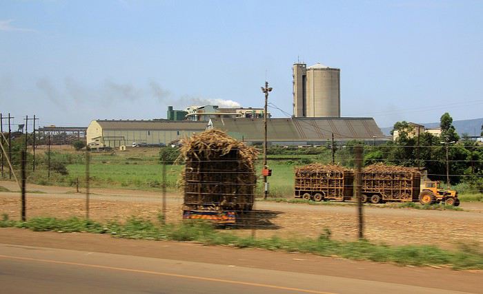
Une autre usine avec sa haute silhouette de cathédrale industrielle ne passe pas inaperçue dans cette région de plaine agricole. En grandes lettres, le mot «Farm Chemicals » apparaît à la base de la tour. Ici, on fabrique en grand volume des engrais, des herbicides et j'en passe … indispensables produits vous dises les cultivateurs pour rentabiliser la production, certes, mais tout ça n'est sûrement pas très naturel … bref, c'est un autre thème et pas vraiment le sujet principal de ce récit.
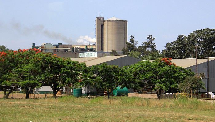
Poursuivons notre route. Une voie jalonnée de hameaux et de petits commerces. A les observer les uns après les autres, on ne peut pas dire qu'ils donnent l'impression de baigner dans l'opulence. Quelques produits étalés dans des constructions cubiques colorées à grand renfort de teintes vives, histoire d'égayer la simplicité ou plutôt une certaine misère.
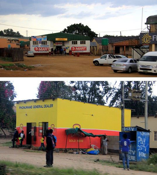
Nous sommes pourtant en pleine après-midi mais peu à peu la luminosité décline comme si le crépuscule approchait. Quant au ciel, d'énormes nuages sombres l'encombrent … la suite ? Facile de la deviner. Un déluge s'est abattu sur le secteur.
Des trombes d'eau, des coulées de boue qui longent la route et par endroits qui même la traversent. Et des essuie-glaces qui ne parviennent plus à assurer une bonne visibilité. J'aurais été au volant, je pense que je me serais arrêté dans l'attente d'une éclaircie mais notre chauffeur de continuer à rouler tant bien que mal … on lui a fait confiance presque les yeux fermés car même ouverts, on ne voyait plus rien ! enfin si, à travers la vitre inondée de pluie j'ai cru voir une fantomatique voiture, le fait d'être rouge a certainement aidé à la distinguer.
On continue donc de rouler, à vitesse réduite mais on avance toujours sur une route lessivée qui progressivement s'élève. Une succession de lacets parmi des collines et l'on se retrouve à présent sur les hauteurs.
C'est bien connu, après la pluie place aux rayons de soleil, encore timides alors que nous parvenons dans les faubourgs de Manzini. La ville, une des plus importantes de l'eSwatini de part sa population (environ 78 000 habitants) est aussi et surtout une cité active sur le plan commercial. Pendant la période coloniale britannique dans les années 1890, la ville abritait même le quartier général des administrations avant de céder son statue de capitale à la ville de Mbabane (on y passera un peu plus tard).
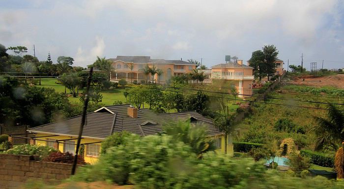
Et comme on peut le constater sur cette photo, quelques belles maisons sont bâties sur ces collines en périphérie de l'agglomération. Un aspect bien différent des masures et des huttes observées auparavant dans la lointaine campagne. Ici, on l'imagine, vivent quelques membres des classes sociales parmi les plus favorisées du pays, entre élites et privilégiés.
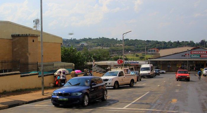
Passons le centre ville, ses boutiques, ses centres commerciaux et ses carrefours … pour longer encore des parkings et des hangars. Là, par exemple, voici une concession automobile où l'on vend des « Cars from Japan », rien de bien original me direz-vous … sauf si l'on précise que toutes les voitures vendues ici sont des occasions qui ont déjà de nombreux kilomètres au compteur !
Les prix de ces voitures importées et « recyclées » sont plus abordables pour la population locale (enfin pour ceux qui en ont les moyens !). Au Japon, la tendance et la réglementation obligent les propriétaires à renouveler très régulièrement leur véhicule. Ainsi pour ces voitures japonaises, c'est une nouvelle vie qui leur est offerte à rouler sur les routes de l'eSwatini.
Norway to hell English translation pending
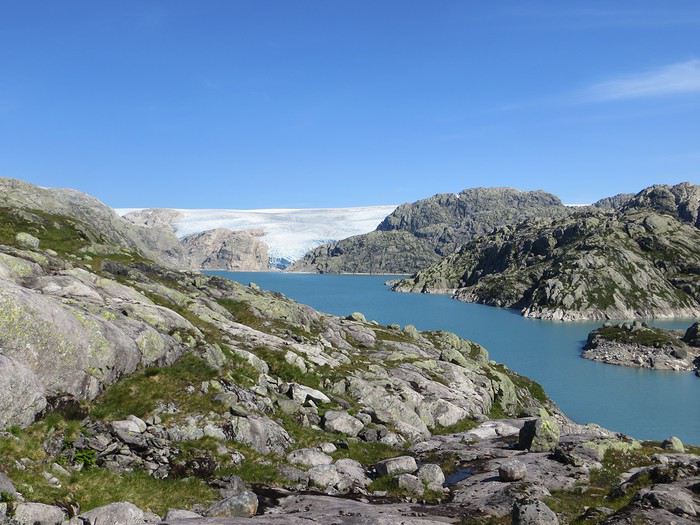
En ces temps coronatroublés, rien ne vaut de se remémorer le dernier voyage touristique que l’on a fait avant le plongeon dans le néant sanitaro-économique. La Norvège, plus précisément sa côte ouest et ses fjords, sera donc le sujet de ce carnet en 31 épisodes dotés chacun d’une bande-son, plutôt rock d’ailleurs. Attention, lecteur, vous vous exposez à un certain nombre de clichés pas du tout exagérés et de blagues pourries. I have nothing to offer but fjord, joy, tears (of the sky) and sweat.
Donc la Norvège, c’est l’apocalypse budgétaire dans votre portefeuille. D’où le titre (c’est tiré par les cheveux mais je ne refuse jamais un jeu de mots). Mais ce n’est pas que cela, c’est aussi fort joli, propre, policé et réellement rempli de charmantes têtes blondes. La Norvège, c’est également une monarchie pétrolière du golfe persique qui s’est égarée sur des terres glacées. Eh oui, c’est tout de suite plus facile d’être riche quand ils ont du pétrole (« mais ils n’ont que ça » aurait ajouté un jaloux), qu’ils sont peu nombreux et pas très partageurs. Allez, quelques détails pour commencer sur un plan aussi bien techeunique que tacqueutique
Le trajet En voiture Simone ! Depuis le Massif Central jusqu’à la Norvège avec une C3. J’avais décrété 2019, année sans avion. Donc c’était la voiture, certes petite mais costaude, où l’on a pu entasser notre matériel de camping. On en a profité pour prendre un covoitureur qui allait se perdre en Norvège pour l’été. Plus on est de fous entassés, plus on rit. Sur place, j'ai limité fortement notre aire d'action géographique. Je le connais le piège de faire une liste longue comme le bras et de courir tout le voyage tel un chien de ferme après un mollet cycliste. Il s'agissait de se cantonner au riz euh pardon à la façade sud-ouest du pays sans aller plus haut qu'Ålesund. Et comme il y avait un certain nombre de lieux qui me faisaient de l’œil, nous avons quand même eu un trajet digne d’une otarie bourrée essayant d’échapper à une orque affamée. On a finalement fait l’essuie-glace obliquement dans l’Ouest : à gauche, à droite, à gauche, à droite, à droite, A DROITE . Il faut dire que les fjords et les montagnes n’arrangent pas les affaires du voyageur adepte des routes rectilignes, et cela malgré la passion tunnelière locale.
Le lien vers la carte du trajet : http://u.osmfr.org/m/434267/
Les Norvégiens Les Norvégiens sont des êtres blonds aux yeux bleus, parfois d’un blond tellement blond qu’on dirait qu’ils ont appliqué de la javel sur leurs cheveux. Effet secondaire qui donne la chair de poule, cela fait disparaître les sourcils… Le Norvégien est réservé et poli. L’été, soit il se balade torse nu, soit il quitte le pays pour des horizons plus propices au rougeoiement de sa peau laiteuse où il pourra faire valoir son pouvoir d’achat dément. La Norvégienne quant à elle a une prédisposition naturelle à se promener en sous-tif ou brassière dès le premier rayon de soleil. Le dimanche, jour du Seigneur et de l’hypocrisie, le Norvégienne ne boit pas (vente d’alcool interdit !) les autres jours, iel se cache pour boire puis déambule cahin-caha entre les maisons de bois à la pelouse verdoyante. La Norvégien apprécie également les sorties familiales du dimanche après-midi où il peut effectuer 1000 mètres de dénivelé en 3,5km avec ses enfants de 7 et 9 ans. Le tout les doigts dans le nez.
Le logement Le logement, c’était principalement notre tente de 2 m² que nous avons montée/démontée dans des campings de qualité très variable pour un prix pas donné. Souvent les sites sont jolis mais plantés en bordure de route malgré l’espace qu’offre le pays. Ca manque quand même d’arbres ou arbustes et d’emplacements un tant soit peu délimités. Ce dernier point permet pendant les nuits les plus chaudes de l’été d’entasser les touristes de passage dans une promiscuité certaine et de rentabiliser un maximum l’espace. Malynx le Norvégynx ! Par contre, les sanitaires sont en général en bon état mais avec douche payante. Bref, le camping c’est le moyen de logement le plus abordable hors camping sauvage mais en général, la qualité est moyennasse au vu des prix. J’ai séché une petite larme en pensant à feus les campings des parcs nationaux et provinciaux canadiens. Requiescat in pace. Pour reprendre notre souffle, nous avons quand même varié les plaisirs avec des logements en b&b, du camping sauvage, des hytter (des petites cabanes souvent présentes dans les campings mais également ailleurs, très pratiques, pas trop chères pour la Norvège et aux prestations variables : électricité, eaux courantes en option par exemple) et une nuit en « refuge ». Les refuges, il y en a partout la plupart sont accessibles à pied, non gardés avec parfois une sorte de self-service payant.
La bouffe Courez en Norvège (ah mince vous êtes confinés) et vous me direz des nouvelles du Brunost . Sinon c’est cher mais pas mauvais globalement, peu porté sur le poisson hors saumon d’élevage et assez roboratif. Et bonne surprise pour moi, il y a quand même une tradition boulangère et même s’il y a peu de boulangeries, on peut trouver pleins de pains et de sorte de viennoiseries dans les supermarchés. Cela égaie les multiples piques-niques.
Avant de commencer le carnet proprement dit, entamons notre hymne norvégien : So many stop signs Speed limit Curves’ gonna slow me down Like a wheel Gonna spin it Tourists’ gonna mess me around Hey, Satan Payin' my tolls Bein’ among sheepin' bands Hey, mamma Look at me I'm on the way to the promised land
Jour 1,5 60 mph – New Order Clermont-Ferrand - Neumünster A nous les petites autoroutes allemandes tant prisées de ce côté du Rhin pour l’absence de limites de vitesse. Parcours Montbéliard – Fribourg – Karlsruhe – Francfort – Kassel – Hannovre – Hambourg – Neumünster. C’est long et pénible avec des travaux publics pas très deutsche Qualität tous les 20 kms, un trafic chargé et des zones limitées sans limite de vitesse qui rendent la conduite dangereuse : à droite ça roule à 90, à gauche à 200 pour les plus fous et comme c’est saturé, ça donne un résultat sportif et désagréable. Je me demande comment ils font pour avoir aussi peu de morts sur les routes en Allemagne. A part ça, le voyage est sans histoire, le colis covoitureur est livré à Fribourg et on arrive entiers et fatigués à Cathédraleneuve.
Jour 2 Seemann – Rammstein Neumünster - Kristiansand
Les autoroutes allemandes c’est rapidement fini, on revient à de la tranquillité avec le Danemark. Nous avons choisi de prendre le ferry Hirtshals-Kristiansand qui permet d'arriver plus rapidement sur la côte ouest Et comme on a beaucoup d’avance sur l’horaire du ferry Hirtshals-Kristiansand, on se permet un détour vers une dune danoise dominant la mer du Nord. Le temps est pas idéal et le coin est assez fréquenté. Bof. Le voyage en ferry est sans histoire, les Norvégiens en profitent pour faire des réserves d’alcool et de legos (les deux produits les plus présents dans les magasins du bateau). Nous voilà enfin en Norvège, 1900 kilomètres plus tard, sur la plage de Christian. Sacré Clavier qui a fait des fidèles un peu partout en Scandinavie.
Jour 3 Why does it always rain on me? - Travis 180 km Kristiansand – Hauge Notre premier jour en Norvège et ça ne s’annonce pas glorieux, plutôt gris tendance pluie. Nous commençons par un rapide passage par un bout de zone payante de Kristiansand juste pour le plaisir et accessoirement quitter cette ville. Je me suis inscrit, par honnêteté, sur le site internet des péages norvégiens (gérés d’ailleurs par une société anglaise) et par la grâce de caméras bien placées, nous allons devoir payer quelques euros pour à peu près 100 mètres dans ladite ville. Pfff. Quant au programme aujourd’hui, nous allons à la conquête de l’ouest, l’ouest de Kristiansand et nos plans capotent très largement. Ca tombe, ça tombe, ça dégouline, dégringole, s’abat, déverse, pleuvoche, tantôt torrentiel, tantôt bruineux. Pas question de faire une rando ou toute autre activité de plein air. Je m’aperçois en plus dans la journée que mon imper n’est plus imperméable et que j’ai oublié mon surpantalon. Prions, mes bien chers Frères, mes bien chères Sœurs pour que la météo soit clémente. Sinon ça va être long. Dans un premier temps, jusqu’à Flekkefjord, nous nous mouvons plus ou moins le long de la côte sans l’apercevoir, d’une parce que c’est complètement bouché, de deux parce qu’il est difficile de distinguer ce qui tient d’un lac ou d’un fjord, de trois parce que la route principale ne suit pas la côte. Nous nous rabattons donc sur la visite sans trop musarder des petites villes blanches du sud de la Norvège, leurs villages blancs andalous à eux mais en différent : avec du bois, de la pluie et de la mer. Premier arrêt à Mandal, un vrai coup dans le cœur. Deuxième arrêt : Flekkefjord, très mignon. Troisième arrêt version hameau, Stornes en entrée de fjord, très, très mignon. Quatrième arrêt : Sognalstranda, très, très, très mignon. C’est le règne de la mignonitude humide. Une maison en bois par ci, un entrepôt en bois par-là, et des garages à bateau à foison.
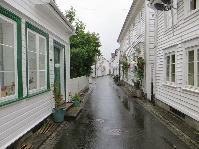 Pas un temps à mettre un chat norvégien dehors (Flekkefjord)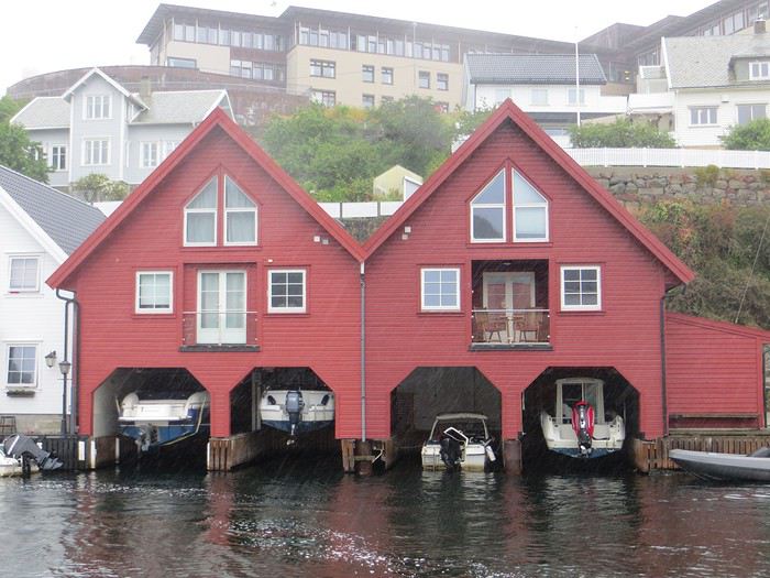
Pas un temps à mettre un bateau norvégien dehors
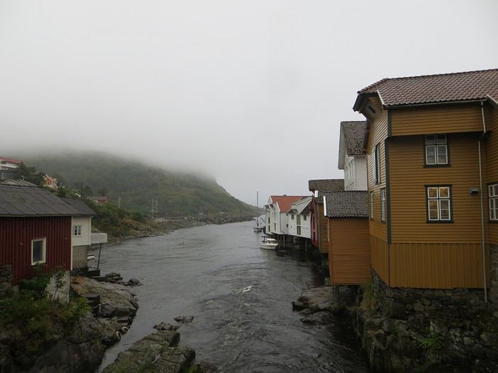 Mais pourquoi on est dehors nous alors ? (Sognalstranda)
Interlude de pipeau très intéressant : ces villes/villages, souvent fondés aux 17ème et 18ème siècle, sont les témoins de la politique mercantiliste du royaume du Danemark. L’État balbutiant entend organiser la production, la commercialisation et l’exportation des ressources comme le bois, les poissons et certains métaux de Norvège. Cette politique passe par la mise en place d’exploitations/manufactures à tendance monopolistique et la spécialisation des ports avec monopole des marchands d’abord hanséatiques (16ème siècle) puis néerlandais (17ème siècle) et enfin danois (17-18ème siècle). C’est d’ailleurs pour cela que le vieux centre de Flekkefjord est surnommé la ville hollandaise. Ce système mercantiliste fera par ailleurs les malheurs de l’Islande forcée de se soumettre pendant deux siècles à une compagnie royale danoise monopolistique à même d’imposer ses tarifs et ses conditions d’échange de marchandise. Les siècles sombres comme les appellent les Islandais ont en grande partie comme origine cette organisation économique très profitable pour la royauté danoise, beaucoup moins pour les habitants de l’île. La route 44 après Flekkefjord vaut par ailleurs son pesant de cacahuètes même si les conditions ne sont pas optimales pour en profiter. Tout le coin a été nommé magma geopark (patrimoine de l’UNESCO) dans une poussée de marketing touristique, des roches de la croûte terrestre d’une zone de subduction ayant fini par apparaître sous l’effet de l’érosion si j’ai bien compris. Point de volcan donc mais des effleurements d’anorthosites qui forment des paysage rocailleux arrondis et stériles comme autour d’Helleren et d’Åna Sira où devait se dérouler notre première randonnée norvégienne, projet qui tombe à l’eau (ahahah), noyé sous les larmes du ciel (ahahah). La partie la plus spectaculaire du trajet se trouve entre Åna Sira et Hauge où la route serpente tant bien mal entre les rochers. Nous goûtons le soir venu à la douceur des campings norvégiens : une espèce de carrière dans un espace réduit entre deux collines, un sol gravillonneux, pas de végétation et roule ma poule. Le seul avantage réside dans la vue en bout de carrière sur la côte. Pas vraiment de cuisine aménagée, des douches payantes : prometteur ! Le coupable aujourd’hui est le Vågan camping (garanti sans viande).
Jour 4 Sous le soleil exactement – Serge Gainsbourg 186km Hauge – Lysebotn Nuit et brouillard ce matin sur la Norvège et pourtant nous gardons espoir, le soleil vaincra. Nous continuons la route côtière pour faire une petite balade (4km aller-retour) jusqu’au Hådyr. C’est humide, boueux, bourbeux, fangeux, marécageux, tourbeux, machineux. C’est également l’occasion de compter la deuxième victime du voyage : le terrain a raison de mes chaussures de marche basses. Flap flap, bain de pieds et macération. Décidément, je suis équipé pour affronter l’humidité scandinave ! Arrivés au rocher censé donner un point de vue sympa sur la côte, c’est la douche froide (avec beaucoup de vapeur d’eau, la douche) : à gauche, du brouillard, à droite, du brouillard, droit devant, du brouillard, derrière, du brouillard et un bruit de ressac à nos pieds. Comme on est patient et qu’on croit en dame météo, nous nous asseyons pour attendre la percée du soleil. Une heure et quelques hésitations plus tard, ça se déchire (très) petit à petit, de quoi entrapercevoir une côte que je qualifierai de dantesque. J’adore ces rochers granitiques usés par les siècles, qui forment des forêts de sentinelles face à la mer.
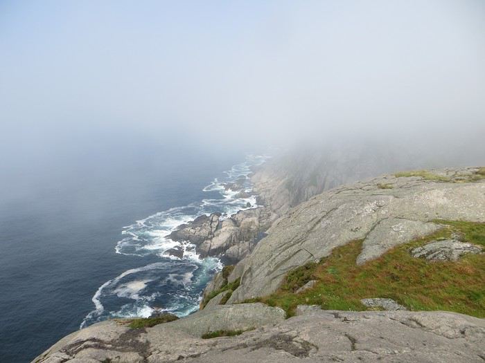 Les portes de l'Hådyr s'ouvrent et pas de cerbères à l'horizon
Et ça tombe bien que j’adore ce paysage puisque pour l’étape suivante (décidément le gentil organisateur a tout prévu !), nous traversons sans s’arrêter Egersund, autre petite ville en bois, pour Eigerøya, son phare et son paysage rocailleux sous le soleil exactement, un soleil de plomb je dirais même plus. La baladounette de l’après-midi de 4 km est sans difficulté sur une autoroute pédestre et permet d’accéder à un point de vue maousse costaud sur l’île d’Eiger et son phare.
Les portes de l'Hådyr s'ouvrent et pas de cerbères à l'horizon
Et ça tombe bien que j’adore ce paysage puisque pour l’étape suivante (décidément le gentil organisateur a tout prévu !), nous traversons sans s’arrêter Egersund, autre petite ville en bois, pour Eigerøya, son phare et son paysage rocailleux sous le soleil exactement, un soleil de plomb je dirais même plus. La baladounette de l’après-midi de 4 km est sans difficulté sur une autoroute pédestre et permet d’accéder à un point de vue maousse costaud sur l’île d’Eiger et son phare.
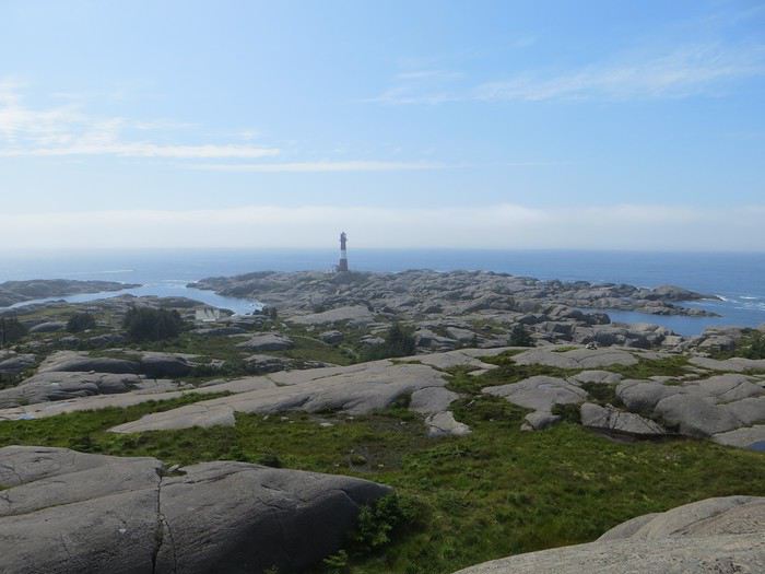 C'est un roc ! C'est un pic ! C'est un cap ! Que dis-je c'est une péninsule !
 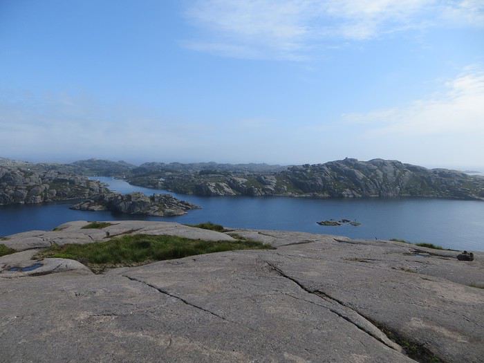 Eigerøya en beauté
Si j’ai bien compris le norvégien, øy est le suffixe pour île et a celui pour « la » en général, même si la langue se scinde en deux types distincts nynorsk et bokmål et en de nombreuses variantes dialectiques locales qui provoquent des orthographes changeantes des panneaux et des cartes. Par exemple, kirke (église en bokmål) s’écrit aussi kyrkje en nynorsk, voire a d’autres déclinaisons locales plus obscures. Le nynorsk, pour ceux qui ne connaissent pas, est issu d’une (re)création linguistique du 19ème siècle type occitan ou breton en France : pour donner à la Norvège une langue pure de toute saleté étrangère, danoise plus particulièrement, des linguistes ont construit une langue sur un mélange des dialectes considérés comme les moins viciés par l’outre-Skagerrak, c’est-à-dire ceux du Telemark et des fjords du sud-ouest. A contrario, le bokmål est un dérivé dédanoiïsé de la langue parlée (du danois grosso modo) dans les villes comme Oslo au début du 19ème siècle. De nos jours, il y a donc deux langues officielles et le nynorsk est très connoté nationaliste et perd du terrain : 13% des Norvégiens, principalement dans l’ouest, le parlent comme langue maternelle. Nous nous dirigeons ensuite vers l’intérieur des terres en direction de Lysebotn, le paysage change, pâturage, forêt et lacs avant de rentrer dans des zones à l’environnement plus âpre et tourmenté. Gloppedalsura (à vos souhaits) est l’occasion d’un arrêt bienvenu pour un point de vue sur un chaos de rochers impressionnant et son lac attenant.
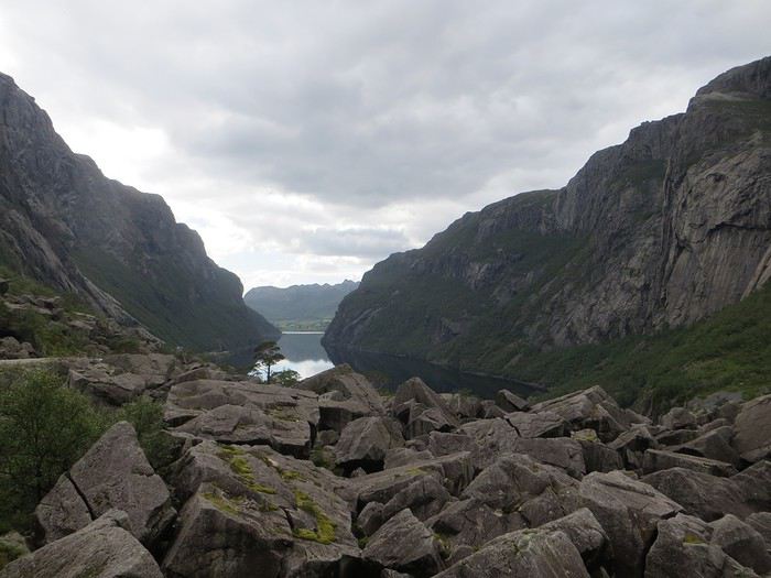 Gloppedalsura, lieu de franche rigolade entre Allemands et Norvégiens pendant la Seconde Guerre Mondiale
Nous remontons ensuite la Øvstabødalen, vallée glaciaire à citer dans toute conférence de géologie de bon niveau pour la perfection de sa forme en auge. Le parcours est varié, peu fréquenté et plaisant avant de plonger sur une zone moins sympa bien dotée en stations de ski et en habitat folklorico-traditionnel, ici des immeubles/chalets en bois sombre et toit végétalisé. L’avantage, au-delà du côté très artificiel des stations, c’est que les bâtiments se fondent dans la végétation.
Gloppedalsura, lieu de franche rigolade entre Allemands et Norvégiens pendant la Seconde Guerre Mondiale
Nous remontons ensuite la Øvstabødalen, vallée glaciaire à citer dans toute conférence de géologie de bon niveau pour la perfection de sa forme en auge. Le parcours est varié, peu fréquenté et plaisant avant de plonger sur une zone moins sympa bien dotée en stations de ski et en habitat folklorico-traditionnel, ici des immeubles/chalets en bois sombre et toit végétalisé. L’avantage, au-delà du côté très artificiel des stations, c’est que les bâtiments se fondent dans la végétation.La dernière partie du trajet, très belle mais pas très agréable à conduire tant la petite route est saturée par la circulation, traverse un plateau rocailleux avant de plonger vers le Lysefjord. Malheureusement, la route de descente, assez connue (elle est le lieu d’une compétition estivale de ski sur route très cotée) une fois passée le restaurant et bien que sûrement impressionnante vue d’un drone, n’offre quasiment aucune vue sur la vallée et le fjord. Ce qu’elle offre par contre, c’est un tunnel en épingle à cheveux, un classique que l’on retrouvera à plusieurs reprises dans les fantaisies souterraines norvégiennes. Le camping du soir, bonsoir, le Kjerag Lysebotn camping, jouit d’un site splendide et est bien équipé (cuisine, sanitaire). Malheureusement, comme on est en Norvège, il n’y a aucun arbre/arbuste et une promiscuité assez forte et accentuée par l’affluence d’un jour de juillet ensoleillé. Bref on se marche dessus comme des manchots en période de reproduction dans leur colonie.
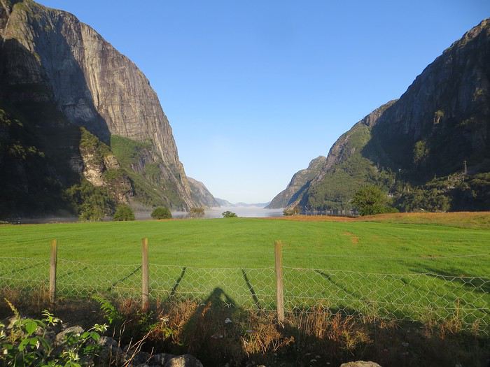 Quand je vous dis que le site est splendide...
Jour 5 Highway song – System of a Down 78km Lysebotn - Hjelmeland Aujourd’hui, c’est notre journée rando de masse dit trek pour ceux qui se sentent une âme d’aventurier, juste une âme, il ne faut pas trop abuser de l’aventure. Donc aujourd’hui, c’est le Kjeragbolten, concession faite à la liste des randonnées obligatoires. La Norvège fait partie de ces pays où la randonnée est l’une des activités touristiques obligatoires y compris pour des personnes qui ne marchent jamais par ailleurs. Pour la Norvège, l’activité s’effectue bien sûr en masse sur les mêmes chemins en cochant les fameuses cases de la to do list comprenant dans l’Ouest Preikestolen, Trolltunga, Kjeragbolten, Bessegen et Aurlandsdalen. Nous nous sommes contentés du rocher suspendu Kjerag, choisi car dans mon esprit, moins facilement accessible au commun du touriste (et moi je suis un touriste hors du commun, un tourista). C’est sûrement vrai mais cela n’empêche pas le monde… Je le savais, je le savais, j’étais prévenu, j’ai râlé avant, j’ai râlé pendant, je râle encore après et pourtant je n’ai pas d’oiseau dans la gorge et il n’y avait pas de genêts dans la balade (cf le râle des genêts pour comprendre la blagounette). La randonnée commence par un parking gigantesque au tarif prohibitif. Nous payons sans moufter nos 30 euros (un repas dans un resto semi gastro en France pour ceux qui n’ont pas le sens des valeurs). J’espère que personne ne s’arrête juste pour voir la vue car de vue il n’y en a point : le point de vue est occupé par un restaurant qui met un point d’honneur à boucher accessoirement la vue. Et pour accéder à sa terrasse/point de vue, il faut payer. Bon, nous, on a du pain sur la planche et quelques montées raidasses en attente. Dont acte. Trafic fluide en ce début de matinée, quelques problèmes de surchauffe moteur pour la première montée puis la vitesse de croisière est atteinte pour une arrivée prévue à 10h30. Ce n’est pas encore un bouchon au niveau du rocher mais la circulation est déjà dense à l’approche. Au retour, le trafic est extrêmement chargé et les comportements touristico-idiots se multiplient (équipement inadéquat, coupage des routes à travers champs, ralentissements dus aux selfies intempestifs. Ne pas utiliser votre téléphone en conduisant, que la sécurité routière vous dit !).
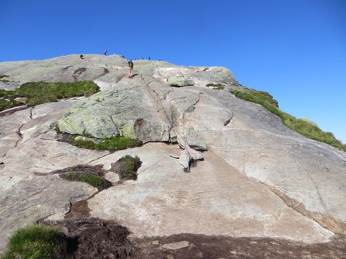
Pas un coin où amener sa traban
Sur le fond, la rando, 12 km et 700 mètres de dénivelée, est très chouette avec de belles vues sur le fjord et Lysebotn en particulier au début de la 3ème montée et tout au bout.
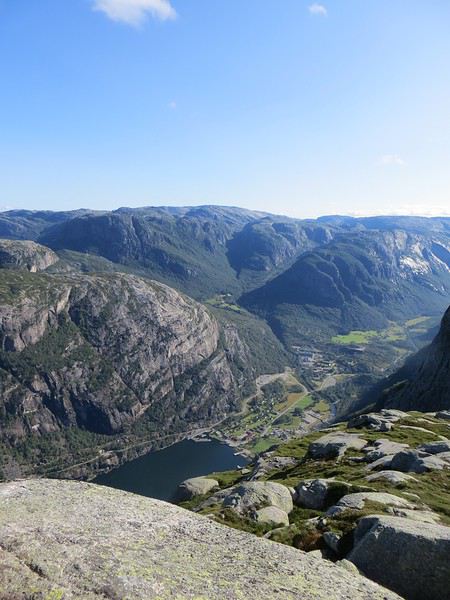
Le Lysefjord
Le caillou est flippant et spectaculaire tout comme la plateforme juste à côté. Une queue au bord d'un à pic de 1000 mètres se forme pour monter dessus (même pas en rêve, je fais un truc pareil).
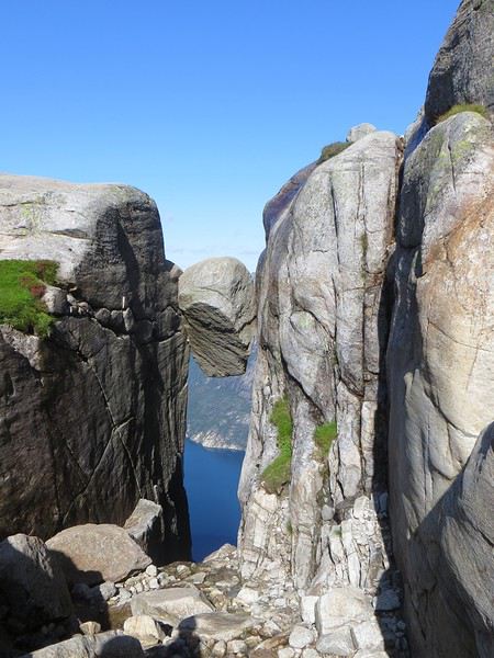 Le mythe
La réalité
Il est loisible d’explorer les environs du Kjeragbolten pour profiter d’un peu de la tranquillité des avancées rocheuses spectaculaires et des vues majestueuses sur le fjord. Bref ça claque grave.
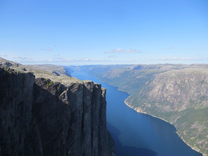 Le Lysefjord n'a pas bougé
On redescend à Lysebotn pour prendre un ferry réservé à l’avance. Et quand on voit le « ferry » arriver, on se dit que la réservation était une bonne idée. Rentrée en marche arrière et tassage de voitures dans un espace réduit pour notre mini-croisière sur le Lysefjord. Très bien la mini-croisière qui permet de s’apercevoir de la hauteur des falaises entourant le Kjeragbolten et d’apercevoir le Preikestolen où nous n’irons pas.
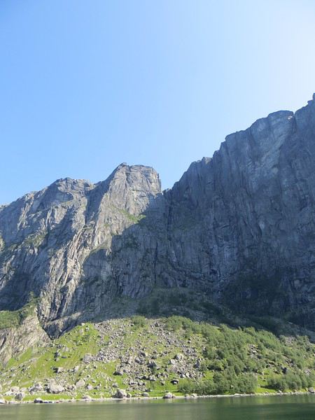
Le Kjeragbolten vu d'en bas. Les 1000 mètres de vide y sont bien
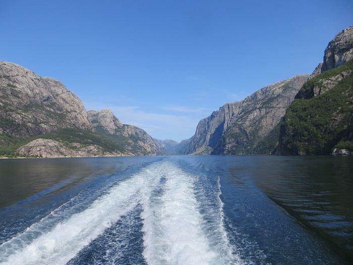 La croisière s'amuse
Le camping du soir se trouve à Hjelmeland et est ingénieusement intitulé Hjelmeland camping. Celui-ci fait dans l’original puisque nous avons planté notre tente dans le parc arboré d’une sorte de manoir qui sert de dortoir. Une chouette vue, une cuisine bien équipée et assez d’espace pour ne pas se marcher dessus (en principe, avec les Norvégiens, on ne sait jamais, ils pourraient parquer votre tente ou votre van à 50 cm du voisin), voilà pour les avantages. Pour les inconvénients, les sanitaires sont peu nombreux, peu pratiques et se salissent vite (forcément).
Le camping-car en Namibie c'est bien English translation pending
bonjour,
juste un petit post et retour d'expérience sur la possibilité de voyager en camping car en Namibie. Lors de la préparation de notre voyage je n'avais rien trouvé de satisfaisant sur ce forum. Dire donc: oui c'est possible ! Et avec des enfants cela est même souhaitable. Parcourir la Namibie cela implique de rouler, souvent longtemps, plus longtemps que prévu vu l'état des routes, la beauté des paysages et la recherche des animaux sauvages. L'espace a disposition dans le camping car est alors le bienvenu. Par ailleurs la hauteur, le nombre de fenêtres sont des atouts bien appréciés lors de la visite du parc Etosha mais aussi en d'autres circonstances. Reste les inconvénients : la poussière qui s'infiltre dans le véhicule ( prévoir de grands sacs poubelles pour enfermer vos affaires) et oblige a un ménage complet a chaque étape(problème que rencontrent aussi les 4x4) et les vibrations qui vous font parfois croire que le véhicule va se fendre en deux... Nous avons vécu deux crevaisons et un ensablement. J'en profite pour signaler que nous avons reçu alors l'aide précieuse d'un sud africain voyageant avec son propre véhicule et connaissant le terrain qui a su nous sortir de là. Les autres touristes équipés de 4x4 flambant neuf étaient bien en peine pour nous aider, s'agaçant plutôt que nous obstruions le passage, les retardant sur leurs parcours et programme bien huilé... Certes les 4x4 roulent plus vite...Mais a quoi bon...
juste un petit post et retour d'expérience sur la possibilité de voyager en camping car en Namibie. Lors de la préparation de notre voyage je n'avais rien trouvé de satisfaisant sur ce forum. Dire donc: oui c'est possible ! Et avec des enfants cela est même souhaitable. Parcourir la Namibie cela implique de rouler, souvent longtemps, plus longtemps que prévu vu l'état des routes, la beauté des paysages et la recherche des animaux sauvages. L'espace a disposition dans le camping car est alors le bienvenu. Par ailleurs la hauteur, le nombre de fenêtres sont des atouts bien appréciés lors de la visite du parc Etosha mais aussi en d'autres circonstances. Reste les inconvénients : la poussière qui s'infiltre dans le véhicule ( prévoir de grands sacs poubelles pour enfermer vos affaires) et oblige a un ménage complet a chaque étape(problème que rencontrent aussi les 4x4) et les vibrations qui vous font parfois croire que le véhicule va se fendre en deux... Nous avons vécu deux crevaisons et un ensablement. J'en profite pour signaler que nous avons reçu alors l'aide précieuse d'un sud africain voyageant avec son propre véhicule et connaissant le terrain qui a su nous sortir de là. Les autres touristes équipés de 4x4 flambant neuf étaient bien en peine pour nous aider, s'agaçant plutôt que nous obstruions le passage, les retardant sur leurs parcours et programme bien huilé... Certes les 4x4 roulent plus vite...Mais a quoi bon...
Parcours voyage 17 nuits en Namibie en avril-mai English translation pending
Bonjour à tous,
Tout d'abord, bonne et heureuse année 2020 !
Cela fait des semaines que je parcours le forum pour notre futur voyage en Namibie qui aura lieu (normalement) du 25 avril au 9 mai 2020.
Avant de rentrer dans le vif du sujet, je souhaite remercier toutes les personnes qui font vivre ce forum au quotidien et qui apportent leurs connaissances.
C'est pour cela que je fais appel à vous : j'ai besoin d'aide et de conseils.
Mon mari et moi sommes un couple de trentenaires qui adorons voyager. La Namibie sera notre voyage de noces. Nous louerons un 4x4 avec tente sur le toit pour alterner camping et lodge.
A priori (nous attendons quelques informations pour réserver nos billets), notre vol arrivera à Windhoek le 25/04/20 à 6h30 et nous en repartirons le 09/05/20 à 21h35. Cela représente 14 nuits sur place. Malheureusement, nous ne pouvons pas allonger notre séjour tout simplement car nos employeurs nous refusent plus de 15 jours de vacances hors mois d'août.
Après toutes mes lectures, voilà le parcours parfait à nos yeux :
1 nuit arrivée Namibie, 2 nuits Namibrand family hideout, 1 nuit sesriem, 1 nuit Gecko Camp ou Rostock Ritz (qu'en pensez-vous ?), 2 nuits Swakopmund, 1 nuit Spitzkoppe, 1 nuit Brandberg, 2 nuits Grootberg ou Palmwag (que conseillez-vous ? j'ai lu qu'il était possible de faire du camping sauvage dans Palmwag ? la track rhino est-elle vraiment à faire au Grootberg ?) 2 nuits Purros, 3 nuits Etosha, 1 nuit Otiwarongo ou Okonjima.
Cela fait un total de 17 nuits ! Donc 3 nuits en trop par rapport à notre séjour.
Qu'en pensez-vous ? Voyez-vous des étapes que je pourrai supprimer ou diminuer ? Pensez-vous qu'il soit possible de rejoindre le Namibrand directement en arrivant ? Une seule nuit au Namibrand vaut-elle le coup ?
Est-il vraiment nécessaire de réserver les campings/lodges sachant que nous sommes en début de bonne saison ? Cela nous laisserait plus de libertés.
Concernant Purros, tout le monde vante cet endroit et dit que c'est le paradis. Cela me semble un incontournable pour nous sachant que nous souhaitons vraiment voir les éléphants du désert. J'ai contacté un TO qui m'a dépeint ce lieu de manière assez négative en appuyant fortement sur la dangerosité (il y aurait déjà eu un mort sur place) des éléphants et l'état de la route pour y aller. Qu'en pensez-vous ?
Enfin, nous avons choisi la Namibie pour sa diversité : paysages et animaux. Or, en Avril/Mai, les observer n'est pas du tout garanti (je sais que ce sont des êtres humains et que rien n'est prévisible). Les retours sur le forum pour cette période sont donc mitigés pour la faune. J'en arrive à ma question : cela vaut-il le coup d'aller à Etosha ? Le Botswana est-il plus adapté ? Si oui, cela est-il possible de s'envoler pour 3 jours là-bas avec un séjour organisé et rentrer à Windohek pour prendre l'avion du retour ? Un TO à proposer ?
J'ai beaucoup de questions et j'en suis désolée.
Je remercie d'ores et déjà toutes les personnes qui prendront le temps de me répondre et je reste à leur disposition pour tout complément d'informations.
Bonne journée,
Anne Laure
Tout d'abord, bonne et heureuse année 2020 !
Cela fait des semaines que je parcours le forum pour notre futur voyage en Namibie qui aura lieu (normalement) du 25 avril au 9 mai 2020.
Avant de rentrer dans le vif du sujet, je souhaite remercier toutes les personnes qui font vivre ce forum au quotidien et qui apportent leurs connaissances.
C'est pour cela que je fais appel à vous : j'ai besoin d'aide et de conseils.
Mon mari et moi sommes un couple de trentenaires qui adorons voyager. La Namibie sera notre voyage de noces. Nous louerons un 4x4 avec tente sur le toit pour alterner camping et lodge.
A priori (nous attendons quelques informations pour réserver nos billets), notre vol arrivera à Windhoek le 25/04/20 à 6h30 et nous en repartirons le 09/05/20 à 21h35. Cela représente 14 nuits sur place. Malheureusement, nous ne pouvons pas allonger notre séjour tout simplement car nos employeurs nous refusent plus de 15 jours de vacances hors mois d'août.
Après toutes mes lectures, voilà le parcours parfait à nos yeux :
1 nuit arrivée Namibie, 2 nuits Namibrand family hideout, 1 nuit sesriem, 1 nuit Gecko Camp ou Rostock Ritz (qu'en pensez-vous ?), 2 nuits Swakopmund, 1 nuit Spitzkoppe, 1 nuit Brandberg, 2 nuits Grootberg ou Palmwag (que conseillez-vous ? j'ai lu qu'il était possible de faire du camping sauvage dans Palmwag ? la track rhino est-elle vraiment à faire au Grootberg ?) 2 nuits Purros, 3 nuits Etosha, 1 nuit Otiwarongo ou Okonjima.
Cela fait un total de 17 nuits ! Donc 3 nuits en trop par rapport à notre séjour.
Qu'en pensez-vous ? Voyez-vous des étapes que je pourrai supprimer ou diminuer ? Pensez-vous qu'il soit possible de rejoindre le Namibrand directement en arrivant ? Une seule nuit au Namibrand vaut-elle le coup ?
Est-il vraiment nécessaire de réserver les campings/lodges sachant que nous sommes en début de bonne saison ? Cela nous laisserait plus de libertés.
Concernant Purros, tout le monde vante cet endroit et dit que c'est le paradis. Cela me semble un incontournable pour nous sachant que nous souhaitons vraiment voir les éléphants du désert. J'ai contacté un TO qui m'a dépeint ce lieu de manière assez négative en appuyant fortement sur la dangerosité (il y aurait déjà eu un mort sur place) des éléphants et l'état de la route pour y aller. Qu'en pensez-vous ?
Enfin, nous avons choisi la Namibie pour sa diversité : paysages et animaux. Or, en Avril/Mai, les observer n'est pas du tout garanti (je sais que ce sont des êtres humains et que rien n'est prévisible). Les retours sur le forum pour cette période sont donc mitigés pour la faune. J'en arrive à ma question : cela vaut-il le coup d'aller à Etosha ? Le Botswana est-il plus adapté ? Si oui, cela est-il possible de s'envoler pour 3 jours là-bas avec un séjour organisé et rentrer à Windohek pour prendre l'avion du retour ? Un TO à proposer ?
J'ai beaucoup de questions et j'en suis désolée.
Je remercie d'ores et déjà toutes les personnes qui prendront le temps de me répondre et je reste à leur disposition pour tout complément d'informations.
Bonne journée,
Anne Laure
Voyage décevant au Sri Lanka English translation pending
Bonjour,
Juste une reflexion, après 13 ans passé tous les ans au sri lanka, nous revenons juste d'un xème séjour au sri Lanka au mois de décembre.
Après un circuit avec un chauffeur local parlant Français, cela s'est très bien passé. Autant pour le circuit que pour les hébergements. Nous avons continué avec 2 semaines de balnéaire dans le sud du pays.
Constat amer : Nous constatons au fur et à mesure des années que le sri lanka change énormément. Autant les habitants, attirés par l'argent des touristes, que le pays, envahis par les touristes des pays de l'est. Le sri lanka se meurt doucement, les touristes Européens ne reviennent pas dans le pays, à cause des dégâts qu'occasionnent les touristes de l'est qui démolissent de plus en plus le pays. Des hôtels se bâtissent dans tous les sens, malgré le manque de touristes Européens. Tout est fait pour faire venir le touriste, même le visa gratuit. Mais rien y fait. Nous mêmes n'y reviendrons plus malheureusement. Chassés d'un hôtel à cause des locaux qui priment sur les touristes, malgré 2 nuits de payées, nous avons dû quitter après 1 nuit. Trop bruyant et sans respect pour le touriste. Malgré leurs dires, que les touristes sont leur priorité, cela n'a jmais été le cas. Nous avions hâte de quitter le pays après 3 semaines, cela est bien malheureux. Nous avons connu le SL il y a bien des années. Aujourd'hui nous ne le reconnaissons pas. Ce pays est merveilleux, mais fait fuir de plus en plus le touriste européens. Le SRI LANKA doit faire un choix un moment donné, les locaux ou les touristes dans les hôtels dotés d'une piscine. A chaque hôtel , nous avons eu les mêmes problèmes. Jusqu'au bout pour le prix du taxi pour l'aéroport, connaisseur du prix, il a été presque doublé à l'arrivée à l'aéroport….. QUELLE ENORME DECEPTION 🙁 Au Revoir le SRI LANKA.
Juste une reflexion, après 13 ans passé tous les ans au sri lanka, nous revenons juste d'un xème séjour au sri Lanka au mois de décembre.
Après un circuit avec un chauffeur local parlant Français, cela s'est très bien passé. Autant pour le circuit que pour les hébergements. Nous avons continué avec 2 semaines de balnéaire dans le sud du pays.
Constat amer : Nous constatons au fur et à mesure des années que le sri lanka change énormément. Autant les habitants, attirés par l'argent des touristes, que le pays, envahis par les touristes des pays de l'est. Le sri lanka se meurt doucement, les touristes Européens ne reviennent pas dans le pays, à cause des dégâts qu'occasionnent les touristes de l'est qui démolissent de plus en plus le pays. Des hôtels se bâtissent dans tous les sens, malgré le manque de touristes Européens. Tout est fait pour faire venir le touriste, même le visa gratuit. Mais rien y fait. Nous mêmes n'y reviendrons plus malheureusement. Chassés d'un hôtel à cause des locaux qui priment sur les touristes, malgré 2 nuits de payées, nous avons dû quitter après 1 nuit. Trop bruyant et sans respect pour le touriste. Malgré leurs dires, que les touristes sont leur priorité, cela n'a jmais été le cas. Nous avions hâte de quitter le pays après 3 semaines, cela est bien malheureux. Nous avons connu le SL il y a bien des années. Aujourd'hui nous ne le reconnaissons pas. Ce pays est merveilleux, mais fait fuir de plus en plus le touriste européens. Le SRI LANKA doit faire un choix un moment donné, les locaux ou les touristes dans les hôtels dotés d'une piscine. A chaque hôtel , nous avons eu les mêmes problèmes. Jusqu'au bout pour le prix du taxi pour l'aéroport, connaisseur du prix, il a été presque doublé à l'arrivée à l'aéroport….. QUELLE ENORME DECEPTION 🙁 Au Revoir le SRI LANKA.