Results for "ascension+ou+escalade+|+5+>+155"
8992 results found.
Accès au Mont Revelstoke en Colombie-Britannique English translation pending
Bonjour,
Je compte monter au sommet du Mont Revelstoke en voiture, via Mount Revelstoke Summit Parkway, le 30 juin, mais j'ai lu quelque part que la route y accédant n'est parfois pas dégagée avant le courant du mois de juillet, donc je voulais savoir si le risque de fermeture était élevé à cette date. Peut on y monter dès 07h00 le matin, ou une heure d'ouverture est-elle a respecter?
D'autre part, quelqu'un connaît-il une petite ballade sympathique (env 02H00) au sommet du mont.
Benoit.
Je compte monter au sommet du Mont Revelstoke en voiture, via Mount Revelstoke Summit Parkway, le 30 juin, mais j'ai lu quelque part que la route y accédant n'est parfois pas dégagée avant le courant du mois de juillet, donc je voulais savoir si le risque de fermeture était élevé à cette date. Peut on y monter dès 07h00 le matin, ou une heure d'ouverture est-elle a respecter?
D'autre part, quelqu'un connaît-il une petite ballade sympathique (env 02H00) au sommet du mont.
Benoit.
Agence pour vol sec Népal? English translation pending
😎Je recherche une agence fiable pour réservation Avion (vol sec) ( NEPAL) octobre 2005 -- pour 10 personnes
Merci d'avance
Bruno
Bons plans au Cameroun English translation pending
Bonjour,
Je pars en voyage au Cameroun en octobre 2 semaines.
Si vous avez des bons plans, bons marchés, intinéraires, adresses, c'est sympa.
Merci
A plus tard
Je pars en voyage au Cameroun en octobre 2 semaines.
Si vous avez des bons plans, bons marchés, intinéraires, adresses, c'est sympa.
Merci
A plus tard
Un mois au Mexique et Guatemala English translation pending
hello à tous nous partons à deux pour un périple de 1mois au mexique et guatemala!
notre trajet est plus ou moins celui-ci, en sachant qu'il peut etre modifié sur place, selon le plaisir que nous avons à visiter certains endroits!
de mexico directement à puebla-oaxaca-san cristobal de las casas-lac atitlan-chichicastenango-coban-flores-tikal-palenque-campeche-merida-uxmal-chichen itza-isla mujeres!!!!!
est ce que ce parcours est possible en 1mois +1ou 2 semaines?avez-vous des adresses ou des infos à nous donner?
Nous serions très contente d'en avoir!!!!!
Merci beaucoup!!!
notre trajet est plus ou moins celui-ci, en sachant qu'il peut etre modifié sur place, selon le plaisir que nous avons à visiter certains endroits!
de mexico directement à puebla-oaxaca-san cristobal de las casas-lac atitlan-chichicastenango-coban-flores-tikal-palenque-campeche-merida-uxmal-chichen itza-isla mujeres!!!!!
est ce que ce parcours est possible en 1mois +1ou 2 semaines?avez-vous des adresses ou des infos à nous donner?
Nous serions très contente d'en avoir!!!!!
Merci beaucoup!!!
Rencontre à Lyon le 16 octobre 2004 English translation pending
Bonjour à tous!
J'ai pensé qu'une rencontre à Lyon serait sympa à cette époque de l'année oû certains reviennent de voyages. Ainsi on pourrait parler des derniers séjours. Mais pour la date je ne sais pas trop. Il faudrait déjà savoir combien seraient interéssés et s'il y a assez de gens on choisira une date. Qu'est ce que vous en pensez? Je sais que certains devraient rentrer de leur séjour sous peu alors on les attend on fait quoi? Rencontre lyonnaise ou pas rencontre?
J'ai pensé qu'une rencontre à Lyon serait sympa à cette époque de l'année oû certains reviennent de voyages. Ainsi on pourrait parler des derniers séjours. Mais pour la date je ne sais pas trop. Il faudrait déjà savoir combien seraient interéssés et s'il y a assez de gens on choisira une date. Qu'est ce que vous en pensez? Je sais que certains devraient rentrer de leur séjour sous peu alors on les attend on fait quoi? Rencontre lyonnaise ou pas rencontre?
Sites incontournables de la Sicile English translation pending
Bonjour,
J'aimerais discuter avec quelqu'un qui est déjà allé en Sicile. Nous plainifions de nous y rendre en nov. 4 -5 jours. Est-ce suffisant?
J'aimerais savoir ce qu'il ne faut pas manquer...
De bonnes adresses où se loger pas chères...
Par la suite nous aimerions traverser à Malte soit en ferry ou par avion?
A bientôt j'espère,
Anne
J'aimerais discuter avec quelqu'un qui est déjà allé en Sicile. Nous plainifions de nous y rendre en nov. 4 -5 jours. Est-ce suffisant?
J'aimerais savoir ce qu'il ne faut pas manquer...
De bonnes adresses où se loger pas chères...
Par la suite nous aimerions traverser à Malte soit en ferry ou par avion?
A bientôt j'espère,
Anne
Cartes bancaires, transports et santé en Equateur English translation pending
Bonjour,
J'aimerais savoir si l'utilisation de cartes bancaires (Visa) est possible dans la majorité des villes en Equateur (j'ai entendu parlé de distributeurs nécessitant de cartes dont le code est à 5 chiffres, qu'en est-il pour nos cartes à 4 chiffres??).
Est-il bien pratique de prendre des travellers chèques? Les échanges sont ils possibles dans les grandes villes, dans toutes les banques et sans commission?
Si vous connaissez des sites qui auraient des infos précises sur les transports (cartes, horaires de bus...).
Si vous avez des conseils en terme de médicaments contre le mal de l'altitude, la turista et le traitement du palu, ils sont bienvenus (les conseils, bien sûr 😮)
Merci d'alimenter cette discussion...
J'aimerais savoir si l'utilisation de cartes bancaires (Visa) est possible dans la majorité des villes en Equateur (j'ai entendu parlé de distributeurs nécessitant de cartes dont le code est à 5 chiffres, qu'en est-il pour nos cartes à 4 chiffres??).
Est-il bien pratique de prendre des travellers chèques? Les échanges sont ils possibles dans les grandes villes, dans toutes les banques et sans commission?
Si vous connaissez des sites qui auraient des infos précises sur les transports (cartes, horaires de bus...).
Si vous avez des conseils en terme de médicaments contre le mal de l'altitude, la turista et le traitement du palu, ils sont bienvenus (les conseils, bien sûr 😮)
Merci d'alimenter cette discussion...
Agence pour safari en Tanzanie English translation pending
Bonjour,
Je voudrais préparer un safari en Tanzanie dans les parcs du sud. Si vous avez des infos à me communiquer: agences sur place, experiences, budget....Enfin bref toute info sera la bienvenue.
Merci d'avance.
Je voudrais préparer un safari en Tanzanie dans les parcs du sud. Si vous avez des infos à me communiquer: agences sur place, experiences, budget....Enfin bref toute info sera la bienvenue.
Merci d'avance.
Chili en automne English translation pending
Bonjour,
Je pars au Chili en automne pour un mois . Ayant planifié de faire la Patagonie/Terre de feu + parc Torres del Paine + Nord (Atacama), j’hésite entre visiter une autre région du Chili (Chiloé, régions des lacs, …) ou faire une incursion en Argentine (Parc national des glaciers) . Faites-moi part de vos expériences pour m’aider dans ce choix SVP Ushuaia vaut-il le détour ? Y-a-t’il des volcans en activité qui vaillent vraiment la peine d’être visités (et pas trop touristiques)?Merci d'avance 😉
Je pars au Chili en automne pour un mois . Ayant planifié de faire la Patagonie/Terre de feu + parc Torres del Paine + Nord (Atacama), j’hésite entre visiter une autre région du Chili (Chiloé, régions des lacs, …) ou faire une incursion en Argentine (Parc national des glaciers) . Faites-moi part de vos expériences pour m’aider dans ce choix SVP Ushuaia vaut-il le détour ? Y-a-t’il des volcans en activité qui vaillent vraiment la peine d’être visités (et pas trop touristiques)?Merci d'avance 😉
Maroc: massif du Toubkal et vallée d'Azaden? English translation pending
Bonjour, Ca y est les choses se précisent et on vient d’acheter nos billets pour le Maroc 🙂(dernière semaine de mai). On compte se fixer au massif du toubkal. En fait, le but serait de faire que 4 jours pleins de rando (+ deux 1/2 journées de transferts) afin de profiter d’1 jour ½ de marrakech. Donc quoi faire pendant 4jours ? sachant que l’ascension du Toubkal nous tente (si les conditions d’enneigement nous les permettent ?). Il nous resterait peut être 2 jours pour faire la vallée d’azaden ? mais là, j’ai besoin de tes conseils d’itinéraires (possible, pas possible ?). On pense prendre un guide et/ou un muletier afin de profiter de leur expérience, de la facilité des échanges et puis on voudrait bénéficier du portage, de la nourriture, de l’hébergement (bivouac, gîte ?). On veut tout, quoi! contacter la compagnie des guides d’imlil ? Qu’en penses-vous ? Merci pour vos conseils (tarifs, itinéraires...)😉.
La part d'irrationnel en vous English translation pending
Alors voilà, on a tous des noms de destination qui nous font rêver depuis longtemps. Pas forcément parceque c'est beau, exotique ou très loin. Non, juste comme ça, parceque ça nous excite, d'une manière totalement inexpliquée et irrationnelle.
Pour ma part, j'avoue que les noms suivants me font décoller : Samarcande, Zanzibar, Kamtchatka, Terre Adélie, Kerguelen, Pondichery, Cartagena, Manitoba, Hindu Kush, ...
Et vous ?
Pour ma part, j'avoue que les noms suivants me font décoller : Samarcande, Zanzibar, Kamtchatka, Terre Adélie, Kerguelen, Pondichery, Cartagena, Manitoba, Hindu Kush, ...
Et vous ?
Ascensions en Puna de Atacama (Chili-Argentine) English translation pending
Salut,
Je compte me rendre dans les Andes en Août prochain pour faire quelques ascensions. J'aimerai avoir quelques infos sur la bande située entre le Llullaillaco et l'Ojos del Salado. Peut-on s'y loger ou bien faut-il compter uniquement sur sa tente ? Les routes et chemins sont-ils en assez bon état pour une voiture non 4x4 ? La laguna verde est elle aussi belle qu'elle en a l'air ? Quels sont les endroits à ne pas rater dans le coin ? La ville de Copiapo est-elle sympa ?... Avez vous quelques tuyaux sur les ascensions de 6000 dans la Puna (Llullaillaco, Socompa, Tres Cruces, Barrancas Blancas, Incahuasi, Ojos del Salado...)? Je suis preneur de toutes les infos sur ces endroits.
Merci d'avance
PS : Connaissant bien le Chili et l'Argentine, je souhaite sortir des grands circuits touristiques du genre San Pedro de Atacama-Salta pour me retrouver dans des coins les plus "préservés" possibles. Je serais d'ailleurs content de vous donner quelques renseignements sur ces pays (+ Bolivie, Equateur, Pérou)
Je compte me rendre dans les Andes en Août prochain pour faire quelques ascensions. J'aimerai avoir quelques infos sur la bande située entre le Llullaillaco et l'Ojos del Salado. Peut-on s'y loger ou bien faut-il compter uniquement sur sa tente ? Les routes et chemins sont-ils en assez bon état pour une voiture non 4x4 ? La laguna verde est elle aussi belle qu'elle en a l'air ? Quels sont les endroits à ne pas rater dans le coin ? La ville de Copiapo est-elle sympa ?... Avez vous quelques tuyaux sur les ascensions de 6000 dans la Puna (Llullaillaco, Socompa, Tres Cruces, Barrancas Blancas, Incahuasi, Ojos del Salado...)? Je suis preneur de toutes les infos sur ces endroits.
Merci d'avance
PS : Connaissant bien le Chili et l'Argentine, je souhaite sortir des grands circuits touristiques du genre San Pedro de Atacama-Salta pour me retrouver dans des coins les plus "préservés" possibles. Je serais d'ailleurs content de vous donner quelques renseignements sur ces pays (+ Bolivie, Equateur, Pérou)
Vos carnets de voyage English translation pending
On se regale a la lecture de tous vos recits, pendant quelques instants on quitte le bureau et l'ecran d'ordinateur pour se retrouve teleporter au milieu de nulle part, entre sourires des enfants et petites galeres en tout genre.
Mais pendant vos voyages, comment faites vous vos carnets?!? vous prenez des notes tous les soirs ou une fois par semaine (quand il faut attendre le bus pendant 2 heures dans une salle vide) vous etes plutot "on se leve a 8h, a 8h05 on court pour rattraper le bus, a 19h, apres 30 crevaisons et 15 sorties de routes on arrive a St Michel Chef Chef" ou "les enfants n'arretent pas de me sourire, et les vieilles femmes veulent toucher ma chevelure blonde" ou "en l'an 965, intel a conquit le pays, commence un regne d'abondance et de luxe, qui se reflete dans l'architecture delicate et raffinee et dans la profusion de livres et de traites theologiques" le dernier soir meme du voyage, le recit est fini emballe empaquete, ou 5 ans apres, le dernier chapitre reste toujours un mystere vous etes cahier d'ecolier, plume d'oie, ou feuilles blanches crayons de toutes les couleurs au retour, vous feuilletez les carnets tous les soirs, 3 pages font un excellent somniferes et garantissent des reves pleins de voyage. Ou alors, vous enfermez les carnets dans un coffre fort pour les ressortir lors du 20eme anniversaire de vos petits-enfants apres le voyage, votre pouce crie pouce et vous n'ecrivez plus une ligne jusqu'au prochain depart. Au contraire, comment s'arreter en si bon chemin alors que chaque jour est un voyage.
Bref, devoilez vous ! Dites nous comment vous ecrivez, on vous dira comment vous voyagez !
Mais pendant vos voyages, comment faites vous vos carnets?!? vous prenez des notes tous les soirs ou une fois par semaine (quand il faut attendre le bus pendant 2 heures dans une salle vide) vous etes plutot "on se leve a 8h, a 8h05 on court pour rattraper le bus, a 19h, apres 30 crevaisons et 15 sorties de routes on arrive a St Michel Chef Chef" ou "les enfants n'arretent pas de me sourire, et les vieilles femmes veulent toucher ma chevelure blonde" ou "en l'an 965, intel a conquit le pays, commence un regne d'abondance et de luxe, qui se reflete dans l'architecture delicate et raffinee et dans la profusion de livres et de traites theologiques" le dernier soir meme du voyage, le recit est fini emballe empaquete, ou 5 ans apres, le dernier chapitre reste toujours un mystere vous etes cahier d'ecolier, plume d'oie, ou feuilles blanches crayons de toutes les couleurs au retour, vous feuilletez les carnets tous les soirs, 3 pages font un excellent somniferes et garantissent des reves pleins de voyage. Ou alors, vous enfermez les carnets dans un coffre fort pour les ressortir lors du 20eme anniversaire de vos petits-enfants apres le voyage, votre pouce crie pouce et vous n'ecrivez plus une ligne jusqu'au prochain depart. Au contraire, comment s'arreter en si bon chemin alors que chaque jour est un voyage.
Bref, devoilez vous ! Dites nous comment vous ecrivez, on vous dira comment vous voyagez !
Volcans en Indonésie English translation pending
Nous partons mon mari et moi cet été en Indonésie dans l'optique de voir des volcans, notre passion.
Je recherche des renseignements concernants les visites de volcans et les difficultés possibles pour les ascensions. Quels sont les plus spéctaculaires?
Je recherche des renseignements concernants les visites de volcans et les difficultés possibles pour les ascensions. Quels sont les plus spéctaculaires?
Sri Lanka et Maldives English translation pending
Bonjour à tous !
Les vacances approche à grand pas ! Destination Sri Lanka..; Malgrés un budget routard, est il possible d'aller aux Maldives ?
Si vous pouviez me donner quelques tuyaux, Merci.
Louloudia
En attendant votre réponse, je continue à utiliser mon masque et mon tuba dans ma baignoire 😎
Les vacances approche à grand pas ! Destination Sri Lanka..; Malgrés un budget routard, est il possible d'aller aux Maldives ?
Si vous pouviez me donner quelques tuyaux, Merci.
Louloudia
En attendant votre réponse, je continue à utiliser mon masque et mon tuba dans ma baignoire 😎
Itinéraire et sécurité au Guatemala - Belize English translation pending
🙂 Salut !
J'ai lu avec attention les réponses de Memphre et Chech, qui m'intéressent vivement !
Eh oui, je pars pour un mois (novembre 2003) au Guatemala et peut être Belize ?!
Comparé au Mexique, le Guatemala est il un pays plus dangereux ? Doit on se méfier de tout ? Peut on circuler tranquille à peu près partout ???
Nous sommes en train d'élaborer notre circuit, et nous (moi et mon ami) voyagons en bus : est facile de parcourir ces deux pays en bus pour aller partout ?
circuit : Guateciudad - Antigua - Atitlan (solola et petite île) - Chichicastenango (pour le dimanche)Quetzaltenanago - ascension d'un volcan mais lequel ??? - Monterrico - Copan (Honduras) facile pour la frontière ? - Rio Dulce - Livingston - Belize (5 jours environ pour 1 ou 2 plongées et autre site sympa ?) - Tikal - Flores - Ceibal - Guateciudad
En suivant ce parcours, est ce qu'il vous paraît bien ? ou le faire dans un autre sens, avez vous d'autres étapes à conseillez entre ces villes ? Les longs trajets en bus sont possibles sans dangers ?
Merci d'avance de tous vos conseils, car notre départ va vite arriver.. et nous sommes impatients d'avoir pleins de conseils !...
Hasta luego..
J'ai lu avec attention les réponses de Memphre et Chech, qui m'intéressent vivement !
Eh oui, je pars pour un mois (novembre 2003) au Guatemala et peut être Belize ?!
Comparé au Mexique, le Guatemala est il un pays plus dangereux ? Doit on se méfier de tout ? Peut on circuler tranquille à peu près partout ???
Nous sommes en train d'élaborer notre circuit, et nous (moi et mon ami) voyagons en bus : est facile de parcourir ces deux pays en bus pour aller partout ?
circuit : Guateciudad - Antigua - Atitlan (solola et petite île) - Chichicastenango (pour le dimanche)Quetzaltenanago - ascension d'un volcan mais lequel ??? - Monterrico - Copan (Honduras) facile pour la frontière ? - Rio Dulce - Livingston - Belize (5 jours environ pour 1 ou 2 plongées et autre site sympa ?) - Tikal - Flores - Ceibal - Guateciudad
En suivant ce parcours, est ce qu'il vous paraît bien ? ou le faire dans un autre sens, avez vous d'autres étapes à conseillez entre ces villes ? Les longs trajets en bus sont possibles sans dangers ?
Merci d'avance de tous vos conseils, car notre départ va vite arriver.. et nous sommes impatients d'avoir pleins de conseils !...
Hasta luego..
Our road trip through the American Southwest for summer 2026
Hello! The itinerary is pretty much set for August 2026. Yeah, I know it’s gonna be *super* hot. But it’s the only time we can get away.
So, here’s the plan: Montpellier-CDG-Dallas.
Stay from July 31 to August 26, 2026: Car rental – check, Hotels – check, Itinerary – almost check, Photo gear – check, Budget – check, 🤪 Meal planning – meh, we’ll see... Walmart, of course, for the cooler when we arrive.
And now, without too much detail...
Fort Worth: The Longhorns and the Stockyards; JR’s ranch (for the missus); Medal of Honor Museum – Arlington.
Houston and NASA Space Center: See the Gulf of Mexico/America.
San Antonio and the missions.
Fort Stockton for an overnight stop.
El Paso via Guadalupe Mountains: El Paso and White Sands.
Tucson and the Pima Air & Space Museum: Tombstone, Bisbee.
Phoenix:
Still working on the program.
Sedona: Round trip around the area via Flagstaff and Williams, or the Grand Canyon (already done) – we’ll decide on the spot.
Albuquerque: Santa Fe, Turquoise Trail, Los Alamos.
Amarillo via Route 66: Old Route 66 in the city; Big Texas Ranch Steak 😏.
Dallas: JFK Museum; Perot Museum; West End district.
And through it all – the road, the road, and more road!!!
We’ll adapt day by day based on our mental and physical state (we’re not exactly spring chickens).
Return to France: Dallas-Montpellier via CDG.
Cheers!
So, here’s the plan: Montpellier-CDG-Dallas.
Stay from July 31 to August 26, 2026: Car rental – check, Hotels – check, Itinerary – almost check, Photo gear – check, Budget – check, 🤪 Meal planning – meh, we’ll see... Walmart, of course, for the cooler when we arrive.
And now, without too much detail...
Fort Worth: The Longhorns and the Stockyards; JR’s ranch (for the missus); Medal of Honor Museum – Arlington.
Houston and NASA Space Center: See the Gulf of Mexico/America.
San Antonio and the missions.
Fort Stockton for an overnight stop.
El Paso via Guadalupe Mountains: El Paso and White Sands.
Tucson and the Pima Air & Space Museum: Tombstone, Bisbee.
Phoenix:
Still working on the program.
Sedona: Round trip around the area via Flagstaff and Williams, or the Grand Canyon (already done) – we’ll decide on the spot.
Albuquerque: Santa Fe, Turquoise Trail, Los Alamos.
Amarillo via Route 66: Old Route 66 in the city; Big Texas Ranch Steak 😏.
Dallas: JFK Museum; Perot Museum; West End district.
And through it all – the road, the road, and more road!!!
We’ll adapt day by day based on our mental and physical state (we’re not exactly spring chickens).
Return to France: Dallas-Montpellier via CDG.
Cheers!
Gran Canaria... a trip that wasn't exactly thrilling
Okay, it wasn’t a total disaster either. Actually, I hesitated before starting this travel journal: is it even worth writing about a holiday that won’t leave an unforgettable memory?
In the end, I went for it (there aren’t many recent travel journals about this destination).
So, read on... or don’t .
Every time we’ve been to the Canary Islands, it’s been by default (basically: where can we go in winter or early spring when we only have a week—so not too far, not too much jet lag, but with decent weather?).
This time, we had two weeks, but the winter plan kept changing: first Thailand (dropped for personal reasons), then Martinique (dropped because of work leave dates that weren’t up to me), and finally, the Canary Islands.
We’ve already been to Tenerife (which we really liked) and Lanzarote (which we liked a little less). This year, two options: Gran Canaria or one of the smaller islands west of Tenerife (La Palma, or even La Gomera or El Hierro). We chose Gran Canaria... not sure it was the right call! Whose fault is it? Storm Thérèse’s! Yes, Storm Thérèse followed us on arrival, and its effects lasted quite a while. We had to adapt, cancel visits, change activities...
But even without Thérèse...
Saturday 21/03 Departure from Orly at 6:10 AM with Transavia. The plane took off on time and landed a little early, tossed around by strong winds before touching down. It had just rained, but it was (almost) no longer raining.
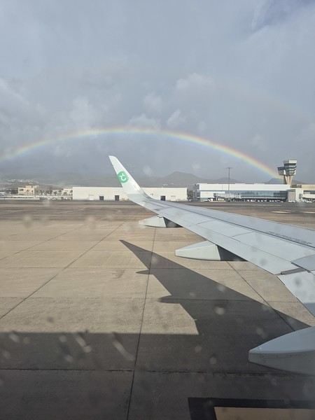
We quickly picked up our luggage and then the car at the Cicar counter. We got a Seat Arona instead of the Corsa we’d booked. Well, while the driving position didn’t feel great at first (I got used to it), the engine’s smoothness and power were much appreciated on the island’s winding and sometimes steep roads.
It was only 10 AM, and we couldn’t theoretically check into our accommodation until 3 PM (the owner promised to message me if it was ready earlier). So, we headed to the (big) *Jardín Botánico Viera y Clavijo*, where we planned to spend a few hours. We found a huge parking lot... empty. The passenger in the car in front of us (yes, we weren’t the only ones at the closed gate—there was a car in front and one behind) went to ask for info: it was closed due to the storm 😕. So, we calmly headed toward Puerto de las Nieves, on the northwest coast of the island.
The plan: go to a restaurant, visit the village, and do some shopping while waiting for early afternoon. As soon as we got out of the car, it started raining... we took shelter under the awning of a shop, waiting for it to pass. But the rain turned into a downpour, and within minutes, awning or not, Gore-Tex or not, we were soaked!
Since we were already wet, we might as well go to the restaurant—they weren’t far! But here’s the thing: contrary to what Google Maps said, they all opened at 1 PM, not noon! Back to the car, wading through 5 cm of water because all the village streets were flooded . The rain let up, we did some shopping, went to eat, and I got a message from the owner saying the accommodation was ready 🙂.
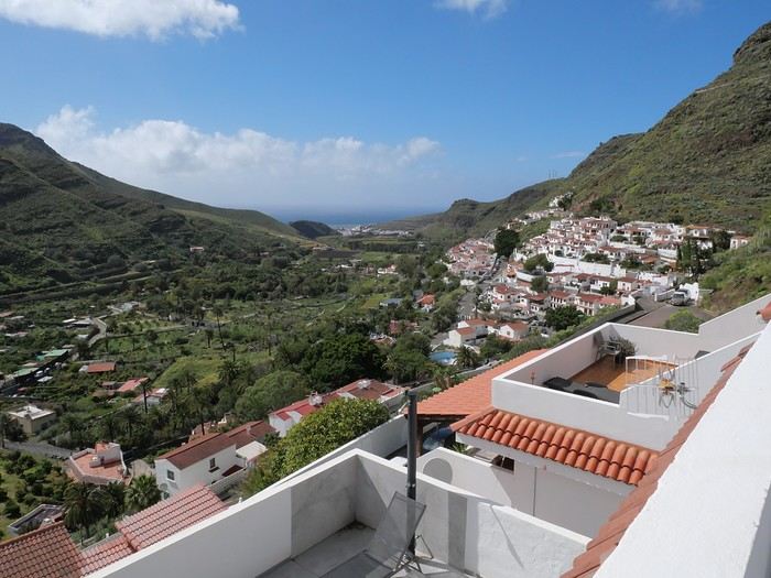
So, off we went to La Suerte, a few kilometers north of Agaete. The downside of the place, especially with luggage, is that you have to climb several flights of stairs via an outdoor staircase (after parking more or less far away on a steep street) to get there 😛). Of course, on the way from the car to the apartment, it started pouring again—the bags got soaked! Enough rain for today! We settled in quietly, and by late afternoon, we could (finally!) go admire the view from the terrace.
Every time we’ve been to the Canary Islands, it’s been by default (basically: where can we go in winter or early spring when we only have a week—so not too far, not too much jet lag, but with decent weather?).
This time, we had two weeks, but the winter plan kept changing: first Thailand (dropped for personal reasons), then Martinique (dropped because of work leave dates that weren’t up to me), and finally, the Canary Islands.
We’ve already been to Tenerife (which we really liked) and Lanzarote (which we liked a little less). This year, two options: Gran Canaria or one of the smaller islands west of Tenerife (La Palma, or even La Gomera or El Hierro). We chose Gran Canaria... not sure it was the right call! Whose fault is it? Storm Thérèse’s! Yes, Storm Thérèse followed us on arrival, and its effects lasted quite a while. We had to adapt, cancel visits, change activities...
But even without Thérèse...
Saturday 21/03 Departure from Orly at 6:10 AM with Transavia. The plane took off on time and landed a little early, tossed around by strong winds before touching down. It had just rained, but it was (almost) no longer raining.
We quickly picked up our luggage and then the car at the Cicar counter. We got a Seat Arona instead of the Corsa we’d booked. Well, while the driving position didn’t feel great at first (I got used to it), the engine’s smoothness and power were much appreciated on the island’s winding and sometimes steep roads.
It was only 10 AM, and we couldn’t theoretically check into our accommodation until 3 PM (the owner promised to message me if it was ready earlier). So, we headed to the (big) *Jardín Botánico Viera y Clavijo*, where we planned to spend a few hours. We found a huge parking lot... empty. The passenger in the car in front of us (yes, we weren’t the only ones at the closed gate—there was a car in front and one behind) went to ask for info: it was closed due to the storm 😕. So, we calmly headed toward Puerto de las Nieves, on the northwest coast of the island.
The plan: go to a restaurant, visit the village, and do some shopping while waiting for early afternoon. As soon as we got out of the car, it started raining... we took shelter under the awning of a shop, waiting for it to pass. But the rain turned into a downpour, and within minutes, awning or not, Gore-Tex or not, we were soaked!
Since we were already wet, we might as well go to the restaurant—they weren’t far! But here’s the thing: contrary to what Google Maps said, they all opened at 1 PM, not noon! Back to the car, wading through 5 cm of water because all the village streets were flooded . The rain let up, we did some shopping, went to eat, and I got a message from the owner saying the accommodation was ready 🙂.
So, off we went to La Suerte, a few kilometers north of Agaete. The downside of the place, especially with luggage, is that you have to climb several flights of stairs via an outdoor staircase (after parking more or less far away on a steep street) to get there 😛). Of course, on the way from the car to the apartment, it started pouring again—the bags got soaked! Enough rain for today! We settled in quietly, and by late afternoon, we could (finally!) go admire the view from the terrace.
Exploring Senja Island and the Lofoten Archipelago
Hi everyone,
We traveled to Norway in the summer of 2025, from July 17 to 29, to visit Senja Island and the Lofoten archipelago with a rental car. The common thread of these twelve days was clearly hiking, along with a few visits and experiences, and nights spent in a tent or in the car (which made it possible). We chose Narvik Airport for both arrival and departure for several complementary reasons: the desire to visit nearby Senja Island, slightly more affordable airfare, and finally, the rental price of the vehicle—especially the car model we were looking for. We only made one reservation, for the first campsite, as sleeping in a tent made things much easier. But we had the whole structure of the trip planned, a flexible outline that could adapt to the weather conditions we’d encounter. Senja Island isn’t part of the Lofoten archipelago, and during the early stages of planning this trip, we hadn’t planned to visit it. But its relative proximity to Narvik Airport and, above all, its unique geography definitely made us change our minds. We arrived in Evenes, where Narvik Airport is located, nearly 60 km from the city itself. Our first stop was 40 km further in Bjerkvik on the way to Senja, where there’s a Rema 1000 (a very common supermarket chain in Norway). We needed to buy some food and a gas cartridge for our stove. I’d emailed the store manager beforehand, who told me they didn’t sell them but that the two gas stations in the village were likely to have some in stock.
It was only at the Esso station that I found what I needed, but unfortunately, only one cartridge. Luckily, we quickly realized that most campsites (like in Iceland) have a shared kitchen with hotplates. That single small cartridge was just enough for the few nights we spent outside of campsites... We got our first taste of Norway’s characteristic landscapes: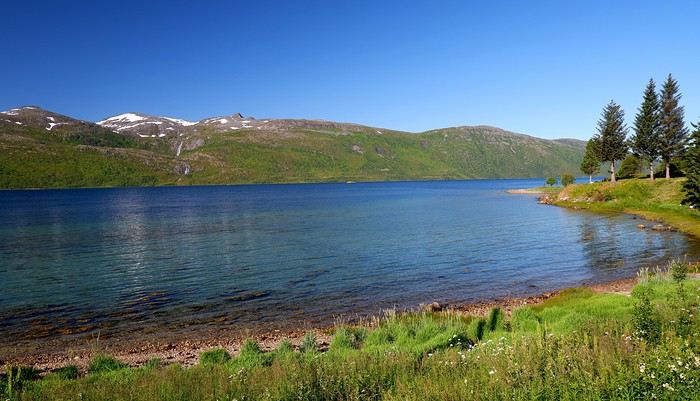
When we arrived at the Senja campsite, it was already 9:30 PM. A sign announced it was full, but luckily, I’d booked it 10 days earlier. By 10:30 PM, as we settled in to eat, it was still broad daylight, and the thermometer read 25°C—despite being at a latitude of 69° North! We went to bed around midnight, exhausted but under the light of a sun that was still very much present. Thanks to Earth’s tilted axis. We’d anticipated this by buying opaque sleep masks because, yes, at this time of year, it’s daylight all the time.
Friday, July 18:
Today, we planned two hikes on the island and a few stops along the way. The map clearly shows that the deepest fjords are in the north and west. Due to time and accessibility, we focused on the northern part of the island. Our first stop was at the viewing platform in Bergbotn:
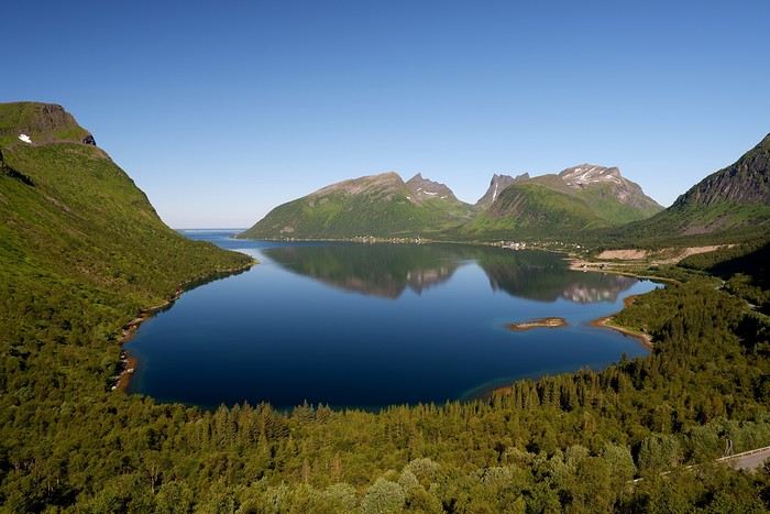
Then we headed toward Skaland, the starting point for our first hike. Along the way, we found plenty of reasons to stop—especially since, on this first day of travel, our thirst for Nordic landscapes was far from quenched.
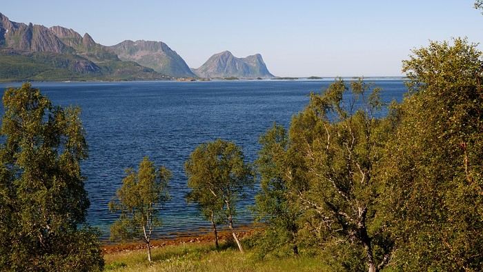
The town of Skaland is very practical: free parking, picnic tables for after the hike, and a Joker convenience store right next door. Our goal was the summit of Husfjellet: 670 m of elevation gain, between 8 and 9 km in length, and an estimated 4 hours and 30 minutes.
This hike offers two major viewpoints. The first overlooks the Bergsoyan islands to the west:
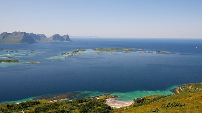
At the summit, the view shifts to the Steinfjorden fjord:
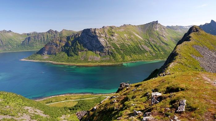
You can even clearly see the "Devil’s Teeth," which we’d see from below later:
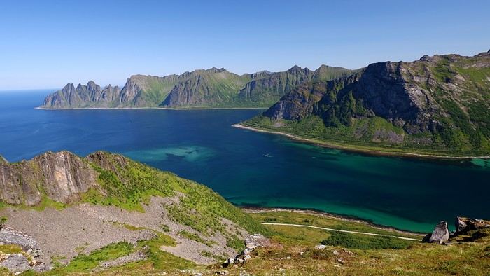
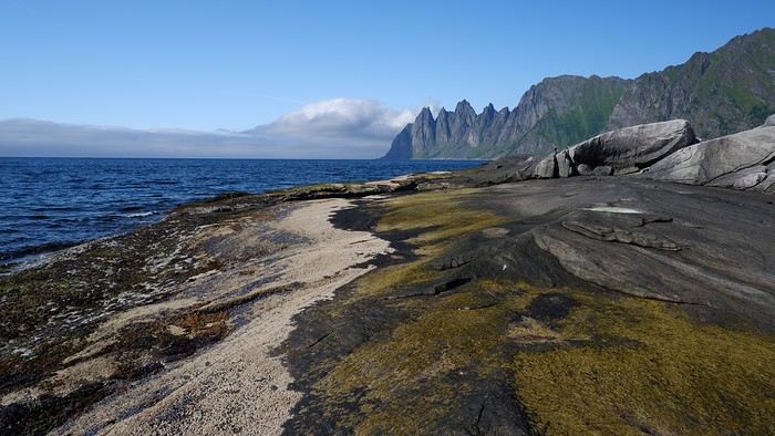
In total, the hike took us 4 hours and 30 minutes, including all the breaks. We treated ourselves to an ice cream in Skaland to recharge for the next hike. We hit the road again and stopped at Tungeneset to get a closer look at the Devil’s Teeth:
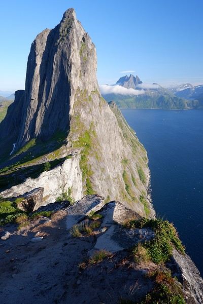
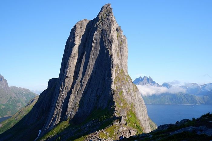
We continued to Fjordgard, the starting point for our second hike. Fjordgard isn’t very welcoming. There was a time when you could park right at the start of the hike up Mount Segla. Now, everything’s blocked off, and locals have even taken to blocking all possible parking spots nearby. You now have to park outside the town at a paid parking lot (90 NOK for 3 hours), adding an extra 2 km (round trip) of walking. Still, that was just a minor inconvenience because the hike that followed quickly made us forget all about it. The hike is fairly short (2 hours) but still has 520 m of elevation gain. This hike was a stark contrast to the first. This morning, we had sweeping views of the vast landscape. Here, Mount Segla, perched on the edge of the cliff, dominates the foreground:
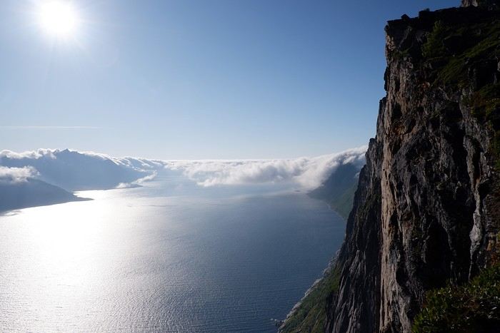
For those prone to vertigo, it might be best to stay at the foot of the mountain, as the trail climbs right along the cliff edge. And from that point on, you quickly understand what verticality really means...
In total, we took 2 hours and 50 minutes, including breaks and the extra walk to the parking lot. The day was already well underway, and with 1,200 m of cumulative elevation gain, it was time to find a spot to eat and sleep. Since we hadn’t made any reservations, we’d planned to bivouac for the night. We weren’t too picky—just practical—so we decided to sleep in the car at the parking lot for tomorrow morning’s hike, just 5 km from Fjordgard.
We traveled to Norway in the summer of 2025, from July 17 to 29, to visit Senja Island and the Lofoten archipelago with a rental car. The common thread of these twelve days was clearly hiking, along with a few visits and experiences, and nights spent in a tent or in the car (which made it possible). We chose Narvik Airport for both arrival and departure for several complementary reasons: the desire to visit nearby Senja Island, slightly more affordable airfare, and finally, the rental price of the vehicle—especially the car model we were looking for. We only made one reservation, for the first campsite, as sleeping in a tent made things much easier. But we had the whole structure of the trip planned, a flexible outline that could adapt to the weather conditions we’d encounter. Senja Island isn’t part of the Lofoten archipelago, and during the early stages of planning this trip, we hadn’t planned to visit it. But its relative proximity to Narvik Airport and, above all, its unique geography definitely made us change our minds. We arrived in Evenes, where Narvik Airport is located, nearly 60 km from the city itself. Our first stop was 40 km further in Bjerkvik on the way to Senja, where there’s a Rema 1000 (a very common supermarket chain in Norway). We needed to buy some food and a gas cartridge for our stove. I’d emailed the store manager beforehand, who told me they didn’t sell them but that the two gas stations in the village were likely to have some in stock.
It was only at the Esso station that I found what I needed, but unfortunately, only one cartridge. Luckily, we quickly realized that most campsites (like in Iceland) have a shared kitchen with hotplates. That single small cartridge was just enough for the few nights we spent outside of campsites... We got our first taste of Norway’s characteristic landscapes:
When we arrived at the Senja campsite, it was already 9:30 PM. A sign announced it was full, but luckily, I’d booked it 10 days earlier. By 10:30 PM, as we settled in to eat, it was still broad daylight, and the thermometer read 25°C—despite being at a latitude of 69° North! We went to bed around midnight, exhausted but under the light of a sun that was still very much present. Thanks to Earth’s tilted axis. We’d anticipated this by buying opaque sleep masks because, yes, at this time of year, it’s daylight all the time.
Friday, July 18:
Today, we planned two hikes on the island and a few stops along the way. The map clearly shows that the deepest fjords are in the north and west. Due to time and accessibility, we focused on the northern part of the island. Our first stop was at the viewing platform in Bergbotn:
Then we headed toward Skaland, the starting point for our first hike. Along the way, we found plenty of reasons to stop—especially since, on this first day of travel, our thirst for Nordic landscapes was far from quenched.
The town of Skaland is very practical: free parking, picnic tables for after the hike, and a Joker convenience store right next door. Our goal was the summit of Husfjellet: 670 m of elevation gain, between 8 and 9 km in length, and an estimated 4 hours and 30 minutes.
This hike offers two major viewpoints. The first overlooks the Bergsoyan islands to the west:
At the summit, the view shifts to the Steinfjorden fjord:
You can even clearly see the "Devil’s Teeth," which we’d see from below later:
In total, the hike took us 4 hours and 30 minutes, including all the breaks. We treated ourselves to an ice cream in Skaland to recharge for the next hike. We hit the road again and stopped at Tungeneset to get a closer look at the Devil’s Teeth:
We continued to Fjordgard, the starting point for our second hike. Fjordgard isn’t very welcoming. There was a time when you could park right at the start of the hike up Mount Segla. Now, everything’s blocked off, and locals have even taken to blocking all possible parking spots nearby. You now have to park outside the town at a paid parking lot (90 NOK for 3 hours), adding an extra 2 km (round trip) of walking. Still, that was just a minor inconvenience because the hike that followed quickly made us forget all about it. The hike is fairly short (2 hours) but still has 520 m of elevation gain. This hike was a stark contrast to the first. This morning, we had sweeping views of the vast landscape. Here, Mount Segla, perched on the edge of the cliff, dominates the foreground:
For those prone to vertigo, it might be best to stay at the foot of the mountain, as the trail climbs right along the cliff edge. And from that point on, you quickly understand what verticality really means...
In total, we took 2 hours and 50 minutes, including breaks and the extra walk to the parking lot. The day was already well underway, and with 1,200 m of cumulative elevation gain, it was time to find a spot to eat and sleep. Since we hadn’t made any reservations, we’d planned to bivouac for the night. We weren’t too picky—just practical—so we decided to sleep in the car at the parking lot for tomorrow morning’s hike, just 5 km from Fjordgard.
Questions about visiting Guatemala in 14 days
hi there,
we’re traveling as a couple to Guatemala from Feb 8 to 22. We’ve realized that given the distances, it feels a bit short. So, we’ve decided to limit ourselves to:
- Antigua: 3 nights (from Feb 8 to 11), including the arrival day - Lake Atitlán: from Feb 11 to 14 – 3 nights in San Juan La Laguna, including the morning trip from Antigua to Lake Atitlán - Chichicastenango: from Feb 14 to 15 – 1 night to attend the Sunday market and visit the cemetery
We have 7 days left that we’re not sure how to organize to cover: Flores – Tikal – El Remate, then head back to Guatemala City for our flight on Feb 22. Actually, I have a few questions: Do you think the time in Antigua and at the lake is enough? We might do the Pacaya Volcano, which is accessible for beginners, and that’s it. Should we spend a bit more time at these two spots: Antigua and the lake? If so, we’d have to skip the Chichicastenango market. We’re also thinking of leaving Chichicastenango to head to Flores, then staying overnight in El Remate. Does that seem doable in one day? We’ve noted that the trips are long, and since we don’t want to rush, we’ve reduced the number of accommodations. Even though we know we won’t see everything, we don’t want to miss the must-sees. We’re also wondering if we’ve planned the route in the right direction, or if we should head straight to Tikal when we arrive. Anyway, I know this is long, but we’re a bit lost. Thanks so much for your help! Annick
we’re traveling as a couple to Guatemala from Feb 8 to 22. We’ve realized that given the distances, it feels a bit short. So, we’ve decided to limit ourselves to:
- Antigua: 3 nights (from Feb 8 to 11), including the arrival day - Lake Atitlán: from Feb 11 to 14 – 3 nights in San Juan La Laguna, including the morning trip from Antigua to Lake Atitlán - Chichicastenango: from Feb 14 to 15 – 1 night to attend the Sunday market and visit the cemetery
We have 7 days left that we’re not sure how to organize to cover: Flores – Tikal – El Remate, then head back to Guatemala City for our flight on Feb 22. Actually, I have a few questions: Do you think the time in Antigua and at the lake is enough? We might do the Pacaya Volcano, which is accessible for beginners, and that’s it. Should we spend a bit more time at these two spots: Antigua and the lake? If so, we’d have to skip the Chichicastenango market. We’re also thinking of leaving Chichicastenango to head to Flores, then staying overnight in El Remate. Does that seem doable in one day? We’ve noted that the trips are long, and since we don’t want to rush, we’ve reduced the number of accommodations. Even though we know we won’t see everything, we don’t want to miss the must-sees. We’re also wondering if we’ve planned the route in the right direction, or if we should head straight to Tikal when we arrive. Anyway, I know this is long, but we’re a bit lost. Thanks so much for your help! Annick
Langtang – Trekking in the Rain
We did the Langtang trek (hike) from September 10th to 17th, with the first and last days being the trip from Kathmandu and back—so 6 days of actual walking. It’s a fairly well-known trek but certainly not as famous or crowded as those in the Annapurna or Everest regions, which is why we chose it.
In theory, it’s mandatory to have a guide for this trek. In reality, it seems there are ways to bypass the regulations: we met at least two people hiking without a guide—a South Korean, a New Zealander, and possibly also a couple of English women and an American couple, though we’re not sure if they had a guide.
The agency we booked with had told us it was an affordable trek for relatively older people in good shape—which is our case (I’m 72 myself). I have to say upfront that we found it quite challenging, maybe because we didn’t have good weather—it was the end of the monsoon season. To be clear, no matter your fitness level, I’d say doing this trek in the middle of the monsoon season would be suicidal.
Day 1 – Journey from Kathmandu to Syapru Besi
On Monday, September 8th, there had been violent protests in Kathmandu against the government, which had, among other things, blocked access to social media and been accused of nepotism and corruption. There were 19 deaths. The situation was very tense on the day of our departure, Wednesday the 10th. The agency warned us that public transport was very unreliable. So, we decided to take a jeep, at an additional cost of $100 ($160 minus what was already budgeted for the bus).
We left a little before 7 a.m. and it took us a good hour just to reach the outskirts of Kathmandu. Along the way, we saw several houses and vehicles set on fire by protesters.
The road to Syapru Besi is only 120 km, but it’s frankly awful. It’s always narrow, winds through endless mountains, and the shoulders range from bad to confusing to nonexistent. Several sections are just dirt tracks. We didn’t regret opting for the jeep, as we could stop several times at our convenience—if only to let Y (my Thai partner) throw up everything she had. She’d taken her usual motion sickness medication, but the constant turns, accelerations, and braking eventually made her terribly carsick.
In Nuwakot, we stopped for breakfast at a nice little restaurant, Jimbu. It was around 8:30 a.m., and we’d barely covered 60 km. The restaurant has a lovely garden overlooking the Trishuli Ganga, the river flowing down from Syapru Besi. First photo: the river in the bottom right corner, mist and clouds over the mountain on the other side.
An hour later, my second photo: the hills along the Trishuli Ganga. You can see the different crops—lush green rice paddies in the lower right and corn, already yellowed and likely harvested, in the foreground on the left. And of course, the mist and clouds through which you can glimpse the mountain on the other side of the river.
In theory, it’s mandatory to have a guide for this trek. In reality, it seems there are ways to bypass the regulations: we met at least two people hiking without a guide—a South Korean, a New Zealander, and possibly also a couple of English women and an American couple, though we’re not sure if they had a guide.
The agency we booked with had told us it was an affordable trek for relatively older people in good shape—which is our case (I’m 72 myself). I have to say upfront that we found it quite challenging, maybe because we didn’t have good weather—it was the end of the monsoon season. To be clear, no matter your fitness level, I’d say doing this trek in the middle of the monsoon season would be suicidal.
Day 1 – Journey from Kathmandu to Syapru Besi
On Monday, September 8th, there had been violent protests in Kathmandu against the government, which had, among other things, blocked access to social media and been accused of nepotism and corruption. There were 19 deaths. The situation was very tense on the day of our departure, Wednesday the 10th. The agency warned us that public transport was very unreliable. So, we decided to take a jeep, at an additional cost of $100 ($160 minus what was already budgeted for the bus).
We left a little before 7 a.m. and it took us a good hour just to reach the outskirts of Kathmandu. Along the way, we saw several houses and vehicles set on fire by protesters.
The road to Syapru Besi is only 120 km, but it’s frankly awful. It’s always narrow, winds through endless mountains, and the shoulders range from bad to confusing to nonexistent. Several sections are just dirt tracks. We didn’t regret opting for the jeep, as we could stop several times at our convenience—if only to let Y (my Thai partner) throw up everything she had. She’d taken her usual motion sickness medication, but the constant turns, accelerations, and braking eventually made her terribly carsick.
In Nuwakot, we stopped for breakfast at a nice little restaurant, Jimbu. It was around 8:30 a.m., and we’d barely covered 60 km. The restaurant has a lovely garden overlooking the Trishuli Ganga, the river flowing down from Syapru Besi. First photo: the river in the bottom right corner, mist and clouds over the mountain on the other side.
An hour later, my second photo: the hills along the Trishuli Ganga. You can see the different crops—lush green rice paddies in the lower right and corn, already yellowed and likely harvested, in the foreground on the left. And of course, the mist and clouds through which you can glimpse the mountain on the other side of the river.
Exploring Mongolia Independently
Hi,
We usually travel using local transportation. In Mongolia, that seems a bit complicated—has anyone tried this kind of trip there? Thanks.
A Scandinavian Tour - Summer 2025
Off on new adventures!!!
For my wife’s 60th birthday, I’m really making her happy. While I usually pick warm, sunny destinations, she’s more tempted by places where you don’t suffer from the heat.
So, it’s off to Norway!! A real challenge for me—a southern guy who’s as cold-sensitive as they come.
I keep telling anyone who’ll listen (well, just myself, really) that these aren’t the countries for me, that rain will be our travel companion, that we’ll have to face polar bears, navigate between icebergs, that there are still Vikings around, and all sorts of other things.
Of course, not wanting to make it easy, we’re driving from the Lyon area where we live.
Friends who’ve visited the country told us it’s pretty expensive to eat out (among other things), so we’re bringing supplies—especially enough for apéritifs the whole trip!!!
It’s not a camper van, but a "hotel-car" we’ll be doing! We’ll see how it goes!
As usual, I’ll try to narrate the journey with my two-cent comments, plus some little tips to avoid our mistakes—assuming I don’t lose any fingers to the cold!
Every night, I’ll count them to make sure I still have all ten! We’re not in *Ch’tis* territory but even farther Noooorth (as Galabru would say).
Note that I’m traveling with a synovial effusion in my knee! The old man’s not in great shape!!
Here we go!!
PS: As always, I’m a filmmaker, so I’ve made an effort with a few photos from my phone.
PS: As always, I’m a filmmaker, so I’ve made an effort with a few photos from my phone.
Tips for my second Japan trip itinerary
Hi everyone,
I’m planning to return to Japan for 15 days in April. This will be my second trip there. I’m starting to think about my itinerary.
I arrive in Tokyo in the evening and will spend one night there before taking the train to Hiroshima. I’ll stay in Hiroshima for 2 nights. Then, I’m heading to Kyoto (there are still so many beautiful things I want to see there), and I think I’ll stay for 3 nights. I also want to go back to Nara to visit the Pink Temple (probably in the morning before heading back to Kyoto).
And after that? I’d like to return to Hakone to try and catch a glimpse of Mount Fuji (I didn’t see it last time—it was cloudy). I’m thinking of staying one night there, probably in Odawara.
And then? I’ll head back to Tokyo and take the train to explore the surrounding areas and spend the day at some sites?
While in Tokyo, I want to visit Yokohama. I went to Kamakura last time and really loved it, but I don’t think I’ll go back.
I’ll end my trip in Tokyo, with my second-to-last night at the Muji Hotel and my last night near the airport.
That’s the plan so far—I’m open to your suggestions and itinerary tips!
Thanks in advance.
I’m planning to return to Japan for 15 days in April. This will be my second trip there. I’m starting to think about my itinerary.
I arrive in Tokyo in the evening and will spend one night there before taking the train to Hiroshima. I’ll stay in Hiroshima for 2 nights. Then, I’m heading to Kyoto (there are still so many beautiful things I want to see there), and I think I’ll stay for 3 nights. I also want to go back to Nara to visit the Pink Temple (probably in the morning before heading back to Kyoto).
And after that? I’d like to return to Hakone to try and catch a glimpse of Mount Fuji (I didn’t see it last time—it was cloudy). I’m thinking of staying one night there, probably in Odawara.
And then? I’ll head back to Tokyo and take the train to explore the surrounding areas and spend the day at some sites?
While in Tokyo, I want to visit Yokohama. I went to Kamakura last time and really loved it, but I don’t think I’ll go back.
I’ll end my trip in Tokyo, with my second-to-last night at the Muji Hotel and my last night near the airport.
That’s the plan so far—I’m open to your suggestions and itinerary tips!
Thanks in advance.
Kenya - January 2025 - Tsavo East - Tsavo West - Samburu - Meru NP - Aberdare NP
Hello everyone,
I’d like to invite you on a new adventure in Kenya.
Back in 2010, my husband Ben and I fell in love with Kenya, and we’ve been traveling there regularly ever since. This 2025 safari marked the first weeks of an important milestone in my life: retirement.
Of course, Felix—our guide and friend for all these years, whom some of you may even know from this forum—joined us again.
We chose an itinerary that takes us through the parks and reserves we particularly love in Kenya: Tsavo East (3 nights), Tsavo West (2 nights), a transition day in Embu, Samburu (5 nights), Meru NP (4 nights), Nanuyki to visit the Mount Kenya Animal Orphanage (https://mountkenyawildlifeconservancy.org/) (1 night), and Aberdare NP (2 nights).
This safari wasn’t our most prolific in terms of wildlife sightings and photos (all taken by Ben), but I still think it’s worth sharing our experiences and impressions of the places we visited. Maybe other travelers will find useful information here to help them fulfill their dream of a Kenyan safari one day...
Living in Brittany, we left from Nantes on Wednesday, January 8, 2025, on the 6 AM Air France flight to CDG, then took the direct flight to Nairobi at 10:50 AM. No issues this time on either flight (unlike in October 2023...).
We arrived in Nairobi at 9:20 PM local time (there’s a two-hour time difference with France at this time of year). Going through passport control and collecting our luggage went smoothly. The hotel shuttle (https://67airporthotel.co.ke/) was waiting for us. We shared it with a friendly Swiss couple who were there to climb Mount Kenya. We arrived at the hotel around midnight. The 67 Airport Hotel is 10-15 minutes from Jomo Kenyatta Airport and offers great value for money. Plus, it’s close to the Mombasa road, which is handy when heading that way the next morning.
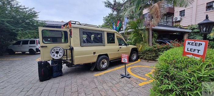
On Thursday, January 9, we had breakfast at the hotel restaurant at 6:30 AM, and as planned, Felix arrived around 7 AM. We got to check out his brand-new 4x4 Nissan—we’d be the first to test it! 🙂
We set off for Voi, making our usual stop in Mtito Andei. Traffic was heavy on the Mombasa road, with lots of trucks.
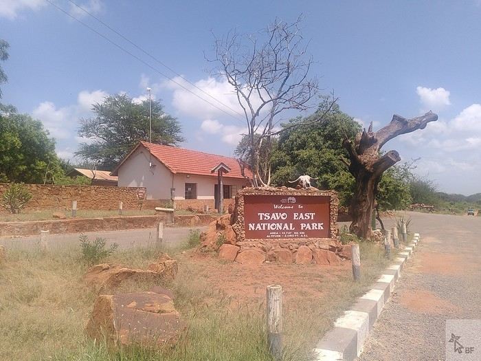
We arrived at the entrance of Tsavo East around 1 PM and made it to Sentrim Camp (https://www.sentrim-hotels.com/sentrim-tsavo.html) just in time for lunch.
We found Tsavo East unusually green—there had been heavy rains in December, which isn’t typical. As a result, the animals were scattered and harder to spot. The watering hole visible from the camp’s dining area was completely deserted, whereas it’s usually bustling with herds of elephants and other mammals.
Our tent, No. 9, for 3 nights.
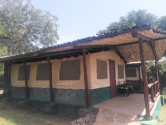
This camp is well-located inside the park. It’s simple but comfortable enough for our tastes, the staff is super friendly (as is often the case in Kenya), and the buffet-style meals are varied and good. Tsavo is the main destination for tourists staying on the coast who come for a night or two on safari. In January, some days at the camp are very quiet, while some evenings, the restaurant is packed with groups (lots of Italians, in particular).
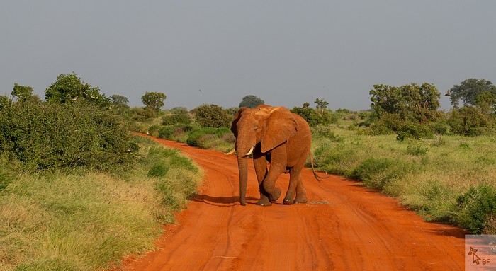
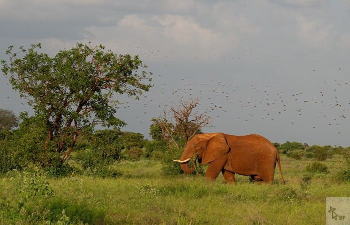
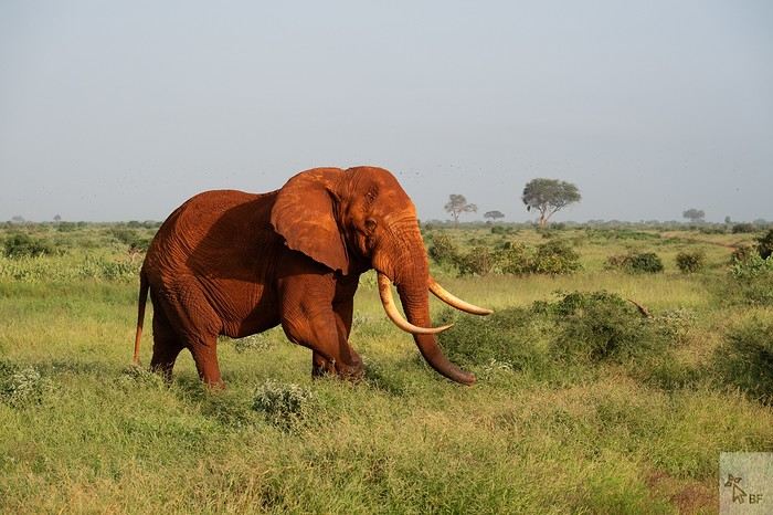
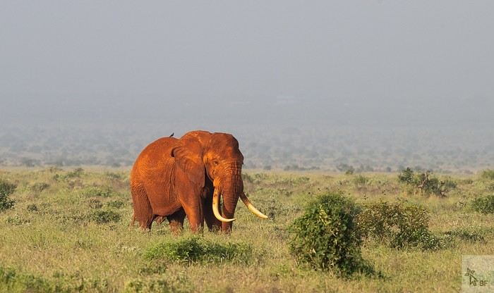
Tsavo is, of course, famous for its elephants. This time, we didn’t see many large herds, but we did have some great encounters with solitary males.
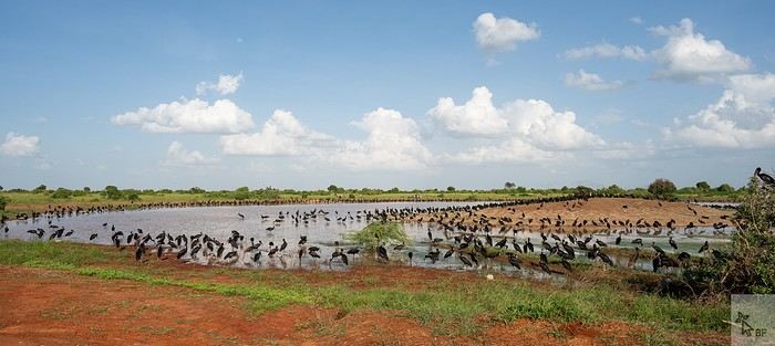
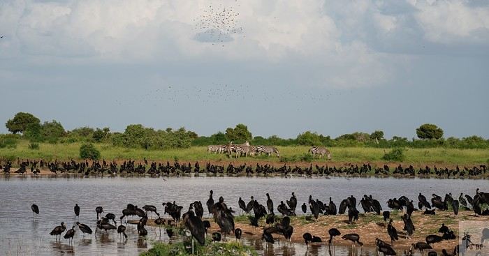
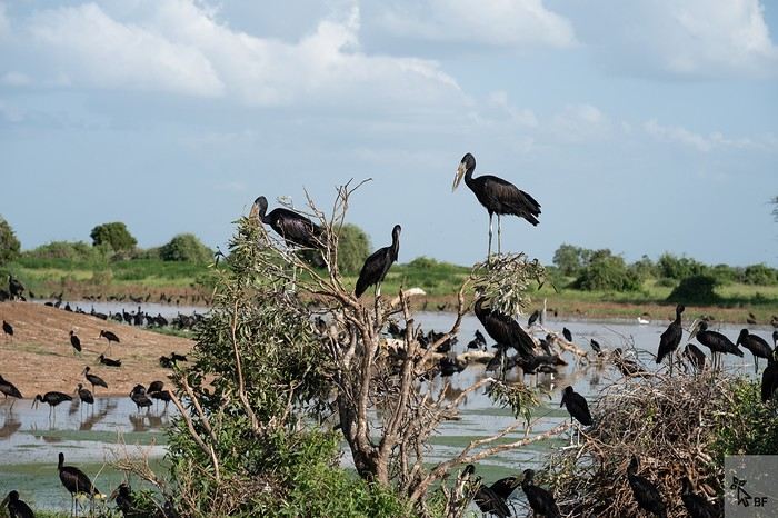
Around this small watering hole, we saw a gathering of African open-billed storks—we’d never seen so many before!
I’d like to invite you on a new adventure in Kenya.
Back in 2010, my husband Ben and I fell in love with Kenya, and we’ve been traveling there regularly ever since. This 2025 safari marked the first weeks of an important milestone in my life: retirement.
Of course, Felix—our guide and friend for all these years, whom some of you may even know from this forum—joined us again.
We chose an itinerary that takes us through the parks and reserves we particularly love in Kenya: Tsavo East (3 nights), Tsavo West (2 nights), a transition day in Embu, Samburu (5 nights), Meru NP (4 nights), Nanuyki to visit the Mount Kenya Animal Orphanage (https://mountkenyawildlifeconservancy.org/) (1 night), and Aberdare NP (2 nights).
This safari wasn’t our most prolific in terms of wildlife sightings and photos (all taken by Ben), but I still think it’s worth sharing our experiences and impressions of the places we visited. Maybe other travelers will find useful information here to help them fulfill their dream of a Kenyan safari one day...
Living in Brittany, we left from Nantes on Wednesday, January 8, 2025, on the 6 AM Air France flight to CDG, then took the direct flight to Nairobi at 10:50 AM. No issues this time on either flight (unlike in October 2023...).
We arrived in Nairobi at 9:20 PM local time (there’s a two-hour time difference with France at this time of year). Going through passport control and collecting our luggage went smoothly. The hotel shuttle (https://67airporthotel.co.ke/) was waiting for us. We shared it with a friendly Swiss couple who were there to climb Mount Kenya. We arrived at the hotel around midnight. The 67 Airport Hotel is 10-15 minutes from Jomo Kenyatta Airport and offers great value for money. Plus, it’s close to the Mombasa road, which is handy when heading that way the next morning.
On Thursday, January 9, we had breakfast at the hotel restaurant at 6:30 AM, and as planned, Felix arrived around 7 AM. We got to check out his brand-new 4x4 Nissan—we’d be the first to test it! 🙂
We set off for Voi, making our usual stop in Mtito Andei. Traffic was heavy on the Mombasa road, with lots of trucks.
We arrived at the entrance of Tsavo East around 1 PM and made it to Sentrim Camp (https://www.sentrim-hotels.com/sentrim-tsavo.html) just in time for lunch.
We found Tsavo East unusually green—there had been heavy rains in December, which isn’t typical. As a result, the animals were scattered and harder to spot. The watering hole visible from the camp’s dining area was completely deserted, whereas it’s usually bustling with herds of elephants and other mammals.
Our tent, No. 9, for 3 nights.
This camp is well-located inside the park. It’s simple but comfortable enough for our tastes, the staff is super friendly (as is often the case in Kenya), and the buffet-style meals are varied and good. Tsavo is the main destination for tourists staying on the coast who come for a night or two on safari. In January, some days at the camp are very quiet, while some evenings, the restaurant is packed with groups (lots of Italians, in particular).
Tsavo is, of course, famous for its elephants. This time, we didn’t see many large herds, but we did have some great encounters with solitary males.
Around this small watering hole, we saw a gathering of African open-billed storks—we’d never seen so many before!
Newfoundland - Hikes in the Eastern Part of the Island
The Eastern region is a landscape of protected coasts and bays, charming little fishing villages, exceptional scenic routes, and hiking trails in the heart of preserved habitats where many migratory bird species live, including puffins.
Stretching from Cape Bonavista in the north, where John Cabot landed in 1497, to Fortune and Grand Bank in the south, this part of Newfoundland was the first to be discovered and settled.
Visiting this region is like stepping back in time and discovering the cultural and artistic richness of this province, all at a more relaxed pace.
Source: https://www.exploretnl.ca/region-est
Videos are embedded throughout the summary. Please click on the image to start the video.
Bonavista Peninsula - Trinity - Gun Hill Trail Bonavista Peninsula - Trinity East - Skerwink Trail Bonavista Peninsula - Elliston - Puffin viewing site Bonavista Peninsula - Elliston - Spillars Cove (Cable John Cove) Bonavista - Dungeon Provincial Park Bonavista - John Cabot Municipal Park Bonavista Peninsula - Cape Bonavista Lighthouse St. Lawrence - Cape Chapeau Rouge Trail
Stretching from Cape Bonavista in the north, where John Cabot landed in 1497, to Fortune and Grand Bank in the south, this part of Newfoundland was the first to be discovered and settled.
Visiting this region is like stepping back in time and discovering the cultural and artistic richness of this province, all at a more relaxed pace.
Source: https://www.exploretnl.ca/region-est
Videos are embedded throughout the summary. Please click on the image to start the video.
Bonavista Peninsula - Trinity - Gun Hill Trail Bonavista Peninsula - Trinity East - Skerwink Trail Bonavista Peninsula - Elliston - Puffin viewing site Bonavista Peninsula - Elliston - Spillars Cove (Cable John Cove) Bonavista - Dungeon Provincial Park Bonavista - John Cabot Municipal Park Bonavista Peninsula - Cape Bonavista Lighthouse St. Lawrence - Cape Chapeau Rouge Trail
Bike Loop on the Petit Train du Nord (Quebec)
Hi there,
We’re leaving from Montreal and planning to bike the Petit Train du Nord route.
Any ideas for loops so we don’t have to return the same way?
We’re thinking of a one-week trip.
Thanks in advance for your tips!
Rachel
Recommendations for a safari agency in Tanzania
Hello,
I went on a safari from Arusha 20 years ago organized by a local agency called Sirocco, I think. It was fabulous (8 tourists, 2 4x4 vehicles, 1 driver, 1 guide, and a cook).
I’d love to find those same safari conditions again (immersion in simple conditions within the Serengeti, notably), but I’m struggling to find that kind of offer (lodges, tent camps, etc.).
Do you have any contacts?
Thanks
15-Day Scotland Road Trip in September
Hi there,
I’m planning a roughly 15-day trip to Scotland at the end of September/beginning of October for a road trip (meaning: renting a car and finding accommodations at strategic points).
There won’t be anything original in my itinerary—I’m discovering Scotland for the first time, so I’ll be visiting the most well-known spots.
I’d love to hear your thoughts and advice. I’m a bit worried about trying to do *too much* in 15 days—the idea is to enjoy myself and not rush or spend my days in the car.
Here are the places I was thinking of stopping to sleep, which gives an idea of the route I’d like to take:
Day 1: Arrival in Edinburgh in the evening Day 2: Day in Edinburgh Day 3: Edinburgh → Cairngorms Day 4: Cairngorms Day 5: Cairngorms → Inverness Day 6: Inverness → Torridon Day 7: Torridon → Plockton Day 8: Plockton → Isle of Skye Day 9: Isle of Skye Day 10: Isle of Skye Day 11: Isle of Skye → Glenfinnan Day 12: Glenfinnan → Trossachs Day 13: Trossachs → Glasgow Day 14: Glasgow → Edinburgh, departure early afternoon
I’m open to all feedback on the itinerary, especially from those who’ve already explored Scotland. Specifically about the stops/overnights—if there’s a better way to do it and if it’s doable without feeling too rushed. Thanks everyone! 🙂
Here are the places I was thinking of stopping to sleep, which gives an idea of the route I’d like to take:
Day 1: Arrival in Edinburgh in the evening Day 2: Day in Edinburgh Day 3: Edinburgh → Cairngorms Day 4: Cairngorms Day 5: Cairngorms → Inverness Day 6: Inverness → Torridon Day 7: Torridon → Plockton Day 8: Plockton → Isle of Skye Day 9: Isle of Skye Day 10: Isle of Skye Day 11: Isle of Skye → Glenfinnan Day 12: Glenfinnan → Trossachs Day 13: Trossachs → Glasgow Day 14: Glasgow → Edinburgh, departure early afternoon
I’m open to all feedback on the itinerary, especially from those who’ve already explored Scotland. Specifically about the stops/overnights—if there’s a better way to do it and if it’s doable without feeling too rushed. Thanks everyone! 🙂
Have you considered Reunion Island as a destination?
Reunion Island, a French island located in the Indian Ocean, is characterized by remarkable geographical and cultural diversity. This island offers an immersive experience that harmoniously blends wild nature and human heritage, between active volcanoes, mountainous cirques, impressive waterfalls, and charming villages. This report explores the must-see spots, from the lunar landscapes of Piton de la Fournaise to the mountainous trails of the Mafate cirque, not forgetting the natural pools and tropical gardens. Each section highlights a distinct aspect of this vibrant island, supported by geological and historical information, as well as accounts from those who have visited.
Piton de la Fournaise, which reaches a height of 2,632 meters, is one of the most active volcanoes on our planet. Its frequent eruptions constantly shape the landscape, offering a natural spectacle where burning lava meets the ocean. The trail leading to the Dolomieu crater, though difficult to access, is open to hikers and rewards them with a panorama of vast expanses of solidified lava and volcanic gas emissions. It’s usually best to visit at this time of day to avoid clouds and enjoy the low light that enhances the lunar reliefs.
Volcanic activity has also given rise to unique structures, such as the lava tunnels of Grand Brûlé, where tourists can walk along cooled lava flows. For geology enthusiasts, the site of Cassé de la Rivière de l'Est reveals incredible basaltic organ pipes, testifying to ancient eruptions.
Despite its inactivity, Piton des Neiges (3,071 m) remains the island’s highest peak. Its ascent, via the GR R2 trail, passes through virgin forests before reaching rocky landscapes where sunrise offers a 360° panoramic view of the three cirques. This extinct volcano symbolizes Reunion Island’s geological history, characterized by successive collapses that gave birth to the surrounding cirques.
A UNESCO World Heritage site, the Salazie cirque charms with its lush greenery and hamlets clinging to cliffs. Hell-Bourg, listed among France’s most beautiful villages, delights with its brightly colored Creole houses and picturesque cobblestone streets. The trek to Voile de la Mariée, a famous waterfall, winds through bamboo groves and natural pools perfect for a swim.
Mafate, a preserved haven of tranquility, is accessible only on foot or by helicopter. Places like La Nouvelle or Marla, small villages called "îlets," offer a glimpse into traditional life on Reunion Island. The GR R1 trail, which circles Piton des Neiges, immerses hikers in breathtaking landscapes, alternating between rocky ridges and narrow valleys.
Known for its lentils and wines, Cilaos combines culinary delights with stunning scenery. The healing properties of the thermal springs at Bras-Rouge are highlighted by the trails leading to them, which also offer panoramas like the Col du Taïbit, a privileged access point to Mafate.
This unique spot features pebble beaches, waterfalls by the sea, and a palm forest. Picnickers enjoy its peaceful atmosphere, while local fishermen maintain ancient traditions. Nearby, the Garden of Perfumes and Spices cultivates vanilla, cloves, and turmeric, offering an olfactory experience at the heart of Reunionese agriculture.
Bassin Boeuf, famous for its turquoise waters, is a popular swimming spot, framed by volcanic formations. Further south, the Langevin River creates a series of waterfalls and natural pools, including the famous Trou de Fer, a 300-meter-deep canyon where water cascades in a shimmering curtain.
The island’s capital blends colonial heritage with modernity. The Léon Dierx Museum showcases modern art, while the Grand Marché draws visitors with its spices and local crafts. The Barachois promenade, along the sea, evokes the city’s maritime past with its 18th-century cannons.
The Domaine de Villèle, once a colonial plantation, now houses a museum dedicated to the history of slavery and a geranium distillery. The Chapelle Pointue, with its neo-Gothic style, offers a striking contrast to the brightly colored Tamil temples surrounding it.
The GR R1 and R2 trails are popular with experienced hikers, but more accessible routes like the Piton Maido (2,200 m) are suitable for beginners. The latter offers an unparalleled view of the Mafate cirque at dawn.
The coast of Saint-Gilles offers activities like diving, surfing, and paddleboarding, while ULM flights provide an impressive aerial view of Piton de la Fournaise.
Reunion Island presents itself as a microcosm where every landscape tells a story—geological, cultural, or human. Between the fury of volcanoes and the calm of cirques, between the bustle of markets and the tranquility of natural pools, this destination offers a diverse experience. Travelers are encouraged to mix their activities: morning hikes, cultural visits during the day, and moments of relaxation at dusk. Preserving these wonders relies on responsible tourism, respectful of fragile ecosystems and local communities.
Piton de la Fournaise, which reaches a height of 2,632 meters, is one of the most active volcanoes on our planet. Its frequent eruptions constantly shape the landscape, offering a natural spectacle where burning lava meets the ocean. The trail leading to the Dolomieu crater, though difficult to access, is open to hikers and rewards them with a panorama of vast expanses of solidified lava and volcanic gas emissions. It’s usually best to visit at this time of day to avoid clouds and enjoy the low light that enhances the lunar reliefs.
Volcanic activity has also given rise to unique structures, such as the lava tunnels of Grand Brûlé, where tourists can walk along cooled lava flows. For geology enthusiasts, the site of Cassé de la Rivière de l'Est reveals incredible basaltic organ pipes, testifying to ancient eruptions.
Despite its inactivity, Piton des Neiges (3,071 m) remains the island’s highest peak. Its ascent, via the GR R2 trail, passes through virgin forests before reaching rocky landscapes where sunrise offers a 360° panoramic view of the three cirques. This extinct volcano symbolizes Reunion Island’s geological history, characterized by successive collapses that gave birth to the surrounding cirques.
A UNESCO World Heritage site, the Salazie cirque charms with its lush greenery and hamlets clinging to cliffs. Hell-Bourg, listed among France’s most beautiful villages, delights with its brightly colored Creole houses and picturesque cobblestone streets. The trek to Voile de la Mariée, a famous waterfall, winds through bamboo groves and natural pools perfect for a swim.
Mafate, a preserved haven of tranquility, is accessible only on foot or by helicopter. Places like La Nouvelle or Marla, small villages called "îlets," offer a glimpse into traditional life on Reunion Island. The GR R1 trail, which circles Piton des Neiges, immerses hikers in breathtaking landscapes, alternating between rocky ridges and narrow valleys.
Known for its lentils and wines, Cilaos combines culinary delights with stunning scenery. The healing properties of the thermal springs at Bras-Rouge are highlighted by the trails leading to them, which also offer panoramas like the Col du Taïbit, a privileged access point to Mafate.
This unique spot features pebble beaches, waterfalls by the sea, and a palm forest. Picnickers enjoy its peaceful atmosphere, while local fishermen maintain ancient traditions. Nearby, the Garden of Perfumes and Spices cultivates vanilla, cloves, and turmeric, offering an olfactory experience at the heart of Reunionese agriculture.
Bassin Boeuf, famous for its turquoise waters, is a popular swimming spot, framed by volcanic formations. Further south, the Langevin River creates a series of waterfalls and natural pools, including the famous Trou de Fer, a 300-meter-deep canyon where water cascades in a shimmering curtain.
The island’s capital blends colonial heritage with modernity. The Léon Dierx Museum showcases modern art, while the Grand Marché draws visitors with its spices and local crafts. The Barachois promenade, along the sea, evokes the city’s maritime past with its 18th-century cannons.
The Domaine de Villèle, once a colonial plantation, now houses a museum dedicated to the history of slavery and a geranium distillery. The Chapelle Pointue, with its neo-Gothic style, offers a striking contrast to the brightly colored Tamil temples surrounding it.
The GR R1 and R2 trails are popular with experienced hikers, but more accessible routes like the Piton Maido (2,200 m) are suitable for beginners. The latter offers an unparalleled view of the Mafate cirque at dawn.
The coast of Saint-Gilles offers activities like diving, surfing, and paddleboarding, while ULM flights provide an impressive aerial view of Piton de la Fournaise.
Reunion Island presents itself as a microcosm where every landscape tells a story—geological, cultural, or human. Between the fury of volcanoes and the calm of cirques, between the bustle of markets and the tranquility of natural pools, this destination offers a diverse experience. Travelers are encouraged to mix their activities: morning hikes, cultural visits during the day, and moments of relaxation at dusk. Preserving these wonders relies on responsible tourism, respectful of fragile ecosystems and local communities.