Results for "Tonnerre+|+127"
1053 results found.
New York en famille en avril 2006 English translation pending
Bonjour,
Bonjour
Nous envisageons un séjour à New York en avril 2006, avec nos enfants de 5 et 7 ans.
Nous avons plusieurs questions quant à ce voyage :
1. Quel est le climat à New York à cette période ? 2. Où loger (pas trop trop cher, mais pas excentré non plus) ? 3. Je crois qu'il est possible de faire, à partir de New York, des excursions aux chutes du Niagara. Quelqu'un peut me dire combien ça coûte, et combien de temps il faut pour aller d'une ville à une autre ? 4. Quelles activités privilégier avec les enfants ? 5. Existerait-il des logements de type "chez l'habitant" ?
Merci par avance pour vos réponses.
Laurence
Bonjour
Nous envisageons un séjour à New York en avril 2006, avec nos enfants de 5 et 7 ans.
Nous avons plusieurs questions quant à ce voyage :
1. Quel est le climat à New York à cette période ? 2. Où loger (pas trop trop cher, mais pas excentré non plus) ? 3. Je crois qu'il est possible de faire, à partir de New York, des excursions aux chutes du Niagara. Quelqu'un peut me dire combien ça coûte, et combien de temps il faut pour aller d'une ville à une autre ? 4. Quelles activités privilégier avec les enfants ? 5. Existerait-il des logements de type "chez l'habitant" ?
Merci par avance pour vos réponses.
Laurence
Logements en Ouzbekistan English translation pending
Bonjour,
je serai en OUzbekistan en juin-juillet (15 jours) et j'aimerais savoir si vous aviez quelques bonnes adresses à conseiller notamment à Tashkent, Boukhara, Samarkand, Khiva. Idéalement je recherche des petites pensions sympas (d'autant plus que je voyage seule ) ou des logements chez l'habitant et pas trop onéreux.
Merci à tous et à toutes pour vos infos. Si vous avez également des itinéraires à me conseiller je suis également preneuse. j'ai bien ma petite idée mais c'est toujours chouette d'avoir des impressions d'autres voyageurs...
Mudem
je serai en OUzbekistan en juin-juillet (15 jours) et j'aimerais savoir si vous aviez quelques bonnes adresses à conseiller notamment à Tashkent, Boukhara, Samarkand, Khiva. Idéalement je recherche des petites pensions sympas (d'autant plus que je voyage seule ) ou des logements chez l'habitant et pas trop onéreux.
Merci à tous et à toutes pour vos infos. Si vous avez également des itinéraires à me conseiller je suis également preneuse. j'ai bien ma petite idée mais c'est toujours chouette d'avoir des impressions d'autres voyageurs...
Mudem
Les freres Joubran, virtuoses du Oud venus de Palestine English translation pending
Si jamais les freres Joubran passent par chez vous, surtout ne ratez pas ce concert !!! 🙂
Je les ai vu Samedi et je dois dire que ce fut un grand concert, magique....
et pas seulement parceque je joue du oud, mes amis, connaissant peu la musique arabe ont été charmés..
Comment ne pas etre charmé par leur jeu, une extreme complicité entre ces 2 frères, ils jouent maintenant avec leur plus jeune frere, un trio de oud, du jamais vu, et ils ne cachent pas leur admiration pour le celebre trio John McLaughlin, Paco de Lucia et Aldi Meola.. ce qui se ressent quand ils jouent sur leur oud du flamenco... un superbe medley "Lamma bada & concerto d'arrranruez" proprement halucinant... (après tout comme le dit Samir, le oud est l'ancetre de la guitare, il faut le rappeler)
Virtuosité mais surtout émotion, quand Samir explique que la plus-part des morceaux ont été composés sous couvre-feu à Ramallah chez eux... il se plait à dire que son arme à lui face à l'occupant est son instrument de musique...
humour également quand ils se mettent à jouer à 2 sur un seul oud, Wissam main droite et son frere main gauche...😮 les gratteux comprendront la difficulté, surtout à une telle vitesse...🤪 Et quand on sait que c'est Wissam, luthier diplomé de l'academie de Cremone, qui a fabriqué leurs oud...

Leur album est excellent évidement mais je crois qu'il faut les voir en concert pour l'apprecier d'autant plus...
Comment ne pas etre charmé par leur jeu, une extreme complicité entre ces 2 frères, ils jouent maintenant avec leur plus jeune frere, un trio de oud, du jamais vu, et ils ne cachent pas leur admiration pour le celebre trio John McLaughlin, Paco de Lucia et Aldi Meola.. ce qui se ressent quand ils jouent sur leur oud du flamenco... un superbe medley "Lamma bada & concerto d'arrranruez" proprement halucinant... (après tout comme le dit Samir, le oud est l'ancetre de la guitare, il faut le rappeler)
Virtuosité mais surtout émotion, quand Samir explique que la plus-part des morceaux ont été composés sous couvre-feu à Ramallah chez eux... il se plait à dire que son arme à lui face à l'occupant est son instrument de musique...
humour également quand ils se mettent à jouer à 2 sur un seul oud, Wissam main droite et son frere main gauche...😮 les gratteux comprendront la difficulté, surtout à une telle vitesse...🤪 Et quand on sait que c'est Wissam, luthier diplomé de l'academie de Cremone, qui a fabriqué leurs oud...
Leur album est excellent évidement mais je crois qu'il faut les voir en concert pour l'apprecier d'autant plus...
URGENT! occidental allegro punta cana English translation pending
Nous partons 2 semaines en république dominicaine pour la 1ère fois à l'hotel occidental allegro punta cana.
Merci de bien vouloir me laisser vos appréciations sur cet hotel et sur punta cana en général.
bonne journée
Claude
Merci de bien vouloir me laisser vos appréciations sur cet hotel et sur punta cana en général.
bonne journée
Claude
Riu Bambu Punta Cana!!! English translation pending
Bonjour,
J, aimerais avoir des commentaires sur l'hotel Riu Bambu a Punta Cana ...je pense bien y aller la semaine du 1 Aout ou celle d'ensuite mais j'hésite encore un peu!
Je me demandais aussi quelle # de chambre est la mieu sur le site???!!!je souhaite aussi louer une voiture de l'aéroport ...a quelle distance de l'aéroport est le Riu Bambu???
merci vos infos serons m'aider bcp!
Kachama😉
J, aimerais avoir des commentaires sur l'hotel Riu Bambu a Punta Cana ...je pense bien y aller la semaine du 1 Aout ou celle d'ensuite mais j'hésite encore un peu!
Je me demandais aussi quelle # de chambre est la mieu sur le site???!!!je souhaite aussi louer une voiture de l'aéroport ...a quelle distance de l'aéroport est le Riu Bambu???
merci vos infos serons m'aider bcp!
Kachama😉
Budget et plages d'Espagne English translation pending
L'Espagne est un pays...et un sujet intéressant!
Est-ce que parmi nos amis voyageurs, il y en a qui y sont allé? et si oui.....a combien on peut s'attendre a payer pour un séjour de 3 semaines, par exemple? (je suis québécoise).
Quelles sont les plus belles villes a visiter....et quels sont les meilleurs mois pour profiter d'une belle température?
Comment sont les plages de la Costa Del Sol.....et peut-on s'attendre a voyager dans ce pays avec un forfait tout-inclus comme dans les îles???
Merci!
Diama
Est-ce que parmi nos amis voyageurs, il y en a qui y sont allé? et si oui.....a combien on peut s'attendre a payer pour un séjour de 3 semaines, par exemple? (je suis québécoise).
Quelles sont les plus belles villes a visiter....et quels sont les meilleurs mois pour profiter d'une belle température?
Comment sont les plages de la Costa Del Sol.....et peut-on s'attendre a voyager dans ce pays avec un forfait tout-inclus comme dans les îles???
Merci!
Diama
Ciné-Cinémas indiens English translation pending
L'Inde est le plus important producteur cinématographique au monde... Et les Indiens sont très friands de films made in Bollywood (Bombay et Hollywood). Au cours d'un séjour au Rajasthan en février 2000, nous étions accompagnés de notre jeune ami indien Sudhir, 25 ans (guide-ange gardien-conducteur de la petite Fiat qui nous a trimbalés durant quatre semaines). Son plus grand plaisir, c'était d'aller au ciné durant ses heures de repos... Cela faisait longtemps qu'on avait envie d'entrer dans une salle de cinéma indienne, et à Jaïpur, de grandes affiches en technicolor annonçaient un James Bond... "with a french girl" (Sophie Marceau) : tout pour plaire à notre Sudhir, pas vraiment notre tasse de thé, mais... pour lui faire plaisir... et pour goûter à l'ambiance locale : OK... !
Nous voici donc devant les grilles du Raj Mandhir ("le plus beau cinéma de l'Inde" selon le guide du Routard). Une foule énorme se presse à l'entrée : il y a une astuce pour éviter une trop longue attente aux guichets. Deux files : "Men" et "Women"... Et la file des ladies est nettement moins dense que celle des mecs... Je suis donc chargée d'acheter nos trois billets. Tout se déroule en douceur au milieu de mes voisines, alors que les gars sont agglutinés en paquets compacts devant leur guichet.
On pénètre enfin dans la salle : la plus belle de l'Inde, elle le fut certainement, il y a 40 ans de cela, lorsqu'elle a été construite par deux frères, fils de joailliers... Hélas, elle a maintenant triste allure, le plâtre se détache des murs, plaqués d'échafaudages en bambous et des lambeaux de toiles pendent du plafond. Les fauteuils sont à la limite de l'effondrement. Une foule bruyante et joyeuse a rapidement pris place. La majorité des spectateurs est composée d'hommes seuls, mais il y a aussi quelques familles avec de très jeunes enfants. Une maman assise devant moi allaite son bébé... On s'interpelle à grands cris et rires.
Le générique "The world is not enough" déclenche un délire de joie bruyante... La version est en hindi, sous-titrée en hindi (coucou Douya !) : "Comprenez-vous ?" s'inquiète Sudhir... Je le rassure, ça ne devrait pas être trop compliqué à suivre...
Entr'acte, évidemment, pour se délasser les jambes et échanger les premières impressions : "Avez-vous des salles de cinéma comme celle-ci en France" ?... demande mon voisin. Réponse positive : "La France est un pays moderne"... Ah...
Le public trépigne et glousse de satisfaction à chaque exploit de 007, se tortille à la vue de Sophie Marceau nonchalamment étendue sur un sofa, son corps dénudé et somptueux à peine voilé d'un paréo de soie... Les méchants ne sont pas ceux que l'on croyait, la belle Sophie est une traîtresse, super Pierce Brosnan punit et récompense ses comparses.
A peine le film terminé, les spectateurs se ruent vers les sorties étroites, comme s'il y avait le feu dans la salle. Ils s'écrasent et se bousculent dans une bonne humeur communicative. Etonnantes foules indiennes habituées aux magmats humains. Sudhir est enchanté... Son bonheur nous fait plaisir. Un beau dimanche se termine.
Nous voici donc devant les grilles du Raj Mandhir ("le plus beau cinéma de l'Inde" selon le guide du Routard). Une foule énorme se presse à l'entrée : il y a une astuce pour éviter une trop longue attente aux guichets. Deux files : "Men" et "Women"... Et la file des ladies est nettement moins dense que celle des mecs... Je suis donc chargée d'acheter nos trois billets. Tout se déroule en douceur au milieu de mes voisines, alors que les gars sont agglutinés en paquets compacts devant leur guichet.
On pénètre enfin dans la salle : la plus belle de l'Inde, elle le fut certainement, il y a 40 ans de cela, lorsqu'elle a été construite par deux frères, fils de joailliers... Hélas, elle a maintenant triste allure, le plâtre se détache des murs, plaqués d'échafaudages en bambous et des lambeaux de toiles pendent du plafond. Les fauteuils sont à la limite de l'effondrement. Une foule bruyante et joyeuse a rapidement pris place. La majorité des spectateurs est composée d'hommes seuls, mais il y a aussi quelques familles avec de très jeunes enfants. Une maman assise devant moi allaite son bébé... On s'interpelle à grands cris et rires.
Le générique "The world is not enough" déclenche un délire de joie bruyante... La version est en hindi, sous-titrée en hindi (coucou Douya !) : "Comprenez-vous ?" s'inquiète Sudhir... Je le rassure, ça ne devrait pas être trop compliqué à suivre...
Entr'acte, évidemment, pour se délasser les jambes et échanger les premières impressions : "Avez-vous des salles de cinéma comme celle-ci en France" ?... demande mon voisin. Réponse positive : "La France est un pays moderne"... Ah...
Le public trépigne et glousse de satisfaction à chaque exploit de 007, se tortille à la vue de Sophie Marceau nonchalamment étendue sur un sofa, son corps dénudé et somptueux à peine voilé d'un paréo de soie... Les méchants ne sont pas ceux que l'on croyait, la belle Sophie est une traîtresse, super Pierce Brosnan punit et récompense ses comparses.
A peine le film terminé, les spectateurs se ruent vers les sorties étroites, comme s'il y avait le feu dans la salle. Ils s'écrasent et se bousculent dans une bonne humeur communicative. Etonnantes foules indiennes habituées aux magmats humains. Sudhir est enchanté... Son bonheur nous fait plaisir. Un beau dimanche se termine.
Quel coin de Bretagne choisir pour l'été? English translation pending
Salut,
Je finis ma session en juin à Grenoble (France). Apres ca je voudrais m'installer en Bretagne pour l'été, me trouver un petit boulot, faire la fête et visiter ce coin de paradis. Par contre, je connais personne qui vient de là bas où qui y a travaillé.
J'aimerais des suggestions de villes et/ou villages qui sont bien là bas. Mes critères de sélections sont principalement: la beauté de la place, les possibilités d'emplois (restaurants, bars, qq chose ds le public), le logements assez facile et pas trop cher, biensûr l'ambiance chaleureuse, les festivals et les partys. J'ai regardé un peu sur internet mais je trouve que c'est pas tellement personnel. Ce serait vraiment nice de ta part de me donner de l'info!
Merci à l'avance
Je finis ma session en juin à Grenoble (France). Apres ca je voudrais m'installer en Bretagne pour l'été, me trouver un petit boulot, faire la fête et visiter ce coin de paradis. Par contre, je connais personne qui vient de là bas où qui y a travaillé.
J'aimerais des suggestions de villes et/ou villages qui sont bien là bas. Mes critères de sélections sont principalement: la beauté de la place, les possibilités d'emplois (restaurants, bars, qq chose ds le public), le logements assez facile et pas trop cher, biensûr l'ambiance chaleureuse, les festivals et les partys. J'ai regardé un peu sur internet mais je trouve que c'est pas tellement personnel. Ce serait vraiment nice de ta part de me donner de l'info!
Merci à l'avance
City trip à Rome (bis) English translation pending
City Trip à Rome (bis) – 09.03
… Nous avons eu raison de faire confiance à ces 2 pièces de monnaie, lancées par dessus nos épaules, assis dos à la fontana di Trevi, en 08.03 … L’une est censée réaliser un vœu et l’autre, signifie un retour à Rome (selon la tradition)😉
Nous sommes donc repartis, pour 3 jours dans cette merveilleuse capitale d’Italie (étant donné que nous avions du écourter notre premier séjour et que nous avions deux billets (trajet simple à écouler pour le 28.09 au plus tard) …
Dimanche 28.09.03
Cette fois, c’est dropés par un ami que nous rejoignons Zaventem, il est 5h30 quand nous arrivons à la plaine (terme souvent utilisé en Afrique pour désigner l’aéroport), Moins de monde cette fois, nous sommes dimanche et déjà (fort heureusement) en moins grande saison touristique.
Enregistrement de notre bagage et passage sans encombres, cette fois, sous le portique de contrôle.🙂 (je m’étais abstenue de remettre les chaussures qui m’avaient mis la 1ère fois en " infraction " contre la machine infernale qui fait " tuuut " à tout bout de champ).
Le décollage initial est prévu à 7h25 ( Vol Alitalia) …mais nous prendrons finalement notre envol à 8h10 (ignorant encore la raison de ce petit retard : le black out général sur Rome et l’ensemble du pays🤪).
Atterrissage vers 10h00 …C’est liftés via un bus, que nous rejoignons l’intérieur de l’aéroport. Une bonne heure d’attente pour la reprise de notre petit bagage. (mais aucun soucis pour nous …on est déjà en voyage😏). C’est là que nous apprenons que la ville est complètement privée d’électricité, depuis la veille au soir.
Une fois, notre packtage récupéré, on saute dans un taxi …direction le centre ville (les trains étant hors circuit). Une entrée dans le centre historique …légèrement perturbée, par le Black out général (plus aucun feux de signalisation ne fonctionnent et ça bouchonne pas mal ! C’est que c’est une ville qui draine pas mal de monde !)
Vers midi, on arrive à l’hôtel (International Palace, Via Nazionale) – mettons notre bagage à la consigne et sortons directement faire un tour …C’est dingue ! C’est comme si on ne l’avait, en fait, jamais quittée (elle = Rome) …on retrouve tous nos repères avec plaisir et aisance.😛
Premier rencard, on le consacre à cette fabuleuse fontaine (Trevi) qui nous a porté chance …éprouvant toujours la même lueur dans nos yeux et les mêmes frissons sur nos bras, à son contact. (petite particularité … elle est dépourvue de jets d’eau …forcément toute la ville fonctionne au rythme de la panne)
Après avoir profité pleinement de ce moment …On fait une petite halte dans une guinguette, déjà côtoyée, lors du 1er séjour. Une petite assiette de pâtes (al dente) fait l’affaire …Tout est occupé en terrasse, c’est donc à l’intérieur (dans une demi pénombre) que nous dégustons la bonne pasta …perdu au beau milieu d’un méga groupe de touristes japonais. Après quoi, nous rejoignons notre hôtel pour une bonne sieste.
En début de soirée …nous reprenons notre petite ballade au cœur de la ville, en passant à nouveau par la fontaine : point de départ de notre petite excursion vers le panthéon …pour rejoindre ensuite la Piazza Navona. Le ciel est assez chargé et gris …mais cela n’empêche pas la ville d’être trépidante et de se préparer à ce début de nuit.
C’est sur cette superbe place que nous décidons de terminer la soirée …avec un léger éclairage à la bougie … l’électricité, étant, quand à elle, aussi revenue.
Sous un petit parasol, en terrasse, on se protège de la pluie qui tombe à grosses gouttes et pendant que le tonnerre gronde et que le ciel se fait déchirer, avec une intense luminosité (Hé! Oui, encore elle !😉) on partage un excellent moment, avec un musicien de rue (c’est que lui aussi s’abrite) qui uniquement avec sa gratte (guitare) et sa voix, nous fait revivre de puissants moments musicaux ( Tels que Another brick in the Wall de – Pink Floyd).
C’est peu avant minuit, que l’on réintègre l’hôtel où nous prenons, un dernier verre avant de rejoindre nos pénates.
Lundi 29.09.03
Ce matin, le soleil nous fait grâce de sa sublime présence (à partir de maintenant et jusqu’à la fin du séjour …Ce sera Royal : 30°C et un ciel bleu azur)
Après, avoir avalé un copieux petit déj et un bon jus d’orange …On décide de se rendre à la Place Saint-Pierre (Vatican), que nous n’avons pas pu visiter lors de notre premier séjour. Commence alors, une recherche effrénée, dans les nombreux Tabashi (signalés avec un T) et échoppes de journaux sur rue, du coin …afin de dégoter deux billets (One day Ticket ) pour le bus. Toutes les boutiques en sont quasi dépourvues (rupture de stock) …C’est donc, du côté de la Piazza Venezia qu’on en trouvera. Même démarche, pour repérer le distributeur automatique (encore fonctionnel) …La plupart étant " Out " suite à la méga panne de courant qui a pénalisé la ville, toute entière.
Finalement, on embarque dans un Bus (n° 64, qui nous liftera jusqu’à de la Piazza San Pietro). Cette dernière est grandiose et immense. Elle est cernée de 2 arcs de colonnade, surmontés de statues de saints. Au centre :un obélisque (il y en a beaucoup sur les places romaines) et 2 somptueuses fontaines de part et d’autre de celui-ci. Au fond de la place se dresse la Basilica Di San Pietro.
Après avoir longuement flânés sur cette place, on se décide à aller explorer l’intérieur de la basilique. Après avoir intégrés la longue file ( …il y a un monde de dingue, c’était prévisible), montrés " patte blanche " au contrôle de sécurité. Petite précision (comme dans tout lieu de culte, une tenue correcte est exigée).
On porte notre choix sur la visite de la coupole et l’ascension au sommet de celle-ci qui permet la vue phénoménale, sur toute la ville.
Possibilité d’accéder au sommet (via ascenseur et ensuite 320 marches à gravir : 5 euro) : 1ère étape : la grande terrasse au pied de la coupole (après voir pris l’ascenseur) : c’est là qu’on saisit davantage l’importance du monument (Basilique) et que l’on peut déjà entrevoir la Place entre les statues gigantesques( des apôtres et du Christ) qui se dressent en front de terrasse. 2ème étape : l’intérieur de la Coupole (après une 20taines d’escaliers et un palier) : saisissant …La hauteur est vertigineuse et regarder le centre de la Basilique fout franchement le vertige …moi qui ne suis pas la " reine " du vide mais qui arrive à le regarder sans trop fléchir …là, j’avais les jambes vachement moins sûres, tout d’un coup !🤪 … C’est que de regarder à Pic …ça retourne …Un p’tit chouia, quand même.3ème étape (au terme des nombreuses marches) : la terrasse qui entoure le lanternon ( 120 m plus bas, la place Saint-Pierre et une vue imprenable sur la ville et ses monuments …)😄
C’est après cette immense scène de vie et de vue sur la capitale, que l’on a visité l’intérieur de la Basilique (211 m) . Elle renferme bien des œuvres (pavements, chefs d’œuvres de Michel-Ange, monuments funéraires, le baldaquin du Bernin …). Ceci dit, nous avons pour notre part été moins éblouis que par l’intérieur des Basiliques, cathédrales de Sienne ou Venise (mais cela reste une question de goûts, bien entendu).
Impossible de visiter la Chapelle Sixtine cet après midi (elle est " close ") … Bah ! les sculpturales œuvres de Michel-Ange, seront pour une prochaine fois.
Un peu plus loin, s’élève le Castel Sant’Angelo (d’aspect assez trapu, ce château est dominé par une statue d’ange (d’où le nom)) …Nous n’avons pas visité l’intérieur, préférant flâner sur le Pont Saint Ange (assez élégant, sur ses bords de nombreuses statues de Saints et d’anges) et observer la vie locale qui s’y déroulait (un tas de p’tits marchands locaux, exposent, leur marchandises, sur les étales qui jonchent le sol) …Sous le pont, s’écoule le Tibre.
C’est vers la fin de l’après midi que nous grimpons dans le bus (Express N°40), afin de rejoindre l’hôtel …avec comme perspective immédiate : une petite sieste.
19h30 … On remet le nez dehors …en quête d’une petite terrasse ou déguster une bonne pizza. On en dégotte une, au fond, d’une petite ruelle …Non loin de la fontaine de Trevi (ben ! oui …Quand on flashe, cela ne se commande pas !) …Il fait très agréable …La température est excellente et la ville …est un peu moins animée que la veille au soir …Cette petite pause et un peu de calme, nous font vraiment du bien.🙂
Ensuite …nous profitons encore de toute la beauté que cette ville peut offrir, flânons, encore et toujours, avant de regagner notre hôtel vers minuit. C’est que demain, la journée sera longue !
Mardi 30.09.03
Dernier jour de notre petit city trip, mais on compte bien en profiter un maximum !😛
Après un petit déj et avoir mis notre bagage à la consigne de l’hôtel…on se met en route : direction la piazza Venezia pour rejoindre, ensuite le Théâtre di Marcello (avec au devant le Temple d’Apollon Sosien, formé de 3 élégantes colonnes corinthiennes)
Un peu plus bas, se trouve la place de la Bocca de la Verita (sympathique petite placette avec les temples Olitorium et le forum Boarium ainsi qu’une jolie fontaine avec les tritons) …C’est à cet endroit précis, que l’on s’est posé longuement sur un banc …ne pensant à rien …sauf au plaisir d’être là ..😄
Ensuite, visite de la Chiesa di Santa Maria in Cosmedin, (assez élégante d’aspect extérieur - l’intérieur est fait de simplicité). Le véritable intérêt du lieu, réside à côtoyer la fameuse " Bocca della Verita ". Elle se situe, sous le portique de l’église et ressemble à un énorme médaillon en forme de visage avec une grande bouche creuse. La légende raconte que cette bouche happerait la main de quiconque aurait un mensonge sur la conscience. On dit aussi qu’on l’appelle ainsi car elle retient les secrets sans jamais les divulguer.
On repique ensuite un bus 44, pour rejoindre les alentours de la piazza Venezia (endroit très central) …un petit crunch, sur le pouce avant de se mettre en quête du bus qui nous liftera en direction des Thermes de Caracalla (situées, un peu en dehors de la ville) … finalement on dégote le bus N°628 (un peu bondé, comme la plupart des transports en commun de la ville, mais c’est cela aussi qui fait son charme)😊.
On passe devant le Circo Massimo, pour arriver aux Thermes … Elles sont grandioses ! Face à ces géantes, on se sent, infiniment petit. Possibilité d’admirer également des mosaïques au sol et des fragments de ces dernières.(Afin de protéger le patrimoine antique et culturel du lieu, l’intérieur est préservé par de hauts grillages, un peu dommage pour la vue, mais, l’on comprend que ce soit une mesure nécessaire ).
C’est dans le parc qui entoure les Thermes que l’on a pris le temps de savourer, encore et un peu de cette magie … avant de remonter dans les bus (628 ! et 64) pour regagner l’hôtel. Un dernier petit rafraîchissement en terrasse …reprise de notre bagage et direction aéroport de Rome Fiumicino. (l’on vient d’y tourner une séquence pour un prochain film (Hall de départ) …caméras, éclairages …sont en train d’être rembarqués !)
La suite logique du retour commence (qui nous paraît toujours moins plaisante, qu’à aller …cela va de soi !🤪😠) : Check in des bagages, avaliser le ticket retour (nous avions réservé via le net), passage sous le portique …
Embarquement : 20h10 et envol 20h40 (Vol Virgin Express : 39 euro le trajet/pers)
Atterrissage : 22h30 …Il fait nettement plus froid à Bruxelles …12°C ! Ravis de ce petit City Trip (façon "bis"😏) ...et déjà occupés à penser à nos prochains voyages ! 😉 ...J'espère, pouvoir, d'ici peu annexer à ce carnet, quelques photos ... Gene
… Nous avons eu raison de faire confiance à ces 2 pièces de monnaie, lancées par dessus nos épaules, assis dos à la fontana di Trevi, en 08.03 … L’une est censée réaliser un vœu et l’autre, signifie un retour à Rome (selon la tradition)😉
Nous sommes donc repartis, pour 3 jours dans cette merveilleuse capitale d’Italie (étant donné que nous avions du écourter notre premier séjour et que nous avions deux billets (trajet simple à écouler pour le 28.09 au plus tard) …
Dimanche 28.09.03
Cette fois, c’est dropés par un ami que nous rejoignons Zaventem, il est 5h30 quand nous arrivons à la plaine (terme souvent utilisé en Afrique pour désigner l’aéroport), Moins de monde cette fois, nous sommes dimanche et déjà (fort heureusement) en moins grande saison touristique.
Enregistrement de notre bagage et passage sans encombres, cette fois, sous le portique de contrôle.🙂 (je m’étais abstenue de remettre les chaussures qui m’avaient mis la 1ère fois en " infraction " contre la machine infernale qui fait " tuuut " à tout bout de champ).
Le décollage initial est prévu à 7h25 ( Vol Alitalia) …mais nous prendrons finalement notre envol à 8h10 (ignorant encore la raison de ce petit retard : le black out général sur Rome et l’ensemble du pays🤪).
Atterrissage vers 10h00 …C’est liftés via un bus, que nous rejoignons l’intérieur de l’aéroport. Une bonne heure d’attente pour la reprise de notre petit bagage. (mais aucun soucis pour nous …on est déjà en voyage😏). C’est là que nous apprenons que la ville est complètement privée d’électricité, depuis la veille au soir.
Une fois, notre packtage récupéré, on saute dans un taxi …direction le centre ville (les trains étant hors circuit). Une entrée dans le centre historique …légèrement perturbée, par le Black out général (plus aucun feux de signalisation ne fonctionnent et ça bouchonne pas mal ! C’est que c’est une ville qui draine pas mal de monde !)
Vers midi, on arrive à l’hôtel (International Palace, Via Nazionale) – mettons notre bagage à la consigne et sortons directement faire un tour …C’est dingue ! C’est comme si on ne l’avait, en fait, jamais quittée (elle = Rome) …on retrouve tous nos repères avec plaisir et aisance.😛
Premier rencard, on le consacre à cette fabuleuse fontaine (Trevi) qui nous a porté chance …éprouvant toujours la même lueur dans nos yeux et les mêmes frissons sur nos bras, à son contact. (petite particularité … elle est dépourvue de jets d’eau …forcément toute la ville fonctionne au rythme de la panne)
Après avoir profité pleinement de ce moment …On fait une petite halte dans une guinguette, déjà côtoyée, lors du 1er séjour. Une petite assiette de pâtes (al dente) fait l’affaire …Tout est occupé en terrasse, c’est donc à l’intérieur (dans une demi pénombre) que nous dégustons la bonne pasta …perdu au beau milieu d’un méga groupe de touristes japonais. Après quoi, nous rejoignons notre hôtel pour une bonne sieste.
En début de soirée …nous reprenons notre petite ballade au cœur de la ville, en passant à nouveau par la fontaine : point de départ de notre petite excursion vers le panthéon …pour rejoindre ensuite la Piazza Navona. Le ciel est assez chargé et gris …mais cela n’empêche pas la ville d’être trépidante et de se préparer à ce début de nuit.
C’est sur cette superbe place que nous décidons de terminer la soirée …avec un léger éclairage à la bougie … l’électricité, étant, quand à elle, aussi revenue.
Sous un petit parasol, en terrasse, on se protège de la pluie qui tombe à grosses gouttes et pendant que le tonnerre gronde et que le ciel se fait déchirer, avec une intense luminosité (Hé! Oui, encore elle !😉) on partage un excellent moment, avec un musicien de rue (c’est que lui aussi s’abrite) qui uniquement avec sa gratte (guitare) et sa voix, nous fait revivre de puissants moments musicaux ( Tels que Another brick in the Wall de – Pink Floyd).
C’est peu avant minuit, que l’on réintègre l’hôtel où nous prenons, un dernier verre avant de rejoindre nos pénates.
Lundi 29.09.03
Ce matin, le soleil nous fait grâce de sa sublime présence (à partir de maintenant et jusqu’à la fin du séjour …Ce sera Royal : 30°C et un ciel bleu azur)
Après, avoir avalé un copieux petit déj et un bon jus d’orange …On décide de se rendre à la Place Saint-Pierre (Vatican), que nous n’avons pas pu visiter lors de notre premier séjour. Commence alors, une recherche effrénée, dans les nombreux Tabashi (signalés avec un T) et échoppes de journaux sur rue, du coin …afin de dégoter deux billets (One day Ticket ) pour le bus. Toutes les boutiques en sont quasi dépourvues (rupture de stock) …C’est donc, du côté de la Piazza Venezia qu’on en trouvera. Même démarche, pour repérer le distributeur automatique (encore fonctionnel) …La plupart étant " Out " suite à la méga panne de courant qui a pénalisé la ville, toute entière.
Finalement, on embarque dans un Bus (n° 64, qui nous liftera jusqu’à de la Piazza San Pietro). Cette dernière est grandiose et immense. Elle est cernée de 2 arcs de colonnade, surmontés de statues de saints. Au centre :un obélisque (il y en a beaucoup sur les places romaines) et 2 somptueuses fontaines de part et d’autre de celui-ci. Au fond de la place se dresse la Basilica Di San Pietro.
Après avoir longuement flânés sur cette place, on se décide à aller explorer l’intérieur de la basilique. Après avoir intégrés la longue file ( …il y a un monde de dingue, c’était prévisible), montrés " patte blanche " au contrôle de sécurité. Petite précision (comme dans tout lieu de culte, une tenue correcte est exigée).
On porte notre choix sur la visite de la coupole et l’ascension au sommet de celle-ci qui permet la vue phénoménale, sur toute la ville.
Possibilité d’accéder au sommet (via ascenseur et ensuite 320 marches à gravir : 5 euro) : 1ère étape : la grande terrasse au pied de la coupole (après voir pris l’ascenseur) : c’est là qu’on saisit davantage l’importance du monument (Basilique) et que l’on peut déjà entrevoir la Place entre les statues gigantesques( des apôtres et du Christ) qui se dressent en front de terrasse. 2ème étape : l’intérieur de la Coupole (après une 20taines d’escaliers et un palier) : saisissant …La hauteur est vertigineuse et regarder le centre de la Basilique fout franchement le vertige …moi qui ne suis pas la " reine " du vide mais qui arrive à le regarder sans trop fléchir …là, j’avais les jambes vachement moins sûres, tout d’un coup !🤪 … C’est que de regarder à Pic …ça retourne …Un p’tit chouia, quand même.3ème étape (au terme des nombreuses marches) : la terrasse qui entoure le lanternon ( 120 m plus bas, la place Saint-Pierre et une vue imprenable sur la ville et ses monuments …)😄
C’est après cette immense scène de vie et de vue sur la capitale, que l’on a visité l’intérieur de la Basilique (211 m) . Elle renferme bien des œuvres (pavements, chefs d’œuvres de Michel-Ange, monuments funéraires, le baldaquin du Bernin …). Ceci dit, nous avons pour notre part été moins éblouis que par l’intérieur des Basiliques, cathédrales de Sienne ou Venise (mais cela reste une question de goûts, bien entendu).
Impossible de visiter la Chapelle Sixtine cet après midi (elle est " close ") … Bah ! les sculpturales œuvres de Michel-Ange, seront pour une prochaine fois.
Un peu plus loin, s’élève le Castel Sant’Angelo (d’aspect assez trapu, ce château est dominé par une statue d’ange (d’où le nom)) …Nous n’avons pas visité l’intérieur, préférant flâner sur le Pont Saint Ange (assez élégant, sur ses bords de nombreuses statues de Saints et d’anges) et observer la vie locale qui s’y déroulait (un tas de p’tits marchands locaux, exposent, leur marchandises, sur les étales qui jonchent le sol) …Sous le pont, s’écoule le Tibre.
C’est vers la fin de l’après midi que nous grimpons dans le bus (Express N°40), afin de rejoindre l’hôtel …avec comme perspective immédiate : une petite sieste.
19h30 … On remet le nez dehors …en quête d’une petite terrasse ou déguster une bonne pizza. On en dégotte une, au fond, d’une petite ruelle …Non loin de la fontaine de Trevi (ben ! oui …Quand on flashe, cela ne se commande pas !) …Il fait très agréable …La température est excellente et la ville …est un peu moins animée que la veille au soir …Cette petite pause et un peu de calme, nous font vraiment du bien.🙂
Ensuite …nous profitons encore de toute la beauté que cette ville peut offrir, flânons, encore et toujours, avant de regagner notre hôtel vers minuit. C’est que demain, la journée sera longue !
Mardi 30.09.03
Dernier jour de notre petit city trip, mais on compte bien en profiter un maximum !😛
Après un petit déj et avoir mis notre bagage à la consigne de l’hôtel…on se met en route : direction la piazza Venezia pour rejoindre, ensuite le Théâtre di Marcello (avec au devant le Temple d’Apollon Sosien, formé de 3 élégantes colonnes corinthiennes)
Un peu plus bas, se trouve la place de la Bocca de la Verita (sympathique petite placette avec les temples Olitorium et le forum Boarium ainsi qu’une jolie fontaine avec les tritons) …C’est à cet endroit précis, que l’on s’est posé longuement sur un banc …ne pensant à rien …sauf au plaisir d’être là ..😄
Ensuite, visite de la Chiesa di Santa Maria in Cosmedin, (assez élégante d’aspect extérieur - l’intérieur est fait de simplicité). Le véritable intérêt du lieu, réside à côtoyer la fameuse " Bocca della Verita ". Elle se situe, sous le portique de l’église et ressemble à un énorme médaillon en forme de visage avec une grande bouche creuse. La légende raconte que cette bouche happerait la main de quiconque aurait un mensonge sur la conscience. On dit aussi qu’on l’appelle ainsi car elle retient les secrets sans jamais les divulguer.
On repique ensuite un bus 44, pour rejoindre les alentours de la piazza Venezia (endroit très central) …un petit crunch, sur le pouce avant de se mettre en quête du bus qui nous liftera en direction des Thermes de Caracalla (situées, un peu en dehors de la ville) … finalement on dégote le bus N°628 (un peu bondé, comme la plupart des transports en commun de la ville, mais c’est cela aussi qui fait son charme)😊.
On passe devant le Circo Massimo, pour arriver aux Thermes … Elles sont grandioses ! Face à ces géantes, on se sent, infiniment petit. Possibilité d’admirer également des mosaïques au sol et des fragments de ces dernières.(Afin de protéger le patrimoine antique et culturel du lieu, l’intérieur est préservé par de hauts grillages, un peu dommage pour la vue, mais, l’on comprend que ce soit une mesure nécessaire ).
C’est dans le parc qui entoure les Thermes que l’on a pris le temps de savourer, encore et un peu de cette magie … avant de remonter dans les bus (628 ! et 64) pour regagner l’hôtel. Un dernier petit rafraîchissement en terrasse …reprise de notre bagage et direction aéroport de Rome Fiumicino. (l’on vient d’y tourner une séquence pour un prochain film (Hall de départ) …caméras, éclairages …sont en train d’être rembarqués !)
La suite logique du retour commence (qui nous paraît toujours moins plaisante, qu’à aller …cela va de soi !🤪😠) : Check in des bagages, avaliser le ticket retour (nous avions réservé via le net), passage sous le portique …
Embarquement : 20h10 et envol 20h40 (Vol Virgin Express : 39 euro le trajet/pers)
Atterrissage : 22h30 …Il fait nettement plus froid à Bruxelles …12°C ! Ravis de ce petit City Trip (façon "bis"😏) ...et déjà occupés à penser à nos prochains voyages ! 😉 ...J'espère, pouvoir, d'ici peu annexer à ce carnet, quelques photos ... Gene
Love at First Sight in Kenya
Hello,
After several years, I’ve finally decided to repost a travel journal on the forum. We returned a few weeks ago from an incredible trip to Kenya, and it’s reignited my desire to share our emotions in the face of these animals.
Kenya wasn’t originally a priority for us in terms of safari—we had the impression it was too touristy. So, we started with other destinations: Namibia, Tanzania, Botswana, and South Africa. But as I did more research, especially on the forum (thanks in part to Sylvie’s many trips), I eventually convinced myself that Kenya could be magnificent, as long as we chose our itinerary carefully and avoided peak seasons.
We ended up going in January, from the 17th to the 31st. We worked with a travel agency (TP) that crafted a custom itinerary for us: Samburu-Ol Pejeta-Naivasha-Maji Moto-Maasai Mara-Diani. They partnered with a local French-speaking agency, and everything was perfectly organized. Our trip exceeded all our expectations, and none of it would’ve been as amazing without our guide, Alfred. He accompanied us for 10 days and was a fantastic travel companion—professional, respectful of the animals, and always in good spirits. We formed a great bond with him in such a short time.
- **January 17th** After meeting up with Juliette and Charlotte in Rennes the night before, we left at 4 AM for Roissy Charles de Gaulle Airport. The thick fog made the drive pretty rough, but we arrived safely around 7:45 AM. A Blue Valet driver was waiting to take our car. Check-in went smoothly, and we waited patiently for our 10:40 AM flight. Unfortunately, despite boarding on time, a passenger was missing, and we had to find a replacement last minute. Then, another passenger who had checked in and dropped off their luggage wasn’t on the plane, so they had to unload their bags. After a long period of uncertainty and spotty communication from the crew, we finally took off over an hour late.
We arrived in Nairobi in the late afternoon, 45 minutes behind schedule. The administrative formalities were endless—it took nearly 1.5 hours from landing to leaving the airport with our luggage. When we stepped out, Alfred, our guide, was waiting with a big smile and drove us to the Eka Hotel, not far from the airport. Exhausted from the long journey, we fell asleep quickly.
- **January 18th** Alfred met us at 7 AM for a long drive to Samburu Reserve. We had a peaceful night, unlike the girls, who barely slept because their neighbors were talking loudly all night. Things even escalated when Charlotte started shouting insults to get them to quiet down, but it didn’t work.
It was Sunday, so traffic around Nairobi and along the route was light. Aside from a quick "technical stop," we drove straight through and arrived in Samburu after just under 6 hours. Because of the lower altitude (around 1,000m on average), it was hot—over 30°C in mid-January.
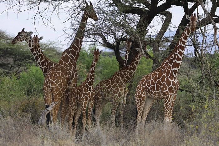
As soon as we entered the reserve, we spotted some impalas and quickly came across one of the region’s endemic species: the reticulated giraffe, which is absolutely stunning.
While heading to our camp for lunch, Alfred crossed paths with another vehicle and learned that a leopard was nearby. We started searching, and a few minutes later, Anny spotted a shape in a tree—it was our leopard!
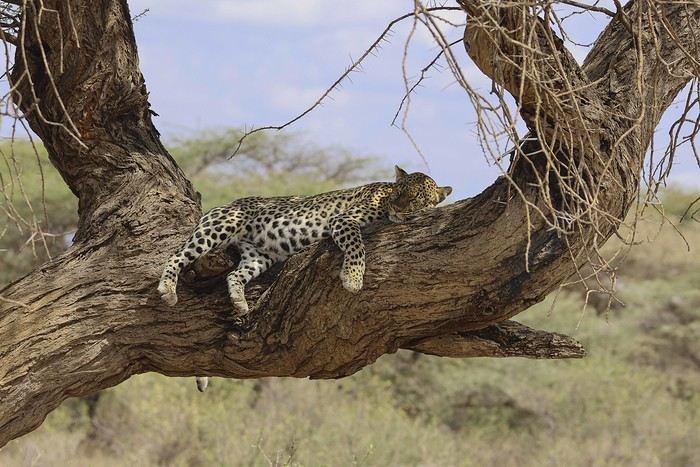
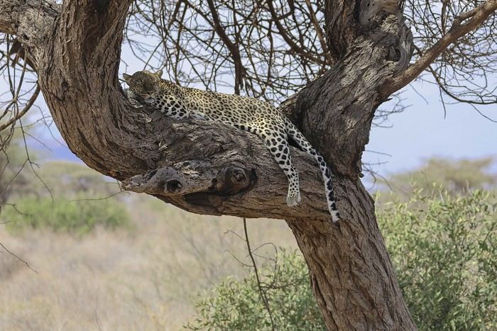
There were actually two of them—a mother and her adolescent. The young one was perched high in the tree, in the shade. We got to observe them for a good half-hour in excellent conditions, with just one other vehicle nearby.
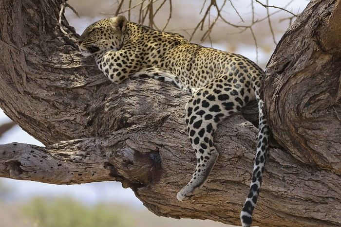
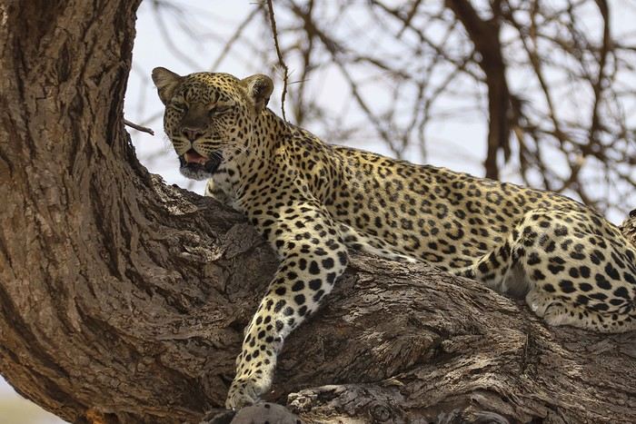
Alfred also noticed that the mother had hidden prey (a gerenuk gazelle) in the vegetation, away from prying eyes.
It was time to head to our camp, the Ashnil Samburu Camp, located in the Buffalo Springs area, by the river, in an idyllic setting surrounded by the region’s typical vegetation.
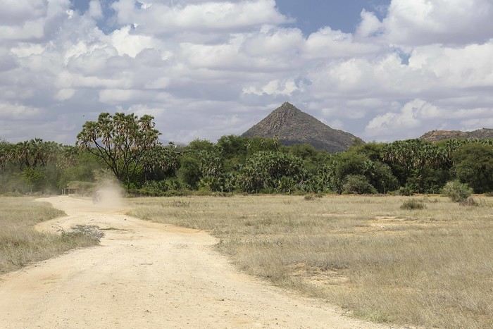
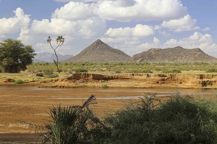
The welcome was fantastic—we immediately felt at home, and that feeling lasted throughout our 3-day stay in the reserve. It was 2 PM, but no one rushed us to the table. Our waitress, Sheila, who took care of us the whole time, was as lovely as the rest of the team. Barely seated, we were invited to watch an elephant passing right by the camp, in front of the restaurant. This trip was off to a great start!
After lunch, we relaxed by the pool. Monkeys, especially vervets, were everywhere, and a camp employee was assigned to keep an eye on them and shoo them away if needed (especially the baboons).
A little before 4 PM, we met up with Alfred for our first game drive. Just outside the camp, a few elephants were in the valley near the river.
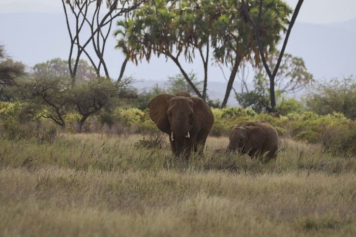
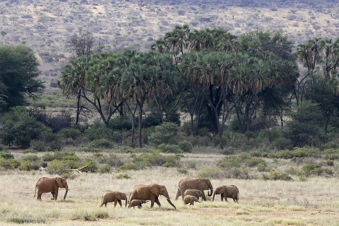
We’d see them in the same area almost every day. We also spotted some gazelles.
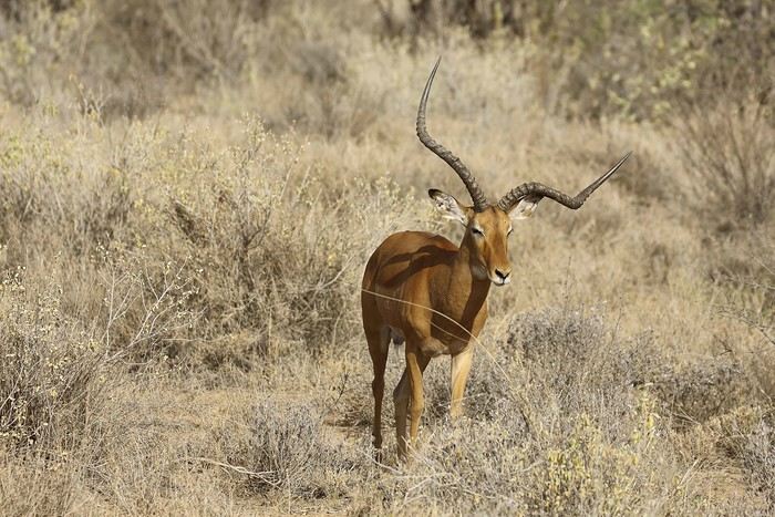
After several years, I’ve finally decided to repost a travel journal on the forum. We returned a few weeks ago from an incredible trip to Kenya, and it’s reignited my desire to share our emotions in the face of these animals.
Kenya wasn’t originally a priority for us in terms of safari—we had the impression it was too touristy. So, we started with other destinations: Namibia, Tanzania, Botswana, and South Africa. But as I did more research, especially on the forum (thanks in part to Sylvie’s many trips), I eventually convinced myself that Kenya could be magnificent, as long as we chose our itinerary carefully and avoided peak seasons.
We ended up going in January, from the 17th to the 31st. We worked with a travel agency (TP) that crafted a custom itinerary for us: Samburu-Ol Pejeta-Naivasha-Maji Moto-Maasai Mara-Diani. They partnered with a local French-speaking agency, and everything was perfectly organized. Our trip exceeded all our expectations, and none of it would’ve been as amazing without our guide, Alfred. He accompanied us for 10 days and was a fantastic travel companion—professional, respectful of the animals, and always in good spirits. We formed a great bond with him in such a short time.
- **January 17th** After meeting up with Juliette and Charlotte in Rennes the night before, we left at 4 AM for Roissy Charles de Gaulle Airport. The thick fog made the drive pretty rough, but we arrived safely around 7:45 AM. A Blue Valet driver was waiting to take our car. Check-in went smoothly, and we waited patiently for our 10:40 AM flight. Unfortunately, despite boarding on time, a passenger was missing, and we had to find a replacement last minute. Then, another passenger who had checked in and dropped off their luggage wasn’t on the plane, so they had to unload their bags. After a long period of uncertainty and spotty communication from the crew, we finally took off over an hour late.
We arrived in Nairobi in the late afternoon, 45 minutes behind schedule. The administrative formalities were endless—it took nearly 1.5 hours from landing to leaving the airport with our luggage. When we stepped out, Alfred, our guide, was waiting with a big smile and drove us to the Eka Hotel, not far from the airport. Exhausted from the long journey, we fell asleep quickly.
- **January 18th** Alfred met us at 7 AM for a long drive to Samburu Reserve. We had a peaceful night, unlike the girls, who barely slept because their neighbors were talking loudly all night. Things even escalated when Charlotte started shouting insults to get them to quiet down, but it didn’t work.
It was Sunday, so traffic around Nairobi and along the route was light. Aside from a quick "technical stop," we drove straight through and arrived in Samburu after just under 6 hours. Because of the lower altitude (around 1,000m on average), it was hot—over 30°C in mid-January.
As soon as we entered the reserve, we spotted some impalas and quickly came across one of the region’s endemic species: the reticulated giraffe, which is absolutely stunning.
While heading to our camp for lunch, Alfred crossed paths with another vehicle and learned that a leopard was nearby. We started searching, and a few minutes later, Anny spotted a shape in a tree—it was our leopard!
There were actually two of them—a mother and her adolescent. The young one was perched high in the tree, in the shade. We got to observe them for a good half-hour in excellent conditions, with just one other vehicle nearby.
Alfred also noticed that the mother had hidden prey (a gerenuk gazelle) in the vegetation, away from prying eyes.
It was time to head to our camp, the Ashnil Samburu Camp, located in the Buffalo Springs area, by the river, in an idyllic setting surrounded by the region’s typical vegetation.
The welcome was fantastic—we immediately felt at home, and that feeling lasted throughout our 3-day stay in the reserve. It was 2 PM, but no one rushed us to the table. Our waitress, Sheila, who took care of us the whole time, was as lovely as the rest of the team. Barely seated, we were invited to watch an elephant passing right by the camp, in front of the restaurant. This trip was off to a great start!
After lunch, we relaxed by the pool. Monkeys, especially vervets, were everywhere, and a camp employee was assigned to keep an eye on them and shoo them away if needed (especially the baboons).
A little before 4 PM, we met up with Alfred for our first game drive. Just outside the camp, a few elephants were in the valley near the river.
We’d see them in the same area almost every day. We also spotted some gazelles.
Costa Rica: The dry season isn't what it used to be!
Introduction:
For years, I’ve heard about Costa Rica, which seems like a country "made for me"—nature, not cities.
I almost went in 2019, but a family issue made me cancel.
Initially, I wanted to spend at least three weeks there, planning to go in our summer despite it being the rainy season. Then I realized what I wanted to do could fit into two weeks, so I ended up going in February.
Plus, January’s weather was so awful that some sunshine should do me good.
I found a flight at a decent price, but with two downsides.
The first is that it leaves from Paris CDG, and the second is that it’s with Air France—a airline I’d sworn off after my misadventures with them back in 2008. We’ll see how it goes!
Martine from DD in Arizona and New Mexico
Good evening everyone! 🙂
We’re back from our September 2025 road trip, this time to explore Arizona and New Mexico, and it’s time for me to start my travel journal—especially since everything’s already booked for another trip in September 2026 (to California), and I need to get started on the planning.
I was a little worried this new visit to Uncle Sam’s country might not be as "wow" as the others, but we still discovered some incredible places.
For those who don’t know us, we’re a couple in our seventies who speak very little English, but that didn’t stop us from fully enjoying our stay.
For this 6th road trip in the U.S., we spent 21 nights there, drove 4,160 km by car, and walked nearly 160 km in a loop starting from Phoenix.
We’d been to Arizona before (but not this side) and never to New Mexico. This whole road trip was a huge discovery for us.
In the prices mentioned (some in euros, others in dollars), bank fees and exchange charges are included. The flights, car rental, and parking were all paid for in December 2024 when we booked.
We’d downloaded the MPC (Mobile Passport Control) app, but there wasn’t a dedicated line at Phoenix Airport. Still, we got through quickly with friendly, smiling agents.
I don’t drive at all (I hate it), so the stops were chosen based on activities but also, for some, to limit daily mileage for the sole driver. The kilometers listed in the itinerary are the daily distances.
We traveled from September 9th to 22nd, unfortunately once again without our dear friends Mimi and Maumau.
The itinerary
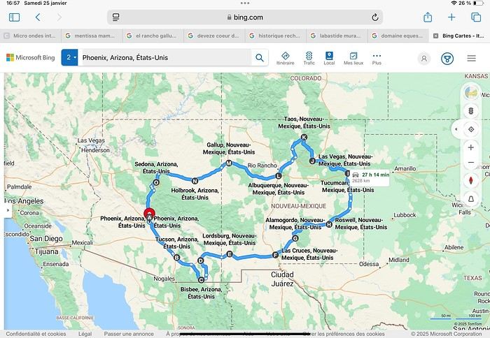
Day 1: Flight Marseille-Paris-Phoenix, then Gold Canyon (133 km) Day 2: Tucson (271 km) Lost Dutchman State Park Day 3: Tucson (155 km) Day 4: Tucson (34 km) Day 5: Bisbee (182 km) Day 6: Lordsburg (345 km) Day 7: Las Cruces (253 km) Day 8: Alamogordo (162 km) Day 9: Roswell (264 km) Day 10: Tucumcari (369 km) Day 11: Las Vegas (281 km) – the one in New Mexico Day 12: Taos (213 km) Day 13: Santa Fe (224 km) Day 14: Albuquerque (123 km) Day 15: Gallup (246 km) Day 16: Holbrook (224 km) Day 17: Flagstaff (179 km) Day 18: Sedona (118 km) Day 19: Sedona (48 km) Day 20: Sedona (41 km) Day 21: Phoenix (256 km) Day 22: Phoenix Airport (35 km)
📊 **Budget**: A little over 7,500 € for both of us, all included. The exchange rate was in our favor (1.17 dollars to 1 €). 📊 **Flights**: Marseille-Paris Charles de Gaulle-Phoenix: 1,787 € for two, with one checked bag each (Air France) 📊 **ESTA**: $42 📊 **America the Beautiful Pass**: $80 📊 **Parking**: 134 € (super eco at Marseille) 📊 **Car rental (Hertz)**: 865 €. Since there were no SUVs left in the reserved category (Nissan Rogue), we got an upgrade (4x4 Ford Explorer). We booked through Air France (15% discount). We’d originally reserved it in December for 1,140 €, but since prices dropped in March, we canceled and rebooked for 865 €. Hertz offers a free Hertz Gold Plus Rewards program, which gives you priority counter service when picking up the car. 📊 **Accommodation**: 2,400 € We stayed in hotels and motels of varying standards (from 60 to 203 € per night, depending on the city), all booked through Booking.com or Hotels.com. Out of 21 nights, only two didn’t include breakfast in the price. Booking.com sometimes offers slightly cheaper rates if you book by phone using the mobile app, and our Genius 3 status on the site also got us some preferential rates. 📊 **Supplementary insurance**: AVA 200 € for medical care if needed 📊 **Cash**: $2,078. We left with 1,000 € exchanged before departure and made two withdrawals of $500. This cash covered: - Evening restaurants and tips - Midday picnics - Gas: $298 for 4,160 km - Museum and private park entries (per person): - Lost Dutchman: $10 - Arizona-Sonora Desert Museum: $28 - Bird Cage Theater: $16 - Tombstone Shootout: $8 - New Mexico Farm & Ranch Museum: $12 - Roswell International UFO Museum: $5 - Billy the Kid Museum: $7 - Rancho de Taos: $22 - West Fork Oak Creek Trail entry: $15 We got a few discounts thanks to our senior age (+65). - Souvenirs and little treats
Like on our previous road trips, we didn’t rent a GPS. We got around using offline GPS apps Here WeGo and Organic Maps, with maps of the states we visited downloaded before we left (on our phones).
❤️❤️❤️ **Highlights** (there are so many!) 📍 Goldfield Ghost Town (even if it’s a reconstruction) 📍 The standing army of Saguaro cacti at Saguaro National Park West 📍 Diving into the cowboy universe of Tombstone 📍 The welcome from Rick and Henry at our guesthouse in Bisbee (Garden at Mile High Ranch) 📍 The tangled rocks of Chiricahua National Monument 📍 The flavored pistachios from Dwayne’s Fresh Jerky and Mac Ginnis Pistachioland 📍 Restaurants: La Posta (Las Cruces), Diner 66 (Albuquerque), and the Haunted Hamburger (Jerome) 📍 The old plazas of New Mexico 📍 The solitude and beauty of the white dunes at White Sands National Park 📍 Stepping back in time at the Billy the Kid Museum (Fort Stanton) 📍 Sections of historic Route 66 and the old motels of Tucumcari, especially at night when all the neon lights are on 📍 Taos Pueblo and diving into Native American culture 📍 After the Rio Grande Bridge, the descent via NM 567 to the very bottom of the Rio Grande Gorge, then the road along the riverbanks to Taos 📍 The tranquility of the Chimayo Sanctuary 📍 Discovering the ingenious native dwellings at Bandelier National Monument and Walnut Canyon National Park 📍 The small towns along the Turquoise Trail 📍 The red rocks of Red Rock Park and the Painted Desert 📍 The extraordinary colors of the petrified trees at Petrified Forest National Park 📍 Sedona, its red rocks, and the reward of the viewpoints at the end of hikes (Devil’s Bridge, The Subway, and West Fork Oak Creek) 📍 The immersion in Mexico when visiting Tlaquepaque 📍 The almost-ghost town of Jerome and its terraced streets 📍 The incredible kindness of Americans, always ready to help and up for a chat ❤️
☹️☹️☹️ **Flops** (there are very few) 📍 Several museums and churches being closed, so we couldn’t visit them 📍 Some museums and visitor centers opening late (10 AM) and closing early (4 PM) 📍 A 64 € phone roaming charge because we got near the Mexican border and picked up their cell tower 📍 The outrageous price ($5.99) for a gallon of gas at the Shell near Phoenix Airport
I hope this helps! Anyway, thanks for reading my long post. Don’t hesitate to reach out, even via PM, if you see I haven’t replied and you’d like more details. Have a great evening, everyone! 🙂
We’re back from our September 2025 road trip, this time to explore Arizona and New Mexico, and it’s time for me to start my travel journal—especially since everything’s already booked for another trip in September 2026 (to California), and I need to get started on the planning.
I was a little worried this new visit to Uncle Sam’s country might not be as "wow" as the others, but we still discovered some incredible places.
For those who don’t know us, we’re a couple in our seventies who speak very little English, but that didn’t stop us from fully enjoying our stay.
For this 6th road trip in the U.S., we spent 21 nights there, drove 4,160 km by car, and walked nearly 160 km in a loop starting from Phoenix.
We’d been to Arizona before (but not this side) and never to New Mexico. This whole road trip was a huge discovery for us.
In the prices mentioned (some in euros, others in dollars), bank fees and exchange charges are included. The flights, car rental, and parking were all paid for in December 2024 when we booked.
We’d downloaded the MPC (Mobile Passport Control) app, but there wasn’t a dedicated line at Phoenix Airport. Still, we got through quickly with friendly, smiling agents.
I don’t drive at all (I hate it), so the stops were chosen based on activities but also, for some, to limit daily mileage for the sole driver. The kilometers listed in the itinerary are the daily distances.
We traveled from September 9th to 22nd, unfortunately once again without our dear friends Mimi and Maumau.
The itinerary
Day 1: Flight Marseille-Paris-Phoenix, then Gold Canyon (133 km) Day 2: Tucson (271 km) Lost Dutchman State Park Day 3: Tucson (155 km) Day 4: Tucson (34 km) Day 5: Bisbee (182 km) Day 6: Lordsburg (345 km) Day 7: Las Cruces (253 km) Day 8: Alamogordo (162 km) Day 9: Roswell (264 km) Day 10: Tucumcari (369 km) Day 11: Las Vegas (281 km) – the one in New Mexico Day 12: Taos (213 km) Day 13: Santa Fe (224 km) Day 14: Albuquerque (123 km) Day 15: Gallup (246 km) Day 16: Holbrook (224 km) Day 17: Flagstaff (179 km) Day 18: Sedona (118 km) Day 19: Sedona (48 km) Day 20: Sedona (41 km) Day 21: Phoenix (256 km) Day 22: Phoenix Airport (35 km)
📊 **Budget**: A little over 7,500 € for both of us, all included. The exchange rate was in our favor (1.17 dollars to 1 €). 📊 **Flights**: Marseille-Paris Charles de Gaulle-Phoenix: 1,787 € for two, with one checked bag each (Air France) 📊 **ESTA**: $42 📊 **America the Beautiful Pass**: $80 📊 **Parking**: 134 € (super eco at Marseille) 📊 **Car rental (Hertz)**: 865 €. Since there were no SUVs left in the reserved category (Nissan Rogue), we got an upgrade (4x4 Ford Explorer). We booked through Air France (15% discount). We’d originally reserved it in December for 1,140 €, but since prices dropped in March, we canceled and rebooked for 865 €. Hertz offers a free Hertz Gold Plus Rewards program, which gives you priority counter service when picking up the car. 📊 **Accommodation**: 2,400 € We stayed in hotels and motels of varying standards (from 60 to 203 € per night, depending on the city), all booked through Booking.com or Hotels.com. Out of 21 nights, only two didn’t include breakfast in the price. Booking.com sometimes offers slightly cheaper rates if you book by phone using the mobile app, and our Genius 3 status on the site also got us some preferential rates. 📊 **Supplementary insurance**: AVA 200 € for medical care if needed 📊 **Cash**: $2,078. We left with 1,000 € exchanged before departure and made two withdrawals of $500. This cash covered: - Evening restaurants and tips - Midday picnics - Gas: $298 for 4,160 km - Museum and private park entries (per person): - Lost Dutchman: $10 - Arizona-Sonora Desert Museum: $28 - Bird Cage Theater: $16 - Tombstone Shootout: $8 - New Mexico Farm & Ranch Museum: $12 - Roswell International UFO Museum: $5 - Billy the Kid Museum: $7 - Rancho de Taos: $22 - West Fork Oak Creek Trail entry: $15 We got a few discounts thanks to our senior age (+65). - Souvenirs and little treats
Like on our previous road trips, we didn’t rent a GPS. We got around using offline GPS apps Here WeGo and Organic Maps, with maps of the states we visited downloaded before we left (on our phones).
❤️❤️❤️ **Highlights** (there are so many!) 📍 Goldfield Ghost Town (even if it’s a reconstruction) 📍 The standing army of Saguaro cacti at Saguaro National Park West 📍 Diving into the cowboy universe of Tombstone 📍 The welcome from Rick and Henry at our guesthouse in Bisbee (Garden at Mile High Ranch) 📍 The tangled rocks of Chiricahua National Monument 📍 The flavored pistachios from Dwayne’s Fresh Jerky and Mac Ginnis Pistachioland 📍 Restaurants: La Posta (Las Cruces), Diner 66 (Albuquerque), and the Haunted Hamburger (Jerome) 📍 The old plazas of New Mexico 📍 The solitude and beauty of the white dunes at White Sands National Park 📍 Stepping back in time at the Billy the Kid Museum (Fort Stanton) 📍 Sections of historic Route 66 and the old motels of Tucumcari, especially at night when all the neon lights are on 📍 Taos Pueblo and diving into Native American culture 📍 After the Rio Grande Bridge, the descent via NM 567 to the very bottom of the Rio Grande Gorge, then the road along the riverbanks to Taos 📍 The tranquility of the Chimayo Sanctuary 📍 Discovering the ingenious native dwellings at Bandelier National Monument and Walnut Canyon National Park 📍 The small towns along the Turquoise Trail 📍 The red rocks of Red Rock Park and the Painted Desert 📍 The extraordinary colors of the petrified trees at Petrified Forest National Park 📍 Sedona, its red rocks, and the reward of the viewpoints at the end of hikes (Devil’s Bridge, The Subway, and West Fork Oak Creek) 📍 The immersion in Mexico when visiting Tlaquepaque 📍 The almost-ghost town of Jerome and its terraced streets 📍 The incredible kindness of Americans, always ready to help and up for a chat ❤️
☹️☹️☹️ **Flops** (there are very few) 📍 Several museums and churches being closed, so we couldn’t visit them 📍 Some museums and visitor centers opening late (10 AM) and closing early (4 PM) 📍 A 64 € phone roaming charge because we got near the Mexican border and picked up their cell tower 📍 The outrageous price ($5.99) for a gallon of gas at the Shell near Phoenix Airport
I hope this helps! Anyway, thanks for reading my long post. Don’t hesitate to reach out, even via PM, if you see I haven’t replied and you’d like more details. Have a great evening, everyone! 🙂
Namibia Travel Journal: May 2025 - Trip Review
NAMIBIA TRIP 2025: April 24 to May 20: Feel free to comment or ask us any questions about this amazing journey.
>> Find all our photos and videos for each day on our website here: www.montagne-aventure.net
**DAY 1: Thursday, April 24, 2025: Outbound Flights from Lyon to Windhoek via Munich - Visit to Munich:**

Off we go on a new adventure. The alarm rings at 6:30 AM, the travel bags are packed, and we head to Lyon Airport. We booked our flight tickets with Lufthansa. The first leg to Munich, Germany, is operated by AirBaltic. Departure at 1:05 PM for a 1-hour and 20-minute flight. We arrive at 2:30 PM.
**We now have a 7-hour layover, so we take the opportunity to get some fresh air and explore Munich.** We quickly exit Terminal 2 of the airport and head towards the subway. We buy a group day ticket "Airport-city Day Zone M-5," valid for 2 to 5 people at a price of 30.50 € (instead of 16.30 € per person). We take the S8 line to **Marienplatz** in 35 minutes. **This is the heart of the city.** The weather is overcast, quite cool, but dry. Perfect for a little city trip between two flights while leaving our large luggage in transit at the airport. **Munich is the third-largest German city after Berlin and Hamburg, in the Bavaria region.** **The center has a lot of charm and brings together several religious buildings, easy to explore on foot.** We are impressed by the number of people enjoying these 100% pedestrian streets, which are very pleasant. After Marienplatz, the most famous square with the town hall, we head to the Cathedral of Our Lady, a Gothic church, then continue to **Karlsplatz** and move on to **the food market offering a wide selection of high-end food products in an atmosphere where a certain art of living prevails.** We also visit St. Peter's Church before grabbing a bite to eat. Two good hours were enough for this 10 km city walk. It's time to take the subway back: by 6:30 PM, we are back at the airport. Now, it's time for a bit of waiting and rest. Our second flight is scheduled for 9:35 PM for a 9-hour and 30-minute journey to our final destination in Namibia: **Windhoek.**
> Round-trip flight tickets with Lufthansa from Lyon: 2029 €, or 1,014.50 € per person.
> Lyon Airport parking: 120 €
> Today's expenses: 7 € for 2 pizzas in France / 14 € for the restaurant in Munich / 30.50 € for the daily subway ticket in Munich.
**DAY 2: Friday, April 25, 2024: Arrival in Windhoek, Visit to the Namibian Capital:**
After a 9-hour and 30-minute overnight flight with Discover Airlines, we finally land on Namibian soil just before 7:30 AM. The day is breaking, and the colors are already stunning. We are eager despite the usual fatigue from the flight. The airline was punctual, with friendly staff and good meals, though a bit light. We are the first flight of the day to land, with no more than 15 flights per day here, from 7 AM to 8 PM. We disembark on the tarmac at this airport located in the middle of nowhere, **I finally set foot on African soil for the first time.** We exit among the first from the aircraft to go through the long formalities at the front of the line, as the wait can quickly become endless. Allow at least 5 minutes per person for e-visas. We still wait 45 minutes despite only about twenty people ahead of us. Phew, it's done. We collect our luggage and then withdraw money from an ATM. We make 4 withdrawals of the maximum amount, 2000 NAD $ per withdrawal, for a total of 380 €, or 95.33 € per withdrawal.
Our driver arrives at the same time, perfect timing, we were quick.
We leave the airport at 8:45 AM. By 9:30 AM, we arrive at the **Gracious Whisp vehicle rental agency**, located at the entrance of Windhoek, small and human-sized with a fleet of recent vehicles. More formalities, then a short wait as our vehicle is not yet ready. Time to decompress, catch our breath, and enjoy the very pleasant morning temperature. Not a cloud in sight. Next, a briefing on the vehicle, always with a bit of apprehension due to our approximate English. Allow 45 minutes of explanations, including setting up the roof tent, camping equipment, technical information in case of a flat tire, driving tips in Namibia, and a tour of the 4x4. We have all the necessary equipment for camping: mattresses, sleeping bags, pillows, table, chairs, gas stove, BBQ grill... as well as 2 spare tires, a compressor, a dual tank, and accessories for removing wheels. Off we go, it's time to muster our courage and get behind the wheel. **Heading to SuperSpar Maerua**, fortunately located less than 10 minutes away. We park with the help of a parking attendant; it's very crowded, the space is narrow, but everything goes well despite the cursed right-hand drive. Today's new mission: stock up on groceries. The store is well-stocked with local and imported products, catering to all tastes. We spend 114 € on groceries, from pasta to meat, BBQ lighters to dishwashing products. Two people load our groceries into two carts and transfer them to our vehicle; we feel compelled to leave a tip, 50 NAD $, as we don't have change yet. Now, we head to the hotel, 15 minutes away. Traffic is difficult at a complicated intersection; this will likely be the only traffic jam in Namibia. **We arrive at Kate's Nest Guesthouse & Backpackers around 1:15 PM, quite tired.** We take some well-deserved rest at this recent establishment, quite calm with secure private parking. After a short nap, we enjoy the quiet by the hotel pool. Night falls between 6:30 PM and 7 PM. We eat quietly in our room tonight before starting this long 4x4 road trip in camping mode in the heart of Namibia.
> Today's grocery expenses: 114 € at Super Spar Marua (2395.21 NAD $).
> Round-trip flight tickets with Lufthansa from Lyon: 2029 €, or 1,014.50 € per person.
> Vehicle rental: 4x4 Toyota with roof tent for 24 days: Gracious Whisp Car Rentals: 2,638 € (N$50,640) or **1,319 €** per person - (https://gwcarrentals.com/)
> Distance driven today: 15 km.
> Accommodation: Kate's Nest Guesthouse & Backpackers - 4 Aristotles Street Academia, 9000 Windhoek - 36 € for two for one night.
> Windhoek International Airport website: (https://www.airports.com.na/)
**DAY 3: Saturday, April 26, 2025: Windhoek to Hardap: Mariental Region - Kalahari Desert:**
After a good, restful night, we wake up leisurely around 7 AM. We enjoy the comfort provided by this first and last hotel before 24 nights under the tent.
**We leave Kate's Nest Guesthouse at 8:30 AM to tackle the Namibian roads.** We quickly leave the capital; in just 30 minutes, we find ourselves almost alone in the world. The landscape is dotted with small domes. We leave the **paved B1** quickly to turn left onto the **C15**. **From there, we won't see more than 10 vehicles all day.** After passing through the few houses of **Lekkerwaterpoort**, we tackle our first gravel road. These road sections are limited to 100 km/h, but even at 70 km/h, I find it already challenging. However, I quickly get used to it and gradually pick up speed to reach my cruising speed of around 80 to 90 km/h. **We are on immense straight lines crossing wild expanses as far as the eye can see.** **We come across two baboons, a few ostriches, and numerous cattle and sheep farms.** We pass through the charming village of **Uhlenhorst** with its typical houses and children with broad smiles waving at us. Life here is already very different from Windhoek. **The thermometer rises quickly from 16°C at 8:30 AM to over 28°C in the early afternoon.**
**We arrive at the Hardap Dam reserve at 2 PM.** We stop at the toll booth at the park entrance to pay the entrance fee: 250 NAD $ for 2 people and 1 vehicle. We continue to the dam and then the camp entrance, located a bit further. We had booked in advance, but this place remains little frequented by foreigners.
We take advantage of the hottest hours to rest by the large pool overlooking the immense lake, a very enjoyable moment. Would this be a bit of a vacation?
Around 4:30 PM, we head to the campsite. We overlook this vast water reserve. We arrive first; we will be only 3 vehicles spending the night here. It's time to get to work and set up our equipment for the first time. It takes us a good 20 minutes to set everything up, with a slight apprehension about unfolding the tent. Once this task is done, which we will have to repeat for almost a month, we will become much more efficient over time. Time for rest and contemplation in total silence. The sun gradually sets, and the heat quickly becomes bearable again. Bliss! **This dam is located 20 km northwest of Mariental in an area dotted with conical hills topped with dolerite buttons (Hardap means "hillock" in Nama). It captures the Fish River, which flows south, creating a large lake in the middle of an arid environment. The contrast is striking.** We enjoy our first sunset facing this 360° otherworldly landscape.
Around 7 PM, we start our first BBQ, or "braai" as it's called here. The temperature is perfect. The sun sets, giving way to a star-filled sky of incredible beauty thanks to the absence of any light pollution. The Milky Way will lull us throughout the evening. After some good sausages and potatoes on the BBQ, we head to our roof tent around 9:30 PM with a complete change of scenery in just 24 hours. France already seems so far away...
This campsite has shared showers and toilets, quite clean and functional, as well as a central area with several BBQs and tables. The sites are arranged in a semicircle, each with an electrical outlet. The sites are close to each other but spacious, some slightly shaded. We are only three vehicles tonight, so it's perfectly comfortable and quiet. Not to mention the large pool near the restaurant. Our trip is off to a great start.
> Today's road itinerary: Windhoek > Head south on the B1 to Rehoboth > Turn left onto the C25 then C15 to Stampriet > C20 to Hardap > Full north on the B1 > Then turn left onto the M93 - 5 hours of driving.
> Distance driven today: 354 km.
> Accommodation: Hardap Recreation Resort - 23.3 € for two - Large pool - GR6W+3M2, Hardap Game Reserve, Mariental, Namibia - (http://www.nwr.com.na/resorts/hardap-resort/)
**DAY 4: Sunday, April 27, 2025: Hardap - Brukkaros Volcano - Keetmanshoop - Quivertree Forest Rest Camp**
Our first night under the tent was very pleasant; the little wind quickly calmed down, giving way to absolute silence. The mattress is decent, more comfortable than some nights in Nepal. The length and width give us enough space for maximum comfort, despite my height (1.91 m). We wake up a little before 7 AM as the sun rises, and the lights dazzle us from the start of the day. We pack up the equipment in 30 minutes, quite easily. Then we enjoy the sun, which warms up quickly while we keep our light fleece on.
At 8:30 AM, **we hit the road again, heading south** to our first stop in **Mariental**. We want to do some shopping at SuperSpar, but once we arrive in the parking lot, a young local is fighting with the supermarket security guards and then threatens to throw stones. We don't want to take any risks right at the start, so despite the baton blows he receives, he doesn't stop. We leave empty-handed but fill up with fuel at the Shell station 1 km further. The price per liter is 21.33 NAD $, we fill our 107-liter tank for 107 €. In Namibia, you get served, and they bring the card machine to the window to pay. It's then customary to leave a tip.
We then take the B1 heading due south on a recently renovated road. Around 11:30 AM, we leave it on our right to take **a wild gravel road, the M98**. Just before **Berseba**, we turn right onto a small track, the **D3904 towards Brukkaros Crater up to a camp at 1588 m altitude**. The track then becomes too bumpy. We stop on the counter-slopes where **a wide panorama unfolds over these immense plains as far as the eye can see**. It's 12:15 PM, time for us to eat a rice and tuna salad facing this landscape.
**We are alone in the world until a vehicle arrives and parks next to us.** A bit of apprehension, 4 men head towards us. It turns out to be 4 shepherds looking for a lost foal. The conversation is pleasant, lost in the middle of nowhere. We find ourselves alone again in this absolute silence. **The heat becomes stifling with a good 30°C**. We get back on the road around 1 PM. Back on the B1, **we continue due south to Keetmanshoop**, which we reach around 3 PM. We stop there to do some shopping for 262 NAD $ (12 eggs, a can of tuna, a can of corn, bread, a soda, and a 5-liter water container), or 12.48 €. Two quite insistent children ask us for money or candy at the store exit, yet we give them a small tip, but they continue to cling to the car. Locals parked next to us tell them to leave us alone. Anyway, we finish the trip to **Quivertree Forest**, 15 km away. We will spend the night in this **pleasant farm run by a German**. Upon arrival, as the day before, and as I suppose in the future, we dive straight into the cool pool to relax after all these kilometers. A bliss. Then we take our 4x4 and choose a spot near these famous trees. After the 33°C this afternoon, once 4 PM passed, the temperature drops again and becomes very pleasant. **We are in the middle of the Kokerboom, one of the most interesting and characteristic plants of hot and arid regions. It's not really a tree but a variant of the aloe plant whose botanical name is Aloe Dichotoma. This Kokerboom has a smooth and thick trunk reaching up to 1 m in thickness and 9 m in height. They bloom for the first time at the age of 20 to 30 years.** The flowers are yellow and reach about thirty centimeters during the season between June and July. **They grow mainly in an environment with a high concentration of black rocks absorbing a large amount of heat (38°C). The rocks also serve to anchor the tree with its tentacle-like roots. It also resists frost. Each is between 200 and 300 years old.**
Around 5 PM, we walk to the farm reception to watch the feeding of **two cheetahs**. Magnificent carnivores taking their time to savor their piece of meat. **Then we return near our campsite to enjoy the sunset among these trees. The colors are sublime, as every evening apparently. A magnificent spectacle with colors evolving from yellow to orange then to pink, before giving way once again to a sky filled with thousands of stars.** Our campsite at Quiver Tree Forest Camp is very comfortable; we have a water supply, a stone table, a small lamp, an electrical outlet, a small tree for shade, and a BBQ that we won't use tonight; we'll cook on gas. The sites are far apart, with some shared facilities scattered around, a very beautiful setting. No reservation possible, no need, just show up directly. **The campsite accommodation for 2 people costs 28 €, including the reserve entrance fee of 5 €**. We finish this second bivouac evening around 9:30 PM, time for some reading and sleep in peaceful silence without wind.
> Today's road itinerary: Mariental > B1 heading south to Brukkaros > At Tses turn right towards Berseba via the M98 > Turn right onto the D3904 > 8 km > Brukkaros Volcano (stop at the lower camp as the track is difficult for 1 hour) > Keetmanshoop > Turn left onto the M29 > Quivertree Forest - 4 hours of driving.
> Distance driven today: 371 km.
> Distance walked today: 6 km.
> Today's expenses: Groceries for 12.48 € (262 NAD $) / Fuel for 107 € (1 liter of diesel for 21.33 NAD $).
> Accommodation: Quivertree Forest Rest Camp, P.O. Box 262, Keetmanshoop, Namibia - BBQ, hot showers, toilets, and electricity - No reservation - Pool - 18 €/Person (N$ 340.00 with park entrance) - (http://www.quivertreeforest.com/)
**DAY 5: Monday, April 28, 2025: Quivertree Forest Rest Camp - Giant's Playground - Keetmanshoop - Fish River Canyon - Canyon Roadhouse:**
After an excellent start to the night, we are woken up by the wind shortly before 6 AM, but the sunrise is not far off. We get up at 6:30 AM to enjoy it. The atmosphere is a bit cooler this morning, but the reward is already here.
The adventure continues. At 7:45 AM, we head towards **Giant's Playground**, 4 km away. We take a 3-kilometer walk through this expanse of blocks and igneous rocks.
We continue south at 8:45 AM, passing through Keetmanshoop again where we do some shopping for 25 €, a big stock-up for a good part of the trip: meats, canned goods, pasta, fruits... At 9:30 AM, we take the B4 to Fish River Canyon.
At 11:30 AM, we arrive at the entrance to the NWR park (350 NAD $ entrance for 2 people and 1 vehicle). The track becomes bumpy immediately upon entering the park. After about ten kilometers, we come upon this landscape carved by nature. In the end, it's well worth the detour. We were at the Grand Canyon in the USA exactly (https://www.montagne-aventure.net/2024/04/29/j21-3-juin-2024-grand-canyon-et-lac-powell/) and can thus confirm that this Fish River Canyon is comparable. We make several stops along the southern flank. **Here, nothing is developed; nature is almost in the wild state.** **With 160 km in length, up to 27 km in width, and a depth of 150 m, it is indeed the second-largest canyon in the world.** The history of the canyon is apparent in its different earth layers and stratification: the antiquity of the place is tangible, and the absence of vegetation is surprising. **It consists of two nested canyons, formed at distinct periods. The first distinct layer of schist, sandstone, and eruptive material surrounding the canyon was formed a few two billion years ago, then transformed due to heat and pressure into more solid rock such as gneiss. The inner canyon, carved more recently by the Fish River, has a depth of 270 m.**
We have a picnic once again alone in the world facing this grand panorama at the **Sulphur Spring View Point**. This is where the hiking trail begins, plunging into this narrow canyon, but it is forbidden to venture there alone without a guide. It's 30°C, but a slight wind makes the atmosphere bearable. At 1 PM, we retrace our steps and continue to the **Main View Point** then to the **Hikers View Point**.
In the south of Namibia, the Fish River Canyon, 160 km long, is a true geological wonder: a canyon nested within another canyon, one of the largest in the world. The first sedimentary layers formed two billion years ago; 500 million years ago, a period of tectonic activity caused these layers to crack and tilt, opening a vast canyon in the Earth's crust. The second canyon, with a depth of 270 m, was carved over time by the passage of the Fish River in this new valley.
At 3 PM, we arrive at our very charming camp for the evening, the **Canyon Road House**. We fill up with fuel right away because tomorrow we have a long day of isolated driving: 55 liters for 1240 NAD $. Then we settle into the campsite we had previously reserved in France. We are assigned site 2, very well set up under a tree with its BBQ and stone table just steps from the pool. We quickly set up the tent and jump straight into the pool for the relaxation moment of the day. As usual, the water is quite cool, but it's a real pleasure. Then we stroll around this Canyon Road House, which recreates the atmosphere of the roadside inns of the 1950s with old car wrecks and vintage gas pumps in a bygone era. **Around 5:45 PM, we start a short walk leading us to the top of a hill overlooking the wide plateau where we are to watch the sunset.**
And finally, to end this beautiful day, it's time for the braai, with grilled sausages and white beans on the evening menu.
> Park entrance: 150 DN/person + 50 DN/vehicle (18 € for two). It is possible to enter at two access points: Hobas in the north and Ai-Ais in the south.
> Today's road itinerary: M29 > Keetmanshoop > B1 > B4 > C12 (track) > After Holoog turn right onto the D601 (C37 track) > Accommodation on our right (stop just to check in before 6 PM) > Continue 30 km (30 minutes of track) to the viewpoints after Hobas where you must pay the entrance fee. Sunset View Point to the left > Return before sunset as the park closes (best lights at sunrise). 3 hours.
> Distance driven today: 228 km.
> Distance walked today: 10 km.
> Today's expenses: 25 € for groceries / 17 € for the Fish River Canyon park entrance / 58 € for fuel.
> Accommodation: Canyon Roadhouse, Gondwana Collection Namibia – 34.4 € for two - Pool - Near Hobas - (http://www.gondwana-collection.com/fr/accommodation/canyon-road-campsite)
**DAY 6: Tuesday, April 29, 2025: Canyon Roadhouse - Orange River - South African Border - Vista Trail - Gondwana Sperrgebiet Park - Aus:**
The night was excellent in this very comfortable campsite. **We wake up to the sound of birds** before the alarm at 6:45 AM. Our little morning routine starts as the sun rises. **A big day of driving awaits us to the South African border. This will be the southernmost point of our journey.** We hit the road at 8 AM via the C37, pass through **Hobas**, then turn onto the D207 to **Aussenkehr.** **We cross a mountainous barrier with some high peaks and perfect cones. The rock varies from orange to pink to black.**
We then cross a lunar desert as far as the eye can see on a giant dome; the track winds through nowhere without meeting anyone for hours. The landscapes are surprising. **We spot several ostriches and a gemsbok.** In the middle of this endless expanse, we come to an improbable intersection and continue right onto the D278.
In the middle of these arid lands, we come across a green zone: a vast vineyard. At 10:30 AM, **we come across a "Road closed" sign, fortunately, a local resident waves us to continue; a bit stressed, we proceed.** We start to follow the beautiful Orange River. On the other side of the bank, just a few meters away, South Africa is there. It is the second-longest river in Southern Africa, after the Zambezi. It flows over 2,000 km to the Atlantic. After passing through narrow gorges, we regain altitude before starting the descent, gently heading back north.
**We now cross and follow the Fish River, which joins the Orange River further south** **along this gorge dating back millennia.** At exactly noon, we take a lunch break by the Fish River, still without meeting a soul in this landscape between greenery and aridity. The temperature here is cooler with a pleasant 23°C on the banks, the perfect spot. **We continue on the track to Rosh Pinah**, where we find a paved road again. **The section along the Orange River and the Fish River was officially closed, but we were able to pass without any issues, avoiding a detour of at least 3 hours.** Phew. We now drive at high speed (limited to 120 km/h) through these vast spaces. We come across many ostriches after the **dozens of monkeys along the Fish River**. Around 3 PM, 3 km after the very small town of **Aus**, we reach **our campsite for the evening at Klein Aus Vista**. A new **small peaceful haven very well set up**. As usual, after checking in at reception, we jump straight into the beautiful pool to get our well-deserved dose of coolness, another good thermal shock that our bodies appreciate. Once this moment of relaxation is over, we take our 4x4 to reach the campsite located a bit higher, set apart at the foot of a hill that overlooks us.
After setting up, **around 5 PM, we head to the Vista Trail to climb to the top of a mountain overlooking the vast plain that surrounds us at 360°**. It takes about 30 minutes to climb. The place is just magical, **the perfect viewpoint to admire the sunset**. **We fully savor the moment. We also spot one of the few wild horses in the world capable of living in the desert.** Their numbers have decreased in recent years due to predation and drought (around 100 to 150). At 7 PM, we return to the camp, time for the braai and preparing the meal in this peaceful little camp.
In the south of Namibia, the Fish River Canyon, 160 km long, is a true geological wonder: a canyon nested within another canyon, one of the largest in the world. The first sedimentary layers formed two billion years ago; 500 million years ago, a period of tectonic activity caused these layers to crack and tilt, opening a vast canyon in the Earth's crust. The second canyon, with a depth of 270 m, was carved over time by the passage of the Fish River in this new valley.
> Today's road itinerary: 5 hours of driving: D324 heading south (track) > turn right onto the C10 (track) > D316 heading south > turn right onto the C13 > In Aus turn left onto the B4 > Campsite via a track on the left.
> Fuel station: Solitaire or Aus.
> Distance driven today: 398 km.
> Distance walked today: 7 km.
> Accommodation: Klein-Aus Vista Desert Horse Campsite - Farm Klein-Aus No 8 on the B4 main road to Luederitz Aus 9000, Aus, Namibia - (http://www.klein-aus-vista.com/accommodation/desert-horse-campsite/) 17908 420 DN - Water + Shared shower (hot water). No electricity.
**DAY 7: Wednesday, April 30, 2025: Aus - Kolmanskop - Diaz Point - Luderitz - Kanaan Desert:**
We wake up around 6:45 AM, with partly cloudy weather for once; we feel the ocean's influence gradually. But the sun isn't far off. At 7 AM, we leave the campsite heading west towards Luderitz via the B4. **First stop of the day: Kolmanskop, the ghost town we reach at 8:30 AM**, entry costs 180 NAD $ per person. We discover this **timeless place** in 1.5 hours, moving from building to building amidst violent sand-laden gusts of wind. There's a lot of charm in these different living spaces. **The sand quickly reclaimed the place after this mining town was abandoned.** This was once the headquarters of Consolidated Diamond Mines. It's hard to believe that this former town, where the diamond industry once flourished, had a hospital, a bowling alley, and a theater. The decline in diamond sales after World War II and the discovery of richer deposits put an end to this golden age. By 1956, the town was already completely deserted, and the sand had reclaimed its rights. **These dilapidated buildings swallowed by shifting dunes have something surreal about them.**
At 10:15 AM, we hit the road again **heading to Luderitz, 22 km away**, and first to **Diaz Point** **facing the Atlantic Ocean**. It's a wind-swept peninsula with its characteristic red and white lighthouse. There's a campsite and a coffee shop on site, but the place doesn't inspire rest without shade or shelter from the wind. We return to the city via the D701 track that runs along the ocean, be careful at low tide. We come across **a few fishermen and a fox as well as flamingos.**
We walk through the few streets of the city, much smaller than I imagined, then climb to the **famous little Lutheran church that overlooks the city, the Felsenkirchr.** **The wind blows very strongly here, and the sand is omnipresent, surrounded by the Namib Desert and the southern Atlantic coast.** **A German colonial relic barely touched by the 21st century, Luderitz seems frozen in the past, giving it both a gloomy and a certain charm. In short, it's certainly one of the most incongruous places in Africa.**
At 1:15 PM, just before leaving Luderitz, we do some shopping for 20.50 € and fill up with fuel: 61.50 €, 1290 NAD $ for 61 liters (21.18 $ per liter).
**We return via the B4 to Aus** (paved), **then via rougher tracks**, the C13 then the D707, magnificent as it runs along a mountain range with multiple colors on our right and an endless flat desert on the other side.
To access our campsite for the evening, we must take a **narrow private track for 7 km** on our right to emerge, in this total vastness, at the **isolated Kanaan Desert Retreat on a small hill**. I don't have time today to jump into the pool near the reception; we arrive at 5 PM at 8 small, isolated, and unique sites with a small kitchen, a shower, and a private toilet under a small tarp shelter. **A crazy charm with a unique view...** **This will be my favorite accommodation of this trip. The photos speak for themselves.** We jump into the outdoor shower while savoring the landscape, then prepare our evening braai while enjoying the colors fading, facing this plateau with bushes turning a vivid orange. **A moment that will remain etched for life.** **Savanna atmosphere under a thin emerging moon. Every minute offers different colors. Facing our meal, we have a natural giant screen.**
We end this day contemplating the stars and admire this thin orange moon setting on the horizon (8:42 PM).
**Ghost town just before Luderitz: Kolmanskop** (open from 8 AM to 3 PM - N$ 180 p.p – 9 €). Once, Kolmanskoppe was organized around diamond mining. After finding new, more prolific spots, the town was abandoned and is now a ghost town. The sand and dunes have reclaimed their rights and buried everything humans had built. Houses, train station, bakery, everything has been covered by sand, which passes through the windows, even though they are 1 meter high.
> Today's road itinerary: 5h30: B4 to Luderitz (paved) > Round trip > Kolmanskop on the left > Return via the previous campsite > Then C13 (track) > Turn left D707 (track) > Then track to the right to the campsite.
> Distance driven today: 438 km.
> Distance walked today: 8 km.
> Today's expenses: Groceries at the Spar in Luderitz for 20.50 € / Fuel fill-up in Luderitz for 61.50 €.
> Official Kolmanskop website: (https://kolmanskuppe.com) (open from 8 AM to 1 PM - N$ 180 p.p – 9 €).
> Accommodation: Night at the south of the Namibrand Nature Reserve: Kanaan Desert Retreat – 26.5 € for two - (http://www.kanaannamibia.com/) - Farm 104 Karas 9000 - Sanitary facilities + BBQ + Water + Pool - No electricity - My favorite accommodation of this trip.
**DAY 8: Thursday, May 1, 2025: Kanaan Desert Retreat - Namib Desert - Crossing the Namibrand Nature Reserve – Sesriem Canyon - Elim Dune - Little Sossus Lodge**
After a cooler night than the previous ones with about 10°C, we wake up around 7 AM. We admire, as usual, the sunrise between the desert and the mountains. **The spot from last night was truly perfect, isolated from the world, in total serenity, with a wake-up call to the sound of birds.**
We hit the road a little after 8 AM, heading north via the D707 to Spes Bona, then the gravel road C27 via Betta to Sesriem. **The landscapes roll by and dazzle us.** **We are right in the heart of the Namibrand reserve**, coming across numerous **zebras**, **impalas**, **ruminants that reproduce in large numbers**, and **gemsboks**. At noon, we stop in the shade of a tree to eat. The spot is so romantic facing orange arid mountains and a vast green plateau. **A landscape full of contrasts, timeless and silent.**
**The Namib Desert is the oldest on the planet; its name means "vast arid plain," and it also gave its name to the entire country: Namibia.** The majority of these arid and semi-arid lands dotted with viewpoints are part of the Namib-Naukluft National Park, which covers 23,000 km².
At 1 PM, we enter the Sossusvlei park. We start with the **Sesriem Canyon**, which is 3 km long and 30 m deep. We enter it with a short 1-hour hike into its depths. **It was carved by the Tsauchab River in an agglomerate of sand and pebbles over 15 million years old.** We retrace our steps back to Sesriem, which means "six belts," referring to the number of leather belts (from ox wagons) needed to draw water from the canyon. This remote locality is mainly the gateway to Sossusvlei but offers a gas station and some accommodations. For our part, we sleep 40 km away tonight.
**We then move on to Elim Dune.** It takes about 45 minutes of walking to reach its summit, and the climb is very breath-taking as we progress in the sand where we almost slide back with each step. **A first grand 360° panorama unfolds. The ochre color of the sand contrasts completely with the yellow plain and the brown and black mountains in the distance.**
At 3:15 PM, we start the descent facing Sesriem. We were completely alone once again on this dune. **These Namib dunes are composed of colored quartzite sand, presenting hues ranging from cream to orange and from red to purple. Unlike the ancient dunes of the Kalahari, these move with the wind and adopt distinct, ever-changing shapes.** Star dunes resemble stars seen from above, while transverse dunes, like those on the coast south of Walvis Bay, stand perpendicular to the prevailing southwest wind. The most stable dunes, which thus have the most vegetation, are parabolic dunes, due to the variability of the winds. Longitudinal (seif) dunes measure up to 100 m in height, while barchan dunes, crescent-shaped and predominant at the extreme north of the Skeleton Coast and south of Luderitz, are the most mobile, created by unidirectional winds.
**We get back on the road for 45 minutes to our campsite for the evening, Little Sossus, which we reach at 5 PM**, via C27 then right onto C19. As often upon our arrival, I jump into the cool pool to relax after all this driving, then we proceed to set up the camp. As the day before, the campsite consists of 10 fairly distant sites, with private sanitary facilities and a small roof. We are delighted with this crazy charm. The hot water for our shower is wood-heated: a Namibian lights it every evening around 5 PM.
For a change, or not, the menu features a small BBQ with pork ribs and pasta, facing another sunset, this time with partial cloud cover giving equally splendid colors. Time for a well-deserved rest after long corrugated tracks covered in our 4x4 today.
> Today's road itinerary: 4h45 of driving: Find the D707 and head north (track) > At Spesbona turn left onto the C27 (track) > At Sesriem after entering the park, turn left following View Point Sesriem > Continue 4.5 km to the Sesriem Canyon Parking > Return then head towards Elim Dune > Exit the park then take the D826 > Turn right onto the C19 heading SE > Turn right facing the D854 to the campsite (campsite closes at 7 PM).
> Distance driven today: 272 km.
> Distance walked today: 8 km.
> Today's expenses: Entry to the Sossusvlei Namib-Naukluft Park: 17 € for two (with one car).
> Accommodation: Little Sossus Lodge – 35 € for two - At the junction of the C19 and D854 roads Maltahohe 9000, Maltahohe, Namibia - (http://www.littlesossus.net/) - Pool + Private bathroom + Hot water + Electricity + BBQ + Grocery store (bread to order the day before).
**DAY 9: Friday, May 2, 2025: Little Sossus Lodge - Namib-Naukluft National Park – Sesriem - Sossusvlei - Big Daddy – Deadvlei - Tsauchab River Camp**
Today we start the day early to tackle **the famous dunes of Sossusvlei at first light**. The alarm goes off at 6 AM to leave the camp at 6:45 AM. The wind is blowing quite strongly in gusts this morning, but it only woke us up a quarter of an hour before sunrise. The park opens at 7:15 AM. We start with a small encounter: a friendly **jackal lounging by the roadside.**
We first have to cover the 40 km of track to Sesriem, pay the entrance fee (350 NAD $), and drive 65 km on a paved road this time to reach the **vast salt pan (a lake whose sediments are made of salts) of Sossusvlei**. **It appears amidst the gigantic red dunes that rise on either side. The wind constantly changes the shape of the dunes, as well as their colors, which vary with the light. The setting is breathtaking, giving an impression of immensity and timeless grandeur.**
The paved road ends; the last 4 kilometers become technical and are reserved for 4x4s. Phew, I pass without any problems, though not without stress, switching to L4 mode. **We start the ascent to Big Daddy at 8:45 AM, 325 m of elevation gain in the sand nonetheless.** We climb at an excellent speed despite the strong wind, in exactly 1 hour. At 9:45 AM, we are at the summit of what will remain etched for a long time. The 360° view is simply unimaginable; you have to experience it to believe it. The wind blows violently up there, **it feels like being in the high mountains, on a snow ridge, with a strong transport of sand. The atmosphere is magical.** We start the descent running barefoot in the steep sand.
**We then move on to its neighbor, Deadvlei.** **Here, petrified trees stand in the "vlei" (basin) with their dried branches casting desolate shadows on the white ground. The juxtaposition of the deep blue sky and the towering dunes is captivating.**
We return to the 4x4 parking at 11 AM, the stress rises again for the sandy track passage. We retrace our steps and stop at **Dune 45**.
At noon, we take the opportunity to picnic at the foot of **the beautiful Dune 40**, where there is already no one left. We enjoy the quiet again, well, almost, as the wind remains omnipresent.
At 1 PM, we return to **Sesriem**, where we fill up with fuel (21.15 NAD $ per liter), totaling 1630 for 77 liters (78 €), and do some shopping for 245 NAD $ (two nice pieces of pork, 2 cans, 2 sandwiches for tomorrow, and 1 soda), which is 12.48 €. It's 27°C. We hit the road again, heading to a new destination at 2 PM. We take the C19 back to Little Sossus where we spent the night, then turn left onto the gravel road D854 for about 40 km to **Tsauchab River camp**. Finally, we won't be sleeping here; we are redirected 7 km downstream to **Naukluft View Camp**, which also belongs to Tsauchab River Camp.
We arrive at 4 PM, and thankfully, the fatigue was starting to set in. **Our campsite is located under a small forest, providing some protection from the wind that blew strongly all day. The calm does us a world of good. Once again, a lot of charm**, with very spaced-out sites without any visibility. We can't wait to take our shower. It will be possible from 5 PM with, as the day before, water heated by a wood fire. Time to prepare the campsite for the night. And on the menu, a braai with two superb pieces of pork bought in Sesriem and fries!!!!
**The Namib Desert**
An impressive coastal desert stretching from the Atlantic to a high plateau inland, the narrow Namib Desert runs along the southwest African coast for about 1,300 km. **Considered one of the oldest deserts in the world**, it is bordered to the north by the Kaokoland Desert, which extends into Angola, and to the south by South Africa's Karoo. The narrow Namib is mostly less than 160 km wide. Despite this, it is considered to consist of three sections: the coastal strip influenced by the Atlantic; the Outer Namib, occupying what remains of the western half; and the Inner Namib, comprising the eastern half of the desert. Generally called the Skeleton Coast, the coastal Namib receives almost no rain and depends on regular marine fogs for moisture. From sea level, the terrain rises to 900 m, where the desert meets the base of the Great Escarpment to the east. In the Inner Namib, average annual rainfall is only about 50 mm.
The dryness is such a characteristic of the Namib that it is thought to have been in this arid state for at least 55 million years. It is all the more surprising to learn that animals such as vipers, geckos, zebras, and elephants live in this desert. Some areas of the Namib are also rich in flora, including Welwitschia mirabilis, which grows near the ground with seemingly exhausted leaves, extracting moisture from marine fogs and can live over 1,000 years. In the southern Namib, some dunes are up to 32 km long and 240 m high.
**The frequent fog of the Skeleton Coast:** Driving north along the coast of Namibia, the cold Benguela Current in the Atlantic cools the moist air above the ocean, which, upon meeting the warm desert air, leads to the formation of thick fog banks that drift up to 100 km into the center of the Namib before evaporating under the sun.
> Today's road itinerary: 4 hours of driving: C19 towards Sesriem (track) > D826 (paved) > Foot of Big Daddy via a technical sandy track > Return via the same route > D854 to Tsauchab.
> Gas station: Sesriem.
> Distance driven today: 254 km.
> Distance walked today: 12 km.
> Today's expenses: Park entry at Sesriem for 2 people: 17 € / Fuel fill-up: 78 € / Groceries at Sesriem gas station: 12 € (245 NAD $).
> Accommodation: Tsauchab River Camp - Naukluft View Camp - D054 & D850 GPS: S24 26' 37" E16 10' 11" Sossusvlei 22007, Maltahohe, Namibia - BBQ + Private sanitary facilities + Water - www.tsauchab.com
**DAY 10: Saturday, May 3, 2025: Tsauchab River Camp - Naukluft National Park - Olive Trail Hike (10 km) - Ababis Guest Farm**
We pack up the camp at 8 AM and continue our road trip north via the D854, a bumpy track with many corrugated sections. It's cool this morning, 12°C.
**We enter the Naukluft massif, discovering landscapes with very different terrain than before.** We first need to check in at the campsite, 13 km from the entrance at the end of the track: 350 NAD $ for 2 people and 1 vehicle, then return 4 km back. **On the agenda is the lovely Olive Trail, a 10 km hiking loop that starts 4 km northwest of the park office**, along the D854 that we follow. At 9:45 AM, the hike begins with a fairly steep ascent (about 45 minutes) among the **wild olive trees** from which the trail gets its name. **At the summit, we enjoy a view that embraces the Naukluft Valley.** We then turn east and gradually descend into a deep valley, passing over sometimes slippery rocks. We have a snack around 11:30 AM in these small gorges. **Further on, to cross the wall of a canyon in front of us, some chains are fixed to the rock to help us pass.** We finish this superb loop clockwise at 1:15 PM, taking 3.5 hours including 30 minutes of breaks. We only crossed a small group of 3 people on this wild adventure far from everything. At 1:45 PM, we exit the park and take the **D854 track north to Bullsport**. From there, we turn left and take the C14, which **runs along the bed of the Tsondab River.**
**We arrive at our campsite for the evening, Ababis Guest Farm, at 3 PM.** Quite early for once, allowing us to rest a bit in this peaceful farm where many sheep wander around us. We also enjoy the pool under a magnificent sun, less hot than the previous days, it's 22°C. The camp has only 4 spaced-out sites around shared sanitary facilities. **We are in the middle of a vast plain facing the Naukluft massif mountains.** We will have another beautiful sunset on these mountains. For the first time on this trip, **we will be completely alone at this campsite.** **We haven't encountered many people today**, just 3 during the hike and fewer than 10 vehicles all day.
> Today's road itinerary: Head north on the D854 (track) > Turn left to enter the Naukfluft National Park > Continue on the track then turn right to the Olive Trail hike parking lot (1 hour for 45 km). Return to the D854 and continue north > At Bullsport turn left onto the C14 to Ababis (still a track) > The camp is located on the left facing the D1261 (1 hour for 60 km from Olive Trail). Total: 2 hours of driving for 100 km.
> Gas station: No gas station on the route, except in Solitaire.
> Distance driven today: 115 km.
> Distance walked today: 13 km.
> Accommodation: Ababis Gaestefarm - Night booked by email – payment on site: (https://www.ababis-gaestefarm.de/) - P.O.Box 1004, Maltahöhe - N$ 300.00 per person
**DAY 11: Sunday, May 4, 2025: Ababis Gaestefarm - Namib-Naukluft National Park – Solitaire - Gaub Pass - Kuiseb Canyon - Moon Landscape - Walvis Bay**
The night was, for the first time since the start of this road trip, quite difficult. A strong wind accompanied us all night, making the tent flap constantly. A racket that drove us crazy. We still managed to sleep a few hours. The morning sun brings back our smiles. We hit the road for this new stage a little before 7:45 AM.
We start the day with a first stop less than 15 km away **on the C14 in Solitaire** at 8:15 AM. **This town is lost in the middle of nowhere with its small gas station with a western atmosphere adorned with rusted and sand-covered car wrecks.** After a quick supply stop: 86 NAD $, or 4 € for 1 water container and a box of cookies, we continue north still on the C14, **crossing the Tropic of Capricorn** then devouring this **magnificent track up to Gaub Pass**. **A succession of narrow gorges, turns, climbs, and descents breaking the monotony of the previous long straight lines.** We are right in the heart of no man's land for 200 km. We then start the descent to the **Kuiseb Canyon. It houses the wide bed of the eponymous river, dry almost all year.** Even when it flows for 2 to 3 weeks during the rainy season, it doesn't go beyond Gobabeb and then seeps into the sand. **The drinking water that supplies Walvis Bay is pumped at Rooibank from this underground water table.** **We now cross the Kuiseb Desert where impressive dunes roll down.** We make a short stop at a **natural rock arch** reminding us of our (https://www.montagne-aventure.net/2024/04/29/j19-1-juin-2024-canyonlands-national-park-et-arches-national-park/). Then we gradually descend towards **Walvis Bay** where we will spend the night. At noon, we enter the **Dorob National Park**. The thermometer drops 10°C in 10 minutes as we get closer to the Atlantic Ocean.
At 12:45 PM, much earlier than initially planned, we arrive at the **Moon Landscape** (View Point 4, free) to have a snack, via a very recent surprising dual carriageway in the middle of nowhere, then via the C28. We are again in the hinterlands, the temperature has soared: 30°C without a bit of shade. Even if the colors and the panorama must be exceptional at sunrise or sunset, the detour for this 360° panorama is still worth it. Extreme aridity as far as the eye can see. The place lives up to its name; it really feels like being on the moon. We get back on the road at 1:30 PM via the D1991, C28, then again the A2, which is very new. The latter runs along the beautiful dunes up to the **Dune 7**, where we make another stop.
Then we head towards our final destination of the day, **Walvis Bay. Its port is sheltered by a sand spit, a natural breakwater that protects the city from the powerful assaults of the ocean. Its port was long a strategic place: claimed by the Cape Colony in 1795, it was officially annexed by the British in 1878 to counter Germany's ambitions in the region. A colony of fur seals, pelicans, flamingos, and whale terns have made it their home.**
We do a big grocery shopping at the Spar located in the center for 66 €; it's very easy to park there. Then we fill up with fuel at an Engen station right across for 1117 NAD $ for 54 liters (20.6 NAD $ per liter), which is 54 €. We then **enjoy the seaside in the Lagoon neighborhood**, where it's also easy to park. After kilometers in the desert, **this cool break is more than welcome. The outside temperature is 22°C. In the distance, we can clearly see the clouds lingering over Swakopmund.**
We take the 4x4 one last time to the **Lagoon Chalets where we will spend the night**. The spot is well set up and surprising in the heart of a residential neighborhood. The sites are quite large, separated by fences around very comfortable shared sanitary facilities. BBQ, electricity, and shaded area. We settle in quietly before going out on foot to watch the **sunset over the Pacific Ocean along Lagoon Promenade Road**. We can still see this impressive persistent mist in the distance. The neighborhood is very peaceful, certainly without much charm, but with a very well-developed seafront that inspires relaxation after kilometers without meeting anyone in inhospitable lands. We end the day with our traditional braai: grilled chicken thighs and sautéed potatoes in the coolness of a starry sky.
> Today's road itinerary: 5h30 of driving (or 3h30 of driving for 250 km without the Moon Landscape): Head north on the C14 > Cross the Tropic of Capricorn > Gaub Pass > Kuiseb Canyon on our left in a round trip > Continue to Green Valley and leave the C14 to the right on the D1984 > Turn right on the C28 > Then left D1991 to Moon Landscape D1991 View Point 4 > Return via the same road and stop at Dune 7 for sunset > Walvis Bay.
> Gas station: Solitaire or Walvis Bay.
> Distance driven today: 372 km.
> Distance walked today: 5 km.
> Today's expenses: Fuel fill-up for 54 € + Groceries for 66 € at Spar.
> Accommodation: Walvis Bay: Lagoon Chalets – 36.6 € for two - (http://www.lagoonchaletswb.com/) - 8th Road West, Meersig Meersig 9000, Walvis Bay, Namibia - BBQ – Electricity – Shared sanitary facilities.

**DAY 12: Monday, May 5, 2025: Walvis Bay - Swakopmund - Round Trip to Cape Cross (seals) - Wreck of the Zeila en route - Henties Bay - Spitzkoppe Tented Camp & Campsite**
After an excellent night, a bit cooler and more humid than usual, we wake up around 7 AM and leave the camp at 7:45 AM to **follow the Atlantic coast heading north**. We thus leave **Walvis Bay**, a very pleasant stopover town, and follow the ocean via the B2. **We enter the mist and Swakopmund** at 8:40 AM, parking **near the lighthouse**. The atmosphere is very quiet, the streets seem dead with large empty parking lots and very little traffic, but the few open shops are filled with expatriates enjoying their breakfasts, French bakeries, cafes, travel agencies... **We are in this Benguela Current, a fast cold ocean current that flows from South Africa, up the coasts of Namibia and Angola, towards the northwest to join a warm equatorial current. Hence the supply of very fish-rich waters and this tenacious mist depending on the seasons. In the northern part of the Namib Desert, fogs are frequent during the southern winter. It's almost the only source of moisture since the city of Swakopmund receives, on average, only 11 liters of water per m² in December and January.**
**Swakopmund is wedged between the dunes and the Atlantic rollers. It is the Namibian capital of adventure activities and has a ghostly colonial remnant. With its German architecture, its seaside promenade, it resembles a seaside town of the North Sea or the Baltic.** It is also a bustling African city. **Nearly two-thirds of Swakopmund's population live in Mondesa, a township created during apartheid, northeast of the city center, a legacy of the South African mandate.** The heart of the city is located in the area of the pier, at the foot of the lighthouse, better known as the Mole. During the South African occupation of Swakopmund, the port took a back seat to Walvis Bay.
Continuing on this C34, sometimes on salt, we come across the famous **wreck of the Zeila, stranded in 2008**, on our left. We can see it through the thick fog, being very close to the beach. It's 10:15 AM. Further on, Henties Bay is a bay that attracts many fishermen; it's teeming with vehicles equipped with fishing rods. Besides its fish-rich waters, it enjoys a relaxed atmosphere and a large beach suitable for walks.
We continue further north, heading to Cape Cross, this time a round trip because we will turn off later here in Henties Bay to reach Spitzkoppe via good gravel roads that are quiet alternatives to the very busy paved B2 further south. **Henties Bay is part of the Dorob National Park, a multi-purpose park protecting coastal ecosystems and hosting the many renowned recreational activities of the region. The part of the coast north of Swakopmund up to the Ugab is particularly popular with fishermen who come in droves to fish for saltwater fish.** The small concrete buildings spaced at regular intervals are actually toilets for fishermen and campers. The coastline is also dotted with world-renowned surf spots.
Even before arriving, we can already smell it before we come across thousands of seals (population in 2021: 1.5 million). **The Cape Cross Seal Reserve, the most renowned on the Namibian coast, is home to the most famous breeding colony of fur seals, which seems to take full advantage of the high concentrations of fish present in the icy waters of the Benguela Current. We are impressed by the sight of these 100,000 pinnipeds lounging on the beach and frolicking in the waves.** We have a picnic a little away from the smells facing the ocean in the sun.
At 12:45 PM, it's time to hit the road again. We retrace our steps back to Henties Bay. We stop there to do another big grocery run before not encountering any big cities for many days. We will only buy fresh items day by day until the end of the trip; we have 23 € worth. **In the space of 30 minutes, we go from 15 to 36°C. The thermal shock with an amplitude of more than 20°C.** At 1:45 PM, we hit the road again via the D1918, then we try a very small track on our left, the D1925. It becomes narrow and rough; I have a bit of apprehension. We arrive at a gate to open in the middle of nowhere, then young children run up to us asking for water or food... We then drive to **Spitzkoppe. The arrival right in front of the mountains is majestic, off the beaten path. This mountain appears in the distance like a mirage above the dusty plains of southern Damaraland.** We come across a second gate held by a guard. We enter the "Community Camp" campsite without realizing it through the west entrance. We are given a small paper, then we go to the reception passing **at the foot of these gigantic, magnificent rocks.** Once at the reception, we are informed that this is not the camp we had booked. Ours is located just a little further, and in the end, it's better because the latter was packed. We were able to cross the park very close to these rocks without paying. We exit through the main entrance; 5 Himba children cling to our doors and trunk asking for bread and food again. We continue despite them staying attached, worried about hurting them. Phew, more fear than harm. We cross the few houses and arrive at the right camp at 4:30 PM, the Spitzkoppe Tented & Campsite. The spot is much quieter and well set up. We have site C12, cozy to perfection with its sink, a private shower and toilet, as well as electricity, under the shade of a tree and facing the mountains. The sunset and sunrise will be perfect. We set up the tent and, without delay, head to the pool for a big dose of coolness. Then it's time to prepare the BBQ and **contemplate the fading lights on the Spitzkoppe massif.**
> Today's road itinerary: 5 hours of driving: Head north on the B2 (paved) along the ocean > Swakopmund > C34 (paved) still heading north > On the left, the wreck of the Zeila before Henties Bay > Cape Cross round trip > Henties Bay > D1916 heading east (track) > Turn left onto D3716 > Turn left to the campsite.
> Gas station: Swakopmund or Henties Bay.
> Distance driven today: 344 km.
> Distance walked today: 6 km.
> Today's expenses: Groceries in Henties Bay: 23 € + Cape Cross park entry: 17 €.
> Accommodation: Spitzkoppe Tented Camp & Campsite - Spitzkoppe River Valley 00000, Spitzkoppe river valley, Namibia - (http://spitzkoppemountaincamp.com/) - 26 € - Pool - BBQ - Shower and toilet.
**DAY 13: Tuesday, May 6, 2025: Spitzkoppe - Rock Pools - Uis**
It's 6:45 AM, **we wake up at the foot of one of the most emblematic landscapes of the country, Spitzkoppe, which towers over the valley at 1,728 m.** **The Spitzkoppe massif, "pointed hat" in Afrikaans, is actually a set of three rock formations: Big Spitzkoppe, the granite domes of the Pontok Mountains that surround it, and Little Spitzkoppe, to the southwest. It was first climbed in 1946 and has never stopped attracting experienced climbers; it remains one of the most challenging ascents in the country. The climate in the region is hot**, so try to visit during the cooler months, as it can quickly reach 36°C in the sun in the afternoon. **Spitzkoppe is particularly striking at dusk, as it was last night, and at dawn this morning when the low light sets the rocks ablaze with red and orange hues. The spectacle is unique.**
We re-enter the park managed by the local community (160 NAD $ per person), then start with the **arch sector**. We quietly enjoy all the viewpoints under perfect orange colors. We leave this magnificent spot, reminding us of (https://www.montagne-aventure.net/2024/04/29/j19-1-juin-2024-canyonlands-national-park-et-arches-national-park/), but with much less crowding here. Around 10 AM, we head closer to these mythical peaks, including the main one nicknamed the Matterhorn of Namibia. Then we finish with the **ascent of the rock above Rock Pool. The 360° view of the park is a must-see. Small natural pools carved into the rock bring a bit of water to this arid and rocky landscape.** The wind blows strongly up there, and during a photo shoot with a tripod, it falls forward right onto the lens glass, cracking it... Frustration and shouts, these will be the last quality photos of this trip, and a new bill to pay when we return to replace it... Disgusted.
We continue to **Bushmans Paradise**, have a lunch break in the shade of a rock before hitting the road again around 12:30 PM after thoroughly exploring the park, feeling weakened and sad about my passion: photography...
We fill up with fuel as soon as we arrive in Uis at the price of 21 NAD $ per liter, a total of 1021 NAD $ for 50 liters (52 € by card). **Uis is a former mining town. Tin mining ceased in the early 1990s, but the high white mountain where the ore was dumped is clearly visible. The region is rich in amethysts, Brandberg crystals, and other semi-precious stones; we come across many vendors on the roadside.**
We then head to our final destination of the day, the **Daureb Isib Restcamp**. We arrive quite early for once at 2:45 PM in the heat, but the camp is just perfectly set up, surely the most upscale we will have during this trip. We are in a fortunately shaded area under palm leaves, with a table, chairs with cushions, a sink, a hot shower, toilets, a beautiful pool, and of course our private BBQ. Perfect for regaining a bit of a smile after the fall of my DSLR camera. **We are facing the Brandberg massif, the "fire mountain" in Afrikaans, dominated by Königstein (2,573 m), the highest peak in Namibia.** **The Brandberg owes its name to the reddish-orange glow that forms on its slopes at dawn and dusk, when the sun's rays awaken its red granite faces studded with crystals. It also hides a real treasure inside, as it contains an exceptional concentration of prehistoric rock art**, mainly paintings and some petroglyphs, including the most famous of them, the **White Lady in the Tsisab Gorge**. There are over 43,000 in total, dating back 2,000 to 4,000 years, scattered in hundreds of crevices around the mountain.
Time for the usual swim, laundry, and evening cooking. On the braai menu, local sausages with cheese pasta and leftovers for a good salad the next day.
> Today's road itinerary: 1h45: Head north on the D3716 > Then D1930 (gravel and sand track) to Uis.
> Gas station: Uis.
> Distance driven today: 113 km.
> Distance walked today: 6 km.
> Today's expenses: Fuel fill-up in Uis for 52 € (1,021 NAD $).

> Accommodation: Daureb Isib Restcamp - Erf 672 C/O 3rd & 4th Avenue Uis 9000, Uis, Namibia - (http://www.daurebisib.com/) – 31 € - Pool. Comfort with private bathroom + electricity + Wi-Fi at the restaurant. Clear sky for a beautiful starry night.
**DAY 14: Wednesday, May 7, 2025: Brandberg (Namibia's Highest Mountain) - Damaraland:**
**The Brandberg massif is an isolated, dome-shaped mountain, an inselberg, that towers over the gravel plains scorched by the sun of the Namib Desert to the northwest. It measures 23 km long and 20 km wide. It is the highest point in Namibia at 2,573 meters.**
This massif formed about 130 million years ago when a gigantic viscous mass of magma from deep within the Earth's crust rose through the surrounding rock layers before solidifying. Later, the granite mass was exposed by the erosion of the surrounding rocks.
**The Brandberg is the highest mountain in Namibia, peaking at an altitude of 2,573 m. The indigenous San people call it the "burning mountain," as it appears to glow with a red light at sunset. With its considerable height and width, this massif influences the local climate, attracting more rain on its slopes than the desert below.** The rain seeps through the springs. Unique animal and plant species thrive in this high-altitude environment, and prehistoric paintings adorn the rock faces hidden in the ravines around the base of the mountain.
The first night was also hot since the start of this trip, the thermometer did not drop below 20°C. We wake up gently around 8 AM, a pleasant sleep-in, the sun is already out. After a quick morning cleanup of the 4x4, we have time today, we hit the road at 9:30 AM, getting lost in the Brandberg massif. We are now in the **Damaraland, which stretches from the majestic rock formations of the Brandberg in the south, where we are today, to the bushy expanses at the foot of the rugged mountains of Sesfontein in the north, where we will be tomorrow. It is the perfect destination for wildlife and flora observation.**
We take the track heading towards the **White Lady**, but we want an alternative to this guided visit only. So, just before arriving, we turn right towards a viewpoint named on Google Maps **Rastplatz**. We come across **small Himba villages, living in extreme poverty with no natural resources; the inhabitants ask for water with every passing vehicle...** A bit further, we encounter about ten **ostriches** in the middle of the track, magnificent, as we get closer to the mountains in the background, and a few meters further, **a herd of Oryx**. Then we approach the **bed of the Ugab River**. We then go back and have a snack in the middle of nowhere, under the shade of our 4x4, facing the mountainous massif. We get back on the road around noon, while the temperature is at its peak in this very hot region, 35°C on the gauge with very dry air. We go up the C35 slightly then turn left onto the small track D2319 until we reach the Ugab bed again. Back to Uis in the mid-afternoon.
We did not book the same campsite as the previous night; today we are at the Brandberg Rest Camp. Unfortunately, the camp is not at the same level as the previous one, which was perfect. But the price is also much lower. The sites are next to each other, separated by small fences behind the main building. But it will do just fine. We have our BBQ and electricity, the shared sanitary facilities are decent. We then lounge in the large pool. We will then buy some water for 10 € at the supermarket located right across.
> Gas station: Uis.
> Distance driven today: 118 km.
> Today's expenses: Groceries in Uis: 10 €.
> Accommodation: Brandberg Rest Camp Uis - No 3 Uis Street Namibia 9000, Damaraland, Namibia - (http://www.brandbergrestcamp.com/) - Large pool – Shower – Electricity
**DAY 15: Thursday, May 8, 2025: Damaraland: Petrified Forest - Ugab Valley - Palmwag**
The night was excellent and slightly cooler than the previous one. We wake up around 7 AM and hit the road just before 7:45 AM heading to a new destination as we continue this Namibian road trip. **We cross Damaraland today from south to north.** First via the C35 to **Khorixas**, then turning left onto the C39. **We come across some villagers walking kilometers under the scorching sun with only a small water container in their hand... What a tough life, light-years away from ours.** About 40 km west of this town, we arrive at the **Petrified Forest National Monument**. It is a vast expanse of veld (open vegetation area), dotted with petrified tree trunks that can reach 34 m in length and 6 m in circumference, estimated to be over 260 million years old. These trees belonged to the Gymnospermae family, conifers among which we find today's cycads and welwitschias. The absence of roots and branches suggests that the trunks were deposited here during a significant flood. The site has about fifty trees, some half-buried in sandstone, others perfectly petrified in silica with their bark and growth rings. A guide is mandatory at the entrance to visit the site.
We then continue on this C39 due west to the junction of the D2612. We make a round trip to the south to **Twyfelfontein, which means "uncertain spring" or "bubbling spring" in Damara**. The site is a UNESCO World Heritage site, located at the entrance of the grassy Aba Huab Valley and houses one of the largest collections of rock art on the continent. More than **2,500 petroglyphs** have been discovered on over 200 stones, as well as some rock paintings. They date back about 6,000 years and others 2,500 years. Many engravings depict species that have since disappeared from the region, such as elephants, rhinoceroses, giraffes, and lions. The presence of a seal attests to the existence of links with the coastline at the time, now over 100 km away. It is here, as well as at Brandberg, that the human history of Namibia began with these testimonies of ritual and economic practices among hunter-gatherer peoples.
We continue a bit further south on the D3214 then D3254 to visit the **Organ Pipes, "organ pipes"**. The entrance is also paid, much to our regret... 500 NAD $ for two. We take a well-marked trail leading to a small gorge containing dolerite (coarse-grained basalt) columns 4 m high and aligned on an astonishing 100 m long wall. We are in a volcanic chain stretching over a dozen kilometers, a pile of scoria that seems to have been exposed to fire, the Burnt Mountain "burnt mountain" stands in a bleak and desolate landscape where almost nothing grows.
We head back north and return to the C39 then the C43 to **Palmwag where we will spend the night**. **This concession, covering an area of 5,500 km², is a region of red hills and plains, remarkable for its rolling landscapes as well as its rich fauna and flora**. The region serves as a **buffer zone between Etosha and the Skeleton Coast**. We have a good chance of encountering black rhinos, desert elephants, and lions, as well as spotted hyenas, giraffes, gemsboks, and other antelopes.
We pass the sanitary control barrier at 4 PM, just before entering Palmwag. In our direction, from south to north, we are simply asked about our future destinations and to present my French driver's license. A few meters further, there is a small gas station, then on our left our final destination of the day: the Palmwag Lodge Campsites. We are happy to arrive after this long journey. The welcome is very pleasant, and the site is very comfortable with a real brick shelter housing our shower and toilet, as well as water and electricity. We always have a BBQ available, but today we unfortunately no longer have meat due to concerns about the sanitary control, but we were not sure if it was rather in the other direction that the transport of fresh meat and dairy products is prohibited. We now cross our fingers to be able to observe some different animals, as the place is renowned for elephants, giraffes, and rhinos. We first take some time to relax in the pool before going for a walk around the reserve, without encountering anything unfortunately this evening, but the wake-up will be up to par... Time for the sunset, which is always one of the highlights of the day.
> Today's road itinerary: 5h30 of driving: C35 heading north > Then turn left onto the C39 > Petrified Forest > Go down on the D3612 in a round trip to Twyfelfontain (rock paintings and Organ Pipes) > Go back up on the C39 then C43 to Palmwag > Round trip on the C40 to Mount Grootberg Pass.
For info on the C43, there is a sanitary control at the entrance and exit (transporting raw meat is prohibited).
Palmwag: black rhinos (guided or free visit? at sunrise or sunset).
> Gas station: Twyfelfontain or Palmwag (07:00 – 19:00) – Tire repair in Palmwag.
> Distance driven today: 349 km.
> Distance walked today: km.
> Accommodation: North of Palmwag Lodge Campsites - GPS Coordinates -19.88556°, 13.93694° - Pool – Water and electricity – 34 € - (https://gondwana-collection.com/accommodation/palmwag-campsite?LodgeName=PALMWAG%20CAMPSITE)
**DAY 16: Friday, May 9, 2025: Palmwag - Sesfontein - Entry into Kaokoland - Opuwo**
This morning, we take our time watching for wildlife. We can finally observe our first **kudus** as the sun begins to illuminate the plain in front of us (see video and time-lapse of the day). A few minutes later, we also spot **a couple of giraffes with their calf**, moving calmly and serenely.
**We leave Palmwag** at 9 AM, heading to the northernmost point of Damaraland via the C43 to Sesfontein.
A few kilometers on the track, and we come across **a herd of zebras**, 11 to be exact, in the middle of green hills. Even further, it's more than twenty that cross right in front of us, a treat for our eyes. Their gait is majestic; they are very sensitive to noise. Some are more curious than others and don't hesitate to stay close if we remain quiet. We then cross numerous rough riverbeds. We must always stay very attentive at the wheel because we can drive at over 80 km/h on straight lines and then suddenly have to brake to cross these small streams, usually already dry at this time of year. Many antelopes are still present by the side of the track; the heat is already rising, and they are often lying on the ground at this hour.
**We arrive in Sesfontein at 11:15 AM**, just as the children are leaving school. Transportation is done by donkey-drawn carts. The villagers spend their time in the shade of the trees and in front of the few small shops. The atmosphere of its streets is dusty with a laid-back pace; this town has the feel of an oasis located **by the Hoanib River**, the town of six springs from which it gets its name. Founded in 1896, it was a military outpost built after a cattle plague epidemic. This page of its history is reflected in Fort Sesfontein, erected in 1905 to fight cattle diseases, arms smuggling, and poaching.
We take a lunch break at the exit of the village around 11:30 AM in the shade of a tree, so peaceful, it's 32°C. We continue further north, away from the usual tourist routes, and **enter the Kunene region, also called Kaokoland**. The track becomes narrower and more winding. **These are now vast solitary spaces largely devoid of roads, simply crossed by sandy tracks opened by the South African army just a few decades ago.** The fauna and flora have managed to adapt to this harsh and dry environment, like the desert elephant, an endangered species whose slender legs are perfectly suited to the long journeys the animal must make to find water, a rare resource. This region is also the territory of the Himba people, emblematic of the country. Its name comes from the Kunene River, which marks a narrow belt of vegetation at the Angolan border.
**We arrive in Opuwo at 3 PM**, **this town is the capital of the Kunene region**. Its name means "the end" in the Herero language, a fitting term for this dusty collection of commercial buildings surrounded by traditional huts with round thatched roofs.
**Opuwo is a strong cultural moment of this trip in Himba territory, this semi-nomadic people traditionally settles in an onganda (small village), moving if necessary to find access to water. Himba women are known for their ochre-colored cream, otjize, a mixture of butterfat and ochre powder, applied to protect and moisturize the skin and hair. Fire and smoke play an important role in their culture.** Smoke, often scented with herbs, is used by women for purification. It can also convey prayers to the supreme being, Muluru. In traditional celebrations, there is always a sacred fire that remains lit between the main hut and the animal enclosure, to maintain ties with the ancestors.
Right upon arrival, we fill up with fuel at the Shell station at the price of 21.48 NAD $ per liter, or 67 liters for 1454 NAD $ (72 €) by card. We then quickly stock up on meat at the Spar **where Himba women with bare breasts mix with us, the only white people shopping in the aisles**. **Since the beginning of this trip, this is where life is most bustling**. There are many people on these dusty streets, after kilometers without seeing anyone, the shock is brutal. There are small markets, poverty but also wealth. The town is quite spread out. There are no white people left, **we finally discover the true, harsh African life.**
We arrive at the **Opuwo Country Lodge at 3:30 PM**, located slightly on the heights. We have site 9 at the end of the property for maximum isolation as we like. Once again, we have private sanitary facilities, a BBQ, and electricity. Once settled, we walk 10 minutes to the reception where the pool is located to cool off. An infinity pool that is just magnificent facing the vast landscape before us. But this contrast between this little comfort and the town below makes us uneasy. The employees walk back down. A guard is present at the entrance of the lodge to ensure security; the park where we are is fenced. We enjoy a good braai, then enjoy the few lights of the town gradually lighting up. The night will be quite noisy for once with very loud music rising from a party below until 2:30 AM... And yet it comes from far away... Maybe a bar? In any case, we rule out what we thought was just a party during our visit here on Friday.
> Today's road itinerary: 4 hours of track: Return via the C43 heading south to Opuwo.
> Gas station: Okangwati or Opuwo
> Distance driven today: 261 km.
> Today's expenses: Fuel fill-up in Opuwo for 72 € + Groceries in Opuwo for 21 €.
> Accommodation: Opuwo Country Hotel - Opuwo Hilltop Opuwo 9000, Opuwo, Namibia - -18.044682 / 13.833861 - (http://www.opuwolodge.com/) - N$600.00 - Pool / Water / Private sanitary facilities / Electricity / BBQ.
**DAY 17: Saturday, May 10, 2025: Opuwo to Epupa Falls:**
We take our time this morning by the **Kunene River**, then we hit the road at 8:45 AM. This is our return trip to Opuwo.
After 4 good hours of driving, **we return to the bustling life of Opuwo**. We refill with fuel at the Shell station (21.48 NAD $ per liter) 820 NAD $ (40 €) for 38 liters and do a quick grocery run at the Spar for 488 NAD $ (24 €). We don't take any meat because we have the **sanitary barrier** to cross tomorrow before entering Etosha Park. We pay for these two expenses in cash for the first time; until now, the credit card was always accepted, so we now have to use the cash we withdrew at the airport. Then we head back to the Opuwo Country Lodge, arriving at the campsite at 2 PM. We are the first to arrive, we rest for a moment before heading to the pool and then end the day around our traditional BBQ with sausages and sautéed potatoes. The full moon accompanies us, perfect for nighttime observations in Etosha starting tomorrow.
The campsite's location should be avoided because we again have infernal music that gets louder from 7 PM to 2:30 AM... And yet it comes from far away... Maybe a bar? In any case, we eliminate what we thought was just a party during our visit here on Friday.
> Today's road itinerary: 4 hours of track: Return via the C43 heading south to Opuwo.
> Gas station: Okangwati or Opuwo
> Distance driven today: 180 km.
> Accommodation: Opuwo Country Hotel - Opuwo Hilltop Opuwo 9000, Opuwo, Namibia - -18.044682 / 13.833861 - (http://www.opuwolodge.com/) - N$600.00 - Pool / Water / Electricity / BBQ
**DAY 18: Sunday, May 11, 2025: Epupa Falls:**
Time for a "vacation" day; we wake up leisurely at 8 AM and take our time this morning. Breakfast and even coffee. The night was good, lulled by the sound of the waterfalls.
In the late morning, we head out on the small path along the banks of the Kunene River, which offers magnificent landscapes. We have a beautiful view of Angola from the opposite bank. The falls extend over about 1.5 km and flow over a series of promontories, the highest of which reaches 37 m.
At noon, we return to our campsite to eat in the shade of the palm trees. On the menu: fried eggs and pasta. We take advantage of this afternoon to rest before the last part of this road trip, with reading, writing, and pool time on the agenda.
In the late afternoon, we return to one of the viewpoints overlooking Epupa Falls to once again enjoy the sunset colors from a different angle. We are over the moon; our thoughts wander in all directions. We discuss future trips, adventures, reminisce about our memories, and think about the world around us... We savor the luck of being here. On the way back, a Himba woman asks if we can give her a ride in our 4x4 to Opuwo tomorrow.
Tonight, we dine on our traditional braai with white beans by the Kunene River. We are lulled by the sound of this powerful river flowing under the song of insects. The coolness sets in, and we fall asleep under the stars.
> Distance driven today: 0 km.
> Distance walked today: 10 km.
> Accommodation: Omarunga Lodge Campsites - 68 € for two nights - Site by the river - (https://gondwana-collection.com/fr/accommodation/omarunga-epupa-falls-campsite?LodgeName=OMARUNGA%20EPUPA-FALLS%20CAMPSITE&hsLang=en)

**DAY 19: Monday, May 12, 2025: Epupa to Opuwo**
We enjoy the morning a bit more by the **Kunene River**, then we hit the road at 8:45 AM. This is our return trip to Opuwo.
After 4 good hours on the road, **we return to the bustling life of Opuwo**. We refill with fuel at the Shell station (21.48 NAD $ per liter) for 820 NAD $ (40 €) for 38 liters and do a quick grocery run at the Spar for 488 NAD $ (24 €). We don't take any meat because we have the **sanitary barrier** to cross tomorrow before entering Etosha Park. We pay in cash for these two expenses for the first time; until now, the credit card was always accepted, so we have to use the cash we withdrew at the airport. Then we head back to the Opuwo Country Lodge, arriving at the campsite at 2:30 PM. We are the first to arrive, rest for a moment before heading to the pool, and then end the day with our traditional BBQ: sausages and sautéed potatoes. The full moon accompanies us, perfect for nighttime observations in Etosha starting tomorrow.
The campsite's location should be avoided, as we again have loud music until 2:30 AM... And it comes from far away... Maybe a bar? In any case, we rule out what we thought was just a party during our visit here on Friday.
> Today's road itinerary: 4 hours of track: Return via the C43 heading south to Opuwo.
> Gas station: Okangwati or Opuwo
> Distance driven today: 180 km.
> Accommodation: Opuwo Country Hotel - Opuwo Hilltop Opuwo 9000, Opuwo, Namibia - -18.044682 / 13.833861 - (http://www.opuwolodge.com/) - N$600.00 - Pool / Water / Private sanitary facilities / Electricity / BBQ
**DAY 20: Tuesday, May 13, 2025: Opuwo – Etosha - Olifantsrus**
We wake up before dawn around 6:30 AM. We pack up the camp at 7:15 AM heading to a first waterhole to watch the sunrise and start our day of observations and discoveries. It's 11°C, and as soon as we leave the campsite, we come across numerous zebras, foxes, and springboks with the sun rising on the horizon. Magnificent images.
**At 8:30 AM, we are still alone**, we witness **one of the most beautiful scenes of this trip: 3 lionesses hunting springboks**. It's thanks to the latter, slowing down, that we manage to spot 4 lionesses' heads barely above the tall grass. They hide, stand up, move slowly... We wait without moving. This is their perfect terrain for camouflage. **We are on the lookout and try to be discreet during this hunting scene**. We leave the area to let them finish their remarkable work and continue the track towards the East. The terrain becomes completely flat. It's now been 3 hours since we left the campsite without noticing the time passing, and especially without meeting anyone. Around 10 AM, near a waterhole, we come across a solitary elephant mixed with zebras, buffaloes, and springboks.
Around 11 AM, we take a lunch break; here, it's us who are enclosed in enclosures. Whether in the campsites or the few small equipped areas, we are fenced in by a gate. The animals are free on their territory. The wind has picked up again, just like the sun. We eat alone in absolute calm in the heart of this incredible, unique park; there are no words to describe what nature offers us here, far from any human activity. We start to see some safari vehicles arriving, but the attendance remains much lower than I had imagined. At most, a total of fifteen throughout the day.
Etosha is also a wonderful reserve of vegetation; you can find multiple mopane groves. But also acacias and other trees appreciated by ruminants. The south and east of the park have the most waterholes, which is where most animals gather. In the West, the vegetation is denser, and the wildlife is harder to spot, but it is well present, especially the black-faced impala and Hartmann's mountain zebra, which are found almost nowhere else. The area being less frequented, the bush feeling is more pronounced.
30 minutes of track after eating, **we come across a solitary male lion. The build compared to the females this morning is noticeable from afar**, even though this one is quite far from us unfortunately, unlike this morning when they were right on top of us.
**Etosha is the preferred habitat of lions in Namibia, with about 330 individuals roaming the park's plains, nearly half of the country's wild lions.** The big cats rest under the trees near waterholes, especially the one at Okaukuejo where we arrive today, but it's also a good spot for elephants and rhinos.
We then enter the territory of buffaloes, which we come across by the dozens now. Wow, the encounters keep coming. Then around 2 PM, we follow this immense **Etosha Pan** for the first time, which we will follow for a good part of tomorrow's day.
We arrive at our campsite at 3:30 PM after more than 8 hours of self-safari filled with discoveries. We sleep tonight at the **Olifantsrus Camp**, which we had previously booked in France. We had to wait and click several times for a spot to open up, as the camp has very few sites, and that's a good thing. It is located in one of the wildest areas of Etosha and has a practical observation tower overlooking a waterhole, offering us great opportunities to spot wildlife after nightfall (see photos). **The sunset is once again memorable.** In the guestbook at the reception, where each visitor can note their observations, 3 lions were seen the day before just a few steps from here (1 male, 1 female, and their cub), on a part of the track we didn't cover today; it will be on tomorrow morning's program. We cross our fingers for these predators.
> Today's road itinerary: 6 hours of driving: Leave Opuwo via the C41 (paved road) > Turn right onto the C35 (paved road) to the Galton Gate > Enter Etosha Park.
> Gas station: Opuwo.
> Distance driven today: 369 km.
> Accommodation: Olifantsrus Camping site - 53.4 € for two – Shared sanitary facilities – Electricity – BBQ – No grocery store - (https://www.etoshanationalpark.org/fr/accommodation/olifantsrus-camp)

**DAY 21: Wednesday, May 14, 2025: Etosha National Park: From Olifantsrus to Okaukuejo:**
We wake up before dawn around 6:30 AM. We pack up the camp at 7:15 AM as the gates open, heading to a first waterhole to watch the sunrise and start our day of observations. It's 11°C, and just outside the campsite, we come across numerous zebras, foxes, and springboks with the sun rising on the horizon. Magnificent scenes.
**At 8:30 AM, we are still alone**, and we witness **one of the most beautiful moments of this trip: three lionesses hunting springboks**. Thanks to the springboks slowing down, we manage to spot four lionesses' heads barely above the tall grass. They hide, stand up, and move slowly... We wait without moving. This is their perfect terrain for camouflage. **We stay alert and try to be discreet during this hunting scene**. We leave the area to let them finish their remarkable work and continue the track towards the east. The terrain becomes completely flat. It's been 3 hours since we left the campsite without noticing the time, and especially without meeting anyone. Around 10 AM, near a waterhole, we come across a solitary elephant mixed with zebras, buffaloes, and springboks.
Around 11 AM, we take a lunch break; here, it's us who are enclosed in enclosures. Whether in the campsites or the few small equipped areas, we are fenced in by a gate. The animals are free on their territory. The wind has picked up again, just like the sun. We eat alone in absolute calm in the heart of this incredible, unique park; there are no words to describe what nature offers us here, far from any human activity. We start to see some safari vehicles arriving, but the attendance remains much lower than I had imagined. At most, a total of fifteen throughout the day.
Etosha is also a wonderful reserve of vegetation; you can find multiple mopane groves. But also acacias and other trees appreciated by ruminants. The south and east of the park have the most waterholes, which is where most animals gather. In the west, the vegetation is denser, and the wildlife is harder to spot, but it is well present, especially the black-faced impala and Hartmann's mountain zebra, which are found almost nowhere else. The area being less frequented, the bush feeling is more pronounced.
Thirty minutes of track after eating, **we come across a solitary male lion. The build compared to the females this morning is noticeable from afar**, even though this one is quite far from us unfortunately, unlike this morning when they were right on top of us.
**Etosha is the preferred habitat of lions in Namibia, with about 330 individuals roaming the park's plains, nearly half of the country's wild lions.** The big cats rest under the trees near waterholes, especially the one at Okaukuejo where we arrive today, but it's also a good spot for elephants and rhinos.
We then enter the territory of buffaloes, which we come across by the dozens now. Wow, the encounters keep coming. Then around 2 PM, we follow this immense **Etosha Pan** for the first time, which we will follow for a good part of tomorrow's day.
We arrive at our campsite at 3:30 PM after more than 8 hours of self-safari filled with discoveries. We sleep tonight at the **Okaukuejo Resort**. Upon arrival, this impression of a small town in the middle of hundreds of kilometers without infrastructure remains shocking. **The atmosphere is quite different from last night in our small wild campsite**. However, even though the attendance is higher, we are lucky to get a site in a corner (number 46). **The lit waterhole will also be a reward**. After checking in, we take advantage of the small grocery store to buy two meats for our next BBQs in the park, 3 pork chops and sausages, as well as a cold drink for 252 NAD $. This locality also offers a gas station, a restaurant, and a nice pool, but our goal during this park stay remains focused on the wildlife, so I won't give in this time. Time to set up, followed by a short rest, then our toilette before heading to the "waterhole" for the sunset around 6 PM. **A new grand spectacle unfolds before us, a hundred zebras come to hydrate right before our eyes at the water reserve facing the sunset in a cloud of dust. Then a couple of lions approach stealthily without managing to fill their stomachs. A third guest arrives, a second male lion also comes to drink. The waterhole now becomes the territory of the lions... We are speechless facing what nature offers us, we savor for over an hour scrutinizing the smallest details. What an intense day, images that will remain forever etched in our minds.** It's our turn to have our meal with three beautiful pork chops on the BBQ accompanied by curry vegetables.
At 9 PM, we decide to return to the waterhole, a wonderful idea because we find **an elephant and two black rhinos courting in the water. The male has a hard time seducing his sweetheart and eventually leaves, but a third rhino appears out of nowhere to join her. The scenes unfold under the spotlights** accompanied by a sky full of stars. We eventually go to bed. Looking forward to the rest of the story tomorrow.
> Today's road itinerary: Camp Olifantsrus > Camp Okaukuejo.
> Gas station: Okaukuejo camp.
> Distance driven today: 229 km. > Today's expenses: Groceries for 12 €.
> Accommodation: Okaukuejo Camping Site - 48.12 € for two - Pool - Gas station - Lit waterhole - Grocery store - (https://www.etoshanationalpark.org/fr/accommodation/okaukuejo)

**DAY 22: Thursday, May 15, 2025: Etosha National Park: From Okaukuejo to Halali:**
We wake up around 5:30 AM to a strange noise getting closer, a few thunderclaps, then heavy rain pours down on us! The first since the start of this trip, we had forgotten its sound and smell. We leave the campsite quickly at 7:13 AM as the gates open, the rain stops just in time!
We are right in the heart of the park today. We arrive at the Etosha Pan, an immense flat salt desert that, a few days a year, transforms into a shallow expanse teeming with flamingos and pelicans. At the end of the dry season, everything, from elephants to grasslands, is covered in the white, chalky dust of Etosha.
Around noon, at the Riedfontein waterhole, we spot two male lions in this picturesque savannah. As we've noticed, the females hunt while the males protect the territory. The males and cubs will benefit first.
The day was less emotional than the previous one. We encounter far fewer animals, often at a greater distance. Is it because of the stormy rain we had at dawn this morning, or is it the area? The tracks were also more exhausting, especially the Rhino Drive without meeting a soul. But the view over the immense salt pan as far as the eye can see is worth seeing. Maybe the waterhole at the campsite will surprise us tonight as it did yesterday?
We arrive at 4 PM at the Halali Resort for our last night in the park. We still have a lit waterhole, more intimate than yesterday's, and we can walk around the park thanks to a hiking trail. The sanitary facilities are shared and quite recent, with each site offering its own BBQ and electrical outlet. After setting up and a quick wash, we head on foot to the Halali waterhole for sunset. Tonight's menu features local sausages (beef and pork) with curry pasta.
> Today's road itinerary: Camp Okaukuejo > Camp Halali.
> Gas station: Halali Camp.
> Distance driven today: 242 km.
> Accommodation: Halali Camping Site - 48.12 € for two - Pool - Gas station - Lit waterhole - Grocery store - (https://www.nwr.com.na/resorts/halali-resort/)

**DAY 23: Friday, May 16, 2025: Etosha National Park: From Halali to Namutoni - Waterberg Park:**
We pack up the camp at 7:15 AM as the gates open. It's 17°C, and the sun is out as usual. **We follow the Etosha Pan, still quite wet at this time of year.** The small track offers different viewpoints under a sun gradually rising higher.
The further east we go, the more we encounter gnus, kudus, and impalas. **We are once again spoiled and delighted by everything we discover this morning.** A majestic **giraffe** appears before our eyes just before arriving at **Namutoni** around 9:45 AM, quickly followed by 4 other companions. From there, we change plans, do the **Fischer's Pan** loop, and then decide to exit through the northern gate, allowing us to cover the entire park. Our last encounters will be with these tallest animals, the giraffes, and what a spectacle to see them spread their legs to hydrate, followed by gnus.
Just before the exit, we take a lunch break at an equipped area at 11:30 AM.
**We leave Etosha National Park with a touch of nostalgia through the King Nehale Iya Mpingana gate** at 12:30 PM. We find the beautiful paved B1 road, which is a great relief. Cows and goats take over; driving at 120 km/h on these single-lane, two-way roads with these animals we brush past requires constant vigilance. We fill up with fuel at 1:30 PM in **Oshivelo** (21.33 $ per liter), 93 liters for 99 € by card. Since we hadn't planned to go so far north out of Etosha, we are surprised to go through a **sanitary check** at the exit of the town, but it turns out to be even quicker than the previous one, a simple glance in the fridge by very smiling women, much more pleasant than the staff at the Etosha entrances and exits.
We pass **near Lake Otjikoto** ("deep hole" in Herero), which is **one of the only two natural lakes in Namibia along with its neighbor Lake Guinas**. In 1851, explorers Charles Andersson and Francis Galton came across this karst lake occupying a limestone cauldron 100 m long, 150 m wide, and 55 m deep. Its steep walls, about 20 m high, are the result of the collapse of the rock roof of the sinkhole under water pressure. This lake is also known for the large quantity of weapons and ammunition found in its depths. Remnants of the region's violent past, they were dumped there in 1915 by the retreating German army, refusing to let South African troops get their hands on them. Unfortunately, it's paid entry, and given the late hour, we continue on our way. To our great surprise, there is a lot of traffic on this B1, including many trucks, the first time we've seen so many people in this country. The landscapes change; we even discover deciduous trees taking on their autumn colors.
We pass through **Tsumeb**, and the road continues to **Otjiwarongo**, which means "pleasant place" in the Herero language, and the town lives up to its name. Prosperous and peaceful, with wide avenues and a relaxed atmosphere, we stop there to do some shopping. We buy some local meat to treat ourselves during these last two remaining camping nights: skewers, pork, and sausages, as well as biscuits, a last water tank, and yogurt for Mimi; 388 NAD $ - 20 €. We get back on the road heading south via the B1 for 15 minutes, then turn left onto the C42, still paved, for 30 minutes and 41 km, then left again onto the D2512, a wavy sandy track for 15 minutes.
**We enter the Waterberg National Park this evening.** The arrival facing this mountainous massif in the middle of the plains under the end-of-day lights of a deep red makes us even more eager to discover it. **Composed of impressive sandstone cliffs, tangles of vines, a canopy teeming with birds, elusive wildlife, and improbable dinosaur footprints. The Waterberg occupies a large sandstone plateau 50 km long and 16 km wide, at an altitude of 150 m above the plain.** It is possible to encounter elands, black wildebeests, roan antelopes, buffaloes, and red hartebeests, and with luck, leopards, as well as 200 identified bird species.
We arrive at the NWR campsite at 6 PM, the first time we arrive so late, just before nightfall. It's from here that various hiking trails start for tomorrow's day, including the **Mountain View Trail** that climbs to the edge of the plateau. We quickly settle into this peaceful camp where calm reigns, no more than 5 vehicles tonight. The place is shaded, with fairly recent shared sanitary facilities, electricity, and a BBQ for each. We savor our second-to-last braai under the stars, hearing our plane that brought us to Frankfurt fly over, every day at the same time over the Waterberg then Etosha. Very rare, as there are very few flights that land or fly over Namibian skies.
> Today's road itinerary: 10 hours of driving: B1 then C42 then D2512.
> Gas station: Exit of Etosha Park, Tsumeb, Otavi, or Waterberg Park.
> Distance driven today: 616 km.
> Accommodation: NWR Waterberg Camping Site - Pool - Water - 45 € for two - (https://www.nwr.com.na/resorts/waterberg-resort/#1577510913112-8f243e49-35a647e7-1997)

**DAY 24: Saturday, May 17, 2025: Waterberg Park - Otjiwa:**
We wake up around 7 AM after a very cool night.
**At sunrise, the cliffs appear even redder, and the cries of baboons echo around us.** We come across about thirty of them. We start the hike around 8:15 AM. **The Mountain View Trail will take us to the Waterberg Plateau.** The temperature is pleasant for walking. **The trail starts in a thick forest where the song of birds resonates.** The path is little frequented, so progress is slow and irregular; we regularly have to duck, step over, and climb rocks. However, in 35 minutes, we reach the top of the plateau. We are once again alone in the world in this Namibian nature. **The 360° panorama extends over a wide plain of green shrubs below, then over these steep red cliffs** giving access to this suspended plateau of the Waterberg. To enter, unfortunately, a special permit is required, and you must be accompanied by a guide. We savor the moment under the already hot sun at 9 AM. After an hour reminiscing about our journey on our rocky promontory, we start the descent at 10 AM, completing a loop back to our starting point. **At 10:30 AM, we pass by the small cemetery of German fighters who died in 1904**, then we hit the road back to the B1. We take a lunch break at noon at one of the tables scattered regularly along the paved roads. We are watched by **baboons** perched in their tree. We then decide to make a **detour through the town of Otjiwarongo**, which we didn't have time to explore properly yesterday. **A quick visit to the train station is a must to see locomotive No. 41, built in 1912 by the German company Henschel. It was transported to Namibia to carry ore between the mines of Tsumeb and the port of Swakopmund before being decommissioned in 1960 when the tracks were modified.**
We return to do some shopping and bring back some souvenirs for 300 NAD $ (14 €). We then take the road south on the B1. I start to feel the end of this immense loop through Namibia. Morale is gradually dropping. But we still have plenty of beautiful things to discover. We arrive at 3 PM at the **Otjiwa Safari Lodge. This will be our last night camping after 22 nights sleeping in the wild to the sound of animals.** The nostalgia is palpable. We enter this high-end private park; we don't really feel at home upon arrival. The reception, the pool, the restaurant, everything is very upscale, unlike anything we've experienced during this road trip. However, the reserve has its charm; we come across our beautiful antelopes again. The 10 sites are very comfortable, spaced apart under some bushes. Each has, of course, its BBQ, electricity, lighting, and sink. Before enjoying our last evening, we need to do a thorough dusting of the 4x4 and a good cleaning and organizing of our belongings. Then it's time for our last perfect braai: chicken and pork skewers, as well as tomato-flavored white beans.
> Today's road itinerary: 1h30 of driving: Waterberg > Otjiwarongo > Okonjima wildlife reserve - D2512 then C22 then B1 then turn right onto a 3 km track.
> Gas station: Waterberg Park.
> Distance driven today: 135 km.
> Distance walked today: 6 km.
> Today's expenses: Souvenirs for 14 €.
> Accommodation: Otjiwa Safari Lodge - B1 main road, west side Otjiwarongo 12001, Otjiwarongo, Namibia - (http://www.otjiwa.com.na/) – 40 € for two – From 3 PM.
**DAY 25: Sunday, May 18, 2025: Otjiwa - Windhoek:**
For this last leg of our Namibian journey, we complete the loop back to our starting point, Windhoek. We leave our last campsite at Otjiwa, later than usual, at 10 AM. We head due south on the B1 in less than 3 hours to the country's capital, not without a touch of nostalgia after all these kilometers traveled through Namibia. The landscapes roll by with a lot of melancholy. We make a stop 60 km north, in Okahandja. We take the opportunity to fill up with fuel (21.10 $ per liter), 500 NAD $ for 23 liters; the card machine wasn't working, so we had to withdraw from an ATM at the next gas station. A local was quite insistent at my window, asking for food or money. Anyway, after 15 minutes, we get back on the road.
From here, we take the new A1, a 2x2 lane highway limited, like the previous roads, to 120 km/h. Then we gradually see some of the country's industries before entering the capital in the blink of an eye. We arrive at 1:45 PM at Chameleon Backpackers. It's a small hostel-style hotel with a central pool, a shared kitchen, secure indoor parking, and a restaurant. They also organize tours (3 Day Express, 3 Day Link, 4 Days Etosha, 7 Day Norbert Adventure), very different from everything we've encountered so far, a kind of atmosphere like in Thailand. There are dormitories, rooms with shared bathrooms, and our little cocoon, the Love Bird, a room located alone on the upper floor with its small balcony, a swing, its bathroom, and its large bed with a thatched roof. A lot of charm while overlooking the pool. We eat before setting off to explore the capital.
Windhoek is a modern and well-maintained city, contrasting completely with the rest of the country. It is heavily influenced by its German colonial heritage, still very present in some streets of the capital. The architecture is colorful and surprising. The skyline is shared between the spires of a neo-baroque cathedral, the unusual silhouette of three castles from the German colonial era, and glass and steel skyscrapers. Office workers head to Zoo Park at lunchtime.
We enjoy the smell of grills at some street corners lined with small single-story houses with zinc roofs.
We first head to Windhoek's emblematic monument, its unofficial symbol: Christuskirche, just a 10-minute walk away. This German Lutheran church rises above the traffic at the center of an intersection. Built in 1907 with local sandstone. The roof and other elements were imported from Europe. The result evokes a gingerbread house.
We then walk along the pedestrian shopping street of **Post Street Mall** to admire African crafts, but on this Sunday, most shops are closed; we'll come back tomorrow. We return via the Wernhil shopping center.
> Today's road itinerary: Return to Windhoek in 3 hours via the B1 then the A1. In the capital, turn left onto Florence Nightingale, then right onto Beethoven Street then C28 then B6, then Bismarck Street. Take Church Street and Trift Street towards Voight Street.
> Gas station: Okahandja or Windhoek.
> Distance driven today: 245 km.
> Accommodation: Chameleon Backpackers & Guesthouse – 49 € for two - 5-7 Voigt St, North Windhoek Central, 9000 Windhoek
**DAY 26: Monday, May 19, 2025: Windhoek, Visit to the Namibian Capital:**
Our last sleep in Namibia... The wake-up is a bit sad; we still enjoy this return to comfort in a real bed. After a hearty breakfast, we check out of our little cocoon at 10 AM. We leave our vehicle in the secure parking lot and return for a walk in the center of Windhoek. On this Monday, the center is immediately livelier while still remaining extremely calm for a capital. The pace of life is slow; employees move slowly without rushing, each task is performed with a slowness that is almost surprising. A few skyscrapers further on, we quickly leave the hyper-center. We retrace our steps to the shopping gallery where we linger for a while. We eat around noon with African music in the background, making us even more nostalgic. Then the trip will gradually come to an end, unfortunately, until the moment when we will have to, not without regret, return our rental vehicle around 3 PM... We stop by the hotel again and then head to the rental agency and then to the airport by shuttle, included in our contract.
At 4:20 PM, we are back at the airport. We see ourselves upon arrival as if it were yesterday... Tears are not far off; we wait, the formalities are much quicker than upon arrival. **We board by walking across the tarmac on foot, escorted by about fifteen Namibians, facing the sunset. It will be there until the end, beautifully drawn on the horizon, to say goodbye to Namibia...**
> Round-trip flight tickets with Lufthansa from Lyon: 2029 €, or **1,014.50 €** per person.
> Vehicle rental: 4x4 Toyota with roof tent for 24 days: Gracious Whisp Car Rentals: 2,638 € (N$50,640) or **1,319 €** per person - (https://gwcarrentals.com/)
**DAY 27: Tuesday, May 20, 2025:** Flight FRA 8:15 AM -> 9:35 AM LYS (Air Dolomite No. 1074)
Total expenses including flight tickets + vehicle rental + visa + Lyon parking + food + fuel:
Cost per person: 3467 € Cost for two: 6935 €
>> All our photos and videos for each day on our website here: (https://www.montagne-aventure.net/voyages-découvertes/namibie-2025/)
>> Find all our photos and videos for each day on our website here: www.montagne-aventure.net
**DAY 1: Thursday, April 24, 2025: Outbound Flights from Lyon to Windhoek via Munich - Visit to Munich:**
Off we go on a new adventure. The alarm rings at 6:30 AM, the travel bags are packed, and we head to Lyon Airport. We booked our flight tickets with Lufthansa. The first leg to Munich, Germany, is operated by AirBaltic. Departure at 1:05 PM for a 1-hour and 20-minute flight. We arrive at 2:30 PM.
**We now have a 7-hour layover, so we take the opportunity to get some fresh air and explore Munich.** We quickly exit Terminal 2 of the airport and head towards the subway. We buy a group day ticket "Airport-city Day Zone M-5," valid for 2 to 5 people at a price of 30.50 € (instead of 16.30 € per person). We take the S8 line to **Marienplatz** in 35 minutes. **This is the heart of the city.** The weather is overcast, quite cool, but dry. Perfect for a little city trip between two flights while leaving our large luggage in transit at the airport. **Munich is the third-largest German city after Berlin and Hamburg, in the Bavaria region.** **The center has a lot of charm and brings together several religious buildings, easy to explore on foot.** We are impressed by the number of people enjoying these 100% pedestrian streets, which are very pleasant. After Marienplatz, the most famous square with the town hall, we head to the Cathedral of Our Lady, a Gothic church, then continue to **Karlsplatz** and move on to **the food market offering a wide selection of high-end food products in an atmosphere where a certain art of living prevails.** We also visit St. Peter's Church before grabbing a bite to eat. Two good hours were enough for this 10 km city walk. It's time to take the subway back: by 6:30 PM, we are back at the airport. Now, it's time for a bit of waiting and rest. Our second flight is scheduled for 9:35 PM for a 9-hour and 30-minute journey to our final destination in Namibia: **Windhoek.**
> Round-trip flight tickets with Lufthansa from Lyon: 2029 €, or 1,014.50 € per person.
> Lyon Airport parking: 120 €
> Today's expenses: 7 € for 2 pizzas in France / 14 € for the restaurant in Munich / 30.50 € for the daily subway ticket in Munich.
**DAY 2: Friday, April 25, 2024: Arrival in Windhoek, Visit to the Namibian Capital:**
After a 9-hour and 30-minute overnight flight with Discover Airlines, we finally land on Namibian soil just before 7:30 AM. The day is breaking, and the colors are already stunning. We are eager despite the usual fatigue from the flight. The airline was punctual, with friendly staff and good meals, though a bit light. We are the first flight of the day to land, with no more than 15 flights per day here, from 7 AM to 8 PM. We disembark on the tarmac at this airport located in the middle of nowhere, **I finally set foot on African soil for the first time.** We exit among the first from the aircraft to go through the long formalities at the front of the line, as the wait can quickly become endless. Allow at least 5 minutes per person for e-visas. We still wait 45 minutes despite only about twenty people ahead of us. Phew, it's done. We collect our luggage and then withdraw money from an ATM. We make 4 withdrawals of the maximum amount, 2000 NAD $ per withdrawal, for a total of 380 €, or 95.33 € per withdrawal.
Our driver arrives at the same time, perfect timing, we were quick.
We leave the airport at 8:45 AM. By 9:30 AM, we arrive at the **Gracious Whisp vehicle rental agency**, located at the entrance of Windhoek, small and human-sized with a fleet of recent vehicles. More formalities, then a short wait as our vehicle is not yet ready. Time to decompress, catch our breath, and enjoy the very pleasant morning temperature. Not a cloud in sight. Next, a briefing on the vehicle, always with a bit of apprehension due to our approximate English. Allow 45 minutes of explanations, including setting up the roof tent, camping equipment, technical information in case of a flat tire, driving tips in Namibia, and a tour of the 4x4. We have all the necessary equipment for camping: mattresses, sleeping bags, pillows, table, chairs, gas stove, BBQ grill... as well as 2 spare tires, a compressor, a dual tank, and accessories for removing wheels. Off we go, it's time to muster our courage and get behind the wheel. **Heading to SuperSpar Maerua**, fortunately located less than 10 minutes away. We park with the help of a parking attendant; it's very crowded, the space is narrow, but everything goes well despite the cursed right-hand drive. Today's new mission: stock up on groceries. The store is well-stocked with local and imported products, catering to all tastes. We spend 114 € on groceries, from pasta to meat, BBQ lighters to dishwashing products. Two people load our groceries into two carts and transfer them to our vehicle; we feel compelled to leave a tip, 50 NAD $, as we don't have change yet. Now, we head to the hotel, 15 minutes away. Traffic is difficult at a complicated intersection; this will likely be the only traffic jam in Namibia. **We arrive at Kate's Nest Guesthouse & Backpackers around 1:15 PM, quite tired.** We take some well-deserved rest at this recent establishment, quite calm with secure private parking. After a short nap, we enjoy the quiet by the hotel pool. Night falls between 6:30 PM and 7 PM. We eat quietly in our room tonight before starting this long 4x4 road trip in camping mode in the heart of Namibia.
> Today's grocery expenses: 114 € at Super Spar Marua (2395.21 NAD $).
> Round-trip flight tickets with Lufthansa from Lyon: 2029 €, or 1,014.50 € per person.
> Vehicle rental: 4x4 Toyota with roof tent for 24 days: Gracious Whisp Car Rentals: 2,638 € (N$50,640) or **1,319 €** per person - (https://gwcarrentals.com/)
> Distance driven today: 15 km.
> Accommodation: Kate's Nest Guesthouse & Backpackers - 4 Aristotles Street Academia, 9000 Windhoek - 36 € for two for one night.
> Windhoek International Airport website: (https://www.airports.com.na/)
**DAY 3: Saturday, April 26, 2025: Windhoek to Hardap: Mariental Region - Kalahari Desert:**
After a good, restful night, we wake up leisurely around 7 AM. We enjoy the comfort provided by this first and last hotel before 24 nights under the tent.
**We leave Kate's Nest Guesthouse at 8:30 AM to tackle the Namibian roads.** We quickly leave the capital; in just 30 minutes, we find ourselves almost alone in the world. The landscape is dotted with small domes. We leave the **paved B1** quickly to turn left onto the **C15**. **From there, we won't see more than 10 vehicles all day.** After passing through the few houses of **Lekkerwaterpoort**, we tackle our first gravel road. These road sections are limited to 100 km/h, but even at 70 km/h, I find it already challenging. However, I quickly get used to it and gradually pick up speed to reach my cruising speed of around 80 to 90 km/h. **We are on immense straight lines crossing wild expanses as far as the eye can see.** **We come across two baboons, a few ostriches, and numerous cattle and sheep farms.** We pass through the charming village of **Uhlenhorst** with its typical houses and children with broad smiles waving at us. Life here is already very different from Windhoek. **The thermometer rises quickly from 16°C at 8:30 AM to over 28°C in the early afternoon.**
**We arrive at the Hardap Dam reserve at 2 PM.** We stop at the toll booth at the park entrance to pay the entrance fee: 250 NAD $ for 2 people and 1 vehicle. We continue to the dam and then the camp entrance, located a bit further. We had booked in advance, but this place remains little frequented by foreigners.
We take advantage of the hottest hours to rest by the large pool overlooking the immense lake, a very enjoyable moment. Would this be a bit of a vacation?
Around 4:30 PM, we head to the campsite. We overlook this vast water reserve. We arrive first; we will be only 3 vehicles spending the night here. It's time to get to work and set up our equipment for the first time. It takes us a good 20 minutes to set everything up, with a slight apprehension about unfolding the tent. Once this task is done, which we will have to repeat for almost a month, we will become much more efficient over time. Time for rest and contemplation in total silence. The sun gradually sets, and the heat quickly becomes bearable again. Bliss! **This dam is located 20 km northwest of Mariental in an area dotted with conical hills topped with dolerite buttons (Hardap means "hillock" in Nama). It captures the Fish River, which flows south, creating a large lake in the middle of an arid environment. The contrast is striking.** We enjoy our first sunset facing this 360° otherworldly landscape.
Around 7 PM, we start our first BBQ, or "braai" as it's called here. The temperature is perfect. The sun sets, giving way to a star-filled sky of incredible beauty thanks to the absence of any light pollution. The Milky Way will lull us throughout the evening. After some good sausages and potatoes on the BBQ, we head to our roof tent around 9:30 PM with a complete change of scenery in just 24 hours. France already seems so far away...
This campsite has shared showers and toilets, quite clean and functional, as well as a central area with several BBQs and tables. The sites are arranged in a semicircle, each with an electrical outlet. The sites are close to each other but spacious, some slightly shaded. We are only three vehicles tonight, so it's perfectly comfortable and quiet. Not to mention the large pool near the restaurant. Our trip is off to a great start.
> Today's road itinerary: Windhoek > Head south on the B1 to Rehoboth > Turn left onto the C25 then C15 to Stampriet > C20 to Hardap > Full north on the B1 > Then turn left onto the M93 - 5 hours of driving.
> Distance driven today: 354 km.
> Accommodation: Hardap Recreation Resort - 23.3 € for two - Large pool - GR6W+3M2, Hardap Game Reserve, Mariental, Namibia - (http://www.nwr.com.na/resorts/hardap-resort/)
**DAY 4: Sunday, April 27, 2025: Hardap - Brukkaros Volcano - Keetmanshoop - Quivertree Forest Rest Camp**
Our first night under the tent was very pleasant; the little wind quickly calmed down, giving way to absolute silence. The mattress is decent, more comfortable than some nights in Nepal. The length and width give us enough space for maximum comfort, despite my height (1.91 m). We wake up a little before 7 AM as the sun rises, and the lights dazzle us from the start of the day. We pack up the equipment in 30 minutes, quite easily. Then we enjoy the sun, which warms up quickly while we keep our light fleece on.
At 8:30 AM, **we hit the road again, heading south** to our first stop in **Mariental**. We want to do some shopping at SuperSpar, but once we arrive in the parking lot, a young local is fighting with the supermarket security guards and then threatens to throw stones. We don't want to take any risks right at the start, so despite the baton blows he receives, he doesn't stop. We leave empty-handed but fill up with fuel at the Shell station 1 km further. The price per liter is 21.33 NAD $, we fill our 107-liter tank for 107 €. In Namibia, you get served, and they bring the card machine to the window to pay. It's then customary to leave a tip.
We then take the B1 heading due south on a recently renovated road. Around 11:30 AM, we leave it on our right to take **a wild gravel road, the M98**. Just before **Berseba**, we turn right onto a small track, the **D3904 towards Brukkaros Crater up to a camp at 1588 m altitude**. The track then becomes too bumpy. We stop on the counter-slopes where **a wide panorama unfolds over these immense plains as far as the eye can see**. It's 12:15 PM, time for us to eat a rice and tuna salad facing this landscape.
**We are alone in the world until a vehicle arrives and parks next to us.** A bit of apprehension, 4 men head towards us. It turns out to be 4 shepherds looking for a lost foal. The conversation is pleasant, lost in the middle of nowhere. We find ourselves alone again in this absolute silence. **The heat becomes stifling with a good 30°C**. We get back on the road around 1 PM. Back on the B1, **we continue due south to Keetmanshoop**, which we reach around 3 PM. We stop there to do some shopping for 262 NAD $ (12 eggs, a can of tuna, a can of corn, bread, a soda, and a 5-liter water container), or 12.48 €. Two quite insistent children ask us for money or candy at the store exit, yet we give them a small tip, but they continue to cling to the car. Locals parked next to us tell them to leave us alone. Anyway, we finish the trip to **Quivertree Forest**, 15 km away. We will spend the night in this **pleasant farm run by a German**. Upon arrival, as the day before, and as I suppose in the future, we dive straight into the cool pool to relax after all these kilometers. A bliss. Then we take our 4x4 and choose a spot near these famous trees. After the 33°C this afternoon, once 4 PM passed, the temperature drops again and becomes very pleasant. **We are in the middle of the Kokerboom, one of the most interesting and characteristic plants of hot and arid regions. It's not really a tree but a variant of the aloe plant whose botanical name is Aloe Dichotoma. This Kokerboom has a smooth and thick trunk reaching up to 1 m in thickness and 9 m in height. They bloom for the first time at the age of 20 to 30 years.** The flowers are yellow and reach about thirty centimeters during the season between June and July. **They grow mainly in an environment with a high concentration of black rocks absorbing a large amount of heat (38°C). The rocks also serve to anchor the tree with its tentacle-like roots. It also resists frost. Each is between 200 and 300 years old.**
Around 5 PM, we walk to the farm reception to watch the feeding of **two cheetahs**. Magnificent carnivores taking their time to savor their piece of meat. **Then we return near our campsite to enjoy the sunset among these trees. The colors are sublime, as every evening apparently. A magnificent spectacle with colors evolving from yellow to orange then to pink, before giving way once again to a sky filled with thousands of stars.** Our campsite at Quiver Tree Forest Camp is very comfortable; we have a water supply, a stone table, a small lamp, an electrical outlet, a small tree for shade, and a BBQ that we won't use tonight; we'll cook on gas. The sites are far apart, with some shared facilities scattered around, a very beautiful setting. No reservation possible, no need, just show up directly. **The campsite accommodation for 2 people costs 28 €, including the reserve entrance fee of 5 €**. We finish this second bivouac evening around 9:30 PM, time for some reading and sleep in peaceful silence without wind.
> Today's road itinerary: Mariental > B1 heading south to Brukkaros > At Tses turn right towards Berseba via the M98 > Turn right onto the D3904 > 8 km > Brukkaros Volcano (stop at the lower camp as the track is difficult for 1 hour) > Keetmanshoop > Turn left onto the M29 > Quivertree Forest - 4 hours of driving.
> Distance driven today: 371 km.
> Distance walked today: 6 km.
> Today's expenses: Groceries for 12.48 € (262 NAD $) / Fuel for 107 € (1 liter of diesel for 21.33 NAD $).
> Accommodation: Quivertree Forest Rest Camp, P.O. Box 262, Keetmanshoop, Namibia - BBQ, hot showers, toilets, and electricity - No reservation - Pool - 18 €/Person (N$ 340.00 with park entrance) - (http://www.quivertreeforest.com/)
**DAY 5: Monday, April 28, 2025: Quivertree Forest Rest Camp - Giant's Playground - Keetmanshoop - Fish River Canyon - Canyon Roadhouse:**
After an excellent start to the night, we are woken up by the wind shortly before 6 AM, but the sunrise is not far off. We get up at 6:30 AM to enjoy it. The atmosphere is a bit cooler this morning, but the reward is already here.
The adventure continues. At 7:45 AM, we head towards **Giant's Playground**, 4 km away. We take a 3-kilometer walk through this expanse of blocks and igneous rocks.
We continue south at 8:45 AM, passing through Keetmanshoop again where we do some shopping for 25 €, a big stock-up for a good part of the trip: meats, canned goods, pasta, fruits... At 9:30 AM, we take the B4 to Fish River Canyon.
At 11:30 AM, we arrive at the entrance to the NWR park (350 NAD $ entrance for 2 people and 1 vehicle). The track becomes bumpy immediately upon entering the park. After about ten kilometers, we come upon this landscape carved by nature. In the end, it's well worth the detour. We were at the Grand Canyon in the USA exactly (https://www.montagne-aventure.net/2024/04/29/j21-3-juin-2024-grand-canyon-et-lac-powell/) and can thus confirm that this Fish River Canyon is comparable. We make several stops along the southern flank. **Here, nothing is developed; nature is almost in the wild state.** **With 160 km in length, up to 27 km in width, and a depth of 150 m, it is indeed the second-largest canyon in the world.** The history of the canyon is apparent in its different earth layers and stratification: the antiquity of the place is tangible, and the absence of vegetation is surprising. **It consists of two nested canyons, formed at distinct periods. The first distinct layer of schist, sandstone, and eruptive material surrounding the canyon was formed a few two billion years ago, then transformed due to heat and pressure into more solid rock such as gneiss. The inner canyon, carved more recently by the Fish River, has a depth of 270 m.**
We have a picnic once again alone in the world facing this grand panorama at the **Sulphur Spring View Point**. This is where the hiking trail begins, plunging into this narrow canyon, but it is forbidden to venture there alone without a guide. It's 30°C, but a slight wind makes the atmosphere bearable. At 1 PM, we retrace our steps and continue to the **Main View Point** then to the **Hikers View Point**.
In the south of Namibia, the Fish River Canyon, 160 km long, is a true geological wonder: a canyon nested within another canyon, one of the largest in the world. The first sedimentary layers formed two billion years ago; 500 million years ago, a period of tectonic activity caused these layers to crack and tilt, opening a vast canyon in the Earth's crust. The second canyon, with a depth of 270 m, was carved over time by the passage of the Fish River in this new valley.
At 3 PM, we arrive at our very charming camp for the evening, the **Canyon Road House**. We fill up with fuel right away because tomorrow we have a long day of isolated driving: 55 liters for 1240 NAD $. Then we settle into the campsite we had previously reserved in France. We are assigned site 2, very well set up under a tree with its BBQ and stone table just steps from the pool. We quickly set up the tent and jump straight into the pool for the relaxation moment of the day. As usual, the water is quite cool, but it's a real pleasure. Then we stroll around this Canyon Road House, which recreates the atmosphere of the roadside inns of the 1950s with old car wrecks and vintage gas pumps in a bygone era. **Around 5:45 PM, we start a short walk leading us to the top of a hill overlooking the wide plateau where we are to watch the sunset.**
And finally, to end this beautiful day, it's time for the braai, with grilled sausages and white beans on the evening menu.
> Park entrance: 150 DN/person + 50 DN/vehicle (18 € for two). It is possible to enter at two access points: Hobas in the north and Ai-Ais in the south.
> Today's road itinerary: M29 > Keetmanshoop > B1 > B4 > C12 (track) > After Holoog turn right onto the D601 (C37 track) > Accommodation on our right (stop just to check in before 6 PM) > Continue 30 km (30 minutes of track) to the viewpoints after Hobas where you must pay the entrance fee. Sunset View Point to the left > Return before sunset as the park closes (best lights at sunrise). 3 hours.
> Distance driven today: 228 km.
> Distance walked today: 10 km.
> Today's expenses: 25 € for groceries / 17 € for the Fish River Canyon park entrance / 58 € for fuel.
> Accommodation: Canyon Roadhouse, Gondwana Collection Namibia – 34.4 € for two - Pool - Near Hobas - (http://www.gondwana-collection.com/fr/accommodation/canyon-road-campsite)
**DAY 6: Tuesday, April 29, 2025: Canyon Roadhouse - Orange River - South African Border - Vista Trail - Gondwana Sperrgebiet Park - Aus:**
The night was excellent in this very comfortable campsite. **We wake up to the sound of birds** before the alarm at 6:45 AM. Our little morning routine starts as the sun rises. **A big day of driving awaits us to the South African border. This will be the southernmost point of our journey.** We hit the road at 8 AM via the C37, pass through **Hobas**, then turn onto the D207 to **Aussenkehr.** **We cross a mountainous barrier with some high peaks and perfect cones. The rock varies from orange to pink to black.**
We then cross a lunar desert as far as the eye can see on a giant dome; the track winds through nowhere without meeting anyone for hours. The landscapes are surprising. **We spot several ostriches and a gemsbok.** In the middle of this endless expanse, we come to an improbable intersection and continue right onto the D278.
In the middle of these arid lands, we come across a green zone: a vast vineyard. At 10:30 AM, **we come across a "Road closed" sign, fortunately, a local resident waves us to continue; a bit stressed, we proceed.** We start to follow the beautiful Orange River. On the other side of the bank, just a few meters away, South Africa is there. It is the second-longest river in Southern Africa, after the Zambezi. It flows over 2,000 km to the Atlantic. After passing through narrow gorges, we regain altitude before starting the descent, gently heading back north.
**We now cross and follow the Fish River, which joins the Orange River further south** **along this gorge dating back millennia.** At exactly noon, we take a lunch break by the Fish River, still without meeting a soul in this landscape between greenery and aridity. The temperature here is cooler with a pleasant 23°C on the banks, the perfect spot. **We continue on the track to Rosh Pinah**, where we find a paved road again. **The section along the Orange River and the Fish River was officially closed, but we were able to pass without any issues, avoiding a detour of at least 3 hours.** Phew. We now drive at high speed (limited to 120 km/h) through these vast spaces. We come across many ostriches after the **dozens of monkeys along the Fish River**. Around 3 PM, 3 km after the very small town of **Aus**, we reach **our campsite for the evening at Klein Aus Vista**. A new **small peaceful haven very well set up**. As usual, after checking in at reception, we jump straight into the beautiful pool to get our well-deserved dose of coolness, another good thermal shock that our bodies appreciate. Once this moment of relaxation is over, we take our 4x4 to reach the campsite located a bit higher, set apart at the foot of a hill that overlooks us.
After setting up, **around 5 PM, we head to the Vista Trail to climb to the top of a mountain overlooking the vast plain that surrounds us at 360°**. It takes about 30 minutes to climb. The place is just magical, **the perfect viewpoint to admire the sunset**. **We fully savor the moment. We also spot one of the few wild horses in the world capable of living in the desert.** Their numbers have decreased in recent years due to predation and drought (around 100 to 150). At 7 PM, we return to the camp, time for the braai and preparing the meal in this peaceful little camp.
In the south of Namibia, the Fish River Canyon, 160 km long, is a true geological wonder: a canyon nested within another canyon, one of the largest in the world. The first sedimentary layers formed two billion years ago; 500 million years ago, a period of tectonic activity caused these layers to crack and tilt, opening a vast canyon in the Earth's crust. The second canyon, with a depth of 270 m, was carved over time by the passage of the Fish River in this new valley.
> Today's road itinerary: 5 hours of driving: D324 heading south (track) > turn right onto the C10 (track) > D316 heading south > turn right onto the C13 > In Aus turn left onto the B4 > Campsite via a track on the left.
> Fuel station: Solitaire or Aus.
> Distance driven today: 398 km.
> Distance walked today: 7 km.
> Accommodation: Klein-Aus Vista Desert Horse Campsite - Farm Klein-Aus No 8 on the B4 main road to Luederitz Aus 9000, Aus, Namibia - (http://www.klein-aus-vista.com/accommodation/desert-horse-campsite/) 17908 420 DN - Water + Shared shower (hot water). No electricity.
**DAY 7: Wednesday, April 30, 2025: Aus - Kolmanskop - Diaz Point - Luderitz - Kanaan Desert:**
We wake up around 6:45 AM, with partly cloudy weather for once; we feel the ocean's influence gradually. But the sun isn't far off. At 7 AM, we leave the campsite heading west towards Luderitz via the B4. **First stop of the day: Kolmanskop, the ghost town we reach at 8:30 AM**, entry costs 180 NAD $ per person. We discover this **timeless place** in 1.5 hours, moving from building to building amidst violent sand-laden gusts of wind. There's a lot of charm in these different living spaces. **The sand quickly reclaimed the place after this mining town was abandoned.** This was once the headquarters of Consolidated Diamond Mines. It's hard to believe that this former town, where the diamond industry once flourished, had a hospital, a bowling alley, and a theater. The decline in diamond sales after World War II and the discovery of richer deposits put an end to this golden age. By 1956, the town was already completely deserted, and the sand had reclaimed its rights. **These dilapidated buildings swallowed by shifting dunes have something surreal about them.**
At 10:15 AM, we hit the road again **heading to Luderitz, 22 km away**, and first to **Diaz Point** **facing the Atlantic Ocean**. It's a wind-swept peninsula with its characteristic red and white lighthouse. There's a campsite and a coffee shop on site, but the place doesn't inspire rest without shade or shelter from the wind. We return to the city via the D701 track that runs along the ocean, be careful at low tide. We come across **a few fishermen and a fox as well as flamingos.**
We walk through the few streets of the city, much smaller than I imagined, then climb to the **famous little Lutheran church that overlooks the city, the Felsenkirchr.** **The wind blows very strongly here, and the sand is omnipresent, surrounded by the Namib Desert and the southern Atlantic coast.** **A German colonial relic barely touched by the 21st century, Luderitz seems frozen in the past, giving it both a gloomy and a certain charm. In short, it's certainly one of the most incongruous places in Africa.**
At 1:15 PM, just before leaving Luderitz, we do some shopping for 20.50 € and fill up with fuel: 61.50 €, 1290 NAD $ for 61 liters (21.18 $ per liter).
**We return via the B4 to Aus** (paved), **then via rougher tracks**, the C13 then the D707, magnificent as it runs along a mountain range with multiple colors on our right and an endless flat desert on the other side.
To access our campsite for the evening, we must take a **narrow private track for 7 km** on our right to emerge, in this total vastness, at the **isolated Kanaan Desert Retreat on a small hill**. I don't have time today to jump into the pool near the reception; we arrive at 5 PM at 8 small, isolated, and unique sites with a small kitchen, a shower, and a private toilet under a small tarp shelter. **A crazy charm with a unique view...** **This will be my favorite accommodation of this trip. The photos speak for themselves.** We jump into the outdoor shower while savoring the landscape, then prepare our evening braai while enjoying the colors fading, facing this plateau with bushes turning a vivid orange. **A moment that will remain etched for life.** **Savanna atmosphere under a thin emerging moon. Every minute offers different colors. Facing our meal, we have a natural giant screen.**
We end this day contemplating the stars and admire this thin orange moon setting on the horizon (8:42 PM).
**Ghost town just before Luderitz: Kolmanskop** (open from 8 AM to 3 PM - N$ 180 p.p – 9 €). Once, Kolmanskoppe was organized around diamond mining. After finding new, more prolific spots, the town was abandoned and is now a ghost town. The sand and dunes have reclaimed their rights and buried everything humans had built. Houses, train station, bakery, everything has been covered by sand, which passes through the windows, even though they are 1 meter high.
> Today's road itinerary: 5h30: B4 to Luderitz (paved) > Round trip > Kolmanskop on the left > Return via the previous campsite > Then C13 (track) > Turn left D707 (track) > Then track to the right to the campsite.
> Distance driven today: 438 km.
> Distance walked today: 8 km.
> Today's expenses: Groceries at the Spar in Luderitz for 20.50 € / Fuel fill-up in Luderitz for 61.50 €.
> Official Kolmanskop website: (https://kolmanskuppe.com) (open from 8 AM to 1 PM - N$ 180 p.p – 9 €).
> Accommodation: Night at the south of the Namibrand Nature Reserve: Kanaan Desert Retreat – 26.5 € for two - (http://www.kanaannamibia.com/) - Farm 104 Karas 9000 - Sanitary facilities + BBQ + Water + Pool - No electricity - My favorite accommodation of this trip.
**DAY 8: Thursday, May 1, 2025: Kanaan Desert Retreat - Namib Desert - Crossing the Namibrand Nature Reserve – Sesriem Canyon - Elim Dune - Little Sossus Lodge**
After a cooler night than the previous ones with about 10°C, we wake up around 7 AM. We admire, as usual, the sunrise between the desert and the mountains. **The spot from last night was truly perfect, isolated from the world, in total serenity, with a wake-up call to the sound of birds.**
We hit the road a little after 8 AM, heading north via the D707 to Spes Bona, then the gravel road C27 via Betta to Sesriem. **The landscapes roll by and dazzle us.** **We are right in the heart of the Namibrand reserve**, coming across numerous **zebras**, **impalas**, **ruminants that reproduce in large numbers**, and **gemsboks**. At noon, we stop in the shade of a tree to eat. The spot is so romantic facing orange arid mountains and a vast green plateau. **A landscape full of contrasts, timeless and silent.**
**The Namib Desert is the oldest on the planet; its name means "vast arid plain," and it also gave its name to the entire country: Namibia.** The majority of these arid and semi-arid lands dotted with viewpoints are part of the Namib-Naukluft National Park, which covers 23,000 km².
At 1 PM, we enter the Sossusvlei park. We start with the **Sesriem Canyon**, which is 3 km long and 30 m deep. We enter it with a short 1-hour hike into its depths. **It was carved by the Tsauchab River in an agglomerate of sand and pebbles over 15 million years old.** We retrace our steps back to Sesriem, which means "six belts," referring to the number of leather belts (from ox wagons) needed to draw water from the canyon. This remote locality is mainly the gateway to Sossusvlei but offers a gas station and some accommodations. For our part, we sleep 40 km away tonight.
**We then move on to Elim Dune.** It takes about 45 minutes of walking to reach its summit, and the climb is very breath-taking as we progress in the sand where we almost slide back with each step. **A first grand 360° panorama unfolds. The ochre color of the sand contrasts completely with the yellow plain and the brown and black mountains in the distance.**
At 3:15 PM, we start the descent facing Sesriem. We were completely alone once again on this dune. **These Namib dunes are composed of colored quartzite sand, presenting hues ranging from cream to orange and from red to purple. Unlike the ancient dunes of the Kalahari, these move with the wind and adopt distinct, ever-changing shapes.** Star dunes resemble stars seen from above, while transverse dunes, like those on the coast south of Walvis Bay, stand perpendicular to the prevailing southwest wind. The most stable dunes, which thus have the most vegetation, are parabolic dunes, due to the variability of the winds. Longitudinal (seif) dunes measure up to 100 m in height, while barchan dunes, crescent-shaped and predominant at the extreme north of the Skeleton Coast and south of Luderitz, are the most mobile, created by unidirectional winds.
**We get back on the road for 45 minutes to our campsite for the evening, Little Sossus, which we reach at 5 PM**, via C27 then right onto C19. As often upon our arrival, I jump into the cool pool to relax after all this driving, then we proceed to set up the camp. As the day before, the campsite consists of 10 fairly distant sites, with private sanitary facilities and a small roof. We are delighted with this crazy charm. The hot water for our shower is wood-heated: a Namibian lights it every evening around 5 PM.
For a change, or not, the menu features a small BBQ with pork ribs and pasta, facing another sunset, this time with partial cloud cover giving equally splendid colors. Time for a well-deserved rest after long corrugated tracks covered in our 4x4 today.
> Today's road itinerary: 4h45 of driving: Find the D707 and head north (track) > At Spesbona turn left onto the C27 (track) > At Sesriem after entering the park, turn left following View Point Sesriem > Continue 4.5 km to the Sesriem Canyon Parking > Return then head towards Elim Dune > Exit the park then take the D826 > Turn right onto the C19 heading SE > Turn right facing the D854 to the campsite (campsite closes at 7 PM).
> Distance driven today: 272 km.
> Distance walked today: 8 km.
> Today's expenses: Entry to the Sossusvlei Namib-Naukluft Park: 17 € for two (with one car).
> Accommodation: Little Sossus Lodge – 35 € for two - At the junction of the C19 and D854 roads Maltahohe 9000, Maltahohe, Namibia - (http://www.littlesossus.net/) - Pool + Private bathroom + Hot water + Electricity + BBQ + Grocery store (bread to order the day before).
**DAY 9: Friday, May 2, 2025: Little Sossus Lodge - Namib-Naukluft National Park – Sesriem - Sossusvlei - Big Daddy – Deadvlei - Tsauchab River Camp**
Today we start the day early to tackle **the famous dunes of Sossusvlei at first light**. The alarm goes off at 6 AM to leave the camp at 6:45 AM. The wind is blowing quite strongly in gusts this morning, but it only woke us up a quarter of an hour before sunrise. The park opens at 7:15 AM. We start with a small encounter: a friendly **jackal lounging by the roadside.**
We first have to cover the 40 km of track to Sesriem, pay the entrance fee (350 NAD $), and drive 65 km on a paved road this time to reach the **vast salt pan (a lake whose sediments are made of salts) of Sossusvlei**. **It appears amidst the gigantic red dunes that rise on either side. The wind constantly changes the shape of the dunes, as well as their colors, which vary with the light. The setting is breathtaking, giving an impression of immensity and timeless grandeur.**
The paved road ends; the last 4 kilometers become technical and are reserved for 4x4s. Phew, I pass without any problems, though not without stress, switching to L4 mode. **We start the ascent to Big Daddy at 8:45 AM, 325 m of elevation gain in the sand nonetheless.** We climb at an excellent speed despite the strong wind, in exactly 1 hour. At 9:45 AM, we are at the summit of what will remain etched for a long time. The 360° view is simply unimaginable; you have to experience it to believe it. The wind blows violently up there, **it feels like being in the high mountains, on a snow ridge, with a strong transport of sand. The atmosphere is magical.** We start the descent running barefoot in the steep sand.
**We then move on to its neighbor, Deadvlei.** **Here, petrified trees stand in the "vlei" (basin) with their dried branches casting desolate shadows on the white ground. The juxtaposition of the deep blue sky and the towering dunes is captivating.**
We return to the 4x4 parking at 11 AM, the stress rises again for the sandy track passage. We retrace our steps and stop at **Dune 45**.
At noon, we take the opportunity to picnic at the foot of **the beautiful Dune 40**, where there is already no one left. We enjoy the quiet again, well, almost, as the wind remains omnipresent.
At 1 PM, we return to **Sesriem**, where we fill up with fuel (21.15 NAD $ per liter), totaling 1630 for 77 liters (78 €), and do some shopping for 245 NAD $ (two nice pieces of pork, 2 cans, 2 sandwiches for tomorrow, and 1 soda), which is 12.48 €. It's 27°C. We hit the road again, heading to a new destination at 2 PM. We take the C19 back to Little Sossus where we spent the night, then turn left onto the gravel road D854 for about 40 km to **Tsauchab River camp**. Finally, we won't be sleeping here; we are redirected 7 km downstream to **Naukluft View Camp**, which also belongs to Tsauchab River Camp.
We arrive at 4 PM, and thankfully, the fatigue was starting to set in. **Our campsite is located under a small forest, providing some protection from the wind that blew strongly all day. The calm does us a world of good. Once again, a lot of charm**, with very spaced-out sites without any visibility. We can't wait to take our shower. It will be possible from 5 PM with, as the day before, water heated by a wood fire. Time to prepare the campsite for the night. And on the menu, a braai with two superb pieces of pork bought in Sesriem and fries!!!!
**The Namib Desert**
An impressive coastal desert stretching from the Atlantic to a high plateau inland, the narrow Namib Desert runs along the southwest African coast for about 1,300 km. **Considered one of the oldest deserts in the world**, it is bordered to the north by the Kaokoland Desert, which extends into Angola, and to the south by South Africa's Karoo. The narrow Namib is mostly less than 160 km wide. Despite this, it is considered to consist of three sections: the coastal strip influenced by the Atlantic; the Outer Namib, occupying what remains of the western half; and the Inner Namib, comprising the eastern half of the desert. Generally called the Skeleton Coast, the coastal Namib receives almost no rain and depends on regular marine fogs for moisture. From sea level, the terrain rises to 900 m, where the desert meets the base of the Great Escarpment to the east. In the Inner Namib, average annual rainfall is only about 50 mm.
The dryness is such a characteristic of the Namib that it is thought to have been in this arid state for at least 55 million years. It is all the more surprising to learn that animals such as vipers, geckos, zebras, and elephants live in this desert. Some areas of the Namib are also rich in flora, including Welwitschia mirabilis, which grows near the ground with seemingly exhausted leaves, extracting moisture from marine fogs and can live over 1,000 years. In the southern Namib, some dunes are up to 32 km long and 240 m high.
**The frequent fog of the Skeleton Coast:** Driving north along the coast of Namibia, the cold Benguela Current in the Atlantic cools the moist air above the ocean, which, upon meeting the warm desert air, leads to the formation of thick fog banks that drift up to 100 km into the center of the Namib before evaporating under the sun.
> Today's road itinerary: 4 hours of driving: C19 towards Sesriem (track) > D826 (paved) > Foot of Big Daddy via a technical sandy track > Return via the same route > D854 to Tsauchab.
> Gas station: Sesriem.
> Distance driven today: 254 km.
> Distance walked today: 12 km.
> Today's expenses: Park entry at Sesriem for 2 people: 17 € / Fuel fill-up: 78 € / Groceries at Sesriem gas station: 12 € (245 NAD $).
> Accommodation: Tsauchab River Camp - Naukluft View Camp - D054 & D850 GPS: S24 26' 37" E16 10' 11" Sossusvlei 22007, Maltahohe, Namibia - BBQ + Private sanitary facilities + Water - www.tsauchab.com
**DAY 10: Saturday, May 3, 2025: Tsauchab River Camp - Naukluft National Park - Olive Trail Hike (10 km) - Ababis Guest Farm**
We pack up the camp at 8 AM and continue our road trip north via the D854, a bumpy track with many corrugated sections. It's cool this morning, 12°C.
**We enter the Naukluft massif, discovering landscapes with very different terrain than before.** We first need to check in at the campsite, 13 km from the entrance at the end of the track: 350 NAD $ for 2 people and 1 vehicle, then return 4 km back. **On the agenda is the lovely Olive Trail, a 10 km hiking loop that starts 4 km northwest of the park office**, along the D854 that we follow. At 9:45 AM, the hike begins with a fairly steep ascent (about 45 minutes) among the **wild olive trees** from which the trail gets its name. **At the summit, we enjoy a view that embraces the Naukluft Valley.** We then turn east and gradually descend into a deep valley, passing over sometimes slippery rocks. We have a snack around 11:30 AM in these small gorges. **Further on, to cross the wall of a canyon in front of us, some chains are fixed to the rock to help us pass.** We finish this superb loop clockwise at 1:15 PM, taking 3.5 hours including 30 minutes of breaks. We only crossed a small group of 3 people on this wild adventure far from everything. At 1:45 PM, we exit the park and take the **D854 track north to Bullsport**. From there, we turn left and take the C14, which **runs along the bed of the Tsondab River.**
**We arrive at our campsite for the evening, Ababis Guest Farm, at 3 PM.** Quite early for once, allowing us to rest a bit in this peaceful farm where many sheep wander around us. We also enjoy the pool under a magnificent sun, less hot than the previous days, it's 22°C. The camp has only 4 spaced-out sites around shared sanitary facilities. **We are in the middle of a vast plain facing the Naukluft massif mountains.** We will have another beautiful sunset on these mountains. For the first time on this trip, **we will be completely alone at this campsite.** **We haven't encountered many people today**, just 3 during the hike and fewer than 10 vehicles all day.
> Today's road itinerary: Head north on the D854 (track) > Turn left to enter the Naukfluft National Park > Continue on the track then turn right to the Olive Trail hike parking lot (1 hour for 45 km). Return to the D854 and continue north > At Bullsport turn left onto the C14 to Ababis (still a track) > The camp is located on the left facing the D1261 (1 hour for 60 km from Olive Trail). Total: 2 hours of driving for 100 km.
> Gas station: No gas station on the route, except in Solitaire.
> Distance driven today: 115 km.
> Distance walked today: 13 km.
> Accommodation: Ababis Gaestefarm - Night booked by email – payment on site: (https://www.ababis-gaestefarm.de/) - P.O.Box 1004, Maltahöhe - N$ 300.00 per person
**DAY 11: Sunday, May 4, 2025: Ababis Gaestefarm - Namib-Naukluft National Park – Solitaire - Gaub Pass - Kuiseb Canyon - Moon Landscape - Walvis Bay**
The night was, for the first time since the start of this road trip, quite difficult. A strong wind accompanied us all night, making the tent flap constantly. A racket that drove us crazy. We still managed to sleep a few hours. The morning sun brings back our smiles. We hit the road for this new stage a little before 7:45 AM.
We start the day with a first stop less than 15 km away **on the C14 in Solitaire** at 8:15 AM. **This town is lost in the middle of nowhere with its small gas station with a western atmosphere adorned with rusted and sand-covered car wrecks.** After a quick supply stop: 86 NAD $, or 4 € for 1 water container and a box of cookies, we continue north still on the C14, **crossing the Tropic of Capricorn** then devouring this **magnificent track up to Gaub Pass**. **A succession of narrow gorges, turns, climbs, and descents breaking the monotony of the previous long straight lines.** We are right in the heart of no man's land for 200 km. We then start the descent to the **Kuiseb Canyon. It houses the wide bed of the eponymous river, dry almost all year.** Even when it flows for 2 to 3 weeks during the rainy season, it doesn't go beyond Gobabeb and then seeps into the sand. **The drinking water that supplies Walvis Bay is pumped at Rooibank from this underground water table.** **We now cross the Kuiseb Desert where impressive dunes roll down.** We make a short stop at a **natural rock arch** reminding us of our (https://www.montagne-aventure.net/2024/04/29/j19-1-juin-2024-canyonlands-national-park-et-arches-national-park/). Then we gradually descend towards **Walvis Bay** where we will spend the night. At noon, we enter the **Dorob National Park**. The thermometer drops 10°C in 10 minutes as we get closer to the Atlantic Ocean.
At 12:45 PM, much earlier than initially planned, we arrive at the **Moon Landscape** (View Point 4, free) to have a snack, via a very recent surprising dual carriageway in the middle of nowhere, then via the C28. We are again in the hinterlands, the temperature has soared: 30°C without a bit of shade. Even if the colors and the panorama must be exceptional at sunrise or sunset, the detour for this 360° panorama is still worth it. Extreme aridity as far as the eye can see. The place lives up to its name; it really feels like being on the moon. We get back on the road at 1:30 PM via the D1991, C28, then again the A2, which is very new. The latter runs along the beautiful dunes up to the **Dune 7**, where we make another stop.
Then we head towards our final destination of the day, **Walvis Bay. Its port is sheltered by a sand spit, a natural breakwater that protects the city from the powerful assaults of the ocean. Its port was long a strategic place: claimed by the Cape Colony in 1795, it was officially annexed by the British in 1878 to counter Germany's ambitions in the region. A colony of fur seals, pelicans, flamingos, and whale terns have made it their home.**
We do a big grocery shopping at the Spar located in the center for 66 €; it's very easy to park there. Then we fill up with fuel at an Engen station right across for 1117 NAD $ for 54 liters (20.6 NAD $ per liter), which is 54 €. We then **enjoy the seaside in the Lagoon neighborhood**, where it's also easy to park. After kilometers in the desert, **this cool break is more than welcome. The outside temperature is 22°C. In the distance, we can clearly see the clouds lingering over Swakopmund.**
We take the 4x4 one last time to the **Lagoon Chalets where we will spend the night**. The spot is well set up and surprising in the heart of a residential neighborhood. The sites are quite large, separated by fences around very comfortable shared sanitary facilities. BBQ, electricity, and shaded area. We settle in quietly before going out on foot to watch the **sunset over the Pacific Ocean along Lagoon Promenade Road**. We can still see this impressive persistent mist in the distance. The neighborhood is very peaceful, certainly without much charm, but with a very well-developed seafront that inspires relaxation after kilometers without meeting anyone in inhospitable lands. We end the day with our traditional braai: grilled chicken thighs and sautéed potatoes in the coolness of a starry sky.
> Today's road itinerary: 5h30 of driving (or 3h30 of driving for 250 km without the Moon Landscape): Head north on the C14 > Cross the Tropic of Capricorn > Gaub Pass > Kuiseb Canyon on our left in a round trip > Continue to Green Valley and leave the C14 to the right on the D1984 > Turn right on the C28 > Then left D1991 to Moon Landscape D1991 View Point 4 > Return via the same road and stop at Dune 7 for sunset > Walvis Bay.
> Gas station: Solitaire or Walvis Bay.
> Distance driven today: 372 km.
> Distance walked today: 5 km.
> Today's expenses: Fuel fill-up for 54 € + Groceries for 66 € at Spar.
> Accommodation: Walvis Bay: Lagoon Chalets – 36.6 € for two - (http://www.lagoonchaletswb.com/) - 8th Road West, Meersig Meersig 9000, Walvis Bay, Namibia - BBQ – Electricity – Shared sanitary facilities.
**DAY 12: Monday, May 5, 2025: Walvis Bay - Swakopmund - Round Trip to Cape Cross (seals) - Wreck of the Zeila en route - Henties Bay - Spitzkoppe Tented Camp & Campsite**
After an excellent night, a bit cooler and more humid than usual, we wake up around 7 AM and leave the camp at 7:45 AM to **follow the Atlantic coast heading north**. We thus leave **Walvis Bay**, a very pleasant stopover town, and follow the ocean via the B2. **We enter the mist and Swakopmund** at 8:40 AM, parking **near the lighthouse**. The atmosphere is very quiet, the streets seem dead with large empty parking lots and very little traffic, but the few open shops are filled with expatriates enjoying their breakfasts, French bakeries, cafes, travel agencies... **We are in this Benguela Current, a fast cold ocean current that flows from South Africa, up the coasts of Namibia and Angola, towards the northwest to join a warm equatorial current. Hence the supply of very fish-rich waters and this tenacious mist depending on the seasons. In the northern part of the Namib Desert, fogs are frequent during the southern winter. It's almost the only source of moisture since the city of Swakopmund receives, on average, only 11 liters of water per m² in December and January.**
**Swakopmund is wedged between the dunes and the Atlantic rollers. It is the Namibian capital of adventure activities and has a ghostly colonial remnant. With its German architecture, its seaside promenade, it resembles a seaside town of the North Sea or the Baltic.** It is also a bustling African city. **Nearly two-thirds of Swakopmund's population live in Mondesa, a township created during apartheid, northeast of the city center, a legacy of the South African mandate.** The heart of the city is located in the area of the pier, at the foot of the lighthouse, better known as the Mole. During the South African occupation of Swakopmund, the port took a back seat to Walvis Bay.
Continuing on this C34, sometimes on salt, we come across the famous **wreck of the Zeila, stranded in 2008**, on our left. We can see it through the thick fog, being very close to the beach. It's 10:15 AM. Further on, Henties Bay is a bay that attracts many fishermen; it's teeming with vehicles equipped with fishing rods. Besides its fish-rich waters, it enjoys a relaxed atmosphere and a large beach suitable for walks.
We continue further north, heading to Cape Cross, this time a round trip because we will turn off later here in Henties Bay to reach Spitzkoppe via good gravel roads that are quiet alternatives to the very busy paved B2 further south. **Henties Bay is part of the Dorob National Park, a multi-purpose park protecting coastal ecosystems and hosting the many renowned recreational activities of the region. The part of the coast north of Swakopmund up to the Ugab is particularly popular with fishermen who come in droves to fish for saltwater fish.** The small concrete buildings spaced at regular intervals are actually toilets for fishermen and campers. The coastline is also dotted with world-renowned surf spots.
Even before arriving, we can already smell it before we come across thousands of seals (population in 2021: 1.5 million). **The Cape Cross Seal Reserve, the most renowned on the Namibian coast, is home to the most famous breeding colony of fur seals, which seems to take full advantage of the high concentrations of fish present in the icy waters of the Benguela Current. We are impressed by the sight of these 100,000 pinnipeds lounging on the beach and frolicking in the waves.** We have a picnic a little away from the smells facing the ocean in the sun.
At 12:45 PM, it's time to hit the road again. We retrace our steps back to Henties Bay. We stop there to do another big grocery run before not encountering any big cities for many days. We will only buy fresh items day by day until the end of the trip; we have 23 € worth. **In the space of 30 minutes, we go from 15 to 36°C. The thermal shock with an amplitude of more than 20°C.** At 1:45 PM, we hit the road again via the D1918, then we try a very small track on our left, the D1925. It becomes narrow and rough; I have a bit of apprehension. We arrive at a gate to open in the middle of nowhere, then young children run up to us asking for water or food... We then drive to **Spitzkoppe. The arrival right in front of the mountains is majestic, off the beaten path. This mountain appears in the distance like a mirage above the dusty plains of southern Damaraland.** We come across a second gate held by a guard. We enter the "Community Camp" campsite without realizing it through the west entrance. We are given a small paper, then we go to the reception passing **at the foot of these gigantic, magnificent rocks.** Once at the reception, we are informed that this is not the camp we had booked. Ours is located just a little further, and in the end, it's better because the latter was packed. We were able to cross the park very close to these rocks without paying. We exit through the main entrance; 5 Himba children cling to our doors and trunk asking for bread and food again. We continue despite them staying attached, worried about hurting them. Phew, more fear than harm. We cross the few houses and arrive at the right camp at 4:30 PM, the Spitzkoppe Tented & Campsite. The spot is much quieter and well set up. We have site C12, cozy to perfection with its sink, a private shower and toilet, as well as electricity, under the shade of a tree and facing the mountains. The sunset and sunrise will be perfect. We set up the tent and, without delay, head to the pool for a big dose of coolness. Then it's time to prepare the BBQ and **contemplate the fading lights on the Spitzkoppe massif.**
> Today's road itinerary: 5 hours of driving: Head north on the B2 (paved) along the ocean > Swakopmund > C34 (paved) still heading north > On the left, the wreck of the Zeila before Henties Bay > Cape Cross round trip > Henties Bay > D1916 heading east (track) > Turn left onto D3716 > Turn left to the campsite.
> Gas station: Swakopmund or Henties Bay.
> Distance driven today: 344 km.
> Distance walked today: 6 km.
> Today's expenses: Groceries in Henties Bay: 23 € + Cape Cross park entry: 17 €.
> Accommodation: Spitzkoppe Tented Camp & Campsite - Spitzkoppe River Valley 00000, Spitzkoppe river valley, Namibia - (http://spitzkoppemountaincamp.com/) - 26 € - Pool - BBQ - Shower and toilet.
**DAY 13: Tuesday, May 6, 2025: Spitzkoppe - Rock Pools - Uis**
It's 6:45 AM, **we wake up at the foot of one of the most emblematic landscapes of the country, Spitzkoppe, which towers over the valley at 1,728 m.** **The Spitzkoppe massif, "pointed hat" in Afrikaans, is actually a set of three rock formations: Big Spitzkoppe, the granite domes of the Pontok Mountains that surround it, and Little Spitzkoppe, to the southwest. It was first climbed in 1946 and has never stopped attracting experienced climbers; it remains one of the most challenging ascents in the country. The climate in the region is hot**, so try to visit during the cooler months, as it can quickly reach 36°C in the sun in the afternoon. **Spitzkoppe is particularly striking at dusk, as it was last night, and at dawn this morning when the low light sets the rocks ablaze with red and orange hues. The spectacle is unique.**
We re-enter the park managed by the local community (160 NAD $ per person), then start with the **arch sector**. We quietly enjoy all the viewpoints under perfect orange colors. We leave this magnificent spot, reminding us of (https://www.montagne-aventure.net/2024/04/29/j19-1-juin-2024-canyonlands-national-park-et-arches-national-park/), but with much less crowding here. Around 10 AM, we head closer to these mythical peaks, including the main one nicknamed the Matterhorn of Namibia. Then we finish with the **ascent of the rock above Rock Pool. The 360° view of the park is a must-see. Small natural pools carved into the rock bring a bit of water to this arid and rocky landscape.** The wind blows strongly up there, and during a photo shoot with a tripod, it falls forward right onto the lens glass, cracking it... Frustration and shouts, these will be the last quality photos of this trip, and a new bill to pay when we return to replace it... Disgusted.
We continue to **Bushmans Paradise**, have a lunch break in the shade of a rock before hitting the road again around 12:30 PM after thoroughly exploring the park, feeling weakened and sad about my passion: photography...
We fill up with fuel as soon as we arrive in Uis at the price of 21 NAD $ per liter, a total of 1021 NAD $ for 50 liters (52 € by card). **Uis is a former mining town. Tin mining ceased in the early 1990s, but the high white mountain where the ore was dumped is clearly visible. The region is rich in amethysts, Brandberg crystals, and other semi-precious stones; we come across many vendors on the roadside.**
We then head to our final destination of the day, the **Daureb Isib Restcamp**. We arrive quite early for once at 2:45 PM in the heat, but the camp is just perfectly set up, surely the most upscale we will have during this trip. We are in a fortunately shaded area under palm leaves, with a table, chairs with cushions, a sink, a hot shower, toilets, a beautiful pool, and of course our private BBQ. Perfect for regaining a bit of a smile after the fall of my DSLR camera. **We are facing the Brandberg massif, the "fire mountain" in Afrikaans, dominated by Königstein (2,573 m), the highest peak in Namibia.** **The Brandberg owes its name to the reddish-orange glow that forms on its slopes at dawn and dusk, when the sun's rays awaken its red granite faces studded with crystals. It also hides a real treasure inside, as it contains an exceptional concentration of prehistoric rock art**, mainly paintings and some petroglyphs, including the most famous of them, the **White Lady in the Tsisab Gorge**. There are over 43,000 in total, dating back 2,000 to 4,000 years, scattered in hundreds of crevices around the mountain.
Time for the usual swim, laundry, and evening cooking. On the braai menu, local sausages with cheese pasta and leftovers for a good salad the next day.
> Today's road itinerary: 1h45: Head north on the D3716 > Then D1930 (gravel and sand track) to Uis.
> Gas station: Uis.
> Distance driven today: 113 km.
> Distance walked today: 6 km.
> Today's expenses: Fuel fill-up in Uis for 52 € (1,021 NAD $).
> Accommodation: Daureb Isib Restcamp - Erf 672 C/O 3rd & 4th Avenue Uis 9000, Uis, Namibia - (http://www.daurebisib.com/) – 31 € - Pool. Comfort with private bathroom + electricity + Wi-Fi at the restaurant. Clear sky for a beautiful starry night.
**DAY 14: Wednesday, May 7, 2025: Brandberg (Namibia's Highest Mountain) - Damaraland:**
**The Brandberg massif is an isolated, dome-shaped mountain, an inselberg, that towers over the gravel plains scorched by the sun of the Namib Desert to the northwest. It measures 23 km long and 20 km wide. It is the highest point in Namibia at 2,573 meters.**
This massif formed about 130 million years ago when a gigantic viscous mass of magma from deep within the Earth's crust rose through the surrounding rock layers before solidifying. Later, the granite mass was exposed by the erosion of the surrounding rocks.
**The Brandberg is the highest mountain in Namibia, peaking at an altitude of 2,573 m. The indigenous San people call it the "burning mountain," as it appears to glow with a red light at sunset. With its considerable height and width, this massif influences the local climate, attracting more rain on its slopes than the desert below.** The rain seeps through the springs. Unique animal and plant species thrive in this high-altitude environment, and prehistoric paintings adorn the rock faces hidden in the ravines around the base of the mountain.
The first night was also hot since the start of this trip, the thermometer did not drop below 20°C. We wake up gently around 8 AM, a pleasant sleep-in, the sun is already out. After a quick morning cleanup of the 4x4, we have time today, we hit the road at 9:30 AM, getting lost in the Brandberg massif. We are now in the **Damaraland, which stretches from the majestic rock formations of the Brandberg in the south, where we are today, to the bushy expanses at the foot of the rugged mountains of Sesfontein in the north, where we will be tomorrow. It is the perfect destination for wildlife and flora observation.**
We take the track heading towards the **White Lady**, but we want an alternative to this guided visit only. So, just before arriving, we turn right towards a viewpoint named on Google Maps **Rastplatz**. We come across **small Himba villages, living in extreme poverty with no natural resources; the inhabitants ask for water with every passing vehicle...** A bit further, we encounter about ten **ostriches** in the middle of the track, magnificent, as we get closer to the mountains in the background, and a few meters further, **a herd of Oryx**. Then we approach the **bed of the Ugab River**. We then go back and have a snack in the middle of nowhere, under the shade of our 4x4, facing the mountainous massif. We get back on the road around noon, while the temperature is at its peak in this very hot region, 35°C on the gauge with very dry air. We go up the C35 slightly then turn left onto the small track D2319 until we reach the Ugab bed again. Back to Uis in the mid-afternoon.
We did not book the same campsite as the previous night; today we are at the Brandberg Rest Camp. Unfortunately, the camp is not at the same level as the previous one, which was perfect. But the price is also much lower. The sites are next to each other, separated by small fences behind the main building. But it will do just fine. We have our BBQ and electricity, the shared sanitary facilities are decent. We then lounge in the large pool. We will then buy some water for 10 € at the supermarket located right across.
> Gas station: Uis.
> Distance driven today: 118 km.
> Today's expenses: Groceries in Uis: 10 €.
> Accommodation: Brandberg Rest Camp Uis - No 3 Uis Street Namibia 9000, Damaraland, Namibia - (http://www.brandbergrestcamp.com/) - Large pool – Shower – Electricity
**DAY 15: Thursday, May 8, 2025: Damaraland: Petrified Forest - Ugab Valley - Palmwag**
The night was excellent and slightly cooler than the previous one. We wake up around 7 AM and hit the road just before 7:45 AM heading to a new destination as we continue this Namibian road trip. **We cross Damaraland today from south to north.** First via the C35 to **Khorixas**, then turning left onto the C39. **We come across some villagers walking kilometers under the scorching sun with only a small water container in their hand... What a tough life, light-years away from ours.** About 40 km west of this town, we arrive at the **Petrified Forest National Monument**. It is a vast expanse of veld (open vegetation area), dotted with petrified tree trunks that can reach 34 m in length and 6 m in circumference, estimated to be over 260 million years old. These trees belonged to the Gymnospermae family, conifers among which we find today's cycads and welwitschias. The absence of roots and branches suggests that the trunks were deposited here during a significant flood. The site has about fifty trees, some half-buried in sandstone, others perfectly petrified in silica with their bark and growth rings. A guide is mandatory at the entrance to visit the site.
We then continue on this C39 due west to the junction of the D2612. We make a round trip to the south to **Twyfelfontein, which means "uncertain spring" or "bubbling spring" in Damara**. The site is a UNESCO World Heritage site, located at the entrance of the grassy Aba Huab Valley and houses one of the largest collections of rock art on the continent. More than **2,500 petroglyphs** have been discovered on over 200 stones, as well as some rock paintings. They date back about 6,000 years and others 2,500 years. Many engravings depict species that have since disappeared from the region, such as elephants, rhinoceroses, giraffes, and lions. The presence of a seal attests to the existence of links with the coastline at the time, now over 100 km away. It is here, as well as at Brandberg, that the human history of Namibia began with these testimonies of ritual and economic practices among hunter-gatherer peoples.
We continue a bit further south on the D3214 then D3254 to visit the **Organ Pipes, "organ pipes"**. The entrance is also paid, much to our regret... 500 NAD $ for two. We take a well-marked trail leading to a small gorge containing dolerite (coarse-grained basalt) columns 4 m high and aligned on an astonishing 100 m long wall. We are in a volcanic chain stretching over a dozen kilometers, a pile of scoria that seems to have been exposed to fire, the Burnt Mountain "burnt mountain" stands in a bleak and desolate landscape where almost nothing grows.
We head back north and return to the C39 then the C43 to **Palmwag where we will spend the night**. **This concession, covering an area of 5,500 km², is a region of red hills and plains, remarkable for its rolling landscapes as well as its rich fauna and flora**. The region serves as a **buffer zone between Etosha and the Skeleton Coast**. We have a good chance of encountering black rhinos, desert elephants, and lions, as well as spotted hyenas, giraffes, gemsboks, and other antelopes.
We pass the sanitary control barrier at 4 PM, just before entering Palmwag. In our direction, from south to north, we are simply asked about our future destinations and to present my French driver's license. A few meters further, there is a small gas station, then on our left our final destination of the day: the Palmwag Lodge Campsites. We are happy to arrive after this long journey. The welcome is very pleasant, and the site is very comfortable with a real brick shelter housing our shower and toilet, as well as water and electricity. We always have a BBQ available, but today we unfortunately no longer have meat due to concerns about the sanitary control, but we were not sure if it was rather in the other direction that the transport of fresh meat and dairy products is prohibited. We now cross our fingers to be able to observe some different animals, as the place is renowned for elephants, giraffes, and rhinos. We first take some time to relax in the pool before going for a walk around the reserve, without encountering anything unfortunately this evening, but the wake-up will be up to par... Time for the sunset, which is always one of the highlights of the day.
> Today's road itinerary: 5h30 of driving: C35 heading north > Then turn left onto the C39 > Petrified Forest > Go down on the D3612 in a round trip to Twyfelfontain (rock paintings and Organ Pipes) > Go back up on the C39 then C43 to Palmwag > Round trip on the C40 to Mount Grootberg Pass.
For info on the C43, there is a sanitary control at the entrance and exit (transporting raw meat is prohibited).
Palmwag: black rhinos (guided or free visit? at sunrise or sunset).
> Gas station: Twyfelfontain or Palmwag (07:00 – 19:00) – Tire repair in Palmwag.
> Distance driven today: 349 km.
> Distance walked today: km.
> Accommodation: North of Palmwag Lodge Campsites - GPS Coordinates -19.88556°, 13.93694° - Pool – Water and electricity – 34 € - (https://gondwana-collection.com/accommodation/palmwag-campsite?LodgeName=PALMWAG%20CAMPSITE)
**DAY 16: Friday, May 9, 2025: Palmwag - Sesfontein - Entry into Kaokoland - Opuwo**
This morning, we take our time watching for wildlife. We can finally observe our first **kudus** as the sun begins to illuminate the plain in front of us (see video and time-lapse of the day). A few minutes later, we also spot **a couple of giraffes with their calf**, moving calmly and serenely.
**We leave Palmwag** at 9 AM, heading to the northernmost point of Damaraland via the C43 to Sesfontein.
A few kilometers on the track, and we come across **a herd of zebras**, 11 to be exact, in the middle of green hills. Even further, it's more than twenty that cross right in front of us, a treat for our eyes. Their gait is majestic; they are very sensitive to noise. Some are more curious than others and don't hesitate to stay close if we remain quiet. We then cross numerous rough riverbeds. We must always stay very attentive at the wheel because we can drive at over 80 km/h on straight lines and then suddenly have to brake to cross these small streams, usually already dry at this time of year. Many antelopes are still present by the side of the track; the heat is already rising, and they are often lying on the ground at this hour.
**We arrive in Sesfontein at 11:15 AM**, just as the children are leaving school. Transportation is done by donkey-drawn carts. The villagers spend their time in the shade of the trees and in front of the few small shops. The atmosphere of its streets is dusty with a laid-back pace; this town has the feel of an oasis located **by the Hoanib River**, the town of six springs from which it gets its name. Founded in 1896, it was a military outpost built after a cattle plague epidemic. This page of its history is reflected in Fort Sesfontein, erected in 1905 to fight cattle diseases, arms smuggling, and poaching.
We take a lunch break at the exit of the village around 11:30 AM in the shade of a tree, so peaceful, it's 32°C. We continue further north, away from the usual tourist routes, and **enter the Kunene region, also called Kaokoland**. The track becomes narrower and more winding. **These are now vast solitary spaces largely devoid of roads, simply crossed by sandy tracks opened by the South African army just a few decades ago.** The fauna and flora have managed to adapt to this harsh and dry environment, like the desert elephant, an endangered species whose slender legs are perfectly suited to the long journeys the animal must make to find water, a rare resource. This region is also the territory of the Himba people, emblematic of the country. Its name comes from the Kunene River, which marks a narrow belt of vegetation at the Angolan border.
**We arrive in Opuwo at 3 PM**, **this town is the capital of the Kunene region**. Its name means "the end" in the Herero language, a fitting term for this dusty collection of commercial buildings surrounded by traditional huts with round thatched roofs.
**Opuwo is a strong cultural moment of this trip in Himba territory, this semi-nomadic people traditionally settles in an onganda (small village), moving if necessary to find access to water. Himba women are known for their ochre-colored cream, otjize, a mixture of butterfat and ochre powder, applied to protect and moisturize the skin and hair. Fire and smoke play an important role in their culture.** Smoke, often scented with herbs, is used by women for purification. It can also convey prayers to the supreme being, Muluru. In traditional celebrations, there is always a sacred fire that remains lit between the main hut and the animal enclosure, to maintain ties with the ancestors.
Right upon arrival, we fill up with fuel at the Shell station at the price of 21.48 NAD $ per liter, or 67 liters for 1454 NAD $ (72 €) by card. We then quickly stock up on meat at the Spar **where Himba women with bare breasts mix with us, the only white people shopping in the aisles**. **Since the beginning of this trip, this is where life is most bustling**. There are many people on these dusty streets, after kilometers without seeing anyone, the shock is brutal. There are small markets, poverty but also wealth. The town is quite spread out. There are no white people left, **we finally discover the true, harsh African life.**
We arrive at the **Opuwo Country Lodge at 3:30 PM**, located slightly on the heights. We have site 9 at the end of the property for maximum isolation as we like. Once again, we have private sanitary facilities, a BBQ, and electricity. Once settled, we walk 10 minutes to the reception where the pool is located to cool off. An infinity pool that is just magnificent facing the vast landscape before us. But this contrast between this little comfort and the town below makes us uneasy. The employees walk back down. A guard is present at the entrance of the lodge to ensure security; the park where we are is fenced. We enjoy a good braai, then enjoy the few lights of the town gradually lighting up. The night will be quite noisy for once with very loud music rising from a party below until 2:30 AM... And yet it comes from far away... Maybe a bar? In any case, we rule out what we thought was just a party during our visit here on Friday.
> Today's road itinerary: 4 hours of track: Return via the C43 heading south to Opuwo.
> Gas station: Okangwati or Opuwo
> Distance driven today: 261 km.
> Today's expenses: Fuel fill-up in Opuwo for 72 € + Groceries in Opuwo for 21 €.
> Accommodation: Opuwo Country Hotel - Opuwo Hilltop Opuwo 9000, Opuwo, Namibia - -18.044682 / 13.833861 - (http://www.opuwolodge.com/) - N$600.00 - Pool / Water / Private sanitary facilities / Electricity / BBQ.
**DAY 17: Saturday, May 10, 2025: Opuwo to Epupa Falls:**
We take our time this morning by the **Kunene River**, then we hit the road at 8:45 AM. This is our return trip to Opuwo.
After 4 good hours of driving, **we return to the bustling life of Opuwo**. We refill with fuel at the Shell station (21.48 NAD $ per liter) 820 NAD $ (40 €) for 38 liters and do a quick grocery run at the Spar for 488 NAD $ (24 €). We don't take any meat because we have the **sanitary barrier** to cross tomorrow before entering Etosha Park. We pay for these two expenses in cash for the first time; until now, the credit card was always accepted, so we now have to use the cash we withdrew at the airport. Then we head back to the Opuwo Country Lodge, arriving at the campsite at 2 PM. We are the first to arrive, we rest for a moment before heading to the pool and then end the day around our traditional BBQ with sausages and sautéed potatoes. The full moon accompanies us, perfect for nighttime observations in Etosha starting tomorrow.
The campsite's location should be avoided because we again have infernal music that gets louder from 7 PM to 2:30 AM... And yet it comes from far away... Maybe a bar? In any case, we eliminate what we thought was just a party during our visit here on Friday.
> Today's road itinerary: 4 hours of track: Return via the C43 heading south to Opuwo.
> Gas station: Okangwati or Opuwo
> Distance driven today: 180 km.
> Accommodation: Opuwo Country Hotel - Opuwo Hilltop Opuwo 9000, Opuwo, Namibia - -18.044682 / 13.833861 - (http://www.opuwolodge.com/) - N$600.00 - Pool / Water / Electricity / BBQ
**DAY 18: Sunday, May 11, 2025: Epupa Falls:**
Time for a "vacation" day; we wake up leisurely at 8 AM and take our time this morning. Breakfast and even coffee. The night was good, lulled by the sound of the waterfalls.
In the late morning, we head out on the small path along the banks of the Kunene River, which offers magnificent landscapes. We have a beautiful view of Angola from the opposite bank. The falls extend over about 1.5 km and flow over a series of promontories, the highest of which reaches 37 m.
At noon, we return to our campsite to eat in the shade of the palm trees. On the menu: fried eggs and pasta. We take advantage of this afternoon to rest before the last part of this road trip, with reading, writing, and pool time on the agenda.
In the late afternoon, we return to one of the viewpoints overlooking Epupa Falls to once again enjoy the sunset colors from a different angle. We are over the moon; our thoughts wander in all directions. We discuss future trips, adventures, reminisce about our memories, and think about the world around us... We savor the luck of being here. On the way back, a Himba woman asks if we can give her a ride in our 4x4 to Opuwo tomorrow.
Tonight, we dine on our traditional braai with white beans by the Kunene River. We are lulled by the sound of this powerful river flowing under the song of insects. The coolness sets in, and we fall asleep under the stars.
> Distance driven today: 0 km.
> Distance walked today: 10 km.
> Accommodation: Omarunga Lodge Campsites - 68 € for two nights - Site by the river - (https://gondwana-collection.com/fr/accommodation/omarunga-epupa-falls-campsite?LodgeName=OMARUNGA%20EPUPA-FALLS%20CAMPSITE&hsLang=en)
**DAY 19: Monday, May 12, 2025: Epupa to Opuwo**
We enjoy the morning a bit more by the **Kunene River**, then we hit the road at 8:45 AM. This is our return trip to Opuwo.
After 4 good hours on the road, **we return to the bustling life of Opuwo**. We refill with fuel at the Shell station (21.48 NAD $ per liter) for 820 NAD $ (40 €) for 38 liters and do a quick grocery run at the Spar for 488 NAD $ (24 €). We don't take any meat because we have the **sanitary barrier** to cross tomorrow before entering Etosha Park. We pay in cash for these two expenses for the first time; until now, the credit card was always accepted, so we have to use the cash we withdrew at the airport. Then we head back to the Opuwo Country Lodge, arriving at the campsite at 2:30 PM. We are the first to arrive, rest for a moment before heading to the pool, and then end the day with our traditional BBQ: sausages and sautéed potatoes. The full moon accompanies us, perfect for nighttime observations in Etosha starting tomorrow.
The campsite's location should be avoided, as we again have loud music until 2:30 AM... And it comes from far away... Maybe a bar? In any case, we rule out what we thought was just a party during our visit here on Friday.
> Today's road itinerary: 4 hours of track: Return via the C43 heading south to Opuwo.
> Gas station: Okangwati or Opuwo
> Distance driven today: 180 km.
> Accommodation: Opuwo Country Hotel - Opuwo Hilltop Opuwo 9000, Opuwo, Namibia - -18.044682 / 13.833861 - (http://www.opuwolodge.com/) - N$600.00 - Pool / Water / Private sanitary facilities / Electricity / BBQ
**DAY 20: Tuesday, May 13, 2025: Opuwo – Etosha - Olifantsrus**
We wake up before dawn around 6:30 AM. We pack up the camp at 7:15 AM heading to a first waterhole to watch the sunrise and start our day of observations and discoveries. It's 11°C, and as soon as we leave the campsite, we come across numerous zebras, foxes, and springboks with the sun rising on the horizon. Magnificent images.
**At 8:30 AM, we are still alone**, we witness **one of the most beautiful scenes of this trip: 3 lionesses hunting springboks**. It's thanks to the latter, slowing down, that we manage to spot 4 lionesses' heads barely above the tall grass. They hide, stand up, move slowly... We wait without moving. This is their perfect terrain for camouflage. **We are on the lookout and try to be discreet during this hunting scene**. We leave the area to let them finish their remarkable work and continue the track towards the East. The terrain becomes completely flat. It's now been 3 hours since we left the campsite without noticing the time passing, and especially without meeting anyone. Around 10 AM, near a waterhole, we come across a solitary elephant mixed with zebras, buffaloes, and springboks.
Around 11 AM, we take a lunch break; here, it's us who are enclosed in enclosures. Whether in the campsites or the few small equipped areas, we are fenced in by a gate. The animals are free on their territory. The wind has picked up again, just like the sun. We eat alone in absolute calm in the heart of this incredible, unique park; there are no words to describe what nature offers us here, far from any human activity. We start to see some safari vehicles arriving, but the attendance remains much lower than I had imagined. At most, a total of fifteen throughout the day.
Etosha is also a wonderful reserve of vegetation; you can find multiple mopane groves. But also acacias and other trees appreciated by ruminants. The south and east of the park have the most waterholes, which is where most animals gather. In the West, the vegetation is denser, and the wildlife is harder to spot, but it is well present, especially the black-faced impala and Hartmann's mountain zebra, which are found almost nowhere else. The area being less frequented, the bush feeling is more pronounced.
30 minutes of track after eating, **we come across a solitary male lion. The build compared to the females this morning is noticeable from afar**, even though this one is quite far from us unfortunately, unlike this morning when they were right on top of us.
**Etosha is the preferred habitat of lions in Namibia, with about 330 individuals roaming the park's plains, nearly half of the country's wild lions.** The big cats rest under the trees near waterholes, especially the one at Okaukuejo where we arrive today, but it's also a good spot for elephants and rhinos.
We then enter the territory of buffaloes, which we come across by the dozens now. Wow, the encounters keep coming. Then around 2 PM, we follow this immense **Etosha Pan** for the first time, which we will follow for a good part of tomorrow's day.
We arrive at our campsite at 3:30 PM after more than 8 hours of self-safari filled with discoveries. We sleep tonight at the **Olifantsrus Camp**, which we had previously booked in France. We had to wait and click several times for a spot to open up, as the camp has very few sites, and that's a good thing. It is located in one of the wildest areas of Etosha and has a practical observation tower overlooking a waterhole, offering us great opportunities to spot wildlife after nightfall (see photos). **The sunset is once again memorable.** In the guestbook at the reception, where each visitor can note their observations, 3 lions were seen the day before just a few steps from here (1 male, 1 female, and their cub), on a part of the track we didn't cover today; it will be on tomorrow morning's program. We cross our fingers for these predators.
> Today's road itinerary: 6 hours of driving: Leave Opuwo via the C41 (paved road) > Turn right onto the C35 (paved road) to the Galton Gate > Enter Etosha Park.
> Gas station: Opuwo.
> Distance driven today: 369 km.
> Accommodation: Olifantsrus Camping site - 53.4 € for two – Shared sanitary facilities – Electricity – BBQ – No grocery store - (https://www.etoshanationalpark.org/fr/accommodation/olifantsrus-camp)
**DAY 21: Wednesday, May 14, 2025: Etosha National Park: From Olifantsrus to Okaukuejo:**
We wake up before dawn around 6:30 AM. We pack up the camp at 7:15 AM as the gates open, heading to a first waterhole to watch the sunrise and start our day of observations. It's 11°C, and just outside the campsite, we come across numerous zebras, foxes, and springboks with the sun rising on the horizon. Magnificent scenes.
**At 8:30 AM, we are still alone**, and we witness **one of the most beautiful moments of this trip: three lionesses hunting springboks**. Thanks to the springboks slowing down, we manage to spot four lionesses' heads barely above the tall grass. They hide, stand up, and move slowly... We wait without moving. This is their perfect terrain for camouflage. **We stay alert and try to be discreet during this hunting scene**. We leave the area to let them finish their remarkable work and continue the track towards the east. The terrain becomes completely flat. It's been 3 hours since we left the campsite without noticing the time, and especially without meeting anyone. Around 10 AM, near a waterhole, we come across a solitary elephant mixed with zebras, buffaloes, and springboks.
Around 11 AM, we take a lunch break; here, it's us who are enclosed in enclosures. Whether in the campsites or the few small equipped areas, we are fenced in by a gate. The animals are free on their territory. The wind has picked up again, just like the sun. We eat alone in absolute calm in the heart of this incredible, unique park; there are no words to describe what nature offers us here, far from any human activity. We start to see some safari vehicles arriving, but the attendance remains much lower than I had imagined. At most, a total of fifteen throughout the day.
Etosha is also a wonderful reserve of vegetation; you can find multiple mopane groves. But also acacias and other trees appreciated by ruminants. The south and east of the park have the most waterholes, which is where most animals gather. In the west, the vegetation is denser, and the wildlife is harder to spot, but it is well present, especially the black-faced impala and Hartmann's mountain zebra, which are found almost nowhere else. The area being less frequented, the bush feeling is more pronounced.
Thirty minutes of track after eating, **we come across a solitary male lion. The build compared to the females this morning is noticeable from afar**, even though this one is quite far from us unfortunately, unlike this morning when they were right on top of us.
**Etosha is the preferred habitat of lions in Namibia, with about 330 individuals roaming the park's plains, nearly half of the country's wild lions.** The big cats rest under the trees near waterholes, especially the one at Okaukuejo where we arrive today, but it's also a good spot for elephants and rhinos.
We then enter the territory of buffaloes, which we come across by the dozens now. Wow, the encounters keep coming. Then around 2 PM, we follow this immense **Etosha Pan** for the first time, which we will follow for a good part of tomorrow's day.
We arrive at our campsite at 3:30 PM after more than 8 hours of self-safari filled with discoveries. We sleep tonight at the **Okaukuejo Resort**. Upon arrival, this impression of a small town in the middle of hundreds of kilometers without infrastructure remains shocking. **The atmosphere is quite different from last night in our small wild campsite**. However, even though the attendance is higher, we are lucky to get a site in a corner (number 46). **The lit waterhole will also be a reward**. After checking in, we take advantage of the small grocery store to buy two meats for our next BBQs in the park, 3 pork chops and sausages, as well as a cold drink for 252 NAD $. This locality also offers a gas station, a restaurant, and a nice pool, but our goal during this park stay remains focused on the wildlife, so I won't give in this time. Time to set up, followed by a short rest, then our toilette before heading to the "waterhole" for the sunset around 6 PM. **A new grand spectacle unfolds before us, a hundred zebras come to hydrate right before our eyes at the water reserve facing the sunset in a cloud of dust. Then a couple of lions approach stealthily without managing to fill their stomachs. A third guest arrives, a second male lion also comes to drink. The waterhole now becomes the territory of the lions... We are speechless facing what nature offers us, we savor for over an hour scrutinizing the smallest details. What an intense day, images that will remain forever etched in our minds.** It's our turn to have our meal with three beautiful pork chops on the BBQ accompanied by curry vegetables.
At 9 PM, we decide to return to the waterhole, a wonderful idea because we find **an elephant and two black rhinos courting in the water. The male has a hard time seducing his sweetheart and eventually leaves, but a third rhino appears out of nowhere to join her. The scenes unfold under the spotlights** accompanied by a sky full of stars. We eventually go to bed. Looking forward to the rest of the story tomorrow.
> Today's road itinerary: Camp Olifantsrus > Camp Okaukuejo.
> Gas station: Okaukuejo camp.
> Distance driven today: 229 km. > Today's expenses: Groceries for 12 €.
> Accommodation: Okaukuejo Camping Site - 48.12 € for two - Pool - Gas station - Lit waterhole - Grocery store - (https://www.etoshanationalpark.org/fr/accommodation/okaukuejo)
**DAY 22: Thursday, May 15, 2025: Etosha National Park: From Okaukuejo to Halali:**
We wake up around 5:30 AM to a strange noise getting closer, a few thunderclaps, then heavy rain pours down on us! The first since the start of this trip, we had forgotten its sound and smell. We leave the campsite quickly at 7:13 AM as the gates open, the rain stops just in time!
We are right in the heart of the park today. We arrive at the Etosha Pan, an immense flat salt desert that, a few days a year, transforms into a shallow expanse teeming with flamingos and pelicans. At the end of the dry season, everything, from elephants to grasslands, is covered in the white, chalky dust of Etosha.
Around noon, at the Riedfontein waterhole, we spot two male lions in this picturesque savannah. As we've noticed, the females hunt while the males protect the territory. The males and cubs will benefit first.
The day was less emotional than the previous one. We encounter far fewer animals, often at a greater distance. Is it because of the stormy rain we had at dawn this morning, or is it the area? The tracks were also more exhausting, especially the Rhino Drive without meeting a soul. But the view over the immense salt pan as far as the eye can see is worth seeing. Maybe the waterhole at the campsite will surprise us tonight as it did yesterday?
We arrive at 4 PM at the Halali Resort for our last night in the park. We still have a lit waterhole, more intimate than yesterday's, and we can walk around the park thanks to a hiking trail. The sanitary facilities are shared and quite recent, with each site offering its own BBQ and electrical outlet. After setting up and a quick wash, we head on foot to the Halali waterhole for sunset. Tonight's menu features local sausages (beef and pork) with curry pasta.
> Today's road itinerary: Camp Okaukuejo > Camp Halali.
> Gas station: Halali Camp.
> Distance driven today: 242 km.
> Accommodation: Halali Camping Site - 48.12 € for two - Pool - Gas station - Lit waterhole - Grocery store - (https://www.nwr.com.na/resorts/halali-resort/)
**DAY 23: Friday, May 16, 2025: Etosha National Park: From Halali to Namutoni - Waterberg Park:**
We pack up the camp at 7:15 AM as the gates open. It's 17°C, and the sun is out as usual. **We follow the Etosha Pan, still quite wet at this time of year.** The small track offers different viewpoints under a sun gradually rising higher.
The further east we go, the more we encounter gnus, kudus, and impalas. **We are once again spoiled and delighted by everything we discover this morning.** A majestic **giraffe** appears before our eyes just before arriving at **Namutoni** around 9:45 AM, quickly followed by 4 other companions. From there, we change plans, do the **Fischer's Pan** loop, and then decide to exit through the northern gate, allowing us to cover the entire park. Our last encounters will be with these tallest animals, the giraffes, and what a spectacle to see them spread their legs to hydrate, followed by gnus.
Just before the exit, we take a lunch break at an equipped area at 11:30 AM.
**We leave Etosha National Park with a touch of nostalgia through the King Nehale Iya Mpingana gate** at 12:30 PM. We find the beautiful paved B1 road, which is a great relief. Cows and goats take over; driving at 120 km/h on these single-lane, two-way roads with these animals we brush past requires constant vigilance. We fill up with fuel at 1:30 PM in **Oshivelo** (21.33 $ per liter), 93 liters for 99 € by card. Since we hadn't planned to go so far north out of Etosha, we are surprised to go through a **sanitary check** at the exit of the town, but it turns out to be even quicker than the previous one, a simple glance in the fridge by very smiling women, much more pleasant than the staff at the Etosha entrances and exits.
We pass **near Lake Otjikoto** ("deep hole" in Herero), which is **one of the only two natural lakes in Namibia along with its neighbor Lake Guinas**. In 1851, explorers Charles Andersson and Francis Galton came across this karst lake occupying a limestone cauldron 100 m long, 150 m wide, and 55 m deep. Its steep walls, about 20 m high, are the result of the collapse of the rock roof of the sinkhole under water pressure. This lake is also known for the large quantity of weapons and ammunition found in its depths. Remnants of the region's violent past, they were dumped there in 1915 by the retreating German army, refusing to let South African troops get their hands on them. Unfortunately, it's paid entry, and given the late hour, we continue on our way. To our great surprise, there is a lot of traffic on this B1, including many trucks, the first time we've seen so many people in this country. The landscapes change; we even discover deciduous trees taking on their autumn colors.
We pass through **Tsumeb**, and the road continues to **Otjiwarongo**, which means "pleasant place" in the Herero language, and the town lives up to its name. Prosperous and peaceful, with wide avenues and a relaxed atmosphere, we stop there to do some shopping. We buy some local meat to treat ourselves during these last two remaining camping nights: skewers, pork, and sausages, as well as biscuits, a last water tank, and yogurt for Mimi; 388 NAD $ - 20 €. We get back on the road heading south via the B1 for 15 minutes, then turn left onto the C42, still paved, for 30 minutes and 41 km, then left again onto the D2512, a wavy sandy track for 15 minutes.
**We enter the Waterberg National Park this evening.** The arrival facing this mountainous massif in the middle of the plains under the end-of-day lights of a deep red makes us even more eager to discover it. **Composed of impressive sandstone cliffs, tangles of vines, a canopy teeming with birds, elusive wildlife, and improbable dinosaur footprints. The Waterberg occupies a large sandstone plateau 50 km long and 16 km wide, at an altitude of 150 m above the plain.** It is possible to encounter elands, black wildebeests, roan antelopes, buffaloes, and red hartebeests, and with luck, leopards, as well as 200 identified bird species.
We arrive at the NWR campsite at 6 PM, the first time we arrive so late, just before nightfall. It's from here that various hiking trails start for tomorrow's day, including the **Mountain View Trail** that climbs to the edge of the plateau. We quickly settle into this peaceful camp where calm reigns, no more than 5 vehicles tonight. The place is shaded, with fairly recent shared sanitary facilities, electricity, and a BBQ for each. We savor our second-to-last braai under the stars, hearing our plane that brought us to Frankfurt fly over, every day at the same time over the Waterberg then Etosha. Very rare, as there are very few flights that land or fly over Namibian skies.
> Today's road itinerary: 10 hours of driving: B1 then C42 then D2512.
> Gas station: Exit of Etosha Park, Tsumeb, Otavi, or Waterberg Park.
> Distance driven today: 616 km.
> Accommodation: NWR Waterberg Camping Site - Pool - Water - 45 € for two - (https://www.nwr.com.na/resorts/waterberg-resort/#1577510913112-8f243e49-35a647e7-1997)
**DAY 24: Saturday, May 17, 2025: Waterberg Park - Otjiwa:**
We wake up around 7 AM after a very cool night.
**At sunrise, the cliffs appear even redder, and the cries of baboons echo around us.** We come across about thirty of them. We start the hike around 8:15 AM. **The Mountain View Trail will take us to the Waterberg Plateau.** The temperature is pleasant for walking. **The trail starts in a thick forest where the song of birds resonates.** The path is little frequented, so progress is slow and irregular; we regularly have to duck, step over, and climb rocks. However, in 35 minutes, we reach the top of the plateau. We are once again alone in the world in this Namibian nature. **The 360° panorama extends over a wide plain of green shrubs below, then over these steep red cliffs** giving access to this suspended plateau of the Waterberg. To enter, unfortunately, a special permit is required, and you must be accompanied by a guide. We savor the moment under the already hot sun at 9 AM. After an hour reminiscing about our journey on our rocky promontory, we start the descent at 10 AM, completing a loop back to our starting point. **At 10:30 AM, we pass by the small cemetery of German fighters who died in 1904**, then we hit the road back to the B1. We take a lunch break at noon at one of the tables scattered regularly along the paved roads. We are watched by **baboons** perched in their tree. We then decide to make a **detour through the town of Otjiwarongo**, which we didn't have time to explore properly yesterday. **A quick visit to the train station is a must to see locomotive No. 41, built in 1912 by the German company Henschel. It was transported to Namibia to carry ore between the mines of Tsumeb and the port of Swakopmund before being decommissioned in 1960 when the tracks were modified.**
We return to do some shopping and bring back some souvenirs for 300 NAD $ (14 €). We then take the road south on the B1. I start to feel the end of this immense loop through Namibia. Morale is gradually dropping. But we still have plenty of beautiful things to discover. We arrive at 3 PM at the **Otjiwa Safari Lodge. This will be our last night camping after 22 nights sleeping in the wild to the sound of animals.** The nostalgia is palpable. We enter this high-end private park; we don't really feel at home upon arrival. The reception, the pool, the restaurant, everything is very upscale, unlike anything we've experienced during this road trip. However, the reserve has its charm; we come across our beautiful antelopes again. The 10 sites are very comfortable, spaced apart under some bushes. Each has, of course, its BBQ, electricity, lighting, and sink. Before enjoying our last evening, we need to do a thorough dusting of the 4x4 and a good cleaning and organizing of our belongings. Then it's time for our last perfect braai: chicken and pork skewers, as well as tomato-flavored white beans.
> Today's road itinerary: 1h30 of driving: Waterberg > Otjiwarongo > Okonjima wildlife reserve - D2512 then C22 then B1 then turn right onto a 3 km track.
> Gas station: Waterberg Park.
> Distance driven today: 135 km.
> Distance walked today: 6 km.
> Today's expenses: Souvenirs for 14 €.
> Accommodation: Otjiwa Safari Lodge - B1 main road, west side Otjiwarongo 12001, Otjiwarongo, Namibia - (http://www.otjiwa.com.na/) – 40 € for two – From 3 PM.
**DAY 25: Sunday, May 18, 2025: Otjiwa - Windhoek:**
For this last leg of our Namibian journey, we complete the loop back to our starting point, Windhoek. We leave our last campsite at Otjiwa, later than usual, at 10 AM. We head due south on the B1 in less than 3 hours to the country's capital, not without a touch of nostalgia after all these kilometers traveled through Namibia. The landscapes roll by with a lot of melancholy. We make a stop 60 km north, in Okahandja. We take the opportunity to fill up with fuel (21.10 $ per liter), 500 NAD $ for 23 liters; the card machine wasn't working, so we had to withdraw from an ATM at the next gas station. A local was quite insistent at my window, asking for food or money. Anyway, after 15 minutes, we get back on the road.
From here, we take the new A1, a 2x2 lane highway limited, like the previous roads, to 120 km/h. Then we gradually see some of the country's industries before entering the capital in the blink of an eye. We arrive at 1:45 PM at Chameleon Backpackers. It's a small hostel-style hotel with a central pool, a shared kitchen, secure indoor parking, and a restaurant. They also organize tours (3 Day Express, 3 Day Link, 4 Days Etosha, 7 Day Norbert Adventure), very different from everything we've encountered so far, a kind of atmosphere like in Thailand. There are dormitories, rooms with shared bathrooms, and our little cocoon, the Love Bird, a room located alone on the upper floor with its small balcony, a swing, its bathroom, and its large bed with a thatched roof. A lot of charm while overlooking the pool. We eat before setting off to explore the capital.
Windhoek is a modern and well-maintained city, contrasting completely with the rest of the country. It is heavily influenced by its German colonial heritage, still very present in some streets of the capital. The architecture is colorful and surprising. The skyline is shared between the spires of a neo-baroque cathedral, the unusual silhouette of three castles from the German colonial era, and glass and steel skyscrapers. Office workers head to Zoo Park at lunchtime.
We enjoy the smell of grills at some street corners lined with small single-story houses with zinc roofs.
We first head to Windhoek's emblematic monument, its unofficial symbol: Christuskirche, just a 10-minute walk away. This German Lutheran church rises above the traffic at the center of an intersection. Built in 1907 with local sandstone. The roof and other elements were imported from Europe. The result evokes a gingerbread house.
We then walk along the pedestrian shopping street of **Post Street Mall** to admire African crafts, but on this Sunday, most shops are closed; we'll come back tomorrow. We return via the Wernhil shopping center.
> Today's road itinerary: Return to Windhoek in 3 hours via the B1 then the A1. In the capital, turn left onto Florence Nightingale, then right onto Beethoven Street then C28 then B6, then Bismarck Street. Take Church Street and Trift Street towards Voight Street.
> Gas station: Okahandja or Windhoek.
> Distance driven today: 245 km.
> Accommodation: Chameleon Backpackers & Guesthouse – 49 € for two - 5-7 Voigt St, North Windhoek Central, 9000 Windhoek
**DAY 26: Monday, May 19, 2025: Windhoek, Visit to the Namibian Capital:**
Our last sleep in Namibia... The wake-up is a bit sad; we still enjoy this return to comfort in a real bed. After a hearty breakfast, we check out of our little cocoon at 10 AM. We leave our vehicle in the secure parking lot and return for a walk in the center of Windhoek. On this Monday, the center is immediately livelier while still remaining extremely calm for a capital. The pace of life is slow; employees move slowly without rushing, each task is performed with a slowness that is almost surprising. A few skyscrapers further on, we quickly leave the hyper-center. We retrace our steps to the shopping gallery where we linger for a while. We eat around noon with African music in the background, making us even more nostalgic. Then the trip will gradually come to an end, unfortunately, until the moment when we will have to, not without regret, return our rental vehicle around 3 PM... We stop by the hotel again and then head to the rental agency and then to the airport by shuttle, included in our contract.
At 4:20 PM, we are back at the airport. We see ourselves upon arrival as if it were yesterday... Tears are not far off; we wait, the formalities are much quicker than upon arrival. **We board by walking across the tarmac on foot, escorted by about fifteen Namibians, facing the sunset. It will be there until the end, beautifully drawn on the horizon, to say goodbye to Namibia...**
> Round-trip flight tickets with Lufthansa from Lyon: 2029 €, or **1,014.50 €** per person.
> Vehicle rental: 4x4 Toyota with roof tent for 24 days: Gracious Whisp Car Rentals: 2,638 € (N$50,640) or **1,319 €** per person - (https://gwcarrentals.com/)
**DAY 27: Tuesday, May 20, 2025:** Flight FRA 8:15 AM -> 9:35 AM LYS (Air Dolomite No. 1074)
Total expenses including flight tickets + vehicle rental + visa + Lyon parking + food + fuel:
Cost per person: 3467 € Cost for two: 6935 €
>> All our photos and videos for each day on our website here: (https://www.montagne-aventure.net/voyages-découvertes/namibie-2025/)
Meghalaya: A Very Rainy Week
Friday, April 18
Night in Guwahati
Before leaving the guesthouse, I drop off a small bag that I’ll pick up when I return.
I take a tuk-tuk at 7:40 AM to get to the sumo departure point for Shillong, the capital of Meghalaya.
My bag is loaded onto the roof, my seat is assigned, and we have to wait for the car to fill up.
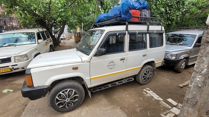
While waiting, I watch the street come to life. I have fun photographing the different modes of transport passing by.
Time passes faster when you’re occupied. We leave at 8:20 AM, and the driver does door-to-door service along the way. We make our first stop for 25 minutes at 9:10 AM, then another for breakfast at 10:10 AM. The scenery is very different from Assam and Nagaland. We drive alongside a pine forest and a large lake. There are beautiful viewpoints, but the driver isn’t stopping for sightseeing, so I have to settle for looking through the car windows.
We finally arrive in Shillong at 11:45 AM. The driver stops in the middle of nowhere, so I have to walk up the street to find a taxi. I flag one down, and he agrees to take me to my new guesthouse, the Rockski Boutique Bed & Breakfast. No sooner do I arrive than a storm with a heavy downpour welcomes me. When I arrived in Guwahati at the end of October, I’d booked a guide with a car for this week. There’s no public transport to get from village to village, so I had to take a car to visit. The tourism manager, Sachin, sent me a message to let me know that the driver, Welbis, will pick me up tomorrow morning at 8 AM. The temperature is much cooler here—only 19°C. At 2:30 PM, the rain stops, and I take the opportunity to explore the city. I start with the cathedral. Today is Good Friday, so I’m going to see how it’s celebrated here. Meghalaya is a Catholic state. The cathedral isn’t far from the guesthouse—it’s huge and all blue.
I arrive during mass, and it’s impossible to enter—the faithful are numerous outside in the parking lot. Giant screens broadcast the ceremony.

While waiting, I watch the street come to life. I have fun photographing the different modes of transport passing by.
Time passes faster when you’re occupied. We leave at 8:20 AM, and the driver does door-to-door service along the way. We make our first stop for 25 minutes at 9:10 AM, then another for breakfast at 10:10 AM. The scenery is very different from Assam and Nagaland. We drive alongside a pine forest and a large lake. There are beautiful viewpoints, but the driver isn’t stopping for sightseeing, so I have to settle for looking through the car windows.
We finally arrive in Shillong at 11:45 AM. The driver stops in the middle of nowhere, so I have to walk up the street to find a taxi. I flag one down, and he agrees to take me to my new guesthouse, the Rockski Boutique Bed & Breakfast. No sooner do I arrive than a storm with a heavy downpour welcomes me. When I arrived in Guwahati at the end of October, I’d booked a guide with a car for this week. There’s no public transport to get from village to village, so I had to take a car to visit. The tourism manager, Sachin, sent me a message to let me know that the driver, Welbis, will pick me up tomorrow morning at 8 AM. The temperature is much cooler here—only 19°C. At 2:30 PM, the rain stops, and I take the opportunity to explore the city. I start with the cathedral. Today is Good Friday, so I’m going to see how it’s celebrated here. Meghalaya is a Catholic state. The cathedral isn’t far from the guesthouse—it’s huge and all blue.
I arrive during mass, and it’s impossible to enter—the faithful are numerous outside in the parking lot. Giant screens broadcast the ceremony.
One-Day Visit on the Renaissance in May 2025 – CFC Cruise
Hi everyone,
We were offered a visit to the Renaissance by the new CFC cruise line through Croisiland. After reading all the reviews—some very harsh, others glowing—I wanted to form my own opinion without having to book a full cruise to test it out. This visit to the ship at the port of Le Havre for 49 € per person came at the perfect time, even if I’m a bit put off by having to pay for a ship tour. That’s not how it usually works with other cruise lines, as far as I know.
The Renaissance is a former Holland America Line ship, built in 1993 and renovated in 2023. We’re familiar with this style of ship since we took a long cruise in Polynesia in 2014 on one of its sister ships, the MS Statendam. We remember it as a charming small ship with a lovely pool terrace at the very back.
Off we went this morning for a relaxing day on a ship—always a nice change!
The Pont de Normandie is the last elegant structure you see before entering the vast and rather smelly port area of Le Havre.
The area around the port where the Renaissance is docked is total chaos—cars everywhere and only a handful of taxis. We were supposed to have a reserved parking spot in front of the terminal (we’d even given them our car model and license plate), but we were denied entry. There’s no paved public parking, so we left the car on a vacant lot.
CFC was officially acquired by the British cruise line Ambassador Cruise Line in January 2025. Ambassador Cruise Line, launched in 2010, already owns two ships of the same type and age. They wasted no time repainting the funnel in their new colors.
The line of passengers disembarking and waiting for taxis is endless... and taxis are trickling in. Is this the aftermath of yesterday’s strike, or is this the norm in this port? Either way, I feel bad for the poor travelers waiting—it’s going to be a long haul. Many are leaving on foot, dragging their suitcases. Compared to the port of Marseille, this is pretty dismal.
Forty spots were available for this visit organized by Croisiland, but we ran into a good hundred people at the meet-up. A group from the AVF (Accueil des Villes Françaises) of Le Havre will be joining us. Our Croisiland group consists of twelve people, if I counted right.
Security clearance is done alphabetically, and we quickly board the ship. Now we’re getting to the heart of the matter.
To be continued...
We were offered a visit to the Renaissance by the new CFC cruise line through Croisiland. After reading all the reviews—some very harsh, others glowing—I wanted to form my own opinion without having to book a full cruise to test it out. This visit to the ship at the port of Le Havre for 49 € per person came at the perfect time, even if I’m a bit put off by having to pay for a ship tour. That’s not how it usually works with other cruise lines, as far as I know.
The Renaissance is a former Holland America Line ship, built in 1993 and renovated in 2023. We’re familiar with this style of ship since we took a long cruise in Polynesia in 2014 on one of its sister ships, the MS Statendam. We remember it as a charming small ship with a lovely pool terrace at the very back.
Off we went this morning for a relaxing day on a ship—always a nice change!
The Pont de Normandie is the last elegant structure you see before entering the vast and rather smelly port area of Le Havre.
The area around the port where the Renaissance is docked is total chaos—cars everywhere and only a handful of taxis. We were supposed to have a reserved parking spot in front of the terminal (we’d even given them our car model and license plate), but we were denied entry. There’s no paved public parking, so we left the car on a vacant lot.
CFC was officially acquired by the British cruise line Ambassador Cruise Line in January 2025. Ambassador Cruise Line, launched in 2010, already owns two ships of the same type and age. They wasted no time repainting the funnel in their new colors.
The line of passengers disembarking and waiting for taxis is endless... and taxis are trickling in. Is this the aftermath of yesterday’s strike, or is this the norm in this port? Either way, I feel bad for the poor travelers waiting—it’s going to be a long haul. Many are leaving on foot, dragging their suitcases. Compared to the port of Marseille, this is pretty dismal.
Forty spots were available for this visit organized by Croisiland, but we ran into a good hundred people at the meet-up. A group from the AVF (Accueil des Villes Françaises) of Le Havre will be joining us. Our Croisiland group consists of twelve people, if I counted right.
Security clearance is done alphabetically, and we quickly board the ship. Now we’re getting to the heart of the matter.
To be continued...
May 2025 Theme Discussion: Reflection(s)
This is the place for chit-chat on this month’s theme—reflections! I’m sure you’ve got some amazing ones to share. 😄
François Boucher
Dear members of VoyageForum,
It is with deep sadness that we share the news of the passing of François Boucher, the founder of VoyageForum.
We will remember his passion for travel, but most of all, the pride he took in this forum, which has become indispensable among travelers. While there may have been heated debates, we ask that you show respect for him.
François was still very active on the forum, especially in the technical development section. VoyageForum was his life’s work. He worked passionately to update the site and make up for the 4 years of closure due to the pandemic.
Today, VoyageForum has also lost its developer.
That’s why we’re reaching out to this community to continue François’s legacy. If there are any former or current developers among you who know PERL and would be willing to help, your support would be greatly appreciated.
Thank you for your loyalty.
Let’s keep this forum alive in his memory.
It is with deep sadness that we share the news of the passing of François Boucher, the founder of VoyageForum.
We will remember his passion for travel, but most of all, the pride he took in this forum, which has become indispensable among travelers. While there may have been heated debates, we ask that you show respect for him.
François was still very active on the forum, especially in the technical development section. VoyageForum was his life’s work. He worked passionately to update the site and make up for the 4 years of closure due to the pandemic.
Today, VoyageForum has also lost its developer.
That’s why we’re reaching out to this community to continue François’s legacy. If there are any former or current developers among you who know PERL and would be willing to help, your support would be greatly appreciated.
Thank you for your loyalty.
Let’s keep this forum alive in his memory.
A Trip to Australia: New South Wales
Wednesday, November 15, 2023
Flight Cairns – Sydney
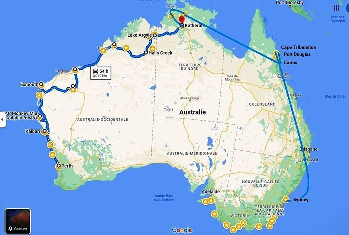 Okay, let’s recap. We’ve traveled through Western Australia, the Northern Territory, Queensland, and tonight we’ll be in New South Wales. We’ll even lose an extra hour—and a bunch of degrees!
We’re on a flawless journey so far. One of our suitcases is almost two kilos overweight. The guy checking us in gives us a nice smile and decides to overlook the excess baggage fee.
Okay, let’s recap. We’ve traveled through Western Australia, the Northern Territory, Queensland, and tonight we’ll be in New South Wales. We’ll even lose an extra hour—and a bunch of degrees!
We’re on a flawless journey so far. One of our suitcases is almost two kilos overweight. The guy checking us in gives us a nice smile and decides to overlook the excess baggage fee.
A flight, for once, without a hitch, no delay (just half an hour…). Taxi… We discover our… room… We’ve got a suite like never before on this trip. It’s a posh apartment on the 7th floor—on cloud nine, really! We can’t believe it. 113.26 € per night! The Meriton Suites Mascot Central if you ever find yourself in this city… We even have a washing machine (and it works!). Such a change from the cabins in the west!
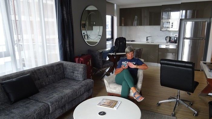
We don’t linger, though. We take the metro. Why? Well, yeah, we’re still kids at heart—off to the Opera House, of course!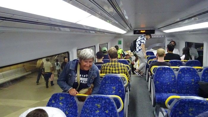
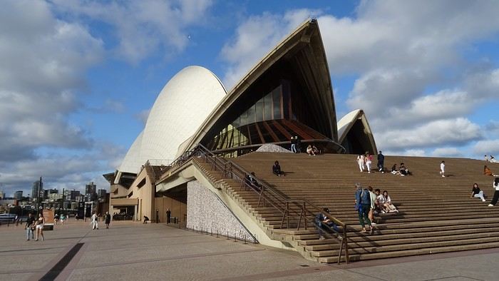
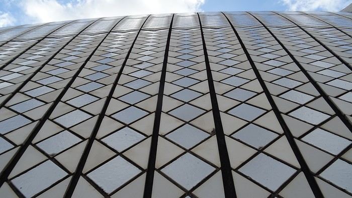
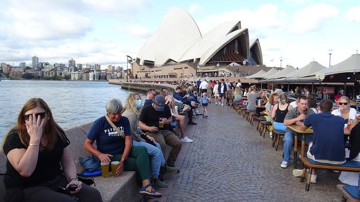
 Restaurant prices have doubled. Even tripled. We reluctantly settle for a pizzeria because that T-bone for 155 AUD (100 €)…
We know how to handle ourselves. There’s a Woolworths right downstairs. And we’ve got a kitchen, remember! And a terrace! We even have huge bats to brighten up our skies!
Okay, let’s recap. We’ve traveled through Western Australia, the Northern Territory, Queensland, and tonight we’ll be in New South Wales. We’ll even lose an extra hour—and a bunch of degrees!
We’re on a flawless journey so far. One of our suitcases is almost two kilos overweight. The guy checking us in gives us a nice smile and decides to overlook the excess baggage fee.A flight, for once, without a hitch, no delay (just half an hour…). Taxi… We discover our… room… We’ve got a suite like never before on this trip. It’s a posh apartment on the 7th floor—on cloud nine, really! We can’t believe it. 113.26 € per night! The Meriton Suites Mascot Central if you ever find yourself in this city… We even have a washing machine (and it works!). Such a change from the cabins in the west!
We don’t linger, though. We take the metro. Why? Well, yeah, we’re still kids at heart—off to the Opera House, of course!
Restaurant prices have doubled. Even tripled. We reluctantly settle for a pizzeria because that T-bone for 155 AUD (100 €)…
We know how to handle ourselves. There’s a Woolworths right downstairs. And we’ve got a kitchen, remember! And a terrace! We even have huge bats to brighten up our skies!
Martine and DD in Colorado and Utah
Hello everyone! 🙂
So many silent months, and now Voyage Forum is accessible again. That’s cool because we can pick up our discussions for our mutual enjoyment.
I hope everyone is doing well and that you’ve been able to take some great trips, whether to the USA or elsewhere.
In September 2020, we had planned a round trip to explore Colorado, but unfortunately, a nasty virus messed up our plans, closing borders and keeping us stuck at home. Luckily for us, canceling the car, flights, and accommodations didn’t cost us a thing—everything was refunded.
In 2023, a loop from Las Vegas let us revisit places we’d seen in 2017 and discover new ones, this time spending more time at each stop with some lovely hikes.
In 2024, we finally revisited the 2020 plan, and I’ll start with that.
However, unforeseen circumstances mean I have much less time than before, so I’ll keep my trip reports shorter (ha ha ha—you’ll have less of my prose to endure).
Another change: for those who remember the "Gang of Four crazy sixty-somethings," it was just DD and me this time. Our dear Mimi and Maumau left the Var to focus on raising horses and can’t leave their little green paradise to join us anymore. We were unfortunately much tamer without them.
We traveled from September 11 to October 3.
The itinerary
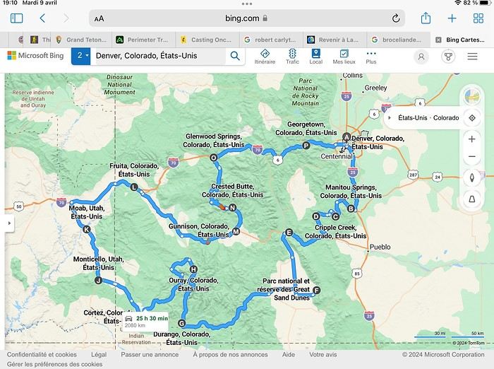
Day 1: Flight Marseille-Paris-Denver, then Manitou Springs (133 km) Day 2: Manitou Springs (49 km) Day 3: Cripple Creek (104 km) Day 4: Salida (254 km) Day 5: Great Sand Dunes (231 km) Day 6: Durango (283 km) Day 7: Durango (Durango-Silverton train) Day 8: Ouray (121 km) Day 9: Ouray (Perimeter Trail hike) Day 10: Cortez (213 km) Day 11: Cortez (Mesa Verde National Park, 134 km) Day 12: Monticello (268 km, detour to Chesler Park) Day 13: Moab (171 km, Delicate Arch) Day 14: Moab (98 km, Fisher Towers) Day 15: Moab (171 km, Canyonlands) Day 16: Fruita (210 km, Colorado National Monument) Day 17: Crested Butte (224 km via Kebler Pass) Day 18: Crested Butte (57 km) Day 19: Glenwood Springs (150 km) Day 20: Glenwood Springs (118 km, Rifle State Park) Day 21: Georgetown (258 km via Independence Pass) Day 22: Denver (123 km), then return flight
We speak very little English. We spent 21 nights there and covered a 3,400 km loop by car and 160 km on foot (we’re still trying to hike while we’re in shape) from Denver in September 2024. We wanted this road trip to help us explore Colorado a bit more—we’d only spent 6 nights there in 2019—and to see it during the fall foliage season. We also wanted to return to Utah (we love Moab) to enjoy its red rocks, which we adore.
In the prices you see (some in euros, others in dollars), I’ve included bank fees and exchange charges. The flights, car, and parking were paid by credit card when we booked in February. Usually, we book around November, but some obligations kept us from doing it earlier. We downloaded the MPC (Mobile Passport Control) app on our phone, which saved us time at immigration.
📊 **Budget: just under 8,500 € for both of us, all included**
📊 **Flights** Marseille-Paris (CDG)-Denver: 2,152 € for both of us, with one checked bag each
📊 **ESTA and America the Beautiful Pass** The ones from our 2023 road trip were still valid
📊 **Parking at Marseille airport: 122 €**
📊 **Car: Nissan Rogue (the French X-Trail) from Hertz: 1,165 €** By booking through Air France (and earning miles), we got a 15% discount. Hertz offers a free Hertz Gold Plus Rewards program, which gives us priority counter service.
📊 **Accommodation: 3,050 €** We stayed in motels and hotels of various ranges (from 100 € to 270 € per night, depending on the city), all booked through Hotels.com or Booking. Booking sometimes offers cheaper rates if you book via the "Booking mobile" app. We also got some preferential rates thanks to our Genius 2 status. Out of 21 nights, only one place didn’t include breakfast.
📊 **Other expenses (activities booked by credit card before leaving)** Durango-Silverton train: 210 € (we booked the enclosed vintage coach in March) Mesa Verde: Balcony House: 15.15 € (booked 14 days before the visit) Timed-entry passes for Arches National Park: 6 € for 3 days (booked June 1 for September entries via http://récreation.gov/). We booked three different days to play with the weather.
📊 **Supplementary insurance with AVA: 204 €** (due to our age 😅 and the high cost of medical consultations in the USA)
📊 **Cash: 1,540 €** We left with 1,000 € exchanged before departure and made two withdrawals (500 $ and 200 $). This cash was used to pay for: - Evening restaurants and tips (between 70 $ and 95 $ for two meals and two drinks) - Two state parks: Dead Horse State Park (20 $) and Rifle State Park (10 $) - The Monarch Pass gondola (24 $) - Midday picnics - Gas (slightly cheaper with cash): 204 $ for 3,400 km - Personal souvenirs and little treats.
Like in our previous road trips, we didn’t rent a GPS. We used the offline GPS app Here We Go, for which we’d downloaded maps of Colorado and Utah from France, as well as a new offline app called Organic Maps as a backup—though we didn’t end up needing it.
❤️❤️❤️ **Highlights (there are so many!)** 📍 The stunning landscapes of Colorado, especially with the fall colors 📍 A step back in time at the old farm in Florissant Fossil Beds National Monument 📍 The prairies of Cripple Creek and the mining remnants of the Vindicator Trail 📍 The cheeky chipmunks in the ghost town of St. Elmo 📍 Great Sand Dunes and its soft sand 📍 The steam train between Durango and Silverton: we’re glad we chose the round-trip because it rained heavily on the way there, but we got to enjoy the scenery on the way back when the sun came out 📍 The unexpected meet-up with Michèle from the group outside a restaurant in Durango 📍 The hot springs in Ouray 📍 Mesa Verde and its still-vibrant past 📍 The red rocks of Moab and Delicate Arch at sunset 📍 The lace-like Fisher Towers and the view from the end of the trail 📍 The gorgeous Route 128 leading to Colorado National Monument—small, easy to visit, and so beautiful 📍 The colors of the fabulous Kebler Pass, Crested Butte, and especially the hike through the golden aspens (Lower and Upper Loop) 📍 The waterfalls at Rifle State Park 📍 The tundra of Independence Pass 📍 The Halloween decorations in Georgetown and Idaho Springs
😞😞 **Flops (there are very few!)** 📍 The viewpoints we missed because they weren’t well-marked or we didn’t see the signs 📍 The closure of some hiking trails (Hanging Lake and parts of Canyonlands) and the Sal Mountain Loop road, which kept us from accessing it 📍😢 The Chesler Park hike we had to cut short due to poor time management—180 km between our stop in Cortez meant we didn’t arrive until 10:30 AM, way too late for a 17 km hike.
Hope this helps! Have a great evening, everyone, and see you soon! 😊
The itinerary
Day 1: Flight Marseille-Paris-Denver, then Manitou Springs (133 km) Day 2: Manitou Springs (49 km) Day 3: Cripple Creek (104 km) Day 4: Salida (254 km) Day 5: Great Sand Dunes (231 km) Day 6: Durango (283 km) Day 7: Durango (Durango-Silverton train) Day 8: Ouray (121 km) Day 9: Ouray (Perimeter Trail hike) Day 10: Cortez (213 km) Day 11: Cortez (Mesa Verde National Park, 134 km) Day 12: Monticello (268 km, detour to Chesler Park) Day 13: Moab (171 km, Delicate Arch) Day 14: Moab (98 km, Fisher Towers) Day 15: Moab (171 km, Canyonlands) Day 16: Fruita (210 km, Colorado National Monument) Day 17: Crested Butte (224 km via Kebler Pass) Day 18: Crested Butte (57 km) Day 19: Glenwood Springs (150 km) Day 20: Glenwood Springs (118 km, Rifle State Park) Day 21: Georgetown (258 km via Independence Pass) Day 22: Denver (123 km), then return flight
We speak very little English. We spent 21 nights there and covered a 3,400 km loop by car and 160 km on foot (we’re still trying to hike while we’re in shape) from Denver in September 2024. We wanted this road trip to help us explore Colorado a bit more—we’d only spent 6 nights there in 2019—and to see it during the fall foliage season. We also wanted to return to Utah (we love Moab) to enjoy its red rocks, which we adore.
In the prices you see (some in euros, others in dollars), I’ve included bank fees and exchange charges. The flights, car, and parking were paid by credit card when we booked in February. Usually, we book around November, but some obligations kept us from doing it earlier. We downloaded the MPC (Mobile Passport Control) app on our phone, which saved us time at immigration.
📊 **Budget: just under 8,500 € for both of us, all included**
📊 **Flights** Marseille-Paris (CDG)-Denver: 2,152 € for both of us, with one checked bag each
📊 **ESTA and America the Beautiful Pass** The ones from our 2023 road trip were still valid
📊 **Parking at Marseille airport: 122 €**
📊 **Car: Nissan Rogue (the French X-Trail) from Hertz: 1,165 €** By booking through Air France (and earning miles), we got a 15% discount. Hertz offers a free Hertz Gold Plus Rewards program, which gives us priority counter service.
📊 **Accommodation: 3,050 €** We stayed in motels and hotels of various ranges (from 100 € to 270 € per night, depending on the city), all booked through Hotels.com or Booking. Booking sometimes offers cheaper rates if you book via the "Booking mobile" app. We also got some preferential rates thanks to our Genius 2 status. Out of 21 nights, only one place didn’t include breakfast.
📊 **Other expenses (activities booked by credit card before leaving)** Durango-Silverton train: 210 € (we booked the enclosed vintage coach in March) Mesa Verde: Balcony House: 15.15 € (booked 14 days before the visit) Timed-entry passes for Arches National Park: 6 € for 3 days (booked June 1 for September entries via http://récreation.gov/). We booked three different days to play with the weather.
📊 **Supplementary insurance with AVA: 204 €** (due to our age 😅 and the high cost of medical consultations in the USA)
📊 **Cash: 1,540 €** We left with 1,000 € exchanged before departure and made two withdrawals (500 $ and 200 $). This cash was used to pay for: - Evening restaurants and tips (between 70 $ and 95 $ for two meals and two drinks) - Two state parks: Dead Horse State Park (20 $) and Rifle State Park (10 $) - The Monarch Pass gondola (24 $) - Midday picnics - Gas (slightly cheaper with cash): 204 $ for 3,400 km - Personal souvenirs and little treats.
Like in our previous road trips, we didn’t rent a GPS. We used the offline GPS app Here We Go, for which we’d downloaded maps of Colorado and Utah from France, as well as a new offline app called Organic Maps as a backup—though we didn’t end up needing it.
❤️❤️❤️ **Highlights (there are so many!)** 📍 The stunning landscapes of Colorado, especially with the fall colors 📍 A step back in time at the old farm in Florissant Fossil Beds National Monument 📍 The prairies of Cripple Creek and the mining remnants of the Vindicator Trail 📍 The cheeky chipmunks in the ghost town of St. Elmo 📍 Great Sand Dunes and its soft sand 📍 The steam train between Durango and Silverton: we’re glad we chose the round-trip because it rained heavily on the way there, but we got to enjoy the scenery on the way back when the sun came out 📍 The unexpected meet-up with Michèle from the group outside a restaurant in Durango 📍 The hot springs in Ouray 📍 Mesa Verde and its still-vibrant past 📍 The red rocks of Moab and Delicate Arch at sunset 📍 The lace-like Fisher Towers and the view from the end of the trail 📍 The gorgeous Route 128 leading to Colorado National Monument—small, easy to visit, and so beautiful 📍 The colors of the fabulous Kebler Pass, Crested Butte, and especially the hike through the golden aspens (Lower and Upper Loop) 📍 The waterfalls at Rifle State Park 📍 The tundra of Independence Pass 📍 The Halloween decorations in Georgetown and Idaho Springs
😞😞 **Flops (there are very few!)** 📍 The viewpoints we missed because they weren’t well-marked or we didn’t see the signs 📍 The closure of some hiking trails (Hanging Lake and parts of Canyonlands) and the Sal Mountain Loop road, which kept us from accessing it 📍😢 The Chesler Park hike we had to cut short due to poor time management—180 km between our stop in Cortez meant we didn’t arrive until 10:30 AM, way too late for a 17 km hike.
Hope this helps! Have a great evening, everyone, and see you soon! 😊
Southwest Part 2: 55 Days in Colorado, New Mexico, Arizona, Nevada, and Utah
This travel journal is the second part of the trip whose first part you can find here: 1st part...
Sunday, August 7: the day we discover a magical place... Edmaier's Secret...
We got up at 8:00 AM, had breakfast on the terrace of our tiny house, and then set off again toward yesterday’s trail. This time, we stopped after 4.5 miles on House Rock Valley Road at the Buckskin Gulch Trail parking lot. We weren’t interested in that trail today—the slot canyon is muddy anyway after the recent storms...
Instead, we explored a lesser-known area that became our playground. And what a playground it was, folks—an out-of-this-world spot, THE highlight of our trip!!! 😏
Just imagine being in the middle of these landscapes, and the cherry on top... no one else around!!!!! Well, we did meet a couple who were coming back—it was 9:30 AM 😮. Did they camp there? Did they turn back? 🙁
After paying the entry permit online, we set off with plenty of water (6L for the four of us) plus a gallon we hid along the way for the return trip. 😉 After a one-hour approach hike along a wash, we reached the sea of sand.
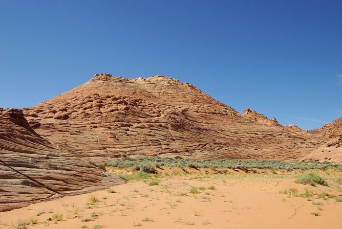
We had to cross it to reach our goal: a strip about 2 km long and 1 km wide that you can explore freely since there’s no marked trail... We entered a few GPS points into our Garmin Etrex, and off we went!!! 😎 It was... magical, enchanting, a true love-at-first-sight moment!
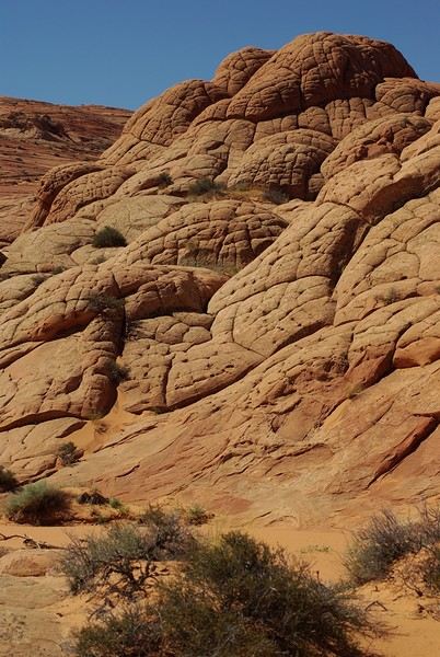
Brain Rock, waves, fine and brittle rock, colors—it goes up, it goes down.
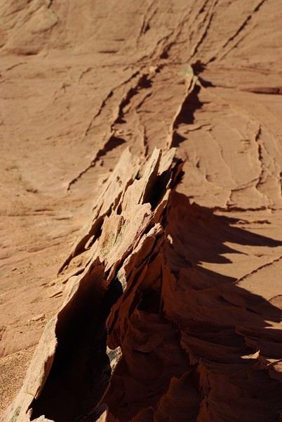
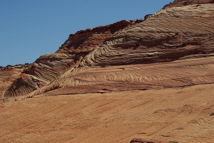
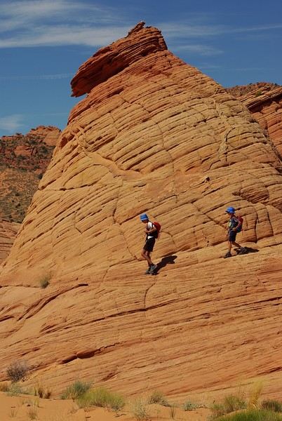
Just thinking about it gives me chills... I remember sitting still for two minutes, taking in these wonders with such emotion that I teared up...
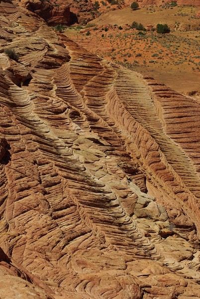
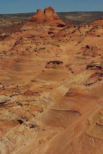
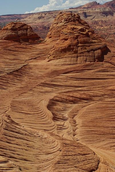
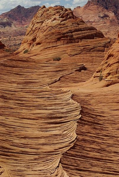
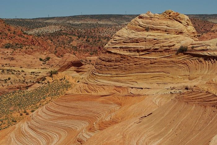
Sunday, August 7: the day we discover a magical place... Edmaier's Secret...
We got up at 8:00 AM, had breakfast on the terrace of our tiny house, and then set off again toward yesterday’s trail. This time, we stopped after 4.5 miles on House Rock Valley Road at the Buckskin Gulch Trail parking lot. We weren’t interested in that trail today—the slot canyon is muddy anyway after the recent storms...
Instead, we explored a lesser-known area that became our playground. And what a playground it was, folks—an out-of-this-world spot, THE highlight of our trip!!! 😏
Just imagine being in the middle of these landscapes, and the cherry on top... no one else around!!!!! Well, we did meet a couple who were coming back—it was 9:30 AM 😮. Did they camp there? Did they turn back? 🙁
After paying the entry permit online, we set off with plenty of water (6L for the four of us) plus a gallon we hid along the way for the return trip. 😉 After a one-hour approach hike along a wash, we reached the sea of sand.
We had to cross it to reach our goal: a strip about 2 km long and 1 km wide that you can explore freely since there’s no marked trail... We entered a few GPS points into our Garmin Etrex, and off we went!!! 😎 It was... magical, enchanting, a true love-at-first-sight moment!
Brain Rock, waves, fine and brittle rock, colors—it goes up, it goes down.
Just thinking about it gives me chills... I remember sitting still for two minutes, taking in these wonders with such emotion that I teared up...
Bike trip: from Carcans Maubuisson to Plaisir (Yvelines)
Monday, August 21, 2023 - Rochefort - Marans
No journal for the first two days. Day 1 - CARCANS-ROYAN Day 2 - ROYAN - ROCHEFORT Tonight I'm in MARANS in the "dry marsh" according to the campsite manager—it’s the first time I’ve heard of a "dry marsh"?!
Photos from the first two days
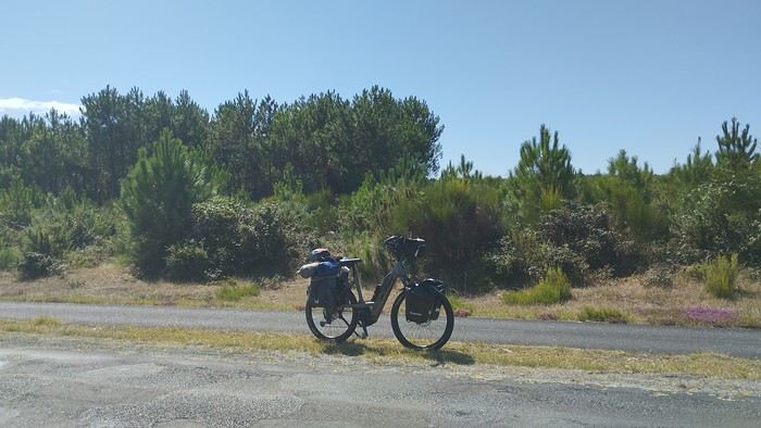 My gear
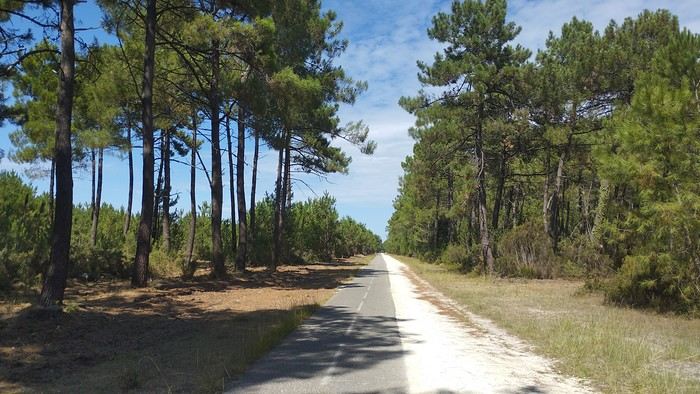
The Landes region—nothing extraordinary, but the calm and serenity are nice.

Le Verdon
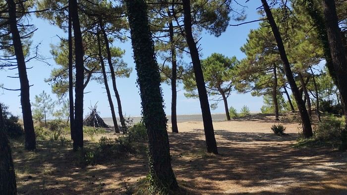
The wild coast
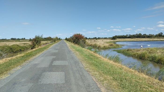
This marsh isn’t dry, though.
Today is the third day of my trip, and I’m writing to you from a campsite in Marans. I’ve set out to bike from Carcans Maubuisson back to Plaisir. Why Carcans? Because we spent a week there as a family—a great week that lets everyone reconnect for a long stretch. Also, on Saturday, we all headed home—some by car, and me by bike. This journey is about 850 km via bike paths and small cycling roads. It’s not a sporting feat, just a nice long ride for fun. As the old Chinese sage says, "The destination doesn’t matter—it’s the journey that counts." But he also told me, "Traveling is great, but what’s the point if you don’t share it?" You see, this old sage has told me a lot of things—he often keeps me company when I’m biking. Of course, he doesn’t pedal, but we travel in harmony. Sure, he can be a bit annoying sometimes, but we still get along. All this to say I’ve created a group to share my story. I’d be happy to share this experience with you—it’s an adventure for me. On Saturday, I wasn’t sure I’d even leave because I’d been dealing with sciatica for days. Luckily, Juliette, a friend of the old Chinese sage, recommended a lifesaving remedy: Alternately stretching your legs with an elastic band under your foot. Obviously, a jam jar rubber band won’t cut it.
From Marans - The mosquitoes are attacking; time to head back to shelter.
The first two legs took me to Royan and then Rochefort. The Sèvre Niortaise flows nearby, and I followed a canal from La Rochelle. You could say the area is as dry as the marsh, judging by the state of the crops.
As I mentioned, it’s the third day, and if Jesus rose again on this day, for me it was more like the crucifixion. The scorching heat—only bearable when you’re moving—combined with rough trail conditions, and the old Chinese sage says, "Terrible roads, slow speed, and watch your limbs." I set out to do 60 km but ended up doing 80, and the last 20 were tough. I kept checking the GPS to see how much farther until the campsite. Today: Rochefort to Marans, sticking to the coast until La Rochelle, then no notable towns after that—just a constant canal. But since the sky isn’t too low, it hasn’t gotten lost. I’ve still got plenty of anecdotes to share, but it’s pitch black out, and the mosquitoes are still around. This morning, I counted ten in my tent, all full of my blood. Yesterday, at the end of the leg to Rochefort, I was really looking forward to crossing the Charente using the transporter bridge, but a sneaky GPS conspiracy led me far from it. I ended up crossing the Charente on a completely ordinary bridge, watching the transporter bridge in the distance with disappointment.
End of the first episode. Until tomorrow, if you’d like!
No journal for the first two days. Day 1 - CARCANS-ROYAN Day 2 - ROYAN - ROCHEFORT Tonight I'm in MARANS in the "dry marsh" according to the campsite manager—it’s the first time I’ve heard of a "dry marsh"?!
Photos from the first two days
My gearThe Landes region—nothing extraordinary, but the calm and serenity are nice.
Le Verdon
The wild coast
This marsh isn’t dry, though.
Today is the third day of my trip, and I’m writing to you from a campsite in Marans. I’ve set out to bike from Carcans Maubuisson back to Plaisir. Why Carcans? Because we spent a week there as a family—a great week that lets everyone reconnect for a long stretch. Also, on Saturday, we all headed home—some by car, and me by bike. This journey is about 850 km via bike paths and small cycling roads. It’s not a sporting feat, just a nice long ride for fun. As the old Chinese sage says, "The destination doesn’t matter—it’s the journey that counts." But he also told me, "Traveling is great, but what’s the point if you don’t share it?" You see, this old sage has told me a lot of things—he often keeps me company when I’m biking. Of course, he doesn’t pedal, but we travel in harmony. Sure, he can be a bit annoying sometimes, but we still get along. All this to say I’ve created a group to share my story. I’d be happy to share this experience with you—it’s an adventure for me. On Saturday, I wasn’t sure I’d even leave because I’d been dealing with sciatica for days. Luckily, Juliette, a friend of the old Chinese sage, recommended a lifesaving remedy: Alternately stretching your legs with an elastic band under your foot. Obviously, a jam jar rubber band won’t cut it.
From Marans - The mosquitoes are attacking; time to head back to shelter.
The first two legs took me to Royan and then Rochefort. The Sèvre Niortaise flows nearby, and I followed a canal from La Rochelle. You could say the area is as dry as the marsh, judging by the state of the crops.
As I mentioned, it’s the third day, and if Jesus rose again on this day, for me it was more like the crucifixion. The scorching heat—only bearable when you’re moving—combined with rough trail conditions, and the old Chinese sage says, "Terrible roads, slow speed, and watch your limbs." I set out to do 60 km but ended up doing 80, and the last 20 were tough. I kept checking the GPS to see how much farther until the campsite. Today: Rochefort to Marans, sticking to the coast until La Rochelle, then no notable towns after that—just a constant canal. But since the sky isn’t too low, it hasn’t gotten lost. I’ve still got plenty of anecdotes to share, but it’s pitch black out, and the mosquitoes are still around. This morning, I counted ten in my tent, all full of my blood. Yesterday, at the end of the leg to Rochefort, I was really looking forward to crossing the Charente using the transporter bridge, but a sneaky GPS conspiracy led me far from it. I ended up crossing the Charente on a completely ordinary bridge, watching the transporter bridge in the distance with disappointment.
End of the first episode. Until tomorrow, if you’d like!
Southwest! 8 weeks with the family, Denver-to-Denver loop, 1st part...
Hey there, VoyageForum!!!
I’ve combed through this site up, down, and sideways to plan our two-month road trip across the American Southwest during the summer of 2022, so it only feels right to give back and revive the USA travel journal section—helping others prep, travel, or relive their own memories! 😏
A quick intro to the stars of this trip is coming soon... in an upcoming post!
Table of Contents:
Road trip introduction Day 1 & 2: the days we double-checked all our papers... Day 3 & 3 bis: The day we discovered Denver... Day 4: The day of the race, the carriage, and the little one’s cough... Day 5: the day the road trip truly began... Day 6 & 6 bis: the day of Nature’s first wonders... Day 7: the day the sky fell on our heads... Day 8 & 8 bis: the day we saw ghosts... Day 9: the day we climbed the mountain... Day 10: the day the theme song from "The Last Picture Show" played on loop in my head... Day 11: the day we lived like Native Americans... Day 12: the day we left civilization behind... Day 13 & 13 bis: the day we explored another planet... Day 14 & 14 bis: the day Caro reunited with HER rocks... Day 15 & 15 bis: the day of the fantastic ride... Day 16: the day we cooled off in Lake Powell... Day 17: the day the Colorado River’s meanders were all ours... Day 18: the day we dipped our feet in the Colorado... Day 19: the day the guys discovered true vastness... Day 20 & 20 bis: the day we covered a few acres of Route 66 before sunset... Day 21: the day the credit card said stop... right before the STRIP... Day 22: the day we finally discovered Cirque du Soleil... Day 23: the day we returned to calm... well, almost... Day 24: the day we reached our home base for 6 nights: Saint George Day 25: the day we should’ve explored Yant Flat... Day 26: the day it was 13°C at Cedar Breaks... Day 27: the day we explored The Narrows in Zion NP... Day 28: the day we discovered Snow Canyon... Day 29: the day we hiked to the "SUBWAY"... Day 30: the day we encountered the abyss—from the north this time... Day 31: the day we arrived in a place where dreams begin... Kanab... Day 32: the day we discovered the first treasures along House Rock Valley... 2nd part: the second part of the journey... Day 33: the day we discovered a magical place... Edmaier's Secret... Day 34: the day Cottonwood Road didn’t open up to us... Day 35: the day of the classic Queen’s Garden + Navajo Loop—and another event that became a classic... Day 36: the second day in Bryce... pure bliss!!! Day 37: the day we swam at the foot of Calf Creek Falls... Day 38: the day we took the Burr Trail, even with storms lurking... Day 39: The day of the goblins... Day 40: the day we enjoyed the peaceful Capitol Reef NP... Day 41: the day of the Rim Overlook and another letdown... Day 42: the day we arrived in... Moab... Day 43: the first day in Arches National Park... Day 44: the day of the Fisher Towers... Day 45: the day of Bow Tie & Corona Arches... Day 46: The day of Shafer Trail + Potash Road... Day 47: The second day in Arches NP... Day 48: the day we discovered Colorado NM in a flash... Day 49: the day of Black Canyon... Day 50: the day we passed through Durango before falling for Silverton... Day 51: the day we went through Ouray and ended up in Gunnison... Day 52: the day of Kebler Pass and arriving at the hot springs... Day 53: the day of hot springs II, then the road back to Denver... Day 54: the last day... Day 55: back home and the RECAP...
I’ve combed through this site up, down, and sideways to plan our two-month road trip across the American Southwest during the summer of 2022, so it only feels right to give back and revive the USA travel journal section—helping others prep, travel, or relive their own memories! 😏
A quick intro to the stars of this trip is coming soon... in an upcoming post!
Table of Contents:
Road trip introduction Day 1 & 2: the days we double-checked all our papers... Day 3 & 3 bis: The day we discovered Denver... Day 4: The day of the race, the carriage, and the little one’s cough... Day 5: the day the road trip truly began... Day 6 & 6 bis: the day of Nature’s first wonders... Day 7: the day the sky fell on our heads... Day 8 & 8 bis: the day we saw ghosts... Day 9: the day we climbed the mountain... Day 10: the day the theme song from "The Last Picture Show" played on loop in my head... Day 11: the day we lived like Native Americans... Day 12: the day we left civilization behind... Day 13 & 13 bis: the day we explored another planet... Day 14 & 14 bis: the day Caro reunited with HER rocks... Day 15 & 15 bis: the day of the fantastic ride... Day 16: the day we cooled off in Lake Powell... Day 17: the day the Colorado River’s meanders were all ours... Day 18: the day we dipped our feet in the Colorado... Day 19: the day the guys discovered true vastness... Day 20 & 20 bis: the day we covered a few acres of Route 66 before sunset... Day 21: the day the credit card said stop... right before the STRIP... Day 22: the day we finally discovered Cirque du Soleil... Day 23: the day we returned to calm... well, almost... Day 24: the day we reached our home base for 6 nights: Saint George Day 25: the day we should’ve explored Yant Flat... Day 26: the day it was 13°C at Cedar Breaks... Day 27: the day we explored The Narrows in Zion NP... Day 28: the day we discovered Snow Canyon... Day 29: the day we hiked to the "SUBWAY"... Day 30: the day we encountered the abyss—from the north this time... Day 31: the day we arrived in a place where dreams begin... Kanab... Day 32: the day we discovered the first treasures along House Rock Valley... 2nd part: the second part of the journey... Day 33: the day we discovered a magical place... Edmaier's Secret... Day 34: the day Cottonwood Road didn’t open up to us... Day 35: the day of the classic Queen’s Garden + Navajo Loop—and another event that became a classic... Day 36: the second day in Bryce... pure bliss!!! Day 37: the day we swam at the foot of Calf Creek Falls... Day 38: the day we took the Burr Trail, even with storms lurking... Day 39: The day of the goblins... Day 40: the day we enjoyed the peaceful Capitol Reef NP... Day 41: the day of the Rim Overlook and another letdown... Day 42: the day we arrived in... Moab... Day 43: the first day in Arches National Park... Day 44: the day of the Fisher Towers... Day 45: the day of Bow Tie & Corona Arches... Day 46: The day of Shafer Trail + Potash Road... Day 47: The second day in Arches NP... Day 48: the day we discovered Colorado NM in a flash... Day 49: the day of Black Canyon... Day 50: the day we passed through Durango before falling for Silverton... Day 51: the day we went through Ouray and ended up in Gunnison... Day 52: the day of Kebler Pass and arriving at the hot springs... Day 53: the day of hot springs II, then the road back to Denver... Day 54: the last day... Day 55: back home and the RECAP...
Il est grand temps de rallumer les étoiles! English translation pending
Bonjour à tous
Le Vietnam pays magique multiculturel aux paysages diversifiés et époustouflants. Voilà ce que je vous invite à partager sans aborder s'il vous plaît ce qui aujourd'hui empêche la planète de vivre... Essayons d'être constructifs et positivons! Il est grand temps de rallumer les étoiles!
Pour commencer avec légèreté: La médecine des Dao, le bain aux herbes. C'est un moment délicieux après une journée de marche et de visites rien de tel pour vous requinquer! Ce bain est très souvent proposé aux touristes dans le nord, spécialité de l'ethnie Dao il est "accommodé" dans plusieurs maisons d'hôtes et hôtels aux besoins des touristes.
Traditionnellement les recettes sont destinées à chaque cas et en fonction de la pathologie: femmes enceintes ou qui viennent d'accoucher, nouveau-nés, malades, vieillards…les herbes seront donc choisies en fonction des besoins et du type de médication (orale, en bain, en emplâtre...). C'est dès l'aube que les femmes, les hommes, les chamanes iront cueillir ces plantes, racines et écorces dans la forêt, le tout sera combiné à un régime adapté (on ne mange pas de tout..) et souvent suivi d'un massage spécifique.
Nous en avons testé plusieurs à plusieurs endroits mais celui de la chamane Dao d'un petit village au nord de Muong Lay restera sans doute le plus authentique et le plus insolite.. On nous prend en main dès notre arrivée dans la maison de la chamane. Elle y vit avec sa fille et son gendre... Maison, je devrai plus dire assemblage de planches et de tôles et quand on connaît les rigueurs de l'hivers on peut rêver mieux. La pièce principale est bourrée de pots en tout genre remplis de décoctions plus ou moins troubles...ces sont les médications à avaler, beurk.. Il y a aussi de gros sacs (plastique) d'herbes, de racines, d'écorces, un vrai magasin d'herboriste (l'ordre et la propreté en moins) sans oublier bien sur l'hôtel des ancêtres. Derrière des rideaux, les couches des habitants, nous ne dormirons pas là, ouf.. Puis attenantes, les deux salles des bains avec 2 baquets chacune et entre les deux sous une pergola un énorme foyer construit en ciment surmonté d'une aussi énorme bassine où l'eau et les herbes "cuisent" jusqu'à parfois 12 heures...c'est là que l'on fait aussi cuire la soupe des cochons... Le feu est alimenté de poupée de maïs et de bois. C'est dans ces baquets que nous tromperont plus ou moins longtemps...le temps de "cuisson" est décidé par la chamane en fonction de chacun, jamais plus de 30 mm...et les herbes qui seront rajoutée dans les baquets seront aussi choisies en fonction de chaque "malade". C'est très très chaud, il faut vraiment se faire violence pour entrer là dedans et c'est sans compter qu'une fois immergés la dame ajoute de l'eau chaude bien sur...ouille. Une fois "les touristes bien cuits" on nous sort de là, inutile de préciser que nous ressemblons plus à des homards qu'à des visages pâles... Après cuisson, nous serons conduits ensuite vers le silo à grains, où une pièce spéciale massage à été aménagée à son top, on l'atteint via une échelle de bois...au sol deux couches. Ici commence le moment le plus douloureux de tous les massages faits au Vietnam par le gendre et la fille de la maison.. Pas de douces caresses, non, non, mais un pétrissage et un battage en bonne et due forme suivis de torsion, j'ai cru ma dernière heure arrivée... Pour clore la séance nous dînerons chez la chamane d'un souper spécial, la couleur des mets est importante, nous ne mangerons que du blanc et du vert....des légumes et des herbes inconnues de nous et un peu de poulet bouilli, élastique à souhait, sans doute celui que nous avons croisé sur le chemin en arrivant et des petits poissons frits (très bons). C'est sans conteste le meilleur soin reçu au Vietnam si l'on fait abstraction de la propreté des lieux, des serviettes (surtout apporter les siennes) et des moments douloureux.
Le Vietnam pays magique multiculturel aux paysages diversifiés et époustouflants. Voilà ce que je vous invite à partager sans aborder s'il vous plaît ce qui aujourd'hui empêche la planète de vivre... Essayons d'être constructifs et positivons! Il est grand temps de rallumer les étoiles!
Pour commencer avec légèreté: La médecine des Dao, le bain aux herbes. C'est un moment délicieux après une journée de marche et de visites rien de tel pour vous requinquer! Ce bain est très souvent proposé aux touristes dans le nord, spécialité de l'ethnie Dao il est "accommodé" dans plusieurs maisons d'hôtes et hôtels aux besoins des touristes.
Traditionnellement les recettes sont destinées à chaque cas et en fonction de la pathologie: femmes enceintes ou qui viennent d'accoucher, nouveau-nés, malades, vieillards…les herbes seront donc choisies en fonction des besoins et du type de médication (orale, en bain, en emplâtre...). C'est dès l'aube que les femmes, les hommes, les chamanes iront cueillir ces plantes, racines et écorces dans la forêt, le tout sera combiné à un régime adapté (on ne mange pas de tout..) et souvent suivi d'un massage spécifique.
Nous en avons testé plusieurs à plusieurs endroits mais celui de la chamane Dao d'un petit village au nord de Muong Lay restera sans doute le plus authentique et le plus insolite.. On nous prend en main dès notre arrivée dans la maison de la chamane. Elle y vit avec sa fille et son gendre... Maison, je devrai plus dire assemblage de planches et de tôles et quand on connaît les rigueurs de l'hivers on peut rêver mieux. La pièce principale est bourrée de pots en tout genre remplis de décoctions plus ou moins troubles...ces sont les médications à avaler, beurk.. Il y a aussi de gros sacs (plastique) d'herbes, de racines, d'écorces, un vrai magasin d'herboriste (l'ordre et la propreté en moins) sans oublier bien sur l'hôtel des ancêtres. Derrière des rideaux, les couches des habitants, nous ne dormirons pas là, ouf.. Puis attenantes, les deux salles des bains avec 2 baquets chacune et entre les deux sous une pergola un énorme foyer construit en ciment surmonté d'une aussi énorme bassine où l'eau et les herbes "cuisent" jusqu'à parfois 12 heures...c'est là que l'on fait aussi cuire la soupe des cochons... Le feu est alimenté de poupée de maïs et de bois. C'est dans ces baquets que nous tromperont plus ou moins longtemps...le temps de "cuisson" est décidé par la chamane en fonction de chacun, jamais plus de 30 mm...et les herbes qui seront rajoutée dans les baquets seront aussi choisies en fonction de chaque "malade". C'est très très chaud, il faut vraiment se faire violence pour entrer là dedans et c'est sans compter qu'une fois immergés la dame ajoute de l'eau chaude bien sur...ouille. Une fois "les touristes bien cuits" on nous sort de là, inutile de préciser que nous ressemblons plus à des homards qu'à des visages pâles... Après cuisson, nous serons conduits ensuite vers le silo à grains, où une pièce spéciale massage à été aménagée à son top, on l'atteint via une échelle de bois...au sol deux couches. Ici commence le moment le plus douloureux de tous les massages faits au Vietnam par le gendre et la fille de la maison.. Pas de douces caresses, non, non, mais un pétrissage et un battage en bonne et due forme suivis de torsion, j'ai cru ma dernière heure arrivée... Pour clore la séance nous dînerons chez la chamane d'un souper spécial, la couleur des mets est importante, nous ne mangerons que du blanc et du vert....des légumes et des herbes inconnues de nous et un peu de poulet bouilli, élastique à souhait, sans doute celui que nous avons croisé sur le chemin en arrivant et des petits poissons frits (très bons). C'est sans conteste le meilleur soin reçu au Vietnam si l'on fait abstraction de la propreté des lieux, des serviettes (surtout apporter les siennes) et des moments douloureux.
Déréclusion! English translation pending
Déréclusion !
Je ne suis pas à un néologisme près.
Parce que j’me demande : Suis-je libre ? En liberté surveillée ? Contrainte ? Coercition sanitaire et salubrité publique... J’crois que secouer les peurs est mille fois plus efficace qu’un bracelet électronique. Voir le monde entier en pause, je ne pensais pas le vivre. Je comprends aujourd’hui avec quelle rapidité pourrait s’installer une dictature.
J’me demande pourquoi je ne ressens aucune crainte, pourquoi je me sens à mille lieux des peurs dont j’entends parler. Suis-je normale ? Suis-je inconsciente ? J’ai vu des gens avec un masque en voiture, mettre des gants pour tenir un chariot de magasin, où s’arrête le bon sens ? C’est quand même horripilant de se sentir infantilisé. Quand j’entends toutes ces sommités parler, j’ai l’impression qu’elles s’adressent à une population de mômes.
Parait que certains sont porteurs sains et transmettent le virus, paraît que certains ont eu la maladie sans s’en apercevoir et ont des anticorps, paraît que certains ont été malades et ont développé des anticorps, paraît que certains n’ont jamais été en contact et ne seront jamais malades, paraît qu’il faut qu’il y ait 60 % au moins de gens avec des anticorps pour l’immunité collective. Ca s’appelle RO lala.
Et beaucoup sont morts et au regard de l’humanité sur nos plus de 7 milliards, c’est une goutte. Une goutte d’acide et de chagrin pour les familles et amis des décédés, c’est certain. Des cataractes de panique pour des millions d’autres qui tremblent d’entendre un reniflement ou un éternuement. J’me demande aussi combien sont morts de faim et de maladie dans le même temps et aussi combien vont mourir des dégâts induits par le monde à l’arrêt.
Combien de pandémies ont-elles eu lieu sans que le monde occidental ne bouge un cil ? Un virus à la volette et qui disparaîtra comme tous les virus avant qu’un autre ne prenne le relais. C’est ainsi depuis toujours.
Ma solution : je respecte les peurs et angoisses des autres. Je respecte les consignes assenées à longueur de temps. Mais dans l’absolu, au fond de ma p’tite tête, j’pense tout autre chose et me tiens coite.
Je ne suis pas à un néologisme près.
Parce que j’me demande : Suis-je libre ? En liberté surveillée ? Contrainte ? Coercition sanitaire et salubrité publique... J’crois que secouer les peurs est mille fois plus efficace qu’un bracelet électronique. Voir le monde entier en pause, je ne pensais pas le vivre. Je comprends aujourd’hui avec quelle rapidité pourrait s’installer une dictature.
J’me demande pourquoi je ne ressens aucune crainte, pourquoi je me sens à mille lieux des peurs dont j’entends parler. Suis-je normale ? Suis-je inconsciente ? J’ai vu des gens avec un masque en voiture, mettre des gants pour tenir un chariot de magasin, où s’arrête le bon sens ? C’est quand même horripilant de se sentir infantilisé. Quand j’entends toutes ces sommités parler, j’ai l’impression qu’elles s’adressent à une population de mômes.
Parait que certains sont porteurs sains et transmettent le virus, paraît que certains ont eu la maladie sans s’en apercevoir et ont des anticorps, paraît que certains ont été malades et ont développé des anticorps, paraît que certains n’ont jamais été en contact et ne seront jamais malades, paraît qu’il faut qu’il y ait 60 % au moins de gens avec des anticorps pour l’immunité collective. Ca s’appelle RO lala.
Et beaucoup sont morts et au regard de l’humanité sur nos plus de 7 milliards, c’est une goutte. Une goutte d’acide et de chagrin pour les familles et amis des décédés, c’est certain. Des cataractes de panique pour des millions d’autres qui tremblent d’entendre un reniflement ou un éternuement. J’me demande aussi combien sont morts de faim et de maladie dans le même temps et aussi combien vont mourir des dégâts induits par le monde à l’arrêt.
Combien de pandémies ont-elles eu lieu sans que le monde occidental ne bouge un cil ? Un virus à la volette et qui disparaîtra comme tous les virus avant qu’un autre ne prenne le relais. C’est ainsi depuis toujours.
Ma solution : je respecte les peurs et angoisses des autres. Je respecte les consignes assenées à longueur de temps. Mais dans l’absolu, au fond de ma p’tite tête, j’pense tout autre chose et me tiens coite.
Vils rébus et rébus de villes, saison 2 English translation pending
Bon, avant de vous proposer une nouvelle série d'énigmes, vous trouverez ci-dessous un rappel de tous les épisodes précédents., qui vous permettra de vous entraîner, si besoin, évidemment, il y avait. Les solutions se trouvent au fil des messages.
https://voyageforum.com/v.f?post=6770753;a=6770753 https://voyageforum.com/v.f?post=7089406;a=7089406 https://voyageforum.com/v.f?post=7233679;a=7233679 https://voyageforum.com/v.f?post=5903551;a=5903551 (il manque des images) https://voyageforum.com/v.f?post=5906497;a=5906497 https://voyageforum.com/v.f?post=5911990;a=5911990 https://voyageforum.com/v.f?post=6631536;a=6631536
Je ne pensais pas en avoir fait tant que ça, mais bon, les faits sont là. Je reviens pour la nouvelle série inédite.
https://voyageforum.com/v.f?post=6770753;a=6770753 https://voyageforum.com/v.f?post=7089406;a=7089406 https://voyageforum.com/v.f?post=7233679;a=7233679 https://voyageforum.com/v.f?post=5903551;a=5903551 (il manque des images) https://voyageforum.com/v.f?post=5906497;a=5906497 https://voyageforum.com/v.f?post=5911990;a=5911990 https://voyageforum.com/v.f?post=6631536;a=6631536
Je ne pensais pas en avoir fait tant que ça, mais bon, les faits sont là. Je reviens pour la nouvelle série inédite.
Off to explore Jordan!
Well, since the lockdown is dragging on, I’m starting a new travel journal following the one I finished publishing yesterday:
https://voyageforum.com/discussion/voyage-pays-perles-voyage-dans-ouest-americain-d9943984/
This time, after the U.S., we’re heading to the Middle East—Jordan!
And we’re keeping up the good habits: one day’s entry published every day at 5:30 PM! Happy reading, and feel free to leave a comment, question, or remark...
Franck
Franck
Happiness Settles in the Heart of the Maasai Mara
(October 2018).
This account of a short stay in Kenya was originally meant for our friends and family, but to pass the time—for both us and you—and to add some content to the increasingly quiet columns of Voyage Forum during these weeks of confinement, when travelers can only journey in their minds, we decided to share the 25 pages of my ramblings, illustrated with Yolande’s photos, from an extraordinary stay in the Maasai Mara National Reserve. We waited until the two previous discussions on this same topic, filled with stunning photos and started by Régis and then Claire—sometimes in agreement, sometimes differing but always full of insights—had quieted down a bit before jumping in. Well, we’ll give it a try.
Let’s clarify: one of us claims to be a beginner photographer, and the other is just an unrepentant dreamer and modest writer. We often pursued our passions separately—Yolande with her mentor and me with an incomparable tracker—so sometimes the photos don’t quite match the text, or vice versa.
We hope you enjoy reading this lengthy post, which is longer than usual in VF’s sections (except, of course, for Mr. Voyajou). A thousand apologies for straying off the beaten path.
Alright, here we go!
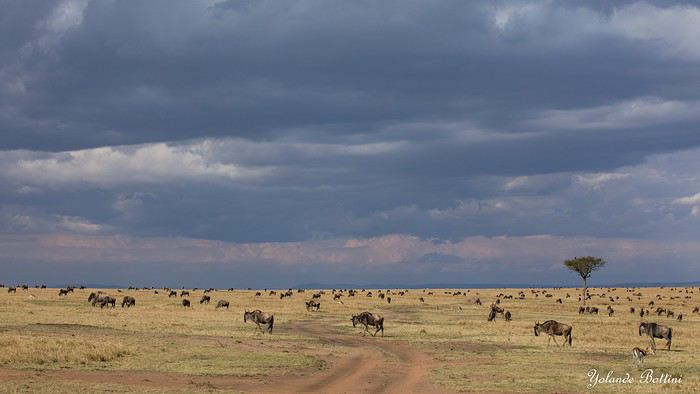
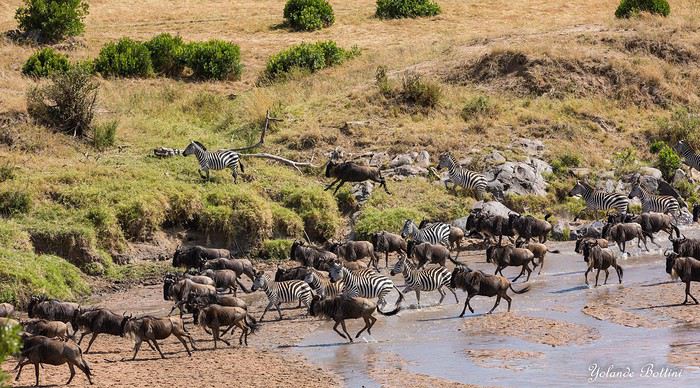
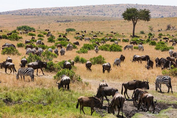
This account of a short stay in Kenya was originally meant for our friends and family, but to pass the time—for both us and you—and to add some content to the increasingly quiet columns of Voyage Forum during these weeks of confinement, when travelers can only journey in their minds, we decided to share the 25 pages of my ramblings, illustrated with Yolande’s photos, from an extraordinary stay in the Maasai Mara National Reserve. We waited until the two previous discussions on this same topic, filled with stunning photos and started by Régis and then Claire—sometimes in agreement, sometimes differing but always full of insights—had quieted down a bit before jumping in. Well, we’ll give it a try.
Let’s clarify: one of us claims to be a beginner photographer, and the other is just an unrepentant dreamer and modest writer. We often pursued our passions separately—Yolande with her mentor and me with an incomparable tracker—so sometimes the photos don’t quite match the text, or vice versa.
We hope you enjoy reading this lengthy post, which is longer than usual in VF’s sections (except, of course, for Mr. Voyajou). A thousand apologies for straying off the beaten path.
Alright, here we go!
Un petit tour au bout du monde: Ushuaïa English translation pending
Un libro como un viaje se comienza con inquietud y se termina con melancolía. José Vasconcelos Calderón
CHAPITRE 1 : USHUAÏA
Me voici à Londres, où m’attends une journée d’escale. Située assez loin dans ma liste personnelle des lieux à visiter, je suis quand même heureuse de pouvoir découvrir une nouvelle ville, pour le peu de temps que j’ai à y passer. Elle me fait penser à un Paris version Britannique. Je visite le British Museum : c’est une mine d’or historique et culturelle ( en plus on m’offre le guide audio ) ! Je vois Big Ben en travaux de loin, ainsi que Buckingham Palace. Je monte dans un des fameux bus rouge à étages, et m’arrête boire une bière locale dans un pub : en bref, je fais ma touriste de base.
Je comprends que l’on puisse aimer les grandes villes ( diversité et abondance culturelle, ambiance, tout à disposition, animation.. ), mais il m’est compliqué de faire abstraction du brouhaha incessant, des bruits de voitures, du mauvais temps, du stress qui pourrait se couper au couteau, et du béton omniprésent.
Je me dirige vers l’aéroport, et, 13h de vol, la sympathisation avec une française, 3h d’escale à Buenos Aires, et 4h de vol plus tard, me voici enfin à Ushuaïa ! Je suis heureuse d’avoir un pied sur le continent, et de pouvoir enfin démarrer mon voyage.
À l’atterrissage, je peux distinguer la Terre de Feu sous les nuages, avec ses îles et ses sommets enneigés. Ushuaïa est une petite ville dont le centre compte de petits chalets mignons, même si j’avoue, il y plane une odeur pesante de machine à fric. Le soir, je regarde la ville s’endormir avec le soleil, spectacle que je dois avouer très agréable.
Le lendemain, je me réveille tôt, auberge de jeunesse tmtc, on paie moins cher car on offre sa promiscuité. Je vais me faire tamponner le passeport à l’Office du tourisme, après avoir dégusté le petit déjeuner copieux de l’auberge ( avec du pain fait maison ! ).
Dans la matinée, je vais au Musée Maritime de l’Antarctique dans l’ancienne prison d’Ushuaia. Un prisonnier avait dessiné son portrait sur les murs de sa cellule. Toute une aile du musée est dédiée à l’entreprise Total, dont l’apologie est faite ( ils sauveraient les pingouins en Antarctique, et contribueraient à leur protection ). Je ris jaune très fort dans ma tête.
Dans l’après-midi, je teste l’Icebar. Le concept : un congélateur géant à -18 degrés, orné de sculptures de glace ( maintenues telles quelles depuis deux ans ), de la musique, et un vrai bar avec boissons à volonté. Je me bois trois cocktails dans des verres de glace, en papotant avec le barman. Je ne vois pas le temps passer, à part mes doigts qui commencent à se congeler : je reste en tout 40min, grand maximum pour la santé.
Je rentre à l’auberge frigorifiée, en pensant prendre une douche brûlante avant de dormir. Que Neni, je tombe sur une Suisse dans mon dortoir, paniquée car elle venait de se rendre compte qu’elle s’était faite voler sa carte bleue ! On accroche de suite et je me prends d’une envie de l’aider. On part donc en ville pour essayer de régler son problème, alors qu’on se connaît depuis à peine dix minutes. On va dans différentes institutions, réussit à appeler sa banque aux Etats Unis, et finalement, après quelques montagnes russes, on réussit à régler son problème. On va donc boire un coup pour se détendre, dans un bar Irlandais, où je recroise un français avec qui j’avais papoté. On parle durant des heures. Cette fille est incroyable, elle a une vie hors du commun. Elle me raconte ses péripéties, et on part dans de grandes conversations. Je passe une très bonne soirée.
Le lendemain, je pars pour la Estancia Tunel. Le colectivo ( minibus, ( attend d’être plein avant de partir selon les endroits )) n’accepte que la carte » Sube « , et pas le liquide. La conductrice, adorable, me laisse passer gratuitement. Je marche environ 45 minutes, avant d’arriver à la balise qui est malheureusement en travaux; on ne peut pas accéder à la forêt. Tant pis, je trouve un coin isolé et désert, entre la forêt et le bord du canal. Les pics enneigés, la verdure, les lacs : c’est magnifique et très agréable. Je pique-nique et me pose toute l’après-midi avant de rentrer. Un local très gentil passe sa carte Sube pour moi, et refuse que je le rembourse en liquide.
À l’auberge, je retrouve la Suisse qui a passé une sale journée. On fait le tour des hostals, pour qu’elle puisse trouver un volontariat afin de rester, seulement, on est entre deux périodes touristiques, et aucune auberge ne recherche de volontaires. On se boit une bouteille de vin au bord du lac, et rentre assez éméchées. Nos rires ont l’air d’agacer les deux autres personnes du dortoir, qui écoutent leurs telenovelas sans écouteurs H24 : ça leur fait les pieds un peu.
Le lendemain, incroyable en Amérique latine : le car arrive en avance. Je pars dans le parc national Tierra del Fuego. Cela fait trois jours que ma cheville droite me fait souffrir et a doublé de volume: après 1h30 de marche je fais du stop pour aller sur mon lieu de campement. J’avais prévu de faire le trek du Hito XXIV, le seul qui n’est pas enseveli sous la neige, mais ça ne sera pas possible pour aujourd’hui. En montant ma tente, je me rend compte que le problème vient de mes chaussures, qui sont devenues bien trop petites pour moi, et que l’os de mon pied creuse le cuir de la chaussure haha, c’est pour ça que ma cheville a autant gonflé.
Il y a un petit ruisseau, le coin est très agréable, et une fois tous les touristes partis, sachant que je suis la seule campeuse du parc, personne à des kilomètres, j’en profite pour chanter à tue-tête.
Je dors à peine ( des rafales de vent à 100km/h ça fait du bruit contre une tente ), mais je n’ai pas froid, mon sac de couchage a une température maximale de -5°.
Je fais le Hito XXIV en chaussettes, et 2h30 de marche plus tard, j’arrive à à la frontière officielle Chilienne, délimitée par un simple panneau et la fin du sentier. Avec la fonte des neiges, je suis trempée, mais bon, j’aurai vu le joli lac. Je croise deux magnifiques chevaux dans la forêt. Il y a un petit restau à côté de l’arrêt de bus, où le patron m’offre un thé, sûrement car j’ai été la seule idiote à camper par ce temps haha.
En rentrant, j’achète des baskets de piètre qualité, mais qui tiendront tous mes treks des quatre prochains mois.
En rentrant à l’auberge, j’apprends que la Suisse a pu trouver un couchsurfing. Je suis contente pour elle, même si on a pas échangé nos contacts.
Le lendemain, je me fais réveiller par une brésilienne, paniquée car des clients nous avaient enfermées à clé sans faire exprès. J’appelle mes proches, le lendemain je pars pour le Chili.
J'alimente régulièrement mon blog de mes récits de voyage également ! Si ça peut vous intéresser : lacobayeailee.com
CHAPITRE 1 : USHUAÏA
Me voici à Londres, où m’attends une journée d’escale. Située assez loin dans ma liste personnelle des lieux à visiter, je suis quand même heureuse de pouvoir découvrir une nouvelle ville, pour le peu de temps que j’ai à y passer. Elle me fait penser à un Paris version Britannique. Je visite le British Museum : c’est une mine d’or historique et culturelle ( en plus on m’offre le guide audio ) ! Je vois Big Ben en travaux de loin, ainsi que Buckingham Palace. Je monte dans un des fameux bus rouge à étages, et m’arrête boire une bière locale dans un pub : en bref, je fais ma touriste de base.
Je comprends que l’on puisse aimer les grandes villes ( diversité et abondance culturelle, ambiance, tout à disposition, animation.. ), mais il m’est compliqué de faire abstraction du brouhaha incessant, des bruits de voitures, du mauvais temps, du stress qui pourrait se couper au couteau, et du béton omniprésent.
Je me dirige vers l’aéroport, et, 13h de vol, la sympathisation avec une française, 3h d’escale à Buenos Aires, et 4h de vol plus tard, me voici enfin à Ushuaïa ! Je suis heureuse d’avoir un pied sur le continent, et de pouvoir enfin démarrer mon voyage.
À l’atterrissage, je peux distinguer la Terre de Feu sous les nuages, avec ses îles et ses sommets enneigés. Ushuaïa est une petite ville dont le centre compte de petits chalets mignons, même si j’avoue, il y plane une odeur pesante de machine à fric. Le soir, je regarde la ville s’endormir avec le soleil, spectacle que je dois avouer très agréable.
Le lendemain, je me réveille tôt, auberge de jeunesse tmtc, on paie moins cher car on offre sa promiscuité. Je vais me faire tamponner le passeport à l’Office du tourisme, après avoir dégusté le petit déjeuner copieux de l’auberge ( avec du pain fait maison ! ).
Dans la matinée, je vais au Musée Maritime de l’Antarctique dans l’ancienne prison d’Ushuaia. Un prisonnier avait dessiné son portrait sur les murs de sa cellule. Toute une aile du musée est dédiée à l’entreprise Total, dont l’apologie est faite ( ils sauveraient les pingouins en Antarctique, et contribueraient à leur protection ). Je ris jaune très fort dans ma tête.
Dans l’après-midi, je teste l’Icebar. Le concept : un congélateur géant à -18 degrés, orné de sculptures de glace ( maintenues telles quelles depuis deux ans ), de la musique, et un vrai bar avec boissons à volonté. Je me bois trois cocktails dans des verres de glace, en papotant avec le barman. Je ne vois pas le temps passer, à part mes doigts qui commencent à se congeler : je reste en tout 40min, grand maximum pour la santé.
Je rentre à l’auberge frigorifiée, en pensant prendre une douche brûlante avant de dormir. Que Neni, je tombe sur une Suisse dans mon dortoir, paniquée car elle venait de se rendre compte qu’elle s’était faite voler sa carte bleue ! On accroche de suite et je me prends d’une envie de l’aider. On part donc en ville pour essayer de régler son problème, alors qu’on se connaît depuis à peine dix minutes. On va dans différentes institutions, réussit à appeler sa banque aux Etats Unis, et finalement, après quelques montagnes russes, on réussit à régler son problème. On va donc boire un coup pour se détendre, dans un bar Irlandais, où je recroise un français avec qui j’avais papoté. On parle durant des heures. Cette fille est incroyable, elle a une vie hors du commun. Elle me raconte ses péripéties, et on part dans de grandes conversations. Je passe une très bonne soirée.
Le lendemain, je pars pour la Estancia Tunel. Le colectivo ( minibus, ( attend d’être plein avant de partir selon les endroits )) n’accepte que la carte » Sube « , et pas le liquide. La conductrice, adorable, me laisse passer gratuitement. Je marche environ 45 minutes, avant d’arriver à la balise qui est malheureusement en travaux; on ne peut pas accéder à la forêt. Tant pis, je trouve un coin isolé et désert, entre la forêt et le bord du canal. Les pics enneigés, la verdure, les lacs : c’est magnifique et très agréable. Je pique-nique et me pose toute l’après-midi avant de rentrer. Un local très gentil passe sa carte Sube pour moi, et refuse que je le rembourse en liquide.
À l’auberge, je retrouve la Suisse qui a passé une sale journée. On fait le tour des hostals, pour qu’elle puisse trouver un volontariat afin de rester, seulement, on est entre deux périodes touristiques, et aucune auberge ne recherche de volontaires. On se boit une bouteille de vin au bord du lac, et rentre assez éméchées. Nos rires ont l’air d’agacer les deux autres personnes du dortoir, qui écoutent leurs telenovelas sans écouteurs H24 : ça leur fait les pieds un peu.
Le lendemain, incroyable en Amérique latine : le car arrive en avance. Je pars dans le parc national Tierra del Fuego. Cela fait trois jours que ma cheville droite me fait souffrir et a doublé de volume: après 1h30 de marche je fais du stop pour aller sur mon lieu de campement. J’avais prévu de faire le trek du Hito XXIV, le seul qui n’est pas enseveli sous la neige, mais ça ne sera pas possible pour aujourd’hui. En montant ma tente, je me rend compte que le problème vient de mes chaussures, qui sont devenues bien trop petites pour moi, et que l’os de mon pied creuse le cuir de la chaussure haha, c’est pour ça que ma cheville a autant gonflé.
Il y a un petit ruisseau, le coin est très agréable, et une fois tous les touristes partis, sachant que je suis la seule campeuse du parc, personne à des kilomètres, j’en profite pour chanter à tue-tête.
Je dors à peine ( des rafales de vent à 100km/h ça fait du bruit contre une tente ), mais je n’ai pas froid, mon sac de couchage a une température maximale de -5°.
Je fais le Hito XXIV en chaussettes, et 2h30 de marche plus tard, j’arrive à à la frontière officielle Chilienne, délimitée par un simple panneau et la fin du sentier. Avec la fonte des neiges, je suis trempée, mais bon, j’aurai vu le joli lac. Je croise deux magnifiques chevaux dans la forêt. Il y a un petit restau à côté de l’arrêt de bus, où le patron m’offre un thé, sûrement car j’ai été la seule idiote à camper par ce temps haha.
En rentrant, j’achète des baskets de piètre qualité, mais qui tiendront tous mes treks des quatre prochains mois.
En rentrant à l’auberge, j’apprends que la Suisse a pu trouver un couchsurfing. Je suis contente pour elle, même si on a pas échangé nos contacts.
Le lendemain, je me fais réveiller par une brésilienne, paniquée car des clients nous avaient enfermées à clé sans faire exprès. J’appelle mes proches, le lendemain je pars pour le Chili.
J'alimente régulièrement mon blog de mes récits de voyage également ! Si ça peut vous intéresser : lacobayeailee.com
Botswana-Namibie octobre 2019... le retour English translation pending
Cette fois c’est à trois que nous ferons le voyage, un ami de longue date nous accompagnant.
A l’origine cela devait être notre premier voyage avec notre propre véhicule (stationné à Maun), malheureusement quelque temps avant mon contact sur place m’annonce qu’il y avait un « bruit » manifestement un problème au niveau de la boite de transfert. La pièce fautive devant venir d’Afrique du Sud le véhicule ne sera pas prêt pour notre venue. J’ai contacté Bushlore chez qui nous avions déjà loué un véhicule et ils nous ont appris qu’ils ont maintenant une agence à Maun et il ne leur reste plus qu’un Land Cruiser … nickel c’est la voiture reine sous ces latitudes. Nous acceptons, même si c’est plus cher que rouler avec notre propre véhicule, mais on n’a pas voulu annuler ou décaler le voyage.
C’est ainsi que nous partons, gaillards, de notre aéroport favori, Frankfurt le mardi 22 octobre à 22h40. Nous volerons sur Lufthansa. A titre d’information pour les futurs voyageurs, ça nous a couté moins cher d’acheter d’un côté un A/R FRA-JNB, de l’autre un JNB-MUB et en troisième un WDH-JNB, plutôt qu’un billet combiné.
Mercredi 23 octobre
Arrivée à 8h30 à JNB Vol BP212 Botswana Air à 11h20 … ça fait une longue escale ! Arrivée à Maun à 13h20
Sur place Bushlore nous attend, on va à leur agence faire l’état des lieux et remplir les papiers. Ensuite les courses, puis un tour chez Joe pour voir la voiture. Malheureusement, là il est déjà tard, on part de Maun vers 17h30 / 18h.
La piste de nuit vers Duncan Camp’s n’est pas top. On s’arrête une première fois demander notre route, le gars a les yeux rouges explosés … On voit une piste qui part à gauche et on voit les phares arriver de cette piste, chouette ça doit être là !... quand on arrive à leur hauteur on les hèle, dans le véhicule 4 noirs armés de fusils … aille, à mon avis ce sont des braconniers … pas cool tout ça.😮 On reprend la piste principale qui va vers Mababe. Le problème c’est que T4A ne connait pas la piste qui mène au camp et Osmand veut nous proposer des « raccourcis ». En fait il faut rester sur la piste principale jusqu’à ce qu’on croise un panneau indiquant le camp (de nuit c’est moins évident). La piste est très approximative et sablonneuse … ce qui devait arriver arriva, à un embranchement nous avons hésité entre deux ornières et on s’est ensablé. Ok, il fait nuit, ok on est au milieu de nulle part … pas de panique. Il ne faut surtout pas insister, on sort « tranquillement », on analyse la situation, pelletons un peu, une marche arrière, un choix d’ornières et c’est reparti. On navigue plus ou moins au cap car point de référence sur les cartes. Au bout d’un moment on voit de la lumière au loin et ouf c’est là !😎 Les gars du camp était venu à notre rencontre lorsqu’ils ont vu des phares se « promener ».
L’accueil a été chaleureux. Il n’y a que nous. Nous avons deux tentes sur les 4 dont dispose le camp. L’endroit est splendide au bord de la Thamalakane, l’ambiance aussi … incroyable, on n’arrive pas à s’imaginer qu’il y a encore quelques heures nous étions au milieu de la civilisation occidentale, frénétique. Qu’est-ce qu’on est bien.🙂 Ce n’est pas tout ça mais là il est temps de boire une petite bière …😛 Ensuite le chef viendra nous chercher, nous énoncera le menu. Vous n’imaginez pas comme on est bien là, seuls au milieu de la nature, avec les bruits des animaux, la douceur du climat, le sourire de nos hôtes et la bonne nourriture … génial nous sommes de nouveau en Afrique Australe. 🙂 😎
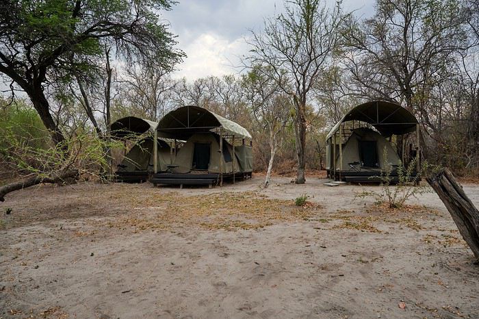
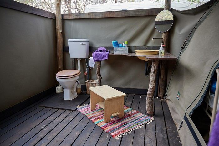
Vous l’aurez compris on recommande chaudement Duncan Camp ‘s. En revanche n’essayez pas d’y aller directement, réservation obligatoire et paiement soit par internet soit à Maun. La durée du trajet depuis Maun est de 1h30.
Version longue en cours de création ici
A l’origine cela devait être notre premier voyage avec notre propre véhicule (stationné à Maun), malheureusement quelque temps avant mon contact sur place m’annonce qu’il y avait un « bruit » manifestement un problème au niveau de la boite de transfert. La pièce fautive devant venir d’Afrique du Sud le véhicule ne sera pas prêt pour notre venue. J’ai contacté Bushlore chez qui nous avions déjà loué un véhicule et ils nous ont appris qu’ils ont maintenant une agence à Maun et il ne leur reste plus qu’un Land Cruiser … nickel c’est la voiture reine sous ces latitudes. Nous acceptons, même si c’est plus cher que rouler avec notre propre véhicule, mais on n’a pas voulu annuler ou décaler le voyage.
C’est ainsi que nous partons, gaillards, de notre aéroport favori, Frankfurt le mardi 22 octobre à 22h40. Nous volerons sur Lufthansa. A titre d’information pour les futurs voyageurs, ça nous a couté moins cher d’acheter d’un côté un A/R FRA-JNB, de l’autre un JNB-MUB et en troisième un WDH-JNB, plutôt qu’un billet combiné.
Mercredi 23 octobre
Arrivée à 8h30 à JNB Vol BP212 Botswana Air à 11h20 … ça fait une longue escale ! Arrivée à Maun à 13h20
Sur place Bushlore nous attend, on va à leur agence faire l’état des lieux et remplir les papiers. Ensuite les courses, puis un tour chez Joe pour voir la voiture. Malheureusement, là il est déjà tard, on part de Maun vers 17h30 / 18h.
La piste de nuit vers Duncan Camp’s n’est pas top. On s’arrête une première fois demander notre route, le gars a les yeux rouges explosés … On voit une piste qui part à gauche et on voit les phares arriver de cette piste, chouette ça doit être là !... quand on arrive à leur hauteur on les hèle, dans le véhicule 4 noirs armés de fusils … aille, à mon avis ce sont des braconniers … pas cool tout ça.😮 On reprend la piste principale qui va vers Mababe. Le problème c’est que T4A ne connait pas la piste qui mène au camp et Osmand veut nous proposer des « raccourcis ». En fait il faut rester sur la piste principale jusqu’à ce qu’on croise un panneau indiquant le camp (de nuit c’est moins évident). La piste est très approximative et sablonneuse … ce qui devait arriver arriva, à un embranchement nous avons hésité entre deux ornières et on s’est ensablé. Ok, il fait nuit, ok on est au milieu de nulle part … pas de panique. Il ne faut surtout pas insister, on sort « tranquillement », on analyse la situation, pelletons un peu, une marche arrière, un choix d’ornières et c’est reparti. On navigue plus ou moins au cap car point de référence sur les cartes. Au bout d’un moment on voit de la lumière au loin et ouf c’est là !😎 Les gars du camp était venu à notre rencontre lorsqu’ils ont vu des phares se « promener ».
L’accueil a été chaleureux. Il n’y a que nous. Nous avons deux tentes sur les 4 dont dispose le camp. L’endroit est splendide au bord de la Thamalakane, l’ambiance aussi … incroyable, on n’arrive pas à s’imaginer qu’il y a encore quelques heures nous étions au milieu de la civilisation occidentale, frénétique. Qu’est-ce qu’on est bien.🙂 Ce n’est pas tout ça mais là il est temps de boire une petite bière …😛 Ensuite le chef viendra nous chercher, nous énoncera le menu. Vous n’imaginez pas comme on est bien là, seuls au milieu de la nature, avec les bruits des animaux, la douceur du climat, le sourire de nos hôtes et la bonne nourriture … génial nous sommes de nouveau en Afrique Australe. 🙂 😎
Vous l’aurez compris on recommande chaudement Duncan Camp ‘s. En revanche n’essayez pas d’y aller directement, réservation obligatoire et paiement soit par internet soit à Maun. La durée du trajet depuis Maun est de 1h30.
Version longue en cours de création ici
On part en vadrouille dans l'ouest américain! Oui, encore... English translation pending
En ces temps difficiles qui nous obligent à trouver des occupations, je vous soumets ici un carnet que j'avais rédigé il y a quelques années et que je n'ai jamais publié ici... Bonne lecture (pour ceux que ça intéresse...)...
24 juillet - Itinéraire d’une famille gâtée
Envie de t’évader ? Envie de rêver ? Envie de t’amuser ? Oui ? Alors tu as frappé à la bonne adresse... Plus précisément à l’adresse de celui qui a attrapé un virus… En l’occurrence, moi… Et ce virus, pas question de m’en débarrasser en me bourrant d’antibiotiques. Non seulement, les antibiotiques, ce n’est pas automatique, mais ce virus-là, j’en prends grand soin. Je l’entretiens, même… Ce virus, c’est l’étasunite ! Je l’ai contracté le jour où j’ai posé mes arpions chez l’oncle Sam pour la première fois, il y a une décennie de cela. Tout ça ne me rajeunit pas mais depuis ce fameux jour, lui et moi, nous ne nous sommes plus jamais quittés. Un proverbe dit à ce sujet que si tu vas aux Etats-Unis une fois, tu y reviendras un jour… Ben moi, depuis, j’y suis même retourné deux autres fois ! Et figure-toi que si tu lis ces quelques lignes, c’est que je m’apprête à y retourner pour une quatrième vadrouille !... Pour cette fois-ci, je vais accomplir un de mes rêves ! Me faire la route 66 sur mon Harley avec une belle brune accrochée à ma taille... Manque de bol, ma femme est blonde, je n'ai pas le permis moto et nous avons deux louloutes de quatre et sept ans… Va donc falloir que je revoie mes plans...
Bon, si tu es un lecteur assidu de nos précédentes vadrouilles, nous n’avons plus de secret pour toi, si bien que tu sais déjà que nous sommes quatre, juste un an de plus par rapport à la dernière fois… Il y a bien évidemment Sandrine, ma femme alias le portefeuille ; Sasha, notre petite globetrotteuse de quatre ans ; et Anna notre routarde de sept ans et plus toutes ses dents... Ah, et je m’oubliais ! Moi, Franck, la trentaine bien tassée, alias le conducteur, le tour opérateur, le narrateur, le cuisinier, le… Oui, je sais, moi aussi, j’aimerais bien déléguer… Ah, mais j’oublie encore quelqu’un !… Toi… Mais bon, sauf le respect que je te dois, tu ne seras une nouvelle fois que le spectateur du film que nous allons tourner et interpréter… D’ailleurs, quel en sera le titre ?... Et bien après réflexion, on a le choix entre « Voyage entre geysers et déserts », ou alors « Sous le soleil de Beverly Hills »… Pour ce coup-là, en espérant ne pas les vexer, on décide de poser un lapin à Brandon et Brenda… Car oui, c’est décidé, cette nouvelle édition sera composée d'indiens, de geysers, de trappeurs, de pionniers, de bisons, de chercheurs d'or, de hors-la-loi, de ranchs et de cowboys ! A nous les grands espaces… et les gros hamburgers !!! A nous l’ouest américain et ses films qui donnent tant envie : Délivrance, la colline a des yeux, Shining, The Descent, ...
Mais un voyage comme celui-là, ça se prépare un ‘tiot peu. Premièrement, il faut du blé, du flouze, du fric, du pognon, des pépettes, de la caillasse… Ben oui, ça coûte cher tout ça, donc à moins de faire comme le PSG et te faire subventionner par un investisseur qatari, il va falloir que tu en mettes de côté. Deuxièmement, il faut un minimum de travail de préparation. Et je commencerai mon histoire par un retour dans le passé, un bond dans le temps pour revenir pile poil au moment où Sandrine a enfin craqué sous mes coups de butoir et m’a donné son ô combien précieuse approbation… « Allez, ok, c’est bon, fais-toi plaisir ! » Sans avoir réellement conscience de la portée de ces quelques mots, elle venait de me signer un contrat de travail d’un an ! Car moi, ni une, ni deux, j'ai employé toute une équipe de lutins pour m'aider à préparer mon itinéraire. Lecture de carnets de voyage, questions sur des forums, épluchage de guides, visionnage de films, essorage d’internet, … Au final, je dois dire que je suis plus que satisfait de leur boulot ! Ce qui me permet non pas de faire un bilan puisqu'heureusement, le voyage n'est pas commencé, mais plutôt un petit compte-rendu chiffré de ce qui nous attend. Huit états à traverser ou à effleurer, plus de cinq mille kilomètres à parcourir, vingt jours pleins sur place, deux hôtels, quatorze campings différents, huit heures de décalage... Mes trois blondes vont-elles le supporter ? Optimiste que je suis, je mise sur un grand « Oui » ! D’ailleurs, pour les préparer, j’ai mis en place un programme intensif trois mois avant le départ : Marche autour de notre immense propriété, westerns tous les soirs, Coca et hamburgers à volonté à tous les repas !... Et oui, qui ménage sa monture voyage plus souvent !
Avant de tailler la route, je profite de cette intro pour publier une petite annonce à destination des cambrioleurs amateurs de textes de voyage : passez votre route, ma maison est équipée d’une alarme biométrique avec double varifocale et matrice de commutation. De plus, j’ai loué à un pote du neuf trois son gros pitbull pour l’occasion. Sans compter que pendant nos vacances, ma maison va être occupée par mes parents qui sont tous les deux experts en arts martiaux !... D’ailleurs, pourquoi je te raconte ces bobards alors que tu ne connais même pas mon adresse… C'est le 25, avenue des canaris à Triffouillis-sur-Retourne... Euh, merci de ne pas m’envoyer de carte postale à l'adresse ci-dessus... c'est une fausse !
Bon, chut, ça y est, c’est l’heure de l’évaluation… On va savoir si toute la famille est prête pour le grand départ : « Sandrine, donne-moi les huit états dans lesquels nous allons poser les pieds... - Colorado, Wyoming, Nebraska, Dakota du sud, Montana, Idaho, Utah et... euh... mince, oh, je l’ai sur le bout de la langue… Ah oui, l’Arizona !!!… - Mouais… C’était moins une… Encore un peu et tu n’partais pas avec nous ! Et toi, Anna, cite-moi les quatre présidents sculptés sur le Mont Rushmore ? - Abram Licol, Tomasse Washington, George Jeffessonne et Theodore Rousevelle... - Ok, on va dire que c’est bon… Et toi, Sasha, dans quel pays allons-nous cet été ? - Les Jétajuniiiiis de l’Amérique de Mickey ! » Ok, c’est bon, elles sont fin prêtes ! Attention, départ imminent !
24 juillet - Itinéraire d’une famille gâtée
Envie de t’évader ? Envie de rêver ? Envie de t’amuser ? Oui ? Alors tu as frappé à la bonne adresse... Plus précisément à l’adresse de celui qui a attrapé un virus… En l’occurrence, moi… Et ce virus, pas question de m’en débarrasser en me bourrant d’antibiotiques. Non seulement, les antibiotiques, ce n’est pas automatique, mais ce virus-là, j’en prends grand soin. Je l’entretiens, même… Ce virus, c’est l’étasunite ! Je l’ai contracté le jour où j’ai posé mes arpions chez l’oncle Sam pour la première fois, il y a une décennie de cela. Tout ça ne me rajeunit pas mais depuis ce fameux jour, lui et moi, nous ne nous sommes plus jamais quittés. Un proverbe dit à ce sujet que si tu vas aux Etats-Unis une fois, tu y reviendras un jour… Ben moi, depuis, j’y suis même retourné deux autres fois ! Et figure-toi que si tu lis ces quelques lignes, c’est que je m’apprête à y retourner pour une quatrième vadrouille !... Pour cette fois-ci, je vais accomplir un de mes rêves ! Me faire la route 66 sur mon Harley avec une belle brune accrochée à ma taille... Manque de bol, ma femme est blonde, je n'ai pas le permis moto et nous avons deux louloutes de quatre et sept ans… Va donc falloir que je revoie mes plans...
Bon, si tu es un lecteur assidu de nos précédentes vadrouilles, nous n’avons plus de secret pour toi, si bien que tu sais déjà que nous sommes quatre, juste un an de plus par rapport à la dernière fois… Il y a bien évidemment Sandrine, ma femme alias le portefeuille ; Sasha, notre petite globetrotteuse de quatre ans ; et Anna notre routarde de sept ans et plus toutes ses dents... Ah, et je m’oubliais ! Moi, Franck, la trentaine bien tassée, alias le conducteur, le tour opérateur, le narrateur, le cuisinier, le… Oui, je sais, moi aussi, j’aimerais bien déléguer… Ah, mais j’oublie encore quelqu’un !… Toi… Mais bon, sauf le respect que je te dois, tu ne seras une nouvelle fois que le spectateur du film que nous allons tourner et interpréter… D’ailleurs, quel en sera le titre ?... Et bien après réflexion, on a le choix entre « Voyage entre geysers et déserts », ou alors « Sous le soleil de Beverly Hills »… Pour ce coup-là, en espérant ne pas les vexer, on décide de poser un lapin à Brandon et Brenda… Car oui, c’est décidé, cette nouvelle édition sera composée d'indiens, de geysers, de trappeurs, de pionniers, de bisons, de chercheurs d'or, de hors-la-loi, de ranchs et de cowboys ! A nous les grands espaces… et les gros hamburgers !!! A nous l’ouest américain et ses films qui donnent tant envie : Délivrance, la colline a des yeux, Shining, The Descent, ...
Mais un voyage comme celui-là, ça se prépare un ‘tiot peu. Premièrement, il faut du blé, du flouze, du fric, du pognon, des pépettes, de la caillasse… Ben oui, ça coûte cher tout ça, donc à moins de faire comme le PSG et te faire subventionner par un investisseur qatari, il va falloir que tu en mettes de côté. Deuxièmement, il faut un minimum de travail de préparation. Et je commencerai mon histoire par un retour dans le passé, un bond dans le temps pour revenir pile poil au moment où Sandrine a enfin craqué sous mes coups de butoir et m’a donné son ô combien précieuse approbation… « Allez, ok, c’est bon, fais-toi plaisir ! » Sans avoir réellement conscience de la portée de ces quelques mots, elle venait de me signer un contrat de travail d’un an ! Car moi, ni une, ni deux, j'ai employé toute une équipe de lutins pour m'aider à préparer mon itinéraire. Lecture de carnets de voyage, questions sur des forums, épluchage de guides, visionnage de films, essorage d’internet, … Au final, je dois dire que je suis plus que satisfait de leur boulot ! Ce qui me permet non pas de faire un bilan puisqu'heureusement, le voyage n'est pas commencé, mais plutôt un petit compte-rendu chiffré de ce qui nous attend. Huit états à traverser ou à effleurer, plus de cinq mille kilomètres à parcourir, vingt jours pleins sur place, deux hôtels, quatorze campings différents, huit heures de décalage... Mes trois blondes vont-elles le supporter ? Optimiste que je suis, je mise sur un grand « Oui » ! D’ailleurs, pour les préparer, j’ai mis en place un programme intensif trois mois avant le départ : Marche autour de notre immense propriété, westerns tous les soirs, Coca et hamburgers à volonté à tous les repas !... Et oui, qui ménage sa monture voyage plus souvent !
Avant de tailler la route, je profite de cette intro pour publier une petite annonce à destination des cambrioleurs amateurs de textes de voyage : passez votre route, ma maison est équipée d’une alarme biométrique avec double varifocale et matrice de commutation. De plus, j’ai loué à un pote du neuf trois son gros pitbull pour l’occasion. Sans compter que pendant nos vacances, ma maison va être occupée par mes parents qui sont tous les deux experts en arts martiaux !... D’ailleurs, pourquoi je te raconte ces bobards alors que tu ne connais même pas mon adresse… C'est le 25, avenue des canaris à Triffouillis-sur-Retourne... Euh, merci de ne pas m’envoyer de carte postale à l'adresse ci-dessus... c'est une fausse !
Bon, chut, ça y est, c’est l’heure de l’évaluation… On va savoir si toute la famille est prête pour le grand départ : « Sandrine, donne-moi les huit états dans lesquels nous allons poser les pieds... - Colorado, Wyoming, Nebraska, Dakota du sud, Montana, Idaho, Utah et... euh... mince, oh, je l’ai sur le bout de la langue… Ah oui, l’Arizona !!!… - Mouais… C’était moins une… Encore un peu et tu n’partais pas avec nous ! Et toi, Anna, cite-moi les quatre présidents sculptés sur le Mont Rushmore ? - Abram Licol, Tomasse Washington, George Jeffessonne et Theodore Rousevelle... - Ok, on va dire que c’est bon… Et toi, Sasha, dans quel pays allons-nous cet été ? - Les Jétajuniiiiis de l’Amérique de Mickey ! » Ok, c’est bon, elles sont fin prêtes ! Attention, départ imminent !