Results for "Cap+Creus+|+9+>+206"
19296 results found.
Vols intérieurs en Australie English translation pending
Bonjour,
Je pars en juin en Australie et je vais devoir effectuer 2 vols intérieurs. Les prix sont assez élevés, et le boomerong-pass n'existe plus apparement depuis 2005. Quels sont les bons plans pour avoir des réductions sur les vols intérieurs? J'ai lu qu'on pouvait avoir des réductions assez importantes en montrant son billet international chez Qantas, vous avez testé/vérifé?
Merci :0)
Nataly
Je pars en juin en Australie et je vais devoir effectuer 2 vols intérieurs. Les prix sont assez élevés, et le boomerong-pass n'existe plus apparement depuis 2005. Quels sont les bons plans pour avoir des réductions sur les vols intérieurs? J'ai lu qu'on pouvait avoir des réductions assez importantes en montrant son billet international chez Qantas, vous avez testé/vérifé?
Merci :0)
Nataly
Adresses de communautés en France pour vivre autrement English translation pending
bonjour,
je suis à la recherche d'adresse et de région où il existerait des petits villages où des gens ont décidés de vivre autrement. Des gens de la ville qui quittent la ville pour s'installer à la campagne...
Des villages qui décident de s'auto gérer.
des fermes qui décident de respecter la nature....
Si vous avez des adresses...
merci de me les communiquer!
merci pour votre aide!
Biking (MTB) along the Canal between the Two Seas (France)
Why bike (MTB) along the canal between the Two Seas: the lateral canal of the Garonne from Bordeaux to Toulouse, and the Midi Canal from Toulouse to the Mediterranean?
This canal was created to connect the Mediterranean to the Atlantic without going around Spain, and along its entire length, there’s an old towpath (used to pull barges). Since this path is closed to traffic (except for service vehicles from Voies Navigables de France), no cars drive on it—it’s dangerous, noisy, and polluting. The Canal between the Two Seas was built for transporting goods, so it passes through many towns you can explore without dealing with traffic. You can stock up on supplies or spend the night. You’ll discover the varied landscapes of the countryside, always in the serenity brought by the calm and slow flow of the canal’s water. Most of the time, you’ll be in the shade of trees planted to stabilize the banks with their roots. All you have to do is follow this blue—or rather green—ribbon without needing to consult a map. But the biggest advantage is that it’s flat! Of course, on the Canal du Midi, water flows from the watershed divide at Naurouze eastward to the Mediterranean and westward to Toulouse. On the lateral canal of the Garonne, water flows toward Bordeaux. But this slope is almost imperceptible, which is a huge plus when you want to travel by bike for several days with luggage.
When I say "bike," I really mean MTB because, while the towpath has been replaced in some places by a paved bike path, it mostly resembles a dirt trail—sometimes smooth, sometimes rocky, and often cluttered with roots from the magnificent trees lining it. Since the canal was classified as a UNESCO World Heritage site, improvements have been underway, but it won’t be tomorrow that you’ll be able to ride from Bordeaux to Sète on a road bike. And I’m afraid the first sections of the path will be worn out before the rest is finished. You might even run into construction work for this bike path. That’s what happened to me during the spring of 2007.
Sunday, 03/11 – Valence d'Agen 08:15 to Toulouse (Rangueil) 16:30 97 km in 8h15 (6h on the bike) I started on the recently paved path along the lateral canal of the Garonne. The first locks appeared, and as I approached Moissac, the path turned into a billiard table until Castelsarrasin. After the Cousteau port, I was back on the classic dirt towpath with its rocks, roots, and nutria holes. But not for long—soon, I hit ruts left by backhoes and bulldozers, which, fortunately, were resting for the Sunday. A pile of rubble taller than me blocked the entire width of the path. I didn’t want to turn back to find the previous bridge and ride on the other bank, which was just as impassable (dense grass). It wasn’t easy to carry a bike with full panniers, so I lifted it over several mounds. I kept going, sometimes on foot, unsure how far the construction extended. Another bulldozer—luckily, the ground was dry. The work went all the way to Montech, making the path impassable. I recommend taking the N113, which runs parallel (that’s what I did on the way back). In Montech, the famous water slope was at rest, waiting for tourists. For many kilometers, I was back on the traditional towpath. The closer I got to Toulouse, the better the surface became, and the more cyclists and pedestrians I saw—until the city center, where there was nonstop bike traffic, especially students heading to Rangueil.
Monday, 03/12 – Rangueil 09:10 to Revel 16:30 86 km in 7h20 (5h30 on the bike) As soon as you reach Toulouse, you make a 90° turn to follow the connection between the lateral canal and the Canal du Midi. Heading east, you pass the barge selling the famous Toulouse violet souvenirs. A real bike path has been built for 50 km to Port Lauragais. It’s a true joy for Toulousains and travelers. Restrooms have been installed or shared with highway rest areas, allowing you to refill water (of course, bikes are banned from ASF rest areas, but cleverly placed racks let you secure your bike and walk in). At Port Lauragais, it’s another rest area shared by highway users, cyclists, and boaters. You’ll find a cafeteria, restaurant, hotel, and a shop selling regional souvenirs. But the real pleasure is reaching the watershed divide at Naurouze, where water flows toward the Mediterranean on one side and the Atlantic on the other. There, I decided to leave the Canal du Midi, which continues toward Castelnaudary with a much rougher towpath, to follow the *Rigole* that feeds the canal with water from the Saint-Ferréol basin. For me, it was like returning to the source—a bit like a pilgrimage in honor of the brilliant Pierre-Paul Riquet, the designer of this magnificent work. I followed the service trail along the *Rigole*. It’s actually a variant of the GR 653, leading to Revel alongside this artificial waterway. It’s fed by water from the Montagne Noire, and I was worried about a steep climb. But that wasn’t the case—the *Rigole* winds for 40 km, flowing gently under the trees. It was better than a dream: a smooth dirt path with the crunch of pine needles under the wheels, where I only crossed paths with a few fishermen... And to soothe sore buns, the last kilometers were on packed earth—a paradise (ATVs, stay away!). More walkers and cyclists appeared there.
Tuesday, 03/13 After a restful night in Revel, I started the morning with a walk around Lake Saint-Ferréol. A very pleasant 10 km hike, but I don’t recommend it for mountain bikers unless you’re used to mountain terrain and have strong calves. Otherwise, you can take the road—there are at least two hotels near the lake. In the afternoon, I began the return trip to Tarn-et-Garonne via the same path, with the same pleasure.
Total: 378 km of suffering and bliss, for which I must thank the departmental and regional councils for their funding, Voies Navigables de France for maintenance, and the volunteers who mark the hiking trails. And don’t you think you’re exaggerating a bit with your 378 km of bliss and the paradise of the *Rigole*?
Okay, fine—it wasn’t always idyllic. Sometimes the path was downright *pierrique*... but I had great weather, and the landscapes were so beautiful (water, sun, vegetation). In the rain or mud, it would’ve been less fun. What does *pierrique* even mean?
*Pierrique* is worse than rocky. I know a Pierrick, and he’s tough. And why *Facteur4*?
It’s France’s goal to reduce greenhouse gas emissions by a factor of 4 by 2050. I’m doing my part by biking to work 3 out of 4 times. And your cassoulet?
Guilty as charged. I ate the best cassoulet of my life at the Hôtel du Midi in Revel. But it was very productive in methane. My stomach hurt so much I couldn’t sleep and ended up writing my postcards between 3 and 4 AM. So many great memories!
This canal was created to connect the Mediterranean to the Atlantic without going around Spain, and along its entire length, there’s an old towpath (used to pull barges). Since this path is closed to traffic (except for service vehicles from Voies Navigables de France), no cars drive on it—it’s dangerous, noisy, and polluting. The Canal between the Two Seas was built for transporting goods, so it passes through many towns you can explore without dealing with traffic. You can stock up on supplies or spend the night. You’ll discover the varied landscapes of the countryside, always in the serenity brought by the calm and slow flow of the canal’s water. Most of the time, you’ll be in the shade of trees planted to stabilize the banks with their roots. All you have to do is follow this blue—or rather green—ribbon without needing to consult a map. But the biggest advantage is that it’s flat! Of course, on the Canal du Midi, water flows from the watershed divide at Naurouze eastward to the Mediterranean and westward to Toulouse. On the lateral canal of the Garonne, water flows toward Bordeaux. But this slope is almost imperceptible, which is a huge plus when you want to travel by bike for several days with luggage.
When I say "bike," I really mean MTB because, while the towpath has been replaced in some places by a paved bike path, it mostly resembles a dirt trail—sometimes smooth, sometimes rocky, and often cluttered with roots from the magnificent trees lining it. Since the canal was classified as a UNESCO World Heritage site, improvements have been underway, but it won’t be tomorrow that you’ll be able to ride from Bordeaux to Sète on a road bike. And I’m afraid the first sections of the path will be worn out before the rest is finished. You might even run into construction work for this bike path. That’s what happened to me during the spring of 2007.
Sunday, 03/11 – Valence d'Agen 08:15 to Toulouse (Rangueil) 16:30 97 km in 8h15 (6h on the bike) I started on the recently paved path along the lateral canal of the Garonne. The first locks appeared, and as I approached Moissac, the path turned into a billiard table until Castelsarrasin. After the Cousteau port, I was back on the classic dirt towpath with its rocks, roots, and nutria holes. But not for long—soon, I hit ruts left by backhoes and bulldozers, which, fortunately, were resting for the Sunday. A pile of rubble taller than me blocked the entire width of the path. I didn’t want to turn back to find the previous bridge and ride on the other bank, which was just as impassable (dense grass). It wasn’t easy to carry a bike with full panniers, so I lifted it over several mounds. I kept going, sometimes on foot, unsure how far the construction extended. Another bulldozer—luckily, the ground was dry. The work went all the way to Montech, making the path impassable. I recommend taking the N113, which runs parallel (that’s what I did on the way back). In Montech, the famous water slope was at rest, waiting for tourists. For many kilometers, I was back on the traditional towpath. The closer I got to Toulouse, the better the surface became, and the more cyclists and pedestrians I saw—until the city center, where there was nonstop bike traffic, especially students heading to Rangueil.
Monday, 03/12 – Rangueil 09:10 to Revel 16:30 86 km in 7h20 (5h30 on the bike) As soon as you reach Toulouse, you make a 90° turn to follow the connection between the lateral canal and the Canal du Midi. Heading east, you pass the barge selling the famous Toulouse violet souvenirs. A real bike path has been built for 50 km to Port Lauragais. It’s a true joy for Toulousains and travelers. Restrooms have been installed or shared with highway rest areas, allowing you to refill water (of course, bikes are banned from ASF rest areas, but cleverly placed racks let you secure your bike and walk in). At Port Lauragais, it’s another rest area shared by highway users, cyclists, and boaters. You’ll find a cafeteria, restaurant, hotel, and a shop selling regional souvenirs. But the real pleasure is reaching the watershed divide at Naurouze, where water flows toward the Mediterranean on one side and the Atlantic on the other. There, I decided to leave the Canal du Midi, which continues toward Castelnaudary with a much rougher towpath, to follow the *Rigole* that feeds the canal with water from the Saint-Ferréol basin. For me, it was like returning to the source—a bit like a pilgrimage in honor of the brilliant Pierre-Paul Riquet, the designer of this magnificent work. I followed the service trail along the *Rigole*. It’s actually a variant of the GR 653, leading to Revel alongside this artificial waterway. It’s fed by water from the Montagne Noire, and I was worried about a steep climb. But that wasn’t the case—the *Rigole* winds for 40 km, flowing gently under the trees. It was better than a dream: a smooth dirt path with the crunch of pine needles under the wheels, where I only crossed paths with a few fishermen... And to soothe sore buns, the last kilometers were on packed earth—a paradise (ATVs, stay away!). More walkers and cyclists appeared there.
Tuesday, 03/13 After a restful night in Revel, I started the morning with a walk around Lake Saint-Ferréol. A very pleasant 10 km hike, but I don’t recommend it for mountain bikers unless you’re used to mountain terrain and have strong calves. Otherwise, you can take the road—there are at least two hotels near the lake. In the afternoon, I began the return trip to Tarn-et-Garonne via the same path, with the same pleasure.
Total: 378 km of suffering and bliss, for which I must thank the departmental and regional councils for their funding, Voies Navigables de France for maintenance, and the volunteers who mark the hiking trails. And don’t you think you’re exaggerating a bit with your 378 km of bliss and the paradise of the *Rigole*?
Okay, fine—it wasn’t always idyllic. Sometimes the path was downright *pierrique*... but I had great weather, and the landscapes were so beautiful (water, sun, vegetation). In the rain or mud, it would’ve been less fun. What does *pierrique* even mean?
*Pierrique* is worse than rocky. I know a Pierrick, and he’s tough. And why *Facteur4*?
It’s France’s goal to reduce greenhouse gas emissions by a factor of 4 by 2050. I’m doing my part by biking to work 3 out of 4 times. And your cassoulet?
Guilty as charged. I ate the best cassoulet of my life at the Hôtel du Midi in Revel. But it was very productive in methane. My stomach hurt so much I couldn’t sleep and ended up writing my postcards between 3 and 4 AM. So many great memories!
Des photos! Des photos!! English translation pending
Bon! Alors voilà la photo:
Où se trouve cette horloge???
Où se trouve cette horloge???
Afrique du Sud en octobre 2006 English translation pending
Bonjour à tous ! De retour d’Afrique du sud après un séjour de 3 ½ semaines nous tenons à remercier tous ceux qui nous ont fait bénéficier de leurs précieux conseils et qui font vivre ce forum. Du coup, nous mettons en ligne notre carnet de route afin que d’autres puissent en bénéficier.
Merci aussi à Franck et Sophie pour leur atlas routier qui nous a été indispensable !
Jeudi 21 Septembre 2006 : Départ Paris CDG à 18H55. Vendredi 22 Septembre 2006 : Arrivée à Capetown à 9H55.
Prise en charge de la voiture à l’aéroport et première mauvaise surprise : l’air-conditionné ne fonctionne pas et on s’en rend compte trop tard ! Tant pis, direction le backpaker ASHANTI et 2ème mauvaise surprise : suite à un malentendu notre réservation a été annulée ! Finalement n’ayant plus de chambre dispo ils nous surclassent dans une double room ensuite (superbe !). Bref, bonne adresse avec de nombreuses activités proposées (day trip, saut en élastique, shark diving, etc…).
Puis, nous enfilons nos chaussures de rando pour effectuer l’ascension de la Table Mountain par le chemin Platteklip Gorge (2H15 depuis le pied du téléphérique). La vue est superbe d’autant que le ciel est dégagé. Nous redescendrons par le téléférique (R60/pers.), allons prendre une douche puis allons dîner au Waterfront (sans plus).
P.S : Mieux vaut avoir toujours dans sa poche une petite poignée de pièces e quelques rands car il est coutumier de laisser 2 ou 3 rands au type qui surveille le coin où vous vous garez.
Samedi 23 Septembre 2006 : Le Cap/La Route des Vins/ Hermanus
Levés de bonne heure et départ vers Stellenbosch et ses vignobles.
Visite de trois domaines :
· Fort Simon : Difficile d’y accéder mais une super adresse ! Dégustation gratuite et ils prennent le temps. Leur Shiraz est +++. C’est le domaine que j’ai préféré.
· Zevenwacht : A éviter ! Ils utilisent le même verre pour la dégustation des différents vins en les rinçant avec de l’eau au goût infecte qui vient parasiter le vin ! En + c’est payant !
· Vergelegen : Très beau domaine où l’on peut prendre le temps de s’y promener. L’entrée et les dégustations sont payantes mais le site est vraiment sympa et les vins de qualité.
P.S : éviter la visite des vignobles le WE car le samedi ils ferment plus tôt et le dimanche beaucoup sont fermés.
Ensuite route vers Franschhoek (ville où les Huguenots français commencèrent au XVIIème siècle la culture de la vigne). Bof, bof. On prend donc la route d’Hermanus pour débarquer dans la ville vers 18H (il fait donc nuit) et nous rendre compte que tous les hôtels et B&B sont complets en raison de l’ouverture de la fête de la baleine (60000 personnes attendues pour le WE pour une ville comptant 25000 habitants !!!). Nous rebroussons donc chemin et trouvons à 20 min d’Hermanus l’Arabella golf club (http://www.arabellagolf.co.za/). Pour entrer il faut montrer patte blanche et on se rend vite compte que l’on va exploser le budget mais on est crevé, il est tard et on a envie de se pauser. On est accueilli comme dans un palace (on nous tient la porte, nous offre une boisson…) et la nana de la réception nous propose une chambre nous précisant qu’elle nous fait un discount à R1700 (en jetant un coup d’œil sur son ordi j’ai vu que la chambre était à R2700). On négocie un peu et finalement on s’en sort à R1050 avec le petit dèj inclus. La chambre est magnifique avec vue sur le golf et l’océan, petit caramel sur l’oreiller et salle de bain avec une cloison amovible entre la sdb et la chambre pour avoir une vue sur l’océan lorsque l’on prend son bain ! Dimanche 24 Septembre 2006 : Hermanus/Le Cap. Nous passons une bonne partie de la journée à Hermanus pour observer les baleines (je n’aurais jamais cru qu’elles s’approchaient si près de la côte !!!). C’est un moment magique, on les voit sauter et plonger. On est heureux d’avoir pensé à prendre les jumelles ! Après ce spectacle nous retournons à Cape town où nous finissons bien la journée en visitant les jardins botaniques de Kirstenbosch. Une bonne petite ballade dans un parc très agréable et bien foutu. Le soir dîner sur la beach road chez « Perla » (bof, bof). Lundi 25 Septembre 2006 : Le Cap – Péninsule du cap de Bonne espérnce – Le Cap. Nous partons de bonne heure vers Simon’s Town, dont la plage abrite une colonie de manchots (Boulders NP ; R20/pers.). Un conseil, faites comme nous et arrivez tôt et commencez par l’accès à la plage! Vous aurez la chance de surprendre les manchots qui ne sont pas encore assaillis de touristes et que l’on peut alors approcher d’assez près (y’en a même un qui paniqué c’est retrouvé bloqué sur un chemin étroit juste entre nous et deux autres personnes). De même, tentez l’escalade des rocher pour accéder aux coins un peu moins fréquentés de la plage. Bref on a passé un bon moment et ces petites bêtes sont vraiment amusantes à observer…
Ensuite nous avons repris la route pour la Réserve du Cap de Bonne Espérance (R45/pers. Et les prix ne cessent d’augmenter…c’était R35 il y a 3 ans). Nous avons garé la voiture à Cape point et nous avons « grimpé » jusqu’au phare, puis nous avons eu la bonne idée de rejoindre le Cap de Bonne Espérance par le chemin à pieds, une petite ballade qui se fait normalement en moins d’une heure mais pour laquelle nous avons mis beaucoup plus…En effet, en contre bas de ce chemin il y a une plage magnifique et en général déserte (sûrement parceque les touristes comme moi n’imaginent pas que l’on puisse se baigner au bout du monde !!!) et je n’ai pas résisté à l’envie d’aller piquer une petite tête dans l’eau (en caleçon et sans serviette pour me sécher).
Voilà, après l’inévitable photo devant le panneau du Cap de Bonne Espérance nous sommes rentrés à Capetown où nous avons eu la mauvaise idée de nous balader dans les rues du centre vers 17H00 (il fait nuit à 18H) et où nous ne nous sommes pas sentis en sécurité (et ce sera la seule fois du voyage, hors des grandes villes nous n’avons eu aucun problème et on s’est toujours senti très bien). Des groupes de jeunes pas très sympas et plutôt agressifs et lourds dingues harcelaient les rares touristes qui avaient eu la même idée que nous… On a fait illico presto demi-tour et on était content de retrouver le Backpacker. Ce qui est écrit dans les guides n’est pas une légende, à partir de 17-18H les blancs rentrent chez eux dans leurs bunkers archi sécurisés et les rues sont désertées…
Conseil : Attention, selon les endroits où vous achetez vos timbres pour les cartes postales car vous ne paierez pas le même prix !!! Bref, achetez les plutôt ailleurs que dans les endroits où s’entassent les touristes. Mardi 26 Septembre 2006 : Vol de 8H50 Le Cap-Durban. Départ vers l’aéroport en début de matinée et envol pour Durban où nous prenons en charge notre 2ème voiture de location. Nous passerons 2H dans l’agence de location car nous sommes en fin de mois et je n’ai pas les R15000 de dépôt de garantie qu’ils demandent pour le Nissan X-trail que nous avons réservé (un 4x4 étant indispensable pour nous car nous voulions traverser le Lésotho et avoir un véhicule un peu surélevé pour l’observation des animaux au Kruger). Finalement on s’en sort parcequ’on arrive à bloquer une partie de l’argent sur mon compte et une autre sur celui d’Anne. Enfin, passé ce moment difficile nous faisons route vers le Sani Pass sous une pluie battante et nous nous arrêtons à Underberg afin de trouver où dormir. Finalement après quelques négociations nous logerons à Penwarn country lodge (http://www.penwarn.com/) où nous sommes accueillis par une loutre facétieuse dont le principal plaisir est de se frotter à vous pour se sécher lorsqu’elle sort de l’eau. Excellente adresse où nous avons goûté du gnou et passé un bon moment dans un cadre magnifique (R300/pers). Nous y rencontrons deux français (coucou Nathalie et François) avec qui nous décidons de franchir le Sani Pass le lendemain. Mercredi 27 Septembre 2006 : Sani Pass-Lesotho Après une dernière bataille pour faire sortir Nemrod (la loutre) qui s’est sournoisement introduit dans notre chambre en profitant d’un bref moment d’inattention, nous prenons la route du Lesotho. Le 4x4 s’avère rapidement indispensable (d’autant qu’il a plu la veille) et j’en profite même pour essayer de le pousser un peu…M’enfin, à force de vouloir jouer aux Colin Mc Rae de pacotille je fini par abîmer un peu le bas de caisse en faisant rebondir la voiture sur un rocher (rien de grave heureusement !). Au sommet nous mangeons une bricole au Sani Top Chalet (le pub le plus haut d’Afrique du Sud). Il fait froid, il y a même de la neige et le vent nous glace mais faisons une (courte) balade digestive afin de profiter du magnifique panorama. Initialement Anne et moi avions décidé de traverser le Lésotho afin de rejoindre le Royal Natal mais on a vite abandonné cette idée vu l’état des routes. Nous redescendons donc coté Sud Africain vers 16H et reprenons la route vers le royal Natal après avoir échangé nos mails avec Nathalie et François. Nous irons jusqu’à Rosetta pour y trouver un B&B (bof). 20 Km Jeudi 28 Septembre 2006 : Direction Royal Natal NP. Départ de Rosetta pour nous rapprocher du Royal Natal. La route est bonne et nous arrivons vers 11H dans la petite ville de Phuthaditjhaba où l’office du tourisme nous trouve une chambre chez l’habitant. Comme il était encore un peu tôt pour terminer notre journée, nous nous sommes rendus sans conviction au Basotho Cultural Village, un musée vivant qui retrace le mode de vie traditionnel des Basotho (dixit le Lonely). Et bien nous avons passé un excellent moment, avec un guide extra et de nombreux fous rires ! Je vous conseille vivement cette visite qui ne paie pas de mine sur le papier mais qui est sympa comme tout ! Ensuite nous avons mangé et somme partis faire une petite balade au Golden Gate NP (bof, bof) avant de rentrer à Phuthaditjhaba.
Pour la petite histoire, Phuthaditjhaba est une ville de 45000 habitants où nous n’avons pas rencontré un seul blanc ! Nous avons fait nos courses au Bibi Market (çà ne s’invente pas !) où les locaux étaient amusés de voir deux touristes blancs paumés au milieu de leurs rayons. Certains souriaient, d’autres feignaient l’indifférence…une expérience vraiment étrange !
Vendredi 29 Septembre 2006 : Rando dans le Royal Natal NP : The Sentinel On débarque à 8H sur le parking du Sentinel et on entame la rando. Super rando, sympa et tout et tout, d’autant qu’il n’y a pas foule si on part tôt (au retour pr contre nous croiserons beaucoup plus de monde y compris des groupes de 8-10 pers.). L’aller se fait en 3H pour des randonneurs moyens et le retour en 2H30. La particularité de cette rando ce sont les 2 « chain ladders » (des échelles à flanc de rocher) à gravir juste avant d’arriver au sommet. D’en haut on a une superbe vue et peut continuer un peu en suivant le petit cours d’eau qui se termine de l’autre coté de la vallée en se jetant dans le vide. Nuit passée à l’hôtel “Mont aux sources” aux portes du parc du Royal Natal (bof, bof). Samedi 30 Septembre 2006 : Rando dans le Royal Natal NP : Tugela Gorge. Autre rando sympa (mais beaucoup plus fréquentée, même tôt le matin) la « Tugela Gorge » permet de rejoindre le pied de l’amphithéâtre en ~7H de rando A/R. Il vaut mieux ne pas oublier crème solaire et bouteilles d’eau lorsqu’il fait chaud (d’ailleurs c’est idem pour la rando du Sentinel) ! Le petit truc sympa de cette rando c’est de gravir les « chain ladders » à l’aller et de retourner par le tunnel creusé par la rivière où vous aurez de l’eau (glacée) jusqu’au torse ! Après cette journée on était tellement crevé qu’on était persuadé qu’il fallait qu’on se rapproche de Hluhluwe où nous avions réservé pour la nuit suivante alors qu’on avait encore un jour de battement qu’on aurait pu passer à Giants Castle NP. Tans pis, ce sera pour la prochaine fois ! Du coup on a dormi sur la route du Royal Natal au niveau de Dundee dans un backpacker au style très British et au patron (?) très sympa (Royal Confort Inn). Dimanche 1er Octobre 2006 : Santa Lucia. Vu qu’on a une journée à occuper (encore une fois dommage pour Giants Castle NP) on la passe à Santa Lucia. Ville sans grand intérêt mis à part la plage (petite baignade) que je n’ai pas trouvé si terrible que çà. Bref, on peut s’en passer. Nuit au BIB’s International conseillé dans les guides mais vraiment pourri !
Lundi 2 Octobre 2006 : Réserve de Hluhluwe-Umfolozi (nuit dans le parc de Hluhluwe) Youpi ! Aujourd’hui c’est notre premier parc animalier…la grande découverte… Hluhluwe-Umfolozi est une réserve connue notamment pour ses rhinocéros blancs (y’en a tout plein) et noirs (beaucoup plus rares). On y trouve également des buffles, des zèbres, des phacochères, des impalas… et on a même vu des Lycaons (Wild Dogs). Pas beaucoup d’éléphants par contre et peu de félins.
Que dire de cette journée sinon qu’on a compris la magie de l’observation dans ces parcs. On peut passer 10 fois au même endroit sans rien voir et la voiture qui passe 2min derrière vous tombe nez à nez avec un guépard ! De même, vous pouvez voir traverser 7 rhino, la scène durant une minute à peine et la voiture qui arrive 2 minutes plus tard se demande en vous voyant repartir pourquoi vous vous êtes arrêté ! Enfin, on a ADORE, toute cette première journée on l’a passée du coté d’Umfolozi et avec le recul on l’a préféré au coté Hluhluwe mais vous comprendrez ensuite pourquoi… On a passé la nuit à Mpila Camp dans le parc où on a vu 2 hyènes courser des impalas (passant à 100m de notre bungalow). Nous avons passé la nuit en compagnie d’un groupe d’impalas qui a dormi juste à coté du camp (non clôturé contrairement au Kruger). En passant la lampe de poche la nuit autour du bungalow je voyais les dizaines d’yeux d’impalas briller d’un coté et de l’autre cité (dans les bois) il y avait 3 paires d’yeux qui les observaient (des hyènes j’imagine…). On a passé une superbe nuit ! P.S : j’oubliais, lampe de poche indispensable car l’électricité est coupée de 22H à 8H du mat. Mardi 3 Octobre 2006 : Hluhluwe – Swaziland. Debout à 4H du mat ! Ce matin on fait une « Morning Walk ». Départ à 5H avec le guide (fusil à la main) dans un brouillard à couper au couteau qui nous plonge dans une drôle d’ambiance…D’ailleurs on n’est que trois (Anne, le guide et moi) car les 6 autres personnes inscrites ne se sont pas pointées sûrement à cause du temps. On marche une bonne demi-heure et tout d’un coup le ranger stoppe, il nous montre lentement une espèce de rocher dans la brume…on regarde et là MIRACLE, le rocher bouge ! On arrête de respirer et le cœur bat plus vite…il s’agit d’un rhino qui se lève, se tourne vers nous puis s’éloigne en trottinant…visiblement on l’a réveillé ! Autre rencontre sympa, on a vu un buffle qui nous a fait trembler en faisant un demi-tour un petit peu brutal, et enfin le ranger s’est bien foutu de notre poire lorsque nous avons sursauté de peur quand une espèce de petite bête poilue a bondi (en hurlant) du terrier sur lequel on s’était penché (c’est français ce que j’écris ?). Malheureusement la ballade s’est terminée sous une pluie diluvienne qui nous a trempé jusqu’aux os ! Retour au camp à 8H où on s’est changé avant de reprendre le 4x4 pour nous diriger vers Hluhluwe. Nous passons la matinée à Hluhluwe et alors que nous avions décidé de quitter le parc pour rejoindre le Swaziland nous sommes tombés nez à nez (ou plutôt pare-choc à corne) avec un Rhino (l’air patibulaire mais presque…). Le Rhino a traversé la route et ne résistant pas à l’envie de me rapprocher un peu pour le filmer j’ai avancé juste un chouillat…Le rhino s’est arrêté, a fait demi-tour, et est venu se planter face à nous à 5 mètres de la voiture…Là les suées ont commencées, Anne était terrorisée et moi j’en menais pas large non plus…Du coup je décide de mettre un peu de distance entre l’animal et nous (et j’apprendrais plus tard que c’était une erreur !). Je passe la marche arrière et commence à reculer tout doucement…Du coup la grosse boule grise se met à s’avancer vers nous et je commence à reculer un peu plus vite…Nouvelle erreur car là il se met carrément à courir vers nous…Alors imaginez, en marche arrière, à fond les ballons, sur une route défoncée, ne pouvant quitter des yeux le rhino et ne jetant qu’épisodiquement des coups d’oeils dans le rétro pour voir ou j’allais, j’ai pas fais 300m que j’ai planté le 4x4 dans le fossé ! Voyant l’animal à deux doigt de nous percuter j’ai eu l’ultime réflexe de l’automobiliste impuissant…j’ai klaxonné…le rhino s’est arrêté, nous a regardé 5 secondes et, en grand vainqueur, s’en est allé d’où il était venu… Nous, nous étions plantés là comme 2 ploucs car la voiture (tout 4x4 qu’elle était) était embourbée et ne bougeait plus d’un pouce. Heureusement des Allemands qui passaient par là nous ont ramenés au camp le plus proche et ont géré l’appel aux rangers (ils ont été supers ! Ils ont sacrifié une demi-journée d’observation pour nous aider à trouver quelqu’un pour nous dépanner !). On a poireauté quelques heures (apparemment ce genre de situation n’arrive pas souvent) avant qu’un ranger vienne nous prendre dans son 4x4 équipé pour le transport des touristes (même pas un véhicule de dépannage) et nous ramener à la voiture (sous un orage impressionnant qui a éclaté et à 1H30 de la fermeture des portes du parc). Arrivés à la voiture on a vu une lueur d’inquiétude dans son regard car pour nous sortir du fossé il n’avait sur lui qu’une ficelle d’un demi centimètre de diamètre (il ne pensait pas qu’on avait planté un 4x4!). Mais finalement, après un premier essai infructueux, il a juste réussi à tirer juste ce qu’il faut la voiture pour que les 4 roues motrices prennent le relais et fassent le reste. Bref, on s’est remis en route sous la pluie, roulant à fond les ballons (tant pis pour la limitation de vitesse de 40Km/h) pour rejoindre la sortie du parc avant la fermeture. Sur la route nous observerons notre premier éléphant mais comme il était à proximité de 3 rhinos on n’a pas trainé…la scène nous a même paru un peu irréelle (probablement à cause du choc, de la pluie battante, et d’une légère brume…). On passera la nuit à Pogola à la frontière Sud du Swaziland.
Mercredi 4 Octobre 2006 : Swaziland – Réserve de Kruger. Au matin on reprend la route et on décide de traverser le Swaziland d’une traite parce qu’on n’a pas vraiment le temps de faire autre chose. Sans l’épisode du rhino on aurait du dormir à proximité de Mlilwane et passer une partie de la journée dans ce parc qui paraissait très très sympa. A noter : Pour entrer il faut payer une taxe de R50/voiture et Mbabane la capitale n’est pas belle (et il est impossible de s’y garer). Par contre les Swazis sont très sympas et souriants. On passera la nuit à Malelane à proximité de l’entrée sud du Kruger. Jeudi 5, Vendredi 6 à Samedi 7 Octobre 2006 : Visite du Parc National de Kruger. 3 journées entières à Kruger dont 3 nuits dans le parc (1 nuit à Skukuza, 1 nuit à Orpen et une nuit à Oliphant). Je ne détaillerai pas ces trois journées bien que (avec Umfolozi) c’est ce que j’ai préféré de l’Afrique du Sud ! On a vu les big five, 7 guépards d’un coup qui se doraient la pilule sur un gros rocher, deux lions savourant les restes d’un gnou, un troupeau de buffles allant se désaltérer au point d’eau et ayant traversé à 2m de la voiture, un éléphant prendre un bain de boue, des girafes majestueuses, des impalas sympas (on en a vu deux bondir très haut pour ce qui ressemblait à une parade amoureuse et c’était vraiment impressionnant !), des troupeaux d’éléphants traverser devant nous, des tas d’oiseaux multicolores, des vautours (attendant que les lions aient fini leur repas), des aigles, des zèbres, des gnous, des koudous, des phacochères… On a fait un sunrise drive et un sunset drive. Le matin c’est bof, bof (c’est là qu’on a vu les 7 guépards mais bon, c’était pas follement intéressant) et la nuit c’est spécial mais le temps d’observation est très bref (on a vu des hyènes, des chats sauvages et un léopard). Bref, on a préféré la morning walk d’Umfolozi. Enfin, on se rend compte qu’il y a une différence fondamentale entre voir des animaux et observer des animaux ! Voir 2 minutes deux lions se dorer la pilule au soleil çà n’a aucun intérêt alors que les voir manger ou chasser c’est fantastique. De même, voir 7 guépards c’est bien mais çà n’a rien de comparable avec l’observation d’un troupeau de buffles ou d’éléphants qui vont se désaltérer ! Bref, vous l’aurez compris, je préfère voir un groupe d’impalas bondir que deux léopards endormis !!!
Dimanche 8 Octobre 2006 : Blyde River Canyon (nuit à Hoedspruit ou Graskop) : Dernière ballade dans au nord d’Oliphant où nous apercevons l’ombre fugace d’un chacal. Pas beaucoup d’animaux observés dans ce coin à part une horde d’éléphant dont deux individus créeront un embrouillage en décidant de se planter au milieu de la route pour manger !
Ensuite nous prenons la route vers la Blyde River Canyon. Ce canyon d’environ 30 km constitue un des panoramas les plus étonnants mais nous le trouverons quelconque…Après coup je pense que notre déception a résidé en trois point…1) on était amer de quitter le Kruger, 2) l’année dernière nous étions dans l’ouest américain (Grand Canyon) et ces paysages nous ont paru bof, bof et 3) çà nous a gavé que tout soit payant (on a vu les Three rondavelsmais pas les Bourke’s Luck Potholes car çà frôlait l’extorsion de fond). Nous avons également fait un détour vers les Lisbon falls (tout pourris). Nuit à l’hôtel dans le centre de Graskop (piscine + ils ont eu l’idée originale de faire décorer chacune de leur chambre par un artiste différent !). Lundi 9 Octobre 2006 Blyde River Canyon (Graskop) – Johannesburg (400Km/4H) Petit déjeuner puis petite marche (1H30 A/R) vers les Forest Falls (cascade aussi large que haute). Puis route vers Johannesburg.
Mardi 10 Octobre 2006 : Johannesburg - Soweto – Musée de l’Apartheid. Nous n’avions initialement pas inscrit la visite de Soweto à notre programme mais la curiosité l’a finalement emporté et nous y sommes allés accompagnés d’un guide. Que dire sinon que la visite n’aurait pas grand intérêt si elle se limitait à visiter cette suite de baraquements miteux et tristes où s’entasse une population qu’on a laissée pour compte. Mais voilà, la possibilité de discuter avec un gars du cru permet de toucher du doigt l’organisation incroyable de cette mégalopole qui compte 1, 5 à 3, 5 millions d’habitants (enfin on sait pas trop). Sinon, nous avons surtout adoré le musée de l’Apartheid qui nous a permis de comprendre beaucoup de choses sur les comportements et discours des Sud-Africains. Nous ne nous rendions pas compte que les évènements qui ont amenés à la chute de l’apartheid (enfin sur le papier en tout cas) étaient si récents et surtout qu’ils avaient été si violents… Mercredi 11 Octobre 2006 : Vol Johannesburg (départ 9H15) – Chutes Victoria (arrivée 11H) Arrivée au Zimbabwe en fin de matinée et queue interminable à l’aéroport pour accéder au tamponneur de visa…le visa qui coûte 30$/pers pour une simple entrée. Nous avons déposé nos affaires au Kalai lodge et sommes allé à pied aux chutes Victoria (20-30 min de marche - entrée 20$/pers.). Après la visite des chutes on retourne en ville et on se rend compte qu’on est au centre d’un immense parc d’attraction pour touristes friqués…On vous propose des safaris, des ballades en hélico, du rafting, du saut à l’élastique… Comme nous sommes ici encore 2 jours nous réservons la journée de descente en rafting sur le Zambèze (85$) et l’excursion au parc de Chobé (120$) pour le surlendemain. Sinon coté population nous n’avons eu aucun problème (même en rentrant à pied du centre à 22H après un resto), comme c’est un pays très pauvre on est beaucoup sollicité par les marchants d’artisanat local mais ils ne sont pas oppressants ou trop insistants. Sur notre séjour nous n’avons jamais pris le taxi (ils vous demandent 5$ pour un trajet de 2km !!!) hors trajets d’aéroport.
Conseils pratiques : 1 - Ici toutes les activités + hébergements se paient en USD donc prévoir assez d’argent sur vous. Pour nous çà n’était pas le cas et on été à deux doigts de ne pas pouvoir payer le lodge car ici il est impossible de retirer des USD. Finalement on s’en est sorti lorsqu’on est allé au parc de Chobé qui se trouve au Bostwana ou nous avons du retirer des poulas (monnaie locale) au guichet pour ensuite les changer en dollars ! Bref on ils se sont biens sucrés en commission !!! M’enfin si y’a un truc vraiment prise de tête c’est qu’ici tout le monde veut des USD alors qu’il est impossible de s’en procurer. Ah oui, autre chose, pour eux 1€ = 1$ donc ne payez pas en euros ! 2- Pour les petites dépenses (marché, boissons, restos) payez en dollar Zimbabwéen (Zim$) car ils ont un mode de conversion en USD assez déconcertant…Autre conseil, on ne le répètera pas assez, ne changez pas votre agent dans la rue malgré les taux avantageux que l’on peut vous proposer (beaucoup d’arnaque et en plus c’est illégal). Changez votre argent que dans une banque ou retirez les Zim$ dans un distributeur. 3- Pas besoin de payer pour les visas pour entrer au Bostwana ou pour le retour au Zimbabwe si vous passez par un tour opérator.
Jeudi 12 Octobre 2006 : Rafting sur le Zambèze : Journée de rafting mémorable au pied des chutes ! On est passé par une société qui s’appelle ShearWatter (http://www.shearwateradventures.com/rafting/default.asp) et on va leur faire une pub d’enfer parce qu’ils sont excellents !!! Pour cette expérience (qui vaut 100 sauts à l’élastique) il vaut mieux être en bonne forme physique, savoir nager et ne pas avoir peur des coups ! Durant la descente le raft est ballotté, secoué voire retourné par les rapides qui sont parmi les plus difficiles du monde. Vraiment inoubliable, en plus le soir ils vous projettent la vidéo de la journée (ils filment quelques passages de rafting) ce qui permet d’aller boire un coup et de manger un morceau avec tout le monde. On a passé une bonne soirée. Perso on n’a pas acheté la vidéo parce que 40$ c’est quand même abuser.
Vendredi 13 Octobre 2006 : Safari à Chobé (Entre victoria et Chobé : 90 Km) Journée complète de safari dans le parc qui s'étend sur 12 000 km² et accueille de grandes concentrations animales. Nous avons fait 1 safari en bateau le matin où nous avons vu des hyppos, des crocos et surtout des éléphants nager !!! L’après midi safari classique en voiture où nous verrons 3 lions (coup de bol quoiqu’ils étaient en train de faire la sieste donc bof) mais surtout une petite troupe de 7 éléphants qui se sont arrêtés un bref instant dans une flaque de boue pour prendre un petit bain…Magnifique !
Samedi 14 Octobre 2006 : Départ des Chutes Victoria (11H15) pour Johannesburg (13H30) puis départ de Johannesburg pour Paris (19H45) = 6H00 d’attente. Dimanche 15 Octobre 2006 : Arrivée à Paris à 7H00 du matin. Fin du voyage…Snif…
P.S : éviter la visite des vignobles le WE car le samedi ils ferment plus tôt et le dimanche beaucoup sont fermés.
Ensuite route vers Franschhoek (ville où les Huguenots français commencèrent au XVIIème siècle la culture de la vigne). Bof, bof. On prend donc la route d’Hermanus pour débarquer dans la ville vers 18H (il fait donc nuit) et nous rendre compte que tous les hôtels et B&B sont complets en raison de l’ouverture de la fête de la baleine (60000 personnes attendues pour le WE pour une ville comptant 25000 habitants !!!). Nous rebroussons donc chemin et trouvons à 20 min d’Hermanus l’Arabella golf club (http://www.arabellagolf.co.za/). Pour entrer il faut montrer patte blanche et on se rend vite compte que l’on va exploser le budget mais on est crevé, il est tard et on a envie de se pauser. On est accueilli comme dans un palace (on nous tient la porte, nous offre une boisson…) et la nana de la réception nous propose une chambre nous précisant qu’elle nous fait un discount à R1700 (en jetant un coup d’œil sur son ordi j’ai vu que la chambre était à R2700). On négocie un peu et finalement on s’en sort à R1050 avec le petit dèj inclus. La chambre est magnifique avec vue sur le golf et l’océan, petit caramel sur l’oreiller et salle de bain avec une cloison amovible entre la sdb et la chambre pour avoir une vue sur l’océan lorsque l’on prend son bain ! Dimanche 24 Septembre 2006 : Hermanus/Le Cap. Nous passons une bonne partie de la journée à Hermanus pour observer les baleines (je n’aurais jamais cru qu’elles s’approchaient si près de la côte !!!). C’est un moment magique, on les voit sauter et plonger. On est heureux d’avoir pensé à prendre les jumelles ! Après ce spectacle nous retournons à Cape town où nous finissons bien la journée en visitant les jardins botaniques de Kirstenbosch. Une bonne petite ballade dans un parc très agréable et bien foutu. Le soir dîner sur la beach road chez « Perla » (bof, bof). Lundi 25 Septembre 2006 : Le Cap – Péninsule du cap de Bonne espérnce – Le Cap. Nous partons de bonne heure vers Simon’s Town, dont la plage abrite une colonie de manchots (Boulders NP ; R20/pers.). Un conseil, faites comme nous et arrivez tôt et commencez par l’accès à la plage! Vous aurez la chance de surprendre les manchots qui ne sont pas encore assaillis de touristes et que l’on peut alors approcher d’assez près (y’en a même un qui paniqué c’est retrouvé bloqué sur un chemin étroit juste entre nous et deux autres personnes). De même, tentez l’escalade des rocher pour accéder aux coins un peu moins fréquentés de la plage. Bref on a passé un bon moment et ces petites bêtes sont vraiment amusantes à observer…
Ensuite nous avons repris la route pour la Réserve du Cap de Bonne Espérance (R45/pers. Et les prix ne cessent d’augmenter…c’était R35 il y a 3 ans). Nous avons garé la voiture à Cape point et nous avons « grimpé » jusqu’au phare, puis nous avons eu la bonne idée de rejoindre le Cap de Bonne Espérance par le chemin à pieds, une petite ballade qui se fait normalement en moins d’une heure mais pour laquelle nous avons mis beaucoup plus…En effet, en contre bas de ce chemin il y a une plage magnifique et en général déserte (sûrement parceque les touristes comme moi n’imaginent pas que l’on puisse se baigner au bout du monde !!!) et je n’ai pas résisté à l’envie d’aller piquer une petite tête dans l’eau (en caleçon et sans serviette pour me sécher).
Voilà, après l’inévitable photo devant le panneau du Cap de Bonne Espérance nous sommes rentrés à Capetown où nous avons eu la mauvaise idée de nous balader dans les rues du centre vers 17H00 (il fait nuit à 18H) et où nous ne nous sommes pas sentis en sécurité (et ce sera la seule fois du voyage, hors des grandes villes nous n’avons eu aucun problème et on s’est toujours senti très bien). Des groupes de jeunes pas très sympas et plutôt agressifs et lourds dingues harcelaient les rares touristes qui avaient eu la même idée que nous… On a fait illico presto demi-tour et on était content de retrouver le Backpacker. Ce qui est écrit dans les guides n’est pas une légende, à partir de 17-18H les blancs rentrent chez eux dans leurs bunkers archi sécurisés et les rues sont désertées…
Conseil : Attention, selon les endroits où vous achetez vos timbres pour les cartes postales car vous ne paierez pas le même prix !!! Bref, achetez les plutôt ailleurs que dans les endroits où s’entassent les touristes. Mardi 26 Septembre 2006 : Vol de 8H50 Le Cap-Durban. Départ vers l’aéroport en début de matinée et envol pour Durban où nous prenons en charge notre 2ème voiture de location. Nous passerons 2H dans l’agence de location car nous sommes en fin de mois et je n’ai pas les R15000 de dépôt de garantie qu’ils demandent pour le Nissan X-trail que nous avons réservé (un 4x4 étant indispensable pour nous car nous voulions traverser le Lésotho et avoir un véhicule un peu surélevé pour l’observation des animaux au Kruger). Finalement on s’en sort parcequ’on arrive à bloquer une partie de l’argent sur mon compte et une autre sur celui d’Anne. Enfin, passé ce moment difficile nous faisons route vers le Sani Pass sous une pluie battante et nous nous arrêtons à Underberg afin de trouver où dormir. Finalement après quelques négociations nous logerons à Penwarn country lodge (http://www.penwarn.com/) où nous sommes accueillis par une loutre facétieuse dont le principal plaisir est de se frotter à vous pour se sécher lorsqu’elle sort de l’eau. Excellente adresse où nous avons goûté du gnou et passé un bon moment dans un cadre magnifique (R300/pers). Nous y rencontrons deux français (coucou Nathalie et François) avec qui nous décidons de franchir le Sani Pass le lendemain. Mercredi 27 Septembre 2006 : Sani Pass-Lesotho Après une dernière bataille pour faire sortir Nemrod (la loutre) qui s’est sournoisement introduit dans notre chambre en profitant d’un bref moment d’inattention, nous prenons la route du Lesotho. Le 4x4 s’avère rapidement indispensable (d’autant qu’il a plu la veille) et j’en profite même pour essayer de le pousser un peu…M’enfin, à force de vouloir jouer aux Colin Mc Rae de pacotille je fini par abîmer un peu le bas de caisse en faisant rebondir la voiture sur un rocher (rien de grave heureusement !). Au sommet nous mangeons une bricole au Sani Top Chalet (le pub le plus haut d’Afrique du Sud). Il fait froid, il y a même de la neige et le vent nous glace mais faisons une (courte) balade digestive afin de profiter du magnifique panorama. Initialement Anne et moi avions décidé de traverser le Lésotho afin de rejoindre le Royal Natal mais on a vite abandonné cette idée vu l’état des routes. Nous redescendons donc coté Sud Africain vers 16H et reprenons la route vers le royal Natal après avoir échangé nos mails avec Nathalie et François. Nous irons jusqu’à Rosetta pour y trouver un B&B (bof). 20 Km Jeudi 28 Septembre 2006 : Direction Royal Natal NP. Départ de Rosetta pour nous rapprocher du Royal Natal. La route est bonne et nous arrivons vers 11H dans la petite ville de Phuthaditjhaba où l’office du tourisme nous trouve une chambre chez l’habitant. Comme il était encore un peu tôt pour terminer notre journée, nous nous sommes rendus sans conviction au Basotho Cultural Village, un musée vivant qui retrace le mode de vie traditionnel des Basotho (dixit le Lonely). Et bien nous avons passé un excellent moment, avec un guide extra et de nombreux fous rires ! Je vous conseille vivement cette visite qui ne paie pas de mine sur le papier mais qui est sympa comme tout ! Ensuite nous avons mangé et somme partis faire une petite balade au Golden Gate NP (bof, bof) avant de rentrer à Phuthaditjhaba.
Pour la petite histoire, Phuthaditjhaba est une ville de 45000 habitants où nous n’avons pas rencontré un seul blanc ! Nous avons fait nos courses au Bibi Market (çà ne s’invente pas !) où les locaux étaient amusés de voir deux touristes blancs paumés au milieu de leurs rayons. Certains souriaient, d’autres feignaient l’indifférence…une expérience vraiment étrange !
Vendredi 29 Septembre 2006 : Rando dans le Royal Natal NP : The Sentinel On débarque à 8H sur le parking du Sentinel et on entame la rando. Super rando, sympa et tout et tout, d’autant qu’il n’y a pas foule si on part tôt (au retour pr contre nous croiserons beaucoup plus de monde y compris des groupes de 8-10 pers.). L’aller se fait en 3H pour des randonneurs moyens et le retour en 2H30. La particularité de cette rando ce sont les 2 « chain ladders » (des échelles à flanc de rocher) à gravir juste avant d’arriver au sommet. D’en haut on a une superbe vue et peut continuer un peu en suivant le petit cours d’eau qui se termine de l’autre coté de la vallée en se jetant dans le vide. Nuit passée à l’hôtel “Mont aux sources” aux portes du parc du Royal Natal (bof, bof). Samedi 30 Septembre 2006 : Rando dans le Royal Natal NP : Tugela Gorge. Autre rando sympa (mais beaucoup plus fréquentée, même tôt le matin) la « Tugela Gorge » permet de rejoindre le pied de l’amphithéâtre en ~7H de rando A/R. Il vaut mieux ne pas oublier crème solaire et bouteilles d’eau lorsqu’il fait chaud (d’ailleurs c’est idem pour la rando du Sentinel) ! Le petit truc sympa de cette rando c’est de gravir les « chain ladders » à l’aller et de retourner par le tunnel creusé par la rivière où vous aurez de l’eau (glacée) jusqu’au torse ! Après cette journée on était tellement crevé qu’on était persuadé qu’il fallait qu’on se rapproche de Hluhluwe où nous avions réservé pour la nuit suivante alors qu’on avait encore un jour de battement qu’on aurait pu passer à Giants Castle NP. Tans pis, ce sera pour la prochaine fois ! Du coup on a dormi sur la route du Royal Natal au niveau de Dundee dans un backpacker au style très British et au patron (?) très sympa (Royal Confort Inn). Dimanche 1er Octobre 2006 : Santa Lucia. Vu qu’on a une journée à occuper (encore une fois dommage pour Giants Castle NP) on la passe à Santa Lucia. Ville sans grand intérêt mis à part la plage (petite baignade) que je n’ai pas trouvé si terrible que çà. Bref, on peut s’en passer. Nuit au BIB’s International conseillé dans les guides mais vraiment pourri !
Lundi 2 Octobre 2006 : Réserve de Hluhluwe-Umfolozi (nuit dans le parc de Hluhluwe) Youpi ! Aujourd’hui c’est notre premier parc animalier…la grande découverte… Hluhluwe-Umfolozi est une réserve connue notamment pour ses rhinocéros blancs (y’en a tout plein) et noirs (beaucoup plus rares). On y trouve également des buffles, des zèbres, des phacochères, des impalas… et on a même vu des Lycaons (Wild Dogs). Pas beaucoup d’éléphants par contre et peu de félins.
Que dire de cette journée sinon qu’on a compris la magie de l’observation dans ces parcs. On peut passer 10 fois au même endroit sans rien voir et la voiture qui passe 2min derrière vous tombe nez à nez avec un guépard ! De même, vous pouvez voir traverser 7 rhino, la scène durant une minute à peine et la voiture qui arrive 2 minutes plus tard se demande en vous voyant repartir pourquoi vous vous êtes arrêté ! Enfin, on a ADORE, toute cette première journée on l’a passée du coté d’Umfolozi et avec le recul on l’a préféré au coté Hluhluwe mais vous comprendrez ensuite pourquoi… On a passé la nuit à Mpila Camp dans le parc où on a vu 2 hyènes courser des impalas (passant à 100m de notre bungalow). Nous avons passé la nuit en compagnie d’un groupe d’impalas qui a dormi juste à coté du camp (non clôturé contrairement au Kruger). En passant la lampe de poche la nuit autour du bungalow je voyais les dizaines d’yeux d’impalas briller d’un coté et de l’autre cité (dans les bois) il y avait 3 paires d’yeux qui les observaient (des hyènes j’imagine…). On a passé une superbe nuit ! P.S : j’oubliais, lampe de poche indispensable car l’électricité est coupée de 22H à 8H du mat. Mardi 3 Octobre 2006 : Hluhluwe – Swaziland. Debout à 4H du mat ! Ce matin on fait une « Morning Walk ». Départ à 5H avec le guide (fusil à la main) dans un brouillard à couper au couteau qui nous plonge dans une drôle d’ambiance…D’ailleurs on n’est que trois (Anne, le guide et moi) car les 6 autres personnes inscrites ne se sont pas pointées sûrement à cause du temps. On marche une bonne demi-heure et tout d’un coup le ranger stoppe, il nous montre lentement une espèce de rocher dans la brume…on regarde et là MIRACLE, le rocher bouge ! On arrête de respirer et le cœur bat plus vite…il s’agit d’un rhino qui se lève, se tourne vers nous puis s’éloigne en trottinant…visiblement on l’a réveillé ! Autre rencontre sympa, on a vu un buffle qui nous a fait trembler en faisant un demi-tour un petit peu brutal, et enfin le ranger s’est bien foutu de notre poire lorsque nous avons sursauté de peur quand une espèce de petite bête poilue a bondi (en hurlant) du terrier sur lequel on s’était penché (c’est français ce que j’écris ?). Malheureusement la ballade s’est terminée sous une pluie diluvienne qui nous a trempé jusqu’aux os ! Retour au camp à 8H où on s’est changé avant de reprendre le 4x4 pour nous diriger vers Hluhluwe. Nous passons la matinée à Hluhluwe et alors que nous avions décidé de quitter le parc pour rejoindre le Swaziland nous sommes tombés nez à nez (ou plutôt pare-choc à corne) avec un Rhino (l’air patibulaire mais presque…). Le Rhino a traversé la route et ne résistant pas à l’envie de me rapprocher un peu pour le filmer j’ai avancé juste un chouillat…Le rhino s’est arrêté, a fait demi-tour, et est venu se planter face à nous à 5 mètres de la voiture…Là les suées ont commencées, Anne était terrorisée et moi j’en menais pas large non plus…Du coup je décide de mettre un peu de distance entre l’animal et nous (et j’apprendrais plus tard que c’était une erreur !). Je passe la marche arrière et commence à reculer tout doucement…Du coup la grosse boule grise se met à s’avancer vers nous et je commence à reculer un peu plus vite…Nouvelle erreur car là il se met carrément à courir vers nous…Alors imaginez, en marche arrière, à fond les ballons, sur une route défoncée, ne pouvant quitter des yeux le rhino et ne jetant qu’épisodiquement des coups d’oeils dans le rétro pour voir ou j’allais, j’ai pas fais 300m que j’ai planté le 4x4 dans le fossé ! Voyant l’animal à deux doigt de nous percuter j’ai eu l’ultime réflexe de l’automobiliste impuissant…j’ai klaxonné…le rhino s’est arrêté, nous a regardé 5 secondes et, en grand vainqueur, s’en est allé d’où il était venu… Nous, nous étions plantés là comme 2 ploucs car la voiture (tout 4x4 qu’elle était) était embourbée et ne bougeait plus d’un pouce. Heureusement des Allemands qui passaient par là nous ont ramenés au camp le plus proche et ont géré l’appel aux rangers (ils ont été supers ! Ils ont sacrifié une demi-journée d’observation pour nous aider à trouver quelqu’un pour nous dépanner !). On a poireauté quelques heures (apparemment ce genre de situation n’arrive pas souvent) avant qu’un ranger vienne nous prendre dans son 4x4 équipé pour le transport des touristes (même pas un véhicule de dépannage) et nous ramener à la voiture (sous un orage impressionnant qui a éclaté et à 1H30 de la fermeture des portes du parc). Arrivés à la voiture on a vu une lueur d’inquiétude dans son regard car pour nous sortir du fossé il n’avait sur lui qu’une ficelle d’un demi centimètre de diamètre (il ne pensait pas qu’on avait planté un 4x4!). Mais finalement, après un premier essai infructueux, il a juste réussi à tirer juste ce qu’il faut la voiture pour que les 4 roues motrices prennent le relais et fassent le reste. Bref, on s’est remis en route sous la pluie, roulant à fond les ballons (tant pis pour la limitation de vitesse de 40Km/h) pour rejoindre la sortie du parc avant la fermeture. Sur la route nous observerons notre premier éléphant mais comme il était à proximité de 3 rhinos on n’a pas trainé…la scène nous a même paru un peu irréelle (probablement à cause du choc, de la pluie battante, et d’une légère brume…). On passera la nuit à Pogola à la frontière Sud du Swaziland.
Mercredi 4 Octobre 2006 : Swaziland – Réserve de Kruger. Au matin on reprend la route et on décide de traverser le Swaziland d’une traite parce qu’on n’a pas vraiment le temps de faire autre chose. Sans l’épisode du rhino on aurait du dormir à proximité de Mlilwane et passer une partie de la journée dans ce parc qui paraissait très très sympa. A noter : Pour entrer il faut payer une taxe de R50/voiture et Mbabane la capitale n’est pas belle (et il est impossible de s’y garer). Par contre les Swazis sont très sympas et souriants. On passera la nuit à Malelane à proximité de l’entrée sud du Kruger. Jeudi 5, Vendredi 6 à Samedi 7 Octobre 2006 : Visite du Parc National de Kruger. 3 journées entières à Kruger dont 3 nuits dans le parc (1 nuit à Skukuza, 1 nuit à Orpen et une nuit à Oliphant). Je ne détaillerai pas ces trois journées bien que (avec Umfolozi) c’est ce que j’ai préféré de l’Afrique du Sud ! On a vu les big five, 7 guépards d’un coup qui se doraient la pilule sur un gros rocher, deux lions savourant les restes d’un gnou, un troupeau de buffles allant se désaltérer au point d’eau et ayant traversé à 2m de la voiture, un éléphant prendre un bain de boue, des girafes majestueuses, des impalas sympas (on en a vu deux bondir très haut pour ce qui ressemblait à une parade amoureuse et c’était vraiment impressionnant !), des troupeaux d’éléphants traverser devant nous, des tas d’oiseaux multicolores, des vautours (attendant que les lions aient fini leur repas), des aigles, des zèbres, des gnous, des koudous, des phacochères… On a fait un sunrise drive et un sunset drive. Le matin c’est bof, bof (c’est là qu’on a vu les 7 guépards mais bon, c’était pas follement intéressant) et la nuit c’est spécial mais le temps d’observation est très bref (on a vu des hyènes, des chats sauvages et un léopard). Bref, on a préféré la morning walk d’Umfolozi. Enfin, on se rend compte qu’il y a une différence fondamentale entre voir des animaux et observer des animaux ! Voir 2 minutes deux lions se dorer la pilule au soleil çà n’a aucun intérêt alors que les voir manger ou chasser c’est fantastique. De même, voir 7 guépards c’est bien mais çà n’a rien de comparable avec l’observation d’un troupeau de buffles ou d’éléphants qui vont se désaltérer ! Bref, vous l’aurez compris, je préfère voir un groupe d’impalas bondir que deux léopards endormis !!!
Dimanche 8 Octobre 2006 : Blyde River Canyon (nuit à Hoedspruit ou Graskop) : Dernière ballade dans au nord d’Oliphant où nous apercevons l’ombre fugace d’un chacal. Pas beaucoup d’animaux observés dans ce coin à part une horde d’éléphant dont deux individus créeront un embrouillage en décidant de se planter au milieu de la route pour manger !
Ensuite nous prenons la route vers la Blyde River Canyon. Ce canyon d’environ 30 km constitue un des panoramas les plus étonnants mais nous le trouverons quelconque…Après coup je pense que notre déception a résidé en trois point…1) on était amer de quitter le Kruger, 2) l’année dernière nous étions dans l’ouest américain (Grand Canyon) et ces paysages nous ont paru bof, bof et 3) çà nous a gavé que tout soit payant (on a vu les Three rondavelsmais pas les Bourke’s Luck Potholes car çà frôlait l’extorsion de fond). Nous avons également fait un détour vers les Lisbon falls (tout pourris). Nuit à l’hôtel dans le centre de Graskop (piscine + ils ont eu l’idée originale de faire décorer chacune de leur chambre par un artiste différent !). Lundi 9 Octobre 2006 Blyde River Canyon (Graskop) – Johannesburg (400Km/4H) Petit déjeuner puis petite marche (1H30 A/R) vers les Forest Falls (cascade aussi large que haute). Puis route vers Johannesburg.
Mardi 10 Octobre 2006 : Johannesburg - Soweto – Musée de l’Apartheid. Nous n’avions initialement pas inscrit la visite de Soweto à notre programme mais la curiosité l’a finalement emporté et nous y sommes allés accompagnés d’un guide. Que dire sinon que la visite n’aurait pas grand intérêt si elle se limitait à visiter cette suite de baraquements miteux et tristes où s’entasse une population qu’on a laissée pour compte. Mais voilà, la possibilité de discuter avec un gars du cru permet de toucher du doigt l’organisation incroyable de cette mégalopole qui compte 1, 5 à 3, 5 millions d’habitants (enfin on sait pas trop). Sinon, nous avons surtout adoré le musée de l’Apartheid qui nous a permis de comprendre beaucoup de choses sur les comportements et discours des Sud-Africains. Nous ne nous rendions pas compte que les évènements qui ont amenés à la chute de l’apartheid (enfin sur le papier en tout cas) étaient si récents et surtout qu’ils avaient été si violents… Mercredi 11 Octobre 2006 : Vol Johannesburg (départ 9H15) – Chutes Victoria (arrivée 11H) Arrivée au Zimbabwe en fin de matinée et queue interminable à l’aéroport pour accéder au tamponneur de visa…le visa qui coûte 30$/pers pour une simple entrée. Nous avons déposé nos affaires au Kalai lodge et sommes allé à pied aux chutes Victoria (20-30 min de marche - entrée 20$/pers.). Après la visite des chutes on retourne en ville et on se rend compte qu’on est au centre d’un immense parc d’attraction pour touristes friqués…On vous propose des safaris, des ballades en hélico, du rafting, du saut à l’élastique… Comme nous sommes ici encore 2 jours nous réservons la journée de descente en rafting sur le Zambèze (85$) et l’excursion au parc de Chobé (120$) pour le surlendemain. Sinon coté population nous n’avons eu aucun problème (même en rentrant à pied du centre à 22H après un resto), comme c’est un pays très pauvre on est beaucoup sollicité par les marchants d’artisanat local mais ils ne sont pas oppressants ou trop insistants. Sur notre séjour nous n’avons jamais pris le taxi (ils vous demandent 5$ pour un trajet de 2km !!!) hors trajets d’aéroport.
Conseils pratiques : 1 - Ici toutes les activités + hébergements se paient en USD donc prévoir assez d’argent sur vous. Pour nous çà n’était pas le cas et on été à deux doigts de ne pas pouvoir payer le lodge car ici il est impossible de retirer des USD. Finalement on s’en est sorti lorsqu’on est allé au parc de Chobé qui se trouve au Bostwana ou nous avons du retirer des poulas (monnaie locale) au guichet pour ensuite les changer en dollars ! Bref on ils se sont biens sucrés en commission !!! M’enfin si y’a un truc vraiment prise de tête c’est qu’ici tout le monde veut des USD alors qu’il est impossible de s’en procurer. Ah oui, autre chose, pour eux 1€ = 1$ donc ne payez pas en euros ! 2- Pour les petites dépenses (marché, boissons, restos) payez en dollar Zimbabwéen (Zim$) car ils ont un mode de conversion en USD assez déconcertant…Autre conseil, on ne le répètera pas assez, ne changez pas votre agent dans la rue malgré les taux avantageux que l’on peut vous proposer (beaucoup d’arnaque et en plus c’est illégal). Changez votre argent que dans une banque ou retirez les Zim$ dans un distributeur. 3- Pas besoin de payer pour les visas pour entrer au Bostwana ou pour le retour au Zimbabwe si vous passez par un tour opérator.
Jeudi 12 Octobre 2006 : Rafting sur le Zambèze : Journée de rafting mémorable au pied des chutes ! On est passé par une société qui s’appelle ShearWatter (http://www.shearwateradventures.com/rafting/default.asp) et on va leur faire une pub d’enfer parce qu’ils sont excellents !!! Pour cette expérience (qui vaut 100 sauts à l’élastique) il vaut mieux être en bonne forme physique, savoir nager et ne pas avoir peur des coups ! Durant la descente le raft est ballotté, secoué voire retourné par les rapides qui sont parmi les plus difficiles du monde. Vraiment inoubliable, en plus le soir ils vous projettent la vidéo de la journée (ils filment quelques passages de rafting) ce qui permet d’aller boire un coup et de manger un morceau avec tout le monde. On a passé une bonne soirée. Perso on n’a pas acheté la vidéo parce que 40$ c’est quand même abuser.
Vendredi 13 Octobre 2006 : Safari à Chobé (Entre victoria et Chobé : 90 Km) Journée complète de safari dans le parc qui s'étend sur 12 000 km² et accueille de grandes concentrations animales. Nous avons fait 1 safari en bateau le matin où nous avons vu des hyppos, des crocos et surtout des éléphants nager !!! L’après midi safari classique en voiture où nous verrons 3 lions (coup de bol quoiqu’ils étaient en train de faire la sieste donc bof) mais surtout une petite troupe de 7 éléphants qui se sont arrêtés un bref instant dans une flaque de boue pour prendre un petit bain…Magnifique !
Samedi 14 Octobre 2006 : Départ des Chutes Victoria (11H15) pour Johannesburg (13H30) puis départ de Johannesburg pour Paris (19H45) = 6H00 d’attente. Dimanche 15 Octobre 2006 : Arrivée à Paris à 7H00 du matin. Fin du voyage…Snif…
Des photos pour les nuls English translation pending
Bonjour,
Nouveau jeu, nouvelles règle, nouvelle série : Réservée à ceux qui n'ont pas eu de mention au brevet des collèges, Il est autorisé de faire des plaisanteries, des fautes de français, des approximations. Il est interdit de pinailler, et de prendre les joueurs modestes pour des buses incultes.
Prets ! Partez ! A vos Googles !
Nouveau jeu, nouvelles règle, nouvelle série : Réservée à ceux qui n'ont pas eu de mention au brevet des collèges, Il est autorisé de faire des plaisanteries, des fautes de français, des approximations. Il est interdit de pinailler, et de prendre les joueurs modestes pour des buses incultes.
Prets ! Partez ! A vos Googles !
Remorque Extra Wheel pour vélo English translation pending
bjr
une question sur la remorque extrawheel, c'est une remorque mono roue de 26 ou 700 avec filets sur les cotés de la roue.J'ai vu le test sur le site mais est ce que quelqu'un d'entre vous l'a deja acheté et a fait quelques voyages avec par tout les temps.Merci de communiquer vos impressions
Rappelez-vous de ce qui vous a donné l'envie de voyager? English translation pending
Bonjour tout le monde!
Pas plus tard qu'il y a 5min, je me suis souvenu du 1er voyageur que j'ai rencontre; ou plutot voyageuse devrais-je dire.
Elle etait allee seule en Russie et avait traverse la Mongolie, la Chine, et une partie de l'Asie du Sud-Est. Je n'avais quant a moi quitte ma chere banlieue que pour l'Espagne ainsi que l'Angleterre avec le college ou le lycee. La simple evocation de ces pays lointains m'a fait l'effet d'une decharge electrique. Je l'ecoutais, bouche bee, essayant de ne rien rater de cette avalanche d'anecdotes. J'aurais voulu qu'elle ne finisse jamais.
J'ai tout de suite su que je voulais faire pareil. Une sorte de declic. Je n'avais pourtant fait qu'ecouter Virgine, mais je savais. Voyager en independant, seul ou accompagne, aller la ou bon me semblera. Voir de mes yeux une partie du monde. Quelques mois plus tard je partais a mon tour... 🙂
Ce post a pour but de faire appel a votre memoire, qu'est-ce qui vous a donne envie de voyager?
J'entends par voyager ne pas reste allonge sur une serviette 3 semaines par exemple; ce que beaucoup de gens font, nous sommes (routards, backpakers, cyclistes, toutes les expressions que vous voulez...) clairement minoritaires il me semble.
Je suis donc curieux de savoir ce qui vous a fait Partir, loin ou pas d'ailleurs. Une rencontre, une recherche de liberte, une envie de "fuir" la France, un coup de foudre, un desir present depuis votre plus jeune age?... Il y a plein de possibilites...
J'ai hate de vous lire! Raphael
Ce post a pour but de faire appel a votre memoire, qu'est-ce qui vous a donne envie de voyager?
J'entends par voyager ne pas reste allonge sur une serviette 3 semaines par exemple; ce que beaucoup de gens font, nous sommes (routards, backpakers, cyclistes, toutes les expressions que vous voulez...) clairement minoritaires il me semble.
Je suis donc curieux de savoir ce qui vous a fait Partir, loin ou pas d'ailleurs. Une rencontre, une recherche de liberte, une envie de "fuir" la France, un coup de foudre, un desir present depuis votre plus jeune age?... Il y a plein de possibilites...
J'ai hate de vous lire! Raphael
Rencontre jeu de piste à Paris dimanche 1er octobre 2006 English translation pending
🙂bonjour
je propose pour le dimanche 1 octobre 2006 (tout le monde est rentré de vacances, je pense !) un jeu de piste quizz par équipe à travers les rues de Paris avant d'aller prendre un verre dans un bar de la capitale pour discuter d'art premier ...non je plaisante de voyage !!!😏😏
Nous partons tous à travers le monde pour partir à la recherche d'une gravure au milieu du desert, d'un monastère en haut d'une colline, d'une fresque au fin fond d'une église classée 3 etoiles sur nos guides ou de rencontres dans des villages perdus dans la jungle mais connaissons nous bien ce qui est proche de nous ???🤪
Voila en circulant souvent à Paris je remarque plein d'endroits meconnus ou insolites à travers notre capitale et si vous le souhaitez je pourrai vous en faire decouvrir (enfin quelques uns qui merite un detour !) par ce jeu de questions enigmatiques (j'en ai deja 3 ou 4 en tête) que vous devrez resoudre en allant parcourir les rues de Paris (enfin seulement sur un quartier ou 2 pendant 2 ou 3 heures !) style "Carte aux Tresors " mais sans helico mais seulement avec vos pieds pour recueillir les precieuses reponses !!
Vous irez à la decouverte du patrimoine parisien, de son histoire, vous demanderez votre chemin, etc..
Pour cela il vous faudra : Une bonne paire de chaussures Une carte de Paris avec nomenclature des rues de Paris (au moins une par équipe de 3 à 4 personnes ) une bonne dose de reflexion une bonne lecture de plan un zeste de culture generale mais pas trop !! un bon sens de l'orientation une tres bonne observation et un bon esprit d'equipe
Bon si cela interesse quelqu'un faites le moi savoir au plus vite (6 participants au minimum pour faire au moins 2 équipes de 3) car cela se prepare et un mois cela n'est pas de trop !!!(à partir de 6 je commencerai mes recherches !!) Si au 15 septembre le nombre n'est pas atteint, hé bien cela sera pour une prochaine fois !!!
Nous partons tous à travers le monde pour partir à la recherche d'une gravure au milieu du desert, d'un monastère en haut d'une colline, d'une fresque au fin fond d'une église classée 3 etoiles sur nos guides ou de rencontres dans des villages perdus dans la jungle mais connaissons nous bien ce qui est proche de nous ???🤪
Voila en circulant souvent à Paris je remarque plein d'endroits meconnus ou insolites à travers notre capitale et si vous le souhaitez je pourrai vous en faire decouvrir (enfin quelques uns qui merite un detour !) par ce jeu de questions enigmatiques (j'en ai deja 3 ou 4 en tête) que vous devrez resoudre en allant parcourir les rues de Paris (enfin seulement sur un quartier ou 2 pendant 2 ou 3 heures !) style "Carte aux Tresors " mais sans helico mais seulement avec vos pieds pour recueillir les precieuses reponses !!
Vous irez à la decouverte du patrimoine parisien, de son histoire, vous demanderez votre chemin, etc..
Pour cela il vous faudra : Une bonne paire de chaussures Une carte de Paris avec nomenclature des rues de Paris (au moins une par équipe de 3 à 4 personnes ) une bonne dose de reflexion une bonne lecture de plan un zeste de culture generale mais pas trop !! un bon sens de l'orientation une tres bonne observation et un bon esprit d'equipe
Bon si cela interesse quelqu'un faites le moi savoir au plus vite (6 participants au minimum pour faire au moins 2 équipes de 3) car cela se prepare et un mois cela n'est pas de trop !!!(à partir de 6 je commencerai mes recherches !!) Si au 15 septembre le nombre n'est pas atteint, hé bien cela sera pour une prochaine fois !!!
Toujours des photos, tout l'été! English translation pending
Voici la photo
Qui a fixé cette limite de 500 réponses ???
Qui a fixé cette limite de 500 réponses ???
Meilleur moyen pour faire Cairns - Alice Springs - Sydney cet été? English translation pending
Salut.
Je vais passer 1 mois et demi en Australie cet été.
1er mois : Sydney - Cairns en voiture de location et camping avec 2 amis.
15 dernier jours : ??? seul.
En fait, j'aimerais aller voir du côté de Ayers Rock et les alentours durant ces 15 derniers jours, mais ça coûte une fortune !!!
Quel est le meilleur moyen de faire Cairns - Alice Springs (Uluru) - Sydney, pour moins d'une fortune ? Vos conseils sont les bienvenus ! Merci.
Fabrice.
Je vais passer 1 mois et demi en Australie cet été.
1er mois : Sydney - Cairns en voiture de location et camping avec 2 amis.
15 dernier jours : ??? seul.
En fait, j'aimerais aller voir du côté de Ayers Rock et les alentours durant ces 15 derniers jours, mais ça coûte une fortune !!!
Quel est le meilleur moyen de faire Cairns - Alice Springs (Uluru) - Sydney, pour moins d'une fortune ? Vos conseils sont les bienvenus ! Merci.
Fabrice.
Club Torba à Bodrum English translation pending
Bonjour à toutes et tous,
J'ai passé 2 semaines au Voyage club Torba ( Bodrum ) du 15 au 30 août 2005. J'ai été assez déçu de ces vacances et je souhaiterais connaître vos impressions si vous y avez séjourné.
A+
Michel
J'ai passé 2 semaines au Voyage club Torba ( Bodrum ) du 15 au 30 août 2005. J'ai été assez déçu de ces vacances et je souhaiterais connaître vos impressions si vous y avez séjourné.
A+
Michel
Sénégal English translation pending
Bonjour,
je vais partir au Sénégal le 20 mars et j'aimerai savoir si il faut prendre une moustiquaire en sachant que je vais loger dand des hôtels de catégorie moyenne. Y'a t'il des moustiquaires dans la majorité des hôtels ou non? et dans quel état sont-elles?
J'aimerai rester quelques jours à Dakar puis descendre directement en Casamance en bus. Qu'en pensez-vous? Est-ce assez sûr la Casamance en ce moment et pas trop la galère d'y aller en bus? Toutes suggestion d'itinéraires ou endroits hors des sentiers battus sont les bienvenus.
Merci d'avance pour vos réponses.
Voyage aux origines du monde... Là où tout a commencé! English translation pending
Il y a de nombreuses années déjà, je me faufilais au travers de la minuscule lucarne de paix qu’entrouvrait un pays mystérieux et inaccessible. Mystérieux il le restera longtemps encore, inaccessible malheureusement aussi … Je vous compte ici cette formidable épopée au royaume de Gilgamesh et des temps immémoriaux qui ont précédé son règne …
Beub
Beub
Russie-Alaska par cargo? English translation pending
Je suis en train de preparer un tour du monde et je souhaiterais passer de la russie à l'alaska avec une voiture.
Savez vous s'il existe de tel cargos? Ou puis je trouver des renseignements precis?
Est il plus facile de passer par le japon, puis ensuite l'alaska? beaucoup de questions auxquelleq je n'ai pas de réponse
🤪
Merci
Maroc: Premières traces atlastiques English translation pending
Extrait de mon premier ... et dernier essai d'écriture de voyage.
C'était lors de mes premiers pas dans l'Atlas marocain ... il y a fort longtemps.
Entre ces lignes à la syntaxe hésitante et leur parution ici, je suis retourné une vingtaine de fois dans l'Atlas. C'est dire la sympathie que j'éprouve pour ce milieu ...
Ne me demandez pas pourquoi je ne me lasse pas de ce milieu au point d'y retourner régulièrement et parfois sur de longs mois. Il y a autre chose en plus de la diversité et la beautée de ces paysages (tout n'est pas cailloux et poussière comme le secteur parcouru ces jours là) et de l'extrème sympathie et gentillesse de la population berbère de l'Atlas, une vibration interne, dès que je foule ces sentiers, que je ne saurais décrire .
Si d'aucuns veulent sortir des sentiers atlastiques trop fréquentés par les "treks-Opérators" et guides locaux, faites moi signe. Je me ferai un plaisir de vous donner des infos sur une vallée très attachante.
- --
( ... ) ANERGUI- Ayt Khoya
Maison de la famille Fouzal.
La nuit est douce, sans lune. Si j’en crois les ronflements qui s’élèvent jusqu’à la terrasse, mes hôtes sont déjà dans les bras de Morphée. Du petit lait, du pain, du thé, des amandes offerts avant leur coucher, une lanterne pour éclairer la suite des traces écrites de ce périple atlastique, le décor est planté.
Anergui, un endroit où l'on va... et non un endroit où l'on passe ! Depuis Ouaouizerth, la vallée est uniquement accessible à pied ou à dos de mulet. Un isolement qui préserve ce petit havre de quiétude et de fraîcheur, tapi au pied d’une falaise en forme parfaite de fer à cheval, dominée par les 3243 mètres du djebel Mourik. On y vit à l’écart des grandes voies de passage, dans la terre, de la terre, adaptant ses besoins à ses maigres richesses, et laissant couler lentement les jours gais ou tristes que verse la volonté divine.
Quelques très rares passes dans des éboulis en pans inclinés, boisés sommairement de chênes verts, permettent de franchir ce rempart continu, formé par un colossal mouvement orogénique. L’itinéraire d’accès le plus court passe par Tillouguitte, Tamga et Tizi n’Ouanergui. C’est celui que nous avons emprunté avant hier avec Mohammed. Une belle dizaine d’heures de marche étaient prévues au départ de Tillouguitte. En nous faisant déposer par un camion avant le pont de Tamga nous avons évité la piste poussiéreuse, gagné trois heures et entamé une marche d’approche du col bien agréable le long de la rivière Ahensal, à l’ombre des pins d’Alep.
Cinq petits hameaux, quelques maisons individuelles éparses et igherman, les “greniers fortifiés familiaux “, toujours construit sur les pentes pour une protection indispensable contre les crues, mais aussi par besoin vital de réserver à la culture la plus petite parcelle disponible, forment l'habitat des Ayt Anergui.
Tout au fond du creuset une manne permanente en provenance d'Imilchil et du plateau des lacs arrose par séguias interposées les cultures de la vallée. L’Assif Melloul, la “rivière blanche”, serpente dans le relief, trouve la faille à l’ouest et évite l’obstacle Mourik. Nous sommes à 1500 mètres. L’altitude n’autorise pas les palmiers, mais une agriculture de subsistance et, les bonnes années, le minimum alimentaire: blé, orge, maïs et aussi des noyers, des amandiers, pêchers, pommiers et quelques légumes.
Le final en beauté de mon errance atlastique était vaguement prévu dans les gorges du Dades ou du Thodra. Depuis Thinerir ou Boulmane n’Dades, la fascinante place Djmâa el Fna et les souks de Marrakech, à peine entrevus lors de mon arrivée, ne sont plus qu’à une journée de bus ! Mais il me faut d’abord atteindre le versant sud du massif. Depuis Anergui il y a de nombreux itinéraires pour rejoindre Boulmane. Toutefois, pour un étranger à ce milieu, le plus sûr et plus court chemin pour atteindre les versants sud – 3 jours au rythme d’un roumi porteur de sac à dos – est la grande piste muletière foulée régulièrement par les commerçants qui se rendent du souk es Sebt deM’semrirau souk el Khemis d’Anergui, et inversement. J’y trouverais toujours du monde et de l’aide en cas de besoin.
C’était l’option retenue à mon arrivée dans cette vallée. Mais au « thé-apéritif » de midi, j’ai vite deviné que le roumi, moi en l’occurrence, devenait sujet de délibération entre Mohammed, son père et son oncle.
Pendant le tagine la discussion a marqué une pause. C’est qu’ici on parle peu en mangeant. Le plat étant commun à tous les convives, celui qui parle trop … mange moins.
Au « thé-digestif », entre deux claquements de langue marquant son approbation sur la qualité du breuvage, Mohammed m’a proposé de m’accompagner sur une partie du trajet. Le mulet de son cousin porterait les bagages. J’ai bien sûr accepté. On ne fait pas la fine bouche devant une proposition qui dispense du portage de dix sept kilos de sac à dos. Et puis, après réflexion, vu qu’en plus du mulet je pouvais bénéficier aussi des services d’un fonctionnaire près à se dégourdir les jambes dans les montagnes de son enfance, pourquoi ne pas se lancer sur des sentiers moins "battus" ?
La description de Kousser et des conditions de vie des éleveurs sur ces terres ingrates rapportées hier par Mohammed, m’avait déjà mis l’eau à la bouche … et la carte sous les yeux. J’ai ainsi pu observer que la traversée de ce plateau pouvait, en deux jours, mener à Zawiat Ahensal. De là il est encore possible, par un petit crochet de deux jours suplémentaires, de rejoindre M’semrir. Rien d’insurmontable somme toute car je me sens en jambes. Cependant mon manque de connaissance du milieu, et cette grande (! ! !) sagesse qui m’habite m’interdisaient de me lancer seul sur cet itinéraire incertain. Mais après la proposition de Mohammed, la donne était différente. S’il voulait bien m’accompagner jusqu’à Zawiat Ahensal au lieu de la vallée d’Imdrhas, l’occasion était à saisir !
Au « thé-apéritif » du soir, je leur ai fait ma nouvelle proposition d'itinéraire. Pendant que nos doigts prenaient peu à peu la délicate teinte rouge safranée de la sauce tagine la discussion a cessé, comme il se doit, mais quatre verres de « thé-digestif » doivent aider à la réflexion car au dernier la décision était prise .
« Mohammed t’accompagnera jusqu’à Zawia, et au-delà si tu veux ».
Le père avait parlé, l’oncle approuvait et Mohammed traduisait. La sécurité d’un étranger sur les terres de la tribu est aussi affaire de son hôte.
Ce qui était dit devait être fait.
Il est plus de minuit, nous partons tout à l'heure à six heures...
Est-ce bien raisonnable ?
TAGHIA
Mon intention de passer ce hameauet de poser bivouac dans Bou Ighaln après avoir franchi le Jbel Timghazine, était-elle trop matinale ? En tous cas elle n’a pas su résister à l’appel de la petite plate-forme herbeuse qui domine la rivière à l’entrée des gorges. Me voilà à l’abri d’une éventuelle crue. Ce serait con de me retrouver à l’entrée de Zawia à trois heures du matin flottant sur mon karimat.
C’était le dernier conseil de Mohammed avant de nous séparer ce matin. Ne pas se fier à une météo, aussi clémente soit-elle au moment d’installer un bivouac. Un orage arrive vite, et la crue qui s’en suit peut-être dévastatrice, surtout à la sortie de telles gorges.
Mohammed a rebroussé chemin ce matin après que nous ayons passé la nuit à Zawia Ahensal chez un ami de son père. Il compte refaire en une journée la montée à Kousser et sa traversée. Un trajet qui nous a demandé deux belles journées de marche à l’aller. Il faut dire que lui montera sur le mulet sur la quasi totalité de l’itinéraire, ce qu’il n’a sans doute pas osé faire quand nous étions ensemble et que je tenais absolument à marcher.
C’est donc la reprise de mon aventure solitaire dans ces montagnes. Avec des provisions pour trois jours, un ravitaillement possible à Oussikis, des semelles en bon état et un moral à toute épreuve, c’est plus qu’il n’en faut pour atteindre Boulmane n’Dades.
J’ai bien aimé la ballade de ce matin depuis la Zawia . Trois heures de promenade bucolique le long de la petite rivière qui se jette plus bas dans l’assif Ahensal à travers vergers et parcelles cultivées d’orge ou peut-être de blé, je ne sais pas comment les différencier, ont suffit pour rejoindre les maisons de terre rouge de Taghia. Et puis il y a eu les falaises vertigineuses qui font face au village, et dans lesquelles je me vois déjà accroché avec mes potes grimpeurs, la transparence de l’eau, la proximité des vergers le vert profond des petites terrasses étagées sur les pentes soulignées de coquelicots et puis cette petite place herbeuse, là entre le village et les gorges, et loin la-bas le col que je devais franchir. Cela vaut bien l’octroi d’une demi-journée de contemplation.
Sieste, promenade dans les gorges et toilette complète dans la rivière, ont donc remplacé avantageusement la programmation du départ. La rivière charrie beaucoup de bois et le plaisir de la veillée autour du feu de bivouac, non encore éprouvé dans ces montagnes, est si grand que je laisse filer sereinement les heures habituellement dédiées au sommeil réparateur.
Qu’il est doux de pouvoir gérer son temps et son rythme ! On en a si peu l’occasion dans notre vie "speedée" de citadin européen qu’il ne faut pas négliger l’opportunité. Je ne m’accorderai cependant de fantaisies qu’avec l’emploi du temps. L’itinéraire conseillé par mon hôte de la veille sera suivi à la lettre. Du moins en ai-je l’intention au moment où j’écris. Sans guide ni topo, les points de passage principaux que m’a indiqué notre hôte d’hier soir ne seront peut-être pas si évidents à trouver. Surtout si comme cela semble être le cas, au-delà du col je retrouve un terrain similaire à Kousser, sans points de repères et des traces multiples de déplacements de troupeaux qui partent dans tous les sens. Quel contraste entre les vallées comme Anergui et Zawia Ahensal où les dépôts alluvionnaires et la volonté des hommes à travailler la terre en font de fertiles oasis de montagne, et la désolation minérale de Kousser !
Ce plateau d’altitude présente des signes inquiétants de déboisement. Vaincue par le climat et les pasteurs acharnés à sa perte pour la survie de leurs troupeaux, la végétation est poussée dans ses derniers retranchements.
Au milieu des pierres, des buissons épineux et des squelettes difformes de leurs congénères, il ne résiste plus que quelques genévriers thuryfères centenaires. Pas d’eau autre que celle un peu croupie de deux sources misérables. Si elles m’ont inquiété au point d’y diluer quelques cachets d’hydroclonazone, elles doivent pourtant faire le bonheur des hommes et du bétail habitant cette austère contrée,
Pour un Franc-comtois, même d’adoption, qui n’a connu que les forêts vosgiennes et les verts pâturages alpins, le premier contact physique avec cette désolation minérale est impressionnant. Néanmoins ce milieu a pour moi quelque chose d’attirant. Je sais déjà que j’y reviendrai.
D’ici là il me reste à rejoindre Oussikis et Boulmane. Il est donc temps de trouver le sommeil.
Jbel Timghazine
Le soleil avait déjà franchi la crête quand j’ai ouvert la tente. La surprise n’est apparue que lorsque mes yeux se sont habituées à la belle luminosité matinale. Posés sur une pierre à coté du foyer, deux œufs frais et une petite galette d’orge attendaient patiemment mon réveil. Je doute que beaucoup de ²sans-abri² aient souvent fait la même trouvaille, en sortant de leurs cartons après une nuit sous les ponts de la Seine.
Après un petit déjeuner copieux, la cuisson des œufs pour la route et une toilette vivifiante dans l’eau glacée, j’ai entamé le sentier raide et sinueux dans les pentes du Jbel Timghazine sans avoir pu remercier mon mystérieux et généreux donateur.
Trois heures plus tard, dépouillé d’une grande partie de ma bonne forme matinale, je pose mon sac au pied d’un genévrier squelettique et centenaire. La vue quasi aérienne sur le village de Taghia explique les deux litres de sueur que je viens de laisser dans la pente. Plus au loin, en suivant les méandres de la rivière et les cultures en terrasses, apparaissent les silhouettes des magnifiques ksours des chorfas de Zawiat Ahensal déjà prisonnières de la brume de chaleur. De l’autre coté … premier aperçu sur les grandes pentes délavées des contreforts sud de cet Atlas oriental. La traversée de Kousser n’aurait-elle été qu’une misérable mise en jambes avant l’exil de pierres, terre et poussière qui se présente en contrebas ?
J’ai vidé une gourde mais l’autre est presque pleine. C’est suffisant pour une petite soupe ce soir et un café demain matin, mais tiendra-t-elle jusqu’au bivouac si je ne trouve rien d’autre à boire cet après-midi ? Par mesure de précaution, je commence à mettre en pratique la technique du moissonneur en période de ramadan : le petit cailloux dans la bouche qui aide à saliver. Tant qu’il reste de la salive !
J’ai admiré une dernière fois l’imposant massif du Jbel Aroudane qui domine Zawiat Ahensal, en me promettant d’en faire le tour lors d’une prochaine virée. Après avoir bien ajusté le sac à dos sur les épaules et serré la ceinture ventrale, je me suis lancé dans la pente en courant. Bien imprudent quand j’y pense maintenant !
En perpétuelle recherche de l’équilibre perdu sur les pierres qui roulaient sous les semelles, j’ai dévalé, les quatre cents mètres de dénivelé. Quand j’ai repris pied sur la terre ferme j’ai eu l’impression d’être encore poussé par mon élan. Pendant longtemps encore la foulée est restée longue et alerte. Curieusement, la petite angoisse que j’avais eue en voyant ce qui m’attendait depuis le col avait totalement disparue. J’éprouvais au contraire une très agréable sensation de liberté qui semblait stimuler mes capacités physiques mises à mal dans la sévère ascension matinale. Pourtant Oussikis était encore bien loin, quelque part là-bas vers le sud-est, au bout de cette trace qui semblait ne mener nulle part ailleurs que dans les cailloux et la poussière,
Rappel que la demi-douzaine de figues sèches et la barre énergétique avalées au col manquent de sucres lents, le rythme a faibli vers le milieu de l’après-midi. Dans le même temps mes épaules me faisaient savoir qu’elles auraient plaisir à être soulagées quelques minutes. Il était temps d’alléger mon sac à dos d’une boite de sardines et une ou deux tartines de « Vache qui rit », le seul fromage -mais est-ce bien du fromage ?- trouvé au souk d’Anergui.
J’étais plongé dans ces pensées sans grande teneur philosophique, quand j’ai eu la frousse de la décennie !
Ils couraient dans ma direction et m’ont cloué sur place. Le palpitant à cent quarante, les poils au garde à vous et la sueur gelée sur le front, j’ai ramassé deux parpaings pour le premier qui dépasserait le périmètre de sécurité … si j’en avais le temps !
Les deux chiens galeux se sont arrêtés à quatre ou cinq mètres de moi en grognant et aboyant tous crocs dehors. En une fraction de seconde j’ai revu toute cette scène du film ²La guerre du feu², quand les trois héros pourchassés par des lions passent la nuit sur un arbre avec les fauves à leurs pieds.
Certes je n’avais pas à faire à des lions, mais je n’avais pas non plus de genévrier sous la main. Le dernier tronc contre lequel je m’étais appuyé était là-haut sur le col !
Il m’a semblé un peu puéril d’essayer de les amadouer en leur racontant cette histoire drôle, et j’ai opté pour la fermeté. Je m’apprêtais à casser les dents du premier quand …
Zorro est arrivé éhéééé ! ! ! ! ! !
Non, je délire. C’est l’émotion du souvenir ! Ou le soleil et l’altitude. Je ne sais pas.
D’abord sur ma gauche, deux claquements coup sur coup, secs et très brefs ont retenti. Puis il y a eu les sifflements et la poussière soulevée par les impacts entre moi et les chiens. La hausse était ajustée. Deux autres cailloux sont tombés. L’un entre les deux horreurs, l’autre a atteint sa cible. Kaïkaïkaï, faisait celle qui courait en boitant, tandis que l’autre reculait, mais toujours en aboyant.
Mes mollets devaient leur salut à la descendance berbère de Thierry La Fronde !
Deux jeunes garçons m’ont rejoint. Ils m’ont dévisagé avec la curiosité que je pourrai montrer le jour de ma rencontre avec un petit homme vert.
- Salamaleikoum.
- Salamaleikoum ... (Silence) Mani abrid n’Oussikis ?
Tilla taghbalout ? »
Comme j’ai longuement travaillé la prononciation de cette formule -la première que j’ai apprise dans ces montagnes pour éviter que l’on retrouve un jour un petit tas d’os de roumi à coté de son sac à dos- ils ont compris tout de suite.
Oui, c’était bien le chemin d’Oussikis mais au geste de la main, j’ai compris que je n’étais pas encore rendu ! Oui, il y avait bien une source dans les parages et ils se proposaient de m’y emmener. Le plus âgé m’a fait signe de le suivre tandis que son petit compère s’en allait retrouver le troupeau, accompagné par les chiens qui ne semblaient pas très rancuniers.
Etonnant ! A cinq minutes de l’endroit de notre rencontre, derrière un monticule sur lequel quelques petites chèvres noires et trois dromadaires broutaient des cailloux, deux tentes et une belle combe verdoyante signalaient la présence de l’eau. Me voilà prévenu, inutile de sucer des petits cailloux avant de m’être assuré qu’il n’y a pas de crottes de biques dans un rayon de cinq kilomètres. Qui dit biquette, dit forcément taghbalout.
Mon jeune sauveur m’a prié de m’asseoir sous la première tente. Il a allumé les branches sèches d’un buisson, et posé dans les flammes une bouilloire noire de suie. Pendant que l’eau chauffait, il est allé jusqu’à l’autre tente. Quelques instants plus tard, il en revenait avec une fille portant baluchon sur le dos. Un baluchon braillard dérangé dans sa sieste par la visite d’un fâcheux.
Une fois de plus, j’ai pu mesurer le sacré de l’hospitalité de ces montagnards. Un roumi passe, comme passe un commerçant, un nomade ou un fquih. Leurs ventres sont peut-être vides et ils ont besoin de forces et de repos pour continuer leur chemin ; alors on se doit de partager sa pitance, fusse-t-elle maigre, et son toit.
Mon ventre était vide, en effet, mais pas mon sac à dos !
Je me serais contenté d’une petite halte à la source, le temps d’avaler mes deux œufs durs et une boite de sardines à la tomate, mais dehors, la fille s’activait déjà. Quand j’ai réalisé, il était trop tard. L’eau tiède coulait dans le puits de farine. Une pierre plate avait remplacé la bouilloire sur les braises et attendait la pâte que malaxaient déjà des mains expertes.
Le garçon a fini la préparation du thé et a servi un verre de thé. Un seul.
Soudain je me suis rappelé. Que faire ? Que dire ? Envahi d’une gêne terrible je regardais le verre posé devant moi. Je n’y avais encore pas touché que déjà la fille tendait la galette brûlante au garçon.
Eux qui n’avaient pas mangé depuis l’aube et suceraient leur soif jusqu’au soleil disparu, m’offraient du thé et me cuisaient du pain alors que c’était le ramadan !
Il a coupé la galette en quatre. Il a posé les morceaux à coté du verre sur le papier bleu qui ici emballe les pains de sucre et m’a invité à manger. Bismillah, baraka Allah illik. Dans ces circonstances je ne sais rien dire d’autre. J’ai bu et j’ai mangé pendant qu’ils me regardaient en souriant.
Qu’Allah, puisque vous y croyez, vous le rende au centuple.
Au moment de les quitter, il m’a encore prié de prendre le pain qui restait. J’ai sorti un des deux œufs, une boite de sardines, une poignée d’amandes et deux portions de ²Vache qui rit². J’ai laissé le tout sur une pierre à coté du foyer et je suis parti.
Je n’avais pas encore rejoint la trace où nous nous étions rencontrés, quand le garçon m’a rattrapé. De son propos je n’ai compris que ²Taghbalout², mais c’était suffisantje partais sans refaire le plein de ma gourde ! Nous sommes revenus vers le campement. A ma surprise, au lieu d’aller à la source nous nous sommes dirigés vers l’autre tente où il m’a une fois encore, invité à m’asseoir.
La fille et le bébé emmailloté étaient là. Elle, un beau sein à l’air, mais qui ne m’était pas destiné, lui visiblement affamé s’y accrochait avidement. Devant ma réticence à m’asseoir de nouveau, mon sauveur à la fronde me montre quelque chose à l’extrémité de la dépression. Une silhouette féminine en amazone sur un baudet s’éloignait dans les reliefs du terrain. J’ai compris qu’il avait envoyé une autre femme chercher de l’eau à la source et … qu’il était inutile d’insister ! Je n’avais plus qu’à partager leur natte en attendant qu’elle revienne, et à laisser filer mes pensées en direction de cette jolie et souriante jeune mère qui, sans aucune gêne devant moi, allaitait son enfant.
Qui prétend que les femmes berbères sont farouches face aux étrangers ?
L’heure tournait et j’attendais avec impatience le retour de ma chercheuse d’eau pour reprendre la route. J’ai prétexté une cigarette que je ne voulais pas fumer en leur présence et je suis sorti de la tente pour regarder dans la direction où je l’avais vu s’éloigner. Il n’y avait personne sur le chemin. Avisant que la source était peut-être plus éloignée que je ne croyais, je me suis avancé un peu sur la trace.
J’ai repensé à ce marchand de Marrakech qui me disait il y a quelques jours : « Roumi, quand tu arrives au Maroc jette ta magana. ». Un fonctionnaire d’Anergui m’a bien reconfirmé plus tard que, dans ce milieu, il est bon de « savoir se patienter », mais que voulez vous, il est des vieux démons dont on a du mal à se débarrasser !
Le jeune m’a rejoint et entraîné à l’écart du chemin. Je ne comprenais plus rien car il insistait pour monter sur un petit promontoire à l’écart du chemin. Depuis le sommet de la bosse, j’avais une belle vue rétrospective sur le chemin parcouru depuis le col et surtout, après que le garçon m’ait montré au loin, très loin, la petite chaîne que je devais encore franchir, j’ai mieux apprécié le chemin qu’il me restait à couvrir ! C’est pour cela qu’il m’a entraîné là-haut. Gestes et petits dessins dans la terre à l’appui, j’ai fini par comprendre que les bergers de ce secteur atteignent Oussikis en une journée et que, chargé comme j’étais, ce serait une grosse bavante. Alors il m’invitait à passer la nuit chez lui.
Derrière le petit massif, après le Tizi n’Idikel, il y a selon le garçon des sources et d’autres campements. Mais d’ici là …
Voilà pourquoi je vais passer ma première nuit sous une tente de nomades et que j’ai eu largement le temps de faire ce résumé de la journée.
AQQA N’WAROUGHOULT
Hier, comme pour m’aider à soigner mon impatience, la femme, l’âne et les bidons ne sont revenus qu’en fin d’après midi. Trois heures pour le plein d’eau et l’aller-retour.
Et quel plein ! Un jerrican de 25 litres dans un panier du chouari, cinq anciens bidons d’huile Lesieur dans l’autre panier pour équilibrer, quatre autres bidons, plus petits pendus de chaque coté et, trois dans un drap savamment enroulé sur les épaules de la p’tite dame ! Soit quelques soixante dix litres d’eau. Visiblement elle ne doit pas avoir envie d’y retourner tous les jours...
Quatre heures de l’après-midi. Le corps est enfin au repos.
Ce matin, avant de prendre congé de mes hôtes, j’ai mis ma montre hors de portée dans une boite au fond du sac. Promis madame, je ne la ressortirai que la veille du départ. J’ai bien retenu la leçon, mais comprenez moi aussi… j’ai un avion à prendre !
Au-delà des difficultés gastriques de la nuit passée, je réalise finalement la chance que j’ai eu hier en croisant deux molosses galeux intéressés par mes dodus mollets. Il m’eût fallu sucer beaucoup de petits cailloux pour parvenir à préserver l’eau nécessaire au bivouac du soir. Certes ils sont légion dans les parages, mais pour la soif, j’avoue préférer quelque chose de moins solide !
Au départ de ce matin, mes jambes étaient plus lourdes à traîner que le sac à dos. Il m’a fallu les ménager en adoptant le rythme lent d’un arthrosé de la hanche (avec tout le respect que je porte pour les malheureux qui souffrent de ce mal). Malgré le manque de point d’ombre pour une petite sieste réparatrice, j’ai atteint sans trop de dommage les campements de l’aqqa n’ waroughoult.
Heureusement, je n’ai pas eu de difficultés de ²navigation². La trace à suivre était simple : Trois heures plein sud jusqu’au pied de la petite barrière repérée la veille avec Mustapha et qui paraissait ne jamais se rapprocher, une heure et demi de montée sur un chemin inconfortable et heureusement pas trop abrupt, autant de descente pour franchir l’obstacle et laisser définitivement derrière moi, du moins je l’espère, cet immense champ de cailloux.
J’ai installé ma tente à distance respectable du campement, rencontré les femmes à la source, et refusé poliment aux maris alertés du passage d’un étranger, l’invitation à manger et dormir sous leur khaïmas. Il faut dire que je ne tiens pas plus que cela à repartager une nuit de ramadan dans les mêmes conditions que la précédente !
Malgré les chants et les rythmes des taadlount, j’ai trouvé un peu longue la moitié de la nuit passée à manger de la bouillie d’orge au beurre rance, à tremper du pain dans l’huile d’olive et à boire des litres de thé sucré à en achever un diabétique. Interminable aussi l’autre moitié de la nuit dédiée à renvoyer, par différents orifices opposés, ce que mon organisme refusait obstinément de garder ; c’est à dire la totalité de ce que j’avais avalé.
A qui la faute ? La fatigue ? Non. Hier, j’étais très loin d’un tel épuisement. Un coup de soleil ? Je n’en ai jamais attrapé de ma vie et j’ai connu des expositions plus dures que ce printemps berbère. L’huile d’olive ? J’ai déjà eu souvent l’occasion les jours précédents d’y tremper le pain et les doigts et j’aime bien. L’eau ? Ah …peut-être. Que reste-t-il ? Le beurre rance !
Le beurre … l’eau ? L’eau ou ce putain de beurre rance ? Je ne pose pas longtemps la question et désigne coupable ce dernier. En total accord avec moi même, je vote unanimement sa suppression de mon régime des jours à venir. Il doit certainement être délicieux pour un palais averti et assimilable par un organisme entraîné à ce type d’agression, mais cela ne m’ emballe plus que ça. Surtout, je pourrai m’en passer plus facilement que d’une eau, même croupie, dans laquelle il est toujours possible de tremper quelques cachets d’hydroclonazone en cas de doute.
Voilà pourquoi, sans pouvoir l’expliquer, j’ai tout à l’heure refusé, avec le sourire, l’hospitalité berbère. Ils ont dû me prendre pour un sauvage ingrat.
OUSSIKIS
Le dos bien calé contre un tronc de peuplier au bord de la rivière, le verre de thé à porté de main, la gamelle sur le feu et les doigts de pied en bouquet de violettes, je me demande finalement si ce que j’aime dans la randonnée ce n’est pas surtout l’après randonnée…
Je repense à ma divine surprise au réveil après la longue nuit réparatrice dans les pâturages de l’aqqa n’ waroughoult.
Deux petits sourires timides ont accueilli la tête hirsute qui venait de quitter les bras de Morphée. Assises sagement non loin de ma tente, deux gamines attendaient patiemment mon réveil pour m’offrir l’éternelle et excellente galette d’orge cuite à la pierre. Les parents visiblement ne m’ont pas tenu rigueur du refus de leur hospitalité hier après-midi.
La forme retrouvée, du pain encore tiède pour mon petit déjeuner, et la perspective d’être à M’semrir ce soir, la journée commençait mieux que la veille. Les deux barres de céréales énergétiques que je leur ai tendues et ma dernière orange ont prestement disparu dans le fichu en laine que l’une d’elles portait sur son dos. A voir leurs mines réjouies, les mômes n’ont pas semblé mécontentes de l’échange. Les petits cabris malingres dont elles ont la garde non plus tant ils mordaient à belles dents les derniers morceaux du premier des trois pains que je porte depuis la Zawia.
Les fillettes sont restées là jusqu’à mon départ. Redevenues espiègles, ne ratant pas un de mes gestes, elles les commentaient en sourdine comme si elles craignaient que je comprenne leurs propos. Elles m’ont ensuite suivi pendant un moment, poussant les cabris devant elles en leur jetant des cailloux et force petits cris, certainement du langage caprin que je serais bien incapable d’imiter
Comme la plupart des traces utilisées par les bergers dans ces montagnes, celle qui à usé les semelles de mes chaussures aujourd’hui n’est pas indiquée sur la carte ; aussi, après un rapide coup d’œil pour estimer le temps et le chemin qu’il restait à parcourir, n’ai-je pas jugé utile ce matin de la garder à portée de main. Devant mon quart en fer blanc, l’itinéraire était évident : suivre la déclinaison de l’aqqa n’ waroughoult jusqu’à son ouverture sur le plateau d’Oussikis.
Le pas était allègre ; et délectable la sensation d’être beaucoup plus gaillard que la veille. Une bonne nuit sans beurre rance, du pain frais, quelques tapis herbeux, une belle source suivie d’un petit, mais bien sympathique ru, et les sourires féminins croisés dans cet agréable vallon ont suffi à rendre débordante l’énergie nécessaire à ce début de journée : je serais à Oussikis au pire dans le milieu de l’après-midi.
De l’optimisme il en faut, bien sûr, mais point trop. Avec lui s’installe l’insouciance. La suite m’a démontré que je péchais par excès.
Il était plus de midi et, au rythme suivi, le paysage aurait déjà du changer. Or je naviguais encore dans de grands méandres, entre des bosses caillouteuses piquées ça et là de tirlist, et zébrées de centaines de traces. Mais de troupeau oualouet de bergers non plus, qui pouvaient m’en dire un peu plus sur ma situation géographique. En pensant à ce petit filet d’eau qui disparaissait de temps en temps dans les accidents du terrain pour ressurgir plusieurs centaines de mètres plus loin, j’ai gravi un de ces promontoires pour avoir une vue plus dominante et réconfortante, du moins je l’espérais, de la suite des événements. J’aurais du m’inquiéter quand il n’a plus refait surface. La disparition des marques de fer à mulet, dans les dizaines de traces de nos amis caprins aurait du m’alarmer également. J’aurais pu aussi me soucier des petites variations observées sur la nature du terrain, mais que j’avais mises sur le compte d’une lecture matinale et (trop ?) rapide de la carte.
Si j’avais …
Mais avec des "si" il paraît qu’on peut mettre Lutèce en amphore. Je me suis dit que j’essaierais une autre fois. Ce n’était pas mon souci du moment. J’ai remplacé les lamentations par une boite de sardines à la tomate et au piment, les deux dernières portions de « vache qui rit », une barre énergétique et deux belles gorgées d’eau presque fraîche.
Les pensées sont plus claires quand on a le ventre plein et la vue s’améliore, c’est chose bien connue ! Oussikis était là. Je devrais dire là-bas. Il n’y avait pas d’erreur, M’semrir était derrière. Le seul problème étant que ma boussole me faisait gentiment remarquer que je regardais vers l’Ouest.
Je l’ai cru sur parole, elle n’a jamais menti. Cela voulait dire que j’avais largement dérivé vers l’Est ! Il ne restait plus alors à répondre à une question. Allais-je faire demi-tour jusqu’à retomber sur l’endroit où j’avais quitté le vallon principal, ou rectifier le cap depuis ma salle à manger et filer droit par monts et par vaux ? L’expression prenant là tout son sens.
Toujours prêt pour de nouvelles aventures, j’ai été tenté par les vaux et les monts. Mais combien de ces derniers aurais-je eu à franchir jusqu’à retrouver la piste muletière invisible au fond des premiers? J’ai donc opté pour une "retraite positive" et à l’heure où j’écris je me félicite de la sagesse du choix.
Une heure plus tard, je retrouvais des traces de mulet et mon filet d’eau cabotin. Au loin, deux formes vagues fréquentaient la même trace que j’avais suivie le matin. Dans sa progression, l’une d’elles s’est dédoublé, un peu comme la très fameuse histoire des petits pains il y a une vingtaine de siècles. Rapidement les trois formes prenaient l’apparence d’un tri pattes et deux quadrupèdes. C’était finalement deux baudets menés au bâton, et sans ménagement, par un monsieur sans âge ... et sans dents ; du moins sur le devant. Je n’ai pas eu l’occasion d’approfondir l’inspection. L’état du burnous témoignait de la difficulté des conditions de vie du propriétaire. La peau de son visage était plus tannée et craquelée que celle qui dépassait du chouari d’un des petits ânes et il était aussi sec qu’un Justin Bridou. Pardon, la comparaison pouvant paraître mal placée pour un musulman, sec comme son bâton de berger, me semble une comparaison plus appropriée. Il était chaussé de deux morceaux de pneu, Good Year peut-être, mais je le jurerais pas. Entre les lanières de cuir qui maintenaient cette originale, mais certainement très efficace protection, débordaient de robustes appendices, noirs, tordus et crevassés. Ils devaient, à une autre époque, ressembler à des orteils.
A en juger par la vitesse à laquelle je me suis fait rejoindre, la forme physique de l’ensemble ne semble toutefois pas souffrir des apparences !
« B’jou M’ssiou ». Il ne s’est pas mis au garde à vous, mais la main portée rapidement à hauteur de son turban révélait la récente "pacification" effectuée dans ces montagnes par les militaires français. De la phrase qui a suivi son salut, je n’ai compris que barda et arioul. Mais ce fut suffisant pour que j’accepte l’invitationà soulager mes frêles épaules. Sans demander aux baudets, déjà passablement chargés, lequel acceptait de porter le sac à dos, mon énergique papy a chargé le plus petit, certainement le plus robuste. En matière de baudet j’ai pensé que je pouvais lui faire confiance et ne me suis pas opposé au choix. Comme quoi, encore une fois, il ne faut jamais se fier aux apparences !
Finalement, même si je traînais encore sur les sentiers à l’heure où je devais faire la sieste au bord de la rivière, je ne m’en suis pas trop mal sorti sur ce coup là. Trois heures, malheureusement sans beaucoup d’échanges possibles, ont suffit pour rejoindre Oussikis.
( .... )
C'était lors de mes premiers pas dans l'Atlas marocain ... il y a fort longtemps.
Entre ces lignes à la syntaxe hésitante et leur parution ici, je suis retourné une vingtaine de fois dans l'Atlas. C'est dire la sympathie que j'éprouve pour ce milieu ...
Ne me demandez pas pourquoi je ne me lasse pas de ce milieu au point d'y retourner régulièrement et parfois sur de longs mois. Il y a autre chose en plus de la diversité et la beautée de ces paysages (tout n'est pas cailloux et poussière comme le secteur parcouru ces jours là) et de l'extrème sympathie et gentillesse de la population berbère de l'Atlas, une vibration interne, dès que je foule ces sentiers, que je ne saurais décrire .
Si d'aucuns veulent sortir des sentiers atlastiques trop fréquentés par les "treks-Opérators" et guides locaux, faites moi signe. Je me ferai un plaisir de vous donner des infos sur une vallée très attachante.
- --
( ... ) ANERGUI- Ayt Khoya
Maison de la famille Fouzal.
La nuit est douce, sans lune. Si j’en crois les ronflements qui s’élèvent jusqu’à la terrasse, mes hôtes sont déjà dans les bras de Morphée. Du petit lait, du pain, du thé, des amandes offerts avant leur coucher, une lanterne pour éclairer la suite des traces écrites de ce périple atlastique, le décor est planté.
Anergui, un endroit où l'on va... et non un endroit où l'on passe ! Depuis Ouaouizerth, la vallée est uniquement accessible à pied ou à dos de mulet. Un isolement qui préserve ce petit havre de quiétude et de fraîcheur, tapi au pied d’une falaise en forme parfaite de fer à cheval, dominée par les 3243 mètres du djebel Mourik. On y vit à l’écart des grandes voies de passage, dans la terre, de la terre, adaptant ses besoins à ses maigres richesses, et laissant couler lentement les jours gais ou tristes que verse la volonté divine.
Quelques très rares passes dans des éboulis en pans inclinés, boisés sommairement de chênes verts, permettent de franchir ce rempart continu, formé par un colossal mouvement orogénique. L’itinéraire d’accès le plus court passe par Tillouguitte, Tamga et Tizi n’Ouanergui. C’est celui que nous avons emprunté avant hier avec Mohammed. Une belle dizaine d’heures de marche étaient prévues au départ de Tillouguitte. En nous faisant déposer par un camion avant le pont de Tamga nous avons évité la piste poussiéreuse, gagné trois heures et entamé une marche d’approche du col bien agréable le long de la rivière Ahensal, à l’ombre des pins d’Alep.
Cinq petits hameaux, quelques maisons individuelles éparses et igherman, les “greniers fortifiés familiaux “, toujours construit sur les pentes pour une protection indispensable contre les crues, mais aussi par besoin vital de réserver à la culture la plus petite parcelle disponible, forment l'habitat des Ayt Anergui.
Tout au fond du creuset une manne permanente en provenance d'Imilchil et du plateau des lacs arrose par séguias interposées les cultures de la vallée. L’Assif Melloul, la “rivière blanche”, serpente dans le relief, trouve la faille à l’ouest et évite l’obstacle Mourik. Nous sommes à 1500 mètres. L’altitude n’autorise pas les palmiers, mais une agriculture de subsistance et, les bonnes années, le minimum alimentaire: blé, orge, maïs et aussi des noyers, des amandiers, pêchers, pommiers et quelques légumes.
Le final en beauté de mon errance atlastique était vaguement prévu dans les gorges du Dades ou du Thodra. Depuis Thinerir ou Boulmane n’Dades, la fascinante place Djmâa el Fna et les souks de Marrakech, à peine entrevus lors de mon arrivée, ne sont plus qu’à une journée de bus ! Mais il me faut d’abord atteindre le versant sud du massif. Depuis Anergui il y a de nombreux itinéraires pour rejoindre Boulmane. Toutefois, pour un étranger à ce milieu, le plus sûr et plus court chemin pour atteindre les versants sud – 3 jours au rythme d’un roumi porteur de sac à dos – est la grande piste muletière foulée régulièrement par les commerçants qui se rendent du souk es Sebt deM’semrirau souk el Khemis d’Anergui, et inversement. J’y trouverais toujours du monde et de l’aide en cas de besoin.
C’était l’option retenue à mon arrivée dans cette vallée. Mais au « thé-apéritif » de midi, j’ai vite deviné que le roumi, moi en l’occurrence, devenait sujet de délibération entre Mohammed, son père et son oncle.
Pendant le tagine la discussion a marqué une pause. C’est qu’ici on parle peu en mangeant. Le plat étant commun à tous les convives, celui qui parle trop … mange moins.
Au « thé-digestif », entre deux claquements de langue marquant son approbation sur la qualité du breuvage, Mohammed m’a proposé de m’accompagner sur une partie du trajet. Le mulet de son cousin porterait les bagages. J’ai bien sûr accepté. On ne fait pas la fine bouche devant une proposition qui dispense du portage de dix sept kilos de sac à dos. Et puis, après réflexion, vu qu’en plus du mulet je pouvais bénéficier aussi des services d’un fonctionnaire près à se dégourdir les jambes dans les montagnes de son enfance, pourquoi ne pas se lancer sur des sentiers moins "battus" ?
La description de Kousser et des conditions de vie des éleveurs sur ces terres ingrates rapportées hier par Mohammed, m’avait déjà mis l’eau à la bouche … et la carte sous les yeux. J’ai ainsi pu observer que la traversée de ce plateau pouvait, en deux jours, mener à Zawiat Ahensal. De là il est encore possible, par un petit crochet de deux jours suplémentaires, de rejoindre M’semrir. Rien d’insurmontable somme toute car je me sens en jambes. Cependant mon manque de connaissance du milieu, et cette grande (! ! !) sagesse qui m’habite m’interdisaient de me lancer seul sur cet itinéraire incertain. Mais après la proposition de Mohammed, la donne était différente. S’il voulait bien m’accompagner jusqu’à Zawiat Ahensal au lieu de la vallée d’Imdrhas, l’occasion était à saisir !
Au « thé-apéritif » du soir, je leur ai fait ma nouvelle proposition d'itinéraire. Pendant que nos doigts prenaient peu à peu la délicate teinte rouge safranée de la sauce tagine la discussion a cessé, comme il se doit, mais quatre verres de « thé-digestif » doivent aider à la réflexion car au dernier la décision était prise .
« Mohammed t’accompagnera jusqu’à Zawia, et au-delà si tu veux ».
Le père avait parlé, l’oncle approuvait et Mohammed traduisait. La sécurité d’un étranger sur les terres de la tribu est aussi affaire de son hôte.
Ce qui était dit devait être fait.
Il est plus de minuit, nous partons tout à l'heure à six heures...
Est-ce bien raisonnable ?
TAGHIA
Mon intention de passer ce hameauet de poser bivouac dans Bou Ighaln après avoir franchi le Jbel Timghazine, était-elle trop matinale ? En tous cas elle n’a pas su résister à l’appel de la petite plate-forme herbeuse qui domine la rivière à l’entrée des gorges. Me voilà à l’abri d’une éventuelle crue. Ce serait con de me retrouver à l’entrée de Zawia à trois heures du matin flottant sur mon karimat.
C’était le dernier conseil de Mohammed avant de nous séparer ce matin. Ne pas se fier à une météo, aussi clémente soit-elle au moment d’installer un bivouac. Un orage arrive vite, et la crue qui s’en suit peut-être dévastatrice, surtout à la sortie de telles gorges.
Mohammed a rebroussé chemin ce matin après que nous ayons passé la nuit à Zawia Ahensal chez un ami de son père. Il compte refaire en une journée la montée à Kousser et sa traversée. Un trajet qui nous a demandé deux belles journées de marche à l’aller. Il faut dire que lui montera sur le mulet sur la quasi totalité de l’itinéraire, ce qu’il n’a sans doute pas osé faire quand nous étions ensemble et que je tenais absolument à marcher.
C’est donc la reprise de mon aventure solitaire dans ces montagnes. Avec des provisions pour trois jours, un ravitaillement possible à Oussikis, des semelles en bon état et un moral à toute épreuve, c’est plus qu’il n’en faut pour atteindre Boulmane n’Dades.
J’ai bien aimé la ballade de ce matin depuis la Zawia . Trois heures de promenade bucolique le long de la petite rivière qui se jette plus bas dans l’assif Ahensal à travers vergers et parcelles cultivées d’orge ou peut-être de blé, je ne sais pas comment les différencier, ont suffit pour rejoindre les maisons de terre rouge de Taghia. Et puis il y a eu les falaises vertigineuses qui font face au village, et dans lesquelles je me vois déjà accroché avec mes potes grimpeurs, la transparence de l’eau, la proximité des vergers le vert profond des petites terrasses étagées sur les pentes soulignées de coquelicots et puis cette petite place herbeuse, là entre le village et les gorges, et loin la-bas le col que je devais franchir. Cela vaut bien l’octroi d’une demi-journée de contemplation.
Sieste, promenade dans les gorges et toilette complète dans la rivière, ont donc remplacé avantageusement la programmation du départ. La rivière charrie beaucoup de bois et le plaisir de la veillée autour du feu de bivouac, non encore éprouvé dans ces montagnes, est si grand que je laisse filer sereinement les heures habituellement dédiées au sommeil réparateur.
Qu’il est doux de pouvoir gérer son temps et son rythme ! On en a si peu l’occasion dans notre vie "speedée" de citadin européen qu’il ne faut pas négliger l’opportunité. Je ne m’accorderai cependant de fantaisies qu’avec l’emploi du temps. L’itinéraire conseillé par mon hôte de la veille sera suivi à la lettre. Du moins en ai-je l’intention au moment où j’écris. Sans guide ni topo, les points de passage principaux que m’a indiqué notre hôte d’hier soir ne seront peut-être pas si évidents à trouver. Surtout si comme cela semble être le cas, au-delà du col je retrouve un terrain similaire à Kousser, sans points de repères et des traces multiples de déplacements de troupeaux qui partent dans tous les sens. Quel contraste entre les vallées comme Anergui et Zawia Ahensal où les dépôts alluvionnaires et la volonté des hommes à travailler la terre en font de fertiles oasis de montagne, et la désolation minérale de Kousser !
Ce plateau d’altitude présente des signes inquiétants de déboisement. Vaincue par le climat et les pasteurs acharnés à sa perte pour la survie de leurs troupeaux, la végétation est poussée dans ses derniers retranchements.
Au milieu des pierres, des buissons épineux et des squelettes difformes de leurs congénères, il ne résiste plus que quelques genévriers thuryfères centenaires. Pas d’eau autre que celle un peu croupie de deux sources misérables. Si elles m’ont inquiété au point d’y diluer quelques cachets d’hydroclonazone, elles doivent pourtant faire le bonheur des hommes et du bétail habitant cette austère contrée,
Pour un Franc-comtois, même d’adoption, qui n’a connu que les forêts vosgiennes et les verts pâturages alpins, le premier contact physique avec cette désolation minérale est impressionnant. Néanmoins ce milieu a pour moi quelque chose d’attirant. Je sais déjà que j’y reviendrai.
D’ici là il me reste à rejoindre Oussikis et Boulmane. Il est donc temps de trouver le sommeil.
Jbel Timghazine
Le soleil avait déjà franchi la crête quand j’ai ouvert la tente. La surprise n’est apparue que lorsque mes yeux se sont habituées à la belle luminosité matinale. Posés sur une pierre à coté du foyer, deux œufs frais et une petite galette d’orge attendaient patiemment mon réveil. Je doute que beaucoup de ²sans-abri² aient souvent fait la même trouvaille, en sortant de leurs cartons après une nuit sous les ponts de la Seine.
Après un petit déjeuner copieux, la cuisson des œufs pour la route et une toilette vivifiante dans l’eau glacée, j’ai entamé le sentier raide et sinueux dans les pentes du Jbel Timghazine sans avoir pu remercier mon mystérieux et généreux donateur.
Trois heures plus tard, dépouillé d’une grande partie de ma bonne forme matinale, je pose mon sac au pied d’un genévrier squelettique et centenaire. La vue quasi aérienne sur le village de Taghia explique les deux litres de sueur que je viens de laisser dans la pente. Plus au loin, en suivant les méandres de la rivière et les cultures en terrasses, apparaissent les silhouettes des magnifiques ksours des chorfas de Zawiat Ahensal déjà prisonnières de la brume de chaleur. De l’autre coté … premier aperçu sur les grandes pentes délavées des contreforts sud de cet Atlas oriental. La traversée de Kousser n’aurait-elle été qu’une misérable mise en jambes avant l’exil de pierres, terre et poussière qui se présente en contrebas ?
J’ai vidé une gourde mais l’autre est presque pleine. C’est suffisant pour une petite soupe ce soir et un café demain matin, mais tiendra-t-elle jusqu’au bivouac si je ne trouve rien d’autre à boire cet après-midi ? Par mesure de précaution, je commence à mettre en pratique la technique du moissonneur en période de ramadan : le petit cailloux dans la bouche qui aide à saliver. Tant qu’il reste de la salive !
J’ai admiré une dernière fois l’imposant massif du Jbel Aroudane qui domine Zawiat Ahensal, en me promettant d’en faire le tour lors d’une prochaine virée. Après avoir bien ajusté le sac à dos sur les épaules et serré la ceinture ventrale, je me suis lancé dans la pente en courant. Bien imprudent quand j’y pense maintenant !
En perpétuelle recherche de l’équilibre perdu sur les pierres qui roulaient sous les semelles, j’ai dévalé, les quatre cents mètres de dénivelé. Quand j’ai repris pied sur la terre ferme j’ai eu l’impression d’être encore poussé par mon élan. Pendant longtemps encore la foulée est restée longue et alerte. Curieusement, la petite angoisse que j’avais eue en voyant ce qui m’attendait depuis le col avait totalement disparue. J’éprouvais au contraire une très agréable sensation de liberté qui semblait stimuler mes capacités physiques mises à mal dans la sévère ascension matinale. Pourtant Oussikis était encore bien loin, quelque part là-bas vers le sud-est, au bout de cette trace qui semblait ne mener nulle part ailleurs que dans les cailloux et la poussière,
Rappel que la demi-douzaine de figues sèches et la barre énergétique avalées au col manquent de sucres lents, le rythme a faibli vers le milieu de l’après-midi. Dans le même temps mes épaules me faisaient savoir qu’elles auraient plaisir à être soulagées quelques minutes. Il était temps d’alléger mon sac à dos d’une boite de sardines et une ou deux tartines de « Vache qui rit », le seul fromage -mais est-ce bien du fromage ?- trouvé au souk d’Anergui.
J’étais plongé dans ces pensées sans grande teneur philosophique, quand j’ai eu la frousse de la décennie !
Ils couraient dans ma direction et m’ont cloué sur place. Le palpitant à cent quarante, les poils au garde à vous et la sueur gelée sur le front, j’ai ramassé deux parpaings pour le premier qui dépasserait le périmètre de sécurité … si j’en avais le temps !
Les deux chiens galeux se sont arrêtés à quatre ou cinq mètres de moi en grognant et aboyant tous crocs dehors. En une fraction de seconde j’ai revu toute cette scène du film ²La guerre du feu², quand les trois héros pourchassés par des lions passent la nuit sur un arbre avec les fauves à leurs pieds.
Certes je n’avais pas à faire à des lions, mais je n’avais pas non plus de genévrier sous la main. Le dernier tronc contre lequel je m’étais appuyé était là-haut sur le col !
Il m’a semblé un peu puéril d’essayer de les amadouer en leur racontant cette histoire drôle, et j’ai opté pour la fermeté. Je m’apprêtais à casser les dents du premier quand …
Zorro est arrivé éhéééé ! ! ! ! ! !
Non, je délire. C’est l’émotion du souvenir ! Ou le soleil et l’altitude. Je ne sais pas.
D’abord sur ma gauche, deux claquements coup sur coup, secs et très brefs ont retenti. Puis il y a eu les sifflements et la poussière soulevée par les impacts entre moi et les chiens. La hausse était ajustée. Deux autres cailloux sont tombés. L’un entre les deux horreurs, l’autre a atteint sa cible. Kaïkaïkaï, faisait celle qui courait en boitant, tandis que l’autre reculait, mais toujours en aboyant.
Mes mollets devaient leur salut à la descendance berbère de Thierry La Fronde !
Deux jeunes garçons m’ont rejoint. Ils m’ont dévisagé avec la curiosité que je pourrai montrer le jour de ma rencontre avec un petit homme vert.
- Salamaleikoum.
- Salamaleikoum ... (Silence) Mani abrid n’Oussikis ?
Tilla taghbalout ? »
Comme j’ai longuement travaillé la prononciation de cette formule -la première que j’ai apprise dans ces montagnes pour éviter que l’on retrouve un jour un petit tas d’os de roumi à coté de son sac à dos- ils ont compris tout de suite.
Oui, c’était bien le chemin d’Oussikis mais au geste de la main, j’ai compris que je n’étais pas encore rendu ! Oui, il y avait bien une source dans les parages et ils se proposaient de m’y emmener. Le plus âgé m’a fait signe de le suivre tandis que son petit compère s’en allait retrouver le troupeau, accompagné par les chiens qui ne semblaient pas très rancuniers.
Etonnant ! A cinq minutes de l’endroit de notre rencontre, derrière un monticule sur lequel quelques petites chèvres noires et trois dromadaires broutaient des cailloux, deux tentes et une belle combe verdoyante signalaient la présence de l’eau. Me voilà prévenu, inutile de sucer des petits cailloux avant de m’être assuré qu’il n’y a pas de crottes de biques dans un rayon de cinq kilomètres. Qui dit biquette, dit forcément taghbalout.
Mon jeune sauveur m’a prié de m’asseoir sous la première tente. Il a allumé les branches sèches d’un buisson, et posé dans les flammes une bouilloire noire de suie. Pendant que l’eau chauffait, il est allé jusqu’à l’autre tente. Quelques instants plus tard, il en revenait avec une fille portant baluchon sur le dos. Un baluchon braillard dérangé dans sa sieste par la visite d’un fâcheux.
Une fois de plus, j’ai pu mesurer le sacré de l’hospitalité de ces montagnards. Un roumi passe, comme passe un commerçant, un nomade ou un fquih. Leurs ventres sont peut-être vides et ils ont besoin de forces et de repos pour continuer leur chemin ; alors on se doit de partager sa pitance, fusse-t-elle maigre, et son toit.
Mon ventre était vide, en effet, mais pas mon sac à dos !
Je me serais contenté d’une petite halte à la source, le temps d’avaler mes deux œufs durs et une boite de sardines à la tomate, mais dehors, la fille s’activait déjà. Quand j’ai réalisé, il était trop tard. L’eau tiède coulait dans le puits de farine. Une pierre plate avait remplacé la bouilloire sur les braises et attendait la pâte que malaxaient déjà des mains expertes.
Le garçon a fini la préparation du thé et a servi un verre de thé. Un seul.
Soudain je me suis rappelé. Que faire ? Que dire ? Envahi d’une gêne terrible je regardais le verre posé devant moi. Je n’y avais encore pas touché que déjà la fille tendait la galette brûlante au garçon.
Eux qui n’avaient pas mangé depuis l’aube et suceraient leur soif jusqu’au soleil disparu, m’offraient du thé et me cuisaient du pain alors que c’était le ramadan !
Il a coupé la galette en quatre. Il a posé les morceaux à coté du verre sur le papier bleu qui ici emballe les pains de sucre et m’a invité à manger. Bismillah, baraka Allah illik. Dans ces circonstances je ne sais rien dire d’autre. J’ai bu et j’ai mangé pendant qu’ils me regardaient en souriant.
Qu’Allah, puisque vous y croyez, vous le rende au centuple.
Au moment de les quitter, il m’a encore prié de prendre le pain qui restait. J’ai sorti un des deux œufs, une boite de sardines, une poignée d’amandes et deux portions de ²Vache qui rit². J’ai laissé le tout sur une pierre à coté du foyer et je suis parti.
Je n’avais pas encore rejoint la trace où nous nous étions rencontrés, quand le garçon m’a rattrapé. De son propos je n’ai compris que ²Taghbalout², mais c’était suffisantje partais sans refaire le plein de ma gourde ! Nous sommes revenus vers le campement. A ma surprise, au lieu d’aller à la source nous nous sommes dirigés vers l’autre tente où il m’a une fois encore, invité à m’asseoir.
La fille et le bébé emmailloté étaient là. Elle, un beau sein à l’air, mais qui ne m’était pas destiné, lui visiblement affamé s’y accrochait avidement. Devant ma réticence à m’asseoir de nouveau, mon sauveur à la fronde me montre quelque chose à l’extrémité de la dépression. Une silhouette féminine en amazone sur un baudet s’éloignait dans les reliefs du terrain. J’ai compris qu’il avait envoyé une autre femme chercher de l’eau à la source et … qu’il était inutile d’insister ! Je n’avais plus qu’à partager leur natte en attendant qu’elle revienne, et à laisser filer mes pensées en direction de cette jolie et souriante jeune mère qui, sans aucune gêne devant moi, allaitait son enfant.
Qui prétend que les femmes berbères sont farouches face aux étrangers ?
L’heure tournait et j’attendais avec impatience le retour de ma chercheuse d’eau pour reprendre la route. J’ai prétexté une cigarette que je ne voulais pas fumer en leur présence et je suis sorti de la tente pour regarder dans la direction où je l’avais vu s’éloigner. Il n’y avait personne sur le chemin. Avisant que la source était peut-être plus éloignée que je ne croyais, je me suis avancé un peu sur la trace.
J’ai repensé à ce marchand de Marrakech qui me disait il y a quelques jours : « Roumi, quand tu arrives au Maroc jette ta magana. ». Un fonctionnaire d’Anergui m’a bien reconfirmé plus tard que, dans ce milieu, il est bon de « savoir se patienter », mais que voulez vous, il est des vieux démons dont on a du mal à se débarrasser !
Le jeune m’a rejoint et entraîné à l’écart du chemin. Je ne comprenais plus rien car il insistait pour monter sur un petit promontoire à l’écart du chemin. Depuis le sommet de la bosse, j’avais une belle vue rétrospective sur le chemin parcouru depuis le col et surtout, après que le garçon m’ait montré au loin, très loin, la petite chaîne que je devais encore franchir, j’ai mieux apprécié le chemin qu’il me restait à couvrir ! C’est pour cela qu’il m’a entraîné là-haut. Gestes et petits dessins dans la terre à l’appui, j’ai fini par comprendre que les bergers de ce secteur atteignent Oussikis en une journée et que, chargé comme j’étais, ce serait une grosse bavante. Alors il m’invitait à passer la nuit chez lui.
Derrière le petit massif, après le Tizi n’Idikel, il y a selon le garçon des sources et d’autres campements. Mais d’ici là …
Voilà pourquoi je vais passer ma première nuit sous une tente de nomades et que j’ai eu largement le temps de faire ce résumé de la journée.
AQQA N’WAROUGHOULT
Hier, comme pour m’aider à soigner mon impatience, la femme, l’âne et les bidons ne sont revenus qu’en fin d’après midi. Trois heures pour le plein d’eau et l’aller-retour.
Et quel plein ! Un jerrican de 25 litres dans un panier du chouari, cinq anciens bidons d’huile Lesieur dans l’autre panier pour équilibrer, quatre autres bidons, plus petits pendus de chaque coté et, trois dans un drap savamment enroulé sur les épaules de la p’tite dame ! Soit quelques soixante dix litres d’eau. Visiblement elle ne doit pas avoir envie d’y retourner tous les jours...
Quatre heures de l’après-midi. Le corps est enfin au repos.
Ce matin, avant de prendre congé de mes hôtes, j’ai mis ma montre hors de portée dans une boite au fond du sac. Promis madame, je ne la ressortirai que la veille du départ. J’ai bien retenu la leçon, mais comprenez moi aussi… j’ai un avion à prendre !
Au-delà des difficultés gastriques de la nuit passée, je réalise finalement la chance que j’ai eu hier en croisant deux molosses galeux intéressés par mes dodus mollets. Il m’eût fallu sucer beaucoup de petits cailloux pour parvenir à préserver l’eau nécessaire au bivouac du soir. Certes ils sont légion dans les parages, mais pour la soif, j’avoue préférer quelque chose de moins solide !
Au départ de ce matin, mes jambes étaient plus lourdes à traîner que le sac à dos. Il m’a fallu les ménager en adoptant le rythme lent d’un arthrosé de la hanche (avec tout le respect que je porte pour les malheureux qui souffrent de ce mal). Malgré le manque de point d’ombre pour une petite sieste réparatrice, j’ai atteint sans trop de dommage les campements de l’aqqa n’ waroughoult.
Heureusement, je n’ai pas eu de difficultés de ²navigation². La trace à suivre était simple : Trois heures plein sud jusqu’au pied de la petite barrière repérée la veille avec Mustapha et qui paraissait ne jamais se rapprocher, une heure et demi de montée sur un chemin inconfortable et heureusement pas trop abrupt, autant de descente pour franchir l’obstacle et laisser définitivement derrière moi, du moins je l’espère, cet immense champ de cailloux.
J’ai installé ma tente à distance respectable du campement, rencontré les femmes à la source, et refusé poliment aux maris alertés du passage d’un étranger, l’invitation à manger et dormir sous leur khaïmas. Il faut dire que je ne tiens pas plus que cela à repartager une nuit de ramadan dans les mêmes conditions que la précédente !
Malgré les chants et les rythmes des taadlount, j’ai trouvé un peu longue la moitié de la nuit passée à manger de la bouillie d’orge au beurre rance, à tremper du pain dans l’huile d’olive et à boire des litres de thé sucré à en achever un diabétique. Interminable aussi l’autre moitié de la nuit dédiée à renvoyer, par différents orifices opposés, ce que mon organisme refusait obstinément de garder ; c’est à dire la totalité de ce que j’avais avalé.
A qui la faute ? La fatigue ? Non. Hier, j’étais très loin d’un tel épuisement. Un coup de soleil ? Je n’en ai jamais attrapé de ma vie et j’ai connu des expositions plus dures que ce printemps berbère. L’huile d’olive ? J’ai déjà eu souvent l’occasion les jours précédents d’y tremper le pain et les doigts et j’aime bien. L’eau ? Ah …peut-être. Que reste-t-il ? Le beurre rance !
Le beurre … l’eau ? L’eau ou ce putain de beurre rance ? Je ne pose pas longtemps la question et désigne coupable ce dernier. En total accord avec moi même, je vote unanimement sa suppression de mon régime des jours à venir. Il doit certainement être délicieux pour un palais averti et assimilable par un organisme entraîné à ce type d’agression, mais cela ne m’ emballe plus que ça. Surtout, je pourrai m’en passer plus facilement que d’une eau, même croupie, dans laquelle il est toujours possible de tremper quelques cachets d’hydroclonazone en cas de doute.
Voilà pourquoi, sans pouvoir l’expliquer, j’ai tout à l’heure refusé, avec le sourire, l’hospitalité berbère. Ils ont dû me prendre pour un sauvage ingrat.
OUSSIKIS
Le dos bien calé contre un tronc de peuplier au bord de la rivière, le verre de thé à porté de main, la gamelle sur le feu et les doigts de pied en bouquet de violettes, je me demande finalement si ce que j’aime dans la randonnée ce n’est pas surtout l’après randonnée…
Je repense à ma divine surprise au réveil après la longue nuit réparatrice dans les pâturages de l’aqqa n’ waroughoult.
Deux petits sourires timides ont accueilli la tête hirsute qui venait de quitter les bras de Morphée. Assises sagement non loin de ma tente, deux gamines attendaient patiemment mon réveil pour m’offrir l’éternelle et excellente galette d’orge cuite à la pierre. Les parents visiblement ne m’ont pas tenu rigueur du refus de leur hospitalité hier après-midi.
La forme retrouvée, du pain encore tiède pour mon petit déjeuner, et la perspective d’être à M’semrir ce soir, la journée commençait mieux que la veille. Les deux barres de céréales énergétiques que je leur ai tendues et ma dernière orange ont prestement disparu dans le fichu en laine que l’une d’elles portait sur son dos. A voir leurs mines réjouies, les mômes n’ont pas semblé mécontentes de l’échange. Les petits cabris malingres dont elles ont la garde non plus tant ils mordaient à belles dents les derniers morceaux du premier des trois pains que je porte depuis la Zawia.
Les fillettes sont restées là jusqu’à mon départ. Redevenues espiègles, ne ratant pas un de mes gestes, elles les commentaient en sourdine comme si elles craignaient que je comprenne leurs propos. Elles m’ont ensuite suivi pendant un moment, poussant les cabris devant elles en leur jetant des cailloux et force petits cris, certainement du langage caprin que je serais bien incapable d’imiter
Comme la plupart des traces utilisées par les bergers dans ces montagnes, celle qui à usé les semelles de mes chaussures aujourd’hui n’est pas indiquée sur la carte ; aussi, après un rapide coup d’œil pour estimer le temps et le chemin qu’il restait à parcourir, n’ai-je pas jugé utile ce matin de la garder à portée de main. Devant mon quart en fer blanc, l’itinéraire était évident : suivre la déclinaison de l’aqqa n’ waroughoult jusqu’à son ouverture sur le plateau d’Oussikis.
Le pas était allègre ; et délectable la sensation d’être beaucoup plus gaillard que la veille. Une bonne nuit sans beurre rance, du pain frais, quelques tapis herbeux, une belle source suivie d’un petit, mais bien sympathique ru, et les sourires féminins croisés dans cet agréable vallon ont suffi à rendre débordante l’énergie nécessaire à ce début de journée : je serais à Oussikis au pire dans le milieu de l’après-midi.
De l’optimisme il en faut, bien sûr, mais point trop. Avec lui s’installe l’insouciance. La suite m’a démontré que je péchais par excès.
Il était plus de midi et, au rythme suivi, le paysage aurait déjà du changer. Or je naviguais encore dans de grands méandres, entre des bosses caillouteuses piquées ça et là de tirlist, et zébrées de centaines de traces. Mais de troupeau oualouet de bergers non plus, qui pouvaient m’en dire un peu plus sur ma situation géographique. En pensant à ce petit filet d’eau qui disparaissait de temps en temps dans les accidents du terrain pour ressurgir plusieurs centaines de mètres plus loin, j’ai gravi un de ces promontoires pour avoir une vue plus dominante et réconfortante, du moins je l’espérais, de la suite des événements. J’aurais du m’inquiéter quand il n’a plus refait surface. La disparition des marques de fer à mulet, dans les dizaines de traces de nos amis caprins aurait du m’alarmer également. J’aurais pu aussi me soucier des petites variations observées sur la nature du terrain, mais que j’avais mises sur le compte d’une lecture matinale et (trop ?) rapide de la carte.
Si j’avais …
Mais avec des "si" il paraît qu’on peut mettre Lutèce en amphore. Je me suis dit que j’essaierais une autre fois. Ce n’était pas mon souci du moment. J’ai remplacé les lamentations par une boite de sardines à la tomate et au piment, les deux dernières portions de « vache qui rit », une barre énergétique et deux belles gorgées d’eau presque fraîche.
Les pensées sont plus claires quand on a le ventre plein et la vue s’améliore, c’est chose bien connue ! Oussikis était là. Je devrais dire là-bas. Il n’y avait pas d’erreur, M’semrir était derrière. Le seul problème étant que ma boussole me faisait gentiment remarquer que je regardais vers l’Ouest.
Je l’ai cru sur parole, elle n’a jamais menti. Cela voulait dire que j’avais largement dérivé vers l’Est ! Il ne restait plus alors à répondre à une question. Allais-je faire demi-tour jusqu’à retomber sur l’endroit où j’avais quitté le vallon principal, ou rectifier le cap depuis ma salle à manger et filer droit par monts et par vaux ? L’expression prenant là tout son sens.
Toujours prêt pour de nouvelles aventures, j’ai été tenté par les vaux et les monts. Mais combien de ces derniers aurais-je eu à franchir jusqu’à retrouver la piste muletière invisible au fond des premiers? J’ai donc opté pour une "retraite positive" et à l’heure où j’écris je me félicite de la sagesse du choix.
Une heure plus tard, je retrouvais des traces de mulet et mon filet d’eau cabotin. Au loin, deux formes vagues fréquentaient la même trace que j’avais suivie le matin. Dans sa progression, l’une d’elles s’est dédoublé, un peu comme la très fameuse histoire des petits pains il y a une vingtaine de siècles. Rapidement les trois formes prenaient l’apparence d’un tri pattes et deux quadrupèdes. C’était finalement deux baudets menés au bâton, et sans ménagement, par un monsieur sans âge ... et sans dents ; du moins sur le devant. Je n’ai pas eu l’occasion d’approfondir l’inspection. L’état du burnous témoignait de la difficulté des conditions de vie du propriétaire. La peau de son visage était plus tannée et craquelée que celle qui dépassait du chouari d’un des petits ânes et il était aussi sec qu’un Justin Bridou. Pardon, la comparaison pouvant paraître mal placée pour un musulman, sec comme son bâton de berger, me semble une comparaison plus appropriée. Il était chaussé de deux morceaux de pneu, Good Year peut-être, mais je le jurerais pas. Entre les lanières de cuir qui maintenaient cette originale, mais certainement très efficace protection, débordaient de robustes appendices, noirs, tordus et crevassés. Ils devaient, à une autre époque, ressembler à des orteils.
A en juger par la vitesse à laquelle je me suis fait rejoindre, la forme physique de l’ensemble ne semble toutefois pas souffrir des apparences !
« B’jou M’ssiou ». Il ne s’est pas mis au garde à vous, mais la main portée rapidement à hauteur de son turban révélait la récente "pacification" effectuée dans ces montagnes par les militaires français. De la phrase qui a suivi son salut, je n’ai compris que barda et arioul. Mais ce fut suffisant pour que j’accepte l’invitationà soulager mes frêles épaules. Sans demander aux baudets, déjà passablement chargés, lequel acceptait de porter le sac à dos, mon énergique papy a chargé le plus petit, certainement le plus robuste. En matière de baudet j’ai pensé que je pouvais lui faire confiance et ne me suis pas opposé au choix. Comme quoi, encore une fois, il ne faut jamais se fier aux apparences !
Finalement, même si je traînais encore sur les sentiers à l’heure où je devais faire la sieste au bord de la rivière, je ne m’en suis pas trop mal sorti sur ce coup là. Trois heures, malheureusement sans beaucoup d’échanges possibles, ont suffit pour rejoindre Oussikis.
( .... )
June 2026 Theme Thread: Such a Beautiful Landscape
This is where we chat.
From Avignon to Casamance Without Flying
Hi there,
Last February, I made a trip using "public transport" from France to southern Senegal via Spain, Morocco, Western Sahara, and Mauritania.
It’s a journey of about 5,000 km, where I took trains (as far as Marrakech), ferries (to cross Gibraltar and then to reach Casamance from Dakar), and mostly buses on the long desert straightaways. I hadn’t planned any stops in advance or booked any hotels, except for the very first train to Spain, which left plenty of room for the unexpected. Why travel by land and sea? In recent years, flight-free travel has been gaining popularity. On social media, posts explaining how to cross Europe by train as quickly as possible go viral. Traveling without flying—and making sure people know about it—has become a great way to earn a badge of eco-responsibility: an essential totem for anyone wanting to prove both their dedication to the ecological cause and the wisdom of slow travel. I haven’t flown in years, and this journey to West Africa could easily be filed under "responsible travel." But it wouldn’t be honest to say that: in reality, it wasn’t really my aversion to flying that motivated this long trek. I see overland travel primarily as a way to experience the world’s geography at a grounded, earthly pace—the pace of the locals. Besides, I’ll be flying back, which disqualifies any claim to being a model of sustainability. So no eco-badge, and no adventurer’s badge either: you won’t find any heroic tales of camel rides in lost lands or mineral train wagons in this account (popular with influencers, the Mauritania iron ore train now attracts tourists from all over the world, turning "the experience" into something you "have to do at least once in your life"). This five-part story, written on the road, has no other ambition than to recount a journey through places and people, and to share the thoughts they inspire in me. As simply and, I hope, as humbly as possible.
I’m posting the episodes here, which you can also find on my blog (with more photos) at the following links:
Episode 1: Spain, from Avignon to Algeciras
Episode 2: Morocco, from Tangier to Tarfaya
Episode 3: Western Sahara, from Tarfaya to Guerguerat
Episode 4: Mauritania, from Guerguerat to Nouakchott
Episode 5: Senegal, from Rosso to Saloulou
To help those who might want to make the same trip, I’ve also put together a summary of the route with recommendations—you can read it at the end of the story and on the blog: From France to Senegal Without Flying: Route and Itinerary Recommendations
Happy reading, and safe travels!
Last February, I made a trip using "public transport" from France to southern Senegal via Spain, Morocco, Western Sahara, and Mauritania.
It’s a journey of about 5,000 km, where I took trains (as far as Marrakech), ferries (to cross Gibraltar and then to reach Casamance from Dakar), and mostly buses on the long desert straightaways. I hadn’t planned any stops in advance or booked any hotels, except for the very first train to Spain, which left plenty of room for the unexpected. Why travel by land and sea? In recent years, flight-free travel has been gaining popularity. On social media, posts explaining how to cross Europe by train as quickly as possible go viral. Traveling without flying—and making sure people know about it—has become a great way to earn a badge of eco-responsibility: an essential totem for anyone wanting to prove both their dedication to the ecological cause and the wisdom of slow travel. I haven’t flown in years, and this journey to West Africa could easily be filed under "responsible travel." But it wouldn’t be honest to say that: in reality, it wasn’t really my aversion to flying that motivated this long trek. I see overland travel primarily as a way to experience the world’s geography at a grounded, earthly pace—the pace of the locals. Besides, I’ll be flying back, which disqualifies any claim to being a model of sustainability. So no eco-badge, and no adventurer’s badge either: you won’t find any heroic tales of camel rides in lost lands or mineral train wagons in this account (popular with influencers, the Mauritania iron ore train now attracts tourists from all over the world, turning "the experience" into something you "have to do at least once in your life"). This five-part story, written on the road, has no other ambition than to recount a journey through places and people, and to share the thoughts they inspire in me. As simply and, I hope, as humbly as possible.
I’m posting the episodes here, which you can also find on my blog (with more photos) at the following links:
Episode 1: Spain, from Avignon to Algeciras
Episode 2: Morocco, from Tangier to Tarfaya
Episode 3: Western Sahara, from Tarfaya to Guerguerat
Episode 4: Mauritania, from Guerguerat to Nouakchott
Episode 5: Senegal, from Rosso to Saloulou
To help those who might want to make the same trip, I’ve also put together a summary of the route with recommendations—you can read it at the end of the story and on the blog: From France to Senegal Without Flying: Route and Itinerary Recommendations
Happy reading, and safe travels!
The Foam of Days
Now that the curtain has fallen on the past year, it’s time to see what’s happening around here.
It seems pretty quiet, but I’ll read more in detail later.
First, I need to tell you all an anecdote.
My eldest little girl, in her third year of law school, was really scared she wouldn’t pass the year. I told her: “Trust yourself, you’ve worked so hard, and worst case, if you fail, you’ll just redo the year.” “But I don’t think I’ll make it—they changed the rules, and if I mess up even one unit, I have to start all over.” I knew her grades weren’t exactly stellar, and with what I was about to say, I wasn’t taking much of a risk. “Here’s the deal, sweetheart: if you pass, I promise I’ll take you to India, just the two of us.” I have to admit, India is a country I’ve talked about so much to all my grandchildren that in their minds, it’s become a magical, mythical place (hmm).
July had barely begun when my phone rang, her name flashing on the screen. “Mamido, I did it!” My promise came rushing back—oh no, oh no, oh no! “Congratulations, sweetheart!” A little shyly, she said: “Is the India trip still on?”
And me, replying: “Of course it is!”
And that’s that—a promise is a promise, or you risk losing that precious trust that keeps hearts warm and at peace.
We’re leaving in February. Only 8 days—yikes, the carbon footprint! But we can’t miss her tutorials, or she’ll be kicked out. Personally, that works just fine for me.
Going to India has become a challenge for me. It’s far, it’s exhausting, I sweat, I hate mosquitoes, the spices bother my mouth when I used to love them. There’s noise all the time—at night, the dogs bark nonstop, and we almost get run over. I’ll get lost in the streets because my sense of direction has vanished. I don’t like rice anymore. All that chaos and those cultural differences that once enchanted me now just overwhelm me. But I promised.
The upside—and it’s a big one—Raman, the same driver I’ve had forever, will be at the airport with a sign with our names. We’ll stop at the same little shop for chai (or tea, plain and simple) with that aroma that intoxicates me, halfway through the trip.
It’ll be a tiny trip—staying with friends, I’ll show her a few places I love: Chidambaram, Mamallapuram, and the clinic where I worked. Then we’ll head back. My little girl will go home to her parents.
As for me, I’ll leave right away for our Scottish island with Homme for our chilly winter.
How can you love a country so much you want to live there, then suddenly reject it, no longer able to appreciate what once made it special? That’s the mystery of love, I guess.
First, I need to tell you all an anecdote.
My eldest little girl, in her third year of law school, was really scared she wouldn’t pass the year. I told her: “Trust yourself, you’ve worked so hard, and worst case, if you fail, you’ll just redo the year.” “But I don’t think I’ll make it—they changed the rules, and if I mess up even one unit, I have to start all over.” I knew her grades weren’t exactly stellar, and with what I was about to say, I wasn’t taking much of a risk. “Here’s the deal, sweetheart: if you pass, I promise I’ll take you to India, just the two of us.” I have to admit, India is a country I’ve talked about so much to all my grandchildren that in their minds, it’s become a magical, mythical place (hmm).
July had barely begun when my phone rang, her name flashing on the screen. “Mamido, I did it!” My promise came rushing back—oh no, oh no, oh no! “Congratulations, sweetheart!” A little shyly, she said: “Is the India trip still on?”
And me, replying: “Of course it is!”
And that’s that—a promise is a promise, or you risk losing that precious trust that keeps hearts warm and at peace.
We’re leaving in February. Only 8 days—yikes, the carbon footprint! But we can’t miss her tutorials, or she’ll be kicked out. Personally, that works just fine for me.
Going to India has become a challenge for me. It’s far, it’s exhausting, I sweat, I hate mosquitoes, the spices bother my mouth when I used to love them. There’s noise all the time—at night, the dogs bark nonstop, and we almost get run over. I’ll get lost in the streets because my sense of direction has vanished. I don’t like rice anymore. All that chaos and those cultural differences that once enchanted me now just overwhelm me. But I promised.
The upside—and it’s a big one—Raman, the same driver I’ve had forever, will be at the airport with a sign with our names. We’ll stop at the same little shop for chai (or tea, plain and simple) with that aroma that intoxicates me, halfway through the trip.
It’ll be a tiny trip—staying with friends, I’ll show her a few places I love: Chidambaram, Mamallapuram, and the clinic where I worked. Then we’ll head back. My little girl will go home to her parents.
As for me, I’ll leave right away for our Scottish island with Homme for our chilly winter.
How can you love a country so much you want to live there, then suddenly reject it, no longer able to appreciate what once made it special? That’s the mystery of love, I guess.
Trip to Morocco in September-October 2025, in our camper van
Hi everyone,
We’re just back from a month-long trip to Morocco in our camper van.
After crossing France (we left from the Nantes area) and Spain, we arrived in Algeciras where we bought our boat tickets to Tangier. When we got to Tangier, as we were going through customs, you can imagine our surprise when the customs officer took our road map of Morocco and pointed out the label "Western Sahara" (just like in the forum’s destination section, by the way!).
He wanted it to say "Moroccan Sahara" instead!!! But there was nothing we could do—it was an old map... He wouldn’t listen, and after long discussions with the other (younger) customs officers, he finally gave it back and let us through... Unbelievable! Later, we heard that other travelers had their maps confiscated outright.
So, hide it well if you want to keep yours!!!
Anyway, we skirted around Tangier’s suburbs—pretty grim—and finally arrived in Asilah.
Following the coast and the long promenade along the beach, we reached the campsite. It was a bit crowded, not much shade, but it wasn’t far from the medina or the beach, and it wasn’t expensive. There’s some life here: Moroccan families seem to live on-site, in tents or basic bungalows. A woman was cooking tagine on a brazier—we were right in the atmosphere! The night was quiet, and we slept well. We set off on foot, walking along the seafront to the medina... We’d already been here in 2009. It was less touristy back then! Still, at this early hour, the little streets inside were very quiet. The walls had been freshly whitewashed, and there were even more murals than before. Around 11:30 AM, we strolled along the ramparts by the sea. There was a nice breeze! And a lot more people around. We enjoyed a milkshake on the terrace of a café overlooking the beach that stretches out at the foot of the medina. Some young guys were having fun diving off the rocks—and even off the top of the wall!
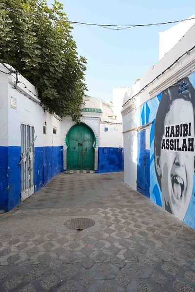
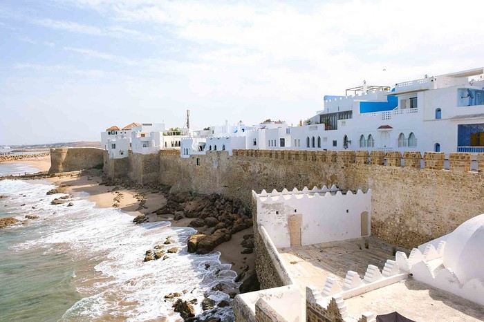
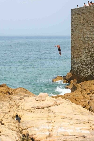
Anyway, we skirted around Tangier’s suburbs—pretty grim—and finally arrived in Asilah.
Following the coast and the long promenade along the beach, we reached the campsite. It was a bit crowded, not much shade, but it wasn’t far from the medina or the beach, and it wasn’t expensive. There’s some life here: Moroccan families seem to live on-site, in tents or basic bungalows. A woman was cooking tagine on a brazier—we were right in the atmosphere! The night was quiet, and we slept well. We set off on foot, walking along the seafront to the medina... We’d already been here in 2009. It was less touristy back then! Still, at this early hour, the little streets inside were very quiet. The walls had been freshly whitewashed, and there were even more murals than before. Around 11:30 AM, we strolled along the ramparts by the sea. There was a nice breeze! And a lot more people around. We enjoyed a milkshake on the terrace of a café overlooking the beach that stretches out at the foot of the medina. Some young guys were having fun diving off the rocks—and even off the top of the wall!
How do you feel about coming back to France?
Hi there, I’ve been traveling for 18 years now, at least 6 months a year, and as the years go by, I actually enjoy coming back to France more and more—a feeling I struggled with at first. I mean, we always think the grass is greener elsewhere.
But in the end, I find meaning in that saying about how there’s no place like home. I still love traveling just as much, but now my trips are shorter, and I enjoy spending more time in our beautiful country, even though I don’t hesitate to criticize it.
How about you? How do you handle coming back from your travels?
A summer in the sun in... Iceland!!
Ah, Iceland and us—it’s quite the story, or rather, a long wait... The first time we considered going was already 7-8 years ago, after reading travel journals describing breathtaking landscapes, countless active and dormant volcanoes, glaciers, and waterfalls with extraordinary flows. In short, this island, made of fire and ice, right at Europe’s doorstep with its own unique culture, had nothing but advantages, and it was urgent to visit without delay 😇
My *Routard* guidebook is actually from 2016. So why did Iceland make us wait so long before we finally gave in to its charms? Yes, why indeed?
Simply because reading other travel journals revealed the cost of living there—and especially the harsh climate, even in the middle of July 🤪! Some journals described entire weeks of rain and foggy weather, making it tricky to explore the island. The budget wasn’t spared either, because in the most touristy areas, especially in the south and around Myvatn, accommodation prices are downright indecent—even outright robbery. 😕
Plus, in the Highlands, there’s literally no permanent lodging, and the only way to spend several nights there is to camp. And camping in winter conditions wasn’t exactly part of our plans... 😄
So, year after year, this trip kept getting postponed...
until August 2023, when prices for Southern Africa, North or South America, or even Asia were all way too high for summer 2024!
That’s when I turned my attention back to the Land of Fire and Ice and scoured all the comparison sites for the best accommodation deals across the country. Planning for 20 nights, I found 13 nights in "proper" lodging for 5 people at an average cost of under 200 €! A miracle, considering that in the southern glacier region, around Vik or Myvatn, prices range from 300 to 1000 € per night 😮 😮!
Still, that means we’ll have to camp for 7 nights, mostly in the Highlands, near Askja or Landmannalaugar. 😎
For once, I built the daily itinerary entirely around the decently priced lodgings I found 11 months in advance! The shortage of places to stay in some areas forced me to plan a few long transition days and make some tough choices. No big deal, though—there’s so much to do on this island 🙂!
Once the main itinerary was set, everyone agreed to the plan: 2/3 in proper lodging and 1/3 camping, even the most camping-averse among us! *Follow my gaze...*
By the time we bought the flight tickets, I had to tweak the itinerary a bit because one or two places were already booked! Plus, it was impossible to wait for a more refined plan to adjust reservations, since almost all bookings are non-refundable!! The harsh law of supply and demand...
For the car rental, we booked a Hyundai Tucson, approved for the Highlands, from Lava Car Rental—a company I’d read good reviews about in a Facebook group—for a cool 2500 € with full insurance. A real 4x4, like a Defender, would’ve been more than double...! Welcome to Iceland 😕...
Activities and excursions also required some tough choices. We had two must-dos: whale watching in Húsavík (60 € pp on Getyourguide) and a Glacier and Summer Treasure Glacier Walk with BlueIceland (165 € pp with discount codes on Getyourguide).
For the baths, we skipped the Blue Lagoon—too expensive—in favor of the Secret Lagoon and the Myvatn Baths, the Blue Lagoon’s equivalent but half the price.
Two baths for the price of one... and even more, since I spotted several free hot-water swimming spots.
Itinerary: Day 1: Arrival in Reykjavik - Hraunfossar Waterfall - Surtshellir Cave Day 2: Grábrók Crater - Snæfellsnes Peninsula Day 3: Stykkishólmur - Sturlungalaug Hot Springs Day 4: Northwest Coast - Akureyri - Goðafoss Day 5: Myvatn Day 6: Myvatn - Dettifoss - Selfoss - Rauðhólar Day 7: Húsavík Whale Watching - Dettifoss - Selfoss Day 8: Stuðlagil Canyon - Seyðisfjörður Day 9: Puffin colony - Störurð Hike Day 10: Hengifoss - East Fjords, Mjóifjörður Day 11: Viking Village - Jökulsárlón - Fjallsárlón Day 12: Glacier Excursion - Svartifoss Day 13: Fjaðrárgljúfur Canyon - Vík Day 14: Þakgil - Lava Show Vík Day 15: Southern Waterfalls Day Day 16: Landmannalaugar - Skalli Hike Day 17: Landmannalaugar - Bláhnjúkur - Brennisteinsalda Day 18: Secret Lagoon, Kerlingarfjöll, and Gullfoss Day 19: Geysir - Reykjavik Day 20: Bruarfoss - Þingvellir - Kerid Crater - Krýsuvík Geothermal Area Day 21: Reykjanes Peninsula
Friday, July 5, 2024, is our last workday before driving up to Alsace overnight to leave the cockers at Grandpa’s for boarding. Then, at 1:30 AM, we’ll head to Frankfurt, where a direct flight to Iceland awaits.
We arrive at 4 AM. Since we leave at 7 AM, the "night" will only last the equivalent of a 30-minute nap 🤪... just enough to get us in the road-trip mood 😏!!
My *Routard* guidebook is actually from 2016. So why did Iceland make us wait so long before we finally gave in to its charms? Yes, why indeed?
Simply because reading other travel journals revealed the cost of living there—and especially the harsh climate, even in the middle of July 🤪! Some journals described entire weeks of rain and foggy weather, making it tricky to explore the island. The budget wasn’t spared either, because in the most touristy areas, especially in the south and around Myvatn, accommodation prices are downright indecent—even outright robbery. 😕
Plus, in the Highlands, there’s literally no permanent lodging, and the only way to spend several nights there is to camp. And camping in winter conditions wasn’t exactly part of our plans... 😄
So, year after year, this trip kept getting postponed...
until August 2023, when prices for Southern Africa, North or South America, or even Asia were all way too high for summer 2024!
That’s when I turned my attention back to the Land of Fire and Ice and scoured all the comparison sites for the best accommodation deals across the country. Planning for 20 nights, I found 13 nights in "proper" lodging for 5 people at an average cost of under 200 €! A miracle, considering that in the southern glacier region, around Vik or Myvatn, prices range from 300 to 1000 € per night 😮 😮!
Still, that means we’ll have to camp for 7 nights, mostly in the Highlands, near Askja or Landmannalaugar. 😎
For once, I built the daily itinerary entirely around the decently priced lodgings I found 11 months in advance! The shortage of places to stay in some areas forced me to plan a few long transition days and make some tough choices. No big deal, though—there’s so much to do on this island 🙂!
Once the main itinerary was set, everyone agreed to the plan: 2/3 in proper lodging and 1/3 camping, even the most camping-averse among us! *Follow my gaze...*
By the time we bought the flight tickets, I had to tweak the itinerary a bit because one or two places were already booked! Plus, it was impossible to wait for a more refined plan to adjust reservations, since almost all bookings are non-refundable!! The harsh law of supply and demand...
For the car rental, we booked a Hyundai Tucson, approved for the Highlands, from Lava Car Rental—a company I’d read good reviews about in a Facebook group—for a cool 2500 € with full insurance. A real 4x4, like a Defender, would’ve been more than double...! Welcome to Iceland 😕...
Activities and excursions also required some tough choices. We had two must-dos: whale watching in Húsavík (60 € pp on Getyourguide) and a Glacier and Summer Treasure Glacier Walk with BlueIceland (165 € pp with discount codes on Getyourguide).
For the baths, we skipped the Blue Lagoon—too expensive—in favor of the Secret Lagoon and the Myvatn Baths, the Blue Lagoon’s equivalent but half the price.
Two baths for the price of one... and even more, since I spotted several free hot-water swimming spots.
Itinerary: Day 1: Arrival in Reykjavik - Hraunfossar Waterfall - Surtshellir Cave Day 2: Grábrók Crater - Snæfellsnes Peninsula Day 3: Stykkishólmur - Sturlungalaug Hot Springs Day 4: Northwest Coast - Akureyri - Goðafoss Day 5: Myvatn Day 6: Myvatn - Dettifoss - Selfoss - Rauðhólar Day 7: Húsavík Whale Watching - Dettifoss - Selfoss Day 8: Stuðlagil Canyon - Seyðisfjörður Day 9: Puffin colony - Störurð Hike Day 10: Hengifoss - East Fjords, Mjóifjörður Day 11: Viking Village - Jökulsárlón - Fjallsárlón Day 12: Glacier Excursion - Svartifoss Day 13: Fjaðrárgljúfur Canyon - Vík Day 14: Þakgil - Lava Show Vík Day 15: Southern Waterfalls Day Day 16: Landmannalaugar - Skalli Hike Day 17: Landmannalaugar - Bláhnjúkur - Brennisteinsalda Day 18: Secret Lagoon, Kerlingarfjöll, and Gullfoss Day 19: Geysir - Reykjavik Day 20: Bruarfoss - Þingvellir - Kerid Crater - Krýsuvík Geothermal Area Day 21: Reykjanes Peninsula
Friday, July 5, 2024, is our last workday before driving up to Alsace overnight to leave the cockers at Grandpa’s for boarding. Then, at 1:30 AM, we’ll head to Frankfurt, where a direct flight to Iceland awaits.
We arrive at 4 AM. Since we leave at 7 AM, the "night" will only last the equivalent of a 30-minute nap 🤪... just enough to get us in the road-trip mood 😏!!
From Southern Shikoku, between land and sea, to the blue waters of Miyakojima and finally the Tokyo metropolis
From Southern Shikoku, between land and sea, to the blue waters of Miyakojima and finally Tokyo’s megacity
Hi everyone,
I have to admit, I really hesitated before deciding to write this travel journal... Writing one takes a lot of time and energy, and since this is my 4th trip, I wondered if it would even interest anyone other than myself (both for the discovery and the writing). But after a few people asked, "Are you going to write a journal?" and especially after rediscovering the joy of reading other travelers’ journals about Japan or elsewhere on this forum, I’ve decided to share my 4th installment in the Land of the Rising Sun here.
The itinerary: 27 full days, from late May to late June 2025, right in the middle of the rainy season, including:
-->13 days in Shikoku, from Kochi (Kochi Prefecture) to Matsuyama (Ehime Prefecture)

-->7 days in Miyakojima (Okinawa Prefecture)

-->7 days in Tokyo

The trip was decided on fairly last-minute again this year.
Since I regularly check flight prices to track fluctuations for this destination even without concrete plans, stumbling upon a slightly cheaper direct flight (900 €) than what I’d seen in previous months (around 1,200–1,400 € on average) for a Paris-Tokyo route with Japanese airline ANA was too tempting to resist the urge to return to this enchanting country. After much hesitation between exploring the San’in region (Matsue, Tottori, Yamaguchi) and Southern Shikoku, the decision was made—I took the plunge! The ticket is booked: Paris to Kochi with a layover in Tokyo, all with ANA, the airline I’d been dreaming of... for 1,120 € per person. Okay, it’s not cheap, but it’s better than in 2023.
Departure in 2 weeks! Now I just have to get everything ready!
Intense prep work over these next 2 weeks to:
finalize a more precise itinerary and reach an agreement—yep, because even though we both love Japan, our preferences differ slightly, and we have to choose between exploring new places or revisiting beloved spots... decide how much time to spend in each area without rushing while still exploring research places that might interest us and watch videos about Japan book accommodations: yes, it’s possible to do this on the spot, but last year, we realized that last-minute options were pretty expensive, so we’re booking ahead—though we’ll keep a few options open in case better deals pop up later reserve rental cars order yen check the weather regularly and wonder if choosing the *tsuyu* (rainy season) was really a good idea—are we going to be drenched the whole time???
"What hard work," you might say! Going to Japan for a month—what a tough life! Despite this being my 4th trip, the excitement is just as intense as the first time.
The only small downside is that when we booked the flight, there weren’t many seats left, so we’re only sitting together on the international return flight. Plus, on the way there, we have middle seats. Another lingering question: what French-language films will be available? According to the internet, the selection seems limited. Oh well, these are just minor details—it’s already time to fly! PS: I’ll be posting slowly and irregularly... so for those interested, be patient, and maybe set an alert...
Hi everyone,
I have to admit, I really hesitated before deciding to write this travel journal... Writing one takes a lot of time and energy, and since this is my 4th trip, I wondered if it would even interest anyone other than myself (both for the discovery and the writing). But after a few people asked, "Are you going to write a journal?" and especially after rediscovering the joy of reading other travelers’ journals about Japan or elsewhere on this forum, I’ve decided to share my 4th installment in the Land of the Rising Sun here.
The itinerary: 27 full days, from late May to late June 2025, right in the middle of the rainy season, including:
-->13 days in Shikoku, from Kochi (Kochi Prefecture) to Matsuyama (Ehime Prefecture)
-->7 days in Miyakojima (Okinawa Prefecture)
-->7 days in Tokyo
The trip was decided on fairly last-minute again this year.
Since I regularly check flight prices to track fluctuations for this destination even without concrete plans, stumbling upon a slightly cheaper direct flight (900 €) than what I’d seen in previous months (around 1,200–1,400 € on average) for a Paris-Tokyo route with Japanese airline ANA was too tempting to resist the urge to return to this enchanting country. After much hesitation between exploring the San’in region (Matsue, Tottori, Yamaguchi) and Southern Shikoku, the decision was made—I took the plunge! The ticket is booked: Paris to Kochi with a layover in Tokyo, all with ANA, the airline I’d been dreaming of... for 1,120 € per person. Okay, it’s not cheap, but it’s better than in 2023.
Departure in 2 weeks! Now I just have to get everything ready!
Intense prep work over these next 2 weeks to:
finalize a more precise itinerary and reach an agreement—yep, because even though we both love Japan, our preferences differ slightly, and we have to choose between exploring new places or revisiting beloved spots... decide how much time to spend in each area without rushing while still exploring research places that might interest us and watch videos about Japan book accommodations: yes, it’s possible to do this on the spot, but last year, we realized that last-minute options were pretty expensive, so we’re booking ahead—though we’ll keep a few options open in case better deals pop up later reserve rental cars order yen check the weather regularly and wonder if choosing the *tsuyu* (rainy season) was really a good idea—are we going to be drenched the whole time???
"What hard work," you might say! Going to Japan for a month—what a tough life! Despite this being my 4th trip, the excitement is just as intense as the first time.
The only small downside is that when we booked the flight, there weren’t many seats left, so we’re only sitting together on the international return flight. Plus, on the way there, we have middle seats. Another lingering question: what French-language films will be available? According to the internet, the selection seems limited. Oh well, these are just minor details—it’s already time to fly! PS: I’ll be posting slowly and irregularly... so for those interested, be patient, and maybe set an alert...
A Scandinavian Tour - Summer 2025
Off on new adventures!!!
For my wife’s 60th birthday, I’m really making her happy. While I usually pick warm, sunny destinations, she’s more tempted by places where you don’t suffer from the heat.
So, it’s off to Norway!! A real challenge for me—a southern guy who’s as cold-sensitive as they come.
I keep telling anyone who’ll listen (well, just myself, really) that these aren’t the countries for me, that rain will be our travel companion, that we’ll have to face polar bears, navigate between icebergs, that there are still Vikings around, and all sorts of other things.
Of course, not wanting to make it easy, we’re driving from the Lyon area where we live.
Friends who’ve visited the country told us it’s pretty expensive to eat out (among other things), so we’re bringing supplies—especially enough for apéritifs the whole trip!!!
It’s not a camper van, but a "hotel-car" we’ll be doing! We’ll see how it goes!
As usual, I’ll try to narrate the journey with my two-cent comments, plus some little tips to avoid our mistakes—assuming I don’t lose any fingers to the cold!
Every night, I’ll count them to make sure I still have all ten! We’re not in *Ch’tis* territory but even farther Noooorth (as Galabru would say).
Note that I’m traveling with a synovial effusion in my knee! The old man’s not in great shape!!
Here we go!!
PS: As always, I’m a filmmaker, so I’ve made an effort with a few photos from my phone.
PS: As always, I’m a filmmaker, so I’ve made an effort with a few photos from my phone.
Another side of my trip to Thailand: Villages, nature, countryside, mountains...
February 9th is a pivotal day during my trip to Thailand. Up until this date, my focus had been on cities, temples, and other urban landmarks. Starting February 10th, I’ll finally leave the city behind for the outskirts—one town, one life, farther from tourism, more real, more authentic... Then comes the bucolic surroundings of Chiang Mai, nature, the countryside, the mountains.
This morning, I head to visit the ethnographic museum. I’d been told about another one, but it’s permanently closed. I wonder if it’s the same one that might have changed its name and location.
I thoroughly enjoy visiting this museum. At first, I’m a bit annoyed because the place is packed with noisy school groups blocking the display cases without even showing the slightest interest. But soon, their chaperones manage to lead them into another room, giving me some peace. They maintain this distance throughout the tour, allowing me to explore the museum in complete tranquility. I really appreciate their tact.
I’m amazed by the absolutely stunning fabric displays and the countless everyday objects, especially the very old pottery. There’s so much beautiful basketry and intricately carved wood. The statues are also incredible... After seeing all of them, I no longer feel like buying any from the shops.
On my way back, not far from my hotel, I discover a rather unique place that only serves one drink, which they’ve made their specialty: egg coffee! A pretty surprising novelty. I have to try it.

At the bottom of the cup, they pour a layer of milk, topped with a layer of liquid coffee, followed by a layer of egg yolk, and finally a top layer that turns out to be a mix of coffee and cocoa powder. It’s a cold drink that, in the end, doesn’t have much flavor, and the price is pretty steep for such a small cup. You’re paying for the exclusivity!
Later in the day, I venture once again into small alleys, something I love doing when exploring a new city—no specific goal, just wandering east of the city, outside the walls.

I encounter very few tourists there and discover unsuspected little shops overflowing with lovely items, much cheaper than what you find in the heart of the tourist district. Then I wander through the floors of Warorot Market. I discover another kind of temple there: the temple of good deals. I love finding clothes that are really original for locals, not the flood of shirts and pants that tourists love but no Thai would ever buy, which invade the shops in the "Historic Square." I stop in my tracks in front of a stall with beautiful shirts featuring stunning geometric patterns in elegant color combinations and very short sleeves. Hmm, these would be perfect for showing off my biceps, one of which is adorned with the magnificent Ganesh tattoo I got last year in Bali. "When you’ve got nice things, you’ve got to show them off!" he said. 😜🙏💪 I pick out two for 380 baht and negotiate them down to 300. But the seller won’t go any lower. I understand I’ve reached the limit of her commercial possibilities. Just as I’m leaving the shop, happy with my purchase, my ever-helpful inner voice, Petite Voix, suggests: - You didn’t try them on because you were too lazy to take off the one you’re wearing and also because of the sweat, but you could just put one on over the one you’re wearing. It’s light enough that it won’t bother you.
I go back to the two sellers, who burst out laughing when I ask to try them on. - Oh no, it’s way too small for you! It’s a women’s shirt! - But they don’t look particularly feminine in style! And I chose XXL... I put the shirt on, and of course, it won’t close. Then I notice the buttons are on the wrong side. That’s why the sleeves seemed so short!!! They put the shirts back on the rack and refund me without any fuss, commenting amid total hilarity: - Well, thank goodness you tried it on just as you were leaving the shop!
Since I don’t want to walk too much before tomorrow’s first Big Outing with the driver, I end my stroll with a visit to two very pretty temples recommended by Joël.

I’d rather not post more temple photos. But these ones smell like village and countryside...


I’ve never seen anything like Wat Ket Karam, so extravagant...


And I end my day with two other lesser-known temples: Wat Noung Kham, simple and finally free of gold and glitter,

and Wat Dap Phai, where an intimate ceremony is taking place at the end of the day.
This morning, I head to visit the ethnographic museum. I’d been told about another one, but it’s permanently closed. I wonder if it’s the same one that might have changed its name and location.
I thoroughly enjoy visiting this museum. At first, I’m a bit annoyed because the place is packed with noisy school groups blocking the display cases without even showing the slightest interest. But soon, their chaperones manage to lead them into another room, giving me some peace. They maintain this distance throughout the tour, allowing me to explore the museum in complete tranquility. I really appreciate their tact.
I’m amazed by the absolutely stunning fabric displays and the countless everyday objects, especially the very old pottery. There’s so much beautiful basketry and intricately carved wood. The statues are also incredible... After seeing all of them, I no longer feel like buying any from the shops.
On my way back, not far from my hotel, I discover a rather unique place that only serves one drink, which they’ve made their specialty: egg coffee! A pretty surprising novelty. I have to try it.
At the bottom of the cup, they pour a layer of milk, topped with a layer of liquid coffee, followed by a layer of egg yolk, and finally a top layer that turns out to be a mix of coffee and cocoa powder. It’s a cold drink that, in the end, doesn’t have much flavor, and the price is pretty steep for such a small cup. You’re paying for the exclusivity!
Later in the day, I venture once again into small alleys, something I love doing when exploring a new city—no specific goal, just wandering east of the city, outside the walls.
I encounter very few tourists there and discover unsuspected little shops overflowing with lovely items, much cheaper than what you find in the heart of the tourist district. Then I wander through the floors of Warorot Market. I discover another kind of temple there: the temple of good deals. I love finding clothes that are really original for locals, not the flood of shirts and pants that tourists love but no Thai would ever buy, which invade the shops in the "Historic Square." I stop in my tracks in front of a stall with beautiful shirts featuring stunning geometric patterns in elegant color combinations and very short sleeves. Hmm, these would be perfect for showing off my biceps, one of which is adorned with the magnificent Ganesh tattoo I got last year in Bali. "When you’ve got nice things, you’ve got to show them off!" he said. 😜🙏💪 I pick out two for 380 baht and negotiate them down to 300. But the seller won’t go any lower. I understand I’ve reached the limit of her commercial possibilities. Just as I’m leaving the shop, happy with my purchase, my ever-helpful inner voice, Petite Voix, suggests: - You didn’t try them on because you were too lazy to take off the one you’re wearing and also because of the sweat, but you could just put one on over the one you’re wearing. It’s light enough that it won’t bother you.
I go back to the two sellers, who burst out laughing when I ask to try them on. - Oh no, it’s way too small for you! It’s a women’s shirt! - But they don’t look particularly feminine in style! And I chose XXL... I put the shirt on, and of course, it won’t close. Then I notice the buttons are on the wrong side. That’s why the sleeves seemed so short!!! They put the shirts back on the rack and refund me without any fuss, commenting amid total hilarity: - Well, thank goodness you tried it on just as you were leaving the shop!
Since I don’t want to walk too much before tomorrow’s first Big Outing with the driver, I end my stroll with a visit to two very pretty temples recommended by Joël.
I’d rather not post more temple photos. But these ones smell like village and countryside...
I’ve never seen anything like Wat Ket Karam, so extravagant...
And I end my day with two other lesser-known temples: Wat Noung Kham, simple and finally free of gold and glitter,
and Wat Dap Phai, where an intimate ceremony is taking place at the end of the day.
USA Road Trip 2023 - Part 1
In January 2023, we started our second road trip across the United States. We stayed from January to mid-March, which gave us plenty of time to visit several cities, attractions, and parks in multiple states.
This travel journal will be split into two parts due to the considerable number of places we visited.
This first journal covers the following states: Ohio, Indiana, Missouri, Oklahoma, Texas, New Mexico, Arizona, Nevada, and California, and takes you through the outbound leg of our road trip.
The second journal will showcase the attractions we visited on the return trip, which mainly follows the famous Highway 1 along the Pacific coast.
So, I invite you to keep reading this first journal, which serves as a long recap to help you discover the various attractions we explored throughout this road trip.
Videos are included throughout the recap. Please click on the image to start the video.
Here are the links to jump to a specific post:
OHIO:
WinterLand - Christmas Lights at Cleveland Public Square Lake View Cemetery - Cleveland - Part 1 Lake View Cemetery - Cleveland - Part 2 Stroll through Columbus Upper Falls to Lower Falls via Buckeye Trail - Hocking Hills State Park – Logan Cedar Falls & Whispering Falls Hiking Trail - Hocking Hills State Park – Logan Ash Cave Hiking Trail - Hocking Hills State Park – Logan Exploring Cincinnati
INDIANA:
Visiting Indianapolis
MISSOURI:
Exploring St. Louis
OKLAHOMA:
Catoosa Blue Whale Discovering Tulsa Exploring Oklahoma City
TEXAS:
Exploring Shamrock Discovering McLean Exploring Amarillo
NEW MEXICO:
Ancestral Sites Trail - Pecos National Historical Park Discovering Santa Fe The Santuario de Chimayó Stroll through Los Cerrillos Walk through the village of Madrid San Francisco de Asis Catholic Church & The Bottle House - Golden Albuquerque Murals 66 Diner - Albuquerque Stroll through Old Town (Albuquerque) Rinconada Canyon Trail - Petroglyph National Monument Mesa Point Trail - Boca Negra Canyon - Petroglyph National Monument Macaw Trail - Boca Negra Canyon - Petroglyph National Monument Cliff Base Trail - Boca Negra Canyon - Petroglyph National Monument Piedras Marcadas Canyon - Petroglyph National Monument Sandstone Bluffs & Ventana Natural Arch - El Malpais National Monument
ARIZONA:
Stewart's Petrified Wood Shop – Holbrook Stroll through Holbrook Discovering Joseph City Exploring Winslow Grand Falls (The "Chocolate Falls") – Leupp Island Trail - Walnut Canyon National Monument Rim Trail - Walnut Canyon National Monument Wukoki Pueblo Trail – Wupatki National Monument Wupatki Pueblo Trail – Wupatki National Monument Doney Mountain Trail – Wupatki National Monument Citadel & Nalakihu Pueblos Trail – Wupatki National Monument Lomaki & Box Canyon Pueblos Trail – Wupatki National Monument Discovering Flagstaff On the way to Sedona Slide Rock State Park – Sedona Midgley Bridge Trail – Wilson Canyon – Sedona Tlaquepaque Arts & Shopping Village Walking Tour - Sedona Chapel of the Holy Cross - Sedona Hiking at Cathedral Rock - Sedona Hiking the Bell Rock Trail - Sedona Hiking the Airport Loop Trail - Sedona Amitabha Stupa and Peace Park - Sedona Hiking the Boynton Canyon Vortex Trail - Sedona Hiking the Devil's Bridge Trail - Sedona Hiking the Birthing Cave Trail - Sedona Bell Rock Inn - Sedona On the roads of Sedona - Part 1 On the roads of Sedona - Part 2 Keyhole Sink Hiking Trail - Kaibab National Forest Discovering Williams Exploring Ash Fork Discovering Kingman Ramada by Wyndham Kingman Davis Camp Park - Bullhead City Discovering Yucca Lake Havasu Boardwalk Tour A duck catches a lobster – Lake Havasu Boardwalk
CALIFORNIA:
Exploring Needles Discovering Goffs Discovering Amboy Visiting the famous Bagdad Cafe - Newberry Springs Exploring Barstow Vehicles from Hell (Mad Max Cars) - Barstow Peggy Sue's 50's Diner - Yermo Liberty Sculpture Park - Yermo Lake Dolores Water Park - Newberry Springs ZZYZX Road - Mojave National Preserve Alien Fresh Jerky - Baker Kelso Dunes Trail - Mojave National Preserve Hole-in-the-Wall Rings Trail - Mojave National Preserve Visiting Mitchell Caverns - Mojave National Preserve Dante's View - Death Valley National Park Zabriskie Point - Death Valley National Park Golden Canyon - Death Valley National Park Artists Drive & Artists Palette - Death Valley National Park Devil's Golf Course - Death Valley National Park Natural Bridge Trail - Death Valley National Park Badwater Basin - Death Valley National Park Harmony Borax Works - Death Valley National Park Devil's Cornfield - Death Valley National Park Mesquite Flat Sand Dunes - Death Valley National Park Mosaic Canyon Trail - Death Valley National Park On the road - Death Valley National Park
NEVADA:
Cleveland Clinic Lou Ruvo Center for Brain Health - Las Vegas Exploring Downtown Las Vegas SlotZilla Zipline - Fremont Street Experience – Downtown Las Vegas Viva Vision Light Show 1 - Fremont Street Experience - Downtown Las Vegas Viva Vision Light Show 2 - Fremont Street Experience - Downtown Las Vegas Viva Vision Light Show 3 - Fremont Street Experience - Downtown Las Vegas Viva Vision Light Show 4 - Fremont Street Experience - Downtown Las Vegas Free Live Music – Fremont Street Experience - Downtown Las Vegas Chucky – Fremont Street Experience - Downtown Las Vegas Las Vegas Strip - Part 1 Las Vegas Strip - Part 2 Las Vegas Strip - Part 3 Las Vegas Strip - Part 4 Las Vegas Strip - Part 5 Tom Devlin's Monster Museum - Boulder City Hoover Dam Lake Mead - Lakeview Overlook - Boulder City Nelson Ghost Town - Searchlight
CALIFORNIA:
Scenic Route through Joshua Tree National Park via the North Entrance Hidden Valley Trail - Joshua Tree National Park Barker Dam Trail - Joshua Tree National Park Cap Rock Trail - Joshua Tree National Park Keys View Trail - Joshua Tree National Park Hall of Horrors Trail - Joshua Tree National Park Skull Rock Trail - Joshua Tree National Park Arch Rock Trail - Joshua Tree National Park Cholla Cactus Garden Trail - Joshua Tree National Park Lone Pine - Owens Valley Miss Alabama & Shark Fin - Alabama Hills - Owens Valley Lone Ranger Canyon - Alabama Hills - Owens Valley Mobius Arch Loop Trail (Heart Arch & Lathe Arch) - Alabama Hills - Owens Valley Eye of the Alabama Hills Arch - Alabama Hills - Owens Valley Boot & Cyclops Arches - Alabama Hills - Owens Valley One Mile Arch, Bowling Ball and Pins & Gunga Din Area - Alabama Hills - Owens Valley Whitney Portal Arch Trailhead - Alabama Hills - Owens Valley Fish Rocks & Trona Pinnacles - Mojave Desert Red Cliffs Trail - Red Rock Canyon State Park Hagen Canyon Nature Trail - Red Rock Canyon State Park Tour of Historic Downtown Tehachapi View of the Tehachapi Loop – Monolith César E. Chávez National Monument – Keene Discovering Bakersfield Kern County Museum – Bakersfield Bravo Farms, Tree House & Petting Zoo - Traver Walking Tour of Kingsburg Exploring Fresno Simonian Farms & Soul Consoling Japanese Internment Tower - Fresno Duncan Ceramic Products (iLoveToCreate) - Fresno Walking Tour of Modesto Wat Dhammararam Buddhist Temple - Stockton Walking Tour of Stockton Discovering Stockton University of the Pacific - Stockton Visiting Lodi Sutter's Fort State Historic Park - Sacramento California State Capitol - Sacramento Walking Tour - Sacramento Walking Tour - Winters Walking Tour - Napa The Chandelier Tree In Drive-Thru Tree Park - Leggett One Log House - Garberville Grandfather Tree - Piercy The Living Chimney Tree - Avenue of the Giants Stephens Grove Loop Trail - Avenue of the Giants Gould Grove Nature Loop Trail - Avenue of the Giants Fleishmann Grove Trail - Avenue of the Giants Mahan Plaque Trail - Avenue of the Giants Founders Grove Nature Loop Trail - Avenue of the Giants Eternal Tree House & Immortal Tree - Avenue of the Giants Drury-Chaney Loop Trail - Avenue of the Giants Walking Tour - Redcrest
COMING UP NEXT:
USA Road Trip 2023 - Part 2
This travel journal will be split into two parts due to the considerable number of places we visited.
This first journal covers the following states: Ohio, Indiana, Missouri, Oklahoma, Texas, New Mexico, Arizona, Nevada, and California, and takes you through the outbound leg of our road trip.
The second journal will showcase the attractions we visited on the return trip, which mainly follows the famous Highway 1 along the Pacific coast.
So, I invite you to keep reading this first journal, which serves as a long recap to help you discover the various attractions we explored throughout this road trip.
Videos are included throughout the recap. Please click on the image to start the video.
Here are the links to jump to a specific post:
OHIO:
WinterLand - Christmas Lights at Cleveland Public Square Lake View Cemetery - Cleveland - Part 1 Lake View Cemetery - Cleveland - Part 2 Stroll through Columbus Upper Falls to Lower Falls via Buckeye Trail - Hocking Hills State Park – Logan Cedar Falls & Whispering Falls Hiking Trail - Hocking Hills State Park – Logan Ash Cave Hiking Trail - Hocking Hills State Park – Logan Exploring Cincinnati
INDIANA:
Visiting Indianapolis
MISSOURI:
Exploring St. Louis
OKLAHOMA:
Catoosa Blue Whale Discovering Tulsa Exploring Oklahoma City
TEXAS:
Exploring Shamrock Discovering McLean Exploring Amarillo
NEW MEXICO:
Ancestral Sites Trail - Pecos National Historical Park Discovering Santa Fe The Santuario de Chimayó Stroll through Los Cerrillos Walk through the village of Madrid San Francisco de Asis Catholic Church & The Bottle House - Golden Albuquerque Murals 66 Diner - Albuquerque Stroll through Old Town (Albuquerque) Rinconada Canyon Trail - Petroglyph National Monument Mesa Point Trail - Boca Negra Canyon - Petroglyph National Monument Macaw Trail - Boca Negra Canyon - Petroglyph National Monument Cliff Base Trail - Boca Negra Canyon - Petroglyph National Monument Piedras Marcadas Canyon - Petroglyph National Monument Sandstone Bluffs & Ventana Natural Arch - El Malpais National Monument
ARIZONA:
Stewart's Petrified Wood Shop – Holbrook Stroll through Holbrook Discovering Joseph City Exploring Winslow Grand Falls (The "Chocolate Falls") – Leupp Island Trail - Walnut Canyon National Monument Rim Trail - Walnut Canyon National Monument Wukoki Pueblo Trail – Wupatki National Monument Wupatki Pueblo Trail – Wupatki National Monument Doney Mountain Trail – Wupatki National Monument Citadel & Nalakihu Pueblos Trail – Wupatki National Monument Lomaki & Box Canyon Pueblos Trail – Wupatki National Monument Discovering Flagstaff On the way to Sedona Slide Rock State Park – Sedona Midgley Bridge Trail – Wilson Canyon – Sedona Tlaquepaque Arts & Shopping Village Walking Tour - Sedona Chapel of the Holy Cross - Sedona Hiking at Cathedral Rock - Sedona Hiking the Bell Rock Trail - Sedona Hiking the Airport Loop Trail - Sedona Amitabha Stupa and Peace Park - Sedona Hiking the Boynton Canyon Vortex Trail - Sedona Hiking the Devil's Bridge Trail - Sedona Hiking the Birthing Cave Trail - Sedona Bell Rock Inn - Sedona On the roads of Sedona - Part 1 On the roads of Sedona - Part 2 Keyhole Sink Hiking Trail - Kaibab National Forest Discovering Williams Exploring Ash Fork Discovering Kingman Ramada by Wyndham Kingman Davis Camp Park - Bullhead City Discovering Yucca Lake Havasu Boardwalk Tour A duck catches a lobster – Lake Havasu Boardwalk
CALIFORNIA:
Exploring Needles Discovering Goffs Discovering Amboy Visiting the famous Bagdad Cafe - Newberry Springs Exploring Barstow Vehicles from Hell (Mad Max Cars) - Barstow Peggy Sue's 50's Diner - Yermo Liberty Sculpture Park - Yermo Lake Dolores Water Park - Newberry Springs ZZYZX Road - Mojave National Preserve Alien Fresh Jerky - Baker Kelso Dunes Trail - Mojave National Preserve Hole-in-the-Wall Rings Trail - Mojave National Preserve Visiting Mitchell Caverns - Mojave National Preserve Dante's View - Death Valley National Park Zabriskie Point - Death Valley National Park Golden Canyon - Death Valley National Park Artists Drive & Artists Palette - Death Valley National Park Devil's Golf Course - Death Valley National Park Natural Bridge Trail - Death Valley National Park Badwater Basin - Death Valley National Park Harmony Borax Works - Death Valley National Park Devil's Cornfield - Death Valley National Park Mesquite Flat Sand Dunes - Death Valley National Park Mosaic Canyon Trail - Death Valley National Park On the road - Death Valley National Park
NEVADA:
Cleveland Clinic Lou Ruvo Center for Brain Health - Las Vegas Exploring Downtown Las Vegas SlotZilla Zipline - Fremont Street Experience – Downtown Las Vegas Viva Vision Light Show 1 - Fremont Street Experience - Downtown Las Vegas Viva Vision Light Show 2 - Fremont Street Experience - Downtown Las Vegas Viva Vision Light Show 3 - Fremont Street Experience - Downtown Las Vegas Viva Vision Light Show 4 - Fremont Street Experience - Downtown Las Vegas Free Live Music – Fremont Street Experience - Downtown Las Vegas Chucky – Fremont Street Experience - Downtown Las Vegas Las Vegas Strip - Part 1 Las Vegas Strip - Part 2 Las Vegas Strip - Part 3 Las Vegas Strip - Part 4 Las Vegas Strip - Part 5 Tom Devlin's Monster Museum - Boulder City Hoover Dam Lake Mead - Lakeview Overlook - Boulder City Nelson Ghost Town - Searchlight
CALIFORNIA:
Scenic Route through Joshua Tree National Park via the North Entrance Hidden Valley Trail - Joshua Tree National Park Barker Dam Trail - Joshua Tree National Park Cap Rock Trail - Joshua Tree National Park Keys View Trail - Joshua Tree National Park Hall of Horrors Trail - Joshua Tree National Park Skull Rock Trail - Joshua Tree National Park Arch Rock Trail - Joshua Tree National Park Cholla Cactus Garden Trail - Joshua Tree National Park Lone Pine - Owens Valley Miss Alabama & Shark Fin - Alabama Hills - Owens Valley Lone Ranger Canyon - Alabama Hills - Owens Valley Mobius Arch Loop Trail (Heart Arch & Lathe Arch) - Alabama Hills - Owens Valley Eye of the Alabama Hills Arch - Alabama Hills - Owens Valley Boot & Cyclops Arches - Alabama Hills - Owens Valley One Mile Arch, Bowling Ball and Pins & Gunga Din Area - Alabama Hills - Owens Valley Whitney Portal Arch Trailhead - Alabama Hills - Owens Valley Fish Rocks & Trona Pinnacles - Mojave Desert Red Cliffs Trail - Red Rock Canyon State Park Hagen Canyon Nature Trail - Red Rock Canyon State Park Tour of Historic Downtown Tehachapi View of the Tehachapi Loop – Monolith César E. Chávez National Monument – Keene Discovering Bakersfield Kern County Museum – Bakersfield Bravo Farms, Tree House & Petting Zoo - Traver Walking Tour of Kingsburg Exploring Fresno Simonian Farms & Soul Consoling Japanese Internment Tower - Fresno Duncan Ceramic Products (iLoveToCreate) - Fresno Walking Tour of Modesto Wat Dhammararam Buddhist Temple - Stockton Walking Tour of Stockton Discovering Stockton University of the Pacific - Stockton Visiting Lodi Sutter's Fort State Historic Park - Sacramento California State Capitol - Sacramento Walking Tour - Sacramento Walking Tour - Winters Walking Tour - Napa The Chandelier Tree In Drive-Thru Tree Park - Leggett One Log House - Garberville Grandfather Tree - Piercy The Living Chimney Tree - Avenue of the Giants Stephens Grove Loop Trail - Avenue of the Giants Gould Grove Nature Loop Trail - Avenue of the Giants Fleishmann Grove Trail - Avenue of the Giants Mahan Plaque Trail - Avenue of the Giants Founders Grove Nature Loop Trail - Avenue of the Giants Eternal Tree House & Immortal Tree - Avenue of the Giants Drury-Chaney Loop Trail - Avenue of the Giants Walking Tour - Redcrest
COMING UP NEXT:
USA Road Trip 2023 - Part 2
Croatia, Montenegro – two victims of overtourism?
Mid-June, two Auvergnats on the starting blocks—off we go to the former Yugoslavia!
We’d already explored some nooks and crannies of northern Croatia back in 2019, so we’re keeping the momentum going by planning a trip to the south of the country and then Montenegro.
On the way back, we’ll drift into Bosnia-Herzegovina just to mix things up a bit!
We’re a little unsure about what to expect in terms of tourist crowds.
Dubrovnik has a reputation for being the hardest-hit city by overtourism, and Kotor and the whole Dalmatian coast aren’t exactly empty...
Luckily, most European countries haven’t started school holidays yet, and some measures seem to have been put in place to limit the flow (like restrictions on the number of cruise ships allowed to dock at the same time).
Maybe we’ll manage to escape the promised hell?
For now, we’re slamming the doors of the Scirocco and heading off to our first stop: northern Italy!
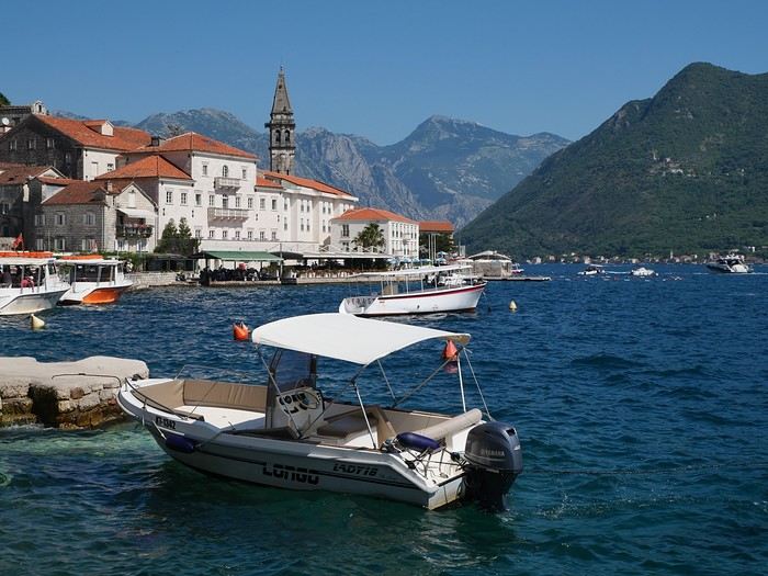
On the way back, we’ll drift into Bosnia-Herzegovina just to mix things up a bit!
We’re a little unsure about what to expect in terms of tourist crowds.
Dubrovnik has a reputation for being the hardest-hit city by overtourism, and Kotor and the whole Dalmatian coast aren’t exactly empty...
Luckily, most European countries haven’t started school holidays yet, and some measures seem to have been put in place to limit the flow (like restrictions on the number of cruise ships allowed to dock at the same time).
Maybe we’ll manage to escape the promised hell?
For now, we’re slamming the doors of the Scirocco and heading off to our first stop: northern Italy!
Kattegat Tour and Norway’s Majestic Fjords – 32 Days (Denmark, Sweden, Norway)
Kattegat isn’t just the name of the village in the TV series *Vikings*—it’s also the stretch of water separating Denmark from Sweden... the sea, basically! And further north, you’ve got Norway and its fjords!
Originally, I’d planned to just do a loop around Kattegat, with the *Under* restaurant in Lindesnes as our anniversary treat... but along the way, we thought, why not "push" a little further north, keeping an eye on the budget since we’d chosen to travel by car in June 2025 through Scandinavia.
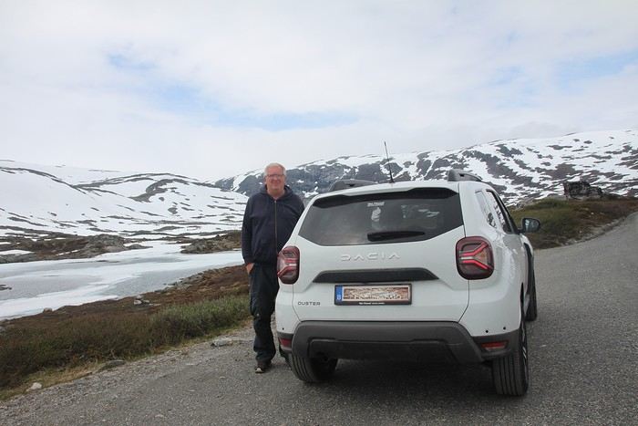
Why by car when most travelers opt for a camper van, while others prefer the comfort of cruises? Well, because we don’t own a camper van, renting one is pricey, and then you’ve got to add fuel costs (those things guzzle gas!), ferry fees, and other "tolls." All things considered, we went for mostly rentals—especially since there were four of us at the start of the trip. We spent the first week in Denmark with our daughter and son-in-law. Then they flew back to Belgium, and we continued our adventure as a couple. For accommodation, we mainly booked Airbnb apartments, which helped keep costs down and, most importantly, let us prepare our own meals (diet, diet!). In this travel journal, you’ll discover (or rediscover, for those who followed my older ones) our unbridled love for theme parks, museums, unique experiences, and—especially in Denmark—Legos! Unfortunately, we didn’t do any hikes this year because the unpredictable weather had made the trails slippery, and since I’d already taken three tumbles during the trip, I didn’t want to risk another! In the end, we traveled for 32 days, covered 6,200 km, and most importantly, discovered the charming country of Denmark, marveled at Norway’s breathtaking fjords—all without suffering the heatwave that hit France and Belgium that June! If you’ve got any questions, don’t hesitate to ask!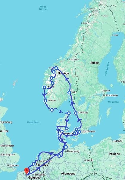
Why by car when most travelers opt for a camper van, while others prefer the comfort of cruises? Well, because we don’t own a camper van, renting one is pricey, and then you’ve got to add fuel costs (those things guzzle gas!), ferry fees, and other "tolls." All things considered, we went for mostly rentals—especially since there were four of us at the start of the trip. We spent the first week in Denmark with our daughter and son-in-law. Then they flew back to Belgium, and we continued our adventure as a couple. For accommodation, we mainly booked Airbnb apartments, which helped keep costs down and, most importantly, let us prepare our own meals (diet, diet!). In this travel journal, you’ll discover (or rediscover, for those who followed my older ones) our unbridled love for theme parks, museums, unique experiences, and—especially in Denmark—Legos! Unfortunately, we didn’t do any hikes this year because the unpredictable weather had made the trails slippery, and since I’d already taken three tumbles during the trip, I didn’t want to risk another! In the end, we traveled for 32 days, covered 6,200 km, and most importantly, discovered the charming country of Denmark, marveled at Norway’s breathtaking fjords—all without suffering the heatwave that hit France and Belgium that June! If you’ve got any questions, don’t hesitate to ask!
Vacation
It’s vacation time
Vacation and silence
Silence and absence
Absence and latency
Latency and silence
Silence and vacation
Vacation and absence
It’s vacation time
I wrote these few words on July 12, 2010, and I can post them again today—nothing’s changed...🙂
I wrote these few words on July 12, 2010, and I can post them again today—nothing’s changed...🙂
Namibia Travel Journal: May 2025 - Trip Review
NAMIBIA TRIP 2025: April 24 to May 20: Feel free to comment or ask us any questions about this amazing journey.
>> Find all our photos and videos for each day on our website here: www.montagne-aventure.net
**DAY 1: Thursday, April 24, 2025: Outbound Flights from Lyon to Windhoek via Munich - Visit to Munich:**

Off we go on a new adventure. The alarm rings at 6:30 AM, the travel bags are packed, and we head to Lyon Airport. We booked our flight tickets with Lufthansa. The first leg to Munich, Germany, is operated by AirBaltic. Departure at 1:05 PM for a 1-hour and 20-minute flight. We arrive at 2:30 PM.
**We now have a 7-hour layover, so we take the opportunity to get some fresh air and explore Munich.** We quickly exit Terminal 2 of the airport and head towards the subway. We buy a group day ticket "Airport-city Day Zone M-5," valid for 2 to 5 people at a price of 30.50 € (instead of 16.30 € per person). We take the S8 line to **Marienplatz** in 35 minutes. **This is the heart of the city.** The weather is overcast, quite cool, but dry. Perfect for a little city trip between two flights while leaving our large luggage in transit at the airport. **Munich is the third-largest German city after Berlin and Hamburg, in the Bavaria region.** **The center has a lot of charm and brings together several religious buildings, easy to explore on foot.** We are impressed by the number of people enjoying these 100% pedestrian streets, which are very pleasant. After Marienplatz, the most famous square with the town hall, we head to the Cathedral of Our Lady, a Gothic church, then continue to **Karlsplatz** and move on to **the food market offering a wide selection of high-end food products in an atmosphere where a certain art of living prevails.** We also visit St. Peter's Church before grabbing a bite to eat. Two good hours were enough for this 10 km city walk. It's time to take the subway back: by 6:30 PM, we are back at the airport. Now, it's time for a bit of waiting and rest. Our second flight is scheduled for 9:35 PM for a 9-hour and 30-minute journey to our final destination in Namibia: **Windhoek.**
> Round-trip flight tickets with Lufthansa from Lyon: 2029 €, or 1,014.50 € per person.
> Lyon Airport parking: 120 €
> Today's expenses: 7 € for 2 pizzas in France / 14 € for the restaurant in Munich / 30.50 € for the daily subway ticket in Munich.
**DAY 2: Friday, April 25, 2024: Arrival in Windhoek, Visit to the Namibian Capital:**
After a 9-hour and 30-minute overnight flight with Discover Airlines, we finally land on Namibian soil just before 7:30 AM. The day is breaking, and the colors are already stunning. We are eager despite the usual fatigue from the flight. The airline was punctual, with friendly staff and good meals, though a bit light. We are the first flight of the day to land, with no more than 15 flights per day here, from 7 AM to 8 PM. We disembark on the tarmac at this airport located in the middle of nowhere, **I finally set foot on African soil for the first time.** We exit among the first from the aircraft to go through the long formalities at the front of the line, as the wait can quickly become endless. Allow at least 5 minutes per person for e-visas. We still wait 45 minutes despite only about twenty people ahead of us. Phew, it's done. We collect our luggage and then withdraw money from an ATM. We make 4 withdrawals of the maximum amount, 2000 NAD $ per withdrawal, for a total of 380 €, or 95.33 € per withdrawal.
Our driver arrives at the same time, perfect timing, we were quick.
We leave the airport at 8:45 AM. By 9:30 AM, we arrive at the **Gracious Whisp vehicle rental agency**, located at the entrance of Windhoek, small and human-sized with a fleet of recent vehicles. More formalities, then a short wait as our vehicle is not yet ready. Time to decompress, catch our breath, and enjoy the very pleasant morning temperature. Not a cloud in sight. Next, a briefing on the vehicle, always with a bit of apprehension due to our approximate English. Allow 45 minutes of explanations, including setting up the roof tent, camping equipment, technical information in case of a flat tire, driving tips in Namibia, and a tour of the 4x4. We have all the necessary equipment for camping: mattresses, sleeping bags, pillows, table, chairs, gas stove, BBQ grill... as well as 2 spare tires, a compressor, a dual tank, and accessories for removing wheels. Off we go, it's time to muster our courage and get behind the wheel. **Heading to SuperSpar Maerua**, fortunately located less than 10 minutes away. We park with the help of a parking attendant; it's very crowded, the space is narrow, but everything goes well despite the cursed right-hand drive. Today's new mission: stock up on groceries. The store is well-stocked with local and imported products, catering to all tastes. We spend 114 € on groceries, from pasta to meat, BBQ lighters to dishwashing products. Two people load our groceries into two carts and transfer them to our vehicle; we feel compelled to leave a tip, 50 NAD $, as we don't have change yet. Now, we head to the hotel, 15 minutes away. Traffic is difficult at a complicated intersection; this will likely be the only traffic jam in Namibia. **We arrive at Kate's Nest Guesthouse & Backpackers around 1:15 PM, quite tired.** We take some well-deserved rest at this recent establishment, quite calm with secure private parking. After a short nap, we enjoy the quiet by the hotel pool. Night falls between 6:30 PM and 7 PM. We eat quietly in our room tonight before starting this long 4x4 road trip in camping mode in the heart of Namibia.
> Today's grocery expenses: 114 € at Super Spar Marua (2395.21 NAD $).
> Round-trip flight tickets with Lufthansa from Lyon: 2029 €, or 1,014.50 € per person.
> Vehicle rental: 4x4 Toyota with roof tent for 24 days: Gracious Whisp Car Rentals: 2,638 € (N$50,640) or **1,319 €** per person - (https://gwcarrentals.com/)
> Distance driven today: 15 km.
> Accommodation: Kate's Nest Guesthouse & Backpackers - 4 Aristotles Street Academia, 9000 Windhoek - 36 € for two for one night.
> Windhoek International Airport website: (https://www.airports.com.na/)
**DAY 3: Saturday, April 26, 2025: Windhoek to Hardap: Mariental Region - Kalahari Desert:**
After a good, restful night, we wake up leisurely around 7 AM. We enjoy the comfort provided by this first and last hotel before 24 nights under the tent.
**We leave Kate's Nest Guesthouse at 8:30 AM to tackle the Namibian roads.** We quickly leave the capital; in just 30 minutes, we find ourselves almost alone in the world. The landscape is dotted with small domes. We leave the **paved B1** quickly to turn left onto the **C15**. **From there, we won't see more than 10 vehicles all day.** After passing through the few houses of **Lekkerwaterpoort**, we tackle our first gravel road. These road sections are limited to 100 km/h, but even at 70 km/h, I find it already challenging. However, I quickly get used to it and gradually pick up speed to reach my cruising speed of around 80 to 90 km/h. **We are on immense straight lines crossing wild expanses as far as the eye can see.** **We come across two baboons, a few ostriches, and numerous cattle and sheep farms.** We pass through the charming village of **Uhlenhorst** with its typical houses and children with broad smiles waving at us. Life here is already very different from Windhoek. **The thermometer rises quickly from 16°C at 8:30 AM to over 28°C in the early afternoon.**
**We arrive at the Hardap Dam reserve at 2 PM.** We stop at the toll booth at the park entrance to pay the entrance fee: 250 NAD $ for 2 people and 1 vehicle. We continue to the dam and then the camp entrance, located a bit further. We had booked in advance, but this place remains little frequented by foreigners.
We take advantage of the hottest hours to rest by the large pool overlooking the immense lake, a very enjoyable moment. Would this be a bit of a vacation?
Around 4:30 PM, we head to the campsite. We overlook this vast water reserve. We arrive first; we will be only 3 vehicles spending the night here. It's time to get to work and set up our equipment for the first time. It takes us a good 20 minutes to set everything up, with a slight apprehension about unfolding the tent. Once this task is done, which we will have to repeat for almost a month, we will become much more efficient over time. Time for rest and contemplation in total silence. The sun gradually sets, and the heat quickly becomes bearable again. Bliss! **This dam is located 20 km northwest of Mariental in an area dotted with conical hills topped with dolerite buttons (Hardap means "hillock" in Nama). It captures the Fish River, which flows south, creating a large lake in the middle of an arid environment. The contrast is striking.** We enjoy our first sunset facing this 360° otherworldly landscape.
Around 7 PM, we start our first BBQ, or "braai" as it's called here. The temperature is perfect. The sun sets, giving way to a star-filled sky of incredible beauty thanks to the absence of any light pollution. The Milky Way will lull us throughout the evening. After some good sausages and potatoes on the BBQ, we head to our roof tent around 9:30 PM with a complete change of scenery in just 24 hours. France already seems so far away...
This campsite has shared showers and toilets, quite clean and functional, as well as a central area with several BBQs and tables. The sites are arranged in a semicircle, each with an electrical outlet. The sites are close to each other but spacious, some slightly shaded. We are only three vehicles tonight, so it's perfectly comfortable and quiet. Not to mention the large pool near the restaurant. Our trip is off to a great start.
> Today's road itinerary: Windhoek > Head south on the B1 to Rehoboth > Turn left onto the C25 then C15 to Stampriet > C20 to Hardap > Full north on the B1 > Then turn left onto the M93 - 5 hours of driving.
> Distance driven today: 354 km.
> Accommodation: Hardap Recreation Resort - 23.3 € for two - Large pool - GR6W+3M2, Hardap Game Reserve, Mariental, Namibia - (http://www.nwr.com.na/resorts/hardap-resort/)
**DAY 4: Sunday, April 27, 2025: Hardap - Brukkaros Volcano - Keetmanshoop - Quivertree Forest Rest Camp**
Our first night under the tent was very pleasant; the little wind quickly calmed down, giving way to absolute silence. The mattress is decent, more comfortable than some nights in Nepal. The length and width give us enough space for maximum comfort, despite my height (1.91 m). We wake up a little before 7 AM as the sun rises, and the lights dazzle us from the start of the day. We pack up the equipment in 30 minutes, quite easily. Then we enjoy the sun, which warms up quickly while we keep our light fleece on.
At 8:30 AM, **we hit the road again, heading south** to our first stop in **Mariental**. We want to do some shopping at SuperSpar, but once we arrive in the parking lot, a young local is fighting with the supermarket security guards and then threatens to throw stones. We don't want to take any risks right at the start, so despite the baton blows he receives, he doesn't stop. We leave empty-handed but fill up with fuel at the Shell station 1 km further. The price per liter is 21.33 NAD $, we fill our 107-liter tank for 107 €. In Namibia, you get served, and they bring the card machine to the window to pay. It's then customary to leave a tip.
We then take the B1 heading due south on a recently renovated road. Around 11:30 AM, we leave it on our right to take **a wild gravel road, the M98**. Just before **Berseba**, we turn right onto a small track, the **D3904 towards Brukkaros Crater up to a camp at 1588 m altitude**. The track then becomes too bumpy. We stop on the counter-slopes where **a wide panorama unfolds over these immense plains as far as the eye can see**. It's 12:15 PM, time for us to eat a rice and tuna salad facing this landscape.
**We are alone in the world until a vehicle arrives and parks next to us.** A bit of apprehension, 4 men head towards us. It turns out to be 4 shepherds looking for a lost foal. The conversation is pleasant, lost in the middle of nowhere. We find ourselves alone again in this absolute silence. **The heat becomes stifling with a good 30°C**. We get back on the road around 1 PM. Back on the B1, **we continue due south to Keetmanshoop**, which we reach around 3 PM. We stop there to do some shopping for 262 NAD $ (12 eggs, a can of tuna, a can of corn, bread, a soda, and a 5-liter water container), or 12.48 €. Two quite insistent children ask us for money or candy at the store exit, yet we give them a small tip, but they continue to cling to the car. Locals parked next to us tell them to leave us alone. Anyway, we finish the trip to **Quivertree Forest**, 15 km away. We will spend the night in this **pleasant farm run by a German**. Upon arrival, as the day before, and as I suppose in the future, we dive straight into the cool pool to relax after all these kilometers. A bliss. Then we take our 4x4 and choose a spot near these famous trees. After the 33°C this afternoon, once 4 PM passed, the temperature drops again and becomes very pleasant. **We are in the middle of the Kokerboom, one of the most interesting and characteristic plants of hot and arid regions. It's not really a tree but a variant of the aloe plant whose botanical name is Aloe Dichotoma. This Kokerboom has a smooth and thick trunk reaching up to 1 m in thickness and 9 m in height. They bloom for the first time at the age of 20 to 30 years.** The flowers are yellow and reach about thirty centimeters during the season between June and July. **They grow mainly in an environment with a high concentration of black rocks absorbing a large amount of heat (38°C). The rocks also serve to anchor the tree with its tentacle-like roots. It also resists frost. Each is between 200 and 300 years old.**
Around 5 PM, we walk to the farm reception to watch the feeding of **two cheetahs**. Magnificent carnivores taking their time to savor their piece of meat. **Then we return near our campsite to enjoy the sunset among these trees. The colors are sublime, as every evening apparently. A magnificent spectacle with colors evolving from yellow to orange then to pink, before giving way once again to a sky filled with thousands of stars.** Our campsite at Quiver Tree Forest Camp is very comfortable; we have a water supply, a stone table, a small lamp, an electrical outlet, a small tree for shade, and a BBQ that we won't use tonight; we'll cook on gas. The sites are far apart, with some shared facilities scattered around, a very beautiful setting. No reservation possible, no need, just show up directly. **The campsite accommodation for 2 people costs 28 €, including the reserve entrance fee of 5 €**. We finish this second bivouac evening around 9:30 PM, time for some reading and sleep in peaceful silence without wind.
> Today's road itinerary: Mariental > B1 heading south to Brukkaros > At Tses turn right towards Berseba via the M98 > Turn right onto the D3904 > 8 km > Brukkaros Volcano (stop at the lower camp as the track is difficult for 1 hour) > Keetmanshoop > Turn left onto the M29 > Quivertree Forest - 4 hours of driving.
> Distance driven today: 371 km.
> Distance walked today: 6 km.
> Today's expenses: Groceries for 12.48 € (262 NAD $) / Fuel for 107 € (1 liter of diesel for 21.33 NAD $).
> Accommodation: Quivertree Forest Rest Camp, P.O. Box 262, Keetmanshoop, Namibia - BBQ, hot showers, toilets, and electricity - No reservation - Pool - 18 €/Person (N$ 340.00 with park entrance) - (http://www.quivertreeforest.com/)
**DAY 5: Monday, April 28, 2025: Quivertree Forest Rest Camp - Giant's Playground - Keetmanshoop - Fish River Canyon - Canyon Roadhouse:**
After an excellent start to the night, we are woken up by the wind shortly before 6 AM, but the sunrise is not far off. We get up at 6:30 AM to enjoy it. The atmosphere is a bit cooler this morning, but the reward is already here.
The adventure continues. At 7:45 AM, we head towards **Giant's Playground**, 4 km away. We take a 3-kilometer walk through this expanse of blocks and igneous rocks.
We continue south at 8:45 AM, passing through Keetmanshoop again where we do some shopping for 25 €, a big stock-up for a good part of the trip: meats, canned goods, pasta, fruits... At 9:30 AM, we take the B4 to Fish River Canyon.
At 11:30 AM, we arrive at the entrance to the NWR park (350 NAD $ entrance for 2 people and 1 vehicle). The track becomes bumpy immediately upon entering the park. After about ten kilometers, we come upon this landscape carved by nature. In the end, it's well worth the detour. We were at the Grand Canyon in the USA exactly (https://www.montagne-aventure.net/2024/04/29/j21-3-juin-2024-grand-canyon-et-lac-powell/) and can thus confirm that this Fish River Canyon is comparable. We make several stops along the southern flank. **Here, nothing is developed; nature is almost in the wild state.** **With 160 km in length, up to 27 km in width, and a depth of 150 m, it is indeed the second-largest canyon in the world.** The history of the canyon is apparent in its different earth layers and stratification: the antiquity of the place is tangible, and the absence of vegetation is surprising. **It consists of two nested canyons, formed at distinct periods. The first distinct layer of schist, sandstone, and eruptive material surrounding the canyon was formed a few two billion years ago, then transformed due to heat and pressure into more solid rock such as gneiss. The inner canyon, carved more recently by the Fish River, has a depth of 270 m.**
We have a picnic once again alone in the world facing this grand panorama at the **Sulphur Spring View Point**. This is where the hiking trail begins, plunging into this narrow canyon, but it is forbidden to venture there alone without a guide. It's 30°C, but a slight wind makes the atmosphere bearable. At 1 PM, we retrace our steps and continue to the **Main View Point** then to the **Hikers View Point**.
In the south of Namibia, the Fish River Canyon, 160 km long, is a true geological wonder: a canyon nested within another canyon, one of the largest in the world. The first sedimentary layers formed two billion years ago; 500 million years ago, a period of tectonic activity caused these layers to crack and tilt, opening a vast canyon in the Earth's crust. The second canyon, with a depth of 270 m, was carved over time by the passage of the Fish River in this new valley.
At 3 PM, we arrive at our very charming camp for the evening, the **Canyon Road House**. We fill up with fuel right away because tomorrow we have a long day of isolated driving: 55 liters for 1240 NAD $. Then we settle into the campsite we had previously reserved in France. We are assigned site 2, very well set up under a tree with its BBQ and stone table just steps from the pool. We quickly set up the tent and jump straight into the pool for the relaxation moment of the day. As usual, the water is quite cool, but it's a real pleasure. Then we stroll around this Canyon Road House, which recreates the atmosphere of the roadside inns of the 1950s with old car wrecks and vintage gas pumps in a bygone era. **Around 5:45 PM, we start a short walk leading us to the top of a hill overlooking the wide plateau where we are to watch the sunset.**
And finally, to end this beautiful day, it's time for the braai, with grilled sausages and white beans on the evening menu.
> Park entrance: 150 DN/person + 50 DN/vehicle (18 € for two). It is possible to enter at two access points: Hobas in the north and Ai-Ais in the south.
> Today's road itinerary: M29 > Keetmanshoop > B1 > B4 > C12 (track) > After Holoog turn right onto the D601 (C37 track) > Accommodation on our right (stop just to check in before 6 PM) > Continue 30 km (30 minutes of track) to the viewpoints after Hobas where you must pay the entrance fee. Sunset View Point to the left > Return before sunset as the park closes (best lights at sunrise). 3 hours.
> Distance driven today: 228 km.
> Distance walked today: 10 km.
> Today's expenses: 25 € for groceries / 17 € for the Fish River Canyon park entrance / 58 € for fuel.
> Accommodation: Canyon Roadhouse, Gondwana Collection Namibia – 34.4 € for two - Pool - Near Hobas - (http://www.gondwana-collection.com/fr/accommodation/canyon-road-campsite)
**DAY 6: Tuesday, April 29, 2025: Canyon Roadhouse - Orange River - South African Border - Vista Trail - Gondwana Sperrgebiet Park - Aus:**
The night was excellent in this very comfortable campsite. **We wake up to the sound of birds** before the alarm at 6:45 AM. Our little morning routine starts as the sun rises. **A big day of driving awaits us to the South African border. This will be the southernmost point of our journey.** We hit the road at 8 AM via the C37, pass through **Hobas**, then turn onto the D207 to **Aussenkehr.** **We cross a mountainous barrier with some high peaks and perfect cones. The rock varies from orange to pink to black.**
We then cross a lunar desert as far as the eye can see on a giant dome; the track winds through nowhere without meeting anyone for hours. The landscapes are surprising. **We spot several ostriches and a gemsbok.** In the middle of this endless expanse, we come to an improbable intersection and continue right onto the D278.
In the middle of these arid lands, we come across a green zone: a vast vineyard. At 10:30 AM, **we come across a "Road closed" sign, fortunately, a local resident waves us to continue; a bit stressed, we proceed.** We start to follow the beautiful Orange River. On the other side of the bank, just a few meters away, South Africa is there. It is the second-longest river in Southern Africa, after the Zambezi. It flows over 2,000 km to the Atlantic. After passing through narrow gorges, we regain altitude before starting the descent, gently heading back north.
**We now cross and follow the Fish River, which joins the Orange River further south** **along this gorge dating back millennia.** At exactly noon, we take a lunch break by the Fish River, still without meeting a soul in this landscape between greenery and aridity. The temperature here is cooler with a pleasant 23°C on the banks, the perfect spot. **We continue on the track to Rosh Pinah**, where we find a paved road again. **The section along the Orange River and the Fish River was officially closed, but we were able to pass without any issues, avoiding a detour of at least 3 hours.** Phew. We now drive at high speed (limited to 120 km/h) through these vast spaces. We come across many ostriches after the **dozens of monkeys along the Fish River**. Around 3 PM, 3 km after the very small town of **Aus**, we reach **our campsite for the evening at Klein Aus Vista**. A new **small peaceful haven very well set up**. As usual, after checking in at reception, we jump straight into the beautiful pool to get our well-deserved dose of coolness, another good thermal shock that our bodies appreciate. Once this moment of relaxation is over, we take our 4x4 to reach the campsite located a bit higher, set apart at the foot of a hill that overlooks us.
After setting up, **around 5 PM, we head to the Vista Trail to climb to the top of a mountain overlooking the vast plain that surrounds us at 360°**. It takes about 30 minutes to climb. The place is just magical, **the perfect viewpoint to admire the sunset**. **We fully savor the moment. We also spot one of the few wild horses in the world capable of living in the desert.** Their numbers have decreased in recent years due to predation and drought (around 100 to 150). At 7 PM, we return to the camp, time for the braai and preparing the meal in this peaceful little camp.
In the south of Namibia, the Fish River Canyon, 160 km long, is a true geological wonder: a canyon nested within another canyon, one of the largest in the world. The first sedimentary layers formed two billion years ago; 500 million years ago, a period of tectonic activity caused these layers to crack and tilt, opening a vast canyon in the Earth's crust. The second canyon, with a depth of 270 m, was carved over time by the passage of the Fish River in this new valley.
> Today's road itinerary: 5 hours of driving: D324 heading south (track) > turn right onto the C10 (track) > D316 heading south > turn right onto the C13 > In Aus turn left onto the B4 > Campsite via a track on the left.
> Fuel station: Solitaire or Aus.
> Distance driven today: 398 km.
> Distance walked today: 7 km.
> Accommodation: Klein-Aus Vista Desert Horse Campsite - Farm Klein-Aus No 8 on the B4 main road to Luederitz Aus 9000, Aus, Namibia - (http://www.klein-aus-vista.com/accommodation/desert-horse-campsite/) 17908 420 DN - Water + Shared shower (hot water). No electricity.
**DAY 7: Wednesday, April 30, 2025: Aus - Kolmanskop - Diaz Point - Luderitz - Kanaan Desert:**
We wake up around 6:45 AM, with partly cloudy weather for once; we feel the ocean's influence gradually. But the sun isn't far off. At 7 AM, we leave the campsite heading west towards Luderitz via the B4. **First stop of the day: Kolmanskop, the ghost town we reach at 8:30 AM**, entry costs 180 NAD $ per person. We discover this **timeless place** in 1.5 hours, moving from building to building amidst violent sand-laden gusts of wind. There's a lot of charm in these different living spaces. **The sand quickly reclaimed the place after this mining town was abandoned.** This was once the headquarters of Consolidated Diamond Mines. It's hard to believe that this former town, where the diamond industry once flourished, had a hospital, a bowling alley, and a theater. The decline in diamond sales after World War II and the discovery of richer deposits put an end to this golden age. By 1956, the town was already completely deserted, and the sand had reclaimed its rights. **These dilapidated buildings swallowed by shifting dunes have something surreal about them.**
At 10:15 AM, we hit the road again **heading to Luderitz, 22 km away**, and first to **Diaz Point** **facing the Atlantic Ocean**. It's a wind-swept peninsula with its characteristic red and white lighthouse. There's a campsite and a coffee shop on site, but the place doesn't inspire rest without shade or shelter from the wind. We return to the city via the D701 track that runs along the ocean, be careful at low tide. We come across **a few fishermen and a fox as well as flamingos.**
We walk through the few streets of the city, much smaller than I imagined, then climb to the **famous little Lutheran church that overlooks the city, the Felsenkirchr.** **The wind blows very strongly here, and the sand is omnipresent, surrounded by the Namib Desert and the southern Atlantic coast.** **A German colonial relic barely touched by the 21st century, Luderitz seems frozen in the past, giving it both a gloomy and a certain charm. In short, it's certainly one of the most incongruous places in Africa.**
At 1:15 PM, just before leaving Luderitz, we do some shopping for 20.50 € and fill up with fuel: 61.50 €, 1290 NAD $ for 61 liters (21.18 $ per liter).
**We return via the B4 to Aus** (paved), **then via rougher tracks**, the C13 then the D707, magnificent as it runs along a mountain range with multiple colors on our right and an endless flat desert on the other side.
To access our campsite for the evening, we must take a **narrow private track for 7 km** on our right to emerge, in this total vastness, at the **isolated Kanaan Desert Retreat on a small hill**. I don't have time today to jump into the pool near the reception; we arrive at 5 PM at 8 small, isolated, and unique sites with a small kitchen, a shower, and a private toilet under a small tarp shelter. **A crazy charm with a unique view...** **This will be my favorite accommodation of this trip. The photos speak for themselves.** We jump into the outdoor shower while savoring the landscape, then prepare our evening braai while enjoying the colors fading, facing this plateau with bushes turning a vivid orange. **A moment that will remain etched for life.** **Savanna atmosphere under a thin emerging moon. Every minute offers different colors. Facing our meal, we have a natural giant screen.**
We end this day contemplating the stars and admire this thin orange moon setting on the horizon (8:42 PM).
**Ghost town just before Luderitz: Kolmanskop** (open from 8 AM to 3 PM - N$ 180 p.p – 9 €). Once, Kolmanskoppe was organized around diamond mining. After finding new, more prolific spots, the town was abandoned and is now a ghost town. The sand and dunes have reclaimed their rights and buried everything humans had built. Houses, train station, bakery, everything has been covered by sand, which passes through the windows, even though they are 1 meter high.
> Today's road itinerary: 5h30: B4 to Luderitz (paved) > Round trip > Kolmanskop on the left > Return via the previous campsite > Then C13 (track) > Turn left D707 (track) > Then track to the right to the campsite.
> Distance driven today: 438 km.
> Distance walked today: 8 km.
> Today's expenses: Groceries at the Spar in Luderitz for 20.50 € / Fuel fill-up in Luderitz for 61.50 €.
> Official Kolmanskop website: (https://kolmanskuppe.com) (open from 8 AM to 1 PM - N$ 180 p.p – 9 €).
> Accommodation: Night at the south of the Namibrand Nature Reserve: Kanaan Desert Retreat – 26.5 € for two - (http://www.kanaannamibia.com/) - Farm 104 Karas 9000 - Sanitary facilities + BBQ + Water + Pool - No electricity - My favorite accommodation of this trip.
**DAY 8: Thursday, May 1, 2025: Kanaan Desert Retreat - Namib Desert - Crossing the Namibrand Nature Reserve – Sesriem Canyon - Elim Dune - Little Sossus Lodge**
After a cooler night than the previous ones with about 10°C, we wake up around 7 AM. We admire, as usual, the sunrise between the desert and the mountains. **The spot from last night was truly perfect, isolated from the world, in total serenity, with a wake-up call to the sound of birds.**
We hit the road a little after 8 AM, heading north via the D707 to Spes Bona, then the gravel road C27 via Betta to Sesriem. **The landscapes roll by and dazzle us.** **We are right in the heart of the Namibrand reserve**, coming across numerous **zebras**, **impalas**, **ruminants that reproduce in large numbers**, and **gemsboks**. At noon, we stop in the shade of a tree to eat. The spot is so romantic facing orange arid mountains and a vast green plateau. **A landscape full of contrasts, timeless and silent.**
**The Namib Desert is the oldest on the planet; its name means "vast arid plain," and it also gave its name to the entire country: Namibia.** The majority of these arid and semi-arid lands dotted with viewpoints are part of the Namib-Naukluft National Park, which covers 23,000 km².
At 1 PM, we enter the Sossusvlei park. We start with the **Sesriem Canyon**, which is 3 km long and 30 m deep. We enter it with a short 1-hour hike into its depths. **It was carved by the Tsauchab River in an agglomerate of sand and pebbles over 15 million years old.** We retrace our steps back to Sesriem, which means "six belts," referring to the number of leather belts (from ox wagons) needed to draw water from the canyon. This remote locality is mainly the gateway to Sossusvlei but offers a gas station and some accommodations. For our part, we sleep 40 km away tonight.
**We then move on to Elim Dune.** It takes about 45 minutes of walking to reach its summit, and the climb is very breath-taking as we progress in the sand where we almost slide back with each step. **A first grand 360° panorama unfolds. The ochre color of the sand contrasts completely with the yellow plain and the brown and black mountains in the distance.**
At 3:15 PM, we start the descent facing Sesriem. We were completely alone once again on this dune. **These Namib dunes are composed of colored quartzite sand, presenting hues ranging from cream to orange and from red to purple. Unlike the ancient dunes of the Kalahari, these move with the wind and adopt distinct, ever-changing shapes.** Star dunes resemble stars seen from above, while transverse dunes, like those on the coast south of Walvis Bay, stand perpendicular to the prevailing southwest wind. The most stable dunes, which thus have the most vegetation, are parabolic dunes, due to the variability of the winds. Longitudinal (seif) dunes measure up to 100 m in height, while barchan dunes, crescent-shaped and predominant at the extreme north of the Skeleton Coast and south of Luderitz, are the most mobile, created by unidirectional winds.
**We get back on the road for 45 minutes to our campsite for the evening, Little Sossus, which we reach at 5 PM**, via C27 then right onto C19. As often upon our arrival, I jump into the cool pool to relax after all this driving, then we proceed to set up the camp. As the day before, the campsite consists of 10 fairly distant sites, with private sanitary facilities and a small roof. We are delighted with this crazy charm. The hot water for our shower is wood-heated: a Namibian lights it every evening around 5 PM.
For a change, or not, the menu features a small BBQ with pork ribs and pasta, facing another sunset, this time with partial cloud cover giving equally splendid colors. Time for a well-deserved rest after long corrugated tracks covered in our 4x4 today.
> Today's road itinerary: 4h45 of driving: Find the D707 and head north (track) > At Spesbona turn left onto the C27 (track) > At Sesriem after entering the park, turn left following View Point Sesriem > Continue 4.5 km to the Sesriem Canyon Parking > Return then head towards Elim Dune > Exit the park then take the D826 > Turn right onto the C19 heading SE > Turn right facing the D854 to the campsite (campsite closes at 7 PM).
> Distance driven today: 272 km.
> Distance walked today: 8 km.
> Today's expenses: Entry to the Sossusvlei Namib-Naukluft Park: 17 € for two (with one car).
> Accommodation: Little Sossus Lodge – 35 € for two - At the junction of the C19 and D854 roads Maltahohe 9000, Maltahohe, Namibia - (http://www.littlesossus.net/) - Pool + Private bathroom + Hot water + Electricity + BBQ + Grocery store (bread to order the day before).
**DAY 9: Friday, May 2, 2025: Little Sossus Lodge - Namib-Naukluft National Park – Sesriem - Sossusvlei - Big Daddy – Deadvlei - Tsauchab River Camp**
Today we start the day early to tackle **the famous dunes of Sossusvlei at first light**. The alarm goes off at 6 AM to leave the camp at 6:45 AM. The wind is blowing quite strongly in gusts this morning, but it only woke us up a quarter of an hour before sunrise. The park opens at 7:15 AM. We start with a small encounter: a friendly **jackal lounging by the roadside.**
We first have to cover the 40 km of track to Sesriem, pay the entrance fee (350 NAD $), and drive 65 km on a paved road this time to reach the **vast salt pan (a lake whose sediments are made of salts) of Sossusvlei**. **It appears amidst the gigantic red dunes that rise on either side. The wind constantly changes the shape of the dunes, as well as their colors, which vary with the light. The setting is breathtaking, giving an impression of immensity and timeless grandeur.**
The paved road ends; the last 4 kilometers become technical and are reserved for 4x4s. Phew, I pass without any problems, though not without stress, switching to L4 mode. **We start the ascent to Big Daddy at 8:45 AM, 325 m of elevation gain in the sand nonetheless.** We climb at an excellent speed despite the strong wind, in exactly 1 hour. At 9:45 AM, we are at the summit of what will remain etched for a long time. The 360° view is simply unimaginable; you have to experience it to believe it. The wind blows violently up there, **it feels like being in the high mountains, on a snow ridge, with a strong transport of sand. The atmosphere is magical.** We start the descent running barefoot in the steep sand.
**We then move on to its neighbor, Deadvlei.** **Here, petrified trees stand in the "vlei" (basin) with their dried branches casting desolate shadows on the white ground. The juxtaposition of the deep blue sky and the towering dunes is captivating.**
We return to the 4x4 parking at 11 AM, the stress rises again for the sandy track passage. We retrace our steps and stop at **Dune 45**.
At noon, we take the opportunity to picnic at the foot of **the beautiful Dune 40**, where there is already no one left. We enjoy the quiet again, well, almost, as the wind remains omnipresent.
At 1 PM, we return to **Sesriem**, where we fill up with fuel (21.15 NAD $ per liter), totaling 1630 for 77 liters (78 €), and do some shopping for 245 NAD $ (two nice pieces of pork, 2 cans, 2 sandwiches for tomorrow, and 1 soda), which is 12.48 €. It's 27°C. We hit the road again, heading to a new destination at 2 PM. We take the C19 back to Little Sossus where we spent the night, then turn left onto the gravel road D854 for about 40 km to **Tsauchab River camp**. Finally, we won't be sleeping here; we are redirected 7 km downstream to **Naukluft View Camp**, which also belongs to Tsauchab River Camp.
We arrive at 4 PM, and thankfully, the fatigue was starting to set in. **Our campsite is located under a small forest, providing some protection from the wind that blew strongly all day. The calm does us a world of good. Once again, a lot of charm**, with very spaced-out sites without any visibility. We can't wait to take our shower. It will be possible from 5 PM with, as the day before, water heated by a wood fire. Time to prepare the campsite for the night. And on the menu, a braai with two superb pieces of pork bought in Sesriem and fries!!!!
**The Namib Desert**
An impressive coastal desert stretching from the Atlantic to a high plateau inland, the narrow Namib Desert runs along the southwest African coast for about 1,300 km. **Considered one of the oldest deserts in the world**, it is bordered to the north by the Kaokoland Desert, which extends into Angola, and to the south by South Africa's Karoo. The narrow Namib is mostly less than 160 km wide. Despite this, it is considered to consist of three sections: the coastal strip influenced by the Atlantic; the Outer Namib, occupying what remains of the western half; and the Inner Namib, comprising the eastern half of the desert. Generally called the Skeleton Coast, the coastal Namib receives almost no rain and depends on regular marine fogs for moisture. From sea level, the terrain rises to 900 m, where the desert meets the base of the Great Escarpment to the east. In the Inner Namib, average annual rainfall is only about 50 mm.
The dryness is such a characteristic of the Namib that it is thought to have been in this arid state for at least 55 million years. It is all the more surprising to learn that animals such as vipers, geckos, zebras, and elephants live in this desert. Some areas of the Namib are also rich in flora, including Welwitschia mirabilis, which grows near the ground with seemingly exhausted leaves, extracting moisture from marine fogs and can live over 1,000 years. In the southern Namib, some dunes are up to 32 km long and 240 m high.
**The frequent fog of the Skeleton Coast:** Driving north along the coast of Namibia, the cold Benguela Current in the Atlantic cools the moist air above the ocean, which, upon meeting the warm desert air, leads to the formation of thick fog banks that drift up to 100 km into the center of the Namib before evaporating under the sun.
> Today's road itinerary: 4 hours of driving: C19 towards Sesriem (track) > D826 (paved) > Foot of Big Daddy via a technical sandy track > Return via the same route > D854 to Tsauchab.
> Gas station: Sesriem.
> Distance driven today: 254 km.
> Distance walked today: 12 km.
> Today's expenses: Park entry at Sesriem for 2 people: 17 € / Fuel fill-up: 78 € / Groceries at Sesriem gas station: 12 € (245 NAD $).
> Accommodation: Tsauchab River Camp - Naukluft View Camp - D054 & D850 GPS: S24 26' 37" E16 10' 11" Sossusvlei 22007, Maltahohe, Namibia - BBQ + Private sanitary facilities + Water - www.tsauchab.com
**DAY 10: Saturday, May 3, 2025: Tsauchab River Camp - Naukluft National Park - Olive Trail Hike (10 km) - Ababis Guest Farm**
We pack up the camp at 8 AM and continue our road trip north via the D854, a bumpy track with many corrugated sections. It's cool this morning, 12°C.
**We enter the Naukluft massif, discovering landscapes with very different terrain than before.** We first need to check in at the campsite, 13 km from the entrance at the end of the track: 350 NAD $ for 2 people and 1 vehicle, then return 4 km back. **On the agenda is the lovely Olive Trail, a 10 km hiking loop that starts 4 km northwest of the park office**, along the D854 that we follow. At 9:45 AM, the hike begins with a fairly steep ascent (about 45 minutes) among the **wild olive trees** from which the trail gets its name. **At the summit, we enjoy a view that embraces the Naukluft Valley.** We then turn east and gradually descend into a deep valley, passing over sometimes slippery rocks. We have a snack around 11:30 AM in these small gorges. **Further on, to cross the wall of a canyon in front of us, some chains are fixed to the rock to help us pass.** We finish this superb loop clockwise at 1:15 PM, taking 3.5 hours including 30 minutes of breaks. We only crossed a small group of 3 people on this wild adventure far from everything. At 1:45 PM, we exit the park and take the **D854 track north to Bullsport**. From there, we turn left and take the C14, which **runs along the bed of the Tsondab River.**
**We arrive at our campsite for the evening, Ababis Guest Farm, at 3 PM.** Quite early for once, allowing us to rest a bit in this peaceful farm where many sheep wander around us. We also enjoy the pool under a magnificent sun, less hot than the previous days, it's 22°C. The camp has only 4 spaced-out sites around shared sanitary facilities. **We are in the middle of a vast plain facing the Naukluft massif mountains.** We will have another beautiful sunset on these mountains. For the first time on this trip, **we will be completely alone at this campsite.** **We haven't encountered many people today**, just 3 during the hike and fewer than 10 vehicles all day.
> Today's road itinerary: Head north on the D854 (track) > Turn left to enter the Naukfluft National Park > Continue on the track then turn right to the Olive Trail hike parking lot (1 hour for 45 km). Return to the D854 and continue north > At Bullsport turn left onto the C14 to Ababis (still a track) > The camp is located on the left facing the D1261 (1 hour for 60 km from Olive Trail). Total: 2 hours of driving for 100 km.
> Gas station: No gas station on the route, except in Solitaire.
> Distance driven today: 115 km.
> Distance walked today: 13 km.
> Accommodation: Ababis Gaestefarm - Night booked by email – payment on site: (https://www.ababis-gaestefarm.de/) - P.O.Box 1004, Maltahöhe - N$ 300.00 per person
**DAY 11: Sunday, May 4, 2025: Ababis Gaestefarm - Namib-Naukluft National Park – Solitaire - Gaub Pass - Kuiseb Canyon - Moon Landscape - Walvis Bay**
The night was, for the first time since the start of this road trip, quite difficult. A strong wind accompanied us all night, making the tent flap constantly. A racket that drove us crazy. We still managed to sleep a few hours. The morning sun brings back our smiles. We hit the road for this new stage a little before 7:45 AM.
We start the day with a first stop less than 15 km away **on the C14 in Solitaire** at 8:15 AM. **This town is lost in the middle of nowhere with its small gas station with a western atmosphere adorned with rusted and sand-covered car wrecks.** After a quick supply stop: 86 NAD $, or 4 € for 1 water container and a box of cookies, we continue north still on the C14, **crossing the Tropic of Capricorn** then devouring this **magnificent track up to Gaub Pass**. **A succession of narrow gorges, turns, climbs, and descents breaking the monotony of the previous long straight lines.** We are right in the heart of no man's land for 200 km. We then start the descent to the **Kuiseb Canyon. It houses the wide bed of the eponymous river, dry almost all year.** Even when it flows for 2 to 3 weeks during the rainy season, it doesn't go beyond Gobabeb and then seeps into the sand. **The drinking water that supplies Walvis Bay is pumped at Rooibank from this underground water table.** **We now cross the Kuiseb Desert where impressive dunes roll down.** We make a short stop at a **natural rock arch** reminding us of our (https://www.montagne-aventure.net/2024/04/29/j19-1-juin-2024-canyonlands-national-park-et-arches-national-park/). Then we gradually descend towards **Walvis Bay** where we will spend the night. At noon, we enter the **Dorob National Park**. The thermometer drops 10°C in 10 minutes as we get closer to the Atlantic Ocean.
At 12:45 PM, much earlier than initially planned, we arrive at the **Moon Landscape** (View Point 4, free) to have a snack, via a very recent surprising dual carriageway in the middle of nowhere, then via the C28. We are again in the hinterlands, the temperature has soared: 30°C without a bit of shade. Even if the colors and the panorama must be exceptional at sunrise or sunset, the detour for this 360° panorama is still worth it. Extreme aridity as far as the eye can see. The place lives up to its name; it really feels like being on the moon. We get back on the road at 1:30 PM via the D1991, C28, then again the A2, which is very new. The latter runs along the beautiful dunes up to the **Dune 7**, where we make another stop.
Then we head towards our final destination of the day, **Walvis Bay. Its port is sheltered by a sand spit, a natural breakwater that protects the city from the powerful assaults of the ocean. Its port was long a strategic place: claimed by the Cape Colony in 1795, it was officially annexed by the British in 1878 to counter Germany's ambitions in the region. A colony of fur seals, pelicans, flamingos, and whale terns have made it their home.**
We do a big grocery shopping at the Spar located in the center for 66 €; it's very easy to park there. Then we fill up with fuel at an Engen station right across for 1117 NAD $ for 54 liters (20.6 NAD $ per liter), which is 54 €. We then **enjoy the seaside in the Lagoon neighborhood**, where it's also easy to park. After kilometers in the desert, **this cool break is more than welcome. The outside temperature is 22°C. In the distance, we can clearly see the clouds lingering over Swakopmund.**
We take the 4x4 one last time to the **Lagoon Chalets where we will spend the night**. The spot is well set up and surprising in the heart of a residential neighborhood. The sites are quite large, separated by fences around very comfortable shared sanitary facilities. BBQ, electricity, and shaded area. We settle in quietly before going out on foot to watch the **sunset over the Pacific Ocean along Lagoon Promenade Road**. We can still see this impressive persistent mist in the distance. The neighborhood is very peaceful, certainly without much charm, but with a very well-developed seafront that inspires relaxation after kilometers without meeting anyone in inhospitable lands. We end the day with our traditional braai: grilled chicken thighs and sautéed potatoes in the coolness of a starry sky.
> Today's road itinerary: 5h30 of driving (or 3h30 of driving for 250 km without the Moon Landscape): Head north on the C14 > Cross the Tropic of Capricorn > Gaub Pass > Kuiseb Canyon on our left in a round trip > Continue to Green Valley and leave the C14 to the right on the D1984 > Turn right on the C28 > Then left D1991 to Moon Landscape D1991 View Point 4 > Return via the same road and stop at Dune 7 for sunset > Walvis Bay.
> Gas station: Solitaire or Walvis Bay.
> Distance driven today: 372 km.
> Distance walked today: 5 km.
> Today's expenses: Fuel fill-up for 54 € + Groceries for 66 € at Spar.
> Accommodation: Walvis Bay: Lagoon Chalets – 36.6 € for two - (http://www.lagoonchaletswb.com/) - 8th Road West, Meersig Meersig 9000, Walvis Bay, Namibia - BBQ – Electricity – Shared sanitary facilities.

**DAY 12: Monday, May 5, 2025: Walvis Bay - Swakopmund - Round Trip to Cape Cross (seals) - Wreck of the Zeila en route - Henties Bay - Spitzkoppe Tented Camp & Campsite**
After an excellent night, a bit cooler and more humid than usual, we wake up around 7 AM and leave the camp at 7:45 AM to **follow the Atlantic coast heading north**. We thus leave **Walvis Bay**, a very pleasant stopover town, and follow the ocean via the B2. **We enter the mist and Swakopmund** at 8:40 AM, parking **near the lighthouse**. The atmosphere is very quiet, the streets seem dead with large empty parking lots and very little traffic, but the few open shops are filled with expatriates enjoying their breakfasts, French bakeries, cafes, travel agencies... **We are in this Benguela Current, a fast cold ocean current that flows from South Africa, up the coasts of Namibia and Angola, towards the northwest to join a warm equatorial current. Hence the supply of very fish-rich waters and this tenacious mist depending on the seasons. In the northern part of the Namib Desert, fogs are frequent during the southern winter. It's almost the only source of moisture since the city of Swakopmund receives, on average, only 11 liters of water per m² in December and January.**
**Swakopmund is wedged between the dunes and the Atlantic rollers. It is the Namibian capital of adventure activities and has a ghostly colonial remnant. With its German architecture, its seaside promenade, it resembles a seaside town of the North Sea or the Baltic.** It is also a bustling African city. **Nearly two-thirds of Swakopmund's population live in Mondesa, a township created during apartheid, northeast of the city center, a legacy of the South African mandate.** The heart of the city is located in the area of the pier, at the foot of the lighthouse, better known as the Mole. During the South African occupation of Swakopmund, the port took a back seat to Walvis Bay.
Continuing on this C34, sometimes on salt, we come across the famous **wreck of the Zeila, stranded in 2008**, on our left. We can see it through the thick fog, being very close to the beach. It's 10:15 AM. Further on, Henties Bay is a bay that attracts many fishermen; it's teeming with vehicles equipped with fishing rods. Besides its fish-rich waters, it enjoys a relaxed atmosphere and a large beach suitable for walks.
We continue further north, heading to Cape Cross, this time a round trip because we will turn off later here in Henties Bay to reach Spitzkoppe via good gravel roads that are quiet alternatives to the very busy paved B2 further south. **Henties Bay is part of the Dorob National Park, a multi-purpose park protecting coastal ecosystems and hosting the many renowned recreational activities of the region. The part of the coast north of Swakopmund up to the Ugab is particularly popular with fishermen who come in droves to fish for saltwater fish.** The small concrete buildings spaced at regular intervals are actually toilets for fishermen and campers. The coastline is also dotted with world-renowned surf spots.
Even before arriving, we can already smell it before we come across thousands of seals (population in 2021: 1.5 million). **The Cape Cross Seal Reserve, the most renowned on the Namibian coast, is home to the most famous breeding colony of fur seals, which seems to take full advantage of the high concentrations of fish present in the icy waters of the Benguela Current. We are impressed by the sight of these 100,000 pinnipeds lounging on the beach and frolicking in the waves.** We have a picnic a little away from the smells facing the ocean in the sun.
At 12:45 PM, it's time to hit the road again. We retrace our steps back to Henties Bay. We stop there to do another big grocery run before not encountering any big cities for many days. We will only buy fresh items day by day until the end of the trip; we have 23 € worth. **In the space of 30 minutes, we go from 15 to 36°C. The thermal shock with an amplitude of more than 20°C.** At 1:45 PM, we hit the road again via the D1918, then we try a very small track on our left, the D1925. It becomes narrow and rough; I have a bit of apprehension. We arrive at a gate to open in the middle of nowhere, then young children run up to us asking for water or food... We then drive to **Spitzkoppe. The arrival right in front of the mountains is majestic, off the beaten path. This mountain appears in the distance like a mirage above the dusty plains of southern Damaraland.** We come across a second gate held by a guard. We enter the "Community Camp" campsite without realizing it through the west entrance. We are given a small paper, then we go to the reception passing **at the foot of these gigantic, magnificent rocks.** Once at the reception, we are informed that this is not the camp we had booked. Ours is located just a little further, and in the end, it's better because the latter was packed. We were able to cross the park very close to these rocks without paying. We exit through the main entrance; 5 Himba children cling to our doors and trunk asking for bread and food again. We continue despite them staying attached, worried about hurting them. Phew, more fear than harm. We cross the few houses and arrive at the right camp at 4:30 PM, the Spitzkoppe Tented & Campsite. The spot is much quieter and well set up. We have site C12, cozy to perfection with its sink, a private shower and toilet, as well as electricity, under the shade of a tree and facing the mountains. The sunset and sunrise will be perfect. We set up the tent and, without delay, head to the pool for a big dose of coolness. Then it's time to prepare the BBQ and **contemplate the fading lights on the Spitzkoppe massif.**
> Today's road itinerary: 5 hours of driving: Head north on the B2 (paved) along the ocean > Swakopmund > C34 (paved) still heading north > On the left, the wreck of the Zeila before Henties Bay > Cape Cross round trip > Henties Bay > D1916 heading east (track) > Turn left onto D3716 > Turn left to the campsite.
> Gas station: Swakopmund or Henties Bay.
> Distance driven today: 344 km.
> Distance walked today: 6 km.
> Today's expenses: Groceries in Henties Bay: 23 € + Cape Cross park entry: 17 €.
> Accommodation: Spitzkoppe Tented Camp & Campsite - Spitzkoppe River Valley 00000, Spitzkoppe river valley, Namibia - (http://spitzkoppemountaincamp.com/) - 26 € - Pool - BBQ - Shower and toilet.
**DAY 13: Tuesday, May 6, 2025: Spitzkoppe - Rock Pools - Uis**
It's 6:45 AM, **we wake up at the foot of one of the most emblematic landscapes of the country, Spitzkoppe, which towers over the valley at 1,728 m.** **The Spitzkoppe massif, "pointed hat" in Afrikaans, is actually a set of three rock formations: Big Spitzkoppe, the granite domes of the Pontok Mountains that surround it, and Little Spitzkoppe, to the southwest. It was first climbed in 1946 and has never stopped attracting experienced climbers; it remains one of the most challenging ascents in the country. The climate in the region is hot**, so try to visit during the cooler months, as it can quickly reach 36°C in the sun in the afternoon. **Spitzkoppe is particularly striking at dusk, as it was last night, and at dawn this morning when the low light sets the rocks ablaze with red and orange hues. The spectacle is unique.**
We re-enter the park managed by the local community (160 NAD $ per person), then start with the **arch sector**. We quietly enjoy all the viewpoints under perfect orange colors. We leave this magnificent spot, reminding us of (https://www.montagne-aventure.net/2024/04/29/j19-1-juin-2024-canyonlands-national-park-et-arches-national-park/), but with much less crowding here. Around 10 AM, we head closer to these mythical peaks, including the main one nicknamed the Matterhorn of Namibia. Then we finish with the **ascent of the rock above Rock Pool. The 360° view of the park is a must-see. Small natural pools carved into the rock bring a bit of water to this arid and rocky landscape.** The wind blows strongly up there, and during a photo shoot with a tripod, it falls forward right onto the lens glass, cracking it... Frustration and shouts, these will be the last quality photos of this trip, and a new bill to pay when we return to replace it... Disgusted.
We continue to **Bushmans Paradise**, have a lunch break in the shade of a rock before hitting the road again around 12:30 PM after thoroughly exploring the park, feeling weakened and sad about my passion: photography...
We fill up with fuel as soon as we arrive in Uis at the price of 21 NAD $ per liter, a total of 1021 NAD $ for 50 liters (52 € by card). **Uis is a former mining town. Tin mining ceased in the early 1990s, but the high white mountain where the ore was dumped is clearly visible. The region is rich in amethysts, Brandberg crystals, and other semi-precious stones; we come across many vendors on the roadside.**
We then head to our final destination of the day, the **Daureb Isib Restcamp**. We arrive quite early for once at 2:45 PM in the heat, but the camp is just perfectly set up, surely the most upscale we will have during this trip. We are in a fortunately shaded area under palm leaves, with a table, chairs with cushions, a sink, a hot shower, toilets, a beautiful pool, and of course our private BBQ. Perfect for regaining a bit of a smile after the fall of my DSLR camera. **We are facing the Brandberg massif, the "fire mountain" in Afrikaans, dominated by Königstein (2,573 m), the highest peak in Namibia.** **The Brandberg owes its name to the reddish-orange glow that forms on its slopes at dawn and dusk, when the sun's rays awaken its red granite faces studded with crystals. It also hides a real treasure inside, as it contains an exceptional concentration of prehistoric rock art**, mainly paintings and some petroglyphs, including the most famous of them, the **White Lady in the Tsisab Gorge**. There are over 43,000 in total, dating back 2,000 to 4,000 years, scattered in hundreds of crevices around the mountain.
Time for the usual swim, laundry, and evening cooking. On the braai menu, local sausages with cheese pasta and leftovers for a good salad the next day.
> Today's road itinerary: 1h45: Head north on the D3716 > Then D1930 (gravel and sand track) to Uis.
> Gas station: Uis.
> Distance driven today: 113 km.
> Distance walked today: 6 km.
> Today's expenses: Fuel fill-up in Uis for 52 € (1,021 NAD $).

> Accommodation: Daureb Isib Restcamp - Erf 672 C/O 3rd & 4th Avenue Uis 9000, Uis, Namibia - (http://www.daurebisib.com/) – 31 € - Pool. Comfort with private bathroom + electricity + Wi-Fi at the restaurant. Clear sky for a beautiful starry night.
**DAY 14: Wednesday, May 7, 2025: Brandberg (Namibia's Highest Mountain) - Damaraland:**
**The Brandberg massif is an isolated, dome-shaped mountain, an inselberg, that towers over the gravel plains scorched by the sun of the Namib Desert to the northwest. It measures 23 km long and 20 km wide. It is the highest point in Namibia at 2,573 meters.**
This massif formed about 130 million years ago when a gigantic viscous mass of magma from deep within the Earth's crust rose through the surrounding rock layers before solidifying. Later, the granite mass was exposed by the erosion of the surrounding rocks.
**The Brandberg is the highest mountain in Namibia, peaking at an altitude of 2,573 m. The indigenous San people call it the "burning mountain," as it appears to glow with a red light at sunset. With its considerable height and width, this massif influences the local climate, attracting more rain on its slopes than the desert below.** The rain seeps through the springs. Unique animal and plant species thrive in this high-altitude environment, and prehistoric paintings adorn the rock faces hidden in the ravines around the base of the mountain.
The first night was also hot since the start of this trip, the thermometer did not drop below 20°C. We wake up gently around 8 AM, a pleasant sleep-in, the sun is already out. After a quick morning cleanup of the 4x4, we have time today, we hit the road at 9:30 AM, getting lost in the Brandberg massif. We are now in the **Damaraland, which stretches from the majestic rock formations of the Brandberg in the south, where we are today, to the bushy expanses at the foot of the rugged mountains of Sesfontein in the north, where we will be tomorrow. It is the perfect destination for wildlife and flora observation.**
We take the track heading towards the **White Lady**, but we want an alternative to this guided visit only. So, just before arriving, we turn right towards a viewpoint named on Google Maps **Rastplatz**. We come across **small Himba villages, living in extreme poverty with no natural resources; the inhabitants ask for water with every passing vehicle...** A bit further, we encounter about ten **ostriches** in the middle of the track, magnificent, as we get closer to the mountains in the background, and a few meters further, **a herd of Oryx**. Then we approach the **bed of the Ugab River**. We then go back and have a snack in the middle of nowhere, under the shade of our 4x4, facing the mountainous massif. We get back on the road around noon, while the temperature is at its peak in this very hot region, 35°C on the gauge with very dry air. We go up the C35 slightly then turn left onto the small track D2319 until we reach the Ugab bed again. Back to Uis in the mid-afternoon.
We did not book the same campsite as the previous night; today we are at the Brandberg Rest Camp. Unfortunately, the camp is not at the same level as the previous one, which was perfect. But the price is also much lower. The sites are next to each other, separated by small fences behind the main building. But it will do just fine. We have our BBQ and electricity, the shared sanitary facilities are decent. We then lounge in the large pool. We will then buy some water for 10 € at the supermarket located right across.
> Gas station: Uis.
> Distance driven today: 118 km.
> Today's expenses: Groceries in Uis: 10 €.
> Accommodation: Brandberg Rest Camp Uis - No 3 Uis Street Namibia 9000, Damaraland, Namibia - (http://www.brandbergrestcamp.com/) - Large pool – Shower – Electricity
**DAY 15: Thursday, May 8, 2025: Damaraland: Petrified Forest - Ugab Valley - Palmwag**
The night was excellent and slightly cooler than the previous one. We wake up around 7 AM and hit the road just before 7:45 AM heading to a new destination as we continue this Namibian road trip. **We cross Damaraland today from south to north.** First via the C35 to **Khorixas**, then turning left onto the C39. **We come across some villagers walking kilometers under the scorching sun with only a small water container in their hand... What a tough life, light-years away from ours.** About 40 km west of this town, we arrive at the **Petrified Forest National Monument**. It is a vast expanse of veld (open vegetation area), dotted with petrified tree trunks that can reach 34 m in length and 6 m in circumference, estimated to be over 260 million years old. These trees belonged to the Gymnospermae family, conifers among which we find today's cycads and welwitschias. The absence of roots and branches suggests that the trunks were deposited here during a significant flood. The site has about fifty trees, some half-buried in sandstone, others perfectly petrified in silica with their bark and growth rings. A guide is mandatory at the entrance to visit the site.
We then continue on this C39 due west to the junction of the D2612. We make a round trip to the south to **Twyfelfontein, which means "uncertain spring" or "bubbling spring" in Damara**. The site is a UNESCO World Heritage site, located at the entrance of the grassy Aba Huab Valley and houses one of the largest collections of rock art on the continent. More than **2,500 petroglyphs** have been discovered on over 200 stones, as well as some rock paintings. They date back about 6,000 years and others 2,500 years. Many engravings depict species that have since disappeared from the region, such as elephants, rhinoceroses, giraffes, and lions. The presence of a seal attests to the existence of links with the coastline at the time, now over 100 km away. It is here, as well as at Brandberg, that the human history of Namibia began with these testimonies of ritual and economic practices among hunter-gatherer peoples.
We continue a bit further south on the D3214 then D3254 to visit the **Organ Pipes, "organ pipes"**. The entrance is also paid, much to our regret... 500 NAD $ for two. We take a well-marked trail leading to a small gorge containing dolerite (coarse-grained basalt) columns 4 m high and aligned on an astonishing 100 m long wall. We are in a volcanic chain stretching over a dozen kilometers, a pile of scoria that seems to have been exposed to fire, the Burnt Mountain "burnt mountain" stands in a bleak and desolate landscape where almost nothing grows.
We head back north and return to the C39 then the C43 to **Palmwag where we will spend the night**. **This concession, covering an area of 5,500 km², is a region of red hills and plains, remarkable for its rolling landscapes as well as its rich fauna and flora**. The region serves as a **buffer zone between Etosha and the Skeleton Coast**. We have a good chance of encountering black rhinos, desert elephants, and lions, as well as spotted hyenas, giraffes, gemsboks, and other antelopes.
We pass the sanitary control barrier at 4 PM, just before entering Palmwag. In our direction, from south to north, we are simply asked about our future destinations and to present my French driver's license. A few meters further, there is a small gas station, then on our left our final destination of the day: the Palmwag Lodge Campsites. We are happy to arrive after this long journey. The welcome is very pleasant, and the site is very comfortable with a real brick shelter housing our shower and toilet, as well as water and electricity. We always have a BBQ available, but today we unfortunately no longer have meat due to concerns about the sanitary control, but we were not sure if it was rather in the other direction that the transport of fresh meat and dairy products is prohibited. We now cross our fingers to be able to observe some different animals, as the place is renowned for elephants, giraffes, and rhinos. We first take some time to relax in the pool before going for a walk around the reserve, without encountering anything unfortunately this evening, but the wake-up will be up to par... Time for the sunset, which is always one of the highlights of the day.
> Today's road itinerary: 5h30 of driving: C35 heading north > Then turn left onto the C39 > Petrified Forest > Go down on the D3612 in a round trip to Twyfelfontain (rock paintings and Organ Pipes) > Go back up on the C39 then C43 to Palmwag > Round trip on the C40 to Mount Grootberg Pass.
For info on the C43, there is a sanitary control at the entrance and exit (transporting raw meat is prohibited).
Palmwag: black rhinos (guided or free visit? at sunrise or sunset).
> Gas station: Twyfelfontain or Palmwag (07:00 – 19:00) – Tire repair in Palmwag.
> Distance driven today: 349 km.
> Distance walked today: km.
> Accommodation: North of Palmwag Lodge Campsites - GPS Coordinates -19.88556°, 13.93694° - Pool – Water and electricity – 34 € - (https://gondwana-collection.com/accommodation/palmwag-campsite?LodgeName=PALMWAG%20CAMPSITE)
**DAY 16: Friday, May 9, 2025: Palmwag - Sesfontein - Entry into Kaokoland - Opuwo**
This morning, we take our time watching for wildlife. We can finally observe our first **kudus** as the sun begins to illuminate the plain in front of us (see video and time-lapse of the day). A few minutes later, we also spot **a couple of giraffes with their calf**, moving calmly and serenely.
**We leave Palmwag** at 9 AM, heading to the northernmost point of Damaraland via the C43 to Sesfontein.
A few kilometers on the track, and we come across **a herd of zebras**, 11 to be exact, in the middle of green hills. Even further, it's more than twenty that cross right in front of us, a treat for our eyes. Their gait is majestic; they are very sensitive to noise. Some are more curious than others and don't hesitate to stay close if we remain quiet. We then cross numerous rough riverbeds. We must always stay very attentive at the wheel because we can drive at over 80 km/h on straight lines and then suddenly have to brake to cross these small streams, usually already dry at this time of year. Many antelopes are still present by the side of the track; the heat is already rising, and they are often lying on the ground at this hour.
**We arrive in Sesfontein at 11:15 AM**, just as the children are leaving school. Transportation is done by donkey-drawn carts. The villagers spend their time in the shade of the trees and in front of the few small shops. The atmosphere of its streets is dusty with a laid-back pace; this town has the feel of an oasis located **by the Hoanib River**, the town of six springs from which it gets its name. Founded in 1896, it was a military outpost built after a cattle plague epidemic. This page of its history is reflected in Fort Sesfontein, erected in 1905 to fight cattle diseases, arms smuggling, and poaching.
We take a lunch break at the exit of the village around 11:30 AM in the shade of a tree, so peaceful, it's 32°C. We continue further north, away from the usual tourist routes, and **enter the Kunene region, also called Kaokoland**. The track becomes narrower and more winding. **These are now vast solitary spaces largely devoid of roads, simply crossed by sandy tracks opened by the South African army just a few decades ago.** The fauna and flora have managed to adapt to this harsh and dry environment, like the desert elephant, an endangered species whose slender legs are perfectly suited to the long journeys the animal must make to find water, a rare resource. This region is also the territory of the Himba people, emblematic of the country. Its name comes from the Kunene River, which marks a narrow belt of vegetation at the Angolan border.
**We arrive in Opuwo at 3 PM**, **this town is the capital of the Kunene region**. Its name means "the end" in the Herero language, a fitting term for this dusty collection of commercial buildings surrounded by traditional huts with round thatched roofs.
**Opuwo is a strong cultural moment of this trip in Himba territory, this semi-nomadic people traditionally settles in an onganda (small village), moving if necessary to find access to water. Himba women are known for their ochre-colored cream, otjize, a mixture of butterfat and ochre powder, applied to protect and moisturize the skin and hair. Fire and smoke play an important role in their culture.** Smoke, often scented with herbs, is used by women for purification. It can also convey prayers to the supreme being, Muluru. In traditional celebrations, there is always a sacred fire that remains lit between the main hut and the animal enclosure, to maintain ties with the ancestors.
Right upon arrival, we fill up with fuel at the Shell station at the price of 21.48 NAD $ per liter, or 67 liters for 1454 NAD $ (72 €) by card. We then quickly stock up on meat at the Spar **where Himba women with bare breasts mix with us, the only white people shopping in the aisles**. **Since the beginning of this trip, this is where life is most bustling**. There are many people on these dusty streets, after kilometers without seeing anyone, the shock is brutal. There are small markets, poverty but also wealth. The town is quite spread out. There are no white people left, **we finally discover the true, harsh African life.**
We arrive at the **Opuwo Country Lodge at 3:30 PM**, located slightly on the heights. We have site 9 at the end of the property for maximum isolation as we like. Once again, we have private sanitary facilities, a BBQ, and electricity. Once settled, we walk 10 minutes to the reception where the pool is located to cool off. An infinity pool that is just magnificent facing the vast landscape before us. But this contrast between this little comfort and the town below makes us uneasy. The employees walk back down. A guard is present at the entrance of the lodge to ensure security; the park where we are is fenced. We enjoy a good braai, then enjoy the few lights of the town gradually lighting up. The night will be quite noisy for once with very loud music rising from a party below until 2:30 AM... And yet it comes from far away... Maybe a bar? In any case, we rule out what we thought was just a party during our visit here on Friday.
> Today's road itinerary: 4 hours of track: Return via the C43 heading south to Opuwo.
> Gas station: Okangwati or Opuwo
> Distance driven today: 261 km.
> Today's expenses: Fuel fill-up in Opuwo for 72 € + Groceries in Opuwo for 21 €.
> Accommodation: Opuwo Country Hotel - Opuwo Hilltop Opuwo 9000, Opuwo, Namibia - -18.044682 / 13.833861 - (http://www.opuwolodge.com/) - N$600.00 - Pool / Water / Private sanitary facilities / Electricity / BBQ.
**DAY 17: Saturday, May 10, 2025: Opuwo to Epupa Falls:**
We take our time this morning by the **Kunene River**, then we hit the road at 8:45 AM. This is our return trip to Opuwo.
After 4 good hours of driving, **we return to the bustling life of Opuwo**. We refill with fuel at the Shell station (21.48 NAD $ per liter) 820 NAD $ (40 €) for 38 liters and do a quick grocery run at the Spar for 488 NAD $ (24 €). We don't take any meat because we have the **sanitary barrier** to cross tomorrow before entering Etosha Park. We pay for these two expenses in cash for the first time; until now, the credit card was always accepted, so we now have to use the cash we withdrew at the airport. Then we head back to the Opuwo Country Lodge, arriving at the campsite at 2 PM. We are the first to arrive, we rest for a moment before heading to the pool and then end the day around our traditional BBQ with sausages and sautéed potatoes. The full moon accompanies us, perfect for nighttime observations in Etosha starting tomorrow.
The campsite's location should be avoided because we again have infernal music that gets louder from 7 PM to 2:30 AM... And yet it comes from far away... Maybe a bar? In any case, we eliminate what we thought was just a party during our visit here on Friday.
> Today's road itinerary: 4 hours of track: Return via the C43 heading south to Opuwo.
> Gas station: Okangwati or Opuwo
> Distance driven today: 180 km.
> Accommodation: Opuwo Country Hotel - Opuwo Hilltop Opuwo 9000, Opuwo, Namibia - -18.044682 / 13.833861 - (http://www.opuwolodge.com/) - N$600.00 - Pool / Water / Electricity / BBQ
**DAY 18: Sunday, May 11, 2025: Epupa Falls:**
Time for a "vacation" day; we wake up leisurely at 8 AM and take our time this morning. Breakfast and even coffee. The night was good, lulled by the sound of the waterfalls.
In the late morning, we head out on the small path along the banks of the Kunene River, which offers magnificent landscapes. We have a beautiful view of Angola from the opposite bank. The falls extend over about 1.5 km and flow over a series of promontories, the highest of which reaches 37 m.
At noon, we return to our campsite to eat in the shade of the palm trees. On the menu: fried eggs and pasta. We take advantage of this afternoon to rest before the last part of this road trip, with reading, writing, and pool time on the agenda.
In the late afternoon, we return to one of the viewpoints overlooking Epupa Falls to once again enjoy the sunset colors from a different angle. We are over the moon; our thoughts wander in all directions. We discuss future trips, adventures, reminisce about our memories, and think about the world around us... We savor the luck of being here. On the way back, a Himba woman asks if we can give her a ride in our 4x4 to Opuwo tomorrow.
Tonight, we dine on our traditional braai with white beans by the Kunene River. We are lulled by the sound of this powerful river flowing under the song of insects. The coolness sets in, and we fall asleep under the stars.
> Distance driven today: 0 km.
> Distance walked today: 10 km.
> Accommodation: Omarunga Lodge Campsites - 68 € for two nights - Site by the river - (https://gondwana-collection.com/fr/accommodation/omarunga-epupa-falls-campsite?LodgeName=OMARUNGA%20EPUPA-FALLS%20CAMPSITE&hsLang=en)

**DAY 19: Monday, May 12, 2025: Epupa to Opuwo**
We enjoy the morning a bit more by the **Kunene River**, then we hit the road at 8:45 AM. This is our return trip to Opuwo.
After 4 good hours on the road, **we return to the bustling life of Opuwo**. We refill with fuel at the Shell station (21.48 NAD $ per liter) for 820 NAD $ (40 €) for 38 liters and do a quick grocery run at the Spar for 488 NAD $ (24 €). We don't take any meat because we have the **sanitary barrier** to cross tomorrow before entering Etosha Park. We pay in cash for these two expenses for the first time; until now, the credit card was always accepted, so we have to use the cash we withdrew at the airport. Then we head back to the Opuwo Country Lodge, arriving at the campsite at 2:30 PM. We are the first to arrive, rest for a moment before heading to the pool, and then end the day with our traditional BBQ: sausages and sautéed potatoes. The full moon accompanies us, perfect for nighttime observations in Etosha starting tomorrow.
The campsite's location should be avoided, as we again have loud music until 2:30 AM... And it comes from far away... Maybe a bar? In any case, we rule out what we thought was just a party during our visit here on Friday.
> Today's road itinerary: 4 hours of track: Return via the C43 heading south to Opuwo.
> Gas station: Okangwati or Opuwo
> Distance driven today: 180 km.
> Accommodation: Opuwo Country Hotel - Opuwo Hilltop Opuwo 9000, Opuwo, Namibia - -18.044682 / 13.833861 - (http://www.opuwolodge.com/) - N$600.00 - Pool / Water / Private sanitary facilities / Electricity / BBQ
**DAY 20: Tuesday, May 13, 2025: Opuwo – Etosha - Olifantsrus**
We wake up before dawn around 6:30 AM. We pack up the camp at 7:15 AM heading to a first waterhole to watch the sunrise and start our day of observations and discoveries. It's 11°C, and as soon as we leave the campsite, we come across numerous zebras, foxes, and springboks with the sun rising on the horizon. Magnificent images.
**At 8:30 AM, we are still alone**, we witness **one of the most beautiful scenes of this trip: 3 lionesses hunting springboks**. It's thanks to the latter, slowing down, that we manage to spot 4 lionesses' heads barely above the tall grass. They hide, stand up, move slowly... We wait without moving. This is their perfect terrain for camouflage. **We are on the lookout and try to be discreet during this hunting scene**. We leave the area to let them finish their remarkable work and continue the track towards the East. The terrain becomes completely flat. It's now been 3 hours since we left the campsite without noticing the time passing, and especially without meeting anyone. Around 10 AM, near a waterhole, we come across a solitary elephant mixed with zebras, buffaloes, and springboks.
Around 11 AM, we take a lunch break; here, it's us who are enclosed in enclosures. Whether in the campsites or the few small equipped areas, we are fenced in by a gate. The animals are free on their territory. The wind has picked up again, just like the sun. We eat alone in absolute calm in the heart of this incredible, unique park; there are no words to describe what nature offers us here, far from any human activity. We start to see some safari vehicles arriving, but the attendance remains much lower than I had imagined. At most, a total of fifteen throughout the day.
Etosha is also a wonderful reserve of vegetation; you can find multiple mopane groves. But also acacias and other trees appreciated by ruminants. The south and east of the park have the most waterholes, which is where most animals gather. In the West, the vegetation is denser, and the wildlife is harder to spot, but it is well present, especially the black-faced impala and Hartmann's mountain zebra, which are found almost nowhere else. The area being less frequented, the bush feeling is more pronounced.
30 minutes of track after eating, **we come across a solitary male lion. The build compared to the females this morning is noticeable from afar**, even though this one is quite far from us unfortunately, unlike this morning when they were right on top of us.
**Etosha is the preferred habitat of lions in Namibia, with about 330 individuals roaming the park's plains, nearly half of the country's wild lions.** The big cats rest under the trees near waterholes, especially the one at Okaukuejo where we arrive today, but it's also a good spot for elephants and rhinos.
We then enter the territory of buffaloes, which we come across by the dozens now. Wow, the encounters keep coming. Then around 2 PM, we follow this immense **Etosha Pan** for the first time, which we will follow for a good part of tomorrow's day.
We arrive at our campsite at 3:30 PM after more than 8 hours of self-safari filled with discoveries. We sleep tonight at the **Olifantsrus Camp**, which we had previously booked in France. We had to wait and click several times for a spot to open up, as the camp has very few sites, and that's a good thing. It is located in one of the wildest areas of Etosha and has a practical observation tower overlooking a waterhole, offering us great opportunities to spot wildlife after nightfall (see photos). **The sunset is once again memorable.** In the guestbook at the reception, where each visitor can note their observations, 3 lions were seen the day before just a few steps from here (1 male, 1 female, and their cub), on a part of the track we didn't cover today; it will be on tomorrow morning's program. We cross our fingers for these predators.
> Today's road itinerary: 6 hours of driving: Leave Opuwo via the C41 (paved road) > Turn right onto the C35 (paved road) to the Galton Gate > Enter Etosha Park.
> Gas station: Opuwo.
> Distance driven today: 369 km.
> Accommodation: Olifantsrus Camping site - 53.4 € for two – Shared sanitary facilities – Electricity – BBQ – No grocery store - (https://www.etoshanationalpark.org/fr/accommodation/olifantsrus-camp)

**DAY 21: Wednesday, May 14, 2025: Etosha National Park: From Olifantsrus to Okaukuejo:**
We wake up before dawn around 6:30 AM. We pack up the camp at 7:15 AM as the gates open, heading to a first waterhole to watch the sunrise and start our day of observations. It's 11°C, and just outside the campsite, we come across numerous zebras, foxes, and springboks with the sun rising on the horizon. Magnificent scenes.
**At 8:30 AM, we are still alone**, and we witness **one of the most beautiful moments of this trip: three lionesses hunting springboks**. Thanks to the springboks slowing down, we manage to spot four lionesses' heads barely above the tall grass. They hide, stand up, and move slowly... We wait without moving. This is their perfect terrain for camouflage. **We stay alert and try to be discreet during this hunting scene**. We leave the area to let them finish their remarkable work and continue the track towards the east. The terrain becomes completely flat. It's been 3 hours since we left the campsite without noticing the time, and especially without meeting anyone. Around 10 AM, near a waterhole, we come across a solitary elephant mixed with zebras, buffaloes, and springboks.
Around 11 AM, we take a lunch break; here, it's us who are enclosed in enclosures. Whether in the campsites or the few small equipped areas, we are fenced in by a gate. The animals are free on their territory. The wind has picked up again, just like the sun. We eat alone in absolute calm in the heart of this incredible, unique park; there are no words to describe what nature offers us here, far from any human activity. We start to see some safari vehicles arriving, but the attendance remains much lower than I had imagined. At most, a total of fifteen throughout the day.
Etosha is also a wonderful reserve of vegetation; you can find multiple mopane groves. But also acacias and other trees appreciated by ruminants. The south and east of the park have the most waterholes, which is where most animals gather. In the west, the vegetation is denser, and the wildlife is harder to spot, but it is well present, especially the black-faced impala and Hartmann's mountain zebra, which are found almost nowhere else. The area being less frequented, the bush feeling is more pronounced.
Thirty minutes of track after eating, **we come across a solitary male lion. The build compared to the females this morning is noticeable from afar**, even though this one is quite far from us unfortunately, unlike this morning when they were right on top of us.
**Etosha is the preferred habitat of lions in Namibia, with about 330 individuals roaming the park's plains, nearly half of the country's wild lions.** The big cats rest under the trees near waterholes, especially the one at Okaukuejo where we arrive today, but it's also a good spot for elephants and rhinos.
We then enter the territory of buffaloes, which we come across by the dozens now. Wow, the encounters keep coming. Then around 2 PM, we follow this immense **Etosha Pan** for the first time, which we will follow for a good part of tomorrow's day.
We arrive at our campsite at 3:30 PM after more than 8 hours of self-safari filled with discoveries. We sleep tonight at the **Okaukuejo Resort**. Upon arrival, this impression of a small town in the middle of hundreds of kilometers without infrastructure remains shocking. **The atmosphere is quite different from last night in our small wild campsite**. However, even though the attendance is higher, we are lucky to get a site in a corner (number 46). **The lit waterhole will also be a reward**. After checking in, we take advantage of the small grocery store to buy two meats for our next BBQs in the park, 3 pork chops and sausages, as well as a cold drink for 252 NAD $. This locality also offers a gas station, a restaurant, and a nice pool, but our goal during this park stay remains focused on the wildlife, so I won't give in this time. Time to set up, followed by a short rest, then our toilette before heading to the "waterhole" for the sunset around 6 PM. **A new grand spectacle unfolds before us, a hundred zebras come to hydrate right before our eyes at the water reserve facing the sunset in a cloud of dust. Then a couple of lions approach stealthily without managing to fill their stomachs. A third guest arrives, a second male lion also comes to drink. The waterhole now becomes the territory of the lions... We are speechless facing what nature offers us, we savor for over an hour scrutinizing the smallest details. What an intense day, images that will remain forever etched in our minds.** It's our turn to have our meal with three beautiful pork chops on the BBQ accompanied by curry vegetables.
At 9 PM, we decide to return to the waterhole, a wonderful idea because we find **an elephant and two black rhinos courting in the water. The male has a hard time seducing his sweetheart and eventually leaves, but a third rhino appears out of nowhere to join her. The scenes unfold under the spotlights** accompanied by a sky full of stars. We eventually go to bed. Looking forward to the rest of the story tomorrow.
> Today's road itinerary: Camp Olifantsrus > Camp Okaukuejo.
> Gas station: Okaukuejo camp.
> Distance driven today: 229 km. > Today's expenses: Groceries for 12 €.
> Accommodation: Okaukuejo Camping Site - 48.12 € for two - Pool - Gas station - Lit waterhole - Grocery store - (https://www.etoshanationalpark.org/fr/accommodation/okaukuejo)

**DAY 22: Thursday, May 15, 2025: Etosha National Park: From Okaukuejo to Halali:**
We wake up around 5:30 AM to a strange noise getting closer, a few thunderclaps, then heavy rain pours down on us! The first since the start of this trip, we had forgotten its sound and smell. We leave the campsite quickly at 7:13 AM as the gates open, the rain stops just in time!
We are right in the heart of the park today. We arrive at the Etosha Pan, an immense flat salt desert that, a few days a year, transforms into a shallow expanse teeming with flamingos and pelicans. At the end of the dry season, everything, from elephants to grasslands, is covered in the white, chalky dust of Etosha.
Around noon, at the Riedfontein waterhole, we spot two male lions in this picturesque savannah. As we've noticed, the females hunt while the males protect the territory. The males and cubs will benefit first.
The day was less emotional than the previous one. We encounter far fewer animals, often at a greater distance. Is it because of the stormy rain we had at dawn this morning, or is it the area? The tracks were also more exhausting, especially the Rhino Drive without meeting a soul. But the view over the immense salt pan as far as the eye can see is worth seeing. Maybe the waterhole at the campsite will surprise us tonight as it did yesterday?
We arrive at 4 PM at the Halali Resort for our last night in the park. We still have a lit waterhole, more intimate than yesterday's, and we can walk around the park thanks to a hiking trail. The sanitary facilities are shared and quite recent, with each site offering its own BBQ and electrical outlet. After setting up and a quick wash, we head on foot to the Halali waterhole for sunset. Tonight's menu features local sausages (beef and pork) with curry pasta.
> Today's road itinerary: Camp Okaukuejo > Camp Halali.
> Gas station: Halali Camp.
> Distance driven today: 242 km.
> Accommodation: Halali Camping Site - 48.12 € for two - Pool - Gas station - Lit waterhole - Grocery store - (https://www.nwr.com.na/resorts/halali-resort/)

**DAY 23: Friday, May 16, 2025: Etosha National Park: From Halali to Namutoni - Waterberg Park:**
We pack up the camp at 7:15 AM as the gates open. It's 17°C, and the sun is out as usual. **We follow the Etosha Pan, still quite wet at this time of year.** The small track offers different viewpoints under a sun gradually rising higher.
The further east we go, the more we encounter gnus, kudus, and impalas. **We are once again spoiled and delighted by everything we discover this morning.** A majestic **giraffe** appears before our eyes just before arriving at **Namutoni** around 9:45 AM, quickly followed by 4 other companions. From there, we change plans, do the **Fischer's Pan** loop, and then decide to exit through the northern gate, allowing us to cover the entire park. Our last encounters will be with these tallest animals, the giraffes, and what a spectacle to see them spread their legs to hydrate, followed by gnus.
Just before the exit, we take a lunch break at an equipped area at 11:30 AM.
**We leave Etosha National Park with a touch of nostalgia through the King Nehale Iya Mpingana gate** at 12:30 PM. We find the beautiful paved B1 road, which is a great relief. Cows and goats take over; driving at 120 km/h on these single-lane, two-way roads with these animals we brush past requires constant vigilance. We fill up with fuel at 1:30 PM in **Oshivelo** (21.33 $ per liter), 93 liters for 99 € by card. Since we hadn't planned to go so far north out of Etosha, we are surprised to go through a **sanitary check** at the exit of the town, but it turns out to be even quicker than the previous one, a simple glance in the fridge by very smiling women, much more pleasant than the staff at the Etosha entrances and exits.
We pass **near Lake Otjikoto** ("deep hole" in Herero), which is **one of the only two natural lakes in Namibia along with its neighbor Lake Guinas**. In 1851, explorers Charles Andersson and Francis Galton came across this karst lake occupying a limestone cauldron 100 m long, 150 m wide, and 55 m deep. Its steep walls, about 20 m high, are the result of the collapse of the rock roof of the sinkhole under water pressure. This lake is also known for the large quantity of weapons and ammunition found in its depths. Remnants of the region's violent past, they were dumped there in 1915 by the retreating German army, refusing to let South African troops get their hands on them. Unfortunately, it's paid entry, and given the late hour, we continue on our way. To our great surprise, there is a lot of traffic on this B1, including many trucks, the first time we've seen so many people in this country. The landscapes change; we even discover deciduous trees taking on their autumn colors.
We pass through **Tsumeb**, and the road continues to **Otjiwarongo**, which means "pleasant place" in the Herero language, and the town lives up to its name. Prosperous and peaceful, with wide avenues and a relaxed atmosphere, we stop there to do some shopping. We buy some local meat to treat ourselves during these last two remaining camping nights: skewers, pork, and sausages, as well as biscuits, a last water tank, and yogurt for Mimi; 388 NAD $ - 20 €. We get back on the road heading south via the B1 for 15 minutes, then turn left onto the C42, still paved, for 30 minutes and 41 km, then left again onto the D2512, a wavy sandy track for 15 minutes.
**We enter the Waterberg National Park this evening.** The arrival facing this mountainous massif in the middle of the plains under the end-of-day lights of a deep red makes us even more eager to discover it. **Composed of impressive sandstone cliffs, tangles of vines, a canopy teeming with birds, elusive wildlife, and improbable dinosaur footprints. The Waterberg occupies a large sandstone plateau 50 km long and 16 km wide, at an altitude of 150 m above the plain.** It is possible to encounter elands, black wildebeests, roan antelopes, buffaloes, and red hartebeests, and with luck, leopards, as well as 200 identified bird species.
We arrive at the NWR campsite at 6 PM, the first time we arrive so late, just before nightfall. It's from here that various hiking trails start for tomorrow's day, including the **Mountain View Trail** that climbs to the edge of the plateau. We quickly settle into this peaceful camp where calm reigns, no more than 5 vehicles tonight. The place is shaded, with fairly recent shared sanitary facilities, electricity, and a BBQ for each. We savor our second-to-last braai under the stars, hearing our plane that brought us to Frankfurt fly over, every day at the same time over the Waterberg then Etosha. Very rare, as there are very few flights that land or fly over Namibian skies.
> Today's road itinerary: 10 hours of driving: B1 then C42 then D2512.
> Gas station: Exit of Etosha Park, Tsumeb, Otavi, or Waterberg Park.
> Distance driven today: 616 km.
> Accommodation: NWR Waterberg Camping Site - Pool - Water - 45 € for two - (https://www.nwr.com.na/resorts/waterberg-resort/#1577510913112-8f243e49-35a647e7-1997)

**DAY 24: Saturday, May 17, 2025: Waterberg Park - Otjiwa:**
We wake up around 7 AM after a very cool night.
**At sunrise, the cliffs appear even redder, and the cries of baboons echo around us.** We come across about thirty of them. We start the hike around 8:15 AM. **The Mountain View Trail will take us to the Waterberg Plateau.** The temperature is pleasant for walking. **The trail starts in a thick forest where the song of birds resonates.** The path is little frequented, so progress is slow and irregular; we regularly have to duck, step over, and climb rocks. However, in 35 minutes, we reach the top of the plateau. We are once again alone in the world in this Namibian nature. **The 360° panorama extends over a wide plain of green shrubs below, then over these steep red cliffs** giving access to this suspended plateau of the Waterberg. To enter, unfortunately, a special permit is required, and you must be accompanied by a guide. We savor the moment under the already hot sun at 9 AM. After an hour reminiscing about our journey on our rocky promontory, we start the descent at 10 AM, completing a loop back to our starting point. **At 10:30 AM, we pass by the small cemetery of German fighters who died in 1904**, then we hit the road back to the B1. We take a lunch break at noon at one of the tables scattered regularly along the paved roads. We are watched by **baboons** perched in their tree. We then decide to make a **detour through the town of Otjiwarongo**, which we didn't have time to explore properly yesterday. **A quick visit to the train station is a must to see locomotive No. 41, built in 1912 by the German company Henschel. It was transported to Namibia to carry ore between the mines of Tsumeb and the port of Swakopmund before being decommissioned in 1960 when the tracks were modified.**
We return to do some shopping and bring back some souvenirs for 300 NAD $ (14 €). We then take the road south on the B1. I start to feel the end of this immense loop through Namibia. Morale is gradually dropping. But we still have plenty of beautiful things to discover. We arrive at 3 PM at the **Otjiwa Safari Lodge. This will be our last night camping after 22 nights sleeping in the wild to the sound of animals.** The nostalgia is palpable. We enter this high-end private park; we don't really feel at home upon arrival. The reception, the pool, the restaurant, everything is very upscale, unlike anything we've experienced during this road trip. However, the reserve has its charm; we come across our beautiful antelopes again. The 10 sites are very comfortable, spaced apart under some bushes. Each has, of course, its BBQ, electricity, lighting, and sink. Before enjoying our last evening, we need to do a thorough dusting of the 4x4 and a good cleaning and organizing of our belongings. Then it's time for our last perfect braai: chicken and pork skewers, as well as tomato-flavored white beans.
> Today's road itinerary: 1h30 of driving: Waterberg > Otjiwarongo > Okonjima wildlife reserve - D2512 then C22 then B1 then turn right onto a 3 km track.
> Gas station: Waterberg Park.
> Distance driven today: 135 km.
> Distance walked today: 6 km.
> Today's expenses: Souvenirs for 14 €.
> Accommodation: Otjiwa Safari Lodge - B1 main road, west side Otjiwarongo 12001, Otjiwarongo, Namibia - (http://www.otjiwa.com.na/) – 40 € for two – From 3 PM.
**DAY 25: Sunday, May 18, 2025: Otjiwa - Windhoek:**
For this last leg of our Namibian journey, we complete the loop back to our starting point, Windhoek. We leave our last campsite at Otjiwa, later than usual, at 10 AM. We head due south on the B1 in less than 3 hours to the country's capital, not without a touch of nostalgia after all these kilometers traveled through Namibia. The landscapes roll by with a lot of melancholy. We make a stop 60 km north, in Okahandja. We take the opportunity to fill up with fuel (21.10 $ per liter), 500 NAD $ for 23 liters; the card machine wasn't working, so we had to withdraw from an ATM at the next gas station. A local was quite insistent at my window, asking for food or money. Anyway, after 15 minutes, we get back on the road.
From here, we take the new A1, a 2x2 lane highway limited, like the previous roads, to 120 km/h. Then we gradually see some of the country's industries before entering the capital in the blink of an eye. We arrive at 1:45 PM at Chameleon Backpackers. It's a small hostel-style hotel with a central pool, a shared kitchen, secure indoor parking, and a restaurant. They also organize tours (3 Day Express, 3 Day Link, 4 Days Etosha, 7 Day Norbert Adventure), very different from everything we've encountered so far, a kind of atmosphere like in Thailand. There are dormitories, rooms with shared bathrooms, and our little cocoon, the Love Bird, a room located alone on the upper floor with its small balcony, a swing, its bathroom, and its large bed with a thatched roof. A lot of charm while overlooking the pool. We eat before setting off to explore the capital.
Windhoek is a modern and well-maintained city, contrasting completely with the rest of the country. It is heavily influenced by its German colonial heritage, still very present in some streets of the capital. The architecture is colorful and surprising. The skyline is shared between the spires of a neo-baroque cathedral, the unusual silhouette of three castles from the German colonial era, and glass and steel skyscrapers. Office workers head to Zoo Park at lunchtime.
We enjoy the smell of grills at some street corners lined with small single-story houses with zinc roofs.
We first head to Windhoek's emblematic monument, its unofficial symbol: Christuskirche, just a 10-minute walk away. This German Lutheran church rises above the traffic at the center of an intersection. Built in 1907 with local sandstone. The roof and other elements were imported from Europe. The result evokes a gingerbread house.
We then walk along the pedestrian shopping street of **Post Street Mall** to admire African crafts, but on this Sunday, most shops are closed; we'll come back tomorrow. We return via the Wernhil shopping center.
> Today's road itinerary: Return to Windhoek in 3 hours via the B1 then the A1. In the capital, turn left onto Florence Nightingale, then right onto Beethoven Street then C28 then B6, then Bismarck Street. Take Church Street and Trift Street towards Voight Street.
> Gas station: Okahandja or Windhoek.
> Distance driven today: 245 km.
> Accommodation: Chameleon Backpackers & Guesthouse – 49 € for two - 5-7 Voigt St, North Windhoek Central, 9000 Windhoek
**DAY 26: Monday, May 19, 2025: Windhoek, Visit to the Namibian Capital:**
Our last sleep in Namibia... The wake-up is a bit sad; we still enjoy this return to comfort in a real bed. After a hearty breakfast, we check out of our little cocoon at 10 AM. We leave our vehicle in the secure parking lot and return for a walk in the center of Windhoek. On this Monday, the center is immediately livelier while still remaining extremely calm for a capital. The pace of life is slow; employees move slowly without rushing, each task is performed with a slowness that is almost surprising. A few skyscrapers further on, we quickly leave the hyper-center. We retrace our steps to the shopping gallery where we linger for a while. We eat around noon with African music in the background, making us even more nostalgic. Then the trip will gradually come to an end, unfortunately, until the moment when we will have to, not without regret, return our rental vehicle around 3 PM... We stop by the hotel again and then head to the rental agency and then to the airport by shuttle, included in our contract.
At 4:20 PM, we are back at the airport. We see ourselves upon arrival as if it were yesterday... Tears are not far off; we wait, the formalities are much quicker than upon arrival. **We board by walking across the tarmac on foot, escorted by about fifteen Namibians, facing the sunset. It will be there until the end, beautifully drawn on the horizon, to say goodbye to Namibia...**
> Round-trip flight tickets with Lufthansa from Lyon: 2029 €, or **1,014.50 €** per person.
> Vehicle rental: 4x4 Toyota with roof tent for 24 days: Gracious Whisp Car Rentals: 2,638 € (N$50,640) or **1,319 €** per person - (https://gwcarrentals.com/)
**DAY 27: Tuesday, May 20, 2025:** Flight FRA 8:15 AM -> 9:35 AM LYS (Air Dolomite No. 1074)
Total expenses including flight tickets + vehicle rental + visa + Lyon parking + food + fuel:
Cost per person: 3467 € Cost for two: 6935 €
>> All our photos and videos for each day on our website here: (https://www.montagne-aventure.net/voyages-découvertes/namibie-2025/)
>> Find all our photos and videos for each day on our website here: www.montagne-aventure.net
**DAY 1: Thursday, April 24, 2025: Outbound Flights from Lyon to Windhoek via Munich - Visit to Munich:**
Off we go on a new adventure. The alarm rings at 6:30 AM, the travel bags are packed, and we head to Lyon Airport. We booked our flight tickets with Lufthansa. The first leg to Munich, Germany, is operated by AirBaltic. Departure at 1:05 PM for a 1-hour and 20-minute flight. We arrive at 2:30 PM.
**We now have a 7-hour layover, so we take the opportunity to get some fresh air and explore Munich.** We quickly exit Terminal 2 of the airport and head towards the subway. We buy a group day ticket "Airport-city Day Zone M-5," valid for 2 to 5 people at a price of 30.50 € (instead of 16.30 € per person). We take the S8 line to **Marienplatz** in 35 minutes. **This is the heart of the city.** The weather is overcast, quite cool, but dry. Perfect for a little city trip between two flights while leaving our large luggage in transit at the airport. **Munich is the third-largest German city after Berlin and Hamburg, in the Bavaria region.** **The center has a lot of charm and brings together several religious buildings, easy to explore on foot.** We are impressed by the number of people enjoying these 100% pedestrian streets, which are very pleasant. After Marienplatz, the most famous square with the town hall, we head to the Cathedral of Our Lady, a Gothic church, then continue to **Karlsplatz** and move on to **the food market offering a wide selection of high-end food products in an atmosphere where a certain art of living prevails.** We also visit St. Peter's Church before grabbing a bite to eat. Two good hours were enough for this 10 km city walk. It's time to take the subway back: by 6:30 PM, we are back at the airport. Now, it's time for a bit of waiting and rest. Our second flight is scheduled for 9:35 PM for a 9-hour and 30-minute journey to our final destination in Namibia: **Windhoek.**
> Round-trip flight tickets with Lufthansa from Lyon: 2029 €, or 1,014.50 € per person.
> Lyon Airport parking: 120 €
> Today's expenses: 7 € for 2 pizzas in France / 14 € for the restaurant in Munich / 30.50 € for the daily subway ticket in Munich.
**DAY 2: Friday, April 25, 2024: Arrival in Windhoek, Visit to the Namibian Capital:**
After a 9-hour and 30-minute overnight flight with Discover Airlines, we finally land on Namibian soil just before 7:30 AM. The day is breaking, and the colors are already stunning. We are eager despite the usual fatigue from the flight. The airline was punctual, with friendly staff and good meals, though a bit light. We are the first flight of the day to land, with no more than 15 flights per day here, from 7 AM to 8 PM. We disembark on the tarmac at this airport located in the middle of nowhere, **I finally set foot on African soil for the first time.** We exit among the first from the aircraft to go through the long formalities at the front of the line, as the wait can quickly become endless. Allow at least 5 minutes per person for e-visas. We still wait 45 minutes despite only about twenty people ahead of us. Phew, it's done. We collect our luggage and then withdraw money from an ATM. We make 4 withdrawals of the maximum amount, 2000 NAD $ per withdrawal, for a total of 380 €, or 95.33 € per withdrawal.
Our driver arrives at the same time, perfect timing, we were quick.
We leave the airport at 8:45 AM. By 9:30 AM, we arrive at the **Gracious Whisp vehicle rental agency**, located at the entrance of Windhoek, small and human-sized with a fleet of recent vehicles. More formalities, then a short wait as our vehicle is not yet ready. Time to decompress, catch our breath, and enjoy the very pleasant morning temperature. Not a cloud in sight. Next, a briefing on the vehicle, always with a bit of apprehension due to our approximate English. Allow 45 minutes of explanations, including setting up the roof tent, camping equipment, technical information in case of a flat tire, driving tips in Namibia, and a tour of the 4x4. We have all the necessary equipment for camping: mattresses, sleeping bags, pillows, table, chairs, gas stove, BBQ grill... as well as 2 spare tires, a compressor, a dual tank, and accessories for removing wheels. Off we go, it's time to muster our courage and get behind the wheel. **Heading to SuperSpar Maerua**, fortunately located less than 10 minutes away. We park with the help of a parking attendant; it's very crowded, the space is narrow, but everything goes well despite the cursed right-hand drive. Today's new mission: stock up on groceries. The store is well-stocked with local and imported products, catering to all tastes. We spend 114 € on groceries, from pasta to meat, BBQ lighters to dishwashing products. Two people load our groceries into two carts and transfer them to our vehicle; we feel compelled to leave a tip, 50 NAD $, as we don't have change yet. Now, we head to the hotel, 15 minutes away. Traffic is difficult at a complicated intersection; this will likely be the only traffic jam in Namibia. **We arrive at Kate's Nest Guesthouse & Backpackers around 1:15 PM, quite tired.** We take some well-deserved rest at this recent establishment, quite calm with secure private parking. After a short nap, we enjoy the quiet by the hotel pool. Night falls between 6:30 PM and 7 PM. We eat quietly in our room tonight before starting this long 4x4 road trip in camping mode in the heart of Namibia.
> Today's grocery expenses: 114 € at Super Spar Marua (2395.21 NAD $).
> Round-trip flight tickets with Lufthansa from Lyon: 2029 €, or 1,014.50 € per person.
> Vehicle rental: 4x4 Toyota with roof tent for 24 days: Gracious Whisp Car Rentals: 2,638 € (N$50,640) or **1,319 €** per person - (https://gwcarrentals.com/)
> Distance driven today: 15 km.
> Accommodation: Kate's Nest Guesthouse & Backpackers - 4 Aristotles Street Academia, 9000 Windhoek - 36 € for two for one night.
> Windhoek International Airport website: (https://www.airports.com.na/)
**DAY 3: Saturday, April 26, 2025: Windhoek to Hardap: Mariental Region - Kalahari Desert:**
After a good, restful night, we wake up leisurely around 7 AM. We enjoy the comfort provided by this first and last hotel before 24 nights under the tent.
**We leave Kate's Nest Guesthouse at 8:30 AM to tackle the Namibian roads.** We quickly leave the capital; in just 30 minutes, we find ourselves almost alone in the world. The landscape is dotted with small domes. We leave the **paved B1** quickly to turn left onto the **C15**. **From there, we won't see more than 10 vehicles all day.** After passing through the few houses of **Lekkerwaterpoort**, we tackle our first gravel road. These road sections are limited to 100 km/h, but even at 70 km/h, I find it already challenging. However, I quickly get used to it and gradually pick up speed to reach my cruising speed of around 80 to 90 km/h. **We are on immense straight lines crossing wild expanses as far as the eye can see.** **We come across two baboons, a few ostriches, and numerous cattle and sheep farms.** We pass through the charming village of **Uhlenhorst** with its typical houses and children with broad smiles waving at us. Life here is already very different from Windhoek. **The thermometer rises quickly from 16°C at 8:30 AM to over 28°C in the early afternoon.**
**We arrive at the Hardap Dam reserve at 2 PM.** We stop at the toll booth at the park entrance to pay the entrance fee: 250 NAD $ for 2 people and 1 vehicle. We continue to the dam and then the camp entrance, located a bit further. We had booked in advance, but this place remains little frequented by foreigners.
We take advantage of the hottest hours to rest by the large pool overlooking the immense lake, a very enjoyable moment. Would this be a bit of a vacation?
Around 4:30 PM, we head to the campsite. We overlook this vast water reserve. We arrive first; we will be only 3 vehicles spending the night here. It's time to get to work and set up our equipment for the first time. It takes us a good 20 minutes to set everything up, with a slight apprehension about unfolding the tent. Once this task is done, which we will have to repeat for almost a month, we will become much more efficient over time. Time for rest and contemplation in total silence. The sun gradually sets, and the heat quickly becomes bearable again. Bliss! **This dam is located 20 km northwest of Mariental in an area dotted with conical hills topped with dolerite buttons (Hardap means "hillock" in Nama). It captures the Fish River, which flows south, creating a large lake in the middle of an arid environment. The contrast is striking.** We enjoy our first sunset facing this 360° otherworldly landscape.
Around 7 PM, we start our first BBQ, or "braai" as it's called here. The temperature is perfect. The sun sets, giving way to a star-filled sky of incredible beauty thanks to the absence of any light pollution. The Milky Way will lull us throughout the evening. After some good sausages and potatoes on the BBQ, we head to our roof tent around 9:30 PM with a complete change of scenery in just 24 hours. France already seems so far away...
This campsite has shared showers and toilets, quite clean and functional, as well as a central area with several BBQs and tables. The sites are arranged in a semicircle, each with an electrical outlet. The sites are close to each other but spacious, some slightly shaded. We are only three vehicles tonight, so it's perfectly comfortable and quiet. Not to mention the large pool near the restaurant. Our trip is off to a great start.
> Today's road itinerary: Windhoek > Head south on the B1 to Rehoboth > Turn left onto the C25 then C15 to Stampriet > C20 to Hardap > Full north on the B1 > Then turn left onto the M93 - 5 hours of driving.
> Distance driven today: 354 km.
> Accommodation: Hardap Recreation Resort - 23.3 € for two - Large pool - GR6W+3M2, Hardap Game Reserve, Mariental, Namibia - (http://www.nwr.com.na/resorts/hardap-resort/)
**DAY 4: Sunday, April 27, 2025: Hardap - Brukkaros Volcano - Keetmanshoop - Quivertree Forest Rest Camp**
Our first night under the tent was very pleasant; the little wind quickly calmed down, giving way to absolute silence. The mattress is decent, more comfortable than some nights in Nepal. The length and width give us enough space for maximum comfort, despite my height (1.91 m). We wake up a little before 7 AM as the sun rises, and the lights dazzle us from the start of the day. We pack up the equipment in 30 minutes, quite easily. Then we enjoy the sun, which warms up quickly while we keep our light fleece on.
At 8:30 AM, **we hit the road again, heading south** to our first stop in **Mariental**. We want to do some shopping at SuperSpar, but once we arrive in the parking lot, a young local is fighting with the supermarket security guards and then threatens to throw stones. We don't want to take any risks right at the start, so despite the baton blows he receives, he doesn't stop. We leave empty-handed but fill up with fuel at the Shell station 1 km further. The price per liter is 21.33 NAD $, we fill our 107-liter tank for 107 €. In Namibia, you get served, and they bring the card machine to the window to pay. It's then customary to leave a tip.
We then take the B1 heading due south on a recently renovated road. Around 11:30 AM, we leave it on our right to take **a wild gravel road, the M98**. Just before **Berseba**, we turn right onto a small track, the **D3904 towards Brukkaros Crater up to a camp at 1588 m altitude**. The track then becomes too bumpy. We stop on the counter-slopes where **a wide panorama unfolds over these immense plains as far as the eye can see**. It's 12:15 PM, time for us to eat a rice and tuna salad facing this landscape.
**We are alone in the world until a vehicle arrives and parks next to us.** A bit of apprehension, 4 men head towards us. It turns out to be 4 shepherds looking for a lost foal. The conversation is pleasant, lost in the middle of nowhere. We find ourselves alone again in this absolute silence. **The heat becomes stifling with a good 30°C**. We get back on the road around 1 PM. Back on the B1, **we continue due south to Keetmanshoop**, which we reach around 3 PM. We stop there to do some shopping for 262 NAD $ (12 eggs, a can of tuna, a can of corn, bread, a soda, and a 5-liter water container), or 12.48 €. Two quite insistent children ask us for money or candy at the store exit, yet we give them a small tip, but they continue to cling to the car. Locals parked next to us tell them to leave us alone. Anyway, we finish the trip to **Quivertree Forest**, 15 km away. We will spend the night in this **pleasant farm run by a German**. Upon arrival, as the day before, and as I suppose in the future, we dive straight into the cool pool to relax after all these kilometers. A bliss. Then we take our 4x4 and choose a spot near these famous trees. After the 33°C this afternoon, once 4 PM passed, the temperature drops again and becomes very pleasant. **We are in the middle of the Kokerboom, one of the most interesting and characteristic plants of hot and arid regions. It's not really a tree but a variant of the aloe plant whose botanical name is Aloe Dichotoma. This Kokerboom has a smooth and thick trunk reaching up to 1 m in thickness and 9 m in height. They bloom for the first time at the age of 20 to 30 years.** The flowers are yellow and reach about thirty centimeters during the season between June and July. **They grow mainly in an environment with a high concentration of black rocks absorbing a large amount of heat (38°C). The rocks also serve to anchor the tree with its tentacle-like roots. It also resists frost. Each is between 200 and 300 years old.**
Around 5 PM, we walk to the farm reception to watch the feeding of **two cheetahs**. Magnificent carnivores taking their time to savor their piece of meat. **Then we return near our campsite to enjoy the sunset among these trees. The colors are sublime, as every evening apparently. A magnificent spectacle with colors evolving from yellow to orange then to pink, before giving way once again to a sky filled with thousands of stars.** Our campsite at Quiver Tree Forest Camp is very comfortable; we have a water supply, a stone table, a small lamp, an electrical outlet, a small tree for shade, and a BBQ that we won't use tonight; we'll cook on gas. The sites are far apart, with some shared facilities scattered around, a very beautiful setting. No reservation possible, no need, just show up directly. **The campsite accommodation for 2 people costs 28 €, including the reserve entrance fee of 5 €**. We finish this second bivouac evening around 9:30 PM, time for some reading and sleep in peaceful silence without wind.
> Today's road itinerary: Mariental > B1 heading south to Brukkaros > At Tses turn right towards Berseba via the M98 > Turn right onto the D3904 > 8 km > Brukkaros Volcano (stop at the lower camp as the track is difficult for 1 hour) > Keetmanshoop > Turn left onto the M29 > Quivertree Forest - 4 hours of driving.
> Distance driven today: 371 km.
> Distance walked today: 6 km.
> Today's expenses: Groceries for 12.48 € (262 NAD $) / Fuel for 107 € (1 liter of diesel for 21.33 NAD $).
> Accommodation: Quivertree Forest Rest Camp, P.O. Box 262, Keetmanshoop, Namibia - BBQ, hot showers, toilets, and electricity - No reservation - Pool - 18 €/Person (N$ 340.00 with park entrance) - (http://www.quivertreeforest.com/)
**DAY 5: Monday, April 28, 2025: Quivertree Forest Rest Camp - Giant's Playground - Keetmanshoop - Fish River Canyon - Canyon Roadhouse:**
After an excellent start to the night, we are woken up by the wind shortly before 6 AM, but the sunrise is not far off. We get up at 6:30 AM to enjoy it. The atmosphere is a bit cooler this morning, but the reward is already here.
The adventure continues. At 7:45 AM, we head towards **Giant's Playground**, 4 km away. We take a 3-kilometer walk through this expanse of blocks and igneous rocks.
We continue south at 8:45 AM, passing through Keetmanshoop again where we do some shopping for 25 €, a big stock-up for a good part of the trip: meats, canned goods, pasta, fruits... At 9:30 AM, we take the B4 to Fish River Canyon.
At 11:30 AM, we arrive at the entrance to the NWR park (350 NAD $ entrance for 2 people and 1 vehicle). The track becomes bumpy immediately upon entering the park. After about ten kilometers, we come upon this landscape carved by nature. In the end, it's well worth the detour. We were at the Grand Canyon in the USA exactly (https://www.montagne-aventure.net/2024/04/29/j21-3-juin-2024-grand-canyon-et-lac-powell/) and can thus confirm that this Fish River Canyon is comparable. We make several stops along the southern flank. **Here, nothing is developed; nature is almost in the wild state.** **With 160 km in length, up to 27 km in width, and a depth of 150 m, it is indeed the second-largest canyon in the world.** The history of the canyon is apparent in its different earth layers and stratification: the antiquity of the place is tangible, and the absence of vegetation is surprising. **It consists of two nested canyons, formed at distinct periods. The first distinct layer of schist, sandstone, and eruptive material surrounding the canyon was formed a few two billion years ago, then transformed due to heat and pressure into more solid rock such as gneiss. The inner canyon, carved more recently by the Fish River, has a depth of 270 m.**
We have a picnic once again alone in the world facing this grand panorama at the **Sulphur Spring View Point**. This is where the hiking trail begins, plunging into this narrow canyon, but it is forbidden to venture there alone without a guide. It's 30°C, but a slight wind makes the atmosphere bearable. At 1 PM, we retrace our steps and continue to the **Main View Point** then to the **Hikers View Point**.
In the south of Namibia, the Fish River Canyon, 160 km long, is a true geological wonder: a canyon nested within another canyon, one of the largest in the world. The first sedimentary layers formed two billion years ago; 500 million years ago, a period of tectonic activity caused these layers to crack and tilt, opening a vast canyon in the Earth's crust. The second canyon, with a depth of 270 m, was carved over time by the passage of the Fish River in this new valley.
At 3 PM, we arrive at our very charming camp for the evening, the **Canyon Road House**. We fill up with fuel right away because tomorrow we have a long day of isolated driving: 55 liters for 1240 NAD $. Then we settle into the campsite we had previously reserved in France. We are assigned site 2, very well set up under a tree with its BBQ and stone table just steps from the pool. We quickly set up the tent and jump straight into the pool for the relaxation moment of the day. As usual, the water is quite cool, but it's a real pleasure. Then we stroll around this Canyon Road House, which recreates the atmosphere of the roadside inns of the 1950s with old car wrecks and vintage gas pumps in a bygone era. **Around 5:45 PM, we start a short walk leading us to the top of a hill overlooking the wide plateau where we are to watch the sunset.**
And finally, to end this beautiful day, it's time for the braai, with grilled sausages and white beans on the evening menu.
> Park entrance: 150 DN/person + 50 DN/vehicle (18 € for two). It is possible to enter at two access points: Hobas in the north and Ai-Ais in the south.
> Today's road itinerary: M29 > Keetmanshoop > B1 > B4 > C12 (track) > After Holoog turn right onto the D601 (C37 track) > Accommodation on our right (stop just to check in before 6 PM) > Continue 30 km (30 minutes of track) to the viewpoints after Hobas where you must pay the entrance fee. Sunset View Point to the left > Return before sunset as the park closes (best lights at sunrise). 3 hours.
> Distance driven today: 228 km.
> Distance walked today: 10 km.
> Today's expenses: 25 € for groceries / 17 € for the Fish River Canyon park entrance / 58 € for fuel.
> Accommodation: Canyon Roadhouse, Gondwana Collection Namibia – 34.4 € for two - Pool - Near Hobas - (http://www.gondwana-collection.com/fr/accommodation/canyon-road-campsite)
**DAY 6: Tuesday, April 29, 2025: Canyon Roadhouse - Orange River - South African Border - Vista Trail - Gondwana Sperrgebiet Park - Aus:**
The night was excellent in this very comfortable campsite. **We wake up to the sound of birds** before the alarm at 6:45 AM. Our little morning routine starts as the sun rises. **A big day of driving awaits us to the South African border. This will be the southernmost point of our journey.** We hit the road at 8 AM via the C37, pass through **Hobas**, then turn onto the D207 to **Aussenkehr.** **We cross a mountainous barrier with some high peaks and perfect cones. The rock varies from orange to pink to black.**
We then cross a lunar desert as far as the eye can see on a giant dome; the track winds through nowhere without meeting anyone for hours. The landscapes are surprising. **We spot several ostriches and a gemsbok.** In the middle of this endless expanse, we come to an improbable intersection and continue right onto the D278.
In the middle of these arid lands, we come across a green zone: a vast vineyard. At 10:30 AM, **we come across a "Road closed" sign, fortunately, a local resident waves us to continue; a bit stressed, we proceed.** We start to follow the beautiful Orange River. On the other side of the bank, just a few meters away, South Africa is there. It is the second-longest river in Southern Africa, after the Zambezi. It flows over 2,000 km to the Atlantic. After passing through narrow gorges, we regain altitude before starting the descent, gently heading back north.
**We now cross and follow the Fish River, which joins the Orange River further south** **along this gorge dating back millennia.** At exactly noon, we take a lunch break by the Fish River, still without meeting a soul in this landscape between greenery and aridity. The temperature here is cooler with a pleasant 23°C on the banks, the perfect spot. **We continue on the track to Rosh Pinah**, where we find a paved road again. **The section along the Orange River and the Fish River was officially closed, but we were able to pass without any issues, avoiding a detour of at least 3 hours.** Phew. We now drive at high speed (limited to 120 km/h) through these vast spaces. We come across many ostriches after the **dozens of monkeys along the Fish River**. Around 3 PM, 3 km after the very small town of **Aus**, we reach **our campsite for the evening at Klein Aus Vista**. A new **small peaceful haven very well set up**. As usual, after checking in at reception, we jump straight into the beautiful pool to get our well-deserved dose of coolness, another good thermal shock that our bodies appreciate. Once this moment of relaxation is over, we take our 4x4 to reach the campsite located a bit higher, set apart at the foot of a hill that overlooks us.
After setting up, **around 5 PM, we head to the Vista Trail to climb to the top of a mountain overlooking the vast plain that surrounds us at 360°**. It takes about 30 minutes to climb. The place is just magical, **the perfect viewpoint to admire the sunset**. **We fully savor the moment. We also spot one of the few wild horses in the world capable of living in the desert.** Their numbers have decreased in recent years due to predation and drought (around 100 to 150). At 7 PM, we return to the camp, time for the braai and preparing the meal in this peaceful little camp.
In the south of Namibia, the Fish River Canyon, 160 km long, is a true geological wonder: a canyon nested within another canyon, one of the largest in the world. The first sedimentary layers formed two billion years ago; 500 million years ago, a period of tectonic activity caused these layers to crack and tilt, opening a vast canyon in the Earth's crust. The second canyon, with a depth of 270 m, was carved over time by the passage of the Fish River in this new valley.
> Today's road itinerary: 5 hours of driving: D324 heading south (track) > turn right onto the C10 (track) > D316 heading south > turn right onto the C13 > In Aus turn left onto the B4 > Campsite via a track on the left.
> Fuel station: Solitaire or Aus.
> Distance driven today: 398 km.
> Distance walked today: 7 km.
> Accommodation: Klein-Aus Vista Desert Horse Campsite - Farm Klein-Aus No 8 on the B4 main road to Luederitz Aus 9000, Aus, Namibia - (http://www.klein-aus-vista.com/accommodation/desert-horse-campsite/) 17908 420 DN - Water + Shared shower (hot water). No electricity.
**DAY 7: Wednesday, April 30, 2025: Aus - Kolmanskop - Diaz Point - Luderitz - Kanaan Desert:**
We wake up around 6:45 AM, with partly cloudy weather for once; we feel the ocean's influence gradually. But the sun isn't far off. At 7 AM, we leave the campsite heading west towards Luderitz via the B4. **First stop of the day: Kolmanskop, the ghost town we reach at 8:30 AM**, entry costs 180 NAD $ per person. We discover this **timeless place** in 1.5 hours, moving from building to building amidst violent sand-laden gusts of wind. There's a lot of charm in these different living spaces. **The sand quickly reclaimed the place after this mining town was abandoned.** This was once the headquarters of Consolidated Diamond Mines. It's hard to believe that this former town, where the diamond industry once flourished, had a hospital, a bowling alley, and a theater. The decline in diamond sales after World War II and the discovery of richer deposits put an end to this golden age. By 1956, the town was already completely deserted, and the sand had reclaimed its rights. **These dilapidated buildings swallowed by shifting dunes have something surreal about them.**
At 10:15 AM, we hit the road again **heading to Luderitz, 22 km away**, and first to **Diaz Point** **facing the Atlantic Ocean**. It's a wind-swept peninsula with its characteristic red and white lighthouse. There's a campsite and a coffee shop on site, but the place doesn't inspire rest without shade or shelter from the wind. We return to the city via the D701 track that runs along the ocean, be careful at low tide. We come across **a few fishermen and a fox as well as flamingos.**
We walk through the few streets of the city, much smaller than I imagined, then climb to the **famous little Lutheran church that overlooks the city, the Felsenkirchr.** **The wind blows very strongly here, and the sand is omnipresent, surrounded by the Namib Desert and the southern Atlantic coast.** **A German colonial relic barely touched by the 21st century, Luderitz seems frozen in the past, giving it both a gloomy and a certain charm. In short, it's certainly one of the most incongruous places in Africa.**
At 1:15 PM, just before leaving Luderitz, we do some shopping for 20.50 € and fill up with fuel: 61.50 €, 1290 NAD $ for 61 liters (21.18 $ per liter).
**We return via the B4 to Aus** (paved), **then via rougher tracks**, the C13 then the D707, magnificent as it runs along a mountain range with multiple colors on our right and an endless flat desert on the other side.
To access our campsite for the evening, we must take a **narrow private track for 7 km** on our right to emerge, in this total vastness, at the **isolated Kanaan Desert Retreat on a small hill**. I don't have time today to jump into the pool near the reception; we arrive at 5 PM at 8 small, isolated, and unique sites with a small kitchen, a shower, and a private toilet under a small tarp shelter. **A crazy charm with a unique view...** **This will be my favorite accommodation of this trip. The photos speak for themselves.** We jump into the outdoor shower while savoring the landscape, then prepare our evening braai while enjoying the colors fading, facing this plateau with bushes turning a vivid orange. **A moment that will remain etched for life.** **Savanna atmosphere under a thin emerging moon. Every minute offers different colors. Facing our meal, we have a natural giant screen.**
We end this day contemplating the stars and admire this thin orange moon setting on the horizon (8:42 PM).
**Ghost town just before Luderitz: Kolmanskop** (open from 8 AM to 3 PM - N$ 180 p.p – 9 €). Once, Kolmanskoppe was organized around diamond mining. After finding new, more prolific spots, the town was abandoned and is now a ghost town. The sand and dunes have reclaimed their rights and buried everything humans had built. Houses, train station, bakery, everything has been covered by sand, which passes through the windows, even though they are 1 meter high.
> Today's road itinerary: 5h30: B4 to Luderitz (paved) > Round trip > Kolmanskop on the left > Return via the previous campsite > Then C13 (track) > Turn left D707 (track) > Then track to the right to the campsite.
> Distance driven today: 438 km.
> Distance walked today: 8 km.
> Today's expenses: Groceries at the Spar in Luderitz for 20.50 € / Fuel fill-up in Luderitz for 61.50 €.
> Official Kolmanskop website: (https://kolmanskuppe.com) (open from 8 AM to 1 PM - N$ 180 p.p – 9 €).
> Accommodation: Night at the south of the Namibrand Nature Reserve: Kanaan Desert Retreat – 26.5 € for two - (http://www.kanaannamibia.com/) - Farm 104 Karas 9000 - Sanitary facilities + BBQ + Water + Pool - No electricity - My favorite accommodation of this trip.
**DAY 8: Thursday, May 1, 2025: Kanaan Desert Retreat - Namib Desert - Crossing the Namibrand Nature Reserve – Sesriem Canyon - Elim Dune - Little Sossus Lodge**
After a cooler night than the previous ones with about 10°C, we wake up around 7 AM. We admire, as usual, the sunrise between the desert and the mountains. **The spot from last night was truly perfect, isolated from the world, in total serenity, with a wake-up call to the sound of birds.**
We hit the road a little after 8 AM, heading north via the D707 to Spes Bona, then the gravel road C27 via Betta to Sesriem. **The landscapes roll by and dazzle us.** **We are right in the heart of the Namibrand reserve**, coming across numerous **zebras**, **impalas**, **ruminants that reproduce in large numbers**, and **gemsboks**. At noon, we stop in the shade of a tree to eat. The spot is so romantic facing orange arid mountains and a vast green plateau. **A landscape full of contrasts, timeless and silent.**
**The Namib Desert is the oldest on the planet; its name means "vast arid plain," and it also gave its name to the entire country: Namibia.** The majority of these arid and semi-arid lands dotted with viewpoints are part of the Namib-Naukluft National Park, which covers 23,000 km².
At 1 PM, we enter the Sossusvlei park. We start with the **Sesriem Canyon**, which is 3 km long and 30 m deep. We enter it with a short 1-hour hike into its depths. **It was carved by the Tsauchab River in an agglomerate of sand and pebbles over 15 million years old.** We retrace our steps back to Sesriem, which means "six belts," referring to the number of leather belts (from ox wagons) needed to draw water from the canyon. This remote locality is mainly the gateway to Sossusvlei but offers a gas station and some accommodations. For our part, we sleep 40 km away tonight.
**We then move on to Elim Dune.** It takes about 45 minutes of walking to reach its summit, and the climb is very breath-taking as we progress in the sand where we almost slide back with each step. **A first grand 360° panorama unfolds. The ochre color of the sand contrasts completely with the yellow plain and the brown and black mountains in the distance.**
At 3:15 PM, we start the descent facing Sesriem. We were completely alone once again on this dune. **These Namib dunes are composed of colored quartzite sand, presenting hues ranging from cream to orange and from red to purple. Unlike the ancient dunes of the Kalahari, these move with the wind and adopt distinct, ever-changing shapes.** Star dunes resemble stars seen from above, while transverse dunes, like those on the coast south of Walvis Bay, stand perpendicular to the prevailing southwest wind. The most stable dunes, which thus have the most vegetation, are parabolic dunes, due to the variability of the winds. Longitudinal (seif) dunes measure up to 100 m in height, while barchan dunes, crescent-shaped and predominant at the extreme north of the Skeleton Coast and south of Luderitz, are the most mobile, created by unidirectional winds.
**We get back on the road for 45 minutes to our campsite for the evening, Little Sossus, which we reach at 5 PM**, via C27 then right onto C19. As often upon our arrival, I jump into the cool pool to relax after all this driving, then we proceed to set up the camp. As the day before, the campsite consists of 10 fairly distant sites, with private sanitary facilities and a small roof. We are delighted with this crazy charm. The hot water for our shower is wood-heated: a Namibian lights it every evening around 5 PM.
For a change, or not, the menu features a small BBQ with pork ribs and pasta, facing another sunset, this time with partial cloud cover giving equally splendid colors. Time for a well-deserved rest after long corrugated tracks covered in our 4x4 today.
> Today's road itinerary: 4h45 of driving: Find the D707 and head north (track) > At Spesbona turn left onto the C27 (track) > At Sesriem after entering the park, turn left following View Point Sesriem > Continue 4.5 km to the Sesriem Canyon Parking > Return then head towards Elim Dune > Exit the park then take the D826 > Turn right onto the C19 heading SE > Turn right facing the D854 to the campsite (campsite closes at 7 PM).
> Distance driven today: 272 km.
> Distance walked today: 8 km.
> Today's expenses: Entry to the Sossusvlei Namib-Naukluft Park: 17 € for two (with one car).
> Accommodation: Little Sossus Lodge – 35 € for two - At the junction of the C19 and D854 roads Maltahohe 9000, Maltahohe, Namibia - (http://www.littlesossus.net/) - Pool + Private bathroom + Hot water + Electricity + BBQ + Grocery store (bread to order the day before).
**DAY 9: Friday, May 2, 2025: Little Sossus Lodge - Namib-Naukluft National Park – Sesriem - Sossusvlei - Big Daddy – Deadvlei - Tsauchab River Camp**
Today we start the day early to tackle **the famous dunes of Sossusvlei at first light**. The alarm goes off at 6 AM to leave the camp at 6:45 AM. The wind is blowing quite strongly in gusts this morning, but it only woke us up a quarter of an hour before sunrise. The park opens at 7:15 AM. We start with a small encounter: a friendly **jackal lounging by the roadside.**
We first have to cover the 40 km of track to Sesriem, pay the entrance fee (350 NAD $), and drive 65 km on a paved road this time to reach the **vast salt pan (a lake whose sediments are made of salts) of Sossusvlei**. **It appears amidst the gigantic red dunes that rise on either side. The wind constantly changes the shape of the dunes, as well as their colors, which vary with the light. The setting is breathtaking, giving an impression of immensity and timeless grandeur.**
The paved road ends; the last 4 kilometers become technical and are reserved for 4x4s. Phew, I pass without any problems, though not without stress, switching to L4 mode. **We start the ascent to Big Daddy at 8:45 AM, 325 m of elevation gain in the sand nonetheless.** We climb at an excellent speed despite the strong wind, in exactly 1 hour. At 9:45 AM, we are at the summit of what will remain etched for a long time. The 360° view is simply unimaginable; you have to experience it to believe it. The wind blows violently up there, **it feels like being in the high mountains, on a snow ridge, with a strong transport of sand. The atmosphere is magical.** We start the descent running barefoot in the steep sand.
**We then move on to its neighbor, Deadvlei.** **Here, petrified trees stand in the "vlei" (basin) with their dried branches casting desolate shadows on the white ground. The juxtaposition of the deep blue sky and the towering dunes is captivating.**
We return to the 4x4 parking at 11 AM, the stress rises again for the sandy track passage. We retrace our steps and stop at **Dune 45**.
At noon, we take the opportunity to picnic at the foot of **the beautiful Dune 40**, where there is already no one left. We enjoy the quiet again, well, almost, as the wind remains omnipresent.
At 1 PM, we return to **Sesriem**, where we fill up with fuel (21.15 NAD $ per liter), totaling 1630 for 77 liters (78 €), and do some shopping for 245 NAD $ (two nice pieces of pork, 2 cans, 2 sandwiches for tomorrow, and 1 soda), which is 12.48 €. It's 27°C. We hit the road again, heading to a new destination at 2 PM. We take the C19 back to Little Sossus where we spent the night, then turn left onto the gravel road D854 for about 40 km to **Tsauchab River camp**. Finally, we won't be sleeping here; we are redirected 7 km downstream to **Naukluft View Camp**, which also belongs to Tsauchab River Camp.
We arrive at 4 PM, and thankfully, the fatigue was starting to set in. **Our campsite is located under a small forest, providing some protection from the wind that blew strongly all day. The calm does us a world of good. Once again, a lot of charm**, with very spaced-out sites without any visibility. We can't wait to take our shower. It will be possible from 5 PM with, as the day before, water heated by a wood fire. Time to prepare the campsite for the night. And on the menu, a braai with two superb pieces of pork bought in Sesriem and fries!!!!
**The Namib Desert**
An impressive coastal desert stretching from the Atlantic to a high plateau inland, the narrow Namib Desert runs along the southwest African coast for about 1,300 km. **Considered one of the oldest deserts in the world**, it is bordered to the north by the Kaokoland Desert, which extends into Angola, and to the south by South Africa's Karoo. The narrow Namib is mostly less than 160 km wide. Despite this, it is considered to consist of three sections: the coastal strip influenced by the Atlantic; the Outer Namib, occupying what remains of the western half; and the Inner Namib, comprising the eastern half of the desert. Generally called the Skeleton Coast, the coastal Namib receives almost no rain and depends on regular marine fogs for moisture. From sea level, the terrain rises to 900 m, where the desert meets the base of the Great Escarpment to the east. In the Inner Namib, average annual rainfall is only about 50 mm.
The dryness is such a characteristic of the Namib that it is thought to have been in this arid state for at least 55 million years. It is all the more surprising to learn that animals such as vipers, geckos, zebras, and elephants live in this desert. Some areas of the Namib are also rich in flora, including Welwitschia mirabilis, which grows near the ground with seemingly exhausted leaves, extracting moisture from marine fogs and can live over 1,000 years. In the southern Namib, some dunes are up to 32 km long and 240 m high.
**The frequent fog of the Skeleton Coast:** Driving north along the coast of Namibia, the cold Benguela Current in the Atlantic cools the moist air above the ocean, which, upon meeting the warm desert air, leads to the formation of thick fog banks that drift up to 100 km into the center of the Namib before evaporating under the sun.
> Today's road itinerary: 4 hours of driving: C19 towards Sesriem (track) > D826 (paved) > Foot of Big Daddy via a technical sandy track > Return via the same route > D854 to Tsauchab.
> Gas station: Sesriem.
> Distance driven today: 254 km.
> Distance walked today: 12 km.
> Today's expenses: Park entry at Sesriem for 2 people: 17 € / Fuel fill-up: 78 € / Groceries at Sesriem gas station: 12 € (245 NAD $).
> Accommodation: Tsauchab River Camp - Naukluft View Camp - D054 & D850 GPS: S24 26' 37" E16 10' 11" Sossusvlei 22007, Maltahohe, Namibia - BBQ + Private sanitary facilities + Water - www.tsauchab.com
**DAY 10: Saturday, May 3, 2025: Tsauchab River Camp - Naukluft National Park - Olive Trail Hike (10 km) - Ababis Guest Farm**
We pack up the camp at 8 AM and continue our road trip north via the D854, a bumpy track with many corrugated sections. It's cool this morning, 12°C.
**We enter the Naukluft massif, discovering landscapes with very different terrain than before.** We first need to check in at the campsite, 13 km from the entrance at the end of the track: 350 NAD $ for 2 people and 1 vehicle, then return 4 km back. **On the agenda is the lovely Olive Trail, a 10 km hiking loop that starts 4 km northwest of the park office**, along the D854 that we follow. At 9:45 AM, the hike begins with a fairly steep ascent (about 45 minutes) among the **wild olive trees** from which the trail gets its name. **At the summit, we enjoy a view that embraces the Naukluft Valley.** We then turn east and gradually descend into a deep valley, passing over sometimes slippery rocks. We have a snack around 11:30 AM in these small gorges. **Further on, to cross the wall of a canyon in front of us, some chains are fixed to the rock to help us pass.** We finish this superb loop clockwise at 1:15 PM, taking 3.5 hours including 30 minutes of breaks. We only crossed a small group of 3 people on this wild adventure far from everything. At 1:45 PM, we exit the park and take the **D854 track north to Bullsport**. From there, we turn left and take the C14, which **runs along the bed of the Tsondab River.**
**We arrive at our campsite for the evening, Ababis Guest Farm, at 3 PM.** Quite early for once, allowing us to rest a bit in this peaceful farm where many sheep wander around us. We also enjoy the pool under a magnificent sun, less hot than the previous days, it's 22°C. The camp has only 4 spaced-out sites around shared sanitary facilities. **We are in the middle of a vast plain facing the Naukluft massif mountains.** We will have another beautiful sunset on these mountains. For the first time on this trip, **we will be completely alone at this campsite.** **We haven't encountered many people today**, just 3 during the hike and fewer than 10 vehicles all day.
> Today's road itinerary: Head north on the D854 (track) > Turn left to enter the Naukfluft National Park > Continue on the track then turn right to the Olive Trail hike parking lot (1 hour for 45 km). Return to the D854 and continue north > At Bullsport turn left onto the C14 to Ababis (still a track) > The camp is located on the left facing the D1261 (1 hour for 60 km from Olive Trail). Total: 2 hours of driving for 100 km.
> Gas station: No gas station on the route, except in Solitaire.
> Distance driven today: 115 km.
> Distance walked today: 13 km.
> Accommodation: Ababis Gaestefarm - Night booked by email – payment on site: (https://www.ababis-gaestefarm.de/) - P.O.Box 1004, Maltahöhe - N$ 300.00 per person
**DAY 11: Sunday, May 4, 2025: Ababis Gaestefarm - Namib-Naukluft National Park – Solitaire - Gaub Pass - Kuiseb Canyon - Moon Landscape - Walvis Bay**
The night was, for the first time since the start of this road trip, quite difficult. A strong wind accompanied us all night, making the tent flap constantly. A racket that drove us crazy. We still managed to sleep a few hours. The morning sun brings back our smiles. We hit the road for this new stage a little before 7:45 AM.
We start the day with a first stop less than 15 km away **on the C14 in Solitaire** at 8:15 AM. **This town is lost in the middle of nowhere with its small gas station with a western atmosphere adorned with rusted and sand-covered car wrecks.** After a quick supply stop: 86 NAD $, or 4 € for 1 water container and a box of cookies, we continue north still on the C14, **crossing the Tropic of Capricorn** then devouring this **magnificent track up to Gaub Pass**. **A succession of narrow gorges, turns, climbs, and descents breaking the monotony of the previous long straight lines.** We are right in the heart of no man's land for 200 km. We then start the descent to the **Kuiseb Canyon. It houses the wide bed of the eponymous river, dry almost all year.** Even when it flows for 2 to 3 weeks during the rainy season, it doesn't go beyond Gobabeb and then seeps into the sand. **The drinking water that supplies Walvis Bay is pumped at Rooibank from this underground water table.** **We now cross the Kuiseb Desert where impressive dunes roll down.** We make a short stop at a **natural rock arch** reminding us of our (https://www.montagne-aventure.net/2024/04/29/j19-1-juin-2024-canyonlands-national-park-et-arches-national-park/). Then we gradually descend towards **Walvis Bay** where we will spend the night. At noon, we enter the **Dorob National Park**. The thermometer drops 10°C in 10 minutes as we get closer to the Atlantic Ocean.
At 12:45 PM, much earlier than initially planned, we arrive at the **Moon Landscape** (View Point 4, free) to have a snack, via a very recent surprising dual carriageway in the middle of nowhere, then via the C28. We are again in the hinterlands, the temperature has soared: 30°C without a bit of shade. Even if the colors and the panorama must be exceptional at sunrise or sunset, the detour for this 360° panorama is still worth it. Extreme aridity as far as the eye can see. The place lives up to its name; it really feels like being on the moon. We get back on the road at 1:30 PM via the D1991, C28, then again the A2, which is very new. The latter runs along the beautiful dunes up to the **Dune 7**, where we make another stop.
Then we head towards our final destination of the day, **Walvis Bay. Its port is sheltered by a sand spit, a natural breakwater that protects the city from the powerful assaults of the ocean. Its port was long a strategic place: claimed by the Cape Colony in 1795, it was officially annexed by the British in 1878 to counter Germany's ambitions in the region. A colony of fur seals, pelicans, flamingos, and whale terns have made it their home.**
We do a big grocery shopping at the Spar located in the center for 66 €; it's very easy to park there. Then we fill up with fuel at an Engen station right across for 1117 NAD $ for 54 liters (20.6 NAD $ per liter), which is 54 €. We then **enjoy the seaside in the Lagoon neighborhood**, where it's also easy to park. After kilometers in the desert, **this cool break is more than welcome. The outside temperature is 22°C. In the distance, we can clearly see the clouds lingering over Swakopmund.**
We take the 4x4 one last time to the **Lagoon Chalets where we will spend the night**. The spot is well set up and surprising in the heart of a residential neighborhood. The sites are quite large, separated by fences around very comfortable shared sanitary facilities. BBQ, electricity, and shaded area. We settle in quietly before going out on foot to watch the **sunset over the Pacific Ocean along Lagoon Promenade Road**. We can still see this impressive persistent mist in the distance. The neighborhood is very peaceful, certainly without much charm, but with a very well-developed seafront that inspires relaxation after kilometers without meeting anyone in inhospitable lands. We end the day with our traditional braai: grilled chicken thighs and sautéed potatoes in the coolness of a starry sky.
> Today's road itinerary: 5h30 of driving (or 3h30 of driving for 250 km without the Moon Landscape): Head north on the C14 > Cross the Tropic of Capricorn > Gaub Pass > Kuiseb Canyon on our left in a round trip > Continue to Green Valley and leave the C14 to the right on the D1984 > Turn right on the C28 > Then left D1991 to Moon Landscape D1991 View Point 4 > Return via the same road and stop at Dune 7 for sunset > Walvis Bay.
> Gas station: Solitaire or Walvis Bay.
> Distance driven today: 372 km.
> Distance walked today: 5 km.
> Today's expenses: Fuel fill-up for 54 € + Groceries for 66 € at Spar.
> Accommodation: Walvis Bay: Lagoon Chalets – 36.6 € for two - (http://www.lagoonchaletswb.com/) - 8th Road West, Meersig Meersig 9000, Walvis Bay, Namibia - BBQ – Electricity – Shared sanitary facilities.
**DAY 12: Monday, May 5, 2025: Walvis Bay - Swakopmund - Round Trip to Cape Cross (seals) - Wreck of the Zeila en route - Henties Bay - Spitzkoppe Tented Camp & Campsite**
After an excellent night, a bit cooler and more humid than usual, we wake up around 7 AM and leave the camp at 7:45 AM to **follow the Atlantic coast heading north**. We thus leave **Walvis Bay**, a very pleasant stopover town, and follow the ocean via the B2. **We enter the mist and Swakopmund** at 8:40 AM, parking **near the lighthouse**. The atmosphere is very quiet, the streets seem dead with large empty parking lots and very little traffic, but the few open shops are filled with expatriates enjoying their breakfasts, French bakeries, cafes, travel agencies... **We are in this Benguela Current, a fast cold ocean current that flows from South Africa, up the coasts of Namibia and Angola, towards the northwest to join a warm equatorial current. Hence the supply of very fish-rich waters and this tenacious mist depending on the seasons. In the northern part of the Namib Desert, fogs are frequent during the southern winter. It's almost the only source of moisture since the city of Swakopmund receives, on average, only 11 liters of water per m² in December and January.**
**Swakopmund is wedged between the dunes and the Atlantic rollers. It is the Namibian capital of adventure activities and has a ghostly colonial remnant. With its German architecture, its seaside promenade, it resembles a seaside town of the North Sea or the Baltic.** It is also a bustling African city. **Nearly two-thirds of Swakopmund's population live in Mondesa, a township created during apartheid, northeast of the city center, a legacy of the South African mandate.** The heart of the city is located in the area of the pier, at the foot of the lighthouse, better known as the Mole. During the South African occupation of Swakopmund, the port took a back seat to Walvis Bay.
Continuing on this C34, sometimes on salt, we come across the famous **wreck of the Zeila, stranded in 2008**, on our left. We can see it through the thick fog, being very close to the beach. It's 10:15 AM. Further on, Henties Bay is a bay that attracts many fishermen; it's teeming with vehicles equipped with fishing rods. Besides its fish-rich waters, it enjoys a relaxed atmosphere and a large beach suitable for walks.
We continue further north, heading to Cape Cross, this time a round trip because we will turn off later here in Henties Bay to reach Spitzkoppe via good gravel roads that are quiet alternatives to the very busy paved B2 further south. **Henties Bay is part of the Dorob National Park, a multi-purpose park protecting coastal ecosystems and hosting the many renowned recreational activities of the region. The part of the coast north of Swakopmund up to the Ugab is particularly popular with fishermen who come in droves to fish for saltwater fish.** The small concrete buildings spaced at regular intervals are actually toilets for fishermen and campers. The coastline is also dotted with world-renowned surf spots.
Even before arriving, we can already smell it before we come across thousands of seals (population in 2021: 1.5 million). **The Cape Cross Seal Reserve, the most renowned on the Namibian coast, is home to the most famous breeding colony of fur seals, which seems to take full advantage of the high concentrations of fish present in the icy waters of the Benguela Current. We are impressed by the sight of these 100,000 pinnipeds lounging on the beach and frolicking in the waves.** We have a picnic a little away from the smells facing the ocean in the sun.
At 12:45 PM, it's time to hit the road again. We retrace our steps back to Henties Bay. We stop there to do another big grocery run before not encountering any big cities for many days. We will only buy fresh items day by day until the end of the trip; we have 23 € worth. **In the space of 30 minutes, we go from 15 to 36°C. The thermal shock with an amplitude of more than 20°C.** At 1:45 PM, we hit the road again via the D1918, then we try a very small track on our left, the D1925. It becomes narrow and rough; I have a bit of apprehension. We arrive at a gate to open in the middle of nowhere, then young children run up to us asking for water or food... We then drive to **Spitzkoppe. The arrival right in front of the mountains is majestic, off the beaten path. This mountain appears in the distance like a mirage above the dusty plains of southern Damaraland.** We come across a second gate held by a guard. We enter the "Community Camp" campsite without realizing it through the west entrance. We are given a small paper, then we go to the reception passing **at the foot of these gigantic, magnificent rocks.** Once at the reception, we are informed that this is not the camp we had booked. Ours is located just a little further, and in the end, it's better because the latter was packed. We were able to cross the park very close to these rocks without paying. We exit through the main entrance; 5 Himba children cling to our doors and trunk asking for bread and food again. We continue despite them staying attached, worried about hurting them. Phew, more fear than harm. We cross the few houses and arrive at the right camp at 4:30 PM, the Spitzkoppe Tented & Campsite. The spot is much quieter and well set up. We have site C12, cozy to perfection with its sink, a private shower and toilet, as well as electricity, under the shade of a tree and facing the mountains. The sunset and sunrise will be perfect. We set up the tent and, without delay, head to the pool for a big dose of coolness. Then it's time to prepare the BBQ and **contemplate the fading lights on the Spitzkoppe massif.**
> Today's road itinerary: 5 hours of driving: Head north on the B2 (paved) along the ocean > Swakopmund > C34 (paved) still heading north > On the left, the wreck of the Zeila before Henties Bay > Cape Cross round trip > Henties Bay > D1916 heading east (track) > Turn left onto D3716 > Turn left to the campsite.
> Gas station: Swakopmund or Henties Bay.
> Distance driven today: 344 km.
> Distance walked today: 6 km.
> Today's expenses: Groceries in Henties Bay: 23 € + Cape Cross park entry: 17 €.
> Accommodation: Spitzkoppe Tented Camp & Campsite - Spitzkoppe River Valley 00000, Spitzkoppe river valley, Namibia - (http://spitzkoppemountaincamp.com/) - 26 € - Pool - BBQ - Shower and toilet.
**DAY 13: Tuesday, May 6, 2025: Spitzkoppe - Rock Pools - Uis**
It's 6:45 AM, **we wake up at the foot of one of the most emblematic landscapes of the country, Spitzkoppe, which towers over the valley at 1,728 m.** **The Spitzkoppe massif, "pointed hat" in Afrikaans, is actually a set of three rock formations: Big Spitzkoppe, the granite domes of the Pontok Mountains that surround it, and Little Spitzkoppe, to the southwest. It was first climbed in 1946 and has never stopped attracting experienced climbers; it remains one of the most challenging ascents in the country. The climate in the region is hot**, so try to visit during the cooler months, as it can quickly reach 36°C in the sun in the afternoon. **Spitzkoppe is particularly striking at dusk, as it was last night, and at dawn this morning when the low light sets the rocks ablaze with red and orange hues. The spectacle is unique.**
We re-enter the park managed by the local community (160 NAD $ per person), then start with the **arch sector**. We quietly enjoy all the viewpoints under perfect orange colors. We leave this magnificent spot, reminding us of (https://www.montagne-aventure.net/2024/04/29/j19-1-juin-2024-canyonlands-national-park-et-arches-national-park/), but with much less crowding here. Around 10 AM, we head closer to these mythical peaks, including the main one nicknamed the Matterhorn of Namibia. Then we finish with the **ascent of the rock above Rock Pool. The 360° view of the park is a must-see. Small natural pools carved into the rock bring a bit of water to this arid and rocky landscape.** The wind blows strongly up there, and during a photo shoot with a tripod, it falls forward right onto the lens glass, cracking it... Frustration and shouts, these will be the last quality photos of this trip, and a new bill to pay when we return to replace it... Disgusted.
We continue to **Bushmans Paradise**, have a lunch break in the shade of a rock before hitting the road again around 12:30 PM after thoroughly exploring the park, feeling weakened and sad about my passion: photography...
We fill up with fuel as soon as we arrive in Uis at the price of 21 NAD $ per liter, a total of 1021 NAD $ for 50 liters (52 € by card). **Uis is a former mining town. Tin mining ceased in the early 1990s, but the high white mountain where the ore was dumped is clearly visible. The region is rich in amethysts, Brandberg crystals, and other semi-precious stones; we come across many vendors on the roadside.**
We then head to our final destination of the day, the **Daureb Isib Restcamp**. We arrive quite early for once at 2:45 PM in the heat, but the camp is just perfectly set up, surely the most upscale we will have during this trip. We are in a fortunately shaded area under palm leaves, with a table, chairs with cushions, a sink, a hot shower, toilets, a beautiful pool, and of course our private BBQ. Perfect for regaining a bit of a smile after the fall of my DSLR camera. **We are facing the Brandberg massif, the "fire mountain" in Afrikaans, dominated by Königstein (2,573 m), the highest peak in Namibia.** **The Brandberg owes its name to the reddish-orange glow that forms on its slopes at dawn and dusk, when the sun's rays awaken its red granite faces studded with crystals. It also hides a real treasure inside, as it contains an exceptional concentration of prehistoric rock art**, mainly paintings and some petroglyphs, including the most famous of them, the **White Lady in the Tsisab Gorge**. There are over 43,000 in total, dating back 2,000 to 4,000 years, scattered in hundreds of crevices around the mountain.
Time for the usual swim, laundry, and evening cooking. On the braai menu, local sausages with cheese pasta and leftovers for a good salad the next day.
> Today's road itinerary: 1h45: Head north on the D3716 > Then D1930 (gravel and sand track) to Uis.
> Gas station: Uis.
> Distance driven today: 113 km.
> Distance walked today: 6 km.
> Today's expenses: Fuel fill-up in Uis for 52 € (1,021 NAD $).
> Accommodation: Daureb Isib Restcamp - Erf 672 C/O 3rd & 4th Avenue Uis 9000, Uis, Namibia - (http://www.daurebisib.com/) – 31 € - Pool. Comfort with private bathroom + electricity + Wi-Fi at the restaurant. Clear sky for a beautiful starry night.
**DAY 14: Wednesday, May 7, 2025: Brandberg (Namibia's Highest Mountain) - Damaraland:**
**The Brandberg massif is an isolated, dome-shaped mountain, an inselberg, that towers over the gravel plains scorched by the sun of the Namib Desert to the northwest. It measures 23 km long and 20 km wide. It is the highest point in Namibia at 2,573 meters.**
This massif formed about 130 million years ago when a gigantic viscous mass of magma from deep within the Earth's crust rose through the surrounding rock layers before solidifying. Later, the granite mass was exposed by the erosion of the surrounding rocks.
**The Brandberg is the highest mountain in Namibia, peaking at an altitude of 2,573 m. The indigenous San people call it the "burning mountain," as it appears to glow with a red light at sunset. With its considerable height and width, this massif influences the local climate, attracting more rain on its slopes than the desert below.** The rain seeps through the springs. Unique animal and plant species thrive in this high-altitude environment, and prehistoric paintings adorn the rock faces hidden in the ravines around the base of the mountain.
The first night was also hot since the start of this trip, the thermometer did not drop below 20°C. We wake up gently around 8 AM, a pleasant sleep-in, the sun is already out. After a quick morning cleanup of the 4x4, we have time today, we hit the road at 9:30 AM, getting lost in the Brandberg massif. We are now in the **Damaraland, which stretches from the majestic rock formations of the Brandberg in the south, where we are today, to the bushy expanses at the foot of the rugged mountains of Sesfontein in the north, where we will be tomorrow. It is the perfect destination for wildlife and flora observation.**
We take the track heading towards the **White Lady**, but we want an alternative to this guided visit only. So, just before arriving, we turn right towards a viewpoint named on Google Maps **Rastplatz**. We come across **small Himba villages, living in extreme poverty with no natural resources; the inhabitants ask for water with every passing vehicle...** A bit further, we encounter about ten **ostriches** in the middle of the track, magnificent, as we get closer to the mountains in the background, and a few meters further, **a herd of Oryx**. Then we approach the **bed of the Ugab River**. We then go back and have a snack in the middle of nowhere, under the shade of our 4x4, facing the mountainous massif. We get back on the road around noon, while the temperature is at its peak in this very hot region, 35°C on the gauge with very dry air. We go up the C35 slightly then turn left onto the small track D2319 until we reach the Ugab bed again. Back to Uis in the mid-afternoon.
We did not book the same campsite as the previous night; today we are at the Brandberg Rest Camp. Unfortunately, the camp is not at the same level as the previous one, which was perfect. But the price is also much lower. The sites are next to each other, separated by small fences behind the main building. But it will do just fine. We have our BBQ and electricity, the shared sanitary facilities are decent. We then lounge in the large pool. We will then buy some water for 10 € at the supermarket located right across.
> Gas station: Uis.
> Distance driven today: 118 km.
> Today's expenses: Groceries in Uis: 10 €.
> Accommodation: Brandberg Rest Camp Uis - No 3 Uis Street Namibia 9000, Damaraland, Namibia - (http://www.brandbergrestcamp.com/) - Large pool – Shower – Electricity
**DAY 15: Thursday, May 8, 2025: Damaraland: Petrified Forest - Ugab Valley - Palmwag**
The night was excellent and slightly cooler than the previous one. We wake up around 7 AM and hit the road just before 7:45 AM heading to a new destination as we continue this Namibian road trip. **We cross Damaraland today from south to north.** First via the C35 to **Khorixas**, then turning left onto the C39. **We come across some villagers walking kilometers under the scorching sun with only a small water container in their hand... What a tough life, light-years away from ours.** About 40 km west of this town, we arrive at the **Petrified Forest National Monument**. It is a vast expanse of veld (open vegetation area), dotted with petrified tree trunks that can reach 34 m in length and 6 m in circumference, estimated to be over 260 million years old. These trees belonged to the Gymnospermae family, conifers among which we find today's cycads and welwitschias. The absence of roots and branches suggests that the trunks were deposited here during a significant flood. The site has about fifty trees, some half-buried in sandstone, others perfectly petrified in silica with their bark and growth rings. A guide is mandatory at the entrance to visit the site.
We then continue on this C39 due west to the junction of the D2612. We make a round trip to the south to **Twyfelfontein, which means "uncertain spring" or "bubbling spring" in Damara**. The site is a UNESCO World Heritage site, located at the entrance of the grassy Aba Huab Valley and houses one of the largest collections of rock art on the continent. More than **2,500 petroglyphs** have been discovered on over 200 stones, as well as some rock paintings. They date back about 6,000 years and others 2,500 years. Many engravings depict species that have since disappeared from the region, such as elephants, rhinoceroses, giraffes, and lions. The presence of a seal attests to the existence of links with the coastline at the time, now over 100 km away. It is here, as well as at Brandberg, that the human history of Namibia began with these testimonies of ritual and economic practices among hunter-gatherer peoples.
We continue a bit further south on the D3214 then D3254 to visit the **Organ Pipes, "organ pipes"**. The entrance is also paid, much to our regret... 500 NAD $ for two. We take a well-marked trail leading to a small gorge containing dolerite (coarse-grained basalt) columns 4 m high and aligned on an astonishing 100 m long wall. We are in a volcanic chain stretching over a dozen kilometers, a pile of scoria that seems to have been exposed to fire, the Burnt Mountain "burnt mountain" stands in a bleak and desolate landscape where almost nothing grows.
We head back north and return to the C39 then the C43 to **Palmwag where we will spend the night**. **This concession, covering an area of 5,500 km², is a region of red hills and plains, remarkable for its rolling landscapes as well as its rich fauna and flora**. The region serves as a **buffer zone between Etosha and the Skeleton Coast**. We have a good chance of encountering black rhinos, desert elephants, and lions, as well as spotted hyenas, giraffes, gemsboks, and other antelopes.
We pass the sanitary control barrier at 4 PM, just before entering Palmwag. In our direction, from south to north, we are simply asked about our future destinations and to present my French driver's license. A few meters further, there is a small gas station, then on our left our final destination of the day: the Palmwag Lodge Campsites. We are happy to arrive after this long journey. The welcome is very pleasant, and the site is very comfortable with a real brick shelter housing our shower and toilet, as well as water and electricity. We always have a BBQ available, but today we unfortunately no longer have meat due to concerns about the sanitary control, but we were not sure if it was rather in the other direction that the transport of fresh meat and dairy products is prohibited. We now cross our fingers to be able to observe some different animals, as the place is renowned for elephants, giraffes, and rhinos. We first take some time to relax in the pool before going for a walk around the reserve, without encountering anything unfortunately this evening, but the wake-up will be up to par... Time for the sunset, which is always one of the highlights of the day.
> Today's road itinerary: 5h30 of driving: C35 heading north > Then turn left onto the C39 > Petrified Forest > Go down on the D3612 in a round trip to Twyfelfontain (rock paintings and Organ Pipes) > Go back up on the C39 then C43 to Palmwag > Round trip on the C40 to Mount Grootberg Pass.
For info on the C43, there is a sanitary control at the entrance and exit (transporting raw meat is prohibited).
Palmwag: black rhinos (guided or free visit? at sunrise or sunset).
> Gas station: Twyfelfontain or Palmwag (07:00 – 19:00) – Tire repair in Palmwag.
> Distance driven today: 349 km.
> Distance walked today: km.
> Accommodation: North of Palmwag Lodge Campsites - GPS Coordinates -19.88556°, 13.93694° - Pool – Water and electricity – 34 € - (https://gondwana-collection.com/accommodation/palmwag-campsite?LodgeName=PALMWAG%20CAMPSITE)
**DAY 16: Friday, May 9, 2025: Palmwag - Sesfontein - Entry into Kaokoland - Opuwo**
This morning, we take our time watching for wildlife. We can finally observe our first **kudus** as the sun begins to illuminate the plain in front of us (see video and time-lapse of the day). A few minutes later, we also spot **a couple of giraffes with their calf**, moving calmly and serenely.
**We leave Palmwag** at 9 AM, heading to the northernmost point of Damaraland via the C43 to Sesfontein.
A few kilometers on the track, and we come across **a herd of zebras**, 11 to be exact, in the middle of green hills. Even further, it's more than twenty that cross right in front of us, a treat for our eyes. Their gait is majestic; they are very sensitive to noise. Some are more curious than others and don't hesitate to stay close if we remain quiet. We then cross numerous rough riverbeds. We must always stay very attentive at the wheel because we can drive at over 80 km/h on straight lines and then suddenly have to brake to cross these small streams, usually already dry at this time of year. Many antelopes are still present by the side of the track; the heat is already rising, and they are often lying on the ground at this hour.
**We arrive in Sesfontein at 11:15 AM**, just as the children are leaving school. Transportation is done by donkey-drawn carts. The villagers spend their time in the shade of the trees and in front of the few small shops. The atmosphere of its streets is dusty with a laid-back pace; this town has the feel of an oasis located **by the Hoanib River**, the town of six springs from which it gets its name. Founded in 1896, it was a military outpost built after a cattle plague epidemic. This page of its history is reflected in Fort Sesfontein, erected in 1905 to fight cattle diseases, arms smuggling, and poaching.
We take a lunch break at the exit of the village around 11:30 AM in the shade of a tree, so peaceful, it's 32°C. We continue further north, away from the usual tourist routes, and **enter the Kunene region, also called Kaokoland**. The track becomes narrower and more winding. **These are now vast solitary spaces largely devoid of roads, simply crossed by sandy tracks opened by the South African army just a few decades ago.** The fauna and flora have managed to adapt to this harsh and dry environment, like the desert elephant, an endangered species whose slender legs are perfectly suited to the long journeys the animal must make to find water, a rare resource. This region is also the territory of the Himba people, emblematic of the country. Its name comes from the Kunene River, which marks a narrow belt of vegetation at the Angolan border.
**We arrive in Opuwo at 3 PM**, **this town is the capital of the Kunene region**. Its name means "the end" in the Herero language, a fitting term for this dusty collection of commercial buildings surrounded by traditional huts with round thatched roofs.
**Opuwo is a strong cultural moment of this trip in Himba territory, this semi-nomadic people traditionally settles in an onganda (small village), moving if necessary to find access to water. Himba women are known for their ochre-colored cream, otjize, a mixture of butterfat and ochre powder, applied to protect and moisturize the skin and hair. Fire and smoke play an important role in their culture.** Smoke, often scented with herbs, is used by women for purification. It can also convey prayers to the supreme being, Muluru. In traditional celebrations, there is always a sacred fire that remains lit between the main hut and the animal enclosure, to maintain ties with the ancestors.
Right upon arrival, we fill up with fuel at the Shell station at the price of 21.48 NAD $ per liter, or 67 liters for 1454 NAD $ (72 €) by card. We then quickly stock up on meat at the Spar **where Himba women with bare breasts mix with us, the only white people shopping in the aisles**. **Since the beginning of this trip, this is where life is most bustling**. There are many people on these dusty streets, after kilometers without seeing anyone, the shock is brutal. There are small markets, poverty but also wealth. The town is quite spread out. There are no white people left, **we finally discover the true, harsh African life.**
We arrive at the **Opuwo Country Lodge at 3:30 PM**, located slightly on the heights. We have site 9 at the end of the property for maximum isolation as we like. Once again, we have private sanitary facilities, a BBQ, and electricity. Once settled, we walk 10 minutes to the reception where the pool is located to cool off. An infinity pool that is just magnificent facing the vast landscape before us. But this contrast between this little comfort and the town below makes us uneasy. The employees walk back down. A guard is present at the entrance of the lodge to ensure security; the park where we are is fenced. We enjoy a good braai, then enjoy the few lights of the town gradually lighting up. The night will be quite noisy for once with very loud music rising from a party below until 2:30 AM... And yet it comes from far away... Maybe a bar? In any case, we rule out what we thought was just a party during our visit here on Friday.
> Today's road itinerary: 4 hours of track: Return via the C43 heading south to Opuwo.
> Gas station: Okangwati or Opuwo
> Distance driven today: 261 km.
> Today's expenses: Fuel fill-up in Opuwo for 72 € + Groceries in Opuwo for 21 €.
> Accommodation: Opuwo Country Hotel - Opuwo Hilltop Opuwo 9000, Opuwo, Namibia - -18.044682 / 13.833861 - (http://www.opuwolodge.com/) - N$600.00 - Pool / Water / Private sanitary facilities / Electricity / BBQ.
**DAY 17: Saturday, May 10, 2025: Opuwo to Epupa Falls:**
We take our time this morning by the **Kunene River**, then we hit the road at 8:45 AM. This is our return trip to Opuwo.
After 4 good hours of driving, **we return to the bustling life of Opuwo**. We refill with fuel at the Shell station (21.48 NAD $ per liter) 820 NAD $ (40 €) for 38 liters and do a quick grocery run at the Spar for 488 NAD $ (24 €). We don't take any meat because we have the **sanitary barrier** to cross tomorrow before entering Etosha Park. We pay for these two expenses in cash for the first time; until now, the credit card was always accepted, so we now have to use the cash we withdrew at the airport. Then we head back to the Opuwo Country Lodge, arriving at the campsite at 2 PM. We are the first to arrive, we rest for a moment before heading to the pool and then end the day around our traditional BBQ with sausages and sautéed potatoes. The full moon accompanies us, perfect for nighttime observations in Etosha starting tomorrow.
The campsite's location should be avoided because we again have infernal music that gets louder from 7 PM to 2:30 AM... And yet it comes from far away... Maybe a bar? In any case, we eliminate what we thought was just a party during our visit here on Friday.
> Today's road itinerary: 4 hours of track: Return via the C43 heading south to Opuwo.
> Gas station: Okangwati or Opuwo
> Distance driven today: 180 km.
> Accommodation: Opuwo Country Hotel - Opuwo Hilltop Opuwo 9000, Opuwo, Namibia - -18.044682 / 13.833861 - (http://www.opuwolodge.com/) - N$600.00 - Pool / Water / Electricity / BBQ
**DAY 18: Sunday, May 11, 2025: Epupa Falls:**
Time for a "vacation" day; we wake up leisurely at 8 AM and take our time this morning. Breakfast and even coffee. The night was good, lulled by the sound of the waterfalls.
In the late morning, we head out on the small path along the banks of the Kunene River, which offers magnificent landscapes. We have a beautiful view of Angola from the opposite bank. The falls extend over about 1.5 km and flow over a series of promontories, the highest of which reaches 37 m.
At noon, we return to our campsite to eat in the shade of the palm trees. On the menu: fried eggs and pasta. We take advantage of this afternoon to rest before the last part of this road trip, with reading, writing, and pool time on the agenda.
In the late afternoon, we return to one of the viewpoints overlooking Epupa Falls to once again enjoy the sunset colors from a different angle. We are over the moon; our thoughts wander in all directions. We discuss future trips, adventures, reminisce about our memories, and think about the world around us... We savor the luck of being here. On the way back, a Himba woman asks if we can give her a ride in our 4x4 to Opuwo tomorrow.
Tonight, we dine on our traditional braai with white beans by the Kunene River. We are lulled by the sound of this powerful river flowing under the song of insects. The coolness sets in, and we fall asleep under the stars.
> Distance driven today: 0 km.
> Distance walked today: 10 km.
> Accommodation: Omarunga Lodge Campsites - 68 € for two nights - Site by the river - (https://gondwana-collection.com/fr/accommodation/omarunga-epupa-falls-campsite?LodgeName=OMARUNGA%20EPUPA-FALLS%20CAMPSITE&hsLang=en)
**DAY 19: Monday, May 12, 2025: Epupa to Opuwo**
We enjoy the morning a bit more by the **Kunene River**, then we hit the road at 8:45 AM. This is our return trip to Opuwo.
After 4 good hours on the road, **we return to the bustling life of Opuwo**. We refill with fuel at the Shell station (21.48 NAD $ per liter) for 820 NAD $ (40 €) for 38 liters and do a quick grocery run at the Spar for 488 NAD $ (24 €). We don't take any meat because we have the **sanitary barrier** to cross tomorrow before entering Etosha Park. We pay in cash for these two expenses for the first time; until now, the credit card was always accepted, so we have to use the cash we withdrew at the airport. Then we head back to the Opuwo Country Lodge, arriving at the campsite at 2:30 PM. We are the first to arrive, rest for a moment before heading to the pool, and then end the day with our traditional BBQ: sausages and sautéed potatoes. The full moon accompanies us, perfect for nighttime observations in Etosha starting tomorrow.
The campsite's location should be avoided, as we again have loud music until 2:30 AM... And it comes from far away... Maybe a bar? In any case, we rule out what we thought was just a party during our visit here on Friday.
> Today's road itinerary: 4 hours of track: Return via the C43 heading south to Opuwo.
> Gas station: Okangwati or Opuwo
> Distance driven today: 180 km.
> Accommodation: Opuwo Country Hotel - Opuwo Hilltop Opuwo 9000, Opuwo, Namibia - -18.044682 / 13.833861 - (http://www.opuwolodge.com/) - N$600.00 - Pool / Water / Private sanitary facilities / Electricity / BBQ
**DAY 20: Tuesday, May 13, 2025: Opuwo – Etosha - Olifantsrus**
We wake up before dawn around 6:30 AM. We pack up the camp at 7:15 AM heading to a first waterhole to watch the sunrise and start our day of observations and discoveries. It's 11°C, and as soon as we leave the campsite, we come across numerous zebras, foxes, and springboks with the sun rising on the horizon. Magnificent images.
**At 8:30 AM, we are still alone**, we witness **one of the most beautiful scenes of this trip: 3 lionesses hunting springboks**. It's thanks to the latter, slowing down, that we manage to spot 4 lionesses' heads barely above the tall grass. They hide, stand up, move slowly... We wait without moving. This is their perfect terrain for camouflage. **We are on the lookout and try to be discreet during this hunting scene**. We leave the area to let them finish their remarkable work and continue the track towards the East. The terrain becomes completely flat. It's now been 3 hours since we left the campsite without noticing the time passing, and especially without meeting anyone. Around 10 AM, near a waterhole, we come across a solitary elephant mixed with zebras, buffaloes, and springboks.
Around 11 AM, we take a lunch break; here, it's us who are enclosed in enclosures. Whether in the campsites or the few small equipped areas, we are fenced in by a gate. The animals are free on their territory. The wind has picked up again, just like the sun. We eat alone in absolute calm in the heart of this incredible, unique park; there are no words to describe what nature offers us here, far from any human activity. We start to see some safari vehicles arriving, but the attendance remains much lower than I had imagined. At most, a total of fifteen throughout the day.
Etosha is also a wonderful reserve of vegetation; you can find multiple mopane groves. But also acacias and other trees appreciated by ruminants. The south and east of the park have the most waterholes, which is where most animals gather. In the West, the vegetation is denser, and the wildlife is harder to spot, but it is well present, especially the black-faced impala and Hartmann's mountain zebra, which are found almost nowhere else. The area being less frequented, the bush feeling is more pronounced.
30 minutes of track after eating, **we come across a solitary male lion. The build compared to the females this morning is noticeable from afar**, even though this one is quite far from us unfortunately, unlike this morning when they were right on top of us.
**Etosha is the preferred habitat of lions in Namibia, with about 330 individuals roaming the park's plains, nearly half of the country's wild lions.** The big cats rest under the trees near waterholes, especially the one at Okaukuejo where we arrive today, but it's also a good spot for elephants and rhinos.
We then enter the territory of buffaloes, which we come across by the dozens now. Wow, the encounters keep coming. Then around 2 PM, we follow this immense **Etosha Pan** for the first time, which we will follow for a good part of tomorrow's day.
We arrive at our campsite at 3:30 PM after more than 8 hours of self-safari filled with discoveries. We sleep tonight at the **Olifantsrus Camp**, which we had previously booked in France. We had to wait and click several times for a spot to open up, as the camp has very few sites, and that's a good thing. It is located in one of the wildest areas of Etosha and has a practical observation tower overlooking a waterhole, offering us great opportunities to spot wildlife after nightfall (see photos). **The sunset is once again memorable.** In the guestbook at the reception, where each visitor can note their observations, 3 lions were seen the day before just a few steps from here (1 male, 1 female, and their cub), on a part of the track we didn't cover today; it will be on tomorrow morning's program. We cross our fingers for these predators.
> Today's road itinerary: 6 hours of driving: Leave Opuwo via the C41 (paved road) > Turn right onto the C35 (paved road) to the Galton Gate > Enter Etosha Park.
> Gas station: Opuwo.
> Distance driven today: 369 km.
> Accommodation: Olifantsrus Camping site - 53.4 € for two – Shared sanitary facilities – Electricity – BBQ – No grocery store - (https://www.etoshanationalpark.org/fr/accommodation/olifantsrus-camp)
**DAY 21: Wednesday, May 14, 2025: Etosha National Park: From Olifantsrus to Okaukuejo:**
We wake up before dawn around 6:30 AM. We pack up the camp at 7:15 AM as the gates open, heading to a first waterhole to watch the sunrise and start our day of observations. It's 11°C, and just outside the campsite, we come across numerous zebras, foxes, and springboks with the sun rising on the horizon. Magnificent scenes.
**At 8:30 AM, we are still alone**, and we witness **one of the most beautiful moments of this trip: three lionesses hunting springboks**. Thanks to the springboks slowing down, we manage to spot four lionesses' heads barely above the tall grass. They hide, stand up, and move slowly... We wait without moving. This is their perfect terrain for camouflage. **We stay alert and try to be discreet during this hunting scene**. We leave the area to let them finish their remarkable work and continue the track towards the east. The terrain becomes completely flat. It's been 3 hours since we left the campsite without noticing the time, and especially without meeting anyone. Around 10 AM, near a waterhole, we come across a solitary elephant mixed with zebras, buffaloes, and springboks.
Around 11 AM, we take a lunch break; here, it's us who are enclosed in enclosures. Whether in the campsites or the few small equipped areas, we are fenced in by a gate. The animals are free on their territory. The wind has picked up again, just like the sun. We eat alone in absolute calm in the heart of this incredible, unique park; there are no words to describe what nature offers us here, far from any human activity. We start to see some safari vehicles arriving, but the attendance remains much lower than I had imagined. At most, a total of fifteen throughout the day.
Etosha is also a wonderful reserve of vegetation; you can find multiple mopane groves. But also acacias and other trees appreciated by ruminants. The south and east of the park have the most waterholes, which is where most animals gather. In the west, the vegetation is denser, and the wildlife is harder to spot, but it is well present, especially the black-faced impala and Hartmann's mountain zebra, which are found almost nowhere else. The area being less frequented, the bush feeling is more pronounced.
Thirty minutes of track after eating, **we come across a solitary male lion. The build compared to the females this morning is noticeable from afar**, even though this one is quite far from us unfortunately, unlike this morning when they were right on top of us.
**Etosha is the preferred habitat of lions in Namibia, with about 330 individuals roaming the park's plains, nearly half of the country's wild lions.** The big cats rest under the trees near waterholes, especially the one at Okaukuejo where we arrive today, but it's also a good spot for elephants and rhinos.
We then enter the territory of buffaloes, which we come across by the dozens now. Wow, the encounters keep coming. Then around 2 PM, we follow this immense **Etosha Pan** for the first time, which we will follow for a good part of tomorrow's day.
We arrive at our campsite at 3:30 PM after more than 8 hours of self-safari filled with discoveries. We sleep tonight at the **Okaukuejo Resort**. Upon arrival, this impression of a small town in the middle of hundreds of kilometers without infrastructure remains shocking. **The atmosphere is quite different from last night in our small wild campsite**. However, even though the attendance is higher, we are lucky to get a site in a corner (number 46). **The lit waterhole will also be a reward**. After checking in, we take advantage of the small grocery store to buy two meats for our next BBQs in the park, 3 pork chops and sausages, as well as a cold drink for 252 NAD $. This locality also offers a gas station, a restaurant, and a nice pool, but our goal during this park stay remains focused on the wildlife, so I won't give in this time. Time to set up, followed by a short rest, then our toilette before heading to the "waterhole" for the sunset around 6 PM. **A new grand spectacle unfolds before us, a hundred zebras come to hydrate right before our eyes at the water reserve facing the sunset in a cloud of dust. Then a couple of lions approach stealthily without managing to fill their stomachs. A third guest arrives, a second male lion also comes to drink. The waterhole now becomes the territory of the lions... We are speechless facing what nature offers us, we savor for over an hour scrutinizing the smallest details. What an intense day, images that will remain forever etched in our minds.** It's our turn to have our meal with three beautiful pork chops on the BBQ accompanied by curry vegetables.
At 9 PM, we decide to return to the waterhole, a wonderful idea because we find **an elephant and two black rhinos courting in the water. The male has a hard time seducing his sweetheart and eventually leaves, but a third rhino appears out of nowhere to join her. The scenes unfold under the spotlights** accompanied by a sky full of stars. We eventually go to bed. Looking forward to the rest of the story tomorrow.
> Today's road itinerary: Camp Olifantsrus > Camp Okaukuejo.
> Gas station: Okaukuejo camp.
> Distance driven today: 229 km. > Today's expenses: Groceries for 12 €.
> Accommodation: Okaukuejo Camping Site - 48.12 € for two - Pool - Gas station - Lit waterhole - Grocery store - (https://www.etoshanationalpark.org/fr/accommodation/okaukuejo)
**DAY 22: Thursday, May 15, 2025: Etosha National Park: From Okaukuejo to Halali:**
We wake up around 5:30 AM to a strange noise getting closer, a few thunderclaps, then heavy rain pours down on us! The first since the start of this trip, we had forgotten its sound and smell. We leave the campsite quickly at 7:13 AM as the gates open, the rain stops just in time!
We are right in the heart of the park today. We arrive at the Etosha Pan, an immense flat salt desert that, a few days a year, transforms into a shallow expanse teeming with flamingos and pelicans. At the end of the dry season, everything, from elephants to grasslands, is covered in the white, chalky dust of Etosha.
Around noon, at the Riedfontein waterhole, we spot two male lions in this picturesque savannah. As we've noticed, the females hunt while the males protect the territory. The males and cubs will benefit first.
The day was less emotional than the previous one. We encounter far fewer animals, often at a greater distance. Is it because of the stormy rain we had at dawn this morning, or is it the area? The tracks were also more exhausting, especially the Rhino Drive without meeting a soul. But the view over the immense salt pan as far as the eye can see is worth seeing. Maybe the waterhole at the campsite will surprise us tonight as it did yesterday?
We arrive at 4 PM at the Halali Resort for our last night in the park. We still have a lit waterhole, more intimate than yesterday's, and we can walk around the park thanks to a hiking trail. The sanitary facilities are shared and quite recent, with each site offering its own BBQ and electrical outlet. After setting up and a quick wash, we head on foot to the Halali waterhole for sunset. Tonight's menu features local sausages (beef and pork) with curry pasta.
> Today's road itinerary: Camp Okaukuejo > Camp Halali.
> Gas station: Halali Camp.
> Distance driven today: 242 km.
> Accommodation: Halali Camping Site - 48.12 € for two - Pool - Gas station - Lit waterhole - Grocery store - (https://www.nwr.com.na/resorts/halali-resort/)
**DAY 23: Friday, May 16, 2025: Etosha National Park: From Halali to Namutoni - Waterberg Park:**
We pack up the camp at 7:15 AM as the gates open. It's 17°C, and the sun is out as usual. **We follow the Etosha Pan, still quite wet at this time of year.** The small track offers different viewpoints under a sun gradually rising higher.
The further east we go, the more we encounter gnus, kudus, and impalas. **We are once again spoiled and delighted by everything we discover this morning.** A majestic **giraffe** appears before our eyes just before arriving at **Namutoni** around 9:45 AM, quickly followed by 4 other companions. From there, we change plans, do the **Fischer's Pan** loop, and then decide to exit through the northern gate, allowing us to cover the entire park. Our last encounters will be with these tallest animals, the giraffes, and what a spectacle to see them spread their legs to hydrate, followed by gnus.
Just before the exit, we take a lunch break at an equipped area at 11:30 AM.
**We leave Etosha National Park with a touch of nostalgia through the King Nehale Iya Mpingana gate** at 12:30 PM. We find the beautiful paved B1 road, which is a great relief. Cows and goats take over; driving at 120 km/h on these single-lane, two-way roads with these animals we brush past requires constant vigilance. We fill up with fuel at 1:30 PM in **Oshivelo** (21.33 $ per liter), 93 liters for 99 € by card. Since we hadn't planned to go so far north out of Etosha, we are surprised to go through a **sanitary check** at the exit of the town, but it turns out to be even quicker than the previous one, a simple glance in the fridge by very smiling women, much more pleasant than the staff at the Etosha entrances and exits.
We pass **near Lake Otjikoto** ("deep hole" in Herero), which is **one of the only two natural lakes in Namibia along with its neighbor Lake Guinas**. In 1851, explorers Charles Andersson and Francis Galton came across this karst lake occupying a limestone cauldron 100 m long, 150 m wide, and 55 m deep. Its steep walls, about 20 m high, are the result of the collapse of the rock roof of the sinkhole under water pressure. This lake is also known for the large quantity of weapons and ammunition found in its depths. Remnants of the region's violent past, they were dumped there in 1915 by the retreating German army, refusing to let South African troops get their hands on them. Unfortunately, it's paid entry, and given the late hour, we continue on our way. To our great surprise, there is a lot of traffic on this B1, including many trucks, the first time we've seen so many people in this country. The landscapes change; we even discover deciduous trees taking on their autumn colors.
We pass through **Tsumeb**, and the road continues to **Otjiwarongo**, which means "pleasant place" in the Herero language, and the town lives up to its name. Prosperous and peaceful, with wide avenues and a relaxed atmosphere, we stop there to do some shopping. We buy some local meat to treat ourselves during these last two remaining camping nights: skewers, pork, and sausages, as well as biscuits, a last water tank, and yogurt for Mimi; 388 NAD $ - 20 €. We get back on the road heading south via the B1 for 15 minutes, then turn left onto the C42, still paved, for 30 minutes and 41 km, then left again onto the D2512, a wavy sandy track for 15 minutes.
**We enter the Waterberg National Park this evening.** The arrival facing this mountainous massif in the middle of the plains under the end-of-day lights of a deep red makes us even more eager to discover it. **Composed of impressive sandstone cliffs, tangles of vines, a canopy teeming with birds, elusive wildlife, and improbable dinosaur footprints. The Waterberg occupies a large sandstone plateau 50 km long and 16 km wide, at an altitude of 150 m above the plain.** It is possible to encounter elands, black wildebeests, roan antelopes, buffaloes, and red hartebeests, and with luck, leopards, as well as 200 identified bird species.
We arrive at the NWR campsite at 6 PM, the first time we arrive so late, just before nightfall. It's from here that various hiking trails start for tomorrow's day, including the **Mountain View Trail** that climbs to the edge of the plateau. We quickly settle into this peaceful camp where calm reigns, no more than 5 vehicles tonight. The place is shaded, with fairly recent shared sanitary facilities, electricity, and a BBQ for each. We savor our second-to-last braai under the stars, hearing our plane that brought us to Frankfurt fly over, every day at the same time over the Waterberg then Etosha. Very rare, as there are very few flights that land or fly over Namibian skies.
> Today's road itinerary: 10 hours of driving: B1 then C42 then D2512.
> Gas station: Exit of Etosha Park, Tsumeb, Otavi, or Waterberg Park.
> Distance driven today: 616 km.
> Accommodation: NWR Waterberg Camping Site - Pool - Water - 45 € for two - (https://www.nwr.com.na/resorts/waterberg-resort/#1577510913112-8f243e49-35a647e7-1997)
**DAY 24: Saturday, May 17, 2025: Waterberg Park - Otjiwa:**
We wake up around 7 AM after a very cool night.
**At sunrise, the cliffs appear even redder, and the cries of baboons echo around us.** We come across about thirty of them. We start the hike around 8:15 AM. **The Mountain View Trail will take us to the Waterberg Plateau.** The temperature is pleasant for walking. **The trail starts in a thick forest where the song of birds resonates.** The path is little frequented, so progress is slow and irregular; we regularly have to duck, step over, and climb rocks. However, in 35 minutes, we reach the top of the plateau. We are once again alone in the world in this Namibian nature. **The 360° panorama extends over a wide plain of green shrubs below, then over these steep red cliffs** giving access to this suspended plateau of the Waterberg. To enter, unfortunately, a special permit is required, and you must be accompanied by a guide. We savor the moment under the already hot sun at 9 AM. After an hour reminiscing about our journey on our rocky promontory, we start the descent at 10 AM, completing a loop back to our starting point. **At 10:30 AM, we pass by the small cemetery of German fighters who died in 1904**, then we hit the road back to the B1. We take a lunch break at noon at one of the tables scattered regularly along the paved roads. We are watched by **baboons** perched in their tree. We then decide to make a **detour through the town of Otjiwarongo**, which we didn't have time to explore properly yesterday. **A quick visit to the train station is a must to see locomotive No. 41, built in 1912 by the German company Henschel. It was transported to Namibia to carry ore between the mines of Tsumeb and the port of Swakopmund before being decommissioned in 1960 when the tracks were modified.**
We return to do some shopping and bring back some souvenirs for 300 NAD $ (14 €). We then take the road south on the B1. I start to feel the end of this immense loop through Namibia. Morale is gradually dropping. But we still have plenty of beautiful things to discover. We arrive at 3 PM at the **Otjiwa Safari Lodge. This will be our last night camping after 22 nights sleeping in the wild to the sound of animals.** The nostalgia is palpable. We enter this high-end private park; we don't really feel at home upon arrival. The reception, the pool, the restaurant, everything is very upscale, unlike anything we've experienced during this road trip. However, the reserve has its charm; we come across our beautiful antelopes again. The 10 sites are very comfortable, spaced apart under some bushes. Each has, of course, its BBQ, electricity, lighting, and sink. Before enjoying our last evening, we need to do a thorough dusting of the 4x4 and a good cleaning and organizing of our belongings. Then it's time for our last perfect braai: chicken and pork skewers, as well as tomato-flavored white beans.
> Today's road itinerary: 1h30 of driving: Waterberg > Otjiwarongo > Okonjima wildlife reserve - D2512 then C22 then B1 then turn right onto a 3 km track.
> Gas station: Waterberg Park.
> Distance driven today: 135 km.
> Distance walked today: 6 km.
> Today's expenses: Souvenirs for 14 €.
> Accommodation: Otjiwa Safari Lodge - B1 main road, west side Otjiwarongo 12001, Otjiwarongo, Namibia - (http://www.otjiwa.com.na/) – 40 € for two – From 3 PM.
**DAY 25: Sunday, May 18, 2025: Otjiwa - Windhoek:**
For this last leg of our Namibian journey, we complete the loop back to our starting point, Windhoek. We leave our last campsite at Otjiwa, later than usual, at 10 AM. We head due south on the B1 in less than 3 hours to the country's capital, not without a touch of nostalgia after all these kilometers traveled through Namibia. The landscapes roll by with a lot of melancholy. We make a stop 60 km north, in Okahandja. We take the opportunity to fill up with fuel (21.10 $ per liter), 500 NAD $ for 23 liters; the card machine wasn't working, so we had to withdraw from an ATM at the next gas station. A local was quite insistent at my window, asking for food or money. Anyway, after 15 minutes, we get back on the road.
From here, we take the new A1, a 2x2 lane highway limited, like the previous roads, to 120 km/h. Then we gradually see some of the country's industries before entering the capital in the blink of an eye. We arrive at 1:45 PM at Chameleon Backpackers. It's a small hostel-style hotel with a central pool, a shared kitchen, secure indoor parking, and a restaurant. They also organize tours (3 Day Express, 3 Day Link, 4 Days Etosha, 7 Day Norbert Adventure), very different from everything we've encountered so far, a kind of atmosphere like in Thailand. There are dormitories, rooms with shared bathrooms, and our little cocoon, the Love Bird, a room located alone on the upper floor with its small balcony, a swing, its bathroom, and its large bed with a thatched roof. A lot of charm while overlooking the pool. We eat before setting off to explore the capital.
Windhoek is a modern and well-maintained city, contrasting completely with the rest of the country. It is heavily influenced by its German colonial heritage, still very present in some streets of the capital. The architecture is colorful and surprising. The skyline is shared between the spires of a neo-baroque cathedral, the unusual silhouette of three castles from the German colonial era, and glass and steel skyscrapers. Office workers head to Zoo Park at lunchtime.
We enjoy the smell of grills at some street corners lined with small single-story houses with zinc roofs.
We first head to Windhoek's emblematic monument, its unofficial symbol: Christuskirche, just a 10-minute walk away. This German Lutheran church rises above the traffic at the center of an intersection. Built in 1907 with local sandstone. The roof and other elements were imported from Europe. The result evokes a gingerbread house.
We then walk along the pedestrian shopping street of **Post Street Mall** to admire African crafts, but on this Sunday, most shops are closed; we'll come back tomorrow. We return via the Wernhil shopping center.
> Today's road itinerary: Return to Windhoek in 3 hours via the B1 then the A1. In the capital, turn left onto Florence Nightingale, then right onto Beethoven Street then C28 then B6, then Bismarck Street. Take Church Street and Trift Street towards Voight Street.
> Gas station: Okahandja or Windhoek.
> Distance driven today: 245 km.
> Accommodation: Chameleon Backpackers & Guesthouse – 49 € for two - 5-7 Voigt St, North Windhoek Central, 9000 Windhoek
**DAY 26: Monday, May 19, 2025: Windhoek, Visit to the Namibian Capital:**
Our last sleep in Namibia... The wake-up is a bit sad; we still enjoy this return to comfort in a real bed. After a hearty breakfast, we check out of our little cocoon at 10 AM. We leave our vehicle in the secure parking lot and return for a walk in the center of Windhoek. On this Monday, the center is immediately livelier while still remaining extremely calm for a capital. The pace of life is slow; employees move slowly without rushing, each task is performed with a slowness that is almost surprising. A few skyscrapers further on, we quickly leave the hyper-center. We retrace our steps to the shopping gallery where we linger for a while. We eat around noon with African music in the background, making us even more nostalgic. Then the trip will gradually come to an end, unfortunately, until the moment when we will have to, not without regret, return our rental vehicle around 3 PM... We stop by the hotel again and then head to the rental agency and then to the airport by shuttle, included in our contract.
At 4:20 PM, we are back at the airport. We see ourselves upon arrival as if it were yesterday... Tears are not far off; we wait, the formalities are much quicker than upon arrival. **We board by walking across the tarmac on foot, escorted by about fifteen Namibians, facing the sunset. It will be there until the end, beautifully drawn on the horizon, to say goodbye to Namibia...**
> Round-trip flight tickets with Lufthansa from Lyon: 2029 €, or **1,014.50 €** per person.
> Vehicle rental: 4x4 Toyota with roof tent for 24 days: Gracious Whisp Car Rentals: 2,638 € (N$50,640) or **1,319 €** per person - (https://gwcarrentals.com/)
**DAY 27: Tuesday, May 20, 2025:** Flight FRA 8:15 AM -> 9:35 AM LYS (Air Dolomite No. 1074)
Total expenses including flight tickets + vehicle rental + visa + Lyon parking + food + fuel:
Cost per person: 3467 € Cost for two: 6935 €
>> All our photos and videos for each day on our website here: (https://www.montagne-aventure.net/voyages-découvertes/namibie-2025/)