Results for "Hautes+Gorges+|+128"
40900 results found.
Lyon-Béziers par le GR7 English translation pending
Bonjour à toutes et à tous
je me présente, Thierry, je suis sur lyon et pratique le vtt, j'ai déjà fait la traversée du Jura et le tour du mont blanc en vtt
je projete de faire Lyon Béziers en VTT avec des sacoches (l'idée de la remorque m'a traversée l'esprit mais le poids est dissuasif) en autonomie complète (tente duvet etc...), en empruntant le GR7, par le Pilat et les Cévennes
des vttistes ont ils dejà effectués ce trajet ou des tronçons afin de connaitre les difficultés en circulant avec un vtt et des sacoches ou renseignements divers sur le circuit
si vous avez de l'expérience en sacoche (constructeur modèle et taille) et porte bagages (constructeur modèle) je suis preneur
j'ai un vtt tout suspendu que je ne pense pas utiliser, mais j'ai vélo décathlon en alu de rechange que je vais peut être prendre vu qu'il est pourvu d'attaches pour le porte bagages, qu'en pensez vous ?
merci d'avance
Plus beaux coins du Mercantour? (France) English translation pending
Bonjour,
J'envisage de découvrir le Mercantour cet été. Je ne connais pas du tout la région...Quels sont les plus beaux coins, les plus beaux villages et surtout les plus belles randonnées? Je suis contraint de partir entre le 14 juillet et le 15 aout...Quelle est l'affluence dans la région? Des chemins de randos telles que la Vallée des Merveilles sont-ils saturés en cette saison? Trouve-t-on facilement de la place dans les campings et en connaissez-vous d'agréables? Merci d'avance de vos réponses...!
J'envisage de découvrir le Mercantour cet été. Je ne connais pas du tout la région...Quels sont les plus beaux coins, les plus beaux villages et surtout les plus belles randonnées? Je suis contraint de partir entre le 14 juillet et le 15 aout...Quelle est l'affluence dans la région? Des chemins de randos telles que la Vallée des Merveilles sont-ils saturés en cette saison? Trouve-t-on facilement de la place dans les campings et en connaissez-vous d'agréables? Merci d'avance de vos réponses...!
Trek en Birmanie sans guide English translation pending
Bonjour à tous!
je recherche un treck en birmanie pour 3/4jours, je ne sais pas encore où.(d'ailleurs si vous avez des itinéraires à me proposer...)
Mais nous aimerions partir à 2 sans guide. Est ce que c'est faisable en birmanie? niveau sécurité, balisage des sentiers, niveau légal aussi...
merci pour votre aide!
Slovaquie en août English translation pending
Bonjour à tous
Nous avons décider, moi et ma petite famille de partir en slovaquie, via prague.
Nous partons en voiture.
Apres avoir visiter prague, nous pensons établir un camps de base dans les tatras.
Auriez vous des tuyeau?, les bons plans? les choses et les endroits à ne pas manquer? Un camping plutot sympa?
J'ai lu le GDR, mais j'aimerai bien avoir vos impressions?
Un si p'tit bout d'Chine: six semaines dans la province du Guizhou (Chine du Sud-ouest) English translation pending
UN SI P'TIT BOUT D'CHINE
Six semaines dans la province du Guizhou, entre Sanjiang et Kaili
Septembre et octobre 2005
Un si p'tit bout d'Chine…
...En passant par Hong-Kong Trois jours a Hong-Kong et voila, merci bien, ca m'suffit comme ca. Trop actif, trop fatiguant comme endroit. M'enfin, carrement etonnant aussi. D'abord, evidemment, les paysages urbains, impressionnants, parfois meme surrealistes, et offrant des vues surprenantes. D'immenses tours, buildings ultra modernes, qui surplombent les immeubles d'habitation, souvent completement deglingues eux, ou les familles s'entassent dans des appartements-cages. Les rues, grouillantes d'activites et de circulations, des foules de gens en journee, et bien plus encore le soir... Et encore, j'y etais en semaine. Les rues donc, surchargees et croulantes sous les enseignes lumineuses. Et ca brille, et ca clignote, du neon, de l'ecran geant en pagaille, des magasins par milliers, pas un espace de rez-de-chaussee qui n'y soit consacre, des centres commerciaux geants ou l'on se perd, partout de l'electronique, des fringues, a tous les prix, de toutes les marques, ou pas de marques du tout, des enfilades de magasins de telephones portables avec, dans chacun d'eux, des murs entiers de modeles differents. Le shopping semble reellement la seule activite du hong-kongais... avec ses repas. Mais alors la par contre, bravo, je m'incline, car pareil, des milliers de restaurants, toujours excellents, meme la plus modeste des gargotes. Une ville tres facile, que ce soit pour les transports ou la communication, presque trop facile meme, des gens adorables, pas mal de communautes d'un peu partout, indiens, philippins, paki, et autres asiats (des afghans dans mon quartier), africains, latinos, occidentaux, etc. Il semble que beaucoup soient la pour le business. Et presqu'aucune "agression" commerciale, arnaque ou embrouille, comme dans tellement d'autres megapoles asiatiques... J'ai facilement obtenu ici mon visa chinois et trouve un vol pour l'interieur de la Chine, pour Guilin (province du Quanxi). Guilin, c'est la ou l'on peut apercevoir les tres celebres paysages de formations karstiques (montagnes abruptes en formes de pains de sucre) qui emergent du fleuve (que tout le monde a deja vu en photo, si si, c'est oblige). Destination chinoise phare, industriellement touristique ou je suis contraint de passer une nuit car y arrivant tres tard. En tout cas, cette fois c'est sur, me voila bien...
..En chine Une nuit a Guilin donc puis une journee a Yangshuo, un peu plus au sud. Yangshuo est la version terrestre de Guilin : les memes formations karstiques mais en plaine. Bon d'accord, des paysages d'un charme fou, voire a couper le souffle mais reellement trop - trop - trop touristique, ultra galvaude, et ou du coup les contacts avec la population se retrouvent completement denatures, l'ambiance generale aussi. Des touristes chinois principalement car en ce moment, pas de bol pour moi, c'est leur fete nationale (1er octobre) et tous ont pris une semaine de conges. Alors ils deferlent en masse, et des masses de touristes chinois ben ca se remarque car avec eux c'est partout "fanions et porte-voix"... Alors bref, ne nous eternisons pas ici et des demain depart en bus vers le nord afin d'entamer, un ou deux jours plus tard, une traversee de la province du Quizhou par les petites routes, mon seul but ici. C'est sur, a partir de la, ca va etre plus "roots". Il fait extremement chaud. C'est, en cette periode, ce qu'ils appellent le "petit printemps", quelques semaines d'accalmie entre la saison des pluies terminee et l'hiver rigoureux qui suivra. En plaine, la seule situation vraiment supportable c'est allonge sous le ventilateur, sans bouger, et juste apres avoir pris une douche froide. Mais il suffit d'aller faire quelques pas a l'exterieur pour qu'il soit deja trop tard : ruisselant de sueur... De Guilin a Sanjiang, six heures pour effectuer les cent cinquante kilometres sur une piste defoncee, caillouteuse et en perpetuels travaux. On arrive a destination le visage gris et les poumons gorges de poussieres, a en avoir la nausee. Mais, a partir de maintenant, me voila plonge dans...
..La realite du Guizhou La province du Guizhou est la plus pauvre de Chine ou huit millions d'habitants vivent en dessous du seuil national de pauvrete. Un relief omnipresent, relativement peu eleve mais tres compartimente et de structure chaotique. Des voies de passage carrossables peu nombreuses et souvent tres difficiles de parcours. Le reste des communications, d'une vallee a l'autre, se fait par les tres nombreux sentiers pietonniers. Tout s'y transporte alors a la palanche d'epaule, et parfois sur de longues distances (riz recolte, cochons, armoires, TV, etc.). Pour illustrer le "chaotisme" du relief un proverbe local dit "Dans le Quizhou, deux hommes peuvent se parler d'une vallee a l'autre mais il leur faut une demi-journee pour venir se serrer la main". Car il n'y a ici quasiment pas de terres cultivables plates (plaines), seulement dix pour cent de la surface de la province. Pour pouvoir cultiver le riz irrigue les hommes ont donc "sculpte" en terrasses des pans entiers de collines et de montagnes. Des travaux titanesques, entierement realises a la main au fil des generations. La moindre parcelle recuperable a donc ete amenagee, pour exploiter parfois seulement quelques metres carres de riziere. L'ancienne foret tropicale a donc depuis longtemps disparu et a fait place a des coniferes que cotoient ainsi desormais bosquets de bambous, bananiers et parfois quelques palmiers par exemple. Le relief, tres accidente, a d'ailleurs longtemps ici fait office de barriere naturelle : grace aux "montagnes-murailles" et aux "gorges-douves" il protegeait dans leurs retranchements, durant leurs periodes les plus sombres et les plus sanglantes, les minorites ethniques des tres severes incursions chinoises Han. Actuellement quarante pour cent de la population de la province se compose de pas moins de quatre vingt minorites ethniques differentes. Les Chinois Han vivent principalement en ville, les minorites, toutes de paysannerie, dans des villages plus recules. Poursuivons la route et en avant pour un...
..Voyage en pays Dong D'apres ma carte c'etait pourtant clair : je devais quitter Sanjiang vers l'ouest, prendre un transport sur une cinquantaine de kilometres jusqu'au village de Shankou et, de la, partir vers le nord comme je pourrais. Mais j'ai du me tromper. Car le plus difficile ici, c'est de quitter les villes en direction des petits villages. Pas trop de problemes en revanche pour se deplacer de villes en villes car je dispose des noms des principales d'entre elles ecrites en caracteres chinois sur mon carnet. Il suffit alors de les montrer au guichetier ou au conducteur. Mais, quoi qu'il en soit, les villes ici (on en parlera un peu plus loin) ne presentent aucun interet. En revanche cela se complique serieusement pour rejoindre les petits villages, dont les citadins ne connaissent souvent meme pas l'existence. La communication devient alors un reel probleme car ils ne comprennent, mais alors pas du tout, ma prononciation. Parfois une carte sommaire de la region est dessinee sur un mur des gares de bus. Il faut alors essayer d'y reperer un lieu quelconque figurant sur l'itineraire convoite, puis recopier, tant bien que mal, son nom en caracteres chinois sur un papier que l'on tendra plus tard aux chauffeurs de bus. Il ne reste ensuite plus qu'a convaincre ces derniers de ne payer le prix du trajet qu'a l'arrivee, afin de pouvoir descendre n'importe ou. Les bus ici, du moins les "inter-villages" c'est : minuscules et bondes (il faut souvent se contorsionner pour atteindre son siege), sales, extremement lents (parfois, dans les montees, on pourrait marcher a cote), et bruyants (volume des sonos pousse a fond). Me voila donc a ce que je crois etre Shankou car il y a bien une piste qui en part vers le nord. Seulement celle-ci, d'apres ma carte, doit longer une riviere. Mais ce n'est pas le cas. Tant pis, je m'y engage, marche sur quelques kilometres puis me fait prendre en stop par un tracteur jusque Tongle, village imposant qui ne figure pourtant pas sur mes cartes. Bref, je ne sais absolument pas ou je me situe. Plus rien ne correspond a mes cartes. Tant pis, le coin est chouette. Une nuit dans l'unique pension puis depart a pied au petit matin afin de continuer a remonter la vallee. La ballade vaut le coup, traversee de plusieurs villages Dong dont les maisons en bois s'aggripent en grappes compactes aux flancs des collines. La construction des villages Dong releve de cinq principes geomantiques fondamentaux : ni fondations, ni echafaudages, ni clous, ni liens, ni mortiers ne seront utilises. De longues maisons en bois reposant sur un socle de pierres appareillees sans ciment donc. De deux a quatre etages, le rez-de-chaussee etant reserve aux animaux, generalement de un a cinq cochons, quelques poules et/ou canards et oies, parfois meme une ou deux vaches, le modele a bosse sur le dos. Les ruelles, etroits passages entre les maisons, sont pavees de galets plantes debout dans la terre, dessinant par endroit des motifs geometriques et des figures animales. Cinq heures de marche, puis arret dans un village Dong pour y passer la nuit. De nombreuses personnes vivent sous un meme toit, dans chaque grande maison, presque vingt dans la famille qui m'accueille. Je ne cerne en revanche pas du tout quels liens de parente lient tous ces gens. Ici, seules les femmes mariees portent encore l'habit traditionnel, taille dans de la toile manufacturee, elles ne semblent en revanche plus beaucoup tisser elles-memes le coton et la soie. Tot le matin tout le monde s'active, la premiere tache consistant a cuire le repas des cochons dans d'immenses gamelles (wok). Puis depart vers les rizieres car en ce moment c'est la fin de la recolte. Le soir les villageois reviennent donc charges de riz, en gerbes ou non, et de paille sur la palanche d'epaule, egalement d'autres vegetaux pour le betail. Le riz est ensuite battu puis etale devant les maisons pour etre seche, retourne de temps en temps au rateau. La meme operation se repete plusieurs jours durant, le riz etant rentre a l'abri tous les soirs. C'est un travail pour les femmes les plus agees. Les hommes ages, eux, discutent, fument et font la sieste sous la tour du tambour, edifice en bois a plusieurs toits etages et construit sur les memes principes cites plus haut. Les "tours du tambour" (un ou plusieurs exemplaires dans un meme village) sont des lieux de rencontres ou les decisions communautaires importantes se prennent. Autrefois un tambour y servait aussi a prevenir les villageois en cas de danger imminent. Je n'en sais malheureusement pas beaucoup plus sur leurs cultures et religions qui semblent tres riches et tres complexes. Trois jours a crapahuter a pied de village en village, chez les Dong, puis retour en vallee. Les gens sont adorables, je suis agreablement surpris car ce n'est pas l'impression que j'en avais garde de mon precedent passage en Chine. D'un naturel timide et tres reserve envers l'etranger, les rapports s'echauffent en revanche tres vite des que quelques mots ou signes ont ete echanges. Je me fais regulierement inviter a manger et c'est une reelle aubaine car la nourriture est generalement excellente chez l'habitant : sortes de fondues de viandes ou de poissons, tofue (fromage de soja), vegetaux, piments, et des epices, etc. Les bols de riz s'enchainent. Et puis c'est sympathique, on a le droit de cracher par terre os et aretes et on eructe a volonte, c'est meme conseille. Suis aussi surpris du peu d'arnaques que j'ai a subir (pour l'instant). Il n'est d'habitude en effet pas rare du tout que les vendeurs ou chauffeurs de transports essayent de grapiller quelques yuans de plus a l'etranger, mais pour l'instant presque rien de tel. En revanche la communication m'est evidement presque totalement impossible et c'est vraiment frustrant. Un questionnaire que je me suis fait traduire en caracteres chinois et qui est adapte a mon mode de voyage me permet de demander mon chemin lors de mes randonnees, de solliciter hebergement et nourriture chez les villageois, etc. Et pour me rendre dans ces endroits recules j'ai desormais...
..Ma tactique de deplacement Elle est tres simple : je prend n'importe quel bus qui traverse une region semblant etre interessante puis note, au fil des kilometres (les routes sont souvent bornees), l'emplacement des villages traverses et des departs de pistes apercus. Pour conserver facilement des reperes expoitables, je me fais meme noter en caracteres chinois les noms des principaux villages. Ainsi au retour je peux m'arreter ou bon me semble puis, de la, partir decouvrir des lieux plus recules. Sans compter que les trajets de bus ici, c'est chouette pour les paysages a observer ; sauf imperatif urgent, pour rien au monde on ne prendrait un bus de nuit. J'ai quitte depuis deux jours le pays Dong et rencontre depuis d'autres minorites dont je ne connais pas grand-chose, parfois meme pas le nom. En tout cas, desormais, partout ou je passe ce n'est pas inapercu : on me scrute du regard, on se retourne systematiquement a mon passage, on fait signe au voisin pour signaler ma presence, afin qu'il profite lui aussi du spectacle. Je suis celui qui fera dire le soir dans les foyers "Tiens, aujourd'hui j'ai vu un long-nez". Je retrouverai les Dong lors du trajet de retour, dans quelques semaines, et pour l'instant me voila desormais...
..En pays Shui et Buyi Je viens de longer, en minibus, la vallee de la riviere Diliu Jiang sur une centaine de kilometres en notant bien l'emplacement des departs de sentiers puis suis revenu en sens inverse, en m'arretant dans un endroit de choix : d'ou un petit affluent remonte une minuscule vallee. C'est sur, il y aura des villages par la. Il y a meme une pension familiale ici, j'y passe une nuit. C'est rustique, le pire ce sont les toilettes : deux planches suspendues juste au dessus de l'enclos a cochons. La literie, comme souvent, sent la crotte de souris. Matin, depart a pied le long de l'affluent, un petit torrent offrant regulierement des bassins ou l'on peut se baigner. Il faut d'ailleurs sans cesse le traverser pour remonter le sentier, des dizaines de fois. En saison des pluies ca doit etre impraticable, les villages doivent alors etre inaccessibles, totalement isoles. Il n'y a pas autant de lieux habites que prevus, un seul village de traverse, quelques familles y vivent. Mais il est fort possible que je n'ai pas repere d'autres hameaux situes en hauteur. Les paysages n'ont rien de nouveau, on se croirait presque dans les pre-Alpes, si ce ne sont les quelques rizieres. Celles-ci, parfois minuscules, peuvent donc se trouver jusqu'a deux ou trois heures de marche du village. Que de quintaux de riz transportes a dos d'hommes ! et encore sur des sentiers difficiles. La pire des craintes, de ne pas rencontrer de village avant la nuit. Mais ouf, un petit groupe me depasse, trois hommes, deux femmes, un enfant, et un petit cheval (seules quelques familles en possedent un) charge de marchandises. Il me suffit maintenant de les accompagner. Durant le trajet ils cueillent, a quelques metres des berges, des sortes de petits poireaux sauvages qui seront prepares pour le repas du soir. Une course-poursuite apres un ecureuil nous fera bien tous rire, surtout eux en m'apercevant sortir d'un buisson le pantalon entierement recouvert de ces especes de graines qui s'accrochent a certains tissus. Ils m'hebergeront deux nuits, dans leur minuscule village idyllique refugie au fin fond de la vallee. Nous sommes donc chez les Shui. Blouses vertes brodees s'elargissant vers la taille et turbans blancs pour les femmes, adorables ! C'est incroyable, tous les villages, aussi isoles soient-ils, disposent de l'electricite. Je me demande comment les lignes ont ete installees, celles-ci franchissent les montagnes les plus abruptes. Ainsi, dans presque chaque foyer, la television. Quelles expeditions cela a du etre pour les acheminer jusque la ! Beaucoup, parmi les minorites montagnardes, ont desormais irremediablement perdu de leurs traits culturels forts, assimiles de plus en plus qu'ils sont par les Chinois Han : la forme des habitats s'homogeneise, l'habit traditionnel tend a disparaitre, etc. Les dialectes, particuliers a chaque groupe, semblent par contre encore tres usites. Celui des Shui est fort different du chinois : plus lent, plus chantant et melodieux, il rappelle certaines langues sud-est asiatiques. Deux jours plus tard, retour en vallee, et passage oblige pour une nuit a Rongjiang, qui ressemble a presque toutes...
..Les petites villes du sud de la Chine Cauchemardesques. Elles sont horribles. C'est une catastrophe. Deprimantes au possible. A en avoir le cafard apres une seule soiree. Quelques rues poussiereuses ou s'alignent des immeubles bas, blocs de betons et de briques parfois inacheves (mais quand-meme habites) ou acheves, c'est a dire recouverts de carrelage en facades exterieures... A tous les rez-de chaussee, des rideaux de fers. Pour se deplacer la nuit la lampe de poche y est indispensable, afin de s'assurer de ne pas tomber dans un caniveau reste ouvert. Les anciens quartiers traditionnels, eux, deviennent des taudis ou alors sont rases. Pour le voyageur a petit budget, les logements y sont generalement sordides, c'est la (les) surprise(s) a chaque fois. On y passe la nuit que lorsqu'on n'a pas d'autre choix, c'est a dire lorsqu'il n'y a pas de transport avant le lendemain. Alors depart, remontee vers le centre de la province. Les paysages sont epoustouflants : profondes vallees amenagees en terrasses, quelques villages "suspendus" aux pentes. Les rizieres ont, en cette periode, ete fauchees et sont donc a sec. Dommage car sous eau ca doit etre extraordinaire : des mosaiques de miroirs. J'essayerai de m'y arreter au retour, si j'arrive a economiser du temps. Pour l'instant me voila arrive...
..Chez les Miaos du sud-ouest Passage par Xijiang, le plus grand village Miao de la province du Quizhou. Environ mille cinq cent familles y vivent et donc presqu'autant de maisons en bois qui s'agrippent a deux collines, les recouvrant entierement et epousant parfaitement leurs formes. Habitations desservies par un faisceau de sentes dallees et de marches. Magnifique. La "famille" Miao comprend en fait des dizaines de groupes ethniques differents, ceux-ci ayant un peu trop facilement ete regroupes sous cette meme appellation de "Miao" par l'administration chinoise. Des groupes, en effet, aux coutumes, habits traditionnels, cultes, dialectes, etc. forts distincts. Neanmoins un trait caracteristique commun a ces populations Miao est le fait qu'elles construisent toutes leurs habitats directement sur terre battue et non pas sur pilotis comme d'autres groupes de la region. Hebergement deux nuits chez une famille. Peche avec les enfants dans les quelques rizieres volontairement restees inondees, celles-ci regorgent de poissons et de crabes. On les attrape facilement a la nasse a plonger, puis les epingle sur une solide herbe. Puis coup-de-main au pere a stocker les gerbes de paille, en formant de hauts monticules (quatre a cinq metres) savamment agences en cylindres autour du tronc d'un jeune pin. Les rizieres sont ainsi parsemees de ces edifices. J'en profite aussi pour rayonner dans les environs. De nombreux minuscules hameaux sont dissemines dans les montagnes. Transit par Kaili, ville importante, peut-etre de l'ordre de la sous-prefecture, en tout cas carrefour commercial important de la region. C'est l'horreur, une centrale nucleaire est situee a deux cent metres du centre-ville, les premieres maisons (les taudis) y sont directement accolees. Plusieurs carrieres d'extraction proches (charbon, minerais divers) ajoutent encore aux charmes de la ville. Arrivee a Chong'An, j'y avais deja passe pas mal de temps il y a trois-quatre ans. Transformation radicale : les charmants quartiers traditionnels, groupements de maisons miaos en bois, ont entierement ete detruits au profit de blocs de betons (carreles...) et de briques qui semblent deja ages de vingt ans, suintant la salete. Coup de blues pour le coup. De plus il s'est mis a bruiner, boue et nuages bas. D'ailleurs, encore un record, la province du Quizhou est la plus arrosee du pays et la nebulosite (presence de brouillards) y est la plus importante. Demain je retournerai visiter les collines alentours. Pour l'instant, dans la modeste pension ou je loge ce soir, c'est le summum en la matiere ; c'est peut-etre alors maintenant l'occasion, inevitable de toute maniere, de faire un long constat sur...
..L'etat des toilettes de campagne chinoises Oh non. C'est litteralement impossible. Il faut le vivre (le subir) pour veritablement comprendre. De plus, je ne voudrais pas choquer les ames sensibles et les ames pas sensibles. Autocensure donc. Quelques districts autour de Kaili (dont celui de Chong'An) sont territoires de l'ethnie Gejia. Egalement assimiles aux Miaos, ce groupe reclame pourtant avec insistance le statut de nationalite distincte. Il s'agit d'une des populations arborant les costumes les plus surprenants, d'allures tres martiales, en particulier celui des jeunes filles. Des tuniques composees de differentes pieces de coton decorees selon une technique incroyablement minutieuse de batik. Des ouvrages d'une qualite inouie demandant certainement de tres longs mois voire annees de travaux pour chacun d'entre eux. Entre autres caracteristiques, les femmes, qui portent une sorte de coiffe "a la Becassine", se rasent l'avant du crane et les sourcils. Les villages Gejia et les rizieres attenantes sont accessibles par un dense reseau d'etroits sentiers, souvent grossierement dalles d'enormes pierres transportees une a une du lit des rivieres en contrebas. Les maisons en bois, de constructions tres laches, se composent de trois pieces sur terre battue, surmontees d'un grenier ou sont remisees differentes denrees. Le betail loge dans de minuscules et sommaires batisses attenantes en terre. Les Gejia sont d'une gentillesse inouie. Le seul probleme, ce sont leurs chiens, tres hargneux et meme feroces envers l'etranger, il est alors indispensable a ce dernier de se deplacer dans les villages muni en permanence d'un baton. Les petits villages Gejia autour de Chong'An sont dissemines dans une dense zone de hautes collines ou de tres nombreux sentiers se croisent et se recroisent sans cesse. Meme aux bruits familiers (chant d'un coq, cri d'un enfant, claquement d'une hache, etc.) il n'est pas toujours facile de localiser un village, l'echo deplacant en permanence les sons dans ce relief abrupte. La presence de brouillards epais, persistant depuis trois jours du matin au soir, me complique encore la tache. Alors impossible d'aller tres loin, je dois me contenter des environs immediats. Mais coup de chance, il se deroulera demain a Chong'An, alors quelques mots sur...
..Les marches du Quizhou Ils ont lieux de maniere cyclique mais sont tres rarement hebdomadaires d'ou, malheureusement, la difficulte pour le voyageur de les prevoir a l'avance. Suivant les regions ca peut etre tous les cinq ou tous les six jours par exemple ou alors tous les jours en 2 - 6 - 9. Ils ne debutent jamais trop tot le matin car il faut laisser le temps aux villageois d'arriver. Ici a Chong'An ils arrivent en bus, a velo ou a pied, la palanche d'epaule, la hotte ou le petit cheval charges de leurs quelques produits. D'autres s'y rendent par la riviere, sur de petites embarcations. Et puis, vers dix heures, toutes les quelques rues se retrouvent bondees, encombrees de convois en tous genres, des atmospheres moyennageuses. Impressionnant le peu de produits qu'ont a proposer certains, parfois peut-etre pour trois euros seulement au total a la vente. Et puis il y a les services proposes : coiffeurs et dentistes de rue, couturieres, reparateurs de gamelles en fer, voyants et autres charlatants, tous sous un parasol ou une bache de fortune et les pieds dans la boue. Il s'y organise aussi generalement quelques combats de coq, au milieu d'un cercle de parieurs et badauds emeches. Les marches sont des moments privilegies pour le spectateur car les femmes en profitent pour se parer de leurs plus belles parures. Les marches sont avant tout des lieux d'echanges commerciaux mais aussi de rencontres entre vieux ou jeunes gens de villages eloignes. C'est ici que les nouvelles circulent et que les liaisons se creent. Plus que quelques jours de balades, il est alors temps de penser a ce que pourrait etre...
..Le retour Si peu de chemin parcouru en plus de quatre semaines, meme pas le tiers de ce que j'avais vaguement pu prevoir initialement. Je n'aurai donc pas le temps de m'aventurer beaucoup plus loin, par exemple dans l'extreme ouest, sur le plateau du Yungui, la region la plus pauvre de la province du Quizhou (qui deja elle, on le sait, est la plus desheritee de Chine), le "Far-West" du Quizhou en quelque sorte, tout proche du Sichuan. En fait ce serait possible de s'y rendre mais le retour a bon port deviendrait tres long et fastidieux et de plus m'obligerait a voyager de nuit, dans un de leurs immondes bus-couchettes ; j'y avais goute il y a quatre ans : non merci, plus jamais ca. Alors il ne me reste plus qu'a redescendre tranquillement vers Guilin, en quelques jours. Du coup des demain je vais pouvoir m'aventurer...
..Trop loin en pays Dong L'hiver, ici aussi, s'approche a grands pas et maintenant j'ai l'air malin avec mes sandales. Pas vu le soleil depuis plus de deux semaines, ciel gris mais il ne pleut pas. Par contre il commence a faire serieusement froid sur les hauteurs, j'avoue que je ne m'y attendais pas. Ca les fait tous rigoler mes sandales. Pas tres loin de Bazai j'ai repere un depart de piste. Je me suis renseigne envers plusieurs personnes sur la distance le separant du premier village. Comme reponses j'ai eu : trois kilometres, dix-huit kilometres et trente kilometres... Car un nouveau probleme se pose : les gens sont tellement intimides par ma personne (excusez du peu) que lorsque je leur pose une question je sens bien que leur unique volonte est de se debarrasser de moi le plus vite possible. Difficile dans ces conditions d'approfondir un sujet kilometrique pourtant tellement important pour moi. Bon tant pis, il n'y a qu'a s'y engager, passer la nuit dans le village puis revenir demain par le meme chemin. Le retour a eu lieu cinq jours plus tard... Je vous passe la description des decors : sublimes, je reste decidement sidere par le travail accompli dans les montagnes par les villageois. Des fonds entiers de vallees sont sculptes en terrasses, parfois vertigineuses et, pour les rejoindre, des sentiers dalles d'enormes pierres. Ici le betail reste a demeure dans les rizieres ou lui ont ete amenages de minuscules abris en pierres, semi-troglodytes. En chemin, jusqu'au premier village, pas de probleme, j'ai suivi la piste principale. Accueil chaleureux (mais dans le froid !) dans une famille. Grosses rigolades quand-meme avec les enfants, et puis le soir on dine dong donc (!). Le pere me propose meme de m'accompagner le lendemain jusqu'au village suivant. A partir de la, plus de piste, on emprunte d'etroits sentiers de traverse, en foret ou parmi les rizieres. Accueil, dans le second village, chez des amis du pere, festin et tres serieux abus d'alcool de riz (je le cache mais le phenomene se produit un peu trop souvent dans les villages). Le lendemain le pere etait deja rentre chez lui, l'ami m'a donc indique la direction a prendre. Je l'ai maudit toute la journee "l'ami". Car cela s'est tres rapidement complique pour moi. Je n'ai, au bout de quelques kilometres, plus du tout su ou etait le nord en quelque sorte. Alors marche presqu'au hasard pendant quatre jours, des gens m'indiquant ou me guidant en fait a chaque fois vers le village le plus proche. On me montrait bien aussi la direction de Bazai (lieu de mon depart et, je l'esperais, de ma prochaine arrivee) mais, dans cet inextricable reseau de sentiers et de collines tres escarpees, impossible de conserver bien longtemps le cap. J'ai du en fait effectuer, plus ou moins, une sorte d'immense demi-boucle. Alors il y aurait tant a dire : toujours les memes fantastiques paysages, et le charme fou des villages, malgre la salete omnipresente, l'aspect physique parfois presque effrayant de certaines personnes, jeunes ou adultes, l'aspect et l'odeur parfois plus que douteux des aliments et des breuvages servis, et de l'eau de vaisselle aussi, "l'aspect" de mes premiers serieux troubles gastriques (ca s'est sur on n'en dira pas plus), l'aspect des toilettes en publique au milieu du village, etc., etc. J'ai retrouve un reel repere geographique a plus de vingt kilometres de Bazai... Un type m'a emmene en moto jusqu'a la route ou passent des bus. Ca fait cinq jours que je ne me "lave" que pieds et visage, pas les vetements. Presqu'heureux de retrouver l'affreuse ville de Rongjiang ou, pas de chance, avouons-le, je n'ai pas acces a l'eau, panne generale dans toute la ville. Je me laverai donc demain apres...
..Un chouette trajet Mais oh combien poussiereux ! Je compte repasser par Zhaoxing, region peuplee principalement par des groupes Miaos et Dong. J'y etais deja il y a quelques semaines et ai pu y reperer la-bas un depart de sentier qui semblait prometteur, alors je vais retourner y voir. Pour l'instant trajet de Rongjiang a Congjiang. On est au coeur du pays Dong. Traversee d'un village lors de son jour de marche. Aubaine, je descend du bus et tant pis pour le prix du trajet paye complet. Comme d'habitude, rues bondees de gens, le vehicule peine tres serieusement a se frayer un passage dans la cohue ambiante. Les femmes et les jeunes filles se sont parees de leurs plus beaux costumes car c'est surtout l'occasion pour les adolescentes de se montrer aux jeunes gens en exhibant leurs remarquables travaux d'aiguille. Toutefois de tres nettes differences sont perceptibles dans les parures, car chacune determinant un clan bien particulier. Points communs : des coiffures tres elaborees et maintenues par de larges peignes en bois, de tres lourds bijoux d'argent, notamment les anneaux de cou, parfois jusqu'a trois cumules ! et un tissu de base (de couleur indigo/pourpre et richement brode) dit "calende" : longtemps martele a la mailloche pour lui donner une certaine rigidite, le lustre de l'usure, une impermeabilite totale et des reflets argentes, moires. Pour l'occasion beaucoup d'hommes aussi portent leur costume traditionnel : taille dans la meme toile decrite ci-dessus, vetements tres amples, turban. Un spectacle impressionant, tout s'y vend ou s'y echange, l'alcool s'y consomme... Quelques heures a y deambuler en attendant le bus suivant pour amorcer...
..Le retour definitif Car plus que quelques jours de balades. Hormis le passage promis par la region de Zhaoxing, cela deviendra ensuite trop court pour s'aventurer sur les sentiers. Alors, a partir de maintenant, je vais aller voir des lieux parait-il beaux : les rizieres en terrasses de "l'Epine dorsale du Dragon", parait-il les plus impressionnantes rizieres du coin. Bon c'est sur, va y avoir du droit d'entree par la-bas, et des vendeuses harcelantes, et de la sur-taxe pour tout, et quelques groupes a "fanions et porte-voix", et plus vraiment d'accueils chaleureux, sinceres et desinteresses dans les familles, bref du mercantilisme a outrance, mais tant pis car je me suis promis de garder mon calme dans toutes les situations qui m'attendent. Mais alors en attendant...
..Que d'oublis de ma part Alors en vrac : les fetes paysannes et l'alcool de riz (au secours je n'en peux plus) ; le tabagisme passif ; le bruit en ville et dans les pensions (mahjong, karaoke et passes...) ; la viande de chien et de tout autre animal qui a "le dos tourne vers le ciel" ; la difficulte de connaitre l'horaire de depart d'un bus ; l'impossibilite de connaitre l'horaire d'arrivee d'un bus ; les p'tites betes dans les chambres ; le crachat chinois ; l'affligeante stupidite des programmes TV chinois ; les odeurs chinoises ; la trop accessible compagnie des rampants, volants et rongeants, la nuit ; la trop inaccessible compagnie des beautes villageoises, la nuit.
Septembre & octobre 2005 Chine du Sud-ouest, province du Guizhou
Six semaines dans la province du Guizhou, entre Sanjiang et Kaili
Septembre et octobre 2005
Un si p'tit bout d'Chine…
...En passant par Hong-Kong Trois jours a Hong-Kong et voila, merci bien, ca m'suffit comme ca. Trop actif, trop fatiguant comme endroit. M'enfin, carrement etonnant aussi. D'abord, evidemment, les paysages urbains, impressionnants, parfois meme surrealistes, et offrant des vues surprenantes. D'immenses tours, buildings ultra modernes, qui surplombent les immeubles d'habitation, souvent completement deglingues eux, ou les familles s'entassent dans des appartements-cages. Les rues, grouillantes d'activites et de circulations, des foules de gens en journee, et bien plus encore le soir... Et encore, j'y etais en semaine. Les rues donc, surchargees et croulantes sous les enseignes lumineuses. Et ca brille, et ca clignote, du neon, de l'ecran geant en pagaille, des magasins par milliers, pas un espace de rez-de-chaussee qui n'y soit consacre, des centres commerciaux geants ou l'on se perd, partout de l'electronique, des fringues, a tous les prix, de toutes les marques, ou pas de marques du tout, des enfilades de magasins de telephones portables avec, dans chacun d'eux, des murs entiers de modeles differents. Le shopping semble reellement la seule activite du hong-kongais... avec ses repas. Mais alors la par contre, bravo, je m'incline, car pareil, des milliers de restaurants, toujours excellents, meme la plus modeste des gargotes. Une ville tres facile, que ce soit pour les transports ou la communication, presque trop facile meme, des gens adorables, pas mal de communautes d'un peu partout, indiens, philippins, paki, et autres asiats (des afghans dans mon quartier), africains, latinos, occidentaux, etc. Il semble que beaucoup soient la pour le business. Et presqu'aucune "agression" commerciale, arnaque ou embrouille, comme dans tellement d'autres megapoles asiatiques... J'ai facilement obtenu ici mon visa chinois et trouve un vol pour l'interieur de la Chine, pour Guilin (province du Quanxi). Guilin, c'est la ou l'on peut apercevoir les tres celebres paysages de formations karstiques (montagnes abruptes en formes de pains de sucre) qui emergent du fleuve (que tout le monde a deja vu en photo, si si, c'est oblige). Destination chinoise phare, industriellement touristique ou je suis contraint de passer une nuit car y arrivant tres tard. En tout cas, cette fois c'est sur, me voila bien...
..En chine Une nuit a Guilin donc puis une journee a Yangshuo, un peu plus au sud. Yangshuo est la version terrestre de Guilin : les memes formations karstiques mais en plaine. Bon d'accord, des paysages d'un charme fou, voire a couper le souffle mais reellement trop - trop - trop touristique, ultra galvaude, et ou du coup les contacts avec la population se retrouvent completement denatures, l'ambiance generale aussi. Des touristes chinois principalement car en ce moment, pas de bol pour moi, c'est leur fete nationale (1er octobre) et tous ont pris une semaine de conges. Alors ils deferlent en masse, et des masses de touristes chinois ben ca se remarque car avec eux c'est partout "fanions et porte-voix"... Alors bref, ne nous eternisons pas ici et des demain depart en bus vers le nord afin d'entamer, un ou deux jours plus tard, une traversee de la province du Quizhou par les petites routes, mon seul but ici. C'est sur, a partir de la, ca va etre plus "roots". Il fait extremement chaud. C'est, en cette periode, ce qu'ils appellent le "petit printemps", quelques semaines d'accalmie entre la saison des pluies terminee et l'hiver rigoureux qui suivra. En plaine, la seule situation vraiment supportable c'est allonge sous le ventilateur, sans bouger, et juste apres avoir pris une douche froide. Mais il suffit d'aller faire quelques pas a l'exterieur pour qu'il soit deja trop tard : ruisselant de sueur... De Guilin a Sanjiang, six heures pour effectuer les cent cinquante kilometres sur une piste defoncee, caillouteuse et en perpetuels travaux. On arrive a destination le visage gris et les poumons gorges de poussieres, a en avoir la nausee. Mais, a partir de maintenant, me voila plonge dans...
..La realite du Guizhou La province du Guizhou est la plus pauvre de Chine ou huit millions d'habitants vivent en dessous du seuil national de pauvrete. Un relief omnipresent, relativement peu eleve mais tres compartimente et de structure chaotique. Des voies de passage carrossables peu nombreuses et souvent tres difficiles de parcours. Le reste des communications, d'une vallee a l'autre, se fait par les tres nombreux sentiers pietonniers. Tout s'y transporte alors a la palanche d'epaule, et parfois sur de longues distances (riz recolte, cochons, armoires, TV, etc.). Pour illustrer le "chaotisme" du relief un proverbe local dit "Dans le Quizhou, deux hommes peuvent se parler d'une vallee a l'autre mais il leur faut une demi-journee pour venir se serrer la main". Car il n'y a ici quasiment pas de terres cultivables plates (plaines), seulement dix pour cent de la surface de la province. Pour pouvoir cultiver le riz irrigue les hommes ont donc "sculpte" en terrasses des pans entiers de collines et de montagnes. Des travaux titanesques, entierement realises a la main au fil des generations. La moindre parcelle recuperable a donc ete amenagee, pour exploiter parfois seulement quelques metres carres de riziere. L'ancienne foret tropicale a donc depuis longtemps disparu et a fait place a des coniferes que cotoient ainsi desormais bosquets de bambous, bananiers et parfois quelques palmiers par exemple. Le relief, tres accidente, a d'ailleurs longtemps ici fait office de barriere naturelle : grace aux "montagnes-murailles" et aux "gorges-douves" il protegeait dans leurs retranchements, durant leurs periodes les plus sombres et les plus sanglantes, les minorites ethniques des tres severes incursions chinoises Han. Actuellement quarante pour cent de la population de la province se compose de pas moins de quatre vingt minorites ethniques differentes. Les Chinois Han vivent principalement en ville, les minorites, toutes de paysannerie, dans des villages plus recules. Poursuivons la route et en avant pour un...
..Voyage en pays Dong D'apres ma carte c'etait pourtant clair : je devais quitter Sanjiang vers l'ouest, prendre un transport sur une cinquantaine de kilometres jusqu'au village de Shankou et, de la, partir vers le nord comme je pourrais. Mais j'ai du me tromper. Car le plus difficile ici, c'est de quitter les villes en direction des petits villages. Pas trop de problemes en revanche pour se deplacer de villes en villes car je dispose des noms des principales d'entre elles ecrites en caracteres chinois sur mon carnet. Il suffit alors de les montrer au guichetier ou au conducteur. Mais, quoi qu'il en soit, les villes ici (on en parlera un peu plus loin) ne presentent aucun interet. En revanche cela se complique serieusement pour rejoindre les petits villages, dont les citadins ne connaissent souvent meme pas l'existence. La communication devient alors un reel probleme car ils ne comprennent, mais alors pas du tout, ma prononciation. Parfois une carte sommaire de la region est dessinee sur un mur des gares de bus. Il faut alors essayer d'y reperer un lieu quelconque figurant sur l'itineraire convoite, puis recopier, tant bien que mal, son nom en caracteres chinois sur un papier que l'on tendra plus tard aux chauffeurs de bus. Il ne reste ensuite plus qu'a convaincre ces derniers de ne payer le prix du trajet qu'a l'arrivee, afin de pouvoir descendre n'importe ou. Les bus ici, du moins les "inter-villages" c'est : minuscules et bondes (il faut souvent se contorsionner pour atteindre son siege), sales, extremement lents (parfois, dans les montees, on pourrait marcher a cote), et bruyants (volume des sonos pousse a fond). Me voila donc a ce que je crois etre Shankou car il y a bien une piste qui en part vers le nord. Seulement celle-ci, d'apres ma carte, doit longer une riviere. Mais ce n'est pas le cas. Tant pis, je m'y engage, marche sur quelques kilometres puis me fait prendre en stop par un tracteur jusque Tongle, village imposant qui ne figure pourtant pas sur mes cartes. Bref, je ne sais absolument pas ou je me situe. Plus rien ne correspond a mes cartes. Tant pis, le coin est chouette. Une nuit dans l'unique pension puis depart a pied au petit matin afin de continuer a remonter la vallee. La ballade vaut le coup, traversee de plusieurs villages Dong dont les maisons en bois s'aggripent en grappes compactes aux flancs des collines. La construction des villages Dong releve de cinq principes geomantiques fondamentaux : ni fondations, ni echafaudages, ni clous, ni liens, ni mortiers ne seront utilises. De longues maisons en bois reposant sur un socle de pierres appareillees sans ciment donc. De deux a quatre etages, le rez-de-chaussee etant reserve aux animaux, generalement de un a cinq cochons, quelques poules et/ou canards et oies, parfois meme une ou deux vaches, le modele a bosse sur le dos. Les ruelles, etroits passages entre les maisons, sont pavees de galets plantes debout dans la terre, dessinant par endroit des motifs geometriques et des figures animales. Cinq heures de marche, puis arret dans un village Dong pour y passer la nuit. De nombreuses personnes vivent sous un meme toit, dans chaque grande maison, presque vingt dans la famille qui m'accueille. Je ne cerne en revanche pas du tout quels liens de parente lient tous ces gens. Ici, seules les femmes mariees portent encore l'habit traditionnel, taille dans de la toile manufacturee, elles ne semblent en revanche plus beaucoup tisser elles-memes le coton et la soie. Tot le matin tout le monde s'active, la premiere tache consistant a cuire le repas des cochons dans d'immenses gamelles (wok). Puis depart vers les rizieres car en ce moment c'est la fin de la recolte. Le soir les villageois reviennent donc charges de riz, en gerbes ou non, et de paille sur la palanche d'epaule, egalement d'autres vegetaux pour le betail. Le riz est ensuite battu puis etale devant les maisons pour etre seche, retourne de temps en temps au rateau. La meme operation se repete plusieurs jours durant, le riz etant rentre a l'abri tous les soirs. C'est un travail pour les femmes les plus agees. Les hommes ages, eux, discutent, fument et font la sieste sous la tour du tambour, edifice en bois a plusieurs toits etages et construit sur les memes principes cites plus haut. Les "tours du tambour" (un ou plusieurs exemplaires dans un meme village) sont des lieux de rencontres ou les decisions communautaires importantes se prennent. Autrefois un tambour y servait aussi a prevenir les villageois en cas de danger imminent. Je n'en sais malheureusement pas beaucoup plus sur leurs cultures et religions qui semblent tres riches et tres complexes. Trois jours a crapahuter a pied de village en village, chez les Dong, puis retour en vallee. Les gens sont adorables, je suis agreablement surpris car ce n'est pas l'impression que j'en avais garde de mon precedent passage en Chine. D'un naturel timide et tres reserve envers l'etranger, les rapports s'echauffent en revanche tres vite des que quelques mots ou signes ont ete echanges. Je me fais regulierement inviter a manger et c'est une reelle aubaine car la nourriture est generalement excellente chez l'habitant : sortes de fondues de viandes ou de poissons, tofue (fromage de soja), vegetaux, piments, et des epices, etc. Les bols de riz s'enchainent. Et puis c'est sympathique, on a le droit de cracher par terre os et aretes et on eructe a volonte, c'est meme conseille. Suis aussi surpris du peu d'arnaques que j'ai a subir (pour l'instant). Il n'est d'habitude en effet pas rare du tout que les vendeurs ou chauffeurs de transports essayent de grapiller quelques yuans de plus a l'etranger, mais pour l'instant presque rien de tel. En revanche la communication m'est evidement presque totalement impossible et c'est vraiment frustrant. Un questionnaire que je me suis fait traduire en caracteres chinois et qui est adapte a mon mode de voyage me permet de demander mon chemin lors de mes randonnees, de solliciter hebergement et nourriture chez les villageois, etc. Et pour me rendre dans ces endroits recules j'ai desormais...
..Ma tactique de deplacement Elle est tres simple : je prend n'importe quel bus qui traverse une region semblant etre interessante puis note, au fil des kilometres (les routes sont souvent bornees), l'emplacement des villages traverses et des departs de pistes apercus. Pour conserver facilement des reperes expoitables, je me fais meme noter en caracteres chinois les noms des principaux villages. Ainsi au retour je peux m'arreter ou bon me semble puis, de la, partir decouvrir des lieux plus recules. Sans compter que les trajets de bus ici, c'est chouette pour les paysages a observer ; sauf imperatif urgent, pour rien au monde on ne prendrait un bus de nuit. J'ai quitte depuis deux jours le pays Dong et rencontre depuis d'autres minorites dont je ne connais pas grand-chose, parfois meme pas le nom. En tout cas, desormais, partout ou je passe ce n'est pas inapercu : on me scrute du regard, on se retourne systematiquement a mon passage, on fait signe au voisin pour signaler ma presence, afin qu'il profite lui aussi du spectacle. Je suis celui qui fera dire le soir dans les foyers "Tiens, aujourd'hui j'ai vu un long-nez". Je retrouverai les Dong lors du trajet de retour, dans quelques semaines, et pour l'instant me voila desormais...
..En pays Shui et Buyi Je viens de longer, en minibus, la vallee de la riviere Diliu Jiang sur une centaine de kilometres en notant bien l'emplacement des departs de sentiers puis suis revenu en sens inverse, en m'arretant dans un endroit de choix : d'ou un petit affluent remonte une minuscule vallee. C'est sur, il y aura des villages par la. Il y a meme une pension familiale ici, j'y passe une nuit. C'est rustique, le pire ce sont les toilettes : deux planches suspendues juste au dessus de l'enclos a cochons. La literie, comme souvent, sent la crotte de souris. Matin, depart a pied le long de l'affluent, un petit torrent offrant regulierement des bassins ou l'on peut se baigner. Il faut d'ailleurs sans cesse le traverser pour remonter le sentier, des dizaines de fois. En saison des pluies ca doit etre impraticable, les villages doivent alors etre inaccessibles, totalement isoles. Il n'y a pas autant de lieux habites que prevus, un seul village de traverse, quelques familles y vivent. Mais il est fort possible que je n'ai pas repere d'autres hameaux situes en hauteur. Les paysages n'ont rien de nouveau, on se croirait presque dans les pre-Alpes, si ce ne sont les quelques rizieres. Celles-ci, parfois minuscules, peuvent donc se trouver jusqu'a deux ou trois heures de marche du village. Que de quintaux de riz transportes a dos d'hommes ! et encore sur des sentiers difficiles. La pire des craintes, de ne pas rencontrer de village avant la nuit. Mais ouf, un petit groupe me depasse, trois hommes, deux femmes, un enfant, et un petit cheval (seules quelques familles en possedent un) charge de marchandises. Il me suffit maintenant de les accompagner. Durant le trajet ils cueillent, a quelques metres des berges, des sortes de petits poireaux sauvages qui seront prepares pour le repas du soir. Une course-poursuite apres un ecureuil nous fera bien tous rire, surtout eux en m'apercevant sortir d'un buisson le pantalon entierement recouvert de ces especes de graines qui s'accrochent a certains tissus. Ils m'hebergeront deux nuits, dans leur minuscule village idyllique refugie au fin fond de la vallee. Nous sommes donc chez les Shui. Blouses vertes brodees s'elargissant vers la taille et turbans blancs pour les femmes, adorables ! C'est incroyable, tous les villages, aussi isoles soient-ils, disposent de l'electricite. Je me demande comment les lignes ont ete installees, celles-ci franchissent les montagnes les plus abruptes. Ainsi, dans presque chaque foyer, la television. Quelles expeditions cela a du etre pour les acheminer jusque la ! Beaucoup, parmi les minorites montagnardes, ont desormais irremediablement perdu de leurs traits culturels forts, assimiles de plus en plus qu'ils sont par les Chinois Han : la forme des habitats s'homogeneise, l'habit traditionnel tend a disparaitre, etc. Les dialectes, particuliers a chaque groupe, semblent par contre encore tres usites. Celui des Shui est fort different du chinois : plus lent, plus chantant et melodieux, il rappelle certaines langues sud-est asiatiques. Deux jours plus tard, retour en vallee, et passage oblige pour une nuit a Rongjiang, qui ressemble a presque toutes...
..Les petites villes du sud de la Chine Cauchemardesques. Elles sont horribles. C'est une catastrophe. Deprimantes au possible. A en avoir le cafard apres une seule soiree. Quelques rues poussiereuses ou s'alignent des immeubles bas, blocs de betons et de briques parfois inacheves (mais quand-meme habites) ou acheves, c'est a dire recouverts de carrelage en facades exterieures... A tous les rez-de chaussee, des rideaux de fers. Pour se deplacer la nuit la lampe de poche y est indispensable, afin de s'assurer de ne pas tomber dans un caniveau reste ouvert. Les anciens quartiers traditionnels, eux, deviennent des taudis ou alors sont rases. Pour le voyageur a petit budget, les logements y sont generalement sordides, c'est la (les) surprise(s) a chaque fois. On y passe la nuit que lorsqu'on n'a pas d'autre choix, c'est a dire lorsqu'il n'y a pas de transport avant le lendemain. Alors depart, remontee vers le centre de la province. Les paysages sont epoustouflants : profondes vallees amenagees en terrasses, quelques villages "suspendus" aux pentes. Les rizieres ont, en cette periode, ete fauchees et sont donc a sec. Dommage car sous eau ca doit etre extraordinaire : des mosaiques de miroirs. J'essayerai de m'y arreter au retour, si j'arrive a economiser du temps. Pour l'instant me voila arrive...
..Chez les Miaos du sud-ouest Passage par Xijiang, le plus grand village Miao de la province du Quizhou. Environ mille cinq cent familles y vivent et donc presqu'autant de maisons en bois qui s'agrippent a deux collines, les recouvrant entierement et epousant parfaitement leurs formes. Habitations desservies par un faisceau de sentes dallees et de marches. Magnifique. La "famille" Miao comprend en fait des dizaines de groupes ethniques differents, ceux-ci ayant un peu trop facilement ete regroupes sous cette meme appellation de "Miao" par l'administration chinoise. Des groupes, en effet, aux coutumes, habits traditionnels, cultes, dialectes, etc. forts distincts. Neanmoins un trait caracteristique commun a ces populations Miao est le fait qu'elles construisent toutes leurs habitats directement sur terre battue et non pas sur pilotis comme d'autres groupes de la region. Hebergement deux nuits chez une famille. Peche avec les enfants dans les quelques rizieres volontairement restees inondees, celles-ci regorgent de poissons et de crabes. On les attrape facilement a la nasse a plonger, puis les epingle sur une solide herbe. Puis coup-de-main au pere a stocker les gerbes de paille, en formant de hauts monticules (quatre a cinq metres) savamment agences en cylindres autour du tronc d'un jeune pin. Les rizieres sont ainsi parsemees de ces edifices. J'en profite aussi pour rayonner dans les environs. De nombreux minuscules hameaux sont dissemines dans les montagnes. Transit par Kaili, ville importante, peut-etre de l'ordre de la sous-prefecture, en tout cas carrefour commercial important de la region. C'est l'horreur, une centrale nucleaire est situee a deux cent metres du centre-ville, les premieres maisons (les taudis) y sont directement accolees. Plusieurs carrieres d'extraction proches (charbon, minerais divers) ajoutent encore aux charmes de la ville. Arrivee a Chong'An, j'y avais deja passe pas mal de temps il y a trois-quatre ans. Transformation radicale : les charmants quartiers traditionnels, groupements de maisons miaos en bois, ont entierement ete detruits au profit de blocs de betons (carreles...) et de briques qui semblent deja ages de vingt ans, suintant la salete. Coup de blues pour le coup. De plus il s'est mis a bruiner, boue et nuages bas. D'ailleurs, encore un record, la province du Quizhou est la plus arrosee du pays et la nebulosite (presence de brouillards) y est la plus importante. Demain je retournerai visiter les collines alentours. Pour l'instant, dans la modeste pension ou je loge ce soir, c'est le summum en la matiere ; c'est peut-etre alors maintenant l'occasion, inevitable de toute maniere, de faire un long constat sur...
..L'etat des toilettes de campagne chinoises Oh non. C'est litteralement impossible. Il faut le vivre (le subir) pour veritablement comprendre. De plus, je ne voudrais pas choquer les ames sensibles et les ames pas sensibles. Autocensure donc. Quelques districts autour de Kaili (dont celui de Chong'An) sont territoires de l'ethnie Gejia. Egalement assimiles aux Miaos, ce groupe reclame pourtant avec insistance le statut de nationalite distincte. Il s'agit d'une des populations arborant les costumes les plus surprenants, d'allures tres martiales, en particulier celui des jeunes filles. Des tuniques composees de differentes pieces de coton decorees selon une technique incroyablement minutieuse de batik. Des ouvrages d'une qualite inouie demandant certainement de tres longs mois voire annees de travaux pour chacun d'entre eux. Entre autres caracteristiques, les femmes, qui portent une sorte de coiffe "a la Becassine", se rasent l'avant du crane et les sourcils. Les villages Gejia et les rizieres attenantes sont accessibles par un dense reseau d'etroits sentiers, souvent grossierement dalles d'enormes pierres transportees une a une du lit des rivieres en contrebas. Les maisons en bois, de constructions tres laches, se composent de trois pieces sur terre battue, surmontees d'un grenier ou sont remisees differentes denrees. Le betail loge dans de minuscules et sommaires batisses attenantes en terre. Les Gejia sont d'une gentillesse inouie. Le seul probleme, ce sont leurs chiens, tres hargneux et meme feroces envers l'etranger, il est alors indispensable a ce dernier de se deplacer dans les villages muni en permanence d'un baton. Les petits villages Gejia autour de Chong'An sont dissemines dans une dense zone de hautes collines ou de tres nombreux sentiers se croisent et se recroisent sans cesse. Meme aux bruits familiers (chant d'un coq, cri d'un enfant, claquement d'une hache, etc.) il n'est pas toujours facile de localiser un village, l'echo deplacant en permanence les sons dans ce relief abrupte. La presence de brouillards epais, persistant depuis trois jours du matin au soir, me complique encore la tache. Alors impossible d'aller tres loin, je dois me contenter des environs immediats. Mais coup de chance, il se deroulera demain a Chong'An, alors quelques mots sur...
..Les marches du Quizhou Ils ont lieux de maniere cyclique mais sont tres rarement hebdomadaires d'ou, malheureusement, la difficulte pour le voyageur de les prevoir a l'avance. Suivant les regions ca peut etre tous les cinq ou tous les six jours par exemple ou alors tous les jours en 2 - 6 - 9. Ils ne debutent jamais trop tot le matin car il faut laisser le temps aux villageois d'arriver. Ici a Chong'An ils arrivent en bus, a velo ou a pied, la palanche d'epaule, la hotte ou le petit cheval charges de leurs quelques produits. D'autres s'y rendent par la riviere, sur de petites embarcations. Et puis, vers dix heures, toutes les quelques rues se retrouvent bondees, encombrees de convois en tous genres, des atmospheres moyennageuses. Impressionnant le peu de produits qu'ont a proposer certains, parfois peut-etre pour trois euros seulement au total a la vente. Et puis il y a les services proposes : coiffeurs et dentistes de rue, couturieres, reparateurs de gamelles en fer, voyants et autres charlatants, tous sous un parasol ou une bache de fortune et les pieds dans la boue. Il s'y organise aussi generalement quelques combats de coq, au milieu d'un cercle de parieurs et badauds emeches. Les marches sont des moments privilegies pour le spectateur car les femmes en profitent pour se parer de leurs plus belles parures. Les marches sont avant tout des lieux d'echanges commerciaux mais aussi de rencontres entre vieux ou jeunes gens de villages eloignes. C'est ici que les nouvelles circulent et que les liaisons se creent. Plus que quelques jours de balades, il est alors temps de penser a ce que pourrait etre...
..Le retour Si peu de chemin parcouru en plus de quatre semaines, meme pas le tiers de ce que j'avais vaguement pu prevoir initialement. Je n'aurai donc pas le temps de m'aventurer beaucoup plus loin, par exemple dans l'extreme ouest, sur le plateau du Yungui, la region la plus pauvre de la province du Quizhou (qui deja elle, on le sait, est la plus desheritee de Chine), le "Far-West" du Quizhou en quelque sorte, tout proche du Sichuan. En fait ce serait possible de s'y rendre mais le retour a bon port deviendrait tres long et fastidieux et de plus m'obligerait a voyager de nuit, dans un de leurs immondes bus-couchettes ; j'y avais goute il y a quatre ans : non merci, plus jamais ca. Alors il ne me reste plus qu'a redescendre tranquillement vers Guilin, en quelques jours. Du coup des demain je vais pouvoir m'aventurer...
..Trop loin en pays Dong L'hiver, ici aussi, s'approche a grands pas et maintenant j'ai l'air malin avec mes sandales. Pas vu le soleil depuis plus de deux semaines, ciel gris mais il ne pleut pas. Par contre il commence a faire serieusement froid sur les hauteurs, j'avoue que je ne m'y attendais pas. Ca les fait tous rigoler mes sandales. Pas tres loin de Bazai j'ai repere un depart de piste. Je me suis renseigne envers plusieurs personnes sur la distance le separant du premier village. Comme reponses j'ai eu : trois kilometres, dix-huit kilometres et trente kilometres... Car un nouveau probleme se pose : les gens sont tellement intimides par ma personne (excusez du peu) que lorsque je leur pose une question je sens bien que leur unique volonte est de se debarrasser de moi le plus vite possible. Difficile dans ces conditions d'approfondir un sujet kilometrique pourtant tellement important pour moi. Bon tant pis, il n'y a qu'a s'y engager, passer la nuit dans le village puis revenir demain par le meme chemin. Le retour a eu lieu cinq jours plus tard... Je vous passe la description des decors : sublimes, je reste decidement sidere par le travail accompli dans les montagnes par les villageois. Des fonds entiers de vallees sont sculptes en terrasses, parfois vertigineuses et, pour les rejoindre, des sentiers dalles d'enormes pierres. Ici le betail reste a demeure dans les rizieres ou lui ont ete amenages de minuscules abris en pierres, semi-troglodytes. En chemin, jusqu'au premier village, pas de probleme, j'ai suivi la piste principale. Accueil chaleureux (mais dans le froid !) dans une famille. Grosses rigolades quand-meme avec les enfants, et puis le soir on dine dong donc (!). Le pere me propose meme de m'accompagner le lendemain jusqu'au village suivant. A partir de la, plus de piste, on emprunte d'etroits sentiers de traverse, en foret ou parmi les rizieres. Accueil, dans le second village, chez des amis du pere, festin et tres serieux abus d'alcool de riz (je le cache mais le phenomene se produit un peu trop souvent dans les villages). Le lendemain le pere etait deja rentre chez lui, l'ami m'a donc indique la direction a prendre. Je l'ai maudit toute la journee "l'ami". Car cela s'est tres rapidement complique pour moi. Je n'ai, au bout de quelques kilometres, plus du tout su ou etait le nord en quelque sorte. Alors marche presqu'au hasard pendant quatre jours, des gens m'indiquant ou me guidant en fait a chaque fois vers le village le plus proche. On me montrait bien aussi la direction de Bazai (lieu de mon depart et, je l'esperais, de ma prochaine arrivee) mais, dans cet inextricable reseau de sentiers et de collines tres escarpees, impossible de conserver bien longtemps le cap. J'ai du en fait effectuer, plus ou moins, une sorte d'immense demi-boucle. Alors il y aurait tant a dire : toujours les memes fantastiques paysages, et le charme fou des villages, malgre la salete omnipresente, l'aspect physique parfois presque effrayant de certaines personnes, jeunes ou adultes, l'aspect et l'odeur parfois plus que douteux des aliments et des breuvages servis, et de l'eau de vaisselle aussi, "l'aspect" de mes premiers serieux troubles gastriques (ca s'est sur on n'en dira pas plus), l'aspect des toilettes en publique au milieu du village, etc., etc. J'ai retrouve un reel repere geographique a plus de vingt kilometres de Bazai... Un type m'a emmene en moto jusqu'a la route ou passent des bus. Ca fait cinq jours que je ne me "lave" que pieds et visage, pas les vetements. Presqu'heureux de retrouver l'affreuse ville de Rongjiang ou, pas de chance, avouons-le, je n'ai pas acces a l'eau, panne generale dans toute la ville. Je me laverai donc demain apres...
..Un chouette trajet Mais oh combien poussiereux ! Je compte repasser par Zhaoxing, region peuplee principalement par des groupes Miaos et Dong. J'y etais deja il y a quelques semaines et ai pu y reperer la-bas un depart de sentier qui semblait prometteur, alors je vais retourner y voir. Pour l'instant trajet de Rongjiang a Congjiang. On est au coeur du pays Dong. Traversee d'un village lors de son jour de marche. Aubaine, je descend du bus et tant pis pour le prix du trajet paye complet. Comme d'habitude, rues bondees de gens, le vehicule peine tres serieusement a se frayer un passage dans la cohue ambiante. Les femmes et les jeunes filles se sont parees de leurs plus beaux costumes car c'est surtout l'occasion pour les adolescentes de se montrer aux jeunes gens en exhibant leurs remarquables travaux d'aiguille. Toutefois de tres nettes differences sont perceptibles dans les parures, car chacune determinant un clan bien particulier. Points communs : des coiffures tres elaborees et maintenues par de larges peignes en bois, de tres lourds bijoux d'argent, notamment les anneaux de cou, parfois jusqu'a trois cumules ! et un tissu de base (de couleur indigo/pourpre et richement brode) dit "calende" : longtemps martele a la mailloche pour lui donner une certaine rigidite, le lustre de l'usure, une impermeabilite totale et des reflets argentes, moires. Pour l'occasion beaucoup d'hommes aussi portent leur costume traditionnel : taille dans la meme toile decrite ci-dessus, vetements tres amples, turban. Un spectacle impressionant, tout s'y vend ou s'y echange, l'alcool s'y consomme... Quelques heures a y deambuler en attendant le bus suivant pour amorcer...
..Le retour definitif Car plus que quelques jours de balades. Hormis le passage promis par la region de Zhaoxing, cela deviendra ensuite trop court pour s'aventurer sur les sentiers. Alors, a partir de maintenant, je vais aller voir des lieux parait-il beaux : les rizieres en terrasses de "l'Epine dorsale du Dragon", parait-il les plus impressionnantes rizieres du coin. Bon c'est sur, va y avoir du droit d'entree par la-bas, et des vendeuses harcelantes, et de la sur-taxe pour tout, et quelques groupes a "fanions et porte-voix", et plus vraiment d'accueils chaleureux, sinceres et desinteresses dans les familles, bref du mercantilisme a outrance, mais tant pis car je me suis promis de garder mon calme dans toutes les situations qui m'attendent. Mais alors en attendant...
..Que d'oublis de ma part Alors en vrac : les fetes paysannes et l'alcool de riz (au secours je n'en peux plus) ; le tabagisme passif ; le bruit en ville et dans les pensions (mahjong, karaoke et passes...) ; la viande de chien et de tout autre animal qui a "le dos tourne vers le ciel" ; la difficulte de connaitre l'horaire de depart d'un bus ; l'impossibilite de connaitre l'horaire d'arrivee d'un bus ; les p'tites betes dans les chambres ; le crachat chinois ; l'affligeante stupidite des programmes TV chinois ; les odeurs chinoises ; la trop accessible compagnie des rampants, volants et rongeants, la nuit ; la trop inaccessible compagnie des beautes villageoises, la nuit.
Septembre & octobre 2005 Chine du Sud-ouest, province du Guizhou
Quelle région merveilleuse allie plages de sable et sommets d'altitude? English translation pending
Salut aux régions de France !
Je viens chercher l'inspiration : j'habite la région parisienne, je suis originaire de la région PACA, et je connais surtout les Alpes et le Massif central pour ce qui est des autres régions.
Je me demandais s'il était possible pour cet été (août) de trouver une région qui me permette à la fois de faire des randos à la fraîche (altitude, beau comme en Savoie) et d'aller à la page (sable de préférence 😉) un jour ou deux, le tout en moins de 10 jours ??? 🤪
J'ai bien envie de passer mes vacances en France pour une fois, mais pas envie de sacrifier la baignade ni les espaces verts 😎
Je sais j'en demande beaucoup, mais peut-être que vers Perpignan, ou au Pays Bas ? J'essaie de deviner en faisant des recherches sur le net, mais ne connaissant pas du tout ces régions, je ne sais pas à quoi m'attendre pour les plages (eaux polluées, trop fréquentées, etc.), ni si le climat en août permet de randonner un peu ?
Merci à ceux qui connaissent bien ces régions (ou d'autres idées ?) de m'éclairer... 🙂
Je sais j'en demande beaucoup, mais peut-être que vers Perpignan, ou au Pays Bas ? J'essaie de deviner en faisant des recherches sur le net, mais ne connaissant pas du tout ces régions, je ne sais pas à quoi m'attendre pour les plages (eaux polluées, trop fréquentées, etc.), ni si le climat en août permet de randonner un peu ?
Merci à ceux qui connaissent bien ces régions (ou d'autres idées ?) de m'éclairer... 🙂
Maroc: votre avis sur Merzouga et M'Hamid English translation pending
Bonjour, nous serons chez une amie à Agadir du 13 au 31 mai. La première semaine nous aimerions visiter le désert pendant quelques jours j'hésite entre Merzouga et M'Hamid sachant que faire les deux sera un peu long! La deuxième semaine nous louerons une voiture pendant 2 où 3 jours pour visiter la côte au sud de Agadir que me conseillez-vous de ne pas manquer? Je vous remercie d'avance. Amitiés
Vos deux films préférés cultes d'aventure ou de voyage English translation pending
Salut tout le monde,
Quels sont vos films préférés ayant un rapport avec l'aventure ou le voyage.
Pour moi, un des plus grands film de tous les temps c'est :Lawrence d'Arabie (en Arabie, théoriquement, tourné ailleurs)
Vient ensuite :Aguirre, le Colère de Dieu (en Amazonie)
A vous ....
Quels sont vos films préférés ayant un rapport avec l'aventure ou le voyage.
Pour moi, un des plus grands film de tous les temps c'est :Lawrence d'Arabie (en Arabie, théoriquement, tourné ailleurs)
Vient ensuite :Aguirre, le Colère de Dieu (en Amazonie)
A vous ....
Tibet mode d'emploi English translation pending
bon alors vu qu il y a un certain nombre de questions recurrentes sur le tibet et vu que c est la saison ou la plupart des gens y vont voici un petit topo, en esperant qu il vous sera utile...
1-tibet or not tibet? ce a quoi nous referons en tant que tibet est la province chinoise appelle xizang et qui a ete "liberee" dans les annees 50 mais qui en fait ne couvre que la partie centrale et occidentale du tibet car l ancien royaume du tibet etait bien plus vaste et englobait aussi la province moderne du qinghai et une partie du ganzu(c est l amdo), ainsi que les parties nord du yunnan et ouest du sichuan(kham tibet). il y a aussi des tibetains en inde du nord, au nepal et au buthan mais nul n est besoin d en parler ici car ces pays(a part le buthan qui est la chasse gardee des milliardaires)ne necessitent pas de permis ou visas speciaux pour etre visites. il en va de meme pour amdo et le kham ou l on jouit d une totale liberte de manoeuvre et peut aller ou bon nous semble. 2-comment y aller? il y a 6 routes pour acceder a lhassa: une qui monte depuis le nepal mais nous n en parlerons pas car il faut payer le racket exige par les chinois pour l emprunter et il est clair que pour des motifs facilement comprehensibles il faut eviter a tout prix de leur filer ne serait ce qu un centime pour les remercier de nous octoyer le droit de visiter un pays qu ils ont envahi et completement ravage...; il y a les 2 "autoroutes" tibet-sichuan(la nord et la sud, qui partent toutes les 2 de cheng du et se divisent a kangding, la sud etant rejointe a un moment par la route qui vient de zhongdian et deqin au yunnan); il y a aussi les 2 routes du qinghai, l une partant de xining et l autre de golmud; et enfin celle qui part du xinjiang, passe par yecheng et ali, c est la plus longue.elle se divise en 2 apres ali et traverse tout le plateau tibetain. on peut aussi y aller en avion depuis chengdu et d autres capitales provinciales mais on est oblige de payer le permis pour ca et nous n en parlerons donc pas pour les raisons evoquees plus haut. 3-t as le permis? pour ceux qui veulent le prendre et que ca ne derange pas de payer des fonctionnares corrompus pour un chiffon de papier sans valeur il est assez facile de passer au tibet en car a partir des routes qui viennent du qinghai et du sichuan, mais c est pas donne! juste un exemple: depuis golmud ca coute dans les 1300 yuans pour le bus et le permis, alors que les locaux payent dans les 300... 4-bon alors comment on fait pour passer sans payer? y a pas 36 solutions, il faut faire du stop et trouver un camion, les chauffeurs sont au courrant de la combine et vous feront descendre avant les points de controle. mais attention, ce sont de vrais vampires et ils vont essayer de vous racketter le maximum, evitez donc de payer la totalite avant d etre arrives a lhassa, ne serait ce que pour etre sur qu ils vous attendront a l endroit convenu apres le check point. la route la plus facile pour ce trip c est celle qui part de golmud car le revetement est en bonne etat, par contre c est pas la plus belle car c est tres monotone, plateau tibetain oblige. celle qui descend de xining et passe par yushu a l air impraticable car quand j y etais il n y avait pas de traffic, meme pas un car qui descende a lhassa alors qu on n en est plus loin, meme les locaux devaient monter a xining et ensuite de la prendre un bus via golmud, mais la situation pourrait evoluer dans les prochaines annees. les routes qui partent de chengdu sont magnifiques, c est montagneux et a mon avis ce sont les plus belles, mais pas celles en meilleur etat, bien que ca bosse dur et que d ici quelques annees elles devraient etre ok. celle qui passe par yecheng et ali est la pire, il n y a plus de route apres kudi(c est a dire juste apres yecheng), le trip de yecheng a ali prend dans les 35-40 heures et de ali a lhassa dans les 70-95 heures par la route nord. cette route n est pas a prendre a la legere car on part de yecheng qui est a environ 1000 m d altitude et grimpe des le 1 er jour un col a 4800 et ensuite attaque des montagnes plus hautes encore et ne descendra plus en dessous de 4000 qui est l altitude ou se trouve ali(apres ali l altitude moyenne est largement au dessus des 4000) en plus, la route n est ouverte que 3 jours par mois a cause des travaux qui se font vers kudi donc quand on a l a commencee on ne peut plus revenir en arriere et on est tres loin du 1 er aeroport... le bon point c est qu il y a des bus couchettes qui font le trajet, ca coute dans les 400-600 yuans suivant votre habilete a marchander. il n y en a donc qu un tous les 10 jours(le 10, le 20 et le 30 approximativement), soyez a yecheng 2-3 jours avant histoire d etre sur. a yecheng, prendre le bus local 2 et descendre a xi zang ali zang ling yang(la compagnie qui va a ali)et acheter son billet. essayer imperativement d avoir une place au debut du bus car ca secoue derriere. ne surtout pas se faire trop remarquer quand on va acheter son billet car c est a ce moment la que ca craint le plus, bien demander a descendre a xi zang ali zang ling yang(qui est en fait une toute petite station de bus qui a l air a moitie desaffectee et ou il n y a personne), et pas a la station de bus plus grande qui se trouve avant. arrive a ali on peut ensuite choisir de prendre la route sud mais ca sera tout en stop, ou la route nord en bus avec la meme compagnie pour de 400 a 500 yuans suivant ou on est dans le bus(un bus tous les 2 ou 3 jours). a ali il est possible de faire une extension de visa mais comme vous y serez arrives sans permis il se peut que vous ayez a le faire, ca coute 50 yuans plus 300 d amende mais les flics sont tibetains et sympas. pour aller a darchen et au mont kailash il n y a pas besoin de permis, aucun controle. pareil si on prend la route nord en bus, les chauffeurs ont la combine et ca le fait facile. par contre il y a pas mal de controles sur la route sud. sachez bien que la plupart des chauffeurs de camions sont assoiffes d argent, surtout sur la route sud car ils savent bien que vous n avez pas le choix et ils vous demanderont donc des sommes astronomiques, mais peut etre serez vous chanceux? 5-et toi naps, qu est ce que tu en as pense de tout ca? pour etre honnete j ai trouve la route qui passe par ali tres monotone et meme ennuyante parce que le plateau tibetain est ma foi plat, et meme si on est a une atitude moyenne de 4500 m et passe des cols a plus de 5000 on ne s en apercoit pas. la bouffe et l hebergement sont assez chers ce qui est normal vu l endroit... y a pas grand chose avoir en chemin a part la region autour du mont kailash... personnellement j ai prefere le kham et l amdo car il n y a pas besoin de permis, que c est moins cher, qu il y a pas mal de trucs a voir, qu il n y a pas de touristes, que les paysages sont beaucoup plus beaux et qu il n y regne pas le mercantilisme que tout le monde deplore au tibet central ou il faut payer pour voir le moindre monastere et ou, surtout a lhassa qui de toute facon est une ville majoritairement chinoise, on voit deja l impact negatif du tourisme de masse sur la population locale... ceci dit lhassa vaut le coup d oeil quand meme, car meme si une fois arrive on retrouve ces bon vieux toutous(dont la plupart sont fraichement debarques de khatmandou ou de cheng du)la ville symbolise toujours la meque pour les tibetains et il y a donc de nombreux pelerins(surtout autour du jokhang), donc certains sont venus de tres loin en se prosternant pendant tout le chemin(j en ai vu, c est kek' chose!!). il y a aussi le sky burial(enterrement tibetain avec les vautours qui depecent des corps humains en direct!), shigatze qui est beaucoup plus tibetaine que sa grande soeur et s enorgueillit d un tres beau monastere(essayez d y etre pendant le festival des thangkas fin juillet), de nombreux monasteres environnants, mais si vous ne voulez pas payer un permis special a chaque fois(et oui, les noiches ont vite compris que les long nez sont prets a payer tres cher)il vous faudra jouer au chat et a la souris et faire du stop tout le temps. pour voir le jokhang gratos(sinon c est 75 yuans)il faut y aller en fin de journee et se meler a la foule des pelerins; pour sera gompa, passe a gauche, longe le mur d enceinte puis en haut de la colline tu verras une entree derobee sur ta droite, va s y a 3 heures car les moines sont occupes et ca maximisera tes chances de succes!; pour drepung va s y en fin de journee, pas de problemes!! par contre le potala j ai essaye, c est mieux garde que la banque de france et a part sortir le matos d escalade je vois pas comment faire!! 6-comment repartir de lhassa? faciiiiile!!! y a plein de bus pour golmud, xining, chengdu et d autres grandes villes et la vous payerez le prix local. il y a aussi l avion, meme histoire. si vous allez sur khatmandou vous pouvez vous mettre avec d autres touristes et prendre une jeep qui vous emmenera a la frontiere en s arretant en chemin la ou vous voudrez(shigatze, monasteres, everest base camp etc)et dont le prix sera en fonction de la duree du trip. allez faire le tour des agences de lhassa qui sont dans les hotels a toutous(banakcho, snowland, kirey pour n en citer que quelques uns), ca coute de 2500 yuans pour un trip direct a plus de 4000 pour plusieurs arrets et le camp de base de l everest. attention, ne croyez pas economiser des sous en prennant un bus local jusqu a shigatze car une fois la il n y plus guere le choix au niveau des agences et ca vous coutera plus cher au final!!! lhaze y a pas grand chose et ce n est pas la peine de s y arreter... c est pas facile pour faire ce trip autrement car il n y a pas de bus locaux jusqu a la frontiere et qu il faut un permis et donc que meme en faisant du stop il ne sera pas facile voire impossible de passer le poste de controle qui est pas loin de tingri car il est situe en rase campagne et je ne vois pas comment on pourrait se faufiler de jour sans se faire voir vu qu il n y pas de vegetation. par contre d apres un gars y a possibilite de trouver des bus depuis lhaze jusqu a zhangmu(la frontiere)mais quand j y etais il n y en avait pas alors c est a vous de voir... la frontiere avec l inde est toujours fermee aux dernieres nouvelles mais recemment les 2 freres ennemis avait l air de vouloir faire la paix et ca pourrait donner une fin heureuse...
1-tibet or not tibet? ce a quoi nous referons en tant que tibet est la province chinoise appelle xizang et qui a ete "liberee" dans les annees 50 mais qui en fait ne couvre que la partie centrale et occidentale du tibet car l ancien royaume du tibet etait bien plus vaste et englobait aussi la province moderne du qinghai et une partie du ganzu(c est l amdo), ainsi que les parties nord du yunnan et ouest du sichuan(kham tibet). il y a aussi des tibetains en inde du nord, au nepal et au buthan mais nul n est besoin d en parler ici car ces pays(a part le buthan qui est la chasse gardee des milliardaires)ne necessitent pas de permis ou visas speciaux pour etre visites. il en va de meme pour amdo et le kham ou l on jouit d une totale liberte de manoeuvre et peut aller ou bon nous semble. 2-comment y aller? il y a 6 routes pour acceder a lhassa: une qui monte depuis le nepal mais nous n en parlerons pas car il faut payer le racket exige par les chinois pour l emprunter et il est clair que pour des motifs facilement comprehensibles il faut eviter a tout prix de leur filer ne serait ce qu un centime pour les remercier de nous octoyer le droit de visiter un pays qu ils ont envahi et completement ravage...; il y a les 2 "autoroutes" tibet-sichuan(la nord et la sud, qui partent toutes les 2 de cheng du et se divisent a kangding, la sud etant rejointe a un moment par la route qui vient de zhongdian et deqin au yunnan); il y a aussi les 2 routes du qinghai, l une partant de xining et l autre de golmud; et enfin celle qui part du xinjiang, passe par yecheng et ali, c est la plus longue.elle se divise en 2 apres ali et traverse tout le plateau tibetain. on peut aussi y aller en avion depuis chengdu et d autres capitales provinciales mais on est oblige de payer le permis pour ca et nous n en parlerons donc pas pour les raisons evoquees plus haut. 3-t as le permis? pour ceux qui veulent le prendre et que ca ne derange pas de payer des fonctionnares corrompus pour un chiffon de papier sans valeur il est assez facile de passer au tibet en car a partir des routes qui viennent du qinghai et du sichuan, mais c est pas donne! juste un exemple: depuis golmud ca coute dans les 1300 yuans pour le bus et le permis, alors que les locaux payent dans les 300... 4-bon alors comment on fait pour passer sans payer? y a pas 36 solutions, il faut faire du stop et trouver un camion, les chauffeurs sont au courrant de la combine et vous feront descendre avant les points de controle. mais attention, ce sont de vrais vampires et ils vont essayer de vous racketter le maximum, evitez donc de payer la totalite avant d etre arrives a lhassa, ne serait ce que pour etre sur qu ils vous attendront a l endroit convenu apres le check point. la route la plus facile pour ce trip c est celle qui part de golmud car le revetement est en bonne etat, par contre c est pas la plus belle car c est tres monotone, plateau tibetain oblige. celle qui descend de xining et passe par yushu a l air impraticable car quand j y etais il n y avait pas de traffic, meme pas un car qui descende a lhassa alors qu on n en est plus loin, meme les locaux devaient monter a xining et ensuite de la prendre un bus via golmud, mais la situation pourrait evoluer dans les prochaines annees. les routes qui partent de chengdu sont magnifiques, c est montagneux et a mon avis ce sont les plus belles, mais pas celles en meilleur etat, bien que ca bosse dur et que d ici quelques annees elles devraient etre ok. celle qui passe par yecheng et ali est la pire, il n y a plus de route apres kudi(c est a dire juste apres yecheng), le trip de yecheng a ali prend dans les 35-40 heures et de ali a lhassa dans les 70-95 heures par la route nord. cette route n est pas a prendre a la legere car on part de yecheng qui est a environ 1000 m d altitude et grimpe des le 1 er jour un col a 4800 et ensuite attaque des montagnes plus hautes encore et ne descendra plus en dessous de 4000 qui est l altitude ou se trouve ali(apres ali l altitude moyenne est largement au dessus des 4000) en plus, la route n est ouverte que 3 jours par mois a cause des travaux qui se font vers kudi donc quand on a l a commencee on ne peut plus revenir en arriere et on est tres loin du 1 er aeroport... le bon point c est qu il y a des bus couchettes qui font le trajet, ca coute dans les 400-600 yuans suivant votre habilete a marchander. il n y en a donc qu un tous les 10 jours(le 10, le 20 et le 30 approximativement), soyez a yecheng 2-3 jours avant histoire d etre sur. a yecheng, prendre le bus local 2 et descendre a xi zang ali zang ling yang(la compagnie qui va a ali)et acheter son billet. essayer imperativement d avoir une place au debut du bus car ca secoue derriere. ne surtout pas se faire trop remarquer quand on va acheter son billet car c est a ce moment la que ca craint le plus, bien demander a descendre a xi zang ali zang ling yang(qui est en fait une toute petite station de bus qui a l air a moitie desaffectee et ou il n y a personne), et pas a la station de bus plus grande qui se trouve avant. arrive a ali on peut ensuite choisir de prendre la route sud mais ca sera tout en stop, ou la route nord en bus avec la meme compagnie pour de 400 a 500 yuans suivant ou on est dans le bus(un bus tous les 2 ou 3 jours). a ali il est possible de faire une extension de visa mais comme vous y serez arrives sans permis il se peut que vous ayez a le faire, ca coute 50 yuans plus 300 d amende mais les flics sont tibetains et sympas. pour aller a darchen et au mont kailash il n y a pas besoin de permis, aucun controle. pareil si on prend la route nord en bus, les chauffeurs ont la combine et ca le fait facile. par contre il y a pas mal de controles sur la route sud. sachez bien que la plupart des chauffeurs de camions sont assoiffes d argent, surtout sur la route sud car ils savent bien que vous n avez pas le choix et ils vous demanderont donc des sommes astronomiques, mais peut etre serez vous chanceux? 5-et toi naps, qu est ce que tu en as pense de tout ca? pour etre honnete j ai trouve la route qui passe par ali tres monotone et meme ennuyante parce que le plateau tibetain est ma foi plat, et meme si on est a une atitude moyenne de 4500 m et passe des cols a plus de 5000 on ne s en apercoit pas. la bouffe et l hebergement sont assez chers ce qui est normal vu l endroit... y a pas grand chose avoir en chemin a part la region autour du mont kailash... personnellement j ai prefere le kham et l amdo car il n y a pas besoin de permis, que c est moins cher, qu il y a pas mal de trucs a voir, qu il n y a pas de touristes, que les paysages sont beaucoup plus beaux et qu il n y regne pas le mercantilisme que tout le monde deplore au tibet central ou il faut payer pour voir le moindre monastere et ou, surtout a lhassa qui de toute facon est une ville majoritairement chinoise, on voit deja l impact negatif du tourisme de masse sur la population locale... ceci dit lhassa vaut le coup d oeil quand meme, car meme si une fois arrive on retrouve ces bon vieux toutous(dont la plupart sont fraichement debarques de khatmandou ou de cheng du)la ville symbolise toujours la meque pour les tibetains et il y a donc de nombreux pelerins(surtout autour du jokhang), donc certains sont venus de tres loin en se prosternant pendant tout le chemin(j en ai vu, c est kek' chose!!). il y a aussi le sky burial(enterrement tibetain avec les vautours qui depecent des corps humains en direct!), shigatze qui est beaucoup plus tibetaine que sa grande soeur et s enorgueillit d un tres beau monastere(essayez d y etre pendant le festival des thangkas fin juillet), de nombreux monasteres environnants, mais si vous ne voulez pas payer un permis special a chaque fois(et oui, les noiches ont vite compris que les long nez sont prets a payer tres cher)il vous faudra jouer au chat et a la souris et faire du stop tout le temps. pour voir le jokhang gratos(sinon c est 75 yuans)il faut y aller en fin de journee et se meler a la foule des pelerins; pour sera gompa, passe a gauche, longe le mur d enceinte puis en haut de la colline tu verras une entree derobee sur ta droite, va s y a 3 heures car les moines sont occupes et ca maximisera tes chances de succes!; pour drepung va s y en fin de journee, pas de problemes!! par contre le potala j ai essaye, c est mieux garde que la banque de france et a part sortir le matos d escalade je vois pas comment faire!! 6-comment repartir de lhassa? faciiiiile!!! y a plein de bus pour golmud, xining, chengdu et d autres grandes villes et la vous payerez le prix local. il y a aussi l avion, meme histoire. si vous allez sur khatmandou vous pouvez vous mettre avec d autres touristes et prendre une jeep qui vous emmenera a la frontiere en s arretant en chemin la ou vous voudrez(shigatze, monasteres, everest base camp etc)et dont le prix sera en fonction de la duree du trip. allez faire le tour des agences de lhassa qui sont dans les hotels a toutous(banakcho, snowland, kirey pour n en citer que quelques uns), ca coute de 2500 yuans pour un trip direct a plus de 4000 pour plusieurs arrets et le camp de base de l everest. attention, ne croyez pas economiser des sous en prennant un bus local jusqu a shigatze car une fois la il n y plus guere le choix au niveau des agences et ca vous coutera plus cher au final!!! lhaze y a pas grand chose et ce n est pas la peine de s y arreter... c est pas facile pour faire ce trip autrement car il n y a pas de bus locaux jusqu a la frontiere et qu il faut un permis et donc que meme en faisant du stop il ne sera pas facile voire impossible de passer le poste de controle qui est pas loin de tingri car il est situe en rase campagne et je ne vois pas comment on pourrait se faufiler de jour sans se faire voir vu qu il n y pas de vegetation. par contre d apres un gars y a possibilite de trouver des bus depuis lhaze jusqu a zhangmu(la frontiere)mais quand j y etais il n y en avait pas alors c est a vous de voir... la frontiere avec l inde est toujours fermee aux dernieres nouvelles mais recemment les 2 freres ennemis avait l air de vouloir faire la paix et ca pourrait donner une fin heureuse...
Retour de Crète: commentaires sur l'hôtel Gouves Bay English translation pending
SALUT JE RENTRE DE CRETE AVEC karavell L'ILE EST SUPER SYMPA PAR CONTRE JE VOUS MONTRE LA LETTRE QUE JE VIENS D'ENVOYER A KARAVELL POUR CE QUI EST DE LEUR PRESTATION ET DE LA PUBLICITE MENSONGERE SUR LE NET A BIENTOT bonjour je rentre de voyage de crete a l'hotel gouves bay que j'ai achete chez vous les date du 20 06 au 27 06 alors voila LAMENTABLE POUR COMMENCER l'hotel n'est pas a cote des magasins mais tout seul entre deux zone de magasin a part un minimarket il n'y a rien ou alors il faut marcher comme pour le bus qui se trouvez a au moins 1 km de l'hotel pour ce qui est de la plage DE SABLE il faudra me dire ou elle et car sur a peut pres 3 km il n'y a rien si ce n'est une avance de trois metre maximum avec que des CAILLOUX en face de l'hotel pour acceder il faut sauter un mur de beton et enlever les poubelles qui se trouve a cet endroit ensuite pour la chambre pas de clim ni de telephone ni de television ni de seche cheveux. le menage est fait pour ce qui nous concerne 2 fois dans la semaine les draps on ete changes 1 fois et les serviettes de salle de bain pareil la chambre etait sale Pour le personel je pense que pour l'amabilite il devrait prendre des cours et surtout pas nous prendre pour des cons mais c'est autre chose pour en venir a la premiere cerise je pense que vous devriez aller manger au" buffet " de l'hotel je crois que meme au resto du coeur il jeterai la "bouffe" en 8 jours les seul fruit etait pomme coupe en tranche et orange(super pour un hotel 3 etoile) le petit dej pas de fruit que de la boite( salade de fruit) la confiture de fraise devait etre perime pas de jus de fruit des biscote et du pain de la veille pas de beurre que de la margarine et et pour ce qui est des plat chaud tout a l'huile et bien sur les reste de la veille aranger comme si on ne s'apercevais de rien mais le pire ans tout ca c'est que au petit dej ou au repas du soir un quart d'heure avant la fin du service il n'y avait plus rien (le premier soir on a pas manger le buffet etait debarrasser ) et le serveur passe pour que l'on paye l'eau car il allait fermer ( l'eau de grece n'est pas bonne pour vous nous a t'il dit en nous vendant une bouteille de 25cl 80 cts) pour ce qui est de la deuxieme cerise et ce sera la derniere l'accueil de votre representente sur place a l'arrive, bien elle nous fait monter dans un car nous dit a demain et disparait le lendemain matin elle nous vends les escursions et puis plus rien pas vu de la semaine soit disant elle devait revenir mais a la place une pseudo remplacante au courant de rien meme le jour du depart on ne la pas vu c'est sa remplacante, qui toujours pas au courant, lui telephonait pour lui demander ce qu'il fallait faire, meme a l'aeroport personne, il a fallut se debrouiller tout seul ce qui est vraiment lamentable a oui petite phrase de la remplacante" normalement je ne suis pas la je me deplace que pour les gros depart" super surtout que nous ce jours la on etait que 9 voila sur une bonne partie de la clientelle cette semaine au moins 80 pour cent etait mecontent ne regardez vous pas les hotel que vous vendez et surtout ne les testez vous pas je pense que vous refuseriez de payer pour un voyage comme ca et surtout j'en oubli tellement c'etait lamentable une fois de plus vraiment decu par votre enseigne et je compte bien le faire savoir dans l'attente d'une explication de votre part.....
Love at First Sight in Kenya
Hello,
After several years, I’ve finally decided to repost a travel journal on the forum. We returned a few weeks ago from an incredible trip to Kenya, and it’s reignited my desire to share our emotions in the face of these animals.
Kenya wasn’t originally a priority for us in terms of safari—we had the impression it was too touristy. So, we started with other destinations: Namibia, Tanzania, Botswana, and South Africa. But as I did more research, especially on the forum (thanks in part to Sylvie’s many trips), I eventually convinced myself that Kenya could be magnificent, as long as we chose our itinerary carefully and avoided peak seasons.
We ended up going in January, from the 17th to the 31st. We worked with a travel agency (TP) that crafted a custom itinerary for us: Samburu-Ol Pejeta-Naivasha-Maji Moto-Maasai Mara-Diani. They partnered with a local French-speaking agency, and everything was perfectly organized. Our trip exceeded all our expectations, and none of it would’ve been as amazing without our guide, Alfred. He accompanied us for 10 days and was a fantastic travel companion—professional, respectful of the animals, and always in good spirits. We formed a great bond with him in such a short time.
- **January 17th** After meeting up with Juliette and Charlotte in Rennes the night before, we left at 4 AM for Roissy Charles de Gaulle Airport. The thick fog made the drive pretty rough, but we arrived safely around 7:45 AM. A Blue Valet driver was waiting to take our car. Check-in went smoothly, and we waited patiently for our 10:40 AM flight. Unfortunately, despite boarding on time, a passenger was missing, and we had to find a replacement last minute. Then, another passenger who had checked in and dropped off their luggage wasn’t on the plane, so they had to unload their bags. After a long period of uncertainty and spotty communication from the crew, we finally took off over an hour late.
We arrived in Nairobi in the late afternoon, 45 minutes behind schedule. The administrative formalities were endless—it took nearly 1.5 hours from landing to leaving the airport with our luggage. When we stepped out, Alfred, our guide, was waiting with a big smile and drove us to the Eka Hotel, not far from the airport. Exhausted from the long journey, we fell asleep quickly.
- **January 18th** Alfred met us at 7 AM for a long drive to Samburu Reserve. We had a peaceful night, unlike the girls, who barely slept because their neighbors were talking loudly all night. Things even escalated when Charlotte started shouting insults to get them to quiet down, but it didn’t work.
It was Sunday, so traffic around Nairobi and along the route was light. Aside from a quick "technical stop," we drove straight through and arrived in Samburu after just under 6 hours. Because of the lower altitude (around 1,000m on average), it was hot—over 30°C in mid-January.
As soon as we entered the reserve, we spotted some impalas and quickly came across one of the region’s endemic species: the reticulated giraffe, which is absolutely stunning.
While heading to our camp for lunch, Alfred crossed paths with another vehicle and learned that a leopard was nearby. We started searching, and a few minutes later, Anny spotted a shape in a tree—it was our leopard!
There were actually two of them—a mother and her adolescent. The young one was perched high in the tree, in the shade. We got to observe them for a good half-hour in excellent conditions, with just one other vehicle nearby.
Alfred also noticed that the mother had hidden prey (a gerenuk gazelle) in the vegetation, away from prying eyes.
It was time to head to our camp, the Ashnil Samburu Camp, located in the Buffalo Springs area, by the river, in an idyllic setting surrounded by the region’s typical vegetation.
The welcome was fantastic—we immediately felt at home, and that feeling lasted throughout our 3-day stay in the reserve. It was 2 PM, but no one rushed us to the table. Our waitress, Sheila, who took care of us the whole time, was as lovely as the rest of the team. Barely seated, we were invited to watch an elephant passing right by the camp, in front of the restaurant. This trip was off to a great start!
After lunch, we relaxed by the pool. Monkeys, especially vervets, were everywhere, and a camp employee was assigned to keep an eye on them and shoo them away if needed (especially the baboons).
A little before 4 PM, we met up with Alfred for our first game drive. Just outside the camp, a few elephants were in the valley near the river.
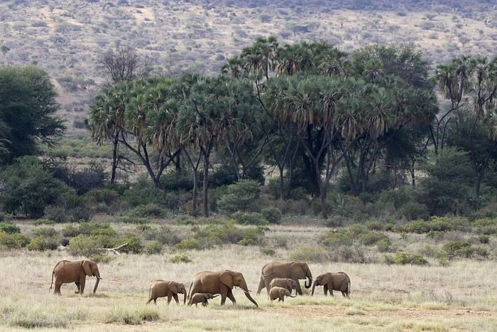
We’d see them in the same area almost every day. We also spotted some gazelles.
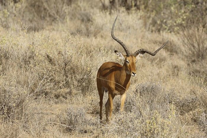
After several years, I’ve finally decided to repost a travel journal on the forum. We returned a few weeks ago from an incredible trip to Kenya, and it’s reignited my desire to share our emotions in the face of these animals.
Kenya wasn’t originally a priority for us in terms of safari—we had the impression it was too touristy. So, we started with other destinations: Namibia, Tanzania, Botswana, and South Africa. But as I did more research, especially on the forum (thanks in part to Sylvie’s many trips), I eventually convinced myself that Kenya could be magnificent, as long as we chose our itinerary carefully and avoided peak seasons.
We ended up going in January, from the 17th to the 31st. We worked with a travel agency (TP) that crafted a custom itinerary for us: Samburu-Ol Pejeta-Naivasha-Maji Moto-Maasai Mara-Diani. They partnered with a local French-speaking agency, and everything was perfectly organized. Our trip exceeded all our expectations, and none of it would’ve been as amazing without our guide, Alfred. He accompanied us for 10 days and was a fantastic travel companion—professional, respectful of the animals, and always in good spirits. We formed a great bond with him in such a short time.
- **January 17th** After meeting up with Juliette and Charlotte in Rennes the night before, we left at 4 AM for Roissy Charles de Gaulle Airport. The thick fog made the drive pretty rough, but we arrived safely around 7:45 AM. A Blue Valet driver was waiting to take our car. Check-in went smoothly, and we waited patiently for our 10:40 AM flight. Unfortunately, despite boarding on time, a passenger was missing, and we had to find a replacement last minute. Then, another passenger who had checked in and dropped off their luggage wasn’t on the plane, so they had to unload their bags. After a long period of uncertainty and spotty communication from the crew, we finally took off over an hour late.
We arrived in Nairobi in the late afternoon, 45 minutes behind schedule. The administrative formalities were endless—it took nearly 1.5 hours from landing to leaving the airport with our luggage. When we stepped out, Alfred, our guide, was waiting with a big smile and drove us to the Eka Hotel, not far from the airport. Exhausted from the long journey, we fell asleep quickly.
- **January 18th** Alfred met us at 7 AM for a long drive to Samburu Reserve. We had a peaceful night, unlike the girls, who barely slept because their neighbors were talking loudly all night. Things even escalated when Charlotte started shouting insults to get them to quiet down, but it didn’t work.
It was Sunday, so traffic around Nairobi and along the route was light. Aside from a quick "technical stop," we drove straight through and arrived in Samburu after just under 6 hours. Because of the lower altitude (around 1,000m on average), it was hot—over 30°C in mid-January.
As soon as we entered the reserve, we spotted some impalas and quickly came across one of the region’s endemic species: the reticulated giraffe, which is absolutely stunning.
While heading to our camp for lunch, Alfred crossed paths with another vehicle and learned that a leopard was nearby. We started searching, and a few minutes later, Anny spotted a shape in a tree—it was our leopard!
There were actually two of them—a mother and her adolescent. The young one was perched high in the tree, in the shade. We got to observe them for a good half-hour in excellent conditions, with just one other vehicle nearby.
Alfred also noticed that the mother had hidden prey (a gerenuk gazelle) in the vegetation, away from prying eyes.
It was time to head to our camp, the Ashnil Samburu Camp, located in the Buffalo Springs area, by the river, in an idyllic setting surrounded by the region’s typical vegetation.
The welcome was fantastic—we immediately felt at home, and that feeling lasted throughout our 3-day stay in the reserve. It was 2 PM, but no one rushed us to the table. Our waitress, Sheila, who took care of us the whole time, was as lovely as the rest of the team. Barely seated, we were invited to watch an elephant passing right by the camp, in front of the restaurant. This trip was off to a great start!
After lunch, we relaxed by the pool. Monkeys, especially vervets, were everywhere, and a camp employee was assigned to keep an eye on them and shoo them away if needed (especially the baboons).
A little before 4 PM, we met up with Alfred for our first game drive. Just outside the camp, a few elephants were in the valley near the river.
We’d see them in the same area almost every day. We also spotted some gazelles.
Chatting by the water
For those who want to chat quietly by the riverbanks, this is the place!
The Foam of Days
Now that the curtain has fallen on the past year, it’s time to see what’s happening around here.
It seems pretty quiet, but I’ll read more in detail later.
First, I need to tell you all an anecdote.
My eldest little girl, in her third year of law school, was really scared she wouldn’t pass the year. I told her: “Trust yourself, you’ve worked so hard, and worst case, if you fail, you’ll just redo the year.” “But I don’t think I’ll make it—they changed the rules, and if I mess up even one unit, I have to start all over.” I knew her grades weren’t exactly stellar, and with what I was about to say, I wasn’t taking much of a risk. “Here’s the deal, sweetheart: if you pass, I promise I’ll take you to India, just the two of us.” I have to admit, India is a country I’ve talked about so much to all my grandchildren that in their minds, it’s become a magical, mythical place (hmm).
July had barely begun when my phone rang, her name flashing on the screen. “Mamido, I did it!” My promise came rushing back—oh no, oh no, oh no! “Congratulations, sweetheart!” A little shyly, she said: “Is the India trip still on?”
And me, replying: “Of course it is!”
And that’s that—a promise is a promise, or you risk losing that precious trust that keeps hearts warm and at peace.
We’re leaving in February. Only 8 days—yikes, the carbon footprint! But we can’t miss her tutorials, or she’ll be kicked out. Personally, that works just fine for me.
Going to India has become a challenge for me. It’s far, it’s exhausting, I sweat, I hate mosquitoes, the spices bother my mouth when I used to love them. There’s noise all the time—at night, the dogs bark nonstop, and we almost get run over. I’ll get lost in the streets because my sense of direction has vanished. I don’t like rice anymore. All that chaos and those cultural differences that once enchanted me now just overwhelm me. But I promised.
The upside—and it’s a big one—Raman, the same driver I’ve had forever, will be at the airport with a sign with our names. We’ll stop at the same little shop for chai (or tea, plain and simple) with that aroma that intoxicates me, halfway through the trip.
It’ll be a tiny trip—staying with friends, I’ll show her a few places I love: Chidambaram, Mamallapuram, and the clinic where I worked. Then we’ll head back. My little girl will go home to her parents.
As for me, I’ll leave right away for our Scottish island with Homme for our chilly winter.
How can you love a country so much you want to live there, then suddenly reject it, no longer able to appreciate what once made it special? That’s the mystery of love, I guess.
First, I need to tell you all an anecdote.
My eldest little girl, in her third year of law school, was really scared she wouldn’t pass the year. I told her: “Trust yourself, you’ve worked so hard, and worst case, if you fail, you’ll just redo the year.” “But I don’t think I’ll make it—they changed the rules, and if I mess up even one unit, I have to start all over.” I knew her grades weren’t exactly stellar, and with what I was about to say, I wasn’t taking much of a risk. “Here’s the deal, sweetheart: if you pass, I promise I’ll take you to India, just the two of us.” I have to admit, India is a country I’ve talked about so much to all my grandchildren that in their minds, it’s become a magical, mythical place (hmm).
July had barely begun when my phone rang, her name flashing on the screen. “Mamido, I did it!” My promise came rushing back—oh no, oh no, oh no! “Congratulations, sweetheart!” A little shyly, she said: “Is the India trip still on?”
And me, replying: “Of course it is!”
And that’s that—a promise is a promise, or you risk losing that precious trust that keeps hearts warm and at peace.
We’re leaving in February. Only 8 days—yikes, the carbon footprint! But we can’t miss her tutorials, or she’ll be kicked out. Personally, that works just fine for me.
Going to India has become a challenge for me. It’s far, it’s exhausting, I sweat, I hate mosquitoes, the spices bother my mouth when I used to love them. There’s noise all the time—at night, the dogs bark nonstop, and we almost get run over. I’ll get lost in the streets because my sense of direction has vanished. I don’t like rice anymore. All that chaos and those cultural differences that once enchanted me now just overwhelm me. But I promised.
The upside—and it’s a big one—Raman, the same driver I’ve had forever, will be at the airport with a sign with our names. We’ll stop at the same little shop for chai (or tea, plain and simple) with that aroma that intoxicates me, halfway through the trip.
It’ll be a tiny trip—staying with friends, I’ll show her a few places I love: Chidambaram, Mamallapuram, and the clinic where I worked. Then we’ll head back. My little girl will go home to her parents.
As for me, I’ll leave right away for our Scottish island with Homme for our chilly winter.
How can you love a country so much you want to live there, then suddenly reject it, no longer able to appreciate what once made it special? That’s the mystery of love, I guess.
USA Road Trip 2023 - Part 1
In January 2023, we started our second road trip across the United States. We stayed from January to mid-March, which gave us plenty of time to visit several cities, attractions, and parks in multiple states.
This travel journal will be split into two parts due to the considerable number of places we visited.
This first journal covers the following states: Ohio, Indiana, Missouri, Oklahoma, Texas, New Mexico, Arizona, Nevada, and California, and takes you through the outbound leg of our road trip.
The second journal will showcase the attractions we visited on the return trip, which mainly follows the famous Highway 1 along the Pacific coast.
So, I invite you to keep reading this first journal, which serves as a long recap to help you discover the various attractions we explored throughout this road trip.
Videos are included throughout the recap. Please click on the image to start the video.
Here are the links to jump to a specific post:
OHIO:
WinterLand - Christmas Lights at Cleveland Public Square Lake View Cemetery - Cleveland - Part 1 Lake View Cemetery - Cleveland - Part 2 Stroll through Columbus Upper Falls to Lower Falls via Buckeye Trail - Hocking Hills State Park – Logan Cedar Falls & Whispering Falls Hiking Trail - Hocking Hills State Park – Logan Ash Cave Hiking Trail - Hocking Hills State Park – Logan Exploring Cincinnati
INDIANA:
Visiting Indianapolis
MISSOURI:
Exploring St. Louis
OKLAHOMA:
Catoosa Blue Whale Discovering Tulsa Exploring Oklahoma City
TEXAS:
Exploring Shamrock Discovering McLean Exploring Amarillo
NEW MEXICO:
Ancestral Sites Trail - Pecos National Historical Park Discovering Santa Fe The Santuario de Chimayó Stroll through Los Cerrillos Walk through the village of Madrid San Francisco de Asis Catholic Church & The Bottle House - Golden Albuquerque Murals 66 Diner - Albuquerque Stroll through Old Town (Albuquerque) Rinconada Canyon Trail - Petroglyph National Monument Mesa Point Trail - Boca Negra Canyon - Petroglyph National Monument Macaw Trail - Boca Negra Canyon - Petroglyph National Monument Cliff Base Trail - Boca Negra Canyon - Petroglyph National Monument Piedras Marcadas Canyon - Petroglyph National Monument Sandstone Bluffs & Ventana Natural Arch - El Malpais National Monument
ARIZONA:
Stewart's Petrified Wood Shop – Holbrook Stroll through Holbrook Discovering Joseph City Exploring Winslow Grand Falls (The "Chocolate Falls") – Leupp Island Trail - Walnut Canyon National Monument Rim Trail - Walnut Canyon National Monument Wukoki Pueblo Trail – Wupatki National Monument Wupatki Pueblo Trail – Wupatki National Monument Doney Mountain Trail – Wupatki National Monument Citadel & Nalakihu Pueblos Trail – Wupatki National Monument Lomaki & Box Canyon Pueblos Trail – Wupatki National Monument Discovering Flagstaff On the way to Sedona Slide Rock State Park – Sedona Midgley Bridge Trail – Wilson Canyon – Sedona Tlaquepaque Arts & Shopping Village Walking Tour - Sedona Chapel of the Holy Cross - Sedona Hiking at Cathedral Rock - Sedona Hiking the Bell Rock Trail - Sedona Hiking the Airport Loop Trail - Sedona Amitabha Stupa and Peace Park - Sedona Hiking the Boynton Canyon Vortex Trail - Sedona Hiking the Devil's Bridge Trail - Sedona Hiking the Birthing Cave Trail - Sedona Bell Rock Inn - Sedona On the roads of Sedona - Part 1 On the roads of Sedona - Part 2 Keyhole Sink Hiking Trail - Kaibab National Forest Discovering Williams Exploring Ash Fork Discovering Kingman Ramada by Wyndham Kingman Davis Camp Park - Bullhead City Discovering Yucca Lake Havasu Boardwalk Tour A duck catches a lobster – Lake Havasu Boardwalk
CALIFORNIA:
Exploring Needles Discovering Goffs Discovering Amboy Visiting the famous Bagdad Cafe - Newberry Springs Exploring Barstow Vehicles from Hell (Mad Max Cars) - Barstow Peggy Sue's 50's Diner - Yermo Liberty Sculpture Park - Yermo Lake Dolores Water Park - Newberry Springs ZZYZX Road - Mojave National Preserve Alien Fresh Jerky - Baker Kelso Dunes Trail - Mojave National Preserve Hole-in-the-Wall Rings Trail - Mojave National Preserve Visiting Mitchell Caverns - Mojave National Preserve Dante's View - Death Valley National Park Zabriskie Point - Death Valley National Park Golden Canyon - Death Valley National Park Artists Drive & Artists Palette - Death Valley National Park Devil's Golf Course - Death Valley National Park Natural Bridge Trail - Death Valley National Park Badwater Basin - Death Valley National Park Harmony Borax Works - Death Valley National Park Devil's Cornfield - Death Valley National Park Mesquite Flat Sand Dunes - Death Valley National Park Mosaic Canyon Trail - Death Valley National Park On the road - Death Valley National Park
NEVADA:
Cleveland Clinic Lou Ruvo Center for Brain Health - Las Vegas Exploring Downtown Las Vegas SlotZilla Zipline - Fremont Street Experience – Downtown Las Vegas Viva Vision Light Show 1 - Fremont Street Experience - Downtown Las Vegas Viva Vision Light Show 2 - Fremont Street Experience - Downtown Las Vegas Viva Vision Light Show 3 - Fremont Street Experience - Downtown Las Vegas Viva Vision Light Show 4 - Fremont Street Experience - Downtown Las Vegas Free Live Music – Fremont Street Experience - Downtown Las Vegas Chucky – Fremont Street Experience - Downtown Las Vegas Las Vegas Strip - Part 1 Las Vegas Strip - Part 2 Las Vegas Strip - Part 3 Las Vegas Strip - Part 4 Las Vegas Strip - Part 5 Tom Devlin's Monster Museum - Boulder City Hoover Dam Lake Mead - Lakeview Overlook - Boulder City Nelson Ghost Town - Searchlight
CALIFORNIA:
Scenic Route through Joshua Tree National Park via the North Entrance Hidden Valley Trail - Joshua Tree National Park Barker Dam Trail - Joshua Tree National Park Cap Rock Trail - Joshua Tree National Park Keys View Trail - Joshua Tree National Park Hall of Horrors Trail - Joshua Tree National Park Skull Rock Trail - Joshua Tree National Park Arch Rock Trail - Joshua Tree National Park Cholla Cactus Garden Trail - Joshua Tree National Park Lone Pine - Owens Valley Miss Alabama & Shark Fin - Alabama Hills - Owens Valley Lone Ranger Canyon - Alabama Hills - Owens Valley Mobius Arch Loop Trail (Heart Arch & Lathe Arch) - Alabama Hills - Owens Valley Eye of the Alabama Hills Arch - Alabama Hills - Owens Valley Boot & Cyclops Arches - Alabama Hills - Owens Valley One Mile Arch, Bowling Ball and Pins & Gunga Din Area - Alabama Hills - Owens Valley Whitney Portal Arch Trailhead - Alabama Hills - Owens Valley Fish Rocks & Trona Pinnacles - Mojave Desert Red Cliffs Trail - Red Rock Canyon State Park Hagen Canyon Nature Trail - Red Rock Canyon State Park Tour of Historic Downtown Tehachapi View of the Tehachapi Loop – Monolith César E. Chávez National Monument – Keene Discovering Bakersfield Kern County Museum – Bakersfield Bravo Farms, Tree House & Petting Zoo - Traver Walking Tour of Kingsburg Exploring Fresno Simonian Farms & Soul Consoling Japanese Internment Tower - Fresno Duncan Ceramic Products (iLoveToCreate) - Fresno Walking Tour of Modesto Wat Dhammararam Buddhist Temple - Stockton Walking Tour of Stockton Discovering Stockton University of the Pacific - Stockton Visiting Lodi Sutter's Fort State Historic Park - Sacramento California State Capitol - Sacramento Walking Tour - Sacramento Walking Tour - Winters Walking Tour - Napa The Chandelier Tree In Drive-Thru Tree Park - Leggett One Log House - Garberville Grandfather Tree - Piercy The Living Chimney Tree - Avenue of the Giants Stephens Grove Loop Trail - Avenue of the Giants Gould Grove Nature Loop Trail - Avenue of the Giants Fleishmann Grove Trail - Avenue of the Giants Mahan Plaque Trail - Avenue of the Giants Founders Grove Nature Loop Trail - Avenue of the Giants Eternal Tree House & Immortal Tree - Avenue of the Giants Drury-Chaney Loop Trail - Avenue of the Giants Walking Tour - Redcrest
COMING UP NEXT:
USA Road Trip 2023 - Part 2
This travel journal will be split into two parts due to the considerable number of places we visited.
This first journal covers the following states: Ohio, Indiana, Missouri, Oklahoma, Texas, New Mexico, Arizona, Nevada, and California, and takes you through the outbound leg of our road trip.
The second journal will showcase the attractions we visited on the return trip, which mainly follows the famous Highway 1 along the Pacific coast.
So, I invite you to keep reading this first journal, which serves as a long recap to help you discover the various attractions we explored throughout this road trip.
Videos are included throughout the recap. Please click on the image to start the video.
Here are the links to jump to a specific post:
OHIO:
WinterLand - Christmas Lights at Cleveland Public Square Lake View Cemetery - Cleveland - Part 1 Lake View Cemetery - Cleveland - Part 2 Stroll through Columbus Upper Falls to Lower Falls via Buckeye Trail - Hocking Hills State Park – Logan Cedar Falls & Whispering Falls Hiking Trail - Hocking Hills State Park – Logan Ash Cave Hiking Trail - Hocking Hills State Park – Logan Exploring Cincinnati
INDIANA:
Visiting Indianapolis
MISSOURI:
Exploring St. Louis
OKLAHOMA:
Catoosa Blue Whale Discovering Tulsa Exploring Oklahoma City
TEXAS:
Exploring Shamrock Discovering McLean Exploring Amarillo
NEW MEXICO:
Ancestral Sites Trail - Pecos National Historical Park Discovering Santa Fe The Santuario de Chimayó Stroll through Los Cerrillos Walk through the village of Madrid San Francisco de Asis Catholic Church & The Bottle House - Golden Albuquerque Murals 66 Diner - Albuquerque Stroll through Old Town (Albuquerque) Rinconada Canyon Trail - Petroglyph National Monument Mesa Point Trail - Boca Negra Canyon - Petroglyph National Monument Macaw Trail - Boca Negra Canyon - Petroglyph National Monument Cliff Base Trail - Boca Negra Canyon - Petroglyph National Monument Piedras Marcadas Canyon - Petroglyph National Monument Sandstone Bluffs & Ventana Natural Arch - El Malpais National Monument
ARIZONA:
Stewart's Petrified Wood Shop – Holbrook Stroll through Holbrook Discovering Joseph City Exploring Winslow Grand Falls (The "Chocolate Falls") – Leupp Island Trail - Walnut Canyon National Monument Rim Trail - Walnut Canyon National Monument Wukoki Pueblo Trail – Wupatki National Monument Wupatki Pueblo Trail – Wupatki National Monument Doney Mountain Trail – Wupatki National Monument Citadel & Nalakihu Pueblos Trail – Wupatki National Monument Lomaki & Box Canyon Pueblos Trail – Wupatki National Monument Discovering Flagstaff On the way to Sedona Slide Rock State Park – Sedona Midgley Bridge Trail – Wilson Canyon – Sedona Tlaquepaque Arts & Shopping Village Walking Tour - Sedona Chapel of the Holy Cross - Sedona Hiking at Cathedral Rock - Sedona Hiking the Bell Rock Trail - Sedona Hiking the Airport Loop Trail - Sedona Amitabha Stupa and Peace Park - Sedona Hiking the Boynton Canyon Vortex Trail - Sedona Hiking the Devil's Bridge Trail - Sedona Hiking the Birthing Cave Trail - Sedona Bell Rock Inn - Sedona On the roads of Sedona - Part 1 On the roads of Sedona - Part 2 Keyhole Sink Hiking Trail - Kaibab National Forest Discovering Williams Exploring Ash Fork Discovering Kingman Ramada by Wyndham Kingman Davis Camp Park - Bullhead City Discovering Yucca Lake Havasu Boardwalk Tour A duck catches a lobster – Lake Havasu Boardwalk
CALIFORNIA:
Exploring Needles Discovering Goffs Discovering Amboy Visiting the famous Bagdad Cafe - Newberry Springs Exploring Barstow Vehicles from Hell (Mad Max Cars) - Barstow Peggy Sue's 50's Diner - Yermo Liberty Sculpture Park - Yermo Lake Dolores Water Park - Newberry Springs ZZYZX Road - Mojave National Preserve Alien Fresh Jerky - Baker Kelso Dunes Trail - Mojave National Preserve Hole-in-the-Wall Rings Trail - Mojave National Preserve Visiting Mitchell Caverns - Mojave National Preserve Dante's View - Death Valley National Park Zabriskie Point - Death Valley National Park Golden Canyon - Death Valley National Park Artists Drive & Artists Palette - Death Valley National Park Devil's Golf Course - Death Valley National Park Natural Bridge Trail - Death Valley National Park Badwater Basin - Death Valley National Park Harmony Borax Works - Death Valley National Park Devil's Cornfield - Death Valley National Park Mesquite Flat Sand Dunes - Death Valley National Park Mosaic Canyon Trail - Death Valley National Park On the road - Death Valley National Park
NEVADA:
Cleveland Clinic Lou Ruvo Center for Brain Health - Las Vegas Exploring Downtown Las Vegas SlotZilla Zipline - Fremont Street Experience – Downtown Las Vegas Viva Vision Light Show 1 - Fremont Street Experience - Downtown Las Vegas Viva Vision Light Show 2 - Fremont Street Experience - Downtown Las Vegas Viva Vision Light Show 3 - Fremont Street Experience - Downtown Las Vegas Viva Vision Light Show 4 - Fremont Street Experience - Downtown Las Vegas Free Live Music – Fremont Street Experience - Downtown Las Vegas Chucky – Fremont Street Experience - Downtown Las Vegas Las Vegas Strip - Part 1 Las Vegas Strip - Part 2 Las Vegas Strip - Part 3 Las Vegas Strip - Part 4 Las Vegas Strip - Part 5 Tom Devlin's Monster Museum - Boulder City Hoover Dam Lake Mead - Lakeview Overlook - Boulder City Nelson Ghost Town - Searchlight
CALIFORNIA:
Scenic Route through Joshua Tree National Park via the North Entrance Hidden Valley Trail - Joshua Tree National Park Barker Dam Trail - Joshua Tree National Park Cap Rock Trail - Joshua Tree National Park Keys View Trail - Joshua Tree National Park Hall of Horrors Trail - Joshua Tree National Park Skull Rock Trail - Joshua Tree National Park Arch Rock Trail - Joshua Tree National Park Cholla Cactus Garden Trail - Joshua Tree National Park Lone Pine - Owens Valley Miss Alabama & Shark Fin - Alabama Hills - Owens Valley Lone Ranger Canyon - Alabama Hills - Owens Valley Mobius Arch Loop Trail (Heart Arch & Lathe Arch) - Alabama Hills - Owens Valley Eye of the Alabama Hills Arch - Alabama Hills - Owens Valley Boot & Cyclops Arches - Alabama Hills - Owens Valley One Mile Arch, Bowling Ball and Pins & Gunga Din Area - Alabama Hills - Owens Valley Whitney Portal Arch Trailhead - Alabama Hills - Owens Valley Fish Rocks & Trona Pinnacles - Mojave Desert Red Cliffs Trail - Red Rock Canyon State Park Hagen Canyon Nature Trail - Red Rock Canyon State Park Tour of Historic Downtown Tehachapi View of the Tehachapi Loop – Monolith César E. Chávez National Monument – Keene Discovering Bakersfield Kern County Museum – Bakersfield Bravo Farms, Tree House & Petting Zoo - Traver Walking Tour of Kingsburg Exploring Fresno Simonian Farms & Soul Consoling Japanese Internment Tower - Fresno Duncan Ceramic Products (iLoveToCreate) - Fresno Walking Tour of Modesto Wat Dhammararam Buddhist Temple - Stockton Walking Tour of Stockton Discovering Stockton University of the Pacific - Stockton Visiting Lodi Sutter's Fort State Historic Park - Sacramento California State Capitol - Sacramento Walking Tour - Sacramento Walking Tour - Winters Walking Tour - Napa The Chandelier Tree In Drive-Thru Tree Park - Leggett One Log House - Garberville Grandfather Tree - Piercy The Living Chimney Tree - Avenue of the Giants Stephens Grove Loop Trail - Avenue of the Giants Gould Grove Nature Loop Trail - Avenue of the Giants Fleishmann Grove Trail - Avenue of the Giants Mahan Plaque Trail - Avenue of the Giants Founders Grove Nature Loop Trail - Avenue of the Giants Eternal Tree House & Immortal Tree - Avenue of the Giants Drury-Chaney Loop Trail - Avenue of the Giants Walking Tour - Redcrest
COMING UP NEXT:
USA Road Trip 2023 - Part 2
Madagascar - June 2025
Five years of an unintended break... The closure of VF, COVID... What a joy to rediscover the pleasure of sharing!
I’ve stayed true to my habits: the following account is a collection of practical tips rather than a travel journal...
Madagascar is as big as France and Belgium combined. In three weeks, choices have to be made! It was the Great Tsingy that inspired our trip. We decided to focus on the southwest and the RN7. We skipped the Deep South and the North. Oh well...
OUR ITINERARY IN 3 WEEKS:
Fri 6 June – Direct AF flight to Tana – Flight arrives at 10:30 PM – Tana Sat – Antsirabe Sun – Miandrivazo Mon – Drive to the Masiakampy pier – Descent of the Tsiribihina River by pirogue - Bivouac Tue – Descent of the Tsiribihina River by pirogue - Bivouac Wed – Descent of the Tsiribihina River by pirogue – Bekopaka Thu – Pirogue on the Manambolo River and Small Tsingy of Bemaraha – Bekopaka Fri – Great Tsingy of Bemaraha – Bekopaka Sat – Avenue of the Baobabs – Morondava Sun – Belo sur Mer Mon – Free day – Belo sur Mer Tue – Manja Wed – Andavadoaka Thu – Free day – Andavadoaka Fri – Salary Lagoon – Mangily Sat – Ranohira Sun – Isalo National Park - Ranohira Mon – Anja Reserve - Ambalavao - Fianarantsoa Tue – FCE train canceled – Visit to a Tanala village - Manakara Wed – Pirogue on the Pangalanes Canal – Ranomafana Thu – Ranomafana NP – Ranomafana Fri – Ambositra – Antsirabe Sat 28 June – AF flight to Paris – Flight departs at 11:55 PM
TRIP ORGANIZATION: I prepared my trip using the usual guides (LP and Rough Guide), the internet, and the Freytag & Berndt map (1:1,000,000). I’m old-school—I still love visualizing my route on a paper map, even though in Madagascar, it’s misleading because some National Roads are only national in name!...
The agency: Since we couldn’t deal directly with a driver-guide (we lacked reliable info to take the plunge), we went through an agency to organize the logistics of our trip. We didn’t feel like using bush taxis (not enough time) or driving a 4x4 ourselves (neither the skills nor the boldness). The French agency connected us with a local agency, to whom I sent my detailed itinerary by email. A few exchanges via email and WhatsApp calls allowed us to finalize everything quickly after some adjustments. As you’ve gathered... we multiplied the commissions, which inflated the budget. That said, in the end, we were thrilled with our decision and our choice. Our trip was booked by the end of 2024, and reservations were made immediately. No bad surprises: the bookings in the planned hotels were honored, often with one of the best rooms. On our last day in Tana, before departure, we were lucky enough to meet the director I’d been communicating with, who helped build and validate our circuit. A very warm debriefing.
The driver-guide: The agency assigned us Faly, 33, a driver-guide for over 10 years. He stayed with us from start to finish: he picked us up at the airport on arrival and dropped us off 23 days later. A very experienced driver (which is important here), an open and cultured guide, reliable, punctual, and a great companion. And a provider of good advice throughout the trip. We made the most of the long stretches on dirt roads or highways to listen to him talk about daily life, rituals, wildlife, and flora... No time wasted! With a great playlist in the background, we combined business with pleasure! Faly’s accommodation and meals were included (quite often, hotels offer free lodging and meals to driver-guides who bring clients), as was the fuel. That didn’t stop us from inviting Faly to share a beer or our evening meal sometimes. He didn’t always accept, wanting to let us "enjoy our romantic evenings," as he put it. Present without being intrusive! Faly is fully capable of organizing a tailor-made trip directly. I recommend him without any hesitation—we were delighted with his service. I’ll gladly share his contact details via PM to anyone who asks.
Local guides: It’s the national guide’s prerogative to choose the local guides (mandatory in the parks). Thanks to his experience, Faly always booked us amazing, competent, and interesting local guides.
Hotels: I told the agency I wanted charming, comfortable accommodations, without falling into flashy luxury. We loved all the hotels (except the Hôtel Kanto in Manja). The rooms, mostly bungalows, were always spacious and clean. Unfortunately, I can’t give the prices—I didn’t get the details. Breakfast is always included, usually fresh and hearty. Very often, a small bottle of water is provided in the room.
Tana Hôtel Les 3 Métis Power cuts are common (!) in Tana. Bring a headlamp.
Antsirabe Ecolodge – Les chambres du voyageur Maybe our favorite! A few bungalows, beautifully arranged in a splendid tropical garden. The dog Kodak welcomes us warmly.
Miandrivazo Hôtel Princesse Tsiribihina Magnificent view of the valley.
Bekopaka Hôtel Orchidée du Bemaraha 2 (yes, 2) beautiful pools, a large open common room.
Morondava Hôtel Baobab Café Brand new or at least, according to Faly, just renovated. Very comfortable but without much charm (international style).
Belo sur Mer Ecolodge du Menabe The bungalows, all made of wood, bamboo, and thatch, are set on the beach. Very spacious and fully equipped! Large open-air restaurant by the sea. No hot water from the tap—it’s available in plastic bottles heated by the sun in front of each bungalow. Actually, we never used it... Another very, very beautiful spot.
Manja Hôtel Kanto The only hotel on this leg of the journey, so no choice. The owner knows it and, as a result, doesn’t bother. It’s a real dive! Tiny, dark room, a sordid bathroom with only a trickle of water—we skipped the shower! Clean sheets, though. Obviously, no Wi-Fi. The only place where I didn’t leave a tip. We were well warned about the discomfort of this stop, both by the agency and Faly. We weren’t surprised, and it even became a running joke during the trip. On the other hand, we found a nice little market in town.
Andavadoaka Manga Lodge What bliss! Especially after the horrible Hôtel Kanto. A paradise-like spot, overlooking three beautiful deserted white-sand beaches. Meals are served on the terrace facing the sea. Stunning sunset. We loved spending a day lounging here! We were the only guests and were pampered.
Mangily (Ifaty) Mangily is the "suburb" of Ifaty. Hôtel Vovo Telo A large beachfront bungalow complex. More touristy but pleasant—we spent a lovely evening there with our feet in the sand.
Ranohira Le Relais de la Reine A splendid resort built by a Frenchman, at the foot of the rocks, very well integrated into the environment. Beautiful marked trail starting from the garden.
Fianarantsoa Villa Sylvestre Contrary to what its name suggests, it’s a hotel right in the city center. Quite decent, though.
Manakara Parthenay Club Pretty bungalows in a large garden by the sea, but swimming isn’t safe—the water is too dangerous and rough.
Ranomafana Hôtel Thermal Very spacious rooms.
Meals: Not all our meals were included. It’s really not expensive. 1 meat or fish dish: around 35,000 Ar 1 full menu (starter, main, dessert): around 70,000 Ar 1 large THB beer (65 cl): between 8,000 and 12,000 Ar 1 piña colada: 15,000 Ar 1 flavored rum: 6,000 Ar (sometimes free) 1 glass of baobab juice (!): 5,000 Ar
We always ate very well. Rice is everywhere, served in large quantities. Zebu meat is quite good if not overcooked. Personally, I prefer fish, and I feasted: grouper, captain, crab, small lobsters...
We happily discovered baobab juice (especially in Belo, on the west coast). And of course, flavored rums!
We bought 2 packs of 6 bottles of mineral water at Carrefour (!) (about 5,000 Ar per large bottle) at the start of our trip. That was enough, especially since we often got water in the bungalows.
We had a few picnics included in our trip. Instead of picking up the hotel’s lunchbox, Faly prepared delicious, fresh, and varied picnics for us: tuna pasta salad, fried rice with eggs, grilled vegetables, and avocado...
An exceptional address not to miss: Mad Zébu – Belo sur Tsiribihina A highly reputed restaurant, a favorite of LP and Rough Guide, and rightly so! Gourmet cuisine, refined and elegant. Barely more expensive than elsewhere, and it’s worth it. We stopped there on our way up to Bekopaka and the Tsingy NP. Fully booked! So Faly reserved for our return, three days later. We’re still thanking him! What a treat!
THE BUDGET: Ariary exchange rate: 5,000 Ar = 1 €
Pre-trip expenses: Direct Air France flights: 930 € per person round trip Cost of the circuit with the agency: 2,880 € per person
The visa: Issued on arrival, very quickly. 35 € per person for a stay under 30 days. Super simple. Super fast.
On-site expenses: As soon as we arrived at the airport (it was nearly midnight), Faly advised us to exchange our euros for all our needs. There are few opportunities on our route to find an ATM or an open bank with a good rate. To be more comfortable, he took us to a small office under military protection just outside the airport. I exchanged 1,200 € (I had asked the agency for advice on the amount to bring) at a rate of 4,750 Ar and became a millionaire. Faly recounted all the stacks. That covered all our expenses (meals, drinks, tips) without ever feeling deprived. Personal purchases were made at the end of the trip. Convenient—it served as an adjustment variable. We spent our last million (200 €) on marquetry and vanilla. Tip: We asked for 200,000 Ar in 5,000 Ar bills for tips. That wasn’t too much—I even ran short of small bills in the last two days.
Tips: Madagascar is a poor country where every service deserves a small reward. While not mandatory, it’s customary. But no one ever demanded or expected it openly. On the contrary, I sometimes had to remind a porter to give them my small bill. We never carried our luggage—porters were always present when the car arrived or waiting at our door to watch for our departure. I gave each of them 5,000 Ar. In restaurants, I rounded up to the nearest ten and left the change. Local guides also expect a tip: I gave around 20,000 Ar per day for the two of us. Finally, the national guide also expects a gratuity. I had read online to budget 5 € per day per person. I added more since we were so happy with his services. The tip was given at the end of the trip, in euros, outside the budget.
Total budget all included (excluding personal purchases): 8,690 € Clearly, Madagascar is a country where life isn’t expensive, but travel costs add up quickly due to the need to rent a 4x4 with a driver.
HIGHLIGHTS:
· The dirt roads Yes, I’m listing them among the highlights! We loved those long hours spent driving at 20 km/h on rocky, muddy, white, red, or gray sand tracks... surrounded by tropical vegetation, palm trees, pandanus, mango trees... The experiences were sometimes thrilling: crossing a river on a ferry (just planks of wood fixed on two motorized pirogues side by side) or crossing a river without a ferry, with just a kid running ahead of the 4x4 to show the way; soft sand where the 4x4 easily gets stuck... The tracks are quite narrow, and crossing paths with a bush taxi, a zebu cart, or a herd of goats is always epic. So many beautiful images, so many beautiful photos! Much more beautiful than on asphalt. So yes, we loved those long stretches on dirt roads. For us, it was clearly part of the journey. Faly was particularly careful, and the 4x4 was comfortable. No injuries, no fatigue, even after 7 or 8 hours on rough tracks. The national roads (including the famous RN7) are badly damaged by cyclones, huge trucks, and lack of maintenance. Potholes have turned into ostrich nests, and we didn’t drive much faster than on the dirt roads.
· The landscapes, villages, encounters... We crossed a variety of stunning landscapes: mountains with slopes covered in terraced crops, rice fields from apple green to emerald green, sugarcane fields, then tropical forests, baobab forests (they deserve a special paragraph below), traveler’s tree forests. And then coastlines with white sand dunes against a backdrop of blue hues!... Magical! We also passed through many villages with houses whose architecture varied by region. The Betsileo houses display beautiful decorative brick reliefs. On the west coast, the houses are more precarious, made of bamboo with palm-thatched roofs. In the Highlands region, we found solid houses with pastel plaster. Each region has its own landscape, crops, habitat, and clothing. Zebu carts are often the only means of transport in remote villages. We saw them very frequently. Again, the cart’s decoration depends on the region. And then, we met many villagers coming out of the bush and walking to the next market, carrying their crops on their heads or shoulders. More beautiful photos!
· The descent of the Tsiribihina River We boarded around 9 AM in a long pirogue with Gana, the local guide, and two pirogue men. So, five of us. The pirogue is long but narrow, about 65 cm wide. We sat one behind the other at the front on seats padded with what would become our mattresses during the bivouacs. We only took the bare essentials for two nights. A little goodbye to Faly, whom we’d see again in three days! Don’t forget us! The river is silty—meaning orange, opaque but clean. We glided along silently. Gana showed us the trees, birds, crocodiles (we saw five—apparently, we were lucky). The pirogue men rowed to get us as close as possible to these crocs sunbathing on the roots of big trees. Yeah, right!... as soon as we got too close, *splash*, they disappeared into the water. We marveled at the mini rice fields lining the river. Every tiny plot, no matter how small, is cultivated. Above them, banana fields. And on the water, a whole life of fishermen and villagers living with and from the river. Gana warned us we’d eat on the pirogue because the journey was long. So, I expected chips... But no—fried rice and zebu steak, cooked right in the pirogue!! Incredible! In the middle of the afternoon, we reached a small beach where we disembarked. Gana led us about a hundred meters to a sublime waterfall. We were alone there. We had time to swim. We’d brought our swimsuits and a towel (bought at the Carrefour in Antsirabe on Faly’s wise advice!). This swim in this paradise-like spot remains one of our best memories. We found our pirogue again and set off until our first bivouac. We’d sailed for 7 hours today. The tents were set up on a wide beach, without a single tree. A moment of solitude... Uh, where can we go to the bathroom?... Especially since it was a full moon, so we felt like we were in the spotlight. Anyway... we did as everyone else—walked away, dug a hole, and the others turned their backs. A hearty meal on the beach before a comfortable and silent night. The next day, same program, with slightly different landscapes. The gorges widened, the trees were different. But still many colorful birds. Again, we ate on the pirogue: grilled chicken and vegetables. 9 hours of sailing. A similar bivouac. This time, we got it. On the third day, we finished the descent with 5 hours of sailing. So, 7 hours, 9 hours, 5 hours... doing nothing. It might sound boring... but it wasn’t. Like the dirt roads, these were contemplative moments. It glides, it’s calm, relaxing, and there’s a lot of life on this river, animal and human. Contemplation. Suspended time. On arrival, we disembarked at a sort of joyful, bustling river port. Of course, Faly was already there to pick us up.
· The Tsingy de Bemaraha NP (Small and Great) I have vertigo. During my research, several agencies advised me against visiting the Great Tsingy. "Stick to the Small ones," they said. Grrr, no, not what I wanted—we’ve dreamed of this for years! The agency we chose also warned me but didn’t discourage me. So we started with the Small Tsingy, quite close to Bekopaka, guided by Alisha. This forest of sharp limestone rocks is impressive. No vertigo issues here. The day was completed with a short pirogue ride on the Manambolo River and a visit to two caves with pretty formations. The next day, Faly and Alisha drove us to the Great Tsingy (a good hour on a terrible track). Arriving at the park entrance, Alisha equipped us with harnesses, carabiners, and gave us some safety instructions. Faly was also equipped. Wait? He’s coming with us? I quickly understood he was there for me—if I got stuck, he could go back with me, and Philippe could continue with Alisha. A wise precaution that delighted and reassured me. In the end, it was unnecessary since the famous bridge crossing was fully secured by the harness and carabiners. 18 meters on planks, one by one, it didn’t sway too much—I walked looking straight ahead, not a glance down. I even managed to smile in the middle of the crossing—I have a photo to prove it! I was overjoyed! The circuit in the Great Tsingy is a loop, so we didn’t have to cross the bridge again. We climbed to viewpoints offering breathtaking panoramic views. It’s extraordinary, unique, incredible. All this to say that if you have vertigo, don’t hesitate! It’s doable! It’s completely safe and really worth pushing your limits a bit! For those who’ve done treetop adventure courses, it’s similar. Also, no need to be a great athlete—just a bit of agility to climb a few ladders and high steps. Don’t censor yourself! I even had a small regret—the loop was a bit short (about 2 hours). I would’ve liked to continue or even redo it, with less apprehension. Tip: Do the Small Tsingy before the Great ones, or not at all. And if you can only do one, do the Great ones without hesitation.
· Canoeing in the Belo mangrove The Belo sur Mer ecolodge lends small individual canoes for free to go to the mangrove. We left at high tide, paddled for about twenty minutes to reach a fairly sparse forest where we could easily venture in. Very shallow water, crystal clear—we could see the roots of all these trees, schools of tiny fish... It was quite surprising. Until then, I only knew impenetrable, tangled mangroves. Here, nothing like that—we walked through an aquatic forest. We loved this adventure so much we left a bit late. The tide had gone out, and we had to carry our canoes for the last few meters... Of course, the staff came to help (probably laughing silently!). The lodge owners gave all the necessary explanations and lent a waterproof bag for the phone (because yes, it’s worth taking photos!). A very useful precaution—the canoes are small, low in the water, and paddling quickly soaks you. Again, this isn’t just for Tony Estanguet! It didn’t cause us any problems, not even sore muscles the next day. A great experience. It’ll take about 2 hours.
· Isalo NP Big surprise when we saw this huge rocky massif appear on the RN7! A massif of colored sandstone, carved with crevasses giving it a ruined look. Le Relais de la Reine is a little gem cleverly nestled in the heart of these rocks. A small marked trail starts from the garden. We picked up the description at reception and set off. Without a guide, alone following the markers, it took us 2 hours to complete this magnificent little trail, giving us a first glimpse of the massif before the hike the next day. And we enjoyed being completely alone for this walk. It’s free, easy, and well-signposted. Don’t miss it. In the evening, Faly took us to the so-called Isalo Window site—a hole in a wall through which we could see the sunset. We met all the tourists in the area here. We weren’t blown away by the show... The next day, we left early to reach the start of the hike. We met Zozoly at the guides’ office in the small town of Ranohira. During this hike, we climbed through the rocks to a viewpoint offering stunning 360° views of the massif. Then we reached a site called the "natural pool," breathtakingly beautiful, especially since we were alone again. A sort of oasis, a cascading waterfall, palm trees and tree ferns, fine sand, all nestled at the bottom of a small canyon. Paradise-like. We resisted swimming, but it was really tempting. A long walk on the plateaus then led us to a well-equipped picnic site where a local team prepared grills. Concrete tables were tiered in a spacious, shady clearing where a whole family of ring-tailed lemurs frolicked. They knew the tourists’ habits and tried to snatch food. Playful and not very shy, they amused us with their antics! We had to resist not luring them with a piece of banana!! Thousands of photos!! After the meal, we set off again with Zozoly for another landscape. This time, we were by a small river at the bottom of a canyon with high walls covered in vegetation. The trail was narrow and slippery, on a ledge of the wall. We progressed carefully. No danger, though. We first reached the Blue Pool, which only turns blue in photos (surprise!), then the Black Pool fed by a shower of waterfalls. Two magnificent spots that showed us a completely different aspect of the massif.
· Anja Reserve This ficus forest is home to many groups of lemurs. Used to humans, whom they don’t fear, they move around us, ignoring us completely. It’s almost annoying... The best place on our trip to see lemurs.
· The FCE train To the great regret of Manakara’s inhabitants, the FCE train hasn’t reached here for over a year and a half. As a result, there are far fewer tourists—the train was part of the experience. We drove there and didn’t regret coming to this port on the east coast.
· Visit to a Tanala village This visit wasn’t part of our program—it was added by the agency to compensate for the train not running. Which was the case. Not big fans of this kind of visit, where we feel like we’re at a zoo, voyeuristic, lacking authenticity, we followed the local guide with some skepticism and exchanged dubious looks. And yet... the guide’s explanations about village life and the warm, smiling welcome from the villagers charmed us and dispelled all our concerns. We learned a lot, met smiling families, and were able to enter these beautiful bamboo houses. A very pleasant surprise, rich in lessons.
· The Pangalanes Canal Arriving in Manakara, we crossed a bridge overlooking the Pangalanes Canal. A cry of surprise: the water is turquoise! We took a short pirogue ride with a team of three pirogue men and Joël, a local guide who explained the drama caused by the train’s halt. We stopped in a fishing village where Joël bought fish for the barbecue. We ended up on a beach where the team prepared the meal while we went to watch the fishermen return on the nearby beach. We admired the fishermen’s dexterity in untangling their nets, sorting their fish, cleaning their gear. On our return, we found a small table set up on the beach, in the shade of palm trees and casuarinas. Lobsters, captain fish, grilled vegetables, sautéed potatoes. A real feast (included in the trip cost).
· Ranomafana NP A 4-5 hour hike (some climbing) in a dense secondary forest to look for lemurs. As usual, we were accompanied by a local guide who, while waiting to find our furry friends, gave us lots of info on the vegetation, birds, and Tanala ethnic rituals. In the forest, we met 4 or 5 trackers, armed with radios to alert guides of their findings. In the end, we saw several lemurs of different types. Quite far, quite high... A nice complement to our lemur encounters in Isalo. Here, it rains 200 days a year. We started the hike in thick fog, but the forest’s density protected us from the humidity. Be careful—it can be a bit frustrating to see the lemurs so far away, so high. Nothing like the Anja Reserve or Isalo NP. Here, what’s fun is the hunt.
· The baobabs We were captivated by these kings of the forest, noble, imposing, majestic. We spotted them from very far away, towering over the rest of the vegetation. Alone, in small groups, or in forests, our trip allowed us to see hundreds of them! Mainly on the west coast. All different—bald, hairy, shaggy, short and stout, tall and thin, like Laurel and Hardy. Philippe took to naming them. Respectfully!
OUR FAVORITES: · The variety of landscapes. · The Tsingy NP.
OUR DISAPPOINTMENTS: · The Avenue of the Baobabs, very overrated and the only place where we saw crowds. We saw many other "forests" of baobabs that were much more impressive. · It’s hard to approach the population calmly as swarms of children run up as soon as we arrive, asking for sweets. Without any aggression, their smiles and laughter quickly made us forget this small inconvenience. We never gave out candy, clothes, or money. We left pens at a school and clothes with Faly.
IF WE WERE TO DO IT AGAIN: · Same period, same duration, same pace, same itinerary, but if we were to do it again today, I’d go through Faly directly! · Maybe we should’ve stayed in Ambalavao instead of Fianarantsoa. · Plan a longer loop in the Great Tsingy—it felt a bit too short.
MISCELLANEOUS: The welcome: ‘Samala Vazaha,’ there are many, many kids, sometimes overwhelming, never aggressive. We were impressed by the villagers’ smiles and good humor, towards us or even among themselves—laughter was everywhere. Safety: No problems. Out of (excessive?) caution, we spread all our money across several bags that we padlocked whenever we left the hotel. Bribes: We were stopped several times on the road by police or gendarmes. They checked our papers, sometimes our passports. Faly was perfectly in order. No discussion, no bribes, a cordial greeting from the officers. However, several times we found ourselves at small "tolls" on the tracks for villagers who had leveled the road or filled a hole, or for the young guy who ran through the river to show the way... Faly complied without discussion: every service deserves a small bill. Language: French is still widely spoken. Credit card: Unused. Cash: You need it! The climate at this time: Ideal—blue skies, sunshine, and mild temperatures (20-25°C) throughout our trip. Temperatures started to drop by our departure—winter was setting in. Clothing: T-shirt or polo and a vest sometimes in the evening, sandals on our feet, hiking shoes for all the hikes. Tip: We left a bag in the car (completely safe) with things we didn’t need daily and dirty laundry. The two bags to take out at each stop were much lighter. Before leaving, we left several polos and T-shirts with Faly, which, once washed, will make a few people happy. Tourist crowds at this time: Low—we were sometimes the only guests at the hotel. Faly explained that at the Isalo picnic site, in high season, you have to queue for a table, whereas we had our pick. Photos: Lots! Too many! That’s the problem with digital—we take so many! Health issues: Nothing serious, just the usual mild traveler’s diarrhea. Mosquitoes: They’re voracious. We took anti-malaria treatment. I’m still not sure if it was the right thing to do... I’m always very skeptical about such precautions. Internet: Free Wi-Fi at the lodges’ reception (except at Hôtel Kanto!), sometimes (rarely) in the bungalows. Phone: We didn’t try to get a local SIM card—the evening Wi-Fi was enough for us to make calls and send messages via WhatsApp. Make sure to turn off mobile data and switch to airplane mode (I activated it a bit late—received calls, spam ones at that, were charged...). Electricity: French plugs. Personal purchases: Beautiful wooden objects (sculptures and marquetry) or zebu horn items in Ambositra. 1 kg of vanilla (400,000 Ar – 80 € per kg) in Tana.
IN CONCLUSION: A trip of contemplation. A pause for admiration, as our local guide in Isalo NP said. Nothing else to do but walk, look, and enjoy. Here, there are no old stones, no museums—it’s a trip where nature reigns supreme. And what nature!
I’ve stayed true to my habits: the following account is a collection of practical tips rather than a travel journal...
Madagascar is as big as France and Belgium combined. In three weeks, choices have to be made! It was the Great Tsingy that inspired our trip. We decided to focus on the southwest and the RN7. We skipped the Deep South and the North. Oh well...
OUR ITINERARY IN 3 WEEKS:
Fri 6 June – Direct AF flight to Tana – Flight arrives at 10:30 PM – Tana Sat – Antsirabe Sun – Miandrivazo Mon – Drive to the Masiakampy pier – Descent of the Tsiribihina River by pirogue - Bivouac Tue – Descent of the Tsiribihina River by pirogue - Bivouac Wed – Descent of the Tsiribihina River by pirogue – Bekopaka Thu – Pirogue on the Manambolo River and Small Tsingy of Bemaraha – Bekopaka Fri – Great Tsingy of Bemaraha – Bekopaka Sat – Avenue of the Baobabs – Morondava Sun – Belo sur Mer Mon – Free day – Belo sur Mer Tue – Manja Wed – Andavadoaka Thu – Free day – Andavadoaka Fri – Salary Lagoon – Mangily Sat – Ranohira Sun – Isalo National Park - Ranohira Mon – Anja Reserve - Ambalavao - Fianarantsoa Tue – FCE train canceled – Visit to a Tanala village - Manakara Wed – Pirogue on the Pangalanes Canal – Ranomafana Thu – Ranomafana NP – Ranomafana Fri – Ambositra – Antsirabe Sat 28 June – AF flight to Paris – Flight departs at 11:55 PM
TRIP ORGANIZATION: I prepared my trip using the usual guides (LP and Rough Guide), the internet, and the Freytag & Berndt map (1:1,000,000). I’m old-school—I still love visualizing my route on a paper map, even though in Madagascar, it’s misleading because some National Roads are only national in name!...
The agency: Since we couldn’t deal directly with a driver-guide (we lacked reliable info to take the plunge), we went through an agency to organize the logistics of our trip. We didn’t feel like using bush taxis (not enough time) or driving a 4x4 ourselves (neither the skills nor the boldness). The French agency connected us with a local agency, to whom I sent my detailed itinerary by email. A few exchanges via email and WhatsApp calls allowed us to finalize everything quickly after some adjustments. As you’ve gathered... we multiplied the commissions, which inflated the budget. That said, in the end, we were thrilled with our decision and our choice. Our trip was booked by the end of 2024, and reservations were made immediately. No bad surprises: the bookings in the planned hotels were honored, often with one of the best rooms. On our last day in Tana, before departure, we were lucky enough to meet the director I’d been communicating with, who helped build and validate our circuit. A very warm debriefing.
The driver-guide: The agency assigned us Faly, 33, a driver-guide for over 10 years. He stayed with us from start to finish: he picked us up at the airport on arrival and dropped us off 23 days later. A very experienced driver (which is important here), an open and cultured guide, reliable, punctual, and a great companion. And a provider of good advice throughout the trip. We made the most of the long stretches on dirt roads or highways to listen to him talk about daily life, rituals, wildlife, and flora... No time wasted! With a great playlist in the background, we combined business with pleasure! Faly’s accommodation and meals were included (quite often, hotels offer free lodging and meals to driver-guides who bring clients), as was the fuel. That didn’t stop us from inviting Faly to share a beer or our evening meal sometimes. He didn’t always accept, wanting to let us "enjoy our romantic evenings," as he put it. Present without being intrusive! Faly is fully capable of organizing a tailor-made trip directly. I recommend him without any hesitation—we were delighted with his service. I’ll gladly share his contact details via PM to anyone who asks.
Local guides: It’s the national guide’s prerogative to choose the local guides (mandatory in the parks). Thanks to his experience, Faly always booked us amazing, competent, and interesting local guides.
Hotels: I told the agency I wanted charming, comfortable accommodations, without falling into flashy luxury. We loved all the hotels (except the Hôtel Kanto in Manja). The rooms, mostly bungalows, were always spacious and clean. Unfortunately, I can’t give the prices—I didn’t get the details. Breakfast is always included, usually fresh and hearty. Very often, a small bottle of water is provided in the room.
Tana Hôtel Les 3 Métis Power cuts are common (!) in Tana. Bring a headlamp.
Antsirabe Ecolodge – Les chambres du voyageur Maybe our favorite! A few bungalows, beautifully arranged in a splendid tropical garden. The dog Kodak welcomes us warmly.
Miandrivazo Hôtel Princesse Tsiribihina Magnificent view of the valley.
Bekopaka Hôtel Orchidée du Bemaraha 2 (yes, 2) beautiful pools, a large open common room.
Morondava Hôtel Baobab Café Brand new or at least, according to Faly, just renovated. Very comfortable but without much charm (international style).
Belo sur Mer Ecolodge du Menabe The bungalows, all made of wood, bamboo, and thatch, are set on the beach. Very spacious and fully equipped! Large open-air restaurant by the sea. No hot water from the tap—it’s available in plastic bottles heated by the sun in front of each bungalow. Actually, we never used it... Another very, very beautiful spot.
Manja Hôtel Kanto The only hotel on this leg of the journey, so no choice. The owner knows it and, as a result, doesn’t bother. It’s a real dive! Tiny, dark room, a sordid bathroom with only a trickle of water—we skipped the shower! Clean sheets, though. Obviously, no Wi-Fi. The only place where I didn’t leave a tip. We were well warned about the discomfort of this stop, both by the agency and Faly. We weren’t surprised, and it even became a running joke during the trip. On the other hand, we found a nice little market in town.
Andavadoaka Manga Lodge What bliss! Especially after the horrible Hôtel Kanto. A paradise-like spot, overlooking three beautiful deserted white-sand beaches. Meals are served on the terrace facing the sea. Stunning sunset. We loved spending a day lounging here! We were the only guests and were pampered.
Mangily (Ifaty) Mangily is the "suburb" of Ifaty. Hôtel Vovo Telo A large beachfront bungalow complex. More touristy but pleasant—we spent a lovely evening there with our feet in the sand.
Ranohira Le Relais de la Reine A splendid resort built by a Frenchman, at the foot of the rocks, very well integrated into the environment. Beautiful marked trail starting from the garden.
Fianarantsoa Villa Sylvestre Contrary to what its name suggests, it’s a hotel right in the city center. Quite decent, though.
Manakara Parthenay Club Pretty bungalows in a large garden by the sea, but swimming isn’t safe—the water is too dangerous and rough.
Ranomafana Hôtel Thermal Very spacious rooms.
Meals: Not all our meals were included. It’s really not expensive. 1 meat or fish dish: around 35,000 Ar 1 full menu (starter, main, dessert): around 70,000 Ar 1 large THB beer (65 cl): between 8,000 and 12,000 Ar 1 piña colada: 15,000 Ar 1 flavored rum: 6,000 Ar (sometimes free) 1 glass of baobab juice (!): 5,000 Ar
We always ate very well. Rice is everywhere, served in large quantities. Zebu meat is quite good if not overcooked. Personally, I prefer fish, and I feasted: grouper, captain, crab, small lobsters...
We happily discovered baobab juice (especially in Belo, on the west coast). And of course, flavored rums!
We bought 2 packs of 6 bottles of mineral water at Carrefour (!) (about 5,000 Ar per large bottle) at the start of our trip. That was enough, especially since we often got water in the bungalows.
We had a few picnics included in our trip. Instead of picking up the hotel’s lunchbox, Faly prepared delicious, fresh, and varied picnics for us: tuna pasta salad, fried rice with eggs, grilled vegetables, and avocado...
An exceptional address not to miss: Mad Zébu – Belo sur Tsiribihina A highly reputed restaurant, a favorite of LP and Rough Guide, and rightly so! Gourmet cuisine, refined and elegant. Barely more expensive than elsewhere, and it’s worth it. We stopped there on our way up to Bekopaka and the Tsingy NP. Fully booked! So Faly reserved for our return, three days later. We’re still thanking him! What a treat!
THE BUDGET: Ariary exchange rate: 5,000 Ar = 1 €
Pre-trip expenses: Direct Air France flights: 930 € per person round trip Cost of the circuit with the agency: 2,880 € per person
The visa: Issued on arrival, very quickly. 35 € per person for a stay under 30 days. Super simple. Super fast.
On-site expenses: As soon as we arrived at the airport (it was nearly midnight), Faly advised us to exchange our euros for all our needs. There are few opportunities on our route to find an ATM or an open bank with a good rate. To be more comfortable, he took us to a small office under military protection just outside the airport. I exchanged 1,200 € (I had asked the agency for advice on the amount to bring) at a rate of 4,750 Ar and became a millionaire. Faly recounted all the stacks. That covered all our expenses (meals, drinks, tips) without ever feeling deprived. Personal purchases were made at the end of the trip. Convenient—it served as an adjustment variable. We spent our last million (200 €) on marquetry and vanilla. Tip: We asked for 200,000 Ar in 5,000 Ar bills for tips. That wasn’t too much—I even ran short of small bills in the last two days.
Tips: Madagascar is a poor country where every service deserves a small reward. While not mandatory, it’s customary. But no one ever demanded or expected it openly. On the contrary, I sometimes had to remind a porter to give them my small bill. We never carried our luggage—porters were always present when the car arrived or waiting at our door to watch for our departure. I gave each of them 5,000 Ar. In restaurants, I rounded up to the nearest ten and left the change. Local guides also expect a tip: I gave around 20,000 Ar per day for the two of us. Finally, the national guide also expects a gratuity. I had read online to budget 5 € per day per person. I added more since we were so happy with his services. The tip was given at the end of the trip, in euros, outside the budget.
Total budget all included (excluding personal purchases): 8,690 € Clearly, Madagascar is a country where life isn’t expensive, but travel costs add up quickly due to the need to rent a 4x4 with a driver.
HIGHLIGHTS:
· The dirt roads Yes, I’m listing them among the highlights! We loved those long hours spent driving at 20 km/h on rocky, muddy, white, red, or gray sand tracks... surrounded by tropical vegetation, palm trees, pandanus, mango trees... The experiences were sometimes thrilling: crossing a river on a ferry (just planks of wood fixed on two motorized pirogues side by side) or crossing a river without a ferry, with just a kid running ahead of the 4x4 to show the way; soft sand where the 4x4 easily gets stuck... The tracks are quite narrow, and crossing paths with a bush taxi, a zebu cart, or a herd of goats is always epic. So many beautiful images, so many beautiful photos! Much more beautiful than on asphalt. So yes, we loved those long stretches on dirt roads. For us, it was clearly part of the journey. Faly was particularly careful, and the 4x4 was comfortable. No injuries, no fatigue, even after 7 or 8 hours on rough tracks. The national roads (including the famous RN7) are badly damaged by cyclones, huge trucks, and lack of maintenance. Potholes have turned into ostrich nests, and we didn’t drive much faster than on the dirt roads.
· The landscapes, villages, encounters... We crossed a variety of stunning landscapes: mountains with slopes covered in terraced crops, rice fields from apple green to emerald green, sugarcane fields, then tropical forests, baobab forests (they deserve a special paragraph below), traveler’s tree forests. And then coastlines with white sand dunes against a backdrop of blue hues!... Magical! We also passed through many villages with houses whose architecture varied by region. The Betsileo houses display beautiful decorative brick reliefs. On the west coast, the houses are more precarious, made of bamboo with palm-thatched roofs. In the Highlands region, we found solid houses with pastel plaster. Each region has its own landscape, crops, habitat, and clothing. Zebu carts are often the only means of transport in remote villages. We saw them very frequently. Again, the cart’s decoration depends on the region. And then, we met many villagers coming out of the bush and walking to the next market, carrying their crops on their heads or shoulders. More beautiful photos!
· The descent of the Tsiribihina River We boarded around 9 AM in a long pirogue with Gana, the local guide, and two pirogue men. So, five of us. The pirogue is long but narrow, about 65 cm wide. We sat one behind the other at the front on seats padded with what would become our mattresses during the bivouacs. We only took the bare essentials for two nights. A little goodbye to Faly, whom we’d see again in three days! Don’t forget us! The river is silty—meaning orange, opaque but clean. We glided along silently. Gana showed us the trees, birds, crocodiles (we saw five—apparently, we were lucky). The pirogue men rowed to get us as close as possible to these crocs sunbathing on the roots of big trees. Yeah, right!... as soon as we got too close, *splash*, they disappeared into the water. We marveled at the mini rice fields lining the river. Every tiny plot, no matter how small, is cultivated. Above them, banana fields. And on the water, a whole life of fishermen and villagers living with and from the river. Gana warned us we’d eat on the pirogue because the journey was long. So, I expected chips... But no—fried rice and zebu steak, cooked right in the pirogue!! Incredible! In the middle of the afternoon, we reached a small beach where we disembarked. Gana led us about a hundred meters to a sublime waterfall. We were alone there. We had time to swim. We’d brought our swimsuits and a towel (bought at the Carrefour in Antsirabe on Faly’s wise advice!). This swim in this paradise-like spot remains one of our best memories. We found our pirogue again and set off until our first bivouac. We’d sailed for 7 hours today. The tents were set up on a wide beach, without a single tree. A moment of solitude... Uh, where can we go to the bathroom?... Especially since it was a full moon, so we felt like we were in the spotlight. Anyway... we did as everyone else—walked away, dug a hole, and the others turned their backs. A hearty meal on the beach before a comfortable and silent night. The next day, same program, with slightly different landscapes. The gorges widened, the trees were different. But still many colorful birds. Again, we ate on the pirogue: grilled chicken and vegetables. 9 hours of sailing. A similar bivouac. This time, we got it. On the third day, we finished the descent with 5 hours of sailing. So, 7 hours, 9 hours, 5 hours... doing nothing. It might sound boring... but it wasn’t. Like the dirt roads, these were contemplative moments. It glides, it’s calm, relaxing, and there’s a lot of life on this river, animal and human. Contemplation. Suspended time. On arrival, we disembarked at a sort of joyful, bustling river port. Of course, Faly was already there to pick us up.
· The Tsingy de Bemaraha NP (Small and Great) I have vertigo. During my research, several agencies advised me against visiting the Great Tsingy. "Stick to the Small ones," they said. Grrr, no, not what I wanted—we’ve dreamed of this for years! The agency we chose also warned me but didn’t discourage me. So we started with the Small Tsingy, quite close to Bekopaka, guided by Alisha. This forest of sharp limestone rocks is impressive. No vertigo issues here. The day was completed with a short pirogue ride on the Manambolo River and a visit to two caves with pretty formations. The next day, Faly and Alisha drove us to the Great Tsingy (a good hour on a terrible track). Arriving at the park entrance, Alisha equipped us with harnesses, carabiners, and gave us some safety instructions. Faly was also equipped. Wait? He’s coming with us? I quickly understood he was there for me—if I got stuck, he could go back with me, and Philippe could continue with Alisha. A wise precaution that delighted and reassured me. In the end, it was unnecessary since the famous bridge crossing was fully secured by the harness and carabiners. 18 meters on planks, one by one, it didn’t sway too much—I walked looking straight ahead, not a glance down. I even managed to smile in the middle of the crossing—I have a photo to prove it! I was overjoyed! The circuit in the Great Tsingy is a loop, so we didn’t have to cross the bridge again. We climbed to viewpoints offering breathtaking panoramic views. It’s extraordinary, unique, incredible. All this to say that if you have vertigo, don’t hesitate! It’s doable! It’s completely safe and really worth pushing your limits a bit! For those who’ve done treetop adventure courses, it’s similar. Also, no need to be a great athlete—just a bit of agility to climb a few ladders and high steps. Don’t censor yourself! I even had a small regret—the loop was a bit short (about 2 hours). I would’ve liked to continue or even redo it, with less apprehension. Tip: Do the Small Tsingy before the Great ones, or not at all. And if you can only do one, do the Great ones without hesitation.
· Canoeing in the Belo mangrove The Belo sur Mer ecolodge lends small individual canoes for free to go to the mangrove. We left at high tide, paddled for about twenty minutes to reach a fairly sparse forest where we could easily venture in. Very shallow water, crystal clear—we could see the roots of all these trees, schools of tiny fish... It was quite surprising. Until then, I only knew impenetrable, tangled mangroves. Here, nothing like that—we walked through an aquatic forest. We loved this adventure so much we left a bit late. The tide had gone out, and we had to carry our canoes for the last few meters... Of course, the staff came to help (probably laughing silently!). The lodge owners gave all the necessary explanations and lent a waterproof bag for the phone (because yes, it’s worth taking photos!). A very useful precaution—the canoes are small, low in the water, and paddling quickly soaks you. Again, this isn’t just for Tony Estanguet! It didn’t cause us any problems, not even sore muscles the next day. A great experience. It’ll take about 2 hours.
· Isalo NP Big surprise when we saw this huge rocky massif appear on the RN7! A massif of colored sandstone, carved with crevasses giving it a ruined look. Le Relais de la Reine is a little gem cleverly nestled in the heart of these rocks. A small marked trail starts from the garden. We picked up the description at reception and set off. Without a guide, alone following the markers, it took us 2 hours to complete this magnificent little trail, giving us a first glimpse of the massif before the hike the next day. And we enjoyed being completely alone for this walk. It’s free, easy, and well-signposted. Don’t miss it. In the evening, Faly took us to the so-called Isalo Window site—a hole in a wall through which we could see the sunset. We met all the tourists in the area here. We weren’t blown away by the show... The next day, we left early to reach the start of the hike. We met Zozoly at the guides’ office in the small town of Ranohira. During this hike, we climbed through the rocks to a viewpoint offering stunning 360° views of the massif. Then we reached a site called the "natural pool," breathtakingly beautiful, especially since we were alone again. A sort of oasis, a cascading waterfall, palm trees and tree ferns, fine sand, all nestled at the bottom of a small canyon. Paradise-like. We resisted swimming, but it was really tempting. A long walk on the plateaus then led us to a well-equipped picnic site where a local team prepared grills. Concrete tables were tiered in a spacious, shady clearing where a whole family of ring-tailed lemurs frolicked. They knew the tourists’ habits and tried to snatch food. Playful and not very shy, they amused us with their antics! We had to resist not luring them with a piece of banana!! Thousands of photos!! After the meal, we set off again with Zozoly for another landscape. This time, we were by a small river at the bottom of a canyon with high walls covered in vegetation. The trail was narrow and slippery, on a ledge of the wall. We progressed carefully. No danger, though. We first reached the Blue Pool, which only turns blue in photos (surprise!), then the Black Pool fed by a shower of waterfalls. Two magnificent spots that showed us a completely different aspect of the massif.
· Anja Reserve This ficus forest is home to many groups of lemurs. Used to humans, whom they don’t fear, they move around us, ignoring us completely. It’s almost annoying... The best place on our trip to see lemurs.
· The FCE train To the great regret of Manakara’s inhabitants, the FCE train hasn’t reached here for over a year and a half. As a result, there are far fewer tourists—the train was part of the experience. We drove there and didn’t regret coming to this port on the east coast.
· Visit to a Tanala village This visit wasn’t part of our program—it was added by the agency to compensate for the train not running. Which was the case. Not big fans of this kind of visit, where we feel like we’re at a zoo, voyeuristic, lacking authenticity, we followed the local guide with some skepticism and exchanged dubious looks. And yet... the guide’s explanations about village life and the warm, smiling welcome from the villagers charmed us and dispelled all our concerns. We learned a lot, met smiling families, and were able to enter these beautiful bamboo houses. A very pleasant surprise, rich in lessons.
· The Pangalanes Canal Arriving in Manakara, we crossed a bridge overlooking the Pangalanes Canal. A cry of surprise: the water is turquoise! We took a short pirogue ride with a team of three pirogue men and Joël, a local guide who explained the drama caused by the train’s halt. We stopped in a fishing village where Joël bought fish for the barbecue. We ended up on a beach where the team prepared the meal while we went to watch the fishermen return on the nearby beach. We admired the fishermen’s dexterity in untangling their nets, sorting their fish, cleaning their gear. On our return, we found a small table set up on the beach, in the shade of palm trees and casuarinas. Lobsters, captain fish, grilled vegetables, sautéed potatoes. A real feast (included in the trip cost).
· Ranomafana NP A 4-5 hour hike (some climbing) in a dense secondary forest to look for lemurs. As usual, we were accompanied by a local guide who, while waiting to find our furry friends, gave us lots of info on the vegetation, birds, and Tanala ethnic rituals. In the forest, we met 4 or 5 trackers, armed with radios to alert guides of their findings. In the end, we saw several lemurs of different types. Quite far, quite high... A nice complement to our lemur encounters in Isalo. Here, it rains 200 days a year. We started the hike in thick fog, but the forest’s density protected us from the humidity. Be careful—it can be a bit frustrating to see the lemurs so far away, so high. Nothing like the Anja Reserve or Isalo NP. Here, what’s fun is the hunt.
· The baobabs We were captivated by these kings of the forest, noble, imposing, majestic. We spotted them from very far away, towering over the rest of the vegetation. Alone, in small groups, or in forests, our trip allowed us to see hundreds of them! Mainly on the west coast. All different—bald, hairy, shaggy, short and stout, tall and thin, like Laurel and Hardy. Philippe took to naming them. Respectfully!
OUR FAVORITES: · The variety of landscapes. · The Tsingy NP.
OUR DISAPPOINTMENTS: · The Avenue of the Baobabs, very overrated and the only place where we saw crowds. We saw many other "forests" of baobabs that were much more impressive. · It’s hard to approach the population calmly as swarms of children run up as soon as we arrive, asking for sweets. Without any aggression, their smiles and laughter quickly made us forget this small inconvenience. We never gave out candy, clothes, or money. We left pens at a school and clothes with Faly.
IF WE WERE TO DO IT AGAIN: · Same period, same duration, same pace, same itinerary, but if we were to do it again today, I’d go through Faly directly! · Maybe we should’ve stayed in Ambalavao instead of Fianarantsoa. · Plan a longer loop in the Great Tsingy—it felt a bit too short.
MISCELLANEOUS: The welcome: ‘Samala Vazaha,’ there are many, many kids, sometimes overwhelming, never aggressive. We were impressed by the villagers’ smiles and good humor, towards us or even among themselves—laughter was everywhere. Safety: No problems. Out of (excessive?) caution, we spread all our money across several bags that we padlocked whenever we left the hotel. Bribes: We were stopped several times on the road by police or gendarmes. They checked our papers, sometimes our passports. Faly was perfectly in order. No discussion, no bribes, a cordial greeting from the officers. However, several times we found ourselves at small "tolls" on the tracks for villagers who had leveled the road or filled a hole, or for the young guy who ran through the river to show the way... Faly complied without discussion: every service deserves a small bill. Language: French is still widely spoken. Credit card: Unused. Cash: You need it! The climate at this time: Ideal—blue skies, sunshine, and mild temperatures (20-25°C) throughout our trip. Temperatures started to drop by our departure—winter was setting in. Clothing: T-shirt or polo and a vest sometimes in the evening, sandals on our feet, hiking shoes for all the hikes. Tip: We left a bag in the car (completely safe) with things we didn’t need daily and dirty laundry. The two bags to take out at each stop were much lighter. Before leaving, we left several polos and T-shirts with Faly, which, once washed, will make a few people happy. Tourist crowds at this time: Low—we were sometimes the only guests at the hotel. Faly explained that at the Isalo picnic site, in high season, you have to queue for a table, whereas we had our pick. Photos: Lots! Too many! That’s the problem with digital—we take so many! Health issues: Nothing serious, just the usual mild traveler’s diarrhea. Mosquitoes: They’re voracious. We took anti-malaria treatment. I’m still not sure if it was the right thing to do... I’m always very skeptical about such precautions. Internet: Free Wi-Fi at the lodges’ reception (except at Hôtel Kanto!), sometimes (rarely) in the bungalows. Phone: We didn’t try to get a local SIM card—the evening Wi-Fi was enough for us to make calls and send messages via WhatsApp. Make sure to turn off mobile data and switch to airplane mode (I activated it a bit late—received calls, spam ones at that, were charged...). Electricity: French plugs. Personal purchases: Beautiful wooden objects (sculptures and marquetry) or zebu horn items in Ambositra. 1 kg of vanilla (400,000 Ar – 80 € per kg) in Tana.
IN CONCLUSION: A trip of contemplation. A pause for admiration, as our local guide in Isalo NP said. Nothing else to do but walk, look, and enjoy. Here, there are no old stones, no museums—it’s a trip where nature reigns supreme. And what nature!
Namibia Travel Journal: May 2025 - Trip Review
NAMIBIA TRIP 2025: April 24 to May 20: Feel free to comment or ask us any questions about this amazing journey.
>> Find all our photos and videos for each day on our website here: www.montagne-aventure.net
**DAY 1: Thursday, April 24, 2025: Outbound Flights from Lyon to Windhoek via Munich - Visit to Munich:**

Off we go on a new adventure. The alarm rings at 6:30 AM, the travel bags are packed, and we head to Lyon Airport. We booked our flight tickets with Lufthansa. The first leg to Munich, Germany, is operated by AirBaltic. Departure at 1:05 PM for a 1-hour and 20-minute flight. We arrive at 2:30 PM.
**We now have a 7-hour layover, so we take the opportunity to get some fresh air and explore Munich.** We quickly exit Terminal 2 of the airport and head towards the subway. We buy a group day ticket "Airport-city Day Zone M-5," valid for 2 to 5 people at a price of 30.50 € (instead of 16.30 € per person). We take the S8 line to **Marienplatz** in 35 minutes. **This is the heart of the city.** The weather is overcast, quite cool, but dry. Perfect for a little city trip between two flights while leaving our large luggage in transit at the airport. **Munich is the third-largest German city after Berlin and Hamburg, in the Bavaria region.** **The center has a lot of charm and brings together several religious buildings, easy to explore on foot.** We are impressed by the number of people enjoying these 100% pedestrian streets, which are very pleasant. After Marienplatz, the most famous square with the town hall, we head to the Cathedral of Our Lady, a Gothic church, then continue to **Karlsplatz** and move on to **the food market offering a wide selection of high-end food products in an atmosphere where a certain art of living prevails.** We also visit St. Peter's Church before grabbing a bite to eat. Two good hours were enough for this 10 km city walk. It's time to take the subway back: by 6:30 PM, we are back at the airport. Now, it's time for a bit of waiting and rest. Our second flight is scheduled for 9:35 PM for a 9-hour and 30-minute journey to our final destination in Namibia: **Windhoek.**
> Round-trip flight tickets with Lufthansa from Lyon: 2029 €, or 1,014.50 € per person.
> Lyon Airport parking: 120 €
> Today's expenses: 7 € for 2 pizzas in France / 14 € for the restaurant in Munich / 30.50 € for the daily subway ticket in Munich.
**DAY 2: Friday, April 25, 2024: Arrival in Windhoek, Visit to the Namibian Capital:**
After a 9-hour and 30-minute overnight flight with Discover Airlines, we finally land on Namibian soil just before 7:30 AM. The day is breaking, and the colors are already stunning. We are eager despite the usual fatigue from the flight. The airline was punctual, with friendly staff and good meals, though a bit light. We are the first flight of the day to land, with no more than 15 flights per day here, from 7 AM to 8 PM. We disembark on the tarmac at this airport located in the middle of nowhere, **I finally set foot on African soil for the first time.** We exit among the first from the aircraft to go through the long formalities at the front of the line, as the wait can quickly become endless. Allow at least 5 minutes per person for e-visas. We still wait 45 minutes despite only about twenty people ahead of us. Phew, it's done. We collect our luggage and then withdraw money from an ATM. We make 4 withdrawals of the maximum amount, 2000 NAD $ per withdrawal, for a total of 380 €, or 95.33 € per withdrawal.
Our driver arrives at the same time, perfect timing, we were quick.
We leave the airport at 8:45 AM. By 9:30 AM, we arrive at the **Gracious Whisp vehicle rental agency**, located at the entrance of Windhoek, small and human-sized with a fleet of recent vehicles. More formalities, then a short wait as our vehicle is not yet ready. Time to decompress, catch our breath, and enjoy the very pleasant morning temperature. Not a cloud in sight. Next, a briefing on the vehicle, always with a bit of apprehension due to our approximate English. Allow 45 minutes of explanations, including setting up the roof tent, camping equipment, technical information in case of a flat tire, driving tips in Namibia, and a tour of the 4x4. We have all the necessary equipment for camping: mattresses, sleeping bags, pillows, table, chairs, gas stove, BBQ grill... as well as 2 spare tires, a compressor, a dual tank, and accessories for removing wheels. Off we go, it's time to muster our courage and get behind the wheel. **Heading to SuperSpar Maerua**, fortunately located less than 10 minutes away. We park with the help of a parking attendant; it's very crowded, the space is narrow, but everything goes well despite the cursed right-hand drive. Today's new mission: stock up on groceries. The store is well-stocked with local and imported products, catering to all tastes. We spend 114 € on groceries, from pasta to meat, BBQ lighters to dishwashing products. Two people load our groceries into two carts and transfer them to our vehicle; we feel compelled to leave a tip, 50 NAD $, as we don't have change yet. Now, we head to the hotel, 15 minutes away. Traffic is difficult at a complicated intersection; this will likely be the only traffic jam in Namibia. **We arrive at Kate's Nest Guesthouse & Backpackers around 1:15 PM, quite tired.** We take some well-deserved rest at this recent establishment, quite calm with secure private parking. After a short nap, we enjoy the quiet by the hotel pool. Night falls between 6:30 PM and 7 PM. We eat quietly in our room tonight before starting this long 4x4 road trip in camping mode in the heart of Namibia.
> Today's grocery expenses: 114 € at Super Spar Marua (2395.21 NAD $).
> Round-trip flight tickets with Lufthansa from Lyon: 2029 €, or 1,014.50 € per person.
> Vehicle rental: 4x4 Toyota with roof tent for 24 days: Gracious Whisp Car Rentals: 2,638 € (N$50,640) or **1,319 €** per person - (https://gwcarrentals.com/)
> Distance driven today: 15 km.
> Accommodation: Kate's Nest Guesthouse & Backpackers - 4 Aristotles Street Academia, 9000 Windhoek - 36 € for two for one night.
> Windhoek International Airport website: (https://www.airports.com.na/)
**DAY 3: Saturday, April 26, 2025: Windhoek to Hardap: Mariental Region - Kalahari Desert:**
After a good, restful night, we wake up leisurely around 7 AM. We enjoy the comfort provided by this first and last hotel before 24 nights under the tent.
**We leave Kate's Nest Guesthouse at 8:30 AM to tackle the Namibian roads.** We quickly leave the capital; in just 30 minutes, we find ourselves almost alone in the world. The landscape is dotted with small domes. We leave the **paved B1** quickly to turn left onto the **C15**. **From there, we won't see more than 10 vehicles all day.** After passing through the few houses of **Lekkerwaterpoort**, we tackle our first gravel road. These road sections are limited to 100 km/h, but even at 70 km/h, I find it already challenging. However, I quickly get used to it and gradually pick up speed to reach my cruising speed of around 80 to 90 km/h. **We are on immense straight lines crossing wild expanses as far as the eye can see.** **We come across two baboons, a few ostriches, and numerous cattle and sheep farms.** We pass through the charming village of **Uhlenhorst** with its typical houses and children with broad smiles waving at us. Life here is already very different from Windhoek. **The thermometer rises quickly from 16°C at 8:30 AM to over 28°C in the early afternoon.**
**We arrive at the Hardap Dam reserve at 2 PM.** We stop at the toll booth at the park entrance to pay the entrance fee: 250 NAD $ for 2 people and 1 vehicle. We continue to the dam and then the camp entrance, located a bit further. We had booked in advance, but this place remains little frequented by foreigners.
We take advantage of the hottest hours to rest by the large pool overlooking the immense lake, a very enjoyable moment. Would this be a bit of a vacation?
Around 4:30 PM, we head to the campsite. We overlook this vast water reserve. We arrive first; we will be only 3 vehicles spending the night here. It's time to get to work and set up our equipment for the first time. It takes us a good 20 minutes to set everything up, with a slight apprehension about unfolding the tent. Once this task is done, which we will have to repeat for almost a month, we will become much more efficient over time. Time for rest and contemplation in total silence. The sun gradually sets, and the heat quickly becomes bearable again. Bliss! **This dam is located 20 km northwest of Mariental in an area dotted with conical hills topped with dolerite buttons (Hardap means "hillock" in Nama). It captures the Fish River, which flows south, creating a large lake in the middle of an arid environment. The contrast is striking.** We enjoy our first sunset facing this 360° otherworldly landscape.
Around 7 PM, we start our first BBQ, or "braai" as it's called here. The temperature is perfect. The sun sets, giving way to a star-filled sky of incredible beauty thanks to the absence of any light pollution. The Milky Way will lull us throughout the evening. After some good sausages and potatoes on the BBQ, we head to our roof tent around 9:30 PM with a complete change of scenery in just 24 hours. France already seems so far away...
This campsite has shared showers and toilets, quite clean and functional, as well as a central area with several BBQs and tables. The sites are arranged in a semicircle, each with an electrical outlet. The sites are close to each other but spacious, some slightly shaded. We are only three vehicles tonight, so it's perfectly comfortable and quiet. Not to mention the large pool near the restaurant. Our trip is off to a great start.
> Today's road itinerary: Windhoek > Head south on the B1 to Rehoboth > Turn left onto the C25 then C15 to Stampriet > C20 to Hardap > Full north on the B1 > Then turn left onto the M93 - 5 hours of driving.
> Distance driven today: 354 km.
> Accommodation: Hardap Recreation Resort - 23.3 € for two - Large pool - GR6W+3M2, Hardap Game Reserve, Mariental, Namibia - (http://www.nwr.com.na/resorts/hardap-resort/)
**DAY 4: Sunday, April 27, 2025: Hardap - Brukkaros Volcano - Keetmanshoop - Quivertree Forest Rest Camp**
Our first night under the tent was very pleasant; the little wind quickly calmed down, giving way to absolute silence. The mattress is decent, more comfortable than some nights in Nepal. The length and width give us enough space for maximum comfort, despite my height (1.91 m). We wake up a little before 7 AM as the sun rises, and the lights dazzle us from the start of the day. We pack up the equipment in 30 minutes, quite easily. Then we enjoy the sun, which warms up quickly while we keep our light fleece on.
At 8:30 AM, **we hit the road again, heading south** to our first stop in **Mariental**. We want to do some shopping at SuperSpar, but once we arrive in the parking lot, a young local is fighting with the supermarket security guards and then threatens to throw stones. We don't want to take any risks right at the start, so despite the baton blows he receives, he doesn't stop. We leave empty-handed but fill up with fuel at the Shell station 1 km further. The price per liter is 21.33 NAD $, we fill our 107-liter tank for 107 €. In Namibia, you get served, and they bring the card machine to the window to pay. It's then customary to leave a tip.
We then take the B1 heading due south on a recently renovated road. Around 11:30 AM, we leave it on our right to take **a wild gravel road, the M98**. Just before **Berseba**, we turn right onto a small track, the **D3904 towards Brukkaros Crater up to a camp at 1588 m altitude**. The track then becomes too bumpy. We stop on the counter-slopes where **a wide panorama unfolds over these immense plains as far as the eye can see**. It's 12:15 PM, time for us to eat a rice and tuna salad facing this landscape.
**We are alone in the world until a vehicle arrives and parks next to us.** A bit of apprehension, 4 men head towards us. It turns out to be 4 shepherds looking for a lost foal. The conversation is pleasant, lost in the middle of nowhere. We find ourselves alone again in this absolute silence. **The heat becomes stifling with a good 30°C**. We get back on the road around 1 PM. Back on the B1, **we continue due south to Keetmanshoop**, which we reach around 3 PM. We stop there to do some shopping for 262 NAD $ (12 eggs, a can of tuna, a can of corn, bread, a soda, and a 5-liter water container), or 12.48 €. Two quite insistent children ask us for money or candy at the store exit, yet we give them a small tip, but they continue to cling to the car. Locals parked next to us tell them to leave us alone. Anyway, we finish the trip to **Quivertree Forest**, 15 km away. We will spend the night in this **pleasant farm run by a German**. Upon arrival, as the day before, and as I suppose in the future, we dive straight into the cool pool to relax after all these kilometers. A bliss. Then we take our 4x4 and choose a spot near these famous trees. After the 33°C this afternoon, once 4 PM passed, the temperature drops again and becomes very pleasant. **We are in the middle of the Kokerboom, one of the most interesting and characteristic plants of hot and arid regions. It's not really a tree but a variant of the aloe plant whose botanical name is Aloe Dichotoma. This Kokerboom has a smooth and thick trunk reaching up to 1 m in thickness and 9 m in height. They bloom for the first time at the age of 20 to 30 years.** The flowers are yellow and reach about thirty centimeters during the season between June and July. **They grow mainly in an environment with a high concentration of black rocks absorbing a large amount of heat (38°C). The rocks also serve to anchor the tree with its tentacle-like roots. It also resists frost. Each is between 200 and 300 years old.**
Around 5 PM, we walk to the farm reception to watch the feeding of **two cheetahs**. Magnificent carnivores taking their time to savor their piece of meat. **Then we return near our campsite to enjoy the sunset among these trees. The colors are sublime, as every evening apparently. A magnificent spectacle with colors evolving from yellow to orange then to pink, before giving way once again to a sky filled with thousands of stars.** Our campsite at Quiver Tree Forest Camp is very comfortable; we have a water supply, a stone table, a small lamp, an electrical outlet, a small tree for shade, and a BBQ that we won't use tonight; we'll cook on gas. The sites are far apart, with some shared facilities scattered around, a very beautiful setting. No reservation possible, no need, just show up directly. **The campsite accommodation for 2 people costs 28 €, including the reserve entrance fee of 5 €**. We finish this second bivouac evening around 9:30 PM, time for some reading and sleep in peaceful silence without wind.
> Today's road itinerary: Mariental > B1 heading south to Brukkaros > At Tses turn right towards Berseba via the M98 > Turn right onto the D3904 > 8 km > Brukkaros Volcano (stop at the lower camp as the track is difficult for 1 hour) > Keetmanshoop > Turn left onto the M29 > Quivertree Forest - 4 hours of driving.
> Distance driven today: 371 km.
> Distance walked today: 6 km.
> Today's expenses: Groceries for 12.48 € (262 NAD $) / Fuel for 107 € (1 liter of diesel for 21.33 NAD $).
> Accommodation: Quivertree Forest Rest Camp, P.O. Box 262, Keetmanshoop, Namibia - BBQ, hot showers, toilets, and electricity - No reservation - Pool - 18 €/Person (N$ 340.00 with park entrance) - (http://www.quivertreeforest.com/)
**DAY 5: Monday, April 28, 2025: Quivertree Forest Rest Camp - Giant's Playground - Keetmanshoop - Fish River Canyon - Canyon Roadhouse:**
After an excellent start to the night, we are woken up by the wind shortly before 6 AM, but the sunrise is not far off. We get up at 6:30 AM to enjoy it. The atmosphere is a bit cooler this morning, but the reward is already here.
The adventure continues. At 7:45 AM, we head towards **Giant's Playground**, 4 km away. We take a 3-kilometer walk through this expanse of blocks and igneous rocks.
We continue south at 8:45 AM, passing through Keetmanshoop again where we do some shopping for 25 €, a big stock-up for a good part of the trip: meats, canned goods, pasta, fruits... At 9:30 AM, we take the B4 to Fish River Canyon.
At 11:30 AM, we arrive at the entrance to the NWR park (350 NAD $ entrance for 2 people and 1 vehicle). The track becomes bumpy immediately upon entering the park. After about ten kilometers, we come upon this landscape carved by nature. In the end, it's well worth the detour. We were at the Grand Canyon in the USA exactly (https://www.montagne-aventure.net/2024/04/29/j21-3-juin-2024-grand-canyon-et-lac-powell/) and can thus confirm that this Fish River Canyon is comparable. We make several stops along the southern flank. **Here, nothing is developed; nature is almost in the wild state.** **With 160 km in length, up to 27 km in width, and a depth of 150 m, it is indeed the second-largest canyon in the world.** The history of the canyon is apparent in its different earth layers and stratification: the antiquity of the place is tangible, and the absence of vegetation is surprising. **It consists of two nested canyons, formed at distinct periods. The first distinct layer of schist, sandstone, and eruptive material surrounding the canyon was formed a few two billion years ago, then transformed due to heat and pressure into more solid rock such as gneiss. The inner canyon, carved more recently by the Fish River, has a depth of 270 m.**
We have a picnic once again alone in the world facing this grand panorama at the **Sulphur Spring View Point**. This is where the hiking trail begins, plunging into this narrow canyon, but it is forbidden to venture there alone without a guide. It's 30°C, but a slight wind makes the atmosphere bearable. At 1 PM, we retrace our steps and continue to the **Main View Point** then to the **Hikers View Point**.
In the south of Namibia, the Fish River Canyon, 160 km long, is a true geological wonder: a canyon nested within another canyon, one of the largest in the world. The first sedimentary layers formed two billion years ago; 500 million years ago, a period of tectonic activity caused these layers to crack and tilt, opening a vast canyon in the Earth's crust. The second canyon, with a depth of 270 m, was carved over time by the passage of the Fish River in this new valley.
At 3 PM, we arrive at our very charming camp for the evening, the **Canyon Road House**. We fill up with fuel right away because tomorrow we have a long day of isolated driving: 55 liters for 1240 NAD $. Then we settle into the campsite we had previously reserved in France. We are assigned site 2, very well set up under a tree with its BBQ and stone table just steps from the pool. We quickly set up the tent and jump straight into the pool for the relaxation moment of the day. As usual, the water is quite cool, but it's a real pleasure. Then we stroll around this Canyon Road House, which recreates the atmosphere of the roadside inns of the 1950s with old car wrecks and vintage gas pumps in a bygone era. **Around 5:45 PM, we start a short walk leading us to the top of a hill overlooking the wide plateau where we are to watch the sunset.**
And finally, to end this beautiful day, it's time for the braai, with grilled sausages and white beans on the evening menu.
> Park entrance: 150 DN/person + 50 DN/vehicle (18 € for two). It is possible to enter at two access points: Hobas in the north and Ai-Ais in the south.
> Today's road itinerary: M29 > Keetmanshoop > B1 > B4 > C12 (track) > After Holoog turn right onto the D601 (C37 track) > Accommodation on our right (stop just to check in before 6 PM) > Continue 30 km (30 minutes of track) to the viewpoints after Hobas where you must pay the entrance fee. Sunset View Point to the left > Return before sunset as the park closes (best lights at sunrise). 3 hours.
> Distance driven today: 228 km.
> Distance walked today: 10 km.
> Today's expenses: 25 € for groceries / 17 € for the Fish River Canyon park entrance / 58 € for fuel.
> Accommodation: Canyon Roadhouse, Gondwana Collection Namibia – 34.4 € for two - Pool - Near Hobas - (http://www.gondwana-collection.com/fr/accommodation/canyon-road-campsite)
**DAY 6: Tuesday, April 29, 2025: Canyon Roadhouse - Orange River - South African Border - Vista Trail - Gondwana Sperrgebiet Park - Aus:**
The night was excellent in this very comfortable campsite. **We wake up to the sound of birds** before the alarm at 6:45 AM. Our little morning routine starts as the sun rises. **A big day of driving awaits us to the South African border. This will be the southernmost point of our journey.** We hit the road at 8 AM via the C37, pass through **Hobas**, then turn onto the D207 to **Aussenkehr.** **We cross a mountainous barrier with some high peaks and perfect cones. The rock varies from orange to pink to black.**
We then cross a lunar desert as far as the eye can see on a giant dome; the track winds through nowhere without meeting anyone for hours. The landscapes are surprising. **We spot several ostriches and a gemsbok.** In the middle of this endless expanse, we come to an improbable intersection and continue right onto the D278.
In the middle of these arid lands, we come across a green zone: a vast vineyard. At 10:30 AM, **we come across a "Road closed" sign, fortunately, a local resident waves us to continue; a bit stressed, we proceed.** We start to follow the beautiful Orange River. On the other side of the bank, just a few meters away, South Africa is there. It is the second-longest river in Southern Africa, after the Zambezi. It flows over 2,000 km to the Atlantic. After passing through narrow gorges, we regain altitude before starting the descent, gently heading back north.
**We now cross and follow the Fish River, which joins the Orange River further south** **along this gorge dating back millennia.** At exactly noon, we take a lunch break by the Fish River, still without meeting a soul in this landscape between greenery and aridity. The temperature here is cooler with a pleasant 23°C on the banks, the perfect spot. **We continue on the track to Rosh Pinah**, where we find a paved road again. **The section along the Orange River and the Fish River was officially closed, but we were able to pass without any issues, avoiding a detour of at least 3 hours.** Phew. We now drive at high speed (limited to 120 km/h) through these vast spaces. We come across many ostriches after the **dozens of monkeys along the Fish River**. Around 3 PM, 3 km after the very small town of **Aus**, we reach **our campsite for the evening at Klein Aus Vista**. A new **small peaceful haven very well set up**. As usual, after checking in at reception, we jump straight into the beautiful pool to get our well-deserved dose of coolness, another good thermal shock that our bodies appreciate. Once this moment of relaxation is over, we take our 4x4 to reach the campsite located a bit higher, set apart at the foot of a hill that overlooks us.
After setting up, **around 5 PM, we head to the Vista Trail to climb to the top of a mountain overlooking the vast plain that surrounds us at 360°**. It takes about 30 minutes to climb. The place is just magical, **the perfect viewpoint to admire the sunset**. **We fully savor the moment. We also spot one of the few wild horses in the world capable of living in the desert.** Their numbers have decreased in recent years due to predation and drought (around 100 to 150). At 7 PM, we return to the camp, time for the braai and preparing the meal in this peaceful little camp.
In the south of Namibia, the Fish River Canyon, 160 km long, is a true geological wonder: a canyon nested within another canyon, one of the largest in the world. The first sedimentary layers formed two billion years ago; 500 million years ago, a period of tectonic activity caused these layers to crack and tilt, opening a vast canyon in the Earth's crust. The second canyon, with a depth of 270 m, was carved over time by the passage of the Fish River in this new valley.
> Today's road itinerary: 5 hours of driving: D324 heading south (track) > turn right onto the C10 (track) > D316 heading south > turn right onto the C13 > In Aus turn left onto the B4 > Campsite via a track on the left.
> Fuel station: Solitaire or Aus.
> Distance driven today: 398 km.
> Distance walked today: 7 km.
> Accommodation: Klein-Aus Vista Desert Horse Campsite - Farm Klein-Aus No 8 on the B4 main road to Luederitz Aus 9000, Aus, Namibia - (http://www.klein-aus-vista.com/accommodation/desert-horse-campsite/) 17908 420 DN - Water + Shared shower (hot water). No electricity.
**DAY 7: Wednesday, April 30, 2025: Aus - Kolmanskop - Diaz Point - Luderitz - Kanaan Desert:**
We wake up around 6:45 AM, with partly cloudy weather for once; we feel the ocean's influence gradually. But the sun isn't far off. At 7 AM, we leave the campsite heading west towards Luderitz via the B4. **First stop of the day: Kolmanskop, the ghost town we reach at 8:30 AM**, entry costs 180 NAD $ per person. We discover this **timeless place** in 1.5 hours, moving from building to building amidst violent sand-laden gusts of wind. There's a lot of charm in these different living spaces. **The sand quickly reclaimed the place after this mining town was abandoned.** This was once the headquarters of Consolidated Diamond Mines. It's hard to believe that this former town, where the diamond industry once flourished, had a hospital, a bowling alley, and a theater. The decline in diamond sales after World War II and the discovery of richer deposits put an end to this golden age. By 1956, the town was already completely deserted, and the sand had reclaimed its rights. **These dilapidated buildings swallowed by shifting dunes have something surreal about them.**
At 10:15 AM, we hit the road again **heading to Luderitz, 22 km away**, and first to **Diaz Point** **facing the Atlantic Ocean**. It's a wind-swept peninsula with its characteristic red and white lighthouse. There's a campsite and a coffee shop on site, but the place doesn't inspire rest without shade or shelter from the wind. We return to the city via the D701 track that runs along the ocean, be careful at low tide. We come across **a few fishermen and a fox as well as flamingos.**
We walk through the few streets of the city, much smaller than I imagined, then climb to the **famous little Lutheran church that overlooks the city, the Felsenkirchr.** **The wind blows very strongly here, and the sand is omnipresent, surrounded by the Namib Desert and the southern Atlantic coast.** **A German colonial relic barely touched by the 21st century, Luderitz seems frozen in the past, giving it both a gloomy and a certain charm. In short, it's certainly one of the most incongruous places in Africa.**
At 1:15 PM, just before leaving Luderitz, we do some shopping for 20.50 € and fill up with fuel: 61.50 €, 1290 NAD $ for 61 liters (21.18 $ per liter).
**We return via the B4 to Aus** (paved), **then via rougher tracks**, the C13 then the D707, magnificent as it runs along a mountain range with multiple colors on our right and an endless flat desert on the other side.
To access our campsite for the evening, we must take a **narrow private track for 7 km** on our right to emerge, in this total vastness, at the **isolated Kanaan Desert Retreat on a small hill**. I don't have time today to jump into the pool near the reception; we arrive at 5 PM at 8 small, isolated, and unique sites with a small kitchen, a shower, and a private toilet under a small tarp shelter. **A crazy charm with a unique view...** **This will be my favorite accommodation of this trip. The photos speak for themselves.** We jump into the outdoor shower while savoring the landscape, then prepare our evening braai while enjoying the colors fading, facing this plateau with bushes turning a vivid orange. **A moment that will remain etched for life.** **Savanna atmosphere under a thin emerging moon. Every minute offers different colors. Facing our meal, we have a natural giant screen.**
We end this day contemplating the stars and admire this thin orange moon setting on the horizon (8:42 PM).
**Ghost town just before Luderitz: Kolmanskop** (open from 8 AM to 3 PM - N$ 180 p.p – 9 €). Once, Kolmanskoppe was organized around diamond mining. After finding new, more prolific spots, the town was abandoned and is now a ghost town. The sand and dunes have reclaimed their rights and buried everything humans had built. Houses, train station, bakery, everything has been covered by sand, which passes through the windows, even though they are 1 meter high.
> Today's road itinerary: 5h30: B4 to Luderitz (paved) > Round trip > Kolmanskop on the left > Return via the previous campsite > Then C13 (track) > Turn left D707 (track) > Then track to the right to the campsite.
> Distance driven today: 438 km.
> Distance walked today: 8 km.
> Today's expenses: Groceries at the Spar in Luderitz for 20.50 € / Fuel fill-up in Luderitz for 61.50 €.
> Official Kolmanskop website: (https://kolmanskuppe.com) (open from 8 AM to 1 PM - N$ 180 p.p – 9 €).
> Accommodation: Night at the south of the Namibrand Nature Reserve: Kanaan Desert Retreat – 26.5 € for two - (http://www.kanaannamibia.com/) - Farm 104 Karas 9000 - Sanitary facilities + BBQ + Water + Pool - No electricity - My favorite accommodation of this trip.
**DAY 8: Thursday, May 1, 2025: Kanaan Desert Retreat - Namib Desert - Crossing the Namibrand Nature Reserve – Sesriem Canyon - Elim Dune - Little Sossus Lodge**
After a cooler night than the previous ones with about 10°C, we wake up around 7 AM. We admire, as usual, the sunrise between the desert and the mountains. **The spot from last night was truly perfect, isolated from the world, in total serenity, with a wake-up call to the sound of birds.**
We hit the road a little after 8 AM, heading north via the D707 to Spes Bona, then the gravel road C27 via Betta to Sesriem. **The landscapes roll by and dazzle us.** **We are right in the heart of the Namibrand reserve**, coming across numerous **zebras**, **impalas**, **ruminants that reproduce in large numbers**, and **gemsboks**. At noon, we stop in the shade of a tree to eat. The spot is so romantic facing orange arid mountains and a vast green plateau. **A landscape full of contrasts, timeless and silent.**
**The Namib Desert is the oldest on the planet; its name means "vast arid plain," and it also gave its name to the entire country: Namibia.** The majority of these arid and semi-arid lands dotted with viewpoints are part of the Namib-Naukluft National Park, which covers 23,000 km².
At 1 PM, we enter the Sossusvlei park. We start with the **Sesriem Canyon**, which is 3 km long and 30 m deep. We enter it with a short 1-hour hike into its depths. **It was carved by the Tsauchab River in an agglomerate of sand and pebbles over 15 million years old.** We retrace our steps back to Sesriem, which means "six belts," referring to the number of leather belts (from ox wagons) needed to draw water from the canyon. This remote locality is mainly the gateway to Sossusvlei but offers a gas station and some accommodations. For our part, we sleep 40 km away tonight.
**We then move on to Elim Dune.** It takes about 45 minutes of walking to reach its summit, and the climb is very breath-taking as we progress in the sand where we almost slide back with each step. **A first grand 360° panorama unfolds. The ochre color of the sand contrasts completely with the yellow plain and the brown and black mountains in the distance.**
At 3:15 PM, we start the descent facing Sesriem. We were completely alone once again on this dune. **These Namib dunes are composed of colored quartzite sand, presenting hues ranging from cream to orange and from red to purple. Unlike the ancient dunes of the Kalahari, these move with the wind and adopt distinct, ever-changing shapes.** Star dunes resemble stars seen from above, while transverse dunes, like those on the coast south of Walvis Bay, stand perpendicular to the prevailing southwest wind. The most stable dunes, which thus have the most vegetation, are parabolic dunes, due to the variability of the winds. Longitudinal (seif) dunes measure up to 100 m in height, while barchan dunes, crescent-shaped and predominant at the extreme north of the Skeleton Coast and south of Luderitz, are the most mobile, created by unidirectional winds.
**We get back on the road for 45 minutes to our campsite for the evening, Little Sossus, which we reach at 5 PM**, via C27 then right onto C19. As often upon our arrival, I jump into the cool pool to relax after all this driving, then we proceed to set up the camp. As the day before, the campsite consists of 10 fairly distant sites, with private sanitary facilities and a small roof. We are delighted with this crazy charm. The hot water for our shower is wood-heated: a Namibian lights it every evening around 5 PM.
For a change, or not, the menu features a small BBQ with pork ribs and pasta, facing another sunset, this time with partial cloud cover giving equally splendid colors. Time for a well-deserved rest after long corrugated tracks covered in our 4x4 today.
> Today's road itinerary: 4h45 of driving: Find the D707 and head north (track) > At Spesbona turn left onto the C27 (track) > At Sesriem after entering the park, turn left following View Point Sesriem > Continue 4.5 km to the Sesriem Canyon Parking > Return then head towards Elim Dune > Exit the park then take the D826 > Turn right onto the C19 heading SE > Turn right facing the D854 to the campsite (campsite closes at 7 PM).
> Distance driven today: 272 km.
> Distance walked today: 8 km.
> Today's expenses: Entry to the Sossusvlei Namib-Naukluft Park: 17 € for two (with one car).
> Accommodation: Little Sossus Lodge – 35 € for two - At the junction of the C19 and D854 roads Maltahohe 9000, Maltahohe, Namibia - (http://www.littlesossus.net/) - Pool + Private bathroom + Hot water + Electricity + BBQ + Grocery store (bread to order the day before).
**DAY 9: Friday, May 2, 2025: Little Sossus Lodge - Namib-Naukluft National Park – Sesriem - Sossusvlei - Big Daddy – Deadvlei - Tsauchab River Camp**
Today we start the day early to tackle **the famous dunes of Sossusvlei at first light**. The alarm goes off at 6 AM to leave the camp at 6:45 AM. The wind is blowing quite strongly in gusts this morning, but it only woke us up a quarter of an hour before sunrise. The park opens at 7:15 AM. We start with a small encounter: a friendly **jackal lounging by the roadside.**
We first have to cover the 40 km of track to Sesriem, pay the entrance fee (350 NAD $), and drive 65 km on a paved road this time to reach the **vast salt pan (a lake whose sediments are made of salts) of Sossusvlei**. **It appears amidst the gigantic red dunes that rise on either side. The wind constantly changes the shape of the dunes, as well as their colors, which vary with the light. The setting is breathtaking, giving an impression of immensity and timeless grandeur.**
The paved road ends; the last 4 kilometers become technical and are reserved for 4x4s. Phew, I pass without any problems, though not without stress, switching to L4 mode. **We start the ascent to Big Daddy at 8:45 AM, 325 m of elevation gain in the sand nonetheless.** We climb at an excellent speed despite the strong wind, in exactly 1 hour. At 9:45 AM, we are at the summit of what will remain etched for a long time. The 360° view is simply unimaginable; you have to experience it to believe it. The wind blows violently up there, **it feels like being in the high mountains, on a snow ridge, with a strong transport of sand. The atmosphere is magical.** We start the descent running barefoot in the steep sand.
**We then move on to its neighbor, Deadvlei.** **Here, petrified trees stand in the "vlei" (basin) with their dried branches casting desolate shadows on the white ground. The juxtaposition of the deep blue sky and the towering dunes is captivating.**
We return to the 4x4 parking at 11 AM, the stress rises again for the sandy track passage. We retrace our steps and stop at **Dune 45**.
At noon, we take the opportunity to picnic at the foot of **the beautiful Dune 40**, where there is already no one left. We enjoy the quiet again, well, almost, as the wind remains omnipresent.
At 1 PM, we return to **Sesriem**, where we fill up with fuel (21.15 NAD $ per liter), totaling 1630 for 77 liters (78 €), and do some shopping for 245 NAD $ (two nice pieces of pork, 2 cans, 2 sandwiches for tomorrow, and 1 soda), which is 12.48 €. It's 27°C. We hit the road again, heading to a new destination at 2 PM. We take the C19 back to Little Sossus where we spent the night, then turn left onto the gravel road D854 for about 40 km to **Tsauchab River camp**. Finally, we won't be sleeping here; we are redirected 7 km downstream to **Naukluft View Camp**, which also belongs to Tsauchab River Camp.
We arrive at 4 PM, and thankfully, the fatigue was starting to set in. **Our campsite is located under a small forest, providing some protection from the wind that blew strongly all day. The calm does us a world of good. Once again, a lot of charm**, with very spaced-out sites without any visibility. We can't wait to take our shower. It will be possible from 5 PM with, as the day before, water heated by a wood fire. Time to prepare the campsite for the night. And on the menu, a braai with two superb pieces of pork bought in Sesriem and fries!!!!
**The Namib Desert**
An impressive coastal desert stretching from the Atlantic to a high plateau inland, the narrow Namib Desert runs along the southwest African coast for about 1,300 km. **Considered one of the oldest deserts in the world**, it is bordered to the north by the Kaokoland Desert, which extends into Angola, and to the south by South Africa's Karoo. The narrow Namib is mostly less than 160 km wide. Despite this, it is considered to consist of three sections: the coastal strip influenced by the Atlantic; the Outer Namib, occupying what remains of the western half; and the Inner Namib, comprising the eastern half of the desert. Generally called the Skeleton Coast, the coastal Namib receives almost no rain and depends on regular marine fogs for moisture. From sea level, the terrain rises to 900 m, where the desert meets the base of the Great Escarpment to the east. In the Inner Namib, average annual rainfall is only about 50 mm.
The dryness is such a characteristic of the Namib that it is thought to have been in this arid state for at least 55 million years. It is all the more surprising to learn that animals such as vipers, geckos, zebras, and elephants live in this desert. Some areas of the Namib are also rich in flora, including Welwitschia mirabilis, which grows near the ground with seemingly exhausted leaves, extracting moisture from marine fogs and can live over 1,000 years. In the southern Namib, some dunes are up to 32 km long and 240 m high.
**The frequent fog of the Skeleton Coast:** Driving north along the coast of Namibia, the cold Benguela Current in the Atlantic cools the moist air above the ocean, which, upon meeting the warm desert air, leads to the formation of thick fog banks that drift up to 100 km into the center of the Namib before evaporating under the sun.
> Today's road itinerary: 4 hours of driving: C19 towards Sesriem (track) > D826 (paved) > Foot of Big Daddy via a technical sandy track > Return via the same route > D854 to Tsauchab.
> Gas station: Sesriem.
> Distance driven today: 254 km.
> Distance walked today: 12 km.
> Today's expenses: Park entry at Sesriem for 2 people: 17 € / Fuel fill-up: 78 € / Groceries at Sesriem gas station: 12 € (245 NAD $).
> Accommodation: Tsauchab River Camp - Naukluft View Camp - D054 & D850 GPS: S24 26' 37" E16 10' 11" Sossusvlei 22007, Maltahohe, Namibia - BBQ + Private sanitary facilities + Water - www.tsauchab.com
**DAY 10: Saturday, May 3, 2025: Tsauchab River Camp - Naukluft National Park - Olive Trail Hike (10 km) - Ababis Guest Farm**
We pack up the camp at 8 AM and continue our road trip north via the D854, a bumpy track with many corrugated sections. It's cool this morning, 12°C.
**We enter the Naukluft massif, discovering landscapes with very different terrain than before.** We first need to check in at the campsite, 13 km from the entrance at the end of the track: 350 NAD $ for 2 people and 1 vehicle, then return 4 km back. **On the agenda is the lovely Olive Trail, a 10 km hiking loop that starts 4 km northwest of the park office**, along the D854 that we follow. At 9:45 AM, the hike begins with a fairly steep ascent (about 45 minutes) among the **wild olive trees** from which the trail gets its name. **At the summit, we enjoy a view that embraces the Naukluft Valley.** We then turn east and gradually descend into a deep valley, passing over sometimes slippery rocks. We have a snack around 11:30 AM in these small gorges. **Further on, to cross the wall of a canyon in front of us, some chains are fixed to the rock to help us pass.** We finish this superb loop clockwise at 1:15 PM, taking 3.5 hours including 30 minutes of breaks. We only crossed a small group of 3 people on this wild adventure far from everything. At 1:45 PM, we exit the park and take the **D854 track north to Bullsport**. From there, we turn left and take the C14, which **runs along the bed of the Tsondab River.**
**We arrive at our campsite for the evening, Ababis Guest Farm, at 3 PM.** Quite early for once, allowing us to rest a bit in this peaceful farm where many sheep wander around us. We also enjoy the pool under a magnificent sun, less hot than the previous days, it's 22°C. The camp has only 4 spaced-out sites around shared sanitary facilities. **We are in the middle of a vast plain facing the Naukluft massif mountains.** We will have another beautiful sunset on these mountains. For the first time on this trip, **we will be completely alone at this campsite.** **We haven't encountered many people today**, just 3 during the hike and fewer than 10 vehicles all day.
> Today's road itinerary: Head north on the D854 (track) > Turn left to enter the Naukfluft National Park > Continue on the track then turn right to the Olive Trail hike parking lot (1 hour for 45 km). Return to the D854 and continue north > At Bullsport turn left onto the C14 to Ababis (still a track) > The camp is located on the left facing the D1261 (1 hour for 60 km from Olive Trail). Total: 2 hours of driving for 100 km.
> Gas station: No gas station on the route, except in Solitaire.
> Distance driven today: 115 km.
> Distance walked today: 13 km.
> Accommodation: Ababis Gaestefarm - Night booked by email – payment on site: (https://www.ababis-gaestefarm.de/) - P.O.Box 1004, Maltahöhe - N$ 300.00 per person
**DAY 11: Sunday, May 4, 2025: Ababis Gaestefarm - Namib-Naukluft National Park – Solitaire - Gaub Pass - Kuiseb Canyon - Moon Landscape - Walvis Bay**
The night was, for the first time since the start of this road trip, quite difficult. A strong wind accompanied us all night, making the tent flap constantly. A racket that drove us crazy. We still managed to sleep a few hours. The morning sun brings back our smiles. We hit the road for this new stage a little before 7:45 AM.
We start the day with a first stop less than 15 km away **on the C14 in Solitaire** at 8:15 AM. **This town is lost in the middle of nowhere with its small gas station with a western atmosphere adorned with rusted and sand-covered car wrecks.** After a quick supply stop: 86 NAD $, or 4 € for 1 water container and a box of cookies, we continue north still on the C14, **crossing the Tropic of Capricorn** then devouring this **magnificent track up to Gaub Pass**. **A succession of narrow gorges, turns, climbs, and descents breaking the monotony of the previous long straight lines.** We are right in the heart of no man's land for 200 km. We then start the descent to the **Kuiseb Canyon. It houses the wide bed of the eponymous river, dry almost all year.** Even when it flows for 2 to 3 weeks during the rainy season, it doesn't go beyond Gobabeb and then seeps into the sand. **The drinking water that supplies Walvis Bay is pumped at Rooibank from this underground water table.** **We now cross the Kuiseb Desert where impressive dunes roll down.** We make a short stop at a **natural rock arch** reminding us of our (https://www.montagne-aventure.net/2024/04/29/j19-1-juin-2024-canyonlands-national-park-et-arches-national-park/). Then we gradually descend towards **Walvis Bay** where we will spend the night. At noon, we enter the **Dorob National Park**. The thermometer drops 10°C in 10 minutes as we get closer to the Atlantic Ocean.
At 12:45 PM, much earlier than initially planned, we arrive at the **Moon Landscape** (View Point 4, free) to have a snack, via a very recent surprising dual carriageway in the middle of nowhere, then via the C28. We are again in the hinterlands, the temperature has soared: 30°C without a bit of shade. Even if the colors and the panorama must be exceptional at sunrise or sunset, the detour for this 360° panorama is still worth it. Extreme aridity as far as the eye can see. The place lives up to its name; it really feels like being on the moon. We get back on the road at 1:30 PM via the D1991, C28, then again the A2, which is very new. The latter runs along the beautiful dunes up to the **Dune 7**, where we make another stop.
Then we head towards our final destination of the day, **Walvis Bay. Its port is sheltered by a sand spit, a natural breakwater that protects the city from the powerful assaults of the ocean. Its port was long a strategic place: claimed by the Cape Colony in 1795, it was officially annexed by the British in 1878 to counter Germany's ambitions in the region. A colony of fur seals, pelicans, flamingos, and whale terns have made it their home.**
We do a big grocery shopping at the Spar located in the center for 66 €; it's very easy to park there. Then we fill up with fuel at an Engen station right across for 1117 NAD $ for 54 liters (20.6 NAD $ per liter), which is 54 €. We then **enjoy the seaside in the Lagoon neighborhood**, where it's also easy to park. After kilometers in the desert, **this cool break is more than welcome. The outside temperature is 22°C. In the distance, we can clearly see the clouds lingering over Swakopmund.**
We take the 4x4 one last time to the **Lagoon Chalets where we will spend the night**. The spot is well set up and surprising in the heart of a residential neighborhood. The sites are quite large, separated by fences around very comfortable shared sanitary facilities. BBQ, electricity, and shaded area. We settle in quietly before going out on foot to watch the **sunset over the Pacific Ocean along Lagoon Promenade Road**. We can still see this impressive persistent mist in the distance. The neighborhood is very peaceful, certainly without much charm, but with a very well-developed seafront that inspires relaxation after kilometers without meeting anyone in inhospitable lands. We end the day with our traditional braai: grilled chicken thighs and sautéed potatoes in the coolness of a starry sky.
> Today's road itinerary: 5h30 of driving (or 3h30 of driving for 250 km without the Moon Landscape): Head north on the C14 > Cross the Tropic of Capricorn > Gaub Pass > Kuiseb Canyon on our left in a round trip > Continue to Green Valley and leave the C14 to the right on the D1984 > Turn right on the C28 > Then left D1991 to Moon Landscape D1991 View Point 4 > Return via the same road and stop at Dune 7 for sunset > Walvis Bay.
> Gas station: Solitaire or Walvis Bay.
> Distance driven today: 372 km.
> Distance walked today: 5 km.
> Today's expenses: Fuel fill-up for 54 € + Groceries for 66 € at Spar.
> Accommodation: Walvis Bay: Lagoon Chalets – 36.6 € for two - (http://www.lagoonchaletswb.com/) - 8th Road West, Meersig Meersig 9000, Walvis Bay, Namibia - BBQ – Electricity – Shared sanitary facilities.

**DAY 12: Monday, May 5, 2025: Walvis Bay - Swakopmund - Round Trip to Cape Cross (seals) - Wreck of the Zeila en route - Henties Bay - Spitzkoppe Tented Camp & Campsite**
After an excellent night, a bit cooler and more humid than usual, we wake up around 7 AM and leave the camp at 7:45 AM to **follow the Atlantic coast heading north**. We thus leave **Walvis Bay**, a very pleasant stopover town, and follow the ocean via the B2. **We enter the mist and Swakopmund** at 8:40 AM, parking **near the lighthouse**. The atmosphere is very quiet, the streets seem dead with large empty parking lots and very little traffic, but the few open shops are filled with expatriates enjoying their breakfasts, French bakeries, cafes, travel agencies... **We are in this Benguela Current, a fast cold ocean current that flows from South Africa, up the coasts of Namibia and Angola, towards the northwest to join a warm equatorial current. Hence the supply of very fish-rich waters and this tenacious mist depending on the seasons. In the northern part of the Namib Desert, fogs are frequent during the southern winter. It's almost the only source of moisture since the city of Swakopmund receives, on average, only 11 liters of water per m² in December and January.**
**Swakopmund is wedged between the dunes and the Atlantic rollers. It is the Namibian capital of adventure activities and has a ghostly colonial remnant. With its German architecture, its seaside promenade, it resembles a seaside town of the North Sea or the Baltic.** It is also a bustling African city. **Nearly two-thirds of Swakopmund's population live in Mondesa, a township created during apartheid, northeast of the city center, a legacy of the South African mandate.** The heart of the city is located in the area of the pier, at the foot of the lighthouse, better known as the Mole. During the South African occupation of Swakopmund, the port took a back seat to Walvis Bay.
Continuing on this C34, sometimes on salt, we come across the famous **wreck of the Zeila, stranded in 2008**, on our left. We can see it through the thick fog, being very close to the beach. It's 10:15 AM. Further on, Henties Bay is a bay that attracts many fishermen; it's teeming with vehicles equipped with fishing rods. Besides its fish-rich waters, it enjoys a relaxed atmosphere and a large beach suitable for walks.
We continue further north, heading to Cape Cross, this time a round trip because we will turn off later here in Henties Bay to reach Spitzkoppe via good gravel roads that are quiet alternatives to the very busy paved B2 further south. **Henties Bay is part of the Dorob National Park, a multi-purpose park protecting coastal ecosystems and hosting the many renowned recreational activities of the region. The part of the coast north of Swakopmund up to the Ugab is particularly popular with fishermen who come in droves to fish for saltwater fish.** The small concrete buildings spaced at regular intervals are actually toilets for fishermen and campers. The coastline is also dotted with world-renowned surf spots.
Even before arriving, we can already smell it before we come across thousands of seals (population in 2021: 1.5 million). **The Cape Cross Seal Reserve, the most renowned on the Namibian coast, is home to the most famous breeding colony of fur seals, which seems to take full advantage of the high concentrations of fish present in the icy waters of the Benguela Current. We are impressed by the sight of these 100,000 pinnipeds lounging on the beach and frolicking in the waves.** We have a picnic a little away from the smells facing the ocean in the sun.
At 12:45 PM, it's time to hit the road again. We retrace our steps back to Henties Bay. We stop there to do another big grocery run before not encountering any big cities for many days. We will only buy fresh items day by day until the end of the trip; we have 23 € worth. **In the space of 30 minutes, we go from 15 to 36°C. The thermal shock with an amplitude of more than 20°C.** At 1:45 PM, we hit the road again via the D1918, then we try a very small track on our left, the D1925. It becomes narrow and rough; I have a bit of apprehension. We arrive at a gate to open in the middle of nowhere, then young children run up to us asking for water or food... We then drive to **Spitzkoppe. The arrival right in front of the mountains is majestic, off the beaten path. This mountain appears in the distance like a mirage above the dusty plains of southern Damaraland.** We come across a second gate held by a guard. We enter the "Community Camp" campsite without realizing it through the west entrance. We are given a small paper, then we go to the reception passing **at the foot of these gigantic, magnificent rocks.** Once at the reception, we are informed that this is not the camp we had booked. Ours is located just a little further, and in the end, it's better because the latter was packed. We were able to cross the park very close to these rocks without paying. We exit through the main entrance; 5 Himba children cling to our doors and trunk asking for bread and food again. We continue despite them staying attached, worried about hurting them. Phew, more fear than harm. We cross the few houses and arrive at the right camp at 4:30 PM, the Spitzkoppe Tented & Campsite. The spot is much quieter and well set up. We have site C12, cozy to perfection with its sink, a private shower and toilet, as well as electricity, under the shade of a tree and facing the mountains. The sunset and sunrise will be perfect. We set up the tent and, without delay, head to the pool for a big dose of coolness. Then it's time to prepare the BBQ and **contemplate the fading lights on the Spitzkoppe massif.**
> Today's road itinerary: 5 hours of driving: Head north on the B2 (paved) along the ocean > Swakopmund > C34 (paved) still heading north > On the left, the wreck of the Zeila before Henties Bay > Cape Cross round trip > Henties Bay > D1916 heading east (track) > Turn left onto D3716 > Turn left to the campsite.
> Gas station: Swakopmund or Henties Bay.
> Distance driven today: 344 km.
> Distance walked today: 6 km.
> Today's expenses: Groceries in Henties Bay: 23 € + Cape Cross park entry: 17 €.
> Accommodation: Spitzkoppe Tented Camp & Campsite - Spitzkoppe River Valley 00000, Spitzkoppe river valley, Namibia - (http://spitzkoppemountaincamp.com/) - 26 € - Pool - BBQ - Shower and toilet.
**DAY 13: Tuesday, May 6, 2025: Spitzkoppe - Rock Pools - Uis**
It's 6:45 AM, **we wake up at the foot of one of the most emblematic landscapes of the country, Spitzkoppe, which towers over the valley at 1,728 m.** **The Spitzkoppe massif, "pointed hat" in Afrikaans, is actually a set of three rock formations: Big Spitzkoppe, the granite domes of the Pontok Mountains that surround it, and Little Spitzkoppe, to the southwest. It was first climbed in 1946 and has never stopped attracting experienced climbers; it remains one of the most challenging ascents in the country. The climate in the region is hot**, so try to visit during the cooler months, as it can quickly reach 36°C in the sun in the afternoon. **Spitzkoppe is particularly striking at dusk, as it was last night, and at dawn this morning when the low light sets the rocks ablaze with red and orange hues. The spectacle is unique.**
We re-enter the park managed by the local community (160 NAD $ per person), then start with the **arch sector**. We quietly enjoy all the viewpoints under perfect orange colors. We leave this magnificent spot, reminding us of (https://www.montagne-aventure.net/2024/04/29/j19-1-juin-2024-canyonlands-national-park-et-arches-national-park/), but with much less crowding here. Around 10 AM, we head closer to these mythical peaks, including the main one nicknamed the Matterhorn of Namibia. Then we finish with the **ascent of the rock above Rock Pool. The 360° view of the park is a must-see. Small natural pools carved into the rock bring a bit of water to this arid and rocky landscape.** The wind blows strongly up there, and during a photo shoot with a tripod, it falls forward right onto the lens glass, cracking it... Frustration and shouts, these will be the last quality photos of this trip, and a new bill to pay when we return to replace it... Disgusted.
We continue to **Bushmans Paradise**, have a lunch break in the shade of a rock before hitting the road again around 12:30 PM after thoroughly exploring the park, feeling weakened and sad about my passion: photography...
We fill up with fuel as soon as we arrive in Uis at the price of 21 NAD $ per liter, a total of 1021 NAD $ for 50 liters (52 € by card). **Uis is a former mining town. Tin mining ceased in the early 1990s, but the high white mountain where the ore was dumped is clearly visible. The region is rich in amethysts, Brandberg crystals, and other semi-precious stones; we come across many vendors on the roadside.**
We then head to our final destination of the day, the **Daureb Isib Restcamp**. We arrive quite early for once at 2:45 PM in the heat, but the camp is just perfectly set up, surely the most upscale we will have during this trip. We are in a fortunately shaded area under palm leaves, with a table, chairs with cushions, a sink, a hot shower, toilets, a beautiful pool, and of course our private BBQ. Perfect for regaining a bit of a smile after the fall of my DSLR camera. **We are facing the Brandberg massif, the "fire mountain" in Afrikaans, dominated by Königstein (2,573 m), the highest peak in Namibia.** **The Brandberg owes its name to the reddish-orange glow that forms on its slopes at dawn and dusk, when the sun's rays awaken its red granite faces studded with crystals. It also hides a real treasure inside, as it contains an exceptional concentration of prehistoric rock art**, mainly paintings and some petroglyphs, including the most famous of them, the **White Lady in the Tsisab Gorge**. There are over 43,000 in total, dating back 2,000 to 4,000 years, scattered in hundreds of crevices around the mountain.
Time for the usual swim, laundry, and evening cooking. On the braai menu, local sausages with cheese pasta and leftovers for a good salad the next day.
> Today's road itinerary: 1h45: Head north on the D3716 > Then D1930 (gravel and sand track) to Uis.
> Gas station: Uis.
> Distance driven today: 113 km.
> Distance walked today: 6 km.
> Today's expenses: Fuel fill-up in Uis for 52 € (1,021 NAD $).

> Accommodation: Daureb Isib Restcamp - Erf 672 C/O 3rd & 4th Avenue Uis 9000, Uis, Namibia - (http://www.daurebisib.com/) – 31 € - Pool. Comfort with private bathroom + electricity + Wi-Fi at the restaurant. Clear sky for a beautiful starry night.
**DAY 14: Wednesday, May 7, 2025: Brandberg (Namibia's Highest Mountain) - Damaraland:**
**The Brandberg massif is an isolated, dome-shaped mountain, an inselberg, that towers over the gravel plains scorched by the sun of the Namib Desert to the northwest. It measures 23 km long and 20 km wide. It is the highest point in Namibia at 2,573 meters.**
This massif formed about 130 million years ago when a gigantic viscous mass of magma from deep within the Earth's crust rose through the surrounding rock layers before solidifying. Later, the granite mass was exposed by the erosion of the surrounding rocks.
**The Brandberg is the highest mountain in Namibia, peaking at an altitude of 2,573 m. The indigenous San people call it the "burning mountain," as it appears to glow with a red light at sunset. With its considerable height and width, this massif influences the local climate, attracting more rain on its slopes than the desert below.** The rain seeps through the springs. Unique animal and plant species thrive in this high-altitude environment, and prehistoric paintings adorn the rock faces hidden in the ravines around the base of the mountain.
The first night was also hot since the start of this trip, the thermometer did not drop below 20°C. We wake up gently around 8 AM, a pleasant sleep-in, the sun is already out. After a quick morning cleanup of the 4x4, we have time today, we hit the road at 9:30 AM, getting lost in the Brandberg massif. We are now in the **Damaraland, which stretches from the majestic rock formations of the Brandberg in the south, where we are today, to the bushy expanses at the foot of the rugged mountains of Sesfontein in the north, where we will be tomorrow. It is the perfect destination for wildlife and flora observation.**
We take the track heading towards the **White Lady**, but we want an alternative to this guided visit only. So, just before arriving, we turn right towards a viewpoint named on Google Maps **Rastplatz**. We come across **small Himba villages, living in extreme poverty with no natural resources; the inhabitants ask for water with every passing vehicle...** A bit further, we encounter about ten **ostriches** in the middle of the track, magnificent, as we get closer to the mountains in the background, and a few meters further, **a herd of Oryx**. Then we approach the **bed of the Ugab River**. We then go back and have a snack in the middle of nowhere, under the shade of our 4x4, facing the mountainous massif. We get back on the road around noon, while the temperature is at its peak in this very hot region, 35°C on the gauge with very dry air. We go up the C35 slightly then turn left onto the small track D2319 until we reach the Ugab bed again. Back to Uis in the mid-afternoon.
We did not book the same campsite as the previous night; today we are at the Brandberg Rest Camp. Unfortunately, the camp is not at the same level as the previous one, which was perfect. But the price is also much lower. The sites are next to each other, separated by small fences behind the main building. But it will do just fine. We have our BBQ and electricity, the shared sanitary facilities are decent. We then lounge in the large pool. We will then buy some water for 10 € at the supermarket located right across.
> Gas station: Uis.
> Distance driven today: 118 km.
> Today's expenses: Groceries in Uis: 10 €.
> Accommodation: Brandberg Rest Camp Uis - No 3 Uis Street Namibia 9000, Damaraland, Namibia - (http://www.brandbergrestcamp.com/) - Large pool – Shower – Electricity
**DAY 15: Thursday, May 8, 2025: Damaraland: Petrified Forest - Ugab Valley - Palmwag**
The night was excellent and slightly cooler than the previous one. We wake up around 7 AM and hit the road just before 7:45 AM heading to a new destination as we continue this Namibian road trip. **We cross Damaraland today from south to north.** First via the C35 to **Khorixas**, then turning left onto the C39. **We come across some villagers walking kilometers under the scorching sun with only a small water container in their hand... What a tough life, light-years away from ours.** About 40 km west of this town, we arrive at the **Petrified Forest National Monument**. It is a vast expanse of veld (open vegetation area), dotted with petrified tree trunks that can reach 34 m in length and 6 m in circumference, estimated to be over 260 million years old. These trees belonged to the Gymnospermae family, conifers among which we find today's cycads and welwitschias. The absence of roots and branches suggests that the trunks were deposited here during a significant flood. The site has about fifty trees, some half-buried in sandstone, others perfectly petrified in silica with their bark and growth rings. A guide is mandatory at the entrance to visit the site.
We then continue on this C39 due west to the junction of the D2612. We make a round trip to the south to **Twyfelfontein, which means "uncertain spring" or "bubbling spring" in Damara**. The site is a UNESCO World Heritage site, located at the entrance of the grassy Aba Huab Valley and houses one of the largest collections of rock art on the continent. More than **2,500 petroglyphs** have been discovered on over 200 stones, as well as some rock paintings. They date back about 6,000 years and others 2,500 years. Many engravings depict species that have since disappeared from the region, such as elephants, rhinoceroses, giraffes, and lions. The presence of a seal attests to the existence of links with the coastline at the time, now over 100 km away. It is here, as well as at Brandberg, that the human history of Namibia began with these testimonies of ritual and economic practices among hunter-gatherer peoples.
We continue a bit further south on the D3214 then D3254 to visit the **Organ Pipes, "organ pipes"**. The entrance is also paid, much to our regret... 500 NAD $ for two. We take a well-marked trail leading to a small gorge containing dolerite (coarse-grained basalt) columns 4 m high and aligned on an astonishing 100 m long wall. We are in a volcanic chain stretching over a dozen kilometers, a pile of scoria that seems to have been exposed to fire, the Burnt Mountain "burnt mountain" stands in a bleak and desolate landscape where almost nothing grows.
We head back north and return to the C39 then the C43 to **Palmwag where we will spend the night**. **This concession, covering an area of 5,500 km², is a region of red hills and plains, remarkable for its rolling landscapes as well as its rich fauna and flora**. The region serves as a **buffer zone between Etosha and the Skeleton Coast**. We have a good chance of encountering black rhinos, desert elephants, and lions, as well as spotted hyenas, giraffes, gemsboks, and other antelopes.
We pass the sanitary control barrier at 4 PM, just before entering Palmwag. In our direction, from south to north, we are simply asked about our future destinations and to present my French driver's license. A few meters further, there is a small gas station, then on our left our final destination of the day: the Palmwag Lodge Campsites. We are happy to arrive after this long journey. The welcome is very pleasant, and the site is very comfortable with a real brick shelter housing our shower and toilet, as well as water and electricity. We always have a BBQ available, but today we unfortunately no longer have meat due to concerns about the sanitary control, but we were not sure if it was rather in the other direction that the transport of fresh meat and dairy products is prohibited. We now cross our fingers to be able to observe some different animals, as the place is renowned for elephants, giraffes, and rhinos. We first take some time to relax in the pool before going for a walk around the reserve, without encountering anything unfortunately this evening, but the wake-up will be up to par... Time for the sunset, which is always one of the highlights of the day.
> Today's road itinerary: 5h30 of driving: C35 heading north > Then turn left onto the C39 > Petrified Forest > Go down on the D3612 in a round trip to Twyfelfontain (rock paintings and Organ Pipes) > Go back up on the C39 then C43 to Palmwag > Round trip on the C40 to Mount Grootberg Pass.
For info on the C43, there is a sanitary control at the entrance and exit (transporting raw meat is prohibited).
Palmwag: black rhinos (guided or free visit? at sunrise or sunset).
> Gas station: Twyfelfontain or Palmwag (07:00 – 19:00) – Tire repair in Palmwag.
> Distance driven today: 349 km.
> Distance walked today: km.
> Accommodation: North of Palmwag Lodge Campsites - GPS Coordinates -19.88556°, 13.93694° - Pool – Water and electricity – 34 € - (https://gondwana-collection.com/accommodation/palmwag-campsite?LodgeName=PALMWAG%20CAMPSITE)
**DAY 16: Friday, May 9, 2025: Palmwag - Sesfontein - Entry into Kaokoland - Opuwo**
This morning, we take our time watching for wildlife. We can finally observe our first **kudus** as the sun begins to illuminate the plain in front of us (see video and time-lapse of the day). A few minutes later, we also spot **a couple of giraffes with their calf**, moving calmly and serenely.
**We leave Palmwag** at 9 AM, heading to the northernmost point of Damaraland via the C43 to Sesfontein.
A few kilometers on the track, and we come across **a herd of zebras**, 11 to be exact, in the middle of green hills. Even further, it's more than twenty that cross right in front of us, a treat for our eyes. Their gait is majestic; they are very sensitive to noise. Some are more curious than others and don't hesitate to stay close if we remain quiet. We then cross numerous rough riverbeds. We must always stay very attentive at the wheel because we can drive at over 80 km/h on straight lines and then suddenly have to brake to cross these small streams, usually already dry at this time of year. Many antelopes are still present by the side of the track; the heat is already rising, and they are often lying on the ground at this hour.
**We arrive in Sesfontein at 11:15 AM**, just as the children are leaving school. Transportation is done by donkey-drawn carts. The villagers spend their time in the shade of the trees and in front of the few small shops. The atmosphere of its streets is dusty with a laid-back pace; this town has the feel of an oasis located **by the Hoanib River**, the town of six springs from which it gets its name. Founded in 1896, it was a military outpost built after a cattle plague epidemic. This page of its history is reflected in Fort Sesfontein, erected in 1905 to fight cattle diseases, arms smuggling, and poaching.
We take a lunch break at the exit of the village around 11:30 AM in the shade of a tree, so peaceful, it's 32°C. We continue further north, away from the usual tourist routes, and **enter the Kunene region, also called Kaokoland**. The track becomes narrower and more winding. **These are now vast solitary spaces largely devoid of roads, simply crossed by sandy tracks opened by the South African army just a few decades ago.** The fauna and flora have managed to adapt to this harsh and dry environment, like the desert elephant, an endangered species whose slender legs are perfectly suited to the long journeys the animal must make to find water, a rare resource. This region is also the territory of the Himba people, emblematic of the country. Its name comes from the Kunene River, which marks a narrow belt of vegetation at the Angolan border.
**We arrive in Opuwo at 3 PM**, **this town is the capital of the Kunene region**. Its name means "the end" in the Herero language, a fitting term for this dusty collection of commercial buildings surrounded by traditional huts with round thatched roofs.
**Opuwo is a strong cultural moment of this trip in Himba territory, this semi-nomadic people traditionally settles in an onganda (small village), moving if necessary to find access to water. Himba women are known for their ochre-colored cream, otjize, a mixture of butterfat and ochre powder, applied to protect and moisturize the skin and hair. Fire and smoke play an important role in their culture.** Smoke, often scented with herbs, is used by women for purification. It can also convey prayers to the supreme being, Muluru. In traditional celebrations, there is always a sacred fire that remains lit between the main hut and the animal enclosure, to maintain ties with the ancestors.
Right upon arrival, we fill up with fuel at the Shell station at the price of 21.48 NAD $ per liter, or 67 liters for 1454 NAD $ (72 €) by card. We then quickly stock up on meat at the Spar **where Himba women with bare breasts mix with us, the only white people shopping in the aisles**. **Since the beginning of this trip, this is where life is most bustling**. There are many people on these dusty streets, after kilometers without seeing anyone, the shock is brutal. There are small markets, poverty but also wealth. The town is quite spread out. There are no white people left, **we finally discover the true, harsh African life.**
We arrive at the **Opuwo Country Lodge at 3:30 PM**, located slightly on the heights. We have site 9 at the end of the property for maximum isolation as we like. Once again, we have private sanitary facilities, a BBQ, and electricity. Once settled, we walk 10 minutes to the reception where the pool is located to cool off. An infinity pool that is just magnificent facing the vast landscape before us. But this contrast between this little comfort and the town below makes us uneasy. The employees walk back down. A guard is present at the entrance of the lodge to ensure security; the park where we are is fenced. We enjoy a good braai, then enjoy the few lights of the town gradually lighting up. The night will be quite noisy for once with very loud music rising from a party below until 2:30 AM... And yet it comes from far away... Maybe a bar? In any case, we rule out what we thought was just a party during our visit here on Friday.
> Today's road itinerary: 4 hours of track: Return via the C43 heading south to Opuwo.
> Gas station: Okangwati or Opuwo
> Distance driven today: 261 km.
> Today's expenses: Fuel fill-up in Opuwo for 72 € + Groceries in Opuwo for 21 €.
> Accommodation: Opuwo Country Hotel - Opuwo Hilltop Opuwo 9000, Opuwo, Namibia - -18.044682 / 13.833861 - (http://www.opuwolodge.com/) - N$600.00 - Pool / Water / Private sanitary facilities / Electricity / BBQ.
**DAY 17: Saturday, May 10, 2025: Opuwo to Epupa Falls:**
We take our time this morning by the **Kunene River**, then we hit the road at 8:45 AM. This is our return trip to Opuwo.
After 4 good hours of driving, **we return to the bustling life of Opuwo**. We refill with fuel at the Shell station (21.48 NAD $ per liter) 820 NAD $ (40 €) for 38 liters and do a quick grocery run at the Spar for 488 NAD $ (24 €). We don't take any meat because we have the **sanitary barrier** to cross tomorrow before entering Etosha Park. We pay for these two expenses in cash for the first time; until now, the credit card was always accepted, so we now have to use the cash we withdrew at the airport. Then we head back to the Opuwo Country Lodge, arriving at the campsite at 2 PM. We are the first to arrive, we rest for a moment before heading to the pool and then end the day around our traditional BBQ with sausages and sautéed potatoes. The full moon accompanies us, perfect for nighttime observations in Etosha starting tomorrow.
The campsite's location should be avoided because we again have infernal music that gets louder from 7 PM to 2:30 AM... And yet it comes from far away... Maybe a bar? In any case, we eliminate what we thought was just a party during our visit here on Friday.
> Today's road itinerary: 4 hours of track: Return via the C43 heading south to Opuwo.
> Gas station: Okangwati or Opuwo
> Distance driven today: 180 km.
> Accommodation: Opuwo Country Hotel - Opuwo Hilltop Opuwo 9000, Opuwo, Namibia - -18.044682 / 13.833861 - (http://www.opuwolodge.com/) - N$600.00 - Pool / Water / Electricity / BBQ
**DAY 18: Sunday, May 11, 2025: Epupa Falls:**
Time for a "vacation" day; we wake up leisurely at 8 AM and take our time this morning. Breakfast and even coffee. The night was good, lulled by the sound of the waterfalls.
In the late morning, we head out on the small path along the banks of the Kunene River, which offers magnificent landscapes. We have a beautiful view of Angola from the opposite bank. The falls extend over about 1.5 km and flow over a series of promontories, the highest of which reaches 37 m.
At noon, we return to our campsite to eat in the shade of the palm trees. On the menu: fried eggs and pasta. We take advantage of this afternoon to rest before the last part of this road trip, with reading, writing, and pool time on the agenda.
In the late afternoon, we return to one of the viewpoints overlooking Epupa Falls to once again enjoy the sunset colors from a different angle. We are over the moon; our thoughts wander in all directions. We discuss future trips, adventures, reminisce about our memories, and think about the world around us... We savor the luck of being here. On the way back, a Himba woman asks if we can give her a ride in our 4x4 to Opuwo tomorrow.
Tonight, we dine on our traditional braai with white beans by the Kunene River. We are lulled by the sound of this powerful river flowing under the song of insects. The coolness sets in, and we fall asleep under the stars.
> Distance driven today: 0 km.
> Distance walked today: 10 km.
> Accommodation: Omarunga Lodge Campsites - 68 € for two nights - Site by the river - (https://gondwana-collection.com/fr/accommodation/omarunga-epupa-falls-campsite?LodgeName=OMARUNGA%20EPUPA-FALLS%20CAMPSITE&hsLang=en)

**DAY 19: Monday, May 12, 2025: Epupa to Opuwo**
We enjoy the morning a bit more by the **Kunene River**, then we hit the road at 8:45 AM. This is our return trip to Opuwo.
After 4 good hours on the road, **we return to the bustling life of Opuwo**. We refill with fuel at the Shell station (21.48 NAD $ per liter) for 820 NAD $ (40 €) for 38 liters and do a quick grocery run at the Spar for 488 NAD $ (24 €). We don't take any meat because we have the **sanitary barrier** to cross tomorrow before entering Etosha Park. We pay in cash for these two expenses for the first time; until now, the credit card was always accepted, so we have to use the cash we withdrew at the airport. Then we head back to the Opuwo Country Lodge, arriving at the campsite at 2:30 PM. We are the first to arrive, rest for a moment before heading to the pool, and then end the day with our traditional BBQ: sausages and sautéed potatoes. The full moon accompanies us, perfect for nighttime observations in Etosha starting tomorrow.
The campsite's location should be avoided, as we again have loud music until 2:30 AM... And it comes from far away... Maybe a bar? In any case, we rule out what we thought was just a party during our visit here on Friday.
> Today's road itinerary: 4 hours of track: Return via the C43 heading south to Opuwo.
> Gas station: Okangwati or Opuwo
> Distance driven today: 180 km.
> Accommodation: Opuwo Country Hotel - Opuwo Hilltop Opuwo 9000, Opuwo, Namibia - -18.044682 / 13.833861 - (http://www.opuwolodge.com/) - N$600.00 - Pool / Water / Private sanitary facilities / Electricity / BBQ
**DAY 20: Tuesday, May 13, 2025: Opuwo – Etosha - Olifantsrus**
We wake up before dawn around 6:30 AM. We pack up the camp at 7:15 AM heading to a first waterhole to watch the sunrise and start our day of observations and discoveries. It's 11°C, and as soon as we leave the campsite, we come across numerous zebras, foxes, and springboks with the sun rising on the horizon. Magnificent images.
**At 8:30 AM, we are still alone**, we witness **one of the most beautiful scenes of this trip: 3 lionesses hunting springboks**. It's thanks to the latter, slowing down, that we manage to spot 4 lionesses' heads barely above the tall grass. They hide, stand up, move slowly... We wait without moving. This is their perfect terrain for camouflage. **We are on the lookout and try to be discreet during this hunting scene**. We leave the area to let them finish their remarkable work and continue the track towards the East. The terrain becomes completely flat. It's now been 3 hours since we left the campsite without noticing the time passing, and especially without meeting anyone. Around 10 AM, near a waterhole, we come across a solitary elephant mixed with zebras, buffaloes, and springboks.
Around 11 AM, we take a lunch break; here, it's us who are enclosed in enclosures. Whether in the campsites or the few small equipped areas, we are fenced in by a gate. The animals are free on their territory. The wind has picked up again, just like the sun. We eat alone in absolute calm in the heart of this incredible, unique park; there are no words to describe what nature offers us here, far from any human activity. We start to see some safari vehicles arriving, but the attendance remains much lower than I had imagined. At most, a total of fifteen throughout the day.
Etosha is also a wonderful reserve of vegetation; you can find multiple mopane groves. But also acacias and other trees appreciated by ruminants. The south and east of the park have the most waterholes, which is where most animals gather. In the West, the vegetation is denser, and the wildlife is harder to spot, but it is well present, especially the black-faced impala and Hartmann's mountain zebra, which are found almost nowhere else. The area being less frequented, the bush feeling is more pronounced.
30 minutes of track after eating, **we come across a solitary male lion. The build compared to the females this morning is noticeable from afar**, even though this one is quite far from us unfortunately, unlike this morning when they were right on top of us.
**Etosha is the preferred habitat of lions in Namibia, with about 330 individuals roaming the park's plains, nearly half of the country's wild lions.** The big cats rest under the trees near waterholes, especially the one at Okaukuejo where we arrive today, but it's also a good spot for elephants and rhinos.
We then enter the territory of buffaloes, which we come across by the dozens now. Wow, the encounters keep coming. Then around 2 PM, we follow this immense **Etosha Pan** for the first time, which we will follow for a good part of tomorrow's day.
We arrive at our campsite at 3:30 PM after more than 8 hours of self-safari filled with discoveries. We sleep tonight at the **Olifantsrus Camp**, which we had previously booked in France. We had to wait and click several times for a spot to open up, as the camp has very few sites, and that's a good thing. It is located in one of the wildest areas of Etosha and has a practical observation tower overlooking a waterhole, offering us great opportunities to spot wildlife after nightfall (see photos). **The sunset is once again memorable.** In the guestbook at the reception, where each visitor can note their observations, 3 lions were seen the day before just a few steps from here (1 male, 1 female, and their cub), on a part of the track we didn't cover today; it will be on tomorrow morning's program. We cross our fingers for these predators.
> Today's road itinerary: 6 hours of driving: Leave Opuwo via the C41 (paved road) > Turn right onto the C35 (paved road) to the Galton Gate > Enter Etosha Park.
> Gas station: Opuwo.
> Distance driven today: 369 km.
> Accommodation: Olifantsrus Camping site - 53.4 € for two – Shared sanitary facilities – Electricity – BBQ – No grocery store - (https://www.etoshanationalpark.org/fr/accommodation/olifantsrus-camp)

**DAY 21: Wednesday, May 14, 2025: Etosha National Park: From Olifantsrus to Okaukuejo:**
We wake up before dawn around 6:30 AM. We pack up the camp at 7:15 AM as the gates open, heading to a first waterhole to watch the sunrise and start our day of observations. It's 11°C, and just outside the campsite, we come across numerous zebras, foxes, and springboks with the sun rising on the horizon. Magnificent scenes.
**At 8:30 AM, we are still alone**, and we witness **one of the most beautiful moments of this trip: three lionesses hunting springboks**. Thanks to the springboks slowing down, we manage to spot four lionesses' heads barely above the tall grass. They hide, stand up, and move slowly... We wait without moving. This is their perfect terrain for camouflage. **We stay alert and try to be discreet during this hunting scene**. We leave the area to let them finish their remarkable work and continue the track towards the east. The terrain becomes completely flat. It's been 3 hours since we left the campsite without noticing the time, and especially without meeting anyone. Around 10 AM, near a waterhole, we come across a solitary elephant mixed with zebras, buffaloes, and springboks.
Around 11 AM, we take a lunch break; here, it's us who are enclosed in enclosures. Whether in the campsites or the few small equipped areas, we are fenced in by a gate. The animals are free on their territory. The wind has picked up again, just like the sun. We eat alone in absolute calm in the heart of this incredible, unique park; there are no words to describe what nature offers us here, far from any human activity. We start to see some safari vehicles arriving, but the attendance remains much lower than I had imagined. At most, a total of fifteen throughout the day.
Etosha is also a wonderful reserve of vegetation; you can find multiple mopane groves. But also acacias and other trees appreciated by ruminants. The south and east of the park have the most waterholes, which is where most animals gather. In the west, the vegetation is denser, and the wildlife is harder to spot, but it is well present, especially the black-faced impala and Hartmann's mountain zebra, which are found almost nowhere else. The area being less frequented, the bush feeling is more pronounced.
Thirty minutes of track after eating, **we come across a solitary male lion. The build compared to the females this morning is noticeable from afar**, even though this one is quite far from us unfortunately, unlike this morning when they were right on top of us.
**Etosha is the preferred habitat of lions in Namibia, with about 330 individuals roaming the park's plains, nearly half of the country's wild lions.** The big cats rest under the trees near waterholes, especially the one at Okaukuejo where we arrive today, but it's also a good spot for elephants and rhinos.
We then enter the territory of buffaloes, which we come across by the dozens now. Wow, the encounters keep coming. Then around 2 PM, we follow this immense **Etosha Pan** for the first time, which we will follow for a good part of tomorrow's day.
We arrive at our campsite at 3:30 PM after more than 8 hours of self-safari filled with discoveries. We sleep tonight at the **Okaukuejo Resort**. Upon arrival, this impression of a small town in the middle of hundreds of kilometers without infrastructure remains shocking. **The atmosphere is quite different from last night in our small wild campsite**. However, even though the attendance is higher, we are lucky to get a site in a corner (number 46). **The lit waterhole will also be a reward**. After checking in, we take advantage of the small grocery store to buy two meats for our next BBQs in the park, 3 pork chops and sausages, as well as a cold drink for 252 NAD $. This locality also offers a gas station, a restaurant, and a nice pool, but our goal during this park stay remains focused on the wildlife, so I won't give in this time. Time to set up, followed by a short rest, then our toilette before heading to the "waterhole" for the sunset around 6 PM. **A new grand spectacle unfolds before us, a hundred zebras come to hydrate right before our eyes at the water reserve facing the sunset in a cloud of dust. Then a couple of lions approach stealthily without managing to fill their stomachs. A third guest arrives, a second male lion also comes to drink. The waterhole now becomes the territory of the lions... We are speechless facing what nature offers us, we savor for over an hour scrutinizing the smallest details. What an intense day, images that will remain forever etched in our minds.** It's our turn to have our meal with three beautiful pork chops on the BBQ accompanied by curry vegetables.
At 9 PM, we decide to return to the waterhole, a wonderful idea because we find **an elephant and two black rhinos courting in the water. The male has a hard time seducing his sweetheart and eventually leaves, but a third rhino appears out of nowhere to join her. The scenes unfold under the spotlights** accompanied by a sky full of stars. We eventually go to bed. Looking forward to the rest of the story tomorrow.
> Today's road itinerary: Camp Olifantsrus > Camp Okaukuejo.
> Gas station: Okaukuejo camp.
> Distance driven today: 229 km. > Today's expenses: Groceries for 12 €.
> Accommodation: Okaukuejo Camping Site - 48.12 € for two - Pool - Gas station - Lit waterhole - Grocery store - (https://www.etoshanationalpark.org/fr/accommodation/okaukuejo)

**DAY 22: Thursday, May 15, 2025: Etosha National Park: From Okaukuejo to Halali:**
We wake up around 5:30 AM to a strange noise getting closer, a few thunderclaps, then heavy rain pours down on us! The first since the start of this trip, we had forgotten its sound and smell. We leave the campsite quickly at 7:13 AM as the gates open, the rain stops just in time!
We are right in the heart of the park today. We arrive at the Etosha Pan, an immense flat salt desert that, a few days a year, transforms into a shallow expanse teeming with flamingos and pelicans. At the end of the dry season, everything, from elephants to grasslands, is covered in the white, chalky dust of Etosha.
Around noon, at the Riedfontein waterhole, we spot two male lions in this picturesque savannah. As we've noticed, the females hunt while the males protect the territory. The males and cubs will benefit first.
The day was less emotional than the previous one. We encounter far fewer animals, often at a greater distance. Is it because of the stormy rain we had at dawn this morning, or is it the area? The tracks were also more exhausting, especially the Rhino Drive without meeting a soul. But the view over the immense salt pan as far as the eye can see is worth seeing. Maybe the waterhole at the campsite will surprise us tonight as it did yesterday?
We arrive at 4 PM at the Halali Resort for our last night in the park. We still have a lit waterhole, more intimate than yesterday's, and we can walk around the park thanks to a hiking trail. The sanitary facilities are shared and quite recent, with each site offering its own BBQ and electrical outlet. After setting up and a quick wash, we head on foot to the Halali waterhole for sunset. Tonight's menu features local sausages (beef and pork) with curry pasta.
> Today's road itinerary: Camp Okaukuejo > Camp Halali.
> Gas station: Halali Camp.
> Distance driven today: 242 km.
> Accommodation: Halali Camping Site - 48.12 € for two - Pool - Gas station - Lit waterhole - Grocery store - (https://www.nwr.com.na/resorts/halali-resort/)

**DAY 23: Friday, May 16, 2025: Etosha National Park: From Halali to Namutoni - Waterberg Park:**
We pack up the camp at 7:15 AM as the gates open. It's 17°C, and the sun is out as usual. **We follow the Etosha Pan, still quite wet at this time of year.** The small track offers different viewpoints under a sun gradually rising higher.
The further east we go, the more we encounter gnus, kudus, and impalas. **We are once again spoiled and delighted by everything we discover this morning.** A majestic **giraffe** appears before our eyes just before arriving at **Namutoni** around 9:45 AM, quickly followed by 4 other companions. From there, we change plans, do the **Fischer's Pan** loop, and then decide to exit through the northern gate, allowing us to cover the entire park. Our last encounters will be with these tallest animals, the giraffes, and what a spectacle to see them spread their legs to hydrate, followed by gnus.
Just before the exit, we take a lunch break at an equipped area at 11:30 AM.
**We leave Etosha National Park with a touch of nostalgia through the King Nehale Iya Mpingana gate** at 12:30 PM. We find the beautiful paved B1 road, which is a great relief. Cows and goats take over; driving at 120 km/h on these single-lane, two-way roads with these animals we brush past requires constant vigilance. We fill up with fuel at 1:30 PM in **Oshivelo** (21.33 $ per liter), 93 liters for 99 € by card. Since we hadn't planned to go so far north out of Etosha, we are surprised to go through a **sanitary check** at the exit of the town, but it turns out to be even quicker than the previous one, a simple glance in the fridge by very smiling women, much more pleasant than the staff at the Etosha entrances and exits.
We pass **near Lake Otjikoto** ("deep hole" in Herero), which is **one of the only two natural lakes in Namibia along with its neighbor Lake Guinas**. In 1851, explorers Charles Andersson and Francis Galton came across this karst lake occupying a limestone cauldron 100 m long, 150 m wide, and 55 m deep. Its steep walls, about 20 m high, are the result of the collapse of the rock roof of the sinkhole under water pressure. This lake is also known for the large quantity of weapons and ammunition found in its depths. Remnants of the region's violent past, they were dumped there in 1915 by the retreating German army, refusing to let South African troops get their hands on them. Unfortunately, it's paid entry, and given the late hour, we continue on our way. To our great surprise, there is a lot of traffic on this B1, including many trucks, the first time we've seen so many people in this country. The landscapes change; we even discover deciduous trees taking on their autumn colors.
We pass through **Tsumeb**, and the road continues to **Otjiwarongo**, which means "pleasant place" in the Herero language, and the town lives up to its name. Prosperous and peaceful, with wide avenues and a relaxed atmosphere, we stop there to do some shopping. We buy some local meat to treat ourselves during these last two remaining camping nights: skewers, pork, and sausages, as well as biscuits, a last water tank, and yogurt for Mimi; 388 NAD $ - 20 €. We get back on the road heading south via the B1 for 15 minutes, then turn left onto the C42, still paved, for 30 minutes and 41 km, then left again onto the D2512, a wavy sandy track for 15 minutes.
**We enter the Waterberg National Park this evening.** The arrival facing this mountainous massif in the middle of the plains under the end-of-day lights of a deep red makes us even more eager to discover it. **Composed of impressive sandstone cliffs, tangles of vines, a canopy teeming with birds, elusive wildlife, and improbable dinosaur footprints. The Waterberg occupies a large sandstone plateau 50 km long and 16 km wide, at an altitude of 150 m above the plain.** It is possible to encounter elands, black wildebeests, roan antelopes, buffaloes, and red hartebeests, and with luck, leopards, as well as 200 identified bird species.
We arrive at the NWR campsite at 6 PM, the first time we arrive so late, just before nightfall. It's from here that various hiking trails start for tomorrow's day, including the **Mountain View Trail** that climbs to the edge of the plateau. We quickly settle into this peaceful camp where calm reigns, no more than 5 vehicles tonight. The place is shaded, with fairly recent shared sanitary facilities, electricity, and a BBQ for each. We savor our second-to-last braai under the stars, hearing our plane that brought us to Frankfurt fly over, every day at the same time over the Waterberg then Etosha. Very rare, as there are very few flights that land or fly over Namibian skies.
> Today's road itinerary: 10 hours of driving: B1 then C42 then D2512.
> Gas station: Exit of Etosha Park, Tsumeb, Otavi, or Waterberg Park.
> Distance driven today: 616 km.
> Accommodation: NWR Waterberg Camping Site - Pool - Water - 45 € for two - (https://www.nwr.com.na/resorts/waterberg-resort/#1577510913112-8f243e49-35a647e7-1997)

**DAY 24: Saturday, May 17, 2025: Waterberg Park - Otjiwa:**
We wake up around 7 AM after a very cool night.
**At sunrise, the cliffs appear even redder, and the cries of baboons echo around us.** We come across about thirty of them. We start the hike around 8:15 AM. **The Mountain View Trail will take us to the Waterberg Plateau.** The temperature is pleasant for walking. **The trail starts in a thick forest where the song of birds resonates.** The path is little frequented, so progress is slow and irregular; we regularly have to duck, step over, and climb rocks. However, in 35 minutes, we reach the top of the plateau. We are once again alone in the world in this Namibian nature. **The 360° panorama extends over a wide plain of green shrubs below, then over these steep red cliffs** giving access to this suspended plateau of the Waterberg. To enter, unfortunately, a special permit is required, and you must be accompanied by a guide. We savor the moment under the already hot sun at 9 AM. After an hour reminiscing about our journey on our rocky promontory, we start the descent at 10 AM, completing a loop back to our starting point. **At 10:30 AM, we pass by the small cemetery of German fighters who died in 1904**, then we hit the road back to the B1. We take a lunch break at noon at one of the tables scattered regularly along the paved roads. We are watched by **baboons** perched in their tree. We then decide to make a **detour through the town of Otjiwarongo**, which we didn't have time to explore properly yesterday. **A quick visit to the train station is a must to see locomotive No. 41, built in 1912 by the German company Henschel. It was transported to Namibia to carry ore between the mines of Tsumeb and the port of Swakopmund before being decommissioned in 1960 when the tracks were modified.**
We return to do some shopping and bring back some souvenirs for 300 NAD $ (14 €). We then take the road south on the B1. I start to feel the end of this immense loop through Namibia. Morale is gradually dropping. But we still have plenty of beautiful things to discover. We arrive at 3 PM at the **Otjiwa Safari Lodge. This will be our last night camping after 22 nights sleeping in the wild to the sound of animals.** The nostalgia is palpable. We enter this high-end private park; we don't really feel at home upon arrival. The reception, the pool, the restaurant, everything is very upscale, unlike anything we've experienced during this road trip. However, the reserve has its charm; we come across our beautiful antelopes again. The 10 sites are very comfortable, spaced apart under some bushes. Each has, of course, its BBQ, electricity, lighting, and sink. Before enjoying our last evening, we need to do a thorough dusting of the 4x4 and a good cleaning and organizing of our belongings. Then it's time for our last perfect braai: chicken and pork skewers, as well as tomato-flavored white beans.
> Today's road itinerary: 1h30 of driving: Waterberg > Otjiwarongo > Okonjima wildlife reserve - D2512 then C22 then B1 then turn right onto a 3 km track.
> Gas station: Waterberg Park.
> Distance driven today: 135 km.
> Distance walked today: 6 km.
> Today's expenses: Souvenirs for 14 €.
> Accommodation: Otjiwa Safari Lodge - B1 main road, west side Otjiwarongo 12001, Otjiwarongo, Namibia - (http://www.otjiwa.com.na/) – 40 € for two – From 3 PM.
**DAY 25: Sunday, May 18, 2025: Otjiwa - Windhoek:**
For this last leg of our Namibian journey, we complete the loop back to our starting point, Windhoek. We leave our last campsite at Otjiwa, later than usual, at 10 AM. We head due south on the B1 in less than 3 hours to the country's capital, not without a touch of nostalgia after all these kilometers traveled through Namibia. The landscapes roll by with a lot of melancholy. We make a stop 60 km north, in Okahandja. We take the opportunity to fill up with fuel (21.10 $ per liter), 500 NAD $ for 23 liters; the card machine wasn't working, so we had to withdraw from an ATM at the next gas station. A local was quite insistent at my window, asking for food or money. Anyway, after 15 minutes, we get back on the road.
From here, we take the new A1, a 2x2 lane highway limited, like the previous roads, to 120 km/h. Then we gradually see some of the country's industries before entering the capital in the blink of an eye. We arrive at 1:45 PM at Chameleon Backpackers. It's a small hostel-style hotel with a central pool, a shared kitchen, secure indoor parking, and a restaurant. They also organize tours (3 Day Express, 3 Day Link, 4 Days Etosha, 7 Day Norbert Adventure), very different from everything we've encountered so far, a kind of atmosphere like in Thailand. There are dormitories, rooms with shared bathrooms, and our little cocoon, the Love Bird, a room located alone on the upper floor with its small balcony, a swing, its bathroom, and its large bed with a thatched roof. A lot of charm while overlooking the pool. We eat before setting off to explore the capital.
Windhoek is a modern and well-maintained city, contrasting completely with the rest of the country. It is heavily influenced by its German colonial heritage, still very present in some streets of the capital. The architecture is colorful and surprising. The skyline is shared between the spires of a neo-baroque cathedral, the unusual silhouette of three castles from the German colonial era, and glass and steel skyscrapers. Office workers head to Zoo Park at lunchtime.
We enjoy the smell of grills at some street corners lined with small single-story houses with zinc roofs.
We first head to Windhoek's emblematic monument, its unofficial symbol: Christuskirche, just a 10-minute walk away. This German Lutheran church rises above the traffic at the center of an intersection. Built in 1907 with local sandstone. The roof and other elements were imported from Europe. The result evokes a gingerbread house.
We then walk along the pedestrian shopping street of **Post Street Mall** to admire African crafts, but on this Sunday, most shops are closed; we'll come back tomorrow. We return via the Wernhil shopping center.
> Today's road itinerary: Return to Windhoek in 3 hours via the B1 then the A1. In the capital, turn left onto Florence Nightingale, then right onto Beethoven Street then C28 then B6, then Bismarck Street. Take Church Street and Trift Street towards Voight Street.
> Gas station: Okahandja or Windhoek.
> Distance driven today: 245 km.
> Accommodation: Chameleon Backpackers & Guesthouse – 49 € for two - 5-7 Voigt St, North Windhoek Central, 9000 Windhoek
**DAY 26: Monday, May 19, 2025: Windhoek, Visit to the Namibian Capital:**
Our last sleep in Namibia... The wake-up is a bit sad; we still enjoy this return to comfort in a real bed. After a hearty breakfast, we check out of our little cocoon at 10 AM. We leave our vehicle in the secure parking lot and return for a walk in the center of Windhoek. On this Monday, the center is immediately livelier while still remaining extremely calm for a capital. The pace of life is slow; employees move slowly without rushing, each task is performed with a slowness that is almost surprising. A few skyscrapers further on, we quickly leave the hyper-center. We retrace our steps to the shopping gallery where we linger for a while. We eat around noon with African music in the background, making us even more nostalgic. Then the trip will gradually come to an end, unfortunately, until the moment when we will have to, not without regret, return our rental vehicle around 3 PM... We stop by the hotel again and then head to the rental agency and then to the airport by shuttle, included in our contract.
At 4:20 PM, we are back at the airport. We see ourselves upon arrival as if it were yesterday... Tears are not far off; we wait, the formalities are much quicker than upon arrival. **We board by walking across the tarmac on foot, escorted by about fifteen Namibians, facing the sunset. It will be there until the end, beautifully drawn on the horizon, to say goodbye to Namibia...**
> Round-trip flight tickets with Lufthansa from Lyon: 2029 €, or **1,014.50 €** per person.
> Vehicle rental: 4x4 Toyota with roof tent for 24 days: Gracious Whisp Car Rentals: 2,638 € (N$50,640) or **1,319 €** per person - (https://gwcarrentals.com/)
**DAY 27: Tuesday, May 20, 2025:** Flight FRA 8:15 AM -> 9:35 AM LYS (Air Dolomite No. 1074)
Total expenses including flight tickets + vehicle rental + visa + Lyon parking + food + fuel:
Cost per person: 3467 € Cost for two: 6935 €
>> All our photos and videos for each day on our website here: (https://www.montagne-aventure.net/voyages-découvertes/namibie-2025/)
>> Find all our photos and videos for each day on our website here: www.montagne-aventure.net
**DAY 1: Thursday, April 24, 2025: Outbound Flights from Lyon to Windhoek via Munich - Visit to Munich:**
Off we go on a new adventure. The alarm rings at 6:30 AM, the travel bags are packed, and we head to Lyon Airport. We booked our flight tickets with Lufthansa. The first leg to Munich, Germany, is operated by AirBaltic. Departure at 1:05 PM for a 1-hour and 20-minute flight. We arrive at 2:30 PM.
**We now have a 7-hour layover, so we take the opportunity to get some fresh air and explore Munich.** We quickly exit Terminal 2 of the airport and head towards the subway. We buy a group day ticket "Airport-city Day Zone M-5," valid for 2 to 5 people at a price of 30.50 € (instead of 16.30 € per person). We take the S8 line to **Marienplatz** in 35 minutes. **This is the heart of the city.** The weather is overcast, quite cool, but dry. Perfect for a little city trip between two flights while leaving our large luggage in transit at the airport. **Munich is the third-largest German city after Berlin and Hamburg, in the Bavaria region.** **The center has a lot of charm and brings together several religious buildings, easy to explore on foot.** We are impressed by the number of people enjoying these 100% pedestrian streets, which are very pleasant. After Marienplatz, the most famous square with the town hall, we head to the Cathedral of Our Lady, a Gothic church, then continue to **Karlsplatz** and move on to **the food market offering a wide selection of high-end food products in an atmosphere where a certain art of living prevails.** We also visit St. Peter's Church before grabbing a bite to eat. Two good hours were enough for this 10 km city walk. It's time to take the subway back: by 6:30 PM, we are back at the airport. Now, it's time for a bit of waiting and rest. Our second flight is scheduled for 9:35 PM for a 9-hour and 30-minute journey to our final destination in Namibia: **Windhoek.**
> Round-trip flight tickets with Lufthansa from Lyon: 2029 €, or 1,014.50 € per person.
> Lyon Airport parking: 120 €
> Today's expenses: 7 € for 2 pizzas in France / 14 € for the restaurant in Munich / 30.50 € for the daily subway ticket in Munich.
**DAY 2: Friday, April 25, 2024: Arrival in Windhoek, Visit to the Namibian Capital:**
After a 9-hour and 30-minute overnight flight with Discover Airlines, we finally land on Namibian soil just before 7:30 AM. The day is breaking, and the colors are already stunning. We are eager despite the usual fatigue from the flight. The airline was punctual, with friendly staff and good meals, though a bit light. We are the first flight of the day to land, with no more than 15 flights per day here, from 7 AM to 8 PM. We disembark on the tarmac at this airport located in the middle of nowhere, **I finally set foot on African soil for the first time.** We exit among the first from the aircraft to go through the long formalities at the front of the line, as the wait can quickly become endless. Allow at least 5 minutes per person for e-visas. We still wait 45 minutes despite only about twenty people ahead of us. Phew, it's done. We collect our luggage and then withdraw money from an ATM. We make 4 withdrawals of the maximum amount, 2000 NAD $ per withdrawal, for a total of 380 €, or 95.33 € per withdrawal.
Our driver arrives at the same time, perfect timing, we were quick.
We leave the airport at 8:45 AM. By 9:30 AM, we arrive at the **Gracious Whisp vehicle rental agency**, located at the entrance of Windhoek, small and human-sized with a fleet of recent vehicles. More formalities, then a short wait as our vehicle is not yet ready. Time to decompress, catch our breath, and enjoy the very pleasant morning temperature. Not a cloud in sight. Next, a briefing on the vehicle, always with a bit of apprehension due to our approximate English. Allow 45 minutes of explanations, including setting up the roof tent, camping equipment, technical information in case of a flat tire, driving tips in Namibia, and a tour of the 4x4. We have all the necessary equipment for camping: mattresses, sleeping bags, pillows, table, chairs, gas stove, BBQ grill... as well as 2 spare tires, a compressor, a dual tank, and accessories for removing wheels. Off we go, it's time to muster our courage and get behind the wheel. **Heading to SuperSpar Maerua**, fortunately located less than 10 minutes away. We park with the help of a parking attendant; it's very crowded, the space is narrow, but everything goes well despite the cursed right-hand drive. Today's new mission: stock up on groceries. The store is well-stocked with local and imported products, catering to all tastes. We spend 114 € on groceries, from pasta to meat, BBQ lighters to dishwashing products. Two people load our groceries into two carts and transfer them to our vehicle; we feel compelled to leave a tip, 50 NAD $, as we don't have change yet. Now, we head to the hotel, 15 minutes away. Traffic is difficult at a complicated intersection; this will likely be the only traffic jam in Namibia. **We arrive at Kate's Nest Guesthouse & Backpackers around 1:15 PM, quite tired.** We take some well-deserved rest at this recent establishment, quite calm with secure private parking. After a short nap, we enjoy the quiet by the hotel pool. Night falls between 6:30 PM and 7 PM. We eat quietly in our room tonight before starting this long 4x4 road trip in camping mode in the heart of Namibia.
> Today's grocery expenses: 114 € at Super Spar Marua (2395.21 NAD $).
> Round-trip flight tickets with Lufthansa from Lyon: 2029 €, or 1,014.50 € per person.
> Vehicle rental: 4x4 Toyota with roof tent for 24 days: Gracious Whisp Car Rentals: 2,638 € (N$50,640) or **1,319 €** per person - (https://gwcarrentals.com/)
> Distance driven today: 15 km.
> Accommodation: Kate's Nest Guesthouse & Backpackers - 4 Aristotles Street Academia, 9000 Windhoek - 36 € for two for one night.
> Windhoek International Airport website: (https://www.airports.com.na/)
**DAY 3: Saturday, April 26, 2025: Windhoek to Hardap: Mariental Region - Kalahari Desert:**
After a good, restful night, we wake up leisurely around 7 AM. We enjoy the comfort provided by this first and last hotel before 24 nights under the tent.
**We leave Kate's Nest Guesthouse at 8:30 AM to tackle the Namibian roads.** We quickly leave the capital; in just 30 minutes, we find ourselves almost alone in the world. The landscape is dotted with small domes. We leave the **paved B1** quickly to turn left onto the **C15**. **From there, we won't see more than 10 vehicles all day.** After passing through the few houses of **Lekkerwaterpoort**, we tackle our first gravel road. These road sections are limited to 100 km/h, but even at 70 km/h, I find it already challenging. However, I quickly get used to it and gradually pick up speed to reach my cruising speed of around 80 to 90 km/h. **We are on immense straight lines crossing wild expanses as far as the eye can see.** **We come across two baboons, a few ostriches, and numerous cattle and sheep farms.** We pass through the charming village of **Uhlenhorst** with its typical houses and children with broad smiles waving at us. Life here is already very different from Windhoek. **The thermometer rises quickly from 16°C at 8:30 AM to over 28°C in the early afternoon.**
**We arrive at the Hardap Dam reserve at 2 PM.** We stop at the toll booth at the park entrance to pay the entrance fee: 250 NAD $ for 2 people and 1 vehicle. We continue to the dam and then the camp entrance, located a bit further. We had booked in advance, but this place remains little frequented by foreigners.
We take advantage of the hottest hours to rest by the large pool overlooking the immense lake, a very enjoyable moment. Would this be a bit of a vacation?
Around 4:30 PM, we head to the campsite. We overlook this vast water reserve. We arrive first; we will be only 3 vehicles spending the night here. It's time to get to work and set up our equipment for the first time. It takes us a good 20 minutes to set everything up, with a slight apprehension about unfolding the tent. Once this task is done, which we will have to repeat for almost a month, we will become much more efficient over time. Time for rest and contemplation in total silence. The sun gradually sets, and the heat quickly becomes bearable again. Bliss! **This dam is located 20 km northwest of Mariental in an area dotted with conical hills topped with dolerite buttons (Hardap means "hillock" in Nama). It captures the Fish River, which flows south, creating a large lake in the middle of an arid environment. The contrast is striking.** We enjoy our first sunset facing this 360° otherworldly landscape.
Around 7 PM, we start our first BBQ, or "braai" as it's called here. The temperature is perfect. The sun sets, giving way to a star-filled sky of incredible beauty thanks to the absence of any light pollution. The Milky Way will lull us throughout the evening. After some good sausages and potatoes on the BBQ, we head to our roof tent around 9:30 PM with a complete change of scenery in just 24 hours. France already seems so far away...
This campsite has shared showers and toilets, quite clean and functional, as well as a central area with several BBQs and tables. The sites are arranged in a semicircle, each with an electrical outlet. The sites are close to each other but spacious, some slightly shaded. We are only three vehicles tonight, so it's perfectly comfortable and quiet. Not to mention the large pool near the restaurant. Our trip is off to a great start.
> Today's road itinerary: Windhoek > Head south on the B1 to Rehoboth > Turn left onto the C25 then C15 to Stampriet > C20 to Hardap > Full north on the B1 > Then turn left onto the M93 - 5 hours of driving.
> Distance driven today: 354 km.
> Accommodation: Hardap Recreation Resort - 23.3 € for two - Large pool - GR6W+3M2, Hardap Game Reserve, Mariental, Namibia - (http://www.nwr.com.na/resorts/hardap-resort/)
**DAY 4: Sunday, April 27, 2025: Hardap - Brukkaros Volcano - Keetmanshoop - Quivertree Forest Rest Camp**
Our first night under the tent was very pleasant; the little wind quickly calmed down, giving way to absolute silence. The mattress is decent, more comfortable than some nights in Nepal. The length and width give us enough space for maximum comfort, despite my height (1.91 m). We wake up a little before 7 AM as the sun rises, and the lights dazzle us from the start of the day. We pack up the equipment in 30 minutes, quite easily. Then we enjoy the sun, which warms up quickly while we keep our light fleece on.
At 8:30 AM, **we hit the road again, heading south** to our first stop in **Mariental**. We want to do some shopping at SuperSpar, but once we arrive in the parking lot, a young local is fighting with the supermarket security guards and then threatens to throw stones. We don't want to take any risks right at the start, so despite the baton blows he receives, he doesn't stop. We leave empty-handed but fill up with fuel at the Shell station 1 km further. The price per liter is 21.33 NAD $, we fill our 107-liter tank for 107 €. In Namibia, you get served, and they bring the card machine to the window to pay. It's then customary to leave a tip.
We then take the B1 heading due south on a recently renovated road. Around 11:30 AM, we leave it on our right to take **a wild gravel road, the M98**. Just before **Berseba**, we turn right onto a small track, the **D3904 towards Brukkaros Crater up to a camp at 1588 m altitude**. The track then becomes too bumpy. We stop on the counter-slopes where **a wide panorama unfolds over these immense plains as far as the eye can see**. It's 12:15 PM, time for us to eat a rice and tuna salad facing this landscape.
**We are alone in the world until a vehicle arrives and parks next to us.** A bit of apprehension, 4 men head towards us. It turns out to be 4 shepherds looking for a lost foal. The conversation is pleasant, lost in the middle of nowhere. We find ourselves alone again in this absolute silence. **The heat becomes stifling with a good 30°C**. We get back on the road around 1 PM. Back on the B1, **we continue due south to Keetmanshoop**, which we reach around 3 PM. We stop there to do some shopping for 262 NAD $ (12 eggs, a can of tuna, a can of corn, bread, a soda, and a 5-liter water container), or 12.48 €. Two quite insistent children ask us for money or candy at the store exit, yet we give them a small tip, but they continue to cling to the car. Locals parked next to us tell them to leave us alone. Anyway, we finish the trip to **Quivertree Forest**, 15 km away. We will spend the night in this **pleasant farm run by a German**. Upon arrival, as the day before, and as I suppose in the future, we dive straight into the cool pool to relax after all these kilometers. A bliss. Then we take our 4x4 and choose a spot near these famous trees. After the 33°C this afternoon, once 4 PM passed, the temperature drops again and becomes very pleasant. **We are in the middle of the Kokerboom, one of the most interesting and characteristic plants of hot and arid regions. It's not really a tree but a variant of the aloe plant whose botanical name is Aloe Dichotoma. This Kokerboom has a smooth and thick trunk reaching up to 1 m in thickness and 9 m in height. They bloom for the first time at the age of 20 to 30 years.** The flowers are yellow and reach about thirty centimeters during the season between June and July. **They grow mainly in an environment with a high concentration of black rocks absorbing a large amount of heat (38°C). The rocks also serve to anchor the tree with its tentacle-like roots. It also resists frost. Each is between 200 and 300 years old.**
Around 5 PM, we walk to the farm reception to watch the feeding of **two cheetahs**. Magnificent carnivores taking their time to savor their piece of meat. **Then we return near our campsite to enjoy the sunset among these trees. The colors are sublime, as every evening apparently. A magnificent spectacle with colors evolving from yellow to orange then to pink, before giving way once again to a sky filled with thousands of stars.** Our campsite at Quiver Tree Forest Camp is very comfortable; we have a water supply, a stone table, a small lamp, an electrical outlet, a small tree for shade, and a BBQ that we won't use tonight; we'll cook on gas. The sites are far apart, with some shared facilities scattered around, a very beautiful setting. No reservation possible, no need, just show up directly. **The campsite accommodation for 2 people costs 28 €, including the reserve entrance fee of 5 €**. We finish this second bivouac evening around 9:30 PM, time for some reading and sleep in peaceful silence without wind.
> Today's road itinerary: Mariental > B1 heading south to Brukkaros > At Tses turn right towards Berseba via the M98 > Turn right onto the D3904 > 8 km > Brukkaros Volcano (stop at the lower camp as the track is difficult for 1 hour) > Keetmanshoop > Turn left onto the M29 > Quivertree Forest - 4 hours of driving.
> Distance driven today: 371 km.
> Distance walked today: 6 km.
> Today's expenses: Groceries for 12.48 € (262 NAD $) / Fuel for 107 € (1 liter of diesel for 21.33 NAD $).
> Accommodation: Quivertree Forest Rest Camp, P.O. Box 262, Keetmanshoop, Namibia - BBQ, hot showers, toilets, and electricity - No reservation - Pool - 18 €/Person (N$ 340.00 with park entrance) - (http://www.quivertreeforest.com/)
**DAY 5: Monday, April 28, 2025: Quivertree Forest Rest Camp - Giant's Playground - Keetmanshoop - Fish River Canyon - Canyon Roadhouse:**
After an excellent start to the night, we are woken up by the wind shortly before 6 AM, but the sunrise is not far off. We get up at 6:30 AM to enjoy it. The atmosphere is a bit cooler this morning, but the reward is already here.
The adventure continues. At 7:45 AM, we head towards **Giant's Playground**, 4 km away. We take a 3-kilometer walk through this expanse of blocks and igneous rocks.
We continue south at 8:45 AM, passing through Keetmanshoop again where we do some shopping for 25 €, a big stock-up for a good part of the trip: meats, canned goods, pasta, fruits... At 9:30 AM, we take the B4 to Fish River Canyon.
At 11:30 AM, we arrive at the entrance to the NWR park (350 NAD $ entrance for 2 people and 1 vehicle). The track becomes bumpy immediately upon entering the park. After about ten kilometers, we come upon this landscape carved by nature. In the end, it's well worth the detour. We were at the Grand Canyon in the USA exactly (https://www.montagne-aventure.net/2024/04/29/j21-3-juin-2024-grand-canyon-et-lac-powell/) and can thus confirm that this Fish River Canyon is comparable. We make several stops along the southern flank. **Here, nothing is developed; nature is almost in the wild state.** **With 160 km in length, up to 27 km in width, and a depth of 150 m, it is indeed the second-largest canyon in the world.** The history of the canyon is apparent in its different earth layers and stratification: the antiquity of the place is tangible, and the absence of vegetation is surprising. **It consists of two nested canyons, formed at distinct periods. The first distinct layer of schist, sandstone, and eruptive material surrounding the canyon was formed a few two billion years ago, then transformed due to heat and pressure into more solid rock such as gneiss. The inner canyon, carved more recently by the Fish River, has a depth of 270 m.**
We have a picnic once again alone in the world facing this grand panorama at the **Sulphur Spring View Point**. This is where the hiking trail begins, plunging into this narrow canyon, but it is forbidden to venture there alone without a guide. It's 30°C, but a slight wind makes the atmosphere bearable. At 1 PM, we retrace our steps and continue to the **Main View Point** then to the **Hikers View Point**.
In the south of Namibia, the Fish River Canyon, 160 km long, is a true geological wonder: a canyon nested within another canyon, one of the largest in the world. The first sedimentary layers formed two billion years ago; 500 million years ago, a period of tectonic activity caused these layers to crack and tilt, opening a vast canyon in the Earth's crust. The second canyon, with a depth of 270 m, was carved over time by the passage of the Fish River in this new valley.
At 3 PM, we arrive at our very charming camp for the evening, the **Canyon Road House**. We fill up with fuel right away because tomorrow we have a long day of isolated driving: 55 liters for 1240 NAD $. Then we settle into the campsite we had previously reserved in France. We are assigned site 2, very well set up under a tree with its BBQ and stone table just steps from the pool. We quickly set up the tent and jump straight into the pool for the relaxation moment of the day. As usual, the water is quite cool, but it's a real pleasure. Then we stroll around this Canyon Road House, which recreates the atmosphere of the roadside inns of the 1950s with old car wrecks and vintage gas pumps in a bygone era. **Around 5:45 PM, we start a short walk leading us to the top of a hill overlooking the wide plateau where we are to watch the sunset.**
And finally, to end this beautiful day, it's time for the braai, with grilled sausages and white beans on the evening menu.
> Park entrance: 150 DN/person + 50 DN/vehicle (18 € for two). It is possible to enter at two access points: Hobas in the north and Ai-Ais in the south.
> Today's road itinerary: M29 > Keetmanshoop > B1 > B4 > C12 (track) > After Holoog turn right onto the D601 (C37 track) > Accommodation on our right (stop just to check in before 6 PM) > Continue 30 km (30 minutes of track) to the viewpoints after Hobas where you must pay the entrance fee. Sunset View Point to the left > Return before sunset as the park closes (best lights at sunrise). 3 hours.
> Distance driven today: 228 km.
> Distance walked today: 10 km.
> Today's expenses: 25 € for groceries / 17 € for the Fish River Canyon park entrance / 58 € for fuel.
> Accommodation: Canyon Roadhouse, Gondwana Collection Namibia – 34.4 € for two - Pool - Near Hobas - (http://www.gondwana-collection.com/fr/accommodation/canyon-road-campsite)
**DAY 6: Tuesday, April 29, 2025: Canyon Roadhouse - Orange River - South African Border - Vista Trail - Gondwana Sperrgebiet Park - Aus:**
The night was excellent in this very comfortable campsite. **We wake up to the sound of birds** before the alarm at 6:45 AM. Our little morning routine starts as the sun rises. **A big day of driving awaits us to the South African border. This will be the southernmost point of our journey.** We hit the road at 8 AM via the C37, pass through **Hobas**, then turn onto the D207 to **Aussenkehr.** **We cross a mountainous barrier with some high peaks and perfect cones. The rock varies from orange to pink to black.**
We then cross a lunar desert as far as the eye can see on a giant dome; the track winds through nowhere without meeting anyone for hours. The landscapes are surprising. **We spot several ostriches and a gemsbok.** In the middle of this endless expanse, we come to an improbable intersection and continue right onto the D278.
In the middle of these arid lands, we come across a green zone: a vast vineyard. At 10:30 AM, **we come across a "Road closed" sign, fortunately, a local resident waves us to continue; a bit stressed, we proceed.** We start to follow the beautiful Orange River. On the other side of the bank, just a few meters away, South Africa is there. It is the second-longest river in Southern Africa, after the Zambezi. It flows over 2,000 km to the Atlantic. After passing through narrow gorges, we regain altitude before starting the descent, gently heading back north.
**We now cross and follow the Fish River, which joins the Orange River further south** **along this gorge dating back millennia.** At exactly noon, we take a lunch break by the Fish River, still without meeting a soul in this landscape between greenery and aridity. The temperature here is cooler with a pleasant 23°C on the banks, the perfect spot. **We continue on the track to Rosh Pinah**, where we find a paved road again. **The section along the Orange River and the Fish River was officially closed, but we were able to pass without any issues, avoiding a detour of at least 3 hours.** Phew. We now drive at high speed (limited to 120 km/h) through these vast spaces. We come across many ostriches after the **dozens of monkeys along the Fish River**. Around 3 PM, 3 km after the very small town of **Aus**, we reach **our campsite for the evening at Klein Aus Vista**. A new **small peaceful haven very well set up**. As usual, after checking in at reception, we jump straight into the beautiful pool to get our well-deserved dose of coolness, another good thermal shock that our bodies appreciate. Once this moment of relaxation is over, we take our 4x4 to reach the campsite located a bit higher, set apart at the foot of a hill that overlooks us.
After setting up, **around 5 PM, we head to the Vista Trail to climb to the top of a mountain overlooking the vast plain that surrounds us at 360°**. It takes about 30 minutes to climb. The place is just magical, **the perfect viewpoint to admire the sunset**. **We fully savor the moment. We also spot one of the few wild horses in the world capable of living in the desert.** Their numbers have decreased in recent years due to predation and drought (around 100 to 150). At 7 PM, we return to the camp, time for the braai and preparing the meal in this peaceful little camp.
In the south of Namibia, the Fish River Canyon, 160 km long, is a true geological wonder: a canyon nested within another canyon, one of the largest in the world. The first sedimentary layers formed two billion years ago; 500 million years ago, a period of tectonic activity caused these layers to crack and tilt, opening a vast canyon in the Earth's crust. The second canyon, with a depth of 270 m, was carved over time by the passage of the Fish River in this new valley.
> Today's road itinerary: 5 hours of driving: D324 heading south (track) > turn right onto the C10 (track) > D316 heading south > turn right onto the C13 > In Aus turn left onto the B4 > Campsite via a track on the left.
> Fuel station: Solitaire or Aus.
> Distance driven today: 398 km.
> Distance walked today: 7 km.
> Accommodation: Klein-Aus Vista Desert Horse Campsite - Farm Klein-Aus No 8 on the B4 main road to Luederitz Aus 9000, Aus, Namibia - (http://www.klein-aus-vista.com/accommodation/desert-horse-campsite/) 17908 420 DN - Water + Shared shower (hot water). No electricity.
**DAY 7: Wednesday, April 30, 2025: Aus - Kolmanskop - Diaz Point - Luderitz - Kanaan Desert:**
We wake up around 6:45 AM, with partly cloudy weather for once; we feel the ocean's influence gradually. But the sun isn't far off. At 7 AM, we leave the campsite heading west towards Luderitz via the B4. **First stop of the day: Kolmanskop, the ghost town we reach at 8:30 AM**, entry costs 180 NAD $ per person. We discover this **timeless place** in 1.5 hours, moving from building to building amidst violent sand-laden gusts of wind. There's a lot of charm in these different living spaces. **The sand quickly reclaimed the place after this mining town was abandoned.** This was once the headquarters of Consolidated Diamond Mines. It's hard to believe that this former town, where the diamond industry once flourished, had a hospital, a bowling alley, and a theater. The decline in diamond sales after World War II and the discovery of richer deposits put an end to this golden age. By 1956, the town was already completely deserted, and the sand had reclaimed its rights. **These dilapidated buildings swallowed by shifting dunes have something surreal about them.**
At 10:15 AM, we hit the road again **heading to Luderitz, 22 km away**, and first to **Diaz Point** **facing the Atlantic Ocean**. It's a wind-swept peninsula with its characteristic red and white lighthouse. There's a campsite and a coffee shop on site, but the place doesn't inspire rest without shade or shelter from the wind. We return to the city via the D701 track that runs along the ocean, be careful at low tide. We come across **a few fishermen and a fox as well as flamingos.**
We walk through the few streets of the city, much smaller than I imagined, then climb to the **famous little Lutheran church that overlooks the city, the Felsenkirchr.** **The wind blows very strongly here, and the sand is omnipresent, surrounded by the Namib Desert and the southern Atlantic coast.** **A German colonial relic barely touched by the 21st century, Luderitz seems frozen in the past, giving it both a gloomy and a certain charm. In short, it's certainly one of the most incongruous places in Africa.**
At 1:15 PM, just before leaving Luderitz, we do some shopping for 20.50 € and fill up with fuel: 61.50 €, 1290 NAD $ for 61 liters (21.18 $ per liter).
**We return via the B4 to Aus** (paved), **then via rougher tracks**, the C13 then the D707, magnificent as it runs along a mountain range with multiple colors on our right and an endless flat desert on the other side.
To access our campsite for the evening, we must take a **narrow private track for 7 km** on our right to emerge, in this total vastness, at the **isolated Kanaan Desert Retreat on a small hill**. I don't have time today to jump into the pool near the reception; we arrive at 5 PM at 8 small, isolated, and unique sites with a small kitchen, a shower, and a private toilet under a small tarp shelter. **A crazy charm with a unique view...** **This will be my favorite accommodation of this trip. The photos speak for themselves.** We jump into the outdoor shower while savoring the landscape, then prepare our evening braai while enjoying the colors fading, facing this plateau with bushes turning a vivid orange. **A moment that will remain etched for life.** **Savanna atmosphere under a thin emerging moon. Every minute offers different colors. Facing our meal, we have a natural giant screen.**
We end this day contemplating the stars and admire this thin orange moon setting on the horizon (8:42 PM).
**Ghost town just before Luderitz: Kolmanskop** (open from 8 AM to 3 PM - N$ 180 p.p – 9 €). Once, Kolmanskoppe was organized around diamond mining. After finding new, more prolific spots, the town was abandoned and is now a ghost town. The sand and dunes have reclaimed their rights and buried everything humans had built. Houses, train station, bakery, everything has been covered by sand, which passes through the windows, even though they are 1 meter high.
> Today's road itinerary: 5h30: B4 to Luderitz (paved) > Round trip > Kolmanskop on the left > Return via the previous campsite > Then C13 (track) > Turn left D707 (track) > Then track to the right to the campsite.
> Distance driven today: 438 km.
> Distance walked today: 8 km.
> Today's expenses: Groceries at the Spar in Luderitz for 20.50 € / Fuel fill-up in Luderitz for 61.50 €.
> Official Kolmanskop website: (https://kolmanskuppe.com) (open from 8 AM to 1 PM - N$ 180 p.p – 9 €).
> Accommodation: Night at the south of the Namibrand Nature Reserve: Kanaan Desert Retreat – 26.5 € for two - (http://www.kanaannamibia.com/) - Farm 104 Karas 9000 - Sanitary facilities + BBQ + Water + Pool - No electricity - My favorite accommodation of this trip.
**DAY 8: Thursday, May 1, 2025: Kanaan Desert Retreat - Namib Desert - Crossing the Namibrand Nature Reserve – Sesriem Canyon - Elim Dune - Little Sossus Lodge**
After a cooler night than the previous ones with about 10°C, we wake up around 7 AM. We admire, as usual, the sunrise between the desert and the mountains. **The spot from last night was truly perfect, isolated from the world, in total serenity, with a wake-up call to the sound of birds.**
We hit the road a little after 8 AM, heading north via the D707 to Spes Bona, then the gravel road C27 via Betta to Sesriem. **The landscapes roll by and dazzle us.** **We are right in the heart of the Namibrand reserve**, coming across numerous **zebras**, **impalas**, **ruminants that reproduce in large numbers**, and **gemsboks**. At noon, we stop in the shade of a tree to eat. The spot is so romantic facing orange arid mountains and a vast green plateau. **A landscape full of contrasts, timeless and silent.**
**The Namib Desert is the oldest on the planet; its name means "vast arid plain," and it also gave its name to the entire country: Namibia.** The majority of these arid and semi-arid lands dotted with viewpoints are part of the Namib-Naukluft National Park, which covers 23,000 km².
At 1 PM, we enter the Sossusvlei park. We start with the **Sesriem Canyon**, which is 3 km long and 30 m deep. We enter it with a short 1-hour hike into its depths. **It was carved by the Tsauchab River in an agglomerate of sand and pebbles over 15 million years old.** We retrace our steps back to Sesriem, which means "six belts," referring to the number of leather belts (from ox wagons) needed to draw water from the canyon. This remote locality is mainly the gateway to Sossusvlei but offers a gas station and some accommodations. For our part, we sleep 40 km away tonight.
**We then move on to Elim Dune.** It takes about 45 minutes of walking to reach its summit, and the climb is very breath-taking as we progress in the sand where we almost slide back with each step. **A first grand 360° panorama unfolds. The ochre color of the sand contrasts completely with the yellow plain and the brown and black mountains in the distance.**
At 3:15 PM, we start the descent facing Sesriem. We were completely alone once again on this dune. **These Namib dunes are composed of colored quartzite sand, presenting hues ranging from cream to orange and from red to purple. Unlike the ancient dunes of the Kalahari, these move with the wind and adopt distinct, ever-changing shapes.** Star dunes resemble stars seen from above, while transverse dunes, like those on the coast south of Walvis Bay, stand perpendicular to the prevailing southwest wind. The most stable dunes, which thus have the most vegetation, are parabolic dunes, due to the variability of the winds. Longitudinal (seif) dunes measure up to 100 m in height, while barchan dunes, crescent-shaped and predominant at the extreme north of the Skeleton Coast and south of Luderitz, are the most mobile, created by unidirectional winds.
**We get back on the road for 45 minutes to our campsite for the evening, Little Sossus, which we reach at 5 PM**, via C27 then right onto C19. As often upon our arrival, I jump into the cool pool to relax after all this driving, then we proceed to set up the camp. As the day before, the campsite consists of 10 fairly distant sites, with private sanitary facilities and a small roof. We are delighted with this crazy charm. The hot water for our shower is wood-heated: a Namibian lights it every evening around 5 PM.
For a change, or not, the menu features a small BBQ with pork ribs and pasta, facing another sunset, this time with partial cloud cover giving equally splendid colors. Time for a well-deserved rest after long corrugated tracks covered in our 4x4 today.
> Today's road itinerary: 4h45 of driving: Find the D707 and head north (track) > At Spesbona turn left onto the C27 (track) > At Sesriem after entering the park, turn left following View Point Sesriem > Continue 4.5 km to the Sesriem Canyon Parking > Return then head towards Elim Dune > Exit the park then take the D826 > Turn right onto the C19 heading SE > Turn right facing the D854 to the campsite (campsite closes at 7 PM).
> Distance driven today: 272 km.
> Distance walked today: 8 km.
> Today's expenses: Entry to the Sossusvlei Namib-Naukluft Park: 17 € for two (with one car).
> Accommodation: Little Sossus Lodge – 35 € for two - At the junction of the C19 and D854 roads Maltahohe 9000, Maltahohe, Namibia - (http://www.littlesossus.net/) - Pool + Private bathroom + Hot water + Electricity + BBQ + Grocery store (bread to order the day before).
**DAY 9: Friday, May 2, 2025: Little Sossus Lodge - Namib-Naukluft National Park – Sesriem - Sossusvlei - Big Daddy – Deadvlei - Tsauchab River Camp**
Today we start the day early to tackle **the famous dunes of Sossusvlei at first light**. The alarm goes off at 6 AM to leave the camp at 6:45 AM. The wind is blowing quite strongly in gusts this morning, but it only woke us up a quarter of an hour before sunrise. The park opens at 7:15 AM. We start with a small encounter: a friendly **jackal lounging by the roadside.**
We first have to cover the 40 km of track to Sesriem, pay the entrance fee (350 NAD $), and drive 65 km on a paved road this time to reach the **vast salt pan (a lake whose sediments are made of salts) of Sossusvlei**. **It appears amidst the gigantic red dunes that rise on either side. The wind constantly changes the shape of the dunes, as well as their colors, which vary with the light. The setting is breathtaking, giving an impression of immensity and timeless grandeur.**
The paved road ends; the last 4 kilometers become technical and are reserved for 4x4s. Phew, I pass without any problems, though not without stress, switching to L4 mode. **We start the ascent to Big Daddy at 8:45 AM, 325 m of elevation gain in the sand nonetheless.** We climb at an excellent speed despite the strong wind, in exactly 1 hour. At 9:45 AM, we are at the summit of what will remain etched for a long time. The 360° view is simply unimaginable; you have to experience it to believe it. The wind blows violently up there, **it feels like being in the high mountains, on a snow ridge, with a strong transport of sand. The atmosphere is magical.** We start the descent running barefoot in the steep sand.
**We then move on to its neighbor, Deadvlei.** **Here, petrified trees stand in the "vlei" (basin) with their dried branches casting desolate shadows on the white ground. The juxtaposition of the deep blue sky and the towering dunes is captivating.**
We return to the 4x4 parking at 11 AM, the stress rises again for the sandy track passage. We retrace our steps and stop at **Dune 45**.
At noon, we take the opportunity to picnic at the foot of **the beautiful Dune 40**, where there is already no one left. We enjoy the quiet again, well, almost, as the wind remains omnipresent.
At 1 PM, we return to **Sesriem**, where we fill up with fuel (21.15 NAD $ per liter), totaling 1630 for 77 liters (78 €), and do some shopping for 245 NAD $ (two nice pieces of pork, 2 cans, 2 sandwiches for tomorrow, and 1 soda), which is 12.48 €. It's 27°C. We hit the road again, heading to a new destination at 2 PM. We take the C19 back to Little Sossus where we spent the night, then turn left onto the gravel road D854 for about 40 km to **Tsauchab River camp**. Finally, we won't be sleeping here; we are redirected 7 km downstream to **Naukluft View Camp**, which also belongs to Tsauchab River Camp.
We arrive at 4 PM, and thankfully, the fatigue was starting to set in. **Our campsite is located under a small forest, providing some protection from the wind that blew strongly all day. The calm does us a world of good. Once again, a lot of charm**, with very spaced-out sites without any visibility. We can't wait to take our shower. It will be possible from 5 PM with, as the day before, water heated by a wood fire. Time to prepare the campsite for the night. And on the menu, a braai with two superb pieces of pork bought in Sesriem and fries!!!!
**The Namib Desert**
An impressive coastal desert stretching from the Atlantic to a high plateau inland, the narrow Namib Desert runs along the southwest African coast for about 1,300 km. **Considered one of the oldest deserts in the world**, it is bordered to the north by the Kaokoland Desert, which extends into Angola, and to the south by South Africa's Karoo. The narrow Namib is mostly less than 160 km wide. Despite this, it is considered to consist of three sections: the coastal strip influenced by the Atlantic; the Outer Namib, occupying what remains of the western half; and the Inner Namib, comprising the eastern half of the desert. Generally called the Skeleton Coast, the coastal Namib receives almost no rain and depends on regular marine fogs for moisture. From sea level, the terrain rises to 900 m, where the desert meets the base of the Great Escarpment to the east. In the Inner Namib, average annual rainfall is only about 50 mm.
The dryness is such a characteristic of the Namib that it is thought to have been in this arid state for at least 55 million years. It is all the more surprising to learn that animals such as vipers, geckos, zebras, and elephants live in this desert. Some areas of the Namib are also rich in flora, including Welwitschia mirabilis, which grows near the ground with seemingly exhausted leaves, extracting moisture from marine fogs and can live over 1,000 years. In the southern Namib, some dunes are up to 32 km long and 240 m high.
**The frequent fog of the Skeleton Coast:** Driving north along the coast of Namibia, the cold Benguela Current in the Atlantic cools the moist air above the ocean, which, upon meeting the warm desert air, leads to the formation of thick fog banks that drift up to 100 km into the center of the Namib before evaporating under the sun.
> Today's road itinerary: 4 hours of driving: C19 towards Sesriem (track) > D826 (paved) > Foot of Big Daddy via a technical sandy track > Return via the same route > D854 to Tsauchab.
> Gas station: Sesriem.
> Distance driven today: 254 km.
> Distance walked today: 12 km.
> Today's expenses: Park entry at Sesriem for 2 people: 17 € / Fuel fill-up: 78 € / Groceries at Sesriem gas station: 12 € (245 NAD $).
> Accommodation: Tsauchab River Camp - Naukluft View Camp - D054 & D850 GPS: S24 26' 37" E16 10' 11" Sossusvlei 22007, Maltahohe, Namibia - BBQ + Private sanitary facilities + Water - www.tsauchab.com
**DAY 10: Saturday, May 3, 2025: Tsauchab River Camp - Naukluft National Park - Olive Trail Hike (10 km) - Ababis Guest Farm**
We pack up the camp at 8 AM and continue our road trip north via the D854, a bumpy track with many corrugated sections. It's cool this morning, 12°C.
**We enter the Naukluft massif, discovering landscapes with very different terrain than before.** We first need to check in at the campsite, 13 km from the entrance at the end of the track: 350 NAD $ for 2 people and 1 vehicle, then return 4 km back. **On the agenda is the lovely Olive Trail, a 10 km hiking loop that starts 4 km northwest of the park office**, along the D854 that we follow. At 9:45 AM, the hike begins with a fairly steep ascent (about 45 minutes) among the **wild olive trees** from which the trail gets its name. **At the summit, we enjoy a view that embraces the Naukluft Valley.** We then turn east and gradually descend into a deep valley, passing over sometimes slippery rocks. We have a snack around 11:30 AM in these small gorges. **Further on, to cross the wall of a canyon in front of us, some chains are fixed to the rock to help us pass.** We finish this superb loop clockwise at 1:15 PM, taking 3.5 hours including 30 minutes of breaks. We only crossed a small group of 3 people on this wild adventure far from everything. At 1:45 PM, we exit the park and take the **D854 track north to Bullsport**. From there, we turn left and take the C14, which **runs along the bed of the Tsondab River.**
**We arrive at our campsite for the evening, Ababis Guest Farm, at 3 PM.** Quite early for once, allowing us to rest a bit in this peaceful farm where many sheep wander around us. We also enjoy the pool under a magnificent sun, less hot than the previous days, it's 22°C. The camp has only 4 spaced-out sites around shared sanitary facilities. **We are in the middle of a vast plain facing the Naukluft massif mountains.** We will have another beautiful sunset on these mountains. For the first time on this trip, **we will be completely alone at this campsite.** **We haven't encountered many people today**, just 3 during the hike and fewer than 10 vehicles all day.
> Today's road itinerary: Head north on the D854 (track) > Turn left to enter the Naukfluft National Park > Continue on the track then turn right to the Olive Trail hike parking lot (1 hour for 45 km). Return to the D854 and continue north > At Bullsport turn left onto the C14 to Ababis (still a track) > The camp is located on the left facing the D1261 (1 hour for 60 km from Olive Trail). Total: 2 hours of driving for 100 km.
> Gas station: No gas station on the route, except in Solitaire.
> Distance driven today: 115 km.
> Distance walked today: 13 km.
> Accommodation: Ababis Gaestefarm - Night booked by email – payment on site: (https://www.ababis-gaestefarm.de/) - P.O.Box 1004, Maltahöhe - N$ 300.00 per person
**DAY 11: Sunday, May 4, 2025: Ababis Gaestefarm - Namib-Naukluft National Park – Solitaire - Gaub Pass - Kuiseb Canyon - Moon Landscape - Walvis Bay**
The night was, for the first time since the start of this road trip, quite difficult. A strong wind accompanied us all night, making the tent flap constantly. A racket that drove us crazy. We still managed to sleep a few hours. The morning sun brings back our smiles. We hit the road for this new stage a little before 7:45 AM.
We start the day with a first stop less than 15 km away **on the C14 in Solitaire** at 8:15 AM. **This town is lost in the middle of nowhere with its small gas station with a western atmosphere adorned with rusted and sand-covered car wrecks.** After a quick supply stop: 86 NAD $, or 4 € for 1 water container and a box of cookies, we continue north still on the C14, **crossing the Tropic of Capricorn** then devouring this **magnificent track up to Gaub Pass**. **A succession of narrow gorges, turns, climbs, and descents breaking the monotony of the previous long straight lines.** We are right in the heart of no man's land for 200 km. We then start the descent to the **Kuiseb Canyon. It houses the wide bed of the eponymous river, dry almost all year.** Even when it flows for 2 to 3 weeks during the rainy season, it doesn't go beyond Gobabeb and then seeps into the sand. **The drinking water that supplies Walvis Bay is pumped at Rooibank from this underground water table.** **We now cross the Kuiseb Desert where impressive dunes roll down.** We make a short stop at a **natural rock arch** reminding us of our (https://www.montagne-aventure.net/2024/04/29/j19-1-juin-2024-canyonlands-national-park-et-arches-national-park/). Then we gradually descend towards **Walvis Bay** where we will spend the night. At noon, we enter the **Dorob National Park**. The thermometer drops 10°C in 10 minutes as we get closer to the Atlantic Ocean.
At 12:45 PM, much earlier than initially planned, we arrive at the **Moon Landscape** (View Point 4, free) to have a snack, via a very recent surprising dual carriageway in the middle of nowhere, then via the C28. We are again in the hinterlands, the temperature has soared: 30°C without a bit of shade. Even if the colors and the panorama must be exceptional at sunrise or sunset, the detour for this 360° panorama is still worth it. Extreme aridity as far as the eye can see. The place lives up to its name; it really feels like being on the moon. We get back on the road at 1:30 PM via the D1991, C28, then again the A2, which is very new. The latter runs along the beautiful dunes up to the **Dune 7**, where we make another stop.
Then we head towards our final destination of the day, **Walvis Bay. Its port is sheltered by a sand spit, a natural breakwater that protects the city from the powerful assaults of the ocean. Its port was long a strategic place: claimed by the Cape Colony in 1795, it was officially annexed by the British in 1878 to counter Germany's ambitions in the region. A colony of fur seals, pelicans, flamingos, and whale terns have made it their home.**
We do a big grocery shopping at the Spar located in the center for 66 €; it's very easy to park there. Then we fill up with fuel at an Engen station right across for 1117 NAD $ for 54 liters (20.6 NAD $ per liter), which is 54 €. We then **enjoy the seaside in the Lagoon neighborhood**, where it's also easy to park. After kilometers in the desert, **this cool break is more than welcome. The outside temperature is 22°C. In the distance, we can clearly see the clouds lingering over Swakopmund.**
We take the 4x4 one last time to the **Lagoon Chalets where we will spend the night**. The spot is well set up and surprising in the heart of a residential neighborhood. The sites are quite large, separated by fences around very comfortable shared sanitary facilities. BBQ, electricity, and shaded area. We settle in quietly before going out on foot to watch the **sunset over the Pacific Ocean along Lagoon Promenade Road**. We can still see this impressive persistent mist in the distance. The neighborhood is very peaceful, certainly without much charm, but with a very well-developed seafront that inspires relaxation after kilometers without meeting anyone in inhospitable lands. We end the day with our traditional braai: grilled chicken thighs and sautéed potatoes in the coolness of a starry sky.
> Today's road itinerary: 5h30 of driving (or 3h30 of driving for 250 km without the Moon Landscape): Head north on the C14 > Cross the Tropic of Capricorn > Gaub Pass > Kuiseb Canyon on our left in a round trip > Continue to Green Valley and leave the C14 to the right on the D1984 > Turn right on the C28 > Then left D1991 to Moon Landscape D1991 View Point 4 > Return via the same road and stop at Dune 7 for sunset > Walvis Bay.
> Gas station: Solitaire or Walvis Bay.
> Distance driven today: 372 km.
> Distance walked today: 5 km.
> Today's expenses: Fuel fill-up for 54 € + Groceries for 66 € at Spar.
> Accommodation: Walvis Bay: Lagoon Chalets – 36.6 € for two - (http://www.lagoonchaletswb.com/) - 8th Road West, Meersig Meersig 9000, Walvis Bay, Namibia - BBQ – Electricity – Shared sanitary facilities.
**DAY 12: Monday, May 5, 2025: Walvis Bay - Swakopmund - Round Trip to Cape Cross (seals) - Wreck of the Zeila en route - Henties Bay - Spitzkoppe Tented Camp & Campsite**
After an excellent night, a bit cooler and more humid than usual, we wake up around 7 AM and leave the camp at 7:45 AM to **follow the Atlantic coast heading north**. We thus leave **Walvis Bay**, a very pleasant stopover town, and follow the ocean via the B2. **We enter the mist and Swakopmund** at 8:40 AM, parking **near the lighthouse**. The atmosphere is very quiet, the streets seem dead with large empty parking lots and very little traffic, but the few open shops are filled with expatriates enjoying their breakfasts, French bakeries, cafes, travel agencies... **We are in this Benguela Current, a fast cold ocean current that flows from South Africa, up the coasts of Namibia and Angola, towards the northwest to join a warm equatorial current. Hence the supply of very fish-rich waters and this tenacious mist depending on the seasons. In the northern part of the Namib Desert, fogs are frequent during the southern winter. It's almost the only source of moisture since the city of Swakopmund receives, on average, only 11 liters of water per m² in December and January.**
**Swakopmund is wedged between the dunes and the Atlantic rollers. It is the Namibian capital of adventure activities and has a ghostly colonial remnant. With its German architecture, its seaside promenade, it resembles a seaside town of the North Sea or the Baltic.** It is also a bustling African city. **Nearly two-thirds of Swakopmund's population live in Mondesa, a township created during apartheid, northeast of the city center, a legacy of the South African mandate.** The heart of the city is located in the area of the pier, at the foot of the lighthouse, better known as the Mole. During the South African occupation of Swakopmund, the port took a back seat to Walvis Bay.
Continuing on this C34, sometimes on salt, we come across the famous **wreck of the Zeila, stranded in 2008**, on our left. We can see it through the thick fog, being very close to the beach. It's 10:15 AM. Further on, Henties Bay is a bay that attracts many fishermen; it's teeming with vehicles equipped with fishing rods. Besides its fish-rich waters, it enjoys a relaxed atmosphere and a large beach suitable for walks.
We continue further north, heading to Cape Cross, this time a round trip because we will turn off later here in Henties Bay to reach Spitzkoppe via good gravel roads that are quiet alternatives to the very busy paved B2 further south. **Henties Bay is part of the Dorob National Park, a multi-purpose park protecting coastal ecosystems and hosting the many renowned recreational activities of the region. The part of the coast north of Swakopmund up to the Ugab is particularly popular with fishermen who come in droves to fish for saltwater fish.** The small concrete buildings spaced at regular intervals are actually toilets for fishermen and campers. The coastline is also dotted with world-renowned surf spots.
Even before arriving, we can already smell it before we come across thousands of seals (population in 2021: 1.5 million). **The Cape Cross Seal Reserve, the most renowned on the Namibian coast, is home to the most famous breeding colony of fur seals, which seems to take full advantage of the high concentrations of fish present in the icy waters of the Benguela Current. We are impressed by the sight of these 100,000 pinnipeds lounging on the beach and frolicking in the waves.** We have a picnic a little away from the smells facing the ocean in the sun.
At 12:45 PM, it's time to hit the road again. We retrace our steps back to Henties Bay. We stop there to do another big grocery run before not encountering any big cities for many days. We will only buy fresh items day by day until the end of the trip; we have 23 € worth. **In the space of 30 minutes, we go from 15 to 36°C. The thermal shock with an amplitude of more than 20°C.** At 1:45 PM, we hit the road again via the D1918, then we try a very small track on our left, the D1925. It becomes narrow and rough; I have a bit of apprehension. We arrive at a gate to open in the middle of nowhere, then young children run up to us asking for water or food... We then drive to **Spitzkoppe. The arrival right in front of the mountains is majestic, off the beaten path. This mountain appears in the distance like a mirage above the dusty plains of southern Damaraland.** We come across a second gate held by a guard. We enter the "Community Camp" campsite without realizing it through the west entrance. We are given a small paper, then we go to the reception passing **at the foot of these gigantic, magnificent rocks.** Once at the reception, we are informed that this is not the camp we had booked. Ours is located just a little further, and in the end, it's better because the latter was packed. We were able to cross the park very close to these rocks without paying. We exit through the main entrance; 5 Himba children cling to our doors and trunk asking for bread and food again. We continue despite them staying attached, worried about hurting them. Phew, more fear than harm. We cross the few houses and arrive at the right camp at 4:30 PM, the Spitzkoppe Tented & Campsite. The spot is much quieter and well set up. We have site C12, cozy to perfection with its sink, a private shower and toilet, as well as electricity, under the shade of a tree and facing the mountains. The sunset and sunrise will be perfect. We set up the tent and, without delay, head to the pool for a big dose of coolness. Then it's time to prepare the BBQ and **contemplate the fading lights on the Spitzkoppe massif.**
> Today's road itinerary: 5 hours of driving: Head north on the B2 (paved) along the ocean > Swakopmund > C34 (paved) still heading north > On the left, the wreck of the Zeila before Henties Bay > Cape Cross round trip > Henties Bay > D1916 heading east (track) > Turn left onto D3716 > Turn left to the campsite.
> Gas station: Swakopmund or Henties Bay.
> Distance driven today: 344 km.
> Distance walked today: 6 km.
> Today's expenses: Groceries in Henties Bay: 23 € + Cape Cross park entry: 17 €.
> Accommodation: Spitzkoppe Tented Camp & Campsite - Spitzkoppe River Valley 00000, Spitzkoppe river valley, Namibia - (http://spitzkoppemountaincamp.com/) - 26 € - Pool - BBQ - Shower and toilet.
**DAY 13: Tuesday, May 6, 2025: Spitzkoppe - Rock Pools - Uis**
It's 6:45 AM, **we wake up at the foot of one of the most emblematic landscapes of the country, Spitzkoppe, which towers over the valley at 1,728 m.** **The Spitzkoppe massif, "pointed hat" in Afrikaans, is actually a set of three rock formations: Big Spitzkoppe, the granite domes of the Pontok Mountains that surround it, and Little Spitzkoppe, to the southwest. It was first climbed in 1946 and has never stopped attracting experienced climbers; it remains one of the most challenging ascents in the country. The climate in the region is hot**, so try to visit during the cooler months, as it can quickly reach 36°C in the sun in the afternoon. **Spitzkoppe is particularly striking at dusk, as it was last night, and at dawn this morning when the low light sets the rocks ablaze with red and orange hues. The spectacle is unique.**
We re-enter the park managed by the local community (160 NAD $ per person), then start with the **arch sector**. We quietly enjoy all the viewpoints under perfect orange colors. We leave this magnificent spot, reminding us of (https://www.montagne-aventure.net/2024/04/29/j19-1-juin-2024-canyonlands-national-park-et-arches-national-park/), but with much less crowding here. Around 10 AM, we head closer to these mythical peaks, including the main one nicknamed the Matterhorn of Namibia. Then we finish with the **ascent of the rock above Rock Pool. The 360° view of the park is a must-see. Small natural pools carved into the rock bring a bit of water to this arid and rocky landscape.** The wind blows strongly up there, and during a photo shoot with a tripod, it falls forward right onto the lens glass, cracking it... Frustration and shouts, these will be the last quality photos of this trip, and a new bill to pay when we return to replace it... Disgusted.
We continue to **Bushmans Paradise**, have a lunch break in the shade of a rock before hitting the road again around 12:30 PM after thoroughly exploring the park, feeling weakened and sad about my passion: photography...
We fill up with fuel as soon as we arrive in Uis at the price of 21 NAD $ per liter, a total of 1021 NAD $ for 50 liters (52 € by card). **Uis is a former mining town. Tin mining ceased in the early 1990s, but the high white mountain where the ore was dumped is clearly visible. The region is rich in amethysts, Brandberg crystals, and other semi-precious stones; we come across many vendors on the roadside.**
We then head to our final destination of the day, the **Daureb Isib Restcamp**. We arrive quite early for once at 2:45 PM in the heat, but the camp is just perfectly set up, surely the most upscale we will have during this trip. We are in a fortunately shaded area under palm leaves, with a table, chairs with cushions, a sink, a hot shower, toilets, a beautiful pool, and of course our private BBQ. Perfect for regaining a bit of a smile after the fall of my DSLR camera. **We are facing the Brandberg massif, the "fire mountain" in Afrikaans, dominated by Königstein (2,573 m), the highest peak in Namibia.** **The Brandberg owes its name to the reddish-orange glow that forms on its slopes at dawn and dusk, when the sun's rays awaken its red granite faces studded with crystals. It also hides a real treasure inside, as it contains an exceptional concentration of prehistoric rock art**, mainly paintings and some petroglyphs, including the most famous of them, the **White Lady in the Tsisab Gorge**. There are over 43,000 in total, dating back 2,000 to 4,000 years, scattered in hundreds of crevices around the mountain.
Time for the usual swim, laundry, and evening cooking. On the braai menu, local sausages with cheese pasta and leftovers for a good salad the next day.
> Today's road itinerary: 1h45: Head north on the D3716 > Then D1930 (gravel and sand track) to Uis.
> Gas station: Uis.
> Distance driven today: 113 km.
> Distance walked today: 6 km.
> Today's expenses: Fuel fill-up in Uis for 52 € (1,021 NAD $).
> Accommodation: Daureb Isib Restcamp - Erf 672 C/O 3rd & 4th Avenue Uis 9000, Uis, Namibia - (http://www.daurebisib.com/) – 31 € - Pool. Comfort with private bathroom + electricity + Wi-Fi at the restaurant. Clear sky for a beautiful starry night.
**DAY 14: Wednesday, May 7, 2025: Brandberg (Namibia's Highest Mountain) - Damaraland:**
**The Brandberg massif is an isolated, dome-shaped mountain, an inselberg, that towers over the gravel plains scorched by the sun of the Namib Desert to the northwest. It measures 23 km long and 20 km wide. It is the highest point in Namibia at 2,573 meters.**
This massif formed about 130 million years ago when a gigantic viscous mass of magma from deep within the Earth's crust rose through the surrounding rock layers before solidifying. Later, the granite mass was exposed by the erosion of the surrounding rocks.
**The Brandberg is the highest mountain in Namibia, peaking at an altitude of 2,573 m. The indigenous San people call it the "burning mountain," as it appears to glow with a red light at sunset. With its considerable height and width, this massif influences the local climate, attracting more rain on its slopes than the desert below.** The rain seeps through the springs. Unique animal and plant species thrive in this high-altitude environment, and prehistoric paintings adorn the rock faces hidden in the ravines around the base of the mountain.
The first night was also hot since the start of this trip, the thermometer did not drop below 20°C. We wake up gently around 8 AM, a pleasant sleep-in, the sun is already out. After a quick morning cleanup of the 4x4, we have time today, we hit the road at 9:30 AM, getting lost in the Brandberg massif. We are now in the **Damaraland, which stretches from the majestic rock formations of the Brandberg in the south, where we are today, to the bushy expanses at the foot of the rugged mountains of Sesfontein in the north, where we will be tomorrow. It is the perfect destination for wildlife and flora observation.**
We take the track heading towards the **White Lady**, but we want an alternative to this guided visit only. So, just before arriving, we turn right towards a viewpoint named on Google Maps **Rastplatz**. We come across **small Himba villages, living in extreme poverty with no natural resources; the inhabitants ask for water with every passing vehicle...** A bit further, we encounter about ten **ostriches** in the middle of the track, magnificent, as we get closer to the mountains in the background, and a few meters further, **a herd of Oryx**. Then we approach the **bed of the Ugab River**. We then go back and have a snack in the middle of nowhere, under the shade of our 4x4, facing the mountainous massif. We get back on the road around noon, while the temperature is at its peak in this very hot region, 35°C on the gauge with very dry air. We go up the C35 slightly then turn left onto the small track D2319 until we reach the Ugab bed again. Back to Uis in the mid-afternoon.
We did not book the same campsite as the previous night; today we are at the Brandberg Rest Camp. Unfortunately, the camp is not at the same level as the previous one, which was perfect. But the price is also much lower. The sites are next to each other, separated by small fences behind the main building. But it will do just fine. We have our BBQ and electricity, the shared sanitary facilities are decent. We then lounge in the large pool. We will then buy some water for 10 € at the supermarket located right across.
> Gas station: Uis.
> Distance driven today: 118 km.
> Today's expenses: Groceries in Uis: 10 €.
> Accommodation: Brandberg Rest Camp Uis - No 3 Uis Street Namibia 9000, Damaraland, Namibia - (http://www.brandbergrestcamp.com/) - Large pool – Shower – Electricity
**DAY 15: Thursday, May 8, 2025: Damaraland: Petrified Forest - Ugab Valley - Palmwag**
The night was excellent and slightly cooler than the previous one. We wake up around 7 AM and hit the road just before 7:45 AM heading to a new destination as we continue this Namibian road trip. **We cross Damaraland today from south to north.** First via the C35 to **Khorixas**, then turning left onto the C39. **We come across some villagers walking kilometers under the scorching sun with only a small water container in their hand... What a tough life, light-years away from ours.** About 40 km west of this town, we arrive at the **Petrified Forest National Monument**. It is a vast expanse of veld (open vegetation area), dotted with petrified tree trunks that can reach 34 m in length and 6 m in circumference, estimated to be over 260 million years old. These trees belonged to the Gymnospermae family, conifers among which we find today's cycads and welwitschias. The absence of roots and branches suggests that the trunks were deposited here during a significant flood. The site has about fifty trees, some half-buried in sandstone, others perfectly petrified in silica with their bark and growth rings. A guide is mandatory at the entrance to visit the site.
We then continue on this C39 due west to the junction of the D2612. We make a round trip to the south to **Twyfelfontein, which means "uncertain spring" or "bubbling spring" in Damara**. The site is a UNESCO World Heritage site, located at the entrance of the grassy Aba Huab Valley and houses one of the largest collections of rock art on the continent. More than **2,500 petroglyphs** have been discovered on over 200 stones, as well as some rock paintings. They date back about 6,000 years and others 2,500 years. Many engravings depict species that have since disappeared from the region, such as elephants, rhinoceroses, giraffes, and lions. The presence of a seal attests to the existence of links with the coastline at the time, now over 100 km away. It is here, as well as at Brandberg, that the human history of Namibia began with these testimonies of ritual and economic practices among hunter-gatherer peoples.
We continue a bit further south on the D3214 then D3254 to visit the **Organ Pipes, "organ pipes"**. The entrance is also paid, much to our regret... 500 NAD $ for two. We take a well-marked trail leading to a small gorge containing dolerite (coarse-grained basalt) columns 4 m high and aligned on an astonishing 100 m long wall. We are in a volcanic chain stretching over a dozen kilometers, a pile of scoria that seems to have been exposed to fire, the Burnt Mountain "burnt mountain" stands in a bleak and desolate landscape where almost nothing grows.
We head back north and return to the C39 then the C43 to **Palmwag where we will spend the night**. **This concession, covering an area of 5,500 km², is a region of red hills and plains, remarkable for its rolling landscapes as well as its rich fauna and flora**. The region serves as a **buffer zone between Etosha and the Skeleton Coast**. We have a good chance of encountering black rhinos, desert elephants, and lions, as well as spotted hyenas, giraffes, gemsboks, and other antelopes.
We pass the sanitary control barrier at 4 PM, just before entering Palmwag. In our direction, from south to north, we are simply asked about our future destinations and to present my French driver's license. A few meters further, there is a small gas station, then on our left our final destination of the day: the Palmwag Lodge Campsites. We are happy to arrive after this long journey. The welcome is very pleasant, and the site is very comfortable with a real brick shelter housing our shower and toilet, as well as water and electricity. We always have a BBQ available, but today we unfortunately no longer have meat due to concerns about the sanitary control, but we were not sure if it was rather in the other direction that the transport of fresh meat and dairy products is prohibited. We now cross our fingers to be able to observe some different animals, as the place is renowned for elephants, giraffes, and rhinos. We first take some time to relax in the pool before going for a walk around the reserve, without encountering anything unfortunately this evening, but the wake-up will be up to par... Time for the sunset, which is always one of the highlights of the day.
> Today's road itinerary: 5h30 of driving: C35 heading north > Then turn left onto the C39 > Petrified Forest > Go down on the D3612 in a round trip to Twyfelfontain (rock paintings and Organ Pipes) > Go back up on the C39 then C43 to Palmwag > Round trip on the C40 to Mount Grootberg Pass.
For info on the C43, there is a sanitary control at the entrance and exit (transporting raw meat is prohibited).
Palmwag: black rhinos (guided or free visit? at sunrise or sunset).
> Gas station: Twyfelfontain or Palmwag (07:00 – 19:00) – Tire repair in Palmwag.
> Distance driven today: 349 km.
> Distance walked today: km.
> Accommodation: North of Palmwag Lodge Campsites - GPS Coordinates -19.88556°, 13.93694° - Pool – Water and electricity – 34 € - (https://gondwana-collection.com/accommodation/palmwag-campsite?LodgeName=PALMWAG%20CAMPSITE)
**DAY 16: Friday, May 9, 2025: Palmwag - Sesfontein - Entry into Kaokoland - Opuwo**
This morning, we take our time watching for wildlife. We can finally observe our first **kudus** as the sun begins to illuminate the plain in front of us (see video and time-lapse of the day). A few minutes later, we also spot **a couple of giraffes with their calf**, moving calmly and serenely.
**We leave Palmwag** at 9 AM, heading to the northernmost point of Damaraland via the C43 to Sesfontein.
A few kilometers on the track, and we come across **a herd of zebras**, 11 to be exact, in the middle of green hills. Even further, it's more than twenty that cross right in front of us, a treat for our eyes. Their gait is majestic; they are very sensitive to noise. Some are more curious than others and don't hesitate to stay close if we remain quiet. We then cross numerous rough riverbeds. We must always stay very attentive at the wheel because we can drive at over 80 km/h on straight lines and then suddenly have to brake to cross these small streams, usually already dry at this time of year. Many antelopes are still present by the side of the track; the heat is already rising, and they are often lying on the ground at this hour.
**We arrive in Sesfontein at 11:15 AM**, just as the children are leaving school. Transportation is done by donkey-drawn carts. The villagers spend their time in the shade of the trees and in front of the few small shops. The atmosphere of its streets is dusty with a laid-back pace; this town has the feel of an oasis located **by the Hoanib River**, the town of six springs from which it gets its name. Founded in 1896, it was a military outpost built after a cattle plague epidemic. This page of its history is reflected in Fort Sesfontein, erected in 1905 to fight cattle diseases, arms smuggling, and poaching.
We take a lunch break at the exit of the village around 11:30 AM in the shade of a tree, so peaceful, it's 32°C. We continue further north, away from the usual tourist routes, and **enter the Kunene region, also called Kaokoland**. The track becomes narrower and more winding. **These are now vast solitary spaces largely devoid of roads, simply crossed by sandy tracks opened by the South African army just a few decades ago.** The fauna and flora have managed to adapt to this harsh and dry environment, like the desert elephant, an endangered species whose slender legs are perfectly suited to the long journeys the animal must make to find water, a rare resource. This region is also the territory of the Himba people, emblematic of the country. Its name comes from the Kunene River, which marks a narrow belt of vegetation at the Angolan border.
**We arrive in Opuwo at 3 PM**, **this town is the capital of the Kunene region**. Its name means "the end" in the Herero language, a fitting term for this dusty collection of commercial buildings surrounded by traditional huts with round thatched roofs.
**Opuwo is a strong cultural moment of this trip in Himba territory, this semi-nomadic people traditionally settles in an onganda (small village), moving if necessary to find access to water. Himba women are known for their ochre-colored cream, otjize, a mixture of butterfat and ochre powder, applied to protect and moisturize the skin and hair. Fire and smoke play an important role in their culture.** Smoke, often scented with herbs, is used by women for purification. It can also convey prayers to the supreme being, Muluru. In traditional celebrations, there is always a sacred fire that remains lit between the main hut and the animal enclosure, to maintain ties with the ancestors.
Right upon arrival, we fill up with fuel at the Shell station at the price of 21.48 NAD $ per liter, or 67 liters for 1454 NAD $ (72 €) by card. We then quickly stock up on meat at the Spar **where Himba women with bare breasts mix with us, the only white people shopping in the aisles**. **Since the beginning of this trip, this is where life is most bustling**. There are many people on these dusty streets, after kilometers without seeing anyone, the shock is brutal. There are small markets, poverty but also wealth. The town is quite spread out. There are no white people left, **we finally discover the true, harsh African life.**
We arrive at the **Opuwo Country Lodge at 3:30 PM**, located slightly on the heights. We have site 9 at the end of the property for maximum isolation as we like. Once again, we have private sanitary facilities, a BBQ, and electricity. Once settled, we walk 10 minutes to the reception where the pool is located to cool off. An infinity pool that is just magnificent facing the vast landscape before us. But this contrast between this little comfort and the town below makes us uneasy. The employees walk back down. A guard is present at the entrance of the lodge to ensure security; the park where we are is fenced. We enjoy a good braai, then enjoy the few lights of the town gradually lighting up. The night will be quite noisy for once with very loud music rising from a party below until 2:30 AM... And yet it comes from far away... Maybe a bar? In any case, we rule out what we thought was just a party during our visit here on Friday.
> Today's road itinerary: 4 hours of track: Return via the C43 heading south to Opuwo.
> Gas station: Okangwati or Opuwo
> Distance driven today: 261 km.
> Today's expenses: Fuel fill-up in Opuwo for 72 € + Groceries in Opuwo for 21 €.
> Accommodation: Opuwo Country Hotel - Opuwo Hilltop Opuwo 9000, Opuwo, Namibia - -18.044682 / 13.833861 - (http://www.opuwolodge.com/) - N$600.00 - Pool / Water / Private sanitary facilities / Electricity / BBQ.
**DAY 17: Saturday, May 10, 2025: Opuwo to Epupa Falls:**
We take our time this morning by the **Kunene River**, then we hit the road at 8:45 AM. This is our return trip to Opuwo.
After 4 good hours of driving, **we return to the bustling life of Opuwo**. We refill with fuel at the Shell station (21.48 NAD $ per liter) 820 NAD $ (40 €) for 38 liters and do a quick grocery run at the Spar for 488 NAD $ (24 €). We don't take any meat because we have the **sanitary barrier** to cross tomorrow before entering Etosha Park. We pay for these two expenses in cash for the first time; until now, the credit card was always accepted, so we now have to use the cash we withdrew at the airport. Then we head back to the Opuwo Country Lodge, arriving at the campsite at 2 PM. We are the first to arrive, we rest for a moment before heading to the pool and then end the day around our traditional BBQ with sausages and sautéed potatoes. The full moon accompanies us, perfect for nighttime observations in Etosha starting tomorrow.
The campsite's location should be avoided because we again have infernal music that gets louder from 7 PM to 2:30 AM... And yet it comes from far away... Maybe a bar? In any case, we eliminate what we thought was just a party during our visit here on Friday.
> Today's road itinerary: 4 hours of track: Return via the C43 heading south to Opuwo.
> Gas station: Okangwati or Opuwo
> Distance driven today: 180 km.
> Accommodation: Opuwo Country Hotel - Opuwo Hilltop Opuwo 9000, Opuwo, Namibia - -18.044682 / 13.833861 - (http://www.opuwolodge.com/) - N$600.00 - Pool / Water / Electricity / BBQ
**DAY 18: Sunday, May 11, 2025: Epupa Falls:**
Time for a "vacation" day; we wake up leisurely at 8 AM and take our time this morning. Breakfast and even coffee. The night was good, lulled by the sound of the waterfalls.
In the late morning, we head out on the small path along the banks of the Kunene River, which offers magnificent landscapes. We have a beautiful view of Angola from the opposite bank. The falls extend over about 1.5 km and flow over a series of promontories, the highest of which reaches 37 m.
At noon, we return to our campsite to eat in the shade of the palm trees. On the menu: fried eggs and pasta. We take advantage of this afternoon to rest before the last part of this road trip, with reading, writing, and pool time on the agenda.
In the late afternoon, we return to one of the viewpoints overlooking Epupa Falls to once again enjoy the sunset colors from a different angle. We are over the moon; our thoughts wander in all directions. We discuss future trips, adventures, reminisce about our memories, and think about the world around us... We savor the luck of being here. On the way back, a Himba woman asks if we can give her a ride in our 4x4 to Opuwo tomorrow.
Tonight, we dine on our traditional braai with white beans by the Kunene River. We are lulled by the sound of this powerful river flowing under the song of insects. The coolness sets in, and we fall asleep under the stars.
> Distance driven today: 0 km.
> Distance walked today: 10 km.
> Accommodation: Omarunga Lodge Campsites - 68 € for two nights - Site by the river - (https://gondwana-collection.com/fr/accommodation/omarunga-epupa-falls-campsite?LodgeName=OMARUNGA%20EPUPA-FALLS%20CAMPSITE&hsLang=en)
**DAY 19: Monday, May 12, 2025: Epupa to Opuwo**
We enjoy the morning a bit more by the **Kunene River**, then we hit the road at 8:45 AM. This is our return trip to Opuwo.
After 4 good hours on the road, **we return to the bustling life of Opuwo**. We refill with fuel at the Shell station (21.48 NAD $ per liter) for 820 NAD $ (40 €) for 38 liters and do a quick grocery run at the Spar for 488 NAD $ (24 €). We don't take any meat because we have the **sanitary barrier** to cross tomorrow before entering Etosha Park. We pay in cash for these two expenses for the first time; until now, the credit card was always accepted, so we have to use the cash we withdrew at the airport. Then we head back to the Opuwo Country Lodge, arriving at the campsite at 2:30 PM. We are the first to arrive, rest for a moment before heading to the pool, and then end the day with our traditional BBQ: sausages and sautéed potatoes. The full moon accompanies us, perfect for nighttime observations in Etosha starting tomorrow.
The campsite's location should be avoided, as we again have loud music until 2:30 AM... And it comes from far away... Maybe a bar? In any case, we rule out what we thought was just a party during our visit here on Friday.
> Today's road itinerary: 4 hours of track: Return via the C43 heading south to Opuwo.
> Gas station: Okangwati or Opuwo
> Distance driven today: 180 km.
> Accommodation: Opuwo Country Hotel - Opuwo Hilltop Opuwo 9000, Opuwo, Namibia - -18.044682 / 13.833861 - (http://www.opuwolodge.com/) - N$600.00 - Pool / Water / Private sanitary facilities / Electricity / BBQ
**DAY 20: Tuesday, May 13, 2025: Opuwo – Etosha - Olifantsrus**
We wake up before dawn around 6:30 AM. We pack up the camp at 7:15 AM heading to a first waterhole to watch the sunrise and start our day of observations and discoveries. It's 11°C, and as soon as we leave the campsite, we come across numerous zebras, foxes, and springboks with the sun rising on the horizon. Magnificent images.
**At 8:30 AM, we are still alone**, we witness **one of the most beautiful scenes of this trip: 3 lionesses hunting springboks**. It's thanks to the latter, slowing down, that we manage to spot 4 lionesses' heads barely above the tall grass. They hide, stand up, move slowly... We wait without moving. This is their perfect terrain for camouflage. **We are on the lookout and try to be discreet during this hunting scene**. We leave the area to let them finish their remarkable work and continue the track towards the East. The terrain becomes completely flat. It's now been 3 hours since we left the campsite without noticing the time passing, and especially without meeting anyone. Around 10 AM, near a waterhole, we come across a solitary elephant mixed with zebras, buffaloes, and springboks.
Around 11 AM, we take a lunch break; here, it's us who are enclosed in enclosures. Whether in the campsites or the few small equipped areas, we are fenced in by a gate. The animals are free on their territory. The wind has picked up again, just like the sun. We eat alone in absolute calm in the heart of this incredible, unique park; there are no words to describe what nature offers us here, far from any human activity. We start to see some safari vehicles arriving, but the attendance remains much lower than I had imagined. At most, a total of fifteen throughout the day.
Etosha is also a wonderful reserve of vegetation; you can find multiple mopane groves. But also acacias and other trees appreciated by ruminants. The south and east of the park have the most waterholes, which is where most animals gather. In the West, the vegetation is denser, and the wildlife is harder to spot, but it is well present, especially the black-faced impala and Hartmann's mountain zebra, which are found almost nowhere else. The area being less frequented, the bush feeling is more pronounced.
30 minutes of track after eating, **we come across a solitary male lion. The build compared to the females this morning is noticeable from afar**, even though this one is quite far from us unfortunately, unlike this morning when they were right on top of us.
**Etosha is the preferred habitat of lions in Namibia, with about 330 individuals roaming the park's plains, nearly half of the country's wild lions.** The big cats rest under the trees near waterholes, especially the one at Okaukuejo where we arrive today, but it's also a good spot for elephants and rhinos.
We then enter the territory of buffaloes, which we come across by the dozens now. Wow, the encounters keep coming. Then around 2 PM, we follow this immense **Etosha Pan** for the first time, which we will follow for a good part of tomorrow's day.
We arrive at our campsite at 3:30 PM after more than 8 hours of self-safari filled with discoveries. We sleep tonight at the **Olifantsrus Camp**, which we had previously booked in France. We had to wait and click several times for a spot to open up, as the camp has very few sites, and that's a good thing. It is located in one of the wildest areas of Etosha and has a practical observation tower overlooking a waterhole, offering us great opportunities to spot wildlife after nightfall (see photos). **The sunset is once again memorable.** In the guestbook at the reception, where each visitor can note their observations, 3 lions were seen the day before just a few steps from here (1 male, 1 female, and their cub), on a part of the track we didn't cover today; it will be on tomorrow morning's program. We cross our fingers for these predators.
> Today's road itinerary: 6 hours of driving: Leave Opuwo via the C41 (paved road) > Turn right onto the C35 (paved road) to the Galton Gate > Enter Etosha Park.
> Gas station: Opuwo.
> Distance driven today: 369 km.
> Accommodation: Olifantsrus Camping site - 53.4 € for two – Shared sanitary facilities – Electricity – BBQ – No grocery store - (https://www.etoshanationalpark.org/fr/accommodation/olifantsrus-camp)
**DAY 21: Wednesday, May 14, 2025: Etosha National Park: From Olifantsrus to Okaukuejo:**
We wake up before dawn around 6:30 AM. We pack up the camp at 7:15 AM as the gates open, heading to a first waterhole to watch the sunrise and start our day of observations. It's 11°C, and just outside the campsite, we come across numerous zebras, foxes, and springboks with the sun rising on the horizon. Magnificent scenes.
**At 8:30 AM, we are still alone**, and we witness **one of the most beautiful moments of this trip: three lionesses hunting springboks**. Thanks to the springboks slowing down, we manage to spot four lionesses' heads barely above the tall grass. They hide, stand up, and move slowly... We wait without moving. This is their perfect terrain for camouflage. **We stay alert and try to be discreet during this hunting scene**. We leave the area to let them finish their remarkable work and continue the track towards the east. The terrain becomes completely flat. It's been 3 hours since we left the campsite without noticing the time, and especially without meeting anyone. Around 10 AM, near a waterhole, we come across a solitary elephant mixed with zebras, buffaloes, and springboks.
Around 11 AM, we take a lunch break; here, it's us who are enclosed in enclosures. Whether in the campsites or the few small equipped areas, we are fenced in by a gate. The animals are free on their territory. The wind has picked up again, just like the sun. We eat alone in absolute calm in the heart of this incredible, unique park; there are no words to describe what nature offers us here, far from any human activity. We start to see some safari vehicles arriving, but the attendance remains much lower than I had imagined. At most, a total of fifteen throughout the day.
Etosha is also a wonderful reserve of vegetation; you can find multiple mopane groves. But also acacias and other trees appreciated by ruminants. The south and east of the park have the most waterholes, which is where most animals gather. In the west, the vegetation is denser, and the wildlife is harder to spot, but it is well present, especially the black-faced impala and Hartmann's mountain zebra, which are found almost nowhere else. The area being less frequented, the bush feeling is more pronounced.
Thirty minutes of track after eating, **we come across a solitary male lion. The build compared to the females this morning is noticeable from afar**, even though this one is quite far from us unfortunately, unlike this morning when they were right on top of us.
**Etosha is the preferred habitat of lions in Namibia, with about 330 individuals roaming the park's plains, nearly half of the country's wild lions.** The big cats rest under the trees near waterholes, especially the one at Okaukuejo where we arrive today, but it's also a good spot for elephants and rhinos.
We then enter the territory of buffaloes, which we come across by the dozens now. Wow, the encounters keep coming. Then around 2 PM, we follow this immense **Etosha Pan** for the first time, which we will follow for a good part of tomorrow's day.
We arrive at our campsite at 3:30 PM after more than 8 hours of self-safari filled with discoveries. We sleep tonight at the **Okaukuejo Resort**. Upon arrival, this impression of a small town in the middle of hundreds of kilometers without infrastructure remains shocking. **The atmosphere is quite different from last night in our small wild campsite**. However, even though the attendance is higher, we are lucky to get a site in a corner (number 46). **The lit waterhole will also be a reward**. After checking in, we take advantage of the small grocery store to buy two meats for our next BBQs in the park, 3 pork chops and sausages, as well as a cold drink for 252 NAD $. This locality also offers a gas station, a restaurant, and a nice pool, but our goal during this park stay remains focused on the wildlife, so I won't give in this time. Time to set up, followed by a short rest, then our toilette before heading to the "waterhole" for the sunset around 6 PM. **A new grand spectacle unfolds before us, a hundred zebras come to hydrate right before our eyes at the water reserve facing the sunset in a cloud of dust. Then a couple of lions approach stealthily without managing to fill their stomachs. A third guest arrives, a second male lion also comes to drink. The waterhole now becomes the territory of the lions... We are speechless facing what nature offers us, we savor for over an hour scrutinizing the smallest details. What an intense day, images that will remain forever etched in our minds.** It's our turn to have our meal with three beautiful pork chops on the BBQ accompanied by curry vegetables.
At 9 PM, we decide to return to the waterhole, a wonderful idea because we find **an elephant and two black rhinos courting in the water. The male has a hard time seducing his sweetheart and eventually leaves, but a third rhino appears out of nowhere to join her. The scenes unfold under the spotlights** accompanied by a sky full of stars. We eventually go to bed. Looking forward to the rest of the story tomorrow.
> Today's road itinerary: Camp Olifantsrus > Camp Okaukuejo.
> Gas station: Okaukuejo camp.
> Distance driven today: 229 km. > Today's expenses: Groceries for 12 €.
> Accommodation: Okaukuejo Camping Site - 48.12 € for two - Pool - Gas station - Lit waterhole - Grocery store - (https://www.etoshanationalpark.org/fr/accommodation/okaukuejo)
**DAY 22: Thursday, May 15, 2025: Etosha National Park: From Okaukuejo to Halali:**
We wake up around 5:30 AM to a strange noise getting closer, a few thunderclaps, then heavy rain pours down on us! The first since the start of this trip, we had forgotten its sound and smell. We leave the campsite quickly at 7:13 AM as the gates open, the rain stops just in time!
We are right in the heart of the park today. We arrive at the Etosha Pan, an immense flat salt desert that, a few days a year, transforms into a shallow expanse teeming with flamingos and pelicans. At the end of the dry season, everything, from elephants to grasslands, is covered in the white, chalky dust of Etosha.
Around noon, at the Riedfontein waterhole, we spot two male lions in this picturesque savannah. As we've noticed, the females hunt while the males protect the territory. The males and cubs will benefit first.
The day was less emotional than the previous one. We encounter far fewer animals, often at a greater distance. Is it because of the stormy rain we had at dawn this morning, or is it the area? The tracks were also more exhausting, especially the Rhino Drive without meeting a soul. But the view over the immense salt pan as far as the eye can see is worth seeing. Maybe the waterhole at the campsite will surprise us tonight as it did yesterday?
We arrive at 4 PM at the Halali Resort for our last night in the park. We still have a lit waterhole, more intimate than yesterday's, and we can walk around the park thanks to a hiking trail. The sanitary facilities are shared and quite recent, with each site offering its own BBQ and electrical outlet. After setting up and a quick wash, we head on foot to the Halali waterhole for sunset. Tonight's menu features local sausages (beef and pork) with curry pasta.
> Today's road itinerary: Camp Okaukuejo > Camp Halali.
> Gas station: Halali Camp.
> Distance driven today: 242 km.
> Accommodation: Halali Camping Site - 48.12 € for two - Pool - Gas station - Lit waterhole - Grocery store - (https://www.nwr.com.na/resorts/halali-resort/)
**DAY 23: Friday, May 16, 2025: Etosha National Park: From Halali to Namutoni - Waterberg Park:**
We pack up the camp at 7:15 AM as the gates open. It's 17°C, and the sun is out as usual. **We follow the Etosha Pan, still quite wet at this time of year.** The small track offers different viewpoints under a sun gradually rising higher.
The further east we go, the more we encounter gnus, kudus, and impalas. **We are once again spoiled and delighted by everything we discover this morning.** A majestic **giraffe** appears before our eyes just before arriving at **Namutoni** around 9:45 AM, quickly followed by 4 other companions. From there, we change plans, do the **Fischer's Pan** loop, and then decide to exit through the northern gate, allowing us to cover the entire park. Our last encounters will be with these tallest animals, the giraffes, and what a spectacle to see them spread their legs to hydrate, followed by gnus.
Just before the exit, we take a lunch break at an equipped area at 11:30 AM.
**We leave Etosha National Park with a touch of nostalgia through the King Nehale Iya Mpingana gate** at 12:30 PM. We find the beautiful paved B1 road, which is a great relief. Cows and goats take over; driving at 120 km/h on these single-lane, two-way roads with these animals we brush past requires constant vigilance. We fill up with fuel at 1:30 PM in **Oshivelo** (21.33 $ per liter), 93 liters for 99 € by card. Since we hadn't planned to go so far north out of Etosha, we are surprised to go through a **sanitary check** at the exit of the town, but it turns out to be even quicker than the previous one, a simple glance in the fridge by very smiling women, much more pleasant than the staff at the Etosha entrances and exits.
We pass **near Lake Otjikoto** ("deep hole" in Herero), which is **one of the only two natural lakes in Namibia along with its neighbor Lake Guinas**. In 1851, explorers Charles Andersson and Francis Galton came across this karst lake occupying a limestone cauldron 100 m long, 150 m wide, and 55 m deep. Its steep walls, about 20 m high, are the result of the collapse of the rock roof of the sinkhole under water pressure. This lake is also known for the large quantity of weapons and ammunition found in its depths. Remnants of the region's violent past, they were dumped there in 1915 by the retreating German army, refusing to let South African troops get their hands on them. Unfortunately, it's paid entry, and given the late hour, we continue on our way. To our great surprise, there is a lot of traffic on this B1, including many trucks, the first time we've seen so many people in this country. The landscapes change; we even discover deciduous trees taking on their autumn colors.
We pass through **Tsumeb**, and the road continues to **Otjiwarongo**, which means "pleasant place" in the Herero language, and the town lives up to its name. Prosperous and peaceful, with wide avenues and a relaxed atmosphere, we stop there to do some shopping. We buy some local meat to treat ourselves during these last two remaining camping nights: skewers, pork, and sausages, as well as biscuits, a last water tank, and yogurt for Mimi; 388 NAD $ - 20 €. We get back on the road heading south via the B1 for 15 minutes, then turn left onto the C42, still paved, for 30 minutes and 41 km, then left again onto the D2512, a wavy sandy track for 15 minutes.
**We enter the Waterberg National Park this evening.** The arrival facing this mountainous massif in the middle of the plains under the end-of-day lights of a deep red makes us even more eager to discover it. **Composed of impressive sandstone cliffs, tangles of vines, a canopy teeming with birds, elusive wildlife, and improbable dinosaur footprints. The Waterberg occupies a large sandstone plateau 50 km long and 16 km wide, at an altitude of 150 m above the plain.** It is possible to encounter elands, black wildebeests, roan antelopes, buffaloes, and red hartebeests, and with luck, leopards, as well as 200 identified bird species.
We arrive at the NWR campsite at 6 PM, the first time we arrive so late, just before nightfall. It's from here that various hiking trails start for tomorrow's day, including the **Mountain View Trail** that climbs to the edge of the plateau. We quickly settle into this peaceful camp where calm reigns, no more than 5 vehicles tonight. The place is shaded, with fairly recent shared sanitary facilities, electricity, and a BBQ for each. We savor our second-to-last braai under the stars, hearing our plane that brought us to Frankfurt fly over, every day at the same time over the Waterberg then Etosha. Very rare, as there are very few flights that land or fly over Namibian skies.
> Today's road itinerary: 10 hours of driving: B1 then C42 then D2512.
> Gas station: Exit of Etosha Park, Tsumeb, Otavi, or Waterberg Park.
> Distance driven today: 616 km.
> Accommodation: NWR Waterberg Camping Site - Pool - Water - 45 € for two - (https://www.nwr.com.na/resorts/waterberg-resort/#1577510913112-8f243e49-35a647e7-1997)
**DAY 24: Saturday, May 17, 2025: Waterberg Park - Otjiwa:**
We wake up around 7 AM after a very cool night.
**At sunrise, the cliffs appear even redder, and the cries of baboons echo around us.** We come across about thirty of them. We start the hike around 8:15 AM. **The Mountain View Trail will take us to the Waterberg Plateau.** The temperature is pleasant for walking. **The trail starts in a thick forest where the song of birds resonates.** The path is little frequented, so progress is slow and irregular; we regularly have to duck, step over, and climb rocks. However, in 35 minutes, we reach the top of the plateau. We are once again alone in the world in this Namibian nature. **The 360° panorama extends over a wide plain of green shrubs below, then over these steep red cliffs** giving access to this suspended plateau of the Waterberg. To enter, unfortunately, a special permit is required, and you must be accompanied by a guide. We savor the moment under the already hot sun at 9 AM. After an hour reminiscing about our journey on our rocky promontory, we start the descent at 10 AM, completing a loop back to our starting point. **At 10:30 AM, we pass by the small cemetery of German fighters who died in 1904**, then we hit the road back to the B1. We take a lunch break at noon at one of the tables scattered regularly along the paved roads. We are watched by **baboons** perched in their tree. We then decide to make a **detour through the town of Otjiwarongo**, which we didn't have time to explore properly yesterday. **A quick visit to the train station is a must to see locomotive No. 41, built in 1912 by the German company Henschel. It was transported to Namibia to carry ore between the mines of Tsumeb and the port of Swakopmund before being decommissioned in 1960 when the tracks were modified.**
We return to do some shopping and bring back some souvenirs for 300 NAD $ (14 €). We then take the road south on the B1. I start to feel the end of this immense loop through Namibia. Morale is gradually dropping. But we still have plenty of beautiful things to discover. We arrive at 3 PM at the **Otjiwa Safari Lodge. This will be our last night camping after 22 nights sleeping in the wild to the sound of animals.** The nostalgia is palpable. We enter this high-end private park; we don't really feel at home upon arrival. The reception, the pool, the restaurant, everything is very upscale, unlike anything we've experienced during this road trip. However, the reserve has its charm; we come across our beautiful antelopes again. The 10 sites are very comfortable, spaced apart under some bushes. Each has, of course, its BBQ, electricity, lighting, and sink. Before enjoying our last evening, we need to do a thorough dusting of the 4x4 and a good cleaning and organizing of our belongings. Then it's time for our last perfect braai: chicken and pork skewers, as well as tomato-flavored white beans.
> Today's road itinerary: 1h30 of driving: Waterberg > Otjiwarongo > Okonjima wildlife reserve - D2512 then C22 then B1 then turn right onto a 3 km track.
> Gas station: Waterberg Park.
> Distance driven today: 135 km.
> Distance walked today: 6 km.
> Today's expenses: Souvenirs for 14 €.
> Accommodation: Otjiwa Safari Lodge - B1 main road, west side Otjiwarongo 12001, Otjiwarongo, Namibia - (http://www.otjiwa.com.na/) – 40 € for two – From 3 PM.
**DAY 25: Sunday, May 18, 2025: Otjiwa - Windhoek:**
For this last leg of our Namibian journey, we complete the loop back to our starting point, Windhoek. We leave our last campsite at Otjiwa, later than usual, at 10 AM. We head due south on the B1 in less than 3 hours to the country's capital, not without a touch of nostalgia after all these kilometers traveled through Namibia. The landscapes roll by with a lot of melancholy. We make a stop 60 km north, in Okahandja. We take the opportunity to fill up with fuel (21.10 $ per liter), 500 NAD $ for 23 liters; the card machine wasn't working, so we had to withdraw from an ATM at the next gas station. A local was quite insistent at my window, asking for food or money. Anyway, after 15 minutes, we get back on the road.
From here, we take the new A1, a 2x2 lane highway limited, like the previous roads, to 120 km/h. Then we gradually see some of the country's industries before entering the capital in the blink of an eye. We arrive at 1:45 PM at Chameleon Backpackers. It's a small hostel-style hotel with a central pool, a shared kitchen, secure indoor parking, and a restaurant. They also organize tours (3 Day Express, 3 Day Link, 4 Days Etosha, 7 Day Norbert Adventure), very different from everything we've encountered so far, a kind of atmosphere like in Thailand. There are dormitories, rooms with shared bathrooms, and our little cocoon, the Love Bird, a room located alone on the upper floor with its small balcony, a swing, its bathroom, and its large bed with a thatched roof. A lot of charm while overlooking the pool. We eat before setting off to explore the capital.
Windhoek is a modern and well-maintained city, contrasting completely with the rest of the country. It is heavily influenced by its German colonial heritage, still very present in some streets of the capital. The architecture is colorful and surprising. The skyline is shared between the spires of a neo-baroque cathedral, the unusual silhouette of three castles from the German colonial era, and glass and steel skyscrapers. Office workers head to Zoo Park at lunchtime.
We enjoy the smell of grills at some street corners lined with small single-story houses with zinc roofs.
We first head to Windhoek's emblematic monument, its unofficial symbol: Christuskirche, just a 10-minute walk away. This German Lutheran church rises above the traffic at the center of an intersection. Built in 1907 with local sandstone. The roof and other elements were imported from Europe. The result evokes a gingerbread house.
We then walk along the pedestrian shopping street of **Post Street Mall** to admire African crafts, but on this Sunday, most shops are closed; we'll come back tomorrow. We return via the Wernhil shopping center.
> Today's road itinerary: Return to Windhoek in 3 hours via the B1 then the A1. In the capital, turn left onto Florence Nightingale, then right onto Beethoven Street then C28 then B6, then Bismarck Street. Take Church Street and Trift Street towards Voight Street.
> Gas station: Okahandja or Windhoek.
> Distance driven today: 245 km.
> Accommodation: Chameleon Backpackers & Guesthouse – 49 € for two - 5-7 Voigt St, North Windhoek Central, 9000 Windhoek
**DAY 26: Monday, May 19, 2025: Windhoek, Visit to the Namibian Capital:**
Our last sleep in Namibia... The wake-up is a bit sad; we still enjoy this return to comfort in a real bed. After a hearty breakfast, we check out of our little cocoon at 10 AM. We leave our vehicle in the secure parking lot and return for a walk in the center of Windhoek. On this Monday, the center is immediately livelier while still remaining extremely calm for a capital. The pace of life is slow; employees move slowly without rushing, each task is performed with a slowness that is almost surprising. A few skyscrapers further on, we quickly leave the hyper-center. We retrace our steps to the shopping gallery where we linger for a while. We eat around noon with African music in the background, making us even more nostalgic. Then the trip will gradually come to an end, unfortunately, until the moment when we will have to, not without regret, return our rental vehicle around 3 PM... We stop by the hotel again and then head to the rental agency and then to the airport by shuttle, included in our contract.
At 4:20 PM, we are back at the airport. We see ourselves upon arrival as if it were yesterday... Tears are not far off; we wait, the formalities are much quicker than upon arrival. **We board by walking across the tarmac on foot, escorted by about fifteen Namibians, facing the sunset. It will be there until the end, beautifully drawn on the horizon, to say goodbye to Namibia...**
> Round-trip flight tickets with Lufthansa from Lyon: 2029 €, or **1,014.50 €** per person.
> Vehicle rental: 4x4 Toyota with roof tent for 24 days: Gracious Whisp Car Rentals: 2,638 € (N$50,640) or **1,319 €** per person - (https://gwcarrentals.com/)
**DAY 27: Tuesday, May 20, 2025:** Flight FRA 8:15 AM -> 9:35 AM LYS (Air Dolomite No. 1074)
Total expenses including flight tickets + vehicle rental + visa + Lyon parking + food + fuel:
Cost per person: 3467 € Cost for two: 6935 €
>> All our photos and videos for each day on our website here: (https://www.montagne-aventure.net/voyages-découvertes/namibie-2025/)
Second trip to Iceland
We stayed in Iceland from August 27 to September 13, 2023. Actually, this was our second trip to the island.
During our first visit, we rented a camper van from Snail Motorhome Rental, a family-run business that provided outstanding service.
Unfortunately, we discovered that this company no longer exists.
So, we rented a camper van through a third party, specifically via the Nordic Travel Group website.
We chose City Car Rental, located near Keflavik Airport, because the rental cost was really appealing.
Apart from the quality of the sleeping bags and the size of the pillows we rented, our experience with this company was very positive.
We noticed a significant increase in tourism since our last trip in 2015.
Several sites have been redeveloped, and parking is now paid in many places.
Accommodations have multiplied, not only near major cities but also in remote areas.
One notable advantage, however, was discovering the wide variety of food products available in supermarkets. In 2015, the selection was very limited.
I invite you to continue reading this travel journal and watch the videos that will let you explore this destination, which has everything to charm outdoor enthusiasts.
Videos are embedded throughout the summary. Click on the image to start the video.
To jump to a specific post, here are the relevant links:
Hlauptungufoss, Midfoss and Bruarfoss Geysir, Blesi and Strokkur Gullfoss Brúarhlöð Canyon Faxafoss Kiðjabergsvöllur – Belvedere Kerið Crater Reykjadalur Valley – Hike to the hot springs Seljalandsfoss Gljúfrabúi Waterfall Seljavallalaug – One of Iceland’s oldest geothermal pools Skógafoss – Fimmvörðuháls hiking trail (partial) Kvernufoss Plane wreck at Solheimasandur Dyrhólaey Peninsula Reynisfjara Beach – Puffins and seals Vík í Mýrdal Fjaðrárgljúfur Canyon Skaftafell National Park – Svartifoss, Magnusarfoss & Hundafoss Svínafellsjökull Glacier Hofskirkja Church Fjallsárlón Glacial Lagoon (West) Fjallsárlón Glacial Lagoon (East) Jökulsárlón Glacial Lagoon Litlanefsfoss and Hengifoss Rjúkandi (Rjúkandafoss) Stuðlagil Canyon Selfoss and Dettifoss Krafla – Viti Crater Lake Krafla – Leirhnjúkur Lava Field Hverir Geothermal Site (Námafjall) Hverir – Hverarönd Geothermal Site – Blue Lagoon Grjótagjá – Hot Spring Cave Stóragjá – Hot Spring Cave Goðafoss Akureyri Zipline Hofsós – Pool by the Skagafjörður Fjord Víðimýrarkirkja Church Hvítserkur Rock – The Troll of Northwest Iceland Gislahellir (Gisli's Cave) Dynjandi (Fjallfoss) – One of Iceland’s most beautiful waterfalls Hellulaug (Natural hot spring pool) Stykkishólmur – Stykkishólmshöfn Port Kirkjufell & Kirkjufellsfoss Ólafsvík – Bugsfoss Lóndrangar Basalt Columns Arnarstapi Ytri-Tunga Farm – Seal watching Deildartunguhver Hot Spring Hraunfossar & Barnafoss Exploring Reykjavik Reykjavik – Whale Safari – Whale watching Raufarholshellir Lava Tunnel Gígvatnsvatn Lake (Green Lake/Graenevatn) Seltún Geothermal Site (Krýsuvík) Kleifarvatn Lake Blue Lagoon Thermal Spa Gunnuhver Geothermal Site Reykjanes Peninsula – Reykjanesviti Lighthouse Reykjanes Peninsula – Valahnúkamöl – Reykjanestá Ægissíðufoss Super Jeep excursion to Landmannalaugar Hiking in Landmannalaugar Scenery along the way
During our first visit, we rented a camper van from Snail Motorhome Rental, a family-run business that provided outstanding service.
Unfortunately, we discovered that this company no longer exists.
So, we rented a camper van through a third party, specifically via the Nordic Travel Group website.
We chose City Car Rental, located near Keflavik Airport, because the rental cost was really appealing.
Apart from the quality of the sleeping bags and the size of the pillows we rented, our experience with this company was very positive.
We noticed a significant increase in tourism since our last trip in 2015.
Several sites have been redeveloped, and parking is now paid in many places.
Accommodations have multiplied, not only near major cities but also in remote areas.
One notable advantage, however, was discovering the wide variety of food products available in supermarkets. In 2015, the selection was very limited.
I invite you to continue reading this travel journal and watch the videos that will let you explore this destination, which has everything to charm outdoor enthusiasts.
Videos are embedded throughout the summary. Click on the image to start the video.
To jump to a specific post, here are the relevant links:
Hlauptungufoss, Midfoss and Bruarfoss Geysir, Blesi and Strokkur Gullfoss Brúarhlöð Canyon Faxafoss Kiðjabergsvöllur – Belvedere Kerið Crater Reykjadalur Valley – Hike to the hot springs Seljalandsfoss Gljúfrabúi Waterfall Seljavallalaug – One of Iceland’s oldest geothermal pools Skógafoss – Fimmvörðuháls hiking trail (partial) Kvernufoss Plane wreck at Solheimasandur Dyrhólaey Peninsula Reynisfjara Beach – Puffins and seals Vík í Mýrdal Fjaðrárgljúfur Canyon Skaftafell National Park – Svartifoss, Magnusarfoss & Hundafoss Svínafellsjökull Glacier Hofskirkja Church Fjallsárlón Glacial Lagoon (West) Fjallsárlón Glacial Lagoon (East) Jökulsárlón Glacial Lagoon Litlanefsfoss and Hengifoss Rjúkandi (Rjúkandafoss) Stuðlagil Canyon Selfoss and Dettifoss Krafla – Viti Crater Lake Krafla – Leirhnjúkur Lava Field Hverir Geothermal Site (Námafjall) Hverir – Hverarönd Geothermal Site – Blue Lagoon Grjótagjá – Hot Spring Cave Stóragjá – Hot Spring Cave Goðafoss Akureyri Zipline Hofsós – Pool by the Skagafjörður Fjord Víðimýrarkirkja Church Hvítserkur Rock – The Troll of Northwest Iceland Gislahellir (Gisli's Cave) Dynjandi (Fjallfoss) – One of Iceland’s most beautiful waterfalls Hellulaug (Natural hot spring pool) Stykkishólmur – Stykkishólmshöfn Port Kirkjufell & Kirkjufellsfoss Ólafsvík – Bugsfoss Lóndrangar Basalt Columns Arnarstapi Ytri-Tunga Farm – Seal watching Deildartunguhver Hot Spring Hraunfossar & Barnafoss Exploring Reykjavik Reykjavik – Whale Safari – Whale watching Raufarholshellir Lava Tunnel Gígvatnsvatn Lake (Green Lake/Graenevatn) Seltún Geothermal Site (Krýsuvík) Kleifarvatn Lake Blue Lagoon Thermal Spa Gunnuhver Geothermal Site Reykjanes Peninsula – Reykjanesviti Lighthouse Reykjanes Peninsula – Valahnúkamöl – Reykjanestá Ægissíðufoss Super Jeep excursion to Landmannalaugar Hiking in Landmannalaugar Scenery along the way
USA 2022 Road Trip
During our first road trip across the United States, we covered 23,000 km and crossed 28 states in 53 days.
Originally, we had planned to drive Route 66 all the way to Oatman in Arizona and visit various national parks in the American West over a two-month period.
This itinerary was planned before our departure, and all the relevant information had been gathered to stick to the schedule.
Everything went so smoothly that we finished visiting the national parks well ahead of our planned return date.
It helped that having a bed, a portable toilet, and a cooler in our vehicle gave us some autonomy since we didn’t have to worry about accommodation.
So, we decided to extend our road trip to the cities of Nashville and Memphis in Tennessee.
We then headed to Louisiana to visit Baton Rouge and New Orleans.
We crossed Mississippi and Alabama before driving along Florida’s west coast all the way to Key West.
We returned via Florida’s east coast and then crossed the eastern U.S. states to get back to Quebec through the Jackman border crossing in Maine.
So, I invite you to keep reading this long recap, which will let you discover the different attractions we visited throughout this amazing journey.
Videos are included throughout the recap. Click on the image to start the video.
To jump to a specific post, here are the relevant links:
Route 66 - Illinois & Missouri Route 66 - St. Louis (Missouri) - Gateway Arch National Park Route 66 - Cuba (Missouri) - City Murals Route 66 - Springfield (Missouri) - Fantastic Caverns Route 66 - Kansas & Oklahoma Route 66 - Texas & Arizona Route 66 - Texas - The Stations of the Cross in Groom Route 66 - Texas - Panhandle - VW Slug Bug Ranch Texas - Palo Duro Canyon State Park - Juniper Trails Texas - Palo Duro Canyon State Park - The Lighthouse Trail Route 66 - Texas - Amarillo - Cadillac Ranch Route 66 - New Mexico - Santa Rosa Blue Hole New Mexico - Bandelier National Monument - Alcove House Trail via Main Loop Trail New Mexico - Bandelier National Monument - Tsankawi Ruins Trail New Mexico - White Rock Overlook Route 66 - New Mexico - Albuquerque - Old Town New Mexico - White Sands National Park New Mexico - White Sands National Park - Dune Life Nature Trail New Mexico - White Sands National Park - Playa Trail New Mexico - White Sands National Park - Interdune Boardwalk New Mexico - Gila Cliff Dwellings National Monument New Mexico - Grants - Ice Cave & Bandera Volcano New Mexico - Gallup - Pyramide Rock Trail & Church Rock Trail Arizona - Holbrook - Painted Desert Arizona - Petrified Forest National Park - Puerco Pueblo & Newspaper Rock Viewpoint Arizona - Petrified Forest National Park - Blue Mesa Arizona - Petrified Forest National Park - The Teepees, Agate Bridge & Jasper Forest Overlook Arizona - Petrified Forest National Park - Crystal Forest Trail Arizona - Petrified Forest National Park - Giant Logs Trail Arizona - Winslow - Two Guns Ghost Town Arizona - Cameron - Little Colorado River Gorge Overlooks Arizona - Grand Canyon National Park - Shoshone Point Trail Arizona - Grand Canyon National Park - Desert View Drive Arizona - Grand Canyon National Park - Rim Route (Orange) & Village Route (Blue) Arizona - Grand Canyon National Park - Hermit Route (Red Line) Route 66 - Arizona - Historic Town of Oatman Arizona - Bullhead City Community Park Nevada - Red Rock Canyon - Calico I & II & Sandstone Quarry Nevada - Red Rock Canyon - Willow Springs Nevada - Red Rock Canyon Lookouts Nevada - Valley of Fire State Park - White Domes Trail Nevada - Valley of Fire State Park - Seven Wonders Trail, Pink Canyon, Fire Wave Nevada - Valley of Fire State Park - Rainbow Vista Trail Nevada - Valley of Fire State Park - Mouse's Tank Trail Nevada - Valley of Fire State Park - Rock Formations Nevada - Valley of Fire State Park - Scenic Routes Nevada - Cathedral Gorge State Park - Slot Canyons Nevada - Cathedral Gorge State Park - Eagle Point & Miller Point Utah - Bryce Canyon National Park - Mossy Cave & Tropic Ditch Waterfall Trail Utah - Bryce Canyon National Park - Scenic Drive Utah - Zion National Park - Pa'rus Trail Utah - Zion National Park - Sand Bench Trail Utah - Zion National Park - Emerald Pools Trail Utah - Zion National Park - West Rim Trail (Trail connecting to Angels Landing) Utah - Zion National Park - Riverside Walk Utah - Zion National Park - Court of The Patriarchs & Big Bend Utah - Zion National Park - Mount Carmel Highway Scenic Drive Utah - Kanab - Jackson Flat Reservoir Utah - Toadstools Trail in Grand Staircase-Escalante National Monument Arizona - Page - Glen Canyon Dam Overlook Arizona - Page - Glen Canyon National Recreation Area Arizona - Page - Horseshoe Bend Overlook Arizona - Page - Upper Antelope Canyon Arizona - Page - Navajo Canyon Boat Tour at Lake Powell Arizona - Page - Antelope Canyon X Arizona - Canyon de Chelly National Monument - Chelly Canyon Arizona - Canyon de Chelly National Monument - Canyon del Muerto Arizona - Monument Valley Navajo Tribal Park Utah - Mexican Hat Utah - Mexican Hat - Goosenecks State Park Utah - Mexican Hat - Valley of the Gods Utah - The Moki Dugway Scenic Backway Utah - Blanding - Natural Bridges National Monument Utah - Lake Powell - Hite Crossing Bridge Utah - Lake Powell - Glen Canyon National Recreation Area - Hite Overlook Utah - Capitol Reef National Park - Chimney Rock Loop Trail Utah - Capitol Reef National Park - Hickman Bridge Trail Utah - Capitol Reef National Park - Grand Wash Trail Utah - Capitol Reef National Park - Sunset Point Trail Utah - Capitol Reef National Park - Goosenecks Trail Utah - Capitol Reef National Park - Viewpoints - Fruita Area Utah - Capitol Reef National Park - Viewpoints - Scenic Drive Utah - Capitol Reef National Park - Cassidy Arch Trail Utah - Capitol Reef National Park - On the way to Capitol Gorge Trailhead Utah - Capitol Reef National Park - Capitol Gorge Trailhead Utah - Monroe - Mystic Hot Springs Utah - Scenic Overlooks on UT-24, UT-119 & I-70 Utah - Arches National Park - Park Avenue Trail Utah - Arches National Park - Courthouse Towers Section's Viewpoints Utah - Arches National Park - Balanced Rock, Pothole Arch, Ham Rock & Garden of Eden Utah - Arches National Park - Double Arch Trail, Cove Arch, Cove of Caves & Panorama Point Utah - Arches National Park - Windows Loop & Turret Arch Trail Utah - Arches National Park - Delicate Arch Trail Utah - Arches National Park - Upper Delicate Arch Viewpoint Trail Utah - Arches National Park - Fiery Furnace Section - Viewpoints Utah - Arches National Park - Sand Dune Arch Trail Utah - Arches National Park - Skyline Arch Trail Utah - Arches National Park - Devils Garden Trail Utah - Dead Horse Point State Park - West Rim Trail Utah - Dead Horse Point State Park - East Rim Trail Utah - Moab - Utah State Route 279 (Potash Road) Utah - Moab - Shafer Trail - Potash Evaporation Ponds Utah - Moab - Potash Road Dinosaur Tracks and Petroglyphs Utah - Moab - Potash Road - Corona, Bowtie & Pinto Arches Trail Utah - Moab - Potash Road - Wall Street Climbing Area Utah - Moab - Kane Springs Road Utah - Moab - Kane Springs Road - Side By Side Adventure Utah - Moab - Kane Springs Road to Moab Utah - Canyonlands National Park - Island in the Sky - Mesa Arch Trail Utah - Canyonlands National Park - Island in the Sky - Aztec Butte Trail Utah - Canyonlands National Park - Island in the Sky - Whale Rock Trail Utah - Canyonlands National Park - Island in the Sky - Upheaval Dome Trail Utah - Canyonlands National Park - Island in the Sky - Grand View Point Overlook Trail Utah - Canyonlands National Park - Island in the Sky - White Rim Overlook Trail Utah - Canyonlands National Park - Island in the Sky - Overlooks Utah - Moab - Wilson Arch Utah - Monticello - Newspaper Rock State Historical Monument Utah - Canyonlands National Park - The Needles - Road Side Ruin Trail Utah - Canyonlands National Park - The Needles - Cave Spring Trail Utah - Canyonlands National Park - The Needles - Pothole Point Trail Utah - Canyonlands National Park - The Needles - Big Spring Canyon Overlook Trail Utah - Canyonlands National Park - The Needles - Overlooks Colorado - Mesa Verde National Park - Mesa Top Ruins Road Colorado - Mesa Verde National Park - Chapin Mesa Road Colorado - Mesa Verde National Park - Mesa Top Loop Colorado - Mesa Verde National Park - Wetherill Mesa Road Colorado - Great Sand Dunes National Park Colorado - Mosca - Zapata Falls Colorado - Colorado Springs - Garden of the Gods Colorado - Black Canyon of the Gunnison National Park Colorado - Gunnison - Curecanti National Recreation Area Colorado - Gunnison - Blue Mesa Dam & Reservoir Colorado - Lake Pueblo State Park (Pueblo Reservoir) Kentucky - Mayfield, 5 months after an EF4 tornado Tennessee - Nashville - Downtown Walking Tour Tennessee - Graceland Mansion - Home of Elvis Presley Tennessee - Graceland - Lisa Marie & Hound Dog II Jets Tennessee - Graceland - Elvis Presley Automobile Museum & Exhibits Tennessee - Exploring Memphis Louisiana - Exploring Baton Rouge Louisiana - Exploring Lafayette Louisiana - Exploring Houma Louisiana - New Orleans - French Quarter Tour Louisiana - New Orleans - Garden District Tour Louisiana - New Orleans - Creole Queen Mississippi River Cruise Florida - Clearwater Beach Florida - Sanibel Island - Bowman's Beach Florida - Siesta Key Beach Florida - Captiva Island - Turner Beach Florida - Key Largo - Sunset Florida - Key West - Smathers Beach Florida - Miami Beach - Art Deco District Florida - Miami Beach South Carolina - Myrtle Beach Virginia - Virginia Beach Maine - Scarborough - Pine Point Beach
Originally, we had planned to drive Route 66 all the way to Oatman in Arizona and visit various national parks in the American West over a two-month period.
This itinerary was planned before our departure, and all the relevant information had been gathered to stick to the schedule.
Everything went so smoothly that we finished visiting the national parks well ahead of our planned return date.
It helped that having a bed, a portable toilet, and a cooler in our vehicle gave us some autonomy since we didn’t have to worry about accommodation.
So, we decided to extend our road trip to the cities of Nashville and Memphis in Tennessee.
We then headed to Louisiana to visit Baton Rouge and New Orleans.
We crossed Mississippi and Alabama before driving along Florida’s west coast all the way to Key West.
We returned via Florida’s east coast and then crossed the eastern U.S. states to get back to Quebec through the Jackman border crossing in Maine.
So, I invite you to keep reading this long recap, which will let you discover the different attractions we visited throughout this amazing journey.
Videos are included throughout the recap. Click on the image to start the video.
To jump to a specific post, here are the relevant links:
Route 66 - Illinois & Missouri Route 66 - St. Louis (Missouri) - Gateway Arch National Park Route 66 - Cuba (Missouri) - City Murals Route 66 - Springfield (Missouri) - Fantastic Caverns Route 66 - Kansas & Oklahoma Route 66 - Texas & Arizona Route 66 - Texas - The Stations of the Cross in Groom Route 66 - Texas - Panhandle - VW Slug Bug Ranch Texas - Palo Duro Canyon State Park - Juniper Trails Texas - Palo Duro Canyon State Park - The Lighthouse Trail Route 66 - Texas - Amarillo - Cadillac Ranch Route 66 - New Mexico - Santa Rosa Blue Hole New Mexico - Bandelier National Monument - Alcove House Trail via Main Loop Trail New Mexico - Bandelier National Monument - Tsankawi Ruins Trail New Mexico - White Rock Overlook Route 66 - New Mexico - Albuquerque - Old Town New Mexico - White Sands National Park New Mexico - White Sands National Park - Dune Life Nature Trail New Mexico - White Sands National Park - Playa Trail New Mexico - White Sands National Park - Interdune Boardwalk New Mexico - Gila Cliff Dwellings National Monument New Mexico - Grants - Ice Cave & Bandera Volcano New Mexico - Gallup - Pyramide Rock Trail & Church Rock Trail Arizona - Holbrook - Painted Desert Arizona - Petrified Forest National Park - Puerco Pueblo & Newspaper Rock Viewpoint Arizona - Petrified Forest National Park - Blue Mesa Arizona - Petrified Forest National Park - The Teepees, Agate Bridge & Jasper Forest Overlook Arizona - Petrified Forest National Park - Crystal Forest Trail Arizona - Petrified Forest National Park - Giant Logs Trail Arizona - Winslow - Two Guns Ghost Town Arizona - Cameron - Little Colorado River Gorge Overlooks Arizona - Grand Canyon National Park - Shoshone Point Trail Arizona - Grand Canyon National Park - Desert View Drive Arizona - Grand Canyon National Park - Rim Route (Orange) & Village Route (Blue) Arizona - Grand Canyon National Park - Hermit Route (Red Line) Route 66 - Arizona - Historic Town of Oatman Arizona - Bullhead City Community Park Nevada - Red Rock Canyon - Calico I & II & Sandstone Quarry Nevada - Red Rock Canyon - Willow Springs Nevada - Red Rock Canyon Lookouts Nevada - Valley of Fire State Park - White Domes Trail Nevada - Valley of Fire State Park - Seven Wonders Trail, Pink Canyon, Fire Wave Nevada - Valley of Fire State Park - Rainbow Vista Trail Nevada - Valley of Fire State Park - Mouse's Tank Trail Nevada - Valley of Fire State Park - Rock Formations Nevada - Valley of Fire State Park - Scenic Routes Nevada - Cathedral Gorge State Park - Slot Canyons Nevada - Cathedral Gorge State Park - Eagle Point & Miller Point Utah - Bryce Canyon National Park - Mossy Cave & Tropic Ditch Waterfall Trail Utah - Bryce Canyon National Park - Scenic Drive Utah - Zion National Park - Pa'rus Trail Utah - Zion National Park - Sand Bench Trail Utah - Zion National Park - Emerald Pools Trail Utah - Zion National Park - West Rim Trail (Trail connecting to Angels Landing) Utah - Zion National Park - Riverside Walk Utah - Zion National Park - Court of The Patriarchs & Big Bend Utah - Zion National Park - Mount Carmel Highway Scenic Drive Utah - Kanab - Jackson Flat Reservoir Utah - Toadstools Trail in Grand Staircase-Escalante National Monument Arizona - Page - Glen Canyon Dam Overlook Arizona - Page - Glen Canyon National Recreation Area Arizona - Page - Horseshoe Bend Overlook Arizona - Page - Upper Antelope Canyon Arizona - Page - Navajo Canyon Boat Tour at Lake Powell Arizona - Page - Antelope Canyon X Arizona - Canyon de Chelly National Monument - Chelly Canyon Arizona - Canyon de Chelly National Monument - Canyon del Muerto Arizona - Monument Valley Navajo Tribal Park Utah - Mexican Hat Utah - Mexican Hat - Goosenecks State Park Utah - Mexican Hat - Valley of the Gods Utah - The Moki Dugway Scenic Backway Utah - Blanding - Natural Bridges National Monument Utah - Lake Powell - Hite Crossing Bridge Utah - Lake Powell - Glen Canyon National Recreation Area - Hite Overlook Utah - Capitol Reef National Park - Chimney Rock Loop Trail Utah - Capitol Reef National Park - Hickman Bridge Trail Utah - Capitol Reef National Park - Grand Wash Trail Utah - Capitol Reef National Park - Sunset Point Trail Utah - Capitol Reef National Park - Goosenecks Trail Utah - Capitol Reef National Park - Viewpoints - Fruita Area Utah - Capitol Reef National Park - Viewpoints - Scenic Drive Utah - Capitol Reef National Park - Cassidy Arch Trail Utah - Capitol Reef National Park - On the way to Capitol Gorge Trailhead Utah - Capitol Reef National Park - Capitol Gorge Trailhead Utah - Monroe - Mystic Hot Springs Utah - Scenic Overlooks on UT-24, UT-119 & I-70 Utah - Arches National Park - Park Avenue Trail Utah - Arches National Park - Courthouse Towers Section's Viewpoints Utah - Arches National Park - Balanced Rock, Pothole Arch, Ham Rock & Garden of Eden Utah - Arches National Park - Double Arch Trail, Cove Arch, Cove of Caves & Panorama Point Utah - Arches National Park - Windows Loop & Turret Arch Trail Utah - Arches National Park - Delicate Arch Trail Utah - Arches National Park - Upper Delicate Arch Viewpoint Trail Utah - Arches National Park - Fiery Furnace Section - Viewpoints Utah - Arches National Park - Sand Dune Arch Trail Utah - Arches National Park - Skyline Arch Trail Utah - Arches National Park - Devils Garden Trail Utah - Dead Horse Point State Park - West Rim Trail Utah - Dead Horse Point State Park - East Rim Trail Utah - Moab - Utah State Route 279 (Potash Road) Utah - Moab - Shafer Trail - Potash Evaporation Ponds Utah - Moab - Potash Road Dinosaur Tracks and Petroglyphs Utah - Moab - Potash Road - Corona, Bowtie & Pinto Arches Trail Utah - Moab - Potash Road - Wall Street Climbing Area Utah - Moab - Kane Springs Road Utah - Moab - Kane Springs Road - Side By Side Adventure Utah - Moab - Kane Springs Road to Moab Utah - Canyonlands National Park - Island in the Sky - Mesa Arch Trail Utah - Canyonlands National Park - Island in the Sky - Aztec Butte Trail Utah - Canyonlands National Park - Island in the Sky - Whale Rock Trail Utah - Canyonlands National Park - Island in the Sky - Upheaval Dome Trail Utah - Canyonlands National Park - Island in the Sky - Grand View Point Overlook Trail Utah - Canyonlands National Park - Island in the Sky - White Rim Overlook Trail Utah - Canyonlands National Park - Island in the Sky - Overlooks Utah - Moab - Wilson Arch Utah - Monticello - Newspaper Rock State Historical Monument Utah - Canyonlands National Park - The Needles - Road Side Ruin Trail Utah - Canyonlands National Park - The Needles - Cave Spring Trail Utah - Canyonlands National Park - The Needles - Pothole Point Trail Utah - Canyonlands National Park - The Needles - Big Spring Canyon Overlook Trail Utah - Canyonlands National Park - The Needles - Overlooks Colorado - Mesa Verde National Park - Mesa Top Ruins Road Colorado - Mesa Verde National Park - Chapin Mesa Road Colorado - Mesa Verde National Park - Mesa Top Loop Colorado - Mesa Verde National Park - Wetherill Mesa Road Colorado - Great Sand Dunes National Park Colorado - Mosca - Zapata Falls Colorado - Colorado Springs - Garden of the Gods Colorado - Black Canyon of the Gunnison National Park Colorado - Gunnison - Curecanti National Recreation Area Colorado - Gunnison - Blue Mesa Dam & Reservoir Colorado - Lake Pueblo State Park (Pueblo Reservoir) Kentucky - Mayfield, 5 months after an EF4 tornado Tennessee - Nashville - Downtown Walking Tour Tennessee - Graceland Mansion - Home of Elvis Presley Tennessee - Graceland - Lisa Marie & Hound Dog II Jets Tennessee - Graceland - Elvis Presley Automobile Museum & Exhibits Tennessee - Exploring Memphis Louisiana - Exploring Baton Rouge Louisiana - Exploring Lafayette Louisiana - Exploring Houma Louisiana - New Orleans - French Quarter Tour Louisiana - New Orleans - Garden District Tour Louisiana - New Orleans - Creole Queen Mississippi River Cruise Florida - Clearwater Beach Florida - Sanibel Island - Bowman's Beach Florida - Siesta Key Beach Florida - Captiva Island - Turner Beach Florida - Key Largo - Sunset Florida - Key West - Smathers Beach Florida - Miami Beach - Art Deco District Florida - Miami Beach South Carolina - Myrtle Beach Virginia - Virginia Beach Maine - Scarborough - Pine Point Beach
Martine and DD in Colorado and Utah
Hello everyone! 🙂
So many silent months, and now Voyage Forum is accessible again. That’s cool because we can pick up our discussions for our mutual enjoyment.
I hope everyone is doing well and that you’ve been able to take some great trips, whether to the USA or elsewhere.
In September 2020, we had planned a round trip to explore Colorado, but unfortunately, a nasty virus messed up our plans, closing borders and keeping us stuck at home. Luckily for us, canceling the car, flights, and accommodations didn’t cost us a thing—everything was refunded.
In 2023, a loop from Las Vegas let us revisit places we’d seen in 2017 and discover new ones, this time spending more time at each stop with some lovely hikes.
In 2024, we finally revisited the 2020 plan, and I’ll start with that.
However, unforeseen circumstances mean I have much less time than before, so I’ll keep my trip reports shorter (ha ha ha—you’ll have less of my prose to endure).
Another change: for those who remember the "Gang of Four crazy sixty-somethings," it was just DD and me this time. Our dear Mimi and Maumau left the Var to focus on raising horses and can’t leave their little green paradise to join us anymore. We were unfortunately much tamer without them.
We traveled from September 11 to October 3.
The itinerary
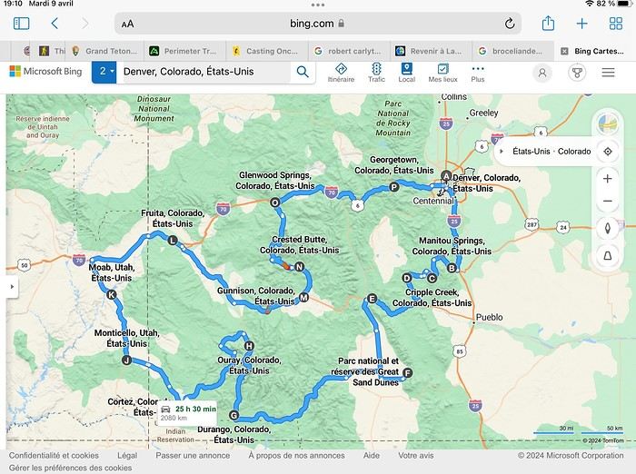
Day 1: Flight Marseille-Paris-Denver, then Manitou Springs (133 km) Day 2: Manitou Springs (49 km) Day 3: Cripple Creek (104 km) Day 4: Salida (254 km) Day 5: Great Sand Dunes (231 km) Day 6: Durango (283 km) Day 7: Durango (Durango-Silverton train) Day 8: Ouray (121 km) Day 9: Ouray (Perimeter Trail hike) Day 10: Cortez (213 km) Day 11: Cortez (Mesa Verde National Park, 134 km) Day 12: Monticello (268 km, detour to Chesler Park) Day 13: Moab (171 km, Delicate Arch) Day 14: Moab (98 km, Fisher Towers) Day 15: Moab (171 km, Canyonlands) Day 16: Fruita (210 km, Colorado National Monument) Day 17: Crested Butte (224 km via Kebler Pass) Day 18: Crested Butte (57 km) Day 19: Glenwood Springs (150 km) Day 20: Glenwood Springs (118 km, Rifle State Park) Day 21: Georgetown (258 km via Independence Pass) Day 22: Denver (123 km), then return flight
We speak very little English. We spent 21 nights there and covered a 3,400 km loop by car and 160 km on foot (we’re still trying to hike while we’re in shape) from Denver in September 2024. We wanted this road trip to help us explore Colorado a bit more—we’d only spent 6 nights there in 2019—and to see it during the fall foliage season. We also wanted to return to Utah (we love Moab) to enjoy its red rocks, which we adore.
In the prices you see (some in euros, others in dollars), I’ve included bank fees and exchange charges. The flights, car, and parking were paid by credit card when we booked in February. Usually, we book around November, but some obligations kept us from doing it earlier. We downloaded the MPC (Mobile Passport Control) app on our phone, which saved us time at immigration.
📊 **Budget: just under 8,500 € for both of us, all included**
📊 **Flights** Marseille-Paris (CDG)-Denver: 2,152 € for both of us, with one checked bag each
📊 **ESTA and America the Beautiful Pass** The ones from our 2023 road trip were still valid
📊 **Parking at Marseille airport: 122 €**
📊 **Car: Nissan Rogue (the French X-Trail) from Hertz: 1,165 €** By booking through Air France (and earning miles), we got a 15% discount. Hertz offers a free Hertz Gold Plus Rewards program, which gives us priority counter service.
📊 **Accommodation: 3,050 €** We stayed in motels and hotels of various ranges (from 100 € to 270 € per night, depending on the city), all booked through Hotels.com or Booking. Booking sometimes offers cheaper rates if you book via the "Booking mobile" app. We also got some preferential rates thanks to our Genius 2 status. Out of 21 nights, only one place didn’t include breakfast.
📊 **Other expenses (activities booked by credit card before leaving)** Durango-Silverton train: 210 € (we booked the enclosed vintage coach in March) Mesa Verde: Balcony House: 15.15 € (booked 14 days before the visit) Timed-entry passes for Arches National Park: 6 € for 3 days (booked June 1 for September entries via http://récreation.gov/). We booked three different days to play with the weather.
📊 **Supplementary insurance with AVA: 204 €** (due to our age 😅 and the high cost of medical consultations in the USA)
📊 **Cash: 1,540 €** We left with 1,000 € exchanged before departure and made two withdrawals (500 $ and 200 $). This cash was used to pay for: - Evening restaurants and tips (between 70 $ and 95 $ for two meals and two drinks) - Two state parks: Dead Horse State Park (20 $) and Rifle State Park (10 $) - The Monarch Pass gondola (24 $) - Midday picnics - Gas (slightly cheaper with cash): 204 $ for 3,400 km - Personal souvenirs and little treats.
Like in our previous road trips, we didn’t rent a GPS. We used the offline GPS app Here We Go, for which we’d downloaded maps of Colorado and Utah from France, as well as a new offline app called Organic Maps as a backup—though we didn’t end up needing it.
❤️❤️❤️ **Highlights (there are so many!)** 📍 The stunning landscapes of Colorado, especially with the fall colors 📍 A step back in time at the old farm in Florissant Fossil Beds National Monument 📍 The prairies of Cripple Creek and the mining remnants of the Vindicator Trail 📍 The cheeky chipmunks in the ghost town of St. Elmo 📍 Great Sand Dunes and its soft sand 📍 The steam train between Durango and Silverton: we’re glad we chose the round-trip because it rained heavily on the way there, but we got to enjoy the scenery on the way back when the sun came out 📍 The unexpected meet-up with Michèle from the group outside a restaurant in Durango 📍 The hot springs in Ouray 📍 Mesa Verde and its still-vibrant past 📍 The red rocks of Moab and Delicate Arch at sunset 📍 The lace-like Fisher Towers and the view from the end of the trail 📍 The gorgeous Route 128 leading to Colorado National Monument—small, easy to visit, and so beautiful 📍 The colors of the fabulous Kebler Pass, Crested Butte, and especially the hike through the golden aspens (Lower and Upper Loop) 📍 The waterfalls at Rifle State Park 📍 The tundra of Independence Pass 📍 The Halloween decorations in Georgetown and Idaho Springs
😞😞 **Flops (there are very few!)** 📍 The viewpoints we missed because they weren’t well-marked or we didn’t see the signs 📍 The closure of some hiking trails (Hanging Lake and parts of Canyonlands) and the Sal Mountain Loop road, which kept us from accessing it 📍😢 The Chesler Park hike we had to cut short due to poor time management—180 km between our stop in Cortez meant we didn’t arrive until 10:30 AM, way too late for a 17 km hike.
Hope this helps! Have a great evening, everyone, and see you soon! 😊
The itinerary
Day 1: Flight Marseille-Paris-Denver, then Manitou Springs (133 km) Day 2: Manitou Springs (49 km) Day 3: Cripple Creek (104 km) Day 4: Salida (254 km) Day 5: Great Sand Dunes (231 km) Day 6: Durango (283 km) Day 7: Durango (Durango-Silverton train) Day 8: Ouray (121 km) Day 9: Ouray (Perimeter Trail hike) Day 10: Cortez (213 km) Day 11: Cortez (Mesa Verde National Park, 134 km) Day 12: Monticello (268 km, detour to Chesler Park) Day 13: Moab (171 km, Delicate Arch) Day 14: Moab (98 km, Fisher Towers) Day 15: Moab (171 km, Canyonlands) Day 16: Fruita (210 km, Colorado National Monument) Day 17: Crested Butte (224 km via Kebler Pass) Day 18: Crested Butte (57 km) Day 19: Glenwood Springs (150 km) Day 20: Glenwood Springs (118 km, Rifle State Park) Day 21: Georgetown (258 km via Independence Pass) Day 22: Denver (123 km), then return flight
We speak very little English. We spent 21 nights there and covered a 3,400 km loop by car and 160 km on foot (we’re still trying to hike while we’re in shape) from Denver in September 2024. We wanted this road trip to help us explore Colorado a bit more—we’d only spent 6 nights there in 2019—and to see it during the fall foliage season. We also wanted to return to Utah (we love Moab) to enjoy its red rocks, which we adore.
In the prices you see (some in euros, others in dollars), I’ve included bank fees and exchange charges. The flights, car, and parking were paid by credit card when we booked in February. Usually, we book around November, but some obligations kept us from doing it earlier. We downloaded the MPC (Mobile Passport Control) app on our phone, which saved us time at immigration.
📊 **Budget: just under 8,500 € for both of us, all included**
📊 **Flights** Marseille-Paris (CDG)-Denver: 2,152 € for both of us, with one checked bag each
📊 **ESTA and America the Beautiful Pass** The ones from our 2023 road trip were still valid
📊 **Parking at Marseille airport: 122 €**
📊 **Car: Nissan Rogue (the French X-Trail) from Hertz: 1,165 €** By booking through Air France (and earning miles), we got a 15% discount. Hertz offers a free Hertz Gold Plus Rewards program, which gives us priority counter service.
📊 **Accommodation: 3,050 €** We stayed in motels and hotels of various ranges (from 100 € to 270 € per night, depending on the city), all booked through Hotels.com or Booking. Booking sometimes offers cheaper rates if you book via the "Booking mobile" app. We also got some preferential rates thanks to our Genius 2 status. Out of 21 nights, only one place didn’t include breakfast.
📊 **Other expenses (activities booked by credit card before leaving)** Durango-Silverton train: 210 € (we booked the enclosed vintage coach in March) Mesa Verde: Balcony House: 15.15 € (booked 14 days before the visit) Timed-entry passes for Arches National Park: 6 € for 3 days (booked June 1 for September entries via http://récreation.gov/). We booked three different days to play with the weather.
📊 **Supplementary insurance with AVA: 204 €** (due to our age 😅 and the high cost of medical consultations in the USA)
📊 **Cash: 1,540 €** We left with 1,000 € exchanged before departure and made two withdrawals (500 $ and 200 $). This cash was used to pay for: - Evening restaurants and tips (between 70 $ and 95 $ for two meals and two drinks) - Two state parks: Dead Horse State Park (20 $) and Rifle State Park (10 $) - The Monarch Pass gondola (24 $) - Midday picnics - Gas (slightly cheaper with cash): 204 $ for 3,400 km - Personal souvenirs and little treats.
Like in our previous road trips, we didn’t rent a GPS. We used the offline GPS app Here We Go, for which we’d downloaded maps of Colorado and Utah from France, as well as a new offline app called Organic Maps as a backup—though we didn’t end up needing it.
❤️❤️❤️ **Highlights (there are so many!)** 📍 The stunning landscapes of Colorado, especially with the fall colors 📍 A step back in time at the old farm in Florissant Fossil Beds National Monument 📍 The prairies of Cripple Creek and the mining remnants of the Vindicator Trail 📍 The cheeky chipmunks in the ghost town of St. Elmo 📍 Great Sand Dunes and its soft sand 📍 The steam train between Durango and Silverton: we’re glad we chose the round-trip because it rained heavily on the way there, but we got to enjoy the scenery on the way back when the sun came out 📍 The unexpected meet-up with Michèle from the group outside a restaurant in Durango 📍 The hot springs in Ouray 📍 Mesa Verde and its still-vibrant past 📍 The red rocks of Moab and Delicate Arch at sunset 📍 The lace-like Fisher Towers and the view from the end of the trail 📍 The gorgeous Route 128 leading to Colorado National Monument—small, easy to visit, and so beautiful 📍 The colors of the fabulous Kebler Pass, Crested Butte, and especially the hike through the golden aspens (Lower and Upper Loop) 📍 The waterfalls at Rifle State Park 📍 The tundra of Independence Pass 📍 The Halloween decorations in Georgetown and Idaho Springs
😞😞 **Flops (there are very few!)** 📍 The viewpoints we missed because they weren’t well-marked or we didn’t see the signs 📍 The closure of some hiking trails (Hanging Lake and parts of Canyonlands) and the Sal Mountain Loop road, which kept us from accessing it 📍😢 The Chesler Park hike we had to cut short due to poor time management—180 km between our stop in Cortez meant we didn’t arrive until 10:30 AM, way too late for a 17 km hike.
Hope this helps! Have a great evening, everyone, and see you soon! 😊
Review of a Mediterranean cruise on the Splendida and 24 hours in Venice – October 2024
Hi everyone,
What a joy to be back here and pick up where we left off after all these months of hiatus.
I hope you’ll enjoy the story of this little trip around the Eastern Mediterranean. This cruise was the perfect way to satisfy our longing to return to Greece and Istanbul. The end of the season, until late November, is the best time to visit the Mediterranean in my opinion—when climate disruptions don’t get in the way.
Departing from Trieste, our stops were Katakolon, Piraeus, Kusadasi, Istanbul, Corfu, and Bari, before returning to Trieste and then Venice, where we planned a very short 24-hour stay.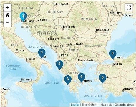
We left home at 6:15 AM—our first cruise departure since moving to Normandy. What I miss most about living in the Gard is how close we were to Marseille Airport. No more hopping over to Marignane in an hour; now we have to plan for a three-hour trip to CDG, even under the best conditions on an early Sunday morning.
It was impossible to book a hotel night before our flight because, starting in April, the Ibis was priced at 450 € per night, and the Mercure was flirting with 800 €—breakfast not included, of course. 😏
I had a feeling there must’ve been a conference or something going on… Turns out, it was just the auto show. They simply adjusted the room prices to match the cost of the cars. 😛
Our flight took us to Venice, where we caught a FlixBus to Trieste. We arrived at Trieste’s train station in the afternoon and walked to our hotel in the city center.
After treating ourselves to an amazing pizza at a restaurant (Di Napoli Maestri Pizzaioli, Via Armando Diaz 10) for a very reasonable price, we enjoyed the mild evening temperature while exploring the stunning buildings of this charming city by night. These magnificent structures are a testament to the city’s past. Trieste became Austrian in 1382 due to its complicated relationship with Venice, and it wasn’t until 1918, at the end of World War I, that it became Italian again. The city’s lighting beautifully highlights the architecture of the buildings.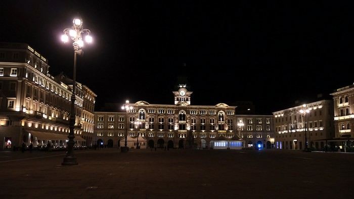
The terraces were lively, and the atmosphere was so warm and inviting that we wanted to stay out even longer.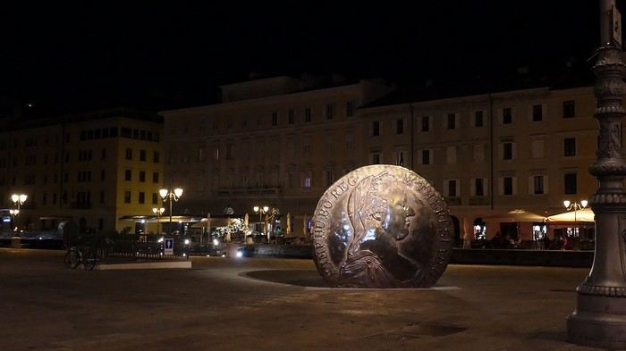
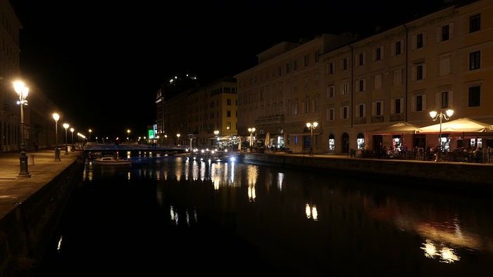
But we’d been up since 4 AM, so we were happy to retreat to the quiet of our hotel, located in the pedestrian center just a few steps from the port (Urban Hotel Design—highly recommended).
More to come soon.
What a joy to be back here and pick up where we left off after all these months of hiatus.
I hope you’ll enjoy the story of this little trip around the Eastern Mediterranean. This cruise was the perfect way to satisfy our longing to return to Greece and Istanbul. The end of the season, until late November, is the best time to visit the Mediterranean in my opinion—when climate disruptions don’t get in the way.
Departing from Trieste, our stops were Katakolon, Piraeus, Kusadasi, Istanbul, Corfu, and Bari, before returning to Trieste and then Venice, where we planned a very short 24-hour stay.
We left home at 6:15 AM—our first cruise departure since moving to Normandy. What I miss most about living in the Gard is how close we were to Marseille Airport. No more hopping over to Marignane in an hour; now we have to plan for a three-hour trip to CDG, even under the best conditions on an early Sunday morning.
It was impossible to book a hotel night before our flight because, starting in April, the Ibis was priced at 450 € per night, and the Mercure was flirting with 800 €—breakfast not included, of course. 😏
I had a feeling there must’ve been a conference or something going on… Turns out, it was just the auto show. They simply adjusted the room prices to match the cost of the cars. 😛
Our flight took us to Venice, where we caught a FlixBus to Trieste. We arrived at Trieste’s train station in the afternoon and walked to our hotel in the city center.
After treating ourselves to an amazing pizza at a restaurant (Di Napoli Maestri Pizzaioli, Via Armando Diaz 10) for a very reasonable price, we enjoyed the mild evening temperature while exploring the stunning buildings of this charming city by night. These magnificent structures are a testament to the city’s past. Trieste became Austrian in 1382 due to its complicated relationship with Venice, and it wasn’t until 1918, at the end of World War I, that it became Italian again. The city’s lighting beautifully highlights the architecture of the buildings.
The terraces were lively, and the atmosphere was so warm and inviting that we wanted to stay out even longer.
But we’d been up since 4 AM, so we were happy to retreat to the quiet of our hotel, located in the pedestrian center just a few steps from the port (Urban Hotel Design—highly recommended).
More to come soon.
Eastern Crete in September 2024
Travel journal in Eastern Crete from September 8th to 29th, 2024
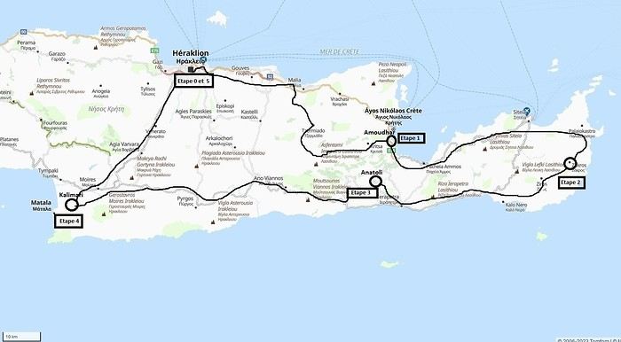 Our 21-day itinerary
Sunday, 08/09: Once again—and this is the eighth time—we’re setting off, the four of us: Patrick, Michelle, Jacques, and Monique, for the Greek islands. This time, we’ve chosen Crete. No need to wake up at 3 or 4 a.m. to reach Basel-Mulhouse Airport at dawn to catch the first flight to Greece at 6 a.m.! Given the prohibitive prices charged by EasyJet, we found flights that were half the price from Zurich Airport, which is accessible in 3 hours by train from Colmar. Pierre-Paul drives all four of us to Colmar train station, where we take the train to Basel and then, 20 minutes later, the direct train to Zurich Airport. After wandering around the airport, we go for a coffee at 6 € each! We’re in Switzerland, after all. The other dining areas all have vending machines for selecting and paying for meals—soon, there won’t be anyone left to serve you! After a short wait, we take off at 7:45 p.m. (20 minutes late) in an Aegean Airbus A321. Free in-flight meal service isn’t bad either! We land in Heraklion around 11:15 p.m. We pick up our rental car (a red Seat Ibiza) at the airport and head straight to our apartment, located 2 km from the city center. Thanks to the GPS, we find it quickly. It’s a beautiful, fully renovated apartment with all the comforts and well-equipped. On the table, there’s wine, bottles of water, jam, coffee, etc. Given the late hour, we won’t stay up long.
Monday, 09/09: To enhance our breakfast, Michelle and Monique set off to find a bakery nearby. They return with croissants and donuts—yum... Then we head to the west coast. The highway follows the coastline, but we prefer taking the old road to Malia, our first stop. We visit the major archaeological site of this Minoan city under the hot sun. The site covers a vast area, but the ruins aren’t very evocative except for a few beautiful amphorae scattered around. The explanations in a small house at the entrance are interesting and help us better understand the organization of the ancient city with its different districts. From there, we head toward the nearby mountains to see the thousand-year-old plane tree in the village of Krasi. We take the opportunity to enjoy an excellent lunch of moussaka and delicious gemista at the Krassopsychia taverna in the village center. Pleasant surprise: the prices are still reasonable, with a bill of 70 € for four, including wine and water. The friendly tradition of complimentary dessert and glasses of raki continues—great! We’ve set the bar high right away! Let’s hope the rest lives up to it! On the way back toward the Lassithi Plateau, we stop at the Kardiotisa Monastery perched high on the mountain to enjoy a magnificent view of the entire region. Just a little further, we arrive at the Lassithi Plateau: the presence of small windmills used to pump water from the ground is the typical feature of this plateau. We complete a full loop around the plateau, passing by numerous orchards and vegetable gardens that occupy the entire space. At the end of the plateau, we once again cross mountain passes via winding roads that bring us near Agios Nikolaos. Our apartment is located about ten kilometers further south in Amoudhara. The owner, who was notified, waits for us and shows us her superb apartment, whose large terrace overlooks the entire Mirabello Bay. She then gives us valuable information about the different beaches in the area. Dinner will be frugal, given our hearty lunch in Krasi!
 Sunset over Mirabello Bay
Tuesday, 10/09: A bit of a gray sky when we wake up around 8 a.m., but the sun will soon triumph over the scattered clouds. For our first swim, we opt for Voulisma Beach, even though our host warned us it was a bit “crowdy.” That’s understandable given the beautiful emerald color of the sea and the lovely curve of the beach. To avoid the big crowds, we move toward the eastern part of the beach, accessible via a steep staircase. The water is very warm, and this first dip is very pleasant. Before returning to the apartment, we stop at the bakery to buy spinach pies, essential ingredients to accompany our Greek salad for lunch. Of course, everything will be washed down with ouzo, which will remain our favorite drink for the next three weeks—but in moderation!!! A nap is in order after all that effort. In the late afternoon, we drive to Agios Nikolaos, the main seaside resort in Crete. We’re not too enthusiastic about visiting this mass-tourism resort, but the center of Agios, concentrated around the small inner harbor, is pleasant to see despite the plethora of shops and restaurants. We dine a little outside the harbor in the shaded courtyard of the Avli taverna: the oven-baked lamb, squid with spinach, and cuttlefish ink orzo pasta are all highly appreciated. We still stay under a 75 € bill for four.
 Mirabello Bay seen from our terrace
Wednesday, 11/09: At 8 a.m., the terrace is already bathed in sunlight, and it’s already quite hot. The small parasol barely gives us enough shade, but we’re not complaining! For our second swim, we head to a tiny beach recommended by our host, just 3 minutes by car from our place. The path leading to it is very discreet, and we don’t find it right away! It’s a small sandy cove with a few welcome tamarisk trees for shade. When we arrive, there are two swimmers, and there won’t be more than five or six in the morning. After lunch and a nap, we head to the beautiful village of Kritsa, just a few kilometers away. It’s too late to visit the beautiful church of Kera Panagia, which is already closed. We settle for the exterior, which is worth a look. The weather is clouding over, and big clouds are gathering. Upon arriving in Kritsa, a heavy shower forces us to take shelter in the Platanos taverna in the village center, and since it’s nearly 7 p.m., we decide to stay and dine there. Good choice—excellent meze: croquettes and stuffed zucchini flowers, gigantes beans, grilled tomatoes and feta, and pancetta as the main dish. The rain stops just as we decide to head back.
 Village of Kritsa
Thursday, 12/09: Our terrace faces east, so we get to watch the sunrise around 7 a.m.—it’s truly a beautiful sight we never tire of. Around 9 a.m., we head to the village of Plaka, where boats depart for the island of Spinalonga, located north of Agios Nikolaos. We board the first boat, which sets sail at 10 a.m., and we’re not alone—the boat is practically full. After 10 minutes, we land on the island at the same time as several other boats from Elounda or Agios. Needless to say, there are already quite a few people walking through the streets of the leper village. The visit remains interesting and moving as we read the explanatory panels recounting the island’s history under Byzantine and then Turkish rule, followed by its transformation into a leper colony. As soon as we climb toward the top of the island via more or less maintained paths, there’s almost no one left. The 360° view from up there is stunning.
Spinalonga Island
The heat is now unbearable, and we can’t wait to get back home to have lunch on our terrace and rest. In the late afternoon, we go grocery shopping at the AB supermarket at the entrance of Agios. We had spotted another nice restaurant in our guide, but unfortunately, there’s a different one at the indicated location that doesn’t inspire us. So, we return to the Avli taverna for another dinner just as good as the first.
Friday, 13/09: We repeat yesterday’s successful program: a swim in our little cove, lunch on the terrace, a nap, and then, in the late afternoon, we discover another nearby village, Kroustas, nestled in the olive groves near Kritsa. Much less touristy than Kritsa, it’s mostly inhabited by locals, especially the elderly who are enjoying the cool air on their chairs—if you can call it cool given the still-high temperatures in the late afternoon! We then return to visit Kritsa, which we hadn’t been able to explore due to the rain. Dinner at a taverna in the village center at a very reasonable price.
Saturday, 14/09: Today, we move to our new base further east. We start with a high viewpoint at the Faneromeni Monastery, which overlooks Mirabello Bay. The monastery itself is of little interest as it’s under renovation with excessive concrete work. We continue to the village of Kavoussi to see another exceptional tree after a few kilometers on a dusty, bumpy track. It’s an olive tree said to be about 3,200 years old—impressive, and the countryside is very beautiful. It’s time to find a place for lunch. We find one in the charming little port of Mohlos, where a few tavernas surround a very nice small beach. Our choice falls on the Bogazzi taverna, where we enjoy fried fish. To reach our new base in Zakros, we still have to drive through the mountains before reaching Sitia, Paleokastro, and finally Zakros. The region is beautiful, with olive groves and rows of wind turbines taking advantage of the strong wind near the northern tip of the island. In Zakros, we’re greeted by our very friendly host. Here too, we have all the comforts and a beautiful terrace overlooking the village. The apartment has reversible air conditioners, but the overly simple instructions leave us puzzled. Thinking we’ve set it correctly, we realize a little too late that it’s blowing hot air over 30°C! After numerous attempts and testing several confusing programs, we finally succeed! Dinner on our new terrace.
Sunday, 15/09: This morning, we get up early to hike in the “Gorge of the Dead” while it’s still cool. The sky is blue as usual! We park in the nearest parking lot and start our descent via a beautiful path winding through the olive groves. A little further on, the landscape opens up, and the path, now a stony trail, begins the descent to the dry riverbed. On either side of the riverbed rise beautiful reddish cliffs.
Gorge of the Dead
The trail winds its way through this narrow gorge with difficulty. It was in the many caves visible halfway up the slope that the Minoans buried their dead, hence the name “Gorge of the Dead.” The gorge opens onto a beautiful small pebble beach. A swim is welcome after this hike that made us sweat. The hike took us 1 hour and 25 minutes, and a little less on the way back. Meanwhile, Monique did some shopping and prepared an excellent lunch. In the late afternoon, we go down to dine at Platanakis, a taverna in the small village of Kato Zakros.
Monday, 16/09: This morning, we explore the northern part of the east coast near Palekastro. We start with a dip at the beautiful Hionia Beach near Palekastro. The water is still just as nice, but a light breeze is blowing—not enough to spoil our fun! Seeing all the wind turbines lining the ridges, it’s no surprise.
 Grocery shopping in Palekastro and return to Zakros. A little rain in the late afternoon and an excellent dinner at Iannis Mitsakakis’ Taverna in Adravastis. These are the kind of small tavernas we love—unpretentious, a few tables on a terrace, a warm welcome, a short menu guaranteeing freshness, tasty dishes prepared by the server’s mom, and a light bill. What more could you ask for!
Tuesday, 17/09: We head back toward Palekastro to do some shopping, but it’s also the road to the Toplou Monastery. There, we see a collection of magnificent icons dating from the 15th to the 20th century. We can also admire drawings of Orthodox religious architecture. We continue toward the Mavros Akrotiri headland to enjoy the view of the sea and rocky capes. On the way back to our place, we make a small detour to see the famous Vai palm grove. Meh... As for Vai Beach, it’s filled with paid umbrellas and sunbeds, and there are so many people that we flee. Plus, having to pay for parking is another reason to snub this trendy beach. We prefer our Hionia Beach, which we already appreciated the other day. In the late afternoon, Pat and I start the trail that begins at Kato Zakros Beach heading south. The poorly marked path crosses a plateau of sharp limestone. The paint and cairn markings are no longer very visible, and with dusk approaching, we turn back toward Kato Zakros. Dinner at the Platanakis taverna—less good than last time.
Wednesday, 18/09: To avoid the scorching sun, Pat, Mimi, and I get up earlier than usual to hike the Hohlakies Gorge. At this early hour, the sky is quite cloudy, and it’s drizzling. When we arrive in the village of Hohlakies, we park in front of a small chapel, the start of the hike. The sky is now completely clear. The trail starts among the olive groves, then after passing through a gate, we descend into the gorge filled with large rocks. We’re alone in the world, and the landscape is magnificent. A few wild goats clinging to the cliff watch us from above. After 1 hour and 15 minutes, we emerge onto the wonderful Karoumès Beach. A pleasant swim, then back to civilization! A walk in the late afternoon in Zakros to discover the beautiful springs route. Dinner in Adravastis.
Thursday, 19/09: Another move: Before heading to our next stop, we make a detour to see the beautiful Keratokampos Beach and can’t resist a swim in the still-warm, clear water. We continue our journey via Ziros, then reach the south coast and have lunch at the Stephi taverna in Ferma—excellent meal! The south coast is quite urbanized and has much less charm than the east coast we’ve just left! The numerous plastic greenhouses are partly to blame. We stop for groceries in Ierapetra. Around 3 p.m., we arrive at our destination in the small perched village of Anatoli. Our lodging is at the top of the village, and from the path leading to it, we have a magnificent view of the coastal plain, unfortunately overloaded with plastic greenhouses. It reminds us of the landscapes of El Ejido in Andalusia.
 View of the Ierapetra coast from Anatoli
Friday, 20/09: A walk and discovery of the hamlet of Anatoli. There are few services—a tiny grocery store, a taverna, and that’s it. Fortunately, the traveling baker arrives and honks. We take the opportunity to buy fresh bread. Leaving the village, we take a path that should lead us to the hamlet of Drygies. The landscape is beautiful. We walk through a lovely pine forest before arriving at the hamlet. The path continues to a taverna that’s closed today, with a superb terrace overlooking the coast. Luckily, the owner arrives and informs us that the taverna will be open next Sunday and that we can enjoy barbecued meat. Noted! We head back to Anatoli via the small paved road with, fortunately, very limited traffic. Lunch on our terrace, then a dip in our private pool! The water is noticeably cooler than at the beach. Dinner at the village taverna: there’s only one menu—meze starters, souvlaki, water, wine, and bread—all for 35 €! We think we’re dreaming—was there a mistake? No.
Saturday, 21/09: We discover the beach of the village of Myrtos, a small seaside resort that’s quite touristy but on a human scale. We swim in the western part of the beach, and once again, we’re alone in the water. The best part: warm water and tamarisk trees for welcome shade. There’s even a shower to rinse off! In the late afternoon, Pat and I decide to go for a hike in the Selakano pine forest. To get there, we take a narrow, winding, and poorly paved road after the village of Christos. Plus, at this altitude, we encounter clouds clinging to the mountain, so it’s drizzling, and visibility is reduced. We decide to turn back and return to Anatoli. As compensation, we take the path that passes in front of the lodging and leads us to the Timios Stavros chapel, which crowns the summit of the nearby mountain. We arrive at the summit just in time for the sunset at 7 p.m. Breathtaking 360° panorama and magnificent colors!
 Sunset from Anatoli
Sunday, 22/09: This morning, Pat, Mimi, and I go for a hike in the Sarakina Gorge, located about 12 km from Anatoli via a beautiful road winding through irrigated olive groves. We park in the small parking lot before the trail. At the start, the path follows a levada (small irrigation canal) and quickly enters a very narrow gorge flanked by high cliffs. The riverbed is cluttered with huge rocks blocking the passage. No matter—in the technical sections, ropes or ladders allow us to overcome these obstacles with a bit of skill. You can imagine how quickly the riverbed must rise during a storm, given the narrowness of the gorge!
We progress slowly through this magnificent and impressive rocky chaos. At the exit of the gorge, we take another return path that partly follows the paved road. Back in Anatoli, we go to lunch at the Drygies taverna. We sit at the edge of the terrace under a huge tree that covers almost the entire terrace and order grilled lamb dishes prepared according to the ancient “antikristo” method.
Monday, 23/09: Departure for our last stop before Heraklion. We thought about swimming at Tertsa Beach, but it turns out to be less pleasant than expected, with pebbles and an uneven rocky plateau. So, we return to Myrtos Beach, which we know well and suits us perfectly. We head west, leaving the coast a bit. Around 3:30 p.m., we arrive at our destination in the village of Kamilari, near the famous Matala spot. We’ve rented a beautiful, modern, well-equipped apartment with a lovely shaded terrace. The owner is very friendly and explains everything necessary for a good stay. We explore the quite touristy village with its few tavernas, all full of tourists, mostly Germans.
Tuesday, 24/09: Visit to the village of Sivas, well restored thanks to the Germans, who have invested a lot here. We take the opportunity to scout out “friendly” tavernas, then go for a swim at Kalamaki Beach. Apart from a small sandy access, you have to enter the water via a chaotic limestone plateau—proof of this is that Monique trips slightly when entering the water. A group of very unfriendly German women blocks the sandy passage and doesn’t hesitate to push swimmers they deem too close. Back home, lunch, and a nap. In the late afternoon, we drive to visit the nearby Phaistos site. We benefit from very beautiful lighting. From the elevated site, we overlook the Messara Plain with a beautiful view of the olive grove checkerboards highlighted by the late afternoon sun. The site itself is quite vast, but to appreciate it, it’s better to read the explanatory panels placed throughout the different quarters. At this hour, the site is almost empty, and the beautiful light adds charm to the visit.
Wednesday, 25/09: Departure for the village of Matala, which doesn’t interest us in itself, having been there during the “hippie” era in 1976. However, going to Red Beach, only accessible by taking a path overlooking this area, appeals to us much more. We park in the large parking lot just outside the village and start our climb, which brings us to a pass from where we can admire this beautiful red-sand beach framed by beautiful cliffs plunging into the sea. The weather is magnificent, and at this early hour, there aren’t many people yet. We swim in the free part located near the cliff on the right when arriving at the beach. The sea is like glass, warm, and without a single ripple—a real treat! After half an hour, we turn back, and now there are many people rushing on this path, not at all made for feet in sandals or flip-flops, yet many vacationers venture out like this! Matala lives up to its image—a trendy place, full of shops, bars, and restaurants. You could be in any seaside resort with a standard global urbanism, lacking particular charm. Back home. In the late afternoon, a walk through the olive groves surrounding Kamilari, then dinner at Evangelina’s, who runs the Minoan Parassies taverna in the middle of the olive groves. Evangelina is quite a character: we came to reserve a table for 8 p.m. when it was only 7 p.m., but since we lingered near her restaurant, she prepares a table for us and urges us to sit down! And there she takes our order, and a little later, the meze arrive, followed by the main dishes. We finish this good dinner with several generous glasses of raki, accompanied by Evangelina’s encouragements, repeating “poya poya bravo bravo” in a loop. We’re in great shape too, by the way! We return in the middle of the night, on foot, fortunately, with the path vaguely lit by our phones...
Thursday, 26/09: This morning, we discover a new beach, Kommos Beach, not far from Kamilari either. It’s a long sandy beach, a small part of which is dedicated to paid umbrellas and sunbeds, and the rest is free. We spot a tamarisk tree to take shelter from the still-hot sun, and once again, we enjoy clear, warm water. The few swimmers spread out easily over nearly 500 meters of beach. In the late afternoon, Pat and I go to admire the sunset from the hill near our lodging. The hill, covered with olive trees, is threatened by a planned housing development of large cubic villas—trends dictate. Concrete never stops...
Friday, 27/09: We thought about leaving the car at the Odiyitria Monastery, the end of the paved road, but since the track descending to the cave remains drivable, we park 3 km further at the junction of the track leading to Kali Limenes Beach. We still have to walk for half an hour on a less drivable track, and then we’re at the entrance of the Farango Gorge. It’s a beautiful, easy hike since we follow the dry pebble riverbed. Before arriving at the beach, there’s a very beautiful small chapel sheltered under a large cliff, beautifully lit at this early hour.
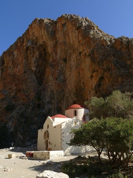
Agio Farango Chapel
A few climbers are scaling the cliff, and about ten swimmers are enjoying the sea. Return to the car under the hot sun. In the late afternoon, we all return to visit the interesting Odiyitria Monastery. Last swim at Kommos Beach and an excellent dinner at the Sigelakis taverna in Sivas.
Saturday, 28/09: There’s an end-of-vacation atmosphere... We pack our bags and head north. A short stop to see the village of Vorri, and a little over an hour later, we arrive in the big city of Heraklion. Since it’s too early to check into the apartment, we park in the city center to visit the famous archaeological museum. It’s indeed a must-see highlight of our stay in Crete. All four of us are amazed by the quantity and quality of the objects presented from the Minoan civilization. After more than 2 hours, we come out without having seen everything, but we’re a bit overwhelmed by all these wonders. Lunch at a nice little taverna very close to the Titus Church. We go to take possession of our apartment—the same as on the way there, still just as satisfying. In the late afternoon, I go alone for a walk in the historic district of the city, passing by the Morosini Fountain, which is bustling with people—some seated at café terraces, others standing and chatting. There’s a lively atmosphere here. A little further on are the Venetian loggia and the Agios Titos Church. I walk down to the old Venetian port to stroll along the jetty and admire the fortifications under beautiful late-afternoon lighting, then return to the apartment. Dinner near our place at Kiriakis, a “chic” restaurant but with very reasonable prices and excellent cuisine.
Sunday, 29/09: Wake-up at 3:30 a.m., quick coffee, and drive to the nearby airport. We leave the car in the parking lot. Already a lot of people at this early hour. Since we don’t have checked luggage, we go straight to security, which goes fairly quickly, then it’s waiting time and takeoff on time in an Airbus A321 for a 45-minute flight to Athens. We take off again in another Airbus A321 with a 50-minute delay to arrive in Zurich at 11:10 a.m. local time. Then we have to take the train to Basel and then the one to Colmar. With fewer Sunday services, we won’t arrive in Colmar until around 4 p.m.
Conclusion All four of us returned very satisfied with this stay in Crete for several reasons: - We found superb beaches with clear, warm water and often very few vacationers. - The few hikes we did were magnificent, especially those where the trails went through gorges leading to deserted beaches. - We greatly appreciated Cretan gastronomy—there were so few disappointments that we can count them on one hand. - All the accommodations we booked turned out to be superb, with the icing on the cake being the very friendly welcome from our hosts. - Generally, contacts with Cretans were always very warm despite the language barrier—we speak a little Greek. - We also appreciated the diversity of landscapes in this eastern part of Crete, with plateaus and mountains with splendid rugged reliefs.
Note: The photo album is available by clicking on this link: https://photos.app.goo.gl/hfdjQndA5eXkL5k7 Captions are only visible per photo by clicking on the circled “i” in the top right. Budget: approximately 3,300 € per couple for 21 days, including train and flights Budget details per couple: - Flight Zurich-Heraklion: 440 € - Trains Colmar-Basel-Zurich round trip for 4: 442.40 € (221 € per couple) - Accommodation: 2,431 € / 21 = 115.80 € per night for 4 (1,216 € per couple) - Car rental for 21 days: 684 € + 145 € fuel (1,150 km) (414 € per couple) - Restaurants, food, etc.: 1,009 €
Our 21-day itinerarySunday, 08/09: Once again—and this is the eighth time—we’re setting off, the four of us: Patrick, Michelle, Jacques, and Monique, for the Greek islands. This time, we’ve chosen Crete. No need to wake up at 3 or 4 a.m. to reach Basel-Mulhouse Airport at dawn to catch the first flight to Greece at 6 a.m.! Given the prohibitive prices charged by EasyJet, we found flights that were half the price from Zurich Airport, which is accessible in 3 hours by train from Colmar. Pierre-Paul drives all four of us to Colmar train station, where we take the train to Basel and then, 20 minutes later, the direct train to Zurich Airport. After wandering around the airport, we go for a coffee at 6 € each! We’re in Switzerland, after all. The other dining areas all have vending machines for selecting and paying for meals—soon, there won’t be anyone left to serve you! After a short wait, we take off at 7:45 p.m. (20 minutes late) in an Aegean Airbus A321. Free in-flight meal service isn’t bad either! We land in Heraklion around 11:15 p.m. We pick up our rental car (a red Seat Ibiza) at the airport and head straight to our apartment, located 2 km from the city center. Thanks to the GPS, we find it quickly. It’s a beautiful, fully renovated apartment with all the comforts and well-equipped. On the table, there’s wine, bottles of water, jam, coffee, etc. Given the late hour, we won’t stay up long.
Monday, 09/09: To enhance our breakfast, Michelle and Monique set off to find a bakery nearby. They return with croissants and donuts—yum... Then we head to the west coast. The highway follows the coastline, but we prefer taking the old road to Malia, our first stop. We visit the major archaeological site of this Minoan city under the hot sun. The site covers a vast area, but the ruins aren’t very evocative except for a few beautiful amphorae scattered around. The explanations in a small house at the entrance are interesting and help us better understand the organization of the ancient city with its different districts. From there, we head toward the nearby mountains to see the thousand-year-old plane tree in the village of Krasi. We take the opportunity to enjoy an excellent lunch of moussaka and delicious gemista at the Krassopsychia taverna in the village center. Pleasant surprise: the prices are still reasonable, with a bill of 70 € for four, including wine and water. The friendly tradition of complimentary dessert and glasses of raki continues—great! We’ve set the bar high right away! Let’s hope the rest lives up to it! On the way back toward the Lassithi Plateau, we stop at the Kardiotisa Monastery perched high on the mountain to enjoy a magnificent view of the entire region. Just a little further, we arrive at the Lassithi Plateau: the presence of small windmills used to pump water from the ground is the typical feature of this plateau. We complete a full loop around the plateau, passing by numerous orchards and vegetable gardens that occupy the entire space. At the end of the plateau, we once again cross mountain passes via winding roads that bring us near Agios Nikolaos. Our apartment is located about ten kilometers further south in Amoudhara. The owner, who was notified, waits for us and shows us her superb apartment, whose large terrace overlooks the entire Mirabello Bay. She then gives us valuable information about the different beaches in the area. Dinner will be frugal, given our hearty lunch in Krasi!
Sunset over Mirabello BayTuesday, 10/09: A bit of a gray sky when we wake up around 8 a.m., but the sun will soon triumph over the scattered clouds. For our first swim, we opt for Voulisma Beach, even though our host warned us it was a bit “crowdy.” That’s understandable given the beautiful emerald color of the sea and the lovely curve of the beach. To avoid the big crowds, we move toward the eastern part of the beach, accessible via a steep staircase. The water is very warm, and this first dip is very pleasant. Before returning to the apartment, we stop at the bakery to buy spinach pies, essential ingredients to accompany our Greek salad for lunch. Of course, everything will be washed down with ouzo, which will remain our favorite drink for the next three weeks—but in moderation!!! A nap is in order after all that effort. In the late afternoon, we drive to Agios Nikolaos, the main seaside resort in Crete. We’re not too enthusiastic about visiting this mass-tourism resort, but the center of Agios, concentrated around the small inner harbor, is pleasant to see despite the plethora of shops and restaurants. We dine a little outside the harbor in the shaded courtyard of the Avli taverna: the oven-baked lamb, squid with spinach, and cuttlefish ink orzo pasta are all highly appreciated. We still stay under a 75 € bill for four.
Mirabello Bay seen from our terraceWednesday, 11/09: At 8 a.m., the terrace is already bathed in sunlight, and it’s already quite hot. The small parasol barely gives us enough shade, but we’re not complaining! For our second swim, we head to a tiny beach recommended by our host, just 3 minutes by car from our place. The path leading to it is very discreet, and we don’t find it right away! It’s a small sandy cove with a few welcome tamarisk trees for shade. When we arrive, there are two swimmers, and there won’t be more than five or six in the morning. After lunch and a nap, we head to the beautiful village of Kritsa, just a few kilometers away. It’s too late to visit the beautiful church of Kera Panagia, which is already closed. We settle for the exterior, which is worth a look. The weather is clouding over, and big clouds are gathering. Upon arriving in Kritsa, a heavy shower forces us to take shelter in the Platanos taverna in the village center, and since it’s nearly 7 p.m., we decide to stay and dine there. Good choice—excellent meze: croquettes and stuffed zucchini flowers, gigantes beans, grilled tomatoes and feta, and pancetta as the main dish. The rain stops just as we decide to head back.
Village of KritsaThursday, 12/09: Our terrace faces east, so we get to watch the sunrise around 7 a.m.—it’s truly a beautiful sight we never tire of. Around 9 a.m., we head to the village of Plaka, where boats depart for the island of Spinalonga, located north of Agios Nikolaos. We board the first boat, which sets sail at 10 a.m., and we’re not alone—the boat is practically full. After 10 minutes, we land on the island at the same time as several other boats from Elounda or Agios. Needless to say, there are already quite a few people walking through the streets of the leper village. The visit remains interesting and moving as we read the explanatory panels recounting the island’s history under Byzantine and then Turkish rule, followed by its transformation into a leper colony. As soon as we climb toward the top of the island via more or less maintained paths, there’s almost no one left. The 360° view from up there is stunning.
Spinalonga Island
The heat is now unbearable, and we can’t wait to get back home to have lunch on our terrace and rest. In the late afternoon, we go grocery shopping at the AB supermarket at the entrance of Agios. We had spotted another nice restaurant in our guide, but unfortunately, there’s a different one at the indicated location that doesn’t inspire us. So, we return to the Avli taverna for another dinner just as good as the first.
Friday, 13/09: We repeat yesterday’s successful program: a swim in our little cove, lunch on the terrace, a nap, and then, in the late afternoon, we discover another nearby village, Kroustas, nestled in the olive groves near Kritsa. Much less touristy than Kritsa, it’s mostly inhabited by locals, especially the elderly who are enjoying the cool air on their chairs—if you can call it cool given the still-high temperatures in the late afternoon! We then return to visit Kritsa, which we hadn’t been able to explore due to the rain. Dinner at a taverna in the village center at a very reasonable price.
Saturday, 14/09: Today, we move to our new base further east. We start with a high viewpoint at the Faneromeni Monastery, which overlooks Mirabello Bay. The monastery itself is of little interest as it’s under renovation with excessive concrete work. We continue to the village of Kavoussi to see another exceptional tree after a few kilometers on a dusty, bumpy track. It’s an olive tree said to be about 3,200 years old—impressive, and the countryside is very beautiful. It’s time to find a place for lunch. We find one in the charming little port of Mohlos, where a few tavernas surround a very nice small beach. Our choice falls on the Bogazzi taverna, where we enjoy fried fish. To reach our new base in Zakros, we still have to drive through the mountains before reaching Sitia, Paleokastro, and finally Zakros. The region is beautiful, with olive groves and rows of wind turbines taking advantage of the strong wind near the northern tip of the island. In Zakros, we’re greeted by our very friendly host. Here too, we have all the comforts and a beautiful terrace overlooking the village. The apartment has reversible air conditioners, but the overly simple instructions leave us puzzled. Thinking we’ve set it correctly, we realize a little too late that it’s blowing hot air over 30°C! After numerous attempts and testing several confusing programs, we finally succeed! Dinner on our new terrace.
Sunday, 15/09: This morning, we get up early to hike in the “Gorge of the Dead” while it’s still cool. The sky is blue as usual! We park in the nearest parking lot and start our descent via a beautiful path winding through the olive groves. A little further on, the landscape opens up, and the path, now a stony trail, begins the descent to the dry riverbed. On either side of the riverbed rise beautiful reddish cliffs.
Gorge of the Dead
The trail winds its way through this narrow gorge with difficulty. It was in the many caves visible halfway up the slope that the Minoans buried their dead, hence the name “Gorge of the Dead.” The gorge opens onto a beautiful small pebble beach. A swim is welcome after this hike that made us sweat. The hike took us 1 hour and 25 minutes, and a little less on the way back. Meanwhile, Monique did some shopping and prepared an excellent lunch. In the late afternoon, we go down to dine at Platanakis, a taverna in the small village of Kato Zakros.
Monday, 16/09: This morning, we explore the northern part of the east coast near Palekastro. We start with a dip at the beautiful Hionia Beach near Palekastro. The water is still just as nice, but a light breeze is blowing—not enough to spoil our fun! Seeing all the wind turbines lining the ridges, it’s no surprise.
Grocery shopping in Palekastro and return to Zakros. A little rain in the late afternoon and an excellent dinner at Iannis Mitsakakis’ Taverna in Adravastis. These are the kind of small tavernas we love—unpretentious, a few tables on a terrace, a warm welcome, a short menu guaranteeing freshness, tasty dishes prepared by the server’s mom, and a light bill. What more could you ask for!Tuesday, 17/09: We head back toward Palekastro to do some shopping, but it’s also the road to the Toplou Monastery. There, we see a collection of magnificent icons dating from the 15th to the 20th century. We can also admire drawings of Orthodox religious architecture. We continue toward the Mavros Akrotiri headland to enjoy the view of the sea and rocky capes. On the way back to our place, we make a small detour to see the famous Vai palm grove. Meh... As for Vai Beach, it’s filled with paid umbrellas and sunbeds, and there are so many people that we flee. Plus, having to pay for parking is another reason to snub this trendy beach. We prefer our Hionia Beach, which we already appreciated the other day. In the late afternoon, Pat and I start the trail that begins at Kato Zakros Beach heading south. The poorly marked path crosses a plateau of sharp limestone. The paint and cairn markings are no longer very visible, and with dusk approaching, we turn back toward Kato Zakros. Dinner at the Platanakis taverna—less good than last time.
Wednesday, 18/09: To avoid the scorching sun, Pat, Mimi, and I get up earlier than usual to hike the Hohlakies Gorge. At this early hour, the sky is quite cloudy, and it’s drizzling. When we arrive in the village of Hohlakies, we park in front of a small chapel, the start of the hike. The sky is now completely clear. The trail starts among the olive groves, then after passing through a gate, we descend into the gorge filled with large rocks. We’re alone in the world, and the landscape is magnificent. A few wild goats clinging to the cliff watch us from above. After 1 hour and 15 minutes, we emerge onto the wonderful Karoumès Beach. A pleasant swim, then back to civilization! A walk in the late afternoon in Zakros to discover the beautiful springs route. Dinner in Adravastis.
Thursday, 19/09: Another move: Before heading to our next stop, we make a detour to see the beautiful Keratokampos Beach and can’t resist a swim in the still-warm, clear water. We continue our journey via Ziros, then reach the south coast and have lunch at the Stephi taverna in Ferma—excellent meal! The south coast is quite urbanized and has much less charm than the east coast we’ve just left! The numerous plastic greenhouses are partly to blame. We stop for groceries in Ierapetra. Around 3 p.m., we arrive at our destination in the small perched village of Anatoli. Our lodging is at the top of the village, and from the path leading to it, we have a magnificent view of the coastal plain, unfortunately overloaded with plastic greenhouses. It reminds us of the landscapes of El Ejido in Andalusia.
View of the Ierapetra coast from AnatoliFriday, 20/09: A walk and discovery of the hamlet of Anatoli. There are few services—a tiny grocery store, a taverna, and that’s it. Fortunately, the traveling baker arrives and honks. We take the opportunity to buy fresh bread. Leaving the village, we take a path that should lead us to the hamlet of Drygies. The landscape is beautiful. We walk through a lovely pine forest before arriving at the hamlet. The path continues to a taverna that’s closed today, with a superb terrace overlooking the coast. Luckily, the owner arrives and informs us that the taverna will be open next Sunday and that we can enjoy barbecued meat. Noted! We head back to Anatoli via the small paved road with, fortunately, very limited traffic. Lunch on our terrace, then a dip in our private pool! The water is noticeably cooler than at the beach. Dinner at the village taverna: there’s only one menu—meze starters, souvlaki, water, wine, and bread—all for 35 €! We think we’re dreaming—was there a mistake? No.
Saturday, 21/09: We discover the beach of the village of Myrtos, a small seaside resort that’s quite touristy but on a human scale. We swim in the western part of the beach, and once again, we’re alone in the water. The best part: warm water and tamarisk trees for welcome shade. There’s even a shower to rinse off! In the late afternoon, Pat and I decide to go for a hike in the Selakano pine forest. To get there, we take a narrow, winding, and poorly paved road after the village of Christos. Plus, at this altitude, we encounter clouds clinging to the mountain, so it’s drizzling, and visibility is reduced. We decide to turn back and return to Anatoli. As compensation, we take the path that passes in front of the lodging and leads us to the Timios Stavros chapel, which crowns the summit of the nearby mountain. We arrive at the summit just in time for the sunset at 7 p.m. Breathtaking 360° panorama and magnificent colors!
Sunset from AnatoliSunday, 22/09: This morning, Pat, Mimi, and I go for a hike in the Sarakina Gorge, located about 12 km from Anatoli via a beautiful road winding through irrigated olive groves. We park in the small parking lot before the trail. At the start, the path follows a levada (small irrigation canal) and quickly enters a very narrow gorge flanked by high cliffs. The riverbed is cluttered with huge rocks blocking the passage. No matter—in the technical sections, ropes or ladders allow us to overcome these obstacles with a bit of skill. You can imagine how quickly the riverbed must rise during a storm, given the narrowness of the gorge!
We progress slowly through this magnificent and impressive rocky chaos. At the exit of the gorge, we take another return path that partly follows the paved road. Back in Anatoli, we go to lunch at the Drygies taverna. We sit at the edge of the terrace under a huge tree that covers almost the entire terrace and order grilled lamb dishes prepared according to the ancient “antikristo” method.
Monday, 23/09: Departure for our last stop before Heraklion. We thought about swimming at Tertsa Beach, but it turns out to be less pleasant than expected, with pebbles and an uneven rocky plateau. So, we return to Myrtos Beach, which we know well and suits us perfectly. We head west, leaving the coast a bit. Around 3:30 p.m., we arrive at our destination in the village of Kamilari, near the famous Matala spot. We’ve rented a beautiful, modern, well-equipped apartment with a lovely shaded terrace. The owner is very friendly and explains everything necessary for a good stay. We explore the quite touristy village with its few tavernas, all full of tourists, mostly Germans.
Tuesday, 24/09: Visit to the village of Sivas, well restored thanks to the Germans, who have invested a lot here. We take the opportunity to scout out “friendly” tavernas, then go for a swim at Kalamaki Beach. Apart from a small sandy access, you have to enter the water via a chaotic limestone plateau—proof of this is that Monique trips slightly when entering the water. A group of very unfriendly German women blocks the sandy passage and doesn’t hesitate to push swimmers they deem too close. Back home, lunch, and a nap. In the late afternoon, we drive to visit the nearby Phaistos site. We benefit from very beautiful lighting. From the elevated site, we overlook the Messara Plain with a beautiful view of the olive grove checkerboards highlighted by the late afternoon sun. The site itself is quite vast, but to appreciate it, it’s better to read the explanatory panels placed throughout the different quarters. At this hour, the site is almost empty, and the beautiful light adds charm to the visit.
Wednesday, 25/09: Departure for the village of Matala, which doesn’t interest us in itself, having been there during the “hippie” era in 1976. However, going to Red Beach, only accessible by taking a path overlooking this area, appeals to us much more. We park in the large parking lot just outside the village and start our climb, which brings us to a pass from where we can admire this beautiful red-sand beach framed by beautiful cliffs plunging into the sea. The weather is magnificent, and at this early hour, there aren’t many people yet. We swim in the free part located near the cliff on the right when arriving at the beach. The sea is like glass, warm, and without a single ripple—a real treat! After half an hour, we turn back, and now there are many people rushing on this path, not at all made for feet in sandals or flip-flops, yet many vacationers venture out like this! Matala lives up to its image—a trendy place, full of shops, bars, and restaurants. You could be in any seaside resort with a standard global urbanism, lacking particular charm. Back home. In the late afternoon, a walk through the olive groves surrounding Kamilari, then dinner at Evangelina’s, who runs the Minoan Parassies taverna in the middle of the olive groves. Evangelina is quite a character: we came to reserve a table for 8 p.m. when it was only 7 p.m., but since we lingered near her restaurant, she prepares a table for us and urges us to sit down! And there she takes our order, and a little later, the meze arrive, followed by the main dishes. We finish this good dinner with several generous glasses of raki, accompanied by Evangelina’s encouragements, repeating “poya poya bravo bravo” in a loop. We’re in great shape too, by the way! We return in the middle of the night, on foot, fortunately, with the path vaguely lit by our phones...
Thursday, 26/09: This morning, we discover a new beach, Kommos Beach, not far from Kamilari either. It’s a long sandy beach, a small part of which is dedicated to paid umbrellas and sunbeds, and the rest is free. We spot a tamarisk tree to take shelter from the still-hot sun, and once again, we enjoy clear, warm water. The few swimmers spread out easily over nearly 500 meters of beach. In the late afternoon, Pat and I go to admire the sunset from the hill near our lodging. The hill, covered with olive trees, is threatened by a planned housing development of large cubic villas—trends dictate. Concrete never stops...
Friday, 27/09: We thought about leaving the car at the Odiyitria Monastery, the end of the paved road, but since the track descending to the cave remains drivable, we park 3 km further at the junction of the track leading to Kali Limenes Beach. We still have to walk for half an hour on a less drivable track, and then we’re at the entrance of the Farango Gorge. It’s a beautiful, easy hike since we follow the dry pebble riverbed. Before arriving at the beach, there’s a very beautiful small chapel sheltered under a large cliff, beautifully lit at this early hour.
Agio Farango Chapel
A few climbers are scaling the cliff, and about ten swimmers are enjoying the sea. Return to the car under the hot sun. In the late afternoon, we all return to visit the interesting Odiyitria Monastery. Last swim at Kommos Beach and an excellent dinner at the Sigelakis taverna in Sivas.
Saturday, 28/09: There’s an end-of-vacation atmosphere... We pack our bags and head north. A short stop to see the village of Vorri, and a little over an hour later, we arrive in the big city of Heraklion. Since it’s too early to check into the apartment, we park in the city center to visit the famous archaeological museum. It’s indeed a must-see highlight of our stay in Crete. All four of us are amazed by the quantity and quality of the objects presented from the Minoan civilization. After more than 2 hours, we come out without having seen everything, but we’re a bit overwhelmed by all these wonders. Lunch at a nice little taverna very close to the Titus Church. We go to take possession of our apartment—the same as on the way there, still just as satisfying. In the late afternoon, I go alone for a walk in the historic district of the city, passing by the Morosini Fountain, which is bustling with people—some seated at café terraces, others standing and chatting. There’s a lively atmosphere here. A little further on are the Venetian loggia and the Agios Titos Church. I walk down to the old Venetian port to stroll along the jetty and admire the fortifications under beautiful late-afternoon lighting, then return to the apartment. Dinner near our place at Kiriakis, a “chic” restaurant but with very reasonable prices and excellent cuisine.
Sunday, 29/09: Wake-up at 3:30 a.m., quick coffee, and drive to the nearby airport. We leave the car in the parking lot. Already a lot of people at this early hour. Since we don’t have checked luggage, we go straight to security, which goes fairly quickly, then it’s waiting time and takeoff on time in an Airbus A321 for a 45-minute flight to Athens. We take off again in another Airbus A321 with a 50-minute delay to arrive in Zurich at 11:10 a.m. local time. Then we have to take the train to Basel and then the one to Colmar. With fewer Sunday services, we won’t arrive in Colmar until around 4 p.m.
Conclusion All four of us returned very satisfied with this stay in Crete for several reasons: - We found superb beaches with clear, warm water and often very few vacationers. - The few hikes we did were magnificent, especially those where the trails went through gorges leading to deserted beaches. - We greatly appreciated Cretan gastronomy—there were so few disappointments that we can count them on one hand. - All the accommodations we booked turned out to be superb, with the icing on the cake being the very friendly welcome from our hosts. - Generally, contacts with Cretans were always very warm despite the language barrier—we speak a little Greek. - We also appreciated the diversity of landscapes in this eastern part of Crete, with plateaus and mountains with splendid rugged reliefs.
Note: The photo album is available by clicking on this link: https://photos.app.goo.gl/hfdjQndA5eXkL5k7 Captions are only visible per photo by clicking on the circled “i” in the top right. Budget: approximately 3,300 € per couple for 21 days, including train and flights Budget details per couple: - Flight Zurich-Heraklion: 440 € - Trains Colmar-Basel-Zurich round trip for 4: 442.40 € (221 € per couple) - Accommodation: 2,431 € / 21 = 115.80 € per night for 4 (1,216 € per couple) - Car rental for 21 days: 684 € + 145 € fuel (1,150 km) (414 € per couple) - Restaurants, food, etc.: 1,009 €
The "Must-Sees" of the American West
This adventure began during Covid... Yep, Covid turned a lot of things upside down, but most of all, it kept us cooped up for a few months and stopped us from traveling for a while—even longer for a die-hard fan of the American West like me.
While borders were closed, I started imagining what an ideal itinerary might look like—one that would string together all the Southwest must-sees in just two weeks, during the best time of year: September and October. When the U.S. announced in September 2021 that borders would reopen in the coming weeks, I regained hope and began scouting flight tickets for a departure in September 2022.
But here’s the thing: tackling solo hikes, each one tougher than the last, right in the heart of the Wilderness, could be a risky—even reckless—endeavor for a father of three. After a quick chat with some virtual friends who are just as passionate about the Southwest as I am, with good physical condition and nearly the same list of must-visit spots, Franck and his brother Sullivan were in! 🙂
In November, we snagged flight tickets from Nice to San Francisco for the modest sum of 400 €, and a few days later, I booked a Toyota Tacoma pickup for 840 € !
It’s not cheap for just 15 days, and a pickup isn’t exactly ideal for luggage, but the prices for full-size 4x4s have become totally outrageous! Due to border closures, rental companies had to offload a lot of these big 4x4s, which tourists love. Then, supply and demand did the rest !
Franck and I spent the winter and spring trying to cram the equivalent of three weeks of hikes into two. But even with physical limits, we had to stay reasonable! Three to four months before departure, we entered the lotteries for different must-see spots: The Subway, Coyote Buttes North (home to the famous Wave), and Coyote Buttes South (CBS).
The Wave is the holy grail for any Southwest enthusiast. Since 2015, we’ve tried our luck with the online and on-site lotteries about ten times, but the spots are unfortunately limited: just 20 per day. A glimmer of hope, though—since early 2022, that number has increased to 64 people allowed per day, with 48 spots awarded via the online lottery.
After all three of us tried our luck for The Wave, on June 1st at exactly 5 PM, I got an email that started with, "Congratulations! You were successful in the Coyote Buttes North (The Wave) September 2022 Permit Lottery at Coyote Buttes North (The Wave)...". At 5:01 PM, I called Franck, whose dream it’s been for over 20 years—ever since the first photos were published in a travel magazine! He didn’t believe me when I told him, and I had to forward the email for him to finally accept the unbelievable: we were going to The Wave and all the incredible spots scattered across the protected area of Coyote Buttes North.
I’ve already been to Coyote Buttes South twice, but there are areas I couldn’t explore in the middle of summer because they were too remote. So, I had no trouble letting my buddies convince me to go back for a third time. Plus, given how hard it is to access, we had no trouble securing a permit online as long as we logged in at exactly 8 PM on the dot!
For The Subway, all three of us struck out. No big deal—we won at CBN and CBS!
Among the sites to visit, there are two that I’m particularly attached to because I know my chances of wanting to see them again are slim. The first is Angel Arch, one of the most legendary arches in the Southwest, due to its remoteness from any trace of civilization. To get there, the recommended hike is Upper Salt Creek, and you’re looking at a 50 km round-trip in an area with no water (in September) and populated by bears.
The second site is the Hopi Salt Trail, in Navajo land, which, after a very tough hike, lets you marvel at the turquoise-blue waters of the Little Colorado before it meets the Colorado River. The Hopi Salt Trail is, like The Wave, the holy grail for any Southwest enthusiast, and the windows of opportunity to see the water in that magical color are very short each year. For this, you have to monitor the Little Colorado’s gauges downstream from Cameron: if the level stays at its lowest for 10 consecutive days—meaning no rain—you can hope for turquoise water. The ideal period rarely exceeds 30 days a year, and it’s usually in June that all the stars align.
But unfortunately, one month before departure, while the flow rate at Cameron looked promising, several storms in September dashed our hopes of doing the Hopi Salt Trail, even at the end of the road trip.
We still had two consolation prizes, though:
After a last-minute cancellation, while keeping an eye out for available spots for The Subway, it turned out that three spots opened up exactly on the day we’d planned to go—so we rushed to grab them!! Regarding the 4x4 rental, the prices for full-size models dropped by several hundred dollars, and we ended up finding a Chevrolet Tahoe for less than $1000. A steal and a serious boost in comfort, so we could store all our gear and food without worry!
Here’s the initial plan in a perfect world: D1 The White Domes - Camping D2 Sunrise at The White Domes - The Subway D3 Coyote Buttes North D4 Coyote Buttes South - White Pocket D5 Wahweap Hoodoos - Sidestep Canyon - Colourful Canyon - White Rocks - Sunset at Yellow Rock D6 Broken Bow Arch - Reflection Canyon D7 Coyote Gulch D8 The Volcano (or The Oasis - Zebra Slot Canyon if the weather’s good) - North Caineville Mesa D9 The Needles: Squaw Canyon - Lost Canyon combo - Druid Arch - Chesler Park D10 Upper Salt Creek Day 1 - Camping D11 Upper Salt Creek Day 2 D12 Hopi-Navajo Territory: Ha Ho No Geh Canyon, Coal Mine Canyon, Bends of the Little Colorado D13 Grand Canyon: South Kaibab Trail and Bright Angel Trail D14 Upper East Zion: East Temple Loop, Jughandle Arch, Center of the Universe, and Checkerboard Mesa Summit And several backup options in case of bad weather, including Spencer Trail, West Cove, and Buffington Pockets.
Enough talking—time for action!
While borders were closed, I started imagining what an ideal itinerary might look like—one that would string together all the Southwest must-sees in just two weeks, during the best time of year: September and October. When the U.S. announced in September 2021 that borders would reopen in the coming weeks, I regained hope and began scouting flight tickets for a departure in September 2022.
But here’s the thing: tackling solo hikes, each one tougher than the last, right in the heart of the Wilderness, could be a risky—even reckless—endeavor for a father of three. After a quick chat with some virtual friends who are just as passionate about the Southwest as I am, with good physical condition and nearly the same list of must-visit spots, Franck and his brother Sullivan were in! 🙂
In November, we snagged flight tickets from Nice to San Francisco for the modest sum of 400 €, and a few days later, I booked a Toyota Tacoma pickup for 840 € !
It’s not cheap for just 15 days, and a pickup isn’t exactly ideal for luggage, but the prices for full-size 4x4s have become totally outrageous! Due to border closures, rental companies had to offload a lot of these big 4x4s, which tourists love. Then, supply and demand did the rest !
Franck and I spent the winter and spring trying to cram the equivalent of three weeks of hikes into two. But even with physical limits, we had to stay reasonable! Three to four months before departure, we entered the lotteries for different must-see spots: The Subway, Coyote Buttes North (home to the famous Wave), and Coyote Buttes South (CBS).
The Wave is the holy grail for any Southwest enthusiast. Since 2015, we’ve tried our luck with the online and on-site lotteries about ten times, but the spots are unfortunately limited: just 20 per day. A glimmer of hope, though—since early 2022, that number has increased to 64 people allowed per day, with 48 spots awarded via the online lottery.
After all three of us tried our luck for The Wave, on June 1st at exactly 5 PM, I got an email that started with, "Congratulations! You were successful in the Coyote Buttes North (The Wave) September 2022 Permit Lottery at Coyote Buttes North (The Wave)...". At 5:01 PM, I called Franck, whose dream it’s been for over 20 years—ever since the first photos were published in a travel magazine! He didn’t believe me when I told him, and I had to forward the email for him to finally accept the unbelievable: we were going to The Wave and all the incredible spots scattered across the protected area of Coyote Buttes North.
I’ve already been to Coyote Buttes South twice, but there are areas I couldn’t explore in the middle of summer because they were too remote. So, I had no trouble letting my buddies convince me to go back for a third time. Plus, given how hard it is to access, we had no trouble securing a permit online as long as we logged in at exactly 8 PM on the dot!
For The Subway, all three of us struck out. No big deal—we won at CBN and CBS!
Among the sites to visit, there are two that I’m particularly attached to because I know my chances of wanting to see them again are slim. The first is Angel Arch, one of the most legendary arches in the Southwest, due to its remoteness from any trace of civilization. To get there, the recommended hike is Upper Salt Creek, and you’re looking at a 50 km round-trip in an area with no water (in September) and populated by bears.
The second site is the Hopi Salt Trail, in Navajo land, which, after a very tough hike, lets you marvel at the turquoise-blue waters of the Little Colorado before it meets the Colorado River. The Hopi Salt Trail is, like The Wave, the holy grail for any Southwest enthusiast, and the windows of opportunity to see the water in that magical color are very short each year. For this, you have to monitor the Little Colorado’s gauges downstream from Cameron: if the level stays at its lowest for 10 consecutive days—meaning no rain—you can hope for turquoise water. The ideal period rarely exceeds 30 days a year, and it’s usually in June that all the stars align.
But unfortunately, one month before departure, while the flow rate at Cameron looked promising, several storms in September dashed our hopes of doing the Hopi Salt Trail, even at the end of the road trip.
We still had two consolation prizes, though:
After a last-minute cancellation, while keeping an eye out for available spots for The Subway, it turned out that three spots opened up exactly on the day we’d planned to go—so we rushed to grab them!! Regarding the 4x4 rental, the prices for full-size models dropped by several hundred dollars, and we ended up finding a Chevrolet Tahoe for less than $1000. A steal and a serious boost in comfort, so we could store all our gear and food without worry!
Here’s the initial plan in a perfect world: D1 The White Domes - Camping D2 Sunrise at The White Domes - The Subway D3 Coyote Buttes North D4 Coyote Buttes South - White Pocket D5 Wahweap Hoodoos - Sidestep Canyon - Colourful Canyon - White Rocks - Sunset at Yellow Rock D6 Broken Bow Arch - Reflection Canyon D7 Coyote Gulch D8 The Volcano (or The Oasis - Zebra Slot Canyon if the weather’s good) - North Caineville Mesa D9 The Needles: Squaw Canyon - Lost Canyon combo - Druid Arch - Chesler Park D10 Upper Salt Creek Day 1 - Camping D11 Upper Salt Creek Day 2 D12 Hopi-Navajo Territory: Ha Ho No Geh Canyon, Coal Mine Canyon, Bends of the Little Colorado D13 Grand Canyon: South Kaibab Trail and Bright Angel Trail D14 Upper East Zion: East Temple Loop, Jughandle Arch, Center of the Universe, and Checkerboard Mesa Summit And several backup options in case of bad weather, including Spencer Trail, West Cove, and Buffington Pockets.
Enough talking—time for action!
To the Top West End
In this time of general travel-journal scarcity, I’m stepping up to tell you about a far-too-short getaway to the Top West End, a local term for the very northern part of Western Australia, right on the border ( ;) ) with the Northern Territory.
As usual, I didn’t manage to keep it short, but this time I’ve got photos to go with it!
August 2020. Since the opportunities to explore the world are extremely limited right now, all we (R&X) can do is explore our own island! Well, just a part of it, because with the state borders still closed, we’re stuck in Western Australia (WA).
Luckily, we’re pretty fortunate because this state is huge: over 2.5 million km² (that’s more than four times the size of France or 1.5 times Quebec). What’s more, stretching over 20 degrees of latitude between the Antarctic Ocean and the Timor Sea, you’ll find climates ranging from Mediterranean to arid to tropical. That’s actually why we decided to head as far north as possible. Sick of the endless rainy winter in Perth, bring on the heat of the Kimberley... way up Nooorth!
Friday. At the airport, the main terminal was closed (not enough flights), so we ended up in the annex (where flights to the various mines usually depart from). There was no crowd at the gate, and in this huge, single departure lounge, empty seats were plentiful. Only three flights were listed on the screens for the rest of the morning: the first to Coondewanna (?), the second to Darwin, and ours to Kununurra (code KNX).
A cool breeze swept through the half-open corridors along the runways. At the top of the walkway leading to the Fokker 100 (the Airbuses and Boeings are now parked!), a flight attendant greeted us with a basket full of sanitary masks. We were actually the only masked passengers (the staff weren’t wearing them either). With zero Covid-19 cases in WA at the time, the only rule was to maintain social distancing—something pretty hard to do on a full plane!
It was also my first time wearing a mask—it felt weird, pretty uncomfortable, and after a while, painful behind the ears. I really feel for those who have to wear one all day, every day. The flight lasted three long hours, but luckily, I had a good book. From the window, I watched an endless expanse of salt lakes in all shapes and sizes—round, elongated, gray, white, sometimes blue and green—and an infinity of winding, capricious meanders, along with long straight lines that led nowhere. The last half-hour got more interesting as rocky, swollen formations and long, sloping plateaus appeared. Against the vast ochre landscape, green patches became more frequent.
Just before landing, rows of green fields briefly appeared, along with an surprisingly wide river—but we were already rolling down the tarmac. A few hangars, a myriad of small, stationary planes, and a tiny terminal topped with a sign: “Welcome to Kununurra.”
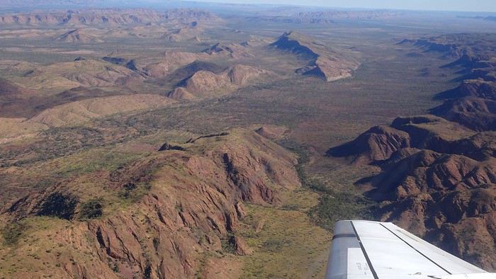
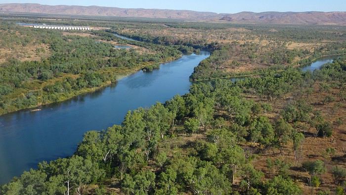
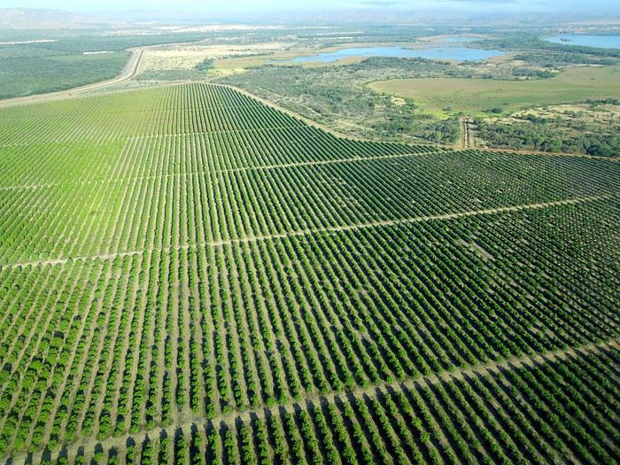
We wanted heat, and here it was—34°C the moment we stepped off the plane! We felt alive again and totally ridiculous in our jeans and sweaters. We quickly grabbed our suitcase and picked up the 4x4 we’d rented—more out of necessity, since only that type of vehicle can access the national parks we planned to visit.
Just four kilometers separated us from Kununurra, a town of 5,000 people founded in 1961 during the construction of the Lake Argyle Dam and the development of the Ord River Irrigation Area Scheme (more on that later). On the horizon, mountain ranges (a bit of an exaggeration, since we know Mt. Meharry, WA’s highest ‘mountain,’ doesn’t even reach 1,250 meters!) and closer to the road, a few irrigation canals cutting through stretches of bush, then a huge park overlooking a small lake lined with reeds.
A row of baobabs (yes, there are baobabs in Australia too!), a series of motels with immaculate lawns, a gas station, and there’s the main street leading to the town center—that is, the parking lots of the two supermarkets, the bottleshop, the pub, the Town Hall, the municipal pool, and the Tourist Office (already closed!), and at the next roundabout, another park, the Presbyterian church, and a few other shops. In short, two or three green blocks that you can explore in no time.
One road leads to the small industrial area and one of the town’s three or four campgrounds, while another heads toward the residential neighborhoods, which look just like the typical suburbs you find in any Australian city—except with tropical vegetation. We stocked up at Coles, an identical copy of the one near our place, and—surprise—the prices were practically the same.
We checked into one of the motels. The receptionist listed the town’s three or four restaurants, insisting that it’s always better to book a table. She recommended the Pump House, a bit outside town on the lake’s edge. “Best spot to watch the sunset, but hurry up.” she told us. It was only 5:00 PM!
When we got there half an hour later, the place was packed, and the sun had already disappeared behind a row of trees! Sure enough, we’d see a few days later that the sunset can be a stunning spectacle—if you wait a bit for the sky (especially if it’s cloudy) to blaze and reflect in the lake’s calm waters. A little disappointed, we headed back into town, where we easily found the other lively spot in town: the pub (nothing like an old English pub). Above the long L-shaped bar, several giant screens (thankfully muted) were broadcasting live footy, rugby league, etc. In one corner, players circled the pool table, while in another, customers were digging into plates of the day’s special. Instead of rooms, there were various patios where groups of friends and coworkers (easily recognizable by the fluoro vests they were still wearing) were gathered. We found a table under a mango tree—unfortunately, a little too close to the guitarist strumming his entire Country Music repertoire, complete with Keith Urban-style tremolos. Guaranteed culture shock!
Since it’s the custom here, we called the Country Club to book a table before the kitchen closed! The CC is the town’s—and even the region’s—fancy spot. Dark decor, modern furniture, dim lighting, and the air conditioning blasting. The twenty or so customers had taken refuge on the vast terrace, lit by torches. The view of the tall eucalyptus trees, illuminated by spotlights shifting from red to blue, was breathtaking.
The menu was minimal, but the grilled salmon was excellent, and the Pavlova (the meringue dessert Kiwis and Aussies have been arguing over since 1906) with melon and watermelon was absolutely divine.
It wasn’t even 9:00 PM, and we were already in bed. Had we already adopted the Top West End’s chicken schedule?!
To be continued... Journal dedicated to Attila
As usual, I didn’t manage to keep it short, but this time I’ve got photos to go with it!
August 2020. Since the opportunities to explore the world are extremely limited right now, all we (R&X) can do is explore our own island! Well, just a part of it, because with the state borders still closed, we’re stuck in Western Australia (WA).
Luckily, we’re pretty fortunate because this state is huge: over 2.5 million km² (that’s more than four times the size of France or 1.5 times Quebec). What’s more, stretching over 20 degrees of latitude between the Antarctic Ocean and the Timor Sea, you’ll find climates ranging from Mediterranean to arid to tropical. That’s actually why we decided to head as far north as possible. Sick of the endless rainy winter in Perth, bring on the heat of the Kimberley... way up Nooorth!
Friday. At the airport, the main terminal was closed (not enough flights), so we ended up in the annex (where flights to the various mines usually depart from). There was no crowd at the gate, and in this huge, single departure lounge, empty seats were plentiful. Only three flights were listed on the screens for the rest of the morning: the first to Coondewanna (?), the second to Darwin, and ours to Kununurra (code KNX).
A cool breeze swept through the half-open corridors along the runways. At the top of the walkway leading to the Fokker 100 (the Airbuses and Boeings are now parked!), a flight attendant greeted us with a basket full of sanitary masks. We were actually the only masked passengers (the staff weren’t wearing them either). With zero Covid-19 cases in WA at the time, the only rule was to maintain social distancing—something pretty hard to do on a full plane!
It was also my first time wearing a mask—it felt weird, pretty uncomfortable, and after a while, painful behind the ears. I really feel for those who have to wear one all day, every day. The flight lasted three long hours, but luckily, I had a good book. From the window, I watched an endless expanse of salt lakes in all shapes and sizes—round, elongated, gray, white, sometimes blue and green—and an infinity of winding, capricious meanders, along with long straight lines that led nowhere. The last half-hour got more interesting as rocky, swollen formations and long, sloping plateaus appeared. Against the vast ochre landscape, green patches became more frequent.
Just before landing, rows of green fields briefly appeared, along with an surprisingly wide river—but we were already rolling down the tarmac. A few hangars, a myriad of small, stationary planes, and a tiny terminal topped with a sign: “Welcome to Kununurra.”
We wanted heat, and here it was—34°C the moment we stepped off the plane! We felt alive again and totally ridiculous in our jeans and sweaters. We quickly grabbed our suitcase and picked up the 4x4 we’d rented—more out of necessity, since only that type of vehicle can access the national parks we planned to visit.
Just four kilometers separated us from Kununurra, a town of 5,000 people founded in 1961 during the construction of the Lake Argyle Dam and the development of the Ord River Irrigation Area Scheme (more on that later). On the horizon, mountain ranges (a bit of an exaggeration, since we know Mt. Meharry, WA’s highest ‘mountain,’ doesn’t even reach 1,250 meters!) and closer to the road, a few irrigation canals cutting through stretches of bush, then a huge park overlooking a small lake lined with reeds.
A row of baobabs (yes, there are baobabs in Australia too!), a series of motels with immaculate lawns, a gas station, and there’s the main street leading to the town center—that is, the parking lots of the two supermarkets, the bottleshop, the pub, the Town Hall, the municipal pool, and the Tourist Office (already closed!), and at the next roundabout, another park, the Presbyterian church, and a few other shops. In short, two or three green blocks that you can explore in no time.
One road leads to the small industrial area and one of the town’s three or four campgrounds, while another heads toward the residential neighborhoods, which look just like the typical suburbs you find in any Australian city—except with tropical vegetation. We stocked up at Coles, an identical copy of the one near our place, and—surprise—the prices were practically the same.
We checked into one of the motels. The receptionist listed the town’s three or four restaurants, insisting that it’s always better to book a table. She recommended the Pump House, a bit outside town on the lake’s edge. “Best spot to watch the sunset, but hurry up.” she told us. It was only 5:00 PM!
When we got there half an hour later, the place was packed, and the sun had already disappeared behind a row of trees! Sure enough, we’d see a few days later that the sunset can be a stunning spectacle—if you wait a bit for the sky (especially if it’s cloudy) to blaze and reflect in the lake’s calm waters. A little disappointed, we headed back into town, where we easily found the other lively spot in town: the pub (nothing like an old English pub). Above the long L-shaped bar, several giant screens (thankfully muted) were broadcasting live footy, rugby league, etc. In one corner, players circled the pool table, while in another, customers were digging into plates of the day’s special. Instead of rooms, there were various patios where groups of friends and coworkers (easily recognizable by the fluoro vests they were still wearing) were gathered. We found a table under a mango tree—unfortunately, a little too close to the guitarist strumming his entire Country Music repertoire, complete with Keith Urban-style tremolos. Guaranteed culture shock!
Since it’s the custom here, we called the Country Club to book a table before the kitchen closed! The CC is the town’s—and even the region’s—fancy spot. Dark decor, modern furniture, dim lighting, and the air conditioning blasting. The twenty or so customers had taken refuge on the vast terrace, lit by torches. The view of the tall eucalyptus trees, illuminated by spotlights shifting from red to blue, was breathtaking.
The menu was minimal, but the grilled salmon was excellent, and the Pavlova (the meringue dessert Kiwis and Aussies have been arguing over since 1906) with melon and watermelon was absolutely divine.
It wasn’t even 9:00 PM, and we were already in bed. Had we already adopted the Top West End’s chicken schedule?!
To be continued... Journal dedicated to Attila
Traversée de la Chartreuse en solo English translation pending
Trek solo n°6
On admettra que cette année fut spéciale. Je devais faire la traversée de Majorque en avril et puis... SALUE JE M'APPELLE COVID 19 ET JE VIENS VOUS FAIRE CHIER. Du coup, peu de projets pour cet été, difficile d'estimer les possibilités de voyage à l'étranger, pas très envie non plus de faire circuler cette merde... Alors je me rabats sur mes chères Alpes, ma foi de très bonne qualité. Début juillet, je consulte mon pote David, un normand exilé au pays des montagnes, pour savoir quand il sera chez lui, à Chambéry. Je cale donc un périple fin juillet, de Grenoble à Chambéry, via le massif de la Chartreuse, et en profiterai pour lui rendre visite.
Trajet réservé : départ le 25 juillet en train vers Grenoble, retour le 2 août en bus depuis Chambéry.
Je m'attends pas à quelque chose d'exceptionnel, je sais pas pourquoi. Ça a l'air très joli, mais pas très haut, et pas très sauvage. Mais après ces derniers mois bizarres, ce confinement éprouvant et les longs mois sans nature, un peu de montagne ne peut me faire que du bien. Et au moins, même si la météo n'est pas avec moi, je vais pas crever de froid, pour une fois (les plus hauts sommets sont à 2000m environ).
Après un petit séjour en Normandie natale et quelques trips de Caen, me voici en halte en région parisienne pour faire mon sac, la veille du départ. Ce qui m'inquiète le plus, c'est l'accès à l'eau. Il n'y a pas beaucoup de neige l'hiver (voire pas du tout certaines années), donc très peu de rivières en altitude. Les sources sont pour abreuver les troupeaux et bergers, mais souvent, l'été, elles sont à sec... Je checke quand même les dernières mises à jour des randonneurs sur refuge.info, qui recense tous les abris et les sources, pour voir un peu l'état des lieux. Ça devrait le faire. Je prends quand même 3 gourdes de 75 ml au lieu de 2 habituellement, ce qui me fait au maximum 2,25L d'eau en réserve.
Je blinde mon sac de 50L : 13 kg sans eau. Mh. Je sais pas comment je me démerde pour me retrouver avec autant de poids. Je lis pas mal de carnets de randonneurs qui portent 8 kg. Pourtant, j'ai pas prévu beaucoup de bouffe, peu d'habits, le strict minimum pour l'autonomie... Je comprends pas comment ça peut monter aussi haut pour seulement une semaine, d'ailleurs je me pose la question tous les ans.
On admettra que cette année fut spéciale. Je devais faire la traversée de Majorque en avril et puis... SALUE JE M'APPELLE COVID 19 ET JE VIENS VOUS FAIRE CHIER. Du coup, peu de projets pour cet été, difficile d'estimer les possibilités de voyage à l'étranger, pas très envie non plus de faire circuler cette merde... Alors je me rabats sur mes chères Alpes, ma foi de très bonne qualité. Début juillet, je consulte mon pote David, un normand exilé au pays des montagnes, pour savoir quand il sera chez lui, à Chambéry. Je cale donc un périple fin juillet, de Grenoble à Chambéry, via le massif de la Chartreuse, et en profiterai pour lui rendre visite.
Trajet réservé : départ le 25 juillet en train vers Grenoble, retour le 2 août en bus depuis Chambéry.
Je m'attends pas à quelque chose d'exceptionnel, je sais pas pourquoi. Ça a l'air très joli, mais pas très haut, et pas très sauvage. Mais après ces derniers mois bizarres, ce confinement éprouvant et les longs mois sans nature, un peu de montagne ne peut me faire que du bien. Et au moins, même si la météo n'est pas avec moi, je vais pas crever de froid, pour une fois (les plus hauts sommets sont à 2000m environ).
Après un petit séjour en Normandie natale et quelques trips de Caen, me voici en halte en région parisienne pour faire mon sac, la veille du départ. Ce qui m'inquiète le plus, c'est l'accès à l'eau. Il n'y a pas beaucoup de neige l'hiver (voire pas du tout certaines années), donc très peu de rivières en altitude. Les sources sont pour abreuver les troupeaux et bergers, mais souvent, l'été, elles sont à sec... Je checke quand même les dernières mises à jour des randonneurs sur refuge.info, qui recense tous les abris et les sources, pour voir un peu l'état des lieux. Ça devrait le faire. Je prends quand même 3 gourdes de 75 ml au lieu de 2 habituellement, ce qui me fait au maximum 2,25L d'eau en réserve.
Je blinde mon sac de 50L : 13 kg sans eau. Mh. Je sais pas comment je me démerde pour me retrouver avec autant de poids. Je lis pas mal de carnets de randonneurs qui portent 8 kg. Pourtant, j'ai pas prévu beaucoup de bouffe, peu d'habits, le strict minimum pour l'autonomie... Je comprends pas comment ça peut monter aussi haut pour seulement une semaine, d'ailleurs je me pose la question tous les ans.
Les "ailleurs hexagonaux"... le top des paysages exotiques en France English translation pending
🙂Beaux Jours!
(Des airs d') Australie, Amazonie, Equateur, Irlande, Cambodge, Thaïlande, Colorado, Canada, Cappadoce, Polynésie...en France???!!! 😮
https://www.youtube.com/watch?v=8ZebFDvefOs
#cetétéjevisitelafrance
Bons voyages!
Sânouk3😎
ps: Y a aussi Ses paysages/territoires uniques, hein (Camargue, Paris, Calanques de Marseille, Châteaux d'la Loire, Baie de Somme, Corse, Sète.... 😉
(Des airs d') Australie, Amazonie, Equateur, Irlande, Cambodge, Thaïlande, Colorado, Canada, Cappadoce, Polynésie...en France???!!! 😮
https://www.youtube.com/watch?v=8ZebFDvefOs
#cetétéjevisitelafrance
Bons voyages!
Sânouk3😎
ps: Y a aussi Ses paysages/territoires uniques, hein (Camargue, Paris, Calanques de Marseille, Châteaux d'la Loire, Baie de Somme, Corse, Sète.... 😉
Cévennes, mont Lozère et saute-causses à vélo English translation pending
Saute-Causses à vélo
En cette fin juin 2020, nous reprenons des activités de plein-air, après il faut bien le dire avoir été un peu sonnés par cette pandémie qui nous a tenus confinés presque deux mois.
Alors dans ce contexte particulier, cette balade à vélo de 9 jours je l’ai vécue comme une libération, certes toute relative, nous étions malgré les nombreux décès dans notre village, loin des grandes tragédies de notre histoire. Cependant, en préambule, je me permets de faire l’apologie de Voyage Forum et de la revue « 200 le vélo de route autrement ».
Oui, l’apologie de VF pourquoi ? Parce que grâce à ce site de voyage on fait de fabuleuses rencontres qui permettent de partir en virée avec des personnes étonnantes. Les réseaux sociaux on y trouve le meilleur et le pire.
Il m’est arrivé de me faire écharper, traiter de tous les noms, affubler de tous les défauts parmi les plus détestables car à travers mes récits certains acrimonieux ou acrimonieuses (certes peu nombreux) n’y décelaient qu’un égocentrique, à l’imagination prolixe, en recherche d’admiration. Assurément, nous avons tous notre petit égo, et j’ajouterais heureusement. Personnellement, je ne suis jamais insensible à un petit mot gentil même d’admiration, au risque qu’il puisse flatter mon orgueil, mais l’essentiel n’est pas là. En effet, si quelques-uns sont prompts à la critique acerbe ou tatillonne, d’autres au contraire ont une réaction opposée. Accrochés, piqués de curiosité par mes écrits, ils me contactent et ont envie de partir avec moi. Et là commence l’aventure. Que de fois ai-je rencontré des compagnes ou compagnons de voyage grâce à mes écrits sur VF.
Mais, je dois avouer que cette randonnée vélocipédique de 9 jours à travers causses et Cévennes a été le point d’orgue, une apothéose qu’il me sera difficile de retrouver en matière de compagnons de voyage hors normes. Et quand je pense que nous aurions pu partir à cinq, si Hélène, notre gentille hébergeuse, n’avait pas eu des impératifs. Elle aussi connue il y a déjà quatre ans par VF, et comme baroudeuse du bout du monde à vélo en solo elle se pose là.
Nous sommes partis à quatre, tout d’abord André, camarade sûr au moral d’acier, capable de faire 1500 kilomètres avec une fracture du pouce non soignée, en compagnie de qui j’avais déjà effectué deux voyages à vélo, dont 64 jours à travers les immensités rudes du nord Argentine, ainsi que deux femmes.
La première Brigitte, grande baroudeuse, au look de « grand-mère moderne » bien dans sa peau, mais ne pas s’y tromper, les immenses traversées de déserts seule sur son vélo seraient presque son quotidien si elle ne prenait pas sur son temps pour garder le lien avec sa famille et s’occuper de ses petits-enfants, comme toute Mamy qui se respecte. Même si parfois l’un de ses enfants lui tire l’oreille alors qu’elle vagabonde de l’autre côté de la planète pour lui faire passer un petit message du genre « Maman, ça va être Noël, nous t’attendons tous avec impatience en particulier les petits-enfants ». Ces injonctions, qui jouent sur le sentiment et la fibre maternelle, lui font stopper très temporairement ses grandes chevauchées solitaires. Notre premier contact se fit grâce à VF et à CCI. Dès les premiers échanges nous avons constaté notre immense passion commune concernant le désert de l’Atacama. Nous nous sommes rencontrés deux fois au festival annuel du voyage à vélo organisé par Cyclo Camping International à Paris. Depuis l’envie de partir ensemble nous taraudait.
La seconde, Patricia m’a contacté par VF pour savoir si je recherchais des personnes pour de futurs voyages. Premier contact très sympathique, cependant mes conditions familiales actuelles ne me permettent pas d’envisager de longs voyages, mais m’échapper une dizaine de jours me semblait possible. Je lui ai donc promis de la contacter au cas où. Et effectivement, l’envie de me changer les idées et de partir quelques jours avec mon copain André est vite arrivée, et je dirais même s’est imposée. Et me souvenant de notre conversation, voilà comment elle s’est jointe à nous. Wahou !!! J’ai découvert une athlète complètement hors normes, au palmarès incroyable, championne de France et d’Europe de marathon, championne d’Europe et vice-championne du monde de 100 kilomètres de course à pied sur route. Bien d’autres exploits jalonnent sa vie, comme des temps stupéfiants sur l’ultra-trail du mont Blanc ou des courses furieuses dans les très grands froids nordiques, et avec tout cela une simplicité et une gentillesse immenses, sans parler d’une rusticité sidérante. Elle m’avait même dit : tu as beaucoup plus voyagé à vélo que moi, peut-être devras-tu m’attendre. Elle a vu ! mais elle n’a pas dû être vraiment surprise, je ne pense pas que dans sa vie beaucoup, même parmi les meilleurs, l’aient attendue à pied ou à vélo, l’inverse oui sans doute toujours !!!

Et pourquoi l’apologie de la revue 200 ? Tout simplement parce que les articles sont des morceaux d’anthologie littéraires. Et lorsqu’il est question de la France, même concernant des coins que je connais bien, les descriptions à couper le souffle me donnent à penser qu’il s’agit d’un ailleurs qu’il me faut découvrir au plus vite.
Oui, les quelques rares échanges désagréables sur VF de quelques personnes mal lunées sont vite oubliés quand on a le bonheur de partir avec trois personnes de cette trempe, je dirais même que c’est un honneur. J’ai commencé, cependant, à me faire un peu de souci au sujet de ma forme physique car, au cours des 18 derniers mois, je n’ai effectué en tout et pour tout que 20 kilomètres à vélo.
Trois semaines avant le départ je me suis promis de me remettre en selle. J’ai tenu 6 jours, une trentaine de kilomètres par jour et 500 à 700 mètres de dénivelé. Tout surpris ça passait bien, donc la motivation est retombée et je suis retourné taquiner la truite, surtout que cette année la pêche est bonne par chez moi, mais que de la fario sauvage des Vosges.
Donc nous y voilà, petit projet en France, un itinéraire à travers les reliefs des Cévennes qui nous mènera de Mialet (un peu à l’ouest d’Alès) vers le mont Lozère puis la montagne de Bougès. Ensuite nous écornerons le coin nord-est du causse Méjean à partir de Florac avec redescente sur Castelbouc. De là, nous partirons à l’assaut du causse Sauveterre par un chemin infernal dans la chaleur de l’après-midi. Nous en longerons tout le bord sud qui s’étire en croissant au-dessus du Tarn, puis nous plongerons vers Sainte-Enimie et irons dormir à la Malène. Après s’en suivra une magnifique traversée du causse Méjean en passant par le terrain d’aviation jusqu’à Saint-Jean-des-Tripiers. Nous poursuivrons par une descente vertigineuse sur la Jonte où nous verrons de nombreux vautours. Après un ravitaillement au Rozier, nous partirons à l’assaut du causse Noir que nous traverserons en entier jusqu’à sa barrière sud la rivière Dourbie. Nuit à Trêves suivie d’une montée du mont Aigoual, ponctuée d’un bivouac sur son versant est. Et en fin, nous déroulerons la dernière étape de cette trop courte balade de 9 jours, en nous laissant emporter par la descente le long du Gardon. Dernier point dur, voire très dur, la remontée chez mon amie Hélène d’où nous sommes partis, au Puech, 7 km dont 5 à pousser les vélos dans des côtes bien supérieures à 10%. Mais pourquoi aller habiter sur un piton si loin du joli petit village, sans doute parce qu’Hélène est aussi une vraie « furieuse » à qui les grandes aventures dans des pays sauvages à vélo en solo ne font pas vraiment peur.
Cette période post-covid est un peu inquiétante, comment allons-nous voyager ? Avant de partir, je viens de lire sur VF un beau récit à travers le Morbihan post-pandémie, agrémenté de jolies photos, effectué en juin. L’impression qui s’en dégage est étrange. On pourrait s’imaginer dans un film d’anticipation futuriste, l’humanité guettée par quelques menaces généralisées. Un préambule au livre de Cormac McCarthy « la Route ».
Tout commence par un trajet en voiture de quelques 600 kilomètres à travers la France. Quelque part avant Alès je m’arrête, un restaurant semble ouvert, il m’est dit qu’on ne mange que sur réservation, espacements obligent. On me montre la pizzeria un peu plus loin. Là, on me prépare une bonne pizza mais on me demande d’aller la manger ailleurs, même pas le droit de m’installer à la terrasse. On m’indique un parc en contre-bas, au bord d’une jolie petite rivière. Je vais y passer un moment de repos agréable. Mais, de toute évidence nous ne sommes pas revenus à la normale.
Mon accession à la maison d’Hélène n’est pas évidente, de plus mon GPS auto n’étant pas à jour, il ne m’est d’aucune aide pour une route toute récente. Elle qui me prenait pour un grand baroudeur au flair infaillible va réviser son jugement.
Voilà mon arrivée chez elle sur sa montagne isolée, telle qu’elle l’a restituée en s’insinuant dans mes pensées. Je dois reconnaître qu’elle est très proche de la vérité, comme si elle avait été passagère invisible à côté de moi. Donc voilà Hélène qui s’exprime en extrapolant mes pensées : « Tout commença mal. Après six heures de voiture et ayant passé Alès, me voilà perdu sur une route de montagne digne de celle de la Bérarde dans les années 70. Pas de maison, ni de poteau téléphonique ou électrique. Pas âme qui vive. Où m'étais-je donc fourré ? J'avais pourtant reçu des informations précises : les poubelles, la table en bois, les deux panneaux -un noir, un rouge- "Les Puechs", la fourche que je ne pouvais pas manquer paraît-il, l’impasse de droite… Mais rien de tout cela. Une route tortueuse qui n'en finit pas de monter au milieu des chênes verts... On ne m'y reprendrait pas à dire venez chez moi j'habite chez une copine. J'appelle ladite copine. Pas de réseau évidemment. Après plusieurs essais infructueux je la vois qui vient à ma rencontre. Ouf, sauvé pour cette fois. »
Un peu ridicule, je constate que les trois autres sont arrivés sans problème. Brigitte a même poussé la plaisanterie en venant d’Aix-en-Provence à vélo, et c’est concomitamment que nous nous arrêtons devant le portail du nid d’aigle d’Hélène. Soirée de retrouvailles pour certains et de découverte pour d’autres, mais ambiance magnifique entre frénétiques du « gros baroud ». Plus les personnes sont habituées à voyager en dehors des chemins habituels et plus elles sont généralement décontractées, et puis que d’histoires incroyables elles peuvent raconter, même s’il faut un peu les torturer pour les faire parler. Hélène nous fait bien rigoler, même si sur le coup ça l’aurait plutôt fait pleurer, en nous relatant sa traversée himalayenne avec un être étrange qui se jetait sur la nourriture et ne lui en laissait même pas quelques miettes. Il paniquait à l’idée de manquer et, affamer sa compagne de route ne semblait pas le perturber. Elle finira sa traversée seule, elle est habituée. En route, elle avait sympathisé avec un couple de Hollandais qui, quelques jours plus tard, tomba sous les roues et les coups de couteau d’un djihadiste. L’homme fut tué, la femme en réchappa, Hélène, elle, en garde une vraie souffrance. Pour raison de Covid, on s’installe dans le jardin, chacun avec sa tente. Chut, je vais un peu tricher, je finirai sur un lit mais dans mon sac de couchage !
Au matin, un petit-déjeuner qui s’étire presque à l’infini. Des personnes, qui ne se connaissaient pas la veille, ont tellement d’aspirations et d’expériences communes qu’elles ont l’impression de toujours s’être connues. Mais vers les 9 heures du matin c’est parti, on serait bien resté plus longtemps, voire toute la journée à discuter des chemins du monde.
Nous commençons par la terrible descente du sommet où Hélène et Bernard, son compagnon, ont élu domicile. Il nous faut faire quelques courses car les jours à venir nous ne savons pas ce que nous trouverons, comptant traverser par des pistes confidentielles cette région de France sauvage. Epicerie associative de village, désinfectant à l’entrée et masque obligatoire, je dégaine le mien. Nous ne trouvons pas grand-chose. A la sortie du village de Mialet, une petite boutique de camping nous permet d’acheter du pain en complément. Mais nous ne nous faisons pas de souci, ayant chacun dans les sacoches du riz et des pâtes, de quoi tenir plusieurs jours. Pour ma part, avec un kilo de riz et de pâtes j’ai de quoi assurer pour 4 durant 48 heures.

Et nous voilà lancés. Premier objectif, le col d’Uglas qui culmine à 539 mètres. Certes ce n’est pas l’Abra del Acay, le plus haut col carrossable des Andes et ses 4972 mètres, mais c’est le même bonheur de la liberté en étant bien accompagné. Bien évidemment, mes trois camarades me laissent sur place, mais bon je ne m’en fais pas, sachant qu’ils ont tant de choses à se raconter en m’attendant. Du col, nous partons sur des pistes mal pavées à travers les grosses bosses et les forêts des Cévennes et nous rejoindrons en milieu d’après-midi le village du Collet-de-Dèze sur le Gardon. Par moments, nous avons l’impression de monter dans les cieux, quelques poussages de vélo agrémentent la journée. Je vois parfois mes camarades devant moi se découper directement sur le ciel, dans des pentes à plus de 15%, comme s’ils se trouvaient sur une rampe de lancement pour quelque voyage improbable. Bien évidemment, cela nous rappelle à tous les grands déserts, le Gobi ou l’Atacama, et les éclats de rire augmentent au rythme du pourcentage de la pente.
Arrivée au village précité, arrêt au bistrot, j’en profite pour prendre le permis de pêche du département de la Lozère pour la première catégorie, c’est-à-dire pour les rivières à salmonidés, département dans lequel nous allons passer et repasser. La réglementation en matière de pêche en France est quelque chose d’inextricable, mais il y a de multiples raisons dont certaines bien valables, mais je ne m’aventurerai pas à vous les expliquer, il y faudrait tout un livre.
La bière est bonne, on la multiplie par deux, rien de tel après avoir ingurgité des litres d’eau tiède toute la journée. De plus elle a un effet diurétique du meilleur résultat pour le corps après une journée d’efforts somme toutes conséquents, en tout cas pour moi. Certes, la distance n’est pas énorme en ce premier jour, 47 kilomètres et 1025 mètres de dénivelé, mais cependant beaucoup de pistes en partie parcourues en poussant les vélos. Nous avons même eu droit à un tronçon emporté par des intempéries réputées très violentes, les fameux épisodes cévenols. Une charmante jeune femme habitant une ferme isolée au milieu, plutôt au sommet de nulle part, nous a remis sur le bon chemin.
Nous rejoignons le camping le long du Gardon, quasi-désert, une seule tente, un Américain vivant en Espagne qui, voyant la tournure du Covid rôdant, a décidé depuis un mois d’attendre la suite des événements ici en Lozère, qui a été très peu touchée par ce fléau, un mort répertorié. La patronne est sympathique et très prolixe sur sa région, tout à mon bonheur. Elle est originaire de pas très loin, d’un coin où nous allons passer et que je connais depuis longtemps, le causse Méjean, plateau d’altitude qui me rappelle par ses lumières et ses grands ciels les plateaux boliviens. Oui, je maintiens et les plateaux boliviens je m’y suis baladé à vélo à plusieurs reprises !
Sitôt installé, je me précipite à la pêche avec mon fouet à mouche, à quelques mètres de nos tentes. Patricia et Brigitte comptent manger de la truite ce soir, mais si je connais bien mes rivières vosgiennes, celles de la Lozère sont une découverte pour moi, et elles seront déçues de devoir se contenter d’une grosse platée de riz, très bonne cependant.
Nous passons une excellente nuit et partons relativement tard. Nous allons nous installer dans une petite routine qui me va bien, vu mon entraînement. Aujourd’hui, il s’agit d’aller le plus haut possible, à la pointe est du mont Lozère et d’y bivouaquer. Trouver notre route confidentielle qui se faufile sur les hauteurs du village n’est pas facile, nos différents tâtonnements nous permettent de visiter ce beau village tout en pente.
Après une matinée par une petite route du bout du monde, nous faisons halte à Génolhac, village tranquille. Nous nous laissons tenter par le restaurant avant d’entamer la montée du mont Lozère, sur 968 mètres de dénivelé pour 15 kilomètres. Pour moi, ce sera une première au restaurant depuis le confinement. Nous sommes les seuls dans la salle, quelques personnes sont en terrasse. Repas créole, très bon, de quoi nous mettre en forme pour un après-midi qui s’annonce « pentu ». Le problème de l’eau se pose. Remplissons-nous les deux bâches de 6 litres maintenant ou plus tard ? Je penche pour maintenant, Brigitte beaucoup plus cool, pour plus tard, ayant bon espoir de trouver une source plus haut. On prend 4 litres par bâche, plus les deux litres que nous avons chacun, cela nous permettra de bivouaquer. Brigitte avait raison, non seulement on va faire le complément dans un ruisseau beaucoup plus haut mais, une fois près du col de Pré de la dame à 1474 mètres, une magnifique source nous fournit avec prodigalité toute l’eau que nous désirons.
Nous trouvons rapidement un coin idyllique pour installer notre bivouac dans des conditions atmosphériques que je qualifie d’idéales. Partir avec des personnes rompues aux longs voyages est un vrai bonheur, tout se passe avec une simplicité déconcertante. Brigitte a un œil particulièrement exercé pour déceler de loin le point précis où s’installer et durant les 9 jours, cela va se renouveler. Pour la deuxième fois, nous sommes trois à monter nos tentes, tandis que Patricia dormira face au ciel, et là aussi, tout le voyage durant, elle ne montera pas sa tente. Notre étape, si elle a été courte en kilomètres, seulement 38, le dénivelé lui a été assez conséquent, 1560 mètres.
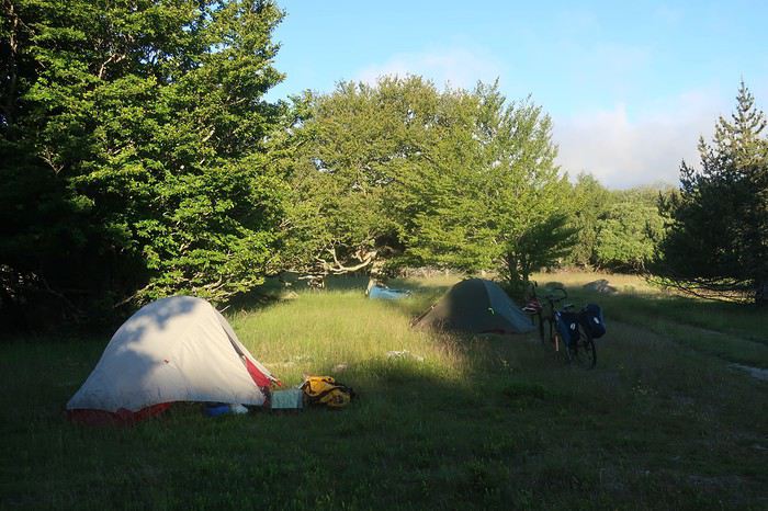
De nouveau une superbe nuit, de plus peu de condensation et sur notre versant est, le soleil nous touche rapidement. Encore une bonne excuse pour traîner un peu une fois de plus et ne démarrer que vers les 9 heures. Très rapidement, nous rejoignons la piste du versant nord du mont Lozère que nous comptons suivre jusqu’au col Finiels. Son début est particulièrement raide, sur un chemin jonché de gros cailloux, petite séance de poussage obligatoire sur un kilomètre. Nous arrivons à une magnifique cabane-refuge perchée en dessous de la crête. Nous parcourons le livre d’or, manifestement des randonneurs venant de tous les coins d’Europe au moins y ont laissé un petit mot. Je m’empresse d’en faire autant. Malgré tout l’agrément du lieu, il n’est pas question d’y passer la nuit, il n’est que 10 heures du matin.
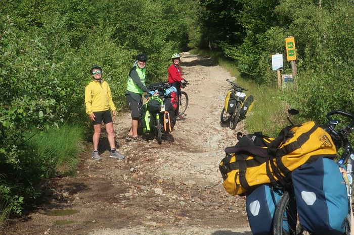
Nous suivons cette piste d’altitude sur une dizaine de kilomètres. Nous y croisons des Vététistes, et discutons longuement avec un groupe. Le temps est couvert et il fait frisquet dès que nous nous arrêtons. Les sources du Tarn sont indiquées. Posant nos vélos, nous les rejoignons en quelques centaines de mètres. Pas une goutte d’eau, plutôt un vaste bassin au flanc de la crête qui sert de réceptacle. Plus précisément, il s’agit de l’un des différents lieux répertoriés comme source de la rivière. Toute la cime est sans doute en elle-même le lieu d’alimentation. Le col Finiels arrive presque trop vite, nous y retrouvons le goudron.

De là, l’itinéraire conduit au village de Pont-de-Montvert, célèbre du fait de la révolte des camisards, lorsque Louis XIV révoqua en 1685 l’édit de Nantes, qui avait été mis en vigueur par François Ier. L’un des chefs de cette révolte Pierre Laporte, est originaire du village d’Hélène, Mialet, point de départ et d’arrivée de notre petite aventure. Mais le principal chef camisard s’appelait Jean Cavalier et sa vie est digne d’un roman d’aventure à rebondissements car contrairement à Pierre Laporte, il ne mourra pas les armes à la main.
Cette pente est magnifique et très surprenante. D’immenses constructions rocheuses naturelles se dévoilent au détour des virages, des amoncellements ruiniformes ou d’énormes galets morainiques, parfois empilés en des arrangements prêts à durer encore des millénaires. En cours de descente nous décidons de piquer niquer dans ce décor grandiose. La vue porte au sud sur la montagne de Bougès, l’éminence que nous avons l’intention de traverser par sa crête qui se dirige vers l’ouest jusqu’à Florac. Puis nous nous laissons emporter jusqu’au village où André renvoie par la poste 6 kilos de bagages. Les Cévennes, toutes sauvages qu’elles soient, ne sont pas le désert de l’Atacama, destination de notre dernière grande équipée à vélo. Près du pont central, un bistrot nous ouvre les bras et nous y passons un bon moment. Le Tarn, tout au fond de sa gorge, donne un véritable cachet à la commune. Plusieurs terrasses, des touristes pas très nombreux, des tables qui ne respectent pas l’espacement préconisé par les autorités sanitaires. Certains portent le masque, d’autres non. Sensation une fois encore étrange. Tant que nous nous trouvons seuls, au milieu de nulle part, le covid nous n’y pensons pas trop, mais dès que nous nous retrouvons rapprochés de nos congénères, il se rappelle à notre bon souvenir.
C’est l’heure de partir. Malgré deux Grimbergen je me sens une frite d’enfer pour partir à l’assaut de cette fameuse montagne de Bougès. Bien évidemment, mes trois acolytes disparaissent et je vous assure les Grimbergen n’y sont pour rien. Mais quand on a dépassé les bornes, il n’y a plus de limites. Donc je ne boude pas mon plaisir en remontant le petit vallon qui se dirige vers la crête, et je m’arrête pour traquer du regard les truites dès que je décèle un endroit favorable à leur positionnement. Avec un immense plaisir bien qu’elles soient très mimétiques, en lisant les veines d’eau je les vois, quel bonheur, mais je ne vais quand même pas sortir ma canne !
Une fois au sommet, une piste de toute beauté nous emmène presque jusqu’à Florac en partie à travers forêt et aussi par des zones aérées qui nous permettent les plus beaux points de vue sur cette région étonnante de France. Des villages à l’architecture montagnarde se cachent dans les replis du mont Lozère. La vue porte très loin par-delà vers le nord. Devant nous le Tarn déroule sa gorge qui coupe comme un coup de couteau les causses Méjean et Sauveterre. Derrière ce dernier des monts apparaissent dans un lointain un peu diffus, l’Aubrac et quelques pointements plus saillants nous font penser aux premiers volcans d’Auvergne. De Clermont-Ferrand à Nîmes s’étale un immense carré magique, où la géologie a subi tous les bouleversements. Calcaire et granit s’entremêlent, pour la plus grande joie du spectateur. La terre a craché de ses entrailles ces formations cristallines et la mer a fait monter d’immenses plateaux calcaires, qui se sont constitués au cours de millions d’années par sédimentation de carapaces d’animaux marins. Le tout nous offre un panorama magnifique, propice aux plus belles bambées à vélo. Ce spectacle allume en moi le clignotant revue 200.
Dans le dernier numéro de ma revue fétiche, on peut lire, que dis-je savourer, un très bel article sur ce coin de France des causses, qui s’intitule ’’là-haut’’. L’auteur, Alain Puiseux, est spécialiste de la formule qui frappe, et il en saupoudre à l’envi le texte tout au long de son récit, et cela pour le plus grand bonheur du lecteur. J’en cite pêle-mêle quelques-unes : je me suis demandé si la beauté existe en elle-même ou dans les yeux de qui la contemple; si vous avez une carte routière du Massif Central, vous pouvez y lire les rivages des îles la magie marche toujours là-haut c’était juste après le confinement. L’air était plus pur, plus transparent, le ciel sans une griffure la lumière y est rapide et changeante au-dessus d’une houle d’herbe; je suis tombé amoureux par inadvertance d’une isohypse et des plateaux d’altitude.
Remarque au passage, je ne connaissais pas le mot isohypse, cependant tellement parlant lorsqu’on évoque le Méjean, le Sauveterre ou tout autre causse. Voilà, ces différentes citations extraites du texte « là-haut » fournissent une bonne introduction à l’apparition des différents causses que nous allons traverser et escalader dans les jours à venir.
Après quelques moments de rêverie, les yeux errant jusqu’à l’infini, et aussi quelques erreurs d’embranchement ou tout au moins quelques hésitations, une magnifique pente abrupte au chemin cabossé nous mène pratiquement à l’entrée de Florac. Nous sommes à la frontière des zones granitiques sombres du mont Lozère et des falaises calcaires lumineuses du causse Méjean. Le courage nous manque pour repartir à l’attaque des zones de solitude à cette heure tardive et nous optons pour le camping municipal. Il vient juste d’ouvrir. L’employée est partie la veille de Bretagne et a roulé toute la nuit. Depuis quelques heures elle se dépêche d’effectuer les premiers nettoyages de mise en service. Presque personne, un motard avec une magnifique moto-guzzi, un couple en camping-car et nous quatre.
Toute la place pour nous installer, que l’embarras du choix, nous optons pour disséminer nos tentes à portée du bruit de la rivière, le Tarnon qui rejoint le Tarn un peu plus loin. Sans surprise, nouvelle séance de pêche, et bien que cette rivière m’inspire plus que le Gardon au Collet-de-Dèze, mes camarades n’auront à nouveau pas de truites sur feu de bois. Nous décidons d’aller au restaurant. Le centre-ville est assez animé, la place centrale accueille une terrasse de restaurant aux tables relativement espacées. Les clients y sont nombreux et nous passons une soirée agréable dans une ambiance méridionale. J’avais déjà remarqué, au cours des différentes occasions où ma voiture, mon vélo ou mes jambes m’ont conduit dans ce village au nom chantant, que les habitants avaient déjà l’accent du midi.
Ce matin du quatrième jour, nous partons à l’assaut de mon causse préféré, le Méjean. Dans un premier temps, nous allons seulement en mordre le coin nord-est. Une belle montée par la D16 va nous permettre de dominer la vallée du Tarn et d’étendre notre vision aux montagnes que nous avons traversées la veille là-bas, à l’est et au nord.
L’arrivée sur le plateau est toujours aussi surprenante. On passe sans transition de zones de vallées à l’habitat assez dense et au tourisme très visible, à des déserts d’altitude où l’herbe sauvage ou de prairie prend le contrôle, les hommes semblant fuir ses hauteurs hostiles à la vie. C’est en partie ce qui donne un charme fou à ces plateaux. Comme l’écrit Alain Puiseux de ces coins perchés jusqu’au mont Gerbier-de-Jonc, « Se plaindre ici, plus qu’ailleurs, de l’eau ou du froid, c’est n’avoir rien compris », me fait comprendre pourquoi le soir les vacanciers désertent ces lieux pour aller rechercher la quiétude plus bas le long des rivières.
Après une première prise de contact, Brigitte et Patricia ne connaissant pas ces coins bénis des Dieux, nous bifurquons vers Montbrun et effectuons une plongée en direction du Tarn. La différence de chaleur entre plateau et fond de vallée est très nette. Nous marquons l’arrêt au bord du Tarn, dans un coin charmant, le temps d’un pique-nique. Eau verte et grande falaise claire éclatante de soleil. La flemme nous gagnant et subjugués par la beauté des lieux, notre envie de continuer est annihilée. Nous envisageons de passer l’après-midi et la nuit à venir à contempler ce méandre de rivière aux eaux turquoise, surplombées d’une falaise sculptée au cours des millénaires par les flots qui, parfois, se montrent redoutables, sauvages et tumultueux. Cette halte précoce n’est pas vraiment du goût de la trépignante Patricia, mais elle se plie de bon gré à l’avis de l’écrasante majorité. Mais, à peine commençons nous à prendre nos aises que, débouche sur notre coin perdu une famille avec force gamins et chiens. Ces derniers se précipitent sur le gros pain que nous avons acheté ce matin à Florac et, sans une intervention prompte de Patricia, nous pouvions lui dire adieu. Elle se réjouit, car bien évidemment nous abandonnons notre projet de farniente et décidons de reprendre notre route. Dommage, j’avais repéré quelques belles truites en chasse qui n’attendaient que la plus élégante de mes mouches !
En ce début d’après-midi, la chaleur est terrible. Entre ces plateaux calcaires, il y a comme un effet de four et mon thermomètre indique 40 degrés. Quelques kilomètres en direction de Sainte-Enimie nous offrent l’occasion de magnifiques points de vue sur la rivière, et tout particulièrement sur le village de Castelbouc. Cet ensemble de maisons caussenardes, accrochées à la paroi et semblant prêtes à plonger dans une eau aux reflets de jade, est tout simplement splendide. La légende du village rapporte qu’au temps des croisades, un jeune homme seul était resté en ce lieu. Obligé de satisfaire toutes les épouses dont les maris combattaient les infidèles, il en serait mort d’épuisement. Depuis cette époque, un diable sous forme de bouc survole régulièrement la cité.
A Prades, changement radical, nous avons l’intention de monter directement sur le causse Sauveterre par un chemin non carrossable qui s’insinue entre des falaises. Il présente des pentes ne permettant pas de rester sur le vélo, sauf peut-être pour Patricia dont les cuisses et les mollets sont constitués de l’acier le plus trempé.
Là encore la question de l’eau se pose. Devons-nous remplir les bâches en prévision du bivouac sur le causse ? Sur ces plateaux calcaires, il n’est pas question d’en trouver la moindre trace. Même Brigitte qui sent les sources à 50 lieues, y est favorable. Pourtant nous regardons dubitatifs le pan de montagne qui nous domine et à travers lequel nous allons partir. A la fontaine de ce petit village, profitant d’une ombre bienfaitrice, nous faisons donc provision du liquide précieux. J’en profite pour m’asperger copieusement le visage. Nous jouissons des derniers instants de température clémente, ou presque, avant d’affronter cette piste escarpée tournée au sud, soumise à l’infernale chaleur du soleil vertical.
C’est parti pour un court tronçon goudronné où même Patricia pousse dans cette ligne droite qui se jette sans ambages dans la pente. Après 400 mètres le chemin s’échappe à gauche, tout d’abord pas très raide et roulant. Il va perdre très rapidement ces deux qualités. La pente s’accentue franchement et le sol devient instable, au point que, même en poussant le vélo, la roue avant ripe en permanence de droite et de gauche. Immanquablement, je me retrouve très vite seul, André et Brigitte ayant pris un rythme de montée supérieur au mien, sans parler de Patricia qui s’est littéralement envolée. Je n’ai même pas eu le temps de voir si elle avait disparu en courant, son vélo à la main, ou bien en appuyant comme une forcenée sur les pédales dans cette caillasse fuyante. Mais où va-telle chercher une telle force, une telle énergie, une telle envie de s’arracher ? Sans vouloir être un mufle, certes elle est un peu plus jeune que moi, mais elle n’a plus trente ans !
J’adopte la posture ‘’Atacama’’, le comptage de mes doubles-pas. Selon la pente et la consistance du sol, j’en effectue de 20 à 50 avant de marquer l’arrêt. Il semblerait, à vue de nez que cette piste infernale fasse de l’ordre de 6 kilomètres. Il n’y a qu’à prendre son mal en patience. Bon seigneur, André redescend à pied pour venir me donner une petite, même une grande poussette, ce qu’il fera à plusieurs reprises. Je mets ma fierté dans ma poche et je le laisse pousser. On dira que c’est parce que j’ai l’une des bâches à eau de 6 litres sur le porte-bagages ! Mais au fait, Brigitte a la même et elle caracole comme une gazelle dans la pierraille surchauffée. Mais pour elle, c’est tout à fait normal. Elle est habituée aux traversées de déserts en solo, parfois sans même avoir de quoi faire chauffer ses aliments, n’ayant qu’un réchaud à bois. Dans les coins bien désertiques, on peut avoir la surprise de ne pas trouver la moindre brindille. Mais bon, elle continue son périple en croquant ses aliments sans cuisson, trouvant cela presque très bon !
On doit être un peu maso car, dans ce type de situations de chaleur, de caillasses, de sol qui se défile et de pentes très raides, nous éprouvons tous un grand plaisir, je dirais même un grand bonheur d’être là. L’effort, la sueur, la fatigue, mais surtout le corps et l’esprit qui vivent… Nos pensées sont retournées dans les hautes altitudes du Sud Lipez, entre 4 et 5000 mètres, nostalgie des grandes bambées qui nous arrachent à notre quotidien. Le dépaysement et la défonce. Je me dis cependant qu’il n’est pas besoin de faire des milliers de kilomètres pour connaître les bonheurs de l’aventure, la France nous fournit très bien la matière. Certes, ce n’est pas à la même échelle, quand on sait que le prochain point de ravitaillement en eau est à 140 kilomètres et que l’on est en train de pousser son vélo dans le sable. Toutefois ne pas savoir si cela va durer un kilomètre ou trois jours, cette incertitude introduit une dimension supplémentaire, la trouille.
Mais nous montons, les maisons de Prades deviennent minuscules. Le Tarn se dessine dans tous ses méandres en prenant des teintes profondes qui tirent sur l’émeraude. Un signe de Patricia, elle nous attend. Je ne suis pas certain qu’elle avait réalisé que cette piste était difficile pour la multitude de raisons que j’ai données. Nous la rejoignons. Elle va prendre la place d’André et me fournir une petite poussette sur une centaine de mètres. J’ai l’impression d’être aux commandes d’un Rafale en ayant mis la post-combustion. Incroyable, je n’ai pas une Terrienne derrière mon porte-bagages mais un être bionique venu du fond du cosmos qui me propulse littéralement !!!
Mais tout a une fin, surtout le meilleur, les deux derniers virages en épingle me dominent. Changement brutal de configuration du terrain, la déclivité s’atténue, le chemin quitte le flanc de la montagne et s’enfonce dans des fourrés, laissant juste l’espace pour y faire passer le guidon. Je remonte quelques dizaines de mètres sur mon vélo, mais c’est à pied que je rejoins une minuscule route qui longe le bord du causse. Nous nous regroupons, nous venons de déboucher au niveau d’un petit bourg qui se nomme ‘’Nissoulogres’’. Nous n’allons pas tarder à apprendre la signification de cette appellation étrange. « Jamais sous l’orage ». En effet, il rôde tout autour, tapi, sautant d’un causse à l’autre mais épargnant pratiquement toujours cette pointe du plateau du Sauveterre qui domine la petite cité de Prades.

Il ne nous reste pour nous quatre qu’une quinzaine de litres d’eau, ce qui n’est pas énorme pour tenir un bivouac après un tel effort et, il sera sans doute difficile de s’en procurer avant demain midi. Un homme se trouve dans la première maison à quelques mètres du chemin par lequel nous arrivons depuis la vallée. Je lui demande s’il peut nous ravitailler. Non seulement il y est favorable, mais il nous invite à planter nos tentes dans son jardin, où nous sommes aux premières loges pour contempler le causse Méjean qui s’étale au sud, au-delà du Tarn. Nous acceptons bien volontiers et, très vite, ce n’est plus de l’eau qu’il nous propose mais de la bière. De plus, il nous offre une douche, de toute évidence nous sommes tombés sur un 5 étoiles. Nous prendrons notre repas en commun à partir de nos réserves de pâtes. Il nous fait goûter un vin rouge de la région, ma foi de bonne facture. La discussion va s’éterniser en passant des secrets du causse Sauveterre à des considérations professionnelles. Mes camardes se foutront de moi, je suis un bavard impénitent, mais ce soir je n’arriverai pas à en placer une, notre hôte est d’une catégorie toute autre, sans doute au moins champion d’Europe. Le monde est petit, André et lui se trouvent des connaissances communes, ayant tous deux œuvré dans le cadre de grands travaux de la DDE, que ce soit à titre privé ou non. Je dois dire qu’en finale, j’ai un peu, même beaucoup, perdu le fil de la conversation, la bière et le vin par-dessus les kilomètres de poussage dans la caillasse et le cagnard de cet après-midi auront assez vite raison de moi.
Ce matin nous allons longer le bord du causse Sauveterre en descendant vers le sud. Notre itinéraire emprunte de petites routes et des pistes parfois pas très roulantes. Alors je ressens la fatigue consécutive au gros effort d’hier après-midi. Nous traversons le lieu-dit Dignas, puis nous arrivons à une ferme isolée et nous discutons un bon bout de temps avec Christian, l’habitant du lieu. La vie de paysan sur le causse n’est pas facile. Il nous parle des conditions climatiques rigoureuses, des réglementations tatillonnes sur les produits en particulier laitiers, des législations de transmission d’héritage pénalisantes et autres intrusions de l’Etat, ce qui donne à penser que la vie sur ces plateaux devient impossible. Lui s’est spécialisé comme beaucoup dans le lait de brebis pour le roquefort. Ces régions reçoivent l’eau des montagnes environnantes, le Sauveterre du mont Lozère et le Méjean de l’Aigoual. On peut dire que les zones granitiques alimentent les plateaux calcaires.
A midi, nous arrivons à Laval-du-Tarn. Le pique-nique est organisé à l’abri de l’ancien four à pain, nous sortons le réchaud pour une platée de riz. Comme je l’ai toujours pensé, une halte longue le midi est en définitive un gain de temps car l’après-midi permet encore de nombreuses heures de pédalage, surtout en été.
Notre intention initiale était de continuer à longer les hauteurs dominant le Tarn. Après avoir dépassé le Pont Sublime, belvédère tout particulièrement souligné sur la carte, notre itinéraire devait nous mener au village des Vignes. Mais outre une petite fatigue résultant de la montée infernale d’hier pour moi, le temps semble vouloir se mettre à l’orage. De bonnes ou moins bonnes raisons nous poussent à rester sur le goudron et prendre la direction de Sainte-Enimie par une route toute en descente. Un délice. Différents belvédères livrent des points de vue grandioses sur la vallée et les villages qui ponctuent la rivière, là-bas tout en bas. Le cirque de Saint-Chély est particulièrement spectaculaire vu de quelques centaines de mètres au-dessus.
Passage par Sainte-Enimie, haut lieu du tourisme de la vallée du Tarn, que nous laissons derrière nous jusqu’au village de la Malène. Cette gorge est surprenante. Je l’ai parcourue à plusieurs reprises, mais il y a tant de choses à regarder. De l’architecture caussenarde aux formations géologiques que représentent ces immenses falaises calcaires et le Tarn lui-même qui prend tous les aspects entre ses zones profondes et ses parties où il court sur un lit de galets, presque à fleur d’eau.
Nous marquons l’arrêt au niveau du village de Hauterive situé de l‘autre côté du Tarn. Jusque récemment, il était approvisionné par un câble au-dessus de la rivière. Mais, par manque de financement, cet outil de ravitaillement est en panne ce qui occasionne les plus grandes difficultés à ce bourg accroché sur la rive du causse Méjean. Mais les temps ont changé. Ce village est un vestige des temps passés, maintenant révolus, où la rivière était un axe de communication. Il n’y a pas si longtemps les cours d’eau du sud-ouest étaient sillonnés par les gabarres, les poids lourds des siècles passés. Mais pouvaient-elles remonter jusque dans ces gorges profondes du haut de la vallée du Tarn ? Sur certaines rivières difficiles, où le retour n’était pas possible, les embarcations étaient vendues au prix du bois lorsqu’elles arrivaient à destination.
Une fois à la Malène, nous décidons de ne pas poursuivre jusqu’au village des Vignes. Nous nous installons au camping municipal, remarquablement situé sur une plage du Tarn, pratiquement au centre-village. Ambiance covid, je sors mon masque pour aller à l’accueil. Heureusement peu de monde, deux personnes attendent sagement dehors masque sur le nez, dont un Suisse avec un vélo électrique. Cela nous donne une bonne occasion de parler du voyage à deux roues avec assistance électrique. Notre Suisse a l’air ravi de sa machine. Peut-être que dans un temps, que j’espère le plus lointain possible, nous y viendrons. Mais tant que nos muscles fonctionnent encore assez bien, si nous pouvons éviter, nous nous attacherons à le faire.
Devant nos tentes, la rivière miroite mais nous ne sommes plus dans l’ambiance causses, les kayakistes sont nombreux, en particuliers les Allemands. J’en ressens comme une dissonance. Une fois encore, nous constatons la différence d’ambiance entre les plateaux et le bord de la rivière. Sur cette belle eau qui court je fais une tentative à la mouche. Je fais monter deux beaux poissons, sans doute des truites, qui dans un jaillissement attaquent ma mouche. Mais les deux fois, le ferrage ne donne rien si ce n’est une belle poussée d’adrénaline. Le point commun entre le voyage à vélo et la pêche à la mouche est évident, quand on y goûte, c’est foutu, on est enchaîné à vie.
Bon, si les truites ne sont pas coopératives, les bières le seront plus et nous partons au centre du village. Cette petite cité, rassemblée au pied de part et d’autre d’une immense falaise qui avance sa proue acérée presque jusqu’à la grève, a vraiment belle allure. Après quelques bières, mais pas tant que l’on pourrait le penser, deux mois de confinement entraînent un défoulement et une envie de terrasse de café, nous faisons des courses. Et là que vois-je ? Un ORNI bikepacker qui s’arrête devant moi. Je me précipite et engage de manière autoritaire la conversation. Il semble un peu fatigué. Il est lancé dans un tour express de 1200 kilomètres depuis le Gers en passant par Chamonix. Wahou trop bien ! Il est irlandais et vit du côté d’Astaffort, la ville de Francis Cabrel.
Vu l’heure, je n’ai pas l’intention d’interrompre le dialogue. Je lui propose immédiatement de l’inviter au restaurant. Il me demande un court délai de réflexion. Il s’installe un peu plus loin, sort une canette de bière de sa sacoche. Je le rejoins dès qu’il l’a terminée et lui demande s’il accepte l’invitation. Il serait d’accord mais son souci est tout d’abord de trouver un point de chute pour la nuit. Je le rassure, on lui fera une place parmi nos tentes. Nous allons passer une soirée de rêve avec un autre vrai fou qui arpente la planète, à fond de train, à pied ou à vélo. Il se trouve de nombreux points communs avec Patricia dans les courses les plus extravagantes et les places sur le podium. Les grandes traversées de désert en solo de Brigitte l’étonnent aussi, et lui arrachent des exclamations d’admiration. Wahou ! André et moi passons pour de doux pédaleurs mais, cependant nous trouvons un vrai terrain de discussion et d’entente. Il est irlandais, la bière, le vin et le whisky ne l’effrayent pas. J’adore ces athlètes de très haut niveau qui ne sont pas traumatisés par le régime et qui n’oublient pas leurs racines et leurs coutumes. Jimmy nous a enthousiasmés et fait rêver, même nos deux super women sont sous le charme ! Voilà ce que j’appelle voyager et faire une belle rencontre. De retour au camping, la nuit est bien établie, je ne sais plus si Brigitte ou Patricia a vu un, même deux gros poissons. Manu militari, on me met une lampe de poche sous le nez et l’injonction sans discussion possible m’est donnée de remonter ma canne à mouche. Déjà de jour, en possession de tous ses moyens, manier un fouet à mouche nécessite une bonne expérience, alors de nuit, entre les arbres après avoir essayé de tenir tête à un Ecossais dans un autre sport mondialement répandu, il ne s’agissait plus du Tarn, mais de la Bérézina ! Dans la nuit, de nombreux éclats de rire ont résonné !
Le lendemain matin, dès 6 heures je tente de prendre ma revanche sur les truites, en fouettant cette belle eau qui court et que je sens propice et prometteuse. Malheureusement je ne déclenche que deux énormes geysers. Au ferrage, il ne se passe rien non plus, juste de beaux coups d’adrénaline ! La truite reste un mystère, elle monte elle prend ou non votre mouche. Cela dépend de quoi ? je n’en sais fichtre rien. Au dernier moment voit-elle le subterfuge et, étant lancée, elle jaillit du fait de l’inertie mais ne gobe pas ? Mystère total. Comme dans de nombreux domaines, les grands spécialistes sont américains. Leurs connaissances ne s'arrêtent pas uniquement aux super technologies, mais ils sont représentés entre autres aussi par les hommes de la terre et des rivières. Un des plus célèbres d’entre eux dans le domaine de la pêche, le Jim Harrison de la truite, John D. Voelker nous dit que plus il pratique moins il est capable d’expliquer le comportement du roi des salmonidés, la truite.
Nous regardons partir notre Ecossais et, retournons à notre train-train. Nous partons à l’assaut du causse Méjean vers les 9 heures. Nous savourons la montée de la Malène. Les points de vue sur la bourgade écrasée par son rocher nous surprennent par des panoramas différents à chaque virage. Une fois sur le causse, l’ambiance farouche et déserte reprend le dessus. Le contraste est saisissant. Sur le causse Méjean, j’ai toujours l’impression d’être à l’autre bout du monde.

Ce plateau situé en moyenne à mille mètres d’altitude, couvre un peu plus de 300 kilomètres carrés et fait partie de l’ensemble plus vaste du parc national des Cévennes qui lui s’étend sur 2000. Le causse Méjean a été, comme l’ensemble de la région, remodelé par l’homme. L’élevage de la brebis est une activité importante afin de fournir le lait pour la fabrication du roquefort. La partie ouest recèle quelques forêts de pins sylvestres, la partie est, quant à elle, est essentiellement recouverte de prairies à l’herbe sèche, qui rappelle une steppe en zone vallonnée.
Nous allons le franchir d’ouest en est puis, en diagonale vers la pointe sud-ouest jusqu’au village de Saint-Pierre-des-Tripiers. Quelques exploitations agricoles ponctuent de loin en loin le paysage. Nous faisons une halte à l’aéroport, où nous demandons de l’eau. Cela nous donne l’occasion de discuter avec les amoureux du planeur, les vélivolistes. Que de patience il leur faut, quand, parfois des jours durant les conditions pour pratiquer leur sport ne sont pas favorables, comme en ce moment, et il s’en suit d’immenses journées d’attente. Je n’aurais pas la patience d’attendre.
Dans la partie est, la vue porte très loin sur ces pâturages rabougris. Il règne comme un petit air de Mongolie au sol et de Bolivie lorsque quelques nuages viennent s’accrocher au ciel. Halte de midi au Villaret, lieu où l’on élève le cheval de Przewalski. Cela me rappelle mon voyage en Mongolie, où nous avions traversé l’immense parc où ce fameux cheval avait été réimplanté en provenance de France.
Nous nous installons dans l’ancien four communal à l’abri d’un soleil ardent. Que le lieu est calme, malgré sa réputation. Je suis toujours frappé de rencontrer si peu de monde dans un coin si caractéristique. Pourquoi ? De toute évidence, l’austérité de ces grands espaces n’est pas propice à attirer les âmes. L’intérêt de ces endroits ne réside-t-il pas dans la réflexion personnelle qu’ils déclenchent du fait de la quiétude qui s’en dégage ? Le vélo est le vecteur de voyage idéal pour prendre le temps de se laisser emporter par l’ambiance du plateau. La lenteur, l’effort physique et l’exposition aux variations du climat permettent l’osmose avec la nature et l’esprit de la Planète.
Après une pause bien sympathique au milieu de ce que je qualifie de nulle part, nous mettons le cap sur Saint-Pierre-des-Tripiers, petit village au fin fond du causse, à l’architecture remarquable, tout particulièrement son église qui semble se dresser dans ce bout du monde depuis les siècles des siècles. Juste en face de l’édifice religieux, une fontaine nous fournit une belle eau fraîche. C’est exactement ce dont nous avons besoin afin de nous préparer à un bivouac tout confort. Mais justement où nous installer ? Le village semble désert, des quelques maisons environnantes ne nous parvient aucun bruit et nous ne décelons pas le moindre mouvement. Une pelouse devant le clocher me paraît un endroit idéal, de plus elle est protégée par un mur qui semble dater de la création du monde et prêt à affronter l’éternité.
Mais notre présence attire l’attention depuis la maison en face de l’église qui nous domine de quelques mètres. Au sommet d’un escalier de pierre, un homme apparaît, une canette de bière à la main. Je m’adresse à lui pour lui demander s’il est possible de camper sur le petit terrain devant l’église. Il répond sur un ton surpris par la question, sans doute n’en est-il pas à sa première bière. D’une intonation, qui de toute évidence ne plaira ni à Brigitte ni à Patricia, il me rétorque que ce n’est pas dans la tradition française de dormir devant une église. Ah bon, étant catholique croyant comme l’est aussi Patricia, cela ne nous choque pas d’autant que nous avons tous l’habitude de l’accueil dans les temples en Asie du Sud-Est.
Ouille ! pourquoi me suis-je adressé à cet homme, qui de sa vie sans doute n’a jamais imaginé une seule fois dormir dehors. Nos deux baroudeuses démarrent. Je réalise, peut-être suis-je en train de découvrir le fil à couper le beurre ou l’eau chaude, mais cette évidence me frappe, des femmes d’exception ont très généralement des caractères qui vont avec cette spécificité d’exception. Patricia ouvre le bal, notre homme y voit une remarque acerbe et répond. La vitesse supérieure est enclenchée. Brigitte, la placide ‘grand-mère’, en rajoute une louche du style « mais pourquoi poser ce type de question à quelqu’un qui n’a aucune idée de ce que veut dire bivouaquer ». Fin de la discussion, elles enfourchent leur vélo et disparaissent en rigolant. André et moi restons sur le champ de bataille déserté par nos amazones. Par quelques formules de politesse mâtinées de paroles diplomatiques, nous prenons congé de notre homme encore tout surpris, sa canette toujours brandie à la main. Pourtant, ce dernier avait fini par essayer d’y mettre un peu du sien en nous conseillant, dans des explications incompréhensibles, un lieu quelque part dans les environs alors que manifestement il n’avait aucune idée sur le sujet.
A la sortie du village, les sens aux aguets, nous trouvons rapidement le lieu de chute idéal le long d’un GR ou GRP, ce qui nous donne l’autorisation de bivouaquer d’après la réglementation du Parc des Cévennes. Notre campement établi, nous revenons au cours du repas sur l’incident et, heureusement que nous sommes éloignés d’une distance proche du kilomètre de l’habitation de l’homme à la canette, car les commentaires et les éclats de rire ponctuent bruyamment la pinède où nous avons élu domicile.
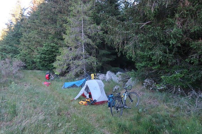
Je profite de ces moments de franches rigolade pour attirer Patricia dans mes filets malgré ses réticences, afin de l’interviewer et l’enregistrer durant 45 minutes dans le cadre de mon émission mensuelle sur la radio de la Bresse « un pays vu par un cyclovoyageur ». Bien qu’ayant l’habitude des journalistes du fait de ses exceptionnelles performances sportives, trois quarts d’heure à parler lui font un peu peur. Wahou ! Ce fut un moment d’anthologie, fabuleux et en plus on a bien rigolé, et ça lui a plu puisque nous allons réitérer l’expérience deux jours plus tard. Cela me permet de monter tranquillement ma saison radiophonique 2020-2021. Je suis certain que les auditeurs vont rester scotchés ! Brigitte qui nous écoute de sa tente, sans s’en douter, ne coupera pas à l’interview également.
Pour le moment, André et moi sommes dans « les petits papiers » de nos deux cavalières de l’apocalypse. Tout va bien. André, toujours à l’élégance très aristocratique de bon goût et au flegme british est appelé par ces dames Lord Andrew, moi le latino Lucio. Pour ma part, je vais tout faire pour y rester dans les petits papiers, car on ne s’ennuie pas avec elles. Je vais de surprise en surprise. Brigitte me fait, dans un grand sourire, la confidence suivante « Luc tu vas voir ce que c’est que de voyager avec des sauvages ». Et effectivement, au cours de ces 9 jours, que de leçons dans tous les domaines, physiques, mollets et cuisses de titane, moral au beau fixe quelles que soient les difficultés, matériel en sachant être hyper-minimaliste, adaptation à la nature, instinctivement ou presque, se poser pour la nuit, vaisselle avec une poignée de sable au bord d’une rivière ou une poignée d’herbes sèches sur les plateaux. Je les imagine toutes les deux dans une vie antérieure, au fond du bush australien, Aborigènes sachant décoder un des endroits les plus hostiles de la Planète et s’y adapter pour y vivre en autonomie.
L’endroit où nous nous trouvons est tout simplement l’un de ceux que je préfère parmi tous ceux que j’ai vus de par le monde, aussi bien professionnellement ou au cours de mes voyages lors de mes vacances ou de ma retraite. Il s’agit du coin sud-ouest du Causse Méjean dominant le village du Rozier où se rejoignent le Tarn et la Jonte. C’est là que se trouve le fameux chemin du vertige ou balcon de la Jonte que j’ai déjà parcouru à deux reprises, mais hélas je ne pourrai pas le faire découvrir à mes compagnons, nous avons un créneau de temps restreint.
Au matin nous dévalons du plateau par une gorge abrupte que Brigitte a dénommée route Danièle, du prénomde mon épouse. En effet, il y a quelques années nous l’avions prise en voiture et la terreur l’avait envahie. Minuscule route au-dessus d’un précipice sans parapet. Dans une épingle à forte déclivité il avait fallu faire des manœuvres, au-dessus d’un vide conséquent, pour pouvoir négocier un virage pour le moins très sévère. Elle en garde encore et pour toujours des émotions pour le moins fortes, pas besoin des rutas del loco d’Amérique du Sud. Mais nous allons être déçus, la chaussée a été élargie et un muret installé dans les endroits les plus vertigineux.
Cependant, le spectacle est toujours époustouflant, et les vautours participent au spectacle. Nous prenons tout notre temps en profitant des nombreux points de vue avant de rejoindre le fond de la vallée de la Jonte. Au-dessus de nous de nombreuses parois verticales, voire surplombantes, nous obligent à garder le nez au ciel, paradis des grimpeurs.
Je me souviens être allé observer les vautours sur leur aire d’envol. Embusqué dans des genévriers un peu désaxés à l’entrée de leur zone de poser, je les regardais arriver comme des avions en courte finale. Ils étaient majestueux dans la puissance de leur vol. Leurs serres, grosses comme des mains humaines, prêtes à l’impact de l’atterrissage, me faisaient penser aux roues d’un avion. Soudain, l’un d’eux m’ayant repéré, dévia de son axe d’approche et convergea sur ma position. Nos regards se croisèrent quelques secondes, impression étrange que de se sentir proie. Alors, il réalisa que j’étais bien vivant, pas encore une bonne charogne prête à être dégustée. Il modifia sa trajectoire et atterrit au point initialement prévu. Quelle belle expérience ce fut, que d’émotion j’en éprouve encore bien des années plus tard.
Une fois le long de la Jonte, nous rejoignons rapidement le village du Rozier, où nous prenons notre temps en allant savourer un chocolat chaud accompagné d’un croissant, confortablement assis sur une terrasse dominant la rivière. Après avoir effectué quelques courses nous partons à l’assaut du causse Noir. Il porte ce nom du fait des forêts de pins noirs qui le parsèment. Nous le traversons vers l’est jusqu’à Lanuéjols. L’église ruinée de Saint-Jean-des-Balmes nous invite pour la pause de midi. Au cours de sa longue histoire, elle a eu à souffrir de nombreuses dégradations, les routiers dans les années 1376-1379, ces bandes qui pillaient en passant, des guerres de religion lors du passage des protestants en 1568, et puis finalement de la désertification qui entraîna l’abandon des paroissiens. Le lieu dégage une grande sérénité, l’autel de pierre massive se retrouve à l’air libre, la voûte ayant disparu. On accède au clocher par un escalier restauré dont l’usure des marches, en creux, rappelle la longue histoire du lieu, ainsi que le long cortège d’êtres humains qui y sont montés.
A Lanuéjols, nous trouvons un village quasiment désert. Seuls, deux Allemands à moto sur la place centrale, nous échangeons quelques mots. Nous partons plein sud, direction la Dourbie, rivière qui sépare le causse Noir du causse du Larzac. J’aurais bien aimé continuer en faisant le tour de ce causse, mais voilà notre petite balade ne prévoit que 9 jours, ayant tous nos impératifs. Ce causse du Larzac, en d’autres occasions, je l’ai aussi arpenté dans tous les sens, que ce soit en voiture, à pied ou à vélo. Il recèle des merveilles en matière architecturale comme le village de la Couvertoirade, haut lieu des Templiers, ou en matière de sites naturels, en particulier d’énormes avens, à se prendre pour Indiana Jones. Malheureusement, ce ne sera pas notre route. Nous effectuons nos derniers tours de roues sur ces causses que nous avons parcourus durant quelques jours. Nous y avons croisé de rares lavognes, ces petites mares circulaires autour desquelles les troupeaux viennent s’abreuver. En zone calcaire, les points d’eau sont très rares et ceux-là sont entretenus par l’homme en rendant le fond étanche. Ces petites mares étaient sans doute vitales dans des temps pas si lointains. Mais maintenant, les causses Méjean et Noir sont alimentés par des canalisations venant du mont Aigoual, comme le Sauveterre est lui ravitaillé par le mont Lozère.
Après avoir rejoint la Dourbie, nous suivons sa vallée sur quelques kilomètres puis remontons son affluent, le Trèvezel. Le très pittoresque village de Cantobres se découpe devant nous, sur son rocher à la crête hérissée. Nous ne pouvons manquer d’aller le visiter. Charmant, de plus un bistrot vient de rouvrir suite à la pandémie. Nous y faisons une halte agréable. De toute évidence, le tourisme n’est pas encore reparti. Dans ces lieux en temps normal, on doit y croiser des foules. Or là, personne ou presque, seul un couple attablé et, un peu plus tard, quatre habitants du village viendront y prendre place. L’heure tourne, il est temps de se préoccuper de notre point de chute dans ce vallon escarpé. Après avoir roulé quelques kilomètres nous rencontrons une zone plate en partie encombrée de vieux engins agricoles. Cela nous semble très bien pour nous installer à quatre. Deux cents mètres plus haut une ferme, par sécurité Brigitte et André y montent demander l’autorisation de nous installer. L’homme qui leur répond leur explique que le terrain est à son frère et que s’il se rendait compte de notre présence, il appellerait la gendarmerie pour nous faire décamper. Donc dans ces conditions, frère ou pas, notre champ de ferraille ne nous accueillera pas cette nuit. L’homme leur a conseillé d’aller quelques kilomètres plus loin au camping de Trêves. Ce que nous ferons.
Nous arrivons juste à temps à l’accueil, l’employé municipal allait le fermer, ce qui ne nous aurait pas empêché de nous installer. Là encore, la saison n’a toujours pas commencé. Nous sommes tout simplement les premiers clients cette année et nous disposons du camping entier pour nous quatre. Le lieu est agréable, le long d’un séduisant cours d’eau, où je vais voir quelques belles truites. Mais nous ne sommes plus dans la Lozère, étant revenus dans le Gard, et je n’ai pas le droit de pêcher. Mes scrupules à m’astreindre à respecter la réglementation font éclater de rire Brigitte et Patricia. Au fond d’elles-mêmes que d’espoirs déçus depuis une semaine alors qu’elles rêvaient d’une truite frétillante sur feu de bois. Du coup, Brigitte me raconte sa traversée de l’Alaska à vélo, bien évidemment en solitaire. Là, elle était tombée sur un mec, un vrai, non seulement il lui avait pêché des saumons énormes, mais il l’avait initiée à la pêche à la mouche et elle s’était retrouvée avec un bulldozer survitaminé au bout de la ligne. Il est clair que je ne tiens pas la comparaison.
Au matin, je me lève tôt et pars à la recherche d’une boulangerie afin de faire une agréable surprise à mes camarades pour le petit-déjeuner. Mais dans ce village, somme toute assez grand, pas âme qui vive, j’en fais pourtant deux fois le tour. Désertification est un mot qui a toute sa signification en France. En retournant au camping je longe la rivière, quelques belles truites me narguent dont une de taille plus que respectable.
Aujourd’hui, cap sur le mont Aigoual. Par une route confidentielle qui s’élève rapidement, la D 710, nous rejoignons le village de Camprieu. Le mont Aigoual n’est plus qu’à 15 kilomètres. Nous prenons tout notre temps et allons au restaurant, là les clients sont assez nombreux et les mesures de distanciation sont respectées. Nous le prenons tellement notre temps que j’en profite pour faire l’interview de 45 minutes de Brigitte pour mon émission de radio mensuelle « un pays vu par un cyclovoyageur ». Le thème en est la traversée du désert d’Atacama, en particulier du Sud Lipez, par une cycliste solitaire. Wahou, là aussi je crois que lorsqu’elle sera diffusée, cette interview va faire son effet sur les auditeurs.
Mettant fin à notre longue pause, nous prenons le chemin du mont Aigoual. Nous rencontrons un peu de circulation, le lieu étant très connu. La vue du sommet est époustouflante dans toutes les directions, des Alpes aux Pyrénées en passant par la Méditerranée. Et pourtant, en cet après-midi, l’atmosphère est un peu brumeuse. J’imagine le spectacle un jour d’hiver bien clair par grand froid. Parfois les conditions météorologiques permettent des visions presque jusqu’à l’infini. Je me souviens d’un jour, alors que je survolais le lac de Genève à quelques milliers de mètres d’altitude, je voyais les Pyrénées et étais capable de reconnaître le Canigou ainsi que quelques-uns des sommets de l’Ariège.
Nous voulons visiter le musée mais il est trop tard. Nous nous attablons pour une bière et réfléchissons à notre lieu de chute pour la nuit. Nous avons été prévenus que si nous cherchions à rester près du sommet, nous serions à coup sûr délogés. Après quelques débats, il est décidé que nous partions voir un peu plus loin dans un endroit moins exposé. Quelques kilomètres de descente plus tard sur le versant nord par la D18, nous repérons un endroit superbe qui nous conviendrait à merveille. Petit point noir, non seulement nous y voyons le logo camping interdit, mais aussi bivouac interdit, ce dernier matérialisé par une tête qui sort d’un sac de couchage. Ne pas insister et c’est reparti. Un peu plus haut, nous avions repéré un chemin à l‘air sympathique. Bien évidemment, mes camardes y arrivent avant moi, et s’y engagent. Lorsque je m’y présente, pas d’alternative, je suis bien obligé de les rejoindre. Mais là aussi un petit hic qui ne les a pas perturbés, un beau panneau circulation interdite annonce la couleur. Mais tout le monde finira par revenir à la raison et nous décidons de nous éloigner franchement. Au lieu-dit Cabrillac, une route minuscule part plein est pour rejoindre la vallée du Gardon, nous la prenons. Quelques kilomètres plus loin, l’œil de lynx de Brigitte intuite, plus qu’il ne voit, derrière un repli du terrain le lieu qui va nous fournir le bivouac idéal, de plus autorisé.
C’est notre dernier soir sous les étoiles, demain nous dormirons chez Hélène. Que ces huit premiers jours sont passés vite, trop vite. Ce soir bombance, grosse platée de riz. La volumineuse gamelle que j’ai fournie est sortie comme chaque soir, et comme chaque fois Brigitte, elle la minimaliste aux sacoches de plumes, me dit « Luc mais ce n’est pas possible tu nous as amené une casserole qui pèse un cheval mort, et non content tu y as mis un couvercle en verre ». Il faut dire, que depuis le deuxième jour, c’est elle qui la porte. En voyage à vélo, il est rare de partir à quatre, donc on ne détient pas un récipient aussi conséquent. Pour la cohésion du groupe et aussi pour la simplification de la gestion des provisions, je considère comme indispensable de prendre nos repas en commun.
Avant de partir de mes Vosges, j’ai fait le tour des magasins de sport, je n’ai rien trouvé. Plusieurs gérants m’ont dit qu’avec la crise sanitaire les livraisons de matériel de camping avaient subi des retards, donc pas de gros contenant. En définitive, j’ai pris une casserole chez moi avec un joli couvercle lourd mais pratique car on voit à travers. Sans doute l’ensemble avoisine le kilo et demi, mais cela n’a pas empêché Brigitte de systématiquement disparaître dans le lointain à la moindre côte, donc tout va bien.
Au matin, nous savons que nous vivons la dernière journée de notre balade saute-causses. Bien cachés dans notre coin abrité, alors qu’à cinquante mètres sur la route souffle un petit vent vif, nous dégustons un copieux petit-déjeuner. Nos avions six œufs nous n’en avons plus que quatre, mystère !
Une fois sur les vélos, c’est l’évasion en direction d’un petit col nommé Salidès, puis c’est la grande descente qui nous conduit d’abord le long de Gardon puis au village de Saint-André de Valborgue. Habitude prise, ma foi pas désagréable, halte au bistrot oblige. Deux joggeurs s’installent à côté de nous sur la terrasse. Voyant les vélos chargés, l’un d’eux s’adresse à Brigitte et lui demande si avec assistance électrique ça allait bien, malgré les sacoches. Houps, elle ne dit rien, mais à sa tête on comprend que ça a fait boum. Plus loin, nous aurons droit au débriefing et sous les traits de la gentille « grand-mère » sourd la flamme vindicative de la jeunesse où la confection et sans doute l’utilisation du cocktail molotov faisaient partie des moyens de régler les différends. On en rit encore !
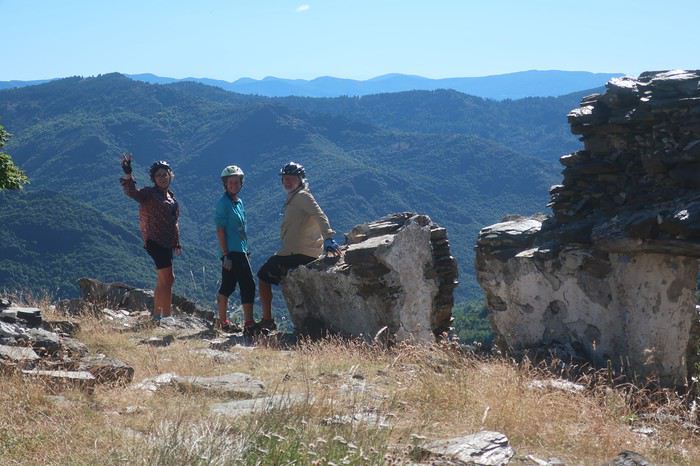
Dernier pique-nique, nous n’avons pas de pain. On apprend qu’au village, 5 kilomètres plus bas, on en trouvera, mais à midi pile la boulangerie ferme. 10 minutes, ça semble jouable à André, qui sans demander son reste, disparaît. Lorsque nous arrivons au village, son vélo est rangé devant la vitrine. Il est donc à l’intérieur, c’est gagné. Il sort avec la boulangère, elle ferme à clef et voilà, c’était bien midi pétant.
Plus loin, par un chemin qui serpente, nous descendons au Gardon. Lieu tranquille nous en profitons pour une petite baignade et nous laissons traîner ces dernières heures ensemble, pas pressés de mettre un point final à notre aventure cycliste. Malgré l’eau, la chaleur devient intenable, et nous fuyons. Dernière halte à Saint-Jean-du-Gard et la boucle va être bouclée. La dernière difficulté, remonter chez Hélène, 7 kilomètres d’une route sans merci, seule Patricia ne descendra pas du vélo. Pour ma part, je vais le pousser 5 kilomètres et André et Brigitte en feront presque de même !
Une belle histoire prend fin. Pour moi, après 18 mois d’abstinence de voyage à vélo, ce fut un bonheur, même s’il y manquait le sel de la grande aventure que l’on éprouve au fond du désert de Gobi ou de l’Atacama. Mais, me laissant emporter par mes rêves et mes désirs les plus fous, je me verrais bien avec la même équipe partir trois mois pour une traversée du désert de Gobi dans la totalité de sa partie mongole. Ces immensités sans repères, contrairement à l’Atacama où les volcans tiennent lieu de balises, je m’en étais approché sur leurs lisières. L’idée d’y pénétrer franchement, au cours des huit cents kilomètres que j’y ai effectués à la marge, m’a hanté. Mon regard restait fixé sur ces milliers de kilomètres où même les Mongols ne s’aventurent pratiquement pas. Cette pensée m’enthousiasmait et m’effrayait tout à la fois. Les problèmes logistiques à vélo deviennent une vraie gageur lorsqu’il faut transporter au moins 15 litres d’eau sans savoir si cela sera suffisant. Incertitude et trouille qui nouent la gorge, les deux ingrédients indispensables pour que l’on bascule dans le voyage.
Quelques réflexions de Brigitte à méditer après ces 9 jours de grand plaisir:
Pour ma part, ce tour sur les Causses a été un tour très différent des voyages que j'ai faits précédemment. Le voyage en solo rend peut-être plus ouvert aux autres? plus avide de contacts? on a croisé des gens super, mais a-t-on fait des rencontres ? De celles qui font bouger les lignes ? De celles qui continuent à nous secouer longtemps après s'être perdus de vue. Est-ce le fait d'être en groupe ? Est-ce le fait d'être en France ? Ici, les sens sont peut-être moins en alerte. Les cartes sont précises, on connaît les codes culturels, les distances sont courtes, l'incertitude est réduite. J'ai beaucoup aimé rigoler avec vous. Le voyage en solitaire n'apporte pas autant de franches rigolades
En cette fin juin 2020, nous reprenons des activités de plein-air, après il faut bien le dire avoir été un peu sonnés par cette pandémie qui nous a tenus confinés presque deux mois.
Alors dans ce contexte particulier, cette balade à vélo de 9 jours je l’ai vécue comme une libération, certes toute relative, nous étions malgré les nombreux décès dans notre village, loin des grandes tragédies de notre histoire. Cependant, en préambule, je me permets de faire l’apologie de Voyage Forum et de la revue « 200 le vélo de route autrement ».
Oui, l’apologie de VF pourquoi ? Parce que grâce à ce site de voyage on fait de fabuleuses rencontres qui permettent de partir en virée avec des personnes étonnantes. Les réseaux sociaux on y trouve le meilleur et le pire.
Il m’est arrivé de me faire écharper, traiter de tous les noms, affubler de tous les défauts parmi les plus détestables car à travers mes récits certains acrimonieux ou acrimonieuses (certes peu nombreux) n’y décelaient qu’un égocentrique, à l’imagination prolixe, en recherche d’admiration. Assurément, nous avons tous notre petit égo, et j’ajouterais heureusement. Personnellement, je ne suis jamais insensible à un petit mot gentil même d’admiration, au risque qu’il puisse flatter mon orgueil, mais l’essentiel n’est pas là. En effet, si quelques-uns sont prompts à la critique acerbe ou tatillonne, d’autres au contraire ont une réaction opposée. Accrochés, piqués de curiosité par mes écrits, ils me contactent et ont envie de partir avec moi. Et là commence l’aventure. Que de fois ai-je rencontré des compagnes ou compagnons de voyage grâce à mes écrits sur VF.
Mais, je dois avouer que cette randonnée vélocipédique de 9 jours à travers causses et Cévennes a été le point d’orgue, une apothéose qu’il me sera difficile de retrouver en matière de compagnons de voyage hors normes. Et quand je pense que nous aurions pu partir à cinq, si Hélène, notre gentille hébergeuse, n’avait pas eu des impératifs. Elle aussi connue il y a déjà quatre ans par VF, et comme baroudeuse du bout du monde à vélo en solo elle se pose là.
Nous sommes partis à quatre, tout d’abord André, camarade sûr au moral d’acier, capable de faire 1500 kilomètres avec une fracture du pouce non soignée, en compagnie de qui j’avais déjà effectué deux voyages à vélo, dont 64 jours à travers les immensités rudes du nord Argentine, ainsi que deux femmes.
La première Brigitte, grande baroudeuse, au look de « grand-mère moderne » bien dans sa peau, mais ne pas s’y tromper, les immenses traversées de déserts seule sur son vélo seraient presque son quotidien si elle ne prenait pas sur son temps pour garder le lien avec sa famille et s’occuper de ses petits-enfants, comme toute Mamy qui se respecte. Même si parfois l’un de ses enfants lui tire l’oreille alors qu’elle vagabonde de l’autre côté de la planète pour lui faire passer un petit message du genre « Maman, ça va être Noël, nous t’attendons tous avec impatience en particulier les petits-enfants ». Ces injonctions, qui jouent sur le sentiment et la fibre maternelle, lui font stopper très temporairement ses grandes chevauchées solitaires. Notre premier contact se fit grâce à VF et à CCI. Dès les premiers échanges nous avons constaté notre immense passion commune concernant le désert de l’Atacama. Nous nous sommes rencontrés deux fois au festival annuel du voyage à vélo organisé par Cyclo Camping International à Paris. Depuis l’envie de partir ensemble nous taraudait.
La seconde, Patricia m’a contacté par VF pour savoir si je recherchais des personnes pour de futurs voyages. Premier contact très sympathique, cependant mes conditions familiales actuelles ne me permettent pas d’envisager de longs voyages, mais m’échapper une dizaine de jours me semblait possible. Je lui ai donc promis de la contacter au cas où. Et effectivement, l’envie de me changer les idées et de partir quelques jours avec mon copain André est vite arrivée, et je dirais même s’est imposée. Et me souvenant de notre conversation, voilà comment elle s’est jointe à nous. Wahou !!! J’ai découvert une athlète complètement hors normes, au palmarès incroyable, championne de France et d’Europe de marathon, championne d’Europe et vice-championne du monde de 100 kilomètres de course à pied sur route. Bien d’autres exploits jalonnent sa vie, comme des temps stupéfiants sur l’ultra-trail du mont Blanc ou des courses furieuses dans les très grands froids nordiques, et avec tout cela une simplicité et une gentillesse immenses, sans parler d’une rusticité sidérante. Elle m’avait même dit : tu as beaucoup plus voyagé à vélo que moi, peut-être devras-tu m’attendre. Elle a vu ! mais elle n’a pas dû être vraiment surprise, je ne pense pas que dans sa vie beaucoup, même parmi les meilleurs, l’aient attendue à pied ou à vélo, l’inverse oui sans doute toujours !!!
Et pourquoi l’apologie de la revue 200 ? Tout simplement parce que les articles sont des morceaux d’anthologie littéraires. Et lorsqu’il est question de la France, même concernant des coins que je connais bien, les descriptions à couper le souffle me donnent à penser qu’il s’agit d’un ailleurs qu’il me faut découvrir au plus vite.
Oui, les quelques rares échanges désagréables sur VF de quelques personnes mal lunées sont vite oubliés quand on a le bonheur de partir avec trois personnes de cette trempe, je dirais même que c’est un honneur. J’ai commencé, cependant, à me faire un peu de souci au sujet de ma forme physique car, au cours des 18 derniers mois, je n’ai effectué en tout et pour tout que 20 kilomètres à vélo.
Trois semaines avant le départ je me suis promis de me remettre en selle. J’ai tenu 6 jours, une trentaine de kilomètres par jour et 500 à 700 mètres de dénivelé. Tout surpris ça passait bien, donc la motivation est retombée et je suis retourné taquiner la truite, surtout que cette année la pêche est bonne par chez moi, mais que de la fario sauvage des Vosges.
Donc nous y voilà, petit projet en France, un itinéraire à travers les reliefs des Cévennes qui nous mènera de Mialet (un peu à l’ouest d’Alès) vers le mont Lozère puis la montagne de Bougès. Ensuite nous écornerons le coin nord-est du causse Méjean à partir de Florac avec redescente sur Castelbouc. De là, nous partirons à l’assaut du causse Sauveterre par un chemin infernal dans la chaleur de l’après-midi. Nous en longerons tout le bord sud qui s’étire en croissant au-dessus du Tarn, puis nous plongerons vers Sainte-Enimie et irons dormir à la Malène. Après s’en suivra une magnifique traversée du causse Méjean en passant par le terrain d’aviation jusqu’à Saint-Jean-des-Tripiers. Nous poursuivrons par une descente vertigineuse sur la Jonte où nous verrons de nombreux vautours. Après un ravitaillement au Rozier, nous partirons à l’assaut du causse Noir que nous traverserons en entier jusqu’à sa barrière sud la rivière Dourbie. Nuit à Trêves suivie d’une montée du mont Aigoual, ponctuée d’un bivouac sur son versant est. Et en fin, nous déroulerons la dernière étape de cette trop courte balade de 9 jours, en nous laissant emporter par la descente le long du Gardon. Dernier point dur, voire très dur, la remontée chez mon amie Hélène d’où nous sommes partis, au Puech, 7 km dont 5 à pousser les vélos dans des côtes bien supérieures à 10%. Mais pourquoi aller habiter sur un piton si loin du joli petit village, sans doute parce qu’Hélène est aussi une vraie « furieuse » à qui les grandes aventures dans des pays sauvages à vélo en solo ne font pas vraiment peur.
Cette période post-covid est un peu inquiétante, comment allons-nous voyager ? Avant de partir, je viens de lire sur VF un beau récit à travers le Morbihan post-pandémie, agrémenté de jolies photos, effectué en juin. L’impression qui s’en dégage est étrange. On pourrait s’imaginer dans un film d’anticipation futuriste, l’humanité guettée par quelques menaces généralisées. Un préambule au livre de Cormac McCarthy « la Route ».
Tout commence par un trajet en voiture de quelques 600 kilomètres à travers la France. Quelque part avant Alès je m’arrête, un restaurant semble ouvert, il m’est dit qu’on ne mange que sur réservation, espacements obligent. On me montre la pizzeria un peu plus loin. Là, on me prépare une bonne pizza mais on me demande d’aller la manger ailleurs, même pas le droit de m’installer à la terrasse. On m’indique un parc en contre-bas, au bord d’une jolie petite rivière. Je vais y passer un moment de repos agréable. Mais, de toute évidence nous ne sommes pas revenus à la normale.
Mon accession à la maison d’Hélène n’est pas évidente, de plus mon GPS auto n’étant pas à jour, il ne m’est d’aucune aide pour une route toute récente. Elle qui me prenait pour un grand baroudeur au flair infaillible va réviser son jugement.
Voilà mon arrivée chez elle sur sa montagne isolée, telle qu’elle l’a restituée en s’insinuant dans mes pensées. Je dois reconnaître qu’elle est très proche de la vérité, comme si elle avait été passagère invisible à côté de moi. Donc voilà Hélène qui s’exprime en extrapolant mes pensées : « Tout commença mal. Après six heures de voiture et ayant passé Alès, me voilà perdu sur une route de montagne digne de celle de la Bérarde dans les années 70. Pas de maison, ni de poteau téléphonique ou électrique. Pas âme qui vive. Où m'étais-je donc fourré ? J'avais pourtant reçu des informations précises : les poubelles, la table en bois, les deux panneaux -un noir, un rouge- "Les Puechs", la fourche que je ne pouvais pas manquer paraît-il, l’impasse de droite… Mais rien de tout cela. Une route tortueuse qui n'en finit pas de monter au milieu des chênes verts... On ne m'y reprendrait pas à dire venez chez moi j'habite chez une copine. J'appelle ladite copine. Pas de réseau évidemment. Après plusieurs essais infructueux je la vois qui vient à ma rencontre. Ouf, sauvé pour cette fois. »
Un peu ridicule, je constate que les trois autres sont arrivés sans problème. Brigitte a même poussé la plaisanterie en venant d’Aix-en-Provence à vélo, et c’est concomitamment que nous nous arrêtons devant le portail du nid d’aigle d’Hélène. Soirée de retrouvailles pour certains et de découverte pour d’autres, mais ambiance magnifique entre frénétiques du « gros baroud ». Plus les personnes sont habituées à voyager en dehors des chemins habituels et plus elles sont généralement décontractées, et puis que d’histoires incroyables elles peuvent raconter, même s’il faut un peu les torturer pour les faire parler. Hélène nous fait bien rigoler, même si sur le coup ça l’aurait plutôt fait pleurer, en nous relatant sa traversée himalayenne avec un être étrange qui se jetait sur la nourriture et ne lui en laissait même pas quelques miettes. Il paniquait à l’idée de manquer et, affamer sa compagne de route ne semblait pas le perturber. Elle finira sa traversée seule, elle est habituée. En route, elle avait sympathisé avec un couple de Hollandais qui, quelques jours plus tard, tomba sous les roues et les coups de couteau d’un djihadiste. L’homme fut tué, la femme en réchappa, Hélène, elle, en garde une vraie souffrance. Pour raison de Covid, on s’installe dans le jardin, chacun avec sa tente. Chut, je vais un peu tricher, je finirai sur un lit mais dans mon sac de couchage !
Au matin, un petit-déjeuner qui s’étire presque à l’infini. Des personnes, qui ne se connaissaient pas la veille, ont tellement d’aspirations et d’expériences communes qu’elles ont l’impression de toujours s’être connues. Mais vers les 9 heures du matin c’est parti, on serait bien resté plus longtemps, voire toute la journée à discuter des chemins du monde.
Nous commençons par la terrible descente du sommet où Hélène et Bernard, son compagnon, ont élu domicile. Il nous faut faire quelques courses car les jours à venir nous ne savons pas ce que nous trouverons, comptant traverser par des pistes confidentielles cette région de France sauvage. Epicerie associative de village, désinfectant à l’entrée et masque obligatoire, je dégaine le mien. Nous ne trouvons pas grand-chose. A la sortie du village de Mialet, une petite boutique de camping nous permet d’acheter du pain en complément. Mais nous ne nous faisons pas de souci, ayant chacun dans les sacoches du riz et des pâtes, de quoi tenir plusieurs jours. Pour ma part, avec un kilo de riz et de pâtes j’ai de quoi assurer pour 4 durant 48 heures.
Et nous voilà lancés. Premier objectif, le col d’Uglas qui culmine à 539 mètres. Certes ce n’est pas l’Abra del Acay, le plus haut col carrossable des Andes et ses 4972 mètres, mais c’est le même bonheur de la liberté en étant bien accompagné. Bien évidemment, mes trois camarades me laissent sur place, mais bon je ne m’en fais pas, sachant qu’ils ont tant de choses à se raconter en m’attendant. Du col, nous partons sur des pistes mal pavées à travers les grosses bosses et les forêts des Cévennes et nous rejoindrons en milieu d’après-midi le village du Collet-de-Dèze sur le Gardon. Par moments, nous avons l’impression de monter dans les cieux, quelques poussages de vélo agrémentent la journée. Je vois parfois mes camarades devant moi se découper directement sur le ciel, dans des pentes à plus de 15%, comme s’ils se trouvaient sur une rampe de lancement pour quelque voyage improbable. Bien évidemment, cela nous rappelle à tous les grands déserts, le Gobi ou l’Atacama, et les éclats de rire augmentent au rythme du pourcentage de la pente.
Arrivée au village précité, arrêt au bistrot, j’en profite pour prendre le permis de pêche du département de la Lozère pour la première catégorie, c’est-à-dire pour les rivières à salmonidés, département dans lequel nous allons passer et repasser. La réglementation en matière de pêche en France est quelque chose d’inextricable, mais il y a de multiples raisons dont certaines bien valables, mais je ne m’aventurerai pas à vous les expliquer, il y faudrait tout un livre.
La bière est bonne, on la multiplie par deux, rien de tel après avoir ingurgité des litres d’eau tiède toute la journée. De plus elle a un effet diurétique du meilleur résultat pour le corps après une journée d’efforts somme toutes conséquents, en tout cas pour moi. Certes, la distance n’est pas énorme en ce premier jour, 47 kilomètres et 1025 mètres de dénivelé, mais cependant beaucoup de pistes en partie parcourues en poussant les vélos. Nous avons même eu droit à un tronçon emporté par des intempéries réputées très violentes, les fameux épisodes cévenols. Une charmante jeune femme habitant une ferme isolée au milieu, plutôt au sommet de nulle part, nous a remis sur le bon chemin.
Nous rejoignons le camping le long du Gardon, quasi-désert, une seule tente, un Américain vivant en Espagne qui, voyant la tournure du Covid rôdant, a décidé depuis un mois d’attendre la suite des événements ici en Lozère, qui a été très peu touchée par ce fléau, un mort répertorié. La patronne est sympathique et très prolixe sur sa région, tout à mon bonheur. Elle est originaire de pas très loin, d’un coin où nous allons passer et que je connais depuis longtemps, le causse Méjean, plateau d’altitude qui me rappelle par ses lumières et ses grands ciels les plateaux boliviens. Oui, je maintiens et les plateaux boliviens je m’y suis baladé à vélo à plusieurs reprises !
Sitôt installé, je me précipite à la pêche avec mon fouet à mouche, à quelques mètres de nos tentes. Patricia et Brigitte comptent manger de la truite ce soir, mais si je connais bien mes rivières vosgiennes, celles de la Lozère sont une découverte pour moi, et elles seront déçues de devoir se contenter d’une grosse platée de riz, très bonne cependant.
Nous passons une excellente nuit et partons relativement tard. Nous allons nous installer dans une petite routine qui me va bien, vu mon entraînement. Aujourd’hui, il s’agit d’aller le plus haut possible, à la pointe est du mont Lozère et d’y bivouaquer. Trouver notre route confidentielle qui se faufile sur les hauteurs du village n’est pas facile, nos différents tâtonnements nous permettent de visiter ce beau village tout en pente.
Après une matinée par une petite route du bout du monde, nous faisons halte à Génolhac, village tranquille. Nous nous laissons tenter par le restaurant avant d’entamer la montée du mont Lozère, sur 968 mètres de dénivelé pour 15 kilomètres. Pour moi, ce sera une première au restaurant depuis le confinement. Nous sommes les seuls dans la salle, quelques personnes sont en terrasse. Repas créole, très bon, de quoi nous mettre en forme pour un après-midi qui s’annonce « pentu ». Le problème de l’eau se pose. Remplissons-nous les deux bâches de 6 litres maintenant ou plus tard ? Je penche pour maintenant, Brigitte beaucoup plus cool, pour plus tard, ayant bon espoir de trouver une source plus haut. On prend 4 litres par bâche, plus les deux litres que nous avons chacun, cela nous permettra de bivouaquer. Brigitte avait raison, non seulement on va faire le complément dans un ruisseau beaucoup plus haut mais, une fois près du col de Pré de la dame à 1474 mètres, une magnifique source nous fournit avec prodigalité toute l’eau que nous désirons.
Nous trouvons rapidement un coin idyllique pour installer notre bivouac dans des conditions atmosphériques que je qualifie d’idéales. Partir avec des personnes rompues aux longs voyages est un vrai bonheur, tout se passe avec une simplicité déconcertante. Brigitte a un œil particulièrement exercé pour déceler de loin le point précis où s’installer et durant les 9 jours, cela va se renouveler. Pour la deuxième fois, nous sommes trois à monter nos tentes, tandis que Patricia dormira face au ciel, et là aussi, tout le voyage durant, elle ne montera pas sa tente. Notre étape, si elle a été courte en kilomètres, seulement 38, le dénivelé lui a été assez conséquent, 1560 mètres.
De nouveau une superbe nuit, de plus peu de condensation et sur notre versant est, le soleil nous touche rapidement. Encore une bonne excuse pour traîner un peu une fois de plus et ne démarrer que vers les 9 heures. Très rapidement, nous rejoignons la piste du versant nord du mont Lozère que nous comptons suivre jusqu’au col Finiels. Son début est particulièrement raide, sur un chemin jonché de gros cailloux, petite séance de poussage obligatoire sur un kilomètre. Nous arrivons à une magnifique cabane-refuge perchée en dessous de la crête. Nous parcourons le livre d’or, manifestement des randonneurs venant de tous les coins d’Europe au moins y ont laissé un petit mot. Je m’empresse d’en faire autant. Malgré tout l’agrément du lieu, il n’est pas question d’y passer la nuit, il n’est que 10 heures du matin.
Nous suivons cette piste d’altitude sur une dizaine de kilomètres. Nous y croisons des Vététistes, et discutons longuement avec un groupe. Le temps est couvert et il fait frisquet dès que nous nous arrêtons. Les sources du Tarn sont indiquées. Posant nos vélos, nous les rejoignons en quelques centaines de mètres. Pas une goutte d’eau, plutôt un vaste bassin au flanc de la crête qui sert de réceptacle. Plus précisément, il s’agit de l’un des différents lieux répertoriés comme source de la rivière. Toute la cime est sans doute en elle-même le lieu d’alimentation. Le col Finiels arrive presque trop vite, nous y retrouvons le goudron.
De là, l’itinéraire conduit au village de Pont-de-Montvert, célèbre du fait de la révolte des camisards, lorsque Louis XIV révoqua en 1685 l’édit de Nantes, qui avait été mis en vigueur par François Ier. L’un des chefs de cette révolte Pierre Laporte, est originaire du village d’Hélène, Mialet, point de départ et d’arrivée de notre petite aventure. Mais le principal chef camisard s’appelait Jean Cavalier et sa vie est digne d’un roman d’aventure à rebondissements car contrairement à Pierre Laporte, il ne mourra pas les armes à la main.
Cette pente est magnifique et très surprenante. D’immenses constructions rocheuses naturelles se dévoilent au détour des virages, des amoncellements ruiniformes ou d’énormes galets morainiques, parfois empilés en des arrangements prêts à durer encore des millénaires. En cours de descente nous décidons de piquer niquer dans ce décor grandiose. La vue porte au sud sur la montagne de Bougès, l’éminence que nous avons l’intention de traverser par sa crête qui se dirige vers l’ouest jusqu’à Florac. Puis nous nous laissons emporter jusqu’au village où André renvoie par la poste 6 kilos de bagages. Les Cévennes, toutes sauvages qu’elles soient, ne sont pas le désert de l’Atacama, destination de notre dernière grande équipée à vélo. Près du pont central, un bistrot nous ouvre les bras et nous y passons un bon moment. Le Tarn, tout au fond de sa gorge, donne un véritable cachet à la commune. Plusieurs terrasses, des touristes pas très nombreux, des tables qui ne respectent pas l’espacement préconisé par les autorités sanitaires. Certains portent le masque, d’autres non. Sensation une fois encore étrange. Tant que nous nous trouvons seuls, au milieu de nulle part, le covid nous n’y pensons pas trop, mais dès que nous nous retrouvons rapprochés de nos congénères, il se rappelle à notre bon souvenir.
C’est l’heure de partir. Malgré deux Grimbergen je me sens une frite d’enfer pour partir à l’assaut de cette fameuse montagne de Bougès. Bien évidemment, mes trois acolytes disparaissent et je vous assure les Grimbergen n’y sont pour rien. Mais quand on a dépassé les bornes, il n’y a plus de limites. Donc je ne boude pas mon plaisir en remontant le petit vallon qui se dirige vers la crête, et je m’arrête pour traquer du regard les truites dès que je décèle un endroit favorable à leur positionnement. Avec un immense plaisir bien qu’elles soient très mimétiques, en lisant les veines d’eau je les vois, quel bonheur, mais je ne vais quand même pas sortir ma canne !
Une fois au sommet, une piste de toute beauté nous emmène presque jusqu’à Florac en partie à travers forêt et aussi par des zones aérées qui nous permettent les plus beaux points de vue sur cette région étonnante de France. Des villages à l’architecture montagnarde se cachent dans les replis du mont Lozère. La vue porte très loin par-delà vers le nord. Devant nous le Tarn déroule sa gorge qui coupe comme un coup de couteau les causses Méjean et Sauveterre. Derrière ce dernier des monts apparaissent dans un lointain un peu diffus, l’Aubrac et quelques pointements plus saillants nous font penser aux premiers volcans d’Auvergne. De Clermont-Ferrand à Nîmes s’étale un immense carré magique, où la géologie a subi tous les bouleversements. Calcaire et granit s’entremêlent, pour la plus grande joie du spectateur. La terre a craché de ses entrailles ces formations cristallines et la mer a fait monter d’immenses plateaux calcaires, qui se sont constitués au cours de millions d’années par sédimentation de carapaces d’animaux marins. Le tout nous offre un panorama magnifique, propice aux plus belles bambées à vélo. Ce spectacle allume en moi le clignotant revue 200.
Dans le dernier numéro de ma revue fétiche, on peut lire, que dis-je savourer, un très bel article sur ce coin de France des causses, qui s’intitule ’’là-haut’’. L’auteur, Alain Puiseux, est spécialiste de la formule qui frappe, et il en saupoudre à l’envi le texte tout au long de son récit, et cela pour le plus grand bonheur du lecteur. J’en cite pêle-mêle quelques-unes : je me suis demandé si la beauté existe en elle-même ou dans les yeux de qui la contemple; si vous avez une carte routière du Massif Central, vous pouvez y lire les rivages des îles la magie marche toujours là-haut c’était juste après le confinement. L’air était plus pur, plus transparent, le ciel sans une griffure la lumière y est rapide et changeante au-dessus d’une houle d’herbe; je suis tombé amoureux par inadvertance d’une isohypse et des plateaux d’altitude.
Remarque au passage, je ne connaissais pas le mot isohypse, cependant tellement parlant lorsqu’on évoque le Méjean, le Sauveterre ou tout autre causse. Voilà, ces différentes citations extraites du texte « là-haut » fournissent une bonne introduction à l’apparition des différents causses que nous allons traverser et escalader dans les jours à venir.
Après quelques moments de rêverie, les yeux errant jusqu’à l’infini, et aussi quelques erreurs d’embranchement ou tout au moins quelques hésitations, une magnifique pente abrupte au chemin cabossé nous mène pratiquement à l’entrée de Florac. Nous sommes à la frontière des zones granitiques sombres du mont Lozère et des falaises calcaires lumineuses du causse Méjean. Le courage nous manque pour repartir à l’attaque des zones de solitude à cette heure tardive et nous optons pour le camping municipal. Il vient juste d’ouvrir. L’employée est partie la veille de Bretagne et a roulé toute la nuit. Depuis quelques heures elle se dépêche d’effectuer les premiers nettoyages de mise en service. Presque personne, un motard avec une magnifique moto-guzzi, un couple en camping-car et nous quatre.
Toute la place pour nous installer, que l’embarras du choix, nous optons pour disséminer nos tentes à portée du bruit de la rivière, le Tarnon qui rejoint le Tarn un peu plus loin. Sans surprise, nouvelle séance de pêche, et bien que cette rivière m’inspire plus que le Gardon au Collet-de-Dèze, mes camarades n’auront à nouveau pas de truites sur feu de bois. Nous décidons d’aller au restaurant. Le centre-ville est assez animé, la place centrale accueille une terrasse de restaurant aux tables relativement espacées. Les clients y sont nombreux et nous passons une soirée agréable dans une ambiance méridionale. J’avais déjà remarqué, au cours des différentes occasions où ma voiture, mon vélo ou mes jambes m’ont conduit dans ce village au nom chantant, que les habitants avaient déjà l’accent du midi.
Ce matin du quatrième jour, nous partons à l’assaut de mon causse préféré, le Méjean. Dans un premier temps, nous allons seulement en mordre le coin nord-est. Une belle montée par la D16 va nous permettre de dominer la vallée du Tarn et d’étendre notre vision aux montagnes que nous avons traversées la veille là-bas, à l’est et au nord.
L’arrivée sur le plateau est toujours aussi surprenante. On passe sans transition de zones de vallées à l’habitat assez dense et au tourisme très visible, à des déserts d’altitude où l’herbe sauvage ou de prairie prend le contrôle, les hommes semblant fuir ses hauteurs hostiles à la vie. C’est en partie ce qui donne un charme fou à ces plateaux. Comme l’écrit Alain Puiseux de ces coins perchés jusqu’au mont Gerbier-de-Jonc, « Se plaindre ici, plus qu’ailleurs, de l’eau ou du froid, c’est n’avoir rien compris », me fait comprendre pourquoi le soir les vacanciers désertent ces lieux pour aller rechercher la quiétude plus bas le long des rivières.
Après une première prise de contact, Brigitte et Patricia ne connaissant pas ces coins bénis des Dieux, nous bifurquons vers Montbrun et effectuons une plongée en direction du Tarn. La différence de chaleur entre plateau et fond de vallée est très nette. Nous marquons l’arrêt au bord du Tarn, dans un coin charmant, le temps d’un pique-nique. Eau verte et grande falaise claire éclatante de soleil. La flemme nous gagnant et subjugués par la beauté des lieux, notre envie de continuer est annihilée. Nous envisageons de passer l’après-midi et la nuit à venir à contempler ce méandre de rivière aux eaux turquoise, surplombées d’une falaise sculptée au cours des millénaires par les flots qui, parfois, se montrent redoutables, sauvages et tumultueux. Cette halte précoce n’est pas vraiment du goût de la trépignante Patricia, mais elle se plie de bon gré à l’avis de l’écrasante majorité. Mais, à peine commençons nous à prendre nos aises que, débouche sur notre coin perdu une famille avec force gamins et chiens. Ces derniers se précipitent sur le gros pain que nous avons acheté ce matin à Florac et, sans une intervention prompte de Patricia, nous pouvions lui dire adieu. Elle se réjouit, car bien évidemment nous abandonnons notre projet de farniente et décidons de reprendre notre route. Dommage, j’avais repéré quelques belles truites en chasse qui n’attendaient que la plus élégante de mes mouches !
En ce début d’après-midi, la chaleur est terrible. Entre ces plateaux calcaires, il y a comme un effet de four et mon thermomètre indique 40 degrés. Quelques kilomètres en direction de Sainte-Enimie nous offrent l’occasion de magnifiques points de vue sur la rivière, et tout particulièrement sur le village de Castelbouc. Cet ensemble de maisons caussenardes, accrochées à la paroi et semblant prêtes à plonger dans une eau aux reflets de jade, est tout simplement splendide. La légende du village rapporte qu’au temps des croisades, un jeune homme seul était resté en ce lieu. Obligé de satisfaire toutes les épouses dont les maris combattaient les infidèles, il en serait mort d’épuisement. Depuis cette époque, un diable sous forme de bouc survole régulièrement la cité.
A Prades, changement radical, nous avons l’intention de monter directement sur le causse Sauveterre par un chemin non carrossable qui s’insinue entre des falaises. Il présente des pentes ne permettant pas de rester sur le vélo, sauf peut-être pour Patricia dont les cuisses et les mollets sont constitués de l’acier le plus trempé.
Là encore la question de l’eau se pose. Devons-nous remplir les bâches en prévision du bivouac sur le causse ? Sur ces plateaux calcaires, il n’est pas question d’en trouver la moindre trace. Même Brigitte qui sent les sources à 50 lieues, y est favorable. Pourtant nous regardons dubitatifs le pan de montagne qui nous domine et à travers lequel nous allons partir. A la fontaine de ce petit village, profitant d’une ombre bienfaitrice, nous faisons donc provision du liquide précieux. J’en profite pour m’asperger copieusement le visage. Nous jouissons des derniers instants de température clémente, ou presque, avant d’affronter cette piste escarpée tournée au sud, soumise à l’infernale chaleur du soleil vertical.
C’est parti pour un court tronçon goudronné où même Patricia pousse dans cette ligne droite qui se jette sans ambages dans la pente. Après 400 mètres le chemin s’échappe à gauche, tout d’abord pas très raide et roulant. Il va perdre très rapidement ces deux qualités. La pente s’accentue franchement et le sol devient instable, au point que, même en poussant le vélo, la roue avant ripe en permanence de droite et de gauche. Immanquablement, je me retrouve très vite seul, André et Brigitte ayant pris un rythme de montée supérieur au mien, sans parler de Patricia qui s’est littéralement envolée. Je n’ai même pas eu le temps de voir si elle avait disparu en courant, son vélo à la main, ou bien en appuyant comme une forcenée sur les pédales dans cette caillasse fuyante. Mais où va-telle chercher une telle force, une telle énergie, une telle envie de s’arracher ? Sans vouloir être un mufle, certes elle est un peu plus jeune que moi, mais elle n’a plus trente ans !
J’adopte la posture ‘’Atacama’’, le comptage de mes doubles-pas. Selon la pente et la consistance du sol, j’en effectue de 20 à 50 avant de marquer l’arrêt. Il semblerait, à vue de nez que cette piste infernale fasse de l’ordre de 6 kilomètres. Il n’y a qu’à prendre son mal en patience. Bon seigneur, André redescend à pied pour venir me donner une petite, même une grande poussette, ce qu’il fera à plusieurs reprises. Je mets ma fierté dans ma poche et je le laisse pousser. On dira que c’est parce que j’ai l’une des bâches à eau de 6 litres sur le porte-bagages ! Mais au fait, Brigitte a la même et elle caracole comme une gazelle dans la pierraille surchauffée. Mais pour elle, c’est tout à fait normal. Elle est habituée aux traversées de déserts en solo, parfois sans même avoir de quoi faire chauffer ses aliments, n’ayant qu’un réchaud à bois. Dans les coins bien désertiques, on peut avoir la surprise de ne pas trouver la moindre brindille. Mais bon, elle continue son périple en croquant ses aliments sans cuisson, trouvant cela presque très bon !
On doit être un peu maso car, dans ce type de situations de chaleur, de caillasses, de sol qui se défile et de pentes très raides, nous éprouvons tous un grand plaisir, je dirais même un grand bonheur d’être là. L’effort, la sueur, la fatigue, mais surtout le corps et l’esprit qui vivent… Nos pensées sont retournées dans les hautes altitudes du Sud Lipez, entre 4 et 5000 mètres, nostalgie des grandes bambées qui nous arrachent à notre quotidien. Le dépaysement et la défonce. Je me dis cependant qu’il n’est pas besoin de faire des milliers de kilomètres pour connaître les bonheurs de l’aventure, la France nous fournit très bien la matière. Certes, ce n’est pas à la même échelle, quand on sait que le prochain point de ravitaillement en eau est à 140 kilomètres et que l’on est en train de pousser son vélo dans le sable. Toutefois ne pas savoir si cela va durer un kilomètre ou trois jours, cette incertitude introduit une dimension supplémentaire, la trouille.
Mais nous montons, les maisons de Prades deviennent minuscules. Le Tarn se dessine dans tous ses méandres en prenant des teintes profondes qui tirent sur l’émeraude. Un signe de Patricia, elle nous attend. Je ne suis pas certain qu’elle avait réalisé que cette piste était difficile pour la multitude de raisons que j’ai données. Nous la rejoignons. Elle va prendre la place d’André et me fournir une petite poussette sur une centaine de mètres. J’ai l’impression d’être aux commandes d’un Rafale en ayant mis la post-combustion. Incroyable, je n’ai pas une Terrienne derrière mon porte-bagages mais un être bionique venu du fond du cosmos qui me propulse littéralement !!!
Mais tout a une fin, surtout le meilleur, les deux derniers virages en épingle me dominent. Changement brutal de configuration du terrain, la déclivité s’atténue, le chemin quitte le flanc de la montagne et s’enfonce dans des fourrés, laissant juste l’espace pour y faire passer le guidon. Je remonte quelques dizaines de mètres sur mon vélo, mais c’est à pied que je rejoins une minuscule route qui longe le bord du causse. Nous nous regroupons, nous venons de déboucher au niveau d’un petit bourg qui se nomme ‘’Nissoulogres’’. Nous n’allons pas tarder à apprendre la signification de cette appellation étrange. « Jamais sous l’orage ». En effet, il rôde tout autour, tapi, sautant d’un causse à l’autre mais épargnant pratiquement toujours cette pointe du plateau du Sauveterre qui domine la petite cité de Prades.
Il ne nous reste pour nous quatre qu’une quinzaine de litres d’eau, ce qui n’est pas énorme pour tenir un bivouac après un tel effort et, il sera sans doute difficile de s’en procurer avant demain midi. Un homme se trouve dans la première maison à quelques mètres du chemin par lequel nous arrivons depuis la vallée. Je lui demande s’il peut nous ravitailler. Non seulement il y est favorable, mais il nous invite à planter nos tentes dans son jardin, où nous sommes aux premières loges pour contempler le causse Méjean qui s’étale au sud, au-delà du Tarn. Nous acceptons bien volontiers et, très vite, ce n’est plus de l’eau qu’il nous propose mais de la bière. De plus, il nous offre une douche, de toute évidence nous sommes tombés sur un 5 étoiles. Nous prendrons notre repas en commun à partir de nos réserves de pâtes. Il nous fait goûter un vin rouge de la région, ma foi de bonne facture. La discussion va s’éterniser en passant des secrets du causse Sauveterre à des considérations professionnelles. Mes camardes se foutront de moi, je suis un bavard impénitent, mais ce soir je n’arriverai pas à en placer une, notre hôte est d’une catégorie toute autre, sans doute au moins champion d’Europe. Le monde est petit, André et lui se trouvent des connaissances communes, ayant tous deux œuvré dans le cadre de grands travaux de la DDE, que ce soit à titre privé ou non. Je dois dire qu’en finale, j’ai un peu, même beaucoup, perdu le fil de la conversation, la bière et le vin par-dessus les kilomètres de poussage dans la caillasse et le cagnard de cet après-midi auront assez vite raison de moi.
Ce matin nous allons longer le bord du causse Sauveterre en descendant vers le sud. Notre itinéraire emprunte de petites routes et des pistes parfois pas très roulantes. Alors je ressens la fatigue consécutive au gros effort d’hier après-midi. Nous traversons le lieu-dit Dignas, puis nous arrivons à une ferme isolée et nous discutons un bon bout de temps avec Christian, l’habitant du lieu. La vie de paysan sur le causse n’est pas facile. Il nous parle des conditions climatiques rigoureuses, des réglementations tatillonnes sur les produits en particulier laitiers, des législations de transmission d’héritage pénalisantes et autres intrusions de l’Etat, ce qui donne à penser que la vie sur ces plateaux devient impossible. Lui s’est spécialisé comme beaucoup dans le lait de brebis pour le roquefort. Ces régions reçoivent l’eau des montagnes environnantes, le Sauveterre du mont Lozère et le Méjean de l’Aigoual. On peut dire que les zones granitiques alimentent les plateaux calcaires.
A midi, nous arrivons à Laval-du-Tarn. Le pique-nique est organisé à l’abri de l’ancien four à pain, nous sortons le réchaud pour une platée de riz. Comme je l’ai toujours pensé, une halte longue le midi est en définitive un gain de temps car l’après-midi permet encore de nombreuses heures de pédalage, surtout en été.
Notre intention initiale était de continuer à longer les hauteurs dominant le Tarn. Après avoir dépassé le Pont Sublime, belvédère tout particulièrement souligné sur la carte, notre itinéraire devait nous mener au village des Vignes. Mais outre une petite fatigue résultant de la montée infernale d’hier pour moi, le temps semble vouloir se mettre à l’orage. De bonnes ou moins bonnes raisons nous poussent à rester sur le goudron et prendre la direction de Sainte-Enimie par une route toute en descente. Un délice. Différents belvédères livrent des points de vue grandioses sur la vallée et les villages qui ponctuent la rivière, là-bas tout en bas. Le cirque de Saint-Chély est particulièrement spectaculaire vu de quelques centaines de mètres au-dessus.
Passage par Sainte-Enimie, haut lieu du tourisme de la vallée du Tarn, que nous laissons derrière nous jusqu’au village de la Malène. Cette gorge est surprenante. Je l’ai parcourue à plusieurs reprises, mais il y a tant de choses à regarder. De l’architecture caussenarde aux formations géologiques que représentent ces immenses falaises calcaires et le Tarn lui-même qui prend tous les aspects entre ses zones profondes et ses parties où il court sur un lit de galets, presque à fleur d’eau.
Nous marquons l’arrêt au niveau du village de Hauterive situé de l‘autre côté du Tarn. Jusque récemment, il était approvisionné par un câble au-dessus de la rivière. Mais, par manque de financement, cet outil de ravitaillement est en panne ce qui occasionne les plus grandes difficultés à ce bourg accroché sur la rive du causse Méjean. Mais les temps ont changé. Ce village est un vestige des temps passés, maintenant révolus, où la rivière était un axe de communication. Il n’y a pas si longtemps les cours d’eau du sud-ouest étaient sillonnés par les gabarres, les poids lourds des siècles passés. Mais pouvaient-elles remonter jusque dans ces gorges profondes du haut de la vallée du Tarn ? Sur certaines rivières difficiles, où le retour n’était pas possible, les embarcations étaient vendues au prix du bois lorsqu’elles arrivaient à destination.
Une fois à la Malène, nous décidons de ne pas poursuivre jusqu’au village des Vignes. Nous nous installons au camping municipal, remarquablement situé sur une plage du Tarn, pratiquement au centre-village. Ambiance covid, je sors mon masque pour aller à l’accueil. Heureusement peu de monde, deux personnes attendent sagement dehors masque sur le nez, dont un Suisse avec un vélo électrique. Cela nous donne une bonne occasion de parler du voyage à deux roues avec assistance électrique. Notre Suisse a l’air ravi de sa machine. Peut-être que dans un temps, que j’espère le plus lointain possible, nous y viendrons. Mais tant que nos muscles fonctionnent encore assez bien, si nous pouvons éviter, nous nous attacherons à le faire.
Devant nos tentes, la rivière miroite mais nous ne sommes plus dans l’ambiance causses, les kayakistes sont nombreux, en particuliers les Allemands. J’en ressens comme une dissonance. Une fois encore, nous constatons la différence d’ambiance entre les plateaux et le bord de la rivière. Sur cette belle eau qui court je fais une tentative à la mouche. Je fais monter deux beaux poissons, sans doute des truites, qui dans un jaillissement attaquent ma mouche. Mais les deux fois, le ferrage ne donne rien si ce n’est une belle poussée d’adrénaline. Le point commun entre le voyage à vélo et la pêche à la mouche est évident, quand on y goûte, c’est foutu, on est enchaîné à vie.
Bon, si les truites ne sont pas coopératives, les bières le seront plus et nous partons au centre du village. Cette petite cité, rassemblée au pied de part et d’autre d’une immense falaise qui avance sa proue acérée presque jusqu’à la grève, a vraiment belle allure. Après quelques bières, mais pas tant que l’on pourrait le penser, deux mois de confinement entraînent un défoulement et une envie de terrasse de café, nous faisons des courses. Et là que vois-je ? Un ORNI bikepacker qui s’arrête devant moi. Je me précipite et engage de manière autoritaire la conversation. Il semble un peu fatigué. Il est lancé dans un tour express de 1200 kilomètres depuis le Gers en passant par Chamonix. Wahou trop bien ! Il est irlandais et vit du côté d’Astaffort, la ville de Francis Cabrel.
Vu l’heure, je n’ai pas l’intention d’interrompre le dialogue. Je lui propose immédiatement de l’inviter au restaurant. Il me demande un court délai de réflexion. Il s’installe un peu plus loin, sort une canette de bière de sa sacoche. Je le rejoins dès qu’il l’a terminée et lui demande s’il accepte l’invitation. Il serait d’accord mais son souci est tout d’abord de trouver un point de chute pour la nuit. Je le rassure, on lui fera une place parmi nos tentes. Nous allons passer une soirée de rêve avec un autre vrai fou qui arpente la planète, à fond de train, à pied ou à vélo. Il se trouve de nombreux points communs avec Patricia dans les courses les plus extravagantes et les places sur le podium. Les grandes traversées de désert en solo de Brigitte l’étonnent aussi, et lui arrachent des exclamations d’admiration. Wahou ! André et moi passons pour de doux pédaleurs mais, cependant nous trouvons un vrai terrain de discussion et d’entente. Il est irlandais, la bière, le vin et le whisky ne l’effrayent pas. J’adore ces athlètes de très haut niveau qui ne sont pas traumatisés par le régime et qui n’oublient pas leurs racines et leurs coutumes. Jimmy nous a enthousiasmés et fait rêver, même nos deux super women sont sous le charme ! Voilà ce que j’appelle voyager et faire une belle rencontre. De retour au camping, la nuit est bien établie, je ne sais plus si Brigitte ou Patricia a vu un, même deux gros poissons. Manu militari, on me met une lampe de poche sous le nez et l’injonction sans discussion possible m’est donnée de remonter ma canne à mouche. Déjà de jour, en possession de tous ses moyens, manier un fouet à mouche nécessite une bonne expérience, alors de nuit, entre les arbres après avoir essayé de tenir tête à un Ecossais dans un autre sport mondialement répandu, il ne s’agissait plus du Tarn, mais de la Bérézina ! Dans la nuit, de nombreux éclats de rire ont résonné !
Le lendemain matin, dès 6 heures je tente de prendre ma revanche sur les truites, en fouettant cette belle eau qui court et que je sens propice et prometteuse. Malheureusement je ne déclenche que deux énormes geysers. Au ferrage, il ne se passe rien non plus, juste de beaux coups d’adrénaline ! La truite reste un mystère, elle monte elle prend ou non votre mouche. Cela dépend de quoi ? je n’en sais fichtre rien. Au dernier moment voit-elle le subterfuge et, étant lancée, elle jaillit du fait de l’inertie mais ne gobe pas ? Mystère total. Comme dans de nombreux domaines, les grands spécialistes sont américains. Leurs connaissances ne s'arrêtent pas uniquement aux super technologies, mais ils sont représentés entre autres aussi par les hommes de la terre et des rivières. Un des plus célèbres d’entre eux dans le domaine de la pêche, le Jim Harrison de la truite, John D. Voelker nous dit que plus il pratique moins il est capable d’expliquer le comportement du roi des salmonidés, la truite.
Nous regardons partir notre Ecossais et, retournons à notre train-train. Nous partons à l’assaut du causse Méjean vers les 9 heures. Nous savourons la montée de la Malène. Les points de vue sur la bourgade écrasée par son rocher nous surprennent par des panoramas différents à chaque virage. Une fois sur le causse, l’ambiance farouche et déserte reprend le dessus. Le contraste est saisissant. Sur le causse Méjean, j’ai toujours l’impression d’être à l’autre bout du monde.
Ce plateau situé en moyenne à mille mètres d’altitude, couvre un peu plus de 300 kilomètres carrés et fait partie de l’ensemble plus vaste du parc national des Cévennes qui lui s’étend sur 2000. Le causse Méjean a été, comme l’ensemble de la région, remodelé par l’homme. L’élevage de la brebis est une activité importante afin de fournir le lait pour la fabrication du roquefort. La partie ouest recèle quelques forêts de pins sylvestres, la partie est, quant à elle, est essentiellement recouverte de prairies à l’herbe sèche, qui rappelle une steppe en zone vallonnée.
Nous allons le franchir d’ouest en est puis, en diagonale vers la pointe sud-ouest jusqu’au village de Saint-Pierre-des-Tripiers. Quelques exploitations agricoles ponctuent de loin en loin le paysage. Nous faisons une halte à l’aéroport, où nous demandons de l’eau. Cela nous donne l’occasion de discuter avec les amoureux du planeur, les vélivolistes. Que de patience il leur faut, quand, parfois des jours durant les conditions pour pratiquer leur sport ne sont pas favorables, comme en ce moment, et il s’en suit d’immenses journées d’attente. Je n’aurais pas la patience d’attendre.
Dans la partie est, la vue porte très loin sur ces pâturages rabougris. Il règne comme un petit air de Mongolie au sol et de Bolivie lorsque quelques nuages viennent s’accrocher au ciel. Halte de midi au Villaret, lieu où l’on élève le cheval de Przewalski. Cela me rappelle mon voyage en Mongolie, où nous avions traversé l’immense parc où ce fameux cheval avait été réimplanté en provenance de France.
Nous nous installons dans l’ancien four communal à l’abri d’un soleil ardent. Que le lieu est calme, malgré sa réputation. Je suis toujours frappé de rencontrer si peu de monde dans un coin si caractéristique. Pourquoi ? De toute évidence, l’austérité de ces grands espaces n’est pas propice à attirer les âmes. L’intérêt de ces endroits ne réside-t-il pas dans la réflexion personnelle qu’ils déclenchent du fait de la quiétude qui s’en dégage ? Le vélo est le vecteur de voyage idéal pour prendre le temps de se laisser emporter par l’ambiance du plateau. La lenteur, l’effort physique et l’exposition aux variations du climat permettent l’osmose avec la nature et l’esprit de la Planète.
Après une pause bien sympathique au milieu de ce que je qualifie de nulle part, nous mettons le cap sur Saint-Pierre-des-Tripiers, petit village au fin fond du causse, à l’architecture remarquable, tout particulièrement son église qui semble se dresser dans ce bout du monde depuis les siècles des siècles. Juste en face de l’édifice religieux, une fontaine nous fournit une belle eau fraîche. C’est exactement ce dont nous avons besoin afin de nous préparer à un bivouac tout confort. Mais justement où nous installer ? Le village semble désert, des quelques maisons environnantes ne nous parvient aucun bruit et nous ne décelons pas le moindre mouvement. Une pelouse devant le clocher me paraît un endroit idéal, de plus elle est protégée par un mur qui semble dater de la création du monde et prêt à affronter l’éternité.
Mais notre présence attire l’attention depuis la maison en face de l’église qui nous domine de quelques mètres. Au sommet d’un escalier de pierre, un homme apparaît, une canette de bière à la main. Je m’adresse à lui pour lui demander s’il est possible de camper sur le petit terrain devant l’église. Il répond sur un ton surpris par la question, sans doute n’en est-il pas à sa première bière. D’une intonation, qui de toute évidence ne plaira ni à Brigitte ni à Patricia, il me rétorque que ce n’est pas dans la tradition française de dormir devant une église. Ah bon, étant catholique croyant comme l’est aussi Patricia, cela ne nous choque pas d’autant que nous avons tous l’habitude de l’accueil dans les temples en Asie du Sud-Est.
Ouille ! pourquoi me suis-je adressé à cet homme, qui de sa vie sans doute n’a jamais imaginé une seule fois dormir dehors. Nos deux baroudeuses démarrent. Je réalise, peut-être suis-je en train de découvrir le fil à couper le beurre ou l’eau chaude, mais cette évidence me frappe, des femmes d’exception ont très généralement des caractères qui vont avec cette spécificité d’exception. Patricia ouvre le bal, notre homme y voit une remarque acerbe et répond. La vitesse supérieure est enclenchée. Brigitte, la placide ‘grand-mère’, en rajoute une louche du style « mais pourquoi poser ce type de question à quelqu’un qui n’a aucune idée de ce que veut dire bivouaquer ». Fin de la discussion, elles enfourchent leur vélo et disparaissent en rigolant. André et moi restons sur le champ de bataille déserté par nos amazones. Par quelques formules de politesse mâtinées de paroles diplomatiques, nous prenons congé de notre homme encore tout surpris, sa canette toujours brandie à la main. Pourtant, ce dernier avait fini par essayer d’y mettre un peu du sien en nous conseillant, dans des explications incompréhensibles, un lieu quelque part dans les environs alors que manifestement il n’avait aucune idée sur le sujet.
A la sortie du village, les sens aux aguets, nous trouvons rapidement le lieu de chute idéal le long d’un GR ou GRP, ce qui nous donne l’autorisation de bivouaquer d’après la réglementation du Parc des Cévennes. Notre campement établi, nous revenons au cours du repas sur l’incident et, heureusement que nous sommes éloignés d’une distance proche du kilomètre de l’habitation de l’homme à la canette, car les commentaires et les éclats de rire ponctuent bruyamment la pinède où nous avons élu domicile.
Je profite de ces moments de franches rigolade pour attirer Patricia dans mes filets malgré ses réticences, afin de l’interviewer et l’enregistrer durant 45 minutes dans le cadre de mon émission mensuelle sur la radio de la Bresse « un pays vu par un cyclovoyageur ». Bien qu’ayant l’habitude des journalistes du fait de ses exceptionnelles performances sportives, trois quarts d’heure à parler lui font un peu peur. Wahou ! Ce fut un moment d’anthologie, fabuleux et en plus on a bien rigolé, et ça lui a plu puisque nous allons réitérer l’expérience deux jours plus tard. Cela me permet de monter tranquillement ma saison radiophonique 2020-2021. Je suis certain que les auditeurs vont rester scotchés ! Brigitte qui nous écoute de sa tente, sans s’en douter, ne coupera pas à l’interview également.
Pour le moment, André et moi sommes dans « les petits papiers » de nos deux cavalières de l’apocalypse. Tout va bien. André, toujours à l’élégance très aristocratique de bon goût et au flegme british est appelé par ces dames Lord Andrew, moi le latino Lucio. Pour ma part, je vais tout faire pour y rester dans les petits papiers, car on ne s’ennuie pas avec elles. Je vais de surprise en surprise. Brigitte me fait, dans un grand sourire, la confidence suivante « Luc tu vas voir ce que c’est que de voyager avec des sauvages ». Et effectivement, au cours de ces 9 jours, que de leçons dans tous les domaines, physiques, mollets et cuisses de titane, moral au beau fixe quelles que soient les difficultés, matériel en sachant être hyper-minimaliste, adaptation à la nature, instinctivement ou presque, se poser pour la nuit, vaisselle avec une poignée de sable au bord d’une rivière ou une poignée d’herbes sèches sur les plateaux. Je les imagine toutes les deux dans une vie antérieure, au fond du bush australien, Aborigènes sachant décoder un des endroits les plus hostiles de la Planète et s’y adapter pour y vivre en autonomie.
L’endroit où nous nous trouvons est tout simplement l’un de ceux que je préfère parmi tous ceux que j’ai vus de par le monde, aussi bien professionnellement ou au cours de mes voyages lors de mes vacances ou de ma retraite. Il s’agit du coin sud-ouest du Causse Méjean dominant le village du Rozier où se rejoignent le Tarn et la Jonte. C’est là que se trouve le fameux chemin du vertige ou balcon de la Jonte que j’ai déjà parcouru à deux reprises, mais hélas je ne pourrai pas le faire découvrir à mes compagnons, nous avons un créneau de temps restreint.
Au matin nous dévalons du plateau par une gorge abrupte que Brigitte a dénommée route Danièle, du prénomde mon épouse. En effet, il y a quelques années nous l’avions prise en voiture et la terreur l’avait envahie. Minuscule route au-dessus d’un précipice sans parapet. Dans une épingle à forte déclivité il avait fallu faire des manœuvres, au-dessus d’un vide conséquent, pour pouvoir négocier un virage pour le moins très sévère. Elle en garde encore et pour toujours des émotions pour le moins fortes, pas besoin des rutas del loco d’Amérique du Sud. Mais nous allons être déçus, la chaussée a été élargie et un muret installé dans les endroits les plus vertigineux.
Cependant, le spectacle est toujours époustouflant, et les vautours participent au spectacle. Nous prenons tout notre temps en profitant des nombreux points de vue avant de rejoindre le fond de la vallée de la Jonte. Au-dessus de nous de nombreuses parois verticales, voire surplombantes, nous obligent à garder le nez au ciel, paradis des grimpeurs.
Je me souviens être allé observer les vautours sur leur aire d’envol. Embusqué dans des genévriers un peu désaxés à l’entrée de leur zone de poser, je les regardais arriver comme des avions en courte finale. Ils étaient majestueux dans la puissance de leur vol. Leurs serres, grosses comme des mains humaines, prêtes à l’impact de l’atterrissage, me faisaient penser aux roues d’un avion. Soudain, l’un d’eux m’ayant repéré, dévia de son axe d’approche et convergea sur ma position. Nos regards se croisèrent quelques secondes, impression étrange que de se sentir proie. Alors, il réalisa que j’étais bien vivant, pas encore une bonne charogne prête à être dégustée. Il modifia sa trajectoire et atterrit au point initialement prévu. Quelle belle expérience ce fut, que d’émotion j’en éprouve encore bien des années plus tard.
Une fois le long de la Jonte, nous rejoignons rapidement le village du Rozier, où nous prenons notre temps en allant savourer un chocolat chaud accompagné d’un croissant, confortablement assis sur une terrasse dominant la rivière. Après avoir effectué quelques courses nous partons à l’assaut du causse Noir. Il porte ce nom du fait des forêts de pins noirs qui le parsèment. Nous le traversons vers l’est jusqu’à Lanuéjols. L’église ruinée de Saint-Jean-des-Balmes nous invite pour la pause de midi. Au cours de sa longue histoire, elle a eu à souffrir de nombreuses dégradations, les routiers dans les années 1376-1379, ces bandes qui pillaient en passant, des guerres de religion lors du passage des protestants en 1568, et puis finalement de la désertification qui entraîna l’abandon des paroissiens. Le lieu dégage une grande sérénité, l’autel de pierre massive se retrouve à l’air libre, la voûte ayant disparu. On accède au clocher par un escalier restauré dont l’usure des marches, en creux, rappelle la longue histoire du lieu, ainsi que le long cortège d’êtres humains qui y sont montés.
A Lanuéjols, nous trouvons un village quasiment désert. Seuls, deux Allemands à moto sur la place centrale, nous échangeons quelques mots. Nous partons plein sud, direction la Dourbie, rivière qui sépare le causse Noir du causse du Larzac. J’aurais bien aimé continuer en faisant le tour de ce causse, mais voilà notre petite balade ne prévoit que 9 jours, ayant tous nos impératifs. Ce causse du Larzac, en d’autres occasions, je l’ai aussi arpenté dans tous les sens, que ce soit en voiture, à pied ou à vélo. Il recèle des merveilles en matière architecturale comme le village de la Couvertoirade, haut lieu des Templiers, ou en matière de sites naturels, en particulier d’énormes avens, à se prendre pour Indiana Jones. Malheureusement, ce ne sera pas notre route. Nous effectuons nos derniers tours de roues sur ces causses que nous avons parcourus durant quelques jours. Nous y avons croisé de rares lavognes, ces petites mares circulaires autour desquelles les troupeaux viennent s’abreuver. En zone calcaire, les points d’eau sont très rares et ceux-là sont entretenus par l’homme en rendant le fond étanche. Ces petites mares étaient sans doute vitales dans des temps pas si lointains. Mais maintenant, les causses Méjean et Noir sont alimentés par des canalisations venant du mont Aigoual, comme le Sauveterre est lui ravitaillé par le mont Lozère.
Après avoir rejoint la Dourbie, nous suivons sa vallée sur quelques kilomètres puis remontons son affluent, le Trèvezel. Le très pittoresque village de Cantobres se découpe devant nous, sur son rocher à la crête hérissée. Nous ne pouvons manquer d’aller le visiter. Charmant, de plus un bistrot vient de rouvrir suite à la pandémie. Nous y faisons une halte agréable. De toute évidence, le tourisme n’est pas encore reparti. Dans ces lieux en temps normal, on doit y croiser des foules. Or là, personne ou presque, seul un couple attablé et, un peu plus tard, quatre habitants du village viendront y prendre place. L’heure tourne, il est temps de se préoccuper de notre point de chute dans ce vallon escarpé. Après avoir roulé quelques kilomètres nous rencontrons une zone plate en partie encombrée de vieux engins agricoles. Cela nous semble très bien pour nous installer à quatre. Deux cents mètres plus haut une ferme, par sécurité Brigitte et André y montent demander l’autorisation de nous installer. L’homme qui leur répond leur explique que le terrain est à son frère et que s’il se rendait compte de notre présence, il appellerait la gendarmerie pour nous faire décamper. Donc dans ces conditions, frère ou pas, notre champ de ferraille ne nous accueillera pas cette nuit. L’homme leur a conseillé d’aller quelques kilomètres plus loin au camping de Trêves. Ce que nous ferons.
Nous arrivons juste à temps à l’accueil, l’employé municipal allait le fermer, ce qui ne nous aurait pas empêché de nous installer. Là encore, la saison n’a toujours pas commencé. Nous sommes tout simplement les premiers clients cette année et nous disposons du camping entier pour nous quatre. Le lieu est agréable, le long d’un séduisant cours d’eau, où je vais voir quelques belles truites. Mais nous ne sommes plus dans la Lozère, étant revenus dans le Gard, et je n’ai pas le droit de pêcher. Mes scrupules à m’astreindre à respecter la réglementation font éclater de rire Brigitte et Patricia. Au fond d’elles-mêmes que d’espoirs déçus depuis une semaine alors qu’elles rêvaient d’une truite frétillante sur feu de bois. Du coup, Brigitte me raconte sa traversée de l’Alaska à vélo, bien évidemment en solitaire. Là, elle était tombée sur un mec, un vrai, non seulement il lui avait pêché des saumons énormes, mais il l’avait initiée à la pêche à la mouche et elle s’était retrouvée avec un bulldozer survitaminé au bout de la ligne. Il est clair que je ne tiens pas la comparaison.
Au matin, je me lève tôt et pars à la recherche d’une boulangerie afin de faire une agréable surprise à mes camarades pour le petit-déjeuner. Mais dans ce village, somme toute assez grand, pas âme qui vive, j’en fais pourtant deux fois le tour. Désertification est un mot qui a toute sa signification en France. En retournant au camping je longe la rivière, quelques belles truites me narguent dont une de taille plus que respectable.
Aujourd’hui, cap sur le mont Aigoual. Par une route confidentielle qui s’élève rapidement, la D 710, nous rejoignons le village de Camprieu. Le mont Aigoual n’est plus qu’à 15 kilomètres. Nous prenons tout notre temps et allons au restaurant, là les clients sont assez nombreux et les mesures de distanciation sont respectées. Nous le prenons tellement notre temps que j’en profite pour faire l’interview de 45 minutes de Brigitte pour mon émission de radio mensuelle « un pays vu par un cyclovoyageur ». Le thème en est la traversée du désert d’Atacama, en particulier du Sud Lipez, par une cycliste solitaire. Wahou, là aussi je crois que lorsqu’elle sera diffusée, cette interview va faire son effet sur les auditeurs.
Mettant fin à notre longue pause, nous prenons le chemin du mont Aigoual. Nous rencontrons un peu de circulation, le lieu étant très connu. La vue du sommet est époustouflante dans toutes les directions, des Alpes aux Pyrénées en passant par la Méditerranée. Et pourtant, en cet après-midi, l’atmosphère est un peu brumeuse. J’imagine le spectacle un jour d’hiver bien clair par grand froid. Parfois les conditions météorologiques permettent des visions presque jusqu’à l’infini. Je me souviens d’un jour, alors que je survolais le lac de Genève à quelques milliers de mètres d’altitude, je voyais les Pyrénées et étais capable de reconnaître le Canigou ainsi que quelques-uns des sommets de l’Ariège.
Nous voulons visiter le musée mais il est trop tard. Nous nous attablons pour une bière et réfléchissons à notre lieu de chute pour la nuit. Nous avons été prévenus que si nous cherchions à rester près du sommet, nous serions à coup sûr délogés. Après quelques débats, il est décidé que nous partions voir un peu plus loin dans un endroit moins exposé. Quelques kilomètres de descente plus tard sur le versant nord par la D18, nous repérons un endroit superbe qui nous conviendrait à merveille. Petit point noir, non seulement nous y voyons le logo camping interdit, mais aussi bivouac interdit, ce dernier matérialisé par une tête qui sort d’un sac de couchage. Ne pas insister et c’est reparti. Un peu plus haut, nous avions repéré un chemin à l‘air sympathique. Bien évidemment, mes camardes y arrivent avant moi, et s’y engagent. Lorsque je m’y présente, pas d’alternative, je suis bien obligé de les rejoindre. Mais là aussi un petit hic qui ne les a pas perturbés, un beau panneau circulation interdite annonce la couleur. Mais tout le monde finira par revenir à la raison et nous décidons de nous éloigner franchement. Au lieu-dit Cabrillac, une route minuscule part plein est pour rejoindre la vallée du Gardon, nous la prenons. Quelques kilomètres plus loin, l’œil de lynx de Brigitte intuite, plus qu’il ne voit, derrière un repli du terrain le lieu qui va nous fournir le bivouac idéal, de plus autorisé.
C’est notre dernier soir sous les étoiles, demain nous dormirons chez Hélène. Que ces huit premiers jours sont passés vite, trop vite. Ce soir bombance, grosse platée de riz. La volumineuse gamelle que j’ai fournie est sortie comme chaque soir, et comme chaque fois Brigitte, elle la minimaliste aux sacoches de plumes, me dit « Luc mais ce n’est pas possible tu nous as amené une casserole qui pèse un cheval mort, et non content tu y as mis un couvercle en verre ». Il faut dire, que depuis le deuxième jour, c’est elle qui la porte. En voyage à vélo, il est rare de partir à quatre, donc on ne détient pas un récipient aussi conséquent. Pour la cohésion du groupe et aussi pour la simplification de la gestion des provisions, je considère comme indispensable de prendre nos repas en commun.
Avant de partir de mes Vosges, j’ai fait le tour des magasins de sport, je n’ai rien trouvé. Plusieurs gérants m’ont dit qu’avec la crise sanitaire les livraisons de matériel de camping avaient subi des retards, donc pas de gros contenant. En définitive, j’ai pris une casserole chez moi avec un joli couvercle lourd mais pratique car on voit à travers. Sans doute l’ensemble avoisine le kilo et demi, mais cela n’a pas empêché Brigitte de systématiquement disparaître dans le lointain à la moindre côte, donc tout va bien.
Au matin, nous savons que nous vivons la dernière journée de notre balade saute-causses. Bien cachés dans notre coin abrité, alors qu’à cinquante mètres sur la route souffle un petit vent vif, nous dégustons un copieux petit-déjeuner. Nos avions six œufs nous n’en avons plus que quatre, mystère !
Une fois sur les vélos, c’est l’évasion en direction d’un petit col nommé Salidès, puis c’est la grande descente qui nous conduit d’abord le long de Gardon puis au village de Saint-André de Valborgue. Habitude prise, ma foi pas désagréable, halte au bistrot oblige. Deux joggeurs s’installent à côté de nous sur la terrasse. Voyant les vélos chargés, l’un d’eux s’adresse à Brigitte et lui demande si avec assistance électrique ça allait bien, malgré les sacoches. Houps, elle ne dit rien, mais à sa tête on comprend que ça a fait boum. Plus loin, nous aurons droit au débriefing et sous les traits de la gentille « grand-mère » sourd la flamme vindicative de la jeunesse où la confection et sans doute l’utilisation du cocktail molotov faisaient partie des moyens de régler les différends. On en rit encore !
Dernier pique-nique, nous n’avons pas de pain. On apprend qu’au village, 5 kilomètres plus bas, on en trouvera, mais à midi pile la boulangerie ferme. 10 minutes, ça semble jouable à André, qui sans demander son reste, disparaît. Lorsque nous arrivons au village, son vélo est rangé devant la vitrine. Il est donc à l’intérieur, c’est gagné. Il sort avec la boulangère, elle ferme à clef et voilà, c’était bien midi pétant.
Plus loin, par un chemin qui serpente, nous descendons au Gardon. Lieu tranquille nous en profitons pour une petite baignade et nous laissons traîner ces dernières heures ensemble, pas pressés de mettre un point final à notre aventure cycliste. Malgré l’eau, la chaleur devient intenable, et nous fuyons. Dernière halte à Saint-Jean-du-Gard et la boucle va être bouclée. La dernière difficulté, remonter chez Hélène, 7 kilomètres d’une route sans merci, seule Patricia ne descendra pas du vélo. Pour ma part, je vais le pousser 5 kilomètres et André et Brigitte en feront presque de même !
Une belle histoire prend fin. Pour moi, après 18 mois d’abstinence de voyage à vélo, ce fut un bonheur, même s’il y manquait le sel de la grande aventure que l’on éprouve au fond du désert de Gobi ou de l’Atacama. Mais, me laissant emporter par mes rêves et mes désirs les plus fous, je me verrais bien avec la même équipe partir trois mois pour une traversée du désert de Gobi dans la totalité de sa partie mongole. Ces immensités sans repères, contrairement à l’Atacama où les volcans tiennent lieu de balises, je m’en étais approché sur leurs lisières. L’idée d’y pénétrer franchement, au cours des huit cents kilomètres que j’y ai effectués à la marge, m’a hanté. Mon regard restait fixé sur ces milliers de kilomètres où même les Mongols ne s’aventurent pratiquement pas. Cette pensée m’enthousiasmait et m’effrayait tout à la fois. Les problèmes logistiques à vélo deviennent une vraie gageur lorsqu’il faut transporter au moins 15 litres d’eau sans savoir si cela sera suffisant. Incertitude et trouille qui nouent la gorge, les deux ingrédients indispensables pour que l’on bascule dans le voyage.
Quelques réflexions de Brigitte à méditer après ces 9 jours de grand plaisir:
Pour ma part, ce tour sur les Causses a été un tour très différent des voyages que j'ai faits précédemment. Le voyage en solo rend peut-être plus ouvert aux autres? plus avide de contacts? on a croisé des gens super, mais a-t-on fait des rencontres ? De celles qui font bouger les lignes ? De celles qui continuent à nous secouer longtemps après s'être perdus de vue. Est-ce le fait d'être en groupe ? Est-ce le fait d'être en France ? Ici, les sens sont peut-être moins en alerte. Les cartes sont précises, on connaît les codes culturels, les distances sont courtes, l'incertitude est réduite. J'ai beaucoup aimé rigoler avec vous. Le voyage en solitaire n'apporte pas autant de franches rigolades
De plus en plus de cyclos-voyageurs English translation pending
Je suis actuellement en randonnée vélo de la haute Savoie à la presqu’île de giens et j’ai L’impression qu’ il y a beaucoup de voyageurs à vélo.
Beaucoup de jeunes notamment
Qu’en pensez-vous ?
The most beautiful mountain hikes in France?
Hi everyone,
I usually travel abroad in the summer, but given the circumstances, I think this year I’ll be staying in France. I’d love to know which places you’d recommend for the most stunning mountain landscapes and the best hikes.
Thanks in advance for your help!
😉
I usually travel abroad in the summer, but given the circumstances, I think this year I’ll be staying in France. I’d love to know which places you’d recommend for the most stunning mountain landscapes and the best hikes.
Thanks in advance for your help!
😉
Discussion autour du concours de juillet 2020: Verticale(s) English translation pending
Pour discuter autour du concours de juillet 2020, Verticale(s), ça se passe ici.
Suisse, pays de lacs et montagnes du 16 au 28 mai 2020 English translation pending
Bonjour,
Comme pour beaucoup de voyageurs, le Coronavirus a perturbé nos plans pour cette année. Notre road trip au Pérou est tombé à l’eau et la fermeture des frontières ne nous permettait pas de quitter la Suisse.
Heureusement, en Suisse, nous n’avons pas subi un confinement strict et nous pouvions nous déplacer librement dans le pays, en respectant certaines règles (distance de 2 mètres entres les personnes, rassemblements de maximum 5 personnes). De plus, une semaine avant notre départ, les magasins, restaurants et musées pouvaient ouvrir. Par contre, les campings, télécabines et télésièges sont restés fermés jusqu’au 6 juin.
Nous avons décidé de ne pas préparer un itinéraire fixe. Le but principal était le canton des Grisons que nous connaissions très peu. Pour y aller et pour revenir, nous avons traversé d’autres cantons où nous avons profité de faire des visites et randonnées. Certains endroits nous étaient bien connus, mais les voir sans les touristes habituels, asiatiques, indiens et américains, change complètement la perception des lieux. Imaginez, le fameux pont de la Chapelle à Lucerne, sans les hordes de touristes asiatiques qui l’envahissent tous les jours.
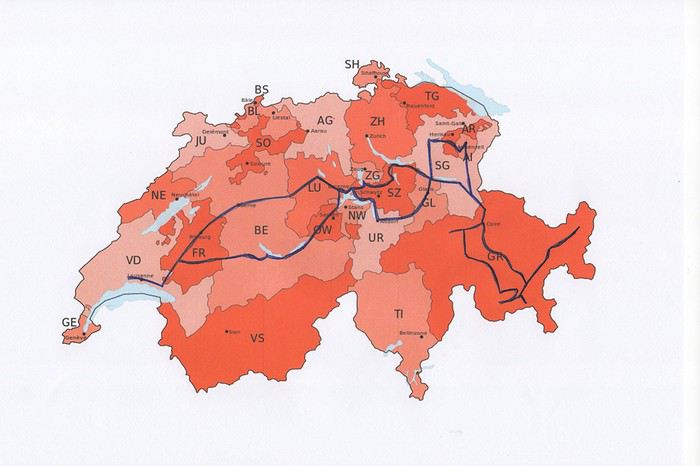
Nous avons loué un van, afin d’être autonome et libre. Notre choix s’est porté sur le VW California Ocean. Ce van est passe-partout, on peut facilement emprunter toutes les petites routes de montagnes et se parquer partout. Seul inconvénient, il n’a pas de salle de bain. La douche se fait à l’extérieur (eau froide), mais nous avons des toilettes portables. Le California Ocean est équipé avec une petite cuisine (un réchaud à gaz avec deux feux, un frigo de 42 litres, un petit évier). Il y a des placards sous la cuisine, au-dessus de la banquette et à l’arrière, ainsi qu’un grand tiroir sous la banquette. Les sièges avant se tournent, il y a deux tables, une à l’intérieur et une autre, encastrée dans la portière, pour l’extérieur. Les deux chaises pour l’extérieur sont encastrées dans la porte du coffre. Le toit se lève, on peut donc se mettre debout à l’intérieur du van. Le lit sous le toit est confortable, avec son sommier sur lequel sont fixé des ressorts. Un store extérieur nous protège du soleil lorsqu’on est à l’arrêt. Le chauffage stationnaire est bien agréable pour chauffer l’habitacle lorsqu’il fait froid. Il y a aussi plusieurs prises, dont une qui fonctionne avec la deuxième batterie et permet de charger le téléphone, tablette, etc. la nuit. Bref, ce petit van est vraiment fonctionnel.
Au dernier moment, nous avons décidé de prendre notre chien Tidou avec nous. Il a fallu adapter nos randonnées et visites. Eh oui, notre Tidou n’est plus tout jeune et il a des soucis avec son dos. Nous avons acheté un sac à dos spécifique, pour pouvoir le porter en terrain abrupte et lorsqu’il sera trop fatigué.
Nous avons chargé l’application park4night sur nos iPhones. Cette application est bien utile pour trouver des emplacements pour passer la nuit. Contrairement, à ce que l’on peut souvent lire, nous n’avons rencontré aucune difficulté pour passer la nuit. Le camping sauvage est donc possible en Suisse, si on ne s’installe pas pour plusieurs jours au même endroit. Concernant l’eau potable, on trouve de nombreuses fontaines, le plus souvent avec de l’eau potable.
Comme pour beaucoup de voyageurs, le Coronavirus a perturbé nos plans pour cette année. Notre road trip au Pérou est tombé à l’eau et la fermeture des frontières ne nous permettait pas de quitter la Suisse.
Heureusement, en Suisse, nous n’avons pas subi un confinement strict et nous pouvions nous déplacer librement dans le pays, en respectant certaines règles (distance de 2 mètres entres les personnes, rassemblements de maximum 5 personnes). De plus, une semaine avant notre départ, les magasins, restaurants et musées pouvaient ouvrir. Par contre, les campings, télécabines et télésièges sont restés fermés jusqu’au 6 juin.
Nous avons décidé de ne pas préparer un itinéraire fixe. Le but principal était le canton des Grisons que nous connaissions très peu. Pour y aller et pour revenir, nous avons traversé d’autres cantons où nous avons profité de faire des visites et randonnées. Certains endroits nous étaient bien connus, mais les voir sans les touristes habituels, asiatiques, indiens et américains, change complètement la perception des lieux. Imaginez, le fameux pont de la Chapelle à Lucerne, sans les hordes de touristes asiatiques qui l’envahissent tous les jours.
Nous avons loué un van, afin d’être autonome et libre. Notre choix s’est porté sur le VW California Ocean. Ce van est passe-partout, on peut facilement emprunter toutes les petites routes de montagnes et se parquer partout. Seul inconvénient, il n’a pas de salle de bain. La douche se fait à l’extérieur (eau froide), mais nous avons des toilettes portables. Le California Ocean est équipé avec une petite cuisine (un réchaud à gaz avec deux feux, un frigo de 42 litres, un petit évier). Il y a des placards sous la cuisine, au-dessus de la banquette et à l’arrière, ainsi qu’un grand tiroir sous la banquette. Les sièges avant se tournent, il y a deux tables, une à l’intérieur et une autre, encastrée dans la portière, pour l’extérieur. Les deux chaises pour l’extérieur sont encastrées dans la porte du coffre. Le toit se lève, on peut donc se mettre debout à l’intérieur du van. Le lit sous le toit est confortable, avec son sommier sur lequel sont fixé des ressorts. Un store extérieur nous protège du soleil lorsqu’on est à l’arrêt. Le chauffage stationnaire est bien agréable pour chauffer l’habitacle lorsqu’il fait froid. Il y a aussi plusieurs prises, dont une qui fonctionne avec la deuxième batterie et permet de charger le téléphone, tablette, etc. la nuit. Bref, ce petit van est vraiment fonctionnel.
Au dernier moment, nous avons décidé de prendre notre chien Tidou avec nous. Il a fallu adapter nos randonnées et visites. Eh oui, notre Tidou n’est plus tout jeune et il a des soucis avec son dos. Nous avons acheté un sac à dos spécifique, pour pouvoir le porter en terrain abrupte et lorsqu’il sera trop fatigué.
Nous avons chargé l’application park4night sur nos iPhones. Cette application est bien utile pour trouver des emplacements pour passer la nuit. Contrairement, à ce que l’on peut souvent lire, nous n’avons rencontré aucune difficulté pour passer la nuit. Le camping sauvage est donc possible en Suisse, si on ne s’installe pas pour plusieurs jours au même endroit. Concernant l’eau potable, on trouve de nombreuses fontaines, le plus souvent avec de l’eau potable.