Results for "Promenade+Anglais+|+127"
23283 results found.
A Bold Combo: Southern Peru, Bolivia, and Northern Chile
Hello everyone,
For our latest 3-week family trip (yes, the kids are growing up, and two of them are about to enter the working world), we’re heading to South America! For our first time on this continent, I had planned a classic 3-week loop in Peru.
But since we won’t be returning to this part of the world anytime soon, I thought: why not follow in the footsteps of Franck, aka Bibouns51, who, in 18 days, didn’t just stick to Peru but also added two of the planet’s most stunning landscapes to his itinerary... the Salar de Uyuni in Bolivia and its neighbor, the fabulous Atacama Desert in northern Chile !!
So, I set about the tricky task of limiting the regions we’d visit in Peru to those we considered must-sees, to avoid rushing too much. The visit schedules were optimized, including several comfortable overnight buses that have the huge advantage of letting us hop between regions.
So, we’re off on a somewhat adventurous trip with three domestic flights (two on the first day and one on the last), two overnight buses for quick hops, several car rentals, the services of a few drivers to make the trip more comfortable, and even a tour operator for crossing the Salar...
Our main concern is altitude sickness, and we’re bringing Diamox, aspirin, etc., just in case.
Our second worry before departure was not even getting off the ground... Yes, for once, we’re leaving from France—Marseille, to be exact. The week before our departure, with the surprise air traffic controllers’ strike, I remembered why we usually prefer to leave from abroad, like Turin or Barcelona... In the end, it wasn’t the air traffic controllers who made us nervous but the early July wildfires that paralyzed the airport a few days before our departure. Fortunately, the fires were quickly brought under control, and on the big day, everything was smooth sailing!
Detailed itinerary (which changed on Day 1 due to departure hiccups): Day 0: Flight Marseille - Madrid - Lima PERU Theoretical and abandoned Day 1: Flight Lima - Cuzco and visit Cuzco (Puka Pukara, Tambomachay, Cristo Blanco Observatory, Sacsayhuaman sunset) - Night in Cuzco Day 2: Taxi -> Chinchero - Moray - Maras Salt Mines - Ollantaytambo - Train to Aguas Calientes Day 3: Machu Picchu - Return train to Ollantaytambo Day 4: 2-day taxi -> Pisac - Tipon - Andahuaylillas - Huaro - Night in San Pedro Day 5: Palcoyo - Checacupe - Vinicunca - Return and night in Cuzco Day 6: Day in Cuzco (catch-up on Sacsayhuaman, San Blas district, Temple of the Sun) - Overnight bus to Arequipa Day 7: Rental car -> On the road to Colca Canyon, night in Cabanaconde Day 8: Descent to the bottom of Colca Canyon, night at Oasis Sangalle Day 9: Ascent from the canyon - Maca - Chivay - Return and night in Arequipa Day 10: Visit Arequipa (Santa Catalina Convent, La Recoleta Church and Monastery, La Compañía Church, Cathedral) - Overnight bus to Puno Day 11: Lake Titicaca - Night in Puno BOLIVIA Day 12: Shared taxi -> Road to La Paz, visit downtown La Paz - Night 1 in La Paz Day 13: Moon Valley and Las Animas Valley - Night 2 in La Paz Day 14: Day in La Paz - Night 3 in La Paz Day 15: Flight to Uyuni - Day 1 of Salar de Uyuni tour - Night at the edge of the Salar Day 16: Crossing the Lipez region and lagoons - Night near Laguna Colorada Day 17: Sol de Mañana CHILE Day 17 cont.: Pre-booked transfer to SPDA - 4x4 rental - Pukara de Quitor - Stargazing tour - Night 1 in SPDA Day 18: Death Valley and Moon Valley - Night 2 in SPDA Day 19: Miscanti and Miniques Lagoons, Salar de Aguas Calientes and its Piedra Roja, Tebenquiche Lagoon and Quebrada del Diablo - Night 3 in SPDA Day 20: Rainbow Valley and swim in the Puritama River - Night 4 in SPDA Day 21: Tebenquiche Lagoon - Bus to Calama - Flight to Santiago Day 22: Return Santiago - Madrid - Marseille
Day 0 - 11/07: Destination Lima
Our first flight from Marseille went smoothly to our Iberia layover in Madrid.
In Madrid, just after getting off the plane around 8 PM, and as we were walking through the terminal, we got a rude awakening!!
We saw the word "Cancelled" next to our flight number on the display boards. Thinking it must be a glitch, we checked another screen, but the system was stubborn, and the same dreaded word appeared !
So, we headed to the Iberia counter, where an agent confirmed that our Friday evening flight was canceled and rescheduled for the next morning. The reason? A breakdown and no replacement plane, even though we were in Madrid, Iberia’s home base!
To make matters worse, I remembered our super-tight schedule, planned to the minute, with no buffer day in Lima. Since I’m a bit phobic of megacities and hadn’t found anything appealing in the Peruvian capital in our guidebooks, we’d planned to leave Lima as soon as possible for Cusco, the heart of the Sacred Valley, to spend our first day there.
Bad idea, because we already knew the 4-hour buffer wouldn’t be enough, and we’d miss the domestic flight, which was, of course, non-refundable and non-changeable. So, we had to call LATAM from Madrid to find another flight for Saturday evening and negotiate a rate to recover some of our initial outlay.
After an hour on the phone with customer service, several endless holds, and three failed attempts to dictate our credit card number over the phone to a Spaniard speaking English with a thick accent, we finally managed to confirm the transaction, securing our new flight tickets for a moderate extra cost of just 150 € total.
At first, we were pretty bummed about losing a day and incurring extra fees to reschedule the domestic flight, but then, when we learned from an Iberia customer service rep that we’d receive the max compensation of 600 € per traveler, we even ended up grinning... because 3000 € in refunds for only losing the first day in Cusco? We’d sign up for that 10 times over!!
Iberia then took care of us, putting us up in a hotel where we had dinner before a short 5-hour night and an early morning departure. I took the opportunity to improvise a quick day of sightseeing in Lima, focusing on the Barranco and Miraflores districts.
For our latest 3-week family trip (yes, the kids are growing up, and two of them are about to enter the working world), we’re heading to South America! For our first time on this continent, I had planned a classic 3-week loop in Peru.
But since we won’t be returning to this part of the world anytime soon, I thought: why not follow in the footsteps of Franck, aka Bibouns51, who, in 18 days, didn’t just stick to Peru but also added two of the planet’s most stunning landscapes to his itinerary... the Salar de Uyuni in Bolivia and its neighbor, the fabulous Atacama Desert in northern Chile !!
So, I set about the tricky task of limiting the regions we’d visit in Peru to those we considered must-sees, to avoid rushing too much. The visit schedules were optimized, including several comfortable overnight buses that have the huge advantage of letting us hop between regions.
So, we’re off on a somewhat adventurous trip with three domestic flights (two on the first day and one on the last), two overnight buses for quick hops, several car rentals, the services of a few drivers to make the trip more comfortable, and even a tour operator for crossing the Salar...
Our main concern is altitude sickness, and we’re bringing Diamox, aspirin, etc., just in case.
Our second worry before departure was not even getting off the ground... Yes, for once, we’re leaving from France—Marseille, to be exact. The week before our departure, with the surprise air traffic controllers’ strike, I remembered why we usually prefer to leave from abroad, like Turin or Barcelona... In the end, it wasn’t the air traffic controllers who made us nervous but the early July wildfires that paralyzed the airport a few days before our departure. Fortunately, the fires were quickly brought under control, and on the big day, everything was smooth sailing!
Detailed itinerary (which changed on Day 1 due to departure hiccups): Day 0: Flight Marseille - Madrid - Lima PERU Theoretical and abandoned Day 1: Flight Lima - Cuzco and visit Cuzco (Puka Pukara, Tambomachay, Cristo Blanco Observatory, Sacsayhuaman sunset) - Night in Cuzco Day 2: Taxi -> Chinchero - Moray - Maras Salt Mines - Ollantaytambo - Train to Aguas Calientes Day 3: Machu Picchu - Return train to Ollantaytambo Day 4: 2-day taxi -> Pisac - Tipon - Andahuaylillas - Huaro - Night in San Pedro Day 5: Palcoyo - Checacupe - Vinicunca - Return and night in Cuzco Day 6: Day in Cuzco (catch-up on Sacsayhuaman, San Blas district, Temple of the Sun) - Overnight bus to Arequipa Day 7: Rental car -> On the road to Colca Canyon, night in Cabanaconde Day 8: Descent to the bottom of Colca Canyon, night at Oasis Sangalle Day 9: Ascent from the canyon - Maca - Chivay - Return and night in Arequipa Day 10: Visit Arequipa (Santa Catalina Convent, La Recoleta Church and Monastery, La Compañía Church, Cathedral) - Overnight bus to Puno Day 11: Lake Titicaca - Night in Puno BOLIVIA Day 12: Shared taxi -> Road to La Paz, visit downtown La Paz - Night 1 in La Paz Day 13: Moon Valley and Las Animas Valley - Night 2 in La Paz Day 14: Day in La Paz - Night 3 in La Paz Day 15: Flight to Uyuni - Day 1 of Salar de Uyuni tour - Night at the edge of the Salar Day 16: Crossing the Lipez region and lagoons - Night near Laguna Colorada Day 17: Sol de Mañana CHILE Day 17 cont.: Pre-booked transfer to SPDA - 4x4 rental - Pukara de Quitor - Stargazing tour - Night 1 in SPDA Day 18: Death Valley and Moon Valley - Night 2 in SPDA Day 19: Miscanti and Miniques Lagoons, Salar de Aguas Calientes and its Piedra Roja, Tebenquiche Lagoon and Quebrada del Diablo - Night 3 in SPDA Day 20: Rainbow Valley and swim in the Puritama River - Night 4 in SPDA Day 21: Tebenquiche Lagoon - Bus to Calama - Flight to Santiago Day 22: Return Santiago - Madrid - Marseille
Day 0 - 11/07: Destination Lima
Our first flight from Marseille went smoothly to our Iberia layover in Madrid.
In Madrid, just after getting off the plane around 8 PM, and as we were walking through the terminal, we got a rude awakening!!
We saw the word "Cancelled" next to our flight number on the display boards. Thinking it must be a glitch, we checked another screen, but the system was stubborn, and the same dreaded word appeared !
So, we headed to the Iberia counter, where an agent confirmed that our Friday evening flight was canceled and rescheduled for the next morning. The reason? A breakdown and no replacement plane, even though we were in Madrid, Iberia’s home base!
To make matters worse, I remembered our super-tight schedule, planned to the minute, with no buffer day in Lima. Since I’m a bit phobic of megacities and hadn’t found anything appealing in the Peruvian capital in our guidebooks, we’d planned to leave Lima as soon as possible for Cusco, the heart of the Sacred Valley, to spend our first day there.
Bad idea, because we already knew the 4-hour buffer wouldn’t be enough, and we’d miss the domestic flight, which was, of course, non-refundable and non-changeable. So, we had to call LATAM from Madrid to find another flight for Saturday evening and negotiate a rate to recover some of our initial outlay.
After an hour on the phone with customer service, several endless holds, and three failed attempts to dictate our credit card number over the phone to a Spaniard speaking English with a thick accent, we finally managed to confirm the transaction, securing our new flight tickets for a moderate extra cost of just 150 € total.
At first, we were pretty bummed about losing a day and incurring extra fees to reschedule the domestic flight, but then, when we learned from an Iberia customer service rep that we’d receive the max compensation of 600 € per traveler, we even ended up grinning... because 3000 € in refunds for only losing the first day in Cusco? We’d sign up for that 10 times over!!
Iberia then took care of us, putting us up in a hotel where we had dinner before a short 5-hour night and an early morning departure. I took the opportunity to improvise a quick day of sightseeing in Lima, focusing on the Barranco and Miraflores districts.
From the Awakening to Travel to Morocco in the 90s
As I’ve mentioned elsewhere, I inherited my love of travel from my parents and some of my grandparents. A strong passion, but one that was unfortunately limited by our family’s modest resources. Back then, living in northern Alsace, a simple trip to the southern part of the region—with the Wine Route as our destination—felt like an extraordinary journey to a land of plenty for the little boy I was in the late 60s and early 70s.
Everything seemed so huge when you were still just a kid.
Back then, I was overwhelmed by countless sensations—I was already highly sensitive, with a keen mind and a nose and taste buds that were developing like a pro’s. Which, as I’d later realize, wasn’t always an advantage.
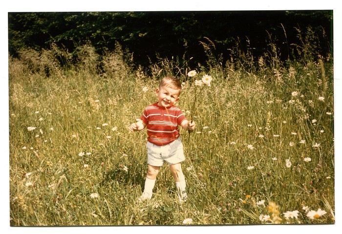
Those magical days always began with a gentle late-spring or midsummer morning. The interior of the white Peugeot 404, license plate 210 LZ 67, had already soaked up the sun before the engine purred to life, and the cabin gave off a scent I could still recognize today—a fragrance I found so pleasant. Back then, I had no idea it was just the smell of warm plastic from the car’s interior. Yes, the scents of the 404 on sunny days became my madeleine de Proust... What’s more, the whole family was unusually cheerful because those moments of relaxation and leisure were rare. Everyone worked, and no one had an easy job or was well paid. Without the *Trente Glorieuses*, these experiences might never have happened.
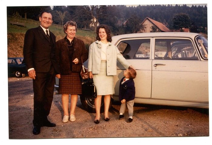
Once we crossed the canton’s borders, I felt like I was light-years away from my everyday surroundings, and every kilometer plunged me deeper into *terra incognita*. It was thrilling. Far from my so-called "medium-sized" town, wheat fields, cornfields, and cabbage patches stretched out, punctuated by tall poles connected by long wires and topped with vegetation—like giant clotheslines without laundry, where magical beanstalks might grow to touch the sky. Back then, I was still far from tasting their product, which was simply beer. At the time, there was still a significant local hop production. Fun fact: it wasn’t until 2002 that Anglo-Saxon scientists proved hops and cannabis belong to the same biological family.
After the fields, the landscape took another step up as it rolled past the little boy’s eyes, often glued to the windows. First came modest hills, then a succession of rolling slopes that soon formed an unbroken chain. Their 700 meters in altitude felt like Himalayan peaks to me—impressive, inert giants, a whole new world. Gazing at them, an intense emotion welled up somewhere between my stomach and lungs, nearly taking my breath away. What mysteries, what treasures did these heights hold? And then there were the cherries on top—the crowning touch that made the scene even more magical: proud, majestic castles perched on the summits like impassive sentinels. Monuments from the past, yet firmly rooted in the present on their rocky spurs. The little boy’s eyes sparkled—he’d been given a castle for Christmas, complete with battlements, towers, a drawbridge, and fully armed knights. He’d watched and lived *Ivanhoe* on the only French TV channel that existed back then.
Only once did my paternal grandfather join us on one of these trips. A tall, intelligent man with a face that could shift from stern to mischievous, clearly full of humor and charisma. Sadly, his relationship with alcohol had taken a toll on his life and, by extension, those of his loved ones. He had a strong personality—if his boss crossed the line, he wouldn’t hesitate to punch him, which meant he went through a lot of different jobs. Back then, you could quit one job and easily find another. It was quite something to see him in his final stages, hallucinating pink elephants and even drinking perfume when he had nothing else left. The last time I saw him, he’d slipped away from the doctors and nurses while hospitalized in pretty bad shape—at least, I assume his liver was the issue. We were sitting down for a family lunch when the door burst open, and there he stood in his pajamas, eyes twinkling with mischief, clearly pleased with the dramatic entrance. That theatrical moment didn’t spare us from burying him a few months later at the age of 71. One day, my mother told me the family doctor had quietly remarked that it was a shame—with his robust constitution, he could’ve lived to be a hundred. Yes, the family doctor—this was the man who’d come treat you any day, at almost any hour, just for a phone call. It really existed, it’s not a myth!
That day, his wife—my paternal grandmother—was also along for the ride. Everyone agreed that Jeannette was a good woman. She worked as a waitress at *Le Tigre*, the biggest brasserie in town, right in the center. Most customers preferred to be served by her, including local dignitaries and even the mayor. As a kid, I didn’t find her very fun, open, or warm—she seemed a bit stern. Back then, women in their fifties already had the face and build of grandmothers. Same went for men, don’t get me wrong. I had no idea about the struggles she faced because of her husband. I didn’t know that 30 years earlier, she’d had to flee Alsace while pregnant, under threat from Nazi fighter-bombers. I didn’t know she’d had several miscarriages, and that my father—her only surviving child, born prematurely in March 1940 at the other end of France—weighed less than a kilo at birth and was so tiny he could fit in a shoebox. Hard to imagine he’d grow into a strapping man nearly 1.80 meters tall, tipping the scales at 100 kilos. When you come back from summer camp in early August and ask why she didn’t pick you up with your parents, and they gently tell you she’s "in heaven," you don’t realize she passed away at 54 after suffering greatly from stomach cancer that had spread.
Back to that family outing, that enchanted parenthesis. I even remembered where we’d had lunch when I passed through Dambach-la-Ville decades later. One of those charming, flower-filled towns Alsace produces in abundance—and preserves so well. This one sits high on a hill, and I was a bit stunned on the parking lot because the view stretched far, revealing the Alsace plain below—its fields, villages, hills, and forests. The world seemed so vast and enticing that day, even though I was only glimpsing a tiny fraction of it.
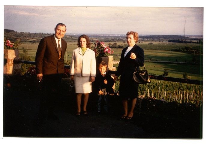
The region was already very touristy, but I wouldn’t notice the downsides until much later. That Sunday noon, I discovered a large restaurant filled with diners. I can still see the enormous piece of meat they served me, decorated with a little wooden skewer topped with a flag. I kept that one for a long time. Those were the golden days of rich, flowing, thick sauces—so flavorful—and the era of the world’s best fries, made on the spot with the best potatoes. To top it off, I was *exceptionally* allowed a small bottle of apple juice, Orangina, or—even better if possible—Sinalco. Yes, Sinalco—like Orangina, but better. A brand that must’ve disappeared in the 70s, but why, and what a shame! Since then, Orangina’s little bubbles have taken the brand to the other side of the planet—it’s now Japanese.
Year after year, I’d eagerly await that ecstatic moment when the most beautiful castle in Alsace, the Haut-Koenigsbourg, appeared in my field of vision. The perfect model, the archetype that blended into the landscape at the height of a child’s dreams. The trip home always felt like a reality check—less jarring than an alarm clock, but more diffuse and melancholic. From then on, there was only one wish: *When do we leave again?*
Those magical days always began with a gentle late-spring or midsummer morning. The interior of the white Peugeot 404, license plate 210 LZ 67, had already soaked up the sun before the engine purred to life, and the cabin gave off a scent I could still recognize today—a fragrance I found so pleasant. Back then, I had no idea it was just the smell of warm plastic from the car’s interior. Yes, the scents of the 404 on sunny days became my madeleine de Proust... What’s more, the whole family was unusually cheerful because those moments of relaxation and leisure were rare. Everyone worked, and no one had an easy job or was well paid. Without the *Trente Glorieuses*, these experiences might never have happened.
Once we crossed the canton’s borders, I felt like I was light-years away from my everyday surroundings, and every kilometer plunged me deeper into *terra incognita*. It was thrilling. Far from my so-called "medium-sized" town, wheat fields, cornfields, and cabbage patches stretched out, punctuated by tall poles connected by long wires and topped with vegetation—like giant clotheslines without laundry, where magical beanstalks might grow to touch the sky. Back then, I was still far from tasting their product, which was simply beer. At the time, there was still a significant local hop production. Fun fact: it wasn’t until 2002 that Anglo-Saxon scientists proved hops and cannabis belong to the same biological family.
After the fields, the landscape took another step up as it rolled past the little boy’s eyes, often glued to the windows. First came modest hills, then a succession of rolling slopes that soon formed an unbroken chain. Their 700 meters in altitude felt like Himalayan peaks to me—impressive, inert giants, a whole new world. Gazing at them, an intense emotion welled up somewhere between my stomach and lungs, nearly taking my breath away. What mysteries, what treasures did these heights hold? And then there were the cherries on top—the crowning touch that made the scene even more magical: proud, majestic castles perched on the summits like impassive sentinels. Monuments from the past, yet firmly rooted in the present on their rocky spurs. The little boy’s eyes sparkled—he’d been given a castle for Christmas, complete with battlements, towers, a drawbridge, and fully armed knights. He’d watched and lived *Ivanhoe* on the only French TV channel that existed back then.
Only once did my paternal grandfather join us on one of these trips. A tall, intelligent man with a face that could shift from stern to mischievous, clearly full of humor and charisma. Sadly, his relationship with alcohol had taken a toll on his life and, by extension, those of his loved ones. He had a strong personality—if his boss crossed the line, he wouldn’t hesitate to punch him, which meant he went through a lot of different jobs. Back then, you could quit one job and easily find another. It was quite something to see him in his final stages, hallucinating pink elephants and even drinking perfume when he had nothing else left. The last time I saw him, he’d slipped away from the doctors and nurses while hospitalized in pretty bad shape—at least, I assume his liver was the issue. We were sitting down for a family lunch when the door burst open, and there he stood in his pajamas, eyes twinkling with mischief, clearly pleased with the dramatic entrance. That theatrical moment didn’t spare us from burying him a few months later at the age of 71. One day, my mother told me the family doctor had quietly remarked that it was a shame—with his robust constitution, he could’ve lived to be a hundred. Yes, the family doctor—this was the man who’d come treat you any day, at almost any hour, just for a phone call. It really existed, it’s not a myth!
That day, his wife—my paternal grandmother—was also along for the ride. Everyone agreed that Jeannette was a good woman. She worked as a waitress at *Le Tigre*, the biggest brasserie in town, right in the center. Most customers preferred to be served by her, including local dignitaries and even the mayor. As a kid, I didn’t find her very fun, open, or warm—she seemed a bit stern. Back then, women in their fifties already had the face and build of grandmothers. Same went for men, don’t get me wrong. I had no idea about the struggles she faced because of her husband. I didn’t know that 30 years earlier, she’d had to flee Alsace while pregnant, under threat from Nazi fighter-bombers. I didn’t know she’d had several miscarriages, and that my father—her only surviving child, born prematurely in March 1940 at the other end of France—weighed less than a kilo at birth and was so tiny he could fit in a shoebox. Hard to imagine he’d grow into a strapping man nearly 1.80 meters tall, tipping the scales at 100 kilos. When you come back from summer camp in early August and ask why she didn’t pick you up with your parents, and they gently tell you she’s "in heaven," you don’t realize she passed away at 54 after suffering greatly from stomach cancer that had spread.
Back to that family outing, that enchanted parenthesis. I even remembered where we’d had lunch when I passed through Dambach-la-Ville decades later. One of those charming, flower-filled towns Alsace produces in abundance—and preserves so well. This one sits high on a hill, and I was a bit stunned on the parking lot because the view stretched far, revealing the Alsace plain below—its fields, villages, hills, and forests. The world seemed so vast and enticing that day, even though I was only glimpsing a tiny fraction of it.
The region was already very touristy, but I wouldn’t notice the downsides until much later. That Sunday noon, I discovered a large restaurant filled with diners. I can still see the enormous piece of meat they served me, decorated with a little wooden skewer topped with a flag. I kept that one for a long time. Those were the golden days of rich, flowing, thick sauces—so flavorful—and the era of the world’s best fries, made on the spot with the best potatoes. To top it off, I was *exceptionally* allowed a small bottle of apple juice, Orangina, or—even better if possible—Sinalco. Yes, Sinalco—like Orangina, but better. A brand that must’ve disappeared in the 70s, but why, and what a shame! Since then, Orangina’s little bubbles have taken the brand to the other side of the planet—it’s now Japanese.
Year after year, I’d eagerly await that ecstatic moment when the most beautiful castle in Alsace, the Haut-Koenigsbourg, appeared in my field of vision. The perfect model, the archetype that blended into the landscape at the height of a child’s dreams. The trip home always felt like a reality check—less jarring than an alarm clock, but more diffuse and melancholic. From then on, there was only one wish: *When do we leave again?*
Naha & Osaka, Japan - June 2025
It’s an understatement to say that Japan is a world apart. All around me, people exclaim: "How lucky you are to be able to go there! I’ve always dreamed of visiting, of finding myself in that culture blending tradition and technology!" Yes, they’re right. Until the moment their dreams become reality and things appear as they truly are, without the filter of fantasized preconceptions. Because in the collective unconscious, Japan indeed seems like a civilization—if not neutral—at least stripped of any social maturation. As if it had emerged all at once from its canonical ages, offering only the best of its traditions, and as if those traditions were undoubtedly the foundation of its extraordinary discipline. Yet, as always, the truth is far more complex. Modern Japan is likely shaped by its millennia-old traditions. But that Japan is also the result of its own uncertainties and contradictions. I’ve always been wary. I’ve never understood why the cleaning women on the platform bow when the train arrives. At some point, too much discipline, too much deference—it makes you smile, it raises questions.
Finally, thanks to F., a dream is coming true! Not the dream of going to Japan—a country I’ve visited more than any other, except for Réunion and the UK—but the dream of completing the fastest round-the-world trip of my career. Indeed, due to the restrictions imposed by the Russians*, the plane flies over the Caucasus and China on the way there; on the return, it gracefully heads toward the Arctic after skirting the Aleutian Islands, Alaska, and Greenland. So, in nearly 26 hours of flight, I complete my 6th round-the-world trip. A round-the-world trip with just one stopover. Or two, if you count our impromptu detour to Okinawa.
(* In response to Western sanctions, Russia closed its airspace to Western airlines on February 28, 2022, except for Air Serbia, Turkish Airlines, Pegasus, and Belavia. This decision adds 2 to 3 hours to flight times and, incidentally, increases operating costs.)
The empire of noise. The empire that dazzles. In Japan, the auditory and visual space is constantly fed. No respite. You have to be strong. Navigating public transport feels like playing the most advanced video game: moving between language barriers and a different organization, the hero tries to ignore the numerous visual and auditory distractions. Mostly auditory, though. Because in Japan, there’s a culture of noise that has undoubtedly inspired our national railways. Everything must be announced. So, here and there, all along the route, we find agents whose sole role is to endlessly repeat safety messages through megaphones more or less suited to the situation. The result is a constant murmur, a kind of tinnitus, a subtle but incessant buzz that fades only at bedtime and returns with a vengeance at first light, when we descend back into the supposedly sterile depths of Osaka’s subway. "To go right, please turn right, kudasaï. When descending the stairs, please mind the steps, kudasaï. To go straight, please take the left corridor, kudasaï." That *kudasaï* ("please" in Japanese), I assure you, has permanently lodged itself in my auditory cells.
Screens are no exception; the brain is constantly stimulated. But paradoxically, passengers massively retreat into their own worlds via their screens. Literally glued to their phones, earbuds firmly in place, people escape into the virtual aisles of a furniture store, a game, a movie... In the train cars, raised voices are rare. The field is clear for announcements and other jingles. Each stop is announced by a little tune unique to each station. Simply incredible.
If we usually judge a country by the welcome its inhabitants offer, in Japan, we’re left wanting. Indeed, the Lost in Translation* spirit doesn’t just apply to verbal exchanges—it applies to everything, especially non-verbal communication. In Japan, me, the slightly North African Corsican, I’m at a loss. I speak loudly, I gesture, in front of a hotel concierge just as lost. Each for our own reasons. Yes, he speaks some English, but we can’t seem to connect. It’s a losing battle trying to find a bit of compassion from a local who’s far from familiar with Western concerns. I try to buy tickets for the World Expo? I run into a systematization as rigid as it is abrupt, which the concierge can’t seem to navigate. While we might still have a shred of common sense, here in Japan, everything is digitized. Soon, no one will be surprised that a QR code becomes essential just to go to the bathroom.
(* Film by Sofia Coppola, released in 2003, which explores isolation, unease, Japanese culture, and language through the experiences of two protagonists.)
In the end, we get that ticket for the Expo. After providing personal information on yet another account created for the occasion, we buy electronic tickets—a QR code, then—to regulate the comings and goings, the souls and aspirations of all these wandering beings scattered across the globe. And it’s probably for the best... Because we’ll be tens of thousands of visitors—100,000 to 150,000 per day—walking the aisles of this enormous improvised amusement park, a kind of delirious superstructure surrounded by the Grand Ring, the largest wooden construction in the world. Inside the park, the pavilions, flagship vessels of their respective countries, compete in ingenuity, proportionate to their GDP, to attract visitors. But you have to wait up to two hours to visit the most popular ones! Fortunately, about a hundred countries can be explored without waiting in shared, more spacious areas. What will I remember from this adventure? The beauty of that wooden structure, despite any environmental or financial considerations—200M € for barely renewable elements; a certain poetry, even magic, in the expression of this event—conversing with Juliette Petit, the splendid representative of Vanuatu, had something indescribable; a close-up experience of Japanese discipline when it came time to return to the subway after that epic evening—thousands upon thousands of people converging at the same time toward a single place without any interruption in the flow.
But my real passion is the countryside. So, I’ll especially remember that brief escape, on the very first day, to the Mino-o waterfall, where the journey itself was already enchanting. Quickly leaving the underground lines, our train speeds through the city’s endless expanse and drops us at the foot of a hill, the abrupt edge of the urban sprawl. The slope was too steep to build anything? We leave behind an impressive hotel, a capitalist eyesore defying the laws of elevation to tackle the climb toward the waterfall. A bucolic walk where the stroller can choose between a paved path or more epic trails. Here and there, stalls, temples, everywhere, a certain serenity. The city’s pulse gives way to a magnificent spectacle magnified by giant sequoias. From the depths of a ravine, we try to glimpse the sky beyond the foliage. Everything is oversized. Here, you can breathe.
***
In reality, Japan has never undertaken any real work of memory. Aside from a few feeble gestures to appease Washington in its choice of Asian partners, one wonders if the Japanese have ever truly grasped the horror they were forced to participate in. While our Judeo-Christian society has more or less assimilated the notions of forgiveness and self-questioning, where does Japanese society stand, juggling a millennia-old Zen philosophy and the unabashed Machiavellianism of an emperor utterly possessed? Is it just me, or does there float in the atmosphere a kind of unease, a malaise, an awkward relationship with reality? For me, bowing to a train as it enters the station is just the result of a poorly directed moral dilemma...
Ah, how distant is the time of sakoku, that closure of the country—both concrete and ideological—that was in vogue for two centuries. Because if no one could enter, no one could leave either! A boon for neighboring countries. But from 1854, following the skirmishes of Commodore Matthew Perry, who demanded Japan’s participation in trade, the country suddenly became aware of the disparities separating it from the West. Bring Japan up to the level of other nations? Industrialization, competition, search for raw materials... Hirohito (1901–1989) emerges on the scene, a bit expansionist and willing to stop at nothing to achieve his goals. Above all, he knew how to use, in his own way, the incredible capacity for self-sacrifice of his people...
We protest, we condemn, we all rally behind an acceptable discourse when it comes to discussing the use of the atomic bomb. Yet, we forget one essential thing: Hiroshima wasn’t enough to make Hirohito yield. While we’re bombarded with anti-fascist elements, as if the sole purpose of school curricula were to prevent us from voting for the National Rally, we completely overlook those events of rare cruelty that took place on the other side of the globe at a time contemporary with Nazi atrocities. Why? Because it was farther away, on the other side of the world? Because we must both condemn the use of nuclear weapons and Nazism? What a dangerous game. Killing civilians is beyond comprehension, everyone agrees on that. But hasn’t Japan ever been guilty of such atrocities? Our empathy is legitimate; it won’t, however, remove from my mind the idea that there was no other solution. Nagasaki is the most telling proof of that.
At least in France, in school textbooks, Hitler will have completely overshadowed the existence of people crueler and more abject than him. Certainly, Adolf was a deeply disturbed man whom events propelled to power. But I’m justified in believing that his approach was probably more humane than that of Joseph Stalin at the height of his art*. And if Hirohito followed the same line as Hitler, in the sense that he represented the superior race, he would apply with conviction what was Stalin’s credo: contempt for his own people when sending them to slaughter, and an even fiercer contempt for the human race when it didn’t have the good fortune to be Japanese. Just look at how China was invaded and by what means millions of Chinese were annihilated, burned, deported, buried alive! Operation Scorched Earth or Three Alls Policy for kill all, burn all, loot all? No comment. Even today, the Japanese are convinced they waged a patriotic war, when clearly, that war served only vague ideological (and certainly economic) interests.
(* "In many ways, Hitler’s National Socialism was far more humane than Communism: it wasn’t unthinkable to speak to the SS or the Gestapo, and dissuading them from sending you to a prison camp wasn’t utopian. To some extent (compared to the Communists), you could still expect a semblance of justice. All those who lived under Hitler and under Communism will tell you: as the front lines shifted, they always managed to end up in Germany, where, though it was a strange place ruled by a madman, life went on. Under Communism, there was no life; totalitarianism was absolute. Probably, Hitler’s conservatism prevented him from fully imitating Bolshevism." Seraphim Rose in The Revolutions of the 19th and 20th Centuries (circa 1970))
In Naha, we visit two strategic sites: the Imperial Navy headquarters and Maeda Escarpment, in Urasoe, better known as Hacksaw Ridge. I love this confrontation with history. In the hand-dug tunnels of the headquarters, we meet Japanese people seeking information. They’re not responsible for this tragedy. Neither are we. I would have liked to tell them that, to hug them, to move on. To finally believe in those peace messages displayed here and there. Yes, it’s curious to read those calls for peace* when no real work of memory** has been undertaken. Two civilizations, two perspectives, a profound misunderstanding. When I analyze the waste of that war—and particularly the waste of those Pacific battles—like Peleliu in autumn 1944 and Okinawa in spring 1945—I can’t bring myself to share in the pathological patriotism that reigns within these walls. There, the room where the last message of Admiral Minoru Ōta was transmitted in Morse, praising the merits of the archipelago’s people. A tangled mix that, yes, is charged with positive emotions but, no, won’t remove from my mind the idea that this people was completely conditioned, completely disconnected from reality. Allying with the Axis powers? Invading the South Pacific? And finding that noble! Everyone sees things through their own lens.
(* Peace Declaration by Denny Tamaki, Governor of Okinawa, June 2020. ** "Recognizing the atrocities committed by one’s country requires a mix of democratic culture and self-confidence that is more the exception than the rule." Dominique Moïsi in Les Échos, April 30, 2015)
Okinawa. 200,000 dead. Stemming from bushido, the way of the warrior, this conditioning reached its peak with the kamikaze philosophy in particular and suicide in general. So, schematically, here’s how things went: as the island was encircled—Peleliu, Iwo Jima, Okinawa—and all hope was lost, the order was given to kill ten American soldiers before taking one’s own life. The deceit of this system, where surrender is synonymous with dishonor, involves creating tunnels and secret pockets where Japanese soldiers hide and from which they emerge. Long before the atomic bomb, the knell of their war had sounded. Hiroshima and Nagasaki are just the result of human pride, of which Hirohito’s reign is the finest example. Why was this henchman of Satan left in place until his death? I don’t understand. While the humiliation inflicted on Germany repeatedly was abject, especially for its people, the absence of any real and pressing accountability for Hirohito in this large-scale carnage he instigated leaves room for the wildest interpretations. As if to underscore my point, Emperor Naruhito visited Okinawa the same day we did, paying his respects to the inhabitants who fell in battle. I looked at the faces in the monorail serving the south of the island. There were elderly people who undoubtedly lost their parents eighty years ago. To what extent can they blame this tragedy on the delusional visions of their leaders?
On Maeda Escarpment, I salute the courage of Desmond Doss, that conscientious objector who fought to serve his country while refusing to ever carry a weapon. There, at the top of a steep ridge, you can see to the north the Allies’ advance, while to the south, the slope is gentler down to Shuri, in front of the headquarters. The underground is a Swiss cheese filled with enemies. Desmond works as a medic. He manages to save 75 wounded from certain death by evacuating them at night from the battlefield using makeshift ropes. Back in Osaka, far from the somewhat dilapidated tropical islands, I rediscover the splendor and grandeur of Japan’s second-largest city. To tell the truth, and this applies to Okinawa too, the density is so insane on this archipelago that you sometimes wonder if it’s not just one giant city spread across the vast territory. Because between Tokyo and Osaka, while there are some mountains and forests, it’s the city that dominates; during rush hour, a rapid train connects the two cities every five minutes. We get lost in rather quiet alleys parallel to the main streets, only to find ourselves in the covered and lively galleries of Dōtonbori. We’re looking for a place to eat—above all, we’re trying to navigate the unlimited options stretching endlessly along the sidewalks. It’s absolutely mind-blowing. And while I introduce F. to a part of history that our Western societies have quickly forgotten, he initiates me into Japanese gastronomy despite my well-known aversion to Asian food. But nothing beats having a master in the field! We feast on okonomiyaki, Japanese pancakes expertly prepared and served on a teppan embedded in our table.
Night falls on Japan, and I still haven’t found the answer. Like in Singapore, one can praise the calm and serenity of human relationships, the delicacy that may just be hypocrisy, the politeness, the discipline. But above all, we notice that in the absence of freedom, in the absence of madness, poetry struggles to take root, boredom looms, as does real madness. Bushido still exists, honor is there and must be preserved. But the youth drowns in electronics and in willingly sterile cults (otaku), unable to discern what’s essential, failing to believe in their dreams. You have to succeed? Young people commit suicide because of school bullying, the slightly older ones because of work-related difficulties or marital problems. Nothing exceptional, we might say—average*—but you’d expect better from a country so well-organized, a country that makes so many Westerners dream. Yes, night falls on Japan. Empire of noise, empire of the senses, a very strange land where you find clean toilets in subway corridors but where the very meaning of life seems stifled by the mirages of technology. Above all, a civilization deprived of a penance that would prove salutary. We’re caught between two waters. Those of a shallow modernity without depth or anchor; those of a past that was majestic but irreparably tainted by the demonic madness of an overly adored emperor.
How can one fully thrive when guilt has no outlet?
(* France and Japan share a common statistic of 17 suicides per 100,000 inhabitants, which, depending on density, means 30 per day in France and 70 in Japan...)
Finally, thanks to F., a dream is coming true! Not the dream of going to Japan—a country I’ve visited more than any other, except for Réunion and the UK—but the dream of completing the fastest round-the-world trip of my career. Indeed, due to the restrictions imposed by the Russians*, the plane flies over the Caucasus and China on the way there; on the return, it gracefully heads toward the Arctic after skirting the Aleutian Islands, Alaska, and Greenland. So, in nearly 26 hours of flight, I complete my 6th round-the-world trip. A round-the-world trip with just one stopover. Or two, if you count our impromptu detour to Okinawa.
(* In response to Western sanctions, Russia closed its airspace to Western airlines on February 28, 2022, except for Air Serbia, Turkish Airlines, Pegasus, and Belavia. This decision adds 2 to 3 hours to flight times and, incidentally, increases operating costs.)
The empire of noise. The empire that dazzles. In Japan, the auditory and visual space is constantly fed. No respite. You have to be strong. Navigating public transport feels like playing the most advanced video game: moving between language barriers and a different organization, the hero tries to ignore the numerous visual and auditory distractions. Mostly auditory, though. Because in Japan, there’s a culture of noise that has undoubtedly inspired our national railways. Everything must be announced. So, here and there, all along the route, we find agents whose sole role is to endlessly repeat safety messages through megaphones more or less suited to the situation. The result is a constant murmur, a kind of tinnitus, a subtle but incessant buzz that fades only at bedtime and returns with a vengeance at first light, when we descend back into the supposedly sterile depths of Osaka’s subway. "To go right, please turn right, kudasaï. When descending the stairs, please mind the steps, kudasaï. To go straight, please take the left corridor, kudasaï." That *kudasaï* ("please" in Japanese), I assure you, has permanently lodged itself in my auditory cells.
Screens are no exception; the brain is constantly stimulated. But paradoxically, passengers massively retreat into their own worlds via their screens. Literally glued to their phones, earbuds firmly in place, people escape into the virtual aisles of a furniture store, a game, a movie... In the train cars, raised voices are rare. The field is clear for announcements and other jingles. Each stop is announced by a little tune unique to each station. Simply incredible.
If we usually judge a country by the welcome its inhabitants offer, in Japan, we’re left wanting. Indeed, the Lost in Translation* spirit doesn’t just apply to verbal exchanges—it applies to everything, especially non-verbal communication. In Japan, me, the slightly North African Corsican, I’m at a loss. I speak loudly, I gesture, in front of a hotel concierge just as lost. Each for our own reasons. Yes, he speaks some English, but we can’t seem to connect. It’s a losing battle trying to find a bit of compassion from a local who’s far from familiar with Western concerns. I try to buy tickets for the World Expo? I run into a systematization as rigid as it is abrupt, which the concierge can’t seem to navigate. While we might still have a shred of common sense, here in Japan, everything is digitized. Soon, no one will be surprised that a QR code becomes essential just to go to the bathroom.
(* Film by Sofia Coppola, released in 2003, which explores isolation, unease, Japanese culture, and language through the experiences of two protagonists.)
In the end, we get that ticket for the Expo. After providing personal information on yet another account created for the occasion, we buy electronic tickets—a QR code, then—to regulate the comings and goings, the souls and aspirations of all these wandering beings scattered across the globe. And it’s probably for the best... Because we’ll be tens of thousands of visitors—100,000 to 150,000 per day—walking the aisles of this enormous improvised amusement park, a kind of delirious superstructure surrounded by the Grand Ring, the largest wooden construction in the world. Inside the park, the pavilions, flagship vessels of their respective countries, compete in ingenuity, proportionate to their GDP, to attract visitors. But you have to wait up to two hours to visit the most popular ones! Fortunately, about a hundred countries can be explored without waiting in shared, more spacious areas. What will I remember from this adventure? The beauty of that wooden structure, despite any environmental or financial considerations—200M € for barely renewable elements; a certain poetry, even magic, in the expression of this event—conversing with Juliette Petit, the splendid representative of Vanuatu, had something indescribable; a close-up experience of Japanese discipline when it came time to return to the subway after that epic evening—thousands upon thousands of people converging at the same time toward a single place without any interruption in the flow.
But my real passion is the countryside. So, I’ll especially remember that brief escape, on the very first day, to the Mino-o waterfall, where the journey itself was already enchanting. Quickly leaving the underground lines, our train speeds through the city’s endless expanse and drops us at the foot of a hill, the abrupt edge of the urban sprawl. The slope was too steep to build anything? We leave behind an impressive hotel, a capitalist eyesore defying the laws of elevation to tackle the climb toward the waterfall. A bucolic walk where the stroller can choose between a paved path or more epic trails. Here and there, stalls, temples, everywhere, a certain serenity. The city’s pulse gives way to a magnificent spectacle magnified by giant sequoias. From the depths of a ravine, we try to glimpse the sky beyond the foliage. Everything is oversized. Here, you can breathe.
***
In reality, Japan has never undertaken any real work of memory. Aside from a few feeble gestures to appease Washington in its choice of Asian partners, one wonders if the Japanese have ever truly grasped the horror they were forced to participate in. While our Judeo-Christian society has more or less assimilated the notions of forgiveness and self-questioning, where does Japanese society stand, juggling a millennia-old Zen philosophy and the unabashed Machiavellianism of an emperor utterly possessed? Is it just me, or does there float in the atmosphere a kind of unease, a malaise, an awkward relationship with reality? For me, bowing to a train as it enters the station is just the result of a poorly directed moral dilemma...
Ah, how distant is the time of sakoku, that closure of the country—both concrete and ideological—that was in vogue for two centuries. Because if no one could enter, no one could leave either! A boon for neighboring countries. But from 1854, following the skirmishes of Commodore Matthew Perry, who demanded Japan’s participation in trade, the country suddenly became aware of the disparities separating it from the West. Bring Japan up to the level of other nations? Industrialization, competition, search for raw materials... Hirohito (1901–1989) emerges on the scene, a bit expansionist and willing to stop at nothing to achieve his goals. Above all, he knew how to use, in his own way, the incredible capacity for self-sacrifice of his people...
We protest, we condemn, we all rally behind an acceptable discourse when it comes to discussing the use of the atomic bomb. Yet, we forget one essential thing: Hiroshima wasn’t enough to make Hirohito yield. While we’re bombarded with anti-fascist elements, as if the sole purpose of school curricula were to prevent us from voting for the National Rally, we completely overlook those events of rare cruelty that took place on the other side of the globe at a time contemporary with Nazi atrocities. Why? Because it was farther away, on the other side of the world? Because we must both condemn the use of nuclear weapons and Nazism? What a dangerous game. Killing civilians is beyond comprehension, everyone agrees on that. But hasn’t Japan ever been guilty of such atrocities? Our empathy is legitimate; it won’t, however, remove from my mind the idea that there was no other solution. Nagasaki is the most telling proof of that.
At least in France, in school textbooks, Hitler will have completely overshadowed the existence of people crueler and more abject than him. Certainly, Adolf was a deeply disturbed man whom events propelled to power. But I’m justified in believing that his approach was probably more humane than that of Joseph Stalin at the height of his art*. And if Hirohito followed the same line as Hitler, in the sense that he represented the superior race, he would apply with conviction what was Stalin’s credo: contempt for his own people when sending them to slaughter, and an even fiercer contempt for the human race when it didn’t have the good fortune to be Japanese. Just look at how China was invaded and by what means millions of Chinese were annihilated, burned, deported, buried alive! Operation Scorched Earth or Three Alls Policy for kill all, burn all, loot all? No comment. Even today, the Japanese are convinced they waged a patriotic war, when clearly, that war served only vague ideological (and certainly economic) interests.
(* "In many ways, Hitler’s National Socialism was far more humane than Communism: it wasn’t unthinkable to speak to the SS or the Gestapo, and dissuading them from sending you to a prison camp wasn’t utopian. To some extent (compared to the Communists), you could still expect a semblance of justice. All those who lived under Hitler and under Communism will tell you: as the front lines shifted, they always managed to end up in Germany, where, though it was a strange place ruled by a madman, life went on. Under Communism, there was no life; totalitarianism was absolute. Probably, Hitler’s conservatism prevented him from fully imitating Bolshevism." Seraphim Rose in The Revolutions of the 19th and 20th Centuries (circa 1970))
In Naha, we visit two strategic sites: the Imperial Navy headquarters and Maeda Escarpment, in Urasoe, better known as Hacksaw Ridge. I love this confrontation with history. In the hand-dug tunnels of the headquarters, we meet Japanese people seeking information. They’re not responsible for this tragedy. Neither are we. I would have liked to tell them that, to hug them, to move on. To finally believe in those peace messages displayed here and there. Yes, it’s curious to read those calls for peace* when no real work of memory** has been undertaken. Two civilizations, two perspectives, a profound misunderstanding. When I analyze the waste of that war—and particularly the waste of those Pacific battles—like Peleliu in autumn 1944 and Okinawa in spring 1945—I can’t bring myself to share in the pathological patriotism that reigns within these walls. There, the room where the last message of Admiral Minoru Ōta was transmitted in Morse, praising the merits of the archipelago’s people. A tangled mix that, yes, is charged with positive emotions but, no, won’t remove from my mind the idea that this people was completely conditioned, completely disconnected from reality. Allying with the Axis powers? Invading the South Pacific? And finding that noble! Everyone sees things through their own lens.
(* Peace Declaration by Denny Tamaki, Governor of Okinawa, June 2020. ** "Recognizing the atrocities committed by one’s country requires a mix of democratic culture and self-confidence that is more the exception than the rule." Dominique Moïsi in Les Échos, April 30, 2015)
Okinawa. 200,000 dead. Stemming from bushido, the way of the warrior, this conditioning reached its peak with the kamikaze philosophy in particular and suicide in general. So, schematically, here’s how things went: as the island was encircled—Peleliu, Iwo Jima, Okinawa—and all hope was lost, the order was given to kill ten American soldiers before taking one’s own life. The deceit of this system, where surrender is synonymous with dishonor, involves creating tunnels and secret pockets where Japanese soldiers hide and from which they emerge. Long before the atomic bomb, the knell of their war had sounded. Hiroshima and Nagasaki are just the result of human pride, of which Hirohito’s reign is the finest example. Why was this henchman of Satan left in place until his death? I don’t understand. While the humiliation inflicted on Germany repeatedly was abject, especially for its people, the absence of any real and pressing accountability for Hirohito in this large-scale carnage he instigated leaves room for the wildest interpretations. As if to underscore my point, Emperor Naruhito visited Okinawa the same day we did, paying his respects to the inhabitants who fell in battle. I looked at the faces in the monorail serving the south of the island. There were elderly people who undoubtedly lost their parents eighty years ago. To what extent can they blame this tragedy on the delusional visions of their leaders?
On Maeda Escarpment, I salute the courage of Desmond Doss, that conscientious objector who fought to serve his country while refusing to ever carry a weapon. There, at the top of a steep ridge, you can see to the north the Allies’ advance, while to the south, the slope is gentler down to Shuri, in front of the headquarters. The underground is a Swiss cheese filled with enemies. Desmond works as a medic. He manages to save 75 wounded from certain death by evacuating them at night from the battlefield using makeshift ropes. Back in Osaka, far from the somewhat dilapidated tropical islands, I rediscover the splendor and grandeur of Japan’s second-largest city. To tell the truth, and this applies to Okinawa too, the density is so insane on this archipelago that you sometimes wonder if it’s not just one giant city spread across the vast territory. Because between Tokyo and Osaka, while there are some mountains and forests, it’s the city that dominates; during rush hour, a rapid train connects the two cities every five minutes. We get lost in rather quiet alleys parallel to the main streets, only to find ourselves in the covered and lively galleries of Dōtonbori. We’re looking for a place to eat—above all, we’re trying to navigate the unlimited options stretching endlessly along the sidewalks. It’s absolutely mind-blowing. And while I introduce F. to a part of history that our Western societies have quickly forgotten, he initiates me into Japanese gastronomy despite my well-known aversion to Asian food. But nothing beats having a master in the field! We feast on okonomiyaki, Japanese pancakes expertly prepared and served on a teppan embedded in our table.
Night falls on Japan, and I still haven’t found the answer. Like in Singapore, one can praise the calm and serenity of human relationships, the delicacy that may just be hypocrisy, the politeness, the discipline. But above all, we notice that in the absence of freedom, in the absence of madness, poetry struggles to take root, boredom looms, as does real madness. Bushido still exists, honor is there and must be preserved. But the youth drowns in electronics and in willingly sterile cults (otaku), unable to discern what’s essential, failing to believe in their dreams. You have to succeed? Young people commit suicide because of school bullying, the slightly older ones because of work-related difficulties or marital problems. Nothing exceptional, we might say—average*—but you’d expect better from a country so well-organized, a country that makes so many Westerners dream. Yes, night falls on Japan. Empire of noise, empire of the senses, a very strange land where you find clean toilets in subway corridors but where the very meaning of life seems stifled by the mirages of technology. Above all, a civilization deprived of a penance that would prove salutary. We’re caught between two waters. Those of a shallow modernity without depth or anchor; those of a past that was majestic but irreparably tainted by the demonic madness of an overly adored emperor.
How can one fully thrive when guilt has no outlet?
(* France and Japan share a common statistic of 17 suicides per 100,000 inhabitants, which, depending on density, means 30 per day in France and 70 in Japan...)
Trip to Thailand and Laos
Hello! 🙂
January 2026 Here we go again for new adventures and the pleasure of sharing them with you here! First of all, I’d like to thank everyone who helped me with the preparations, even with some last-minute improvisations just days before departure. Thanks to Montagnard74, Jojoone1, Songsam, Attila, Dennis2, NadegerFERM, and the authors whose travel journals about Laos inspired me (Montagnard74, Muriel18, Mavietongs...).
In this story, written by Richard and illustrated by me, we’ll tell you about the journey of four friends: Catherine, Richard, Nathalie, and Bruno. A reinvented but overall successful trip, filled with discoveries and surprises, the scents of spices and frangipani flowers, (too) spicy food, sunsets, and... one big mess.
January 2026 Here we go again for new adventures and the pleasure of sharing them with you here! First of all, I’d like to thank everyone who helped me with the preparations, even with some last-minute improvisations just days before departure. Thanks to Montagnard74, Jojoone1, Songsam, Attila, Dennis2, NadegerFERM, and the authors whose travel journals about Laos inspired me (Montagnard74, Muriel18, Mavietongs...).
In this story, written by Richard and illustrated by me, we’ll tell you about the journey of four friends: Catherine, Richard, Nathalie, and Bruno. A reinvented but overall successful trip, filled with discoveries and surprises, the scents of spices and frangipani flowers, (too) spicy food, sunsets, and... one big mess.
Three beautiful weeks during the Japanese autumn
I’m sharing our three-week trip to Japan from late October to mid-November 2025. There were four of us—my partner and a couple of friends.
I’ve traveled often with my friend Christian (Bolivia, Argentina, Costa Rica, Namibia, Laos), but this time our partners joined us.
The rough itinerary:
Arrival in Tokyo. Visiting Shinjuku/Shibuya districts + day trip to Kamakura
5 days in the Japanese Alps, from Matsumoto to Kanazawa (via Kamikochi, Hirayu Onsen, and Takayama)
5 days in Kyoto
Nara, Osaka, Koyasan
Return to Tokyo (Asakusa district), with a day trip to Nikko
We booked our flights well in advance (9 months ahead): the flight cost 1086 € per person. Compared to over 2000 € if we’d booked for the same dates just 3 months prior.
For accommodations, we mostly used Booking.com. The onsen was booked via Japanican, and in Kyoto, we stayed in an Airbnb.
We also made 5 train reservations a month in advance on Klook or directly on the train’s website.
Day 1: Departure from Brussels (October 24, 2025) Early morning takeoff at 6 AM to Munich (1.5-hour layover) with Lufthansa, then a 12-hour flight with ANA, arriving the next morning at 7 AM at Tokyo Haneda.
Day 2: Arrival in Tokyo Airport formalities were quick. The eSIM we bought before leaving activated as soon as we landed (10 GB plan with Saily—more than enough for our mobile internet needs, mainly Google Maps and Google Translate). We’d received 4 ICOCA cards from our neighbors, which we loaded with 15000 ¥ each. We took the Keihin train, then the Yamanote Line. It’s easy to navigate since everything is in English, and each station is announced on scrolling displays in English too.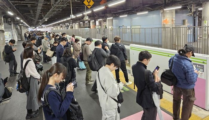
We got off the Yamanote Line at the station just after Shinjuku because it’s easier to exit that massive station with our luggage. So we ended up in Shin-Okubo, right in the Korean district. A 10-minute walk took us to Villa Fontaine Hotel. A great hotel, well-located north of the Kabukichō district. The room even seemed bigger than we’d expected.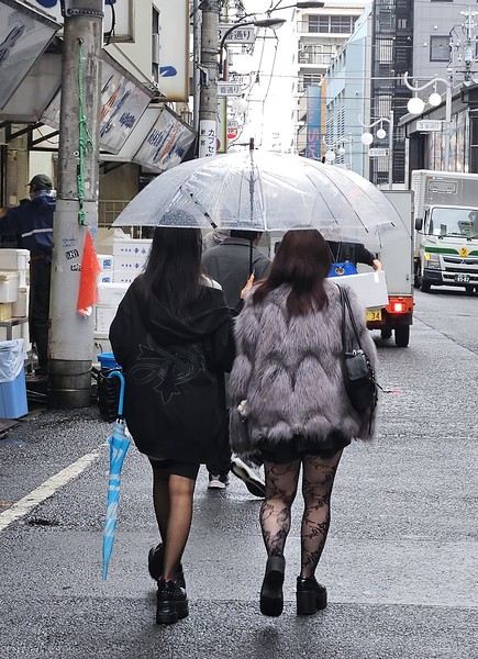
 It was 15°C, but it rained—and kept raining on and off all day. Belgian weather, basically.
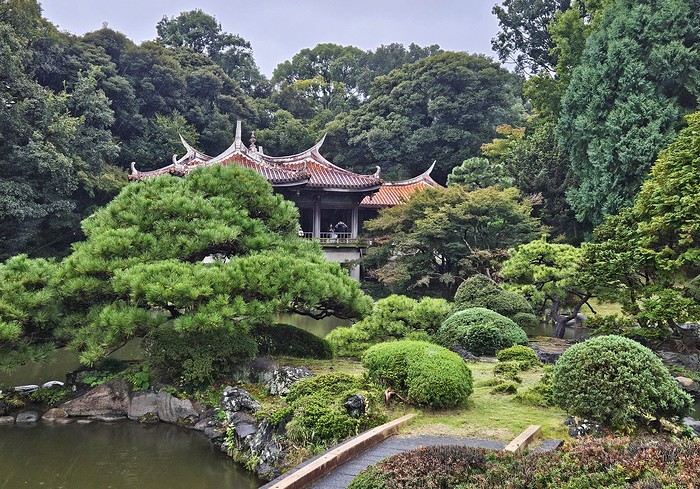
We went for a walk in Shinjuku Gyoen Park. Not as pretty in the rain, but the big greenhouse was interesting.
It was 15°C, but it rained—and kept raining on and off all day. Belgian weather, basically.
We went for a walk in Shinjuku Gyoen Park. Not as pretty in the rain, but the big greenhouse was interesting.
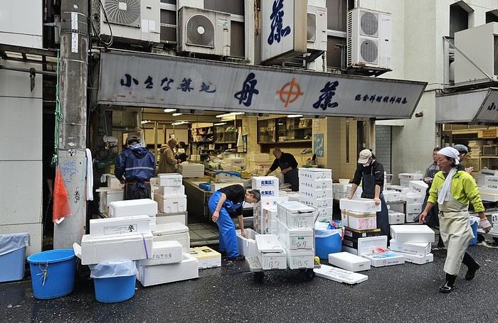
Then our first ramen (hearty and for 1000 ¥—pretty much the price of all our ramen during the trip). We headed back to the hotel since check-in was after 3 PM. Shower and relax before going out for dinner. Dinner was barbecue at Shichirin Yakiniku Anan (1700 ¥ each—good and cheap). Ordering via tablet wasn’t easy, but luckily it was in English.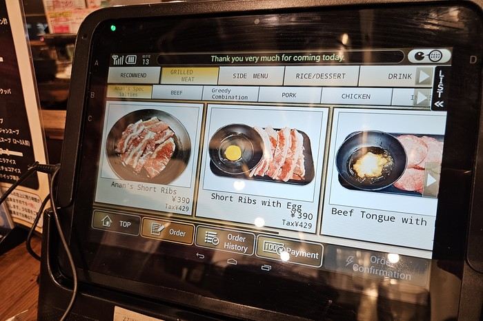
We ended the evening with a stroll through Kabukichō before a well-deserved sleep.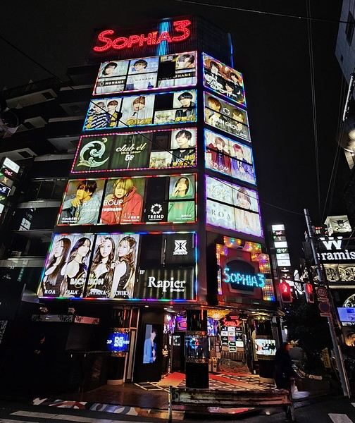
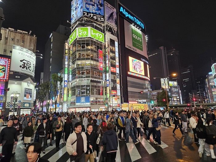
Day 1: Departure from Brussels (October 24, 2025) Early morning takeoff at 6 AM to Munich (1.5-hour layover) with Lufthansa, then a 12-hour flight with ANA, arriving the next morning at 7 AM at Tokyo Haneda.
Day 2: Arrival in Tokyo Airport formalities were quick. The eSIM we bought before leaving activated as soon as we landed (10 GB plan with Saily—more than enough for our mobile internet needs, mainly Google Maps and Google Translate). We’d received 4 ICOCA cards from our neighbors, which we loaded with 15000 ¥ each. We took the Keihin train, then the Yamanote Line. It’s easy to navigate since everything is in English, and each station is announced on scrolling displays in English too.
We got off the Yamanote Line at the station just after Shinjuku because it’s easier to exit that massive station with our luggage. So we ended up in Shin-Okubo, right in the Korean district. A 10-minute walk took us to Villa Fontaine Hotel. A great hotel, well-located north of the Kabukichō district. The room even seemed bigger than we’d expected.
It was 15°C, but it rained—and kept raining on and off all day. Belgian weather, basically.
We went for a walk in Shinjuku Gyoen Park. Not as pretty in the rain, but the big greenhouse was interesting.
Then our first ramen (hearty and for 1000 ¥—pretty much the price of all our ramen during the trip). We headed back to the hotel since check-in was after 3 PM. Shower and relax before going out for dinner. Dinner was barbecue at Shichirin Yakiniku Anan (1700 ¥ each—good and cheap). Ordering via tablet wasn’t easy, but luckily it was in English.
We ended the evening with a stroll through Kabukichō before a well-deserved sleep.
18-Day Itinerary for Japan
Hi everyone,
I’ve been planning several itineraries for a trip to Japan with my wife but would love your insights before we start booking!
In short, we want to go during Golden Week, see late-blooming cherry trees, and have the freedom to get around with a rental car.
Here’s the plan:
18-day itinerary in Japan (April 25 → May 12)
Goal: freedom, late cherry blossoms, culture & nature
---
Days 1–3: Tokyo (April 25–27) Arrival and adjustment (no car needed yet). Neighborhoods to visit: Shinjuku, Asakusa, Meiji Jingu, Shibuya, Odaiba. Suggested activities: Ghibli Museum, Sumida River cruise, izakaya meals. Late cherry blossoms (yaezakura) possible at Shinjuku Gyoen. Pick up the rental car on the morning of April 27.
---
Days 4–5: Mount Fuji & Hakone (April 27–28) Route: Tokyo → Kawaguchiko/Hakone (~2 h).
Activities: Lake Kawaguchi, Chureito Pagoda (Fuji views + late cherry blossoms) Onsen baths, Hakone Open-Air Museum. Stay: ryokan with onsen and views of Mount Fuji.
---
Days 6–7: Takayama & Shirakawa-go (April 29–30) Route: Hakone → Takayama (~4 h).
Activities: Preserved old town, sake breweries, UNESCO village of Shirakawa-go. Stay: traditional minshuku (thatched-roof house). Cherry blossoms are finishing at this altitude — beautiful mountain/nature contrasts. ---
Days 8–10: Kyoto & Nara (May 1–3) Route: Takayama → Kyoto (~4 h 30).
Activities in Kyoto: Fushimi Inari (red torii gates), Golden Pavilion, Arashiyama, Gion (geisha district).
Day trip to Nara: Free-roaming deer in Nara Park, Todai-ji Temple, Kasuga Taisha Shrine. Stay: Kyoto (3 nights).
---
Day 11: Osaka or Himeji (May 4) Route: Kyoto → Osaka (~1 h) or Himeji (~1 h 30).
Option 1: Osaka → modern vibe, street food, castle. Option 2: Himeji → stunning UNESCO-listed castle. Stay: Osaka.
---
Days 12–13: Kanazawa (May 5–6) Route: Osaka → Kanazawa (~4 h 30).
Activities: Kenroku-en Garden (gorgeous in spring), Omicho Market, samurai district. Stay: Kanazawa.
---
Days 14–15: Northern Japan – Aomori / Hirosaki (May 7–8) Route: Kanazawa → Aomori (~7 h, possible to break via Sendai).
Activities: Hirosaki Castle Park (peak bloom early May). Northern onsen (e.g., Sukayu). Stay: Hirosaki or Aomori.
---
Days 16–17: Nikko (May 9–10) Route: Aomori → Nikko (~6 h).
Activities: Toshogu Shrine, Kegon Falls, Lake Chuzenji. Stay: Nikko.
---
Day 18: Return to Tokyo & Relax in Kamakura (May 11–12) Route: Nikko → Kamakura (~3 h) → Tokyo (~1 h).
Activities: Great Buddha, Zen temples, seaside at Enoshima. Final night: Tokyo before the return flight.
Thanks in advance for your feedback!
---
Days 1–3: Tokyo (April 25–27) Arrival and adjustment (no car needed yet). Neighborhoods to visit: Shinjuku, Asakusa, Meiji Jingu, Shibuya, Odaiba. Suggested activities: Ghibli Museum, Sumida River cruise, izakaya meals. Late cherry blossoms (yaezakura) possible at Shinjuku Gyoen. Pick up the rental car on the morning of April 27.
---
Days 4–5: Mount Fuji & Hakone (April 27–28) Route: Tokyo → Kawaguchiko/Hakone (~2 h).
Activities: Lake Kawaguchi, Chureito Pagoda (Fuji views + late cherry blossoms) Onsen baths, Hakone Open-Air Museum. Stay: ryokan with onsen and views of Mount Fuji.
---
Days 6–7: Takayama & Shirakawa-go (April 29–30) Route: Hakone → Takayama (~4 h).
Activities: Preserved old town, sake breweries, UNESCO village of Shirakawa-go. Stay: traditional minshuku (thatched-roof house). Cherry blossoms are finishing at this altitude — beautiful mountain/nature contrasts. ---
Days 8–10: Kyoto & Nara (May 1–3) Route: Takayama → Kyoto (~4 h 30).
Activities in Kyoto: Fushimi Inari (red torii gates), Golden Pavilion, Arashiyama, Gion (geisha district).
Day trip to Nara: Free-roaming deer in Nara Park, Todai-ji Temple, Kasuga Taisha Shrine. Stay: Kyoto (3 nights).
---
Day 11: Osaka or Himeji (May 4) Route: Kyoto → Osaka (~1 h) or Himeji (~1 h 30).
Option 1: Osaka → modern vibe, street food, castle. Option 2: Himeji → stunning UNESCO-listed castle. Stay: Osaka.
---
Days 12–13: Kanazawa (May 5–6) Route: Osaka → Kanazawa (~4 h 30).
Activities: Kenroku-en Garden (gorgeous in spring), Omicho Market, samurai district. Stay: Kanazawa.
---
Days 14–15: Northern Japan – Aomori / Hirosaki (May 7–8) Route: Kanazawa → Aomori (~7 h, possible to break via Sendai).
Activities: Hirosaki Castle Park (peak bloom early May). Northern onsen (e.g., Sukayu). Stay: Hirosaki or Aomori.
---
Days 16–17: Nikko (May 9–10) Route: Aomori → Nikko (~6 h).
Activities: Toshogu Shrine, Kegon Falls, Lake Chuzenji. Stay: Nikko.
---
Day 18: Return to Tokyo & Relax in Kamakura (May 11–12) Route: Nikko → Kamakura (~3 h) → Tokyo (~1 h).
Activities: Great Buddha, Zen temples, seaside at Enoshima. Final night: Tokyo before the return flight.
Thanks in advance for your feedback!
Mauritian Ti' Punch
The recipe for the cocktail: endless beaches, a dazzling palette of colors, some breathtaking hikes, and excellent cuisine...
For the tasting, follow along in the pages of this travel journal! 😉
Don’t forget your hiking shoes, a swimsuit, sunscreen, but also a sweater, your driver’s license, and your credit card...
Just over 11 hours of flight, and we’ll be setting foot on Mauritian soil!
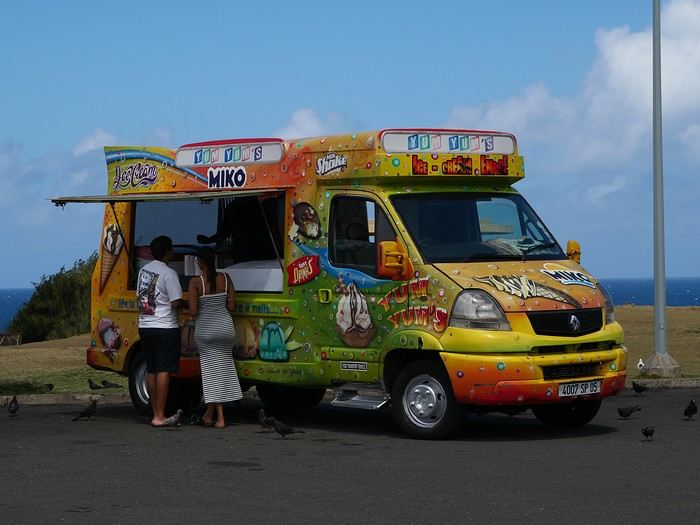
For the tasting, follow along in the pages of this travel journal! 😉
Don’t forget your hiking shoes, a swimsuit, sunscreen, but also a sweater, your driver’s license, and your credit card...
Just over 11 hours of flight, and we’ll be setting foot on Mauritian soil!
Langtang – Trekking in the Rain
We did the Langtang trek (hike) from September 10th to 17th, with the first and last days being the trip from Kathmandu and back—so 6 days of actual walking. It’s a fairly well-known trek but certainly not as famous or crowded as those in the Annapurna or Everest regions, which is why we chose it.
In theory, it’s mandatory to have a guide for this trek. In reality, it seems there are ways to bypass the regulations: we met at least two people hiking without a guide—a South Korean, a New Zealander, and possibly also a couple of English women and an American couple, though we’re not sure if they had a guide.
The agency we booked with had told us it was an affordable trek for relatively older people in good shape—which is our case (I’m 72 myself). I have to say upfront that we found it quite challenging, maybe because we didn’t have good weather—it was the end of the monsoon season. To be clear, no matter your fitness level, I’d say doing this trek in the middle of the monsoon season would be suicidal.
Day 1 – Journey from Kathmandu to Syapru Besi
On Monday, September 8th, there had been violent protests in Kathmandu against the government, which had, among other things, blocked access to social media and been accused of nepotism and corruption. There were 19 deaths. The situation was very tense on the day of our departure, Wednesday the 10th. The agency warned us that public transport was very unreliable. So, we decided to take a jeep, at an additional cost of $100 ($160 minus what was already budgeted for the bus).
We left a little before 7 a.m. and it took us a good hour just to reach the outskirts of Kathmandu. Along the way, we saw several houses and vehicles set on fire by protesters.
The road to Syapru Besi is only 120 km, but it’s frankly awful. It’s always narrow, winds through endless mountains, and the shoulders range from bad to confusing to nonexistent. Several sections are just dirt tracks. We didn’t regret opting for the jeep, as we could stop several times at our convenience—if only to let Y (my Thai partner) throw up everything she had. She’d taken her usual motion sickness medication, but the constant turns, accelerations, and braking eventually made her terribly carsick.
In Nuwakot, we stopped for breakfast at a nice little restaurant, Jimbu. It was around 8:30 a.m., and we’d barely covered 60 km. The restaurant has a lovely garden overlooking the Trishuli Ganga, the river flowing down from Syapru Besi. First photo: the river in the bottom right corner, mist and clouds over the mountain on the other side.
An hour later, my second photo: the hills along the Trishuli Ganga. You can see the different crops—lush green rice paddies in the lower right and corn, already yellowed and likely harvested, in the foreground on the left. And of course, the mist and clouds through which you can glimpse the mountain on the other side of the river.
In theory, it’s mandatory to have a guide for this trek. In reality, it seems there are ways to bypass the regulations: we met at least two people hiking without a guide—a South Korean, a New Zealander, and possibly also a couple of English women and an American couple, though we’re not sure if they had a guide.
The agency we booked with had told us it was an affordable trek for relatively older people in good shape—which is our case (I’m 72 myself). I have to say upfront that we found it quite challenging, maybe because we didn’t have good weather—it was the end of the monsoon season. To be clear, no matter your fitness level, I’d say doing this trek in the middle of the monsoon season would be suicidal.
Day 1 – Journey from Kathmandu to Syapru Besi
On Monday, September 8th, there had been violent protests in Kathmandu against the government, which had, among other things, blocked access to social media and been accused of nepotism and corruption. There were 19 deaths. The situation was very tense on the day of our departure, Wednesday the 10th. The agency warned us that public transport was very unreliable. So, we decided to take a jeep, at an additional cost of $100 ($160 minus what was already budgeted for the bus).
We left a little before 7 a.m. and it took us a good hour just to reach the outskirts of Kathmandu. Along the way, we saw several houses and vehicles set on fire by protesters.
The road to Syapru Besi is only 120 km, but it’s frankly awful. It’s always narrow, winds through endless mountains, and the shoulders range from bad to confusing to nonexistent. Several sections are just dirt tracks. We didn’t regret opting for the jeep, as we could stop several times at our convenience—if only to let Y (my Thai partner) throw up everything she had. She’d taken her usual motion sickness medication, but the constant turns, accelerations, and braking eventually made her terribly carsick.
In Nuwakot, we stopped for breakfast at a nice little restaurant, Jimbu. It was around 8:30 a.m., and we’d barely covered 60 km. The restaurant has a lovely garden overlooking the Trishuli Ganga, the river flowing down from Syapru Besi. First photo: the river in the bottom right corner, mist and clouds over the mountain on the other side.
An hour later, my second photo: the hills along the Trishuli Ganga. You can see the different crops—lush green rice paddies in the lower right and corn, already yellowed and likely harvested, in the foreground on the left. And of course, the mist and clouds through which you can glimpse the mountain on the other side of the river.
The Two of Us in Istanbul: A Turkish Blue Round
Hello everyone,
I’m not really a regular contributor to VoyageForum, but every time Kate and I travel, she encourages me to write a travel journal and publish it. And I must admit, it’s a very enjoyable intellectual exercise, though not always easy. As a VF contributor whose journals I’ve read once said, this retrospective work not only helps preserve memories but also provides a fruitful moment of introspection by bringing back emotions and feelings.
Kate and I spent a week in Istanbul. For her, who had already visited, it was a return; for me, it was a discovery.
As we’ve now made a habit of, I write the texts, and she posts her photos. We hope this illustrated story, crafted together, will revive beautiful sensations for those who know the city and inspire others to discover it. Here we go!
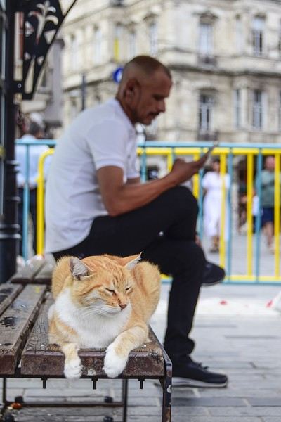
I’m not really a regular contributor to VoyageForum, but every time Kate and I travel, she encourages me to write a travel journal and publish it. And I must admit, it’s a very enjoyable intellectual exercise, though not always easy. As a VF contributor whose journals I’ve read once said, this retrospective work not only helps preserve memories but also provides a fruitful moment of introspection by bringing back emotions and feelings.
Kate and I spent a week in Istanbul. For her, who had already visited, it was a return; for me, it was a discovery.
As we’ve now made a habit of, I write the texts, and she posts her photos. We hope this illustrated story, crafted together, will revive beautiful sensations for those who know the city and inspire others to discover it. Here we go!
Another side of my trip to Thailand: Villages, nature, countryside, mountains...
February 9th is a pivotal day during my trip to Thailand. Up until this date, my focus had been on cities, temples, and other urban landmarks. Starting February 10th, I’ll finally leave the city behind for the outskirts—one town, one life, farther from tourism, more real, more authentic... Then comes the bucolic surroundings of Chiang Mai, nature, the countryside, the mountains.
This morning, I head to visit the ethnographic museum. I’d been told about another one, but it’s permanently closed. I wonder if it’s the same one that might have changed its name and location.
I thoroughly enjoy visiting this museum. At first, I’m a bit annoyed because the place is packed with noisy school groups blocking the display cases without even showing the slightest interest. But soon, their chaperones manage to lead them into another room, giving me some peace. They maintain this distance throughout the tour, allowing me to explore the museum in complete tranquility. I really appreciate their tact.
I’m amazed by the absolutely stunning fabric displays and the countless everyday objects, especially the very old pottery. There’s so much beautiful basketry and intricately carved wood. The statues are also incredible... After seeing all of them, I no longer feel like buying any from the shops.
On my way back, not far from my hotel, I discover a rather unique place that only serves one drink, which they’ve made their specialty: egg coffee! A pretty surprising novelty. I have to try it.

At the bottom of the cup, they pour a layer of milk, topped with a layer of liquid coffee, followed by a layer of egg yolk, and finally a top layer that turns out to be a mix of coffee and cocoa powder. It’s a cold drink that, in the end, doesn’t have much flavor, and the price is pretty steep for such a small cup. You’re paying for the exclusivity!
Later in the day, I venture once again into small alleys, something I love doing when exploring a new city—no specific goal, just wandering east of the city, outside the walls.

I encounter very few tourists there and discover unsuspected little shops overflowing with lovely items, much cheaper than what you find in the heart of the tourist district. Then I wander through the floors of Warorot Market. I discover another kind of temple there: the temple of good deals. I love finding clothes that are really original for locals, not the flood of shirts and pants that tourists love but no Thai would ever buy, which invade the shops in the "Historic Square." I stop in my tracks in front of a stall with beautiful shirts featuring stunning geometric patterns in elegant color combinations and very short sleeves. Hmm, these would be perfect for showing off my biceps, one of which is adorned with the magnificent Ganesh tattoo I got last year in Bali. "When you’ve got nice things, you’ve got to show them off!" he said. 😜🙏💪 I pick out two for 380 baht and negotiate them down to 300. But the seller won’t go any lower. I understand I’ve reached the limit of her commercial possibilities. Just as I’m leaving the shop, happy with my purchase, my ever-helpful inner voice, Petite Voix, suggests: - You didn’t try them on because you were too lazy to take off the one you’re wearing and also because of the sweat, but you could just put one on over the one you’re wearing. It’s light enough that it won’t bother you.
I go back to the two sellers, who burst out laughing when I ask to try them on. - Oh no, it’s way too small for you! It’s a women’s shirt! - But they don’t look particularly feminine in style! And I chose XXL... I put the shirt on, and of course, it won’t close. Then I notice the buttons are on the wrong side. That’s why the sleeves seemed so short!!! They put the shirts back on the rack and refund me without any fuss, commenting amid total hilarity: - Well, thank goodness you tried it on just as you were leaving the shop!
Since I don’t want to walk too much before tomorrow’s first Big Outing with the driver, I end my stroll with a visit to two very pretty temples recommended by Joël.

I’d rather not post more temple photos. But these ones smell like village and countryside...


I’ve never seen anything like Wat Ket Karam, so extravagant...


And I end my day with two other lesser-known temples: Wat Noung Kham, simple and finally free of gold and glitter,

and Wat Dap Phai, where an intimate ceremony is taking place at the end of the day.
This morning, I head to visit the ethnographic museum. I’d been told about another one, but it’s permanently closed. I wonder if it’s the same one that might have changed its name and location.
I thoroughly enjoy visiting this museum. At first, I’m a bit annoyed because the place is packed with noisy school groups blocking the display cases without even showing the slightest interest. But soon, their chaperones manage to lead them into another room, giving me some peace. They maintain this distance throughout the tour, allowing me to explore the museum in complete tranquility. I really appreciate their tact.
I’m amazed by the absolutely stunning fabric displays and the countless everyday objects, especially the very old pottery. There’s so much beautiful basketry and intricately carved wood. The statues are also incredible... After seeing all of them, I no longer feel like buying any from the shops.
On my way back, not far from my hotel, I discover a rather unique place that only serves one drink, which they’ve made their specialty: egg coffee! A pretty surprising novelty. I have to try it.
At the bottom of the cup, they pour a layer of milk, topped with a layer of liquid coffee, followed by a layer of egg yolk, and finally a top layer that turns out to be a mix of coffee and cocoa powder. It’s a cold drink that, in the end, doesn’t have much flavor, and the price is pretty steep for such a small cup. You’re paying for the exclusivity!
Later in the day, I venture once again into small alleys, something I love doing when exploring a new city—no specific goal, just wandering east of the city, outside the walls.
I encounter very few tourists there and discover unsuspected little shops overflowing with lovely items, much cheaper than what you find in the heart of the tourist district. Then I wander through the floors of Warorot Market. I discover another kind of temple there: the temple of good deals. I love finding clothes that are really original for locals, not the flood of shirts and pants that tourists love but no Thai would ever buy, which invade the shops in the "Historic Square." I stop in my tracks in front of a stall with beautiful shirts featuring stunning geometric patterns in elegant color combinations and very short sleeves. Hmm, these would be perfect for showing off my biceps, one of which is adorned with the magnificent Ganesh tattoo I got last year in Bali. "When you’ve got nice things, you’ve got to show them off!" he said. 😜🙏💪 I pick out two for 380 baht and negotiate them down to 300. But the seller won’t go any lower. I understand I’ve reached the limit of her commercial possibilities. Just as I’m leaving the shop, happy with my purchase, my ever-helpful inner voice, Petite Voix, suggests: - You didn’t try them on because you were too lazy to take off the one you’re wearing and also because of the sweat, but you could just put one on over the one you’re wearing. It’s light enough that it won’t bother you.
I go back to the two sellers, who burst out laughing when I ask to try them on. - Oh no, it’s way too small for you! It’s a women’s shirt! - But they don’t look particularly feminine in style! And I chose XXL... I put the shirt on, and of course, it won’t close. Then I notice the buttons are on the wrong side. That’s why the sleeves seemed so short!!! They put the shirts back on the rack and refund me without any fuss, commenting amid total hilarity: - Well, thank goodness you tried it on just as you were leaving the shop!
Since I don’t want to walk too much before tomorrow’s first Big Outing with the driver, I end my stroll with a visit to two very pretty temples recommended by Joël.
I’d rather not post more temple photos. But these ones smell like village and countryside...
I’ve never seen anything like Wat Ket Karam, so extravagant...
And I end my day with two other lesser-known temples: Wat Noung Kham, simple and finally free of gold and glitter,
and Wat Dap Phai, where an intimate ceremony is taking place at the end of the day.
Thai Countryside Scenes
Hi there,
Yesterday in the Thailand section, 100% of the new threads were just about beach destinations 😕...
So here’s the counterattack in the form of this photo thread, dedicated solely to the countryside: the locals, their livestock, fields, farms, rice paddies, small rivers, and agricultural machinery. If you’ve got any pictures that fit these categories, feel free to add them!
Comments welcome.
For each photo, I’ll (or you can) indicate the area where it was taken.
Kanchanaburi: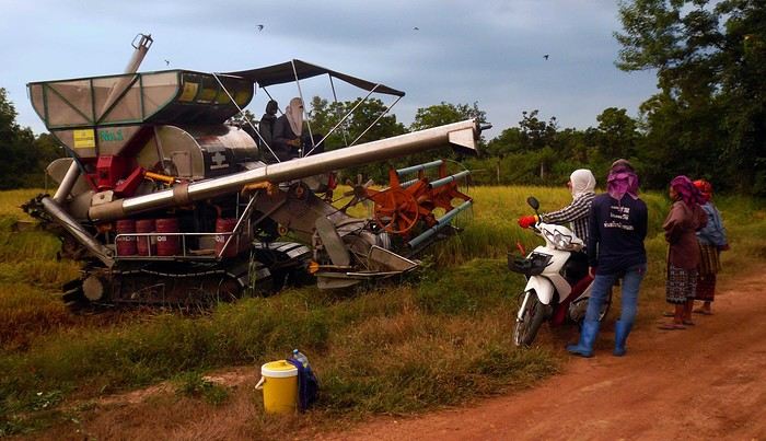
Kanchanaburi: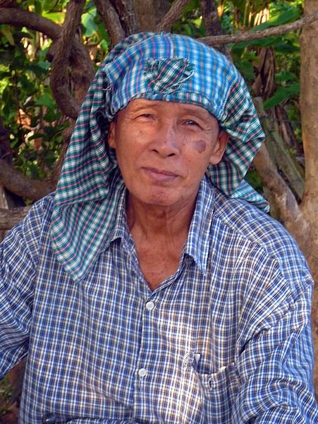
Sri Chiangmai: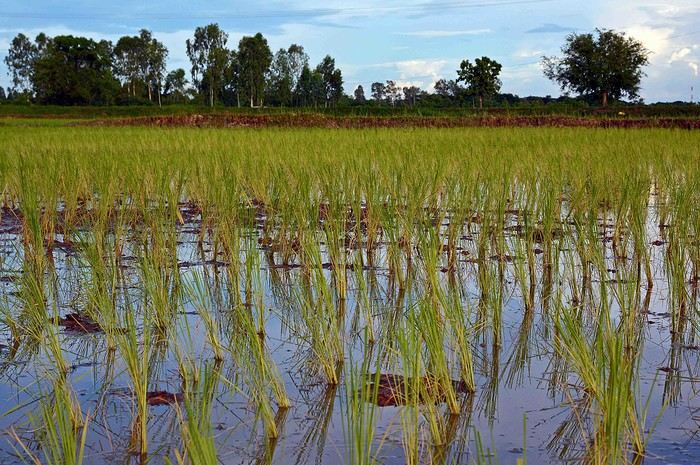
Soppong: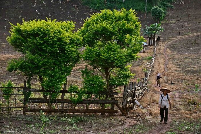
Tha Wang Pha: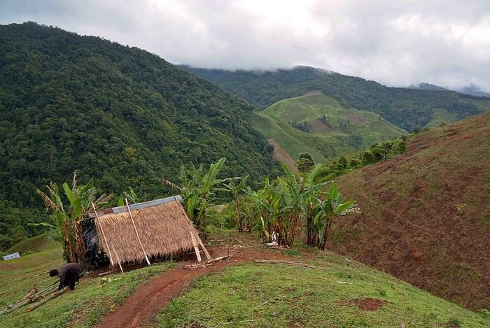
Kanchanaburi:
Kanchanaburi:
Sri Chiangmai:
Soppong:
Tha Wang Pha:
Namibia Travel Journal: May 2025 - Trip Review
NAMIBIA TRIP 2025: April 24 to May 20: Feel free to comment or ask us any questions about this amazing journey.
>> Find all our photos and videos for each day on our website here: www.montagne-aventure.net
**DAY 1: Thursday, April 24, 2025: Outbound Flights from Lyon to Windhoek via Munich - Visit to Munich:**

Off we go on a new adventure. The alarm rings at 6:30 AM, the travel bags are packed, and we head to Lyon Airport. We booked our flight tickets with Lufthansa. The first leg to Munich, Germany, is operated by AirBaltic. Departure at 1:05 PM for a 1-hour and 20-minute flight. We arrive at 2:30 PM.
**We now have a 7-hour layover, so we take the opportunity to get some fresh air and explore Munich.** We quickly exit Terminal 2 of the airport and head towards the subway. We buy a group day ticket "Airport-city Day Zone M-5," valid for 2 to 5 people at a price of 30.50 € (instead of 16.30 € per person). We take the S8 line to **Marienplatz** in 35 minutes. **This is the heart of the city.** The weather is overcast, quite cool, but dry. Perfect for a little city trip between two flights while leaving our large luggage in transit at the airport. **Munich is the third-largest German city after Berlin and Hamburg, in the Bavaria region.** **The center has a lot of charm and brings together several religious buildings, easy to explore on foot.** We are impressed by the number of people enjoying these 100% pedestrian streets, which are very pleasant. After Marienplatz, the most famous square with the town hall, we head to the Cathedral of Our Lady, a Gothic church, then continue to **Karlsplatz** and move on to **the food market offering a wide selection of high-end food products in an atmosphere where a certain art of living prevails.** We also visit St. Peter's Church before grabbing a bite to eat. Two good hours were enough for this 10 km city walk. It's time to take the subway back: by 6:30 PM, we are back at the airport. Now, it's time for a bit of waiting and rest. Our second flight is scheduled for 9:35 PM for a 9-hour and 30-minute journey to our final destination in Namibia: **Windhoek.**
> Round-trip flight tickets with Lufthansa from Lyon: 2029 €, or 1,014.50 € per person.
> Lyon Airport parking: 120 €
> Today's expenses: 7 € for 2 pizzas in France / 14 € for the restaurant in Munich / 30.50 € for the daily subway ticket in Munich.
**DAY 2: Friday, April 25, 2024: Arrival in Windhoek, Visit to the Namibian Capital:**
After a 9-hour and 30-minute overnight flight with Discover Airlines, we finally land on Namibian soil just before 7:30 AM. The day is breaking, and the colors are already stunning. We are eager despite the usual fatigue from the flight. The airline was punctual, with friendly staff and good meals, though a bit light. We are the first flight of the day to land, with no more than 15 flights per day here, from 7 AM to 8 PM. We disembark on the tarmac at this airport located in the middle of nowhere, **I finally set foot on African soil for the first time.** We exit among the first from the aircraft to go through the long formalities at the front of the line, as the wait can quickly become endless. Allow at least 5 minutes per person for e-visas. We still wait 45 minutes despite only about twenty people ahead of us. Phew, it's done. We collect our luggage and then withdraw money from an ATM. We make 4 withdrawals of the maximum amount, 2000 NAD $ per withdrawal, for a total of 380 €, or 95.33 € per withdrawal.
Our driver arrives at the same time, perfect timing, we were quick.
We leave the airport at 8:45 AM. By 9:30 AM, we arrive at the **Gracious Whisp vehicle rental agency**, located at the entrance of Windhoek, small and human-sized with a fleet of recent vehicles. More formalities, then a short wait as our vehicle is not yet ready. Time to decompress, catch our breath, and enjoy the very pleasant morning temperature. Not a cloud in sight. Next, a briefing on the vehicle, always with a bit of apprehension due to our approximate English. Allow 45 minutes of explanations, including setting up the roof tent, camping equipment, technical information in case of a flat tire, driving tips in Namibia, and a tour of the 4x4. We have all the necessary equipment for camping: mattresses, sleeping bags, pillows, table, chairs, gas stove, BBQ grill... as well as 2 spare tires, a compressor, a dual tank, and accessories for removing wheels. Off we go, it's time to muster our courage and get behind the wheel. **Heading to SuperSpar Maerua**, fortunately located less than 10 minutes away. We park with the help of a parking attendant; it's very crowded, the space is narrow, but everything goes well despite the cursed right-hand drive. Today's new mission: stock up on groceries. The store is well-stocked with local and imported products, catering to all tastes. We spend 114 € on groceries, from pasta to meat, BBQ lighters to dishwashing products. Two people load our groceries into two carts and transfer them to our vehicle; we feel compelled to leave a tip, 50 NAD $, as we don't have change yet. Now, we head to the hotel, 15 minutes away. Traffic is difficult at a complicated intersection; this will likely be the only traffic jam in Namibia. **We arrive at Kate's Nest Guesthouse & Backpackers around 1:15 PM, quite tired.** We take some well-deserved rest at this recent establishment, quite calm with secure private parking. After a short nap, we enjoy the quiet by the hotel pool. Night falls between 6:30 PM and 7 PM. We eat quietly in our room tonight before starting this long 4x4 road trip in camping mode in the heart of Namibia.
> Today's grocery expenses: 114 € at Super Spar Marua (2395.21 NAD $).
> Round-trip flight tickets with Lufthansa from Lyon: 2029 €, or 1,014.50 € per person.
> Vehicle rental: 4x4 Toyota with roof tent for 24 days: Gracious Whisp Car Rentals: 2,638 € (N$50,640) or **1,319 €** per person - (https://gwcarrentals.com/)
> Distance driven today: 15 km.
> Accommodation: Kate's Nest Guesthouse & Backpackers - 4 Aristotles Street Academia, 9000 Windhoek - 36 € for two for one night.
> Windhoek International Airport website: (https://www.airports.com.na/)
**DAY 3: Saturday, April 26, 2025: Windhoek to Hardap: Mariental Region - Kalahari Desert:**
After a good, restful night, we wake up leisurely around 7 AM. We enjoy the comfort provided by this first and last hotel before 24 nights under the tent.
**We leave Kate's Nest Guesthouse at 8:30 AM to tackle the Namibian roads.** We quickly leave the capital; in just 30 minutes, we find ourselves almost alone in the world. The landscape is dotted with small domes. We leave the **paved B1** quickly to turn left onto the **C15**. **From there, we won't see more than 10 vehicles all day.** After passing through the few houses of **Lekkerwaterpoort**, we tackle our first gravel road. These road sections are limited to 100 km/h, but even at 70 km/h, I find it already challenging. However, I quickly get used to it and gradually pick up speed to reach my cruising speed of around 80 to 90 km/h. **We are on immense straight lines crossing wild expanses as far as the eye can see.** **We come across two baboons, a few ostriches, and numerous cattle and sheep farms.** We pass through the charming village of **Uhlenhorst** with its typical houses and children with broad smiles waving at us. Life here is already very different from Windhoek. **The thermometer rises quickly from 16°C at 8:30 AM to over 28°C in the early afternoon.**
**We arrive at the Hardap Dam reserve at 2 PM.** We stop at the toll booth at the park entrance to pay the entrance fee: 250 NAD $ for 2 people and 1 vehicle. We continue to the dam and then the camp entrance, located a bit further. We had booked in advance, but this place remains little frequented by foreigners.
We take advantage of the hottest hours to rest by the large pool overlooking the immense lake, a very enjoyable moment. Would this be a bit of a vacation?
Around 4:30 PM, we head to the campsite. We overlook this vast water reserve. We arrive first; we will be only 3 vehicles spending the night here. It's time to get to work and set up our equipment for the first time. It takes us a good 20 minutes to set everything up, with a slight apprehension about unfolding the tent. Once this task is done, which we will have to repeat for almost a month, we will become much more efficient over time. Time for rest and contemplation in total silence. The sun gradually sets, and the heat quickly becomes bearable again. Bliss! **This dam is located 20 km northwest of Mariental in an area dotted with conical hills topped with dolerite buttons (Hardap means "hillock" in Nama). It captures the Fish River, which flows south, creating a large lake in the middle of an arid environment. The contrast is striking.** We enjoy our first sunset facing this 360° otherworldly landscape.
Around 7 PM, we start our first BBQ, or "braai" as it's called here. The temperature is perfect. The sun sets, giving way to a star-filled sky of incredible beauty thanks to the absence of any light pollution. The Milky Way will lull us throughout the evening. After some good sausages and potatoes on the BBQ, we head to our roof tent around 9:30 PM with a complete change of scenery in just 24 hours. France already seems so far away...
This campsite has shared showers and toilets, quite clean and functional, as well as a central area with several BBQs and tables. The sites are arranged in a semicircle, each with an electrical outlet. The sites are close to each other but spacious, some slightly shaded. We are only three vehicles tonight, so it's perfectly comfortable and quiet. Not to mention the large pool near the restaurant. Our trip is off to a great start.
> Today's road itinerary: Windhoek > Head south on the B1 to Rehoboth > Turn left onto the C25 then C15 to Stampriet > C20 to Hardap > Full north on the B1 > Then turn left onto the M93 - 5 hours of driving.
> Distance driven today: 354 km.
> Accommodation: Hardap Recreation Resort - 23.3 € for two - Large pool - GR6W+3M2, Hardap Game Reserve, Mariental, Namibia - (http://www.nwr.com.na/resorts/hardap-resort/)
**DAY 4: Sunday, April 27, 2025: Hardap - Brukkaros Volcano - Keetmanshoop - Quivertree Forest Rest Camp**
Our first night under the tent was very pleasant; the little wind quickly calmed down, giving way to absolute silence. The mattress is decent, more comfortable than some nights in Nepal. The length and width give us enough space for maximum comfort, despite my height (1.91 m). We wake up a little before 7 AM as the sun rises, and the lights dazzle us from the start of the day. We pack up the equipment in 30 minutes, quite easily. Then we enjoy the sun, which warms up quickly while we keep our light fleece on.
At 8:30 AM, **we hit the road again, heading south** to our first stop in **Mariental**. We want to do some shopping at SuperSpar, but once we arrive in the parking lot, a young local is fighting with the supermarket security guards and then threatens to throw stones. We don't want to take any risks right at the start, so despite the baton blows he receives, he doesn't stop. We leave empty-handed but fill up with fuel at the Shell station 1 km further. The price per liter is 21.33 NAD $, we fill our 107-liter tank for 107 €. In Namibia, you get served, and they bring the card machine to the window to pay. It's then customary to leave a tip.
We then take the B1 heading due south on a recently renovated road. Around 11:30 AM, we leave it on our right to take **a wild gravel road, the M98**. Just before **Berseba**, we turn right onto a small track, the **D3904 towards Brukkaros Crater up to a camp at 1588 m altitude**. The track then becomes too bumpy. We stop on the counter-slopes where **a wide panorama unfolds over these immense plains as far as the eye can see**. It's 12:15 PM, time for us to eat a rice and tuna salad facing this landscape.
**We are alone in the world until a vehicle arrives and parks next to us.** A bit of apprehension, 4 men head towards us. It turns out to be 4 shepherds looking for a lost foal. The conversation is pleasant, lost in the middle of nowhere. We find ourselves alone again in this absolute silence. **The heat becomes stifling with a good 30°C**. We get back on the road around 1 PM. Back on the B1, **we continue due south to Keetmanshoop**, which we reach around 3 PM. We stop there to do some shopping for 262 NAD $ (12 eggs, a can of tuna, a can of corn, bread, a soda, and a 5-liter water container), or 12.48 €. Two quite insistent children ask us for money or candy at the store exit, yet we give them a small tip, but they continue to cling to the car. Locals parked next to us tell them to leave us alone. Anyway, we finish the trip to **Quivertree Forest**, 15 km away. We will spend the night in this **pleasant farm run by a German**. Upon arrival, as the day before, and as I suppose in the future, we dive straight into the cool pool to relax after all these kilometers. A bliss. Then we take our 4x4 and choose a spot near these famous trees. After the 33°C this afternoon, once 4 PM passed, the temperature drops again and becomes very pleasant. **We are in the middle of the Kokerboom, one of the most interesting and characteristic plants of hot and arid regions. It's not really a tree but a variant of the aloe plant whose botanical name is Aloe Dichotoma. This Kokerboom has a smooth and thick trunk reaching up to 1 m in thickness and 9 m in height. They bloom for the first time at the age of 20 to 30 years.** The flowers are yellow and reach about thirty centimeters during the season between June and July. **They grow mainly in an environment with a high concentration of black rocks absorbing a large amount of heat (38°C). The rocks also serve to anchor the tree with its tentacle-like roots. It also resists frost. Each is between 200 and 300 years old.**
Around 5 PM, we walk to the farm reception to watch the feeding of **two cheetahs**. Magnificent carnivores taking their time to savor their piece of meat. **Then we return near our campsite to enjoy the sunset among these trees. The colors are sublime, as every evening apparently. A magnificent spectacle with colors evolving from yellow to orange then to pink, before giving way once again to a sky filled with thousands of stars.** Our campsite at Quiver Tree Forest Camp is very comfortable; we have a water supply, a stone table, a small lamp, an electrical outlet, a small tree for shade, and a BBQ that we won't use tonight; we'll cook on gas. The sites are far apart, with some shared facilities scattered around, a very beautiful setting. No reservation possible, no need, just show up directly. **The campsite accommodation for 2 people costs 28 €, including the reserve entrance fee of 5 €**. We finish this second bivouac evening around 9:30 PM, time for some reading and sleep in peaceful silence without wind.
> Today's road itinerary: Mariental > B1 heading south to Brukkaros > At Tses turn right towards Berseba via the M98 > Turn right onto the D3904 > 8 km > Brukkaros Volcano (stop at the lower camp as the track is difficult for 1 hour) > Keetmanshoop > Turn left onto the M29 > Quivertree Forest - 4 hours of driving.
> Distance driven today: 371 km.
> Distance walked today: 6 km.
> Today's expenses: Groceries for 12.48 € (262 NAD $) / Fuel for 107 € (1 liter of diesel for 21.33 NAD $).
> Accommodation: Quivertree Forest Rest Camp, P.O. Box 262, Keetmanshoop, Namibia - BBQ, hot showers, toilets, and electricity - No reservation - Pool - 18 €/Person (N$ 340.00 with park entrance) - (http://www.quivertreeforest.com/)
**DAY 5: Monday, April 28, 2025: Quivertree Forest Rest Camp - Giant's Playground - Keetmanshoop - Fish River Canyon - Canyon Roadhouse:**
After an excellent start to the night, we are woken up by the wind shortly before 6 AM, but the sunrise is not far off. We get up at 6:30 AM to enjoy it. The atmosphere is a bit cooler this morning, but the reward is already here.
The adventure continues. At 7:45 AM, we head towards **Giant's Playground**, 4 km away. We take a 3-kilometer walk through this expanse of blocks and igneous rocks.
We continue south at 8:45 AM, passing through Keetmanshoop again where we do some shopping for 25 €, a big stock-up for a good part of the trip: meats, canned goods, pasta, fruits... At 9:30 AM, we take the B4 to Fish River Canyon.
At 11:30 AM, we arrive at the entrance to the NWR park (350 NAD $ entrance for 2 people and 1 vehicle). The track becomes bumpy immediately upon entering the park. After about ten kilometers, we come upon this landscape carved by nature. In the end, it's well worth the detour. We were at the Grand Canyon in the USA exactly (https://www.montagne-aventure.net/2024/04/29/j21-3-juin-2024-grand-canyon-et-lac-powell/) and can thus confirm that this Fish River Canyon is comparable. We make several stops along the southern flank. **Here, nothing is developed; nature is almost in the wild state.** **With 160 km in length, up to 27 km in width, and a depth of 150 m, it is indeed the second-largest canyon in the world.** The history of the canyon is apparent in its different earth layers and stratification: the antiquity of the place is tangible, and the absence of vegetation is surprising. **It consists of two nested canyons, formed at distinct periods. The first distinct layer of schist, sandstone, and eruptive material surrounding the canyon was formed a few two billion years ago, then transformed due to heat and pressure into more solid rock such as gneiss. The inner canyon, carved more recently by the Fish River, has a depth of 270 m.**
We have a picnic once again alone in the world facing this grand panorama at the **Sulphur Spring View Point**. This is where the hiking trail begins, plunging into this narrow canyon, but it is forbidden to venture there alone without a guide. It's 30°C, but a slight wind makes the atmosphere bearable. At 1 PM, we retrace our steps and continue to the **Main View Point** then to the **Hikers View Point**.
In the south of Namibia, the Fish River Canyon, 160 km long, is a true geological wonder: a canyon nested within another canyon, one of the largest in the world. The first sedimentary layers formed two billion years ago; 500 million years ago, a period of tectonic activity caused these layers to crack and tilt, opening a vast canyon in the Earth's crust. The second canyon, with a depth of 270 m, was carved over time by the passage of the Fish River in this new valley.
At 3 PM, we arrive at our very charming camp for the evening, the **Canyon Road House**. We fill up with fuel right away because tomorrow we have a long day of isolated driving: 55 liters for 1240 NAD $. Then we settle into the campsite we had previously reserved in France. We are assigned site 2, very well set up under a tree with its BBQ and stone table just steps from the pool. We quickly set up the tent and jump straight into the pool for the relaxation moment of the day. As usual, the water is quite cool, but it's a real pleasure. Then we stroll around this Canyon Road House, which recreates the atmosphere of the roadside inns of the 1950s with old car wrecks and vintage gas pumps in a bygone era. **Around 5:45 PM, we start a short walk leading us to the top of a hill overlooking the wide plateau where we are to watch the sunset.**
And finally, to end this beautiful day, it's time for the braai, with grilled sausages and white beans on the evening menu.
> Park entrance: 150 DN/person + 50 DN/vehicle (18 € for two). It is possible to enter at two access points: Hobas in the north and Ai-Ais in the south.
> Today's road itinerary: M29 > Keetmanshoop > B1 > B4 > C12 (track) > After Holoog turn right onto the D601 (C37 track) > Accommodation on our right (stop just to check in before 6 PM) > Continue 30 km (30 minutes of track) to the viewpoints after Hobas where you must pay the entrance fee. Sunset View Point to the left > Return before sunset as the park closes (best lights at sunrise). 3 hours.
> Distance driven today: 228 km.
> Distance walked today: 10 km.
> Today's expenses: 25 € for groceries / 17 € for the Fish River Canyon park entrance / 58 € for fuel.
> Accommodation: Canyon Roadhouse, Gondwana Collection Namibia – 34.4 € for two - Pool - Near Hobas - (http://www.gondwana-collection.com/fr/accommodation/canyon-road-campsite)
**DAY 6: Tuesday, April 29, 2025: Canyon Roadhouse - Orange River - South African Border - Vista Trail - Gondwana Sperrgebiet Park - Aus:**
The night was excellent in this very comfortable campsite. **We wake up to the sound of birds** before the alarm at 6:45 AM. Our little morning routine starts as the sun rises. **A big day of driving awaits us to the South African border. This will be the southernmost point of our journey.** We hit the road at 8 AM via the C37, pass through **Hobas**, then turn onto the D207 to **Aussenkehr.** **We cross a mountainous barrier with some high peaks and perfect cones. The rock varies from orange to pink to black.**
We then cross a lunar desert as far as the eye can see on a giant dome; the track winds through nowhere without meeting anyone for hours. The landscapes are surprising. **We spot several ostriches and a gemsbok.** In the middle of this endless expanse, we come to an improbable intersection and continue right onto the D278.
In the middle of these arid lands, we come across a green zone: a vast vineyard. At 10:30 AM, **we come across a "Road closed" sign, fortunately, a local resident waves us to continue; a bit stressed, we proceed.** We start to follow the beautiful Orange River. On the other side of the bank, just a few meters away, South Africa is there. It is the second-longest river in Southern Africa, after the Zambezi. It flows over 2,000 km to the Atlantic. After passing through narrow gorges, we regain altitude before starting the descent, gently heading back north.
**We now cross and follow the Fish River, which joins the Orange River further south** **along this gorge dating back millennia.** At exactly noon, we take a lunch break by the Fish River, still without meeting a soul in this landscape between greenery and aridity. The temperature here is cooler with a pleasant 23°C on the banks, the perfect spot. **We continue on the track to Rosh Pinah**, where we find a paved road again. **The section along the Orange River and the Fish River was officially closed, but we were able to pass without any issues, avoiding a detour of at least 3 hours.** Phew. We now drive at high speed (limited to 120 km/h) through these vast spaces. We come across many ostriches after the **dozens of monkeys along the Fish River**. Around 3 PM, 3 km after the very small town of **Aus**, we reach **our campsite for the evening at Klein Aus Vista**. A new **small peaceful haven very well set up**. As usual, after checking in at reception, we jump straight into the beautiful pool to get our well-deserved dose of coolness, another good thermal shock that our bodies appreciate. Once this moment of relaxation is over, we take our 4x4 to reach the campsite located a bit higher, set apart at the foot of a hill that overlooks us.
After setting up, **around 5 PM, we head to the Vista Trail to climb to the top of a mountain overlooking the vast plain that surrounds us at 360°**. It takes about 30 minutes to climb. The place is just magical, **the perfect viewpoint to admire the sunset**. **We fully savor the moment. We also spot one of the few wild horses in the world capable of living in the desert.** Their numbers have decreased in recent years due to predation and drought (around 100 to 150). At 7 PM, we return to the camp, time for the braai and preparing the meal in this peaceful little camp.
In the south of Namibia, the Fish River Canyon, 160 km long, is a true geological wonder: a canyon nested within another canyon, one of the largest in the world. The first sedimentary layers formed two billion years ago; 500 million years ago, a period of tectonic activity caused these layers to crack and tilt, opening a vast canyon in the Earth's crust. The second canyon, with a depth of 270 m, was carved over time by the passage of the Fish River in this new valley.
> Today's road itinerary: 5 hours of driving: D324 heading south (track) > turn right onto the C10 (track) > D316 heading south > turn right onto the C13 > In Aus turn left onto the B4 > Campsite via a track on the left.
> Fuel station: Solitaire or Aus.
> Distance driven today: 398 km.
> Distance walked today: 7 km.
> Accommodation: Klein-Aus Vista Desert Horse Campsite - Farm Klein-Aus No 8 on the B4 main road to Luederitz Aus 9000, Aus, Namibia - (http://www.klein-aus-vista.com/accommodation/desert-horse-campsite/) 17908 420 DN - Water + Shared shower (hot water). No electricity.
**DAY 7: Wednesday, April 30, 2025: Aus - Kolmanskop - Diaz Point - Luderitz - Kanaan Desert:**
We wake up around 6:45 AM, with partly cloudy weather for once; we feel the ocean's influence gradually. But the sun isn't far off. At 7 AM, we leave the campsite heading west towards Luderitz via the B4. **First stop of the day: Kolmanskop, the ghost town we reach at 8:30 AM**, entry costs 180 NAD $ per person. We discover this **timeless place** in 1.5 hours, moving from building to building amidst violent sand-laden gusts of wind. There's a lot of charm in these different living spaces. **The sand quickly reclaimed the place after this mining town was abandoned.** This was once the headquarters of Consolidated Diamond Mines. It's hard to believe that this former town, where the diamond industry once flourished, had a hospital, a bowling alley, and a theater. The decline in diamond sales after World War II and the discovery of richer deposits put an end to this golden age. By 1956, the town was already completely deserted, and the sand had reclaimed its rights. **These dilapidated buildings swallowed by shifting dunes have something surreal about them.**
At 10:15 AM, we hit the road again **heading to Luderitz, 22 km away**, and first to **Diaz Point** **facing the Atlantic Ocean**. It's a wind-swept peninsula with its characteristic red and white lighthouse. There's a campsite and a coffee shop on site, but the place doesn't inspire rest without shade or shelter from the wind. We return to the city via the D701 track that runs along the ocean, be careful at low tide. We come across **a few fishermen and a fox as well as flamingos.**
We walk through the few streets of the city, much smaller than I imagined, then climb to the **famous little Lutheran church that overlooks the city, the Felsenkirchr.** **The wind blows very strongly here, and the sand is omnipresent, surrounded by the Namib Desert and the southern Atlantic coast.** **A German colonial relic barely touched by the 21st century, Luderitz seems frozen in the past, giving it both a gloomy and a certain charm. In short, it's certainly one of the most incongruous places in Africa.**
At 1:15 PM, just before leaving Luderitz, we do some shopping for 20.50 € and fill up with fuel: 61.50 €, 1290 NAD $ for 61 liters (21.18 $ per liter).
**We return via the B4 to Aus** (paved), **then via rougher tracks**, the C13 then the D707, magnificent as it runs along a mountain range with multiple colors on our right and an endless flat desert on the other side.
To access our campsite for the evening, we must take a **narrow private track for 7 km** on our right to emerge, in this total vastness, at the **isolated Kanaan Desert Retreat on a small hill**. I don't have time today to jump into the pool near the reception; we arrive at 5 PM at 8 small, isolated, and unique sites with a small kitchen, a shower, and a private toilet under a small tarp shelter. **A crazy charm with a unique view...** **This will be my favorite accommodation of this trip. The photos speak for themselves.** We jump into the outdoor shower while savoring the landscape, then prepare our evening braai while enjoying the colors fading, facing this plateau with bushes turning a vivid orange. **A moment that will remain etched for life.** **Savanna atmosphere under a thin emerging moon. Every minute offers different colors. Facing our meal, we have a natural giant screen.**
We end this day contemplating the stars and admire this thin orange moon setting on the horizon (8:42 PM).
**Ghost town just before Luderitz: Kolmanskop** (open from 8 AM to 3 PM - N$ 180 p.p – 9 €). Once, Kolmanskoppe was organized around diamond mining. After finding new, more prolific spots, the town was abandoned and is now a ghost town. The sand and dunes have reclaimed their rights and buried everything humans had built. Houses, train station, bakery, everything has been covered by sand, which passes through the windows, even though they are 1 meter high.
> Today's road itinerary: 5h30: B4 to Luderitz (paved) > Round trip > Kolmanskop on the left > Return via the previous campsite > Then C13 (track) > Turn left D707 (track) > Then track to the right to the campsite.
> Distance driven today: 438 km.
> Distance walked today: 8 km.
> Today's expenses: Groceries at the Spar in Luderitz for 20.50 € / Fuel fill-up in Luderitz for 61.50 €.
> Official Kolmanskop website: (https://kolmanskuppe.com) (open from 8 AM to 1 PM - N$ 180 p.p – 9 €).
> Accommodation: Night at the south of the Namibrand Nature Reserve: Kanaan Desert Retreat – 26.5 € for two - (http://www.kanaannamibia.com/) - Farm 104 Karas 9000 - Sanitary facilities + BBQ + Water + Pool - No electricity - My favorite accommodation of this trip.
**DAY 8: Thursday, May 1, 2025: Kanaan Desert Retreat - Namib Desert - Crossing the Namibrand Nature Reserve – Sesriem Canyon - Elim Dune - Little Sossus Lodge**
After a cooler night than the previous ones with about 10°C, we wake up around 7 AM. We admire, as usual, the sunrise between the desert and the mountains. **The spot from last night was truly perfect, isolated from the world, in total serenity, with a wake-up call to the sound of birds.**
We hit the road a little after 8 AM, heading north via the D707 to Spes Bona, then the gravel road C27 via Betta to Sesriem. **The landscapes roll by and dazzle us.** **We are right in the heart of the Namibrand reserve**, coming across numerous **zebras**, **impalas**, **ruminants that reproduce in large numbers**, and **gemsboks**. At noon, we stop in the shade of a tree to eat. The spot is so romantic facing orange arid mountains and a vast green plateau. **A landscape full of contrasts, timeless and silent.**
**The Namib Desert is the oldest on the planet; its name means "vast arid plain," and it also gave its name to the entire country: Namibia.** The majority of these arid and semi-arid lands dotted with viewpoints are part of the Namib-Naukluft National Park, which covers 23,000 km².
At 1 PM, we enter the Sossusvlei park. We start with the **Sesriem Canyon**, which is 3 km long and 30 m deep. We enter it with a short 1-hour hike into its depths. **It was carved by the Tsauchab River in an agglomerate of sand and pebbles over 15 million years old.** We retrace our steps back to Sesriem, which means "six belts," referring to the number of leather belts (from ox wagons) needed to draw water from the canyon. This remote locality is mainly the gateway to Sossusvlei but offers a gas station and some accommodations. For our part, we sleep 40 km away tonight.
**We then move on to Elim Dune.** It takes about 45 minutes of walking to reach its summit, and the climb is very breath-taking as we progress in the sand where we almost slide back with each step. **A first grand 360° panorama unfolds. The ochre color of the sand contrasts completely with the yellow plain and the brown and black mountains in the distance.**
At 3:15 PM, we start the descent facing Sesriem. We were completely alone once again on this dune. **These Namib dunes are composed of colored quartzite sand, presenting hues ranging from cream to orange and from red to purple. Unlike the ancient dunes of the Kalahari, these move with the wind and adopt distinct, ever-changing shapes.** Star dunes resemble stars seen from above, while transverse dunes, like those on the coast south of Walvis Bay, stand perpendicular to the prevailing southwest wind. The most stable dunes, which thus have the most vegetation, are parabolic dunes, due to the variability of the winds. Longitudinal (seif) dunes measure up to 100 m in height, while barchan dunes, crescent-shaped and predominant at the extreme north of the Skeleton Coast and south of Luderitz, are the most mobile, created by unidirectional winds.
**We get back on the road for 45 minutes to our campsite for the evening, Little Sossus, which we reach at 5 PM**, via C27 then right onto C19. As often upon our arrival, I jump into the cool pool to relax after all this driving, then we proceed to set up the camp. As the day before, the campsite consists of 10 fairly distant sites, with private sanitary facilities and a small roof. We are delighted with this crazy charm. The hot water for our shower is wood-heated: a Namibian lights it every evening around 5 PM.
For a change, or not, the menu features a small BBQ with pork ribs and pasta, facing another sunset, this time with partial cloud cover giving equally splendid colors. Time for a well-deserved rest after long corrugated tracks covered in our 4x4 today.
> Today's road itinerary: 4h45 of driving: Find the D707 and head north (track) > At Spesbona turn left onto the C27 (track) > At Sesriem after entering the park, turn left following View Point Sesriem > Continue 4.5 km to the Sesriem Canyon Parking > Return then head towards Elim Dune > Exit the park then take the D826 > Turn right onto the C19 heading SE > Turn right facing the D854 to the campsite (campsite closes at 7 PM).
> Distance driven today: 272 km.
> Distance walked today: 8 km.
> Today's expenses: Entry to the Sossusvlei Namib-Naukluft Park: 17 € for two (with one car).
> Accommodation: Little Sossus Lodge – 35 € for two - At the junction of the C19 and D854 roads Maltahohe 9000, Maltahohe, Namibia - (http://www.littlesossus.net/) - Pool + Private bathroom + Hot water + Electricity + BBQ + Grocery store (bread to order the day before).
**DAY 9: Friday, May 2, 2025: Little Sossus Lodge - Namib-Naukluft National Park – Sesriem - Sossusvlei - Big Daddy – Deadvlei - Tsauchab River Camp**
Today we start the day early to tackle **the famous dunes of Sossusvlei at first light**. The alarm goes off at 6 AM to leave the camp at 6:45 AM. The wind is blowing quite strongly in gusts this morning, but it only woke us up a quarter of an hour before sunrise. The park opens at 7:15 AM. We start with a small encounter: a friendly **jackal lounging by the roadside.**
We first have to cover the 40 km of track to Sesriem, pay the entrance fee (350 NAD $), and drive 65 km on a paved road this time to reach the **vast salt pan (a lake whose sediments are made of salts) of Sossusvlei**. **It appears amidst the gigantic red dunes that rise on either side. The wind constantly changes the shape of the dunes, as well as their colors, which vary with the light. The setting is breathtaking, giving an impression of immensity and timeless grandeur.**
The paved road ends; the last 4 kilometers become technical and are reserved for 4x4s. Phew, I pass without any problems, though not without stress, switching to L4 mode. **We start the ascent to Big Daddy at 8:45 AM, 325 m of elevation gain in the sand nonetheless.** We climb at an excellent speed despite the strong wind, in exactly 1 hour. At 9:45 AM, we are at the summit of what will remain etched for a long time. The 360° view is simply unimaginable; you have to experience it to believe it. The wind blows violently up there, **it feels like being in the high mountains, on a snow ridge, with a strong transport of sand. The atmosphere is magical.** We start the descent running barefoot in the steep sand.
**We then move on to its neighbor, Deadvlei.** **Here, petrified trees stand in the "vlei" (basin) with their dried branches casting desolate shadows on the white ground. The juxtaposition of the deep blue sky and the towering dunes is captivating.**
We return to the 4x4 parking at 11 AM, the stress rises again for the sandy track passage. We retrace our steps and stop at **Dune 45**.
At noon, we take the opportunity to picnic at the foot of **the beautiful Dune 40**, where there is already no one left. We enjoy the quiet again, well, almost, as the wind remains omnipresent.
At 1 PM, we return to **Sesriem**, where we fill up with fuel (21.15 NAD $ per liter), totaling 1630 for 77 liters (78 €), and do some shopping for 245 NAD $ (two nice pieces of pork, 2 cans, 2 sandwiches for tomorrow, and 1 soda), which is 12.48 €. It's 27°C. We hit the road again, heading to a new destination at 2 PM. We take the C19 back to Little Sossus where we spent the night, then turn left onto the gravel road D854 for about 40 km to **Tsauchab River camp**. Finally, we won't be sleeping here; we are redirected 7 km downstream to **Naukluft View Camp**, which also belongs to Tsauchab River Camp.
We arrive at 4 PM, and thankfully, the fatigue was starting to set in. **Our campsite is located under a small forest, providing some protection from the wind that blew strongly all day. The calm does us a world of good. Once again, a lot of charm**, with very spaced-out sites without any visibility. We can't wait to take our shower. It will be possible from 5 PM with, as the day before, water heated by a wood fire. Time to prepare the campsite for the night. And on the menu, a braai with two superb pieces of pork bought in Sesriem and fries!!!!
**The Namib Desert**
An impressive coastal desert stretching from the Atlantic to a high plateau inland, the narrow Namib Desert runs along the southwest African coast for about 1,300 km. **Considered one of the oldest deserts in the world**, it is bordered to the north by the Kaokoland Desert, which extends into Angola, and to the south by South Africa's Karoo. The narrow Namib is mostly less than 160 km wide. Despite this, it is considered to consist of three sections: the coastal strip influenced by the Atlantic; the Outer Namib, occupying what remains of the western half; and the Inner Namib, comprising the eastern half of the desert. Generally called the Skeleton Coast, the coastal Namib receives almost no rain and depends on regular marine fogs for moisture. From sea level, the terrain rises to 900 m, where the desert meets the base of the Great Escarpment to the east. In the Inner Namib, average annual rainfall is only about 50 mm.
The dryness is such a characteristic of the Namib that it is thought to have been in this arid state for at least 55 million years. It is all the more surprising to learn that animals such as vipers, geckos, zebras, and elephants live in this desert. Some areas of the Namib are also rich in flora, including Welwitschia mirabilis, which grows near the ground with seemingly exhausted leaves, extracting moisture from marine fogs and can live over 1,000 years. In the southern Namib, some dunes are up to 32 km long and 240 m high.
**The frequent fog of the Skeleton Coast:** Driving north along the coast of Namibia, the cold Benguela Current in the Atlantic cools the moist air above the ocean, which, upon meeting the warm desert air, leads to the formation of thick fog banks that drift up to 100 km into the center of the Namib before evaporating under the sun.
> Today's road itinerary: 4 hours of driving: C19 towards Sesriem (track) > D826 (paved) > Foot of Big Daddy via a technical sandy track > Return via the same route > D854 to Tsauchab.
> Gas station: Sesriem.
> Distance driven today: 254 km.
> Distance walked today: 12 km.
> Today's expenses: Park entry at Sesriem for 2 people: 17 € / Fuel fill-up: 78 € / Groceries at Sesriem gas station: 12 € (245 NAD $).
> Accommodation: Tsauchab River Camp - Naukluft View Camp - D054 & D850 GPS: S24 26' 37" E16 10' 11" Sossusvlei 22007, Maltahohe, Namibia - BBQ + Private sanitary facilities + Water - www.tsauchab.com
**DAY 10: Saturday, May 3, 2025: Tsauchab River Camp - Naukluft National Park - Olive Trail Hike (10 km) - Ababis Guest Farm**
We pack up the camp at 8 AM and continue our road trip north via the D854, a bumpy track with many corrugated sections. It's cool this morning, 12°C.
**We enter the Naukluft massif, discovering landscapes with very different terrain than before.** We first need to check in at the campsite, 13 km from the entrance at the end of the track: 350 NAD $ for 2 people and 1 vehicle, then return 4 km back. **On the agenda is the lovely Olive Trail, a 10 km hiking loop that starts 4 km northwest of the park office**, along the D854 that we follow. At 9:45 AM, the hike begins with a fairly steep ascent (about 45 minutes) among the **wild olive trees** from which the trail gets its name. **At the summit, we enjoy a view that embraces the Naukluft Valley.** We then turn east and gradually descend into a deep valley, passing over sometimes slippery rocks. We have a snack around 11:30 AM in these small gorges. **Further on, to cross the wall of a canyon in front of us, some chains are fixed to the rock to help us pass.** We finish this superb loop clockwise at 1:15 PM, taking 3.5 hours including 30 minutes of breaks. We only crossed a small group of 3 people on this wild adventure far from everything. At 1:45 PM, we exit the park and take the **D854 track north to Bullsport**. From there, we turn left and take the C14, which **runs along the bed of the Tsondab River.**
**We arrive at our campsite for the evening, Ababis Guest Farm, at 3 PM.** Quite early for once, allowing us to rest a bit in this peaceful farm where many sheep wander around us. We also enjoy the pool under a magnificent sun, less hot than the previous days, it's 22°C. The camp has only 4 spaced-out sites around shared sanitary facilities. **We are in the middle of a vast plain facing the Naukluft massif mountains.** We will have another beautiful sunset on these mountains. For the first time on this trip, **we will be completely alone at this campsite.** **We haven't encountered many people today**, just 3 during the hike and fewer than 10 vehicles all day.
> Today's road itinerary: Head north on the D854 (track) > Turn left to enter the Naukfluft National Park > Continue on the track then turn right to the Olive Trail hike parking lot (1 hour for 45 km). Return to the D854 and continue north > At Bullsport turn left onto the C14 to Ababis (still a track) > The camp is located on the left facing the D1261 (1 hour for 60 km from Olive Trail). Total: 2 hours of driving for 100 km.
> Gas station: No gas station on the route, except in Solitaire.
> Distance driven today: 115 km.
> Distance walked today: 13 km.
> Accommodation: Ababis Gaestefarm - Night booked by email – payment on site: (https://www.ababis-gaestefarm.de/) - P.O.Box 1004, Maltahöhe - N$ 300.00 per person
**DAY 11: Sunday, May 4, 2025: Ababis Gaestefarm - Namib-Naukluft National Park – Solitaire - Gaub Pass - Kuiseb Canyon - Moon Landscape - Walvis Bay**
The night was, for the first time since the start of this road trip, quite difficult. A strong wind accompanied us all night, making the tent flap constantly. A racket that drove us crazy. We still managed to sleep a few hours. The morning sun brings back our smiles. We hit the road for this new stage a little before 7:45 AM.
We start the day with a first stop less than 15 km away **on the C14 in Solitaire** at 8:15 AM. **This town is lost in the middle of nowhere with its small gas station with a western atmosphere adorned with rusted and sand-covered car wrecks.** After a quick supply stop: 86 NAD $, or 4 € for 1 water container and a box of cookies, we continue north still on the C14, **crossing the Tropic of Capricorn** then devouring this **magnificent track up to Gaub Pass**. **A succession of narrow gorges, turns, climbs, and descents breaking the monotony of the previous long straight lines.** We are right in the heart of no man's land for 200 km. We then start the descent to the **Kuiseb Canyon. It houses the wide bed of the eponymous river, dry almost all year.** Even when it flows for 2 to 3 weeks during the rainy season, it doesn't go beyond Gobabeb and then seeps into the sand. **The drinking water that supplies Walvis Bay is pumped at Rooibank from this underground water table.** **We now cross the Kuiseb Desert where impressive dunes roll down.** We make a short stop at a **natural rock arch** reminding us of our (https://www.montagne-aventure.net/2024/04/29/j19-1-juin-2024-canyonlands-national-park-et-arches-national-park/). Then we gradually descend towards **Walvis Bay** where we will spend the night. At noon, we enter the **Dorob National Park**. The thermometer drops 10°C in 10 minutes as we get closer to the Atlantic Ocean.
At 12:45 PM, much earlier than initially planned, we arrive at the **Moon Landscape** (View Point 4, free) to have a snack, via a very recent surprising dual carriageway in the middle of nowhere, then via the C28. We are again in the hinterlands, the temperature has soared: 30°C without a bit of shade. Even if the colors and the panorama must be exceptional at sunrise or sunset, the detour for this 360° panorama is still worth it. Extreme aridity as far as the eye can see. The place lives up to its name; it really feels like being on the moon. We get back on the road at 1:30 PM via the D1991, C28, then again the A2, which is very new. The latter runs along the beautiful dunes up to the **Dune 7**, where we make another stop.
Then we head towards our final destination of the day, **Walvis Bay. Its port is sheltered by a sand spit, a natural breakwater that protects the city from the powerful assaults of the ocean. Its port was long a strategic place: claimed by the Cape Colony in 1795, it was officially annexed by the British in 1878 to counter Germany's ambitions in the region. A colony of fur seals, pelicans, flamingos, and whale terns have made it their home.**
We do a big grocery shopping at the Spar located in the center for 66 €; it's very easy to park there. Then we fill up with fuel at an Engen station right across for 1117 NAD $ for 54 liters (20.6 NAD $ per liter), which is 54 €. We then **enjoy the seaside in the Lagoon neighborhood**, where it's also easy to park. After kilometers in the desert, **this cool break is more than welcome. The outside temperature is 22°C. In the distance, we can clearly see the clouds lingering over Swakopmund.**
We take the 4x4 one last time to the **Lagoon Chalets where we will spend the night**. The spot is well set up and surprising in the heart of a residential neighborhood. The sites are quite large, separated by fences around very comfortable shared sanitary facilities. BBQ, electricity, and shaded area. We settle in quietly before going out on foot to watch the **sunset over the Pacific Ocean along Lagoon Promenade Road**. We can still see this impressive persistent mist in the distance. The neighborhood is very peaceful, certainly without much charm, but with a very well-developed seafront that inspires relaxation after kilometers without meeting anyone in inhospitable lands. We end the day with our traditional braai: grilled chicken thighs and sautéed potatoes in the coolness of a starry sky.
> Today's road itinerary: 5h30 of driving (or 3h30 of driving for 250 km without the Moon Landscape): Head north on the C14 > Cross the Tropic of Capricorn > Gaub Pass > Kuiseb Canyon on our left in a round trip > Continue to Green Valley and leave the C14 to the right on the D1984 > Turn right on the C28 > Then left D1991 to Moon Landscape D1991 View Point 4 > Return via the same road and stop at Dune 7 for sunset > Walvis Bay.
> Gas station: Solitaire or Walvis Bay.
> Distance driven today: 372 km.
> Distance walked today: 5 km.
> Today's expenses: Fuel fill-up for 54 € + Groceries for 66 € at Spar.
> Accommodation: Walvis Bay: Lagoon Chalets – 36.6 € for two - (http://www.lagoonchaletswb.com/) - 8th Road West, Meersig Meersig 9000, Walvis Bay, Namibia - BBQ – Electricity – Shared sanitary facilities.

**DAY 12: Monday, May 5, 2025: Walvis Bay - Swakopmund - Round Trip to Cape Cross (seals) - Wreck of the Zeila en route - Henties Bay - Spitzkoppe Tented Camp & Campsite**
After an excellent night, a bit cooler and more humid than usual, we wake up around 7 AM and leave the camp at 7:45 AM to **follow the Atlantic coast heading north**. We thus leave **Walvis Bay**, a very pleasant stopover town, and follow the ocean via the B2. **We enter the mist and Swakopmund** at 8:40 AM, parking **near the lighthouse**. The atmosphere is very quiet, the streets seem dead with large empty parking lots and very little traffic, but the few open shops are filled with expatriates enjoying their breakfasts, French bakeries, cafes, travel agencies... **We are in this Benguela Current, a fast cold ocean current that flows from South Africa, up the coasts of Namibia and Angola, towards the northwest to join a warm equatorial current. Hence the supply of very fish-rich waters and this tenacious mist depending on the seasons. In the northern part of the Namib Desert, fogs are frequent during the southern winter. It's almost the only source of moisture since the city of Swakopmund receives, on average, only 11 liters of water per m² in December and January.**
**Swakopmund is wedged between the dunes and the Atlantic rollers. It is the Namibian capital of adventure activities and has a ghostly colonial remnant. With its German architecture, its seaside promenade, it resembles a seaside town of the North Sea or the Baltic.** It is also a bustling African city. **Nearly two-thirds of Swakopmund's population live in Mondesa, a township created during apartheid, northeast of the city center, a legacy of the South African mandate.** The heart of the city is located in the area of the pier, at the foot of the lighthouse, better known as the Mole. During the South African occupation of Swakopmund, the port took a back seat to Walvis Bay.
Continuing on this C34, sometimes on salt, we come across the famous **wreck of the Zeila, stranded in 2008**, on our left. We can see it through the thick fog, being very close to the beach. It's 10:15 AM. Further on, Henties Bay is a bay that attracts many fishermen; it's teeming with vehicles equipped with fishing rods. Besides its fish-rich waters, it enjoys a relaxed atmosphere and a large beach suitable for walks.
We continue further north, heading to Cape Cross, this time a round trip because we will turn off later here in Henties Bay to reach Spitzkoppe via good gravel roads that are quiet alternatives to the very busy paved B2 further south. **Henties Bay is part of the Dorob National Park, a multi-purpose park protecting coastal ecosystems and hosting the many renowned recreational activities of the region. The part of the coast north of Swakopmund up to the Ugab is particularly popular with fishermen who come in droves to fish for saltwater fish.** The small concrete buildings spaced at regular intervals are actually toilets for fishermen and campers. The coastline is also dotted with world-renowned surf spots.
Even before arriving, we can already smell it before we come across thousands of seals (population in 2021: 1.5 million). **The Cape Cross Seal Reserve, the most renowned on the Namibian coast, is home to the most famous breeding colony of fur seals, which seems to take full advantage of the high concentrations of fish present in the icy waters of the Benguela Current. We are impressed by the sight of these 100,000 pinnipeds lounging on the beach and frolicking in the waves.** We have a picnic a little away from the smells facing the ocean in the sun.
At 12:45 PM, it's time to hit the road again. We retrace our steps back to Henties Bay. We stop there to do another big grocery run before not encountering any big cities for many days. We will only buy fresh items day by day until the end of the trip; we have 23 € worth. **In the space of 30 minutes, we go from 15 to 36°C. The thermal shock with an amplitude of more than 20°C.** At 1:45 PM, we hit the road again via the D1918, then we try a very small track on our left, the D1925. It becomes narrow and rough; I have a bit of apprehension. We arrive at a gate to open in the middle of nowhere, then young children run up to us asking for water or food... We then drive to **Spitzkoppe. The arrival right in front of the mountains is majestic, off the beaten path. This mountain appears in the distance like a mirage above the dusty plains of southern Damaraland.** We come across a second gate held by a guard. We enter the "Community Camp" campsite without realizing it through the west entrance. We are given a small paper, then we go to the reception passing **at the foot of these gigantic, magnificent rocks.** Once at the reception, we are informed that this is not the camp we had booked. Ours is located just a little further, and in the end, it's better because the latter was packed. We were able to cross the park very close to these rocks without paying. We exit through the main entrance; 5 Himba children cling to our doors and trunk asking for bread and food again. We continue despite them staying attached, worried about hurting them. Phew, more fear than harm. We cross the few houses and arrive at the right camp at 4:30 PM, the Spitzkoppe Tented & Campsite. The spot is much quieter and well set up. We have site C12, cozy to perfection with its sink, a private shower and toilet, as well as electricity, under the shade of a tree and facing the mountains. The sunset and sunrise will be perfect. We set up the tent and, without delay, head to the pool for a big dose of coolness. Then it's time to prepare the BBQ and **contemplate the fading lights on the Spitzkoppe massif.**
> Today's road itinerary: 5 hours of driving: Head north on the B2 (paved) along the ocean > Swakopmund > C34 (paved) still heading north > On the left, the wreck of the Zeila before Henties Bay > Cape Cross round trip > Henties Bay > D1916 heading east (track) > Turn left onto D3716 > Turn left to the campsite.
> Gas station: Swakopmund or Henties Bay.
> Distance driven today: 344 km.
> Distance walked today: 6 km.
> Today's expenses: Groceries in Henties Bay: 23 € + Cape Cross park entry: 17 €.
> Accommodation: Spitzkoppe Tented Camp & Campsite - Spitzkoppe River Valley 00000, Spitzkoppe river valley, Namibia - (http://spitzkoppemountaincamp.com/) - 26 € - Pool - BBQ - Shower and toilet.
**DAY 13: Tuesday, May 6, 2025: Spitzkoppe - Rock Pools - Uis**
It's 6:45 AM, **we wake up at the foot of one of the most emblematic landscapes of the country, Spitzkoppe, which towers over the valley at 1,728 m.** **The Spitzkoppe massif, "pointed hat" in Afrikaans, is actually a set of three rock formations: Big Spitzkoppe, the granite domes of the Pontok Mountains that surround it, and Little Spitzkoppe, to the southwest. It was first climbed in 1946 and has never stopped attracting experienced climbers; it remains one of the most challenging ascents in the country. The climate in the region is hot**, so try to visit during the cooler months, as it can quickly reach 36°C in the sun in the afternoon. **Spitzkoppe is particularly striking at dusk, as it was last night, and at dawn this morning when the low light sets the rocks ablaze with red and orange hues. The spectacle is unique.**
We re-enter the park managed by the local community (160 NAD $ per person), then start with the **arch sector**. We quietly enjoy all the viewpoints under perfect orange colors. We leave this magnificent spot, reminding us of (https://www.montagne-aventure.net/2024/04/29/j19-1-juin-2024-canyonlands-national-park-et-arches-national-park/), but with much less crowding here. Around 10 AM, we head closer to these mythical peaks, including the main one nicknamed the Matterhorn of Namibia. Then we finish with the **ascent of the rock above Rock Pool. The 360° view of the park is a must-see. Small natural pools carved into the rock bring a bit of water to this arid and rocky landscape.** The wind blows strongly up there, and during a photo shoot with a tripod, it falls forward right onto the lens glass, cracking it... Frustration and shouts, these will be the last quality photos of this trip, and a new bill to pay when we return to replace it... Disgusted.
We continue to **Bushmans Paradise**, have a lunch break in the shade of a rock before hitting the road again around 12:30 PM after thoroughly exploring the park, feeling weakened and sad about my passion: photography...
We fill up with fuel as soon as we arrive in Uis at the price of 21 NAD $ per liter, a total of 1021 NAD $ for 50 liters (52 € by card). **Uis is a former mining town. Tin mining ceased in the early 1990s, but the high white mountain where the ore was dumped is clearly visible. The region is rich in amethysts, Brandberg crystals, and other semi-precious stones; we come across many vendors on the roadside.**
We then head to our final destination of the day, the **Daureb Isib Restcamp**. We arrive quite early for once at 2:45 PM in the heat, but the camp is just perfectly set up, surely the most upscale we will have during this trip. We are in a fortunately shaded area under palm leaves, with a table, chairs with cushions, a sink, a hot shower, toilets, a beautiful pool, and of course our private BBQ. Perfect for regaining a bit of a smile after the fall of my DSLR camera. **We are facing the Brandberg massif, the "fire mountain" in Afrikaans, dominated by Königstein (2,573 m), the highest peak in Namibia.** **The Brandberg owes its name to the reddish-orange glow that forms on its slopes at dawn and dusk, when the sun's rays awaken its red granite faces studded with crystals. It also hides a real treasure inside, as it contains an exceptional concentration of prehistoric rock art**, mainly paintings and some petroglyphs, including the most famous of them, the **White Lady in the Tsisab Gorge**. There are over 43,000 in total, dating back 2,000 to 4,000 years, scattered in hundreds of crevices around the mountain.
Time for the usual swim, laundry, and evening cooking. On the braai menu, local sausages with cheese pasta and leftovers for a good salad the next day.
> Today's road itinerary: 1h45: Head north on the D3716 > Then D1930 (gravel and sand track) to Uis.
> Gas station: Uis.
> Distance driven today: 113 km.
> Distance walked today: 6 km.
> Today's expenses: Fuel fill-up in Uis for 52 € (1,021 NAD $).

> Accommodation: Daureb Isib Restcamp - Erf 672 C/O 3rd & 4th Avenue Uis 9000, Uis, Namibia - (http://www.daurebisib.com/) – 31 € - Pool. Comfort with private bathroom + electricity + Wi-Fi at the restaurant. Clear sky for a beautiful starry night.
**DAY 14: Wednesday, May 7, 2025: Brandberg (Namibia's Highest Mountain) - Damaraland:**
**The Brandberg massif is an isolated, dome-shaped mountain, an inselberg, that towers over the gravel plains scorched by the sun of the Namib Desert to the northwest. It measures 23 km long and 20 km wide. It is the highest point in Namibia at 2,573 meters.**
This massif formed about 130 million years ago when a gigantic viscous mass of magma from deep within the Earth's crust rose through the surrounding rock layers before solidifying. Later, the granite mass was exposed by the erosion of the surrounding rocks.
**The Brandberg is the highest mountain in Namibia, peaking at an altitude of 2,573 m. The indigenous San people call it the "burning mountain," as it appears to glow with a red light at sunset. With its considerable height and width, this massif influences the local climate, attracting more rain on its slopes than the desert below.** The rain seeps through the springs. Unique animal and plant species thrive in this high-altitude environment, and prehistoric paintings adorn the rock faces hidden in the ravines around the base of the mountain.
The first night was also hot since the start of this trip, the thermometer did not drop below 20°C. We wake up gently around 8 AM, a pleasant sleep-in, the sun is already out. After a quick morning cleanup of the 4x4, we have time today, we hit the road at 9:30 AM, getting lost in the Brandberg massif. We are now in the **Damaraland, which stretches from the majestic rock formations of the Brandberg in the south, where we are today, to the bushy expanses at the foot of the rugged mountains of Sesfontein in the north, where we will be tomorrow. It is the perfect destination for wildlife and flora observation.**
We take the track heading towards the **White Lady**, but we want an alternative to this guided visit only. So, just before arriving, we turn right towards a viewpoint named on Google Maps **Rastplatz**. We come across **small Himba villages, living in extreme poverty with no natural resources; the inhabitants ask for water with every passing vehicle...** A bit further, we encounter about ten **ostriches** in the middle of the track, magnificent, as we get closer to the mountains in the background, and a few meters further, **a herd of Oryx**. Then we approach the **bed of the Ugab River**. We then go back and have a snack in the middle of nowhere, under the shade of our 4x4, facing the mountainous massif. We get back on the road around noon, while the temperature is at its peak in this very hot region, 35°C on the gauge with very dry air. We go up the C35 slightly then turn left onto the small track D2319 until we reach the Ugab bed again. Back to Uis in the mid-afternoon.
We did not book the same campsite as the previous night; today we are at the Brandberg Rest Camp. Unfortunately, the camp is not at the same level as the previous one, which was perfect. But the price is also much lower. The sites are next to each other, separated by small fences behind the main building. But it will do just fine. We have our BBQ and electricity, the shared sanitary facilities are decent. We then lounge in the large pool. We will then buy some water for 10 € at the supermarket located right across.
> Gas station: Uis.
> Distance driven today: 118 km.
> Today's expenses: Groceries in Uis: 10 €.
> Accommodation: Brandberg Rest Camp Uis - No 3 Uis Street Namibia 9000, Damaraland, Namibia - (http://www.brandbergrestcamp.com/) - Large pool – Shower – Electricity
**DAY 15: Thursday, May 8, 2025: Damaraland: Petrified Forest - Ugab Valley - Palmwag**
The night was excellent and slightly cooler than the previous one. We wake up around 7 AM and hit the road just before 7:45 AM heading to a new destination as we continue this Namibian road trip. **We cross Damaraland today from south to north.** First via the C35 to **Khorixas**, then turning left onto the C39. **We come across some villagers walking kilometers under the scorching sun with only a small water container in their hand... What a tough life, light-years away from ours.** About 40 km west of this town, we arrive at the **Petrified Forest National Monument**. It is a vast expanse of veld (open vegetation area), dotted with petrified tree trunks that can reach 34 m in length and 6 m in circumference, estimated to be over 260 million years old. These trees belonged to the Gymnospermae family, conifers among which we find today's cycads and welwitschias. The absence of roots and branches suggests that the trunks were deposited here during a significant flood. The site has about fifty trees, some half-buried in sandstone, others perfectly petrified in silica with their bark and growth rings. A guide is mandatory at the entrance to visit the site.
We then continue on this C39 due west to the junction of the D2612. We make a round trip to the south to **Twyfelfontein, which means "uncertain spring" or "bubbling spring" in Damara**. The site is a UNESCO World Heritage site, located at the entrance of the grassy Aba Huab Valley and houses one of the largest collections of rock art on the continent. More than **2,500 petroglyphs** have been discovered on over 200 stones, as well as some rock paintings. They date back about 6,000 years and others 2,500 years. Many engravings depict species that have since disappeared from the region, such as elephants, rhinoceroses, giraffes, and lions. The presence of a seal attests to the existence of links with the coastline at the time, now over 100 km away. It is here, as well as at Brandberg, that the human history of Namibia began with these testimonies of ritual and economic practices among hunter-gatherer peoples.
We continue a bit further south on the D3214 then D3254 to visit the **Organ Pipes, "organ pipes"**. The entrance is also paid, much to our regret... 500 NAD $ for two. We take a well-marked trail leading to a small gorge containing dolerite (coarse-grained basalt) columns 4 m high and aligned on an astonishing 100 m long wall. We are in a volcanic chain stretching over a dozen kilometers, a pile of scoria that seems to have been exposed to fire, the Burnt Mountain "burnt mountain" stands in a bleak and desolate landscape where almost nothing grows.
We head back north and return to the C39 then the C43 to **Palmwag where we will spend the night**. **This concession, covering an area of 5,500 km², is a region of red hills and plains, remarkable for its rolling landscapes as well as its rich fauna and flora**. The region serves as a **buffer zone between Etosha and the Skeleton Coast**. We have a good chance of encountering black rhinos, desert elephants, and lions, as well as spotted hyenas, giraffes, gemsboks, and other antelopes.
We pass the sanitary control barrier at 4 PM, just before entering Palmwag. In our direction, from south to north, we are simply asked about our future destinations and to present my French driver's license. A few meters further, there is a small gas station, then on our left our final destination of the day: the Palmwag Lodge Campsites. We are happy to arrive after this long journey. The welcome is very pleasant, and the site is very comfortable with a real brick shelter housing our shower and toilet, as well as water and electricity. We always have a BBQ available, but today we unfortunately no longer have meat due to concerns about the sanitary control, but we were not sure if it was rather in the other direction that the transport of fresh meat and dairy products is prohibited. We now cross our fingers to be able to observe some different animals, as the place is renowned for elephants, giraffes, and rhinos. We first take some time to relax in the pool before going for a walk around the reserve, without encountering anything unfortunately this evening, but the wake-up will be up to par... Time for the sunset, which is always one of the highlights of the day.
> Today's road itinerary: 5h30 of driving: C35 heading north > Then turn left onto the C39 > Petrified Forest > Go down on the D3612 in a round trip to Twyfelfontain (rock paintings and Organ Pipes) > Go back up on the C39 then C43 to Palmwag > Round trip on the C40 to Mount Grootberg Pass.
For info on the C43, there is a sanitary control at the entrance and exit (transporting raw meat is prohibited).
Palmwag: black rhinos (guided or free visit? at sunrise or sunset).
> Gas station: Twyfelfontain or Palmwag (07:00 – 19:00) – Tire repair in Palmwag.
> Distance driven today: 349 km.
> Distance walked today: km.
> Accommodation: North of Palmwag Lodge Campsites - GPS Coordinates -19.88556°, 13.93694° - Pool – Water and electricity – 34 € - (https://gondwana-collection.com/accommodation/palmwag-campsite?LodgeName=PALMWAG%20CAMPSITE)
**DAY 16: Friday, May 9, 2025: Palmwag - Sesfontein - Entry into Kaokoland - Opuwo**
This morning, we take our time watching for wildlife. We can finally observe our first **kudus** as the sun begins to illuminate the plain in front of us (see video and time-lapse of the day). A few minutes later, we also spot **a couple of giraffes with their calf**, moving calmly and serenely.
**We leave Palmwag** at 9 AM, heading to the northernmost point of Damaraland via the C43 to Sesfontein.
A few kilometers on the track, and we come across **a herd of zebras**, 11 to be exact, in the middle of green hills. Even further, it's more than twenty that cross right in front of us, a treat for our eyes. Their gait is majestic; they are very sensitive to noise. Some are more curious than others and don't hesitate to stay close if we remain quiet. We then cross numerous rough riverbeds. We must always stay very attentive at the wheel because we can drive at over 80 km/h on straight lines and then suddenly have to brake to cross these small streams, usually already dry at this time of year. Many antelopes are still present by the side of the track; the heat is already rising, and they are often lying on the ground at this hour.
**We arrive in Sesfontein at 11:15 AM**, just as the children are leaving school. Transportation is done by donkey-drawn carts. The villagers spend their time in the shade of the trees and in front of the few small shops. The atmosphere of its streets is dusty with a laid-back pace; this town has the feel of an oasis located **by the Hoanib River**, the town of six springs from which it gets its name. Founded in 1896, it was a military outpost built after a cattle plague epidemic. This page of its history is reflected in Fort Sesfontein, erected in 1905 to fight cattle diseases, arms smuggling, and poaching.
We take a lunch break at the exit of the village around 11:30 AM in the shade of a tree, so peaceful, it's 32°C. We continue further north, away from the usual tourist routes, and **enter the Kunene region, also called Kaokoland**. The track becomes narrower and more winding. **These are now vast solitary spaces largely devoid of roads, simply crossed by sandy tracks opened by the South African army just a few decades ago.** The fauna and flora have managed to adapt to this harsh and dry environment, like the desert elephant, an endangered species whose slender legs are perfectly suited to the long journeys the animal must make to find water, a rare resource. This region is also the territory of the Himba people, emblematic of the country. Its name comes from the Kunene River, which marks a narrow belt of vegetation at the Angolan border.
**We arrive in Opuwo at 3 PM**, **this town is the capital of the Kunene region**. Its name means "the end" in the Herero language, a fitting term for this dusty collection of commercial buildings surrounded by traditional huts with round thatched roofs.
**Opuwo is a strong cultural moment of this trip in Himba territory, this semi-nomadic people traditionally settles in an onganda (small village), moving if necessary to find access to water. Himba women are known for their ochre-colored cream, otjize, a mixture of butterfat and ochre powder, applied to protect and moisturize the skin and hair. Fire and smoke play an important role in their culture.** Smoke, often scented with herbs, is used by women for purification. It can also convey prayers to the supreme being, Muluru. In traditional celebrations, there is always a sacred fire that remains lit between the main hut and the animal enclosure, to maintain ties with the ancestors.
Right upon arrival, we fill up with fuel at the Shell station at the price of 21.48 NAD $ per liter, or 67 liters for 1454 NAD $ (72 €) by card. We then quickly stock up on meat at the Spar **where Himba women with bare breasts mix with us, the only white people shopping in the aisles**. **Since the beginning of this trip, this is where life is most bustling**. There are many people on these dusty streets, after kilometers without seeing anyone, the shock is brutal. There are small markets, poverty but also wealth. The town is quite spread out. There are no white people left, **we finally discover the true, harsh African life.**
We arrive at the **Opuwo Country Lodge at 3:30 PM**, located slightly on the heights. We have site 9 at the end of the property for maximum isolation as we like. Once again, we have private sanitary facilities, a BBQ, and electricity. Once settled, we walk 10 minutes to the reception where the pool is located to cool off. An infinity pool that is just magnificent facing the vast landscape before us. But this contrast between this little comfort and the town below makes us uneasy. The employees walk back down. A guard is present at the entrance of the lodge to ensure security; the park where we are is fenced. We enjoy a good braai, then enjoy the few lights of the town gradually lighting up. The night will be quite noisy for once with very loud music rising from a party below until 2:30 AM... And yet it comes from far away... Maybe a bar? In any case, we rule out what we thought was just a party during our visit here on Friday.
> Today's road itinerary: 4 hours of track: Return via the C43 heading south to Opuwo.
> Gas station: Okangwati or Opuwo
> Distance driven today: 261 km.
> Today's expenses: Fuel fill-up in Opuwo for 72 € + Groceries in Opuwo for 21 €.
> Accommodation: Opuwo Country Hotel - Opuwo Hilltop Opuwo 9000, Opuwo, Namibia - -18.044682 / 13.833861 - (http://www.opuwolodge.com/) - N$600.00 - Pool / Water / Private sanitary facilities / Electricity / BBQ.
**DAY 17: Saturday, May 10, 2025: Opuwo to Epupa Falls:**
We take our time this morning by the **Kunene River**, then we hit the road at 8:45 AM. This is our return trip to Opuwo.
After 4 good hours of driving, **we return to the bustling life of Opuwo**. We refill with fuel at the Shell station (21.48 NAD $ per liter) 820 NAD $ (40 €) for 38 liters and do a quick grocery run at the Spar for 488 NAD $ (24 €). We don't take any meat because we have the **sanitary barrier** to cross tomorrow before entering Etosha Park. We pay for these two expenses in cash for the first time; until now, the credit card was always accepted, so we now have to use the cash we withdrew at the airport. Then we head back to the Opuwo Country Lodge, arriving at the campsite at 2 PM. We are the first to arrive, we rest for a moment before heading to the pool and then end the day around our traditional BBQ with sausages and sautéed potatoes. The full moon accompanies us, perfect for nighttime observations in Etosha starting tomorrow.
The campsite's location should be avoided because we again have infernal music that gets louder from 7 PM to 2:30 AM... And yet it comes from far away... Maybe a bar? In any case, we eliminate what we thought was just a party during our visit here on Friday.
> Today's road itinerary: 4 hours of track: Return via the C43 heading south to Opuwo.
> Gas station: Okangwati or Opuwo
> Distance driven today: 180 km.
> Accommodation: Opuwo Country Hotel - Opuwo Hilltop Opuwo 9000, Opuwo, Namibia - -18.044682 / 13.833861 - (http://www.opuwolodge.com/) - N$600.00 - Pool / Water / Electricity / BBQ
**DAY 18: Sunday, May 11, 2025: Epupa Falls:**
Time for a "vacation" day; we wake up leisurely at 8 AM and take our time this morning. Breakfast and even coffee. The night was good, lulled by the sound of the waterfalls.
In the late morning, we head out on the small path along the banks of the Kunene River, which offers magnificent landscapes. We have a beautiful view of Angola from the opposite bank. The falls extend over about 1.5 km and flow over a series of promontories, the highest of which reaches 37 m.
At noon, we return to our campsite to eat in the shade of the palm trees. On the menu: fried eggs and pasta. We take advantage of this afternoon to rest before the last part of this road trip, with reading, writing, and pool time on the agenda.
In the late afternoon, we return to one of the viewpoints overlooking Epupa Falls to once again enjoy the sunset colors from a different angle. We are over the moon; our thoughts wander in all directions. We discuss future trips, adventures, reminisce about our memories, and think about the world around us... We savor the luck of being here. On the way back, a Himba woman asks if we can give her a ride in our 4x4 to Opuwo tomorrow.
Tonight, we dine on our traditional braai with white beans by the Kunene River. We are lulled by the sound of this powerful river flowing under the song of insects. The coolness sets in, and we fall asleep under the stars.
> Distance driven today: 0 km.
> Distance walked today: 10 km.
> Accommodation: Omarunga Lodge Campsites - 68 € for two nights - Site by the river - (https://gondwana-collection.com/fr/accommodation/omarunga-epupa-falls-campsite?LodgeName=OMARUNGA%20EPUPA-FALLS%20CAMPSITE&hsLang=en)

**DAY 19: Monday, May 12, 2025: Epupa to Opuwo**
We enjoy the morning a bit more by the **Kunene River**, then we hit the road at 8:45 AM. This is our return trip to Opuwo.
After 4 good hours on the road, **we return to the bustling life of Opuwo**. We refill with fuel at the Shell station (21.48 NAD $ per liter) for 820 NAD $ (40 €) for 38 liters and do a quick grocery run at the Spar for 488 NAD $ (24 €). We don't take any meat because we have the **sanitary barrier** to cross tomorrow before entering Etosha Park. We pay in cash for these two expenses for the first time; until now, the credit card was always accepted, so we have to use the cash we withdrew at the airport. Then we head back to the Opuwo Country Lodge, arriving at the campsite at 2:30 PM. We are the first to arrive, rest for a moment before heading to the pool, and then end the day with our traditional BBQ: sausages and sautéed potatoes. The full moon accompanies us, perfect for nighttime observations in Etosha starting tomorrow.
The campsite's location should be avoided, as we again have loud music until 2:30 AM... And it comes from far away... Maybe a bar? In any case, we rule out what we thought was just a party during our visit here on Friday.
> Today's road itinerary: 4 hours of track: Return via the C43 heading south to Opuwo.
> Gas station: Okangwati or Opuwo
> Distance driven today: 180 km.
> Accommodation: Opuwo Country Hotel - Opuwo Hilltop Opuwo 9000, Opuwo, Namibia - -18.044682 / 13.833861 - (http://www.opuwolodge.com/) - N$600.00 - Pool / Water / Private sanitary facilities / Electricity / BBQ
**DAY 20: Tuesday, May 13, 2025: Opuwo – Etosha - Olifantsrus**
We wake up before dawn around 6:30 AM. We pack up the camp at 7:15 AM heading to a first waterhole to watch the sunrise and start our day of observations and discoveries. It's 11°C, and as soon as we leave the campsite, we come across numerous zebras, foxes, and springboks with the sun rising on the horizon. Magnificent images.
**At 8:30 AM, we are still alone**, we witness **one of the most beautiful scenes of this trip: 3 lionesses hunting springboks**. It's thanks to the latter, slowing down, that we manage to spot 4 lionesses' heads barely above the tall grass. They hide, stand up, move slowly... We wait without moving. This is their perfect terrain for camouflage. **We are on the lookout and try to be discreet during this hunting scene**. We leave the area to let them finish their remarkable work and continue the track towards the East. The terrain becomes completely flat. It's now been 3 hours since we left the campsite without noticing the time passing, and especially without meeting anyone. Around 10 AM, near a waterhole, we come across a solitary elephant mixed with zebras, buffaloes, and springboks.
Around 11 AM, we take a lunch break; here, it's us who are enclosed in enclosures. Whether in the campsites or the few small equipped areas, we are fenced in by a gate. The animals are free on their territory. The wind has picked up again, just like the sun. We eat alone in absolute calm in the heart of this incredible, unique park; there are no words to describe what nature offers us here, far from any human activity. We start to see some safari vehicles arriving, but the attendance remains much lower than I had imagined. At most, a total of fifteen throughout the day.
Etosha is also a wonderful reserve of vegetation; you can find multiple mopane groves. But also acacias and other trees appreciated by ruminants. The south and east of the park have the most waterholes, which is where most animals gather. In the West, the vegetation is denser, and the wildlife is harder to spot, but it is well present, especially the black-faced impala and Hartmann's mountain zebra, which are found almost nowhere else. The area being less frequented, the bush feeling is more pronounced.
30 minutes of track after eating, **we come across a solitary male lion. The build compared to the females this morning is noticeable from afar**, even though this one is quite far from us unfortunately, unlike this morning when they were right on top of us.
**Etosha is the preferred habitat of lions in Namibia, with about 330 individuals roaming the park's plains, nearly half of the country's wild lions.** The big cats rest under the trees near waterholes, especially the one at Okaukuejo where we arrive today, but it's also a good spot for elephants and rhinos.
We then enter the territory of buffaloes, which we come across by the dozens now. Wow, the encounters keep coming. Then around 2 PM, we follow this immense **Etosha Pan** for the first time, which we will follow for a good part of tomorrow's day.
We arrive at our campsite at 3:30 PM after more than 8 hours of self-safari filled with discoveries. We sleep tonight at the **Olifantsrus Camp**, which we had previously booked in France. We had to wait and click several times for a spot to open up, as the camp has very few sites, and that's a good thing. It is located in one of the wildest areas of Etosha and has a practical observation tower overlooking a waterhole, offering us great opportunities to spot wildlife after nightfall (see photos). **The sunset is once again memorable.** In the guestbook at the reception, where each visitor can note their observations, 3 lions were seen the day before just a few steps from here (1 male, 1 female, and their cub), on a part of the track we didn't cover today; it will be on tomorrow morning's program. We cross our fingers for these predators.
> Today's road itinerary: 6 hours of driving: Leave Opuwo via the C41 (paved road) > Turn right onto the C35 (paved road) to the Galton Gate > Enter Etosha Park.
> Gas station: Opuwo.
> Distance driven today: 369 km.
> Accommodation: Olifantsrus Camping site - 53.4 € for two – Shared sanitary facilities – Electricity – BBQ – No grocery store - (https://www.etoshanationalpark.org/fr/accommodation/olifantsrus-camp)

**DAY 21: Wednesday, May 14, 2025: Etosha National Park: From Olifantsrus to Okaukuejo:**
We wake up before dawn around 6:30 AM. We pack up the camp at 7:15 AM as the gates open, heading to a first waterhole to watch the sunrise and start our day of observations. It's 11°C, and just outside the campsite, we come across numerous zebras, foxes, and springboks with the sun rising on the horizon. Magnificent scenes.
**At 8:30 AM, we are still alone**, and we witness **one of the most beautiful moments of this trip: three lionesses hunting springboks**. Thanks to the springboks slowing down, we manage to spot four lionesses' heads barely above the tall grass. They hide, stand up, and move slowly... We wait without moving. This is their perfect terrain for camouflage. **We stay alert and try to be discreet during this hunting scene**. We leave the area to let them finish their remarkable work and continue the track towards the east. The terrain becomes completely flat. It's been 3 hours since we left the campsite without noticing the time, and especially without meeting anyone. Around 10 AM, near a waterhole, we come across a solitary elephant mixed with zebras, buffaloes, and springboks.
Around 11 AM, we take a lunch break; here, it's us who are enclosed in enclosures. Whether in the campsites or the few small equipped areas, we are fenced in by a gate. The animals are free on their territory. The wind has picked up again, just like the sun. We eat alone in absolute calm in the heart of this incredible, unique park; there are no words to describe what nature offers us here, far from any human activity. We start to see some safari vehicles arriving, but the attendance remains much lower than I had imagined. At most, a total of fifteen throughout the day.
Etosha is also a wonderful reserve of vegetation; you can find multiple mopane groves. But also acacias and other trees appreciated by ruminants. The south and east of the park have the most waterholes, which is where most animals gather. In the west, the vegetation is denser, and the wildlife is harder to spot, but it is well present, especially the black-faced impala and Hartmann's mountain zebra, which are found almost nowhere else. The area being less frequented, the bush feeling is more pronounced.
Thirty minutes of track after eating, **we come across a solitary male lion. The build compared to the females this morning is noticeable from afar**, even though this one is quite far from us unfortunately, unlike this morning when they were right on top of us.
**Etosha is the preferred habitat of lions in Namibia, with about 330 individuals roaming the park's plains, nearly half of the country's wild lions.** The big cats rest under the trees near waterholes, especially the one at Okaukuejo where we arrive today, but it's also a good spot for elephants and rhinos.
We then enter the territory of buffaloes, which we come across by the dozens now. Wow, the encounters keep coming. Then around 2 PM, we follow this immense **Etosha Pan** for the first time, which we will follow for a good part of tomorrow's day.
We arrive at our campsite at 3:30 PM after more than 8 hours of self-safari filled with discoveries. We sleep tonight at the **Okaukuejo Resort**. Upon arrival, this impression of a small town in the middle of hundreds of kilometers without infrastructure remains shocking. **The atmosphere is quite different from last night in our small wild campsite**. However, even though the attendance is higher, we are lucky to get a site in a corner (number 46). **The lit waterhole will also be a reward**. After checking in, we take advantage of the small grocery store to buy two meats for our next BBQs in the park, 3 pork chops and sausages, as well as a cold drink for 252 NAD $. This locality also offers a gas station, a restaurant, and a nice pool, but our goal during this park stay remains focused on the wildlife, so I won't give in this time. Time to set up, followed by a short rest, then our toilette before heading to the "waterhole" for the sunset around 6 PM. **A new grand spectacle unfolds before us, a hundred zebras come to hydrate right before our eyes at the water reserve facing the sunset in a cloud of dust. Then a couple of lions approach stealthily without managing to fill their stomachs. A third guest arrives, a second male lion also comes to drink. The waterhole now becomes the territory of the lions... We are speechless facing what nature offers us, we savor for over an hour scrutinizing the smallest details. What an intense day, images that will remain forever etched in our minds.** It's our turn to have our meal with three beautiful pork chops on the BBQ accompanied by curry vegetables.
At 9 PM, we decide to return to the waterhole, a wonderful idea because we find **an elephant and two black rhinos courting in the water. The male has a hard time seducing his sweetheart and eventually leaves, but a third rhino appears out of nowhere to join her. The scenes unfold under the spotlights** accompanied by a sky full of stars. We eventually go to bed. Looking forward to the rest of the story tomorrow.
> Today's road itinerary: Camp Olifantsrus > Camp Okaukuejo.
> Gas station: Okaukuejo camp.
> Distance driven today: 229 km. > Today's expenses: Groceries for 12 €.
> Accommodation: Okaukuejo Camping Site - 48.12 € for two - Pool - Gas station - Lit waterhole - Grocery store - (https://www.etoshanationalpark.org/fr/accommodation/okaukuejo)

**DAY 22: Thursday, May 15, 2025: Etosha National Park: From Okaukuejo to Halali:**
We wake up around 5:30 AM to a strange noise getting closer, a few thunderclaps, then heavy rain pours down on us! The first since the start of this trip, we had forgotten its sound and smell. We leave the campsite quickly at 7:13 AM as the gates open, the rain stops just in time!
We are right in the heart of the park today. We arrive at the Etosha Pan, an immense flat salt desert that, a few days a year, transforms into a shallow expanse teeming with flamingos and pelicans. At the end of the dry season, everything, from elephants to grasslands, is covered in the white, chalky dust of Etosha.
Around noon, at the Riedfontein waterhole, we spot two male lions in this picturesque savannah. As we've noticed, the females hunt while the males protect the territory. The males and cubs will benefit first.
The day was less emotional than the previous one. We encounter far fewer animals, often at a greater distance. Is it because of the stormy rain we had at dawn this morning, or is it the area? The tracks were also more exhausting, especially the Rhino Drive without meeting a soul. But the view over the immense salt pan as far as the eye can see is worth seeing. Maybe the waterhole at the campsite will surprise us tonight as it did yesterday?
We arrive at 4 PM at the Halali Resort for our last night in the park. We still have a lit waterhole, more intimate than yesterday's, and we can walk around the park thanks to a hiking trail. The sanitary facilities are shared and quite recent, with each site offering its own BBQ and electrical outlet. After setting up and a quick wash, we head on foot to the Halali waterhole for sunset. Tonight's menu features local sausages (beef and pork) with curry pasta.
> Today's road itinerary: Camp Okaukuejo > Camp Halali.
> Gas station: Halali Camp.
> Distance driven today: 242 km.
> Accommodation: Halali Camping Site - 48.12 € for two - Pool - Gas station - Lit waterhole - Grocery store - (https://www.nwr.com.na/resorts/halali-resort/)

**DAY 23: Friday, May 16, 2025: Etosha National Park: From Halali to Namutoni - Waterberg Park:**
We pack up the camp at 7:15 AM as the gates open. It's 17°C, and the sun is out as usual. **We follow the Etosha Pan, still quite wet at this time of year.** The small track offers different viewpoints under a sun gradually rising higher.
The further east we go, the more we encounter gnus, kudus, and impalas. **We are once again spoiled and delighted by everything we discover this morning.** A majestic **giraffe** appears before our eyes just before arriving at **Namutoni** around 9:45 AM, quickly followed by 4 other companions. From there, we change plans, do the **Fischer's Pan** loop, and then decide to exit through the northern gate, allowing us to cover the entire park. Our last encounters will be with these tallest animals, the giraffes, and what a spectacle to see them spread their legs to hydrate, followed by gnus.
Just before the exit, we take a lunch break at an equipped area at 11:30 AM.
**We leave Etosha National Park with a touch of nostalgia through the King Nehale Iya Mpingana gate** at 12:30 PM. We find the beautiful paved B1 road, which is a great relief. Cows and goats take over; driving at 120 km/h on these single-lane, two-way roads with these animals we brush past requires constant vigilance. We fill up with fuel at 1:30 PM in **Oshivelo** (21.33 $ per liter), 93 liters for 99 € by card. Since we hadn't planned to go so far north out of Etosha, we are surprised to go through a **sanitary check** at the exit of the town, but it turns out to be even quicker than the previous one, a simple glance in the fridge by very smiling women, much more pleasant than the staff at the Etosha entrances and exits.
We pass **near Lake Otjikoto** ("deep hole" in Herero), which is **one of the only two natural lakes in Namibia along with its neighbor Lake Guinas**. In 1851, explorers Charles Andersson and Francis Galton came across this karst lake occupying a limestone cauldron 100 m long, 150 m wide, and 55 m deep. Its steep walls, about 20 m high, are the result of the collapse of the rock roof of the sinkhole under water pressure. This lake is also known for the large quantity of weapons and ammunition found in its depths. Remnants of the region's violent past, they were dumped there in 1915 by the retreating German army, refusing to let South African troops get their hands on them. Unfortunately, it's paid entry, and given the late hour, we continue on our way. To our great surprise, there is a lot of traffic on this B1, including many trucks, the first time we've seen so many people in this country. The landscapes change; we even discover deciduous trees taking on their autumn colors.
We pass through **Tsumeb**, and the road continues to **Otjiwarongo**, which means "pleasant place" in the Herero language, and the town lives up to its name. Prosperous and peaceful, with wide avenues and a relaxed atmosphere, we stop there to do some shopping. We buy some local meat to treat ourselves during these last two remaining camping nights: skewers, pork, and sausages, as well as biscuits, a last water tank, and yogurt for Mimi; 388 NAD $ - 20 €. We get back on the road heading south via the B1 for 15 minutes, then turn left onto the C42, still paved, for 30 minutes and 41 km, then left again onto the D2512, a wavy sandy track for 15 minutes.
**We enter the Waterberg National Park this evening.** The arrival facing this mountainous massif in the middle of the plains under the end-of-day lights of a deep red makes us even more eager to discover it. **Composed of impressive sandstone cliffs, tangles of vines, a canopy teeming with birds, elusive wildlife, and improbable dinosaur footprints. The Waterberg occupies a large sandstone plateau 50 km long and 16 km wide, at an altitude of 150 m above the plain.** It is possible to encounter elands, black wildebeests, roan antelopes, buffaloes, and red hartebeests, and with luck, leopards, as well as 200 identified bird species.
We arrive at the NWR campsite at 6 PM, the first time we arrive so late, just before nightfall. It's from here that various hiking trails start for tomorrow's day, including the **Mountain View Trail** that climbs to the edge of the plateau. We quickly settle into this peaceful camp where calm reigns, no more than 5 vehicles tonight. The place is shaded, with fairly recent shared sanitary facilities, electricity, and a BBQ for each. We savor our second-to-last braai under the stars, hearing our plane that brought us to Frankfurt fly over, every day at the same time over the Waterberg then Etosha. Very rare, as there are very few flights that land or fly over Namibian skies.
> Today's road itinerary: 10 hours of driving: B1 then C42 then D2512.
> Gas station: Exit of Etosha Park, Tsumeb, Otavi, or Waterberg Park.
> Distance driven today: 616 km.
> Accommodation: NWR Waterberg Camping Site - Pool - Water - 45 € for two - (https://www.nwr.com.na/resorts/waterberg-resort/#1577510913112-8f243e49-35a647e7-1997)

**DAY 24: Saturday, May 17, 2025: Waterberg Park - Otjiwa:**
We wake up around 7 AM after a very cool night.
**At sunrise, the cliffs appear even redder, and the cries of baboons echo around us.** We come across about thirty of them. We start the hike around 8:15 AM. **The Mountain View Trail will take us to the Waterberg Plateau.** The temperature is pleasant for walking. **The trail starts in a thick forest where the song of birds resonates.** The path is little frequented, so progress is slow and irregular; we regularly have to duck, step over, and climb rocks. However, in 35 minutes, we reach the top of the plateau. We are once again alone in the world in this Namibian nature. **The 360° panorama extends over a wide plain of green shrubs below, then over these steep red cliffs** giving access to this suspended plateau of the Waterberg. To enter, unfortunately, a special permit is required, and you must be accompanied by a guide. We savor the moment under the already hot sun at 9 AM. After an hour reminiscing about our journey on our rocky promontory, we start the descent at 10 AM, completing a loop back to our starting point. **At 10:30 AM, we pass by the small cemetery of German fighters who died in 1904**, then we hit the road back to the B1. We take a lunch break at noon at one of the tables scattered regularly along the paved roads. We are watched by **baboons** perched in their tree. We then decide to make a **detour through the town of Otjiwarongo**, which we didn't have time to explore properly yesterday. **A quick visit to the train station is a must to see locomotive No. 41, built in 1912 by the German company Henschel. It was transported to Namibia to carry ore between the mines of Tsumeb and the port of Swakopmund before being decommissioned in 1960 when the tracks were modified.**
We return to do some shopping and bring back some souvenirs for 300 NAD $ (14 €). We then take the road south on the B1. I start to feel the end of this immense loop through Namibia. Morale is gradually dropping. But we still have plenty of beautiful things to discover. We arrive at 3 PM at the **Otjiwa Safari Lodge. This will be our last night camping after 22 nights sleeping in the wild to the sound of animals.** The nostalgia is palpable. We enter this high-end private park; we don't really feel at home upon arrival. The reception, the pool, the restaurant, everything is very upscale, unlike anything we've experienced during this road trip. However, the reserve has its charm; we come across our beautiful antelopes again. The 10 sites are very comfortable, spaced apart under some bushes. Each has, of course, its BBQ, electricity, lighting, and sink. Before enjoying our last evening, we need to do a thorough dusting of the 4x4 and a good cleaning and organizing of our belongings. Then it's time for our last perfect braai: chicken and pork skewers, as well as tomato-flavored white beans.
> Today's road itinerary: 1h30 of driving: Waterberg > Otjiwarongo > Okonjima wildlife reserve - D2512 then C22 then B1 then turn right onto a 3 km track.
> Gas station: Waterberg Park.
> Distance driven today: 135 km.
> Distance walked today: 6 km.
> Today's expenses: Souvenirs for 14 €.
> Accommodation: Otjiwa Safari Lodge - B1 main road, west side Otjiwarongo 12001, Otjiwarongo, Namibia - (http://www.otjiwa.com.na/) – 40 € for two – From 3 PM.
**DAY 25: Sunday, May 18, 2025: Otjiwa - Windhoek:**
For this last leg of our Namibian journey, we complete the loop back to our starting point, Windhoek. We leave our last campsite at Otjiwa, later than usual, at 10 AM. We head due south on the B1 in less than 3 hours to the country's capital, not without a touch of nostalgia after all these kilometers traveled through Namibia. The landscapes roll by with a lot of melancholy. We make a stop 60 km north, in Okahandja. We take the opportunity to fill up with fuel (21.10 $ per liter), 500 NAD $ for 23 liters; the card machine wasn't working, so we had to withdraw from an ATM at the next gas station. A local was quite insistent at my window, asking for food or money. Anyway, after 15 minutes, we get back on the road.
From here, we take the new A1, a 2x2 lane highway limited, like the previous roads, to 120 km/h. Then we gradually see some of the country's industries before entering the capital in the blink of an eye. We arrive at 1:45 PM at Chameleon Backpackers. It's a small hostel-style hotel with a central pool, a shared kitchen, secure indoor parking, and a restaurant. They also organize tours (3 Day Express, 3 Day Link, 4 Days Etosha, 7 Day Norbert Adventure), very different from everything we've encountered so far, a kind of atmosphere like in Thailand. There are dormitories, rooms with shared bathrooms, and our little cocoon, the Love Bird, a room located alone on the upper floor with its small balcony, a swing, its bathroom, and its large bed with a thatched roof. A lot of charm while overlooking the pool. We eat before setting off to explore the capital.
Windhoek is a modern and well-maintained city, contrasting completely with the rest of the country. It is heavily influenced by its German colonial heritage, still very present in some streets of the capital. The architecture is colorful and surprising. The skyline is shared between the spires of a neo-baroque cathedral, the unusual silhouette of three castles from the German colonial era, and glass and steel skyscrapers. Office workers head to Zoo Park at lunchtime.
We enjoy the smell of grills at some street corners lined with small single-story houses with zinc roofs.
We first head to Windhoek's emblematic monument, its unofficial symbol: Christuskirche, just a 10-minute walk away. This German Lutheran church rises above the traffic at the center of an intersection. Built in 1907 with local sandstone. The roof and other elements were imported from Europe. The result evokes a gingerbread house.
We then walk along the pedestrian shopping street of **Post Street Mall** to admire African crafts, but on this Sunday, most shops are closed; we'll come back tomorrow. We return via the Wernhil shopping center.
> Today's road itinerary: Return to Windhoek in 3 hours via the B1 then the A1. In the capital, turn left onto Florence Nightingale, then right onto Beethoven Street then C28 then B6, then Bismarck Street. Take Church Street and Trift Street towards Voight Street.
> Gas station: Okahandja or Windhoek.
> Distance driven today: 245 km.
> Accommodation: Chameleon Backpackers & Guesthouse – 49 € for two - 5-7 Voigt St, North Windhoek Central, 9000 Windhoek
**DAY 26: Monday, May 19, 2025: Windhoek, Visit to the Namibian Capital:**
Our last sleep in Namibia... The wake-up is a bit sad; we still enjoy this return to comfort in a real bed. After a hearty breakfast, we check out of our little cocoon at 10 AM. We leave our vehicle in the secure parking lot and return for a walk in the center of Windhoek. On this Monday, the center is immediately livelier while still remaining extremely calm for a capital. The pace of life is slow; employees move slowly without rushing, each task is performed with a slowness that is almost surprising. A few skyscrapers further on, we quickly leave the hyper-center. We retrace our steps to the shopping gallery where we linger for a while. We eat around noon with African music in the background, making us even more nostalgic. Then the trip will gradually come to an end, unfortunately, until the moment when we will have to, not without regret, return our rental vehicle around 3 PM... We stop by the hotel again and then head to the rental agency and then to the airport by shuttle, included in our contract.
At 4:20 PM, we are back at the airport. We see ourselves upon arrival as if it were yesterday... Tears are not far off; we wait, the formalities are much quicker than upon arrival. **We board by walking across the tarmac on foot, escorted by about fifteen Namibians, facing the sunset. It will be there until the end, beautifully drawn on the horizon, to say goodbye to Namibia...**
> Round-trip flight tickets with Lufthansa from Lyon: 2029 €, or **1,014.50 €** per person.
> Vehicle rental: 4x4 Toyota with roof tent for 24 days: Gracious Whisp Car Rentals: 2,638 € (N$50,640) or **1,319 €** per person - (https://gwcarrentals.com/)
**DAY 27: Tuesday, May 20, 2025:** Flight FRA 8:15 AM -> 9:35 AM LYS (Air Dolomite No. 1074)
Total expenses including flight tickets + vehicle rental + visa + Lyon parking + food + fuel:
Cost per person: 3467 € Cost for two: 6935 €
>> All our photos and videos for each day on our website here: (https://www.montagne-aventure.net/voyages-découvertes/namibie-2025/)
>> Find all our photos and videos for each day on our website here: www.montagne-aventure.net
**DAY 1: Thursday, April 24, 2025: Outbound Flights from Lyon to Windhoek via Munich - Visit to Munich:**
Off we go on a new adventure. The alarm rings at 6:30 AM, the travel bags are packed, and we head to Lyon Airport. We booked our flight tickets with Lufthansa. The first leg to Munich, Germany, is operated by AirBaltic. Departure at 1:05 PM for a 1-hour and 20-minute flight. We arrive at 2:30 PM.
**We now have a 7-hour layover, so we take the opportunity to get some fresh air and explore Munich.** We quickly exit Terminal 2 of the airport and head towards the subway. We buy a group day ticket "Airport-city Day Zone M-5," valid for 2 to 5 people at a price of 30.50 € (instead of 16.30 € per person). We take the S8 line to **Marienplatz** in 35 minutes. **This is the heart of the city.** The weather is overcast, quite cool, but dry. Perfect for a little city trip between two flights while leaving our large luggage in transit at the airport. **Munich is the third-largest German city after Berlin and Hamburg, in the Bavaria region.** **The center has a lot of charm and brings together several religious buildings, easy to explore on foot.** We are impressed by the number of people enjoying these 100% pedestrian streets, which are very pleasant. After Marienplatz, the most famous square with the town hall, we head to the Cathedral of Our Lady, a Gothic church, then continue to **Karlsplatz** and move on to **the food market offering a wide selection of high-end food products in an atmosphere where a certain art of living prevails.** We also visit St. Peter's Church before grabbing a bite to eat. Two good hours were enough for this 10 km city walk. It's time to take the subway back: by 6:30 PM, we are back at the airport. Now, it's time for a bit of waiting and rest. Our second flight is scheduled for 9:35 PM for a 9-hour and 30-minute journey to our final destination in Namibia: **Windhoek.**
> Round-trip flight tickets with Lufthansa from Lyon: 2029 €, or 1,014.50 € per person.
> Lyon Airport parking: 120 €
> Today's expenses: 7 € for 2 pizzas in France / 14 € for the restaurant in Munich / 30.50 € for the daily subway ticket in Munich.
**DAY 2: Friday, April 25, 2024: Arrival in Windhoek, Visit to the Namibian Capital:**
After a 9-hour and 30-minute overnight flight with Discover Airlines, we finally land on Namibian soil just before 7:30 AM. The day is breaking, and the colors are already stunning. We are eager despite the usual fatigue from the flight. The airline was punctual, with friendly staff and good meals, though a bit light. We are the first flight of the day to land, with no more than 15 flights per day here, from 7 AM to 8 PM. We disembark on the tarmac at this airport located in the middle of nowhere, **I finally set foot on African soil for the first time.** We exit among the first from the aircraft to go through the long formalities at the front of the line, as the wait can quickly become endless. Allow at least 5 minutes per person for e-visas. We still wait 45 minutes despite only about twenty people ahead of us. Phew, it's done. We collect our luggage and then withdraw money from an ATM. We make 4 withdrawals of the maximum amount, 2000 NAD $ per withdrawal, for a total of 380 €, or 95.33 € per withdrawal.
Our driver arrives at the same time, perfect timing, we were quick.
We leave the airport at 8:45 AM. By 9:30 AM, we arrive at the **Gracious Whisp vehicle rental agency**, located at the entrance of Windhoek, small and human-sized with a fleet of recent vehicles. More formalities, then a short wait as our vehicle is not yet ready. Time to decompress, catch our breath, and enjoy the very pleasant morning temperature. Not a cloud in sight. Next, a briefing on the vehicle, always with a bit of apprehension due to our approximate English. Allow 45 minutes of explanations, including setting up the roof tent, camping equipment, technical information in case of a flat tire, driving tips in Namibia, and a tour of the 4x4. We have all the necessary equipment for camping: mattresses, sleeping bags, pillows, table, chairs, gas stove, BBQ grill... as well as 2 spare tires, a compressor, a dual tank, and accessories for removing wheels. Off we go, it's time to muster our courage and get behind the wheel. **Heading to SuperSpar Maerua**, fortunately located less than 10 minutes away. We park with the help of a parking attendant; it's very crowded, the space is narrow, but everything goes well despite the cursed right-hand drive. Today's new mission: stock up on groceries. The store is well-stocked with local and imported products, catering to all tastes. We spend 114 € on groceries, from pasta to meat, BBQ lighters to dishwashing products. Two people load our groceries into two carts and transfer them to our vehicle; we feel compelled to leave a tip, 50 NAD $, as we don't have change yet. Now, we head to the hotel, 15 minutes away. Traffic is difficult at a complicated intersection; this will likely be the only traffic jam in Namibia. **We arrive at Kate's Nest Guesthouse & Backpackers around 1:15 PM, quite tired.** We take some well-deserved rest at this recent establishment, quite calm with secure private parking. After a short nap, we enjoy the quiet by the hotel pool. Night falls between 6:30 PM and 7 PM. We eat quietly in our room tonight before starting this long 4x4 road trip in camping mode in the heart of Namibia.
> Today's grocery expenses: 114 € at Super Spar Marua (2395.21 NAD $).
> Round-trip flight tickets with Lufthansa from Lyon: 2029 €, or 1,014.50 € per person.
> Vehicle rental: 4x4 Toyota with roof tent for 24 days: Gracious Whisp Car Rentals: 2,638 € (N$50,640) or **1,319 €** per person - (https://gwcarrentals.com/)
> Distance driven today: 15 km.
> Accommodation: Kate's Nest Guesthouse & Backpackers - 4 Aristotles Street Academia, 9000 Windhoek - 36 € for two for one night.
> Windhoek International Airport website: (https://www.airports.com.na/)
**DAY 3: Saturday, April 26, 2025: Windhoek to Hardap: Mariental Region - Kalahari Desert:**
After a good, restful night, we wake up leisurely around 7 AM. We enjoy the comfort provided by this first and last hotel before 24 nights under the tent.
**We leave Kate's Nest Guesthouse at 8:30 AM to tackle the Namibian roads.** We quickly leave the capital; in just 30 minutes, we find ourselves almost alone in the world. The landscape is dotted with small domes. We leave the **paved B1** quickly to turn left onto the **C15**. **From there, we won't see more than 10 vehicles all day.** After passing through the few houses of **Lekkerwaterpoort**, we tackle our first gravel road. These road sections are limited to 100 km/h, but even at 70 km/h, I find it already challenging. However, I quickly get used to it and gradually pick up speed to reach my cruising speed of around 80 to 90 km/h. **We are on immense straight lines crossing wild expanses as far as the eye can see.** **We come across two baboons, a few ostriches, and numerous cattle and sheep farms.** We pass through the charming village of **Uhlenhorst** with its typical houses and children with broad smiles waving at us. Life here is already very different from Windhoek. **The thermometer rises quickly from 16°C at 8:30 AM to over 28°C in the early afternoon.**
**We arrive at the Hardap Dam reserve at 2 PM.** We stop at the toll booth at the park entrance to pay the entrance fee: 250 NAD $ for 2 people and 1 vehicle. We continue to the dam and then the camp entrance, located a bit further. We had booked in advance, but this place remains little frequented by foreigners.
We take advantage of the hottest hours to rest by the large pool overlooking the immense lake, a very enjoyable moment. Would this be a bit of a vacation?
Around 4:30 PM, we head to the campsite. We overlook this vast water reserve. We arrive first; we will be only 3 vehicles spending the night here. It's time to get to work and set up our equipment for the first time. It takes us a good 20 minutes to set everything up, with a slight apprehension about unfolding the tent. Once this task is done, which we will have to repeat for almost a month, we will become much more efficient over time. Time for rest and contemplation in total silence. The sun gradually sets, and the heat quickly becomes bearable again. Bliss! **This dam is located 20 km northwest of Mariental in an area dotted with conical hills topped with dolerite buttons (Hardap means "hillock" in Nama). It captures the Fish River, which flows south, creating a large lake in the middle of an arid environment. The contrast is striking.** We enjoy our first sunset facing this 360° otherworldly landscape.
Around 7 PM, we start our first BBQ, or "braai" as it's called here. The temperature is perfect. The sun sets, giving way to a star-filled sky of incredible beauty thanks to the absence of any light pollution. The Milky Way will lull us throughout the evening. After some good sausages and potatoes on the BBQ, we head to our roof tent around 9:30 PM with a complete change of scenery in just 24 hours. France already seems so far away...
This campsite has shared showers and toilets, quite clean and functional, as well as a central area with several BBQs and tables. The sites are arranged in a semicircle, each with an electrical outlet. The sites are close to each other but spacious, some slightly shaded. We are only three vehicles tonight, so it's perfectly comfortable and quiet. Not to mention the large pool near the restaurant. Our trip is off to a great start.
> Today's road itinerary: Windhoek > Head south on the B1 to Rehoboth > Turn left onto the C25 then C15 to Stampriet > C20 to Hardap > Full north on the B1 > Then turn left onto the M93 - 5 hours of driving.
> Distance driven today: 354 km.
> Accommodation: Hardap Recreation Resort - 23.3 € for two - Large pool - GR6W+3M2, Hardap Game Reserve, Mariental, Namibia - (http://www.nwr.com.na/resorts/hardap-resort/)
**DAY 4: Sunday, April 27, 2025: Hardap - Brukkaros Volcano - Keetmanshoop - Quivertree Forest Rest Camp**
Our first night under the tent was very pleasant; the little wind quickly calmed down, giving way to absolute silence. The mattress is decent, more comfortable than some nights in Nepal. The length and width give us enough space for maximum comfort, despite my height (1.91 m). We wake up a little before 7 AM as the sun rises, and the lights dazzle us from the start of the day. We pack up the equipment in 30 minutes, quite easily. Then we enjoy the sun, which warms up quickly while we keep our light fleece on.
At 8:30 AM, **we hit the road again, heading south** to our first stop in **Mariental**. We want to do some shopping at SuperSpar, but once we arrive in the parking lot, a young local is fighting with the supermarket security guards and then threatens to throw stones. We don't want to take any risks right at the start, so despite the baton blows he receives, he doesn't stop. We leave empty-handed but fill up with fuel at the Shell station 1 km further. The price per liter is 21.33 NAD $, we fill our 107-liter tank for 107 €. In Namibia, you get served, and they bring the card machine to the window to pay. It's then customary to leave a tip.
We then take the B1 heading due south on a recently renovated road. Around 11:30 AM, we leave it on our right to take **a wild gravel road, the M98**. Just before **Berseba**, we turn right onto a small track, the **D3904 towards Brukkaros Crater up to a camp at 1588 m altitude**. The track then becomes too bumpy. We stop on the counter-slopes where **a wide panorama unfolds over these immense plains as far as the eye can see**. It's 12:15 PM, time for us to eat a rice and tuna salad facing this landscape.
**We are alone in the world until a vehicle arrives and parks next to us.** A bit of apprehension, 4 men head towards us. It turns out to be 4 shepherds looking for a lost foal. The conversation is pleasant, lost in the middle of nowhere. We find ourselves alone again in this absolute silence. **The heat becomes stifling with a good 30°C**. We get back on the road around 1 PM. Back on the B1, **we continue due south to Keetmanshoop**, which we reach around 3 PM. We stop there to do some shopping for 262 NAD $ (12 eggs, a can of tuna, a can of corn, bread, a soda, and a 5-liter water container), or 12.48 €. Two quite insistent children ask us for money or candy at the store exit, yet we give them a small tip, but they continue to cling to the car. Locals parked next to us tell them to leave us alone. Anyway, we finish the trip to **Quivertree Forest**, 15 km away. We will spend the night in this **pleasant farm run by a German**. Upon arrival, as the day before, and as I suppose in the future, we dive straight into the cool pool to relax after all these kilometers. A bliss. Then we take our 4x4 and choose a spot near these famous trees. After the 33°C this afternoon, once 4 PM passed, the temperature drops again and becomes very pleasant. **We are in the middle of the Kokerboom, one of the most interesting and characteristic plants of hot and arid regions. It's not really a tree but a variant of the aloe plant whose botanical name is Aloe Dichotoma. This Kokerboom has a smooth and thick trunk reaching up to 1 m in thickness and 9 m in height. They bloom for the first time at the age of 20 to 30 years.** The flowers are yellow and reach about thirty centimeters during the season between June and July. **They grow mainly in an environment with a high concentration of black rocks absorbing a large amount of heat (38°C). The rocks also serve to anchor the tree with its tentacle-like roots. It also resists frost. Each is between 200 and 300 years old.**
Around 5 PM, we walk to the farm reception to watch the feeding of **two cheetahs**. Magnificent carnivores taking their time to savor their piece of meat. **Then we return near our campsite to enjoy the sunset among these trees. The colors are sublime, as every evening apparently. A magnificent spectacle with colors evolving from yellow to orange then to pink, before giving way once again to a sky filled with thousands of stars.** Our campsite at Quiver Tree Forest Camp is very comfortable; we have a water supply, a stone table, a small lamp, an electrical outlet, a small tree for shade, and a BBQ that we won't use tonight; we'll cook on gas. The sites are far apart, with some shared facilities scattered around, a very beautiful setting. No reservation possible, no need, just show up directly. **The campsite accommodation for 2 people costs 28 €, including the reserve entrance fee of 5 €**. We finish this second bivouac evening around 9:30 PM, time for some reading and sleep in peaceful silence without wind.
> Today's road itinerary: Mariental > B1 heading south to Brukkaros > At Tses turn right towards Berseba via the M98 > Turn right onto the D3904 > 8 km > Brukkaros Volcano (stop at the lower camp as the track is difficult for 1 hour) > Keetmanshoop > Turn left onto the M29 > Quivertree Forest - 4 hours of driving.
> Distance driven today: 371 km.
> Distance walked today: 6 km.
> Today's expenses: Groceries for 12.48 € (262 NAD $) / Fuel for 107 € (1 liter of diesel for 21.33 NAD $).
> Accommodation: Quivertree Forest Rest Camp, P.O. Box 262, Keetmanshoop, Namibia - BBQ, hot showers, toilets, and electricity - No reservation - Pool - 18 €/Person (N$ 340.00 with park entrance) - (http://www.quivertreeforest.com/)
**DAY 5: Monday, April 28, 2025: Quivertree Forest Rest Camp - Giant's Playground - Keetmanshoop - Fish River Canyon - Canyon Roadhouse:**
After an excellent start to the night, we are woken up by the wind shortly before 6 AM, but the sunrise is not far off. We get up at 6:30 AM to enjoy it. The atmosphere is a bit cooler this morning, but the reward is already here.
The adventure continues. At 7:45 AM, we head towards **Giant's Playground**, 4 km away. We take a 3-kilometer walk through this expanse of blocks and igneous rocks.
We continue south at 8:45 AM, passing through Keetmanshoop again where we do some shopping for 25 €, a big stock-up for a good part of the trip: meats, canned goods, pasta, fruits... At 9:30 AM, we take the B4 to Fish River Canyon.
At 11:30 AM, we arrive at the entrance to the NWR park (350 NAD $ entrance for 2 people and 1 vehicle). The track becomes bumpy immediately upon entering the park. After about ten kilometers, we come upon this landscape carved by nature. In the end, it's well worth the detour. We were at the Grand Canyon in the USA exactly (https://www.montagne-aventure.net/2024/04/29/j21-3-juin-2024-grand-canyon-et-lac-powell/) and can thus confirm that this Fish River Canyon is comparable. We make several stops along the southern flank. **Here, nothing is developed; nature is almost in the wild state.** **With 160 km in length, up to 27 km in width, and a depth of 150 m, it is indeed the second-largest canyon in the world.** The history of the canyon is apparent in its different earth layers and stratification: the antiquity of the place is tangible, and the absence of vegetation is surprising. **It consists of two nested canyons, formed at distinct periods. The first distinct layer of schist, sandstone, and eruptive material surrounding the canyon was formed a few two billion years ago, then transformed due to heat and pressure into more solid rock such as gneiss. The inner canyon, carved more recently by the Fish River, has a depth of 270 m.**
We have a picnic once again alone in the world facing this grand panorama at the **Sulphur Spring View Point**. This is where the hiking trail begins, plunging into this narrow canyon, but it is forbidden to venture there alone without a guide. It's 30°C, but a slight wind makes the atmosphere bearable. At 1 PM, we retrace our steps and continue to the **Main View Point** then to the **Hikers View Point**.
In the south of Namibia, the Fish River Canyon, 160 km long, is a true geological wonder: a canyon nested within another canyon, one of the largest in the world. The first sedimentary layers formed two billion years ago; 500 million years ago, a period of tectonic activity caused these layers to crack and tilt, opening a vast canyon in the Earth's crust. The second canyon, with a depth of 270 m, was carved over time by the passage of the Fish River in this new valley.
At 3 PM, we arrive at our very charming camp for the evening, the **Canyon Road House**. We fill up with fuel right away because tomorrow we have a long day of isolated driving: 55 liters for 1240 NAD $. Then we settle into the campsite we had previously reserved in France. We are assigned site 2, very well set up under a tree with its BBQ and stone table just steps from the pool. We quickly set up the tent and jump straight into the pool for the relaxation moment of the day. As usual, the water is quite cool, but it's a real pleasure. Then we stroll around this Canyon Road House, which recreates the atmosphere of the roadside inns of the 1950s with old car wrecks and vintage gas pumps in a bygone era. **Around 5:45 PM, we start a short walk leading us to the top of a hill overlooking the wide plateau where we are to watch the sunset.**
And finally, to end this beautiful day, it's time for the braai, with grilled sausages and white beans on the evening menu.
> Park entrance: 150 DN/person + 50 DN/vehicle (18 € for two). It is possible to enter at two access points: Hobas in the north and Ai-Ais in the south.
> Today's road itinerary: M29 > Keetmanshoop > B1 > B4 > C12 (track) > After Holoog turn right onto the D601 (C37 track) > Accommodation on our right (stop just to check in before 6 PM) > Continue 30 km (30 minutes of track) to the viewpoints after Hobas where you must pay the entrance fee. Sunset View Point to the left > Return before sunset as the park closes (best lights at sunrise). 3 hours.
> Distance driven today: 228 km.
> Distance walked today: 10 km.
> Today's expenses: 25 € for groceries / 17 € for the Fish River Canyon park entrance / 58 € for fuel.
> Accommodation: Canyon Roadhouse, Gondwana Collection Namibia – 34.4 € for two - Pool - Near Hobas - (http://www.gondwana-collection.com/fr/accommodation/canyon-road-campsite)
**DAY 6: Tuesday, April 29, 2025: Canyon Roadhouse - Orange River - South African Border - Vista Trail - Gondwana Sperrgebiet Park - Aus:**
The night was excellent in this very comfortable campsite. **We wake up to the sound of birds** before the alarm at 6:45 AM. Our little morning routine starts as the sun rises. **A big day of driving awaits us to the South African border. This will be the southernmost point of our journey.** We hit the road at 8 AM via the C37, pass through **Hobas**, then turn onto the D207 to **Aussenkehr.** **We cross a mountainous barrier with some high peaks and perfect cones. The rock varies from orange to pink to black.**
We then cross a lunar desert as far as the eye can see on a giant dome; the track winds through nowhere without meeting anyone for hours. The landscapes are surprising. **We spot several ostriches and a gemsbok.** In the middle of this endless expanse, we come to an improbable intersection and continue right onto the D278.
In the middle of these arid lands, we come across a green zone: a vast vineyard. At 10:30 AM, **we come across a "Road closed" sign, fortunately, a local resident waves us to continue; a bit stressed, we proceed.** We start to follow the beautiful Orange River. On the other side of the bank, just a few meters away, South Africa is there. It is the second-longest river in Southern Africa, after the Zambezi. It flows over 2,000 km to the Atlantic. After passing through narrow gorges, we regain altitude before starting the descent, gently heading back north.
**We now cross and follow the Fish River, which joins the Orange River further south** **along this gorge dating back millennia.** At exactly noon, we take a lunch break by the Fish River, still without meeting a soul in this landscape between greenery and aridity. The temperature here is cooler with a pleasant 23°C on the banks, the perfect spot. **We continue on the track to Rosh Pinah**, where we find a paved road again. **The section along the Orange River and the Fish River was officially closed, but we were able to pass without any issues, avoiding a detour of at least 3 hours.** Phew. We now drive at high speed (limited to 120 km/h) through these vast spaces. We come across many ostriches after the **dozens of monkeys along the Fish River**. Around 3 PM, 3 km after the very small town of **Aus**, we reach **our campsite for the evening at Klein Aus Vista**. A new **small peaceful haven very well set up**. As usual, after checking in at reception, we jump straight into the beautiful pool to get our well-deserved dose of coolness, another good thermal shock that our bodies appreciate. Once this moment of relaxation is over, we take our 4x4 to reach the campsite located a bit higher, set apart at the foot of a hill that overlooks us.
After setting up, **around 5 PM, we head to the Vista Trail to climb to the top of a mountain overlooking the vast plain that surrounds us at 360°**. It takes about 30 minutes to climb. The place is just magical, **the perfect viewpoint to admire the sunset**. **We fully savor the moment. We also spot one of the few wild horses in the world capable of living in the desert.** Their numbers have decreased in recent years due to predation and drought (around 100 to 150). At 7 PM, we return to the camp, time for the braai and preparing the meal in this peaceful little camp.
In the south of Namibia, the Fish River Canyon, 160 km long, is a true geological wonder: a canyon nested within another canyon, one of the largest in the world. The first sedimentary layers formed two billion years ago; 500 million years ago, a period of tectonic activity caused these layers to crack and tilt, opening a vast canyon in the Earth's crust. The second canyon, with a depth of 270 m, was carved over time by the passage of the Fish River in this new valley.
> Today's road itinerary: 5 hours of driving: D324 heading south (track) > turn right onto the C10 (track) > D316 heading south > turn right onto the C13 > In Aus turn left onto the B4 > Campsite via a track on the left.
> Fuel station: Solitaire or Aus.
> Distance driven today: 398 km.
> Distance walked today: 7 km.
> Accommodation: Klein-Aus Vista Desert Horse Campsite - Farm Klein-Aus No 8 on the B4 main road to Luederitz Aus 9000, Aus, Namibia - (http://www.klein-aus-vista.com/accommodation/desert-horse-campsite/) 17908 420 DN - Water + Shared shower (hot water). No electricity.
**DAY 7: Wednesday, April 30, 2025: Aus - Kolmanskop - Diaz Point - Luderitz - Kanaan Desert:**
We wake up around 6:45 AM, with partly cloudy weather for once; we feel the ocean's influence gradually. But the sun isn't far off. At 7 AM, we leave the campsite heading west towards Luderitz via the B4. **First stop of the day: Kolmanskop, the ghost town we reach at 8:30 AM**, entry costs 180 NAD $ per person. We discover this **timeless place** in 1.5 hours, moving from building to building amidst violent sand-laden gusts of wind. There's a lot of charm in these different living spaces. **The sand quickly reclaimed the place after this mining town was abandoned.** This was once the headquarters of Consolidated Diamond Mines. It's hard to believe that this former town, where the diamond industry once flourished, had a hospital, a bowling alley, and a theater. The decline in diamond sales after World War II and the discovery of richer deposits put an end to this golden age. By 1956, the town was already completely deserted, and the sand had reclaimed its rights. **These dilapidated buildings swallowed by shifting dunes have something surreal about them.**
At 10:15 AM, we hit the road again **heading to Luderitz, 22 km away**, and first to **Diaz Point** **facing the Atlantic Ocean**. It's a wind-swept peninsula with its characteristic red and white lighthouse. There's a campsite and a coffee shop on site, but the place doesn't inspire rest without shade or shelter from the wind. We return to the city via the D701 track that runs along the ocean, be careful at low tide. We come across **a few fishermen and a fox as well as flamingos.**
We walk through the few streets of the city, much smaller than I imagined, then climb to the **famous little Lutheran church that overlooks the city, the Felsenkirchr.** **The wind blows very strongly here, and the sand is omnipresent, surrounded by the Namib Desert and the southern Atlantic coast.** **A German colonial relic barely touched by the 21st century, Luderitz seems frozen in the past, giving it both a gloomy and a certain charm. In short, it's certainly one of the most incongruous places in Africa.**
At 1:15 PM, just before leaving Luderitz, we do some shopping for 20.50 € and fill up with fuel: 61.50 €, 1290 NAD $ for 61 liters (21.18 $ per liter).
**We return via the B4 to Aus** (paved), **then via rougher tracks**, the C13 then the D707, magnificent as it runs along a mountain range with multiple colors on our right and an endless flat desert on the other side.
To access our campsite for the evening, we must take a **narrow private track for 7 km** on our right to emerge, in this total vastness, at the **isolated Kanaan Desert Retreat on a small hill**. I don't have time today to jump into the pool near the reception; we arrive at 5 PM at 8 small, isolated, and unique sites with a small kitchen, a shower, and a private toilet under a small tarp shelter. **A crazy charm with a unique view...** **This will be my favorite accommodation of this trip. The photos speak for themselves.** We jump into the outdoor shower while savoring the landscape, then prepare our evening braai while enjoying the colors fading, facing this plateau with bushes turning a vivid orange. **A moment that will remain etched for life.** **Savanna atmosphere under a thin emerging moon. Every minute offers different colors. Facing our meal, we have a natural giant screen.**
We end this day contemplating the stars and admire this thin orange moon setting on the horizon (8:42 PM).
**Ghost town just before Luderitz: Kolmanskop** (open from 8 AM to 3 PM - N$ 180 p.p – 9 €). Once, Kolmanskoppe was organized around diamond mining. After finding new, more prolific spots, the town was abandoned and is now a ghost town. The sand and dunes have reclaimed their rights and buried everything humans had built. Houses, train station, bakery, everything has been covered by sand, which passes through the windows, even though they are 1 meter high.
> Today's road itinerary: 5h30: B4 to Luderitz (paved) > Round trip > Kolmanskop on the left > Return via the previous campsite > Then C13 (track) > Turn left D707 (track) > Then track to the right to the campsite.
> Distance driven today: 438 km.
> Distance walked today: 8 km.
> Today's expenses: Groceries at the Spar in Luderitz for 20.50 € / Fuel fill-up in Luderitz for 61.50 €.
> Official Kolmanskop website: (https://kolmanskuppe.com) (open from 8 AM to 1 PM - N$ 180 p.p – 9 €).
> Accommodation: Night at the south of the Namibrand Nature Reserve: Kanaan Desert Retreat – 26.5 € for two - (http://www.kanaannamibia.com/) - Farm 104 Karas 9000 - Sanitary facilities + BBQ + Water + Pool - No electricity - My favorite accommodation of this trip.
**DAY 8: Thursday, May 1, 2025: Kanaan Desert Retreat - Namib Desert - Crossing the Namibrand Nature Reserve – Sesriem Canyon - Elim Dune - Little Sossus Lodge**
After a cooler night than the previous ones with about 10°C, we wake up around 7 AM. We admire, as usual, the sunrise between the desert and the mountains. **The spot from last night was truly perfect, isolated from the world, in total serenity, with a wake-up call to the sound of birds.**
We hit the road a little after 8 AM, heading north via the D707 to Spes Bona, then the gravel road C27 via Betta to Sesriem. **The landscapes roll by and dazzle us.** **We are right in the heart of the Namibrand reserve**, coming across numerous **zebras**, **impalas**, **ruminants that reproduce in large numbers**, and **gemsboks**. At noon, we stop in the shade of a tree to eat. The spot is so romantic facing orange arid mountains and a vast green plateau. **A landscape full of contrasts, timeless and silent.**
**The Namib Desert is the oldest on the planet; its name means "vast arid plain," and it also gave its name to the entire country: Namibia.** The majority of these arid and semi-arid lands dotted with viewpoints are part of the Namib-Naukluft National Park, which covers 23,000 km².
At 1 PM, we enter the Sossusvlei park. We start with the **Sesriem Canyon**, which is 3 km long and 30 m deep. We enter it with a short 1-hour hike into its depths. **It was carved by the Tsauchab River in an agglomerate of sand and pebbles over 15 million years old.** We retrace our steps back to Sesriem, which means "six belts," referring to the number of leather belts (from ox wagons) needed to draw water from the canyon. This remote locality is mainly the gateway to Sossusvlei but offers a gas station and some accommodations. For our part, we sleep 40 km away tonight.
**We then move on to Elim Dune.** It takes about 45 minutes of walking to reach its summit, and the climb is very breath-taking as we progress in the sand where we almost slide back with each step. **A first grand 360° panorama unfolds. The ochre color of the sand contrasts completely with the yellow plain and the brown and black mountains in the distance.**
At 3:15 PM, we start the descent facing Sesriem. We were completely alone once again on this dune. **These Namib dunes are composed of colored quartzite sand, presenting hues ranging from cream to orange and from red to purple. Unlike the ancient dunes of the Kalahari, these move with the wind and adopt distinct, ever-changing shapes.** Star dunes resemble stars seen from above, while transverse dunes, like those on the coast south of Walvis Bay, stand perpendicular to the prevailing southwest wind. The most stable dunes, which thus have the most vegetation, are parabolic dunes, due to the variability of the winds. Longitudinal (seif) dunes measure up to 100 m in height, while barchan dunes, crescent-shaped and predominant at the extreme north of the Skeleton Coast and south of Luderitz, are the most mobile, created by unidirectional winds.
**We get back on the road for 45 minutes to our campsite for the evening, Little Sossus, which we reach at 5 PM**, via C27 then right onto C19. As often upon our arrival, I jump into the cool pool to relax after all this driving, then we proceed to set up the camp. As the day before, the campsite consists of 10 fairly distant sites, with private sanitary facilities and a small roof. We are delighted with this crazy charm. The hot water for our shower is wood-heated: a Namibian lights it every evening around 5 PM.
For a change, or not, the menu features a small BBQ with pork ribs and pasta, facing another sunset, this time with partial cloud cover giving equally splendid colors. Time for a well-deserved rest after long corrugated tracks covered in our 4x4 today.
> Today's road itinerary: 4h45 of driving: Find the D707 and head north (track) > At Spesbona turn left onto the C27 (track) > At Sesriem after entering the park, turn left following View Point Sesriem > Continue 4.5 km to the Sesriem Canyon Parking > Return then head towards Elim Dune > Exit the park then take the D826 > Turn right onto the C19 heading SE > Turn right facing the D854 to the campsite (campsite closes at 7 PM).
> Distance driven today: 272 km.
> Distance walked today: 8 km.
> Today's expenses: Entry to the Sossusvlei Namib-Naukluft Park: 17 € for two (with one car).
> Accommodation: Little Sossus Lodge – 35 € for two - At the junction of the C19 and D854 roads Maltahohe 9000, Maltahohe, Namibia - (http://www.littlesossus.net/) - Pool + Private bathroom + Hot water + Electricity + BBQ + Grocery store (bread to order the day before).
**DAY 9: Friday, May 2, 2025: Little Sossus Lodge - Namib-Naukluft National Park – Sesriem - Sossusvlei - Big Daddy – Deadvlei - Tsauchab River Camp**
Today we start the day early to tackle **the famous dunes of Sossusvlei at first light**. The alarm goes off at 6 AM to leave the camp at 6:45 AM. The wind is blowing quite strongly in gusts this morning, but it only woke us up a quarter of an hour before sunrise. The park opens at 7:15 AM. We start with a small encounter: a friendly **jackal lounging by the roadside.**
We first have to cover the 40 km of track to Sesriem, pay the entrance fee (350 NAD $), and drive 65 km on a paved road this time to reach the **vast salt pan (a lake whose sediments are made of salts) of Sossusvlei**. **It appears amidst the gigantic red dunes that rise on either side. The wind constantly changes the shape of the dunes, as well as their colors, which vary with the light. The setting is breathtaking, giving an impression of immensity and timeless grandeur.**
The paved road ends; the last 4 kilometers become technical and are reserved for 4x4s. Phew, I pass without any problems, though not without stress, switching to L4 mode. **We start the ascent to Big Daddy at 8:45 AM, 325 m of elevation gain in the sand nonetheless.** We climb at an excellent speed despite the strong wind, in exactly 1 hour. At 9:45 AM, we are at the summit of what will remain etched for a long time. The 360° view is simply unimaginable; you have to experience it to believe it. The wind blows violently up there, **it feels like being in the high mountains, on a snow ridge, with a strong transport of sand. The atmosphere is magical.** We start the descent running barefoot in the steep sand.
**We then move on to its neighbor, Deadvlei.** **Here, petrified trees stand in the "vlei" (basin) with their dried branches casting desolate shadows on the white ground. The juxtaposition of the deep blue sky and the towering dunes is captivating.**
We return to the 4x4 parking at 11 AM, the stress rises again for the sandy track passage. We retrace our steps and stop at **Dune 45**.
At noon, we take the opportunity to picnic at the foot of **the beautiful Dune 40**, where there is already no one left. We enjoy the quiet again, well, almost, as the wind remains omnipresent.
At 1 PM, we return to **Sesriem**, where we fill up with fuel (21.15 NAD $ per liter), totaling 1630 for 77 liters (78 €), and do some shopping for 245 NAD $ (two nice pieces of pork, 2 cans, 2 sandwiches for tomorrow, and 1 soda), which is 12.48 €. It's 27°C. We hit the road again, heading to a new destination at 2 PM. We take the C19 back to Little Sossus where we spent the night, then turn left onto the gravel road D854 for about 40 km to **Tsauchab River camp**. Finally, we won't be sleeping here; we are redirected 7 km downstream to **Naukluft View Camp**, which also belongs to Tsauchab River Camp.
We arrive at 4 PM, and thankfully, the fatigue was starting to set in. **Our campsite is located under a small forest, providing some protection from the wind that blew strongly all day. The calm does us a world of good. Once again, a lot of charm**, with very spaced-out sites without any visibility. We can't wait to take our shower. It will be possible from 5 PM with, as the day before, water heated by a wood fire. Time to prepare the campsite for the night. And on the menu, a braai with two superb pieces of pork bought in Sesriem and fries!!!!
**The Namib Desert**
An impressive coastal desert stretching from the Atlantic to a high plateau inland, the narrow Namib Desert runs along the southwest African coast for about 1,300 km. **Considered one of the oldest deserts in the world**, it is bordered to the north by the Kaokoland Desert, which extends into Angola, and to the south by South Africa's Karoo. The narrow Namib is mostly less than 160 km wide. Despite this, it is considered to consist of three sections: the coastal strip influenced by the Atlantic; the Outer Namib, occupying what remains of the western half; and the Inner Namib, comprising the eastern half of the desert. Generally called the Skeleton Coast, the coastal Namib receives almost no rain and depends on regular marine fogs for moisture. From sea level, the terrain rises to 900 m, where the desert meets the base of the Great Escarpment to the east. In the Inner Namib, average annual rainfall is only about 50 mm.
The dryness is such a characteristic of the Namib that it is thought to have been in this arid state for at least 55 million years. It is all the more surprising to learn that animals such as vipers, geckos, zebras, and elephants live in this desert. Some areas of the Namib are also rich in flora, including Welwitschia mirabilis, which grows near the ground with seemingly exhausted leaves, extracting moisture from marine fogs and can live over 1,000 years. In the southern Namib, some dunes are up to 32 km long and 240 m high.
**The frequent fog of the Skeleton Coast:** Driving north along the coast of Namibia, the cold Benguela Current in the Atlantic cools the moist air above the ocean, which, upon meeting the warm desert air, leads to the formation of thick fog banks that drift up to 100 km into the center of the Namib before evaporating under the sun.
> Today's road itinerary: 4 hours of driving: C19 towards Sesriem (track) > D826 (paved) > Foot of Big Daddy via a technical sandy track > Return via the same route > D854 to Tsauchab.
> Gas station: Sesriem.
> Distance driven today: 254 km.
> Distance walked today: 12 km.
> Today's expenses: Park entry at Sesriem for 2 people: 17 € / Fuel fill-up: 78 € / Groceries at Sesriem gas station: 12 € (245 NAD $).
> Accommodation: Tsauchab River Camp - Naukluft View Camp - D054 & D850 GPS: S24 26' 37" E16 10' 11" Sossusvlei 22007, Maltahohe, Namibia - BBQ + Private sanitary facilities + Water - www.tsauchab.com
**DAY 10: Saturday, May 3, 2025: Tsauchab River Camp - Naukluft National Park - Olive Trail Hike (10 km) - Ababis Guest Farm**
We pack up the camp at 8 AM and continue our road trip north via the D854, a bumpy track with many corrugated sections. It's cool this morning, 12°C.
**We enter the Naukluft massif, discovering landscapes with very different terrain than before.** We first need to check in at the campsite, 13 km from the entrance at the end of the track: 350 NAD $ for 2 people and 1 vehicle, then return 4 km back. **On the agenda is the lovely Olive Trail, a 10 km hiking loop that starts 4 km northwest of the park office**, along the D854 that we follow. At 9:45 AM, the hike begins with a fairly steep ascent (about 45 minutes) among the **wild olive trees** from which the trail gets its name. **At the summit, we enjoy a view that embraces the Naukluft Valley.** We then turn east and gradually descend into a deep valley, passing over sometimes slippery rocks. We have a snack around 11:30 AM in these small gorges. **Further on, to cross the wall of a canyon in front of us, some chains are fixed to the rock to help us pass.** We finish this superb loop clockwise at 1:15 PM, taking 3.5 hours including 30 minutes of breaks. We only crossed a small group of 3 people on this wild adventure far from everything. At 1:45 PM, we exit the park and take the **D854 track north to Bullsport**. From there, we turn left and take the C14, which **runs along the bed of the Tsondab River.**
**We arrive at our campsite for the evening, Ababis Guest Farm, at 3 PM.** Quite early for once, allowing us to rest a bit in this peaceful farm where many sheep wander around us. We also enjoy the pool under a magnificent sun, less hot than the previous days, it's 22°C. The camp has only 4 spaced-out sites around shared sanitary facilities. **We are in the middle of a vast plain facing the Naukluft massif mountains.** We will have another beautiful sunset on these mountains. For the first time on this trip, **we will be completely alone at this campsite.** **We haven't encountered many people today**, just 3 during the hike and fewer than 10 vehicles all day.
> Today's road itinerary: Head north on the D854 (track) > Turn left to enter the Naukfluft National Park > Continue on the track then turn right to the Olive Trail hike parking lot (1 hour for 45 km). Return to the D854 and continue north > At Bullsport turn left onto the C14 to Ababis (still a track) > The camp is located on the left facing the D1261 (1 hour for 60 km from Olive Trail). Total: 2 hours of driving for 100 km.
> Gas station: No gas station on the route, except in Solitaire.
> Distance driven today: 115 km.
> Distance walked today: 13 km.
> Accommodation: Ababis Gaestefarm - Night booked by email – payment on site: (https://www.ababis-gaestefarm.de/) - P.O.Box 1004, Maltahöhe - N$ 300.00 per person
**DAY 11: Sunday, May 4, 2025: Ababis Gaestefarm - Namib-Naukluft National Park – Solitaire - Gaub Pass - Kuiseb Canyon - Moon Landscape - Walvis Bay**
The night was, for the first time since the start of this road trip, quite difficult. A strong wind accompanied us all night, making the tent flap constantly. A racket that drove us crazy. We still managed to sleep a few hours. The morning sun brings back our smiles. We hit the road for this new stage a little before 7:45 AM.
We start the day with a first stop less than 15 km away **on the C14 in Solitaire** at 8:15 AM. **This town is lost in the middle of nowhere with its small gas station with a western atmosphere adorned with rusted and sand-covered car wrecks.** After a quick supply stop: 86 NAD $, or 4 € for 1 water container and a box of cookies, we continue north still on the C14, **crossing the Tropic of Capricorn** then devouring this **magnificent track up to Gaub Pass**. **A succession of narrow gorges, turns, climbs, and descents breaking the monotony of the previous long straight lines.** We are right in the heart of no man's land for 200 km. We then start the descent to the **Kuiseb Canyon. It houses the wide bed of the eponymous river, dry almost all year.** Even when it flows for 2 to 3 weeks during the rainy season, it doesn't go beyond Gobabeb and then seeps into the sand. **The drinking water that supplies Walvis Bay is pumped at Rooibank from this underground water table.** **We now cross the Kuiseb Desert where impressive dunes roll down.** We make a short stop at a **natural rock arch** reminding us of our (https://www.montagne-aventure.net/2024/04/29/j19-1-juin-2024-canyonlands-national-park-et-arches-national-park/). Then we gradually descend towards **Walvis Bay** where we will spend the night. At noon, we enter the **Dorob National Park**. The thermometer drops 10°C in 10 minutes as we get closer to the Atlantic Ocean.
At 12:45 PM, much earlier than initially planned, we arrive at the **Moon Landscape** (View Point 4, free) to have a snack, via a very recent surprising dual carriageway in the middle of nowhere, then via the C28. We are again in the hinterlands, the temperature has soared: 30°C without a bit of shade. Even if the colors and the panorama must be exceptional at sunrise or sunset, the detour for this 360° panorama is still worth it. Extreme aridity as far as the eye can see. The place lives up to its name; it really feels like being on the moon. We get back on the road at 1:30 PM via the D1991, C28, then again the A2, which is very new. The latter runs along the beautiful dunes up to the **Dune 7**, where we make another stop.
Then we head towards our final destination of the day, **Walvis Bay. Its port is sheltered by a sand spit, a natural breakwater that protects the city from the powerful assaults of the ocean. Its port was long a strategic place: claimed by the Cape Colony in 1795, it was officially annexed by the British in 1878 to counter Germany's ambitions in the region. A colony of fur seals, pelicans, flamingos, and whale terns have made it their home.**
We do a big grocery shopping at the Spar located in the center for 66 €; it's very easy to park there. Then we fill up with fuel at an Engen station right across for 1117 NAD $ for 54 liters (20.6 NAD $ per liter), which is 54 €. We then **enjoy the seaside in the Lagoon neighborhood**, where it's also easy to park. After kilometers in the desert, **this cool break is more than welcome. The outside temperature is 22°C. In the distance, we can clearly see the clouds lingering over Swakopmund.**
We take the 4x4 one last time to the **Lagoon Chalets where we will spend the night**. The spot is well set up and surprising in the heart of a residential neighborhood. The sites are quite large, separated by fences around very comfortable shared sanitary facilities. BBQ, electricity, and shaded area. We settle in quietly before going out on foot to watch the **sunset over the Pacific Ocean along Lagoon Promenade Road**. We can still see this impressive persistent mist in the distance. The neighborhood is very peaceful, certainly without much charm, but with a very well-developed seafront that inspires relaxation after kilometers without meeting anyone in inhospitable lands. We end the day with our traditional braai: grilled chicken thighs and sautéed potatoes in the coolness of a starry sky.
> Today's road itinerary: 5h30 of driving (or 3h30 of driving for 250 km without the Moon Landscape): Head north on the C14 > Cross the Tropic of Capricorn > Gaub Pass > Kuiseb Canyon on our left in a round trip > Continue to Green Valley and leave the C14 to the right on the D1984 > Turn right on the C28 > Then left D1991 to Moon Landscape D1991 View Point 4 > Return via the same road and stop at Dune 7 for sunset > Walvis Bay.
> Gas station: Solitaire or Walvis Bay.
> Distance driven today: 372 km.
> Distance walked today: 5 km.
> Today's expenses: Fuel fill-up for 54 € + Groceries for 66 € at Spar.
> Accommodation: Walvis Bay: Lagoon Chalets – 36.6 € for two - (http://www.lagoonchaletswb.com/) - 8th Road West, Meersig Meersig 9000, Walvis Bay, Namibia - BBQ – Electricity – Shared sanitary facilities.
**DAY 12: Monday, May 5, 2025: Walvis Bay - Swakopmund - Round Trip to Cape Cross (seals) - Wreck of the Zeila en route - Henties Bay - Spitzkoppe Tented Camp & Campsite**
After an excellent night, a bit cooler and more humid than usual, we wake up around 7 AM and leave the camp at 7:45 AM to **follow the Atlantic coast heading north**. We thus leave **Walvis Bay**, a very pleasant stopover town, and follow the ocean via the B2. **We enter the mist and Swakopmund** at 8:40 AM, parking **near the lighthouse**. The atmosphere is very quiet, the streets seem dead with large empty parking lots and very little traffic, but the few open shops are filled with expatriates enjoying their breakfasts, French bakeries, cafes, travel agencies... **We are in this Benguela Current, a fast cold ocean current that flows from South Africa, up the coasts of Namibia and Angola, towards the northwest to join a warm equatorial current. Hence the supply of very fish-rich waters and this tenacious mist depending on the seasons. In the northern part of the Namib Desert, fogs are frequent during the southern winter. It's almost the only source of moisture since the city of Swakopmund receives, on average, only 11 liters of water per m² in December and January.**
**Swakopmund is wedged between the dunes and the Atlantic rollers. It is the Namibian capital of adventure activities and has a ghostly colonial remnant. With its German architecture, its seaside promenade, it resembles a seaside town of the North Sea or the Baltic.** It is also a bustling African city. **Nearly two-thirds of Swakopmund's population live in Mondesa, a township created during apartheid, northeast of the city center, a legacy of the South African mandate.** The heart of the city is located in the area of the pier, at the foot of the lighthouse, better known as the Mole. During the South African occupation of Swakopmund, the port took a back seat to Walvis Bay.
Continuing on this C34, sometimes on salt, we come across the famous **wreck of the Zeila, stranded in 2008**, on our left. We can see it through the thick fog, being very close to the beach. It's 10:15 AM. Further on, Henties Bay is a bay that attracts many fishermen; it's teeming with vehicles equipped with fishing rods. Besides its fish-rich waters, it enjoys a relaxed atmosphere and a large beach suitable for walks.
We continue further north, heading to Cape Cross, this time a round trip because we will turn off later here in Henties Bay to reach Spitzkoppe via good gravel roads that are quiet alternatives to the very busy paved B2 further south. **Henties Bay is part of the Dorob National Park, a multi-purpose park protecting coastal ecosystems and hosting the many renowned recreational activities of the region. The part of the coast north of Swakopmund up to the Ugab is particularly popular with fishermen who come in droves to fish for saltwater fish.** The small concrete buildings spaced at regular intervals are actually toilets for fishermen and campers. The coastline is also dotted with world-renowned surf spots.
Even before arriving, we can already smell it before we come across thousands of seals (population in 2021: 1.5 million). **The Cape Cross Seal Reserve, the most renowned on the Namibian coast, is home to the most famous breeding colony of fur seals, which seems to take full advantage of the high concentrations of fish present in the icy waters of the Benguela Current. We are impressed by the sight of these 100,000 pinnipeds lounging on the beach and frolicking in the waves.** We have a picnic a little away from the smells facing the ocean in the sun.
At 12:45 PM, it's time to hit the road again. We retrace our steps back to Henties Bay. We stop there to do another big grocery run before not encountering any big cities for many days. We will only buy fresh items day by day until the end of the trip; we have 23 € worth. **In the space of 30 minutes, we go from 15 to 36°C. The thermal shock with an amplitude of more than 20°C.** At 1:45 PM, we hit the road again via the D1918, then we try a very small track on our left, the D1925. It becomes narrow and rough; I have a bit of apprehension. We arrive at a gate to open in the middle of nowhere, then young children run up to us asking for water or food... We then drive to **Spitzkoppe. The arrival right in front of the mountains is majestic, off the beaten path. This mountain appears in the distance like a mirage above the dusty plains of southern Damaraland.** We come across a second gate held by a guard. We enter the "Community Camp" campsite without realizing it through the west entrance. We are given a small paper, then we go to the reception passing **at the foot of these gigantic, magnificent rocks.** Once at the reception, we are informed that this is not the camp we had booked. Ours is located just a little further, and in the end, it's better because the latter was packed. We were able to cross the park very close to these rocks without paying. We exit through the main entrance; 5 Himba children cling to our doors and trunk asking for bread and food again. We continue despite them staying attached, worried about hurting them. Phew, more fear than harm. We cross the few houses and arrive at the right camp at 4:30 PM, the Spitzkoppe Tented & Campsite. The spot is much quieter and well set up. We have site C12, cozy to perfection with its sink, a private shower and toilet, as well as electricity, under the shade of a tree and facing the mountains. The sunset and sunrise will be perfect. We set up the tent and, without delay, head to the pool for a big dose of coolness. Then it's time to prepare the BBQ and **contemplate the fading lights on the Spitzkoppe massif.**
> Today's road itinerary: 5 hours of driving: Head north on the B2 (paved) along the ocean > Swakopmund > C34 (paved) still heading north > On the left, the wreck of the Zeila before Henties Bay > Cape Cross round trip > Henties Bay > D1916 heading east (track) > Turn left onto D3716 > Turn left to the campsite.
> Gas station: Swakopmund or Henties Bay.
> Distance driven today: 344 km.
> Distance walked today: 6 km.
> Today's expenses: Groceries in Henties Bay: 23 € + Cape Cross park entry: 17 €.
> Accommodation: Spitzkoppe Tented Camp & Campsite - Spitzkoppe River Valley 00000, Spitzkoppe river valley, Namibia - (http://spitzkoppemountaincamp.com/) - 26 € - Pool - BBQ - Shower and toilet.
**DAY 13: Tuesday, May 6, 2025: Spitzkoppe - Rock Pools - Uis**
It's 6:45 AM, **we wake up at the foot of one of the most emblematic landscapes of the country, Spitzkoppe, which towers over the valley at 1,728 m.** **The Spitzkoppe massif, "pointed hat" in Afrikaans, is actually a set of three rock formations: Big Spitzkoppe, the granite domes of the Pontok Mountains that surround it, and Little Spitzkoppe, to the southwest. It was first climbed in 1946 and has never stopped attracting experienced climbers; it remains one of the most challenging ascents in the country. The climate in the region is hot**, so try to visit during the cooler months, as it can quickly reach 36°C in the sun in the afternoon. **Spitzkoppe is particularly striking at dusk, as it was last night, and at dawn this morning when the low light sets the rocks ablaze with red and orange hues. The spectacle is unique.**
We re-enter the park managed by the local community (160 NAD $ per person), then start with the **arch sector**. We quietly enjoy all the viewpoints under perfect orange colors. We leave this magnificent spot, reminding us of (https://www.montagne-aventure.net/2024/04/29/j19-1-juin-2024-canyonlands-national-park-et-arches-national-park/), but with much less crowding here. Around 10 AM, we head closer to these mythical peaks, including the main one nicknamed the Matterhorn of Namibia. Then we finish with the **ascent of the rock above Rock Pool. The 360° view of the park is a must-see. Small natural pools carved into the rock bring a bit of water to this arid and rocky landscape.** The wind blows strongly up there, and during a photo shoot with a tripod, it falls forward right onto the lens glass, cracking it... Frustration and shouts, these will be the last quality photos of this trip, and a new bill to pay when we return to replace it... Disgusted.
We continue to **Bushmans Paradise**, have a lunch break in the shade of a rock before hitting the road again around 12:30 PM after thoroughly exploring the park, feeling weakened and sad about my passion: photography...
We fill up with fuel as soon as we arrive in Uis at the price of 21 NAD $ per liter, a total of 1021 NAD $ for 50 liters (52 € by card). **Uis is a former mining town. Tin mining ceased in the early 1990s, but the high white mountain where the ore was dumped is clearly visible. The region is rich in amethysts, Brandberg crystals, and other semi-precious stones; we come across many vendors on the roadside.**
We then head to our final destination of the day, the **Daureb Isib Restcamp**. We arrive quite early for once at 2:45 PM in the heat, but the camp is just perfectly set up, surely the most upscale we will have during this trip. We are in a fortunately shaded area under palm leaves, with a table, chairs with cushions, a sink, a hot shower, toilets, a beautiful pool, and of course our private BBQ. Perfect for regaining a bit of a smile after the fall of my DSLR camera. **We are facing the Brandberg massif, the "fire mountain" in Afrikaans, dominated by Königstein (2,573 m), the highest peak in Namibia.** **The Brandberg owes its name to the reddish-orange glow that forms on its slopes at dawn and dusk, when the sun's rays awaken its red granite faces studded with crystals. It also hides a real treasure inside, as it contains an exceptional concentration of prehistoric rock art**, mainly paintings and some petroglyphs, including the most famous of them, the **White Lady in the Tsisab Gorge**. There are over 43,000 in total, dating back 2,000 to 4,000 years, scattered in hundreds of crevices around the mountain.
Time for the usual swim, laundry, and evening cooking. On the braai menu, local sausages with cheese pasta and leftovers for a good salad the next day.
> Today's road itinerary: 1h45: Head north on the D3716 > Then D1930 (gravel and sand track) to Uis.
> Gas station: Uis.
> Distance driven today: 113 km.
> Distance walked today: 6 km.
> Today's expenses: Fuel fill-up in Uis for 52 € (1,021 NAD $).
> Accommodation: Daureb Isib Restcamp - Erf 672 C/O 3rd & 4th Avenue Uis 9000, Uis, Namibia - (http://www.daurebisib.com/) – 31 € - Pool. Comfort with private bathroom + electricity + Wi-Fi at the restaurant. Clear sky for a beautiful starry night.
**DAY 14: Wednesday, May 7, 2025: Brandberg (Namibia's Highest Mountain) - Damaraland:**
**The Brandberg massif is an isolated, dome-shaped mountain, an inselberg, that towers over the gravel plains scorched by the sun of the Namib Desert to the northwest. It measures 23 km long and 20 km wide. It is the highest point in Namibia at 2,573 meters.**
This massif formed about 130 million years ago when a gigantic viscous mass of magma from deep within the Earth's crust rose through the surrounding rock layers before solidifying. Later, the granite mass was exposed by the erosion of the surrounding rocks.
**The Brandberg is the highest mountain in Namibia, peaking at an altitude of 2,573 m. The indigenous San people call it the "burning mountain," as it appears to glow with a red light at sunset. With its considerable height and width, this massif influences the local climate, attracting more rain on its slopes than the desert below.** The rain seeps through the springs. Unique animal and plant species thrive in this high-altitude environment, and prehistoric paintings adorn the rock faces hidden in the ravines around the base of the mountain.
The first night was also hot since the start of this trip, the thermometer did not drop below 20°C. We wake up gently around 8 AM, a pleasant sleep-in, the sun is already out. After a quick morning cleanup of the 4x4, we have time today, we hit the road at 9:30 AM, getting lost in the Brandberg massif. We are now in the **Damaraland, which stretches from the majestic rock formations of the Brandberg in the south, where we are today, to the bushy expanses at the foot of the rugged mountains of Sesfontein in the north, where we will be tomorrow. It is the perfect destination for wildlife and flora observation.**
We take the track heading towards the **White Lady**, but we want an alternative to this guided visit only. So, just before arriving, we turn right towards a viewpoint named on Google Maps **Rastplatz**. We come across **small Himba villages, living in extreme poverty with no natural resources; the inhabitants ask for water with every passing vehicle...** A bit further, we encounter about ten **ostriches** in the middle of the track, magnificent, as we get closer to the mountains in the background, and a few meters further, **a herd of Oryx**. Then we approach the **bed of the Ugab River**. We then go back and have a snack in the middle of nowhere, under the shade of our 4x4, facing the mountainous massif. We get back on the road around noon, while the temperature is at its peak in this very hot region, 35°C on the gauge with very dry air. We go up the C35 slightly then turn left onto the small track D2319 until we reach the Ugab bed again. Back to Uis in the mid-afternoon.
We did not book the same campsite as the previous night; today we are at the Brandberg Rest Camp. Unfortunately, the camp is not at the same level as the previous one, which was perfect. But the price is also much lower. The sites are next to each other, separated by small fences behind the main building. But it will do just fine. We have our BBQ and electricity, the shared sanitary facilities are decent. We then lounge in the large pool. We will then buy some water for 10 € at the supermarket located right across.
> Gas station: Uis.
> Distance driven today: 118 km.
> Today's expenses: Groceries in Uis: 10 €.
> Accommodation: Brandberg Rest Camp Uis - No 3 Uis Street Namibia 9000, Damaraland, Namibia - (http://www.brandbergrestcamp.com/) - Large pool – Shower – Electricity
**DAY 15: Thursday, May 8, 2025: Damaraland: Petrified Forest - Ugab Valley - Palmwag**
The night was excellent and slightly cooler than the previous one. We wake up around 7 AM and hit the road just before 7:45 AM heading to a new destination as we continue this Namibian road trip. **We cross Damaraland today from south to north.** First via the C35 to **Khorixas**, then turning left onto the C39. **We come across some villagers walking kilometers under the scorching sun with only a small water container in their hand... What a tough life, light-years away from ours.** About 40 km west of this town, we arrive at the **Petrified Forest National Monument**. It is a vast expanse of veld (open vegetation area), dotted with petrified tree trunks that can reach 34 m in length and 6 m in circumference, estimated to be over 260 million years old. These trees belonged to the Gymnospermae family, conifers among which we find today's cycads and welwitschias. The absence of roots and branches suggests that the trunks were deposited here during a significant flood. The site has about fifty trees, some half-buried in sandstone, others perfectly petrified in silica with their bark and growth rings. A guide is mandatory at the entrance to visit the site.
We then continue on this C39 due west to the junction of the D2612. We make a round trip to the south to **Twyfelfontein, which means "uncertain spring" or "bubbling spring" in Damara**. The site is a UNESCO World Heritage site, located at the entrance of the grassy Aba Huab Valley and houses one of the largest collections of rock art on the continent. More than **2,500 petroglyphs** have been discovered on over 200 stones, as well as some rock paintings. They date back about 6,000 years and others 2,500 years. Many engravings depict species that have since disappeared from the region, such as elephants, rhinoceroses, giraffes, and lions. The presence of a seal attests to the existence of links with the coastline at the time, now over 100 km away. It is here, as well as at Brandberg, that the human history of Namibia began with these testimonies of ritual and economic practices among hunter-gatherer peoples.
We continue a bit further south on the D3214 then D3254 to visit the **Organ Pipes, "organ pipes"**. The entrance is also paid, much to our regret... 500 NAD $ for two. We take a well-marked trail leading to a small gorge containing dolerite (coarse-grained basalt) columns 4 m high and aligned on an astonishing 100 m long wall. We are in a volcanic chain stretching over a dozen kilometers, a pile of scoria that seems to have been exposed to fire, the Burnt Mountain "burnt mountain" stands in a bleak and desolate landscape where almost nothing grows.
We head back north and return to the C39 then the C43 to **Palmwag where we will spend the night**. **This concession, covering an area of 5,500 km², is a region of red hills and plains, remarkable for its rolling landscapes as well as its rich fauna and flora**. The region serves as a **buffer zone between Etosha and the Skeleton Coast**. We have a good chance of encountering black rhinos, desert elephants, and lions, as well as spotted hyenas, giraffes, gemsboks, and other antelopes.
We pass the sanitary control barrier at 4 PM, just before entering Palmwag. In our direction, from south to north, we are simply asked about our future destinations and to present my French driver's license. A few meters further, there is a small gas station, then on our left our final destination of the day: the Palmwag Lodge Campsites. We are happy to arrive after this long journey. The welcome is very pleasant, and the site is very comfortable with a real brick shelter housing our shower and toilet, as well as water and electricity. We always have a BBQ available, but today we unfortunately no longer have meat due to concerns about the sanitary control, but we were not sure if it was rather in the other direction that the transport of fresh meat and dairy products is prohibited. We now cross our fingers to be able to observe some different animals, as the place is renowned for elephants, giraffes, and rhinos. We first take some time to relax in the pool before going for a walk around the reserve, without encountering anything unfortunately this evening, but the wake-up will be up to par... Time for the sunset, which is always one of the highlights of the day.
> Today's road itinerary: 5h30 of driving: C35 heading north > Then turn left onto the C39 > Petrified Forest > Go down on the D3612 in a round trip to Twyfelfontain (rock paintings and Organ Pipes) > Go back up on the C39 then C43 to Palmwag > Round trip on the C40 to Mount Grootberg Pass.
For info on the C43, there is a sanitary control at the entrance and exit (transporting raw meat is prohibited).
Palmwag: black rhinos (guided or free visit? at sunrise or sunset).
> Gas station: Twyfelfontain or Palmwag (07:00 – 19:00) – Tire repair in Palmwag.
> Distance driven today: 349 km.
> Distance walked today: km.
> Accommodation: North of Palmwag Lodge Campsites - GPS Coordinates -19.88556°, 13.93694° - Pool – Water and electricity – 34 € - (https://gondwana-collection.com/accommodation/palmwag-campsite?LodgeName=PALMWAG%20CAMPSITE)
**DAY 16: Friday, May 9, 2025: Palmwag - Sesfontein - Entry into Kaokoland - Opuwo**
This morning, we take our time watching for wildlife. We can finally observe our first **kudus** as the sun begins to illuminate the plain in front of us (see video and time-lapse of the day). A few minutes later, we also spot **a couple of giraffes with their calf**, moving calmly and serenely.
**We leave Palmwag** at 9 AM, heading to the northernmost point of Damaraland via the C43 to Sesfontein.
A few kilometers on the track, and we come across **a herd of zebras**, 11 to be exact, in the middle of green hills. Even further, it's more than twenty that cross right in front of us, a treat for our eyes. Their gait is majestic; they are very sensitive to noise. Some are more curious than others and don't hesitate to stay close if we remain quiet. We then cross numerous rough riverbeds. We must always stay very attentive at the wheel because we can drive at over 80 km/h on straight lines and then suddenly have to brake to cross these small streams, usually already dry at this time of year. Many antelopes are still present by the side of the track; the heat is already rising, and they are often lying on the ground at this hour.
**We arrive in Sesfontein at 11:15 AM**, just as the children are leaving school. Transportation is done by donkey-drawn carts. The villagers spend their time in the shade of the trees and in front of the few small shops. The atmosphere of its streets is dusty with a laid-back pace; this town has the feel of an oasis located **by the Hoanib River**, the town of six springs from which it gets its name. Founded in 1896, it was a military outpost built after a cattle plague epidemic. This page of its history is reflected in Fort Sesfontein, erected in 1905 to fight cattle diseases, arms smuggling, and poaching.
We take a lunch break at the exit of the village around 11:30 AM in the shade of a tree, so peaceful, it's 32°C. We continue further north, away from the usual tourist routes, and **enter the Kunene region, also called Kaokoland**. The track becomes narrower and more winding. **These are now vast solitary spaces largely devoid of roads, simply crossed by sandy tracks opened by the South African army just a few decades ago.** The fauna and flora have managed to adapt to this harsh and dry environment, like the desert elephant, an endangered species whose slender legs are perfectly suited to the long journeys the animal must make to find water, a rare resource. This region is also the territory of the Himba people, emblematic of the country. Its name comes from the Kunene River, which marks a narrow belt of vegetation at the Angolan border.
**We arrive in Opuwo at 3 PM**, **this town is the capital of the Kunene region**. Its name means "the end" in the Herero language, a fitting term for this dusty collection of commercial buildings surrounded by traditional huts with round thatched roofs.
**Opuwo is a strong cultural moment of this trip in Himba territory, this semi-nomadic people traditionally settles in an onganda (small village), moving if necessary to find access to water. Himba women are known for their ochre-colored cream, otjize, a mixture of butterfat and ochre powder, applied to protect and moisturize the skin and hair. Fire and smoke play an important role in their culture.** Smoke, often scented with herbs, is used by women for purification. It can also convey prayers to the supreme being, Muluru. In traditional celebrations, there is always a sacred fire that remains lit between the main hut and the animal enclosure, to maintain ties with the ancestors.
Right upon arrival, we fill up with fuel at the Shell station at the price of 21.48 NAD $ per liter, or 67 liters for 1454 NAD $ (72 €) by card. We then quickly stock up on meat at the Spar **where Himba women with bare breasts mix with us, the only white people shopping in the aisles**. **Since the beginning of this trip, this is where life is most bustling**. There are many people on these dusty streets, after kilometers without seeing anyone, the shock is brutal. There are small markets, poverty but also wealth. The town is quite spread out. There are no white people left, **we finally discover the true, harsh African life.**
We arrive at the **Opuwo Country Lodge at 3:30 PM**, located slightly on the heights. We have site 9 at the end of the property for maximum isolation as we like. Once again, we have private sanitary facilities, a BBQ, and electricity. Once settled, we walk 10 minutes to the reception where the pool is located to cool off. An infinity pool that is just magnificent facing the vast landscape before us. But this contrast between this little comfort and the town below makes us uneasy. The employees walk back down. A guard is present at the entrance of the lodge to ensure security; the park where we are is fenced. We enjoy a good braai, then enjoy the few lights of the town gradually lighting up. The night will be quite noisy for once with very loud music rising from a party below until 2:30 AM... And yet it comes from far away... Maybe a bar? In any case, we rule out what we thought was just a party during our visit here on Friday.
> Today's road itinerary: 4 hours of track: Return via the C43 heading south to Opuwo.
> Gas station: Okangwati or Opuwo
> Distance driven today: 261 km.
> Today's expenses: Fuel fill-up in Opuwo for 72 € + Groceries in Opuwo for 21 €.
> Accommodation: Opuwo Country Hotel - Opuwo Hilltop Opuwo 9000, Opuwo, Namibia - -18.044682 / 13.833861 - (http://www.opuwolodge.com/) - N$600.00 - Pool / Water / Private sanitary facilities / Electricity / BBQ.
**DAY 17: Saturday, May 10, 2025: Opuwo to Epupa Falls:**
We take our time this morning by the **Kunene River**, then we hit the road at 8:45 AM. This is our return trip to Opuwo.
After 4 good hours of driving, **we return to the bustling life of Opuwo**. We refill with fuel at the Shell station (21.48 NAD $ per liter) 820 NAD $ (40 €) for 38 liters and do a quick grocery run at the Spar for 488 NAD $ (24 €). We don't take any meat because we have the **sanitary barrier** to cross tomorrow before entering Etosha Park. We pay for these two expenses in cash for the first time; until now, the credit card was always accepted, so we now have to use the cash we withdrew at the airport. Then we head back to the Opuwo Country Lodge, arriving at the campsite at 2 PM. We are the first to arrive, we rest for a moment before heading to the pool and then end the day around our traditional BBQ with sausages and sautéed potatoes. The full moon accompanies us, perfect for nighttime observations in Etosha starting tomorrow.
The campsite's location should be avoided because we again have infernal music that gets louder from 7 PM to 2:30 AM... And yet it comes from far away... Maybe a bar? In any case, we eliminate what we thought was just a party during our visit here on Friday.
> Today's road itinerary: 4 hours of track: Return via the C43 heading south to Opuwo.
> Gas station: Okangwati or Opuwo
> Distance driven today: 180 km.
> Accommodation: Opuwo Country Hotel - Opuwo Hilltop Opuwo 9000, Opuwo, Namibia - -18.044682 / 13.833861 - (http://www.opuwolodge.com/) - N$600.00 - Pool / Water / Electricity / BBQ
**DAY 18: Sunday, May 11, 2025: Epupa Falls:**
Time for a "vacation" day; we wake up leisurely at 8 AM and take our time this morning. Breakfast and even coffee. The night was good, lulled by the sound of the waterfalls.
In the late morning, we head out on the small path along the banks of the Kunene River, which offers magnificent landscapes. We have a beautiful view of Angola from the opposite bank. The falls extend over about 1.5 km and flow over a series of promontories, the highest of which reaches 37 m.
At noon, we return to our campsite to eat in the shade of the palm trees. On the menu: fried eggs and pasta. We take advantage of this afternoon to rest before the last part of this road trip, with reading, writing, and pool time on the agenda.
In the late afternoon, we return to one of the viewpoints overlooking Epupa Falls to once again enjoy the sunset colors from a different angle. We are over the moon; our thoughts wander in all directions. We discuss future trips, adventures, reminisce about our memories, and think about the world around us... We savor the luck of being here. On the way back, a Himba woman asks if we can give her a ride in our 4x4 to Opuwo tomorrow.
Tonight, we dine on our traditional braai with white beans by the Kunene River. We are lulled by the sound of this powerful river flowing under the song of insects. The coolness sets in, and we fall asleep under the stars.
> Distance driven today: 0 km.
> Distance walked today: 10 km.
> Accommodation: Omarunga Lodge Campsites - 68 € for two nights - Site by the river - (https://gondwana-collection.com/fr/accommodation/omarunga-epupa-falls-campsite?LodgeName=OMARUNGA%20EPUPA-FALLS%20CAMPSITE&hsLang=en)
**DAY 19: Monday, May 12, 2025: Epupa to Opuwo**
We enjoy the morning a bit more by the **Kunene River**, then we hit the road at 8:45 AM. This is our return trip to Opuwo.
After 4 good hours on the road, **we return to the bustling life of Opuwo**. We refill with fuel at the Shell station (21.48 NAD $ per liter) for 820 NAD $ (40 €) for 38 liters and do a quick grocery run at the Spar for 488 NAD $ (24 €). We don't take any meat because we have the **sanitary barrier** to cross tomorrow before entering Etosha Park. We pay in cash for these two expenses for the first time; until now, the credit card was always accepted, so we have to use the cash we withdrew at the airport. Then we head back to the Opuwo Country Lodge, arriving at the campsite at 2:30 PM. We are the first to arrive, rest for a moment before heading to the pool, and then end the day with our traditional BBQ: sausages and sautéed potatoes. The full moon accompanies us, perfect for nighttime observations in Etosha starting tomorrow.
The campsite's location should be avoided, as we again have loud music until 2:30 AM... And it comes from far away... Maybe a bar? In any case, we rule out what we thought was just a party during our visit here on Friday.
> Today's road itinerary: 4 hours of track: Return via the C43 heading south to Opuwo.
> Gas station: Okangwati or Opuwo
> Distance driven today: 180 km.
> Accommodation: Opuwo Country Hotel - Opuwo Hilltop Opuwo 9000, Opuwo, Namibia - -18.044682 / 13.833861 - (http://www.opuwolodge.com/) - N$600.00 - Pool / Water / Private sanitary facilities / Electricity / BBQ
**DAY 20: Tuesday, May 13, 2025: Opuwo – Etosha - Olifantsrus**
We wake up before dawn around 6:30 AM. We pack up the camp at 7:15 AM heading to a first waterhole to watch the sunrise and start our day of observations and discoveries. It's 11°C, and as soon as we leave the campsite, we come across numerous zebras, foxes, and springboks with the sun rising on the horizon. Magnificent images.
**At 8:30 AM, we are still alone**, we witness **one of the most beautiful scenes of this trip: 3 lionesses hunting springboks**. It's thanks to the latter, slowing down, that we manage to spot 4 lionesses' heads barely above the tall grass. They hide, stand up, move slowly... We wait without moving. This is their perfect terrain for camouflage. **We are on the lookout and try to be discreet during this hunting scene**. We leave the area to let them finish their remarkable work and continue the track towards the East. The terrain becomes completely flat. It's now been 3 hours since we left the campsite without noticing the time passing, and especially without meeting anyone. Around 10 AM, near a waterhole, we come across a solitary elephant mixed with zebras, buffaloes, and springboks.
Around 11 AM, we take a lunch break; here, it's us who are enclosed in enclosures. Whether in the campsites or the few small equipped areas, we are fenced in by a gate. The animals are free on their territory. The wind has picked up again, just like the sun. We eat alone in absolute calm in the heart of this incredible, unique park; there are no words to describe what nature offers us here, far from any human activity. We start to see some safari vehicles arriving, but the attendance remains much lower than I had imagined. At most, a total of fifteen throughout the day.
Etosha is also a wonderful reserve of vegetation; you can find multiple mopane groves. But also acacias and other trees appreciated by ruminants. The south and east of the park have the most waterholes, which is where most animals gather. In the West, the vegetation is denser, and the wildlife is harder to spot, but it is well present, especially the black-faced impala and Hartmann's mountain zebra, which are found almost nowhere else. The area being less frequented, the bush feeling is more pronounced.
30 minutes of track after eating, **we come across a solitary male lion. The build compared to the females this morning is noticeable from afar**, even though this one is quite far from us unfortunately, unlike this morning when they were right on top of us.
**Etosha is the preferred habitat of lions in Namibia, with about 330 individuals roaming the park's plains, nearly half of the country's wild lions.** The big cats rest under the trees near waterholes, especially the one at Okaukuejo where we arrive today, but it's also a good spot for elephants and rhinos.
We then enter the territory of buffaloes, which we come across by the dozens now. Wow, the encounters keep coming. Then around 2 PM, we follow this immense **Etosha Pan** for the first time, which we will follow for a good part of tomorrow's day.
We arrive at our campsite at 3:30 PM after more than 8 hours of self-safari filled with discoveries. We sleep tonight at the **Olifantsrus Camp**, which we had previously booked in France. We had to wait and click several times for a spot to open up, as the camp has very few sites, and that's a good thing. It is located in one of the wildest areas of Etosha and has a practical observation tower overlooking a waterhole, offering us great opportunities to spot wildlife after nightfall (see photos). **The sunset is once again memorable.** In the guestbook at the reception, where each visitor can note their observations, 3 lions were seen the day before just a few steps from here (1 male, 1 female, and their cub), on a part of the track we didn't cover today; it will be on tomorrow morning's program. We cross our fingers for these predators.
> Today's road itinerary: 6 hours of driving: Leave Opuwo via the C41 (paved road) > Turn right onto the C35 (paved road) to the Galton Gate > Enter Etosha Park.
> Gas station: Opuwo.
> Distance driven today: 369 km.
> Accommodation: Olifantsrus Camping site - 53.4 € for two – Shared sanitary facilities – Electricity – BBQ – No grocery store - (https://www.etoshanationalpark.org/fr/accommodation/olifantsrus-camp)
**DAY 21: Wednesday, May 14, 2025: Etosha National Park: From Olifantsrus to Okaukuejo:**
We wake up before dawn around 6:30 AM. We pack up the camp at 7:15 AM as the gates open, heading to a first waterhole to watch the sunrise and start our day of observations. It's 11°C, and just outside the campsite, we come across numerous zebras, foxes, and springboks with the sun rising on the horizon. Magnificent scenes.
**At 8:30 AM, we are still alone**, and we witness **one of the most beautiful moments of this trip: three lionesses hunting springboks**. Thanks to the springboks slowing down, we manage to spot four lionesses' heads barely above the tall grass. They hide, stand up, and move slowly... We wait without moving. This is their perfect terrain for camouflage. **We stay alert and try to be discreet during this hunting scene**. We leave the area to let them finish their remarkable work and continue the track towards the east. The terrain becomes completely flat. It's been 3 hours since we left the campsite without noticing the time, and especially without meeting anyone. Around 10 AM, near a waterhole, we come across a solitary elephant mixed with zebras, buffaloes, and springboks.
Around 11 AM, we take a lunch break; here, it's us who are enclosed in enclosures. Whether in the campsites or the few small equipped areas, we are fenced in by a gate. The animals are free on their territory. The wind has picked up again, just like the sun. We eat alone in absolute calm in the heart of this incredible, unique park; there are no words to describe what nature offers us here, far from any human activity. We start to see some safari vehicles arriving, but the attendance remains much lower than I had imagined. At most, a total of fifteen throughout the day.
Etosha is also a wonderful reserve of vegetation; you can find multiple mopane groves. But also acacias and other trees appreciated by ruminants. The south and east of the park have the most waterholes, which is where most animals gather. In the west, the vegetation is denser, and the wildlife is harder to spot, but it is well present, especially the black-faced impala and Hartmann's mountain zebra, which are found almost nowhere else. The area being less frequented, the bush feeling is more pronounced.
Thirty minutes of track after eating, **we come across a solitary male lion. The build compared to the females this morning is noticeable from afar**, even though this one is quite far from us unfortunately, unlike this morning when they were right on top of us.
**Etosha is the preferred habitat of lions in Namibia, with about 330 individuals roaming the park's plains, nearly half of the country's wild lions.** The big cats rest under the trees near waterholes, especially the one at Okaukuejo where we arrive today, but it's also a good spot for elephants and rhinos.
We then enter the territory of buffaloes, which we come across by the dozens now. Wow, the encounters keep coming. Then around 2 PM, we follow this immense **Etosha Pan** for the first time, which we will follow for a good part of tomorrow's day.
We arrive at our campsite at 3:30 PM after more than 8 hours of self-safari filled with discoveries. We sleep tonight at the **Okaukuejo Resort**. Upon arrival, this impression of a small town in the middle of hundreds of kilometers without infrastructure remains shocking. **The atmosphere is quite different from last night in our small wild campsite**. However, even though the attendance is higher, we are lucky to get a site in a corner (number 46). **The lit waterhole will also be a reward**. After checking in, we take advantage of the small grocery store to buy two meats for our next BBQs in the park, 3 pork chops and sausages, as well as a cold drink for 252 NAD $. This locality also offers a gas station, a restaurant, and a nice pool, but our goal during this park stay remains focused on the wildlife, so I won't give in this time. Time to set up, followed by a short rest, then our toilette before heading to the "waterhole" for the sunset around 6 PM. **A new grand spectacle unfolds before us, a hundred zebras come to hydrate right before our eyes at the water reserve facing the sunset in a cloud of dust. Then a couple of lions approach stealthily without managing to fill their stomachs. A third guest arrives, a second male lion also comes to drink. The waterhole now becomes the territory of the lions... We are speechless facing what nature offers us, we savor for over an hour scrutinizing the smallest details. What an intense day, images that will remain forever etched in our minds.** It's our turn to have our meal with three beautiful pork chops on the BBQ accompanied by curry vegetables.
At 9 PM, we decide to return to the waterhole, a wonderful idea because we find **an elephant and two black rhinos courting in the water. The male has a hard time seducing his sweetheart and eventually leaves, but a third rhino appears out of nowhere to join her. The scenes unfold under the spotlights** accompanied by a sky full of stars. We eventually go to bed. Looking forward to the rest of the story tomorrow.
> Today's road itinerary: Camp Olifantsrus > Camp Okaukuejo.
> Gas station: Okaukuejo camp.
> Distance driven today: 229 km. > Today's expenses: Groceries for 12 €.
> Accommodation: Okaukuejo Camping Site - 48.12 € for two - Pool - Gas station - Lit waterhole - Grocery store - (https://www.etoshanationalpark.org/fr/accommodation/okaukuejo)
**DAY 22: Thursday, May 15, 2025: Etosha National Park: From Okaukuejo to Halali:**
We wake up around 5:30 AM to a strange noise getting closer, a few thunderclaps, then heavy rain pours down on us! The first since the start of this trip, we had forgotten its sound and smell. We leave the campsite quickly at 7:13 AM as the gates open, the rain stops just in time!
We are right in the heart of the park today. We arrive at the Etosha Pan, an immense flat salt desert that, a few days a year, transforms into a shallow expanse teeming with flamingos and pelicans. At the end of the dry season, everything, from elephants to grasslands, is covered in the white, chalky dust of Etosha.
Around noon, at the Riedfontein waterhole, we spot two male lions in this picturesque savannah. As we've noticed, the females hunt while the males protect the territory. The males and cubs will benefit first.
The day was less emotional than the previous one. We encounter far fewer animals, often at a greater distance. Is it because of the stormy rain we had at dawn this morning, or is it the area? The tracks were also more exhausting, especially the Rhino Drive without meeting a soul. But the view over the immense salt pan as far as the eye can see is worth seeing. Maybe the waterhole at the campsite will surprise us tonight as it did yesterday?
We arrive at 4 PM at the Halali Resort for our last night in the park. We still have a lit waterhole, more intimate than yesterday's, and we can walk around the park thanks to a hiking trail. The sanitary facilities are shared and quite recent, with each site offering its own BBQ and electrical outlet. After setting up and a quick wash, we head on foot to the Halali waterhole for sunset. Tonight's menu features local sausages (beef and pork) with curry pasta.
> Today's road itinerary: Camp Okaukuejo > Camp Halali.
> Gas station: Halali Camp.
> Distance driven today: 242 km.
> Accommodation: Halali Camping Site - 48.12 € for two - Pool - Gas station - Lit waterhole - Grocery store - (https://www.nwr.com.na/resorts/halali-resort/)
**DAY 23: Friday, May 16, 2025: Etosha National Park: From Halali to Namutoni - Waterberg Park:**
We pack up the camp at 7:15 AM as the gates open. It's 17°C, and the sun is out as usual. **We follow the Etosha Pan, still quite wet at this time of year.** The small track offers different viewpoints under a sun gradually rising higher.
The further east we go, the more we encounter gnus, kudus, and impalas. **We are once again spoiled and delighted by everything we discover this morning.** A majestic **giraffe** appears before our eyes just before arriving at **Namutoni** around 9:45 AM, quickly followed by 4 other companions. From there, we change plans, do the **Fischer's Pan** loop, and then decide to exit through the northern gate, allowing us to cover the entire park. Our last encounters will be with these tallest animals, the giraffes, and what a spectacle to see them spread their legs to hydrate, followed by gnus.
Just before the exit, we take a lunch break at an equipped area at 11:30 AM.
**We leave Etosha National Park with a touch of nostalgia through the King Nehale Iya Mpingana gate** at 12:30 PM. We find the beautiful paved B1 road, which is a great relief. Cows and goats take over; driving at 120 km/h on these single-lane, two-way roads with these animals we brush past requires constant vigilance. We fill up with fuel at 1:30 PM in **Oshivelo** (21.33 $ per liter), 93 liters for 99 € by card. Since we hadn't planned to go so far north out of Etosha, we are surprised to go through a **sanitary check** at the exit of the town, but it turns out to be even quicker than the previous one, a simple glance in the fridge by very smiling women, much more pleasant than the staff at the Etosha entrances and exits.
We pass **near Lake Otjikoto** ("deep hole" in Herero), which is **one of the only two natural lakes in Namibia along with its neighbor Lake Guinas**. In 1851, explorers Charles Andersson and Francis Galton came across this karst lake occupying a limestone cauldron 100 m long, 150 m wide, and 55 m deep. Its steep walls, about 20 m high, are the result of the collapse of the rock roof of the sinkhole under water pressure. This lake is also known for the large quantity of weapons and ammunition found in its depths. Remnants of the region's violent past, they were dumped there in 1915 by the retreating German army, refusing to let South African troops get their hands on them. Unfortunately, it's paid entry, and given the late hour, we continue on our way. To our great surprise, there is a lot of traffic on this B1, including many trucks, the first time we've seen so many people in this country. The landscapes change; we even discover deciduous trees taking on their autumn colors.
We pass through **Tsumeb**, and the road continues to **Otjiwarongo**, which means "pleasant place" in the Herero language, and the town lives up to its name. Prosperous and peaceful, with wide avenues and a relaxed atmosphere, we stop there to do some shopping. We buy some local meat to treat ourselves during these last two remaining camping nights: skewers, pork, and sausages, as well as biscuits, a last water tank, and yogurt for Mimi; 388 NAD $ - 20 €. We get back on the road heading south via the B1 for 15 minutes, then turn left onto the C42, still paved, for 30 minutes and 41 km, then left again onto the D2512, a wavy sandy track for 15 minutes.
**We enter the Waterberg National Park this evening.** The arrival facing this mountainous massif in the middle of the plains under the end-of-day lights of a deep red makes us even more eager to discover it. **Composed of impressive sandstone cliffs, tangles of vines, a canopy teeming with birds, elusive wildlife, and improbable dinosaur footprints. The Waterberg occupies a large sandstone plateau 50 km long and 16 km wide, at an altitude of 150 m above the plain.** It is possible to encounter elands, black wildebeests, roan antelopes, buffaloes, and red hartebeests, and with luck, leopards, as well as 200 identified bird species.
We arrive at the NWR campsite at 6 PM, the first time we arrive so late, just before nightfall. It's from here that various hiking trails start for tomorrow's day, including the **Mountain View Trail** that climbs to the edge of the plateau. We quickly settle into this peaceful camp where calm reigns, no more than 5 vehicles tonight. The place is shaded, with fairly recent shared sanitary facilities, electricity, and a BBQ for each. We savor our second-to-last braai under the stars, hearing our plane that brought us to Frankfurt fly over, every day at the same time over the Waterberg then Etosha. Very rare, as there are very few flights that land or fly over Namibian skies.
> Today's road itinerary: 10 hours of driving: B1 then C42 then D2512.
> Gas station: Exit of Etosha Park, Tsumeb, Otavi, or Waterberg Park.
> Distance driven today: 616 km.
> Accommodation: NWR Waterberg Camping Site - Pool - Water - 45 € for two - (https://www.nwr.com.na/resorts/waterberg-resort/#1577510913112-8f243e49-35a647e7-1997)
**DAY 24: Saturday, May 17, 2025: Waterberg Park - Otjiwa:**
We wake up around 7 AM after a very cool night.
**At sunrise, the cliffs appear even redder, and the cries of baboons echo around us.** We come across about thirty of them. We start the hike around 8:15 AM. **The Mountain View Trail will take us to the Waterberg Plateau.** The temperature is pleasant for walking. **The trail starts in a thick forest where the song of birds resonates.** The path is little frequented, so progress is slow and irregular; we regularly have to duck, step over, and climb rocks. However, in 35 minutes, we reach the top of the plateau. We are once again alone in the world in this Namibian nature. **The 360° panorama extends over a wide plain of green shrubs below, then over these steep red cliffs** giving access to this suspended plateau of the Waterberg. To enter, unfortunately, a special permit is required, and you must be accompanied by a guide. We savor the moment under the already hot sun at 9 AM. After an hour reminiscing about our journey on our rocky promontory, we start the descent at 10 AM, completing a loop back to our starting point. **At 10:30 AM, we pass by the small cemetery of German fighters who died in 1904**, then we hit the road back to the B1. We take a lunch break at noon at one of the tables scattered regularly along the paved roads. We are watched by **baboons** perched in their tree. We then decide to make a **detour through the town of Otjiwarongo**, which we didn't have time to explore properly yesterday. **A quick visit to the train station is a must to see locomotive No. 41, built in 1912 by the German company Henschel. It was transported to Namibia to carry ore between the mines of Tsumeb and the port of Swakopmund before being decommissioned in 1960 when the tracks were modified.**
We return to do some shopping and bring back some souvenirs for 300 NAD $ (14 €). We then take the road south on the B1. I start to feel the end of this immense loop through Namibia. Morale is gradually dropping. But we still have plenty of beautiful things to discover. We arrive at 3 PM at the **Otjiwa Safari Lodge. This will be our last night camping after 22 nights sleeping in the wild to the sound of animals.** The nostalgia is palpable. We enter this high-end private park; we don't really feel at home upon arrival. The reception, the pool, the restaurant, everything is very upscale, unlike anything we've experienced during this road trip. However, the reserve has its charm; we come across our beautiful antelopes again. The 10 sites are very comfortable, spaced apart under some bushes. Each has, of course, its BBQ, electricity, lighting, and sink. Before enjoying our last evening, we need to do a thorough dusting of the 4x4 and a good cleaning and organizing of our belongings. Then it's time for our last perfect braai: chicken and pork skewers, as well as tomato-flavored white beans.
> Today's road itinerary: 1h30 of driving: Waterberg > Otjiwarongo > Okonjima wildlife reserve - D2512 then C22 then B1 then turn right onto a 3 km track.
> Gas station: Waterberg Park.
> Distance driven today: 135 km.
> Distance walked today: 6 km.
> Today's expenses: Souvenirs for 14 €.
> Accommodation: Otjiwa Safari Lodge - B1 main road, west side Otjiwarongo 12001, Otjiwarongo, Namibia - (http://www.otjiwa.com.na/) – 40 € for two – From 3 PM.
**DAY 25: Sunday, May 18, 2025: Otjiwa - Windhoek:**
For this last leg of our Namibian journey, we complete the loop back to our starting point, Windhoek. We leave our last campsite at Otjiwa, later than usual, at 10 AM. We head due south on the B1 in less than 3 hours to the country's capital, not without a touch of nostalgia after all these kilometers traveled through Namibia. The landscapes roll by with a lot of melancholy. We make a stop 60 km north, in Okahandja. We take the opportunity to fill up with fuel (21.10 $ per liter), 500 NAD $ for 23 liters; the card machine wasn't working, so we had to withdraw from an ATM at the next gas station. A local was quite insistent at my window, asking for food or money. Anyway, after 15 minutes, we get back on the road.
From here, we take the new A1, a 2x2 lane highway limited, like the previous roads, to 120 km/h. Then we gradually see some of the country's industries before entering the capital in the blink of an eye. We arrive at 1:45 PM at Chameleon Backpackers. It's a small hostel-style hotel with a central pool, a shared kitchen, secure indoor parking, and a restaurant. They also organize tours (3 Day Express, 3 Day Link, 4 Days Etosha, 7 Day Norbert Adventure), very different from everything we've encountered so far, a kind of atmosphere like in Thailand. There are dormitories, rooms with shared bathrooms, and our little cocoon, the Love Bird, a room located alone on the upper floor with its small balcony, a swing, its bathroom, and its large bed with a thatched roof. A lot of charm while overlooking the pool. We eat before setting off to explore the capital.
Windhoek is a modern and well-maintained city, contrasting completely with the rest of the country. It is heavily influenced by its German colonial heritage, still very present in some streets of the capital. The architecture is colorful and surprising. The skyline is shared between the spires of a neo-baroque cathedral, the unusual silhouette of three castles from the German colonial era, and glass and steel skyscrapers. Office workers head to Zoo Park at lunchtime.
We enjoy the smell of grills at some street corners lined with small single-story houses with zinc roofs.
We first head to Windhoek's emblematic monument, its unofficial symbol: Christuskirche, just a 10-minute walk away. This German Lutheran church rises above the traffic at the center of an intersection. Built in 1907 with local sandstone. The roof and other elements were imported from Europe. The result evokes a gingerbread house.
We then walk along the pedestrian shopping street of **Post Street Mall** to admire African crafts, but on this Sunday, most shops are closed; we'll come back tomorrow. We return via the Wernhil shopping center.
> Today's road itinerary: Return to Windhoek in 3 hours via the B1 then the A1. In the capital, turn left onto Florence Nightingale, then right onto Beethoven Street then C28 then B6, then Bismarck Street. Take Church Street and Trift Street towards Voight Street.
> Gas station: Okahandja or Windhoek.
> Distance driven today: 245 km.
> Accommodation: Chameleon Backpackers & Guesthouse – 49 € for two - 5-7 Voigt St, North Windhoek Central, 9000 Windhoek
**DAY 26: Monday, May 19, 2025: Windhoek, Visit to the Namibian Capital:**
Our last sleep in Namibia... The wake-up is a bit sad; we still enjoy this return to comfort in a real bed. After a hearty breakfast, we check out of our little cocoon at 10 AM. We leave our vehicle in the secure parking lot and return for a walk in the center of Windhoek. On this Monday, the center is immediately livelier while still remaining extremely calm for a capital. The pace of life is slow; employees move slowly without rushing, each task is performed with a slowness that is almost surprising. A few skyscrapers further on, we quickly leave the hyper-center. We retrace our steps to the shopping gallery where we linger for a while. We eat around noon with African music in the background, making us even more nostalgic. Then the trip will gradually come to an end, unfortunately, until the moment when we will have to, not without regret, return our rental vehicle around 3 PM... We stop by the hotel again and then head to the rental agency and then to the airport by shuttle, included in our contract.
At 4:20 PM, we are back at the airport. We see ourselves upon arrival as if it were yesterday... Tears are not far off; we wait, the formalities are much quicker than upon arrival. **We board by walking across the tarmac on foot, escorted by about fifteen Namibians, facing the sunset. It will be there until the end, beautifully drawn on the horizon, to say goodbye to Namibia...**
> Round-trip flight tickets with Lufthansa from Lyon: 2029 €, or **1,014.50 €** per person.
> Vehicle rental: 4x4 Toyota with roof tent for 24 days: Gracious Whisp Car Rentals: 2,638 € (N$50,640) or **1,319 €** per person - (https://gwcarrentals.com/)
**DAY 27: Tuesday, May 20, 2025:** Flight FRA 8:15 AM -> 9:35 AM LYS (Air Dolomite No. 1074)
Total expenses including flight tickets + vehicle rental + visa + Lyon parking + food + fuel:
Cost per person: 3467 € Cost for two: 6935 €
>> All our photos and videos for each day on our website here: (https://www.montagne-aventure.net/voyages-découvertes/namibie-2025/)
Louisiana - Mississippi - Tennessee - Arkansas - April 2024
The context:
The urge to return to the USA, to explore a new part of the country. I don’t need much convincing to go back to Uncle Sam’s land. My wife’s on board too.
So, off we go for my 9th trip to the USA! (I didn’t take notes, so this is from memory)
Day 1: The departure: Flight with two layovers. I usually avoid layovers in the US before the final destination because of immigration. This time, my flight was Lyon/Munich, then Munich/Chicago, and finally Chicago/New Orleans. The layover in Chicago was 3 hours, and since I’d been through this airport twice before and found it super efficient both times, I wasn’t too worried when I booked my tickets—especially with Lufthansa. Unfortunately, there were several flight changes before departure, the last one leaving us with only a 2h14 layover in Chicago. I called Lufthansa to check if that would be enough, and they told me immigration in Chicago takes about an hour and 45 minutes (according to their calculations). So, I left feeling confident. A 15-minute delay leaving Lyon, then a 1-hour delay leaving Munich—now I’m starting to worry. When we arrived in Chicago, we rushed, cut in line, and made it to immigration. And then—an impossible queue. Game over, we missed our last flight. Of course, Lufthansa rebooked us for the next morning, arriving around 10 AM, and booked us a hotel. I found someone to call Alamo in New Orleans to make sure my rental car would still be there. Everything’s sorted—except our luggage, which we have no idea where it is! My little worry is that we land at 9:45 AM the next morning, and we’ve booked a tour at 11 AM at Laura Plantation, which is about an hour’s drive away! Wait and see…
The +: We're back in the USA The -: Once again, flight delays
Day 1: The departure: Flight with two layovers. I usually avoid layovers in the US before the final destination because of immigration. This time, my flight was Lyon/Munich, then Munich/Chicago, and finally Chicago/New Orleans. The layover in Chicago was 3 hours, and since I’d been through this airport twice before and found it super efficient both times, I wasn’t too worried when I booked my tickets—especially with Lufthansa. Unfortunately, there were several flight changes before departure, the last one leaving us with only a 2h14 layover in Chicago. I called Lufthansa to check if that would be enough, and they told me immigration in Chicago takes about an hour and 45 minutes (according to their calculations). So, I left feeling confident. A 15-minute delay leaving Lyon, then a 1-hour delay leaving Munich—now I’m starting to worry. When we arrived in Chicago, we rushed, cut in line, and made it to immigration. And then—an impossible queue. Game over, we missed our last flight. Of course, Lufthansa rebooked us for the next morning, arriving around 10 AM, and booked us a hotel. I found someone to call Alamo in New Orleans to make sure my rental car would still be there. Everything’s sorted—except our luggage, which we have no idea where it is! My little worry is that we land at 9:45 AM the next morning, and we’ve booked a tour at 11 AM at Laura Plantation, which is about an hour’s drive away! Wait and see…
The +: We're back in the USA The -: Once again, flight delays
Uzbekistan - Finally made it - Summer 2022
Another trip planned during Covid. Actually, for 2020, I had three trips booked, with tickets purchased and everything.
This one to Uzbekistan was planned for April 2020. We postponed it to April 2021, but it was canceled again, and we couldn’t reschedule for April 2022 because our friends who were coming with us were busy. So, we chose summer, knowing the temperatures would likely be very high.
We left as a group of five: a couple we usually travel with and one of their friends, whom I knew. She was traveling alone and had dreamed of this trip but didn’t want to go by herself.
For organization, we went through an agency to handle the train tickets and our trip to the Aral Sea. It’s not my usual style, but back in 2020, we were already in touch with them, and they were very understanding during the two cancellations. It wasn’t easy, given the economic crisis Covid caused, especially in Uzbekistan.
Again, I’m writing this travel journal from memory since I didn’t take any notes. (It’s good to give your brain a workout now and then!)
Day 1: Off to Tashkent
We flew in the afternoon to Istanbul, had a 2-hour-15-minute layover in Turkey, and then took an overnight flight to arrive early in the morning in Tashkent. Problem (again): just before taking off from Saint-Exupéry, the plane had an issue with the landing gear. We waited two hours, and after a few hammer and wrench adjustments, we finally took off. Of course, by the time we arrived in Istanbul, it was a mad dash through the airport to catch our connecting flight. We landed at 7:30 AM in Tashkent, and of the five suitcases in our little group, two were missing (one of ours and the solo traveler’s). Big problem because we were leaving at 2:30 PM by train for the Aral Sea, and we wouldn’t be near an airport again for three days. Plus, at the small airport in the Uzbek capital, no one spoke English (or French, or the Ardèche dialect). Fortunately, we had booked a guide for a quick morning tour of the capital. We had seven hours to kill, and it seemed smart to do it this way (and yes, sometimes we do think ahead). With him speaking English and, more importantly, Uzbek, the delivery of our suitcases was arranged.
So, we set off to explore the capital. It’s very Soviet in design—wide avenues and ugly buildings.
We visited the Khasti Imam historical complex (first name to pronounce at your own risk—there will be plenty more during the trip). Lots of "oohs" and "aahs" about how beautiful it was, but in the end, compared to what we saw later, it was really just small potatoes.
We checked out Chorsu Bazaar, the city’s large covered market. The guide was friendly and gave us plenty of tips for the rest of the trip. He suggested a restaurant, which we accepted, so we could get familiar with local customs. The good thing was, it didn’t seem like a tourist trap.
Next, we headed to the train station because our train was at 2:30 PM. The guide left us, and then another problem arose. While going through security, one of the staff made it clear that our train was canceled and our ticket needed to be changed to the train leaving around 8:20 PM. Heatwave moment (it was 38°C). Our issue was that we were supposed to arrive in Nukus (our destination) at 6:00 AM and take a minibus for a round trip to Moynaq and the Aral Sea (four hours each way). The plan was to spend 2-3 hours there and return, so a 10-11-hour timeline. Leaving at 6:00 AM made it doable, but with the train now leaving at 8:20 PM, we’d arrive in Nukus at noon, which messed up the rest of the plan.
I was fuming at the agency (I really don’t like using agencies), so I called the local contact, who quickly sent our guide back (because trying to communicate, change tickets, and get information was tough).
I asked the manager to find us flight tickets to make up for the delay, but nothing—zilch—was possible. We were stuck! My buddy and I were determined to get to Moynaq, but the women in the group were less motivated.
No choice but to board the train for an overnight journey. We had a cabin for two (and our friend had one to herself). Big scare at first—no AC, and it felt like 150°. They told us it would work once the train started moving, which it did. A frugal meal in the dining car (spaghetti with meat—the only dish on offer) and we had a good night’s sleep.
The +: Finally, we’re here! The -: A lot of hassles to start the trip
We left as a group of five: a couple we usually travel with and one of their friends, whom I knew. She was traveling alone and had dreamed of this trip but didn’t want to go by herself.
For organization, we went through an agency to handle the train tickets and our trip to the Aral Sea. It’s not my usual style, but back in 2020, we were already in touch with them, and they were very understanding during the two cancellations. It wasn’t easy, given the economic crisis Covid caused, especially in Uzbekistan.
Again, I’m writing this travel journal from memory since I didn’t take any notes. (It’s good to give your brain a workout now and then!)
Day 1: Off to Tashkent
We flew in the afternoon to Istanbul, had a 2-hour-15-minute layover in Turkey, and then took an overnight flight to arrive early in the morning in Tashkent. Problem (again): just before taking off from Saint-Exupéry, the plane had an issue with the landing gear. We waited two hours, and after a few hammer and wrench adjustments, we finally took off. Of course, by the time we arrived in Istanbul, it was a mad dash through the airport to catch our connecting flight. We landed at 7:30 AM in Tashkent, and of the five suitcases in our little group, two were missing (one of ours and the solo traveler’s). Big problem because we were leaving at 2:30 PM by train for the Aral Sea, and we wouldn’t be near an airport again for three days. Plus, at the small airport in the Uzbek capital, no one spoke English (or French, or the Ardèche dialect). Fortunately, we had booked a guide for a quick morning tour of the capital. We had seven hours to kill, and it seemed smart to do it this way (and yes, sometimes we do think ahead). With him speaking English and, more importantly, Uzbek, the delivery of our suitcases was arranged.
So, we set off to explore the capital. It’s very Soviet in design—wide avenues and ugly buildings.
We visited the Khasti Imam historical complex (first name to pronounce at your own risk—there will be plenty more during the trip). Lots of "oohs" and "aahs" about how beautiful it was, but in the end, compared to what we saw later, it was really just small potatoes.
We checked out Chorsu Bazaar, the city’s large covered market. The guide was friendly and gave us plenty of tips for the rest of the trip. He suggested a restaurant, which we accepted, so we could get familiar with local customs. The good thing was, it didn’t seem like a tourist trap.
Next, we headed to the train station because our train was at 2:30 PM. The guide left us, and then another problem arose. While going through security, one of the staff made it clear that our train was canceled and our ticket needed to be changed to the train leaving around 8:20 PM. Heatwave moment (it was 38°C). Our issue was that we were supposed to arrive in Nukus (our destination) at 6:00 AM and take a minibus for a round trip to Moynaq and the Aral Sea (four hours each way). The plan was to spend 2-3 hours there and return, so a 10-11-hour timeline. Leaving at 6:00 AM made it doable, but with the train now leaving at 8:20 PM, we’d arrive in Nukus at noon, which messed up the rest of the plan.
I was fuming at the agency (I really don’t like using agencies), so I called the local contact, who quickly sent our guide back (because trying to communicate, change tickets, and get information was tough).
I asked the manager to find us flight tickets to make up for the delay, but nothing—zilch—was possible. We were stuck! My buddy and I were determined to get to Moynaq, but the women in the group were less motivated.
No choice but to board the train for an overnight journey. We had a cabin for two (and our friend had one to herself). Big scare at first—no AC, and it felt like 150°. They told us it would work once the train started moving, which it did. A frugal meal in the dining car (spaghetti with meat—the only dish on offer) and we had a good night’s sleep.
The +: Finally, we’re here! The -: A lot of hassles to start the trip
Discovering Assam and Nagaland 2025
Before I begin, I’d like to thank Michèle Buisson and her "Misha’s travel journals," which really helped me plan this trip. It’s tough to find information about this part of India, which is quite different from the "more traditional India." I’m so grateful to her for introducing me to a family who hosted me for 4 nights and 3 days. I can’t wait to return the favor and welcome you all to my place in early July!
Thursday, March 20th. The alarm goes off super early, but I’m already awake—I was too worried I’d sleep through it. I leave the house at 4:00 AM. The rain has stopped, and at this hour, there aren’t many trucks on the road. I arrive at Barcelona Airport easily by 6:20 AM, let the valet know I’m there, and he quickly picks up my car. This time, I’m flying with Etihad Airways again. I booked the ticket during my trip to Cambodia: Barcelona/Kolkata, Delhi/Barcelona for 567 €. At that price, I didn’t hesitate for long—I knew I had to take it. And I’m glad I did because, by the time I returned, the price had gone up to 700 €. I can already hear the reactions: "Wow, how’d you get a ticket for that price? What site did you use? You’re amazing, MarieJo!" One thing’s for sure—I’m really happy with this deal. The flights from Barcelona to Abu Dhabi and Abu Dhabi to Kolkata go smoothly, and we arrive on time at 2:55 AM. There aren’t many people at immigration, so I get through quickly. My luggage isn’t on the carousel yet. After collecting my bag, I check in for my next flight with IndiGo, a 5:40 AM flight to Guwahati, arriving at 7:00 AM. I’m starting to feel pretty tired, so I take a taxi from the airport to Gruham Sojourn Homestay. The house is upstairs, and the neighborhood seems quiet, with restaurants lining the street. The room won’t be ready until 10:00 AM, so I rest on the bench in the meantime. Once in the room, I take a shower—it really helps me feel refreshed. I need to exchange some euros, so I look up a nearby exchange bureau on Google and head out to find it. I locate it easily, and the staff are super friendly. I get a great rate (1 € = 90 INR). I wander around the neighborhood. The train station isn’t far, and small markets line the streets. I head back to my area, walking along the main avenue. About 500 meters from my street, I discover a museum. The visit is fascinating—I see the famous Majuli masks, among other things.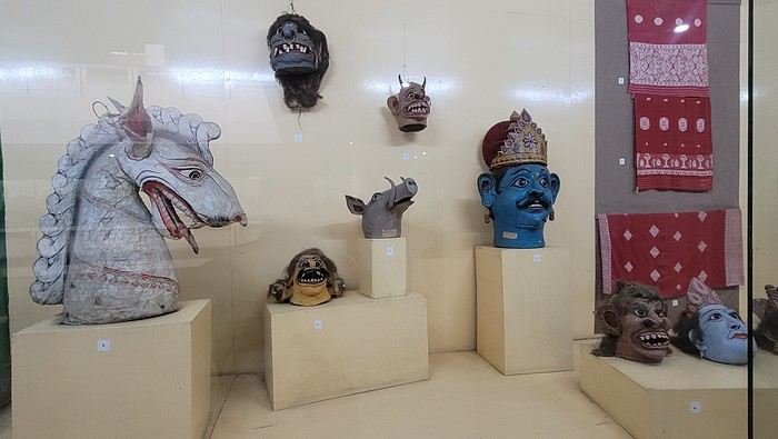

I’m not far from the Brahmaputra River, and the temptation to visit is too strong to resist. I’d hoped to find a promenade along the river, but that doesn’t exist here. I walk back calmly and notice several restaurants in my street. On the doorstep of my accommodation, I spot a pastry shop with cakes that look more like the ones we have in France than the typical ones here in India. A visit is a must, and I’m not disappointed!
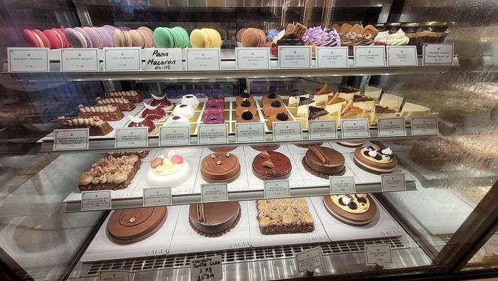
Tonight, I’m dining at a restaurant in the street. The menu is a bit disappointing—burgers, pizzas, pasta—nothing very Indian. So, I’ll go with tomato pasta.
Thursday, March 20th. The alarm goes off super early, but I’m already awake—I was too worried I’d sleep through it. I leave the house at 4:00 AM. The rain has stopped, and at this hour, there aren’t many trucks on the road. I arrive at Barcelona Airport easily by 6:20 AM, let the valet know I’m there, and he quickly picks up my car. This time, I’m flying with Etihad Airways again. I booked the ticket during my trip to Cambodia: Barcelona/Kolkata, Delhi/Barcelona for 567 €. At that price, I didn’t hesitate for long—I knew I had to take it. And I’m glad I did because, by the time I returned, the price had gone up to 700 €. I can already hear the reactions: "Wow, how’d you get a ticket for that price? What site did you use? You’re amazing, MarieJo!" One thing’s for sure—I’m really happy with this deal. The flights from Barcelona to Abu Dhabi and Abu Dhabi to Kolkata go smoothly, and we arrive on time at 2:55 AM. There aren’t many people at immigration, so I get through quickly. My luggage isn’t on the carousel yet. After collecting my bag, I check in for my next flight with IndiGo, a 5:40 AM flight to Guwahati, arriving at 7:00 AM. I’m starting to feel pretty tired, so I take a taxi from the airport to Gruham Sojourn Homestay. The house is upstairs, and the neighborhood seems quiet, with restaurants lining the street. The room won’t be ready until 10:00 AM, so I rest on the bench in the meantime. Once in the room, I take a shower—it really helps me feel refreshed. I need to exchange some euros, so I look up a nearby exchange bureau on Google and head out to find it. I locate it easily, and the staff are super friendly. I get a great rate (1 € = 90 INR). I wander around the neighborhood. The train station isn’t far, and small markets line the streets. I head back to my area, walking along the main avenue. About 500 meters from my street, I discover a museum. The visit is fascinating—I see the famous Majuli masks, among other things.
I’m not far from the Brahmaputra River, and the temptation to visit is too strong to resist. I’d hoped to find a promenade along the river, but that doesn’t exist here. I walk back calmly and notice several restaurants in my street. On the doorstep of my accommodation, I spot a pastry shop with cakes that look more like the ones we have in France than the typical ones here in India. A visit is a must, and I’m not disappointed!
Tonight, I’m dining at a restaurant in the street. The menu is a bit disappointing—burgers, pizzas, pasta—nothing very Indian. So, I’ll go with tomato pasta.
AI, the Holy Grail of Travel and Travel Journals?
Three of our grandchildren came to spend the last weekend of the holidays at our house.
With her driver’s license just in hand, the oldest took her sister and a cousin along.
I was talking about VoyageForum, and the conversation turned to AI, which finds writing travel journals a breeze—churning out amazing ads for this or that country and even nudging tourists to visit one place over another.
Jules: "It’s crazy, you can plan and organize everything, then just add your photos and the AI’s text, and boom—you’ve got something great." Héloïse: "What a cheat for yourself and for others." (She’s so wise!) Gaïané: "Ugh, no more surprises. It even picks the restaurants—so lame."
I had this idea to stay on the theme of travel journals:
I found an excerpt from a book (I’ll let you guess the title and author—of course, the kids figured it out in two seconds with their phones), then I wrote my own version, and finally, the AI generated its own using a few keywords.
Here they are:
"We walked at dusk through the thick, dark forest. Sometimes, a clearing would reveal a dreamlike landscape. A magical world, far from humans. A world of frozen waterfalls, stiff fir trees, and sharp peaks slicing through the blinding whiteness of the air.
We gazed, dazzled, at the spectacle, imagining we’d left the human world behind and joined that of the spirits."
"For days, we walked through the half-darkness of dense, untouched forests, then suddenly, a clearing would unveil landscapes you only see in dreams. Sharp peaks piercing the sky, icy torrents, giant waterfalls—an entire fantastical world, blindingly white, rising above the dark line traced by the giant fir trees. We stared at this extraordinary sight, speechless, awestruck, ready to believe we’d reached the limits of the human world and stood at the threshold of the spirits’ realm."
"We walked through the mountain, wild and unyielding, its sharp peaks tearing the sky like honed blades. Giant waterfalls roared and foamed, as if the earth’s hidden forces were pouring out. Higher still, the blinding whiteness belonged to the world of spirits—capricious beings whispering to lost travelers. Faced with this silent vastness, we felt tiny, uninvited guests meditating on the invisible that dwells in these forbidden peaks."
And, amazingly, they unanimously agreed that the author’s excerpt was a thousand times more poetic. Héloïse, my history buff, said: "Nothing replaces the real travel experience." Jules said: "Yeah, but it does the job. Even if the excerpt is cool." And our oldest added: "It makes you want to go there—not at all like the other two versions. Sorry, Mamido."
And then, miracle—Jules asks: "Do you have the book? Can I borrow it?"
I’m so relieved—young people aren’t completely devoured by technology yet. And the forum will keep its charm and usefulness for a long time. Phew!
You agree, right?
Jules: "It’s crazy, you can plan and organize everything, then just add your photos and the AI’s text, and boom—you’ve got something great." Héloïse: "What a cheat for yourself and for others." (She’s so wise!) Gaïané: "Ugh, no more surprises. It even picks the restaurants—so lame."
I had this idea to stay on the theme of travel journals:
I found an excerpt from a book (I’ll let you guess the title and author—of course, the kids figured it out in two seconds with their phones), then I wrote my own version, and finally, the AI generated its own using a few keywords.
Here they are:
"We walked at dusk through the thick, dark forest. Sometimes, a clearing would reveal a dreamlike landscape. A magical world, far from humans. A world of frozen waterfalls, stiff fir trees, and sharp peaks slicing through the blinding whiteness of the air.
We gazed, dazzled, at the spectacle, imagining we’d left the human world behind and joined that of the spirits."
"For days, we walked through the half-darkness of dense, untouched forests, then suddenly, a clearing would unveil landscapes you only see in dreams. Sharp peaks piercing the sky, icy torrents, giant waterfalls—an entire fantastical world, blindingly white, rising above the dark line traced by the giant fir trees. We stared at this extraordinary sight, speechless, awestruck, ready to believe we’d reached the limits of the human world and stood at the threshold of the spirits’ realm."
"We walked through the mountain, wild and unyielding, its sharp peaks tearing the sky like honed blades. Giant waterfalls roared and foamed, as if the earth’s hidden forces were pouring out. Higher still, the blinding whiteness belonged to the world of spirits—capricious beings whispering to lost travelers. Faced with this silent vastness, we felt tiny, uninvited guests meditating on the invisible that dwells in these forbidden peaks."
And, amazingly, they unanimously agreed that the author’s excerpt was a thousand times more poetic. Héloïse, my history buff, said: "Nothing replaces the real travel experience." Jules said: "Yeah, but it does the job. Even if the excerpt is cool." And our oldest added: "It makes you want to go there—not at all like the other two versions. Sorry, Mamido."
And then, miracle—Jules asks: "Do you have the book? Can I borrow it?"
I’m so relieved—young people aren’t completely devoured by technology yet. And the forum will keep its charm and usefulness for a long time. Phew!
You agree, right?
A Trip to Australia: New South Wales
Wednesday, November 15, 2023
Flight Cairns – Sydney
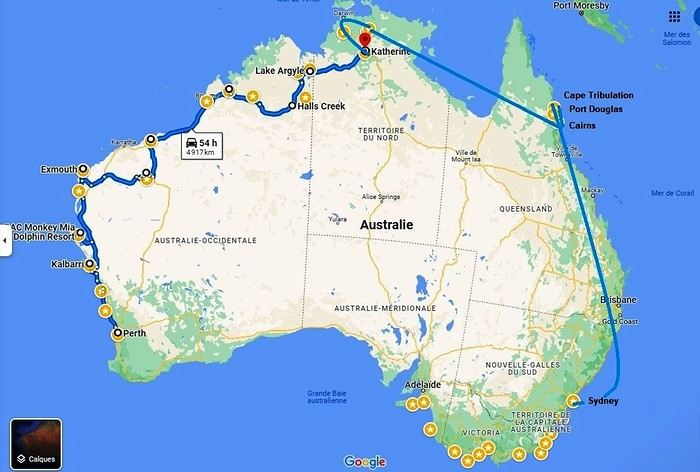 Okay, let’s recap. We’ve traveled through Western Australia, the Northern Territory, Queensland, and tonight we’ll be in New South Wales. We’ll even lose an extra hour—and a bunch of degrees!
We’re on a flawless journey so far. One of our suitcases is almost two kilos overweight. The guy checking us in gives us a nice smile and decides to overlook the excess baggage fee.
Okay, let’s recap. We’ve traveled through Western Australia, the Northern Territory, Queensland, and tonight we’ll be in New South Wales. We’ll even lose an extra hour—and a bunch of degrees!
We’re on a flawless journey so far. One of our suitcases is almost two kilos overweight. The guy checking us in gives us a nice smile and decides to overlook the excess baggage fee.
A flight, for once, without a hitch, no delay (just half an hour…). Taxi… We discover our… room… We’ve got a suite like never before on this trip. It’s a posh apartment on the 7th floor—on cloud nine, really! We can’t believe it. 113.26 € per night! The Meriton Suites Mascot Central if you ever find yourself in this city… We even have a washing machine (and it works!). Such a change from the cabins in the west!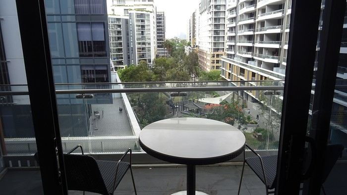
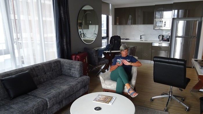
We don’t linger, though. We take the metro. Why? Well, yeah, we’re still kids at heart—off to the Opera House, of course!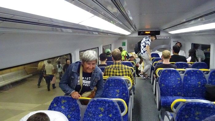
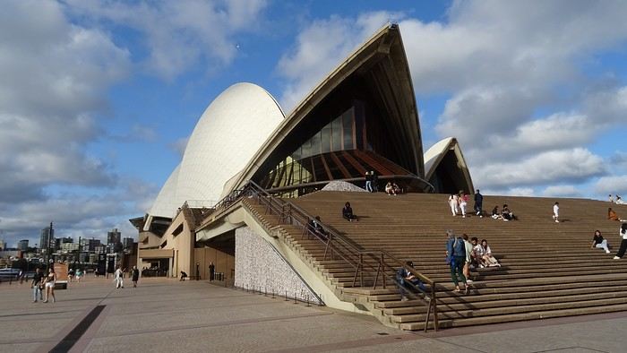
 Restaurant prices have doubled. Even tripled. We reluctantly settle for a pizzeria because that T-bone for 155 AUD (100 €)…
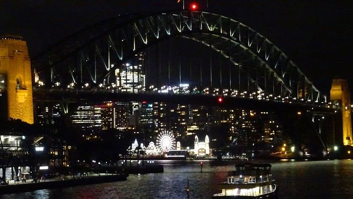
We know how to handle ourselves. There’s a Woolworths right downstairs. And we’ve got a kitchen, remember! And a terrace! We even have huge bats to brighten up our skies!
Okay, let’s recap. We’ve traveled through Western Australia, the Northern Territory, Queensland, and tonight we’ll be in New South Wales. We’ll even lose an extra hour—and a bunch of degrees!
We’re on a flawless journey so far. One of our suitcases is almost two kilos overweight. The guy checking us in gives us a nice smile and decides to overlook the excess baggage fee.A flight, for once, without a hitch, no delay (just half an hour…). Taxi… We discover our… room… We’ve got a suite like never before on this trip. It’s a posh apartment on the 7th floor—on cloud nine, really! We can’t believe it. 113.26 € per night! The Meriton Suites Mascot Central if you ever find yourself in this city… We even have a washing machine (and it works!). Such a change from the cabins in the west!
We don’t linger, though. We take the metro. Why? Well, yeah, we’re still kids at heart—off to the Opera House, of course!
Restaurant prices have doubled. Even tripled. We reluctantly settle for a pizzeria because that T-bone for 155 AUD (100 €)…
We know how to handle ourselves. There’s a Woolworths right downstairs. And we’ve got a kitchen, remember! And a terrace! We even have huge bats to brighten up our skies!
From San Francisco to Los Angeles via Highway 1
Hi everyone,
We traveled between Christmas and New Year’s to visit our son in San Francisco. We’d already seen the parks during a 2008 vacation but hadn’t had time to drive Highway 1 between San Francisco and Los Angeles, so we decided to do it this time. At this time of year, the days are short—it gets dark by 5 PM, which limits sightseeing time. Weather-wise, we had temperatures between 11°C and 20°C (52°F and 68°F) during the week, so it was pretty pleasant. There was a bit of rain one day and some gray skies or fog in the mornings. Financially, California is *very* expensive! Prices listed don’t include tax or tips. Taxes are automatically added to restaurant bills or supermarket receipts, but *you* add the tip. Americans always leave a tip, no matter if they’re happy with the service or not (except at self-service places). The absolute minimum is 15%, but 20% is more common. Here’s how it works: First, the server brings the bill with the tax already added, then takes your card and the bill. They come back after charging your card, leaving you a new bill and a pen. You write down the tip (tips) you want to leave, add it up, and sign. You leave the paper and pen on the table and go. In some restaurants, the server brings the card reader to your table, and there are preset tip percentages to choose from. On your bank statement, the total amount (including tax) shows up as “pending.” A few days later, the transaction is finalized with the tip included. The 9-hour time difference isn’t trivial, especially as we get older 😉. Keep it in mind when planning—don’t overdo it in the first few days.
Here’s our itinerary: 12/25/2024: Flight from Lyon (7 AM) to San Francisco (11:50 AM): 1-hour layover in Amsterdam—way too tight. The airport is huge, and flights to the U.S. are at the far end. You also have to go through customs. We had to run! Luckily, there’s a special line for tight connections, and our flight was delayed! Reunited with our son and walked to the Painted Ladies (Victorian houses) and then through Alamo Square. Return trip via Waymo—a driverless Uber. Surprising, but the ride was super smooth, and we felt safe.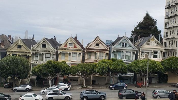
12/26/2024: San Francisco Walking tour of the city: Lombard Street, Pier 39 (sea lions), Coit Tower via the Filbert Steps (great view of the city), Chinatown, and Union Square (ice rink and Christmas tree).
12/27/2024: Monterey It took us about 2.5 hours to drive straight from SF to Monterey (to save time, we skipped the start of Highway 1). The goal for this stop was visiting the aquarium. It’s in an old sardine cannery, and there’s an interesting room showing the machinery and explaining the process. The aquarium features all the local fish and plant species, plus a stunning jellyfish exhibit. We spent about 2.5 hours there. Entry is pricey at $65, and it was packed when we went. For parking, you can use meters or day lots. The cheapest we found was $25 for the day, with in-and-out privileges. We saw some closer lots charging $80, so it’s worth shopping around before parking and walking a bit more. Afterward, we stopped by the Monarch Butterfly Sanctuary—a small, free park where these butterflies land, along with some wild deer. We ended the day at Lover’s Point, a park with an ocean view and surfers. That evening, we tried clam chowder in a sourdough bread bowl. Stayed overnight in Monterey.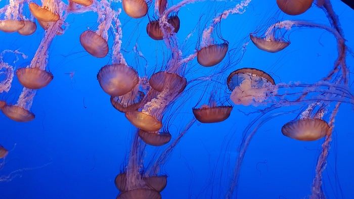
12/28/2024: Big Sur Parks The Big Sur area has many state parks. Entry is $10 per car for the day (valid for any number of parks visited that same day). Pro tip: If you park outside and walk in, you don’t pay. We chose to visit Point Lobos Reserve. We hiked the trails along the ocean. Two must-do (short and easy) trails: “Sea Lion Point,” where massive waves crash onto the rocks, and “Bird Island Lookout,” where you can see thousands of pelicans and cormorants on the rocks, plus a few elephant seals. It’s truly stunning. We spent about 3 hours there. After driving along Garrapata State Park and crossing the famous Bixby Bridge, we went to Pfeiffer Big Sur State Park to do the short Valley View Trail + Pfeiffer Falls hike. It was nice being among the redwoods, but the waterfall was underwhelming. Maybe it’s more impressive in the summer when the river is flowing better. We ended the day at McWay Falls, a waterfall that flows directly into the ocean—super photogenic, especially at sunset. Returned to Monterey for the night.
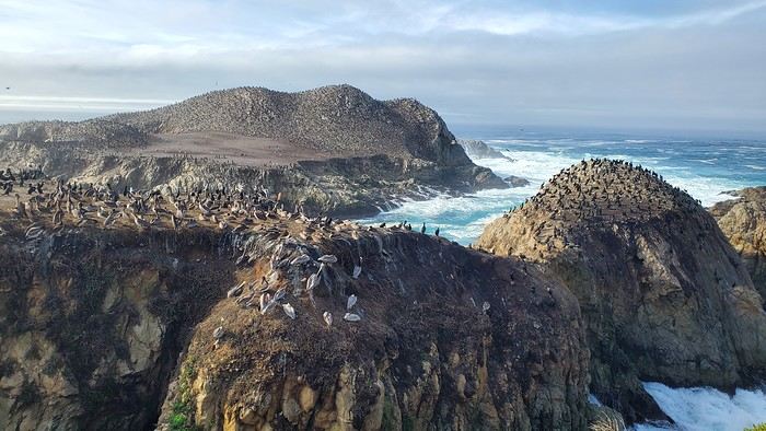
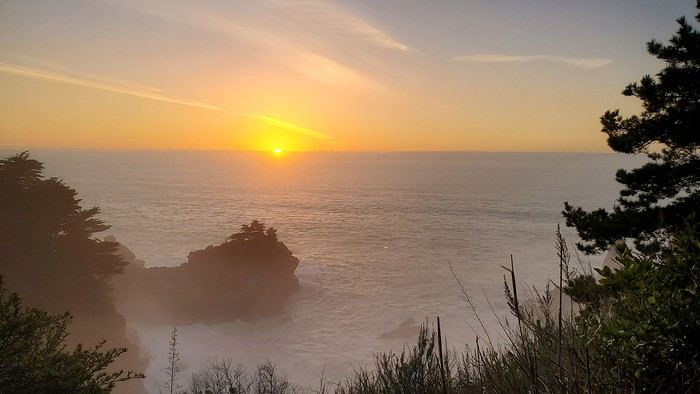
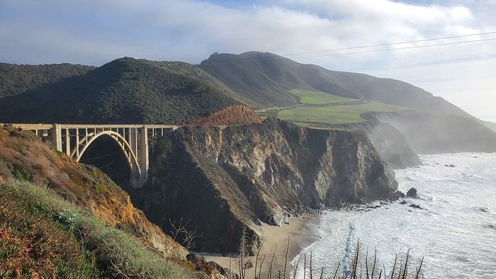
12/29/2024: Drive to Morro Bay Highway 1 is currently closed near Gorda, so we had to take the inland route from Monterey, adding extra miles. It was raining, so we skipped the planned stop at Carmel-by-the-Sea. Instead, we detoured to Mission San Antonio de Padua, the 3rd mission (out of 21) built by the Spanish in 1773 to evangelize the region. It’s less famous than others, so there were fewer people, and it felt more “authentic” (free to visit). With fog adding to the rain, we headed straight to Morro Bay, our stop for the day, instead of continuing up Highway 1 to San Simeon. Took a short evening walk to Morro Rock—saw a few otters in the harbor. Stayed overnight in Morro Bay.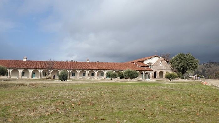
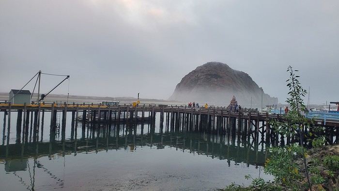
12/30/2024: Elephant Seals at Piedras Blancas The sun came back! We took a quick walk on the pier to see the otters in daylight, then drove back up Highway 1 to Piedras Blancas (near San Simeon), a famous spot for elephant seals. It’s birthing season, so there were lots of pups, plus males fighting for the females’ attention—what a show! We couldn’t get enough. We walked to the Piedras Blancas Lighthouse, with a few viewpoints of beaches where elephant seals were lounging (though far fewer than at the beach near the parking lot). We continued to Santa Barbara, our stop for the day. Stopped in San Luis Obispo for lunch and a quick city tour (Bubblegum Alley, the theater facade, and the mission). Since it was getting late, we skipped Los Alamos and went straight to Solvang, a charming Danish-style town (windmills, typical Danish houses) with lots of holiday lights (it’s their Julefest). Stayed overnight in Santa Barbara.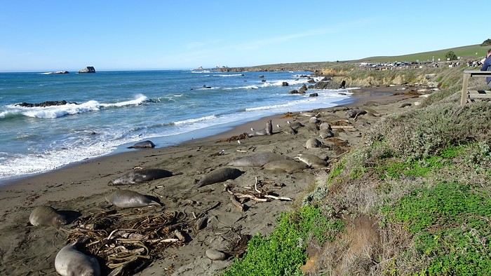
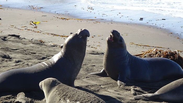
We traveled between Christmas and New Year’s to visit our son in San Francisco. We’d already seen the parks during a 2008 vacation but hadn’t had time to drive Highway 1 between San Francisco and Los Angeles, so we decided to do it this time. At this time of year, the days are short—it gets dark by 5 PM, which limits sightseeing time. Weather-wise, we had temperatures between 11°C and 20°C (52°F and 68°F) during the week, so it was pretty pleasant. There was a bit of rain one day and some gray skies or fog in the mornings. Financially, California is *very* expensive! Prices listed don’t include tax or tips. Taxes are automatically added to restaurant bills or supermarket receipts, but *you* add the tip. Americans always leave a tip, no matter if they’re happy with the service or not (except at self-service places). The absolute minimum is 15%, but 20% is more common. Here’s how it works: First, the server brings the bill with the tax already added, then takes your card and the bill. They come back after charging your card, leaving you a new bill and a pen. You write down the tip (tips) you want to leave, add it up, and sign. You leave the paper and pen on the table and go. In some restaurants, the server brings the card reader to your table, and there are preset tip percentages to choose from. On your bank statement, the total amount (including tax) shows up as “pending.” A few days later, the transaction is finalized with the tip included. The 9-hour time difference isn’t trivial, especially as we get older 😉. Keep it in mind when planning—don’t overdo it in the first few days.
Here’s our itinerary: 12/25/2024: Flight from Lyon (7 AM) to San Francisco (11:50 AM): 1-hour layover in Amsterdam—way too tight. The airport is huge, and flights to the U.S. are at the far end. You also have to go through customs. We had to run! Luckily, there’s a special line for tight connections, and our flight was delayed! Reunited with our son and walked to the Painted Ladies (Victorian houses) and then through Alamo Square. Return trip via Waymo—a driverless Uber. Surprising, but the ride was super smooth, and we felt safe.
12/26/2024: San Francisco Walking tour of the city: Lombard Street, Pier 39 (sea lions), Coit Tower via the Filbert Steps (great view of the city), Chinatown, and Union Square (ice rink and Christmas tree).
12/27/2024: Monterey It took us about 2.5 hours to drive straight from SF to Monterey (to save time, we skipped the start of Highway 1). The goal for this stop was visiting the aquarium. It’s in an old sardine cannery, and there’s an interesting room showing the machinery and explaining the process. The aquarium features all the local fish and plant species, plus a stunning jellyfish exhibit. We spent about 2.5 hours there. Entry is pricey at $65, and it was packed when we went. For parking, you can use meters or day lots. The cheapest we found was $25 for the day, with in-and-out privileges. We saw some closer lots charging $80, so it’s worth shopping around before parking and walking a bit more. Afterward, we stopped by the Monarch Butterfly Sanctuary—a small, free park where these butterflies land, along with some wild deer. We ended the day at Lover’s Point, a park with an ocean view and surfers. That evening, we tried clam chowder in a sourdough bread bowl. Stayed overnight in Monterey.
12/28/2024: Big Sur Parks The Big Sur area has many state parks. Entry is $10 per car for the day (valid for any number of parks visited that same day). Pro tip: If you park outside and walk in, you don’t pay. We chose to visit Point Lobos Reserve. We hiked the trails along the ocean. Two must-do (short and easy) trails: “Sea Lion Point,” where massive waves crash onto the rocks, and “Bird Island Lookout,” where you can see thousands of pelicans and cormorants on the rocks, plus a few elephant seals. It’s truly stunning. We spent about 3 hours there. After driving along Garrapata State Park and crossing the famous Bixby Bridge, we went to Pfeiffer Big Sur State Park to do the short Valley View Trail + Pfeiffer Falls hike. It was nice being among the redwoods, but the waterfall was underwhelming. Maybe it’s more impressive in the summer when the river is flowing better. We ended the day at McWay Falls, a waterfall that flows directly into the ocean—super photogenic, especially at sunset. Returned to Monterey for the night.
12/29/2024: Drive to Morro Bay Highway 1 is currently closed near Gorda, so we had to take the inland route from Monterey, adding extra miles. It was raining, so we skipped the planned stop at Carmel-by-the-Sea. Instead, we detoured to Mission San Antonio de Padua, the 3rd mission (out of 21) built by the Spanish in 1773 to evangelize the region. It’s less famous than others, so there were fewer people, and it felt more “authentic” (free to visit). With fog adding to the rain, we headed straight to Morro Bay, our stop for the day, instead of continuing up Highway 1 to San Simeon. Took a short evening walk to Morro Rock—saw a few otters in the harbor. Stayed overnight in Morro Bay.
12/30/2024: Elephant Seals at Piedras Blancas The sun came back! We took a quick walk on the pier to see the otters in daylight, then drove back up Highway 1 to Piedras Blancas (near San Simeon), a famous spot for elephant seals. It’s birthing season, so there were lots of pups, plus males fighting for the females’ attention—what a show! We couldn’t get enough. We walked to the Piedras Blancas Lighthouse, with a few viewpoints of beaches where elephant seals were lounging (though far fewer than at the beach near the parking lot). We continued to Santa Barbara, our stop for the day. Stopped in San Luis Obispo for lunch and a quick city tour (Bubblegum Alley, the theater facade, and the mission). Since it was getting late, we skipped Los Alamos and went straight to Solvang, a charming Danish-style town (windmills, typical Danish houses) with lots of holiday lights (it’s their Julefest). Stayed overnight in Santa Barbara.
From Caño Cristales to Tayrona Park
After about 12 hours of flying from Toulouse (via Paris), we landed in Bogotá six years after our first trip to Colombia. This time, our journey will be very different, with only this stop in the Colombian capital in common.
Our travel itinerary
Bogotá / La Macarena (Caño Cristales) / Villa de Leyva / Barichara / San Gil / Girón / Mompox / Ciénaga and the Santa Marta lagoon / Minca / Los Naranjos (Tayrona Park) / Bogotá.
Step 1: Bogotá (and Nemecon)
Bogotá (1/3)
This morning, we had a meet-up with Flora from Aventure Colombia, who helped me organize one of our stops, a few transfers, and tomorrow’s day trip, the program of which I changed at the last minute after deciding to skip the visit to the Salt Cathedral of Zipaquirá. Flora is a kind and lovely person, always available, and she did everything to answer my questions and give me advice.
She’s a local contact I highly recommend. Flora can help you plan your trip, whether you want a fully organized tour or, like us, just need assistance with a specific stop or one or more transfers between cities.
We left Flora after setting a meet-up for our return to Bogotá in a month. As we walked out of her agency, we headed to the wonderful Gold Museum, located just a hundred meters away. I was excited to revisit this amazing museum.
Note: Free entry for those over 60, regardless of nationality. Just show your passport.
Like six years ago, I was amazed by its museography, the beauty of the pieces on display, and that breathtaking shamanic room.
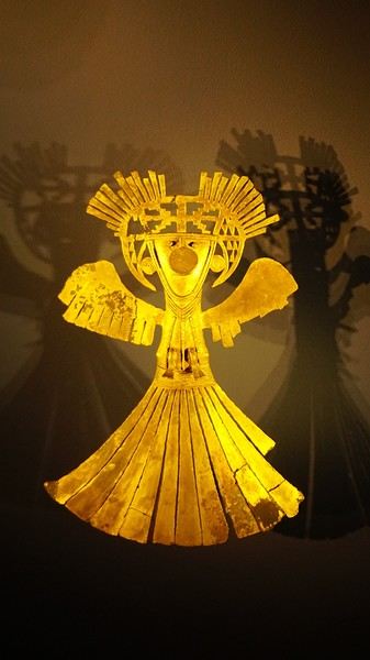
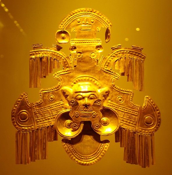
About two hours later, we decided to walk (careful, it’s a climb!) to the Monserrate cable car (3152m). Long wait to buy tickets and board the cable car! Once we arrived, a few raindrops, an impressive panoramic view of Bogotá’s vastness, a quick visit to the basilica (a pilgrimage site for Colombians), a walk through the tourist market, and at the top, plenty of small restaurants where we had our first Colombian meal. After our hearty lunch, we were lucky to see the sun return! No line for the descent. We then headed back to the hotel because Justine wanted to rest and recover from the trip. As for me, I continued my walk. I discovered a really nice craft market recommended by Flora, Pasaje Rivas, returned to Bolívar Square, and wandered through different streets, including the main pedestrian avenue (Calle 7), where there’s always something to see.
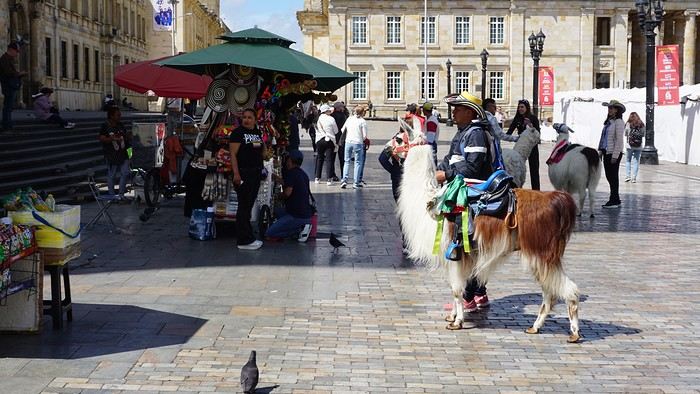
Tomorrow, a change of scenery as we head out for a hike in a small desert (Desierto de Chueca), located about 2 hours from Bogotá in the village of Nemecon. For this outing from Bogotá, with Flora’s help, we booked a car with a driver for the day. Flora also took care of booking the guide (since the site can only be visited with one). Nemecon (2/3) Today, we went to Nemecon to hike about 7.5 km in the ‘Desert of Checua.’ It’s nothing like sandy deserts! Instead, it’s geological formations sculpted by time, wind, and water. After two hours on the road—almost one of them spent navigating traffic jams with cars, trucks, buses, and a continuous flow of motorcycles on either side of our taxi—we reached Nemecon! The village center is really (too?) quiet. We met up with Deisy and headed toward the ‘desert,’ about twenty minutes away on a bumpy dirt road. Once there, a quick briefing, and off we went! Deisy didn’t stop talking (in Spanish) for over 3 hours!!! She told us so much about her region (flower farming, water management, traditions, songs, etc.), the origin of the site, and even mentioned Antonio Banderas, who filmed *The 33* in the village’s salt mine (the story of the survival of 33 Chilean miners after a collapse in their copper and gold mine). One hour of walking to reach the site, one hour to explore it, and one hour to return.
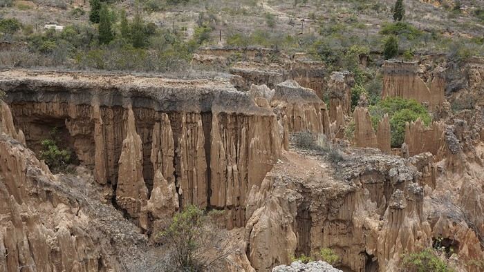
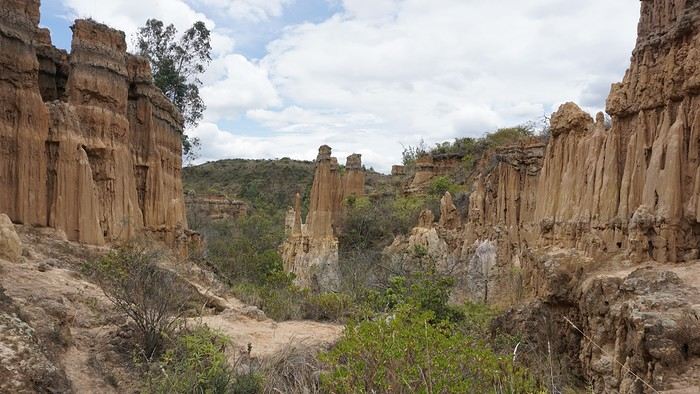
The advantage of this non-stop chatter was that it forced us to brush up on our Spanish at lightning speed. I even wondered if the effort to concentrate wasn’t more exhausting than the physical effort! Especially since on the way back, I got an oral quiz. Deisy wanted to make sure I remembered some of the information she’d given me during the visit: why is this rock white, that one red, and that one black? Back in the village, we had lunch at a restaurant recommended by Deisy before visiting the Nemecon salt mine. Before entering, a guide spent a good half-hour explaining the origin of the salt and the presence of many fossils in the area. Again, concentrating was tough because all the comments were exclusively in Spanish! An hour and a half wandering through the tunnels with a ‘lovely miner’s helmet’ on our heads!
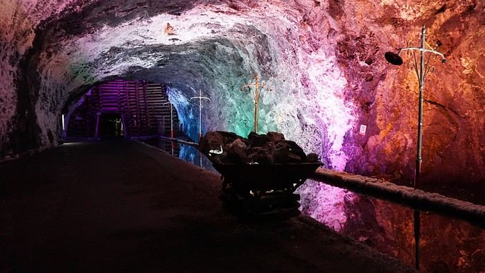
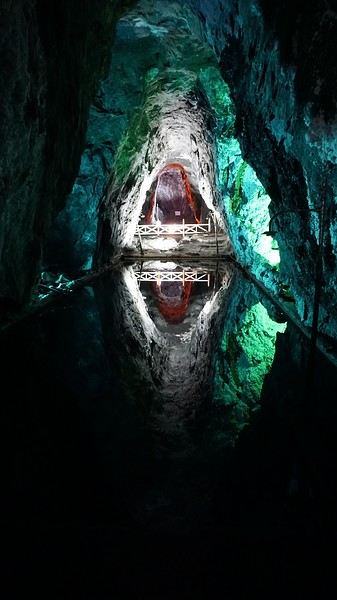
We met our driver at the mine entrance. The return to Bogotá was a bit faster, but traffic in the city center was still heavy! We arrived in front of our hotel between 8:00 and 8:30 PM. It’s been a pretty intense start to the trip! Tonight, our legs are tired. Hopefully, tomorrow will be a bit more relaxed! Bogotá (3/3) We started the day by visiting the Santa Clara Church Museum, located next to the presidential palace. Alejandra (from the local agency ‘Gaia Tours Colombia,’ which organized our stay in Caño Cristales (La Macarena)) had recommended this visit for its rich mural paintings.
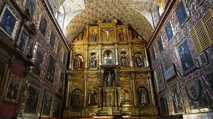
A few hundred meters further, after crossing the Plaza Mayor again, we visited the cultural complex housing the Botero Museum, the Mint Museum, and the Bank of the Republic Art Museum. Note that entry is free for all three museums. Botero Museum: There are fewer works by Botero here than in the Medellín museum, but more paintings and sculptures by other artists, all from Botero’s private collection (donated to Colombia). Mint Museum: We limited ourselves to visiting one room (on Flora’s advice) where three gold and gemstone monstrances and a Christ with a crown of emerald thorns are displayed. Photos are not allowed. Art Museum: We visited two temporary exhibitions. Lunchtime came quickly. We had a good meal at a reasonably priced small restaurant in the La Candelaria micro-district, near the Chorro de Quevedo square. We decided to spend the afternoon wandering the streets and alleys of the historic center to discover local street art.
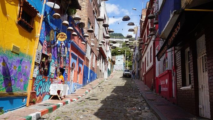
We also passed through very lively pedestrian streets. I also decided to revisit Pasaje Rivas to show Justine all the shops selling more or less artisanal products. Tomorrow morning, we fly to La Macarena at 10:30 AM. Not to dance (you’d be surprised if I told you we were going to take a South American dance class, right?!), but to visit the fabulous Caño Cristales, a river naturally colored by aquatic plants. The planned program includes hiking, horseback riding, canoeing, and swimming among these plants. This site was long inaccessible because the area was controlled by the FARC. Access and tourism development became possible after agreements and amnesty measures between the Colombian government and paramilitary groups. As in other regions, former FARC members have been able to transition into various tourism-related activities.
About two hours later, we decided to walk (careful, it’s a climb!) to the Monserrate cable car (3152m). Long wait to buy tickets and board the cable car! Once we arrived, a few raindrops, an impressive panoramic view of Bogotá’s vastness, a quick visit to the basilica (a pilgrimage site for Colombians), a walk through the tourist market, and at the top, plenty of small restaurants where we had our first Colombian meal. After our hearty lunch, we were lucky to see the sun return! No line for the descent. We then headed back to the hotel because Justine wanted to rest and recover from the trip. As for me, I continued my walk. I discovered a really nice craft market recommended by Flora, Pasaje Rivas, returned to Bolívar Square, and wandered through different streets, including the main pedestrian avenue (Calle 7), where there’s always something to see.
Tomorrow, a change of scenery as we head out for a hike in a small desert (Desierto de Chueca), located about 2 hours from Bogotá in the village of Nemecon. For this outing from Bogotá, with Flora’s help, we booked a car with a driver for the day. Flora also took care of booking the guide (since the site can only be visited with one). Nemecon (2/3) Today, we went to Nemecon to hike about 7.5 km in the ‘Desert of Checua.’ It’s nothing like sandy deserts! Instead, it’s geological formations sculpted by time, wind, and water. After two hours on the road—almost one of them spent navigating traffic jams with cars, trucks, buses, and a continuous flow of motorcycles on either side of our taxi—we reached Nemecon! The village center is really (too?) quiet. We met up with Deisy and headed toward the ‘desert,’ about twenty minutes away on a bumpy dirt road. Once there, a quick briefing, and off we went! Deisy didn’t stop talking (in Spanish) for over 3 hours!!! She told us so much about her region (flower farming, water management, traditions, songs, etc.), the origin of the site, and even mentioned Antonio Banderas, who filmed *The 33* in the village’s salt mine (the story of the survival of 33 Chilean miners after a collapse in their copper and gold mine). One hour of walking to reach the site, one hour to explore it, and one hour to return.
The advantage of this non-stop chatter was that it forced us to brush up on our Spanish at lightning speed. I even wondered if the effort to concentrate wasn’t more exhausting than the physical effort! Especially since on the way back, I got an oral quiz. Deisy wanted to make sure I remembered some of the information she’d given me during the visit: why is this rock white, that one red, and that one black? Back in the village, we had lunch at a restaurant recommended by Deisy before visiting the Nemecon salt mine. Before entering, a guide spent a good half-hour explaining the origin of the salt and the presence of many fossils in the area. Again, concentrating was tough because all the comments were exclusively in Spanish! An hour and a half wandering through the tunnels with a ‘lovely miner’s helmet’ on our heads!
We met our driver at the mine entrance. The return to Bogotá was a bit faster, but traffic in the city center was still heavy! We arrived in front of our hotel between 8:00 and 8:30 PM. It’s been a pretty intense start to the trip! Tonight, our legs are tired. Hopefully, tomorrow will be a bit more relaxed! Bogotá (3/3) We started the day by visiting the Santa Clara Church Museum, located next to the presidential palace. Alejandra (from the local agency ‘Gaia Tours Colombia,’ which organized our stay in Caño Cristales (La Macarena)) had recommended this visit for its rich mural paintings.
A few hundred meters further, after crossing the Plaza Mayor again, we visited the cultural complex housing the Botero Museum, the Mint Museum, and the Bank of the Republic Art Museum. Note that entry is free for all three museums. Botero Museum: There are fewer works by Botero here than in the Medellín museum, but more paintings and sculptures by other artists, all from Botero’s private collection (donated to Colombia). Mint Museum: We limited ourselves to visiting one room (on Flora’s advice) where three gold and gemstone monstrances and a Christ with a crown of emerald thorns are displayed. Photos are not allowed. Art Museum: We visited two temporary exhibitions. Lunchtime came quickly. We had a good meal at a reasonably priced small restaurant in the La Candelaria micro-district, near the Chorro de Quevedo square. We decided to spend the afternoon wandering the streets and alleys of the historic center to discover local street art.
We also passed through very lively pedestrian streets. I also decided to revisit Pasaje Rivas to show Justine all the shops selling more or less artisanal products. Tomorrow morning, we fly to La Macarena at 10:30 AM. Not to dance (you’d be surprised if I told you we were going to take a South American dance class, right?!), but to visit the fabulous Caño Cristales, a river naturally colored by aquatic plants. The planned program includes hiking, horseback riding, canoeing, and swimming among these plants. This site was long inaccessible because the area was controlled by the FARC. Access and tourism development became possible after agreements and amnesty measures between the Colombian government and paramilitary groups. As in other regions, former FARC members have been able to transition into various tourism-related activities.
A week in Dalmatia with the kids
Croatia
October 2024
Hi everyone, I wanted to share our family week in Croatia. Alex and I, with Apolline (6), Olympe (4), and Artémis (18 months).
Itinerary
Planning the itinerary was complicated, but in the end, I wouldn’t change a thing. Since we had a round-trip flight from Dubrovnik, I preferred to prioritize proximity, so we skipped Plitvice, which I’d really love to visit—but that’ll be for next time. We had time to... take our time, and it was really nice.
Day 1: Marseille-Dubrovnik flight. Night in Ston.
Day 2: Visit to Ston and Mali Ston. Ferry to Mljet. Night in Pomena (3 nights total).
Days 3 & 4: Walks in Mljet National Park and swimming.
Day 5: Return ferry. Visit to the Trsteno Arboretum. Night in Dubrovnik (3 nights total).
Day 6: Visit to Dubrovnik’s city walls and Old Town.
Day 7: Lokrum.
Day 8: Morning in Dubrovnik, then Cavtat and overnight flight back to Marseille.
Our visits
Ston area:
Ston village, small but charming. We walked the walls from Ston to Mali Ston. It’s a steep climb, but the views over Ston and then Mali Ston are stunning. Easy return by road, and we visited the fort. Stroller impossible on the walls.
Pratpano Beach before taking the ferry. A beautiful beach and our first swim!
Mljet
Everything is beautiful on Mljet—the villages, landscapes, beaches... There are plenty of hiking and biking trails of varying difficulty. We saw lots of bike rental shops (Pomena, Polače, at the dock for St. Mary’s...), with some bikes equipped with child seats (though no baby trailers). In Pomena, there’s a small national park office that provides maps, sells entry tickets, and gives info on possible routes. The trails are well-marked. The boat to St. Mary’s Island is included in the park entry fee.
On the first day, from Pomena, we were 20 minutes’ walk from the small saltwater lake and the dock for St. Mary’s Monastery. We visited the little island, but the monastery interior was closed. We swam in Malo Jezero Lake (but there are plenty of spots to swim in both lakes).
The next day, we did a big loop starting from Pomena, walking through the forest (with beautiful sea views) to Janik (across from the monastery), then returning along the shore paths for a swim. An easy hike with little elevation—Olympe did it without any problems. The route is clearly marked on the bike trail map from the park office.
On our last day before the 3 PM ferry, we swam and had a picnic on one of Saplunara’s gorgeous sandy beaches—we had the whole place to ourselves!
Trsteno Arboretum (30 minutes from Dubrovnik). A stunning botanical garden overlooking the sea, which we visited in the late afternoon. Stroller accessible.
Dubrovnik:
City walls. Very expensive, but worth it! Lets you see the whole Old Town and the port from above. Stroller impossible.
Old Town: lots of beautiful, narrow alleys where laundry dries between buildings. Stroller possible but not practical. We visited the two monasteries and the cathedral inside but skipped the Rector’s Palace and St. Lawrence Fort.
Lokrum: deserves a full day. A beautiful walk circles the island, alternating between coves, historic buildings, and botanical gardens. We were short on time before the last boat left, but there are plenty of great spots to swim. You can’t do the full loop with a stroller, but I think the main sights near the dock are accessible.
Cavtat: a great surprise—I’d recommend it if, like us, you have a late flight. Just 15 minutes from the airport, it’s a charming seaside village with a lovely waterfront promenade (stroller-friendly), several swimming coves, and a cute center with things to see if you have extra time (museum, mausoleum, church...), plus restaurants, gelato shops, and boutiques...
Even though the girls walked a lot and enjoyed the walks, they *loved* swimming almost every day.
Transportation
Flight with Volotea. 1-hour delay on the way back.
Rental car with Goldcar. Office 100m outside the airport (it’s small, so about a 10-minute walk from arrivals). We were first in line, and luckily so—the employee was alone, and the queue behind us got really long, so budget extra time.
Don’t plan on driving in central Dubrovnik—the parking is outrageously expensive (over 5 €/hour near the walls), so book accommodation with parking and be ready for some walking.
Ferry: punctual. This time of year, we didn’t need to be at the dock more than 30 minutes before departure. Booked online.
Accommodation
I won’t talk about our place in Ston—it wasn’t very comfortable—or the one in Pomena, where we were really poorly received. But both locations were great for sightseeing. In Dubrovnik, we spent 3 nights at Natasa’s Airbnb (Apt Kalea), which was well-equipped, comfortable, and well-located—20 minutes’ walk from the center, with parking, a garden, and... a washing machine. All right across from a supermarket and a great bakery. For those with bigger budgets, the Art Deco Hilton in the center had me dreaming for 3 days!
Food
We didn’t eat out much because of the prices, but when we did, the food was great. The cuisine blends Italian and Slavic influences, so expect amazing seafood dishes, cuttlefish ink risotto, and big mixed grilled meats, not to mention pepper sauce. Despite the price, I’d recommend the restaurant in Mali Ston, *Kapetanova Kuća*. The food was great, and the service was friendly. If you have a late flight like we did, don’t hesitate to eat at the bistro almost across from the airport, *Pod Dubom*—good, affordable menu and a smiling waiter!
A great local picnic specialty: *burek*, a delicious savory pie (meat or cheese) you’ll find in bakeries or supermarkets. Also, good dry sheep’s cheese.
For picnics in Dubrovnik, I’d recommend the pine grove at St. Lawrence Fort or the benches above the port (at the end of Dominika Street). Both have amazing views.
Weather
We had beautiful weather—perfect for swimming *and* hiking. A light sweater for mornings and late afternoons, T-shirt and swimsuit during the day. In this part of Croatia, I’d say it’s comparable to southeastern France, so ideal for a fall break.
Gear
We like taking our stroller (Yoyo) for airport trips, but it wasn’t much use otherwise. If you have to choose, a baby carrier is better—between the cobblestones and hiking trails, it’s often the only way to carry a little one. We have the Deuter Pro hiking carrier, and Artémis loves it. We had high chairs in the few restaurants we went to, but not in our accommodations, so I brought a foldable fabric seat that fits on any chair. We had a crib in Ston and Pomena but not in Dubrovnik—Artémis slept on the floor on a folded duvet.
I invested in a Minimax *cabin-sized* suitcase for Apolline for this trip—she was so proud to have her first rolling suitcase! It turned out to be practical and seems sturdy. It let us take just one checked bag for all five of us for the first time.
Good and bad impressions
The swims in Mljet’s stunning, nearly empty nature.
Unfortunately, we felt unwelcome. The guidebook mentioned that Croatians can be standoffish at first, but we never got past that first impression. The constant feeling of being in the way—even though we weren’t there in peak season—was a bit unsettling. On the way back, I found out everyone I talked to (with or without kids) felt the same. Of course, it’s not universal—some people were polite, even warm (yes, really!).
No major issues, but a few things to note:
The car rental company only accepted debit cards, not credit cards. It was clearly stated in the contract, but I didn’t take it seriously. Luckily, Alexandre had a professional debit card, but *double-check yours before you go*.
For the car, despite the super-low rental price, you’ll have to add fees if you plan to take a ferry (50 to 80 € depending on the agency).
On Mljet, the only supermarket in Pomena was closed. We had to drive 10 minutes to Polače for basics. For diapers, we had to go even farther. I only saw formula for newborns in small supermarkets—maybe you can find more in Dubrovnik or at a pharmacy. I ended up using regular milk for Artémis.
Health
No issues, and no one got sick. We swam in very accessible spots given the girls’ ages, but if you’re eyeing a gorgeous little cove, watch out for sea urchins—we saw a lot!
Portable DVD players for the plane and car, but we barely used them. The girls watched cartoons in English on TV.
Kidizoom cameras.
A few toys for Artémis.
Budget
We found Croatia expensive, and I imagine it’s even worse in summer. For restaurants, sightseeing, and groceries, expect to pay the same as—or more than—in France. On the other hand, flights were low-cost, and accommodations were reasonable. The rental car was almost a steal, even with the extra ferry fees.
Round-trip flight from Marseille: 583 €
Car for 8 days: 56 € (+50 € for ferry fees)
Accommodations (7 nights): 509 €
Sightseeing:
Mljet National Park entry: 15 €/adult for 2 days (boat to St. Mary’s included)
Arboretum: 10 €/adult
Dubrovnik walls: 35 €/adult
Ferry Pratpano-Mljet: 60 € round-trip
October 2024
Hi everyone, I wanted to share our family week in Croatia. Alex and I, with Apolline (6), Olympe (4), and Artémis (18 months).
Itinerary
Planning the itinerary was complicated, but in the end, I wouldn’t change a thing. Since we had a round-trip flight from Dubrovnik, I preferred to prioritize proximity, so we skipped Plitvice, which I’d really love to visit—but that’ll be for next time. We had time to... take our time, and it was really nice.
Day 1: Marseille-Dubrovnik flight. Night in Ston.
Day 2: Visit to Ston and Mali Ston. Ferry to Mljet. Night in Pomena (3 nights total).
Days 3 & 4: Walks in Mljet National Park and swimming.
Day 5: Return ferry. Visit to the Trsteno Arboretum. Night in Dubrovnik (3 nights total).
Day 6: Visit to Dubrovnik’s city walls and Old Town.
Day 7: Lokrum.
Day 8: Morning in Dubrovnik, then Cavtat and overnight flight back to Marseille.
Our visits
Ston area:
Ston village, small but charming. We walked the walls from Ston to Mali Ston. It’s a steep climb, but the views over Ston and then Mali Ston are stunning. Easy return by road, and we visited the fort. Stroller impossible on the walls.
Pratpano Beach before taking the ferry. A beautiful beach and our first swim!
Mljet
Everything is beautiful on Mljet—the villages, landscapes, beaches... There are plenty of hiking and biking trails of varying difficulty. We saw lots of bike rental shops (Pomena, Polače, at the dock for St. Mary’s...), with some bikes equipped with child seats (though no baby trailers). In Pomena, there’s a small national park office that provides maps, sells entry tickets, and gives info on possible routes. The trails are well-marked. The boat to St. Mary’s Island is included in the park entry fee.
On the first day, from Pomena, we were 20 minutes’ walk from the small saltwater lake and the dock for St. Mary’s Monastery. We visited the little island, but the monastery interior was closed. We swam in Malo Jezero Lake (but there are plenty of spots to swim in both lakes).
The next day, we did a big loop starting from Pomena, walking through the forest (with beautiful sea views) to Janik (across from the monastery), then returning along the shore paths for a swim. An easy hike with little elevation—Olympe did it without any problems. The route is clearly marked on the bike trail map from the park office.
On our last day before the 3 PM ferry, we swam and had a picnic on one of Saplunara’s gorgeous sandy beaches—we had the whole place to ourselves!
Trsteno Arboretum (30 minutes from Dubrovnik). A stunning botanical garden overlooking the sea, which we visited in the late afternoon. Stroller accessible.
Dubrovnik:
City walls. Very expensive, but worth it! Lets you see the whole Old Town and the port from above. Stroller impossible.
Old Town: lots of beautiful, narrow alleys where laundry dries between buildings. Stroller possible but not practical. We visited the two monasteries and the cathedral inside but skipped the Rector’s Palace and St. Lawrence Fort.
Lokrum: deserves a full day. A beautiful walk circles the island, alternating between coves, historic buildings, and botanical gardens. We were short on time before the last boat left, but there are plenty of great spots to swim. You can’t do the full loop with a stroller, but I think the main sights near the dock are accessible.
Cavtat: a great surprise—I’d recommend it if, like us, you have a late flight. Just 15 minutes from the airport, it’s a charming seaside village with a lovely waterfront promenade (stroller-friendly), several swimming coves, and a cute center with things to see if you have extra time (museum, mausoleum, church...), plus restaurants, gelato shops, and boutiques...
Even though the girls walked a lot and enjoyed the walks, they *loved* swimming almost every day.
Transportation
Flight with Volotea. 1-hour delay on the way back.
Rental car with Goldcar. Office 100m outside the airport (it’s small, so about a 10-minute walk from arrivals). We were first in line, and luckily so—the employee was alone, and the queue behind us got really long, so budget extra time.
Don’t plan on driving in central Dubrovnik—the parking is outrageously expensive (over 5 €/hour near the walls), so book accommodation with parking and be ready for some walking.
Ferry: punctual. This time of year, we didn’t need to be at the dock more than 30 minutes before departure. Booked online.
Accommodation
I won’t talk about our place in Ston—it wasn’t very comfortable—or the one in Pomena, where we were really poorly received. But both locations were great for sightseeing. In Dubrovnik, we spent 3 nights at Natasa’s Airbnb (Apt Kalea), which was well-equipped, comfortable, and well-located—20 minutes’ walk from the center, with parking, a garden, and... a washing machine. All right across from a supermarket and a great bakery. For those with bigger budgets, the Art Deco Hilton in the center had me dreaming for 3 days!
Food
We didn’t eat out much because of the prices, but when we did, the food was great. The cuisine blends Italian and Slavic influences, so expect amazing seafood dishes, cuttlefish ink risotto, and big mixed grilled meats, not to mention pepper sauce. Despite the price, I’d recommend the restaurant in Mali Ston, *Kapetanova Kuća*. The food was great, and the service was friendly. If you have a late flight like we did, don’t hesitate to eat at the bistro almost across from the airport, *Pod Dubom*—good, affordable menu and a smiling waiter!
A great local picnic specialty: *burek*, a delicious savory pie (meat or cheese) you’ll find in bakeries or supermarkets. Also, good dry sheep’s cheese.
For picnics in Dubrovnik, I’d recommend the pine grove at St. Lawrence Fort or the benches above the port (at the end of Dominika Street). Both have amazing views.
Weather
We had beautiful weather—perfect for swimming *and* hiking. A light sweater for mornings and late afternoons, T-shirt and swimsuit during the day. In this part of Croatia, I’d say it’s comparable to southeastern France, so ideal for a fall break.
Gear
We like taking our stroller (Yoyo) for airport trips, but it wasn’t much use otherwise. If you have to choose, a baby carrier is better—between the cobblestones and hiking trails, it’s often the only way to carry a little one. We have the Deuter Pro hiking carrier, and Artémis loves it. We had high chairs in the few restaurants we went to, but not in our accommodations, so I brought a foldable fabric seat that fits on any chair. We had a crib in Ston and Pomena but not in Dubrovnik—Artémis slept on the floor on a folded duvet.
I invested in a Minimax *cabin-sized* suitcase for Apolline for this trip—she was so proud to have her first rolling suitcase! It turned out to be practical and seems sturdy. It let us take just one checked bag for all five of us for the first time.
Good and bad impressions
The swims in Mljet’s stunning, nearly empty nature.
Unfortunately, we felt unwelcome. The guidebook mentioned that Croatians can be standoffish at first, but we never got past that first impression. The constant feeling of being in the way—even though we weren’t there in peak season—was a bit unsettling. On the way back, I found out everyone I talked to (with or without kids) felt the same. Of course, it’s not universal—some people were polite, even warm (yes, really!).
No major issues, but a few things to note:
The car rental company only accepted debit cards, not credit cards. It was clearly stated in the contract, but I didn’t take it seriously. Luckily, Alexandre had a professional debit card, but *double-check yours before you go*.
For the car, despite the super-low rental price, you’ll have to add fees if you plan to take a ferry (50 to 80 € depending on the agency).
On Mljet, the only supermarket in Pomena was closed. We had to drive 10 minutes to Polače for basics. For diapers, we had to go even farther. I only saw formula for newborns in small supermarkets—maybe you can find more in Dubrovnik or at a pharmacy. I ended up using regular milk for Artémis.
Health
No issues, and no one got sick. We swam in very accessible spots given the girls’ ages, but if you’re eyeing a gorgeous little cove, watch out for sea urchins—we saw a lot!
Portable DVD players for the plane and car, but we barely used them. The girls watched cartoons in English on TV.
Kidizoom cameras.
A few toys for Artémis.
Budget
We found Croatia expensive, and I imagine it’s even worse in summer. For restaurants, sightseeing, and groceries, expect to pay the same as—or more than—in France. On the other hand, flights were low-cost, and accommodations were reasonable. The rental car was almost a steal, even with the extra ferry fees.
Round-trip flight from Marseille: 583 €
Car for 8 days: 56 € (+50 € for ferry fees)
Accommodations (7 nights): 509 €
Sightseeing:
Mljet National Park entry: 15 €/adult for 2 days (boat to St. Mary’s included)
Arboretum: 10 €/adult
Dubrovnik walls: 35 €/adult
Ferry Pratpano-Mljet: 60 € round-trip
Martine and DD in Colorado and Utah
Hello everyone! 🙂
So many silent months, and now Voyage Forum is accessible again. That’s cool because we can pick up our discussions for our mutual enjoyment.
I hope everyone is doing well and that you’ve been able to take some great trips, whether to the USA or elsewhere.
In September 2020, we had planned a round trip to explore Colorado, but unfortunately, a nasty virus messed up our plans, closing borders and keeping us stuck at home. Luckily for us, canceling the car, flights, and accommodations didn’t cost us a thing—everything was refunded.
In 2023, a loop from Las Vegas let us revisit places we’d seen in 2017 and discover new ones, this time spending more time at each stop with some lovely hikes.
In 2024, we finally revisited the 2020 plan, and I’ll start with that.
However, unforeseen circumstances mean I have much less time than before, so I’ll keep my trip reports shorter (ha ha ha—you’ll have less of my prose to endure).
Another change: for those who remember the "Gang of Four crazy sixty-somethings," it was just DD and me this time. Our dear Mimi and Maumau left the Var to focus on raising horses and can’t leave their little green paradise to join us anymore. We were unfortunately much tamer without them.
We traveled from September 11 to October 3.
The itinerary
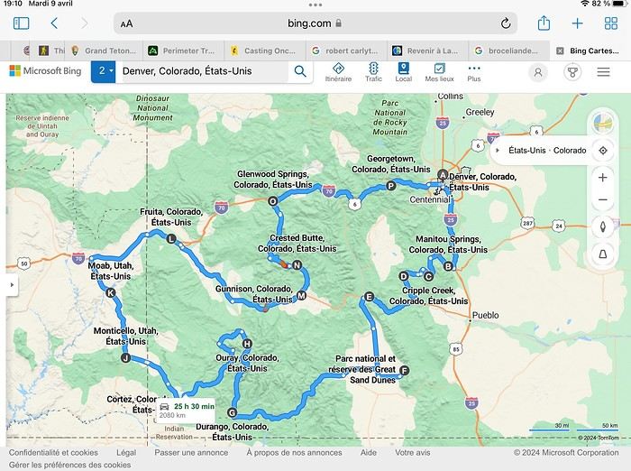
Day 1: Flight Marseille-Paris-Denver, then Manitou Springs (133 km) Day 2: Manitou Springs (49 km) Day 3: Cripple Creek (104 km) Day 4: Salida (254 km) Day 5: Great Sand Dunes (231 km) Day 6: Durango (283 km) Day 7: Durango (Durango-Silverton train) Day 8: Ouray (121 km) Day 9: Ouray (Perimeter Trail hike) Day 10: Cortez (213 km) Day 11: Cortez (Mesa Verde National Park, 134 km) Day 12: Monticello (268 km, detour to Chesler Park) Day 13: Moab (171 km, Delicate Arch) Day 14: Moab (98 km, Fisher Towers) Day 15: Moab (171 km, Canyonlands) Day 16: Fruita (210 km, Colorado National Monument) Day 17: Crested Butte (224 km via Kebler Pass) Day 18: Crested Butte (57 km) Day 19: Glenwood Springs (150 km) Day 20: Glenwood Springs (118 km, Rifle State Park) Day 21: Georgetown (258 km via Independence Pass) Day 22: Denver (123 km), then return flight
We speak very little English. We spent 21 nights there and covered a 3,400 km loop by car and 160 km on foot (we’re still trying to hike while we’re in shape) from Denver in September 2024. We wanted this road trip to help us explore Colorado a bit more—we’d only spent 6 nights there in 2019—and to see it during the fall foliage season. We also wanted to return to Utah (we love Moab) to enjoy its red rocks, which we adore.
In the prices you see (some in euros, others in dollars), I’ve included bank fees and exchange charges. The flights, car, and parking were paid by credit card when we booked in February. Usually, we book around November, but some obligations kept us from doing it earlier. We downloaded the MPC (Mobile Passport Control) app on our phone, which saved us time at immigration.
📊 **Budget: just under 8,500 € for both of us, all included**
📊 **Flights** Marseille-Paris (CDG)-Denver: 2,152 € for both of us, with one checked bag each
📊 **ESTA and America the Beautiful Pass** The ones from our 2023 road trip were still valid
📊 **Parking at Marseille airport: 122 €**
📊 **Car: Nissan Rogue (the French X-Trail) from Hertz: 1,165 €** By booking through Air France (and earning miles), we got a 15% discount. Hertz offers a free Hertz Gold Plus Rewards program, which gives us priority counter service.
📊 **Accommodation: 3,050 €** We stayed in motels and hotels of various ranges (from 100 € to 270 € per night, depending on the city), all booked through Hotels.com or Booking. Booking sometimes offers cheaper rates if you book via the "Booking mobile" app. We also got some preferential rates thanks to our Genius 2 status. Out of 21 nights, only one place didn’t include breakfast.
📊 **Other expenses (activities booked by credit card before leaving)** Durango-Silverton train: 210 € (we booked the enclosed vintage coach in March) Mesa Verde: Balcony House: 15.15 € (booked 14 days before the visit) Timed-entry passes for Arches National Park: 6 € for 3 days (booked June 1 for September entries via http://récreation.gov/). We booked three different days to play with the weather.
📊 **Supplementary insurance with AVA: 204 €** (due to our age 😅 and the high cost of medical consultations in the USA)
📊 **Cash: 1,540 €** We left with 1,000 € exchanged before departure and made two withdrawals (500 $ and 200 $). This cash was used to pay for: - Evening restaurants and tips (between 70 $ and 95 $ for two meals and two drinks) - Two state parks: Dead Horse State Park (20 $) and Rifle State Park (10 $) - The Monarch Pass gondola (24 $) - Midday picnics - Gas (slightly cheaper with cash): 204 $ for 3,400 km - Personal souvenirs and little treats.
Like in our previous road trips, we didn’t rent a GPS. We used the offline GPS app Here We Go, for which we’d downloaded maps of Colorado and Utah from France, as well as a new offline app called Organic Maps as a backup—though we didn’t end up needing it.
❤️❤️❤️ **Highlights (there are so many!)** 📍 The stunning landscapes of Colorado, especially with the fall colors 📍 A step back in time at the old farm in Florissant Fossil Beds National Monument 📍 The prairies of Cripple Creek and the mining remnants of the Vindicator Trail 📍 The cheeky chipmunks in the ghost town of St. Elmo 📍 Great Sand Dunes and its soft sand 📍 The steam train between Durango and Silverton: we’re glad we chose the round-trip because it rained heavily on the way there, but we got to enjoy the scenery on the way back when the sun came out 📍 The unexpected meet-up with Michèle from the group outside a restaurant in Durango 📍 The hot springs in Ouray 📍 Mesa Verde and its still-vibrant past 📍 The red rocks of Moab and Delicate Arch at sunset 📍 The lace-like Fisher Towers and the view from the end of the trail 📍 The gorgeous Route 128 leading to Colorado National Monument—small, easy to visit, and so beautiful 📍 The colors of the fabulous Kebler Pass, Crested Butte, and especially the hike through the golden aspens (Lower and Upper Loop) 📍 The waterfalls at Rifle State Park 📍 The tundra of Independence Pass 📍 The Halloween decorations in Georgetown and Idaho Springs
😞😞 **Flops (there are very few!)** 📍 The viewpoints we missed because they weren’t well-marked or we didn’t see the signs 📍 The closure of some hiking trails (Hanging Lake and parts of Canyonlands) and the Sal Mountain Loop road, which kept us from accessing it 📍😢 The Chesler Park hike we had to cut short due to poor time management—180 km between our stop in Cortez meant we didn’t arrive until 10:30 AM, way too late for a 17 km hike.
Hope this helps! Have a great evening, everyone, and see you soon! 😊
The itinerary
Day 1: Flight Marseille-Paris-Denver, then Manitou Springs (133 km) Day 2: Manitou Springs (49 km) Day 3: Cripple Creek (104 km) Day 4: Salida (254 km) Day 5: Great Sand Dunes (231 km) Day 6: Durango (283 km) Day 7: Durango (Durango-Silverton train) Day 8: Ouray (121 km) Day 9: Ouray (Perimeter Trail hike) Day 10: Cortez (213 km) Day 11: Cortez (Mesa Verde National Park, 134 km) Day 12: Monticello (268 km, detour to Chesler Park) Day 13: Moab (171 km, Delicate Arch) Day 14: Moab (98 km, Fisher Towers) Day 15: Moab (171 km, Canyonlands) Day 16: Fruita (210 km, Colorado National Monument) Day 17: Crested Butte (224 km via Kebler Pass) Day 18: Crested Butte (57 km) Day 19: Glenwood Springs (150 km) Day 20: Glenwood Springs (118 km, Rifle State Park) Day 21: Georgetown (258 km via Independence Pass) Day 22: Denver (123 km), then return flight
We speak very little English. We spent 21 nights there and covered a 3,400 km loop by car and 160 km on foot (we’re still trying to hike while we’re in shape) from Denver in September 2024. We wanted this road trip to help us explore Colorado a bit more—we’d only spent 6 nights there in 2019—and to see it during the fall foliage season. We also wanted to return to Utah (we love Moab) to enjoy its red rocks, which we adore.
In the prices you see (some in euros, others in dollars), I’ve included bank fees and exchange charges. The flights, car, and parking were paid by credit card when we booked in February. Usually, we book around November, but some obligations kept us from doing it earlier. We downloaded the MPC (Mobile Passport Control) app on our phone, which saved us time at immigration.
📊 **Budget: just under 8,500 € for both of us, all included**
📊 **Flights** Marseille-Paris (CDG)-Denver: 2,152 € for both of us, with one checked bag each
📊 **ESTA and America the Beautiful Pass** The ones from our 2023 road trip were still valid
📊 **Parking at Marseille airport: 122 €**
📊 **Car: Nissan Rogue (the French X-Trail) from Hertz: 1,165 €** By booking through Air France (and earning miles), we got a 15% discount. Hertz offers a free Hertz Gold Plus Rewards program, which gives us priority counter service.
📊 **Accommodation: 3,050 €** We stayed in motels and hotels of various ranges (from 100 € to 270 € per night, depending on the city), all booked through Hotels.com or Booking. Booking sometimes offers cheaper rates if you book via the "Booking mobile" app. We also got some preferential rates thanks to our Genius 2 status. Out of 21 nights, only one place didn’t include breakfast.
📊 **Other expenses (activities booked by credit card before leaving)** Durango-Silverton train: 210 € (we booked the enclosed vintage coach in March) Mesa Verde: Balcony House: 15.15 € (booked 14 days before the visit) Timed-entry passes for Arches National Park: 6 € for 3 days (booked June 1 for September entries via http://récreation.gov/). We booked three different days to play with the weather.
📊 **Supplementary insurance with AVA: 204 €** (due to our age 😅 and the high cost of medical consultations in the USA)
📊 **Cash: 1,540 €** We left with 1,000 € exchanged before departure and made two withdrawals (500 $ and 200 $). This cash was used to pay for: - Evening restaurants and tips (between 70 $ and 95 $ for two meals and two drinks) - Two state parks: Dead Horse State Park (20 $) and Rifle State Park (10 $) - The Monarch Pass gondola (24 $) - Midday picnics - Gas (slightly cheaper with cash): 204 $ for 3,400 km - Personal souvenirs and little treats.
Like in our previous road trips, we didn’t rent a GPS. We used the offline GPS app Here We Go, for which we’d downloaded maps of Colorado and Utah from France, as well as a new offline app called Organic Maps as a backup—though we didn’t end up needing it.
❤️❤️❤️ **Highlights (there are so many!)** 📍 The stunning landscapes of Colorado, especially with the fall colors 📍 A step back in time at the old farm in Florissant Fossil Beds National Monument 📍 The prairies of Cripple Creek and the mining remnants of the Vindicator Trail 📍 The cheeky chipmunks in the ghost town of St. Elmo 📍 Great Sand Dunes and its soft sand 📍 The steam train between Durango and Silverton: we’re glad we chose the round-trip because it rained heavily on the way there, but we got to enjoy the scenery on the way back when the sun came out 📍 The unexpected meet-up with Michèle from the group outside a restaurant in Durango 📍 The hot springs in Ouray 📍 Mesa Verde and its still-vibrant past 📍 The red rocks of Moab and Delicate Arch at sunset 📍 The lace-like Fisher Towers and the view from the end of the trail 📍 The gorgeous Route 128 leading to Colorado National Monument—small, easy to visit, and so beautiful 📍 The colors of the fabulous Kebler Pass, Crested Butte, and especially the hike through the golden aspens (Lower and Upper Loop) 📍 The waterfalls at Rifle State Park 📍 The tundra of Independence Pass 📍 The Halloween decorations in Georgetown and Idaho Springs
😞😞 **Flops (there are very few!)** 📍 The viewpoints we missed because they weren’t well-marked or we didn’t see the signs 📍 The closure of some hiking trails (Hanging Lake and parts of Canyonlands) and the Sal Mountain Loop road, which kept us from accessing it 📍😢 The Chesler Park hike we had to cut short due to poor time management—180 km between our stop in Cortez meant we didn’t arrive until 10:30 AM, way too late for a 17 km hike.
Hope this helps! Have a great evening, everyone, and see you soon! 😊
Slovenia, a nature destination
Slovenia was the originally planned destination for summer 2022, as a complement to a road trip through Croatia and Montenegro. Plans changed on a whim in February of that year. Our Balkans road trip would ultimately be limited to Slovenia and take place over 10 days during the Easter school holidays. Flight tickets and car rental were booked right away; all that was left was to finalize our itinerary, already sketched out, and the accommodation reservations.
I decided to add Plitvice Lakes in Croatia to our program. I really wanted to discover them, and for my husband, it was a chance to revisit them several years after a trip to Yugoslavia when he was a teenager.
I’m happy to contribute to the reopening of our forum by posting this travel journal (originally posted in 2022 on another forum, the text has been partially revised and photos added). As usual, a few photos to start with—maybe they’ll inspire you to join in!

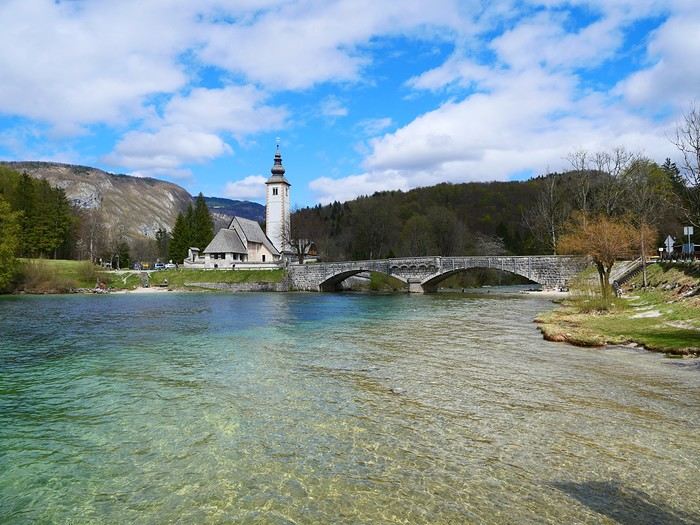
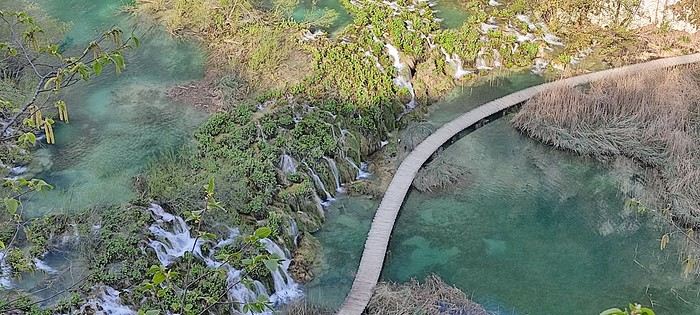

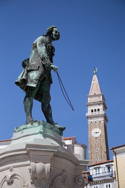
I decided to add Plitvice Lakes in Croatia to our program. I really wanted to discover them, and for my husband, it was a chance to revisit them several years after a trip to Yugoslavia when he was a teenager.
I’m happy to contribute to the reopening of our forum by posting this travel journal (originally posted in 2022 on another forum, the text has been partially revised and photos added). As usual, a few photos to start with—maybe they’ll inspire you to join in!
31-Day Japan Itinerary: From Kyushu to Tokyo
Hello everyone, what a pleasure to be back on this forum!
My partner and I are heading to Japan for the first time from mid-December to mid-January for 31 days. It’s a long-held dream we’ve been saving for over two years, and we want to enjoy ourselves while also being mindful of our budget for parts of the trip. We’d love to explore Tokyo, but we’ve chosen to spend more time in nature. My partner plans to get his driver’s license translated locally so we can rent a car. We’ve heard from friends who’ve been that Japan isn’t the best place for improvisation, so we’ve tried to allow plenty of time in each location to avoid rushing. Still, I’d love to hear your thoughts on the itinerary we’ve planned—whether it’s feasible in terms of travel and how interesting it seems. Given the recent increase in the JR Pass price and the fact that we’ll spend about ten days on Goto, Ojika, and Yakushima (where the JR Pass doesn’t cover travel), we don’t think it’s worth it for us. Instead, we’re planning to take the train from Tokyo to Fukuoka and then use buses and ferries for the rest of Kyushu. Here’s our itinerary:
1- December 13 / Arrival in Tokyo, one night in Tokyo, then departure for Fukuoka by train on the morning of the 14th.
2 - December 14-16 / 2 nights in Fukuoka, sightseeing, then departure on the evening/night of the 16th by ferry to Ojika Islands.
3 - December 17-21 / 4 nights on Ojika, cycling and exploring, then departure on the 21st by ferry to Fukue on the Goto Islands.
4 - December 21-24 / 3 nights on the Goto Islands, renting a car to explore, maybe a trip to Hisaka. Departure for Nagasaki by ferry on the morning of the 24th.
5- December 24-26 / 2 nights in Nagasaki, visiting the city and memorials, possibly the hot springs in Unzen. Departure on the evening of the 26th by bus or ferry (?) to Kumamoto.
6- December 26-29 / 3 nights in Kumamoto, sightseeing, day trip by car to Mount Aso and surrounding areas. Departure on the 29th in the late afternoon by bus to Kagoshima, overnight in Kagoshima.
7- December 30 to January 2 / Morning departure by ferry to Yakushima for 3 nights, hiking and exploring the island. Departure on January 2 on the only ferry (?) in the early afternoon back to Kagoshima.
8- January 2 to 5 / Uncertain leg... We’d like to spend the night of the 4th to the 5th at a ryokan in Kurokawa Onsen and then head back to Fukuoka and Tokyo by train on the 5th. From the 2nd to the 4th, since we’ll arrive in Kagoshima in the late afternoon, we thought we could head back up to Kumamoto by train or bus—going to Yufuin or Beppu would take much longer and leave us with very little time. But is it worth staying another 2 nights in Kumamoto to explore the area, given we’ll already be there for 3 days from December 26-29? Or should we stay in Kagoshima and head up to Kurokawa Onsen on the afternoon of the 4th for our overnight stay?
9- January 5 to 13, Tokyo and its endless things to do and see, then back to France!
If you have any advice on any of these stops, we’d love to hear it! Have a wonderful day.
My partner and I are heading to Japan for the first time from mid-December to mid-January for 31 days. It’s a long-held dream we’ve been saving for over two years, and we want to enjoy ourselves while also being mindful of our budget for parts of the trip. We’d love to explore Tokyo, but we’ve chosen to spend more time in nature. My partner plans to get his driver’s license translated locally so we can rent a car. We’ve heard from friends who’ve been that Japan isn’t the best place for improvisation, so we’ve tried to allow plenty of time in each location to avoid rushing. Still, I’d love to hear your thoughts on the itinerary we’ve planned—whether it’s feasible in terms of travel and how interesting it seems. Given the recent increase in the JR Pass price and the fact that we’ll spend about ten days on Goto, Ojika, and Yakushima (where the JR Pass doesn’t cover travel), we don’t think it’s worth it for us. Instead, we’re planning to take the train from Tokyo to Fukuoka and then use buses and ferries for the rest of Kyushu. Here’s our itinerary:
1- December 13 / Arrival in Tokyo, one night in Tokyo, then departure for Fukuoka by train on the morning of the 14th.
2 - December 14-16 / 2 nights in Fukuoka, sightseeing, then departure on the evening/night of the 16th by ferry to Ojika Islands.
3 - December 17-21 / 4 nights on Ojika, cycling and exploring, then departure on the 21st by ferry to Fukue on the Goto Islands.
4 - December 21-24 / 3 nights on the Goto Islands, renting a car to explore, maybe a trip to Hisaka. Departure for Nagasaki by ferry on the morning of the 24th.
5- December 24-26 / 2 nights in Nagasaki, visiting the city and memorials, possibly the hot springs in Unzen. Departure on the evening of the 26th by bus or ferry (?) to Kumamoto.
6- December 26-29 / 3 nights in Kumamoto, sightseeing, day trip by car to Mount Aso and surrounding areas. Departure on the 29th in the late afternoon by bus to Kagoshima, overnight in Kagoshima.
7- December 30 to January 2 / Morning departure by ferry to Yakushima for 3 nights, hiking and exploring the island. Departure on January 2 on the only ferry (?) in the early afternoon back to Kagoshima.
8- January 2 to 5 / Uncertain leg... We’d like to spend the night of the 4th to the 5th at a ryokan in Kurokawa Onsen and then head back to Fukuoka and Tokyo by train on the 5th. From the 2nd to the 4th, since we’ll arrive in Kagoshima in the late afternoon, we thought we could head back up to Kumamoto by train or bus—going to Yufuin or Beppu would take much longer and leave us with very little time. But is it worth staying another 2 nights in Kumamoto to explore the area, given we’ll already be there for 3 days from December 26-29? Or should we stay in Kagoshima and head up to Kurokawa Onsen on the afternoon of the 4th for our overnight stay?
9- January 5 to 13, Tokyo and its endless things to do and see, then back to France!
If you have any advice on any of these stops, we’d love to hear it! Have a wonderful day.
A Month in Laos and Cambodia
Hello everyone,
At the start of November, a bit of rest before winter will be perfect to kick off this travel journal. There aren’t many recent journals about this part of the world, so I’ll take the plunge—my way of celebrating the (unexpected) return of this forum, which has been such a big part of my life for over 15 years.
So, back to Asia at the end of 2023. After Myanmar in 2015 and Vietnam in 2018, we’ve chosen Laos this time. And when talking with friends (you know how it is—everyone asks, "So, where are you going this year?"), a couple of friends asked to join us ("You see, my wife dreams of a trip to Asia, and I dream of traveling like you, independently"). We’ve spent a week with them (and other friends) in Portugal, so we know they’re easygoing and flexible. They’ll only be with us after Christmas (due to lots of grandkids), so deal—we’re bringing them along! A new experience for us.
A new experience that’ll start with tweaking the itinerary. Originally, I planned to stay a month in Laos, but what could be more magical for my friend’s wife than discovering Asia by way of Angkor! Plus, our two daughters asked for some beach time at the end of the trip! So, it’ll be Laos and Cambodia—neither of which we’ve visited before, so no complaints there.
The route will be pretty classic, though a bit scattered to fit our dates and wishes. For us, we’ll arrive in Luang Prabang (LP) to take some time to acclimate, then a few days in the northern Laos mountains, Nong Khiaw and Muang Ngoi. Back to LP for a direct flight to Pakse. Yes, I know—so many amazing places we’ll miss along the way, but as you know, choosing means letting go... From Pakse, I’m leaving a few days open (no bookings), but I’m eyeing Champassak and the 4,000 Islands. That’s where Mariel and Naty (our friends!) will join us on December 30th. I’ve tentatively added the Bolaven Plateau loop to the plan (still no bookings). Their Laos adventure will be short—by January 3rd, we’ll cross the border into Cambodia, heading straight to Siem Reap for 5 days. Then, I’ll fulfill my promise with a magical detour to Koh Rong Sanloem via a night bus (a must-do in Asia!). On to Phnom Penh for 2 days—where our trip ends, while Mariel and Naty will stop in Bangkok for 3 days before flying home.
So, fasten your seatbelts, flight attendants at the doors, and sorry for the long intro—here we go on this Asian adventure!
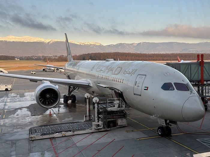
At the start of November, a bit of rest before winter will be perfect to kick off this travel journal. There aren’t many recent journals about this part of the world, so I’ll take the plunge—my way of celebrating the (unexpected) return of this forum, which has been such a big part of my life for over 15 years.
So, back to Asia at the end of 2023. After Myanmar in 2015 and Vietnam in 2018, we’ve chosen Laos this time. And when talking with friends (you know how it is—everyone asks, "So, where are you going this year?"), a couple of friends asked to join us ("You see, my wife dreams of a trip to Asia, and I dream of traveling like you, independently"). We’ve spent a week with them (and other friends) in Portugal, so we know they’re easygoing and flexible. They’ll only be with us after Christmas (due to lots of grandkids), so deal—we’re bringing them along! A new experience for us.
A new experience that’ll start with tweaking the itinerary. Originally, I planned to stay a month in Laos, but what could be more magical for my friend’s wife than discovering Asia by way of Angkor! Plus, our two daughters asked for some beach time at the end of the trip! So, it’ll be Laos and Cambodia—neither of which we’ve visited before, so no complaints there.
The route will be pretty classic, though a bit scattered to fit our dates and wishes. For us, we’ll arrive in Luang Prabang (LP) to take some time to acclimate, then a few days in the northern Laos mountains, Nong Khiaw and Muang Ngoi. Back to LP for a direct flight to Pakse. Yes, I know—so many amazing places we’ll miss along the way, but as you know, choosing means letting go... From Pakse, I’m leaving a few days open (no bookings), but I’m eyeing Champassak and the 4,000 Islands. That’s where Mariel and Naty (our friends!) will join us on December 30th. I’ve tentatively added the Bolaven Plateau loop to the plan (still no bookings). Their Laos adventure will be short—by January 3rd, we’ll cross the border into Cambodia, heading straight to Siem Reap for 5 days. Then, I’ll fulfill my promise with a magical detour to Koh Rong Sanloem via a night bus (a must-do in Asia!). On to Phnom Penh for 2 days—where our trip ends, while Mariel and Naty will stop in Bangkok for 3 days before flying home.
So, fasten your seatbelts, flight attendants at the doors, and sorry for the long intro—here we go on this Asian adventure!
Back from 3 weeks in Quebec
Hi there, just back from a three-week round trip to Quebec and a side trip to New Brunswick.
Departed from Montpellier, via CDG, then arrived in Montreal from July 31 to August 20, 2024.
AF flights went smoothly.
The RT itinerary (without the visit details):
Arrival in Montreal; Trois-Rivières; Tadoussac; Matane; Gaspé; Campbellton; Trois-Pistoles; Quebec City; Montreal and return to France, AF to CDG then Hop! to Montpellier.
Observations:
Getting out of Montreal airport is a nightmare! Two hours at Avis Auto to pick up the car (nice ride, though—a WW SUV Atlas V6 for two). From what I’ve heard, Montreal Airport is a pain because it was initially under-dimensioned for its infrastructure, and it seems impossible to reorganize everything.
Quebecers: Wonderful people in terms of hospitality and behavior toward tourists—especially French ones. You can ask them for advice at the supermarket, for directions here and there, and those distant cousins are great! That said, I’d exclude Montreal, which, due to its size and perhaps its cosmopolitanism, can’t be considered as welcoming as the countryside and small towns we passed through. A bit like Paris, you could say.
Quebecers prefer Quebec City over Montreal, and I get it. On a positive note for the city, I left some money in the hotel at the end of my stay. Once back in France, I contacted the hotel (day before yesterday), and they confirmed the oversight and are taking steps to send the money back. A nice gesture. It’s the Nouvel Hôtel, 1740 Avenue René Lévesque. Well-located, too.
Tourists: Same as always!
Americans: Still lacking in culture and education, but we already knew that. Loud, intrusive, annoying, you could say. And I’ll skip the “Oh my God! Oh my God!” all day long. And always with a coffee cup in hand on the streets. Not just American tourists, actually. Coffee is either enjoyed at the counter of a café or at home in front of the day’s news. It must also be said that our cousins’ coffee is more like dishwater.
Tourists from the Middle Kingdom: No change there! Flagrant lack of European culture and respect. They can be quite annoying at times. Thankfully, they don’t like the countryside or small towns.
Tourists from the Land of the Rising Sun: As usual, impeccable behavior. Both in terms of dress and discretion.
The British: They feel at home. Well, they kind of are, actually. Distant, inaccessible—typical English folks.
South Americans: A lot of them in Montreal during my stay. Quite noisy, especially at breakfast. But deep down, they’re great and very polite. I really like them. Must be my 36.1% Iberian DNA from my ancestry test that makes me say that.
And the French? Always the same! Complainers, grumblers, never happy with the meal, always finding prices too high, cutting in line, sometimes with a Quechua backpack but not always. In short, we don’t change. That said, there were some really nice people and great encounters that will leave wonderful memories. Some folks from Marseille in Quebec City, Toulouse in Montreal, Perpignan... But not many Parisians. Or maybe they just don’t talk to outsiders. When I think that my wife is from the 14th arrondissement...
And lots of lovely young French people there on a Working Holiday Visa for two years.
Others? Italians? Didn’t run into many. Eastern Europeans? Didn’t see any, or they were super discreet.
The trip started on July 31. 2,000 photos to sort through. More to come later.
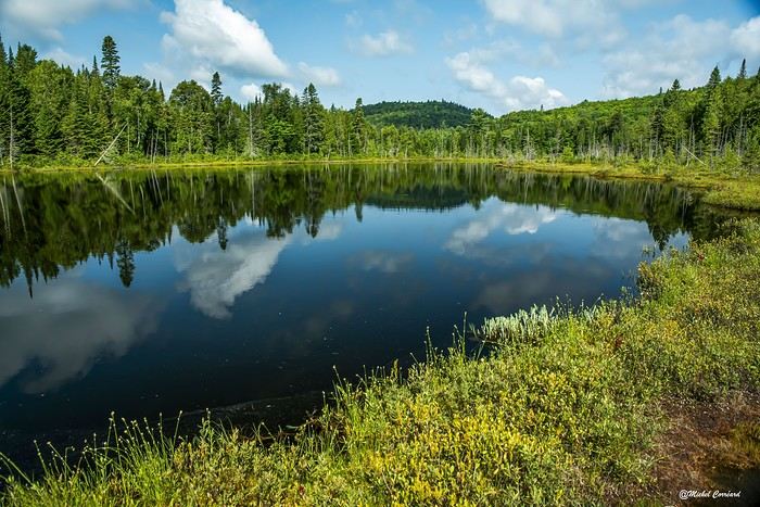
The RT itinerary (without the visit details):
Arrival in Montreal; Trois-Rivières; Tadoussac; Matane; Gaspé; Campbellton; Trois-Pistoles; Quebec City; Montreal and return to France, AF to CDG then Hop! to Montpellier.
Observations:
Getting out of Montreal airport is a nightmare! Two hours at Avis Auto to pick up the car (nice ride, though—a WW SUV Atlas V6 for two). From what I’ve heard, Montreal Airport is a pain because it was initially under-dimensioned for its infrastructure, and it seems impossible to reorganize everything.
Quebecers: Wonderful people in terms of hospitality and behavior toward tourists—especially French ones. You can ask them for advice at the supermarket, for directions here and there, and those distant cousins are great! That said, I’d exclude Montreal, which, due to its size and perhaps its cosmopolitanism, can’t be considered as welcoming as the countryside and small towns we passed through. A bit like Paris, you could say.
Quebecers prefer Quebec City over Montreal, and I get it. On a positive note for the city, I left some money in the hotel at the end of my stay. Once back in France, I contacted the hotel (day before yesterday), and they confirmed the oversight and are taking steps to send the money back. A nice gesture. It’s the Nouvel Hôtel, 1740 Avenue René Lévesque. Well-located, too.
Tourists: Same as always!
Americans: Still lacking in culture and education, but we already knew that. Loud, intrusive, annoying, you could say. And I’ll skip the “Oh my God! Oh my God!” all day long. And always with a coffee cup in hand on the streets. Not just American tourists, actually. Coffee is either enjoyed at the counter of a café or at home in front of the day’s news. It must also be said that our cousins’ coffee is more like dishwater.
Tourists from the Middle Kingdom: No change there! Flagrant lack of European culture and respect. They can be quite annoying at times. Thankfully, they don’t like the countryside or small towns.
Tourists from the Land of the Rising Sun: As usual, impeccable behavior. Both in terms of dress and discretion.
The British: They feel at home. Well, they kind of are, actually. Distant, inaccessible—typical English folks.
South Americans: A lot of them in Montreal during my stay. Quite noisy, especially at breakfast. But deep down, they’re great and very polite. I really like them. Must be my 36.1% Iberian DNA from my ancestry test that makes me say that.
And the French? Always the same! Complainers, grumblers, never happy with the meal, always finding prices too high, cutting in line, sometimes with a Quechua backpack but not always. In short, we don’t change. That said, there were some really nice people and great encounters that will leave wonderful memories. Some folks from Marseille in Quebec City, Toulouse in Montreal, Perpignan... But not many Parisians. Or maybe they just don’t talk to outsiders. When I think that my wife is from the 14th arrondissement...
And lots of lovely young French people there on a Working Holiday Visa for two years.
Others? Italians? Didn’t run into many. Eastern Europeans? Didn’t see any, or they were super discreet.
The trip started on July 31. 2,000 photos to sort through. More to come later.
MSC World Europa in November 2024
Hi everyone, just wanted to say how happy I am to be back on this forum—it really helped me out on my previous trips. I’ve missed it these past few years, so thanks for bringing it back to life!
Long live Voyage Forum!
We’re boarding the MSC World Europa next month. I’d love to hear any tips or see photos from anyone who’s already been on this ship. We’ll be in cabin 14135 if anyone’s been in the same one.
Thanks in advance!
Seb
Three weeks in Quebec at the start of summer 2018, on a "semi-organized" trip
I’ve been putting off posting my Quebec travel experience for a long time. Two years later, I’ve finally decided to share it. The memories are still vivid. I hope this gives you the urge to visit this beautiful region, which I literally fell in love with.
We’re traveling as four adults: my brother Guy, my sister-in-law Martine, my friend Pascal, and myself (Christian).
We entrusted the flight, hotel, and car reservations to the travel agency Amplitudes in Toulouse. Planning the day-to-day activities was up to us. We scheduled a few must-see visits, but for the rest, we’d figure it out on the spot.
Our itinerary: Quebec City / Rimouski / Carleton-sur-Mer / Percé / Sainte-Anne-des-Monts / Matane / Tadoussac / Sainte-Rose-du-Nord / Chambord / Saint-Alexis-des-Monts / Montreal
06/25 Here we are at Roissy Charles de Gaulle for the usual pre-flight formalities. Everything goes smoothly and quickly. The hardest part is waiting for takeoff. After an uneventful flight on an Air Canada Boeing 777-300ER, we land at Montréal-Pierre Elliott Trudeau Airport (YUL) in the early afternoon.
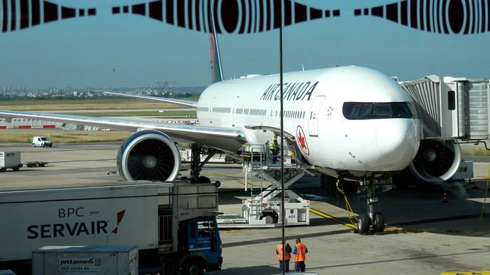
At customs, a surprise—no grumpy officer, but a smiling customs agent who jokingly asks me to name three tourist spots in Quebec, or else he won’t let me in. I pass the test easily and enter Quebec!
We head to the Alamo counter at Trudeau Airport to pick up our car: a Ford Escape with only 300 kilometers on the odometer.
We decided to head straight to Quebec City, saving Montreal for the end of the trip. Pascal takes the wheel and gets on the Trans-Canada Highway E20 for a 255 km drive, taking about 2 hours and 45 minutes. With the time difference, we’re already feeling hungry, so we stop for our first poutine at a highway restaurant.

When we arrive in Quebec City, we go straight to the Clarendon Hotel, located right in the heart of Old Quebec. We’ll be staying there for three nights. Tonight, no restaurant—just a short walk around the hotel before bed. We discover a square with pretty colored water fountains near the city hall.
 It’s only 9 PM, but our body clocks say it’s 3 AM.
We’re traveling as four adults: my brother Guy, my sister-in-law Martine, my friend Pascal, and myself (Christian).
We entrusted the flight, hotel, and car reservations to the travel agency Amplitudes in Toulouse. Planning the day-to-day activities was up to us. We scheduled a few must-see visits, but for the rest, we’d figure it out on the spot.
Our itinerary: Quebec City / Rimouski / Carleton-sur-Mer / Percé / Sainte-Anne-des-Monts / Matane / Tadoussac / Sainte-Rose-du-Nord / Chambord / Saint-Alexis-des-Monts / Montreal
06/25 Here we are at Roissy Charles de Gaulle for the usual pre-flight formalities. Everything goes smoothly and quickly. The hardest part is waiting for takeoff. After an uneventful flight on an Air Canada Boeing 777-300ER, we land at Montréal-Pierre Elliott Trudeau Airport (YUL) in the early afternoon.
At customs, a surprise—no grumpy officer, but a smiling customs agent who jokingly asks me to name three tourist spots in Quebec, or else he won’t let me in. I pass the test easily and enter Quebec!
We head to the Alamo counter at Trudeau Airport to pick up our car: a Ford Escape with only 300 kilometers on the odometer.
We decided to head straight to Quebec City, saving Montreal for the end of the trip. Pascal takes the wheel and gets on the Trans-Canada Highway E20 for a 255 km drive, taking about 2 hours and 45 minutes. With the time difference, we’re already feeling hungry, so we stop for our first poutine at a highway restaurant.
When we arrive in Quebec City, we go straight to the Clarendon Hotel, located right in the heart of Old Quebec. We’ll be staying there for three nights. Tonight, no restaurant—just a short walk around the hotel before bed. We discover a square with pretty colored water fountains near the city hall.
It’s only 9 PM, but our body clocks say it’s 3 AM.Majorque, rien que pour vos yeux English translation pending
Salut à tous,
Dimanche pluvieux, rentrée dans 2 jours, des masques partout, bref ambiance sinistrose à fond😕... alors je me suis dit qu'il est tant de me replonger dans les photos de Majorque et de vous en faire profiter afin d'égayer (je l'espère) les jours à venir 🙂
Majorque... Franchement cette destination ne m'a jamais fait rêver. Les Baléares, dans mon imaginaire personnel, c'était un peu les vacances Fram pas chères, de la bidasse au bord de la plage et train de siroter des mauvais cocktails, et de la jeunesse encannaillée en boite de nuit au son des boum boum boum...
Cet été, on projetait d'aller en Sicile. Nous c'est Papa, Maman, notre p'tit gars de 10 ans, et notre princesse de 6 ans. Et j'étais plus particulièrement motivé par les îles éoliennes, qui est un des must de la plongée méditerranéenne (ah oui, je suis plongeur, alors c'est toujours un critère obligé de nos destinations de vacances 😎) avec des décors volcaniques qui semblaient magiques. Mais pour différentes raisons, celà ne s'est pas fait. Alors quand ma femme, ayant vu le blog d'une instagrameuse, m'a parlé de Majorque à la place des Eoliennes, j'ai plutôt bondi... Elle a insisté, j'ai cédé, on a acheté le Lonely Planet, et j'ai commencé, toujours peu motivé, à le feuilleter... Et là, ce que je lisais n'était pas du tout en phase avec l'image d'Epinal que j'en avais... Majorque était décrit comme un écrin naturel, à base de criques turquoises, montagnes plongeant dans la mer, petits villages, plantations d'agrumes... Et de très beau coin à plongée, notamment pas mal de grottes autour du Cap de Formentor. Destination parfaite pour allier plaisir des enfants et des parents 🙂 Alors j'ai dit banco !
Un chaine montagneuse (Sierra de Tramontana) couvre la cote Ouest de l'île et se termine par le Cap de Formentor, avec nombreuses criques, parfois sauvages, un peu partout. Le Nord est formé de 2 grandes baies (celles de Pollenca et Alcudia). L'Est est très bétonné ; de belles criques mais pas vraiment sauvages. Le Sud c'est essentiellement la baie de Palma où s'entassent les jeunes anglais et allemands venus ce retourner la tête... Pas grand chose à voir au centre.
Alors on a préparé celà gentiment. Etant donné que nous ciblions la découverte du Nord et de l'Ouest de l'île , on a ciblé un logement dans la région de Sa Pobla, proche de la baie de Pollenca. Billets Transavia en poche en février pour un départ en Juillet, réservation d'une villa par Air b'n'b, il n'y avait plus qu'à... Et la Covid est arrivé🏴☠️. On n'a rien annulé, on a a serré les fesses, et finalement on est passé entre les gouttes. Nos vols ont été maintenus aux dates et horaires prévus.
La dernière chose à faire était la réservation de la voiture de location, faite au dernier moment. Oubliez les prestataires institutionnels, il y a une multitude d'agences locales à l'aéroport de Majorque. On est passé par Wiber, RAS
Et ces deux semaines furent incroyables. Un vrai choc, je ne m'attendais pas à une telle beauté à 1h30 de vol de Paris 😛
Je vais vous raconter, et surtout vous montrer tout celà, tranquillement 😉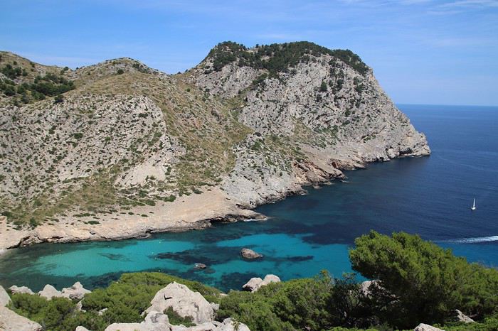
Dimanche pluvieux, rentrée dans 2 jours, des masques partout, bref ambiance sinistrose à fond😕... alors je me suis dit qu'il est tant de me replonger dans les photos de Majorque et de vous en faire profiter afin d'égayer (je l'espère) les jours à venir 🙂
Majorque... Franchement cette destination ne m'a jamais fait rêver. Les Baléares, dans mon imaginaire personnel, c'était un peu les vacances Fram pas chères, de la bidasse au bord de la plage et train de siroter des mauvais cocktails, et de la jeunesse encannaillée en boite de nuit au son des boum boum boum...
Cet été, on projetait d'aller en Sicile. Nous c'est Papa, Maman, notre p'tit gars de 10 ans, et notre princesse de 6 ans. Et j'étais plus particulièrement motivé par les îles éoliennes, qui est un des must de la plongée méditerranéenne (ah oui, je suis plongeur, alors c'est toujours un critère obligé de nos destinations de vacances 😎) avec des décors volcaniques qui semblaient magiques. Mais pour différentes raisons, celà ne s'est pas fait. Alors quand ma femme, ayant vu le blog d'une instagrameuse, m'a parlé de Majorque à la place des Eoliennes, j'ai plutôt bondi... Elle a insisté, j'ai cédé, on a acheté le Lonely Planet, et j'ai commencé, toujours peu motivé, à le feuilleter... Et là, ce que je lisais n'était pas du tout en phase avec l'image d'Epinal que j'en avais... Majorque était décrit comme un écrin naturel, à base de criques turquoises, montagnes plongeant dans la mer, petits villages, plantations d'agrumes... Et de très beau coin à plongée, notamment pas mal de grottes autour du Cap de Formentor. Destination parfaite pour allier plaisir des enfants et des parents 🙂 Alors j'ai dit banco !
Un chaine montagneuse (Sierra de Tramontana) couvre la cote Ouest de l'île et se termine par le Cap de Formentor, avec nombreuses criques, parfois sauvages, un peu partout. Le Nord est formé de 2 grandes baies (celles de Pollenca et Alcudia). L'Est est très bétonné ; de belles criques mais pas vraiment sauvages. Le Sud c'est essentiellement la baie de Palma où s'entassent les jeunes anglais et allemands venus ce retourner la tête... Pas grand chose à voir au centre.
Alors on a préparé celà gentiment. Etant donné que nous ciblions la découverte du Nord et de l'Ouest de l'île , on a ciblé un logement dans la région de Sa Pobla, proche de la baie de Pollenca. Billets Transavia en poche en février pour un départ en Juillet, réservation d'une villa par Air b'n'b, il n'y avait plus qu'à... Et la Covid est arrivé🏴☠️. On n'a rien annulé, on a a serré les fesses, et finalement on est passé entre les gouttes. Nos vols ont été maintenus aux dates et horaires prévus.
La dernière chose à faire était la réservation de la voiture de location, faite au dernier moment. Oubliez les prestataires institutionnels, il y a une multitude d'agences locales à l'aéroport de Majorque. On est passé par Wiber, RAS
Et ces deux semaines furent incroyables. Un vrai choc, je ne m'attendais pas à une telle beauté à 1h30 de vol de Paris 😛
Je vais vous raconter, et surtout vous montrer tout celà, tranquillement 😉
Promenades au Rwanda English translation pending
C'est un voyage qui date un peu, mais il se trouve que les circonstances de la vie m'offrent du temps libre... L'occasion de replonger dans mes souvenirs et partager un voyage qui reste probablement d’actualité même si nous habitons un monde qui change de plus en plus vite...
dimanche 4 juin 2017 Mulhouse-Kigali
Le décollage approche, il faut choisir son Macron, heu, je voulais dire, son livre, pardon. Bon, dans la France du mois de juin 2017, cela revient strictement au même…

09:30 embarquement 11:20 Départ Basel Turkish Airlines (TK1924) 3 heures de vol 15:20 Arrivée Istanbul (heure locale) Changement d'Avion 18:35 TK 569 Turkich Airline
durée 6h30
00:05 Arrivée: Kigali (KGL), Kigali, Rwanda
Je précise que le mobile de ce voyage est que ma sœur vit à Kigali depuis quelques années. Son mari travaille "dans la diplomatie". Nous sommes attendus à l’aéroport par un chauffeur de l’ambassade. Ma soeur nous avait dit qu’ils seraient au lit, que la maison était ouverte et des infos pour retrouver sans aide notre chambre. Ceux qui connaissent mon célèbre sens de l’orientation ont déjà deviné que je suis allé me vautrer directement dans la chambre de nos hôtes…
lundi 5 juin 2017
Kigali C’est le lendemain qu’on a vraiment réalisé qu’on était en Afrique...
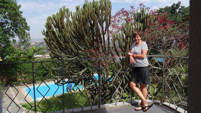
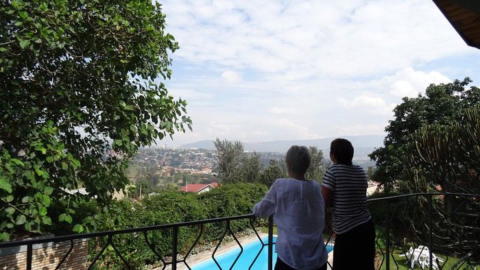
Bon, mais faut manger…On part faire des courses en ville, excellent moyen de prendre la température de l’endroit…Avec ma soeur, c’est tout de suite magouilles et compagnies…Elle me fait changer ma bonne vieille puce Bouygues contre une puce MTN locale. Elle alpague ensuite un gamin dans la rue qui tape sur mon clavier des suites de chiffres cabalistiques pour m’ouvrir les chemins d’une 3g low cost…
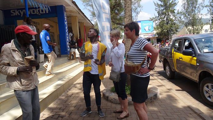
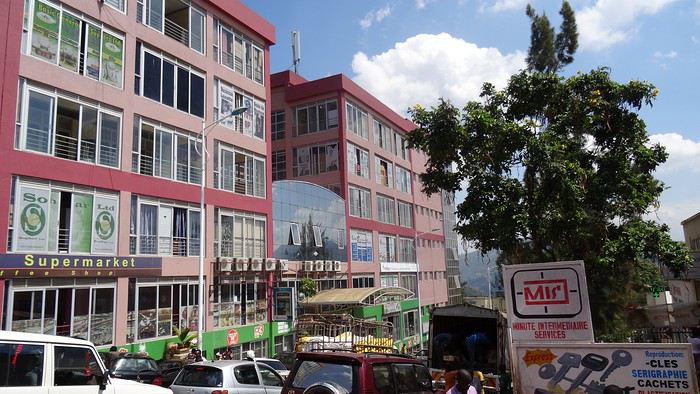
Comme souvent dans les pays qui se sont déversés dans le courant consumériste trop vite, les villes sont un gigantesque foutoir où l’architecture s’inspire beaucoup des gâteaux à la meringue, on côtoie le pire et le meilleur, un flot d’humains qui se débattent pour survivre, des raz de marée de véhicules, gigantesques 4*4 en concurrence avec des myriades de deux roues hétéroclites…C’est une ambiance, à l’africaine, des sonos déversent de la rumba congolaise, des types jouent au tam-tam…
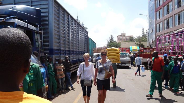
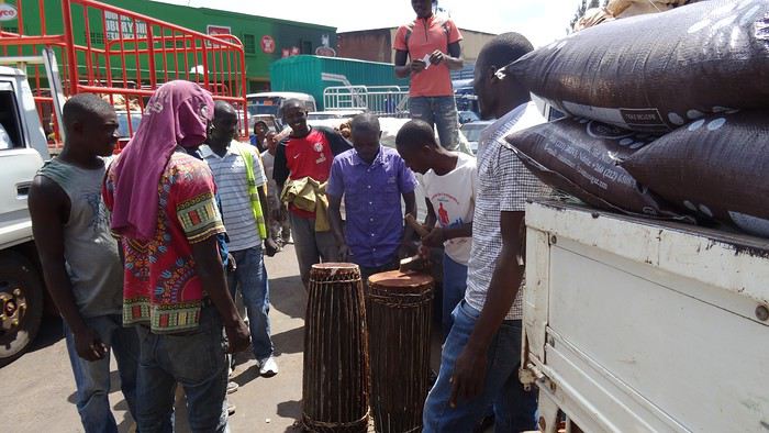
Partout des portefaix s’activent avec des montagnes posées sur la tête…
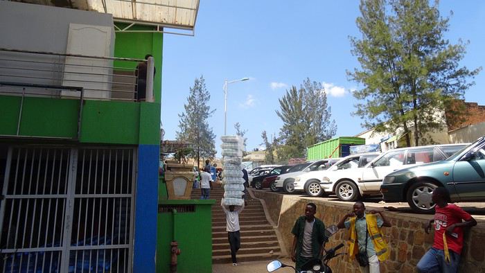
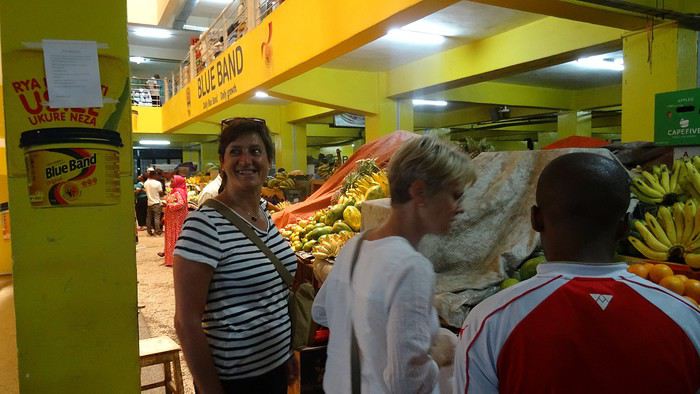
On arrive au marché. Ma sœur y est en territoire connu, négocie, interpelle
dimanche 4 juin 2017 Mulhouse-Kigali
Le décollage approche, il faut choisir son Macron, heu, je voulais dire, son livre, pardon. Bon, dans la France du mois de juin 2017, cela revient strictement au même…
09:30 embarquement 11:20 Départ Basel Turkish Airlines (TK1924) 3 heures de vol 15:20 Arrivée Istanbul (heure locale) Changement d'Avion 18:35 TK 569 Turkich Airline
durée 6h30
00:05 Arrivée: Kigali (KGL), Kigali, Rwanda
Je précise que le mobile de ce voyage est que ma sœur vit à Kigali depuis quelques années. Son mari travaille "dans la diplomatie". Nous sommes attendus à l’aéroport par un chauffeur de l’ambassade. Ma soeur nous avait dit qu’ils seraient au lit, que la maison était ouverte et des infos pour retrouver sans aide notre chambre. Ceux qui connaissent mon célèbre sens de l’orientation ont déjà deviné que je suis allé me vautrer directement dans la chambre de nos hôtes…
lundi 5 juin 2017
Kigali C’est le lendemain qu’on a vraiment réalisé qu’on était en Afrique...
Bon, mais faut manger…On part faire des courses en ville, excellent moyen de prendre la température de l’endroit…Avec ma soeur, c’est tout de suite magouilles et compagnies…Elle me fait changer ma bonne vieille puce Bouygues contre une puce MTN locale. Elle alpague ensuite un gamin dans la rue qui tape sur mon clavier des suites de chiffres cabalistiques pour m’ouvrir les chemins d’une 3g low cost…
Comme souvent dans les pays qui se sont déversés dans le courant consumériste trop vite, les villes sont un gigantesque foutoir où l’architecture s’inspire beaucoup des gâteaux à la meringue, on côtoie le pire et le meilleur, un flot d’humains qui se débattent pour survivre, des raz de marée de véhicules, gigantesques 4*4 en concurrence avec des myriades de deux roues hétéroclites…C’est une ambiance, à l’africaine, des sonos déversent de la rumba congolaise, des types jouent au tam-tam…
Partout des portefaix s’activent avec des montagnes posées sur la tête…
On arrive au marché. Ma sœur y est en territoire connu, négocie, interpelle
Suisse, pays de lacs et montagnes du 16 au 28 mai 2020 English translation pending
Bonjour,
Comme pour beaucoup de voyageurs, le Coronavirus a perturbé nos plans pour cette année. Notre road trip au Pérou est tombé à l’eau et la fermeture des frontières ne nous permettait pas de quitter la Suisse.
Heureusement, en Suisse, nous n’avons pas subi un confinement strict et nous pouvions nous déplacer librement dans le pays, en respectant certaines règles (distance de 2 mètres entres les personnes, rassemblements de maximum 5 personnes). De plus, une semaine avant notre départ, les magasins, restaurants et musées pouvaient ouvrir. Par contre, les campings, télécabines et télésièges sont restés fermés jusqu’au 6 juin.
Nous avons décidé de ne pas préparer un itinéraire fixe. Le but principal était le canton des Grisons que nous connaissions très peu. Pour y aller et pour revenir, nous avons traversé d’autres cantons où nous avons profité de faire des visites et randonnées. Certains endroits nous étaient bien connus, mais les voir sans les touristes habituels, asiatiques, indiens et américains, change complètement la perception des lieux. Imaginez, le fameux pont de la Chapelle à Lucerne, sans les hordes de touristes asiatiques qui l’envahissent tous les jours.
Nous avons loué un van, afin d’être autonome et libre. Notre choix s’est porté sur le VW California Ocean. Ce van est passe-partout, on peut facilement emprunter toutes les petites routes de montagnes et se parquer partout. Seul inconvénient, il n’a pas de salle de bain. La douche se fait à l’extérieur (eau froide), mais nous avons des toilettes portables. Le California Ocean est équipé avec une petite cuisine (un réchaud à gaz avec deux feux, un frigo de 42 litres, un petit évier). Il y a des placards sous la cuisine, au-dessus de la banquette et à l’arrière, ainsi qu’un grand tiroir sous la banquette. Les sièges avant se tournent, il y a deux tables, une à l’intérieur et une autre, encastrée dans la portière, pour l’extérieur. Les deux chaises pour l’extérieur sont encastrées dans la porte du coffre. Le toit se lève, on peut donc se mettre debout à l’intérieur du van. Le lit sous le toit est confortable, avec son sommier sur lequel sont fixé des ressorts. Un store extérieur nous protège du soleil lorsqu’on est à l’arrêt. Le chauffage stationnaire est bien agréable pour chauffer l’habitacle lorsqu’il fait froid. Il y a aussi plusieurs prises, dont une qui fonctionne avec la deuxième batterie et permet de charger le téléphone, tablette, etc. la nuit. Bref, ce petit van est vraiment fonctionnel.
Au dernier moment, nous avons décidé de prendre notre chien Tidou avec nous. Il a fallu adapter nos randonnées et visites. Eh oui, notre Tidou n’est plus tout jeune et il a des soucis avec son dos. Nous avons acheté un sac à dos spécifique, pour pouvoir le porter en terrain abrupte et lorsqu’il sera trop fatigué.
Nous avons chargé l’application park4night sur nos iPhones. Cette application est bien utile pour trouver des emplacements pour passer la nuit. Contrairement, à ce que l’on peut souvent lire, nous n’avons rencontré aucune difficulté pour passer la nuit. Le camping sauvage est donc possible en Suisse, si on ne s’installe pas pour plusieurs jours au même endroit. Concernant l’eau potable, on trouve de nombreuses fontaines, le plus souvent avec de l’eau potable.
Comme pour beaucoup de voyageurs, le Coronavirus a perturbé nos plans pour cette année. Notre road trip au Pérou est tombé à l’eau et la fermeture des frontières ne nous permettait pas de quitter la Suisse.
Heureusement, en Suisse, nous n’avons pas subi un confinement strict et nous pouvions nous déplacer librement dans le pays, en respectant certaines règles (distance de 2 mètres entres les personnes, rassemblements de maximum 5 personnes). De plus, une semaine avant notre départ, les magasins, restaurants et musées pouvaient ouvrir. Par contre, les campings, télécabines et télésièges sont restés fermés jusqu’au 6 juin.
Nous avons décidé de ne pas préparer un itinéraire fixe. Le but principal était le canton des Grisons que nous connaissions très peu. Pour y aller et pour revenir, nous avons traversé d’autres cantons où nous avons profité de faire des visites et randonnées. Certains endroits nous étaient bien connus, mais les voir sans les touristes habituels, asiatiques, indiens et américains, change complètement la perception des lieux. Imaginez, le fameux pont de la Chapelle à Lucerne, sans les hordes de touristes asiatiques qui l’envahissent tous les jours.
Nous avons loué un van, afin d’être autonome et libre. Notre choix s’est porté sur le VW California Ocean. Ce van est passe-partout, on peut facilement emprunter toutes les petites routes de montagnes et se parquer partout. Seul inconvénient, il n’a pas de salle de bain. La douche se fait à l’extérieur (eau froide), mais nous avons des toilettes portables. Le California Ocean est équipé avec une petite cuisine (un réchaud à gaz avec deux feux, un frigo de 42 litres, un petit évier). Il y a des placards sous la cuisine, au-dessus de la banquette et à l’arrière, ainsi qu’un grand tiroir sous la banquette. Les sièges avant se tournent, il y a deux tables, une à l’intérieur et une autre, encastrée dans la portière, pour l’extérieur. Les deux chaises pour l’extérieur sont encastrées dans la porte du coffre. Le toit se lève, on peut donc se mettre debout à l’intérieur du van. Le lit sous le toit est confortable, avec son sommier sur lequel sont fixé des ressorts. Un store extérieur nous protège du soleil lorsqu’on est à l’arrêt. Le chauffage stationnaire est bien agréable pour chauffer l’habitacle lorsqu’il fait froid. Il y a aussi plusieurs prises, dont une qui fonctionne avec la deuxième batterie et permet de charger le téléphone, tablette, etc. la nuit. Bref, ce petit van est vraiment fonctionnel.
Au dernier moment, nous avons décidé de prendre notre chien Tidou avec nous. Il a fallu adapter nos randonnées et visites. Eh oui, notre Tidou n’est plus tout jeune et il a des soucis avec son dos. Nous avons acheté un sac à dos spécifique, pour pouvoir le porter en terrain abrupte et lorsqu’il sera trop fatigué.
Nous avons chargé l’application park4night sur nos iPhones. Cette application est bien utile pour trouver des emplacements pour passer la nuit. Contrairement, à ce que l’on peut souvent lire, nous n’avons rencontré aucune difficulté pour passer la nuit. Le camping sauvage est donc possible en Suisse, si on ne s’installe pas pour plusieurs jours au même endroit. Concernant l’eau potable, on trouve de nombreuses fontaines, le plus souvent avec de l’eau potable.