Results for "Canyon+Sainte-Anne+|+128"
26821 results found.
Handicap dans le monde English translation pending
Bonjour,
Depuis assez longtemps une question me tarabuste…Elle s’adresse à vous tous, ceux habitant à l’étranger, ceux ayant beaucoup voyagé ou à ceux sensibilisés à ce sujet.
Je suis éducatrice auprès de personnes déficientes intellectuelles, adultes, et nous travaillons dans le cadre d’un CAT (centre d’aide par le travail).
J’aimerais connaître vos avis, vos observations sur la situation des personnes handicapées à travers le monde. Quelle est leur place dans la société du pays que vous habitez ou que vous avez visité.
J’y pense car actuellement ce sont les jeux paralympiques et les prochains auront lieu en Chine, or quelle est la place des personnes handicapées dans la société chinoise ? Mais cette question est valable pour l’Afrique, l’Amérique, l’Asie, l’Océanie, l’Europe. Tous vos témoignages m’intéressent.
Existe t il des structures d’accueil, des possibilités de travail, les personnes handicapées sont elles totalement intégrées à la société ; ne les voyez vous jamais dans les rues ; les bus, magasins sont ils adaptés ;….La notion de handicap peut aussi ne pas exister (on est tous égaux mais avec des capacités différentes.)
Ce n’est pas un débat politique que je lance mais un thème social.
Merci à tous ceux qui répondront à cette question et m’éclaireront.
KénavoOdonate
Depuis assez longtemps une question me tarabuste…Elle s’adresse à vous tous, ceux habitant à l’étranger, ceux ayant beaucoup voyagé ou à ceux sensibilisés à ce sujet.
Je suis éducatrice auprès de personnes déficientes intellectuelles, adultes, et nous travaillons dans le cadre d’un CAT (centre d’aide par le travail).
J’aimerais connaître vos avis, vos observations sur la situation des personnes handicapées à travers le monde. Quelle est leur place dans la société du pays que vous habitez ou que vous avez visité.
J’y pense car actuellement ce sont les jeux paralympiques et les prochains auront lieu en Chine, or quelle est la place des personnes handicapées dans la société chinoise ? Mais cette question est valable pour l’Afrique, l’Amérique, l’Asie, l’Océanie, l’Europe. Tous vos témoignages m’intéressent.
Existe t il des structures d’accueil, des possibilités de travail, les personnes handicapées sont elles totalement intégrées à la société ; ne les voyez vous jamais dans les rues ; les bus, magasins sont ils adaptés ;….La notion de handicap peut aussi ne pas exister (on est tous égaux mais avec des capacités différentes.)
Ce n’est pas un débat politique que je lance mais un thème social.
Merci à tous ceux qui répondront à cette question et m’éclaireront.
KénavoOdonate
Vos plus beaux souvenirs en avion English translation pending
bonjour à tous
Nombreux d'entre vous ont eu des retards, bagages perdus, correspondances loupées. Mais j'en suis sûr, vous avez tous eu de très agréables moments pendant un ou plusieurs vols. Quels sont vos plus beaux souvenirs ???
Nombreux d'entre vous ont eu des retards, bagages perdus, correspondances loupées. Mais j'en suis sûr, vous avez tous eu de très agréables moments pendant un ou plusieurs vols. Quels sont vos plus beaux souvenirs ???
Mexique - Avril/Mai 2004 English translation pending
Je rentre d'un voyage de 2 semaines au Mexique.
Voici quelques infos pratiques qui vous aideront peut-être à préparer votre voyage. Je répondrai avec plaisir à toutes vos questions complémentaires.
NOTRE PERIPLE EN 2 SEMAINES :
Après un premier voyage au Yucatan en 1992, nous avons cette fois arpenté la région à l’Est de Mexico, jusqu’au Chiapas .
Ven 23 Avril - Vol Air France Paris/Mexico - Arrivée à 18h00 - Récupération voiture de location - Route vers Puebla (120 km) - Nuit à Puebla Sam - Puebla - Route vers Oaxaca (320 km) - Nuit à Oaxaca Dim - Mitla - Hierve el Agua - Yagul - Marché de Tlacolula - El Tule (150 km) - Nuit à Oaxaca Lun - Monte Alban (qq km) - Nuit à Oaxaca Mar - Route vers Tuxtla (540 km) - Nuit à Tuxtla Mer - Canyon de Sumidero - Zoo de Tuxtla - Route vers San Cristobal de las Casas (115 km) - Nuit à SC Jeu - San Juan Chamula - Zinacantan - SC (40 km) - Nuit à SC Ven - Tonina - Agua Azul - Route vers Palenque (240 km) - Nuit à Palenque Sam - Palenque - Route vers Villahermosa (175 km) - Nuit à Villahermosa Dim - Musée de la Venta - Route vers Xalapa (580 km) - Nuit à Xalapa Lun - Musée de Xalapa fermé le lundi !! - Route vers Papantla (215 km ) - El Tajin - Nuit à Papantla Mar - Route vers Teotihuacan (255 km) - Nuit à Teotihuacan Mer - Teotihuacan - Nuit à Teotihuacan Jeu - Route vers Mexico (80 km) - Restitution de la voiture - Templo Mayor - Nuit à Mexico Ven - Musée d’Anthropologie - Marché de la Cuidadela - Nuit à Mexico Sam - Les canaux de Xochimilco - Musée d’Anthropologie 2ème ! - Nuit à Mexico Dim 9 Mai - Palais National - Vol Air France Mexico/Paris à 20h30 -
BUDGET : 10 pesos ($) = 0, 75 €
Vols AF : 620 € l’A/R X 2 Voiture : 685 € Essence : 105 € Péages : 55 € Hôtels : 600 € pour les 16 nuits Entrées sites archéologiques + musées : 25 € X 2 Entrées sites naturels + villages : 15 € X 2 Autre (tous les repas, boissons, transports locaux ...) : 580 €
Total : 3 345 € pour nous 2 pour 17 jours (sans compter les achats de souvenirs)
3 gros retraits cash (Eurocard et Visa) pendant le voyage de 12 000 $ au total (soit 924, 82 € commission incluse) dont le premier à l’aéroport. Le reste payé en CB (Visa, Eurocard, Amex). Nous n’avons pas changé de cash.
GUIDES : Guide du routard 2004 - logistique Guide NEOS - culturel
TRANSPORTS :
1 - Vols Nous avons fait le choix d’Air France qui propose des vols directs à un prix assez intéressant. Billets achetés en Janvier sur Internet auprès d’Anyway.com : http://www.anyway.com Livré en 8 jours par la poste. Prix = 620 € l’A/R
2 - Location de voiture Réservation effectuée en Janvier sur Internet auprès d’Avis : http://www.avis.fr Catégorie C (Chevrolet Corsa 5 portes) - Km illimité - 2 chauffeurs - Assurance LDW incluse - Prix = 9 290 $ (soit 685 € payé par Amex) pour 13 jours. Aucune mauvaise surprise : le prix payé correspondait au devis annoncé par Internet.
L’essence est à 6, 11 $/litre - Budget total de 1 410 $ pour 3 000 km. Aucun problème pour trouver des stations service.
Les autoroutes : elles sont vraiment très chères, cela dit, elles sont en bon état, peu empruntées (sauf dans la banlieue de Mexico), permettent de gagner beaucoup de temps quand celui-ci est compté et de voyager en toute sécurité ... En comparaison, nous avons parcouru les 215 km de Xalapa à Papantla sur une route "libre" en ... 6 heures 🤪 ! Voici ce que nous ont coûté les péages : Mexico - Puebla : 110 $ Puebla - Oaxaca : 154 $ Palenque - Villahermosa : 18 $ Villahermosa - Xalapa : 383 $ Papantla - Teotihuacan : 31 $ Teotihuacan - Mexico : 34 $
Nous avons parcouru environ 3 000 km, tranquillement, sans aucun problème, en conduisant à 2. Nous n’avons jamais été ennuyés par la police. Quelques contôles sans encombre. Aucun racket d’aucune forme.
Nous avions longuement hésité à quitter Mexico dès notre arrivée en avion. Nous avions même demandé conseil ici sur le site et reçu des avis partagés. La fatigue, la nuit surtout nous faisaient hésiter ... Finalement, sur place, nous avons suivi les conseils d’un Américain travaillant à Mexico et venant lui aussi récupérer sa voiture chez Avis : "pas de problème, pourvu que vous preniez l’autoroute. Puebla est à 1h30 de route." A l’écouter, il fallait éviter la route "libre", pas très sûre de nuit. Très gentiment, l’employé d’Avis nous a fait un plan pour accéder à cette autoroute qui se trouve être tout à côté de l’aéroport. Et nous y sommes arrivés, assez facilement finalement, avec l’excitation, l’hésitation, la prudence propres à tout premier parcours en voiture dans une capitale étrangère ... Beaucoup de circulation pour sortir de Mexico. Nous avons mis 2 grosses heures. Personnellement, je ne regrette pas. Pour une première nuit, Puebla a vraiment plus de charme que Mexico ....
3 - A Mexico (sans voiture) Taxi Aéroport - Zocalo : 118 $ (en prepaid) Métro : 2 $ le billet Le métro est simple, propre et sûr
HEBERGEMENT :
Ce fut une bonne surprise : les chambres sont toujours spacieuses (comme aux USA), très propres et l’accueil est toujours très cordial. Sauf à Villahermosa (où on a fini dans un Best Western 😕), nous n’avons jamais eu de problème pour trouver une chambre.
Voici ceux qui méritent une petite mention. Tous les prix indiqués sont en pesos, par nuit. Le petit déjeuner n’est pas inclus.
Oaxaca : Las Golondrinas (420 $ cash) - Tinico y Palacios 411 - lasgolon@prodigy.net.mex Magnifique demeure aux patios envahis de végétation - Chambre spacieuse aux meubles en pin clair verni - Beaucoup de charme - On peut se garer facilement dans les rues avoisinantes - Un vrai coup de coeur 🙂.
San Cristobal : Hotel Parador Mexicanos (500 $ CB) - Av. 5 de Mayo # 38 - hotel@hparador.com.mx Les chambres sont réparties autour d’un large jardin qui sert aussi de parking - Genre motel avec plus de charme -Grande chambre au plafond en bois - Jolie déco - Sdb simple - Accueil extrêmement chaleureux.
Papantla : Hotel Provincia Express (358 $ CB) - Calle Enriquez 103 - hotprovi@prodigy.net.mx Au coeur de cette petite ville, face au zocalo très animé - Accueil très cordial - Chambre simple mais superbe vue sur le zocalo et le mât des voladores ...Parking dans la rue -
Teotihuacan : Club Med Archeological Villa (630 $ CB) Superbe : charme, confort, accueil, piscine. Tout y est. Sur le site. La restauration y est trop chère : préférer les gargottes tout autour du site.
Mexico : Hotel Catedral (440 $ CB) - Donceles # 95 - http://www.hotelcatedral.com Excellent rapport qualité/prix - Près du zocalo - Grande chambre très propre, sdb neuve - Accueil encore très sympathique
REPAS :
Il faut aimer les tortillas 🤪 !... Ces galettes de maïs accompagnent tous les repas. Nous avons principalement mangé du poisson (absolument délicieux) et du poulet. Voici ce que nous avons payé en moyenne (sans marchander) : 1 filet de poison : 50 $ 1 poulet rôti : 30 $ 4 empanadas : 10 $ 1 quesadilla : 5 $ 1 part d’ananas, de pastèque ou de mangue (servi découpé dans un gobelet ou un sachet) : 5 $ 1, 5 l eau : 6 $ (nous en avons peu acheté car nous trouvions 1 bouteille offerte dans la plupart de nos hôtels) 1 canette de coca : 8 $
Nous nous sommes gavés de fruits frais, de margaritas et de bière (Corona et Sol, douces et rafraichissantes pour moi ou Modela Especial, un peu plus forte pour Philippe). Je ne vous cacherai pas que je préfère de loin la cuisine asiatique 😏 ...
SITES :
Je vous ai déjà prévenus dans mes précédents carnets : on aime les vieilles pierres 😊 ... Si ce n’est pas votre cas, passez donc ce paragraphe ... voire ce carnet ... 😛 Nous avons été gâtés ! Les sites sont respectés et très bien mis en valeur. Et certains sites mineurs sont bien plus fabuleux que ne le laissent supposer les guides.
Budget total entrées des sites archéologiques : 351 $/p - Aucun supplément n’est demandé pour l’appareil photo. Nos impressions, en quelques mots :
Mitla (30 $/p) : petit site, intéressant pour ses décors de briques en relief.
Yagul (30 $/p) ne nous a pas laissé un grand souvenir ...
Monte Alban (38 $/p) : site majestueux et bien peu de touristes.
Tonina (33 $/p) : superbement situé dans une jolie région de prairies vallonnées. Que de marches à gravir ! C’est sur la route d’Agua Azul et de Palenque et l’arrêt est justifié.
El Tajin (38 $/p) : site extraordinaire, très vaste, bien dégagé, pyramide à niches surprenante, pavement des rues très bien conservé (comme rarement ailleurs), magnifiques frises en relief le long du jeu de balle. Par ailleurs, une démonstration de voladores a lieu sur le parvis de l’entrée du site. C’est touristique mais néanmoins très impressionnant. Notre gros coup de coeur 🙂.
Palenque et Teotihuacan (38 $/p chacun) : ces 2 sites majeurs sont trop connus pour qu’on les oublie. Ils sont à la hauteur de leur réputation. Je vous conseille d’y être dès l’ouverture des caisses pour profiter de la fraîcheur matinal (surtout à Palenque qui devient vite étouffant) et d’un calme relatif. Nous étions à 7h00 à l’entrée de Teotihuacan. Il faisait encore froid. Notre courage n’a été qu’à demi récompensé car le ciel était nuageux et le lever de soleil sans éclat. Néanmoins, nous avons tout de même bénéficié du site pour nous tout seuls pendant 1h30. Et ça c’est magique ! Nous avons passé 1 très grosse matinée sur le site de Palenque (que nous avions déjà visité en 92, mais à cette époque ... sous la pluie) et 1 journée pleine à Teotihuacan.
Un petit mot sur les musées :
Le musée de la Venta (30 $/p) : ne le ratez pas. C’est là que vous verrez ces fameuses têtes gigantesques d’Olmèques qui hantent nos esprits quand on pense au Mexique précolombien. Bon ... en tous cas, c’était mon cas, et je rêvais de les voir. Amusant après Angkor de comparer les styles !... Sans rire, c’est incontournable si vous êtes dans la région.
Le musée d’Anthropologie de Mexico (38 $/p) : j’attendais quelque chose du style Musée du Caire, un peu vieillot, un peu fouilli, mais avec de jolies pièces ; j’ai trouvé un prodige architectural, moderne, avec une vraie réflexion muséographique. Les grandes salles donnent toutes sur un immense patio (à ce niveau là, je ne devrais même plus parler de patio d’ailleurs ...) et s’enchaînent chronologiquement et thématiquement. Des reconstitutions, des maquetttes, des vidéos, des plaquettes explicatives (en Anglais), des audio-guides (en Anglais), tout ça de très belle qualité permettent une visite facile et très agréable. Je n’ose dire combien de temps nous y avons passé, j’en ferais hurler plus d’un ! Bref, ça nous a vraiment plu. Et pour ceux qui sont moins branchés musée, celui-ci est tellement didactique et simple que vous pouvez n’y passer qu’une heure ou deux et réussir à voir les pièces principales. Un vrai régal. Pour les mordus comme nous, sachez qu’il y a un petit restaurant qui permet de faire une pause (cher comme souvent dans ce genre de lieux). Personnellement, je conseillerai de le faire à la fin du voyage car les reconstitutions sont alors plus parlantes. En fait, l’idéal serait de pouvoir y faire un petit tour au début du périple et un petit tour à la fin ...
Le musée d’Anthropologie de Xalapa a la réputation de surpasser celui de Mexico ... Bon, on l’a raté. Comme souvent au Mexique, il est fermé le lundi. Aucun de nos 2 guides ne nous le précisait. Alors, peut-être que moi ici, je vais servir à quelque chose 😉 ....
NATURE :
Elle n’est pas en reste ! Ici, il est simple d’alterner une pyramide et une cascade, un musée et un village ! C’est ce qui a rendu ce voyage très varié.
Budget total entrées des sites naturels : 188 $/p
Hierve el Agua (20 $/p) : sympa. Un mini Pamukkale (je dis vraiment mini mini) : des cascades calcifiées, une très jolie vallée, un bassin naturel à l’eau turquoise où l’on peut patauger ... L’endroit attire davantage de Mexicains que de touristes. Tant mieux ! Ambiance festive. Quelques petites gargottes sur la hauteur pour déguster des quesadillas.
Canyon de Sumidero (95 $/p) : c’est touristique (on monte à 8-10 dans un petit bateau à moteur qui ne part que quand il est plein), cher, super organisé (trop ?), l’eau à l’entrée du canyon est terriblement sale ... mais au bout du compte, j’en garde le souvenir d’une balade très agréable dans un site naturel extraordinaire. Allez comprendre ?... Peut-être que les courts instants où le chauffeur a coupé son moteur pour nous laisser tanguer au milieu de cette rivière profonde surmontée de ces 2 hautes falaises a suffit à faire opérer la magie !... Et ma mémoire a supprimé tous les mauvais côtés ?... Sans doute ! A vous de voir ...
Zoo de Tuxtla (20 $/p) : eh bien oui !! Pourtant je ne suis pas fana des zoos mais celui-ci n’est vraiment pas mal. Les enclos sont relativement grands (bien sûr ils pourraient toujours l’être davantage ... ca reste un zoo ...), les animaux ont l’air en bonne santé. Et puis, surtout on y voit des animaux et des oiseaux qu’on ne verra nulle part ailleurs (oui, je sais, à moins de partir avec un zoologue pendant 6 mois ...). Le quetzal notamment, l’oiseau emblématique du Guatemala, aux immenses plumes bleu-vert. Bon, nous, on a aimé !
Agua Azul (30 $/p) : tout le monde connait ! Il y a 12 ans, on les avait ratées, ces fameuses cascades. Problème de voiture, pluie, fatigue ... Et puis, elles devaient sans doute être bien boueuses. On avait abandonné, un peu tristounets .... Alors, cette fois-ci quand on est arrivés, on a eu un petit pincement au coeur. Comment vont-elles être ? Boueuses ? Les guides s’efforcent tellement d’avertir les touristes qu’on finit par se dire qu’elles sont bleues 2 jours par an et vues d’avion .... Bref, grosse inquiétude !... et ... grosse émotion, car, elles étaient, ce jour là, d’un bleu turquoise limpide ! Envahies par les Mexicains qui viennent s’y baigner. Ambiance de folie (j’avais dit festive pour Hierve el Agua, ici c’est de la folie joyeuse). Au delà de la beauté de la couleur de l’eau, les cascades en elles-mêmes sont fabuleuses ; le chemin qui les longe est paradisiaque ! Et avec tout ça, cette ambiance de kermesse, de joie, de jeu. Nombreuses gargottes. Ca aussi, c’est incontournable.
Les canaux de Xochimilco : Il s’agit en fait de jardins flottants dans la banlieue sud de Mexico. Culture de fleurs principalement. Des balades sont proposées en lancha (large barque où on peut tenir à 15, avec une table et des bancs). Le week end, les Mexicains sont très nombreux à venir en famille pour y fêter les événements familiaux (mariage, naissance). Ils louent une lancha, apportent leur picnic et déjeunent pendant la balade, accompagnés d’une autre lancha de mariachis. L’ambiance bat son plein vers midi. Or, la balade vaut plus encore pour l’ambiance que pour les canaux et les jardins (où finalement on a vu peu de fleurs). Tout ça pour dire qu’il est inutile de se lever aux aurores ... Pour y aller : métro (2$/p) + tren ligero (2$/p). Arrivés à Xochimilco, il faut prendre un bus (2, 5 $/p) pour aller jusqu’à l’embarcadère de Zacapa, enfin marcher à pied qq minutes jusqu’à l’embarcadère de Nueva Nativitas où se trouve la majorité des lanchas. Le tarif officiel d’une heure de balade est de 100 $ par lancha. En groupe, ç’est rentable, à 2, un peu moins ... MAIS, le week end, il existe des lancha collectiva qui, pour 10 $/p, vous déposent à l’embarcadère de Salitre d’où l’on rejoint à pied, en traversant un marché aux fleurs très authentique, le tren ligero de Xochimilco. Cette lancha collectiva suit le même parcours que la lancha de la balade d’1 heure et va même au delà ! Voici donc mon conseil : si vous avez le temps d’y aller (pour moi, ce n’est tout de même pas incontournable, sympa, mais pas incontournable), allez-y le week-end vers midi et utilisez la lancha collectiva.
VILLES et VILLAGES :
Que ces petites villes coloniales sont belles et qu’il fait bon se promener le soir sur le Zocalo. On les a toutes aimés, même .... Mexico !! Pourtant on la redoutait cette mégalopole polluée !
Puebla : trop peu vu pour en parler ....
Oaxaca : notre préférée. Des façades colorées, des rues pavées au dallage large, des fleurs, une propreté irreprochable surprenante (je reconnais que je ne m’attendais pas à cela), une ambiance douce. Il y fait bon vivre.
San Cristobal de las Casas : un peu comme Oaxaca mais en beacoup plus touristique. Certes, la ville est belle, la cathédrale s’enflamme dans les dernières heures de la journée (c’est à ce moment là qu’il faut faire la photo !) Mais, mais, mais ... un peu trop de monde sans doute ...
San Juan Chamula - Zinacantan : alors là, je suis bien embêtée ... Je sens que je vais en fâcher plus d’un. On n’a pas vraiment aimé ... Aie, aie aie ... En fait, les Indiens de ces villages vivent du tourisme mais sans joie. Ils nous subissent plus qu’autre chose. Ca nous a mis mal à l’aise. Je n’en dirai pas plus car c’était une impression bien personnelle. Et peut-être que c’est nous qui n’avons pas su briser la glace ... c’est vrai qu’on n’est pas très doué pour ça ... 😕
Mexico : donc, nous voici dans cette mégapole qu’on avait réussi à fuir dès notre arrivée en avion. Mais enfin quand même, nous sommes-nous dit, impossible de venir au Mexique (une 2ème fois qui plus est ! ) sans voir Mexico ... D’abord nous décidons de rendre la voiture pour éviter des ennuis (trouver son chemin, se garer, éviter de se la faire piquer ...) et ça, ce fut vraiment une bonne idée ! Vive le métro ! Facile, pas cher, il va partout, et c’est tellement plus sympa ! Ensuite, nous trouvons un hôtel pas mal du tout (voir plus haut). Enfin, nous déposons tous nos bagages, notre argent, nos papiers, nos appareils photos dans l’hôtel (oui, oui, j’ai fait un peu dans le parano au début) et nous sortons nous promener, à pied, au gré de nos envies. Belle surprise !! Grande surprise !! D’abord, il ne fait pas trop chaud, il fait même un peu gris. Tant mieux, la chaleur en ville, pas mon truc ! Ensuite, la ville a un charme désuet qui nous enchante. Des immeubles coloniaux, vieillots, qui attendent d’être restaurés, des étals de fruits à tous les coins de rues, des marchands sur les trottoirs qui ont appris à remballer toutes leurs marchandises en 10 secondes chrono à la moindre alerte .... Bref, une ambiance agréable. Sans doute, le temps (un peu de pluie et des nuages) a -t-il joué en notre faveur. Nous gardons un super souvenir de Mexico ... SAUF le zocalo. Une horreur. D’ailleurs, je ne comprends même pas qu’on parle encore du zocalo. Ce n’est plus qu’une grand place vide, minérale, et sans âme ...
On a beaucoup aimé : La gentillesse des Mexicains. La mise en valeur du patrimoine culturel : villes et sites. Les fruits dans les rues saupoudrés ou non de piment. L’ambiance en soirée sur les zocalos. Philippe a adoré les tortillas ....
On a moins aimé : Les dos d’ânes ("topes") non signalés sur les routes libres (sans péages) ... Le prix des autoroutes Comme partout en Amérique du Sud, il est difficile de faire des portraits. Les Indiens ne s’y prêtent pas volontiers. J’ai détesté les tortillas 😛 ....
En conclusion, c'est un beau voyage, très facile à organiser et varié. L’alternance des sites archéologiques, des sites naturels, des villes, des villages, des marchés ... apporte une grande variété de plaisirs. Certes, les sites sont moins prestigieux que ceux du Yucatan mais les touristes y sont beaucoup moins nombeux et les paysages bien plus variés. Les Mexicains sont adorables, les Indiens portent sur eux leur lourde Histoire et sont plus réservés.
NOTRE PERIPLE EN 2 SEMAINES :
Après un premier voyage au Yucatan en 1992, nous avons cette fois arpenté la région à l’Est de Mexico, jusqu’au Chiapas .
Ven 23 Avril - Vol Air France Paris/Mexico - Arrivée à 18h00 - Récupération voiture de location - Route vers Puebla (120 km) - Nuit à Puebla Sam - Puebla - Route vers Oaxaca (320 km) - Nuit à Oaxaca Dim - Mitla - Hierve el Agua - Yagul - Marché de Tlacolula - El Tule (150 km) - Nuit à Oaxaca Lun - Monte Alban (qq km) - Nuit à Oaxaca Mar - Route vers Tuxtla (540 km) - Nuit à Tuxtla Mer - Canyon de Sumidero - Zoo de Tuxtla - Route vers San Cristobal de las Casas (115 km) - Nuit à SC Jeu - San Juan Chamula - Zinacantan - SC (40 km) - Nuit à SC Ven - Tonina - Agua Azul - Route vers Palenque (240 km) - Nuit à Palenque Sam - Palenque - Route vers Villahermosa (175 km) - Nuit à Villahermosa Dim - Musée de la Venta - Route vers Xalapa (580 km) - Nuit à Xalapa Lun - Musée de Xalapa fermé le lundi !! - Route vers Papantla (215 km ) - El Tajin - Nuit à Papantla Mar - Route vers Teotihuacan (255 km) - Nuit à Teotihuacan Mer - Teotihuacan - Nuit à Teotihuacan Jeu - Route vers Mexico (80 km) - Restitution de la voiture - Templo Mayor - Nuit à Mexico Ven - Musée d’Anthropologie - Marché de la Cuidadela - Nuit à Mexico Sam - Les canaux de Xochimilco - Musée d’Anthropologie 2ème ! - Nuit à Mexico Dim 9 Mai - Palais National - Vol Air France Mexico/Paris à 20h30 -
BUDGET : 10 pesos ($) = 0, 75 €
Vols AF : 620 € l’A/R X 2 Voiture : 685 € Essence : 105 € Péages : 55 € Hôtels : 600 € pour les 16 nuits Entrées sites archéologiques + musées : 25 € X 2 Entrées sites naturels + villages : 15 € X 2 Autre (tous les repas, boissons, transports locaux ...) : 580 €
Total : 3 345 € pour nous 2 pour 17 jours (sans compter les achats de souvenirs)
3 gros retraits cash (Eurocard et Visa) pendant le voyage de 12 000 $ au total (soit 924, 82 € commission incluse) dont le premier à l’aéroport. Le reste payé en CB (Visa, Eurocard, Amex). Nous n’avons pas changé de cash.
GUIDES : Guide du routard 2004 - logistique Guide NEOS - culturel
TRANSPORTS :
1 - Vols Nous avons fait le choix d’Air France qui propose des vols directs à un prix assez intéressant. Billets achetés en Janvier sur Internet auprès d’Anyway.com : http://www.anyway.com Livré en 8 jours par la poste. Prix = 620 € l’A/R
2 - Location de voiture Réservation effectuée en Janvier sur Internet auprès d’Avis : http://www.avis.fr Catégorie C (Chevrolet Corsa 5 portes) - Km illimité - 2 chauffeurs - Assurance LDW incluse - Prix = 9 290 $ (soit 685 € payé par Amex) pour 13 jours. Aucune mauvaise surprise : le prix payé correspondait au devis annoncé par Internet.
L’essence est à 6, 11 $/litre - Budget total de 1 410 $ pour 3 000 km. Aucun problème pour trouver des stations service.
Les autoroutes : elles sont vraiment très chères, cela dit, elles sont en bon état, peu empruntées (sauf dans la banlieue de Mexico), permettent de gagner beaucoup de temps quand celui-ci est compté et de voyager en toute sécurité ... En comparaison, nous avons parcouru les 215 km de Xalapa à Papantla sur une route "libre" en ... 6 heures 🤪 ! Voici ce que nous ont coûté les péages : Mexico - Puebla : 110 $ Puebla - Oaxaca : 154 $ Palenque - Villahermosa : 18 $ Villahermosa - Xalapa : 383 $ Papantla - Teotihuacan : 31 $ Teotihuacan - Mexico : 34 $
Nous avons parcouru environ 3 000 km, tranquillement, sans aucun problème, en conduisant à 2. Nous n’avons jamais été ennuyés par la police. Quelques contôles sans encombre. Aucun racket d’aucune forme.
Nous avions longuement hésité à quitter Mexico dès notre arrivée en avion. Nous avions même demandé conseil ici sur le site et reçu des avis partagés. La fatigue, la nuit surtout nous faisaient hésiter ... Finalement, sur place, nous avons suivi les conseils d’un Américain travaillant à Mexico et venant lui aussi récupérer sa voiture chez Avis : "pas de problème, pourvu que vous preniez l’autoroute. Puebla est à 1h30 de route." A l’écouter, il fallait éviter la route "libre", pas très sûre de nuit. Très gentiment, l’employé d’Avis nous a fait un plan pour accéder à cette autoroute qui se trouve être tout à côté de l’aéroport. Et nous y sommes arrivés, assez facilement finalement, avec l’excitation, l’hésitation, la prudence propres à tout premier parcours en voiture dans une capitale étrangère ... Beaucoup de circulation pour sortir de Mexico. Nous avons mis 2 grosses heures. Personnellement, je ne regrette pas. Pour une première nuit, Puebla a vraiment plus de charme que Mexico ....
3 - A Mexico (sans voiture) Taxi Aéroport - Zocalo : 118 $ (en prepaid) Métro : 2 $ le billet Le métro est simple, propre et sûr
HEBERGEMENT :
Ce fut une bonne surprise : les chambres sont toujours spacieuses (comme aux USA), très propres et l’accueil est toujours très cordial. Sauf à Villahermosa (où on a fini dans un Best Western 😕), nous n’avons jamais eu de problème pour trouver une chambre.
Voici ceux qui méritent une petite mention. Tous les prix indiqués sont en pesos, par nuit. Le petit déjeuner n’est pas inclus.
Oaxaca : Las Golondrinas (420 $ cash) - Tinico y Palacios 411 - lasgolon@prodigy.net.mex Magnifique demeure aux patios envahis de végétation - Chambre spacieuse aux meubles en pin clair verni - Beaucoup de charme - On peut se garer facilement dans les rues avoisinantes - Un vrai coup de coeur 🙂.
San Cristobal : Hotel Parador Mexicanos (500 $ CB) - Av. 5 de Mayo # 38 - hotel@hparador.com.mx Les chambres sont réparties autour d’un large jardin qui sert aussi de parking - Genre motel avec plus de charme -Grande chambre au plafond en bois - Jolie déco - Sdb simple - Accueil extrêmement chaleureux.
Papantla : Hotel Provincia Express (358 $ CB) - Calle Enriquez 103 - hotprovi@prodigy.net.mx Au coeur de cette petite ville, face au zocalo très animé - Accueil très cordial - Chambre simple mais superbe vue sur le zocalo et le mât des voladores ...Parking dans la rue -
Teotihuacan : Club Med Archeological Villa (630 $ CB) Superbe : charme, confort, accueil, piscine. Tout y est. Sur le site. La restauration y est trop chère : préférer les gargottes tout autour du site.
Mexico : Hotel Catedral (440 $ CB) - Donceles # 95 - http://www.hotelcatedral.com Excellent rapport qualité/prix - Près du zocalo - Grande chambre très propre, sdb neuve - Accueil encore très sympathique
REPAS :
Il faut aimer les tortillas 🤪 !... Ces galettes de maïs accompagnent tous les repas. Nous avons principalement mangé du poisson (absolument délicieux) et du poulet. Voici ce que nous avons payé en moyenne (sans marchander) : 1 filet de poison : 50 $ 1 poulet rôti : 30 $ 4 empanadas : 10 $ 1 quesadilla : 5 $ 1 part d’ananas, de pastèque ou de mangue (servi découpé dans un gobelet ou un sachet) : 5 $ 1, 5 l eau : 6 $ (nous en avons peu acheté car nous trouvions 1 bouteille offerte dans la plupart de nos hôtels) 1 canette de coca : 8 $
Nous nous sommes gavés de fruits frais, de margaritas et de bière (Corona et Sol, douces et rafraichissantes pour moi ou Modela Especial, un peu plus forte pour Philippe). Je ne vous cacherai pas que je préfère de loin la cuisine asiatique 😏 ...
SITES :
Je vous ai déjà prévenus dans mes précédents carnets : on aime les vieilles pierres 😊 ... Si ce n’est pas votre cas, passez donc ce paragraphe ... voire ce carnet ... 😛 Nous avons été gâtés ! Les sites sont respectés et très bien mis en valeur. Et certains sites mineurs sont bien plus fabuleux que ne le laissent supposer les guides.
Budget total entrées des sites archéologiques : 351 $/p - Aucun supplément n’est demandé pour l’appareil photo. Nos impressions, en quelques mots :
Mitla (30 $/p) : petit site, intéressant pour ses décors de briques en relief.
Yagul (30 $/p) ne nous a pas laissé un grand souvenir ...
Monte Alban (38 $/p) : site majestueux et bien peu de touristes.
Tonina (33 $/p) : superbement situé dans une jolie région de prairies vallonnées. Que de marches à gravir ! C’est sur la route d’Agua Azul et de Palenque et l’arrêt est justifié.
El Tajin (38 $/p) : site extraordinaire, très vaste, bien dégagé, pyramide à niches surprenante, pavement des rues très bien conservé (comme rarement ailleurs), magnifiques frises en relief le long du jeu de balle. Par ailleurs, une démonstration de voladores a lieu sur le parvis de l’entrée du site. C’est touristique mais néanmoins très impressionnant. Notre gros coup de coeur 🙂.
Palenque et Teotihuacan (38 $/p chacun) : ces 2 sites majeurs sont trop connus pour qu’on les oublie. Ils sont à la hauteur de leur réputation. Je vous conseille d’y être dès l’ouverture des caisses pour profiter de la fraîcheur matinal (surtout à Palenque qui devient vite étouffant) et d’un calme relatif. Nous étions à 7h00 à l’entrée de Teotihuacan. Il faisait encore froid. Notre courage n’a été qu’à demi récompensé car le ciel était nuageux et le lever de soleil sans éclat. Néanmoins, nous avons tout de même bénéficié du site pour nous tout seuls pendant 1h30. Et ça c’est magique ! Nous avons passé 1 très grosse matinée sur le site de Palenque (que nous avions déjà visité en 92, mais à cette époque ... sous la pluie) et 1 journée pleine à Teotihuacan.
Un petit mot sur les musées :
Le musée de la Venta (30 $/p) : ne le ratez pas. C’est là que vous verrez ces fameuses têtes gigantesques d’Olmèques qui hantent nos esprits quand on pense au Mexique précolombien. Bon ... en tous cas, c’était mon cas, et je rêvais de les voir. Amusant après Angkor de comparer les styles !... Sans rire, c’est incontournable si vous êtes dans la région.
Le musée d’Anthropologie de Mexico (38 $/p) : j’attendais quelque chose du style Musée du Caire, un peu vieillot, un peu fouilli, mais avec de jolies pièces ; j’ai trouvé un prodige architectural, moderne, avec une vraie réflexion muséographique. Les grandes salles donnent toutes sur un immense patio (à ce niveau là, je ne devrais même plus parler de patio d’ailleurs ...) et s’enchaînent chronologiquement et thématiquement. Des reconstitutions, des maquetttes, des vidéos, des plaquettes explicatives (en Anglais), des audio-guides (en Anglais), tout ça de très belle qualité permettent une visite facile et très agréable. Je n’ose dire combien de temps nous y avons passé, j’en ferais hurler plus d’un ! Bref, ça nous a vraiment plu. Et pour ceux qui sont moins branchés musée, celui-ci est tellement didactique et simple que vous pouvez n’y passer qu’une heure ou deux et réussir à voir les pièces principales. Un vrai régal. Pour les mordus comme nous, sachez qu’il y a un petit restaurant qui permet de faire une pause (cher comme souvent dans ce genre de lieux). Personnellement, je conseillerai de le faire à la fin du voyage car les reconstitutions sont alors plus parlantes. En fait, l’idéal serait de pouvoir y faire un petit tour au début du périple et un petit tour à la fin ...
Le musée d’Anthropologie de Xalapa a la réputation de surpasser celui de Mexico ... Bon, on l’a raté. Comme souvent au Mexique, il est fermé le lundi. Aucun de nos 2 guides ne nous le précisait. Alors, peut-être que moi ici, je vais servir à quelque chose 😉 ....
NATURE :
Elle n’est pas en reste ! Ici, il est simple d’alterner une pyramide et une cascade, un musée et un village ! C’est ce qui a rendu ce voyage très varié.
Budget total entrées des sites naturels : 188 $/p
Hierve el Agua (20 $/p) : sympa. Un mini Pamukkale (je dis vraiment mini mini) : des cascades calcifiées, une très jolie vallée, un bassin naturel à l’eau turquoise où l’on peut patauger ... L’endroit attire davantage de Mexicains que de touristes. Tant mieux ! Ambiance festive. Quelques petites gargottes sur la hauteur pour déguster des quesadillas.
Canyon de Sumidero (95 $/p) : c’est touristique (on monte à 8-10 dans un petit bateau à moteur qui ne part que quand il est plein), cher, super organisé (trop ?), l’eau à l’entrée du canyon est terriblement sale ... mais au bout du compte, j’en garde le souvenir d’une balade très agréable dans un site naturel extraordinaire. Allez comprendre ?... Peut-être que les courts instants où le chauffeur a coupé son moteur pour nous laisser tanguer au milieu de cette rivière profonde surmontée de ces 2 hautes falaises a suffit à faire opérer la magie !... Et ma mémoire a supprimé tous les mauvais côtés ?... Sans doute ! A vous de voir ...
Zoo de Tuxtla (20 $/p) : eh bien oui !! Pourtant je ne suis pas fana des zoos mais celui-ci n’est vraiment pas mal. Les enclos sont relativement grands (bien sûr ils pourraient toujours l’être davantage ... ca reste un zoo ...), les animaux ont l’air en bonne santé. Et puis, surtout on y voit des animaux et des oiseaux qu’on ne verra nulle part ailleurs (oui, je sais, à moins de partir avec un zoologue pendant 6 mois ...). Le quetzal notamment, l’oiseau emblématique du Guatemala, aux immenses plumes bleu-vert. Bon, nous, on a aimé !
Agua Azul (30 $/p) : tout le monde connait ! Il y a 12 ans, on les avait ratées, ces fameuses cascades. Problème de voiture, pluie, fatigue ... Et puis, elles devaient sans doute être bien boueuses. On avait abandonné, un peu tristounets .... Alors, cette fois-ci quand on est arrivés, on a eu un petit pincement au coeur. Comment vont-elles être ? Boueuses ? Les guides s’efforcent tellement d’avertir les touristes qu’on finit par se dire qu’elles sont bleues 2 jours par an et vues d’avion .... Bref, grosse inquiétude !... et ... grosse émotion, car, elles étaient, ce jour là, d’un bleu turquoise limpide ! Envahies par les Mexicains qui viennent s’y baigner. Ambiance de folie (j’avais dit festive pour Hierve el Agua, ici c’est de la folie joyeuse). Au delà de la beauté de la couleur de l’eau, les cascades en elles-mêmes sont fabuleuses ; le chemin qui les longe est paradisiaque ! Et avec tout ça, cette ambiance de kermesse, de joie, de jeu. Nombreuses gargottes. Ca aussi, c’est incontournable.
Les canaux de Xochimilco : Il s’agit en fait de jardins flottants dans la banlieue sud de Mexico. Culture de fleurs principalement. Des balades sont proposées en lancha (large barque où on peut tenir à 15, avec une table et des bancs). Le week end, les Mexicains sont très nombreux à venir en famille pour y fêter les événements familiaux (mariage, naissance). Ils louent une lancha, apportent leur picnic et déjeunent pendant la balade, accompagnés d’une autre lancha de mariachis. L’ambiance bat son plein vers midi. Or, la balade vaut plus encore pour l’ambiance que pour les canaux et les jardins (où finalement on a vu peu de fleurs). Tout ça pour dire qu’il est inutile de se lever aux aurores ... Pour y aller : métro (2$/p) + tren ligero (2$/p). Arrivés à Xochimilco, il faut prendre un bus (2, 5 $/p) pour aller jusqu’à l’embarcadère de Zacapa, enfin marcher à pied qq minutes jusqu’à l’embarcadère de Nueva Nativitas où se trouve la majorité des lanchas. Le tarif officiel d’une heure de balade est de 100 $ par lancha. En groupe, ç’est rentable, à 2, un peu moins ... MAIS, le week end, il existe des lancha collectiva qui, pour 10 $/p, vous déposent à l’embarcadère de Salitre d’où l’on rejoint à pied, en traversant un marché aux fleurs très authentique, le tren ligero de Xochimilco. Cette lancha collectiva suit le même parcours que la lancha de la balade d’1 heure et va même au delà ! Voici donc mon conseil : si vous avez le temps d’y aller (pour moi, ce n’est tout de même pas incontournable, sympa, mais pas incontournable), allez-y le week-end vers midi et utilisez la lancha collectiva.
VILLES et VILLAGES :
Que ces petites villes coloniales sont belles et qu’il fait bon se promener le soir sur le Zocalo. On les a toutes aimés, même .... Mexico !! Pourtant on la redoutait cette mégalopole polluée !
Puebla : trop peu vu pour en parler ....
Oaxaca : notre préférée. Des façades colorées, des rues pavées au dallage large, des fleurs, une propreté irreprochable surprenante (je reconnais que je ne m’attendais pas à cela), une ambiance douce. Il y fait bon vivre.
San Cristobal de las Casas : un peu comme Oaxaca mais en beacoup plus touristique. Certes, la ville est belle, la cathédrale s’enflamme dans les dernières heures de la journée (c’est à ce moment là qu’il faut faire la photo !) Mais, mais, mais ... un peu trop de monde sans doute ...
San Juan Chamula - Zinacantan : alors là, je suis bien embêtée ... Je sens que je vais en fâcher plus d’un. On n’a pas vraiment aimé ... Aie, aie aie ... En fait, les Indiens de ces villages vivent du tourisme mais sans joie. Ils nous subissent plus qu’autre chose. Ca nous a mis mal à l’aise. Je n’en dirai pas plus car c’était une impression bien personnelle. Et peut-être que c’est nous qui n’avons pas su briser la glace ... c’est vrai qu’on n’est pas très doué pour ça ... 😕
Mexico : donc, nous voici dans cette mégapole qu’on avait réussi à fuir dès notre arrivée en avion. Mais enfin quand même, nous sommes-nous dit, impossible de venir au Mexique (une 2ème fois qui plus est ! ) sans voir Mexico ... D’abord nous décidons de rendre la voiture pour éviter des ennuis (trouver son chemin, se garer, éviter de se la faire piquer ...) et ça, ce fut vraiment une bonne idée ! Vive le métro ! Facile, pas cher, il va partout, et c’est tellement plus sympa ! Ensuite, nous trouvons un hôtel pas mal du tout (voir plus haut). Enfin, nous déposons tous nos bagages, notre argent, nos papiers, nos appareils photos dans l’hôtel (oui, oui, j’ai fait un peu dans le parano au début) et nous sortons nous promener, à pied, au gré de nos envies. Belle surprise !! Grande surprise !! D’abord, il ne fait pas trop chaud, il fait même un peu gris. Tant mieux, la chaleur en ville, pas mon truc ! Ensuite, la ville a un charme désuet qui nous enchante. Des immeubles coloniaux, vieillots, qui attendent d’être restaurés, des étals de fruits à tous les coins de rues, des marchands sur les trottoirs qui ont appris à remballer toutes leurs marchandises en 10 secondes chrono à la moindre alerte .... Bref, une ambiance agréable. Sans doute, le temps (un peu de pluie et des nuages) a -t-il joué en notre faveur. Nous gardons un super souvenir de Mexico ... SAUF le zocalo. Une horreur. D’ailleurs, je ne comprends même pas qu’on parle encore du zocalo. Ce n’est plus qu’une grand place vide, minérale, et sans âme ...
On a beaucoup aimé : La gentillesse des Mexicains. La mise en valeur du patrimoine culturel : villes et sites. Les fruits dans les rues saupoudrés ou non de piment. L’ambiance en soirée sur les zocalos. Philippe a adoré les tortillas ....
On a moins aimé : Les dos d’ânes ("topes") non signalés sur les routes libres (sans péages) ... Le prix des autoroutes Comme partout en Amérique du Sud, il est difficile de faire des portraits. Les Indiens ne s’y prêtent pas volontiers. J’ai détesté les tortillas 😛 ....
En conclusion, c'est un beau voyage, très facile à organiser et varié. L’alternance des sites archéologiques, des sites naturels, des villes, des villages, des marchés ... apporte une grande variété de plaisirs. Certes, les sites sont moins prestigieux que ceux du Yucatan mais les touristes y sont beaucoup moins nombeux et les paysages bien plus variés. Les Mexicains sont adorables, les Indiens portent sur eux leur lourde Histoire et sont plus réservés.
Votre avis sur mon itinéraire Québec-Etats-Unis English translation pending
bonjour a tous,
J'ai décidé cette année de partir a l'avanture à l'autre bout du monde civilisé ( on commence molo!!).
Ainsi j'envisage de visité :3 semaines environ
😎les environs de vancouver avec son ile
puis
😇de faire une excursions dans les rocheuses: Vancouver- whisler-kamploops-banf-calgary-puis descente dans le montana pour aller voir les chutes et lacs naturels d'eaux chaudes de Yellowstone . voyage de 1 semaine voir 15 jours...en camping.
puis de rentrer en passant par le mont rainer et saint helens !pensez vous que passer par portland est indispensable?--
deuxieme partie du voyage : durée 1 mois
😊l'est du canada :par contre la, a part les chutes du niagara les cowboys et les baleines+ours, je ne sais pas quoi visiter!
😉NY..une semaine ( on pense louer une voiture _on moi, 1 copine_ et 1 de ses copains_pour effectuer le trajet Montréal-NY)
Pourriez vous me conseillez???merci
J'ai décidé cette année de partir a l'avanture à l'autre bout du monde civilisé ( on commence molo!!).
Ainsi j'envisage de visité :3 semaines environ
😎les environs de vancouver avec son ile
puis
😇de faire une excursions dans les rocheuses: Vancouver- whisler-kamploops-banf-calgary-puis descente dans le montana pour aller voir les chutes et lacs naturels d'eaux chaudes de Yellowstone . voyage de 1 semaine voir 15 jours...en camping.
puis de rentrer en passant par le mont rainer et saint helens !pensez vous que passer par portland est indispensable?--
deuxieme partie du voyage : durée 1 mois
😊l'est du canada :par contre la, a part les chutes du niagara les cowboys et les baleines+ours, je ne sais pas quoi visiter!
😉NY..une semaine ( on pense louer une voiture _on moi, 1 copine_ et 1 de ses copains_pour effectuer le trajet Montréal-NY)
Pourriez vous me conseillez???merci
Conseils sur la Namibie English translation pending
Nous envisageons de visiter ce pays en aout ou septembre de cette année.
Que faut il savoir sur ce pays?
protection sanitaire, sécurité, endroits à visiter....
Peut on partir sac a dos ?
tous les conseils sont les bienvenus.
C'est mieux les Euros au Pérou English translation pending
Amis routards,
Si vous avez envisagé de vooyager au Pérou, je vous encourage de venir avec des € et non des dollars. A ce jour, pour 1 € nous avons 3.68 soles contre 3.48 soles avec 1 dollar. Vous éviterez ainsi d'enrichir votre banque française avec les frais de change. Si vous avez besoin d'info. pas de problème pour vous aider car je suis français vivant à Arequipa.
Hasta luego
Christian
Si vous avez envisagé de vooyager au Pérou, je vous encourage de venir avec des € et non des dollars. A ce jour, pour 1 € nous avons 3.68 soles contre 3.48 soles avec 1 dollar. Vous éviterez ainsi d'enrichir votre banque française avec les frais de change. Si vous avez besoin d'info. pas de problème pour vous aider car je suis français vivant à Arequipa.
Hasta luego
Christian
What's the current situation with the wildfires in Canada?
Hello everyone,
We’ve planned a trip (retired couple) for late August to the first half of September in Western Canada.
Classic itinerary: arrival in Calgary, Banff, Jasper, Clearwater, Whistler, Vancouver Island, departure from Vancouver.
I know you can’t see into the future any better than I can, so I’m obviously not asking what the wildfire situation will be like in a month...
But if any of you could let me know if, CURRENTLY, there are major difficulties—not just for locals, of course, but for tourists as well?
We’re hesitating between taking the chance or canceling what we still can.
We’re not young anymore and don’t have the flexibility we once did...
A thousand thanks to those of you on the ground or with contacts there who can help us make this decision!
A Bold Combo: Southern Peru, Bolivia, and Northern Chile
Hello everyone,
For our latest 3-week family trip (yes, the kids are growing up, and two of them are about to enter the working world), we’re heading to South America! For our first time on this continent, I had planned a classic 3-week loop in Peru.
But since we won’t be returning to this part of the world anytime soon, I thought: why not follow in the footsteps of Franck, aka Bibouns51, who, in 18 days, didn’t just stick to Peru but also added two of the planet’s most stunning landscapes to his itinerary... the Salar de Uyuni in Bolivia and its neighbor, the fabulous Atacama Desert in northern Chile !!
So, I set about the tricky task of limiting the regions we’d visit in Peru to those we considered must-sees, to avoid rushing too much. The visit schedules were optimized, including several comfortable overnight buses that have the huge advantage of letting us hop between regions.
So, we’re off on a somewhat adventurous trip with three domestic flights (two on the first day and one on the last), two overnight buses for quick hops, several car rentals, the services of a few drivers to make the trip more comfortable, and even a tour operator for crossing the Salar...
Our main concern is altitude sickness, and we’re bringing Diamox, aspirin, etc., just in case.
Our second worry before departure was not even getting off the ground... Yes, for once, we’re leaving from France—Marseille, to be exact. The week before our departure, with the surprise air traffic controllers’ strike, I remembered why we usually prefer to leave from abroad, like Turin or Barcelona... In the end, it wasn’t the air traffic controllers who made us nervous but the early July wildfires that paralyzed the airport a few days before our departure. Fortunately, the fires were quickly brought under control, and on the big day, everything was smooth sailing!
Detailed itinerary (which changed on Day 1 due to departure hiccups): Day 0: Flight Marseille - Madrid - Lima PERU Theoretical and abandoned Day 1: Flight Lima - Cuzco and visit Cuzco (Puka Pukara, Tambomachay, Cristo Blanco Observatory, Sacsayhuaman sunset) - Night in Cuzco Day 2: Taxi -> Chinchero - Moray - Maras Salt Mines - Ollantaytambo - Train to Aguas Calientes Day 3: Machu Picchu - Return train to Ollantaytambo Day 4: 2-day taxi -> Pisac - Tipon - Andahuaylillas - Huaro - Night in San Pedro Day 5: Palcoyo - Checacupe - Vinicunca - Return and night in Cuzco Day 6: Day in Cuzco (catch-up on Sacsayhuaman, San Blas district, Temple of the Sun) - Overnight bus to Arequipa Day 7: Rental car -> On the road to Colca Canyon, night in Cabanaconde Day 8: Descent to the bottom of Colca Canyon, night at Oasis Sangalle Day 9: Ascent from the canyon - Maca - Chivay - Return and night in Arequipa Day 10: Visit Arequipa (Santa Catalina Convent, La Recoleta Church and Monastery, La Compañía Church, Cathedral) - Overnight bus to Puno Day 11: Lake Titicaca - Night in Puno BOLIVIA Day 12: Shared taxi -> Road to La Paz, visit downtown La Paz - Night 1 in La Paz Day 13: Moon Valley and Las Animas Valley - Night 2 in La Paz Day 14: Day in La Paz - Night 3 in La Paz Day 15: Flight to Uyuni - Day 1 of Salar de Uyuni tour - Night at the edge of the Salar Day 16: Crossing the Lipez region and lagoons - Night near Laguna Colorada Day 17: Sol de Mañana CHILE Day 17 cont.: Pre-booked transfer to SPDA - 4x4 rental - Pukara de Quitor - Stargazing tour - Night 1 in SPDA Day 18: Death Valley and Moon Valley - Night 2 in SPDA Day 19: Miscanti and Miniques Lagoons, Salar de Aguas Calientes and its Piedra Roja, Tebenquiche Lagoon and Quebrada del Diablo - Night 3 in SPDA Day 20: Rainbow Valley and swim in the Puritama River - Night 4 in SPDA Day 21: Tebenquiche Lagoon - Bus to Calama - Flight to Santiago Day 22: Return Santiago - Madrid - Marseille
Day 0 - 11/07: Destination Lima
Our first flight from Marseille went smoothly to our Iberia layover in Madrid.
In Madrid, just after getting off the plane around 8 PM, and as we were walking through the terminal, we got a rude awakening!!
We saw the word "Cancelled" next to our flight number on the display boards. Thinking it must be a glitch, we checked another screen, but the system was stubborn, and the same dreaded word appeared !
So, we headed to the Iberia counter, where an agent confirmed that our Friday evening flight was canceled and rescheduled for the next morning. The reason? A breakdown and no replacement plane, even though we were in Madrid, Iberia’s home base!
To make matters worse, I remembered our super-tight schedule, planned to the minute, with no buffer day in Lima. Since I’m a bit phobic of megacities and hadn’t found anything appealing in the Peruvian capital in our guidebooks, we’d planned to leave Lima as soon as possible for Cusco, the heart of the Sacred Valley, to spend our first day there.
Bad idea, because we already knew the 4-hour buffer wouldn’t be enough, and we’d miss the domestic flight, which was, of course, non-refundable and non-changeable. So, we had to call LATAM from Madrid to find another flight for Saturday evening and negotiate a rate to recover some of our initial outlay.
After an hour on the phone with customer service, several endless holds, and three failed attempts to dictate our credit card number over the phone to a Spaniard speaking English with a thick accent, we finally managed to confirm the transaction, securing our new flight tickets for a moderate extra cost of just 150 € total.
At first, we were pretty bummed about losing a day and incurring extra fees to reschedule the domestic flight, but then, when we learned from an Iberia customer service rep that we’d receive the max compensation of 600 € per traveler, we even ended up grinning... because 3000 € in refunds for only losing the first day in Cusco? We’d sign up for that 10 times over!!
Iberia then took care of us, putting us up in a hotel where we had dinner before a short 5-hour night and an early morning departure. I took the opportunity to improvise a quick day of sightseeing in Lima, focusing on the Barranco and Miraflores districts.
For our latest 3-week family trip (yes, the kids are growing up, and two of them are about to enter the working world), we’re heading to South America! For our first time on this continent, I had planned a classic 3-week loop in Peru.
But since we won’t be returning to this part of the world anytime soon, I thought: why not follow in the footsteps of Franck, aka Bibouns51, who, in 18 days, didn’t just stick to Peru but also added two of the planet’s most stunning landscapes to his itinerary... the Salar de Uyuni in Bolivia and its neighbor, the fabulous Atacama Desert in northern Chile !!
So, I set about the tricky task of limiting the regions we’d visit in Peru to those we considered must-sees, to avoid rushing too much. The visit schedules were optimized, including several comfortable overnight buses that have the huge advantage of letting us hop between regions.
So, we’re off on a somewhat adventurous trip with three domestic flights (two on the first day and one on the last), two overnight buses for quick hops, several car rentals, the services of a few drivers to make the trip more comfortable, and even a tour operator for crossing the Salar...
Our main concern is altitude sickness, and we’re bringing Diamox, aspirin, etc., just in case.
Our second worry before departure was not even getting off the ground... Yes, for once, we’re leaving from France—Marseille, to be exact. The week before our departure, with the surprise air traffic controllers’ strike, I remembered why we usually prefer to leave from abroad, like Turin or Barcelona... In the end, it wasn’t the air traffic controllers who made us nervous but the early July wildfires that paralyzed the airport a few days before our departure. Fortunately, the fires were quickly brought under control, and on the big day, everything was smooth sailing!
Detailed itinerary (which changed on Day 1 due to departure hiccups): Day 0: Flight Marseille - Madrid - Lima PERU Theoretical and abandoned Day 1: Flight Lima - Cuzco and visit Cuzco (Puka Pukara, Tambomachay, Cristo Blanco Observatory, Sacsayhuaman sunset) - Night in Cuzco Day 2: Taxi -> Chinchero - Moray - Maras Salt Mines - Ollantaytambo - Train to Aguas Calientes Day 3: Machu Picchu - Return train to Ollantaytambo Day 4: 2-day taxi -> Pisac - Tipon - Andahuaylillas - Huaro - Night in San Pedro Day 5: Palcoyo - Checacupe - Vinicunca - Return and night in Cuzco Day 6: Day in Cuzco (catch-up on Sacsayhuaman, San Blas district, Temple of the Sun) - Overnight bus to Arequipa Day 7: Rental car -> On the road to Colca Canyon, night in Cabanaconde Day 8: Descent to the bottom of Colca Canyon, night at Oasis Sangalle Day 9: Ascent from the canyon - Maca - Chivay - Return and night in Arequipa Day 10: Visit Arequipa (Santa Catalina Convent, La Recoleta Church and Monastery, La Compañía Church, Cathedral) - Overnight bus to Puno Day 11: Lake Titicaca - Night in Puno BOLIVIA Day 12: Shared taxi -> Road to La Paz, visit downtown La Paz - Night 1 in La Paz Day 13: Moon Valley and Las Animas Valley - Night 2 in La Paz Day 14: Day in La Paz - Night 3 in La Paz Day 15: Flight to Uyuni - Day 1 of Salar de Uyuni tour - Night at the edge of the Salar Day 16: Crossing the Lipez region and lagoons - Night near Laguna Colorada Day 17: Sol de Mañana CHILE Day 17 cont.: Pre-booked transfer to SPDA - 4x4 rental - Pukara de Quitor - Stargazing tour - Night 1 in SPDA Day 18: Death Valley and Moon Valley - Night 2 in SPDA Day 19: Miscanti and Miniques Lagoons, Salar de Aguas Calientes and its Piedra Roja, Tebenquiche Lagoon and Quebrada del Diablo - Night 3 in SPDA Day 20: Rainbow Valley and swim in the Puritama River - Night 4 in SPDA Day 21: Tebenquiche Lagoon - Bus to Calama - Flight to Santiago Day 22: Return Santiago - Madrid - Marseille
Day 0 - 11/07: Destination Lima
Our first flight from Marseille went smoothly to our Iberia layover in Madrid.
In Madrid, just after getting off the plane around 8 PM, and as we were walking through the terminal, we got a rude awakening!!
We saw the word "Cancelled" next to our flight number on the display boards. Thinking it must be a glitch, we checked another screen, but the system was stubborn, and the same dreaded word appeared !
So, we headed to the Iberia counter, where an agent confirmed that our Friday evening flight was canceled and rescheduled for the next morning. The reason? A breakdown and no replacement plane, even though we were in Madrid, Iberia’s home base!
To make matters worse, I remembered our super-tight schedule, planned to the minute, with no buffer day in Lima. Since I’m a bit phobic of megacities and hadn’t found anything appealing in the Peruvian capital in our guidebooks, we’d planned to leave Lima as soon as possible for Cusco, the heart of the Sacred Valley, to spend our first day there.
Bad idea, because we already knew the 4-hour buffer wouldn’t be enough, and we’d miss the domestic flight, which was, of course, non-refundable and non-changeable. So, we had to call LATAM from Madrid to find another flight for Saturday evening and negotiate a rate to recover some of our initial outlay.
After an hour on the phone with customer service, several endless holds, and three failed attempts to dictate our credit card number over the phone to a Spaniard speaking English with a thick accent, we finally managed to confirm the transaction, securing our new flight tickets for a moderate extra cost of just 150 € total.
At first, we were pretty bummed about losing a day and incurring extra fees to reschedule the domestic flight, but then, when we learned from an Iberia customer service rep that we’d receive the max compensation of 600 € per traveler, we even ended up grinning... because 3000 € in refunds for only losing the first day in Cusco? We’d sign up for that 10 times over!!
Iberia then took care of us, putting us up in a hotel where we had dinner before a short 5-hour night and an early morning departure. I took the opportunity to improvise a quick day of sightseeing in Lima, focusing on the Barranco and Miraflores districts.
March 2026 Photo Contest Theme: Metal, Metallic
The 139th edition of this contest is now open, and this month’s theme is:
« Metal, Metallic».
From ore to rockets, wire to the Eiffel Tower—or in a pinch, even a self-portrait at the bottom of a spoon—the theme is broad enough that you should be able to come up with at least three ideas pretty easily! Sure, things might get tricky when it’s time to vote, but that could just be a sign of a successful contest, right?! But we’re not there yet.
Contest rules: You can post up to three photos, each in a separate message, clearly indicating their number (1, 2, or 3) along with the location where the photo was taken. Any explanations about your photos are welcome.
You’ll vote for three photos, clearly stating the name of the participant you’ve chosen, followed by the photo number. The first photo in your vote will receive three points, the second two points, and the third one point.
The winner will be the person whose photo earns the most points. In case of a tie, the winner will be the one with the most first-place votes—or, if still tied, the most second-place votes. Finally, if it’s a perfect tie, the winner will be the one who reached their score first. The winner will then have the pleasure of choosing the theme for the April 2026 contest and organizing it. Ties for any position other than first won’t be broken. Lastly, you don’t need to participate in the contest to vote. However, participants (and I hope there’ll be lots of you!) are strongly encouraged to vote!
Please only post contest photos in this thread, and starting Thursday, March 26 (00:01 Paris time), only votes.
Key dates: You can submit your photos starting today, Tuesday, March 3, 2026, until Wednesday, March 25, 2026 (23:59 Paris time). Voting will begin the minute after and end on Monday, March 30 (23:59 Paris time). Results will be announced on Tuesday, March 31, 2026 ... if all goes well!
A discussion thread for this contest is open HERE: The photorama can be found HERE
From ore to rockets, wire to the Eiffel Tower—or in a pinch, even a self-portrait at the bottom of a spoon—the theme is broad enough that you should be able to come up with at least three ideas pretty easily! Sure, things might get tricky when it’s time to vote, but that could just be a sign of a successful contest, right?! But we’re not there yet.
Contest rules: You can post up to three photos, each in a separate message, clearly indicating their number (1, 2, or 3) along with the location where the photo was taken. Any explanations about your photos are welcome.
You’ll vote for three photos, clearly stating the name of the participant you’ve chosen, followed by the photo number. The first photo in your vote will receive three points, the second two points, and the third one point.
The winner will be the person whose photo earns the most points. In case of a tie, the winner will be the one with the most first-place votes—or, if still tied, the most second-place votes. Finally, if it’s a perfect tie, the winner will be the one who reached their score first. The winner will then have the pleasure of choosing the theme for the April 2026 contest and organizing it. Ties for any position other than first won’t be broken. Lastly, you don’t need to participate in the contest to vote. However, participants (and I hope there’ll be lots of you!) are strongly encouraged to vote!
Please only post contest photos in this thread, and starting Thursday, March 26 (00:01 Paris time), only votes.
Key dates: You can submit your photos starting today, Tuesday, March 3, 2026, until Wednesday, March 25, 2026 (23:59 Paris time). Voting will begin the minute after and end on Monday, March 30 (23:59 Paris time). Results will be announced on Tuesday, March 31, 2026 ... if all goes well!
A discussion thread for this contest is open HERE: The photorama can be found HERE
From the Awakening to Travel to Morocco in the 90s
As I’ve mentioned elsewhere, I inherited my love of travel from my parents and some of my grandparents. A strong passion, but one that was unfortunately limited by our family’s modest resources. Back then, living in northern Alsace, a simple trip to the southern part of the region—with the Wine Route as our destination—felt like an extraordinary journey to a land of plenty for the little boy I was in the late 60s and early 70s.
Everything seemed so huge when you were still just a kid.
Back then, I was overwhelmed by countless sensations—I was already highly sensitive, with a keen mind and a nose and taste buds that were developing like a pro’s. Which, as I’d later realize, wasn’t always an advantage.
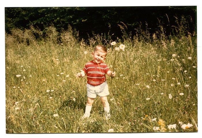
Those magical days always began with a gentle late-spring or midsummer morning. The interior of the white Peugeot 404, license plate 210 LZ 67, had already soaked up the sun before the engine purred to life, and the cabin gave off a scent I could still recognize today—a fragrance I found so pleasant. Back then, I had no idea it was just the smell of warm plastic from the car’s interior. Yes, the scents of the 404 on sunny days became my madeleine de Proust... What’s more, the whole family was unusually cheerful because those moments of relaxation and leisure were rare. Everyone worked, and no one had an easy job or was well paid. Without the *Trente Glorieuses*, these experiences might never have happened.
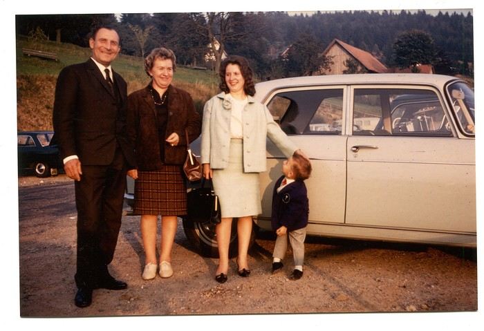
Once we crossed the canton’s borders, I felt like I was light-years away from my everyday surroundings, and every kilometer plunged me deeper into *terra incognita*. It was thrilling. Far from my so-called "medium-sized" town, wheat fields, cornfields, and cabbage patches stretched out, punctuated by tall poles connected by long wires and topped with vegetation—like giant clotheslines without laundry, where magical beanstalks might grow to touch the sky. Back then, I was still far from tasting their product, which was simply beer. At the time, there was still a significant local hop production. Fun fact: it wasn’t until 2002 that Anglo-Saxon scientists proved hops and cannabis belong to the same biological family.
After the fields, the landscape took another step up as it rolled past the little boy’s eyes, often glued to the windows. First came modest hills, then a succession of rolling slopes that soon formed an unbroken chain. Their 700 meters in altitude felt like Himalayan peaks to me—impressive, inert giants, a whole new world. Gazing at them, an intense emotion welled up somewhere between my stomach and lungs, nearly taking my breath away. What mysteries, what treasures did these heights hold? And then there were the cherries on top—the crowning touch that made the scene even more magical: proud, majestic castles perched on the summits like impassive sentinels. Monuments from the past, yet firmly rooted in the present on their rocky spurs. The little boy’s eyes sparkled—he’d been given a castle for Christmas, complete with battlements, towers, a drawbridge, and fully armed knights. He’d watched and lived *Ivanhoe* on the only French TV channel that existed back then.
Only once did my paternal grandfather join us on one of these trips. A tall, intelligent man with a face that could shift from stern to mischievous, clearly full of humor and charisma. Sadly, his relationship with alcohol had taken a toll on his life and, by extension, those of his loved ones. He had a strong personality—if his boss crossed the line, he wouldn’t hesitate to punch him, which meant he went through a lot of different jobs. Back then, you could quit one job and easily find another. It was quite something to see him in his final stages, hallucinating pink elephants and even drinking perfume when he had nothing else left. The last time I saw him, he’d slipped away from the doctors and nurses while hospitalized in pretty bad shape—at least, I assume his liver was the issue. We were sitting down for a family lunch when the door burst open, and there he stood in his pajamas, eyes twinkling with mischief, clearly pleased with the dramatic entrance. That theatrical moment didn’t spare us from burying him a few months later at the age of 71. One day, my mother told me the family doctor had quietly remarked that it was a shame—with his robust constitution, he could’ve lived to be a hundred. Yes, the family doctor—this was the man who’d come treat you any day, at almost any hour, just for a phone call. It really existed, it’s not a myth!
That day, his wife—my paternal grandmother—was also along for the ride. Everyone agreed that Jeannette was a good woman. She worked as a waitress at *Le Tigre*, the biggest brasserie in town, right in the center. Most customers preferred to be served by her, including local dignitaries and even the mayor. As a kid, I didn’t find her very fun, open, or warm—she seemed a bit stern. Back then, women in their fifties already had the face and build of grandmothers. Same went for men, don’t get me wrong. I had no idea about the struggles she faced because of her husband. I didn’t know that 30 years earlier, she’d had to flee Alsace while pregnant, under threat from Nazi fighter-bombers. I didn’t know she’d had several miscarriages, and that my father—her only surviving child, born prematurely in March 1940 at the other end of France—weighed less than a kilo at birth and was so tiny he could fit in a shoebox. Hard to imagine he’d grow into a strapping man nearly 1.80 meters tall, tipping the scales at 100 kilos. When you come back from summer camp in early August and ask why she didn’t pick you up with your parents, and they gently tell you she’s "in heaven," you don’t realize she passed away at 54 after suffering greatly from stomach cancer that had spread.
Back to that family outing, that enchanted parenthesis. I even remembered where we’d had lunch when I passed through Dambach-la-Ville decades later. One of those charming, flower-filled towns Alsace produces in abundance—and preserves so well. This one sits high on a hill, and I was a bit stunned on the parking lot because the view stretched far, revealing the Alsace plain below—its fields, villages, hills, and forests. The world seemed so vast and enticing that day, even though I was only glimpsing a tiny fraction of it.
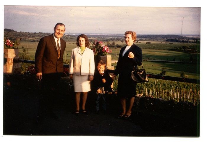
The region was already very touristy, but I wouldn’t notice the downsides until much later. That Sunday noon, I discovered a large restaurant filled with diners. I can still see the enormous piece of meat they served me, decorated with a little wooden skewer topped with a flag. I kept that one for a long time. Those were the golden days of rich, flowing, thick sauces—so flavorful—and the era of the world’s best fries, made on the spot with the best potatoes. To top it off, I was *exceptionally* allowed a small bottle of apple juice, Orangina, or—even better if possible—Sinalco. Yes, Sinalco—like Orangina, but better. A brand that must’ve disappeared in the 70s, but why, and what a shame! Since then, Orangina’s little bubbles have taken the brand to the other side of the planet—it’s now Japanese.
Year after year, I’d eagerly await that ecstatic moment when the most beautiful castle in Alsace, the Haut-Koenigsbourg, appeared in my field of vision. The perfect model, the archetype that blended into the landscape at the height of a child’s dreams. The trip home always felt like a reality check—less jarring than an alarm clock, but more diffuse and melancholic. From then on, there was only one wish: *When do we leave again?*
Those magical days always began with a gentle late-spring or midsummer morning. The interior of the white Peugeot 404, license plate 210 LZ 67, had already soaked up the sun before the engine purred to life, and the cabin gave off a scent I could still recognize today—a fragrance I found so pleasant. Back then, I had no idea it was just the smell of warm plastic from the car’s interior. Yes, the scents of the 404 on sunny days became my madeleine de Proust... What’s more, the whole family was unusually cheerful because those moments of relaxation and leisure were rare. Everyone worked, and no one had an easy job or was well paid. Without the *Trente Glorieuses*, these experiences might never have happened.
Once we crossed the canton’s borders, I felt like I was light-years away from my everyday surroundings, and every kilometer plunged me deeper into *terra incognita*. It was thrilling. Far from my so-called "medium-sized" town, wheat fields, cornfields, and cabbage patches stretched out, punctuated by tall poles connected by long wires and topped with vegetation—like giant clotheslines without laundry, where magical beanstalks might grow to touch the sky. Back then, I was still far from tasting their product, which was simply beer. At the time, there was still a significant local hop production. Fun fact: it wasn’t until 2002 that Anglo-Saxon scientists proved hops and cannabis belong to the same biological family.
After the fields, the landscape took another step up as it rolled past the little boy’s eyes, often glued to the windows. First came modest hills, then a succession of rolling slopes that soon formed an unbroken chain. Their 700 meters in altitude felt like Himalayan peaks to me—impressive, inert giants, a whole new world. Gazing at them, an intense emotion welled up somewhere between my stomach and lungs, nearly taking my breath away. What mysteries, what treasures did these heights hold? And then there were the cherries on top—the crowning touch that made the scene even more magical: proud, majestic castles perched on the summits like impassive sentinels. Monuments from the past, yet firmly rooted in the present on their rocky spurs. The little boy’s eyes sparkled—he’d been given a castle for Christmas, complete with battlements, towers, a drawbridge, and fully armed knights. He’d watched and lived *Ivanhoe* on the only French TV channel that existed back then.
Only once did my paternal grandfather join us on one of these trips. A tall, intelligent man with a face that could shift from stern to mischievous, clearly full of humor and charisma. Sadly, his relationship with alcohol had taken a toll on his life and, by extension, those of his loved ones. He had a strong personality—if his boss crossed the line, he wouldn’t hesitate to punch him, which meant he went through a lot of different jobs. Back then, you could quit one job and easily find another. It was quite something to see him in his final stages, hallucinating pink elephants and even drinking perfume when he had nothing else left. The last time I saw him, he’d slipped away from the doctors and nurses while hospitalized in pretty bad shape—at least, I assume his liver was the issue. We were sitting down for a family lunch when the door burst open, and there he stood in his pajamas, eyes twinkling with mischief, clearly pleased with the dramatic entrance. That theatrical moment didn’t spare us from burying him a few months later at the age of 71. One day, my mother told me the family doctor had quietly remarked that it was a shame—with his robust constitution, he could’ve lived to be a hundred. Yes, the family doctor—this was the man who’d come treat you any day, at almost any hour, just for a phone call. It really existed, it’s not a myth!
That day, his wife—my paternal grandmother—was also along for the ride. Everyone agreed that Jeannette was a good woman. She worked as a waitress at *Le Tigre*, the biggest brasserie in town, right in the center. Most customers preferred to be served by her, including local dignitaries and even the mayor. As a kid, I didn’t find her very fun, open, or warm—she seemed a bit stern. Back then, women in their fifties already had the face and build of grandmothers. Same went for men, don’t get me wrong. I had no idea about the struggles she faced because of her husband. I didn’t know that 30 years earlier, she’d had to flee Alsace while pregnant, under threat from Nazi fighter-bombers. I didn’t know she’d had several miscarriages, and that my father—her only surviving child, born prematurely in March 1940 at the other end of France—weighed less than a kilo at birth and was so tiny he could fit in a shoebox. Hard to imagine he’d grow into a strapping man nearly 1.80 meters tall, tipping the scales at 100 kilos. When you come back from summer camp in early August and ask why she didn’t pick you up with your parents, and they gently tell you she’s "in heaven," you don’t realize she passed away at 54 after suffering greatly from stomach cancer that had spread.
Back to that family outing, that enchanted parenthesis. I even remembered where we’d had lunch when I passed through Dambach-la-Ville decades later. One of those charming, flower-filled towns Alsace produces in abundance—and preserves so well. This one sits high on a hill, and I was a bit stunned on the parking lot because the view stretched far, revealing the Alsace plain below—its fields, villages, hills, and forests. The world seemed so vast and enticing that day, even though I was only glimpsing a tiny fraction of it.
The region was already very touristy, but I wouldn’t notice the downsides until much later. That Sunday noon, I discovered a large restaurant filled with diners. I can still see the enormous piece of meat they served me, decorated with a little wooden skewer topped with a flag. I kept that one for a long time. Those were the golden days of rich, flowing, thick sauces—so flavorful—and the era of the world’s best fries, made on the spot with the best potatoes. To top it off, I was *exceptionally* allowed a small bottle of apple juice, Orangina, or—even better if possible—Sinalco. Yes, Sinalco—like Orangina, but better. A brand that must’ve disappeared in the 70s, but why, and what a shame! Since then, Orangina’s little bubbles have taken the brand to the other side of the planet—it’s now Japanese.
Year after year, I’d eagerly await that ecstatic moment when the most beautiful castle in Alsace, the Haut-Koenigsbourg, appeared in my field of vision. The perfect model, the archetype that blended into the landscape at the height of a child’s dreams. The trip home always felt like a reality check—less jarring than an alarm clock, but more diffuse and melancholic. From then on, there was only one wish: *When do we leave again?*
Martine from DD in Arizona and New Mexico
Good evening everyone! 🙂
We’re back from our September 2025 road trip, this time to explore Arizona and New Mexico, and it’s time for me to start my travel journal—especially since everything’s already booked for another trip in September 2026 (to California), and I need to get started on the planning.
I was a little worried this new visit to Uncle Sam’s country might not be as "wow" as the others, but we still discovered some incredible places.
For those who don’t know us, we’re a couple in our seventies who speak very little English, but that didn’t stop us from fully enjoying our stay.
For this 6th road trip in the U.S., we spent 21 nights there, drove 4,160 km by car, and walked nearly 160 km in a loop starting from Phoenix.
We’d been to Arizona before (but not this side) and never to New Mexico. This whole road trip was a huge discovery for us.
In the prices mentioned (some in euros, others in dollars), bank fees and exchange charges are included. The flights, car rental, and parking were all paid for in December 2024 when we booked.
We’d downloaded the MPC (Mobile Passport Control) app, but there wasn’t a dedicated line at Phoenix Airport. Still, we got through quickly with friendly, smiling agents.
I don’t drive at all (I hate it), so the stops were chosen based on activities but also, for some, to limit daily mileage for the sole driver. The kilometers listed in the itinerary are the daily distances.
We traveled from September 9th to 22nd, unfortunately once again without our dear friends Mimi and Maumau.
The itinerary
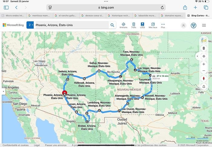
Day 1: Flight Marseille-Paris-Phoenix, then Gold Canyon (133 km) Day 2: Tucson (271 km) Lost Dutchman State Park Day 3: Tucson (155 km) Day 4: Tucson (34 km) Day 5: Bisbee (182 km) Day 6: Lordsburg (345 km) Day 7: Las Cruces (253 km) Day 8: Alamogordo (162 km) Day 9: Roswell (264 km) Day 10: Tucumcari (369 km) Day 11: Las Vegas (281 km) – the one in New Mexico Day 12: Taos (213 km) Day 13: Santa Fe (224 km) Day 14: Albuquerque (123 km) Day 15: Gallup (246 km) Day 16: Holbrook (224 km) Day 17: Flagstaff (179 km) Day 18: Sedona (118 km) Day 19: Sedona (48 km) Day 20: Sedona (41 km) Day 21: Phoenix (256 km) Day 22: Phoenix Airport (35 km)
📊 **Budget**: A little over 7,500 € for both of us, all included. The exchange rate was in our favor (1.17 dollars to 1 €). 📊 **Flights**: Marseille-Paris Charles de Gaulle-Phoenix: 1,787 € for two, with one checked bag each (Air France) 📊 **ESTA**: $42 📊 **America the Beautiful Pass**: $80 📊 **Parking**: 134 € (super eco at Marseille) 📊 **Car rental (Hertz)**: 865 €. Since there were no SUVs left in the reserved category (Nissan Rogue), we got an upgrade (4x4 Ford Explorer). We booked through Air France (15% discount). We’d originally reserved it in December for 1,140 €, but since prices dropped in March, we canceled and rebooked for 865 €. Hertz offers a free Hertz Gold Plus Rewards program, which gives you priority counter service when picking up the car. 📊 **Accommodation**: 2,400 € We stayed in hotels and motels of varying standards (from 60 to 203 € per night, depending on the city), all booked through Booking.com or Hotels.com. Out of 21 nights, only two didn’t include breakfast in the price. Booking.com sometimes offers slightly cheaper rates if you book by phone using the mobile app, and our Genius 3 status on the site also got us some preferential rates. 📊 **Supplementary insurance**: AVA 200 € for medical care if needed 📊 **Cash**: $2,078. We left with 1,000 € exchanged before departure and made two withdrawals of $500. This cash covered: - Evening restaurants and tips - Midday picnics - Gas: $298 for 4,160 km - Museum and private park entries (per person): - Lost Dutchman: $10 - Arizona-Sonora Desert Museum: $28 - Bird Cage Theater: $16 - Tombstone Shootout: $8 - New Mexico Farm & Ranch Museum: $12 - Roswell International UFO Museum: $5 - Billy the Kid Museum: $7 - Rancho de Taos: $22 - West Fork Oak Creek Trail entry: $15 We got a few discounts thanks to our senior age (+65). - Souvenirs and little treats
Like on our previous road trips, we didn’t rent a GPS. We got around using offline GPS apps Here WeGo and Organic Maps, with maps of the states we visited downloaded before we left (on our phones).
❤️❤️❤️ **Highlights** (there are so many!) 📍 Goldfield Ghost Town (even if it’s a reconstruction) 📍 The standing army of Saguaro cacti at Saguaro National Park West 📍 Diving into the cowboy universe of Tombstone 📍 The welcome from Rick and Henry at our guesthouse in Bisbee (Garden at Mile High Ranch) 📍 The tangled rocks of Chiricahua National Monument 📍 The flavored pistachios from Dwayne’s Fresh Jerky and Mac Ginnis Pistachioland 📍 Restaurants: La Posta (Las Cruces), Diner 66 (Albuquerque), and the Haunted Hamburger (Jerome) 📍 The old plazas of New Mexico 📍 The solitude and beauty of the white dunes at White Sands National Park 📍 Stepping back in time at the Billy the Kid Museum (Fort Stanton) 📍 Sections of historic Route 66 and the old motels of Tucumcari, especially at night when all the neon lights are on 📍 Taos Pueblo and diving into Native American culture 📍 After the Rio Grande Bridge, the descent via NM 567 to the very bottom of the Rio Grande Gorge, then the road along the riverbanks to Taos 📍 The tranquility of the Chimayo Sanctuary 📍 Discovering the ingenious native dwellings at Bandelier National Monument and Walnut Canyon National Park 📍 The small towns along the Turquoise Trail 📍 The red rocks of Red Rock Park and the Painted Desert 📍 The extraordinary colors of the petrified trees at Petrified Forest National Park 📍 Sedona, its red rocks, and the reward of the viewpoints at the end of hikes (Devil’s Bridge, The Subway, and West Fork Oak Creek) 📍 The immersion in Mexico when visiting Tlaquepaque 📍 The almost-ghost town of Jerome and its terraced streets 📍 The incredible kindness of Americans, always ready to help and up for a chat ❤️
☹️☹️☹️ **Flops** (there are very few) 📍 Several museums and churches being closed, so we couldn’t visit them 📍 Some museums and visitor centers opening late (10 AM) and closing early (4 PM) 📍 A 64 € phone roaming charge because we got near the Mexican border and picked up their cell tower 📍 The outrageous price ($5.99) for a gallon of gas at the Shell near Phoenix Airport
I hope this helps! Anyway, thanks for reading my long post. Don’t hesitate to reach out, even via PM, if you see I haven’t replied and you’d like more details. Have a great evening, everyone! 🙂
We’re back from our September 2025 road trip, this time to explore Arizona and New Mexico, and it’s time for me to start my travel journal—especially since everything’s already booked for another trip in September 2026 (to California), and I need to get started on the planning.
I was a little worried this new visit to Uncle Sam’s country might not be as "wow" as the others, but we still discovered some incredible places.
For those who don’t know us, we’re a couple in our seventies who speak very little English, but that didn’t stop us from fully enjoying our stay.
For this 6th road trip in the U.S., we spent 21 nights there, drove 4,160 km by car, and walked nearly 160 km in a loop starting from Phoenix.
We’d been to Arizona before (but not this side) and never to New Mexico. This whole road trip was a huge discovery for us.
In the prices mentioned (some in euros, others in dollars), bank fees and exchange charges are included. The flights, car rental, and parking were all paid for in December 2024 when we booked.
We’d downloaded the MPC (Mobile Passport Control) app, but there wasn’t a dedicated line at Phoenix Airport. Still, we got through quickly with friendly, smiling agents.
I don’t drive at all (I hate it), so the stops were chosen based on activities but also, for some, to limit daily mileage for the sole driver. The kilometers listed in the itinerary are the daily distances.
We traveled from September 9th to 22nd, unfortunately once again without our dear friends Mimi and Maumau.
The itinerary
Day 1: Flight Marseille-Paris-Phoenix, then Gold Canyon (133 km) Day 2: Tucson (271 km) Lost Dutchman State Park Day 3: Tucson (155 km) Day 4: Tucson (34 km) Day 5: Bisbee (182 km) Day 6: Lordsburg (345 km) Day 7: Las Cruces (253 km) Day 8: Alamogordo (162 km) Day 9: Roswell (264 km) Day 10: Tucumcari (369 km) Day 11: Las Vegas (281 km) – the one in New Mexico Day 12: Taos (213 km) Day 13: Santa Fe (224 km) Day 14: Albuquerque (123 km) Day 15: Gallup (246 km) Day 16: Holbrook (224 km) Day 17: Flagstaff (179 km) Day 18: Sedona (118 km) Day 19: Sedona (48 km) Day 20: Sedona (41 km) Day 21: Phoenix (256 km) Day 22: Phoenix Airport (35 km)
📊 **Budget**: A little over 7,500 € for both of us, all included. The exchange rate was in our favor (1.17 dollars to 1 €). 📊 **Flights**: Marseille-Paris Charles de Gaulle-Phoenix: 1,787 € for two, with one checked bag each (Air France) 📊 **ESTA**: $42 📊 **America the Beautiful Pass**: $80 📊 **Parking**: 134 € (super eco at Marseille) 📊 **Car rental (Hertz)**: 865 €. Since there were no SUVs left in the reserved category (Nissan Rogue), we got an upgrade (4x4 Ford Explorer). We booked through Air France (15% discount). We’d originally reserved it in December for 1,140 €, but since prices dropped in March, we canceled and rebooked for 865 €. Hertz offers a free Hertz Gold Plus Rewards program, which gives you priority counter service when picking up the car. 📊 **Accommodation**: 2,400 € We stayed in hotels and motels of varying standards (from 60 to 203 € per night, depending on the city), all booked through Booking.com or Hotels.com. Out of 21 nights, only two didn’t include breakfast in the price. Booking.com sometimes offers slightly cheaper rates if you book by phone using the mobile app, and our Genius 3 status on the site also got us some preferential rates. 📊 **Supplementary insurance**: AVA 200 € for medical care if needed 📊 **Cash**: $2,078. We left with 1,000 € exchanged before departure and made two withdrawals of $500. This cash covered: - Evening restaurants and tips - Midday picnics - Gas: $298 for 4,160 km - Museum and private park entries (per person): - Lost Dutchman: $10 - Arizona-Sonora Desert Museum: $28 - Bird Cage Theater: $16 - Tombstone Shootout: $8 - New Mexico Farm & Ranch Museum: $12 - Roswell International UFO Museum: $5 - Billy the Kid Museum: $7 - Rancho de Taos: $22 - West Fork Oak Creek Trail entry: $15 We got a few discounts thanks to our senior age (+65). - Souvenirs and little treats
Like on our previous road trips, we didn’t rent a GPS. We got around using offline GPS apps Here WeGo and Organic Maps, with maps of the states we visited downloaded before we left (on our phones).
❤️❤️❤️ **Highlights** (there are so many!) 📍 Goldfield Ghost Town (even if it’s a reconstruction) 📍 The standing army of Saguaro cacti at Saguaro National Park West 📍 Diving into the cowboy universe of Tombstone 📍 The welcome from Rick and Henry at our guesthouse in Bisbee (Garden at Mile High Ranch) 📍 The tangled rocks of Chiricahua National Monument 📍 The flavored pistachios from Dwayne’s Fresh Jerky and Mac Ginnis Pistachioland 📍 Restaurants: La Posta (Las Cruces), Diner 66 (Albuquerque), and the Haunted Hamburger (Jerome) 📍 The old plazas of New Mexico 📍 The solitude and beauty of the white dunes at White Sands National Park 📍 Stepping back in time at the Billy the Kid Museum (Fort Stanton) 📍 Sections of historic Route 66 and the old motels of Tucumcari, especially at night when all the neon lights are on 📍 Taos Pueblo and diving into Native American culture 📍 After the Rio Grande Bridge, the descent via NM 567 to the very bottom of the Rio Grande Gorge, then the road along the riverbanks to Taos 📍 The tranquility of the Chimayo Sanctuary 📍 Discovering the ingenious native dwellings at Bandelier National Monument and Walnut Canyon National Park 📍 The small towns along the Turquoise Trail 📍 The red rocks of Red Rock Park and the Painted Desert 📍 The extraordinary colors of the petrified trees at Petrified Forest National Park 📍 Sedona, its red rocks, and the reward of the viewpoints at the end of hikes (Devil’s Bridge, The Subway, and West Fork Oak Creek) 📍 The immersion in Mexico when visiting Tlaquepaque 📍 The almost-ghost town of Jerome and its terraced streets 📍 The incredible kindness of Americans, always ready to help and up for a chat ❤️
☹️☹️☹️ **Flops** (there are very few) 📍 Several museums and churches being closed, so we couldn’t visit them 📍 Some museums and visitor centers opening late (10 AM) and closing early (4 PM) 📍 A 64 € phone roaming charge because we got near the Mexican border and picked up their cell tower 📍 The outrageous price ($5.99) for a gallon of gas at the Shell near Phoenix Airport
I hope this helps! Anyway, thanks for reading my long post. Don’t hesitate to reach out, even via PM, if you see I haven’t replied and you’d like more details. Have a great evening, everyone! 🙂
Questions for a 15-day itinerary in China
Hi everyone
I’m currently planning my trip to China for next August.
I’m starting from scratch, so I’m counting on your advice and firsthand experiences!
For now, I only know that I’ll arrive in China via Beijing, Shanghai, or Hong Kong and leave 15 days later from another one of these three cities.
In between, I’d love to explore a mountainous and natural region in the countryside.
The Guilin area really appeals to me with its spectacular landscapes.
I still have tons of questions:
- What can you do during this often humid season?
- Is it better to go through a local agency or organize everything yourself?
- What itineraries would you recommend?
Anyway, everything’s still up in the air, and I can’t wait to read your opinions, suggestions, and great tips to help me build this trip!
A summer in the sun in... Iceland!!
Ah, Iceland and us—it’s quite the story, or rather, a long wait... The first time we considered going was already 7-8 years ago, after reading travel journals describing breathtaking landscapes, countless active and dormant volcanoes, glaciers, and waterfalls with extraordinary flows. In short, this island, made of fire and ice, right at Europe’s doorstep with its own unique culture, had nothing but advantages, and it was urgent to visit without delay 😇
My *Routard* guidebook is actually from 2016. So why did Iceland make us wait so long before we finally gave in to its charms? Yes, why indeed?
Simply because reading other travel journals revealed the cost of living there—and especially the harsh climate, even in the middle of July 🤪! Some journals described entire weeks of rain and foggy weather, making it tricky to explore the island. The budget wasn’t spared either, because in the most touristy areas, especially in the south and around Myvatn, accommodation prices are downright indecent—even outright robbery. 😕
Plus, in the Highlands, there’s literally no permanent lodging, and the only way to spend several nights there is to camp. And camping in winter conditions wasn’t exactly part of our plans... 😄
So, year after year, this trip kept getting postponed...
until August 2023, when prices for Southern Africa, North or South America, or even Asia were all way too high for summer 2024!
That’s when I turned my attention back to the Land of Fire and Ice and scoured all the comparison sites for the best accommodation deals across the country. Planning for 20 nights, I found 13 nights in "proper" lodging for 5 people at an average cost of under 200 €! A miracle, considering that in the southern glacier region, around Vik or Myvatn, prices range from 300 to 1000 € per night 😮 😮!
Still, that means we’ll have to camp for 7 nights, mostly in the Highlands, near Askja or Landmannalaugar. 😎
For once, I built the daily itinerary entirely around the decently priced lodgings I found 11 months in advance! The shortage of places to stay in some areas forced me to plan a few long transition days and make some tough choices. No big deal, though—there’s so much to do on this island 🙂!
Once the main itinerary was set, everyone agreed to the plan: 2/3 in proper lodging and 1/3 camping, even the most camping-averse among us! *Follow my gaze...*
By the time we bought the flight tickets, I had to tweak the itinerary a bit because one or two places were already booked! Plus, it was impossible to wait for a more refined plan to adjust reservations, since almost all bookings are non-refundable!! The harsh law of supply and demand...
For the car rental, we booked a Hyundai Tucson, approved for the Highlands, from Lava Car Rental—a company I’d read good reviews about in a Facebook group—for a cool 2500 € with full insurance. A real 4x4, like a Defender, would’ve been more than double...! Welcome to Iceland 😕...
Activities and excursions also required some tough choices. We had two must-dos: whale watching in Húsavík (60 € pp on Getyourguide) and a Glacier and Summer Treasure Glacier Walk with BlueIceland (165 € pp with discount codes on Getyourguide).
For the baths, we skipped the Blue Lagoon—too expensive—in favor of the Secret Lagoon and the Myvatn Baths, the Blue Lagoon’s equivalent but half the price.
Two baths for the price of one... and even more, since I spotted several free hot-water swimming spots.
Itinerary: Day 1: Arrival in Reykjavik - Hraunfossar Waterfall - Surtshellir Cave Day 2: Grábrók Crater - Snæfellsnes Peninsula Day 3: Stykkishólmur - Sturlungalaug Hot Springs Day 4: Northwest Coast - Akureyri - Goðafoss Day 5: Myvatn Day 6: Myvatn - Dettifoss - Selfoss - Rauðhólar Day 7: Húsavík Whale Watching - Dettifoss - Selfoss Day 8: Stuðlagil Canyon - Seyðisfjörður Day 9: Puffin colony - Störurð Hike Day 10: Hengifoss - East Fjords, Mjóifjörður Day 11: Viking Village - Jökulsárlón - Fjallsárlón Day 12: Glacier Excursion - Svartifoss Day 13: Fjaðrárgljúfur Canyon - Vík Day 14: Þakgil - Lava Show Vík Day 15: Southern Waterfalls Day Day 16: Landmannalaugar - Skalli Hike Day 17: Landmannalaugar - Bláhnjúkur - Brennisteinsalda Day 18: Secret Lagoon, Kerlingarfjöll, and Gullfoss Day 19: Geysir - Reykjavik Day 20: Bruarfoss - Þingvellir - Kerid Crater - Krýsuvík Geothermal Area Day 21: Reykjanes Peninsula
Friday, July 5, 2024, is our last workday before driving up to Alsace overnight to leave the cockers at Grandpa’s for boarding. Then, at 1:30 AM, we’ll head to Frankfurt, where a direct flight to Iceland awaits.
We arrive at 4 AM. Since we leave at 7 AM, the "night" will only last the equivalent of a 30-minute nap 🤪... just enough to get us in the road-trip mood 😏!!
My *Routard* guidebook is actually from 2016. So why did Iceland make us wait so long before we finally gave in to its charms? Yes, why indeed?
Simply because reading other travel journals revealed the cost of living there—and especially the harsh climate, even in the middle of July 🤪! Some journals described entire weeks of rain and foggy weather, making it tricky to explore the island. The budget wasn’t spared either, because in the most touristy areas, especially in the south and around Myvatn, accommodation prices are downright indecent—even outright robbery. 😕
Plus, in the Highlands, there’s literally no permanent lodging, and the only way to spend several nights there is to camp. And camping in winter conditions wasn’t exactly part of our plans... 😄
So, year after year, this trip kept getting postponed...
until August 2023, when prices for Southern Africa, North or South America, or even Asia were all way too high for summer 2024!
That’s when I turned my attention back to the Land of Fire and Ice and scoured all the comparison sites for the best accommodation deals across the country. Planning for 20 nights, I found 13 nights in "proper" lodging for 5 people at an average cost of under 200 €! A miracle, considering that in the southern glacier region, around Vik or Myvatn, prices range from 300 to 1000 € per night 😮 😮!
Still, that means we’ll have to camp for 7 nights, mostly in the Highlands, near Askja or Landmannalaugar. 😎
For once, I built the daily itinerary entirely around the decently priced lodgings I found 11 months in advance! The shortage of places to stay in some areas forced me to plan a few long transition days and make some tough choices. No big deal, though—there’s so much to do on this island 🙂!
Once the main itinerary was set, everyone agreed to the plan: 2/3 in proper lodging and 1/3 camping, even the most camping-averse among us! *Follow my gaze...*
By the time we bought the flight tickets, I had to tweak the itinerary a bit because one or two places were already booked! Plus, it was impossible to wait for a more refined plan to adjust reservations, since almost all bookings are non-refundable!! The harsh law of supply and demand...
For the car rental, we booked a Hyundai Tucson, approved for the Highlands, from Lava Car Rental—a company I’d read good reviews about in a Facebook group—for a cool 2500 € with full insurance. A real 4x4, like a Defender, would’ve been more than double...! Welcome to Iceland 😕...
Activities and excursions also required some tough choices. We had two must-dos: whale watching in Húsavík (60 € pp on Getyourguide) and a Glacier and Summer Treasure Glacier Walk with BlueIceland (165 € pp with discount codes on Getyourguide).
For the baths, we skipped the Blue Lagoon—too expensive—in favor of the Secret Lagoon and the Myvatn Baths, the Blue Lagoon’s equivalent but half the price.
Two baths for the price of one... and even more, since I spotted several free hot-water swimming spots.
Itinerary: Day 1: Arrival in Reykjavik - Hraunfossar Waterfall - Surtshellir Cave Day 2: Grábrók Crater - Snæfellsnes Peninsula Day 3: Stykkishólmur - Sturlungalaug Hot Springs Day 4: Northwest Coast - Akureyri - Goðafoss Day 5: Myvatn Day 6: Myvatn - Dettifoss - Selfoss - Rauðhólar Day 7: Húsavík Whale Watching - Dettifoss - Selfoss Day 8: Stuðlagil Canyon - Seyðisfjörður Day 9: Puffin colony - Störurð Hike Day 10: Hengifoss - East Fjords, Mjóifjörður Day 11: Viking Village - Jökulsárlón - Fjallsárlón Day 12: Glacier Excursion - Svartifoss Day 13: Fjaðrárgljúfur Canyon - Vík Day 14: Þakgil - Lava Show Vík Day 15: Southern Waterfalls Day Day 16: Landmannalaugar - Skalli Hike Day 17: Landmannalaugar - Bláhnjúkur - Brennisteinsalda Day 18: Secret Lagoon, Kerlingarfjöll, and Gullfoss Day 19: Geysir - Reykjavik Day 20: Bruarfoss - Þingvellir - Kerid Crater - Krýsuvík Geothermal Area Day 21: Reykjanes Peninsula
Friday, July 5, 2024, is our last workday before driving up to Alsace overnight to leave the cockers at Grandpa’s for boarding. Then, at 1:30 AM, we’ll head to Frankfurt, where a direct flight to Iceland awaits.
We arrive at 4 AM. Since we leave at 7 AM, the "night" will only last the equivalent of a 30-minute nap 🤪... just enough to get us in the road-trip mood 😏!!
Namibia Travel Journal: May 2025 - Trip Review
NAMIBIA TRIP 2025: April 24 to May 20: Feel free to comment or ask us any questions about this amazing journey.
>> Find all our photos and videos for each day on our website here: www.montagne-aventure.net
**DAY 1: Thursday, April 24, 2025: Outbound Flights from Lyon to Windhoek via Munich - Visit to Munich:**

Off we go on a new adventure. The alarm rings at 6:30 AM, the travel bags are packed, and we head to Lyon Airport. We booked our flight tickets with Lufthansa. The first leg to Munich, Germany, is operated by AirBaltic. Departure at 1:05 PM for a 1-hour and 20-minute flight. We arrive at 2:30 PM.
**We now have a 7-hour layover, so we take the opportunity to get some fresh air and explore Munich.** We quickly exit Terminal 2 of the airport and head towards the subway. We buy a group day ticket "Airport-city Day Zone M-5," valid for 2 to 5 people at a price of 30.50 € (instead of 16.30 € per person). We take the S8 line to **Marienplatz** in 35 minutes. **This is the heart of the city.** The weather is overcast, quite cool, but dry. Perfect for a little city trip between two flights while leaving our large luggage in transit at the airport. **Munich is the third-largest German city after Berlin and Hamburg, in the Bavaria region.** **The center has a lot of charm and brings together several religious buildings, easy to explore on foot.** We are impressed by the number of people enjoying these 100% pedestrian streets, which are very pleasant. After Marienplatz, the most famous square with the town hall, we head to the Cathedral of Our Lady, a Gothic church, then continue to **Karlsplatz** and move on to **the food market offering a wide selection of high-end food products in an atmosphere where a certain art of living prevails.** We also visit St. Peter's Church before grabbing a bite to eat. Two good hours were enough for this 10 km city walk. It's time to take the subway back: by 6:30 PM, we are back at the airport. Now, it's time for a bit of waiting and rest. Our second flight is scheduled for 9:35 PM for a 9-hour and 30-minute journey to our final destination in Namibia: **Windhoek.**
> Round-trip flight tickets with Lufthansa from Lyon: 2029 €, or 1,014.50 € per person.
> Lyon Airport parking: 120 €
> Today's expenses: 7 € for 2 pizzas in France / 14 € for the restaurant in Munich / 30.50 € for the daily subway ticket in Munich.
**DAY 2: Friday, April 25, 2024: Arrival in Windhoek, Visit to the Namibian Capital:**
After a 9-hour and 30-minute overnight flight with Discover Airlines, we finally land on Namibian soil just before 7:30 AM. The day is breaking, and the colors are already stunning. We are eager despite the usual fatigue from the flight. The airline was punctual, with friendly staff and good meals, though a bit light. We are the first flight of the day to land, with no more than 15 flights per day here, from 7 AM to 8 PM. We disembark on the tarmac at this airport located in the middle of nowhere, **I finally set foot on African soil for the first time.** We exit among the first from the aircraft to go through the long formalities at the front of the line, as the wait can quickly become endless. Allow at least 5 minutes per person for e-visas. We still wait 45 minutes despite only about twenty people ahead of us. Phew, it's done. We collect our luggage and then withdraw money from an ATM. We make 4 withdrawals of the maximum amount, 2000 NAD $ per withdrawal, for a total of 380 €, or 95.33 € per withdrawal.
Our driver arrives at the same time, perfect timing, we were quick.
We leave the airport at 8:45 AM. By 9:30 AM, we arrive at the **Gracious Whisp vehicle rental agency**, located at the entrance of Windhoek, small and human-sized with a fleet of recent vehicles. More formalities, then a short wait as our vehicle is not yet ready. Time to decompress, catch our breath, and enjoy the very pleasant morning temperature. Not a cloud in sight. Next, a briefing on the vehicle, always with a bit of apprehension due to our approximate English. Allow 45 minutes of explanations, including setting up the roof tent, camping equipment, technical information in case of a flat tire, driving tips in Namibia, and a tour of the 4x4. We have all the necessary equipment for camping: mattresses, sleeping bags, pillows, table, chairs, gas stove, BBQ grill... as well as 2 spare tires, a compressor, a dual tank, and accessories for removing wheels. Off we go, it's time to muster our courage and get behind the wheel. **Heading to SuperSpar Maerua**, fortunately located less than 10 minutes away. We park with the help of a parking attendant; it's very crowded, the space is narrow, but everything goes well despite the cursed right-hand drive. Today's new mission: stock up on groceries. The store is well-stocked with local and imported products, catering to all tastes. We spend 114 € on groceries, from pasta to meat, BBQ lighters to dishwashing products. Two people load our groceries into two carts and transfer them to our vehicle; we feel compelled to leave a tip, 50 NAD $, as we don't have change yet. Now, we head to the hotel, 15 minutes away. Traffic is difficult at a complicated intersection; this will likely be the only traffic jam in Namibia. **We arrive at Kate's Nest Guesthouse & Backpackers around 1:15 PM, quite tired.** We take some well-deserved rest at this recent establishment, quite calm with secure private parking. After a short nap, we enjoy the quiet by the hotel pool. Night falls between 6:30 PM and 7 PM. We eat quietly in our room tonight before starting this long 4x4 road trip in camping mode in the heart of Namibia.
> Today's grocery expenses: 114 € at Super Spar Marua (2395.21 NAD $).
> Round-trip flight tickets with Lufthansa from Lyon: 2029 €, or 1,014.50 € per person.
> Vehicle rental: 4x4 Toyota with roof tent for 24 days: Gracious Whisp Car Rentals: 2,638 € (N$50,640) or **1,319 €** per person - (https://gwcarrentals.com/)
> Distance driven today: 15 km.
> Accommodation: Kate's Nest Guesthouse & Backpackers - 4 Aristotles Street Academia, 9000 Windhoek - 36 € for two for one night.
> Windhoek International Airport website: (https://www.airports.com.na/)
**DAY 3: Saturday, April 26, 2025: Windhoek to Hardap: Mariental Region - Kalahari Desert:**
After a good, restful night, we wake up leisurely around 7 AM. We enjoy the comfort provided by this first and last hotel before 24 nights under the tent.
**We leave Kate's Nest Guesthouse at 8:30 AM to tackle the Namibian roads.** We quickly leave the capital; in just 30 minutes, we find ourselves almost alone in the world. The landscape is dotted with small domes. We leave the **paved B1** quickly to turn left onto the **C15**. **From there, we won't see more than 10 vehicles all day.** After passing through the few houses of **Lekkerwaterpoort**, we tackle our first gravel road. These road sections are limited to 100 km/h, but even at 70 km/h, I find it already challenging. However, I quickly get used to it and gradually pick up speed to reach my cruising speed of around 80 to 90 km/h. **We are on immense straight lines crossing wild expanses as far as the eye can see.** **We come across two baboons, a few ostriches, and numerous cattle and sheep farms.** We pass through the charming village of **Uhlenhorst** with its typical houses and children with broad smiles waving at us. Life here is already very different from Windhoek. **The thermometer rises quickly from 16°C at 8:30 AM to over 28°C in the early afternoon.**
**We arrive at the Hardap Dam reserve at 2 PM.** We stop at the toll booth at the park entrance to pay the entrance fee: 250 NAD $ for 2 people and 1 vehicle. We continue to the dam and then the camp entrance, located a bit further. We had booked in advance, but this place remains little frequented by foreigners.
We take advantage of the hottest hours to rest by the large pool overlooking the immense lake, a very enjoyable moment. Would this be a bit of a vacation?
Around 4:30 PM, we head to the campsite. We overlook this vast water reserve. We arrive first; we will be only 3 vehicles spending the night here. It's time to get to work and set up our equipment for the first time. It takes us a good 20 minutes to set everything up, with a slight apprehension about unfolding the tent. Once this task is done, which we will have to repeat for almost a month, we will become much more efficient over time. Time for rest and contemplation in total silence. The sun gradually sets, and the heat quickly becomes bearable again. Bliss! **This dam is located 20 km northwest of Mariental in an area dotted with conical hills topped with dolerite buttons (Hardap means "hillock" in Nama). It captures the Fish River, which flows south, creating a large lake in the middle of an arid environment. The contrast is striking.** We enjoy our first sunset facing this 360° otherworldly landscape.
Around 7 PM, we start our first BBQ, or "braai" as it's called here. The temperature is perfect. The sun sets, giving way to a star-filled sky of incredible beauty thanks to the absence of any light pollution. The Milky Way will lull us throughout the evening. After some good sausages and potatoes on the BBQ, we head to our roof tent around 9:30 PM with a complete change of scenery in just 24 hours. France already seems so far away...
This campsite has shared showers and toilets, quite clean and functional, as well as a central area with several BBQs and tables. The sites are arranged in a semicircle, each with an electrical outlet. The sites are close to each other but spacious, some slightly shaded. We are only three vehicles tonight, so it's perfectly comfortable and quiet. Not to mention the large pool near the restaurant. Our trip is off to a great start.
> Today's road itinerary: Windhoek > Head south on the B1 to Rehoboth > Turn left onto the C25 then C15 to Stampriet > C20 to Hardap > Full north on the B1 > Then turn left onto the M93 - 5 hours of driving.
> Distance driven today: 354 km.
> Accommodation: Hardap Recreation Resort - 23.3 € for two - Large pool - GR6W+3M2, Hardap Game Reserve, Mariental, Namibia - (http://www.nwr.com.na/resorts/hardap-resort/)
**DAY 4: Sunday, April 27, 2025: Hardap - Brukkaros Volcano - Keetmanshoop - Quivertree Forest Rest Camp**
Our first night under the tent was very pleasant; the little wind quickly calmed down, giving way to absolute silence. The mattress is decent, more comfortable than some nights in Nepal. The length and width give us enough space for maximum comfort, despite my height (1.91 m). We wake up a little before 7 AM as the sun rises, and the lights dazzle us from the start of the day. We pack up the equipment in 30 minutes, quite easily. Then we enjoy the sun, which warms up quickly while we keep our light fleece on.
At 8:30 AM, **we hit the road again, heading south** to our first stop in **Mariental**. We want to do some shopping at SuperSpar, but once we arrive in the parking lot, a young local is fighting with the supermarket security guards and then threatens to throw stones. We don't want to take any risks right at the start, so despite the baton blows he receives, he doesn't stop. We leave empty-handed but fill up with fuel at the Shell station 1 km further. The price per liter is 21.33 NAD $, we fill our 107-liter tank for 107 €. In Namibia, you get served, and they bring the card machine to the window to pay. It's then customary to leave a tip.
We then take the B1 heading due south on a recently renovated road. Around 11:30 AM, we leave it on our right to take **a wild gravel road, the M98**. Just before **Berseba**, we turn right onto a small track, the **D3904 towards Brukkaros Crater up to a camp at 1588 m altitude**. The track then becomes too bumpy. We stop on the counter-slopes where **a wide panorama unfolds over these immense plains as far as the eye can see**. It's 12:15 PM, time for us to eat a rice and tuna salad facing this landscape.
**We are alone in the world until a vehicle arrives and parks next to us.** A bit of apprehension, 4 men head towards us. It turns out to be 4 shepherds looking for a lost foal. The conversation is pleasant, lost in the middle of nowhere. We find ourselves alone again in this absolute silence. **The heat becomes stifling with a good 30°C**. We get back on the road around 1 PM. Back on the B1, **we continue due south to Keetmanshoop**, which we reach around 3 PM. We stop there to do some shopping for 262 NAD $ (12 eggs, a can of tuna, a can of corn, bread, a soda, and a 5-liter water container), or 12.48 €. Two quite insistent children ask us for money or candy at the store exit, yet we give them a small tip, but they continue to cling to the car. Locals parked next to us tell them to leave us alone. Anyway, we finish the trip to **Quivertree Forest**, 15 km away. We will spend the night in this **pleasant farm run by a German**. Upon arrival, as the day before, and as I suppose in the future, we dive straight into the cool pool to relax after all these kilometers. A bliss. Then we take our 4x4 and choose a spot near these famous trees. After the 33°C this afternoon, once 4 PM passed, the temperature drops again and becomes very pleasant. **We are in the middle of the Kokerboom, one of the most interesting and characteristic plants of hot and arid regions. It's not really a tree but a variant of the aloe plant whose botanical name is Aloe Dichotoma. This Kokerboom has a smooth and thick trunk reaching up to 1 m in thickness and 9 m in height. They bloom for the first time at the age of 20 to 30 years.** The flowers are yellow and reach about thirty centimeters during the season between June and July. **They grow mainly in an environment with a high concentration of black rocks absorbing a large amount of heat (38°C). The rocks also serve to anchor the tree with its tentacle-like roots. It also resists frost. Each is between 200 and 300 years old.**
Around 5 PM, we walk to the farm reception to watch the feeding of **two cheetahs**. Magnificent carnivores taking their time to savor their piece of meat. **Then we return near our campsite to enjoy the sunset among these trees. The colors are sublime, as every evening apparently. A magnificent spectacle with colors evolving from yellow to orange then to pink, before giving way once again to a sky filled with thousands of stars.** Our campsite at Quiver Tree Forest Camp is very comfortable; we have a water supply, a stone table, a small lamp, an electrical outlet, a small tree for shade, and a BBQ that we won't use tonight; we'll cook on gas. The sites are far apart, with some shared facilities scattered around, a very beautiful setting. No reservation possible, no need, just show up directly. **The campsite accommodation for 2 people costs 28 €, including the reserve entrance fee of 5 €**. We finish this second bivouac evening around 9:30 PM, time for some reading and sleep in peaceful silence without wind.
> Today's road itinerary: Mariental > B1 heading south to Brukkaros > At Tses turn right towards Berseba via the M98 > Turn right onto the D3904 > 8 km > Brukkaros Volcano (stop at the lower camp as the track is difficult for 1 hour) > Keetmanshoop > Turn left onto the M29 > Quivertree Forest - 4 hours of driving.
> Distance driven today: 371 km.
> Distance walked today: 6 km.
> Today's expenses: Groceries for 12.48 € (262 NAD $) / Fuel for 107 € (1 liter of diesel for 21.33 NAD $).
> Accommodation: Quivertree Forest Rest Camp, P.O. Box 262, Keetmanshoop, Namibia - BBQ, hot showers, toilets, and electricity - No reservation - Pool - 18 €/Person (N$ 340.00 with park entrance) - (http://www.quivertreeforest.com/)
**DAY 5: Monday, April 28, 2025: Quivertree Forest Rest Camp - Giant's Playground - Keetmanshoop - Fish River Canyon - Canyon Roadhouse:**
After an excellent start to the night, we are woken up by the wind shortly before 6 AM, but the sunrise is not far off. We get up at 6:30 AM to enjoy it. The atmosphere is a bit cooler this morning, but the reward is already here.
The adventure continues. At 7:45 AM, we head towards **Giant's Playground**, 4 km away. We take a 3-kilometer walk through this expanse of blocks and igneous rocks.
We continue south at 8:45 AM, passing through Keetmanshoop again where we do some shopping for 25 €, a big stock-up for a good part of the trip: meats, canned goods, pasta, fruits... At 9:30 AM, we take the B4 to Fish River Canyon.
At 11:30 AM, we arrive at the entrance to the NWR park (350 NAD $ entrance for 2 people and 1 vehicle). The track becomes bumpy immediately upon entering the park. After about ten kilometers, we come upon this landscape carved by nature. In the end, it's well worth the detour. We were at the Grand Canyon in the USA exactly (https://www.montagne-aventure.net/2024/04/29/j21-3-juin-2024-grand-canyon-et-lac-powell/) and can thus confirm that this Fish River Canyon is comparable. We make several stops along the southern flank. **Here, nothing is developed; nature is almost in the wild state.** **With 160 km in length, up to 27 km in width, and a depth of 150 m, it is indeed the second-largest canyon in the world.** The history of the canyon is apparent in its different earth layers and stratification: the antiquity of the place is tangible, and the absence of vegetation is surprising. **It consists of two nested canyons, formed at distinct periods. The first distinct layer of schist, sandstone, and eruptive material surrounding the canyon was formed a few two billion years ago, then transformed due to heat and pressure into more solid rock such as gneiss. The inner canyon, carved more recently by the Fish River, has a depth of 270 m.**
We have a picnic once again alone in the world facing this grand panorama at the **Sulphur Spring View Point**. This is where the hiking trail begins, plunging into this narrow canyon, but it is forbidden to venture there alone without a guide. It's 30°C, but a slight wind makes the atmosphere bearable. At 1 PM, we retrace our steps and continue to the **Main View Point** then to the **Hikers View Point**.
In the south of Namibia, the Fish River Canyon, 160 km long, is a true geological wonder: a canyon nested within another canyon, one of the largest in the world. The first sedimentary layers formed two billion years ago; 500 million years ago, a period of tectonic activity caused these layers to crack and tilt, opening a vast canyon in the Earth's crust. The second canyon, with a depth of 270 m, was carved over time by the passage of the Fish River in this new valley.
At 3 PM, we arrive at our very charming camp for the evening, the **Canyon Road House**. We fill up with fuel right away because tomorrow we have a long day of isolated driving: 55 liters for 1240 NAD $. Then we settle into the campsite we had previously reserved in France. We are assigned site 2, very well set up under a tree with its BBQ and stone table just steps from the pool. We quickly set up the tent and jump straight into the pool for the relaxation moment of the day. As usual, the water is quite cool, but it's a real pleasure. Then we stroll around this Canyon Road House, which recreates the atmosphere of the roadside inns of the 1950s with old car wrecks and vintage gas pumps in a bygone era. **Around 5:45 PM, we start a short walk leading us to the top of a hill overlooking the wide plateau where we are to watch the sunset.**
And finally, to end this beautiful day, it's time for the braai, with grilled sausages and white beans on the evening menu.
> Park entrance: 150 DN/person + 50 DN/vehicle (18 € for two). It is possible to enter at two access points: Hobas in the north and Ai-Ais in the south.
> Today's road itinerary: M29 > Keetmanshoop > B1 > B4 > C12 (track) > After Holoog turn right onto the D601 (C37 track) > Accommodation on our right (stop just to check in before 6 PM) > Continue 30 km (30 minutes of track) to the viewpoints after Hobas where you must pay the entrance fee. Sunset View Point to the left > Return before sunset as the park closes (best lights at sunrise). 3 hours.
> Distance driven today: 228 km.
> Distance walked today: 10 km.
> Today's expenses: 25 € for groceries / 17 € for the Fish River Canyon park entrance / 58 € for fuel.
> Accommodation: Canyon Roadhouse, Gondwana Collection Namibia – 34.4 € for two - Pool - Near Hobas - (http://www.gondwana-collection.com/fr/accommodation/canyon-road-campsite)
**DAY 6: Tuesday, April 29, 2025: Canyon Roadhouse - Orange River - South African Border - Vista Trail - Gondwana Sperrgebiet Park - Aus:**
The night was excellent in this very comfortable campsite. **We wake up to the sound of birds** before the alarm at 6:45 AM. Our little morning routine starts as the sun rises. **A big day of driving awaits us to the South African border. This will be the southernmost point of our journey.** We hit the road at 8 AM via the C37, pass through **Hobas**, then turn onto the D207 to **Aussenkehr.** **We cross a mountainous barrier with some high peaks and perfect cones. The rock varies from orange to pink to black.**
We then cross a lunar desert as far as the eye can see on a giant dome; the track winds through nowhere without meeting anyone for hours. The landscapes are surprising. **We spot several ostriches and a gemsbok.** In the middle of this endless expanse, we come to an improbable intersection and continue right onto the D278.
In the middle of these arid lands, we come across a green zone: a vast vineyard. At 10:30 AM, **we come across a "Road closed" sign, fortunately, a local resident waves us to continue; a bit stressed, we proceed.** We start to follow the beautiful Orange River. On the other side of the bank, just a few meters away, South Africa is there. It is the second-longest river in Southern Africa, after the Zambezi. It flows over 2,000 km to the Atlantic. After passing through narrow gorges, we regain altitude before starting the descent, gently heading back north.
**We now cross and follow the Fish River, which joins the Orange River further south** **along this gorge dating back millennia.** At exactly noon, we take a lunch break by the Fish River, still without meeting a soul in this landscape between greenery and aridity. The temperature here is cooler with a pleasant 23°C on the banks, the perfect spot. **We continue on the track to Rosh Pinah**, where we find a paved road again. **The section along the Orange River and the Fish River was officially closed, but we were able to pass without any issues, avoiding a detour of at least 3 hours.** Phew. We now drive at high speed (limited to 120 km/h) through these vast spaces. We come across many ostriches after the **dozens of monkeys along the Fish River**. Around 3 PM, 3 km after the very small town of **Aus**, we reach **our campsite for the evening at Klein Aus Vista**. A new **small peaceful haven very well set up**. As usual, after checking in at reception, we jump straight into the beautiful pool to get our well-deserved dose of coolness, another good thermal shock that our bodies appreciate. Once this moment of relaxation is over, we take our 4x4 to reach the campsite located a bit higher, set apart at the foot of a hill that overlooks us.
After setting up, **around 5 PM, we head to the Vista Trail to climb to the top of a mountain overlooking the vast plain that surrounds us at 360°**. It takes about 30 minutes to climb. The place is just magical, **the perfect viewpoint to admire the sunset**. **We fully savor the moment. We also spot one of the few wild horses in the world capable of living in the desert.** Their numbers have decreased in recent years due to predation and drought (around 100 to 150). At 7 PM, we return to the camp, time for the braai and preparing the meal in this peaceful little camp.
In the south of Namibia, the Fish River Canyon, 160 km long, is a true geological wonder: a canyon nested within another canyon, one of the largest in the world. The first sedimentary layers formed two billion years ago; 500 million years ago, a period of tectonic activity caused these layers to crack and tilt, opening a vast canyon in the Earth's crust. The second canyon, with a depth of 270 m, was carved over time by the passage of the Fish River in this new valley.
> Today's road itinerary: 5 hours of driving: D324 heading south (track) > turn right onto the C10 (track) > D316 heading south > turn right onto the C13 > In Aus turn left onto the B4 > Campsite via a track on the left.
> Fuel station: Solitaire or Aus.
> Distance driven today: 398 km.
> Distance walked today: 7 km.
> Accommodation: Klein-Aus Vista Desert Horse Campsite - Farm Klein-Aus No 8 on the B4 main road to Luederitz Aus 9000, Aus, Namibia - (http://www.klein-aus-vista.com/accommodation/desert-horse-campsite/) 17908 420 DN - Water + Shared shower (hot water). No electricity.
**DAY 7: Wednesday, April 30, 2025: Aus - Kolmanskop - Diaz Point - Luderitz - Kanaan Desert:**
We wake up around 6:45 AM, with partly cloudy weather for once; we feel the ocean's influence gradually. But the sun isn't far off. At 7 AM, we leave the campsite heading west towards Luderitz via the B4. **First stop of the day: Kolmanskop, the ghost town we reach at 8:30 AM**, entry costs 180 NAD $ per person. We discover this **timeless place** in 1.5 hours, moving from building to building amidst violent sand-laden gusts of wind. There's a lot of charm in these different living spaces. **The sand quickly reclaimed the place after this mining town was abandoned.** This was once the headquarters of Consolidated Diamond Mines. It's hard to believe that this former town, where the diamond industry once flourished, had a hospital, a bowling alley, and a theater. The decline in diamond sales after World War II and the discovery of richer deposits put an end to this golden age. By 1956, the town was already completely deserted, and the sand had reclaimed its rights. **These dilapidated buildings swallowed by shifting dunes have something surreal about them.**
At 10:15 AM, we hit the road again **heading to Luderitz, 22 km away**, and first to **Diaz Point** **facing the Atlantic Ocean**. It's a wind-swept peninsula with its characteristic red and white lighthouse. There's a campsite and a coffee shop on site, but the place doesn't inspire rest without shade or shelter from the wind. We return to the city via the D701 track that runs along the ocean, be careful at low tide. We come across **a few fishermen and a fox as well as flamingos.**
We walk through the few streets of the city, much smaller than I imagined, then climb to the **famous little Lutheran church that overlooks the city, the Felsenkirchr.** **The wind blows very strongly here, and the sand is omnipresent, surrounded by the Namib Desert and the southern Atlantic coast.** **A German colonial relic barely touched by the 21st century, Luderitz seems frozen in the past, giving it both a gloomy and a certain charm. In short, it's certainly one of the most incongruous places in Africa.**
At 1:15 PM, just before leaving Luderitz, we do some shopping for 20.50 € and fill up with fuel: 61.50 €, 1290 NAD $ for 61 liters (21.18 $ per liter).
**We return via the B4 to Aus** (paved), **then via rougher tracks**, the C13 then the D707, magnificent as it runs along a mountain range with multiple colors on our right and an endless flat desert on the other side.
To access our campsite for the evening, we must take a **narrow private track for 7 km** on our right to emerge, in this total vastness, at the **isolated Kanaan Desert Retreat on a small hill**. I don't have time today to jump into the pool near the reception; we arrive at 5 PM at 8 small, isolated, and unique sites with a small kitchen, a shower, and a private toilet under a small tarp shelter. **A crazy charm with a unique view...** **This will be my favorite accommodation of this trip. The photos speak for themselves.** We jump into the outdoor shower while savoring the landscape, then prepare our evening braai while enjoying the colors fading, facing this plateau with bushes turning a vivid orange. **A moment that will remain etched for life.** **Savanna atmosphere under a thin emerging moon. Every minute offers different colors. Facing our meal, we have a natural giant screen.**
We end this day contemplating the stars and admire this thin orange moon setting on the horizon (8:42 PM).
**Ghost town just before Luderitz: Kolmanskop** (open from 8 AM to 3 PM - N$ 180 p.p – 9 €). Once, Kolmanskoppe was organized around diamond mining. After finding new, more prolific spots, the town was abandoned and is now a ghost town. The sand and dunes have reclaimed their rights and buried everything humans had built. Houses, train station, bakery, everything has been covered by sand, which passes through the windows, even though they are 1 meter high.
> Today's road itinerary: 5h30: B4 to Luderitz (paved) > Round trip > Kolmanskop on the left > Return via the previous campsite > Then C13 (track) > Turn left D707 (track) > Then track to the right to the campsite.
> Distance driven today: 438 km.
> Distance walked today: 8 km.
> Today's expenses: Groceries at the Spar in Luderitz for 20.50 € / Fuel fill-up in Luderitz for 61.50 €.
> Official Kolmanskop website: (https://kolmanskuppe.com) (open from 8 AM to 1 PM - N$ 180 p.p – 9 €).
> Accommodation: Night at the south of the Namibrand Nature Reserve: Kanaan Desert Retreat – 26.5 € for two - (http://www.kanaannamibia.com/) - Farm 104 Karas 9000 - Sanitary facilities + BBQ + Water + Pool - No electricity - My favorite accommodation of this trip.
**DAY 8: Thursday, May 1, 2025: Kanaan Desert Retreat - Namib Desert - Crossing the Namibrand Nature Reserve – Sesriem Canyon - Elim Dune - Little Sossus Lodge**
After a cooler night than the previous ones with about 10°C, we wake up around 7 AM. We admire, as usual, the sunrise between the desert and the mountains. **The spot from last night was truly perfect, isolated from the world, in total serenity, with a wake-up call to the sound of birds.**
We hit the road a little after 8 AM, heading north via the D707 to Spes Bona, then the gravel road C27 via Betta to Sesriem. **The landscapes roll by and dazzle us.** **We are right in the heart of the Namibrand reserve**, coming across numerous **zebras**, **impalas**, **ruminants that reproduce in large numbers**, and **gemsboks**. At noon, we stop in the shade of a tree to eat. The spot is so romantic facing orange arid mountains and a vast green plateau. **A landscape full of contrasts, timeless and silent.**
**The Namib Desert is the oldest on the planet; its name means "vast arid plain," and it also gave its name to the entire country: Namibia.** The majority of these arid and semi-arid lands dotted with viewpoints are part of the Namib-Naukluft National Park, which covers 23,000 km².
At 1 PM, we enter the Sossusvlei park. We start with the **Sesriem Canyon**, which is 3 km long and 30 m deep. We enter it with a short 1-hour hike into its depths. **It was carved by the Tsauchab River in an agglomerate of sand and pebbles over 15 million years old.** We retrace our steps back to Sesriem, which means "six belts," referring to the number of leather belts (from ox wagons) needed to draw water from the canyon. This remote locality is mainly the gateway to Sossusvlei but offers a gas station and some accommodations. For our part, we sleep 40 km away tonight.
**We then move on to Elim Dune.** It takes about 45 minutes of walking to reach its summit, and the climb is very breath-taking as we progress in the sand where we almost slide back with each step. **A first grand 360° panorama unfolds. The ochre color of the sand contrasts completely with the yellow plain and the brown and black mountains in the distance.**
At 3:15 PM, we start the descent facing Sesriem. We were completely alone once again on this dune. **These Namib dunes are composed of colored quartzite sand, presenting hues ranging from cream to orange and from red to purple. Unlike the ancient dunes of the Kalahari, these move with the wind and adopt distinct, ever-changing shapes.** Star dunes resemble stars seen from above, while transverse dunes, like those on the coast south of Walvis Bay, stand perpendicular to the prevailing southwest wind. The most stable dunes, which thus have the most vegetation, are parabolic dunes, due to the variability of the winds. Longitudinal (seif) dunes measure up to 100 m in height, while barchan dunes, crescent-shaped and predominant at the extreme north of the Skeleton Coast and south of Luderitz, are the most mobile, created by unidirectional winds.
**We get back on the road for 45 minutes to our campsite for the evening, Little Sossus, which we reach at 5 PM**, via C27 then right onto C19. As often upon our arrival, I jump into the cool pool to relax after all this driving, then we proceed to set up the camp. As the day before, the campsite consists of 10 fairly distant sites, with private sanitary facilities and a small roof. We are delighted with this crazy charm. The hot water for our shower is wood-heated: a Namibian lights it every evening around 5 PM.
For a change, or not, the menu features a small BBQ with pork ribs and pasta, facing another sunset, this time with partial cloud cover giving equally splendid colors. Time for a well-deserved rest after long corrugated tracks covered in our 4x4 today.
> Today's road itinerary: 4h45 of driving: Find the D707 and head north (track) > At Spesbona turn left onto the C27 (track) > At Sesriem after entering the park, turn left following View Point Sesriem > Continue 4.5 km to the Sesriem Canyon Parking > Return then head towards Elim Dune > Exit the park then take the D826 > Turn right onto the C19 heading SE > Turn right facing the D854 to the campsite (campsite closes at 7 PM).
> Distance driven today: 272 km.
> Distance walked today: 8 km.
> Today's expenses: Entry to the Sossusvlei Namib-Naukluft Park: 17 € for two (with one car).
> Accommodation: Little Sossus Lodge – 35 € for two - At the junction of the C19 and D854 roads Maltahohe 9000, Maltahohe, Namibia - (http://www.littlesossus.net/) - Pool + Private bathroom + Hot water + Electricity + BBQ + Grocery store (bread to order the day before).
**DAY 9: Friday, May 2, 2025: Little Sossus Lodge - Namib-Naukluft National Park – Sesriem - Sossusvlei - Big Daddy – Deadvlei - Tsauchab River Camp**
Today we start the day early to tackle **the famous dunes of Sossusvlei at first light**. The alarm goes off at 6 AM to leave the camp at 6:45 AM. The wind is blowing quite strongly in gusts this morning, but it only woke us up a quarter of an hour before sunrise. The park opens at 7:15 AM. We start with a small encounter: a friendly **jackal lounging by the roadside.**
We first have to cover the 40 km of track to Sesriem, pay the entrance fee (350 NAD $), and drive 65 km on a paved road this time to reach the **vast salt pan (a lake whose sediments are made of salts) of Sossusvlei**. **It appears amidst the gigantic red dunes that rise on either side. The wind constantly changes the shape of the dunes, as well as their colors, which vary with the light. The setting is breathtaking, giving an impression of immensity and timeless grandeur.**
The paved road ends; the last 4 kilometers become technical and are reserved for 4x4s. Phew, I pass without any problems, though not without stress, switching to L4 mode. **We start the ascent to Big Daddy at 8:45 AM, 325 m of elevation gain in the sand nonetheless.** We climb at an excellent speed despite the strong wind, in exactly 1 hour. At 9:45 AM, we are at the summit of what will remain etched for a long time. The 360° view is simply unimaginable; you have to experience it to believe it. The wind blows violently up there, **it feels like being in the high mountains, on a snow ridge, with a strong transport of sand. The atmosphere is magical.** We start the descent running barefoot in the steep sand.
**We then move on to its neighbor, Deadvlei.** **Here, petrified trees stand in the "vlei" (basin) with their dried branches casting desolate shadows on the white ground. The juxtaposition of the deep blue sky and the towering dunes is captivating.**
We return to the 4x4 parking at 11 AM, the stress rises again for the sandy track passage. We retrace our steps and stop at **Dune 45**.
At noon, we take the opportunity to picnic at the foot of **the beautiful Dune 40**, where there is already no one left. We enjoy the quiet again, well, almost, as the wind remains omnipresent.
At 1 PM, we return to **Sesriem**, where we fill up with fuel (21.15 NAD $ per liter), totaling 1630 for 77 liters (78 €), and do some shopping for 245 NAD $ (two nice pieces of pork, 2 cans, 2 sandwiches for tomorrow, and 1 soda), which is 12.48 €. It's 27°C. We hit the road again, heading to a new destination at 2 PM. We take the C19 back to Little Sossus where we spent the night, then turn left onto the gravel road D854 for about 40 km to **Tsauchab River camp**. Finally, we won't be sleeping here; we are redirected 7 km downstream to **Naukluft View Camp**, which also belongs to Tsauchab River Camp.
We arrive at 4 PM, and thankfully, the fatigue was starting to set in. **Our campsite is located under a small forest, providing some protection from the wind that blew strongly all day. The calm does us a world of good. Once again, a lot of charm**, with very spaced-out sites without any visibility. We can't wait to take our shower. It will be possible from 5 PM with, as the day before, water heated by a wood fire. Time to prepare the campsite for the night. And on the menu, a braai with two superb pieces of pork bought in Sesriem and fries!!!!
**The Namib Desert**
An impressive coastal desert stretching from the Atlantic to a high plateau inland, the narrow Namib Desert runs along the southwest African coast for about 1,300 km. **Considered one of the oldest deserts in the world**, it is bordered to the north by the Kaokoland Desert, which extends into Angola, and to the south by South Africa's Karoo. The narrow Namib is mostly less than 160 km wide. Despite this, it is considered to consist of three sections: the coastal strip influenced by the Atlantic; the Outer Namib, occupying what remains of the western half; and the Inner Namib, comprising the eastern half of the desert. Generally called the Skeleton Coast, the coastal Namib receives almost no rain and depends on regular marine fogs for moisture. From sea level, the terrain rises to 900 m, where the desert meets the base of the Great Escarpment to the east. In the Inner Namib, average annual rainfall is only about 50 mm.
The dryness is such a characteristic of the Namib that it is thought to have been in this arid state for at least 55 million years. It is all the more surprising to learn that animals such as vipers, geckos, zebras, and elephants live in this desert. Some areas of the Namib are also rich in flora, including Welwitschia mirabilis, which grows near the ground with seemingly exhausted leaves, extracting moisture from marine fogs and can live over 1,000 years. In the southern Namib, some dunes are up to 32 km long and 240 m high.
**The frequent fog of the Skeleton Coast:** Driving north along the coast of Namibia, the cold Benguela Current in the Atlantic cools the moist air above the ocean, which, upon meeting the warm desert air, leads to the formation of thick fog banks that drift up to 100 km into the center of the Namib before evaporating under the sun.
> Today's road itinerary: 4 hours of driving: C19 towards Sesriem (track) > D826 (paved) > Foot of Big Daddy via a technical sandy track > Return via the same route > D854 to Tsauchab.
> Gas station: Sesriem.
> Distance driven today: 254 km.
> Distance walked today: 12 km.
> Today's expenses: Park entry at Sesriem for 2 people: 17 € / Fuel fill-up: 78 € / Groceries at Sesriem gas station: 12 € (245 NAD $).
> Accommodation: Tsauchab River Camp - Naukluft View Camp - D054 & D850 GPS: S24 26' 37" E16 10' 11" Sossusvlei 22007, Maltahohe, Namibia - BBQ + Private sanitary facilities + Water - www.tsauchab.com
**DAY 10: Saturday, May 3, 2025: Tsauchab River Camp - Naukluft National Park - Olive Trail Hike (10 km) - Ababis Guest Farm**
We pack up the camp at 8 AM and continue our road trip north via the D854, a bumpy track with many corrugated sections. It's cool this morning, 12°C.
**We enter the Naukluft massif, discovering landscapes with very different terrain than before.** We first need to check in at the campsite, 13 km from the entrance at the end of the track: 350 NAD $ for 2 people and 1 vehicle, then return 4 km back. **On the agenda is the lovely Olive Trail, a 10 km hiking loop that starts 4 km northwest of the park office**, along the D854 that we follow. At 9:45 AM, the hike begins with a fairly steep ascent (about 45 minutes) among the **wild olive trees** from which the trail gets its name. **At the summit, we enjoy a view that embraces the Naukluft Valley.** We then turn east and gradually descend into a deep valley, passing over sometimes slippery rocks. We have a snack around 11:30 AM in these small gorges. **Further on, to cross the wall of a canyon in front of us, some chains are fixed to the rock to help us pass.** We finish this superb loop clockwise at 1:15 PM, taking 3.5 hours including 30 minutes of breaks. We only crossed a small group of 3 people on this wild adventure far from everything. At 1:45 PM, we exit the park and take the **D854 track north to Bullsport**. From there, we turn left and take the C14, which **runs along the bed of the Tsondab River.**
**We arrive at our campsite for the evening, Ababis Guest Farm, at 3 PM.** Quite early for once, allowing us to rest a bit in this peaceful farm where many sheep wander around us. We also enjoy the pool under a magnificent sun, less hot than the previous days, it's 22°C. The camp has only 4 spaced-out sites around shared sanitary facilities. **We are in the middle of a vast plain facing the Naukluft massif mountains.** We will have another beautiful sunset on these mountains. For the first time on this trip, **we will be completely alone at this campsite.** **We haven't encountered many people today**, just 3 during the hike and fewer than 10 vehicles all day.
> Today's road itinerary: Head north on the D854 (track) > Turn left to enter the Naukfluft National Park > Continue on the track then turn right to the Olive Trail hike parking lot (1 hour for 45 km). Return to the D854 and continue north > At Bullsport turn left onto the C14 to Ababis (still a track) > The camp is located on the left facing the D1261 (1 hour for 60 km from Olive Trail). Total: 2 hours of driving for 100 km.
> Gas station: No gas station on the route, except in Solitaire.
> Distance driven today: 115 km.
> Distance walked today: 13 km.
> Accommodation: Ababis Gaestefarm - Night booked by email – payment on site: (https://www.ababis-gaestefarm.de/) - P.O.Box 1004, Maltahöhe - N$ 300.00 per person
**DAY 11: Sunday, May 4, 2025: Ababis Gaestefarm - Namib-Naukluft National Park – Solitaire - Gaub Pass - Kuiseb Canyon - Moon Landscape - Walvis Bay**
The night was, for the first time since the start of this road trip, quite difficult. A strong wind accompanied us all night, making the tent flap constantly. A racket that drove us crazy. We still managed to sleep a few hours. The morning sun brings back our smiles. We hit the road for this new stage a little before 7:45 AM.
We start the day with a first stop less than 15 km away **on the C14 in Solitaire** at 8:15 AM. **This town is lost in the middle of nowhere with its small gas station with a western atmosphere adorned with rusted and sand-covered car wrecks.** After a quick supply stop: 86 NAD $, or 4 € for 1 water container and a box of cookies, we continue north still on the C14, **crossing the Tropic of Capricorn** then devouring this **magnificent track up to Gaub Pass**. **A succession of narrow gorges, turns, climbs, and descents breaking the monotony of the previous long straight lines.** We are right in the heart of no man's land for 200 km. We then start the descent to the **Kuiseb Canyon. It houses the wide bed of the eponymous river, dry almost all year.** Even when it flows for 2 to 3 weeks during the rainy season, it doesn't go beyond Gobabeb and then seeps into the sand. **The drinking water that supplies Walvis Bay is pumped at Rooibank from this underground water table.** **We now cross the Kuiseb Desert where impressive dunes roll down.** We make a short stop at a **natural rock arch** reminding us of our (https://www.montagne-aventure.net/2024/04/29/j19-1-juin-2024-canyonlands-national-park-et-arches-national-park/). Then we gradually descend towards **Walvis Bay** where we will spend the night. At noon, we enter the **Dorob National Park**. The thermometer drops 10°C in 10 minutes as we get closer to the Atlantic Ocean.
At 12:45 PM, much earlier than initially planned, we arrive at the **Moon Landscape** (View Point 4, free) to have a snack, via a very recent surprising dual carriageway in the middle of nowhere, then via the C28. We are again in the hinterlands, the temperature has soared: 30°C without a bit of shade. Even if the colors and the panorama must be exceptional at sunrise or sunset, the detour for this 360° panorama is still worth it. Extreme aridity as far as the eye can see. The place lives up to its name; it really feels like being on the moon. We get back on the road at 1:30 PM via the D1991, C28, then again the A2, which is very new. The latter runs along the beautiful dunes up to the **Dune 7**, where we make another stop.
Then we head towards our final destination of the day, **Walvis Bay. Its port is sheltered by a sand spit, a natural breakwater that protects the city from the powerful assaults of the ocean. Its port was long a strategic place: claimed by the Cape Colony in 1795, it was officially annexed by the British in 1878 to counter Germany's ambitions in the region. A colony of fur seals, pelicans, flamingos, and whale terns have made it their home.**
We do a big grocery shopping at the Spar located in the center for 66 €; it's very easy to park there. Then we fill up with fuel at an Engen station right across for 1117 NAD $ for 54 liters (20.6 NAD $ per liter), which is 54 €. We then **enjoy the seaside in the Lagoon neighborhood**, where it's also easy to park. After kilometers in the desert, **this cool break is more than welcome. The outside temperature is 22°C. In the distance, we can clearly see the clouds lingering over Swakopmund.**
We take the 4x4 one last time to the **Lagoon Chalets where we will spend the night**. The spot is well set up and surprising in the heart of a residential neighborhood. The sites are quite large, separated by fences around very comfortable shared sanitary facilities. BBQ, electricity, and shaded area. We settle in quietly before going out on foot to watch the **sunset over the Pacific Ocean along Lagoon Promenade Road**. We can still see this impressive persistent mist in the distance. The neighborhood is very peaceful, certainly without much charm, but with a very well-developed seafront that inspires relaxation after kilometers without meeting anyone in inhospitable lands. We end the day with our traditional braai: grilled chicken thighs and sautéed potatoes in the coolness of a starry sky.
> Today's road itinerary: 5h30 of driving (or 3h30 of driving for 250 km without the Moon Landscape): Head north on the C14 > Cross the Tropic of Capricorn > Gaub Pass > Kuiseb Canyon on our left in a round trip > Continue to Green Valley and leave the C14 to the right on the D1984 > Turn right on the C28 > Then left D1991 to Moon Landscape D1991 View Point 4 > Return via the same road and stop at Dune 7 for sunset > Walvis Bay.
> Gas station: Solitaire or Walvis Bay.
> Distance driven today: 372 km.
> Distance walked today: 5 km.
> Today's expenses: Fuel fill-up for 54 € + Groceries for 66 € at Spar.
> Accommodation: Walvis Bay: Lagoon Chalets – 36.6 € for two - (http://www.lagoonchaletswb.com/) - 8th Road West, Meersig Meersig 9000, Walvis Bay, Namibia - BBQ – Electricity – Shared sanitary facilities.

**DAY 12: Monday, May 5, 2025: Walvis Bay - Swakopmund - Round Trip to Cape Cross (seals) - Wreck of the Zeila en route - Henties Bay - Spitzkoppe Tented Camp & Campsite**
After an excellent night, a bit cooler and more humid than usual, we wake up around 7 AM and leave the camp at 7:45 AM to **follow the Atlantic coast heading north**. We thus leave **Walvis Bay**, a very pleasant stopover town, and follow the ocean via the B2. **We enter the mist and Swakopmund** at 8:40 AM, parking **near the lighthouse**. The atmosphere is very quiet, the streets seem dead with large empty parking lots and very little traffic, but the few open shops are filled with expatriates enjoying their breakfasts, French bakeries, cafes, travel agencies... **We are in this Benguela Current, a fast cold ocean current that flows from South Africa, up the coasts of Namibia and Angola, towards the northwest to join a warm equatorial current. Hence the supply of very fish-rich waters and this tenacious mist depending on the seasons. In the northern part of the Namib Desert, fogs are frequent during the southern winter. It's almost the only source of moisture since the city of Swakopmund receives, on average, only 11 liters of water per m² in December and January.**
**Swakopmund is wedged between the dunes and the Atlantic rollers. It is the Namibian capital of adventure activities and has a ghostly colonial remnant. With its German architecture, its seaside promenade, it resembles a seaside town of the North Sea or the Baltic.** It is also a bustling African city. **Nearly two-thirds of Swakopmund's population live in Mondesa, a township created during apartheid, northeast of the city center, a legacy of the South African mandate.** The heart of the city is located in the area of the pier, at the foot of the lighthouse, better known as the Mole. During the South African occupation of Swakopmund, the port took a back seat to Walvis Bay.
Continuing on this C34, sometimes on salt, we come across the famous **wreck of the Zeila, stranded in 2008**, on our left. We can see it through the thick fog, being very close to the beach. It's 10:15 AM. Further on, Henties Bay is a bay that attracts many fishermen; it's teeming with vehicles equipped with fishing rods. Besides its fish-rich waters, it enjoys a relaxed atmosphere and a large beach suitable for walks.
We continue further north, heading to Cape Cross, this time a round trip because we will turn off later here in Henties Bay to reach Spitzkoppe via good gravel roads that are quiet alternatives to the very busy paved B2 further south. **Henties Bay is part of the Dorob National Park, a multi-purpose park protecting coastal ecosystems and hosting the many renowned recreational activities of the region. The part of the coast north of Swakopmund up to the Ugab is particularly popular with fishermen who come in droves to fish for saltwater fish.** The small concrete buildings spaced at regular intervals are actually toilets for fishermen and campers. The coastline is also dotted with world-renowned surf spots.
Even before arriving, we can already smell it before we come across thousands of seals (population in 2021: 1.5 million). **The Cape Cross Seal Reserve, the most renowned on the Namibian coast, is home to the most famous breeding colony of fur seals, which seems to take full advantage of the high concentrations of fish present in the icy waters of the Benguela Current. We are impressed by the sight of these 100,000 pinnipeds lounging on the beach and frolicking in the waves.** We have a picnic a little away from the smells facing the ocean in the sun.
At 12:45 PM, it's time to hit the road again. We retrace our steps back to Henties Bay. We stop there to do another big grocery run before not encountering any big cities for many days. We will only buy fresh items day by day until the end of the trip; we have 23 € worth. **In the space of 30 minutes, we go from 15 to 36°C. The thermal shock with an amplitude of more than 20°C.** At 1:45 PM, we hit the road again via the D1918, then we try a very small track on our left, the D1925. It becomes narrow and rough; I have a bit of apprehension. We arrive at a gate to open in the middle of nowhere, then young children run up to us asking for water or food... We then drive to **Spitzkoppe. The arrival right in front of the mountains is majestic, off the beaten path. This mountain appears in the distance like a mirage above the dusty plains of southern Damaraland.** We come across a second gate held by a guard. We enter the "Community Camp" campsite without realizing it through the west entrance. We are given a small paper, then we go to the reception passing **at the foot of these gigantic, magnificent rocks.** Once at the reception, we are informed that this is not the camp we had booked. Ours is located just a little further, and in the end, it's better because the latter was packed. We were able to cross the park very close to these rocks without paying. We exit through the main entrance; 5 Himba children cling to our doors and trunk asking for bread and food again. We continue despite them staying attached, worried about hurting them. Phew, more fear than harm. We cross the few houses and arrive at the right camp at 4:30 PM, the Spitzkoppe Tented & Campsite. The spot is much quieter and well set up. We have site C12, cozy to perfection with its sink, a private shower and toilet, as well as electricity, under the shade of a tree and facing the mountains. The sunset and sunrise will be perfect. We set up the tent and, without delay, head to the pool for a big dose of coolness. Then it's time to prepare the BBQ and **contemplate the fading lights on the Spitzkoppe massif.**
> Today's road itinerary: 5 hours of driving: Head north on the B2 (paved) along the ocean > Swakopmund > C34 (paved) still heading north > On the left, the wreck of the Zeila before Henties Bay > Cape Cross round trip > Henties Bay > D1916 heading east (track) > Turn left onto D3716 > Turn left to the campsite.
> Gas station: Swakopmund or Henties Bay.
> Distance driven today: 344 km.
> Distance walked today: 6 km.
> Today's expenses: Groceries in Henties Bay: 23 € + Cape Cross park entry: 17 €.
> Accommodation: Spitzkoppe Tented Camp & Campsite - Spitzkoppe River Valley 00000, Spitzkoppe river valley, Namibia - (http://spitzkoppemountaincamp.com/) - 26 € - Pool - BBQ - Shower and toilet.
**DAY 13: Tuesday, May 6, 2025: Spitzkoppe - Rock Pools - Uis**
It's 6:45 AM, **we wake up at the foot of one of the most emblematic landscapes of the country, Spitzkoppe, which towers over the valley at 1,728 m.** **The Spitzkoppe massif, "pointed hat" in Afrikaans, is actually a set of three rock formations: Big Spitzkoppe, the granite domes of the Pontok Mountains that surround it, and Little Spitzkoppe, to the southwest. It was first climbed in 1946 and has never stopped attracting experienced climbers; it remains one of the most challenging ascents in the country. The climate in the region is hot**, so try to visit during the cooler months, as it can quickly reach 36°C in the sun in the afternoon. **Spitzkoppe is particularly striking at dusk, as it was last night, and at dawn this morning when the low light sets the rocks ablaze with red and orange hues. The spectacle is unique.**
We re-enter the park managed by the local community (160 NAD $ per person), then start with the **arch sector**. We quietly enjoy all the viewpoints under perfect orange colors. We leave this magnificent spot, reminding us of (https://www.montagne-aventure.net/2024/04/29/j19-1-juin-2024-canyonlands-national-park-et-arches-national-park/), but with much less crowding here. Around 10 AM, we head closer to these mythical peaks, including the main one nicknamed the Matterhorn of Namibia. Then we finish with the **ascent of the rock above Rock Pool. The 360° view of the park is a must-see. Small natural pools carved into the rock bring a bit of water to this arid and rocky landscape.** The wind blows strongly up there, and during a photo shoot with a tripod, it falls forward right onto the lens glass, cracking it... Frustration and shouts, these will be the last quality photos of this trip, and a new bill to pay when we return to replace it... Disgusted.
We continue to **Bushmans Paradise**, have a lunch break in the shade of a rock before hitting the road again around 12:30 PM after thoroughly exploring the park, feeling weakened and sad about my passion: photography...
We fill up with fuel as soon as we arrive in Uis at the price of 21 NAD $ per liter, a total of 1021 NAD $ for 50 liters (52 € by card). **Uis is a former mining town. Tin mining ceased in the early 1990s, but the high white mountain where the ore was dumped is clearly visible. The region is rich in amethysts, Brandberg crystals, and other semi-precious stones; we come across many vendors on the roadside.**
We then head to our final destination of the day, the **Daureb Isib Restcamp**. We arrive quite early for once at 2:45 PM in the heat, but the camp is just perfectly set up, surely the most upscale we will have during this trip. We are in a fortunately shaded area under palm leaves, with a table, chairs with cushions, a sink, a hot shower, toilets, a beautiful pool, and of course our private BBQ. Perfect for regaining a bit of a smile after the fall of my DSLR camera. **We are facing the Brandberg massif, the "fire mountain" in Afrikaans, dominated by Königstein (2,573 m), the highest peak in Namibia.** **The Brandberg owes its name to the reddish-orange glow that forms on its slopes at dawn and dusk, when the sun's rays awaken its red granite faces studded with crystals. It also hides a real treasure inside, as it contains an exceptional concentration of prehistoric rock art**, mainly paintings and some petroglyphs, including the most famous of them, the **White Lady in the Tsisab Gorge**. There are over 43,000 in total, dating back 2,000 to 4,000 years, scattered in hundreds of crevices around the mountain.
Time for the usual swim, laundry, and evening cooking. On the braai menu, local sausages with cheese pasta and leftovers for a good salad the next day.
> Today's road itinerary: 1h45: Head north on the D3716 > Then D1930 (gravel and sand track) to Uis.
> Gas station: Uis.
> Distance driven today: 113 km.
> Distance walked today: 6 km.
> Today's expenses: Fuel fill-up in Uis for 52 € (1,021 NAD $).

> Accommodation: Daureb Isib Restcamp - Erf 672 C/O 3rd & 4th Avenue Uis 9000, Uis, Namibia - (http://www.daurebisib.com/) – 31 € - Pool. Comfort with private bathroom + electricity + Wi-Fi at the restaurant. Clear sky for a beautiful starry night.
**DAY 14: Wednesday, May 7, 2025: Brandberg (Namibia's Highest Mountain) - Damaraland:**
**The Brandberg massif is an isolated, dome-shaped mountain, an inselberg, that towers over the gravel plains scorched by the sun of the Namib Desert to the northwest. It measures 23 km long and 20 km wide. It is the highest point in Namibia at 2,573 meters.**
This massif formed about 130 million years ago when a gigantic viscous mass of magma from deep within the Earth's crust rose through the surrounding rock layers before solidifying. Later, the granite mass was exposed by the erosion of the surrounding rocks.
**The Brandberg is the highest mountain in Namibia, peaking at an altitude of 2,573 m. The indigenous San people call it the "burning mountain," as it appears to glow with a red light at sunset. With its considerable height and width, this massif influences the local climate, attracting more rain on its slopes than the desert below.** The rain seeps through the springs. Unique animal and plant species thrive in this high-altitude environment, and prehistoric paintings adorn the rock faces hidden in the ravines around the base of the mountain.
The first night was also hot since the start of this trip, the thermometer did not drop below 20°C. We wake up gently around 8 AM, a pleasant sleep-in, the sun is already out. After a quick morning cleanup of the 4x4, we have time today, we hit the road at 9:30 AM, getting lost in the Brandberg massif. We are now in the **Damaraland, which stretches from the majestic rock formations of the Brandberg in the south, where we are today, to the bushy expanses at the foot of the rugged mountains of Sesfontein in the north, where we will be tomorrow. It is the perfect destination for wildlife and flora observation.**
We take the track heading towards the **White Lady**, but we want an alternative to this guided visit only. So, just before arriving, we turn right towards a viewpoint named on Google Maps **Rastplatz**. We come across **small Himba villages, living in extreme poverty with no natural resources; the inhabitants ask for water with every passing vehicle...** A bit further, we encounter about ten **ostriches** in the middle of the track, magnificent, as we get closer to the mountains in the background, and a few meters further, **a herd of Oryx**. Then we approach the **bed of the Ugab River**. We then go back and have a snack in the middle of nowhere, under the shade of our 4x4, facing the mountainous massif. We get back on the road around noon, while the temperature is at its peak in this very hot region, 35°C on the gauge with very dry air. We go up the C35 slightly then turn left onto the small track D2319 until we reach the Ugab bed again. Back to Uis in the mid-afternoon.
We did not book the same campsite as the previous night; today we are at the Brandberg Rest Camp. Unfortunately, the camp is not at the same level as the previous one, which was perfect. But the price is also much lower. The sites are next to each other, separated by small fences behind the main building. But it will do just fine. We have our BBQ and electricity, the shared sanitary facilities are decent. We then lounge in the large pool. We will then buy some water for 10 € at the supermarket located right across.
> Gas station: Uis.
> Distance driven today: 118 km.
> Today's expenses: Groceries in Uis: 10 €.
> Accommodation: Brandberg Rest Camp Uis - No 3 Uis Street Namibia 9000, Damaraland, Namibia - (http://www.brandbergrestcamp.com/) - Large pool – Shower – Electricity
**DAY 15: Thursday, May 8, 2025: Damaraland: Petrified Forest - Ugab Valley - Palmwag**
The night was excellent and slightly cooler than the previous one. We wake up around 7 AM and hit the road just before 7:45 AM heading to a new destination as we continue this Namibian road trip. **We cross Damaraland today from south to north.** First via the C35 to **Khorixas**, then turning left onto the C39. **We come across some villagers walking kilometers under the scorching sun with only a small water container in their hand... What a tough life, light-years away from ours.** About 40 km west of this town, we arrive at the **Petrified Forest National Monument**. It is a vast expanse of veld (open vegetation area), dotted with petrified tree trunks that can reach 34 m in length and 6 m in circumference, estimated to be over 260 million years old. These trees belonged to the Gymnospermae family, conifers among which we find today's cycads and welwitschias. The absence of roots and branches suggests that the trunks were deposited here during a significant flood. The site has about fifty trees, some half-buried in sandstone, others perfectly petrified in silica with their bark and growth rings. A guide is mandatory at the entrance to visit the site.
We then continue on this C39 due west to the junction of the D2612. We make a round trip to the south to **Twyfelfontein, which means "uncertain spring" or "bubbling spring" in Damara**. The site is a UNESCO World Heritage site, located at the entrance of the grassy Aba Huab Valley and houses one of the largest collections of rock art on the continent. More than **2,500 petroglyphs** have been discovered on over 200 stones, as well as some rock paintings. They date back about 6,000 years and others 2,500 years. Many engravings depict species that have since disappeared from the region, such as elephants, rhinoceroses, giraffes, and lions. The presence of a seal attests to the existence of links with the coastline at the time, now over 100 km away. It is here, as well as at Brandberg, that the human history of Namibia began with these testimonies of ritual and economic practices among hunter-gatherer peoples.
We continue a bit further south on the D3214 then D3254 to visit the **Organ Pipes, "organ pipes"**. The entrance is also paid, much to our regret... 500 NAD $ for two. We take a well-marked trail leading to a small gorge containing dolerite (coarse-grained basalt) columns 4 m high and aligned on an astonishing 100 m long wall. We are in a volcanic chain stretching over a dozen kilometers, a pile of scoria that seems to have been exposed to fire, the Burnt Mountain "burnt mountain" stands in a bleak and desolate landscape where almost nothing grows.
We head back north and return to the C39 then the C43 to **Palmwag where we will spend the night**. **This concession, covering an area of 5,500 km², is a region of red hills and plains, remarkable for its rolling landscapes as well as its rich fauna and flora**. The region serves as a **buffer zone between Etosha and the Skeleton Coast**. We have a good chance of encountering black rhinos, desert elephants, and lions, as well as spotted hyenas, giraffes, gemsboks, and other antelopes.
We pass the sanitary control barrier at 4 PM, just before entering Palmwag. In our direction, from south to north, we are simply asked about our future destinations and to present my French driver's license. A few meters further, there is a small gas station, then on our left our final destination of the day: the Palmwag Lodge Campsites. We are happy to arrive after this long journey. The welcome is very pleasant, and the site is very comfortable with a real brick shelter housing our shower and toilet, as well as water and electricity. We always have a BBQ available, but today we unfortunately no longer have meat due to concerns about the sanitary control, but we were not sure if it was rather in the other direction that the transport of fresh meat and dairy products is prohibited. We now cross our fingers to be able to observe some different animals, as the place is renowned for elephants, giraffes, and rhinos. We first take some time to relax in the pool before going for a walk around the reserve, without encountering anything unfortunately this evening, but the wake-up will be up to par... Time for the sunset, which is always one of the highlights of the day.
> Today's road itinerary: 5h30 of driving: C35 heading north > Then turn left onto the C39 > Petrified Forest > Go down on the D3612 in a round trip to Twyfelfontain (rock paintings and Organ Pipes) > Go back up on the C39 then C43 to Palmwag > Round trip on the C40 to Mount Grootberg Pass.
For info on the C43, there is a sanitary control at the entrance and exit (transporting raw meat is prohibited).
Palmwag: black rhinos (guided or free visit? at sunrise or sunset).
> Gas station: Twyfelfontain or Palmwag (07:00 – 19:00) – Tire repair in Palmwag.
> Distance driven today: 349 km.
> Distance walked today: km.
> Accommodation: North of Palmwag Lodge Campsites - GPS Coordinates -19.88556°, 13.93694° - Pool – Water and electricity – 34 € - (https://gondwana-collection.com/accommodation/palmwag-campsite?LodgeName=PALMWAG%20CAMPSITE)
**DAY 16: Friday, May 9, 2025: Palmwag - Sesfontein - Entry into Kaokoland - Opuwo**
This morning, we take our time watching for wildlife. We can finally observe our first **kudus** as the sun begins to illuminate the plain in front of us (see video and time-lapse of the day). A few minutes later, we also spot **a couple of giraffes with their calf**, moving calmly and serenely.
**We leave Palmwag** at 9 AM, heading to the northernmost point of Damaraland via the C43 to Sesfontein.
A few kilometers on the track, and we come across **a herd of zebras**, 11 to be exact, in the middle of green hills. Even further, it's more than twenty that cross right in front of us, a treat for our eyes. Their gait is majestic; they are very sensitive to noise. Some are more curious than others and don't hesitate to stay close if we remain quiet. We then cross numerous rough riverbeds. We must always stay very attentive at the wheel because we can drive at over 80 km/h on straight lines and then suddenly have to brake to cross these small streams, usually already dry at this time of year. Many antelopes are still present by the side of the track; the heat is already rising, and they are often lying on the ground at this hour.
**We arrive in Sesfontein at 11:15 AM**, just as the children are leaving school. Transportation is done by donkey-drawn carts. The villagers spend their time in the shade of the trees and in front of the few small shops. The atmosphere of its streets is dusty with a laid-back pace; this town has the feel of an oasis located **by the Hoanib River**, the town of six springs from which it gets its name. Founded in 1896, it was a military outpost built after a cattle plague epidemic. This page of its history is reflected in Fort Sesfontein, erected in 1905 to fight cattle diseases, arms smuggling, and poaching.
We take a lunch break at the exit of the village around 11:30 AM in the shade of a tree, so peaceful, it's 32°C. We continue further north, away from the usual tourist routes, and **enter the Kunene region, also called Kaokoland**. The track becomes narrower and more winding. **These are now vast solitary spaces largely devoid of roads, simply crossed by sandy tracks opened by the South African army just a few decades ago.** The fauna and flora have managed to adapt to this harsh and dry environment, like the desert elephant, an endangered species whose slender legs are perfectly suited to the long journeys the animal must make to find water, a rare resource. This region is also the territory of the Himba people, emblematic of the country. Its name comes from the Kunene River, which marks a narrow belt of vegetation at the Angolan border.
**We arrive in Opuwo at 3 PM**, **this town is the capital of the Kunene region**. Its name means "the end" in the Herero language, a fitting term for this dusty collection of commercial buildings surrounded by traditional huts with round thatched roofs.
**Opuwo is a strong cultural moment of this trip in Himba territory, this semi-nomadic people traditionally settles in an onganda (small village), moving if necessary to find access to water. Himba women are known for their ochre-colored cream, otjize, a mixture of butterfat and ochre powder, applied to protect and moisturize the skin and hair. Fire and smoke play an important role in their culture.** Smoke, often scented with herbs, is used by women for purification. It can also convey prayers to the supreme being, Muluru. In traditional celebrations, there is always a sacred fire that remains lit between the main hut and the animal enclosure, to maintain ties with the ancestors.
Right upon arrival, we fill up with fuel at the Shell station at the price of 21.48 NAD $ per liter, or 67 liters for 1454 NAD $ (72 €) by card. We then quickly stock up on meat at the Spar **where Himba women with bare breasts mix with us, the only white people shopping in the aisles**. **Since the beginning of this trip, this is where life is most bustling**. There are many people on these dusty streets, after kilometers without seeing anyone, the shock is brutal. There are small markets, poverty but also wealth. The town is quite spread out. There are no white people left, **we finally discover the true, harsh African life.**
We arrive at the **Opuwo Country Lodge at 3:30 PM**, located slightly on the heights. We have site 9 at the end of the property for maximum isolation as we like. Once again, we have private sanitary facilities, a BBQ, and electricity. Once settled, we walk 10 minutes to the reception where the pool is located to cool off. An infinity pool that is just magnificent facing the vast landscape before us. But this contrast between this little comfort and the town below makes us uneasy. The employees walk back down. A guard is present at the entrance of the lodge to ensure security; the park where we are is fenced. We enjoy a good braai, then enjoy the few lights of the town gradually lighting up. The night will be quite noisy for once with very loud music rising from a party below until 2:30 AM... And yet it comes from far away... Maybe a bar? In any case, we rule out what we thought was just a party during our visit here on Friday.
> Today's road itinerary: 4 hours of track: Return via the C43 heading south to Opuwo.
> Gas station: Okangwati or Opuwo
> Distance driven today: 261 km.
> Today's expenses: Fuel fill-up in Opuwo for 72 € + Groceries in Opuwo for 21 €.
> Accommodation: Opuwo Country Hotel - Opuwo Hilltop Opuwo 9000, Opuwo, Namibia - -18.044682 / 13.833861 - (http://www.opuwolodge.com/) - N$600.00 - Pool / Water / Private sanitary facilities / Electricity / BBQ.
**DAY 17: Saturday, May 10, 2025: Opuwo to Epupa Falls:**
We take our time this morning by the **Kunene River**, then we hit the road at 8:45 AM. This is our return trip to Opuwo.
After 4 good hours of driving, **we return to the bustling life of Opuwo**. We refill with fuel at the Shell station (21.48 NAD $ per liter) 820 NAD $ (40 €) for 38 liters and do a quick grocery run at the Spar for 488 NAD $ (24 €). We don't take any meat because we have the **sanitary barrier** to cross tomorrow before entering Etosha Park. We pay for these two expenses in cash for the first time; until now, the credit card was always accepted, so we now have to use the cash we withdrew at the airport. Then we head back to the Opuwo Country Lodge, arriving at the campsite at 2 PM. We are the first to arrive, we rest for a moment before heading to the pool and then end the day around our traditional BBQ with sausages and sautéed potatoes. The full moon accompanies us, perfect for nighttime observations in Etosha starting tomorrow.
The campsite's location should be avoided because we again have infernal music that gets louder from 7 PM to 2:30 AM... And yet it comes from far away... Maybe a bar? In any case, we eliminate what we thought was just a party during our visit here on Friday.
> Today's road itinerary: 4 hours of track: Return via the C43 heading south to Opuwo.
> Gas station: Okangwati or Opuwo
> Distance driven today: 180 km.
> Accommodation: Opuwo Country Hotel - Opuwo Hilltop Opuwo 9000, Opuwo, Namibia - -18.044682 / 13.833861 - (http://www.opuwolodge.com/) - N$600.00 - Pool / Water / Electricity / BBQ
**DAY 18: Sunday, May 11, 2025: Epupa Falls:**
Time for a "vacation" day; we wake up leisurely at 8 AM and take our time this morning. Breakfast and even coffee. The night was good, lulled by the sound of the waterfalls.
In the late morning, we head out on the small path along the banks of the Kunene River, which offers magnificent landscapes. We have a beautiful view of Angola from the opposite bank. The falls extend over about 1.5 km and flow over a series of promontories, the highest of which reaches 37 m.
At noon, we return to our campsite to eat in the shade of the palm trees. On the menu: fried eggs and pasta. We take advantage of this afternoon to rest before the last part of this road trip, with reading, writing, and pool time on the agenda.
In the late afternoon, we return to one of the viewpoints overlooking Epupa Falls to once again enjoy the sunset colors from a different angle. We are over the moon; our thoughts wander in all directions. We discuss future trips, adventures, reminisce about our memories, and think about the world around us... We savor the luck of being here. On the way back, a Himba woman asks if we can give her a ride in our 4x4 to Opuwo tomorrow.
Tonight, we dine on our traditional braai with white beans by the Kunene River. We are lulled by the sound of this powerful river flowing under the song of insects. The coolness sets in, and we fall asleep under the stars.
> Distance driven today: 0 km.
> Distance walked today: 10 km.
> Accommodation: Omarunga Lodge Campsites - 68 € for two nights - Site by the river - (https://gondwana-collection.com/fr/accommodation/omarunga-epupa-falls-campsite?LodgeName=OMARUNGA%20EPUPA-FALLS%20CAMPSITE&hsLang=en)

**DAY 19: Monday, May 12, 2025: Epupa to Opuwo**
We enjoy the morning a bit more by the **Kunene River**, then we hit the road at 8:45 AM. This is our return trip to Opuwo.
After 4 good hours on the road, **we return to the bustling life of Opuwo**. We refill with fuel at the Shell station (21.48 NAD $ per liter) for 820 NAD $ (40 €) for 38 liters and do a quick grocery run at the Spar for 488 NAD $ (24 €). We don't take any meat because we have the **sanitary barrier** to cross tomorrow before entering Etosha Park. We pay in cash for these two expenses for the first time; until now, the credit card was always accepted, so we have to use the cash we withdrew at the airport. Then we head back to the Opuwo Country Lodge, arriving at the campsite at 2:30 PM. We are the first to arrive, rest for a moment before heading to the pool, and then end the day with our traditional BBQ: sausages and sautéed potatoes. The full moon accompanies us, perfect for nighttime observations in Etosha starting tomorrow.
The campsite's location should be avoided, as we again have loud music until 2:30 AM... And it comes from far away... Maybe a bar? In any case, we rule out what we thought was just a party during our visit here on Friday.
> Today's road itinerary: 4 hours of track: Return via the C43 heading south to Opuwo.
> Gas station: Okangwati or Opuwo
> Distance driven today: 180 km.
> Accommodation: Opuwo Country Hotel - Opuwo Hilltop Opuwo 9000, Opuwo, Namibia - -18.044682 / 13.833861 - (http://www.opuwolodge.com/) - N$600.00 - Pool / Water / Private sanitary facilities / Electricity / BBQ
**DAY 20: Tuesday, May 13, 2025: Opuwo – Etosha - Olifantsrus**
We wake up before dawn around 6:30 AM. We pack up the camp at 7:15 AM heading to a first waterhole to watch the sunrise and start our day of observations and discoveries. It's 11°C, and as soon as we leave the campsite, we come across numerous zebras, foxes, and springboks with the sun rising on the horizon. Magnificent images.
**At 8:30 AM, we are still alone**, we witness **one of the most beautiful scenes of this trip: 3 lionesses hunting springboks**. It's thanks to the latter, slowing down, that we manage to spot 4 lionesses' heads barely above the tall grass. They hide, stand up, move slowly... We wait without moving. This is their perfect terrain for camouflage. **We are on the lookout and try to be discreet during this hunting scene**. We leave the area to let them finish their remarkable work and continue the track towards the East. The terrain becomes completely flat. It's now been 3 hours since we left the campsite without noticing the time passing, and especially without meeting anyone. Around 10 AM, near a waterhole, we come across a solitary elephant mixed with zebras, buffaloes, and springboks.
Around 11 AM, we take a lunch break; here, it's us who are enclosed in enclosures. Whether in the campsites or the few small equipped areas, we are fenced in by a gate. The animals are free on their territory. The wind has picked up again, just like the sun. We eat alone in absolute calm in the heart of this incredible, unique park; there are no words to describe what nature offers us here, far from any human activity. We start to see some safari vehicles arriving, but the attendance remains much lower than I had imagined. At most, a total of fifteen throughout the day.
Etosha is also a wonderful reserve of vegetation; you can find multiple mopane groves. But also acacias and other trees appreciated by ruminants. The south and east of the park have the most waterholes, which is where most animals gather. In the West, the vegetation is denser, and the wildlife is harder to spot, but it is well present, especially the black-faced impala and Hartmann's mountain zebra, which are found almost nowhere else. The area being less frequented, the bush feeling is more pronounced.
30 minutes of track after eating, **we come across a solitary male lion. The build compared to the females this morning is noticeable from afar**, even though this one is quite far from us unfortunately, unlike this morning when they were right on top of us.
**Etosha is the preferred habitat of lions in Namibia, with about 330 individuals roaming the park's plains, nearly half of the country's wild lions.** The big cats rest under the trees near waterholes, especially the one at Okaukuejo where we arrive today, but it's also a good spot for elephants and rhinos.
We then enter the territory of buffaloes, which we come across by the dozens now. Wow, the encounters keep coming. Then around 2 PM, we follow this immense **Etosha Pan** for the first time, which we will follow for a good part of tomorrow's day.
We arrive at our campsite at 3:30 PM after more than 8 hours of self-safari filled with discoveries. We sleep tonight at the **Olifantsrus Camp**, which we had previously booked in France. We had to wait and click several times for a spot to open up, as the camp has very few sites, and that's a good thing. It is located in one of the wildest areas of Etosha and has a practical observation tower overlooking a waterhole, offering us great opportunities to spot wildlife after nightfall (see photos). **The sunset is once again memorable.** In the guestbook at the reception, where each visitor can note their observations, 3 lions were seen the day before just a few steps from here (1 male, 1 female, and their cub), on a part of the track we didn't cover today; it will be on tomorrow morning's program. We cross our fingers for these predators.
> Today's road itinerary: 6 hours of driving: Leave Opuwo via the C41 (paved road) > Turn right onto the C35 (paved road) to the Galton Gate > Enter Etosha Park.
> Gas station: Opuwo.
> Distance driven today: 369 km.
> Accommodation: Olifantsrus Camping site - 53.4 € for two – Shared sanitary facilities – Electricity – BBQ – No grocery store - (https://www.etoshanationalpark.org/fr/accommodation/olifantsrus-camp)

**DAY 21: Wednesday, May 14, 2025: Etosha National Park: From Olifantsrus to Okaukuejo:**
We wake up before dawn around 6:30 AM. We pack up the camp at 7:15 AM as the gates open, heading to a first waterhole to watch the sunrise and start our day of observations. It's 11°C, and just outside the campsite, we come across numerous zebras, foxes, and springboks with the sun rising on the horizon. Magnificent scenes.
**At 8:30 AM, we are still alone**, and we witness **one of the most beautiful moments of this trip: three lionesses hunting springboks**. Thanks to the springboks slowing down, we manage to spot four lionesses' heads barely above the tall grass. They hide, stand up, and move slowly... We wait without moving. This is their perfect terrain for camouflage. **We stay alert and try to be discreet during this hunting scene**. We leave the area to let them finish their remarkable work and continue the track towards the east. The terrain becomes completely flat. It's been 3 hours since we left the campsite without noticing the time, and especially without meeting anyone. Around 10 AM, near a waterhole, we come across a solitary elephant mixed with zebras, buffaloes, and springboks.
Around 11 AM, we take a lunch break; here, it's us who are enclosed in enclosures. Whether in the campsites or the few small equipped areas, we are fenced in by a gate. The animals are free on their territory. The wind has picked up again, just like the sun. We eat alone in absolute calm in the heart of this incredible, unique park; there are no words to describe what nature offers us here, far from any human activity. We start to see some safari vehicles arriving, but the attendance remains much lower than I had imagined. At most, a total of fifteen throughout the day.
Etosha is also a wonderful reserve of vegetation; you can find multiple mopane groves. But also acacias and other trees appreciated by ruminants. The south and east of the park have the most waterholes, which is where most animals gather. In the west, the vegetation is denser, and the wildlife is harder to spot, but it is well present, especially the black-faced impala and Hartmann's mountain zebra, which are found almost nowhere else. The area being less frequented, the bush feeling is more pronounced.
Thirty minutes of track after eating, **we come across a solitary male lion. The build compared to the females this morning is noticeable from afar**, even though this one is quite far from us unfortunately, unlike this morning when they were right on top of us.
**Etosha is the preferred habitat of lions in Namibia, with about 330 individuals roaming the park's plains, nearly half of the country's wild lions.** The big cats rest under the trees near waterholes, especially the one at Okaukuejo where we arrive today, but it's also a good spot for elephants and rhinos.
We then enter the territory of buffaloes, which we come across by the dozens now. Wow, the encounters keep coming. Then around 2 PM, we follow this immense **Etosha Pan** for the first time, which we will follow for a good part of tomorrow's day.
We arrive at our campsite at 3:30 PM after more than 8 hours of self-safari filled with discoveries. We sleep tonight at the **Okaukuejo Resort**. Upon arrival, this impression of a small town in the middle of hundreds of kilometers without infrastructure remains shocking. **The atmosphere is quite different from last night in our small wild campsite**. However, even though the attendance is higher, we are lucky to get a site in a corner (number 46). **The lit waterhole will also be a reward**. After checking in, we take advantage of the small grocery store to buy two meats for our next BBQs in the park, 3 pork chops and sausages, as well as a cold drink for 252 NAD $. This locality also offers a gas station, a restaurant, and a nice pool, but our goal during this park stay remains focused on the wildlife, so I won't give in this time. Time to set up, followed by a short rest, then our toilette before heading to the "waterhole" for the sunset around 6 PM. **A new grand spectacle unfolds before us, a hundred zebras come to hydrate right before our eyes at the water reserve facing the sunset in a cloud of dust. Then a couple of lions approach stealthily without managing to fill their stomachs. A third guest arrives, a second male lion also comes to drink. The waterhole now becomes the territory of the lions... We are speechless facing what nature offers us, we savor for over an hour scrutinizing the smallest details. What an intense day, images that will remain forever etched in our minds.** It's our turn to have our meal with three beautiful pork chops on the BBQ accompanied by curry vegetables.
At 9 PM, we decide to return to the waterhole, a wonderful idea because we find **an elephant and two black rhinos courting in the water. The male has a hard time seducing his sweetheart and eventually leaves, but a third rhino appears out of nowhere to join her. The scenes unfold under the spotlights** accompanied by a sky full of stars. We eventually go to bed. Looking forward to the rest of the story tomorrow.
> Today's road itinerary: Camp Olifantsrus > Camp Okaukuejo.
> Gas station: Okaukuejo camp.
> Distance driven today: 229 km. > Today's expenses: Groceries for 12 €.
> Accommodation: Okaukuejo Camping Site - 48.12 € for two - Pool - Gas station - Lit waterhole - Grocery store - (https://www.etoshanationalpark.org/fr/accommodation/okaukuejo)

**DAY 22: Thursday, May 15, 2025: Etosha National Park: From Okaukuejo to Halali:**
We wake up around 5:30 AM to a strange noise getting closer, a few thunderclaps, then heavy rain pours down on us! The first since the start of this trip, we had forgotten its sound and smell. We leave the campsite quickly at 7:13 AM as the gates open, the rain stops just in time!
We are right in the heart of the park today. We arrive at the Etosha Pan, an immense flat salt desert that, a few days a year, transforms into a shallow expanse teeming with flamingos and pelicans. At the end of the dry season, everything, from elephants to grasslands, is covered in the white, chalky dust of Etosha.
Around noon, at the Riedfontein waterhole, we spot two male lions in this picturesque savannah. As we've noticed, the females hunt while the males protect the territory. The males and cubs will benefit first.
The day was less emotional than the previous one. We encounter far fewer animals, often at a greater distance. Is it because of the stormy rain we had at dawn this morning, or is it the area? The tracks were also more exhausting, especially the Rhino Drive without meeting a soul. But the view over the immense salt pan as far as the eye can see is worth seeing. Maybe the waterhole at the campsite will surprise us tonight as it did yesterday?
We arrive at 4 PM at the Halali Resort for our last night in the park. We still have a lit waterhole, more intimate than yesterday's, and we can walk around the park thanks to a hiking trail. The sanitary facilities are shared and quite recent, with each site offering its own BBQ and electrical outlet. After setting up and a quick wash, we head on foot to the Halali waterhole for sunset. Tonight's menu features local sausages (beef and pork) with curry pasta.
> Today's road itinerary: Camp Okaukuejo > Camp Halali.
> Gas station: Halali Camp.
> Distance driven today: 242 km.
> Accommodation: Halali Camping Site - 48.12 € for two - Pool - Gas station - Lit waterhole - Grocery store - (https://www.nwr.com.na/resorts/halali-resort/)

**DAY 23: Friday, May 16, 2025: Etosha National Park: From Halali to Namutoni - Waterberg Park:**
We pack up the camp at 7:15 AM as the gates open. It's 17°C, and the sun is out as usual. **We follow the Etosha Pan, still quite wet at this time of year.** The small track offers different viewpoints under a sun gradually rising higher.
The further east we go, the more we encounter gnus, kudus, and impalas. **We are once again spoiled and delighted by everything we discover this morning.** A majestic **giraffe** appears before our eyes just before arriving at **Namutoni** around 9:45 AM, quickly followed by 4 other companions. From there, we change plans, do the **Fischer's Pan** loop, and then decide to exit through the northern gate, allowing us to cover the entire park. Our last encounters will be with these tallest animals, the giraffes, and what a spectacle to see them spread their legs to hydrate, followed by gnus.
Just before the exit, we take a lunch break at an equipped area at 11:30 AM.
**We leave Etosha National Park with a touch of nostalgia through the King Nehale Iya Mpingana gate** at 12:30 PM. We find the beautiful paved B1 road, which is a great relief. Cows and goats take over; driving at 120 km/h on these single-lane, two-way roads with these animals we brush past requires constant vigilance. We fill up with fuel at 1:30 PM in **Oshivelo** (21.33 $ per liter), 93 liters for 99 € by card. Since we hadn't planned to go so far north out of Etosha, we are surprised to go through a **sanitary check** at the exit of the town, but it turns out to be even quicker than the previous one, a simple glance in the fridge by very smiling women, much more pleasant than the staff at the Etosha entrances and exits.
We pass **near Lake Otjikoto** ("deep hole" in Herero), which is **one of the only two natural lakes in Namibia along with its neighbor Lake Guinas**. In 1851, explorers Charles Andersson and Francis Galton came across this karst lake occupying a limestone cauldron 100 m long, 150 m wide, and 55 m deep. Its steep walls, about 20 m high, are the result of the collapse of the rock roof of the sinkhole under water pressure. This lake is also known for the large quantity of weapons and ammunition found in its depths. Remnants of the region's violent past, they were dumped there in 1915 by the retreating German army, refusing to let South African troops get their hands on them. Unfortunately, it's paid entry, and given the late hour, we continue on our way. To our great surprise, there is a lot of traffic on this B1, including many trucks, the first time we've seen so many people in this country. The landscapes change; we even discover deciduous trees taking on their autumn colors.
We pass through **Tsumeb**, and the road continues to **Otjiwarongo**, which means "pleasant place" in the Herero language, and the town lives up to its name. Prosperous and peaceful, with wide avenues and a relaxed atmosphere, we stop there to do some shopping. We buy some local meat to treat ourselves during these last two remaining camping nights: skewers, pork, and sausages, as well as biscuits, a last water tank, and yogurt for Mimi; 388 NAD $ - 20 €. We get back on the road heading south via the B1 for 15 minutes, then turn left onto the C42, still paved, for 30 minutes and 41 km, then left again onto the D2512, a wavy sandy track for 15 minutes.
**We enter the Waterberg National Park this evening.** The arrival facing this mountainous massif in the middle of the plains under the end-of-day lights of a deep red makes us even more eager to discover it. **Composed of impressive sandstone cliffs, tangles of vines, a canopy teeming with birds, elusive wildlife, and improbable dinosaur footprints. The Waterberg occupies a large sandstone plateau 50 km long and 16 km wide, at an altitude of 150 m above the plain.** It is possible to encounter elands, black wildebeests, roan antelopes, buffaloes, and red hartebeests, and with luck, leopards, as well as 200 identified bird species.
We arrive at the NWR campsite at 6 PM, the first time we arrive so late, just before nightfall. It's from here that various hiking trails start for tomorrow's day, including the **Mountain View Trail** that climbs to the edge of the plateau. We quickly settle into this peaceful camp where calm reigns, no more than 5 vehicles tonight. The place is shaded, with fairly recent shared sanitary facilities, electricity, and a BBQ for each. We savor our second-to-last braai under the stars, hearing our plane that brought us to Frankfurt fly over, every day at the same time over the Waterberg then Etosha. Very rare, as there are very few flights that land or fly over Namibian skies.
> Today's road itinerary: 10 hours of driving: B1 then C42 then D2512.
> Gas station: Exit of Etosha Park, Tsumeb, Otavi, or Waterberg Park.
> Distance driven today: 616 km.
> Accommodation: NWR Waterberg Camping Site - Pool - Water - 45 € for two - (https://www.nwr.com.na/resorts/waterberg-resort/#1577510913112-8f243e49-35a647e7-1997)

**DAY 24: Saturday, May 17, 2025: Waterberg Park - Otjiwa:**
We wake up around 7 AM after a very cool night.
**At sunrise, the cliffs appear even redder, and the cries of baboons echo around us.** We come across about thirty of them. We start the hike around 8:15 AM. **The Mountain View Trail will take us to the Waterberg Plateau.** The temperature is pleasant for walking. **The trail starts in a thick forest where the song of birds resonates.** The path is little frequented, so progress is slow and irregular; we regularly have to duck, step over, and climb rocks. However, in 35 minutes, we reach the top of the plateau. We are once again alone in the world in this Namibian nature. **The 360° panorama extends over a wide plain of green shrubs below, then over these steep red cliffs** giving access to this suspended plateau of the Waterberg. To enter, unfortunately, a special permit is required, and you must be accompanied by a guide. We savor the moment under the already hot sun at 9 AM. After an hour reminiscing about our journey on our rocky promontory, we start the descent at 10 AM, completing a loop back to our starting point. **At 10:30 AM, we pass by the small cemetery of German fighters who died in 1904**, then we hit the road back to the B1. We take a lunch break at noon at one of the tables scattered regularly along the paved roads. We are watched by **baboons** perched in their tree. We then decide to make a **detour through the town of Otjiwarongo**, which we didn't have time to explore properly yesterday. **A quick visit to the train station is a must to see locomotive No. 41, built in 1912 by the German company Henschel. It was transported to Namibia to carry ore between the mines of Tsumeb and the port of Swakopmund before being decommissioned in 1960 when the tracks were modified.**
We return to do some shopping and bring back some souvenirs for 300 NAD $ (14 €). We then take the road south on the B1. I start to feel the end of this immense loop through Namibia. Morale is gradually dropping. But we still have plenty of beautiful things to discover. We arrive at 3 PM at the **Otjiwa Safari Lodge. This will be our last night camping after 22 nights sleeping in the wild to the sound of animals.** The nostalgia is palpable. We enter this high-end private park; we don't really feel at home upon arrival. The reception, the pool, the restaurant, everything is very upscale, unlike anything we've experienced during this road trip. However, the reserve has its charm; we come across our beautiful antelopes again. The 10 sites are very comfortable, spaced apart under some bushes. Each has, of course, its BBQ, electricity, lighting, and sink. Before enjoying our last evening, we need to do a thorough dusting of the 4x4 and a good cleaning and organizing of our belongings. Then it's time for our last perfect braai: chicken and pork skewers, as well as tomato-flavored white beans.
> Today's road itinerary: 1h30 of driving: Waterberg > Otjiwarongo > Okonjima wildlife reserve - D2512 then C22 then B1 then turn right onto a 3 km track.
> Gas station: Waterberg Park.
> Distance driven today: 135 km.
> Distance walked today: 6 km.
> Today's expenses: Souvenirs for 14 €.
> Accommodation: Otjiwa Safari Lodge - B1 main road, west side Otjiwarongo 12001, Otjiwarongo, Namibia - (http://www.otjiwa.com.na/) – 40 € for two – From 3 PM.
**DAY 25: Sunday, May 18, 2025: Otjiwa - Windhoek:**
For this last leg of our Namibian journey, we complete the loop back to our starting point, Windhoek. We leave our last campsite at Otjiwa, later than usual, at 10 AM. We head due south on the B1 in less than 3 hours to the country's capital, not without a touch of nostalgia after all these kilometers traveled through Namibia. The landscapes roll by with a lot of melancholy. We make a stop 60 km north, in Okahandja. We take the opportunity to fill up with fuel (21.10 $ per liter), 500 NAD $ for 23 liters; the card machine wasn't working, so we had to withdraw from an ATM at the next gas station. A local was quite insistent at my window, asking for food or money. Anyway, after 15 minutes, we get back on the road.
From here, we take the new A1, a 2x2 lane highway limited, like the previous roads, to 120 km/h. Then we gradually see some of the country's industries before entering the capital in the blink of an eye. We arrive at 1:45 PM at Chameleon Backpackers. It's a small hostel-style hotel with a central pool, a shared kitchen, secure indoor parking, and a restaurant. They also organize tours (3 Day Express, 3 Day Link, 4 Days Etosha, 7 Day Norbert Adventure), very different from everything we've encountered so far, a kind of atmosphere like in Thailand. There are dormitories, rooms with shared bathrooms, and our little cocoon, the Love Bird, a room located alone on the upper floor with its small balcony, a swing, its bathroom, and its large bed with a thatched roof. A lot of charm while overlooking the pool. We eat before setting off to explore the capital.
Windhoek is a modern and well-maintained city, contrasting completely with the rest of the country. It is heavily influenced by its German colonial heritage, still very present in some streets of the capital. The architecture is colorful and surprising. The skyline is shared between the spires of a neo-baroque cathedral, the unusual silhouette of three castles from the German colonial era, and glass and steel skyscrapers. Office workers head to Zoo Park at lunchtime.
We enjoy the smell of grills at some street corners lined with small single-story houses with zinc roofs.
We first head to Windhoek's emblematic monument, its unofficial symbol: Christuskirche, just a 10-minute walk away. This German Lutheran church rises above the traffic at the center of an intersection. Built in 1907 with local sandstone. The roof and other elements were imported from Europe. The result evokes a gingerbread house.
We then walk along the pedestrian shopping street of **Post Street Mall** to admire African crafts, but on this Sunday, most shops are closed; we'll come back tomorrow. We return via the Wernhil shopping center.
> Today's road itinerary: Return to Windhoek in 3 hours via the B1 then the A1. In the capital, turn left onto Florence Nightingale, then right onto Beethoven Street then C28 then B6, then Bismarck Street. Take Church Street and Trift Street towards Voight Street.
> Gas station: Okahandja or Windhoek.
> Distance driven today: 245 km.
> Accommodation: Chameleon Backpackers & Guesthouse – 49 € for two - 5-7 Voigt St, North Windhoek Central, 9000 Windhoek
**DAY 26: Monday, May 19, 2025: Windhoek, Visit to the Namibian Capital:**
Our last sleep in Namibia... The wake-up is a bit sad; we still enjoy this return to comfort in a real bed. After a hearty breakfast, we check out of our little cocoon at 10 AM. We leave our vehicle in the secure parking lot and return for a walk in the center of Windhoek. On this Monday, the center is immediately livelier while still remaining extremely calm for a capital. The pace of life is slow; employees move slowly without rushing, each task is performed with a slowness that is almost surprising. A few skyscrapers further on, we quickly leave the hyper-center. We retrace our steps to the shopping gallery where we linger for a while. We eat around noon with African music in the background, making us even more nostalgic. Then the trip will gradually come to an end, unfortunately, until the moment when we will have to, not without regret, return our rental vehicle around 3 PM... We stop by the hotel again and then head to the rental agency and then to the airport by shuttle, included in our contract.
At 4:20 PM, we are back at the airport. We see ourselves upon arrival as if it were yesterday... Tears are not far off; we wait, the formalities are much quicker than upon arrival. **We board by walking across the tarmac on foot, escorted by about fifteen Namibians, facing the sunset. It will be there until the end, beautifully drawn on the horizon, to say goodbye to Namibia...**
> Round-trip flight tickets with Lufthansa from Lyon: 2029 €, or **1,014.50 €** per person.
> Vehicle rental: 4x4 Toyota with roof tent for 24 days: Gracious Whisp Car Rentals: 2,638 € (N$50,640) or **1,319 €** per person - (https://gwcarrentals.com/)
**DAY 27: Tuesday, May 20, 2025:** Flight FRA 8:15 AM -> 9:35 AM LYS (Air Dolomite No. 1074)
Total expenses including flight tickets + vehicle rental + visa + Lyon parking + food + fuel:
Cost per person: 3467 € Cost for two: 6935 €
>> All our photos and videos for each day on our website here: (https://www.montagne-aventure.net/voyages-découvertes/namibie-2025/)
>> Find all our photos and videos for each day on our website here: www.montagne-aventure.net
**DAY 1: Thursday, April 24, 2025: Outbound Flights from Lyon to Windhoek via Munich - Visit to Munich:**
Off we go on a new adventure. The alarm rings at 6:30 AM, the travel bags are packed, and we head to Lyon Airport. We booked our flight tickets with Lufthansa. The first leg to Munich, Germany, is operated by AirBaltic. Departure at 1:05 PM for a 1-hour and 20-minute flight. We arrive at 2:30 PM.
**We now have a 7-hour layover, so we take the opportunity to get some fresh air and explore Munich.** We quickly exit Terminal 2 of the airport and head towards the subway. We buy a group day ticket "Airport-city Day Zone M-5," valid for 2 to 5 people at a price of 30.50 € (instead of 16.30 € per person). We take the S8 line to **Marienplatz** in 35 minutes. **This is the heart of the city.** The weather is overcast, quite cool, but dry. Perfect for a little city trip between two flights while leaving our large luggage in transit at the airport. **Munich is the third-largest German city after Berlin and Hamburg, in the Bavaria region.** **The center has a lot of charm and brings together several religious buildings, easy to explore on foot.** We are impressed by the number of people enjoying these 100% pedestrian streets, which are very pleasant. After Marienplatz, the most famous square with the town hall, we head to the Cathedral of Our Lady, a Gothic church, then continue to **Karlsplatz** and move on to **the food market offering a wide selection of high-end food products in an atmosphere where a certain art of living prevails.** We also visit St. Peter's Church before grabbing a bite to eat. Two good hours were enough for this 10 km city walk. It's time to take the subway back: by 6:30 PM, we are back at the airport. Now, it's time for a bit of waiting and rest. Our second flight is scheduled for 9:35 PM for a 9-hour and 30-minute journey to our final destination in Namibia: **Windhoek.**
> Round-trip flight tickets with Lufthansa from Lyon: 2029 €, or 1,014.50 € per person.
> Lyon Airport parking: 120 €
> Today's expenses: 7 € for 2 pizzas in France / 14 € for the restaurant in Munich / 30.50 € for the daily subway ticket in Munich.
**DAY 2: Friday, April 25, 2024: Arrival in Windhoek, Visit to the Namibian Capital:**
After a 9-hour and 30-minute overnight flight with Discover Airlines, we finally land on Namibian soil just before 7:30 AM. The day is breaking, and the colors are already stunning. We are eager despite the usual fatigue from the flight. The airline was punctual, with friendly staff and good meals, though a bit light. We are the first flight of the day to land, with no more than 15 flights per day here, from 7 AM to 8 PM. We disembark on the tarmac at this airport located in the middle of nowhere, **I finally set foot on African soil for the first time.** We exit among the first from the aircraft to go through the long formalities at the front of the line, as the wait can quickly become endless. Allow at least 5 minutes per person for e-visas. We still wait 45 minutes despite only about twenty people ahead of us. Phew, it's done. We collect our luggage and then withdraw money from an ATM. We make 4 withdrawals of the maximum amount, 2000 NAD $ per withdrawal, for a total of 380 €, or 95.33 € per withdrawal.
Our driver arrives at the same time, perfect timing, we were quick.
We leave the airport at 8:45 AM. By 9:30 AM, we arrive at the **Gracious Whisp vehicle rental agency**, located at the entrance of Windhoek, small and human-sized with a fleet of recent vehicles. More formalities, then a short wait as our vehicle is not yet ready. Time to decompress, catch our breath, and enjoy the very pleasant morning temperature. Not a cloud in sight. Next, a briefing on the vehicle, always with a bit of apprehension due to our approximate English. Allow 45 minutes of explanations, including setting up the roof tent, camping equipment, technical information in case of a flat tire, driving tips in Namibia, and a tour of the 4x4. We have all the necessary equipment for camping: mattresses, sleeping bags, pillows, table, chairs, gas stove, BBQ grill... as well as 2 spare tires, a compressor, a dual tank, and accessories for removing wheels. Off we go, it's time to muster our courage and get behind the wheel. **Heading to SuperSpar Maerua**, fortunately located less than 10 minutes away. We park with the help of a parking attendant; it's very crowded, the space is narrow, but everything goes well despite the cursed right-hand drive. Today's new mission: stock up on groceries. The store is well-stocked with local and imported products, catering to all tastes. We spend 114 € on groceries, from pasta to meat, BBQ lighters to dishwashing products. Two people load our groceries into two carts and transfer them to our vehicle; we feel compelled to leave a tip, 50 NAD $, as we don't have change yet. Now, we head to the hotel, 15 minutes away. Traffic is difficult at a complicated intersection; this will likely be the only traffic jam in Namibia. **We arrive at Kate's Nest Guesthouse & Backpackers around 1:15 PM, quite tired.** We take some well-deserved rest at this recent establishment, quite calm with secure private parking. After a short nap, we enjoy the quiet by the hotel pool. Night falls between 6:30 PM and 7 PM. We eat quietly in our room tonight before starting this long 4x4 road trip in camping mode in the heart of Namibia.
> Today's grocery expenses: 114 € at Super Spar Marua (2395.21 NAD $).
> Round-trip flight tickets with Lufthansa from Lyon: 2029 €, or 1,014.50 € per person.
> Vehicle rental: 4x4 Toyota with roof tent for 24 days: Gracious Whisp Car Rentals: 2,638 € (N$50,640) or **1,319 €** per person - (https://gwcarrentals.com/)
> Distance driven today: 15 km.
> Accommodation: Kate's Nest Guesthouse & Backpackers - 4 Aristotles Street Academia, 9000 Windhoek - 36 € for two for one night.
> Windhoek International Airport website: (https://www.airports.com.na/)
**DAY 3: Saturday, April 26, 2025: Windhoek to Hardap: Mariental Region - Kalahari Desert:**
After a good, restful night, we wake up leisurely around 7 AM. We enjoy the comfort provided by this first and last hotel before 24 nights under the tent.
**We leave Kate's Nest Guesthouse at 8:30 AM to tackle the Namibian roads.** We quickly leave the capital; in just 30 minutes, we find ourselves almost alone in the world. The landscape is dotted with small domes. We leave the **paved B1** quickly to turn left onto the **C15**. **From there, we won't see more than 10 vehicles all day.** After passing through the few houses of **Lekkerwaterpoort**, we tackle our first gravel road. These road sections are limited to 100 km/h, but even at 70 km/h, I find it already challenging. However, I quickly get used to it and gradually pick up speed to reach my cruising speed of around 80 to 90 km/h. **We are on immense straight lines crossing wild expanses as far as the eye can see.** **We come across two baboons, a few ostriches, and numerous cattle and sheep farms.** We pass through the charming village of **Uhlenhorst** with its typical houses and children with broad smiles waving at us. Life here is already very different from Windhoek. **The thermometer rises quickly from 16°C at 8:30 AM to over 28°C in the early afternoon.**
**We arrive at the Hardap Dam reserve at 2 PM.** We stop at the toll booth at the park entrance to pay the entrance fee: 250 NAD $ for 2 people and 1 vehicle. We continue to the dam and then the camp entrance, located a bit further. We had booked in advance, but this place remains little frequented by foreigners.
We take advantage of the hottest hours to rest by the large pool overlooking the immense lake, a very enjoyable moment. Would this be a bit of a vacation?
Around 4:30 PM, we head to the campsite. We overlook this vast water reserve. We arrive first; we will be only 3 vehicles spending the night here. It's time to get to work and set up our equipment for the first time. It takes us a good 20 minutes to set everything up, with a slight apprehension about unfolding the tent. Once this task is done, which we will have to repeat for almost a month, we will become much more efficient over time. Time for rest and contemplation in total silence. The sun gradually sets, and the heat quickly becomes bearable again. Bliss! **This dam is located 20 km northwest of Mariental in an area dotted with conical hills topped with dolerite buttons (Hardap means "hillock" in Nama). It captures the Fish River, which flows south, creating a large lake in the middle of an arid environment. The contrast is striking.** We enjoy our first sunset facing this 360° otherworldly landscape.
Around 7 PM, we start our first BBQ, or "braai" as it's called here. The temperature is perfect. The sun sets, giving way to a star-filled sky of incredible beauty thanks to the absence of any light pollution. The Milky Way will lull us throughout the evening. After some good sausages and potatoes on the BBQ, we head to our roof tent around 9:30 PM with a complete change of scenery in just 24 hours. France already seems so far away...
This campsite has shared showers and toilets, quite clean and functional, as well as a central area with several BBQs and tables. The sites are arranged in a semicircle, each with an electrical outlet. The sites are close to each other but spacious, some slightly shaded. We are only three vehicles tonight, so it's perfectly comfortable and quiet. Not to mention the large pool near the restaurant. Our trip is off to a great start.
> Today's road itinerary: Windhoek > Head south on the B1 to Rehoboth > Turn left onto the C25 then C15 to Stampriet > C20 to Hardap > Full north on the B1 > Then turn left onto the M93 - 5 hours of driving.
> Distance driven today: 354 km.
> Accommodation: Hardap Recreation Resort - 23.3 € for two - Large pool - GR6W+3M2, Hardap Game Reserve, Mariental, Namibia - (http://www.nwr.com.na/resorts/hardap-resort/)
**DAY 4: Sunday, April 27, 2025: Hardap - Brukkaros Volcano - Keetmanshoop - Quivertree Forest Rest Camp**
Our first night under the tent was very pleasant; the little wind quickly calmed down, giving way to absolute silence. The mattress is decent, more comfortable than some nights in Nepal. The length and width give us enough space for maximum comfort, despite my height (1.91 m). We wake up a little before 7 AM as the sun rises, and the lights dazzle us from the start of the day. We pack up the equipment in 30 minutes, quite easily. Then we enjoy the sun, which warms up quickly while we keep our light fleece on.
At 8:30 AM, **we hit the road again, heading south** to our first stop in **Mariental**. We want to do some shopping at SuperSpar, but once we arrive in the parking lot, a young local is fighting with the supermarket security guards and then threatens to throw stones. We don't want to take any risks right at the start, so despite the baton blows he receives, he doesn't stop. We leave empty-handed but fill up with fuel at the Shell station 1 km further. The price per liter is 21.33 NAD $, we fill our 107-liter tank for 107 €. In Namibia, you get served, and they bring the card machine to the window to pay. It's then customary to leave a tip.
We then take the B1 heading due south on a recently renovated road. Around 11:30 AM, we leave it on our right to take **a wild gravel road, the M98**. Just before **Berseba**, we turn right onto a small track, the **D3904 towards Brukkaros Crater up to a camp at 1588 m altitude**. The track then becomes too bumpy. We stop on the counter-slopes where **a wide panorama unfolds over these immense plains as far as the eye can see**. It's 12:15 PM, time for us to eat a rice and tuna salad facing this landscape.
**We are alone in the world until a vehicle arrives and parks next to us.** A bit of apprehension, 4 men head towards us. It turns out to be 4 shepherds looking for a lost foal. The conversation is pleasant, lost in the middle of nowhere. We find ourselves alone again in this absolute silence. **The heat becomes stifling with a good 30°C**. We get back on the road around 1 PM. Back on the B1, **we continue due south to Keetmanshoop**, which we reach around 3 PM. We stop there to do some shopping for 262 NAD $ (12 eggs, a can of tuna, a can of corn, bread, a soda, and a 5-liter water container), or 12.48 €. Two quite insistent children ask us for money or candy at the store exit, yet we give them a small tip, but they continue to cling to the car. Locals parked next to us tell them to leave us alone. Anyway, we finish the trip to **Quivertree Forest**, 15 km away. We will spend the night in this **pleasant farm run by a German**. Upon arrival, as the day before, and as I suppose in the future, we dive straight into the cool pool to relax after all these kilometers. A bliss. Then we take our 4x4 and choose a spot near these famous trees. After the 33°C this afternoon, once 4 PM passed, the temperature drops again and becomes very pleasant. **We are in the middle of the Kokerboom, one of the most interesting and characteristic plants of hot and arid regions. It's not really a tree but a variant of the aloe plant whose botanical name is Aloe Dichotoma. This Kokerboom has a smooth and thick trunk reaching up to 1 m in thickness and 9 m in height. They bloom for the first time at the age of 20 to 30 years.** The flowers are yellow and reach about thirty centimeters during the season between June and July. **They grow mainly in an environment with a high concentration of black rocks absorbing a large amount of heat (38°C). The rocks also serve to anchor the tree with its tentacle-like roots. It also resists frost. Each is between 200 and 300 years old.**
Around 5 PM, we walk to the farm reception to watch the feeding of **two cheetahs**. Magnificent carnivores taking their time to savor their piece of meat. **Then we return near our campsite to enjoy the sunset among these trees. The colors are sublime, as every evening apparently. A magnificent spectacle with colors evolving from yellow to orange then to pink, before giving way once again to a sky filled with thousands of stars.** Our campsite at Quiver Tree Forest Camp is very comfortable; we have a water supply, a stone table, a small lamp, an electrical outlet, a small tree for shade, and a BBQ that we won't use tonight; we'll cook on gas. The sites are far apart, with some shared facilities scattered around, a very beautiful setting. No reservation possible, no need, just show up directly. **The campsite accommodation for 2 people costs 28 €, including the reserve entrance fee of 5 €**. We finish this second bivouac evening around 9:30 PM, time for some reading and sleep in peaceful silence without wind.
> Today's road itinerary: Mariental > B1 heading south to Brukkaros > At Tses turn right towards Berseba via the M98 > Turn right onto the D3904 > 8 km > Brukkaros Volcano (stop at the lower camp as the track is difficult for 1 hour) > Keetmanshoop > Turn left onto the M29 > Quivertree Forest - 4 hours of driving.
> Distance driven today: 371 km.
> Distance walked today: 6 km.
> Today's expenses: Groceries for 12.48 € (262 NAD $) / Fuel for 107 € (1 liter of diesel for 21.33 NAD $).
> Accommodation: Quivertree Forest Rest Camp, P.O. Box 262, Keetmanshoop, Namibia - BBQ, hot showers, toilets, and electricity - No reservation - Pool - 18 €/Person (N$ 340.00 with park entrance) - (http://www.quivertreeforest.com/)
**DAY 5: Monday, April 28, 2025: Quivertree Forest Rest Camp - Giant's Playground - Keetmanshoop - Fish River Canyon - Canyon Roadhouse:**
After an excellent start to the night, we are woken up by the wind shortly before 6 AM, but the sunrise is not far off. We get up at 6:30 AM to enjoy it. The atmosphere is a bit cooler this morning, but the reward is already here.
The adventure continues. At 7:45 AM, we head towards **Giant's Playground**, 4 km away. We take a 3-kilometer walk through this expanse of blocks and igneous rocks.
We continue south at 8:45 AM, passing through Keetmanshoop again where we do some shopping for 25 €, a big stock-up for a good part of the trip: meats, canned goods, pasta, fruits... At 9:30 AM, we take the B4 to Fish River Canyon.
At 11:30 AM, we arrive at the entrance to the NWR park (350 NAD $ entrance for 2 people and 1 vehicle). The track becomes bumpy immediately upon entering the park. After about ten kilometers, we come upon this landscape carved by nature. In the end, it's well worth the detour. We were at the Grand Canyon in the USA exactly (https://www.montagne-aventure.net/2024/04/29/j21-3-juin-2024-grand-canyon-et-lac-powell/) and can thus confirm that this Fish River Canyon is comparable. We make several stops along the southern flank. **Here, nothing is developed; nature is almost in the wild state.** **With 160 km in length, up to 27 km in width, and a depth of 150 m, it is indeed the second-largest canyon in the world.** The history of the canyon is apparent in its different earth layers and stratification: the antiquity of the place is tangible, and the absence of vegetation is surprising. **It consists of two nested canyons, formed at distinct periods. The first distinct layer of schist, sandstone, and eruptive material surrounding the canyon was formed a few two billion years ago, then transformed due to heat and pressure into more solid rock such as gneiss. The inner canyon, carved more recently by the Fish River, has a depth of 270 m.**
We have a picnic once again alone in the world facing this grand panorama at the **Sulphur Spring View Point**. This is where the hiking trail begins, plunging into this narrow canyon, but it is forbidden to venture there alone without a guide. It's 30°C, but a slight wind makes the atmosphere bearable. At 1 PM, we retrace our steps and continue to the **Main View Point** then to the **Hikers View Point**.
In the south of Namibia, the Fish River Canyon, 160 km long, is a true geological wonder: a canyon nested within another canyon, one of the largest in the world. The first sedimentary layers formed two billion years ago; 500 million years ago, a period of tectonic activity caused these layers to crack and tilt, opening a vast canyon in the Earth's crust. The second canyon, with a depth of 270 m, was carved over time by the passage of the Fish River in this new valley.
At 3 PM, we arrive at our very charming camp for the evening, the **Canyon Road House**. We fill up with fuel right away because tomorrow we have a long day of isolated driving: 55 liters for 1240 NAD $. Then we settle into the campsite we had previously reserved in France. We are assigned site 2, very well set up under a tree with its BBQ and stone table just steps from the pool. We quickly set up the tent and jump straight into the pool for the relaxation moment of the day. As usual, the water is quite cool, but it's a real pleasure. Then we stroll around this Canyon Road House, which recreates the atmosphere of the roadside inns of the 1950s with old car wrecks and vintage gas pumps in a bygone era. **Around 5:45 PM, we start a short walk leading us to the top of a hill overlooking the wide plateau where we are to watch the sunset.**
And finally, to end this beautiful day, it's time for the braai, with grilled sausages and white beans on the evening menu.
> Park entrance: 150 DN/person + 50 DN/vehicle (18 € for two). It is possible to enter at two access points: Hobas in the north and Ai-Ais in the south.
> Today's road itinerary: M29 > Keetmanshoop > B1 > B4 > C12 (track) > After Holoog turn right onto the D601 (C37 track) > Accommodation on our right (stop just to check in before 6 PM) > Continue 30 km (30 minutes of track) to the viewpoints after Hobas where you must pay the entrance fee. Sunset View Point to the left > Return before sunset as the park closes (best lights at sunrise). 3 hours.
> Distance driven today: 228 km.
> Distance walked today: 10 km.
> Today's expenses: 25 € for groceries / 17 € for the Fish River Canyon park entrance / 58 € for fuel.
> Accommodation: Canyon Roadhouse, Gondwana Collection Namibia – 34.4 € for two - Pool - Near Hobas - (http://www.gondwana-collection.com/fr/accommodation/canyon-road-campsite)
**DAY 6: Tuesday, April 29, 2025: Canyon Roadhouse - Orange River - South African Border - Vista Trail - Gondwana Sperrgebiet Park - Aus:**
The night was excellent in this very comfortable campsite. **We wake up to the sound of birds** before the alarm at 6:45 AM. Our little morning routine starts as the sun rises. **A big day of driving awaits us to the South African border. This will be the southernmost point of our journey.** We hit the road at 8 AM via the C37, pass through **Hobas**, then turn onto the D207 to **Aussenkehr.** **We cross a mountainous barrier with some high peaks and perfect cones. The rock varies from orange to pink to black.**
We then cross a lunar desert as far as the eye can see on a giant dome; the track winds through nowhere without meeting anyone for hours. The landscapes are surprising. **We spot several ostriches and a gemsbok.** In the middle of this endless expanse, we come to an improbable intersection and continue right onto the D278.
In the middle of these arid lands, we come across a green zone: a vast vineyard. At 10:30 AM, **we come across a "Road closed" sign, fortunately, a local resident waves us to continue; a bit stressed, we proceed.** We start to follow the beautiful Orange River. On the other side of the bank, just a few meters away, South Africa is there. It is the second-longest river in Southern Africa, after the Zambezi. It flows over 2,000 km to the Atlantic. After passing through narrow gorges, we regain altitude before starting the descent, gently heading back north.
**We now cross and follow the Fish River, which joins the Orange River further south** **along this gorge dating back millennia.** At exactly noon, we take a lunch break by the Fish River, still without meeting a soul in this landscape between greenery and aridity. The temperature here is cooler with a pleasant 23°C on the banks, the perfect spot. **We continue on the track to Rosh Pinah**, where we find a paved road again. **The section along the Orange River and the Fish River was officially closed, but we were able to pass without any issues, avoiding a detour of at least 3 hours.** Phew. We now drive at high speed (limited to 120 km/h) through these vast spaces. We come across many ostriches after the **dozens of monkeys along the Fish River**. Around 3 PM, 3 km after the very small town of **Aus**, we reach **our campsite for the evening at Klein Aus Vista**. A new **small peaceful haven very well set up**. As usual, after checking in at reception, we jump straight into the beautiful pool to get our well-deserved dose of coolness, another good thermal shock that our bodies appreciate. Once this moment of relaxation is over, we take our 4x4 to reach the campsite located a bit higher, set apart at the foot of a hill that overlooks us.
After setting up, **around 5 PM, we head to the Vista Trail to climb to the top of a mountain overlooking the vast plain that surrounds us at 360°**. It takes about 30 minutes to climb. The place is just magical, **the perfect viewpoint to admire the sunset**. **We fully savor the moment. We also spot one of the few wild horses in the world capable of living in the desert.** Their numbers have decreased in recent years due to predation and drought (around 100 to 150). At 7 PM, we return to the camp, time for the braai and preparing the meal in this peaceful little camp.
In the south of Namibia, the Fish River Canyon, 160 km long, is a true geological wonder: a canyon nested within another canyon, one of the largest in the world. The first sedimentary layers formed two billion years ago; 500 million years ago, a period of tectonic activity caused these layers to crack and tilt, opening a vast canyon in the Earth's crust. The second canyon, with a depth of 270 m, was carved over time by the passage of the Fish River in this new valley.
> Today's road itinerary: 5 hours of driving: D324 heading south (track) > turn right onto the C10 (track) > D316 heading south > turn right onto the C13 > In Aus turn left onto the B4 > Campsite via a track on the left.
> Fuel station: Solitaire or Aus.
> Distance driven today: 398 km.
> Distance walked today: 7 km.
> Accommodation: Klein-Aus Vista Desert Horse Campsite - Farm Klein-Aus No 8 on the B4 main road to Luederitz Aus 9000, Aus, Namibia - (http://www.klein-aus-vista.com/accommodation/desert-horse-campsite/) 17908 420 DN - Water + Shared shower (hot water). No electricity.
**DAY 7: Wednesday, April 30, 2025: Aus - Kolmanskop - Diaz Point - Luderitz - Kanaan Desert:**
We wake up around 6:45 AM, with partly cloudy weather for once; we feel the ocean's influence gradually. But the sun isn't far off. At 7 AM, we leave the campsite heading west towards Luderitz via the B4. **First stop of the day: Kolmanskop, the ghost town we reach at 8:30 AM**, entry costs 180 NAD $ per person. We discover this **timeless place** in 1.5 hours, moving from building to building amidst violent sand-laden gusts of wind. There's a lot of charm in these different living spaces. **The sand quickly reclaimed the place after this mining town was abandoned.** This was once the headquarters of Consolidated Diamond Mines. It's hard to believe that this former town, where the diamond industry once flourished, had a hospital, a bowling alley, and a theater. The decline in diamond sales after World War II and the discovery of richer deposits put an end to this golden age. By 1956, the town was already completely deserted, and the sand had reclaimed its rights. **These dilapidated buildings swallowed by shifting dunes have something surreal about them.**
At 10:15 AM, we hit the road again **heading to Luderitz, 22 km away**, and first to **Diaz Point** **facing the Atlantic Ocean**. It's a wind-swept peninsula with its characteristic red and white lighthouse. There's a campsite and a coffee shop on site, but the place doesn't inspire rest without shade or shelter from the wind. We return to the city via the D701 track that runs along the ocean, be careful at low tide. We come across **a few fishermen and a fox as well as flamingos.**
We walk through the few streets of the city, much smaller than I imagined, then climb to the **famous little Lutheran church that overlooks the city, the Felsenkirchr.** **The wind blows very strongly here, and the sand is omnipresent, surrounded by the Namib Desert and the southern Atlantic coast.** **A German colonial relic barely touched by the 21st century, Luderitz seems frozen in the past, giving it both a gloomy and a certain charm. In short, it's certainly one of the most incongruous places in Africa.**
At 1:15 PM, just before leaving Luderitz, we do some shopping for 20.50 € and fill up with fuel: 61.50 €, 1290 NAD $ for 61 liters (21.18 $ per liter).
**We return via the B4 to Aus** (paved), **then via rougher tracks**, the C13 then the D707, magnificent as it runs along a mountain range with multiple colors on our right and an endless flat desert on the other side.
To access our campsite for the evening, we must take a **narrow private track for 7 km** on our right to emerge, in this total vastness, at the **isolated Kanaan Desert Retreat on a small hill**. I don't have time today to jump into the pool near the reception; we arrive at 5 PM at 8 small, isolated, and unique sites with a small kitchen, a shower, and a private toilet under a small tarp shelter. **A crazy charm with a unique view...** **This will be my favorite accommodation of this trip. The photos speak for themselves.** We jump into the outdoor shower while savoring the landscape, then prepare our evening braai while enjoying the colors fading, facing this plateau with bushes turning a vivid orange. **A moment that will remain etched for life.** **Savanna atmosphere under a thin emerging moon. Every minute offers different colors. Facing our meal, we have a natural giant screen.**
We end this day contemplating the stars and admire this thin orange moon setting on the horizon (8:42 PM).
**Ghost town just before Luderitz: Kolmanskop** (open from 8 AM to 3 PM - N$ 180 p.p – 9 €). Once, Kolmanskoppe was organized around diamond mining. After finding new, more prolific spots, the town was abandoned and is now a ghost town. The sand and dunes have reclaimed their rights and buried everything humans had built. Houses, train station, bakery, everything has been covered by sand, which passes through the windows, even though they are 1 meter high.
> Today's road itinerary: 5h30: B4 to Luderitz (paved) > Round trip > Kolmanskop on the left > Return via the previous campsite > Then C13 (track) > Turn left D707 (track) > Then track to the right to the campsite.
> Distance driven today: 438 km.
> Distance walked today: 8 km.
> Today's expenses: Groceries at the Spar in Luderitz for 20.50 € / Fuel fill-up in Luderitz for 61.50 €.
> Official Kolmanskop website: (https://kolmanskuppe.com) (open from 8 AM to 1 PM - N$ 180 p.p – 9 €).
> Accommodation: Night at the south of the Namibrand Nature Reserve: Kanaan Desert Retreat – 26.5 € for two - (http://www.kanaannamibia.com/) - Farm 104 Karas 9000 - Sanitary facilities + BBQ + Water + Pool - No electricity - My favorite accommodation of this trip.
**DAY 8: Thursday, May 1, 2025: Kanaan Desert Retreat - Namib Desert - Crossing the Namibrand Nature Reserve – Sesriem Canyon - Elim Dune - Little Sossus Lodge**
After a cooler night than the previous ones with about 10°C, we wake up around 7 AM. We admire, as usual, the sunrise between the desert and the mountains. **The spot from last night was truly perfect, isolated from the world, in total serenity, with a wake-up call to the sound of birds.**
We hit the road a little after 8 AM, heading north via the D707 to Spes Bona, then the gravel road C27 via Betta to Sesriem. **The landscapes roll by and dazzle us.** **We are right in the heart of the Namibrand reserve**, coming across numerous **zebras**, **impalas**, **ruminants that reproduce in large numbers**, and **gemsboks**. At noon, we stop in the shade of a tree to eat. The spot is so romantic facing orange arid mountains and a vast green plateau. **A landscape full of contrasts, timeless and silent.**
**The Namib Desert is the oldest on the planet; its name means "vast arid plain," and it also gave its name to the entire country: Namibia.** The majority of these arid and semi-arid lands dotted with viewpoints are part of the Namib-Naukluft National Park, which covers 23,000 km².
At 1 PM, we enter the Sossusvlei park. We start with the **Sesriem Canyon**, which is 3 km long and 30 m deep. We enter it with a short 1-hour hike into its depths. **It was carved by the Tsauchab River in an agglomerate of sand and pebbles over 15 million years old.** We retrace our steps back to Sesriem, which means "six belts," referring to the number of leather belts (from ox wagons) needed to draw water from the canyon. This remote locality is mainly the gateway to Sossusvlei but offers a gas station and some accommodations. For our part, we sleep 40 km away tonight.
**We then move on to Elim Dune.** It takes about 45 minutes of walking to reach its summit, and the climb is very breath-taking as we progress in the sand where we almost slide back with each step. **A first grand 360° panorama unfolds. The ochre color of the sand contrasts completely with the yellow plain and the brown and black mountains in the distance.**
At 3:15 PM, we start the descent facing Sesriem. We were completely alone once again on this dune. **These Namib dunes are composed of colored quartzite sand, presenting hues ranging from cream to orange and from red to purple. Unlike the ancient dunes of the Kalahari, these move with the wind and adopt distinct, ever-changing shapes.** Star dunes resemble stars seen from above, while transverse dunes, like those on the coast south of Walvis Bay, stand perpendicular to the prevailing southwest wind. The most stable dunes, which thus have the most vegetation, are parabolic dunes, due to the variability of the winds. Longitudinal (seif) dunes measure up to 100 m in height, while barchan dunes, crescent-shaped and predominant at the extreme north of the Skeleton Coast and south of Luderitz, are the most mobile, created by unidirectional winds.
**We get back on the road for 45 minutes to our campsite for the evening, Little Sossus, which we reach at 5 PM**, via C27 then right onto C19. As often upon our arrival, I jump into the cool pool to relax after all this driving, then we proceed to set up the camp. As the day before, the campsite consists of 10 fairly distant sites, with private sanitary facilities and a small roof. We are delighted with this crazy charm. The hot water for our shower is wood-heated: a Namibian lights it every evening around 5 PM.
For a change, or not, the menu features a small BBQ with pork ribs and pasta, facing another sunset, this time with partial cloud cover giving equally splendid colors. Time for a well-deserved rest after long corrugated tracks covered in our 4x4 today.
> Today's road itinerary: 4h45 of driving: Find the D707 and head north (track) > At Spesbona turn left onto the C27 (track) > At Sesriem after entering the park, turn left following View Point Sesriem > Continue 4.5 km to the Sesriem Canyon Parking > Return then head towards Elim Dune > Exit the park then take the D826 > Turn right onto the C19 heading SE > Turn right facing the D854 to the campsite (campsite closes at 7 PM).
> Distance driven today: 272 km.
> Distance walked today: 8 km.
> Today's expenses: Entry to the Sossusvlei Namib-Naukluft Park: 17 € for two (with one car).
> Accommodation: Little Sossus Lodge – 35 € for two - At the junction of the C19 and D854 roads Maltahohe 9000, Maltahohe, Namibia - (http://www.littlesossus.net/) - Pool + Private bathroom + Hot water + Electricity + BBQ + Grocery store (bread to order the day before).
**DAY 9: Friday, May 2, 2025: Little Sossus Lodge - Namib-Naukluft National Park – Sesriem - Sossusvlei - Big Daddy – Deadvlei - Tsauchab River Camp**
Today we start the day early to tackle **the famous dunes of Sossusvlei at first light**. The alarm goes off at 6 AM to leave the camp at 6:45 AM. The wind is blowing quite strongly in gusts this morning, but it only woke us up a quarter of an hour before sunrise. The park opens at 7:15 AM. We start with a small encounter: a friendly **jackal lounging by the roadside.**
We first have to cover the 40 km of track to Sesriem, pay the entrance fee (350 NAD $), and drive 65 km on a paved road this time to reach the **vast salt pan (a lake whose sediments are made of salts) of Sossusvlei**. **It appears amidst the gigantic red dunes that rise on either side. The wind constantly changes the shape of the dunes, as well as their colors, which vary with the light. The setting is breathtaking, giving an impression of immensity and timeless grandeur.**
The paved road ends; the last 4 kilometers become technical and are reserved for 4x4s. Phew, I pass without any problems, though not without stress, switching to L4 mode. **We start the ascent to Big Daddy at 8:45 AM, 325 m of elevation gain in the sand nonetheless.** We climb at an excellent speed despite the strong wind, in exactly 1 hour. At 9:45 AM, we are at the summit of what will remain etched for a long time. The 360° view is simply unimaginable; you have to experience it to believe it. The wind blows violently up there, **it feels like being in the high mountains, on a snow ridge, with a strong transport of sand. The atmosphere is magical.** We start the descent running barefoot in the steep sand.
**We then move on to its neighbor, Deadvlei.** **Here, petrified trees stand in the "vlei" (basin) with their dried branches casting desolate shadows on the white ground. The juxtaposition of the deep blue sky and the towering dunes is captivating.**
We return to the 4x4 parking at 11 AM, the stress rises again for the sandy track passage. We retrace our steps and stop at **Dune 45**.
At noon, we take the opportunity to picnic at the foot of **the beautiful Dune 40**, where there is already no one left. We enjoy the quiet again, well, almost, as the wind remains omnipresent.
At 1 PM, we return to **Sesriem**, where we fill up with fuel (21.15 NAD $ per liter), totaling 1630 for 77 liters (78 €), and do some shopping for 245 NAD $ (two nice pieces of pork, 2 cans, 2 sandwiches for tomorrow, and 1 soda), which is 12.48 €. It's 27°C. We hit the road again, heading to a new destination at 2 PM. We take the C19 back to Little Sossus where we spent the night, then turn left onto the gravel road D854 for about 40 km to **Tsauchab River camp**. Finally, we won't be sleeping here; we are redirected 7 km downstream to **Naukluft View Camp**, which also belongs to Tsauchab River Camp.
We arrive at 4 PM, and thankfully, the fatigue was starting to set in. **Our campsite is located under a small forest, providing some protection from the wind that blew strongly all day. The calm does us a world of good. Once again, a lot of charm**, with very spaced-out sites without any visibility. We can't wait to take our shower. It will be possible from 5 PM with, as the day before, water heated by a wood fire. Time to prepare the campsite for the night. And on the menu, a braai with two superb pieces of pork bought in Sesriem and fries!!!!
**The Namib Desert**
An impressive coastal desert stretching from the Atlantic to a high plateau inland, the narrow Namib Desert runs along the southwest African coast for about 1,300 km. **Considered one of the oldest deserts in the world**, it is bordered to the north by the Kaokoland Desert, which extends into Angola, and to the south by South Africa's Karoo. The narrow Namib is mostly less than 160 km wide. Despite this, it is considered to consist of three sections: the coastal strip influenced by the Atlantic; the Outer Namib, occupying what remains of the western half; and the Inner Namib, comprising the eastern half of the desert. Generally called the Skeleton Coast, the coastal Namib receives almost no rain and depends on regular marine fogs for moisture. From sea level, the terrain rises to 900 m, where the desert meets the base of the Great Escarpment to the east. In the Inner Namib, average annual rainfall is only about 50 mm.
The dryness is such a characteristic of the Namib that it is thought to have been in this arid state for at least 55 million years. It is all the more surprising to learn that animals such as vipers, geckos, zebras, and elephants live in this desert. Some areas of the Namib are also rich in flora, including Welwitschia mirabilis, which grows near the ground with seemingly exhausted leaves, extracting moisture from marine fogs and can live over 1,000 years. In the southern Namib, some dunes are up to 32 km long and 240 m high.
**The frequent fog of the Skeleton Coast:** Driving north along the coast of Namibia, the cold Benguela Current in the Atlantic cools the moist air above the ocean, which, upon meeting the warm desert air, leads to the formation of thick fog banks that drift up to 100 km into the center of the Namib before evaporating under the sun.
> Today's road itinerary: 4 hours of driving: C19 towards Sesriem (track) > D826 (paved) > Foot of Big Daddy via a technical sandy track > Return via the same route > D854 to Tsauchab.
> Gas station: Sesriem.
> Distance driven today: 254 km.
> Distance walked today: 12 km.
> Today's expenses: Park entry at Sesriem for 2 people: 17 € / Fuel fill-up: 78 € / Groceries at Sesriem gas station: 12 € (245 NAD $).
> Accommodation: Tsauchab River Camp - Naukluft View Camp - D054 & D850 GPS: S24 26' 37" E16 10' 11" Sossusvlei 22007, Maltahohe, Namibia - BBQ + Private sanitary facilities + Water - www.tsauchab.com
**DAY 10: Saturday, May 3, 2025: Tsauchab River Camp - Naukluft National Park - Olive Trail Hike (10 km) - Ababis Guest Farm**
We pack up the camp at 8 AM and continue our road trip north via the D854, a bumpy track with many corrugated sections. It's cool this morning, 12°C.
**We enter the Naukluft massif, discovering landscapes with very different terrain than before.** We first need to check in at the campsite, 13 km from the entrance at the end of the track: 350 NAD $ for 2 people and 1 vehicle, then return 4 km back. **On the agenda is the lovely Olive Trail, a 10 km hiking loop that starts 4 km northwest of the park office**, along the D854 that we follow. At 9:45 AM, the hike begins with a fairly steep ascent (about 45 minutes) among the **wild olive trees** from which the trail gets its name. **At the summit, we enjoy a view that embraces the Naukluft Valley.** We then turn east and gradually descend into a deep valley, passing over sometimes slippery rocks. We have a snack around 11:30 AM in these small gorges. **Further on, to cross the wall of a canyon in front of us, some chains are fixed to the rock to help us pass.** We finish this superb loop clockwise at 1:15 PM, taking 3.5 hours including 30 minutes of breaks. We only crossed a small group of 3 people on this wild adventure far from everything. At 1:45 PM, we exit the park and take the **D854 track north to Bullsport**. From there, we turn left and take the C14, which **runs along the bed of the Tsondab River.**
**We arrive at our campsite for the evening, Ababis Guest Farm, at 3 PM.** Quite early for once, allowing us to rest a bit in this peaceful farm where many sheep wander around us. We also enjoy the pool under a magnificent sun, less hot than the previous days, it's 22°C. The camp has only 4 spaced-out sites around shared sanitary facilities. **We are in the middle of a vast plain facing the Naukluft massif mountains.** We will have another beautiful sunset on these mountains. For the first time on this trip, **we will be completely alone at this campsite.** **We haven't encountered many people today**, just 3 during the hike and fewer than 10 vehicles all day.
> Today's road itinerary: Head north on the D854 (track) > Turn left to enter the Naukfluft National Park > Continue on the track then turn right to the Olive Trail hike parking lot (1 hour for 45 km). Return to the D854 and continue north > At Bullsport turn left onto the C14 to Ababis (still a track) > The camp is located on the left facing the D1261 (1 hour for 60 km from Olive Trail). Total: 2 hours of driving for 100 km.
> Gas station: No gas station on the route, except in Solitaire.
> Distance driven today: 115 km.
> Distance walked today: 13 km.
> Accommodation: Ababis Gaestefarm - Night booked by email – payment on site: (https://www.ababis-gaestefarm.de/) - P.O.Box 1004, Maltahöhe - N$ 300.00 per person
**DAY 11: Sunday, May 4, 2025: Ababis Gaestefarm - Namib-Naukluft National Park – Solitaire - Gaub Pass - Kuiseb Canyon - Moon Landscape - Walvis Bay**
The night was, for the first time since the start of this road trip, quite difficult. A strong wind accompanied us all night, making the tent flap constantly. A racket that drove us crazy. We still managed to sleep a few hours. The morning sun brings back our smiles. We hit the road for this new stage a little before 7:45 AM.
We start the day with a first stop less than 15 km away **on the C14 in Solitaire** at 8:15 AM. **This town is lost in the middle of nowhere with its small gas station with a western atmosphere adorned with rusted and sand-covered car wrecks.** After a quick supply stop: 86 NAD $, or 4 € for 1 water container and a box of cookies, we continue north still on the C14, **crossing the Tropic of Capricorn** then devouring this **magnificent track up to Gaub Pass**. **A succession of narrow gorges, turns, climbs, and descents breaking the monotony of the previous long straight lines.** We are right in the heart of no man's land for 200 km. We then start the descent to the **Kuiseb Canyon. It houses the wide bed of the eponymous river, dry almost all year.** Even when it flows for 2 to 3 weeks during the rainy season, it doesn't go beyond Gobabeb and then seeps into the sand. **The drinking water that supplies Walvis Bay is pumped at Rooibank from this underground water table.** **We now cross the Kuiseb Desert where impressive dunes roll down.** We make a short stop at a **natural rock arch** reminding us of our (https://www.montagne-aventure.net/2024/04/29/j19-1-juin-2024-canyonlands-national-park-et-arches-national-park/). Then we gradually descend towards **Walvis Bay** where we will spend the night. At noon, we enter the **Dorob National Park**. The thermometer drops 10°C in 10 minutes as we get closer to the Atlantic Ocean.
At 12:45 PM, much earlier than initially planned, we arrive at the **Moon Landscape** (View Point 4, free) to have a snack, via a very recent surprising dual carriageway in the middle of nowhere, then via the C28. We are again in the hinterlands, the temperature has soared: 30°C without a bit of shade. Even if the colors and the panorama must be exceptional at sunrise or sunset, the detour for this 360° panorama is still worth it. Extreme aridity as far as the eye can see. The place lives up to its name; it really feels like being on the moon. We get back on the road at 1:30 PM via the D1991, C28, then again the A2, which is very new. The latter runs along the beautiful dunes up to the **Dune 7**, where we make another stop.
Then we head towards our final destination of the day, **Walvis Bay. Its port is sheltered by a sand spit, a natural breakwater that protects the city from the powerful assaults of the ocean. Its port was long a strategic place: claimed by the Cape Colony in 1795, it was officially annexed by the British in 1878 to counter Germany's ambitions in the region. A colony of fur seals, pelicans, flamingos, and whale terns have made it their home.**
We do a big grocery shopping at the Spar located in the center for 66 €; it's very easy to park there. Then we fill up with fuel at an Engen station right across for 1117 NAD $ for 54 liters (20.6 NAD $ per liter), which is 54 €. We then **enjoy the seaside in the Lagoon neighborhood**, where it's also easy to park. After kilometers in the desert, **this cool break is more than welcome. The outside temperature is 22°C. In the distance, we can clearly see the clouds lingering over Swakopmund.**
We take the 4x4 one last time to the **Lagoon Chalets where we will spend the night**. The spot is well set up and surprising in the heart of a residential neighborhood. The sites are quite large, separated by fences around very comfortable shared sanitary facilities. BBQ, electricity, and shaded area. We settle in quietly before going out on foot to watch the **sunset over the Pacific Ocean along Lagoon Promenade Road**. We can still see this impressive persistent mist in the distance. The neighborhood is very peaceful, certainly without much charm, but with a very well-developed seafront that inspires relaxation after kilometers without meeting anyone in inhospitable lands. We end the day with our traditional braai: grilled chicken thighs and sautéed potatoes in the coolness of a starry sky.
> Today's road itinerary: 5h30 of driving (or 3h30 of driving for 250 km without the Moon Landscape): Head north on the C14 > Cross the Tropic of Capricorn > Gaub Pass > Kuiseb Canyon on our left in a round trip > Continue to Green Valley and leave the C14 to the right on the D1984 > Turn right on the C28 > Then left D1991 to Moon Landscape D1991 View Point 4 > Return via the same road and stop at Dune 7 for sunset > Walvis Bay.
> Gas station: Solitaire or Walvis Bay.
> Distance driven today: 372 km.
> Distance walked today: 5 km.
> Today's expenses: Fuel fill-up for 54 € + Groceries for 66 € at Spar.
> Accommodation: Walvis Bay: Lagoon Chalets – 36.6 € for two - (http://www.lagoonchaletswb.com/) - 8th Road West, Meersig Meersig 9000, Walvis Bay, Namibia - BBQ – Electricity – Shared sanitary facilities.
**DAY 12: Monday, May 5, 2025: Walvis Bay - Swakopmund - Round Trip to Cape Cross (seals) - Wreck of the Zeila en route - Henties Bay - Spitzkoppe Tented Camp & Campsite**
After an excellent night, a bit cooler and more humid than usual, we wake up around 7 AM and leave the camp at 7:45 AM to **follow the Atlantic coast heading north**. We thus leave **Walvis Bay**, a very pleasant stopover town, and follow the ocean via the B2. **We enter the mist and Swakopmund** at 8:40 AM, parking **near the lighthouse**. The atmosphere is very quiet, the streets seem dead with large empty parking lots and very little traffic, but the few open shops are filled with expatriates enjoying their breakfasts, French bakeries, cafes, travel agencies... **We are in this Benguela Current, a fast cold ocean current that flows from South Africa, up the coasts of Namibia and Angola, towards the northwest to join a warm equatorial current. Hence the supply of very fish-rich waters and this tenacious mist depending on the seasons. In the northern part of the Namib Desert, fogs are frequent during the southern winter. It's almost the only source of moisture since the city of Swakopmund receives, on average, only 11 liters of water per m² in December and January.**
**Swakopmund is wedged between the dunes and the Atlantic rollers. It is the Namibian capital of adventure activities and has a ghostly colonial remnant. With its German architecture, its seaside promenade, it resembles a seaside town of the North Sea or the Baltic.** It is also a bustling African city. **Nearly two-thirds of Swakopmund's population live in Mondesa, a township created during apartheid, northeast of the city center, a legacy of the South African mandate.** The heart of the city is located in the area of the pier, at the foot of the lighthouse, better known as the Mole. During the South African occupation of Swakopmund, the port took a back seat to Walvis Bay.
Continuing on this C34, sometimes on salt, we come across the famous **wreck of the Zeila, stranded in 2008**, on our left. We can see it through the thick fog, being very close to the beach. It's 10:15 AM. Further on, Henties Bay is a bay that attracts many fishermen; it's teeming with vehicles equipped with fishing rods. Besides its fish-rich waters, it enjoys a relaxed atmosphere and a large beach suitable for walks.
We continue further north, heading to Cape Cross, this time a round trip because we will turn off later here in Henties Bay to reach Spitzkoppe via good gravel roads that are quiet alternatives to the very busy paved B2 further south. **Henties Bay is part of the Dorob National Park, a multi-purpose park protecting coastal ecosystems and hosting the many renowned recreational activities of the region. The part of the coast north of Swakopmund up to the Ugab is particularly popular with fishermen who come in droves to fish for saltwater fish.** The small concrete buildings spaced at regular intervals are actually toilets for fishermen and campers. The coastline is also dotted with world-renowned surf spots.
Even before arriving, we can already smell it before we come across thousands of seals (population in 2021: 1.5 million). **The Cape Cross Seal Reserve, the most renowned on the Namibian coast, is home to the most famous breeding colony of fur seals, which seems to take full advantage of the high concentrations of fish present in the icy waters of the Benguela Current. We are impressed by the sight of these 100,000 pinnipeds lounging on the beach and frolicking in the waves.** We have a picnic a little away from the smells facing the ocean in the sun.
At 12:45 PM, it's time to hit the road again. We retrace our steps back to Henties Bay. We stop there to do another big grocery run before not encountering any big cities for many days. We will only buy fresh items day by day until the end of the trip; we have 23 € worth. **In the space of 30 minutes, we go from 15 to 36°C. The thermal shock with an amplitude of more than 20°C.** At 1:45 PM, we hit the road again via the D1918, then we try a very small track on our left, the D1925. It becomes narrow and rough; I have a bit of apprehension. We arrive at a gate to open in the middle of nowhere, then young children run up to us asking for water or food... We then drive to **Spitzkoppe. The arrival right in front of the mountains is majestic, off the beaten path. This mountain appears in the distance like a mirage above the dusty plains of southern Damaraland.** We come across a second gate held by a guard. We enter the "Community Camp" campsite without realizing it through the west entrance. We are given a small paper, then we go to the reception passing **at the foot of these gigantic, magnificent rocks.** Once at the reception, we are informed that this is not the camp we had booked. Ours is located just a little further, and in the end, it's better because the latter was packed. We were able to cross the park very close to these rocks without paying. We exit through the main entrance; 5 Himba children cling to our doors and trunk asking for bread and food again. We continue despite them staying attached, worried about hurting them. Phew, more fear than harm. We cross the few houses and arrive at the right camp at 4:30 PM, the Spitzkoppe Tented & Campsite. The spot is much quieter and well set up. We have site C12, cozy to perfection with its sink, a private shower and toilet, as well as electricity, under the shade of a tree and facing the mountains. The sunset and sunrise will be perfect. We set up the tent and, without delay, head to the pool for a big dose of coolness. Then it's time to prepare the BBQ and **contemplate the fading lights on the Spitzkoppe massif.**
> Today's road itinerary: 5 hours of driving: Head north on the B2 (paved) along the ocean > Swakopmund > C34 (paved) still heading north > On the left, the wreck of the Zeila before Henties Bay > Cape Cross round trip > Henties Bay > D1916 heading east (track) > Turn left onto D3716 > Turn left to the campsite.
> Gas station: Swakopmund or Henties Bay.
> Distance driven today: 344 km.
> Distance walked today: 6 km.
> Today's expenses: Groceries in Henties Bay: 23 € + Cape Cross park entry: 17 €.
> Accommodation: Spitzkoppe Tented Camp & Campsite - Spitzkoppe River Valley 00000, Spitzkoppe river valley, Namibia - (http://spitzkoppemountaincamp.com/) - 26 € - Pool - BBQ - Shower and toilet.
**DAY 13: Tuesday, May 6, 2025: Spitzkoppe - Rock Pools - Uis**
It's 6:45 AM, **we wake up at the foot of one of the most emblematic landscapes of the country, Spitzkoppe, which towers over the valley at 1,728 m.** **The Spitzkoppe massif, "pointed hat" in Afrikaans, is actually a set of three rock formations: Big Spitzkoppe, the granite domes of the Pontok Mountains that surround it, and Little Spitzkoppe, to the southwest. It was first climbed in 1946 and has never stopped attracting experienced climbers; it remains one of the most challenging ascents in the country. The climate in the region is hot**, so try to visit during the cooler months, as it can quickly reach 36°C in the sun in the afternoon. **Spitzkoppe is particularly striking at dusk, as it was last night, and at dawn this morning when the low light sets the rocks ablaze with red and orange hues. The spectacle is unique.**
We re-enter the park managed by the local community (160 NAD $ per person), then start with the **arch sector**. We quietly enjoy all the viewpoints under perfect orange colors. We leave this magnificent spot, reminding us of (https://www.montagne-aventure.net/2024/04/29/j19-1-juin-2024-canyonlands-national-park-et-arches-national-park/), but with much less crowding here. Around 10 AM, we head closer to these mythical peaks, including the main one nicknamed the Matterhorn of Namibia. Then we finish with the **ascent of the rock above Rock Pool. The 360° view of the park is a must-see. Small natural pools carved into the rock bring a bit of water to this arid and rocky landscape.** The wind blows strongly up there, and during a photo shoot with a tripod, it falls forward right onto the lens glass, cracking it... Frustration and shouts, these will be the last quality photos of this trip, and a new bill to pay when we return to replace it... Disgusted.
We continue to **Bushmans Paradise**, have a lunch break in the shade of a rock before hitting the road again around 12:30 PM after thoroughly exploring the park, feeling weakened and sad about my passion: photography...
We fill up with fuel as soon as we arrive in Uis at the price of 21 NAD $ per liter, a total of 1021 NAD $ for 50 liters (52 € by card). **Uis is a former mining town. Tin mining ceased in the early 1990s, but the high white mountain where the ore was dumped is clearly visible. The region is rich in amethysts, Brandberg crystals, and other semi-precious stones; we come across many vendors on the roadside.**
We then head to our final destination of the day, the **Daureb Isib Restcamp**. We arrive quite early for once at 2:45 PM in the heat, but the camp is just perfectly set up, surely the most upscale we will have during this trip. We are in a fortunately shaded area under palm leaves, with a table, chairs with cushions, a sink, a hot shower, toilets, a beautiful pool, and of course our private BBQ. Perfect for regaining a bit of a smile after the fall of my DSLR camera. **We are facing the Brandberg massif, the "fire mountain" in Afrikaans, dominated by Königstein (2,573 m), the highest peak in Namibia.** **The Brandberg owes its name to the reddish-orange glow that forms on its slopes at dawn and dusk, when the sun's rays awaken its red granite faces studded with crystals. It also hides a real treasure inside, as it contains an exceptional concentration of prehistoric rock art**, mainly paintings and some petroglyphs, including the most famous of them, the **White Lady in the Tsisab Gorge**. There are over 43,000 in total, dating back 2,000 to 4,000 years, scattered in hundreds of crevices around the mountain.
Time for the usual swim, laundry, and evening cooking. On the braai menu, local sausages with cheese pasta and leftovers for a good salad the next day.
> Today's road itinerary: 1h45: Head north on the D3716 > Then D1930 (gravel and sand track) to Uis.
> Gas station: Uis.
> Distance driven today: 113 km.
> Distance walked today: 6 km.
> Today's expenses: Fuel fill-up in Uis for 52 € (1,021 NAD $).
> Accommodation: Daureb Isib Restcamp - Erf 672 C/O 3rd & 4th Avenue Uis 9000, Uis, Namibia - (http://www.daurebisib.com/) – 31 € - Pool. Comfort with private bathroom + electricity + Wi-Fi at the restaurant. Clear sky for a beautiful starry night.
**DAY 14: Wednesday, May 7, 2025: Brandberg (Namibia's Highest Mountain) - Damaraland:**
**The Brandberg massif is an isolated, dome-shaped mountain, an inselberg, that towers over the gravel plains scorched by the sun of the Namib Desert to the northwest. It measures 23 km long and 20 km wide. It is the highest point in Namibia at 2,573 meters.**
This massif formed about 130 million years ago when a gigantic viscous mass of magma from deep within the Earth's crust rose through the surrounding rock layers before solidifying. Later, the granite mass was exposed by the erosion of the surrounding rocks.
**The Brandberg is the highest mountain in Namibia, peaking at an altitude of 2,573 m. The indigenous San people call it the "burning mountain," as it appears to glow with a red light at sunset. With its considerable height and width, this massif influences the local climate, attracting more rain on its slopes than the desert below.** The rain seeps through the springs. Unique animal and plant species thrive in this high-altitude environment, and prehistoric paintings adorn the rock faces hidden in the ravines around the base of the mountain.
The first night was also hot since the start of this trip, the thermometer did not drop below 20°C. We wake up gently around 8 AM, a pleasant sleep-in, the sun is already out. After a quick morning cleanup of the 4x4, we have time today, we hit the road at 9:30 AM, getting lost in the Brandberg massif. We are now in the **Damaraland, which stretches from the majestic rock formations of the Brandberg in the south, where we are today, to the bushy expanses at the foot of the rugged mountains of Sesfontein in the north, where we will be tomorrow. It is the perfect destination for wildlife and flora observation.**
We take the track heading towards the **White Lady**, but we want an alternative to this guided visit only. So, just before arriving, we turn right towards a viewpoint named on Google Maps **Rastplatz**. We come across **small Himba villages, living in extreme poverty with no natural resources; the inhabitants ask for water with every passing vehicle...** A bit further, we encounter about ten **ostriches** in the middle of the track, magnificent, as we get closer to the mountains in the background, and a few meters further, **a herd of Oryx**. Then we approach the **bed of the Ugab River**. We then go back and have a snack in the middle of nowhere, under the shade of our 4x4, facing the mountainous massif. We get back on the road around noon, while the temperature is at its peak in this very hot region, 35°C on the gauge with very dry air. We go up the C35 slightly then turn left onto the small track D2319 until we reach the Ugab bed again. Back to Uis in the mid-afternoon.
We did not book the same campsite as the previous night; today we are at the Brandberg Rest Camp. Unfortunately, the camp is not at the same level as the previous one, which was perfect. But the price is also much lower. The sites are next to each other, separated by small fences behind the main building. But it will do just fine. We have our BBQ and electricity, the shared sanitary facilities are decent. We then lounge in the large pool. We will then buy some water for 10 € at the supermarket located right across.
> Gas station: Uis.
> Distance driven today: 118 km.
> Today's expenses: Groceries in Uis: 10 €.
> Accommodation: Brandberg Rest Camp Uis - No 3 Uis Street Namibia 9000, Damaraland, Namibia - (http://www.brandbergrestcamp.com/) - Large pool – Shower – Electricity
**DAY 15: Thursday, May 8, 2025: Damaraland: Petrified Forest - Ugab Valley - Palmwag**
The night was excellent and slightly cooler than the previous one. We wake up around 7 AM and hit the road just before 7:45 AM heading to a new destination as we continue this Namibian road trip. **We cross Damaraland today from south to north.** First via the C35 to **Khorixas**, then turning left onto the C39. **We come across some villagers walking kilometers under the scorching sun with only a small water container in their hand... What a tough life, light-years away from ours.** About 40 km west of this town, we arrive at the **Petrified Forest National Monument**. It is a vast expanse of veld (open vegetation area), dotted with petrified tree trunks that can reach 34 m in length and 6 m in circumference, estimated to be over 260 million years old. These trees belonged to the Gymnospermae family, conifers among which we find today's cycads and welwitschias. The absence of roots and branches suggests that the trunks were deposited here during a significant flood. The site has about fifty trees, some half-buried in sandstone, others perfectly petrified in silica with their bark and growth rings. A guide is mandatory at the entrance to visit the site.
We then continue on this C39 due west to the junction of the D2612. We make a round trip to the south to **Twyfelfontein, which means "uncertain spring" or "bubbling spring" in Damara**. The site is a UNESCO World Heritage site, located at the entrance of the grassy Aba Huab Valley and houses one of the largest collections of rock art on the continent. More than **2,500 petroglyphs** have been discovered on over 200 stones, as well as some rock paintings. They date back about 6,000 years and others 2,500 years. Many engravings depict species that have since disappeared from the region, such as elephants, rhinoceroses, giraffes, and lions. The presence of a seal attests to the existence of links with the coastline at the time, now over 100 km away. It is here, as well as at Brandberg, that the human history of Namibia began with these testimonies of ritual and economic practices among hunter-gatherer peoples.
We continue a bit further south on the D3214 then D3254 to visit the **Organ Pipes, "organ pipes"**. The entrance is also paid, much to our regret... 500 NAD $ for two. We take a well-marked trail leading to a small gorge containing dolerite (coarse-grained basalt) columns 4 m high and aligned on an astonishing 100 m long wall. We are in a volcanic chain stretching over a dozen kilometers, a pile of scoria that seems to have been exposed to fire, the Burnt Mountain "burnt mountain" stands in a bleak and desolate landscape where almost nothing grows.
We head back north and return to the C39 then the C43 to **Palmwag where we will spend the night**. **This concession, covering an area of 5,500 km², is a region of red hills and plains, remarkable for its rolling landscapes as well as its rich fauna and flora**. The region serves as a **buffer zone between Etosha and the Skeleton Coast**. We have a good chance of encountering black rhinos, desert elephants, and lions, as well as spotted hyenas, giraffes, gemsboks, and other antelopes.
We pass the sanitary control barrier at 4 PM, just before entering Palmwag. In our direction, from south to north, we are simply asked about our future destinations and to present my French driver's license. A few meters further, there is a small gas station, then on our left our final destination of the day: the Palmwag Lodge Campsites. We are happy to arrive after this long journey. The welcome is very pleasant, and the site is very comfortable with a real brick shelter housing our shower and toilet, as well as water and electricity. We always have a BBQ available, but today we unfortunately no longer have meat due to concerns about the sanitary control, but we were not sure if it was rather in the other direction that the transport of fresh meat and dairy products is prohibited. We now cross our fingers to be able to observe some different animals, as the place is renowned for elephants, giraffes, and rhinos. We first take some time to relax in the pool before going for a walk around the reserve, without encountering anything unfortunately this evening, but the wake-up will be up to par... Time for the sunset, which is always one of the highlights of the day.
> Today's road itinerary: 5h30 of driving: C35 heading north > Then turn left onto the C39 > Petrified Forest > Go down on the D3612 in a round trip to Twyfelfontain (rock paintings and Organ Pipes) > Go back up on the C39 then C43 to Palmwag > Round trip on the C40 to Mount Grootberg Pass.
For info on the C43, there is a sanitary control at the entrance and exit (transporting raw meat is prohibited).
Palmwag: black rhinos (guided or free visit? at sunrise or sunset).
> Gas station: Twyfelfontain or Palmwag (07:00 – 19:00) – Tire repair in Palmwag.
> Distance driven today: 349 km.
> Distance walked today: km.
> Accommodation: North of Palmwag Lodge Campsites - GPS Coordinates -19.88556°, 13.93694° - Pool – Water and electricity – 34 € - (https://gondwana-collection.com/accommodation/palmwag-campsite?LodgeName=PALMWAG%20CAMPSITE)
**DAY 16: Friday, May 9, 2025: Palmwag - Sesfontein - Entry into Kaokoland - Opuwo**
This morning, we take our time watching for wildlife. We can finally observe our first **kudus** as the sun begins to illuminate the plain in front of us (see video and time-lapse of the day). A few minutes later, we also spot **a couple of giraffes with their calf**, moving calmly and serenely.
**We leave Palmwag** at 9 AM, heading to the northernmost point of Damaraland via the C43 to Sesfontein.
A few kilometers on the track, and we come across **a herd of zebras**, 11 to be exact, in the middle of green hills. Even further, it's more than twenty that cross right in front of us, a treat for our eyes. Their gait is majestic; they are very sensitive to noise. Some are more curious than others and don't hesitate to stay close if we remain quiet. We then cross numerous rough riverbeds. We must always stay very attentive at the wheel because we can drive at over 80 km/h on straight lines and then suddenly have to brake to cross these small streams, usually already dry at this time of year. Many antelopes are still present by the side of the track; the heat is already rising, and they are often lying on the ground at this hour.
**We arrive in Sesfontein at 11:15 AM**, just as the children are leaving school. Transportation is done by donkey-drawn carts. The villagers spend their time in the shade of the trees and in front of the few small shops. The atmosphere of its streets is dusty with a laid-back pace; this town has the feel of an oasis located **by the Hoanib River**, the town of six springs from which it gets its name. Founded in 1896, it was a military outpost built after a cattle plague epidemic. This page of its history is reflected in Fort Sesfontein, erected in 1905 to fight cattle diseases, arms smuggling, and poaching.
We take a lunch break at the exit of the village around 11:30 AM in the shade of a tree, so peaceful, it's 32°C. We continue further north, away from the usual tourist routes, and **enter the Kunene region, also called Kaokoland**. The track becomes narrower and more winding. **These are now vast solitary spaces largely devoid of roads, simply crossed by sandy tracks opened by the South African army just a few decades ago.** The fauna and flora have managed to adapt to this harsh and dry environment, like the desert elephant, an endangered species whose slender legs are perfectly suited to the long journeys the animal must make to find water, a rare resource. This region is also the territory of the Himba people, emblematic of the country. Its name comes from the Kunene River, which marks a narrow belt of vegetation at the Angolan border.
**We arrive in Opuwo at 3 PM**, **this town is the capital of the Kunene region**. Its name means "the end" in the Herero language, a fitting term for this dusty collection of commercial buildings surrounded by traditional huts with round thatched roofs.
**Opuwo is a strong cultural moment of this trip in Himba territory, this semi-nomadic people traditionally settles in an onganda (small village), moving if necessary to find access to water. Himba women are known for their ochre-colored cream, otjize, a mixture of butterfat and ochre powder, applied to protect and moisturize the skin and hair. Fire and smoke play an important role in their culture.** Smoke, often scented with herbs, is used by women for purification. It can also convey prayers to the supreme being, Muluru. In traditional celebrations, there is always a sacred fire that remains lit between the main hut and the animal enclosure, to maintain ties with the ancestors.
Right upon arrival, we fill up with fuel at the Shell station at the price of 21.48 NAD $ per liter, or 67 liters for 1454 NAD $ (72 €) by card. We then quickly stock up on meat at the Spar **where Himba women with bare breasts mix with us, the only white people shopping in the aisles**. **Since the beginning of this trip, this is where life is most bustling**. There are many people on these dusty streets, after kilometers without seeing anyone, the shock is brutal. There are small markets, poverty but also wealth. The town is quite spread out. There are no white people left, **we finally discover the true, harsh African life.**
We arrive at the **Opuwo Country Lodge at 3:30 PM**, located slightly on the heights. We have site 9 at the end of the property for maximum isolation as we like. Once again, we have private sanitary facilities, a BBQ, and electricity. Once settled, we walk 10 minutes to the reception where the pool is located to cool off. An infinity pool that is just magnificent facing the vast landscape before us. But this contrast between this little comfort and the town below makes us uneasy. The employees walk back down. A guard is present at the entrance of the lodge to ensure security; the park where we are is fenced. We enjoy a good braai, then enjoy the few lights of the town gradually lighting up. The night will be quite noisy for once with very loud music rising from a party below until 2:30 AM... And yet it comes from far away... Maybe a bar? In any case, we rule out what we thought was just a party during our visit here on Friday.
> Today's road itinerary: 4 hours of track: Return via the C43 heading south to Opuwo.
> Gas station: Okangwati or Opuwo
> Distance driven today: 261 km.
> Today's expenses: Fuel fill-up in Opuwo for 72 € + Groceries in Opuwo for 21 €.
> Accommodation: Opuwo Country Hotel - Opuwo Hilltop Opuwo 9000, Opuwo, Namibia - -18.044682 / 13.833861 - (http://www.opuwolodge.com/) - N$600.00 - Pool / Water / Private sanitary facilities / Electricity / BBQ.
**DAY 17: Saturday, May 10, 2025: Opuwo to Epupa Falls:**
We take our time this morning by the **Kunene River**, then we hit the road at 8:45 AM. This is our return trip to Opuwo.
After 4 good hours of driving, **we return to the bustling life of Opuwo**. We refill with fuel at the Shell station (21.48 NAD $ per liter) 820 NAD $ (40 €) for 38 liters and do a quick grocery run at the Spar for 488 NAD $ (24 €). We don't take any meat because we have the **sanitary barrier** to cross tomorrow before entering Etosha Park. We pay for these two expenses in cash for the first time; until now, the credit card was always accepted, so we now have to use the cash we withdrew at the airport. Then we head back to the Opuwo Country Lodge, arriving at the campsite at 2 PM. We are the first to arrive, we rest for a moment before heading to the pool and then end the day around our traditional BBQ with sausages and sautéed potatoes. The full moon accompanies us, perfect for nighttime observations in Etosha starting tomorrow.
The campsite's location should be avoided because we again have infernal music that gets louder from 7 PM to 2:30 AM... And yet it comes from far away... Maybe a bar? In any case, we eliminate what we thought was just a party during our visit here on Friday.
> Today's road itinerary: 4 hours of track: Return via the C43 heading south to Opuwo.
> Gas station: Okangwati or Opuwo
> Distance driven today: 180 km.
> Accommodation: Opuwo Country Hotel - Opuwo Hilltop Opuwo 9000, Opuwo, Namibia - -18.044682 / 13.833861 - (http://www.opuwolodge.com/) - N$600.00 - Pool / Water / Electricity / BBQ
**DAY 18: Sunday, May 11, 2025: Epupa Falls:**
Time for a "vacation" day; we wake up leisurely at 8 AM and take our time this morning. Breakfast and even coffee. The night was good, lulled by the sound of the waterfalls.
In the late morning, we head out on the small path along the banks of the Kunene River, which offers magnificent landscapes. We have a beautiful view of Angola from the opposite bank. The falls extend over about 1.5 km and flow over a series of promontories, the highest of which reaches 37 m.
At noon, we return to our campsite to eat in the shade of the palm trees. On the menu: fried eggs and pasta. We take advantage of this afternoon to rest before the last part of this road trip, with reading, writing, and pool time on the agenda.
In the late afternoon, we return to one of the viewpoints overlooking Epupa Falls to once again enjoy the sunset colors from a different angle. We are over the moon; our thoughts wander in all directions. We discuss future trips, adventures, reminisce about our memories, and think about the world around us... We savor the luck of being here. On the way back, a Himba woman asks if we can give her a ride in our 4x4 to Opuwo tomorrow.
Tonight, we dine on our traditional braai with white beans by the Kunene River. We are lulled by the sound of this powerful river flowing under the song of insects. The coolness sets in, and we fall asleep under the stars.
> Distance driven today: 0 km.
> Distance walked today: 10 km.
> Accommodation: Omarunga Lodge Campsites - 68 € for two nights - Site by the river - (https://gondwana-collection.com/fr/accommodation/omarunga-epupa-falls-campsite?LodgeName=OMARUNGA%20EPUPA-FALLS%20CAMPSITE&hsLang=en)
**DAY 19: Monday, May 12, 2025: Epupa to Opuwo**
We enjoy the morning a bit more by the **Kunene River**, then we hit the road at 8:45 AM. This is our return trip to Opuwo.
After 4 good hours on the road, **we return to the bustling life of Opuwo**. We refill with fuel at the Shell station (21.48 NAD $ per liter) for 820 NAD $ (40 €) for 38 liters and do a quick grocery run at the Spar for 488 NAD $ (24 €). We don't take any meat because we have the **sanitary barrier** to cross tomorrow before entering Etosha Park. We pay in cash for these two expenses for the first time; until now, the credit card was always accepted, so we have to use the cash we withdrew at the airport. Then we head back to the Opuwo Country Lodge, arriving at the campsite at 2:30 PM. We are the first to arrive, rest for a moment before heading to the pool, and then end the day with our traditional BBQ: sausages and sautéed potatoes. The full moon accompanies us, perfect for nighttime observations in Etosha starting tomorrow.
The campsite's location should be avoided, as we again have loud music until 2:30 AM... And it comes from far away... Maybe a bar? In any case, we rule out what we thought was just a party during our visit here on Friday.
> Today's road itinerary: 4 hours of track: Return via the C43 heading south to Opuwo.
> Gas station: Okangwati or Opuwo
> Distance driven today: 180 km.
> Accommodation: Opuwo Country Hotel - Opuwo Hilltop Opuwo 9000, Opuwo, Namibia - -18.044682 / 13.833861 - (http://www.opuwolodge.com/) - N$600.00 - Pool / Water / Private sanitary facilities / Electricity / BBQ
**DAY 20: Tuesday, May 13, 2025: Opuwo – Etosha - Olifantsrus**
We wake up before dawn around 6:30 AM. We pack up the camp at 7:15 AM heading to a first waterhole to watch the sunrise and start our day of observations and discoveries. It's 11°C, and as soon as we leave the campsite, we come across numerous zebras, foxes, and springboks with the sun rising on the horizon. Magnificent images.
**At 8:30 AM, we are still alone**, we witness **one of the most beautiful scenes of this trip: 3 lionesses hunting springboks**. It's thanks to the latter, slowing down, that we manage to spot 4 lionesses' heads barely above the tall grass. They hide, stand up, move slowly... We wait without moving. This is their perfect terrain for camouflage. **We are on the lookout and try to be discreet during this hunting scene**. We leave the area to let them finish their remarkable work and continue the track towards the East. The terrain becomes completely flat. It's now been 3 hours since we left the campsite without noticing the time passing, and especially without meeting anyone. Around 10 AM, near a waterhole, we come across a solitary elephant mixed with zebras, buffaloes, and springboks.
Around 11 AM, we take a lunch break; here, it's us who are enclosed in enclosures. Whether in the campsites or the few small equipped areas, we are fenced in by a gate. The animals are free on their territory. The wind has picked up again, just like the sun. We eat alone in absolute calm in the heart of this incredible, unique park; there are no words to describe what nature offers us here, far from any human activity. We start to see some safari vehicles arriving, but the attendance remains much lower than I had imagined. At most, a total of fifteen throughout the day.
Etosha is also a wonderful reserve of vegetation; you can find multiple mopane groves. But also acacias and other trees appreciated by ruminants. The south and east of the park have the most waterholes, which is where most animals gather. In the West, the vegetation is denser, and the wildlife is harder to spot, but it is well present, especially the black-faced impala and Hartmann's mountain zebra, which are found almost nowhere else. The area being less frequented, the bush feeling is more pronounced.
30 minutes of track after eating, **we come across a solitary male lion. The build compared to the females this morning is noticeable from afar**, even though this one is quite far from us unfortunately, unlike this morning when they were right on top of us.
**Etosha is the preferred habitat of lions in Namibia, with about 330 individuals roaming the park's plains, nearly half of the country's wild lions.** The big cats rest under the trees near waterholes, especially the one at Okaukuejo where we arrive today, but it's also a good spot for elephants and rhinos.
We then enter the territory of buffaloes, which we come across by the dozens now. Wow, the encounters keep coming. Then around 2 PM, we follow this immense **Etosha Pan** for the first time, which we will follow for a good part of tomorrow's day.
We arrive at our campsite at 3:30 PM after more than 8 hours of self-safari filled with discoveries. We sleep tonight at the **Olifantsrus Camp**, which we had previously booked in France. We had to wait and click several times for a spot to open up, as the camp has very few sites, and that's a good thing. It is located in one of the wildest areas of Etosha and has a practical observation tower overlooking a waterhole, offering us great opportunities to spot wildlife after nightfall (see photos). **The sunset is once again memorable.** In the guestbook at the reception, where each visitor can note their observations, 3 lions were seen the day before just a few steps from here (1 male, 1 female, and their cub), on a part of the track we didn't cover today; it will be on tomorrow morning's program. We cross our fingers for these predators.
> Today's road itinerary: 6 hours of driving: Leave Opuwo via the C41 (paved road) > Turn right onto the C35 (paved road) to the Galton Gate > Enter Etosha Park.
> Gas station: Opuwo.
> Distance driven today: 369 km.
> Accommodation: Olifantsrus Camping site - 53.4 € for two – Shared sanitary facilities – Electricity – BBQ – No grocery store - (https://www.etoshanationalpark.org/fr/accommodation/olifantsrus-camp)
**DAY 21: Wednesday, May 14, 2025: Etosha National Park: From Olifantsrus to Okaukuejo:**
We wake up before dawn around 6:30 AM. We pack up the camp at 7:15 AM as the gates open, heading to a first waterhole to watch the sunrise and start our day of observations. It's 11°C, and just outside the campsite, we come across numerous zebras, foxes, and springboks with the sun rising on the horizon. Magnificent scenes.
**At 8:30 AM, we are still alone**, and we witness **one of the most beautiful moments of this trip: three lionesses hunting springboks**. Thanks to the springboks slowing down, we manage to spot four lionesses' heads barely above the tall grass. They hide, stand up, and move slowly... We wait without moving. This is their perfect terrain for camouflage. **We stay alert and try to be discreet during this hunting scene**. We leave the area to let them finish their remarkable work and continue the track towards the east. The terrain becomes completely flat. It's been 3 hours since we left the campsite without noticing the time, and especially without meeting anyone. Around 10 AM, near a waterhole, we come across a solitary elephant mixed with zebras, buffaloes, and springboks.
Around 11 AM, we take a lunch break; here, it's us who are enclosed in enclosures. Whether in the campsites or the few small equipped areas, we are fenced in by a gate. The animals are free on their territory. The wind has picked up again, just like the sun. We eat alone in absolute calm in the heart of this incredible, unique park; there are no words to describe what nature offers us here, far from any human activity. We start to see some safari vehicles arriving, but the attendance remains much lower than I had imagined. At most, a total of fifteen throughout the day.
Etosha is also a wonderful reserve of vegetation; you can find multiple mopane groves. But also acacias and other trees appreciated by ruminants. The south and east of the park have the most waterholes, which is where most animals gather. In the west, the vegetation is denser, and the wildlife is harder to spot, but it is well present, especially the black-faced impala and Hartmann's mountain zebra, which are found almost nowhere else. The area being less frequented, the bush feeling is more pronounced.
Thirty minutes of track after eating, **we come across a solitary male lion. The build compared to the females this morning is noticeable from afar**, even though this one is quite far from us unfortunately, unlike this morning when they were right on top of us.
**Etosha is the preferred habitat of lions in Namibia, with about 330 individuals roaming the park's plains, nearly half of the country's wild lions.** The big cats rest under the trees near waterholes, especially the one at Okaukuejo where we arrive today, but it's also a good spot for elephants and rhinos.
We then enter the territory of buffaloes, which we come across by the dozens now. Wow, the encounters keep coming. Then around 2 PM, we follow this immense **Etosha Pan** for the first time, which we will follow for a good part of tomorrow's day.
We arrive at our campsite at 3:30 PM after more than 8 hours of self-safari filled with discoveries. We sleep tonight at the **Okaukuejo Resort**. Upon arrival, this impression of a small town in the middle of hundreds of kilometers without infrastructure remains shocking. **The atmosphere is quite different from last night in our small wild campsite**. However, even though the attendance is higher, we are lucky to get a site in a corner (number 46). **The lit waterhole will also be a reward**. After checking in, we take advantage of the small grocery store to buy two meats for our next BBQs in the park, 3 pork chops and sausages, as well as a cold drink for 252 NAD $. This locality also offers a gas station, a restaurant, and a nice pool, but our goal during this park stay remains focused on the wildlife, so I won't give in this time. Time to set up, followed by a short rest, then our toilette before heading to the "waterhole" for the sunset around 6 PM. **A new grand spectacle unfolds before us, a hundred zebras come to hydrate right before our eyes at the water reserve facing the sunset in a cloud of dust. Then a couple of lions approach stealthily without managing to fill their stomachs. A third guest arrives, a second male lion also comes to drink. The waterhole now becomes the territory of the lions... We are speechless facing what nature offers us, we savor for over an hour scrutinizing the smallest details. What an intense day, images that will remain forever etched in our minds.** It's our turn to have our meal with three beautiful pork chops on the BBQ accompanied by curry vegetables.
At 9 PM, we decide to return to the waterhole, a wonderful idea because we find **an elephant and two black rhinos courting in the water. The male has a hard time seducing his sweetheart and eventually leaves, but a third rhino appears out of nowhere to join her. The scenes unfold under the spotlights** accompanied by a sky full of stars. We eventually go to bed. Looking forward to the rest of the story tomorrow.
> Today's road itinerary: Camp Olifantsrus > Camp Okaukuejo.
> Gas station: Okaukuejo camp.
> Distance driven today: 229 km. > Today's expenses: Groceries for 12 €.
> Accommodation: Okaukuejo Camping Site - 48.12 € for two - Pool - Gas station - Lit waterhole - Grocery store - (https://www.etoshanationalpark.org/fr/accommodation/okaukuejo)
**DAY 22: Thursday, May 15, 2025: Etosha National Park: From Okaukuejo to Halali:**
We wake up around 5:30 AM to a strange noise getting closer, a few thunderclaps, then heavy rain pours down on us! The first since the start of this trip, we had forgotten its sound and smell. We leave the campsite quickly at 7:13 AM as the gates open, the rain stops just in time!
We are right in the heart of the park today. We arrive at the Etosha Pan, an immense flat salt desert that, a few days a year, transforms into a shallow expanse teeming with flamingos and pelicans. At the end of the dry season, everything, from elephants to grasslands, is covered in the white, chalky dust of Etosha.
Around noon, at the Riedfontein waterhole, we spot two male lions in this picturesque savannah. As we've noticed, the females hunt while the males protect the territory. The males and cubs will benefit first.
The day was less emotional than the previous one. We encounter far fewer animals, often at a greater distance. Is it because of the stormy rain we had at dawn this morning, or is it the area? The tracks were also more exhausting, especially the Rhino Drive without meeting a soul. But the view over the immense salt pan as far as the eye can see is worth seeing. Maybe the waterhole at the campsite will surprise us tonight as it did yesterday?
We arrive at 4 PM at the Halali Resort for our last night in the park. We still have a lit waterhole, more intimate than yesterday's, and we can walk around the park thanks to a hiking trail. The sanitary facilities are shared and quite recent, with each site offering its own BBQ and electrical outlet. After setting up and a quick wash, we head on foot to the Halali waterhole for sunset. Tonight's menu features local sausages (beef and pork) with curry pasta.
> Today's road itinerary: Camp Okaukuejo > Camp Halali.
> Gas station: Halali Camp.
> Distance driven today: 242 km.
> Accommodation: Halali Camping Site - 48.12 € for two - Pool - Gas station - Lit waterhole - Grocery store - (https://www.nwr.com.na/resorts/halali-resort/)
**DAY 23: Friday, May 16, 2025: Etosha National Park: From Halali to Namutoni - Waterberg Park:**
We pack up the camp at 7:15 AM as the gates open. It's 17°C, and the sun is out as usual. **We follow the Etosha Pan, still quite wet at this time of year.** The small track offers different viewpoints under a sun gradually rising higher.
The further east we go, the more we encounter gnus, kudus, and impalas. **We are once again spoiled and delighted by everything we discover this morning.** A majestic **giraffe** appears before our eyes just before arriving at **Namutoni** around 9:45 AM, quickly followed by 4 other companions. From there, we change plans, do the **Fischer's Pan** loop, and then decide to exit through the northern gate, allowing us to cover the entire park. Our last encounters will be with these tallest animals, the giraffes, and what a spectacle to see them spread their legs to hydrate, followed by gnus.
Just before the exit, we take a lunch break at an equipped area at 11:30 AM.
**We leave Etosha National Park with a touch of nostalgia through the King Nehale Iya Mpingana gate** at 12:30 PM. We find the beautiful paved B1 road, which is a great relief. Cows and goats take over; driving at 120 km/h on these single-lane, two-way roads with these animals we brush past requires constant vigilance. We fill up with fuel at 1:30 PM in **Oshivelo** (21.33 $ per liter), 93 liters for 99 € by card. Since we hadn't planned to go so far north out of Etosha, we are surprised to go through a **sanitary check** at the exit of the town, but it turns out to be even quicker than the previous one, a simple glance in the fridge by very smiling women, much more pleasant than the staff at the Etosha entrances and exits.
We pass **near Lake Otjikoto** ("deep hole" in Herero), which is **one of the only two natural lakes in Namibia along with its neighbor Lake Guinas**. In 1851, explorers Charles Andersson and Francis Galton came across this karst lake occupying a limestone cauldron 100 m long, 150 m wide, and 55 m deep. Its steep walls, about 20 m high, are the result of the collapse of the rock roof of the sinkhole under water pressure. This lake is also known for the large quantity of weapons and ammunition found in its depths. Remnants of the region's violent past, they were dumped there in 1915 by the retreating German army, refusing to let South African troops get their hands on them. Unfortunately, it's paid entry, and given the late hour, we continue on our way. To our great surprise, there is a lot of traffic on this B1, including many trucks, the first time we've seen so many people in this country. The landscapes change; we even discover deciduous trees taking on their autumn colors.
We pass through **Tsumeb**, and the road continues to **Otjiwarongo**, which means "pleasant place" in the Herero language, and the town lives up to its name. Prosperous and peaceful, with wide avenues and a relaxed atmosphere, we stop there to do some shopping. We buy some local meat to treat ourselves during these last two remaining camping nights: skewers, pork, and sausages, as well as biscuits, a last water tank, and yogurt for Mimi; 388 NAD $ - 20 €. We get back on the road heading south via the B1 for 15 minutes, then turn left onto the C42, still paved, for 30 minutes and 41 km, then left again onto the D2512, a wavy sandy track for 15 minutes.
**We enter the Waterberg National Park this evening.** The arrival facing this mountainous massif in the middle of the plains under the end-of-day lights of a deep red makes us even more eager to discover it. **Composed of impressive sandstone cliffs, tangles of vines, a canopy teeming with birds, elusive wildlife, and improbable dinosaur footprints. The Waterberg occupies a large sandstone plateau 50 km long and 16 km wide, at an altitude of 150 m above the plain.** It is possible to encounter elands, black wildebeests, roan antelopes, buffaloes, and red hartebeests, and with luck, leopards, as well as 200 identified bird species.
We arrive at the NWR campsite at 6 PM, the first time we arrive so late, just before nightfall. It's from here that various hiking trails start for tomorrow's day, including the **Mountain View Trail** that climbs to the edge of the plateau. We quickly settle into this peaceful camp where calm reigns, no more than 5 vehicles tonight. The place is shaded, with fairly recent shared sanitary facilities, electricity, and a BBQ for each. We savor our second-to-last braai under the stars, hearing our plane that brought us to Frankfurt fly over, every day at the same time over the Waterberg then Etosha. Very rare, as there are very few flights that land or fly over Namibian skies.
> Today's road itinerary: 10 hours of driving: B1 then C42 then D2512.
> Gas station: Exit of Etosha Park, Tsumeb, Otavi, or Waterberg Park.
> Distance driven today: 616 km.
> Accommodation: NWR Waterberg Camping Site - Pool - Water - 45 € for two - (https://www.nwr.com.na/resorts/waterberg-resort/#1577510913112-8f243e49-35a647e7-1997)
**DAY 24: Saturday, May 17, 2025: Waterberg Park - Otjiwa:**
We wake up around 7 AM after a very cool night.
**At sunrise, the cliffs appear even redder, and the cries of baboons echo around us.** We come across about thirty of them. We start the hike around 8:15 AM. **The Mountain View Trail will take us to the Waterberg Plateau.** The temperature is pleasant for walking. **The trail starts in a thick forest where the song of birds resonates.** The path is little frequented, so progress is slow and irregular; we regularly have to duck, step over, and climb rocks. However, in 35 minutes, we reach the top of the plateau. We are once again alone in the world in this Namibian nature. **The 360° panorama extends over a wide plain of green shrubs below, then over these steep red cliffs** giving access to this suspended plateau of the Waterberg. To enter, unfortunately, a special permit is required, and you must be accompanied by a guide. We savor the moment under the already hot sun at 9 AM. After an hour reminiscing about our journey on our rocky promontory, we start the descent at 10 AM, completing a loop back to our starting point. **At 10:30 AM, we pass by the small cemetery of German fighters who died in 1904**, then we hit the road back to the B1. We take a lunch break at noon at one of the tables scattered regularly along the paved roads. We are watched by **baboons** perched in their tree. We then decide to make a **detour through the town of Otjiwarongo**, which we didn't have time to explore properly yesterday. **A quick visit to the train station is a must to see locomotive No. 41, built in 1912 by the German company Henschel. It was transported to Namibia to carry ore between the mines of Tsumeb and the port of Swakopmund before being decommissioned in 1960 when the tracks were modified.**
We return to do some shopping and bring back some souvenirs for 300 NAD $ (14 €). We then take the road south on the B1. I start to feel the end of this immense loop through Namibia. Morale is gradually dropping. But we still have plenty of beautiful things to discover. We arrive at 3 PM at the **Otjiwa Safari Lodge. This will be our last night camping after 22 nights sleeping in the wild to the sound of animals.** The nostalgia is palpable. We enter this high-end private park; we don't really feel at home upon arrival. The reception, the pool, the restaurant, everything is very upscale, unlike anything we've experienced during this road trip. However, the reserve has its charm; we come across our beautiful antelopes again. The 10 sites are very comfortable, spaced apart under some bushes. Each has, of course, its BBQ, electricity, lighting, and sink. Before enjoying our last evening, we need to do a thorough dusting of the 4x4 and a good cleaning and organizing of our belongings. Then it's time for our last perfect braai: chicken and pork skewers, as well as tomato-flavored white beans.
> Today's road itinerary: 1h30 of driving: Waterberg > Otjiwarongo > Okonjima wildlife reserve - D2512 then C22 then B1 then turn right onto a 3 km track.
> Gas station: Waterberg Park.
> Distance driven today: 135 km.
> Distance walked today: 6 km.
> Today's expenses: Souvenirs for 14 €.
> Accommodation: Otjiwa Safari Lodge - B1 main road, west side Otjiwarongo 12001, Otjiwarongo, Namibia - (http://www.otjiwa.com.na/) – 40 € for two – From 3 PM.
**DAY 25: Sunday, May 18, 2025: Otjiwa - Windhoek:**
For this last leg of our Namibian journey, we complete the loop back to our starting point, Windhoek. We leave our last campsite at Otjiwa, later than usual, at 10 AM. We head due south on the B1 in less than 3 hours to the country's capital, not without a touch of nostalgia after all these kilometers traveled through Namibia. The landscapes roll by with a lot of melancholy. We make a stop 60 km north, in Okahandja. We take the opportunity to fill up with fuel (21.10 $ per liter), 500 NAD $ for 23 liters; the card machine wasn't working, so we had to withdraw from an ATM at the next gas station. A local was quite insistent at my window, asking for food or money. Anyway, after 15 minutes, we get back on the road.
From here, we take the new A1, a 2x2 lane highway limited, like the previous roads, to 120 km/h. Then we gradually see some of the country's industries before entering the capital in the blink of an eye. We arrive at 1:45 PM at Chameleon Backpackers. It's a small hostel-style hotel with a central pool, a shared kitchen, secure indoor parking, and a restaurant. They also organize tours (3 Day Express, 3 Day Link, 4 Days Etosha, 7 Day Norbert Adventure), very different from everything we've encountered so far, a kind of atmosphere like in Thailand. There are dormitories, rooms with shared bathrooms, and our little cocoon, the Love Bird, a room located alone on the upper floor with its small balcony, a swing, its bathroom, and its large bed with a thatched roof. A lot of charm while overlooking the pool. We eat before setting off to explore the capital.
Windhoek is a modern and well-maintained city, contrasting completely with the rest of the country. It is heavily influenced by its German colonial heritage, still very present in some streets of the capital. The architecture is colorful and surprising. The skyline is shared between the spires of a neo-baroque cathedral, the unusual silhouette of three castles from the German colonial era, and glass and steel skyscrapers. Office workers head to Zoo Park at lunchtime.
We enjoy the smell of grills at some street corners lined with small single-story houses with zinc roofs.
We first head to Windhoek's emblematic monument, its unofficial symbol: Christuskirche, just a 10-minute walk away. This German Lutheran church rises above the traffic at the center of an intersection. Built in 1907 with local sandstone. The roof and other elements were imported from Europe. The result evokes a gingerbread house.
We then walk along the pedestrian shopping street of **Post Street Mall** to admire African crafts, but on this Sunday, most shops are closed; we'll come back tomorrow. We return via the Wernhil shopping center.
> Today's road itinerary: Return to Windhoek in 3 hours via the B1 then the A1. In the capital, turn left onto Florence Nightingale, then right onto Beethoven Street then C28 then B6, then Bismarck Street. Take Church Street and Trift Street towards Voight Street.
> Gas station: Okahandja or Windhoek.
> Distance driven today: 245 km.
> Accommodation: Chameleon Backpackers & Guesthouse – 49 € for two - 5-7 Voigt St, North Windhoek Central, 9000 Windhoek
**DAY 26: Monday, May 19, 2025: Windhoek, Visit to the Namibian Capital:**
Our last sleep in Namibia... The wake-up is a bit sad; we still enjoy this return to comfort in a real bed. After a hearty breakfast, we check out of our little cocoon at 10 AM. We leave our vehicle in the secure parking lot and return for a walk in the center of Windhoek. On this Monday, the center is immediately livelier while still remaining extremely calm for a capital. The pace of life is slow; employees move slowly without rushing, each task is performed with a slowness that is almost surprising. A few skyscrapers further on, we quickly leave the hyper-center. We retrace our steps to the shopping gallery where we linger for a while. We eat around noon with African music in the background, making us even more nostalgic. Then the trip will gradually come to an end, unfortunately, until the moment when we will have to, not without regret, return our rental vehicle around 3 PM... We stop by the hotel again and then head to the rental agency and then to the airport by shuttle, included in our contract.
At 4:20 PM, we are back at the airport. We see ourselves upon arrival as if it were yesterday... Tears are not far off; we wait, the formalities are much quicker than upon arrival. **We board by walking across the tarmac on foot, escorted by about fifteen Namibians, facing the sunset. It will be there until the end, beautifully drawn on the horizon, to say goodbye to Namibia...**
> Round-trip flight tickets with Lufthansa from Lyon: 2029 €, or **1,014.50 €** per person.
> Vehicle rental: 4x4 Toyota with roof tent for 24 days: Gracious Whisp Car Rentals: 2,638 € (N$50,640) or **1,319 €** per person - (https://gwcarrentals.com/)
**DAY 27: Tuesday, May 20, 2025:** Flight FRA 8:15 AM -> 9:35 AM LYS (Air Dolomite No. 1074)
Total expenses including flight tickets + vehicle rental + visa + Lyon parking + food + fuel:
Cost per person: 3467 € Cost for two: 6935 €
>> All our photos and videos for each day on our website here: (https://www.montagne-aventure.net/voyages-découvertes/namibie-2025/)
Visiting collective granaries in Morocco
Hello everyone,
I’m currently planning our next trip to Morocco. We really enjoy visiting one or two collective granaries on each of our trips. We’ve seen some already, like the one in Aït Kine, or the one in Tasguent, and of course those in Amtoudi, as well as the cliffside granary of Ifri. There are still many left to explore. I’d love to hear which ones you’d recommend—preferably ones that aren’t too hard to access. I’m counting on you! Thanks
Iceland: A Week on the Land of Ice and Fire in April
4 years... it’s been so long!!!
What a pleasure to be back on VF and, most of all, to see all the forum members again 🙂
And what a joy to read the travel journals of those travel addicts who were quicker than their own shadow to share their discoveries. Their keyboards and mice must’ve been itching
I’ll admit I’m feeling a bit of that itch too, but I’m way too lazy to dive into the story of our latest trip—last summer in the northwest USA. I’ll probably get to it later, but it might take a while! So, I’m jumping into the short recap of our *way* too short trip to Iceland at the end of April 2024. And even though it’s not the done thing, I’m going to spoil it and start with the conclusion: it was *amazing*!!!
Back in February, on the eve of leaving for a few days’ holiday in Alsace, we started wondering what we could do for Easter break. Scotland and Iceland were the top contenders. The boys are growing up, but they still travel with us often, and they tipped the scales in favor of Iceland. Since we decided a bit late, before booking the flights, I took a quick look at available accommodations. There wasn’t much left, and some were at crazy prices, but I managed to line up a decent itinerary with places that seemed like good value for money. I read travel journals on VF and blogs I could find, picked up bits of info from Facebook groups, and the route quickly took shape—even if I struggled with the place names, mixing them up and forgetting them. The dream could begin...
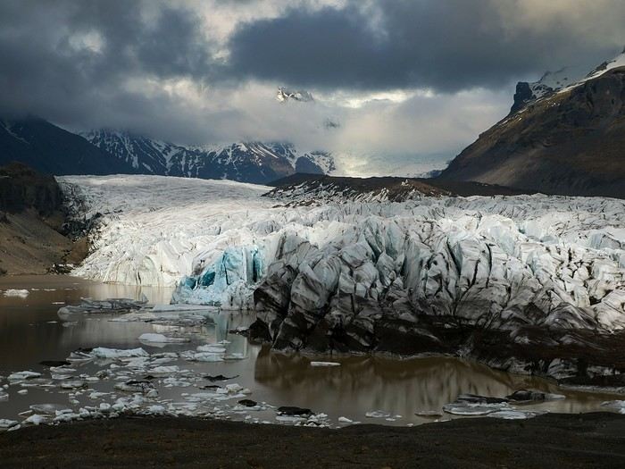
Bookings
Flight tickets bought directly from Fly Play’s website: 1520 € for the four of us (adult fare), with just two checked bags and one carry-on each. It was the compromise we found to keep costs down while still fitting all the bulky clothes we’d need. Late April isn’t quite winter anymore, but it’s not quite spring either, so we packed for chilly weather. Fly Play is Icelandair’s low-cost airline. No complaints: check-in was quick, service was efficient, and the flights were on time.
The car. Booked with Golden Circle car rental, a small family-run business with offices just 5 minutes from the airport. I’d read good things about them, and I can confirm everything went smoothly with our Dacia Duster—it wasn’t brand new, but it was reliable and spacious. We paid 463 € for the week, with full insurance included. The manager picked us up at the airport 10 minutes after I messaged him on WhatsApp to say we’d arrived. For the return trip, since our flight was super early and the agency wasn’t open yet, we agreed to leave the car in the airport parking lot and sent him a photo of the spot so he could find it. Super convenient! I read *so* many questions on Facebook groups about insurance: *Should I get the max coverage or not? I’ve got a Visa Premier, I’ve never had an accident, it adds 100 €...* Between sandstorms that can damage the bodywork and skidding off the road due to bad weather (we saw a few cars in ditches!), we decided to go for the rental company’s max insurance to be safe. It was also a requirement for leaving the car in the airport parking lot on our way back, since we couldn’t do the final inspection.
Accommodations were all booked on Booking.com and Hotels.com: - 2 nights in a cottage at Fossatun Country Hotel, near Borgarnes (we rented the sunset cottage—great spot, with a nice view and separate from the other lodgings) - 1 night in an apartment at Bakki Hostel and Apartments, in Eyrarbakki (top-notch) - 1 night in a gorgeous (and pricey!) apartment at Vik Apartments - 2 nights in a family room at Adventure Hof Hotel (perfect location) - 1 night at Blue Viking Studio near the airport (meh, but fine for a few hours’ sleep before an early flight) Total: 1234 €, averaging 176 € per night for 4-person accommodations.
The itinerary Day 1: Arrival around noon at the airport - Hraunfossar / Night at Fossatun Country Hotel Day 2: Snæfellsnes Peninsula / Night at Fossatun Country Hotel Day 3: Bruarfoss - Geysir - Gullfoss - Reykjadalur hot springs / Night in Eyrarbakki Day 4: Seljalandsfoss and Gljúfrafoss - DC-3 wreck (the one near Seljalandsfoss) - Skógafoss - Kvernufoss - Sólheimajökull (hike to the foot of the glacier) - Dyrhólaey - Reynisfjara Beach / Night in Vík Day 5: Fjaðrárgljúfur Canyon - Vatnajökull (3-hour hike to Svartifoss and Skaftafell) / Night in Hof Day 6: Múlagljúfur Canyon (2h45 hike) - Fjallsárlón - Jökulsárlón and Diamond Beach - Svínafellsjökull / Night in Hof Day 7: Drive back - Reykjavik - Sky Lagoon / Night in Keflavík Day 8: Flight back at 6 AM
That’s the practical side covered. I’ll leave you with a photo of our trusty steed.
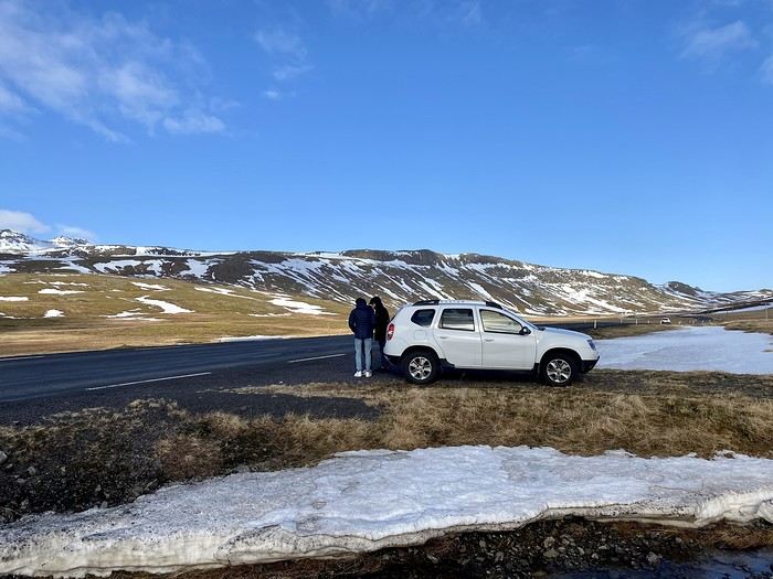
And what a joy to read the travel journals of those travel addicts who were quicker than their own shadow to share their discoveries. Their keyboards and mice must’ve been itching
I’ll admit I’m feeling a bit of that itch too, but I’m way too lazy to dive into the story of our latest trip—last summer in the northwest USA. I’ll probably get to it later, but it might take a while! So, I’m jumping into the short recap of our *way* too short trip to Iceland at the end of April 2024. And even though it’s not the done thing, I’m going to spoil it and start with the conclusion: it was *amazing*!!!
Back in February, on the eve of leaving for a few days’ holiday in Alsace, we started wondering what we could do for Easter break. Scotland and Iceland were the top contenders. The boys are growing up, but they still travel with us often, and they tipped the scales in favor of Iceland. Since we decided a bit late, before booking the flights, I took a quick look at available accommodations. There wasn’t much left, and some were at crazy prices, but I managed to line up a decent itinerary with places that seemed like good value for money. I read travel journals on VF and blogs I could find, picked up bits of info from Facebook groups, and the route quickly took shape—even if I struggled with the place names, mixing them up and forgetting them. The dream could begin...
Bookings
Flight tickets bought directly from Fly Play’s website: 1520 € for the four of us (adult fare), with just two checked bags and one carry-on each. It was the compromise we found to keep costs down while still fitting all the bulky clothes we’d need. Late April isn’t quite winter anymore, but it’s not quite spring either, so we packed for chilly weather. Fly Play is Icelandair’s low-cost airline. No complaints: check-in was quick, service was efficient, and the flights were on time.
The car. Booked with Golden Circle car rental, a small family-run business with offices just 5 minutes from the airport. I’d read good things about them, and I can confirm everything went smoothly with our Dacia Duster—it wasn’t brand new, but it was reliable and spacious. We paid 463 € for the week, with full insurance included. The manager picked us up at the airport 10 minutes after I messaged him on WhatsApp to say we’d arrived. For the return trip, since our flight was super early and the agency wasn’t open yet, we agreed to leave the car in the airport parking lot and sent him a photo of the spot so he could find it. Super convenient! I read *so* many questions on Facebook groups about insurance: *Should I get the max coverage or not? I’ve got a Visa Premier, I’ve never had an accident, it adds 100 €...* Between sandstorms that can damage the bodywork and skidding off the road due to bad weather (we saw a few cars in ditches!), we decided to go for the rental company’s max insurance to be safe. It was also a requirement for leaving the car in the airport parking lot on our way back, since we couldn’t do the final inspection.
Accommodations were all booked on Booking.com and Hotels.com: - 2 nights in a cottage at Fossatun Country Hotel, near Borgarnes (we rented the sunset cottage—great spot, with a nice view and separate from the other lodgings) - 1 night in an apartment at Bakki Hostel and Apartments, in Eyrarbakki (top-notch) - 1 night in a gorgeous (and pricey!) apartment at Vik Apartments - 2 nights in a family room at Adventure Hof Hotel (perfect location) - 1 night at Blue Viking Studio near the airport (meh, but fine for a few hours’ sleep before an early flight) Total: 1234 €, averaging 176 € per night for 4-person accommodations.
The itinerary Day 1: Arrival around noon at the airport - Hraunfossar / Night at Fossatun Country Hotel Day 2: Snæfellsnes Peninsula / Night at Fossatun Country Hotel Day 3: Bruarfoss - Geysir - Gullfoss - Reykjadalur hot springs / Night in Eyrarbakki Day 4: Seljalandsfoss and Gljúfrafoss - DC-3 wreck (the one near Seljalandsfoss) - Skógafoss - Kvernufoss - Sólheimajökull (hike to the foot of the glacier) - Dyrhólaey - Reynisfjara Beach / Night in Vík Day 5: Fjaðrárgljúfur Canyon - Vatnajökull (3-hour hike to Svartifoss and Skaftafell) / Night in Hof Day 6: Múlagljúfur Canyon (2h45 hike) - Fjallsárlón - Jökulsárlón and Diamond Beach - Svínafellsjökull / Night in Hof Day 7: Drive back - Reykjavik - Sky Lagoon / Night in Keflavík Day 8: Flight back at 6 AM
That’s the practical side covered. I’ll leave you with a photo of our trusty steed.
16 days in Peru in August 2023
Hi everyone,
The years go by and Machu Picchu has been on our "to-do list" for a few decades now...
But Peru is, fortunately, so much more than this legendary site...
We went as a couple for a 15-day trip. For the first time, we delegated the logistics to a local agency (Paprika in Arequipa). This agency offers "classic" small-group tours and the option to do it privately, which we chose.
No complaints—they were perfect for organizing transportation, hotels, and French-speaking guides.
The "classic" southern Peru loop is: Lima, Paracas, Nazca, Arequipa, Colca, Titicaca, Cusco, Sacred Valley, Cusco. Nothing very original... but why get creative when there’s already so much beauty to discover?
We opted for a shorter loop, skipping Paracas/Nazca because the small planes in Nazca weren’t a unanimous hit, and it saved us dozens of hours on the bus. But we added a stop at Palccoyo (the rainbow mountains) between Titicaca and Cusco.
It might seem like a shame, but we don’t regret it at all.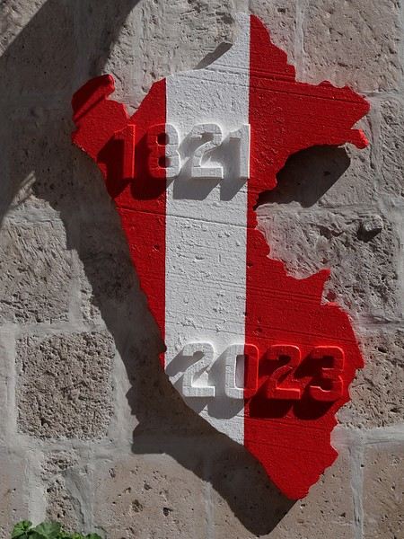
We went as a couple for a 15-day trip. For the first time, we delegated the logistics to a local agency (Paprika in Arequipa). This agency offers "classic" small-group tours and the option to do it privately, which we chose.
No complaints—they were perfect for organizing transportation, hotels, and French-speaking guides.
The "classic" southern Peru loop is: Lima, Paracas, Nazca, Arequipa, Colca, Titicaca, Cusco, Sacred Valley, Cusco. Nothing very original... but why get creative when there’s already so much beauty to discover?
We opted for a shorter loop, skipping Paracas/Nazca because the small planes in Nazca weren’t a unanimous hit, and it saved us dozens of hours on the bus. But we added a stop at Palccoyo (the rainbow mountains) between Titicaca and Cusco.
It might seem like a shame, but we don’t regret it at all.
4x4 Expeditions in Southern Africa
Hi there,
Here’s a quick summary of six trips across Southern Africa, covering South Africa, Namibia, Botswana, Zimbabwe, and more. I traveled for a total of 23 months, over 100,000 km, and crossed 9 countries from South Africa to Tanzania. To do this, I bought an old Land Cruiser—a 1989 BJ 75 with a long chassis and a 3.4L turbo engine—which I converted into a bush camper set up for self-sufficiency in Africa: dual fuel tanks (235 L total) plus 2 x 20-liter jerry cans of diesel, 2 spare tires, a compressor, a toolbox with repair gear, a 50-liter water tank plus 2 x 30-liter and 2 x 10-liter jerry cans, a roof tent, multiple storage boxes, a sturdy roof rack, and even a paramotor. I also packed a first-aid kit and shipped the camper to South Africa by freight. My son joined me for part of the journey.
Key countries and highlights: South Africa in every direction, including its wildlife parks; in Namibia, the classics like Etosha, Fish River, Sossusvlei, Kaudum, but especially Damaraland and Kaokoland; in Botswana, a full loop of the Okavango, crossing the Makgadikgadi Pan, Moremi Park, the Linyanti River; and a tour of Zimbabwe with its national parks. During the last trip in 2020, due to COVID, we found refuge on a 250 km² Namibian farm with its own wildlife reserve. While crossing Damaraland and Kaokoland, we were completely self-sufficient, with supplies for over a month and 130 L of water.
In South Africa and Namibia, one issue that surprised us was the fences stretching for millions of kilometers along the tracks. Namibia is one and a half times the size of France but has a population of only about 2.5 million, mostly concentrated in a dozen small towns of 10,000 to 50,000 people—except for the capital, Windhoek (296,000). Paradoxically, compared to France, the space for freedom is extremely limited. Everything is private and requires payment. Even the Namib Desert is fenced... and you need a permit just to pick up a rock! For someone used to wild camping, it can get frustrating. Sometimes we ignored the rules, but the best solution is to ask a farmer (a real one, like a sheep or cattle rancher—not the ones with 3-meter electrified fences, which are lodges or private reserves) if you can camp on their land.
To truly enjoy freedom in Namibia, you need to venture into the northwest, along the Skeleton Coast, in Damaraland and Kaokoland. However, it’s essential to know your vehicle inside out, be a good mechanic, bring spare parts, and plan for potential breakdowns. Take care of your ride because a major issue out there can be a matter of survival. My motto: "Don’t break down, don’t break down, don’t break down..." Safari pros only venture into this region with two 4x4s. In Messum Crater, we met a couple waiting for rescue (thanks to a satellite device from their rental company) after their driveshaft broke. Keep in mind that in these areas, you’ll cover about 80 km in 8 hours.
Here are some of the issues we faced: a broken rear suspension leaf, several broken bolts on the front leaf springs, the spare tire mount breaking multiple times (replaced on the spot), a cracked water radiator in 1998 causing overheating and a seized valve stem in its guide, plus a bent rocker arm (field repair, valve adjustment, damaged head gasket, daily radiator refills, and a scratched cylinder—engine fully rebuilt upon return). Five roof rack mounts broke and were repaired at a technical high school in South Africa. The battery mount also broke (fixed with a steel plate found on the trail). The fuel filter clogged several times (changed or cleaned on the spot). A huge impact on the windshield from a piece of coal falling from a power plant supply truck (temporary repair with Araldite). The brake master cylinder failed in Marienfluss (repaired, seals replaced in Tsumeb). Multiple flat tires from acacia thorns. The rear door latch broke (homemade aluminum rod repair in Franschhoek). The voltmeter and ammeter failed (repaired on the spot). During the freight trip, despite locking the doors and having a partition between the front and back, someone managed to get in through the small side window, forced open the locks on two accessible storage boxes, and stole my tools (replaced later). A ball joint on the paramotor frame came loose mid-flight, damaging the wing and propeller (propeller shipped from France, homemade repair).
Health issues on the way to Tanzania: a painful sciatica and many sleepless nights (cortisone injection in Dodoma).
Kaokoland, Namibia—the northwest region: https://youtu.be/DzGepFsrnZs
Damaraland: https://youtu.be/DITQj8NvLZ4
Botswana: https://youtu.be/TEvDG0S62hg
Kaudom and Mohembo Parks: https://youtu.be/wq_Yf7jNLhw
Here’s a quick summary of six trips across Southern Africa, covering South Africa, Namibia, Botswana, Zimbabwe, and more. I traveled for a total of 23 months, over 100,000 km, and crossed 9 countries from South Africa to Tanzania. To do this, I bought an old Land Cruiser—a 1989 BJ 75 with a long chassis and a 3.4L turbo engine—which I converted into a bush camper set up for self-sufficiency in Africa: dual fuel tanks (235 L total) plus 2 x 20-liter jerry cans of diesel, 2 spare tires, a compressor, a toolbox with repair gear, a 50-liter water tank plus 2 x 30-liter and 2 x 10-liter jerry cans, a roof tent, multiple storage boxes, a sturdy roof rack, and even a paramotor. I also packed a first-aid kit and shipped the camper to South Africa by freight. My son joined me for part of the journey.
Key countries and highlights: South Africa in every direction, including its wildlife parks; in Namibia, the classics like Etosha, Fish River, Sossusvlei, Kaudum, but especially Damaraland and Kaokoland; in Botswana, a full loop of the Okavango, crossing the Makgadikgadi Pan, Moremi Park, the Linyanti River; and a tour of Zimbabwe with its national parks. During the last trip in 2020, due to COVID, we found refuge on a 250 km² Namibian farm with its own wildlife reserve. While crossing Damaraland and Kaokoland, we were completely self-sufficient, with supplies for over a month and 130 L of water.
In South Africa and Namibia, one issue that surprised us was the fences stretching for millions of kilometers along the tracks. Namibia is one and a half times the size of France but has a population of only about 2.5 million, mostly concentrated in a dozen small towns of 10,000 to 50,000 people—except for the capital, Windhoek (296,000). Paradoxically, compared to France, the space for freedom is extremely limited. Everything is private and requires payment. Even the Namib Desert is fenced... and you need a permit just to pick up a rock! For someone used to wild camping, it can get frustrating. Sometimes we ignored the rules, but the best solution is to ask a farmer (a real one, like a sheep or cattle rancher—not the ones with 3-meter electrified fences, which are lodges or private reserves) if you can camp on their land.
To truly enjoy freedom in Namibia, you need to venture into the northwest, along the Skeleton Coast, in Damaraland and Kaokoland. However, it’s essential to know your vehicle inside out, be a good mechanic, bring spare parts, and plan for potential breakdowns. Take care of your ride because a major issue out there can be a matter of survival. My motto: "Don’t break down, don’t break down, don’t break down..." Safari pros only venture into this region with two 4x4s. In Messum Crater, we met a couple waiting for rescue (thanks to a satellite device from their rental company) after their driveshaft broke. Keep in mind that in these areas, you’ll cover about 80 km in 8 hours.
Here are some of the issues we faced: a broken rear suspension leaf, several broken bolts on the front leaf springs, the spare tire mount breaking multiple times (replaced on the spot), a cracked water radiator in 1998 causing overheating and a seized valve stem in its guide, plus a bent rocker arm (field repair, valve adjustment, damaged head gasket, daily radiator refills, and a scratched cylinder—engine fully rebuilt upon return). Five roof rack mounts broke and were repaired at a technical high school in South Africa. The battery mount also broke (fixed with a steel plate found on the trail). The fuel filter clogged several times (changed or cleaned on the spot). A huge impact on the windshield from a piece of coal falling from a power plant supply truck (temporary repair with Araldite). The brake master cylinder failed in Marienfluss (repaired, seals replaced in Tsumeb). Multiple flat tires from acacia thorns. The rear door latch broke (homemade aluminum rod repair in Franschhoek). The voltmeter and ammeter failed (repaired on the spot). During the freight trip, despite locking the doors and having a partition between the front and back, someone managed to get in through the small side window, forced open the locks on two accessible storage boxes, and stole my tools (replaced later). A ball joint on the paramotor frame came loose mid-flight, damaging the wing and propeller (propeller shipped from France, homemade repair).
Health issues on the way to Tanzania: a painful sciatica and many sleepless nights (cortisone injection in Dodoma).
Kaokoland, Namibia—the northwest region: https://youtu.be/DzGepFsrnZs
Damaraland: https://youtu.be/DITQj8NvLZ4
Botswana: https://youtu.be/TEvDG0S62hg
Kaudom and Mohembo Parks: https://youtu.be/wq_Yf7jNLhw
What level of fitness is needed for the short Inca Trail?
hi everyone, and so glad Voyage Forum is back up and running!
my partner and I, along with some friends, are planning a trip to Peru in May 2025.
I’ve got some questions about the Machu Picchu excursion.
we’re in our 60s and 70s, and while we’re pretty fit at European altitudes, I’m a bit worried about hiking above 2,500 m!
that’s why we didn’t hesitate to skip the 4-day Inca Trail trek.
but I’m wondering about the 2-day "short Inca Trail" offered by some agencies—basically one day of hiking with visits to a few sites, and the second day, the classic Machu Picchu visit.
has anyone done it? do you need to be in top shape?
thanks for your tips
How surprising this Sultanate of Oman is
Hey fellow travelers,
We’re a couple in our fifties who’ve been traveling independently for ages—mostly in Asia, a bit in Africa, very little in the Americas, and never ever in West Asia until November 2023, when we discovered the Sultanate of Oman.
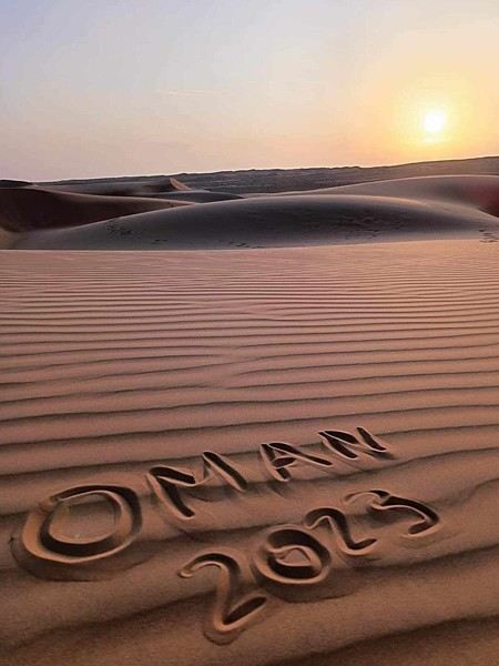
If we waited so long to explore this part of the world, it’s because a few questions were nagging at us, like: Can two Landais party lovers like us survive 15 days without apéro 😄? Or, more seriously: Can a feminist like me enjoy traveling in such a conservative country?
That is the question (and I feel your pain with this unbearable suspense 😅).
Ready to dive in?
PS: Apologies in advance for the casual tone of this travel journal—it’s the one I shared with our loved ones in real time, which explains everything.
We’re a couple in our fifties who’ve been traveling independently for ages—mostly in Asia, a bit in Africa, very little in the Americas, and never ever in West Asia until November 2023, when we discovered the Sultanate of Oman.
If we waited so long to explore this part of the world, it’s because a few questions were nagging at us, like: Can two Landais party lovers like us survive 15 days without apéro 😄? Or, more seriously: Can a feminist like me enjoy traveling in such a conservative country?
That is the question (and I feel your pain with this unbearable suspense 😅).
Ready to dive in?
PS: Apologies in advance for the casual tone of this travel journal—it’s the one I shared with our loved ones in real time, which explains everything.
Avis sur les itinéraires et hébergements en Namibie English translation pending
Bonjour à tous
Tout d'abord un grand merci aux personnes qui prennent le temps de répondre et de donner leurs conseils. Ce forum est une mine d'informations.
Nous projetons de partir en Namibie du 23 juin au 13 juillet 2021 (à confirmer en fonction des vols) avec nos deux filles qui auront 16 et 13 ans 1/2. L'idée est de le faire en 4*4 avec tentes sur le toit pour profiter au maximum des grands espaces et de couper un peu avec des lodges et guest farms. Je ne sais pas encore à quelle fréquence. Peut-être prendre un lodge quand le camping n'apporte pas de plus value pour profiter du cadre.
J'ai pris contact avec deux TO : Suntrail et Tourmaline qui m'ont envoyé chacun un 1er jet et j'aimerais avoir votre avis.
Suntrail :
Windhoek - Londiningi Guesthouse Mariental - Lapa Lange Game Lodge Sesriem - Sesriem Campsite * 2 Naukluft - Naukluft Camp Swakopmund - Brigadoon Guest House * 2 Spitzkoppe - Spitzkoppe Camp Brandberg - Brandberg White Lady Lodge Twyfelfontein - Mawani Mountain Camp Palwag - Palmwag Lodge * 2 Sesfontein - Khowarib Lodge Epupa Falls - Omarunga Camp * 2 Etosha - Olifantsrus Campsite Etosha - Okaukuejo Camp Etosha -Halali Camp Etosha - Namutoni Camp Waterberg Plateau - Waterberg Camp Windhoek
Tourmaline :
Windhoek - Londiningi B&B (le même que Suntrail je suppose) Mariental - Anib Lodge Naukluft - NWR Naukluft Sesriem - NWR Sesriem * 2 Swakopmund - Brigadoon Cottage * 2 Spitzkoppe - Spitzkoppe Camp Brandberg - Brandberg White Lady Lodge Twyfelfontein - Twyfelfontein lodge Palwag - Palmwag Lodge * 2 Sesfontein - Khowarib Lodge Kaokoland - khowareb Lodge Epupa Falls - Epupa Camp * 2 Kamanjab - Toko Lodge Etosha - NWR Okaukuejo Etosha -NWR Halali Etosha - NWR Namutoni Waterberg Plateau - NWR Waterberg Windhoek
Les itinéraires se ressemblent avec quelques petites différences. il faut déjà que je revois le combiné campsite / lodges car après réflexion je trouve que cela fait bcp de nuits en lodges, alors qu'on loue un 4*4 équipé camping. De plus, une moyenne gamme nous suffit, je n'ai pas encore regardé quelle gamme ils ont choisies. Il me semble avoir lu que sur juin / juillet on ne peut pas profiter des piscines.
Suntrail propose une nuit de plus à Etosha, quel est votre avis : 3 ou 4 nuits ?
C'est une première ébauche à affiner bien sûr mais quelques premiers avis sur les itinéraires et les hébergements que vous connaissez m'aideraient déjà beaucoup.
Merci à l'avance à ceux qui vont m'éclairer !
Tout d'abord un grand merci aux personnes qui prennent le temps de répondre et de donner leurs conseils. Ce forum est une mine d'informations.
Nous projetons de partir en Namibie du 23 juin au 13 juillet 2021 (à confirmer en fonction des vols) avec nos deux filles qui auront 16 et 13 ans 1/2. L'idée est de le faire en 4*4 avec tentes sur le toit pour profiter au maximum des grands espaces et de couper un peu avec des lodges et guest farms. Je ne sais pas encore à quelle fréquence. Peut-être prendre un lodge quand le camping n'apporte pas de plus value pour profiter du cadre.
J'ai pris contact avec deux TO : Suntrail et Tourmaline qui m'ont envoyé chacun un 1er jet et j'aimerais avoir votre avis.
Suntrail :
Windhoek - Londiningi Guesthouse Mariental - Lapa Lange Game Lodge Sesriem - Sesriem Campsite * 2 Naukluft - Naukluft Camp Swakopmund - Brigadoon Guest House * 2 Spitzkoppe - Spitzkoppe Camp Brandberg - Brandberg White Lady Lodge Twyfelfontein - Mawani Mountain Camp Palwag - Palmwag Lodge * 2 Sesfontein - Khowarib Lodge Epupa Falls - Omarunga Camp * 2 Etosha - Olifantsrus Campsite Etosha - Okaukuejo Camp Etosha -Halali Camp Etosha - Namutoni Camp Waterberg Plateau - Waterberg Camp Windhoek
Tourmaline :
Windhoek - Londiningi B&B (le même que Suntrail je suppose) Mariental - Anib Lodge Naukluft - NWR Naukluft Sesriem - NWR Sesriem * 2 Swakopmund - Brigadoon Cottage * 2 Spitzkoppe - Spitzkoppe Camp Brandberg - Brandberg White Lady Lodge Twyfelfontein - Twyfelfontein lodge Palwag - Palmwag Lodge * 2 Sesfontein - Khowarib Lodge Kaokoland - khowareb Lodge Epupa Falls - Epupa Camp * 2 Kamanjab - Toko Lodge Etosha - NWR Okaukuejo Etosha -NWR Halali Etosha - NWR Namutoni Waterberg Plateau - NWR Waterberg Windhoek
Les itinéraires se ressemblent avec quelques petites différences. il faut déjà que je revois le combiné campsite / lodges car après réflexion je trouve que cela fait bcp de nuits en lodges, alors qu'on loue un 4*4 équipé camping. De plus, une moyenne gamme nous suffit, je n'ai pas encore regardé quelle gamme ils ont choisies. Il me semble avoir lu que sur juin / juillet on ne peut pas profiter des piscines.
Suntrail propose une nuit de plus à Etosha, quel est votre avis : 3 ou 4 nuits ?
C'est une première ébauche à affiner bien sûr mais quelques premiers avis sur les itinéraires et les hébergements que vous connaissez m'aideraient déjà beaucoup.
Merci à l'avance à ceux qui vont m'éclairer !
Pourquoi se priver de voyage? English translation pending
En ces temps de confinement, contrairement à d'autres, j'ai pris la décision de partir en voyage demain pour 15 jours.
Voici mon circuit:
- 3 jours dans le couloir pour commencer
- 3 jours dans la chambre
- 2 jours dans la salle de bain
- 1 jour dans les WC
- 2 jours dans la cuisine
- 4 jours dans le salon pour terminer en beauté
Ça va être un dépaysement total garanti ! 😉
Faut bien plaisanter un peu, sinon on va devenir fou à rester enfermer chez-soi.
Faut bien plaisanter un peu, sinon on va devenir fou à rester enfermer chez-soi.
L'hiver au pays des merveilles (Maroc) English translation pending
Bonjour,
Je crains que le forum ne soit morose dans les mois à venir , alors pourquoi ne pas faire un nouveau carnet de voyage . J'ai eu la chance de rentrer du Maroc 2 jours avant la suspension des vols et me retrouve donc, comme vous sans doute , en mode confinement total, chez moi, en Basse-Bretagne , avec quelques centaines de photos de mon dernier séjour à sélectionner, recadrer, retravailler .... On s'occupe comme on peut, alors pourquoi ne pas en faire profiter les Forumeurs ?
Je suis resté au Maroc un mois et j'avais organisé un circuit de 10 nuits / 11 jours pour ma plus jeune fille ( 17 ans ) , mon épouse et la grand- mère, ma chère belle-mère, Mina . Ça correspond aux vacances de février en France .
J'avais donc prévu un voyage " simple" sur le papier, mais qui chaque jour et comme toujours allait nous réserver son lot de découvertes, d'émerveillements, de rencontres, de surprises ....
Au programme :
- Départ de Rabat - 2 nuits à Ouarzazate - 2 nuits à N'kob - 2 nuits à Foum Zguid, avec une longue journée 4X4 au plus profond du désert - 4 nuits à Icht / Borj Biramane et retour sur Rabat
Je vais donc essayer d'éviter des redites avec mes précédents carnets, mais le Maroc a tant de richesses à montrer.....
Rabat est une de mes balades urbaines préférées au Maroc . Je découvre toujours de nouveaux endroits, de jolis détails, des points de vue .... Je vais donc m'y balader avec toujours un plaisir renouvelé
Ma première surprise se passe en médina où je découvre avec étonnement que les autorités ont fait le ménage . Tout ce qui encombrait les rues ( déballages sauvages, marchands de tortues et autres lézards, empiétements sur les trottoirs, la rue , etc.... ) a disparu . Plus rien . Même les commerces " en dur " sont "rentrés dans leurs murs" : plus rien sur la voie publique, pas même une chaise.... Une première au Maroc ?
Si le résultat est plutôt agréable dans la rue des consuls ( rue de l'artisanat ) et la rue Souika ( commerces vestimentaires surtout ) , le boulevard Mohamed V, où régnaient les petits restaurants et gargotes , est désormais mort . Ils ont perdu la quasi-totalité de leur ancienne surface commerciale et ne peuvent plus accueillir que quelques clients à la fois . La rue est tuée et il ne me reste plus qu'à chercher un autre endroit où casser la croûte dans la ville . Ce qui est bénéfique dans une rue ( on peut enfin flâner tranquillement ) est catastrophique dans l'autre ( le commerce est mort et le charme est parti ) . A suivre ....
Bon. C'est comme çà . Ici, dans la rue Souika ( à l'heure de la prière ) . Il y a même des poubelles en plastique positionnées dans la rue !
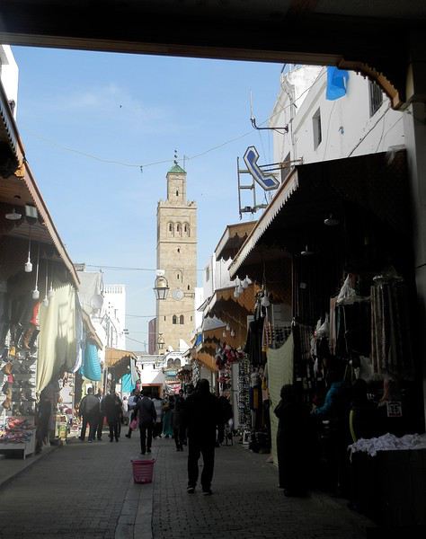
Une autre artère de la médina est la rue Sidi Fatah . Elle donne sur la rue Souika . Une magnifique mosquée y a été restaurée . Si j'en crois mon plan, il s'agit de la mosquée Moulay El Mekki . La porte principale est couverte et on trouve sur chacun des côtés 2 très belles portes ( 4 au total ) . Le minaret octogonal est remarquable . L'ensemble est complété par plusieurs marabout et un peu plus loin se trouve une importante zaouia . C'est vraiment très joli .
L'entrée principale est somptueuse . Le grand art de la peinture sur bois.
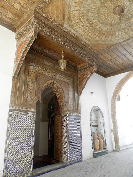
Quelques portes latérales
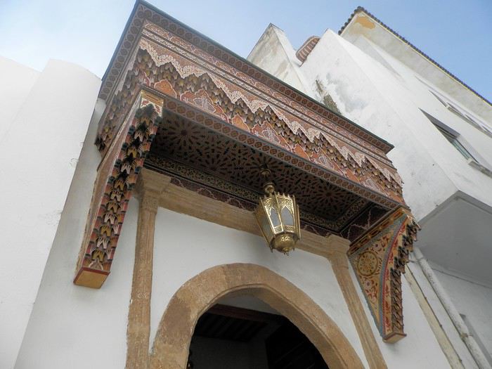
C'est vraiment très agréable de se balader sur la côte atlantique en cette saison ( mi-février ) . Il fait entre 18 et 22 degrés . Temps lumineux . Je n'aurai d'ailleurs pas de pluie pendant un mois ( après avoir eu de la pluie à peu près tous les jours les 5 derniers mois ) : que du bonheur donc ....
Le minaret octogonal
et la rue Sidi Fatah
La rénovation des monuments de la médina est presque terminée . La rue des consuls reprend vie, même si les nombreux fondouks de cette rue sont toujours en travaux . J'ai hâte de les revoir . Je déambule dans les ruelles tranquilles , toujours à l’affût de ces détails qui en font le charme .
Une belle oeuvre de street-art accroche mon œil ....
et cette fenêtre a un charme fou .
Cette fois , mes pas me portent vers les quais ( on pourrait presque dire le port ) de Rabat . Je quitte la médina par un jolie porte : l'ensemble , également restauré, est charmant . J'arrive directement sur l'Oued Bou Regreg .
Au cœur de la capitale subsiste un coin " pêche " . Un petit navire est devenu un restaurant-Lounge , plutôt luxueux ( menu à 790 dirhams pour 2 en cette Saint Valentin ) .
Rabat se donne des airs de petite Essaouira avec ses mouettes, ses bateaux, sa médina au fond, ses filets de pêche .... Le même site à l'horizontale .
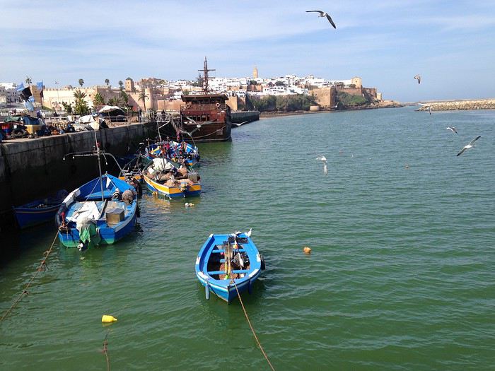
Au fond, Les Oudayas
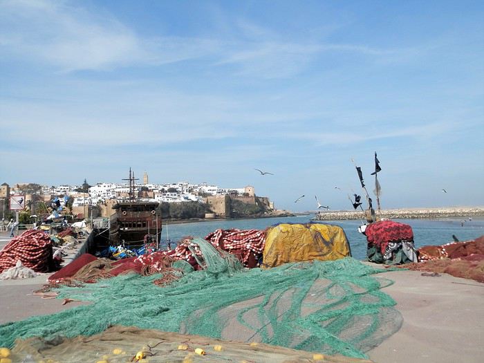
Un " pêche promenade ", me passe sous le nez . C'est mignon . On a envie de le faire la prochaine fois . Il y avait une activité de passeurs entre Rabat et Salé . Mais avec les ponts, le tramway, ..... Certains se sont adaptés , même si çà se fait toujours, plutôt en été ( la plage de Salé est toute proche ) .
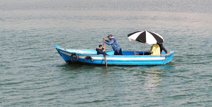
Quelques barques rentrent , les unes après les autres et s'amarrent au ponton, côté Salé . Surement les lointains descendants des redoutables corsaires de Salé . Leur univers a été " explosé" ces dernières années avec l'immense projet d'aménagement de l'oued Bou Regreg . Il leur reste un petit ponton , ..... et juste après, on a construit une grande marina pour accueillir les nouveaux jouets de l'aristocratie locale .
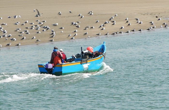
et une autre
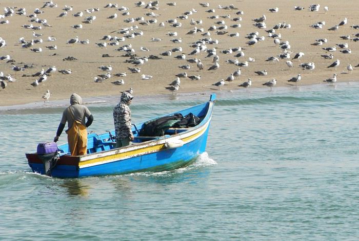
Tout ceci fait un curieux mélange entre une architecture ancestrale et la plus grande modernité ....
Ci-après, à gauche, le médina sur sa falaise, au fond le toit blanc du nouveau " Grand Théâtre de Rabat ), à côté duquel commence à sortir la future tour Mohamed VI qui sera la plus haute d' Afrique , et à droite la marina côté Salé .
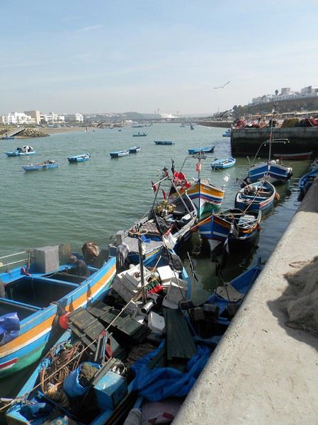
Mais la Kasbah veille toujours sur la capitale
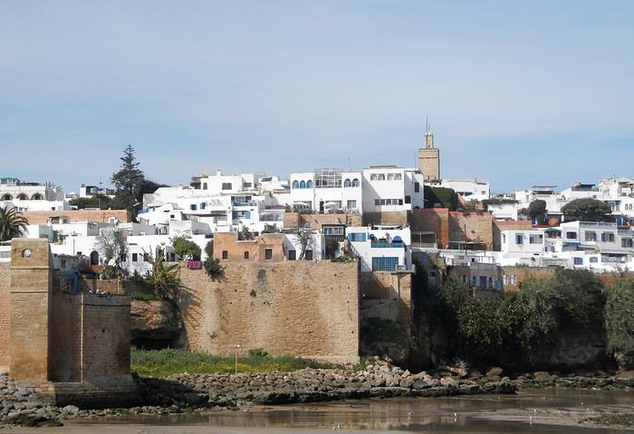
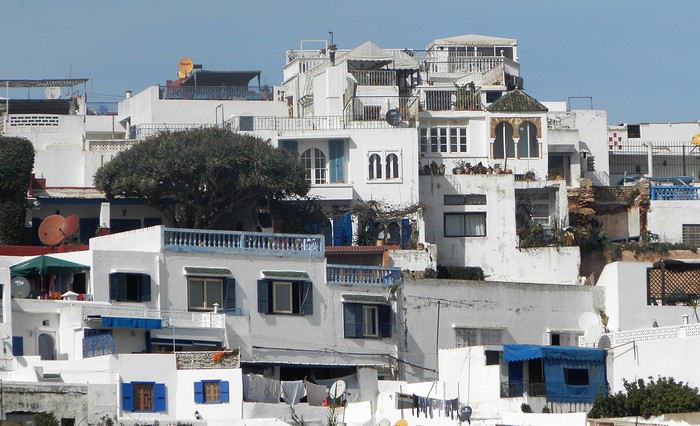
Un dernier regard ...
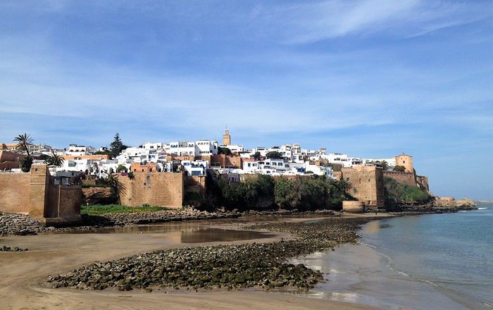
Voila pour ce nouveau coup de projecteur sur la capitale . Faites le détour et surprenez- vous
Demain, j'enfourche ma bonne Dacia Sandero et nous partons à l'assaut de l'Atlas .
Je crains que le forum ne soit morose dans les mois à venir , alors pourquoi ne pas faire un nouveau carnet de voyage . J'ai eu la chance de rentrer du Maroc 2 jours avant la suspension des vols et me retrouve donc, comme vous sans doute , en mode confinement total, chez moi, en Basse-Bretagne , avec quelques centaines de photos de mon dernier séjour à sélectionner, recadrer, retravailler .... On s'occupe comme on peut, alors pourquoi ne pas en faire profiter les Forumeurs ?
Je suis resté au Maroc un mois et j'avais organisé un circuit de 10 nuits / 11 jours pour ma plus jeune fille ( 17 ans ) , mon épouse et la grand- mère, ma chère belle-mère, Mina . Ça correspond aux vacances de février en France .
J'avais donc prévu un voyage " simple" sur le papier, mais qui chaque jour et comme toujours allait nous réserver son lot de découvertes, d'émerveillements, de rencontres, de surprises ....
Au programme :
- Départ de Rabat - 2 nuits à Ouarzazate - 2 nuits à N'kob - 2 nuits à Foum Zguid, avec une longue journée 4X4 au plus profond du désert - 4 nuits à Icht / Borj Biramane et retour sur Rabat
Je vais donc essayer d'éviter des redites avec mes précédents carnets, mais le Maroc a tant de richesses à montrer.....
Rabat est une de mes balades urbaines préférées au Maroc . Je découvre toujours de nouveaux endroits, de jolis détails, des points de vue .... Je vais donc m'y balader avec toujours un plaisir renouvelé
Ma première surprise se passe en médina où je découvre avec étonnement que les autorités ont fait le ménage . Tout ce qui encombrait les rues ( déballages sauvages, marchands de tortues et autres lézards, empiétements sur les trottoirs, la rue , etc.... ) a disparu . Plus rien . Même les commerces " en dur " sont "rentrés dans leurs murs" : plus rien sur la voie publique, pas même une chaise.... Une première au Maroc ?
Si le résultat est plutôt agréable dans la rue des consuls ( rue de l'artisanat ) et la rue Souika ( commerces vestimentaires surtout ) , le boulevard Mohamed V, où régnaient les petits restaurants et gargotes , est désormais mort . Ils ont perdu la quasi-totalité de leur ancienne surface commerciale et ne peuvent plus accueillir que quelques clients à la fois . La rue est tuée et il ne me reste plus qu'à chercher un autre endroit où casser la croûte dans la ville . Ce qui est bénéfique dans une rue ( on peut enfin flâner tranquillement ) est catastrophique dans l'autre ( le commerce est mort et le charme est parti ) . A suivre ....
Bon. C'est comme çà . Ici, dans la rue Souika ( à l'heure de la prière ) . Il y a même des poubelles en plastique positionnées dans la rue !
Une autre artère de la médina est la rue Sidi Fatah . Elle donne sur la rue Souika . Une magnifique mosquée y a été restaurée . Si j'en crois mon plan, il s'agit de la mosquée Moulay El Mekki . La porte principale est couverte et on trouve sur chacun des côtés 2 très belles portes ( 4 au total ) . Le minaret octogonal est remarquable . L'ensemble est complété par plusieurs marabout et un peu plus loin se trouve une importante zaouia . C'est vraiment très joli .
L'entrée principale est somptueuse . Le grand art de la peinture sur bois.
Quelques portes latérales
C'est vraiment très agréable de se balader sur la côte atlantique en cette saison ( mi-février ) . Il fait entre 18 et 22 degrés . Temps lumineux . Je n'aurai d'ailleurs pas de pluie pendant un mois ( après avoir eu de la pluie à peu près tous les jours les 5 derniers mois ) : que du bonheur donc ....
Le minaret octogonal
et la rue Sidi Fatah
La rénovation des monuments de la médina est presque terminée . La rue des consuls reprend vie, même si les nombreux fondouks de cette rue sont toujours en travaux . J'ai hâte de les revoir . Je déambule dans les ruelles tranquilles , toujours à l’affût de ces détails qui en font le charme .
Une belle oeuvre de street-art accroche mon œil ....
et cette fenêtre a un charme fou .
Cette fois , mes pas me portent vers les quais ( on pourrait presque dire le port ) de Rabat . Je quitte la médina par un jolie porte : l'ensemble , également restauré, est charmant . J'arrive directement sur l'Oued Bou Regreg .
Au cœur de la capitale subsiste un coin " pêche " . Un petit navire est devenu un restaurant-Lounge , plutôt luxueux ( menu à 790 dirhams pour 2 en cette Saint Valentin ) .
Rabat se donne des airs de petite Essaouira avec ses mouettes, ses bateaux, sa médina au fond, ses filets de pêche .... Le même site à l'horizontale .
Au fond, Les Oudayas
Un " pêche promenade ", me passe sous le nez . C'est mignon . On a envie de le faire la prochaine fois . Il y avait une activité de passeurs entre Rabat et Salé . Mais avec les ponts, le tramway, ..... Certains se sont adaptés , même si çà se fait toujours, plutôt en été ( la plage de Salé est toute proche ) .
Quelques barques rentrent , les unes après les autres et s'amarrent au ponton, côté Salé . Surement les lointains descendants des redoutables corsaires de Salé . Leur univers a été " explosé" ces dernières années avec l'immense projet d'aménagement de l'oued Bou Regreg . Il leur reste un petit ponton , ..... et juste après, on a construit une grande marina pour accueillir les nouveaux jouets de l'aristocratie locale .
et une autre
Tout ceci fait un curieux mélange entre une architecture ancestrale et la plus grande modernité ....
Ci-après, à gauche, le médina sur sa falaise, au fond le toit blanc du nouveau " Grand Théâtre de Rabat ), à côté duquel commence à sortir la future tour Mohamed VI qui sera la plus haute d' Afrique , et à droite la marina côté Salé .
Mais la Kasbah veille toujours sur la capitale
Un dernier regard ...
Voila pour ce nouveau coup de projecteur sur la capitale . Faites le détour et surprenez- vous
Demain, j'enfourche ma bonne Dacia Sandero et nous partons à l'assaut de l'Atlas .
Road trip Canada et USA pour 15 jours de parcs nationaux English translation pending
Bonjour à toutes et à tous,
Nous sommes quatre trentenaires, amoureux de la nature et des Etats-Unis, qui avons décidés de réaliser un road trip de 15 jours en parcourant les parcs nationaux américains et canadiens.
Je souhaiterai partager le programme que nous avons en tête avec l'ensemble des membres du forum, et le modifier en fonction de vos commentaires/avis sur celui-ci.
Petite précision : nous partirons du 12 au 26 Septembre 2020, et nos billets d'avion pour les vols internationaux ont fraichement été réservés (nous avons bénéficié d'une jolie promo, youhou ! 😛).
Voici le programme :
J1 [12/09/2020] Vol CDG - Calgary : arrivée à Calgary prévue à 17h55. Nuit sur place.
J2 [13/09/2020] Calgary => Banff NP : balade dans Calgary le matin, puis route jusqu'à Banff NP l'après-midi.
J3 [14/09/2020] Banff NP : journée de randonnée dans le parc.
J4 [15/09/2020] Banff NP => Jasper NP : route vers Jasper NP dans l'après-midi.
J5 [16/09/2020] Jasper NP : journée de randonnée dans le parc.
J6 [17/09/2020] Jasper NP => Edmonton : route vers l'aéroport d'Edmonton pour y prendre un vol jusqu'à Kalispell (USA). Nous souhaitons prendre un vol Canada => USA afin de résoudre la problématique liée à la voiture de location entre ces deux pays. Nuit près de Glacier NP.
J7 [18/09/2020] Glacier NP : randonnée dans le parc.
J8 [19/09/2020] Glacier NP => Yellowstone NP (entrée Nord). Nuit à Gardiner ou dans le secteur nord du parc. Question : des choses sympa à faire sur cette portion ?
J9 [20/09/2020] Yellowstone NP. Question : quel itinéraire conseilleriez-vous pour 3 jours dans le parc de Yellowstone avec une sortie le troisième jour par le sud ?
J10 [21/09/2020] Yellowstone NP.
J11 [22/09/2020] Yellowstone NP, puis route vers Grand Teton NP en fin de journée. Nuit près de Grand Teton NP.
J12 [23/09/2020] Grand Teton NP : randonnée dans le parc.
J13 [24/09/2020] Grand Teton NP => Rapid City. Question : des choses sympa à faire sur cette longue portion de route ?
J14 [25/09/2020] Mont Rushmore + Custer State Park ou Badland NP.
J15 [26/09/2020] Vol Rapid City => CDG.
Qu'en pensez-vous ? C'est un premier jet et je suis persuadé que des améliorations pourront être effectués suite à vos précieux conseils...
Des hébergements sont-ils à réserver en urgence ? Ou sont-ils incoutournables ?
Je vous remercie par avance pour vos retours & vous souhaite une excellente journée,
Bien à vous,
PA
Nous sommes quatre trentenaires, amoureux de la nature et des Etats-Unis, qui avons décidés de réaliser un road trip de 15 jours en parcourant les parcs nationaux américains et canadiens.
Je souhaiterai partager le programme que nous avons en tête avec l'ensemble des membres du forum, et le modifier en fonction de vos commentaires/avis sur celui-ci.
Petite précision : nous partirons du 12 au 26 Septembre 2020, et nos billets d'avion pour les vols internationaux ont fraichement été réservés (nous avons bénéficié d'une jolie promo, youhou ! 😛).
Voici le programme :
J1 [12/09/2020] Vol CDG - Calgary : arrivée à Calgary prévue à 17h55. Nuit sur place.
J2 [13/09/2020] Calgary => Banff NP : balade dans Calgary le matin, puis route jusqu'à Banff NP l'après-midi.
J3 [14/09/2020] Banff NP : journée de randonnée dans le parc.
J4 [15/09/2020] Banff NP => Jasper NP : route vers Jasper NP dans l'après-midi.
J5 [16/09/2020] Jasper NP : journée de randonnée dans le parc.
J6 [17/09/2020] Jasper NP => Edmonton : route vers l'aéroport d'Edmonton pour y prendre un vol jusqu'à Kalispell (USA). Nous souhaitons prendre un vol Canada => USA afin de résoudre la problématique liée à la voiture de location entre ces deux pays. Nuit près de Glacier NP.
J7 [18/09/2020] Glacier NP : randonnée dans le parc.
J8 [19/09/2020] Glacier NP => Yellowstone NP (entrée Nord). Nuit à Gardiner ou dans le secteur nord du parc. Question : des choses sympa à faire sur cette portion ?
J9 [20/09/2020] Yellowstone NP. Question : quel itinéraire conseilleriez-vous pour 3 jours dans le parc de Yellowstone avec une sortie le troisième jour par le sud ?
J10 [21/09/2020] Yellowstone NP.
J11 [22/09/2020] Yellowstone NP, puis route vers Grand Teton NP en fin de journée. Nuit près de Grand Teton NP.
J12 [23/09/2020] Grand Teton NP : randonnée dans le parc.
J13 [24/09/2020] Grand Teton NP => Rapid City. Question : des choses sympa à faire sur cette longue portion de route ?
J14 [25/09/2020] Mont Rushmore + Custer State Park ou Badland NP.
J15 [26/09/2020] Vol Rapid City => CDG.
Qu'en pensez-vous ? C'est un premier jet et je suis persuadé que des améliorations pourront être effectués suite à vos précieux conseils...
Des hébergements sont-ils à réserver en urgence ? Ou sont-ils incoutournables ?
Je vous remercie par avance pour vos retours & vous souhaite une excellente journée,
Bien à vous,
PA
Voyage dans l'Ouest américain en juin (Los Angeles, San Francisco, Las Vegas) English translation pending
Bonjour !!
Notre boss vient juste de nous valider nos congés d'été du 4 juin au 25 juin . Nous aimerions partir dans l'Ouest mais n'est pas trop tard ? Il est souvent conseillé de réserver 1 an à l'avance surtout pour juillet-aout donc je me dis que pour début juin ca peut encore le faire ? Nous ferions surtout de la ville LA-SF et LV, on aimerait voir au moins un parc ..Lequel ? Pensez vous que c'est encore jouable à cette période ? Autre question, meme s'il y a des posts là dessus , quelle carte de crédit prendre pour une bonne couverture maladie /accident, je n'ai à ce jour qu'une visa classic de la BP, je vais relire mon contrat pour voir quel plafond j'ai , mais je pense que c'est bien insuffisant, je fais appel à vos expériences par rapport à çà .. J'ai l'impression que bcp de personnes qui partent aux USA pour 1 semaine à NY par exemple ne prennent pas d'assurance particulière ou je me trompe , bref, je n'ai pas assez d'expérience des voyages pour ça .. Merci pour vos retour, Karine
Notre boss vient juste de nous valider nos congés d'été du 4 juin au 25 juin . Nous aimerions partir dans l'Ouest mais n'est pas trop tard ? Il est souvent conseillé de réserver 1 an à l'avance surtout pour juillet-aout donc je me dis que pour début juin ca peut encore le faire ? Nous ferions surtout de la ville LA-SF et LV, on aimerait voir au moins un parc ..Lequel ? Pensez vous que c'est encore jouable à cette période ? Autre question, meme s'il y a des posts là dessus , quelle carte de crédit prendre pour une bonne couverture maladie /accident, je n'ai à ce jour qu'une visa classic de la BP, je vais relire mon contrat pour voir quel plafond j'ai , mais je pense que c'est bien insuffisant, je fais appel à vos expériences par rapport à çà .. J'ai l'impression que bcp de personnes qui partent aux USA pour 1 semaine à NY par exemple ne prennent pas d'assurance particulière ou je me trompe , bref, je n'ai pas assez d'expérience des voyages pour ça .. Merci pour vos retour, Karine
Itinéraire de onze jours en voiture dans l'Ouest américain English translation pending
Bonjour la communauté,
Je viens solliciter votre aide et vos précieux conseils pour une idée de road trip dans l'Ouest Américain prévu en avril 2020. Une chose est figé actuellement le VOL: => On arrive à LA et repart de SF. En tout, nous restons 11 jours sur place grosso modo.
Notre séjour est certes court mais avons d'une part l'habitude et d'autre part, nous y reviendrons. Nous partons en avril et ma femme est enseignante (déjà dit sur d'autre topic), d'ou le créneau disponible de 15 jours lié aux vacances scolaires.
Du coup, nous avons décidé de faire court à LA. Nous ne sommes pas intéressés plus que ça et nous pensons ainsi faire le premier après-midi sur LA puis une partie de la matinée avant de partir sur la route 66 vers le GC.
Autre concession, Yosémite et Death Valley. Ce sont évidemment des incontournables, mais au vu de la distance entre LV et San Francisco, il nous semble préférable de s'attarder (par exemple) une demi-journée suppl à Bryce ou Zion et ensuite depuis LV, prendre un vol direction SF. Nous avons vu des vols abordable avec SouthWest qui partent tôt et en moins de 2heures, on a rejoint San Fr. La route dans Yosemite et Death Valley est pour le coup très longue si j'ai bien compris surtout si c'est pour visiter ces 2 régions en 2 jours. Nous remettons ces sites pour notre prochaine venue (sniff, faut savoir faire des concessions dans la vie héhé).
Nous rendrons la voiture de location à l'aéroport de LAS Vegas (on la récupère dès le premier jour à LA). Qu'en pensez-vous ?
A San Francisco, nous avons noté que la voiture n'est une obligation pour visiter (contrairement à LA). Nous y passerons les 2 derniers jours avant de reprendre notre vol le samedi en fin d'après-midi pour Londres.
Ci-dessous le résumé
JOUR x MATIN--APRES-MIDI
DAY 1 - VOL -- LOS ANGELES DAY 2 - LOS ANGELES -- ROUTE 66 DAY 3 - ROUTE 66 -- GRAND CANYON DAY 4 - GRAND CANYON -- MONUMENT VALLEY DAY 5 - MONUMENT VALLEY -- ANTELOPE CANYON DAY 6 - ANTELOPE CANYON -- HORSEHOE BEND DAY 7 - BRYCE CANYON -- BRYCE CANYON DAY 8 - ZION -- ZION DAY 9 - VALLEY OF FIRE-- LAS VEGAS DAY 10 - VOL LV->SF -- SAN FRANCISCO DAY 11 - SAN FRANCISCO -- SAN FRANCISCO DAY 12 - SAN FRANCISCO -- VOL
En jour 3, possible qu'on passe l'après midi au GC et le soir qu'on reste sur Flagstaff pour dormir (à moindre coût qu'au Grand Canyon où c'est hors de prix). Et le matin du DAY4, on reste sur Flagstaff avant de partir vers MV. Bref, ce sont des ajustement que je n'ai pas indiqués sur l'itinéraire ci-dessus à ce stade. Je m'occuperai des détails dans un second temps, une fois que cet itinéraire semble ... okay.
Je suis preneur de vos conseils et avis. Merci d'avance pour vos retours.
Ne soyez pas surpris si vous avez déjà vu mon planning récemment sur un autre forum (j'ai aussi demandé conseils sur un autre forum de voyage).
Je viens solliciter votre aide et vos précieux conseils pour une idée de road trip dans l'Ouest Américain prévu en avril 2020. Une chose est figé actuellement le VOL: => On arrive à LA et repart de SF. En tout, nous restons 11 jours sur place grosso modo.
Notre séjour est certes court mais avons d'une part l'habitude et d'autre part, nous y reviendrons. Nous partons en avril et ma femme est enseignante (déjà dit sur d'autre topic), d'ou le créneau disponible de 15 jours lié aux vacances scolaires.
Du coup, nous avons décidé de faire court à LA. Nous ne sommes pas intéressés plus que ça et nous pensons ainsi faire le premier après-midi sur LA puis une partie de la matinée avant de partir sur la route 66 vers le GC.
Autre concession, Yosémite et Death Valley. Ce sont évidemment des incontournables, mais au vu de la distance entre LV et San Francisco, il nous semble préférable de s'attarder (par exemple) une demi-journée suppl à Bryce ou Zion et ensuite depuis LV, prendre un vol direction SF. Nous avons vu des vols abordable avec SouthWest qui partent tôt et en moins de 2heures, on a rejoint San Fr. La route dans Yosemite et Death Valley est pour le coup très longue si j'ai bien compris surtout si c'est pour visiter ces 2 régions en 2 jours. Nous remettons ces sites pour notre prochaine venue (sniff, faut savoir faire des concessions dans la vie héhé).
Nous rendrons la voiture de location à l'aéroport de LAS Vegas (on la récupère dès le premier jour à LA). Qu'en pensez-vous ?
A San Francisco, nous avons noté que la voiture n'est une obligation pour visiter (contrairement à LA). Nous y passerons les 2 derniers jours avant de reprendre notre vol le samedi en fin d'après-midi pour Londres.
Ci-dessous le résumé
JOUR x MATIN--APRES-MIDI
DAY 1 - VOL -- LOS ANGELES DAY 2 - LOS ANGELES -- ROUTE 66 DAY 3 - ROUTE 66 -- GRAND CANYON DAY 4 - GRAND CANYON -- MONUMENT VALLEY DAY 5 - MONUMENT VALLEY -- ANTELOPE CANYON DAY 6 - ANTELOPE CANYON -- HORSEHOE BEND DAY 7 - BRYCE CANYON -- BRYCE CANYON DAY 8 - ZION -- ZION DAY 9 - VALLEY OF FIRE-- LAS VEGAS DAY 10 - VOL LV->SF -- SAN FRANCISCO DAY 11 - SAN FRANCISCO -- SAN FRANCISCO DAY 12 - SAN FRANCISCO -- VOL
En jour 3, possible qu'on passe l'après midi au GC et le soir qu'on reste sur Flagstaff pour dormir (à moindre coût qu'au Grand Canyon où c'est hors de prix). Et le matin du DAY4, on reste sur Flagstaff avant de partir vers MV. Bref, ce sont des ajustement que je n'ai pas indiqués sur l'itinéraire ci-dessus à ce stade. Je m'occuperai des détails dans un second temps, une fois que cet itinéraire semble ... okay.
Je suis preneur de vos conseils et avis. Merci d'avance pour vos retours.
Ne soyez pas surpris si vous avez déjà vu mon planning récemment sur un autre forum (j'ai aussi demandé conseils sur un autre forum de voyage).
Quand réserver les hôtels pour le Yellowstone English translation pending
Bonjour
On envisage de faire le Yellow stone mais il me semble qu'il faut réserver les hôtels du parc longtemps à l'avance des précisions? les prix?
Combien de jours faut-il raisonnablement 2 nuits à l'extérieur 2ou3 nuits à l'intérieur?
L'aéroport le plus intéressant?
Bien sur ce ne sera pas pour 2020 mais juin 2021
D'avance Merci pour vos Réponses
USA nous voilà! English translation pending
Bonjour à tous,
C’ est avec beaucoup de nostalgie que j’entame ce carnet de voyage de l’Ouest des Etats-Unis. Tout d’abord, merci à tous ceux qui nous ont permis, grâce à leurs récits, de réaliser le parcours de notre road trip.
C’est à notre tour de partager notre expérience en espérant qu’elle puisse servir à d’autres voyageurs.
Nous sommes un couple de trentenaires (Choue et Chou) sans enfant, qui adore voyager. Nous sommes déjà allés au Maroc, au Canada, en Italie, en Suisse, en Autriche, en Slovénie, au Mexique et en Thaïlande. Je connaissais les Etats-Unis pour y avoir passé 3 mois près de Las Vegas en tant que fille au pair et Chou avait déjà fait un road trip comprenant les principales grandes villes. Y retourner ensemble et visiter les grands parcs de l’Ouest Américain a donc été le rêve que l’on s’est offert pour notre voyage de noces.
Même si nous avons toujours un petit côté aventurier, nous avons appris plusieurs choses de nos précédents voyages :
- On aime un minimum de confort ) = pas de campings ou d’auberge de jeunesse. - On aime voir beaucoup de choses quitte parfois à privilégier l’essentiel mais on ne veut plus en faire « trop », enchainer les heures de routes non-stop, accumuler trop de fatigue, se lever à 5h du mat’ pour prendre un vol interne, etc… - On doit faire attention à notre budget, pour des raisons professionnelles nous sommes obligés de partir pendant les vacances scolaires et ce n’est pas ce qu’il y a de plus économique. Il faut donc s’y prendre un maximum à l’avance pour avoir les meilleurs prix.
J’ai toujours aimé organiser nos voyages mais je deviens de plus en plus méticuleuse, je laisse de moins en moins de place à l’improvisation, certains détesteraient ça, mais il y a beaucoup d’avantages : on voyage l’esprit tranquille, on ne perd pas de temps à faire des recherches sur places, on ne se dispute (presque) pas. L’inconvénient et si vous me lisez, vous vous en êtes déjà rendu compte, cela prend ENORMEMENT de temps, c’est pourquoi j’espère que vous pourrez trouver quelques informations utiles en me lisant.
Les billets d’avion : Pour l’achat des billets, je m’y suis pris en février pour faire un cadeau de saint Valentin à Chou avec un vol direct à 750€/personne depuis Paris pour San Fransisco avec XL Airways (ce sera le dernier vol avec cette compagnie malheureusement…). Il y avait légèrement moins cher mais plus long et avec escale, je vous ai dit, on s’est habitué à un certain confort…
Le véhicule : je savais qu’un SUV était fortement recommandé (et on ne le démentira pas !!!). Nous avons trouvé le meilleur tarif chez Hertz depuis l’agence sur Almany Boulevard à San Francisco. Nous n’avions pas besoin de la voiture pour les deux premiers jours et c’est moins cher que depuis l’aéroport. Nous ne prenons pas d’assurance complémentaire car elle est déjà comprise dans notre carte bancaire Visa Premier débit. Pour ce qui est du GPS, on jongle avec nos téléphones (forfait free 25go de data à l’étranger et une tablette sur laquelle on a l’appli TomTom avec les cartes de l’Amérique du Nord pour les zones sans réseau). La réservation nous a finalement coûté 592€ pour 20 jours.
Le parcours : environ 6 000 kilomètres… (pour moins de 400€ d’essence, c’est un budget mais cela reste 2 fois moins cher qu’en France). Chou s’est « amusé » à retracer notre itinéraire, je mets le lien pour y accéder mais attention ce n’est qu’une reconstitution il y a des endroits où nous n’avons pas pris exactement la même route… https://www.calculitineraires.fr/index.php?id=957526#map
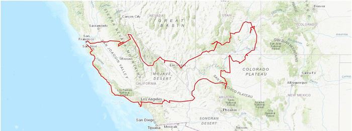
Le programme et les coûts pour la ou les nuits :
Nous partirons du 13 juillet au 04 août soit 22 jours sur place. Une fois le programme bien établi, j’ai réservé les nuitées avec Booking et Airbnb pour un montant moyen de 90€ la nuit.
13 et 14/07 : San Fransisco à l’hôtel Epik pour 236€ 15/07 : Tracy dans un airbnb pour 40€ 16/07 : Mariposa dans un airbnb pour 58€ 17/07 : Strelkovoye au Big Meadow Lodge pour 88€ 18/07 : Amargosa Valley au Longstreet Inn Casino pour 72€ 19/07 : Las Vegas au Royal Resort pour 70€ 20 et 21/07 : Alton dans un airbnb pour 109€ 22 et 23/07 : Moab au Inca inn Motel pour 243€ 24/07 : Monument Valley au Gouldings Lodge pour 192€ 25/07 : Page dans un airbnb pour 85€ 26 et 27/07 : Flagstaff dans un airbnb pour 159€ 28/07 : Lake Havasu City au Days Inn by Wyndham pour 58€ 29, 30 et 31/07 : Los Angeles au Friendship Motor Inn pour 286€ 01/08 : Grover Beach dans un airbnb pour 71€ 02/08 : Boulder Creek dans un airbnb pour 75€
Pour les hôtels, j’ai sélectionné les plus accessibles niveaux tarifs sans faire trop de concession sur le confort, c’est-à-dire le plus souvent en dehors des parcs nationaux et de préférence sans les petits déjeuners étant en général toujours déçus de leur déjeuner « continental industriel et chimique » d’autant plus que nous ne mangeons pas beaucoup le matin, nous avons acheté des petits gâteaux et des jus de fruits et ce fut suffisant.
Pour ce qui est des repas, comme je vous l’ai dit, j’ai été très méticuleuse, notre roadbook comprenais quasiment tous les endroits où manger, où acheter les sandwichs et où prendre l’essence. Dans d’aussi grands espaces, il vaut mieux prévoir à l’avance que de laisser place à l’improvisation car souvent on se rabat sur le premier « resto » ou fast food que l’on voit faute de temps et d’énergie (ce qui nous est tout de même arrivé une ou deux fois). En tout cas nous n’avons rien regretté et avons pu manger varié et un minimum équilibré sans exploser le budget et sans avoir la contrainte de cuisiner sur place. Après chacun sa façon de voyager )
Le départ : notre aventure démarre le vendredi 12 juillet avec une étape de 4h de route afin de rejoindre l’hôtel B&B près de Roissy où nous dormons pour 49€ et où nous laissons la voiture durant notre séjour au parking couvert pour 125€ réservé avec Onepark. Le vol décollant à 11h, je ne voulais pas prendre de risque
Samedi 13 juillet : Paris-San Fransisco
En avant l’aventure ! Nous descendons de notre chambre afin de prendre la Pink navette qui nous conduis au Terminal 2 à 7h30 en 30 minutes. Enregistrement des bagages, duty free, un peu d’attente et c’est l’embarquement, enfin !
Après deux films, deux « repas » et plusieurs micro-siestes, nous atterrissons à San Fransisco à 14h. XL Airways était une compagnie que j’appréciais car c’était la moins chère de toute, elle nous avait déjà amené à Cancun et à New York sans aucun souci. Après une dizaine de minutes d’attente à l’immigration, nous comprenons grâce aux agents de l’aéroport qu’étant déjà venus aux Etats-Unis, nous pouvions accéder aux bornes électroniques… on y fonce et c’est beaucoup plus rapide, cela prend qu’une minute, coup de tampon de l’officier des douanes et là, impatiente, je retrouve… MA VALISE ! En tant que grande stressée, j’avoue que l’angoisse de la perte de ma valise est présente à chaque fois que je prends l’avion…
Nous prenons ensuite l’aéronavette (avec les quelques dollars qu’il me restait de ma visite de New York l’été dernier) pour rejoindre la station BART qui nous mènera au centre. Nous descendons à la station Civic Center et regagnons notre hôtel à pieds. Le quartier qui entoure l’hôtel n’est pas très charmant (beaucoup de sans abris).
Une fois les valises déposées nous passons devant l’hôtel de ville qui malheureusement était fermé à 17h puis nous dégustons une glace au Smitten Ice Cream. Glaces originales car fabriquées avec de l’azote liquide mais qui ne détrônerons pas les gelati italiennes tant par le goût que par le prix, mais bon, on aura essayé cette technologie.
Nous reprenons notre chemin et après une montée bien raide nous voici arrivé à Alamo Square Park avec vue sur les fameuses Painted Ladies.
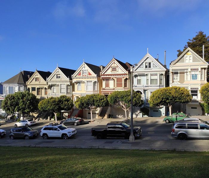
Après la séance photo, nous retournons à notre hôtel et nous dinerons juste à côté au restaurant « Thai Idea Vegetarian » (original, bon et prix raisonnable).
Dimanche 14 juillet : San Fransisco
Réveil matinal à 5h30, le décalage horaire ne nous aura pas épargné, les occupants de l’hôtel non plus. N’ayant pas de fenêtre dans notre chambre, nous enfilons, très confiant, chemisettes et pantacourts. Nous sortons de notre chambre lunette de soleil sur le nez et arrivés sur le seuil de l’hôtel, arrêt net, nous nous regardons, mais où est le soleil ? On ne voyait même pas le toit des immeubles d’en face ! J’avoue que je ne m’attendais pas à ça, la veille il faisait beau mais là, la brume avait envahi tout San Francisco, il commençait même à pleuvoir ! Bon, demi-tour, on retourne dans la chambre, ouvrons les valises et pour Chou, facile, il prévoit toujours comme si on allait au pôle nord mais pour ma part j’ai dû improviser un mélange de style improbable n’ayant pris que des habits d’été, je vous laisse imaginer la superposition… tant pis, le ridicule ne tue pas.
Enfin prêts, nous repartons bien décidés à sillonner à pieds comme prévu cette jolie ville malgré le temps maussade de cette journée.
Nous commençons par un arrêt croissant chez Mr. Holmes Bakehouse pour le petit déjeuner. Après une bonne grimpette, nous traversons Nob Hill puis nous suivons des rails au sol, nous sommes sur le bon chemin !
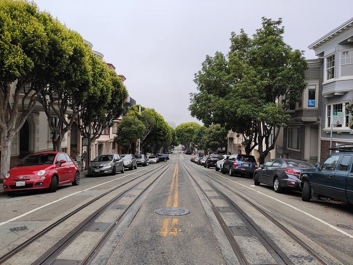
Nous arrivons ensuite sur Lombard Street que nous descendons afin d’avoir une vue depuis le bas.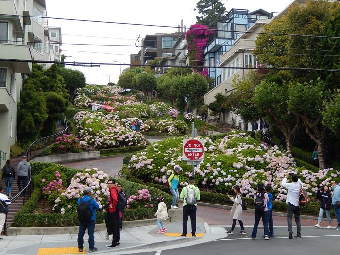
Nous continuons notre chemin vers le port et nous croisons enfin les populaires cable car.
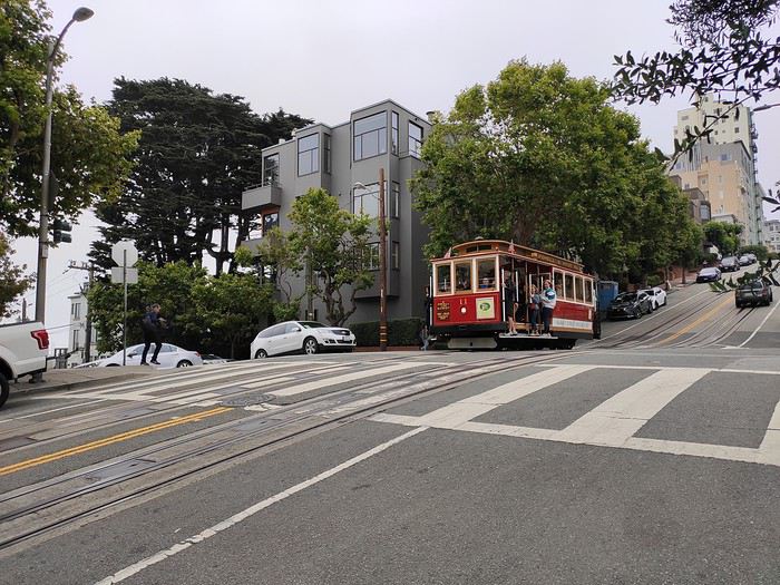
Nous longeons ainsi les rails du cable car jusqu’à la station Powel Hyde. Nous continuons jusqu’au port. Un rapide coup d’œil au sous-marin USS Pampanito et au navire USS Jeremiah O’Brian et nous voici au pier 39 où nous faisons la rencontre des quelques courageux lions de mer qui restaient sur les pontons.
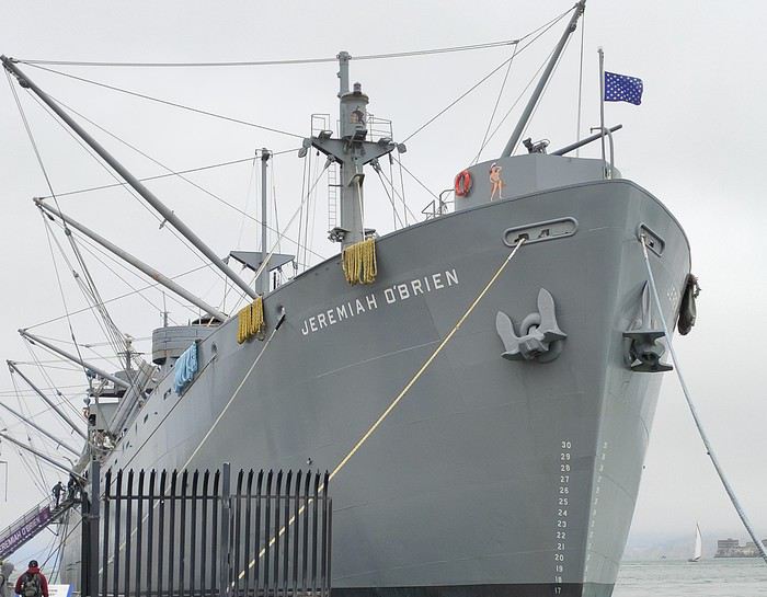
J’ignore encore s’ils posaient pour les photos ou si c’était un couple qui venait de se quereller mais cette photo m’a beaucoup fait pensé à Chou et moi après une dispute.
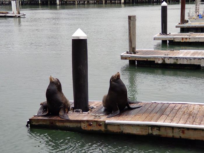
Après avoir fait le tour de tout ce qu’il y avait à voir autour du pier 39, nous décidons de manger sur place une clam chowder (une sorte de soupe de crabe servie dans une petite miche de pain), une découverte originale mais un peu écœurante.
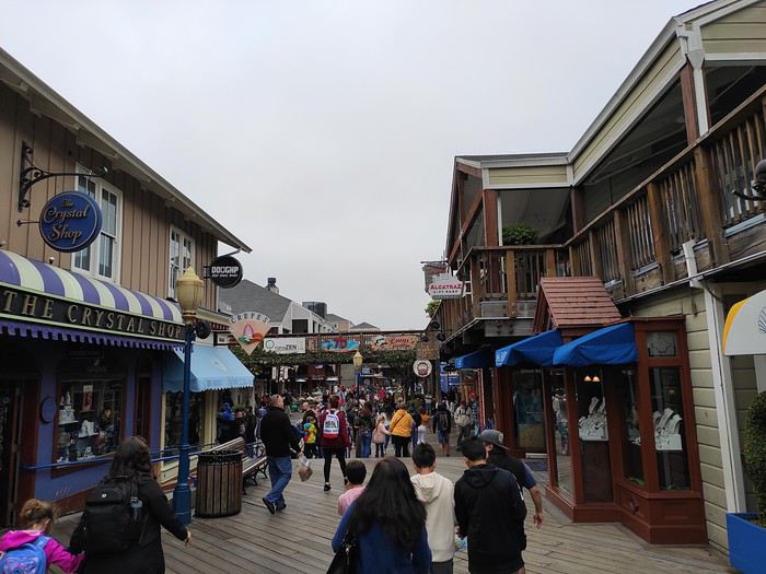
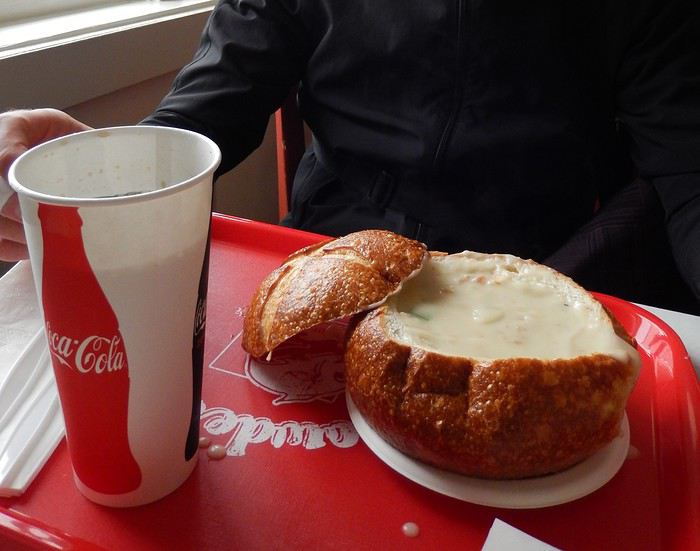
Nous partons ensuite au pier 33 où se situe l’embarcadère pour l’île d’Alcatraz, visite que j’avais réservée sur internet deux mois auparavant (36€ par personne).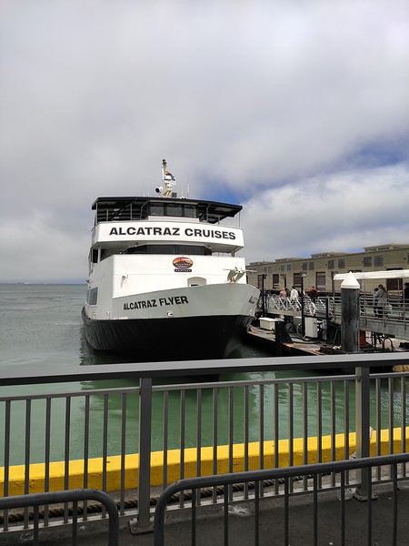
Nous embarquons à 13h, 20 minutes de navigation plus tard, nous voici sur l’île.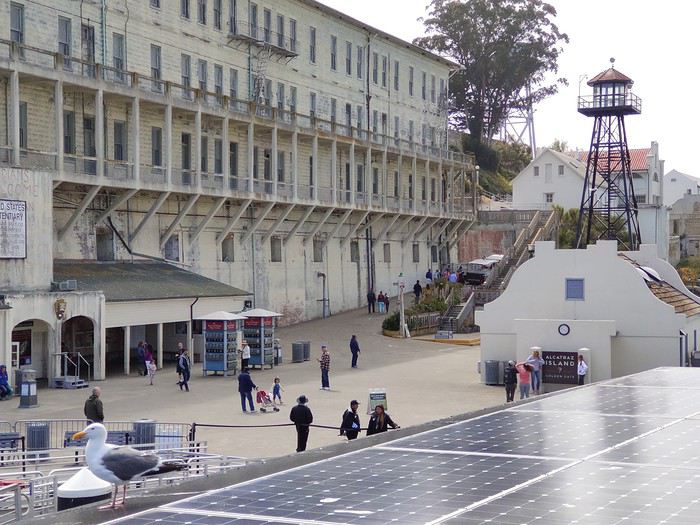
Nous récupérons nos audioguides et s’en suit une visite de 3h de la prison et de ses extérieurs.
Nous sommes vraiment imprégnés par l’atmosphère qui règne dans cette prison. On s’imagine très bien la vie des prisonniers et des gardiens à travers leurs récits. Si vous aimez ce lieu vous devez regarder le film « l’évadé d’Alcatraz » avec Clint Eastwood !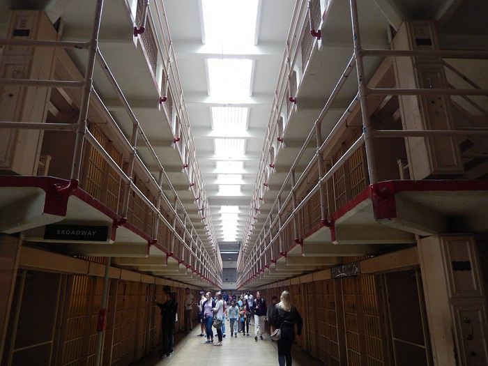
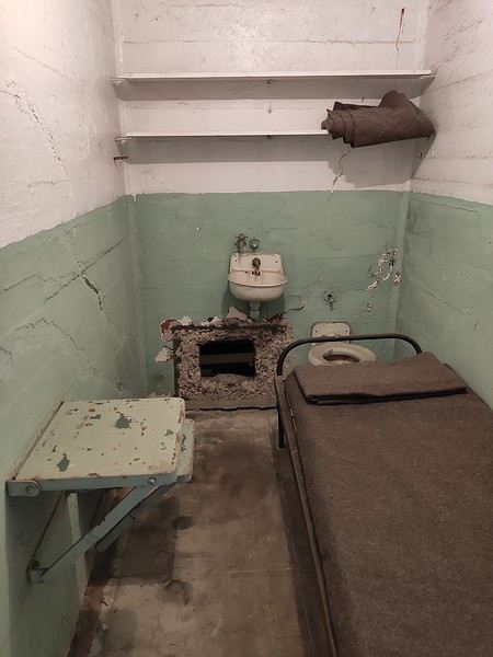
Cette dernière photo témoigne de l’évasion spectaculaire de trois détenus encore recherchés à ce jour. La visite terminée nous reprenons le ferry et profitons de la vue sur San Francisco qui s’est dégagée pendant l’après-midi.
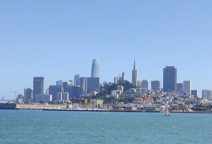
Pour finir la journée, nous nous dirigeons vers le quartier de Little Italy (qui est vraiment très petit), puis continuons jusqu’au quartier Chinois (nettement plus grand).
Nous faisons un arrêt Shopping à Union Square, dinons dans un restaurant chinois à côté, le « City Chopsticks » (bon, rapide et économique) et revenons prendre un dessert au Cheesecake Factory, hummm !
Lundi 15 juillet : Points de vues de San Fransisco et Tracy
Aujourd’hui nous croisons les doigts pour avoir du beau temps car ce sont les points de vues sur San Francisco et le Golden Gate que nous visons, mais pour ce faire, il faut récupérer la voiture ! En sortant de l’hôtel, agréable surprise, le ciel était bien dégagé, ouf !
Nous faisons un léger détour afin de prendre nos sandwichs pour le midi au « Saigon Sandwich Shop » (vietnamien très correct qui prépare vos sandwichs à la demande, attention aux piments !)
Puis sur la route de la station de métro nous passons devant l’Hôtel de ville, une visite éclair de l’intérieur des lieux s’impose. C’est très joli et cela rappelle la Public Library de New York avec en plus un défilé de couple venant se marier.
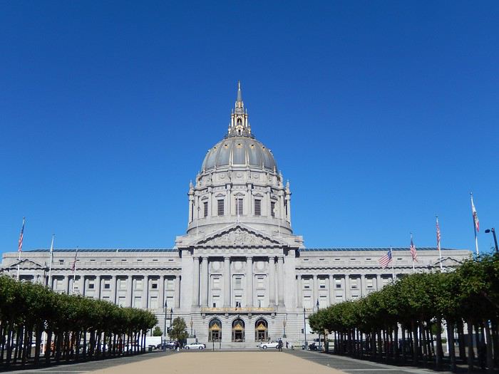
Nous prenons le métro jusqu’à la station Daly City, attention, comme dans beaucoup de grandes villes le prix des billets dépend de la destination où vous vous rendez, vous pouvez donc entrer dans le métro avec un billet premier prix mais vous ne pourrez en sortir qu’en régularisant votre ticket à une borne automatique une fois arrivé à destination.
Nous avons ensuite marché jusqu’à l’agence où nous avions réservé le véhicule pour 10H. Aucune attente, on nous prend en charge et on nous accompagne afin d’inspecter le véhicule, un Nissan Rogue, parfait pour nous.
Les valises chargées, nous embarquons pour notre road trip avec un premier arrêt à Twin Peaks avec une vue à 180° sur la ville.
L’arrêt suivant est prévu à Baker Beach où nous en profitons pour pique-niquer et où Chou a pu se tremper les pieds.
Et enfin le dernier point de vue à Crissy Field.
Nous prenons ensuite la route en direction de Tracy, ville étape pour rejoindre le parc de Yosemite.
A proximité de Tracy, j’avais prévu une étape shopping au San Fransisco Premium Outlets qui nous a quand même prix 2h30 (eh oui c’est les vacances, il faut bien ramener des souvenirs !)
Puis une fois à Tracy nous en avons profité pour faire les courses au Walmart pour les petits déjeuners et pique-nique à venir.
Nous mangeons dans un fast food Mexicain du West Valley Mall (que je ne recommanderais pas mais qui a fait plaisir à Chou) puis nous regagnons notre airbnb situé dans une petite banlieue qui m’a beaucoup fait penser à Wisteria Lane dans la série Desperate Housewives.
C’ est avec beaucoup de nostalgie que j’entame ce carnet de voyage de l’Ouest des Etats-Unis. Tout d’abord, merci à tous ceux qui nous ont permis, grâce à leurs récits, de réaliser le parcours de notre road trip.
C’est à notre tour de partager notre expérience en espérant qu’elle puisse servir à d’autres voyageurs.
Nous sommes un couple de trentenaires (Choue et Chou) sans enfant, qui adore voyager. Nous sommes déjà allés au Maroc, au Canada, en Italie, en Suisse, en Autriche, en Slovénie, au Mexique et en Thaïlande. Je connaissais les Etats-Unis pour y avoir passé 3 mois près de Las Vegas en tant que fille au pair et Chou avait déjà fait un road trip comprenant les principales grandes villes. Y retourner ensemble et visiter les grands parcs de l’Ouest Américain a donc été le rêve que l’on s’est offert pour notre voyage de noces.
Même si nous avons toujours un petit côté aventurier, nous avons appris plusieurs choses de nos précédents voyages :
- On aime un minimum de confort ) = pas de campings ou d’auberge de jeunesse. - On aime voir beaucoup de choses quitte parfois à privilégier l’essentiel mais on ne veut plus en faire « trop », enchainer les heures de routes non-stop, accumuler trop de fatigue, se lever à 5h du mat’ pour prendre un vol interne, etc… - On doit faire attention à notre budget, pour des raisons professionnelles nous sommes obligés de partir pendant les vacances scolaires et ce n’est pas ce qu’il y a de plus économique. Il faut donc s’y prendre un maximum à l’avance pour avoir les meilleurs prix.
J’ai toujours aimé organiser nos voyages mais je deviens de plus en plus méticuleuse, je laisse de moins en moins de place à l’improvisation, certains détesteraient ça, mais il y a beaucoup d’avantages : on voyage l’esprit tranquille, on ne perd pas de temps à faire des recherches sur places, on ne se dispute (presque) pas. L’inconvénient et si vous me lisez, vous vous en êtes déjà rendu compte, cela prend ENORMEMENT de temps, c’est pourquoi j’espère que vous pourrez trouver quelques informations utiles en me lisant.
Les billets d’avion : Pour l’achat des billets, je m’y suis pris en février pour faire un cadeau de saint Valentin à Chou avec un vol direct à 750€/personne depuis Paris pour San Fransisco avec XL Airways (ce sera le dernier vol avec cette compagnie malheureusement…). Il y avait légèrement moins cher mais plus long et avec escale, je vous ai dit, on s’est habitué à un certain confort…
Le véhicule : je savais qu’un SUV était fortement recommandé (et on ne le démentira pas !!!). Nous avons trouvé le meilleur tarif chez Hertz depuis l’agence sur Almany Boulevard à San Francisco. Nous n’avions pas besoin de la voiture pour les deux premiers jours et c’est moins cher que depuis l’aéroport. Nous ne prenons pas d’assurance complémentaire car elle est déjà comprise dans notre carte bancaire Visa Premier débit. Pour ce qui est du GPS, on jongle avec nos téléphones (forfait free 25go de data à l’étranger et une tablette sur laquelle on a l’appli TomTom avec les cartes de l’Amérique du Nord pour les zones sans réseau). La réservation nous a finalement coûté 592€ pour 20 jours.
Le parcours : environ 6 000 kilomètres… (pour moins de 400€ d’essence, c’est un budget mais cela reste 2 fois moins cher qu’en France). Chou s’est « amusé » à retracer notre itinéraire, je mets le lien pour y accéder mais attention ce n’est qu’une reconstitution il y a des endroits où nous n’avons pas pris exactement la même route… https://www.calculitineraires.fr/index.php?id=957526#map
Le programme et les coûts pour la ou les nuits :
Nous partirons du 13 juillet au 04 août soit 22 jours sur place. Une fois le programme bien établi, j’ai réservé les nuitées avec Booking et Airbnb pour un montant moyen de 90€ la nuit.
13 et 14/07 : San Fransisco à l’hôtel Epik pour 236€ 15/07 : Tracy dans un airbnb pour 40€ 16/07 : Mariposa dans un airbnb pour 58€ 17/07 : Strelkovoye au Big Meadow Lodge pour 88€ 18/07 : Amargosa Valley au Longstreet Inn Casino pour 72€ 19/07 : Las Vegas au Royal Resort pour 70€ 20 et 21/07 : Alton dans un airbnb pour 109€ 22 et 23/07 : Moab au Inca inn Motel pour 243€ 24/07 : Monument Valley au Gouldings Lodge pour 192€ 25/07 : Page dans un airbnb pour 85€ 26 et 27/07 : Flagstaff dans un airbnb pour 159€ 28/07 : Lake Havasu City au Days Inn by Wyndham pour 58€ 29, 30 et 31/07 : Los Angeles au Friendship Motor Inn pour 286€ 01/08 : Grover Beach dans un airbnb pour 71€ 02/08 : Boulder Creek dans un airbnb pour 75€
Pour les hôtels, j’ai sélectionné les plus accessibles niveaux tarifs sans faire trop de concession sur le confort, c’est-à-dire le plus souvent en dehors des parcs nationaux et de préférence sans les petits déjeuners étant en général toujours déçus de leur déjeuner « continental industriel et chimique » d’autant plus que nous ne mangeons pas beaucoup le matin, nous avons acheté des petits gâteaux et des jus de fruits et ce fut suffisant.
Pour ce qui est des repas, comme je vous l’ai dit, j’ai été très méticuleuse, notre roadbook comprenais quasiment tous les endroits où manger, où acheter les sandwichs et où prendre l’essence. Dans d’aussi grands espaces, il vaut mieux prévoir à l’avance que de laisser place à l’improvisation car souvent on se rabat sur le premier « resto » ou fast food que l’on voit faute de temps et d’énergie (ce qui nous est tout de même arrivé une ou deux fois). En tout cas nous n’avons rien regretté et avons pu manger varié et un minimum équilibré sans exploser le budget et sans avoir la contrainte de cuisiner sur place. Après chacun sa façon de voyager )
Le départ : notre aventure démarre le vendredi 12 juillet avec une étape de 4h de route afin de rejoindre l’hôtel B&B près de Roissy où nous dormons pour 49€ et où nous laissons la voiture durant notre séjour au parking couvert pour 125€ réservé avec Onepark. Le vol décollant à 11h, je ne voulais pas prendre de risque
Samedi 13 juillet : Paris-San Fransisco
En avant l’aventure ! Nous descendons de notre chambre afin de prendre la Pink navette qui nous conduis au Terminal 2 à 7h30 en 30 minutes. Enregistrement des bagages, duty free, un peu d’attente et c’est l’embarquement, enfin !
Après deux films, deux « repas » et plusieurs micro-siestes, nous atterrissons à San Fransisco à 14h. XL Airways était une compagnie que j’appréciais car c’était la moins chère de toute, elle nous avait déjà amené à Cancun et à New York sans aucun souci. Après une dizaine de minutes d’attente à l’immigration, nous comprenons grâce aux agents de l’aéroport qu’étant déjà venus aux Etats-Unis, nous pouvions accéder aux bornes électroniques… on y fonce et c’est beaucoup plus rapide, cela prend qu’une minute, coup de tampon de l’officier des douanes et là, impatiente, je retrouve… MA VALISE ! En tant que grande stressée, j’avoue que l’angoisse de la perte de ma valise est présente à chaque fois que je prends l’avion…
Nous prenons ensuite l’aéronavette (avec les quelques dollars qu’il me restait de ma visite de New York l’été dernier) pour rejoindre la station BART qui nous mènera au centre. Nous descendons à la station Civic Center et regagnons notre hôtel à pieds. Le quartier qui entoure l’hôtel n’est pas très charmant (beaucoup de sans abris).
Une fois les valises déposées nous passons devant l’hôtel de ville qui malheureusement était fermé à 17h puis nous dégustons une glace au Smitten Ice Cream. Glaces originales car fabriquées avec de l’azote liquide mais qui ne détrônerons pas les gelati italiennes tant par le goût que par le prix, mais bon, on aura essayé cette technologie.
Nous reprenons notre chemin et après une montée bien raide nous voici arrivé à Alamo Square Park avec vue sur les fameuses Painted Ladies.
Après la séance photo, nous retournons à notre hôtel et nous dinerons juste à côté au restaurant « Thai Idea Vegetarian » (original, bon et prix raisonnable).
Dimanche 14 juillet : San Fransisco
Réveil matinal à 5h30, le décalage horaire ne nous aura pas épargné, les occupants de l’hôtel non plus. N’ayant pas de fenêtre dans notre chambre, nous enfilons, très confiant, chemisettes et pantacourts. Nous sortons de notre chambre lunette de soleil sur le nez et arrivés sur le seuil de l’hôtel, arrêt net, nous nous regardons, mais où est le soleil ? On ne voyait même pas le toit des immeubles d’en face ! J’avoue que je ne m’attendais pas à ça, la veille il faisait beau mais là, la brume avait envahi tout San Francisco, il commençait même à pleuvoir ! Bon, demi-tour, on retourne dans la chambre, ouvrons les valises et pour Chou, facile, il prévoit toujours comme si on allait au pôle nord mais pour ma part j’ai dû improviser un mélange de style improbable n’ayant pris que des habits d’été, je vous laisse imaginer la superposition… tant pis, le ridicule ne tue pas.
Enfin prêts, nous repartons bien décidés à sillonner à pieds comme prévu cette jolie ville malgré le temps maussade de cette journée.
Nous commençons par un arrêt croissant chez Mr. Holmes Bakehouse pour le petit déjeuner. Après une bonne grimpette, nous traversons Nob Hill puis nous suivons des rails au sol, nous sommes sur le bon chemin !
Nous arrivons ensuite sur Lombard Street que nous descendons afin d’avoir une vue depuis le bas.
Nous continuons notre chemin vers le port et nous croisons enfin les populaires cable car.
Nous longeons ainsi les rails du cable car jusqu’à la station Powel Hyde. Nous continuons jusqu’au port. Un rapide coup d’œil au sous-marin USS Pampanito et au navire USS Jeremiah O’Brian et nous voici au pier 39 où nous faisons la rencontre des quelques courageux lions de mer qui restaient sur les pontons.
J’ignore encore s’ils posaient pour les photos ou si c’était un couple qui venait de se quereller mais cette photo m’a beaucoup fait pensé à Chou et moi après une dispute.
Après avoir fait le tour de tout ce qu’il y avait à voir autour du pier 39, nous décidons de manger sur place une clam chowder (une sorte de soupe de crabe servie dans une petite miche de pain), une découverte originale mais un peu écœurante.
Nous partons ensuite au pier 33 où se situe l’embarcadère pour l’île d’Alcatraz, visite que j’avais réservée sur internet deux mois auparavant (36€ par personne).
Nous embarquons à 13h, 20 minutes de navigation plus tard, nous voici sur l’île.
Nous récupérons nos audioguides et s’en suit une visite de 3h de la prison et de ses extérieurs.
Nous sommes vraiment imprégnés par l’atmosphère qui règne dans cette prison. On s’imagine très bien la vie des prisonniers et des gardiens à travers leurs récits. Si vous aimez ce lieu vous devez regarder le film « l’évadé d’Alcatraz » avec Clint Eastwood !
Cette dernière photo témoigne de l’évasion spectaculaire de trois détenus encore recherchés à ce jour. La visite terminée nous reprenons le ferry et profitons de la vue sur San Francisco qui s’est dégagée pendant l’après-midi.
Pour finir la journée, nous nous dirigeons vers le quartier de Little Italy (qui est vraiment très petit), puis continuons jusqu’au quartier Chinois (nettement plus grand).
Nous faisons un arrêt Shopping à Union Square, dinons dans un restaurant chinois à côté, le « City Chopsticks » (bon, rapide et économique) et revenons prendre un dessert au Cheesecake Factory, hummm !
Lundi 15 juillet : Points de vues de San Fransisco et Tracy
Aujourd’hui nous croisons les doigts pour avoir du beau temps car ce sont les points de vues sur San Francisco et le Golden Gate que nous visons, mais pour ce faire, il faut récupérer la voiture ! En sortant de l’hôtel, agréable surprise, le ciel était bien dégagé, ouf !
Nous faisons un léger détour afin de prendre nos sandwichs pour le midi au « Saigon Sandwich Shop » (vietnamien très correct qui prépare vos sandwichs à la demande, attention aux piments !)
Puis sur la route de la station de métro nous passons devant l’Hôtel de ville, une visite éclair de l’intérieur des lieux s’impose. C’est très joli et cela rappelle la Public Library de New York avec en plus un défilé de couple venant se marier.
Nous prenons le métro jusqu’à la station Daly City, attention, comme dans beaucoup de grandes villes le prix des billets dépend de la destination où vous vous rendez, vous pouvez donc entrer dans le métro avec un billet premier prix mais vous ne pourrez en sortir qu’en régularisant votre ticket à une borne automatique une fois arrivé à destination.
Nous avons ensuite marché jusqu’à l’agence où nous avions réservé le véhicule pour 10H. Aucune attente, on nous prend en charge et on nous accompagne afin d’inspecter le véhicule, un Nissan Rogue, parfait pour nous.
Les valises chargées, nous embarquons pour notre road trip avec un premier arrêt à Twin Peaks avec une vue à 180° sur la ville.
L’arrêt suivant est prévu à Baker Beach où nous en profitons pour pique-niquer et où Chou a pu se tremper les pieds.
Et enfin le dernier point de vue à Crissy Field.
Nous prenons ensuite la route en direction de Tracy, ville étape pour rejoindre le parc de Yosemite.
A proximité de Tracy, j’avais prévu une étape shopping au San Fransisco Premium Outlets qui nous a quand même prix 2h30 (eh oui c’est les vacances, il faut bien ramener des souvenirs !)
Puis une fois à Tracy nous en avons profité pour faire les courses au Walmart pour les petits déjeuners et pique-nique à venir.
Nous mangeons dans un fast food Mexicain du West Valley Mall (que je ne recommanderais pas mais qui a fait plaisir à Chou) puis nous regagnons notre airbnb situé dans une petite banlieue qui m’a beaucoup fait penser à Wisteria Lane dans la série Desperate Housewives.
Itinéraire de 53 jours dans l'Ouest américain: plans B, idées, critiques... English translation pending
Bonjour à tous!
Ce post rassemble les différentes parties d'une précédente discussion en un seul document...
Tout d'abord, merci à tous ceux qui ont écrit un carnet de voyage sur ce forum, je les lis depuis plusieurs mois afin d'y pêcher un maximum d'idées pour tracer notre itinéraire; merci également à tous les habitués de l'Ouest américain qui prennent de leur temps pour intervenir très souvent sur ce forum afin d'aider les novices... Novices que nous ne sommes pas puisque nous sommes allés en 2008 faire un circuit classique de trois semaines... et cela nous avait tellement marqué que nous voulons le faire découvrir à nos deux garçons.
Je vous présente rapidement la famille pour que vous ayez une idée des paramètres influents sur nos futures activités! Sylvain et Caroline, enseignants quarantenaires et sportifs, Tom, 12 ans au moment du voyage, sportif et Oscar, 7 ans en 2021 et déjà bon petit randonneur à 5 ans!
Je voudrais donc vous soumettre notre itinéraire déjà tracé et travaillé et savoir si, pour vous, c'est cohérent d'une part, réalisable d'autre part et si on passe à côté de quelque chose! Je recherche aussi des plans B, voire C en cas de mauvaise météo, fatigue, ... des bons restos, de bons hôtels ou campings, ...
Au plaisir de vous lire et en espérant des idées nouvelles, des critiques... constructives!
JOUR 1: Vol Paris - Denver (Acheter les billets en Septembre? Octobre? Novembre? Décembre?....)
Récupération de la voiture de location (client Hertz donc plutôt chez ce loueur, location d'un SUV ou 4x4 car des pistes sont prévues😉)
Route vers Colorado Springs et nuit en hôtel. Peut-être se dégourdir les jambes dans Garden of the Gods si pas trop de fatigue...
JOUR 2: Matinée destinée aux achats de matériel de camping dans un Walmart.
pourquoi pas US Air Force Academy et sa chapelle si le temps.
Ravitaillement au Whole Foods Market puis direction les petites villes Victor et Cripple Creek.
Piste Shelf Road pour se familiariser avec la conduite de la voiture sur une piste et camping au Sand Gulch Campground, loin de tout pour espérer voir une belle voûte céleste!
JOUR 3: Fin de la Shelf Road en matinée.
pique-nique à Salida puis direction Great Sand Dunes: balades "Zapata Falls" et "Point of no return".
Hotel GSD Lodge.
JOUR 4: Rando "High Dune" dans la matinée.
Pique-nique à Alamosa puis route vers Taos en passant par les Earth Ships et le Rio Grande Bridge.
Visite de Taos... (idées?)
Camping près de Taos?
JOUR 5: Matinée: High Road to Taos scenic byway.
Visite de Santa Fe... (idées?)
Camping KOA.
JOUR 6: Matinée: Bandelier NM
Pique-nique puis route panoramique Jemez Mountain Trail: différents arrêts?
Camping à Cochiti Lake.
JOUR 7: Matinée: Parc Tent Rocks.
Pique-nique puis route vers Bisti Badlands: Valley of dreams.
Bivouac
JOUR 8: Matinée: Bisti Badlands: cracked eggs
Pique-nique à Shiprock puis route vers Chinle.
Canyon de Chely avec les différents points de vue et surtout Spider Rock en soirée.
Hotel à Chinle
JOUR 9: Hope Arch au lever du jour puis route vers Monument Valley
Scenic Road de MV
Wild cat trail
Camping the View
JOUR 10: Muley Point via Moky Dugway
Piste Valley of the gods
Gooseneck en revenant au camping the View
JOUR 11: Route vers Page
Baignade, Kayak sur le lac
Alstrom Point en soirée
Wahweap Campground
JOUR 12: Lower Antelope Canyon en début de matinée
Spencer Trail
Horseshoe Bend
Stud Horse Point en soirée
Wahweap Campground
JOUR 13: Matinée: Cathedral Wash Trail jusqu'au Colorado
Route vers Coal Mine Canyon (besoin d'un guide navajo???)
Hotel à Tuba City.
JOUR 14: Route vers Williams en passant par le Grand Canyon rive sud.
Hermist Road ou peut-être descendre un peu dans le canyon si les enfants ont toujours la forme😉
Camping Williams
JOUR 15: Route vers Las Vegas en passant par un bout de route 66
Seligman, Kingman
Fremont Street le soir
JOUR 16 et 17: Las Vegas: piscine, casinos, spectacle cirque du soleil et Red Rock Canyon un soir.
JOUR 18: Route vers Valley of Fire
Baignade dans le Lac Mead (Stewarts Point)
Boucle des 7 merveilles dans VoF
Camping de VoF
JOUR 19: Matinée: Valley of Fire: loop road
Pique-nique et route vers ST-George
Snow Canyon
Camping St-George
JOUR 20: Red Cliffs dans la matinée.
Yant Flat en fin d'après-midi
Camping St-George
JOUR 21: Rando Kanarra Creek le matin
Cedar Breaks NM dans l'après-midi
KOA Cedar City
JOUR 22: Zion Nord: The Subway?
ou autre rando
KOA Cedar City
JOUR 23: Route vers Zion South Campground puis Canyon overlook trail le matin
The Narrows en fin d'après-midi
Camping
JOUR 24: Matinée: East Mesa Trail dans Zion
Route vers Colorado City
Camping
JOUR 25: Grosse rando ce jour: White Domes par le Squirrel Canyon
Camping
JOUR 26: Route vers le Grand Canyon rive Nord.
Différents points de vue au bout de petites randos?
Bright Angel Trail au sunset
GC Lodge
JOUR 27: Une dernière rando sur la rive nord du GC le matin
Pique_nique puis route vers Kanab
Trail dans CBN ou CBS
Camping RV Park Crazy Horse
JOUR 28: Matinée: loterie The Wave pour le lendemain (chances très minces je sais.....)
White Pocket + Cottonwood Cove avec un Outfitter...
Camping RV Park Crazy Horse
JOUR 29: The Wave ou loterie pour le lendemain...
sinon Edmaier Secret + Buckskin
Camping RV Park Crazy Horse
JOUR 30: Direction la région de Bryce Canyon en passant par la Cottonwood Road
Yellow Rock, White Valley, Grosvenor Arch, Willis Creek
Hotel près de Bryce Canyon
JOUR 31: Fairyland loop dans Bryce Canyon
Pique-nique, Mossy Cave trailhead
différents point de vue sur l'amphithéatre en soirée
JOUR 32: Hole in the Rock Road
Zebra Slot Canyon le matin
Pique-nique à Devil's Garden
Broken Bow Arch
Bivouac à Sunset Arch
JOUR 33: Hole in the Rock retour
Peek A Boo Canyon + Dry Fork
Upper Calf Creek
Hotel près de Boulder
JOUR 34: Lower Calf Creek en matinée puis pique_nique
Burr Trail Road avec la rando Strike Valley Overlook
Camping à la marina de Bullfrog
JOUR 35: Leprechaun Canyon en matinée
Pique-nique dans l'alcôve de Wild Horse Window
Little Wild Horse Canyon dans l'après-midi
Goblin Valley en soirée
Camping du Parc
JOUR 36: Factory Butte et Moonscape Overlook le matin
Pique-nique à Fruita puis Cohab Canyon dans l'après-midi
Sunset point puis hotel à Torrey.
JOUR 37: Trail Navajo Knobs + Pique_nique + Hickman Natural Bridge
Piste de Cathedral Valley en passant par Caineville
Cathedral Campground.
JOUR 38: Cathedral campground - Moab
Temple overlook trail en matinée
pique-nique près des temples puis route vers Moab.
JOURS 39 à 43: 5 jours complets à Moab pour explorer Arches NP et Canyonlands NP et les alentours de Moab. A potasser très sérieusement...
JOUR 44: Moab - Fruita dans le Colorado NM
Rattlesnake Canyon Trail
Camping Saddlehorn
JOUR 45: Fruita - Telluride
Profiter des rives du Colorado NM au réveil puis route vers Black Canyon of Gunnison: points de vue de la rive sud
Last Dollar Road
et si un peu de temps, pourquoi pas Bridal Falls à Telluride
Camping
JOUR 46: Telluride - Silverton via Mesa Verde NM
Spruce Tree House et...
Hotel
JOUR 47: Silverton - Crested Butte
Perimeter Trail à Ouray + sources chaudes?
points de vue de la rive nord de Black Canyon
Camping
JOUR 48: Crested Butte - Glenwood Springs via la Kebler Pass
Repos dans les sources chaudes de Glenwood Springs
Hotel
JOUR 49: Glenwood Springs - Aspen
Hanging Lake Trail
Camping près d'Aspen
JOUR 50: Aspen - Leadville
Maroon Lake Trail tôt le matin pour aller photographier les Maroon Bells
Route vers Leadville via le Col de l'indépendance.
Camping près du Turquoise Lake
JOURS 51 à 53: Route vers Denver et visite de la ville durant 2 jours, départ le 53ème jour...
Quel hôtel à Denver?
Voila pour le périple! Merci encore à tous ceux qui interviendront et qui rendront ce voyage encore plus abouti!
Bons périples à tous
Amicalement
Sylvain
Ce post rassemble les différentes parties d'une précédente discussion en un seul document...
Tout d'abord, merci à tous ceux qui ont écrit un carnet de voyage sur ce forum, je les lis depuis plusieurs mois afin d'y pêcher un maximum d'idées pour tracer notre itinéraire; merci également à tous les habitués de l'Ouest américain qui prennent de leur temps pour intervenir très souvent sur ce forum afin d'aider les novices... Novices que nous ne sommes pas puisque nous sommes allés en 2008 faire un circuit classique de trois semaines... et cela nous avait tellement marqué que nous voulons le faire découvrir à nos deux garçons.
Je vous présente rapidement la famille pour que vous ayez une idée des paramètres influents sur nos futures activités! Sylvain et Caroline, enseignants quarantenaires et sportifs, Tom, 12 ans au moment du voyage, sportif et Oscar, 7 ans en 2021 et déjà bon petit randonneur à 5 ans!
Je voudrais donc vous soumettre notre itinéraire déjà tracé et travaillé et savoir si, pour vous, c'est cohérent d'une part, réalisable d'autre part et si on passe à côté de quelque chose! Je recherche aussi des plans B, voire C en cas de mauvaise météo, fatigue, ... des bons restos, de bons hôtels ou campings, ...
Au plaisir de vous lire et en espérant des idées nouvelles, des critiques... constructives!
JOUR 1: Vol Paris - Denver (Acheter les billets en Septembre? Octobre? Novembre? Décembre?....)
Récupération de la voiture de location (client Hertz donc plutôt chez ce loueur, location d'un SUV ou 4x4 car des pistes sont prévues😉)
Route vers Colorado Springs et nuit en hôtel. Peut-être se dégourdir les jambes dans Garden of the Gods si pas trop de fatigue...
JOUR 2: Matinée destinée aux achats de matériel de camping dans un Walmart.
pourquoi pas US Air Force Academy et sa chapelle si le temps.
Ravitaillement au Whole Foods Market puis direction les petites villes Victor et Cripple Creek.
Piste Shelf Road pour se familiariser avec la conduite de la voiture sur une piste et camping au Sand Gulch Campground, loin de tout pour espérer voir une belle voûte céleste!
JOUR 3: Fin de la Shelf Road en matinée.
pique-nique à Salida puis direction Great Sand Dunes: balades "Zapata Falls" et "Point of no return".
Hotel GSD Lodge.
JOUR 4: Rando "High Dune" dans la matinée.
Pique-nique à Alamosa puis route vers Taos en passant par les Earth Ships et le Rio Grande Bridge.
Visite de Taos... (idées?)
Camping près de Taos?
JOUR 5: Matinée: High Road to Taos scenic byway.
Visite de Santa Fe... (idées?)
Camping KOA.
JOUR 6: Matinée: Bandelier NM
Pique-nique puis route panoramique Jemez Mountain Trail: différents arrêts?
Camping à Cochiti Lake.
JOUR 7: Matinée: Parc Tent Rocks.
Pique-nique puis route vers Bisti Badlands: Valley of dreams.
Bivouac
JOUR 8: Matinée: Bisti Badlands: cracked eggs
Pique-nique à Shiprock puis route vers Chinle.
Canyon de Chely avec les différents points de vue et surtout Spider Rock en soirée.
Hotel à Chinle
JOUR 9: Hope Arch au lever du jour puis route vers Monument Valley
Scenic Road de MV
Wild cat trail
Camping the View
JOUR 10: Muley Point via Moky Dugway
Piste Valley of the gods
Gooseneck en revenant au camping the View
JOUR 11: Route vers Page
Baignade, Kayak sur le lac
Alstrom Point en soirée
Wahweap Campground
JOUR 12: Lower Antelope Canyon en début de matinée
Spencer Trail
Horseshoe Bend
Stud Horse Point en soirée
Wahweap Campground
JOUR 13: Matinée: Cathedral Wash Trail jusqu'au Colorado
Route vers Coal Mine Canyon (besoin d'un guide navajo???)
Hotel à Tuba City.
JOUR 14: Route vers Williams en passant par le Grand Canyon rive sud.
Hermist Road ou peut-être descendre un peu dans le canyon si les enfants ont toujours la forme😉
Camping Williams
JOUR 15: Route vers Las Vegas en passant par un bout de route 66
Seligman, Kingman
Fremont Street le soir
JOUR 16 et 17: Las Vegas: piscine, casinos, spectacle cirque du soleil et Red Rock Canyon un soir.
JOUR 18: Route vers Valley of Fire
Baignade dans le Lac Mead (Stewarts Point)
Boucle des 7 merveilles dans VoF
Camping de VoF
JOUR 19: Matinée: Valley of Fire: loop road
Pique-nique et route vers ST-George
Snow Canyon
Camping St-George
JOUR 20: Red Cliffs dans la matinée.
Yant Flat en fin d'après-midi
Camping St-George
JOUR 21: Rando Kanarra Creek le matin
Cedar Breaks NM dans l'après-midi
KOA Cedar City
JOUR 22: Zion Nord: The Subway?
ou autre rando
KOA Cedar City
JOUR 23: Route vers Zion South Campground puis Canyon overlook trail le matin
The Narrows en fin d'après-midi
Camping
JOUR 24: Matinée: East Mesa Trail dans Zion
Route vers Colorado City
Camping
JOUR 25: Grosse rando ce jour: White Domes par le Squirrel Canyon
Camping
JOUR 26: Route vers le Grand Canyon rive Nord.
Différents points de vue au bout de petites randos?
Bright Angel Trail au sunset
GC Lodge
JOUR 27: Une dernière rando sur la rive nord du GC le matin
Pique_nique puis route vers Kanab
Trail dans CBN ou CBS
Camping RV Park Crazy Horse
JOUR 28: Matinée: loterie The Wave pour le lendemain (chances très minces je sais.....)
White Pocket + Cottonwood Cove avec un Outfitter...
Camping RV Park Crazy Horse
JOUR 29: The Wave ou loterie pour le lendemain...
sinon Edmaier Secret + Buckskin
Camping RV Park Crazy Horse
JOUR 30: Direction la région de Bryce Canyon en passant par la Cottonwood Road
Yellow Rock, White Valley, Grosvenor Arch, Willis Creek
Hotel près de Bryce Canyon
JOUR 31: Fairyland loop dans Bryce Canyon
Pique-nique, Mossy Cave trailhead
différents point de vue sur l'amphithéatre en soirée
JOUR 32: Hole in the Rock Road
Zebra Slot Canyon le matin
Pique-nique à Devil's Garden
Broken Bow Arch
Bivouac à Sunset Arch
JOUR 33: Hole in the Rock retour
Peek A Boo Canyon + Dry Fork
Upper Calf Creek
Hotel près de Boulder
JOUR 34: Lower Calf Creek en matinée puis pique_nique
Burr Trail Road avec la rando Strike Valley Overlook
Camping à la marina de Bullfrog
JOUR 35: Leprechaun Canyon en matinée
Pique-nique dans l'alcôve de Wild Horse Window
Little Wild Horse Canyon dans l'après-midi
Goblin Valley en soirée
Camping du Parc
JOUR 36: Factory Butte et Moonscape Overlook le matin
Pique-nique à Fruita puis Cohab Canyon dans l'après-midi
Sunset point puis hotel à Torrey.
JOUR 37: Trail Navajo Knobs + Pique_nique + Hickman Natural Bridge
Piste de Cathedral Valley en passant par Caineville
Cathedral Campground.
JOUR 38: Cathedral campground - Moab
Temple overlook trail en matinée
pique-nique près des temples puis route vers Moab.
JOURS 39 à 43: 5 jours complets à Moab pour explorer Arches NP et Canyonlands NP et les alentours de Moab. A potasser très sérieusement...
JOUR 44: Moab - Fruita dans le Colorado NM
Rattlesnake Canyon Trail
Camping Saddlehorn
JOUR 45: Fruita - Telluride
Profiter des rives du Colorado NM au réveil puis route vers Black Canyon of Gunnison: points de vue de la rive sud
Last Dollar Road
et si un peu de temps, pourquoi pas Bridal Falls à Telluride
Camping
JOUR 46: Telluride - Silverton via Mesa Verde NM
Spruce Tree House et...
Hotel
JOUR 47: Silverton - Crested Butte
Perimeter Trail à Ouray + sources chaudes?
points de vue de la rive nord de Black Canyon
Camping
JOUR 48: Crested Butte - Glenwood Springs via la Kebler Pass
Repos dans les sources chaudes de Glenwood Springs
Hotel
JOUR 49: Glenwood Springs - Aspen
Hanging Lake Trail
Camping près d'Aspen
JOUR 50: Aspen - Leadville
Maroon Lake Trail tôt le matin pour aller photographier les Maroon Bells
Route vers Leadville via le Col de l'indépendance.
Camping près du Turquoise Lake
JOURS 51 à 53: Route vers Denver et visite de la ville durant 2 jours, départ le 53ème jour...
Quel hôtel à Denver?
Voila pour le périple! Merci encore à tous ceux qui interviendront et qui rendront ce voyage encore plus abouti!
Bons périples à tous
Amicalement
Sylvain
Namibie, le tour classique avec quelques échappées sauvages... English translation pending
Et nous voici reparti pour une destination que nous avions beaucoup apprécié en 2012. Cette fois, nous partageons ce voyage avec des amis qui ne connaissent pas encore ce coin du monde, l'occasion de leur faire découvrir quelques pépites africaines...
Et si vous le désirez, vous pouvez embarquer avec nous !
Comme à l'habitude, je tiens à préciser que tout le voyage est fait maison, les moyens de transport, les campings et les lodges (quand c'est possible) sont réservés et les itinéraires routiers sont tous programmés sur Base Camp, nommés de la date du jour du déplacement et sauvegardé sur un Garmin. Enfin 3 Garmins car nous avons loués 3 Hilux avec tente sur le toit.
Quand je dis: quelques échappées sauvages, je parle des options de routes et des destinations peu usitées par les tours opérateurs parce que les agences de locations de voiture n'aiment pas que vous preniez des chemins plus difficiles d'accès.
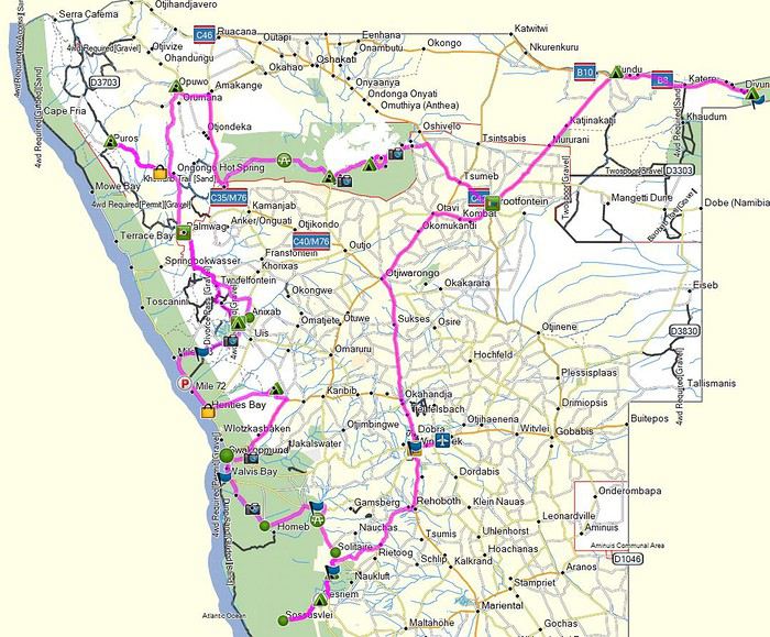
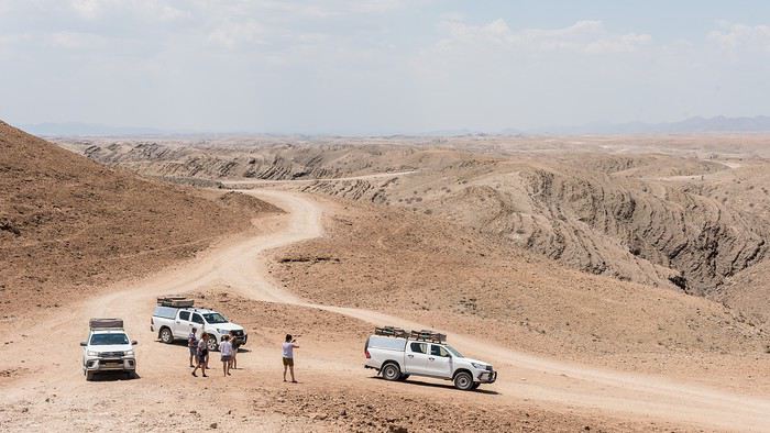
En 2012, nous avions volé avec La Luft et Air Namibia au départ de Genève. Cette année, pour des raisons de tarifs et de transfert bagages, nous avons choisi Qatar.... Un peu plus long et un joli détour par le Golfe, région tendue s'il en est ! D'ailleurs le chemin pris par la compagnie montre bien que l'on ne survole pas ce que l'on veut dans la région ! Mais par contre le service et les avions ne laissent pas à désirer ! C'est la classe...
C'est parti, le 10 octobre 2019, GVA, 15h
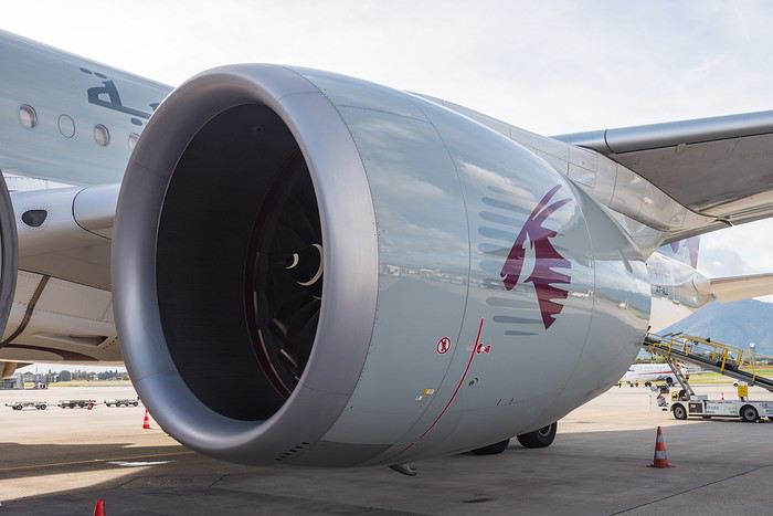
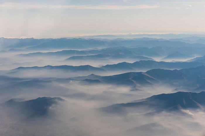
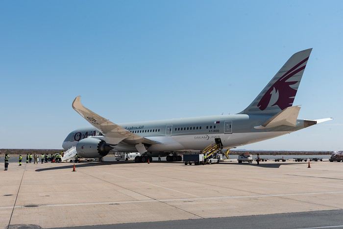
Petit bémol avec ce choix, c'est l'heure d’arrivée sur place : 11h40. La journée est déjà bien entamée, et nous dormons ce soir à la Namib Desert Lodge, 30 km en dessous de Solitaire.
Pour la location des véhicules, nous sommes passé par Tourmaline afin de bénéficier d'un contact francophone en cas de problème de véhicule. Et notre guide local Michael est super sympa. Nous recevons de sa part un dossier complet en français et la prise en main des véhicules chez Asco est une formalité, bien que le tout soit un peu long à notre goût... Nous avons encore env. 4 heure de route et piste devant nous .... et quelques achats de première nécessité.
Au sujet des véhicules, le rangement du matériel de camping sur le pick up n'est toujours pas pratique et mal arrimé. Les chaises sont aguillées sur le coté et se retrouveront systématiquement sur les bagages, ce qui abîmera définitivement l'un d'entre eux.
Au sujet des pistes peu usitées évoquées plus haut, la petite précision apportée par Michael ne nous plaît guère : selon lui, Asco ne dépanne pas sur les pistes non répertoriées sur la carte. Et pour nous, ça va faire pas mal de km sur de telles pistes... D'après lui donc obligation de prendre des D....
Puis c'est le lâcher pour partir à gauche 🤪 , direction le Spaar de Rehoboth pour le ravitaillement.
Et si vous le désirez, vous pouvez embarquer avec nous !
Comme à l'habitude, je tiens à préciser que tout le voyage est fait maison, les moyens de transport, les campings et les lodges (quand c'est possible) sont réservés et les itinéraires routiers sont tous programmés sur Base Camp, nommés de la date du jour du déplacement et sauvegardé sur un Garmin. Enfin 3 Garmins car nous avons loués 3 Hilux avec tente sur le toit.
Quand je dis: quelques échappées sauvages, je parle des options de routes et des destinations peu usitées par les tours opérateurs parce que les agences de locations de voiture n'aiment pas que vous preniez des chemins plus difficiles d'accès.
En 2012, nous avions volé avec La Luft et Air Namibia au départ de Genève. Cette année, pour des raisons de tarifs et de transfert bagages, nous avons choisi Qatar.... Un peu plus long et un joli détour par le Golfe, région tendue s'il en est ! D'ailleurs le chemin pris par la compagnie montre bien que l'on ne survole pas ce que l'on veut dans la région ! Mais par contre le service et les avions ne laissent pas à désirer ! C'est la classe...
C'est parti, le 10 octobre 2019, GVA, 15h
Petit bémol avec ce choix, c'est l'heure d’arrivée sur place : 11h40. La journée est déjà bien entamée, et nous dormons ce soir à la Namib Desert Lodge, 30 km en dessous de Solitaire.
Pour la location des véhicules, nous sommes passé par Tourmaline afin de bénéficier d'un contact francophone en cas de problème de véhicule. Et notre guide local Michael est super sympa. Nous recevons de sa part un dossier complet en français et la prise en main des véhicules chez Asco est une formalité, bien que le tout soit un peu long à notre goût... Nous avons encore env. 4 heure de route et piste devant nous .... et quelques achats de première nécessité.
Au sujet des véhicules, le rangement du matériel de camping sur le pick up n'est toujours pas pratique et mal arrimé. Les chaises sont aguillées sur le coté et se retrouveront systématiquement sur les bagages, ce qui abîmera définitivement l'un d'entre eux.
Au sujet des pistes peu usitées évoquées plus haut, la petite précision apportée par Michael ne nous plaît guère : selon lui, Asco ne dépanne pas sur les pistes non répertoriées sur la carte. Et pour nous, ça va faire pas mal de km sur de telles pistes... D'après lui donc obligation de prendre des D....
Puis c'est le lâcher pour partir à gauche 🤪 , direction le Spaar de Rehoboth pour le ravitaillement.