Results for "Puerto+Montt+|+4+>+127"
15365 results found.
Etat du Cayo Largo après l'ouragan? English translation pending
🙂Allo,
Est-ce que quelqu'un a des nouvelles recentes sur Cayo largo depuis les ouragans....Etat des plages, hotels, etc....est-ce qu'il y a vraiment des dommages????
Tourlou
Association humanitaire pour les enfants de la rue à Cusco au Pérou English translation pending
bonjour à tous
une nouvelle association est née pour oeuvrer dans les quartiers misereux de la banlieu de Cusco
nous aurons besoin de bénévoles pour apporter aux jeunes enfants dans la rue
soins
nourriture
education
si vous etes interessés, je vous donnerais plus de details a+
Pérou: Une semaine de jungle depuis Cuzco? English translation pending
J'aimerai partir dans la jungle depuis cuzco pour un trip d'une petite semaine à la roots.
Suis assez branché par le périple, Cuzco-Quillabamba-Kiteni-Ivochote-Pongo de manique..
Si qq'un a deja fait ca: combien de temps ca prend ? est ce difficilie ? J'arrive où? ( pas trop envie de faire demi tour ), alors je fais quoi ? vers sephua puis avion jusqu'a Satipo ? Non la vraiment c'est le bordel je vois pas la soluce... aidez moi
Mais bon, y a peut etre un truc plus sympa et plus facile pour faire une semaine de jungle depuis Cuzco???
AIdez moi siouplé!!!!
Suis assez branché par le périple, Cuzco-Quillabamba-Kiteni-Ivochote-Pongo de manique..
Si qq'un a deja fait ca: combien de temps ca prend ? est ce difficilie ? J'arrive où? ( pas trop envie de faire demi tour ), alors je fais quoi ? vers sephua puis avion jusqu'a Satipo ? Non la vraiment c'est le bordel je vois pas la soluce... aidez moi
Mais bon, y a peut etre un truc plus sympa et plus facile pour faire une semaine de jungle depuis Cuzco???
AIdez moi siouplé!!!!
Voyage et sécurité en Equateur? English translation pending
salut !!
ma copine et moi sommes en train de mettre sur pied un petit voyage de 3mois en equateur, mais j'avoue ne pas avoir beaucoup d'informations car je commence a peine a relier les infos .. est ce ke vous pouvez nous donner des infos (ce qu'il ne fo pas manker, visiter, etc ..).. euh .. tt ce ke vous nous direz nous sera d'une grande utilité ds la realisation de notre projet.
nous partons a 2 (1gars - 1fille) pour 3mois dc .. a partir de la mi-octobre. nous n'avons pas encore choisit d'itineraire mais voudrions traverser le pays .. cote, andes et amazonie.
ns avons entendu dire que l'equateur n'est pas un pays tres securitaire, keske vs en pensez ?
a bientot, merci
kevin et luana !!
ma copine et moi sommes en train de mettre sur pied un petit voyage de 3mois en equateur, mais j'avoue ne pas avoir beaucoup d'informations car je commence a peine a relier les infos .. est ce ke vous pouvez nous donner des infos (ce qu'il ne fo pas manker, visiter, etc ..).. euh .. tt ce ke vous nous direz nous sera d'une grande utilité ds la realisation de notre projet.
nous partons a 2 (1gars - 1fille) pour 3mois dc .. a partir de la mi-octobre. nous n'avons pas encore choisit d'itineraire mais voudrions traverser le pays .. cote, andes et amazonie.
ns avons entendu dire que l'equateur n'est pas un pays tres securitaire, keske vs en pensez ?
a bientot, merci
kevin et luana !!
Petit Article sur Ushuaia English translation pending
Voila un petit article que j ai relevé ce matin dans la presse locale et qui me fait un peu rigoler concernant Ushuaia ou plutot comme je l apelle " UshuaiaLand, ou le merveilleux monde magique de la pompe a fric la plus australe du monde ! " Comment faire pour gagner encore plus d argent ?
Ushuaia n a rien d exceptionel, a part bien sur sa situation de ville la plus au sud, mais sinon rien d autre d'interressant .
Ces paysages ?, tout depend si vous y arrivez par la route, voila deja 2000 km que vous traversez de grande etendues vierges a perte de vue, et 500 km que vous voyez deja des montagnes a droite et a gauche....une fois que vous etes donc a Ushuaia, vous n etes donc pas trop depaysés !
Le probleme c'est que le gouvernement chilien vient de se mettre dans la tete de construire de toute piece une nouvelle ville encore plus au sud ( toujours sur la Terre de Feu ), donc voila qu'a 100 km de la, nous aurons d ici peu, une nouvelle pompe a fric a neuneus. Alors que va devenir Ushuaia dans 5 ou 10 ans ? il y a de grande chance que les vendeurs de carte postale, de babioles a mettre sur la tele ou au mur et d excursion sur la canal de Beagle demenagent pour s instaler coté chilien ! ( cote chilien il y a aussi les memes montagnes, le meme canal, les memes pingouins ( ah les traites ! ) et le meme froid ). Et du coup les neuneus irons depenser les USD et autres Euros de l autre cote ....( ah ben zut alors dit le maire d Ushuaia ) Ushuaia, la pompe a neuneus la plus austral encore pour 5 ans ! Voila donc que le gouverneur de la Terre de Feu et le maire de Ushuaia essayent de toutes leurs forces de trouver quelque chose que "les autres chiliens" n auraient pas ! Et hop voila comment vient de naitre ce dernier week end le "festival del fin del mundo" festival de musique classique..ben oui pourquoi pas ? de plus sous le patronage de la ville de Salzburg ( la, ils ont fait fort !, le cote "serieux" est sauvé! ) ...maintenant il faut souhaiter que la mayonnaise prenne ! Et que bientot le "In du In" de Londres a Monaco en passant par Zurich sera de dire "ahhhhhhhhh en avril je vais au Festival d Ushuaiaaaaaa !", ca epatera la galerie de tous vos amiiiisssssssss ! Bon, on en n est pas encore la ! Le service Marketing Argentin habitutuelement bonne pour la promotion de la "pompe australe" dans les salons de tourismes au 4 coins du monde, a cette fois totalement raté le 1er festival de musique classique puisque reconnaissent les organisateurs : " la mayoría de los espectadores son fueguinos ( de la Terre de Feu ) y argentinos llegados, sobre todo, desde La Pampa, Buenos Aires, Santa Cruz y Río Negro.............donc cote etranger c'est plutot raté !. En Argentine, le touriste etranger doit representer seulement 15 % des recettes obtenues ( 85 % restant provenant de touristes argentins ) ...or a Ushuaia .... les etrangers representent "le" tourisme ( pas cons les argentins...eux, ils n y vont pas ! ) ...63% d etranger pour seulement 37 % d argentins ......190.000 visiteurs en 2004 ( pour un patelin de 30.000 hab.....la majorite d ailleurs etant que des saisonniers venant de Bsas ou d ailleurs pour faire marcher la pompe ) ............ a ce sujet sachez qu en 1932, il y avait quelques baraque en bois et 1.400 hab ( des pecheurs et des employes de l etat ).... donc Ushuaia c est Avoriaz sur la Canal de Beagle...hotel, souvenir, hotel, bar, resto, hotel, souvenir, discotheque et hotel..... Cote argent, chaque visiteur depense 350 pesos sur place en moyenne ......c'est nul dit le maire, on peut mieux faire, on peux mieux pomper ! Le festival de Salzburg pompe entre 2500 et 3000 USD par pompé ( chiffre du dernier festival autichien ), c'est pourquoi outre le patronage de ce festival europeen, c'est aussi des administrateurs autrichiens qui ont debarqué a UshuaiaLand pour "tout mettre en place" en premiere ligne : Brigitte Weissengruber qui travaille aussi au ministere de la culture a Vienne. Voila pourquoi les autorites locales esperent passer de 190.000 visiteurs en 2004 a ........260.000 en 2010 .... grace en autre au merveilleux "festival del fin del mundo".......a moins que d ici la, le " Super Avoriaz chilien", peut etre baptisé "Ushuaia II", precipite la "pompe" a son etat de 1932 !....et une nouvelle ville fantome naitra ..........resteront les pingouins ! A Bientot ! Herge !
Ushuaia n a rien d exceptionel, a part bien sur sa situation de ville la plus au sud, mais sinon rien d autre d'interressant .
Ces paysages ?, tout depend si vous y arrivez par la route, voila deja 2000 km que vous traversez de grande etendues vierges a perte de vue, et 500 km que vous voyez deja des montagnes a droite et a gauche....une fois que vous etes donc a Ushuaia, vous n etes donc pas trop depaysés !
Le probleme c'est que le gouvernement chilien vient de se mettre dans la tete de construire de toute piece une nouvelle ville encore plus au sud ( toujours sur la Terre de Feu ), donc voila qu'a 100 km de la, nous aurons d ici peu, une nouvelle pompe a fric a neuneus. Alors que va devenir Ushuaia dans 5 ou 10 ans ? il y a de grande chance que les vendeurs de carte postale, de babioles a mettre sur la tele ou au mur et d excursion sur la canal de Beagle demenagent pour s instaler coté chilien ! ( cote chilien il y a aussi les memes montagnes, le meme canal, les memes pingouins ( ah les traites ! ) et le meme froid ). Et du coup les neuneus irons depenser les USD et autres Euros de l autre cote ....( ah ben zut alors dit le maire d Ushuaia )
Ushuaia, la pompe a neuneus la plus austral encore pour 5 ans ! Voila donc que le gouverneur de la Terre de Feu et le maire de Ushuaia essayent de toutes leurs forces de trouver quelque chose que "les autres chiliens" n auraient pas ! Et hop voila comment vient de naitre ce dernier week end le "festival del fin del mundo" festival de musique classique..ben oui pourquoi pas ? de plus sous le patronage de la ville de Salzburg ( la, ils ont fait fort !, le cote "serieux" est sauvé! ) ...maintenant il faut souhaiter que la mayonnaise prenne ! Et que bientot le "In du In" de Londres a Monaco en passant par Zurich sera de dire "ahhhhhhhhh en avril je vais au Festival d Ushuaiaaaaaa !", ca epatera la galerie de tous vos amiiiisssssssss ! Bon, on en n est pas encore la ! Le service Marketing Argentin habitutuelement bonne pour la promotion de la "pompe australe" dans les salons de tourismes au 4 coins du monde, a cette fois totalement raté le 1er festival de musique classique puisque reconnaissent les organisateurs : " la mayoría de los espectadores son fueguinos ( de la Terre de Feu ) y argentinos llegados, sobre todo, desde La Pampa, Buenos Aires, Santa Cruz y Río Negro.............donc cote etranger c'est plutot raté !. En Argentine, le touriste etranger doit representer seulement 15 % des recettes obtenues ( 85 % restant provenant de touristes argentins ) ...or a Ushuaia .... les etrangers representent "le" tourisme ( pas cons les argentins...eux, ils n y vont pas ! ) ...63% d etranger pour seulement 37 % d argentins ......190.000 visiteurs en 2004 ( pour un patelin de 30.000 hab.....la majorite d ailleurs etant que des saisonniers venant de Bsas ou d ailleurs pour faire marcher la pompe ) ............ a ce sujet sachez qu en 1932, il y avait quelques baraque en bois et 1.400 hab ( des pecheurs et des employes de l etat ).... donc Ushuaia c est Avoriaz sur la Canal de Beagle...hotel, souvenir, hotel, bar, resto, hotel, souvenir, discotheque et hotel..... Cote argent, chaque visiteur depense 350 pesos sur place en moyenne ......c'est nul dit le maire, on peut mieux faire, on peux mieux pomper ! Le festival de Salzburg pompe entre 2500 et 3000 USD par pompé ( chiffre du dernier festival autichien ), c'est pourquoi outre le patronage de ce festival europeen, c'est aussi des administrateurs autrichiens qui ont debarqué a UshuaiaLand pour "tout mettre en place" en premiere ligne : Brigitte Weissengruber qui travaille aussi au ministere de la culture a Vienne. Voila pourquoi les autorites locales esperent passer de 190.000 visiteurs en 2004 a ........260.000 en 2010 .... grace en autre au merveilleux "festival del fin del mundo".......a moins que d ici la, le " Super Avoriaz chilien", peut etre baptisé "Ushuaia II", precipite la "pompe" a son etat de 1932 !....et une nouvelle ville fantome naitra ..........resteront les pingouins ! A Bientot ! Herge !Départ cet été English translation pending
Bonjour,
J'aimerais savoir qui part cet été (en juillet) et pour où ? Y allez-vous en famille ?
J'ai hâte de vous lire.
J'aimerais savoir qui part cet été (en juillet) et pour où ? Y allez-vous en famille ?
J'ai hâte de vous lire.
ou aller au costa rica (aventure ou tout compris?) English translation pending
Bonjour jaimerais aller faire un tour au costa rica au mois de juillet pour deux semaine seulement, je ne sais pas si je dois prendre un tout compris ou partir a l'aventure mais si je pars a l'aventure ou est ce que je dois aller, avez vous des suggestion?? en passant je me cherche quelqun pour tenter l'experience alors gener vous pas
Philippines en photos English translation pending
Bonjour
Ça y est, j’ai terminé mon site de Photos des Philippines. Fidèle à mes habitudes, je crée un forum sur les Philippines destiné aux visiteurs de mon site, en utilisant voyageforum. Ainsi, si je ne peux pas répondre aux questions qui me sont posées, d’autres voyageforumiens s’en chargeront !
J’ai passé tout le mois de février 2005 aux Philippines. Je suis parti avec Air France qui proposait un tarif compétitif sur cette destination, en passant par Hong Kong. Attention : la Partie HK / Manille se fait sur Philippines Airlines (détail d’importance, inutile de chercher Air France à Hong Kong)…
Visite tout d’abord du Nord des Philippines, avec l’ile de Luzon et ses superbes rizières en terrasses classées au patrimoine mondial de l’UNESCO. Location de voiture (130$ la semaine) auprès de Hannan Rent a Car, qui auraient pu m’avertir que les routes du Nord étaient difficilement praticables avec une simple berline !;-) La randonnée dans les rizières est inoubliable et je regrette de ne pas avoir pu rester plus longtemps pour explorer davantage le Nord de Luzon.
Deuxième semaine : cap sur Boracay. D’accord, la plage est belle, mais lorsque le Lonelyplanet écrit que c’est une des plus belles du monde, que c’est l’une des plus belles du monde, faut pas exagérer : l’ïle est quand même hyper touriste et défigurée par les multiples héergements touristiques, sans oublier les rabatteurs, la musique (pas du tout locale) à fond le soir dans les bars, les boutiques à souvenirs, bref tout ce que j’aime quoi…
3 jours à Boracay, ça suffit, nous décidons de descendre sur Cebu par la route et non en avion pour ne pas simplement survoler une région qui, selon nous, parait prometteuse en lieux à l’écart du tourisme. Nous traversons donc l’Ile de Panay (très belle plage déserte à Caticlan, mieux qu’à Boracay !) puis nous prenons le bateau le soir pour nous rendre sur l’ile de Negros.
Peut-être à force de voyager, je deviens un peu exigent, mais je n’ai rien trouvé d’extraordinaire sur l’ile de Negros, si ce n’est son côté authentique et préservé. Nous y sommes restés presque 1 semaine.
Cap sur la très belle île de Bantayan. J’ai bien aimé cette petite île assez authentique, mais si le village de Santa Fe commence à ressembler un peu trop à une station balnéaire pour occidentaux, ça reste encore acceptable. La mer est magnifique, l’île pleine de charme, on peut en faire le tour en scooter, c’est vraiment chouette !
Nous décidons de descendre sur Cebu pour visiter la partie Sud des Visayas avec l’île de Siquijor. C’est mon île préférée : bien que tous les resorts affichaient complets, j’ai peu ressenti la pression touristique, l’île est restée sauvage, la population très accueillante, l’intérieur montagneux est superbe, les plages également, et la plongée constitue aussi un régal pour les yeux !
Comme nous sommes à côté de Bohol, nous décidons d’aller la visiter. Dès l’arrivée, nous nous retrouvons sur l’île de Panglao, et la, quelle déception ! C’est comme White Beach à Boracay, ça grouille de touristes de partout, nous n’avons plus l’impression d’être en Asie mais à Daytona Beach. Après 2 plongées spectaculaires tout de même, nous fuyons rapidement cet endroit pour aller visiter les Chocolate Hills, des formations géologiques assez originales. En route, nous en profitons pour visiter la forêt dans laquelle se trouve le plus petit singe du monde : le Tarsier.
Bon, il ne nous reste plus que 4 jours avant de rentrer. Que fait-on ? Visite de Palawan ou du Mont Mayon au pas de course ? Non, mieux vaut se poser au bord d’une plage, mais pas à Bohol alors ! Nous décidons de retourner à Boracay
Je suis parti avec le guide Lonelyplanet en poche, comme pour la plupart de mes voyages (c’est mon guide préféré). Mais le Lonelyplanet Philippines est assez décevant : incomplet, certaines informations sont fausses et les opinions des auteurs sont assez discutables.
Le site de L'Office de Tourisme des Philippines est très complet. Egalement l’Office de Tourisme Philippin à Paris envoie gratuitement une documentation un peu périmée mais assez complète sur les hébergements.
Le coût de la vie sur place est vraiment dérisoire, c’est un pays idéal pour le routard qui souhaite partir 6 mois avec peu d’argent en poche : on prend un repas pour moins de 1 euro (attention : les Philippines c’est pas la Thaïlande, on mange toujours la même chose : brochettes – riz !), on dort pour 2 à 5 euros, un vol intérieur vaut de 30 à 40 euros (mais si on a du temps, 100km en bus reviennent à 1 euro), une plongée en bouteilles de 15 à 20$ matériel compris ; vraiment une fois le billet d’avion depuis la France payé, il ne reste pas grand-chose à dépenser sur place !
Contrairement à de nombreux pays d’Asie, j’ai été surpris par la propreté du pays, ainsi que la sensibilisation des habitants à la préservation de l’environnement. Si les terroristes du Sud de l’archipel se calment un jour, alors le tourisme devrait se développer car les Philippines ont vraiment de beaux atouts.
Voilà : bonne visite de mon site http://philippines-photos.tripod.com et n’hésitez pas à poser vos questions !
Ça y est, j’ai terminé mon site de Photos des Philippines. Fidèle à mes habitudes, je crée un forum sur les Philippines destiné aux visiteurs de mon site, en utilisant voyageforum. Ainsi, si je ne peux pas répondre aux questions qui me sont posées, d’autres voyageforumiens s’en chargeront !
J’ai passé tout le mois de février 2005 aux Philippines. Je suis parti avec Air France qui proposait un tarif compétitif sur cette destination, en passant par Hong Kong. Attention : la Partie HK / Manille se fait sur Philippines Airlines (détail d’importance, inutile de chercher Air France à Hong Kong)…
Visite tout d’abord du Nord des Philippines, avec l’ile de Luzon et ses superbes rizières en terrasses classées au patrimoine mondial de l’UNESCO. Location de voiture (130$ la semaine) auprès de Hannan Rent a Car, qui auraient pu m’avertir que les routes du Nord étaient difficilement praticables avec une simple berline !;-) La randonnée dans les rizières est inoubliable et je regrette de ne pas avoir pu rester plus longtemps pour explorer davantage le Nord de Luzon.
Deuxième semaine : cap sur Boracay. D’accord, la plage est belle, mais lorsque le Lonelyplanet écrit que c’est une des plus belles du monde, que c’est l’une des plus belles du monde, faut pas exagérer : l’ïle est quand même hyper touriste et défigurée par les multiples héergements touristiques, sans oublier les rabatteurs, la musique (pas du tout locale) à fond le soir dans les bars, les boutiques à souvenirs, bref tout ce que j’aime quoi…
3 jours à Boracay, ça suffit, nous décidons de descendre sur Cebu par la route et non en avion pour ne pas simplement survoler une région qui, selon nous, parait prometteuse en lieux à l’écart du tourisme. Nous traversons donc l’Ile de Panay (très belle plage déserte à Caticlan, mieux qu’à Boracay !) puis nous prenons le bateau le soir pour nous rendre sur l’ile de Negros.
Peut-être à force de voyager, je deviens un peu exigent, mais je n’ai rien trouvé d’extraordinaire sur l’ile de Negros, si ce n’est son côté authentique et préservé. Nous y sommes restés presque 1 semaine.
Cap sur la très belle île de Bantayan. J’ai bien aimé cette petite île assez authentique, mais si le village de Santa Fe commence à ressembler un peu trop à une station balnéaire pour occidentaux, ça reste encore acceptable. La mer est magnifique, l’île pleine de charme, on peut en faire le tour en scooter, c’est vraiment chouette !
Nous décidons de descendre sur Cebu pour visiter la partie Sud des Visayas avec l’île de Siquijor. C’est mon île préférée : bien que tous les resorts affichaient complets, j’ai peu ressenti la pression touristique, l’île est restée sauvage, la population très accueillante, l’intérieur montagneux est superbe, les plages également, et la plongée constitue aussi un régal pour les yeux !
Comme nous sommes à côté de Bohol, nous décidons d’aller la visiter. Dès l’arrivée, nous nous retrouvons sur l’île de Panglao, et la, quelle déception ! C’est comme White Beach à Boracay, ça grouille de touristes de partout, nous n’avons plus l’impression d’être en Asie mais à Daytona Beach. Après 2 plongées spectaculaires tout de même, nous fuyons rapidement cet endroit pour aller visiter les Chocolate Hills, des formations géologiques assez originales. En route, nous en profitons pour visiter la forêt dans laquelle se trouve le plus petit singe du monde : le Tarsier.
Bon, il ne nous reste plus que 4 jours avant de rentrer. Que fait-on ? Visite de Palawan ou du Mont Mayon au pas de course ? Non, mieux vaut se poser au bord d’une plage, mais pas à Bohol alors ! Nous décidons de retourner à Boracay
Je suis parti avec le guide Lonelyplanet en poche, comme pour la plupart de mes voyages (c’est mon guide préféré). Mais le Lonelyplanet Philippines est assez décevant : incomplet, certaines informations sont fausses et les opinions des auteurs sont assez discutables.
Le site de L'Office de Tourisme des Philippines est très complet. Egalement l’Office de Tourisme Philippin à Paris envoie gratuitement une documentation un peu périmée mais assez complète sur les hébergements.
Le coût de la vie sur place est vraiment dérisoire, c’est un pays idéal pour le routard qui souhaite partir 6 mois avec peu d’argent en poche : on prend un repas pour moins de 1 euro (attention : les Philippines c’est pas la Thaïlande, on mange toujours la même chose : brochettes – riz !), on dort pour 2 à 5 euros, un vol intérieur vaut de 30 à 40 euros (mais si on a du temps, 100km en bus reviennent à 1 euro), une plongée en bouteilles de 15 à 20$ matériel compris ; vraiment une fois le billet d’avion depuis la France payé, il ne reste pas grand-chose à dépenser sur place !
Contrairement à de nombreux pays d’Asie, j’ai été surpris par la propreté du pays, ainsi que la sensibilisation des habitants à la préservation de l’environnement. Si les terroristes du Sud de l’archipel se calment un jour, alors le tourisme devrait se développer car les Philippines ont vraiment de beaux atouts.
Voilà : bonne visite de mon site http://philippines-photos.tripod.com et n’hésitez pas à poser vos questions !
go travel direct pour ou contre? English translation pending
Depuis quelques temps, ici au Québec nous sommes submergés de pub de cette nouvelle compagnie qui offre des forfaits à des prix "imbatables".
Y a-t-il des gens qui ont utilisé leurs services et comment ca s'est passé?
Merci de vos commentaires.😉
Y a-t-il des gens qui ont utilisé leurs services et comment ca s'est passé?
Merci de vos commentaires.😉
Corsair English translation pending
Je suis absolument outree par le comportement qu'a CORSAIR vis a vis de ses passagers . Nous rentrons de Republique dominicaine . Nous sommes partis le vendredi 21 janvier, nous devions prendre un vol à 14h. Puis 14h35. Puis 15h35. Puis 19h35. Je vous passe les details, mais l avion a decolle à 22h45 !!!!!!!! oui, 8h45 de retard !!!!!!!!! et c etait pas un boeing 747, non c etait un tristar de la compagnie AIR LUXOR !! Et on a ete escortes a la porte d embarquement par les policiers !! Aucune information, aucune annonce! Au comptoir corsair on est tombes sur Flash Gordon qui se levait de sa sieste et ne savait absolument rien . C est le gars de look voyage qui nous a dit qu il y avait une collation. Et quelle collation ! une honte ! pas de responsable Corsair à l horizon, juste des pauvres gars qui n y etaient pour rien et qui se sont pris la rage des passagers a la place des hautes spheres. Et le retour . On s etait dit, non, c est pas possible ils vont quand meme pas nous refaire le meme ! et bien si !!! 5h45 de retard ! on a decolle à 1h45 du matin au lieu de 20h50 . Pas d annonce, pas d excuse, aucune explication. Une honte ! Avec le sprix qu ils pratiquent ! et en plus ils ont le culot de faire une pub " souriez vous etes sur corsair" !! non mais je reve ! quelqu un d autre a eu ce cas ? Dommage pour les voyagistes qui bossent avec aux, parcequ il est hors de question pour nous de revoler sur cette compagnie !!
10 jours en Argentine English translation pending
Bonjour à tous!
Nous partons pour l'Argentine dans un mois, nous serons 10 jours sur place.
Nous voulons voir BA, la péninsule de Valdes, El Calafate et Ushuaia (dans cet ordre) C'est court, je sais....
Déjà ce sera l'avion pour circuler dans le pays. Mais nous souhaitons tout de même louer une voiture dans un des sites, histoire de se ballader un peu. En lisant les guides, j'ai bien envie de prendre une voiture pour silloner la péninsule de Valdes et les environs si c'est réalisable. C'est une bonne idée ou pas?
D'autre part, nous allons de voir faire des choix: 3 destinations à deux jours et une à trois jour. Qu'en pensez vous, où faut-il rester trois jours?
Autre question: 600 euros pour BA-Trelew, Trelew-El Calafate, Elcalafate-Ushuaia, Ushuaia-BA. Ca vous semble honnête ou on peut chercher moins cher?
Merci.
Visiter le Pérou English translation pending
Salut à tous!!!!🙂
j'ai vu que il y a beaucoup des personnes interessés en visiter Pérou, mon bel pays . Pour des personnes qui a besoin de renseignement sur ce qui concerne des lieux à visiter, aubergement, des transports, des gens, etc..........n'hesite pas de me contacter. Je serai très heureuse de pouvoir vous aider et échanger des info sur nos pays 😛.
à très bientôt,
Salutations du Pérou !!!!
Paolita
j'ai vu que il y a beaucoup des personnes interessés en visiter Pérou, mon bel pays . Pour des personnes qui a besoin de renseignement sur ce qui concerne des lieux à visiter, aubergement, des transports, des gens, etc..........n'hesite pas de me contacter. Je serai très heureuse de pouvoir vous aider et échanger des info sur nos pays 😛.
à très bientôt,
Salutations du Pérou !!!!
Paolita
Dollars ou euros? English translation pending
Salut tout le monde, ns partons mi novembre au Mélao à Punta cana, avec nouvelles frontiéres. Ns voulions savoir quelle monnaie emporter ? Les avis sont partagés, faut-il changer avant de partir ou sur place ? Si on change en france combien de temps cela prend ? Et quel budget pour 1 semaine, excursions et souvenirs compris ? Que de questions merci d'y répondre. 😉
Découverte de la République Dominicaine English translation pending
Bonjour,
Nous souhaitons partir en RD fin novembre, début décembre. En cherchant un peu, les formules tout inclus semblent alléchantes mais rester à l'hotel pour le farniente ce n'est pas trop notre truc..Auriez-vous des infos sur les endroits sympas à visiter, les endroits où hôtels à éviter, si sur place il est facile d'organiser des excursions soi-même ou avec des agences locales (sans se ruiner..)..enfin toutes les infos nous serons utiles! De même, les déguats occasionnés par les cyclones sont-ils conséquents?
Merci d'avance
Nous souhaitons partir en RD fin novembre, début décembre. En cherchant un peu, les formules tout inclus semblent alléchantes mais rester à l'hotel pour le farniente ce n'est pas trop notre truc..Auriez-vous des infos sur les endroits sympas à visiter, les endroits où hôtels à éviter, si sur place il est facile d'organiser des excursions soi-même ou avec des agences locales (sans se ruiner..)..enfin toutes les infos nous serons utiles! De même, les déguats occasionnés par les cyclones sont-ils conséquents?
Merci d'avance
Questions sur notre itinéraire au Pérou English translation pending
bonjour,
quelques question en vrac qui traverse l'espris de ma copine(christine)...
"- SI on fait Lima - Pucallpa en bus puis bateau jusqu'à Iquitos (descente du fleuve) Pas de liaison Iquitos -> Cuzco ? on doit obligatoirement passer par Lima ? Peut-on alors le faire en une journée ? Doit-on réserver les vol avant ou bien à notre arrivée à Iquitos çà suffit ? SI on fait Lima - Iquitos en avion puis bateau jusqu'à Pucallpa (remontée du fleuve) Pour rejoindre Cuzco de Pucallpa : est-ce qu'il est vraiment déconseillé de prendre le bus (je parle effectivement de la partie Huancayo -Ayacucho) et doit-on donc passer par Lima également...
=> quel itinéraire est le mieux ? .... le moins long est le 1er ? Randonnées à Cuzco : Machu picchu, Choquequirau Peut-on vraiment avoir qch sur mesure suivant difficulté et durée du treck ou nous propose-t-on que qq parcours standard ? Puno : Quel sont les lieux de ballades autour de Puno à part les iles ? Arequipa : Quel sont les lieux de ballades autour d'Arequipa à part le canyon de la colca ? Doit-on passer aussi par une agence pour le canyon de la colca ou bien peut-on louer une voiture pour faire une boucle (le bus ne vont pas trés loin ?"
sinon, nous cherchons des coins moins touristique. le genre de lieu ou on peut faire des rencontres sympa; meme s'il n'y a pas beaucoup d'echange a cause de la langue. meme s'il n'y a rien de culturel ou historique a voir..
ou une randonnée ou l'on croise des villages qui ne vivent pas essencielement pour et grace au touriste.
ma derniere demande est peut etre utopique, j'en sais rien mais si vous avez des idées ou vecu quelques chose dans le genre, n'hesitez pas a m'ecrire ou a repondre a ce message.
Merci
cyril
quelques question en vrac qui traverse l'espris de ma copine(christine)...
"- SI on fait Lima - Pucallpa en bus puis bateau jusqu'à Iquitos (descente du fleuve) Pas de liaison Iquitos -> Cuzco ? on doit obligatoirement passer par Lima ? Peut-on alors le faire en une journée ? Doit-on réserver les vol avant ou bien à notre arrivée à Iquitos çà suffit ? SI on fait Lima - Iquitos en avion puis bateau jusqu'à Pucallpa (remontée du fleuve) Pour rejoindre Cuzco de Pucallpa : est-ce qu'il est vraiment déconseillé de prendre le bus (je parle effectivement de la partie Huancayo -Ayacucho) et doit-on donc passer par Lima également...
=> quel itinéraire est le mieux ? .... le moins long est le 1er ? Randonnées à Cuzco : Machu picchu, Choquequirau Peut-on vraiment avoir qch sur mesure suivant difficulté et durée du treck ou nous propose-t-on que qq parcours standard ? Puno : Quel sont les lieux de ballades autour de Puno à part les iles ? Arequipa : Quel sont les lieux de ballades autour d'Arequipa à part le canyon de la colca ? Doit-on passer aussi par une agence pour le canyon de la colca ou bien peut-on louer une voiture pour faire une boucle (le bus ne vont pas trés loin ?"
sinon, nous cherchons des coins moins touristique. le genre de lieu ou on peut faire des rencontres sympa; meme s'il n'y a pas beaucoup d'echange a cause de la langue. meme s'il n'y a rien de culturel ou historique a voir..
ou une randonnée ou l'on croise des villages qui ne vivent pas essencielement pour et grace au touriste.
ma derniere demande est peut etre utopique, j'en sais rien mais si vous avez des idées ou vecu quelques chose dans le genre, n'hesitez pas a m'ecrire ou a repondre a ce message.
Merci
cyril
Hôtel pas cher en République Dominicaine? English translation pending
Salut a tous, je pars dans 5 j en rep dom, pour 17j, de santo domingo a cabarete, et je n ai trouve sur le net aucun hotel pas chers? Y a t il quelqu un pour m aider sur ce coups la?????J'offre ce trip a ma copine, mais je ne me voit pas payer un hotel 3 etoiles tous les soirs...Please help!
Lionel
Lionel
Moustiques au Costa rica? English translation pending
Mon message peut sembler étrange mais je cherche simplement a mieux comprendre, voila j'ai lu dans un guide anglophone que dans la jungle costaricaine qu'il y a une mouche qui penetre l'épiderme😕 mais il ne parle pas des conséquences et des precautions a prendre???
Storm in the Canary Islands
15 days across Gran Canaria, El Hierro, and a dash of Tenerife under the storm Thérèse!
The planned itinerary will be slightly disrupted...
(The version without discussions is here)
The planned itinerary will be slightly disrupted...
(The version without discussions is here)
The (Almost) Tour of the Dominican Republic - April 2025
Another fresh travel journal!
The context: For my 60th birthday, I had planned to take my family (kids + partners) for a week in Gran Canaria, at an all-inclusive hotel, but with the firm intention of exploring and hiking. The deal was to meet up at least in the evenings to spend time together, if my pace didn’t suit them. Personally, I’m not into beaches and lazing around, but my daughter-in-law is pretty cool. We were going to be together, do what we liked, and all would be well. Unfortunately, five days before departure, my mother-in-law passed away, and of course, we had to cancel everything. I was able to get a refund for a lot of things, including the hotel despite missing the free cancellation deadline (really cool of them), and I got a one-year credit for the full price of the flight tickets. So, we tried to plan the same thing for my kids, but with their schedules, we couldn’t find a date. I had to find a destination served by Iberia, far enough to use up my credit. We don’t know the Caribbean, we needed sun and a bit of rest, so the Dominican Republic won out. But no way were we going to mess up by staying in an all-inclusive hotel and only visiting the island’s paradise beaches… (we’ll get back to that). So, as usual, I put together a little road trip with a rental car.
Here we go!!!!
Day 1: Crossing the Atlantic Super early departure for Lyon-Saint Exupéry Airport. A 3-hour layover in Madrid (my wife’s had enough of flight delays, so I played it safe). Flight to Santo Domingo without any issues. The luggage arrived, the driver I’d booked was there, everything went smoothly. We got to our hotel in the Zona Colonial around 4 PM. Bad luck—it’s on a cute little square where there was supposed to be neighborhood activity in the evening. It’s completely under construction! Too bad! We decided to head to the Malecón, a sort of local Promenade des Anglais, except there are no English people. It’s nice, safe, spacious, and by the ocean. We walked for a while, and as happy hour rolled around, I started my training as an intern in rum-based cocktails. A mojito, classic, but it’s amazing to be sipping the drink in the warmth, right by the big blue. On the way back to the hotel, we grabbed some bananas, ate them in the room, and then bedtime.
The plus: We actually left! The minus: There isn’t one
The context: For my 60th birthday, I had planned to take my family (kids + partners) for a week in Gran Canaria, at an all-inclusive hotel, but with the firm intention of exploring and hiking. The deal was to meet up at least in the evenings to spend time together, if my pace didn’t suit them. Personally, I’m not into beaches and lazing around, but my daughter-in-law is pretty cool. We were going to be together, do what we liked, and all would be well. Unfortunately, five days before departure, my mother-in-law passed away, and of course, we had to cancel everything. I was able to get a refund for a lot of things, including the hotel despite missing the free cancellation deadline (really cool of them), and I got a one-year credit for the full price of the flight tickets. So, we tried to plan the same thing for my kids, but with their schedules, we couldn’t find a date. I had to find a destination served by Iberia, far enough to use up my credit. We don’t know the Caribbean, we needed sun and a bit of rest, so the Dominican Republic won out. But no way were we going to mess up by staying in an all-inclusive hotel and only visiting the island’s paradise beaches… (we’ll get back to that). So, as usual, I put together a little road trip with a rental car.
Here we go!!!!
Day 1: Crossing the Atlantic Super early departure for Lyon-Saint Exupéry Airport. A 3-hour layover in Madrid (my wife’s had enough of flight delays, so I played it safe). Flight to Santo Domingo without any issues. The luggage arrived, the driver I’d booked was there, everything went smoothly. We got to our hotel in the Zona Colonial around 4 PM. Bad luck—it’s on a cute little square where there was supposed to be neighborhood activity in the evening. It’s completely under construction! Too bad! We decided to head to the Malecón, a sort of local Promenade des Anglais, except there are no English people. It’s nice, safe, spacious, and by the ocean. We walked for a while, and as happy hour rolled around, I started my training as an intern in rum-based cocktails. A mojito, classic, but it’s amazing to be sipping the drink in the warmth, right by the big blue. On the way back to the hotel, we grabbed some bananas, ate them in the room, and then bedtime.
The plus: We actually left! The minus: There isn’t one
Grand tour of Argentina March 2025
My buddy Christian and I (Patrick) are off for 28 days in Argentina in March.
We’ve already shared several trips as a duo (Bolivia Peru, Namibia, Laos, Costa Rica).
Since we’re starting from the idea that at our age (65) we won’t be coming back here—there are just too many other corners of the world to discover—we did the "grand tour" of Argentina, with 6 domestic flights to make the most of our 28 days.
Here are our stops:
1) Departure from Brussels to Buenos Aires via Madrid
2) Arrival and first contact with Buenos Aires
3) Early morning flight to Ushuaia. Boat trip on the Beagle Channel
4) Ushuaia: hikes in Tierra del Fuego National Park
5) Ushuaia: last hike and flight to El Calafate
6) El Calafate to El Chaltén by bus. First hike
7) El Chaltén: hike
8) El Chaltén: hike
9) El Chaltén: hike and bus back to El Calafate
10) El Calafate: Perito Moreno Glacier
11) Flight to Bariloche. Car rental and surrounding areas
12) Seven Lakes Region
13) Nahuel Huapi National Park region
14) Flight to Salta. Car rental
15) To Tilcara
16) To Humahuaca
17) To Purmamarca
18) To Jujuy via the salt flats
19) To Cafayate
20) Around Cafayate
21) To Cachi
22) Back to Salta
23) Flight to Iguazu
24) Waterfalls on the Argentine side
25) Waterfalls on the Brazilian side and flight to Buenos Aires
26) Buenos Aires
27) Return flight
28) Morning arrival
Happy reading!..
Embracing Dawn: December 2024 Photo Contest
Hi everyone,
After my narrow victory over Herodotos (just one point ahead—I had a close call, even in December in the northern hemisphere!), I’m now honored to organize the next contest, the one for the closing year, whose results will be announced on the first day of the coming year. Out of affection for the poet with wind in his soles, who dreamed of ivory and setting sail, again and again, even in his final hours, I borrow the theme from the first line of a poem dear to me: I embraced the summer dawn.
So, as the year draws to a close, the theme will be: embracing dawn.
The verb here is just as important as the noun. More than just a subject about sunrises or that magical half-hour of pink light before the sun appears (a photographer’s nightmare: either I crank up the ISO and deal with noise, or I lug around a tripod, and say goodbye to spontaneity like a beggar on marble quays), this is about those happy little mornings—the thrill of joy in the soft light of the first hours, whether it’s a landscape, a person, an animal, a plant, architecture, or whatever else. What’s certain is that it makes you want to smile at the day breaking. Even if you go back to bed afterward.
Technical details (shamelessly borrowed from Ragamuffin, thanks!):
Participation Each VF member can submit up to 3 photos, until Wednesday, 12/25 at 11:59 PM, Milan time. Each photo must be posted in a separate message, with its number (1, 2, or 3). Don’t forget to add a little explanation (comment, location, etc.).
Voting: Each VF member can vote for the 3 photos they consider the best, based on their own criteria and the theme.
Voting will take place from Thursday, 12/26 to Tuesday, 12/31 at 11:59 PM, Milan time.
Selected photos will be ranked in order of preference: - 1st photo: 3 points - 2nd photo: 2 points - 3rd photo: 1 point
The winner is the author of the photo with the most points.
Results will be published on 01/01 (if I’m in any state to do so). In case of a tie, the number of first-place votes will decide. The winner will have the honor of organizing December’s contest.
For discussion, it’s here.
That’s all! Let’s welcome Dawn with rosy fingers, dressed in saffron...
Catherine
After my narrow victory over Herodotos (just one point ahead—I had a close call, even in December in the northern hemisphere!), I’m now honored to organize the next contest, the one for the closing year, whose results will be announced on the first day of the coming year. Out of affection for the poet with wind in his soles, who dreamed of ivory and setting sail, again and again, even in his final hours, I borrow the theme from the first line of a poem dear to me: I embraced the summer dawn.
So, as the year draws to a close, the theme will be: embracing dawn.
The verb here is just as important as the noun. More than just a subject about sunrises or that magical half-hour of pink light before the sun appears (a photographer’s nightmare: either I crank up the ISO and deal with noise, or I lug around a tripod, and say goodbye to spontaneity like a beggar on marble quays), this is about those happy little mornings—the thrill of joy in the soft light of the first hours, whether it’s a landscape, a person, an animal, a plant, architecture, or whatever else. What’s certain is that it makes you want to smile at the day breaking. Even if you go back to bed afterward.
Technical details (shamelessly borrowed from Ragamuffin, thanks!):
Participation Each VF member can submit up to 3 photos, until Wednesday, 12/25 at 11:59 PM, Milan time. Each photo must be posted in a separate message, with its number (1, 2, or 3). Don’t forget to add a little explanation (comment, location, etc.).
Voting: Each VF member can vote for the 3 photos they consider the best, based on their own criteria and the theme.
Voting will take place from Thursday, 12/26 to Tuesday, 12/31 at 11:59 PM, Milan time.
Selected photos will be ranked in order of preference: - 1st photo: 3 points - 2nd photo: 2 points - 3rd photo: 1 point
The winner is the author of the photo with the most points.
Results will be published on 01/01 (if I’m in any state to do so). In case of a tie, the number of first-place votes will decide. The winner will have the honor of organizing December’s contest.
For discussion, it’s here.
That’s all! Let’s welcome Dawn with rosy fingers, dressed in saffron...
Catherine
21-Day Trip to La Gomera and La Palma
Travel Journal: 21 Days in La Gomera and La Palma
From February 6 to February 26, 2024
Tuesday, February 6 We left around 9 AM with our car, along with Pierre-Paul and Patricia, heading to the Bluepark parking lot in Bartenheim. As expected, we were awaited and left promptly for EuroAirport Basel. Took off at 12:25 PM for a 4-hour-15-minute flight under excellent conditions. Beautiful arrival in Tenerife with Teide in sight under a clear blue sky. Fifteen minutes later, we waited for bus No. 40 to Los Cristianos with quite a few other tourists, but we managed to find four seats. From the bus station, it was a 20-minute walk to our hotel. We checked into a lovely apartment for the four of us, complete with all the comforts. Outside, it was quite warm—at least 25°C! After dropping off our luggage, we went for a stroll. The immediate surroundings of the hotel held no interest for us: a modern, concrete area filled with hotels, bars, tourist agencies, and unappealing restaurants all offering the same bland international cuisine. Pat went to cool off at the pool, unfortunately overrun by loud, drunk English tourists. I took a walk to the paseo maritimo that leads to the port, skirting the seafront. The promenade was pleasant, but it could have been any seaside resort in the world—same old scene: a succession of bars with blaring music where many elderly people sipped cold beers waiting for the sunset, the backdrop a wall of resort-style hotels resembling rabbit hutches! Upon reaching the port, I scouted the route we’d take the next day to the Fred Olsen ferry. Back at the apartment, in the early evening, we looked for a non-touristy restaurant for dinner. Monique stopped a woman to ask her opinion! In this area, she told us, there’s no restaurant that serves Canarian or Spanish cuisine! The only place with decent restaurants is at the port. Off we went to the port, where we sat down at Al Bordo restaurant and ordered a seafood paella for four. Excellent, and at a very reasonable price (36 € for two). We returned to the hotel along the seafront.
Wednesday, February 7
Woke up at 6 AM. Had breakfast in the apartment with what we’d bought the day before at a supermarket. It was still dark when we left on foot toward the port, walking along the calm seafront at this early hour. Forty minutes later, we arrived and waited 10 minutes before the ferry docked. At 9:30 AM, we left the port of Los Cristianos for a 50-minute crossing on a calm sea under a beautiful blue sky. There were quite a few people on this large ferry, but many had no luggage, meaning they were visiting La Gomera for the day and would take the ferry back in the evening. Upon disembarking, we went straight to our rental car agency to pick up the car we’d booked online a few months earlier. It was a nice Peugeot 2008, spacious enough for the four of us and our luggage. We immediately took the beautiful road from San Sebastián that climbs directly into the mountains toward our rental in Vallehermoso. The road was in perfect condition—it seemed brand new, like all the others we’d take on this island later. This side of the island is very arid with little vegetation, and the terrain is particularly rugged, as it is throughout the island. We stopped at our first miradors, which would be followed by many more throughout our Canarian trip. Our first visit was to the small village of Agulo, perched on a promontory above the sea and at the foot of a high cliff. The village features typical Canarian houses with windows flush with the façade and black volcanic stone masonry on white or reddish-brown walls. The first recommended restaurant was already booked for a group, so we settled for the shaded terrace of the excellent El Alameda bar-restaurant. From Agulo, you can access the Abrante viewpoint via a winding road, where the view of Agulo, 600 meters below, is exceptional. A glass ledge over the void lets you test your fear of heights!
We drove to Vallehermoso to do our grocery shopping at the supermarket—a habit that would continue until the end of the trip. Our little house, "Casa rural El Encatadora," is located in a beautiful flower-filled valley a few kilometers west of Vallehermoso. Each of us had a bedroom with an en-suite bathroom, plus a living room, kitchen, and a small terrace overlooking the quiet street at the valley’s end, which didn’t bother us at all.
Thursday, February 8 The good weather seemed to follow us since our arrival in the Canary Islands. This morning, we took the road—still as beautiful and new—toward Arure, high up to the west. The landscape was magnificent, with breathtaking glimpses of the sea far below. In Arure, we parked in front of Conchita’s bar, where a hike (Rother No. 30) starts toward two viewpoints: Alojera, which we reached after 45 minutes on a lovely path. Monique, tired from the first steep climb, stopped at the first viewpoint and hitchhiked back to Arure. Meanwhile, we continued toward the second viewpoint, Los Barranquillos, where the view of the surroundings was partially hidden by misty clouds rising from the sea. The entire mountain is sculpted by ancient, endless terraces climbing until the slope becomes too steep for construction—visible traces of the hard work of past inhabitants trying to survive in a harsh environment. We had a decent lunch at La Conchita bar, then drove to the small seaside town of Puerto la Caleta, sheltered by an immense cliff plunging into the sea. Black sand beach, rough sea—despite our encouragement, Pat didn’t dare to swim! As for the old village of Caleta, it’s perched on the mountainside, and visiting it requires climbing steep, stair-filled alleys to discover a few traditional houses. Back at the casa, dinner in, and card games...
 Vallehermoso
Friday, February 9 This morning, the sky was overcast, and the peaks around us were shrouded in clouds. We took the same road as yesterday to hike Las Creces. Quickly gaining altitude, we entered a thick fog—visibility was very limited. We stopped at the Las Creces parking lot; visibility improved, and the sun wasn’t far off. The hike is entirely within a beautiful laurel forest, with the sun playing hide-and-seek, but it wasn’t cold despite the altitude. After finishing the loop trail, we decided to picnic—not there, as it was too chilly—but on Vallehermoso’s beach, where we found a nice picnic area sheltered by large black rocks. A short digestive walk on the surrounding hill to admire the little beach from above. Back in Vallehermoso, we did some grocery shopping, then tried to return to the casa—only to find ourselves locked out because we’d left the key in the lock inside! After several attempts and with the help of Yéli, a relative of the owner we called for help, we were finally able to get back in!
Saturday, February 10
It rained last night, and the sky remained overcast. Monique decided to rest this morning. PP, Pat, and I set off on the hike that starts from the house toward the Marichal reservoir. The sun wasn’t far off, and by 11 AM, it was fully out. The pleasant hike passed by many flower-filled gardens and orchards—orange, lemon, and mandarin trees in fruit. The path climbed gently toward the reservoir, where the view of the Cano rock dominating the landscape was magnificent. The last part of the climb was a bit tough, overgrown with lush vegetation, and the trail was slippery from last night’s rain. We descended via a different, much more pleasant path and returned to the casa just in time for lunch, prepared by Monique. This valley is rich with its many farmers and market gardeners who’ve cultivated the entire valley, taking advantage of the water flowing down from the mountain, captured upstream and redistributed through countless pipes snaking along the paths. Numerous tanks also store water during dry periods. The houses are scattered across both sides of the valley, and these colorful little homes add a beautiful touch to the landscape. The many palm trees give this valley a distinctly tropical feel—you could almost imagine yourself in the Caribbean. Add to that some salsa music drifting from a hut where farmers were working, and the picture is complete. A well-chilled beer apéro capped off a lovely morning. The afternoon was dedicated to rest, relaxation, reading, and games.
Sunday, February 11 The blue sky returned, though a few clouds still capped the highest peaks. Today, we visited Garajonay National Park, which covers the highest central mountains. Up there, we were above the clouds, and the panoramas from the various viewpoints were stunning: first, Cherelepin, accessible from the Laguna Grande parking lot, then Alto de Garajonay, offering an exceptional view of Teide—over 3,000 meters high—emerging from the clouds on Tenerife, far in the distance. We continued to the Los Roques viewpoints, then stopped for lunch at the Degollada de Peraza restaurant, where the view of the barranco was impressive. We descended toward San Sebastián and checked into our new lodging, La Cabezada, located in the countryside about 3 km above San Sebastián. It’s a small apartment adjacent to the owner’s, with a lovely terrace overlooking the surrounding mountains and surrounded by a beautiful garden. Apéro, then dinner on our beautiful terrace.
Monday, February 12 This morning, we went down to visit San Sebastián de La Gomera: its old tower, main street with some beautiful traditional houses, and the Church of the Assumption. Back at the casa for lunch. In the afternoon, Pat, PP, and I set off on the short hike from San Sebastián beach to La Guancha beach. We drove down and parked on the beach. The path climbs along the hill overlooking San Sebastián, passes by the tall Christ statue dominating the landscape, and roughly follows the coast down to the isolated Guancha beach. A beautiful hike under a hot sun, and a swim was welcome, even if the beach and sea access weren’t very comfortable due to large pebbles and quickly deepening water. Apart from two nudist bathers, there was no one on this beach. We returned the same way.
Tuesday, February 13 Rest day. We went down to town to stroll and do some shopping. I took the opportunity to visit the parador, beautifully situated above the city in a lovely garden overlooking the port and town. Together, we went for a cuba libre at the "Cuba Libre" bar, then had lunch at Breñusca (mediocre paella!). Back at the casa, then we went back down to town to see a carnival parade, a "passacalles," which actually passed an hour earlier than scheduled. Oh well.
Wednesday, February 14 Each to their own program this morning. Pat went swimming at San Sebastián beach, Monique rested at the casa, and PP and I set off on the hike from Playa de Avalos to the Ermita de Guadalupe on Playa del Cangrejo. It wasn’t easy to find the right road or the parking spot, but we managed. The path seemed to have suffered landslides, according to a sign at the trailhead! We decided to check it out, ready to turn back if it seemed too dangerous. In the end, apart from one or two slightly tricky spots where we had to climb a pile of rocks, the trail remained passable, though a bit vertigo-inducing in places. The narrow path clings to very vertical cliffs nearly 300 meters above sea level! But what a magnificent view. At one point, the trail runs alongside a wall of basaltic pipes. We returned via the drivable track that parallels the trail a bit lower. Back at the house for lunch. In the late afternoon, we returned to town to attend the "Entierro de las Sardinas" (Burial of the Sardine), which closes the Canarian carnival festivities. While waiting, we strolled through the parador’s gardens and had mojitos in town. Around 9 PM, we heard the noise and cries of the mourners. The procession advanced, led by a large papier-mâché sardine on a float, surrounded by wailing mourners. The procession headed toward the sea, where the sardine was burned, and a mini fireworks display ended the procession. It was all very good-natured, and everyone had fun. We ended the evening with dinner at a good fish restaurant, El Pajar.
 Entierro de la Sardina in San Sebastián de La Gomera
Thursday, February 15
Woke up at 5:15 AM. The only suitable ferry was at 7 AM, which would get us to La Palma by late morning rather than evening. We packed our bags, had breakfast, then headed to the port, left our rental car, and boarded the ferry to Tenerife, from where we’d continue to La Palma. Calm sea, beautiful sun—by 10:30 AM, we disembarked in La Palma. We picked up our car and immediately headed to our new apartment in Breña Alta. It’s a large apartment with a superb terrace facing the sea, fully equipped and very comfortable. The hosts recommended Casa Goyo restaurant, near the airport and close to us. It’s a restaurant with many small rooms, some of which can be reserved for families. The fish-based cuisine (chipirones, pulpo) was excellent, hearty, and reasonably priced. Since it’s in the airport’s flight path, we occasionally heard planes landing. Quick and efficient service. Afterward, we visited Santa Cruz de La Palma, which reminded us of the historic quarters of La Orotava in Tenerife or the capital of Gran Canaria.
Friday, February 16
Beautiful weather, blue sky. We headed to the San Bartolo viewpoint toward the northeast coast, then to the lovely village of San Andrés, which we explored. From there, we walked along the shore to the natural pools of Charco Azul, where we swam in the cool but "swimmable" sea. Back in San Andrés for lunch at the "San Andrés" restaurant on the beautiful church square. Very good fish-based meal. We got back in the car and continued along the north coast to the port of Espindola and the natural pools of Fajana near the Cumplida lighthouse. A fairly strong wind whipped up beautiful waves crashing onto the rocky coast in bursts of foam. Back in Santa Cruz, we stopped at the Mercadona supermarket to buy fresh shrimp for dinner. San Andrés
Saturday, February 17
Uniform blue sky, even on the heights. We took the beautiful road that winds up to the summit of the Caldera de Taburiente. Several viewpoints offer 360° views of the entire island and beyond: you can make out La Gomera, El Hierro, and, of course, Tenerife with the perfect triangle of Teide. We parked at the Los Andes viewpoint parking lot and started our hike to Pico de la Cruz along a trail following the ridge, offering superb views into the caldera. We got back in the car and passed by the Roque de los Muchachos astronomical complex, composed of numerous observatories, some with very aesthetic mirror telescopes. We hiked from the Roque de los Muchachos parking lot to the various viewpoints, always as impressive. Picnic on site, then back to Santa Cruz. We stopped by our car dealer because the oil warning light came on—better safe than sorry. The representative reassured us but preferred to give us a Fiat Cross SUV instead. The Caldera de Taburiente
Sunday, February 18 The weather was a bit mixed, with cloudy patches. We set off to hike the Barranco de la Cuba de Galga. Unfortunately, the Los Tilos trail had been closed for several months due to a major landslide. The parking lot by the road was already quite full, and indeed, we crossed paths with many hikers along the way—it’s an easy hike with little elevation gain, which is rare here in La Palma! The beautiful path winds through a very narrow, deep gorge covered in lush tropical vegetation—you’d think you were in a Southeast Asian forest, especially with the humidity in the gorge bringing out earthy and floral scents. Halfway through, Monique turned back while the rest of us continued to the Cuba de Galga. A light drizzle accompanied us on the return. For lunch, we went to Chipi Chipi restaurant in the heights of Santa Cruz. The cool air forced us to leave the lovely terrace for the slightly noisy dining room. The meal was very good and hearty. Afternoon spent resting at our house.
 La Cuba de la Galga
Monday, February 19 A few clouds still clung to the nearby mountain peaks. We headed south to Los Canarios. We stopped in front of the small San Antonio Abad church, where a path leads to the viewpoint in 15 minutes. Then we visited the San Antonio Volcano Interpretation Center and climbed to the viewpoint via the trail along the crater’s edge, offering a plunging view into the crater. Then PP, Pat, and I headed toward the Teneguía volcano but turned back given the remaining distance and the intense heat bearing down on us! Plus, the landscape was rather arid and not very interesting. We got back in the car and drove down to the salt flats at the island’s southern tip. The ocean crashes here in large waves, exploding against the volcanic rocks and feeding a "blowhole" carved into the rock. We stopped for drinks at the salt flats restaurant, then headed home. The salt flats in Fuencaliente
Tuesday, February 20 Beautiful weather with a few clouds clinging to the mountains, as usual. A relaxed morning since my parking reservation at La Cumbrecita didn’t start until 1 PM. It takes about 30 minutes from Santa Cruz to reach the valley floor via a beautiful but narrow road toward the end, though there’s very little traffic. Meanwhile, the clouds had disappeared, and the view from the La Cumbrecita viewpoint was superb. We recognized Pico de la Cruz in the distance, where we’d been a few days earlier. We then took the path leading to the Las Chozas viewpoint through a magnificent Canarian pine forest. We picnicked on site, then took the path to the Los Roques viewpoint. We returned the same way since the direct route was closed for construction. Back in Santa Cruz, we visited the Sanctuary of Las Nieves, with its beautiful golden Baroque altar. Hike from La Cumbrecita
Wednesday, February 21 After packing our things and loading the car, we left Santa Cruz under a very blue sky for Los Llanos de Aridane, where we stopped to visit this lovely town. The Church of Nuestra Señora de los Remedios has a beautiful coffered ceiling and an original papier-mâché Christ statue from the 16th century. Around it, colorful old Canarian houses brighten the streets of the town center. We took the opportunity to stroll, do some shopping, and finally sat down at La Pergola restaurant for a mediocre lunch. We got back in the car to check into our new house in Arecida. On the way, we stopped at the Mirador del Time, which once again offered an impressive panorama, allowing us—for the first time—to see the damage caused by the Tajogaite volcano eruption in 2021. You can clearly see the still-smoking crater and the large black lava flow covering the landscape down to the sea. We really liked our new accommodation: a local house that’s been renovated on the heights of Arecida, not far from the Canarian pine forest. From several terraces, we have a 360° view of the sea and mountains. We even have a private pool! There are two beautiful, brand-new bedrooms, each with its own bathroom—the best. Plus, we’re on the GR 131 trail that runs along the Barranco de las Angustias toward the northeast.
 Los Llanos de Aridane
Thursday, February 22 Once again, beautiful weather greeted us when we woke up. We started the GR 131 with the goal of reaching the Torre del Time viewpoint—about 400 meters of elevation gain. The path, quite steep at first, winds through a superb Canarian pine forest. A few viewpoints let you appreciate the sheer drop of the Barranco de las Angustias—watch out for vertigo! At the Torre del Time viewpoint, there’s a nearly 1,000-meter vertical drop. We returned via another path, the PLP1, which meanders first through this beautiful forest, then along lovely flower-filled gardens adjacent to beautiful properties that cascade from the forest down to the road serving these neighborhoods. This afternoon, we tried to get closer to the area devastated by the 2021 lava flows. Several roads are still closed or reserved for residents, while others—brand new—have been rebuilt to open up this densely populated and cultivated region. In some places, the lava flow slightly diverted, sparing some properties that logically should have disappeared. Now, they’re encircled by a massive cooled lava field. In other spots, twisted and charred metal scraps or greenhouse remains protrude from the lava—all that’s left of the former banana plantations. A little higher up, you can see the slightly smoking crater of Tajogaite, responsible for this disaster. Back to Casa Barreros.
 View of Los Llanos and, in the background, the 2021 lava flow
Friday, February 23
Though the sky was still blue, the temperature had dropped due to a chilly wind. By midday, it still rose to 22°C. Today, we headed north, specifically to the town of Tijarafe, where a very narrow road descends to the small port, Porís de Candelaria. The 3.7-kilometer road drops 700 meters in elevation, with gradients up to 30%—it was going to be intense! Indeed, the descent was scary, with the void right next to the very narrow road where passing was impossible except at a few rare spots. Everything went well—there was little traffic at this early hour. From the parking lot at the bottom, a path leads to Porís de Candelaria. It’s surprising to see this small fishing hamlet nestled in the shelter of an immense cave opening onto the sea, which was quite rough today. The sun, at this time of year, would appear late in the cave, which remained in shadow for much of the day. We returned via the same road, strolled through the small town of Puntagorda, and had lunch at El Jardín de los Naranjos restaurant—excellent meal. Fishing hamlet of Candelaria
Saturday, February 24 The air was still cool, but the sun was beautiful. While Monique stayed home to rest, the three of us headed to the village of Las Tricias to hike the Buracas Caves trail. We left the car parked on the LP1 road and took the small paved road down to the sign marking the trail’s start. The signage for all the trails we took here, as in La Gomera, was very well done. The path descended steadily, then more steeply toward the caves where the island’s first inhabitants lived—some petroglyphs are still visible in certain caves. The path then climbed back up, passing magnificent dragon trees and more or less elaborate huts occupied by Germans who’ve lived here for many years. Back at Casa Barreros for some rest.
Sunday, February 25 The weather once again blessed us with a beautiful day. This morning, we visited the local produce market held on weekends in Puntagorda. You’ll find agricultural products, crafts, and food to keep you going. A little further on, there’s a glass viewpoint overlooking the barranco plunging toward the sea, with a view of the thrill-seekers trying the zip line right next to it. Lunch at Naranjos—definitely a good spot—with their shrimp and spice tagliatelle. Back home for an afternoon of relaxation.
Monday, February 26 We left Arecida under a cloudy sky. Driving up from Los Llanos de Aridane toward the east, an enormous cascade of clouds poured from the mountain peaks into the Los Llanos plain—very impressive. Arriving in Santa Cruz, we went for a stroll, did some last-minute shopping, then had a final good-quality paella at La Chalana on the paseo maritimo. We left the car in the parking lot and took the 5 PM Olsen ferry to Tenerife on a slightly choppy sea, but the ferry didn’t rock too much. Arriving at 7:15 PM, we dropped off our things near the port in our reserved apartment and went for dinner at Abordo—rubbery chipirones. A digestive stroll among the ever-increasing number of tourists in Los Cristianos—restaurants were packed to the brim, the season is in full swing here. Gone is the calm of La Gomera and La Palma, and the laid-back tourism of German hikers among whom a few French were hiding!
Tuesday, February 27 To make our homemade breakfast more enjoyable, we went to buy pastries at the local bakery, then took one last walk on the paseo along the beaches, mingling with the many mobility scooters driven by elderly or disabled people, joggers, and tourists. Last apéro near the bus station, then off to the airport. After a smooth 4-hour-30-minute flight, we arrived in Basel-Mulhouse at 10:20 PM.
THE END
Conclusion A fantastic trip to two islands with magnificent and diverse nature, where landscapes range from desert-like to tropical depending on exposure to winds and clouds. Thanks to the many beautiful viewpoints, you can truly appreciate these exceptionally dynamic reliefs. A hiker’s paradise, the trails are all very well marked, though the choice of easy or moderate paths for "casual walkers" is quite limited. Another notable advantage, in our opinion, is that these islands are very lightly developed—you’ll hardly see any of those ugly hotel blocks that spoil the landscapes of some other Canary Islands. It’s true that the beaches on these two islands don’t meet traditional international tourism criteria: they’re small, with black sand, and often difficult to access. Special mention for the quality of the road network (except for a few small local roads), which seems brand new, well-paved, and well-signposted. We also enjoyed exceptional weather for February, with fewer than three days of gray or rainy weather out of 21.
Almost all the accommodations we chose met or exceeded our expectations, often at reasonable prices: an average of 98 € per night for an apartment or house with two bedrooms for four people.
All photos can be viewed by clicking this link: https://photos.app.goo.gl/G44pPk4g9PW1rNzg8
Tuesday, February 6 We left around 9 AM with our car, along with Pierre-Paul and Patricia, heading to the Bluepark parking lot in Bartenheim. As expected, we were awaited and left promptly for EuroAirport Basel. Took off at 12:25 PM for a 4-hour-15-minute flight under excellent conditions. Beautiful arrival in Tenerife with Teide in sight under a clear blue sky. Fifteen minutes later, we waited for bus No. 40 to Los Cristianos with quite a few other tourists, but we managed to find four seats. From the bus station, it was a 20-minute walk to our hotel. We checked into a lovely apartment for the four of us, complete with all the comforts. Outside, it was quite warm—at least 25°C! After dropping off our luggage, we went for a stroll. The immediate surroundings of the hotel held no interest for us: a modern, concrete area filled with hotels, bars, tourist agencies, and unappealing restaurants all offering the same bland international cuisine. Pat went to cool off at the pool, unfortunately overrun by loud, drunk English tourists. I took a walk to the paseo maritimo that leads to the port, skirting the seafront. The promenade was pleasant, but it could have been any seaside resort in the world—same old scene: a succession of bars with blaring music where many elderly people sipped cold beers waiting for the sunset, the backdrop a wall of resort-style hotels resembling rabbit hutches! Upon reaching the port, I scouted the route we’d take the next day to the Fred Olsen ferry. Back at the apartment, in the early evening, we looked for a non-touristy restaurant for dinner. Monique stopped a woman to ask her opinion! In this area, she told us, there’s no restaurant that serves Canarian or Spanish cuisine! The only place with decent restaurants is at the port. Off we went to the port, where we sat down at Al Bordo restaurant and ordered a seafood paella for four. Excellent, and at a very reasonable price (36 € for two). We returned to the hotel along the seafront.
Wednesday, February 7
Woke up at 6 AM. Had breakfast in the apartment with what we’d bought the day before at a supermarket. It was still dark when we left on foot toward the port, walking along the calm seafront at this early hour. Forty minutes later, we arrived and waited 10 minutes before the ferry docked. At 9:30 AM, we left the port of Los Cristianos for a 50-minute crossing on a calm sea under a beautiful blue sky. There were quite a few people on this large ferry, but many had no luggage, meaning they were visiting La Gomera for the day and would take the ferry back in the evening. Upon disembarking, we went straight to our rental car agency to pick up the car we’d booked online a few months earlier. It was a nice Peugeot 2008, spacious enough for the four of us and our luggage. We immediately took the beautiful road from San Sebastián that climbs directly into the mountains toward our rental in Vallehermoso. The road was in perfect condition—it seemed brand new, like all the others we’d take on this island later. This side of the island is very arid with little vegetation, and the terrain is particularly rugged, as it is throughout the island. We stopped at our first miradors, which would be followed by many more throughout our Canarian trip. Our first visit was to the small village of Agulo, perched on a promontory above the sea and at the foot of a high cliff. The village features typical Canarian houses with windows flush with the façade and black volcanic stone masonry on white or reddish-brown walls. The first recommended restaurant was already booked for a group, so we settled for the shaded terrace of the excellent El Alameda bar-restaurant. From Agulo, you can access the Abrante viewpoint via a winding road, where the view of Agulo, 600 meters below, is exceptional. A glass ledge over the void lets you test your fear of heights!
We drove to Vallehermoso to do our grocery shopping at the supermarket—a habit that would continue until the end of the trip. Our little house, "Casa rural El Encatadora," is located in a beautiful flower-filled valley a few kilometers west of Vallehermoso. Each of us had a bedroom with an en-suite bathroom, plus a living room, kitchen, and a small terrace overlooking the quiet street at the valley’s end, which didn’t bother us at all.
Thursday, February 8 The good weather seemed to follow us since our arrival in the Canary Islands. This morning, we took the road—still as beautiful and new—toward Arure, high up to the west. The landscape was magnificent, with breathtaking glimpses of the sea far below. In Arure, we parked in front of Conchita’s bar, where a hike (Rother No. 30) starts toward two viewpoints: Alojera, which we reached after 45 minutes on a lovely path. Monique, tired from the first steep climb, stopped at the first viewpoint and hitchhiked back to Arure. Meanwhile, we continued toward the second viewpoint, Los Barranquillos, where the view of the surroundings was partially hidden by misty clouds rising from the sea. The entire mountain is sculpted by ancient, endless terraces climbing until the slope becomes too steep for construction—visible traces of the hard work of past inhabitants trying to survive in a harsh environment. We had a decent lunch at La Conchita bar, then drove to the small seaside town of Puerto la Caleta, sheltered by an immense cliff plunging into the sea. Black sand beach, rough sea—despite our encouragement, Pat didn’t dare to swim! As for the old village of Caleta, it’s perched on the mountainside, and visiting it requires climbing steep, stair-filled alleys to discover a few traditional houses. Back at the casa, dinner in, and card games...
VallehermosoFriday, February 9 This morning, the sky was overcast, and the peaks around us were shrouded in clouds. We took the same road as yesterday to hike Las Creces. Quickly gaining altitude, we entered a thick fog—visibility was very limited. We stopped at the Las Creces parking lot; visibility improved, and the sun wasn’t far off. The hike is entirely within a beautiful laurel forest, with the sun playing hide-and-seek, but it wasn’t cold despite the altitude. After finishing the loop trail, we decided to picnic—not there, as it was too chilly—but on Vallehermoso’s beach, where we found a nice picnic area sheltered by large black rocks. A short digestive walk on the surrounding hill to admire the little beach from above. Back in Vallehermoso, we did some grocery shopping, then tried to return to the casa—only to find ourselves locked out because we’d left the key in the lock inside! After several attempts and with the help of Yéli, a relative of the owner we called for help, we were finally able to get back in!
Saturday, February 10
It rained last night, and the sky remained overcast. Monique decided to rest this morning. PP, Pat, and I set off on the hike that starts from the house toward the Marichal reservoir. The sun wasn’t far off, and by 11 AM, it was fully out. The pleasant hike passed by many flower-filled gardens and orchards—orange, lemon, and mandarin trees in fruit. The path climbed gently toward the reservoir, where the view of the Cano rock dominating the landscape was magnificent. The last part of the climb was a bit tough, overgrown with lush vegetation, and the trail was slippery from last night’s rain. We descended via a different, much more pleasant path and returned to the casa just in time for lunch, prepared by Monique. This valley is rich with its many farmers and market gardeners who’ve cultivated the entire valley, taking advantage of the water flowing down from the mountain, captured upstream and redistributed through countless pipes snaking along the paths. Numerous tanks also store water during dry periods. The houses are scattered across both sides of the valley, and these colorful little homes add a beautiful touch to the landscape. The many palm trees give this valley a distinctly tropical feel—you could almost imagine yourself in the Caribbean. Add to that some salsa music drifting from a hut where farmers were working, and the picture is complete. A well-chilled beer apéro capped off a lovely morning. The afternoon was dedicated to rest, relaxation, reading, and games.
Sunday, February 11 The blue sky returned, though a few clouds still capped the highest peaks. Today, we visited Garajonay National Park, which covers the highest central mountains. Up there, we were above the clouds, and the panoramas from the various viewpoints were stunning: first, Cherelepin, accessible from the Laguna Grande parking lot, then Alto de Garajonay, offering an exceptional view of Teide—over 3,000 meters high—emerging from the clouds on Tenerife, far in the distance. We continued to the Los Roques viewpoints, then stopped for lunch at the Degollada de Peraza restaurant, where the view of the barranco was impressive. We descended toward San Sebastián and checked into our new lodging, La Cabezada, located in the countryside about 3 km above San Sebastián. It’s a small apartment adjacent to the owner’s, with a lovely terrace overlooking the surrounding mountains and surrounded by a beautiful garden. Apéro, then dinner on our beautiful terrace.
Monday, February 12 This morning, we went down to visit San Sebastián de La Gomera: its old tower, main street with some beautiful traditional houses, and the Church of the Assumption. Back at the casa for lunch. In the afternoon, Pat, PP, and I set off on the short hike from San Sebastián beach to La Guancha beach. We drove down and parked on the beach. The path climbs along the hill overlooking San Sebastián, passes by the tall Christ statue dominating the landscape, and roughly follows the coast down to the isolated Guancha beach. A beautiful hike under a hot sun, and a swim was welcome, even if the beach and sea access weren’t very comfortable due to large pebbles and quickly deepening water. Apart from two nudist bathers, there was no one on this beach. We returned the same way.
Tuesday, February 13 Rest day. We went down to town to stroll and do some shopping. I took the opportunity to visit the parador, beautifully situated above the city in a lovely garden overlooking the port and town. Together, we went for a cuba libre at the "Cuba Libre" bar, then had lunch at Breñusca (mediocre paella!). Back at the casa, then we went back down to town to see a carnival parade, a "passacalles," which actually passed an hour earlier than scheduled. Oh well.
Wednesday, February 14 Each to their own program this morning. Pat went swimming at San Sebastián beach, Monique rested at the casa, and PP and I set off on the hike from Playa de Avalos to the Ermita de Guadalupe on Playa del Cangrejo. It wasn’t easy to find the right road or the parking spot, but we managed. The path seemed to have suffered landslides, according to a sign at the trailhead! We decided to check it out, ready to turn back if it seemed too dangerous. In the end, apart from one or two slightly tricky spots where we had to climb a pile of rocks, the trail remained passable, though a bit vertigo-inducing in places. The narrow path clings to very vertical cliffs nearly 300 meters above sea level! But what a magnificent view. At one point, the trail runs alongside a wall of basaltic pipes. We returned via the drivable track that parallels the trail a bit lower. Back at the house for lunch. In the late afternoon, we returned to town to attend the "Entierro de las Sardinas" (Burial of the Sardine), which closes the Canarian carnival festivities. While waiting, we strolled through the parador’s gardens and had mojitos in town. Around 9 PM, we heard the noise and cries of the mourners. The procession advanced, led by a large papier-mâché sardine on a float, surrounded by wailing mourners. The procession headed toward the sea, where the sardine was burned, and a mini fireworks display ended the procession. It was all very good-natured, and everyone had fun. We ended the evening with dinner at a good fish restaurant, El Pajar.
Entierro de la Sardina in San Sebastián de La GomeraThursday, February 15
Woke up at 5:15 AM. The only suitable ferry was at 7 AM, which would get us to La Palma by late morning rather than evening. We packed our bags, had breakfast, then headed to the port, left our rental car, and boarded the ferry to Tenerife, from where we’d continue to La Palma. Calm sea, beautiful sun—by 10:30 AM, we disembarked in La Palma. We picked up our car and immediately headed to our new apartment in Breña Alta. It’s a large apartment with a superb terrace facing the sea, fully equipped and very comfortable. The hosts recommended Casa Goyo restaurant, near the airport and close to us. It’s a restaurant with many small rooms, some of which can be reserved for families. The fish-based cuisine (chipirones, pulpo) was excellent, hearty, and reasonably priced. Since it’s in the airport’s flight path, we occasionally heard planes landing. Quick and efficient service. Afterward, we visited Santa Cruz de La Palma, which reminded us of the historic quarters of La Orotava in Tenerife or the capital of Gran Canaria.
Friday, February 16
Beautiful weather, blue sky. We headed to the San Bartolo viewpoint toward the northeast coast, then to the lovely village of San Andrés, which we explored. From there, we walked along the shore to the natural pools of Charco Azul, where we swam in the cool but "swimmable" sea. Back in San Andrés for lunch at the "San Andrés" restaurant on the beautiful church square. Very good fish-based meal. We got back in the car and continued along the north coast to the port of Espindola and the natural pools of Fajana near the Cumplida lighthouse. A fairly strong wind whipped up beautiful waves crashing onto the rocky coast in bursts of foam. Back in Santa Cruz, we stopped at the Mercadona supermarket to buy fresh shrimp for dinner.
San AndrésSaturday, February 17
Uniform blue sky, even on the heights. We took the beautiful road that winds up to the summit of the Caldera de Taburiente. Several viewpoints offer 360° views of the entire island and beyond: you can make out La Gomera, El Hierro, and, of course, Tenerife with the perfect triangle of Teide. We parked at the Los Andes viewpoint parking lot and started our hike to Pico de la Cruz along a trail following the ridge, offering superb views into the caldera. We got back in the car and passed by the Roque de los Muchachos astronomical complex, composed of numerous observatories, some with very aesthetic mirror telescopes. We hiked from the Roque de los Muchachos parking lot to the various viewpoints, always as impressive. Picnic on site, then back to Santa Cruz. We stopped by our car dealer because the oil warning light came on—better safe than sorry. The representative reassured us but preferred to give us a Fiat Cross SUV instead.
The Caldera de TaburienteSunday, February 18 The weather was a bit mixed, with cloudy patches. We set off to hike the Barranco de la Cuba de Galga. Unfortunately, the Los Tilos trail had been closed for several months due to a major landslide. The parking lot by the road was already quite full, and indeed, we crossed paths with many hikers along the way—it’s an easy hike with little elevation gain, which is rare here in La Palma! The beautiful path winds through a very narrow, deep gorge covered in lush tropical vegetation—you’d think you were in a Southeast Asian forest, especially with the humidity in the gorge bringing out earthy and floral scents. Halfway through, Monique turned back while the rest of us continued to the Cuba de Galga. A light drizzle accompanied us on the return. For lunch, we went to Chipi Chipi restaurant in the heights of Santa Cruz. The cool air forced us to leave the lovely terrace for the slightly noisy dining room. The meal was very good and hearty. Afternoon spent resting at our house.
La Cuba de la GalgaMonday, February 19 A few clouds still clung to the nearby mountain peaks. We headed south to Los Canarios. We stopped in front of the small San Antonio Abad church, where a path leads to the viewpoint in 15 minutes. Then we visited the San Antonio Volcano Interpretation Center and climbed to the viewpoint via the trail along the crater’s edge, offering a plunging view into the crater. Then PP, Pat, and I headed toward the Teneguía volcano but turned back given the remaining distance and the intense heat bearing down on us! Plus, the landscape was rather arid and not very interesting. We got back in the car and drove down to the salt flats at the island’s southern tip. The ocean crashes here in large waves, exploding against the volcanic rocks and feeding a "blowhole" carved into the rock. We stopped for drinks at the salt flats restaurant, then headed home.
The salt flats in FuencalienteTuesday, February 20 Beautiful weather with a few clouds clinging to the mountains, as usual. A relaxed morning since my parking reservation at La Cumbrecita didn’t start until 1 PM. It takes about 30 minutes from Santa Cruz to reach the valley floor via a beautiful but narrow road toward the end, though there’s very little traffic. Meanwhile, the clouds had disappeared, and the view from the La Cumbrecita viewpoint was superb. We recognized Pico de la Cruz in the distance, where we’d been a few days earlier. We then took the path leading to the Las Chozas viewpoint through a magnificent Canarian pine forest. We picnicked on site, then took the path to the Los Roques viewpoint. We returned the same way since the direct route was closed for construction. Back in Santa Cruz, we visited the Sanctuary of Las Nieves, with its beautiful golden Baroque altar.
Hike from La CumbrecitaWednesday, February 21 After packing our things and loading the car, we left Santa Cruz under a very blue sky for Los Llanos de Aridane, where we stopped to visit this lovely town. The Church of Nuestra Señora de los Remedios has a beautiful coffered ceiling and an original papier-mâché Christ statue from the 16th century. Around it, colorful old Canarian houses brighten the streets of the town center. We took the opportunity to stroll, do some shopping, and finally sat down at La Pergola restaurant for a mediocre lunch. We got back in the car to check into our new house in Arecida. On the way, we stopped at the Mirador del Time, which once again offered an impressive panorama, allowing us—for the first time—to see the damage caused by the Tajogaite volcano eruption in 2021. You can clearly see the still-smoking crater and the large black lava flow covering the landscape down to the sea. We really liked our new accommodation: a local house that’s been renovated on the heights of Arecida, not far from the Canarian pine forest. From several terraces, we have a 360° view of the sea and mountains. We even have a private pool! There are two beautiful, brand-new bedrooms, each with its own bathroom—the best. Plus, we’re on the GR 131 trail that runs along the Barranco de las Angustias toward the northeast.
Los Llanos de AridaneThursday, February 22 Once again, beautiful weather greeted us when we woke up. We started the GR 131 with the goal of reaching the Torre del Time viewpoint—about 400 meters of elevation gain. The path, quite steep at first, winds through a superb Canarian pine forest. A few viewpoints let you appreciate the sheer drop of the Barranco de las Angustias—watch out for vertigo! At the Torre del Time viewpoint, there’s a nearly 1,000-meter vertical drop. We returned via another path, the PLP1, which meanders first through this beautiful forest, then along lovely flower-filled gardens adjacent to beautiful properties that cascade from the forest down to the road serving these neighborhoods. This afternoon, we tried to get closer to the area devastated by the 2021 lava flows. Several roads are still closed or reserved for residents, while others—brand new—have been rebuilt to open up this densely populated and cultivated region. In some places, the lava flow slightly diverted, sparing some properties that logically should have disappeared. Now, they’re encircled by a massive cooled lava field. In other spots, twisted and charred metal scraps or greenhouse remains protrude from the lava—all that’s left of the former banana plantations. A little higher up, you can see the slightly smoking crater of Tajogaite, responsible for this disaster. Back to Casa Barreros.
View of Los Llanos and, in the background, the 2021 lava flowFriday, February 23
Though the sky was still blue, the temperature had dropped due to a chilly wind. By midday, it still rose to 22°C. Today, we headed north, specifically to the town of Tijarafe, where a very narrow road descends to the small port, Porís de Candelaria. The 3.7-kilometer road drops 700 meters in elevation, with gradients up to 30%—it was going to be intense! Indeed, the descent was scary, with the void right next to the very narrow road where passing was impossible except at a few rare spots. Everything went well—there was little traffic at this early hour. From the parking lot at the bottom, a path leads to Porís de Candelaria. It’s surprising to see this small fishing hamlet nestled in the shelter of an immense cave opening onto the sea, which was quite rough today. The sun, at this time of year, would appear late in the cave, which remained in shadow for much of the day. We returned via the same road, strolled through the small town of Puntagorda, and had lunch at El Jardín de los Naranjos restaurant—excellent meal.
Fishing hamlet of CandelariaSaturday, February 24 The air was still cool, but the sun was beautiful. While Monique stayed home to rest, the three of us headed to the village of Las Tricias to hike the Buracas Caves trail. We left the car parked on the LP1 road and took the small paved road down to the sign marking the trail’s start. The signage for all the trails we took here, as in La Gomera, was very well done. The path descended steadily, then more steeply toward the caves where the island’s first inhabitants lived—some petroglyphs are still visible in certain caves. The path then climbed back up, passing magnificent dragon trees and more or less elaborate huts occupied by Germans who’ve lived here for many years. Back at Casa Barreros for some rest.
Sunday, February 25 The weather once again blessed us with a beautiful day. This morning, we visited the local produce market held on weekends in Puntagorda. You’ll find agricultural products, crafts, and food to keep you going. A little further on, there’s a glass viewpoint overlooking the barranco plunging toward the sea, with a view of the thrill-seekers trying the zip line right next to it. Lunch at Naranjos—definitely a good spot—with their shrimp and spice tagliatelle. Back home for an afternoon of relaxation.
Monday, February 26 We left Arecida under a cloudy sky. Driving up from Los Llanos de Aridane toward the east, an enormous cascade of clouds poured from the mountain peaks into the Los Llanos plain—very impressive. Arriving in Santa Cruz, we went for a stroll, did some last-minute shopping, then had a final good-quality paella at La Chalana on the paseo maritimo. We left the car in the parking lot and took the 5 PM Olsen ferry to Tenerife on a slightly choppy sea, but the ferry didn’t rock too much. Arriving at 7:15 PM, we dropped off our things near the port in our reserved apartment and went for dinner at Abordo—rubbery chipirones. A digestive stroll among the ever-increasing number of tourists in Los Cristianos—restaurants were packed to the brim, the season is in full swing here. Gone is the calm of La Gomera and La Palma, and the laid-back tourism of German hikers among whom a few French were hiding!
Tuesday, February 27 To make our homemade breakfast more enjoyable, we went to buy pastries at the local bakery, then took one last walk on the paseo along the beaches, mingling with the many mobility scooters driven by elderly or disabled people, joggers, and tourists. Last apéro near the bus station, then off to the airport. After a smooth 4-hour-30-minute flight, we arrived in Basel-Mulhouse at 10:20 PM.
THE END
Conclusion A fantastic trip to two islands with magnificent and diverse nature, where landscapes range from desert-like to tropical depending on exposure to winds and clouds. Thanks to the many beautiful viewpoints, you can truly appreciate these exceptionally dynamic reliefs. A hiker’s paradise, the trails are all very well marked, though the choice of easy or moderate paths for "casual walkers" is quite limited. Another notable advantage, in our opinion, is that these islands are very lightly developed—you’ll hardly see any of those ugly hotel blocks that spoil the landscapes of some other Canary Islands. It’s true that the beaches on these two islands don’t meet traditional international tourism criteria: they’re small, with black sand, and often difficult to access. Special mention for the quality of the road network (except for a few small local roads), which seems brand new, well-paved, and well-signposted. We also enjoyed exceptional weather for February, with fewer than three days of gray or rainy weather out of 21.
Almost all the accommodations we chose met or exceeded our expectations, often at reasonable prices: an average of 98 € per night for an apartment or house with two bedrooms for four people.
All photos can be viewed by clicking this link: https://photos.app.goo.gl/G44pPk4g9PW1rNzg8
Balade au Cap Ferret English translation pending

En cette année si particulière où les idées de voyage au-delà de nos frontières sont difficilement envisageables … l'occasion nous est donnée de « voyager » plus près de chez nous. Avec ce récit très illustré, je vous invite à découvrir (ou à redécouvrir) un de nos plus beaux sites du Sud-Ouest : le Cap Ferret. Entre les eaux du Bassin d'Arcachon et les vagues de l'Océan Atlantique, ma balade (photographique) suivra les rivages, de plages en dunes et traversera la pinède jusqu'au phare. J'ai choisi de vous présenter ces lieux que j'apprécie tout particulièrement depuis de nombreuses années mais en essayant d'éviter l'affluence estivale … Vous l'avez donc compris, ce sera ce coin de nature privilégiée qui sera à l'honneur mais sans l'agitation et la surfréquentation de la haute saison ! Certaines des photos présentées ont été prises à la fin de ce printemps, d'autres sont plus anciennes mais toutes vous feront partager, je le souhaite, le charme fou de cette si plaisante presqu'île.
……………………………………………………… ………………………………………………………..
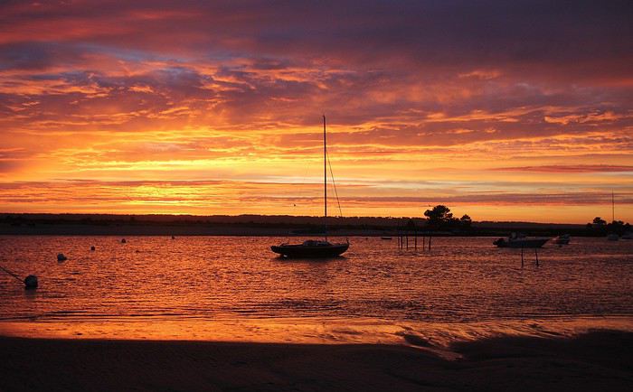
Au Cap-Ferret, un privilège des lèves-tôt consiste à assister parfois au spectacle de l'embrasement du ciel avant le lever du soleil … avec un plus, celui de contempler les nuances sur le miroir d'eau du Bassin d'Arcachon. Des lumières et des teintes dévoilées dans un superbe fondu enchaîné. De minutes en minutes, les tonalités varient passant comme ce matin-là de l'orangé au rose jusqu'à ce que le soleil inonde le paysage marin de sa lumière dorée. Splendide et éblouissant.

Je me trouve sur la plage du phare et il suffit de se retourner pour voir côté terre, le fameux phare avec sa lanterne encore allumée. Le phare du Cap Ferret qui veille sur cette extrémité de presqu'île sera un peu un fil rouge au cours de cette balade qui va vous mener du rivage côté Bassin jusqu'au littoral côté Océan. Un fil rouge … ou plutôt rouge et blanc à l'image des couleurs de sa haute colonne. Un phare qui domine toute cette extrémité de la presqu'île, on l'aperçoit de presque partout, aussi il sera présent sur plusieurs de mes photos de ce récit. En bordure de plage, les villas avec vue marine nous offrent à l'aurore un second miroir avec des reflets d'or sur leurs surfaces vitrées.
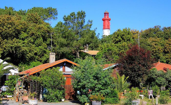
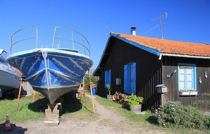
Un peu plus loin et un peu plus tard dans la matinée, nous voici à l'entrée du Quartier des pêcheurs que l'on pourrait également qualifier de quartier des ostréiculteurs. Un site classé pour le pittoresque de ses cabanes en bois. A côté de cette cabane, une pinasse, l'embarcation traditionnelle des lieux, vient de se refaire une beauté à coups de pinceaux. Elle attend sagement la prochaine mise à l'eau. Ici règne une atmosphère d'authenticité, celle des travailleurs de la mer et des parcs ostréicoles.
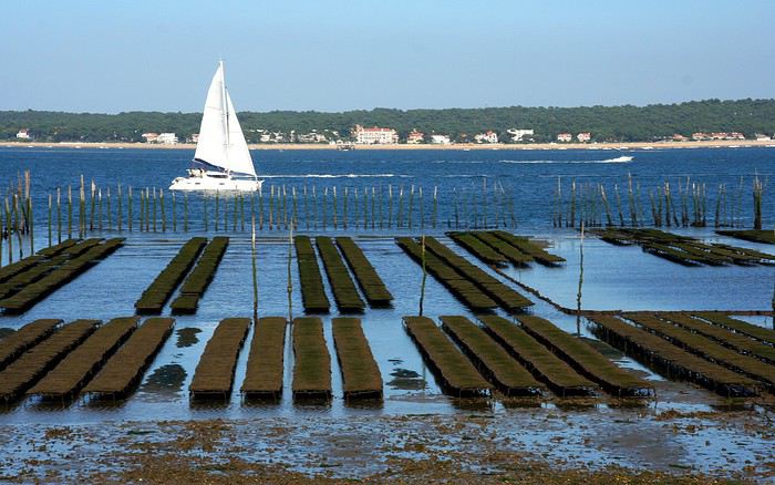

Dans ce hameau on prépare les fameuses huîtres du Bassin que l'on peut même déguster sur des terrasses aménagées avec vue imprenable sur l'étendue d'eau de la baie du Mimbeau.
C'est la dernière cabane ostréicole, tout au bout du quartier des pêcheurs, une cabane avec ici une vue dégagée sur la célèbre Dune du Pilat. J'aime bien cette atmosphère surannée donnée par cette ancienne Aronde des années 50/60. La présentation de la photo en sépia convient parfaitement en renforçant cette impression rétro … mais c'est peut-être dommage de se priver des jolies teintes jaunes des genêts en fleurs ! Bon, une précision, la photo n'a été prise qu'il y a deux ans seulement.

Faisons maintenant un bref crochet à proximité des cabanes des ostréiculteurs en passant parmi les pins. Avec ce soleil matinal et cette photo prise à contre-jour, les pins allongent leurs ombres sur le sol, un bel effet photogénique, je m'empresse de le capturer.
Un autre point de vue depuis ce bosquet. Ici, entre les pins et leurs lignes verticales s'invite la colonne toute droite du phare. Entre deux troncs elle s'immisce et tranche avec sa teinte claire par rapport à celle plus sombre de l'écorce des troncs de résineux.
Achat van sur place aux États-Unis ou envoyer le sien English translation pending
Bonjour,
Je suis sur un dilemme et j'ai besoin de vos conseils avisés. Je prévois de partir 1 an voyager en Amérique du Nord et Amérique centrale. Je ne sais pas si le mieux est d'acheter un van au Canada et de le revendre à la fin au Mexique ce qui ne doit pas être chose facile. L'inconvénient est également la perte de temps sur place pour l'aménagement et surtout trouver le lieu et les équipements pour le faire.
En envoyant un van acheté en France je peux prendre le temps que je veux pour l'aménager depuis chez moi avec les outils nécessaires à disposition. Je peux même le tester lors de road trip en France et être sur de partir avec un van correctement équipé. Le problème est : que faire du van à la fin du road trip ? Je pourrais le stocker en longue durée aux Etats-Unis pour avoir un véhicule sur place en vu de prochain voyage ou le ramener à nouveau vers la France. La revente est très difficile me semble-t-il pour un véhicule immatriculé français.
Donc, acheter sur place ou envoyer son van français ?
Je vous remercie,
Jeremy
Donc, acheter sur place ou envoyer son van français ?
Je vous remercie,
Jeremy
Je vous invite à découvrir l'île de Lanzarote English translation pending
INTRODUCTION
Des vidéos sont insérées tout au long du résumé. Veuillez cliquer sur l'image pour démarrer la vidéo.
En février dernier, nous avons séjourné 2 semaines sur l'île de Lanzarote afin d'en découvrir les différents attraits touristiques.
Comme la plupart de nos précédents voyages, plusieurs semaines ont été consacrées à la création de notre itinéraire afin de pouvoir être en mesure d'atteindre parfaitement nos objectifs.
Lors de notre séjour, nous avons utilisé l'application Maps.me, une application mobile qui fournit des cartes hors ligne. Cette application s'avère très précieuse lors de nos déplacements en voiture, en randonnée et même lors de nos circuits à pied dans les grandes villes.
J'avais préalablement téléchargé les coordonnées GPS de toutes les attractions prévues à notre itinéraire dans l'application Maps.me, ce qui a facilité grandement nos déplacements.
La réservation de l'hébergement ainsi que la location d'une voiture ont été effectuées sur le web avant notre départ.
Nous sommes partis de l'aéroport de Québec et avons eu une escale à Montréal ainsi qu'à Bruxelles en Belgique avant d'atteindre Lanzarote.
Lanzarote fait partie des Îles Canaries qui elles-mêmes sont situées dans l'océan Atlantique, à l'ouest du Maroc. Celles-ci font d'ailleurs partie de l'Espagne.
Nous avions déjà visité l'île de Tenerife et nous avions adoré notre séjour à cet endroit.
Nous avons donc décidé de poursuivre la découverte des Îles Canaries en nous rendant à Lanzarote car cette île offre un paysage volcanique spectaculaire, des plages à faire rêver ainsi que de magnifiques villages aux maisons typiques de l'île qui sont majoritairement blanches.
Les sentiers de randonnée sont nombreux et nous permettent de découvrir une grande diversité de paysages.
Les attraits touristiques sont également fort nombreux et facilement accessibles car les routes de Lanzarote se parcourent aisément en voiture car celles-ci sont dans un état impeccable.
D'ailleurs, c'est un pur plaisir que de se déplacer sur ces routes car les paysages qui défilent sous nos yeux sont sensationnels et présentent une perspective différente selon la lumière du jour.
Des vidéos sont insérées tout au long du résumé. Veuillez cliquer sur l'image pour démarrer la vidéo.
En février dernier, nous avons séjourné 2 semaines sur l'île de Lanzarote afin d'en découvrir les différents attraits touristiques.
Comme la plupart de nos précédents voyages, plusieurs semaines ont été consacrées à la création de notre itinéraire afin de pouvoir être en mesure d'atteindre parfaitement nos objectifs.
Lors de notre séjour, nous avons utilisé l'application Maps.me, une application mobile qui fournit des cartes hors ligne. Cette application s'avère très précieuse lors de nos déplacements en voiture, en randonnée et même lors de nos circuits à pied dans les grandes villes.
J'avais préalablement téléchargé les coordonnées GPS de toutes les attractions prévues à notre itinéraire dans l'application Maps.me, ce qui a facilité grandement nos déplacements.
La réservation de l'hébergement ainsi que la location d'une voiture ont été effectuées sur le web avant notre départ.
Nous sommes partis de l'aéroport de Québec et avons eu une escale à Montréal ainsi qu'à Bruxelles en Belgique avant d'atteindre Lanzarote.
Lanzarote fait partie des Îles Canaries qui elles-mêmes sont situées dans l'océan Atlantique, à l'ouest du Maroc. Celles-ci font d'ailleurs partie de l'Espagne.
Nous avions déjà visité l'île de Tenerife et nous avions adoré notre séjour à cet endroit.
Nous avons donc décidé de poursuivre la découverte des Îles Canaries en nous rendant à Lanzarote car cette île offre un paysage volcanique spectaculaire, des plages à faire rêver ainsi que de magnifiques villages aux maisons typiques de l'île qui sont majoritairement blanches.
Les sentiers de randonnée sont nombreux et nous permettent de découvrir une grande diversité de paysages.
Les attraits touristiques sont également fort nombreux et facilement accessibles car les routes de Lanzarote se parcourent aisément en voiture car celles-ci sont dans un état impeccable.
D'ailleurs, c'est un pur plaisir que de se déplacer sur ces routes car les paysages qui défilent sous nos yeux sont sensationnels et présentent une perspective différente selon la lumière du jour.
Adventures of a Bygone Era: The Philippines in 1984
After several discussions on VF about travel journals from the Philippines, I decided to write this curiosity: a trip report from a journey made in 1984, when traveling to the Philippines was still an adventure.
A curiosity because writing a travel journal about a trip 35 years later isn’t common, but also (mostly?) because exploring the Philippines at that time had little in common with traveling there today.
Obviously, I’ve forgotten a number of facts, most of the details, but with the help of a few notes from that time and a stack of slides (yes, there was life before digital 😊), many memories came back and added to the highlights I’d never forgotten. The scanned slides aren’t always great quality, but there are still quite a few to brighten up this chatter. Back then, we didn’t snap photos like we do now—film was too expensive—so I don’t have pictures of every place we visited... too bad, comparing some of those spots to how they look today would’ve been interesting.
Why "Adventures"? Why call it "Adventures" in the Philippines in 1984, a word so often used for a simple exotic trip? - Because the lack of information (no *Guide du Routard*, no *Lonely Planet*, no *Michelin Guide*, nothing, and obviously no internet) gave this trip what’s at the heart of adventure: the unknown. - Because the political situation made the stay sometimes dangerous. - Because transportation conditions were always epic, often perilous. - Because the question of where we’d spend the night came up almost every evening. - And for... quite a few other reasons.
That said, we weren’t exactly explorers!
Why the Philippines? First of all, why go to the Philippines in 1984—a country not exactly set up for tourism and about which we knew very little? How could we get an idea of the beauty of the Philippines and its points of interest when we had no guides or photos?
The idea came to us from Thailand a year earlier, during our first long-haul trip. After touring the north of the country, we met a Frenchman living in Phuket, where there were only a few tourists in Patong, with just a few small hotels and guesthouses. Kata and Karon had no buildings or roads, Rawai only had three palm-thatched bungalows, including ours, and the other islands were unknown to tourists. There was plenty to discover, and we wanted to return to this beautiful country... but the Frenchman made us dream about the Philippines—a country to explore, with wild landscapes.
Long evenings of discussion over multiple Sprite-Mekong cocktails (what memories of those headaches!) finally convinced us we had to go to the Philippines.
Episode 0: Before Departure The decision was made: we’d go to the Philippines in May 1984. Our friends and family were surprised when we announced we were going on vacation to the Philippines (a bit like saying today we were going paddleboarding in the Kerguelen Islands 🤪).
These days, preparing for each of our trips takes long evenings of research, planning, and noting down good addresses... etc. But for the Philippines in 1984, preparation was quick: we had very little information about the country, we were leaving almost at random, and the discovery would only be more exciting.
We still had a few bits of info gathered here and there: the rice terraces in northern Luzon, volcanoes, Negros where we were supposed to visit an acquaintance, Cebu and its marine life (we ended up going elsewhere), and absolutely avoid Mindanao, which was practically at war with the regime. That was about it, but it was already a great itinerary.
Nothing was organized in advance; we’d see day by day. We had no idea about travel times or even the existence of transportation options. The main (and sometimes only) way to connect two islands was by overloaded, rusty ferry. Only the big cities had airports.
Let’s Go: Episode 1: Paris to Manila My travel journals always start after arriving at the airport—the Europe-to-“Other Continent” trip isn’t interesting—but the flight to the Philippines was already an adventure, so I’ll make an exception.
This was the era when only a few Asian airlines were on par with Western ones: Thai, Singapore Airlines, and Philippine Airlines. They had beautiful, brand-new planes, and to attract customers (almost exclusively “businessmen”) from the usual airlines (Air France, Lufthansa, British Airways), there was opulence on board: unlimited champagne, all sorts of cocktails... Compared to today’s long-haul flights, there was still one small difference: no personal screens, just one screen at the front of the cabin with one mandatory movie. And I don’t know why, but we only got James Bond films, both ways... that must’ve been the trend at the time.
The tourism boom to Southeast Asia hadn’t started yet, and the “Asian Tigers” weren’t a thing, so there weren’t many business trips. That meant long-haul flights made stops everywhere to fill the planes. Our Philippine Airlines Boeing 747 left London, picked us up in Paris, then stopped in Frankfurt to take on a few Germans. I don’t know why we then made a stop in Dubai—a totally exotic place at the time. There was nothing to do there... things have changed a lot since. It was a small town lost in the desert. The airport was tiny, with just one or two buildings and a supermarket. During the stopover, everyone had to get off the plane and walk to the supermarket. Photo and electronic equipment were dirt cheap—I guess that was the only reason for the stop. Maybe it was their first commercial move. Emirates didn’t exist yet, as I checked online, but anyway, the idea that such a remote place could have its own airline was unthinkable.
Online, I found this photo of Dubai Airport in 1980. Anyone who’s transited through today’s massive airport with its rows of A380s will appreciate it:
Next stop: New Delhi to drop off some Europeans and pick up a few Indians, and finally, the terminus: Manila. I don’t remember how long the trip took with its five stops—an unimaginable journey today. Despite all those stops to fill the plane, there was still enough space to stretch out on the four center seats of the 747, something that never happens these days despite all the flights in every direction.
So here we are, finally at Manila Airport around midnight.
Episode 1: Manila and Baguio To start, a quick note on the political and economic situation in the Philippines in 1984, which had consequences for us as tourists, as we’d soon realize upon arrival.
After several centuries of Spanish colonization, the Philippines became American at the start of the 20th century, then independent. In 1966, Marcos took power, and little by little, his regime sank into corruption and mismanagement, becoming a dictatorship with martial law, all for the benefit of his family and friends, who enriched themselves endlessly. The peak was the assassination of opposition leader Benigno Aquino in August 1983, which triggered harshly repressed protests. So we arrived a few months later in a very poor country, with omnipresent corruption and an extremely tense political situation, as we’d soon see for ourselves. Major protests took place in the main cities during our trip—I’ll come back to that. Two years later, Marcos fled to Hawaii after being forced out of power following rigged elections. This historical context explains a lot of the situations we found ourselves in over the following weeks.
Arriving in the middle of the night isn’t very cheerful. Manila was already a huge city with many slums, where you could find a few business hotels like the Hilton or Intercontinental—way out of our budget—and plenty of run-down hotels. Luckily, two Indians we’d chatted with on the plane offered to take us to their usual hotel. They came to Manila twice a year for business. We accepted their offer, relieved not to have to look for a place to stay in the middle of the night, figuring the address must be good since they came back every time... we were wrong 🙁
We left the airport and immediately got a taste of the local vibe when we got into the taxi: the police asked for our passports. We thought: what’s more normal than police in a dictatorship?
But that wasn’t it at all. Our two Indian friends explained that the police were noting our names along with the taxi number and time. Crime in Manila was so bad that the taxi driver would be held responsible if anything happened to us... welcome to the Philippines 😎 😎
Historically, the Philippines was a very violent country, where everything was settled with guns or machetes. Previous governments had banned carrying weapons, but Marcos later allowed the free sale and carrying of guns, and disputes were settled with pistols again (or worse, as we’d discover later). Since he’d released most of the criminals from prison to form a paramilitary militia at his service (I’ll talk about our encounter with these “heroes” later), it was pretty dangerous to go into many parts of Manila, where these “tonton macoutes” ruled.
We arrived at our hotel without incident... and then things started badly. The room was infested with big cockroaches—exactly what I hate most in those kinds of countries. No way to find another hotel at that hour. After the long flight, the urge to take a shower was so strong that we squeezed into the bathroom as best we could. After that, I don’t remember—I guess we must’ve fallen asleep exhausted under the sheets in the heat... air conditioning wasn’t widespread yet.
The next day, we just wanted to leave that dump as soon as possible. So we decided to head north right away, stopping in Baguio, and we’d visit Manila a bit on the way back.
When we stepped outside, we discovered a pretty run-down neighborhood with potholed streets. But we also discovered the jeepneys. They were everywhere, flooding the streets.
They had crazy sound systems, each one blasting louder than the last. The interiors were kitschy but fun. There weren’t many private cars—almost all transportation was by jeepney, with buses reserved for intercity trips.
Before heading to the bus terminal for the north, somewhere on the outskirts of the city, we needed to exchange some money. I don’t remember how we ended up in a policeman’s jeep who offered his services: - Exchange money on the black market at a better rate than the banks. - Take us wherever we wanted, in this case, the bus terminal.
We accepted both offers (we’d still checked the official exchange rate from dollars to pesos). So we found ourselves in his jeep. After exchanging money, we left in his vehicle and stopped for gas. Without turning off the engine, he calmly smoked a cigarette while filling up. Since we were in a jeep with no doors or roof, we were ready to jump out if things went south, our travel bag in hand.
But we weren’t done with surprises yet. Once we left the small streets, we ended up in a neighborhood with wide avenues and not much traffic, which didn’t justify his incredible behavior. At every intersection, he made the sign of the cross, closed his eyes, and crossed without looking. I was more stunned than terrified! It wasn’t until we got out of the car later that I told Anne-Marie what had happened. I’d seen everything because the cop had put me in the front seat. Luckily, A-Marie hadn’t noticed anything from the back. Crossing Manila by trusting God rather than the rules of the road was ultimately effective. We were lucky—the trip was off to a good start. 🙂 🙂
We then passed through a neighborhood where slums stretched on for a while, and we left our policeman—friendly but a bit crazy—with relief.
A few hours by bus later, here we are in Baguio, cool in the mountains. My memories of Baguio are pretty fuzzy. I remember a small town. After some research while writing this journal, I found that the population was 120,000 in 1980. Given the population density in each home, that confirms my memory of a smallish town. Outside the “official” district with the president’s summer residence and government buildings, there were two or three paved streets with nice houses. The rest was very dirty and very poor, with lots of slums and dirt roads.
People we met on the street invited us to stay with them. These days, we wouldn’t just show up at strangers’ houses, which we should’ve done in Baguio—it would’ve saved us from an unimaginable and dangerous situation... which I won’t say anything about... !😊
The simple wooden house was on stilts at the edge of a hill with a view of the mountains. Since it was the start of the rainy season in a city that gets a lot of rain, we saw a lot of water. Our outings in town happened between downpours.
View from our lodging: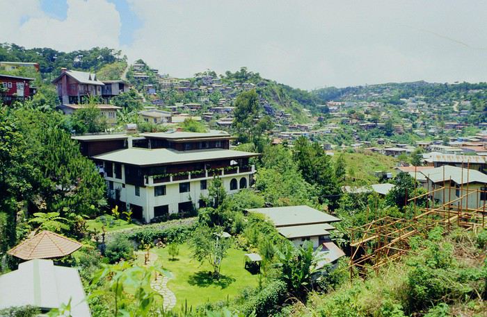
Episode 2: Baguio to Bontoc Aside from the situation briefly mentioned above, it was on the next leg to Bontoc that the adventure really began: an endless and dangerous road, a bus from another era, breathtaking landscapes, and surprising people.
We didn’t know the distance or how long it would take to get to Bontoc. When we arrived after about ten hours, we learned that Baguio to Bontoc was 140 km.
We got on a bus with wooden seats and settled in, two to a seat meant for two. As the bus filled up, passengers squeezed in three or four per seat, with chickens and baskets full of all sorts of things in the aisle. A little embarrassed, we didn’t know if we should squeeze in three on our seat. The seats were super tight (luckily, Filipinos are small), and I didn’t know where to put my legs given my height. I don’t remember if we stayed alone on our bench or if we ended up sharing with others.
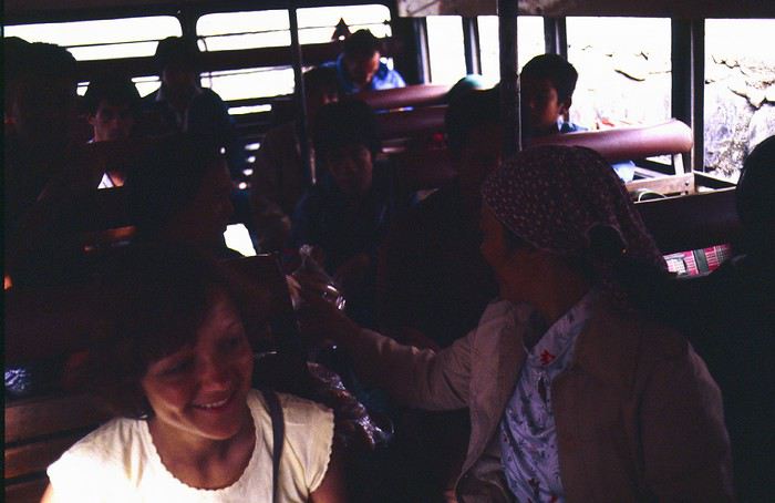
The “road” was a dirt track (or rather, a mud track) with endless turns. We held on as best we could to our slippery wooden seats—it was shaking in every direction. The woman behind us was carsick and throwing up... gross... but what were we doing there? Then we plunged into the Sierra Madre... just the name is dreamy!
Rice terraces started to appear: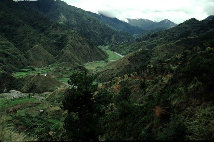
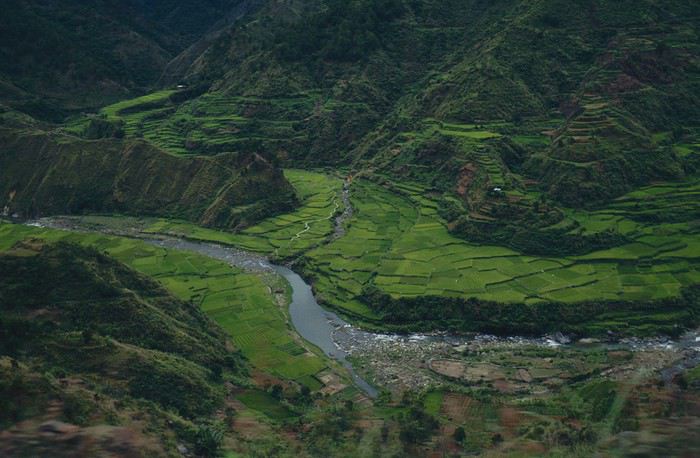
they took up more and more space along cliffs where we weren’t always reassured,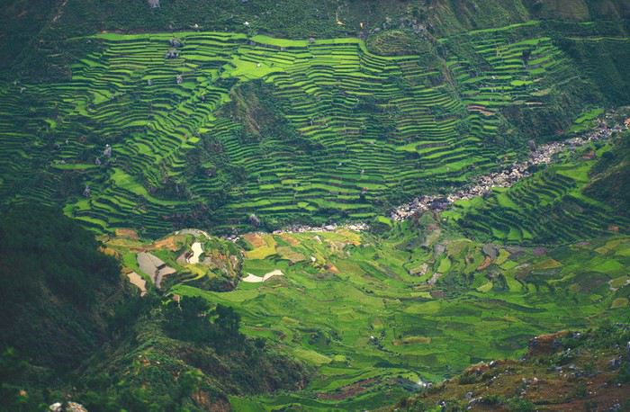
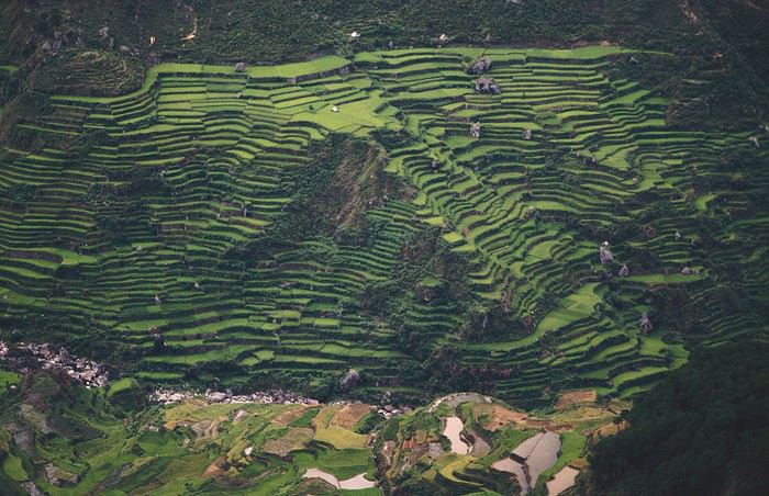
with lots of waterfalls (all that water had to go somewhere).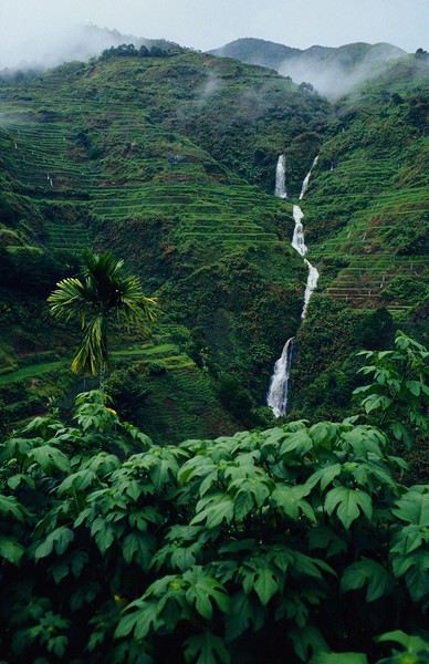
A few miserable villages stretched along the track, most often just a few houses balancing between the road and the drop. The bus stopped in every village—people got on or off and settled inside or on the roof. Street vendors offered their products to the bus passengers—a common sight in Asia, even today.
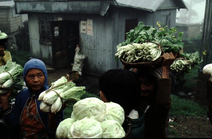
We were in another world—villagers were in loincloths, others had spears. The atmosphere was strange... but all good, we wanted exoticism, and we got it: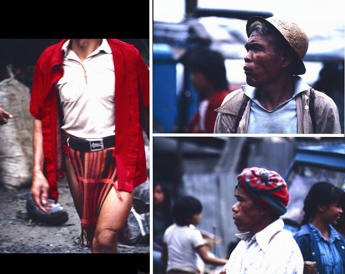
This so-called traditional outfit was everyday wear—it wasn’t for tourists since there weren’t any.
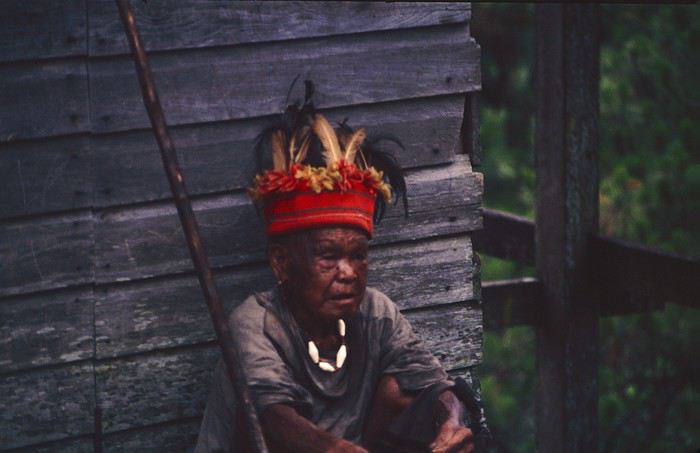
A curiosity because writing a travel journal about a trip 35 years later isn’t common, but also (mostly?) because exploring the Philippines at that time had little in common with traveling there today.
Obviously, I’ve forgotten a number of facts, most of the details, but with the help of a few notes from that time and a stack of slides (yes, there was life before digital 😊), many memories came back and added to the highlights I’d never forgotten. The scanned slides aren’t always great quality, but there are still quite a few to brighten up this chatter. Back then, we didn’t snap photos like we do now—film was too expensive—so I don’t have pictures of every place we visited... too bad, comparing some of those spots to how they look today would’ve been interesting.
Why "Adventures"? Why call it "Adventures" in the Philippines in 1984, a word so often used for a simple exotic trip? - Because the lack of information (no *Guide du Routard*, no *Lonely Planet*, no *Michelin Guide*, nothing, and obviously no internet) gave this trip what’s at the heart of adventure: the unknown. - Because the political situation made the stay sometimes dangerous. - Because transportation conditions were always epic, often perilous. - Because the question of where we’d spend the night came up almost every evening. - And for... quite a few other reasons.
That said, we weren’t exactly explorers!
Why the Philippines? First of all, why go to the Philippines in 1984—a country not exactly set up for tourism and about which we knew very little? How could we get an idea of the beauty of the Philippines and its points of interest when we had no guides or photos?
The idea came to us from Thailand a year earlier, during our first long-haul trip. After touring the north of the country, we met a Frenchman living in Phuket, where there were only a few tourists in Patong, with just a few small hotels and guesthouses. Kata and Karon had no buildings or roads, Rawai only had three palm-thatched bungalows, including ours, and the other islands were unknown to tourists. There was plenty to discover, and we wanted to return to this beautiful country... but the Frenchman made us dream about the Philippines—a country to explore, with wild landscapes.
Long evenings of discussion over multiple Sprite-Mekong cocktails (what memories of those headaches!) finally convinced us we had to go to the Philippines.
Episode 0: Before Departure The decision was made: we’d go to the Philippines in May 1984. Our friends and family were surprised when we announced we were going on vacation to the Philippines (a bit like saying today we were going paddleboarding in the Kerguelen Islands 🤪).
These days, preparing for each of our trips takes long evenings of research, planning, and noting down good addresses... etc. But for the Philippines in 1984, preparation was quick: we had very little information about the country, we were leaving almost at random, and the discovery would only be more exciting.
We still had a few bits of info gathered here and there: the rice terraces in northern Luzon, volcanoes, Negros where we were supposed to visit an acquaintance, Cebu and its marine life (we ended up going elsewhere), and absolutely avoid Mindanao, which was practically at war with the regime. That was about it, but it was already a great itinerary.
Nothing was organized in advance; we’d see day by day. We had no idea about travel times or even the existence of transportation options. The main (and sometimes only) way to connect two islands was by overloaded, rusty ferry. Only the big cities had airports.
Let’s Go: Episode 1: Paris to Manila My travel journals always start after arriving at the airport—the Europe-to-“Other Continent” trip isn’t interesting—but the flight to the Philippines was already an adventure, so I’ll make an exception.
This was the era when only a few Asian airlines were on par with Western ones: Thai, Singapore Airlines, and Philippine Airlines. They had beautiful, brand-new planes, and to attract customers (almost exclusively “businessmen”) from the usual airlines (Air France, Lufthansa, British Airways), there was opulence on board: unlimited champagne, all sorts of cocktails... Compared to today’s long-haul flights, there was still one small difference: no personal screens, just one screen at the front of the cabin with one mandatory movie. And I don’t know why, but we only got James Bond films, both ways... that must’ve been the trend at the time.
The tourism boom to Southeast Asia hadn’t started yet, and the “Asian Tigers” weren’t a thing, so there weren’t many business trips. That meant long-haul flights made stops everywhere to fill the planes. Our Philippine Airlines Boeing 747 left London, picked us up in Paris, then stopped in Frankfurt to take on a few Germans. I don’t know why we then made a stop in Dubai—a totally exotic place at the time. There was nothing to do there... things have changed a lot since. It was a small town lost in the desert. The airport was tiny, with just one or two buildings and a supermarket. During the stopover, everyone had to get off the plane and walk to the supermarket. Photo and electronic equipment were dirt cheap—I guess that was the only reason for the stop. Maybe it was their first commercial move. Emirates didn’t exist yet, as I checked online, but anyway, the idea that such a remote place could have its own airline was unthinkable.
Online, I found this photo of Dubai Airport in 1980. Anyone who’s transited through today’s massive airport with its rows of A380s will appreciate it:
Next stop: New Delhi to drop off some Europeans and pick up a few Indians, and finally, the terminus: Manila. I don’t remember how long the trip took with its five stops—an unimaginable journey today. Despite all those stops to fill the plane, there was still enough space to stretch out on the four center seats of the 747, something that never happens these days despite all the flights in every direction.
So here we are, finally at Manila Airport around midnight.
Episode 1: Manila and Baguio To start, a quick note on the political and economic situation in the Philippines in 1984, which had consequences for us as tourists, as we’d soon realize upon arrival.
After several centuries of Spanish colonization, the Philippines became American at the start of the 20th century, then independent. In 1966, Marcos took power, and little by little, his regime sank into corruption and mismanagement, becoming a dictatorship with martial law, all for the benefit of his family and friends, who enriched themselves endlessly. The peak was the assassination of opposition leader Benigno Aquino in August 1983, which triggered harshly repressed protests. So we arrived a few months later in a very poor country, with omnipresent corruption and an extremely tense political situation, as we’d soon see for ourselves. Major protests took place in the main cities during our trip—I’ll come back to that. Two years later, Marcos fled to Hawaii after being forced out of power following rigged elections. This historical context explains a lot of the situations we found ourselves in over the following weeks.
Arriving in the middle of the night isn’t very cheerful. Manila was already a huge city with many slums, where you could find a few business hotels like the Hilton or Intercontinental—way out of our budget—and plenty of run-down hotels. Luckily, two Indians we’d chatted with on the plane offered to take us to their usual hotel. They came to Manila twice a year for business. We accepted their offer, relieved not to have to look for a place to stay in the middle of the night, figuring the address must be good since they came back every time... we were wrong 🙁
We left the airport and immediately got a taste of the local vibe when we got into the taxi: the police asked for our passports. We thought: what’s more normal than police in a dictatorship?
But that wasn’t it at all. Our two Indian friends explained that the police were noting our names along with the taxi number and time. Crime in Manila was so bad that the taxi driver would be held responsible if anything happened to us... welcome to the Philippines 😎 😎
Historically, the Philippines was a very violent country, where everything was settled with guns or machetes. Previous governments had banned carrying weapons, but Marcos later allowed the free sale and carrying of guns, and disputes were settled with pistols again (or worse, as we’d discover later). Since he’d released most of the criminals from prison to form a paramilitary militia at his service (I’ll talk about our encounter with these “heroes” later), it was pretty dangerous to go into many parts of Manila, where these “tonton macoutes” ruled.
We arrived at our hotel without incident... and then things started badly. The room was infested with big cockroaches—exactly what I hate most in those kinds of countries. No way to find another hotel at that hour. After the long flight, the urge to take a shower was so strong that we squeezed into the bathroom as best we could. After that, I don’t remember—I guess we must’ve fallen asleep exhausted under the sheets in the heat... air conditioning wasn’t widespread yet.
The next day, we just wanted to leave that dump as soon as possible. So we decided to head north right away, stopping in Baguio, and we’d visit Manila a bit on the way back.
When we stepped outside, we discovered a pretty run-down neighborhood with potholed streets. But we also discovered the jeepneys. They were everywhere, flooding the streets.
They had crazy sound systems, each one blasting louder than the last. The interiors were kitschy but fun. There weren’t many private cars—almost all transportation was by jeepney, with buses reserved for intercity trips.
Before heading to the bus terminal for the north, somewhere on the outskirts of the city, we needed to exchange some money. I don’t remember how we ended up in a policeman’s jeep who offered his services: - Exchange money on the black market at a better rate than the banks. - Take us wherever we wanted, in this case, the bus terminal.
We accepted both offers (we’d still checked the official exchange rate from dollars to pesos). So we found ourselves in his jeep. After exchanging money, we left in his vehicle and stopped for gas. Without turning off the engine, he calmly smoked a cigarette while filling up. Since we were in a jeep with no doors or roof, we were ready to jump out if things went south, our travel bag in hand.
But we weren’t done with surprises yet. Once we left the small streets, we ended up in a neighborhood with wide avenues and not much traffic, which didn’t justify his incredible behavior. At every intersection, he made the sign of the cross, closed his eyes, and crossed without looking. I was more stunned than terrified! It wasn’t until we got out of the car later that I told Anne-Marie what had happened. I’d seen everything because the cop had put me in the front seat. Luckily, A-Marie hadn’t noticed anything from the back. Crossing Manila by trusting God rather than the rules of the road was ultimately effective. We were lucky—the trip was off to a good start. 🙂 🙂
We then passed through a neighborhood where slums stretched on for a while, and we left our policeman—friendly but a bit crazy—with relief.
A few hours by bus later, here we are in Baguio, cool in the mountains. My memories of Baguio are pretty fuzzy. I remember a small town. After some research while writing this journal, I found that the population was 120,000 in 1980. Given the population density in each home, that confirms my memory of a smallish town. Outside the “official” district with the president’s summer residence and government buildings, there were two or three paved streets with nice houses. The rest was very dirty and very poor, with lots of slums and dirt roads.
People we met on the street invited us to stay with them. These days, we wouldn’t just show up at strangers’ houses, which we should’ve done in Baguio—it would’ve saved us from an unimaginable and dangerous situation... which I won’t say anything about... !😊
The simple wooden house was on stilts at the edge of a hill with a view of the mountains. Since it was the start of the rainy season in a city that gets a lot of rain, we saw a lot of water. Our outings in town happened between downpours.
View from our lodging:
Episode 2: Baguio to Bontoc Aside from the situation briefly mentioned above, it was on the next leg to Bontoc that the adventure really began: an endless and dangerous road, a bus from another era, breathtaking landscapes, and surprising people.
We didn’t know the distance or how long it would take to get to Bontoc. When we arrived after about ten hours, we learned that Baguio to Bontoc was 140 km.
We got on a bus with wooden seats and settled in, two to a seat meant for two. As the bus filled up, passengers squeezed in three or four per seat, with chickens and baskets full of all sorts of things in the aisle. A little embarrassed, we didn’t know if we should squeeze in three on our seat. The seats were super tight (luckily, Filipinos are small), and I didn’t know where to put my legs given my height. I don’t remember if we stayed alone on our bench or if we ended up sharing with others.
The “road” was a dirt track (or rather, a mud track) with endless turns. We held on as best we could to our slippery wooden seats—it was shaking in every direction. The woman behind us was carsick and throwing up... gross... but what were we doing there? Then we plunged into the Sierra Madre... just the name is dreamy!
Rice terraces started to appear:
they took up more and more space along cliffs where we weren’t always reassured,
with lots of waterfalls (all that water had to go somewhere).
A few miserable villages stretched along the track, most often just a few houses balancing between the road and the drop. The bus stopped in every village—people got on or off and settled inside or on the roof. Street vendors offered their products to the bus passengers—a common sight in Asia, even today.
We were in another world—villagers were in loincloths, others had spears. The atmosphere was strange... but all good, we wanted exoticism, and we got it:
This so-called traditional outfit was everyday wear—it wasn’t for tourists since there weren’t any.
Mais où qu'il est ce truc là (4) English translation pending
L'Andalousie à vélo, le top c'est au printemps English translation pending
Printemps 2019 : De Séville à Séville par les villes et villages blancs, une Andalousie encore verte et vide de touristes. Séville, Cordoue, Gibraltar, Maroc (Tétouan, Tanger), Cadix, plus de 1500 km sur les pistes blanches de la vallée du Guadalquivir et les belles routes bosselées de montagne. Chroniques d'un sexagénaire en totale liberté.
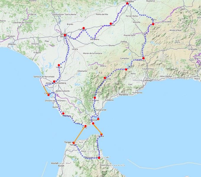
Retour d'une magnifique croisière en Antarctique à bord du Boreal du 26 février au 7 mars 2020 English translation pending
Bonjour à tou(te)s,
Tout d'abord, un grand merci 😉 à Joska, Sarnia, Toilapol, 4yne, Musclass, Maclaro et les autres membres VF dont j'ai regardé les CR et qui m'ont aidé dans la préparation et l'attente de ce voyage.
Je me lance donc dans un petit résumé de notre croisière en Antarctique à bord du Boreal qui s’est déroulée du 26 février au 7 mars 2020. Cette croisière était en partenariat avec National Geographic.
Nous sommes revenus émerveillés de ce voyage 😇 qui s’est très bien passé. Nous avons eu une équipe de naturalistes et un équipage formidables à tous les points de vue 😎 : navigation, hôtellerie/restauration, animation…
Nous avons eu une traversée du Drake très mouvementée 🏴☠️ à l’aller (creux de 7 mètres, vent à 60 nœuds) mais nous avons été récompensés par une météo exceptionnelle 😄 en Antarctique.
Nous avons pu faire tous les jours deux sorties (sauf en Mer de Weddell, un seul débarquement), voire quatre pour nous 😇 l’avant-dernier jour en Péninsule car nous avons eu la chance de pouvoir faire du kayak sans supplément de prix.
La faune était au rendez-vous : manchots bien sûr, baleines très nombreuses, orques, phoques de Weddell, crabier, léopard, otaries, damiers du Cap…Un bonheur !
La carte de la croisière :
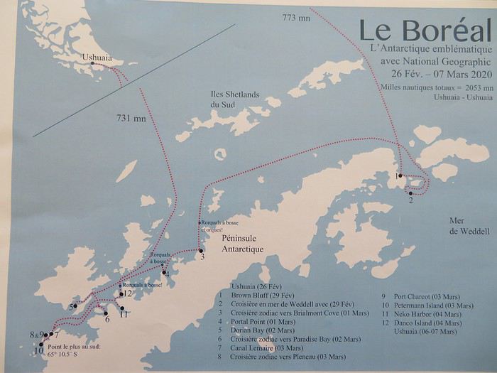
Brown Bluff
Balade en zodiac, Baie de Brialmont
Rorqual à bosse
Baie de la Salpétrière
Port Charcot
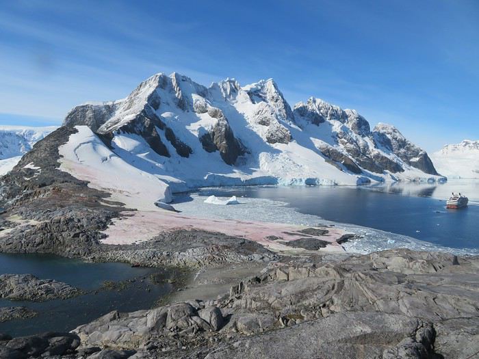
A bientôt pour la suite...😉
Tout d'abord, un grand merci 😉 à Joska, Sarnia, Toilapol, 4yne, Musclass, Maclaro et les autres membres VF dont j'ai regardé les CR et qui m'ont aidé dans la préparation et l'attente de ce voyage.
Je me lance donc dans un petit résumé de notre croisière en Antarctique à bord du Boreal qui s’est déroulée du 26 février au 7 mars 2020. Cette croisière était en partenariat avec National Geographic.
Nous sommes revenus émerveillés de ce voyage 😇 qui s’est très bien passé. Nous avons eu une équipe de naturalistes et un équipage formidables à tous les points de vue 😎 : navigation, hôtellerie/restauration, animation…
Nous avons eu une traversée du Drake très mouvementée 🏴☠️ à l’aller (creux de 7 mètres, vent à 60 nœuds) mais nous avons été récompensés par une météo exceptionnelle 😄 en Antarctique.
Nous avons pu faire tous les jours deux sorties (sauf en Mer de Weddell, un seul débarquement), voire quatre pour nous 😇 l’avant-dernier jour en Péninsule car nous avons eu la chance de pouvoir faire du kayak sans supplément de prix.
La faune était au rendez-vous : manchots bien sûr, baleines très nombreuses, orques, phoques de Weddell, crabier, léopard, otaries, damiers du Cap…Un bonheur !
La carte de la croisière :
Brown Bluff
Balade en zodiac, Baie de Brialmont
Rorqual à bosse
Baie de la Salpétrière
Port Charcot
A bientôt pour la suite...😉
Interdiction d'accoster sur les côtes françaises pour les bateaux de plus de 100 personnes English translation pending
Si vous devez partir en croisière depuis un départ Français, les navires n'ont plus le droit d'accoster jusqu'au 15 Avril (voir Article 3) : https://www.legifrance.gouv.fr/affichTexte.do?cidTexte=JORFTEXT000041722917&dateTexte=&categorieLien=id
Article 3
Jusqu'au 15 avril 2020, il est interdit aux navires de croisière et aux navires à passagers transportant plus de 100 passagers de faire escale en Corse, et de faire escale ou de mouiller dans les eaux intérieures et les eaux territoriales des départements et régions d'outre-mer, ainsi que de Saint-Barthélemy et Saint-Martin, Saint-Pierre-et-Miquelon, et Wallis-et-Futuna, sauf dérogation accordée par le représentant de l'Etat compétent pour ces mêmes collectivités.
Article 3
Jusqu'au 15 avril 2020, il est interdit aux navires de croisière et aux navires à passagers transportant plus de 100 passagers de faire escale en Corse, et de faire escale ou de mouiller dans les eaux intérieures et les eaux territoriales des départements et régions d'outre-mer, ainsi que de Saint-Barthélemy et Saint-Martin, Saint-Pierre-et-Miquelon, et Wallis-et-Futuna, sauf dérogation accordée par le représentant de l'Etat compétent pour ces mêmes collectivités.