J'envisage de partir cet été en Norvège, l'idée est la suivante : arrivée à Oslo en avion retour en avion de Tromso.
Le but parcourir les plus jolies coins a velo et les rejoindre par train ou bateau (le but n'est pas de traverser la norvège à velo mais juste de faire les plus beaux endroits à velo et pourquoi pas quelques randos et du kayak))
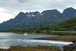
Une chose dont je suis sure je veux finir avec les ils lofoten, vesteralen, senja. Je pense leurs consacrer 2 semaines (soit 2 semaines pour faire bodo tromso par les iles).
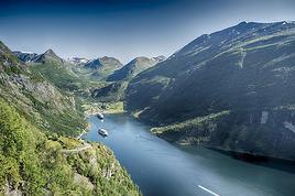
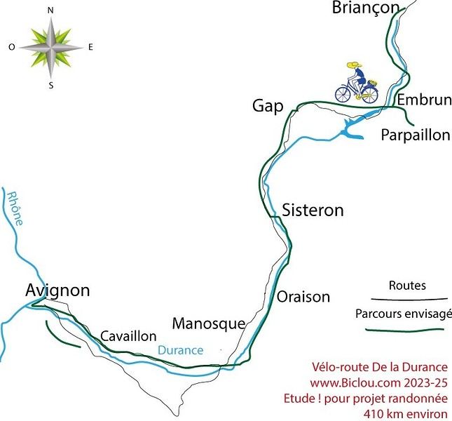
Ce qui m'embète : je voudrais parcourir les jolies routes dans le parc jotunheimen (voir ce beau glacier) comme la rv 55 , les routes m'ont l'air sympa entre Ovre ardal et Dombas. et rejoindre ensuite en transport en commun le nord (Bodo). Je voudrais savoir quels sont les routes, endroits à ne pas manquer donc voici mon idée :
Oslo - flam en train ; la route semble jolie surtout sur la fin ca vaut peut-etre le coup d'en faire une partie en velo, si oui laquelle ?
visite du fjord en bateau ; quelle trajet privilégier ?
velo depuis le débarcadère (lequel ?) jusqu'au parc puis Dombas rando à faire ?
train jusqu'à Trondeihn.
Là ca se complique : entre Trondeihn et Bodo plusieus possiblités :
- le ferry de Hurtingruten mais ca à l'air cher et est-ce que la traversée est jolie ?
- le train : bof (mais le plus rapide)
- la route : la Kystriksveien (route cotière rv 17) mais j'ai peur que vue la longueur elle soit un peu monotone ?
la meilleure solution peut-etre faire les plus belles partie en velo et le reste en ferry ou train ?
Beaucoup de questions.. donc beauccoup de réponse j'espère ! :-)
j' avais oublié il y a possibilité d'alterner ferry et velo sur la rv 17 pour faire Steinkjer Bodo mais je n'ai pas l'impression que cette route apporte quelque chose de plus, de différent par rapport aux autres coins où je veux aller comme les lofoten. Quelqu'un a deja fait cette route ? des avis?
Bonsoir,
J'ai fait cette année "Aventure 2010" la descente de la Norvège, tout est magnifique sauf le temps souvent humide et même froid au dessus du cercle polaire. Mon carnet écrit chaque soir sous la tente devrait refléter mes sensations. Il est certain que cet itinéraire est à conseiller mais peut-être que d'autres ... En ce qui me concerne, j'ai suivi le conseil des autochtones sachant que je voulais découvrit North Cape, Trondheim, Lillehammer et Oslo.
Bonne route et bon voyage.
PS: Je mettrai à jour la galerie photo dès que mon diapo sera monté et d'ici là j'aurai également renseigné les coûts, le matériel, l'itinéraire et son kilométrage.
Merci pour ta réponse, suis allée vite fait sur ton site , j'ai rien vu sur la Norvège mais comme suis pas la reine de l'informatique j'ai peut-etre mal cherché.
Quelques précisions pour ceux qui voudraient m'aider dans le choix de mon itinéraire et des endroits à ne pas manquer :
- Je déteste les villes ( J'aurais bien visité Bergen mais ca m'éloigne vraiment ( à moins que quelqun est un joli itinéraire à vélo à me proposer) mais les peits villages authentiques j'adore !
- Je déteste les routes goudronnées avec circulation, les seules que j'aime ce sont les petites routes sans marquage où les voitures ne peuvent pas se croiser et le top c'est quand y'a des touffes d'herbe qui arrivent à sortir au milieu de la route sous le goudron qui s'effrite. Je sais qu'en Norvège ca va etre du goudron avec de belles bandes blanches (grr...) de la circulation dans les 2 sens mais je vais essayer de privilégier les routes avec le moins de circulation possible.
- Rouler pour rouler c'est pas mon truc, il faut que le paysage soit varié, j'ai l'impression que la rv 17 ne doit pas etre très variée mais peut-etre que je me trompe...
Mais y a quand meme des trucs que j'aime ... LA NATURE ;-) !!!!!
Bonsoir
mon site est-il donc si touffu ?
Voici l'URL de mon aventure "Cap au Nord" 2010 :
http://aventures.ordinaires.free.fr/index.php?option=com_content&view=article&id=240&Itemid=243
Il suffit ensuite de sélectionner sur le bandeau droit la section voulue (ex: Cap nord)
Pour ce qui est des routes, elles sont étroites mais en très bon état. Il faut éviter les grands axes, ce n'est pas toujours possible mais c'est ce que j'ai pratiqué comme tout le monde à 95%. Pour la nature tu seras servie.
Bonne visite et bonne ballade
Marc
Bonjour,
Vous écrivez "meilleurs coins à VTT" mais vous parlez surtout de petites routes. Je ne comprends pas bien, car le VTT aime peu le goudron !
Pour le vélo classique, le récit de AventuresOrd doit vous combler.
Pour le VTT proprement dit vous avez un parcours d'anthologie, à profil descendant qui se termine à Flam, en partant de Myrdal que l'on rejoint par le train...mais attention, c'est du VTT, du vrai ! sinon vous trouverez ces petites routes charmantes et quasi désertes un peu partout notamment sur les îles : Hitra, Vega....
A AventuresOrd : bravo ! J'ai parcouru votre récit, et je suis très admiratif ! Nous avons fait grosso modo ce parcours en Mai Juin l'an dernier et cette année, mais en camping car, avec un confort qui me fait presque honte quand je lis vos aventures ! Car je n'ai pas le souvenir d'avoir eu une aussi mauvaise météo !
Nous avions bien aimé Turku, non sa place immense et froide, mais les quartiers proches des quais, plutôt souriants et chaleureux avec de belles vieilles maison anciennes.
Très cordialement,
Cheechako
Bonjour,
Merci pour vos commentaires sur mes carnets, je voulais juste préciser qu'ils sont écrits le soir même sous la tente (le PC est solide) et que parfois les soucis ou les angoisses donnent une image négative de lieux que j'ai appréciés. Je produis également au retour un diaporama qui lui est plus synthétique et qui décrit beaucoup mieux mes sentiments. Les clips et photos évitent le commentaire visuel, reste à relater l'aventure.
En ce qui me concerne, le périple a été un peu écrasé par la Norvège mais j'ai été agréablement surpris par la Finlande que je craignais monotone. Pour le temps, il a été globalement exécrable (froid et pluie), pire encore que celui rencontré lors de mon retour de Moscou (aventure2007).
Cordialement
PS: un mail en direct permet d'être classé dans mes contacts et informé de mes départs, arrivées et diaporamas.
Bonjour,
J'ai fait trois fois du cyclotourisme en Norvège (1981 -1990 - 2004).
D'une façon générale, le circuit des fjords est difficile.
Le circuit que vous envisagez : Oslo Dombas Trondheim Tromso est aisé.
En ce qui concerne les Lofoten, il faut les voir sous le soleil. Hélas, sur 30 ans, l’ambiance a beaucoup changé (route asphaltée, infrastructure touristique, beaucoup plus de voitures vu la fréquence des ferrys sur l’île). D’après moi, y rester 2 semaines me semble trop long.
Le circuit de la côte ouest RV17 (500 km) ne m’a pas semblé monotone du tout. Le début est difficile et par la suite beaucoup plus facile. Sur tout le circuit, il y a très peu de voitures et on profite des bacs (ferrys) et de l’air doux (gulfstream). L’occasion de voir une très belle île : Leka, un must, géologie toute particulière, sous le soleil, une vraie merveille. Rochers ocres, terre de sienne comme en Australie.
L’île de Joa, au dessus de Namsos n’est peut-être pas utile à visiter mais elle a son charme, ambiance très calme et température très clémente.
Près de Steinkjer, direction Namsos, hors de la route 17, il y a un parcours très intéressant et sauvage vers Dorras, mais il est préférable d’avoir une carte d’état major pour ne pas se perdre, que vous pouvez vous procurer dans un café avec internet. La route Vik Stokka, très belle région et plat. L’île Hurroy (Donna) mérite le détour. Ces ilots sont reliés par des routes (routes étroites, donc prudence). Près de Nesna : col difficile. Pour ce trajet, le vélo doit être équipé de phares, car beaucoup de tunnels. A Bodo, soleil de minuit. Turyshutta.
Le Saltstromen fort courant.
Lofoten à voir : la ville de A, puis Reine, Nustfjord.
Eidsfjord (Stokmarkes) pas intéressant.
Myrlandshang direction Labhangen joli.
Labhangen direction Olsborg : très facile (descente).
Olsborg Storskannes direction Mestervik !!
Storskannes direction Vikran !!
Itinéraire Oslo Trondheim
Oslo Honefosse Brandbu Hov : pas de camions, très belle descente.
Dokka : montée de 15 km puis légère descente jusqu’à Fagernese.
Beitostollen Bigdin : (Environ 1km au dessus de Bigdin vers le nord, camping sauvage face aux montagnes et au lac) Très beau circuit à vélo sur la droite à plus ou moins 200m au-dessus de Bigdin.
Descente jusqu’à Gjendesheim.
Glittertind : le plus haut sommet de Norvège. Très belle route pour arriver au pied de la montagne. Prévoir bonnes chaussures, car fort rocailleux pour arriver au sommet (durée 3h00) d’où on surplombe toutes le montagnes des environs !
Gjendesheim direction Vaga (pinède, très forte descente d’une dizaine de km )
A Vagamo, prendre petite route de montagne (ça monte) vers Lesja. Au sommet très joli excepté poteaux à haute tension.
Lesja Dombas. A environ 6km au dessus de Dombas, hôtel très typique (http://www.hjelleseter.no/), avec possibilité de camper gratuitement sur leur vaste prairie. Vu le trafic routier, j’ai décidé de prendre la route à partir de 4h00 du matin (il fait clair) pour aller vers Oppdal en traversant une vallée étroite (route très intérssante)
De Dombas à Trondheim, c’est extraordinaire . Presque 200km de descente!
Trondheim Moi Rana : là je suis passé par la Suède (Ostersund, Stronsund, Struman, Tarnaby, Moi Rana)
Si cela vous intéresse, je peux également vous fournir des infos sur les Fjords, Flam, Geiranger, Aurland…
I’ve got my flight ticket sorted—departing in mid-November and returning in mid-March. I’ll arrive in Santiago and leave from Buenos Aires.
I’ve already been to southern Argentina, specifically Torres del Paine National Park, and I’d love to go back to do the full W trek (I only did the shorter version last time).
I also want to do some hiking and maybe even tackle a summit. I climb and occasionally do some mountaineering, so I’ll definitely be going with a guide.
I plan to start around Temuco in Chile, with the idea of heading toward the lakes, then taking the Carretera Austral.
I’m not sure if I’ll go all the way to Ushuaia—it’s supposed to not be *that* worth it, except for the bragging rights of saying you’ve been to the end of the world.
I saw there are lakes in Argentina too.
I don’t have a precise itinerary, but what I’d love is, once I reach the southernmost point of my trip, to take a mini-cruise to see some wildlife. Any tips for that?
What kind of sleeping bag did you take? Is a 0°C (32°F) one enough?
And one last question: white gas stove or can I get by with my gas stove?
Hi there,
I’ve been road cycling for several years, and I’m about to switch to gravel in the next few days—I’m waiting for my bike, which should arrive this week.
I’m planning a bikepacking trip in a few weeks along the Véloroute V81, also known as the Vélosud, from Biarritz to Le Barcarès.
Has anyone here already done this route? Any info is welcome, whether it’s about the route itself, gear, or accommodation. I’ll prioritize staying with locals as much as possible. On that note, I just signed up for the brand-new site *Guidon et Couette* ((www.guidon-et-couette.fr)), which offers free accommodation between cyclists across the country, but there’s almost no one listed along my route!
Thanks in advance.
Laurent.
I'm developing a free and open-source web app for planning walking and cycling trips (and even car trips). You can create a route by clicking directly on the map to add waypoints, and it can consist of multiple stages. The app provides tools to edit the stages and the overall route, and to display useful information (distances, altitudes, and elevation changes). A relief profile can be shown as a graph for a specific stage or the entire route.
Once the route is ready, it can be exported as a GPX file, which can then be used with a GPS or a mobile navigation app.
The app is built in JavaScript and runs entirely in the web browser. It uses the Leaflet library and several OpenStreetMap-based services. Initially developed for my personal needs (I enjoy hiking and cycle touring), I’d be happy to share it with anyone who might find it useful. It’s free to use, doesn’t require an account, and the source code is available.
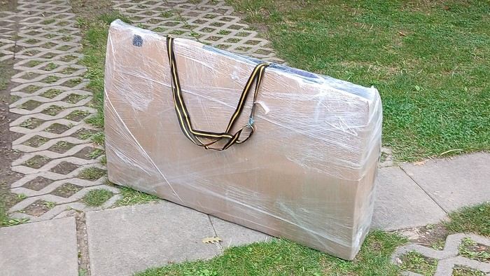
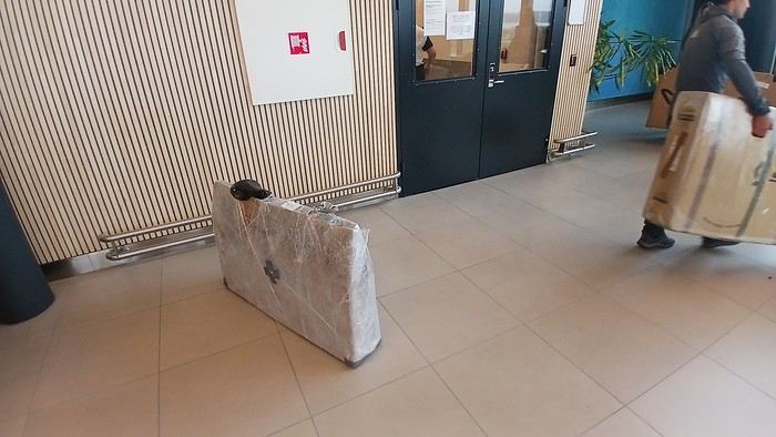
After testing it for three years across various modes of transport, I’m sharing this video of a bike packing case. It’s made from recycled cardboard and shrink-wrapped, with adjustable thickness and added bubble wrap depending on the level of protection you want.
Installing spacers at the fork and chainstays makes the packaging compact. With the fifteen-odd euros for shrink-wrapping at the airport, this case travels really well.
https://youtu.be/_GDJi-GqmkM
- Low bulk (1.10m x 0.70m x 0.25m for a large frame), it fits vertically in train luggage compartments and the total dimensions (x+y+z) don’t exceed 2.40m.
- Two carrying solutions for public transport and easy handling by airport staff (no more tears in the cardboard from openings).
- Discreet packaging when dealing with bus drivers and train conductors, as it looks like an ordinary parcel.
- No need to return to the starting point to retrieve the case from your outbound trip, which you’d otherwise have to store somewhere, or deal with a bulky cover to pack in your panniers.
- You can still check tire pressure through the plastic film without damaging the packaging too much.
Drawbacks: Around 3 hours for this lengthy and meticulous process—removing the wheels, pedals, handlebars, and derailleur without misaligning them, then securing all components to the frame.
If you get a chance to test it, send me your feedback for future improvements.
Hi there, I’m planning a cross-Canada bike trip, and I’ve got a question that might seem silly, but could someone tell me how to pack a bike (in a box, with a fragile sticker... I don’t know) for a flight? Thanks in advance!
This summer, we’re planning to cycle along the EV 19 that follows the Meuse River from Langres all the way to Rotterdam.
My question is about getting back to Nantes.
Do any of you know what the best return option might be? I’d love to hear about your experiences.
I saw that FlixBus doesn’t take bikes.
By train, I think it’s possible but would involve multiple local trains.
We were also wondering if there’s a boat from Rotterdam to Saint-Nazaire that could take passengers with bikes.
Any tips or experiences you can share would be really helpful—thanks in advance!
Have a great evening
I’ve gotten used to crossing Europe by bus to return by bike.
It was really convenient to take the bike without having to disassemble it.
But FlixBus no longer accepts bikes...
What alternatives do you know about?
Thanks.
Hi there,
I’m planning to ride the Dutch section of the EuroVelo 19, from Maastricht to Rotterdam.
Since it’s too complicated to bring my bike on the train, I’m looking to rent one locally.
I’d love any tips or bike rental shop recommendations—I’m struggling to find options even in Rotterdam.
The plan is to rent in Rotterdam, take the train to Maastricht with the bike, then cycle back to Rotterdam.
Thanks in advance for any advice or suggestions!
Nath
I’m planning to cycle from Morlaix to Brest (via Roscoff and the V45 coastal route). We’ll start riding on August 16th for 13 days (with stops for island visits, surfing, etc.). Is there a lot of traffic at this time of year? I’ve got two kids, 11 and 13, and we don’t like riding in the middle of cars (we’ve already done the Vélomaritime—Caen to Cherbourg—the Loire route from Orléans to Saumur, the Vélodyssée from Nantes to Royans, and the canals like the Nivernais and Bourgogne, where there were plenty of bike-only lanes, which isn’t the case on this route).
Thanks for your help if you’ve already done this route in late August!
Virginie
I’m planning to build a new touring bike.
I want to prioritize lightness.
That said, I’m tempted by a suspension fork that could offer some comfort on rougher roads.
The recent appearance of gravel suspension forks on the market might meet my needs—at least on paper.
I’m particularly considering the RockShox Rudy Ultimate XPLR fork.
Unlike MTB forks, its travel is short: either 30 mm or 40 mm.
It weighs 1400 g, which is 400/500 g more than a steel fork.
Any thoughts or real-world feedback on this?
I’m also wondering about the durability of magnesium (lower leg) for long-distance bike touring.
And what’s the impact of skipping the manufacturer-recommended maintenance every 50 and 200 hours? That’s bound to happen on a long trip unless you carry extra gear.
More generally, how reliable are these kinds of forks?
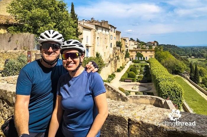
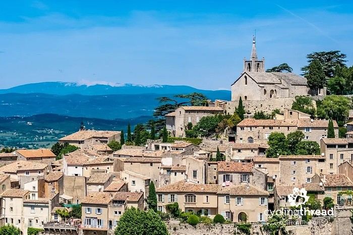
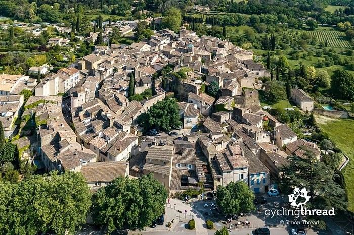
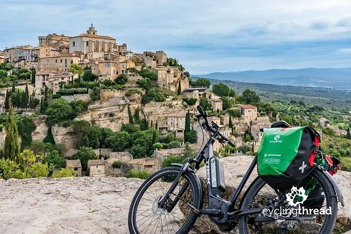
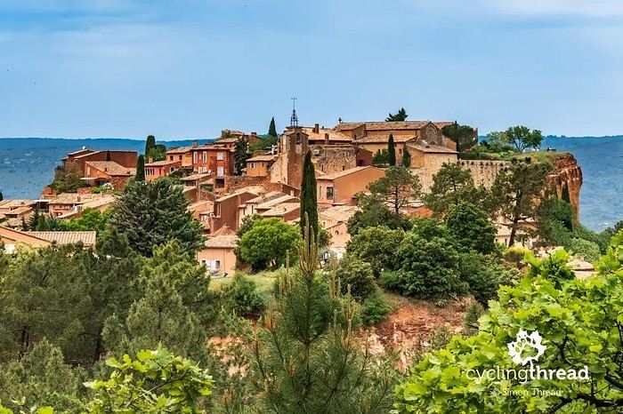
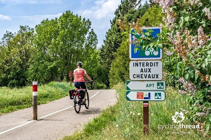
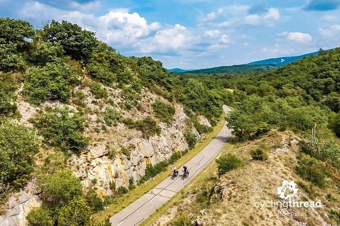
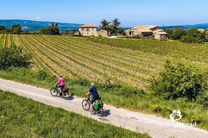
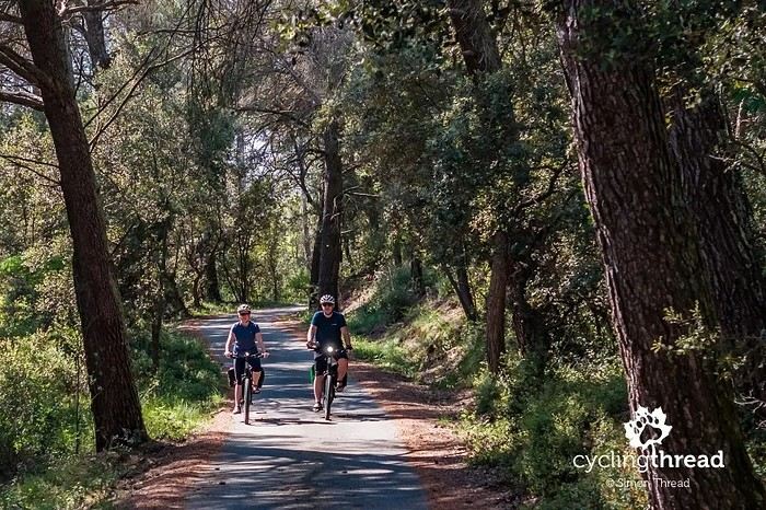
I’m making an exception and creating a separate post this time, since it’s all about France. In May, we spent a week in Provence, specifically in the Luberon, exploring the cycling routes *Autour du Luberon à Vélo*, the *Véloroute du Calavon* (part of EuroVelo 8), and the shorter *Les Ocres à Vélo* route. Together, they gave us an amazing journey through rolling hills, vineyards, lavender fields still green in spring, and some of the most stunning landscapes in southern France.
It was, of course, the perched villages that impressed us the most. We visited Gordes, Roussillon, Bonnieux, Lacoste, Lourmarin, Ménerbes, Oppède-le-Vieux, Cucuron, and Lauris. Many of them are among the most beautiful villages in Provence, and it’s hard not to agree with that reputation.
One interesting point is the route of EuroVelo 8 in this part of the region. The official path mainly follows the old railway line of the *Véloroute du Calavon*, which is very comfortable and safe. But in our opinion, cyclists traveling EuroVelo 8 around the Mediterranean would discover even more treasures if the route passed through villages like Bonnieux, Lacoste, or Oppède-le-Vieux.
We were also pleasantly surprised by how safe cycling felt. Most of the route takes small local roads, but traffic is light, drivers are respectful, and road design really takes cyclists into account. It’s one of those places where you can ride peacefully even without separated bike lanes.
Our full story:
Around Luberon by bicycle - the most beautiful villages of Provence
You can also find all our cycling travel stories on the forum:
Cycling Thread - Europe’s most beautiful bike routes
Hi there, we’re a group of 4 cyclists looking to get from Treviso in Italy to Munich with our 4 non-folding bikes. It seems complicated! Are there any solutions? Thanks so much.
hello fellow cycling enthusiasts
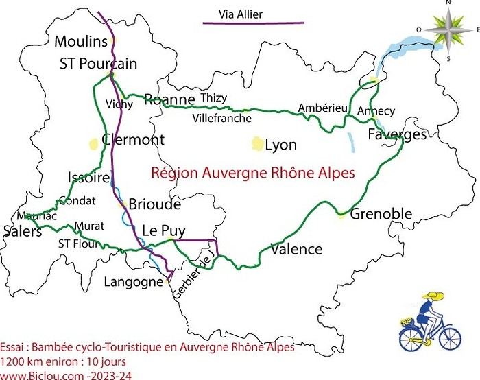
here’s a travel journal of the cycling tour through the Rhône-Alpes Auvergne region by Claudio
zouli
it was the plan
http://cbandiera.free.fr/parcours/auvergne-Ralpes/
the trip was completed
story being posted online soon
1100 km in 11 days
beautiful and varied regions
Hi there, we’re planning a Munich to Venice bike trip at the end of June 2026. Getting back from Venice to Toulouse by train with 4 bikes isn’t straightforward. What return options have others who’ve done this trip chosen? Any tips or great deals would be much appreciated. Thanks a bunch! !
Hi everyone,
Happy owner of a Pegasus Estremo bike with a Rohloff hub, which is giving me trouble with the SF11-NCX-FT-E-LITE 700C TS 300/0 fork (serial number TD01329060). It’s starting to show its age, and I’d like to repair it to extend the life of my beloved bike.
The suspension is gone, and there’s an oil leak from the seals.
Does anyone know how to repair it? Where can I find parts that are about fifteen years old? Or where to find an identical replacement fork? Just to clarify, the Magura HS11 brakes are mounted using Firm Tech, meaning they’re on pivots behind the fork, facing the frame.
Hi, I'd like to know if anyone has done this route recently or has reliable info.
Does the track exist, and most importantly, is there sand (for biking)?
Any info is welcome.
Cheers,
diego ambilobe: mangaoka, manondro, ramena
vohemar sambava: masondrono, tanambao
Hi there,
New to bike touring,
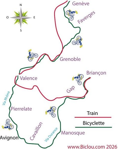
I’d love to start with a section of the Via Rhona to explore and share (route to be decided).
Looking forward to exchanging tips!
I’m landing in Madagascar with a buddy before the end of April 2026. We’re planning to bike around for about twenty days or so. We don’t have a specific goal other than exploring the country and meeting the locals.
Ideally, we’d prefer a loop route starting from Antananarivo with a good chunk of it along the coast. On the bike side, we’re used to riding 6 to 8 hours a day, depending on the needs, encounters, and mood 😉 Any feedback or tips from trips around this length?
A big thank you to Lazarou for all the info you share in this forum!
I'm passionate about Morocco, which I cycled through back in 2009.
Last year, my wife and I explored the High Atlas by tandem. Completely smitten, we're heading back in April (Anti Atlas) and May (High and Middle Atlas), still on our tandem.
Do you have any info on the track between Amezri and Ali Ait Nito? Are the river crossings in the Tessaout still there? It's not easy to navigate with a loaded tandem... especially if the river level is high due to this year's heavy snowmelt!
Thanks in advance for any tips you might have, and best wishes for health in this new year!
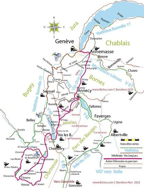
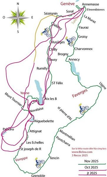
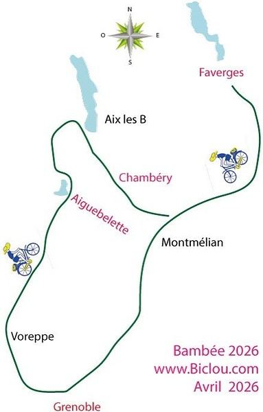
Claudio specializes in the route of the Savoie lakes
Here are his travels
Between Bornes, Chartreuse, the Savoie foothills, and Dauphiné
Five lakes: Léman, Annecy, Paladru, Aiguebelette, Bourget, not to mention a few ponds along the way
Plenty of accommodation options: camping, hotels, and more...
A lovely route not far from his place
Rural and quite peaceful
A road cycling route created by Serge B...
First of all... happy New Year! Wishing you great roads in 2017!
I’ve been traveling for a few years now with a high-quality mountain bike, but it’s equipped with hydraulic disc brakes. I live (pedal) with the constant worry of a breakdown (leak, air bubble, heat causing the fluid to...). My bike mechanic tells me it’s impossible to switch them out for V-brakes.
What do you all think? Am I taking a big risk continuing (alone) with these brakes? Thanks in advance for your great tips!
First post here to share a quick recap of our west-to-east bike trip along Algeria’s coast in January 2025.
It was just the two of us—my partner and I—with French passports and not a word of Arabic. No friends or welcoming hosts in the country.
Under those conditions, we’d strongly advise against going.
Our original plan was to follow the coast from Algiers to Tunis. We ended up cycling from Algiers to Béjaia, then took the train from Béjaia to Annaba (with a stop in Constantine), and finally biked to the border.
We were tailed by police the whole way—whether on our bikes, on the train, or even on foot while exploring towns. On top of that, we couldn’t wild camp and were limited to the few state-approved hotels that accept foreigners. Under those circumstances, connecting with locals was especially tough.
With such an omnipresent and intrusive police presence, we’d definitely recommend against this destination for bike touring. A really sad situation that completely cuts you off from the local population...
We’d been warned, we went to check it out, and we weren’t disappointed!
Hi there,
I’m planning the route to cycle from Lille to Nordkapp with my partner.
Duration: 3 months, from May 1st to July 31st, 2026.
In the attached details below, I need to add some "non-riding" days (rest days, basically).
So I’m looking to "shorten" the trip by taking ferries or trains for some stretches. Which areas could I skip?
Thanks in advance for your great tips.
Have a good evening.
https://www.komoot.com/fr-fr/collection/4023980/-lille-cap-nord-1er-mai-au-31-juillet-2026?ref=collection
I’m planning to bike back from Poland this summer. Does anyone know a way to ship it there without having to take it apart? Otherwise, it’s a real hassle to fine-tune all the settings before departure!
Thanks in advance.
Hi, has anyone recently bought Primus or Butagaz gas, possibly puncture-style, in Dubrovnik or the surrounding area? Same question for Albania... thanks. aichatou
Just a few words about the loop I did by bike in Yunnan.
Entry and exit
I entered China through the Sino-Vietnamese border crossing at Lào Cai / Hekou under the 30-day visa exemption currently available to French nationals and others.
The process was simple and quick. A Chinese police officer even helped me complete my electronic pre-registration at a computer kiosk. I wasn’t aware this formality was required—it’s similar to Thailand’s TM6.
No issues with the bike.
I left the country via the Sino-Laotian border crossing at Mohan / Boten.
The atmosphere was a bit chaotic there, but again, no problems with the bike.
The timing
I visited Yunnan in February 2026.
Weather-wise, at higher altitudes (between 1,500 and 2,000 meters), it was around ten degrees at night and in the mornings, and around twenty degrees at the hottest part of the day.
I had two days of rain, so I took the bus to keep moving. Otherwise, clear blue skies.
Culturally, Chinese New Year fell on February 17th (and the 15 days following), right in the middle of my trip. Because of this, my take on the traffic might be off.
Accommodation and food
I always found a hotel to stay in for prices ranging from 8 to 15 €. Except in Kunming (the capital), where many hotels were fully booked (Chinese New Year). I ended up at a 100 € hotel with great value for money.
A bowl of noodles costs about 1.5 € on average.
Onboard electronics
Since my smartphone doesn’t support eSIMs, I subscribed to a China plan with my carrier. Otherwise, for much cheaper, Alipay offers eSIMs for foreigners that allow access to services usually blocked for Chinese users (WhatsApp, Facebook, etc.).
An internet connection is essential for paying with Alipay or WeChat, as this payment method is widespread.
I only managed to use Alipay.
Either way, always carry cash because sometimes there’s no signal, or the merchant only accepts WeChat.
Also, it’s best to bring a power adapter when you arrive rather than struggling to find one.
Traffic and roads
The Chinese aren’t reckless drivers. They follow traffic rules and watch out for cyclists. This is slightly less true in Xishuangbanna (the region bordering Myanmar and Laos).
In urban areas, there are almost always wide bike lanes, separated from other roads, where bikes, electric mini-scooters, and scooters share the space pretty harmoniously.
The roads are in great condition, and traffic is generally manageable—even light—except for one stretch (Eshan -> Yangwu).
Most traffic is absorbed by expressways, China’s equivalent of highways: toll roads that are off-limits to slow vehicles.
You’re never far from these expressways; sometimes you even ride alongside them, which can be noisy at times.
The climbs are usually reasonable, around 5% to 6%. From what I remember, the steepest section was between Menglun and Mengla, with gradients of 8% to 10%, sometimes more.
Riding at these altitudes—though modest—took a bit of getting used to.
The route
I didn’t plan anything in advance. My only goal was to reach Kunming. I don’t know why, but just hearing the name of that city, like Yunnan, always felt dreamy to me.