je voudrais savoir si la piste cotière Morondova / Tuléar ainsi que la piste Tuléar/ Fort Dauphin est praticable en vtt ? est -ce quelqu'un l'a déja fait ? possibilité de ravitaillement (village) ?
quand pars tu?
je compte voyager a velo a mada de mi-aout a mi octobre. je cherche des co voyageurs, si ca te dis et si c'est tes dates.... je n'ai pas enore fixe mon itineraire.
pour ce qui est du trajet tulear fort dauphin, je ne connais pas personnellement mais j'ai lu plusieurs fois dans des forums que la presence de sable sur les pistes cotieres comme celle ci rendait impraticable le velo (ou alors en poussant, pourquoi pas!)
tiens moi au courant de ton programme, meme si nos dates correspondent pas, je suis avide de conseils et de bons plans !
Bonjour, je suis allé sur cette piste (Morondave Tulear) il y a 5 ans (mais j'étais en 4x4) effectivement pas mal de sable et de poussière. Mais j'ai déjà fait au Mali des pistes assez sablonneuses, on arrive à passer dans des endroits assez étonnants avec un peu de pratique VTT, il faut dégonfler à mort les pneus (grosses sections) et si vous avez des pédales autos apprendre à pédaler en tirant la pédale pour dégager la roue arrière du sable, c'est une habitude à prendre et ça aide à passer à certains endroits. Mais pas partout! Attention, en dégonflant les pneus, les flancs souffrent et peuvent finir par se couper, prévoir de quoi réparer ou un pneu de rechange éventuellement (surtout l'arrière)...
En saison des pluies, la piste est je crois assez impraticable et inondée...
nous avons fait à 2 le parcours morondava à manakara, via tulear et fort dauphin en octobre dernier en vtt et autonomes, pour le départ de morondava en réalité nous sommes partis de belo sur mer car ces 80 km sont uniquement sablonnneux et très profonds, je connaissais déjà avant), jusqu à tulear vous rencontrerez quelques portions de sable où il faut pousser car même en essayant à côté de la piste c est pareil, quand au conseil de dégonfler les pneus je ne vous le consseille pas même si c est efficace dans le sable, car vu les nombreux epineux vous allez crever sans cesse, pour être tranquille de ce côté là, il vaut mieux utiliser des pneus genre schwalbe marathon que des pneus vtt dont les structures sont trop tendres et mettre du produit anticrevaison dans les chambres à air, vous rencontrerez partout des petites epiceries et des endroits pour dormir pas cher (si vous avez l habitude de ce genre de voyage celà ne pose pas de soucis), de tulear à fort dauphin, il faut remonter la n7(goudron sur 70 km) et après c est une piste assez bonne mais qui peut se transformer rapidement après la période des pluies, (ne pas prendre la piste cotiere car impossible en vtt), je vois que vous habitez la haute savoie, je suis en savoie, laissez moi un message et je vous indiquerais précisement les endroits sablonneux et tout le reste sur une carte, bon voyage
Bonjour j'ai fait en fevrier le trajet tana tuleaur fort dauphin en vtt
Tana tulear pas de prpblème goudron partout
Apres je comptais faire tulear fort dauphin en longeant la cote anakao beheloka lavanono itampolo et j'ai ete tres vite arrete par le sable donc au niveau de beheloka j'ai pris une route transversale qui rejoint la nationale je sais pas combien au niveau d'ejeda puis j'ai fait le trajet en passant par ampanihi tranoara etc ambavolombe fort dauphin.Et la il il a beaucoup moins de sable, presque pas, seulement entre ejeda et behahitse et le 20 dernier kilometre avant le bitume il me semble avant ambavolombe excuse moi je n'ai pas de carte sous les yeux.
Tres chaud je l'ai fait en fevrier, tres pauvre, pas de probleme pour te loger sauf si tu cherche le confort, mais un beau periple. Pas un crevaison avec des xcwalbe marathon xr renforcé par une bande anticrevaison
Je suis decu de ne pas avoir reussi en longeant la cote je pensait pouvoir rouler sur la plage à marrée basse mais le velo s'enfoncait trop je ne desepere pas de faire un deuxième essai car je pense qu'avec de la patience et des grandes marée basse ca peut passer.
D'autre part je suis toujours a mada et je souhaite faire d'ici une dizaine de jours tulear morandova en vtt sit tu as des information sur les zone sableuse sur ce trajet notament les information de janoria peut tu me les faire suivre.
Merci rodolphe
je pense que avant de répondre à mon message vous avez mal lu celui ci car je dis avoir fait le voyage de morondava à manakara via tulear et fort dauphin en expliquant justement qu il ne fallait pas prendre la piste cotiere de tulear à fort dauphin et je donnais les conseils pour éviter les crevaisons, et dans votre message vous me repetez ceci en me le donnant comme conseil, ( je n ai donc pas très bien compris le sens de votre message) ; pour ce qui est de tulear à morondava, la piste est bonne (très peu de sable pour quelqu'un qui à l habitude de la piste) par contre impossible à vélo de belo(sur mer) à morondava, où passent seulement les 4x4, le sable y est très profond et pas d alternative hors piste ( sauf si vous êtes adeptes du portage).
bon voyage
Bonjour Janoria
Je ne pensais pas m'adresser a toi c'est pour cela que je donnais des conseils qui ressemblent au tiens.
Par contre je suis a la recherche d'information precise sur la localisation et la taille des zones sableuse entre morondova et tulear que je compte faire en vtt d'ici une dizaine de jours, et c'est pour cela que je parlais de toi.
Donc si tu povais me renseigner ca serait sympat je ne tiens pas trop a pousser le velo pendant 50 km.
Si tu en as aussi sur la partie fort dauphin manakara je suis aussi preneur, quand je suis arrivé a fort dauphin fin fevrier on m'a dit que ca ne passait pas en saison des pluie et comme j'etais deja assez fatigue je n'ai pas insisté et je suis rentre a tana en avion...maintenant ca porrait être interressant
Je te remercie
Rodolphe
PS es tu sur mada en ce moment.
bonjour, chacun n a pas la même appréciation de la difficulté de la piste (il faudrait connaitre le niveau de pratique et la condition physique de chacun) le point de vue que je donne est pour des vttistes entrainés et ayant un bon niveau technique, savoir rouler dans le sable et en terrain diffiçile doit s apprendre avant de partir pour profiter pleinement de son voyage sans souffrir, ( à titre d indication le parcours que vous avez effectué avant et que je connais, je le qualifierais de difficulté moyenne(pour vous donner un ordre de référence) un conseil pour ne pas planter dans le sable, regarder toujours loin devant pour garder une bonne trajectoire, pour revenir à l itineraire tulear morondava, en partant de tulear il y a 4 à 5 km de sable assez profond avant ifaty, quelques petites parties sableuses entre ankiliokya et befiandrine, de befiandrine à ankiliabé 1 ou 2 km avant ankiliabe(juste après le bac, et après ankiliabe3 ou 4 km en partant sur la piste de manja, de manja à belo sur mer, après soaserana une 15 de km assez profond, et 7 /8 km avant belo en arrivant au salines, il faut porter à marée basse, car à marée haute j ai renoncé pour m économiser, et belo sur mer à morondava(voir les conseils que je vous ai donné dans le message précédent), pour ce qui est de fort dauphin à manakara, bonnes pistes ( car aprèsmanantenina il y a plusieurs options) avec des bonnes côtes (pratiquants occasionnels du vtt s abstenir), à partir de vangaindrano c est le goudron (toujours avec de bonnes côtes "casse pattes") jusqu à manakara, mais je ne suis pas passé depuis les cyclones de cet hiver, donc tout a pu évolué, une information est seulement fiable à un moment donné. bon voyage
I am afraid my French is not good enough to ask my questions in French, so I hope you can understand English.
My questions:
In July/August 2008 I want to go cycling from Tana via Morodava, Tulear, Ampanihy, Dauphin to Manakara.
Can you give me some information on the state of the roads, in other words is it possible to cycle along the coast route (Morndava-Tulear-Dauphin-Manakara)?
Can you find simple accommodation along this route and what about food?
J'envisage de faire un périple en VTT : partie 1 : Ambatolampy - Maintirano avec: traversée du massif de l'Ankaratra, Faratsiho, Ampefy, Tsitoanomandidy, Beravina. Latérite sur les hts plateaux puis sable vers Maintirano partie 2: Maintirano - Antsalova par Morondava et la côte : beaucoup de sable sur la route principale
Je lis pas mal de messages indiquant que les pistes sont souvent sablonneuses. Peut-être est-il envisageable de passer par les chemins non carossables ("routes" secondaires) où le passage des véhicules est difficile voire impossible. Dans ce cas, le sable se forme moins. Qu'en pensez-vous? Avez-vous des idées d'itinéraires plus directs (cas de la partie 1) et moins sablonneux (cas de la partie 2)?
J'habite La Réunion et nous souhaitons organiser un séjour d'une semaine environ de VTT aux alentours de Diégo. Il nous faudrait un 4x4 pour l'assistance et le…
Est-il possible de rallier Diego-Suarez à Tamatave en VTT par la côte de la vanille? Trouve t'on de l'eau facilement sur ce parcours pour se ravitailler? un…
Nous sommes un groupe amis et voulons faire une rando VTT a madagascar en juin 2006 (groupe de 10) Avez vius des conseils a nous donner selon vos expériences…
Hi there,
I’ve been road cycling for several years, and I’m about to switch to gravel in the next few days—I’m waiting for my bike, which should arrive this week.
I’m planning a bikepacking trip in a few weeks along the Véloroute V81, also known as the Vélosud, from Biarritz to Le Barcarès.
Has anyone here already done this route? Any info is welcome, whether it’s about the route itself, gear, or accommodation. I’ll prioritize staying with locals as much as possible. On that note, I just signed up for the brand-new site *Guidon et Couette* ((www.guidon-et-couette.fr)), which offers free accommodation between cyclists across the country, but there’s almost no one listed along my route!
Thanks in advance.
Laurent.
I'm developing a free and open-source web app for planning walking and cycling trips (and even car trips). You can create a route by clicking directly on the map to add waypoints, and it can consist of multiple stages. The app provides tools to edit the stages and the overall route, and to display useful information (distances, altitudes, and elevation changes). A relief profile can be shown as a graph for a specific stage or the entire route.
Once the route is ready, it can be exported as a GPX file, which can then be used with a GPS or a mobile navigation app.
The app is built in JavaScript and runs entirely in the web browser. It uses the Leaflet library and several OpenStreetMap-based services. Initially developed for my personal needs (I enjoy hiking and cycle touring), I’d be happy to share it with anyone who might find it useful. It’s free to use, doesn’t require an account, and the source code is available.
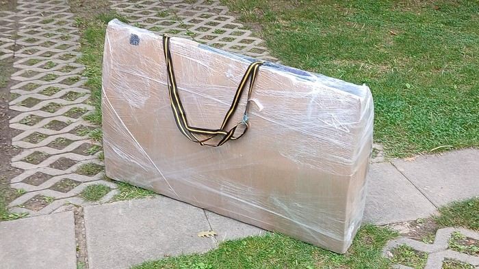
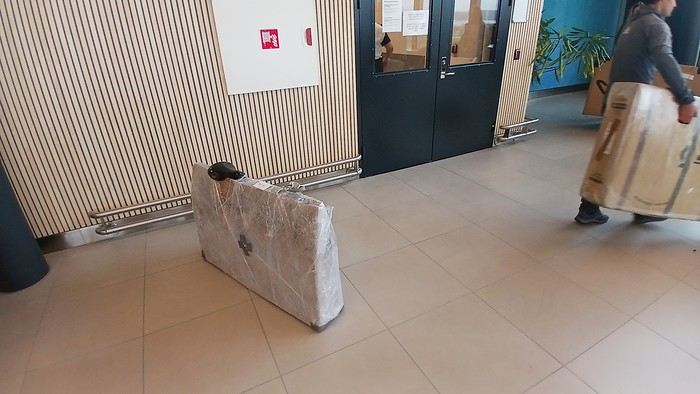
After testing it for three years across various modes of transport, I’m sharing this video of a bike packing case. It’s made from recycled cardboard and shrink-wrapped, with adjustable thickness and added bubble wrap depending on the level of protection you want.
Installing spacers at the fork and chainstays makes the packaging compact. With the fifteen-odd euros for shrink-wrapping at the airport, this case travels really well.
https://youtu.be/_GDJi-GqmkM
- Low bulk (1.10m x 0.70m x 0.25m for a large frame), it fits vertically in train luggage compartments and the total dimensions (x+y+z) don’t exceed 2.40m.
- Two carrying solutions for public transport and easy handling by airport staff (no more tears in the cardboard from openings).
- Discreet packaging when dealing with bus drivers and train conductors, as it looks like an ordinary parcel.
- No need to return to the starting point to retrieve the case from your outbound trip, which you’d otherwise have to store somewhere, or deal with a bulky cover to pack in your panniers.
- You can still check tire pressure through the plastic film without damaging the packaging too much.
Drawbacks: Around 3 hours for this lengthy and meticulous process—removing the wheels, pedals, handlebars, and derailleur without misaligning them, then securing all components to the frame.
If you get a chance to test it, send me your feedback for future improvements.
I’ve got my flight ticket sorted—departing in mid-November and returning in mid-March. I’ll arrive in Santiago and leave from Buenos Aires.
I’ve already been to southern Argentina, specifically Torres del Paine National Park, and I’d love to go back to do the full W trek (I only did the shorter version last time).
I also want to do some hiking and maybe even tackle a summit. I climb and occasionally do some mountaineering, so I’ll definitely be going with a guide.
I plan to start around Temuco in Chile, with the idea of heading toward the lakes, then taking the Carretera Austral.
I’m not sure if I’ll go all the way to Ushuaia—it’s supposed to not be *that* worth it, except for the bragging rights of saying you’ve been to the end of the world.
I saw there are lakes in Argentina too.
I don’t have a precise itinerary, but what I’d love is, once I reach the southernmost point of my trip, to take a mini-cruise to see some wildlife. Any tips for that?
What kind of sleeping bag did you take? Is a 0°C (32°F) one enough?
And one last question: white gas stove or can I get by with my gas stove?
Hi there, I’m planning a cross-Canada bike trip, and I’ve got a question that might seem silly, but could someone tell me how to pack a bike (in a box, with a fragile sticker... I don’t know) for a flight? Thanks in advance!
This summer, we’re planning to cycle along the EV 19 that follows the Meuse River from Langres all the way to Rotterdam.
My question is about getting back to Nantes.
Do any of you know what the best return option might be? I’d love to hear about your experiences.
I saw that FlixBus doesn’t take bikes.
By train, I think it’s possible but would involve multiple local trains.
We were also wondering if there’s a boat from Rotterdam to Saint-Nazaire that could take passengers with bikes.
Any tips or experiences you can share would be really helpful—thanks in advance!
Have a great evening
I’ve gotten used to crossing Europe by bus to return by bike.
It was really convenient to take the bike without having to disassemble it.
But FlixBus no longer accepts bikes...
What alternatives do you know about?
Thanks.
Hi there,
I’m planning to ride the Dutch section of the EuroVelo 19, from Maastricht to Rotterdam.
Since it’s too complicated to bring my bike on the train, I’m looking to rent one locally.
I’d love any tips or bike rental shop recommendations—I’m struggling to find options even in Rotterdam.
The plan is to rent in Rotterdam, take the train to Maastricht with the bike, then cycle back to Rotterdam.
Thanks in advance for any advice or suggestions!
Nath
I’m planning to cycle from Morlaix to Brest (via Roscoff and the V45 coastal route). We’ll start riding on August 16th for 13 days (with stops for island visits, surfing, etc.). Is there a lot of traffic at this time of year? I’ve got two kids, 11 and 13, and we don’t like riding in the middle of cars (we’ve already done the Vélomaritime—Caen to Cherbourg—the Loire route from Orléans to Saumur, the Vélodyssée from Nantes to Royans, and the canals like the Nivernais and Bourgogne, where there were plenty of bike-only lanes, which isn’t the case on this route).
Thanks for your help if you’ve already done this route in late August!
Virginie
I’m planning to build a new touring bike.
I want to prioritize lightness.
That said, I’m tempted by a suspension fork that could offer some comfort on rougher roads.
The recent appearance of gravel suspension forks on the market might meet my needs—at least on paper.
I’m particularly considering the RockShox Rudy Ultimate XPLR fork.
Unlike MTB forks, its travel is short: either 30 mm or 40 mm.
It weighs 1400 g, which is 400/500 g more than a steel fork.
Any thoughts or real-world feedback on this?
I’m also wondering about the durability of magnesium (lower leg) for long-distance bike touring.
And what’s the impact of skipping the manufacturer-recommended maintenance every 50 and 200 hours? That’s bound to happen on a long trip unless you carry extra gear.
More generally, how reliable are these kinds of forks?
Hi everyone,
I wanted to share with you the incredible feat my friend José, who’s 72 years old, is currently undertaking. He left Auterive near Toulouse on Monday, May 18, 2026, on his non-electric bike, heading for the North Cape in Norway!
You can follow his route on the link below—he’s currently in Sweden:
https://thierry-thomas.travelmap.net/jose-de-toulouse-a-nord-cap-2026
You can zoom in on the map and click on each stopover town to see the photos
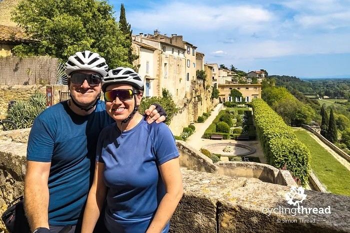
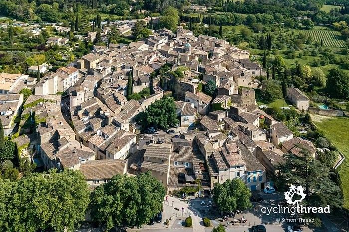
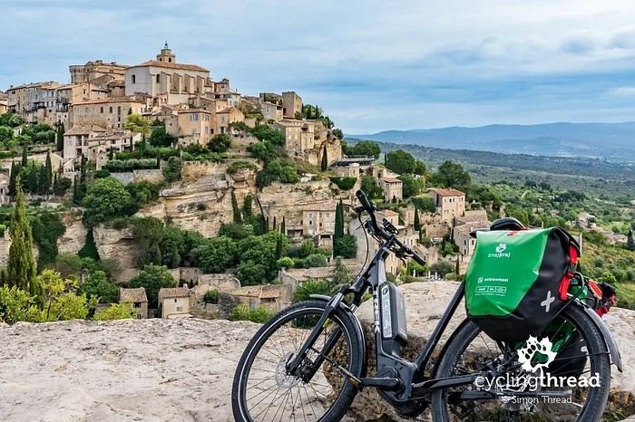
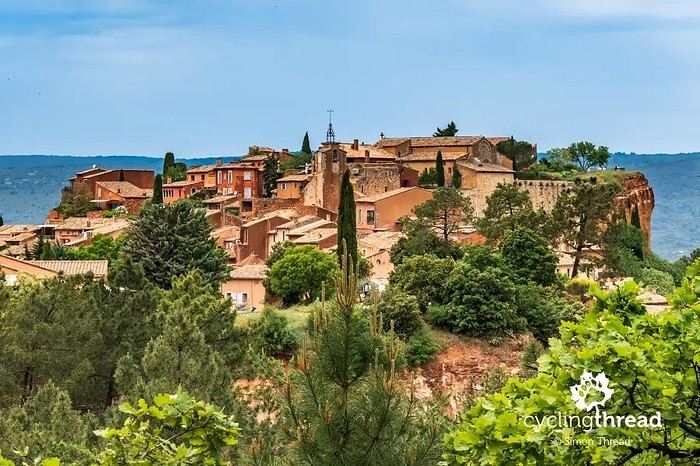
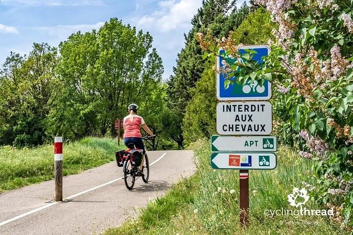
I’m making an exception and creating a separate post this time, since it’s all about France. In May, we spent a week in Provence, specifically in the Luberon, exploring the cycling routes *Autour du Luberon à Vélo*, the *Véloroute du Calavon* (part of EuroVelo 8), and the shorter *Les Ocres à Vélo* route. Together, they gave us an amazing journey through rolling hills, vineyards, lavender fields still green in spring, and some of the most stunning landscapes in southern France.
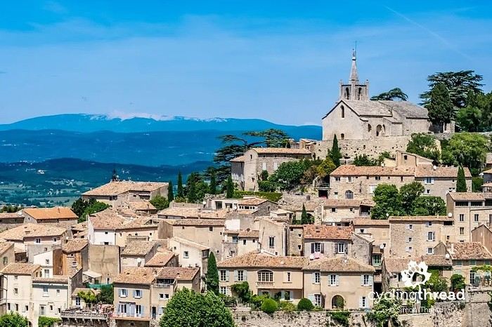
It was, of course, the perched villages that impressed us the most. We visited Gordes, Roussillon, Bonnieux, Lacoste, Lourmarin, Ménerbes, Oppède-le-Vieux, Cucuron, and Lauris. Many of them are among the most beautiful villages in Provence, and it’s hard not to agree with that reputation.
One interesting point is the route of EuroVelo 8 in this part of the region. The official path mainly follows the old railway line of the *Véloroute du Calavon*, which is very comfortable and safe. But in our opinion, cyclists traveling EuroVelo 8 around the Mediterranean would discover even more treasures if the route passed through villages like Bonnieux, Lacoste, or Oppède-le-Vieux.
We were also pleasantly surprised by how safe cycling felt. Most of the route takes small local roads, but traffic is light, drivers are respectful, and road design really takes cyclists into account. It’s one of those places where you can ride peacefully even without separated bike lanes.
Our full story:
Around Luberon by bicycle - the most beautiful villages of Provence
You can also find all our cycling travel stories on the forum:
Cycling Thread - Europe’s most beautiful bike routes
Hi there, we’re a group of 4 cyclists looking to get from Treviso in Italy to Munich with our 4 non-folding bikes. It seems complicated! Are there any solutions? Thanks so much.
hello fellow cycling enthusiasts
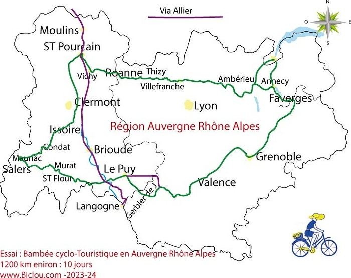
here’s a travel journal of the cycling tour through the Rhône-Alpes Auvergne region by Claudio
zouli
it was the plan
http://cbandiera.free.fr/parcours/auvergne-Ralpes/
the trip was completed
story being posted online soon
1100 km in 11 days
beautiful and varied regions
Hi there, we’re planning a Munich to Venice bike trip at the end of June 2026. Getting back from Venice to Toulouse by train with 4 bikes isn’t straightforward. What return options have others who’ve done this trip chosen? Any tips or great deals would be much appreciated. Thanks a bunch! !
Hi everyone,
Happy owner of a Pegasus Estremo bike with a Rohloff hub, which is giving me trouble with the SF11-NCX-FT-E-LITE 700C TS 300/0 fork (serial number TD01329060). It’s starting to show its age, and I’d like to repair it to extend the life of my beloved bike.
The suspension is gone, and there’s an oil leak from the seals.
Does anyone know how to repair it? Where can I find parts that are about fifteen years old? Or where to find an identical replacement fork? Just to clarify, the Magura HS11 brakes are mounted using Firm Tech, meaning they’re on pivots behind the fork, facing the frame.
Hi, I'd like to know if anyone has done this route recently or has reliable info.
Does the track exist, and most importantly, is there sand (for biking)?
Any info is welcome.
Cheers,
diego ambilobe: mangaoka, manondro, ramena
vohemar sambava: masondrono, tanambao
Hi there,
New to bike touring,
I’d love to start with a section of the Via Rhona to explore and share (route to be decided).
Looking forward to exchanging tips!
I’m landing in Madagascar with a buddy before the end of April 2026. We’re planning to bike around for about twenty days or so. We don’t have a specific goal other than exploring the country and meeting the locals.
Ideally, we’d prefer a loop route starting from Antananarivo with a good chunk of it along the coast. On the bike side, we’re used to riding 6 to 8 hours a day, depending on the needs, encounters, and mood 😉 Any feedback or tips from trips around this length?
A big thank you to Lazarou for all the info you share in this forum!
I'm passionate about Morocco, which I cycled through back in 2009.
Last year, my wife and I explored the High Atlas by tandem. Completely smitten, we're heading back in April (Anti Atlas) and May (High and Middle Atlas), still on our tandem.
Do you have any info on the track between Amezri and Ali Ait Nito? Are the river crossings in the Tessaout still there? It's not easy to navigate with a loaded tandem... especially if the river level is high due to this year's heavy snowmelt!
Thanks in advance for any tips you might have, and best wishes for health in this new year!
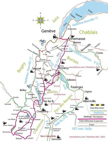
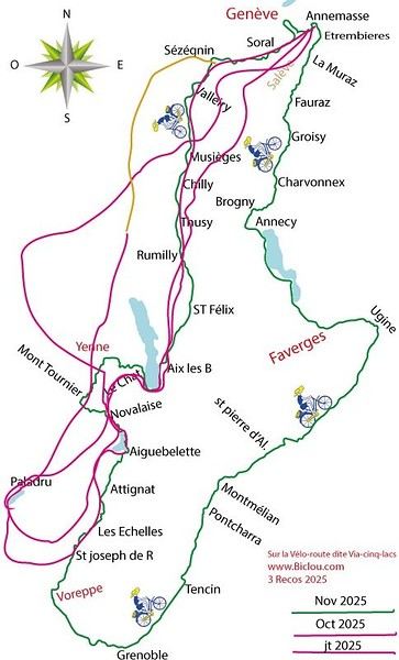
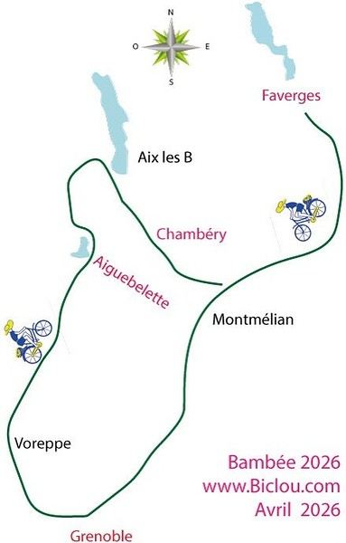
Claudio specializes in the route of the Savoie lakes
Here are his travels
Between Bornes, Chartreuse, the Savoie foothills, and Dauphiné
Five lakes: Léman, Annecy, Paladru, Aiguebelette, Bourget, not to mention a few ponds along the way
Plenty of accommodation options: camping, hotels, and more...
A lovely route not far from his place
Rural and quite peaceful
A road cycling route created by Serge B...
First of all... happy New Year! Wishing you great roads in 2017!
I’ve been traveling for a few years now with a high-quality mountain bike, but it’s equipped with hydraulic disc brakes. I live (pedal) with the constant worry of a breakdown (leak, air bubble, heat causing the fluid to...). My bike mechanic tells me it’s impossible to switch them out for V-brakes.
What do you all think? Am I taking a big risk continuing (alone) with these brakes? Thanks in advance for your great tips!
First post here to share a quick recap of our west-to-east bike trip along Algeria’s coast in January 2025.
It was just the two of us—my partner and I—with French passports and not a word of Arabic. No friends or welcoming hosts in the country.
Under those conditions, we’d strongly advise against going.
Our original plan was to follow the coast from Algiers to Tunis. We ended up cycling from Algiers to Béjaia, then took the train from Béjaia to Annaba (with a stop in Constantine), and finally biked to the border.
We were tailed by police the whole way—whether on our bikes, on the train, or even on foot while exploring towns. On top of that, we couldn’t wild camp and were limited to the few state-approved hotels that accept foreigners. Under those circumstances, connecting with locals was especially tough.
With such an omnipresent and intrusive police presence, we’d definitely recommend against this destination for bike touring. A really sad situation that completely cuts you off from the local population...
We’d been warned, we went to check it out, and we weren’t disappointed!
Hi there,
I’m planning the route to cycle from Lille to Nordkapp with my partner.
Duration: 3 months, from May 1st to July 31st, 2026.
In the attached details below, I need to add some "non-riding" days (rest days, basically).
So I’m looking to "shorten" the trip by taking ferries or trains for some stretches. Which areas could I skip?
Thanks in advance for your great tips.
Have a good evening.
https://www.komoot.com/fr-fr/collection/4023980/-lille-cap-nord-1er-mai-au-31-juillet-2026?ref=collection
I’m planning to bike back from Poland this summer. Does anyone know a way to ship it there without having to take it apart? Otherwise, it’s a real hassle to fine-tune all the settings before departure!
Thanks in advance.
Hi, has anyone recently bought Primus or Butagaz gas, possibly puncture-style, in Dubrovnik or the surrounding area? Same question for Albania... thanks. aichatou