Bonsoir à tous,
Lors du retour de mon dernier voyage en Thaïlande, je me suis fait voler mon trépied. Je cherche actuellement à le remplacer par un trépied de qualité, très stable et résistant tout en alliant le plus de légèreté possible, le plus compact possible replié, pour des photos de nuit, de paysages, d'animaux, mais aussi de macro (photos ras du sol, insectes, etc).
Pourriez-vous me conseiller, marques, modèles,
Si la rotule n'est pas présente, pourriez-vous aussi me conseiller sur ce point ?
Je cherche à y investir environ 300 euros, pour un objet qui dure.
Merci à tous.
Salut à tous
Je suis actuellement en pleine préparation avant le départ prévu début mars. J'ai déjà une petite expérience dans le domaine mais je suis à la recherche d'astuces de tous types qui facilitent la vie du cyclo. Je n'ai pas vu de telles discussions en recherchant, c'est donc l'occasion de s'aider les uns les autres et de créer une liste.
Merci d'avance pour votre contribution.
j'aime la photo - surtout en voyage - mais sans aller loin de chez moi je vois le jardin avec mésanges bleues ou charbonnières, verdiers, chardonnerets, sitelles, pinsons, merles et moineaux etc je les connais tous, je les prends en photos (ils sont attirés par les graines que je dépose) - j'aime aussi photographier dans les zoo, comme cet été au zoo de la Palmyre - je vous joins une mésange - Vous aussi aimez vous les photos animalières ? Gold
Bonsoir,
Je voudrais acquérir un appareil photo reflex ou un bridge pour notre prochain voyage aux USA. (paysages, animaux, lever et coucher de soleil, ciel étoilé) J ai un numérique qui a quelques années, mais la plupart de mes photos n ont pas le rendu que je voudrais. (impossible de retrouver le ROUGE ORANGÉ de Bryce par ex) J ai un budget maxi de 400€. Je suis novice et ne saisis pas encore tous les paramètres à prendre en compte pour ne pas me tromper. On m a conseillé le Canon powershot G16. Je voudrais un appareil photo léger, facile à transporter, sans trepied.
Merci d avance, Joyeuses Fêtes :)
Bonjour,
J'aurais voulu faire des clichés d'un tableau, mais il y a toujours des effets de brillance. J'ai essayé de photographier le tableau accroché au mur, soit avec mon Leica, soit avec un APS soit avec le camescope Sony à disque dur, toujours le même résultat. J'ai aussi essayé de poser le tableau par terre pour le photographier comme un document, toujours pareil avec les 3 appareils. J'ai aussi essayé de le poser dehors, sous abri perpendiculaire, en prenant soin que l'objectif des appareils respectifs arrive au centre du tableau, toujours le même résultat. Quant à le prise de vue avec flash, catastrophique ! J'ai essayé aussi de placer l'appareil photo légèrement de côté, sans résultat. Ce tableau mesure 65cm x 50cm environ, donc pas très facile à transporter pour l'emmener chez un photographe, c'est pourquoi je voudrais arriver à le photographier moi-même. Qui aurait la gentillesse de me dire s'il y a une astuce pour faire ce genre de photo ? Merci d'avance et bonne journée.
J'aurais voulu faire des clichés d'un tableau, mais il y a toujours des effets de brillance. J'ai essayé de photographier le tableau accroché au mur, soit avec mon Leica, soit avec un APS soit avec le camescope Sony à disque dur, toujours le même résultat. J'ai aussi essayé de poser le tableau par terre pour le photographier comme un document, toujours pareil avec les 3 appareils. J'ai aussi essayé de le poser dehors, sous abri perpendiculaire, en prenant soin que l'objectif des appareils respectifs arrive au centre du tableau, toujours le même résultat. Quant à le prise de vue avec flash, catastrophique ! J'ai essayé aussi de placer l'appareil photo légèrement de côté, sans résultat. Ce tableau mesure 65cm x 50cm environ, donc pas très facile à transporter pour l'emmener chez un photographe, c'est pourquoi je voudrais arriver à le photographier moi-même. Qui aurait la gentillesse de me dire s'il y a une astuce pour faire ce genre de photo ? Merci d'avance et bonne journée.
Merci déjà à tous ceux qui me donneront les conseils en matière de matériel photo : quels objectifs ? quel autre matériel ? C'est pour un voyage en juin autour de l'Islande sur la 1.
Bonjour, question pour les "pros" de la photo.😛
Pour notre prochain voyage aux Etats Unis, New York et Washington, nous enmènerons comme appareil photo un boitier CANON EOS 350D avec 2 objectifs, un 18/50mm et un 70/300mm.
Nous aurons également un compact SONY DSC-TX5.
Ma question concerne les photos de nuit, que je ne souhaiterai pas louper. 🤪 Au risque de choquer les puristes, avec le reflex, nous utilisons presque toujours le programme AUTO.😛😛
Quel mode faut-il utiliser pour faire des photos de nuit les plus réussies, surtout avec tous les monuments du Mall à Washington ?
De plus, faut-il investir dans du matériel complémentaire, genre un petit trépied ?
Merci d'avance
😛salut a tous,
pour mon prochain trip je souhaite installer une béquille sur mon vélo ( la derniere fois ca ma manqué ...beaucoup!!) et je n'arrive pas a trouver de matos qui me convaic!! tout a l'air trop fragile, les tiges de celles que j'ai vu sont toutes fines, ou alors le systeme d'attache ne m'inspire pas confiance. Sachant que le vélo est sacrement chargé ( vous savez ce que c'est, hein ??) je voudrais un truc costaud ( et pas trop cher si possible😎). et puis où la fixer sur le cadre pour eviter que le velo tombe??? et, où vous l'avez achetée?? j'en ai déja plié une ( recupérée sur un autre velo) avec mon chargement et j'ai pas envie de recommencer...😠 PS: j'ai recemment croisé un "grandes sacoches" allemand qui s'était taillé un bout de bois en guise de béquille ( ca avait l'air de tenir!!!).... Serait-ce aussi dur que ca a trouver, une bonne béquille??
merci d'avance pour vos reponses!!!🙂
Bonjour, je viens de faire mon premier petit WE en vélo camping. Je suis parti avec deux sacoches Ortlieb bikepacker et une tout petite sacoche de guidon. Je me demandais comment organiser le rangement dans les sacoches (mis à part la répartition du poids). par exemple mettre au-dessus la tente car on la sortira en premier, etc ... D'autre part est-ce que chaque jour vous faite un vidage total pour le bivouac quitte à tout ranger correctement à chaque départ le matin ?
Merci pour les idées.
Merci pour les idées.
Bonsoir,
Alors avant d'oublier tous les détails (intéressants) de mon dernier séjour,
voici quelques retours d'expériences, qui je l'espère, seront utiles aux futurs forumeurs...
Arrivé le 17 octobre 2013, juste pour la réouverture du "shutdown", bonjour le stress ces derniers jours...🤪 🏴☠️
Vol direct sans histoire avec Air Tahiti Nui :
nouveaux fauteuils (un peu plus profilés j'ai l'impression)
et surtout nouveaux écrans ! En fait des tablettes 10 pouces, HD, prise casque et USB,
large choix de films, feuilletons, jeux, ...
ça fait plaisir de ne pas avoir les yeux éclatés à fixer un petit écran qui grésille ! 😉
Coup de chance à l'arrivée à LAX :
nous inaugurons la nouvelle aire d'accueil, très spacieuse, et personne à attendre à l'immigration, ni aux douanes ! Yes ! 😛
Du coup me voici à peine 1/4 d'h après la sortie de l'avion à prendre la navette pour Alamo ! 😮
Je me prépare à me battre comme un beau diable pour résister à toutes les tentatives d'arnaques, mais voilà que 10 mn plus tard je suis devant le parking des "compactes" après avoir échangé un "bonjour-au revoir" au guichet ! 🙂
Le parking est vide... mais voilà qu'arrive une belle voiture bleue toute rutilante, pas si "compacte" que ça finalement, les pneus sont en bon état, ...
alors Hop ! C'est parti ! 😎

Je pense qu'une heure après la sortie de l'avion, j'étais dans la piscine du motel... Ahhh...(-soupir-) 😇 Le lendemain matin, profitant du Jet Lag, direction Death Valley, avant les embouteillages et avant même le lever de soleil, ce sera plus beau dans le désert ! 😏


Jusqu'ici tout va bien, je presque arrivé à Stovepipe Wells , plus que quelques miles, mais voilà que la route est barrée ! 😮 🏴☠️ Les fortes pluies de septembre ont fortement raviné les bas cotés et parfois emporté la route... Bon, me voilà bien... 😕 La route "alternative" proposé par le GPS demande 6h de plus. Je vais quand même tenter d'approcher pour voir, si c'est franchissable... Effectivement c'est bien défoncé sur une centaine de mètres mais en roulant doucement, ça passe... Je n'en mène pas large... 😊


Finalement, une demie-heure plus tard, me voici arrivé à bon port ! Je m'attendais à un village un peu mort (genre ghost-town) 🤪 mais pas du tout : plutôt coquet, très bien entretenu, une belle piscine... Allez, Plouf !!! 😎


J'ai le temps de faire une petite rando qui est juste à coté : Mosaïc Canyon...


Après un second plongeon pour me rafraîchir, direction les dunes pour le coucher de soleil, avec en bonus une belle pleine lune toute ronde !


L'étendu des dunes n'est pas si grande, et grâce au Forum 😉, je sais qu'il faut marcher un peu pour mieux apprécier, alors c'est parti ! 😎


C'est très reposant comme paysage, très zen ! 😇 Et c'est très dépaysant également, surtout après LA, il fait très doux, Mmmmh... 😎

Ce qui est bien, c'est qu'on voit toujours la route ou le parking donc pas de risque de se perdre, même de nuit, au retour... Demain matin, direction Badwater et Gold Canyon ! (to be continued...)
Je pense qu'une heure après la sortie de l'avion, j'étais dans la piscine du motel... Ahhh...(-soupir-) 😇 Le lendemain matin, profitant du Jet Lag, direction Death Valley, avant les embouteillages et avant même le lever de soleil, ce sera plus beau dans le désert ! 😏
Jusqu'ici tout va bien, je presque arrivé à Stovepipe Wells , plus que quelques miles, mais voilà que la route est barrée ! 😮 🏴☠️ Les fortes pluies de septembre ont fortement raviné les bas cotés et parfois emporté la route... Bon, me voilà bien... 😕 La route "alternative" proposé par le GPS demande 6h de plus. Je vais quand même tenter d'approcher pour voir, si c'est franchissable... Effectivement c'est bien défoncé sur une centaine de mètres mais en roulant doucement, ça passe... Je n'en mène pas large... 😊
Finalement, une demie-heure plus tard, me voici arrivé à bon port ! Je m'attendais à un village un peu mort (genre ghost-town) 🤪 mais pas du tout : plutôt coquet, très bien entretenu, une belle piscine... Allez, Plouf !!! 😎
J'ai le temps de faire une petite rando qui est juste à coté : Mosaïc Canyon...
Après un second plongeon pour me rafraîchir, direction les dunes pour le coucher de soleil, avec en bonus une belle pleine lune toute ronde !
L'étendu des dunes n'est pas si grande, et grâce au Forum 😉, je sais qu'il faut marcher un peu pour mieux apprécier, alors c'est parti ! 😎
C'est très reposant comme paysage, très zen ! 😇 Et c'est très dépaysant également, surtout après LA, il fait très doux, Mmmmh... 😎
Ce qui est bien, c'est qu'on voit toujours la route ou le parking donc pas de risque de se perdre, même de nuit, au retour... Demain matin, direction Badwater et Gold Canyon ! (to be continued...)
L'année passée, certains d'entre vous avaient apprécié que je donne des nouvelles en direct. Pour moi c'était aussi l'occasion de garder le contact, de renseigner les forumeurs mais aussi de poser d'éventuelles questions à propos des imprévus qui avaient pu nous poser problème tel que le fait de ne pas trouver la notice du véhicule par exemple (Sedonax m'avait “dépannée”).
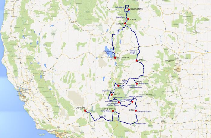
Alors cette année je réitère pour une nouvelle édition d'un circuit à l'ouest qui part de Las Vegas et nous ménera jusqu'au Sud Dakota en 4 semaines.
Jour 1 : Un voyage stressant !
On a beau tout préparer depuis une année, les choses ne vont pas toujours comme on le souhaite...
En ce jeudi 1er juillet, nous partons de Bruxelles pour un vol sans problème jusqu'à Heathrow, l'un des aéroports européen bénéficiant de nombreuses connexions pour l'ouest des USA.
C'est à partir d'ici que cela se complique.
J'avais lu sur le forum les mésaventures de cette belge qui avait eu un problème d'embarquement sous prétexte que son ESTA était refusé alors que depuis son domicile tout était en ordre... Je craignais pour les enfants qui venaient de refaire leurs passeports.
Et bien figurez-vous que c'est sur moi que le problème est tombé, moi qui ne suis pourtant pas belge mais française donc disposant d'un passeport français!!!
Arrivés au passage vers la zone internationale (zone d'embarquement ) du terminal 5, l'employée de British Airways m'annonce que mon ESTA n'est pas “accepted”. Alors nous sortons les documents imprimés depuis la maison qui indiquent que tout est en ordre mais rien n'y fait!
La dame tapote sur son ordinateur et retapote, rien n'y fait … 🙁
1ère explication : La dame me dit que je dois refaire une demande avec mes 3 prénoms pour que ce soit accepté...
Elle tapote et retapote et là, … toujours “not accepted” DAMNED ! 2me explication : J'ai fait ma demande ESTA avec mon nom de jeune fille (normal, c'est ce qui est sur mon passeport) alors que j'ai fait la réservation British Airways sous mon nom d'épouse.
Elle me propose de refaire une demande depuis son ordinateur. Comme il n'y a pas de file d'attente elle m'assiste pour remplir la nouvelle demande et là on doit attendre... combien de temps.. on ne sait pas, peut-être 1 heure.. L'angoisse monte, la colère aussi !...
La dame retapote sur l'interface de la British et rien n'y fait je suis toujours refusée. 🙁
C'est alors qu'intervient mon “sauveur”, le gentil collègue d'à côté qui regarde l'écran de la dame et lui fait remarquer que cette gourde s'est plantée dans la saisie du n° de mon passeport sur son écran (l'interface de la British)!... et du coup, O, miracle, me voici accepted !!!
Bon tout le monde peut se tromper ok mais j'attends toujours les excuses de cette gourdasse...🤪
Et c'est là qu'on se dit : British Airways, plus jamais !
Ensuite c'est une longue attente qui commence tempérée par un déjeuner sympa dans un restaurant branché style “asiatique fusion” (il me semble que c'est comme cela qu'on dit) où l'on peut commander du riz ou des nouilles asiatiques avec divers composants etc..
C'est bon et ça cale pour se remettre de toutes ces émotions.
Entre temps moi je ne suis pas tout à fait tranquille vu que la dame m'a refait faire une demande ESTA avec mon nom d'épouse, c'est à dire pas celui qui est sur le passeport (il n'y a indiqué mon nom de jeune fille épouse nom marital). Je crains d'avoir des problèmes à l'arrivée aux USA ...
Nous passons donc pas mal de temps a déembuler dans les boutiques du T5. Entre notre arrivée à 10h10 et notre départ de l'avion prévu pour 16h, il y a près de 6h d'attente !
Et c'est là qu'on se dit : “T'aurais pas pu choisir une escale un peu plus courte ?”
Une fois à bord de l'appareil qui doit décoller à 16h, on commence a s'aperçevoir d'un léger décalage dans le temps. C'est alors que le commandant et son équipage vous souhaite la bienvenue... Ah non pas tout à fait, c'est le commandant qui prend la parole pour nous expliquer que nous attendons car les bagages ne sont pas encore tous arrivés...
Il est 16h45 lorsque le pilote reprend la parole pour annoncer que le départ est imminent MAIS que suite au crash du système informatique de gestion des bagages à Heathrow, il nous manque 70% des bagages ! En d'autres termes nous sommes 300 passages à bord et nous n'emportons que 96 valises !...🤪
Il propose aux gens qui veulent descendre ...de descendre... en sachant qu'ils devront attendre plusieurs jours avant de repartir et sans savoir où sont leurs bagages ! What a joke !
Etonnament, personne ne veut descendre. Le commandant assure qu'aucune valise ne sera perdue et que chacun sera livré dans quelques jours, où qu'il se trouve aux USA. Il annonce également que des cartes de “compensation” seront attribuées pour permettre aux passagers d'effectuer les achats de première necesité. Il présente ses excuses au nom de la compagnie etc...
C'est alors que je me souviens de l'année passée, au retour de Los Angelès. Nous avions 1h30 d'escale et c'était trop court pour que nos valises suivent. A l'arrivée à Bruxelles il nous manquait nos 4 bagages mais on n'étaient pas angoissés, c'était au retour de vacances. Le lendemain matin elles nous avaient été livrées à notre domicile.
Mais je me rappelle aussi ce que m'avait raconté un ami. Il disait qu'une fois, à Heathrow, ils avaient eu un tel crash de leur système informatique de gestion des bagages que pour ne pas engorger l'aéroport et permettre au traffic de reprendre normalement, ils avaient du expédier tous les bagages en Italie pour les trier et les dispatcher à travers le monde... cela avait du prendre au moins une semaine voire plus!
Les angoisses de la plupart passagers concernant le décollage, le vol etc... cèdent la place à l'angoisse de ne plus revoir ses valises, de devoir tout acheter sur place etc... 🤪
C'est aussi là qu'en 30 secondes tu fais le point sur les endroits où il est possible que tu te trouves dans “quelques jours”, que tu fais le point sur les éventuelles modifs du parcours si tu dois revenir à Las Vegas. Tu fais aussi le point sur les trucs indispensables qui vont te manquer à commencer par les piqures pour mon mari qui a déjà fait une flébite suivi d'une embolie pulmonaire après un vol en avion, les médicaments que tu dois impérativement prendre tous les jours comme ceux que je prends contre l'hypertension car ceux que j'ai sur moi pourront me faire tenir une semaine au plus... ..et puis tous les petits trucs indispensables à ta “survie” genre shorts, sandales -vu que nous sommes partis en jean et chaussures de rando et qu'à l'arrivée il fera 35°, slips, chaussettes de randonnée , crème solaire, anti-moustiques, les bredequins en toile spécialement commandés sur internet pour faire “les narrows” à Zion... bref l'angoisse pour moi encore une fois, alors que d'habitude je suis la zénitude incarnée !🙁
Je n'ai pas le coeur à regarder les films, j'arrive tout de même à m'endormir un peu avec pas mal de difficultés. A une heure de l'arrivée, le personnel de bord nous sert notre “petit déjeuner sandwich aux comcombres (on est sur British Airways faut-il le rappeler).
C'est alors que le commandant prend la parole. Londres lui a fourni la liste des passagers dont les baggages sont restés à Londres. Si l'on est positif on peut se dire que c'est bon signe car au moins ont les a retrouvés! Il commence a égrèner les numéros des sièges concernés. Plus un bruit dans l'appareil... Nous avons nos sièges en 39A, B, C et D.
Nous entendons Thirty one, thirty two... pas de 39, ouf !!😐
C'est là que mon mari me dit “attends, il va redonner 2 autres listes dans 5 minutes !” Arghh c'est vrai, nous sommes 300 à bord et il y a au moins 200 personnes qui n'auront rien à l'arrivée ! Re prise de parole du commandant qui se veut toujours aussi rassurant et précise que les bagages seront livrés demain soir .
Et c'est là qu'on se dit que c'est utile de toujours prévoir un petit séjour sur place à l'arrivée !
On écoute toujours aussi attentivement le commandant lire les numéros des sièges. Tous les “thirty” y passent sauf le “nine”. On est bien content mais est-ce que l'on a bien entendu ? On ne pourra le savoir qu'à l'arrivée …
Il est 19h30 quand l'avion se pose avec un maximum de délicatesse. Nous devions attérie à 18h50, ça va, l'avion a dû voler plus vite sans le poids des bagages ! 🤪
Mon angoisse me reprends avec les formalités d'immigration. La file d'attente parait longue mais les guichets sont très efficaces et nous n'attendons pas 5' avant d'atteindre l'agent du service qui est très aimable comme d'habitude. En 5' à peine l'affaire est pliée.
Je re-maudit la fille de British Airways à Heathrow !
Nous nous précipitons alors vers le tapis roulant des bagages...et... ils sont tous là !! Soulagés nous quittons l'aéroport.
Il fait nuit, la chaleur est écrasante (100°F) et je me sens super mieux ! Etonnant non ?
Et c'est là qu'on se dit : Finalement une escale de 6 h à Heathrow c'est bien, ça aura au mois permis aux valises d'arriver très tôt pour être embarquées dans l'avion !
Nous embarquons dans la navette our le Mac Carran rental center, direction ALAMO hein..). Les employés de ce genre d'agence sont de redoutables vendeurs. On le sait bien, on avait déjà eu une proposition de véhicule de catégorie supérieure l'an passé par rapport à ce que j'avais réservé mais on ne s'en était pas plaint, au contraire, c'était super. Cette année j'avais réservé un Chevrolet Equinox et le gars nous propose la gatégorie au dessus en vrai 4X4 à un prix défiant toute concurrence évidemment... 😕 Je le savais, je le savais...
Bon, le modèle au dessus il est tout de même bien tentant et c'est un vrai 4X4 alors que sur internet je ne pouvais pas y accéder vu que non accepté à l'abandon à Rapid city.
Mais là vu que c'est Alamo qui le propose, allez go !! Evidemment c'est plus cher vu que Patrick prend aussi 'loption de l'assurance complémentaire pour frais de réparation “si l'on est perdu en plein désert” que dit le gars … 🤪 mais d'un autre côté, les frais d'abandon font 200$ de moins que annoncé par auto escape... comme quoi ...
Dans le parking il y a plein de SUV et tout au bout de l'allée face à nous, j'aperçois un gros bazar blanc... et j'ai comme l'intuition que c'est ça le JEEP COMMANDER que nous a loué le gars! BINGO !
Pour ceux qui ne connaissent pas c'est un modèle dont on ne peut pas dire que la ligne soit franchement design, mais c'est plus “haut sur pattes” que l'Equinox.
Le coffre n'est pas plus grand à cause des sièges supplémentaires qui sont rabbatus (ce modèle peut accueillir 7 passagers). Les bagages se retrouvent très en hauteur ce qui diminue un peu la visibilité à l'arrière mais d'après Patrick, le véhicule est agréable à conduire et très maniable. Moi je me dit que plus on est haut sur pattes, moins on a aura de problèmes dans des passages difficiles.
J'ai fait une check list pour quelques vérifications du véhicule (roue de secours – elle est dessous, etat du pare brise, km du prochain entretien, ). Il manque la notice et le double des clefs. Le gars nous dit qu'il n'y en a pas … Bon, ben on le prend quand même hein ?!
Il est environ 22h quand nous arrivons au Caesars Palace. Je vous fais grace des descriptions de couloirs interminables et de la chambre qui correspond à ma réservation.
FAIM nous avons … Il est 23h et le food court est fermé ...alors nous allons nous restaurer au MUNCH BURGER, hyper branché et bruyant mais salvateur et nous sommes au dodo vers 0h45.
Il est maintenant 07h45 du matin et cela fait près d'1h30 que je n'ai plus envie de dormir. J'arrête le récit de cette longue journée de voyage perturbé et vous adresse mes meilleures pensées et encore tous mes remerciements pour l'aide apportée sur le forum. 🙂
Voilà maintenant quelques semaines que nous sommes rentrés des terres lointaines de l'Ouest américain.
Pour ma part, j'ai eu la chance de parcourir ces endroits pour la troisième fois. J'étais accompagnée cette fois de ma mère et de mon frère, qui eux, découvraient toutes ces merveilles pour la première fois.
Nous avons préparé ce voyage pendant plusieurs mois, pour finalement partir du 08 Juin au 01 Juillet 2017. J'en profite pour remercier tous les membres de ce forum qui partagent leurs expériences, cela m'a grandement aidé pour la préparation de mes trois voyages aux USA. Je vais donc à mon tour, partager les expériences positives, et négatives (!!!) de ce voyage, afin peut-être, qu'elles aident d'autres voyageurs !
Voici donc notre parcours en 23 jours :
Bonjour !
Inspirée et aidée par de nombreuses personnes du forum, je voulais partager notre premier roadtrip familial ! (et le début de nombreux autres, je l’espère!) En effet j’ai passé tellement de temps à lire tous vos carnets de voyages ou autres messages qu’il me paraissait inconcevable de ne pas partager notre expérience, si petite soit-elle. Et puis, depuis notre retour (d’ailleurs suis-je vraiment revenue ?) je me sens tellement nostalgique que narrer nos aventures me permet de prolonger le voyage, et aussi de le graver dans la pierre.
Alors les présentations :
Moi Sabrina, 41 ans, initiatrice, organisatrice, rédactrice un peu obsessionnelle... Lionel, mon amoureux, 45 ans, qui me suit les yeux fermés, sauf quand il conduit bien sûr ! Et nos 2 loulous : Hélio 12 ans et Adélie 10 ans, qui m’auront épatés pendant ces 3 semaines ! Ils se chamaillent beaucoup mais s’aiment beaucoup aussi, bien qu’ils ne veuillent pas se l’avouer... Nous vivons en Haute-Corse et de ce fait, avons l’habitude des randonnées en terrain accidenté. L’été dernier, en « vieux » couple que nous sommes, nous nous sommes enfin dits « oui »... Après avoir eu deux beaux enfants...
Je cherchais une destination pour notre voyage de noces, qui se déroulerait à 4 ! En effet, nous étions 3 ans auparavant, partis en amoureux 10 jours à NYC... On aime bien faire les choses de « travers », en quelque sorte un voyage de noces pré-nuptial ! 😉 Nous avons hésité... L’Islande, le Pérou, l’Ouest Américain, ou le Costa Rica, ou … Finalement, on se décide pour les USA ! On se dit que pour un premier roadtrip home made, cela sera plus facile et surtout que cela sera plus ludique pour nos 2 moustiques !
Tout s’enchaîne assez vite car quand bibi a une idée en tête et bien, elle l’a en tête... J’écume Internet, je lis beaucoup et comme conseillé, je prépare l’itinéraire avant de prendre les billets d’avion.
Le programme :
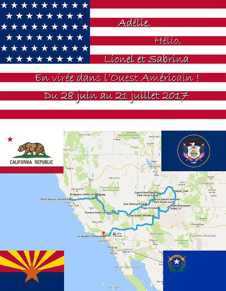 J1-28 juin : Vol Paris-San Francisco.
J2-29 juin : San Francisco
J3-30 juin : Les alentours de San Francisco
J4-01 juillet : San Francisco
J5-02 juillet : De San Francisco à Yosémite
J6-03 juillet : Yosémite/Panorama Trail
J7-04 juillet : Yosemite-Bridgeport via la Tioga Road+Mono Lake
J8-05 juillet : Bridgeport-Death Valley via Bodie
J9-06 juillet : Death Valley-Las Vegas
J10-07 juillet : Las Vegas/Spectacle The Dream
J11-08 juillet : Las Vegas-Zion
J12-09 juillet : Zion/Observation Point-Bryce
J13-10 juillet : Bryce/Navajo loop, Queen Garden-Torrey via l’UT12
J14-11 juillet : Torrey-Moab/Capitol Reef & Goblins Valley
J15-12 juillet : Moab-Arches National Park & Mill Creek
J16-13 juillet : Canyonlands-Arches/Windows Section
J17-14 juillet : Moab à Monument Valley/Natural Bridges+Muley Point & Mocky Dugway
J18-15 juillet : De Monument Valley à Page
J19-16 juillet : Page/Lower Antelope Canyon-Horseshoe Bend
J20-17 juillet : Page-Grand Canyon
J21-18 juillet : Grand Canyon-Los Angeles (oups...)
J22-19 juillet : Los Angeles-Universal Studios
J23-20 Juillet : Los Angeles
J24-21 juillet : Le départ et la conclusion
J1-28 juin : Vol Paris-San Francisco.
J2-29 juin : San Francisco
J3-30 juin : Les alentours de San Francisco
J4-01 juillet : San Francisco
J5-02 juillet : De San Francisco à Yosémite
J6-03 juillet : Yosémite/Panorama Trail
J7-04 juillet : Yosemite-Bridgeport via la Tioga Road+Mono Lake
J8-05 juillet : Bridgeport-Death Valley via Bodie
J9-06 juillet : Death Valley-Las Vegas
J10-07 juillet : Las Vegas/Spectacle The Dream
J11-08 juillet : Las Vegas-Zion
J12-09 juillet : Zion/Observation Point-Bryce
J13-10 juillet : Bryce/Navajo loop, Queen Garden-Torrey via l’UT12
J14-11 juillet : Torrey-Moab/Capitol Reef & Goblins Valley
J15-12 juillet : Moab-Arches National Park & Mill Creek
J16-13 juillet : Canyonlands-Arches/Windows Section
J17-14 juillet : Moab à Monument Valley/Natural Bridges+Muley Point & Mocky Dugway
J18-15 juillet : De Monument Valley à Page
J19-16 juillet : Page/Lower Antelope Canyon-Horseshoe Bend
J20-17 juillet : Page-Grand Canyon
J21-18 juillet : Grand Canyon-Los Angeles (oups...)
J22-19 juillet : Los Angeles-Universal Studios
J23-20 Juillet : Los Angeles
J24-21 juillet : Le départ et la conclusion
Les préparatifs :
Je m’inscris sur "algofly " et saute sur une promo au mois d’octobre en direct sur" United" : Environ 2.000 € pour nous 4, pour un Paris-San Francisco, Los Angeles-Paris du 28 juin au 21 juillet !!! Je trépigne ! Enfin du concret !!!
Le plus " compliqué " sera par contre le transport Bastia-Paris... Rien à moins de 1.000€, soit la moitié de la somme investie pour nous rendre outre-atlantique... Psychologiquement, je ne suis pas prête, je fulmine et je rage. Et je trouve une « solution »... Alors pour sûr cela sera moins cher mais plus long... Nous ferons : A l’aller : Vol Bastia-Lyon, nuit à Lyon où vit ma soeurette et le lendemain Ouigo jusqu’à Paris, et nuit à Paris où vit ma petite tantine ! Pour le retour, nous ferons un Ouigo Paris-Aix, nuit à Aix où vit ma belle-soeur et le lendemain vol Marseille-Bastia, où vit ...où nous vivons..
L’opération nous permet tout de même d’économiser près de 400€...
Ensuite s’enchaînent les réservations d’hôtels et de campings ! En effet, le blog de BonCampeur (Orionide), que je remercie au passage, nous a inspiré et décidé à sauter le pas. Nous casserons tout de même la tirelire dans quelques hôtels... Au Coventry Motor Inn à San Francisco car c’est la ville qui le veut, dans la Death Valley au Furnace Creek Ranch, à Las Vegas au Marriott Grand Château, à Dead Horse State Park pendant 2 nuits dans une yourte, le Red Cliff Lodges à Moab, et à Page au Best Western View. Pour les campings, les réservations ont été faites dès l’ouverture des ventes... Pour Zion, Bryce, le Grand Canyon, aucun problème, par contre pour Yosemite, j’ai dû batailler pour les 2 nuits. La 1ère nuit dans la vallée au Upper Pines Campground et la 2ème au Hodgdon Meadows Campground...Mon dieu, la bouffée de stress, pourtant je m’étais entraînée !!!
Et puis je me prends au jeu... Après les réservations, je me lance dans le programme un peu plus détaillé... Oh non je ne ferai pas de roadbook, c’est trop long et trop « rigide ». Et en fait j’en ferai un. Un gros classeur, qui nous sera utile, indispensable.
Pour ce voyage nous avons décidé de payer au fur et à mesure les logements, location de voiture et activités quand cela était possible afin d’étaler les dépenses. Du coup, je paie des frais bancaires quand les transactions sont en $. A cette époque 1€=1,05$, ce qui je pense gonflera bien la note par rapport à cet été où l’€ remonte... Ultérieurement, j’apprendrai que la Société Générale propose des forfaits mensuels qui permettent l'exonération des frais... 10€ pour un mois pour 6 opérations, 17,50€ en illimité... Finalement, sur place ne nous resteront à payer « que » quelques nuits d’hôtel, la nourriture, l’essence et les souvenirs...
Budget détaillé pour 4 personnes pour 23 nuits : A la louche environ 10.000€
Vol Paris-San Francisco/ Los Angeles-Paris : 1.979,16€ Hôtels et campings : 2.800€ Location Avis SUV standard sur le site irlandais : 820€ Visite Alcatraz : 126€ Navette Yosémite jusqu’à Glacier Point : 75€ Spectacle The dream à las Vegas : 512€ Visite Lower Antelope : 80€ Universal studios par Viator : 367€ Et tous les frais classiques afférents à l’ESTA, le Passeport...
Sur place nous dépenserons : Nourriture : 2.400€ Matériel camping : 117€ Essence : 370€ Et les souvenirs, visites...
Inspirée et aidée par de nombreuses personnes du forum, je voulais partager notre premier roadtrip familial ! (et le début de nombreux autres, je l’espère!) En effet j’ai passé tellement de temps à lire tous vos carnets de voyages ou autres messages qu’il me paraissait inconcevable de ne pas partager notre expérience, si petite soit-elle. Et puis, depuis notre retour (d’ailleurs suis-je vraiment revenue ?) je me sens tellement nostalgique que narrer nos aventures me permet de prolonger le voyage, et aussi de le graver dans la pierre.
Alors les présentations :
Moi Sabrina, 41 ans, initiatrice, organisatrice, rédactrice un peu obsessionnelle... Lionel, mon amoureux, 45 ans, qui me suit les yeux fermés, sauf quand il conduit bien sûr ! Et nos 2 loulous : Hélio 12 ans et Adélie 10 ans, qui m’auront épatés pendant ces 3 semaines ! Ils se chamaillent beaucoup mais s’aiment beaucoup aussi, bien qu’ils ne veuillent pas se l’avouer... Nous vivons en Haute-Corse et de ce fait, avons l’habitude des randonnées en terrain accidenté. L’été dernier, en « vieux » couple que nous sommes, nous nous sommes enfin dits « oui »... Après avoir eu deux beaux enfants...
Je cherchais une destination pour notre voyage de noces, qui se déroulerait à 4 ! En effet, nous étions 3 ans auparavant, partis en amoureux 10 jours à NYC... On aime bien faire les choses de « travers », en quelque sorte un voyage de noces pré-nuptial ! 😉 Nous avons hésité... L’Islande, le Pérou, l’Ouest Américain, ou le Costa Rica, ou … Finalement, on se décide pour les USA ! On se dit que pour un premier roadtrip home made, cela sera plus facile et surtout que cela sera plus ludique pour nos 2 moustiques !
Tout s’enchaîne assez vite car quand bibi a une idée en tête et bien, elle l’a en tête... J’écume Internet, je lis beaucoup et comme conseillé, je prépare l’itinéraire avant de prendre les billets d’avion.
Le programme :
J1-28 juin : Vol Paris-San Francisco.
J2-29 juin : San Francisco
J3-30 juin : Les alentours de San Francisco
J4-01 juillet : San Francisco
J5-02 juillet : De San Francisco à Yosémite
J6-03 juillet : Yosémite/Panorama Trail
J7-04 juillet : Yosemite-Bridgeport via la Tioga Road+Mono Lake
J8-05 juillet : Bridgeport-Death Valley via Bodie
J9-06 juillet : Death Valley-Las Vegas
J10-07 juillet : Las Vegas/Spectacle The Dream
J11-08 juillet : Las Vegas-Zion
J12-09 juillet : Zion/Observation Point-Bryce
J13-10 juillet : Bryce/Navajo loop, Queen Garden-Torrey via l’UT12
J14-11 juillet : Torrey-Moab/Capitol Reef & Goblins Valley
J15-12 juillet : Moab-Arches National Park & Mill Creek
J16-13 juillet : Canyonlands-Arches/Windows Section
J17-14 juillet : Moab à Monument Valley/Natural Bridges+Muley Point & Mocky Dugway
J18-15 juillet : De Monument Valley à Page
J19-16 juillet : Page/Lower Antelope Canyon-Horseshoe Bend
J20-17 juillet : Page-Grand Canyon
J21-18 juillet : Grand Canyon-Los Angeles (oups...)
J22-19 juillet : Los Angeles-Universal Studios
J23-20 Juillet : Los Angeles
J24-21 juillet : Le départ et la conclusionLes préparatifs :
Je m’inscris sur "algofly " et saute sur une promo au mois d’octobre en direct sur" United" : Environ 2.000 € pour nous 4, pour un Paris-San Francisco, Los Angeles-Paris du 28 juin au 21 juillet !!! Je trépigne ! Enfin du concret !!!
Le plus " compliqué " sera par contre le transport Bastia-Paris... Rien à moins de 1.000€, soit la moitié de la somme investie pour nous rendre outre-atlantique... Psychologiquement, je ne suis pas prête, je fulmine et je rage. Et je trouve une « solution »... Alors pour sûr cela sera moins cher mais plus long... Nous ferons : A l’aller : Vol Bastia-Lyon, nuit à Lyon où vit ma soeurette et le lendemain Ouigo jusqu’à Paris, et nuit à Paris où vit ma petite tantine ! Pour le retour, nous ferons un Ouigo Paris-Aix, nuit à Aix où vit ma belle-soeur et le lendemain vol Marseille-Bastia, où vit ...où nous vivons..
L’opération nous permet tout de même d’économiser près de 400€...
Ensuite s’enchaînent les réservations d’hôtels et de campings ! En effet, le blog de BonCampeur (Orionide), que je remercie au passage, nous a inspiré et décidé à sauter le pas. Nous casserons tout de même la tirelire dans quelques hôtels... Au Coventry Motor Inn à San Francisco car c’est la ville qui le veut, dans la Death Valley au Furnace Creek Ranch, à Las Vegas au Marriott Grand Château, à Dead Horse State Park pendant 2 nuits dans une yourte, le Red Cliff Lodges à Moab, et à Page au Best Western View. Pour les campings, les réservations ont été faites dès l’ouverture des ventes... Pour Zion, Bryce, le Grand Canyon, aucun problème, par contre pour Yosemite, j’ai dû batailler pour les 2 nuits. La 1ère nuit dans la vallée au Upper Pines Campground et la 2ème au Hodgdon Meadows Campground...Mon dieu, la bouffée de stress, pourtant je m’étais entraînée !!!
Et puis je me prends au jeu... Après les réservations, je me lance dans le programme un peu plus détaillé... Oh non je ne ferai pas de roadbook, c’est trop long et trop « rigide ». Et en fait j’en ferai un. Un gros classeur, qui nous sera utile, indispensable.
Pour ce voyage nous avons décidé de payer au fur et à mesure les logements, location de voiture et activités quand cela était possible afin d’étaler les dépenses. Du coup, je paie des frais bancaires quand les transactions sont en $. A cette époque 1€=1,05$, ce qui je pense gonflera bien la note par rapport à cet été où l’€ remonte... Ultérieurement, j’apprendrai que la Société Générale propose des forfaits mensuels qui permettent l'exonération des frais... 10€ pour un mois pour 6 opérations, 17,50€ en illimité... Finalement, sur place ne nous resteront à payer « que » quelques nuits d’hôtel, la nourriture, l’essence et les souvenirs...
Budget détaillé pour 4 personnes pour 23 nuits : A la louche environ 10.000€
Vol Paris-San Francisco/ Los Angeles-Paris : 1.979,16€ Hôtels et campings : 2.800€ Location Avis SUV standard sur le site irlandais : 820€ Visite Alcatraz : 126€ Navette Yosémite jusqu’à Glacier Point : 75€ Spectacle The dream à las Vegas : 512€ Visite Lower Antelope : 80€ Universal studios par Viator : 367€ Et tous les frais classiques afférents à l’ESTA, le Passeport...
Sur place nous dépenserons : Nourriture : 2.400€ Matériel camping : 117€ Essence : 370€ Et les souvenirs, visites...
Bonjour, j'ai lu de nombreux posts de ce forum, fort instructifs, mais il me reste quelques trucs qui me chafouinent, si vous pouviez éclairer ma lanterne s'il vous plait, merci ;)
j'aimerais savoir comment cela se passe en pratique :
- Est il interdit de dormir à l'intérieur des parcs hors d'un camp/lodge, en pleine nature ? - hors des parcs, "juste passé la barrière", possibilité de camper sauvage ? - Si aucune réservation, il est tout de même permis d'entrer dans le parc le matin, et en ressortir le soir ? - droit d'entrée payable à l'entrée ou reservation préalable nécessaire à Maun/Kasane/ailleurs ? - Début octobre, réservation indispensable ou possibilité de trouver dans les camps les moins prisés ? - existe il une réelle différence de densité de faune, de beauté des paysages, entre l'intérieur de ces parcs et l'extérieur immédiat ? - on va dire 4 jours, 2 à Chobe 2 à Moremi, en changeant d'endroit, ou l'un de ces deux parcs vaut mieux que l'autre ?
Bonjour,
Je voudrais m'acheter un sac à dos deuter Quantum. Mais j'hésite entre les 2 tailles SL 55 ou 60. Je sais que la différence est très minime mais jpréfère être sure vu le prix et demander votre avis. J'ai testé avec des sacs poubelles, rempli les 55 à quelque chose près. Du coup j'étais plus sur le 60. Mais d'un autre côté j'ai 10 litres que jpeux rajouter si j'achète des trucs sur place.
Qu'en pensez vous ?
Merci pour vos réponses.
Bonjour,
Je pars pour la France en août prochain pour voyager d'est en ouest à vélo/camping sous la tente. J'apprends qu'il n'y a pas de table à pique-nique en France dans les terrains de camping. Quelqu'un peut-il m'aider à savoir de quelle façon on peut s'organiser sans table dans un terrain de camping pour les repas, déposer ses objets ou tout simplement s'asseoir lorsque tous les bagages doivent être portés par le vélo.
Merci!
Salut tout le monde !
Le 15 Septembre 2014 commençait pour nous une grande aventure, notre 1er voyage aux Etats Unis.
Nous c’est : - Charlotte 33 ans : prépare le programme, le road book, repère les hôtels et restos, fait le guide et le copilote. - Nico 37 ans : supervise les réservations, sert de coussin anti-stress dans l’avion 😛, conduit la voiture et prend les photos.
Ce voyage c’était notre quête, notre graal, et aussi accessoirement, notre voyage de noce. On étaient déjà un peu à l’ouest avant, mais maintenant c’est officiel : on n’est jamais complètement revenus ! J’ai souvent piqué des idées et des bonnes infos sur le forum et beaucoup lu vos carnets de voyage, alors, pour vous dire MERCI, à notre tour de vous raconter notre merveilleux voyage. Mais avant de commencer le récit, voici quelques infos pratiques liées au programme et au budget.
Itinéraire : 14 Septembre : Franche-Comté -> Paris 15 Septembre : Paris -> Denver 16 Septembre : Denver -> Aspen 17 Septembre : Aspen -> Moab 18 Septembre : Moab – Arches national Park 19 Septembre : Moab – Canyonlands national Park : Island in the sky 20 Septembre : Autour de Moab 21 Septembre : Moab –> Canyonlands National Park : The Needles -> Monticello 22 Septembre : Monticello -> Monument Valley 23 Septembre : Monument Valley -> Grand Canyon 24 Septembre : Grand Canyon -> Williams -> Flagstaff 25 Septembre : Flagstaff -> Page 26 Septembre : Page -> Coyote Butte South -> Page 27 Septembre : Page -> Antelope Canyon -> Tropic 28 Septembre : Tropic -> Bryce Canyon -> Springdale 29 Septembre : Zion 30 Septembre : Springdale -> Valley of Fire -> Las Vegas 1er Octobre : Las Vegas 2 et 3 Octobre : Las Vegas -> Paris -> Franche-Comté
Toutes les dépenses sont exprimées pour 2 personnes. Budget pour 17 nuits en hôtel ou motel : 1927 $ Budget repas – alimentation : 1062 $ (pique-niques midi, petits déj, et repas resto le soir) Budget essence : 257 $ Coût de location de la voiture : 777 euros (désolée je sais, c’est pas raccord avec le reste) Billets d’avion : 1893 euros Visites : 570 $
14 Septembre 2014 : La maison - Paris
Deux ans qu’on le prépare ce voyage. Deux ans de rêves, de recherches, de lecture, de révisions d’anglais. Selon nos habitudes, le planning est réglé comme du papier à musique, tous les hébergements sont réservés depuis longtemps, tout comme la voiture de location. La maison et le chat sont entre de bonnes mains (celles de papa en l’occurrence). La valise est bouclée. Bref, tout serait impec’ si les pilotes d’Air France n’avaient pas décrété 2 jours avant notre grand départ en voyage une grève qui risque de tout flanquer à l’eau !🤪
Et voilà que ces moments de joie se transforment en stress intense, et en heures perdues à essayer de joindre quelqu’un qui voudra bien sauver notre voyage. Des quatre vols de notre voyage, seul le premier doit être opéré par Air France. Ce sera sans doute notre chance, car nous sommes finalement contactés par Air France (suite à un message désespéré sur leur page Facebook). Nous voyagerons donc exclusivement avec Delta.
Notre voyage à l’aller se fait en deux temps. Il faut déjà prendre le train qui nous emmène à Paris. Depuis la Gare de l’Est nous attrapons tout de suite une navette qui nous mène à Charles de Gaulle. Ce soir, nous dormons dans un des hôtels autour de l’aéroport. Sur le quai de la gare à Vesoul : c'est parti pour le grand voyage !
15 Septembre 2014 : Paris – Denver, le grand départ
Le lendemain matin, nous sommes de bonne heure à CDG. Nous découvrons cet aéroport, et trouvons sans problème notre porte d’embarquement. Premier contact avec les USA : un américain coiffé d’un beau stetson nous demande de l’aide pour s’orienter. Premier effort de compréhension : Monsieur vient de l’A-keeeen-za…. Euh…. Ah, OK ! L’Arkensas ! Et bien, bon retour chez toi et salue le Midwest pour nous.
Toutes les formalités se passent comme sur des roulettes, et en un clin d’œil, nous voilà à bord. Nous sommes placés à l’arrière de l’appareil qui n’est pas plein, il reste plein de places derrière nous. Le steward est très sympa, et sera aux petits soins avec nous tout au long du vol (il nous proposera même du cognac après le repas). Nous sommes agréablement surpris : la traditionnelle vidéo de sécurité est marrante, ce qui permet de se détendre un peu, il y a un grand choix de films, musique et jeux. L’avion est assez confortable et la nourriture est bonne (tout du moins à l’aller !).

9h30 de vol et 6777 km plus loin, nous atterrissons à Minneapolis. Nous serrons bien entendu, les derniers à passer l’immigration ! Super tentative de Nico de dérider la dame : « it’s our weeding travel »…. Euh, chéri, on dit « honeymoon ». Ca n’a pas marché, la dame nous a regardé comme s’il fallait nous coffrer d’urgence. Vite, vite, on récupère les bagages au tourniquet, on les remet sur le tapis derrière la porte automatique et on repasse la fouille (les derniers tant qu’à faire). Et là, ce sera moins cool. Comme nous voyageons avec un peu (mais juste un peu) de matériel informatique et photo (trois appareils photos, plusieurs zooms, 2 disques durs externes, ordi portable, go-pro), on a droit à l’inspection intégrale du matériel au papier anti-explosif. Je pars devant pour essayer de savoir par où il faut aller. Une charmante mamie vient à mon aide et m’indique notre porte d’embarquement pour Denver. Heureusement, l’aéroport est tout petit, et on arrive juste à temps. L’avion est déjà bondé. C’est clairement la classe en dessous de notre précèdent vol. Là, on passe en mode bétaillère. Même si on est moins bien installés, la fatigue se fait sentir, et je dormirais durant la majorité du vol qui dure 2h.
L’atterrissage se passe bien, nos bagages nous ont suivis (ô miracle !) et on trouve la sortie sans problème de même que le loueur auto. Chez Avis, il n’y a pas un choix phénoménal. On nous propose 3 véhicules, deux SUV et une Mustang. Nous choisissons un SUV Kia blanc. On charge tout le barda et en voiture Simone ! Direction l’hôtel, que j’ai pris soin de réserver le plus proche possible de l’aéroport. La prise en main de la voiture est un peu rock and roll, on n’a jamais conduit de boite automatique et ça demande un peu de rodage. Heureusement, nous arrivons à bon port sans trop de soucis (non on ne vous dira pas combien de fois on a calé, ni combien de fois, on a confondu l’embrayage et le frein ! 😊).
Le Baymont Inn and Suite est un bel hôtel de chaine. Notre chambre est juste super confortable, le lit queen suuuper bien, la salle de bain : une vraie salle de bal. Après presque 2 jours de voyage, on ne tient plus : une bonne douche et au lit pour faire une sieste histoire de recharger les batteries.

Quelques heures plus tard, nous sommes un peu reposés, et nous partons à la recherche d’un resto. Ce sera à quelques centaines de mètres de l’hôtel, le Moonlight Diner. La déco est très fifties, et c’est sans doute ça que l’on à le plus apprécié, plus que la nourriture. C’est pas que c’est mauvais, mais on n’a pas vraiment faim. En revanche, on reste scotchés par nos voisins qui engloutissent de vraies montagnes de pancakes recouverts de sirop d’érable et de chantilly… Vivement demain que le vrai voyage commence vraiment !


Le 15 Septembre 2014 commençait pour nous une grande aventure, notre 1er voyage aux Etats Unis.
Nous c’est : - Charlotte 33 ans : prépare le programme, le road book, repère les hôtels et restos, fait le guide et le copilote. - Nico 37 ans : supervise les réservations, sert de coussin anti-stress dans l’avion 😛, conduit la voiture et prend les photos.
Ce voyage c’était notre quête, notre graal, et aussi accessoirement, notre voyage de noce. On étaient déjà un peu à l’ouest avant, mais maintenant c’est officiel : on n’est jamais complètement revenus ! J’ai souvent piqué des idées et des bonnes infos sur le forum et beaucoup lu vos carnets de voyage, alors, pour vous dire MERCI, à notre tour de vous raconter notre merveilleux voyage. Mais avant de commencer le récit, voici quelques infos pratiques liées au programme et au budget.
Itinéraire : 14 Septembre : Franche-Comté -> Paris 15 Septembre : Paris -> Denver 16 Septembre : Denver -> Aspen 17 Septembre : Aspen -> Moab 18 Septembre : Moab – Arches national Park 19 Septembre : Moab – Canyonlands national Park : Island in the sky 20 Septembre : Autour de Moab 21 Septembre : Moab –> Canyonlands National Park : The Needles -> Monticello 22 Septembre : Monticello -> Monument Valley 23 Septembre : Monument Valley -> Grand Canyon 24 Septembre : Grand Canyon -> Williams -> Flagstaff 25 Septembre : Flagstaff -> Page 26 Septembre : Page -> Coyote Butte South -> Page 27 Septembre : Page -> Antelope Canyon -> Tropic 28 Septembre : Tropic -> Bryce Canyon -> Springdale 29 Septembre : Zion 30 Septembre : Springdale -> Valley of Fire -> Las Vegas 1er Octobre : Las Vegas 2 et 3 Octobre : Las Vegas -> Paris -> Franche-Comté
Toutes les dépenses sont exprimées pour 2 personnes. Budget pour 17 nuits en hôtel ou motel : 1927 $ Budget repas – alimentation : 1062 $ (pique-niques midi, petits déj, et repas resto le soir) Budget essence : 257 $ Coût de location de la voiture : 777 euros (désolée je sais, c’est pas raccord avec le reste) Billets d’avion : 1893 euros Visites : 570 $
14 Septembre 2014 : La maison - Paris
Deux ans qu’on le prépare ce voyage. Deux ans de rêves, de recherches, de lecture, de révisions d’anglais. Selon nos habitudes, le planning est réglé comme du papier à musique, tous les hébergements sont réservés depuis longtemps, tout comme la voiture de location. La maison et le chat sont entre de bonnes mains (celles de papa en l’occurrence). La valise est bouclée. Bref, tout serait impec’ si les pilotes d’Air France n’avaient pas décrété 2 jours avant notre grand départ en voyage une grève qui risque de tout flanquer à l’eau !🤪
Et voilà que ces moments de joie se transforment en stress intense, et en heures perdues à essayer de joindre quelqu’un qui voudra bien sauver notre voyage. Des quatre vols de notre voyage, seul le premier doit être opéré par Air France. Ce sera sans doute notre chance, car nous sommes finalement contactés par Air France (suite à un message désespéré sur leur page Facebook). Nous voyagerons donc exclusivement avec Delta.
Notre voyage à l’aller se fait en deux temps. Il faut déjà prendre le train qui nous emmène à Paris. Depuis la Gare de l’Est nous attrapons tout de suite une navette qui nous mène à Charles de Gaulle. Ce soir, nous dormons dans un des hôtels autour de l’aéroport.
Sur le quai de la gare à Vesoul : c'est parti pour le grand voyage !15 Septembre 2014 : Paris – Denver, le grand départ
Le lendemain matin, nous sommes de bonne heure à CDG. Nous découvrons cet aéroport, et trouvons sans problème notre porte d’embarquement. Premier contact avec les USA : un américain coiffé d’un beau stetson nous demande de l’aide pour s’orienter. Premier effort de compréhension : Monsieur vient de l’A-keeeen-za…. Euh…. Ah, OK ! L’Arkensas ! Et bien, bon retour chez toi et salue le Midwest pour nous.
Toutes les formalités se passent comme sur des roulettes, et en un clin d’œil, nous voilà à bord. Nous sommes placés à l’arrière de l’appareil qui n’est pas plein, il reste plein de places derrière nous. Le steward est très sympa, et sera aux petits soins avec nous tout au long du vol (il nous proposera même du cognac après le repas). Nous sommes agréablement surpris : la traditionnelle vidéo de sécurité est marrante, ce qui permet de se détendre un peu, il y a un grand choix de films, musique et jeux. L’avion est assez confortable et la nourriture est bonne (tout du moins à l’aller !).
9h30 de vol et 6777 km plus loin, nous atterrissons à Minneapolis. Nous serrons bien entendu, les derniers à passer l’immigration ! Super tentative de Nico de dérider la dame : « it’s our weeding travel »…. Euh, chéri, on dit « honeymoon ». Ca n’a pas marché, la dame nous a regardé comme s’il fallait nous coffrer d’urgence. Vite, vite, on récupère les bagages au tourniquet, on les remet sur le tapis derrière la porte automatique et on repasse la fouille (les derniers tant qu’à faire). Et là, ce sera moins cool. Comme nous voyageons avec un peu (mais juste un peu) de matériel informatique et photo (trois appareils photos, plusieurs zooms, 2 disques durs externes, ordi portable, go-pro), on a droit à l’inspection intégrale du matériel au papier anti-explosif. Je pars devant pour essayer de savoir par où il faut aller. Une charmante mamie vient à mon aide et m’indique notre porte d’embarquement pour Denver. Heureusement, l’aéroport est tout petit, et on arrive juste à temps. L’avion est déjà bondé. C’est clairement la classe en dessous de notre précèdent vol. Là, on passe en mode bétaillère. Même si on est moins bien installés, la fatigue se fait sentir, et je dormirais durant la majorité du vol qui dure 2h.
L’atterrissage se passe bien, nos bagages nous ont suivis (ô miracle !) et on trouve la sortie sans problème de même que le loueur auto. Chez Avis, il n’y a pas un choix phénoménal. On nous propose 3 véhicules, deux SUV et une Mustang. Nous choisissons un SUV Kia blanc. On charge tout le barda et en voiture Simone ! Direction l’hôtel, que j’ai pris soin de réserver le plus proche possible de l’aéroport. La prise en main de la voiture est un peu rock and roll, on n’a jamais conduit de boite automatique et ça demande un peu de rodage. Heureusement, nous arrivons à bon port sans trop de soucis (non on ne vous dira pas combien de fois on a calé, ni combien de fois, on a confondu l’embrayage et le frein ! 😊).
Le Baymont Inn and Suite est un bel hôtel de chaine. Notre chambre est juste super confortable, le lit queen suuuper bien, la salle de bain : une vraie salle de bal. Après presque 2 jours de voyage, on ne tient plus : une bonne douche et au lit pour faire une sieste histoire de recharger les batteries.
Quelques heures plus tard, nous sommes un peu reposés, et nous partons à la recherche d’un resto. Ce sera à quelques centaines de mètres de l’hôtel, le Moonlight Diner. La déco est très fifties, et c’est sans doute ça que l’on à le plus apprécié, plus que la nourriture. C’est pas que c’est mauvais, mais on n’a pas vraiment faim. En revanche, on reste scotchés par nos voisins qui engloutissent de vraies montagnes de pancakes recouverts de sirop d’érable et de chantilly… Vivement demain que le vrai voyage commence vraiment !
 SEGO LILY Calochortus nuttallii
L’Ouest USA… voyage forum.. .carnets de voyage sont des mots à forte résonance dont la tonalité éveille tous mes sens.
Vos carnets ont été une grande source d’inspiration pour la construction de notre voyage… qui sera tout en randonnées et pour la réalisation de ce carnet-souvenir... qui sera tout en simplicité.
De ces lectures sont nés des désirs, des souhaits et même des certitudes suscitées par les vagues d’enthousiasme échappées de vos écrits ou de vos clichés révélateurs de sublimes paysages.
Ce carnet sera celui de nos souvenirs communs , un voyage à deux issu d’une relation amoureuse et d’un intérêt partagé et passionné pour ces contrées sauvages et lointaines.
Nous vous souhaitons bonne lecture, beaucoup de plaisir au moins autant que nous en avons eu pour l’écrire et l’imager.
Nous remercions de tout cœur Fred XIII, Isap29, Kashtin, Krikri, Mlefevre, Mokahlki, Oliv2019, PSI, Sedonax, Veileen, Vnoa, Wavemaster.
Merci aussi à tous les autres forumeurs qui ont eu la patience de répondre à nos questionnements ciblés dans le Post « Itinéraire de 29 jours : Colorado Utah Arizona Nouveau-Mexique Colorado »
Sincèrement et personnellement notre révérence va droit à Philippe ( Sedonax ) sous le signe « Sa passion et une patience d’Ange ».
Puis vers Pascale ( Kashtin ) pour son travail minutieux - correction de mon identification du bouquet garni de petites fleufleurs - et sa grande sympathie.
C’est parti mes amis et bon voyage…
Voici notre programme définitif avec sa carte itinéraire:


Le 1er Juin – Région Moab & Arches NP
 ASTER Erigeron utahensis
 De Denver à Moab… Arrivée par la 128 et là nous baignons dans l’ambiance Colorado, ses flots calmes nous bercent dans nos souvenirs respectifs et notre premier contact est un instant magique.

Nous filons ensuite à Corona Arch, empressés que nous sommes. Patrick, attiré par les arches en tout genre en retrouve de suite la trace; nous admirons ensemble cette structure naturelle, sa ligne épurée et sa couleur rouge/rosée si tendre à nos cœurs.


Puis les Arches du NP nous rappelle à elles.. nous traversons tout le parc, là aussi notre mémoire s’active; direction Marching Men... la piste de tôle ondulée donne une impression désagréable et me fait avancer avec prudence, le 4X4 chasse nous sommes déçus du peu de perf du Grand Cherokee mais ne vous y fiez pas, notre désarroi sera de courte durée !
Patrick, au retour comprendra… le problème se résorbe à minima en accélérant.
Nous sommes résolument seuls lors de cette journée et cela le sera pour la majorité de nos trails et pour notre plus grand plaisir.
La douceur du crépuscule nous envahit et nous rafraîchit après la chaleur excessive de ce jour. La marche devient agréable et sympa.
Mais les Marching Men se font attendre et je partage mon sentiment: les beaux sites de l’Ouest s’offrent à nous après un jeu de cache-cache , on les cherche, on les devine puis à un détour sans qu’on s’y attende, ils se donnent enfin d’une façon majestueuse et toujours avec splendeur.
Impressionnants ces drôles de bonhommes... tous devant et tous derrière...

La nuit est là et Tower Arch nous nargue... la prudence l’emporte sur l’envie de continuer... nous reprenons le chemin en sens inverse, il nous reste tellement à découvrir !
Le 2 Juin
 BUCKWHEAT Eriogonum ovalifolium
Levés à l’aube 4h30 pour un RDV avec le sunrise de Mesa Arch. Tout simplement, raté.
Mesa Arch est certes toujours aussi belle et irrésistible mais aujourd’hui elle s’amuse de nous et de 2 autres photographes… pas de soleil... il se camoufle sous un coton épais de nuages.

La False Kiva mérite bien qu’on s’y attarde; nous nous imprégnons de l’ambiance dans cette ruine indienne et méditons dans l’alcôve et là inespérée la lumière du soleil jaillit sur les méandres de la Green River et les vues en sont immédiatement métamorphosées.

Comme la journée a commencé très tôt nous prenons le temps de trailer à Aztec Butte où la vue sur Taylor Canyon est un peu décevante après False Kiva.
 Quelques granaries Anasazi le long du parcours… greniers de stockage de provisions
... alors nous poussons, l‘adrénaline et le Cherokee jusqu’à la Shafer Trail; je suis impatiente et légèrement crispée, c’est une première pour moi et si attendue; Patrick lui l’a dévalée l’an passé en VTT avec brio et péripétie.
Elle est extra cette piste – très cassante par endroits alors prudence- et notre 4X4 se révèle être enfin un compagnon de route fidèle et à la hauteur... High Clearance... de nos attentes !

Puis nous avançons vers Musselman Arch, elle m’impressionne énormissime ! Elle se présente comme une traverse de pierre d’environ 3 mètres de large avec le vide des 2 côtés. J’avais l’intention de la traverser mais le vertige m’a cloué sur place ! elle a su me résister ! Je l’aurai un jour !!! je l’aurai !!
L’environnement désertique mélange de falaises / mésas / piliers rocheux est fascinant et à perte de vue.


Retour à Moab.
Une petite sieste méritée et bienfaitrice au Kokopelli Lodge de Moab nous conduit tout droit et en forme au Moabrewery en soirée. Eh ! oui nous sommes des nostalgiques des ambiances et rencontres VF 09 Madseb, Floyd et notre Tigre .
Et attention, ce soir un RDV de toute importance nous attend, il s’agit de Sedonax avec qui nous passons une fin de soirée fort agréable – il nous en raconte des choses, toujours pertinent et intéressant ce Philippe !
Le 3 juin
 LUPINE Lupinus pusillus
Horseshoe Canyon se situe à l’ouest de Canyonlands dont il fait partie intégrante malgré l’éloignement géographique – 2h30 de Moab au parking du trail
La piste s’avère longue et sans problème particulier.
La rando quant à elle est pénible: 5 heures de marche uniquement dans un wash et dans du sable sous une chaleur excessive.
La 1ère et 3ème galerie (dénommée Great Galery) de Petroglyphs sont magnifiques, exceptionnelles; la 2ème l’étant moins à mes yeux.


Au retour, le dernier ¼ de mile se présente en montée raide dans un sable profond; là je perds pied: mes jambes flageolent, le sol se dérobe , mes yeux se voilent sous le regard inquiet et médusé de Patrick… Où sont les sels ? Sapristi !
Finies les ambitions… prouesse à la baisse. Nous redéfinissons les règles surtout celui de notre Tempo, le rythme de marche sera en fonction de Bibi Lolo !! 1ère et dernière manifestation de faiblesse, l’honneur est sauf !
Direction la piste menant au trail de Five Hole Arch , nous prenons le nord de la Lower San Rafael et la 1ère piste sur sa droite et sommes pris de suite dans les tourments d’un chemin dont le sable très profond ne donne aucun signe de passage récent et pas de possibilité de marche arrière. Foncer est ma seule devise pour éviter l’enlisement.
Sans conteste notre Cherokee se défend bien (la conductrice aussi !) et dorénavant nous le couvrons d’éloges et ce jusqu’au dernier mile du trip.
Sauf que notre erreur est démasquée enfin la mienne... retour sur la bonne voie 2ème piste à droite (cette fois c’est la bonne et trop fastoche) après la jonction avec la Lower San Rafael mais la luminosité faiblit, le crépuscule guette, adieu le sunset sur Five Hole Arch.
Nous gardons ce trail pour demain car dans l’immédiat une nouvelle expérience nous attend : première nuit dans le 4X4 et dans le wilderness, j’ai adoré cette solitude à deux, le décor s’y prêtait bien.

Douce soirée et nuit chaude !!!
Hum ! hum ! Petits et petites coquines, pas toujours bien placées vos idées !
Le 4 juin
 Sticks & Rocks
La journée commence très tôt - la lumière du jour nous réveille aux aurores - par la rando de Five Hole Arch une rando comme je les affectionne particulièrement, tous les ingrédients sont réunis: marche sur du slickrock, de l’orientation au GPS et un fabuleux spot de 5 belles arches donnant sur un panorama splendide de la Green River rive ouest.
Cette rando reste un très bon souvenir pour nous.
Trail de 2h15 en A/R

Crocodile Rock

Five Hole


Green River

Nous partons dans la région de San Rafael Swell avec son canyon de Little Wild Horse très prisé pour 3 raisons essentielles: il est facile d’accès, amusant et beau.
Of course, nous y croiserons beaucoup de touristes mais il vaut le détour.
Sans faire la boucle complète nous y resterons 2h en A/R.

Arrivés à Goblin Valley State Park la chaleur nous suffoque, l’air est irrespirable et notre balade à travers ces étranges créatures y sera écourtée.

Allez, allez on se ressaisit… et on se rattrape vite avec Crack Canyon pour lequel nous avons littéralement craqué tous les deux. Histoire de feeling !
Quelques difficultés à trouver la bonne piste me pousse à vous donner une indication:
Sur la Temple Mt Road laisser sur votre gauche la route pour Goblin Valley & Little Wild Horse Canyon continuer tout droit et compter environ 2 miles de cette jonction à celle de Crack Canyon prendre alors à gauche la piste menant au waypoint du parking indiqué sur ouestusa.
Le trail jusqu’à l’accès au site est sans intérêt juste un peu d’escalade et de repère avant de se jeter dans le Crack Canyon. 2 h en A/R (on marche le temps qu’on veut dans le canyon)
Un extraordinaire travail d’Erosion nous projette des années en arrière, certainement des millions d’années de labeur avant cet incroyable résultat. La roche est creusée de toute part, de nombreuses cavités - des p’tits trous, des p’tits trous encore des… et des passages tunnel façonnés et modelés par les pluies torrentielles et l’écoulement saisonnier de l’eau.
Sensationnel !


Le 5 Juin
 CLARET CUP CACTUS Echinocereus Triglochidiatus & ASTER Erigeron Concinnus
Factory Butte nous était totalement inconnu avant sa découverte dans le carnet de Mokalkhi – merci pour le petit détour vers ce colosse nuancé de gris et d’ocre, posé sur son tapis fleuri jaune.

Si, si .. le tapis est bien jaune !

Puis à l’approche de Capitol Reef en venant de Hanksville mon émerveillement est à son comble, j’ai encore droit aux petites moqueries de Patrick m’imitant « Oh ! c’est beau »
Ces dômes rocheux aux teintes douces se déclinant du rose au violine surplombant le blanc cassé/beige me surprennent et me scotchent sur place le temps de m’imprégner et d’imprimer dans la case mémoire.

Pourtant le sentier de Cassidy Arch nous attend et son dénivelé annonce déjà le ton , nous approchons de l’arche en bufflant.
Grimpette de 2h30 en A/R, nous l’avons prolongée en poussant de 2 miles vers le Cohab Trail.
Le Waterpocket étant le lieu privilégié de refuge du hors- la- loi redouté et de sa bande de malfrats. Pas vu, pas pris…

Vers 16h un petit passage au Visitor Center de Capitol Reef où les rangers nous confirment ce que nous pensions déjà : tout est OK ! L‘état de la piste et la météo étant les 2 atouts majeurs pour l’accès à Cathedral Valley.
Nous sommes prêts pour notre petite expédition; la traversée de la Fremont River ne pose aucun souci vu son faible débit et sa profondeur.
Juste après le gué nous apercevons un 4X4 stoppé et un homme filmant notre traversée.
Ni une, ni deux nous faisons connaissance avec Serge et Elina, 2 américains ; nous bavardons slowly very slowly vu notre épouvantable anglais et échangeons nos E-mail pour l’envoi de la vidéo .
Serge, jusqu’à ce jour n’a pas tenu sa parole… Soit, nous sommes très patients, Serge !
Je vous laisse admirer ces fabuleux déserts où ne poussent seulement que quelques éparses mais somptueuses cathédrales dans un décor de rêve.
 Lower South Desert Overlook
 Vues du primitive campground : Cathedral Valley Overlook
Un vrai délice ! A la tombée de la nuit...
Une nuit au primitive campground largement inspirée par vos suggestions. Thanks à Fred, Kashtin et Krikri
Sunset, Sunrise…Satisfaction, Stupefaction...
Waouh! Du campground et à ma grande stupeur naïve nous devinons les contours de Factory Butte ! Encore, Elle !
Le 6 Juin
 PRICKLY PEAR CACTUS Opuntia Phaeacantha
Réveil très tôt… sunrise oblige… puis nous entamons notre retour par la Caineville Wash Road, nous trailons 1 petite heure aux Monoliths puis un arrêt quasi obligatoire s’impose aux Temple of the Moon & of the Sun et son Glass Mountain pour lequel je suis interrogative.
Comment cet amas de mille morceaux de verre imbriqués les uns dans les autres (gypsum) a-t-il pu se former et qui plus est, parader à cet endroit stratégique ? Encore un Grand mystère de l’Ouest… Encore une vue de toute beauté sur Capitol Reef

Un petit bonjour au Visitor Center du parc et nous nous préparons maintenant pour la rando de Sulphur Creek qui est une one way.
Nous laisserons donc le véhicule sur le parking du Visitor Center mais il nous faut trouver un conducteur allant vers Torrey et voulant bien nous déposer en face de Chimney Rock, départ de notre trail.
Après 2 ou 3 tentatives avortées (beaucoup partent dans l’autre sens) je m’adresse à une jolie américaine qui accepte d’emblée la proposition. Ca tombe bien ils y sont allés la veille et nous livrent quelques conseils pour bien appréhender les waterfalls.
Nous descendons dans le lit de la rivière, la Sulphur Creek, elle vient grossir la Fremont River à Fruita.
Le trail consiste à suivre le cours d’eau et à contourner les obstacles, 3 cascades de 2 à 3 mètres de hauteur environ . Difficilement négociables même avec les recommandations de notre américaine, elles nous font hésiter et réfléchir…


Fort sympa, je vous confie la solution aux énigmes : les 2 premières cascades se descendent par la droite et la dernière à son départ par la droite et après un saut de biche au-dessus de la cascade vous serez alors à sa gauche longer la falaise et les efforts sont presque terminés pour rejoindre le Visitor Center.
Une des randonnées préférées de Patrick…
Le trail est fun presque toujours les pieds dans l’eau mais assez acrobatique, des senteurs florales s’échappent du Russian Olive et aiguisent mon odorat très fin et me rappelle l’odeur de notre mimosa.
 RUSSIAN OLIVE Elaeagnus angustifolia
Le 7 Juin
 GLOBE MALLOW Sphaeralcea Parvifolia & NARROW LEAF YUCCA Yucca angustissima & BRIDGES PENSTEMON Penstemon Rostriflorus
Nous quittons Capitol Reef avec le regret et la sensation de ne pas avoir approfondi notre connaissance du parc.
 En sortant de la piste de Cathedral Valley...
Soit, nous piquons vers Escalante et le GSENM en suivant le WaterpocketFold et sa gigantesque déchirure sur plus de 100 miles. Les lacets des Switchbacks me transportent déjà, je suis subjuguée et le serai encore plus devant Stricke Valley Overlook même après une 3ème fois…
Ici, The Notom Road

Puis les Switchbacks

Toujours saisissante et énigmatique cette pliure tectonique aux mille couleurs , superposition de couches rocheuses colorisées et les Henry Mountains se dressent fièrement en arrière plan de peur d’être oubliés de notre champ de vision.


La Wolverine Loop nous offre ses forêts boisées où cohabitent pins pignons et genévriers ; nos regards sont captivés par les étendues de champs aux teintes orangées.
Les Globemallow se pavanent sans retenue et à notre plus grand plaisir. Pas mon Spartiate, vous dis-je ! Les Globemallow… Il vient de perdre son image de marque, son bouclier et sa sarisse! S'en remettra t-il un jour? Suite au prochain épisode...

 Nouvelle explosion de teintes ..Inespérées.. Inattendues…au détour de la Wolverine Road
Le 8 Juin
 LUPINE Lupinus Caudatus & NARROW LEAF YUCCA Yucca angustissima & BRICKELLBUSH Brickellia longifolia
Nous roulons le long de la Hole in the Rock et nous descendons dans le wash Dry Fork & Coyotte Gulch; nous enchaînons les 3 slots canyon en enfilade en commençant par Dry Fork le plus à gauche histoire de ne pas le désavantager, juste une petite incursion de ½ mile.
S’ensuit le Peek-a-boo en A/R et son entrée acrobatique et l’on distingue de suite ses 2 belles arches ocres et rougies par la lumière du jour perçant dans le slot canyon. Trop Top !
Se hisser, se pousser, s’entraider, s’agripper, se glisser… Très sportif et très beau le Peek-a-boo et bien sûr assez fréquenté.
Nous terminerons par Spooky dont les parois sont criblés de picots noirs, il est extrêmement étroit et sinistre, il y fait sombre et là anybody.
Se faufiler, se désarticuler, rentrer le ventre ou le poitrail et s’adapter aux formes de la paroi pendant quelques mètres juste pour satisfaire la curiosité du lieu... des entrailles du Spooky


Et la journée se poursuit, nous continuons sur la piste Hole in the Rock vers le sud, elle est interminable, cassante et accidentée à sa fin.
Pour atteindre le trailhead de Broken Bow Arch prendre à gauche la CO 276 (seule indication) par le Willow Gulch trailhead. Compter 3 h en A/R.

Une fois dans le canyon la randonnée est très sympa, nous zigzaguons parmi les saules et autre végétation au gré du ruisseau; puis nous atteignons la fulgurante et jolie courbe de l’arche Brocken Bow. J’étais loin de m’imaginer une telle beauté et massivité dans ce coin si reculé. Quelle magnifique surprise !
Sur le retour, un ru m’attire, je m’agenouille pour y tremper casquette et visage et là surprise, je suis interloquée : 1.. 2.. 3… écrevisses …barbotent à cet instant sur le cours d’une fontaine naturelle d’eau. J’hallucine ou quoi !
Etonnement, puis splatch à l’eau, la Lolo.. c’est bas l’eau��� Fous rires à gogo..
Petits conseils pour une journée comme celle-ci : - le 4X4 sans être 4WD doit être obligatoirement high clearance sans aucun doute - Ne pas négliger et plaisanter avec les réserves d’eau (3 L /personne minimum), la chaleur est extrême
Et voilà, le projet de passer la nuit dans le 4X4 s’amenuise petit à petit : nous manquons misérablement et bêtement d’eau, si nous prenons en compte que le lendemain nous envisageons Neon Canyon & Golden Cathedral.
Bon, d’accord je vous donne des conseils en eau …. mais c’est de bonne augure !
Décision finale: Nous faisons une halte à Dance Hall Rock (là, où nous devions dormir), très bel amphithéatre de grès rouge, lieu de repos et de danse des pionniers, que nous arpentons nu-pieds en soirée en contournant les potholes (énormes trous clairsemés d’arbre isolé) puis nous passons la nuit à Escalante.
Très sage …comme solution finale !

L’accès à l’arrière du Hall

l'arrière du décor

Le 9 juin

La rivière Escalante et son Neon Canyon nous réserve ici une petite perle, la Cathédrale d’Or, elle brille de mille feux sous le soleil …tout en mouvance …mais avant nous devons y laisser quelques gouttes de sueur.
« Suivre le cap du Round Dome » OK, Philippe! Aucun souci !
sauf que nous suivons les traces du trail Fence Canyon sans bien sûr descendre dans le canyon.
L’expérience malheureuse de Krikri et Hervé nous revient en mémoire et nous en dissuade. Non, aux Deer Flies (les taons sont voraces et n’épargneront personne !)
Nous restons sur le Rim de Fence Canyon. Très joli ! Aucun regret même avec la rallonge en miles ! Nous devons absolument trouver le passage dans les dunes de sable. A droite, toute !
Ca y est nous y sommes ; nous nous créons un point de repère et jetons notre dévolu sur 1 pin rabougri mais bien repérable pour le retour.
Maintenant, nous nous frayons notre chemin dans la végétation d’arbustes à l’approche de la rivière presque en face du défilé Neon Canyon mais l‘Escalante est bien trop profonde, trop de débit et les berges ensablées sont infranchissables.
Nous cherchons encore puis bifurquons sur la gauche pendant environ 100 mètres et là nous pouvons la traverser sans aucun risque et se faufiler à travers une végétation identique jusqu’à l’entrée du Canyon.
Invités par le chant harmonieux des oiseaux nous avançons comme happés et nous sentons une arrivée en apothéose . Les falaises de grès rouge sont zébrées comme entachées de vernis noir contrastant avec le vert tendre des arbres à coton.
Merveilleuse et enchanteresse Golden Cathedral … Une grotte géante percée de 2 grands trous permettant aux rais du soleil et de la lumière de se refléter dans une étendue d’eau verte.
La magie du lieu se bonifie avec les effets divers et variés tels un stroboscope sur la voûte lors d’un jet de pierre dans l’eau.
Incroyablement pittoresque , un spectacle naturel en Or à savourer seuls presque religieusement.
Séquence Emotion avec:
Effets prodigieux de stroboscope et de kaléidoscope sur la voûte de Golden Cathedral


Petits conseils: - la piste est très cassante, 4x4 high clearance obligatoire - le trail est exigeant, exténuant à cause des T° élevées et de la marche dans le sable - 7 h en A/R . Le Camelback d’une contenance de 3 litres était juste pour moi ce qui a conforté notre sage décision de la veille. - notre trail le plus difficile du séjour.
Le 10 Juin
 SPIDERWORT Tradescantia occidentalis & PRICKLY PEAR CACTUS Opuntia Phaeacantha
Un gigantesque cratère de volcan débordant de sable dont la couleur Sahara (de mon invention !) s’harmonise parfaitement aux teintes rose/blanc cassé des roches incurvées lui servant de mur-forteresse et le protégeant des agressions extérieures.
Les paysages sur la 2ème partie du trail sont magnifiques, les vues s’étendent à perte de vue sur la région des canyons formés par l’Escalante River.
Le soleil, aujourd’hui encore (13 ème jour sous ses rayons) nous inonde de sa lumière et de ses rais brûlants.
The Volcano est un site très atypique et nous confère une impression d’irréalisme ou de s’être trompé de planète.
La marche se fait en 5 h en A/R et demande une orientation au GPS pour une 1ère approche.
Conseil: 2 solutions s’offrent à nous en longeant et en se repérant à la falaise sur la droite - On l’effleure et on marche alors sur du slickrock la plupart du temps - On randonne plus sur la gauche et on grimpe et on dévale une multitude de sablons/dunes comme des montagnes russes.
Souvenez-vous, je préfère le pied ferme sous la chaussure aussi nous choisissons la 1ère option, elle me plait bien.
Prendre toujours le cap de cette vue ressemblant étrangement au Volcano mais méfiance…

Ce n’est pas toujours celui qu’on pense... gaffe, ce n’est pas lui …
Alors remonter la barrière de barbelés jusqu’en haut, l’escalader (aucune complication) et là virer de cap... à droite toute…
Environ 1 H plus tard nous distinguons la lèvre supérieure du volcano et arrivons devant le beau précipice. Des rafales de vent nous dissuadent de descendre dans les abysses du volcan par les petites marches creusées dans la roche. C’est tout de même assez vertigineux et impressionnant !

Nous sommes déjà comblés par le lieu et le spot. Merci, Marie.


 Don't disturb... my Spartiate prend les mesures du Giant et voici ses conclusions: 25 m de profondeur et 30 de diamètre
Pas encore finie cette journée !
Arrivés au parking du trailhead de Upper Calf Creek Falls, nous entamons la descente sur un terrain pierreux dont le dénivelé négatif est important.
Pas le pied !!!! et c’est peu de le dire ! Mes orteils sont douloureux comme une sensation d’étau en bout de chaussure. Je dérape.. mon corps parle... et n’en peut plus pour ce jour-là.
D’un commun accord, nous stoppons l’aventure et vivement le surplus de repos à Escalante !… Bien joué la Lolo !!
Le 11 Juin
 YELLOW EVENING PRIMROSE Oenothera flava & COLUMBINE Aquilegia micrantha & EVENING PRIMROSE Oenothera pallida
Revigorés, nous débutons la matinée avec la balade très reposante
de Willis Creek, prenant sa source dans le parc de Bryce Canyon
et affluent de la Paria River.
Le slot Canyon se caractérise par son cours d’eau aux eaux transparentes sinuant dans les gorges étroites de grés et de calcaire, agrémenté de beaux spots.
La T° a baissé, il se dégage une note de fraîcheur et une atmosphère calme et apaisante.


La rencontre fortuite avec des cavaliers nous surprend mais accentue la bonne note dédiée à ce trail.
2 h de marche… enfin, comme dans de nombreux canyons, libre à vous de marcher le temps désiré..
Tiens ! et si on allait saluer la Grovenor Arch située au nord de la Cottonwood Road, elle n'est vraiment pas loin d’ici.
L’arche ne parvient pas à se détacher du ciel bien tristounet, ses couleurs manquent de panache alors que le ciel devient très menaçant au sud de la piste vers Page.

Nous quittons la Cottonwood Road tout en sachant que nous la retrouverons mais côté sud lorsque nous serons à Page.
C’était mal vu…. car nous ne pourrons le jour prévu la faire par manque de temps !!! Adieu le Yellow Rock (m’en fiche, déjà arpenté en 08)
Patrick, lui non...
Aussi, il sera sûrement relisté car du coup nous ne connaissons ni l’un ni l’autre la partie colorée de la Cottonwood Road et sans aucun doute je referai le Yellow Rock avec beaucoup de plaisir… partagé !
Patrick s’émerveille , normal nous nous approchons en douceur de Bryce Canyon et nous y voilà ..
Moi, je suis dépitée après 3 années consécutives… plus de magie plus de sensation de la découverte...
Est-ce possible de devenir insensible à la beauté de ce Canyon ? Ce sentiment me gêne.
Un regain d’espoir devant Bryce Point & Sunrise Point, mes 2 points de vue préférés.

Un manque d’enthousiasme et la pluie qui maintenant tombe en averses intermittentes nous incitent à faire l’impasse sur le Peekaboo Loop.
Désolé, Bryce !!!!!!!

Pourtant tu te décarcasses, à en voir ta végétation s’enraciner pour préserver le site !!
Le 12 juin
 PENSTEMON Penstemon eatonii & ASPEN Populus tremuloides & ENGELMANN SPRUCE Picea engelmannii
Des millions d'années d'érosion et de soulèvement ont sculpté cet immense amphithéatre de couleur pourpre mordorée
Le Cedar Breaks NM est très fascinant sous sa parure semi hivernale, ses parois de terre rouge sont drainées de coulées neigeuses blanches, quelques épicéas se dégagent de l’épaisseur nuageuse et cotonneuse; les flocons tombent maintenant puis se transforment en pluie fine.
Contraste saisissant des teintes… sur Sunset View


Nous sommes transis de froid, en 2 jours la température est descendue de 26° (de 29° à 2,8°). La contemplation du Sunset View sera intense et de courte durée et nous préférons traîner nos galoches au sec. Adieu, Spectra Point et son Ramparts Trail !
Nous traversons tour à tour la forêt nationale de Dixie plantée de sapins, d’épicéas et de trembles puis des régions de lacs - Panguitch Lake et Navajo Lake – nous apprécions beaucoup la diversité des paysages; la pluie a cessé, les nuages plus tenaces s’accrochent en fond de ciel.
L’entrée East de Zion National Park par l’UT 9 (Mt Carmel) est jalonnée de formations rocheuses arrondies, striées dont les vues sont spectaculaires. La route étroite et sinueuse alterne entre de nombreux lacets et tunnels. Décidément , Zion NP m’a séduit en 08 et là il me le rend encore; nous sommes sidérés par tant de splendeur jusqu’à en oublier de photographier !
Heu… autre excuse, il est difficile de se garer… c’est balot !
Le temps variable oscille entre pluie et rais timides du soleil explosant alors les rouges du grès Navajo et les verts arbustifs.
La Virgin River, petite rivière tranquille en vallée, prend sa source à 2600m d’altitude et se jette dans le Colorado 1500m plus bas avec difficulté et force de caractère au regard du Zion Canyon très profond et creusé depuis des siècles et des siècles.
La mauvaise météo nous barrera la route, aucun shuttle ne circule ce jour jusqu’au Temple de Sinawava d’où nous devions rejoindre le trail The Virgin Narrows.
Nous nous consolons au Visitor Center en obtenant nos permis pour The Subway, gagnés 3 mois plus tôt à la loterie sur le Net.
Les prévisions météorologiques sont favorables pour le lendemain: nous jubilons
Le 13 Juin
 HORSETAILS Equisetum hyemale & COLUMBINE Aquilegia micrantha & SHOOTING STAR Dodecatheon pulchellum
En route par la Kolob Terrace Road et plus précisément pour le trail par la partie basse des abords de la rivière Left Fork North Creek que nous remonterons...
La partie haute est réservée au canyoning , elle est nettement plus technique et hors de nos compétences physiques.
Les 2 options au final débouchent au fond d’un canyon dans « The Subway »
J’ai adoré cette rando et ne peux m’empêcher d’en vanter les mérites rarement signalés ou décrits et laissée pour compte au détriment du point d’orgue final
et pourtant... Ma préférence à moi !
De-ci, de-là nous ondulons au rythme de la rivière, nous esquivons les rochers puis traversons le cours d’eau pour atteindre l’autre rive
Nous alternons escalades, glissades, évitements d’obstacles...
les berges quant à elles s‘enorgueillissent d’une végétation très riche et florissante – des sous-bois de fougères, diverses variétés d’érables – puis de part et d’autre nous serpentons entre un tapis de verdure ou de fleurs ou de roseaux érectiles.

 HORSETAILS Equisetum arvense & Equisetum Hyemale

 RED MAPLE Acer glabrum &Wood Fern & Grassfern
 SHOOTING STAR Dodecatheon pulchellum
 CARDINAL MONKEY FLOWERS Mimulus cardinalis Thanks à Pascale, alors!
La température de l’air est clémente 20°, un temps idéal pour la marche.
Des senteurs parfumées nous chatouillent le bout du nez, mélange tout en douceur d’odeurs agréables de pin, pain d’épice et anis.
Nous suivons presque à la lettre les traces laissées par les piétinements des randonneurs évitant ainsi l’accumulation de fatigue; la rando s’avère longue et difficile…
Elle a beau me plaire, faudrait pas en rajouter tout de même !
Surviennent alors, à petits pas de velours, les 1ères cascades..
Plus haut, elles s’élargissent, prennent de l’aisance et enfin toute la largeur du Left Fork North Creek.
C’est beau, très joli

Les eaux transparentes se déversent sur les terrasses de grès rouge, les arbres et épicéas arborent leur nuance de vert allant de l’acidulé au malachite et au vert sombre et profond du sapin.

 la rigole naturelle annonciatrice de l’arrivée au fabulous SUBWAY
La végétation est luxuriante et rafraîchissante, ici .
En amont, elle y est absente, l’environnement devient froid… un souffle glacial nous surprend juste à l’entrée du tube… du tunnel… de la bouche de métro…
… du SUBWAY, quoi !..

Des teintes métalliques et plombées colorent la roche en contraste avec les eaux bleutées et cristallines des piscines naturelles …
En rêve !!! Oh ! la menteuse..
Les orages et les pluies de la veille en ont modifiés à coup sûr l’aspect et la tendance artistique.
L’eau est brouillée, beigeasse, hésitante.

Nos pieds sont glacés et se crispent, tant pis pour eux…. nous profitons de cet endroit sublime enveloppé d’un halo de mystère.

Trail de 6 heures en A/R.
Surtout ne vous engouffrer pas « sauvagement » dans The Subway sans profiter pleinement des avantages de la Nature de ce trail…. !
Nous prolongeons la journée et suivons plein nord la Kolob Terrace Road (conseil de Philippe) sur environ 10 miles d’où nous contemplons les belles vues jusqu’au Lava Point Overlook et au-delà…
Le 14 juin
 Lizzard & Cactus
Après une halte ravitaillement à Spingdale en prévision de notre nuit au Atlatl Rock campground, nous filons vers les Kolob Canyons Viewpoint puis vers Red Cliffs d’où nous sommes refoulés pour cause de travaux et impossible même en forçant le passage pourtant nous étions pratiquement arrivés au but…Grrr..
On brûle …on brûle… à l’approche du Valley of Fire , State Park attenant à la rive ouest du Lake Mead où se jette justement la Virgin River et tant d’autres cours d’eau et rivières
et la rencontre avec le Colorado a lieu ici, quand même !
Nous patientons à Overton: trop, trop chaud à l’extérieur…. et trop, trop froid à l’intérieur (genre Mac Do). Encore un des paradoxes de nos amis américains !
Vers 17h, nous osons nous jeter dans la braise de Valley of Fire à la découverte de Elephant Rock juste en bordure de route, superbe mimétisme à l’animal.

Fusion de la Roche ….
 EVENING PRIMROSE Oenothera caespitosa
Une fois de plus nous nous stimulons pour nous extraire du 4x4 climatisé et trailer à la recherche de Fire Canyon que nous pensions être
 ceci
cecialors que nous voyons
 celà
celà.... après 1 h en A/R de marche à en suffoquer. Petite déception…
Rainbow Vista nous gratifie de ses splendides vallons et rochers aux multiples formes et teintes surtout au sunset mais auparavant nous nous baladons dans Whites Domes ... trail de 1h en Loop avec une diversité de paysages incroyables: falaise blanche, canyon, petites arches, rochers aux formes étranges taraudées par les temps, et vues très colorées. Flamboyant en soirée.


Retour vers Around Rainbow Vista et là nous capitulons – seating d’1h – admiratifs et en contemplation devant le spectacle du sunset. Les roches s’embrasent, s’enflamment tout près de nous tandis qu’au loin des images quasi-hallucinatoires, fictives miroitent dans notre fonds d’œil ou bien est-ce juste notre imagination /imaginaire en recrudescence … Trop beau !
Tout près….

Et au loin …

Valley of Fire est à son paroxysme à la tombée de la nuit ; elle dévoile son secret de façon ostentatoire à ce moment-là.
Oui , nous dégustons avec délice ce gâteau géant aux mille couleurs dégoulinant de nuances somptueuses - des jaune, rose, mauve, violine, vert/gris, chocolat, terre de sienne – Variations

Cette dégustation fine et savoureuse annonce une douce nuit étoilée au campground Atlatl Rock où la douche coulera à flot pour notre bien-être corporel.
Ah ! j’oubliais de vous préciser en guise de dégustation non imagée celle-ci, il s’agira seulement de sandwichs bien américains et de quelques fruits à se mettre sous la dent ! ! Notre paradoxe, à nous, celui-ci !
Le 15 juin
 CATCLAW ACACIA Acacia greggii entouré de CACTUS Opuntia polyacantha
La matinée commence par le déchiffrage du panel d’art indien sur l’Atlatl Rock et nous suivons le Scenic Loop à la recherche de Arch Rock, Piano Rock et plus loin Panorama Rock.

Une triste nouvelle est tombée susurrée par Philippe lors de notre rencontre à Moab: l’ Ephemeral Arch n’existe plus.
Si fragile, si éphémère qu’elle n’est plus et ne sera plus jamais... elle a chuté une certaine nuit de fin mai 2010.
Soit, ma curiosité insatiable me titille, je formule:
- Et si nous allions en voir les vestiges ?
Regard interrogatif de Patrick ..
Serait-elle devenue folle ?
WHY ?
 Avant le 31 mai
WHY NOT ?
 Après le 31 mai
 Let’s go…
Rando d’ 1 h 15 avec la hantise de revenir bredouille et c’était sans compter le côté organisationnel américain... Un panneau indiquant l’info était bien évidemment planté au sol, il nous restait juste à lever le bout de nez pour faire l’état du lieu et la constatation suivante: ce trail risque fort d’être déserté sans Ephemeral Arch.
Nous quittons le désert de Valley of Fire pour Colorado City et le trail de Watercanyon.
Très appréciable cette randonnée d’1 h en A/R , un peu de fraîcheur et de végétation avant d’apercevoir

ce joli petit canyon que j’aime surnommer « le petit Subway » et ses cascades.

Puis sur le chemin du retour, nous assistons à la baignade façon mormon.

Très surprenant ! Comme une apparition au pays des Elfes..
Nous reprenons la route vers la région du Vermilion Cliffs où l'on s'attardera à Old Paria par la piste signalée par l'indication "Paria Townsite".
Tout le plaisir est pour nous... c’est un régal de plus, les couleurs -violine et crayeux- sur la roche nous ravissent, des rubans aux tons dégradés sont posés les uns sur les autres sur une enfilade de montagnes... avec copie conforme en face et sur des dizaines de miles.

Allons vite chez Susan et Steeve chez qui nous passerons 3 nuits au B&B Outpost of Paria
Point de Susan mais un gentil mot collé à la porte avec les recommandations d’usage
... Rencontre fortuite avec deshawn de VF . Discutaillons... il est seul et a besoin de compagnie...
Tiens, me voici arrivée à la moitié du voyage (J 15)... je passe donc la main à Patrick pour la bonne parité/équité dans le couple !!!!! D’ac les filles ! Bali-Balot !
Et bien sûr à très bientôt....
Bonjour à tous,
me voici dans un domaine que je ne maîtrise pas vraiment alors je m'en remets à vous pour tenter d'y voir plus clair... Tout simplement, l'appareil photo que j'utilisais depuis quelques années m'a lâchée à deux semaines de mon départ en Inde donc j'aimerais bien évidemment le remplacer. Seulement voilà, je peine à m'y retrouver parce que je ne connais rien aux caractéristiques techniques ni aux différents modèles...
J'ai déjà lu différentes discussions sur le forum ainsi que quelques liens donnés portant sur le choix d'un appareil photo mais ça ne m'a pas vraiment aidée. Peut-être parce que je n'arrive pas à discerner réellement ce qui me conviendrait le mieux ?
De prime abord j'aurais tendance à m'orienter vers un bridge mais je ne souhaite pas dépasser les 300 - 350 € de budget. D'une, parce que vu l'utilisation que j'ai de mon appareil photo je n'ai nullement besoin de quelque chose de très perfectionné. Et de deux, parce que dans un pays tel que l'Inde je ne tiens pas à m'afficher avec un matériel trop coûteux. Il faudrait d'ailleurs dans la mesure du possible que l'appareil ne soit pas trop fragile compte tenu des conditions climatiques...
Je vais essayer de détailler un peu plus ce dont j'ai besoin... Je photographie principalement des paysages, des portraits, des scènes de rue, mais aussi beaucoup de monuments anciens / temples. Dans ces derniers, l'éclairage est bien souvent insuffisant donc l'APN doit dans l'idéal m'aider à pallier ce problème. De même j'aimerais réussir à prendre des photos potables en nocturne, jusqu'ici ça n'a pas vraiment été le cas... 🤪 En principe je ne fais pas de macro. Je suis tout à fait prête à quelques efforts pour maîtriser la bête mais n'ai pas pour autant envie d'avoir systématiquement 50 réglages à faire avant de faire une photo ; du coup j'aimerais un appareil aisément maîtrisable. Le zoom est une fonctionnalité que j'utilise énormément, souvent par souci de discrétion...
Bon voilà... Je ne sais pas si je me suis perdue en détails inutiles mais j'apprécierais grandement toute aide pour m'aider à faire mon choix.
Merci d'avance 🙂.
bonjour, j'ai en vu un kit D40 + 18-55 +50-200
le probleme est que le 50-200 n'est pas VR, si c'est un problème.... c'est là toute la question
sachant que je suis assez longue pour tirer une photo, le poids de l'APN se fait sentir et du coup j'ai quelque peu la tremblotte au moment fatidique LE CLIC CLAC
dans ses conditions, est-ce prendre un risque d'acheter un 50-200 SANS VR ?????
merci pour vos réponses
Bonjour,
Je pars au mois de Mai pour 1 "mois dans l'ouest américain. Jai achete pour ce Roadtrip un Nikon D7100 et un Sigma 17-70 f/2.8. J'ai aussi un trépied mannfrotto assez lourd. J'aurai aussi une gopro.
J'aimerai savoir ce que vous utilisez.
J'ai aussi la possibilité de me faire prêter un D800E avec un 14-24 f2.8 et un 24-70 f2.8 avec trépied carbone et rotule ball a friction
Mais le problème c'est que le matos est lourd et j'ai envie d'avoir le moins de poids possible car je vais randonner tous les jours.
J'attends vos réponses
Bonne journee
Bonjour,
Je sais que ce sujet a été traité deja a de nombreuses reprises mais je souhaites tout de même pose la question pour mon cas en particulier.
Donc je pars avec un ami pendant 40 jours au Perou, avec comme idée de faire a la fois de la visite de ville et des treks : http://voyageforum.com/v.f?post=6084140;search_string=amerique%20du%20sud
Ma question est la suivante : Quel est le poids idéal du sac a dos pour ce type de voyage ? Et quel poids de sac dois je viser ?
Pour l'instant, sans eau ni nourriture j'ai un sac a dos grand volume de 16 kg + une sacoche d'appareil photo de 2kg,5 et une ceinture de 500g
D'après ce que j ai pu lire ça et la, cela me semble un peu excessif...
Je vois comment gagner un peu : Supprimer le trépied (-1,5 kg), ne prendre qu'un objectif :-500g et enlever un peu de vêtement et d affaires superflues : -1kg
Ce qui me ferait un total de 16kg, si on compte 4L d eau + 2kg de nourriture en départ de rando ca fait 22kg... toujours bien au dela des 20% du poids que j'ai pu lire sur le net (donc 15 kg pour moi)
après au vu du voyage c'est difficile de supprimer beaucoup de choses, on a une grosse trousse a pharmacie et bcp d affaires pour lutter contre le froid en altitude....
Qu est ce que vous en pensez ?
Merci :)
Bonjour à tous !
Voilà déjà plusieurs mois que je laisse traîner l’écriture du carnet de route de notre séjour dans l’ouest américain ; mais nous sommes actuellement en pleine préparation d’un livre-photo de nos vacances et toutes ces images n’ont pas tardé à nous rendre bien nostalgiques.
Je me lance donc dans l’écriture de notre carnet de voyage, en ayant bien conscience que c’est le ènième carnet sur le même sujet ; mais comme je prends toujours autant de plaisir à lire les vôtres, je me dis qu’il y aura bien des gens pour l’apprécier, en attendant les départs de l’été.
J’écris surtout sur mes impression, les visites, ou ce qui me passe par la tête, mais si vous voulez des précisions plus terre-à-terre comme des noms ou tarifs d’établissement, n’hésitez pas à demander. J’ai tenu un listing détaillé de nos dépenses.
Un peu de contexte :
Nous sommes partis en couple, moi 25 ans et monsieur 26 ans, pendant 3 semaines au mois de septembre 2015. Pour monsieur, c’est une grande première aux USA. En ce qui me concerne, c’est mon troisième passage dans le pays : un premier séjour scolaire rapide pendant lequel j’ai visité le Grand Canyon (côté sud), puis un semestre étudiant en 2012. A cette occasion, ma mère m’avait rejoint et nous avions fait un tour de 10 jours dans les parcs.
Le but de ce nouveau séjour est donc officiellement de faire découvrir les merveilles locales à monsieur, officieusement de m’en remettre plein les yeux.
Au niveau des visites, nous sommes là pour les paysages et les randos, et un peu de ville (San Francisco).
Le budget n’est théoriquement pas limité mais nous nous contentons de peu et nous ferons donc une collection de motels plus ou moins douteux et de sandwichs encore plus douteux pendant le séjour.
L’organisation :
Nous ne sommes pas des grands adeptes de l’organisation à l’avance en temps normal, mais j’avais bien conscience pour ce voyage qu’il valait mieux prévoir certaines réservation ! Nous avons établi l’itinéraire et réservé à l’avance : Les billets d’avion Les locations de voiture 3 hôtels : le soir de notre arrivée, Grand Canyon et San Francisco. L’idée était de se pointer à l’arrache le reste du temps ou de réserver la veille pour le lendemain, pour rester souple sur l’itinéraire.Notre itinéraire (arrivée et départ de LAX) :

Soit 3462 miles parcourus (5572 km).
J1 - Voyage Paris - Los Angeles J2 - Journée à Riverside et soirée à Las Vegas J3 - Zion park J4 - Bryce Canyon J5 - Devils garden + Calf Creek J6 - Capital Reef + Goblin Valley J7 - Dead Horse Point + Canyonland + Arches J8 - Arches J9 - Mesa Verde + Gooseneck State Pack J10 - Monument Valley + Glen Canyon Dam J11 - Antelope Canyon + Horse Shoe Bend J12 - Grand Canyon North Rim J13 - Choral Pink Sand Dunes J14 - Sequoia National Park J15-17 - San Francisco J18-19 - Highway 1 (descente de la côte) J20 - Hollywood Bld J21 - Knott's Berry farm J22 - Voyage retour LAX - Paris
Le Jour 2 à Riverside est particulier car il s’agit de la ville où j’ai été étudiante et j’avais prévu y retrouver des connaissances. Ce n’est pas vraiment une étape touristique. Sur ce, place au voyage :)
Voilà déjà plusieurs mois que je laisse traîner l’écriture du carnet de route de notre séjour dans l’ouest américain ; mais nous sommes actuellement en pleine préparation d’un livre-photo de nos vacances et toutes ces images n’ont pas tardé à nous rendre bien nostalgiques.
Je me lance donc dans l’écriture de notre carnet de voyage, en ayant bien conscience que c’est le ènième carnet sur le même sujet ; mais comme je prends toujours autant de plaisir à lire les vôtres, je me dis qu’il y aura bien des gens pour l’apprécier, en attendant les départs de l’été.
J’écris surtout sur mes impression, les visites, ou ce qui me passe par la tête, mais si vous voulez des précisions plus terre-à-terre comme des noms ou tarifs d’établissement, n’hésitez pas à demander. J’ai tenu un listing détaillé de nos dépenses.
Un peu de contexte :
Nous sommes partis en couple, moi 25 ans et monsieur 26 ans, pendant 3 semaines au mois de septembre 2015. Pour monsieur, c’est une grande première aux USA. En ce qui me concerne, c’est mon troisième passage dans le pays : un premier séjour scolaire rapide pendant lequel j’ai visité le Grand Canyon (côté sud), puis un semestre étudiant en 2012. A cette occasion, ma mère m’avait rejoint et nous avions fait un tour de 10 jours dans les parcs.
Le but de ce nouveau séjour est donc officiellement de faire découvrir les merveilles locales à monsieur, officieusement de m’en remettre plein les yeux.
Au niveau des visites, nous sommes là pour les paysages et les randos, et un peu de ville (San Francisco).
Le budget n’est théoriquement pas limité mais nous nous contentons de peu et nous ferons donc une collection de motels plus ou moins douteux et de sandwichs encore plus douteux pendant le séjour.
L’organisation :
Nous ne sommes pas des grands adeptes de l’organisation à l’avance en temps normal, mais j’avais bien conscience pour ce voyage qu’il valait mieux prévoir certaines réservation ! Nous avons établi l’itinéraire et réservé à l’avance : Les billets d’avion Les locations de voiture 3 hôtels : le soir de notre arrivée, Grand Canyon et San Francisco. L’idée était de se pointer à l’arrache le reste du temps ou de réserver la veille pour le lendemain, pour rester souple sur l’itinéraire.Notre itinéraire (arrivée et départ de LAX) :
Soit 3462 miles parcourus (5572 km).
J1 - Voyage Paris - Los Angeles J2 - Journée à Riverside et soirée à Las Vegas J3 - Zion park J4 - Bryce Canyon J5 - Devils garden + Calf Creek J6 - Capital Reef + Goblin Valley J7 - Dead Horse Point + Canyonland + Arches J8 - Arches J9 - Mesa Verde + Gooseneck State Pack J10 - Monument Valley + Glen Canyon Dam J11 - Antelope Canyon + Horse Shoe Bend J12 - Grand Canyon North Rim J13 - Choral Pink Sand Dunes J14 - Sequoia National Park J15-17 - San Francisco J18-19 - Highway 1 (descente de la côte) J20 - Hollywood Bld J21 - Knott's Berry farm J22 - Voyage retour LAX - Paris
Le Jour 2 à Riverside est particulier car il s’agit de la ville où j’ai été étudiante et j’avais prévu y retrouver des connaissances. Ce n’est pas vraiment une étape touristique. Sur ce, place au voyage :)
Bonjour à tous,
Je suis actuellement en train de réfléchir à l'achat d'un reflex. En effet, après un voyage dans l'ouest américain avec mon Sony HX9V, j'ai été dans l'ensemble satisfait des photos et surtout des vidéos, mais je me suis vite senti "bridé" et les photos manque de "peps"...
J'ai donc envie de sauter le pas, et d'investir dans un reflex. Je précise que je n'en ai jamais utilisé. Après lecture de plusieurs forums et tests, mon choix se porterait sur le Sony Alpha 65. Mais quelques critiques font état d'une grosse différence entre ce qu'on voit dans le capteur et ce qu'on en obtient ensuite en photo.
Voici l'utilisation et les caractéristiques que je souhaiterais : - des photos de paysages principalement : mon prochain voyage sera certainement à Yellowstone. Ainsi, je pense acheter tout de suite un objectif 10-20 sigma - des photos de la faune à distance (bison, ours etc...) et un peu de la flore (pas de macro pour l'instant) - des photos en basse luminosité (coucher de soleil, ville, ...) - un poids par trop conséquent car il pourra arriver que je marche une journée entière. - du timelapse (peut-on déclencher une photo par seconde pendant 1 heure par exemple ???) - un peu de video (et d'après ce que j'ai lu gros gros avantage à Sony)
Je vous remercie par avance pour votre aide qui me sera très précieuse, et je suis preneur de tout conseil.
Bonjour!
Je suis en train de finaliser mes préparatifs pour une rando de 15 jours sur le GR20 direction Nord-Sud.
J'ai beaucoup regardé les topics à ce propos sur le forum et demandé pas mal de conseils. Je voulais juste avoir au cas ou quelques conseils et éviter d'oublier quelquechose d'important en vous sollicitant.
Voici un peu ce que j'ai préparé.
Départ 2 août Paris > Calvi arrivée 15h20 Détente jusqu'au bus de 20h30 en direction de Calenzana (horaire trouvé sur ce site : http://www.corsicabus.org/...i/CLY_Calenzana.html) Nuit : Camping au Gite de Calenzana 5H30 : Départ pour la première Etape.
Je n'ai pas encore pris mon billet retour au cas ou j'ai besoin/envie de me reposer.
Mon équipement :
- Sac Millet 55+10L Khumbu 2.2kg - Tente 2 personne MSR 1,5kg - Baton carbon ajustable - Sac de couchage Laffuma leger 200gr - Matela auto-gonflant Thermarest neoair 630gr - Serviette microfibre L - Brosse à dent - dentifrice - petite lingette x50 (très compact) cheveux + corps + lessive - Rechaud Crux lite 72 gr - Bonbonne de gaz 1h45 à acheter en corse (impossible dans l'avion) - 2 paires de chaussettes en laine (le vendeur m'a dit que je devais les laver tous les 3 jours) - Chaussure de rando Nazcat GTX - Petit couteau suisse suffisant (couteau, scie, ouvre boite, tourne vis, ciseau ..) - 2 briquet tempête - Topguide - 10 Repas lyophilisé - 10 Barres energetique - Camelback isoterme 3 litre - Filtre à eau Katadyn - 4 boxer - 3 teeshirt - 1 polaire - 1 K-way en Goretex - 2 short - petite trousse de soin - lampe frontale - Appareil photo - 250€ en billets de 10€ pour les Refuges + Nourriture durant la rando.
ajout 1 : - Lunette de soleil - crème solaire - casquette
ajout 2 : - Paire de chaussure legère
ajout 3 : - telephone - iPad Mini - Batterie externe 12000
Pour préparer mes pieds j'ai vu qu'il y avait un produit "NOK Anti-frottement" je pense l'appliquer à partir de demain.
J'ai réservé mes deux premiers emplacements dans les Refuges (tente)
Qu'en pensez vous? Ai-je oublié quelque chose ? Des conseils, peut être des choses à enlever/ ajouter ?
Merci d'avance!
Pavlé
Bonjour
Je vous présente mon carnet de voyage et vous souhaite une bonne lecture. Il est en deux parties:
http://beluxphoto.forumpro.fr/t4338-aventures-en-namibie-partie-1-de-windhoek-a-sossusvlei
http://beluxphoto.forumpro.fr/t4765-aventures-en-namibie-partie-2-de-walvis-bay-a-etosha
Merci de votre passage
Préambule
En juillet dernier, en voyant que mon fils Tom, alors âgé de 14 ans suivait bien en montagne (alpinisme, premier 4000 , refuge, horaires..) je lui ai proposé de m’accompagner en avril pour mon 11ème trip dans le Southwest. Le programme est assez simple, mais assez chargé : marcher, faire des photos, marcher, rouler, faire des photos, sunrise, sunset, nocturnes, manger des pâtes 😉, etc… itinéraire à peu de choses près identique à celui de 2018 pour approfondir, retenter les lieux ratés à cause de la météo, et découvrir des choses nouvelles pour moi. De toute façon, tout sera nouveau pour Tom. L’idée était claire : s’entraîner au minimum 2-3 mois avant, pour être bien sur place. Deux backpackings prévus, des horaires à rallonge… X fois je lui ai dit « Ce ne sont pas des vacances »… Phrase à laquelle il répondait sans cesse « mais si, si je suis là-bas, je suis en vacances ! » On en reparlera… Nous nous sommes donc entraînés, gros sacs au dos, de plus en plus lourds, sur nos terrils, dans les ardennes, pour être bien en forme. 20 jours avant le départ, gros problème : Tom a une tendinite au tendon d’Achille…😕 Rien à voir avec nos « séances », mais avec sa croissance, son pied ayant pris 1,5 cm en 3,5 mois ! Tendon comprimé dans des chaussures devenues trop petites très rapidement. Deux semaines en béquilles pour aller à l’école, plus de cours de gym, plus d’escalade (nous grimpons 2x/semaine) … et 3 jours avant de partir, un gros test, chargé sur le dos, sur le plus gros terril de la région. Et Bingo, il n’a plus mal… Il était à deux doigts de ne pas m’accompagner… Alors, je vais mettre les choses au clair tout de suite avant de commencer le carnet : y aura beaucoup de texte, parce que pour moi un carnet, c’est un ressenti, et pas uniquement un portfolio. Sinon je balance le lien vers une galerie photos Google, et ça ne fera pas le même effet. Il y aura aussi beaucoup de photos, parce que c’est le but du trip. Quelques photos faites par Tom avec son téléphone, et quelques-unes par Laetitia que nous avons rencontré là-bas. Vous verrez plein de chiffres, parce que j’aime ça, les chiffres, j’aime me dépasser, mon fils aussi, et vous lirez aussi que (on vient encore de me le dire), que je ne suis pas un « épicurien » comme les autres. Ma façon à moi de profiter de la vie, c’est d’emmagasiner un maximum de tout : photos, kms, D+, etc, mais que de l’actif. Profiter d’un verre de vin autour d’un BBQ ne fait absolument pas partie de ce que j’aime, et (heureusement), c’est pareil pour ma famille… Chacun sa façon de profiter de son temps… Ma devise, c’est « j’aurai tout le temps de me reposer quand je serai mort »… Ou bien « jamais plus vite qu’à fond… » Trève de blabla (il y en aura encore), attaquons…
J0 - L'histoire démarre au début de nos "congés scolaires de Pâques". Lever 2h30. Navette vers l'aéroport, toujours cette inquiétude que nos bagages « cabine » et sacs à dos ne passent pas, mais sur les 3 hôtesses au Check In à Zaventem, on a eu la plus sympa. Celle à côté pesait tout, ça aurait été problématique... vu que je dépasse toujours le total des deux (cabine + sac à dos) de plus de 10 kgs kgs à cause du matos photo, du PC… normalement total 12kgs pour les deux, je suis à 24 Kgs… Et nos bagages de soute sont bien pleins à cause du matos de camping, des lyophilisés, trépieds, etc… Escale à Amsterdam, Vol sans souci, immigration à SLC en 35 minutes, assez rapide. Nos deux bagages de soute sont bien arrivés, ça aussi c'est toujours stressant. Je n’ose pas imaginer, sans trépied, sans matos de camping, sans lyophilisés… Et avec une première nuit prévue loin de l’aéroport. Rugged Rental chez qui je loue pour la 3ème fois nous donne un Wrangler Rubicon avec intérieur cuir beige atroce... Je démarre, branche le GPS Auto et en route vers Walmart. Et là je ressens un gros shimmy dans le volant, un balourd pneu avant gauche... Je retourne illico et on me l’échange pour un Rubicon rouge, intérieur noir, avec prise USB, Bluetooth pour la musique, et des pneus pas trop neufs, ce qui est bien mieux finalement sur l'autoroute que les neufs que j'avais l'an dernier. Les crampons font quand même encore 2 bons cm de haut, no souci dans le sable. Pneus « Mud Terrain » de chez BF Goodrich, donc de très très bons pneus pour les pistes qui nous attendent. Ah oui, il pleut et il fait 8°. L’horreur… mais cela ne durera pas longtemps. Courses au Walmart que je connais comme ma poche, la liste est prête dans le téléphone, 15 minutes chrono... puis en route vers Green River. D’année en année, je vais de plus en plus loin le jour où j’arrive. L’excitation fait que je ne suis pas fatigué. La route passe par un col à 2400m, de la neige partout, 5°. Waouh les nuits en tente risquent d'être fraîches... On arrive pas trop tard vers Green River, je propose à Tom d'aller faire un premier sunset à Goblin Valley, mais il est fatigué... Ben quoi, ça ne fait que 25 heures qu'on est debout ! Pfff, la jeunesse...😏 par contre un Subway ça le tente... Puis hop au lit. Bon hein j’espère qu’il ne va pas me faire le coup trop souvent. Au départ il était clair qu’il suivrait les horaires et randos prévus.
J1 Sunrise prévu à Goblin Valley, donc réveil calé à 5h20. Mais Tom est réveillé à 4h30 (décalage) et moi encore bien avant. 2 bols de Special K Almond and Vanilla (qui n'existent pas chez nous) en vitesse, et hop direction Goblin Valley. Les "towers" à l'entrée du parc et le ciel coloré sont d'enfer. Puis balade entre les Goblins. J’ai déjà fait énormément de photos l’an passé. J'essaye d'autres angles, mais il me faut du temps pour me mettre dans le bain de la photo. Tom va partout, il adore, il est aux anges... Perso je suis un peu « étonné » par mon manque de concentration sur la photo…😛Heureusement cela passera assez vite. Puis route vers Crack Canyon. Énormément de gens partout, c'est le Spring Break et beaucoup de familles sont en vacances. Des motocross, des ATV, des gamins, des camping cars géants partout. Jamais vu autant... ça campe dans tous les sens. Heureusement, le WE arrive, et ensuite leurs vacances seront terminées. La piste est assez chaotique sur la fin, mais le Wrangler passe super bien. Belle surprise que ce Crack Canyon. Le début entre le TH et le canyon est sans intérêt, mais ensuite, des murs gigantesque et du « Swiss Cheese » comme je n'en ai jamais vu. Quelques passages bien chouettes ou il fait bien s'aider des mains. Et nous sommes seuls. Un couple est juste arrivé quand nous partions.... Une belle petite mise en jambes. Et Tom n’a pas mal au pied, ce qui est d’autant plus génial ! Route vers Moab, arrêt chez Jay's pour les traditionnelles pastas "Meat Sauce", qu'on regrettera juste après en allant vers Jeep Arch, que je n'avais jamais faite. Marcher et digérer en même temps, ce n'est pas top. raison pour laquelle en général le midi je grignote du trail mix en marchant. Jeep Arch est une chouette Arche, mais nous avons droit à un ciel parfois laiteux pas terrible... On redescend en ayant enfilé les Gore Tex, le ciel est menaçant, le vent monte. Sunset foutu 😠... On prend la route vers Marlboro Point où j’ai prévu de bivouaquer. Le début de la piste est maintenant marqué par un panneau interdisant clairement le camping. Il va encore falloir faire l'innocent si un Ranger arrive... Mais franchement, les 2 derniers KMs, presque aussi difficiles que certains passages pour Eggshell Arch, dissuadent certainement les rangers de venir jusqu'ici. A part un Wrangler, un Defender ou un pickup chargé à l'arrière, rien d'autre ne doit passer. Plusieurs marches de 20-25 cm à passer, mais rien n'a frotté. On arrive et c'est absolument génial, il n’y a que nous, seuls, à 10m de la rim. D'abord je me gare à côté de la tente, puis je remarque qu'on voit la Jeep de la rim de Dead Horse Point, donc je la déplace. J'ai trouvé un emplacement très cool pour la tente, juste à l'abri du vent qui monte bien, derrière un Juniperus de belle taille. Explications à Tom pour le montage de la tente etc... On déballe les Therm A Rest et les duvets, les gants de toilette jetables et le savon sans eau, et je fais un lyophilisé. Ah oui Je me suis arrêté à Moab chez Gear Heads pour des cartouches de gaz, quand même le shop que je connais le mieux équipé pour le camping. Aucun équivalent chez nous je pense... même à Chamonix. Sunset foutu, ciel bouché presque noir. Mais pas de pluie annoncée. Juste un peu de vent, mais relativement calme. Aucune chance de pouvoir faire une photo nocturne. Evidemment plus calme que le mouvement perpétuel de l'asticot qui dort à côté de moi 😉
 On passe au-dessus du Groënland... Glaciers gigantesques.

Les "Towers" à l'entrée de Giblin Valley State Park au Sunrise.
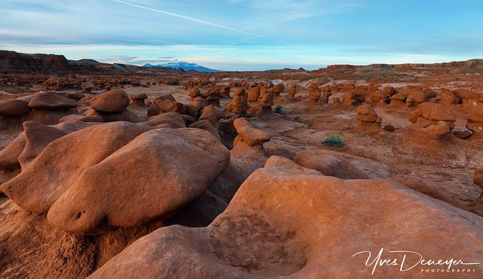
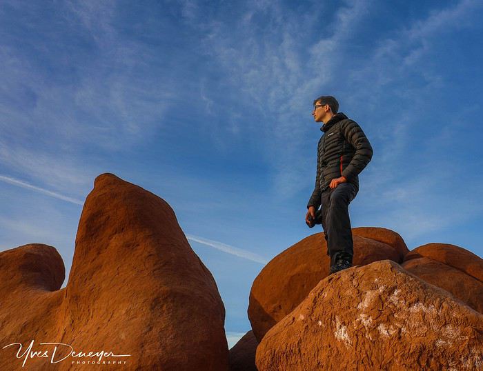 Quel poseur ! Nouveauté cette année : il y aura parfois un personnage sur mes photos...
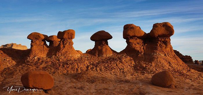
 Tom s'essaye au panoramique avec son téléphone...
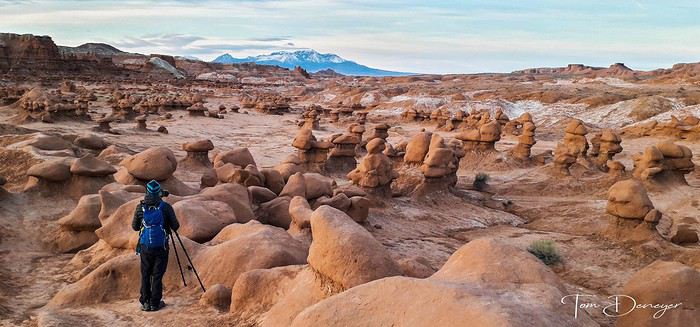 .et me fait un "behind the scene"
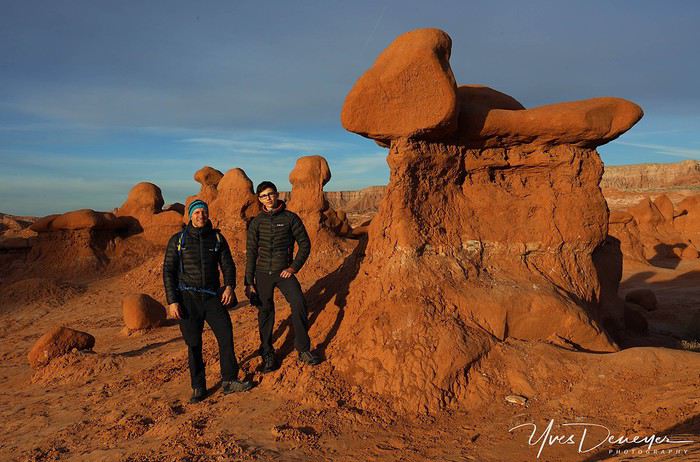
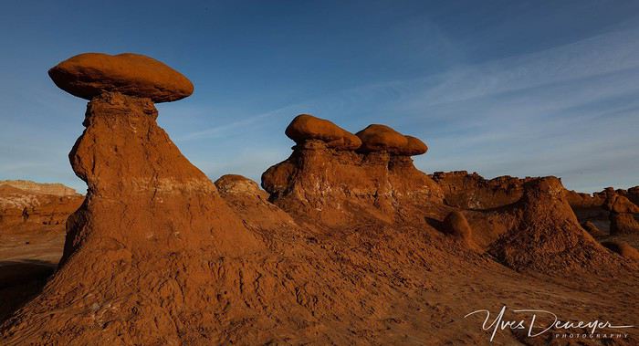
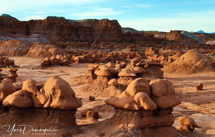
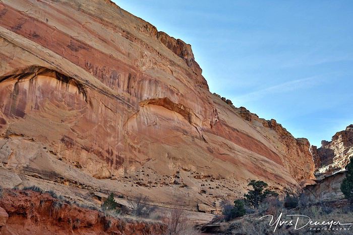 Le début de Crack Canyon.
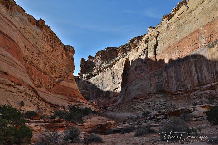
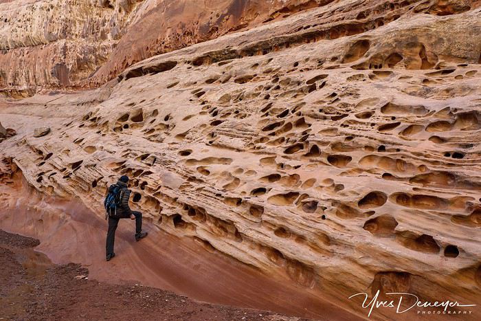
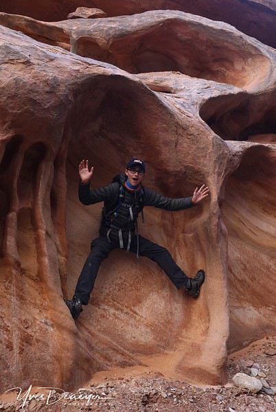 Evidemment l'envie de grimper ne manque pas ici...
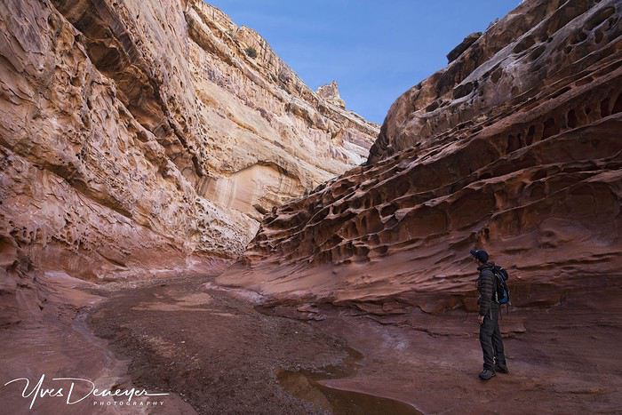
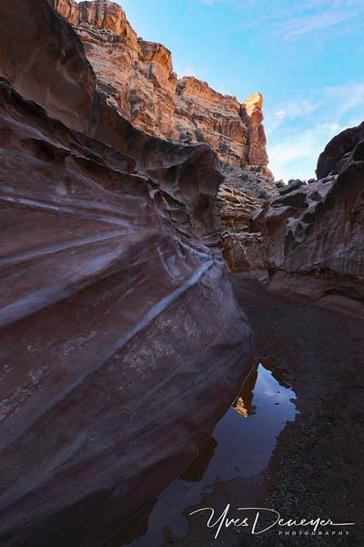
En juillet dernier, en voyant que mon fils Tom, alors âgé de 14 ans suivait bien en montagne (alpinisme, premier 4000 , refuge, horaires..) je lui ai proposé de m’accompagner en avril pour mon 11ème trip dans le Southwest. Le programme est assez simple, mais assez chargé : marcher, faire des photos, marcher, rouler, faire des photos, sunrise, sunset, nocturnes, manger des pâtes 😉, etc… itinéraire à peu de choses près identique à celui de 2018 pour approfondir, retenter les lieux ratés à cause de la météo, et découvrir des choses nouvelles pour moi. De toute façon, tout sera nouveau pour Tom. L’idée était claire : s’entraîner au minimum 2-3 mois avant, pour être bien sur place. Deux backpackings prévus, des horaires à rallonge… X fois je lui ai dit « Ce ne sont pas des vacances »… Phrase à laquelle il répondait sans cesse « mais si, si je suis là-bas, je suis en vacances ! » On en reparlera… Nous nous sommes donc entraînés, gros sacs au dos, de plus en plus lourds, sur nos terrils, dans les ardennes, pour être bien en forme. 20 jours avant le départ, gros problème : Tom a une tendinite au tendon d’Achille…😕 Rien à voir avec nos « séances », mais avec sa croissance, son pied ayant pris 1,5 cm en 3,5 mois ! Tendon comprimé dans des chaussures devenues trop petites très rapidement. Deux semaines en béquilles pour aller à l’école, plus de cours de gym, plus d’escalade (nous grimpons 2x/semaine) … et 3 jours avant de partir, un gros test, chargé sur le dos, sur le plus gros terril de la région. Et Bingo, il n’a plus mal… Il était à deux doigts de ne pas m’accompagner… Alors, je vais mettre les choses au clair tout de suite avant de commencer le carnet : y aura beaucoup de texte, parce que pour moi un carnet, c’est un ressenti, et pas uniquement un portfolio. Sinon je balance le lien vers une galerie photos Google, et ça ne fera pas le même effet. Il y aura aussi beaucoup de photos, parce que c’est le but du trip. Quelques photos faites par Tom avec son téléphone, et quelques-unes par Laetitia que nous avons rencontré là-bas. Vous verrez plein de chiffres, parce que j’aime ça, les chiffres, j’aime me dépasser, mon fils aussi, et vous lirez aussi que (on vient encore de me le dire), que je ne suis pas un « épicurien » comme les autres. Ma façon à moi de profiter de la vie, c’est d’emmagasiner un maximum de tout : photos, kms, D+, etc, mais que de l’actif. Profiter d’un verre de vin autour d’un BBQ ne fait absolument pas partie de ce que j’aime, et (heureusement), c’est pareil pour ma famille… Chacun sa façon de profiter de son temps… Ma devise, c’est « j’aurai tout le temps de me reposer quand je serai mort »… Ou bien « jamais plus vite qu’à fond… » Trève de blabla (il y en aura encore), attaquons…
J0 - L'histoire démarre au début de nos "congés scolaires de Pâques". Lever 2h30. Navette vers l'aéroport, toujours cette inquiétude que nos bagages « cabine » et sacs à dos ne passent pas, mais sur les 3 hôtesses au Check In à Zaventem, on a eu la plus sympa. Celle à côté pesait tout, ça aurait été problématique... vu que je dépasse toujours le total des deux (cabine + sac à dos) de plus de 10 kgs kgs à cause du matos photo, du PC… normalement total 12kgs pour les deux, je suis à 24 Kgs… Et nos bagages de soute sont bien pleins à cause du matos de camping, des lyophilisés, trépieds, etc… Escale à Amsterdam, Vol sans souci, immigration à SLC en 35 minutes, assez rapide. Nos deux bagages de soute sont bien arrivés, ça aussi c'est toujours stressant. Je n’ose pas imaginer, sans trépied, sans matos de camping, sans lyophilisés… Et avec une première nuit prévue loin de l’aéroport. Rugged Rental chez qui je loue pour la 3ème fois nous donne un Wrangler Rubicon avec intérieur cuir beige atroce... Je démarre, branche le GPS Auto et en route vers Walmart. Et là je ressens un gros shimmy dans le volant, un balourd pneu avant gauche... Je retourne illico et on me l’échange pour un Rubicon rouge, intérieur noir, avec prise USB, Bluetooth pour la musique, et des pneus pas trop neufs, ce qui est bien mieux finalement sur l'autoroute que les neufs que j'avais l'an dernier. Les crampons font quand même encore 2 bons cm de haut, no souci dans le sable. Pneus « Mud Terrain » de chez BF Goodrich, donc de très très bons pneus pour les pistes qui nous attendent. Ah oui, il pleut et il fait 8°. L’horreur… mais cela ne durera pas longtemps. Courses au Walmart que je connais comme ma poche, la liste est prête dans le téléphone, 15 minutes chrono... puis en route vers Green River. D’année en année, je vais de plus en plus loin le jour où j’arrive. L’excitation fait que je ne suis pas fatigué. La route passe par un col à 2400m, de la neige partout, 5°. Waouh les nuits en tente risquent d'être fraîches... On arrive pas trop tard vers Green River, je propose à Tom d'aller faire un premier sunset à Goblin Valley, mais il est fatigué... Ben quoi, ça ne fait que 25 heures qu'on est debout ! Pfff, la jeunesse...😏 par contre un Subway ça le tente... Puis hop au lit. Bon hein j’espère qu’il ne va pas me faire le coup trop souvent. Au départ il était clair qu’il suivrait les horaires et randos prévus.
J1 Sunrise prévu à Goblin Valley, donc réveil calé à 5h20. Mais Tom est réveillé à 4h30 (décalage) et moi encore bien avant. 2 bols de Special K Almond and Vanilla (qui n'existent pas chez nous) en vitesse, et hop direction Goblin Valley. Les "towers" à l'entrée du parc et le ciel coloré sont d'enfer. Puis balade entre les Goblins. J’ai déjà fait énormément de photos l’an passé. J'essaye d'autres angles, mais il me faut du temps pour me mettre dans le bain de la photo. Tom va partout, il adore, il est aux anges... Perso je suis un peu « étonné » par mon manque de concentration sur la photo…😛Heureusement cela passera assez vite. Puis route vers Crack Canyon. Énormément de gens partout, c'est le Spring Break et beaucoup de familles sont en vacances. Des motocross, des ATV, des gamins, des camping cars géants partout. Jamais vu autant... ça campe dans tous les sens. Heureusement, le WE arrive, et ensuite leurs vacances seront terminées. La piste est assez chaotique sur la fin, mais le Wrangler passe super bien. Belle surprise que ce Crack Canyon. Le début entre le TH et le canyon est sans intérêt, mais ensuite, des murs gigantesque et du « Swiss Cheese » comme je n'en ai jamais vu. Quelques passages bien chouettes ou il fait bien s'aider des mains. Et nous sommes seuls. Un couple est juste arrivé quand nous partions.... Une belle petite mise en jambes. Et Tom n’a pas mal au pied, ce qui est d’autant plus génial ! Route vers Moab, arrêt chez Jay's pour les traditionnelles pastas "Meat Sauce", qu'on regrettera juste après en allant vers Jeep Arch, que je n'avais jamais faite. Marcher et digérer en même temps, ce n'est pas top. raison pour laquelle en général le midi je grignote du trail mix en marchant. Jeep Arch est une chouette Arche, mais nous avons droit à un ciel parfois laiteux pas terrible... On redescend en ayant enfilé les Gore Tex, le ciel est menaçant, le vent monte. Sunset foutu 😠... On prend la route vers Marlboro Point où j’ai prévu de bivouaquer. Le début de la piste est maintenant marqué par un panneau interdisant clairement le camping. Il va encore falloir faire l'innocent si un Ranger arrive... Mais franchement, les 2 derniers KMs, presque aussi difficiles que certains passages pour Eggshell Arch, dissuadent certainement les rangers de venir jusqu'ici. A part un Wrangler, un Defender ou un pickup chargé à l'arrière, rien d'autre ne doit passer. Plusieurs marches de 20-25 cm à passer, mais rien n'a frotté. On arrive et c'est absolument génial, il n’y a que nous, seuls, à 10m de la rim. D'abord je me gare à côté de la tente, puis je remarque qu'on voit la Jeep de la rim de Dead Horse Point, donc je la déplace. J'ai trouvé un emplacement très cool pour la tente, juste à l'abri du vent qui monte bien, derrière un Juniperus de belle taille. Explications à Tom pour le montage de la tente etc... On déballe les Therm A Rest et les duvets, les gants de toilette jetables et le savon sans eau, et je fais un lyophilisé. Ah oui Je me suis arrêté à Moab chez Gear Heads pour des cartouches de gaz, quand même le shop que je connais le mieux équipé pour le camping. Aucun équivalent chez nous je pense... même à Chamonix. Sunset foutu, ciel bouché presque noir. Mais pas de pluie annoncée. Juste un peu de vent, mais relativement calme. Aucune chance de pouvoir faire une photo nocturne. Evidemment plus calme que le mouvement perpétuel de l'asticot qui dort à côté de moi 😉
On passe au-dessus du Groënland... Glaciers gigantesques.Les "Towers" à l'entrée de Giblin Valley State Park au Sunrise.
Quel poseur ! Nouveauté cette année : il y aura parfois un personnage sur mes photos...
Tom s'essaye au panoramique avec son téléphone....et me fait un "behind the scene"
Le début de Crack Canyon.
Evidemment l'envie de grimper ne manque pas ici...NAMIBIA TRIP 2025: April 24 to May 20: Feel free to comment or ask us any questions about this amazing journey.
>> Find all our photos and videos for each day on our website here: www.montagne-aventure.net
**DAY 1: Thursday, April 24, 2025: Outbound Flights from Lyon to Windhoek via Munich - Visit to Munich:**
Off we go on a new adventure. The alarm rings at 6:30 AM, the travel bags are packed, and we head to Lyon Airport. We booked our flight tickets with Lufthansa. The first leg to Munich, Germany, is operated by AirBaltic. Departure at 1:05 PM for a 1-hour and 20-minute flight. We arrive at 2:30 PM.
**We now have a 7-hour layover, so we take the opportunity to get some fresh air and explore Munich.** We quickly exit Terminal 2 of the airport and head towards the subway. We buy a group day ticket "Airport-city Day Zone M-5," valid for 2 to 5 people at a price of 30.50 € (instead of 16.30 € per person). We take the S8 line to **Marienplatz** in 35 minutes. **This is the heart of the city.** The weather is overcast, quite cool, but dry. Perfect for a little city trip between two flights while leaving our large luggage in transit at the airport. **Munich is the third-largest German city after Berlin and Hamburg, in the Bavaria region.** **The center has a lot of charm and brings together several religious buildings, easy to explore on foot.** We are impressed by the number of people enjoying these 100% pedestrian streets, which are very pleasant. After Marienplatz, the most famous square with the town hall, we head to the Cathedral of Our Lady, a Gothic church, then continue to **Karlsplatz** and move on to **the food market offering a wide selection of high-end food products in an atmosphere where a certain art of living prevails.** We also visit St. Peter's Church before grabbing a bite to eat. Two good hours were enough for this 10 km city walk. It's time to take the subway back: by 6:30 PM, we are back at the airport. Now, it's time for a bit of waiting and rest. Our second flight is scheduled for 9:35 PM for a 9-hour and 30-minute journey to our final destination in Namibia: **Windhoek.**
> Round-trip flight tickets with Lufthansa from Lyon: 2029 €, or 1,014.50 € per person.
> Lyon Airport parking: 120 €
> Today's expenses: 7 € for 2 pizzas in France / 14 € for the restaurant in Munich / 30.50 € for the daily subway ticket in Munich.
**DAY 2: Friday, April 25, 2024: Arrival in Windhoek, Visit to the Namibian Capital:**
After a 9-hour and 30-minute overnight flight with Discover Airlines, we finally land on Namibian soil just before 7:30 AM. The day is breaking, and the colors are already stunning. We are eager despite the usual fatigue from the flight. The airline was punctual, with friendly staff and good meals, though a bit light. We are the first flight of the day to land, with no more than 15 flights per day here, from 7 AM to 8 PM. We disembark on the tarmac at this airport located in the middle of nowhere, **I finally set foot on African soil for the first time.** We exit among the first from the aircraft to go through the long formalities at the front of the line, as the wait can quickly become endless. Allow at least 5 minutes per person for e-visas. We still wait 45 minutes despite only about twenty people ahead of us. Phew, it's done. We collect our luggage and then withdraw money from an ATM. We make 4 withdrawals of the maximum amount, 2000 NAD $ per withdrawal, for a total of 380 €, or 95.33 € per withdrawal.
Our driver arrives at the same time, perfect timing, we were quick.
We leave the airport at 8:45 AM. By 9:30 AM, we arrive at the **Gracious Whisp vehicle rental agency**, located at the entrance of Windhoek, small and human-sized with a fleet of recent vehicles. More formalities, then a short wait as our vehicle is not yet ready. Time to decompress, catch our breath, and enjoy the very pleasant morning temperature. Not a cloud in sight. Next, a briefing on the vehicle, always with a bit of apprehension due to our approximate English. Allow 45 minutes of explanations, including setting up the roof tent, camping equipment, technical information in case of a flat tire, driving tips in Namibia, and a tour of the 4x4. We have all the necessary equipment for camping: mattresses, sleeping bags, pillows, table, chairs, gas stove, BBQ grill... as well as 2 spare tires, a compressor, a dual tank, and accessories for removing wheels. Off we go, it's time to muster our courage and get behind the wheel. **Heading to SuperSpar Maerua**, fortunately located less than 10 minutes away. We park with the help of a parking attendant; it's very crowded, the space is narrow, but everything goes well despite the cursed right-hand drive. Today's new mission: stock up on groceries. The store is well-stocked with local and imported products, catering to all tastes. We spend 114 € on groceries, from pasta to meat, BBQ lighters to dishwashing products. Two people load our groceries into two carts and transfer them to our vehicle; we feel compelled to leave a tip, 50 NAD $, as we don't have change yet. Now, we head to the hotel, 15 minutes away. Traffic is difficult at a complicated intersection; this will likely be the only traffic jam in Namibia. **We arrive at Kate's Nest Guesthouse & Backpackers around 1:15 PM, quite tired.** We take some well-deserved rest at this recent establishment, quite calm with secure private parking. After a short nap, we enjoy the quiet by the hotel pool. Night falls between 6:30 PM and 7 PM. We eat quietly in our room tonight before starting this long 4x4 road trip in camping mode in the heart of Namibia.
> Today's grocery expenses: 114 € at Super Spar Marua (2395.21 NAD $).
> Round-trip flight tickets with Lufthansa from Lyon: 2029 €, or 1,014.50 € per person.
> Vehicle rental: 4x4 Toyota with roof tent for 24 days: Gracious Whisp Car Rentals: 2,638 € (N$50,640) or **1,319 €** per person - (https://gwcarrentals.com/)
> Distance driven today: 15 km.
> Accommodation: Kate's Nest Guesthouse & Backpackers - 4 Aristotles Street Academia, 9000 Windhoek - 36 € for two for one night.
> Windhoek International Airport website: (https://www.airports.com.na/)
**DAY 3: Saturday, April 26, 2025: Windhoek to Hardap: Mariental Region - Kalahari Desert:**
After a good, restful night, we wake up leisurely around 7 AM. We enjoy the comfort provided by this first and last hotel before 24 nights under the tent.
**We leave Kate's Nest Guesthouse at 8:30 AM to tackle the Namibian roads.** We quickly leave the capital; in just 30 minutes, we find ourselves almost alone in the world. The landscape is dotted with small domes. We leave the **paved B1** quickly to turn left onto the **C15**. **From there, we won't see more than 10 vehicles all day.** After passing through the few houses of **Lekkerwaterpoort**, we tackle our first gravel road. These road sections are limited to 100 km/h, but even at 70 km/h, I find it already challenging. However, I quickly get used to it and gradually pick up speed to reach my cruising speed of around 80 to 90 km/h. **We are on immense straight lines crossing wild expanses as far as the eye can see.** **We come across two baboons, a few ostriches, and numerous cattle and sheep farms.** We pass through the charming village of **Uhlenhorst** with its typical houses and children with broad smiles waving at us. Life here is already very different from Windhoek. **The thermometer rises quickly from 16°C at 8:30 AM to over 28°C in the early afternoon.**
**We arrive at the Hardap Dam reserve at 2 PM.** We stop at the toll booth at the park entrance to pay the entrance fee: 250 NAD $ for 2 people and 1 vehicle. We continue to the dam and then the camp entrance, located a bit further. We had booked in advance, but this place remains little frequented by foreigners.
We take advantage of the hottest hours to rest by the large pool overlooking the immense lake, a very enjoyable moment. Would this be a bit of a vacation?
Around 4:30 PM, we head to the campsite. We overlook this vast water reserve. We arrive first; we will be only 3 vehicles spending the night here. It's time to get to work and set up our equipment for the first time. It takes us a good 20 minutes to set everything up, with a slight apprehension about unfolding the tent. Once this task is done, which we will have to repeat for almost a month, we will become much more efficient over time. Time for rest and contemplation in total silence. The sun gradually sets, and the heat quickly becomes bearable again. Bliss! **This dam is located 20 km northwest of Mariental in an area dotted with conical hills topped with dolerite buttons (Hardap means "hillock" in Nama). It captures the Fish River, which flows south, creating a large lake in the middle of an arid environment. The contrast is striking.** We enjoy our first sunset facing this 360° otherworldly landscape.
Around 7 PM, we start our first BBQ, or "braai" as it's called here. The temperature is perfect. The sun sets, giving way to a star-filled sky of incredible beauty thanks to the absence of any light pollution. The Milky Way will lull us throughout the evening. After some good sausages and potatoes on the BBQ, we head to our roof tent around 9:30 PM with a complete change of scenery in just 24 hours. France already seems so far away...
This campsite has shared showers and toilets, quite clean and functional, as well as a central area with several BBQs and tables. The sites are arranged in a semicircle, each with an electrical outlet. The sites are close to each other but spacious, some slightly shaded. We are only three vehicles tonight, so it's perfectly comfortable and quiet. Not to mention the large pool near the restaurant. Our trip is off to a great start.
> Today's road itinerary: Windhoek > Head south on the B1 to Rehoboth > Turn left onto the C25 then C15 to Stampriet > C20 to Hardap > Full north on the B1 > Then turn left onto the M93 - 5 hours of driving.
> Distance driven today: 354 km.
> Accommodation: Hardap Recreation Resort - 23.3 € for two - Large pool - GR6W+3M2, Hardap Game Reserve, Mariental, Namibia - (http://www.nwr.com.na/resorts/hardap-resort/)
**DAY 4: Sunday, April 27, 2025: Hardap - Brukkaros Volcano - Keetmanshoop - Quivertree Forest Rest Camp**
Our first night under the tent was very pleasant; the little wind quickly calmed down, giving way to absolute silence. The mattress is decent, more comfortable than some nights in Nepal. The length and width give us enough space for maximum comfort, despite my height (1.91 m). We wake up a little before 7 AM as the sun rises, and the lights dazzle us from the start of the day. We pack up the equipment in 30 minutes, quite easily. Then we enjoy the sun, which warms up quickly while we keep our light fleece on.
At 8:30 AM, **we hit the road again, heading south** to our first stop in **Mariental**. We want to do some shopping at SuperSpar, but once we arrive in the parking lot, a young local is fighting with the supermarket security guards and then threatens to throw stones. We don't want to take any risks right at the start, so despite the baton blows he receives, he doesn't stop. We leave empty-handed but fill up with fuel at the Shell station 1 km further. The price per liter is 21.33 NAD $, we fill our 107-liter tank for 107 €. In Namibia, you get served, and they bring the card machine to the window to pay. It's then customary to leave a tip.
We then take the B1 heading due south on a recently renovated road. Around 11:30 AM, we leave it on our right to take **a wild gravel road, the M98**. Just before **Berseba**, we turn right onto a small track, the **D3904 towards Brukkaros Crater up to a camp at 1588 m altitude**. The track then becomes too bumpy. We stop on the counter-slopes where **a wide panorama unfolds over these immense plains as far as the eye can see**. It's 12:15 PM, time for us to eat a rice and tuna salad facing this landscape.
**We are alone in the world until a vehicle arrives and parks next to us.** A bit of apprehension, 4 men head towards us. It turns out to be 4 shepherds looking for a lost foal. The conversation is pleasant, lost in the middle of nowhere. We find ourselves alone again in this absolute silence. **The heat becomes stifling with a good 30°C**. We get back on the road around 1 PM. Back on the B1, **we continue due south to Keetmanshoop**, which we reach around 3 PM. We stop there to do some shopping for 262 NAD $ (12 eggs, a can of tuna, a can of corn, bread, a soda, and a 5-liter water container), or 12.48 €. Two quite insistent children ask us for money or candy at the store exit, yet we give them a small tip, but they continue to cling to the car. Locals parked next to us tell them to leave us alone. Anyway, we finish the trip to **Quivertree Forest**, 15 km away. We will spend the night in this **pleasant farm run by a German**. Upon arrival, as the day before, and as I suppose in the future, we dive straight into the cool pool to relax after all these kilometers. A bliss. Then we take our 4x4 and choose a spot near these famous trees. After the 33°C this afternoon, once 4 PM passed, the temperature drops again and becomes very pleasant. **We are in the middle of the Kokerboom, one of the most interesting and characteristic plants of hot and arid regions. It's not really a tree but a variant of the aloe plant whose botanical name is Aloe Dichotoma. This Kokerboom has a smooth and thick trunk reaching up to 1 m in thickness and 9 m in height. They bloom for the first time at the age of 20 to 30 years.** The flowers are yellow and reach about thirty centimeters during the season between June and July. **They grow mainly in an environment with a high concentration of black rocks absorbing a large amount of heat (38°C). The rocks also serve to anchor the tree with its tentacle-like roots. It also resists frost. Each is between 200 and 300 years old.**
Around 5 PM, we walk to the farm reception to watch the feeding of **two cheetahs**. Magnificent carnivores taking their time to savor their piece of meat. **Then we return near our campsite to enjoy the sunset among these trees. The colors are sublime, as every evening apparently. A magnificent spectacle with colors evolving from yellow to orange then to pink, before giving way once again to a sky filled with thousands of stars.** Our campsite at Quiver Tree Forest Camp is very comfortable; we have a water supply, a stone table, a small lamp, an electrical outlet, a small tree for shade, and a BBQ that we won't use tonight; we'll cook on gas. The sites are far apart, with some shared facilities scattered around, a very beautiful setting. No reservation possible, no need, just show up directly. **The campsite accommodation for 2 people costs 28 €, including the reserve entrance fee of 5 €**. We finish this second bivouac evening around 9:30 PM, time for some reading and sleep in peaceful silence without wind.
> Today's road itinerary: Mariental > B1 heading south to Brukkaros > At Tses turn right towards Berseba via the M98 > Turn right onto the D3904 > 8 km > Brukkaros Volcano (stop at the lower camp as the track is difficult for 1 hour) > Keetmanshoop > Turn left onto the M29 > Quivertree Forest - 4 hours of driving.
> Distance driven today: 371 km.
> Distance walked today: 6 km.
> Today's expenses: Groceries for 12.48 € (262 NAD $) / Fuel for 107 € (1 liter of diesel for 21.33 NAD $).
> Accommodation: Quivertree Forest Rest Camp, P.O. Box 262, Keetmanshoop, Namibia - BBQ, hot showers, toilets, and electricity - No reservation - Pool - 18 €/Person (N$ 340.00 with park entrance) - (http://www.quivertreeforest.com/)
**DAY 5: Monday, April 28, 2025: Quivertree Forest Rest Camp - Giant's Playground - Keetmanshoop - Fish River Canyon - Canyon Roadhouse:**
After an excellent start to the night, we are woken up by the wind shortly before 6 AM, but the sunrise is not far off. We get up at 6:30 AM to enjoy it. The atmosphere is a bit cooler this morning, but the reward is already here.
The adventure continues. At 7:45 AM, we head towards **Giant's Playground**, 4 km away. We take a 3-kilometer walk through this expanse of blocks and igneous rocks.
We continue south at 8:45 AM, passing through Keetmanshoop again where we do some shopping for 25 €, a big stock-up for a good part of the trip: meats, canned goods, pasta, fruits... At 9:30 AM, we take the B4 to Fish River Canyon.
At 11:30 AM, we arrive at the entrance to the NWR park (350 NAD $ entrance for 2 people and 1 vehicle). The track becomes bumpy immediately upon entering the park. After about ten kilometers, we come upon this landscape carved by nature. In the end, it's well worth the detour. We were at the Grand Canyon in the USA exactly (https://www.montagne-aventure.net/2024/04/29/j21-3-juin-2024-grand-canyon-et-lac-powell/) and can thus confirm that this Fish River Canyon is comparable. We make several stops along the southern flank. **Here, nothing is developed; nature is almost in the wild state.** **With 160 km in length, up to 27 km in width, and a depth of 150 m, it is indeed the second-largest canyon in the world.** The history of the canyon is apparent in its different earth layers and stratification: the antiquity of the place is tangible, and the absence of vegetation is surprising. **It consists of two nested canyons, formed at distinct periods. The first distinct layer of schist, sandstone, and eruptive material surrounding the canyon was formed a few two billion years ago, then transformed due to heat and pressure into more solid rock such as gneiss. The inner canyon, carved more recently by the Fish River, has a depth of 270 m.**
We have a picnic once again alone in the world facing this grand panorama at the **Sulphur Spring View Point**. This is where the hiking trail begins, plunging into this narrow canyon, but it is forbidden to venture there alone without a guide. It's 30°C, but a slight wind makes the atmosphere bearable. At 1 PM, we retrace our steps and continue to the **Main View Point** then to the **Hikers View Point**.
In the south of Namibia, the Fish River Canyon, 160 km long, is a true geological wonder: a canyon nested within another canyon, one of the largest in the world. The first sedimentary layers formed two billion years ago; 500 million years ago, a period of tectonic activity caused these layers to crack and tilt, opening a vast canyon in the Earth's crust. The second canyon, with a depth of 270 m, was carved over time by the passage of the Fish River in this new valley.
At 3 PM, we arrive at our very charming camp for the evening, the **Canyon Road House**. We fill up with fuel right away because tomorrow we have a long day of isolated driving: 55 liters for 1240 NAD $. Then we settle into the campsite we had previously reserved in France. We are assigned site 2, very well set up under a tree with its BBQ and stone table just steps from the pool. We quickly set up the tent and jump straight into the pool for the relaxation moment of the day. As usual, the water is quite cool, but it's a real pleasure. Then we stroll around this Canyon Road House, which recreates the atmosphere of the roadside inns of the 1950s with old car wrecks and vintage gas pumps in a bygone era. **Around 5:45 PM, we start a short walk leading us to the top of a hill overlooking the wide plateau where we are to watch the sunset.**
And finally, to end this beautiful day, it's time for the braai, with grilled sausages and white beans on the evening menu.
> Park entrance: 150 DN/person + 50 DN/vehicle (18 € for two). It is possible to enter at two access points: Hobas in the north and Ai-Ais in the south.
> Today's road itinerary: M29 > Keetmanshoop > B1 > B4 > C12 (track) > After Holoog turn right onto the D601 (C37 track) > Accommodation on our right (stop just to check in before 6 PM) > Continue 30 km (30 minutes of track) to the viewpoints after Hobas where you must pay the entrance fee. Sunset View Point to the left > Return before sunset as the park closes (best lights at sunrise). 3 hours.
> Distance driven today: 228 km.
> Distance walked today: 10 km.
> Today's expenses: 25 € for groceries / 17 € for the Fish River Canyon park entrance / 58 € for fuel.
> Accommodation: Canyon Roadhouse, Gondwana Collection Namibia – 34.4 € for two - Pool - Near Hobas - (http://www.gondwana-collection.com/fr/accommodation/canyon-road-campsite)
**DAY 6: Tuesday, April 29, 2025: Canyon Roadhouse - Orange River - South African Border - Vista Trail - Gondwana Sperrgebiet Park - Aus:**
The night was excellent in this very comfortable campsite. **We wake up to the sound of birds** before the alarm at 6:45 AM. Our little morning routine starts as the sun rises. **A big day of driving awaits us to the South African border. This will be the southernmost point of our journey.** We hit the road at 8 AM via the C37, pass through **Hobas**, then turn onto the D207 to **Aussenkehr.** **We cross a mountainous barrier with some high peaks and perfect cones. The rock varies from orange to pink to black.**
We then cross a lunar desert as far as the eye can see on a giant dome; the track winds through nowhere without meeting anyone for hours. The landscapes are surprising. **We spot several ostriches and a gemsbok.** In the middle of this endless expanse, we come to an improbable intersection and continue right onto the D278.
In the middle of these arid lands, we come across a green zone: a vast vineyard. At 10:30 AM, **we come across a "Road closed" sign, fortunately, a local resident waves us to continue; a bit stressed, we proceed.** We start to follow the beautiful Orange River. On the other side of the bank, just a few meters away, South Africa is there. It is the second-longest river in Southern Africa, after the Zambezi. It flows over 2,000 km to the Atlantic. After passing through narrow gorges, we regain altitude before starting the descent, gently heading back north.
**We now cross and follow the Fish River, which joins the Orange River further south** **along this gorge dating back millennia.** At exactly noon, we take a lunch break by the Fish River, still without meeting a soul in this landscape between greenery and aridity. The temperature here is cooler with a pleasant 23°C on the banks, the perfect spot. **We continue on the track to Rosh Pinah**, where we find a paved road again. **The section along the Orange River and the Fish River was officially closed, but we were able to pass without any issues, avoiding a detour of at least 3 hours.** Phew. We now drive at high speed (limited to 120 km/h) through these vast spaces. We come across many ostriches after the **dozens of monkeys along the Fish River**. Around 3 PM, 3 km after the very small town of **Aus**, we reach **our campsite for the evening at Klein Aus Vista**. A new **small peaceful haven very well set up**. As usual, after checking in at reception, we jump straight into the beautiful pool to get our well-deserved dose of coolness, another good thermal shock that our bodies appreciate. Once this moment of relaxation is over, we take our 4x4 to reach the campsite located a bit higher, set apart at the foot of a hill that overlooks us.
After setting up, **around 5 PM, we head to the Vista Trail to climb to the top of a mountain overlooking the vast plain that surrounds us at 360°**. It takes about 30 minutes to climb. The place is just magical, **the perfect viewpoint to admire the sunset**. **We fully savor the moment. We also spot one of the few wild horses in the world capable of living in the desert.** Their numbers have decreased in recent years due to predation and drought (around 100 to 150). At 7 PM, we return to the camp, time for the braai and preparing the meal in this peaceful little camp.
In the south of Namibia, the Fish River Canyon, 160 km long, is a true geological wonder: a canyon nested within another canyon, one of the largest in the world. The first sedimentary layers formed two billion years ago; 500 million years ago, a period of tectonic activity caused these layers to crack and tilt, opening a vast canyon in the Earth's crust. The second canyon, with a depth of 270 m, was carved over time by the passage of the Fish River in this new valley.
> Today's road itinerary: 5 hours of driving: D324 heading south (track) > turn right onto the C10 (track) > D316 heading south > turn right onto the C13 > In Aus turn left onto the B4 > Campsite via a track on the left.
> Fuel station: Solitaire or Aus.
> Distance driven today: 398 km.
> Distance walked today: 7 km.
> Accommodation: Klein-Aus Vista Desert Horse Campsite - Farm Klein-Aus No 8 on the B4 main road to Luederitz Aus 9000, Aus, Namibia - (http://www.klein-aus-vista.com/accommodation/desert-horse-campsite/) 17908 420 DN - Water + Shared shower (hot water). No electricity.
**DAY 7: Wednesday, April 30, 2025: Aus - Kolmanskop - Diaz Point - Luderitz - Kanaan Desert:**
We wake up around 6:45 AM, with partly cloudy weather for once; we feel the ocean's influence gradually. But the sun isn't far off. At 7 AM, we leave the campsite heading west towards Luderitz via the B4. **First stop of the day: Kolmanskop, the ghost town we reach at 8:30 AM**, entry costs 180 NAD $ per person. We discover this **timeless place** in 1.5 hours, moving from building to building amidst violent sand-laden gusts of wind. There's a lot of charm in these different living spaces. **The sand quickly reclaimed the place after this mining town was abandoned.** This was once the headquarters of Consolidated Diamond Mines. It's hard to believe that this former town, where the diamond industry once flourished, had a hospital, a bowling alley, and a theater. The decline in diamond sales after World War II and the discovery of richer deposits put an end to this golden age. By 1956, the town was already completely deserted, and the sand had reclaimed its rights. **These dilapidated buildings swallowed by shifting dunes have something surreal about them.**
At 10:15 AM, we hit the road again **heading to Luderitz, 22 km away**, and first to **Diaz Point** **facing the Atlantic Ocean**. It's a wind-swept peninsula with its characteristic red and white lighthouse. There's a campsite and a coffee shop on site, but the place doesn't inspire rest without shade or shelter from the wind. We return to the city via the D701 track that runs along the ocean, be careful at low tide. We come across **a few fishermen and a fox as well as flamingos.**
We walk through the few streets of the city, much smaller than I imagined, then climb to the **famous little Lutheran church that overlooks the city, the Felsenkirchr.** **The wind blows very strongly here, and the sand is omnipresent, surrounded by the Namib Desert and the southern Atlantic coast.** **A German colonial relic barely touched by the 21st century, Luderitz seems frozen in the past, giving it both a gloomy and a certain charm. In short, it's certainly one of the most incongruous places in Africa.**
At 1:15 PM, just before leaving Luderitz, we do some shopping for 20.50 € and fill up with fuel: 61.50 €, 1290 NAD $ for 61 liters (21.18 $ per liter).
**We return via the B4 to Aus** (paved), **then via rougher tracks**, the C13 then the D707, magnificent as it runs along a mountain range with multiple colors on our right and an endless flat desert on the other side.
To access our campsite for the evening, we must take a **narrow private track for 7 km** on our right to emerge, in this total vastness, at the **isolated Kanaan Desert Retreat on a small hill**. I don't have time today to jump into the pool near the reception; we arrive at 5 PM at 8 small, isolated, and unique sites with a small kitchen, a shower, and a private toilet under a small tarp shelter. **A crazy charm with a unique view...** **This will be my favorite accommodation of this trip. The photos speak for themselves.** We jump into the outdoor shower while savoring the landscape, then prepare our evening braai while enjoying the colors fading, facing this plateau with bushes turning a vivid orange. **A moment that will remain etched for life.** **Savanna atmosphere under a thin emerging moon. Every minute offers different colors. Facing our meal, we have a natural giant screen.**
We end this day contemplating the stars and admire this thin orange moon setting on the horizon (8:42 PM).
**Ghost town just before Luderitz: Kolmanskop** (open from 8 AM to 3 PM - N$ 180 p.p – 9 €). Once, Kolmanskoppe was organized around diamond mining. After finding new, more prolific spots, the town was abandoned and is now a ghost town. The sand and dunes have reclaimed their rights and buried everything humans had built. Houses, train station, bakery, everything has been covered by sand, which passes through the windows, even though they are 1 meter high.
> Today's road itinerary: 5h30: B4 to Luderitz (paved) > Round trip > Kolmanskop on the left > Return via the previous campsite > Then C13 (track) > Turn left D707 (track) > Then track to the right to the campsite.
> Distance driven today: 438 km.
> Distance walked today: 8 km.
> Today's expenses: Groceries at the Spar in Luderitz for 20.50 € / Fuel fill-up in Luderitz for 61.50 €.
> Official Kolmanskop website: (https://kolmanskuppe.com) (open from 8 AM to 1 PM - N$ 180 p.p – 9 €).
> Accommodation: Night at the south of the Namibrand Nature Reserve: Kanaan Desert Retreat – 26.5 € for two - (http://www.kanaannamibia.com/) - Farm 104 Karas 9000 - Sanitary facilities + BBQ + Water + Pool - No electricity - My favorite accommodation of this trip.
**DAY 8: Thursday, May 1, 2025: Kanaan Desert Retreat - Namib Desert - Crossing the Namibrand Nature Reserve – Sesriem Canyon - Elim Dune - Little Sossus Lodge**
After a cooler night than the previous ones with about 10°C, we wake up around 7 AM. We admire, as usual, the sunrise between the desert and the mountains. **The spot from last night was truly perfect, isolated from the world, in total serenity, with a wake-up call to the sound of birds.**
We hit the road a little after 8 AM, heading north via the D707 to Spes Bona, then the gravel road C27 via Betta to Sesriem. **The landscapes roll by and dazzle us.** **We are right in the heart of the Namibrand reserve**, coming across numerous **zebras**, **impalas**, **ruminants that reproduce in large numbers**, and **gemsboks**. At noon, we stop in the shade of a tree to eat. The spot is so romantic facing orange arid mountains and a vast green plateau. **A landscape full of contrasts, timeless and silent.**
**The Namib Desert is the oldest on the planet; its name means "vast arid plain," and it also gave its name to the entire country: Namibia.** The majority of these arid and semi-arid lands dotted with viewpoints are part of the Namib-Naukluft National Park, which covers 23,000 km².
At 1 PM, we enter the Sossusvlei park. We start with the **Sesriem Canyon**, which is 3 km long and 30 m deep. We enter it with a short 1-hour hike into its depths. **It was carved by the Tsauchab River in an agglomerate of sand and pebbles over 15 million years old.** We retrace our steps back to Sesriem, which means "six belts," referring to the number of leather belts (from ox wagons) needed to draw water from the canyon. This remote locality is mainly the gateway to Sossusvlei but offers a gas station and some accommodations. For our part, we sleep 40 km away tonight.
**We then move on to Elim Dune.** It takes about 45 minutes of walking to reach its summit, and the climb is very breath-taking as we progress in the sand where we almost slide back with each step. **A first grand 360° panorama unfolds. The ochre color of the sand contrasts completely with the yellow plain and the brown and black mountains in the distance.**
At 3:15 PM, we start the descent facing Sesriem. We were completely alone once again on this dune. **These Namib dunes are composed of colored quartzite sand, presenting hues ranging from cream to orange and from red to purple. Unlike the ancient dunes of the Kalahari, these move with the wind and adopt distinct, ever-changing shapes.** Star dunes resemble stars seen from above, while transverse dunes, like those on the coast south of Walvis Bay, stand perpendicular to the prevailing southwest wind. The most stable dunes, which thus have the most vegetation, are parabolic dunes, due to the variability of the winds. Longitudinal (seif) dunes measure up to 100 m in height, while barchan dunes, crescent-shaped and predominant at the extreme north of the Skeleton Coast and south of Luderitz, are the most mobile, created by unidirectional winds.
**We get back on the road for 45 minutes to our campsite for the evening, Little Sossus, which we reach at 5 PM**, via C27 then right onto C19. As often upon our arrival, I jump into the cool pool to relax after all this driving, then we proceed to set up the camp. As the day before, the campsite consists of 10 fairly distant sites, with private sanitary facilities and a small roof. We are delighted with this crazy charm. The hot water for our shower is wood-heated: a Namibian lights it every evening around 5 PM.
For a change, or not, the menu features a small BBQ with pork ribs and pasta, facing another sunset, this time with partial cloud cover giving equally splendid colors. Time for a well-deserved rest after long corrugated tracks covered in our 4x4 today.
> Today's road itinerary: 4h45 of driving: Find the D707 and head north (track) > At Spesbona turn left onto the C27 (track) > At Sesriem after entering the park, turn left following View Point Sesriem > Continue 4.5 km to the Sesriem Canyon Parking > Return then head towards Elim Dune > Exit the park then take the D826 > Turn right onto the C19 heading SE > Turn right facing the D854 to the campsite (campsite closes at 7 PM).
> Distance driven today: 272 km.
> Distance walked today: 8 km.
> Today's expenses: Entry to the Sossusvlei Namib-Naukluft Park: 17 € for two (with one car).
> Accommodation: Little Sossus Lodge – 35 € for two - At the junction of the C19 and D854 roads Maltahohe 9000, Maltahohe, Namibia - (http://www.littlesossus.net/) - Pool + Private bathroom + Hot water + Electricity + BBQ + Grocery store (bread to order the day before).
**DAY 9: Friday, May 2, 2025: Little Sossus Lodge - Namib-Naukluft National Park – Sesriem - Sossusvlei - Big Daddy – Deadvlei - Tsauchab River Camp**
Today we start the day early to tackle **the famous dunes of Sossusvlei at first light**. The alarm goes off at 6 AM to leave the camp at 6:45 AM. The wind is blowing quite strongly in gusts this morning, but it only woke us up a quarter of an hour before sunrise. The park opens at 7:15 AM. We start with a small encounter: a friendly **jackal lounging by the roadside.**
We first have to cover the 40 km of track to Sesriem, pay the entrance fee (350 NAD $), and drive 65 km on a paved road this time to reach the **vast salt pan (a lake whose sediments are made of salts) of Sossusvlei**. **It appears amidst the gigantic red dunes that rise on either side. The wind constantly changes the shape of the dunes, as well as their colors, which vary with the light. The setting is breathtaking, giving an impression of immensity and timeless grandeur.**
The paved road ends; the last 4 kilometers become technical and are reserved for 4x4s. Phew, I pass without any problems, though not without stress, switching to L4 mode. **We start the ascent to Big Daddy at 8:45 AM, 325 m of elevation gain in the sand nonetheless.** We climb at an excellent speed despite the strong wind, in exactly 1 hour. At 9:45 AM, we are at the summit of what will remain etched for a long time. The 360° view is simply unimaginable; you have to experience it to believe it. The wind blows violently up there, **it feels like being in the high mountains, on a snow ridge, with a strong transport of sand. The atmosphere is magical.** We start the descent running barefoot in the steep sand.
**We then move on to its neighbor, Deadvlei.** **Here, petrified trees stand in the "vlei" (basin) with their dried branches casting desolate shadows on the white ground. The juxtaposition of the deep blue sky and the towering dunes is captivating.**
We return to the 4x4 parking at 11 AM, the stress rises again for the sandy track passage. We retrace our steps and stop at **Dune 45**.
At noon, we take the opportunity to picnic at the foot of **the beautiful Dune 40**, where there is already no one left. We enjoy the quiet again, well, almost, as the wind remains omnipresent.
At 1 PM, we return to **Sesriem**, where we fill up with fuel (21.15 NAD $ per liter), totaling 1630 for 77 liters (78 €), and do some shopping for 245 NAD $ (two nice pieces of pork, 2 cans, 2 sandwiches for tomorrow, and 1 soda), which is 12.48 €. It's 27°C. We hit the road again, heading to a new destination at 2 PM. We take the C19 back to Little Sossus where we spent the night, then turn left onto the gravel road D854 for about 40 km to **Tsauchab River camp**. Finally, we won't be sleeping here; we are redirected 7 km downstream to **Naukluft View Camp**, which also belongs to Tsauchab River Camp.
We arrive at 4 PM, and thankfully, the fatigue was starting to set in. **Our campsite is located under a small forest, providing some protection from the wind that blew strongly all day. The calm does us a world of good. Once again, a lot of charm**, with very spaced-out sites without any visibility. We can't wait to take our shower. It will be possible from 5 PM with, as the day before, water heated by a wood fire. Time to prepare the campsite for the night. And on the menu, a braai with two superb pieces of pork bought in Sesriem and fries!!!!
**The Namib Desert**
An impressive coastal desert stretching from the Atlantic to a high plateau inland, the narrow Namib Desert runs along the southwest African coast for about 1,300 km. **Considered one of the oldest deserts in the world**, it is bordered to the north by the Kaokoland Desert, which extends into Angola, and to the south by South Africa's Karoo. The narrow Namib is mostly less than 160 km wide. Despite this, it is considered to consist of three sections: the coastal strip influenced by the Atlantic; the Outer Namib, occupying what remains of the western half; and the Inner Namib, comprising the eastern half of the desert. Generally called the Skeleton Coast, the coastal Namib receives almost no rain and depends on regular marine fogs for moisture. From sea level, the terrain rises to 900 m, where the desert meets the base of the Great Escarpment to the east. In the Inner Namib, average annual rainfall is only about 50 mm.
The dryness is such a characteristic of the Namib that it is thought to have been in this arid state for at least 55 million years. It is all the more surprising to learn that animals such as vipers, geckos, zebras, and elephants live in this desert. Some areas of the Namib are also rich in flora, including Welwitschia mirabilis, which grows near the ground with seemingly exhausted leaves, extracting moisture from marine fogs and can live over 1,000 years. In the southern Namib, some dunes are up to 32 km long and 240 m high.
**The frequent fog of the Skeleton Coast:** Driving north along the coast of Namibia, the cold Benguela Current in the Atlantic cools the moist air above the ocean, which, upon meeting the warm desert air, leads to the formation of thick fog banks that drift up to 100 km into the center of the Namib before evaporating under the sun.
> Today's road itinerary: 4 hours of driving: C19 towards Sesriem (track) > D826 (paved) > Foot of Big Daddy via a technical sandy track > Return via the same route > D854 to Tsauchab.
> Gas station: Sesriem.
> Distance driven today: 254 km.
> Distance walked today: 12 km.
> Today's expenses: Park entry at Sesriem for 2 people: 17 € / Fuel fill-up: 78 € / Groceries at Sesriem gas station: 12 € (245 NAD $).
> Accommodation: Tsauchab River Camp - Naukluft View Camp - D054 & D850 GPS: S24 26' 37" E16 10' 11" Sossusvlei 22007, Maltahohe, Namibia - BBQ + Private sanitary facilities + Water - www.tsauchab.com
**DAY 10: Saturday, May 3, 2025: Tsauchab River Camp - Naukluft National Park - Olive Trail Hike (10 km) - Ababis Guest Farm**
We pack up the camp at 8 AM and continue our road trip north via the D854, a bumpy track with many corrugated sections. It's cool this morning, 12°C.
**We enter the Naukluft massif, discovering landscapes with very different terrain than before.** We first need to check in at the campsite, 13 km from the entrance at the end of the track: 350 NAD $ for 2 people and 1 vehicle, then return 4 km back. **On the agenda is the lovely Olive Trail, a 10 km hiking loop that starts 4 km northwest of the park office**, along the D854 that we follow. At 9:45 AM, the hike begins with a fairly steep ascent (about 45 minutes) among the **wild olive trees** from which the trail gets its name. **At the summit, we enjoy a view that embraces the Naukluft Valley.** We then turn east and gradually descend into a deep valley, passing over sometimes slippery rocks. We have a snack around 11:30 AM in these small gorges. **Further on, to cross the wall of a canyon in front of us, some chains are fixed to the rock to help us pass.** We finish this superb loop clockwise at 1:15 PM, taking 3.5 hours including 30 minutes of breaks. We only crossed a small group of 3 people on this wild adventure far from everything. At 1:45 PM, we exit the park and take the **D854 track north to Bullsport**. From there, we turn left and take the C14, which **runs along the bed of the Tsondab River.**
**We arrive at our campsite for the evening, Ababis Guest Farm, at 3 PM.** Quite early for once, allowing us to rest a bit in this peaceful farm where many sheep wander around us. We also enjoy the pool under a magnificent sun, less hot than the previous days, it's 22°C. The camp has only 4 spaced-out sites around shared sanitary facilities. **We are in the middle of a vast plain facing the Naukluft massif mountains.** We will have another beautiful sunset on these mountains. For the first time on this trip, **we will be completely alone at this campsite.** **We haven't encountered many people today**, just 3 during the hike and fewer than 10 vehicles all day.
> Today's road itinerary: Head north on the D854 (track) > Turn left to enter the Naukfluft National Park > Continue on the track then turn right to the Olive Trail hike parking lot (1 hour for 45 km). Return to the D854 and continue north > At Bullsport turn left onto the C14 to Ababis (still a track) > The camp is located on the left facing the D1261 (1 hour for 60 km from Olive Trail). Total: 2 hours of driving for 100 km.
> Gas station: No gas station on the route, except in Solitaire.
> Distance driven today: 115 km.
> Distance walked today: 13 km.
> Accommodation: Ababis Gaestefarm - Night booked by email – payment on site: (https://www.ababis-gaestefarm.de/) - P.O.Box 1004, Maltahöhe - N$ 300.00 per person
**DAY 11: Sunday, May 4, 2025: Ababis Gaestefarm - Namib-Naukluft National Park – Solitaire - Gaub Pass - Kuiseb Canyon - Moon Landscape - Walvis Bay**
The night was, for the first time since the start of this road trip, quite difficult. A strong wind accompanied us all night, making the tent flap constantly. A racket that drove us crazy. We still managed to sleep a few hours. The morning sun brings back our smiles. We hit the road for this new stage a little before 7:45 AM.
We start the day with a first stop less than 15 km away **on the C14 in Solitaire** at 8:15 AM. **This town is lost in the middle of nowhere with its small gas station with a western atmosphere adorned with rusted and sand-covered car wrecks.** After a quick supply stop: 86 NAD $, or 4 € for 1 water container and a box of cookies, we continue north still on the C14, **crossing the Tropic of Capricorn** then devouring this **magnificent track up to Gaub Pass**. **A succession of narrow gorges, turns, climbs, and descents breaking the monotony of the previous long straight lines.** We are right in the heart of no man's land for 200 km. We then start the descent to the **Kuiseb Canyon. It houses the wide bed of the eponymous river, dry almost all year.** Even when it flows for 2 to 3 weeks during the rainy season, it doesn't go beyond Gobabeb and then seeps into the sand. **The drinking water that supplies Walvis Bay is pumped at Rooibank from this underground water table.** **We now cross the Kuiseb Desert where impressive dunes roll down.** We make a short stop at a **natural rock arch** reminding us of our (https://www.montagne-aventure.net/2024/04/29/j19-1-juin-2024-canyonlands-national-park-et-arches-national-park/). Then we gradually descend towards **Walvis Bay** where we will spend the night. At noon, we enter the **Dorob National Park**. The thermometer drops 10°C in 10 minutes as we get closer to the Atlantic Ocean.
At 12:45 PM, much earlier than initially planned, we arrive at the **Moon Landscape** (View Point 4, free) to have a snack, via a very recent surprising dual carriageway in the middle of nowhere, then via the C28. We are again in the hinterlands, the temperature has soared: 30°C without a bit of shade. Even if the colors and the panorama must be exceptional at sunrise or sunset, the detour for this 360° panorama is still worth it. Extreme aridity as far as the eye can see. The place lives up to its name; it really feels like being on the moon. We get back on the road at 1:30 PM via the D1991, C28, then again the A2, which is very new. The latter runs along the beautiful dunes up to the **Dune 7**, where we make another stop.
Then we head towards our final destination of the day, **Walvis Bay. Its port is sheltered by a sand spit, a natural breakwater that protects the city from the powerful assaults of the ocean. Its port was long a strategic place: claimed by the Cape Colony in 1795, it was officially annexed by the British in 1878 to counter Germany's ambitions in the region. A colony of fur seals, pelicans, flamingos, and whale terns have made it their home.**
We do a big grocery shopping at the Spar located in the center for 66 €; it's very easy to park there. Then we fill up with fuel at an Engen station right across for 1117 NAD $ for 54 liters (20.6 NAD $ per liter), which is 54 €. We then **enjoy the seaside in the Lagoon neighborhood**, where it's also easy to park. After kilometers in the desert, **this cool break is more than welcome. The outside temperature is 22°C. In the distance, we can clearly see the clouds lingering over Swakopmund.**
We take the 4x4 one last time to the **Lagoon Chalets where we will spend the night**. The spot is well set up and surprising in the heart of a residential neighborhood. The sites are quite large, separated by fences around very comfortable shared sanitary facilities. BBQ, electricity, and shaded area. We settle in quietly before going out on foot to watch the **sunset over the Pacific Ocean along Lagoon Promenade Road**. We can still see this impressive persistent mist in the distance. The neighborhood is very peaceful, certainly without much charm, but with a very well-developed seafront that inspires relaxation after kilometers without meeting anyone in inhospitable lands. We end the day with our traditional braai: grilled chicken thighs and sautéed potatoes in the coolness of a starry sky.
> Today's road itinerary: 5h30 of driving (or 3h30 of driving for 250 km without the Moon Landscape): Head north on the C14 > Cross the Tropic of Capricorn > Gaub Pass > Kuiseb Canyon on our left in a round trip > Continue to Green Valley and leave the C14 to the right on the D1984 > Turn right on the C28 > Then left D1991 to Moon Landscape D1991 View Point 4 > Return via the same road and stop at Dune 7 for sunset > Walvis Bay.
> Gas station: Solitaire or Walvis Bay.
> Distance driven today: 372 km.
> Distance walked today: 5 km.
> Today's expenses: Fuel fill-up for 54 € + Groceries for 66 € at Spar.
> Accommodation: Walvis Bay: Lagoon Chalets – 36.6 € for two - (http://www.lagoonchaletswb.com/) - 8th Road West, Meersig Meersig 9000, Walvis Bay, Namibia - BBQ – Electricity – Shared sanitary facilities.
**DAY 12: Monday, May 5, 2025: Walvis Bay - Swakopmund - Round Trip to Cape Cross (seals) - Wreck of the Zeila en route - Henties Bay - Spitzkoppe Tented Camp & Campsite**
After an excellent night, a bit cooler and more humid than usual, we wake up around 7 AM and leave the camp at 7:45 AM to **follow the Atlantic coast heading north**. We thus leave **Walvis Bay**, a very pleasant stopover town, and follow the ocean via the B2. **We enter the mist and Swakopmund** at 8:40 AM, parking **near the lighthouse**. The atmosphere is very quiet, the streets seem dead with large empty parking lots and very little traffic, but the few open shops are filled with expatriates enjoying their breakfasts, French bakeries, cafes, travel agencies... **We are in this Benguela Current, a fast cold ocean current that flows from South Africa, up the coasts of Namibia and Angola, towards the northwest to join a warm equatorial current. Hence the supply of very fish-rich waters and this tenacious mist depending on the seasons. In the northern part of the Namib Desert, fogs are frequent during the southern winter. It's almost the only source of moisture since the city of Swakopmund receives, on average, only 11 liters of water per m² in December and January.**
**Swakopmund is wedged between the dunes and the Atlantic rollers. It is the Namibian capital of adventure activities and has a ghostly colonial remnant. With its German architecture, its seaside promenade, it resembles a seaside town of the North Sea or the Baltic.** It is also a bustling African city. **Nearly two-thirds of Swakopmund's population live in Mondesa, a township created during apartheid, northeast of the city center, a legacy of the South African mandate.** The heart of the city is located in the area of the pier, at the foot of the lighthouse, better known as the Mole. During the South African occupation of Swakopmund, the port took a back seat to Walvis Bay.
Continuing on this C34, sometimes on salt, we come across the famous **wreck of the Zeila, stranded in 2008**, on our left. We can see it through the thick fog, being very close to the beach. It's 10:15 AM. Further on, Henties Bay is a bay that attracts many fishermen; it's teeming with vehicles equipped with fishing rods. Besides its fish-rich waters, it enjoys a relaxed atmosphere and a large beach suitable for walks.
We continue further north, heading to Cape Cross, this time a round trip because we will turn off later here in Henties Bay to reach Spitzkoppe via good gravel roads that are quiet alternatives to the very busy paved B2 further south. **Henties Bay is part of the Dorob National Park, a multi-purpose park protecting coastal ecosystems and hosting the many renowned recreational activities of the region. The part of the coast north of Swakopmund up to the Ugab is particularly popular with fishermen who come in droves to fish for saltwater fish.** The small concrete buildings spaced at regular intervals are actually toilets for fishermen and campers. The coastline is also dotted with world-renowned surf spots.
Even before arriving, we can already smell it before we come across thousands of seals (population in 2021: 1.5 million). **The Cape Cross Seal Reserve, the most renowned on the Namibian coast, is home to the most famous breeding colony of fur seals, which seems to take full advantage of the high concentrations of fish present in the icy waters of the Benguela Current. We are impressed by the sight of these 100,000 pinnipeds lounging on the beach and frolicking in the waves.** We have a picnic a little away from the smells facing the ocean in the sun.
At 12:45 PM, it's time to hit the road again. We retrace our steps back to Henties Bay. We stop there to do another big grocery run before not encountering any big cities for many days. We will only buy fresh items day by day until the end of the trip; we have 23 € worth. **In the space of 30 minutes, we go from 15 to 36°C. The thermal shock with an amplitude of more than 20°C.** At 1:45 PM, we hit the road again via the D1918, then we try a very small track on our left, the D1925. It becomes narrow and rough; I have a bit of apprehension. We arrive at a gate to open in the middle of nowhere, then young children run up to us asking for water or food... We then drive to **Spitzkoppe. The arrival right in front of the mountains is majestic, off the beaten path. This mountain appears in the distance like a mirage above the dusty plains of southern Damaraland.** We come across a second gate held by a guard. We enter the "Community Camp" campsite without realizing it through the west entrance. We are given a small paper, then we go to the reception passing **at the foot of these gigantic, magnificent rocks.** Once at the reception, we are informed that this is not the camp we had booked. Ours is located just a little further, and in the end, it's better because the latter was packed. We were able to cross the park very close to these rocks without paying. We exit through the main entrance; 5 Himba children cling to our doors and trunk asking for bread and food again. We continue despite them staying attached, worried about hurting them. Phew, more fear than harm. We cross the few houses and arrive at the right camp at 4:30 PM, the Spitzkoppe Tented & Campsite. The spot is much quieter and well set up. We have site C12, cozy to perfection with its sink, a private shower and toilet, as well as electricity, under the shade of a tree and facing the mountains. The sunset and sunrise will be perfect. We set up the tent and, without delay, head to the pool for a big dose of coolness. Then it's time to prepare the BBQ and **contemplate the fading lights on the Spitzkoppe massif.**
> Today's road itinerary: 5 hours of driving: Head north on the B2 (paved) along the ocean > Swakopmund > C34 (paved) still heading north > On the left, the wreck of the Zeila before Henties Bay > Cape Cross round trip > Henties Bay > D1916 heading east (track) > Turn left onto D3716 > Turn left to the campsite.
> Gas station: Swakopmund or Henties Bay.
> Distance driven today: 344 km.
> Distance walked today: 6 km.
> Today's expenses: Groceries in Henties Bay: 23 € + Cape Cross park entry: 17 €.
> Accommodation: Spitzkoppe Tented Camp & Campsite - Spitzkoppe River Valley 00000, Spitzkoppe river valley, Namibia - (http://spitzkoppemountaincamp.com/) - 26 € - Pool - BBQ - Shower and toilet.
**DAY 13: Tuesday, May 6, 2025: Spitzkoppe - Rock Pools - Uis**
It's 6:45 AM, **we wake up at the foot of one of the most emblematic landscapes of the country, Spitzkoppe, which towers over the valley at 1,728 m.** **The Spitzkoppe massif, "pointed hat" in Afrikaans, is actually a set of three rock formations: Big Spitzkoppe, the granite domes of the Pontok Mountains that surround it, and Little Spitzkoppe, to the southwest. It was first climbed in 1946 and has never stopped attracting experienced climbers; it remains one of the most challenging ascents in the country. The climate in the region is hot**, so try to visit during the cooler months, as it can quickly reach 36°C in the sun in the afternoon. **Spitzkoppe is particularly striking at dusk, as it was last night, and at dawn this morning when the low light sets the rocks ablaze with red and orange hues. The spectacle is unique.**
We re-enter the park managed by the local community (160 NAD $ per person), then start with the **arch sector**. We quietly enjoy all the viewpoints under perfect orange colors. We leave this magnificent spot, reminding us of (https://www.montagne-aventure.net/2024/04/29/j19-1-juin-2024-canyonlands-national-park-et-arches-national-park/), but with much less crowding here. Around 10 AM, we head closer to these mythical peaks, including the main one nicknamed the Matterhorn of Namibia. Then we finish with the **ascent of the rock above Rock Pool. The 360° view of the park is a must-see. Small natural pools carved into the rock bring a bit of water to this arid and rocky landscape.** The wind blows strongly up there, and during a photo shoot with a tripod, it falls forward right onto the lens glass, cracking it... Frustration and shouts, these will be the last quality photos of this trip, and a new bill to pay when we return to replace it... Disgusted.
We continue to **Bushmans Paradise**, have a lunch break in the shade of a rock before hitting the road again around 12:30 PM after thoroughly exploring the park, feeling weakened and sad about my passion: photography...
We fill up with fuel as soon as we arrive in Uis at the price of 21 NAD $ per liter, a total of 1021 NAD $ for 50 liters (52 € by card). **Uis is a former mining town. Tin mining ceased in the early 1990s, but the high white mountain where the ore was dumped is clearly visible. The region is rich in amethysts, Brandberg crystals, and other semi-precious stones; we come across many vendors on the roadside.**
We then head to our final destination of the day, the **Daureb Isib Restcamp**. We arrive quite early for once at 2:45 PM in the heat, but the camp is just perfectly set up, surely the most upscale we will have during this trip. We are in a fortunately shaded area under palm leaves, with a table, chairs with cushions, a sink, a hot shower, toilets, a beautiful pool, and of course our private BBQ. Perfect for regaining a bit of a smile after the fall of my DSLR camera. **We are facing the Brandberg massif, the "fire mountain" in Afrikaans, dominated by Königstein (2,573 m), the highest peak in Namibia.** **The Brandberg owes its name to the reddish-orange glow that forms on its slopes at dawn and dusk, when the sun's rays awaken its red granite faces studded with crystals. It also hides a real treasure inside, as it contains an exceptional concentration of prehistoric rock art**, mainly paintings and some petroglyphs, including the most famous of them, the **White Lady in the Tsisab Gorge**. There are over 43,000 in total, dating back 2,000 to 4,000 years, scattered in hundreds of crevices around the mountain.
Time for the usual swim, laundry, and evening cooking. On the braai menu, local sausages with cheese pasta and leftovers for a good salad the next day.
> Today's road itinerary: 1h45: Head north on the D3716 > Then D1930 (gravel and sand track) to Uis.
> Gas station: Uis.
> Distance driven today: 113 km.
> Distance walked today: 6 km.
> Today's expenses: Fuel fill-up in Uis for 52 € (1,021 NAD $).
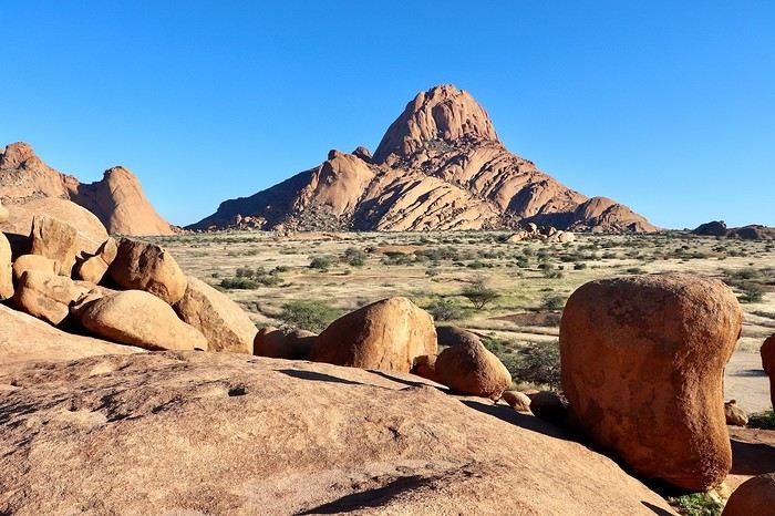
> Accommodation: Daureb Isib Restcamp - Erf 672 C/O 3rd & 4th Avenue Uis 9000, Uis, Namibia - (http://www.daurebisib.com/) – 31 € - Pool. Comfort with private bathroom + electricity + Wi-Fi at the restaurant. Clear sky for a beautiful starry night.
**DAY 14: Wednesday, May 7, 2025: Brandberg (Namibia's Highest Mountain) - Damaraland:**
**The Brandberg massif is an isolated, dome-shaped mountain, an inselberg, that towers over the gravel plains scorched by the sun of the Namib Desert to the northwest. It measures 23 km long and 20 km wide. It is the highest point in Namibia at 2,573 meters.**
This massif formed about 130 million years ago when a gigantic viscous mass of magma from deep within the Earth's crust rose through the surrounding rock layers before solidifying. Later, the granite mass was exposed by the erosion of the surrounding rocks.
**The Brandberg is the highest mountain in Namibia, peaking at an altitude of 2,573 m. The indigenous San people call it the "burning mountain," as it appears to glow with a red light at sunset. With its considerable height and width, this massif influences the local climate, attracting more rain on its slopes than the desert below.** The rain seeps through the springs. Unique animal and plant species thrive in this high-altitude environment, and prehistoric paintings adorn the rock faces hidden in the ravines around the base of the mountain.
The first night was also hot since the start of this trip, the thermometer did not drop below 20°C. We wake up gently around 8 AM, a pleasant sleep-in, the sun is already out. After a quick morning cleanup of the 4x4, we have time today, we hit the road at 9:30 AM, getting lost in the Brandberg massif. We are now in the **Damaraland, which stretches from the majestic rock formations of the Brandberg in the south, where we are today, to the bushy expanses at the foot of the rugged mountains of Sesfontein in the north, where we will be tomorrow. It is the perfect destination for wildlife and flora observation.**
We take the track heading towards the **White Lady**, but we want an alternative to this guided visit only. So, just before arriving, we turn right towards a viewpoint named on Google Maps **Rastplatz**. We come across **small Himba villages, living in extreme poverty with no natural resources; the inhabitants ask for water with every passing vehicle...** A bit further, we encounter about ten **ostriches** in the middle of the track, magnificent, as we get closer to the mountains in the background, and a few meters further, **a herd of Oryx**. Then we approach the **bed of the Ugab River**. We then go back and have a snack in the middle of nowhere, under the shade of our 4x4, facing the mountainous massif. We get back on the road around noon, while the temperature is at its peak in this very hot region, 35°C on the gauge with very dry air. We go up the C35 slightly then turn left onto the small track D2319 until we reach the Ugab bed again. Back to Uis in the mid-afternoon.
We did not book the same campsite as the previous night; today we are at the Brandberg Rest Camp. Unfortunately, the camp is not at the same level as the previous one, which was perfect. But the price is also much lower. The sites are next to each other, separated by small fences behind the main building. But it will do just fine. We have our BBQ and electricity, the shared sanitary facilities are decent. We then lounge in the large pool. We will then buy some water for 10 € at the supermarket located right across.
> Gas station: Uis.
> Distance driven today: 118 km.
> Today's expenses: Groceries in Uis: 10 €.
> Accommodation: Brandberg Rest Camp Uis - No 3 Uis Street Namibia 9000, Damaraland, Namibia - (http://www.brandbergrestcamp.com/) - Large pool – Shower – Electricity
**DAY 15: Thursday, May 8, 2025: Damaraland: Petrified Forest - Ugab Valley - Palmwag**
The night was excellent and slightly cooler than the previous one. We wake up around 7 AM and hit the road just before 7:45 AM heading to a new destination as we continue this Namibian road trip. **We cross Damaraland today from south to north.** First via the C35 to **Khorixas**, then turning left onto the C39. **We come across some villagers walking kilometers under the scorching sun with only a small water container in their hand... What a tough life, light-years away from ours.** About 40 km west of this town, we arrive at the **Petrified Forest National Monument**. It is a vast expanse of veld (open vegetation area), dotted with petrified tree trunks that can reach 34 m in length and 6 m in circumference, estimated to be over 260 million years old. These trees belonged to the Gymnospermae family, conifers among which we find today's cycads and welwitschias. The absence of roots and branches suggests that the trunks were deposited here during a significant flood. The site has about fifty trees, some half-buried in sandstone, others perfectly petrified in silica with their bark and growth rings. A guide is mandatory at the entrance to visit the site.
We then continue on this C39 due west to the junction of the D2612. We make a round trip to the south to **Twyfelfontein, which means "uncertain spring" or "bubbling spring" in Damara**. The site is a UNESCO World Heritage site, located at the entrance of the grassy Aba Huab Valley and houses one of the largest collections of rock art on the continent. More than **2,500 petroglyphs** have been discovered on over 200 stones, as well as some rock paintings. They date back about 6,000 years and others 2,500 years. Many engravings depict species that have since disappeared from the region, such as elephants, rhinoceroses, giraffes, and lions. The presence of a seal attests to the existence of links with the coastline at the time, now over 100 km away. It is here, as well as at Brandberg, that the human history of Namibia began with these testimonies of ritual and economic practices among hunter-gatherer peoples.
We continue a bit further south on the D3214 then D3254 to visit the **Organ Pipes, "organ pipes"**. The entrance is also paid, much to our regret... 500 NAD $ for two. We take a well-marked trail leading to a small gorge containing dolerite (coarse-grained basalt) columns 4 m high and aligned on an astonishing 100 m long wall. We are in a volcanic chain stretching over a dozen kilometers, a pile of scoria that seems to have been exposed to fire, the Burnt Mountain "burnt mountain" stands in a bleak and desolate landscape where almost nothing grows.
We head back north and return to the C39 then the C43 to **Palmwag where we will spend the night**. **This concession, covering an area of 5,500 km², is a region of red hills and plains, remarkable for its rolling landscapes as well as its rich fauna and flora**. The region serves as a **buffer zone between Etosha and the Skeleton Coast**. We have a good chance of encountering black rhinos, desert elephants, and lions, as well as spotted hyenas, giraffes, gemsboks, and other antelopes.
We pass the sanitary control barrier at 4 PM, just before entering Palmwag. In our direction, from south to north, we are simply asked about our future destinations and to present my French driver's license. A few meters further, there is a small gas station, then on our left our final destination of the day: the Palmwag Lodge Campsites. We are happy to arrive after this long journey. The welcome is very pleasant, and the site is very comfortable with a real brick shelter housing our shower and toilet, as well as water and electricity. We always have a BBQ available, but today we unfortunately no longer have meat due to concerns about the sanitary control, but we were not sure if it was rather in the other direction that the transport of fresh meat and dairy products is prohibited. We now cross our fingers to be able to observe some different animals, as the place is renowned for elephants, giraffes, and rhinos. We first take some time to relax in the pool before going for a walk around the reserve, without encountering anything unfortunately this evening, but the wake-up will be up to par... Time for the sunset, which is always one of the highlights of the day.
> Today's road itinerary: 5h30 of driving: C35 heading north > Then turn left onto the C39 > Petrified Forest > Go down on the D3612 in a round trip to Twyfelfontain (rock paintings and Organ Pipes) > Go back up on the C39 then C43 to Palmwag > Round trip on the C40 to Mount Grootberg Pass.
For info on the C43, there is a sanitary control at the entrance and exit (transporting raw meat is prohibited).
Palmwag: black rhinos (guided or free visit? at sunrise or sunset).
> Gas station: Twyfelfontain or Palmwag (07:00 – 19:00) – Tire repair in Palmwag.
> Distance driven today: 349 km.
> Distance walked today: km.
> Accommodation: North of Palmwag Lodge Campsites - GPS Coordinates -19.88556°, 13.93694° - Pool – Water and electricity – 34 € - (https://gondwana-collection.com/accommodation/palmwag-campsite?LodgeName=PALMWAG%20CAMPSITE)
**DAY 16: Friday, May 9, 2025: Palmwag - Sesfontein - Entry into Kaokoland - Opuwo**
This morning, we take our time watching for wildlife. We can finally observe our first **kudus** as the sun begins to illuminate the plain in front of us (see video and time-lapse of the day). A few minutes later, we also spot **a couple of giraffes with their calf**, moving calmly and serenely.
**We leave Palmwag** at 9 AM, heading to the northernmost point of Damaraland via the C43 to Sesfontein.
A few kilometers on the track, and we come across **a herd of zebras**, 11 to be exact, in the middle of green hills. Even further, it's more than twenty that cross right in front of us, a treat for our eyes. Their gait is majestic; they are very sensitive to noise. Some are more curious than others and don't hesitate to stay close if we remain quiet. We then cross numerous rough riverbeds. We must always stay very attentive at the wheel because we can drive at over 80 km/h on straight lines and then suddenly have to brake to cross these small streams, usually already dry at this time of year. Many antelopes are still present by the side of the track; the heat is already rising, and they are often lying on the ground at this hour.
**We arrive in Sesfontein at 11:15 AM**, just as the children are leaving school. Transportation is done by donkey-drawn carts. The villagers spend their time in the shade of the trees and in front of the few small shops. The atmosphere of its streets is dusty with a laid-back pace; this town has the feel of an oasis located **by the Hoanib River**, the town of six springs from which it gets its name. Founded in 1896, it was a military outpost built after a cattle plague epidemic. This page of its history is reflected in Fort Sesfontein, erected in 1905 to fight cattle diseases, arms smuggling, and poaching.
We take a lunch break at the exit of the village around 11:30 AM in the shade of a tree, so peaceful, it's 32°C. We continue further north, away from the usual tourist routes, and **enter the Kunene region, also called Kaokoland**. The track becomes narrower and more winding. **These are now vast solitary spaces largely devoid of roads, simply crossed by sandy tracks opened by the South African army just a few decades ago.** The fauna and flora have managed to adapt to this harsh and dry environment, like the desert elephant, an endangered species whose slender legs are perfectly suited to the long journeys the animal must make to find water, a rare resource. This region is also the territory of the Himba people, emblematic of the country. Its name comes from the Kunene River, which marks a narrow belt of vegetation at the Angolan border.
**We arrive in Opuwo at 3 PM**, **this town is the capital of the Kunene region**. Its name means "the end" in the Herero language, a fitting term for this dusty collection of commercial buildings surrounded by traditional huts with round thatched roofs.
**Opuwo is a strong cultural moment of this trip in Himba territory, this semi-nomadic people traditionally settles in an onganda (small village), moving if necessary to find access to water. Himba women are known for their ochre-colored cream, otjize, a mixture of butterfat and ochre powder, applied to protect and moisturize the skin and hair. Fire and smoke play an important role in their culture.** Smoke, often scented with herbs, is used by women for purification. It can also convey prayers to the supreme being, Muluru. In traditional celebrations, there is always a sacred fire that remains lit between the main hut and the animal enclosure, to maintain ties with the ancestors.
Right upon arrival, we fill up with fuel at the Shell station at the price of 21.48 NAD $ per liter, or 67 liters for 1454 NAD $ (72 €) by card. We then quickly stock up on meat at the Spar **where Himba women with bare breasts mix with us, the only white people shopping in the aisles**. **Since the beginning of this trip, this is where life is most bustling**. There are many people on these dusty streets, after kilometers without seeing anyone, the shock is brutal. There are small markets, poverty but also wealth. The town is quite spread out. There are no white people left, **we finally discover the true, harsh African life.**
We arrive at the **Opuwo Country Lodge at 3:30 PM**, located slightly on the heights. We have site 9 at the end of the property for maximum isolation as we like. Once again, we have private sanitary facilities, a BBQ, and electricity. Once settled, we walk 10 minutes to the reception where the pool is located to cool off. An infinity pool that is just magnificent facing the vast landscape before us. But this contrast between this little comfort and the town below makes us uneasy. The employees walk back down. A guard is present at the entrance of the lodge to ensure security; the park where we are is fenced. We enjoy a good braai, then enjoy the few lights of the town gradually lighting up. The night will be quite noisy for once with very loud music rising from a party below until 2:30 AM... And yet it comes from far away... Maybe a bar? In any case, we rule out what we thought was just a party during our visit here on Friday.
> Today's road itinerary: 4 hours of track: Return via the C43 heading south to Opuwo.
> Gas station: Okangwati or Opuwo
> Distance driven today: 261 km.
> Today's expenses: Fuel fill-up in Opuwo for 72 € + Groceries in Opuwo for 21 €.
> Accommodation: Opuwo Country Hotel - Opuwo Hilltop Opuwo 9000, Opuwo, Namibia - -18.044682 / 13.833861 - (http://www.opuwolodge.com/) - N$600.00 - Pool / Water / Private sanitary facilities / Electricity / BBQ.
**DAY 17: Saturday, May 10, 2025: Opuwo to Epupa Falls:**
We take our time this morning by the **Kunene River**, then we hit the road at 8:45 AM. This is our return trip to Opuwo.
After 4 good hours of driving, **we return to the bustling life of Opuwo**. We refill with fuel at the Shell station (21.48 NAD $ per liter) 820 NAD $ (40 €) for 38 liters and do a quick grocery run at the Spar for 488 NAD $ (24 €). We don't take any meat because we have the **sanitary barrier** to cross tomorrow before entering Etosha Park. We pay for these two expenses in cash for the first time; until now, the credit card was always accepted, so we now have to use the cash we withdrew at the airport. Then we head back to the Opuwo Country Lodge, arriving at the campsite at 2 PM. We are the first to arrive, we rest for a moment before heading to the pool and then end the day around our traditional BBQ with sausages and sautéed potatoes. The full moon accompanies us, perfect for nighttime observations in Etosha starting tomorrow.
The campsite's location should be avoided because we again have infernal music that gets louder from 7 PM to 2:30 AM... And yet it comes from far away... Maybe a bar? In any case, we eliminate what we thought was just a party during our visit here on Friday.
> Today's road itinerary: 4 hours of track: Return via the C43 heading south to Opuwo.
> Gas station: Okangwati or Opuwo
> Distance driven today: 180 km.
> Accommodation: Opuwo Country Hotel - Opuwo Hilltop Opuwo 9000, Opuwo, Namibia - -18.044682 / 13.833861 - (http://www.opuwolodge.com/) - N$600.00 - Pool / Water / Electricity / BBQ
**DAY 18: Sunday, May 11, 2025: Epupa Falls:**
Time for a "vacation" day; we wake up leisurely at 8 AM and take our time this morning. Breakfast and even coffee. The night was good, lulled by the sound of the waterfalls.
In the late morning, we head out on the small path along the banks of the Kunene River, which offers magnificent landscapes. We have a beautiful view of Angola from the opposite bank. The falls extend over about 1.5 km and flow over a series of promontories, the highest of which reaches 37 m.
At noon, we return to our campsite to eat in the shade of the palm trees. On the menu: fried eggs and pasta. We take advantage of this afternoon to rest before the last part of this road trip, with reading, writing, and pool time on the agenda.
In the late afternoon, we return to one of the viewpoints overlooking Epupa Falls to once again enjoy the sunset colors from a different angle. We are over the moon; our thoughts wander in all directions. We discuss future trips, adventures, reminisce about our memories, and think about the world around us... We savor the luck of being here. On the way back, a Himba woman asks if we can give her a ride in our 4x4 to Opuwo tomorrow.
Tonight, we dine on our traditional braai with white beans by the Kunene River. We are lulled by the sound of this powerful river flowing under the song of insects. The coolness sets in, and we fall asleep under the stars.
> Distance driven today: 0 km.
> Distance walked today: 10 km.
> Accommodation: Omarunga Lodge Campsites - 68 € for two nights - Site by the river - (https://gondwana-collection.com/fr/accommodation/omarunga-epupa-falls-campsite?LodgeName=OMARUNGA%20EPUPA-FALLS%20CAMPSITE&hsLang=en)
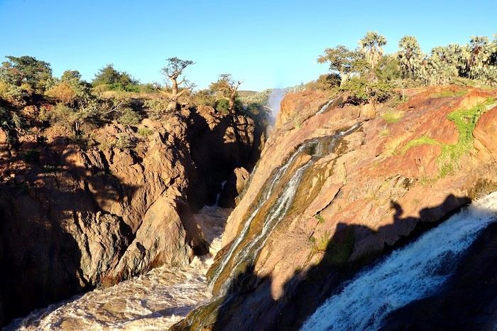
**DAY 19: Monday, May 12, 2025: Epupa to Opuwo**
We enjoy the morning a bit more by the **Kunene River**, then we hit the road at 8:45 AM. This is our return trip to Opuwo.
After 4 good hours on the road, **we return to the bustling life of Opuwo**. We refill with fuel at the Shell station (21.48 NAD $ per liter) for 820 NAD $ (40 €) for 38 liters and do a quick grocery run at the Spar for 488 NAD $ (24 €). We don't take any meat because we have the **sanitary barrier** to cross tomorrow before entering Etosha Park. We pay in cash for these two expenses for the first time; until now, the credit card was always accepted, so we have to use the cash we withdrew at the airport. Then we head back to the Opuwo Country Lodge, arriving at the campsite at 2:30 PM. We are the first to arrive, rest for a moment before heading to the pool, and then end the day with our traditional BBQ: sausages and sautéed potatoes. The full moon accompanies us, perfect for nighttime observations in Etosha starting tomorrow.
The campsite's location should be avoided, as we again have loud music until 2:30 AM... And it comes from far away... Maybe a bar? In any case, we rule out what we thought was just a party during our visit here on Friday.
> Today's road itinerary: 4 hours of track: Return via the C43 heading south to Opuwo.
> Gas station: Okangwati or Opuwo
> Distance driven today: 180 km.
> Accommodation: Opuwo Country Hotel - Opuwo Hilltop Opuwo 9000, Opuwo, Namibia - -18.044682 / 13.833861 - (http://www.opuwolodge.com/) - N$600.00 - Pool / Water / Private sanitary facilities / Electricity / BBQ
**DAY 20: Tuesday, May 13, 2025: Opuwo – Etosha - Olifantsrus**
We wake up before dawn around 6:30 AM. We pack up the camp at 7:15 AM heading to a first waterhole to watch the sunrise and start our day of observations and discoveries. It's 11°C, and as soon as we leave the campsite, we come across numerous zebras, foxes, and springboks with the sun rising on the horizon. Magnificent images.
**At 8:30 AM, we are still alone**, we witness **one of the most beautiful scenes of this trip: 3 lionesses hunting springboks**. It's thanks to the latter, slowing down, that we manage to spot 4 lionesses' heads barely above the tall grass. They hide, stand up, move slowly... We wait without moving. This is their perfect terrain for camouflage. **We are on the lookout and try to be discreet during this hunting scene**. We leave the area to let them finish their remarkable work and continue the track towards the East. The terrain becomes completely flat. It's now been 3 hours since we left the campsite without noticing the time passing, and especially without meeting anyone. Around 10 AM, near a waterhole, we come across a solitary elephant mixed with zebras, buffaloes, and springboks.
Around 11 AM, we take a lunch break; here, it's us who are enclosed in enclosures. Whether in the campsites or the few small equipped areas, we are fenced in by a gate. The animals are free on their territory. The wind has picked up again, just like the sun. We eat alone in absolute calm in the heart of this incredible, unique park; there are no words to describe what nature offers us here, far from any human activity. We start to see some safari vehicles arriving, but the attendance remains much lower than I had imagined. At most, a total of fifteen throughout the day.
Etosha is also a wonderful reserve of vegetation; you can find multiple mopane groves. But also acacias and other trees appreciated by ruminants. The south and east of the park have the most waterholes, which is where most animals gather. In the West, the vegetation is denser, and the wildlife is harder to spot, but it is well present, especially the black-faced impala and Hartmann's mountain zebra, which are found almost nowhere else. The area being less frequented, the bush feeling is more pronounced.
30 minutes of track after eating, **we come across a solitary male lion. The build compared to the females this morning is noticeable from afar**, even though this one is quite far from us unfortunately, unlike this morning when they were right on top of us.
**Etosha is the preferred habitat of lions in Namibia, with about 330 individuals roaming the park's plains, nearly half of the country's wild lions.** The big cats rest under the trees near waterholes, especially the one at Okaukuejo where we arrive today, but it's also a good spot for elephants and rhinos.
We then enter the territory of buffaloes, which we come across by the dozens now. Wow, the encounters keep coming. Then around 2 PM, we follow this immense **Etosha Pan** for the first time, which we will follow for a good part of tomorrow's day.
We arrive at our campsite at 3:30 PM after more than 8 hours of self-safari filled with discoveries. We sleep tonight at the **Olifantsrus Camp**, which we had previously booked in France. We had to wait and click several times for a spot to open up, as the camp has very few sites, and that's a good thing. It is located in one of the wildest areas of Etosha and has a practical observation tower overlooking a waterhole, offering us great opportunities to spot wildlife after nightfall (see photos). **The sunset is once again memorable.** In the guestbook at the reception, where each visitor can note their observations, 3 lions were seen the day before just a few steps from here (1 male, 1 female, and their cub), on a part of the track we didn't cover today; it will be on tomorrow morning's program. We cross our fingers for these predators.
> Today's road itinerary: 6 hours of driving: Leave Opuwo via the C41 (paved road) > Turn right onto the C35 (paved road) to the Galton Gate > Enter Etosha Park.
> Gas station: Opuwo.
> Distance driven today: 369 km.
> Accommodation: Olifantsrus Camping site - 53.4 € for two – Shared sanitary facilities – Electricity – BBQ – No grocery store - (https://www.etoshanationalpark.org/fr/accommodation/olifantsrus-camp)
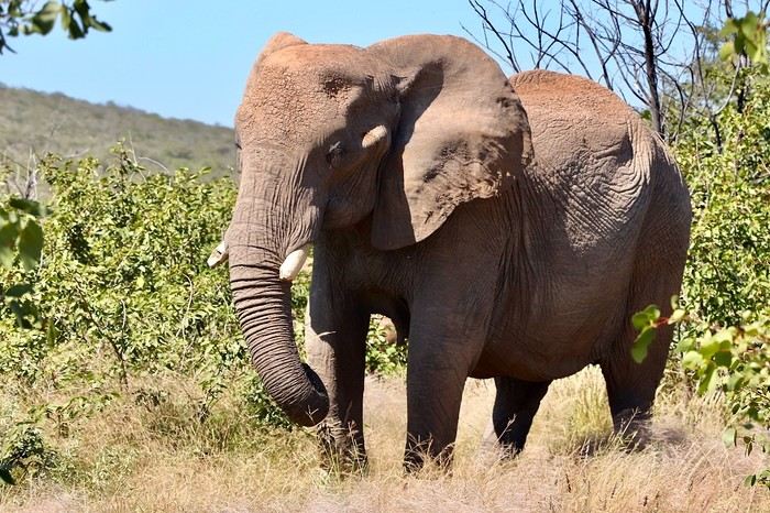
**DAY 21: Wednesday, May 14, 2025: Etosha National Park: From Olifantsrus to Okaukuejo:**
We wake up before dawn around 6:30 AM. We pack up the camp at 7:15 AM as the gates open, heading to a first waterhole to watch the sunrise and start our day of observations. It's 11°C, and just outside the campsite, we come across numerous zebras, foxes, and springboks with the sun rising on the horizon. Magnificent scenes.
**At 8:30 AM, we are still alone**, and we witness **one of the most beautiful moments of this trip: three lionesses hunting springboks**. Thanks to the springboks slowing down, we manage to spot four lionesses' heads barely above the tall grass. They hide, stand up, and move slowly... We wait without moving. This is their perfect terrain for camouflage. **We stay alert and try to be discreet during this hunting scene**. We leave the area to let them finish their remarkable work and continue the track towards the east. The terrain becomes completely flat. It's been 3 hours since we left the campsite without noticing the time, and especially without meeting anyone. Around 10 AM, near a waterhole, we come across a solitary elephant mixed with zebras, buffaloes, and springboks.
Around 11 AM, we take a lunch break; here, it's us who are enclosed in enclosures. Whether in the campsites or the few small equipped areas, we are fenced in by a gate. The animals are free on their territory. The wind has picked up again, just like the sun. We eat alone in absolute calm in the heart of this incredible, unique park; there are no words to describe what nature offers us here, far from any human activity. We start to see some safari vehicles arriving, but the attendance remains much lower than I had imagined. At most, a total of fifteen throughout the day.
Etosha is also a wonderful reserve of vegetation; you can find multiple mopane groves. But also acacias and other trees appreciated by ruminants. The south and east of the park have the most waterholes, which is where most animals gather. In the west, the vegetation is denser, and the wildlife is harder to spot, but it is well present, especially the black-faced impala and Hartmann's mountain zebra, which are found almost nowhere else. The area being less frequented, the bush feeling is more pronounced.
Thirty minutes of track after eating, **we come across a solitary male lion. The build compared to the females this morning is noticeable from afar**, even though this one is quite far from us unfortunately, unlike this morning when they were right on top of us.
**Etosha is the preferred habitat of lions in Namibia, with about 330 individuals roaming the park's plains, nearly half of the country's wild lions.** The big cats rest under the trees near waterholes, especially the one at Okaukuejo where we arrive today, but it's also a good spot for elephants and rhinos.
We then enter the territory of buffaloes, which we come across by the dozens now. Wow, the encounters keep coming. Then around 2 PM, we follow this immense **Etosha Pan** for the first time, which we will follow for a good part of tomorrow's day.
We arrive at our campsite at 3:30 PM after more than 8 hours of self-safari filled with discoveries. We sleep tonight at the **Okaukuejo Resort**. Upon arrival, this impression of a small town in the middle of hundreds of kilometers without infrastructure remains shocking. **The atmosphere is quite different from last night in our small wild campsite**. However, even though the attendance is higher, we are lucky to get a site in a corner (number 46). **The lit waterhole will also be a reward**. After checking in, we take advantage of the small grocery store to buy two meats for our next BBQs in the park, 3 pork chops and sausages, as well as a cold drink for 252 NAD $. This locality also offers a gas station, a restaurant, and a nice pool, but our goal during this park stay remains focused on the wildlife, so I won't give in this time. Time to set up, followed by a short rest, then our toilette before heading to the "waterhole" for the sunset around 6 PM. **A new grand spectacle unfolds before us, a hundred zebras come to hydrate right before our eyes at the water reserve facing the sunset in a cloud of dust. Then a couple of lions approach stealthily without managing to fill their stomachs. A third guest arrives, a second male lion also comes to drink. The waterhole now becomes the territory of the lions... We are speechless facing what nature offers us, we savor for over an hour scrutinizing the smallest details. What an intense day, images that will remain forever etched in our minds.** It's our turn to have our meal with three beautiful pork chops on the BBQ accompanied by curry vegetables.
At 9 PM, we decide to return to the waterhole, a wonderful idea because we find **an elephant and two black rhinos courting in the water. The male has a hard time seducing his sweetheart and eventually leaves, but a third rhino appears out of nowhere to join her. The scenes unfold under the spotlights** accompanied by a sky full of stars. We eventually go to bed. Looking forward to the rest of the story tomorrow.
> Today's road itinerary: Camp Olifantsrus > Camp Okaukuejo.
> Gas station: Okaukuejo camp.
> Distance driven today: 229 km. > Today's expenses: Groceries for 12 €.
> Accommodation: Okaukuejo Camping Site - 48.12 € for two - Pool - Gas station - Lit waterhole - Grocery store - (https://www.etoshanationalpark.org/fr/accommodation/okaukuejo)
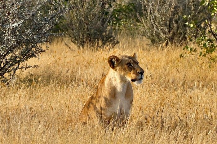
**DAY 22: Thursday, May 15, 2025: Etosha National Park: From Okaukuejo to Halali:**
We wake up around 5:30 AM to a strange noise getting closer, a few thunderclaps, then heavy rain pours down on us! The first since the start of this trip, we had forgotten its sound and smell. We leave the campsite quickly at 7:13 AM as the gates open, the rain stops just in time!
We are right in the heart of the park today. We arrive at the Etosha Pan, an immense flat salt desert that, a few days a year, transforms into a shallow expanse teeming with flamingos and pelicans. At the end of the dry season, everything, from elephants to grasslands, is covered in the white, chalky dust of Etosha.
Around noon, at the Riedfontein waterhole, we spot two male lions in this picturesque savannah. As we've noticed, the females hunt while the males protect the territory. The males and cubs will benefit first.
The day was less emotional than the previous one. We encounter far fewer animals, often at a greater distance. Is it because of the stormy rain we had at dawn this morning, or is it the area? The tracks were also more exhausting, especially the Rhino Drive without meeting a soul. But the view over the immense salt pan as far as the eye can see is worth seeing. Maybe the waterhole at the campsite will surprise us tonight as it did yesterday?
We arrive at 4 PM at the Halali Resort for our last night in the park. We still have a lit waterhole, more intimate than yesterday's, and we can walk around the park thanks to a hiking trail. The sanitary facilities are shared and quite recent, with each site offering its own BBQ and electrical outlet. After setting up and a quick wash, we head on foot to the Halali waterhole for sunset. Tonight's menu features local sausages (beef and pork) with curry pasta.
> Today's road itinerary: Camp Okaukuejo > Camp Halali.
> Gas station: Halali Camp.
> Distance driven today: 242 km.
> Accommodation: Halali Camping Site - 48.12 € for two - Pool - Gas station - Lit waterhole - Grocery store - (https://www.nwr.com.na/resorts/halali-resort/)
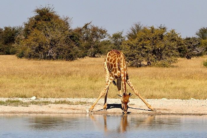
**DAY 23: Friday, May 16, 2025: Etosha National Park: From Halali to Namutoni - Waterberg Park:**
We pack up the camp at 7:15 AM as the gates open. It's 17°C, and the sun is out as usual. **We follow the Etosha Pan, still quite wet at this time of year.** The small track offers different viewpoints under a sun gradually rising higher.
The further east we go, the more we encounter gnus, kudus, and impalas. **We are once again spoiled and delighted by everything we discover this morning.** A majestic **giraffe** appears before our eyes just before arriving at **Namutoni** around 9:45 AM, quickly followed by 4 other companions. From there, we change plans, do the **Fischer's Pan** loop, and then decide to exit through the northern gate, allowing us to cover the entire park. Our last encounters will be with these tallest animals, the giraffes, and what a spectacle to see them spread their legs to hydrate, followed by gnus.
Just before the exit, we take a lunch break at an equipped area at 11:30 AM.
**We leave Etosha National Park with a touch of nostalgia through the King Nehale Iya Mpingana gate** at 12:30 PM. We find the beautiful paved B1 road, which is a great relief. Cows and goats take over; driving at 120 km/h on these single-lane, two-way roads with these animals we brush past requires constant vigilance. We fill up with fuel at 1:30 PM in **Oshivelo** (21.33 $ per liter), 93 liters for 99 € by card. Since we hadn't planned to go so far north out of Etosha, we are surprised to go through a **sanitary check** at the exit of the town, but it turns out to be even quicker than the previous one, a simple glance in the fridge by very smiling women, much more pleasant than the staff at the Etosha entrances and exits.
We pass **near Lake Otjikoto** ("deep hole" in Herero), which is **one of the only two natural lakes in Namibia along with its neighbor Lake Guinas**. In 1851, explorers Charles Andersson and Francis Galton came across this karst lake occupying a limestone cauldron 100 m long, 150 m wide, and 55 m deep. Its steep walls, about 20 m high, are the result of the collapse of the rock roof of the sinkhole under water pressure. This lake is also known for the large quantity of weapons and ammunition found in its depths. Remnants of the region's violent past, they were dumped there in 1915 by the retreating German army, refusing to let South African troops get their hands on them. Unfortunately, it's paid entry, and given the late hour, we continue on our way. To our great surprise, there is a lot of traffic on this B1, including many trucks, the first time we've seen so many people in this country. The landscapes change; we even discover deciduous trees taking on their autumn colors.
We pass through **Tsumeb**, and the road continues to **Otjiwarongo**, which means "pleasant place" in the Herero language, and the town lives up to its name. Prosperous and peaceful, with wide avenues and a relaxed atmosphere, we stop there to do some shopping. We buy some local meat to treat ourselves during these last two remaining camping nights: skewers, pork, and sausages, as well as biscuits, a last water tank, and yogurt for Mimi; 388 NAD $ - 20 €. We get back on the road heading south via the B1 for 15 minutes, then turn left onto the C42, still paved, for 30 minutes and 41 km, then left again onto the D2512, a wavy sandy track for 15 minutes.
**We enter the Waterberg National Park this evening.** The arrival facing this mountainous massif in the middle of the plains under the end-of-day lights of a deep red makes us even more eager to discover it. **Composed of impressive sandstone cliffs, tangles of vines, a canopy teeming with birds, elusive wildlife, and improbable dinosaur footprints. The Waterberg occupies a large sandstone plateau 50 km long and 16 km wide, at an altitude of 150 m above the plain.** It is possible to encounter elands, black wildebeests, roan antelopes, buffaloes, and red hartebeests, and with luck, leopards, as well as 200 identified bird species.
We arrive at the NWR campsite at 6 PM, the first time we arrive so late, just before nightfall. It's from here that various hiking trails start for tomorrow's day, including the **Mountain View Trail** that climbs to the edge of the plateau. We quickly settle into this peaceful camp where calm reigns, no more than 5 vehicles tonight. The place is shaded, with fairly recent shared sanitary facilities, electricity, and a BBQ for each. We savor our second-to-last braai under the stars, hearing our plane that brought us to Frankfurt fly over, every day at the same time over the Waterberg then Etosha. Very rare, as there are very few flights that land or fly over Namibian skies.
> Today's road itinerary: 10 hours of driving: B1 then C42 then D2512.
> Gas station: Exit of Etosha Park, Tsumeb, Otavi, or Waterberg Park.
> Distance driven today: 616 km.
> Accommodation: NWR Waterberg Camping Site - Pool - Water - 45 € for two - (https://www.nwr.com.na/resorts/waterberg-resort/#1577510913112-8f243e49-35a647e7-1997)
**DAY 24: Saturday, May 17, 2025: Waterberg Park - Otjiwa:**
We wake up around 7 AM after a very cool night.
**At sunrise, the cliffs appear even redder, and the cries of baboons echo around us.** We come across about thirty of them. We start the hike around 8:15 AM. **The Mountain View Trail will take us to the Waterberg Plateau.** The temperature is pleasant for walking. **The trail starts in a thick forest where the song of birds resonates.** The path is little frequented, so progress is slow and irregular; we regularly have to duck, step over, and climb rocks. However, in 35 minutes, we reach the top of the plateau. We are once again alone in the world in this Namibian nature. **The 360° panorama extends over a wide plain of green shrubs below, then over these steep red cliffs** giving access to this suspended plateau of the Waterberg. To enter, unfortunately, a special permit is required, and you must be accompanied by a guide. We savor the moment under the already hot sun at 9 AM. After an hour reminiscing about our journey on our rocky promontory, we start the descent at 10 AM, completing a loop back to our starting point. **At 10:30 AM, we pass by the small cemetery of German fighters who died in 1904**, then we hit the road back to the B1. We take a lunch break at noon at one of the tables scattered regularly along the paved roads. We are watched by **baboons** perched in their tree. We then decide to make a **detour through the town of Otjiwarongo**, which we didn't have time to explore properly yesterday. **A quick visit to the train station is a must to see locomotive No. 41, built in 1912 by the German company Henschel. It was transported to Namibia to carry ore between the mines of Tsumeb and the port of Swakopmund before being decommissioned in 1960 when the tracks were modified.**
We return to do some shopping and bring back some souvenirs for 300 NAD $ (14 €). We then take the road south on the B1. I start to feel the end of this immense loop through Namibia. Morale is gradually dropping. But we still have plenty of beautiful things to discover. We arrive at 3 PM at the **Otjiwa Safari Lodge. This will be our last night camping after 22 nights sleeping in the wild to the sound of animals.** The nostalgia is palpable. We enter this high-end private park; we don't really feel at home upon arrival. The reception, the pool, the restaurant, everything is very upscale, unlike anything we've experienced during this road trip. However, the reserve has its charm; we come across our beautiful antelopes again. The 10 sites are very comfortable, spaced apart under some bushes. Each has, of course, its BBQ, electricity, lighting, and sink. Before enjoying our last evening, we need to do a thorough dusting of the 4x4 and a good cleaning and organizing of our belongings. Then it's time for our last perfect braai: chicken and pork skewers, as well as tomato-flavored white beans.
> Today's road itinerary: 1h30 of driving: Waterberg > Otjiwarongo > Okonjima wildlife reserve - D2512 then C22 then B1 then turn right onto a 3 km track.
> Gas station: Waterberg Park.
> Distance driven today: 135 km.
> Distance walked today: 6 km.
> Today's expenses: Souvenirs for 14 €.
> Accommodation: Otjiwa Safari Lodge - B1 main road, west side Otjiwarongo 12001, Otjiwarongo, Namibia - (http://www.otjiwa.com.na/) – 40 € for two – From 3 PM.
**DAY 25: Sunday, May 18, 2025: Otjiwa - Windhoek:**
For this last leg of our Namibian journey, we complete the loop back to our starting point, Windhoek. We leave our last campsite at Otjiwa, later than usual, at 10 AM. We head due south on the B1 in less than 3 hours to the country's capital, not without a touch of nostalgia after all these kilometers traveled through Namibia. The landscapes roll by with a lot of melancholy. We make a stop 60 km north, in Okahandja. We take the opportunity to fill up with fuel (21.10 $ per liter), 500 NAD $ for 23 liters; the card machine wasn't working, so we had to withdraw from an ATM at the next gas station. A local was quite insistent at my window, asking for food or money. Anyway, after 15 minutes, we get back on the road.
From here, we take the new A1, a 2x2 lane highway limited, like the previous roads, to 120 km/h. Then we gradually see some of the country's industries before entering the capital in the blink of an eye. We arrive at 1:45 PM at Chameleon Backpackers. It's a small hostel-style hotel with a central pool, a shared kitchen, secure indoor parking, and a restaurant. They also organize tours (3 Day Express, 3 Day Link, 4 Days Etosha, 7 Day Norbert Adventure), very different from everything we've encountered so far, a kind of atmosphere like in Thailand. There are dormitories, rooms with shared bathrooms, and our little cocoon, the Love Bird, a room located alone on the upper floor with its small balcony, a swing, its bathroom, and its large bed with a thatched roof. A lot of charm while overlooking the pool. We eat before setting off to explore the capital.
Windhoek is a modern and well-maintained city, contrasting completely with the rest of the country. It is heavily influenced by its German colonial heritage, still very present in some streets of the capital. The architecture is colorful and surprising. The skyline is shared between the spires of a neo-baroque cathedral, the unusual silhouette of three castles from the German colonial era, and glass and steel skyscrapers. Office workers head to Zoo Park at lunchtime.
We enjoy the smell of grills at some street corners lined with small single-story houses with zinc roofs.
We first head to Windhoek's emblematic monument, its unofficial symbol: Christuskirche, just a 10-minute walk away. This German Lutheran church rises above the traffic at the center of an intersection. Built in 1907 with local sandstone. The roof and other elements were imported from Europe. The result evokes a gingerbread house.
We then walk along the pedestrian shopping street of **Post Street Mall** to admire African crafts, but on this Sunday, most shops are closed; we'll come back tomorrow. We return via the Wernhil shopping center.
> Today's road itinerary: Return to Windhoek in 3 hours via the B1 then the A1. In the capital, turn left onto Florence Nightingale, then right onto Beethoven Street then C28 then B6, then Bismarck Street. Take Church Street and Trift Street towards Voight Street.
> Gas station: Okahandja or Windhoek.
> Distance driven today: 245 km.
> Accommodation: Chameleon Backpackers & Guesthouse – 49 € for two - 5-7 Voigt St, North Windhoek Central, 9000 Windhoek
**DAY 26: Monday, May 19, 2025: Windhoek, Visit to the Namibian Capital:**
Our last sleep in Namibia... The wake-up is a bit sad; we still enjoy this return to comfort in a real bed. After a hearty breakfast, we check out of our little cocoon at 10 AM. We leave our vehicle in the secure parking lot and return for a walk in the center of Windhoek. On this Monday, the center is immediately livelier while still remaining extremely calm for a capital. The pace of life is slow; employees move slowly without rushing, each task is performed with a slowness that is almost surprising. A few skyscrapers further on, we quickly leave the hyper-center. We retrace our steps to the shopping gallery where we linger for a while. We eat around noon with African music in the background, making us even more nostalgic. Then the trip will gradually come to an end, unfortunately, until the moment when we will have to, not without regret, return our rental vehicle around 3 PM... We stop by the hotel again and then head to the rental agency and then to the airport by shuttle, included in our contract.
At 4:20 PM, we are back at the airport. We see ourselves upon arrival as if it were yesterday... Tears are not far off; we wait, the formalities are much quicker than upon arrival. **We board by walking across the tarmac on foot, escorted by about fifteen Namibians, facing the sunset. It will be there until the end, beautifully drawn on the horizon, to say goodbye to Namibia...**
> Round-trip flight tickets with Lufthansa from Lyon: 2029 €, or **1,014.50 €** per person.
> Vehicle rental: 4x4 Toyota with roof tent for 24 days: Gracious Whisp Car Rentals: 2,638 € (N$50,640) or **1,319 €** per person - (https://gwcarrentals.com/)
**DAY 27: Tuesday, May 20, 2025:** Flight FRA 8:15 AM -> 9:35 AM LYS (Air Dolomite No. 1074)
Total expenses including flight tickets + vehicle rental + visa + Lyon parking + food + fuel:
Cost per person: 3467 € Cost for two: 6935 €
>> All our photos and videos for each day on our website here: (https://www.montagne-aventure.net/voyages-découvertes/namibie-2025/)
>> Find all our photos and videos for each day on our website here: www.montagne-aventure.net
**DAY 1: Thursday, April 24, 2025: Outbound Flights from Lyon to Windhoek via Munich - Visit to Munich:**
Off we go on a new adventure. The alarm rings at 6:30 AM, the travel bags are packed, and we head to Lyon Airport. We booked our flight tickets with Lufthansa. The first leg to Munich, Germany, is operated by AirBaltic. Departure at 1:05 PM for a 1-hour and 20-minute flight. We arrive at 2:30 PM.
**We now have a 7-hour layover, so we take the opportunity to get some fresh air and explore Munich.** We quickly exit Terminal 2 of the airport and head towards the subway. We buy a group day ticket "Airport-city Day Zone M-5," valid for 2 to 5 people at a price of 30.50 € (instead of 16.30 € per person). We take the S8 line to **Marienplatz** in 35 minutes. **This is the heart of the city.** The weather is overcast, quite cool, but dry. Perfect for a little city trip between two flights while leaving our large luggage in transit at the airport. **Munich is the third-largest German city after Berlin and Hamburg, in the Bavaria region.** **The center has a lot of charm and brings together several religious buildings, easy to explore on foot.** We are impressed by the number of people enjoying these 100% pedestrian streets, which are very pleasant. After Marienplatz, the most famous square with the town hall, we head to the Cathedral of Our Lady, a Gothic church, then continue to **Karlsplatz** and move on to **the food market offering a wide selection of high-end food products in an atmosphere where a certain art of living prevails.** We also visit St. Peter's Church before grabbing a bite to eat. Two good hours were enough for this 10 km city walk. It's time to take the subway back: by 6:30 PM, we are back at the airport. Now, it's time for a bit of waiting and rest. Our second flight is scheduled for 9:35 PM for a 9-hour and 30-minute journey to our final destination in Namibia: **Windhoek.**
> Round-trip flight tickets with Lufthansa from Lyon: 2029 €, or 1,014.50 € per person.
> Lyon Airport parking: 120 €
> Today's expenses: 7 € for 2 pizzas in France / 14 € for the restaurant in Munich / 30.50 € for the daily subway ticket in Munich.
**DAY 2: Friday, April 25, 2024: Arrival in Windhoek, Visit to the Namibian Capital:**
After a 9-hour and 30-minute overnight flight with Discover Airlines, we finally land on Namibian soil just before 7:30 AM. The day is breaking, and the colors are already stunning. We are eager despite the usual fatigue from the flight. The airline was punctual, with friendly staff and good meals, though a bit light. We are the first flight of the day to land, with no more than 15 flights per day here, from 7 AM to 8 PM. We disembark on the tarmac at this airport located in the middle of nowhere, **I finally set foot on African soil for the first time.** We exit among the first from the aircraft to go through the long formalities at the front of the line, as the wait can quickly become endless. Allow at least 5 minutes per person for e-visas. We still wait 45 minutes despite only about twenty people ahead of us. Phew, it's done. We collect our luggage and then withdraw money from an ATM. We make 4 withdrawals of the maximum amount, 2000 NAD $ per withdrawal, for a total of 380 €, or 95.33 € per withdrawal.
Our driver arrives at the same time, perfect timing, we were quick.
We leave the airport at 8:45 AM. By 9:30 AM, we arrive at the **Gracious Whisp vehicle rental agency**, located at the entrance of Windhoek, small and human-sized with a fleet of recent vehicles. More formalities, then a short wait as our vehicle is not yet ready. Time to decompress, catch our breath, and enjoy the very pleasant morning temperature. Not a cloud in sight. Next, a briefing on the vehicle, always with a bit of apprehension due to our approximate English. Allow 45 minutes of explanations, including setting up the roof tent, camping equipment, technical information in case of a flat tire, driving tips in Namibia, and a tour of the 4x4. We have all the necessary equipment for camping: mattresses, sleeping bags, pillows, table, chairs, gas stove, BBQ grill... as well as 2 spare tires, a compressor, a dual tank, and accessories for removing wheels. Off we go, it's time to muster our courage and get behind the wheel. **Heading to SuperSpar Maerua**, fortunately located less than 10 minutes away. We park with the help of a parking attendant; it's very crowded, the space is narrow, but everything goes well despite the cursed right-hand drive. Today's new mission: stock up on groceries. The store is well-stocked with local and imported products, catering to all tastes. We spend 114 € on groceries, from pasta to meat, BBQ lighters to dishwashing products. Two people load our groceries into two carts and transfer them to our vehicle; we feel compelled to leave a tip, 50 NAD $, as we don't have change yet. Now, we head to the hotel, 15 minutes away. Traffic is difficult at a complicated intersection; this will likely be the only traffic jam in Namibia. **We arrive at Kate's Nest Guesthouse & Backpackers around 1:15 PM, quite tired.** We take some well-deserved rest at this recent establishment, quite calm with secure private parking. After a short nap, we enjoy the quiet by the hotel pool. Night falls between 6:30 PM and 7 PM. We eat quietly in our room tonight before starting this long 4x4 road trip in camping mode in the heart of Namibia.
> Today's grocery expenses: 114 € at Super Spar Marua (2395.21 NAD $).
> Round-trip flight tickets with Lufthansa from Lyon: 2029 €, or 1,014.50 € per person.
> Vehicle rental: 4x4 Toyota with roof tent for 24 days: Gracious Whisp Car Rentals: 2,638 € (N$50,640) or **1,319 €** per person - (https://gwcarrentals.com/)
> Distance driven today: 15 km.
> Accommodation: Kate's Nest Guesthouse & Backpackers - 4 Aristotles Street Academia, 9000 Windhoek - 36 € for two for one night.
> Windhoek International Airport website: (https://www.airports.com.na/)
**DAY 3: Saturday, April 26, 2025: Windhoek to Hardap: Mariental Region - Kalahari Desert:**
After a good, restful night, we wake up leisurely around 7 AM. We enjoy the comfort provided by this first and last hotel before 24 nights under the tent.
**We leave Kate's Nest Guesthouse at 8:30 AM to tackle the Namibian roads.** We quickly leave the capital; in just 30 minutes, we find ourselves almost alone in the world. The landscape is dotted with small domes. We leave the **paved B1** quickly to turn left onto the **C15**. **From there, we won't see more than 10 vehicles all day.** After passing through the few houses of **Lekkerwaterpoort**, we tackle our first gravel road. These road sections are limited to 100 km/h, but even at 70 km/h, I find it already challenging. However, I quickly get used to it and gradually pick up speed to reach my cruising speed of around 80 to 90 km/h. **We are on immense straight lines crossing wild expanses as far as the eye can see.** **We come across two baboons, a few ostriches, and numerous cattle and sheep farms.** We pass through the charming village of **Uhlenhorst** with its typical houses and children with broad smiles waving at us. Life here is already very different from Windhoek. **The thermometer rises quickly from 16°C at 8:30 AM to over 28°C in the early afternoon.**
**We arrive at the Hardap Dam reserve at 2 PM.** We stop at the toll booth at the park entrance to pay the entrance fee: 250 NAD $ for 2 people and 1 vehicle. We continue to the dam and then the camp entrance, located a bit further. We had booked in advance, but this place remains little frequented by foreigners.
We take advantage of the hottest hours to rest by the large pool overlooking the immense lake, a very enjoyable moment. Would this be a bit of a vacation?
Around 4:30 PM, we head to the campsite. We overlook this vast water reserve. We arrive first; we will be only 3 vehicles spending the night here. It's time to get to work and set up our equipment for the first time. It takes us a good 20 minutes to set everything up, with a slight apprehension about unfolding the tent. Once this task is done, which we will have to repeat for almost a month, we will become much more efficient over time. Time for rest and contemplation in total silence. The sun gradually sets, and the heat quickly becomes bearable again. Bliss! **This dam is located 20 km northwest of Mariental in an area dotted with conical hills topped with dolerite buttons (Hardap means "hillock" in Nama). It captures the Fish River, which flows south, creating a large lake in the middle of an arid environment. The contrast is striking.** We enjoy our first sunset facing this 360° otherworldly landscape.
Around 7 PM, we start our first BBQ, or "braai" as it's called here. The temperature is perfect. The sun sets, giving way to a star-filled sky of incredible beauty thanks to the absence of any light pollution. The Milky Way will lull us throughout the evening. After some good sausages and potatoes on the BBQ, we head to our roof tent around 9:30 PM with a complete change of scenery in just 24 hours. France already seems so far away...
This campsite has shared showers and toilets, quite clean and functional, as well as a central area with several BBQs and tables. The sites are arranged in a semicircle, each with an electrical outlet. The sites are close to each other but spacious, some slightly shaded. We are only three vehicles tonight, so it's perfectly comfortable and quiet. Not to mention the large pool near the restaurant. Our trip is off to a great start.
> Today's road itinerary: Windhoek > Head south on the B1 to Rehoboth > Turn left onto the C25 then C15 to Stampriet > C20 to Hardap > Full north on the B1 > Then turn left onto the M93 - 5 hours of driving.
> Distance driven today: 354 km.
> Accommodation: Hardap Recreation Resort - 23.3 € for two - Large pool - GR6W+3M2, Hardap Game Reserve, Mariental, Namibia - (http://www.nwr.com.na/resorts/hardap-resort/)
**DAY 4: Sunday, April 27, 2025: Hardap - Brukkaros Volcano - Keetmanshoop - Quivertree Forest Rest Camp**
Our first night under the tent was very pleasant; the little wind quickly calmed down, giving way to absolute silence. The mattress is decent, more comfortable than some nights in Nepal. The length and width give us enough space for maximum comfort, despite my height (1.91 m). We wake up a little before 7 AM as the sun rises, and the lights dazzle us from the start of the day. We pack up the equipment in 30 minutes, quite easily. Then we enjoy the sun, which warms up quickly while we keep our light fleece on.
At 8:30 AM, **we hit the road again, heading south** to our first stop in **Mariental**. We want to do some shopping at SuperSpar, but once we arrive in the parking lot, a young local is fighting with the supermarket security guards and then threatens to throw stones. We don't want to take any risks right at the start, so despite the baton blows he receives, he doesn't stop. We leave empty-handed but fill up with fuel at the Shell station 1 km further. The price per liter is 21.33 NAD $, we fill our 107-liter tank for 107 €. In Namibia, you get served, and they bring the card machine to the window to pay. It's then customary to leave a tip.
We then take the B1 heading due south on a recently renovated road. Around 11:30 AM, we leave it on our right to take **a wild gravel road, the M98**. Just before **Berseba**, we turn right onto a small track, the **D3904 towards Brukkaros Crater up to a camp at 1588 m altitude**. The track then becomes too bumpy. We stop on the counter-slopes where **a wide panorama unfolds over these immense plains as far as the eye can see**. It's 12:15 PM, time for us to eat a rice and tuna salad facing this landscape.
**We are alone in the world until a vehicle arrives and parks next to us.** A bit of apprehension, 4 men head towards us. It turns out to be 4 shepherds looking for a lost foal. The conversation is pleasant, lost in the middle of nowhere. We find ourselves alone again in this absolute silence. **The heat becomes stifling with a good 30°C**. We get back on the road around 1 PM. Back on the B1, **we continue due south to Keetmanshoop**, which we reach around 3 PM. We stop there to do some shopping for 262 NAD $ (12 eggs, a can of tuna, a can of corn, bread, a soda, and a 5-liter water container), or 12.48 €. Two quite insistent children ask us for money or candy at the store exit, yet we give them a small tip, but they continue to cling to the car. Locals parked next to us tell them to leave us alone. Anyway, we finish the trip to **Quivertree Forest**, 15 km away. We will spend the night in this **pleasant farm run by a German**. Upon arrival, as the day before, and as I suppose in the future, we dive straight into the cool pool to relax after all these kilometers. A bliss. Then we take our 4x4 and choose a spot near these famous trees. After the 33°C this afternoon, once 4 PM passed, the temperature drops again and becomes very pleasant. **We are in the middle of the Kokerboom, one of the most interesting and characteristic plants of hot and arid regions. It's not really a tree but a variant of the aloe plant whose botanical name is Aloe Dichotoma. This Kokerboom has a smooth and thick trunk reaching up to 1 m in thickness and 9 m in height. They bloom for the first time at the age of 20 to 30 years.** The flowers are yellow and reach about thirty centimeters during the season between June and July. **They grow mainly in an environment with a high concentration of black rocks absorbing a large amount of heat (38°C). The rocks also serve to anchor the tree with its tentacle-like roots. It also resists frost. Each is between 200 and 300 years old.**
Around 5 PM, we walk to the farm reception to watch the feeding of **two cheetahs**. Magnificent carnivores taking their time to savor their piece of meat. **Then we return near our campsite to enjoy the sunset among these trees. The colors are sublime, as every evening apparently. A magnificent spectacle with colors evolving from yellow to orange then to pink, before giving way once again to a sky filled with thousands of stars.** Our campsite at Quiver Tree Forest Camp is very comfortable; we have a water supply, a stone table, a small lamp, an electrical outlet, a small tree for shade, and a BBQ that we won't use tonight; we'll cook on gas. The sites are far apart, with some shared facilities scattered around, a very beautiful setting. No reservation possible, no need, just show up directly. **The campsite accommodation for 2 people costs 28 €, including the reserve entrance fee of 5 €**. We finish this second bivouac evening around 9:30 PM, time for some reading and sleep in peaceful silence without wind.
> Today's road itinerary: Mariental > B1 heading south to Brukkaros > At Tses turn right towards Berseba via the M98 > Turn right onto the D3904 > 8 km > Brukkaros Volcano (stop at the lower camp as the track is difficult for 1 hour) > Keetmanshoop > Turn left onto the M29 > Quivertree Forest - 4 hours of driving.
> Distance driven today: 371 km.
> Distance walked today: 6 km.
> Today's expenses: Groceries for 12.48 € (262 NAD $) / Fuel for 107 € (1 liter of diesel for 21.33 NAD $).
> Accommodation: Quivertree Forest Rest Camp, P.O. Box 262, Keetmanshoop, Namibia - BBQ, hot showers, toilets, and electricity - No reservation - Pool - 18 €/Person (N$ 340.00 with park entrance) - (http://www.quivertreeforest.com/)
**DAY 5: Monday, April 28, 2025: Quivertree Forest Rest Camp - Giant's Playground - Keetmanshoop - Fish River Canyon - Canyon Roadhouse:**
After an excellent start to the night, we are woken up by the wind shortly before 6 AM, but the sunrise is not far off. We get up at 6:30 AM to enjoy it. The atmosphere is a bit cooler this morning, but the reward is already here.
The adventure continues. At 7:45 AM, we head towards **Giant's Playground**, 4 km away. We take a 3-kilometer walk through this expanse of blocks and igneous rocks.
We continue south at 8:45 AM, passing through Keetmanshoop again where we do some shopping for 25 €, a big stock-up for a good part of the trip: meats, canned goods, pasta, fruits... At 9:30 AM, we take the B4 to Fish River Canyon.
At 11:30 AM, we arrive at the entrance to the NWR park (350 NAD $ entrance for 2 people and 1 vehicle). The track becomes bumpy immediately upon entering the park. After about ten kilometers, we come upon this landscape carved by nature. In the end, it's well worth the detour. We were at the Grand Canyon in the USA exactly (https://www.montagne-aventure.net/2024/04/29/j21-3-juin-2024-grand-canyon-et-lac-powell/) and can thus confirm that this Fish River Canyon is comparable. We make several stops along the southern flank. **Here, nothing is developed; nature is almost in the wild state.** **With 160 km in length, up to 27 km in width, and a depth of 150 m, it is indeed the second-largest canyon in the world.** The history of the canyon is apparent in its different earth layers and stratification: the antiquity of the place is tangible, and the absence of vegetation is surprising. **It consists of two nested canyons, formed at distinct periods. The first distinct layer of schist, sandstone, and eruptive material surrounding the canyon was formed a few two billion years ago, then transformed due to heat and pressure into more solid rock such as gneiss. The inner canyon, carved more recently by the Fish River, has a depth of 270 m.**
We have a picnic once again alone in the world facing this grand panorama at the **Sulphur Spring View Point**. This is where the hiking trail begins, plunging into this narrow canyon, but it is forbidden to venture there alone without a guide. It's 30°C, but a slight wind makes the atmosphere bearable. At 1 PM, we retrace our steps and continue to the **Main View Point** then to the **Hikers View Point**.
In the south of Namibia, the Fish River Canyon, 160 km long, is a true geological wonder: a canyon nested within another canyon, one of the largest in the world. The first sedimentary layers formed two billion years ago; 500 million years ago, a period of tectonic activity caused these layers to crack and tilt, opening a vast canyon in the Earth's crust. The second canyon, with a depth of 270 m, was carved over time by the passage of the Fish River in this new valley.
At 3 PM, we arrive at our very charming camp for the evening, the **Canyon Road House**. We fill up with fuel right away because tomorrow we have a long day of isolated driving: 55 liters for 1240 NAD $. Then we settle into the campsite we had previously reserved in France. We are assigned site 2, very well set up under a tree with its BBQ and stone table just steps from the pool. We quickly set up the tent and jump straight into the pool for the relaxation moment of the day. As usual, the water is quite cool, but it's a real pleasure. Then we stroll around this Canyon Road House, which recreates the atmosphere of the roadside inns of the 1950s with old car wrecks and vintage gas pumps in a bygone era. **Around 5:45 PM, we start a short walk leading us to the top of a hill overlooking the wide plateau where we are to watch the sunset.**
And finally, to end this beautiful day, it's time for the braai, with grilled sausages and white beans on the evening menu.
> Park entrance: 150 DN/person + 50 DN/vehicle (18 € for two). It is possible to enter at two access points: Hobas in the north and Ai-Ais in the south.
> Today's road itinerary: M29 > Keetmanshoop > B1 > B4 > C12 (track) > After Holoog turn right onto the D601 (C37 track) > Accommodation on our right (stop just to check in before 6 PM) > Continue 30 km (30 minutes of track) to the viewpoints after Hobas where you must pay the entrance fee. Sunset View Point to the left > Return before sunset as the park closes (best lights at sunrise). 3 hours.
> Distance driven today: 228 km.
> Distance walked today: 10 km.
> Today's expenses: 25 € for groceries / 17 € for the Fish River Canyon park entrance / 58 € for fuel.
> Accommodation: Canyon Roadhouse, Gondwana Collection Namibia – 34.4 € for two - Pool - Near Hobas - (http://www.gondwana-collection.com/fr/accommodation/canyon-road-campsite)
**DAY 6: Tuesday, April 29, 2025: Canyon Roadhouse - Orange River - South African Border - Vista Trail - Gondwana Sperrgebiet Park - Aus:**
The night was excellent in this very comfortable campsite. **We wake up to the sound of birds** before the alarm at 6:45 AM. Our little morning routine starts as the sun rises. **A big day of driving awaits us to the South African border. This will be the southernmost point of our journey.** We hit the road at 8 AM via the C37, pass through **Hobas**, then turn onto the D207 to **Aussenkehr.** **We cross a mountainous barrier with some high peaks and perfect cones. The rock varies from orange to pink to black.**
We then cross a lunar desert as far as the eye can see on a giant dome; the track winds through nowhere without meeting anyone for hours. The landscapes are surprising. **We spot several ostriches and a gemsbok.** In the middle of this endless expanse, we come to an improbable intersection and continue right onto the D278.
In the middle of these arid lands, we come across a green zone: a vast vineyard. At 10:30 AM, **we come across a "Road closed" sign, fortunately, a local resident waves us to continue; a bit stressed, we proceed.** We start to follow the beautiful Orange River. On the other side of the bank, just a few meters away, South Africa is there. It is the second-longest river in Southern Africa, after the Zambezi. It flows over 2,000 km to the Atlantic. After passing through narrow gorges, we regain altitude before starting the descent, gently heading back north.
**We now cross and follow the Fish River, which joins the Orange River further south** **along this gorge dating back millennia.** At exactly noon, we take a lunch break by the Fish River, still without meeting a soul in this landscape between greenery and aridity. The temperature here is cooler with a pleasant 23°C on the banks, the perfect spot. **We continue on the track to Rosh Pinah**, where we find a paved road again. **The section along the Orange River and the Fish River was officially closed, but we were able to pass without any issues, avoiding a detour of at least 3 hours.** Phew. We now drive at high speed (limited to 120 km/h) through these vast spaces. We come across many ostriches after the **dozens of monkeys along the Fish River**. Around 3 PM, 3 km after the very small town of **Aus**, we reach **our campsite for the evening at Klein Aus Vista**. A new **small peaceful haven very well set up**. As usual, after checking in at reception, we jump straight into the beautiful pool to get our well-deserved dose of coolness, another good thermal shock that our bodies appreciate. Once this moment of relaxation is over, we take our 4x4 to reach the campsite located a bit higher, set apart at the foot of a hill that overlooks us.
After setting up, **around 5 PM, we head to the Vista Trail to climb to the top of a mountain overlooking the vast plain that surrounds us at 360°**. It takes about 30 minutes to climb. The place is just magical, **the perfect viewpoint to admire the sunset**. **We fully savor the moment. We also spot one of the few wild horses in the world capable of living in the desert.** Their numbers have decreased in recent years due to predation and drought (around 100 to 150). At 7 PM, we return to the camp, time for the braai and preparing the meal in this peaceful little camp.
In the south of Namibia, the Fish River Canyon, 160 km long, is a true geological wonder: a canyon nested within another canyon, one of the largest in the world. The first sedimentary layers formed two billion years ago; 500 million years ago, a period of tectonic activity caused these layers to crack and tilt, opening a vast canyon in the Earth's crust. The second canyon, with a depth of 270 m, was carved over time by the passage of the Fish River in this new valley.
> Today's road itinerary: 5 hours of driving: D324 heading south (track) > turn right onto the C10 (track) > D316 heading south > turn right onto the C13 > In Aus turn left onto the B4 > Campsite via a track on the left.
> Fuel station: Solitaire or Aus.
> Distance driven today: 398 km.
> Distance walked today: 7 km.
> Accommodation: Klein-Aus Vista Desert Horse Campsite - Farm Klein-Aus No 8 on the B4 main road to Luederitz Aus 9000, Aus, Namibia - (http://www.klein-aus-vista.com/accommodation/desert-horse-campsite/) 17908 420 DN - Water + Shared shower (hot water). No electricity.
**DAY 7: Wednesday, April 30, 2025: Aus - Kolmanskop - Diaz Point - Luderitz - Kanaan Desert:**
We wake up around 6:45 AM, with partly cloudy weather for once; we feel the ocean's influence gradually. But the sun isn't far off. At 7 AM, we leave the campsite heading west towards Luderitz via the B4. **First stop of the day: Kolmanskop, the ghost town we reach at 8:30 AM**, entry costs 180 NAD $ per person. We discover this **timeless place** in 1.5 hours, moving from building to building amidst violent sand-laden gusts of wind. There's a lot of charm in these different living spaces. **The sand quickly reclaimed the place after this mining town was abandoned.** This was once the headquarters of Consolidated Diamond Mines. It's hard to believe that this former town, where the diamond industry once flourished, had a hospital, a bowling alley, and a theater. The decline in diamond sales after World War II and the discovery of richer deposits put an end to this golden age. By 1956, the town was already completely deserted, and the sand had reclaimed its rights. **These dilapidated buildings swallowed by shifting dunes have something surreal about them.**
At 10:15 AM, we hit the road again **heading to Luderitz, 22 km away**, and first to **Diaz Point** **facing the Atlantic Ocean**. It's a wind-swept peninsula with its characteristic red and white lighthouse. There's a campsite and a coffee shop on site, but the place doesn't inspire rest without shade or shelter from the wind. We return to the city via the D701 track that runs along the ocean, be careful at low tide. We come across **a few fishermen and a fox as well as flamingos.**
We walk through the few streets of the city, much smaller than I imagined, then climb to the **famous little Lutheran church that overlooks the city, the Felsenkirchr.** **The wind blows very strongly here, and the sand is omnipresent, surrounded by the Namib Desert and the southern Atlantic coast.** **A German colonial relic barely touched by the 21st century, Luderitz seems frozen in the past, giving it both a gloomy and a certain charm. In short, it's certainly one of the most incongruous places in Africa.**
At 1:15 PM, just before leaving Luderitz, we do some shopping for 20.50 € and fill up with fuel: 61.50 €, 1290 NAD $ for 61 liters (21.18 $ per liter).
**We return via the B4 to Aus** (paved), **then via rougher tracks**, the C13 then the D707, magnificent as it runs along a mountain range with multiple colors on our right and an endless flat desert on the other side.
To access our campsite for the evening, we must take a **narrow private track for 7 km** on our right to emerge, in this total vastness, at the **isolated Kanaan Desert Retreat on a small hill**. I don't have time today to jump into the pool near the reception; we arrive at 5 PM at 8 small, isolated, and unique sites with a small kitchen, a shower, and a private toilet under a small tarp shelter. **A crazy charm with a unique view...** **This will be my favorite accommodation of this trip. The photos speak for themselves.** We jump into the outdoor shower while savoring the landscape, then prepare our evening braai while enjoying the colors fading, facing this plateau with bushes turning a vivid orange. **A moment that will remain etched for life.** **Savanna atmosphere under a thin emerging moon. Every minute offers different colors. Facing our meal, we have a natural giant screen.**
We end this day contemplating the stars and admire this thin orange moon setting on the horizon (8:42 PM).
**Ghost town just before Luderitz: Kolmanskop** (open from 8 AM to 3 PM - N$ 180 p.p – 9 €). Once, Kolmanskoppe was organized around diamond mining. After finding new, more prolific spots, the town was abandoned and is now a ghost town. The sand and dunes have reclaimed their rights and buried everything humans had built. Houses, train station, bakery, everything has been covered by sand, which passes through the windows, even though they are 1 meter high.
> Today's road itinerary: 5h30: B4 to Luderitz (paved) > Round trip > Kolmanskop on the left > Return via the previous campsite > Then C13 (track) > Turn left D707 (track) > Then track to the right to the campsite.
> Distance driven today: 438 km.
> Distance walked today: 8 km.
> Today's expenses: Groceries at the Spar in Luderitz for 20.50 € / Fuel fill-up in Luderitz for 61.50 €.
> Official Kolmanskop website: (https://kolmanskuppe.com) (open from 8 AM to 1 PM - N$ 180 p.p – 9 €).
> Accommodation: Night at the south of the Namibrand Nature Reserve: Kanaan Desert Retreat – 26.5 € for two - (http://www.kanaannamibia.com/) - Farm 104 Karas 9000 - Sanitary facilities + BBQ + Water + Pool - No electricity - My favorite accommodation of this trip.
**DAY 8: Thursday, May 1, 2025: Kanaan Desert Retreat - Namib Desert - Crossing the Namibrand Nature Reserve – Sesriem Canyon - Elim Dune - Little Sossus Lodge**
After a cooler night than the previous ones with about 10°C, we wake up around 7 AM. We admire, as usual, the sunrise between the desert and the mountains. **The spot from last night was truly perfect, isolated from the world, in total serenity, with a wake-up call to the sound of birds.**
We hit the road a little after 8 AM, heading north via the D707 to Spes Bona, then the gravel road C27 via Betta to Sesriem. **The landscapes roll by and dazzle us.** **We are right in the heart of the Namibrand reserve**, coming across numerous **zebras**, **impalas**, **ruminants that reproduce in large numbers**, and **gemsboks**. At noon, we stop in the shade of a tree to eat. The spot is so romantic facing orange arid mountains and a vast green plateau. **A landscape full of contrasts, timeless and silent.**
**The Namib Desert is the oldest on the planet; its name means "vast arid plain," and it also gave its name to the entire country: Namibia.** The majority of these arid and semi-arid lands dotted with viewpoints are part of the Namib-Naukluft National Park, which covers 23,000 km².
At 1 PM, we enter the Sossusvlei park. We start with the **Sesriem Canyon**, which is 3 km long and 30 m deep. We enter it with a short 1-hour hike into its depths. **It was carved by the Tsauchab River in an agglomerate of sand and pebbles over 15 million years old.** We retrace our steps back to Sesriem, which means "six belts," referring to the number of leather belts (from ox wagons) needed to draw water from the canyon. This remote locality is mainly the gateway to Sossusvlei but offers a gas station and some accommodations. For our part, we sleep 40 km away tonight.
**We then move on to Elim Dune.** It takes about 45 minutes of walking to reach its summit, and the climb is very breath-taking as we progress in the sand where we almost slide back with each step. **A first grand 360° panorama unfolds. The ochre color of the sand contrasts completely with the yellow plain and the brown and black mountains in the distance.**
At 3:15 PM, we start the descent facing Sesriem. We were completely alone once again on this dune. **These Namib dunes are composed of colored quartzite sand, presenting hues ranging from cream to orange and from red to purple. Unlike the ancient dunes of the Kalahari, these move with the wind and adopt distinct, ever-changing shapes.** Star dunes resemble stars seen from above, while transverse dunes, like those on the coast south of Walvis Bay, stand perpendicular to the prevailing southwest wind. The most stable dunes, which thus have the most vegetation, are parabolic dunes, due to the variability of the winds. Longitudinal (seif) dunes measure up to 100 m in height, while barchan dunes, crescent-shaped and predominant at the extreme north of the Skeleton Coast and south of Luderitz, are the most mobile, created by unidirectional winds.
**We get back on the road for 45 minutes to our campsite for the evening, Little Sossus, which we reach at 5 PM**, via C27 then right onto C19. As often upon our arrival, I jump into the cool pool to relax after all this driving, then we proceed to set up the camp. As the day before, the campsite consists of 10 fairly distant sites, with private sanitary facilities and a small roof. We are delighted with this crazy charm. The hot water for our shower is wood-heated: a Namibian lights it every evening around 5 PM.
For a change, or not, the menu features a small BBQ with pork ribs and pasta, facing another sunset, this time with partial cloud cover giving equally splendid colors. Time for a well-deserved rest after long corrugated tracks covered in our 4x4 today.
> Today's road itinerary: 4h45 of driving: Find the D707 and head north (track) > At Spesbona turn left onto the C27 (track) > At Sesriem after entering the park, turn left following View Point Sesriem > Continue 4.5 km to the Sesriem Canyon Parking > Return then head towards Elim Dune > Exit the park then take the D826 > Turn right onto the C19 heading SE > Turn right facing the D854 to the campsite (campsite closes at 7 PM).
> Distance driven today: 272 km.
> Distance walked today: 8 km.
> Today's expenses: Entry to the Sossusvlei Namib-Naukluft Park: 17 € for two (with one car).
> Accommodation: Little Sossus Lodge – 35 € for two - At the junction of the C19 and D854 roads Maltahohe 9000, Maltahohe, Namibia - (http://www.littlesossus.net/) - Pool + Private bathroom + Hot water + Electricity + BBQ + Grocery store (bread to order the day before).
**DAY 9: Friday, May 2, 2025: Little Sossus Lodge - Namib-Naukluft National Park – Sesriem - Sossusvlei - Big Daddy – Deadvlei - Tsauchab River Camp**
Today we start the day early to tackle **the famous dunes of Sossusvlei at first light**. The alarm goes off at 6 AM to leave the camp at 6:45 AM. The wind is blowing quite strongly in gusts this morning, but it only woke us up a quarter of an hour before sunrise. The park opens at 7:15 AM. We start with a small encounter: a friendly **jackal lounging by the roadside.**
We first have to cover the 40 km of track to Sesriem, pay the entrance fee (350 NAD $), and drive 65 km on a paved road this time to reach the **vast salt pan (a lake whose sediments are made of salts) of Sossusvlei**. **It appears amidst the gigantic red dunes that rise on either side. The wind constantly changes the shape of the dunes, as well as their colors, which vary with the light. The setting is breathtaking, giving an impression of immensity and timeless grandeur.**
The paved road ends; the last 4 kilometers become technical and are reserved for 4x4s. Phew, I pass without any problems, though not without stress, switching to L4 mode. **We start the ascent to Big Daddy at 8:45 AM, 325 m of elevation gain in the sand nonetheless.** We climb at an excellent speed despite the strong wind, in exactly 1 hour. At 9:45 AM, we are at the summit of what will remain etched for a long time. The 360° view is simply unimaginable; you have to experience it to believe it. The wind blows violently up there, **it feels like being in the high mountains, on a snow ridge, with a strong transport of sand. The atmosphere is magical.** We start the descent running barefoot in the steep sand.
**We then move on to its neighbor, Deadvlei.** **Here, petrified trees stand in the "vlei" (basin) with their dried branches casting desolate shadows on the white ground. The juxtaposition of the deep blue sky and the towering dunes is captivating.**
We return to the 4x4 parking at 11 AM, the stress rises again for the sandy track passage. We retrace our steps and stop at **Dune 45**.
At noon, we take the opportunity to picnic at the foot of **the beautiful Dune 40**, where there is already no one left. We enjoy the quiet again, well, almost, as the wind remains omnipresent.
At 1 PM, we return to **Sesriem**, where we fill up with fuel (21.15 NAD $ per liter), totaling 1630 for 77 liters (78 €), and do some shopping for 245 NAD $ (two nice pieces of pork, 2 cans, 2 sandwiches for tomorrow, and 1 soda), which is 12.48 €. It's 27°C. We hit the road again, heading to a new destination at 2 PM. We take the C19 back to Little Sossus where we spent the night, then turn left onto the gravel road D854 for about 40 km to **Tsauchab River camp**. Finally, we won't be sleeping here; we are redirected 7 km downstream to **Naukluft View Camp**, which also belongs to Tsauchab River Camp.
We arrive at 4 PM, and thankfully, the fatigue was starting to set in. **Our campsite is located under a small forest, providing some protection from the wind that blew strongly all day. The calm does us a world of good. Once again, a lot of charm**, with very spaced-out sites without any visibility. We can't wait to take our shower. It will be possible from 5 PM with, as the day before, water heated by a wood fire. Time to prepare the campsite for the night. And on the menu, a braai with two superb pieces of pork bought in Sesriem and fries!!!!
**The Namib Desert**
An impressive coastal desert stretching from the Atlantic to a high plateau inland, the narrow Namib Desert runs along the southwest African coast for about 1,300 km. **Considered one of the oldest deserts in the world**, it is bordered to the north by the Kaokoland Desert, which extends into Angola, and to the south by South Africa's Karoo. The narrow Namib is mostly less than 160 km wide. Despite this, it is considered to consist of three sections: the coastal strip influenced by the Atlantic; the Outer Namib, occupying what remains of the western half; and the Inner Namib, comprising the eastern half of the desert. Generally called the Skeleton Coast, the coastal Namib receives almost no rain and depends on regular marine fogs for moisture. From sea level, the terrain rises to 900 m, where the desert meets the base of the Great Escarpment to the east. In the Inner Namib, average annual rainfall is only about 50 mm.
The dryness is such a characteristic of the Namib that it is thought to have been in this arid state for at least 55 million years. It is all the more surprising to learn that animals such as vipers, geckos, zebras, and elephants live in this desert. Some areas of the Namib are also rich in flora, including Welwitschia mirabilis, which grows near the ground with seemingly exhausted leaves, extracting moisture from marine fogs and can live over 1,000 years. In the southern Namib, some dunes are up to 32 km long and 240 m high.
**The frequent fog of the Skeleton Coast:** Driving north along the coast of Namibia, the cold Benguela Current in the Atlantic cools the moist air above the ocean, which, upon meeting the warm desert air, leads to the formation of thick fog banks that drift up to 100 km into the center of the Namib before evaporating under the sun.
> Today's road itinerary: 4 hours of driving: C19 towards Sesriem (track) > D826 (paved) > Foot of Big Daddy via a technical sandy track > Return via the same route > D854 to Tsauchab.
> Gas station: Sesriem.
> Distance driven today: 254 km.
> Distance walked today: 12 km.
> Today's expenses: Park entry at Sesriem for 2 people: 17 € / Fuel fill-up: 78 € / Groceries at Sesriem gas station: 12 € (245 NAD $).
> Accommodation: Tsauchab River Camp - Naukluft View Camp - D054 & D850 GPS: S24 26' 37" E16 10' 11" Sossusvlei 22007, Maltahohe, Namibia - BBQ + Private sanitary facilities + Water - www.tsauchab.com
**DAY 10: Saturday, May 3, 2025: Tsauchab River Camp - Naukluft National Park - Olive Trail Hike (10 km) - Ababis Guest Farm**
We pack up the camp at 8 AM and continue our road trip north via the D854, a bumpy track with many corrugated sections. It's cool this morning, 12°C.
**We enter the Naukluft massif, discovering landscapes with very different terrain than before.** We first need to check in at the campsite, 13 km from the entrance at the end of the track: 350 NAD $ for 2 people and 1 vehicle, then return 4 km back. **On the agenda is the lovely Olive Trail, a 10 km hiking loop that starts 4 km northwest of the park office**, along the D854 that we follow. At 9:45 AM, the hike begins with a fairly steep ascent (about 45 minutes) among the **wild olive trees** from which the trail gets its name. **At the summit, we enjoy a view that embraces the Naukluft Valley.** We then turn east and gradually descend into a deep valley, passing over sometimes slippery rocks. We have a snack around 11:30 AM in these small gorges. **Further on, to cross the wall of a canyon in front of us, some chains are fixed to the rock to help us pass.** We finish this superb loop clockwise at 1:15 PM, taking 3.5 hours including 30 minutes of breaks. We only crossed a small group of 3 people on this wild adventure far from everything. At 1:45 PM, we exit the park and take the **D854 track north to Bullsport**. From there, we turn left and take the C14, which **runs along the bed of the Tsondab River.**
**We arrive at our campsite for the evening, Ababis Guest Farm, at 3 PM.** Quite early for once, allowing us to rest a bit in this peaceful farm where many sheep wander around us. We also enjoy the pool under a magnificent sun, less hot than the previous days, it's 22°C. The camp has only 4 spaced-out sites around shared sanitary facilities. **We are in the middle of a vast plain facing the Naukluft massif mountains.** We will have another beautiful sunset on these mountains. For the first time on this trip, **we will be completely alone at this campsite.** **We haven't encountered many people today**, just 3 during the hike and fewer than 10 vehicles all day.
> Today's road itinerary: Head north on the D854 (track) > Turn left to enter the Naukfluft National Park > Continue on the track then turn right to the Olive Trail hike parking lot (1 hour for 45 km). Return to the D854 and continue north > At Bullsport turn left onto the C14 to Ababis (still a track) > The camp is located on the left facing the D1261 (1 hour for 60 km from Olive Trail). Total: 2 hours of driving for 100 km.
> Gas station: No gas station on the route, except in Solitaire.
> Distance driven today: 115 km.
> Distance walked today: 13 km.
> Accommodation: Ababis Gaestefarm - Night booked by email – payment on site: (https://www.ababis-gaestefarm.de/) - P.O.Box 1004, Maltahöhe - N$ 300.00 per person
**DAY 11: Sunday, May 4, 2025: Ababis Gaestefarm - Namib-Naukluft National Park – Solitaire - Gaub Pass - Kuiseb Canyon - Moon Landscape - Walvis Bay**
The night was, for the first time since the start of this road trip, quite difficult. A strong wind accompanied us all night, making the tent flap constantly. A racket that drove us crazy. We still managed to sleep a few hours. The morning sun brings back our smiles. We hit the road for this new stage a little before 7:45 AM.
We start the day with a first stop less than 15 km away **on the C14 in Solitaire** at 8:15 AM. **This town is lost in the middle of nowhere with its small gas station with a western atmosphere adorned with rusted and sand-covered car wrecks.** After a quick supply stop: 86 NAD $, or 4 € for 1 water container and a box of cookies, we continue north still on the C14, **crossing the Tropic of Capricorn** then devouring this **magnificent track up to Gaub Pass**. **A succession of narrow gorges, turns, climbs, and descents breaking the monotony of the previous long straight lines.** We are right in the heart of no man's land for 200 km. We then start the descent to the **Kuiseb Canyon. It houses the wide bed of the eponymous river, dry almost all year.** Even when it flows for 2 to 3 weeks during the rainy season, it doesn't go beyond Gobabeb and then seeps into the sand. **The drinking water that supplies Walvis Bay is pumped at Rooibank from this underground water table.** **We now cross the Kuiseb Desert where impressive dunes roll down.** We make a short stop at a **natural rock arch** reminding us of our (https://www.montagne-aventure.net/2024/04/29/j19-1-juin-2024-canyonlands-national-park-et-arches-national-park/). Then we gradually descend towards **Walvis Bay** where we will spend the night. At noon, we enter the **Dorob National Park**. The thermometer drops 10°C in 10 minutes as we get closer to the Atlantic Ocean.
At 12:45 PM, much earlier than initially planned, we arrive at the **Moon Landscape** (View Point 4, free) to have a snack, via a very recent surprising dual carriageway in the middle of nowhere, then via the C28. We are again in the hinterlands, the temperature has soared: 30°C without a bit of shade. Even if the colors and the panorama must be exceptional at sunrise or sunset, the detour for this 360° panorama is still worth it. Extreme aridity as far as the eye can see. The place lives up to its name; it really feels like being on the moon. We get back on the road at 1:30 PM via the D1991, C28, then again the A2, which is very new. The latter runs along the beautiful dunes up to the **Dune 7**, where we make another stop.
Then we head towards our final destination of the day, **Walvis Bay. Its port is sheltered by a sand spit, a natural breakwater that protects the city from the powerful assaults of the ocean. Its port was long a strategic place: claimed by the Cape Colony in 1795, it was officially annexed by the British in 1878 to counter Germany's ambitions in the region. A colony of fur seals, pelicans, flamingos, and whale terns have made it their home.**
We do a big grocery shopping at the Spar located in the center for 66 €; it's very easy to park there. Then we fill up with fuel at an Engen station right across for 1117 NAD $ for 54 liters (20.6 NAD $ per liter), which is 54 €. We then **enjoy the seaside in the Lagoon neighborhood**, where it's also easy to park. After kilometers in the desert, **this cool break is more than welcome. The outside temperature is 22°C. In the distance, we can clearly see the clouds lingering over Swakopmund.**
We take the 4x4 one last time to the **Lagoon Chalets where we will spend the night**. The spot is well set up and surprising in the heart of a residential neighborhood. The sites are quite large, separated by fences around very comfortable shared sanitary facilities. BBQ, electricity, and shaded area. We settle in quietly before going out on foot to watch the **sunset over the Pacific Ocean along Lagoon Promenade Road**. We can still see this impressive persistent mist in the distance. The neighborhood is very peaceful, certainly without much charm, but with a very well-developed seafront that inspires relaxation after kilometers without meeting anyone in inhospitable lands. We end the day with our traditional braai: grilled chicken thighs and sautéed potatoes in the coolness of a starry sky.
> Today's road itinerary: 5h30 of driving (or 3h30 of driving for 250 km without the Moon Landscape): Head north on the C14 > Cross the Tropic of Capricorn > Gaub Pass > Kuiseb Canyon on our left in a round trip > Continue to Green Valley and leave the C14 to the right on the D1984 > Turn right on the C28 > Then left D1991 to Moon Landscape D1991 View Point 4 > Return via the same road and stop at Dune 7 for sunset > Walvis Bay.
> Gas station: Solitaire or Walvis Bay.
> Distance driven today: 372 km.
> Distance walked today: 5 km.
> Today's expenses: Fuel fill-up for 54 € + Groceries for 66 € at Spar.
> Accommodation: Walvis Bay: Lagoon Chalets – 36.6 € for two - (http://www.lagoonchaletswb.com/) - 8th Road West, Meersig Meersig 9000, Walvis Bay, Namibia - BBQ – Electricity – Shared sanitary facilities.
**DAY 12: Monday, May 5, 2025: Walvis Bay - Swakopmund - Round Trip to Cape Cross (seals) - Wreck of the Zeila en route - Henties Bay - Spitzkoppe Tented Camp & Campsite**
After an excellent night, a bit cooler and more humid than usual, we wake up around 7 AM and leave the camp at 7:45 AM to **follow the Atlantic coast heading north**. We thus leave **Walvis Bay**, a very pleasant stopover town, and follow the ocean via the B2. **We enter the mist and Swakopmund** at 8:40 AM, parking **near the lighthouse**. The atmosphere is very quiet, the streets seem dead with large empty parking lots and very little traffic, but the few open shops are filled with expatriates enjoying their breakfasts, French bakeries, cafes, travel agencies... **We are in this Benguela Current, a fast cold ocean current that flows from South Africa, up the coasts of Namibia and Angola, towards the northwest to join a warm equatorial current. Hence the supply of very fish-rich waters and this tenacious mist depending on the seasons. In the northern part of the Namib Desert, fogs are frequent during the southern winter. It's almost the only source of moisture since the city of Swakopmund receives, on average, only 11 liters of water per m² in December and January.**
**Swakopmund is wedged between the dunes and the Atlantic rollers. It is the Namibian capital of adventure activities and has a ghostly colonial remnant. With its German architecture, its seaside promenade, it resembles a seaside town of the North Sea or the Baltic.** It is also a bustling African city. **Nearly two-thirds of Swakopmund's population live in Mondesa, a township created during apartheid, northeast of the city center, a legacy of the South African mandate.** The heart of the city is located in the area of the pier, at the foot of the lighthouse, better known as the Mole. During the South African occupation of Swakopmund, the port took a back seat to Walvis Bay.
Continuing on this C34, sometimes on salt, we come across the famous **wreck of the Zeila, stranded in 2008**, on our left. We can see it through the thick fog, being very close to the beach. It's 10:15 AM. Further on, Henties Bay is a bay that attracts many fishermen; it's teeming with vehicles equipped with fishing rods. Besides its fish-rich waters, it enjoys a relaxed atmosphere and a large beach suitable for walks.
We continue further north, heading to Cape Cross, this time a round trip because we will turn off later here in Henties Bay to reach Spitzkoppe via good gravel roads that are quiet alternatives to the very busy paved B2 further south. **Henties Bay is part of the Dorob National Park, a multi-purpose park protecting coastal ecosystems and hosting the many renowned recreational activities of the region. The part of the coast north of Swakopmund up to the Ugab is particularly popular with fishermen who come in droves to fish for saltwater fish.** The small concrete buildings spaced at regular intervals are actually toilets for fishermen and campers. The coastline is also dotted with world-renowned surf spots.
Even before arriving, we can already smell it before we come across thousands of seals (population in 2021: 1.5 million). **The Cape Cross Seal Reserve, the most renowned on the Namibian coast, is home to the most famous breeding colony of fur seals, which seems to take full advantage of the high concentrations of fish present in the icy waters of the Benguela Current. We are impressed by the sight of these 100,000 pinnipeds lounging on the beach and frolicking in the waves.** We have a picnic a little away from the smells facing the ocean in the sun.
At 12:45 PM, it's time to hit the road again. We retrace our steps back to Henties Bay. We stop there to do another big grocery run before not encountering any big cities for many days. We will only buy fresh items day by day until the end of the trip; we have 23 € worth. **In the space of 30 minutes, we go from 15 to 36°C. The thermal shock with an amplitude of more than 20°C.** At 1:45 PM, we hit the road again via the D1918, then we try a very small track on our left, the D1925. It becomes narrow and rough; I have a bit of apprehension. We arrive at a gate to open in the middle of nowhere, then young children run up to us asking for water or food... We then drive to **Spitzkoppe. The arrival right in front of the mountains is majestic, off the beaten path. This mountain appears in the distance like a mirage above the dusty plains of southern Damaraland.** We come across a second gate held by a guard. We enter the "Community Camp" campsite without realizing it through the west entrance. We are given a small paper, then we go to the reception passing **at the foot of these gigantic, magnificent rocks.** Once at the reception, we are informed that this is not the camp we had booked. Ours is located just a little further, and in the end, it's better because the latter was packed. We were able to cross the park very close to these rocks without paying. We exit through the main entrance; 5 Himba children cling to our doors and trunk asking for bread and food again. We continue despite them staying attached, worried about hurting them. Phew, more fear than harm. We cross the few houses and arrive at the right camp at 4:30 PM, the Spitzkoppe Tented & Campsite. The spot is much quieter and well set up. We have site C12, cozy to perfection with its sink, a private shower and toilet, as well as electricity, under the shade of a tree and facing the mountains. The sunset and sunrise will be perfect. We set up the tent and, without delay, head to the pool for a big dose of coolness. Then it's time to prepare the BBQ and **contemplate the fading lights on the Spitzkoppe massif.**
> Today's road itinerary: 5 hours of driving: Head north on the B2 (paved) along the ocean > Swakopmund > C34 (paved) still heading north > On the left, the wreck of the Zeila before Henties Bay > Cape Cross round trip > Henties Bay > D1916 heading east (track) > Turn left onto D3716 > Turn left to the campsite.
> Gas station: Swakopmund or Henties Bay.
> Distance driven today: 344 km.
> Distance walked today: 6 km.
> Today's expenses: Groceries in Henties Bay: 23 € + Cape Cross park entry: 17 €.
> Accommodation: Spitzkoppe Tented Camp & Campsite - Spitzkoppe River Valley 00000, Spitzkoppe river valley, Namibia - (http://spitzkoppemountaincamp.com/) - 26 € - Pool - BBQ - Shower and toilet.
**DAY 13: Tuesday, May 6, 2025: Spitzkoppe - Rock Pools - Uis**
It's 6:45 AM, **we wake up at the foot of one of the most emblematic landscapes of the country, Spitzkoppe, which towers over the valley at 1,728 m.** **The Spitzkoppe massif, "pointed hat" in Afrikaans, is actually a set of three rock formations: Big Spitzkoppe, the granite domes of the Pontok Mountains that surround it, and Little Spitzkoppe, to the southwest. It was first climbed in 1946 and has never stopped attracting experienced climbers; it remains one of the most challenging ascents in the country. The climate in the region is hot**, so try to visit during the cooler months, as it can quickly reach 36°C in the sun in the afternoon. **Spitzkoppe is particularly striking at dusk, as it was last night, and at dawn this morning when the low light sets the rocks ablaze with red and orange hues. The spectacle is unique.**
We re-enter the park managed by the local community (160 NAD $ per person), then start with the **arch sector**. We quietly enjoy all the viewpoints under perfect orange colors. We leave this magnificent spot, reminding us of (https://www.montagne-aventure.net/2024/04/29/j19-1-juin-2024-canyonlands-national-park-et-arches-national-park/), but with much less crowding here. Around 10 AM, we head closer to these mythical peaks, including the main one nicknamed the Matterhorn of Namibia. Then we finish with the **ascent of the rock above Rock Pool. The 360° view of the park is a must-see. Small natural pools carved into the rock bring a bit of water to this arid and rocky landscape.** The wind blows strongly up there, and during a photo shoot with a tripod, it falls forward right onto the lens glass, cracking it... Frustration and shouts, these will be the last quality photos of this trip, and a new bill to pay when we return to replace it... Disgusted.
We continue to **Bushmans Paradise**, have a lunch break in the shade of a rock before hitting the road again around 12:30 PM after thoroughly exploring the park, feeling weakened and sad about my passion: photography...
We fill up with fuel as soon as we arrive in Uis at the price of 21 NAD $ per liter, a total of 1021 NAD $ for 50 liters (52 € by card). **Uis is a former mining town. Tin mining ceased in the early 1990s, but the high white mountain where the ore was dumped is clearly visible. The region is rich in amethysts, Brandberg crystals, and other semi-precious stones; we come across many vendors on the roadside.**
We then head to our final destination of the day, the **Daureb Isib Restcamp**. We arrive quite early for once at 2:45 PM in the heat, but the camp is just perfectly set up, surely the most upscale we will have during this trip. We are in a fortunately shaded area under palm leaves, with a table, chairs with cushions, a sink, a hot shower, toilets, a beautiful pool, and of course our private BBQ. Perfect for regaining a bit of a smile after the fall of my DSLR camera. **We are facing the Brandberg massif, the "fire mountain" in Afrikaans, dominated by Königstein (2,573 m), the highest peak in Namibia.** **The Brandberg owes its name to the reddish-orange glow that forms on its slopes at dawn and dusk, when the sun's rays awaken its red granite faces studded with crystals. It also hides a real treasure inside, as it contains an exceptional concentration of prehistoric rock art**, mainly paintings and some petroglyphs, including the most famous of them, the **White Lady in the Tsisab Gorge**. There are over 43,000 in total, dating back 2,000 to 4,000 years, scattered in hundreds of crevices around the mountain.
Time for the usual swim, laundry, and evening cooking. On the braai menu, local sausages with cheese pasta and leftovers for a good salad the next day.
> Today's road itinerary: 1h45: Head north on the D3716 > Then D1930 (gravel and sand track) to Uis.
> Gas station: Uis.
> Distance driven today: 113 km.
> Distance walked today: 6 km.
> Today's expenses: Fuel fill-up in Uis for 52 € (1,021 NAD $).
> Accommodation: Daureb Isib Restcamp - Erf 672 C/O 3rd & 4th Avenue Uis 9000, Uis, Namibia - (http://www.daurebisib.com/) – 31 € - Pool. Comfort with private bathroom + electricity + Wi-Fi at the restaurant. Clear sky for a beautiful starry night.
**DAY 14: Wednesday, May 7, 2025: Brandberg (Namibia's Highest Mountain) - Damaraland:**
**The Brandberg massif is an isolated, dome-shaped mountain, an inselberg, that towers over the gravel plains scorched by the sun of the Namib Desert to the northwest. It measures 23 km long and 20 km wide. It is the highest point in Namibia at 2,573 meters.**
This massif formed about 130 million years ago when a gigantic viscous mass of magma from deep within the Earth's crust rose through the surrounding rock layers before solidifying. Later, the granite mass was exposed by the erosion of the surrounding rocks.
**The Brandberg is the highest mountain in Namibia, peaking at an altitude of 2,573 m. The indigenous San people call it the "burning mountain," as it appears to glow with a red light at sunset. With its considerable height and width, this massif influences the local climate, attracting more rain on its slopes than the desert below.** The rain seeps through the springs. Unique animal and plant species thrive in this high-altitude environment, and prehistoric paintings adorn the rock faces hidden in the ravines around the base of the mountain.
The first night was also hot since the start of this trip, the thermometer did not drop below 20°C. We wake up gently around 8 AM, a pleasant sleep-in, the sun is already out. After a quick morning cleanup of the 4x4, we have time today, we hit the road at 9:30 AM, getting lost in the Brandberg massif. We are now in the **Damaraland, which stretches from the majestic rock formations of the Brandberg in the south, where we are today, to the bushy expanses at the foot of the rugged mountains of Sesfontein in the north, where we will be tomorrow. It is the perfect destination for wildlife and flora observation.**
We take the track heading towards the **White Lady**, but we want an alternative to this guided visit only. So, just before arriving, we turn right towards a viewpoint named on Google Maps **Rastplatz**. We come across **small Himba villages, living in extreme poverty with no natural resources; the inhabitants ask for water with every passing vehicle...** A bit further, we encounter about ten **ostriches** in the middle of the track, magnificent, as we get closer to the mountains in the background, and a few meters further, **a herd of Oryx**. Then we approach the **bed of the Ugab River**. We then go back and have a snack in the middle of nowhere, under the shade of our 4x4, facing the mountainous massif. We get back on the road around noon, while the temperature is at its peak in this very hot region, 35°C on the gauge with very dry air. We go up the C35 slightly then turn left onto the small track D2319 until we reach the Ugab bed again. Back to Uis in the mid-afternoon.
We did not book the same campsite as the previous night; today we are at the Brandberg Rest Camp. Unfortunately, the camp is not at the same level as the previous one, which was perfect. But the price is also much lower. The sites are next to each other, separated by small fences behind the main building. But it will do just fine. We have our BBQ and electricity, the shared sanitary facilities are decent. We then lounge in the large pool. We will then buy some water for 10 € at the supermarket located right across.
> Gas station: Uis.
> Distance driven today: 118 km.
> Today's expenses: Groceries in Uis: 10 €.
> Accommodation: Brandberg Rest Camp Uis - No 3 Uis Street Namibia 9000, Damaraland, Namibia - (http://www.brandbergrestcamp.com/) - Large pool – Shower – Electricity
**DAY 15: Thursday, May 8, 2025: Damaraland: Petrified Forest - Ugab Valley - Palmwag**
The night was excellent and slightly cooler than the previous one. We wake up around 7 AM and hit the road just before 7:45 AM heading to a new destination as we continue this Namibian road trip. **We cross Damaraland today from south to north.** First via the C35 to **Khorixas**, then turning left onto the C39. **We come across some villagers walking kilometers under the scorching sun with only a small water container in their hand... What a tough life, light-years away from ours.** About 40 km west of this town, we arrive at the **Petrified Forest National Monument**. It is a vast expanse of veld (open vegetation area), dotted with petrified tree trunks that can reach 34 m in length and 6 m in circumference, estimated to be over 260 million years old. These trees belonged to the Gymnospermae family, conifers among which we find today's cycads and welwitschias. The absence of roots and branches suggests that the trunks were deposited here during a significant flood. The site has about fifty trees, some half-buried in sandstone, others perfectly petrified in silica with their bark and growth rings. A guide is mandatory at the entrance to visit the site.
We then continue on this C39 due west to the junction of the D2612. We make a round trip to the south to **Twyfelfontein, which means "uncertain spring" or "bubbling spring" in Damara**. The site is a UNESCO World Heritage site, located at the entrance of the grassy Aba Huab Valley and houses one of the largest collections of rock art on the continent. More than **2,500 petroglyphs** have been discovered on over 200 stones, as well as some rock paintings. They date back about 6,000 years and others 2,500 years. Many engravings depict species that have since disappeared from the region, such as elephants, rhinoceroses, giraffes, and lions. The presence of a seal attests to the existence of links with the coastline at the time, now over 100 km away. It is here, as well as at Brandberg, that the human history of Namibia began with these testimonies of ritual and economic practices among hunter-gatherer peoples.
We continue a bit further south on the D3214 then D3254 to visit the **Organ Pipes, "organ pipes"**. The entrance is also paid, much to our regret... 500 NAD $ for two. We take a well-marked trail leading to a small gorge containing dolerite (coarse-grained basalt) columns 4 m high and aligned on an astonishing 100 m long wall. We are in a volcanic chain stretching over a dozen kilometers, a pile of scoria that seems to have been exposed to fire, the Burnt Mountain "burnt mountain" stands in a bleak and desolate landscape where almost nothing grows.
We head back north and return to the C39 then the C43 to **Palmwag where we will spend the night**. **This concession, covering an area of 5,500 km², is a region of red hills and plains, remarkable for its rolling landscapes as well as its rich fauna and flora**. The region serves as a **buffer zone between Etosha and the Skeleton Coast**. We have a good chance of encountering black rhinos, desert elephants, and lions, as well as spotted hyenas, giraffes, gemsboks, and other antelopes.
We pass the sanitary control barrier at 4 PM, just before entering Palmwag. In our direction, from south to north, we are simply asked about our future destinations and to present my French driver's license. A few meters further, there is a small gas station, then on our left our final destination of the day: the Palmwag Lodge Campsites. We are happy to arrive after this long journey. The welcome is very pleasant, and the site is very comfortable with a real brick shelter housing our shower and toilet, as well as water and electricity. We always have a BBQ available, but today we unfortunately no longer have meat due to concerns about the sanitary control, but we were not sure if it was rather in the other direction that the transport of fresh meat and dairy products is prohibited. We now cross our fingers to be able to observe some different animals, as the place is renowned for elephants, giraffes, and rhinos. We first take some time to relax in the pool before going for a walk around the reserve, without encountering anything unfortunately this evening, but the wake-up will be up to par... Time for the sunset, which is always one of the highlights of the day.
> Today's road itinerary: 5h30 of driving: C35 heading north > Then turn left onto the C39 > Petrified Forest > Go down on the D3612 in a round trip to Twyfelfontain (rock paintings and Organ Pipes) > Go back up on the C39 then C43 to Palmwag > Round trip on the C40 to Mount Grootberg Pass.
For info on the C43, there is a sanitary control at the entrance and exit (transporting raw meat is prohibited).
Palmwag: black rhinos (guided or free visit? at sunrise or sunset).
> Gas station: Twyfelfontain or Palmwag (07:00 – 19:00) – Tire repair in Palmwag.
> Distance driven today: 349 km.
> Distance walked today: km.
> Accommodation: North of Palmwag Lodge Campsites - GPS Coordinates -19.88556°, 13.93694° - Pool – Water and electricity – 34 € - (https://gondwana-collection.com/accommodation/palmwag-campsite?LodgeName=PALMWAG%20CAMPSITE)
**DAY 16: Friday, May 9, 2025: Palmwag - Sesfontein - Entry into Kaokoland - Opuwo**
This morning, we take our time watching for wildlife. We can finally observe our first **kudus** as the sun begins to illuminate the plain in front of us (see video and time-lapse of the day). A few minutes later, we also spot **a couple of giraffes with their calf**, moving calmly and serenely.
**We leave Palmwag** at 9 AM, heading to the northernmost point of Damaraland via the C43 to Sesfontein.
A few kilometers on the track, and we come across **a herd of zebras**, 11 to be exact, in the middle of green hills. Even further, it's more than twenty that cross right in front of us, a treat for our eyes. Their gait is majestic; they are very sensitive to noise. Some are more curious than others and don't hesitate to stay close if we remain quiet. We then cross numerous rough riverbeds. We must always stay very attentive at the wheel because we can drive at over 80 km/h on straight lines and then suddenly have to brake to cross these small streams, usually already dry at this time of year. Many antelopes are still present by the side of the track; the heat is already rising, and they are often lying on the ground at this hour.
**We arrive in Sesfontein at 11:15 AM**, just as the children are leaving school. Transportation is done by donkey-drawn carts. The villagers spend their time in the shade of the trees and in front of the few small shops. The atmosphere of its streets is dusty with a laid-back pace; this town has the feel of an oasis located **by the Hoanib River**, the town of six springs from which it gets its name. Founded in 1896, it was a military outpost built after a cattle plague epidemic. This page of its history is reflected in Fort Sesfontein, erected in 1905 to fight cattle diseases, arms smuggling, and poaching.
We take a lunch break at the exit of the village around 11:30 AM in the shade of a tree, so peaceful, it's 32°C. We continue further north, away from the usual tourist routes, and **enter the Kunene region, also called Kaokoland**. The track becomes narrower and more winding. **These are now vast solitary spaces largely devoid of roads, simply crossed by sandy tracks opened by the South African army just a few decades ago.** The fauna and flora have managed to adapt to this harsh and dry environment, like the desert elephant, an endangered species whose slender legs are perfectly suited to the long journeys the animal must make to find water, a rare resource. This region is also the territory of the Himba people, emblematic of the country. Its name comes from the Kunene River, which marks a narrow belt of vegetation at the Angolan border.
**We arrive in Opuwo at 3 PM**, **this town is the capital of the Kunene region**. Its name means "the end" in the Herero language, a fitting term for this dusty collection of commercial buildings surrounded by traditional huts with round thatched roofs.
**Opuwo is a strong cultural moment of this trip in Himba territory, this semi-nomadic people traditionally settles in an onganda (small village), moving if necessary to find access to water. Himba women are known for their ochre-colored cream, otjize, a mixture of butterfat and ochre powder, applied to protect and moisturize the skin and hair. Fire and smoke play an important role in their culture.** Smoke, often scented with herbs, is used by women for purification. It can also convey prayers to the supreme being, Muluru. In traditional celebrations, there is always a sacred fire that remains lit between the main hut and the animal enclosure, to maintain ties with the ancestors.
Right upon arrival, we fill up with fuel at the Shell station at the price of 21.48 NAD $ per liter, or 67 liters for 1454 NAD $ (72 €) by card. We then quickly stock up on meat at the Spar **where Himba women with bare breasts mix with us, the only white people shopping in the aisles**. **Since the beginning of this trip, this is where life is most bustling**. There are many people on these dusty streets, after kilometers without seeing anyone, the shock is brutal. There are small markets, poverty but also wealth. The town is quite spread out. There are no white people left, **we finally discover the true, harsh African life.**
We arrive at the **Opuwo Country Lodge at 3:30 PM**, located slightly on the heights. We have site 9 at the end of the property for maximum isolation as we like. Once again, we have private sanitary facilities, a BBQ, and electricity. Once settled, we walk 10 minutes to the reception where the pool is located to cool off. An infinity pool that is just magnificent facing the vast landscape before us. But this contrast between this little comfort and the town below makes us uneasy. The employees walk back down. A guard is present at the entrance of the lodge to ensure security; the park where we are is fenced. We enjoy a good braai, then enjoy the few lights of the town gradually lighting up. The night will be quite noisy for once with very loud music rising from a party below until 2:30 AM... And yet it comes from far away... Maybe a bar? In any case, we rule out what we thought was just a party during our visit here on Friday.
> Today's road itinerary: 4 hours of track: Return via the C43 heading south to Opuwo.
> Gas station: Okangwati or Opuwo
> Distance driven today: 261 km.
> Today's expenses: Fuel fill-up in Opuwo for 72 € + Groceries in Opuwo for 21 €.
> Accommodation: Opuwo Country Hotel - Opuwo Hilltop Opuwo 9000, Opuwo, Namibia - -18.044682 / 13.833861 - (http://www.opuwolodge.com/) - N$600.00 - Pool / Water / Private sanitary facilities / Electricity / BBQ.
**DAY 17: Saturday, May 10, 2025: Opuwo to Epupa Falls:**
We take our time this morning by the **Kunene River**, then we hit the road at 8:45 AM. This is our return trip to Opuwo.
After 4 good hours of driving, **we return to the bustling life of Opuwo**. We refill with fuel at the Shell station (21.48 NAD $ per liter) 820 NAD $ (40 €) for 38 liters and do a quick grocery run at the Spar for 488 NAD $ (24 €). We don't take any meat because we have the **sanitary barrier** to cross tomorrow before entering Etosha Park. We pay for these two expenses in cash for the first time; until now, the credit card was always accepted, so we now have to use the cash we withdrew at the airport. Then we head back to the Opuwo Country Lodge, arriving at the campsite at 2 PM. We are the first to arrive, we rest for a moment before heading to the pool and then end the day around our traditional BBQ with sausages and sautéed potatoes. The full moon accompanies us, perfect for nighttime observations in Etosha starting tomorrow.
The campsite's location should be avoided because we again have infernal music that gets louder from 7 PM to 2:30 AM... And yet it comes from far away... Maybe a bar? In any case, we eliminate what we thought was just a party during our visit here on Friday.
> Today's road itinerary: 4 hours of track: Return via the C43 heading south to Opuwo.
> Gas station: Okangwati or Opuwo
> Distance driven today: 180 km.
> Accommodation: Opuwo Country Hotel - Opuwo Hilltop Opuwo 9000, Opuwo, Namibia - -18.044682 / 13.833861 - (http://www.opuwolodge.com/) - N$600.00 - Pool / Water / Electricity / BBQ
**DAY 18: Sunday, May 11, 2025: Epupa Falls:**
Time for a "vacation" day; we wake up leisurely at 8 AM and take our time this morning. Breakfast and even coffee. The night was good, lulled by the sound of the waterfalls.
In the late morning, we head out on the small path along the banks of the Kunene River, which offers magnificent landscapes. We have a beautiful view of Angola from the opposite bank. The falls extend over about 1.5 km and flow over a series of promontories, the highest of which reaches 37 m.
At noon, we return to our campsite to eat in the shade of the palm trees. On the menu: fried eggs and pasta. We take advantage of this afternoon to rest before the last part of this road trip, with reading, writing, and pool time on the agenda.
In the late afternoon, we return to one of the viewpoints overlooking Epupa Falls to once again enjoy the sunset colors from a different angle. We are over the moon; our thoughts wander in all directions. We discuss future trips, adventures, reminisce about our memories, and think about the world around us... We savor the luck of being here. On the way back, a Himba woman asks if we can give her a ride in our 4x4 to Opuwo tomorrow.
Tonight, we dine on our traditional braai with white beans by the Kunene River. We are lulled by the sound of this powerful river flowing under the song of insects. The coolness sets in, and we fall asleep under the stars.
> Distance driven today: 0 km.
> Distance walked today: 10 km.
> Accommodation: Omarunga Lodge Campsites - 68 € for two nights - Site by the river - (https://gondwana-collection.com/fr/accommodation/omarunga-epupa-falls-campsite?LodgeName=OMARUNGA%20EPUPA-FALLS%20CAMPSITE&hsLang=en)
**DAY 19: Monday, May 12, 2025: Epupa to Opuwo**
We enjoy the morning a bit more by the **Kunene River**, then we hit the road at 8:45 AM. This is our return trip to Opuwo.
After 4 good hours on the road, **we return to the bustling life of Opuwo**. We refill with fuel at the Shell station (21.48 NAD $ per liter) for 820 NAD $ (40 €) for 38 liters and do a quick grocery run at the Spar for 488 NAD $ (24 €). We don't take any meat because we have the **sanitary barrier** to cross tomorrow before entering Etosha Park. We pay in cash for these two expenses for the first time; until now, the credit card was always accepted, so we have to use the cash we withdrew at the airport. Then we head back to the Opuwo Country Lodge, arriving at the campsite at 2:30 PM. We are the first to arrive, rest for a moment before heading to the pool, and then end the day with our traditional BBQ: sausages and sautéed potatoes. The full moon accompanies us, perfect for nighttime observations in Etosha starting tomorrow.
The campsite's location should be avoided, as we again have loud music until 2:30 AM... And it comes from far away... Maybe a bar? In any case, we rule out what we thought was just a party during our visit here on Friday.
> Today's road itinerary: 4 hours of track: Return via the C43 heading south to Opuwo.
> Gas station: Okangwati or Opuwo
> Distance driven today: 180 km.
> Accommodation: Opuwo Country Hotel - Opuwo Hilltop Opuwo 9000, Opuwo, Namibia - -18.044682 / 13.833861 - (http://www.opuwolodge.com/) - N$600.00 - Pool / Water / Private sanitary facilities / Electricity / BBQ
**DAY 20: Tuesday, May 13, 2025: Opuwo – Etosha - Olifantsrus**
We wake up before dawn around 6:30 AM. We pack up the camp at 7:15 AM heading to a first waterhole to watch the sunrise and start our day of observations and discoveries. It's 11°C, and as soon as we leave the campsite, we come across numerous zebras, foxes, and springboks with the sun rising on the horizon. Magnificent images.
**At 8:30 AM, we are still alone**, we witness **one of the most beautiful scenes of this trip: 3 lionesses hunting springboks**. It's thanks to the latter, slowing down, that we manage to spot 4 lionesses' heads barely above the tall grass. They hide, stand up, move slowly... We wait without moving. This is their perfect terrain for camouflage. **We are on the lookout and try to be discreet during this hunting scene**. We leave the area to let them finish their remarkable work and continue the track towards the East. The terrain becomes completely flat. It's now been 3 hours since we left the campsite without noticing the time passing, and especially without meeting anyone. Around 10 AM, near a waterhole, we come across a solitary elephant mixed with zebras, buffaloes, and springboks.
Around 11 AM, we take a lunch break; here, it's us who are enclosed in enclosures. Whether in the campsites or the few small equipped areas, we are fenced in by a gate. The animals are free on their territory. The wind has picked up again, just like the sun. We eat alone in absolute calm in the heart of this incredible, unique park; there are no words to describe what nature offers us here, far from any human activity. We start to see some safari vehicles arriving, but the attendance remains much lower than I had imagined. At most, a total of fifteen throughout the day.
Etosha is also a wonderful reserve of vegetation; you can find multiple mopane groves. But also acacias and other trees appreciated by ruminants. The south and east of the park have the most waterholes, which is where most animals gather. In the West, the vegetation is denser, and the wildlife is harder to spot, but it is well present, especially the black-faced impala and Hartmann's mountain zebra, which are found almost nowhere else. The area being less frequented, the bush feeling is more pronounced.
30 minutes of track after eating, **we come across a solitary male lion. The build compared to the females this morning is noticeable from afar**, even though this one is quite far from us unfortunately, unlike this morning when they were right on top of us.
**Etosha is the preferred habitat of lions in Namibia, with about 330 individuals roaming the park's plains, nearly half of the country's wild lions.** The big cats rest under the trees near waterholes, especially the one at Okaukuejo where we arrive today, but it's also a good spot for elephants and rhinos.
We then enter the territory of buffaloes, which we come across by the dozens now. Wow, the encounters keep coming. Then around 2 PM, we follow this immense **Etosha Pan** for the first time, which we will follow for a good part of tomorrow's day.
We arrive at our campsite at 3:30 PM after more than 8 hours of self-safari filled with discoveries. We sleep tonight at the **Olifantsrus Camp**, which we had previously booked in France. We had to wait and click several times for a spot to open up, as the camp has very few sites, and that's a good thing. It is located in one of the wildest areas of Etosha and has a practical observation tower overlooking a waterhole, offering us great opportunities to spot wildlife after nightfall (see photos). **The sunset is once again memorable.** In the guestbook at the reception, where each visitor can note their observations, 3 lions were seen the day before just a few steps from here (1 male, 1 female, and their cub), on a part of the track we didn't cover today; it will be on tomorrow morning's program. We cross our fingers for these predators.
> Today's road itinerary: 6 hours of driving: Leave Opuwo via the C41 (paved road) > Turn right onto the C35 (paved road) to the Galton Gate > Enter Etosha Park.
> Gas station: Opuwo.
> Distance driven today: 369 km.
> Accommodation: Olifantsrus Camping site - 53.4 € for two – Shared sanitary facilities – Electricity – BBQ – No grocery store - (https://www.etoshanationalpark.org/fr/accommodation/olifantsrus-camp)
**DAY 21: Wednesday, May 14, 2025: Etosha National Park: From Olifantsrus to Okaukuejo:**
We wake up before dawn around 6:30 AM. We pack up the camp at 7:15 AM as the gates open, heading to a first waterhole to watch the sunrise and start our day of observations. It's 11°C, and just outside the campsite, we come across numerous zebras, foxes, and springboks with the sun rising on the horizon. Magnificent scenes.
**At 8:30 AM, we are still alone**, and we witness **one of the most beautiful moments of this trip: three lionesses hunting springboks**. Thanks to the springboks slowing down, we manage to spot four lionesses' heads barely above the tall grass. They hide, stand up, and move slowly... We wait without moving. This is their perfect terrain for camouflage. **We stay alert and try to be discreet during this hunting scene**. We leave the area to let them finish their remarkable work and continue the track towards the east. The terrain becomes completely flat. It's been 3 hours since we left the campsite without noticing the time, and especially without meeting anyone. Around 10 AM, near a waterhole, we come across a solitary elephant mixed with zebras, buffaloes, and springboks.
Around 11 AM, we take a lunch break; here, it's us who are enclosed in enclosures. Whether in the campsites or the few small equipped areas, we are fenced in by a gate. The animals are free on their territory. The wind has picked up again, just like the sun. We eat alone in absolute calm in the heart of this incredible, unique park; there are no words to describe what nature offers us here, far from any human activity. We start to see some safari vehicles arriving, but the attendance remains much lower than I had imagined. At most, a total of fifteen throughout the day.
Etosha is also a wonderful reserve of vegetation; you can find multiple mopane groves. But also acacias and other trees appreciated by ruminants. The south and east of the park have the most waterholes, which is where most animals gather. In the west, the vegetation is denser, and the wildlife is harder to spot, but it is well present, especially the black-faced impala and Hartmann's mountain zebra, which are found almost nowhere else. The area being less frequented, the bush feeling is more pronounced.
Thirty minutes of track after eating, **we come across a solitary male lion. The build compared to the females this morning is noticeable from afar**, even though this one is quite far from us unfortunately, unlike this morning when they were right on top of us.
**Etosha is the preferred habitat of lions in Namibia, with about 330 individuals roaming the park's plains, nearly half of the country's wild lions.** The big cats rest under the trees near waterholes, especially the one at Okaukuejo where we arrive today, but it's also a good spot for elephants and rhinos.
We then enter the territory of buffaloes, which we come across by the dozens now. Wow, the encounters keep coming. Then around 2 PM, we follow this immense **Etosha Pan** for the first time, which we will follow for a good part of tomorrow's day.
We arrive at our campsite at 3:30 PM after more than 8 hours of self-safari filled with discoveries. We sleep tonight at the **Okaukuejo Resort**. Upon arrival, this impression of a small town in the middle of hundreds of kilometers without infrastructure remains shocking. **The atmosphere is quite different from last night in our small wild campsite**. However, even though the attendance is higher, we are lucky to get a site in a corner (number 46). **The lit waterhole will also be a reward**. After checking in, we take advantage of the small grocery store to buy two meats for our next BBQs in the park, 3 pork chops and sausages, as well as a cold drink for 252 NAD $. This locality also offers a gas station, a restaurant, and a nice pool, but our goal during this park stay remains focused on the wildlife, so I won't give in this time. Time to set up, followed by a short rest, then our toilette before heading to the "waterhole" for the sunset around 6 PM. **A new grand spectacle unfolds before us, a hundred zebras come to hydrate right before our eyes at the water reserve facing the sunset in a cloud of dust. Then a couple of lions approach stealthily without managing to fill their stomachs. A third guest arrives, a second male lion also comes to drink. The waterhole now becomes the territory of the lions... We are speechless facing what nature offers us, we savor for over an hour scrutinizing the smallest details. What an intense day, images that will remain forever etched in our minds.** It's our turn to have our meal with three beautiful pork chops on the BBQ accompanied by curry vegetables.
At 9 PM, we decide to return to the waterhole, a wonderful idea because we find **an elephant and two black rhinos courting in the water. The male has a hard time seducing his sweetheart and eventually leaves, but a third rhino appears out of nowhere to join her. The scenes unfold under the spotlights** accompanied by a sky full of stars. We eventually go to bed. Looking forward to the rest of the story tomorrow.
> Today's road itinerary: Camp Olifantsrus > Camp Okaukuejo.
> Gas station: Okaukuejo camp.
> Distance driven today: 229 km. > Today's expenses: Groceries for 12 €.
> Accommodation: Okaukuejo Camping Site - 48.12 € for two - Pool - Gas station - Lit waterhole - Grocery store - (https://www.etoshanationalpark.org/fr/accommodation/okaukuejo)
**DAY 22: Thursday, May 15, 2025: Etosha National Park: From Okaukuejo to Halali:**
We wake up around 5:30 AM to a strange noise getting closer, a few thunderclaps, then heavy rain pours down on us! The first since the start of this trip, we had forgotten its sound and smell. We leave the campsite quickly at 7:13 AM as the gates open, the rain stops just in time!
We are right in the heart of the park today. We arrive at the Etosha Pan, an immense flat salt desert that, a few days a year, transforms into a shallow expanse teeming with flamingos and pelicans. At the end of the dry season, everything, from elephants to grasslands, is covered in the white, chalky dust of Etosha.
Around noon, at the Riedfontein waterhole, we spot two male lions in this picturesque savannah. As we've noticed, the females hunt while the males protect the territory. The males and cubs will benefit first.
The day was less emotional than the previous one. We encounter far fewer animals, often at a greater distance. Is it because of the stormy rain we had at dawn this morning, or is it the area? The tracks were also more exhausting, especially the Rhino Drive without meeting a soul. But the view over the immense salt pan as far as the eye can see is worth seeing. Maybe the waterhole at the campsite will surprise us tonight as it did yesterday?
We arrive at 4 PM at the Halali Resort for our last night in the park. We still have a lit waterhole, more intimate than yesterday's, and we can walk around the park thanks to a hiking trail. The sanitary facilities are shared and quite recent, with each site offering its own BBQ and electrical outlet. After setting up and a quick wash, we head on foot to the Halali waterhole for sunset. Tonight's menu features local sausages (beef and pork) with curry pasta.
> Today's road itinerary: Camp Okaukuejo > Camp Halali.
> Gas station: Halali Camp.
> Distance driven today: 242 km.
> Accommodation: Halali Camping Site - 48.12 € for two - Pool - Gas station - Lit waterhole - Grocery store - (https://www.nwr.com.na/resorts/halali-resort/)
**DAY 23: Friday, May 16, 2025: Etosha National Park: From Halali to Namutoni - Waterberg Park:**
We pack up the camp at 7:15 AM as the gates open. It's 17°C, and the sun is out as usual. **We follow the Etosha Pan, still quite wet at this time of year.** The small track offers different viewpoints under a sun gradually rising higher.
The further east we go, the more we encounter gnus, kudus, and impalas. **We are once again spoiled and delighted by everything we discover this morning.** A majestic **giraffe** appears before our eyes just before arriving at **Namutoni** around 9:45 AM, quickly followed by 4 other companions. From there, we change plans, do the **Fischer's Pan** loop, and then decide to exit through the northern gate, allowing us to cover the entire park. Our last encounters will be with these tallest animals, the giraffes, and what a spectacle to see them spread their legs to hydrate, followed by gnus.
Just before the exit, we take a lunch break at an equipped area at 11:30 AM.
**We leave Etosha National Park with a touch of nostalgia through the King Nehale Iya Mpingana gate** at 12:30 PM. We find the beautiful paved B1 road, which is a great relief. Cows and goats take over; driving at 120 km/h on these single-lane, two-way roads with these animals we brush past requires constant vigilance. We fill up with fuel at 1:30 PM in **Oshivelo** (21.33 $ per liter), 93 liters for 99 € by card. Since we hadn't planned to go so far north out of Etosha, we are surprised to go through a **sanitary check** at the exit of the town, but it turns out to be even quicker than the previous one, a simple glance in the fridge by very smiling women, much more pleasant than the staff at the Etosha entrances and exits.
We pass **near Lake Otjikoto** ("deep hole" in Herero), which is **one of the only two natural lakes in Namibia along with its neighbor Lake Guinas**. In 1851, explorers Charles Andersson and Francis Galton came across this karst lake occupying a limestone cauldron 100 m long, 150 m wide, and 55 m deep. Its steep walls, about 20 m high, are the result of the collapse of the rock roof of the sinkhole under water pressure. This lake is also known for the large quantity of weapons and ammunition found in its depths. Remnants of the region's violent past, they were dumped there in 1915 by the retreating German army, refusing to let South African troops get their hands on them. Unfortunately, it's paid entry, and given the late hour, we continue on our way. To our great surprise, there is a lot of traffic on this B1, including many trucks, the first time we've seen so many people in this country. The landscapes change; we even discover deciduous trees taking on their autumn colors.
We pass through **Tsumeb**, and the road continues to **Otjiwarongo**, which means "pleasant place" in the Herero language, and the town lives up to its name. Prosperous and peaceful, with wide avenues and a relaxed atmosphere, we stop there to do some shopping. We buy some local meat to treat ourselves during these last two remaining camping nights: skewers, pork, and sausages, as well as biscuits, a last water tank, and yogurt for Mimi; 388 NAD $ - 20 €. We get back on the road heading south via the B1 for 15 minutes, then turn left onto the C42, still paved, for 30 minutes and 41 km, then left again onto the D2512, a wavy sandy track for 15 minutes.
**We enter the Waterberg National Park this evening.** The arrival facing this mountainous massif in the middle of the plains under the end-of-day lights of a deep red makes us even more eager to discover it. **Composed of impressive sandstone cliffs, tangles of vines, a canopy teeming with birds, elusive wildlife, and improbable dinosaur footprints. The Waterberg occupies a large sandstone plateau 50 km long and 16 km wide, at an altitude of 150 m above the plain.** It is possible to encounter elands, black wildebeests, roan antelopes, buffaloes, and red hartebeests, and with luck, leopards, as well as 200 identified bird species.
We arrive at the NWR campsite at 6 PM, the first time we arrive so late, just before nightfall. It's from here that various hiking trails start for tomorrow's day, including the **Mountain View Trail** that climbs to the edge of the plateau. We quickly settle into this peaceful camp where calm reigns, no more than 5 vehicles tonight. The place is shaded, with fairly recent shared sanitary facilities, electricity, and a BBQ for each. We savor our second-to-last braai under the stars, hearing our plane that brought us to Frankfurt fly over, every day at the same time over the Waterberg then Etosha. Very rare, as there are very few flights that land or fly over Namibian skies.
> Today's road itinerary: 10 hours of driving: B1 then C42 then D2512.
> Gas station: Exit of Etosha Park, Tsumeb, Otavi, or Waterberg Park.
> Distance driven today: 616 km.
> Accommodation: NWR Waterberg Camping Site - Pool - Water - 45 € for two - (https://www.nwr.com.na/resorts/waterberg-resort/#1577510913112-8f243e49-35a647e7-1997)
**DAY 24: Saturday, May 17, 2025: Waterberg Park - Otjiwa:**
We wake up around 7 AM after a very cool night.
**At sunrise, the cliffs appear even redder, and the cries of baboons echo around us.** We come across about thirty of them. We start the hike around 8:15 AM. **The Mountain View Trail will take us to the Waterberg Plateau.** The temperature is pleasant for walking. **The trail starts in a thick forest where the song of birds resonates.** The path is little frequented, so progress is slow and irregular; we regularly have to duck, step over, and climb rocks. However, in 35 minutes, we reach the top of the plateau. We are once again alone in the world in this Namibian nature. **The 360° panorama extends over a wide plain of green shrubs below, then over these steep red cliffs** giving access to this suspended plateau of the Waterberg. To enter, unfortunately, a special permit is required, and you must be accompanied by a guide. We savor the moment under the already hot sun at 9 AM. After an hour reminiscing about our journey on our rocky promontory, we start the descent at 10 AM, completing a loop back to our starting point. **At 10:30 AM, we pass by the small cemetery of German fighters who died in 1904**, then we hit the road back to the B1. We take a lunch break at noon at one of the tables scattered regularly along the paved roads. We are watched by **baboons** perched in their tree. We then decide to make a **detour through the town of Otjiwarongo**, which we didn't have time to explore properly yesterday. **A quick visit to the train station is a must to see locomotive No. 41, built in 1912 by the German company Henschel. It was transported to Namibia to carry ore between the mines of Tsumeb and the port of Swakopmund before being decommissioned in 1960 when the tracks were modified.**
We return to do some shopping and bring back some souvenirs for 300 NAD $ (14 €). We then take the road south on the B1. I start to feel the end of this immense loop through Namibia. Morale is gradually dropping. But we still have plenty of beautiful things to discover. We arrive at 3 PM at the **Otjiwa Safari Lodge. This will be our last night camping after 22 nights sleeping in the wild to the sound of animals.** The nostalgia is palpable. We enter this high-end private park; we don't really feel at home upon arrival. The reception, the pool, the restaurant, everything is very upscale, unlike anything we've experienced during this road trip. However, the reserve has its charm; we come across our beautiful antelopes again. The 10 sites are very comfortable, spaced apart under some bushes. Each has, of course, its BBQ, electricity, lighting, and sink. Before enjoying our last evening, we need to do a thorough dusting of the 4x4 and a good cleaning and organizing of our belongings. Then it's time for our last perfect braai: chicken and pork skewers, as well as tomato-flavored white beans.
> Today's road itinerary: 1h30 of driving: Waterberg > Otjiwarongo > Okonjima wildlife reserve - D2512 then C22 then B1 then turn right onto a 3 km track.
> Gas station: Waterberg Park.
> Distance driven today: 135 km.
> Distance walked today: 6 km.
> Today's expenses: Souvenirs for 14 €.
> Accommodation: Otjiwa Safari Lodge - B1 main road, west side Otjiwarongo 12001, Otjiwarongo, Namibia - (http://www.otjiwa.com.na/) – 40 € for two – From 3 PM.
**DAY 25: Sunday, May 18, 2025: Otjiwa - Windhoek:**
For this last leg of our Namibian journey, we complete the loop back to our starting point, Windhoek. We leave our last campsite at Otjiwa, later than usual, at 10 AM. We head due south on the B1 in less than 3 hours to the country's capital, not without a touch of nostalgia after all these kilometers traveled through Namibia. The landscapes roll by with a lot of melancholy. We make a stop 60 km north, in Okahandja. We take the opportunity to fill up with fuel (21.10 $ per liter), 500 NAD $ for 23 liters; the card machine wasn't working, so we had to withdraw from an ATM at the next gas station. A local was quite insistent at my window, asking for food or money. Anyway, after 15 minutes, we get back on the road.
From here, we take the new A1, a 2x2 lane highway limited, like the previous roads, to 120 km/h. Then we gradually see some of the country's industries before entering the capital in the blink of an eye. We arrive at 1:45 PM at Chameleon Backpackers. It's a small hostel-style hotel with a central pool, a shared kitchen, secure indoor parking, and a restaurant. They also organize tours (3 Day Express, 3 Day Link, 4 Days Etosha, 7 Day Norbert Adventure), very different from everything we've encountered so far, a kind of atmosphere like in Thailand. There are dormitories, rooms with shared bathrooms, and our little cocoon, the Love Bird, a room located alone on the upper floor with its small balcony, a swing, its bathroom, and its large bed with a thatched roof. A lot of charm while overlooking the pool. We eat before setting off to explore the capital.
Windhoek is a modern and well-maintained city, contrasting completely with the rest of the country. It is heavily influenced by its German colonial heritage, still very present in some streets of the capital. The architecture is colorful and surprising. The skyline is shared between the spires of a neo-baroque cathedral, the unusual silhouette of three castles from the German colonial era, and glass and steel skyscrapers. Office workers head to Zoo Park at lunchtime.
We enjoy the smell of grills at some street corners lined with small single-story houses with zinc roofs.
We first head to Windhoek's emblematic monument, its unofficial symbol: Christuskirche, just a 10-minute walk away. This German Lutheran church rises above the traffic at the center of an intersection. Built in 1907 with local sandstone. The roof and other elements were imported from Europe. The result evokes a gingerbread house.
We then walk along the pedestrian shopping street of **Post Street Mall** to admire African crafts, but on this Sunday, most shops are closed; we'll come back tomorrow. We return via the Wernhil shopping center.
> Today's road itinerary: Return to Windhoek in 3 hours via the B1 then the A1. In the capital, turn left onto Florence Nightingale, then right onto Beethoven Street then C28 then B6, then Bismarck Street. Take Church Street and Trift Street towards Voight Street.
> Gas station: Okahandja or Windhoek.
> Distance driven today: 245 km.
> Accommodation: Chameleon Backpackers & Guesthouse – 49 € for two - 5-7 Voigt St, North Windhoek Central, 9000 Windhoek
**DAY 26: Monday, May 19, 2025: Windhoek, Visit to the Namibian Capital:**
Our last sleep in Namibia... The wake-up is a bit sad; we still enjoy this return to comfort in a real bed. After a hearty breakfast, we check out of our little cocoon at 10 AM. We leave our vehicle in the secure parking lot and return for a walk in the center of Windhoek. On this Monday, the center is immediately livelier while still remaining extremely calm for a capital. The pace of life is slow; employees move slowly without rushing, each task is performed with a slowness that is almost surprising. A few skyscrapers further on, we quickly leave the hyper-center. We retrace our steps to the shopping gallery where we linger for a while. We eat around noon with African music in the background, making us even more nostalgic. Then the trip will gradually come to an end, unfortunately, until the moment when we will have to, not without regret, return our rental vehicle around 3 PM... We stop by the hotel again and then head to the rental agency and then to the airport by shuttle, included in our contract.
At 4:20 PM, we are back at the airport. We see ourselves upon arrival as if it were yesterday... Tears are not far off; we wait, the formalities are much quicker than upon arrival. **We board by walking across the tarmac on foot, escorted by about fifteen Namibians, facing the sunset. It will be there until the end, beautifully drawn on the horizon, to say goodbye to Namibia...**
> Round-trip flight tickets with Lufthansa from Lyon: 2029 €, or **1,014.50 €** per person.
> Vehicle rental: 4x4 Toyota with roof tent for 24 days: Gracious Whisp Car Rentals: 2,638 € (N$50,640) or **1,319 €** per person - (https://gwcarrentals.com/)
**DAY 27: Tuesday, May 20, 2025:** Flight FRA 8:15 AM -> 9:35 AM LYS (Air Dolomite No. 1074)
Total expenses including flight tickets + vehicle rental + visa + Lyon parking + food + fuel:
Cost per person: 3467 € Cost for two: 6935 €
>> All our photos and videos for each day on our website here: (https://www.montagne-aventure.net/voyages-découvertes/namibie-2025/)
Voilà nous sommes rentrés depuis quelques jours les photos commencent à être bien triées et j’avance dans les machines à laver.
Il est temps de commencer notre carnet pour raconter notre voyage et surtout remercier tous ce qui nous ont vraiment beaucoup aidé à la réalisation de ce voyage. Beaucoup de personnes se sont moquées de mon énorme roadbook et de tout le temps passé sur les forums mais franchement après coup je ne regrette rien et même si la préparation n’a pas été vu par les autres participants moi je sais que le voyage aurait été bien moins réussi sans tout ce travail préalable.
Au fait nous sommes 6, Nico et Moi (40 ans) et nos 4 enfants A (15 ans) M (13 ans) et S (3ans) nos filles et N (8 ans et demi) nos petit gas. Le parcours : J0 route jusqu’à Dusseldorf (750km !!!) le 10 juillet J1 arrivée 17h trajet -> Gilroy (1h30) J2 Trajet Gilroy -> San simeon J3 Trajet San Simeon -> LA J4 - LA J5 - LA J6 LA -> Kingman J7 Kingman -> GC J8 GC-> MV
J9 MV-> page
J10 page
J11 Page -> Bryce
J12 Bryce -> Zion
J13 Zion -> V of F
J14 V of F -> LV
J15 LV
J16, LV -> DV
J17 DV -> Lee Vinnig
J18 Lee Vinning-> Yosemite
J19 Yosemite
J20 Yosemite -> SF
J21 SF ss voiture
J22 SF voiture
J23 départ SF 19h J24 Arrivée en Allemagne
J25 : retour à la maison …..
Pour ce qui est des tops et des flops, voici pour chacun : N (8ans et demi) 1 – Universal 2- Las vegas 3- Antelop canyon M (13ans) 1-Grand canyon 2- Antelop canyon / Las vegas 3- baignade dans le lac Powel A (15 ans) 1- Las Vegas 2- Venice beach et Santa Monica 3- Baignade lac Powel Soline (3 ans) Elle a aimé les hamburgers et marcher sur les rebords (en bois, en pierre, en béton et en goudron) des chemins Nico 1- Grand Canyon 2- Monument valley 3- San Francisco Moi 1- Vallée of fire 2- Grand canyon 3- Monument vallée et San Francsico
Les flops ou moins vous les verrez dans le carnets : le monde à Zion (nous aurions du choisir d’autres balades), la fermeture de la vallée road qui nous a décalé le planning, annulation du rodéo à cause du temps, le restau Bubba Gump cher et bof …. Et le brouillard à SF !!!!
Les enfants ont préféré l’hotel du Mirage et nous le camping à Vallée of Fire et celui de Monument vallée. A l’unanimité nous avons tous adoré le dinner de Kingman, recommandé par le forum !
Au niveau financier, nous avons fait pas mal attention Avion (4 adultes 2 enfants au départ de Dusseldorf) 3560E Trajet hotel repas -> Dusseldorf 520 E Location voiture (Suburban 22jours) 1555$ Hotel et camping (12j hotel + 10j camping) 2078$ soit 95$ par nuit Visites : 915$ Restau et course : 1900$ soit 86$ par jour pour 6 (dont 150$ de matériel camping – tente, réchaud, glacière) Essence sur place : 428$ Divers 350$ Souvenirs 500$ Soit 11 000E (malheureusement conversion 1E=1.1$ j’aurai du attendre …) seul regret ne pas avoir fait le grand 8 à Las Végas que j’ai trouvé trop cher …
J'espère être à la hauteur car écrire n'est pas forcément mon fort en plus il me reste à peine un mois pour faire mon album photo (promo commandée à l'avance sur internet). A bientôt pour la suite Anne