bonsoir à tous
j aimerai aller randonnée dans les encantas en espagne début août.
J aimerai savoir si quelqu un peu me dire s il est possible de bivouaquer près des refuges ou sur le parcours?
francoise
Alors déjà, début aout il y a souvent des orages en fin d'après-midi. Cela dépend des années bien sûr. C'est bref, mais mieux vaut être arrivé... quelque part quand ça pète et ne pas se trouver sur un col ou dans un éboulis. Le joli coin charmant où l'on s'est attardé à taper la sieste devient très inhospitalier. J'ai battu mes records de vitesse dans les Encantats.
Début août, il y a aussi pas mal de monde sur les sentiers : les gardes du Parc sont à l'affût et 1) ils connaissent bien tous les coins potentiels de bivouac, 2) il n'est pas possible de discuter avec eux. Il y a quelques années, alors que je randonnais avec mon fils âgé à l'époque de 12 ans, nous avons été délogé. Malgré notre fatigue due à une grosse journée et le fait que la zone de bivouac se trouvait à 1h30 de là où nous étions, ils ont été intraitables.
Il y a aussi des bovins qui se promènent : alors que nous nous reposions dans notre tente de BV, un taureau est venu piétiner à 5 pas de nous, en reniflant. La taille de ses burnes n'avait d'égale que celle de ses cornes...
Le BV idéal, et le plus discret, c'est en sursac. Planqué sous un arbre ou derrière un buisson à l'écart du sentier. L'alternative si le temps se gâte, c'est de rejoindre un refuge qui ne refusera jamais un marcheur mais tu risque de dormir sur les tables ou sur le sol (ils ont des stocks de matelas). J'ai vu une ou deux fois des gens dormir en sursac à proximité immédiate de refuge : c'étaient des grimpeurs qui partaient très tôt... et des gars du coin.
Et dans le Parc même, il faut vraiment se planquer : les excès de certains randonneurs font que les gardes sont intraitables. « Todo es prohibido, solo respirar ! ».
Conseil : pas de matelas mousse accroché à l'extérieur du sac. Avec ça, t'es repérée et ils peuvent te suivre à la jumelle histoire de voir où tu vas.
Certains refuges tolèrent un BV à prox. le mieux est de les interroger un par un par mail.
A noter que les Espagnols - enfin ici, les Catalans - n'ont pas exactement le même rapport au règlement et à l'autorité que nous avons 😉
Par ailleurs, leurs Parcs sont plus récents que les nôtres et la découverte "grand public" du milieu montagnard est également plus récente ; il y a eu beaucoup de pédagogie effectuée sur la nécessité de préserver le milieu : les Espagnols sont fiers de leurs nombreux PN.
Cela n'évite pas les aberrations (type navettes en 4x4 sur certains secteurs), mais cela permet l'accès au plus grand nombre dans de bonnes conditions.
L'ambiance dans les refuges est globalement bonne. Ce n'est pas mercantile comme dans certains coin des Alpes.
Les gardiens font la différence entre le randonneur qui effectue le tour sac à dos et le promeneur qui a juste payé le taxi 4x4 et qui vient dormir en refuge pour voir la montagne d'un peu plus près. Maintenant, les nuitées en refuges contribuent à l'entretien de ceux-ci... et les repas sont encaissés par les gardiens comme ailleurs. On mange bien soit dit en passant. Quelqu'un qui bivouaque contre le refuge et qui bouffe ses lyophs dans son coin ça ne les intéresse pas vraiment.
Le mieux à mon sens, peut être d'alterner BV planqué (car certains refuges sont de gros machins trop fréquentés) et petit refuge. Une bonne douche c'est toujours agréable :) Un bon repas chaud dans une bonne ambiance aussi :-)
super pour tous ces bons conseils !merci
je vais appeler les refuges voir si je peux bivouaquer à cote en mangeant le soir chez eux
j ai du mal à réserver des refuges car j aime bien marcher à mon rythme et m arrêter quand je veux. C est énervant ces interdictions!!
francoise
Si c'est interdit c'est qu'il y a une raison , dans les parcs ou ailleurs l'interdiction demeure la même .
Il est sur qu'il y a suffisamment d'espace pour randonner en Espagne si on veut être tranquille , pour une fois qu'un pays se donne les moyens de protéger ses espaces naturels pourquoi contourner les règlements .
J'Ai longtemps bivouaqué et campé sauvage en Espagne mais j'admet cette réglementation .
Bonjour.
Je suis désolé de te contredire mais ce n'est pas interdit par tout en Espagne et spécialement dans les Pyrénées pour le bivouac
Il y a des heures a respecter dans la journée pour planter sa toile et surtout le soir.
Les Encantats sont une exception et les gardes ne sont pas toujours derrière toi.
Lorsque tu as fais un sommet tu peux planter ta toile près de là le soir je doute qu'ils viennent te verbaliser .
Parole de montagnard
je comprends ta position
je suis d accord avec toi pour les touristes qui font n importe quoi et qui justement amènent à ces interdictions!!
mais un montagnard ne gène en rien il plante sa tente juste avant la nuit et part des le levé du soleil ! et normalement respecte la nature ! s il randonne c est justement parce qu il doit être humble par rapport à son environnement qu il apprécie tout particulièrement. c est pour cela qu il préférera dormir sous tente et prendre une charge supplémentaire. plutôt que dormir dans ces refuges qui facilitent la randonnée et qui la rendent accessible à un plus grand nombres pas forcement plus respectueux!! qui seront capable de laisser leur papier de barres céréale dans la nature ! et qui dit plus grand nombre, dit plus de piétinements!!!
Ceci ne m'étonne pas outre mesure et je ne parle pas de certains endroits poubelle près d'autres refuges en Espagne .
Quand aux montagnards expérimentés de l'Everest 🏴☠️🏴☠️...
Tout à fait d'accord avec toi Pierre c'est ma position , tu n'as pas la même , un forum est aussi fait pour ça .
Mais les fausses infos et les incitations à l'incivilité me gênent , ai je le droit de le dire ?....😎
Dans le Parc Aigües Tortes (que nous appelons Encantats en France), il y a énormément d'animaux sauvages et d'amphibiens rares comme le triton pyrénéen. Des oiseaux rares aussi comme le coq de bruyère. Des végétaux fragiles comme les lichens, des tourbières (protégées par des passerelles en bois).
Les bivouaqueurs effraient les animaux et les dissuadent d'accéder à leur points d'eau. Piétinent les laquets pour se laver ou faire leur vaisselle. Écrasent les végétaux hors sentiers, les fourmilières (tailles XXL là-bas) et les insectes. Mangent les fruits des bois. Laissent des excréments.
On a beau se dire "I leave no trace", on en laisse toujours une.
Ce massif est magnifique et doit être préservé. Il connait beaucoup de succès. Il est fréquenté. Autoriser le bivouac serait un risque. Je comprends donc la position du PN même s'il m'est arrivé de l'enfreindre.
Tu évoques le randonneur "humble par rapport à son environnement". Je crois que le randonneur est moins "humble" de nos jours. La rando de montagne ne nécessite plus comme avant une connaissance du milieu montagnard, du terrain et des capacités d'orientation : elle s'est banalisée à coup d'agences de treks, de topo-guide, de matériel de plus en plus léger et performant et surtout de balisage.
La première fois que j'ai randonné dans les Encantats, il n'y avait pas de balisage, juste quelques cairns et encore. Il y avait un bout de balisage sur les tronçons du GR11. Les sentiers étaient peu marqués. Maintenant, il suffit de suivre la trace qui est globalement évidente. Certains gros blocs des éboulis de l'accès au col de Contraix ont été dynamités. Il y a beaucoup plus de gens qui parcourent le massif en mode "trail" qu'auparavant.
Tapes "Carros de Foc" sur GG tu comprendras 😉.
C'est donc beaucoup plus facile, même si ça reste de la montagne. Et ça au Parc, ils en sont bien conscients. C'est pour cela qu'ils ont agrandis certains refuges pour accueillir plus de monde (hélas, hélas, l'ancien refuge de Maria Blanc était si petit, si mignon bouh snif...).
Bon bref. En Espagne, on est pas dans une démarche élitiste et réservée à quelques happy few. Donc, il y a des contreparties : des règles à respecter. C'est pareil dans le massif d'Ordesa. Avec des gardes.
Bah ce n'est pas tellement tumultueux en fait. Franchement, les gens bavardent dans la salle commune, mais dès que les dortoirs sont ouverts, ils vont se coucher en respectant le sommeil des autres. Je n'ai jamais constaté de comportement bruyants et sans-gêne comme cela peut arriver... en France.
Évidemment, il y a tj des ronfleurs ou des vaches équipées d'une cloche qui vont venir brouter nuitamment contre le mur du refuge... kling klong... :)
La boule Quiès reste la meilleure alliée.
J'envisageais de faire le GR221 debut Avril. Mais j'ai vaguement lu qu'il pouvait alors avoir de mauvaises conditions météo voir de la neige sur le massif. -…
Une question simple: pensez-vous qu'il est possible de faire de la randonnée dans le parc de Grazalema en août ou est-ce qu'il fait trop chaud? J'ai vu qu'il…
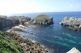
Je souhaiterais faire 4 ou 5 jours de randonnée en étoile en Juin 2020 dans le parc national des " Picos de Europa " en Cantabrie. Quelqu'un peut il me…
Quelqu'un a-t-il fait le Camino du Levante? Je suis intéressée par tous les renseignements concernant ce Chemin en particulier sur les hébergements. Merci…
Quelqu'un a t il fait l'ascension du POSETS depuis refuge de Viados en revenant par col d'Eriste cette année? Faut il les crampons cette année? (il a peu neigé…
Bonjour,
Nous souhaitons faire le trek de 4 jours reliant Mestia à Ushguli sans agence. Il est précisé dans les descriptifs qu'il existe des hébergement à chaque étape, mais on ne trouve pas d'info sur ces hébergements. Quelqu'un a-t-il des infos et un avis sur ce parcours?
We're planning to trek in Peru and Bolivia and would love to find some local agencies.
If you know any, could you share details on prices and, of course, the names of the agencies?
Which trek would you recommend?
Elocine
Je pars en autonomie totale sur un trek au Maroc (10jrs) Imilchil - Aghbalou.
Trouve t-on des cartouches gaz à vis (Coleman, Primus) à Marrakech (adresse) ou villages entre Imilchil - Aghbalou ?
Si non , trouve-t-on des cartouches Butagaz pour camping-gaz (petit volume 230 gr ...)
Merci d' avance pour vos réponses
Hello, I’d like to embark on a little trip in my home country, Switzerland. I’ll start walking from La Cure, heading toward Le Noirmont first, then I’ll improvise my route—but it’ll probably follow the French border... at least as far as Lac de Joux.
I’ll decide day by day how much farther to go after that. My goal is to stay in nature as much as possible, wander around for as long as I can, and restock food in villages or towns along the way.
I’m thinking of mostly camping, but we’ll see if I end up in a hotel or another campsite depending on my route.
I’d love to reach La Chaux-de-Fonds on foot... maybe even Delémont.
The whole thing should take about a week, give or take.
I’ll be bringing my dog, and I’m preparing for this as soon as I’m ready.
Any tips to make sure everything goes smoothly for us? Things I should know—or avoid? What about shepherds with their flocks of sheep? And isn’t hunting season open right now?
I’m not sure if what I’m planning is even doable, which is why I’m asking around.
This’ll be my first time doing something like this—wandering in nature *and* with a dog. I’m really excited for this adventure... and I need it. Thanks!
We’re really keen on ecosystems and want to hike in "natural" ancient forests—not planted woods or areas heavily degraded by human activity. Travel guides (like Lonely Planet) don’t provide much info on this. Could you point us to the most interesting spots?
Thanks in advance for your tips.
We wish you happy holidays and a fantastic 2026, full of discoveries!
Claire and Albert
Hi, this might not be the right section, but I’d like to know if it’s possible to start mountaineering with another person without necessarily hiring a guide. We’ve done quite a bit of hiking but not mountaineering—we’ll just do a half-day glacier course. After that, we were thinking of starting with La Grande Motte and the Pointe de la Traversière, which were recommended to us. Honestly, for things like roping up and knots, I’ll learn at home with lots of videos and a book.
Hi,
I don’t know Switzerland at all and was wondering if Vallée des Joux and especially Dent de Vaulion are packed early in the morning or late in the afternoon in July and September?
If so, do you have any quieter spots to recommend in the area, or in Luxembourg (yes, I know it’s not the same country 😉)?
Thanks a lot!
Jaimerais savoir si quelqu'un aurait fait des treks sur le Ruwenzori et combien ça coute en moyenne, les infrastructures, les paysages la sécurité sur les lieux, merci beaucoup. J'attends avec impatience vos réponses.
We’re leaving in 9 days for a two-week trip to Madeira, mainly to hike.
From my research, I’ve found that since last year, access to most trails—and systematically for the most popular ones—is now paid. You have to pay an access fee of 4.50 € per person per classified hike in 2026, and even 10.50 € for the most iconic hike: Pico Arieiro to Pico Ruivo. When paying, you also have to choose a day and a 30-minute time slot for your start time. Of course, this reservation is neither changeable nor refundable, even if the weather that day is terrible.
Personally, given the massive influx of tourists to the island in recent years, I don’t mind paying a fee to help maintain the trails. Similarly, setting a limit on the number of people who can hike them per day is certainly preferable to preserve this priceless heritage.
However, what’s much less fair is that in reality, most of the available spots are reserved: 1/ for Madeira residents (which is normal); 2/ for "economic operators" (meaning local tour operators). For example, if you’re a non-resident (independent tourist), no booking is possible for the Pico Arieiro hike for an early morning start before September! So, unfortunately, we’ll have to skip this hike.
It’s the same issue for Ponta de São Lourenço, the 25 Fontes, Pico Ruivo... in short, all the most popular hikes. Oh well, we’ll skip those too!
So my question is: which hikes do you recommend where we won’t face the huge crowds that the others get? And where we can book the day before for the next day, taking the weather into account?
Finally, a quick accommodation question: we’ve booked the first week in Funchal, but I haven’t decided yet for the second week. Do you have any advice on where to stay in the south or north, preferably avoiding overly concrete-heavy and touristy spots?
I’m reposting about the logistics for Samaria Gorge.
I’d love to get recent info, especially about whether it’s possible to park my car in Omalos, do the hike, and then catch a bus back to my vehicle.
In theory, it’s doable, but when you check the KTEL website, there aren’t any feasible schedules listed. If anyone has recently organized this with reliable, verified details, I’d really appreciate it. Thanks in advance!
Hi there,
We’re flying from Montreal to Lyon this August to go hiking in the French Alps. We’ve rented a car and will be staying at campgrounds. We’re planning to do day hikes and want to stay a few days in one spot, do a few hikes, then move on to our next camping spot. Could you share your favorite spots or any recommendations for places to spend a few days with great hikes?
A few details:
We arrive in early August and leave in early September.
We’re looking for day hikes (or shorter), moderate difficulty, with a cumulative elevation gain of no more than 1000m, and of course, beautiful scenery!
We’d prefer not to drive too much—maybe it’s best not to head too far south and deal with unnecessary heat?
Along the same lines, if you know of any great campgrounds where we can start our hike directly without needing the car, we’d love to hear your suggestions!
Bonjour
Souhaitant faire de la randonnée sur cette île, je voudrais d'abord savoir quelle serait la période la plus favorable sachant que j'avais passé quelques jours en novembre 2018 pas pour cette activité mais plus pour une simple découverte de l'île et le temps n'était pas top notamment en montagne. Donc peut on choisir une organisation en étoile sachant que je louerai un véhicule avec éventuellement 2 points d'hébergement.
Je n'envisage pas d'intégrer une structure mais de partir à 2 et de s'organiser sauf si vous me conseillez une agence locale ou un guide local. Enfin même si je compte me procurer les différents supports, carte et topo guide plus gps je vous remercie de bien vouloir me communiquer les randos à faire en priorité
Merci beaucoup pour vos informations
I’m planning to do the Mercantour crossing following the Randoxygène route in mid-July.
I’m used to hiking in the mountains, but I sometimes get vertigo, for example on ridges with drops on both sides. I wanted to check if there are any T4 or T3-T4 sections and find out if there are any very exposed passages—and if so, where—so I can plan an alternative route.
Can anyone give me some info on this?
Thanks!
I’m planning a trip around Cap Corse and the AGRIATES in 2026, from May 8th to 15th (there are still 2 spots left, by the way! Just DM me if you're interested).
I’d love to know which hikes are worth prioritizing in the AGRIATES. We’ll be staying in SALECCIA for two days as our base—what should we focus on from there?
A round trip to IGNHU beach? Any other suggestions?
For Ostricano, I think it’s too far for a round trip...
Thanks for your tips!
Have a great day,
Anie, Toulouse
I’d like to get some info about the GR10 Pyrenees traverse. I need help planning the daily stages and accommodations—my wife isn’t an experienced hiker but walks a lot, so I’d like to schedule shorter walking days and thus a longer overall trip in terms of number of days.
Could anyone give me some help and advice?
Best regards,
New to this forum, I’m planning a pretty big project for 2028.
I’m heading to Nepal to do a trek from Kathmandu all the way to Everest Base Camp (a cool 5,300 m 😄).
This trek is a bit special because even though I’ll be part of a group, I’m going solo (so far, no problem—I’m used to it). But it’s my first real trek, and it’s also a humanitarian one: once I reach base camp, I’ll stay an extra week to help clean up the waste left by tens of thousands of climbers! Since I’m originally from South America, from two countries that share the Andes, I have a deep respect for mountains—they fascinate me. So Everest… it’s kind of the trip of a lifetime!
So, a little question for those who’ve done treks to Everest before… any tips for good mental preparation (I’m already working on the physical side)?
Hi there, I’m planning the Annapurna Circuit for March 2027 and I’m looking for a local agency with a local guide—preferably French-speaking—to arrange this trek for us. Any suggestions? Thanks
Hello!
We’re spending a few days in Toraja country at the end of May. We’d love to do a day trek—taking our time—on a route that’s stunning in terms of scenery, but not a level 5 in difficulty!
Any suggestions you can share, please?
Thanks in advance
I’d like to do the Mare a Mare Sud in May over 4 days. I’ve found quite a few places to stay along the route, but I’m stuck on the start and finish.
I’ll be arriving by plane on Sunday evening and would like to start pretty early on Monday morning. Ideally, accommodation right at the trailhead (Alzu di Gallina) would be amazing, but I can’t find anything. Any tips?
Also, for the transfer from Figari Airport to Porto Vecchio or Alzu di Gallina?
At the end, I’d like to pick up a rental car—any advice on that too?
I’m traveling solo by plane to Catania in May and plan to hike the northern side of Etna, starting from Linguaglossa where I’ll arrive by bus. After that, I’d love some info on how to get up to Piano Provenzana (shuttles or hitchhiking), since it seems there’s no public transport except in the summer. Can you sleep there in a free or cheap refuge, or camp? And how far up can you go without having to hire a guide? Thanks in advance. Bernard.
Bonjour a tous,
je pars en voyage au Maroc en aout et nous allons commencer par nous arrêter a Chefchaouen(nous sommes en voiture).
Ma question: quelqu'un peut il m'indiquer un itinéraire de rando en boucle d'entre 5 et 7 jours aux départ de Chefchaouen dans le parc de Talassemtane passant si possible par le pont de dieux?Ou un guide papier qui en reunis quelques uns?
Nous privilégions le camping sauvage et les gites.
Merci d'avance
Hi there, for those who’ve been recently—is it possible to find other solo travelers in March on the island to share transport or room costs? It doesn’t seem easy to travel on a budget.
If you have any recommendations for simple lodgings or places with dorms, I’d love to hear them.
For those who’ve done multi-day treks while moving around: do you need to bring your own sleeping bag? I’d love to hear about itineraries you’ve done without a guide, just with a map and GPS.
Thanks, and have a great day!
Hi everyone!
We’re planning a 15-day road trip to Scotland this summer, specifically to explore and hike on Lewis and Harris—places we’ve never been before. We’ve visited other islands on previous road trips in Scotland (we usually go in April for a week). This would be our first time in Scotland in the summer and for 15 days. We’re looking at late August to early September.
I’m currently drafting the itinerary. We’d be crossing from Ullapool and were thinking of spending 3 nights on Harris and 4 nights on Lewis.
Does that sound balanced to you? Is it better to keep the same accommodation on Harris and the same on Lewis to explore the area? I’d love to hear about any past experiences you’ve had on these islands.
Thanks!
Hi there, I’m trying to leave for 15 days very soon to São Vicente. I’m either looking to join an agency or figure things out on my own to go hiking on one of these islands or both. From what I’ve seen, it’s not easy to organize with local transport, so it gets expensive. Can I use the services of a small local agency? I’m looking for the simplest way to hike for several days. Also, how do you get from São Vicente to São Nicolau? Thanks in advance and have a great day!
Aichatou
I’ve been wanting to do this for several years, and this year’s the one. Next September, I’ll be trekking in Tusheti (Georgia), from Omalo to Shatili.
Of course, I won’t be renting a vehicle that’d just sit unused. No problem getting to Pshaveli, but from there to Omalo, it’s a dirt road (still the case?)
There must be some form of public transport since there are so many guesthouses, and not all travelers come in a 4x4.
If any of you have been to Omalo, could you confirm that these shared transports exist and how often they run?
we’re planning a trip to Yellowstone and hoping to do a three-day backcountry hike if we get a permit.
if any of you have done this before, could you let me know if it’s possible to find water along the way? And if we can transport it, are we allowed to use a stove?
Hello,
I’ll be in Nepal from March 6th to 29th (we’re flying into Kathmandu via Varanasi and leaving via Delhi).
I’m a bit confused about the regulations requiring a guide.
My wife and I (we’re 63 and 64) aren’t experienced trekkers—we’re more used to walking on terrain with very moderate elevation changes. I’m looking for fairly easy hikes, possibly day trips.
Here are my questions:
- Does the Poon Hill trek from Pokhara require a guide, or is it better to go through a local agency? (I’ve seen a lot of them offering 4-day packages)
- I’d like to do a few multi-day hikes around Jomsom (Kagbeni, Mukitinath, Lupra, Marpha)... Do you need a guide for those, and can you find accommodations easily without booking in advance?
Last question—I’m really hesitant to lug around a sleeping bag or down jacket during our 6 weeks in India. Can you easily find these kinds of items at reasonable prices in Pokhara?
Thanks in advance for any tips you can share!
Yann
 Minorque, une île des Baléares préservée et authentiqueFR
 De la côte murcienne à l'Andalousie des sierras de JaenFR
 15 days in La Palma, a hidden gem with a thousand contrasts
 L'Andalousie en familleFR
 Séville, Cordoue et Grenade, une bulle arabo-andalouseFR
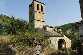
 Belle échappée de la Cantabrie aux AsturiesFR
 Aragon méconnuFR