Bonjour,
Manque de bol... je viens justement de prêter celui que je possède, du PN Lanín. Très intéressants ces bouquins, en effet, surtout en l'absence de GR et de cartes dignes de ce nom ! Après une petite recherche je viens de me rendre compte qu'ils étaient disponibles sur http://www.guiasendasybosques.com.ar/ - mais pour l'envoi en Argentine uniquement. Mais j'ai un ami qui pourrait me les envoyer en Belgique. Je vous propose donc de faire votre choix sur ce site, de me dire ce que vous désirez, et je vous les commanderai. Dès que je les recevrai (compter min. 3 semaines) je vous les ferai parvenir, au prix coûtant (valeur peso/euro du jour) + frais d'envoi de Belgique en France. Vous n'aurez plus qu'à me rembourser à la réception, par virement (gratuit car zone Euro)
A bientôt peut-être !
C'est super sympa.
En effet, j'avais reperé leur site web, et j'ai vu qu'ils ne livraient qu'en Argentine.
Donc pour le trajet Argentine-Europe c'est minimum 3 semaines, et maximum...? (je pars fin septembre, donc à priori pas de panique non plus). Je n'arrive pas bien à me rendre compte sur leur site, les Mapas (ce sont celles là qui m'interessent, et pas les Guias) sont des simples cartes dépliantes, ou de petits bouquins avec une carte à l'interieur - c'est pour avoir une idée du poids et de la richesse des infos? Est-ce que les campings sont indiqués avec le détails des services disponibles? Je vois aussi "Con indicación de [...] sitios de observación de aves...", çà çà m'interesse pas mal!
A la limite je pourrais même vous virer l'argent d'abord et me faire envoyer les cartes directement en France par votre ami - ou bien vous avez déjà du courrier en provenance de là-bas auquel çà s'intègrerait? Je vois qu'avec Correos Argentinos il y en aurait pour une cinquantaine de Ar$. A priori je prendrais les trois mapas des parcs (ou eventuellement les guias si elles offrent quelque chose de plus par rapport a LP + mapas).
Je compte passer environ trois semaines entre Junín et Esquel, si vous connaissez bien les parcs et les possibilités de randonnées, j'aurai des tonnes de questions a vous poser!
Bonjour à nouveau,
Effectivement il s'agirait d'intégrer ce colis à un envoi existant, donc il ne m'est malheureusement pas possible de faire autrement... mais normalement en un mois cela devrait pouvoir se faire.
Les 'mapas' sont des cartes à déplier au 1:200.000, et reprennent bien les sites d'observation d'oiseaux, les campings etc. Les guides reprennent les mêmes cartes, mais découpées et au 1:150.000, en plus d'une foule d'infos concernant la faune, la flore, l'état des sentiers etc. En ce qui me concerne le guide PN Lanín m 'a bien servi pour faire une super balade en famille, dans les environs de SMartín de los Andes, jusqu'au sommet du Cerro Colorado, et d'autres petites balades autour du lac Lácar. Cette année j'ai participé au trail 'Cruce de los Andes' (lire mon expérience sur axandes.eu si cela vous intéresse) et j'ai pu constater que les organisateurs nous faisaient passer par des sentiers repris sur ces guides. A ce moment je me suis rendu compte qu'il est fort aléatoire de s'aventurer seul dans ces parcs, même avec ces guides/cartes, à moins de comprendre l'espagnol et les infos données en plus des dessins sur les cartes... Faites donc bien attention de lire scrupuleusement les infos, et emportez une boussole, on ne sait jamais... En cas de doute, rebroussez chemin et refaites éventuellement la balade avec un guide (je peux vous fournir des adresses via message privé si vous le désirez) - à bientôt !
Benoît
Je me demande si 1:200.000 c'est pas un peu juste pour de la randonnée...
Je pensais juste acheter les cartes - moins lourd a emporter en ballade que les guides - mais je crois qu'en définitive je vais prendre les guides pour préparer mon voyage, et j'acheterai ensuite les cartes sur place si necessaire (et je laisserai les guides en ville). Je crois que de toute façon je devrai compléter toutes ces informations auprès des guardaparques une fois sur place.
J'aurai un GPS et une boussole, et je viens de passer un peu de temps a essayer de trouver des cartes topo de la région pour Garmin. Ça n'a pas l'air évident, mais j'ai peut-être repéré quelque chose ici.
J'y serai en décembre, et ce que j'aimerais vraiment faire serait plusieurs circuits de quelques jours dans les différents parcs, de camping a camping, si possible bien équipés et pas trop distants les uns des autres (3-4h max.), de façon a bien profiter des lieus aux meilleures heures de la journée. Je me demandais entre autre s'il y a des endroits dans le parc ou l'on peut se ravitailler, pour ne pas avoir a emporter trop de nourriture. J'ai vu qu'il y avait quelques hosterias le long de la route des sept lacs, mais je ne sais pas trop ce qu'il en est dans le reste du parc - j'espere justement trouver ce genre d'information dans les guias.
OK, l'idée d'acheter les guides maintenant et les cartes sur place me paraît bonne. Malheureusement il n'est pas possible, à ma connaissance en tout cas, de se procurer des cartes plus précises - à moins que de pouvoir se procurer des cartes d'état-major, mais souvent elles datent des années 50 (dixit les organisateurs de trails comme LaMisión ou la Pachamama) !
Des campings après 3 ou 4 h, cela me paraît utopique, mais comme ils sont en général en bord de parcs, et en pratiquant le stop...
Ne pas oublier que les distances sont immenses ! Il paraît qu'il existe une application 'Amérique du Sud' pour IPod qui n'est pas mal, mais je n'ai pas testé... et puis il faut déjà posséder cet appareil. Je serais intéressé de savoir ce que cela donne avec Garmin...
Les campings le long de la route des 7 lacs sont vraiment dans des endroits enchanteurs (http://www.sanmartinandes.com/campings/index.htm) et je conseille particulièrement d'aller voir du côté de Villa Traful, c'est tout simplement magnifique -mais il y a certainement des endroits que je ne connais pas, tout aussi beaux, tellement la région invite à s'émerveiller de la nature. Autre URL, avec listes des campings et 'mode d'emploi' : http://www.tresparques.com.ar/camping/
Dans le guide Lonely Planet Trekking in the Patagonian Andes, tu as des descriptions detaillees de pas mal de treks avec des cartes.
Tu peux aussi acheter les cartes topographiques a l'IGM a Buenos Aires.
Pour le reste tout depend des treks que tu envisages. Sur la traversee du PN Huapi a Bariloche, il y a des refuges mais sinon c'est un trek difficile, extremement raide.
A El Bolson, il y a un grand nombre de refuges.
Le Paso de los Nubes est une rando assez facile.
Dans le PN Lanin, tu peux aller en bus au parc Huechulaufquen et faire des ballades a la journee. Sinon, bon trek facile par le lac Escondido et les sources chaudes de Queni de San Martin a Hua Hum au Sud du lac Lacar.
Pour sortir des chemins battus, il y a une bonne rando qui relie les lacs au-dessus d'Alumine.
Enfin, une marche (possible dans la journee) vraiment formidable, c'est la Laguna Termal et le sommet du volcan Copahue, un peu plus au Nord.
J'ai fait toutes ces randos personnellement.
Dans le guide Lonely Planet Trekking in the Patagonian Andes, tu as des descriptions detaillees de pas mal de treks avec des cartes.
Je l'ai, mais je regrettais déjà de l'avoir commandé avant même de l'avoir reçu 😕 : pour le trajet que je veux faire (1 mois Nord-Est, 1 mois NOA, 1 mois Lacs + peut-être Los Glaciares), j'aurais dû me douter qu'il n'apporterait pas grand chose de plus, par rapport au poids supplementaire, que le Lonely Planet + Rough Guide, sachant que je ne vais pas au Chili et que je ne souhaite pas faire que du trekking. Mais bon, j'ai un faible pour les guides (papier)...
Tu peux aussi acheter les cartes topographiques a l'IGM a Buenos Aires.
Oui, çà peut être une bonne idée, a quelle échelle sont-elles, et les chemins de randonnées y sont-ils indiqués?
Au fait, quelle est la situation en décembre, au niveau logement et prix? Je lis partout que janvier et février sont très chargés, mais les Argentins ne sont pas déjà en vacances avant Noël? Çà risque d'ètre un peu la cohue dans les refuges et la galère pour trouver des hotels a petits prix, ou ça passe encore?
Sinon, dans l'idéal j'aimerais passer plusieurs jours dans ces parcs, en bougeant ma tente de camping a camping, sans avoir a prendre toute la journée pour le déplacement (j'aimerais bien profiter du matin et du soir pour tourner autour du campement sans bagages pour explorer la zone tranquilement), sans chercher a faire des sommets - je préfère rester près de l'eau et de la forêt, et sans avoir a trimbaler plusieurs jours de provisions: je lis dans le Rough Guide qu'il y a des "épiceries (?)" dans le parc Nahuel Huapi qui permettent justement de se ravitailler au fur et a mesure, est ce qu'elle sont répandues ou juste dans des zones très spécifiques? Est-ce que c'est çà les proveedurias? Et pourrais tu aussi me traduire fogones stp?
Dans le PN Lanin, tu peux aller en bus au parc Huechulaufquen et faire des ballades a la journee.
Çà me va super! Aurais-tu des spots de camping a me recommander, dans toute cette régions des lacs, chacun susceptibles de me tenir occupé pendant trois-quatre jours sur place, a pied en vélo ou à cheval (sans transports motorisés, quoi)?
j'ai quelques cartes ( modestes surement pas topo!) mais qui peuvent t'aider, me semble-t-il
Si tu veux q je les scanne et les envoie, donne moi ton mail perso à mon adresse perso: nicole.brondy@wanadoo.fr car je ne vais pas pouvoir les envoyer de bonne qualité sur le forum.
Nicole
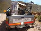
Asso. Les Enfants d'Atacama (aide à la scolarisation dans les Andes Argentines- Prov. de Jujuy: San Juan de Quillaques; Puesto Sey et Huachichocana
Les sites pour jeter un oeil:
http://pagesperso-orange.fr/fal83http://brondy.free.fr
Les cartes IGM , cela depend des regions. Pour la NOA il n'y a qu'une vieille carte au 1/200000e mais j'avais aussi achete une carte pour Alumine et elle etait bien meilleure, mais j'ai oublie si c'est du 1/50000 ou 1/100000e. Si tu passes une journee a Bs As au debut du voyage, tu peux te rendre facilement en metro a l'IGM et voir les cartes toi-meme.
Les vacances en Argentine commencent a Noel. Moi en haute saison je ne fais plus que du camping. Les hotels bon marche, en Patagonie, cela a quelque peu disparu (cela existe encore dans le Nord). Bon, dans la region des lacs, il y a un grand avantage, beaucoup de bus locaux par ex. pour Hua Hum et le lac Huechulaufquen existent seulement en haute saison.
Fogones: c'est un endroit ou tu peux faire un barbecue.
Proveeduria: c'est en effet un endroit ou on vend de la nourriture (souvent peu de choix) dans un camping ou un refuge.
La tu parles sans doute de Pampa Linda au pied du mont Tronador, bel endroit en effet. Et aussi au lac Huechulaufquen (en fait il y a au moins 5 campings. Tu prends le bus depuis Junin jusqu'au terminus, la tu as un camping en traversant le lac, et un autre vers le N-O a 1 ou 2 kms). AU lac Rucachoroi, pres d'Alumine, aussi chouette camping, mais pas de transport public pour y aller (mais hors des foules de touristes). Et aussi tu peux camper autour des refuges au dessus de El Bolson.
Dans le Nord Ouest, tu as de belles randos aussi. Et ailleurs dans le Nord, tu peux camper dans les parcs nationaux, comme Chaco et Palmar.
i tu as encore des questions, je reponds encore demain mercredi mais apres je suis en voyage.
j'ai quelques cartes ( modestes surement pas topo!) mais qui peuvent t'aider, me semble-t-il
Si tu veux q je les scanne et les envoie, donne moi ton mail perso à mon adresse perso: nicole.brondy@wanadoo.fr car je ne vais pas pouvoir les envoyer de bonne qualité sur le forum.
Avec plaisir!
Mais ne te donne pas trop de mal quand même, je viens de trouver une carte topo pour Garmin ici. Il faut s'enregistrer sur le site d'abord, puis attendre la validation (çà prends a peu près un jour), ils ont une carte topo Argentine-Sud Chili qui m'a l'air très détaillée. Je viens de la charger sur mon GPS, je peux voir pas mal de campings autour de la région des lacs 😎, les courbes de niveau évidemment, les cours d'eau et même quelques sentiers me semble t'il. J'ai hâte de voir ce que çà va donner sur le terrain!
Chaco et El Palmar, c'est déjà programmé! 😎 (et Calilegua aussi)
Il y a un autre parc que j'aimerais visiter, c'est El Rey, mais çà a l'air plus difficile par soi-même (je préfere rester au moins deux-trois jours par endroit, et aux bonnes heures de la journée, donc je n'aime pas trop les tours - et puis c'est plus cher aussi). J'ai trouvé cet "eco-lodge" sinon, qui pourrait être une alternative au parc, si quelqu'un d'entre vous a eu des échos çà m'interesserait.
Sinon, est-il nécessaire d'emporter un réchaud à gaz? Je lis qu'il est souvent interdit de faire du feu dans les parcs, mais ces fogones servent bien à çà, non? Et le bois s'achète sur place, ou se ramasse? Ou bien l'interdiction ne vaut que sur les sites de campings non aménagés?
Les balades autour d'El Bolson sont hors du parc Lago Puelo pour la majorité? Ce sont des balades aller-retour depuis El Bolson? Et est-ce que c'est aussi "sauvage" que dans le parc?
A la vue de ce que tu me dis qu'il y a sur les cartes....les miennes sont ridicules!!!
Bon, ça partait d'un bon sentiment mais c'est tou!!!!
Bonne découverte dans cette région superbe!
Nicole
Asso. Les Enfants d'Atacama (aide à la scolarisation dans les Andes Argentines- Prov. de Jujuy: San Juan de Quillaques; Puesto Sey et Huachichocana
Les sites pour jeter un oeil:
http://pagesperso-orange.fr/fal83http://brondy.free.fr
Pour moi, un rechaud c'est indispensable. Tu ne vas quand meme pas allumer un barbecue pour te faire un cafe ? Tous les campings en Argentine ont des fogones, a mon avis, pour les Argentins c'est vraiment essentiel. Mais moi je ne les utilise jamais.
Les refuges au dessus d'El Bolson, c'est dans la montagne boisee, c'est tout a fait sauvage. C'est trop loin du village pour des ballades a la journee. Par contre, il y a des campings au pied meme de la montagne.
El Rey, je n'y suis pas alle. Je suis alle a Calilegua, mais c'etait un peu decevant a mon avis. Plus interessant dans la region, aller dormir a San Isidro, 2 heures a pied d'Iruya (qui est trop touristique a mon sens), de la marches possibles par ex. San Juan.
Tres chouette, sans aucun touriste, les villages de Nazareno et Santa Vittoria Oeste, atteignables depuis La Quiaca (au marche, minibus pour Nazareno, camions pour Santa Vittoria). Les routes pour y aller sont exceptionnelles. C'est tout a fait semblable a la Bolivie par la.
Pour la Quiaca etc..., je pense qu'on ne tentera pas (on a un mois pour le NOA mais j'ai envie de dire qu'on "aura pas le temps" - j'ai l'impression que ça ferais beaucoup de temps de transports par rapport au temps sur place), et Iruya me semblait déjà à mi-chemin du bout du monde.
Une petite hésitation: j'aurais bien loué une voiture pour la Quebrada de Humahuaca, mais vu que je compte rester quelques jours a Iruya pour faire quelques balades justement, je n'ai pas trop envie de payer pour la laisser garée à m'attendre... 🤪.
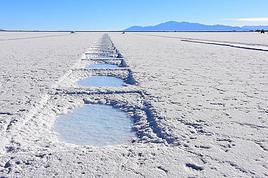
En quoi consiste la visite des Salinas au nord de San Antonio des Los Combres? Ça s'admire de loin, depuis la route, ou bien il y a de quoi se promener dessus? En général on reste combien de temps sur ce(s) site(s)? J'essaie de juger si ça vaut la peine de louer une voiture/un taxi/prendre un tour pour faire la boucle Qebrada de Toro-Salinas depuis Salta.
Si tu as encore le temps de me répondre, pourquoi as-tu été déçu par Calilegua? Personnellement, j'y serais allé pour voir un maximum d'oiseaux de la yunga.
Et sinon... bon voyage!
Bonjour,
Nous allons avec ma femme au Brésil du 6 Novembre 2 Décembre. Nous allons faire des étapes à Sao Paulo, Paraty, Ilha Grandé, Rio et Salvador de Bahia.
Auriez-vous des adresses de lieux d'hébergement sympathiques, non luxueux pour chacune de ces étapes.
Auriez-vous également des idées d'endroits à visiter.
Je vous remercie d'avance de votre collaboration.
Marc
Bonjour.
J'ai déjà posté un message sur des renseignements au sujet de notre futur voyage au Chili.
Les précisions: Se déplacer en bus ou en train.
Partir de Valparaiso aller jusqu'au nord en passant par des villes et des lieux à visiter puis revenir à santiago en empruntant un autre chemin.
Éviter les plages ..
Merci
Hello,
my wife and I will be in Cusco for a week in March 2027.
I’d like to organize the visit to the site on our own, combining the Sacred Valley and Machu Picchu.
We’d leave Cusco on Day 1 to arrive at the site in the morning, then stay in Aguas Calientes or Ollantaytambo, and on Day 2 return to Cusco while visiting the Sacred Valley.
Is this doable?
Looking forward to hearing from you.
Cédric.
Hi everyone,
We’re planning 40 days in Uruguay and Argentina in February and March, trying to avoid as much rain as possible.
We’re thinking of starting in Buenos Aires, then heading to Bariloche, and from there flying to Córdoba, Mendoza, or Salta. Maybe by bus or renting a car to explore each region.
Do you have any suggestions or tips for us? We love picturesque, historic cities and landscapes. As seasoned travelers, we’re used to planning our trips ourselves.
Thanks in advance!
Hello,
We’re spending 3 weeks in Rio between February 20 and March 15, 2027, to visit our son and daughter-in-law. We’re thinking of one or two "escapes" from Rio—3-day trips to get away from the city (so not too far, max 3–4 hours by car or bus). We’re all ears for suggestions! We love beautiful nature and authentic experiences, not so much the touristy spots... even though those spots are often in beautiful places, we’d rather avoid them.
Thanks for your insights!
Catherine
Hello,
we’re arriving in Fortaleza on February 14, 2027, and planning to rent a car to drive to João Pessoa in two stages. We’ll leave from there on the 20th or 21st to head to Rio. Our questions:
- Which stop between Fortaleza and João Pessoa would be the most enjoyable?
- How long does it take to drive from Fortaleza to João Pessoa?
- Are there any easy hikes (no guide needed) around João Pessoa?
Thanks for all your replies—I’m hoping for lots!
Catherine
Hi there,
I’m planning a trip with my partner (no kids this time—thanks, Grandma!) for two weeks to celebrate her 40th birthday. I’ve been thinking about Chile. We’re looking at leaving around September 18, 2027, starting in the south and returning in early April.
Here’s what I had in mind:
8 nights in a van in the Lake District and the start of the Carretera Austral (up to the Chaitén area). We’re set to arrive in Puerto Montt around 2:00 PM. We don’t want to go too far south since we’re planning to explore the heart of Patagonia (Chile and Argentina) with the kids when they’re older. The idea is to spend 3 nights discovering the lakes (up to Cochamó) and 3 nights in Pumalín Park. I’ve also added two transition nights.
7 nights in the Atacama to experience another side of Chile (San Pedro), taking a domestic flight from Puerto Montt to Calama in the early afternoon. We’ll depart for France in the early evening from Santiago.
IMPORTANT NOTICE for those planning to take a bus to another city, state, or destination from Salvador!
Starting January 20, 2026, the intercity bus station Rodoviária is changing its address!
The Rodoviária is leaving the Iguatemi area and will now be located in ÁGUAS CLARAS (about twenty kilometers from downtown Salvador).
A brand-new station (the most modern in Brazil) has just been set up there, accessible by car/taxi/Uber/metro.
Allow for much more transfer time (especially during rush hours), so leave early if you're heading to Chapada Diamantina or other Brazilian cities by bus.
Remember, there are also private transfers (even French-speaking ones) that can take you directly from your hotel in Salvador to your hotel in Chapada. Sure, it’ll be more expensive, but you’ll save on transfer time and comfort.
Tropical greetings from Salvador,
@ivanbahiaguide
Loyal member of the French-Speaking Brazil Forums for over 15 years already 😊 🇧🇷
Hello,
We’re thinking of spending 1 month in Chile, maybe doing a loop?
From 12/23 to 01/22.
What are the must-see sights, given we’re more interested in the country’s cultural side than the beaches?
Thanks
Hi everyone,
We're planning a trip to southern Chile in November. Here's our tentative itinerary:
Day 1: Arrival in Santiago, then a flight the next day to Balmaceda where we'll pick up a rental car to reach Coyhaique.
Day 3: Walk in the Coyhaique National Reserve, then continue to Puerto Chacabuco. Return to Coyhaique for the second night.
Day 4: Drive to Villa Cerro Castillo for a hike in the national park. Continue to Puerto Tranquilo and stay there for 3 nights.
Day 5: Boat tour on Laguna San Rafael.
Day 6: Day trip to Monte San Valentin Glacier.
Day 7: Excursion to the Marble Chapels, then drive to Puerto Guadal. We'll stay there for 3 nights.
Day 8: Walk along Lago Carrera and return to Puerto Guadal.
Day 9: Rio Baker Valley and, if possible, a glacier excursion.
Day 10: Drive to Cochrane and hike in Tamango National Reserve. We'll stay 2 nights in Cochrane.
Day 11: Walk in the Chacabuco Valley.
Day 12: Drive to Caleta Tortel. We'll stay there for 2 nights.
Day 13: Cruise in the Rio Baker delta.
Day 14: Return to Cochrane.
Day 15: Return to Balmaceda in two stages.
Day 16: Continue the return journey.
Day 17: Return the rental car and head back to Santiago.
After this, we're also planning to explore northern Santiago. I'll post about that part once I have a clearer idea of the route.
What do you think of this itinerary? Is it doable in 17 days?
Thanks in advance for your tips and recommendations.
martine
Hi everyone! So happy to be back on this forum—it’s packed with such useful info! 🙂 My husband and I are planning a 2.5-week self-drive trip to Colombia at the end of the year, including some domestic flights. My first question is: is it possible, easy, and safe to do a road trip in Colombia?
Below is our draft itinerary (with questions at each stop):
29/11: France → Colombia. Overnight in Bogotá.
30/11: Exploring Bogotá: La Candelaria and Montserrate.
01/12: Gold Museum (closed on Mondays). Drive to Zipaquirá (1.5 hrs) to visit the Salt Cathedral. Then drive to Villa de Leyva (3 hrs). Explore the town. Overnight in Villa de Leyva.
02/12: Return to Bogotá via Laguna de Guatavita (5 hrs). Is it worth the detour? Overnight in Bogotá.
03/12: Flight to Pereira. Drive to Salento. Overnight in Salento.
04/12: Cocora Valley (hike among the wax palms) followed by a drive around the area. Are there any waterfalls or other sights nearby?
05/12: Visit a coffee finca—any recommendations? Then explore the surroundings: Filandia, Manizales, waterfalls? Hot springs? Which ones?
06/12: Flight to Medellín.
07/12: Exploring Medellín: Centro, Plaza Botero, Comuna 13. How do you visit Comuna 13? Is it easy to get around Medellín? Metro? Buses?
08/12: Drive to Guatapé (2 hrs). Visit the town, stroll around the lake, then El Peñol. Overnight in Guatapé.
09/12: Return to Medellín.
10/12: Flight to Santa Marta. Drive to a hotel near Tayrona Park.
11/12: Tayrona—El Zaino entrance.
12/12: Tayrona—Palangana entrance, then Bahia Concha and Santa Marta. What do you think?
13/12: Drive to Minca (45 mins). Can we reach the village by car? Pozo Azul and Marinka waterfalls. Overnight in Minca (or back in Tayrona?).
14/12: Drive to Puerto Nao (5 hrs). Stop in Ciénaga on the way + boat tour in Nueva Venecia and/or Buena Vista? Not enough time? Overnight in Puerto Nao.
15/12: Exploring Cartagena: Centro, Getsemaní, the walls + La Boquilla if we have time.
16/12: La Boquilla (is it really worth it?) if we didn’t have time yesterday, then back to the beach.
17/12: Return to France.
So, what do you think? Is this doable, or should we tweak it? Thanks in advance for your invaluable feedback and tips! 🙂
Hi there, I’ll be in Brazil from December 10th to the end of February.
I’ve sketched out a rough itinerary but I’m not sure how to arrange it—considering the climate, year-end holidays, and Carnival.
Basically, I’m thinking of the Amazon, the Northeast coast with Lençóis Maranhenses National Park (but skipping Chapada Diamantina),
Ouro Preto, Paraty, and Ilha Grande—but no Rio visit.
Is this doable in 3 months?
Which direction should I take for this itinerary?
Thanks in advance!
Hi everyone, does anyone know the agency Ventura Travel Agency (not ventura travel)? After lots of research and quotes, it’s the only one offering Uyuni at a reasonable price while meeting all the criteria: transfer to the border, private-room accommodation, and a very fair rate. Other agencies or guides either offer shared rooms, no border transfer, or prices that are way too high. But I’d love to hear some reviews about this agency. Thanks in advance!
Hi everyone,
We're planning a trip to Chile to visit the Atacama Desert and then head toward Putre, Lauca, Salar de Surire, etc.
Which would be the better time to go, April or November?
Is an SUV enough?
Looking forward to your tips!
Hi everyone, French travelers in Chile—what credit cards do you use for your various car rentals in the country? I’m traveling in September and was planning to switch my regular debit card (a VISA PREMIER in deferred debit mode) for the deposit guarantee.
My rentals are with Figal in Punta Arenas, Econautos in Arica, and Chilean Rent a Car in Temuco, and all of them want the deposit on a credit card. For me, deferred debit *should* work, but I’ve read comments saying the opposite.
How’s it actually working on the ground with these rental companies right now? Will a deferred debit card work, or not at all?
In France, banks don’t issue credit cards, right—or am I mistaken?
Hi everyone, is it still possible to travel in Ecuador outside the Amazon region? If so, do you have a reliable agency to recommend? All your recent experiences from the past few months would be greatly appreciated. Thanks so much
Hi,
We’re heading to Buenos Aires for 3 days in November and would like to do a guided tour of a few neighborhoods. There are "free" tours, but none in French. Does anyone have a guide to recommend so we can really get to know the city beyond just the architecture?
Thanks
Hi there,
I’m desperately looking for info on the schedules and routes of (shared) boats to visit the islands of Lake Titicaca.
From what I’ve found, there’s a *combi* (bus) that leaves from Puno to go to Llachon. Where do you catch it? What are the schedules and frequency? Does it take about 1 hour?
Then in Llachon, you can take a boat to Amantani (45 min). Same question—where do you check for frequency and schedule?
After that, from Amantani, boats go to Taquile and then Uros. Do you have enough time to visit the islands between two boats? Frequency and schedule?
The goal is to do this tour independently (no agency) over 2 days. Thanks for any tips you might have!
I just got back from a trip to Bolivia and wow—what a wake-up call. It’s not the easiest country, but it’s absolutely stunning.
I started with Isla del Sol, perfect for easing into the altitude at a relaxed pace. Try to stay in the northern part of the island—it’s quieter and the views are insane. And the trout there? Unreal. Quick tip: bring cash in small bills; they almost never have change, and cards are rarely accepted.
Next up, La Paz. The city’s pretty wild, built in every direction. I did a few hikes in the area, including the famous Charquini Lagoon (the blue lake) at over 5,000 m—let’s just say I struggled 😅 but it was so beautiful it was totally worth it.
After that, I headed to Sajama. It’s cool, especially for the hot springs, and I stayed in Tomarapi. But honestly, if you’re short on time, you can skip it without too many regrets.
The highlight of the trip: the Salar. I did it starting from Tupiza, and I *highly* recommend going Tupiza → Uyuni. Way less crowded at the start and the landscapes are super varied. For the tour, I used SplitYourGuide to find a group, and it worked out great. Super handy for splitting costs and meeting people.
I wrapped up in Sucre—this city is gorgeous, all white, with such a chill vibe. And the salteñas + ice cream? Next level 😋
Bottom line: Bolivia’s a bit rough around the edges, sometimes exhausting (shoutout to the altitude), but it’s 1000% worth it.
If you’ve got questions or need tips, I’m happy to help!
Martin
I was planning to go to Réunion and stay in half-board accommodation with non-professionals, but it seems that’s not really the custom there—or maybe my budget isn’t big enough.
So, since I’ve already traveled around Ecuador and Peru, I’m now looking at Argentina, especially for its mountains (like the ones in Réunion that tempted me, even though—frustratingly—I could only admire them from below).
I plan to get around by bus and don’t know in advance where I’ll sleep, so I won’t book ahead. If I like a place, I might stay for several days.
I know that in Chile, it’s easy to find half-board accommodation, but what about in Argentina?
I’d like to stay with locals in half-board without it being a professional setup. I’m not sure if this is common practice there. It’s up to me to find someone willing to host me.
What do you think?
What would be a fair price (keeping in mind that 40 to 50 € is the max I can spend on accommodation, breakfast, and dinner)?
Hi everyone,
We’re heading to Patagonia for three weeks in November, starting from Coyhaique in Chile.
We won’t have a car, and I’m struggling to find information about transportation options for a few parts of the itinerary we’d like to do:
1) From Perito Moreno (the town, near Los Antiguos), we’d like to travel down Ruta 40 to visit Perito Moreno National Park and then cross into Chile via the Paso Roballos (at the latitude of Bajo Caracoles) to reach the road to Cochrane. Without a car, it seems we’ll need to use private agencies to get to the national park—do you have any recommendations or suggestions? Also, does anyone know if it’s possible to cross into Chile via Paso Roballos (from Bajo Caracoles) without a rental car? That is, without having to go all the way down to El Chaltén or back up toward Perito Moreno/Los Antiguos, etc.?
2) The second stretch that seems a bit tricky (though still easier, in theory) is from Caleta Tortel to Villa O’Higgins on the Chilean side. Do we have to go back through Cochrane, or are there ways to get directly from Tortel to Villa O’Higgins?
3) Finally, we’d like to hike into Argentina (El Chaltén) from O’Higgins. Any recommendations for this? Do we need to go through an agency? What’s the estimated duration of the trek?
As you’ve probably gathered, we want to visit some off-the-beaten-path spots but don’t have a car, so we’re looking for the best possible compromises.
Thanks so much in advance for all your suggestions!
Thomas
Hi,
we’re planning a round trip from San Pedro de Atacama, Chile, to Salta, Argentina, in two months. On the way there, we’ll take the northern route via Susques, Route 27, then 52. But for the return, we were thinking of taking the southern route via San Antonio de los Cobres, Route 51, then 23. Is it similar to the northern route in terms of road surface? How busy is it, and are there gas stations? Basically, should we be worried about doing it in an SUV that’s supposedly 4x4 but has regular road tires and no second spare wheel, obviously...
I’ve seen that we can stop over in San Antonio de los Cobres.
Thanks for your feedback.
Raf.
Hi,
we’ll be in Calama at the end of March 2026, and I’m looking for a reliable car rental there for a 7-day road trip to Salta, Argentina. But I’m struggling with the car rental agencies in Calama because the reviews can be scary. I saw Gyg, which has great ratings, but I’m a bit wary (5/5 from 59 reviews—either the guy’s amazing or it’s fake...), but I can’t find any recent reviews on VF in general.
For Punta Arenas, I booked with Dachelet and didn’t have any issues with email exchanges.
Thanks in advance.
Raf.
I’m planning the trip of my dreams for next November—Chile!
I’d love to get your thoughts on my potential itinerary. I know it’s a big investment in terms of both time and money, so every bit of feedback, suggestion, or info helps immensely. Thank you in advance!!
1-Flight to Santiago
2-Explore Santiago
3-Explore Santiago
4-Bus from STG to Valpo (2h) + visit Valparaíso + night in Viña
5-Visit Valparaíso + bus back to STG (2h)
6-Flight to Calama + bus to San Pedro + explore and acclimate in San Pedro + car rental in the afternoon (+Chaxa?)
7-(Very early) Valle del Arcoíris + Laguna Cejar + Valle de la Luna
Good evening,
We’d love to go in November to enjoy some beautiful beaches for about two weeks, preferably around Bahia, as November/December seems like a great time.
We’ve already traveled to Brazil several times and know the south of Rio as well as the region between São Luís and Fortaleza, and Chapada Diamantina...
What advice would you give us: the south with Itaparica, Morro de São Paulo, Boipeba, Barra Grande—or all four? Or maybe the north?
Thanks in advance for your help
Hi everyone, it’s been a while since I last posted!
First time in South America for me, my wife, and our 7-year-old son. I’ve put together this itinerary and would love to hear your thoughts:
Bogotá 28/07 – 30/07: Arrival. Which neighborhood and outings would you recommend?
Flight to
2 Filandia 30/07 – 03/08: (255 €). Waterfalls and horseback riding,
Cocora Valley,
Hiking,
Nearby villages.
Flight to
3 Tayrona 03/08 – 07/08: Hotel La Casablanca
Hike with Tierra Nevada and the Kogui village (any feedback?). Return by inner tube for the little one.
Short night hike.
Second hike to La Piscina, etc., return by 🐎.
4 Cartagena 07/08 – 10/08: Air-conditioned bus.
Staying in Getsemaní? Mangroves & the Castle, exploring the city.
5 Bogotá 10/08 – 12/08
Feel free to share your feedback!
Have a great day!
Hi,
During an upcoming trip to Peru, we’ll have one day to explore around Arequipa (excluding Colca Canyon) with a car and driver.
We’ve got a few options:
- Toro Muerto petroglyphs and dinosaur footprints at Querulpa
- Ruta del Sillar and Quebrada de Culebrillas