Salut,
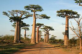
je compte partir au mois de mars à Madagascar et suivre la RN7 jusqu'à Anakao. Entre ces 2 sites, j'ai une super envie de m'arreter plusieurs jours dans le parc de l'Andringitra. Par contre, j'aurais besoin de conseil pour la logistique. J'ai vu qu'il était possible d'organiser un trek à partir avec l'aide d'un guide d'Ambalaveo. Est ce qu'une personne aurait des noms à me recommander ? J'aimerais bien aller jusqu'en haut du pic Bobby, il faudrait combien de jours ? Est ce que vous avez une idée des tarifs (sachant que je serai seul) ? question bête : quoi faire de mon sac à dos avec toutes mes affaires : je dois l'emmener avec moi durant le trek ? Enfin, comment rejoindre Isalo après avoir terminer le trek ?
Merci beaucoup pour votre aide
A bientot Olivier
Salut Olivier
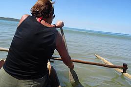
L'Andringitra a été l'un de mes plus beaux moments sur l'ile. J'y suis allé en 2003 avec ma douce, ce qui fait que mes info datent peut être un peu. A l'époque, nous avions affrété un taxi brousse pour rejoindre le camp du WWF (qui est peut être passé sous la bannière Angap maintenant). De là, nous avions plein de guides à notre dispo, avec une chouette mabiance, nous sommes aprtis avec Franklin, un type extra qui nous a appris plein de trucs sur le coin, il est prof (donc dispo uniquement pendant les vacances scolaires). Les tarifs étaient peu élevés, même pour une personne seule, entre 3 et 10 euros par jour peut être (les tarifs vaient en fonction de l'éloignement du camp de base). Nous n'avons pas grimpé sur le pic bobby mais rejoint le camp Catta via le lieu dit de l'extraterrestre, une balade vraiment mangifique en 3j/2 nuits peinards et la vallée où se situe le camp Catta est superbe, bien que eux qui le tiennent sont assez désagréables. Comme nous ne revenions pas sur nos pas, nous avions pris 2 porteurs avec nous, cousins de Frankilin, ce qui fait qu'il y avait une chouette ambiance le soir au bivouac (prix des porteurs moins chers que ceux du guide). Par contre, un conseil, acheter sa nourriture à Ambalavao avant de partir avec pas mal de fruits, il y a moins de choix là haut. Il y a un bureau du wwf/angap à Ambalavao aussi. Pour rejoindre l'isalo, il faut te faire conduire sur la rn7 et de là chopper les taxi brousse du matin (ou bien te faire recondurie à ambalavao), soit tu prévois un taxi brousse à l'avance depuis ambalavao pour qu'il vienne te chercher (voir avec d'autres voyaeurs pour partager) ou profiter d'une navette de catta (pix sur leur site ou dnas le lp).
Bon voayge
j'ai parcouru le parc de l'andringuita au mois d'octobre par les deux entrées. Côté Camp Catta et pic Bobby avec son ascension.
Les deux sont différents et magnifiques. Plusieurs possibilités s'offrent à toi. Te rendre sur place par tes propres moyens en taxi brousse. A Ambalavao, tout le monde te dira que c'est impossible car tout le monde voudra t'ammener en voiture ou 4*4 pour un prix pas croyable. Mais des taxi brousses font le trajet, mais pas tous les jours. Pour arriver au Camp Catta, faut prendre un taxi brousse qui te laisse au village, puis marcher 2 heures encore. Possibilité de camper là bas. Pas d'obligation de prendre un guide ensuite sur place.
Pour le pic Bobby, un taxi brousse t'ammène au refuge de l'ANGAP. Là bas, tu dois prendre un guide de l'ANGAP. Peu parlent correctement le Français, mais ils sont de bons montagnards.
L'option que j'avais choisi: A Ambalavao, on s'est retrouvé à trois routards et on a rencontré Jean Baptiste, que l'on peut trouver à la boulangerie Patisserie. Il parle très bien le Français, et il connait bien le parc. Il peut tout organiser, avec les transports locaux, la bouffe, les tentes. Pour le côté camp catta, il était notre seul guide. Pour le pic Bobby, on a pris un deuxième guide de l'ANGAP, Jean Marie, un des pionniers, un homme d'une grande sagesse.
Jean Batiste a vraiment des tarifs très honnêtes et il est super pro.
Voilà, on a mis une journée à récupérer toutes les infos correctes, et à tout organiser. Pour le pic Bobby, j'ai mis 10 minutes...j'avais juste à trouver d'autres routards pour partager avec moi!
Bonjour
Pas grand chose a ajouter,
2 sites de départ pour les treks : camp parc WWF (piste depuis Ambalavao vers Sendrisoa)
camp Catta (piste partant depuis la RN7 bien au Sud d Ambalavao)
Les 2 sites sont reliés entre eux directement uniquement par des chemins pedestres.
Accès possible comme dit en taxi brousse (attention les jours), voiture de loc independante ou par intermédiaire de Camp Catta (uniquement le camp Catta bien entendu, a voir sur leur site internet)
Pour le pic Boby, simple, se fait sans pb en 2 jours en faisant depuis le camp WWF les circuits DIAVOLONA et PIC BOBY (demander au guide de faire les 2 en meme temps), cela permet de voir la diversité des paysages, de longer la barre rocheuse, de traverser vraiment le parc. Uniquement le pic Boby c est dommage.
Effectivement prendre la bouffe a Ambalavao ou Fianar c est selon. Attention pas de porc, la zone est fady kisoa (tabou porc) en raison des cascades sacrées, le porc n est théoriquement pas le bienvenu.
Voila mais je repete ce qui a deja ete dit. De mon point de vue Andringitra, un des plus beaux coins de Mada, encore assez peu fréquenté, a faire donc.
Avec ma femme nous y sommes allés en octobre 2005, malheureusement tout le plateau au pied du pic boby avait brûlé!!! tout était noir. Je ne sais pas si ça a bien repoussé depuis.
La région est superbe! Faire attention au guide a Ambalavo, car il y en a qui demande des prix de fou. Nous on a été en véhicule jusqu'à l'entrée du parc où nous avons pris un guide du village. Très bien!
Le voyage est le meilleur moyen pour s'évader du monde du travail et pour se ressourcer!!!
Pour rejoindre Isola pas trop dur taxi brousse tu en as pour 5 heures environ. Je te donne les coordonnées d'un guide qui s occupe de tout, qui est formidable. Lui il t emmene dans les parcs que tu veux faire et voir.
Santos : +261320244256 mail : santostrekking@yahoo.fr
Salut Candy,
je voulais tu préciser que tu disposes de toutes les informations dans les précédentes réponses qui ont été postées sur ce forum. Je profite de l'occasion pour remercier tout ceux et celles qui m'ont communiqué leurs conseils.
A bientot sur les routes
Olivier
Bonjour à tous
Je reviens d'un séjour à Madagascar et je me suis arrêté quelques jours dans le parc de l'Andringitra...Surement un de mes meilleurs souvenirs!!! En arrivant en Taxi-brousse à la gare routière nord d'Ambalavao, vous ne pourrez pas louper le local de Jean Baptiste (on en parle plus haut) qui est au milieu de la gare "JB TREKKING" ca s'appelle. Il est tres pros et propose des prestations tres bon marché pour le camp catta...n'hésitez pas, bonne équipe, bonne ambiance dans un cadre plus que merveilleux et il s'occupe de tout meme si vous n'avez pas de tentes ect.... A ne pas louper !
Bon Trek a tous
Après de nombreuses lectures sur le forum et d'un guide bien connu, je pense pouvoir tirer certaines conclusions et je souhaiterai en avoir confirmation par…
"Nous recherchons des coéquipiers (ères) pour un périple à Madagascar à l'automne 2012 vers le massif du Makay et la rivière Mangoky. (équipe de 4/6 personnes…
Je pars pour 3 semaines à Mada en juillet et je souhaite faire un passage de qq jours dans l'andringitra. J'ai vu qu'il y avait 2 possibilités d'entrées, soit…
Connais déja mada mais pas du tout le Nord de l'ile est j'aurais aimé avoir des infos sur la péninsules de masoala en vu d'un treck d'environ 15 jours avec un…
Bonjour,
Nous souhaitons faire le trek de 4 jours reliant Mestia à Ushguli sans agence. Il est précisé dans les descriptifs qu'il existe des hébergement à chaque étape, mais on ne trouve pas d'info sur ces hébergements. Quelqu'un a-t-il des infos et un avis sur ce parcours?
We're planning to trek in Peru and Bolivia and would love to find some local agencies.
If you know any, could you share details on prices and, of course, the names of the agencies?
Which trek would you recommend?
Elocine
Je pars en autonomie totale sur un trek au Maroc (10jrs) Imilchil - Aghbalou.
Trouve t-on des cartouches gaz à vis (Coleman, Primus) à Marrakech (adresse) ou villages entre Imilchil - Aghbalou ?
Si non , trouve-t-on des cartouches Butagaz pour camping-gaz (petit volume 230 gr ...)
Merci d' avance pour vos réponses
Hello, I’d like to embark on a little trip in my home country, Switzerland. I’ll start walking from La Cure, heading toward Le Noirmont first, then I’ll improvise my route—but it’ll probably follow the French border... at least as far as Lac de Joux.
I’ll decide day by day how much farther to go after that. My goal is to stay in nature as much as possible, wander around for as long as I can, and restock food in villages or towns along the way.
I’m thinking of mostly camping, but we’ll see if I end up in a hotel or another campsite depending on my route.
I’d love to reach La Chaux-de-Fonds on foot... maybe even Delémont.
The whole thing should take about a week, give or take.
I’ll be bringing my dog, and I’m preparing for this as soon as I’m ready.
Any tips to make sure everything goes smoothly for us? Things I should know—or avoid? What about shepherds with their flocks of sheep? And isn’t hunting season open right now?
I’m not sure if what I’m planning is even doable, which is why I’m asking around.
This’ll be my first time doing something like this—wandering in nature *and* with a dog. I’m really excited for this adventure... and I need it. Thanks!
We’re really keen on ecosystems and want to hike in "natural" ancient forests—not planted woods or areas heavily degraded by human activity. Travel guides (like Lonely Planet) don’t provide much info on this. Could you point us to the most interesting spots?
Thanks in advance for your tips.
We wish you happy holidays and a fantastic 2026, full of discoveries!
Claire and Albert
Hi, this might not be the right section, but I’d like to know if it’s possible to start mountaineering with another person without necessarily hiring a guide. We’ve done quite a bit of hiking but not mountaineering—we’ll just do a half-day glacier course. After that, we were thinking of starting with La Grande Motte and the Pointe de la Traversière, which were recommended to us. Honestly, for things like roping up and knots, I’ll learn at home with lots of videos and a book.
Hi,
I don’t know Switzerland at all and was wondering if Vallée des Joux and especially Dent de Vaulion are packed early in the morning or late in the afternoon in July and September?
If so, do you have any quieter spots to recommend in the area, or in Luxembourg (yes, I know it’s not the same country 😉)?
Thanks a lot!
Jaimerais savoir si quelqu'un aurait fait des treks sur le Ruwenzori et combien ça coute en moyenne, les infrastructures, les paysages la sécurité sur les lieux, merci beaucoup. J'attends avec impatience vos réponses.
We’re leaving in 9 days for a two-week trip to Madeira, mainly to hike.
From my research, I’ve found that since last year, access to most trails—and systematically for the most popular ones—is now paid. You have to pay an access fee of 4.50 € per person per classified hike in 2026, and even 10.50 € for the most iconic hike: Pico Arieiro to Pico Ruivo. When paying, you also have to choose a day and a 30-minute time slot for your start time. Of course, this reservation is neither changeable nor refundable, even if the weather that day is terrible.
Personally, given the massive influx of tourists to the island in recent years, I don’t mind paying a fee to help maintain the trails. Similarly, setting a limit on the number of people who can hike them per day is certainly preferable to preserve this priceless heritage.
However, what’s much less fair is that in reality, most of the available spots are reserved: 1/ for Madeira residents (which is normal); 2/ for "economic operators" (meaning local tour operators). For example, if you’re a non-resident (independent tourist), no booking is possible for the Pico Arieiro hike for an early morning start before September! So, unfortunately, we’ll have to skip this hike.
It’s the same issue for Ponta de São Lourenço, the 25 Fontes, Pico Ruivo... in short, all the most popular hikes. Oh well, we’ll skip those too!
So my question is: which hikes do you recommend where we won’t face the huge crowds that the others get? And where we can book the day before for the next day, taking the weather into account?
Finally, a quick accommodation question: we’ve booked the first week in Funchal, but I haven’t decided yet for the second week. Do you have any advice on where to stay in the south or north, preferably avoiding overly concrete-heavy and touristy spots?
I’m reposting about the logistics for Samaria Gorge.
I’d love to get recent info, especially about whether it’s possible to park my car in Omalos, do the hike, and then catch a bus back to my vehicle.
In theory, it’s doable, but when you check the KTEL website, there aren’t any feasible schedules listed. If anyone has recently organized this with reliable, verified details, I’d really appreciate it. Thanks in advance!
Hi there,
We’re flying from Montreal to Lyon this August to go hiking in the French Alps. We’ve rented a car and will be staying at campgrounds. We’re planning to do day hikes and want to stay a few days in one spot, do a few hikes, then move on to our next camping spot. Could you share your favorite spots or any recommendations for places to spend a few days with great hikes?
A few details:
We arrive in early August and leave in early September.
We’re looking for day hikes (or shorter), moderate difficulty, with a cumulative elevation gain of no more than 1000m, and of course, beautiful scenery!
We’d prefer not to drive too much—maybe it’s best not to head too far south and deal with unnecessary heat?
Along the same lines, if you know of any great campgrounds where we can start our hike directly without needing the car, we’d love to hear your suggestions!
Bonjour
Souhaitant faire de la randonnée sur cette île, je voudrais d'abord savoir quelle serait la période la plus favorable sachant que j'avais passé quelques jours en novembre 2018 pas pour cette activité mais plus pour une simple découverte de l'île et le temps n'était pas top notamment en montagne. Donc peut on choisir une organisation en étoile sachant que je louerai un véhicule avec éventuellement 2 points d'hébergement.
Je n'envisage pas d'intégrer une structure mais de partir à 2 et de s'organiser sauf si vous me conseillez une agence locale ou un guide local. Enfin même si je compte me procurer les différents supports, carte et topo guide plus gps je vous remercie de bien vouloir me communiquer les randos à faire en priorité
Merci beaucoup pour vos informations
I’m planning to do the Mercantour crossing following the Randoxygène route in mid-July.
I’m used to hiking in the mountains, but I sometimes get vertigo, for example on ridges with drops on both sides. I wanted to check if there are any T4 or T3-T4 sections and find out if there are any very exposed passages—and if so, where—so I can plan an alternative route.
Can anyone give me some info on this?
Thanks!
I’m planning a trip around Cap Corse and the AGRIATES in 2026, from May 8th to 15th (there are still 2 spots left, by the way! Just DM me if you're interested).
I’d love to know which hikes are worth prioritizing in the AGRIATES. We’ll be staying in SALECCIA for two days as our base—what should we focus on from there?
A round trip to IGNHU beach? Any other suggestions?
For Ostricano, I think it’s too far for a round trip...
Thanks for your tips!
Have a great day,
Anie, Toulouse
I’d like to get some info about the GR10 Pyrenees traverse. I need help planning the daily stages and accommodations—my wife isn’t an experienced hiker but walks a lot, so I’d like to schedule shorter walking days and thus a longer overall trip in terms of number of days.
Could anyone give me some help and advice?
Best regards,
New to this forum, I’m planning a pretty big project for 2028.
I’m heading to Nepal to do a trek from Kathmandu all the way to Everest Base Camp (a cool 5,300 m 😄).
This trek is a bit special because even though I’ll be part of a group, I’m going solo (so far, no problem—I’m used to it). But it’s my first real trek, and it’s also a humanitarian one: once I reach base camp, I’ll stay an extra week to help clean up the waste left by tens of thousands of climbers! Since I’m originally from South America, from two countries that share the Andes, I have a deep respect for mountains—they fascinate me. So Everest… it’s kind of the trip of a lifetime!
So, a little question for those who’ve done treks to Everest before… any tips for good mental preparation (I’m already working on the physical side)?
Hi there, I’m planning the Annapurna Circuit for March 2027 and I’m looking for a local agency with a local guide—preferably French-speaking—to arrange this trek for us. Any suggestions? Thanks
Hello!
We’re spending a few days in Toraja country at the end of May. We’d love to do a day trek—taking our time—on a route that’s stunning in terms of scenery, but not a level 5 in difficulty!
Any suggestions you can share, please?
Thanks in advance
I’d like to do the Mare a Mare Sud in May over 4 days. I’ve found quite a few places to stay along the route, but I’m stuck on the start and finish.
I’ll be arriving by plane on Sunday evening and would like to start pretty early on Monday morning. Ideally, accommodation right at the trailhead (Alzu di Gallina) would be amazing, but I can’t find anything. Any tips?
Also, for the transfer from Figari Airport to Porto Vecchio or Alzu di Gallina?
At the end, I’d like to pick up a rental car—any advice on that too?
I’m traveling solo by plane to Catania in May and plan to hike the northern side of Etna, starting from Linguaglossa where I’ll arrive by bus. After that, I’d love some info on how to get up to Piano Provenzana (shuttles or hitchhiking), since it seems there’s no public transport except in the summer. Can you sleep there in a free or cheap refuge, or camp? And how far up can you go without having to hire a guide? Thanks in advance. Bernard.
Bonjour a tous,
je pars en voyage au Maroc en aout et nous allons commencer par nous arrêter a Chefchaouen(nous sommes en voiture).
Ma question: quelqu'un peut il m'indiquer un itinéraire de rando en boucle d'entre 5 et 7 jours aux départ de Chefchaouen dans le parc de Talassemtane passant si possible par le pont de dieux?Ou un guide papier qui en reunis quelques uns?
Nous privilégions le camping sauvage et les gites.
Merci d'avance
Hi there, for those who’ve been recently—is it possible to find other solo travelers in March on the island to share transport or room costs? It doesn’t seem easy to travel on a budget.
If you have any recommendations for simple lodgings or places with dorms, I’d love to hear them.
For those who’ve done multi-day treks while moving around: do you need to bring your own sleeping bag? I’d love to hear about itineraries you’ve done without a guide, just with a map and GPS.
Thanks, and have a great day!
Hi everyone!
We’re planning a 15-day road trip to Scotland this summer, specifically to explore and hike on Lewis and Harris—places we’ve never been before. We’ve visited other islands on previous road trips in Scotland (we usually go in April for a week). This would be our first time in Scotland in the summer and for 15 days. We’re looking at late August to early September.
I’m currently drafting the itinerary. We’d be crossing from Ullapool and were thinking of spending 3 nights on Harris and 4 nights on Lewis.
Does that sound balanced to you? Is it better to keep the same accommodation on Harris and the same on Lewis to explore the area? I’d love to hear about any past experiences you’ve had on these islands.
Thanks!
Hi there, I’m trying to leave for 15 days very soon to São Vicente. I’m either looking to join an agency or figure things out on my own to go hiking on one of these islands or both. From what I’ve seen, it’s not easy to organize with local transport, so it gets expensive. Can I use the services of a small local agency? I’m looking for the simplest way to hike for several days. Also, how do you get from São Vicente to São Nicolau? Thanks in advance and have a great day!
Aichatou
I’ve been wanting to do this for several years, and this year’s the one. Next September, I’ll be trekking in Tusheti (Georgia), from Omalo to Shatili.
Of course, I won’t be renting a vehicle that’d just sit unused. No problem getting to Pshaveli, but from there to Omalo, it’s a dirt road (still the case?)
There must be some form of public transport since there are so many guesthouses, and not all travelers come in a 4x4.
If any of you have been to Omalo, could you confirm that these shared transports exist and how often they run?
we’re planning a trip to Yellowstone and hoping to do a three-day backcountry hike if we get a permit.
if any of you have done this before, could you let me know if it’s possible to find water along the way? And if we can transport it, are we allowed to use a stove?
Hello,
I’ll be in Nepal from March 6th to 29th (we’re flying into Kathmandu via Varanasi and leaving via Delhi).
I’m a bit confused about the regulations requiring a guide.
My wife and I (we’re 63 and 64) aren’t experienced trekkers—we’re more used to walking on terrain with very moderate elevation changes. I’m looking for fairly easy hikes, possibly day trips.
Here are my questions:
- Does the Poon Hill trek from Pokhara require a guide, or is it better to go through a local agency? (I’ve seen a lot of them offering 4-day packages)
- I’d like to do a few multi-day hikes around Jomsom (Kagbeni, Mukitinath, Lupra, Marpha)... Do you need a guide for those, and can you find accommodations easily without booking in advance?
Last question—I’m really hesitant to lug around a sleeping bag or down jacket during our 6 weeks in India. Can you easily find these kinds of items at reasonable prices in Pokhara?
Thanks in advance for any tips you can share!
Yann