Bonjour,
Je vais au maroc pendant 15 jours, je voudrais savoir s'il était possible de faire des randos dans le haut atlas sans guide, et pour cela s'il existait des cartes et itinéraires pour ne pas partir non plus comme des narvalos..!
Je voudrais que ces randos me servent à me déplacer de villages en villages sans revenir par le point de départ....merci à ceux qui pourront m'aider!
Très bonne question, je me la suis posée pendant très longtemps : je pars aussi randonner dans l'Atlas début septembre.
Tous les guides que j'ai lu (Routard, Lonely Planet, Géo) s'accordent sur le fait qu'il vaut mieux un guide pour se genre de rando car :
Les cartes ne sont pas très fiables, souvent pas mises à jour. Pas facile de se réaprovisionner en route à moins de faire un cricuit qui suit les souks dans les villages (planning des souks dans le GTAM Grande Traversée de l'Atlas Marocain à demander à l'office de tourrisme marocain à Paris) ou de connaitre la région et l'arabe. Donc, ca fait beaucoup à proter si tu pars avec toute la nourriture + matos pour une semaine. Le guide part souvent avec un muletier pour porter ce qui est lourd. Le circuit est d'autant plus intéressant si tu prends un bon guide car il a souvent de la famille dans la montagne et peut te faire rencontrer des gens.
En tout cas, moi j'ai choisi de partir avec un guide. C'est vrai que si tu es tout seul c'est pas forcément le mieux. Du coup on est entrain de consituer un groupe pour rendre la rando + sympas (ya encore de la place).
Si tu veux j'ai contacté un guide qui a l'air bien, si tu pars après le 16 spet, je te dirais comment c'était
Sinon, je connais un membre de VF qui pars seul. Mais il connais déja le Maroc et parle l'arabe (ses parents sont marocains). Je crois qu'il a trouvé un circuit. Il pourra peut etre te conseiller pour partir sans guide. je lui dirai de te répondre.
Si quelqu'un à d'autres réponses à m'apporter, je suis toujours preneuse !
Bon séjour en tout cas
La terre n'est pas un don de nos parents, ce sont nos enfants qui nous la prêtent
Merci Elsa d'avoir pris le temps de me répondre....
Je pars également début septembre pour quinze jours.
J'arrive et je repars d' Agadir...et pendant ces quinzes jours je voudrais faire tout un périple du haut atlas jusqu'au nord du maroc puis redescendre par la cote vers agadir....
Faute d'argent et de temps, il sera assez difficile de faire un treck ou des randos de groupe...mais il est vrai que toute seule, je vais avoir du mal à me réapprovisionner!
Je crois que je vais improviser sur place!
Dis moi toujours ce que tu comptes faire la bas, avec quelles organisations, je verrai si cela peut etre réalisable...
Sinon bon voyage! On se croisera peut être!
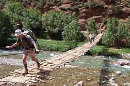
J'ai fait 3 randonnees dans le haut Atlas sans guide, Toubkal et 2 x massif du Mgoun. Dans ce dernier massif, bon reseau de logements agrees chez l'habitant + repas(tous repris dans une doc). Cartes genre IGN achetees a Bruxelles, excellente qualite. je suis en voyage, je n'ai pas ma doc avec les references, donc je ne peux vous aider plus. Mais allez-y, pas de problemes.
Bonjour, je pars dans l'Atlas au mois de septembre. J'aimerais faire de la rando dans la région du M'goun, sans guide si possible. Où y-a-t-il moyen de se procurer des cartes à Bruxelles? Merci!
Randonner sans guide ca se fait tres bien dans l Atlas maintenant, toute seule c est peut etre quand meme un peu craignos au niveau securite. Les chemins sont pas toujours super super et tu es assez vite loin de tout. Le ravitaillement n est pas le plus complique car dans le moindre bled tu trouve une epicerie. Voila, en meme temps je ne suis alle la bas qu une suele fois et avec quelqu un du pays donc je ne suis pas du tout expert. C est un point de vue parmi tant d autres.
salut! Où as-tu trouvé tes cartes? Je pars samedi matin pour Marrakech et j'aimerais faire de la rando dans le massif du M'Goun et dans le massif de Siroua. Etant étudiant, mon budget est (très) fort limité., Crois-tu qu'il est possible d'y partir à deux, sans guide? Y-a-t-il des possibilités de logement ou la tente est-elle la meilleure solution? Quid pour l'eau potable? Comment trouver les bons itinéraires? Je vais voir chez Anticyclone des Acores ce matin pour des cartes mais j'ai peu d'espoir.
Si jamais tu es à Bruxelles avant samedi, est-ce que je pourrais t'emprunter tes cartes et les photocopier?
D'avance merci pour ta réponse!
Olivier
Bonjour,
Je viens de trouver ton message, et même s'il n'est pas de la première fraîcheur il m'intéresse vivement en effet j'envisage de faire une rando au Maroc mais je suis au tout début de la réflexion : guide ou pas ? la doc ( quels documents fiables ) quelle région ? exite t il des topos guides etc
Pourrais tu me donner quelques tuyaux ?
Merci beaucoup
Alain
J'ai fait plusieurs randonnees au Maroc sans guide. Il y a de bonnes cartes topographiques (pour le massif du Toubkal, par ex.). Pour le Mgoun, j'ai un topo guide mais il pourrait bien etre epuise.
salut, je mappel william, et je souhaite vaganbonder au maroc en juin (trop chaud?!), soyons bref jai lu qu'a l'epoque tu comptais trecker a la fois dans le massif du mgoun et celui du siroua. je souhaite aussi my rendre alors ma question decoule de suite: comment sest déroulé ton périple ? As tu profité des services d'un guide local ou bien etais tu en autonomie total, si cest le cas comment t tu debrouillé pour le ravitaillement, est ce relativement evident ? As tu trouver une bonne carte (si tu as la référence ya moyen que tu me la communique) et enfin comment as tu agencé ton circuit pour enchainer coup sur coup ces deux massifs? De façon général as tu bien kiffé ces regions et combien de temps cela ta pris pour realisé ton séjour. Vooooilaaaaa bcp de questions énoncé de façon bordélique je te l'accorde mais si tu pouvais m'aider par ton expérience, ça serai genial, merci d'avance!!
Salut J ai fait Agadir essaouira a 2 sans guide 200 km en 9 jours.sans carte.Puis tout seul en autonomie complete Imlil setti fatma(sans carte), La vallée des AIT bougemez, le Toubkal(sans carte) jusquau refuge, la riviere Mgoun de tabant a Boulemane(avec carte acheté a l hotel Ali a Marrakech 20€de mémoire).La vallée des rose( sans carte) et Le djebel Sarho avec un muletier 40€ pour 3 jours.C est possible de randonner seul quant tu reste sur les chemins qui vont de village en village et qui sont utilisé par les muletiers.je voyage avec tente rechaud multi carburant duvet matelas auto gonflant un minimum de fringue mais tres chaude, riviere Mgoun en janvier il fait tres froid.et des cachet pour l eau.Dans certain village tu pourra dormir dans des gites et amelioré l ordinaire a la petite epicerie.Car le hyophilisé ça va un moment!!!!.Cela dit méme si c est un peu dangereux j ai ttoujours croisé des locaux dans ma journée.C est une experience qui permet d"e bien se connaitre et qui amene beaucoup de respect de la parts des Marocain.VOILA ET N HESITE PAS A TENTER L AVENTURE.Patrice
Bonjour
Je viens de rentrer d'un séjour dans l'Atlas.
J'y ai effectué la grande traversée de Bouguemez à Imlil et même un peu plus .
Je ne suis passé ni par une agence en France ni par les services d'un guide marocain.
La seule contrainte est de trouver un muletier qui connaisse le parcours.
La plupart des muletiers de Bouguemez travaillent pour des agences et ont un jour ou l'autre
effectué tout ou partie de ce parcours.
Il suffit de bien se mettre d'accord sur leurs connaissances avant le départ.
Dans le cas ou le muletier ne connait qu' une partie du parcours il est possible de trouver d'autres muletiers plus loin.
j'envisage de faire un raod book avec texte, étapes, lieux de bivouacs, gîtes éventuels, points GPS et photos mais ce sera pour l'automne.
En attendant je peux éventuellement donner quelques infos à ceux qui le souhaiteraient.
Bien sûr ce mode de fonctionnement est valable sur d'autres secteurs à condition toutefois de bien préparer son histoire, cartes, livres et d'emporter tout le matériel de camping, cuisine...
Pour ma part j'emporte une petite tente pour le muletier.
Cordialement
Jean François
Je pars au Maroc avec une amie du 8 au 22 juillet et nous aimerions faire une étape dans le Haut Atlas, nous aimerions beaucoup connaître ton contact pour nous aider dans notre trip...Nous te remercions et si tu as d.autres ti conseils ou suggestions, elles sont tjrs les bien venues.
Bonsoir,
Avez vous fait ce voyage?
Je souhaite faire la même chose en solitaire au mois d'aout et je cherche des infos, témoignages, conseils. Existe t'il des topo guide? des cartes?...
Merci de vos réponses
Nous nous rendons à Marrakech début février. Nous aurions aimé faire une journée dans l'Atlas mais nous avons plusieurs questions: -est-ce accessible à cette…
Je voulais savoir si quelqu'un connait les conditions de neige en ce moment (décembre) du côté d'Anergui (ou Imilchil, ou Taghia): l'idée est de faire une…
Nous partons ce weekend (8 mai 2016!) trekker dans le Haut-Atlas au Maroc et j'aimerais savoir si quelqu'un est sur place pour me parler des conditions…
Qu est ce que vous conseillez pour un trek "leger" (1/2 jours) entre le Jbel Toubkal et le Haut Atlas? En particulier nous avions noté le Lac Ifni pour le…
Bonjour,
Nous souhaitons faire le trek de 4 jours reliant Mestia à Ushguli sans agence. Il est précisé dans les descriptifs qu'il existe des hébergement à chaque étape, mais on ne trouve pas d'info sur ces hébergements. Quelqu'un a-t-il des infos et un avis sur ce parcours?
We're planning to trek in Peru and Bolivia and would love to find some local agencies.
If you know any, could you share details on prices and, of course, the names of the agencies?
Which trek would you recommend?
Elocine
Je pars en autonomie totale sur un trek au Maroc (10jrs) Imilchil - Aghbalou.
Trouve t-on des cartouches gaz à vis (Coleman, Primus) à Marrakech (adresse) ou villages entre Imilchil - Aghbalou ?
Si non , trouve-t-on des cartouches Butagaz pour camping-gaz (petit volume 230 gr ...)
Merci d' avance pour vos réponses
Hello, I’d like to embark on a little trip in my home country, Switzerland. I’ll start walking from La Cure, heading toward Le Noirmont first, then I’ll improvise my route—but it’ll probably follow the French border... at least as far as Lac de Joux.
I’ll decide day by day how much farther to go after that. My goal is to stay in nature as much as possible, wander around for as long as I can, and restock food in villages or towns along the way.
I’m thinking of mostly camping, but we’ll see if I end up in a hotel or another campsite depending on my route.
I’d love to reach La Chaux-de-Fonds on foot... maybe even Delémont.
The whole thing should take about a week, give or take.
I’ll be bringing my dog, and I’m preparing for this as soon as I’m ready.
Any tips to make sure everything goes smoothly for us? Things I should know—or avoid? What about shepherds with their flocks of sheep? And isn’t hunting season open right now?
I’m not sure if what I’m planning is even doable, which is why I’m asking around.
This’ll be my first time doing something like this—wandering in nature *and* with a dog. I’m really excited for this adventure... and I need it. Thanks!
We’re really keen on ecosystems and want to hike in "natural" ancient forests—not planted woods or areas heavily degraded by human activity. Travel guides (like Lonely Planet) don’t provide much info on this. Could you point us to the most interesting spots?
Thanks in advance for your tips.
We wish you happy holidays and a fantastic 2026, full of discoveries!
Claire and Albert
Hi, this might not be the right section, but I’d like to know if it’s possible to start mountaineering with another person without necessarily hiring a guide. We’ve done quite a bit of hiking but not mountaineering—we’ll just do a half-day glacier course. After that, we were thinking of starting with La Grande Motte and the Pointe de la Traversière, which were recommended to us. Honestly, for things like roping up and knots, I’ll learn at home with lots of videos and a book.
Hi,
I don’t know Switzerland at all and was wondering if Vallée des Joux and especially Dent de Vaulion are packed early in the morning or late in the afternoon in July and September?
If so, do you have any quieter spots to recommend in the area, or in Luxembourg (yes, I know it’s not the same country 😉)?
Thanks a lot!
Jaimerais savoir si quelqu'un aurait fait des treks sur le Ruwenzori et combien ça coute en moyenne, les infrastructures, les paysages la sécurité sur les lieux, merci beaucoup. J'attends avec impatience vos réponses.
We’re leaving in 9 days for a two-week trip to Madeira, mainly to hike.
From my research, I’ve found that since last year, access to most trails—and systematically for the most popular ones—is now paid. You have to pay an access fee of 4.50 € per person per classified hike in 2026, and even 10.50 € for the most iconic hike: Pico Arieiro to Pico Ruivo. When paying, you also have to choose a day and a 30-minute time slot for your start time. Of course, this reservation is neither changeable nor refundable, even if the weather that day is terrible.
Personally, given the massive influx of tourists to the island in recent years, I don’t mind paying a fee to help maintain the trails. Similarly, setting a limit on the number of people who can hike them per day is certainly preferable to preserve this priceless heritage.
However, what’s much less fair is that in reality, most of the available spots are reserved: 1/ for Madeira residents (which is normal); 2/ for "economic operators" (meaning local tour operators). For example, if you’re a non-resident (independent tourist), no booking is possible for the Pico Arieiro hike for an early morning start before September! So, unfortunately, we’ll have to skip this hike.
It’s the same issue for Ponta de São Lourenço, the 25 Fontes, Pico Ruivo... in short, all the most popular hikes. Oh well, we’ll skip those too!
So my question is: which hikes do you recommend where we won’t face the huge crowds that the others get? And where we can book the day before for the next day, taking the weather into account?
Finally, a quick accommodation question: we’ve booked the first week in Funchal, but I haven’t decided yet for the second week. Do you have any advice on where to stay in the south or north, preferably avoiding overly concrete-heavy and touristy spots?
I’m reposting about the logistics for Samaria Gorge.
I’d love to get recent info, especially about whether it’s possible to park my car in Omalos, do the hike, and then catch a bus back to my vehicle.
In theory, it’s doable, but when you check the KTEL website, there aren’t any feasible schedules listed. If anyone has recently organized this with reliable, verified details, I’d really appreciate it. Thanks in advance!
Hi there,
We’re flying from Montreal to Lyon this August to go hiking in the French Alps. We’ve rented a car and will be staying at campgrounds. We’re planning to do day hikes and want to stay a few days in one spot, do a few hikes, then move on to our next camping spot. Could you share your favorite spots or any recommendations for places to spend a few days with great hikes?
A few details:
We arrive in early August and leave in early September.
We’re looking for day hikes (or shorter), moderate difficulty, with a cumulative elevation gain of no more than 1000m, and of course, beautiful scenery!
We’d prefer not to drive too much—maybe it’s best not to head too far south and deal with unnecessary heat?
Along the same lines, if you know of any great campgrounds where we can start our hike directly without needing the car, we’d love to hear your suggestions!
Bonjour
Souhaitant faire de la randonnée sur cette île, je voudrais d'abord savoir quelle serait la période la plus favorable sachant que j'avais passé quelques jours en novembre 2018 pas pour cette activité mais plus pour une simple découverte de l'île et le temps n'était pas top notamment en montagne. Donc peut on choisir une organisation en étoile sachant que je louerai un véhicule avec éventuellement 2 points d'hébergement.
Je n'envisage pas d'intégrer une structure mais de partir à 2 et de s'organiser sauf si vous me conseillez une agence locale ou un guide local. Enfin même si je compte me procurer les différents supports, carte et topo guide plus gps je vous remercie de bien vouloir me communiquer les randos à faire en priorité
Merci beaucoup pour vos informations
I’m planning to do the Mercantour crossing following the Randoxygène route in mid-July.
I’m used to hiking in the mountains, but I sometimes get vertigo, for example on ridges with drops on both sides. I wanted to check if there are any T4 or T3-T4 sections and find out if there are any very exposed passages—and if so, where—so I can plan an alternative route.
Can anyone give me some info on this?
Thanks!
I’m planning a trip around Cap Corse and the AGRIATES in 2026, from May 8th to 15th (there are still 2 spots left, by the way! Just DM me if you're interested).
I’d love to know which hikes are worth prioritizing in the AGRIATES. We’ll be staying in SALECCIA for two days as our base—what should we focus on from there?
A round trip to IGNHU beach? Any other suggestions?
For Ostricano, I think it’s too far for a round trip...
Thanks for your tips!
Have a great day,
Anie, Toulouse
I’d like to get some info about the GR10 Pyrenees traverse. I need help planning the daily stages and accommodations—my wife isn’t an experienced hiker but walks a lot, so I’d like to schedule shorter walking days and thus a longer overall trip in terms of number of days.
Could anyone give me some help and advice?
Best regards,
New to this forum, I’m planning a pretty big project for 2028.
I’m heading to Nepal to do a trek from Kathmandu all the way to Everest Base Camp (a cool 5,300 m 😄).
This trek is a bit special because even though I’ll be part of a group, I’m going solo (so far, no problem—I’m used to it). But it’s my first real trek, and it’s also a humanitarian one: once I reach base camp, I’ll stay an extra week to help clean up the waste left by tens of thousands of climbers! Since I’m originally from South America, from two countries that share the Andes, I have a deep respect for mountains—they fascinate me. So Everest… it’s kind of the trip of a lifetime!
So, a little question for those who’ve done treks to Everest before… any tips for good mental preparation (I’m already working on the physical side)?
Hi there, I’m planning the Annapurna Circuit for March 2027 and I’m looking for a local agency with a local guide—preferably French-speaking—to arrange this trek for us. Any suggestions? Thanks
Hello!
We’re spending a few days in Toraja country at the end of May. We’d love to do a day trek—taking our time—on a route that’s stunning in terms of scenery, but not a level 5 in difficulty!
Any suggestions you can share, please?
Thanks in advance
I’d like to do the Mare a Mare Sud in May over 4 days. I’ve found quite a few places to stay along the route, but I’m stuck on the start and finish.
I’ll be arriving by plane on Sunday evening and would like to start pretty early on Monday morning. Ideally, accommodation right at the trailhead (Alzu di Gallina) would be amazing, but I can’t find anything. Any tips?
Also, for the transfer from Figari Airport to Porto Vecchio or Alzu di Gallina?
At the end, I’d like to pick up a rental car—any advice on that too?
I’m traveling solo by plane to Catania in May and plan to hike the northern side of Etna, starting from Linguaglossa where I’ll arrive by bus. After that, I’d love some info on how to get up to Piano Provenzana (shuttles or hitchhiking), since it seems there’s no public transport except in the summer. Can you sleep there in a free or cheap refuge, or camp? And how far up can you go without having to hire a guide? Thanks in advance. Bernard.
Bonjour a tous,
je pars en voyage au Maroc en aout et nous allons commencer par nous arrêter a Chefchaouen(nous sommes en voiture).
Ma question: quelqu'un peut il m'indiquer un itinéraire de rando en boucle d'entre 5 et 7 jours aux départ de Chefchaouen dans le parc de Talassemtane passant si possible par le pont de dieux?Ou un guide papier qui en reunis quelques uns?
Nous privilégions le camping sauvage et les gites.
Merci d'avance
Hi there, for those who’ve been recently—is it possible to find other solo travelers in March on the island to share transport or room costs? It doesn’t seem easy to travel on a budget.
If you have any recommendations for simple lodgings or places with dorms, I’d love to hear them.
For those who’ve done multi-day treks while moving around: do you need to bring your own sleeping bag? I’d love to hear about itineraries you’ve done without a guide, just with a map and GPS.
Thanks, and have a great day!
Hi everyone!
We’re planning a 15-day road trip to Scotland this summer, specifically to explore and hike on Lewis and Harris—places we’ve never been before. We’ve visited other islands on previous road trips in Scotland (we usually go in April for a week). This would be our first time in Scotland in the summer and for 15 days. We’re looking at late August to early September.
I’m currently drafting the itinerary. We’d be crossing from Ullapool and were thinking of spending 3 nights on Harris and 4 nights on Lewis.
Does that sound balanced to you? Is it better to keep the same accommodation on Harris and the same on Lewis to explore the area? I’d love to hear about any past experiences you’ve had on these islands.
Thanks!
Hi there, I’m trying to leave for 15 days very soon to São Vicente. I’m either looking to join an agency or figure things out on my own to go hiking on one of these islands or both. From what I’ve seen, it’s not easy to organize with local transport, so it gets expensive. Can I use the services of a small local agency? I’m looking for the simplest way to hike for several days. Also, how do you get from São Vicente to São Nicolau? Thanks in advance and have a great day!
Aichatou
I’ve been wanting to do this for several years, and this year’s the one. Next September, I’ll be trekking in Tusheti (Georgia), from Omalo to Shatili.
Of course, I won’t be renting a vehicle that’d just sit unused. No problem getting to Pshaveli, but from there to Omalo, it’s a dirt road (still the case?)
There must be some form of public transport since there are so many guesthouses, and not all travelers come in a 4x4.
If any of you have been to Omalo, could you confirm that these shared transports exist and how often they run?
we’re planning a trip to Yellowstone and hoping to do a three-day backcountry hike if we get a permit.
if any of you have done this before, could you let me know if it’s possible to find water along the way? And if we can transport it, are we allowed to use a stove?
Hello,
I’ll be in Nepal from March 6th to 29th (we’re flying into Kathmandu via Varanasi and leaving via Delhi).
I’m a bit confused about the regulations requiring a guide.
My wife and I (we’re 63 and 64) aren’t experienced trekkers—we’re more used to walking on terrain with very moderate elevation changes. I’m looking for fairly easy hikes, possibly day trips.
Here are my questions:
- Does the Poon Hill trek from Pokhara require a guide, or is it better to go through a local agency? (I’ve seen a lot of them offering 4-day packages)
- I’d like to do a few multi-day hikes around Jomsom (Kagbeni, Mukitinath, Lupra, Marpha)... Do you need a guide for those, and can you find accommodations easily without booking in advance?
Last question—I’m really hesitant to lug around a sleeping bag or down jacket during our 6 weeks in India. Can you easily find these kinds of items at reasonable prices in Pokhara?
Thanks in advance for any tips you can share!
Yann